Ronachan Point, located on the Kintyre peninsula, features remnants of an industrial limestone quarry and a 19th-century tramway used to transport materials to a nearby slipway.
Three seams of limestone were being quarried here by 1898 and transported via a tramway to the nearby purpose-built slipway for export. On the ground and from the air the quarries are all visible, as well as the route of the tramway leading up to the pier. There are iron bolts on the pier for the tramway tracks, and iron rings and chains on the north side of the slipway where vessels could be tied up alongside to transport the limestone by sea. On the tramway is a W & T Avery Ltd. Weighbridge. The limestone quarried at this location was probably ground down for agricultural use. A few more photographs can be found here. [6]
I have not been able to establish the track-gauge of the tramway.
The location is mentioned in the SCAPE survey of the coast of the Kintyre Peninsula. [2] The notes included in that survey are provided as an appendix to this very short article below.
A closer view of the short tramway at Ronachan Point, as it appears on the 2nd Edition 25″ Ordnance Survey, revised 1898, (NLS). [3]Another view of the short tramway at Ronachan Point, as it appears on the 25″ Ordnance Survey, revised 1915 and published 1923, (NLS). The tramway has been extended to access a processing building which has appeared on site since the prior survey. [4]The same location on the ESRI satellite imagery provided by the NLS the remains of the pier sit at the centre of this image. [5]
Appendix 1: An extract from the Coastal Zone Assessment Survey of Kintyre by Paul Murtagh, Joanna Hambly – Scottish Coastal Archaeology and the Problem of Erosion (SCAPE) – The SCAPE Trust and the University of St Andrews, November 2024.
A long-lived industrial landscape comprising the remains of historic limestone quarries, a lime kiln and associated coastal infrastructure was recorded around Ronachan Bay and Ronachan Point. The occurrence of limestone in the area was noted in both the Old and New statistical accounts of the parish of Kilcalmonell and Kilberry, in which Ronachan is located, where there was an:
“abundance of limestone … but that there was a scarcity … of coal to burn the limestone.” (OSA 1794; Gordon 1999, 409) and that “there are beds of limestone from north-east to south-west (but of inconsiderable thickness) to be found in several localities in the parish.” (NSA 1845; Sinclair 1999, 62).
The historical Geological Survey of Britain, One-Inch to the Mile map of the region shows that the area around Ronachan had several seams of limestone (Figure 38), and the area appears to have become the focus of extraction for a period in the 19th and early 20th centuries.
Figure 38: Geological Survey of Britain, One-Inch to the Mile, Sheet 20, Killean. Solid and drift edition. Published: 1896 (National Library of Scotland) with limestone seems highlighted in purple. [2: p32]
The early phase of limestone quarrying seems to have been focused near the present-day lodge house. Here we recorded a one-arched, single-draw, stone-built, rectangular lime kiln, around which there are remains of a quarry (SCAPE ID: 16992). The kiln is depicted on the first edition OS map of 1873 (Figure 39) with a coal yard on the present site of the lodge, as well as a track leading down to the beach, where a cleared slipway was recorded (SCAPE ID: 16936), probably used to bring coal ashore for use in the kiln. The kiln appears to have gone out of use by the time the second edition OS map was surveyed in 1898 when it is referred to on the 25-inch map as an Old Limekiln, while the coal yard is built over by the lodge and current house. On the third edition six-inch OS map of 1924 an Old Quarry is also illustrated next to the kiln (Figure 39).
The three map extracts below constitute figure 39. Development of Ronachan limestone quarrying landscape in the 19th and 20th centuries. [2: p33]
Argyllshire and Buteshire CCXXIII.4 Ordnance Survey 25 inch 1st edition Scotland, surveyed 1867, published 1873. [2: p33]Argyllshire CCXXIII.4 – Ordnance Survey 25 inch 2nd edition Scotland, revised 1898. [2: p33]Argyllshire CCXXIII.4 – Ordnance Survey 25 inch 3rd edition Scotland, revised 1915. [2: p33]
Of the three images immediately above, the second two of 1898 and 1915 show the tramway heading towards the sea on the North side of Ronachan Point. Enlarged extracts are included in the article above.
By 1898, three large quarries were being worked at Ronachan Point (SCAPE ID: 16939, Figure 40). They are oriented north-south, following seams of limestone through the surrounding rock. Debris from the quarries lie scattered around the site including large blocks of stone with chisel marks. A track, tramway and jetty (SCAPE ID: 16940) associated with the quarries are depicted on the second and third edition OS Map of 1899 and 1915. The slipway is defined by a rock-cut area with a concrete surface and iron fittings for the tramway extending to the end of the slip. A weighbridge made by W&T Avery Ltd is still in situ on the track next to an area of concrete hardstanding which marks the site of a large building depicted on the 1915 OS map. To the south of this site, at the northern end of Ronachan Bay is another more substantial concrete jetty and slipway with an associated boat house (SCAPE ID: 16989, Figure 41). The track links the concrete slipways at Ronachan Point and Ronachan Bay and it is probable that both were used by the quarry according to the weather and tide conditions. Another cleared slipway and the ruins of a boat house on the eastern side of Ronachan Point (SCAPE ID: 16991) are still used as a small harbour and boat laying up area and is associated with Ronachan House.
Figure 40: Aerial shot of the Limestone quarry at Ronachan point (SCAPE ID: 16939). [2: p34]Figure 41: Concrete Jetty at Ronachan Bay (SCAPE ID: 16989) looking west. [2: p34]
One of the points regularly made by the editors of The Modern Tramway is that given a proper chance to shine modern electric trams are better than internal combustion engined buses. So it must have come as something of a relief to hear, in 1951, that testing had taken place in Switzerland which seems to have supported the argument that the closure of tramway networks would ultimately prove to be a false economy. … [1]
The Modern Tramway reported in May 1951 that:
“The March issue of ‘Der Nahverkehr’ [3] contains an interesting and significant story about the 10-mile interurban tramway from Zürich Stadelhofen via Forch to Esslingen, in Switzerland. This line, known as the Forchbahn, was opened to traffic in 1912, and is operated with 10 motor tramcars, 5 trailers and some goods vehicles. Two of the motor trams are modern bogie vehicles constructed in 1948 by Schlieren & Co. with Oerliken equipment, the other cars are of the 4-wheel type.
“For much of its length the single metre-gauge track is laid in the public highway, an arrangement which the Company have long planned to eliminate by the construction of a private right-of-way. This plan was taken up in earnest in 1950, but the expected high cost of the new construction caused some hesitation among the directors, some of whom wondered whether replacement by buses might not be a cheaper alternative.
It was finally arranged with the Zürich town tramways that the latter should take over the service for an experimental period of 14 days, using buses from the municipal fleet to replace the Forchbahn trams. The period chosen was from 6th to 19th November, 1950. As was to be expected, the buses showed a certain advantage in journey time, as the tramway is single-track with widely-spaced passing loops. In summer, the Forchbahn carries a heavy weekend traffic from Zürich to the country, and in order to test the capacity of the buses in dealing with such traffic, exceptionally low excursion fares were introduced on one Sunday during the test period. Despite rainy weather large crowds were attracted to the service, and the fundamental disadvantage of the bus soon showed itself. Many extra buses were needed, and by comparison with the usual tram-and-trailer units, double the usual staff were required. The overloaded buses fell behind schedule, and even the most modern were overtaken in the Zürich suburbs by elderly city trams hauling trailers. The uneven motion of the buses soon invited unflattering comparison with that of the trams from the many passengers who had to travel standing, for the Swiss are now accustomed to comfortable travel.
“The results of the test showed that the use of buses would involve a disproportionately heavy outlay; additional personnel would be needed, the vehicles would have less than half the effective life of the tram, the goods traffic would no longer be an economical sideline, and the buses would probably have to charge fares 50% higher than those charged on the present trams. These conclusions were not published until after the test had taken place, but the population of the communities served by the Forchbahn had needed only a few days of buses to convince them that the trams gave them the better service. When, fourteen days later, the first trams ran again between Zürich and Esslingen, the citizens hung out flags and decorated the cars with branches and flowers, and in the space usually occupied by the destination board appeared a large placard: “Es lebe die Forchbahn!” The Forchbahn lives again!” [1]
“The conclusion of the experiment was that retaining the line was the best solution provided that the line could be separated from the street and modernized. In the following decade, separation of rail and road traffic was increased. New bogie rolling stock was acquired, similar to two cars built for the line in the late 1940s.” [5]
The Forchbahn is still operating in the mid-21st century. It is a local mixed tramway/railway line in the Swiss canton of Zürich. It is owned and operated by the Forchbahn AG, and is branded as line S18 of the Zürich S-Bahn. The standard Zürcher Verkehrsverbund (ZVV) zonal fare tariffs apply to the line. [5]
Instructive Tram-Bus Experiment in Switzerland; in The Modern Tramway, Volume 14, No. 161, May 1951, p112.
‘Der Nahverkehr’ translates into English as ‘Local Transport’, a Journal with that name is published in the mid-21st century. It dates back to 1983. It is not the journal referred to by The Modern Tramway. For the record, it is a technical and operational monthly journal for all public passenger transport in the city and region. Its target audience includes managers and decision-makers in transport companies, government agencies, associations and corporations, transport science, consulting firms and the transport industry. It is the official organ of the Association of German Transport Companies (VDV) and part of the media offering of Alba Fachmedien ÖPNV in the DVV Media Group. (https://www.dvvmedia-shop.de/DER-NAHVERKEHR/DNV-NA-12-DIGI)
The ‘Der Nahverkehr‘ referred to in the article published by The Modern Tramway was, in 1951, a relatively new journal. The first issue came out in April 1950.
“Udine is the chief town of the north-east Italian province of Friuli and is situated some 80 miles north-east of Venice. Its 70,000 inhabitants are served by the metre gauge tramcars of the Tranvie del Friuli. There are three town services, operated by 18 four-wheel single-deck cars, and two interurban lines, each with its own cars.” [1]
“Horse tramways were established towards the end of the last century, and operated from the Piazza Liberta (then known as Piazza Vittorio Emanuele) to the station (circular) and to Porta Gemona, where a depot was built.” [1]
“An interurban steam tramway was constructed to connect the city with San Daniele, to the north-west. The Udine terminus and depot of this line were connected to the town tramways.” [1]
The Udine to San Daniele Tramway opened in 1889. Its engineer was Adolf Gründorf and it was managed in the early years by the German banker Karl Neufeldt, it was the first (and only) steam tramway in Friuli, although as early as 1924, under the management of engineer Giacomo Cantoni, it was able utilise electric locomotives. [3]
Although officially a tramway, due to its numerous stations and depots, the length of its trains, and the fact that it was often separated from the road, the Udine–San Daniele line resembled a small railway. [3]
None of its locomotives or other rollingstock survived its closure. [3]
Jacques continued:
“In 1908, the town lines were electrified and 14 single-truck cars were purchased; they were built in 1907 by the Electric Company of Milan and had bow collectors. The connecting track between the town system and the San Daniele line was closed at the time of the electrification.” [1]
“During the 1920s considerable improvements were made to the system; cars were overhauled and tracks renewed where necessary, most of the station route being reconstructed with double track, partly on reservation. The Porta Gemona service was extended to Chiavris along the track of the newly-opened electric interurban tramway Udine-Tarcento.
“On 2nd July 1932, an extension of the town tramways was opened on the main Venice road, westwards, on side reservation, as far as San Rocco (via Nervesa); in the following October the line was further extended to its present terminus at San Caterina. On 6th January 1947, the reserved-track line from Chiavris to the Hospital, a branch from the Udine-Tarcento interurban, was opened.
“The present tram fleet comprises the original 14 cars built in 1907 (Nos. 1-14), four cars purchased from Gorizia (Nos. 51-54) and the cars used on the San Daniele and Tarcento lines. All are 4-wheeled except the motor trams on the Tarcento line. The San Daniele interurban tramway is now worked by battery operated motor-cars, although occasionally one of the original steam locomotives is seen. Trailers on this line are closed, with end platforms, and are similar to those used on the former Giants Causeway tramway. The four cars bought from Gorizia are larger than the 1907 class and were built in 1927. They originally ran with central-partitioned saloon and end platforms, but in 1949 and 1950 were rebuilt with folding platform doors and conductor’s seat, and the partitions were removed, ready for ‘pay as you pass’ service.
“The management plan to modernise Nos. 1-14 completely, and the first car to undergo this treatment, No. 13, emerged from the workshops entirely transformed. The ends and roof were removed, as were the partitions between the saloon and the platforms. The longitudinal seats were replaced by transverse single seats. New control equipment was fitted and the exterior and new roof finished in streamline fashion with large windscreens. [1: p107]
The Friuli tramways were an interurban and urban transport network, active primarily in the first half of the twentieth century, connecting Udine with neighbouring towns such as Tarcento and San Daniele del Friuli. Operated by the Società Tranvie del Friuli (TdF) since 1923, these electric lines (often nicknamed ‘white trams’) were crucial to the region’s economic development before road transport became more reliable in the 1950s. [2]
The main tram lines in Friuli were:
Udine-Tarcento Tramway (1915-1955): Also known for its white colour, the line arrived in Tarcento in 1927, quickly connecting the Torre torrent valley to Udine and the railway station.
A vintage photograph showing the “White Tram” in Tricesimo. [3]
Udine-San Daniele Tramway (1889-1955): An important interurban line that connected the capital to San Daniele del Friuli, characterised by a route that acted as a true local railway, operated with accumulator-powered electric locomotives from 1924 onwards.
Udine Urban Network (1887-1950 approximately): Started with horse-drawn traction and then electrified from 1908 thanks to Arturo Malignani and the Friulian Electricity Company, the urban network shared depots and infrastructures with the interurban lines.
In the 21st century, Udine does not have an active tram system. The historic, 1000 mm gauge tramway network, which opened in 1887 and once operated through the city centre (including Piazza Vittorio Emanuele), was decommissioned and closed in 1952. Public transport is now managed by Arriva Udine via an extensive bus network. [10]
When Jacques wrote his short article for The Modern Tramway, little did he know that the Udine tram network had only a year or so before it was closed!
References
Peter J. Jacques; The Tramways of Udine and District; in The Modern Tramway, Volume 14, No. 161, May 1951, p107.
The April 1951 issue of The Modern Tramway featured an article about the Tramways of Auckland, New Zealand. [1]
The featured image for this article (which also appears below) shows a series of older trams on Lower Queen Street, Auckland. [1: p85]
“The Auckland Transport Board operates 44 miles of tramways with 216 cars in New Zealand’s largest city. The system has several interesting features, one of which is that although all its lines are laid on sleepers, there is no reserved track or private right-of-way. The sleepers rest on a base of scoria (lava slag). Another unusual aspect of the Auckland tramways is the free tram service provided since 1936 by the Farmer’s Trading Company for its shop customers. This is operated by the Board with 3 cars on a shuttle service in the main shopping area. The store also provides a free trolleybus service for its customers and the 4 trolleybuses which have worked the service since 1938 were the first in Auckland. Also of interest is the Onehunga tram route which has a 6-minute headway, is seven miles long and is the only ocean-to-ocean tramway in the world, it runs from the port of Auckland on the Pacific Ocean to the port of Onehunga on the Tasman Ocean. it is also probably the only tramway in the world that crosses a country from one side to the other as it traverses New Zealand at the narrowest part. With the exception of two two short stretches on the Westmere and Victoria Avenue routes all the track is double and mostly in wide roads with an adequate number of safety zones (loading islands).” [1: p85]
The Modern Tramway article continues:
“Tramway operation began on 11th August. 1854, …, horse trams were superseded by electric cars from November 1902, onwards, the conversion being effected by the Auckland Electric Tramways Company (registered 22nd March 1889), a subsidiary of the British Electric Traction Company. Six reversed-staircase open-top Brush/English Electric double-deck cars were included in the original fleet, but one of them was involved in a serious accident in 1903. … These cars, which were never very popular because they lurched badly at speed and came dangerously near the centre poles, were gradually converted to single-deckers, and were all scrapped in 1948, except No. 38 which has been in use as a rail-grinder since 1936. On 1st July 1919, the tramways were purchased by the City Council for £1,227,201. The Auckland Transport Board, an elective body comprising representatives from all parts of the metropolitan area, came into being in 1928 and took over operation of the tramways from the Council on 16th January 1929.” [1: p85-86]
From 1902 onwards, Auckland’s electric tramways formed the backbone of its public transport network. They were preceded by Horse-drawn trams and later by steam-powered trams.
Wikipedia indicates that the first steam-powered trams in Auckland operated in 1871. [6] The electric trams which replaced the horse-drawn and Steam-powered ones, “were fast, smooth and capable of running an incredibly frequent schedule. Aucklanders loved them, and patronage boomed. In 1903, the first full year of electric tram service, Aucklanders boarded their trams 13 million times. Yet 15 years later, in 1918 that figure had exploded to 44 million passengers per annum, and tram routes had expanded to cover … most of today’s inner-city.” [4]
“In 1926, Aucklanders made 63 million trips by tram despite the total population of Auckland City only numbering about 90,000 people. (Compare that to 2018-19’s 100.8 million public transport boardings – Auckland’s highest since 1951 – from a population of almost 1.7 million!) Similar figures were recorded at the end of the 1930s, even when the effects of the Great Depression were still being felt.” [4]
This diagrammatic map shows the extent of the historic tramway network in Auckland. It served the city from 1902 to 1956. [5]
The April 1951 article continues:
“Three routes in the north-west corner of the city have been selected for experimental trolleybus conversion; they are Herne Bay, Richmond Road and Ponsonby, the last-named being the original electric line. The Herne Bay trolleybus service began on 24th September, 1949, but the other routes have not yet been converted.
“All cars now in service are bogie single deck saloons fitted with air-brakes and two trolley-booms. They move the crowds very effectively as they are capable of carrying a total load of 100 passengers. The normal standing load is 7 on each platform and 24 more inside. The average speed including stops is claimed as 11 m.p.h., and running speeds of 25 m.p.h. and above are not unusual. The livery is bright red, unlined, with buff window frames. Most Auckland cars have a profusion of windows; some cars have as many as 36 and even the latest car, built in 1940, has 26. Another characteristic feature of the Auckland trams are the indicator boxes; there are no service numbers, but each car carries four indicator boxes arranged in pairs at each end of the car, in the form of a V. The movement of the blinds in each pair of boxes is synchronised and controlled by a single wheel. The cars can be entered from front or rear.
“The fleet numbers 66-69 were allocated to 4 cars sent out from Britain in 1907; these cars would have been old friends to any North Londoners, as they were none other than four representatives of the famous Metropolitan Electric Tramways class E single-deckers. They were shipped to New Zealand complete, and on arrival London tram tickets were still on the floors! They retained their Metropolitan livery of red and cream and were always painted red until they were scrapped in 1921; because of this they were known as ‘the Lobsters’. As will be seen by the photograph, certain alterations were carried out in Auckland: at a later date they were mounted on double bogies. Two were sold to Napier, but owing to an earthquake which destroyed that city and it’s tramway system, they never saw service in their third home.” [1: p86-87]
Auckland Electric Tramways Company No. 66 (Ex-Metropolitan Electric Tramways) which was scrapped in 1922. [1: p86]
The Hawke’s Bay earthquake, also known as the Napier earthquake, occurred at 10:47 am on 3rd February 1931, “killing 256, injuring thousands and devastating the Hawke’s Bay region. It remains New Zealand’s deadliest natural disaster. Centred 15 km north of Napier, it lasted for two and a half minutes and had a magnitude of 7.8 Ms (7.7 Mw). There were 525 aftershocks recorded in the following two weeks, with 597 being recorded by the end of February. The main shock could be felt in much of New Zealand, with reliable reports coming in from as far south as Timaru, on the east coast of the South Island.” [2]
“Nearly all buildings in the central areas of Napier and Hastings were levelled. … The material damage of the earthquake was estimated at $960 million. [3: p140] … The local landscape changed dramatically, with the coastal areas around Napier being lifted by around two metres. The most noticeable land change was the uplifting of some 40 km2 of sea-bed to become dry land. This included Ahuriri Lagoon, which was lifted more than 2.7 metres and resulted in draining 3,600 hectares (9,000 acres) of the lagoon.” [2]
Returning to The Modern Tramway piece, the image below was included in that article it shows a number of the bogie trams used on the Auckland network through to its closure.
Older tramcars of the Auckland Transport Board in Lower Queens Street, Auckland. Of the two trams most prominent in the image, Tram No. 180 is a four-axle ‘combination’ bogie tram. These were a standard design for Auckland, featuring a central enclosed section and open ‘smoking’ sections at either end. Tram No. 173 is also a four-axle bogie tram, often associated with routes like Ponsonby or Westmere. [1: p85]
The two trams prominent in the image above survived through to the closure of the network at the end of 1956. No. 180 appears in the next two photographs which were taken on the same day in 1957, a few months after closure.
“The most modern Auckland trams are the ‘1937’ class, actually built between 1938 and 1940. These have E.M.B. lightweight or Brush trucks, four 35 h.p. Metropolitan Vickers motors and A.T.B. bodies. One of these cars, No. 253, built 1940, is fitted with regenerative braking and an M-V master controller (the others have General Electric K 35 HH controllers) and, known as ‘Queen Mary’, is the fastest and most modern tramcar in New Zealand. The graceful lines of these cars are unhappily disfigured by the ugly indicator boxes, the excessive number of small windows and the advertising boards carried on each side of the roof and dash.” [1: p87]
Auckland Transport Board Tram No. 247, built in 1938. [1: p87]Auckland Transport Board Tram No. 253, built in 1940 and equipped with regenerative braking. [1: p87]
The two images above show two members of Auckland’s “1937 Class” Streamliner trams. All six of this Class were all built between 1938 and 1940 at the Royal Oak Workshops. They were the final, most modern tram design for the city, featuring distinctive bulbous sides, rounded ends, 27″ wheels and 4-motor bogie trucks. Six were built, including the renowned ‘Queen Mary’ (No. 253), which was a testbed for modern regenerative braking and high-speed performance. [9] Nos. 248 and 253 have survived into preservation and are held by MOTAT (Museum of Transport and Technology).
This image comes from the MOTAT website. No. 253 is the tram closest to the centre of the image. Alongside it is Tram No. 204, one of the earlier trams . [9]
“In June, 1950, the following tram services were in operation (the headways given [in brackets] are for off-peak periods):
– Three Kings Point Chevalier via Queen Street and Hobson Street (8 minutes).
– Owairaka Great South Road via Queen Street and Anzac Avenue (10 minutes).
– Avondale Remuera and Meadowbank via Town Hall and Parnell (8 minutes).
– Ponsonby Railway Station via Queen Street and Beach Road (8 minutes).
– Mount Roskill G.P.O. via Queen Street (5 minutes).
– Onehunga G.P.O. via Town Hall (6 minutes).
– Westmere G.P.O. via Town Hall (8 minutes).
– Richmond Road Richmond Road (circular via Town Hall and Hobson Street) (15 minutes).
– Victoria Avenue Victoria Avenue (circular via Town Hall and Anzac Avenue) (30 minutes).
– Farmer’s Free Service (to and from Karangahape Road) (service as required).” [1: p88]
“The depots are situated at Eden Park, Epsom, Gaunt Street and Herne Bay (now [in 1951] no longer a tram depot).
“These notes were compiled by the Overseas Editor from material sent by two members of the Australian Electric Traction Association, Messrs. G. C. Stewart and G. Cobham, both of Auckland, to whom grateful acknowledgement is made. The photographs are from Mr. G. C. Stewart’s collection.” [1: p88]
The tramway network in Auckland had about 5 years left before full closure at the end of 1956.
Trams in Auckland since 1956
MOTAT
MOTAT preserved what it could. We have already noted that No. 253 was preserved by the Museum.
MOTAT is located in Western Springs, Auckland and features large collections of civilian and military aircraft, trams, and technology, with live working exhibits. It operates two sites linked by a heritage tramway. Its collection includes a number of Auckland’s historic trams:
No. 203, 1926 DSC & Cousins & Cousins. 52-seat Art Deco car steel-sided car. Stored
No. 248, 1938 Auckland Transport Board’s Royal Oak Workshops. Electro Magnetic Braking Co. (EMB), L5 bogied Streamliner. Operational.
No. 253, 1940 Auckland Transport Board’s Royal Oak Workshops. Regenerative braking, L5 bogied Streamliner. Stored.
New Tramways and Trams
As of 2026, the only remaining light rail lines (tram lines) in Auckland are heritage tramways. Recently, Auckland has considered reintroducing light rail lines to replace some of its most heavily used bus routes. Many line proposals have involved reusing the routes of Auckland’s former tram system. [12]
In 2015 the city’s transport agency, Auckland Transport, proposed a new light rail network – with a focus on a line between the Auckland CBD and Auckland Airport. In subsequent years, various technology types and modes were proposed by local and central government – including traditional street tramways and light metro. The most recent plans, proposed by the Sixth Labour Government, would have seen the construction of a hybrid underground/surface route. However, that particular project was cancelled by the Sixth National Government in January 2024. [12]
“The City Centre-Māngere line was planned to run from Wynyard Quarter to Auckland Airport; via the Auckland CBD, University of Auckland, Kingsland railway station, Wesley, Mount Roskill, Onehunga and Māngere. There would have been be a total of 18 stops with trains running every five minutes. While the line between Wynyard Quarter and Mount Roskill would have been tunnelled, the rest of the network would have been a surface line running alongside State Highway 20.[32][33] As of 2025, Auckland Transport continues to include the corridor in its rapid transit plans, but lists City Centre-Māngere as ‘mode to be confirmed’.” [12]
References
The Tramways of Auckland; in The Modern Tramway Volume 14, No. 160, April 1951, p85-88.
David Dowrick; Damage and intensities in the magnitude 7.8 1931 Hawke’s Bay, New Zealand, earthquake (PDF); New Zealand Society for Earthquake Engineering, September 1998, via: https://www.nzsee.org.nz/db/Bulletin/Archive/31(3)0139.pdf, accessed on 14th May 2026.
Among other items of international news in the March 1951 issue of The Modern Tramway, was a short series of notes culled from the Spanish magazine, ‘Ferrocarriles y Tranvias’
The featured image for this article shows two different trams operating on the modern Tramway network in Valencia: a Series 3800 on the right and a Series 4200 on the left. [15]
The Modern Tramway reported:
“A recent issue of the Spanish monthly ‘Ferrocarriles y Tranvias’ contains interesting news from the town of Valencia. The Compañia de Tranvias y Ferrocarriles de Valencia [CTFV], which operates about 50 route miles of metre gauge tramways and some electric railways, has recently acquired certain Italian patents relating to articulated tramcars, and a start has been made in rebuilding the medium-age 4-wheel tramcars to articulated units with a suspended central unit, as in Rome and Milan. The two 4-wheel cars and the central section form a unit capable of transporting 120 who enter by the rear platform and leave by the centre or front: all entrances/exits are provided with power-operated folding doors, worked by the driver and conductor from their respective seats. These unidirectional articulated sets are numbered from 501 upwards, and are intended for service on certain town routes such as the recently extended Ruzafa-Mislata line, where the curves and restricted clearances in the city centre prevent the use of the modern 400-class bogie cars. These also deserve mention: they have been constructed locally, some of them since 1946, and are single-ended, with doors on one side only: some, however, have the doors on the left, ie. off-side, and others on the right, as usual on the Continent. The explanation is that the former batch of cars are used on Valencia’s circular route No. 5, which is provided throughout with central loading islands placed between the tracks. We believe this is the only case of its kind; Brussels has some centre islands, as did Manchester at one point, but in these cases the cars are (or were) running on the ‘wrong’ side of the road, against the traffic whereas the Valencia cars are on their correct side of the road.” [1: p66-67]
“The following remarks by the Secretary of the Company about the Valencia tramways in general are quoted in translation from the source of the above information, an article in the November [1950] issue of ‘Ferrocarriles y Tranvias (Madrid):
“‘The tramway service in Valencia is well appreciated, but the enormous extension of the city obliges us to maintain an intense and at the same time not too costly service. Thus we have lines worked with motor cars hauling two trailers. A service of buses or trolleybuses in Valencia would be a very costly innovation if we provided all the units necessary to transport the enormous mass of passengers who travel by our routes, and we should be confronted with the problem of the impossible amortisation of capital or by an extraordinary elevation of fares which the public could not support’.” [1: p67]
The notes refer to the articulated tram sets being numbered from 501 upwards. The CTFV Type 500 refers to vintage articulated ‘two rooms and a bath’ trams, which were formerly used in Valencia’s historic tram network. These articulated vehicles, created by joining two older trams with a floating section, represented a significant phase in the city’s transport history before the modern Metrovalencia system was established. These modified teams were in service by 1950. One of them is illustrated below. [2]
Valencia’s traditional tram network operated until 20th June 1970, when it was gradually displaced by car and bus traffic. [3]
In 1994, the metro and tram network operating today started as a development of the local suburban railway that remained after the liquidation of the tram network. That suburban railway was metre-gauge and as a result the new system was also metre-gauge. The metro and the tram network in Valencia are essentially one system and they are operated by one company, with tram lines serving as extensions of the metro. The metro draws power from overhead lines. [3]
In Valencia, lines numbered 1, 3, 5, 7, and 9 are the metro. Those numbered 4, 6, 8, and 10 are tramways. The trams are uniform, red, and clean, without advertisements. They are generally comfortable but relatively nondescript. [3]
Before the foundation of the Ferrocarrils de la Generalitat Valenciana (FGV), the narrow-gauge rail network in Valencia was a classic suburban network, which had a great deal of importance in the metropolitan area but very little influence in strictly urban traffic movements. [4]
“The Metrovalencia network traces its origins to the Trenet de València (ca; es) system of narrow-gauge interurban railways, of which its first section, built by the Valencian Tramway Society (Spanish: Sociedad Valenciana de Tranvías) was opened in 1888 between Valencia (near the Pont de Fusta, or Fusta Bridge) and Llíria. Several further extensions of the Trenet were later built between 1891 and 1912. In 1917, both the Valencian Tramway Corporation and the Compagnie Génerale des Tramways de Valence (Espagne) Société Lyonnaise (es) were merged into a single company called the Valencia Tram and Rail Company (Spanish: Compañía de Tranvías y Ferrocarriles de Valencia). After years of losses, the rail operations of CTFV were finally acquired by FEVE in 1964.” [5]
In October 1988, the first underground section of the network, which was 7 kilometres long, was opened and connected the suburban lines of Llíria, Bétera and Rafelbunyol to the north of the city and with the Villanueva de Castellón line to the south. [4][5]
The network of tramways and the Metro in Valencia. A more interactive version of the map which can be significantly enlarged can be found here. [5]
In May 1994, the first ‘tranvia’ in the system, Line 4, opened. Valencia was the first city in Spain to use this mode of transport in the modern era … Initially, the line was 9.7 kilometres (6.0 miles) long and had 21 stations. The line connected the suburban lines with high demand zones such as the Polytechnic University, the new university campus, and the Malvarrosa Beach, replacing the former line from Empalme to El Grau. [4][5]
“In May 1995, Line 3 was created via a new tunnel from El Palmaret in Alboraria to Alameda. The extension reused an existing railway line from Pont de Fusta to Rafelbunyol, of which part was scrapped (between Pont de Fusta – Sant Llorenç – El Palmaret). The remainder was switched from 750 V to 1500 V.” [5]
“Further alterations followed five years later. On 16th September 1998, Line 2 was merged with Line 1, and Line 3 was extended from Alameda to Avinguda del Cid in the west with a branch to Torrent in the south (with some trains only going as far as Jesús). Then, in May 1999, Line 3 was extended again from Avinguda del Cid to Mislata-Almassil.” [5]
“In April 2003, Line 5 was opened, taking over the Torrent branch of Line 3 together with a newly constructed 2.3-kilometre (1.4 miles) branch from Alameda to Ayora. … One year later, Lines 1 and 5 were extended from Torrent to Torrent Avinguda, a distance of 2.3 kilometres (1.4 miles). … On 3rd October 2005, an infill station between Colón and Jesús was opened on Line 5 with a connection to València-Nord. Additionally, Line 4 was extended to Mas del Rosari, and on 20th December to Lloma Llarga-Terramelar.” [5]
“Later, on 2nd April 2007, Line 5 was extended eastward to Marítim … This station allows transfers to a tram operating to the port at Neptú station … which was originally listed only as an extension of Line 5. Simultaneously, Line 5 was extended west with Line 3 to a new station at the Valencia Airport.” [5]
“In [September/]October [of the same year] the first phase of the Orbital Tram (Line 6) starts offering service. It is 9.2 kilometres long and covers the route between the Tossal del Rei Plaza and the Marítim-Serrería station. … This first phase of [Line 6] travels through the Torrefiel and Orriols neighbourhoods along a new 2.45 kilometres long tramway stretch until it connects with Line 4 on Almazora Street. From here on it [follows] Line 4 until the loop at Dr. Lluch, where it continues onto the Line 5 tramway stretch and comes to an end at the Maritím-Serrería station.” [4]
“On 12th December 2010, two overground stations on Line 3, Alboraya and Palmaret, were replaced by new subterranean stations: Alboraia Peris Aragó and Alboraia – Palmaret, respectively. Additionally, on Line 1, Jesús was renamed Joaquin Sorolla, while the Hospital station was renamed Safranar.” [4][5]
“On 6th March 2015, a 4-station spur from Rosas to Riba-roja de Túria was opened as Line 9. This followed the path of a regional train line, which had been closed in 2005. [5][6]
“In April 2015, the metro map was redrawn with several of the branches split into separate lines, increasing the number of lines to 9.” [5][7]
“On 1st February 2022, the number of fare zones was reduced from four to two, as part of a reduction in ticket prices, with a supplemental fare applying to Aeroport station.” [5][8]
The names of 21 stations were changed to make the names more readily identifiable, to adapt them to the urban changes in their areas, and to promote ‘linguistic normalisation’ (favouring Valencian language names rather than Spanish language ones.). [9][10] The changes took effect alongside other changes made in preparation for the opening of the new tram Line 10, [11] which opened for service on 17th May 2022. [5][12]
After 2022, modernization plans included reduced fare zones and continuing 50% discounts until 30th June 2026. Plans included construction of two new lines – lines 11 and 12, to connect the city centre with the seafront, Malilla, and La Fe Hospital. These were included in an €839 million investment plan was announced for 2026-2030, covering modernization, new trains, and infrastructure improvements. [13]
The Modern Metro and Tram Fleet
3900 Series Metro Units: generally no longer in use, gradually being decommissioned.
4300 Series Metro Units: Active on metro lines (1, 2, 3, 5, 7, 9).
A 4300 series unit No. 4336 in operation on the Metro at an underground station. [16]
3800 Series Trams (Siemens-Düwag UT-3800) are high-floor vehicles that introduced modern tram service to Valencia in 1994, operating on Metrovalencia’s Line 4. Built between 1993 and 1998, the 25-unit fleet underwent a major, €8 million ‘half-life’ overhaul starting in 2014 to extend their service life with modern safety and comfort updates. [17]
A Siemens 3800 series tram – No. 3808 – in the maintenance workshop. These trams were the pioneers of the modern tram network in Valencia, with a single-cab design and a ‘viewing platform’ at the other end. [18]Another Siemens 3800 series tram – No. 3809 – in service in Valencia. [19]
4200 Series Trams (Bombardier): Modern low-floor trams operating on the tram network (Lines 4, 6, 8, 10).
In 2026, Metrovalencia is undergoing a major modernization, integrating 22 new Stadler Rail Tramlink LRVs (16 for Valencia, 6 for Alicante) into its network, with deliveries occurring through 2028. These 45-metre-long, low-floor trams offer increased capacity and enhanced accessibility. The network is also upgrading infrastructure and renewing its passenger information systems. [14]
Stadler and FGV have signed a contract for the supply of 16 modern TRAMLINK low floor trams with the possibility of extending the order by a further 12 vehicles, in two batches of six units. The contract value amounts to €84.3 million. The lead time for the production of the 16 units has been set at 32 months. … The new 4 500 series trams for FGV will be designed and manufactured by the Stadler plant in Albuixech. The units will be incorporated into the fleet of Metrovalencia and TRAM d’Alacant, to cover the needs arising from the expansion projects planned in the coming years. [14]
Devastation caused by Storm Danain October 2024
Finally, we should note that the Valencia Metro and Tram networks were, in May 2025, still recovering from the devastation caused by Storm Dana in October 2024. [15]
As of April 2026, the operational base and command centre at València Sud — which was entirely wiped out by the initial floods — was undergoing permanent €50 million rehabilitation works covering tracks, offices, workshops, and intermodal systems. Work was close to completion. [21]
References
Tramway Progress in Valencia; in The Modern Tramway, Volume 14, No. 159, p66-67.
La Generalitat suprime el castellano en todas las paradas del Metro de Valencia y elimina la del Rey Juan Carlos [The Generalitat abolishes Spanish at all stops on Valencia Metro and eliminates the King Juan Carlos name]; in ABC, 2nd December 2021; via: https://www.lasprovincias.es/comunitat/generalitat-retira-castellano-20211202001545-ntvo.html, accessed on 14th May 2026.
The article is interesting even if just for an insight into the relative value of money in 1951 compared to 2026.
In 2026, an adult single bus fare for a 5-mile journey in Glasgow is typically between £2.90 to £3.25. Using First Bus Tap On Tap Off (contactless), a 4–5 mile journey is listed at £2.90, while a standard on-bus ticket can be higher. Prices vary between operators, with First Bus and McGill’s being the primary carriers.
Back in 1951, a 5 mile journey on Glasgow’s trams would set you back 3d, about 1.25p.
£1 in 1951 is equivalent in purchasing power to approximately £40.77 in early 2026, according to the UK Inflation Calculator, [2] 1.25p on the general inflation index would, in 2026, be worth about 51p. This means that when general inflation is taken into account, today’s traveller on public transport is paying the equivalent of around 6 times as much as a traveller on Glasgow’s trams at the start of the 1950s!
F. J. Mayhew wrote:
“In 1872, the first tramway route was opened between St. George’s Cross and Eglinton Toll on which the through fare was 2d. with a 1d. stage from either end to the top of Union Street. On the steam tramway between Paisley Road Toll and Govan the fare inside was 2d. but it was only 1d. on the top, with the doubtful pleasure of cinders and smoke.
“When Glasgow Corporation took over the tramways from the Glasgow Tramways & Omnibus Company and commenced operating in 1894, the fares were soon reduced and were extremely reasonable. The following examples are taken from the 1914 list: for [a half-penny] one could travel 1.15 miles or 2 stages, a penny fare doubled the distance, 1.5d. fare carried you 3.75 miles, and the fares increased by [a half-penny] for every 2 stages right up to a fare of 7d. for 14.48 miles.
“After the first world war the fares were revised with a minimum of Id. for 2 stages and rising by [a half-penny] every two stages. The Corporation issued a 1d. token which cost 9d. [per] dozen and entitled one to travel 2 stages, and it was a very useful concession.
“In 1926, owing to severe competition by private buses the Corporation took the drastic action of introducing a maximum fare of 2d. on 1st July, 1926, for any distance, so that there were only three fares in operation, 1d. for 2 stages, 1.5d. for 4 stages, 2d. over 4 stages, and these fares applied all day without restriction. It was an immediate success and the trams were packed to capacity. This is the nearest to a simple system of fare collection ever tried out in Glasgow. The maximum of 2d. was not a mere experiment as it lasted for 5 years and on 31st January, 1932, the maximum was increased to 2.5d. with a new fare of 2d. covering 8 stages. This new maximum lasted till the commencement of the second world war when the new maximum was 3d.
“The rising costs of war years and after have made various alterations necessary. and the maximum was fixed at 4d. for over 10 stages and decreasing by [a half-penny] for every two stages down to the minimum fare of Id. for two stages. A popular fare of 1.5d. for 4 stages was an early casualty as it was first reduced to 3 stages and then abolished altogether.
“On 31st December, 1950, Glasgow Corporation abolished the 1d. ticket which has been the backbone of the fare system with the exception of two periods when a [half-penny] fare was in operation. The scale today is 2 stages 1.5d., 3 stages 2d., 6 stages 2.5d., 9 stages 3d., and over 9 stages 4d.
“In Glasgow, the fare system did not allow of concessions to workers at special rates as the whole scale of fares was very low. The same scale of fares applied to all routes, without the annoying exceptions some cities have for various routes and this has contributed in no small measure to the esteem in which the tramways are held by the travelling public. …
“All stages are clearly marked by the sign ‘Fare Stage’ painted red and by a red band on the pole; a small plate is fastened to the sign indicating the number of the stage. The stages are so numbered that where services converge together in the city the same number applies to the fare stage for all services. In the case of circular services or services not proceeding through the city centre, the stage numbers are apt to vary from the through routes. It is interesting to know that No. 1 stage is at Renfrew Ferry, as trams could run through from there to Milngavie, via Paisley, Barrhead, Shawlands, Glasgow, Hillfoot, and the stage number at Milngavie terminus is No. 41, a distance of 22.73 miles. Unfortunately, this through route has been severed between Paisley and Barrhead at Glenfield a short time ago. The stages in the city centre run between numbers 25 and 30 and either decrease in the east and south routes or increase in the west and north routes. The stage numbers are shown against the appropriate names of streets which are shown on the fare lists inside the trams on both decks and the fare between any two points can be very easily ascertained.
“Prior to the second world war 6d. evening tourist tram tickets were available on all tram services from 5 p.m. to midnight on any weekday, and on Sundays a 1s. ticket all day took in the bus services and underground as well. In 1950, an experimental 1.5d. voucher was issued for use between 10 a.m. and noon and 2.30 p.m. and 4.30 p.m. for any distance, valid from Monday to Friday, to encourage travel at off-peak periods. This was withdrawn after a six months trial, but a new 2d. voucher is to be introduced shortly for any distance, from Monday to Friday, between 10 a.m. and noon and 2.30 p.m. and 4 p.m. Thus the 2d. maximum fare returns after twenty years although restricted to set times.
The Transport Committee are investigating the collection of fares so as to minimise the considerable loss caused through uncollected fares every day. The red box is fitted to all trams on the platforms to allow passengers to pay their uncollected fares when leaving the tram, but unfortunately many citizens fail to realise that by not placing their uncollected fares in the boxes they are injuring their own transport system.” [1: p60-61]
In 1951, Glasgow’s extensive tram network was still a dominant, well-loved, and bustling part of city life, despite a report in October of that year signaling its eventual decline. There were sleek, new-looking trams on routes like the Service 14 to Speirsbridge and busy, often crowded, scenes in central areas such as Renfield Street and Paisley Road. [3]
Glasgow Corporation Tramways were heavily used and, in 1951, remained an essential, iconic part of the city’s transport infrastructure, even as city officials began planning for their replacement. [3]
Although the system was in the early stages of a phased transition towards buses, it still operated a vast network, including high-traffic routes like the ‘Goldmine’ service.
Photographer Peter Mitchell captured over a thousand images of the city’s trams during this period (1951-1962), showcasing Standards, Coronations, and Cunarders in operation. [4]
Tramcars in service also included in operation also included the ‘Kilmarnock bogies’ (built 1927/28). These trams were a batch of 50 maximum-traction, eight-wheeled trams (Nos. 1091–1140) featuring bogies supplied by the Ayrshire-based Kilmarnock Engineering Company. Though technologically advanced with wider interiors, they were prone to derailing on tight curves and were restricted to flatter, straighter east-west routes. [6]
References
F. J. Mayhew; Glasgow Tramways Fare System; in The Modern Tramway, Volume 14, No. 159, March 1951, p60-61.
Following on from an article written in May 2023, after a visit to Howth, which can be read here, [1] I found an article about the Tramway by C. L. Fry in the March 1951 issue of The Modern Tramway. [2]
The May 2023 article covers the route of the line in some detail.
“A very delightful summer outing can be had by availing oneself of the excellent service operated by the Great Northern Railway (Ireland) on its Dublin local line from Amiens Street Station to Howth. Perhaps the best way would be to leave the train at Sutton Station and there board a G.N.R. Hill of Howth tram which leaves Sutton Station, and winds its way round and over the Hill. The tramway at its summit reaches a height of 350 feet above sea level. From the top of the Hill, and the tramway goes almost to the top (560 ft.) it is possible to see the Mountains of Mourne on the north side, the Wicklow Hills on the south side, and the wonderful view of Dublin Bay and Bray Head. The view at night time, with the reflection of millions of lights glittering in the sea across the bay is equally marvellous. For 1s. 6d., a ticket may be purchased to include a trip by railcar to the tramway terminus and then by the tramway round and over the Head, and back to Dublin by diesel railcar.” [2: p50]
“The tramway, which is single line throughout, runs mainly in a reserved right-of-way, about one-third of this being on the side of the road. The track is laid with standard type bull head rails, with the wooden keys on the inside so that it is only necessary for the milesman to walk the line once to see if all the keys are tight. There is, however, about a half-mile of standard tramway grooved rail from Sutton Cross to the foreshore near St. Finton’s – one of the first calling places after Sutton Cross. This track, of course, is sunk in the carriageway. There are many passing-places on the line, and each one of these is signalled to the next passing-place by the driver, thereby preventing a car from the opposite direction entering the single line section, though cars may follow in the same section. The line is 5.25 miles long and starts from the railway station at Sutton and ends at Howth railway station.
“It is at Sutton that the car sheds, fitting shop, and former power station are situated (power is now taken from the Electricity Supply Board); the voltage is 550 d.c. The car shed has three lines side by side and a point of interest is the fact that there is a 3-way overhead frog with a moveable tongue, which is hand-operated from the base of the post, so that the trolley will take the correct wire to go into the sheds.
“This tramway was opened on 7th June 1901, and is now the only electric tramway in the Irish Republic. Within a couple of years of the opening day, the Company had eleven bogie tramcars, all of which are still working more or less in the same condition as when first built. Nos. 1-8 were built by the Brush Engineering Co., are mounted on Brill maximum-traction trucks, and have vestibuled platforms. They are 31ft. 4in. long by 7ft. 6in. wide, and carry 30 passengers in the saloon, and 37 on the upper deck. They are painted blue and cream. Nos. 9 and 10 were built by Milnes, are rather larger, and are mounted on Peckham maximum-traction trucks. They are painted in the standard mahogany colours of the G.N.R.(I) carriages. These cars are unusual, insofar as they have a combination of ‘knife-board’ and transverse seats downstairs, to enable people to admire the beautiful scenery to be seen on this journey. Seating capacity is 33 in the saloon, and 40 on the upper deck: the cars have vestibule ends, and are 33ft. long and 7ft. 6in. wide. All ten cars on this tramway have open tops. The trolley poles are mounted on the extreme side (the sea-side) of the tramcar. Car No. 11 is a works vehicle; it is really a wagon with a tower at one end used for repairing the overhead. The trolley in this case is mounted on the centre line of the roof at the opposite end from the tower. This car is mounted on Brill maximum traction trucks, and is 24ft. 3in. long and 7ft. 3in. wide.” [2: p50-51]
“All the passenger trams are fitted with air brakes, which are charged with compressed air to 75lb. per square inch at the car sheds every morning. They also have regenerative and hand brakes for control on the very steep hills on which they operate, the gradings being as steep as 1 in 16.25. Nos. 1-8 are fitted with electric heaters downstairs.
“While the Dublin United Tramway [D. U. T.] Company’s line was operating to Howth, there were two extremely unusual features:
“(1) Although both tramways were built to the standard Irish railway gauge of 5ft. 3in. and at Sutton Cross cars of the G.N.R. tramways crossed the D.U.T. on the same level, there was no point or other physical connection to enable cars of the two Companies to interchange. The G.N.R. single overhead wire was fitted with insulators on both sides of the two D.U.T. overhead wires at this crossing, the actual length of G.N.R.(I) wire taking D.U.T. current being about 6ft.
“(2) At Howth the G.N.R. Tramway again crossed the D.U.T., but this time on an over bridge, the G.N.R.(I) descending to the level of the D.U.T. Again there was no physical connection.
“Incidentally, of course, this is the level of the railway station at Howth. The tramway is on one side of the railway platform. The railway journey from Sutton is but 2 miles” [2: p51-52]
“Another item of interest in the fact that the overhead consists of a single wire from the Summit to Howth while it is double all the way (with the exception of the old D.U.T. crossing already referred to) in the other direction to Sutton.
“The tramway has, on the whole, been very well maintained by the G.N.R. Extensive renewals of track have taken place quite recently and overhead posts which have corroded owing to the action of sea air have had steel bars inserted and have been filled with concrete.
Some ten years or so ago buses were operated for a short time but were withdrawn as the tramway service was more suitable owing to the hilly nature of the line. Today, the position unfortunately is rather uncertain, and while a splendid service is operated in the summer, the number of passengers using the service in the winter enables only a skeleton service to be operated.
“Regarding the future of this delightful tramway, one thing is certain, that Mr. G. B. Howden, General Manager, G.N.R.(I) and also General Manager of Coras Iompair Eireann, who has done his best to maintain every branch line, will, I have no doubt, do all in his power to keep this line open as long as traffic warrants it.” [2: p52]
The featured image for this article is a line drawing of a drive system from a Hamburg Metro Car, an SKF DT4. [5] … AC traction motors (commonly induction motors) are the standard for modern trams, replacing older DC motors to provide higher efficiency, better reliability, and reduced maintenance. These motors, often running at 60–200 kW, power the bogies and enable regenerative braking to feed energy back into the overhead line. They are controlled by variable-frequency inverters for smooth acceleration.
The Modern Tramway of February 1951 carried an article by ‘Eltee’ entitled ‘Traction Motor Trends’ about the recent changes in electric motors in trams. [1: p33-34]
“The present trend towards the use of lightweight high-speed electric motors for traction purposes, a trend exemplified at its best by the motors used in in the P.C.C. cars in America, and those of similar design now being introduced at Blackpool and and Glasgow and on the Continent, justifiably prompts the query as to why motors were not, in the past, built as they are today. There are actually several reasons for this, some highly technical, but one of the more important is that the need for efficient ventilation of motors was not sufficiently appreciated in the early days.
“When a motor is running and current is passing through its conductors these conductors are heated by the passage of current, just as are the conductors of an electric stove though much less so. The power represented by this heat is lost to the motor, and called the ‘copper loss’. Another source of loss is the rotation of the armature in the motor magnetic field; the alternating magnetism through the armature caused by its rotation brings about power losses in armature iron, which also appear as heat. In running, then, the motor gets heated, and if there were no means of dissipating this heat the motor would get hotter and hotter until something melted.
“In practice this does not happen, as the motor casing is in contact with the air around it, and when the casing is hot it loses heat to this air, doing so all the more readily when the car it is driving is moving and there is a certain amount of draught. Many years ago this was the only way of cooling the tramway motor, hence a large motor had to be used simply to ensure that there was enough casing area to dissipate the heat generated. Some additional armature cooling was given by the provision of axial ducts in the armature, aided by a few radial ducts. In this way some slight fanning action was given by the moving armature, swirling the air in the motor casing and conveying the heat from the armature more readily to the outside casing for dissipation into the atmosphere.
“A later development introduced what is now known as ‘series ventilation’, the self-ventilated motor being introduced about 1910. In such a motor a fan is mounted on the non-commutator end of the armature, and two sets of openings are made in the same end of the motor casing. The fan draws air through the armature axial ducts when the motor is running and expels it through one of the casing openings; this assists to keep the armature cool. This air, in the first place, is drawn in through the other set of openings and over the field coils before turning round and entering the armature ducts; in this way the field also is kept cool, but the ventilation of the armature suffers because the air is already somewhat warmed by its passage over the field coils.
“A further development, common from about 1920 onwards, is known as ‘parallel ventilation’, in which there are two parallel air streams through the motor. A twin fan is fitted to the non-commutator end of the armature, and openings made in both ends of the motor casing. The fan draws a stream of cool air over the commutator, round the armature surface and over the field coils before expelling it. The other half of the fan draws an air stream under the commutator and through the armature axial ducts, thus keeping the interior of the armature cool and dissipating most of the iron losses effectively.
“With a motor as efficiently ventilated as this it is possible to ‘force’ the motor more without its getting too hot; that is, in more technical language, a motor can have a higher rated power. Consideration of the above method of ventilation readily shows that if the motor armature rotates more quickly the attached fan will draw more air through it, ventilate it even more thoroughly, and permit even more ‘forcing’ by the passage of greater currents. This, in essence, explains the present trend towards motors of high rotational speed; the efficient ventilation possible on such motors permits more power to be passed through them than through motors of similar size with less effective ventilation.
“The above being understood, two further points are worthy of emphasis. One is that the greatest losses occur in a motor when it is starting and running slowly; the best ventilation occurs when it is running quickly. Cars on a town route will thus need bigger motors than similar cars on an interurban route on which there is a lot of free running, providing their maximum speeds are equal. The second point is that, if motors have been used on a service on which their capabilities are being fully employed the gear ratio must not be altered, because, although the speed of the cars can thereby be improved, such a measure will not only increase the currents passed through the motor (for more power will be required from the motor) but will also decrease the average speed of rotation of the motor. resulting increased “losses” and impaired ventilation will both tend to raise the operating temperature of the motor. and so reduce its life, unless it was known that hitherto it had been used well below its capacity and was operating at relatively low temperatures.” [1: p33-34]
Since ‘Eltee’ was writing at the beginning of the 1950s, much has changed!
Improvements in the ventilation of tramcar electric motors since 1950 have centred on a move away from traditional forced-air cooling in direct current (DC) motors to advanced, sealed, and integrated systems used with modern AC traction, enhancing reliability and reducing maintenance. [2][3]
Modern three-phase AC motors allow for lighter, more compact, and more powerful motors. These motors are often less sensitive to heat and easier to cool than older designs. [2][3]
Modern tram design integrates motors directly into the bogies, with ventilation systems designed as part of the overall low-floor, compact carriage architecture, ensuring better cooling airflow in restricted spaces. [3]
Many modern motors are now completely enclosed, utilizing improved heat sinking and specialized cooling fan designs rather than drawing in outside air, reducing the impact of dust and water on electrical components. [2][3]
The use of GTO-inverters and modern power electronics reduces motor heat generation compared to older resistor-controlled DC motors, reducing the load on ventilation systems. [2][3]
Improved insulation materials allow motors to operate safely at higher temperatures, reducing the strain on the cooling systems and improving longevity. [2][3]
Modern electric trams utilize motors to generate electricity during braking, returning power to the grid or charging on-board batteries/supercapacitors. The use of battery-power and on-board storage can allow trams to pass through city centres or other sensitive areas without overhead wires. [3][4]
Electric motors are ideal for rapid urban transport because their higher torque at low speeds allows speedy departures from stops on a network. It also allows tramcars to handle hilly terrain better than internal combustion engines.
Electric motors are roughly 90% efficient at converting energy into motion. In contrast, diesel engines lose about 60-70% of fuel energy as heat. [4]
Additionally, unlike internal combustion engined vehicles that consume fuel while stopped, electric trams use virtually no power when stationary. [4]
AC motors have been shown to improve reliability and decrease downtime compared to traditional DC motors. But they have significantly lower maintenance needs than internal combustion engines, having far fewer moving parts and not needing oil changes, spark plugs, filters, and complex exhaust systems. The high torque of electric motors at low speeds eliminates the need for heavy, expensive multi-stage gearboxes common in internal combustion engined vehicles. [4]
Trams typically have a service life of about 30 years, roughly double that of diesel-powered buses. They typically produce no local pollutants like nitrogen oxides or particulates, which is critical for city air quality and meeting climate targets. Electric propulsion is significantly quieter than internal combustion engines, reducing noise pollution in densely populated areas. In addition, electricity can be generated from various sources, including renewable energy (wind, solar, hydro), making the system future-proof as the power grid decarbonizes. [4]
Increasingly in an urban environment public transport is heading underground. Because they emit no exhaust fumes, electric trams can safely operate in tunnels and underground stations where diesel engines cannot.
Internal flexibility is increased as the need for bulky and heavy engines and fuel tanks is eliminated. The net gain is a more friendly user experience, faster loading and unloading at stops and increased passenger capacity. [4]
It is not surprising that many cities around the UK, and across the world, are seeking to reintroduce trams and to increase the size of their networks.
References
‘Eltee’; Traction Motor Trends; in The Modern Tramway Volume 14 No. 158; The Tramway and Light Railway League, February 1951, p33-34.
The featured image for this article is Brno Tramways No. 131 with Trailer No. 310, which early in 1951 was newly delivered to Brno. [1: p21]
Gerald Deuce reported in February 1951 on a series of new tramcars being delivered to Brno in what is now the Czech Republic. [1: p25-26]
He writes that these tramcars:
“are uni-directional single truck motor-cars with trailers of similar design and are intended for PAYE [Pay As You Enter] operation with the entrance at the rear. All the doors except the leading set of the motor-car, are under the control of the respective conductor.
“The cars are heated by electric radiators fitted under the transverse seats, and lighted by a fluorescent tube strip along the ceiling.
“Brno is the capital of Moravia and has a population of just over 273,000. It is situated about 130 miles south-east of Prague, and is the centre of the Czechoslovak textile industry and an important tourist centre.” [1: p25]
Their ‘vital statistics’ were: ….
In this table, the first column of figures relates to the motorcar the second column of figures relates to the trailer. [1: p25]As far as I can tell the trams introduced in 1950/51 in Brno were KPS Brno 4MT trams and the trailer is a vv4 trailer car. Deuce does not give full details. [1: p25]
In 1950, the Královopolská strojírna plant in Brno manufactured new tram cars, including the KPS Brno 4MT2 motor tram and a vv4 trailer, which served the city. This period focused on modernizing existing infrastructure, with four-axle T-series trams and K-series cars introduced during the 1950s/60s. The KPS Brno 4MT2 tram, manufactured in 1950, was later used in the 1970s by the Technical Museum. [9]
Deuce continues:
“The tramway system is of standard gauge, the lines all rising from the railway station, near the centre of the town, with a total route mileage of about 23. The main depot and workshops are at Pisarky, approached by a long sleeper-track section. This line also serves the exhibition grounds, where there is a special four-track layout. There is an interurban line to Lisen, 5.2 miles long and nearly all on private right-of-way; most of this line is single-track with passing loops, with automatic colour-light signals.
“The higher number indicated against the first three services refers to a short working over the central portion of the route. Services 5 and 9 run together for most of the distance. Frequent services with trailers are operated on all routes. The through trains on the Lisen line usually consist of a motor-car and two trailers, and run at intervals varying between 15 and 40 minutes; there are additional short workings.
“The Brno tramway network (Czech: Tramvajová doprava v Brně, simply Tramvaje v Brně) was the first network of its kind to be put into operation in what is now known as the Czech Republic with its horse tram lines dating back to 1869. [In the 21st century], Brno is the second largest city in the Czech Republic, after Prague, and its tram network is also the second largest in the country.” [5]
At different times, three different modes of propulsion were used on the network: from 1869, horse-power was in use; from 1884, steam-power was in use; and from 1900 electric trams were introduced. [5]
Brno hosts a tram parade in June each year. The three images below come from that parade: ….
These next paragraphs come from a webpage written in 1998/99 by Richard Bilek from the Czech Republic, who died in 2001 (R.I.P.). Translated from Czech, that have in places been paraphrased to read more easily. They are a ‘snapshot’ of the tramway network in Brno in 1998/1999 and a potted history of developments from the 1950s to the late 1990s. [2]
“In 1951, Brno had 62 km of network. In 1948, the last two-axle tramcars from Zbrojovka Zidenice were delivered. In the 50s, the city renewed their tramcars with new progressive tramcars of class T2. 94 tramcars of this type were delivered till 1961. No T1 type tramcars were purchased by the city.
“In 1963 new tramcars of T3 arrived. The city wanted tramcars with bigger capacity. Tatra Works developed articulated tramways of type K2 in the mid of 60s. First prototypes were tested here in 1965, and between 1966 and 1977, the City purchased 132 tramcars of this type, so they operated the largest fleet of K2 tramcars in the Czech Republic. These tramcars were still most typical for Brno at the end of the 20th century.
“All Czech cities except Brno at the end of 60s shortened their network at the end of the 1960s. Brno was the only city with uninterruptable expansion of track after WW2 through until the turn of the 21st century. New housing estates in Brno also were connected with the tramway and later, with trolleybuses. The last major expansion, a new line, was opened in 1989, a further short connection line was opened in 1994. An additional 2.2 km was under construction in 1998/1999. The city purchased new KT8D5 tramcars at the turn of the 21st century, 28 cars entered service. Further renewals were also planned – T6B5 type. and low-floor tramways of RT6N1 type.
“The city was operating the following tramcars just prior to the turn of the 21st century:
1470+1462 Last units of T2 tramcars of T2 type. These two vehicles were due to be scrapped in 1998. 1495..1668 Tramcars of T3 or T3SUCS. Mostly in service 1001..1132 Articulated tramways of K2. 126 still in service 1701..1728 KT8D5 Tramcars. One withdrawn after an accident 1201..1220 New T6B5 tramcars, delivered 1995 and 1996 1729..1735 KT8 tramcars with low-floor mid section 1801-1804 RT6 low floor tramcars
“The city also sought to renew these old tramcars:
“Tramcar T3 no.1615 was rebuilt in 1993-1994 to new type T3MB with new body, renewed electricity, etc. There was a hope to rebuild approx. 70 tramcars to this state, but only 11 had been renewed by the end of 1997.
“Also, K2 tramcars were intended for renewal in this way. First prototype was rebuilt in Pars DMN Sumperk works (small city approx. 120 km norhtern from Brno) and was placed in service in Brno. An additional batch of 6 similar tramcars was renewed later.
“There were plans to order new KT8 tramcars (for a new line to Lisen). They were due to be delivered with a low-floor middle section in 1998/1999.” [2]
The Modern Tram Network
As we have already noted, Brno is the second largest city in the Czech Republic, after Prague, and its tram network is also the second largest in the country.
Scribble Map of Brno’s 21st century tram network on OpenStreetMap.com base map. Follow this link to the interactive map. [3]
The urbanrail.net webpage has a more detailed map and plenty of images of trams in service on the network. [4]
The Brno tram system comprises 12 lines, with a total operational track length of 139 kilometres (86 miles) and a total route length of 70.4 kilometres (43.7 miles). The lines not only serve the urban area, but also lead to the neighboring town of Modřice located south of Brno. Before construction began on the final leg of the extension in 2008, the entire network was made up of 69.7 km of track. [5][9]
Further details of the modern network and the trams in service in the mid-21st century can be found here. [5]
References
Gerald Deuce; New Cars for the Brno Tramways; in The Modern Tramway, Volume 14, No. 158; The Light Railway Transport League, February 1951, p25-26.
I have a few older copies of Modern Tramway which I had not yet read. The first of these is the January 1951 issue, this is a third reflection from that copy of the Journal.
The Brisbane City Council Transport Department Tram Network in 1950. [1: p17]
“Brisbane, the capital of Queensland, Australia, was first settled in 1824. From that date it grew steadily, expanding round the broad winding Brisbane river to become the great city and seaport it is today. Horse trams were introduced by the Metropolitan Tramway and Investment Company in August 1885, and these gave way to electric cars in 1897 and 1898. At the same time, the Brisbane Tramway Company was formed to take over operation of the electric lines and this company built many extensions to the system to match the needs of the fast-growing city. In 1923 the tramways passed into the hands of the Brisbane Tramways Trust, a government board representing Brisbane ratepayers; this Trust was only a temporary body, and when the Greater Brisbane City Council was formed in 1925, the tramways and all city transport became the concern of the Brisbane City Council Transport Department.
“When the public authority took over in 1923, the fleet consisted of 195 cars: today [1950] the Department operates 420 tramcars and 154 single-deck diesel buses. The old B.T.C. cars, many of which are still running, are of great variety and include 4-wheel and bogie “toast racks” and 4-wheel and 8-wheel end-loading saloons, known as ‘Dreadnoughts’. These cars appear only during peak hours and they present an odd appearance against the modern streamliners. … The first new tramcar design developed by the B.C.C. was the ‘drop-centre’ type of which 204 were built, numbered from 196 to 399. These cars have a plate frame, reversed maximum-traction trucks, open centre compartment with eight transverse benches and two closed end compartments. They seat 64, have a maximum capacity of 110, and are 45ft. 6in. long.
“In 1938, a second new type was evolved, later to become known as the ‘400’ or ‘Streamliner’ class. Of these cars, 108 have been built to date [1950], the prototype, No. 400, differing slightly in appearance from its successors. These fine cars are 49ft. in length, seat 64 with a total capacity of 110, and are very fast. The post war version, numbered 473-508 is an improved type with sliding doors: 483-508 have Dunlopillo seating and panelled bodywork; 497, 498, 499, 505, 506, 507 and 509 are fitted with resilient wheels and a multi-notch controller. Other noise-reducing features not yet introduced include rubber inserts in the trolley head. A further 50 of the improved “400” class are yet to be built. Other features of these cars are:
– Integral construction, the whole of the frame and panels being of steel with no separate under-frame.
– Interior lined with varnished natural timber, ceiling of white-enamelled masonite.
– Sashless windows operated by Young full-drop window balancers.
– Motorman’s windows of armour-plated glass and fitted with air-operated windscreen wiper.
– Bogie trucks equipped with GE 247A motors of 40 h.p. each and air brakes.
– Double helical driving gears.
– Air compressors and trolley base mounted on special rubber fittings to reduce noise and vibration.
“The B.C.C. livery is silver with blue lettering.
“The general condition of the track is good, all new track being laid in solid concrete to the top of the rails. On straight track 82 lb. railway rail is used without guard rails, the groove being formed in the concrete. Curves are laid with British Standard 6C tramway rail. There are reserved and private-right-of-way sections on the Chermside, Salisbury, Belmont, Rainworth and Ascot routes. The Chermside extension, opened in 1947, is a model layout with rails laid in concrete and flower beds on either side of the tram track separating it from the motor road: the poles supporting the overhead are at the side of the road.
“Since the war ended in 1945, extensions of three lines have been opened: to Belmont (31st July 1948), to Chermside and to Enoggera (13th August 1949). An extension from Holland Park to Mount Gravatt (1 3/4 miles) is at present under construction and two more extensions are provided for during the current financial year. The Holland Park line now under construction is a street line, and will serve a new housing area. The new lines completed since the war, together with the Mount Gravatt extension, total about six route miles. On 30th June 1949, the total route mileage was 65 miles 60 chains (track mileage 119 miles 75 chains). Of particular interest is the new Ann Street diversion. Formerly all routes [that] passed through the city centre (with one exception) converged at an awkward bottleneck in Petrie Bight. As had been long feared, an accident occurred at this point during a Saturday midday peak with resultant dislocation of traffic. To avoid any recurrence, the Tramway Department constructed a line in Ann Street (about 1/8 mile) from Wharf Street to Petrie Bight in 1946. Of single track with double track junctions, the new line, used only for emergencies, is of standard concrete construction with double overhead wire. It is planned to place tram tracks underground at the inter-section of Ann and and Queen Streets as a first move in a more extensive future city centre subway plan to relieve surface traffic and speed up street transport. When this plan takes shape, Brisbane will be the first Australian city to have tramway subways (the Wynward line in Sydney was built by the Railway Department and is only on loan to the tramways until the underground railway proper is constructed).
“On weekdays the fares start at 2d. for one section and an additional penny for each section, but there are zone fares to and from the city at a reduced rate, and on some routes these work out at about a penny a mile. On Saturdays and Sundays after 6.30 p.m. the fares are increased by a penny with the exception of the first section which remains at 2d. From Monday to Friday concession tickets sold in books of eight for a shilling may be used at the rate of one ticket for each section and are much in demand. On Sundays excursion tickets are sold at 1s. 6d. for adults and 3d. for children; they allow the holder to travel anywhere on the system between 8 a.m. and 2 p.m. or between 2 p.m. and 10 p.m.
“The only tramway that has been abandoned in Brisbane is the short length between the Botanical Gardens and Queen Street and from Queen Street to Gregory Terrace, all in the city centre and operated as two short shuttle services until 1948. This route from the the Gardens to Gregory Terrace will form part of Brisbane’s first trolleybus route (the remainder of the route along Coronation Drive to the University at St. Lucia has never been a tram line) and bodies are now being constructed on 30 Sunbeam trolleybus chassis; it is anticipated that these 44-seater all-steel trolleybuses will be in operation before the end of 1950.
– St. Paul’s Terrace – Enoggera. – West End – New Farm Park. – Dutton Park – New Farm Wharf. – Belmont/Cavendish Road/Holland Park – Wharf Street or Valley Junction.
– Valley Junction – South Brisbane Station.
(Special and short workings are not included in the above list.)” [1: p15-16]
In practice, “Brisbane’s historic tramway network operated from 1885 to 1969, serving as a vital transport link before being replaced by buses. Known for its iconic, largely open-design ‘toastrack’ trams, the network reached a peak of 109 km in 1954, connecting suburbs like Paddington, Ascot, and Toowong. The system officially closed on 13th April 1969.” [2] The horse-car era lasted from 1885-1899, the electric-car era from 1899 to 1969.
Trams “ran on standard gauge track. The electric system was originally energised to 500 volts, and subsequently increased to 600 volts. All tramcars built in Brisbane up to 1938 had an open design. This proved so popular, especially on hot summer nights, that the trams were used as fundraisers and often chartered right up until the last service by social groups.” [2]
Brisbane was the last capital city in Australia “to close its tram network. Despite the decision to shut down the network, Brisbane’s trams were held with great affection by locals, and one commentator described their removal [as] ‘one of the most appalling urban planning mistakes in the city’s history’. [3] There have been ongoing proposals since the early 1990s to reinstate a functional tram network.” [2]
In the 21st century, Brisbane has its own ‘Metro’ but it is not a tramway network. “Since the 1990s, busways were considered as one of the options when the Queensland Government developed the 25 year Integrated Regional Transport Plan. It was recommended that a 75 km (47 mi) network of busway corridors to complement the existing Queensland Rail City network,” [4][5] should be built.
The first section of busway, opened in September 2000, with the rest of the South East Busway opening in April 2001 at a final cost of over $600 million. [6] Planning and construction of the Northern and Eastern Busways began soon after the success of the first section, increasing bus commuter statistics. As of 2025, the city had three busways, spanning 29 kilometres, including 28 stations and 20 tunnels. [4][7]
As of 2007, 294 buses per hour (one way) – 1 bus every 12 seconds – passed through the busway network’s busiest point (a section of the South East Busway north of Woolloongabba station). Further, capacity issues occurred at other locations in the city. [4]
“In order to meet the capacity bottlenecks of the busway system, various solutions [were] proposed, including conversion to light rail, the BaT tunnel, a second Victoria Bridge, bus route changes, and later, Brisbane Metro.” [4][8]
The initial proposals for a rubber-tyred metro of 2016 were adapted to meet specific concerns. Bi-articulated buses were chosen. The buses would operate on two routes. The business case released in November 2017 costed the project at AUS$944 million. By April 2018, the federal government had agreed to contribute AUS$300 million.
In November 2019, BCC announced that a consortium of Hess, Volgren and ABB had been awarded a contract for 60 buses. The buses were to be fully electric via overhead wireless charging that will charge at the end of each route for less than six minutes. [4][9]
“A pilot bus was built and tested in Europe in 2021, arriving in Brisbane for testing in early 2022. Following successful testing, an order was placed for the remaining 59, with close to 1000 modifications based of the original pilot vehicle. [10] The 60 vehicles cost AUS$190 million, an increase of $100 million compared to more traditionally powered vehicles, with deliveries beginning in late 2023. As of 2026, the full 60 ordered are still being delivered.” [4][11]
“The system consists of two routes over 21 km (13 mi) of busways. The routes serve Brisbane CBD every five minutes during peak times, extending as far as Eight Mile Plains, the Royal Brisbane and Women’s Hospital and the University of Queensland respectively. Route M2 began service on 28th January 2025. Route M1 began service on 20th June 2025.” [4]
A route map for the Metro can be found here. [12] Route M1 connects with the South East Busway services. Route M2 connects with the Northern Busway services. [12]

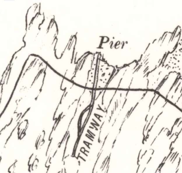
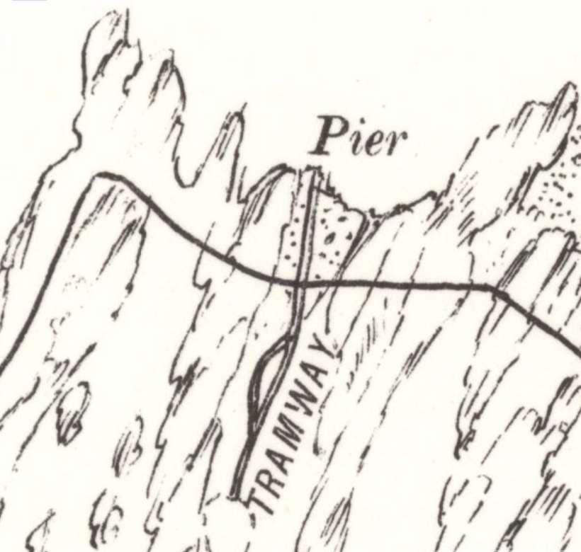
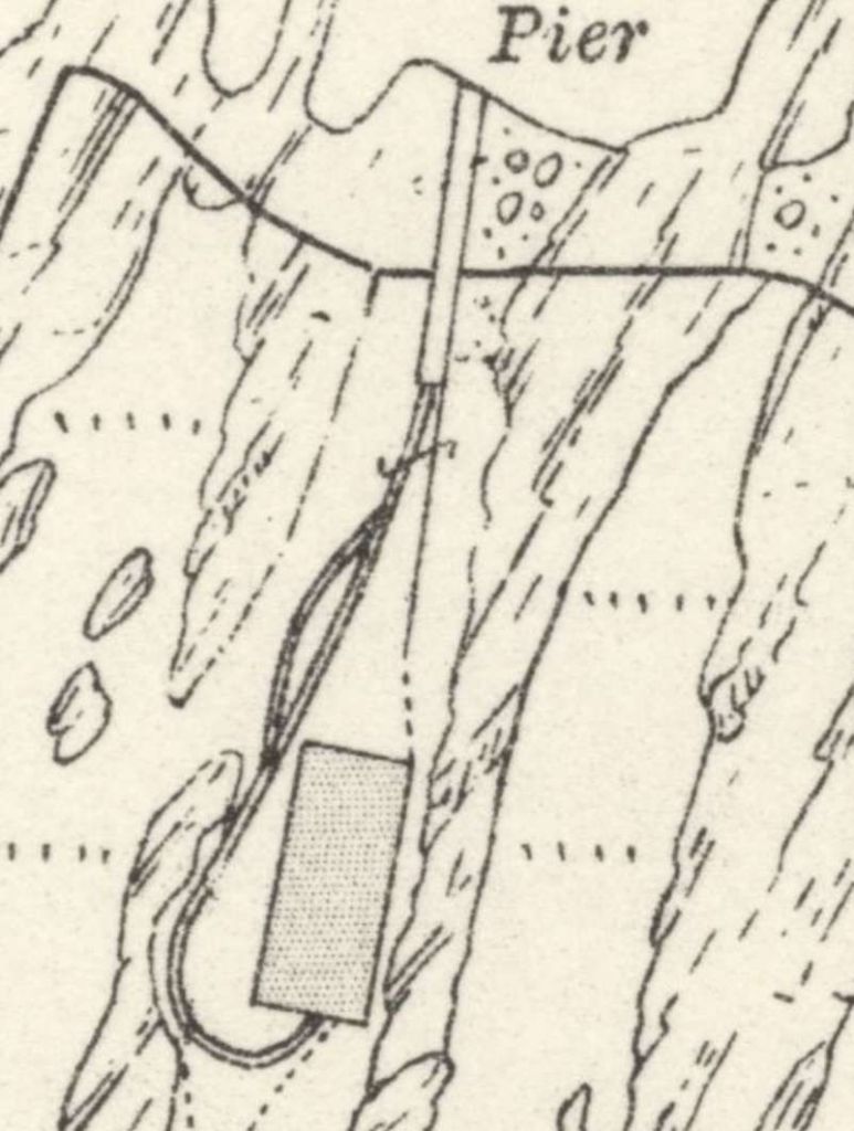
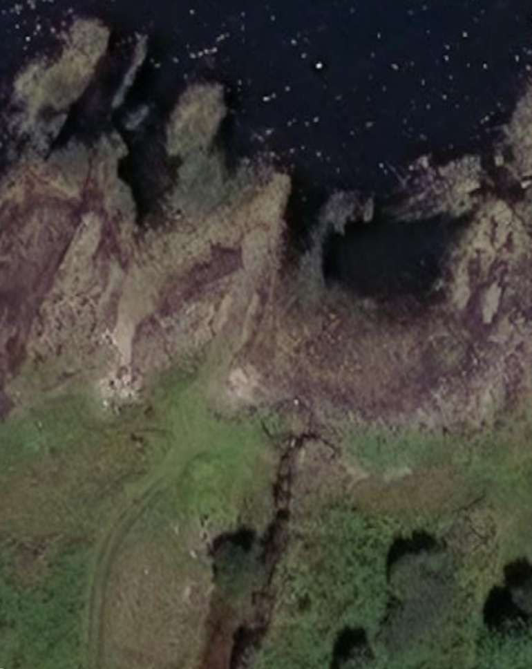
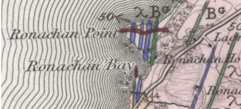
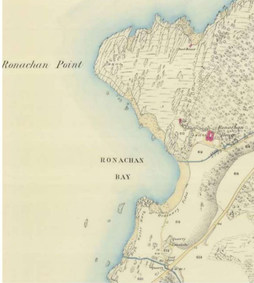
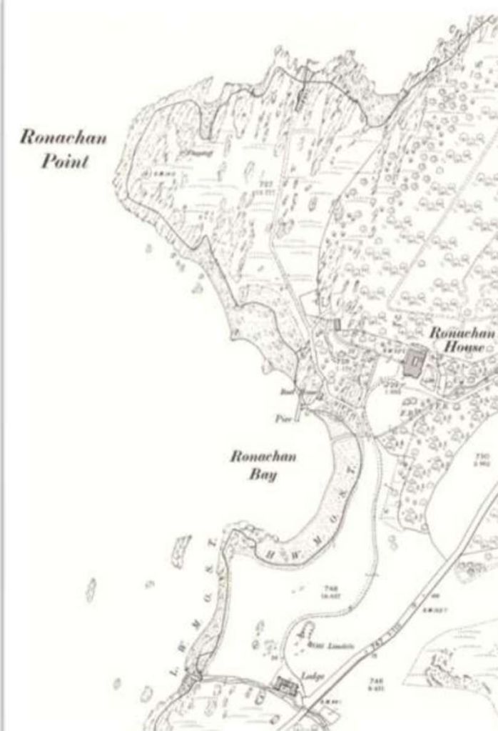
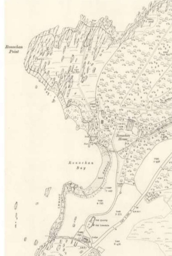
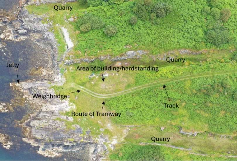
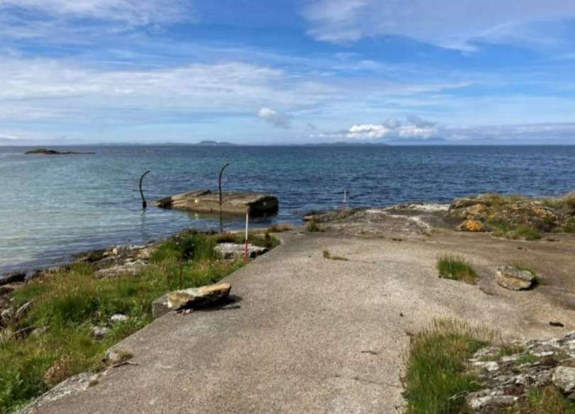
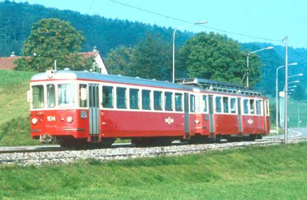
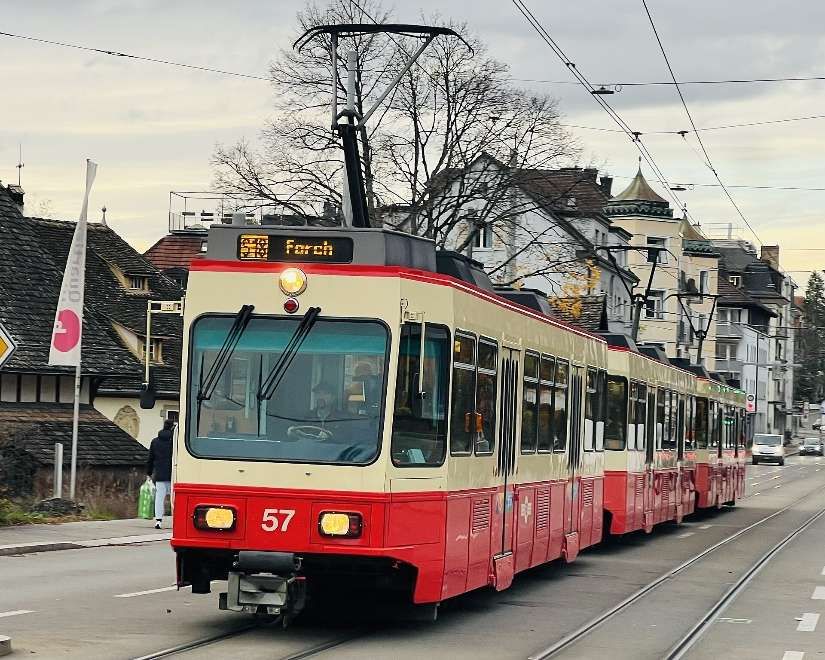
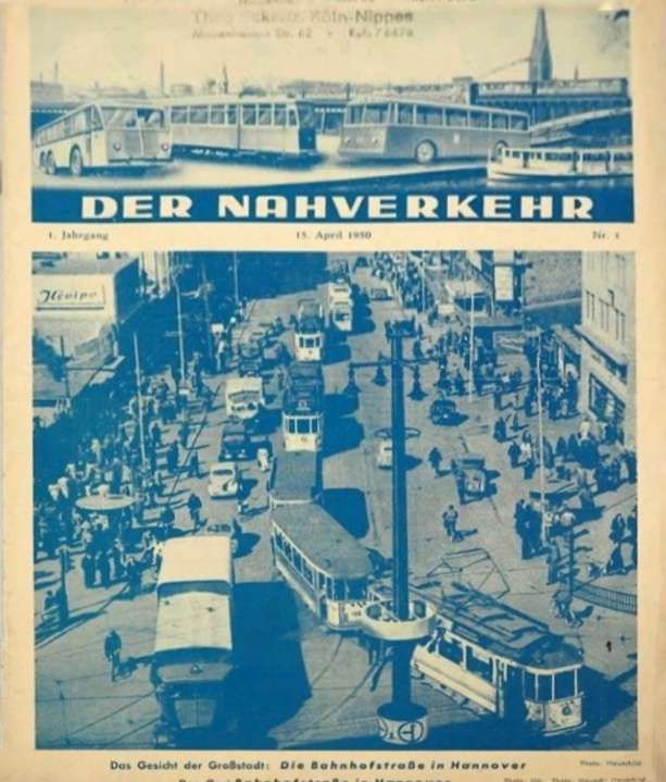
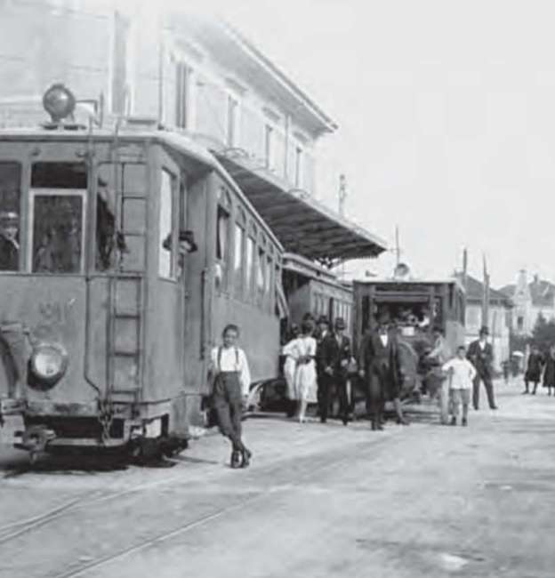
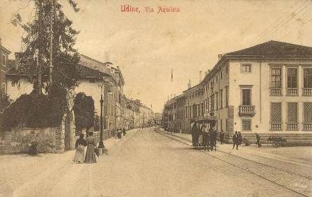
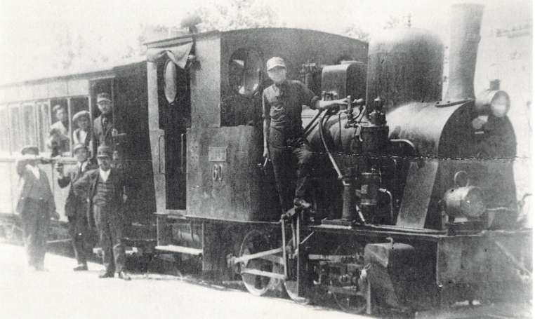
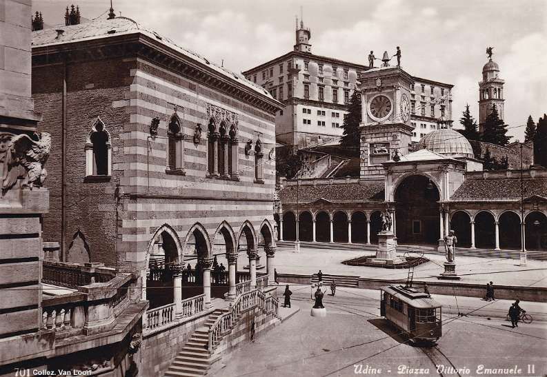
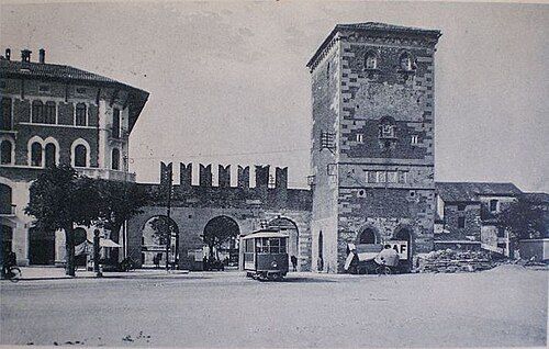
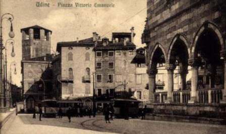
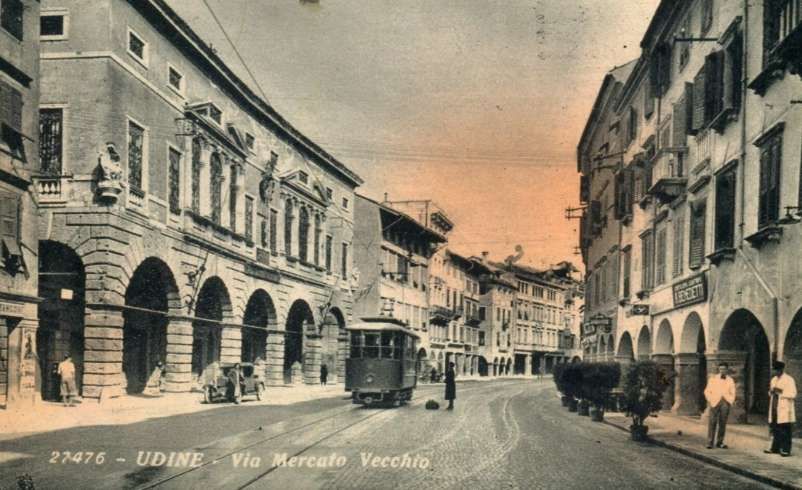
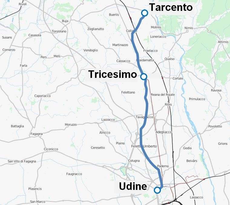
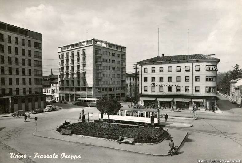
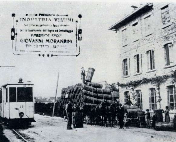
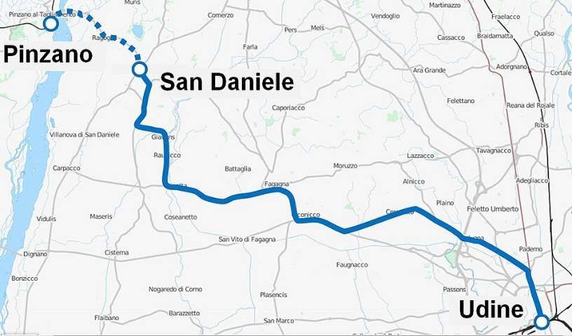
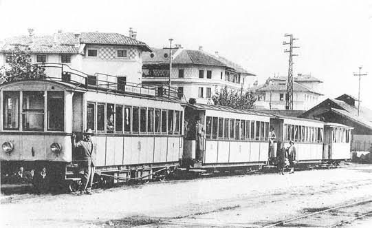
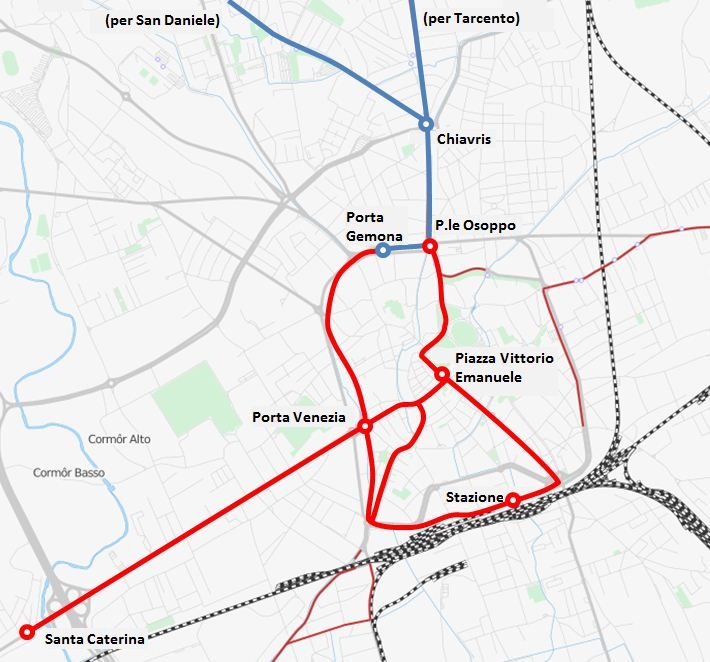
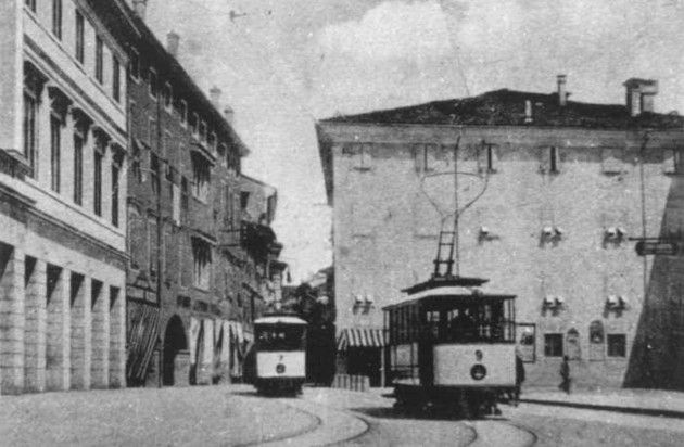
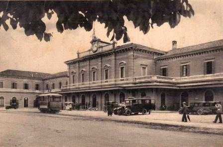
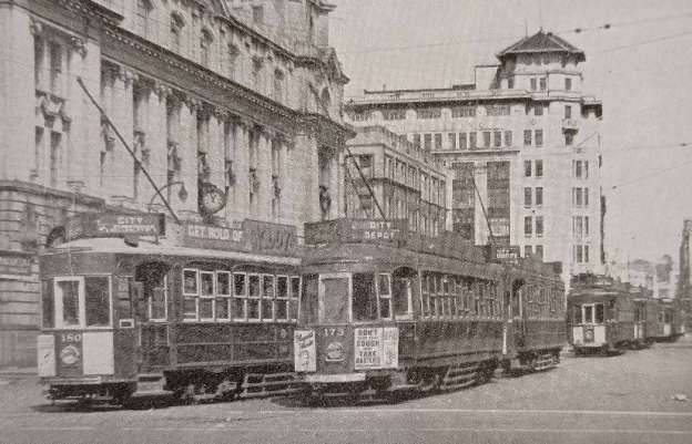
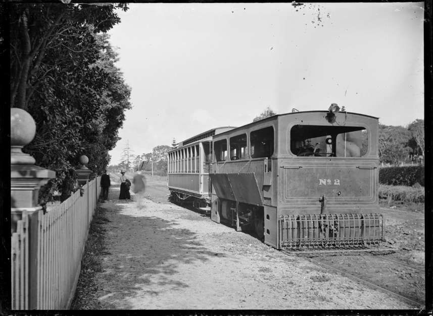
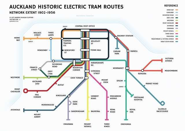
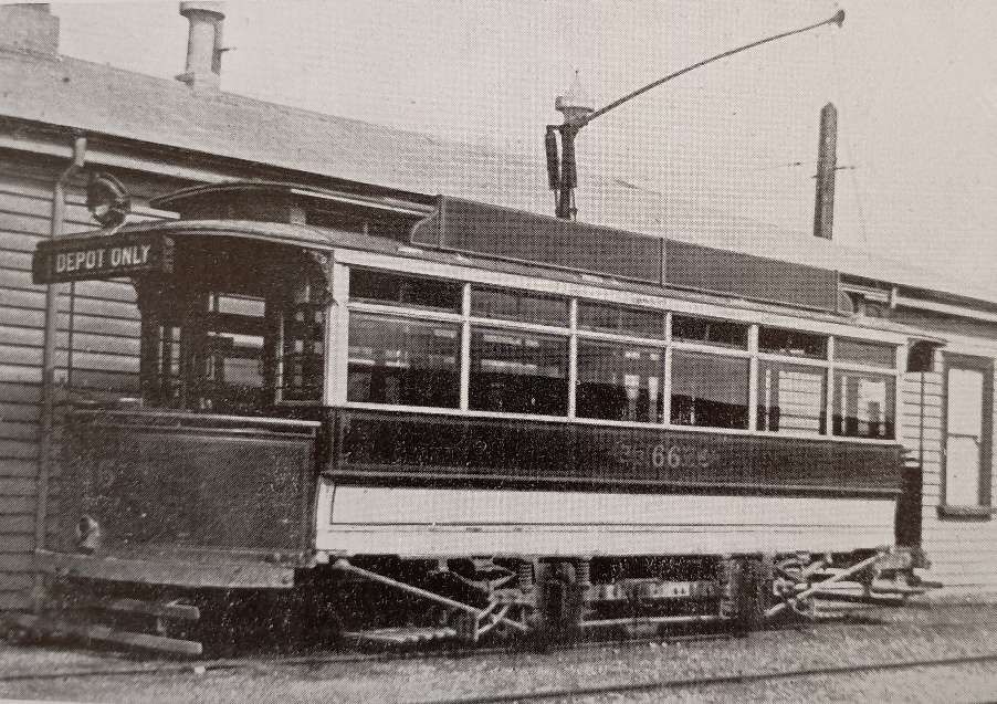
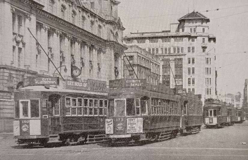
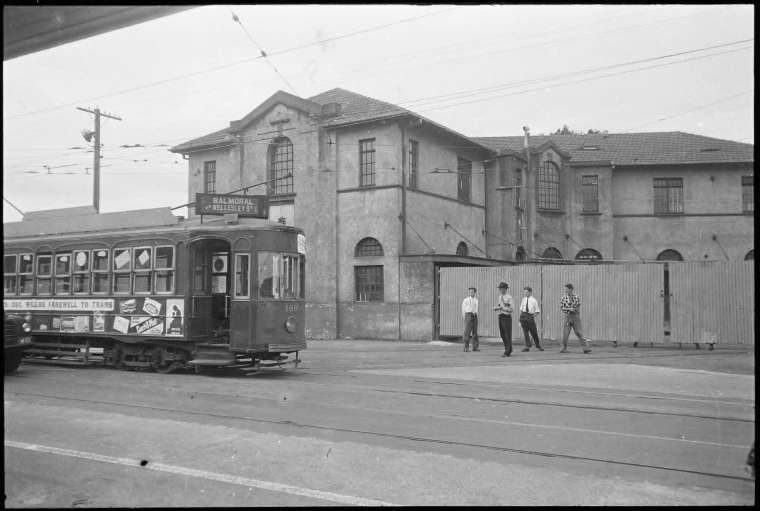
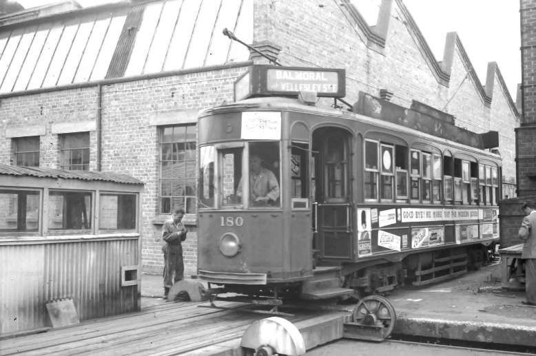
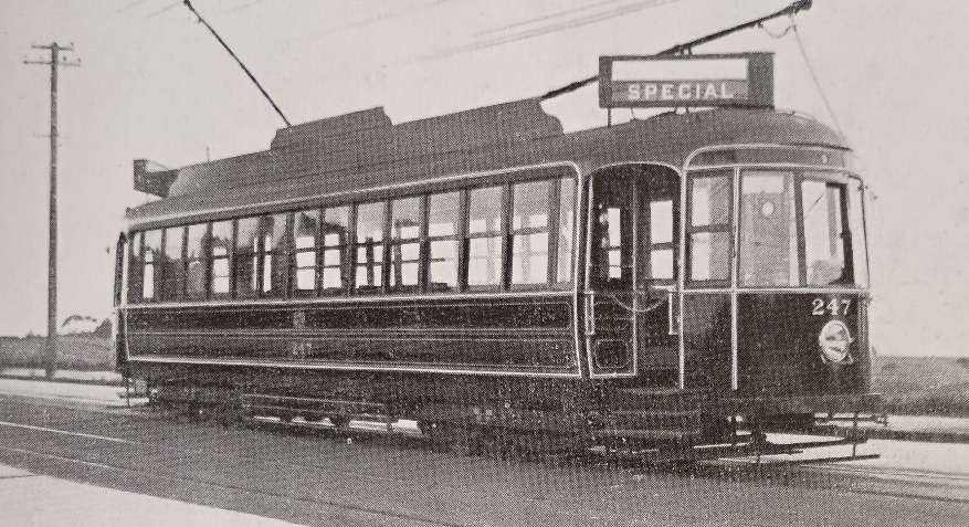
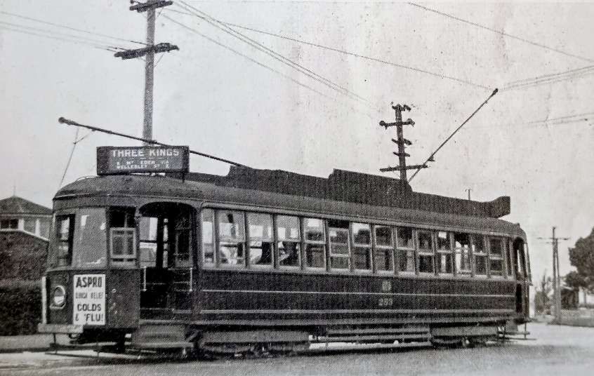
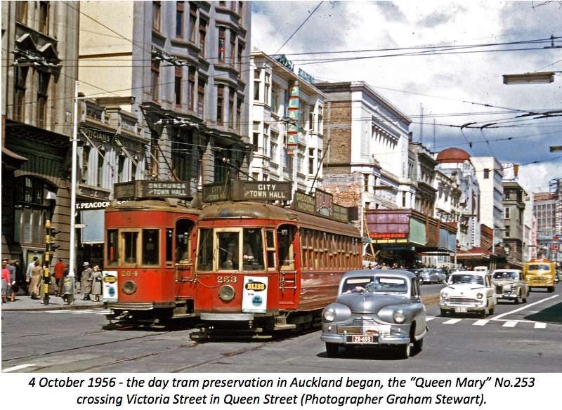
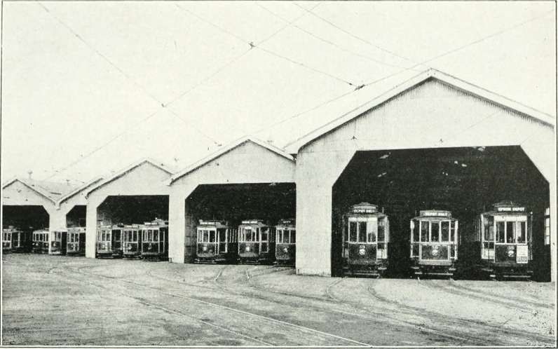
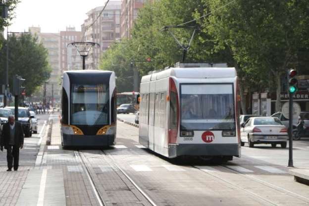
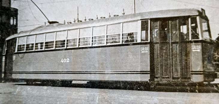
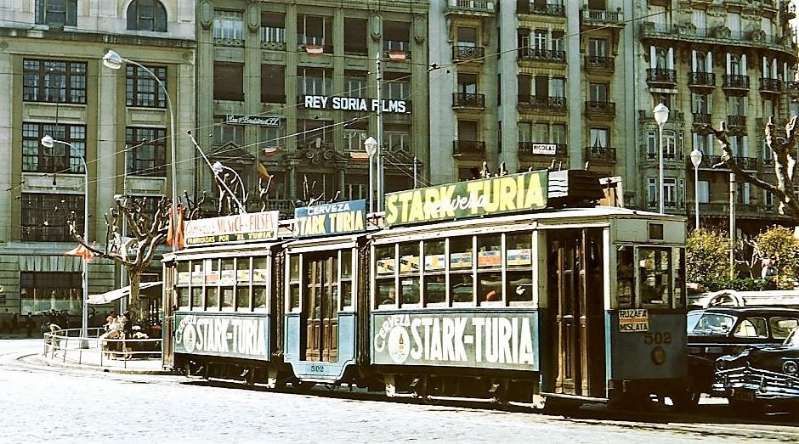
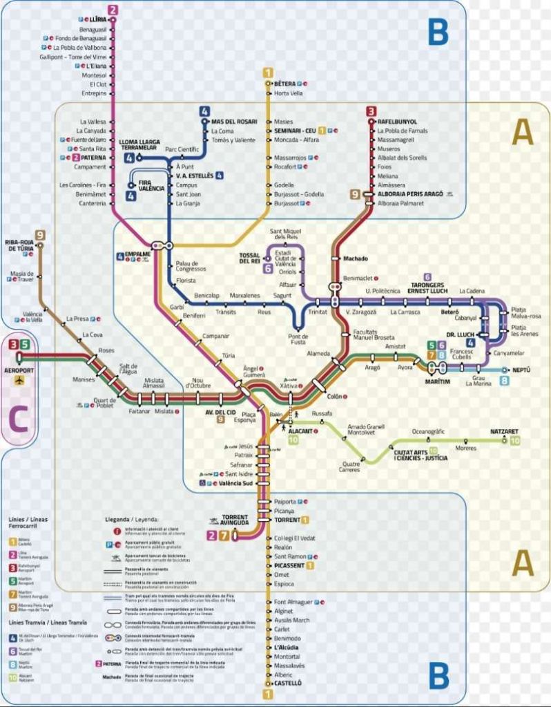
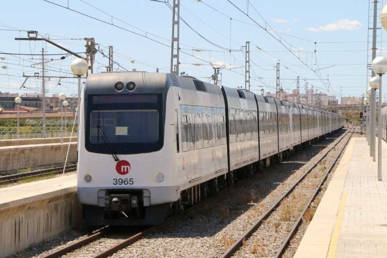
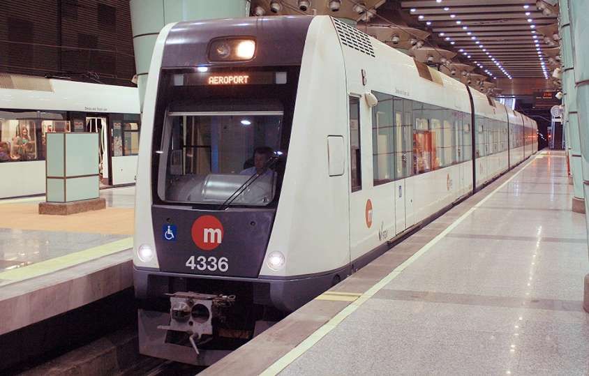
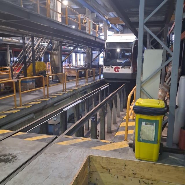
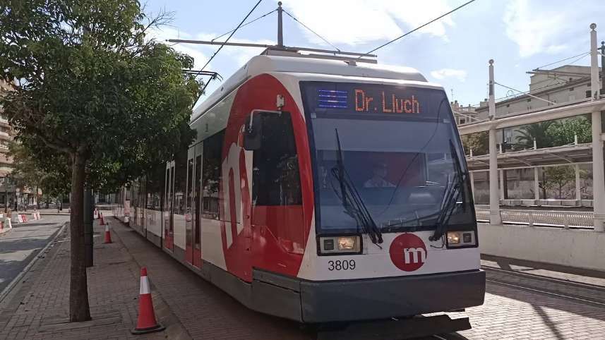
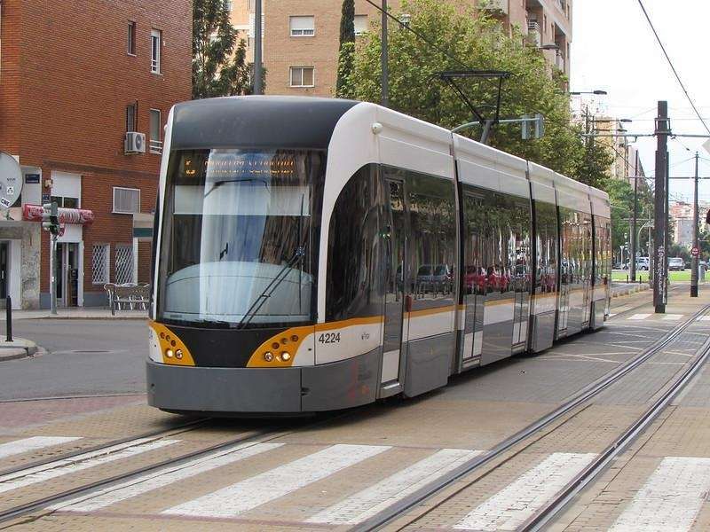
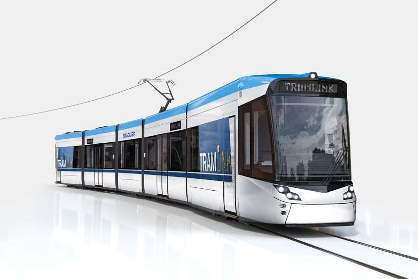
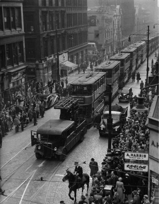
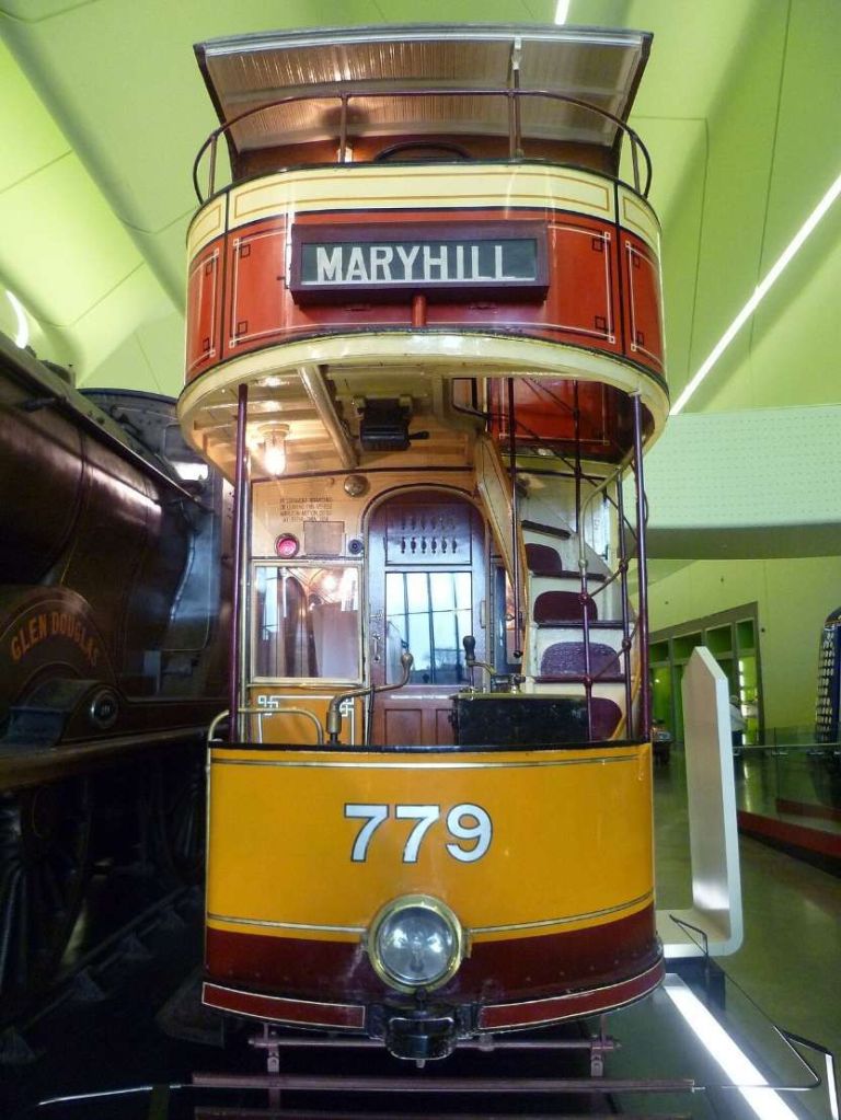
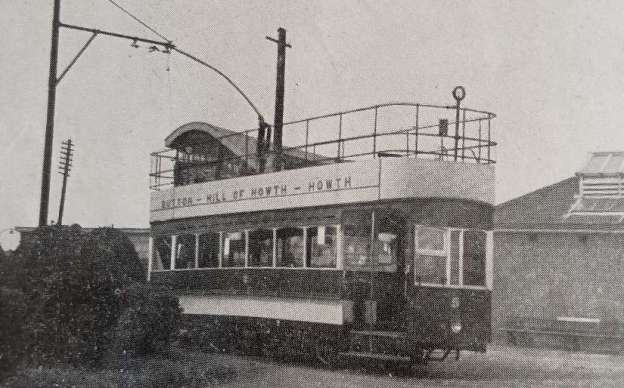
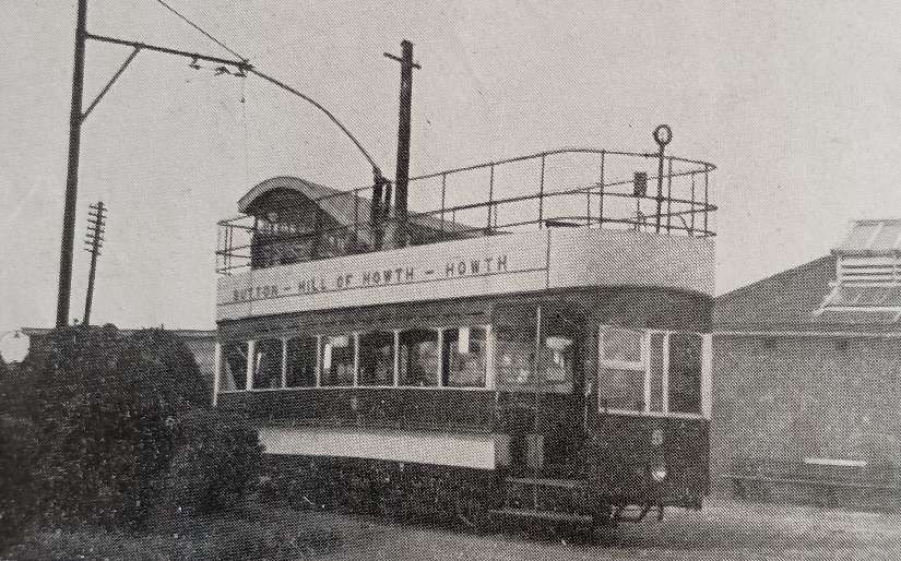
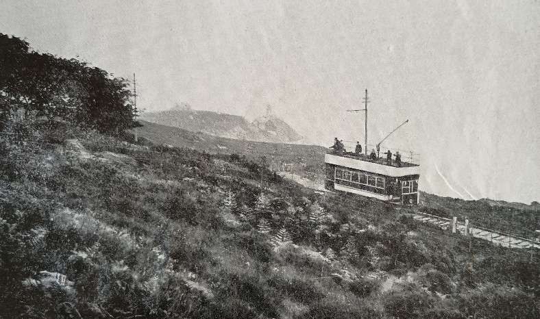
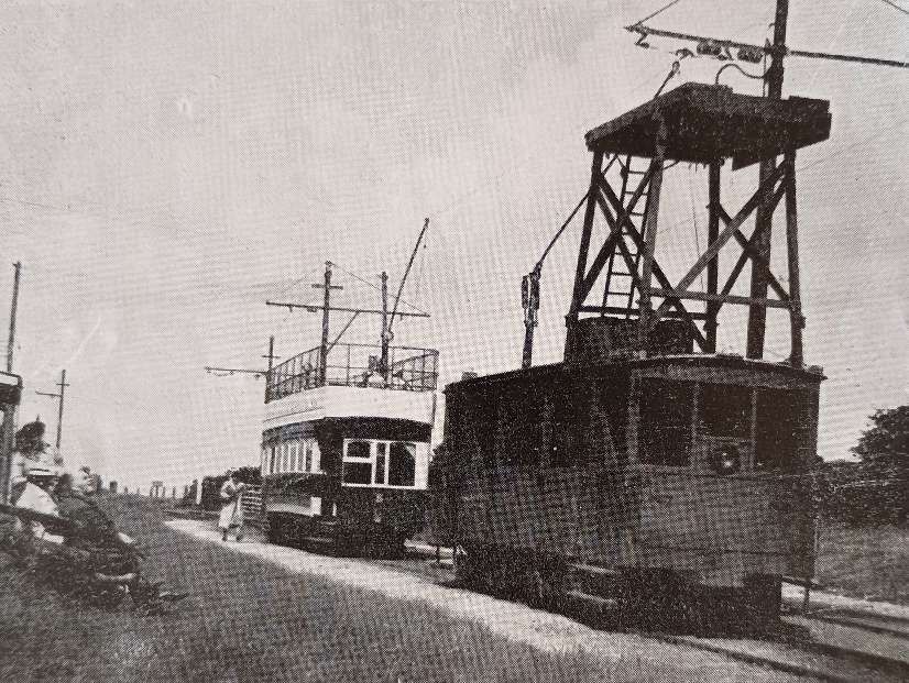
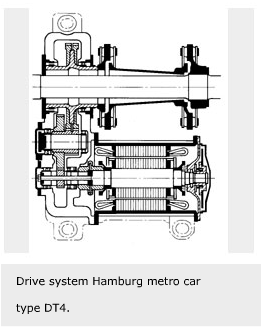
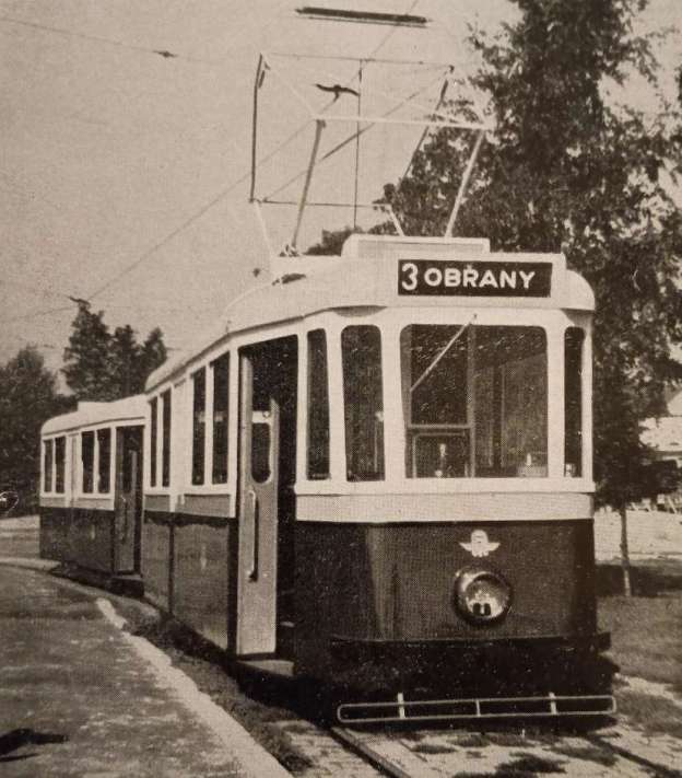

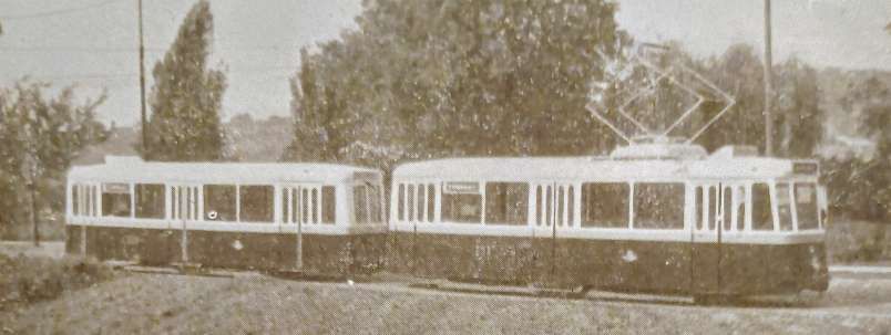
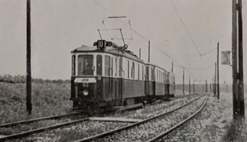
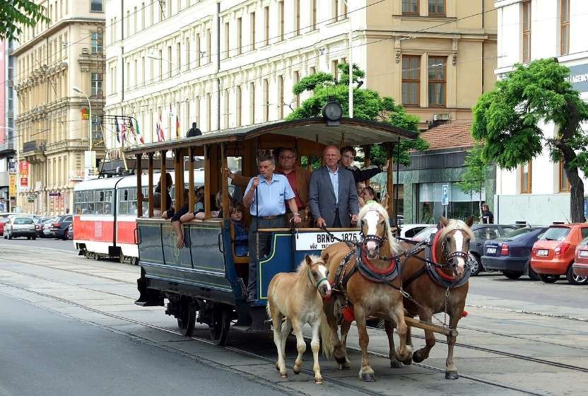
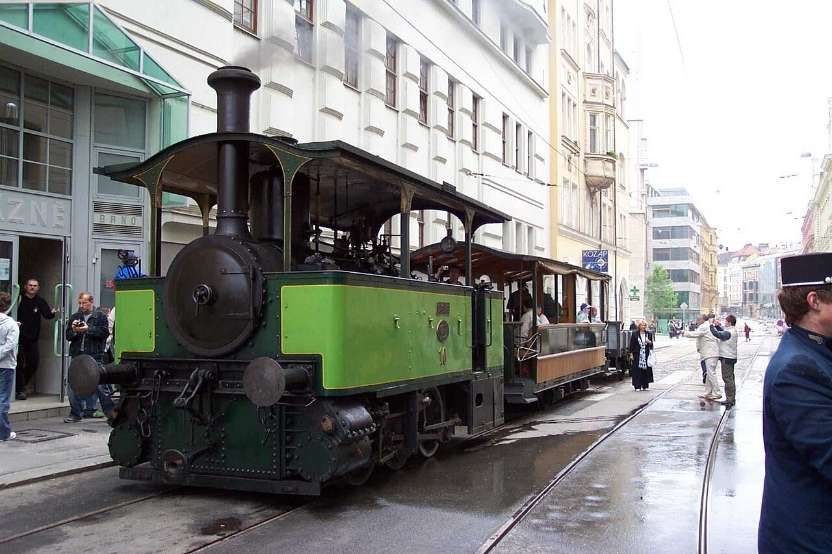
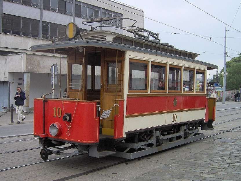
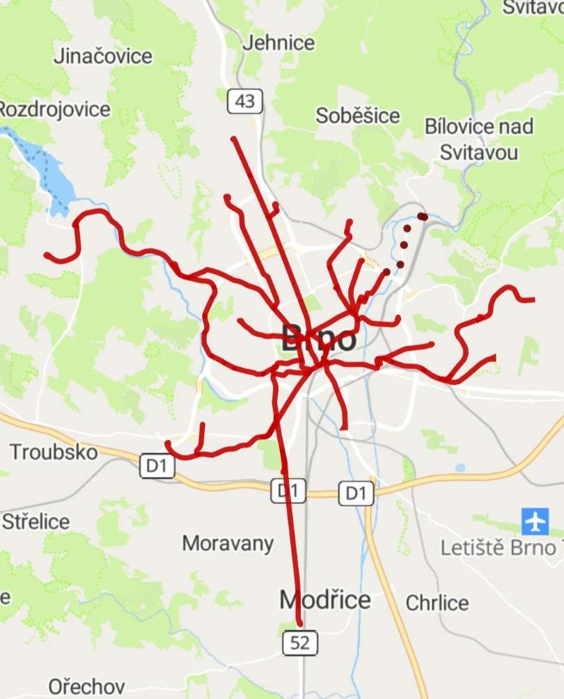
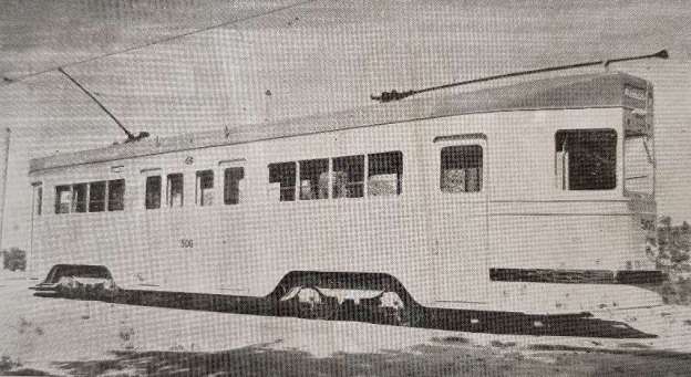
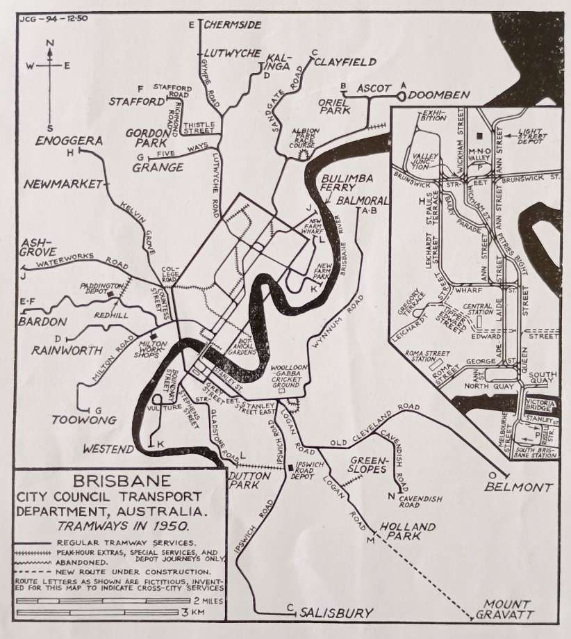
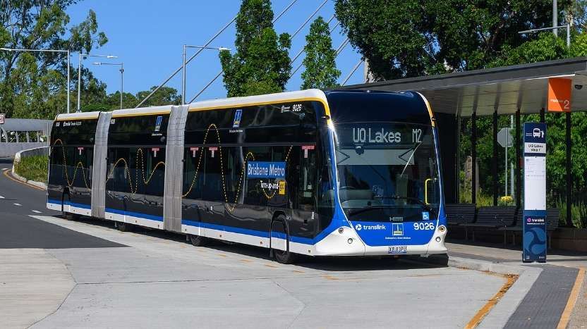


,_N%C3%A1dra%C5%BEn%C3%AD,_10.jpg)
_-_cropped.jpg)