Category Archives: German & Austrian Railways and Tramways

The Guardian Lifestyle Travel – 23rd May 2026 – Part 5 – Over Land & Sea: Magical Views and Sea-Hugging Routes on Europe’s Best Coastal Train Lines – Part A – Scotland, Ireland and Germany

The travel section of the Saturday Guardian Magazine on 23rd May 2023 included a few pages about train journeys in Europe (pages 72 to 77). This is the fifth part of a look at those pages. …

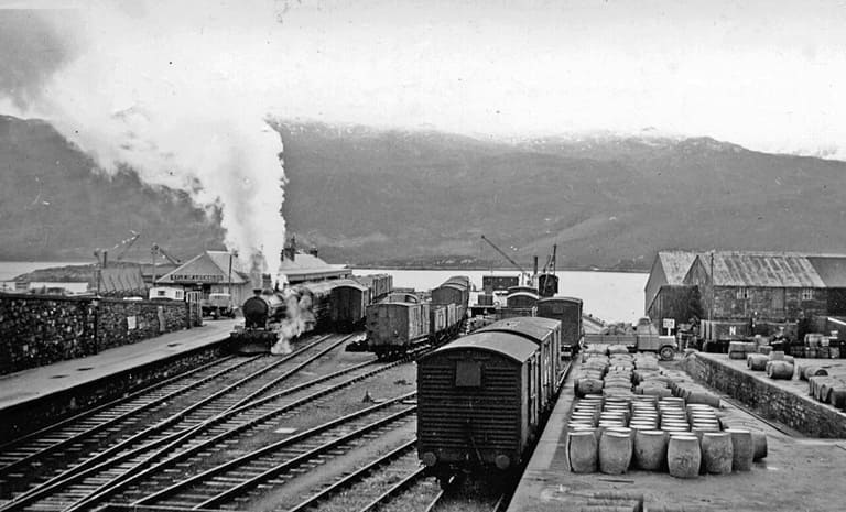
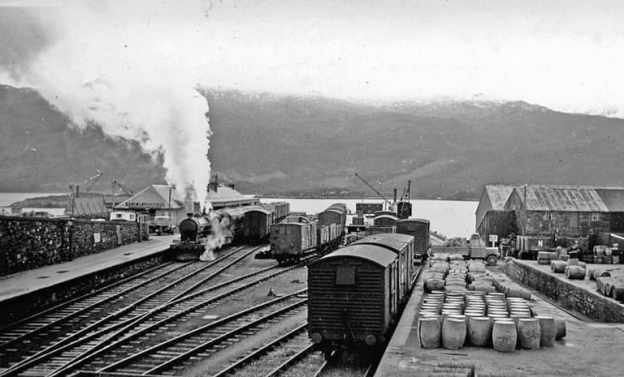
The featured image for this article is a view looking Southeast towards the buffers at Kyle of Lochalsh Railway Station and across the Kyle to Skye in 1939, the ferry to Kyleakin is off scene to the right. A train is leaving for Dingwall and Inverness, managed by an ex-Highland 4-6-0 locomotive, © Walter Dendy and licensed for reuse under a Creative Commons Licence (CC BY-SA 2.0). [14]
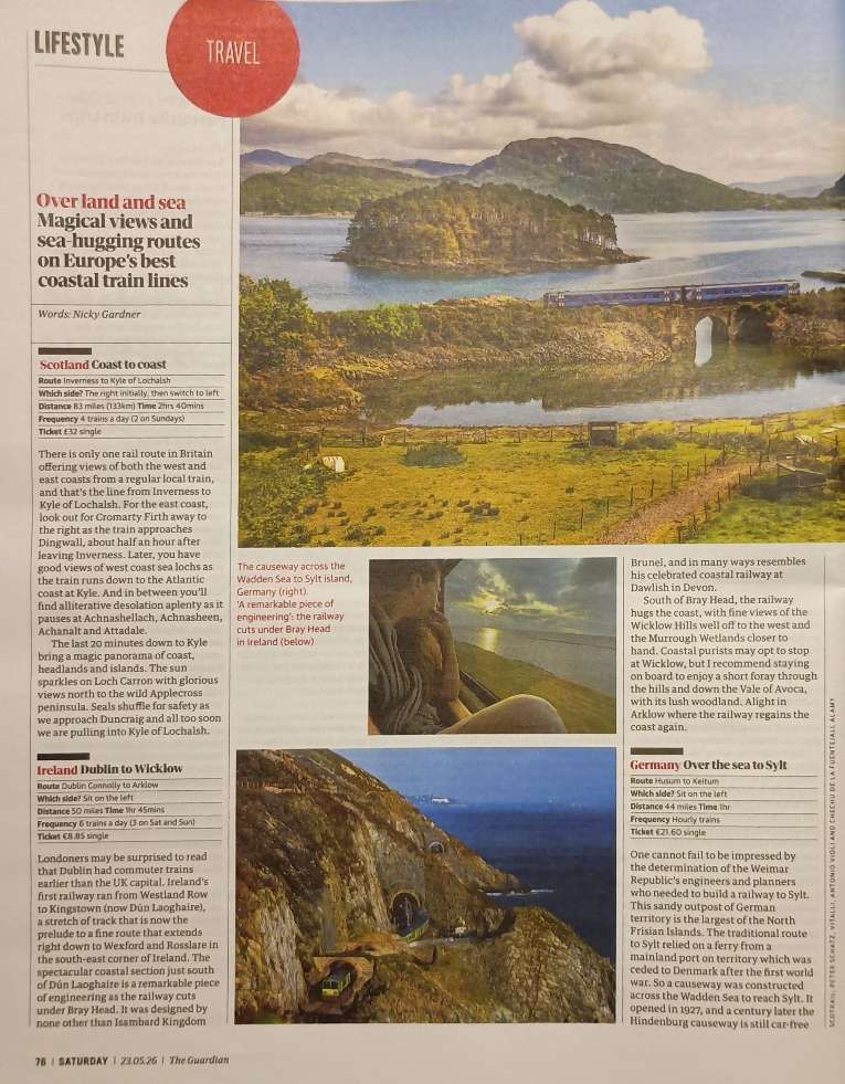
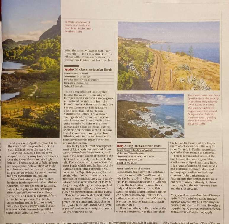
The two pages of Nicky Gardner’s article. [1: p76-77]

Nicky Gardner, lead co-author of the guidebook ‘Europe by Rail’, has championed slow travel across the continent’s most scenic routes. Her writings highlight sea-hugging railways where travellers can take in spectacular coastal panoramas, deep fjords, and dramatic cliffs right from the carriage window. The short Guardian article featuring a few such routes was written by her and is directly quoted here.

5. Europe’s Best Coastal Train Lines

A. Scotland: Coast to Coast

The first line Nicky Gardner chooses to highlight is operated by ScotRail. Travelling the Inverness to Kyle of Lochalsh line will set you back £32 for a single ticket The journey is 83 miles and takes 2hrs 40mins. There are 4 trains a day (only two on Sundays). Sit on the right side first and then switch to the left. …

Nicky Gardner writes:

“There is only one rail route in Britain offering views of both the west and east coasts from a regular local train, and that’s the line from Inverness to Kyle of Lochalsh. For the east coast, look out for Cromarty Firth away to the right as the train approaches Dingwall, about half an hour after leaving Inverness. Later, you have good views of west coast sea lochs as the train runs down to the Atlantic coast at Kyle. And in between you’ll find alliterative desolation aplenty as it pauses at Achnashellach, Achnasheen, Achanalt and Attadale.

“The last 20 minutes down to Kyle bring a magic panorama of coast, headlands and islands. The sun sparkles on Loch Carron with glorious views north to the wild Applecross peninsula. Seals shuffle for safety as we approach Duncraig and all too soon we are pulling into Kyle of Lochalsh.” [1: p76]

The Kyle of Lochalsh line is a primarily single-track railway line in the Scottish Highlands, from Dingwall to Kyle of Lochalsh. Many of the passengers are tourists, but there are also locals visiting Inverness for shopping, and commuters. All services are provided by ScotRail and run beyond Dingwall to Inverness. In the past there were some through services to and from Glasgow, Edinburgh or Aberdeen. None of the 63-mile (101 km) line is electrified, and all trains on the line are diesel-powered, as are all other trains in the Scottish Highlands.” [2]
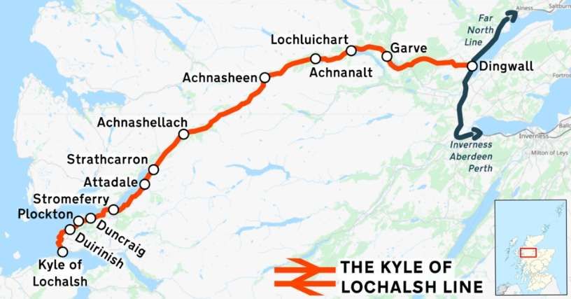
The Kyle of Lochalsh line is shown on this image in red, © OpenStreetMap contributors and licensed for reuse under a Creative Commons licence (CC BY 3.0). [2]
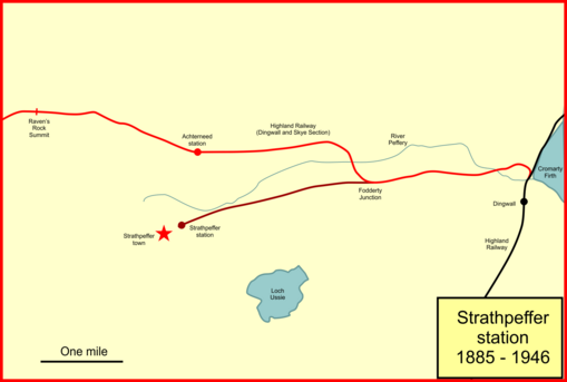
This image shows the first few miles of the Kyle of Lochalsh line and the Strathpeffer Branch. The Kyle line survives the Strathpeffer line is closed. The station immediately to the North of Strathpeffer is now closed. It was once name Strathpeffer and the name was changed to Achterneed when the Strathpeffer branch opened, The next marked location close to the left of this image is not a station but the first high point on the Kyle of Lochalsh line – Raven’s Rock Summit, (c) Afterbrunel and licensed for reuse under a Creative Commons licence (CC BY-SA 4.0). [2]

When the first section of the Dingwall & Skye Railway opened on 19th August 1870 the area around Strathpeffer area became much better connected. However, because of the resistance of a local landowner, the Dingwall & Skye railway was pushed further North and had to run up a steep gradient (1 in 50) to a much higher line on the valley side. The new line had a station named ‘Strathpeffer’ but it was 2 miles from the spa on a relatively steep road. It would have been so much better had the line been able to follow the valley floor. With Strathpeffer’s rise in popularity it became necessary to build a branch line into the village.
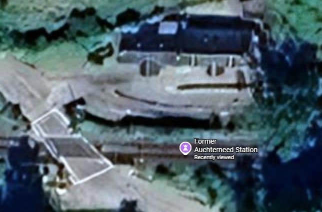
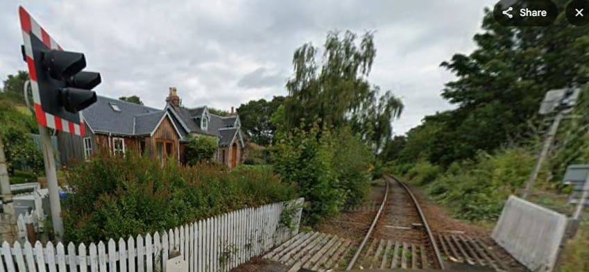
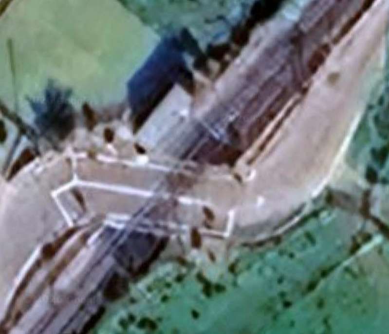
The former station at Achterneed. [Google Maps, June 2026]
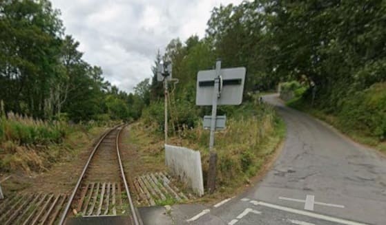
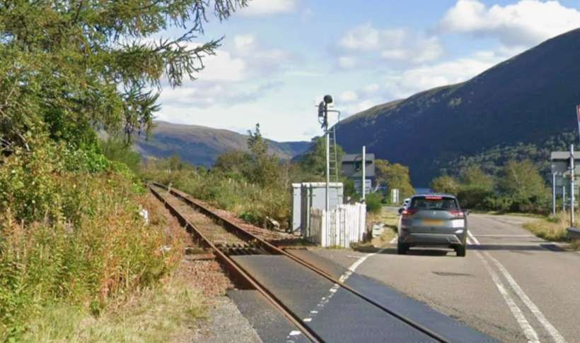
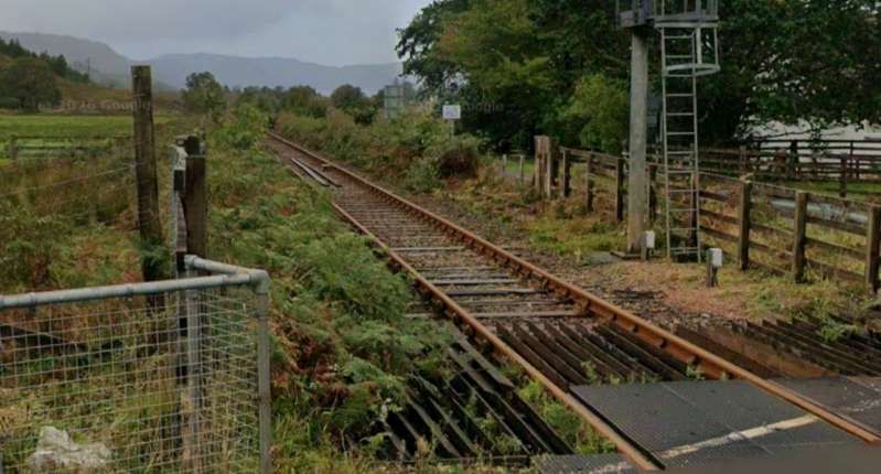
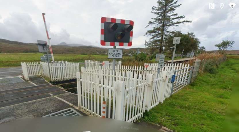
Looking back towards Dingwall from the road-crossing at Achterneed. [Google Streetview, September 2025]
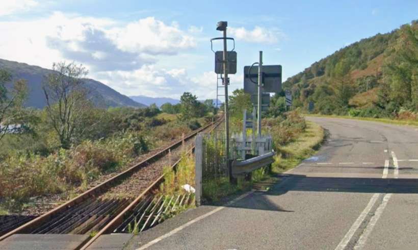
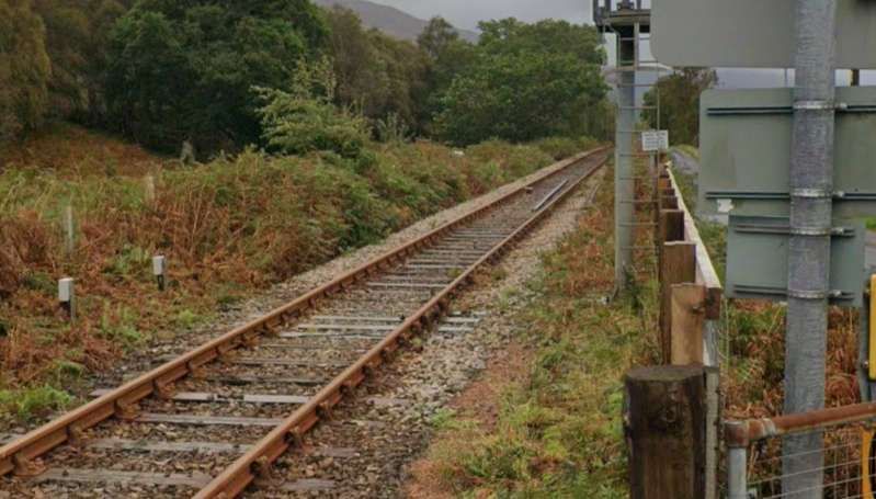
Looking ahead along the line towards Kyle of Lochalsh from the road-crossing at Achterneed. [Google Streetview, September 2025]

The railway bridge over the Black Water at the East end of Loch Garve. The line runs along the South shore of the loch before turning Northwest and running into Garve Railway Station. [Google Maps, June 2026]
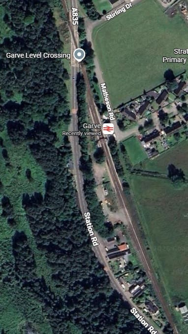
Garve Railway Station. [Google Maps, June 2026]
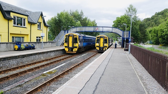
Two Class 158 Diesel Multiple Units (158701 and 158704) operated by Abellio ScotRail pass each other at Garve station’s passing loop, with services bound for Inverness and Kyle of Lochalsh respectively, (c) Sexy Simon and licensed for reuse under a Creative Commons licence, (CC BY-SA 4.0). [3]
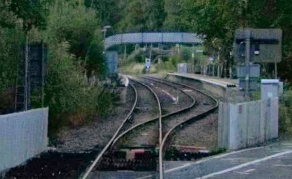
Looking back into Garve Railway Station from the A835 level-crossing. [Google Streetview, September 2025]

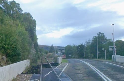
Looking ahead along the line towards Kyle of Lochalsh from the level-crossing on the A835 at Garve. [Google Streetview, September 2025]

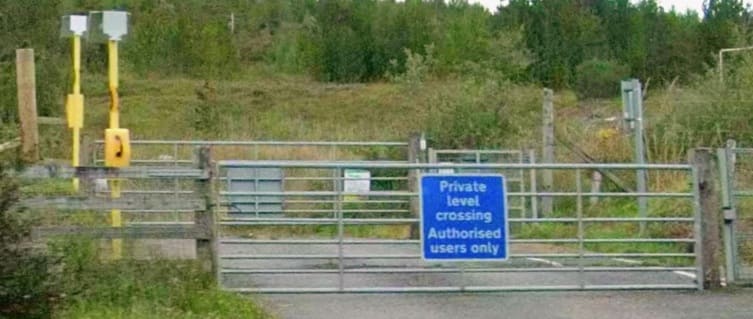
The line runs alongside the A835 and then the A832. Alongside the A832, it crosses this forestry access road. A short distance to the West of this crossing the A832 turns away to the Northwest. [Google Streetview, September 2025]

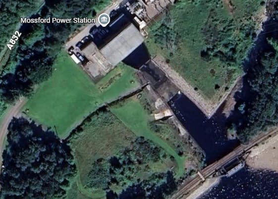
The line then turns to the Southwest to meet the North shore of Loch Luichart and runs West along the North shore before crossing the outfall from Mossford Hydroelectric Power Station. The line can be seen in the bottom-right of this satellite image. [Google Maps, June 2026]

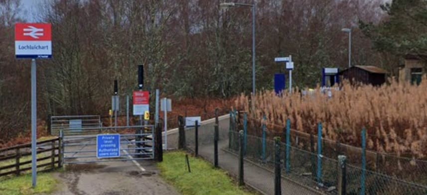
Loch Luichart Railway Station seen from the approach road looking Southwest towards the station. The station sits above the North shore of the Loch at its western end. [Google Streetview, December 2021]

The original station at Lochluichart (called Lochluichart High) was opened by the Dingwall and Skye Railway in August 1871. It sat at a lower level than the present station.

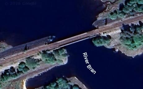
Soon thereafter the line crosses the River Bran. In the 1950s the Conon Valley hydro-electric scheme raised the water level of Loch Luichart which required the railway line to be diverted onto higher ground and a new station to be erected. [Google Maps, June 2026]

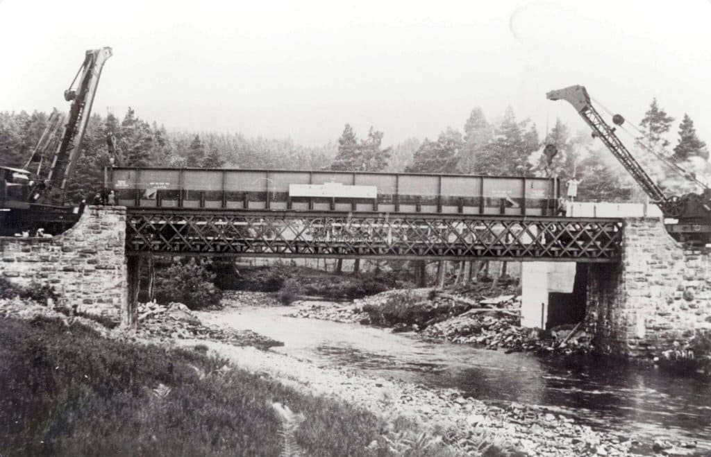
The new line was known as the Lochluichart Diversion. It required a replacement bridge over the river. This image shows construction work on the bridge in the 1950s, (c) Am Bailie. [4]

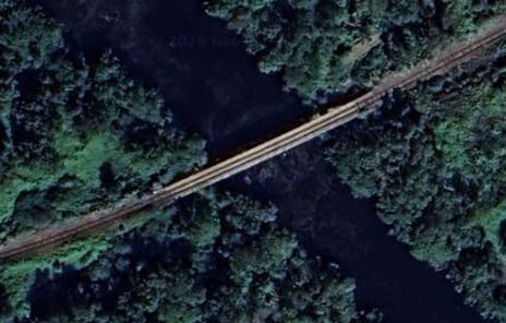
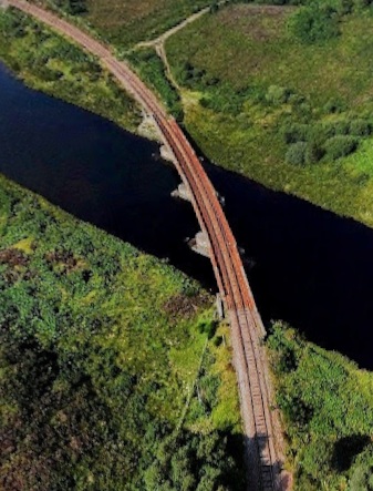
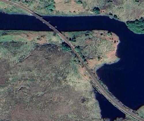
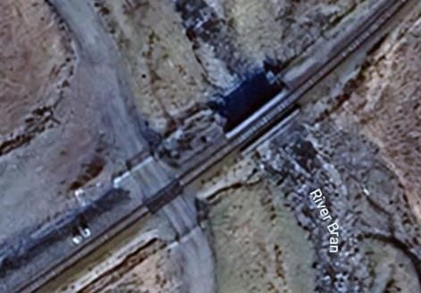
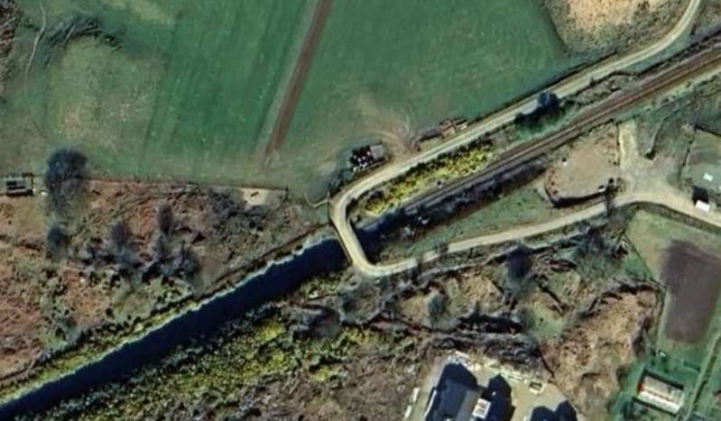
The line ran on the South shore of Loch a’ Chuilinn before turning Northwest to cross the channel of the River Bran at its western end. A satellite image is below. [Google Maps, June 2026] The adjacent image is a drone’s eye view of the same bridge, (c) Brian McInally (August 2021). [Google Maps, June 2026]

Now on the North bank of the River Bran, the line runs West passing Loch Achanalt and through then request stop of the same name.

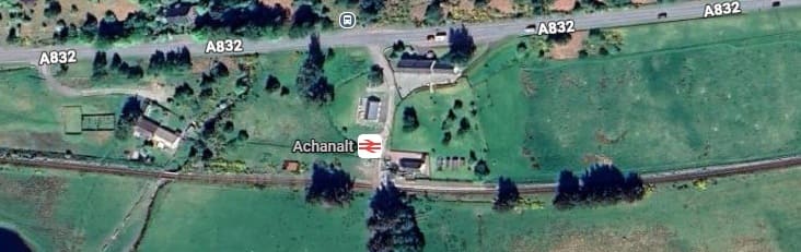
Achanalt Request stop and the A832. The River Bran runs just below the bottom of this image and just intrudes into it at the bottom-left. From this point on for a reasonable distance the line runs on the South side of the A832, with the River Bran to the South of the line. [Google Maps, June 2026]
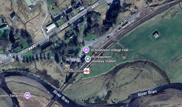
The next railway station is at Achnasheen just before the next bridge over the River Bran. [Google Maps, June 2026]

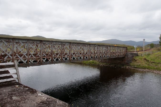
Achnasheen Railway Bridge spans the River Bran at the Southwest end of Achnasheen Railway Station. It is a single lattice-girder span of unusually light construction, with masonry abutments. [5]

Then, parallel to the A890, the line runs down the East side of Loch Gowan and continues to follow the River Bran upstream, crossing the River once again on a much smaller structure.

After the line bridges a tributary of the River Bran, this next bridge over the River Bran itself encounters a much smaller river! [Google Maps, June 2026]

The A890 runs to the North of Loch Scaven, the railway on the South side of the Loch. Both continue West-southwest across moorland and woodland.

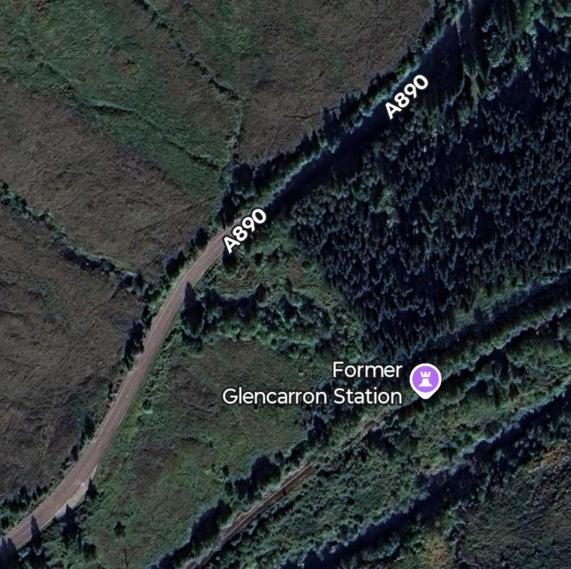
The former Glencarron Railway Station is surrounded by woodland. The station was known as Glencarron Platform. [6]

Glencarron Platform was opened in 1873 on the Highland Railway’s line from Dingwall to Kyle of Lochalsh, this remote station closed in 1964. It had originally been for the sole use of the landowner but was later opened to all travellers. [7]

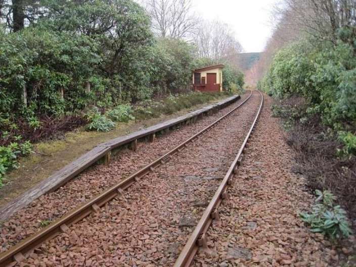
This view looks south west from the trackside at Glencarron Platform, towards Achnashellach and Kyle in 2015. 51 years after official closure, somebody appeared to be looking after it, © Nigel Thompson and licensed for reuse under a Creative Commons Licence, (CC BY-SA 2.0). [7]

Southwest of Glencarron Platform the railway followed the A890 down the valley of the River Carron. The Road was Northwest of the line, the river was to the Southeast of the line.

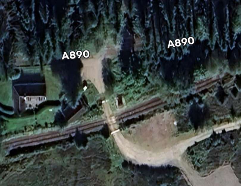
Further Southwest, a forest access road crossed the line at a level-crossing. [Google Maps, June 2026]
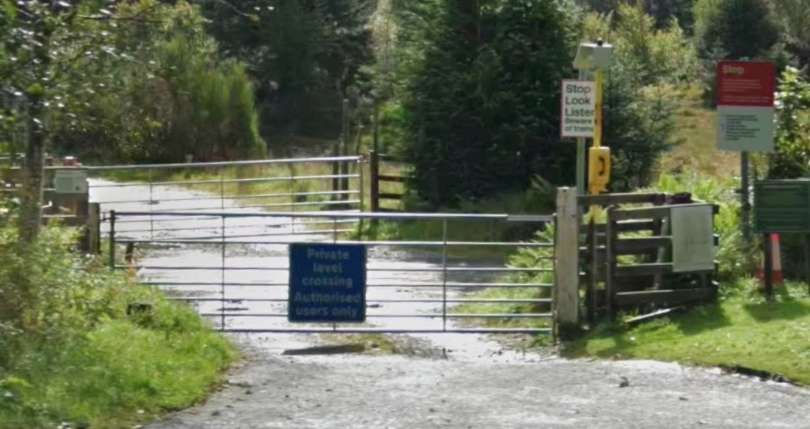
The level-crossing seen from the A890. [Google Streetview, September 2025]
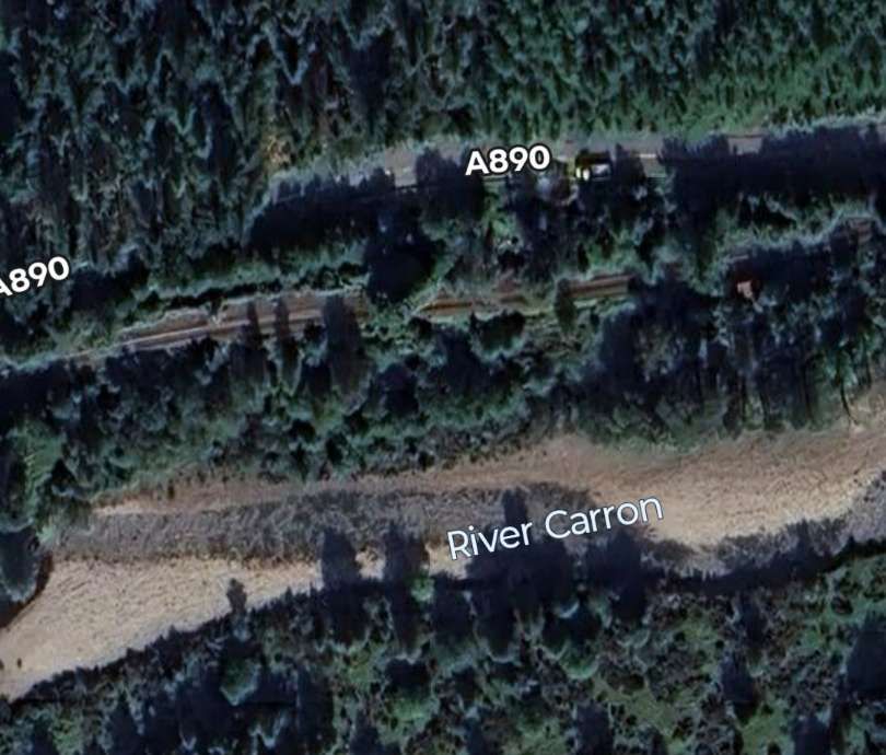
River, road and railway continue West from the crossing. [Google Maps, June 2026]
Further West again, the A890 passes under the railway. [Google Maps, June 2026]
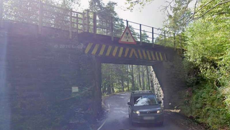
This view looks South through the underbridge which was designed only for a single line of traffic. [Google Streetview, September 2025]
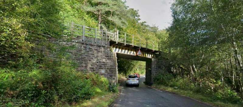
This view looks North through the same bridge. [Google Streetview, September 2025]

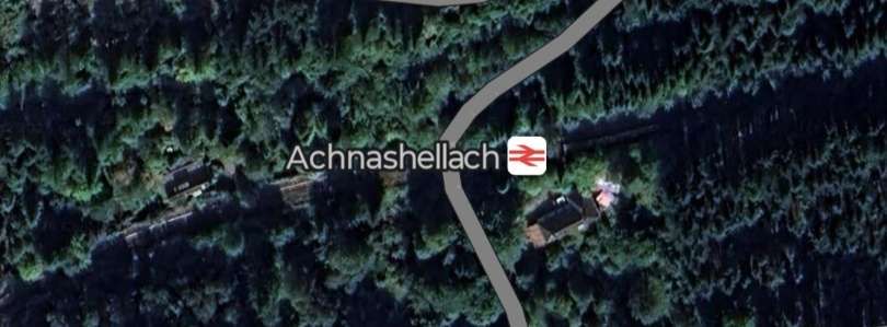
The valley of the River Carron is heavily wooded and the line disappears at times under the canopy. Even Achnashellach Railway Station is difficult to make out from above!

Achnashellach Railway Station is a request-stop. [Google Maps, June 2025]
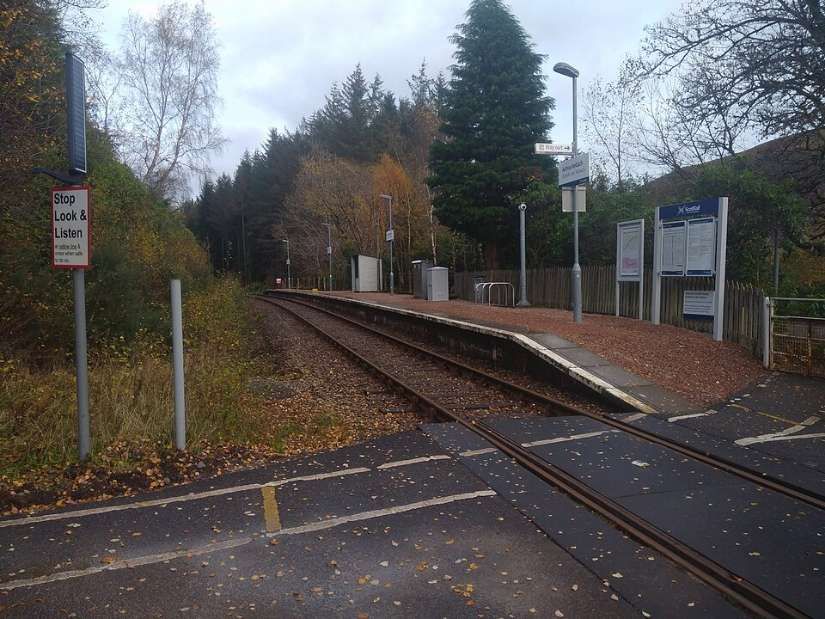
Achnashellach Railway Station is a request stop. It is seen here from the road-crossing at its western end, © Felix Saward and licensed for reuse under a Creative Commons licence (CC BY-SA 4.0). [8]
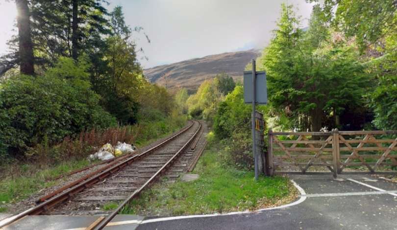
Looking along the line towards Kyle of Lochalsh from the crossing at the West end of Achnashellach Railway Station, © Roger Spo. [Google Streetview, October 2014]

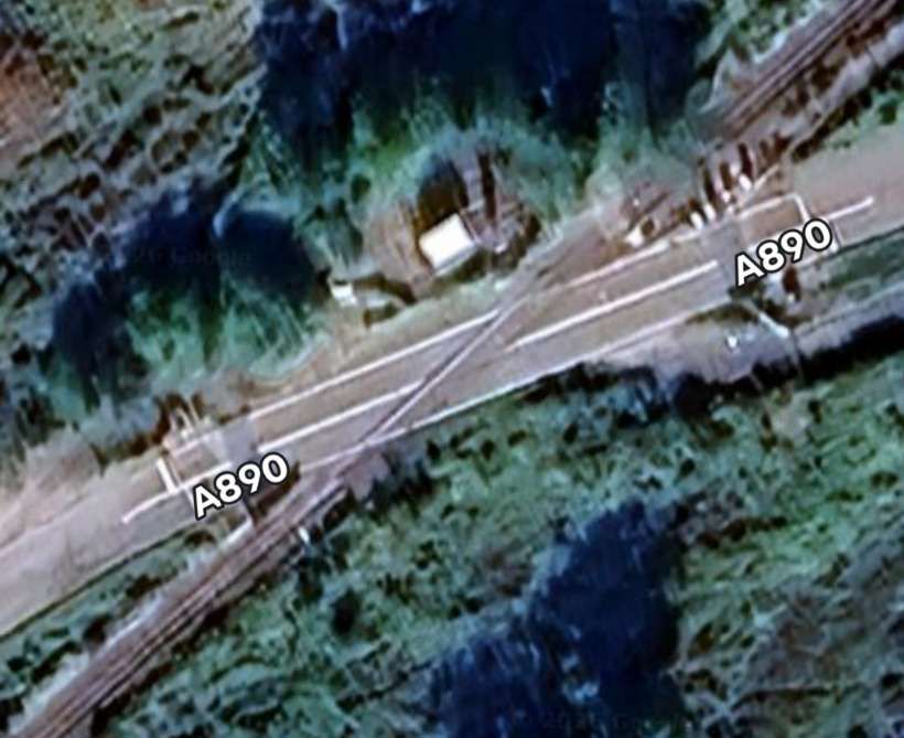
The A890 and the railway run to the Northwest of Loch Dugaill at the Southwest end of the loch the railway crosses the A890 again.

The road crossing to the Southwest of Loch Dugaill. [Google Maps, June 2026]
Looking Northeast along the Carron valley towards Dingwall. [Google Streetview, September 2025]
Looking Southwest along the Carron valley towards Kyle of Lochalsh. [Google Streetview, September 2025]

The road and the railway run in close proximity for quite a distance.

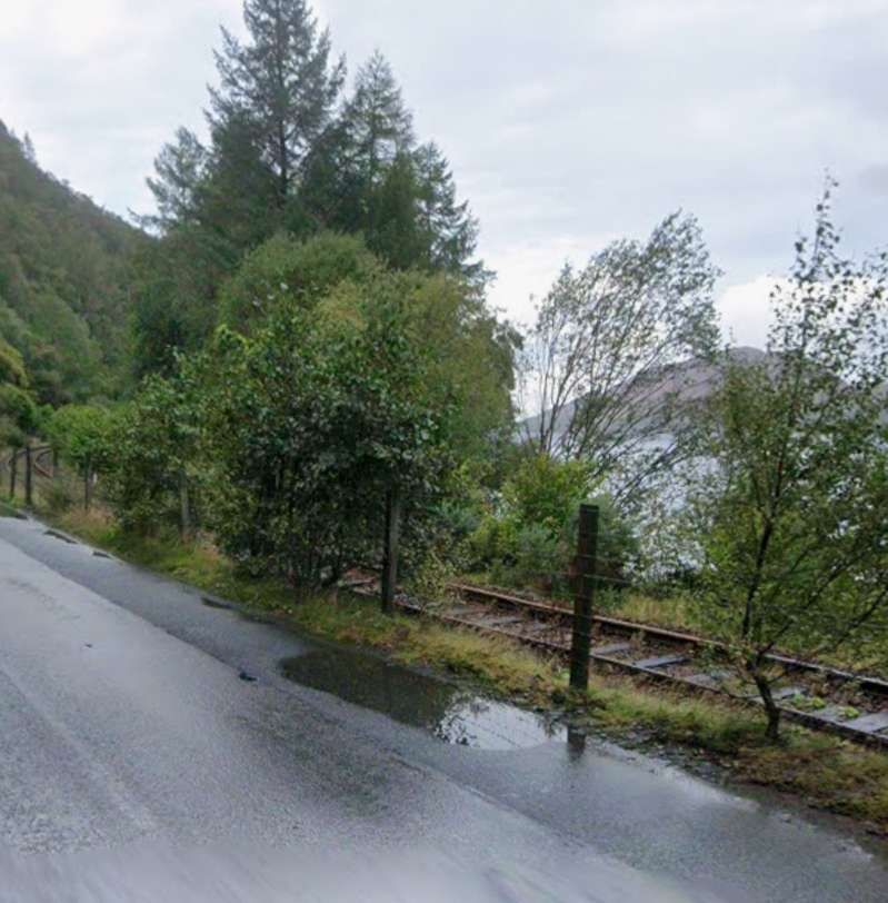
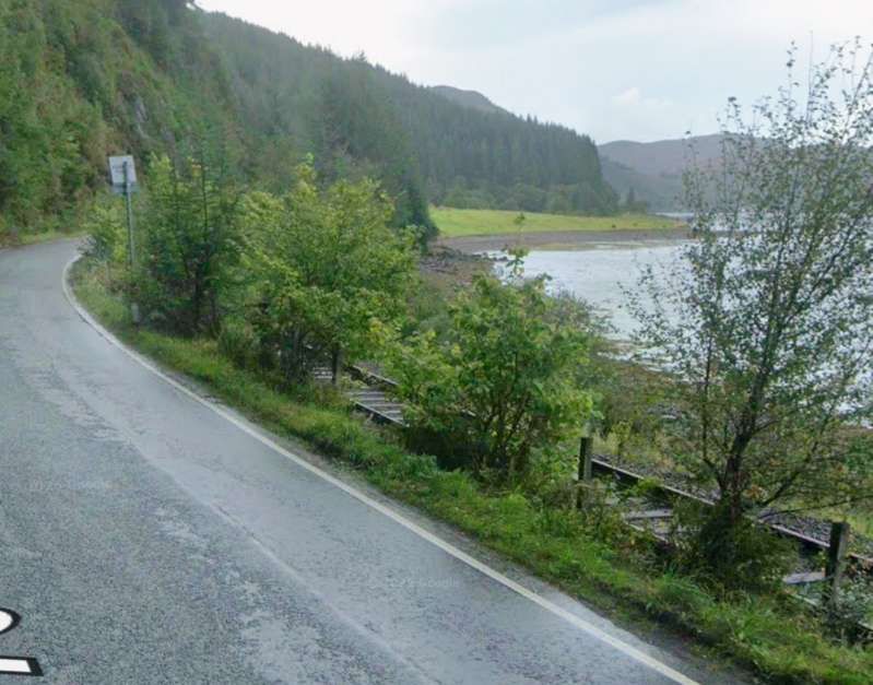
At times the line and the A890 ran immediately next to each other. [Google Streetview, September 2025]
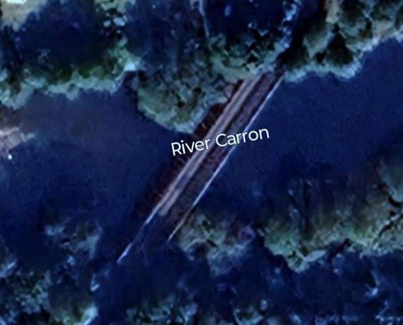
The road and the railway gradually pull apart before the railway bridges the River Carron. [Google Maps, June 2026]
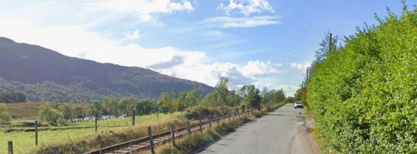
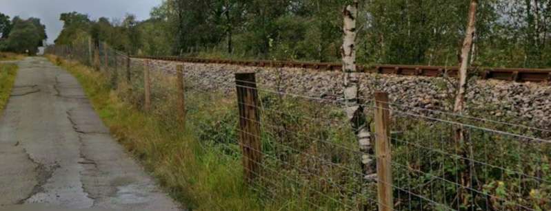
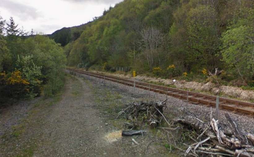
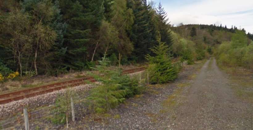
A short distance to the Southwest of the river bridge a little used minor road runs immediately alongside the line on its East side. This photograph faces West-southwest. At this point the line is on a slight embankment. [Google Streetview, September 2025]
A few hundred metres further Southwest the minor road crosses the line at this level-crossing. [Google Maps, June 2026]
Looking back Northeast towards the bridge over the River Carron. [Google Streetview, September 2025]
Looking Southwest towards Strathcarron Railway Station from the same level-crossing. [Google Streetview, September 2025]
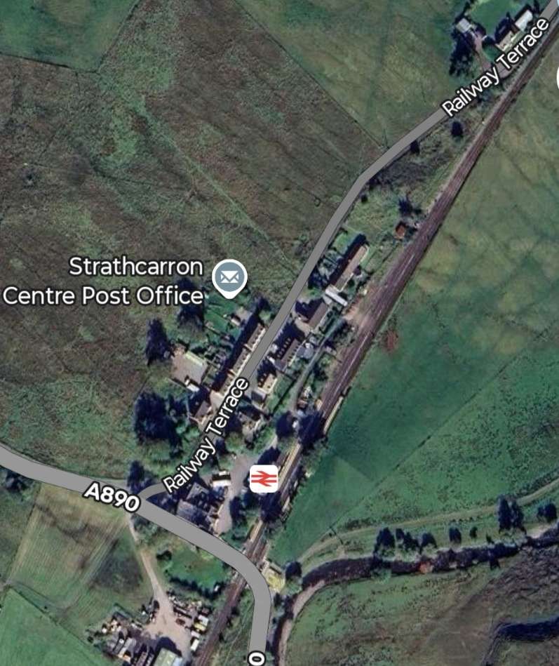
Strathcarron Railway Station is the next significant point on the route. The A890 crosses the line immediately  to the South of the station platforms. [Google Maps, June 2026]
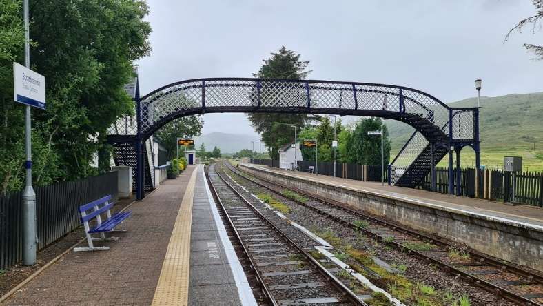
Strath Carron Railway Station looking North,  © Chris Morgan and licensed for reuse under a Creative Commons licence (CC BY-SA 2.0). [9]
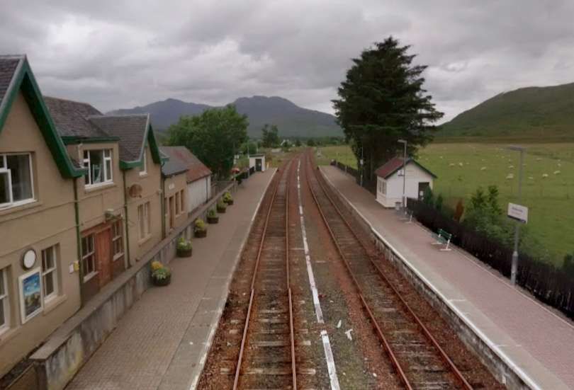
The view North from the station footbridge, © Roger Spo. [Google Streetview, July 2015]
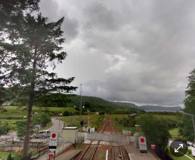
The view South from the station footbridge, © Roger Spo. [Google Streetview, July 2015]
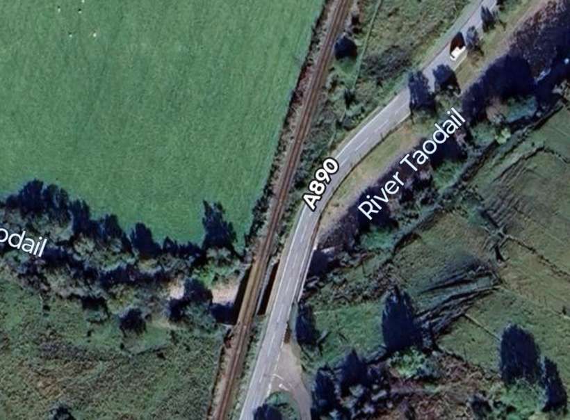
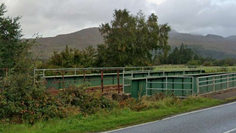
Both the road and the railway cross the River Taodail a short distance South of Strathcarron Railway Station.
Looking North from the A890 a little to the South of the River Taodail, the real bridge can be seen alongside and to the West of the road. [Google Streetview, September 2025]
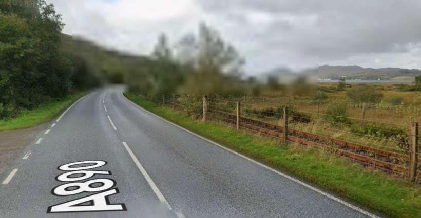
Looking South from a similar location on the A890, the railway can be seen taking close order with the road. [Google Streetview, September 2025]
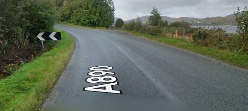
A little further South the road and the railway begin to separate. The railway heads for Attadale, Stromeferry and Plockton and remains close to the shore of Loch Carron. The road ducks in and out from the shore and the line of the railway as it heads towards Kyle of Lochalsh. This is the first deviation inland. [Google Streetview, September 2025]

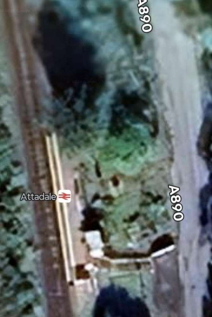
Both road and rail are close once again at Attadale Railway Station which served/served the Attadale Estate and Attadale Gardens. [Google Maps, June 2026]

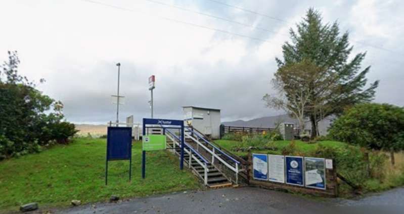
Attadale Railway Station. [Google Streetview, September 2025]

The road and railway remain close together for a distance to the South of Attadale Station, passing through Stromeferry Tunnel.

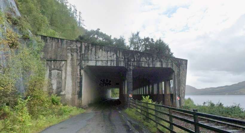
The Strathcarron Tunnel was designed to provide protection for both the railway and the A890. Current arrangements mean that the road is close and traffic diverted to run through the rail tunnel under strictly controlled traffic arrangements. [Google Streetview, September 2025]

The tunnel is a concrete structure which covers both the railway and A890, it protects the railway and road from the cliff above. The tunnel was built in the 1970s. When the Stromeferry Bypass road opened, it met the older road from Strathcarron and in doing so resulted in the closure of the Strome Ferry crossing from Stromeferry to North Strome Pier. [10]

The cutting back of the cliff face for the road resulted in instability and the surface was netted to prevent rockfalls. [11]

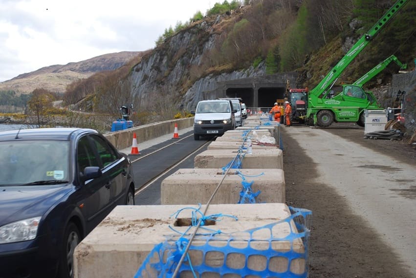
Work became necessary on the cliff face, the space for doing this needed the road traffic to be diverted onto the line of the railway. Matting was placed on the railway to allow this and an arrangement that interlocked the railway signalling with the road traffic lights. [11][12]

Looking Northeast through Strathcarron Tunnel during traffic restriction in place in 2018. In this photograph we see that vehicles are running over the line of the railway and controlled by interlocked traffic lights and railway signals. [12]

Since 2012, the Highland Council have been consulting with local people and drawing up a number of plans to alleviate the rockfall problem in the future. “Widening the existing route is now seen as a complete non-starter, although netting on the cliff faces, and regular monitoring of their condition, have kept the road open. The two main proposals remaining are … to redirect the road around the back of the hills from Attadale to Glen Udalain, or to build a bridge at Strome. This second option would also see the pretty lochside village of Lochcarron bypassed, with a new road around the back on the hillside, although doubtless this could be put back as a long term aspiration, with the bridge still built. In both of these options the present road below the cliff would then be converted to a rock trap to protect the railway, with the two ends remaining open for local access.” [13]

Southwest of the Strathcarron Tunnel road and rail run close together along the shore of the loch. [Google Streetview, September 2025]

The close alignment continues for some distance further to the Southwest. [Google Streetview, September 2025]

With the A890 now a little further inland the railway approaches Stromeferry. This view looks back along the line to the Northeast. [Google Streetview, May 2010]
Looking ahead towards Stromeferry Railway Station at the same location. [Google Streetview, May 2010]
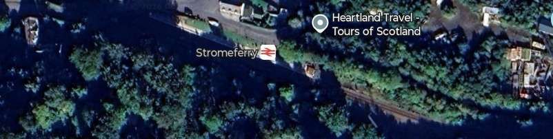
Stromeferry Railway Station. [Google Maps, June 2026]
Stromeferry Railway Station seen from the West. [Google Streetview, April 2009]
A little further down the coast an approach road to the shore passes under the line by means of a low arch bridge. [Google Streetview, September 2025]
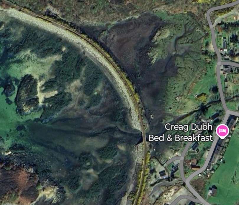
The line bridges the mouth of Abhainn Srath Ascaig. [Google Maps, June 2026]
It also crosses the mouth of a small lagoon. [Google Maps. May 2026]
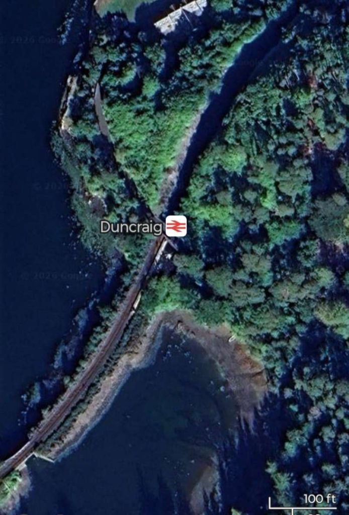
And then it enters Duncraig Railway Station and across the mouth of another lagoon. [Google Maps, June 2026]
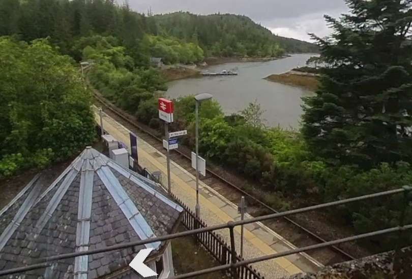
Duncraig Railway Station seen from the access road bridge. [Google Streetview, June 2025]
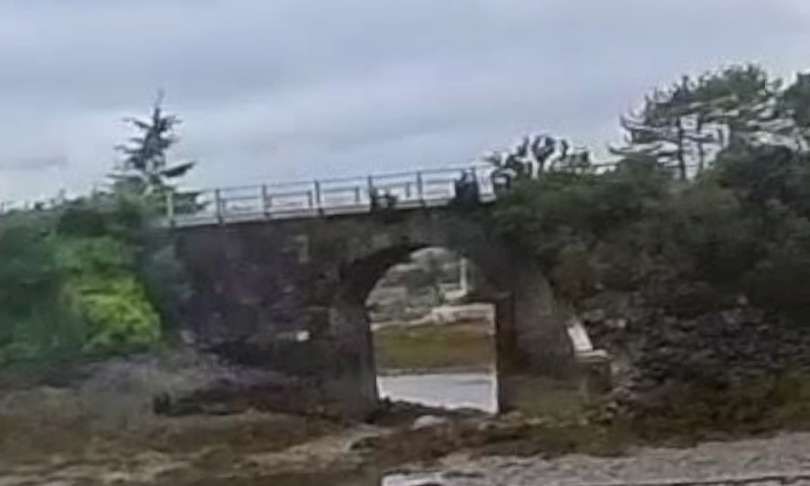
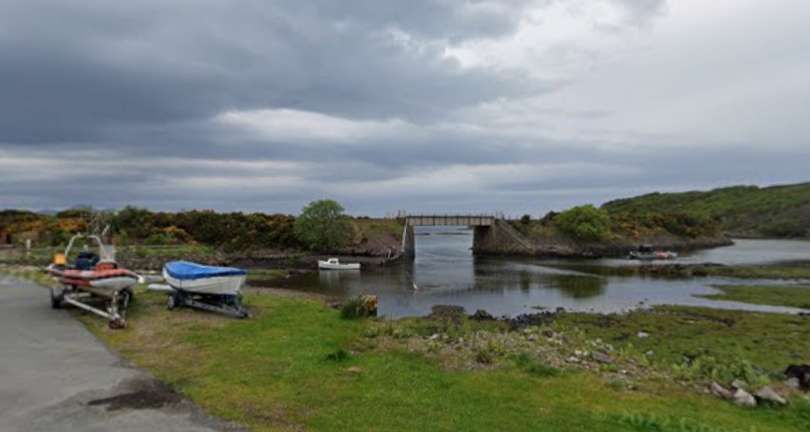
The arch bridge over the mouth of the lagoon to the Southwest of Duncraig Station. [Google Streetview, June 2025]
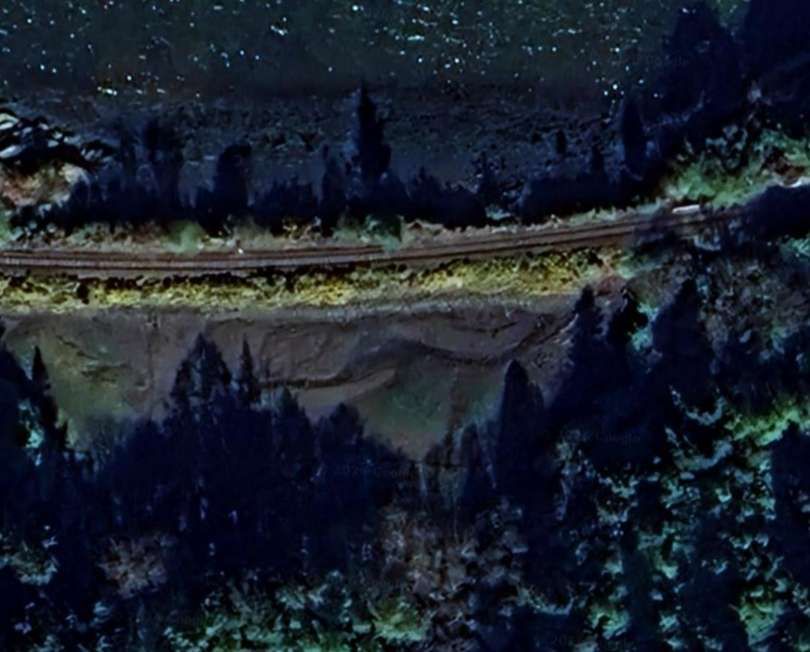
Another bridge (smaller this time) over the mouth of another lagoon formed by an embankment carrying the line. [Google Maps, June 2026]
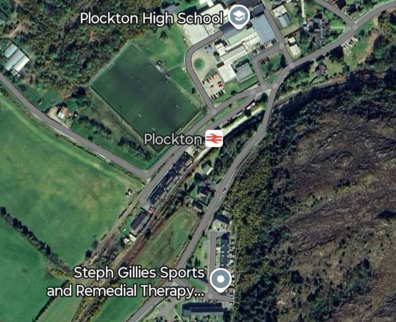
The next significant location along the line is Plockton Railway Station. [Google Maps, June 2026]
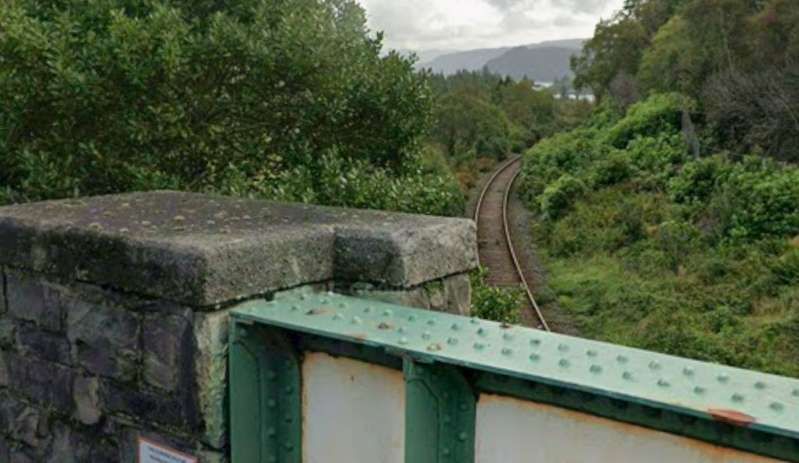
Looking back East along the line from the road bridge over the railway station. [Google Streetview, September 2025]
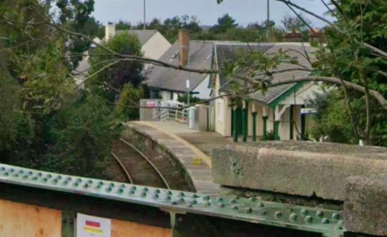
Plockton Railway Station as seen from the road bridge over the Northeast end of the station site. [Google Streetview, September 2025]
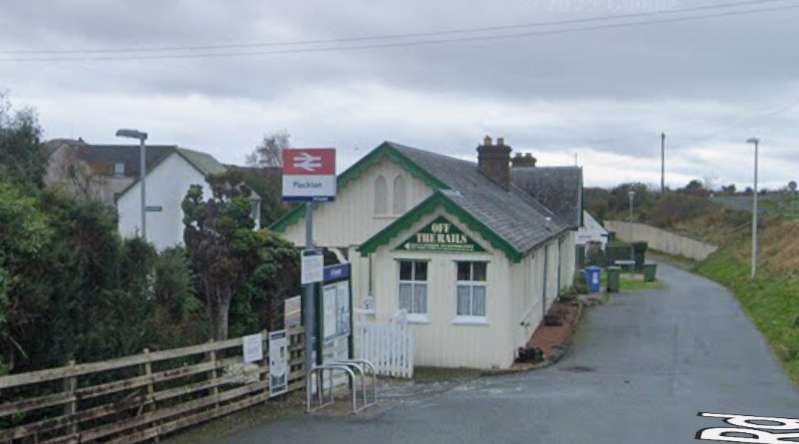
The Station building seen from the Northeast on Station Road. [Google Streetview, November 2021]
The line then crosses another stream as it flows into the loch. [Google Maps, June 2026]
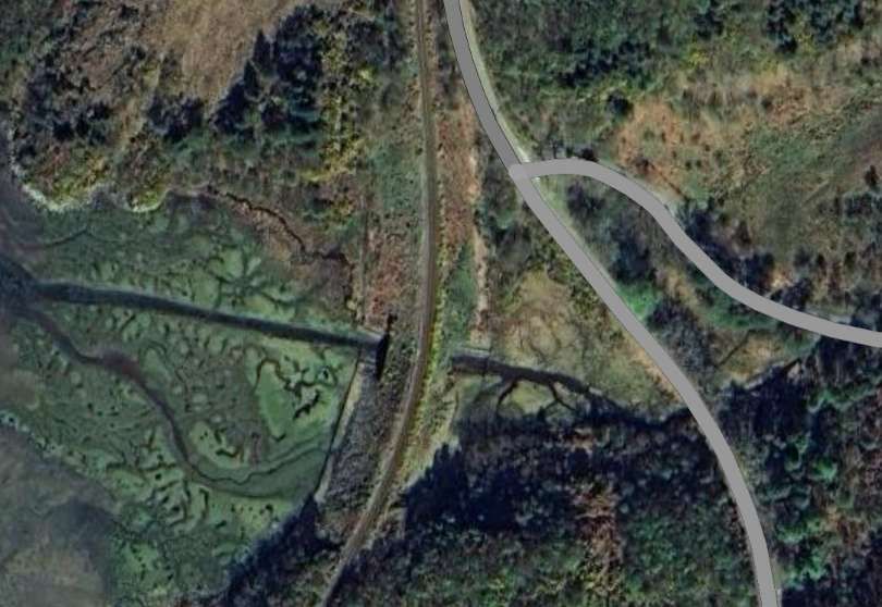
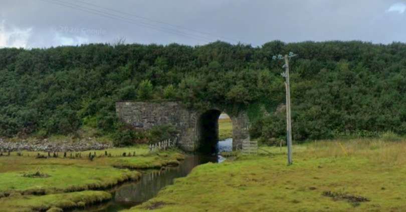
The embankment at this location is relatively significant in height, the steam passes under the line via a stone-arched culvert. [Google Streetview, September 2025]
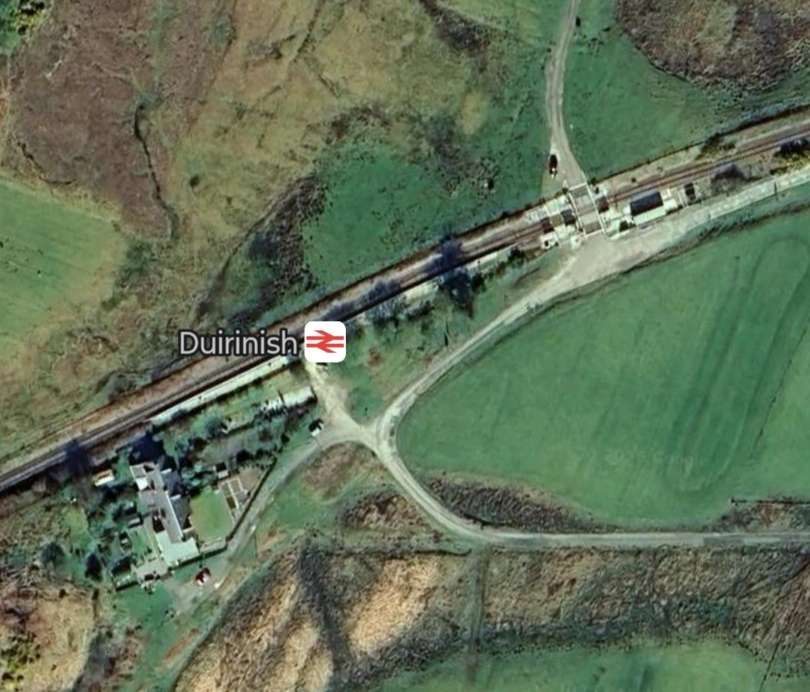
At Duirnish Railway Station the line crosses a minor road serving a few properties on the loch shore. [Google Maps, June 2026]
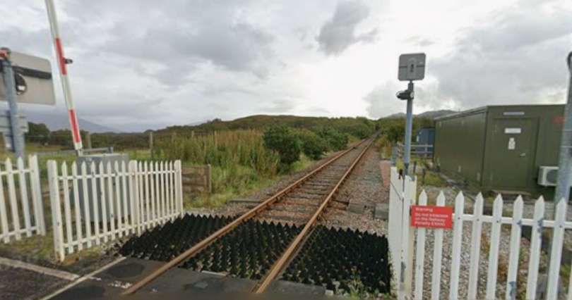
Looking Northeast from the road-crossing. [Google Streetview, September 2025]
Duirnish Railway Station seen from the Northeast. [Google Streetview, September 2025]
Shortly after passing through Duirnish Railway Station the line is bridged by another minor road. [Google Maps, June 2026]
Another embankment takes the line across an inlet from the loch. [Google Maps, June 2026]
A more substantial structure, this time a steel girder bridge spans the channel through this embankment. [Google Streetview, May 2026]
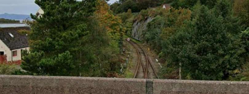
Looking North from Main Street Bridge. [Google Streetview, September 2025]
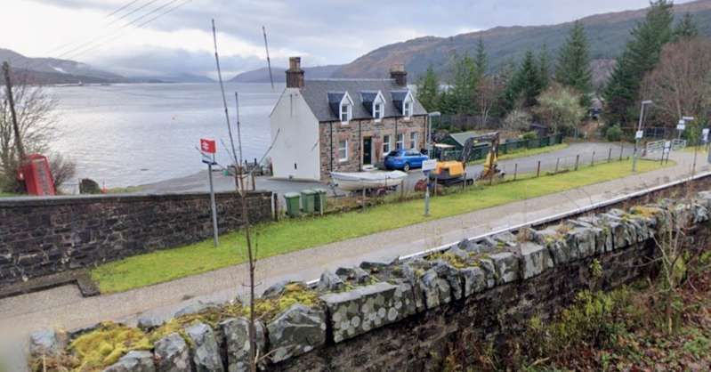
Looking South from Main Street Bridge. [Google Streetview, September 2025]
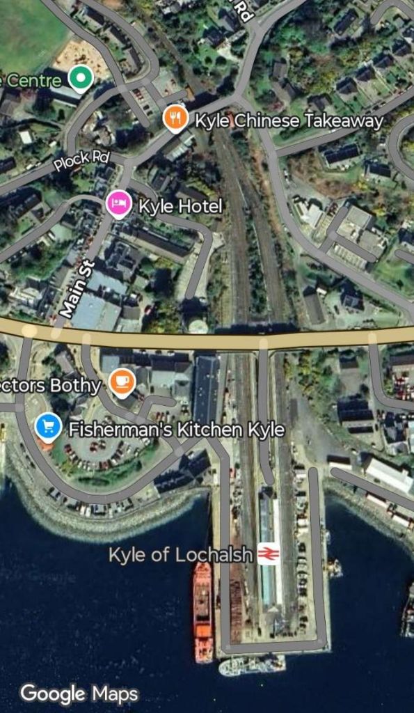
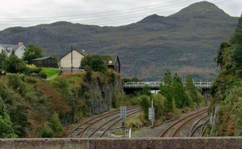
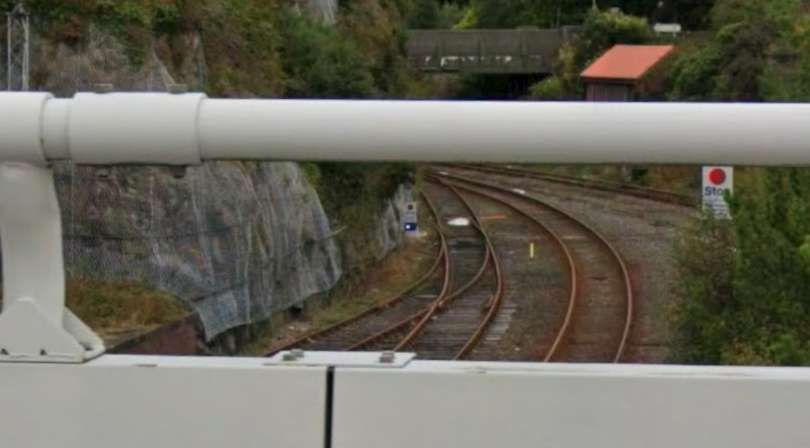
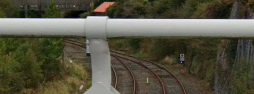
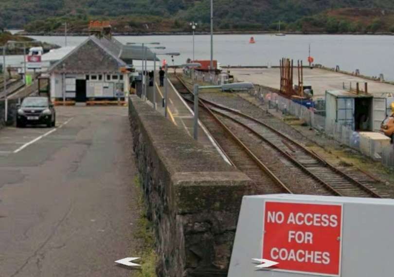
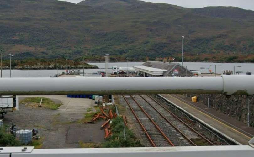
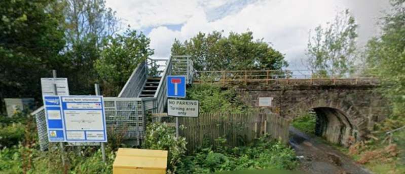
Two images looking North from The bridge carrying Station Road across the two arms of the railway entering Kyle Station. [Google Streetview, September 2025]
Looking South at the lines to the West of Kyle of Lochalsh Railway Station’s island platform. [Google Streetview, September 2025]
A view of the West side of the station in 1939. The ferry to Kyleakin is off scene to the right. A train is leaving for Dingwall and Inverness, with an ex-Highland 4-6-0, (c) Walter Dendy and licensed of reuse under a Creative Commons licence (CC BY-SA 2.0). [14]
Looking South at the lines to the East of Kyle of Lochalsh Railway Station’s island platform. [Google Streetview, September 2025]
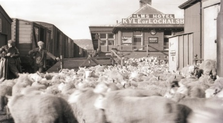
Sheep ready to be loaded onto a train in the years between WWI and WWII. This is one of a number of images of the Kyle line held by the Museum in Kyle of Lochalsh station building. [15]

B. Ireland: Dublin to Wicklow

Irish Rail operates the Dublin Connolly to Arklow line. The 50 mile journey takes 1hr 45mins and costs only €8.85. There are 6 trains each day with 3 on Saturday and Sunday. Make sure to sit on the left.

Nicky Gardner writes:

“Londoners may be surprised to read that Dublin had commuter trains earlier than the UK capital. Ireland’s first railway ran from Westland Row to Kingstown (now Dún Laoghaire), a stretch of track that is now the prelude to a fine route that extends right down to Wexford and Rosslare in the south-east corner of Ireland. The spectacular coastal section just south of Dún Laoghaire is a remarkable piece of engineering as the railway cuts under Bray Head. It was designed by none other than Isambard Kingdom Brunel, and in many ways resembles his celebrated coastal railway at Dawlish in Devon.

“South of Bray Head, the railway hugs the coast, with fine views of the Wicklow Hills well off to the west and the Murrough Wetlands closer to hand. Coastal purists may opt to stop at Wicklow, but I recommend staying on board to enjoy a short foray through the hills and down the Vale of Avoca, with its lush woodland. Alight in Arklow where the railway regains the coast again.” [1: p76]

The line to Dún Laoghaire (and beyond) is part of the Dublin DART network. It is a fast, frequent, and electrified commuter rail system. Originally it ran only along the coast of the Irish Sea, connecting Malahide and Howth in north County Dublin through the city centre down to Greystones in County Wicklow. The DART servesd32 stations and consisted of 53 route kilometres of electrified railway (46 km (29 mi) double track, 7 km (4.3 mi) single), and carried to up 23 million passengers per year. [16] That original network ahs been expanded.
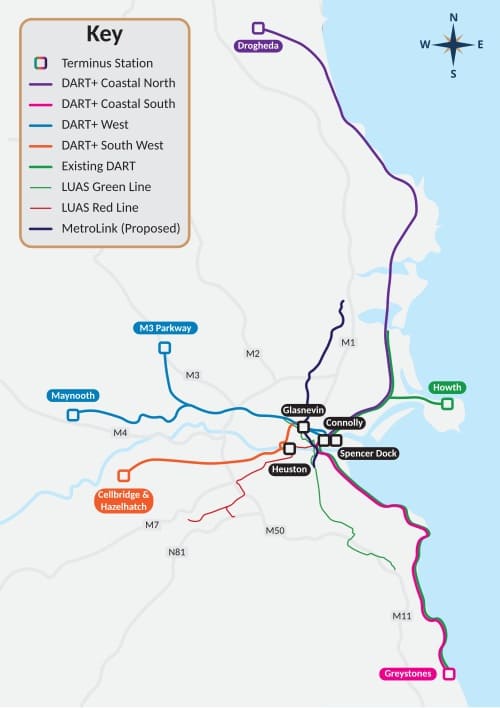
The adjacent image shows the expanded DART network with the original line shown in green. The route that Nicky Gardner highlights is the line shown Magenta and Green to the South of the centre of Dublin with its terminus at Greystones in Co. Wicklow. [16][17]
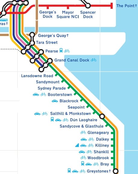
Leaving the centre of Dublin, the Southbound DART follows the coast closely all the way to Greystones. Each of the stations on the route South from Connolly Street Railway Station is shown on the extract from Dublin’s schematic transport map above. [17]
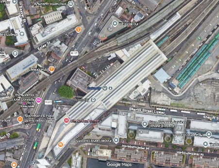
Connelly Street Railway Station – the DART platforms serving the line to the South are those at the top-right of the image, with the DART leaving the image on the lower left. The DART runs on a viaduct above the city streets. [Google Maps, June 2026]

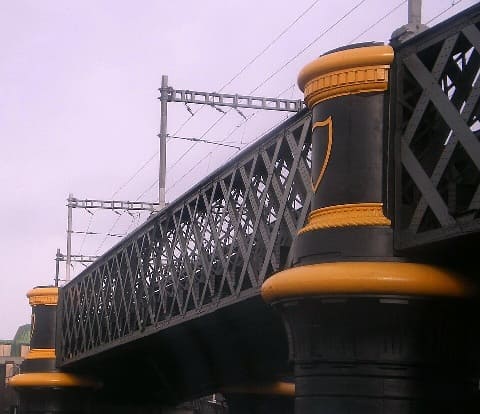
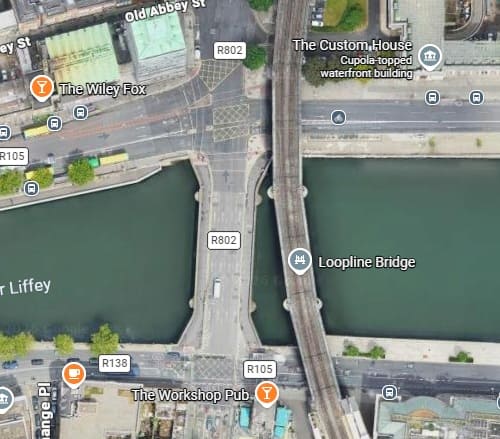
Leaving Connolly Street Station heading South, trains on the DART cross the River Liffey at high level The Bridge is known as the Cumann na mBan Bridge, this utilitarian steel-truss viaduct connects Connolly Station on the northside to Pearse Station on the southside. Designed by John Chaloner Smith (engineer to the Dublin, Wicklow and Wexford Railway), the bridge was built between 1889 and 1891. It consists of wrought iron lattice girders on a double row of piers with five spans. The viaduct is approximately six metres above street level and supports two railway tracks. [18]
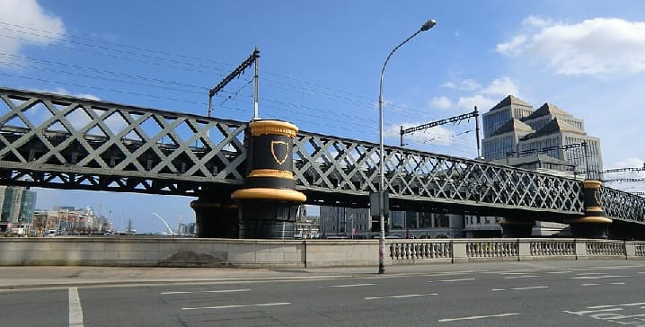
The bridge carrying the DART over the River Liffey (c) YvonneM and licensed for reuse under a Creative Commons Licence (CC BY-SA 3.0). [20]

A closer photograph of the bridge taken in 2008, (c) KGGucwa (Public Domain) [19] and (below) a satellite image showing the bridge. [Google Maps, June 2026]
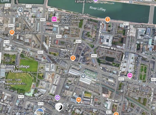
After crossing the River Liffey, the DART runs through Tara Station (top-left) and Pearce Station towards the bottom of the image at the centre. [Google Maps, June 2026]

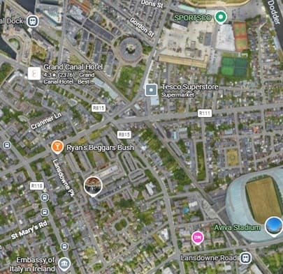
The line continues heading Southeast through Grand Canal Dock Station and Lansdowne Road Station. Just to the South East of Lansdowne Road Station the DART crosses the River Dodder (just off the image to the bottom-right). [Google Maps, June 2026]
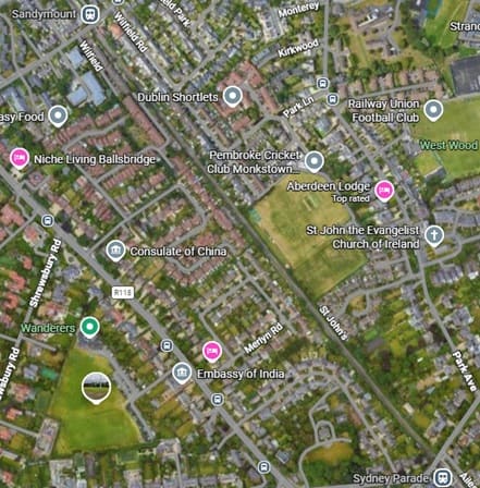
The next two stations are Sandymount (top-left) and Sydney Parade (bottom-right). [Google Maps, June 2026]
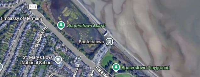
Well before DART trains reach Booterstown Railway Station, they are running Southeast along the coast.
[Google Maps, June 2026]
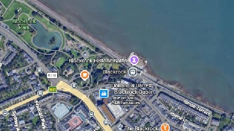
Blackroack Park is passed before Blackrock Railway Station, [Google Maps, June 2026]
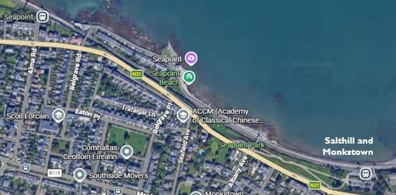
The next two stations are ‘Seapoint’ and ‘Salthill & Monkstown’. [Google Maps, June 2026]
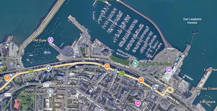
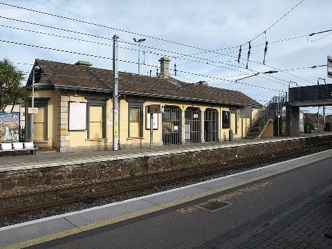
Next come Dún Laoghaire and its railway station. [Google Maps, June 2026]
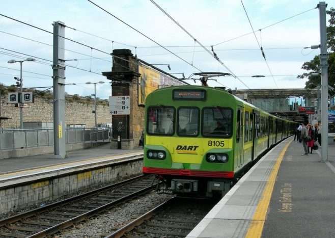
Looking Southeast along the platform used by trains for Dublin, © Paul Sharp. [21]
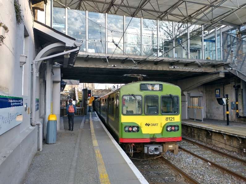
Looking Southeast along the platform used by Southbound trains, © MOs810 and licensed for reuse under a Creative Commons licence (CC BY 4.0). [22]

Nicky Gardner’s focus is on the length of the line to the South of Dún Laoghaire. Immediately to the Southeast of the Station the line passes in tunnel under the central sea front area of the town.
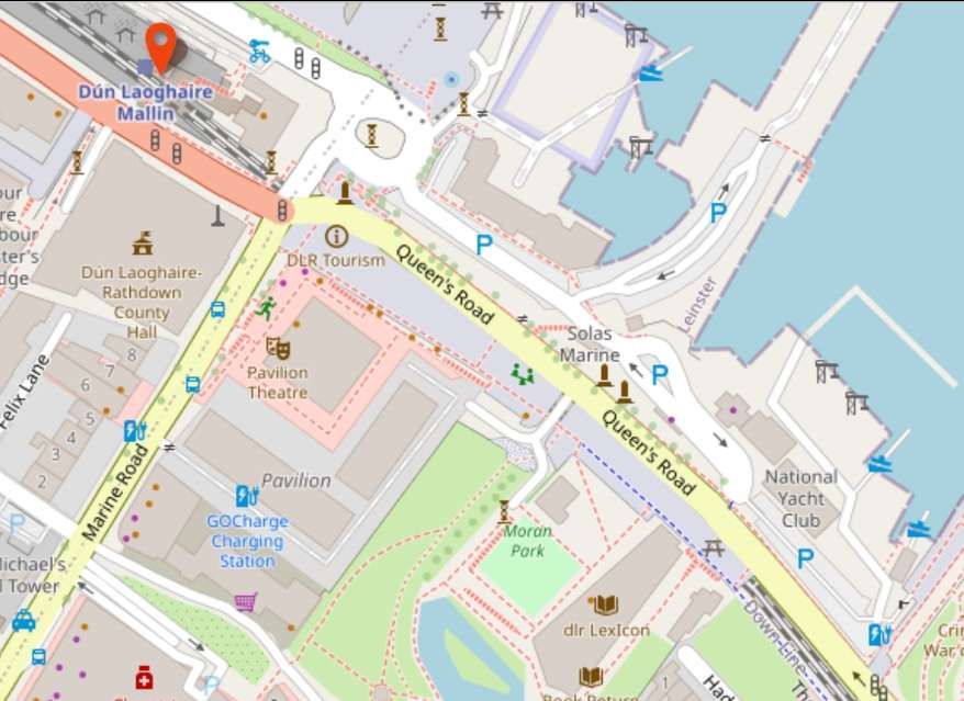
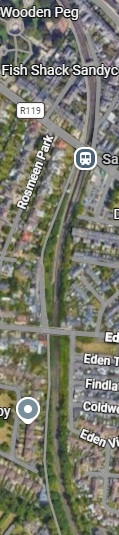
This OpenStreetMap extract shows the tunnel more clearly than some mapping. [21]

Leaving the tunnel to the South East of Dún Laoghaire, the line first head South and passes through Sandycove & Glasthule Station. [Google Maps, June 2026]
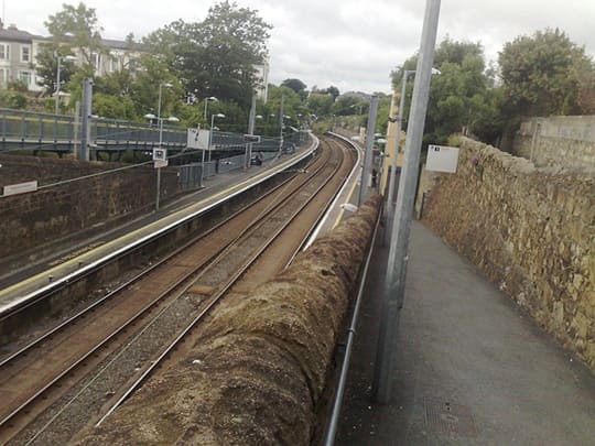
Sandy Cove and Glasthule Station facing South, (c) Autarch and licensed for reuse under a Creative Commons licence (CC BY-SA 3.0). [23]
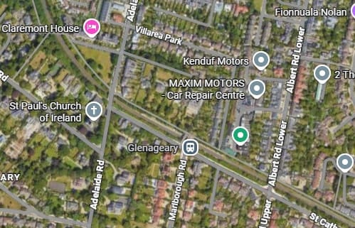
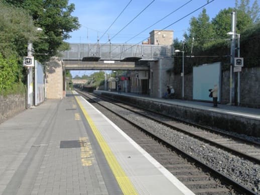
Turning Southeast the line continues through Glenageary Station. [Google Maps, June 2026]

Glenageary Railway Station looking Southeast, (c) Doug Lee and licensed for reuse under a Creative Commons licence (CC BY-SA 2.0). [24]
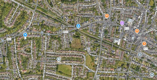
The line continues Southeast through Dalkey Railway Station. [Google Maps, June 2026]

Dalkey Railway Station seen from the Southwest, (c) Andrewrabbott and placed in the Public Domain. [25]
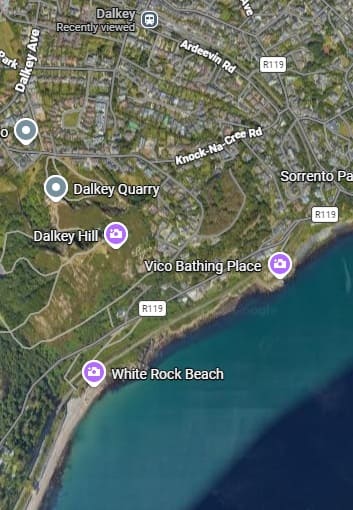
South of Dalkey the line turns through South to South West and follows the coast towards Killiney, shown below. [Google Maps, June 2026]
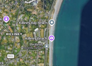
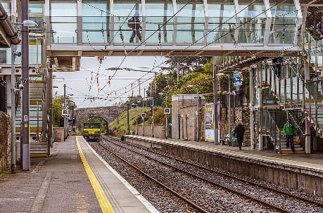
Killiney Station facing South, (c) William Murhy and licensed under a Creative Commons licence. (CC BY-SA 2.0). [26]

Further to the South the line passes through Shankill Railway Station heading South. [Google Maps, June 2026]
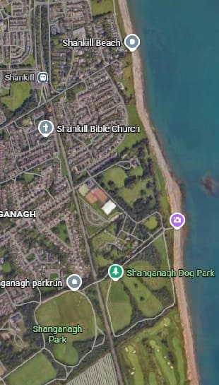
The line continues South from Shankill Railway Station through Woodbrook Railway Station and then Bray Daly Railway Station.
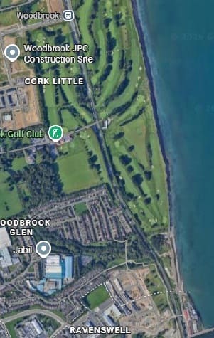
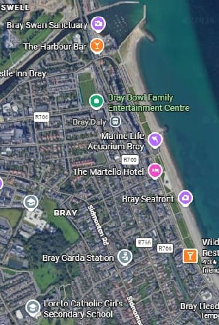
Woodbrook Station is at the top of the first of these images, Bray Daly in the top half of the second. [Google Maps, June 2026]
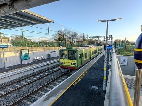
Woodbrook Railway Station looking South with a Northbound service sitting at the platform. [27]

Bray Daly Railway Station looking South with an IE 29000 Class DMU heading South across the level-crossing at the North end of the Railway Station. [28]

South of Bray Daly Railway Station trains run through storage sidings which hold trains during off-peak hours to provide a peak hour service North through Dublin. As the line heads South through these sidings the line become a single track and heads East at first to run alongside the sea and then curving around Bray Head. The single-track line clings to steep cliffs, offering dramatic views of the Irish Sea as it weaves through historic tunnels. A series of photographs of this next length of the line can be found here. [29]

The route around the headland was surveyed and engineered by … Isambard Kingdom Brunel, who at the time was engaged with the construction of the Dublin & Wicklow Railway’s line from Bray to the county town of Wicklow further south. The section of line around the headland from Bray to Greystones was first opened in 1855. The line featured several engineering structures, including tunnels and several wooden trestle built viaducts. High maintenance costs and constant damage from the sea resulted in several deviations from the original 1855 route, the first of which involved the construction of new tunnel (No.1) in 1876, however a section of the 1855 alignment was retained as ‘Worthington Siding’ until 1882. The second occurred in 1879 between No.2 and 3 Tunnels, and the final deviation was implemented as late as 1917, which involved the construction of the longest tunnel (No.4) at 1,042 yards long at the southern end of the headland.” [29]

All of the deviations eliminated the Brunel’s viaducts and cliff sections, the line now taking on the name Brunel’s Folly due to the route’s reconstructions. Today there are four tunnels in total, including some smaller nameless ones. A well maintained pathway between Bray and Greystones overlooks the majority of the railway line.” [29]
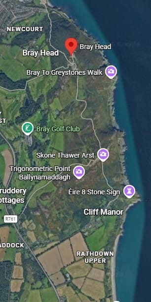
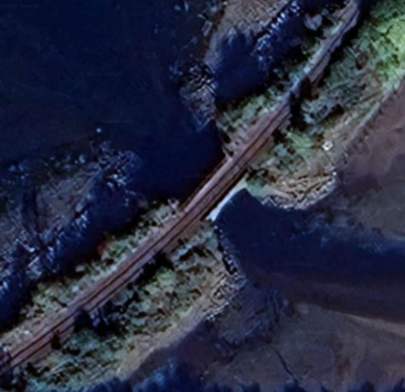
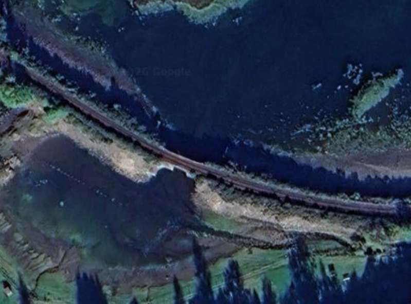
Bray Head: the railway ran close to the sea around the headland. [Google Maps, June 2026][30]
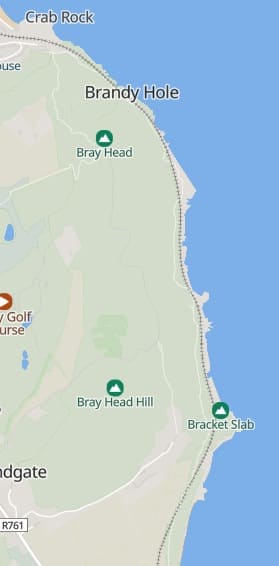
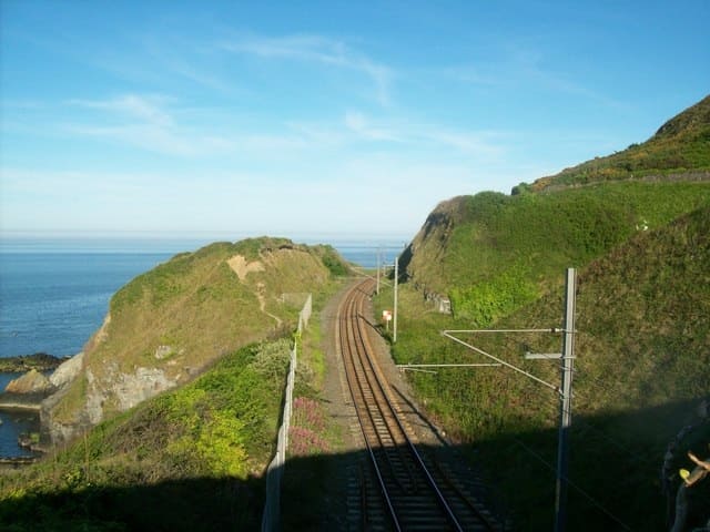
The railway around Bray Head, (c) Stuart Fisher (2008) and licensed for reuse under a Creative Commons licence (CC BY_SA 2.0). [31]

The railway is somewhat less dramatically sited as it heads further South, through Greystones and on to Wicklow. [Google Maps, June 2026]
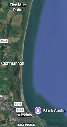
Perhaps it is worth noting that this journey only costs €8.85 single or €17.70 return!

C. Germany: Over the Sea to Sylt

Nicky Gardner suggests that it is best to sit on the left of the train as it leaves Husum to travel to Keitum. A 44 mile journey will cost €21.60 single and take an hour to complete. Trains on the Marschbahn line run hourly and are operated by Deutsche Bahn (DB). [32]

She writes:

“One cannot fail to be impressed by the determination of the Weimar Republic’s engineers and planners who needed to build a railway to Sylt. This sandy outpost of German territory is the largest of the North Frisian Islands. The traditional route to Sylt relied on a ferry from a mainland port on territory which was ceded to Denmark after the first world war. So a causeway was constructed across the Wadden Sea to reach Sylt. It opened in 1927, and a century later the Hindenburg causeway is still car-free – and since mid-April this year it is for the very first time possible to ride a posh ICE train over the sea to Sylt.

“Leaving Husum, a coastal town shaped by the herring trade, we sweep over the town’s harbour on a high bridge. There’s a cluster of fishing boats at the quayside below. Then we glide north over marshlands and meadows, all protected by high dykes to prevent the area from being inundated.

“From the train, you get a real feel for these landscapes with their distant horizons. But the sea seems far away, held at bay by dykes. That changes after Klanxbüll, where the railway turns west and crosses salty mudflats to reach the open sea. Check tide tables and make this journey at high tide – ideally on a stormy day. In such conditions, this is an unforgettable experience. Alight at Keitum, to my mind the nicest village on Sylt. From the station, it is an easy stroll into the village with several cosy cafes and a feast of fine Frisian thatch and gables.” [1: p76-77]

The line to Sylt runs North out of Hamburg. As the train glides gently through the flat expanse of Schleswig-Holstein, picturesque views of green meadows and the Kiel Canal open up. Shortly before arrival, the route offers an unforgettable panorama: the Wadden Sea stretches out before you with its characteristic tidal creeks. [32]
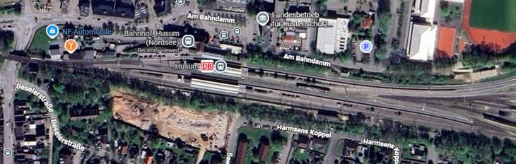
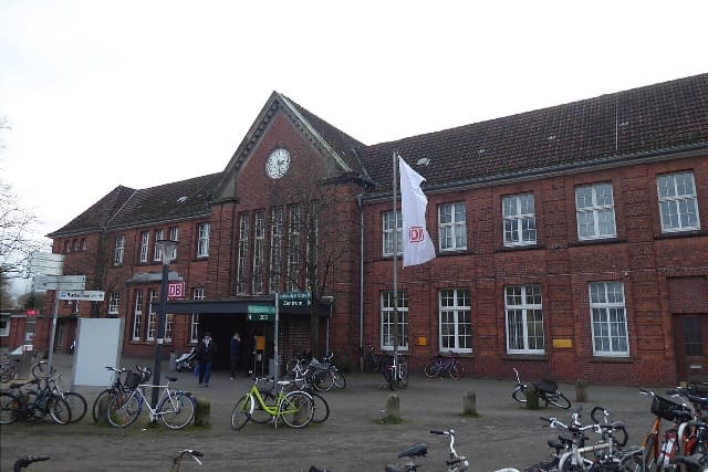
Husum (Nordsee) Railway Station. [Google Maps, June 2026]
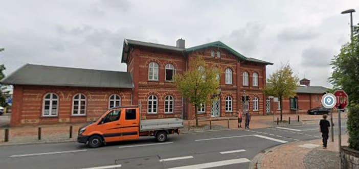
Husum Railway Station Building is a substantial structure, (c) Mef.ellingen and licensed for reuse under a Creative Commons licence (CC BY-SA 4.0). [34]
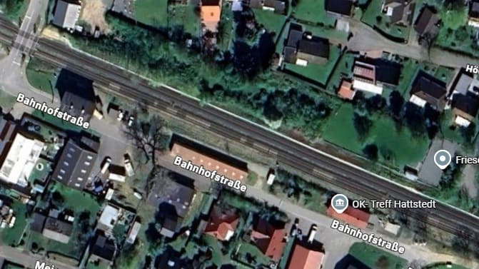
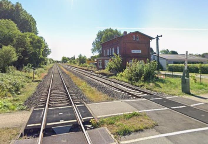
Hattstedt Railway Station. [Google maps, June 2026]
Hattstedt Station seen from the level-crossing at the West end of the station site.
[Google Streetview, August 2022]

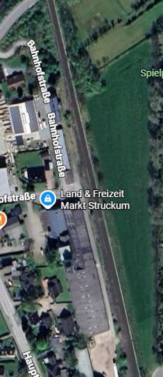
The next station on the line is in Struckum – although, as can be seen below it appears no longer to be in use as a station. [Google Maps, June 2026]
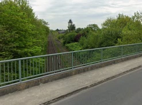
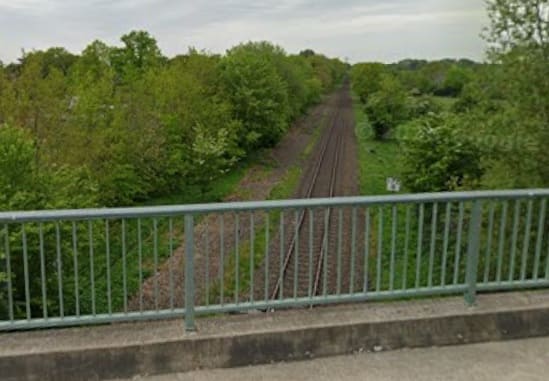
Looking South through the site of the station from Brückenstraße which bridges the line just off the top of the satellite image of the site. [Google Streetview, May 2022]
Looking North from the bridge on Brückenstraße. [Google Streetview, May 2022]

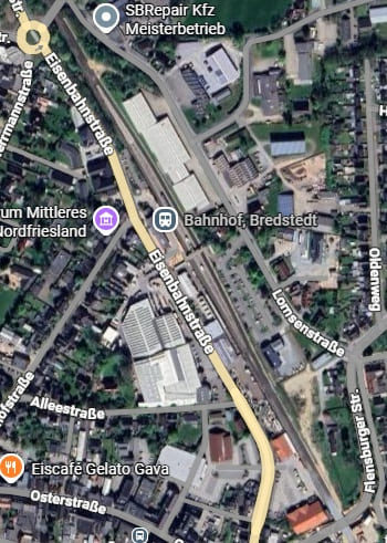
The next station is only a short distance further North in Bredstedt. [Google Maps, June 2026]
Bredstedt Railway Station building seen from the West [Google Streetview, September 2023]
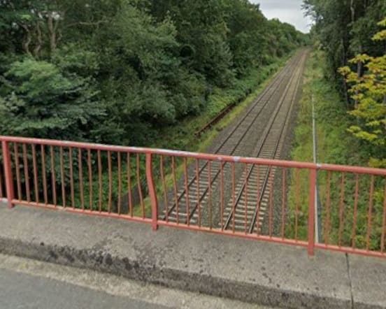
Theis view looks back towards Bredstedt from the bridge carrying Margarethenberg over the line. [Google Streetview, September 2023]
Turning through 180°, this view shows the line heading North towards Langenhorn.
[Google Streetview, September 2023]
Looking back South towards Bredstedt from the level-crossing at Beekensweg.
[Google Streetview, May 2022]
The line ahead to the North from the same level-crossing. [Google Streetview, May 2022]

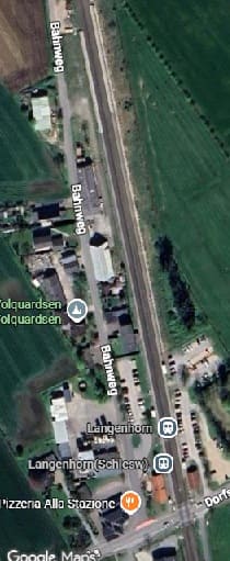
The next station is at Langenhorn. [Google Maps, June 2026]
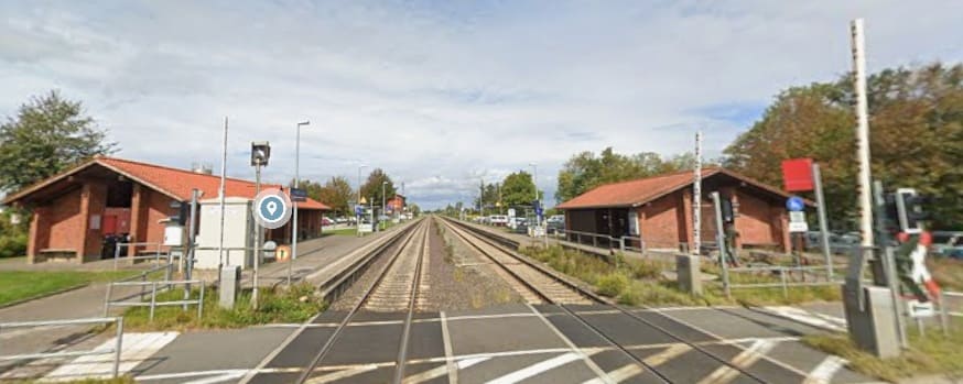
Langenhorn Railway Station seen from the level-crossing at its South end. [Google Streetview, September 2023]

The line continues on a straight alignment just to the West of North. The next image shows the view North along the line at the Dorpstraat level-crossing in Bargum.
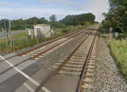
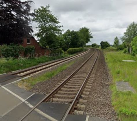
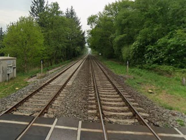
Looking North at the Dorpstraat Level-Crossing in Bargum. [Google Streetview, September 2023]

The view North from the railway-crossing on Dorfstraße at Stedesand. [Google Streetview, June 2022]
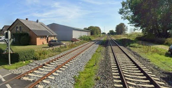
Looking Southeast from the level-crossing on Dorfstraße in Risum-Lindholm. [Google Streetview, September 2023]
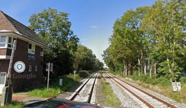
Looking Northwest at the same level-crossing. [Google Streetview, September 2023]
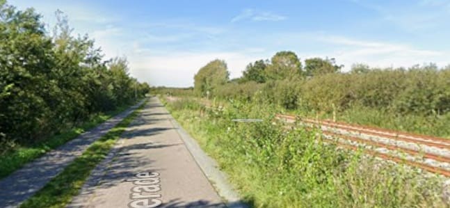
Further Northwest, this is the view along Legerade with the railway alongside.
[Google Streetview, September 2023]

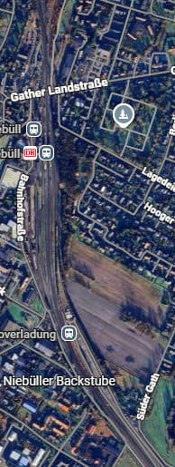
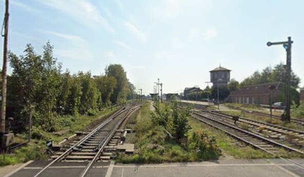
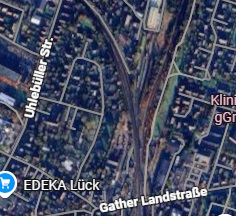
The next railway station at Niebüll is in two parts. There is the normal passenger facility towards the top of the adjacent satellite image. To the South of this station is the loading point for the SyltShuttle at Niebüll – Niebüll Autoverladung. It is the point that vehicles travelling to Sylt are loaded onto the shuttle trains – ‘Blue’ or ‘Red’ [Google Maps, June 2026]
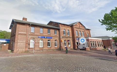
Niebull Railway Station building seen from the West. [Google Streetview, May 2022]
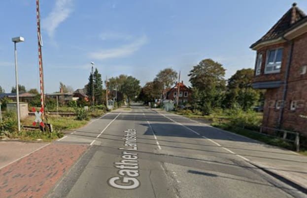
Looing East across the level-crossing on Gather Landstraße at the North end of the Railway Station site. [Google Streetview, September 2023]
Looking Southinto the Station site from the crossing at Gather Landstraße [Google Streetview, September 2023]

North of the Railway Station in Niebull a junction divides the single line heading North from the line serving Sylt which head Northwest. [Google Maps, June 2026]
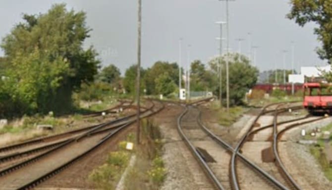
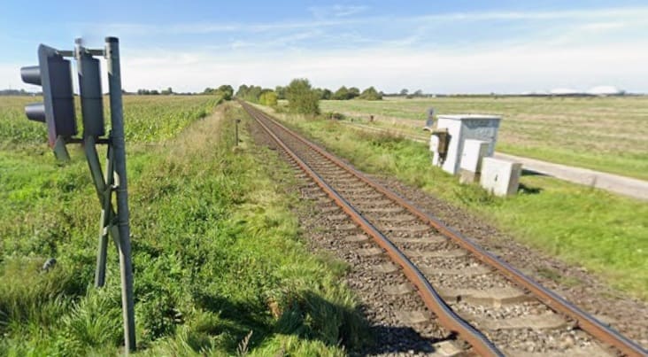
The line to Sult heads to the left (Northwest) after crossing Gather Landstraße [Google Streetview, September 2023]
Looking Northwest from the level-crossing at Süderende. [Google Streetview, September 2023]
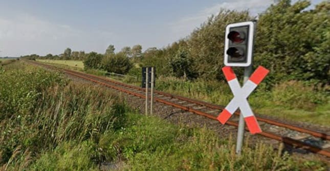
The w ide-open, expansive and flat countryside is once again emphasised by this view North from the level-crossing at Süderdeich. [Google Streetview, September 2023]

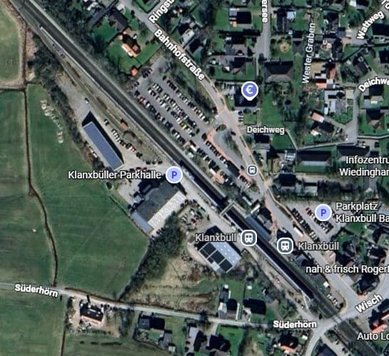
Klanxbüll, Schleswig-Holstein is the final station on the mainland before the embankment/causeway that takes the railway across the Wadden Sea. [Google Maps, June 2026]
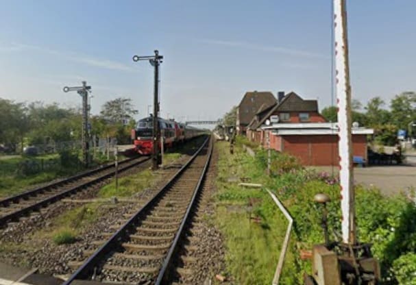
Klanxbüll, Schleswig-Holstein as seen from the level-crossing at the Southeast end of the station site. [Google Streetview, September 2023]
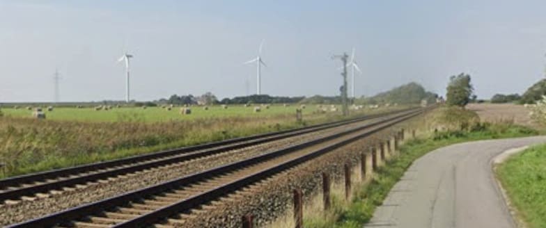
Wide open flat lands on the approach to the Wadden Sea. [Google Streetview, September 2023]

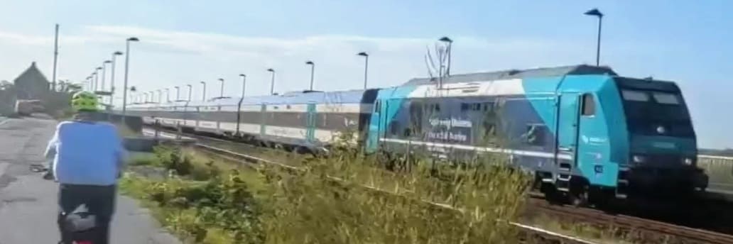
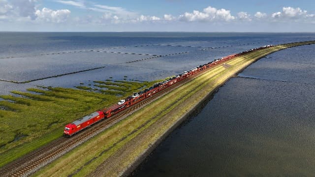
A drone’s eye view of the shuttle service operated by DB (the Red Train) which crosses the embankment leading to Sylt. [35]
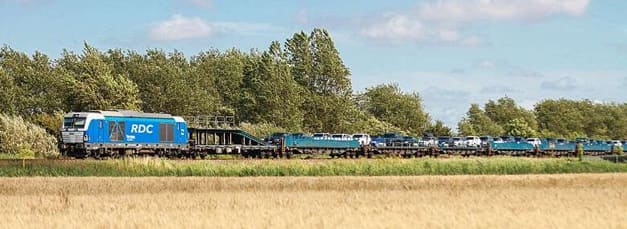
The Blue Train covers the same route – it is operated by RDC Deutschland (Railroad Development Corporation). [36]

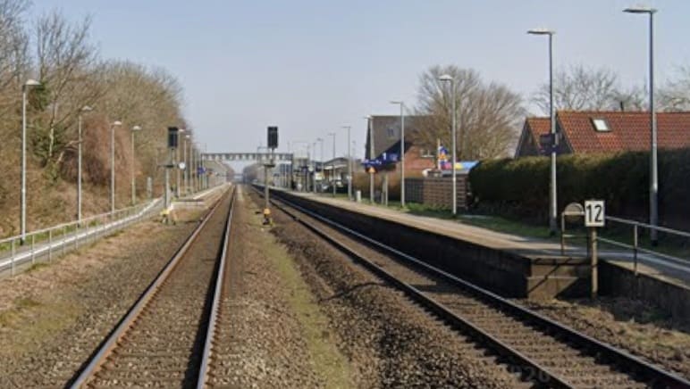
A drone’s eye view of the shuttle service operated by DB which crosses the embankment leading to Sylt. [35]
The first railway station on Sylt is Morsum. [Google Maps, June 2026]
Morsum Railway Station seen from the level-crossing at the West end of the station site.
[Google Streetview, March 2022]
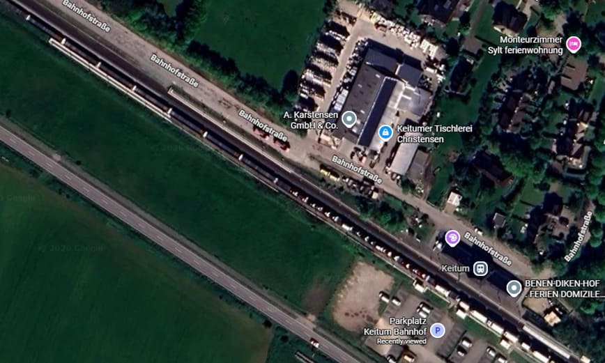
Keitum Railway Station. [Google Maps, June 2026]
Train sitting at Keitum Railway Station enroute to Westerland Railway Station. [Google Streetview, August 2025]

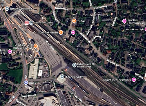
Westerland Railway Station on Sylt. Car trains unload and load here. [Google Maps, June 2026][Google Streetview, March 2022]
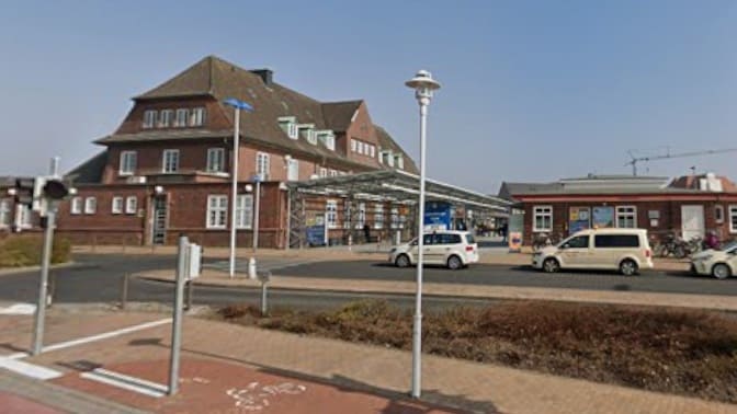
Westerland is the end of the line and the last kilometre or two from Keitum to Westerland are not particularly scenic. It seems as though Nicky Gardner is happy to get off the train at Keitum. The flat landscape and the significant crossing of the Wadden Sea by train are positive attributes of a line, that to me at least, seems to be less than Nicky Garner promises it will be.

The next article in this series will be the last. It focuses on a line in Northern Spain and a line in Southern Italy.

References

  1. Nicky Gardner; Over Land & Sea: Magical Views and Sea-Hugging Routes on Europe’s Best Coastal Train Lines; in Saturday (the Guardian Magazine), 23rd May 2026, p76-77.
  2. https://commons.wikimedia.org/wiki/File:Strathpeffer_1885.png, accessed in March 2025.
  3. https://en.wikipedia.org/wiki/Garve_railway_station, accessed on 4th June 2026.
  4. https://www.ambaile.org.uk/asset/27725, accessed on 4th June 2026.
  5. https://www.kweimar.de/Bilder_XML.php?ket=HL947#nowhere, accessed on 4th June 2026.
  6. https://en.wikipedia.org/wiki/Glencarron_Platform_railway_station, accessed on 5th June 2026.
  7. https://www.geograph.org.uk/photo/4413959, 5th June 2026.
  8. https://en.wikipedia.org/wiki/File:Achnashellach_Station_Nov2019.jpeg, accessed on 5th June 2026.
  9. https://www.geograph.org.uk/photo/7531766, accessed on 5th June 2026.
  10. https://www.facebook.com/share/p/1DDYwfmA2y, accessed on 5th June 2026.
  11. https://www.railscot.co.uk/locations/A/Avalanche_Shelter, accessed on 5th June 2026.
  12. https://www.networkrailmediacentre.co.uk/news/new-system-signals-changes-for-stromeferry-motorists, accessed on 5th June 2026.
  13. https://www.sabre-roads.org.uk/wiki/A890/route, accessed on 6th June 2026.
  14. https://www.geograph.org.uk/photo/5128618, accessed on 7th June 2026.
  15. https://www.kylestationmuseum.org/about/the-kyle-line, accessed on 7th June 2026.
  16. https://en.wikipedia.org/wiki/Dublin_Area_Rapid_Transit, accessed on 7th June 2026.
  17. https://www.dublinpublictransport.ie/dublin-train-map, accessed on 7th June 2026.
  18. https://en.wikipedia.org/wiki/Loopline_Bridge, accessed on 7th June 2026.
  19. https://commons.wikimedia.org/wiki/File:Butt-railway-bridge.JPG, accessed on 7th June 2026.
  20. https://commons.wikimedia.org/wiki/File:Loopline_Bridge.JPG, accessed on 7th June 2026.
  21. https://www.ouririshheritage.org/content/knowyour5k/dun-laoghaire-mallin-railway-station-3, accessed on 7th June 2026.
  22. https://en.wikipedia.org/wiki/D%C3%BAn_Laoghaire_railway_station#/media/File%3ADART_Dublin_train_2023_(3).jpg,, accessed on 7th June 2026.
  23. https://en.wikipedia.org/wiki/Sandycove_and_Glasthule_railway_station, accessed on 8th June 2026.
  24. https://commons.wikimedia.org/wiki/File:Glenageary5.jpg, accessed on 8th June 2026.
  25. https://commons.wikimedia.org/wiki/File:DalkeyRailwayStation.JPG, accessed on 8th June 2026.
  26. https://commons.wikimedia.org/wiki/File:Killiney_station.jpg, accessed on 8th June 2026.
  27. https://en.wikipedia.org/wiki/Woodbrook_railway_station#/media/File:Woodbrook_Station,_Northbound_DART_02.jpg, accessed on 8th June 2026.
  28. https://en.wikipedia.org/wiki/Bray_Daly_railway_station, accessed on 8th June 2026.
  29. http://eiretrains.com/Photo_Gallery/Railway%20Stations%20B/Bray%20Head/IrishRailwayStations.html, accessed on 8th June 2026.
  30. https://mapcarta.com/37562730/Map, accessed on 8th June 2026.
  31. https://www.geograph.org.uk/photo/1323345, accessed on 8th June 2026.
  32. https://int.bahn.de, accessed on 8th June 2026.
  33. https://www.sylt.de/en/anreise-mobilitaet/bahnanreise, accessed on 8th June 2026.
  34. https://en.wikipedia.org/wiki/Husum_station_(Germany)#/media/File:P1020943_Bahnhof_Husum_2019.jpg, accessed on 9th June 2026.
The Guardian Lifestyle Travel – Saturday 23rd May 2026 – Part 3 – Readers’ Favourite Railway Journeys – Part A

The travel section of the Saturday Guardian Magazine on 23rd May 2023 included a few pages about train journeys in Europe (pages 72 to 77). This is the third part of a look at those pages and focuses on some reader’s recommendations of journeys by train. It includes a few more uploaded by the Guardian online.

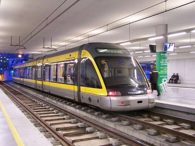
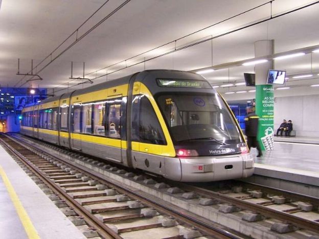
The featured image for this article is a Flexity Outlook Eurotram at Trindade station in Porto, Portugal, © Cornelius Kibelka and licensed for reuse under a Creative Commons licence (CC BY-SA 2.0). [3]

3. Readers’ Favourite Railway Journeys

A. A Dramatic Metro Line in Porto

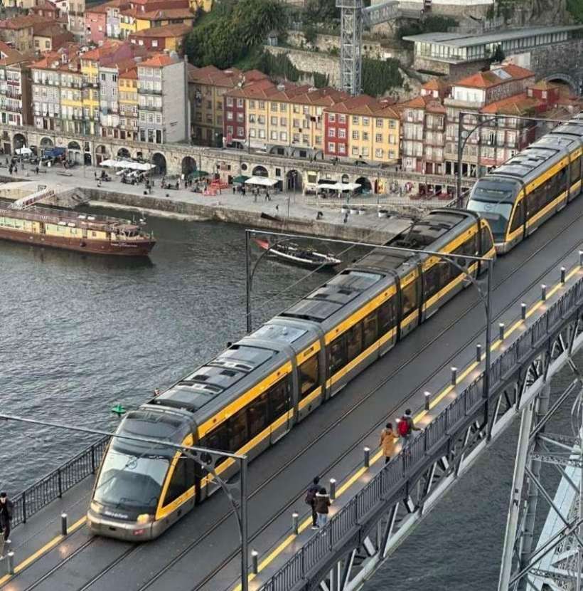
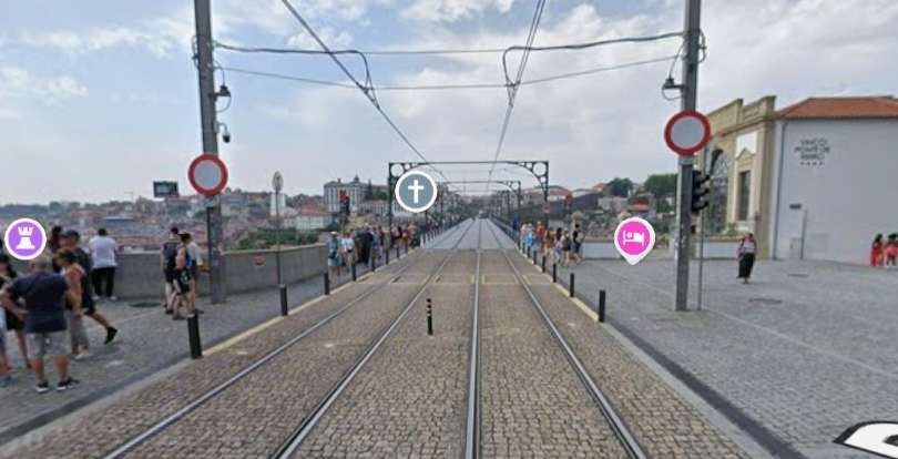
“I love the surprise of urban rail. Porto’s metro D line heading south emerges from mundane darkness underground to suddenly skim rooftops and then rattle across the fantastic Eiffel-inspired Dom Luís I bridge. Choosing to walk back across the metal deck is a completely different experience.” [1: p75][12][Reader: Amy]

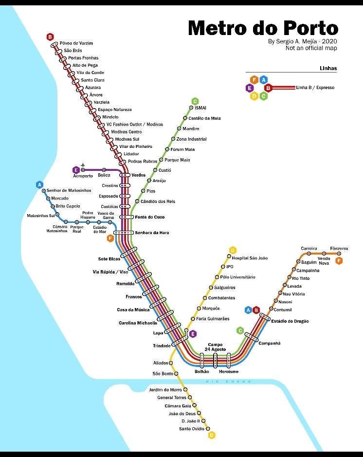
A map of the Metro in Porto. The yellow line is line D. It runs from Hospital Sãn João to Santo Ovidio. It is the one Metro line that crosses the Rio Douro. [2]

The Porto Metro (Portuguese: Metro do Porto) is the light rail network in Porto. It runs underground in central Porto and above ground into the city’s suburbs. The first parts of the system have been in operation since 2002. The network uses low-floor tram vehicles. [3]

A Flexity Outlook Eurotram at Trindade station, © Cornelius Kibelka and licensed for reuse under a Creative Commons licence (CC BY-SA 2.0). [3]

The Socimi Eurotram (later sold as the Bombardier Flexity Outlook (E)) is an electric tramcar originally designed for the tram system of Compagnie de Transports Strasbourgeois (CTS). Initially produced by Socimi, after the company became bankrupt Eurotrams were manufactured first by ABB Group’s transportation division, then by Adtranz and finally by Bombardier Transportation, who marketed the tram as part of their Flexity Outlook range.” [4]

One of the Flexibilty Outlook Eurotrams crossing the Dom Luis I bridge over the Rio Duoro, © Sergei Gussev and licensed for reuse under a Creative Commons licence (CC BY 2.0). [5]
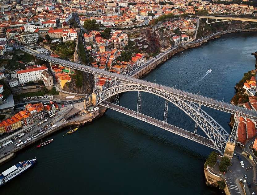
An aerial view of the Dom. Luis 1 Bridge over the Rio Douro in Porto. The bridge carries a road on a lower deck and the Metro Line D on the upper deck, © Deensel and licensed for reuse under a Creative Commons licence (CC BY 2.0). [6]
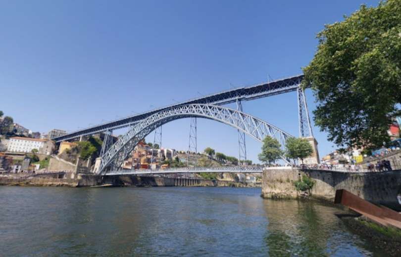
The Dom. Luis I Bridge seen from the West, © Milton Li, June 2019. [Google Maps, May 2026]

The bridge was designed by Theophile Seyrig and opened at the end of October 1886. In the 21st century, “the bridge’s upper level is used by pedestrians and by line D of the Porto Metro, whilst the lower level is used by buses, taxis, cyclists and pedestrians. The lower level links to the Porto waterfront, including the Praça da Ribeira and the lower station of the Guindais Funicular, at its northern end, and to Gaia waterfront, with its Port wine lodges, at its southern end. The upper level connects to Porto city centre and São Bento station at its northern end, and adjoins the Serra do Pilar Monastery and the upper station of the Gaia Cable Car at its southern end.” [6]

In 1879, Gustave Eiffel presented a project to construct a new bridge over the Douro, with a high single deck in order to facilitate ship navigation. This project was rejected due to dramatic growth of the urban population, which required a re-thinking of the limits of a single-deck platform. … A competition was initiated in November 1880, in order to construct a double-deck metal bridge, which included projects by Compagnie de Fives-Lille, Cail & C., Schneider & Co., Gustave Eiffel, Lecoq & Co., Société de Braine-le-Comte, Société des Batignolles (which submitted two ideas), Andrew Handyside & Co., Société de Construction de Willebroek (also two projects) and John Dixon. It was in January of the following year that deliberations by the committee supported the project of Société de Willebroek, a design that cost 369,000 réis and provided better carrying capacity. On 21st November 1881, the public work was awarded to the Belgian Société de Willebroek, from Brussels, for 402 contos. It was to be administered by Théophile Seyrig, the former partner of Gustave Eiffel and author of the project. Seyrig had also designed the Maria Pia bridge that was constructed by Eiffel & cie, hence the resemblance of his new bridge to the Maria Pia bridge. Construction began on the Luis I bridge alongside the towers of an earlier suspension bridge, the Ponte Pênsil, which was disassembled.” [6]

By 26th May 1886, the first weight experiments began, with the transport of a 2,000 kilograms (4,400 lb) per metre. On 30th October construction of the main arch and upper deck were concluded, resulting in its inauguration the very next day. On 1st November, a toll system began to operate under the administration of the winning company, that was equal to 4 reís per person. The following year the lower deck was inaugurated, completing the project. During its ceremonies, the bridge was blessed by Bishop D. Américo.” [6]

Line D (yellow line) opened on 17th September 2005 between Câmara de Gaia in Vila Nova de Gaia and Pólo Universitário in the North. At the northern end, the São João Hospital and IPO stations, were not brought into service until March 2006 due to safety concerns. At the southern end, the line was expanded until D. João II in May 2008 and then to Santo Ovídio in October 2011. In June 2024, the line was extended southwards by 3.15 km with three new stations added, Manuel Leão, Hospital Santos Silva and Vila d’Este. [3]

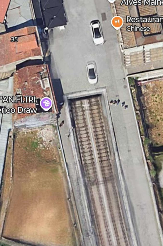
The Guardian reader (Amy) speaks of the tram emerging from the darkness of the tunnel before crossing the bridge. The tunnel mouth can be seen in the satellite image immediately below.

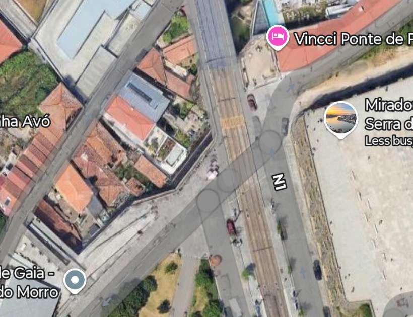
This satellite image shows the location mentioned above. Trams emerge from underground on the North side of the Rio Douro and are soon high above city streets such as Escardas do Codecal and Av. Gustavo Eiffel and then crossing the river. [Google Maps, May 2026]

On the South side of the river trams fly over R. da Cabo Simeo and Calcada da Serra before meeting and crossing R. Rocha Leao at level.

Metro line D runs North to South, crossing R. Rocha Leao at level. [Google Maps, May 2026]
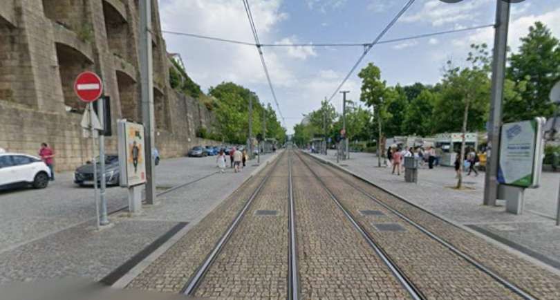
Looking North towards the Rio Douro from R. Rocha Leao. [Google Streetview, June 2025]
Turning through 180°, this is the view South along Metro Line D from R. Rocha Leao. [Google Streetview, June 2025]

The Guardian reader talked of crossing the bridge on the Metro and then walking back over it afterwards!

B. Fjords and Waterfalls in Norway

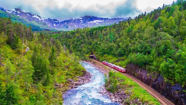
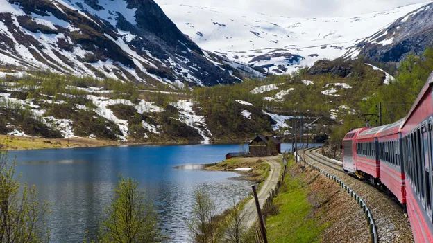
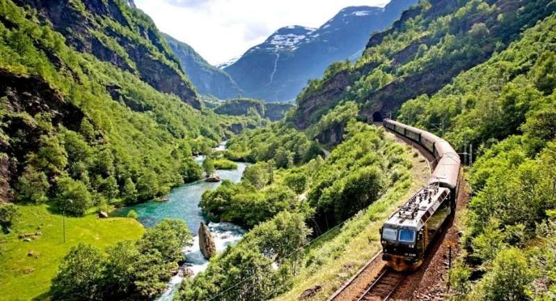
“I travelled across Norway by rail on the spectacular Bergensbanen, running between Oslo and Bergen, and the unforgettable Flåmsbana branch line. The Bergensbanen crosses the high mountain plateau of Hardangervidda, passing lakes, forests and snow‑covered peaks before descending toward the fjords of western Norway. At Myrdal, I transferred on to the steep Flåmsbana, which drops dramatically to Flåm on the Aurlandsfjord, with waterfalls and sheer-sided valleys at every turn.” [1: p75][12][Reader: Daniel]

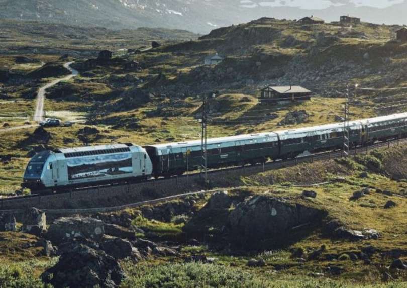
The Bergensbanen is a spectacular 496-kilometre railway connecting Oslo and Bergen in Norway. Taking approximately 7 hours, it is Northern Europe’s highest mainline railway, reaching 1,237 metres above sea level. The line runs 4 to 6 times daily, offering stunning views of Hardangervidda mountain plateau and deep fjords.

Trains on the Bergensbanen are operated by Vy. [7] Highlights along the way include Finse (the highest station), Myrdal (transfer to the Flåm Railway), and Voss (a major skiing hub).

The Bergensbanen is actually a 371-kilometre (231 mile) long scenic standard-gauge railway line between Bergen and Hønefoss, Norway. However, the name is often applied to the entire route from Bergen to Oslo, including the Randsfjord and Drammen lines between Hønefoss and Oslo, covering a total distance of 496 kilometres (308 miles). [8]

The Bergen Railway (Bergensbanen)
Between Oslo and Bergen by train, © Vy/Øivind Haug. [9]
Connecting Norway’s stylish capital with its most picturesque city, the 496km, 39-station Oslo-Bergen railway is one of the world’s most beautiful train journeys, © MariusLtu/Getty Images. [10]
The route crosses the inhospitable Hardangervidda plateau, which soars more than 1km above sea level, © Stockstudiox/Getty Images. [10]

The Flåmsbana is one of the most beautiful train rides in the world and it takes you past mountains and waterfalls you will not forget.

The Flåm Railway. © Morten Rakke. [9]

An article about the Flam railway can be found here. [11]

C. An Electric Gem in Germany

“I took the RB26 train from Berlin-Lichtenberg to Müncheberg and changed for the Buckower Kleinbahn historic narrow gauge railway. Opened in 1930 as an early electric railway, it closed its regular service in the late 1990s. It is now volunteers who run the line that takes you through the rolling hills of Märkische Schweiz in Brandenburg to the pretty spa town of Buckow. Here, I visited the residence of Bertolt Brecht and Helene Weigel on the peaceful reedy shores of Lake Schermützel, before returning refreshed to the Berlin bustle.” [1: p75][12][Reader: Rachael]

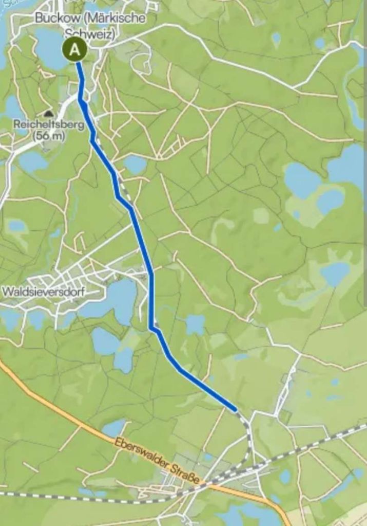
The Buckower Kleinbahn railway runs from Buckow to/from Müncheberg a round journey of close to 10km.

The blue line approxi.ates to the route of the preservation railway line. [14]

The little railway museum in Buckow’s train station building illustrates the history of Buckow’s narrow-gauge railway, as well as of other private and secondary railways, such as the Müncheberg narrow-gauge railway, the Oderbruch train and the ‘Royal Prussian Eastern Line’ (now the RB 26). There are also many exhibits of all sizes and ages, relating to general railroading in Germany.” [13]

A range of diesel and electricity-powered vehicles from the time between 1920 and 1986 are presented in the outdoor area of the Buckow train station. In addition to this, the old rectifier facility of Buckow’s narrow-gauge railway is home to an exhibition about railway power technology, as well as railway signalling and safety.” [13]

“Buckow’s narrow-gauge railway (Buckower Kleinbhan) with historic vehicles operates on weekends from April to October, and it is inseparably linked to the railway museum. Visitors coming from Berlin can board the museum train at Müncheberg station and are taken to Buckow via Waldsieversdorf with very friendly assistance. Children of all ages get to look over the train driver’s shoulder and interested adults can take part in a training course and obtain a certificate as an honorary train driver of the Buckow narrow-gauge railway.” [13]

This historic electric railcar is one of a number of such vehicles, Class 279 or ET188 types, with some refurbished in the early 1980s, which run on the Buckower Kleinbahn railway, © Museumsbahn Buckower Kleinbahn e.V. [13]

D. The Swiss Watchmakers’ Line

“When time is not important, a little-known French railway line allows you to enter Switzerland through the valley of the watchmakers. The line from Besançon in France drifts through the beautiful Jura foothills to Le Locle, a Swiss watchmaking town. No one got on or off at L’Hôpital-du-Grosbois, a byway station en route named after a leprosy hospital. A line that Dr Beeching would probably have closed still delivers you into Switzerland on time. [1: p75][12][Reader: Martin]

The “Watchmakers’ Line” (La Ligne des Horlogers) is a historic cross-border railway connecting Besançon, France, to La Chaux-de-Fonds/Le Locle, Switzerland. Named in honour of the region’s rich horological heritage, it spans the Jura mountains

Winding through the rugged terrain of the French Pays Horloger (Watchmaking Country) and the Swiss canton of Neuchâtel, the line is a marvel of 19th-century railway engineering. It features numerous tunnels and viaducts built to conquer the steep alpine inclines. The route is actively served by TER (Transport Express Régional) trains on the French side and connects seamlessly with the Swiss rail network.

The TER (regional) train takes approximately 1 hour and 15 minutes to cover the 48-kilometre distance. There are around 9 direct trains per day in both directions.

A standard train on the route between Besançon, France and La Chaux-de-Fonds/Le Locle, Switzerland. [16]

From 1st March to 31st October 2021, SNCF Réseau carried out major modernization work on the Horlogers line, a century-old mountain line, which connects Besançon (25) to La Chaux-de-Fonds in Switzerland for a budget of €55.5 million. These works reinforced structures (bridges, tunnels, walls, and trenches), renewed 35 km of track for €49 million (€19.4 million from the French State, €19.4 million from the Bourgogne-Franche-Comté Region, €6 million from INTERREG, and €4.2 million from SNCF Réseau), made the Morteau and Valdahon stations accessible to all for €1.5 million (€0.75 million from the French State and €0.75 million from the Bourgogne-Franche-Comté Region), and modernized the signaling system to allow TER regional trains in the Bourgogne-Franche-Comté Region to continue operating in Switzerland for €5 million (€2.5 million from the French State and €2.5 million from the Bourgogne-Franche-Comté Region). After a complete eight-month service interruption on the line, traffic between Besançon and Morteau resumed on 31st October, and between Morteau and La Chaux-de-Fonds on 23rd December 2021. [15]

The site of La Chaux-de-Fonds/Le Locle consists of two towns situated close to one another in a remote environment in the Swiss Jura mountains, on land not particularly suited to farming. Planned in the early 19th century, after extensive fires, the towns owed their existence to the watchmaking industry. Their layout along an open-ended scheme of parallel strips on which residential housing and workshops are intermingled reflects the needs of the local watchmaking culture that dates to the 17th century and is still alive today.

E. Charmed by the Vienna to Zagreb train

“The journey from Vienna to Zagreb saw mountainous central Europe relax into Balkan charm. Stunning Alpine scenery melted into forest, settling down into rolling hills as we passed through Graz and reached the Slovene border, stopping for an hour’s changeover at the tiny Zidani Most station, where we enjoyed afternoon beers gazing over lush Slovenian countryside. The connection to Zagreb boasted dramatic lake scenery that gave way to farm land, golden in evening light, as we passed into Croatia, soon rattling into its underrated capital. We booked this through Omio, which came in relatively cheaply at £41.” [12][Reader: Matt]

It is possible to get a direct train. According to thetrainline.com, the journey takes about 6 to 6.5 hours, covering roughly 370 km. Tickets can start around €25 to €35. There are normally 11 trains per day travelling from Vienna to Zagreb and tickets for this journey start from £25.89 when you book in advance. [17] The raileurope.com website quotes a lowest fare at under £22.00. [18]

The train journey from Vienna to Zagreb transitions from spectacular Alpine peaks to lush river valleys and rolling Balkan countryside. The journey takes you through southeastern Austria and northern Slovenia before arriving in Croatia. To catch the best views, sit on the left side of the train when departing Vienna to look down into the Semmering valleys. When traveling through Slovenia, sit on the right side to enjoy the best riverside views.

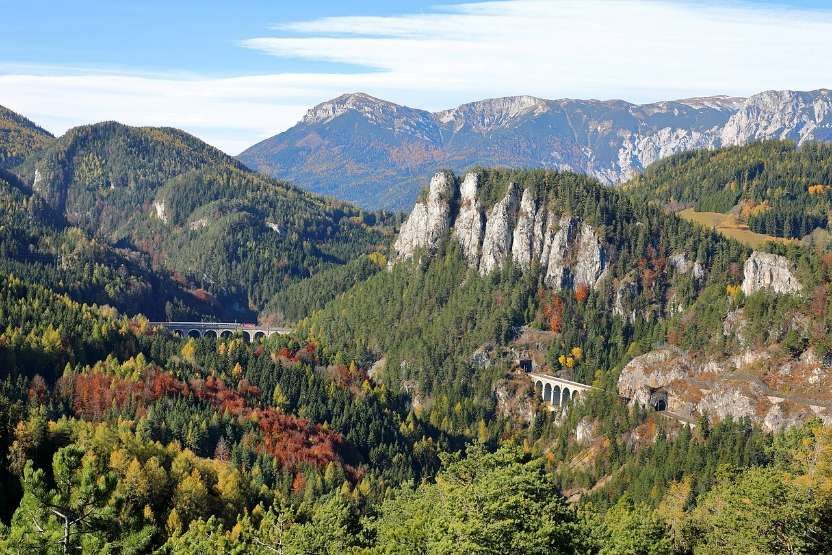
Shortly after leaving Vienna (Wiener Neustadt), the train climbs the Semmering Pass. This is a UNESCO World Heritage site, famous for winding viaducts, tunnels, and panoramic views of steep mountain valleys and dark pine forests.

The Semmering Pass railway and surrounding scenery, © C.Stadler/Bwag and licensed for reuse under a Creative Commons licence (CC BY-SA 4.0). [19]
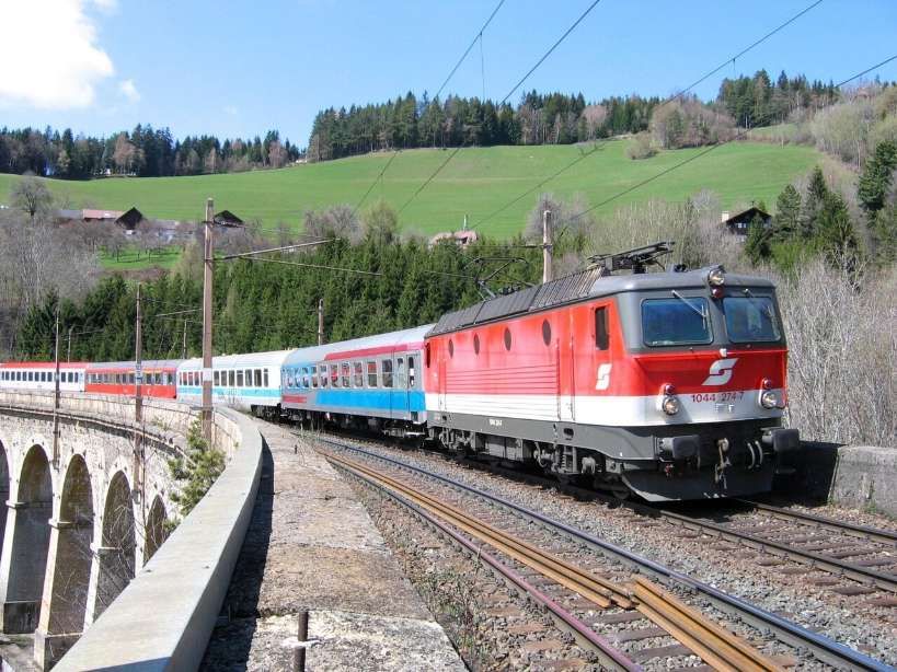
An international express on the Semmeringbahn, pulled by 1044 274-7 in 2004, © Herbert Ortner and licensed for reuse under a Creative Commons licence (CC BY 3.0). [19]

As you descend from the mountains, you’ll pass through the rolling, green agricultural landscapes and vineyards surrounding the city of Graz.

Crossing the border, the scenery becomes dramatic. The train tracks hug the winding Savinja and Sava rivers, passing through deep gorges and canyons flanked by dense forests and rural villages.

The rugged terrain flattens out into the golden farmlands and charming countryside of northern Croatia before pulling into Zagreb’s main station, Zagreb Glavni Kolodvor.

Further suggestions for rail journeys from Guardian readers can be found in the fourth of this series of articles based around the Guardian Saturday Magazine of 23rd May 2026.
References

  1. Readers’Travel Tips: Favourite Train Trips; in Saturday (the Guardian Magazine), 23rd May 2026, p75.
  2. https://www.reddit.com/r/TransitDiagrams/comments/gidbxm/ocdiagram_metro_do_porto_portugal, accessed on 25th May 2026.
  3. https://en.wikipedia.org/wiki/Porto_Metro, accessed on 25th May 2026.
  4. https://en.wikipedia.org/wiki/Socimi_Eurotram, accessed on 25th May 2026.
  5. https://commons.wikimedia.org/wiki/File:Vila_Nova_de_Gaia_(52734250241).jpg, accessed on 25th May 2026.
  6. https://en.wikipedia.org/wiki/Dom_Lu%C3%ADs_I_Bridge#/media/File%3ADom_Lu%C3%ADs_I_Bridge_(36961760686).jpg, accessed on 25th May 2026.
  7. https://www.vy.no/en/train/routes/the-bergen-line, accessed on 25th May 2026.
  8. https://en.wikipedia.org/wiki/Bergen_Line, accessed on 25th May 2026.
  9. https://en.visitbergen.com/visitor-information/travel-information/getting-here/bergensbanen-oslo-to-bergen-by-train, accessed on 25th May 2026.
  10. https://www.bbc.co.uk/travel/article/20230130-the-highest-rail-route-in-northern-europe, accessed on 25th May 2026.
  11. https://rogerfarnworth.com/2019/01/01/the-flam-railway-in-1950
  12. https://www.theguardian.com/travel/2026/may/22/readers-favourite-scenic-european-railway-journeys-trains, accessed on 25th May 2026.
  13. https://www.brandenburg-tourism.com/poi/seenland-oder-spree/industrial-culture/eisenbahnmuseum-and-buckower-kleinbahn-train-museum, accessed on 25th May 2026.
  14. https://www.komoot.com/smarttour/3623001, accessed on 25th May 2026.
  15. https://www.sncf-reseau.com/fr/cp/bourgogne-franche-comte/ligne-horlogers-modernisee-entre-besancon-et-morteau, accessed on 25th May 2026.
  16. https://www.railwaypro.com/wp/colas-consortium-to-modernise-ligne-des-horlogers, accessed on 25th May 2026.
  17. https://www.thetrainline.com/en/train-times/vienna-to-zagreb, accessed on 25th May 2026.
  18. https://www.raileurope.com/en-gb/destinations/vienna-zagreb-train, accessed on 25th May 2026.
  19. https://en.wikipedia.org/wiki/Semmering_railway, accessed on 25th May 2026.

The Modern Tramway – December 1951 – The New German Standard Tramcar

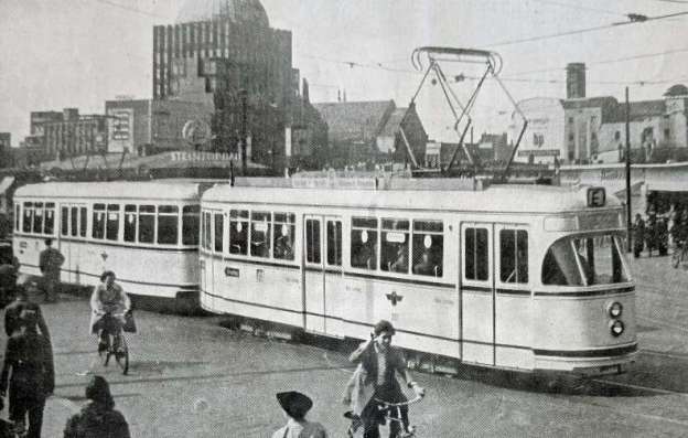
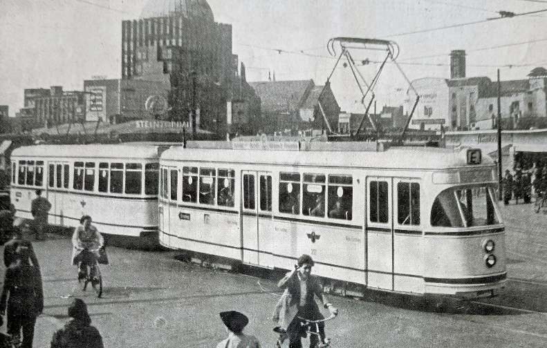
The featured image for this article shows the prototype Standard Tramcar on the streets of Hanover, © Streek en Stadsvervoer, Public Domain. [1: p280]

During the 1950s, German trams transitioned from older, war-damaged wooden vehicles to new, streamlined standard designs that supported the postwar Wirtschaftswunder (economic miracle). Standard designs emerged in both East and West Germany, heavily influencing urban transit.

In West Germany, operators sought to replace aging fleets with standardized models to streamline manufacturing and repairs:

  • The Verbandswagen (VÖV): Developed by the Association of Public Transport Companies (VÖV) starting in 1950. These were traditional two-axle trams that could be built quickly using existing components but featured a more modern, modernized exterior.
  • DÜWAG Großraumwagen: (Articulated Trams) Introduced in the early 1950s by DÜWAG (Düsseldorfer Waggonfabrik), these four-axle, bogie-mounted trams revolutionized West German transit. They featured wide doors for easy boarding, large windows, and better passenger flow.
  • Munich’s M-Wagen: Built by Josef Rathgeber, the first units of this iconic, four-axle, bogie-style tram were introduced in 1949/1950 to begin rebuilding Munich’s transport network.

The Modern Tramway writes, at the end of 1951, about a standard tramcar being developed by committee in West Germany in the very early 1950s which would become known as the DÜWAG Großraumwagen (DÜWAG Articulated Tram):

“The tramway sets of the large German cities normally consist of one 4-wheel motor car and two 4-wheel trailers, each with a length of 8 to 10 metres, and each capable of transporting about 70 persons. In contrast with the post-war construction programmes of other European countries, German post-war tramcars have for the most part adhered to this tradition, as witness the 4-wheel K.S.W and Aufbau types of which some hundreds are now in service. Exceptions are the 1949 6-wheel cars of Munich and the 1950 bogie cars in Hamburg, high-capacity cars operating in trains of two cars (motor and trailer) only.

“Early in 1950, it was announced that a Committee, consisting of representatives of the tramcar-building industry and of several West German tramways (among them Hanover, Düsseldorf, Wuppertal, Cologne, Duisburg and Dortmund) were working on plans for a standard tramcar which would compare with the latest models of other countries, notably the U.S.A., Sweden and Switzerland. The car would be an all-electric single-ended unit about 14 metres long, mounted on two 4-wheel bogies equipped with the latest rubber springing devices, and capable of transporting 100 passengers; a two-car train of such cars (motor car and trailer) would therefore replace three-car train of the usual 4-wheel cars, with consequent economy in staff. Pay-as-you-pass operation with a seated conductor would be incorporated, since the load would exceed the capacity of a mobile conductor.

“The first prototype car and trailer began to take shape late in 1950 at the works of the Düsseldorfer Waggonfabrik in Düsseldorf, to the order of the Hanover tramways, who meanwhile evolved and constructed the special electrical equipment. The car and trailer were delivered to Hanover in March of this year, and entered public service on 28th April for the period of the Heavy Industries Fair. It is fitting that the honour of operating the first car should be accorded to the Hanover tramways, since the General Manager, Dr. Ing. Philipp Kremer, played the leading part in the evolution of the design and the principles which have led to its realisation. Numerous visits were made to other European countries operating modern tramcars to study features not hitherto tried in Germany, and in the case of the Belgian P.C.C. cars and certain other modern designs we were privileged to supply Dr. Kremer with material from the files of The Modern Tramway.

“The details which follow refer specifically to this initial prototype train for Hanover, since many details of the final standard design will be decided only after experience is gained with several slightly differing prototype cars operating in different cities:” [1: p273]

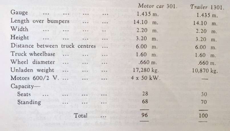
The principle dimensions of the prototype tram. [1: p273]

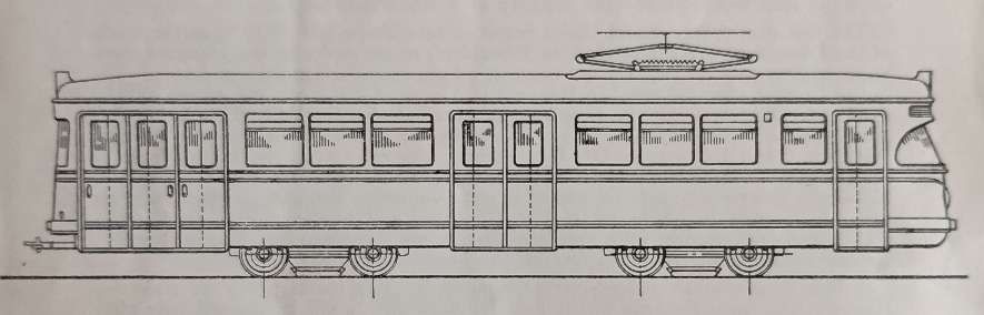
“The all-steel body, so constructed that damaged parts can be replaced rapidly in case of minor collisions, has a rounded form and a sharply inclined front windscreen to minimise reflections from the brightly-illuminated car interior. The electrically worked folding doors are of a new design with increased window-space, the motor car has three doors at the rear, giving one double-width and one single width opening: passengers enter by these doors and congregate on the large rear platform before paying their fares to the seated conductor and passing to the saloon. The conductor’s desk is placed immediately forward of the rear entrance, with a good view of passengers boarding.  Exit is by means of a double-width door in the centre of the car and a further double width exit is provided at the front, the doors of which are controlled by the motorman. An ordered flow of passengers is thus ensured, from the rear of the car to the centre and front, and once passengers are accustomed to the system a marked reduction in loading and unloading time is expected. The trailer has the same treble width rear entrance, but as in this case the seated conductor has to control both entrance and exit doors, the latter, again treble-width, are located in the centre of the car only and the front exit is dispensed with. As the cars travel only with closed doors, roof ventilators are provided, together with opening upper portions to all windows. It is hoped in particular that the folding doors will eliminate accidents caused through passengers attempting to ride on the steps or to board or alight from cars in motion.” [1: p274]

A schematic drawing on which individual prototypes were based. The Hanover variant of the design is shown here, with the inclined windscreen. [1: p274]

“The Hanover motor car and trailer are mounted on a type of 4-wheel inside-frame bogie truck developed by the Waggonfabrik Uerdingen in 1938, and used also for the post-war fleet of bogie cars in Hamburg. Special emphasis is placed on the elimination of noise, by incorporating rubber in the springing and elsewhere. The motor car has rubber-insert resilient wheels of the Swedish S.A.B. design; the trailer uses the recently-patented resilient wheel of the Bochumer Verein. These features combine to give a remarkably quiet and shock-free ride.

Wagonfabrik Uerdingen (Uerdingen Wagon Factory), merged with Düsseldorfer Waggonfabrik (Düsseldorf Wagon Factory) in 1935. The firm operated under the name DÜWAG (or Duewag) and was one of the leading manufacturers of railway and tramway vehicles in Germany. In fact, from the 1960s onwards, Duewag, had close to a monopoly of the market in Germany.

In the 21st century, the firm is a manufacturer of regional and high-speed trains as part of Siemens Mobility. [5][6]

Over the years Duewag produced a series of different rail vehicles and tram/light rail vehicles including: the Duewag T4 tramcar; the Duewag GB6 tramcar; the Duewag GT6 tramcar in various versions; the Duewag GT8 tramcar in various versions; the Duewag GT12 tramcar; the SL79 trams in Oslo; Hanover’s TW 400 trams; Hanover’s TW 6000 trams; Stadtbahnwagen Type M/N trams/light rail vehicles used by  in used by several Stadtbahn and tramways in Germany, Austria, Poland, Romania and Turkey; Stadtbahnwagen Type B vehicles used on Stadtbahn networks in North Rhine-Westphalia, Bursa and Turkey; SSB DT8 used on the Stuttgart Stadtbahn system, produced in multiple iterations by various manufacturers; Hong Kong Light Rail Phase 1 (Comeng); Phase 2 (Kawasaki); and Phase 3 (A Goninan) bogies; Siemens-Duewag U2 which was used on the Frankfurt U-Bahn, Edmonton LRT, the Calgary CTrain), the San Diego MTS, in Mendoza, and in Sacramento; Siemens SD-400 for the North and South American market, and
Siemens-Duewag Supertram for use on the South Yorkshire Supertram light rail network.

Resilient wheels of the Swedish S.A.B. (Svenska Aktiebolaget Bromsregulator) design are specialized railway wheelsets featuring a sandwich of compressed rubber pads inserted between the central wheel hub and the outer steel tire. This elastic connection significantly dampens noise, absorbs high-frequency vibrations, and reduces wear on both tracks and rolling stock. Not just suitable for trams, these wheels have a heavy rail application as well, and are standard for BR Class 86/2 electric locomotives. [7]

The Modern Tramway article continues:

“The electrical equipment of the prototype tram was devolved and constructed in the Glocksee workshops of the Hanover tramways. The controller has 20 driving notches (12 series and 8 parallel, the last notch with 50% field-weakening) and 17 braking notches, and is mounted beneath the floor of the car, between the trucks. it is actuated mechanically from the motorman’s position by means of an ingenious rod-and-bevel-gear device, which allows the motorman, using his hand-wheel, to regulate the controller exactly as if it was mounted on his driving platform. This feature was developed during the war by the Hanover tramways, and has given good service on the modern 4-wheel cars of the 222-231 series; it renders the controller immune to collision damage and greatly reduces the amount of wiring necessary. An inspection hatch is provided in the floor of the saloon. The four AEG half-voltage GBM 320 type motors have a rating of 50 kW. and permit a high rate of acceleration and a speed of 60 km.p.h. in normal service.” [1: p274]

AEG GBM 320 50kW motors were direct-current (DC) series-wound traction motors which were manufactured by AEG and SSW (Siemens-Schuckertwerke) and were widely used in mid-20th-century European light rail vehicles.

The Modern Tramway article continues:

“Braking is effected on the motor car as follows:

1. By an electric brake with 17 notches, the current thus produced also applying the disc brakes of the trailer car through solenoids, as is usual in Germany.

2. By an electro-magnetic track brake (four shoes with a force of 4,000 kg. each).

3. By a hand-lever-actuated oil brake working through brake drums on the armature shafts of each motor.

“The trailer also has a mechanical handbrake working on braking discs on each of the four axles. The track-brake shoes and the trailer solenoids are also wired for operation at 24 volts from the car’s battery, should the need arise.

“Secondary electrical equipment is grouped in a battery-fed 24 volt circuit (with a Bosch charging unit fitted with automatic cut-in and cut-out), and comprises: emergency lighting, twin headlamps (close and distant), rear light, door motors, moving trafficator-arms and regulation side-lamps, loudspeaker and optical signalling system with passenger-buttons. The provision of a low-tension supply enables normal automobile accessories to be used, with consequent economy. Current collection is by a twin-beam pantograph mounted well forward, and the motor car and trailer are joined by a Scharfenberg automatic coupling, incorporating all electrical connections, of the type used on the elevated railway (and the latest trams) at Hamburg. Normal bar couplings are provided at the ends of the train for use in emergency.

“The new Hanover train has undergone prolonged tests, and to the end of May the car had completed 11,000 km. in public service, an average of 220 km. per day.” [1: p275]

The Scharfenberg automatic coupling is a commonly used type of fully automatic railway coupling. Designed in 1903 by Karl Scharfenberg in Königsberg, Germany (today Kaliningrad, Russia), the coupler has gradually spread from transit trains to regular passenger service trains, although outside Europe its use is generally restricted to mass transit systems. [8]

The Modern Tramway article continues:

“A second 2-car train, differing in several important details, was completed at the end of May and delivered to the Rheinische Bahngesellschaft (Düsseldorf tramways); although the cars had not entered public service late in August their appearance on tests has caused much public interest by reason of their bold light green colour scheme. The motor car represents an attempt to drive both axles of a 4-wheel truck from one motor, mounted longitudinally, this feature is experimental, and further prototype cars will revert to the 4-motor principle using layouts and transmissions embodied in the P.C.C. car and the Swiss standard car respectively. The Düsseldorf car also lacks the inclined windscreen of the Hanover model. One prototype car will be constructed to the metre gauge, and operated for test purposes by the tramways of Wuppertal.” [1: p275-276]

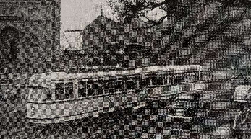
The prototype Standard Tramcar on the streets of Hanover, © Streek en Stadsvervoer, Public Domain. [1: p276]

“Orders have already been placed for 70 of the standard cars, partly by means of special credits accorded by the Transport Ministry of the West German government; standard-gauge models are to operate in Düsseldorf, Dortmund, Cologne, Duisburg and on the Siebengebirgsbahn (Bonn), metre-gauge models in Wuppertal and Bochum-Gelsenkirchen. There is little doubt that, once the final design is evolved and mass-production commences, many further orders will be forthcoming.” [1: p276]

This was indeed the case

A significant number of these trams were delivered to tram networks around Germany. There were design differences which were requested by different networks. The most obvious difference between these trams was the design of the front windscreen.

“The single-ended trams featured three different types of windshields, each named after its initial design: a flat windshield (Düsseldorf type), a slanted windshield (Hanover type), and a split slanted windshield (Kiel type), derived from the American PCC tram . The double-ended trams all had flat windshields.” [4]

Furthermore, several licensed versions of this type were produced. These – almost all single-ended trams – were built between 1954 and 1977 under the direction of various companies and are, or were, particularly common in Austria .

The prototype Standard Tramcar on the streets of Hanover, © Streek en Stadsvervoer, Public Domain. [1: p280]

We have already noted that the very first DÜWAG articulated tram was delivered to Üstra in Hanover in 1951, followed by series production vehicles from 1952 onwards. In addition to Hanover, initially only Düsseldorf  received several prototypes. German Wikipedia tells us that, “Most operators did not procure series production trams until 1954, when the Duewag tandem drive with one motor per bogie became available. The Duewag articulated trams were also available as bidirectional vehicles . The electrical equipment and control systems were supplied by Siemens , BBC , or Kiepe Elektrik.” [4]

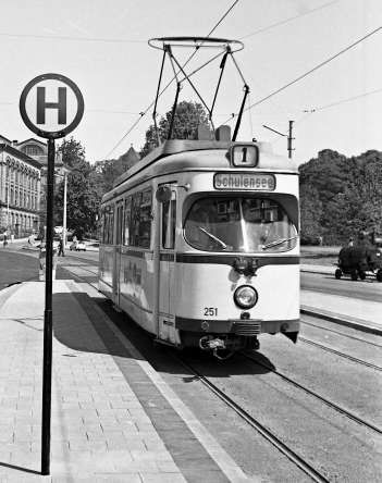
Keil: a Duewag large-capacity tramcar No. 251 at the Schloßgarten stop in June 1963, is just one example of the ubiquity of the standard tram design. [9]

How come, Germany has so many cities with their own tram network?

In the 21st century, Germany still has an extensive number of tramway networks (Straßenbahn in German) … Some of these networks have been upgraded to light rail standards, called Stadtbahn in German. Straßenbahn and Stadtbahn schemes are usually operated on the legal foundation of the BOStrab, the Tramways Act of Germany.” [2]

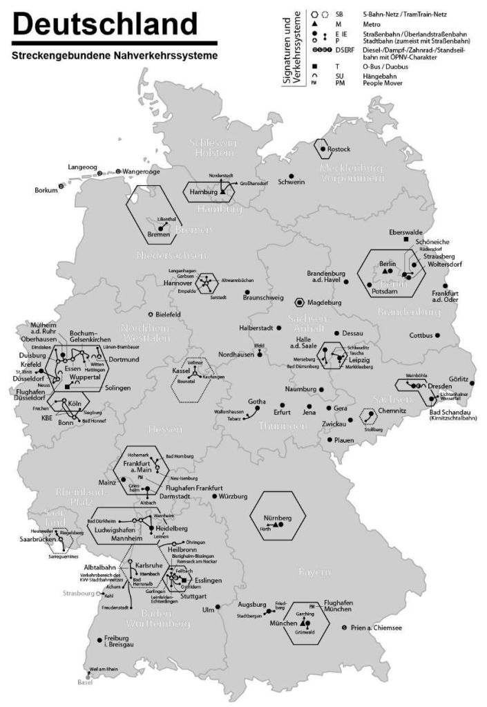
Tram, Stadtbahn, U-Bahn and S-Bahn schemes in Germany, © Maximilian Dörrbecker (Chumwa) and licenced for reuse under a Creative Commons licence (CC BY-SA 2.5). [2]

Tramways served as the primary means of urban transport in Germany until the early 1960s when they were systematically replaced by buses. However, in the 1980s tramways began to reappear; experts spoke of the ‘renaissance of the tramway’. In the 1990s tramways had again become a modern means of public transport. Popular notions of fashion have been used by scholars to explain this cycle of acceptance rejection and restoration. Tramways were a highly visible manifestation of commodity culture and people projected onto them not just travel destinations but more broadly their desires, ideas and beliefs.” [2]

In the early 1950s, electric trams were still the backbone of German urban transport. However, later in the decade, the rise in private car ownership led to a car-centric shift. Many cities—particularly in West Germany and West Berlin—viewed trams as old-fashioned and began replacing them with buses and underground metros (U-Bahn). [3]

These plans were only partly fulfilled due to high costs and booth Munich and Nuremberg ended up retaining and later expanding portions of their tram networks. Other cities, like Hanover and Stuttgart, pursued a middle ground by putting trams in tunnels through the city centre with the intent to eventually convert them to an U-Bahn. By the 1980s, virtually all German cities abandoned these costly full-conversion schemes and trams stayed on the surface.” [3]

So, Germany kept, and modernised, many of its tram networks. “Today, an unrivalled 60 cities still run trams, stitching together new housing, walkable neighbourhoods and low-car lifestyles. This essay shows how those tracks survived the mid-century cull and why they remain a cornerstone of Germany’s greener, people-first urban renaissance.” [3]

In East Germany, trams were even more dominant. Socialist transport policy emphasised public transport, and funding was limited for widespread motorways. As a result, every major East German city kept its trams and many were expanded. Leipzig, Dresden, and Magdeburg extended tram routes into new Plattenbau (prefabricated apartment) quarters during the 70s and 80s. Tram networks continued to be expanded after reunification. In East Berlin a 4.5km tram line opened in 1991 through the large Hellersdorf housing estate, providing crucial links to a growing suburban district. Reunified Germany inherited a robust base of tram systems across both East and West.” [3]

‘Creat Strreets’ [3] tell us that factors which led to many more tram networks being retained than in other countries such as the UK and the USA include:

  • Economic realities: A postwar economic boom in the UK and US meant that car ownership skyrocketed. Meanwhile, Germany was still in a deep economic depression. After the formation of West Germany in 1949, federal and state governments continued to provide funding for municipally owned transport companies, including trams.
  • Policy and planning: German cities remained denser, more compact, and more mixed-use and city councils were pragmatic about transport. German tram companies often remained publicly owned and focused on long-term service. By the 1970s, the oil crises also reminded Germany of the value of electric transport, helping halt further closures.
  • Cultural differences: It’s difficult to understand Germany’s decision to retain trams without understanding that to German policymakers keeping trams would have seemed like the pragmatic, sensible and safe option, whereas a switch to buses would have been an unknown risky option. Furthermore, unlike in the UK and US where trams came to represent the past and the car became an important status symbol, public transport in Germany never acquired a social stigma. Trams were not associated with poverty or obsolescence, but rather with efficiency. German cities were among the first to recognize the downsides of car dependency, too: pollution, congestion, and hollowed-out city centres. Rather than widening roads and doubling down on motorways, cities such as Freiburg reinvested in trams as part of traffic calming and pedestrianisation strategies.
  • Continuous modernization: Rather than letting systems decay, German operators never stopped investing in new tramcars and technology. From the 1950s, Düsseldorf based DÜWAG began supplying West German cities with modern articulated trams, and cities like Düsseldorf, Frankfurt, and Hannover introduced new, higher-capacity trams. This kept service quality high and public support strong. Trams were reimagined as a modern, attractive, clean transport, integrated into pedestrian zones and designed with attractive vehicles and stops. In contrast, many North American and British trams had been neglected and unmodernised, making buses seem like an improvement in comparison.
  • The tram-train: Germany was an early adopter of the tram-train (or “Stadtbahn”) concept that mixes tram and metro elements. The best-known example is in Karlsruhe. By using dual-voltage tram vehicles, Karlsruhe linked street tramlines to existing regional rail tracks, effectively merging local and regional transport. This model has since inspired tram-trains in cities like Saarbrücken and Kassel and in Cologne and Frankfurt some tram lines go underground and now run as light-rail metros in the centre while still operating on streets in outlying areas. It’s a case where Germany led in expanding tram usage at a time when others were only starting to consider reintroducing trams.
  • Pragmatism: Where other countries pursued replacing trams with buses, German cities often kept trams that still served dense areas well. They chose a flexible approach which allowed for gradual upgrades rather than wholesale dismantling.
  • Strong municipal operators: Many tram systems remained in the hands of publicly accountable city utilities, giving them a long-term investment outlook. This made it easier to plan for continuity and renewal.
  • Public acceptance and use: Even during the car boom of the 1960s and 70s, trams were well-used. As other forms of transport became congested or expensive, trams kept their niche and their advocates.
  • Return on Investment: Returns for trams was higher than for road-building, particularly when urban regeneration effects were included. A 2025 study by MCube and the Technical University of Munich, commissioned by Deutsche Bahn, found that every €1 spent on local public transport generates around €3 in added economic value for Germany’s GDP.

References

  1. The New German Standard Car; in The Modern Tramway, Volume 14, No. 168, December 1951, p273-276 & p280.
  2. https://en.wikipedia.org/wiki/Trams_in_Germany, accessed on 20th May 2026.
  3. https://www.createstreets.com/the-country-that-never-tore-up-its-tracks, accessed on 20th May 2026.
  4. https://de.wikipedia.org/wiki/Duewag-Gro%C3%9Fraumwagen, accessed on 20th May 2026
  5. https://de.wikipedia.org/wiki/Waggonfabrik_Uerdingen, accessed on 20th May 2026.
  6. https://en.wikipedia.org/wiki/Duewag, accessed on 20th May 2026.
  7. https://trid.trb.org/View/18694, accessed on 20th May 2026.
  8. https://en.wikipedia.org/wiki/Scharfenberg_coupler, accessed on 20th May 2026.
  9. https://de.wikipedia.org/wiki/Stra%C3%9Fenbahn_Kiel, accessed on 20th May 2026.

Double-Decker Trains

It was announced on 22nd October 2025 that the lines through the Channel Tunnel would see double-decker trains by 2031. An order was placed for their construction and delivery in October 2025. [6]

The featured image for this article shows what one of these trains would look like in Eurostar’s grey livery. The fully electric fleet of trains will be named Eurostar Celestia, which comes from the Latin word caelestis, meaning ‘heavenly’. The colour of the train has not yet been decided, but the current colour of Eurostar trains is grey, dark blue and yellow. Each train would be 200m long. Currently two are run together making an entire service 400m long. Double-decker trains don’t have twice as many seats as a single-deckers though, just because there needs to be room for interior steps, but there would be a fifth more seats. This means an increase from just under 900 seats on the current service to just over a thousand. [6]

A bilevel car (American English) or double-decker coach (British English and Canadian English) is a type of rail car that has two levels of passenger accommodation as opposed to one, increasing passenger capacity (up to 57% per car in extreme cases).” [1]

Examples of Double-Deck Coaches/Trains in a Few Different Countries

France

Double deck carriages date to at least as early as the second half of the 19th century. In France several hundred ‘voitures à impériale’ with seats on the roof were in use by the Chemins de fer de l’Ouest, Chemins de fer de l’Est and Chemins de fer du Nord by 1870, having been in use for over 2 decades; the upper deck was open at the sides with a light roof or awning covering the seats.” [1]

Voiture à impériale, France Paris Champs Elysées Expo Train capitale 2003 Wagon à imperial, © Patrick Giraud (Calips) and licenced for reuse under a Creative Commons Licence (CC BY 2.5). [2]

Marc Andre Dubout tells us that “the success of the railway with the public, the rise of the suburbs forced the companies to design double-decker carriages whose capacity was almost double that of conventional railway cars. Built from 1855 by the Compagnie de l’Ouest, … these carriages represent the flowering period of the Impressionist painters who took the trains on Sundays to go and paint in the countryside … not so far from Paris. It is the era of the boater and the joys of picnics by the water.” [4]

Dubout continues to say that these carriages weighed 8 tons and had 4 compartments downstairs and space for 34 sitting upstairs which could be reached by external staircases at the end of the carriage. [4]

In the 1860s, M.J.B. Vidard introduced two-storied carriages on the Chemins de fer de l’Est, with a full body, windows, and doors; the design lowered the floor of the lower storey to keep the center of gravity low. Vidard’s carriages had a total height of 13 feet 8 inches (4.17 m) with the head height in the lower part of the carriage only 5 feet 5 inches (1.65 m); the carriages had a capacity of 80 persons (third class) in a 2 axle vehicle of 13 tonnes fully loaded.” [1][5]

This image is embedded here from another webpage. This carriage was built by De Dietrich & Cie in 1899. [5]

The first all-steel Chemins de fer de l’État double deckers are an early example of split-level cars.” [1] “The first ten carriages were delivered by Brissonneau et Lotz, now part of Alstom, in 1933. The Voiture État à 2 étages were used as permanently coupled sets of carriages and used for réversibilité (push-pull operation), driving the train from the end passenger car and the steam locomotive pushing, on the Réseau Saint-Lazare. They often operated once in the morning, taking commuters to work, and once in the evening, returning them back home. They were also briefly used on the Réseau Montparnasse in shorter sets of six cars.” [3]

The Voiture État à deux étages were a class of double-deck carriages built for Paris suburban services of the French Chemin de fer de l’État. The design was revolutionary for its use of aluminium as well as steel to reduce weight. Although unpowered, each rake of seven cars had a driving trailer at one end and were pushed and pulled by a steam locomotive, such as the 141 TC Ouest and 141 TD Ouest. The cars possessed two vestibules, each with two sets of doors and stairs to allow passage from one deck to the next. The upper deck had rows of five seats whilst the lower deck had rows of four as they had to fit between the frames. The driving trailers allowed the driver to control the steam engine from the driving cab in the opposite end carriage while the locomotive was pushing, using controls actuated by compressed air pipes running through the train, © Didier Deforest and licenced for reuse under a Creative Commons Licence (CC BY-SA 3.0). [3]

Fifty cars were built, which accommodated the increasing suburban traffic from the beginning of the 20th century. They were supplemented by 380 Talbot passenger cars and 200 Standard EMUs. The last of the class were only withdrawn in 1984, after introduction of the VB2N in 1975.” [3]

The Voiture de banlieue à 2 niveaux (shortened to VB2N) “is a type of double-deck set of passenger carriages used on Transilien, the commuter rail network in the Île-de-France region of France. The carriages are unpowered and designed to be paired with an electric locomotive.” [7] They were built between 1974 and 1984, refurbished between 2002 and 2008. Since 2012, the VB2N trains were being shifted from busier RER and Transilien lines to less busy routes on the Transilien network as new equipment came online, most notably the single-level Z 50000 and double-deck Regio 2N(Z57000) trainsets. The VB2N trains have been being retired gradually since 2021. [7]

A VB2N arriving at Gare de Lavilletertre, Oise, having travelled from Paris on 1st June 2011, © Lunon92 and licenced for reuse under a Creative Commons licence (CC BY-SA 3.0). [10]

The double-deck Regio 2N trainsets are a family of a double-deck, dual-voltage electric multiple unit trainsets built for French rail operator SNCF to serve its regional rail routes (TER, Transilien, and RER). The trains utilize a unique and highly configurable design. One of the end cars is single-deck and designed to accommodate wheelchair users, the other end car is double-deck. The intermediate cars are either double-deck with no doors accommodating seated passengers traveling long distances or single-deck with two double doors per side accommodating standing passengers traveling short distances. Trains can be configured with six, seven, eight or ten cars. Additionally, the seating can be configured for intercity service (2+1 seating in 1st class, 2+2 seating in 2nd class), regional service (2+2 seating throughout), or high-capacity commuter service (3+2 seating throughout). These trains were designed and originally built by Bombardier, but during delivery the company was bought by Alstom, which completed the order. A total of 447 trainsets have either been built or are under construction at the Alstom Crespin factory since 2012. The first set was placed into regular passenger service in September 2013. [8]

Regio 2N in TER Hauts-de-France livery at Gare de Longueau, (c) Thierry Martel and licenced for reuse under a Creative Commons Licence (CC BY-SA 4.0). [9]

Germany

Double-decker trains in Germany (Doppelstockwagen) originated in 1935–36 with LBE commuter coaches, evolving from East German, Görlitz-built articulated trainsets in the 1950s-70s into widespread regional use. Following reunification, Deutsche Bahn modernized these coaches to become the dominant, high-capacity standard for regional lines, and in 2015, introduced them as Intercity 2 for long-distance routes. [11][12][13]

German class 670 railbus (only 7 were built, 2 still remaining in working condition). This particular vehicle is apparently owned by a preservation group which sometimes does trips around Saxony – though not in regular service, © Not Known. [14]

Historical Evolution:

  • Early Beginnings (1930s-1950s): The first double-deckers were built by WUMAG at Görlitz for the Lübeck–Büchen–Hamburg railway in 1935, pioneering push-pull operation in Germany.
Two photographs of the early (1935/36) double deck carriages built by WUMAG, © Public Domain. [16]
  • East German Development (DDR): VEB Waggonbau Görlitz became a hub for double-deck technology, producing two- to five-car articulated sets (Doppelstockgliederzüge) for the Deutsche Reichsbahn, with over 4,000 sets produced for the Eastern Bloc.
Double-decker coaching stock is seen here behind steam locomotive 22 032 with a passenger train in 1964 on the Dresden–Werdau railway line, between Hohenstein-Ernstthal and St. Egidien, © Werner Huhle and licenced for reuse under a Creative Commons licence (CC BY-SA 3.0). [15]
A first generation Doppelstockwagen rake in Calau in January 1997. These were built 1973–1974 and 1976–1991,  and we’re sold to East Germany, Bulgaria, Poland, Romania and Czechoslovakia, © Falk2 and licenced for reuse under a Creative Commons licence (CC BY 3.0). [11]
  • West Germany (DB): In contrast to the East, the West German Deutsche Bundesbahn initially focused on single-level carriages until adopting modern 2nd generation Class 760 cars in the early 1990s.
A second generation Doppelstockwagen on first delivery in January 1993, © Falk2 and licenced for reuse under a Creative Commons licence (CC BY 3.0). [11]
  • Post-Reunification & Regionalization: After 1990, Deutsche Bahn heavily adopted modern, single-coach bilevel designs for regional rapid transit across Germany.
N Gauge models produced by Fleischmann (6260075). These two double-decker coaches are available as a set. They are typical of the style of single coach bilevel designs used for regional rapid transit across Germany. [16]
  • Early 21st Century: typical trains were red double -decker carriages hauled by electric locomotives (such as Class 146 or 147), and featuring high-capacity seating for commuters. [11][12]
DB Regio BR 146 locomotive in charge of a typical double-decker consist at Munich. This image was shared by Samson Ng on the World Electric Locomotives Facebook Group on 7th February 2026. [19]
This YouTube video shows a DB Region BR147 locomotive bringing its train into Angermunde Station with a train to Stralsund Hbf. [20]
  • Intercity 2 Era (2015-Present): In 2015, Intercity 2 trains, a mix of Bombardier and Stadler “kiss” trains, were introduced for long-distance services, capable of 160 km/h, though they have been criticized for offering regional-style comfort on long routes. [13]
Bombardier © Klaus Foehl and licenced for reuse under a Creative Commons licence (CC BY-SA 3.0). [18]
The KISS (comfortable innovative high-speed S-Bahn train) is an electric double-deck multiple unit from the Swiss-based manufacturer Stadler Rail. [17]

Private operators such as ODEG [21] and National Express Germany [22] use modern Siemens Desiro HC double-deck sets, often featuring a mix of single and double-deck cars for faster boarding. [11][12]

Siemens Desiro HC EMU of Ostdeutsche Eisenbahn (ODEG) at Rheydt Hauptbahnhof, © Thomas and licenced for reuse under a GNU Free Documentation License, Version 1.2. [23]
Electric multiple unit Desiro HC BR 462 RRX National Express. [24]

Unites States and Canada

Bilevel trains are widely used across the USA and Canada for high-capacity commuter services and long-distance travel. Primarily using Bombardier/Alstom BiLevel Coaches in cities and Amtrak Superliners on national routes, these trains maximize passenger volume, with the Bombardier model operating in at least 14 different transit authorities.

Examples of operators are:

  • GO Transit (Canada):

GO Transit uses a bilevel passenger railcar (currently built by Alstom and previously by Bombardier, Hawker Siddeley Canada, the Canadian Car and Foundry (Can Car), and the UTDC) is used by a number of different North American commuter and regional rail operators, they feature a distinctive octagonal profile. The principal operator is GO Transit in the Golden Horseshoe, which operates some two-thirds of the total produced fleet. [26]

A westbound Lakeshore West GO train, seen from the Roncesvalles Pedestrian Bridge, © Dillon Payne and licenced for reuse under a Creative Commons licence (CC BY-SA 4.0). [25]

The BiLevel coaches were designed by Toronto’s regional commuter rail service, GO Transit and Hawker Siddeley Canada in the mid-1970s as a more efficient replacement for GO’s original single-deck coaches and cab cars. A trial was first undertaken with a borrowed Chicago & North Western Gallery Car. [27]

This image is embedded from the Transit Toronto website. It shows GO GP40-2L locomotive No. 9811 pulling a borrowed Chicago & North Western Gallery Car past Bayview Junction in April 1976 to test the feasibility of double-decker passenger coaches on the system. The test was a success, although GO would eventually adopt its own special model of bilevel coaches. This image is on the Transit Toronto website courtesy the D&T Illingsworth collection. [28]
  • Metrolink:

Metrolink in Southern California operates high-capacity, double-decker passenger coaches to maximize commuter transport efficiency without needing extra tracks. The fleet primarily consists of older, octagonal-shaped Bombardier BiLevel Coaches and newer, silver Hyundai Rotem BiLevel cars, often featuring white and blue or modern silver liveries. The Bombardier BiLevel Coaches were the same design as those operating on the GO network. [29]

Bombardier Cab Car No. 624 at Sonora Street, © Kwikie and licenced for reuse under a Creative Commons licence (CC BY-SA 3.0). [29]
Older BiLevel rolling stock made by Bombardier to a GO Transit design, can be seen in action on this video. [30]

Metro link also makes use of newer, silver Hyundai Rotem BiLevel cars, often featuring white and blue or modern silver liveries.

Metrolink Hyundai Rotem cab car in Southern California, © Justin N. and licenced for reuse under a Creative Commons licence (CC BY-SA 2.0). [31]

Hyundai Rotem began marketing commuter rail cars in 2006 to compete with other railcar manufacturers in North America such as Bombardier Transportation and Kawasaki Heavy Industries Rolling Stock Company. An assembly plant opened in Philadelphia, Pennsylvania, in 2008 to meet American requirements; it closed a decade later. Significant users include: MBTA Commuter Rail (Massachusetts Bay Transportation Authority); Metrolink; and Tri-Rail, a commuter rail service linking Miami, Fort Lauderdale and West Palm Beach in Florida. [32]

  • Sound Transit (Seattle):

Sound Transit serves the city of Seattle in Washington State in the Pacific Northwest of the USA. It makes use of Bombardier BiLevel Coaches.

These have been in use on the Sound Transit network since the early 2000s. Sound Transit has made multiple orders over time, with new cars arriving in 2017 and 2022 to support service expansion on the South Line and a programme of refurbishment planned to begin in 2027. [32]

SDRX 105, Sound Transit Sounder Bombardier Coach Cab at Carkeek Park in Seattle, WA, © Stephen De Vight and licenced for reuse under a Creative Commons licence (CC BY 3.0). [33]

Great Britain

While there has been a significant use made of double-decker carriages on the continent and in North America. These vehicles have been largely absent in British railway history. The primary cause has been the tight loading gauge on British railways.

In recent years railway construction in the UK has seen a larger loading gauge used. The fruit of this policy is the plans to use double-decker carriages through the Channel Tunnel and on HS1.

However, these new carriages will not be the first to run on British metals. In the late 1940s Bulleid, the Chief Mechanical Engineer of the former Southern Railway, introduced two double-decker trains to the route between London Charing Cross and Dartford. These SR Class 4DD trains had split level floors with alternately high and low passenger compartments. They were no higher than regular carriages and so could travel on the Southern Railway network. “It was hoped that the SR Class 4DD could fit almost a third more commuters on board. But things didn’t get off to a great start, when the carriages were pulled for modifications after just one day in service. They subsequently revealed various other shortcomings, one of which … was the windows not opening.” [34] A ventilation system had to be fitted to overcome the problem.

The Southern Railway designed SR Class 4DD carriages were introduced as an experiment in 1949 just after nationalisation. [35]

Apparently, passenger capacity was improved by the SR Class 4DD, but the compartments were just not comfortable and because there were more passengers boarding and alighting, the train service was slowed down

One of the double-decker units at the Ashford Steam Centre, in October 1972, © Hugh Llewlyn and licenced for reuse under a Creative Commons licence (CC BY-SA 2.0). [34]
A model of the SR Class 4DD, © Les Chatfield and licenced for reuse under a Creative Commons licence (CC BY 2.0). [34]

References

  1. https://en.wikipedia.org/wiki/Bilevel_rail_car, accessed on 22nd October 2025.
  2. https://commons.wikimedia.org/wiki/File:France_Paris_Champs_Elysees_Wagon_a_imperiale.JPG, accessed on 22nd October 2025.
  3. https://en.wikipedia.org/wiki/Voiture_%C3%89tat_%C3%A0_2_%C3%A9tages, accessed on 23rd October 2025.
  4. https://marc-andre-dubout.org/cf/lvdc/lvdc0074/carnet06_05.htm, accessed on 23rd October 2025.
  5. https://www.patrimoine-ferroviaire.fr/wp-content/uploads/Est-B4C5-imperiale-21094.jpg, accessed on 23rd October 2025.
  6. https://www.thenational.scot/news/national/25561691.first-major-fleet-double-decker-trains-run-uk-railways, accessed on 23rd October 2025.
  7. https://en.wikipedia.org/wiki/Voiture_de_banlieue_%C3%A0_2_niveaux, accessed on 23rd October 2025.
  8. https://en.wikipedia.org/wiki/Regio_2N, accessed on 2nd May 2026.
  9. https://commons.wikimedia.org/wiki/File:Regio2N_003XL_en_gare_de_Longueau.jpg, accessed on 2nd May 2026.
  10. https://commons.wikimedia.org/wiki/File:Gare_de_Lavilletertre_(2).jpg, accessed on 3rd May 2026.
  11. https://en.wikipedia.org/wiki/Bombardier_Double-deck_Coach, accessed on 3rd May 2026.
  12. https://en.wikipedia.org/wiki/Bilevel_rail_car, accessed on 3rd May 2026.
  13. https://en.wikipedia.org/wiki/Intercity_2, accessed on 3rd May 2026.
  14. https://www.reddit.com/r/trains/comments/1fbuaqi/actual_rare_double_decker_train, accessed on 3rd May 2026.
  15. https://commons.wikimedia.org/wiki/File:DR_22_032.jpg, accessed on 3rd May 2026.
  16. https://www.asmodellbahn.de/en/products/lbe-doppelstockwagen, accessed on 3rd May 2026.
  17. https://www.modellbahnshop-lippe.com/Drive+trains/Drive+train/Hobbytrain-H25304/gb/modell_373337.html, accessed on 3rd May 2026.
  18. https://en.wikipedia.org/wiki/Bombardier_Double-deck_Coach#/media/File%3AGie%C3%9Fen_Regionalexpress_Bahnhof01_2010-02-27.jpg, accessed on 3rd May 2026.
  19. https://www.facebook.com/share/p/1B818d3gSh, accessed on 3rd May 2026.
  20. https://youtu.be/PuXw-cZ3vxE?si=iFI7opsRQzoCzXR8, accessed on 3rd May 2026.
  21. Ostdeutsche Eisenbahn GmbH (ODEG) is the largest private railway operator in eastern Germany, operating passenger services across Berlin, Brandenburg, Mecklenburg-Vorpommern, Saxony, and Saxony-Anhalt. Founded in 2002, it is a 50/50 joint venture of Netinera and BeNEX, operating 17 lines.
  22. National Express Germany (a subsidiary of the British Mobico Group) is a major private rail operator in North Rhine-Westphalia, operating regional lines including the Rhein-Ruhr-Express (RRX) RE1, RE5, and RE11, as well as RE7 and RB48. Using Siemens Desiro HC trains, they provide run services covering 20 million km annually as of 2023.
  23. https://commons.wikimedia.org/wiki/File:Siemens_Desiro_HC_ODEG_in_Rheydt_Hbf,_07-10-2022.jpg, accessed on 3rd May 2026.
  24. https://www.modellbahnunion.com/HO-gauge/Electric-multiple-unit-Desiro-HC-BR-462-RRX-National-Express.htm?shop=modellbahn-union-en&a=article&ProdNr=MU-H0-T46203&p=802&srsltid=AfmBOoqN0GDRh9yiDXkj_sZft70dYgWlgPruby0eBRpihbdgVX1iiNzm, accessed on 3rd May 2026.
  25. https://commons.wikimedia.org/wiki/File:Lakeshore_West_GO_Train_WB_at_Roncesvalles_Pedestrian_Bridge_-_1,_April_27_2026.jpg, accessed on 4th May 2026.
  26. https://en.wikipedia.org/wiki/Bombardier_BiLevel_Coach, accessed on 4th May 2026.
  27. https://transittoronto.ca/regional/2507.shtml, accessed on 4th May 2026.
  28. https://transittoronto.ca/photos/images/go-9811-double-decker-197604.jpg, accessed on 4th May 2026.
  29. https://commons.wikimedia.org/wiki/Category:Bombardier_BiLevel_coaches_of_Metrolink, accessed on 4th May 2026.
  30. https://youtu.be/ZtZfaEeOLlU?si=ZWcj4cXtO2NMTZFW, accessed on 4th May 2026.
  31. https://en.wikipedia.org/wiki/Metrolink_rolling_stock, accessed on 4th May 2026.
  32. https://en.wikipedia.org/wiki/Rotem_Commuter_Cars?wprov=rarw1, accessed on 4th May 2026.
  33. https://commons.wikimedia.org/wiki/File:SDRX105.jpg, accessed on 4th May 2026.
  34. https://londonist.com/london/transport/double-decker-train-london-1940s, accessed on 4th May 2026.
  35. https://youtu.be/1a2K0TP1lxM?si=spxN70y-q5D78Lpv, accessed on 4th May 2026.