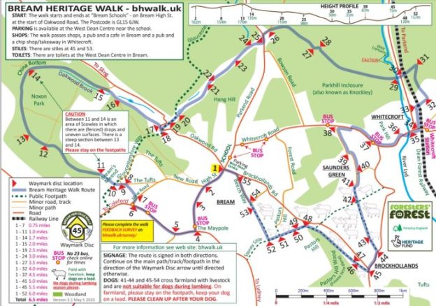
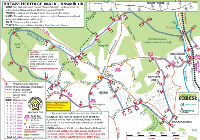
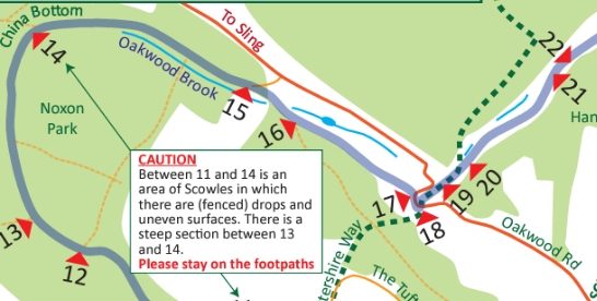
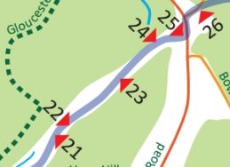
We are in the Forest of Dean again for a week away from work. On 1st September 2020 we followed a sign-posted circular walk which started in the centre of the village of Bream on the Southwest side of the Forest. The route was planned with the support of the Big Lottery Heritage Fund and featured a series of different heritage locations around the village. An overview plan appears below. [1]
Bream was one of a number of villages which sat on the edges of the old Royal Forest of Dean and in pre-industrial times had a population of around 300. The industrialisation of the Forest brought relatively rapid expansion to many of these villages. Bream’s population in the early 21st century is over 3,000.
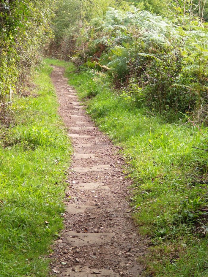
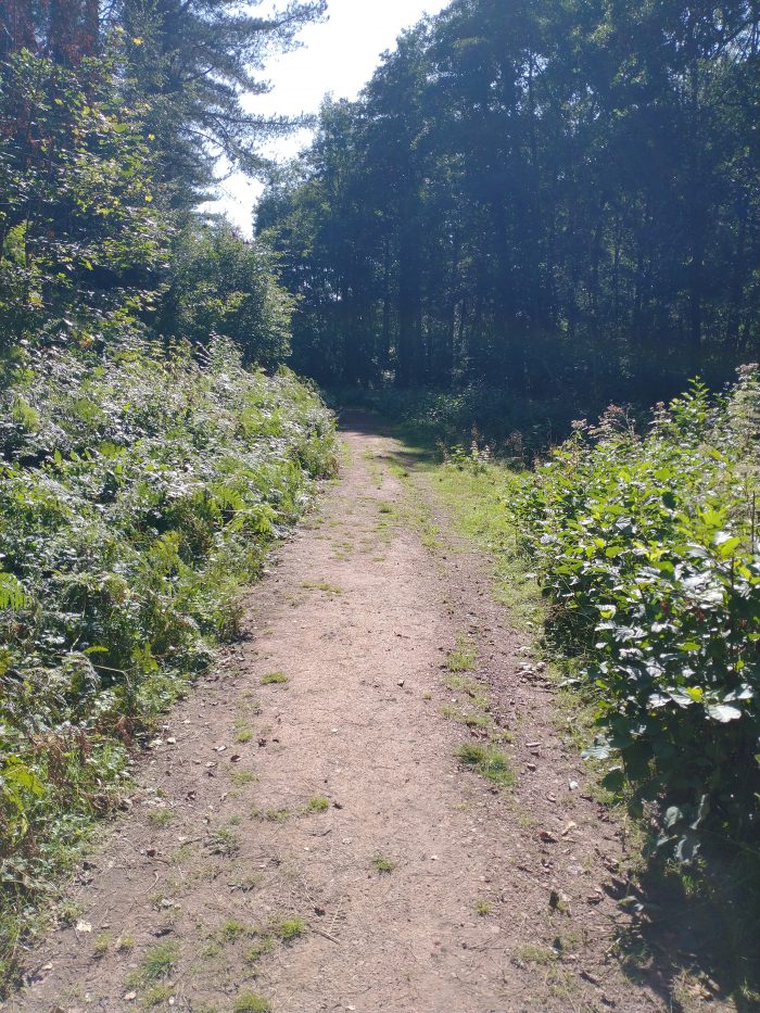
The walk, including the different detours that we chose to make was about 7.5 miles in length. The first sections of the walk were along modern roads but we soon found ourselves walking along one of the access routes that would have been used by the workers in the iron ore mines in and around Noxon Park.
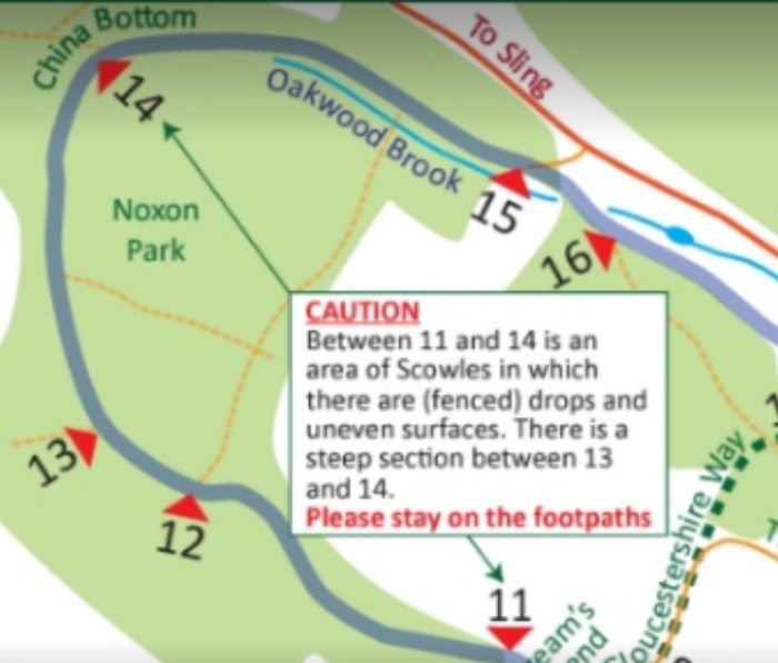
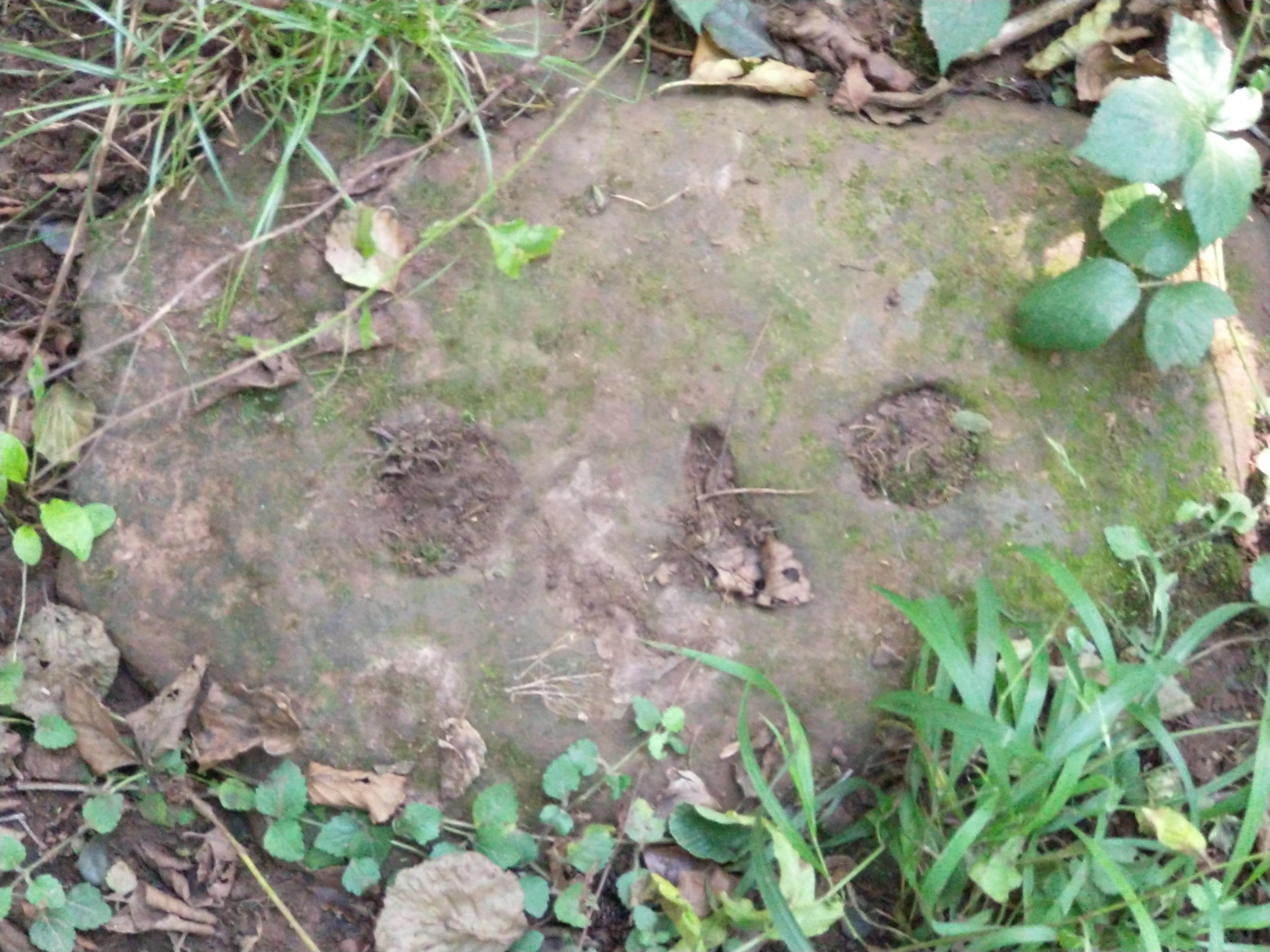
We passed a number of caves and sink-holes which were created by early iron ore miners. The area is riddled with underground workings and a number of relatively large caves have, over the years collapsed to create large and deep depressions (or scowles) at the surface. These can be found between locations 11 and 14 on the walk route map.
Initially, these workings were served by packhorses that carried the iron-ore away to be refined, but by the 19th century, plateways or tramways were being built to improve the transport of the ore.
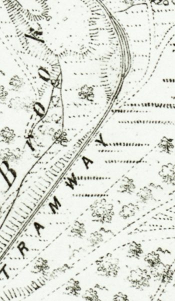
The walk took us first along the route of the China Bottom Branch of the Oakwood Tramway which was covered in an earlier post about the tramways in the Forest (https://rogerfarnworth.com/2017/10/02/oakwood-and-dikes-tramways). [2] The branch ran between the approximate locations 13 and 14 on the map above. The track shows up on the old map below as two dotted lines leading from the bottom left of the map towards China Bottom.
When we reached China Bottom, we joined the route of the Oakwood Tramway which can be seen running left to right across the map extract below. The early China Bottom Branch served the small mines in the Noxon Park. These were superseded by the larger mines at China Bottom and Princess Louise and the early tramway branch was then abandoned and the cast-iron rails were lifted.

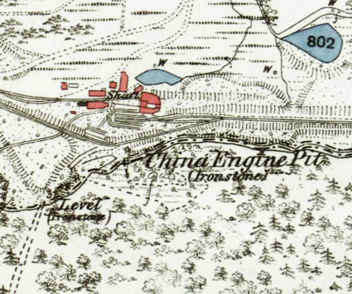
Extract from the OS 25″ Map on the mid 19th Century. [5]
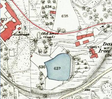
China Bottom takes its name from a large iron-ore mine which once occupied the site which was called ‘China Engine Pit’. Its name indicates that the mine had a powerful steam engine which lifted iron-ore to the surface and pumped out water from the mine. “These engines were usually beam engines of the type used in Cornish tin mines, as seen on the TV series Poldark.” [7]
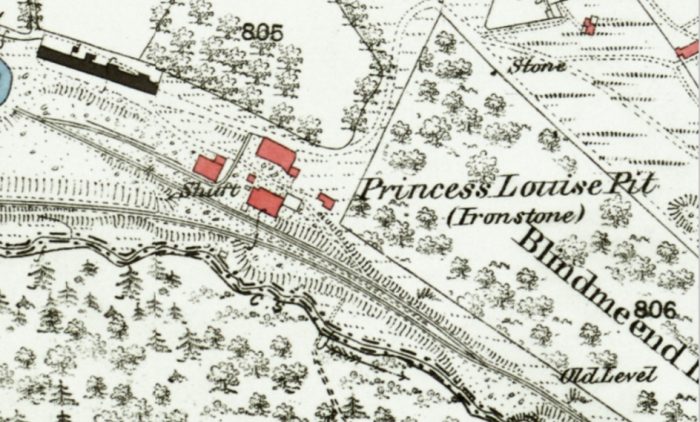
Close by was another large iron-ore mine called the ‘Princess Louise’ which had a 180 metre deep shaft. For more information, see the ‘Derelict Places’ Website. [3]

Princess Louise Pit, OS 25″ Map from the mid 19th century. [6]
From location 14 through to between location 20 and 21 our path followed the route of the Oakwood Tramway. We picked it up again by taking a diversion northwards from location 24.

Oakwood Tramway ran, at first, on the Northern side of Oakwood Brook, between locations 14 & 15. The brook was culverted under the tramway and then supplied water power for Oakwood Mill which sat close to the brook between it and the road between Sling and Bream. [1]
At location 16 on the walk we passed Oakwood Mill Land Level, another iron ore mine.
“The land level was driven from 365 feet O.D. at the entrance. It is an adit or tunnel driven into the hill side for a distance of 1650 feet (500 metres). From the far end of the tunnel further levels were driven at right angles to facilitate mining and removal of the iron ore. The level also allowed water to drain from the iron ore measures above 365 feet, allowing previously underwater deposits to be exploited. The level can be seen on Sopwith’s Map of 1835“. [11]
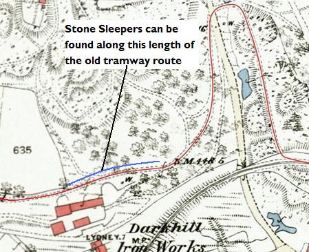
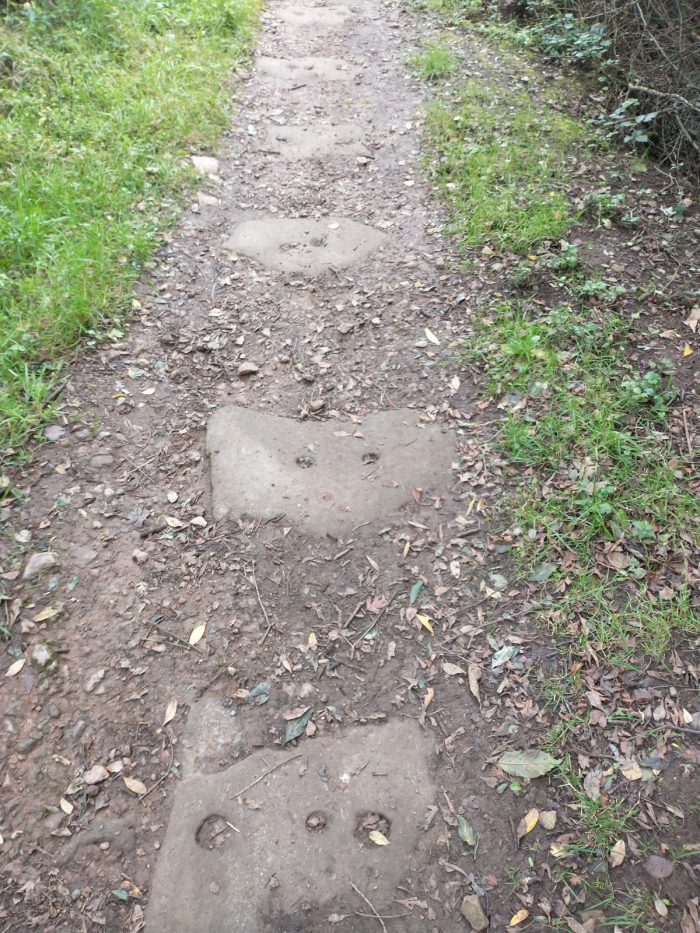
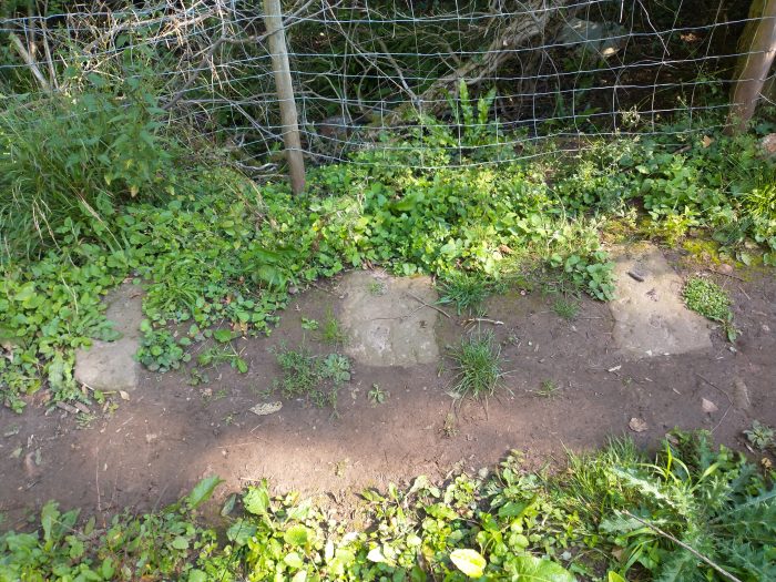
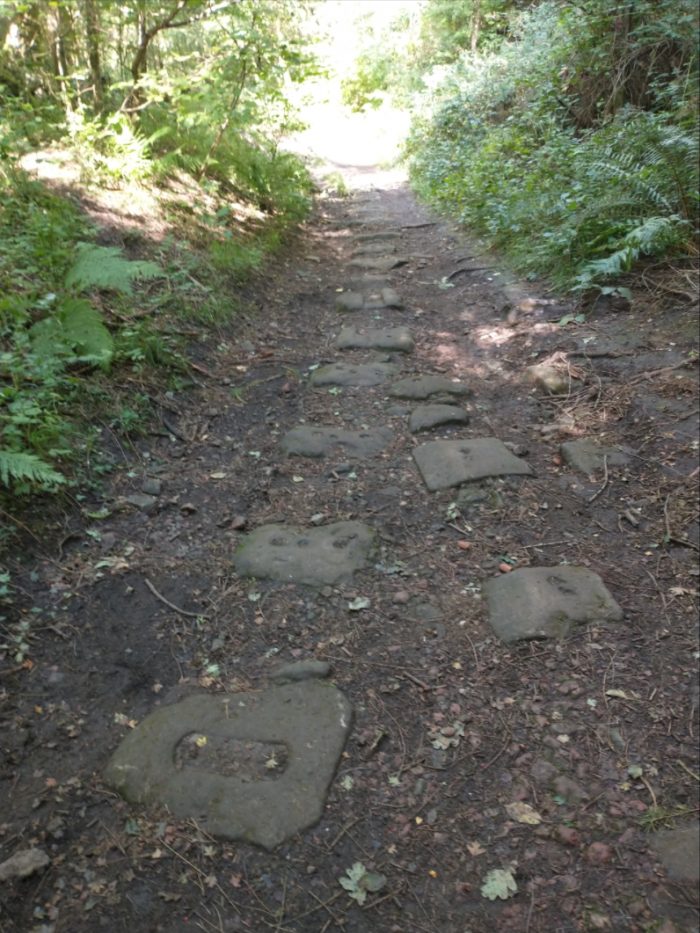
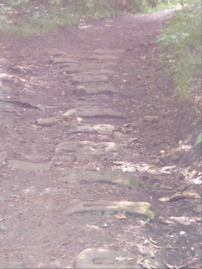
In 1827 David Mushet the metallurgist laid the earliest length of the Oakwood Tramroad from this area to Parkend. “Within a short distance you can observe a series of large flat stones in the pathway. These are sleepers for the Oakwood Tramway which terminated at Parkend and was used to transport mainly iron ore for transfer to the railway at Marsh Sidings (near Parkend’s Fountain Inn).” [11]
To the left and right of the walk route we came across dry mill ponds which originally “fed the water wheel at the Oakwood Corn Mill. The mill occupied the old buildings to the left and the waterwheel which drove the machinery was situated in a sunken chamber at the side. The sluice gate, which released the water onto the wheel, can be seen in the far corner of the stone-lined pond. It is probable that the operation of the mill was sporadic and dependant on the mill ponds containing sufficient water to drive the wheel.” [11]

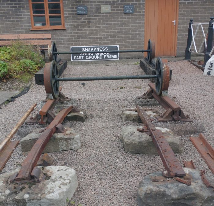
The route of the Oakwood Tramway between locations 14 and 15, 1st September 2020. The different gauges used at different times can be seen clearly in this pisture taken at the Dean Forest Railway at Norchard on 2nd September 2020. The tramway gauge and construction can be seen in the foreground. Tramways in the forest were of 3’6″ to 3’8″ track gauge.
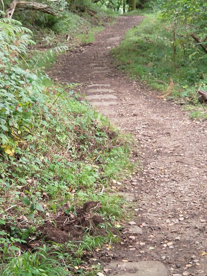
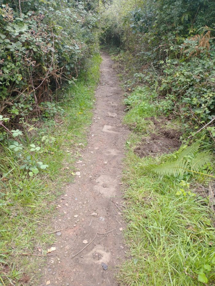
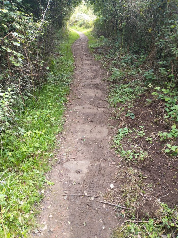
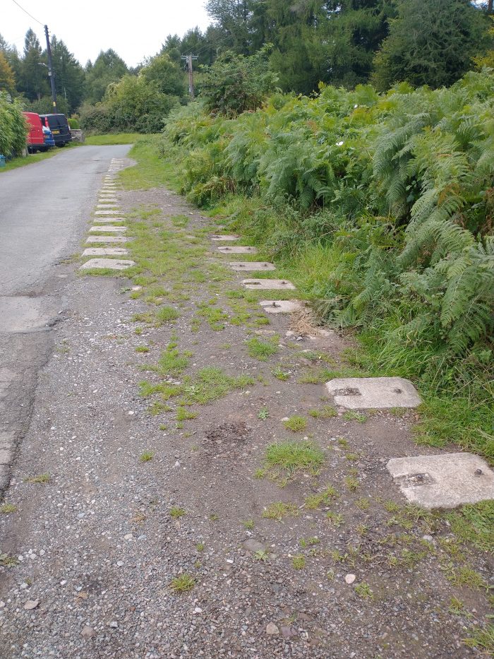
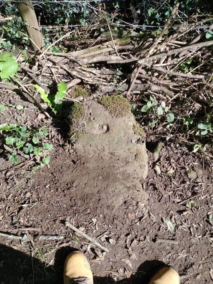
The Oakwood Tramway most probably consisted of L-shaped cast-iron rails resting on stone blocks or sleepers, as shown above, which served to spread the load over the ground, and to maintain the gauge. We located a number of these stone blocks along the first length of the tramway between 14 and 20. Each had two or three holes into which the rails or ‘plates’ were fixed. A few photographs taken on 1st September 2020 at different locations along the path, follow. …


There were long lengths of the route where usage and time have resulted in these stone blocks/sleepers being covered. “From this point, the tramroad did not plunge down the slope to the bottom of Mill Hill, it ……. went to the right and took a level path that hugged the hillside as it continued along the valley.” [12] It then turned to the Northeast following the valley.
In the valley bottom is what, in the 21st century, is a large white rendered private house. This was, until 1969, the ‘Oakwood Inn’.
At location 19 on the walk we passed what was once Oakwood Mill Deep Level iron-ore mine. It was driven in the early 1800’s by “David Mushet and it drained water from the earlier surface workings, both draining the mine of water and allowing a much easier extraction of ore.” [13] And at location 20, we passed the remains of Bromley Furnace.
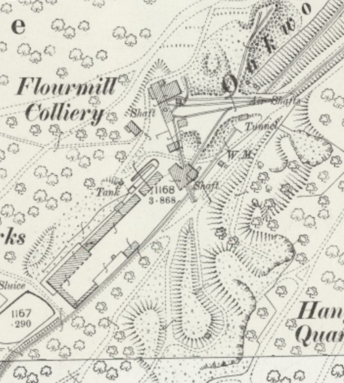
The next significant location on the walk is the Oakwood Chemical Works and Flour Mill Colliery. We will return to look at the route of the tramway after we have looked at the Flour Mill Colliery site.
Flour Mill Colliery and its present use.
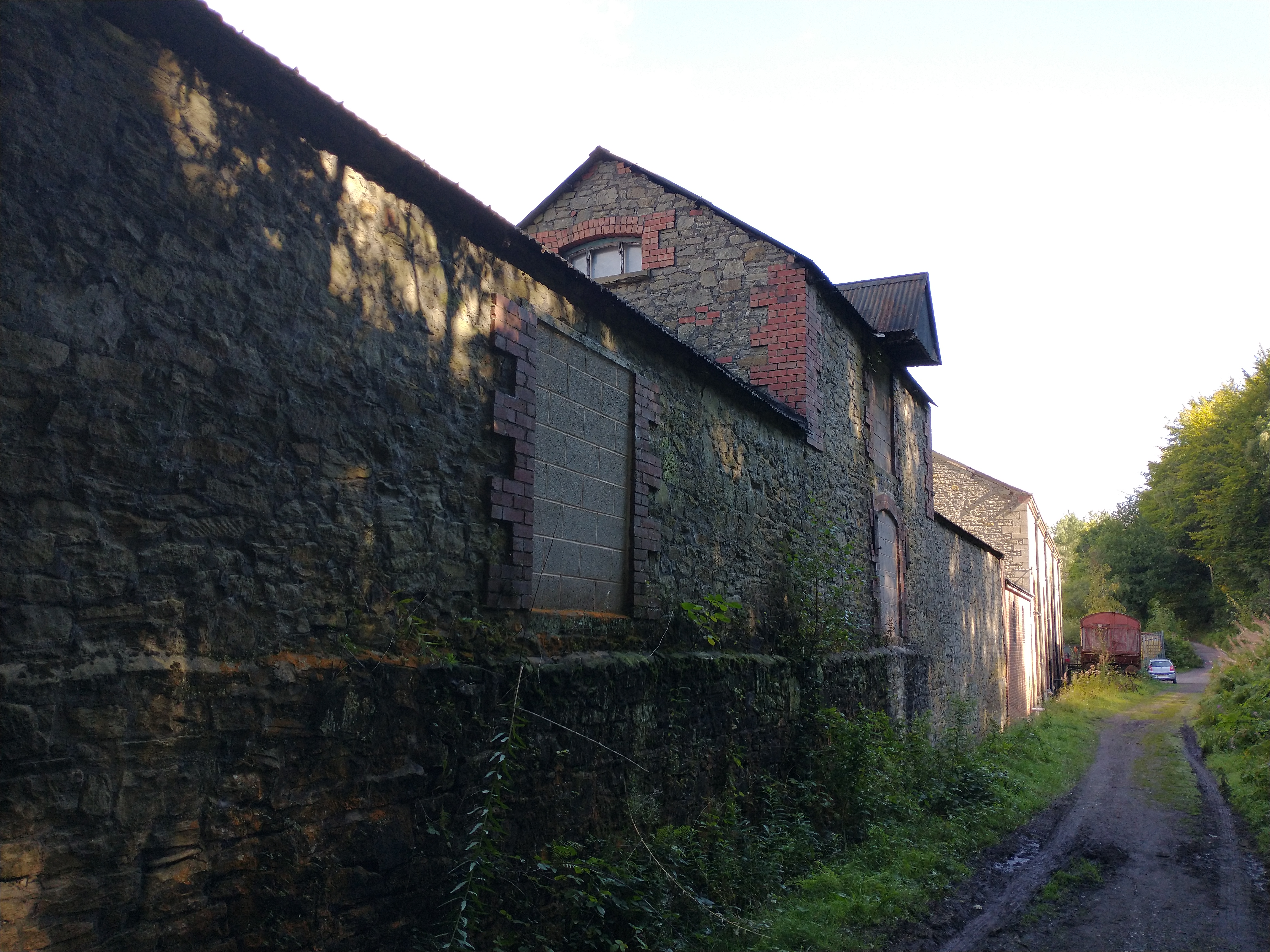
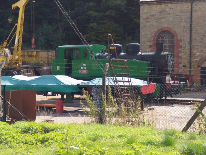
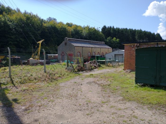
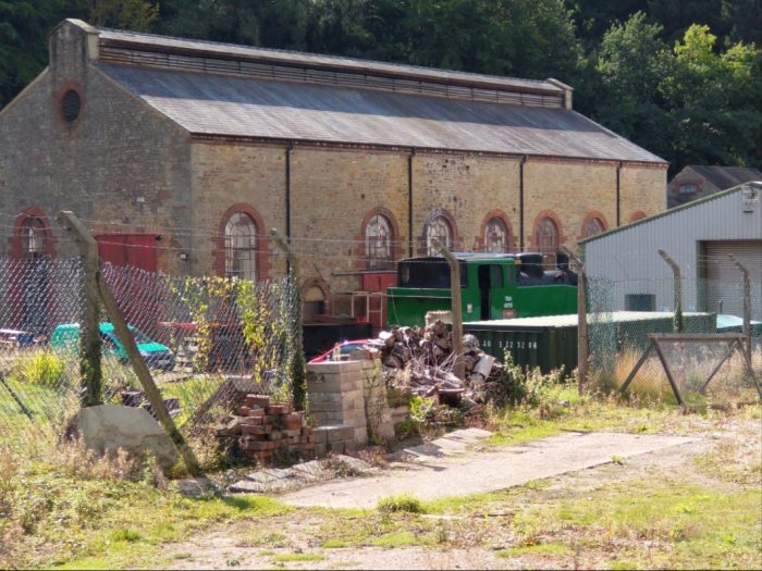
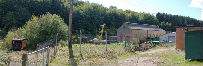
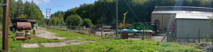
 At locations 21, 22 and 23 on the walk we passed the site of Flour Mill Colliery. The walk runs immediately alongside the remaining colliery buildings on the line of the old tramway.
A while ago, the Colliery and the current use of its remaing buildings featured on my blog. [4]

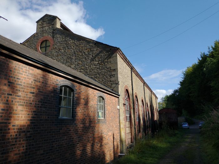
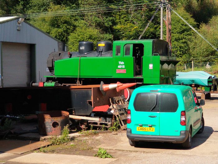
The buildings of Flour Mill Colliery sit immediately alongside the route of the Heritage Walk, 1st September 2020. The Electricity Generating Hall/Building of the old colliery is now in use as an engineering works, 1st September 2020.
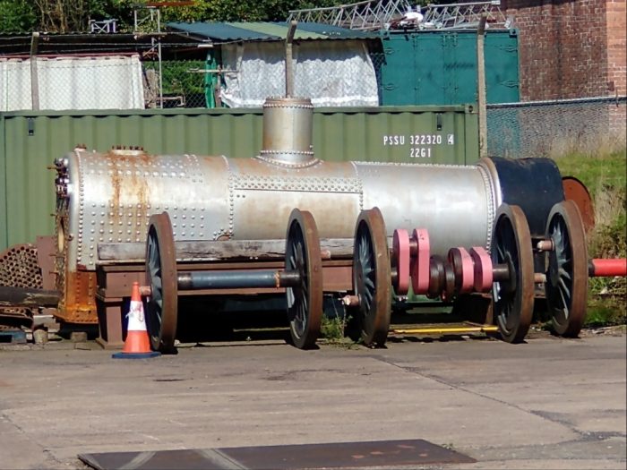
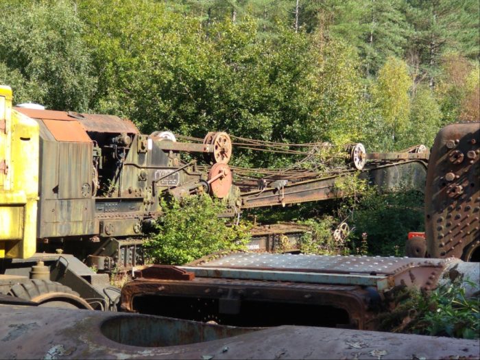
These buildings are now in use for the repair and refurbishment of steam locomotives. We spent a while wandering around the boundary of the works.

 For more pictures please click here, [9] and for more information about the engineering works please click here. [10]
The route of the walk deviates away from the tramway alignment approximately at the entrance to the modern works, just northeast of the electricity generating hall. The tramway route begins to drop away heading for the transshipment wharves at Parkend.
When Flour Mill Colliery was expanding in the late 19th century it had to bridge the Oakwood Tramway which ran through the enlarged site. The later 25″ OS Map extract below shows the site of Flour Mill Colliery towards the end of the 19th century. The Oakwood tramway can be seen bridged by a relative wide man-made land bridge. [15] This is approximately at location 23 on the walk. The Oakwood Tramway leaves the map extract in the top right corner heading for Parkend. A rope-worked incline runs away to the right just to the South of the Oakwood Tramway. That incline led to what was most recently known as the Princess Royal Colliery. ……
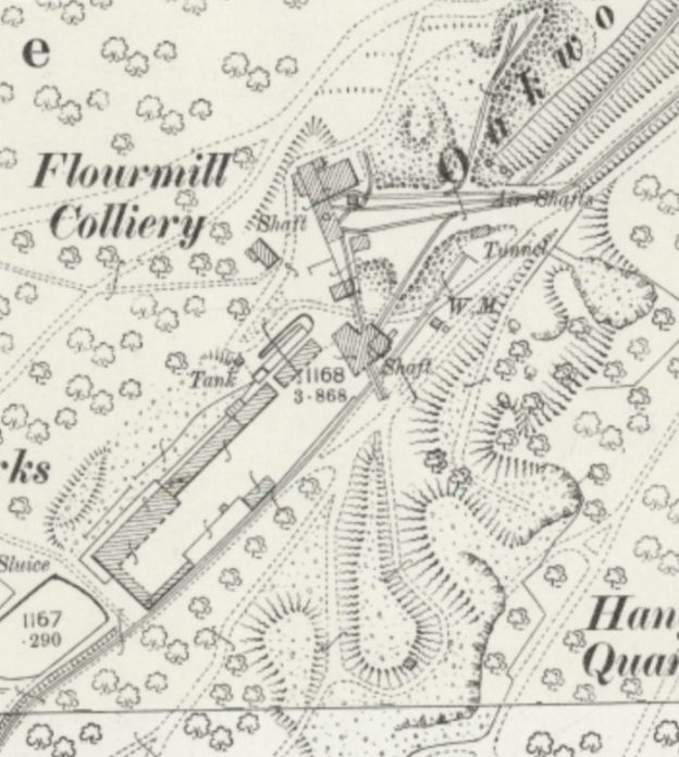
The 25″ OS Mapping of the late 19th century shows that Flour Mill Colliery had two shafts. The more southerly of the two had required a bridge between the shaft and the colliery spoil heaps. The more northerly of the two shafts, later required a land bridge over the tramway which was first culverted before the land was built up to provide access across the Oakwood tramway to a rope worked incline which took coal from Flour Mill Colliery to Princess Royal Colliery. [8][14]

25″ OS Map extract [18]
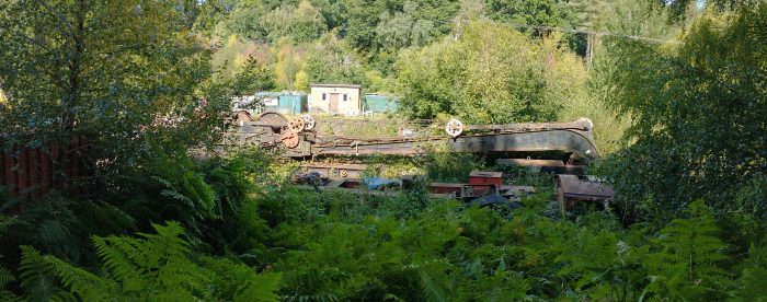
To the Northeast of the land bridge, Oakwood Tramway was in deep cutting. Its route could only be found by taking a deviation from the Bream Heritage Walk at location 24 on the walk route shown above. It was a delight to find significant remains of the tramway between this point and the Parkend Road.
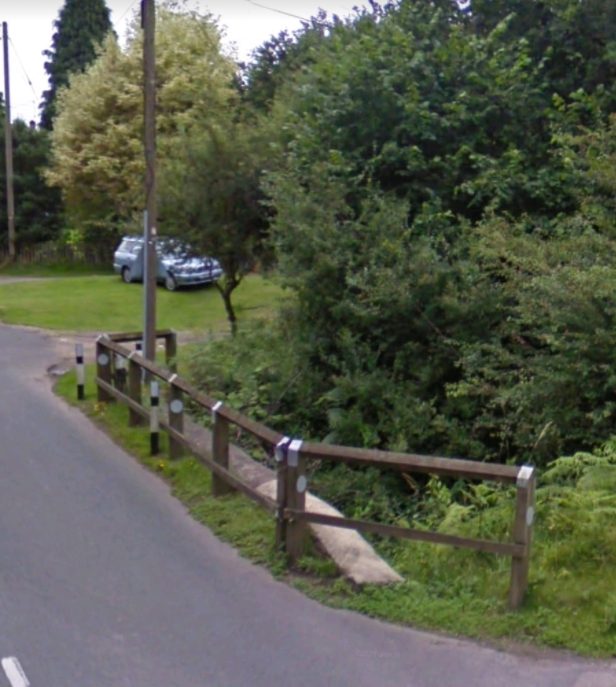
The Oakwood Tramway was a single-track line with passing places. The two pictures immediately below were taken to the North of location 24 on the Bream Heritage Walk. They show the location of one of these passing places. A shirt loop of line left the main route and returned back to join it in a very short distance. Just long enough to accommodate a train of trams and their motive power (a horse or two)! The map extract below shows the location. [16]

The two pictures show the northern end of the passing loop which can be seen on the OS Map above. The first looks north, the second looks South. Both pictures were taken on 1st September 2020. The rope-worked incline passed under the Bream to Parkend Road at this location. The barrier protect the drop into the cutting, (Google Streetview).
Our walk turned away from the Tramway just North of the location of the passing loop shown in the pictures above. We walked up to the Parkend Road and turned back towards Bream. We were able to make out the point where the rope-worked incline passed under the road. The last picture above was taken from the Bream to Parkend Road at location 25 on the Bream Heritage Walk,
References
- https://bhwalk.uk, accessed on 1st September 2020.
- https://rogerfarnworth.com/2017/10/02/oakwood-and-dikes-tramways. The Oakwood Tramway ran West to East before turning Northeast towards Parkend.
- https://www.derelictplaces.co.uk/main/industrial-sites/8587-princesss-louise-iron-mine-forest-dean.html, accessed on 1st September 2020.
- https://rogerfarnworth.com/2017/09/30/the-flour-mill-colliery.
- https://maps.nls.uk/geo/explore/#zoom=17&lat=51.75812&lon=-2.59536&layers=178&b=1, accessed on 2nd September 2020.
- https://maps.nls.uk/geo/explore/#zoom=17&lat=51.75805&lon=-2.59121&layers=178&b=1, accessed on 2nd September 2020.
- https://bhwalk.uk/china-bottom, accessed on 3rd September 2020.
- https://maps.nls.uk/geo/explore/#zoom=17&lat=51.75823&lon=-2.57385&layers=168&b=1, accessed on 2nd September 2020.
- https://rogerfarnworth.com/2020/09/04/the-flour-mill-colliery-and-the-flour-mill-ltd-again, blog post completed on 4th September 2020.
- https://theflourmill.com, accessed on 2nd September 2020.
- https://bhwalk.uk/oakwood-mill-land-level, accessed on 1st September 2020.
- https://bhwalk.uk/oakwood-mill, accessed on 1st September 2020.
- https://bhwalk.uk/oakwood-mill-deep-level, accessed on 2nd September 2020.
- https://bhwalk.uk/flourmill-colliery, accessed on 3rd September 2020.
- https://bhwalk.uk/flourmill-land-bridges, accessed on 3rd September 2020.


 The second, a story about two sons who vacillate between obedience and disobedience to their father. Listening to this second story about the two sons — one who verbally refuses his father’s command to work in a vineyard but later changes his mind and obeys, and another who agrees to toil in the vineyard but does not keep his promise — we might be tempted to moralize it. We may assume its message is simply “Actions speak louder than words!” or “Don’t be such a hypocrite!” or “Obey your father!”
 In Jesus’ day, it probably was seen differently. For to refuse your father’s demand made in public would be to shame him and yourself, so you’d say ‘Yes’ even if you had no intention of obeying him. Public face was everything. Jesus challenges this assumption and his listeners pick up on the challenge. Of course, say the chief priests and elders, the one who initially said ‘No’ was the one who did the will of his father. The culturally appropriate behaviour of the son who said ‘Yes’ did not produce obedience to the father. It was the son who started off behaving in a way that shamed him and his father who was ultimately obedient.