Monthly Archives: Mar 2019

The East Cornwall Mineral Railway – Part 2

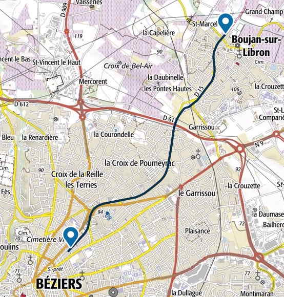
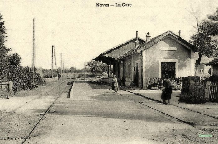
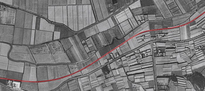
The Route of the Line in Early Years

The East Cornwall Mineral Railway (ECMR) maintained a wharf on the Tamar River at Calstock which, for many years, was served by an incline. A history of the ECMR line and the later standard-gauge line are provided in the first post about the line which can be found on this link:

https://rogerfarnworth.com/2019/03/26/the-east-cornwall-mineral-railway-part-1

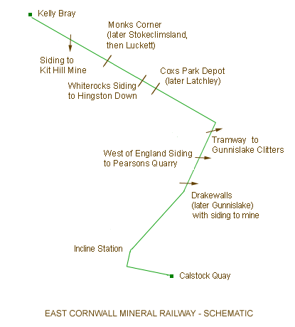
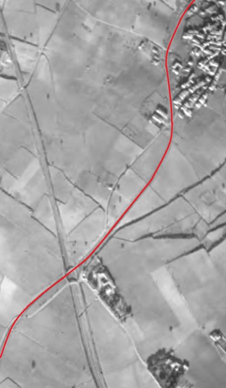
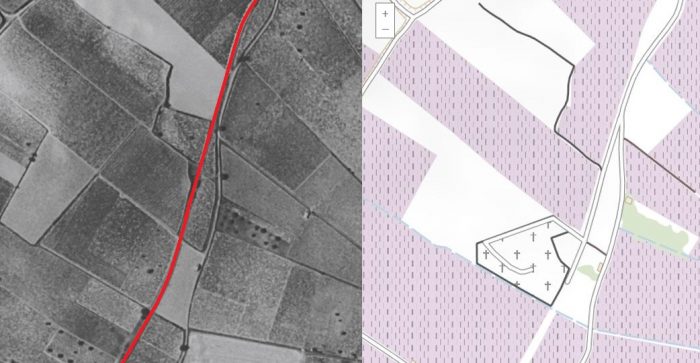
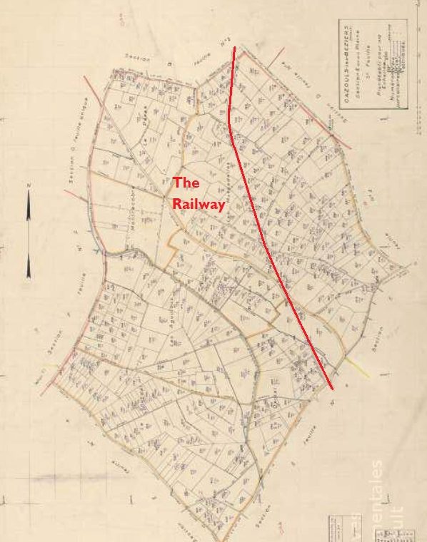
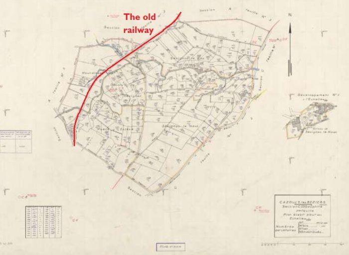
The adjacent image is a schematic sketch of the length of the original 3ft 6in narrow gauge line. [13]

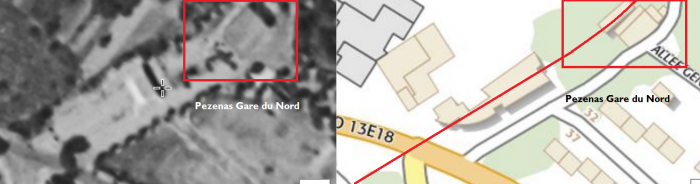
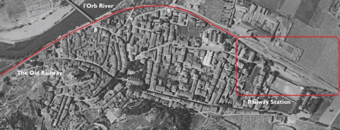
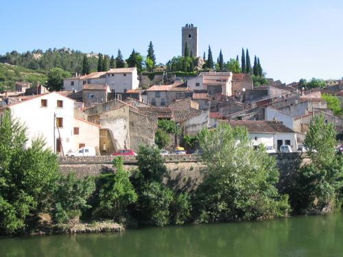
The line’s most southerly point was in the village of Calstock where it served Calstock Quay.

In order to cope with the significant difference in levels between the River Tamar and the surrounding countryside, it was necessary for there to be a rope worked incline from Incline Station down to Calstock Quay.

Steam locomotives were used for the upper section, a stationary engine and counter-balance system for the Incline, and horses on the Quay. The Incline section was under the control of a stationary engineman, assisted by a coupling man on the Quay, a signalman at the top and a signalboy at the halfway loop. [13]

It is thought that only one major accident ever occurred, involving two runaway trucks containing granite, but this resulted in no injuries as the points were deflected allowing the trucks to end up in a field. The ECMR terminus at Williams Quay was leased by Vivian & Sons, smelters and coal dealers of Swansea. Manure for the farms and coal for the mines was brought in and ore exported. [13]

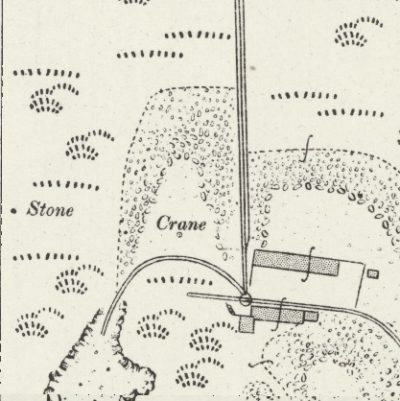
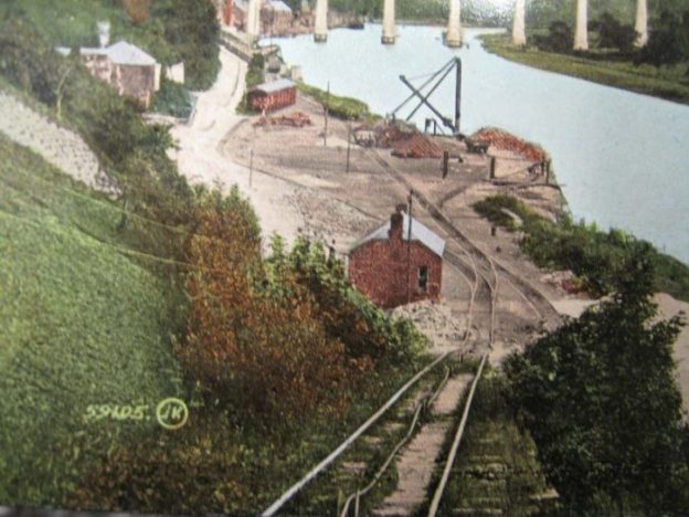
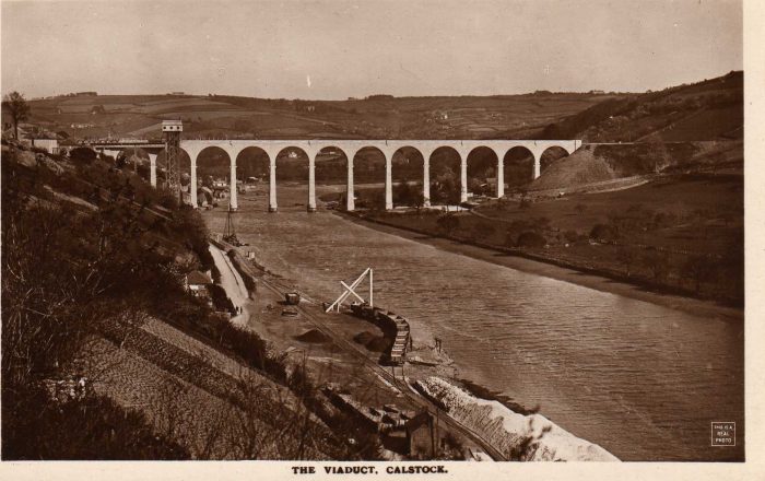
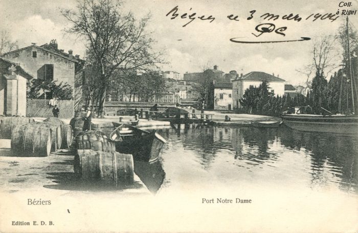
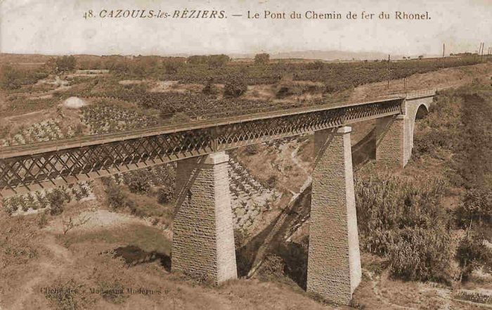
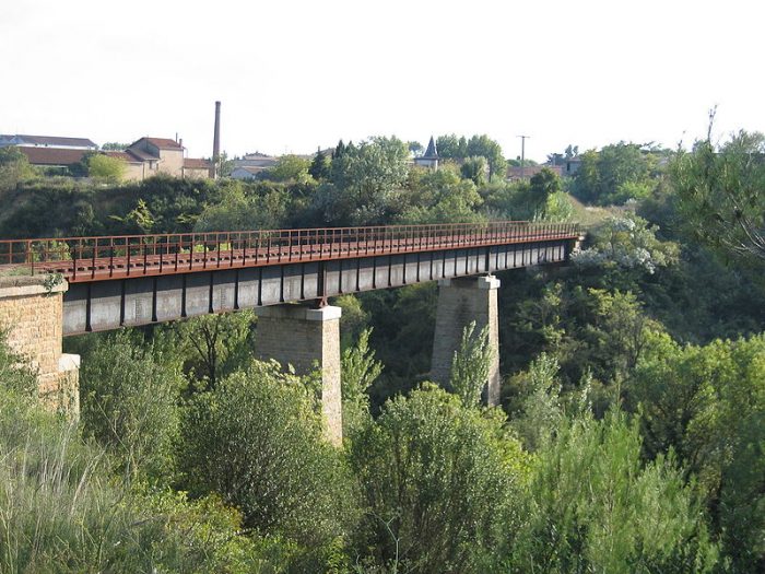
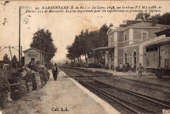
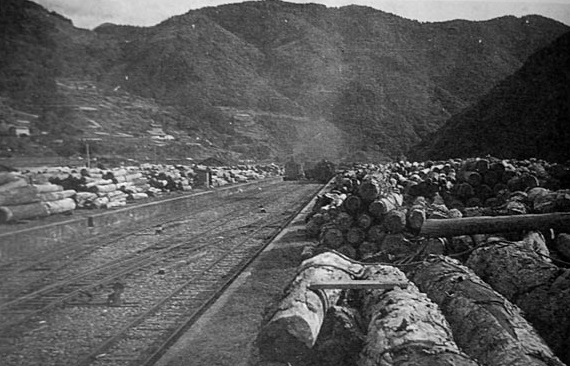
The quay continued in use long after the incline was closed. A wagon lift was provided alongside the viaduct which was completed in 1908 to allow access from Calstock Station down to the wharf.
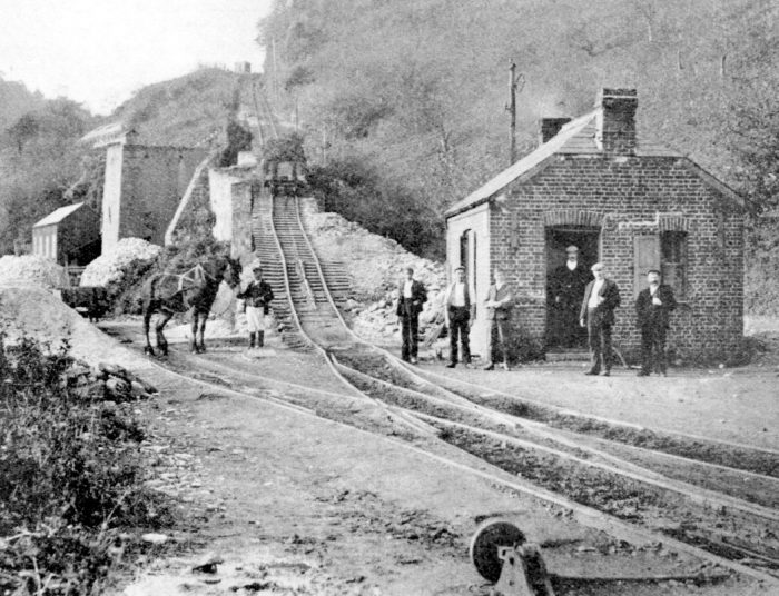
Calstock Incline ECMR From the Alan Harris Collection. Seven men and a horse have stopped work to pose. Also, note that there is a wagon on the incline. You can only see part way up the incline here – it curved around to the right and continued to climb. Lime Kilns lay off to the left as did the River Tamar. [1]
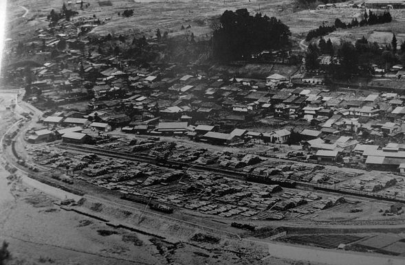
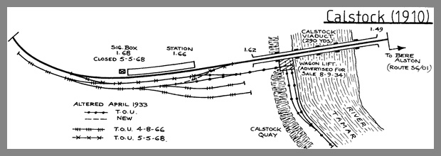
The station layout at Calstock shows the standard-gauge railway crossing the viaduct in 1910 with the wagon lift in place adjacent to the viaduct. In order to ensure compatibility for wagons the track gauge on the wharf would have had to be increased from 3ft 6in to standard-gauge. [2]
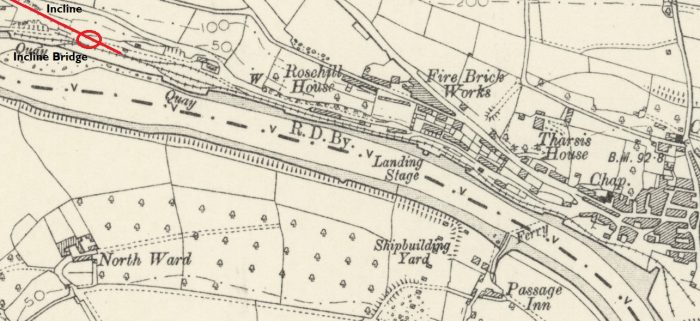
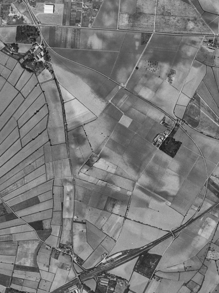
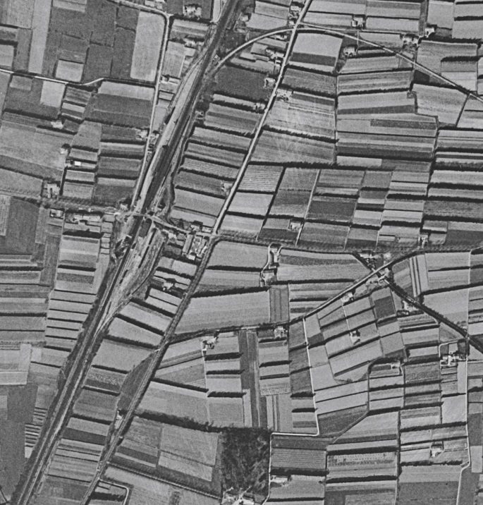
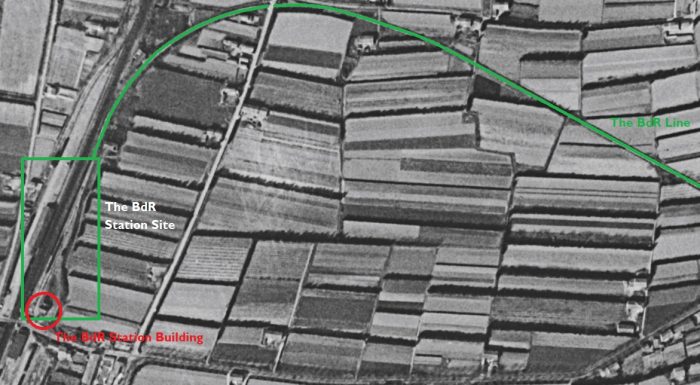
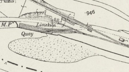
The above map shows the track layout on the Calstock Quay in 1905, before the construction of the new viaduct. The map is the OS Six-inch Map of 1905. [16] The adjacent map is a 25 inch OS representation of the same location in 1906. [19]The 1896 One-inch to the Mile OS Map from shows the 3ft 6in gauge railway running along the quay on the Tamar River and the Ferry which crossed north to south across the river at Calstock. Calstock was on a promontory which the River Tamar circumnavigated. The river is visible on the map both to the north and south of the village. [3]

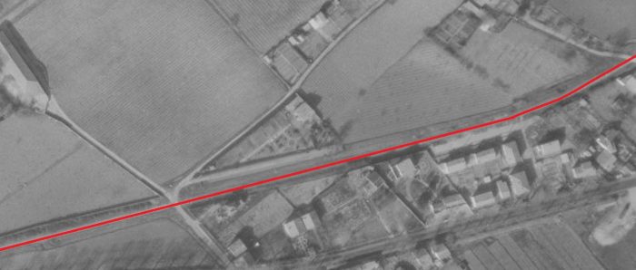
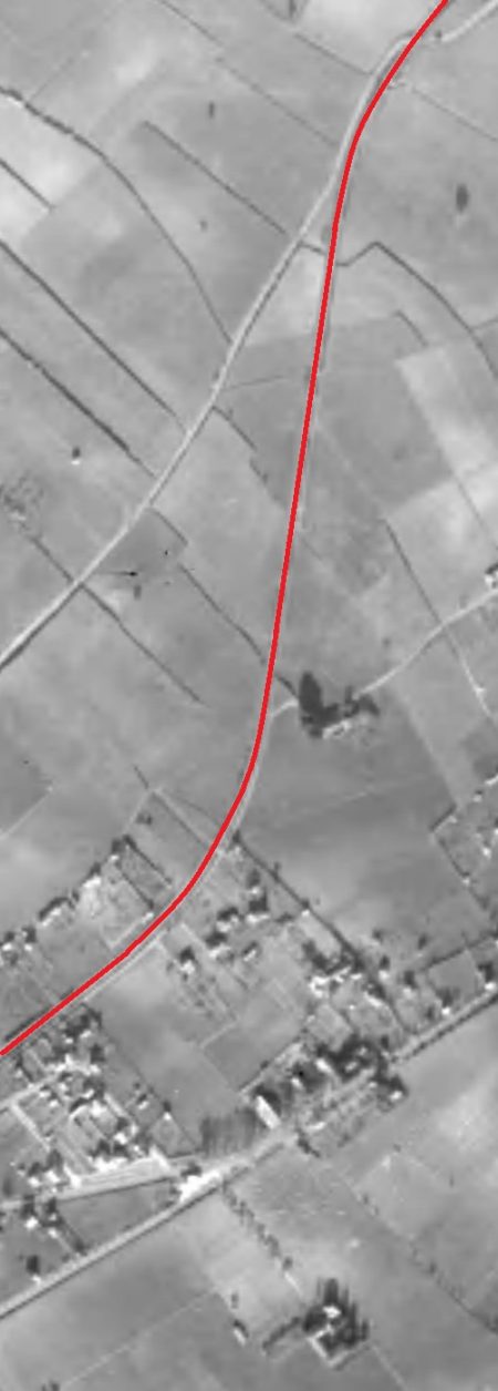
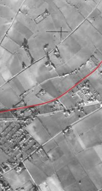
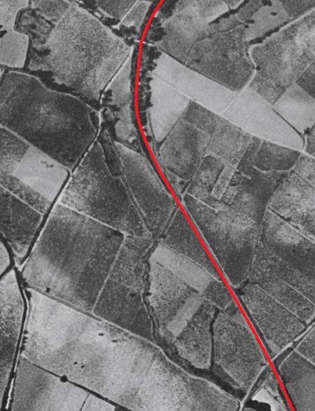
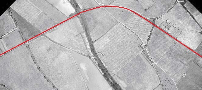
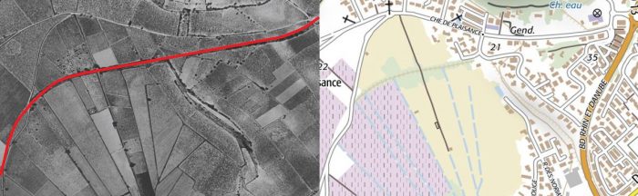
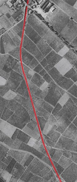
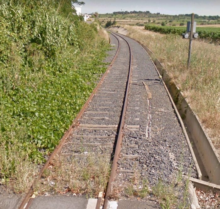
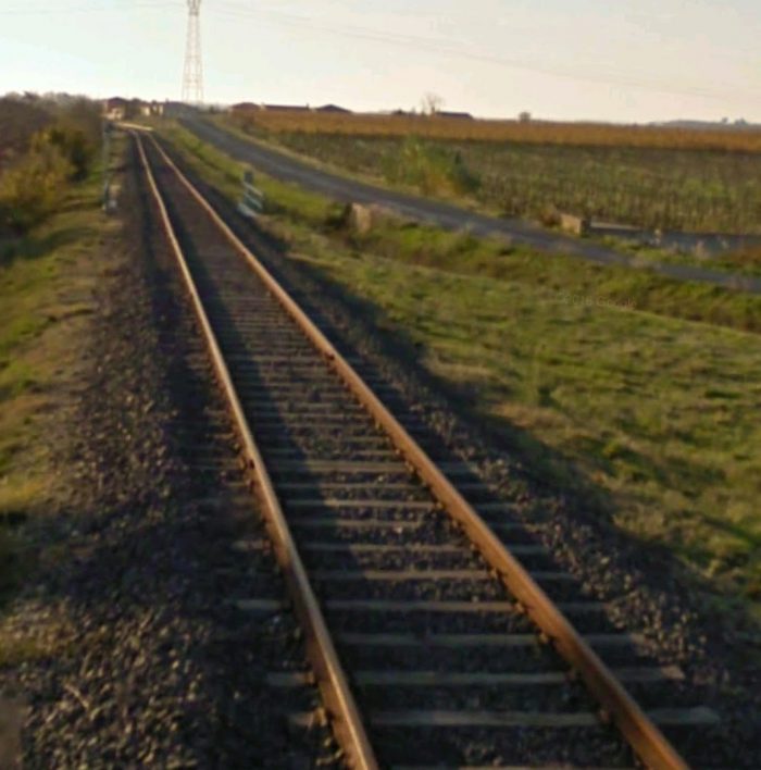
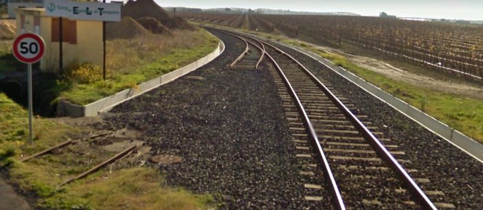
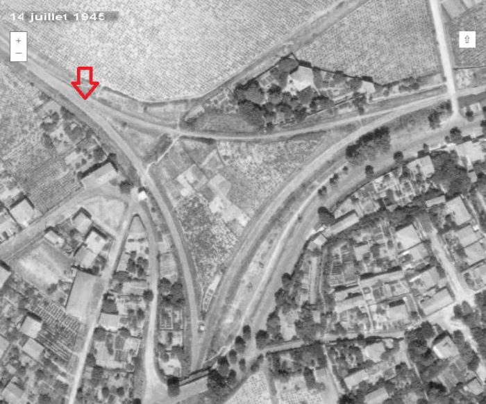
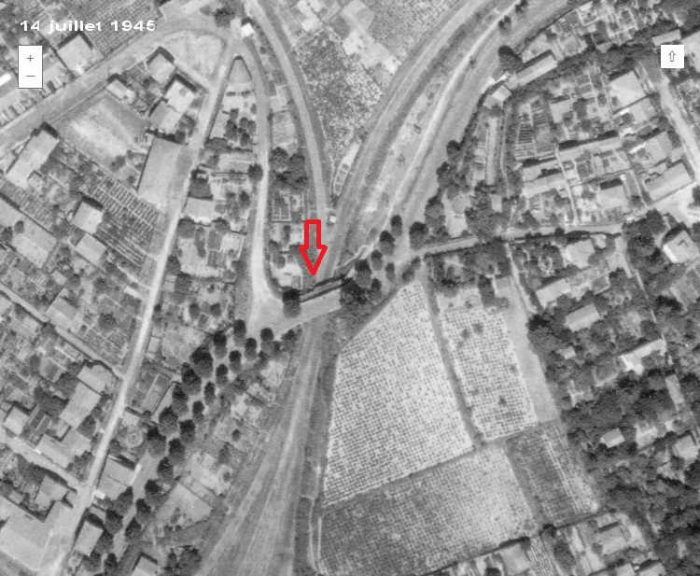
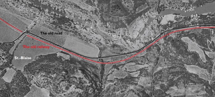
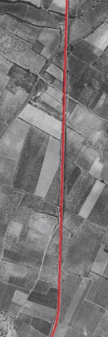
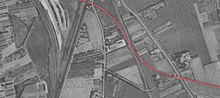
The two One-inch to the Mile OS Map excerpts here show the full extent of the old line’s deviation from the route of the later standard-gauge railway.The incline was a just over 700 metres in length and curved away from the river as it climbed.[3]

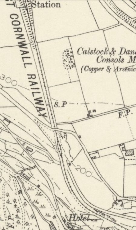
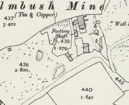
The incline at Calstock was built in 1859 by the Tamar Coal, Manure & General Merchandise Co to bring supplies to mines on the higher ground, and to bring their products down. It was 2,310 feet (704 m) long on a gradient of 1 in 6. It was self-acting, but a stationary steam engine was provided at the top. The incline is shown on the adjacent 1905 Six-inch OS Map.

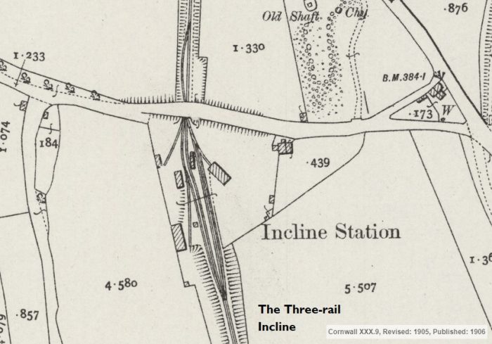
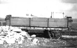
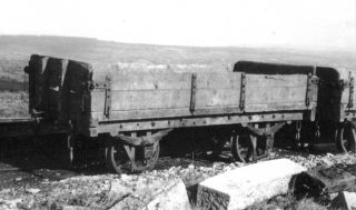
It was single track with a passing loop halfway, and a three-rail section above it (as shown on the next imagewhich is an extract from the 1906 25 inch OS Map). [8] A two wagon lift was usual, each conveying 3 tons. [4][5][6]

When the ECMR line was built, the incline was taken over by the railway company. There is evidence of realignment of the incline: the later route was higher up the hillside and reduced the sharp curve near the bottom. [6] It is likely that this was done at the time of adoption of the incline as part of the ECMR. A 14 hp (9 kW) stationary steam engine was provided by the ECMR. An electric bell system was installed for the operation of the incline, later replaced by a telephone. Two loaded or three empty wagons were moved on the incline at a time. [4]

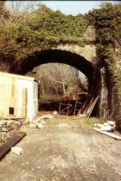
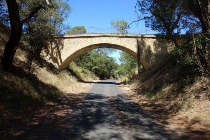
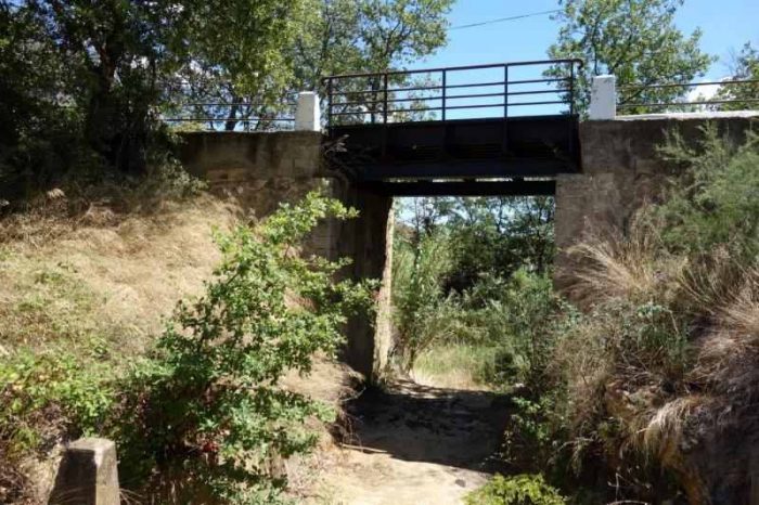
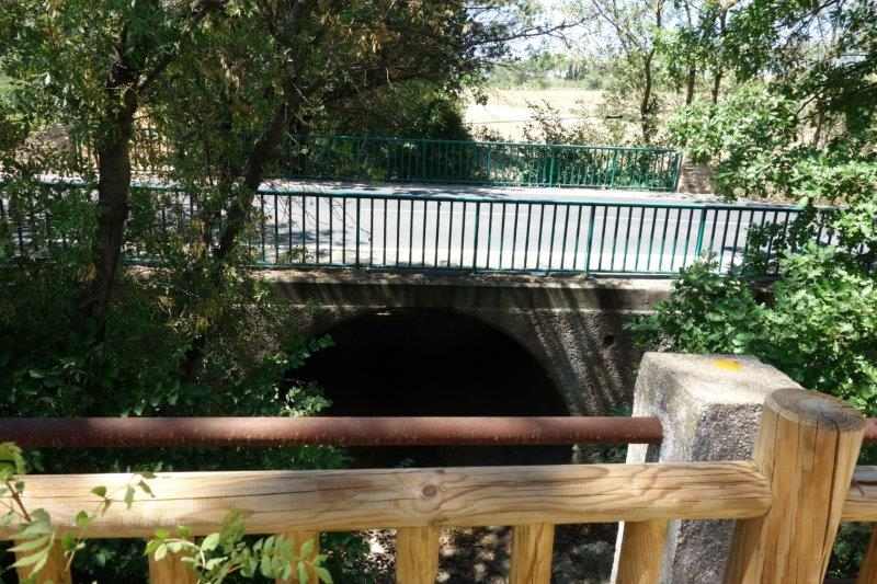
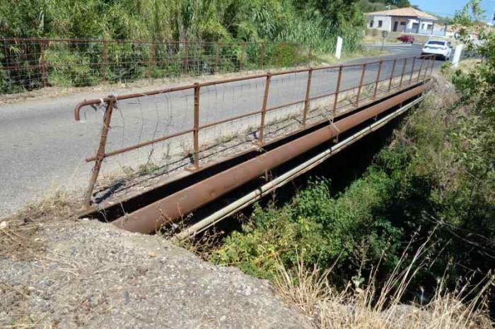
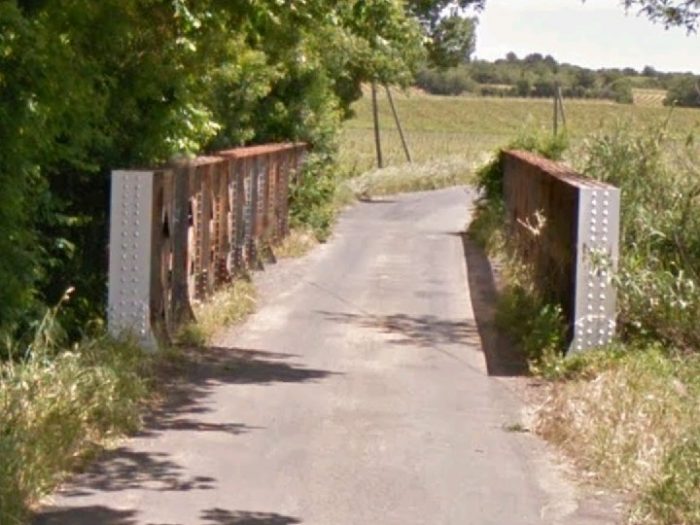
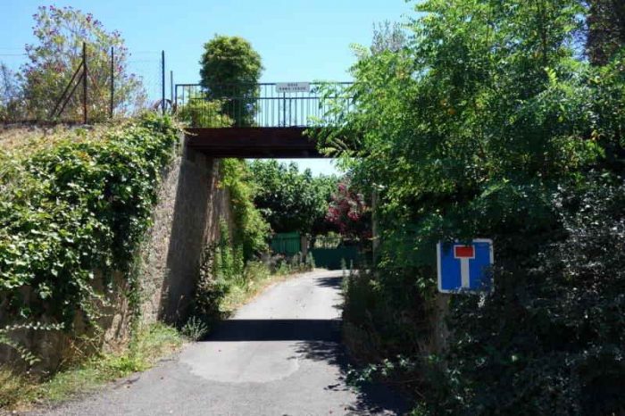
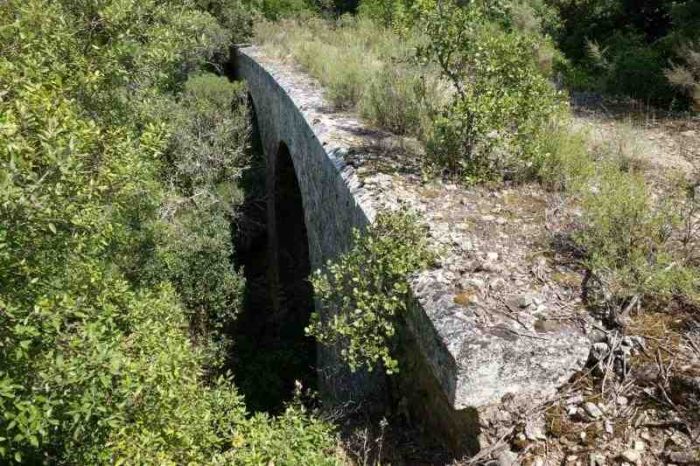
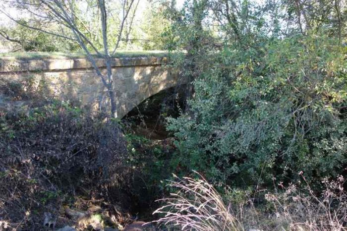
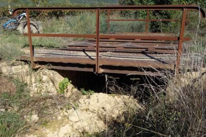
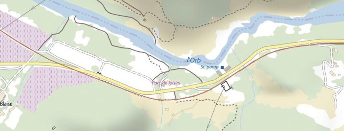
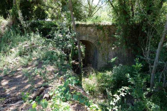
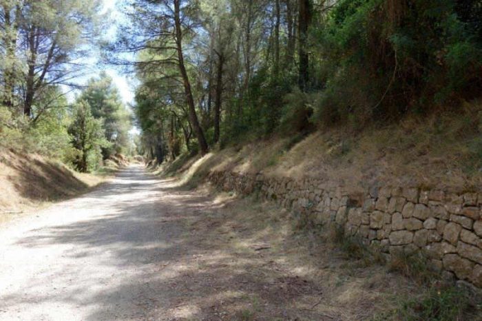
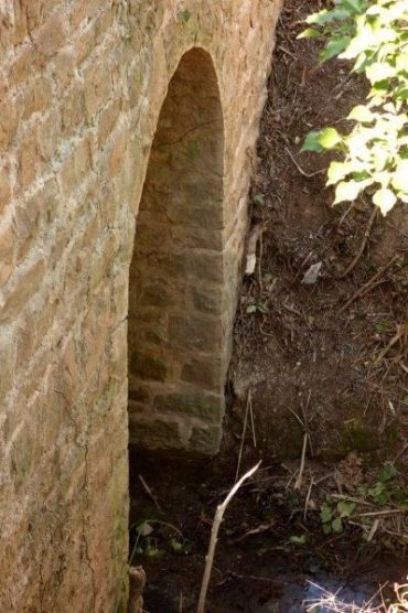
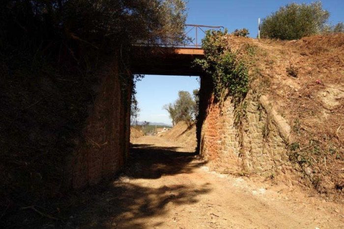
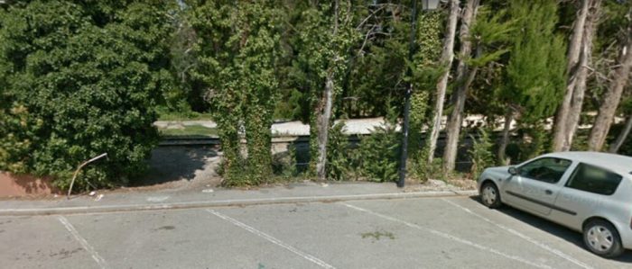
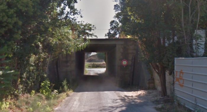
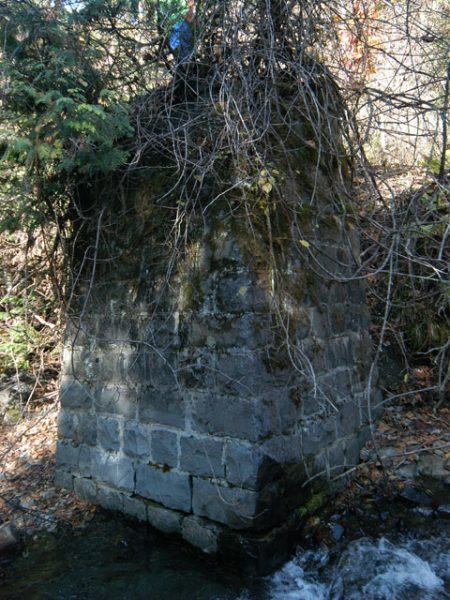
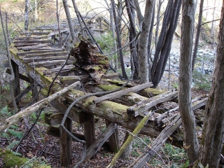
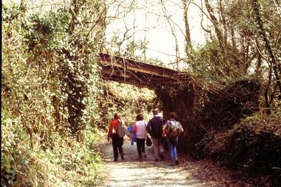
Two bridges were still in evidence on the route of the incline in 1990. The first of these accommodated a single track lane which ran underneath the incline just to the south of the passing loop and is shown in the adjacent image, (c) Roger Winnen. [1]

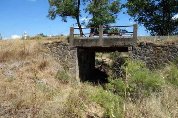
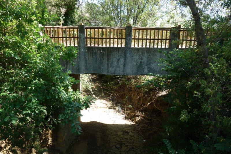
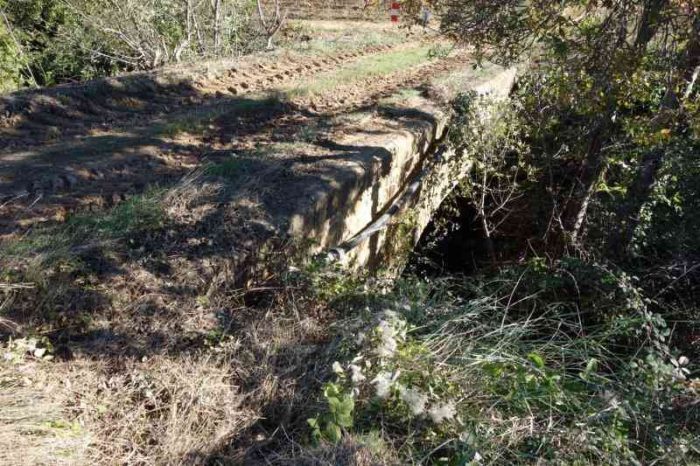
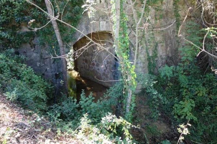
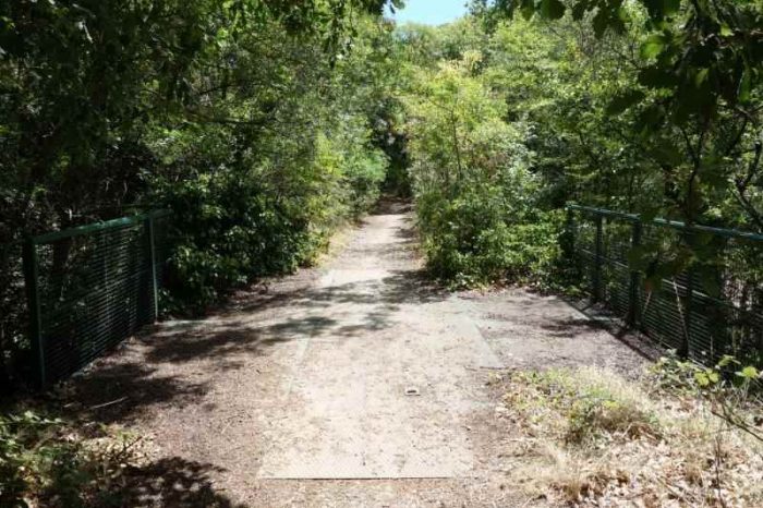
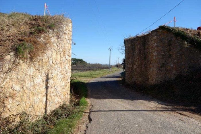
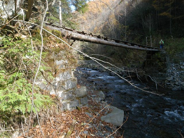
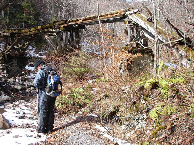
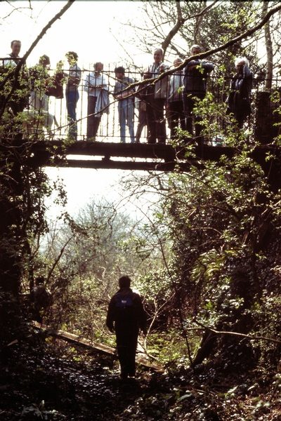
The second was directly under the location of the passing loop and is shown in the next image, (c) Roger Winnen. [1]

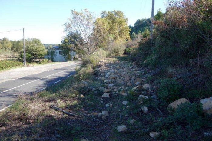
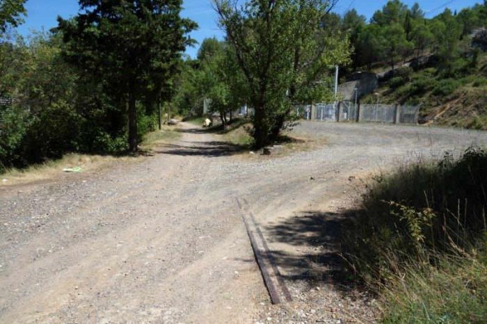
These structures were not in good repair in 1990. I have not been able to establish their present condition in 2019!

The Incline Railway (Argall’s series postcard): the incline rises steeply to the left from the Quays of Lower Kelly, at which the boats are moored. Also visible are the Danescombe Hotel (the last building on the left), which has had various other names over the years. The lime kiln and the supporting bridge (centre) still exist. The Danescombe Valley (behind the curve in the Incline Railway) is believed to be the route taken in the 9th Century by the Danes, before their battle at Hingston Down, which resulted in Cornwall losing its independence. In the 1800s, it was exploited first by the Danescombe Mine, later by Cotehele Consols and Calstock & Danescombe Consols. [9]
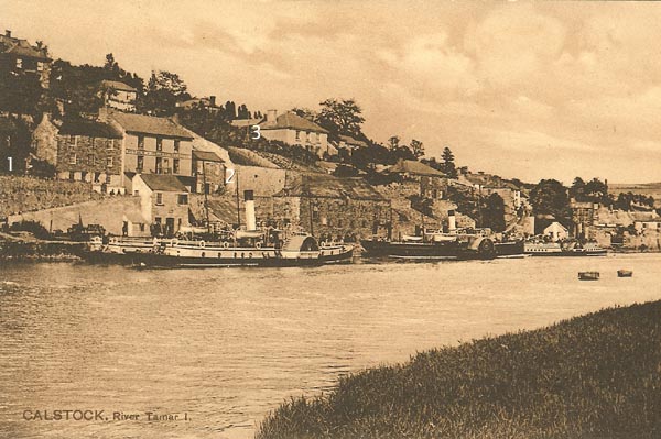
Calstock, River Tamar (Peacock’s Series Postcard c. 1890): This was taken before the building of the viaduct, which would be at 1 on the Calstock side. Anyone who has visited Calstock and climbed the steep flight of steps from Kelly to the station will remember them (at 2). To give another locator guide, the Rectory, Sand Lane is indicated at 3. [11]
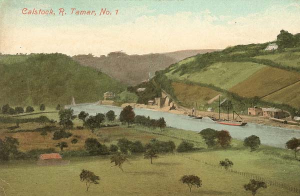
The quay at Calstock on the River Tamar (Valentine’s Series Postcard c. 1900). [11]
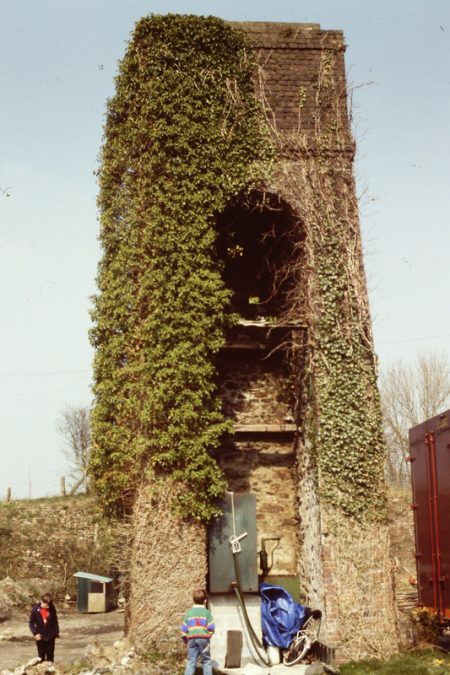
Calstock Lower Kelly Lime kiln is shown above in 21st century. [10]

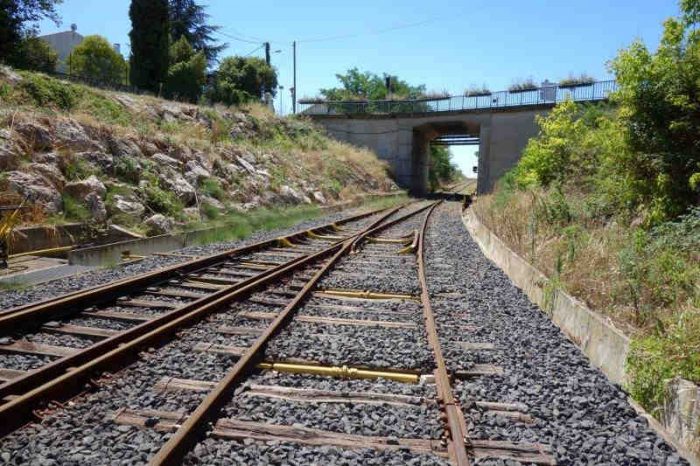
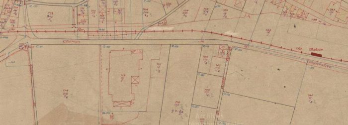
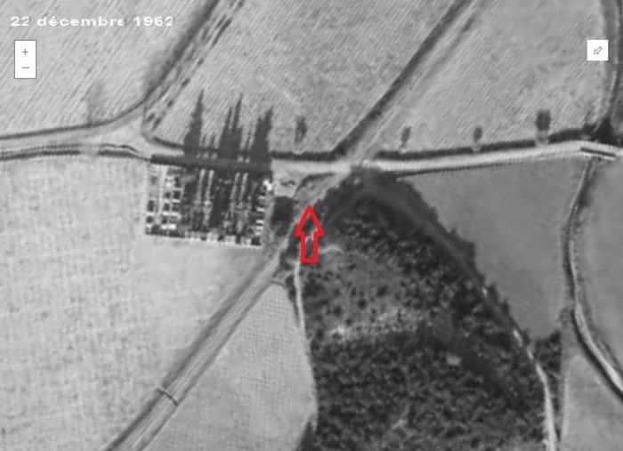
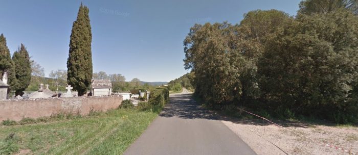
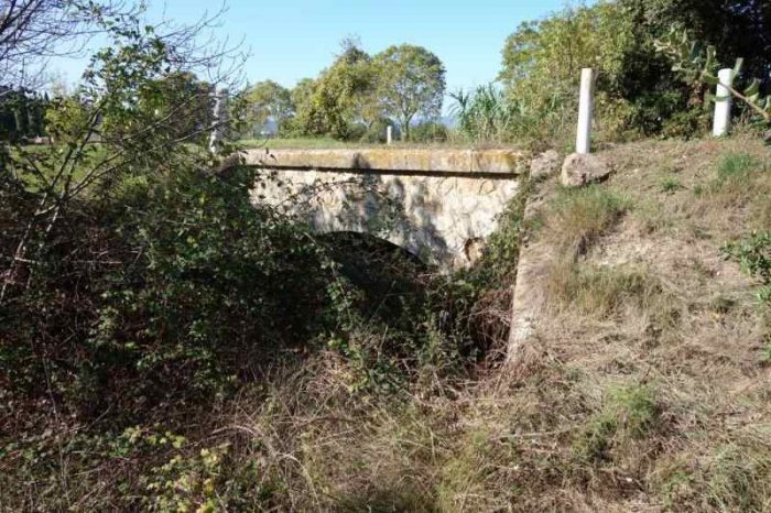
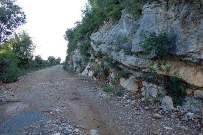
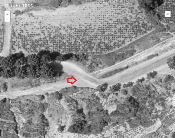
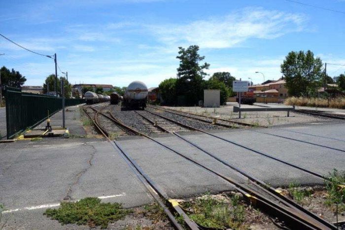
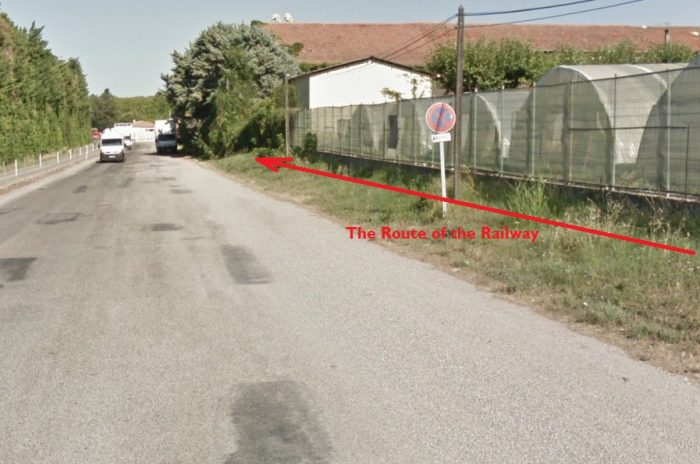
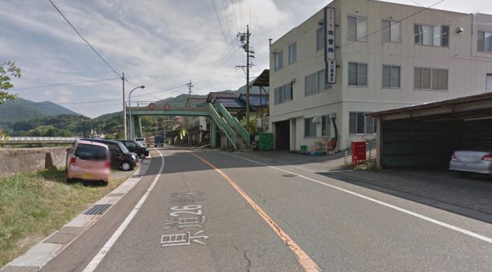
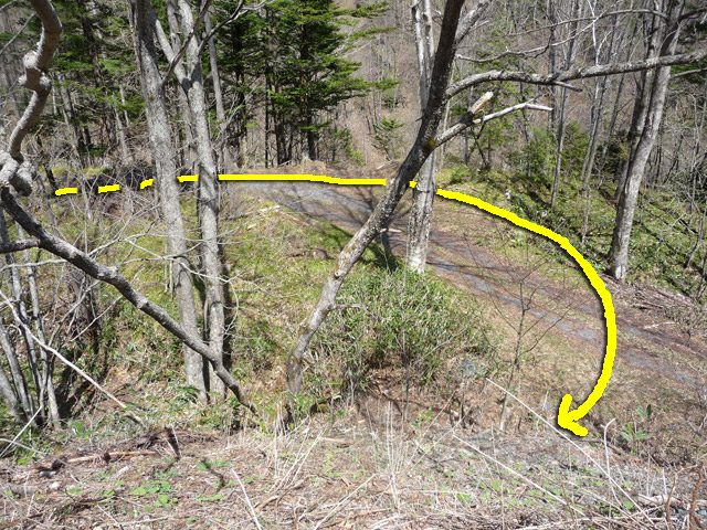
The ECMR extended the quay at Calstock, and it was 1,359 feet (414 m) long. Horses performed wagon movement on the quay. [4][7] The lime kiln in the image above was at the West end of the quay. with the incline behind it. The incline had to bridge a minor road which is shown in the adjacent image. [12] The railway crossed the road, not at the bridge but on a traingular wooden support stretching from the top left of the photo to the top right hand side of the bridge. [13]


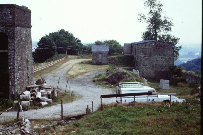
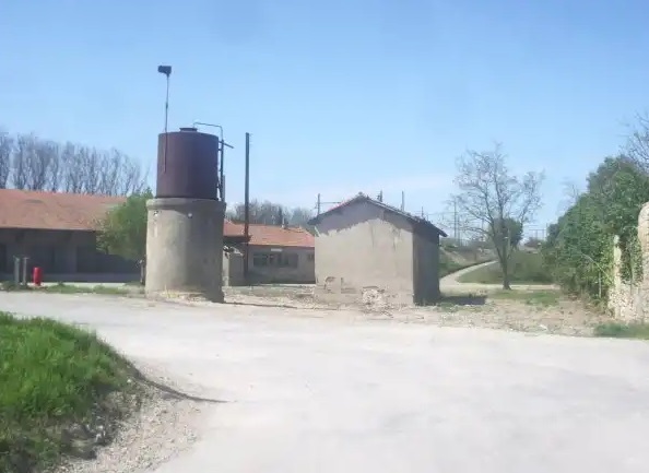
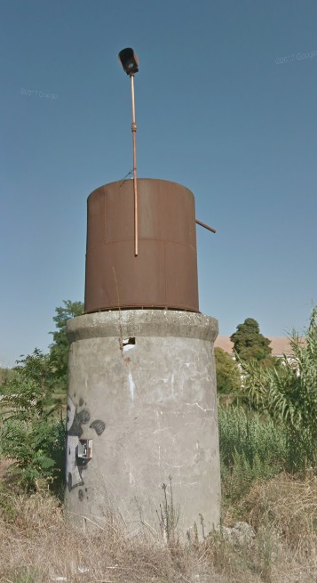
Above, the top of the incline in 1994 including, on the left, the remains of the water tower which also accommodated the winding engine, (c) Roger Winnen [1]

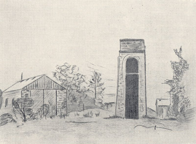
The adjacent sketch from the 1950s is drawn from a vantage point a little further back from the photographer of the image above. [7]

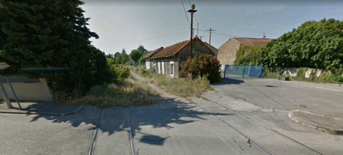
This next image shows the watertower/winding house in 1990, (c) Roger Winnen. [1]

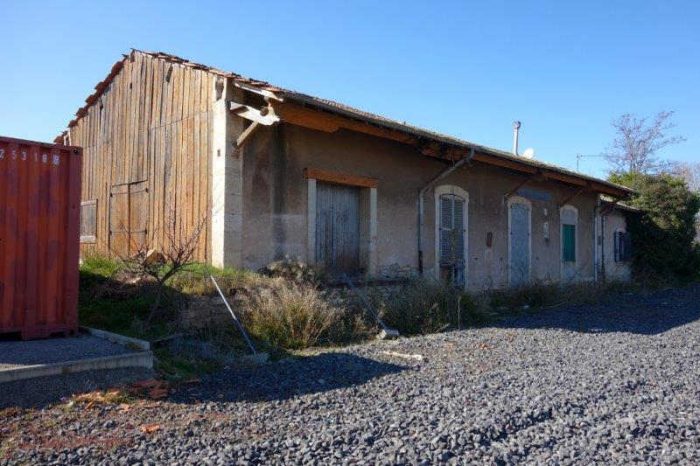
The image below was taken at the same time in 1990 as that of the water tower and shows the remaining storage shed, (c) Roger Winnen. [1]

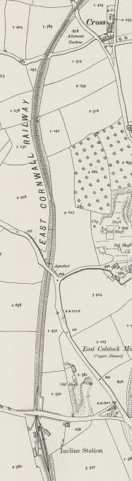
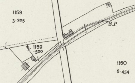
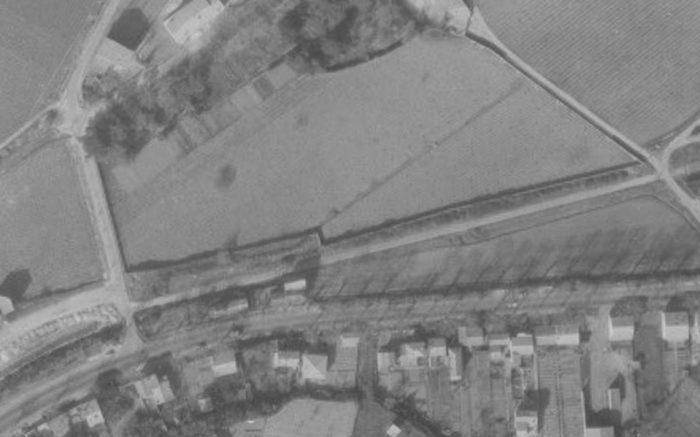
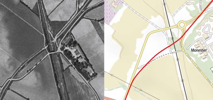
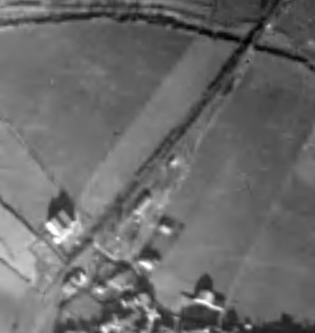
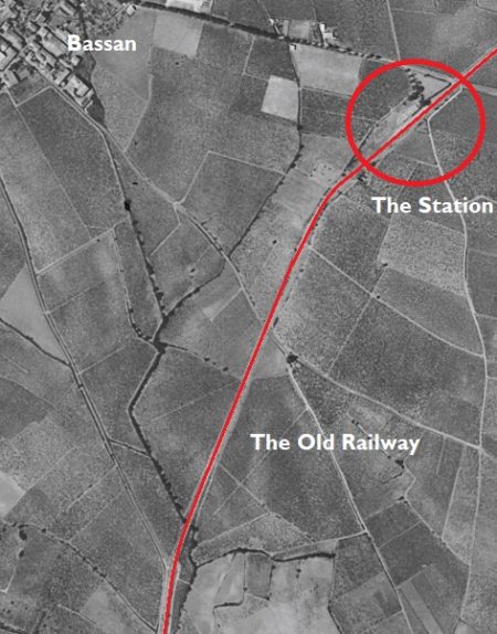
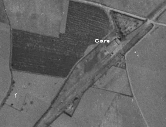
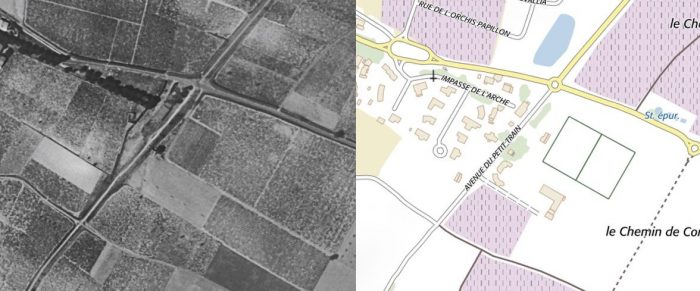
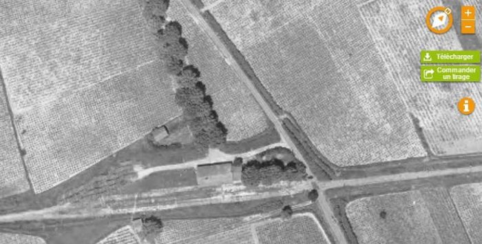
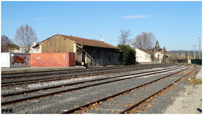
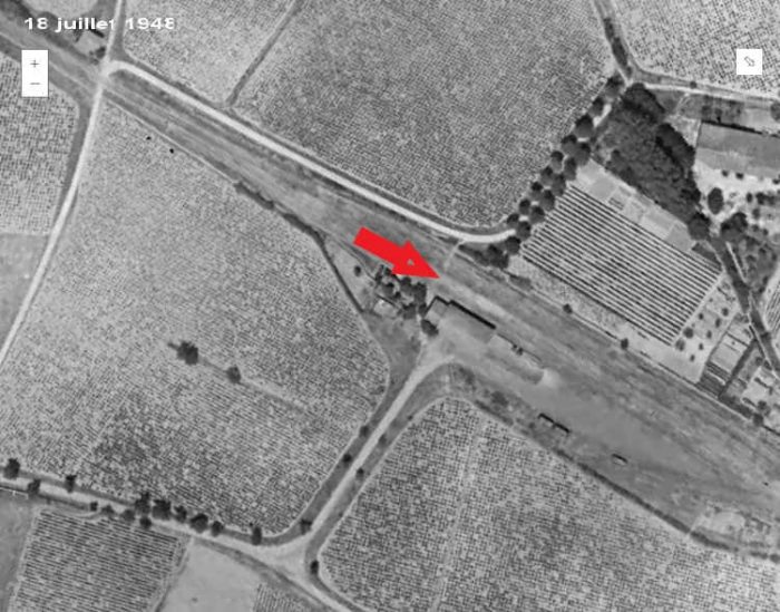
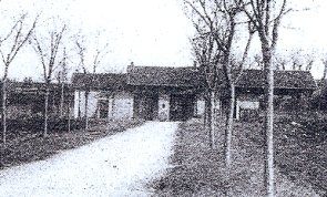
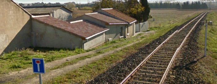
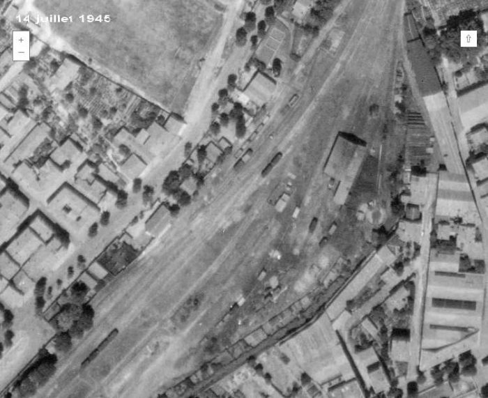
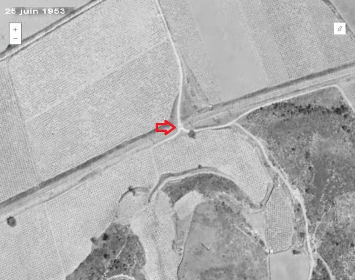
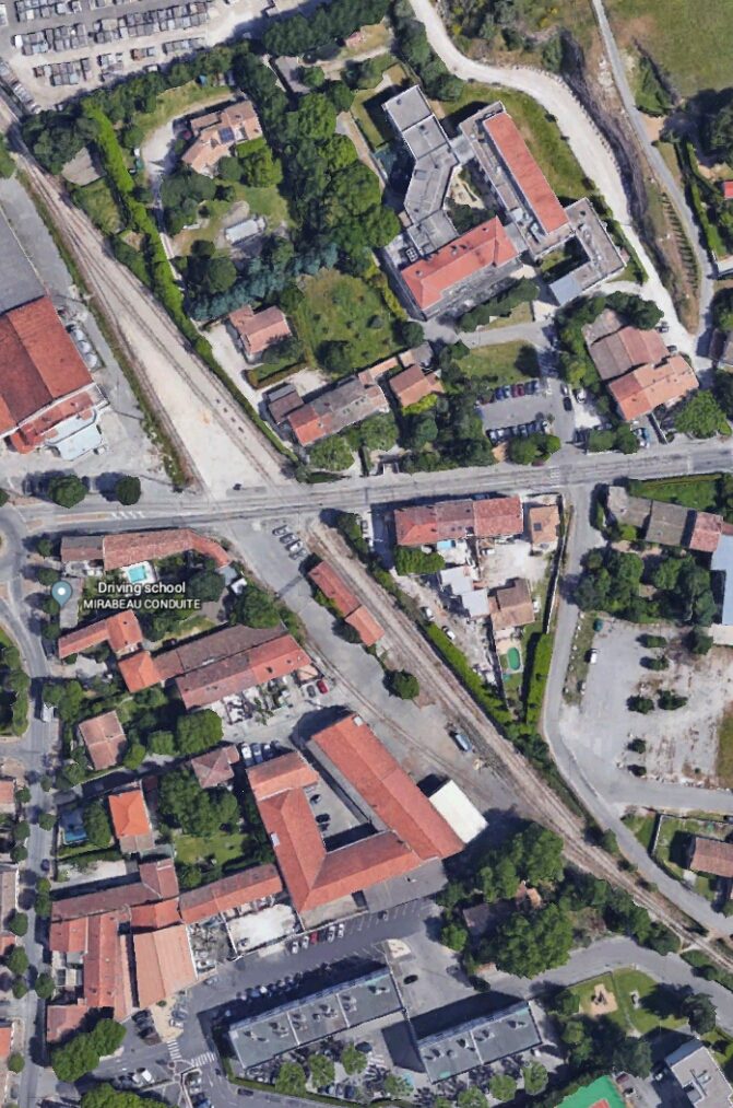
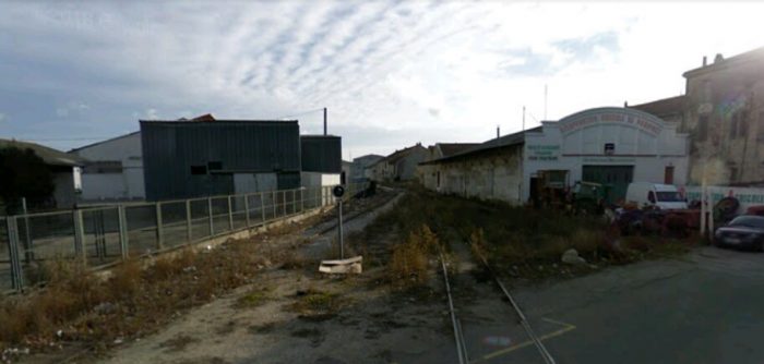
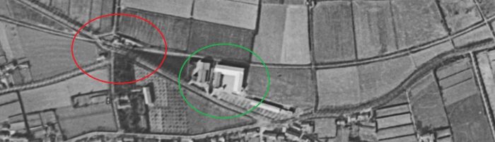
The buildings pictured were all part of the site of what was known as Incline Station. The station site is shown in the map excerpt below which comes from the 25-inch OS Map of 1906. Each building is in evidence including the locomotive shed. [19]

The adjacent image is taken from the track-bed of the ECMR looking north and was taken in 1990, (c) Roger Winnen. [1]

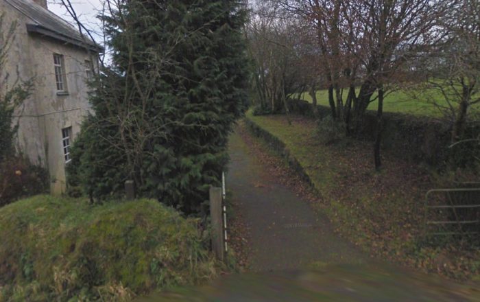
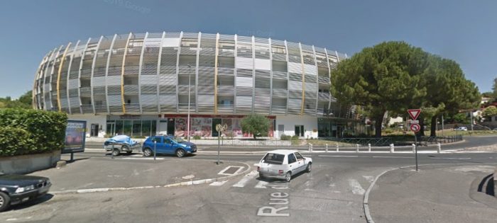
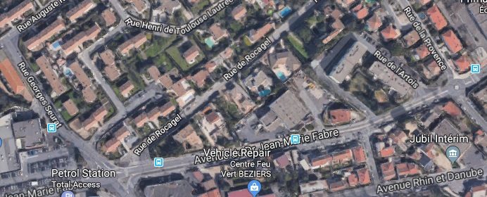
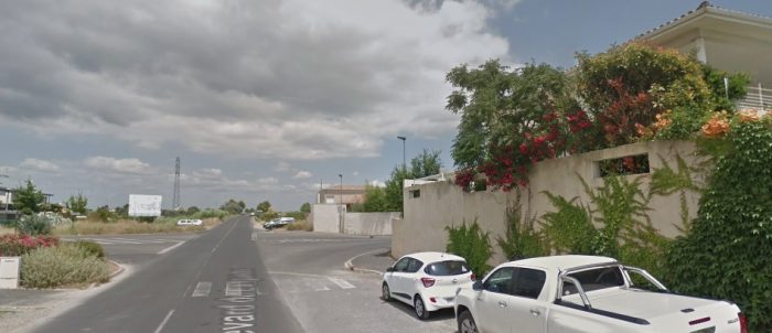
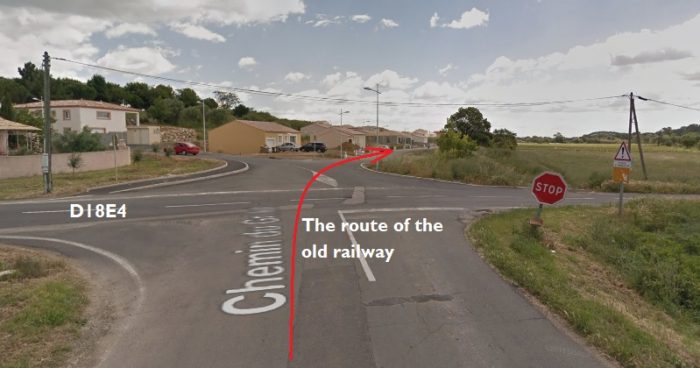
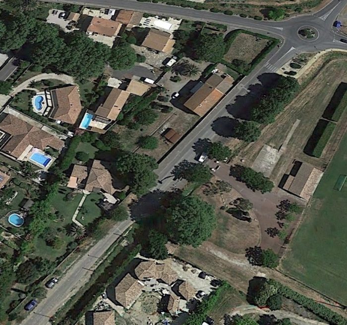
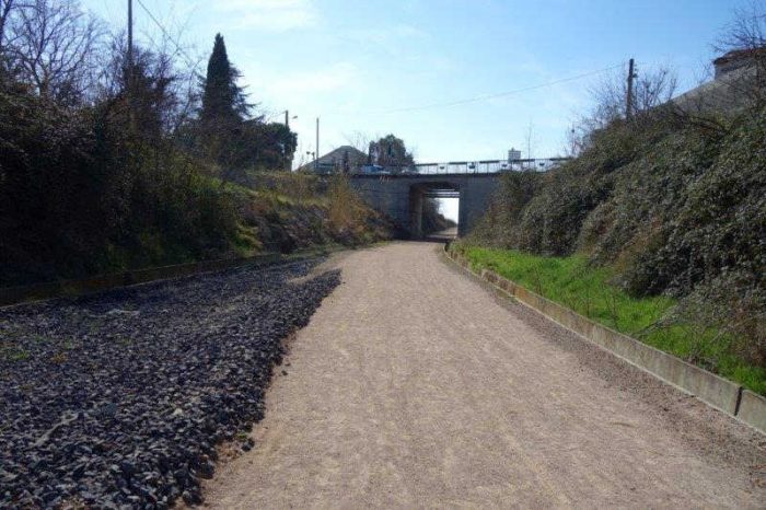
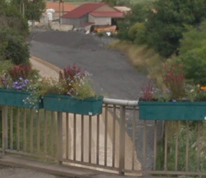
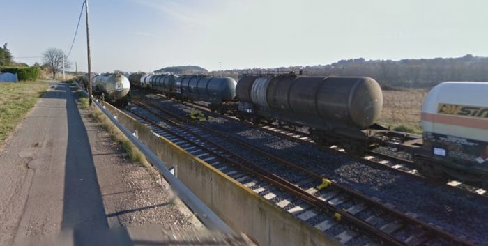
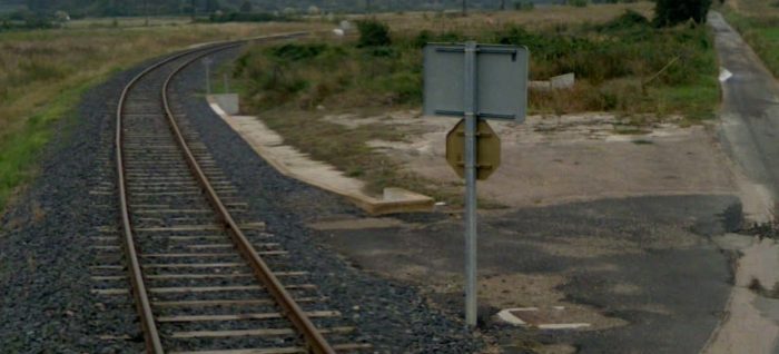
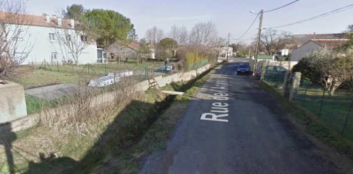
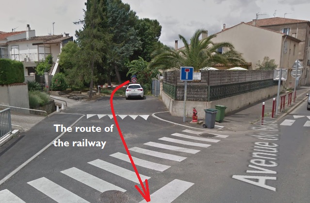
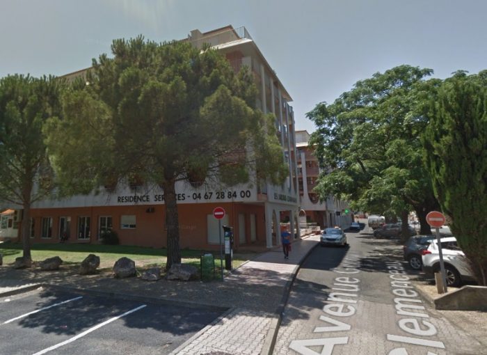
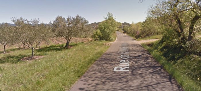
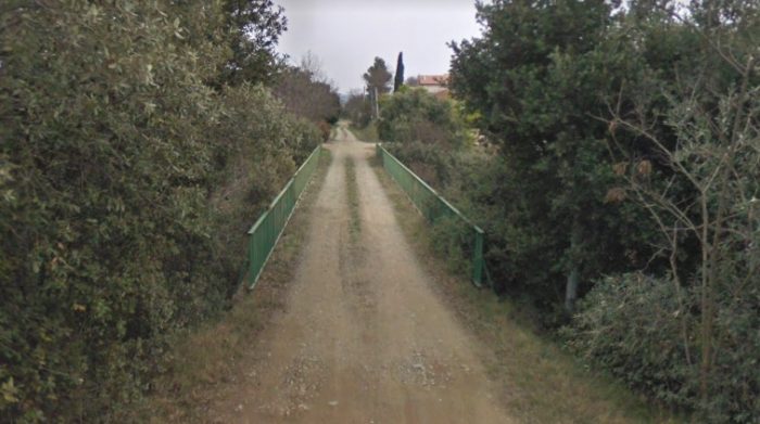
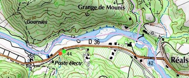
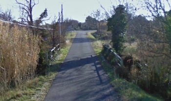
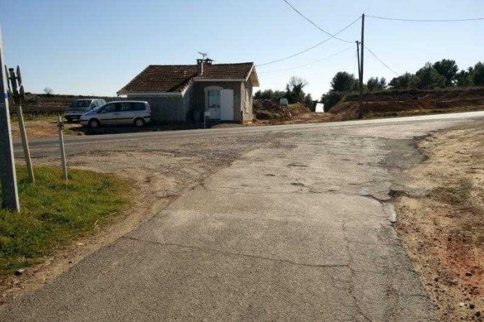
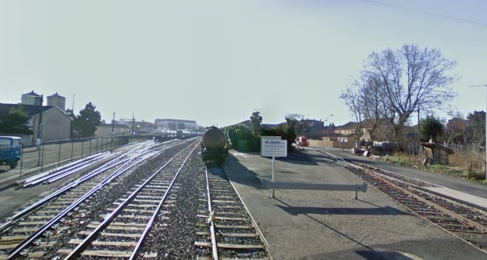
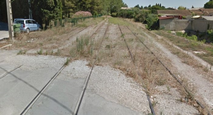
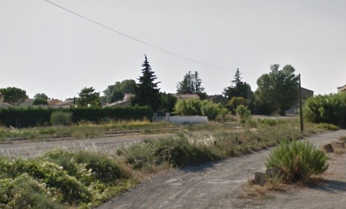
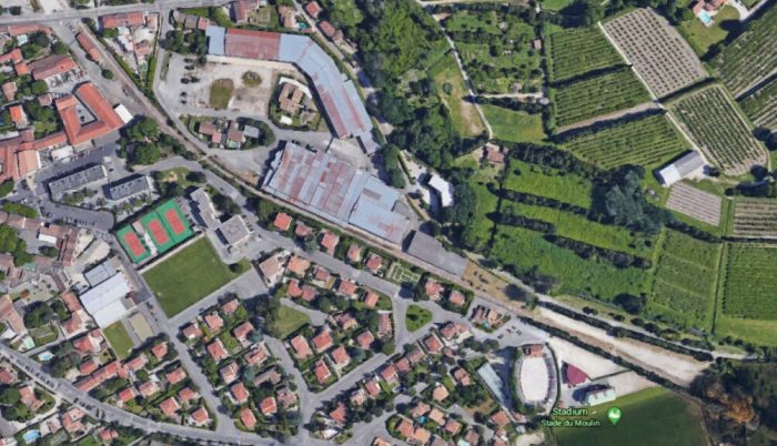
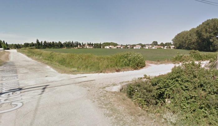
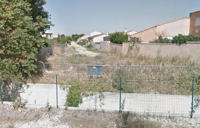
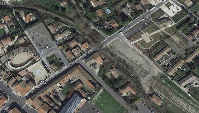
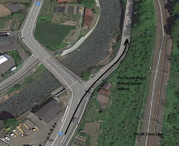
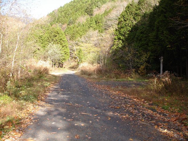
The next picture shows the view in 2019 back South across the site of Incline Station towards the incline. It is a Google Streetview image and is taken from just to the West of the parapets of the arch bridge which carries the single-track lane over the route of the ECMR.

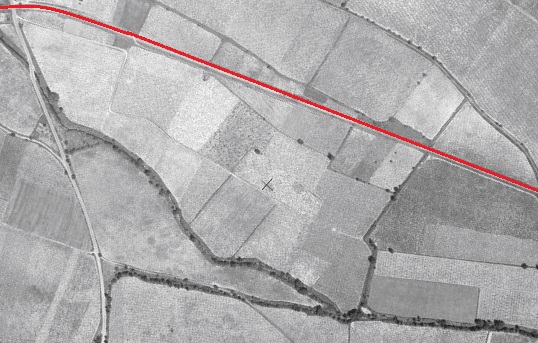
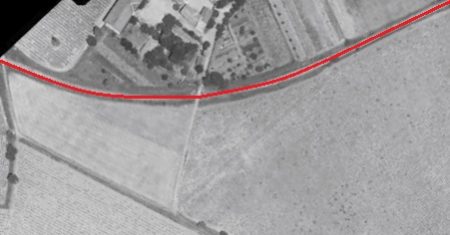
Below the next picture are two excerpts from the 25-inch OS Map. they show two consecutive lengths of the ECMR. The first has Incline Station at the bottom and the second takes us through Drakewalls (later Gunnislake) to the junction which served Pearson’s Quarry.Not visible on either of these two maps is the village of Albaston nor the hamlet of Drakewalls, both of which were to the West of the line.

To the Northeast of Incline Station was the first mine encountered close to the route of the ECMR – East Calstock, or Calstock Consols.

The OS Map records Calstock Consols as being primarily a copper mine. It  did also produce a small amount of tin.  It was originally known as East Calstock when it first opened in the 1820’s, then later it was renamed Calstock Consols, before closing in 1879. It is also possible that the mine produced arsenic and arsenical pyrites in the 1870s.

In 1865, this mine was recorded as employing 32 people – 27 men, 3 females and 2 boys.  The ‘females’ would probably have been ‘bal maidens’ – working above ground, on manual ore processing jobs. [18] At that time, it also had 42-inch pumping and 24-inch winding engines. [17]

The next mine encountered, Drakewalls Mine, produced mainly tin, also some copper, wolfram, arsenic, molybdenum, lead, & silver, originally from a long “gunnis” or open cutting. Hence the later name of the station near the mine which was named after the village of Gunnislake. The mine was worked from the 11th Century to 1905 (also 1909-10), with periods of closure. [20]
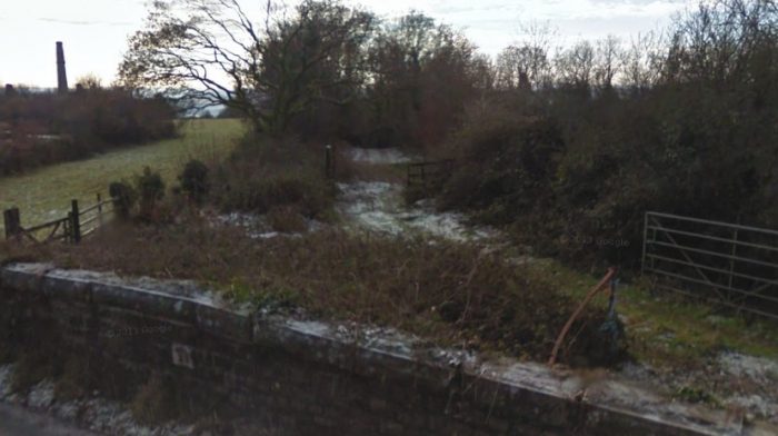
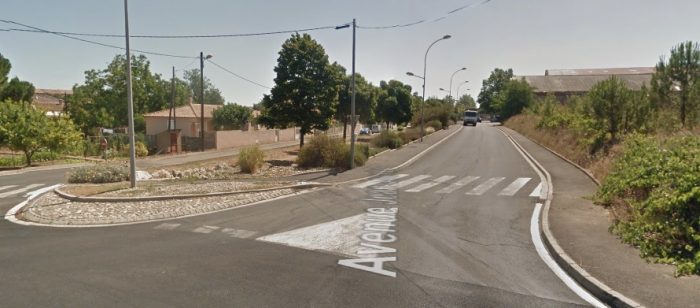
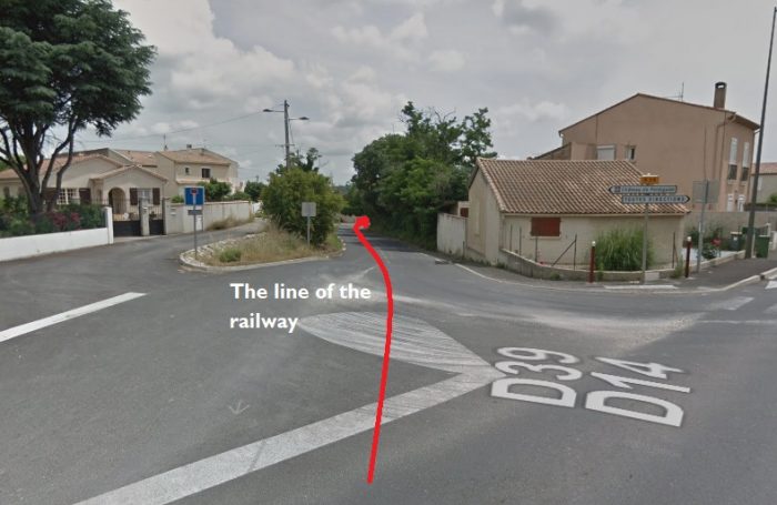
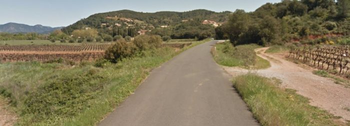
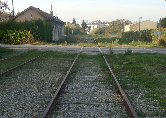
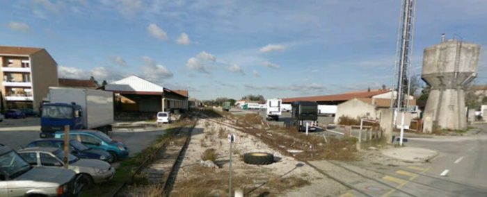
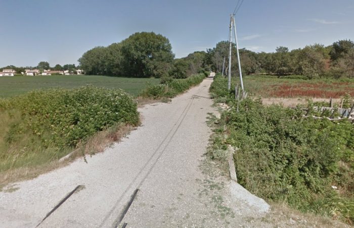
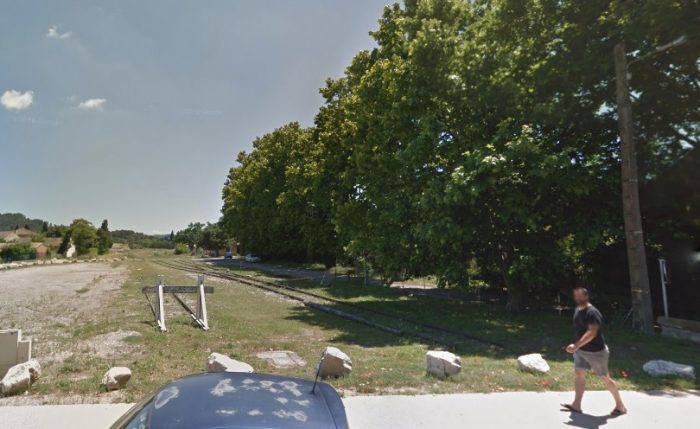
The image above is taken looking back down the line of the ECMR towards Incline Station, the picture comes from Google Streetview.

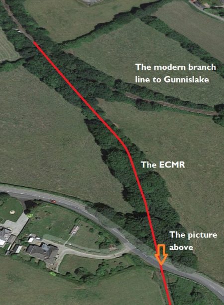
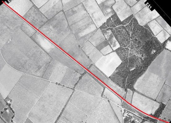
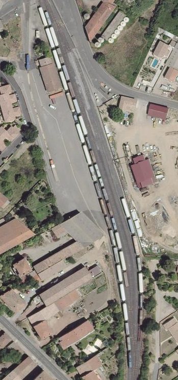
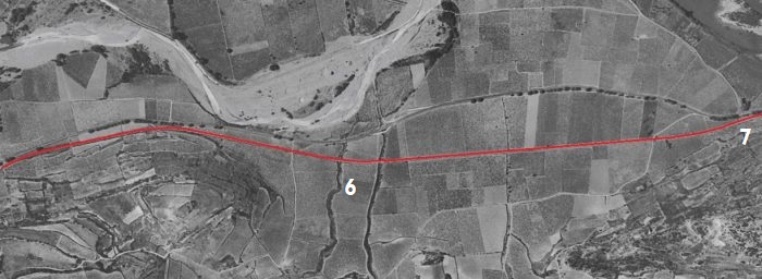
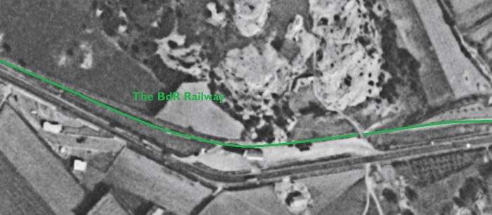
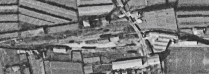
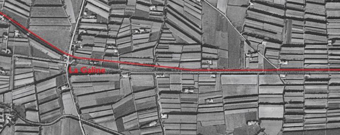
The adjacent satellite image  shows the remaining length of the ECMR before its track-bed joins the modern branch-line to Gunnislake.

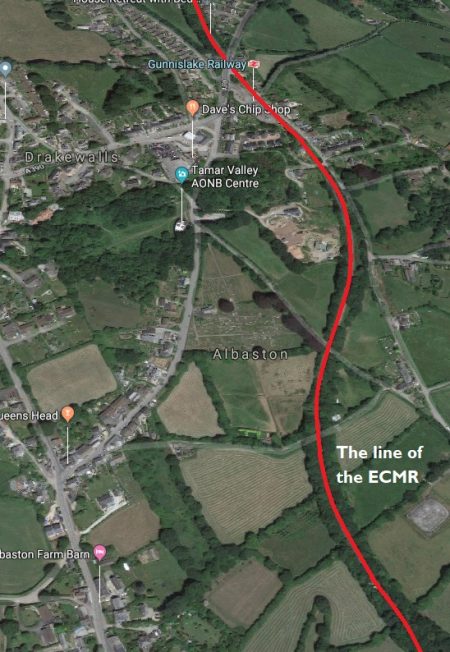
Drakewalls Mine produced mainly tin, also some copper, wolfram, arsenic, molybdenum, lead, & silver, originally from a long “gunnis” or open cutting. Hence the later name of the station near the mine – Gunnislake. The mine was worked from the 11th Century to 1905 (also 1909-10), with periods of closure. [20]

The mine was sited close to the ECMR to the East of the present village of Drakewalls.

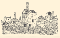
The sketch of the mine below was produced in 1938 and included in a book by D.B. Barton. [17]

He says of this mine that in the 1860s and very early 1870s: “Drakewalls sold £218,000 worth of black tin in seventeen years without sinking the mine so much as a fathom.” [17, p67] At that time it would have been one of the more profitable ventures in the area.

The following photograph was taken in the early part of the 21st Century and shows the derelict buildings of the mine.
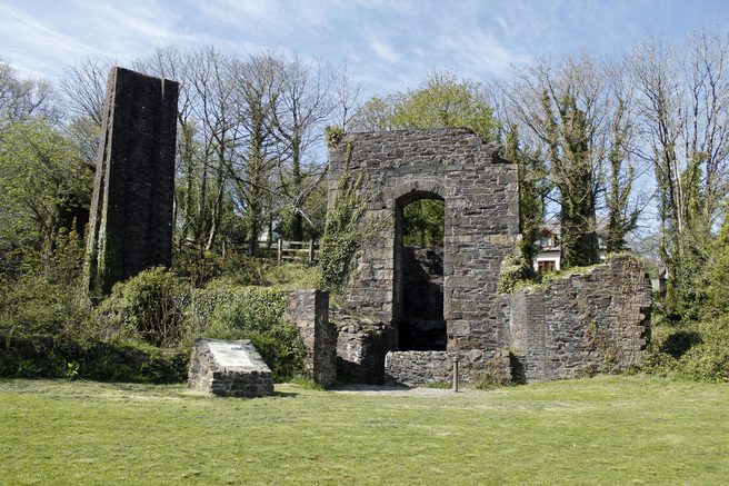
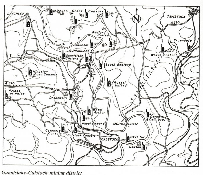
The route of the ECMR is shown above in the left half of the sketch map. Caltock Consols, Drakewalls are also shown along the route of the line. [17]
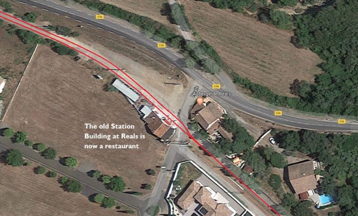
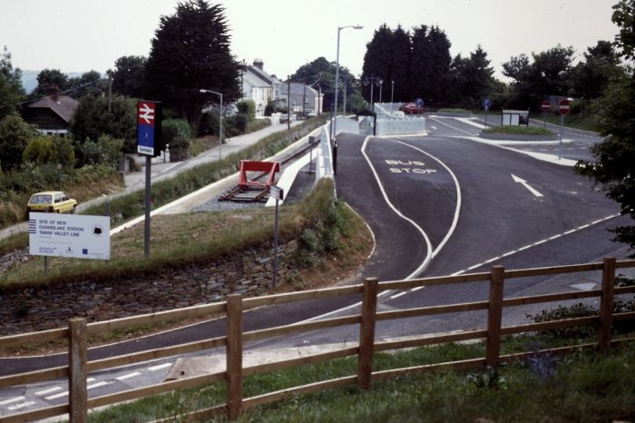
The newly constructed Gunnislake Station in 1994. The picture is taken from the A390, (c) Roger Winnen. [1]
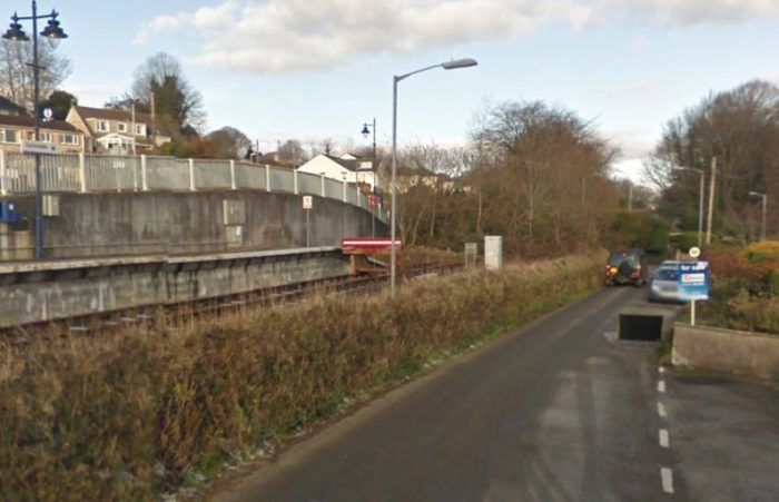
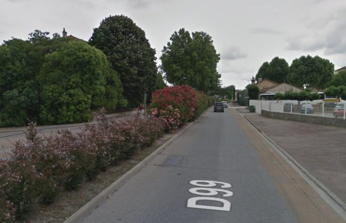
The picture above is a Google Streetview image, taken looking North, of the end of the modern branch-line at Gunnislake, just before the old track-bed reached the modern A390 which is in the trees ahead.

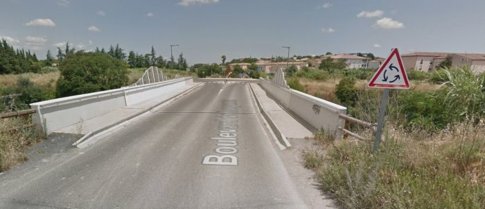
The adjacent map shows the A390 and the junction with the West of England siding to Pearson’s Quarry. [19] The next road to cross the old line is now called Station Road and can be seen on the adjacent map just to the north of the branch to Pearson’s Quarry. The bridge appears below.
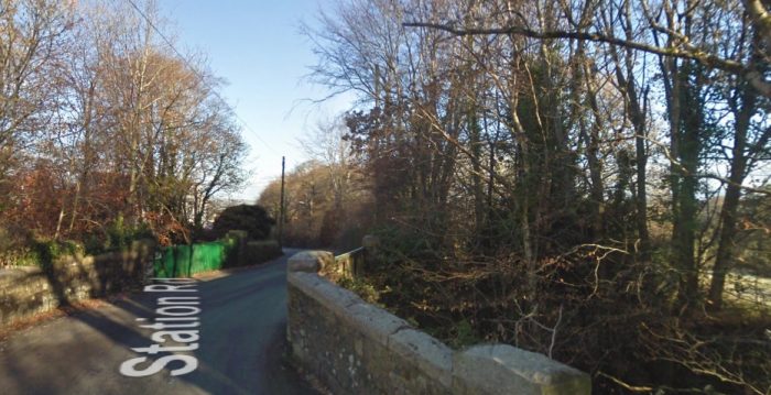
Station Road bridge had sheet metal parapets. It sat just north of the junction with a branch-line to Pearson’s Quarry which headed off beyond the trees on the right of this Google Streetview image.

What is today known as Pearson’s quarry opened in 1808. It was advertised for sale in 1826. Edward Storey took over the quarry in 1880 from the Gunnislake Granite Co. He erected buildings for polishing and dressing the granite. The stone was mostly excavated by hand as the quarry was close to the houses and they had to be very careful when blasting. One man would hold a hand drill known as a ‘jumper’ whilst two others would hit it alternately with a sledgehammer. [21]

In a day, a skilled worker could cut ten feet of kerbstone from rough granite weighing nearly a ton or fashion 70 to 80 paving stones. In its heyday the quarry employed 700 people. The quarry yielded hard fine-grained granite which was used in Devonport Dockyard and the fortifications around Plymouth. The quarry closed in 1896 but soon reopened in 1898 when it was taken over by S. Pearson & Son. They supplied stone for the breakwater in Dover. It was Pearson &Son that built the railway branch to connect with the East Cornwall Mineral Railway and had a quay at the bottom of the incline in Calstock so that the stone could be transported on the Tamar. The locomotive ‘Ada’ was purchased from the Calstock viaduct contractors. There were lots of sidings in the quarry including one which crossed the main opening on two granite pillars and led to a small quarry to the south known as Hardwall Quarry which was worked by Thomas Westlake between 1896 and 1902. [21]

Pearson’s employed 200 men, though there were 175 when the quarry closed in 1907. The quarry was nearly a quarter of a mile wide and 150 feet deep in places. [21]

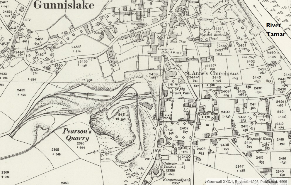
The 25-inch OS Map of 1906 shows Pearson’s Quarry close up against the village of Gunnislake. [16]
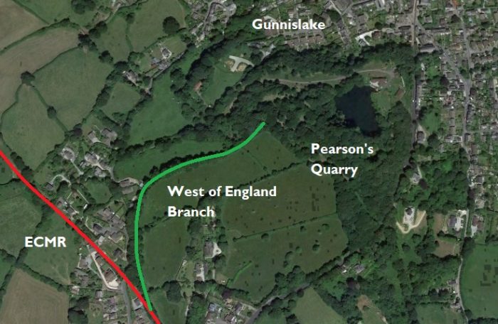
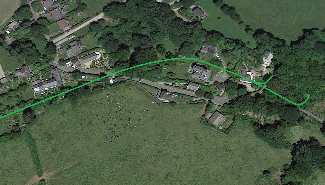
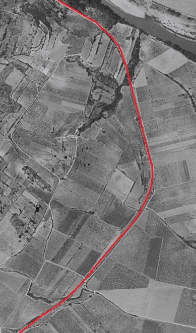
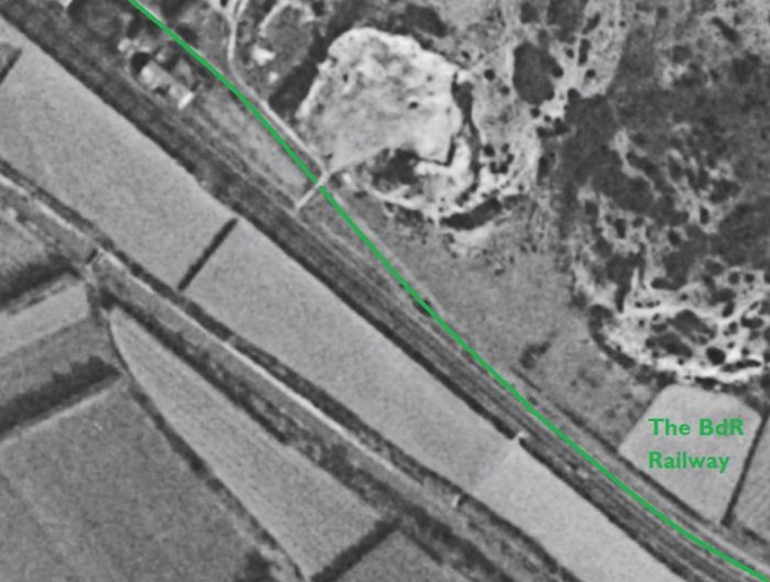
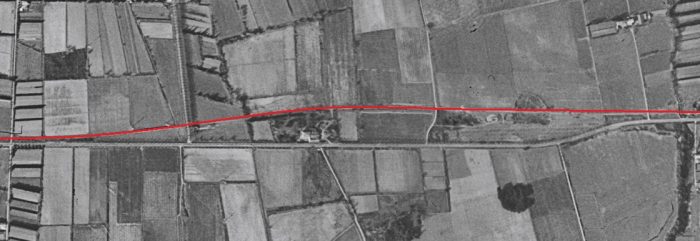
The Lake on the modern satellite image above locates Pearson’s Quarry close to the village of Gunnislake. The route of ECMR is shown in red. The route of the branch-line is shown in Green.

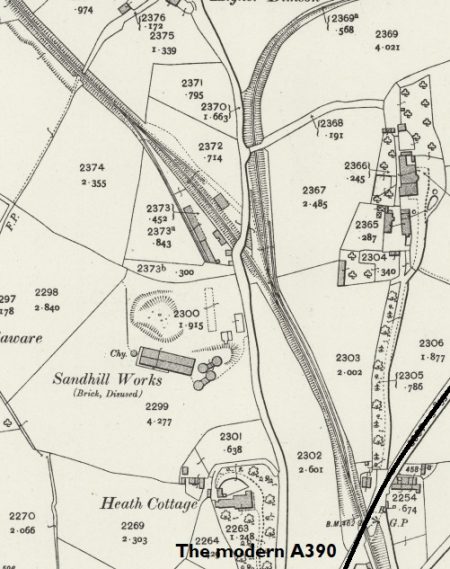
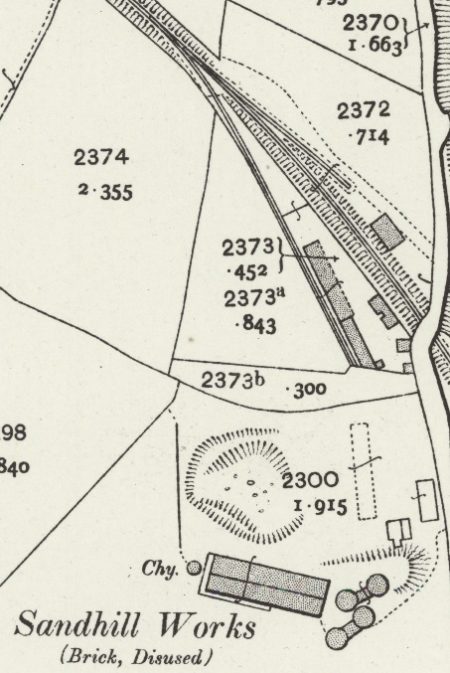
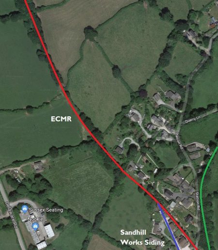
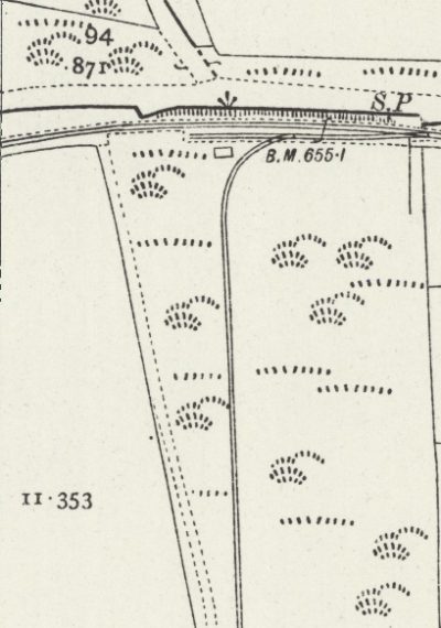
North of the junction with thee branch-line and beyond Station Road bridge there was a siding which gave access to Sandhill Brickworks. It was a single track, gated s-ding as shown on the enlarged view of the 25-inch OS Map from 1906. The works was already disused at the time the map was drawn.

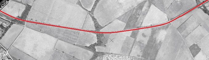
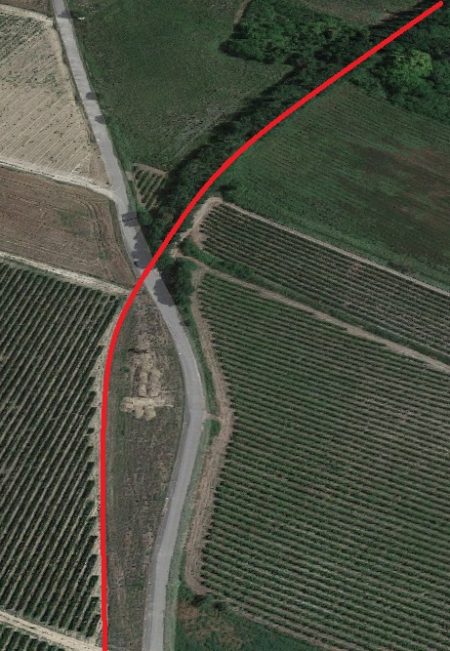
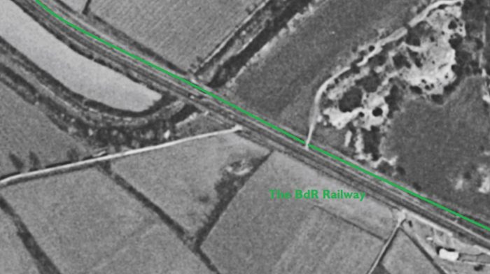
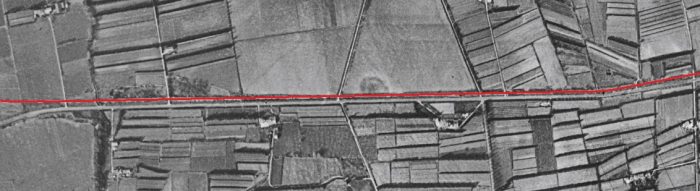
To the North and West the railway crossed the fields first on an embankment and then in cutting, as shown by the red line on the adjacent satellite image from 2019.

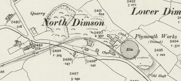
The next map excerpt from the 25-inch OS Map shows the route of the line in 1906.  As it passes Greenhill Arsenic Works two branches leave the line to the North and East. The first fed Plymouth Works in North Dimson and is seen in full on the 25-inch map below. The second was a tramway which served Gunnislake Clitters Mine.
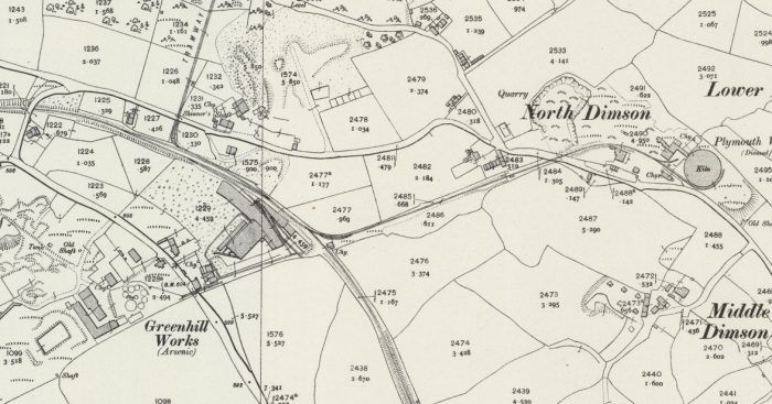
The Greenhill Works was a combined Arsenic, Brick and Chemical Works. It  was built in 1875 closing very soon after due to financial difficulties. However it was taken over in 1882 by Gunnislake Clitters mine. At the beginning of the 20th Century it was treating ore from several local mines including the Tavistock mines. The date of closure is uncertain but it is believed to be 1823 but other sources say the plant was still at work until the 1930’s. The site remains are quite extensive with some abandoned buildings and blackened burnt tailings between the railway and the Chilsworthy road at North Dimson, Gunnislake (opposite the Clitters Engine Houses). Further along the Chilsworthy road up on the right are some old building in use as industrial premises and most of all the Arsenic stack (flues mostly gone) which stands at just under 200 ft tall, originally this was 212 ft tall but the top 12 feet were blown off by lightening in 1989! [23]
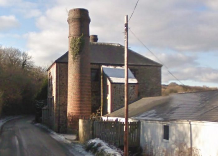
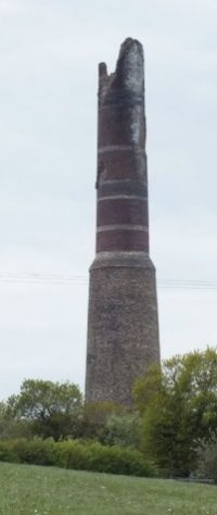
Greenhill Arsenic and Brick Works in December 2010 are shown above in a Google Streetview image. The main chimney at the works, shown in the adjacent image taken at around the same time was hit by lightning in 1989.

In 1839, the Plymouth Brickworks was recorded as being in existence at Lower Dimson. [24] Those works are shown disused on the 25-inch OS Map from 1906 but all of the industrial structures seem to have remained in place at that time. [16] The satellite image from 2019 shows a much changed situation. The group of hoses on the left of the map still remain, as does the large building on the inside of the curve of the track. Little else is visible.

The next ‘branch’ was that serving Gunnislake Clitters. it is marked on the 25-inch map above as a Tramway and can be picked out on the West (left-hand) side of the map excerpt.

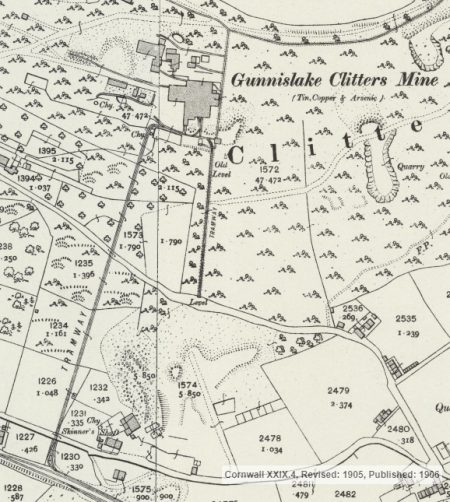
Gunnislake Clitters Mine was a large copper mine near Gunnislake. Its layout was as shown on the adjacent 25-inch OS Map from 1906. [1]

The mine sett was leased from the mineral owners the Duke of Cornwall and the Rev. H. W. Bedford. Spargo in his book The Mines of Cornwall; Statistics and Observations (1865) [25] says that it had a 40-inch pumping engine, a 30-inch winding engine and a 30-inch stamps engine as well 
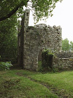
as a 40-foot waterwheel used for pumping. It employed 192 people. [26] Inclined tramways carried materials to and from the mill. [27]

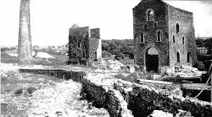
The engine house is depicted in the adjacent photo in the early 21st Century, (c) Brian J Williams. [27]

Although Gunnislake Clitters opened in 1820, the main period of production was between 1860 and 1890. Production: 40 tons of copper ore between 1822 and 1827. For the periods 1860-69 and 1902-94 the mine produced 33,310 tons of 8.25% copper ore and 510 tons of black tin. [26] in this period, the main dressing floor was linked to the lower slope dressing floor and arsenic works by a tramway, part of which survives. [27]
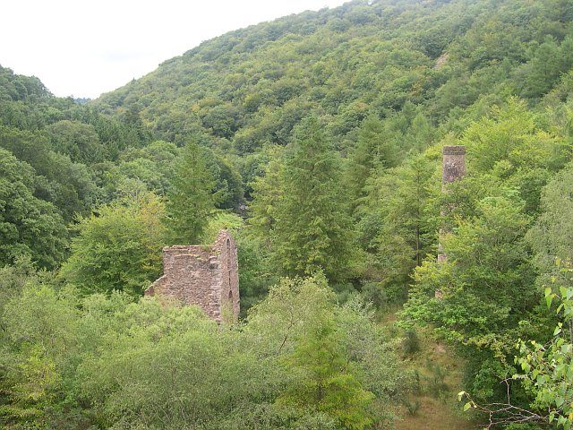
The engine house and chimney of Gunnislake Clitters Mine hiding among the trees in the 21st Century. [28]
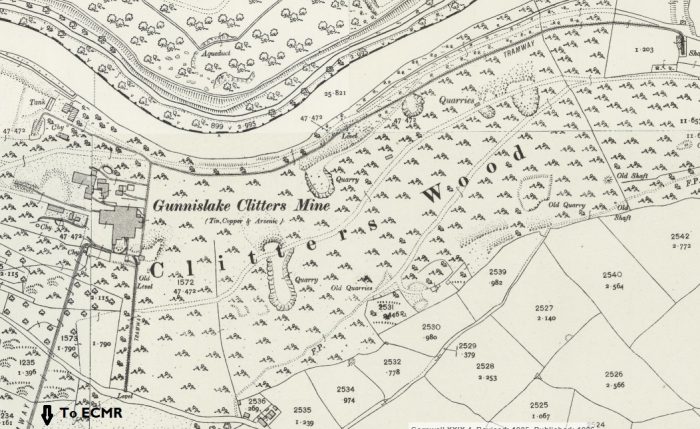
Apart from the two North South links to the mine from the ECMR and from Bitthams Lane, there was a network of lines around the main built up site of the mine and a tramway running East to West  alongside the River Tamar and linking two other shafts with the main buildings. [1]

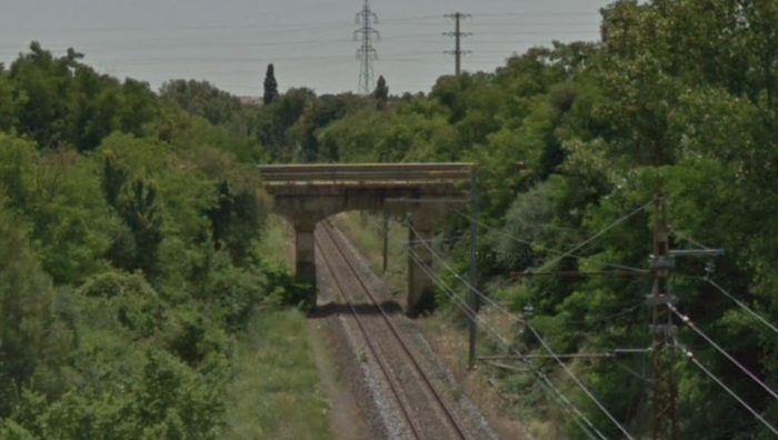
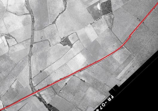
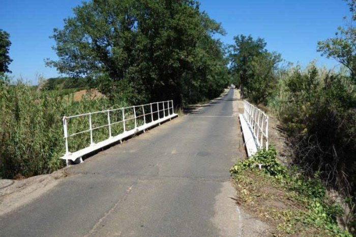
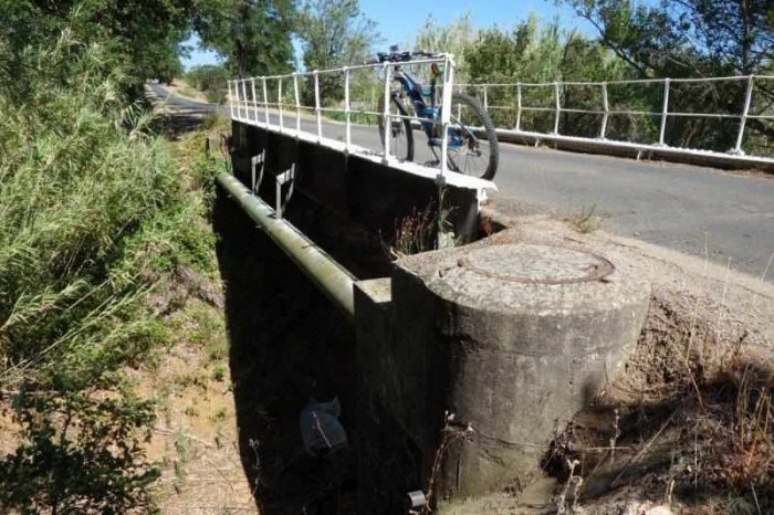
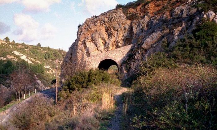
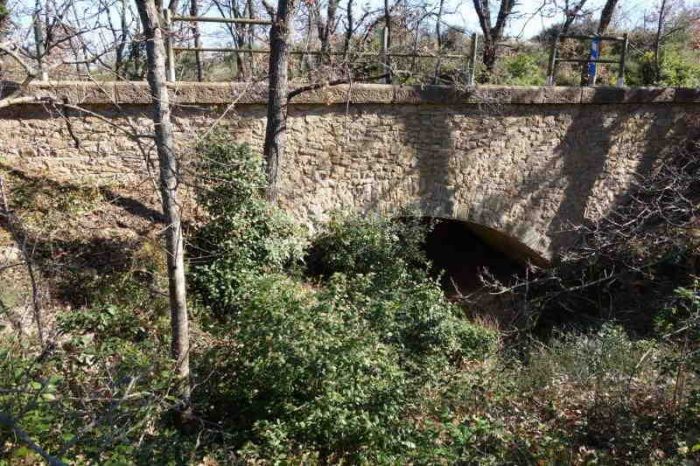
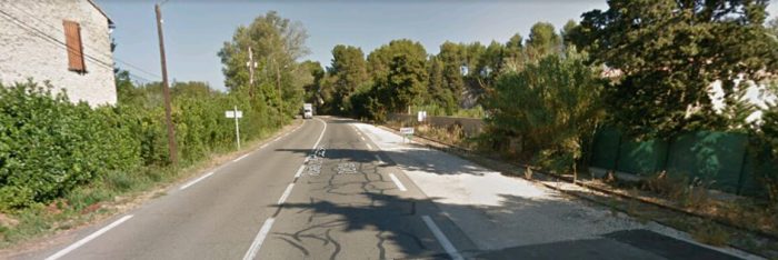
To the West of the tramway to Gunnislake Clitters Mine, the ECMR passed under the Latchley and Chisworthy road. The metal bridge parapets can be seen in the Google Streetview photograph below.
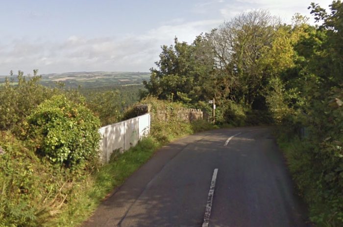
The black arrow shows the location of the picture immediately above the map. From this point West the road and old railway route run roughly parallel across the north flank of Hingston Down. [1]

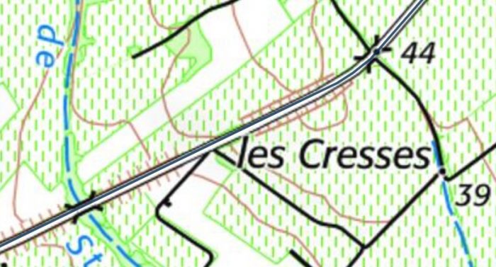
The village of Chilsworthy is very close to the old line, just to the North. The road overbridge at the west (left) end of the map excerpt  was immediately adjacent to the small halt that served the village.

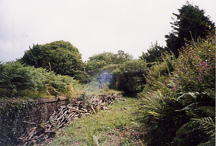
The Halt was originally a single platform with a small shelter on the Up side of the single line, situated just west of the over-bridge, but in later years there were also a number of sidings in close proximity. The halt was closed on 5th November 1966. The adjacent photo shows that the platform was still in existence in 2003. The access path to the halt from the adjacent road now forms part of a public footpath. [29]

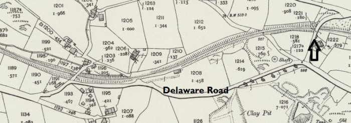
A narrow road to Latchley drops away from the Delaware Road above the line and originally ducked under the line via a bridge with stone abutments and a steel span. Only the abutments remain.
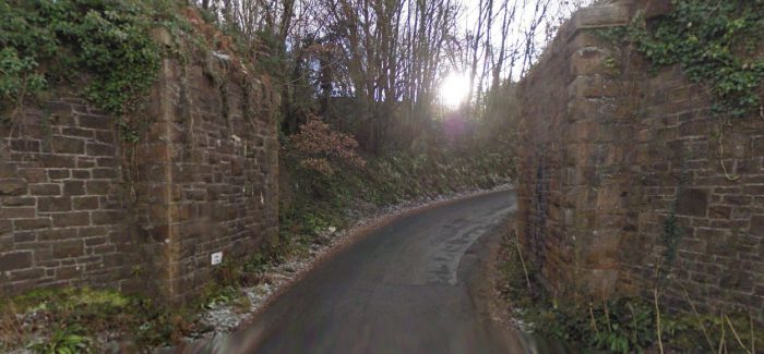
The photograph above looks back along the line at Hingston Down Farm. There was a halt here when the line was active and single short siding alongside the house. The Halt was called Latchley after the nearby village. The location is shown on the 25-inch OS Map in the adjacent image.

Latchkey Halt had a single platform on the Down side of the running line, which was recorded in 1908 as being 220′ long. Immediately west of the platform the railway crossed the minor road from which the modern pictures are taken by an un-gated level-crossing. There was a siding on the Up side opposite the platform, which was accessed by a connection facing to Down trains at the Gunnislake end of the station. A small loading platform was located between the main line and siding in front of the main platform and opposite this again outside the siding was the stationmaster’s house and ex-ECMR goods shed. The siding was removed at some unknown date after 1950 and the station itself was closed on 5th November 1966. The station house and track-bed are now in private ownership. [29] The next image looks West from the same lane.The next places of interest on the 25-inch OS Map from 1906 are shown below. [1] The Tamar Works were operational in 1906, the Phoenix Works were closed at that time.
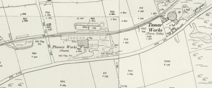
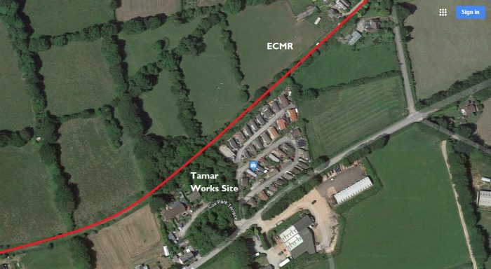
The Tamar Works site is now a static caravan park (Tamar Park). 
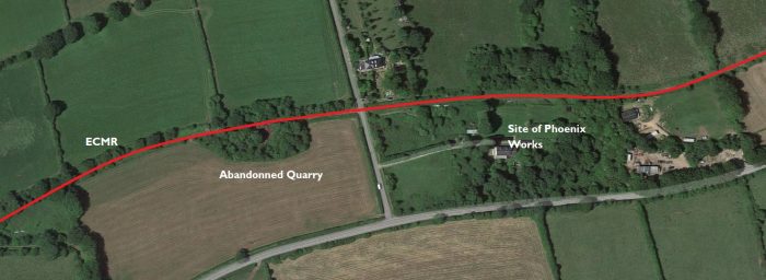
The Phoenix Works has completely disappeared but the quarry at rail-side just beyond the works can still be seen on satellite images.Looking back along the line to the East.The Phoenix Works would have abutted the railway fence on the right-hand side of the image. The was a short siding at this location. The Halt was known as Seven Stones Halt. It was just a simple platform on the Down side, which was opened in 1910 in order to serve the nearby Phoenix Pleasure Grounds. Sometimes it is referred to as Phoenix Mines Halt after the nearby mines, whose owners contributed to its cost. The halt was closed when the Pleasure Grounds shut during World War I, the date being given variously as 1914 or 1917. A later plan records the platform as being 140′ long. Part of the platform still remained in 2003 over 85 years since it was last used by passengers! Immediately west of the platform the railway crossed the minor road from which these two pictures are taken by an un-gated level-crossing. [29]
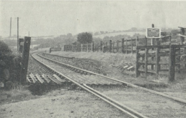
The same Halt in 1950 looking from the West. [30] Looking ahead along the line to the West from the same position.
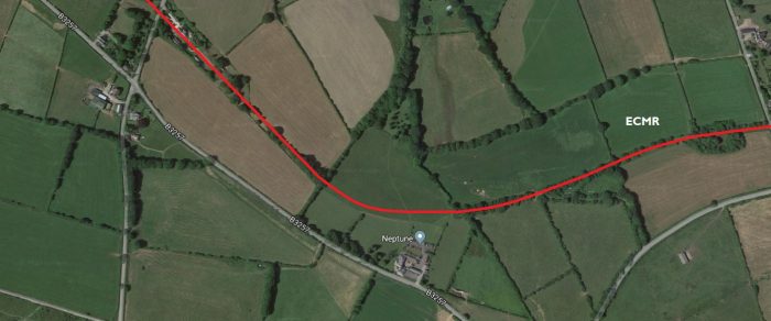
The route of the line turns to the Northwest and passes to the North of Monkscross.
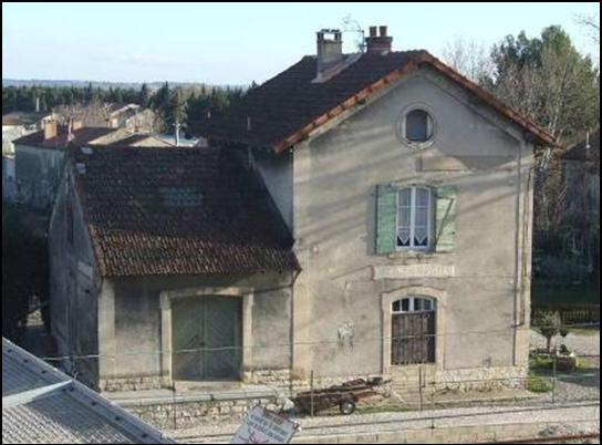
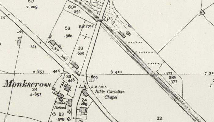
The hamlet of Monkscross was served by the station which can be seen on the 25-inch map above. Very early in the life of the line the station was known as Monks Corner. It was later known as Stoke Climsland and eventually as Luckett after the village some distance to the North and close to the River Tamar. The station had a 225′ platform on the Down side and a loop siding opposite it on the Up side, with connections to the main line at both ends of the station, (although this does not appear to be the case on the 25-inch OS Map above). Immediately to the west of the station the line was crossed by the minor road from which the following pictures are taken, on a girder over-bridge. There was a further siding on the Down side at the Gunnislake end of the platform, with a connection that faced Up trains, and apparently this siding boasted a carriage shed for some years. There was originally a small ground-level signal-box here on the Up side at the Callington end of the loop, but in 1923 this was reduced to a ground-frame. A separate small ground-frame worked the Gunnislake end of the loop siding. The carriage siding was taken out of use on 31st March 1923. The loop siding was taken out of use on 23rd September 1962 and the station itself was closed on 5th November 1966. The station house and track-bed are now in private ownership. [29]
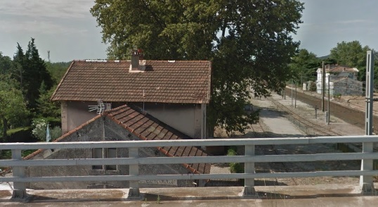
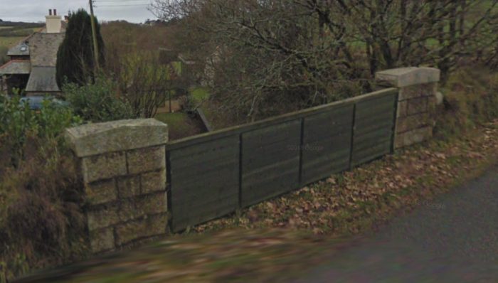
Luckett Station from the road over-bridge, a Google Streetview image.The road over-bridge is shown above with the station off to the right of the picture. The railway line was in cutting to the West and that cutting has been filled in.

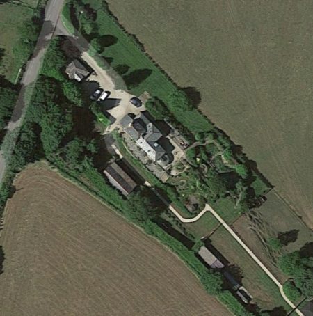
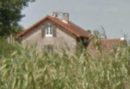
The adjacent satellite image shows the station site in the early 21st century.

Beyond Monkscross the line curved gently round to a South-westerly direction and passed the Kit Hill Quarry Tramway shown below. [1]
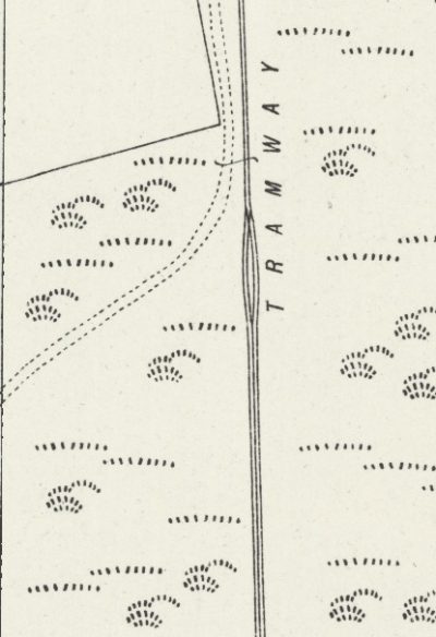
The Quarry was served by an incline from a small exchange facility next to the main line which consisted of a single siding off which branched the tramway incline.

The incline was of a similar design to that at Calstock with a single track bottom section, a passing loop and then a three-rail section covering the top half of the climb.

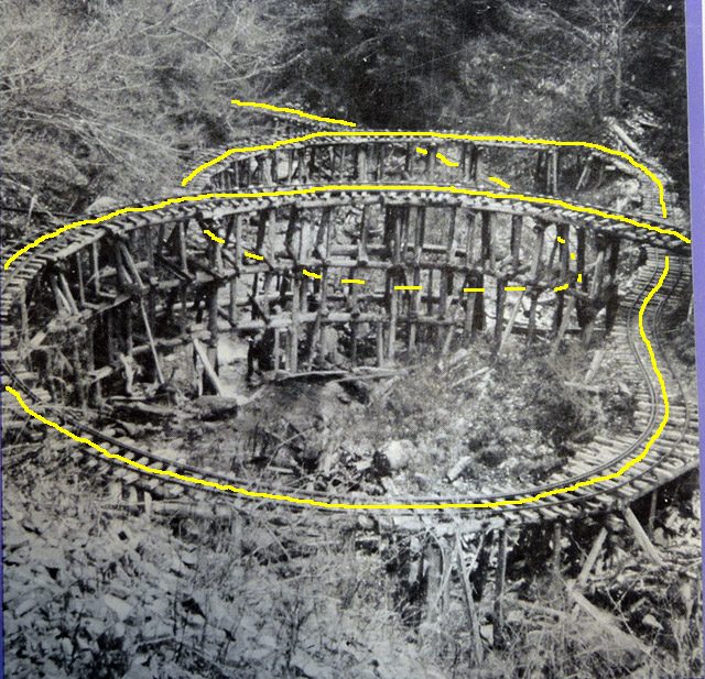
These three 25-inch OS Map excerpts from 1906 show the full length of the inclined plane.

The fourth map excerpt shows the track layout at the quarry in 1906.

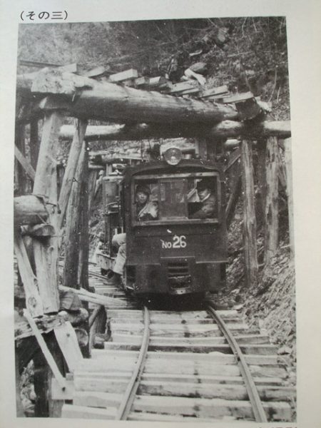
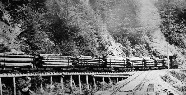
Below the maps are a series of monochrome photographs the first two of these show the incline when it was in use. The remainder show the rolling stock in use on the Kit Hill Incline. [31]

Included below are two more up-to-date images of the incline as it appears in the 21st Century.

The ECMR continued beyond the Kit Hill Incline as far as Kellybray. A 25-inch OS Map excerpt, below the colour photos of the incline, shows the remainder of the ECMR before the line was extended and the gauge was widened in the early years of the 20th Century.

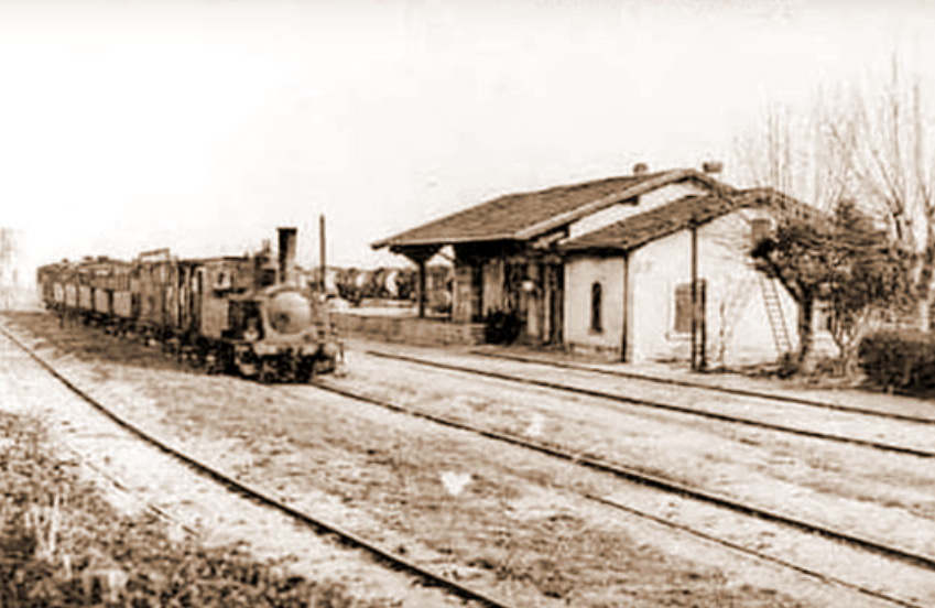
For the remaining run to Kellybray, the line travelled in a generally Southwesterly direction to the terminus. After a short stretch at I in 45 the line terminated close by Kelly Bray Mine, north of Callington. The original intention had been to extend the metals to the latter town but this was never done. The steepest gradient, above Gunnislake, was I in 50 and the usual practice in either direction was to make two journeys with a few wagons up the heavier grades as far as Monk’s Corner and there combine these for the easier run down to either Kelly Bray or Kelly Yard. [17, Appendix 2]


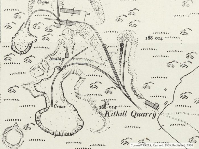
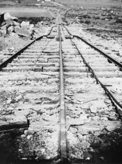
Wagons in use on Kit Hill Incline. [31]


The top of the incline, (c) Tony Atkin. [32]
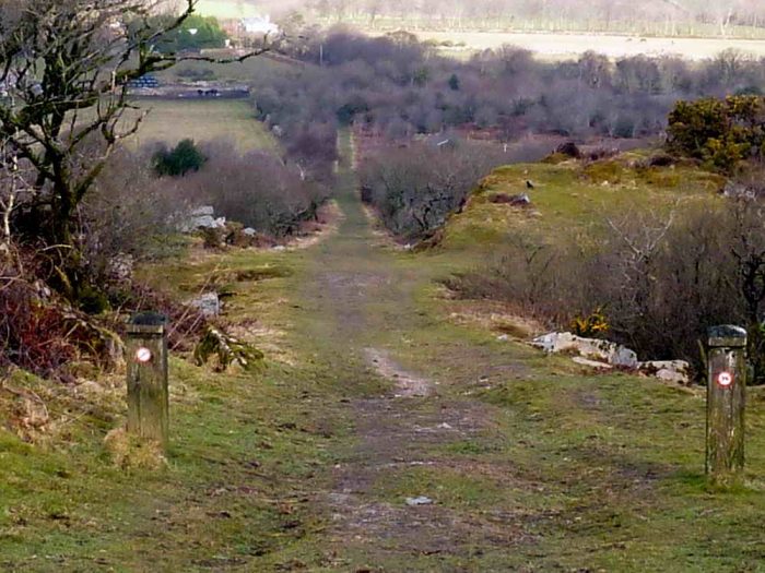
The view from the top. [33]
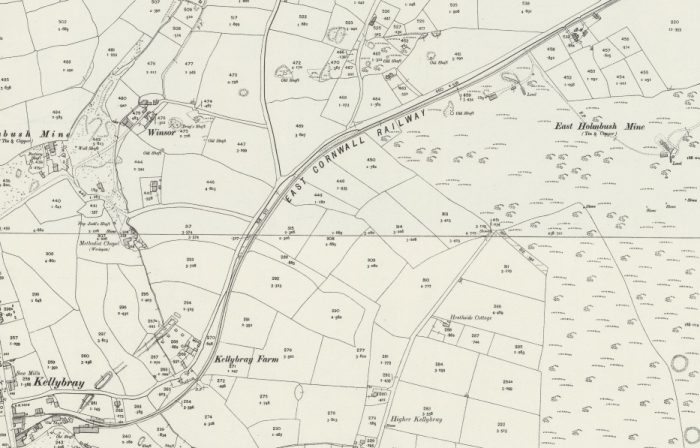
25-inch OS Map excerpt showing the remaining length of the ECMR. [17]

During the 1820s and 1830s a significant capital investment enabled the development of tin copper and lead mines in the area around Kelly Bray. In 1843, the mine at Kelly Bray amalgamated with the neighbouring mines of Holmbush and Redmoor to form the Callington Mining Company employing a workforce of over 250 people. The mining activity around Kelly Bray continued until 1946. [34]
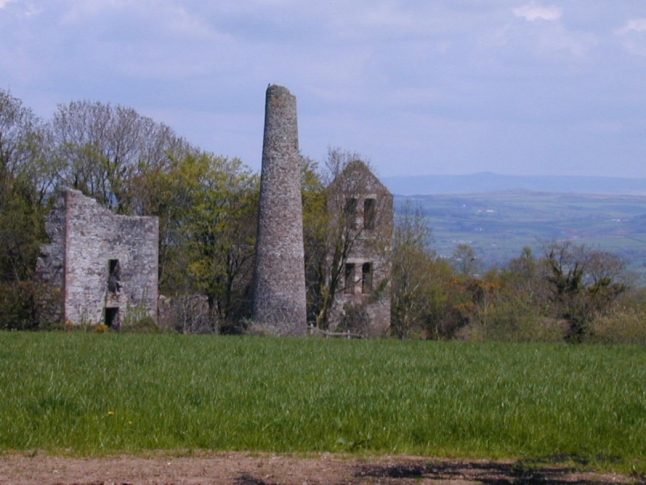
Holmbush Mine, lies just north of the village of Kelly Bray, to the northwest of Kit Hill in the Callington Mining District of East Cornwall. The mine was known to have been at work from at least 1845 and produced lead and silver as well as copper ore. Over the years it has been known by several names: In 1868 it was known as Holmbush & Kelly Bray United and in 1877 as Holmbush Mining Co. Ltd. Between 1888 and 1893, Holmbush Mine was amalgamated with Kelly Bray and Redmoor Mines to form Callington United Mines. It was abandoned in 1893. [35]

Kelly Bray and Redmoor Mines mainly worked lodes of tin, copper, and arsenic. The mines opened in the eighteenth century and closed by 1888. Kelly Bray, Redmoor, Holmbush were usually worked together, Redmoor and Kelly Bray Mine made up Emmens United. The group also included at times South Kelly Bray, West Holmbush,and East Holmbush. Between 1888 and 1893, Holmbush Mine was amalgamated with Kelly Bray and Redmoor Mines to form Callington United Mines. Redmoor re-opened briefly between 1907 and 1914 and in 1934 and 1943. [36]

Thomas Spargo, the mining historian, in his book of 1865, ‘The Mines of Cornwall and Devon: Statistics and Observations’ writes that Kelly Bray Mine was ‘… in the parish of Callington, Cornwall, in 5,000 shares, commenced in 1845. The Purser and Manager is Captain George Rowe, of Wheal Edward. Secretary, Mr. Edward King, London. Rock, clay-slate. 39 men, 4 females, and 4 boys employed (total 47). Mineral Owner, Duke of Cornwall. Dues, 1-30th. Depth of adit, 27 fathoms. Under adit, 135 fathoms. Pumping-engine, 60-inch. Winding-engine, 18-inch. Crushing-engine, 36-inch. Water-wheel, stamping, of 35 feet diameter. Minerals sold in 1864: Copper ore for £1,694 15s 9d and Arsenic for £20 0s 0d making a total of £1,714 15s 9d. The expenditure over receipts, from the beginning, amounts to about £20,000; in the year 1864, to about £1,200′ [25].
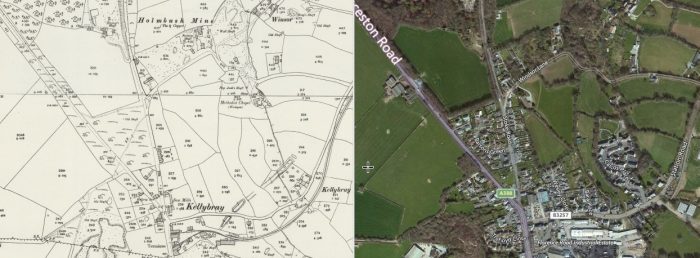
These parallel images show Kelly Bray towards the bottom of the images and Holmbush Mine towards the top. [37]
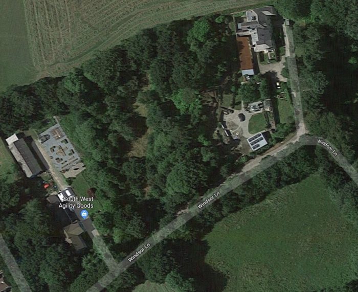
The site of Holmbush Mine in the early 21st Century above, and in 1906 on the adjacent map. [37]

The comparative map and modern satellite image below show the village of Kellybray. [37]

A closer view of the map follows the parallel images. It shows the railway terminus and the Kellybray Mine. [37]
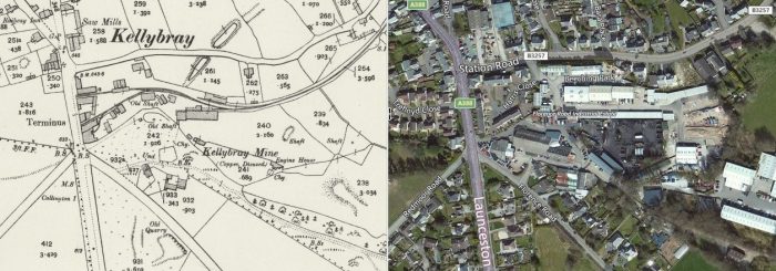
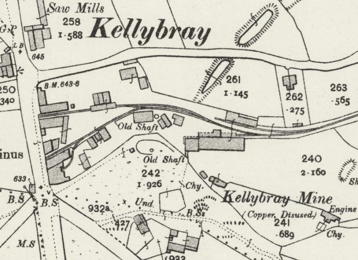
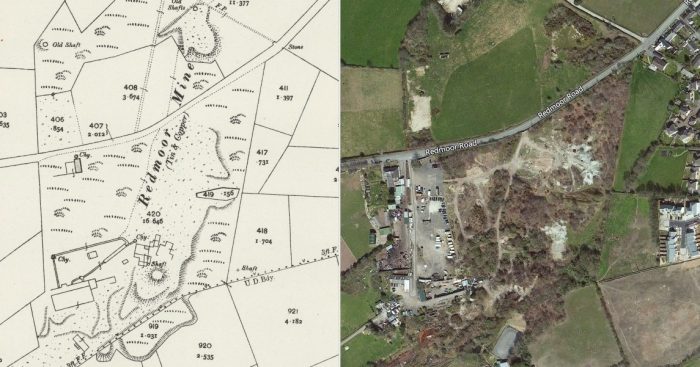
This final parallel image shows the site of the Redmoor mine just to the Southwest of Kellybray. [37]

References

  1. http://www.cornwallrailwaysociety.org.uk/callington-branch.html, accessed on 27th March 2019.
  2. http://crjennings.com/The%20Remains%20of%20Britains%20Steam%20Age%20Railway/Rems%205.html, accessed on 27th March 2019.
  3. https://maps.nls.uk/view/101169155, accessed on 27th March 2019.
  4. https://en.wikipedia.org/wiki/East_Cornwall_Mineral_Railway#Calstock_incline_and_quay, accessed on 27th March 2019.
  5. C R Clinker; The East Cornwall Mineral Railway; in The Railway Magazine, May 1951, p291-295, 306-307.
  6. Martin Bodman; Inclined Planes in the West; Twelveheads Press, Chacewater, 2012.
  7. Roger Crombleholme, Douglas Stuckey and C F D Whetmath, Callington Railways, Branch Line Handbooks, Teddington, 1967.
  8. http://brucehunt.co.uk/plymouth%20area%20home%20page/railway%20inclines.html, accessed on 27th March 2019.
  9. http://www.calstock.info/calstock/calstock2.htm, accessed on 27th March 2019.
  10. https://en.wikipedia.org/wiki/Calstock#/media/File:Calstock,_second_limekiln_near_the_old_incline_-_geograph.org.uk_-_673408.jpg, accessed on 27th March 2019.
  11. http://www.calstock.info/river/river4.htm, accessed on 27th March 2019.
  12. http://www.waymarking.com/waymarks/WM2F64_East_Cornwall_Mineral_Railway_Bridge_Calstock_East_Cornwall_UK, accessed on 28th March 2019.
  13. http://www.calstock.info/railway/railway_hist.htm, accessed on 27th March 2019.
  14. http://cran.nust.na/gutenberg/4/7/7/6/47763/47763-h/images, accessed on 28th March 2019.
  15. http://www.brucehunt.co.uk/Callington%20Tourism.html, accessed on 28th March 2019. This refers to The railway Magazine 1912. A copy of the relevant article is provided at Appendix 1 below.
  16. https://maps.nls.uk/geo/explore/#zoom=17&lat=50.4972&lon=-4.2134&layers=6&b=1, accessed on 28th March 2019.
  17. D.B.Barton; A Historical Survey of the Mines and Mineral Railways of East Cornwall and West Devon; D. Bradford Barton Ltd, Truro,  Second Edition, 1971.
  18. https://bunn.livejournal.com/511911.html, accessed on 28th March 2019.
  19. https://maps.nls.uk/geo/explore/#zoom=16&lat=50.4977&lon=-4.2190&layers=168&b=1, accessed on 28th March 2019.
  20. http://www.cornwall-calling.co.uk/mines/callington/drakewalls.htm, accessed on 28th March 2019.
  21. http://www.calstockhistory.org.uk/quarrying.html, accessed on 28th March 2019.
  22. https://plymhearts.org/our-collections/swib/gilhen-archive, accessed on 28th March 2019.
  23. https://www.aditnow.co.uk/Mines/Greenhill-Works-Arsenic-Factory_10601, accessed on 29th May 2019.
  24. http://www.historic-cornwall.org.uk/cisi/gunnislake/CISI_Gunnislake_report.pdf, accessed on 29th March 2019.
  25. Thomas Spargo; The Mines of Cornwall and Devon: Statistics and Observations, Illustrated by Maps, Plans, and Sections of the Several Mining Districts in the Two Countries (Classic Reprint); Forgotten Books, 2019.
  26. http://www.cornwallinfocus.co.uk/mining/clitters.php, accessed on 29th March 2019.
  27. https://www.pastscape.org.uk/hob.aspx?hob_id=438041, accessed on 29th March 2019.
  28. https://en.wikipedia.org/wiki/Gunnislake, accessed on 29th March 2019.
  29. http://www.trainweb.org/railwest/railco/sr/cal-stn.html, accessed on 29th March 2019.
  30. R.E.G. Read; From Bere Alston to Callington; in The Railway Magazine, June 1951, p481-486, 466-467.
  31. http://www.brucehunt.co.uk/inclines.html, accessed on 29th March 2019.
  32. https://www.geograph.org.uk/photo/1265732, accessed on 29th March 2019.
  33. http://www.dartmoorcam.co.uk/CAM/previouswalks/2012-3-7_KitHill/KitHill.htm, accessed on 29th March 2019.
  34. https://en.wikipedia.org/wiki/Kelly_Bray, accessed on 30th March 2019.
  35. http://www.cornwallinfocus.co.uk/mining/holmbush.php, accessed on 30th March 2019.
  36. http://www.cornwallinfocus.co.uk/mining/redmoor.php, accessed on 30th March 2019.
  37. https://maps.nls.uk/geo/explore/side-by-side/#zoom=16&lat=50.5238&lon=-4.3157&layers=168&right=BingHyb, accessed on 30th March 2019.

Appendix 1 – The Railway Magazine – October 1912

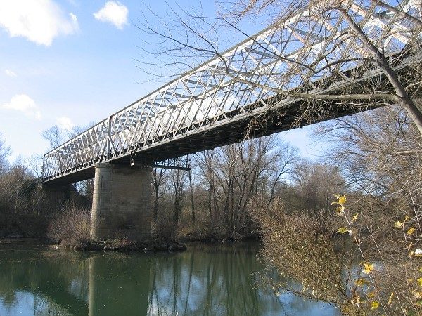
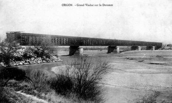
One of the prettiest railways around Plymouth is the line of the Plymouth, Devonport and South Western Junction Company, which runs from Bere Alston station to Callington. Originally it was a narrow gauge mineral railway, constructed for the purpose of carrying minerals and stone from the various mines and quarries from Callington and district to Calstock Quay. It was bought by the Company, and worked by them for several years as a mineral line, the ultimate object being to connect it with their main line at Bere Alston, which is being worked as a part of the London and South Western Railway system. In 1908 the Plymouth and Devonport Company re-modeled the mineral line, substituting modern appliances for the old, and converting it into a standard gauge railway. They also built a costly viaduct over the river Tamar, and cut a new line from Calstock to Bere Alston station.

The rolling stock consists of 5 locomotives, 4 first-class saloons, 12 third-class coaches and “compo.” brakes, and 52 goods vehicles. Opened for traffic on March 2, 1908, the line runs through some of the most beautiful scenery in the West. There are no sulphurous tunnels, and one need not be afraid to look out of the carriage windows to admire the beauties of the district, or to inhale the fresh air from the neighbouring hills.

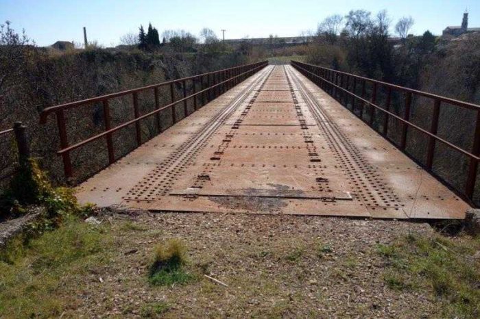
Two 0-6-2 tank engines, the Earl of Mount Edgcumbe and Lord St. Levan, have been doing some fine work over this small line. Some of the gradients are 1 in 38 and several of the curves are of 6 chain radius. The Tamar river is crossed by means of a fine concrete viaduct, and Calstock station is on the western side. On the viaduct a wagon lift, worked by steam, has been erected for lifting loaded and empty wagons from Calstock Quay to the running roads. The capacity of this lift is 16 tons, and the height from the quay to rail level is 110 ft.

A break of journey at Calstock will enable any persons interested in railway appliances to inspect the lift. Calstock, a small town situate on the Cornish banks of the Tamar, is somewhat unique as a parish in this part of the county. Its river scenery is unsurpassed, and unusually variegated. From the time it skirts the parish below the rural and picturesque Horse Bridge to its passage past Cotehele, we have here well wooded and gentle slopes, there beetling crags rising hundreds of feet; then a village nestling amidst rich orchards and fertile gardens; and next an island, small, but like a gem set in the silvery waters. From the tortuous river the ground rises like a series of terraces to Hingston Down, one of the numerous moors running through Cornwall. This has its natural crown and gloryin Kit Hill the highest point in the neighbour­hood, whence may be seen such widely different points of the compass as Caradon, Windmill (in Launceston) the tors of Dartmoor, and Saltash railway bridge. The main road which leads to Callington is 700 ft. high, and from it the sea to the south by day and the revolving lights of Eddystone by night are clearly dis­cernible.

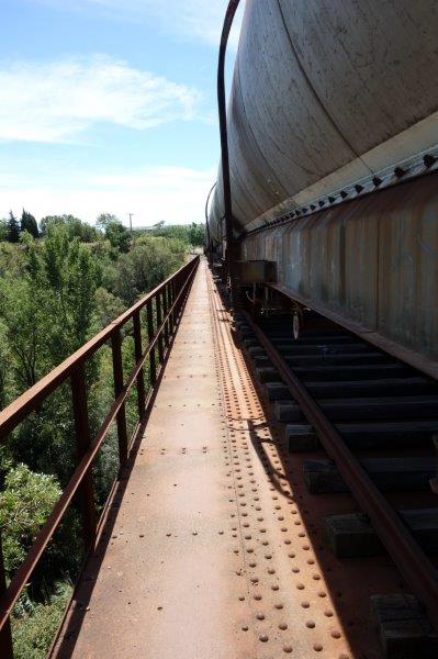
After leaving Calstock, the line begins a climb of 400 ft. to Gunnislake station, winding in and out curves of 6 chain radius. If seated in a rear carriage, a passenger can often see the 0-6-2 tank engine toiling with might and main on her way up the grade of 1 in 38 round some sharp curve.
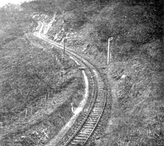
The above picture is a typical illustration of one of these curves.

Readers will note the check rail, and the fact that the line is literally cut from the side of the hill. After leaving Gunnislake, still climbing, we get fine views of Brent Tor, Latchley, and the Tamar meandering through the valley hundreds of feet below. Passing along, we come to Luckett station, where the summit of Kit Hill is within easy distance. Here we find a smart and trim lady station mistress, who, single handed, attend, to passenger, parcels and goods traffic, and is responsible for signals. Kit Hill, famous as the highest land in the district, except Caradon Hill, is at an altitude of 1,067 ft. above sea level. Situate about 1½ miles from CallingtonTown, it forms the summit of Hingston Down, whereon are seen a mine stack and buildings, as well as the remains of a large encampment, still marking the scene of a terrible battle fought centuries ago.

The remarkable pile of stones called the “Cheesewring” or “Wringcheese” — so named because they rest upon each other in cheese fashion—is situate on the common called Stowes. Comprising a large mass of granite rock 22 ft. high, these stones over- hang their base so much that the wonder. is how they remain in position. Ten in number, the stones are at the broadest place on the top about 34 ft. diameter, and at the narrowest part of the base about 17 ft. This place is an object of great interest to the tourist, and a natural curiosity. Within a mile to the northward of the Cheesewring, stands another extraordinary assemblage of rocks, termed, owing to their conical arrangement, “SharpPointTor.” The elevation is 1,200 ft. above the sea and the panoramic scenery is very fine. This, with Kilmer, is the highest point in the district of East Cornwall. Tourist and Excursion tickets are issued from all the principal stations on the London and South Western Railway to any station on the Plymouth, Devonport and. South Western Junction Railway, and the line is becoming exceedingly popular for school pleasure parties, extensive accommodation being made at the various grounds on the system.

Appendix 2 – D.B. Barton; A Historical Survey of the Mines and Mineral Railways of East Cornwall and West Devon; D. Bradford Barton Ltd., Truro Cornwall, Second Edition, 1971, p56-66.

Of the many, chiefly small mines in the immediate vicinity of the granite intrusion of Kit Hill, the most important and extensive were the formerly rich workings centred on Kelly Bray, due north of Callington.

The oldest of the mines here was Holmbush, whose massive burrows stand immediately beside the Stoke Climsland road, almost hiding from view a group of three surviving engine-houses. The first plans of the mine are dated 1796 and considerable quantities of copper had been raised by 1826 when 45-inch and 36-inch pumping engines, together with several horse-whims, were sold by auction from East and West Holmbush respectively. The former lay in the valley below the main workings, where a large engine-house still stands. The mine was re-started by a London company in the early 1830’s and by 1844 was 110 fathoms deep, employing over 100 men and boys underground, with the same number at surface. Two 50-inch pumping engines and two steam whims had been installed and for short periods in 1850 steam was raised for one of these 50-inch engines by using turf as a fuel instead of coal. In addition to copper, considerable quantities of lead were produced from a N—S lode intersecting the sett and the profits in the six years prior to 1844 had totalled £39,000. The neighbouring Redmoor Mine, south of Kelly Bray in the angle formed by the Linkinhorne and Stoke Climsland roads, also at this time had 50-inch and 60-inch engines, several water-wheels and a small steam whim. This latter was a non-condensing ‘puffer’ whim with horizontal locomotive-type boiler and with its noise and clouds of steam whilst working attracted considerable local attention. In 1851 blocks of copper and lead ore weighing 30 and 25cwt respectively were raised from the mine for display at the Great Exhibition in London. To raise these the whim kibble was dispensed with and the winding chain fastened round the ore.

Between these two concerns lay Kelly Bray Mine, which although shallower and less extensive, employed 118 persons in 1858 and at its richest period in the 1860’s had three engines. At one time it was worked with Holmbush as the Callington Mines Company and the two had again been combined by 1870 in an attempt to weather the copper slump. Some 250 people were then employed but the following year the engines (70-inch pumping: 18-inch whim) were for sale and the mines standing idle. This left only Redmoor active and that on a small scale. In 1876 a new company started Holmbush for the mispickel (arsenical pyrite) left unworked in earlier years and the following year almost 10.000 tons of this were raised. To obviate the low price offered by the limited number of companies who would purchase mispickel, the company considered establishing their own arsenic works at this time but the capital available was barely sufficient for developing the mine, let alone any form of expansion, and working was again suspended in 1879. Another working by the New Holmbush Mining Co. Ltd. commenced in April 1880, followed by the re-starting of Redmoor twelve months later. At the latter, then 125 fathoms deep, 80-inch pumping, and 30-inch whim engines were installed. The mispickel produced was sent via the East Cornwall Mineral Railway to the Greenhill Works at Gunnislake, which the mining company then owned. By 1884 Holmbush was drained to the bottom (175) level and three rock-drills had been installed. In that year the company sold 1103 tons of refined arsenic. then worth about £9 per ton. The following year the ‘make’ had increased to 1748 tons, as well as 2756 tons of copper ore sold from the mine. In 1887 the company went into liquidation and all three mines were taken up the following year, re-styled Callington United Mines, with two 80-inch engines to cope with the pumping. This final working for tin and arsenic was also destined to be short-lived, with the company failing from inadequate capital and other causes in 1892. Since then, intermittent development work has been carried out from 1907-14, in the 1930’s and as recently as 1941-43.

North of Kit Hill, in Luckett village close by the Tamar, is New Consols, a mine with a long but largely unsuccessful history of intermittent working, bedevilied by complex ores which defied payable treatment. In 1884, as Wheal Martha, the mine was restarted for copper, having been worked earlier for tin to shallow depth. Pumpingand hauling was done by three water-wheels, of 40-feet, 34-feet and 30-feet diameter, and a 60-inch and 32-inch combined engine. The mine attracted some attention in the late 1840’s from the claim that the main Devon Great Consols lode ran westward through the sett but this was merely a ruse to try and secure further capital to continue the working, which ceased in 1848 as a result of the financial depression. A new company took up the mine in 1859 and added a 50-inch engine to replace the pumping water-wheel. Six years later 190 persons were employed but a loss had been made on the working as a result of the difficulty and expense of dressing the ore. This contained not only tin and copper, but considerable amounts of arsenic, wolfram, silver and lead. In the late 1860s before the company abandoned the mine it was proposed to sell ore just as raised to surface to a chemical works for treatment, and at least one cargo of 200 tons was sold to a Newcastle company in this way.

Early in the 1870’s another company was formed to take over the mine. re-named New Consols. and to establish on it a works in which a new chemical method of metal extraction would enable the ores to be dealt with. A vast amount of capital was spent on re-opening the mine, then 112 fathoms deep, and on new surface equipment. Little if any profit had been given in the earlier workings but notwithstanding this New Consols was boastfully said to be going to outshine and outlast even the treat Dolcoath herself. Two pumping engines of 80-inch and 50-inch were installed, together with a 50-feet x 4-feet 6-inch water-wheel for additional pumping: a 24-inch steam whim. two other water-wheel whims, and several horse-whims: a 36-inch engine operating 36 head of stamps: a 28-inch crusher, plus a smaller 12-inch crusher which also powered the mine’s sawmill. Large dressing floors were laid out, with no less than seven calciners and ten reverberatory furnaces, together with over a mile of flues and arsenic chambers. A great ‘tank-house’ was also erected, in which the lixiviation and precipitation processes were carried on. These. briefly described, consisted of rapid leaching of the ores by steam-heated water after a preliminary roasting to remove the arsenic. Thereafter the liquid passed to copper precipitation tanks and the solid residue was sent to the stamps for its tin content.

When all the mine and auxiliary buildings had been finished it was said that there was more masonry in Luckett than in Callington Itself. The company was using 400 tons of coal a month and it was proposed to lay in an inclined tram-road from Monk’s Corner on the East Cornwall Mineral line, then being constructed. In the village itself the company erected a large boarding-house to accommodate fifty miners, an earlier proposal having been to build thirty cottages for the same purpose. When major arsenic production started in 1872, the fumes did considerable damage to the adjoining fields and, it was claimed, to the local inhabitants as well, and as a result the mine was all but stopped for a time by an injunction on this account.
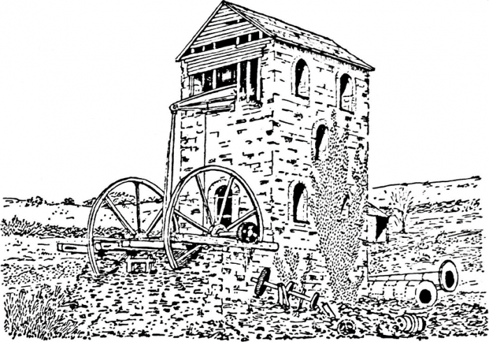
Derelict steam whim, New Consols, 1930

Thereafter the arsenic flue was extended up the hill-side halfway to Monk’s Corner, one of the two stacks where this terminated still standing there beside the road. Despite the colossal outlay on equipment at surface, only 180 persons were employed and little work was being done underground. The result was a foregone conclusion and the company went into liquidation in 1877, leaving heavy debts. In this working Wheal Sheba, at the head of the Luckett valley west of New Consols, had also been taken up as part of the concern. This smaller mine, 73 fathoms deep, had also been known as Great Sheba Consols and as West Wheal Martha. At first it was worked primarily by water power, and being on the same run of lodes as New Consuls, suffered from similar troubles in dressing such complex ores.

In the first World War the extensive Nov Consols dumps were worked over and taken to Gunnislake Clitters for re-treatment. Then in 1947, after being idle for almost seventy years. underground work was again re-started in the mine. The water was cleared by submersible electric pumps driven by diesel generators, and twenty head of Californian stamps erected, with a connecting aerial ropeway. At one stage over 160 men were employed and the mine was officially opened in September 1949. A sum approaching £200,000 had been put into the company, largely provided by an American concern, but the working – described as a large-scale prospect – was a failure and had ended by 1954 with very little ore sold. Once again Luckett reverted to its old quietude, and the village forms today an interesting outpost of former industrialism as well as something of a graveyard of speculative mining hopes.

Kit Hill itself has been the scene of much sporadic underground activity, although mining there has never been successful on any large scale. Kit Hill Mine was re-started close to the summit of the hill in 1855 and was also known as Kithill United in 1859 when a 32-inch engine had been put in. After having been idle for some time the sett was taken up in 1881 with the intention of sinking the existing engine shaft to a junction with a tunnel driven south under Kit Hill from Deer Park Wood. This latter had been started in 1877 by Kit Hill Tunnel Ltd., in the hopes of laying open two or three ‘champion’ lodes amongst the score or more that would be cut in its two mile length from north to south. The company also hoped for royalties as a result of use of the tunnel as an adit and haulage level by mines connecting with it—in similar fashion to the celebrated Sutro Tunnel then approaching completion in Nevada to assist in working the Comstock lode. The new company of 1881, as Kithill Great Consols. sank their engine shaft to 112 fathoms with the aid of a 30-inch rotary engine built by Messrs. Nicholls Williams. At the same time they re-started work in the tunnel with two Robey 16-inch semi-portable engines. Measuring eight feet square, it was driven for most of its distance in granite and proved quite dry. Progress however was both slow and expensive despite the use of rock-boring machines. The ultimate intention was to lay a double line of tram-road operated by an endless wire-rope, but the work had come to a standstill before May 1885 when the company was wound up. Re-named the Excelsior Tunnel, driving was subsequently resumed on more than one occasion but only one good bunch of ore was ever encountered, yielding some £15,000 of tin in 1902-03. By 1911 it had still only been driven 350 fathoms, less than half the distance to the bottom of Kithill Engine Shaft. This has recently [before 1971] been the site of underground test explosions carried out in connection with Government research. Another similar tunnel has been driven almost half a mile into the southern side of Kit Hill, this being the other portal at which the original tunnel company also commenced operations in 1877.
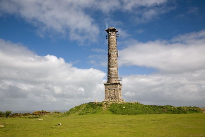
The eighty-five foot high stack that crowns the hill and forms such a conspicuous landmark in East Cornwall is a relic of Kit Hill Mine. The boiler and engine-houses which flanked it still retained their roofs until after 1905 and the walls remained standing until about 1928, in which year the access road to the summit was opened to the public. The square pedestal base and lipped top of the stack are thought to have been ornamental features stipulated by the Duchy of Cornwall at the time of building in order that the structure might assume the appearance of a monument. It is now preserved by the Duchy, the top of the bore being sealed by concrete to keep the structure water-tight.
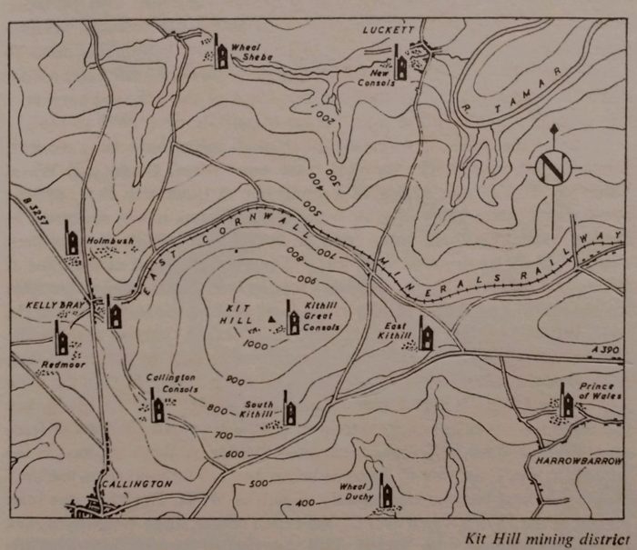
The small East Kithill Mine was worked with Kithill United at one time, the tin-stone from Kithill Mine being stamped and dressed here in a period of activity after 1900. During the war, output from a considerable amount of surface prospecting and adit driving on the slopes of the hill was conveyed to Hingston Down by an aerial ropeway. This was 2½-miles long, on the monocable system, with a capacity of 15-20 tons per hour and worked by four men and four boys. The Duchy of Cornwall, working these mines during this period, employed considerable numbers, with 70 surface and 100 underground workers in 1918. South Kithill was another small tin mine, situated on the southern slope of the hill, and sunk to a depth of 52 fathoms in the main period of activity from 1870 to 1883.

South of the main road several other small mines have been worked, primarily for silver-lead. Amongst these were Wheal Duchy and Wheal Langford. The former exploited a small but at times rich lode, opened about 1810. After being idle for some thirteen years it was re-started in 1833 as Wheal Brothers, some ore then having such a high silver content that it sold for as much as £500 a ton. The normal output of the mine at this period however sold for £30-£50 a ton, its brief riches being responsible for the starting of Wheal Sisters in the same year on the eastern part of the lode. Wheal Langford had been started as Wheal St. Vincent early in the same century for silver-lead, and closed down in 1824. In 1833 it was then re-worked for a few years as East Cornwall Silver Mines. In 1848 the mine was re-christened Wheal Langford and later again, New Langford, but the mine has never been very extensive, producing small amounts of lead, zinc, silver, copper, and manganese ores. Maximum depth attained in the successive workings was 40 fathoms below adit (10 fathoms from surface). Nearby, Wheal Newton was equally as rich as Wheal Duchy at one brief period in the 1870s, when over £1,000 worth of true silver ores was broken in one twenty four hour period. This was part of the old Harrowbarrow Mine which had also been worked with adjoining setts under the name of Calstock United but the total depth attained was only 60 fathoms below adit.

A short distance farther east Prince of Wales Mine was re-started in 1861 in an area of ground that had been worked for tin and copper in a small way under a variety of names, to adit level (42 fathoms) or a little below. Working at first was aided only by a water-wheel but in 1864 when the shaft came into good ore ground at the 45 fathom level it was decided to erect an engine. By 1870 the mine was 75 fathoms deep and employed 120 persons. Some tin was then being returned and the following year stamps and other dressing machinery were erected but a few years later working was temporarily suspended, due to the existing small 25-inch engine which proved unable to keep the mine in fork. In 1879 a new company put in a50-inch engine and sinking re-commenced. The depth then was 90 fathoms and the mine came into tin at 102 fathoms depth, with the ground continuing tolerably rich as sinking continued. In 188, a second-hand engine and 36 head of stamps were put in and at this time the mine was also with a 24-inch steam whim. Two years later 148 were employed and in 1892 the company was re-constituted  to limite liability in a vain endeavour to secure more working capital. After a short period of suspension during the worst of the tin depression a new company took up the mine and working continued until the outbreak of war, the depth of the mine at abandonment being 193 fathoms. 
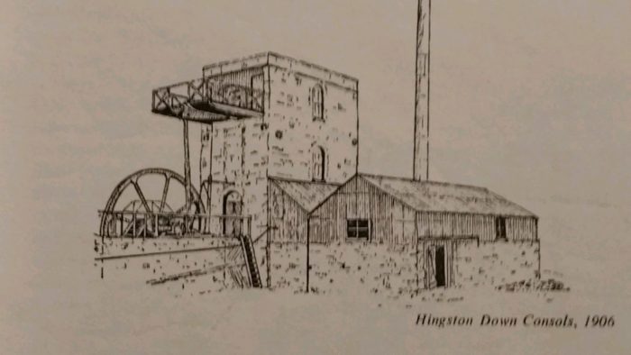
On the summit of the ridge, north of the A390 road, lay Hingston Down Consols, the main working of which commenced in 1846 for copper, the granite of Kingston Down having, been the scene of t mining activity as early as the seventeenth century. In 1850, rich copper was encountered at the 35 fathom level and considerable amounts of ore were sold throughout the rest of the decade. In 1864, the mine employed 225 persons, a number that had declined to 180 by 1876. Two years later the main workings, then 172 fathoms deep, were allowed to fill with water, with the machinery left in situ in the hopes of re-working in better times. Meantime, attention was turned to the western part of the sett and activity continued here on a small scale until 1885, when the company was wound up and all the materials sold off. In 1910 the sett was taken over by Clitters United, which in the next four years treated the Hingston dumps as well as those of the old Greenhill Works. From 1905 onwards, Hingston itself was re-opened and a set of stamps was installed, driven by an engine that had formerly worked on Devon Great Consols. The company. however experienced continual trouble with other second-hand machinery and with the crookedness of the main shaft, and the mine again closed in 1908.

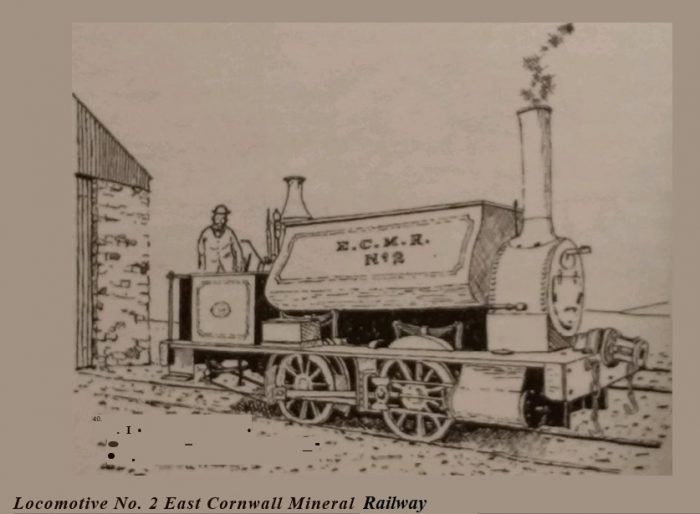
These mines on the slopes of Kit Hill and Hingston Down weighed and sampled their ores at Calstock, where extensive wharves had been built to carry on this trade, as well as the import of coal and timber for mining purposes. By the 1860s this traffic had grown so much that a railway was projected to serve the district. As the Tamar, Kit Hill and Callington Railway, this issued its prospectus in January 1864. With a capital of £60,000, it was proposed to take over Kelly Quay at Calstock with its engine-works, stores, limekilns etc. owned by the Tamar Coal, Manure and General Mercantile Company. Five of the new directors were the proprietors of this latter company, which was already operating an inclined tramroad at Kelly Quay for hauling coal up the steep valley side from the river. Construction of the line started in 1864 and by August the earthworks were completed for over half the distance to Callington. 250 men were employed on this work and 600 tons of rails had been landed at Calstock ready for laying. The line however was only partially completed and a further Act was passed in 1866, by which date a portion of the line was in use — probably as far as Gunnislake Clitters. Two years later yet another Act was obtained, under the name of the Calstock and Callington Railway, before construction was finally completed. After a change of name to the East Cornwall Mineral Railway in the interim, the official opening came in May 1872.

Seven and a half miles long and built to 3-feet 6-inches gauge, the line commenced at the eastern end of Caistock’s river frontage, at Williams’ Quay, leased as ore and coal yards by Messrs. Vivian & Sons, the Swansea smelters and coal factors. Calstock was then a busy port, with steam paddle tugs bringing up three or four barges or sea-going schooners on every tide, and with regular steam packet services to Plymouth and London, and after the opening of the railway management of the port passed entirely to the E.C.M.R The other chief wharves were Steam Boat Quay, Vosper’s Quay. and Kelly Quay. with a total length of some five hundred yards, plus various timber ponds. Horses were used to move wagons on these wharves, the two diminutive four-coupled saddle tanks, purchased by the company from Neilson & Co. of Glasgow, being used solely on the main section above the incline. This started its steep climb, at approximately one in six. at the western end of Kelly Quay, being single line with a passing loop midway. Working was by counterbalance assisted by a semi-portable steam engine, with two loaded wagons upward or downward at a time, each carrying three tons, or with three empties. At the head of the incline—at what was variously known as Kelly, Kelly Rock or Kelly Yard—the locomotives were housed, the site being close beside the surface buildings of Calstock Consols. The line thence ran successively past Drakewalls Mine, the Gunnislake quarries, Greenhill Works. and Gunnislake Clitters Mine, all of which had sidings, or in the case of the latter an inclined tramway; thence along the northern flank of Hingston Down—which at this date was largely unenclosed waste—to below Kit Hill where another inclined tramway connected with the granite quarries. Sidings were also provided at Monk’s Corner to serve Luckett and after a short stretch at I in 45 the line terminated close by Kelly Bray Mine, north of Callington. The original intention had been to extend the metals to the latter town but this was never done. The steepest gradient, above Gunnislake, was I in 50 and the usual practice in either direction was to make two journeys with a few wagons up the heavier grades as far as Monk’s Corner and there combine these for the easier run down to either Kelly Bray or Kelly Yard. Granite proved an important source of traffic but coal and ore were the chief sources of revenue before the mining depression came.

In 1876, a branch line was proposed from Kelly Yard eastward across a viaduct over the Tamar at Gawton and so up the Tavy valley to Tavistock, together with a short branch northward from Gawton to Morwellham but neither this, nor the various other extensions proposed in the 1880s to connect the line with the national railway system, came to fruition. By the end of the century, nearly 70,000 tons were being carried each year, a consider¬able portion of this being granite from the Gunnislake and Kit Hill quarries. The line was still solely mineral, with no passengers carried. In 1908 the line was re-laid to standard gauge and amalgamated with the P.D. & S.W.J. Railway, crossing the Tamar on a fine twelve-arch viaduct high above Calstock to a junction at Bere Alston, The old incline was abandoned, but to enable the still considerable river traffic in granite and bricks to continue a wagon lift was installed alongside the viaduct to raise and lower wagons the 113 metres between the quays and the new line. Powered by a steam winding engine with vertical boiler, this hoist was of 15 tons capacity and was one of the tallest of its type in Britain. It survived here until 1934 when a serious decline occurred in the shipment of bricks from Calstock.

The mine at the head of the incline, Calstock Consols, was originally restarted in 1847 for copper as Wheal Calstock, being re-named Calstock Consols in 1850 when the setts of Wheal Zion and Danes¬combe Valley Mine were incorporated. The latter had been stopped in 1842 or 1843, at which date a 30-inch winding engine, a steam whim and a 40-foot water-wheel were sold. In 1865 Calstock Consols had 42-inch pumping and 24-inch winding engines, employed 32 persons and had been sunk to 62 fathoms below the 55 fathom deep adit. Relatively small amounts or copper were sold hut. considerable quantities of mispickel were raised during the 1890’s, when arsenic prices were high. In 1899 this was being treated at the Coombe Arsenic Works, Harrowbarrow, which drew its supplies from the many small mines producing mispickel in the area

North of Calstock lay Wheal Arthur and Wheal Edward, two intercon¬nected mines divided by a cross-course. The former was re-started in 1852 and was 110 fathoms below the surface when abandoned in 1885. In its later years it was amalgamated with Wheal Edward, which had been started in 1851 after an earlier working by the Imperial British Mining Company in the 1830’s. The once important Drakewalls Mine lay north of these, close beside the main road, Unlike the majority of the other mines in the area this was primarily a tin producer, the lode here backing up to surface. In consequence the mine was one of the earliest at work in East Cornwall and during the eighteenth century, then called Drake’s Wall, was worked in a long Gunnis or Cutting, open to the day, to considerable depth.

Railways of Herault – Route B – Beziers to Pezenas Line

This post covers the first part of the line leaving Beziers Nord Station and heading for Montpellier. The line to Beziers from Saint Chinian was covered elsewhere:

https://rogerfarnworth.com/2019/03/18/railways-of-herault-route-a-saint-chinian-to-beziers-line-part-1-saint-chinian-to-cazouls-les-beziers/

https://rogerfarnworth.com/2019/03/20/railways-of-herault-route-a-saint-chinian-to-beziers-line-part-2-cazouls-les-beziers-to-beziers-including-the-line-to-colombiers/

The route of the line out through the suburbs of Beziers is shown on the map below. [3]The aerial image from the early 1960s below shows the path of the line as it separates from the line from Saint-Chinian. It is worth comparing this image with one close to the end of the last post on the Railways of l’Herault. The connection between the two lines which allowed trains to travel East-west and vice-versa which was visible in the aerial image from the 1940s has now gone. It has been replaced by a Co-operative building left-of-centre on this image. [1]The Cooperative building has itself been replaced. It is shown in the adjacent image being demolished in the early years of the 21st Century. [2]

Its replacement is a uniquely designed block of flats which roughly looks like half a donut.The approximate railway alignments overlaid on a Google Earth satellite image from 2018. The Co-op  building has been demolished and the semi-circular flats have replaced it.The block of flats in July 2018 on Google Streetview. In the 1950s, the line immediately left the urban area and travelled across open fields. In this image it runs across the middle of the picture. [1] The road layout shows that the central area of this satellite image approximates to the image above. This time the date is in the 2010s rather than the 1950s.The two images above show approximately the same area. The reference point is the housing in the bottom right of both pictures. The railway route is now a road – Avenue du Dr. Jean-Marie Fabre. [1]

The line soon turned away to the North as shown on the adjacent aerial images from the early 1950s.

The route follows what is now the Boulevard du Languedoc. Two modern pictures of the road from July 2018 are shown below.Boulevard du Languedoc.Further along Boulevard du Languedoc.

The secondary line crossed the single-track line running North from Beziers Midi Station through Bedarieux and on beyond Millau. The bridge is now gone but it was a very short distance north of the old road bridge. The original road bridge as seen in Google Streetview from the modern road bridge below. The old railway route crossed the line between the modern and older road bridges as shown on the map above. [1]The modern road bridge is seen from road-level above.

The route of the old railway continues as shown in the adjacent 1963 aerial image towards Boujan. [1]

The Station at Boujan-sur-Libron was situated close to the Co-operative building in the village. The aerial image of the site from the early 1960s is not of the highest quality but it does show the relative positions of the Co-op building and the station building. The two buildings feature quite prominently in the aerial photograph, just on the north side of the village.

The 4 images below the aerial images are from postcards used in the early 20th century showing the railway station site and building which is typical of many of these structures along the length of the line. [3][4]

The Co-op building, “Les Vignerons”, is still standing in the early 21st century. It features in the first colour picture below. It was created in 1936. In 1979, 65,614 hectoliters of table wines were vinified for 360 members cultivating 632 hectares of vines. [5]

Boujan-sur-Libron Co-op. [5]The site of the station in the early 21st Century. The buildings on the right are on the site of the old station building. The road is named, ‘Le Chemin de la Ancienne Gare’.The route of the old railway has recently been improved as a short access road and then a walkway/ cycleway.A hand drawn map of the village and station from the early 20th Century. [6]The cycleway is marked on the modern map by the lilac dashes. The old aerial image of the same area shows that this is the route of the railway. The bridge in the bottom of both images crosses the Libron River. [1]The bridge over the Libron River after the line has been converted to a greenway. [6]The new cycleway approaches a junction with the Route Guillaume-Thomas Raynal. [6]Looking back toward Boujan along what was the old railway from Route Guillaume-Thomas Raynal in 2013 just before work on the cycleway/greenway commenced.The picture above is taken looking forward along the route of the railway from the same location in 2013. The old track-bed now forms the single-track road, Route Guillaume-Thomas Raynal. Both these images are taken from Google Streetview.

The adjacent aerial image shows the line continuing on to the North from the location of the last two Google Streetview pictures. [1] With the opening of a greenway, the old road was closed at around the point where the cutting starts at about the top third point of this image.Immediately after a field access the route of the old railway is now closed to motor vehicles. [6]Now in cutting, the old railway passed under the Chemin Rural 8. [6]Access to motor vehicles to the old track-bed is once again permitted, as shown above, a little beyond the end of the cutting at les Oliviers. [6]

We are now heading for the village of Bassan further to the North. On the way, the line passed close to le Castellou and Grangette, as the IGN map illustrates. [1]

The line crosses a small metal accomodation bridge between le Oliviers and le Castellou, as shown in the map below.The accommodation bridge which allow surface run-off and access beyond the railway embankment. The Creek de Boute Sirvain is dry in this image. The picture is taken from another country road which runs parallel to the old railway. [6] A series of small bridges, as above, allowed the railway to cross small streams along its route. [6]

The adjacent aerial image shows the line as far as Bassan station site. [1]

The aerial photograph below focusses on the station site. It was taken in 1944. [6] The next two pictures were taken in the early 21st century and show the station building which has been converted to a private home.

The station building at Bassan has been converted to a private house. [6]The old station building at Bassan. [6]

From Bassan, the line travelled Northeast in a straight line for close to 3 kilometres before reaching the outskirts of Servian as shown below. The last kilometre or so was alongside the D39. [8]Trains left Bassan station and crossed the present Avenue de la Gare, (D39E3). The railway formation was used as a road for several decades before it was converted into a greenway in the 2010s.The new greenway. [8]

Along the length of track to Servian the present greenway crosses a series of access roads to farms and vineyards. The picture below shows the view from the old track-bed up the access road to the Domaine Montpenery. [8]

Towards the end of the long straight section of line trains ran alongside the D39. The road and railway had separate bridges over the small Merdanson stream.The D39 crosses the stream on a masonry arch bridge. [8]The railway crossed, and the present greenway crosses, the stream on a concrete bridge. [8]As the railway approached Servian its course changed from a Northeasterly trajectory to a Southeasterly direction. [1]The station at Servian viewed above from the Southwest. [9]

In the adjacent picture the station is seen looking from the Northwest. [10]

The next image is also a view from the Northwest but the scene depicted is wider and includes the water-tower. [9]

Beyond Servian, the next relatively significant location on the old line is Valros which is almost due East of Servian. The line dips southwards before head in a generally northeasterly direction to Valros.The route of the old railway between Servian and Valros. [11]Looking back Northwest along the line of the old railway towards the station at Servian from the Chemin du Verger.Looking ahead to the Southeast along Chemin de Grillet which overlies to railway formation.The bridge over the Lene River at the point marked 43 on the above map. [11]The railway crossed the modern D18E4 and followed what is now the Chemin de Briol.The red line on the image above follows the old railway which has become the Chemin de Briol. [1]

Just beyond the right side of the image above the line turns Northeast as shown in the adjacent image. [1]

The group of buildings visible on the aerial image immediately above is Teisserenc Delafon Longeon, the Domaine Mas Viel . [1]After crossing the modern D18, visible on the left of the aerial image, the railway also crossed the Thongue River and then turned back towards the Southeast. [1]The old railway bridge over La Thingie is still in use carrying a single track lane which follows the old railway formation.A series of aerial images from the 1950s take the line towards Valros. [1]Two photographs of the bridge over the Ruisseau de St. Michael is in the bottom left of the aerial photograph above and the map below. [11]The land plan above shows the Ruiseeau de St. Michel running down the left side of the map with the line of the old railway running up the right-side. [13]

The adjacent aerial image from the 1960s takes the line as fat as Valros Station [1]

The aerial photograph below was taken in the 1940s. It shows the station at Valros while still in use. [13]Approaching Valros on Avenue du Petit Train, the single track road which runs along the formation of the old railway. The picture is taken from Google Streetview.Valros Station buildings. [12]Valros Station buildings. [13] The view from Avenue du Petit Train into the station site in the 21st century.The station building is now a private dwelling. [13]

As shown on the adjacent map, from Valros, the railway head Northeast to Tourbes. [14]

The single track road which follows the old track-bed continues to carry the name Avenue du Petit Train through a mixture of pine and deciduous broad-leaf trees. [14]The route continues alongside the N9 which can be seen above and to the right of the tarmac covered formation of the railway.The N9 and the old railway follow each other towards Tourbes. [14]

Approaching Tourbes the line and the road separate. The railway heading to the North so as to better serve the village. The old station site was to the Southwest of the D39E5 on the adjacent map. The aerial image below shows it in the 1960s. [1]A closer view of the station building, again from the air. Please note that the north point on this aerial image i as about 30 degrees to the vertical. [14]This satellite image from Google Earth shows that the station building remains in the early 21st century. The road continues to bear the name, ‘Avenue du Petit Train’. While the station building retains its original footprint, its conversion into a private home has resulted in the addition of an additional storey as can be seen in the Google Streetview image below.From Tourbes station trains continued in a Northeaterly direction towards Pezenas. [15]

The railway route has been taken over by the D39 to the Northeast of the station in Tourbes. The two separate about a kilometre from the station. at the top of the images below. [1]It is almost a surprise to find the railway route leaving the tarmac behind!But it isn’t for long. Just a few hundred meters along the track-bed it is back in use as a modern highway providing access to the local cemetery which is to the right of this picture which looks back down the line towards Tourbes. The cemetery can be seen easily on the map below. [1]In the two images immediately above, the aerial photograph and the map, the old railway formation can be seen curving into Pezenas.

The first curve is described in the adjacent Google Maps Satellite image. From this point the old railway gradually rose above the surrounding land on an embankment which allowed in to cross an accommodation road by means of a simply supported steel bridge which was at the location shown on the map below.

Steel girder bridge carrying the old railway over an accommodation road on the approach to Pezenas. [15]The original railway track-bed from this point on has been lost under modern development. Both the D13 and new housing developments on both sides of the road have obliterated the original formation. The approximate line of the old railway is shown above and below. [1]The station at Pezenas. [1]La Gare du Nord, Penezas. [16]La Gare du Nord, Penezas. [17]La Gare du Nord, Penezas.

We finish this part of our journey here in Pezenas.

The nearest railway station is now at Agde. Two single track lines used to serve Pézenas. The track from Béziers has been removed, though the station (Gare du Nord) still exists as a cultural centre.

Although notionally still part of the national rail network, in reality the line from Vias, near Agde, is closed. It was used into the 21st century by occasional freight trains serving a quarry further north. Since at least 2011, a section at St Thibéry, some five miles (8.0 km) to the south of Pézenas, is in use as a ‘Pedalorail’ leisure facility. However, the track remains in place throughout and the Gare du Midi is extant and in use as a medical centre.

References

  1. https://remonterletemps.ign.fr, accessed on 22nd March 2019.
  2. http://www.centerblog.net/journal-intime/15183-6569317-deconstruction-de-la-cave-cooperative-de-beziers-, accessed on 22nd March 2019.
  3. http://passes-montagnes.fr/htlm1/vf_interet_local-10.html, accessed on 25th March 2019.
  4. https://www.geneanet.org/cartes-postales/search/?country=FRA&go=1&page=1&place=Boujan-sur-Libron&region=LRO&size=40&subregion=F34&zonegeo=H%C3%A9rault%2C+France, accessed on 24th March 2019.
  5. http://www.cavescooperatives.fr/article-boujan-sur-libron-herault-102598516.html, accessed on 25th March 2019.
  6. passes-montagnes.fr/htlm1/vf_interet_local-11.html, accessed on 25th March 2019.
  7. http://archives-pierresvives.herault.fr/ark:/37279/vta5599beff9fbd5/dao/0#id:1600875409?gallery=true&brightness=100.00, accessed on 25th March 2019.
  8. http://passes-montagnes.fr/htlm1/vf_interet_local-12.html, accessed on 25th March 2019.
  9. https://magalas-ensemble.fr/jadis-chemin-de-fer-de-1900, accessed on 25th March 2019.
  10. https://www.communes.com/ville-servian, accessed on 25th March 2019.
  11. http://passes-montagnes.fr/htlm1/vf_interet_local-13.html, accessed on 25th March 2019.
  12. https://www.geneanet.org/cartes-postales/view/7421958#0, accessed on 25th March.
  13. http://archives-pierresvives.herault.fr/ark:/37279/vta5599bfd8541be/dao/0#id:585155917?gallery=true, accessed on 26th March 2019.
  14. http://passes-montagnes.fr/htlm1/vf_interet_local-14.html, accessed on 26th March 2019.
  15. http://passes-montagnes.fr/htlm1/vf_interet_local-15.html, accessed on 26th March 2019.
  16. http://www.idherault.tv/35330/la-gare-du-nord-pezenas, accessed on 26th March 2019.
  17. https://fr.wikipedia.org/wiki/Fichier:Chemins_de_fer_de_l%27H%C3%A9rault_-_P%C3%A9zenas_gare_c%C3%B4t%C3%A9_cour.jpg, accessed on 26th March 2019.

The East Cornwall Mineral Railway – Part 1

Another Railway Magazine article from 1951!

This time we are in the West Country and considering what began life as a 3ft 6in gauge railway with an incline remote from the rest of the Cornish rail network, which later became a standard gauge line with wagon lift.

The East Cornwall Mineral Railway (ECMR) was covered in an article written by C.R. Clinker in the May 1951 edition of The Railway Magazine. [1]

The article is available from the Railway Magazine archives which can be accessed by subscribing to both the Magazine and the Archives.


Important dates [2][3][4]

1859 – the Tamar Coal, Manure & General Mercantile Company was formed. They had wharves, engine works and stores at Kelly Quay, Calstock (now called Kingfisher Quay). They built an incline plane from the quay up the Danescombe valley finishing 350 ft above Calstock at The Butts.

1862 – the Tamar, Kit Hill & Callington Railway Company was formed with the intention of connecting the incline to Callington.

1864 – A Bill was passed in parliament. Land and rails were purchased and work commenced. Most of the finance came from outside the region as local people thought the railway was being built too cheaply. They were proved correct as the engineering problems were greater than envisaged and the contractor found himself in money difficulties. Work was halted and nothing happened for five to six years.

1869 – the scheme was revived as the Callington to Calstock Railway, though in fact the line terminated at Kelly Bray (SX360715) a mile north of Callington. [3] The intention was for the new company to adopt the abandoned works of the Kit Hill company, and to have a capital of £60,000, with borrowing powers of £20,000. It was to be nearly 8 miles (13 km) in extent, including short lengths on the Quay at Calstock and the incline. Passenger traffic was not authorised. Purchase of the quay at Calstock, and improvements to it, were included in the authorised powers. [2] The rope-worked incline was about 800′ long down and dropped down 350′ to reach the riverside quays. [7] A stationary steam engine lowered the wagons down the 1-in-6 gradient over the last half-mile towards quayside for eventual loading onto barges and schooners. Coal, grain and timber came up in the opposite direction. [8]

1871 – an Act of Parliament, of 25th  May 1871 authorised a change of name to the East Cornwall Mineral Railway (ECMR).

1872 – The line was completed as the  East Cornwall Mineral Railway and opened for traffic on 7th May 1872. It was a 3ft 6in narrow gauge industrial railway which connected the mines in the Kit Hill-Gunnislake area with the port of Calstock. The line was 7.5 miles long running from Kelly Bray to Calstock. There were several branches serving copper, tin and arsenic mines and quarries. [4] There were public goods depots at Kelly Bray, Monks Corner, Cox’s Park, Drakewalls and on Calstock Quay, as well as the private sidings at various intermediate locations serving various mines and quarries. [7]

1883 – on 25 August 1883 the Plymouth, Devonport and South Western Junction Railway (PD&SWJR) obtained Parliamentary authority to build a line from Lydford to Devonport via Tavistock and Beer Alston. [2]

1890 – the authorised PD&SWJR opened on 2 June 1890, and it was to be worked by the London and South Western Railway (LSWR).

1894 – in 1883, the promoters of the PD&SWJR had included in its authorising Act the powers to acquire the ECMR, and in its later Act of 7 August 1884 these powers were converted to an obligation. Accordingly, the ECMR was “taken over” as from 1 June 1891, although the formalities of the purchase were not completed until 4 January 1894. “Payment was made by the issue of £48,250 in ordinary shares, £12,500 in cash, and a rent charge of £250 per annum”. [10]

1900 – The Light Railways Act was passed in 1896, designed to facilitate the construction of new lines where there was no controversy over routing, and in 1898 the PD&SWJR investigated the possibility of connecting the ECMR line to its own line as a light railway. This proved feasible, and the Bere Alston and Calstock Light Railway Order was confirmed by the Board of Trade on 12th July 1900; as well as the new line, the Order authorised the acquisition of the ECMR line and its operation as a passenger light railway (excepting the incline). The gauge was to remain 1,067 mm (3 ft 6 in). In fact finance was impossible to obtain, and eventually the LSWR was persuaded to guarantee borrowings. [2]

1902 – A new company, the Bere Alston and Calstock Railway (BA&CR) as a subsidiary of the PD&SWJR, was set up and a new Act of 23rd June 1902 authorised it to build the connecting line and to acquire the East Cornwall line. [2]

1905 – A Light Railway Order was made on 12th October 1905 authorising a change of the track gauge to 1,435 mm (4 ft 8 1⁄2 in) standard gauge. The position now was to be that the Okehampton – Devonport line would be owned by the PD&SWJR and worked by the LSWR, and the Bere Alston to Callington line would be owned by the BA&CR, a subsidiary of the PD&WJR, and worked by the PD&SWJR. [10]

1907 – The Calstock viaduct was completed [4] and re-gauging and some realignment of the ECMR line was undertaken that year. Traffic was only interrupted for two days during the conversion. [2] The viaduct is a magnificent twelve-arched structure, it was constructed of concrete blocks and has twelve arches, each of 60ft span. The rail level is 120ft above river level. The featured image for this post is a tinted postcard from around 1907. It catches a moment in the history of the railway line between the completion of the viaduct and the closure of the incline. Having been taken “after the completion of Calstock Viaduct in the background, but before the dismantling of the East Cornwall Mineral Railway incline of 1872 in the foreground. This is one of the most informative images of the incline and sidings, which ran the full half-mile length of the river quays, above and below the viaduct. The guiding sheave wheels at intervals along the incline kept the cable in line and clear of the track-bed. A telegraph or telephone was used to link the inclineman’s office on the left at the foot of the incline, with the winding house at the top. Earlier systems used morse-telegraph, cords on pulleys with bells at either end, or even semaphore.” [13]

1908 – The new line from Bere Alston to Callington opened throughout to passengers and freight traffic on 2nd March 1908. Although the main line of the PD&SWJR was worked by the LSWR, becoming outwardly part of the main line network, the PD&SWJR worked the branch itself, under the management of Colonel Stephens.[10] The original ECMR line was operated as an intrinsic part of the branch, although the incline at Calstock was abandoned. As the PD&SWJR branch crossed the Tamar at a high level on viaduct, a wagon lift was provided there to continue access to the quay. [11] The steam-driven wagon lift was built on the Calstock end of the viaduct and had a maximum capacity of 15 tons. It was constructed against one of the viaduct piers and was one of the highest in England, the difference in levels being 113ft. [5] The lift operated until it was dismantled and sold for scrap in 1934. [3]This fantastic postcard view, shows Calstock Viaduct and the sidings below on the quay. The wagon lift is in place. What was the hut controlling the old incline can also be seen at the bottom of the picture. [14]

The PD&SWJR continued to operate the line itself, forming one of the Colonel Stephens group of minor railways, remaining independent until the “Grouping” of railways in Great Britain under the Railways Act 1921, effective on 1st January 1923, when it became part of the Southern Railway. [2] The Callington Branch as it was formally known was often also referred to as the Calstock Light Railway. [12] Chris Osment commented in 2012: “The Callington Branch followed a fairly tortuous route, with many steep gradients and sharp curves, and there was an overall maximum speed limit of 25mph.” [12]

1966 – rural lines in the area were closed in the 1960s, a short section of the original ECMR line was retained to keep open a connection from Plymouth to Gunnislake, and that section remains open into the 21st Century. [2] The remainder closed on 5 November 1966. [11]

A Summary of the Route of the Original Line

The line went from Kelly Bray round the northern side of Kit Hill where there was a siding connecting to the Kit Hill Quarry incline plane. There were stations at Monks Corner (Luckett), Cox’s Park (Latchley) and Gunnislake. At Gunnislake there were lines going to Clitters, Pearson’s Quarry and Greenhill Arsenic Works. [3]

Early Operation

Two saddle-tank engines pulled the goods from Kelly Bray to the top of an incline. The inc;line connected the railway to the quay in Calstock.and the River Tamar. It was a rope-worked single track incline with a passing loop at its mid-way point. Two loaded wagons would be pulled up the incline as three loaded wagons descended. The wagons were then hauled along the quay by horses to the copper quay which was on the site of the present Calstock village hall and car park. Tin, copper, arsenic, bricks, stone and coal were carried and for the first four years profits were good. Gradually the mines began closing and trade began to decline, what was needed was a passenger service. [4] This came about with the restructuring of the companies associated with the line and the development of other railways in the area.

The first wagons were built by a Calstock carpenter, A.W. Williams in the wagon shed at the top of the incline. [4]

The Reconstructed and Extended Standard Gauge Line

We have noted above that the extended line which included the graceful viaduct over the River Tamar ran from Beer Alston to Callington along a relatively tortuous route with steep gradients.

“From Bere Alston the line runs down towards the River Tamar and then across Calstock Viaduct into Calstock station, which is on a sharp curve. From here the the line rises over 400 feet in the next 2 miles until it reaches the the next station at Gunnislake, which was the main intermediate station and the only passing-loop on the line. From Gunnislake the line ran roughly westwards through intermediate stations at Chilsworthy, Latchley, Seven Stones Halt and Luckett, before finally reaching the terminus at Callington. Between Gunnislake and Callington there were also several intermediate sidings serving various mines and quarries. The total length of the branch was 9 miles 60 chains.” [12]

Following the Route of the Line

This post provides an introduction to the line which ran from Beer Alston to Callington. The next post will follow the length of the line.

References

  1. C.R. Clinker; The East Cornwall Mineral Railway; The Railway Magazine, Vol. No. 601, May 1951, p291-295.
  2. https://en.m.wikipedia.org/wiki/East_Cornwall_Mineral_Railway, accessed on 26th March 2019.
  3. https://www.aditnow.co.uk/Mines/East-Cornwall-Mineral-Railway_10417, accessed o n 26th March 2019.
  4. https://www.gracesguide.co.uk/East_Cornwall_Mineral_Railway, accessed on 26th March 2019.
  5. http://www.cornwall-calling.co.uk/mines/tramways/east-cornwall-railway.htm, accessed on 26th March 2019.
  6. http://www.cornwallrailwaysociety.org.uk/callington-branch.html, accessed on 26th March 2019.
  7. http://www.trainweb.org/railwest/railco/minor/ecmr.html, accessed on 26th March 2019.
  8. https://www.theguardian.com/environment/2014/dec/15/cornwall-railway-heritage, accessed on 26th March 2019.
  9. https://www.steamlocomotive.com/locobase.php?country=Great_Britain&wheel=0-4-0&railroad=ecmr, accessed on 26th March 2019.
  10. Roger Crombleholme, Douglas Stuckey and C F D Whetmath; Callington Railways; Branch Line Handbooks, Teddington, 1967.
  11. Vic Mitchell and Keith Smith, Tavistock to Plymouth, Middleton Press, Midhurst, 1996.
  12. http://www.trainweb.org/railwest/railco/sr/cal-intro.html, accessed on 26th March 2019.
  13. http://www.tvia.org.uk/cgi-bin/tviagal.pl?imgno=1498, accessed on 26th March 2019.
  14. http://www.cornwall24.net/2011/06/on-the-river-tamar, accessed on 26th March 2019.

Railways of Herault – Route A – Saint Chinian to Beziers Line – Part 2 – Cazouls-les-Beziers to Beziers (including the line to Colombiers)

Chemins de Fer de l’Hérault

The first line we are looking at is that starting in Saint-Chinian and running to Beziers

Saint-Chinian – Beziers Line – Part 2 – Cazouls-les-Beziers to Beziers (including the line to Colombiers)This map shows our area of interest. The secondary lines are highlighted in yellow. [9]

We start the next length of the journey at Cazouls-les Beziers. First some photographs and then some discussion of recent events in the Commune and about the railway line.The station at Cazouls-les-Beziers. [1]The station at Cazouls-les-Beziers. [1]Another similar view of the station at Cazouls-les-Beziers. [2]Another view of the station at Cazouls-les-Beziers, this picture was taken from the North. [2]Tank wagons awaiting repair at Cazouls Station in 2007. The picture was taken by Serge Panabière. [4]The road access to the station at Cazouls-les-Beziers in 2016. [1]The station building immediately after closure of the line in January 2017. [2]The station at Cazouls-les-Beziers in 2018 with tracks already removed in front of the building. [1]

Until 2016, the railway to Cazouls was a modern branch-line which had been well-maintained by Hérault Transport and was operated in partnership with RDT 13. [5]

In its session of 14th November 2016, the departmental council of the Herault decided to remove 3.5 km of railway between Maureilhan and Cazouls-les-Beziers. This was the only railway line for which it was responsible and the only remaining length of the old departmental railways, The decision came into effect on 1st January 2017. It seems that the only real reason for this was that had the line not been closed it would have had to be handed over to the new ‘Occitanie’ region. The legal framework included for the transfer to the new regions on 1st January 2017, of all departmental railway infrastructure and operations.

The department of Herault created a greenway between Cazouls-lès-Béziers and Maureilhan as an extension of that planned from Saint-Chinian to Cazouls-les-Beziers. The department set aside 3 million euros for the greenway and ultimately plans to continue that greenway beyond Maureilhan to the Mediterranean coast. The track was removed during the Summer of 2017 with the intention of commissioning the greenway by the end of 2017.

It seems unbelievable that this line had only been refurbished in the period 2007-2009. It was provided with two dedicated locomotives with a specific livery and the inscription “Hérault railways”: the BB 1201 ( 83,2 kW / 1,200 hp) and the No. 302 diesel engine (220.8 kW / 300 hp). The station of Cazouls-lès-Béziers, was provided with 5 loops and one siding at that time.

Since the end of 2015 the Owens-Illinois Manufacturing (formerly BSN Glasspack) glassworks in Béziers shipped bottles by full train twice a month from Maureilhan station, which has five loops and 4 sidings. Another trackhad been planned to serve the industrial area of ​​Béziers West, where the glassworks is located.

The remaining length of the branchline will survive as the region of l’Occitanie, which inherited the 6.7 km from Colombiers to Maureilhan, with effect from 1 February 2017 was due in 2017 to designate a new railway operator. That region also manages the railways of the ports of Sète and Port-la-Nouvelle. [6]


The station is shown from above in two adjacent aerial images. Both are taken from the IGN site ‘Remonter-les-Temps’. [7] They show the station are in the early 1960s and again in 2015.

Leaving Cazouls Station the railway returned to a single track layout as it passed under a road bridge which carries Avenue Jean Jaurès. The location is shown below in 2016 and then again in 2018. [5]The two adjacent images show the bridge carrying the Avenue Jean Jaures over the railway. They are taken from the air in 1961 and 2015. [7]

The next image, below, is taken from the Avenue Jean Jaures looking over the bridge parapet back into the station area in 2018. It has been sourced from Google Streetview. The railway ballast is still in evidence. The new greenway runs on the left side of the cutting.

This Google Streetview image looks South from Avenue Jean Jaures and shows the new greenway following what was the route of the railway. The 1950s land plan above has had the route of the railway added.[8]

The adjacent aerial images show the line in the 1960s. [7]

From the bottom of the first image/top of the second image, the line runs alongside the modern D162 which does not feature on the 1961 aerial photographs.The D162 is on the right of this photograph. [5].Google Streetview photo of the railway and the D162 in 2010.Approximately the same location on 2018. [5]The station at Maureilhan in 2016. [7]The station at Maureilhan in 1963. [7]Less than a kilometre or so before reaching the next station at Maureilhan the greenway diverts from the track-bed of the railway and buffer-stops herald the active part of the railway. [5]Approaching Maureilhan Station the line crossed the road to the hamlet of Clairac at a gated crossing. The crossing-keeper’s cottage is visible in this aerial photograph from 1948. [5]Looking Southeast along the line we can see the condition of the location of the station in 2009. This is a Googel Streetview image.The location of the old station was in use in 2009 for storage of a variety of tank wagons.The station site in 1948. The buildings have been demolished but the access road from the D162 remains with gates to allow access to the storage facility which was the station. [5]

The adjacent image shows the station from that access road. [9]

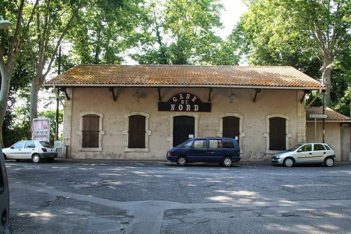
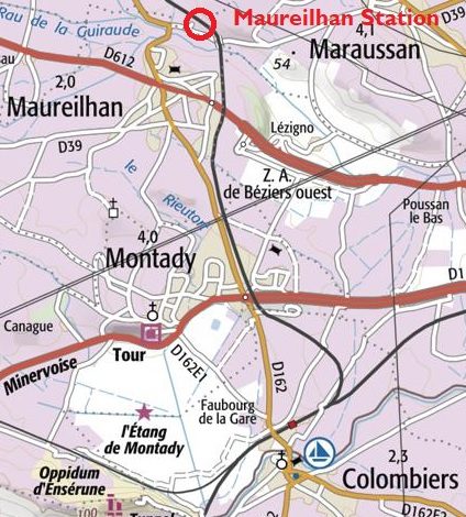
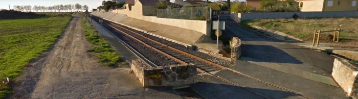
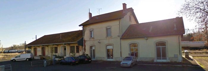
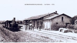
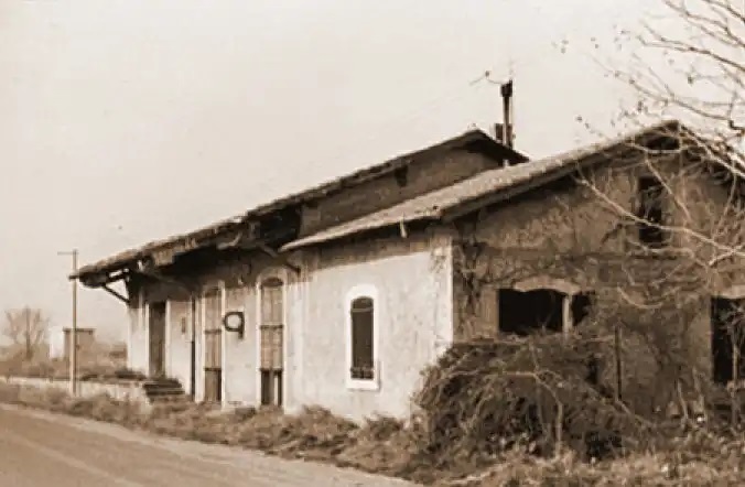
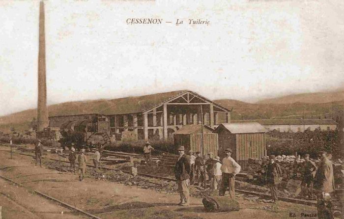
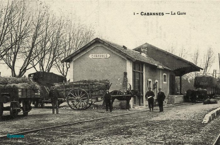
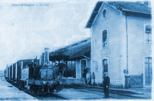
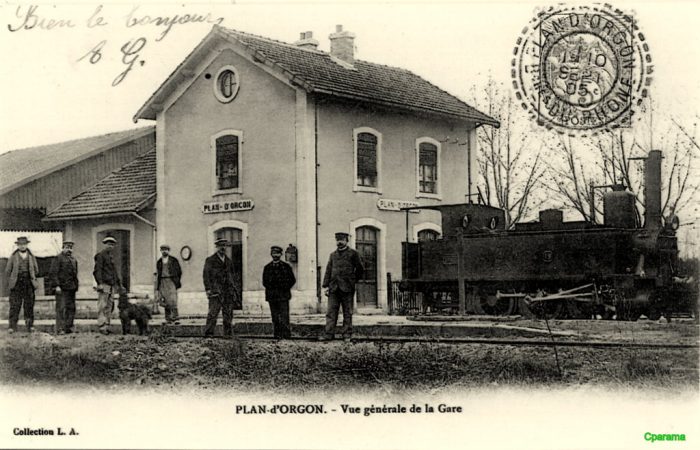
Maureilhan Station is shown above, early in the 20th Century. [5]

Maureilhan to Colombiers

The line South from Maureilhan to Colombiers remains open as a standard-gauge branch-line. The route is shown on the adjacent map. [10]

Immediately after leaving Maureilhan Station the line crosses the valley of Rau de la Guiraude on a curved viaduct which is shown from above in the next image, an aerial view from 2015.[10]

The Viaduct appears quite graceful with open spandrel walls.  The first image below is taken from the D39 and is a Google Streetview image. The second comes from Wikipedia Commons. [11]

Beyond the viaduct the line followed a series of different lanes and roads, as can be seen in the Google Streetview pictures which follow.

The Viaduct over Rau de la Guiraude near Maureilhan. [11]Looking South from the Chemin de Feynes.Looking back to the North from the D612.Looking South from the D612.Looking back to the North from alongside the D162.Looking South along the D162.Further South along the line.Looking back to the North from Rue des Primevères.View South from the Rue des Primevères junction with the D162.1963 aerial view of the remainder of the line to Colombiers Station. [7]Modern IGN map of the same length of the line. [7]Modern, annotated, aerial photograph of the remainder of the line and Colombiers Station. [7]

These next few photographs from Google Streetview illustrate the route of the line.Looking back along the branch from the road bridge over the Midi Mainline.Colombiers station from the road bridge.The station in 1963. [7]The station in 2015. [7]The two images immediately above show the Colombiers Station building. Both images are Google images.

Maureilhan to Beziers

We return to Maureilhan and begin the ongoing journey to Beziers via Maraussan.Leaving Maureilhan in January 2009 along what was the line of the old railway.Rue de l’Aramon in the early 21st Century approaching what was the location of Maraussan Station.Looking East along Avenue Jean Jaurès in Maraussan in 2016 towards the Wine Co-operative building and what was the railway station.The route of the railway can be picked out in the bottom half of this 1947 land-plan. The scan detail is a little on the poor side but the line is just visible in red, first passing the Co-operative building and entering the station which is marked by a red rectangle. [12]This closer image shows the large Co-op building on the left-of-centre with the railway just above it. There was a short siding which served the Co-op and that can be picked out on this image. The red rectangle is roughly at the centre of the station site. [12]Maraussan Wine Co-operative is shown above in the early 20th Century. Note the Wine wagons in the foreground. [13]

The adjacent sketch shows a very similar wagon to those in the photo above. [14]

The Co-operative Building in July 2016.The station in May 1964. [13]The Station Building looking West. [15]

A similar but wider view of the station building is shown on the adjacent postcard image. This time including a short train from the West. [16]

The Station Building looking East. [15]Looking back to the West through the station site in 2016.Looking along the route of the line to the East, from the same location.Looking back along the line of the old railway towards the last picture.Looking ahead along the line towards Beziers.

The line continued across open country from Maraussan along the line of what is now the D39.Among the trees above, it is just possible to pick out the end of the Truss Girder Bridge which spans the River Orb close to the next station for Lignan.

This is a significant simply supported truss structure which retains an early metal deck despite the fact that the bridge is used in the 21st century as a road bridge. It is known as ‘Pont de Tabarka’. It caries a 30kph speed limit but there is no vehicle wight limit sign on the approach to the structure.

The size of vehicles is limited by the top members of the truss and the bracing but surprisingly maximum weight is not specified. It is a graceful structure. [15]

The adjacent image is an earlier one from the opposite bank of the River Orb. [18]

The following images show the bridge from a variety of angles.This photograph was taken by Franck Davi with professional equipment, drone and camera, shows us the Tabarka Bridge from above. [19]The Tabarka Bridge from the banks of l’Orb River. The picture was taken by Serge Panabière in December 2007 [20]This picture was taken at a very similar location to the first monochrome postcard image of the bridge above. [21]

Immediately beyond the bridge after a slight curve trains entered the station area which served the village of Lignan. The land-plan below shows the bridge on the left and the curve round into the station. [17]This aerial image from 1945 shows the same location. Buildings can easily be made out and sidings are marked by the red arrow. [17]However, just a very short distance further along the line the trains encountered the building shown on this aerial view from 1945 and shown in the picture below. [17]Lignan Passenger Station Building. [17]

Beyond Lignan Station trains began a gradual loop around the north side of Beziers before entering the Railway Station.

The present D612 (which is the northern ring-road for Beziers) sits over the old track-bed in the first instance. The old railway route then follows the modern Avenue Prefet Claude Erignac and then the Avenue Henri Pech into Beziers and what was the old station site.

What was open fields in the early 1960s is now suburban development. The tree-lined road on the adjacent aerial image is the Ancienne Route de Bedarieux. The station in Beziers was on the North side of the city in between what is now the Avenue Georges Clemenceau and the Avenue Jean Moulin.

Two lines approached the station – the route we have been following from Saint-Chinian and a completely separate route from the East which ultimately provided a connection to Montpellier.

Once the secondary lines were closed the site of the station was redeveloped as a mixture of parkland, a school and blocks of apartments. There is no evidence of the existence of the station on the site. One picture below shows the site in 2018 on Google Streetview. The parallel maps below are sourced from the IGN website [10]

We finish this post with a variety of images/pictures of the station (Beziers Nord) and the city in times past. First, some aerial images showing the lines at Beziers in July 1945. This photo shws the avoiding line which allowed trains to pass from East to West or West to east without entering Beziers Nord. [17] The bridge over the station approach. [17] The goods shed. [17]The terminus buildings. The passenger facilities are on the bottom left of the picture. [17]This image shows a train leaving Beziers Nord for Saint-Chinian. The building on the left is the goods shed. [17] The modern post-office sits exactly in the same location as the old passenger facilities. This Google Earth satellite image shows the station site in 2016. [17] The image below shows the passenger building. The view is taken from the North along Avenue Pezenas, what is now Avenue George Clemenceau. Trams provided the final length of the journey into Beziers City Centre. [22]This picture was taken from a location beyond the tram in the fist picture of the station. [22]A later image of the railway station and a tram on Avenue Pezenas. [23]

The status of the railway station was clearly that associated with a secondary line. It becomes even more evident if the station buildings are compared with those of the Gare du Midi, the city’s primary mainline station.

The approach the the Gare du Midi Station concourse down the Avenue Gambetta was steep but the site of the station was extensive and the goods facilities were significant.Avenue Gambetta leading down to the Gare du Midi [22]The station facade. [22]A series of views of the interior of the Gare du Midi in Beziers. [22]Two views of the goods yard at the Gare du Midi. [22]

And finally, …. some views in old postcards of the City of Beziers. [22]

References

  1. http://passes-montagnes.fr/htlm1/vf_saint-chinian_beziers-06.html, accessed on 18th March 2019.
  2. http://www.trainsdumidi.com/t9376-pk-0948-gare-de-cazouls-les-beziers-34, accessed on 18th March 2019.
  3. http://www.cazoulslesbeziers.com/12-culture-et-tourisme, accessed on 18th March 2019.
  4. https://fr.wikipedia.org/wiki/Fichier:Chemins_de_fer_de_l%27H%C3%A9rault_-_Gare_de_Cazouls_c%C3%B4t%C3%A9_voies.jpg, accessed on 18th March 2019.
  5. http://passes-montagnes.fr/htlm1/vf_saint-chinian_beziers-06.html, accessed on 17th March 2019.
  6. https://www.railpassion.fr/infrastructure/fin-chemins-de-fer-de-lherault, accessed on 18th March 2019.
  7. https://remonterletemps.ign.fr, accessed on 18th March 2019.
  8. http://archives-pierresvives.herault.fr/ark:/37279/vta55925bc2c5469/dao/0#id:1958869877?gallery=true&brightness=100.00&contrast=100.00&center=6153.856,-4714.822&zoom=6&rotation=4.712, accessed on 18th March 2019.
  9. http://cahiers.de.minerve.pagesperso-orange.fr/HTML/cdf_bezierssaintchinian.html, accessed on 18th March 2019.
  10. https://remonterletemps.ign.fr, accessed on 19th March 2019.
  11. https://commons.m.wikimedia.org/wiki/File:Chemins_de_fer_de_l%27Hérault_-_Maureilhan_et_viaduc.jpg, accessed on 19th March 2019.
  12. http://archives-pierresvives.herault.fr/ark:/37279/vta558b79102845f/dao/0#id:665356471?gallery=true&brightness=100.00&contrast=100.00&center=6460.000,-4488.000&zoom=6&rotation=0.000, accessed on 20th March 2019.
  13. http://passes-montagnes.fr/htlm1/vf_saint-chinian_beziers-07.html, accessed on 20th March 2019.
  14. http://adicab.over-blog.com/article-45469237.html, accessed on 20th March 2019.
  15. https://www.cparama.com/forum/maraussan-t29903.html, accessed on 20th March 2019.
  16. http://cahiers.de.minerve.pagesperso-orange.fr/HTML/cdf_bezierssaintchinian.html, accessed on 20th March 2019.
  17. http://passes-montagnes.fr/htlm1/vf_saint-chinian_beziers-08.html, accessed on 20th March 2019.
  18. http://www.todocoleccion.net, accessed on 20th March 2019.
  19. http://www.centerblog.net/journal-intime/15183-6572077-le-pont-de-tabarka-, accessed on 20th March 2019.
  20. https://commons.wikimedia.org/wiki/File:Chemins_de_fer_de_l%27H%C3%A9rault_-_Maraussan_pont_de_Tabarka.jpg, accessed on 20th March 2019.
  21. http://fracademic.com/dic.nsf/frwiki/1355689, accessed on 20th March 2019.
  22. https://www.cparama.com/forum/beziers-t304.html, accessed on 20th March 2019.
  23. https://www.delcampe.net/fr/collections/cartes-postales/france/beziers/34-beziers-gare-du-nord-et-avenue-de-pezenas-charrettes-tram-704159491.html, accessed on 20th March 2019.

Book Review: Early Japanese Railways by Dan Free

The copy of this book that I bought was a coffee-table size paperback published by Tuttle Publishing. My anticipation was that it might be quite light on detail and full of generic pictures. It is actually a meticulously researched work. Dan Free seems to have spent 25 years on that research.

The book begins by dividing the story into historical periods. The general history of Japan in the years before 1853 is surveyed in the Prologue, [7], (p11-19).

Chapters cover short periods in what was a rapidly developing political landscape. Japan was a place of intrigue and political machinations as the power of the shogun rulers dissipated and became refocused around the emperor.

Foreign powers fought for a prime place of influence over events within Japan. Increasing confidence in indigenous engineering ability among Japanese leaders led to local control beginning to be exercised over construction projects and expensive foreign engineers contracts gradually not being renewed.

The story focusses first on the introduction of railway technology to Japan and the attempts by the Tokugawa Shogunate to offer a concession to the United States. This phase was not long-lived and the balance of power swung round to the influence of the British at the end of the 1860s. “The political double-dealings and diplomatic blunders committed by both the Japanese and Western powers are laid out in impressive detail. For instance, the Shogunate’s rail concession to the United States (although legally binding to the Meiji government) was seen as something to be negated by the former enemies of the Tokugawa who now found themselves in power. Using the time honored Japanese techniques of stalling, failing to reply to diplomatic requests, and not addressing any of the real issues when a reply was given, the Japanese diplomat Sawa Nobuyoshi ran rings around American diplomat Charles DeLong, taking full advantage of his inexperience in the world of international relations. Instead, seasoned politico Harry Parkes of Great Britain managed to maneuver his country into overseeing and supplying (at great benefit to the coffers of English businessmen) the embryonic Japanese rail industry.” [1]

The first railway built was that between Yokohama and Shimbashi in Tokyo between 1870 and 1872.

In 1868 Thomas Blake Glover, a Scottish merchant, had brought the first steam locomotive, “Iron Duke”, to Japan, which he demonstrated on an 8-mile track in the Ōura district of Nagasaki. [1][2] However, after around 250 years of a culture of ‘distrust of foreigners’, construction of the ‘premier’ railway connecting Japan’s former and new capitals by non-Japanese was considered politically unacceptable to the new Japanese regime, and so the government of Japan decided to build a railway from the major port of Yokohama to Tokyo using British financing and 300 British and European technical advisors: civil engineers, general managers, locomotive builders and drivers.[1]

“In order to undertake its construction, foreign experts were contracted, with the specific intent that such experts would educate Japanese co-workers so that Japan could become self-sufficient in railway construction expertise, at which time the foreign contractors were expected to leave the country.” [3]

On 12th September 1872, the first railway, between Shimbashi (later Shiodome) and Yokohama (present Sakuragichō) opened.  A one-way trip took 53 minutes in comparison to 40 minutes for a modern electric train. Service started with nine round trips daily. [4]

The line between Kobe and Kyoto was the first railway in central Japan. Further railway building took place from 1877 to 1884 – the short (11.25 mile) line to Otsu was designed and built by indigenous staff; the line from Tsuruga to Shiotsu; Nagahama to Shunjo;  and East to the Nobi Plain.This is Shinagawa Station in the late nineteenth century did actually look this rural, with the waves of Tokyo Bay reaching to the very edge of the station. In those days, certainly nobody foresaw that the tiny country station would grow into today’s massive complex. It now services over three quarters of a million passengers daily, making it one of the busiest stations in Japan. In spite of its humble location and looks, Shinagawa Station played a title role in the development of Japan’s railway system. The country’s very first daily train services, which started on 12th June 1872, ran between this station and Yokohama. Yokohama’s foreign settlement had turned into a crucial trading port and was located some twenty kilometers southwest of Shinagawa.

The 6th chapter of the book concentrates on the period from 1880 to 1895 which was a time for extending and better integrating the network across the country. The 6th chapter forms a significant portion of the book [7], (p109-180). The text is well illustrated by postcard views of stations, buildings and track-work. The focus is primarily on the ‘Cape Gauge’ mainlines with only short digressions mentioning the smaller gauge lines which later would become important as industrial lines in the valleys in the mountains.

The 7th chapter covers a period of 10 years from 1895 to 1905. The early part of this chapter highlights the lead in innovation taken by the San’yo as it gradually became a major trunk line. Innovation was essential as the San’yo was something with well established shipping routes connecting the same cities [7], (p183-185).

This period was a time of ‘railway mania’. For example, in 1896 alone, 555 applications for provisional charters were made. Private railways built around 400 miles of railways per year in 1897 and 1898, [7], (p181).

That this was both a time of expansion and innovation is evidenced by the activities of others as well. The Imperial Japanese Government Railways (IJGR) faced intercity competition from the Kansai Railway between Osaka and Nagoya, [7], (p185).

By the end of the Sino-Japanese War, railways “were ever increasingly becoming an integral part of the lifeblood and social fabric of the nation and as the network expanded, the effects began to be felt throughout the realm,” [7], (p187).As the century turned the San’yo Railway Company became increasingly self-confident. They were not afraid to bid for foreign tourist trade: “When this as first appeared in 1904, during the Russo-Japanese War, the progressive line had put in place three steamer routes connecting with Shikoku and a ferry route to Kyushu. It could also state that all its express trains (four in number) were electric-lit, steam heated, and furnished with sleeping and dining cars,” [7], (p197).

During this period, with venture capital in short supply in Japan, smaller towns and industrial concerns took to developing their own light railways. They were known as ‘gyusha kido’ (ox car tramways) or ‘jinsha kido’. They were light railways where oxen were used for motive power and as a result enabled circumvention of the existing statutory framework surrounding railway construction. There was also one example of a logging railway powered by dogs on the island of Shikoku which became known as a kensha (dog car) tetsudo, [7], (p202-203).

The 8th chapter focusses on the short period surrounding the nationalisation of the railways (1906-1912) and is entitled ‘Nationalization and Self-sufficiency’.

“In the aftermath of the Russo-Japanese War, the military emerged as a driving force in Japan, and given its influence on the Railway Council, its views on railway development were increasingly heeded. Preeminent among the railway matters which interested the Ministry of War was nationalization, which was thought would make management and coordination of the railway system much easier in times of war. This added weight to a movement that had been afoot for some time,” [7], (p225)

“With the end of the war, the military, and its political supporters, were not satisfied with the potential for operational integration that a railway system consisting of various private railways seemed to be capable of sustaining. The military successes of the recent war, coupled with the public dissatisfaction with what was perceived to be a less than warranted treaty result and the political situation in China … all combined to tempt Japan to ready itself for even greater acts on the Asian continent. Militarism was becoming ingrained in Japanese foreign policy,” [7], (p225-226)

“If that were to be the course of Japanese foreign policy, a nationalized railway system was seen to be preferable to the one in place. New arguments for nationalization were again brought before the Diet, and the debate renewed.  … Nationalization was seen as a means of preventing railway ownership from falling into foreign hands via stock purchases or mortgaging of assets,”  [7], (p226)

“The military vociferously asserted its dissatisfaction with the coordinating abilities of the various private railways in the past war, but conveniently ignored the fact that many of the delays and inconveniences were not attributable to internecine squabbles between various private railways, but were more likely the natural consequence of a railway system that was still overwhelmingly single-tracked and strained to its limits,” [7], (p226-227).

“An ambitious program of double-tracking all primary routes might have been just as effective a solution. The various arguments pro and con were posited, but in the end, after more than a decade of debate, the vote for nationalization carried in the Diet on March 31, 1906,” [7], (p227).

“The legislation authorizing the nationalization also provided for the continuation of private railways (and creation of new companies) providing local (ie. non main line) rail transport.” [6]

“However, as most such lines would be less (or un)profitable branch lines, the 1910 Light Railways Act was required to authorize construction of lower cost lines, including 2’6″ gauge lines, in order to enable provision of railways to smaller and/or more remote communities. Some of the resulting lines initially constructed to 2’6″ gauge were later re-gauged to 3’6″ where there was economic justification to do so.” [6]

Throughout the book, Free examines the close ties between the development of the railways and the development of the country and the Japanese economy. He shows how the railways: “aided the rapid development of other industries. Initially relying on foreign suppliers and engineers (not to mention cash strapped by the extravagance of British construction methods), the development of Japanese engineering and the eventual replacement of foreign experts and suppliers by ‘home-grown’ ones shows that the long term goal of ‘sonno-joi’ activists years before actually did see the light of day. In fact, Japan turned the tables, being a major exporter of rail expertise and supplies to its Asian neighbours.” [1]

Free also shows: “how the former samurai class managed to stay among the ranks of the elite by using their government buyouts to become one of the biggest investors in railroads. The hand in hand relationship of Japanese industry with the government is shown in the switch from a national railway system to private industry and back again. The increasing dominance of the military in the political sphere can be seen by the growing influence of the army in rail planning decisions.” [1]

” ‘Early Japanese Railways’ is a rare example of a work that combines technical excellence and a plethora of information with a lively writing style that always gives the human element its due. Combined with an excellent graphical presentation of hundreds of rare photographs, advertising material, timetables, maps, woodblock prints, and postcards, the book provides a fascinating glimpse of Japan as it moved from self-imposed seclusion to being the ‘most Western of Eastern nations’.” [1]

References

  1. http://www.theshogunshouse.com/2009/02/early-japanese-railways-1853-1914.html?m=1, accessed on 16th March 2019.
  2. Peter Semmens; High Speed in Japan: Shinkansen – The World’s Busiest High-speed Railway; Platform 5 Publishing, Sheffield, 1997.
  3. https://en.wikipedia.org/wiki/History_of_rail_transport_in_Japan, accessed on 17th March 2019.
  4. Hirota Naotaka; Steam Locomotives of Japan; Kodansha International Ltd., 1972; p22-25,34-38,44-46&52-54 referenced in [3].
  5. https://www.oldphotosjapan.com/photos/834/shinagawa-station, accessed on 19th March 2019.
  6. https://en.m.wikipedia.org/wiki/History_of_rail_transport_in_Japan, 19th March 2019.
  7. Dan Free; Early Japanese Railways 1853-1914: Engineering Triumphs That Transformed Meiji-era Japan; Tuttle Publishing, Vermont, 2008.

Railways of Herault – Route A – Saint Chinian to Beziers Line – Part 1 – Saint-Chinian to Cazouls-les-Beziers

Chemins de Fer de l’HéraultThe Departement of the Herault. [7]

The network of the Company of Railways of Local Interest (IL) of Herault reached a maximum length of 212 km. Its lines were standard-gauge. It was planned in the first years of the second empire, it was given authorisation in July 1865.

Lines were commissioned as shown in the table below: [1]

One of the early Mallet locomotives used on the line is illustrated in the adjacent image. [3]

Construction and opening of railways was interrupted for a period of 10 years, from 1877 to 1887 as a result of the poor financial condition of the Company. Bankruptcy apparently occurred in 1884. Although declared bankrupt, the Compagnie de l’Hérault succeeded, inspite of everything, in avoiding forfeiture by signing a concordat with its creditors. It issued new securities listed on the stock exchange and entered into agreements with the departement authorizing it to continue building the network of which it would be both the owner and the operator. [4] By the last decade of the 19th century the company finances were sufficiently stable to allow significant extensions to the network. [1]

The line from Celleneuve to Montbazin, when complete allowed traffic on the two parts of the network without the need to pay tolls to the Compagnie du Midi. It was the same with Colomiers to Maureilhan line.

Except for the Palavas line, which was predominantly beach-side, the other lines were for wine, grapes and bauxite traffic. But the network was fragile financially, because of construction costs, maintenance and operating expenses.

The departement purchased the network in 1928 and entrusted it to the Société Générale des Chemines de Fer Economiques (SE), which undertook some considerable work to stengthen the formation and renovate structres. The new Company also used railcars.

In 1932, under pressure from road transport, it was decided to close the passenger service on all lines except for the line to Palavas. The service was restored in 1939. However after the war traffic could not be sustained and both passenger and goods traffic ceased section by section across the network.

On 1st June 1963, the SNCF resumed serving Mèze but only until 1968. The only remaining part of the network is the line from Cazouls to Colomiers – which is incorporated into the SNCF network. [1]

The first line we will look at is that starting in Saint-Chinian and running to Beziers

Saint-Chinian – Beziers Line – Part 1 – Saint-Chinian to Cazouls-les-Beziers

Much of the network is shown below. We start from Saint-Chinian station which is at the western extent of the network. [5] Before setting off, it is worth noting that in 1905, the journey by passenger train from Béziers to Saint-Chinian lasted 1 hour and 30 minutes (departure at 10 am, arrival at 11.30 am) . The mixed passenger/goods train was responsible for the collection of wagons in each station. The actual length of the trip could be over 2 hours in length. [6]The length of the network covered in this post is the line from Béziers to Saint-Chinian and its branch from Colombiers to Maureilhan. [6]The first few kilometres from St, Chinian to Pierrerue Halt. [2]An aerial image from 1953 shows the terminus station at Saint-Chinian. [2]St. Chinian Station. [2]

The wine trade between Saint Chinian and Béziers Gare du Nord was very important to the departement. It was around the 1850s that the departement of Herault, which was known for cereals, fields of wheat, oats, alfalfa and barley and was self-sufficient in sheep, goats and horses, began to see significant increases in the size of its vineyards. [3][33]

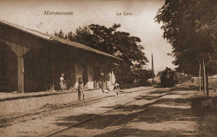
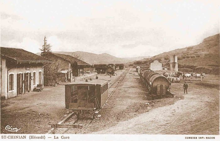
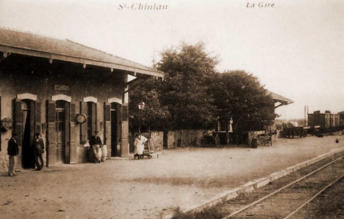
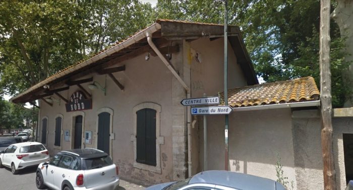
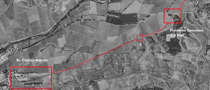
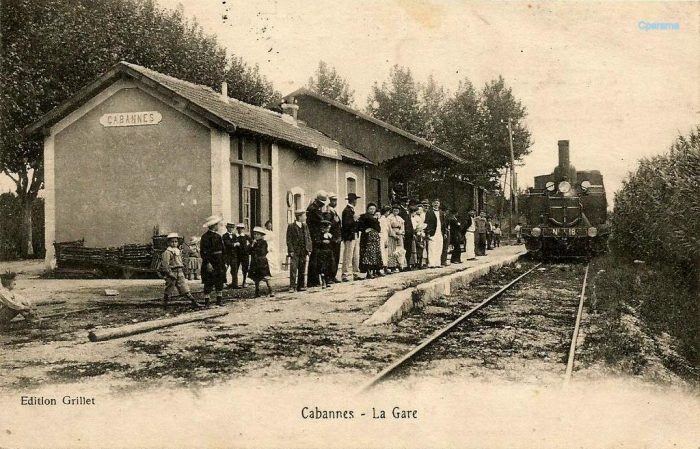
St. Chinian Station is shown above, [2] and in the adjacent image. [3][33]

The vineyard area increased from 96000ha in 1828 to 174000ha in 1850, doubling in 20 years. Little by little, the vineyards came down from the hillsides and invaded the plain. The small walls are there to testify. The main reasons were the urbanization and economic growth which caused the increase of the incomes and especially the arrival of the rail network which made the transport faster, much more reliable and cheaper than by the roads. Herault could deliver wines to Paris and the North, East and Centre of France. [3][33]

The mainline French rail network in the Hérault was shared by the PLM (Paris-Lyon-Marseille) and the Compagnie du MIDI, which started in Tarascon and headed for Bordeaux; with links to Beziers, Narbonne, Toulouse, Bordeaux and to Perpignan. [3][33]

The Béziers-Saint Chinian line included 10 sidings that connected to: three wine merchants, two cooperative cellars, two large factories, two tank wagon sheds and a repair shop.

The major handicap for the line at the beginning of its operation was the axle load at 11T. It was not until 1934 that the axle weight limit was increased to 16T. It was not until 1963 that the axle load limit was increased to 20T, which made it possible to use 40T tank wagons. An additional handicap for the line was the level of and disparity in tariffs charged by the Company. For example: A tonne of wine in barrels from St Chinian cost 195.78fr in 1934, while Puisserguier, shipped from Quarante-Cruzy to the MIDI line in Colombiers cost 186.90fr. The result was competition between stations and where competition between stations. [3][33]

In 1904, the first industrial scale wine-making cooperative appeared – “L’Egalitaire” of Cébazan. A brokers office was established on the platform of the station at St Chinian, where the sale of wine arriving by carts was negoptiated. The goods platform was a hive of activity . In the midst of the barrels of wine, wine-tasters held sway. [3][33]

The establishment of Cooperatives meant that villages lost their local distilleries. Disease badly affected the crop for a number of years. In 1907 trade began to significantly improve as vines became productive once again. By 1946, the secondary lines of the Hérault transported 74,495 tonnes of wine, of which 26% left the stations of Cazouls, Cessenon and Saint Chinian (Saint Chinian 8152 tonnes – Cessenon 7233 tonnes). [3][33]

The timetable for the line in the early 20th century is shown above. [5]

The adjacent image shows an autorail (railcar) at Saint Chinian Station. [6]

The small town of Saint-Chinian is very pretty and is in the middle of a cool valley. It is the former favorite residence of the bishops of Saint-Pons. The town hall occupies the buildings of the former Benedictine abbey which served as their episcopal palace. The caves of Our Lady of Nazareth, the Roman remains of St. Peter and the Roman cemetery of Cazo must attract our attention. On 12th September 1875, the Vernazobres River flooded two-thirds of the town causing extensive damage and the death of 97 people. [6]The 1961 aerial image above shows the route of the railway as a white line. It is shown overlain with a red line on the photograph. [8]This aerial image is an extract from a 1953 survey and shows location ‘1’ on the 1961 photograph. This is the station throat at Saint-Chinian. The station area and the first part of the line to Beziers are now covered by a housing development as shown below. [2] The housing development on the Saint-Chinian Station site.This IGN map covers the same area as the 1961 aerial image. The railway formation is now hidden under the line of the Route de la Voie Ferree through beyond the halt and cemetery at Pierrerue. [8]The route of the railway in the early 21st Century.Location ‘2’ on the 1961 aerial photograph. [2]The same location in the 21st Century. The railway track-bed has been used by the tarmac road. The dirt tracks visible on the aerial image immediately above are still present in this picture.1950s Map showing the railway and Pierrerue Halt. [2]Pierrerue Halt and Cemetery in 1962. [2]The location of Pierrerue Halt close to the Cemetery in 2016.

Beyond Pierrerue, the railway continued across flat open farmland to Commyras.

The first few hundred metres beyond Peirrerue Halt are shown on the old drawing below. Teh cemetery can easily be picked out at the bottom of the plan.A plan of Pierrerue from the 1950s which shows the old railway line travelling roughly North-South. North of the Cemetery the old railway crossed the Ruisseau de Mourgues on a short span arch bridge as shown below. [9]The stone arch bridge which took the railway over the Ruisseau de Mourgues. [11]

A little further to the North, the railway crossed a smaller stream, the Ruisseau de Recourel and crossed the D134 at an un-gated crossing before running parallel to the D20 alongside the Vernazobre River. The terrain had by this time changed. The railway was running through pine woodland. [11]This 1962 aerial image shows the length of the line North of the point where it crossed the D134. The red arrow points to the location of a later building, built on the line of the railway which is highlighted on the adjacent aerial image that was taken in 1996. [11]

old railway continues beyond this point and the original formation is visible as it circumnavigates the sharp edge of the river valley side.

The track-bed which ran alongside the D20. [11]The first length of the railway North and East of Pierrerue. [8]The first relatively significant structure along the route is the two-span arch bridge at location ‘3’ above. It is built over the Ruisseau de Gineste. It is clearly shown on the plan below. [11]The two-span arch bridge over the Ruisseau de Gineste. [11]The line continues on to Commeyras which is roughly in the centre of this aerial image from 1961. Just before the halt at Commeyras the line crossed the Ruisseau de la Combe at location ‘4’ in the image above. The bridge was a three-arch viaduct. [8]This view was taken by Serge Panabière. [10]Just after Commeyras, the line crossed the access road to the hamlet via an unprotected crossing (above). [11]


A train passes through Commeyras. [12]

The stop of Commeyras-sur-Vernazobres served the village of Prades-sur-Vernazobres located some 2 kilometres distant. [6]

The next viaduct was a little further to the East of Commeyras, at location ‘5’ on the aerial image above. The viaduct has been allowed to become more overgrown than the first 3-arch viaduct we encountered. [12] It crossed the Ruisseau de Mirot.The next length of the route. [12]The first kilometre or two beyond the boundary of the small commune of Commeyras is shown on this next aerial image from 1961. The railway, at first, followed the D20 closely and then continued to follow a relatively straight path surrounded by vineyards as the road swung away a little to the North. [8]Two bridges in short succession at location ‘6’ on the aerial photograph from 1961 above carried the line across seasonal streams. [8] The masonry arch bridge over Ruisseau de les Combes. [12]The masonry arch bridge over Ruisseau de Mascarinies. [12]A small metallic railway bridge close to the pint where the D20 converges once again on the line of the old railway – location ‘7’ above. [12]The D20/D14 and the old railway run alongside each other for a short distance before they crossed at an un-gated crossing. When the line was active the road accommodated the railway as shown below in a 1955 aerial image. [12]

The adjacent map shows the realigned D14 and the old railway alignment. [12]

The railway continues to diverge from the road and follows what is now a riverside path known as Boulevard de l-Orb. The Vernazobres River which we have been following relatively loosely is a tributary of the Orb.The old railway curved round the North side of the old town of Cessenon-sur-Orb. [14]It route through the modern town is described by the Boulevard de l’Orb. [14]Approaching the suspension bridge which crosses the Orb River along what was the route of the railway but which in the 21st Century is the Boulevard de l’Orb. The picture immediately below is of the older bridge which was at this location. Then picture is taken from the North and shows the old railway line still in place. [6]The railway ran just behind the dwarf river wall visible in this modern picture. [16]The railway continues round the North side of the old town. This is location ‘9’ on the 1961 aerial photograph.

Cessenon is built on the banks of the Orb. It has a 14th century church whose Romanesque portal still exists. A high square tower or dungeon, former bell tower, dominates the houses. The coat of arms of the city are azure with three fleurs-de-lis of gold, with the border Gules; in the center of the shield, a stick perished in the same band. [6]A 1961 aerial photograph of Cessenon Railway Station. [14]This picture is taken at the station throat at the West end of the station area in the early 21st century.The location of the chimney in the picture above is easily identified on the modern image further above. ‘La Tuilerie’ (the Tile Factory) is approximately on the line of the modern warehouses in the image above. The relative positions  are evident on the adjacent 1955 aerial photograph. [12]

The series of postcard views below show the station building and goods shed at Cessenon.

This card was posted in 1905. A mixed train is at the platform in front of the goods shed. The train has arrived from Beziers. The locomotive is probably an 0-8-0T Schneider D-81 engine. The card was sent to Mrs. Dô by her son, Jules. It says: “Do not worry about our fate we are in good health, we find ourselves well, we do not know when we will arrive.” [15]

The Station Building. [17]The Station Building swing the goods shed to best advantage. [17]

Beyond the station at Cessenon, the railway continued along what is today the Rue de la Capelette and then the Chemin de la Capelette which runs between the D14 and the Orb River as it heads for Reals. [18][19]Google Streetview shows the track-bed running Southeasterly in a relatively straight line across the open vineyards and fields towards distant hills. The next relatively significant structure is the bridge over the Ruiseau de Rhonel which is shown in the three images immediately below. [18][19] This plan from the 1950s shows the approach to the Bridge over the Ruisseau de Rhonel. [20]The next hamlet along the line is St.-BlaiseAt St.-Blaise, the old railway line crosses the Ruisseau de St. Blaise and is then met by the modern D36 as shown on the adjacent map. [6]

The plan below from the 1950s shows the area of St.-Blaise at that time. [21]This underpass is actually the route of the seasonal stream, Ruisseau de St.-Blaise and is just to the west of the village. [19]

For a short length at St. Blaise, the modern D36 lies on top of the old railway before the railway alignment drifts south of the road. The first image below comes from 1961 and shows the old road and the railway. [18] The second image comes from the early 21st century and the railway route is shown in a light brown line. [19]  Along this length two steams were crossed.First, the Ruisseau de Gournier [19][21]Then, the Ruisseau de la Bousquette. [19][21]

Journeying on from St.-Blaise the line approached Reals. As it passed the location of the modern sports ground which is shown as a black rectangular outline on the map above, a short length of rail is still visible. [19]The railway crossed another brook before reaching the tunnel at Reals. The tunnel location is marked below by the orange and green dots. [22]The western portal of the 42 metre-long tunnel. [22]The eastern portal of the tunnel. [19]

Just a short distance ahead as the railway alignment turns to the Southeast we encounter the old railway Station for Reals. The passing loop at Reals Station is marked above by the red arrow on this 1955 aerial image of the line, the station building is marked ‘Gare’. [19]

The adjacent view is taken from the North. [17]The station building is now a restaurant! [19]

Beyond Reals, the railway turned southwards and headed for Cazouls-les-Beziers as shown on the adjacent map. [23]

Initially it followed the southwestern bank of the Orb River but it then turned away South. For a long length of the route it followed what is now a minor road.

Just beyond Reals Station it is possible to look back to the North to see an impressive road bridge which spans the Orb River.An old postcard view of the Pont de Reals [24]An early 21st Century view from the old railway route. [25]

The aerial image shows the road bridge across the Orb River and the line of the railway turning away to the Southeast. [18]

The next photograph is at a smaller scale and shows the line continuing, first to the Southeast and then to the South [18]

This picture is typical of the old track-bed to the East of Reals. [23]This bridge spans the Ruisseau de Estagnol. [23]

The line turns away to the south and heads for Cazouls-les-Beziers. This is illustrated on the map from the 1950s above and on the adjacent 1961 aerial image. [18][26]

The next image below shows the masonry arch bridge which spanned the Ruisseau des Fourfouilles which is visible both above and in the adjacent aerial image. [23]

Further along the line the route is shown first on a hand-drawn map from the 1950s and then another 1961 aerial image.

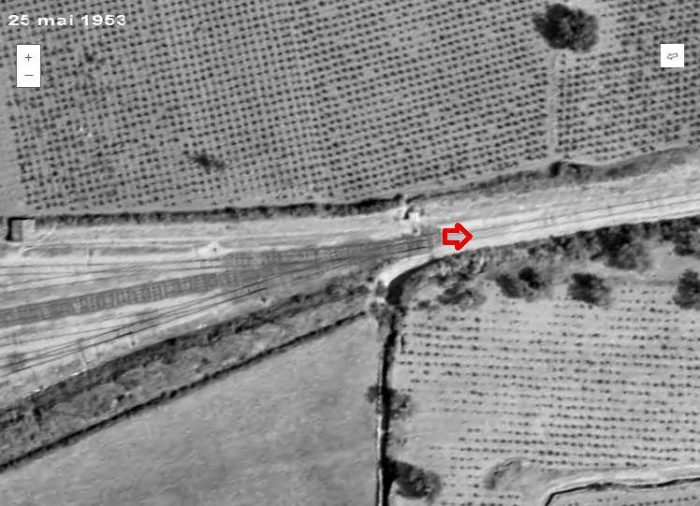
Another 1950s land plan (above) shows the route of the railway. [27]

As noted above, the adjacent aerial images were shot in 1961.

The line continued over open fields on a straight path for some way. [18]

The third of the adjacent aerial images takes the line as far as the station at Cazouls-les-Beziers.

En-route the railway crossed numerous small streams and water-courses. Its track-bed along the way is now in use as a single-track road. The structures which carried the line were similar to those already highlighted in this post. Although occasionally this is not the case. One such location is just to the North of what was a gated level-crossing at the D16. The line crossed the Ruisseau de la Mouchère and by the early 21st Century this masonry bridge has been reconstructed.

In the first image below from Google Streetview, the D16 can be seen crossing the line of the railway. The bridge parapets seem to be of a piece with the age of the railway.

However, the arch beneath has clearly been reconstructed as shown on the adjacent picture. [23]

As we have noted, the line crossed the D16 at a gated crossing and as a result there was a crossing-keepers cottage next to the line. This is the first that I have been able to identify along the length of the line from Saint-Chinian.

The building may well have had a small extension at some time over the intervening years. [23]

Beyond the D16 there were a series of small accommodation bridges constructed of steel on brick abutments. Two of these locations are featured in the images below. The first can be seen in the photograph of the crossing-keepers cottage.The crossing-keepers cottage at the D16. [23]The first of these over-bridges carries the Chemin de Fournic across the route of the railway. [23]The next structure carried the railway over a local road – the Chemin Vicinal Ordinaire N° 29, called ‘la Gauphine’. [23]

The next location of note on the railway line was one of its more significant bridges. A metal lattice girder viaduct carried the railway over the Ruisseau de Rounel.The railway bridge north of Cazouls-les Beziers. [23]The same bridge looking across towards Cazouls. [28]And again (above) from a different angle. [29]

Later in the life f the structure them lattice girders were replace by solid girders as shown in the adjacent picture. [30]Another picture of the bridge with the village behind it. This was taken before closure of the line in the early 1960s. [32]The same bridge again. This picture was taken by Serge Panabière in 2007. [31]
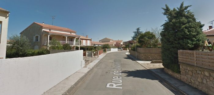
The same structure is shown above at track-bed level in around the year 2000. [23]

And again, in August 2016. The track-bed from the north side of the viaduct southwards is once again in use as a railway! [23]

The 1961 aerial image of Cazouls Station above indicates that in 1961 the line was probably still in use as far north as Cazouls. The site is clearly busy!

The IGN map below shows the modern station layout with a significant number of sidings. [18]

The first photograph below was taken in January 2009 looking North back along the line towards Reals from Rue du 19 Mars 1962. It is a Google Streetview Photograph.

The second photograph is taken from the same location, also in January 2009, but this time looking south into the station site.

These pictures of the station site from 2009 and the following pictures from 2016 seem to make it clear that this modern branch line was secure. It had been fully refurbished and was well-maintained. It clearly (you might think) had a strong future.

This was not (is not) the case. Despite the cash expended on the line, the mayor of Cazouls decided that the line had no future and it was closed in January 2017 in favour of creating a greenway along its route south from Cazouls.

First then, two images from 2009.The next two pictures show the line north of the Station, first in 2016 and then in 2018. [23]The next two images look south from the Rue du 19 Mars 1962, also in 2016 and 2018. [23]It is at this point that we complete the first post about the railway lines of the departement of l’Herault. The next post will look at the lines south of Cazouls.


References

  1. http://rue_du_petit_train.pagesperso-orange.fr/lignes/sudest/CF-herault.htm, accessed on 14th March 2019.
  2. http://passes-montagnes.fr/htlm1/vf_saint-chinian_beziers-01.html, accessed on 14th March 2019.
  3. http://jc34.eklablog.com/le-trafic-viticole-sur-le-rail-entre-st-chinian-et-beziers-a127745832, accessed on 14th March 2019.
  4. https://fr.m.wikipedia.org/wiki/Chemins_de_fer_de_l%27Hérault, accessed on 14th March 2019.
  5. http://adicab.over-blog.com/article-45469237.html, accessed on 14th March 2019.
  6. http://cahiers.de.minerve.pagesperso-orange.fr/HTML/cdf_bezierssaintchinian.html, accessed on 15th March 2019.
  7. https://www.cparama.com/forum/news/forum/34-herault-f41/page90.html, accessed on 15th March 2019.
  8. https://remonterletemps.ign.fr, accessed on 15th March 2019.
  9. http://archives-pierresvives.herault.fr/ark:/37279/vta558b794304186/dao/0#id:366744235?gallery=true&brightness=100.00&contrast=100.00&center=6293.450,-4742.306&zoom=6&rotation=0.000, accessed on 15th March 2019.
  10. https://commons.wikimedia.org/wiki/File:Chemins_de_fer_de_l%27H%C3%A9rault_-_Commeyras_pont.jpg?uselang=fr, accessed on 15th March 2019.
  11. http://passes-montagnes.fr/htlm1/vf_saint-chinian_beziers-02.html, accessed on 15th March 2019.
  12. http://passes-montagnes.fr/htlm1/vf_saint-chinian_beziers-03.html, accessed on 16th March 2019.
  13. http://www.trains-de-jardin.net/forum/viewtopic.php?f=119&t=2865, accessed on 16th March 2019.
  14. https://remonterletemps.ign.fr, accessed on 16th March 2019.
  15. http://cessenon.centerblog.net/6570059-la-gare-de-cessenon-en-1905, accessed on 16th March 2019.
  16. https://www.france-voyage.com/cities-towns/cessenon-sur-orb-11868.htm, accessed on 17th March 2019.
  17. http://www.inventaires-ferroviaires.fr/hd34/34069.a.pdf, accessed on 17th March 2019.
  18. https://remonterletemps.ign.fr, accessed on 17th March 2019.
  19. http://passes-montagnes.fr/htlm1/vf_saint-chinian_beziers-04.html, accessed on 17th March 2019.
  20. http://archives-pierresvives.herault.fr/ark:/37279/vta5590858566372/dao/0#id:1943000407?gallery=true&brightness=100.00&contrast=100.00&center=6268.000,-4480.000&zoom=6&rotation=0.000, accessed on 17th March 2019.
  21. http://archives-pierresvives.herault.fr/ark:/37279/vta559085856f949/dao/0#id:1248117227?gallery=true&brightness=100.00&contrast=100.00&center=6248.000,-4476.000&zoom=6&rotation=0.000, accessed on 17th March 2019.
  22. http://www.tunnels-ferroviaires.org/tu34/34074.1.pdf, accessed on 17th March 2019.
  23. http://passes-montagnes.fr/htlm1/vf_saint-chinian_beziers-05.html, accessed on 17th March 2019.
  24. https://picclick.fr/CPA-Le-Pont-de-Reals-pr%C3%A9s-B%C3%A9ziers-687055-222976685932.html, accessed on 17th March 2019.
  25. https://fr.wikipedia.org/wiki/Fichier:Chemins_de_fer_de_l%27H%C3%A9rault_-_Pont_routier_de_R%C3%A9als.jpg, accessed on 17th March 2019.
  26. http://archives-pierresvives.herault.fr/ark:/37279/vta55925bc277a29/dao/0#id:1252215251?gallery=true&brightness=100.00&contrast=100.00&center=6268.000,-4468.000&zoom=6&rotation=0.000, accessed on 17th March 2019.
  27. http://archives-pierresvives.herault.fr/ark:/37279/vta55925bc2a04d1/dao/0#id:2095234715?gallery=true&brightness=100.00&contrast=100.00&center=6304.000,-4476.000&zoom=6&rotation=0.000, accessed on 17th march 2019.
  28. https://www.cparama.com/forum/cazouls-les-beziers-t3798.html, accessed on 18th March 2019.
  29. https://dunuby.com/cazouls-l%C3%A8s-b%C3%A9ziers-34-h%C3%A9rault-cartes-postales.html, accessed on 18th March 2019.
  30. https://www.communes.com/cartes-postales-anciennes-cazouls-les-beziers, accessed on 18th March 2019.
  31. https://fr.wikipedia.org/wiki/Fichier:Chemins_de_fer_de_l%27H%C3%A9rault_-_Cazouls_pont_du_Rhounel.jpg, accessed on 18th March 2019.
  32. http://www.mascoo.com/index.php?lg=en, accessed on 17th March 2019.
  33. Philippe Marassé; Rail et trafic viticole entre Saint-Chinian et Béziers : un commerce très actif; Historail, October 2013, p56-63. This article was quoted by  http://jc34.eklablog.com/le-trafic-viticole-sur-le-rail-entre-st-chinian-et-beziers-a127745832, [3] For the sake of completeness an English translation of the french text of Philippe Marassé’s article is reproduced below in Appendix 1. Philippe Marassé made contact with me and offered a copy of the french language .pdf of this article.

Appendix 1

Rail and wine traffic between Saint-Chinian and Béziers: a very active business.

by Philippe Marassé, translated from the original French article.

Rail played a major role in the development of mass viniculture in the four wine departments of Languedoc and Roussillon: Gard, Hérault, Aude and Pyrénées-Orientales. The turning point was in the mid-1850s. In fact, in the middle of the 19th century, the Hérault remained a cereal department even though the surface area of its vineyard had increased from 96,000 ha in 1828 to 174,000 ha in 1850. It was not until the Second Empire and the beginning of the Third Republic that the vineyard expanded while other crops declined: the vine then became a monoculture. There are two reasons for this phenomenon: on the one hand, the development of demand as a result of urbanization and the increase in average income caused by economic growth; on the other hand, the expansion of the rail network. The railways, by making transport faster, safer and more economical, allowed wines – formerly distilled – to be widely distributed in the consumer regions, mainly Paris, the North, the East and the Centre. Conversely, the southerners could receive goods manufactured elsewhere at a better price and the foodstuffs, wheat in particular, that they no longer produced. The trade in alcohol, the source of the prosperity of the Bas-Languedoc – and in particular the Biterrois – since the completion of the Canal du Midi in 1681, was replaced by the trade in wines. The latter found in the railway an indispensable tool to conquer a now national market.

A mixed network of railways of general interest and local interest.

At its peak, the railway network of the four wine departments of Languedoc-Roussillon, shared between the PLM and the Midi on either side of Sète, was structured around the Tarascon-Sète-Bordeaux axis completed in 1858 with its Narbonne-Perpignan-Cerbère junction. Two south-north radial railways, Nîmes-Clermont-Ferrand and Béziers-Neussargues, offered – on paper at least – a direct relationship with Paris through the Massif Central, while transporting the wines produced around the service stations in the Gard and Hérault. Finally, a series of “secondary” lines criss-crossed the vineyards: Nîmes-Le Grau-du-Roi, Nîmes-Sommières-Montpellier, Montpellier-Paulhan-Bédarieux, (Béziers)-Vias-Lodève, (Béziers)-Colombiers-Quarante-Cruzy, Narbonne-Bize, Moux-Caunes-Minervois, Carcas-sonne-Quillan-Rivesaltes, etc. In addition to these lines of general interest, there were standard-gauge local interest lines in the Hérault and the Pyrénées-Orientales, the latter operated by a subsidiary of the Compagnie du Midi, les Chemins de fer des Pyrénées-Orientales, which collected valuable tributary transport at a lower cost.

To refine our understanding of the wine traffic, we conducted a “micro-territorial” study. Our Ariadne’s line will be the Béziers-Saint-Chinian local interest line (33 km), opened by the Compagnie des Chemins de fer d’intérêt local de l’Hérault between 1876 and 1887 and connected in 1913 to the Midi, in Colombiers, by a 6 km branch. In 1929 this line, along with the remainder of the Hérault network, was included in the Société générale des chemins de fer économiques (SE), this line, formed the western end of the Montpellier-Chaptal-Saint-Chinian route, via Montbazin, Mèze and Béziers, provided important transport access to the region located to the northwest of the Biterroise sub-prefecture, in the heart of the Béziers-Saint-Pons district. Some figures show the importance of the latter: in the 1930s, this constituency accounted for 60% of the Hérault vineyards and 10% of the metropolitan vineyards for a harvest of about 7 million hectolitres, i.e. 65% of departmental production and 12% of metropolitan production.

Relative strengths and weaknesses

The Hérault network’s standard-gauge track (CFH) opted for coverage of the territory in a gauge which allowed for the best access without the need for transshipment. In addition, this gauge allowed the circulation of privately owned wagons, a significant advantage when tank wagons played a major role in wine traffic. Finally, this characteristic favoured the flowering of privately owned branches (EP). This built customer loyalty because of the investment made. In 1952, the CFH could count on 30 private branches, 10 of which were on the Béziers-Saint-Chinian line alone. Almost all of these were of interest to viniculture. Specifcally identified sidings gave access to the line to three wine merchants, two cooperative cellars, two tank car garages and a car repair workshop. …..

Viniculture contributed 85% of all goods traffic in 1913, a proportion that would exceed 98% after 1945. However, the CFHs had to fight two handicaps to prevent loss of traffic. The first was technical, while the second one was a matter of dryness. First the technical issue: the original track with rails of 24 kg per metre, and the lightness of the aprons resulted in a limiting axle-load of 11 tonnes. This ruled out the use of many wagons – in particular tank wagons. In 1932-1934, the installation of 30 kg rails and the reinforcement work areas allowed maximum axle-loads to rise to 16 tonnes. Then, between Saint-Chinian and Colombiers, that axle load was increased to 20 tonnes in 1963-1967, after a general overhaul of the track.

Secondly, tariffs were a major handicap. The split taxation of shipments from/to large networks – i.e. adding taxes levied by each jurisdiction – increased the total price from or for a station in Herault. The problem primarily related to wines which made up a third of all the tonnage of the CFHs. One example of the shipment of one tonne of wine in Saint-Chinian barrels to Paris-Bercy in 1934 easily demonstrates this. The tax amounted to 195.78 F, of which 21.03 F for CFH and 174.75 F for Midi and PLM networks while this same transport from the station of Puisserguier on the Midi line from Colombiers to Quarante-Cruzy cost only 186.90 F – reduction of 8.88 F per ton. This difference disadvantaged traders served by “l’Hérault” and favoured their colleagues based close to the Midi/PLM. This resulted in many shippers, often at the request of their customers, using the nearest Midi or PLM Station – a possibilty facilitated by the interweaving of the networks and, after 1918, by the development of of road transport. The solution was in the application of a common tariff for CFHs and the large networks – the 6-106 tariff for drinks. End-to-end taxing according to this common special tariff resulted in the above-mentioned transport cost reducing to 174.10 F, including 12.77 F to be paid to the Hérault and 148.43 F to the PLM/Midi networks (the balance of 12.90 F represented tax). However, this change was only brought about through difficult negotiations. The reform was certainly beneficial to the public and led to a decrease in receipts for the Midi (in our example: 10.42 F per tonne).

It was not until 1897 [sic] that the Minister of Public Works Turrel certified the first common tariff for the CFH/PLM on the journey to Paris-Bercy (about a third of the tonnage of wines on the CFH). It is true that, for the owner of a large wine estate in the Aude, this measure could impact on the result of an election. (About this political figure, divided between Parisian political activity and his lands in the Aude, see Jean-Louis Escudier, Viniculture and politics in Languedoc. Adolphe’s action Turrel, Minister of the Third Republic, Les Presses du Languedoc, 1995.) The secondary network was nevertheless excluded in 1919, during the general revision of the national network, and it had to wait until 13th October 1938 to be included following a lively campaign and under pressure from road competition.

There were negative impacts of the policy of a national network tariff: indexation of stations established in 1951 by SNCF, in accordance with the principles of its new price-based pricing of cost, led to a movement of wines away from the CFH, in particular on the Béziers-Saint-Chinian line. Bezeiers-SNCF station received an index number of ‘4’. CFH stations nearby were given the index number ‘6’ which was much more expensive. 

In 1953, in the face of protests from the CFH, the SNCF granted index ‘4’ status to only one station in the area around Beziers – Beziers-Nord. To get round the problem, the CFH invented a device which consisted in taxing all wine shipments from their Béziers Station. The route from the loading station to Beziers being covered by a trucking rate. This was a fcition! Wagons continued to go directly to Colombiers without going through Béziers. This combination which was advantageous for the customer, lasted until 1962 when a new pricing structure was set up.

Similarly, the CFH had to obtain an exclusion for their “territory” when the SNCF introduced road collections in 1950-1953. Thos collection rotues had a significant effect on the network by focussing railheads for wine at Sète, Béziers, Narbonne, etc. In 1952, the CFH evaluated, in respect only of the line to Saint-Chinian, that 15,000 tonnes was the loss of traffic caused by recent measures by the SNCF. Those measures were also detrimental to smaller stations in the national network.

The growth of wine trade on the line from Béziers to Saint-Chinian

The wine trade traditionally included three categories of professionals: traders/retailers,
commission agents (commissionaires) and brokers. This distinction became blurred over time. A number of traders became commissionaires to avoid large disbursements and the dreaded risk of devaluation of their stocks. The trader buys wine from the producer and, after processing, resells it to the customer. The wholesaler, who requests a fixed price including the price of the goods and transport, deals with trade wholesale or semi-wholesale of products, while the “barricailleur” focussed on particular locations.

The commissionaire buys the wine on behalf of a dealer of a place of consumption and, after processing the case if necessary, sends it to him. He gets a fixed commission, all costs, transport in particular, remaining at the expense of of the buyer. The broker limits himself to connecting a buyer, trader or commissionaire, and a producer. To complete the picture, it should be added that, at the beginning of the 20th century, the cooperative wine-cellars appeared and multiplied quickly after the first world war. They developed so effectively that they often resulted in the death of smaller properties/vineyards.

At the opening of the CFH, the region had already resolutely oriented itself towards viniculture. However, the railways facilitated “industrialization” and encouraged the development of an active wine trade in the communities served, including between Béziers and Saint-Chinian. So, the large cellars of Cessenon were built after 1877, the vat room of the estate of Viranel was built in 1881, as was the cellar of the Mas Sarrasi. Similarly, the distilleries, that had operated in this same village since the first third of the 19th century, disappeared, most of them around 1880, which shows that the wine was now predominantly “exported”.

Some traders, in particular in Maureilhan and Cazouls, continued to transport their product direct to the Midi station in Beziers, because of the difference in tariff that we noted above.
The Negoce of Béziers often had wine moved by cart to his stores in Biterrois.

The following traders were significant in marketing wine in early years:  Sahuc, Tindel and Balaman to Marausan, Barbezac in Maureilhan; Bonnet & Gibaudan, Sèbe, Pagès,
Andrieu, Borrel and Robert in Cazouls.

At Cessenon, which was the interim terminus of the line from 1877 to 1887, and where various commission agents were carrying out purchases for houses in the East and
of the North, Auguste Cazanove (1832-1885), wine merchant and banker, was head of a Important house that ranked first among his contemporaries in the region. In the early 1880s, he owned two wine stores and a coopers workshop near Cessenon station, in the middle of the built-up area. In 1880, he even created a distillery which, however, turned out to be ephemeral since it was demolished in 1883.

It should be noted here that, from 1879 to 1881, while phylloxera was gradually devastating
the Hérault vineyards, the municipalities between Béziers and Cessenon, which had been spared, provided most of the line’s traffic between Cessenon and Montbazin, hence the trains
continued towards Montpellier (taking the Midi line through Paulhan for a fee. Traffic which was much more profitable than wine, was sent to the Centre and the North of France and
even Switzerland, covered covered costs in such a way that completion became less significant.

A universe of branches

At the beginning of the 20th century, after the crisis of phylloxera and the reconstitution of
vineyards, very active centres of wine trade flourished along the line, especially in Cazouls,
Cessenon and Saint-Chinian.

In Cazouls, in 1908, seven brokers could be found: Aoust, Calas, Faucheron, Py, Robert, Sèbe and Sénégas to whom a further five dealers were later added: Chabbert, Omer Martel, Léon Maux, Maynaud and Poussines. After the first world war, in 1921, the telephone yearbook for
Hérault identified 17 traders or brokers in wines. In 1921, Pétrier Frères Co., commissioner in
wines in Béziers, built a modern cellar close to Beziers station, with concrete tanks, with two sidings connected to the railway which were about 180 metres in length. After the dissolution of this company, in 1925, François Pétrier (1890-1971), whose offices were located in in front of the Midi station in Béziers, kept the private sidings until 1960.

In Coursan (Aude), his native village, François Pétrier owned a “buying house”, as well as the domains of Fouléry, near Servian, and Creyssels, near Mèze. Pétrier was entrusted, in May 1939, with the presidency of the Groupement des usagers de l’intérêt local de l’Hérault, founded by the main clients of the network to defend the CFH which was threatened with closure. The designation of a trader at the head of this group, which was based in the premises of the Trade Union of Wines in Béziers, underlined the role of rail transport to his profession. Finally, F. Pétrier, who also owned tank wagons (31 in 1936), chaired the Chamber of Commerce of Béziers between 1960 and 1964.

At Cessenon, still in 1908, four brokers animated the place. In 1921, according to the PTT directory, the locality had six professionals in the wine trade, including two commissionaires-
shippers and four brokers. In the 1930s, two new wine trading companies, Maurel and Puech, branched out at Cessenon station. It was in 1897 that the blacksmith André Maurel
(1864-1937), “descended” from his native Tarn, bought a piece of land close to the station to create a metal workshop. In 1926, his son Paul (1896-1947), also a blacksmith, had a 30 metre siding laid, connected to the station via a turntable  for the reception and the shipment of wagons built or repaired in his workshop.

The sidings were expanded in 1932 (a siding of 95 metres was complemented by an 18m  perpendicular track connected to the siding by a wagon turntable. The private sidings now served Paul Maurel’s construction site and the loading wharf belonging to his brother Charles (1898-1963), commissionaire in wine since 1923 and operator of tank wagons. He gave his widow Blanche Herry- Adam, as of 1st January 1964, the business and the branch line
particular. The Herry house continued to use the siding and stayedin business until long after its removal in 1970.

Opened in 1931, the second siding at Cessenon served Augustus Puech’s cellar (an 85 m siding). Born in Cessenon, A. Puech (1893-1982) led a parallel career to that of F. Pétrier. In April 1947, he became Secretary General and local representative of the new Syndicat
des usagers des chemins de fer économiques de l’Hérault, formed in 1939. More recently,
from 1964 to 1973, he succeeded F. Petrier as the head of the Chamber of Commerce in Béziers. He was then, from 1968, President of the Chamber Regional Commerce in of  then received, in Languedoc-Roussillon.

In Saint-Chinian, from the beginning of the 20th century, about ten brokers or traders, some of whom were located near of the station, carried out important shipments (tank wagons and (barricaille?)): Cauquil, Chabbert, Fréchinet, Hugoné, Phalippou, Salvestre, List, etc. There was no specific siding but the trade used the old cattle dock (100 metres in length) located on the across the tracks, from the station building. Established traders along the line were supplemented by trade shipments from Biterrois.

Let’s finish our overview with the two connected cooperative cellars on the Saint-Chinian railway line. In Maraussan, “Les Vignerons Libres”, one of the first cellars founded
in the Hérault, was served from 1905 by a siding of 85 metres which was lengthened in 1913.

Before 1914, it transported wine to a depot in Charenton (Seine). Built in 1937, the Cessenon cellar obtained a 93m private siding in 1948. In addition, after the first world war, industrial-sized distilleries appeared for each Marc. Distilleries appeared in Lignan and also at Cazouls, Cessenon and Saint-Chinian.

A few figures illustrate the vitality of the wine trade on the Beziers-Saint-Chinian line
and the decisive role played by the railways in a region away from the main lines. In
1946, the CFH transported 74495 tonnes of wine and alcohol. Of this total, 19298 tonnes, or 26%, left from Cazouls, Cessenon and Saint-Chinian. Saint-Chinian
and Cessenon ranked respectively in second and third place (after Mèze) for the importance of their wine traffic with 8,152 tonnes for the first and 7,233 tonnes for the second. Very sought-after, the red wines of Saint-Chinianais were rated special at Bercy before 1914 before joining the family of delimited wines of superior quality (VDQS) and then, in 1982, as one of the AOC wines. But by then the railway had disappeared! While the wines of the Hérault had dramatically improvedmon quality. …

Philippe Marassé


Bouches-du-Rhone and its Railways – Part 2 – Orgon to Barbentane

Réseau des Bouches du Rhône (BDR)

The line between Orgon, Chateaurenard and Barbentane is shown on the sketch-map below. The North-point is at about 11 o’clock.

In 1900, about 60,000 passenger tickets were sold. It took 1hr 23min to go from Barbentane to Orgon-Gare and 1hr 30min in reverse. The passenger service was terminated on April 10, 1937, this was surprising as at the time alternative road services were not available. In 1941 the service was, it seems, provisionally restored but in 1946 the line was permanently closed to passengers. [1]

The freight traffic was significant. In 1900, 24,500 tonnes of fertilizers, cereals and other goods were transported on slow speed trains and 20,000 tonnes of vegetables which required rapid delivery.The line from Orgon to Barbentane. [1]Trains to Barbentane and Tarascon followed the same route out of Orgon until just beyond the station at Plan d’Orgon. The route of the line to Tarscon is sown in pick on this 1930s Michelin Map and is covered elsewhere. [2]

The present station at Orgon served the PLM line. The secondary branch line to Barbentane was served by a smaller structure close to the PLM station. The PLM line had travelled North alongside the N7 before turning to the East and crossing the Durance River. The station buildings were of a more substantial nature than those on the secondary lines. The image below comes from Google Streetview and shows the station building in the early 21st century.The view above shows the station at Orgon. The picture is taken from the North-east.

The adjacent satellite image is taken from Google Earth. The station building is clearly substantial. The waiting shelter on the opposite platform also of some substance. There were a series of sidings at the station of which a number were still in use in the early 21st Century.

The station at Orgon sat on a piece of land between the Vallat Meyrol and the Canal Septentrional des Alpines and the Durance River. Just to the North of the station the PLM line crossed the Vallat Meyrol. That bridge can be seen at the top of the adjacent image.

The station for the secondary line to Barbentane sat, as shown below, close to the PLM station. It sat alongside the shelter on the platform across from the station building.The BdR railway station is on the right side of the above image. [1]

The adjacent image shows the location of the BdR station building and shows the approximate route of the line in green. [3]

From the station the BdR swung round the North side of Orgon alongside the Canal Septentrional des Alpines. The next two aerial images show the that alignment. [3]

The postcard image which follows that shows the line from the North with the town and castle behind.The old railway runs across the centre of this image. [4]

Before heading away from Orgon it is worth a look at contemporary images of the PLM bridge across the Durance River. The next few images give a good impression of the structure.