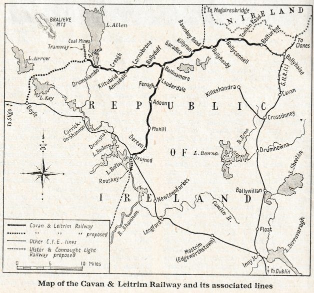
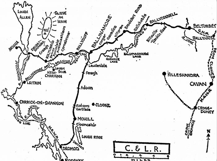
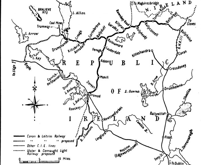
Ballinamore to Ballyconnell
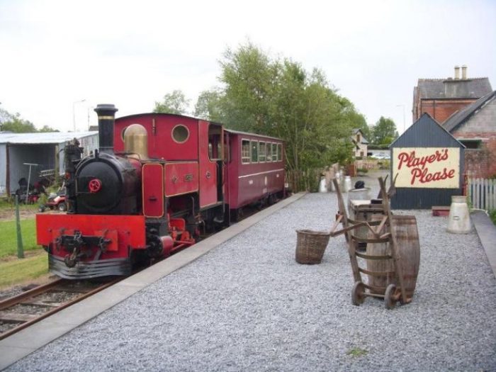
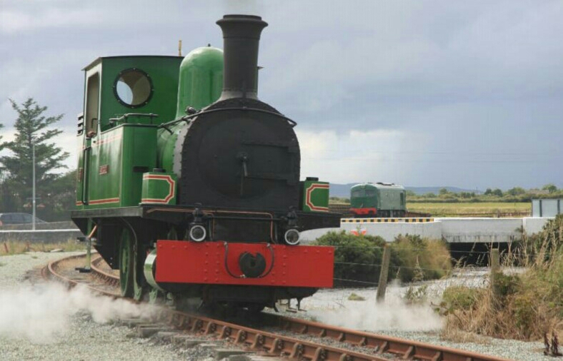
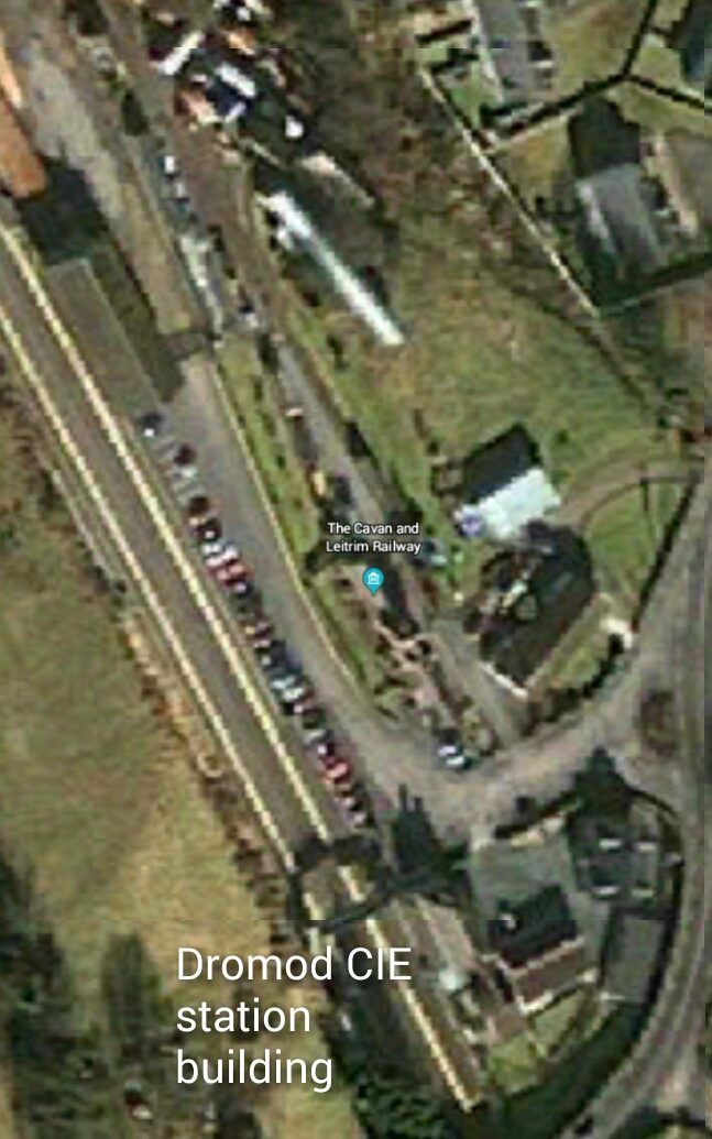
NB: A flavour of the Cavan and Leitrim Railway can be obtained by visiting the preservation line and museum at Dromod. The relevant details are as follows:
Facebook: https://www.facebook.com/cavanandleitrimrailway.
Twitter: https://twitter.com/CLrailway.
Website: https://cavanandleitrim.wixsite.com/home.
Cavan and Leitrim Railway, Station House, Station Road, Dromod, Co. Leitrim, N41 R504,
Ireland. Phone: +353 71 963-8599.
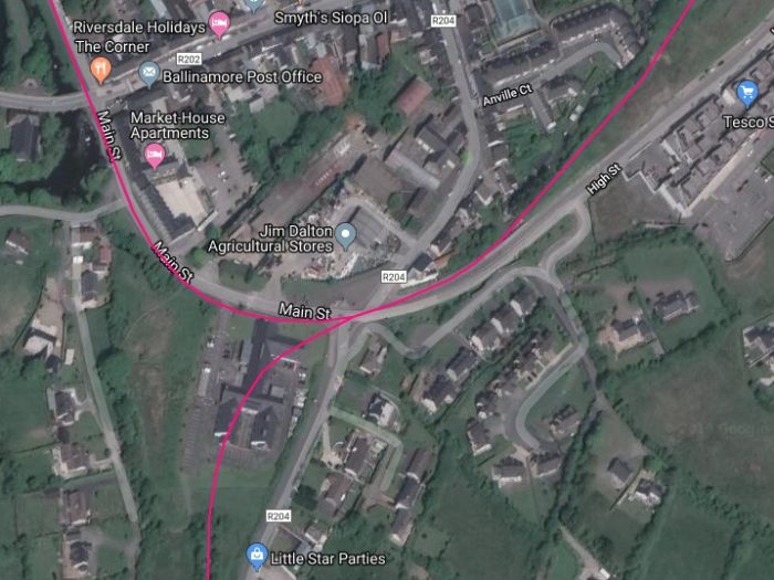
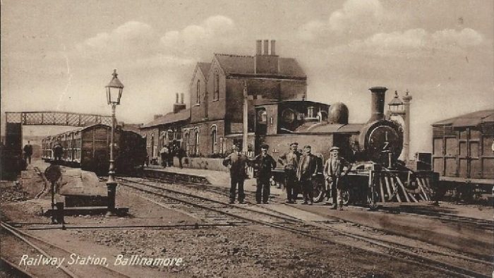
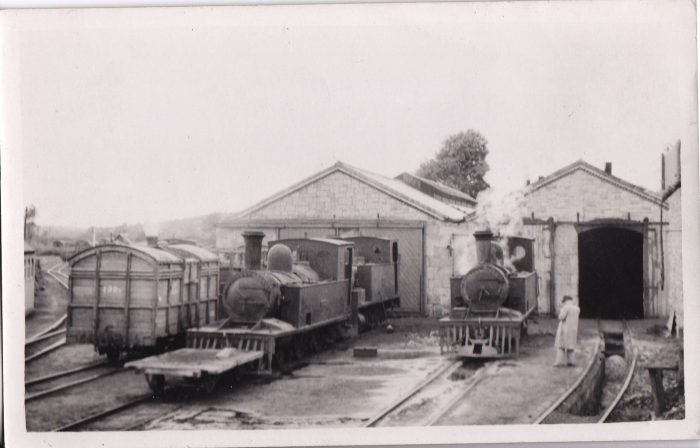
We re-start our journey at Ballinamore Railway Station which warrants a good few pages in Patrick Flanagan’s book. [1: p129-135]
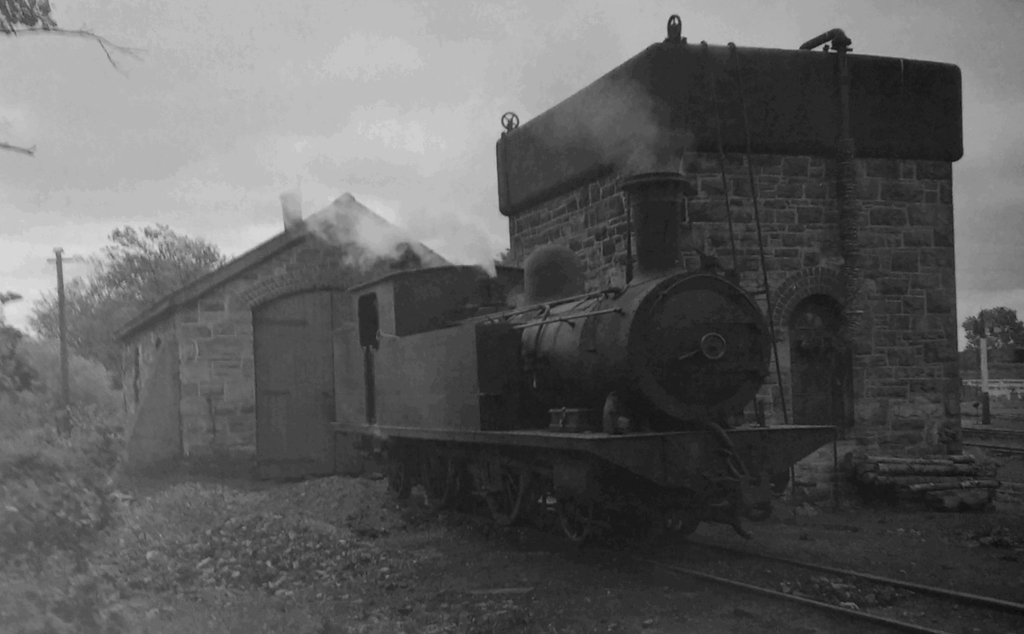
Buildings in the yard included “the slaughterhouse (at the Belturbet end on the down side) and a gashouse. The gashouse equipment lasted until the advent of electricity in the 1920s. Behind the up platform was a green corrugated-iron structure, erected in 1920-22, which housed the loco offices. On the Belturbet side of it stood the permanent-way store, office and shed for the rail cycle; beyond were the permanent-way workshops which existed from 1890 to about 1930. In front of the loco offices were the four roads leading to the works and running shed and, farthest away, the 8,000-gallon water tank, sand store and coaling stage. For many years there was a barn-like coal shed beside the tank but it was removed in the 1930s. Up till that time coaling was carried out by means of 1-cwt baskets which were swung by the coalman up on to the engine foot-plates through the back cab doors, the engine crew completing the delivery into the bunkers.” [1: p131-133]
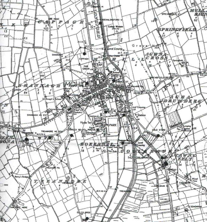
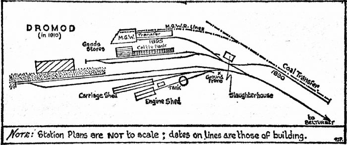
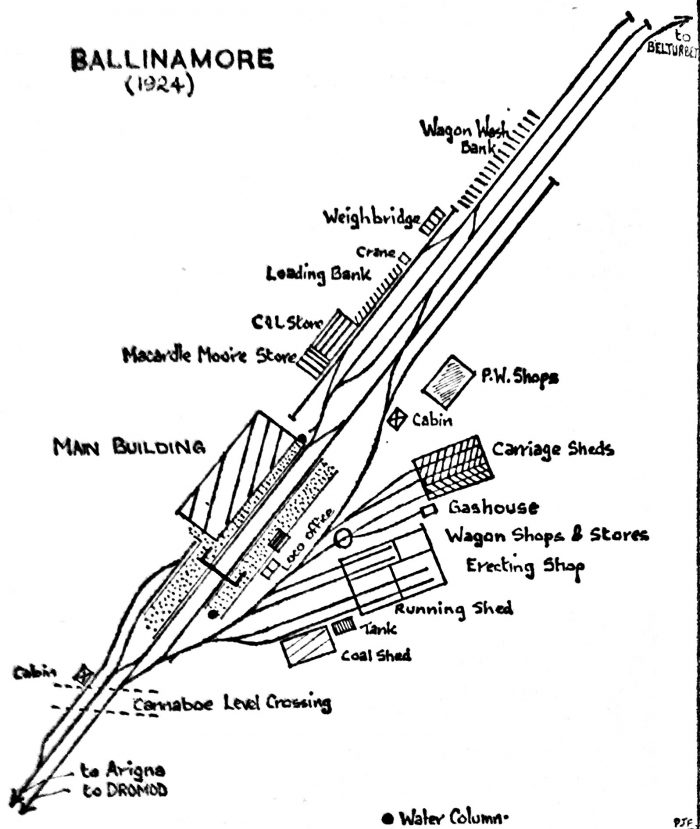 The station layout from about 1894 onwards. Prior to the major alteration of the station in that year, the only route between the loco-yard and goods-yard was via the Cannaboe level-crossing. Until that work was done the tramway loop was too short as it was entirely within the station site. [1: p 132]
Flanagan continues:
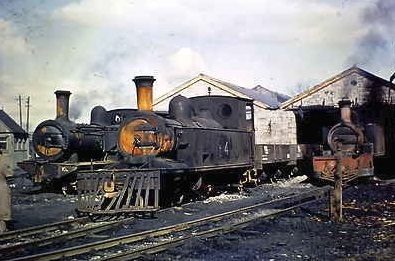
“The works consisted of a two-road carriage and wagon shop (nearer the loco offices) with a similar running shed-cum-fitting shop. However, the former did not run the whole length of the building, the well-stocked stores being accommociated behind. The fitting shops were behind the running shed and thus the complete length was taken up by the locomotive department. Although small, the C&L shops undertook the heaviest jobs and were well equipped. The machinery in independent days included a wheel lathe, a planing machine, drilling machines, another lathe, a punching machine, a shears and a grindstone. Other invaluable facilities were a wheel-drop and a hydraulic pump for testing boilers. The wagon shops had saws, a mortising machine and a timber-boring machine. Power for the works was provided by a vertically-boilered steam engine with 2.25 ins line shafting. The last of many such replacements, a boiler was fitted to this engine in the early 1920s and survived until about 1950, when electric power was introduced.” [1: p133]
As can be seen on Flanagan’s sketch plan above, between the loco-works and the Belrurbet running road was the carriage shed erected by Rogers at a cost of £160. Flanagan says that It was similar to that at Dromod, though extending over two roads. On his skecth it appears to encompass three roads, one of which was accessed via the turntable. This is because it was first decided to lengthen it in 1894 but, instead, the very rarely-used shed from Arigna was transferred and placed alongside the original, a third road being laid which was reached via the turntable. “Both carriage sheds were removed in the late 1930s and the three sidings slowly became part of a wilderness. At the end, the only building down there was an iron shack — ‘The Longford Arms’ — used as a messroom by the permanent-way gangs.” [1: p133]
Also off the turntable was the short gashouse road which was used at rare intervals to bring retorts in or out but otherwise held the accident crane.
Between the gashouse and the back of the shops there was a steel plate mounted on a large stone base. “This was for retyring engine wheels and was in-stalled in 1894, coming from A. J. Taylor of Strabane. Although there was talk of obtaining a special crane for retyring purposes, it was, in fact, the accident crane (so conveniently placed) which was always used.” [1: p 133]
Flanagan continues his description of the station site:
“The main water reservoir was situated at the back of the shops and was known as ‘the dam’. It had a capacity of 35,000 gallons and was supplied originally from a well by a steam pump, Later, the water came from Corgar, and about 1938, when the Ballinamore well had received attention, the pump came into use once more. It was operated from the works’ engine boiler but the town water supply was laid on as an auxiliary source. The pump was used to fill the ‘dam’ as well as the engine-shed tank until 1949 when an electric pump was provided. In earlier days another tank existed at the tramway loop points on the Dromod side of the gates. Near the dam was the works sawmill, a late installation purchased in 1918 at a cost of £10 8s 4d to make sleepers from local timber.
The 24-ft turntable was at the side of the wagon shops. Up to 1894 it had been sited on the loco roads which diverged from the main line just inside the gates, but in that year the layout in Ballinamore was drastically remodelled and assumed the form it had till the closure. The difficulty with the original layout was that if the platform roads were blocked there was no way of getting an engine from the shed to the goods yard. Various suggestions were offered in solution, one calling for a third road between the platforms. The plan finally adopted and approved by the Board of Trade was for the laying of a new loop round past the old site of the turntable and passing between the end of the up platform and the shops to join the running line again. The economical board ordered that the siding points from Adoon be used in the new layout. Until then, too, the tramway loop points had been inside the station gates, making things extremely cramped; now the loop was extended out towards Tully. The big job did much to relieve congestion and from 1894 on there was plenty of room to manoeuvre.
The goods facilities were also improved in 1894. From the beginning there had been a store at the Belturbet end of the down platform and, like all the others, it had a canopy extending over the store road opposite the central doors. Some time after the opening it was extended at the Dromod end by closing up the window and building a corrugated-iron annexe. The new store was specially for the ale and beer traffic of Macardle, Moore & Company of Dundalk, and survived until the end, although for a long time it had been in general use. At the end of the store road were the wagon weighbridge and the weighbridge house. Despite a great fuss made by Mr Lawder in 1906-7 the C&L never had a cart weighbridge at Ballinamore.” [1: p134-135]
Flanagan finishes his description of the station site by highlighting the two earliest sidings beside the store and a third road opposite. He goes on to say:
“Near the store was the cattle bank and in 1894 this was extended to a point near the crane. Shortly afterwards a new line was installed parallel to the store road and, with the others, was later extended for some distance past the store. One, the ‘middle road’, was lengthened in 1902 and had a narrow wooden platform, for washing wagons, built alongside. The final development was in 1919, when a new unloading bank and siding were built at a cost of £176. The crane lasted until the closure, being an 1895 replacement of the original. Opposite the sheds, on the Killeshandra road, were the C&L houses. They were of two types, in two blocks. Numbered and 9-15, the latter group was the larger.” [1: p135]
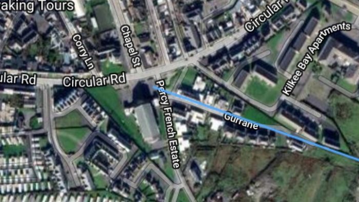
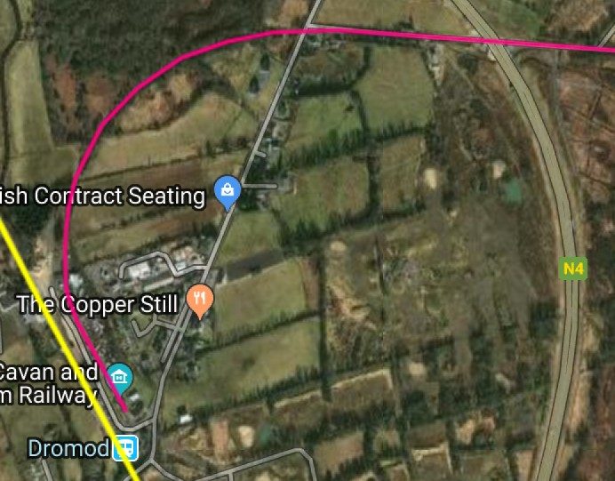
We noted that there is a plan to create a Greenway along the full length of the Cavan & Leitrim Railway from Mohill to Belturbet. The notes written about those proposals describe the length of the line. The plans for the Greenway from Ballinamore to Ballyconnell are as follows:
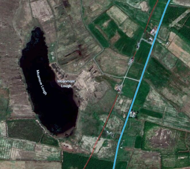
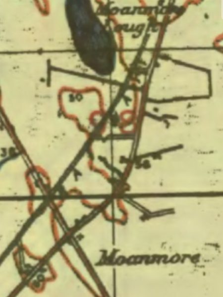
The section starts “at the former St Felims College and Railway station at the northern end of the town, now the subject of a discussion regarding its future. Ahead, there are numerous cuttings and embankments to overcome the challenges of the drumlin landscape with cut stone 3 arch masonry bridges at Drumcullion, Aughawillan and Killyran. The alignment has significant merit because it is shorter than the main road between Ballinamore and Ballyconnell and at least 6.5kms shorter than the canal route. The landscape would be charactised by many low lying small fields, woodland, bogland all in the shadow of Sliabh an Iarainn first and then Sliabh Rushen mountain in Co Cavan. At Kildorragh, 2 kms from the town is the site of an old water tank, still in place. Originally, Ballinamore station got its water from a local well which proved unreliable. The station needed about 15,000 gals of water per day and in 1908 a steam operated pumphouse was build at Lake Bolgonard which pumped to a large tank on the high ground at Kildorragh where it then gravity flowed to the tank at Ballinamore station until 1938. The expanded width of the old railway cutting at Kildorragh is a result of quarrying here in the early years to provide ballast for the railway track. Similarly at Ballyheady and Stradermott on the Drumshanbo branch line, a conspicuous open space is all that remains of former track side quarries which were used to providing rail ballast.
The Greenway crosses the river Blackwater just inside the Cavan County boundary on a fine cut stone arch bridge with a second smaller arch presumably to accommodate a local landowner. All of the route (16 kms ) within County Cavan is in the UNESCO recognised Marble Arch Caves Global Geopark. A Geopark is an area with outstanding geological, archaeological, ecological and cultural heritage. Further ahead is approx 1.5km of asphale paved public road which serves as a qwuiet access road approaching the former Templeport Railway station. The former station house is now refurbished and extended serving as a Resource Centre. The adjacent stone build goods store is intact and the outline of a large land take around the station can be observed. This accommodated sidings used primarily for the Ballymagovern Fair. In the early years, livestock and coal destined for Belfast were the main traffic commodities on the line. Ballymagovern Fair, like Mohill was a major event and occurred on May 23rd and Nov 23rd annually. Up to 100 wagon loads of livestock were traded at each fair and a cattle bank for unloading special trains was provided at the station for this purpose. The Fair declined rapidly in the 1920’s following the political division of the state in 1922. Bawnboy village is situated approx 4 kms from Templeport. This is the location of the Bawnboy Workshouse, a large Victorian structure dating from 1852. Recent studies have been undertaken to identify a viable future for this large building as a local amenity.
Leaving Templeport, approx 3 kms ahead is Ballyheady and the Greenway then follows the Shannon Erne Waterway canal bank for approx 5 km into Ballyconnell marina. Ballyconnell is on the border with Co Fermanagh.” [2]
This description of the Greenway route we have just read highlights key things on the way but by no means provides the detail that we are looking for!
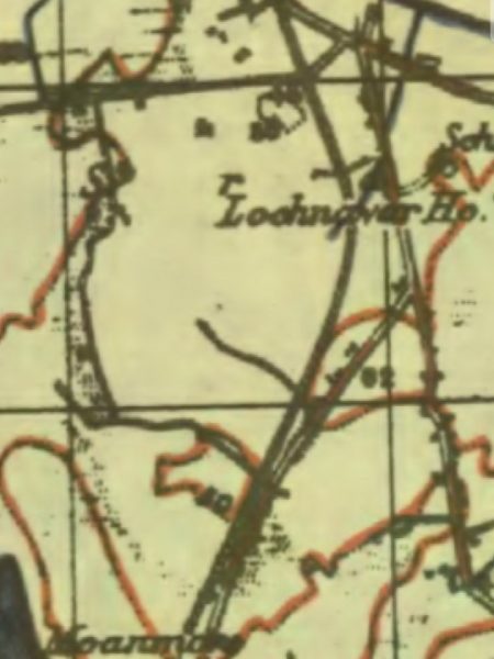
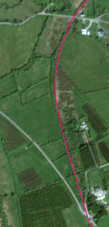
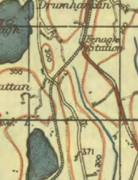
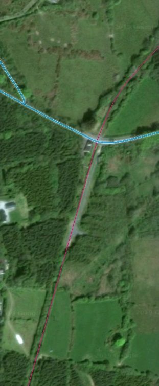
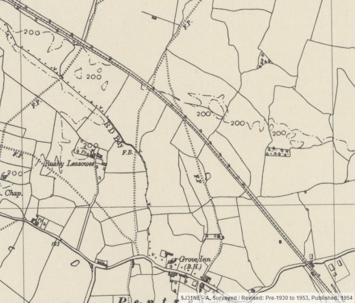
Flanagan is a help in the first instance. He introduces us to the next part of the journey: “Leaving Ballinamore, the line fell slightly and then, out by the outer home signal, swept round to the right, passing on the up side a covered concrete water tank at Kildorough (16.75 miles). The tank was fed from a spring and supplied the occupants of the company houses with drinking water (from a tap at the back of the works), being used till after the Amalgamation. From here, the line undulated mostly at 1:45, with a summit at 17.25 miles where, on the down side, was the Corgar water tank. The line then fell and rose at 1:39 to reach Corgar gates, where it began to climb at 1:44 to a summit, one mile past which was Garadice Halt (19.5 miles). This was another place which had its proposed name rejected — it was originally to be called Aughawillin. Garadice had its buildings and platform on the down side. In addition, the halt, for many years, had a short down-facing siding which was installed for the opening and was lengthened from four to six wagon-lengths in 1889. It was rarely used, however, and was removed about 1940 after an incident in which a train nearly came to grief. A resident had found a way of opening the points and he was won’t to use a platelayer’s trolley to take in the hay. This was done in Sunday’s and all went well until one day the points were forgotten and left set for the siding. The first train on Monday morning nearly came off the road, and after investigation it was decided to remove the siding.” [1: p135-136]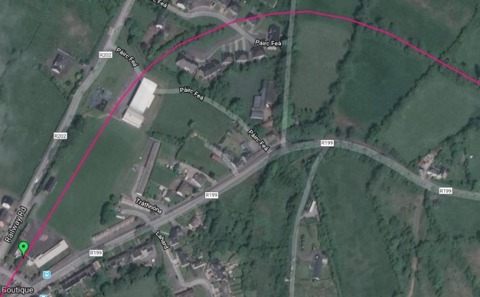 The C&L continued from Ballinamore station (marked with the green flag) and within a short distance curved round from a Northeasterly trajectory to travel in a predominently more easterly direction.
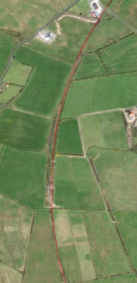
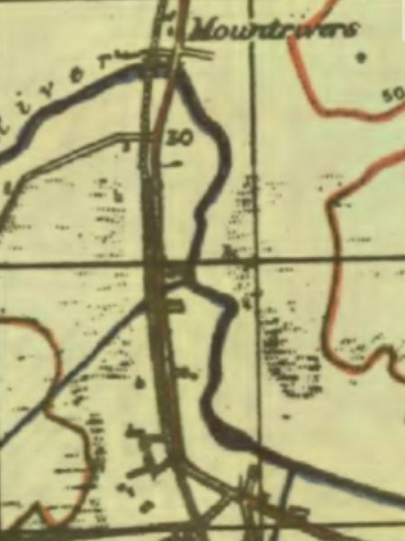
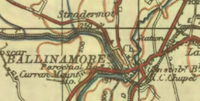
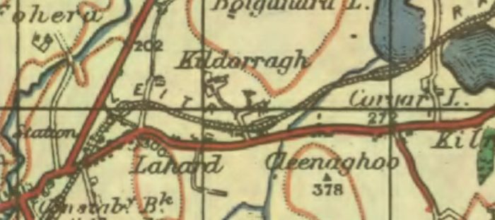 The OS Map extract shows that the line required a number of cuttings in order not to have to take a more meandering path. [3]
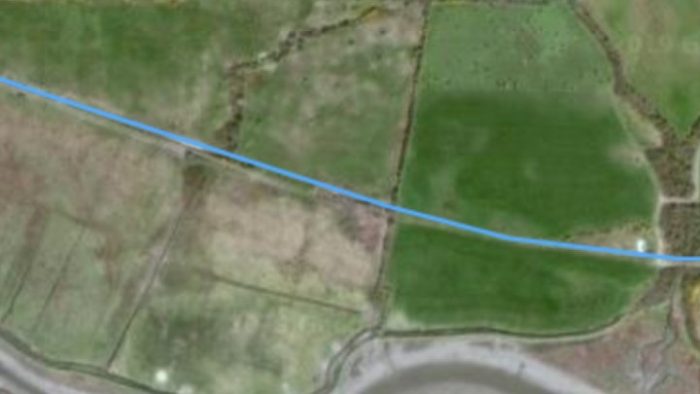
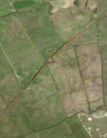
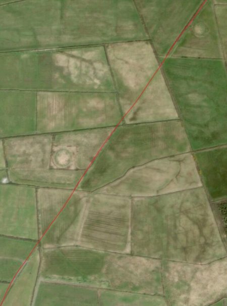
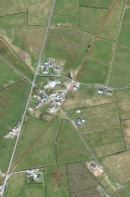
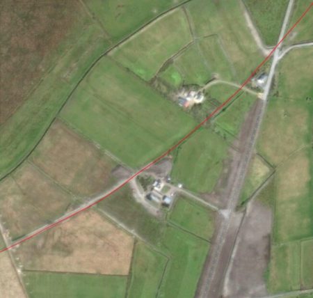
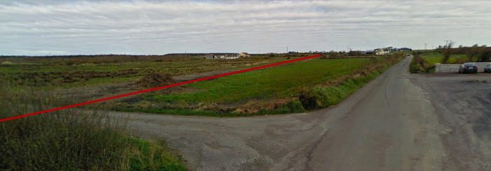
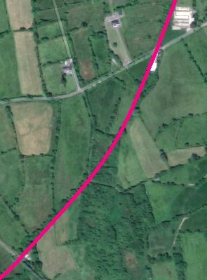
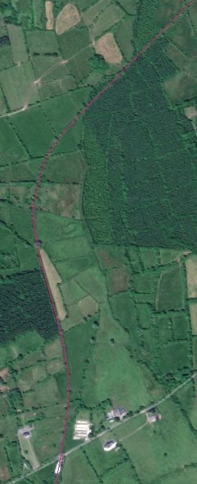
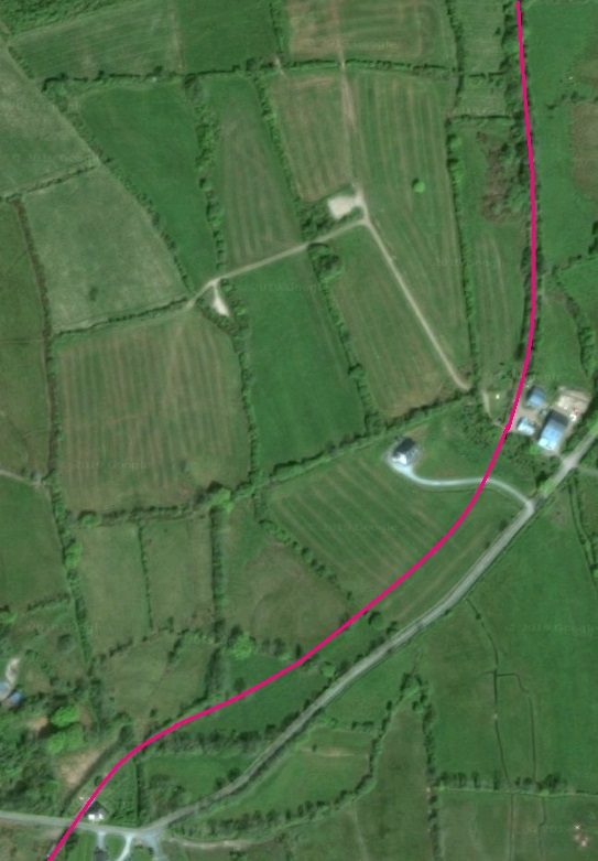
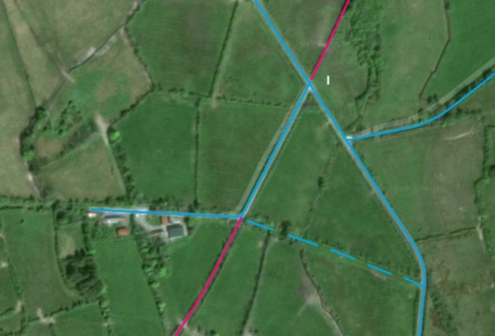
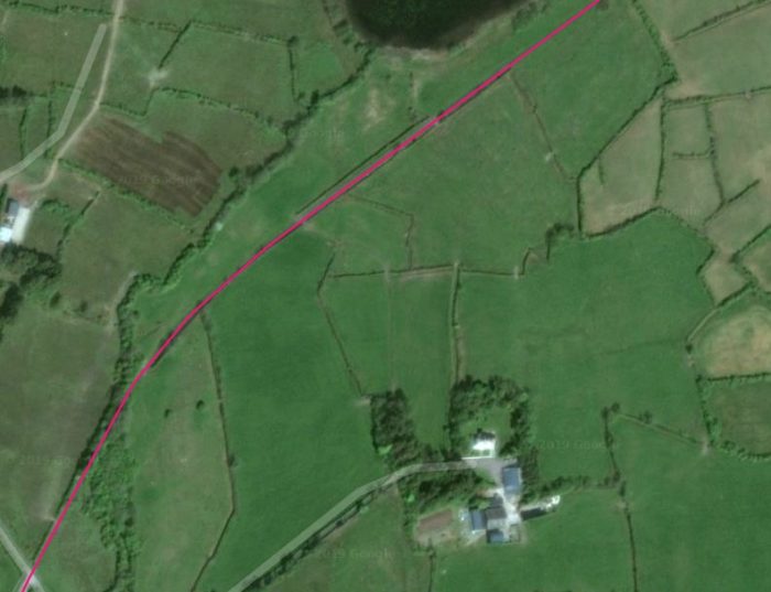
From Ballinamore Station site for just over 2 miles to Corgar Crossing, part of the new greenway was given planning permission in February 2017. The next few images are stills from a drone video of the proposed route which follows the line of the C&L. The video was prepared and uploaded by Desmond Wisley. [4]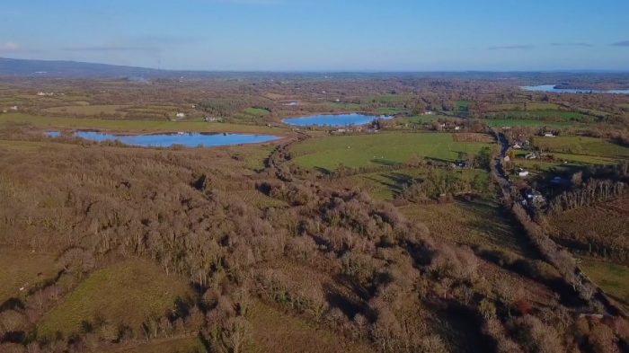 The old railway rote can be identified roughlynin nthge centre of this image as a dual line of trees head for the piece of land between Lough Bolganard and Lough Corgar. [4]
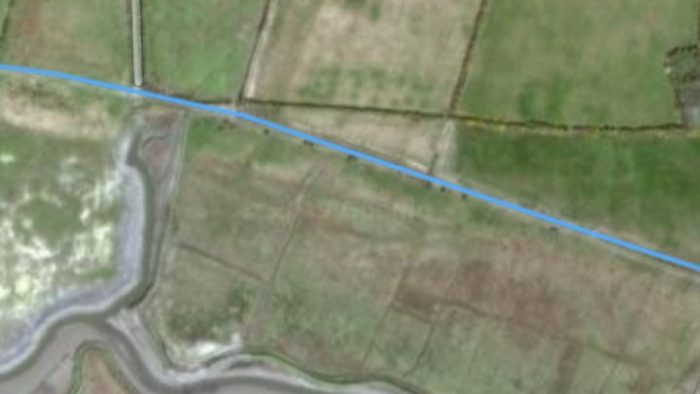
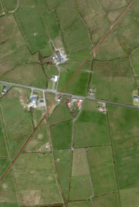
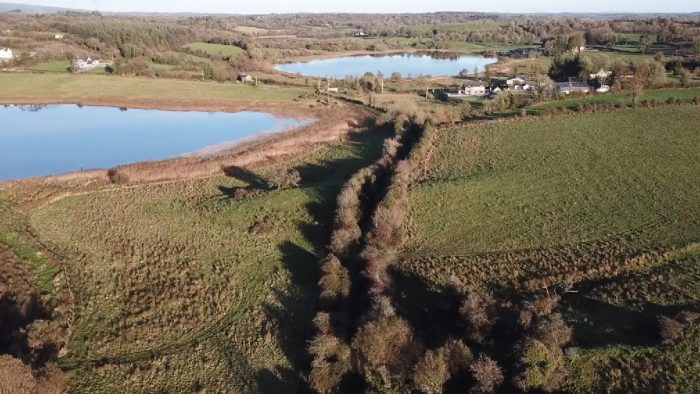 Closer to the two lakes, the line of the railway is much clearer and thge crossing keeper’s cottage can just be picked out. [4]
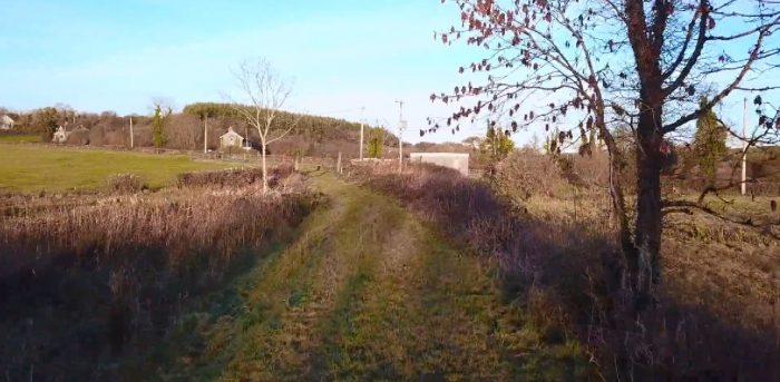 Nearer still but thus time cloise to ground level. [4]
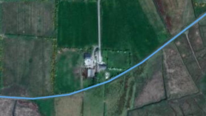
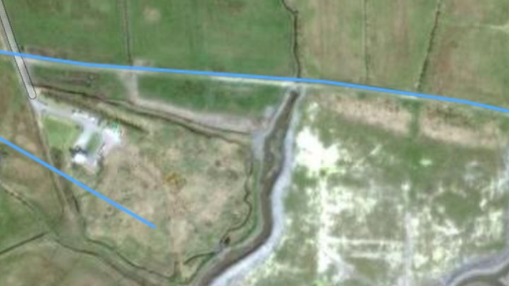
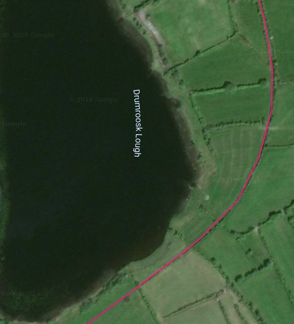
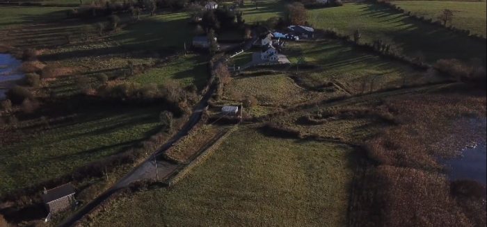 A view of the level-crossing location between the two lakes. The line from Ballinamore entered the picture from the right, just above the lake in this image and curved down towards the bottom left where the crossing keeper’s cottage can be seen. [4]
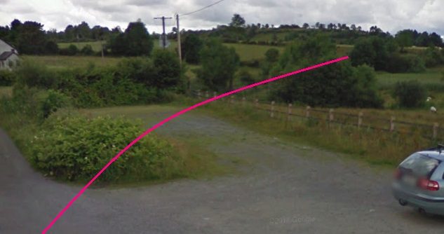 Looking back from the crossing at Corgar towards Ballinamore.
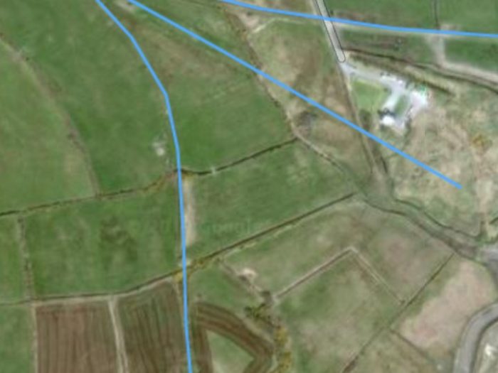
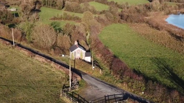 An overhead view of Corgar Crossing looking ahead towards Ballyconnell. [4]
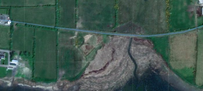
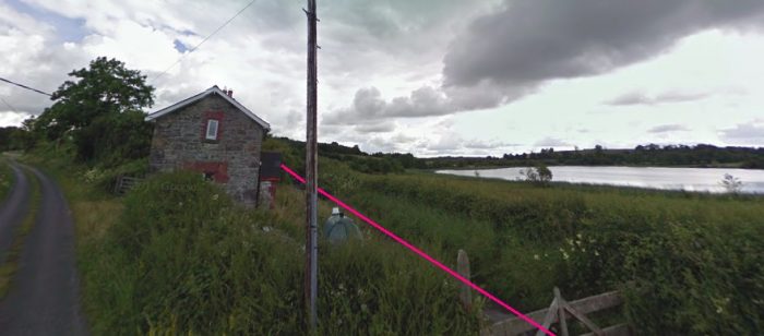 The line ahead. It passes the crossing-keeper’s cottage at Corgar and runs across the North side of Lough Corgar as it heads for Ballyconnell.
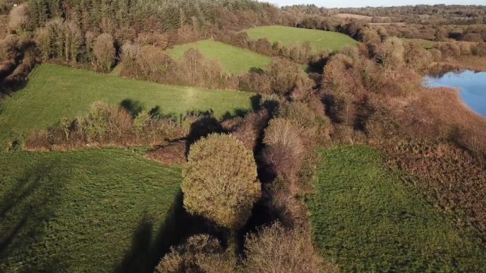 The line ahead across the north side of Lough Corgar. [4]
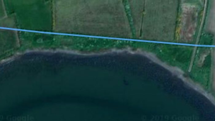
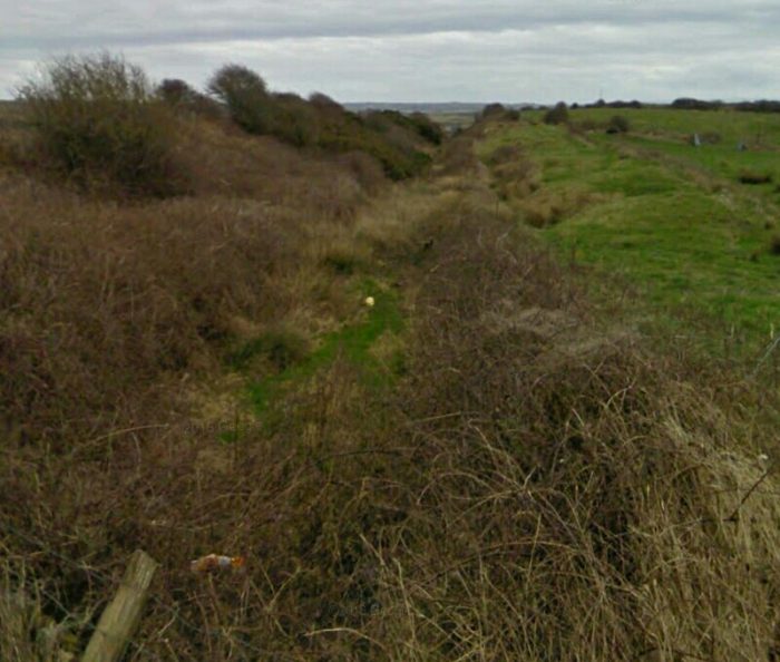
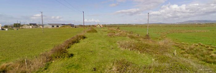
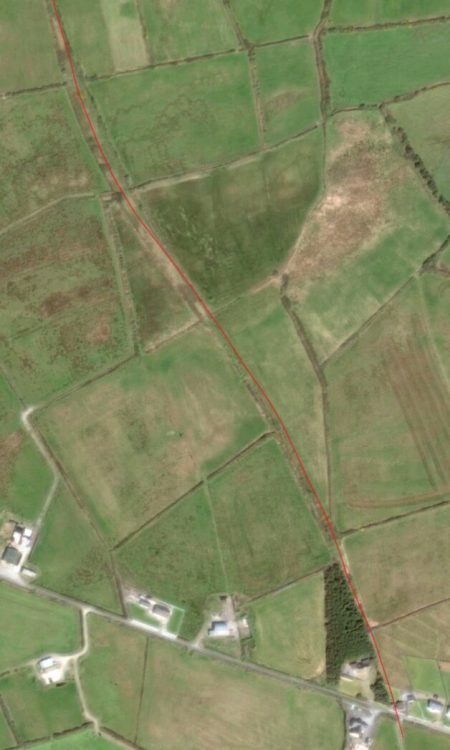
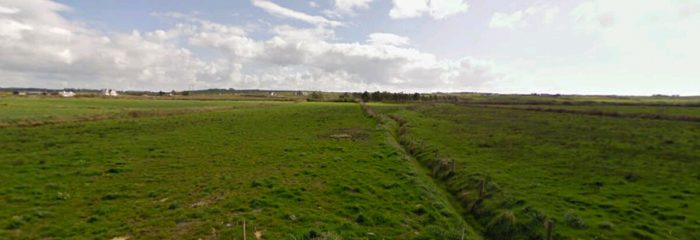
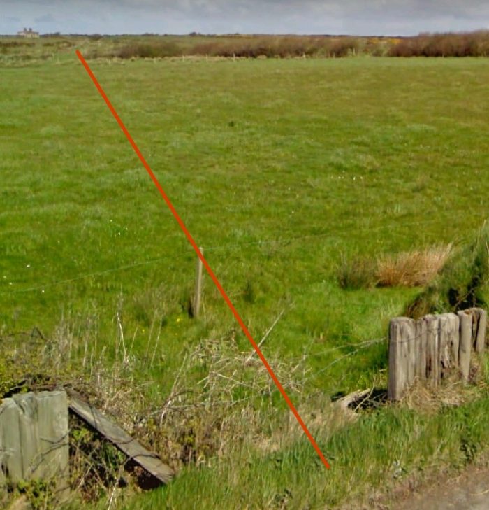
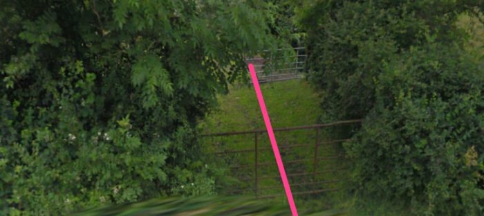
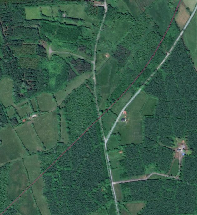
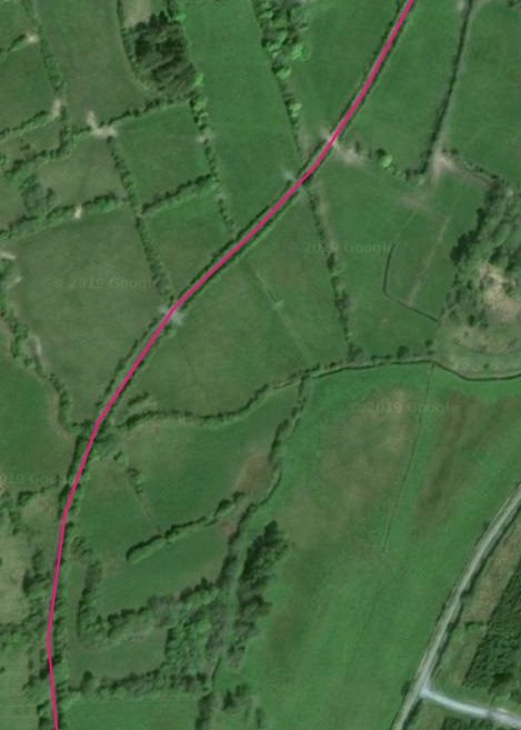
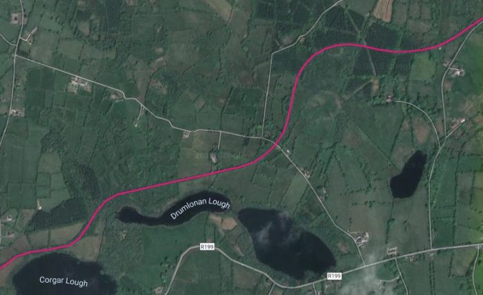 The old line continued across the north side of Lough Drumlonan and then crossed a minor road before curving to the North. The area where the crossing used to be is heavily wooded and it is impossible to be sure of the actual line of the old railway at that point. [5]
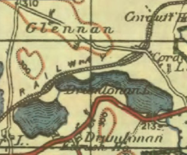 The 1940s OS Map suggests that the line was alternatively in cutting and on embankment as it curved its way on. [3]
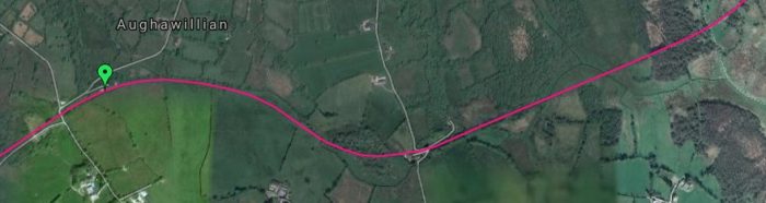
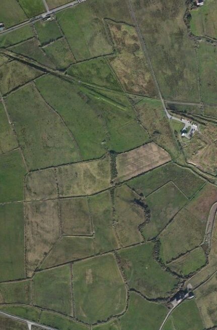
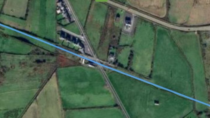
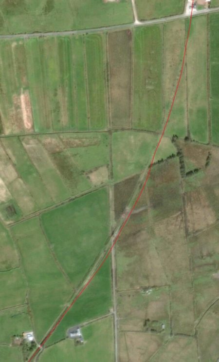
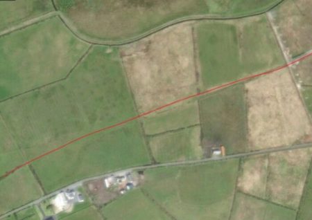
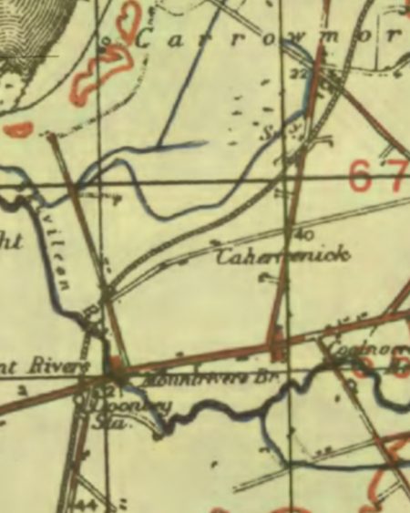
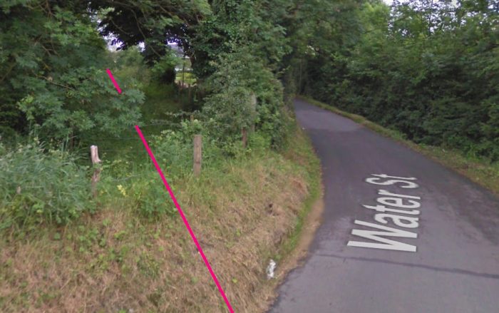
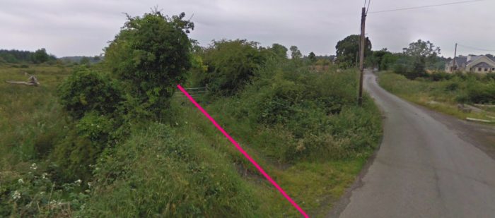
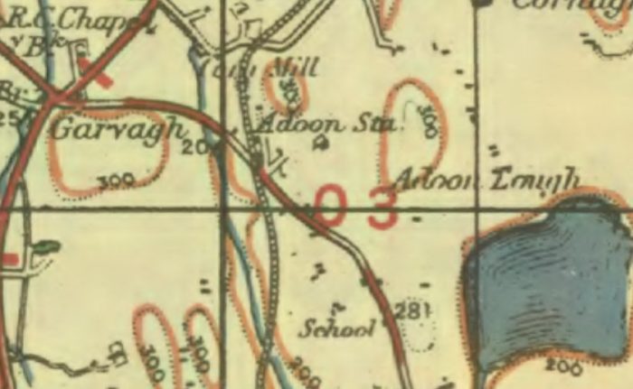
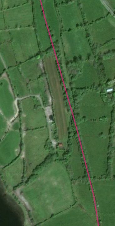
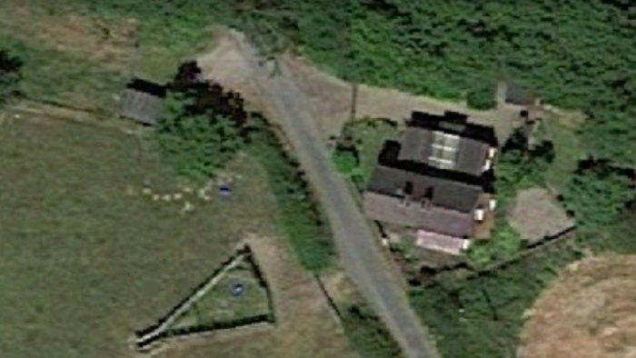
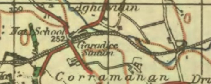 The immediate area around Garadice Station is the next point at which access to the old line is relatively easy. [3]
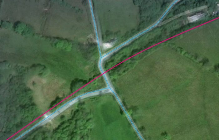 Blue marks the roads and pink the route if the old C&L line. The old Garadice Station building is still visible to the top right of the image.
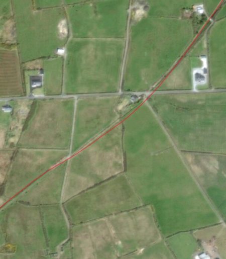
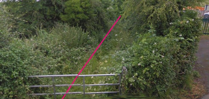
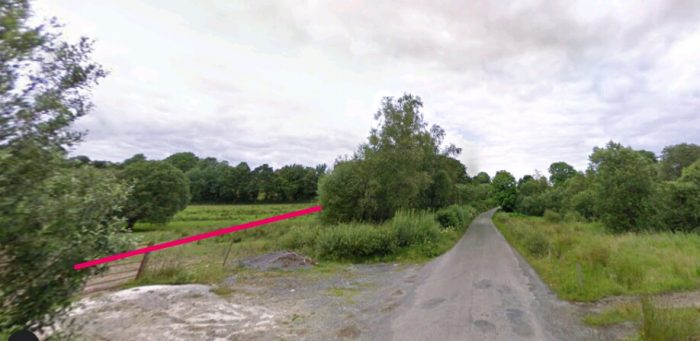 The line of the C&L approaching Garadice Station from the Southwest.
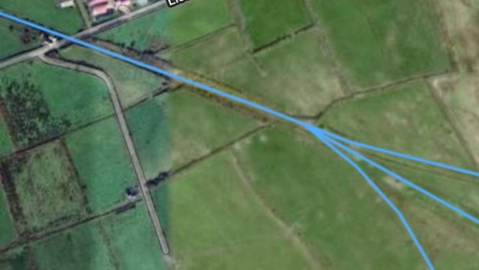
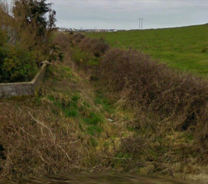
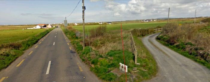
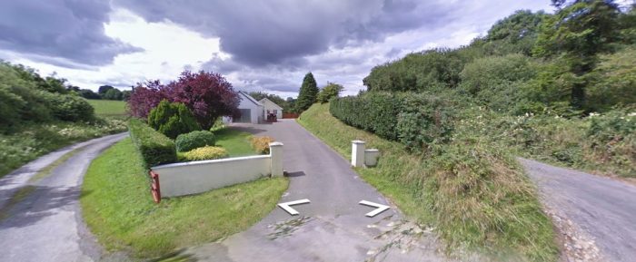
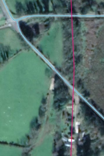
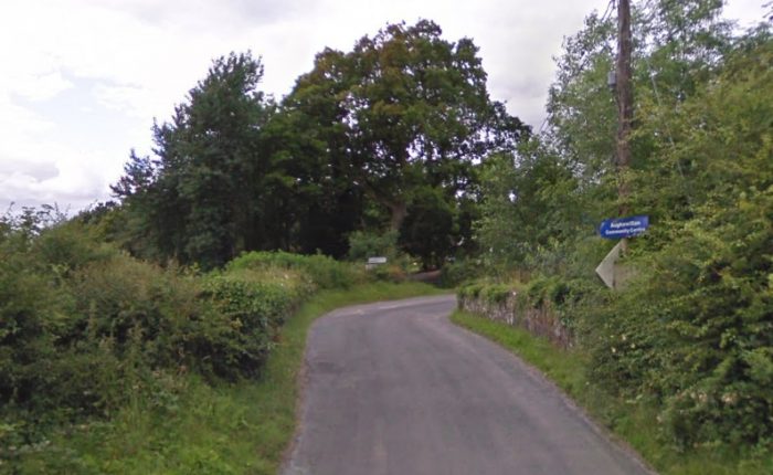 The road crossed the C&L close to Garadice Station. The bridge parapets can still be seen either side of the road.
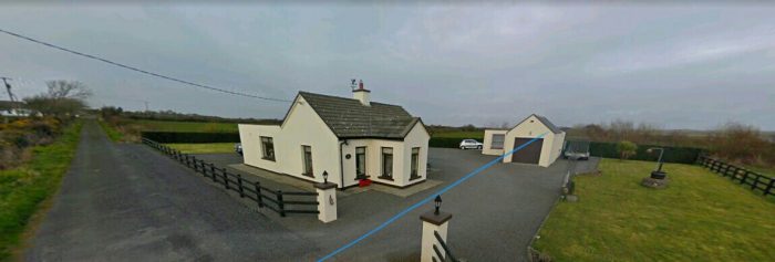
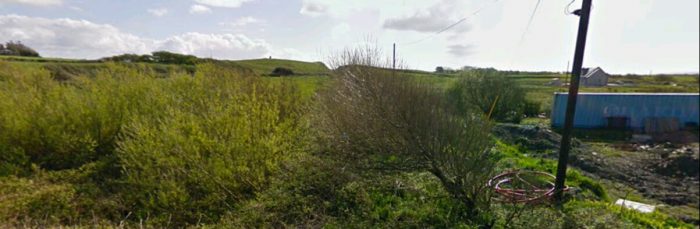
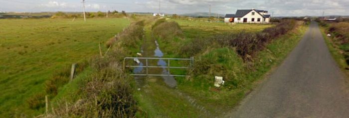
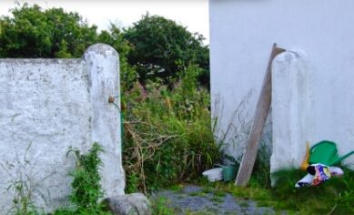
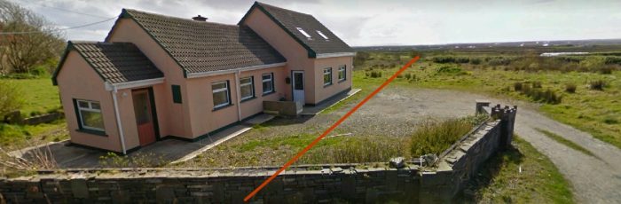
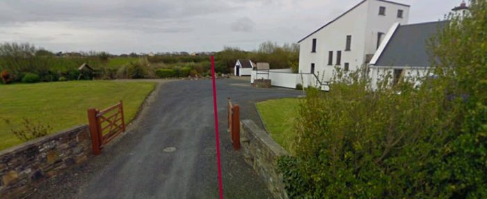
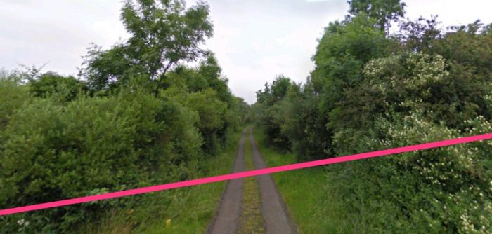
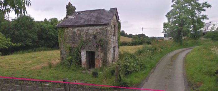
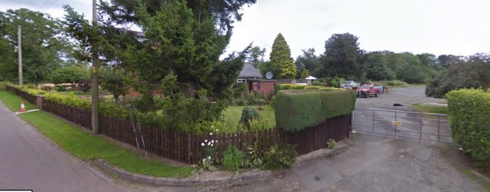
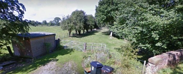
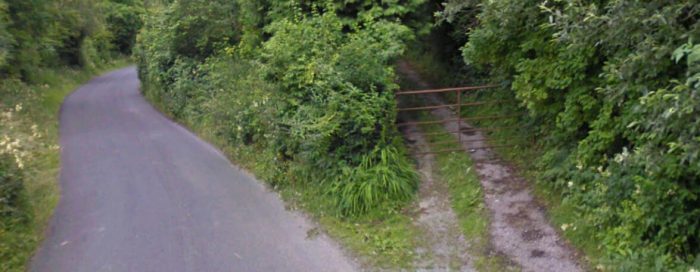 The old station access road is on the right of this Google Street view picture. This area is heavily wooded and without entering private property a picture of the old station building is unlikely to be obtained.
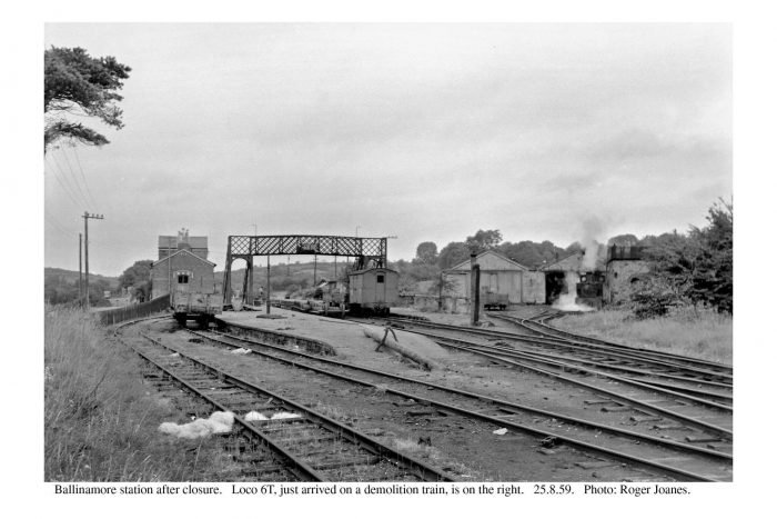
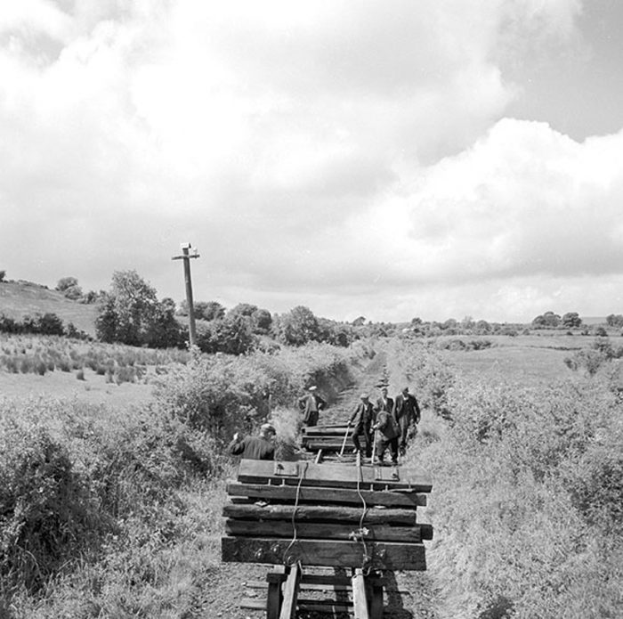 Along the line to the East of Garadice. This picture shows the team responsible for the lifting of the permanent way in 1959. [7]
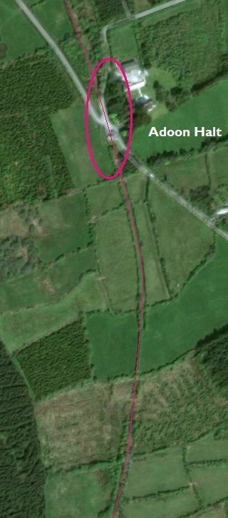
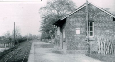
The run to the next halt at Killyran was all of two miles. Flanagan says: “The section to Killyran was mostly downhill, although the halt itself was atop a short 1:46 bank at 21.5 miles. It did not date from the opening; a siding was proposed (for `Killerane’) in October 1887 and it was agreed in January 1888 that not more than £2 was to be spent laying down gravel on either side of the line. Trains then stopped and a low platform on the up side of the gatehouse was later provided. A shelter was asked for in 1893 and was erected five years later, but the place was to remain without goods facilities of any form.” [1: p136]
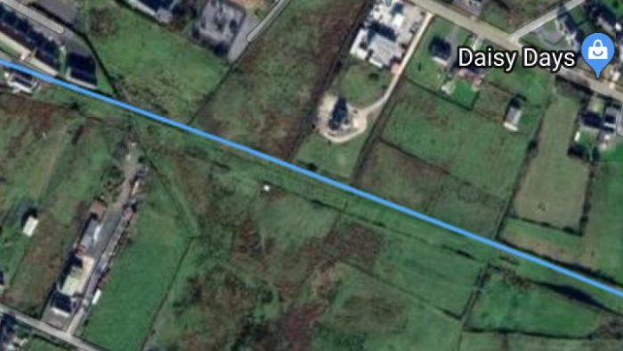
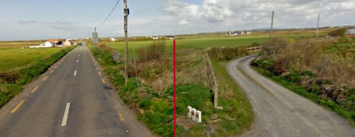
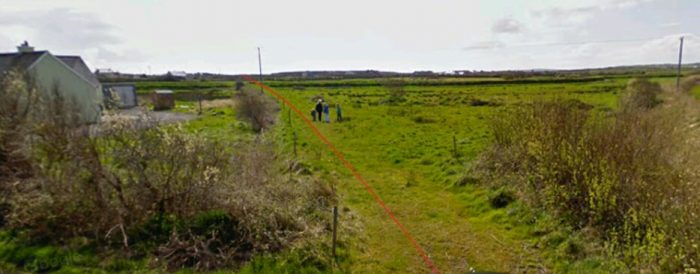
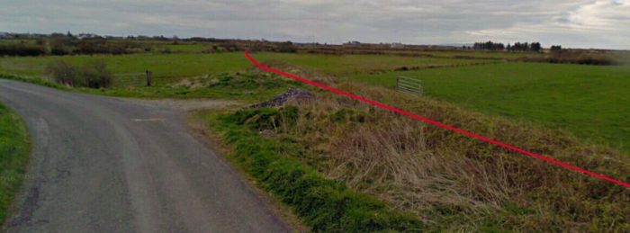
But we are getting a little ahead of ourselves. The next point where the route of the old railway is accessible is the first road to the East of Garadice station which is shown below in a close-up from the wider satellite image above. The location is on the right side of the OS Map extract above.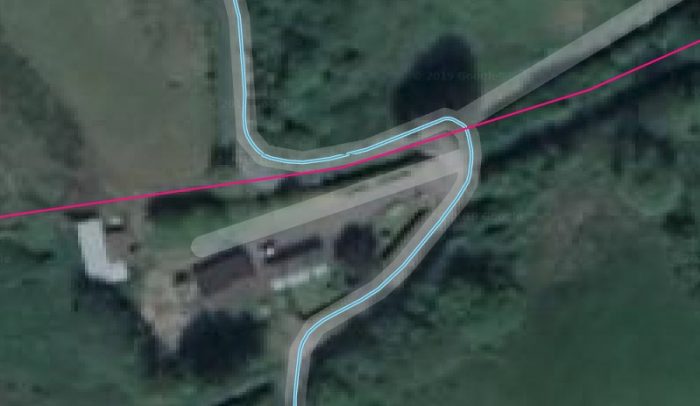
 This Google Streetview picture is taken at the apex of the hairpin bend on the road in the above image. The C&L followed the approximate line of the verge/hedge alongside the arm of the road on the right of the photograph, and crossed the road at the hairpin bend.
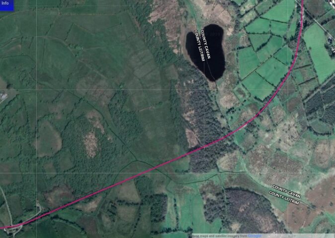
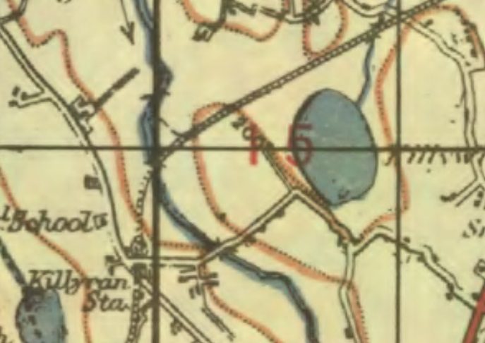
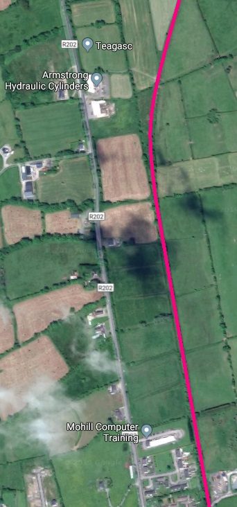
 The line continued East-northeast across the border between Co. Leitrim and Co. Cavan. It then swung round to the North and entered Killyran Halt/Station. [5]
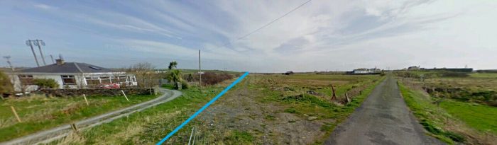
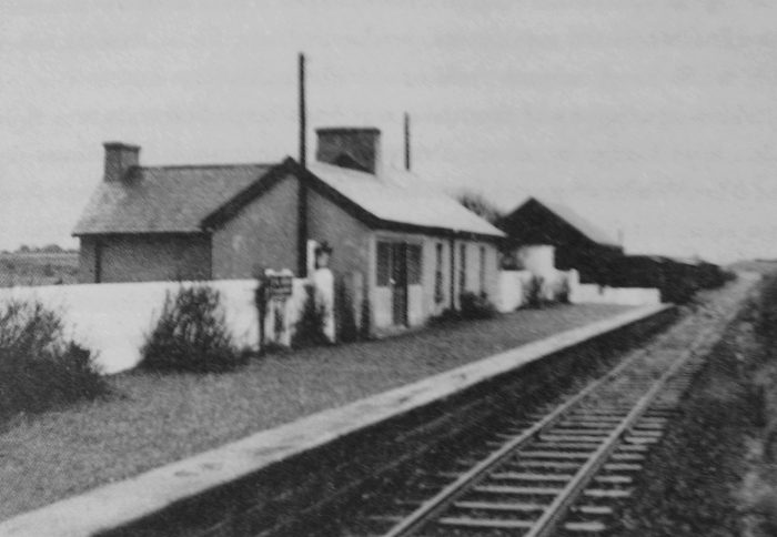
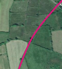
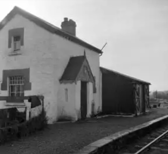
Killyran Halt appears on the adjacent closer satellite image just below the lower of the two roads (blue) shown crossing the line (pink). [5] The old line passed through the site of the Halt as shown , just a little to the West of the access road shown on the adjacent satellite image. Its line is shown approximately in the picture immediately below, which looks from the Crossing location back down the route of the line towards Ballinamore.
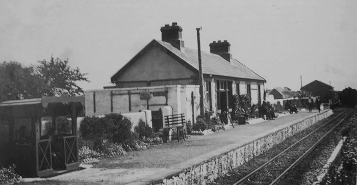
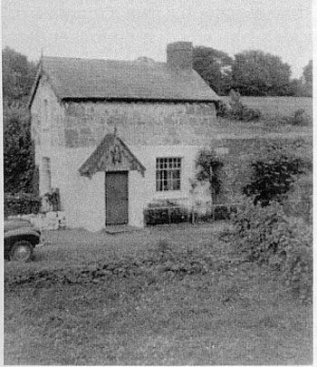
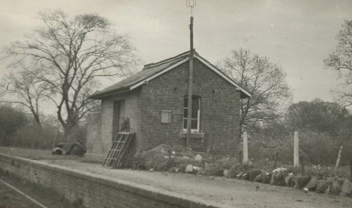
The monochrome image here shows the halt building at Killyran. The line itself is not visible in the image.
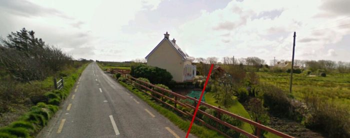
Bill Gerty includes this image ina story he tells about the first 17 years or so of his life in this part of the world. [8] He says: “I remember going to Killyran for the very first time when my father took me up there on the crossbar of a cycle which he must have borrowed from someone. He did not stop there with me but left me to play with Ernest who was three years older than me. Apart from Ernest the only other person there at that time was Grandfather Gerty. He was quite old and not very tall with white hair and a white moustache and had a walking stick. The only words he ever spoke to me was “don’t touch that” referring to me fiddling about with a bicycle leaning against the wall. Ernest was digging a big hole in the garden and filling it with water, he tried to get me to help him but I was far more interested in a clockwork engine that he had in the kitchen. Looking back I think now that everyone else had gone off to a 12th July parade. It was while we were playing in the garden that this great monster came along puffing smoke and steam everywhere. It was the first time that I saw a steam train and I stood there frozen to the ground. This was the very first of very many encounters that I was to have with steam trains.” [9] Killyran: the view back towards Ballinamore in the 21st century.
Later Bill Gerty says: “There were now nine of us living in the little railway house, Grannie, Uncle Eddie, Auntie Louie, Ernest and the six of us – Vera, Maisie, John, Muriel, baby George and myself. The station had just three rooms and a kitchen, all the boys slept in one room and the girls in another room upstairs. The small room downstairs next to the kitchen was kept just to put anyone in who might be sick, otherwise it was used as a storage room. There was no gas, electric or running water. A turf or wood fire had to be lit every day in the big grate in the kitchen. All the cooking was done on this including the food for hens, ducks, turkeys and usually one pig. Although Killyran was just a small station it had quite a bit of land all around it. Outside buildings included a turf shed, goat house, chicken and hen house, one pig house and a cow-shed which could house up to three cows.” [10]
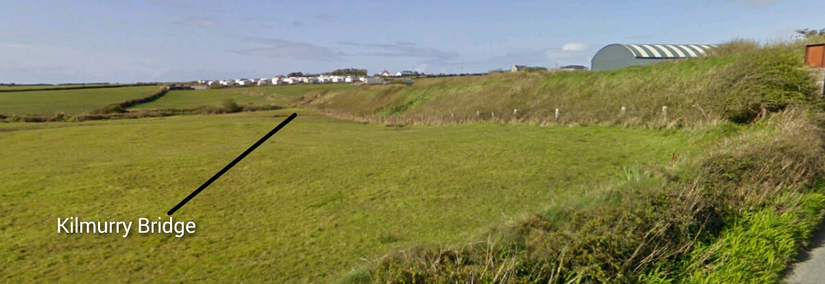
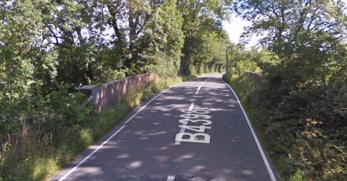
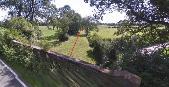
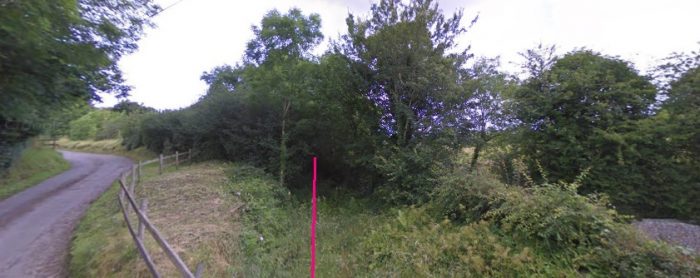 After the Crossing at Killyran the line headed a short distance North to a road-over bridge, no more than a couple of hundred yards ahead. The road to the left of this image climbs relatively steeply to a junction where it is joined by another road also climbing relatively steeply over the C&L line.
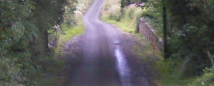 This view looks back down that second road towards the East. The bridge parapets can easily be picked out.
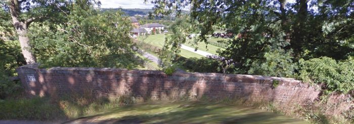
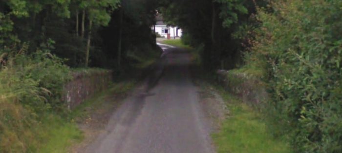 This view shows the same road, looking in a westerly direction towards the road junction. Again, the bridge parapets can easily be seen.
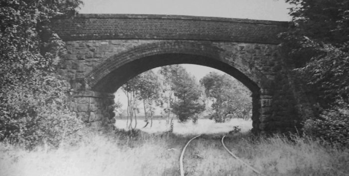
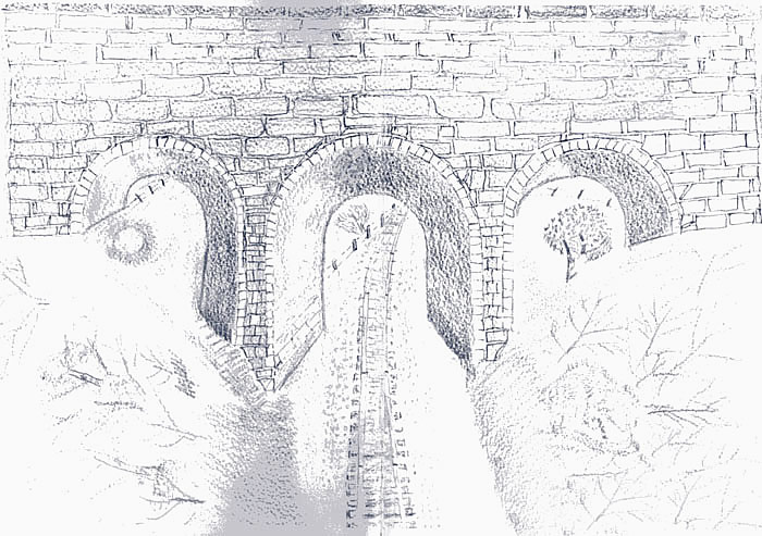 Bill Gerty’s sketch of the bridge at Killyran which forms the cover picture of his short book. [11]
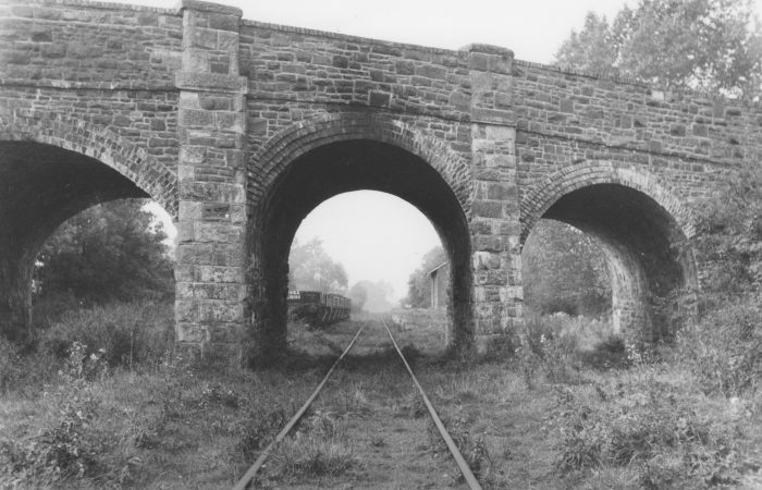
Bill Gerty comments: “One of the jobs we had to do each evening was to walk down the railway embankment to the railway bridge, which was about two hundred yards from the station. The bridge had three arches and under the left hand arch there was a small well, this was our only drinking water supply. … We carried a white enamel bucket of water each back home which were placed on a couple of stools in the kitchen. Edna used to arrive at the station every evening also to collect water and have a chat with Louie. Most of Grannie’s time was spent looking after John, Maisie, Muriel and George. Aunt Louie done nearly all the baking and cooking. Uncle Eddie worked on W. Goodwins farm, at this time a short journey away. My other uncle John was married to Auntie Sarah who lived in a little cottage, with their daughter Edna, just the other side of the school on the Boley road. Uncle John was a ganger on the railway and was responsible for looking after a section of railway about three miles either side of Killyran Station along with another man called Bertie White.” [11]
Bill Gerty continues to tell his story:
“Trains ran past our station six times each day except on cattle fair days when special trains were put on. The first train ran from Ballinamore to Belturbet around nine each morning and returned at eleven, then one at midday, one at four which returned at seven in the evening. Auntie Louie was the station halt master who issued all the tickets, was responsible for keeping books, stock of tickets, the waiting room, closing and opening the gates across the road. As the station was just a halt, trains had to be flagged down, red flag to stop and green to carry on. There was also a lamp for night work using same colours. The cash for all tickets sold on a daily basis had to be put in a leather bag which had a brass plate on it with the name of the station, Killyran stamped on it. There was a book with all the daily tickets sold recorded in it and this was strapped together with the cash bag and sent daily to head station Ballinamore, it would be returned on the same day. As the trains only stopped when requested, you had to take the cash bag and book out on the platform where the guard would be positioned between the guards van and the carriage, usually hanging on by one arm, you then had to approach the moving train and hand the guard the cash bag. The trains were supposed to slow down at this point but sometimes they forget and this became a hair raising experience, if you were not in the correct position (if there was one) there was a danger of being pulled into the train.” [12]
“Everything revolved around the train and the railway. For this work, Auntie Louie got a rent free house and quite a bit of land about three or four acres in all and three shillings (old money) per week. People arrived for the trains carrying all sorts of things chickens, eggs, horse harness etc.. Some got their tickets and went into the waiting room while others just came in and sat down in our house. We always had to make sure that as far as possible no chickens, ducks, turkeys or any of our goats were near the line when a train approached, for this reason our two goats were tied on long ropes where their grazing area was changed on a daily basis when we milked them.” [12]
“At the back of the station we had a turf shed, goat house, chicken house, cow byre and pigsty. There was a big garden to the right of the house where we grew cabbage, onions, beetroot, strawberries etc., there were two apple trees and various fruit bushes. On the front of the house there were two gardens in one, we grew peas and beans only and in the other one we planted our early potatoes. A piece of land just below the station was called the Blackpiece, I think this was because of the colour of the soil. We used this land for hay making although we did grow wheat on it one season.” [12]
“On the downward side of the station there was some more land near the railway bridge over the Blackwater river this was also used for hay making, in all we could make enough hay to feed all our animals over the winter. As there were no trains on a Sunday we let our animals graze these areas up to the end of April. Ernest and me done all the garden work around the station, until Ernest got a job on the railway, then it was John’s turn to work with me. Eddie helped when he could at that time he was still working on Goodwin’s farm, later on he had a job on the railway but he had to live away from home, he done all the buying and selling of the animals.” [12]
“As the family grew Eddie was spending more and more time at home, the gardens around the house were not able to supply enough food so we had to grow a field of potatoes on Fees land also a field of oats. Our supply of turf also came from his peat bog.” [12]
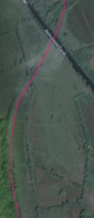
 Beyond Killyran and its road bridge the line crossed the River Blackwater a short distance further North, and as it did so turned once again towards the Northeast and passing Lough Killywillin on its North side.
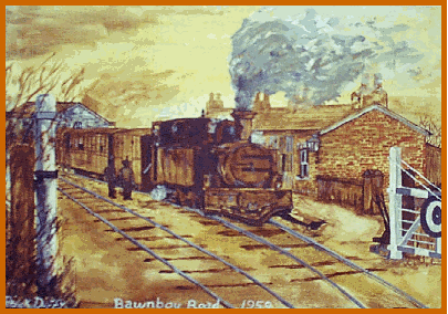
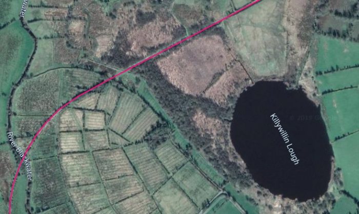 The old line passed to the Southeast side of Lough Templeport and then turned relatively sharply towards the Southeast. As the line turned through a relatively tight curve it approached Bawnboy Road Station which can be picked out just to the East of Lough Temple port on the satellite image below.
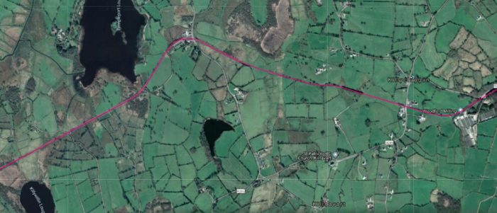
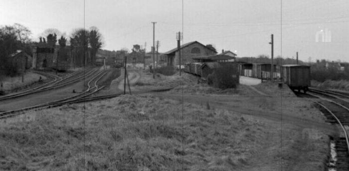
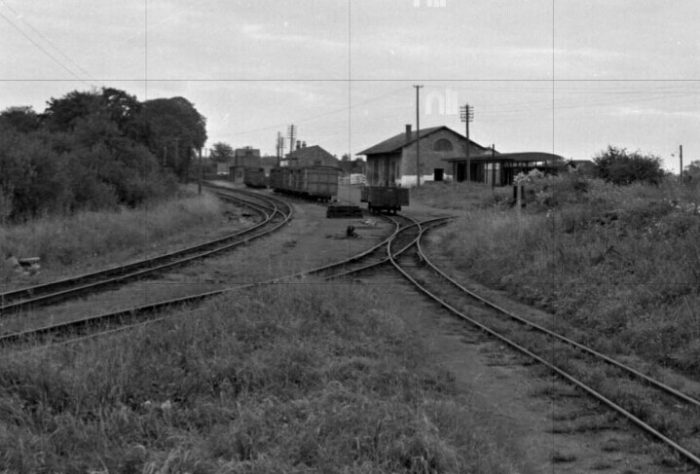
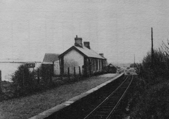
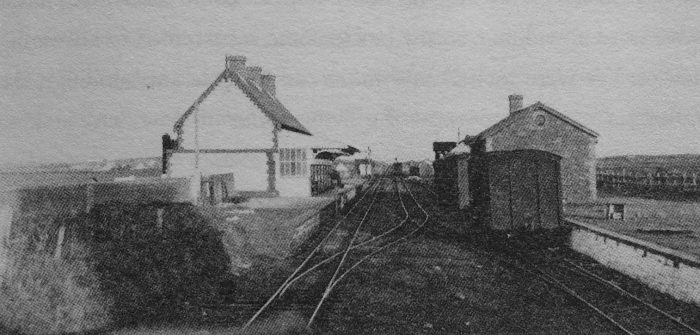
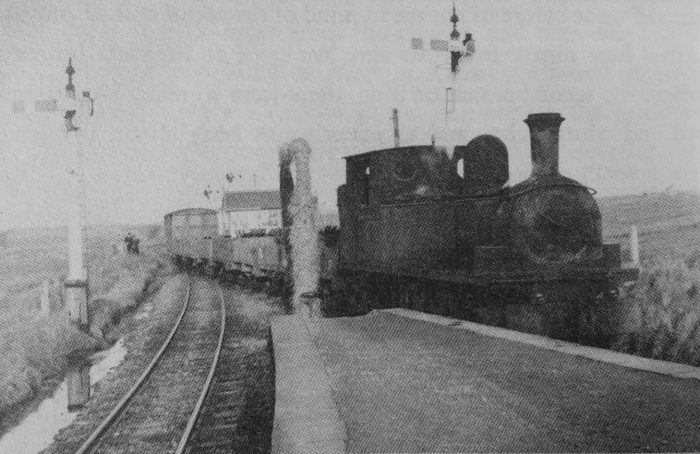
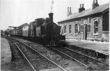
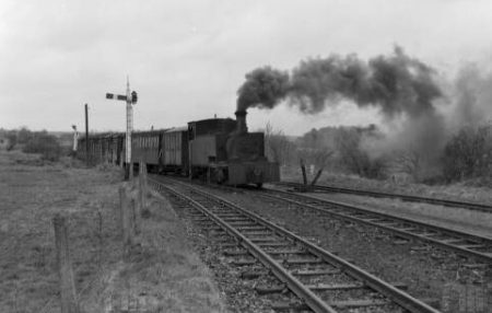
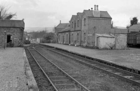
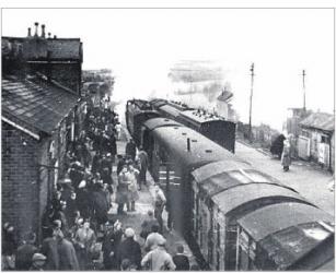
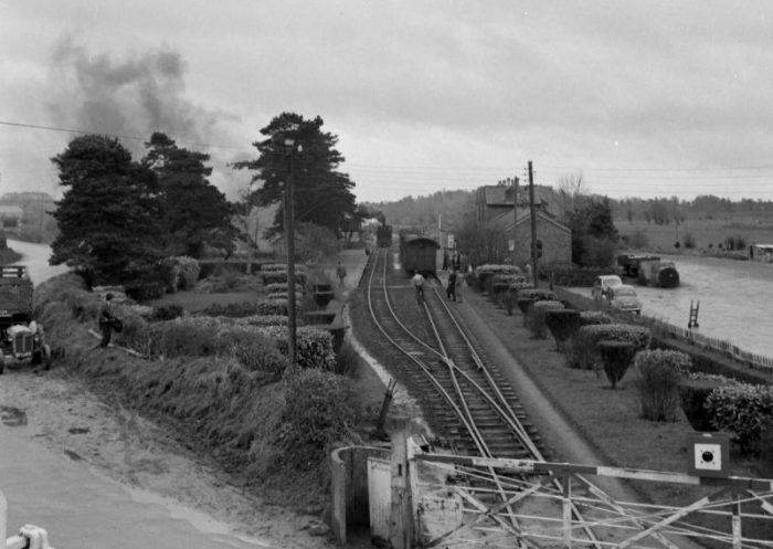
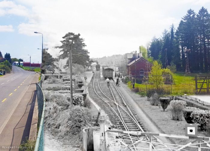
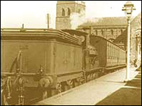
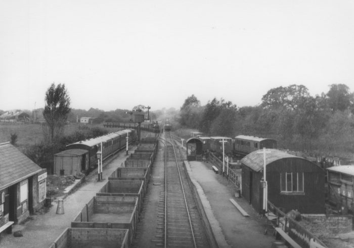
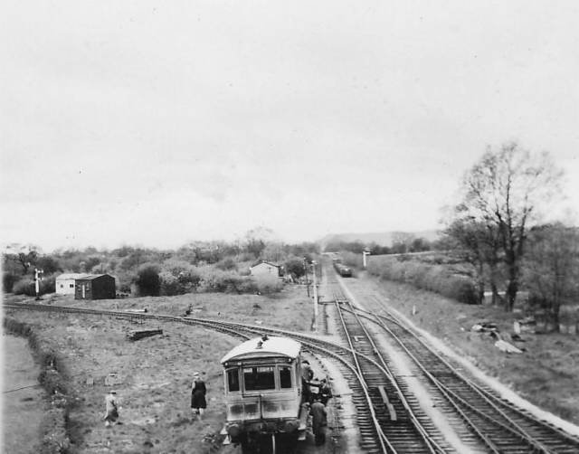
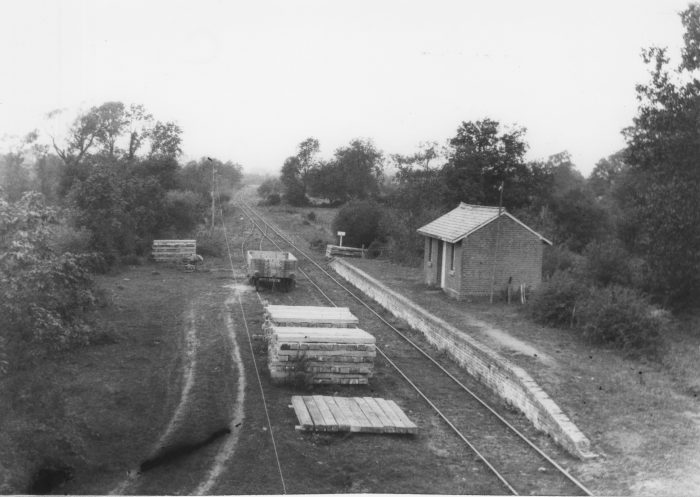
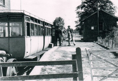
 Bawnboy Road was intended to become a junction station on the C&L. However, partition prevented that happening as the intended branch headed North from the East end of the station to Maguiresbridge. The first two monochrome images immediately below show Bawnboy Road Station in the 1950s. The train, in both cases, is heading for Belturbet. [13][14]
 Flanagan says: “Beyond Killyran the line was again level to Bawnboy Road (23 miles). This was a Class 3 station (allowance £60), and although always a block post it was not at first a crossing place. The idea of making it one was first discussed in November 1887, but it was noted that it would be ‘most difficult though possible’. The original platform with the red-brick building was on the down side and a narrow up platform was added in 1897, when a crossing loop was installed. The naming of the station caused much hard thought at first. In July 1887 it was decided that `Templeport station nameplates (were) to have the words “for Bawnboy and Swanlinbar” in smaller letters’. The following month a letter was received from the clerk of Bawnboy Union stating that the name should be `Bawnboy Road’ and it was agreed that, if not too late, the nameplates should be altered. But too late it was, and the station opened as `Templeport’. The actual name adopted and used till the 1930s (on the nameplates anyway) was ‘Bawnboy Road & Templeport’ and the station did not get its proper name until GSR days. The goods facilities consisted of a store and a loop with a very short loading bank.” [1: p136]
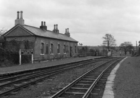
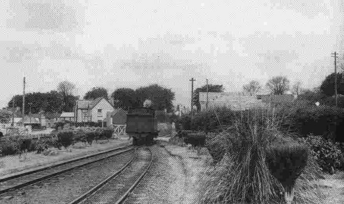
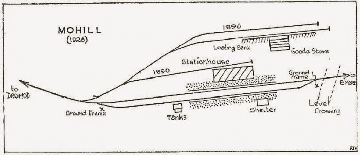
In the monochrome image above a train is seen approaching the station from Ballinamore, In the adjacent image the station is seen as part of a view looking across the road crossing towards Ballyconnell. [16]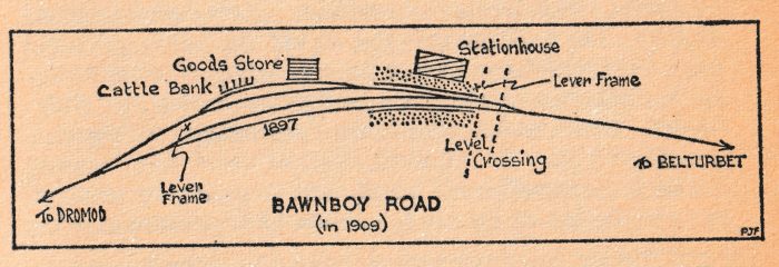 After 1897, the layout at Bawnboy Road Station consisted of three loops, one on top of the other; this was somewhat simplified by the removal of one loop about 1950. There was a small water tank beside the store served by a hand-pump, which went out of use when the heavy Ballymagovern Fair traffic died away. The signalling history of the station was complicated, and though at one stage there were no signals at all, in latter days there were two ground frames — at the gates and near the store. [1: p137]
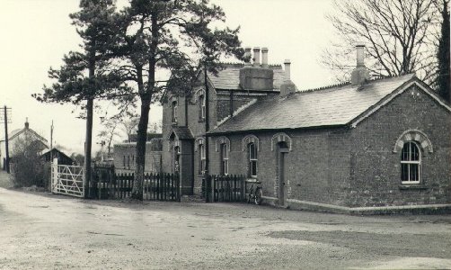
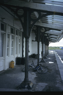
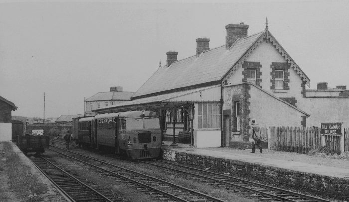
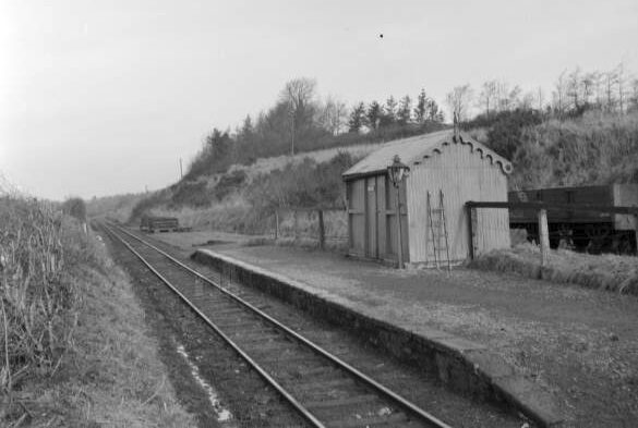
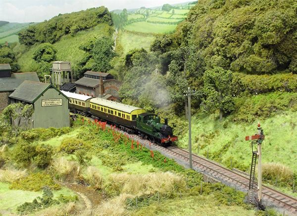
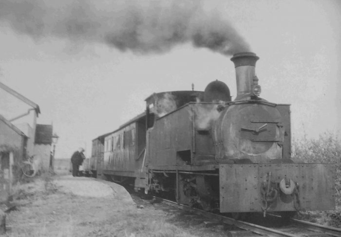
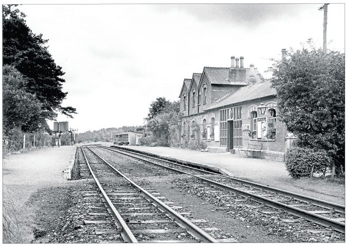
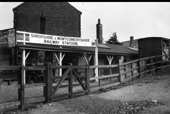
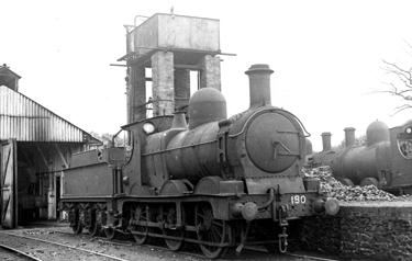
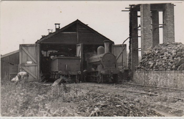
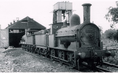
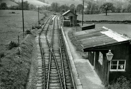
In 1891 Bawnboy, had no signals at all. It was suggested that two should be bought cheaply from the GNR or MGWR and, later, the place was well signalled, including a real oddity in its down starting signal. This was basically a disc on a long rod about four feet from the ground, having a horizontal signal arm fixed just below the lamp. When ‘off’, the arm was not visible to the driver, as it had swung through 90 degrees. [13]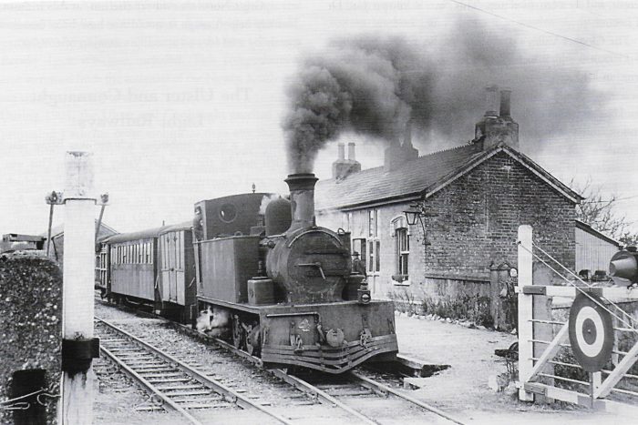 I think that this is the best image that I have found of Bawnboy Road Railway Station (c) Phil3105 on the forum ‘Irish Railway Modeller’. [17]
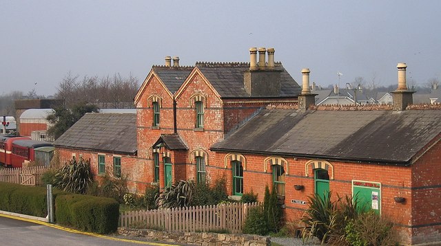
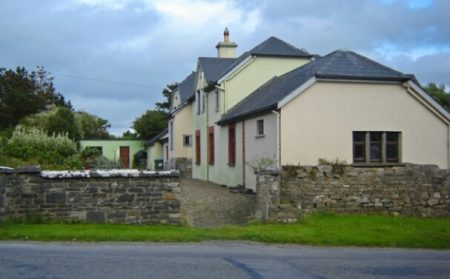
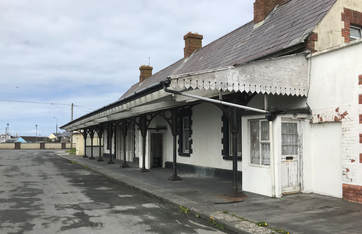
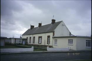
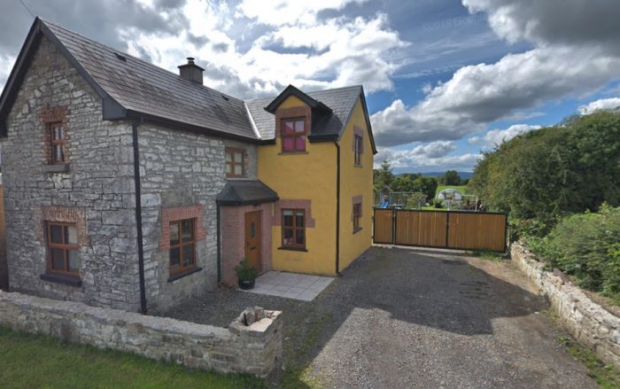
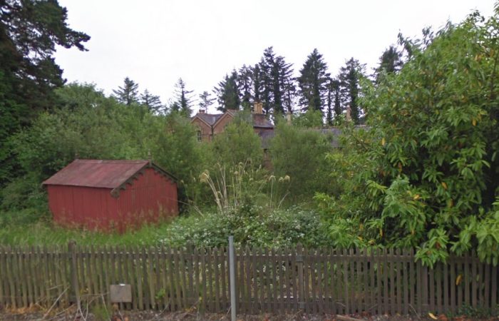
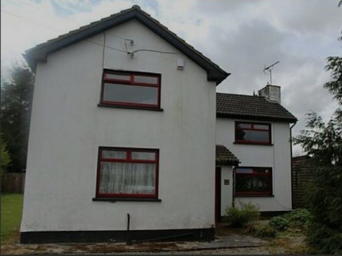
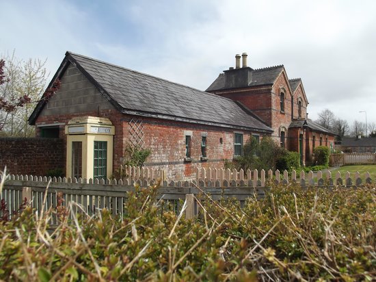
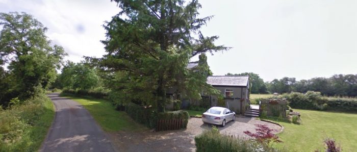
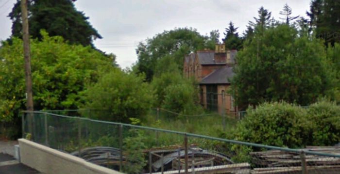
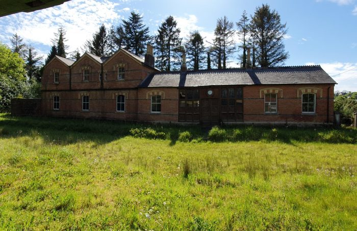
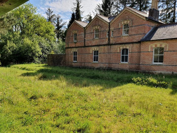
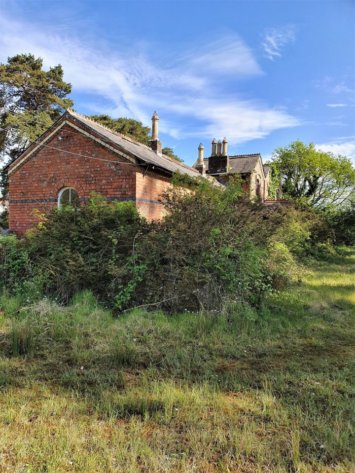
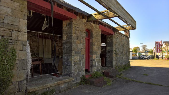
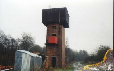
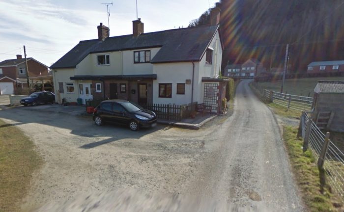
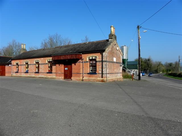 Bawnboy Road Station Building in 21st Century. It was in use as a community centre for many years after the closure of the line. The centre has now been extended and the old station building has been refurbished, © Kenneth Allen . [15]
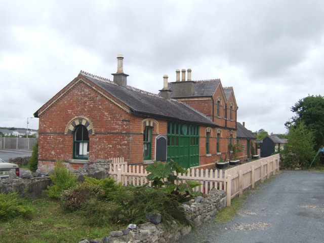
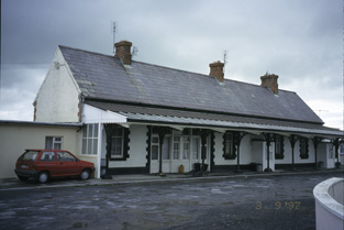
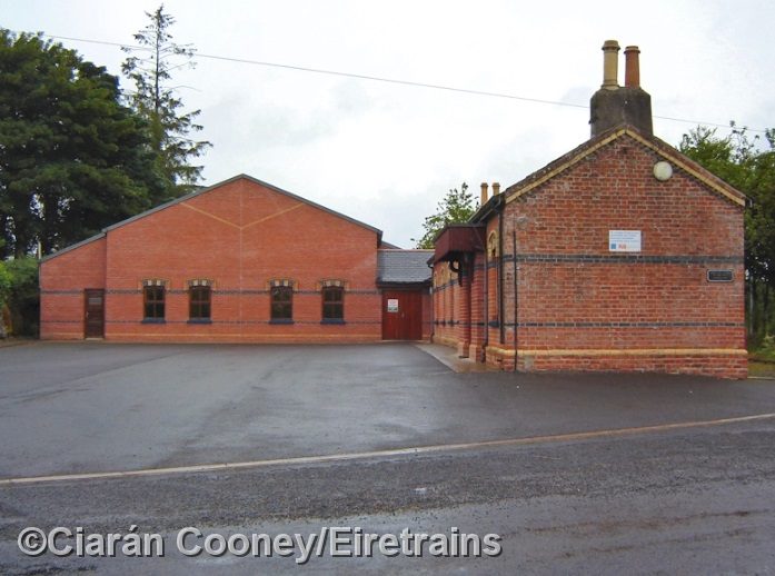 Facing West, the extended community centre in the 21st century, (c) Ciaran Cooney. The main platform was directly in front of the camera with the road to Ballinamore extending back beyond the community centre extension. [21]
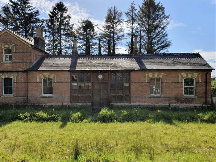
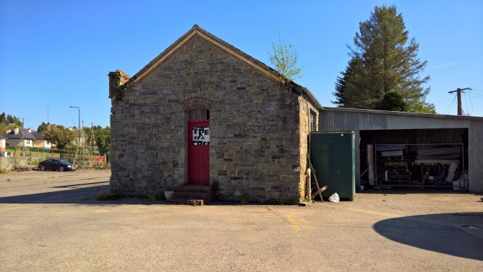
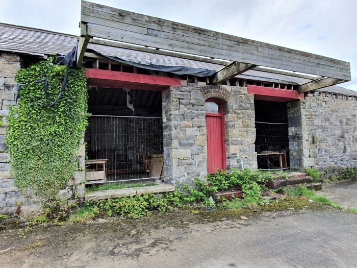
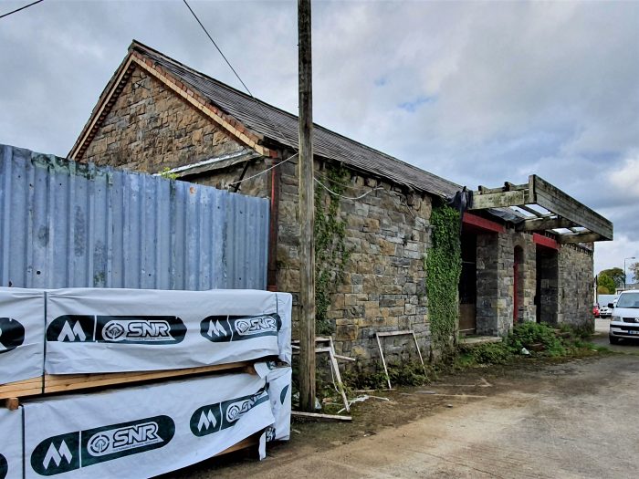
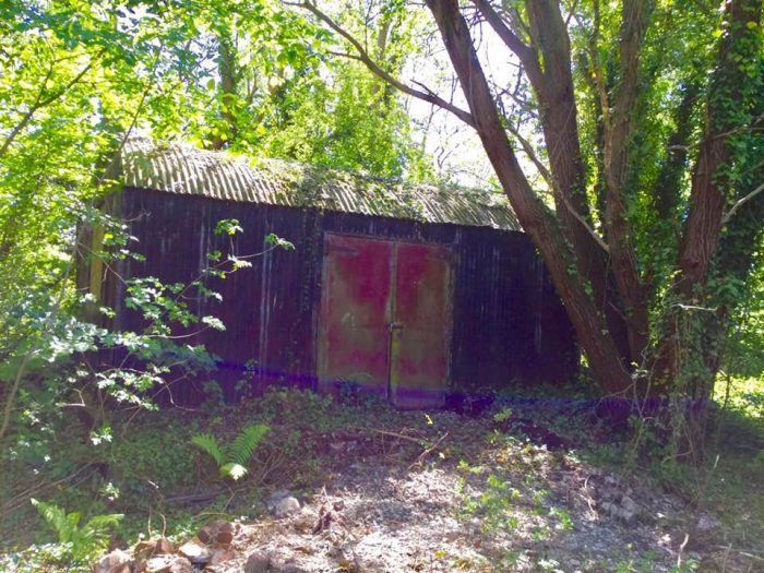
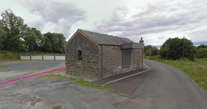 Bawnboy Road Station Good Shed in 2009. As can be seen on the sketch plan of the station above, this sat to the West of the main passenger building.
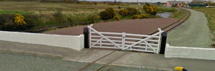
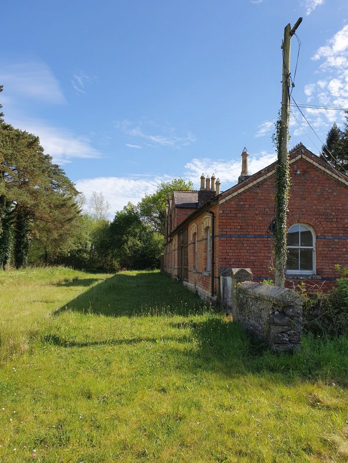
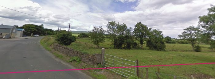 The location of the level-crossing is confirmed by the concrete gate post which now supports the field gate but which once carried the crossing gate on the east side of the road at the end of the station yard.
 Facing East beyond the level crossing, the road ahead towards Ballyconnell. [20]
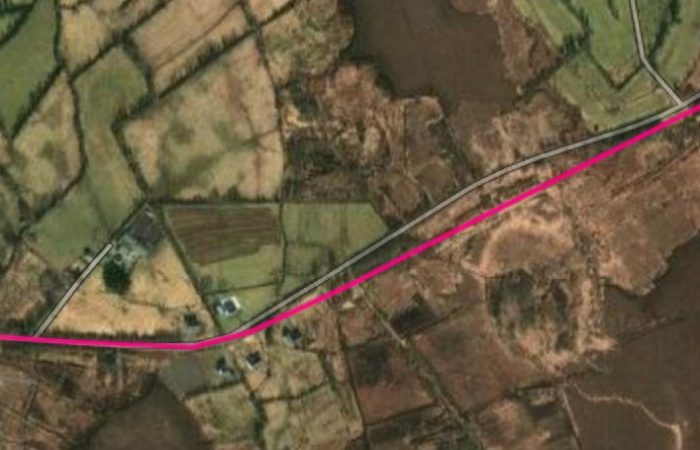
Flanagan continues his description of the C&L: “The pleasantly-wooded section beyond Bawnboy was again fairly level and was just short of two miles in length. The next halt, Ballyheady (24.75 miles), was also the subject of a name controversy; but in this case the board made a quick decision between ‘Bellaheady’ and ‘Ballyheady’ and picked the wrong one! Just before the down platform was an up facing siding which ran back into Ballyheady Ballast Pit, which provided the C&L with its ballast at various times. The siding, originally laid in 1891, lasted until the closure, although long out of use. High on a bank behind the platform was the signal for the station gates.” [1: p137]
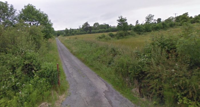
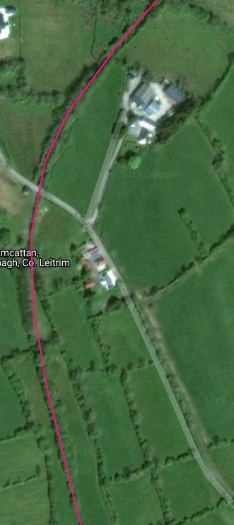
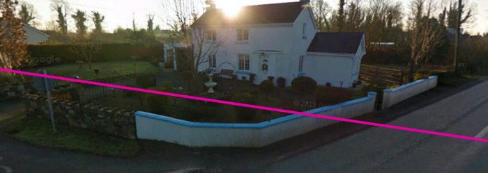
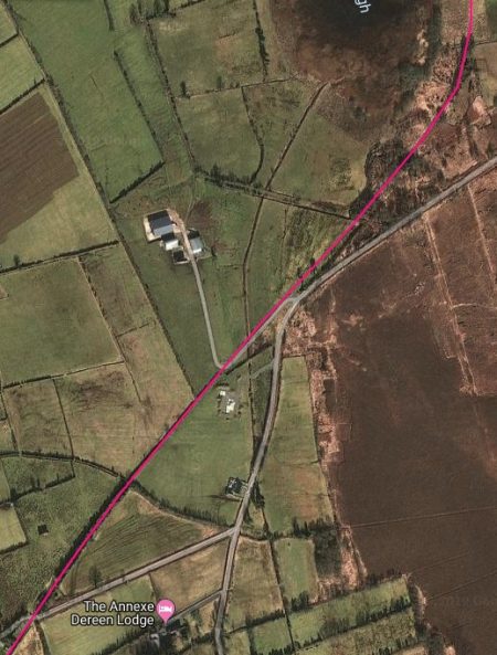
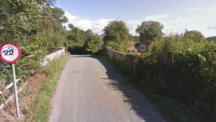
There appears to be little evidence of the woods referred to by Flanagan. They certainly do not appear on the satellite image above. The next point at which access to the line is easy is at the road-crossing with the modern R205, shown below.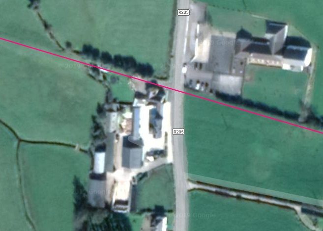
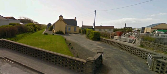
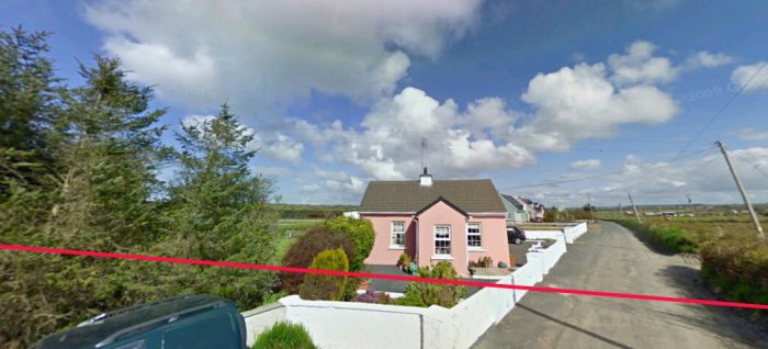
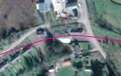
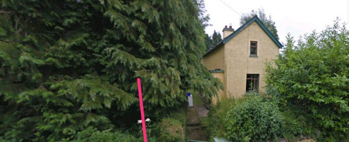
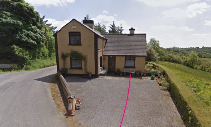
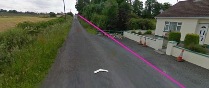
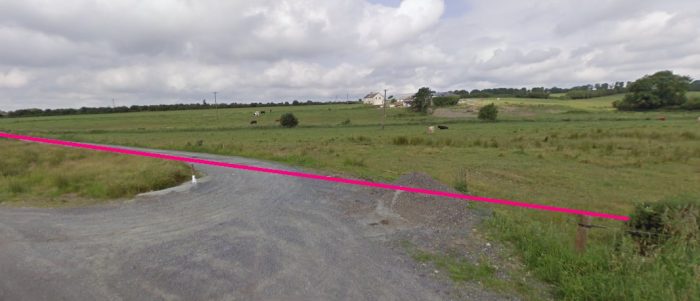
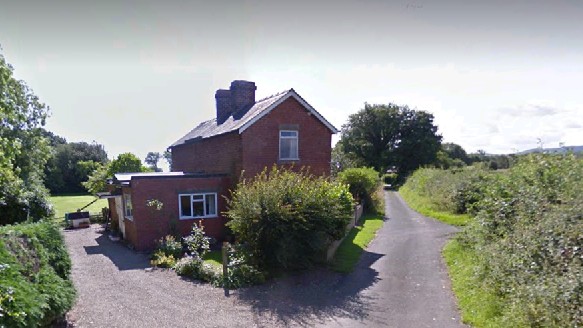
 Looking back towards Bawnboy Road. The crossing keeper’s cottage at the R205 has been modernised and enlarged. The old railway approached the R205 on the immediate right of the extension.
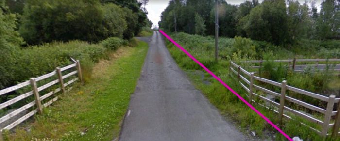
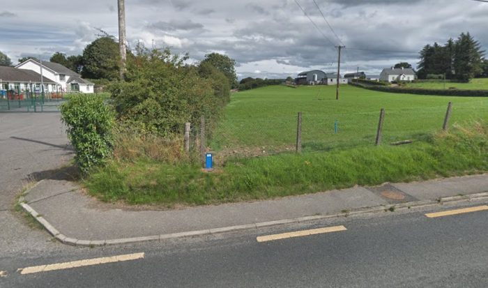 The way ahead is of the right side of the boundary hedge.
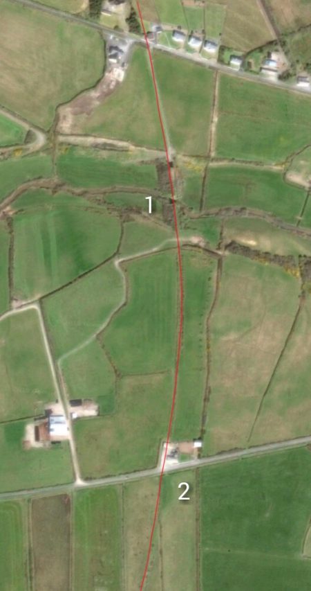
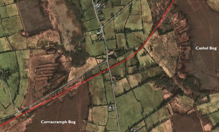
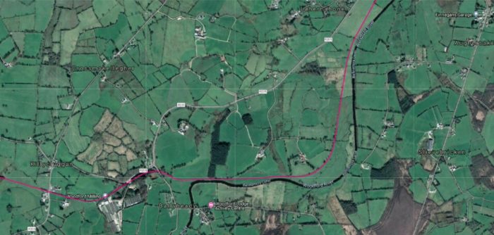 The satellite image above shows the route of the line passing to the north side of the Woodford Milling plant, following the R205 on its southside for a short distance before switching its allegiance to the Woodford River/Ballinamore Canal.
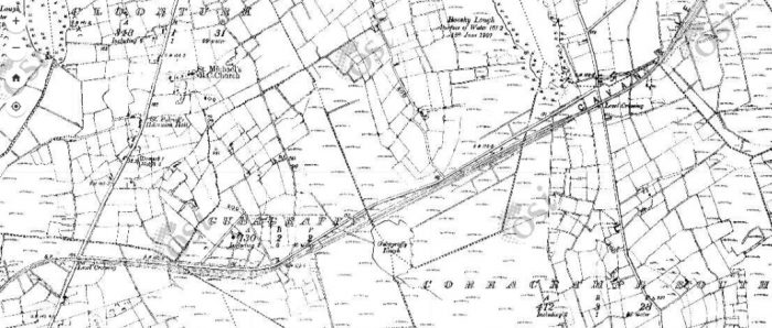
 The OS Map extract confirms the route, although what is now a milling plant was, in the 1940s, a small wood close to Bellaheady Bridge. [3]
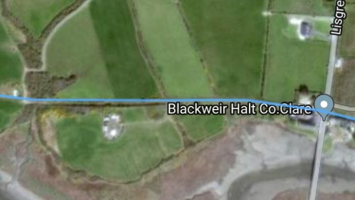
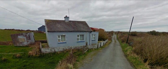
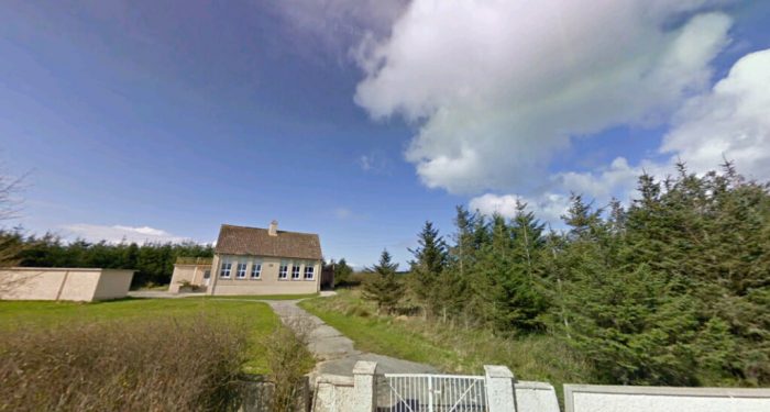
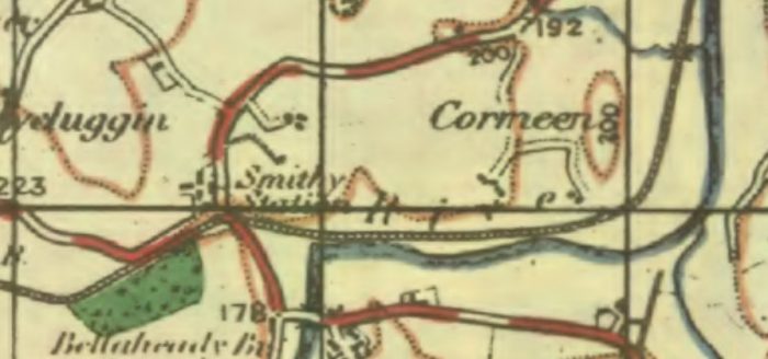 The Station referred to by Flanagan above as Ballyheady is named Smithy Station on the 1940s OS Map. [3]
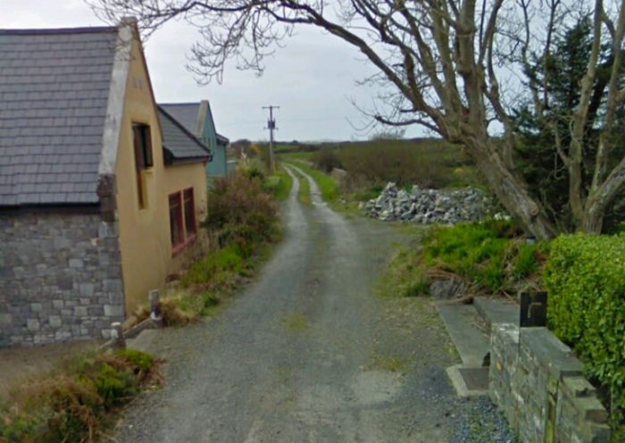
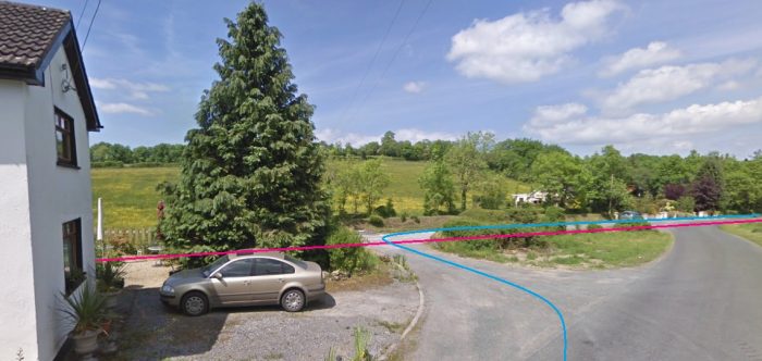
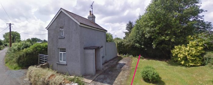
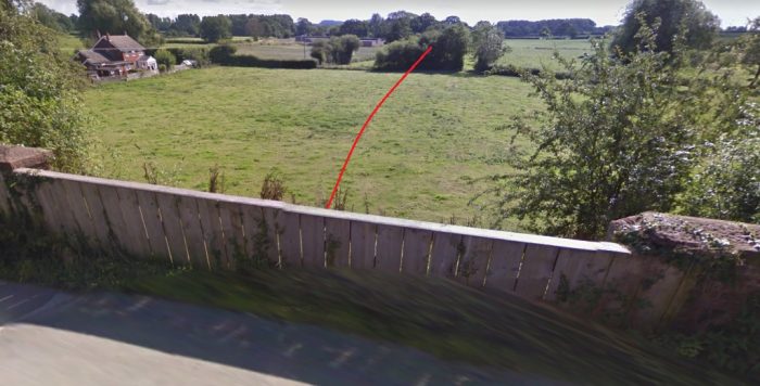
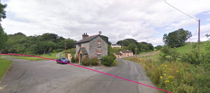 The station cottage sits charmingly alongslde what was the route of the C&L. Turning through 180 degress to look at the route ahead gains nothing as there is a densely wooded area immeidately t then right of this image, through which the old line’s route travels. It can however be picked out easily on the satellite image below.
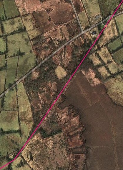
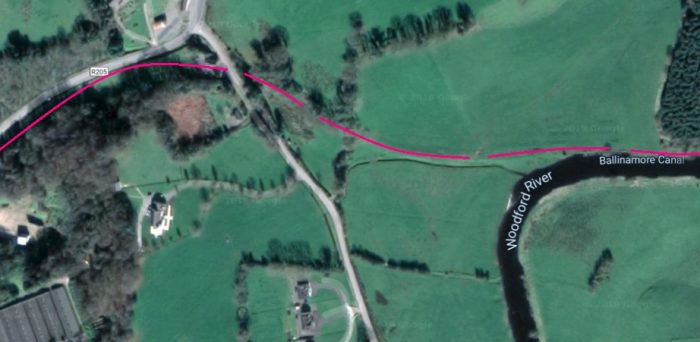 The route of the C&L follows the Canal/River for a distance, turning to the north as the alignment of the canal also does so. The satellite image (5 images above) shows this route and it is picked up once again on the image immediately below. It is the left side of this image which means the most to us now as it shows the old line approaching Ballyconnell. The little town sits at the third point in from the left at th top of the image.
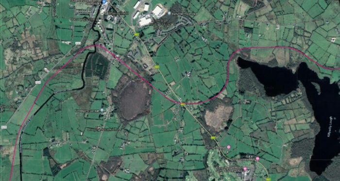
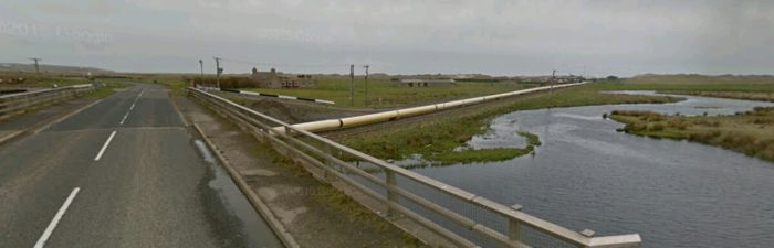
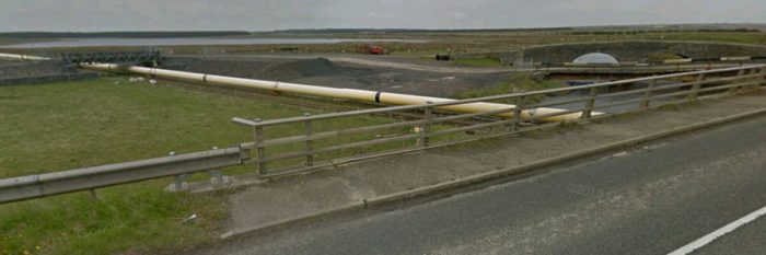
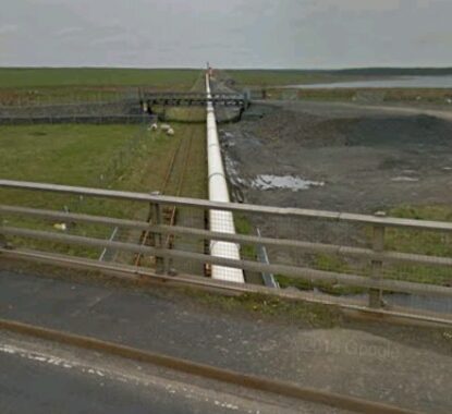
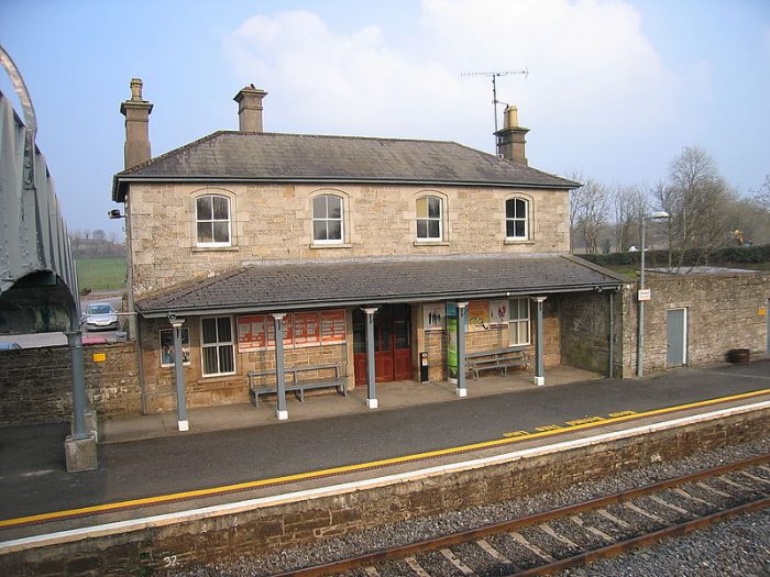
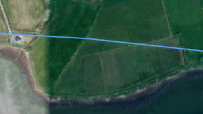
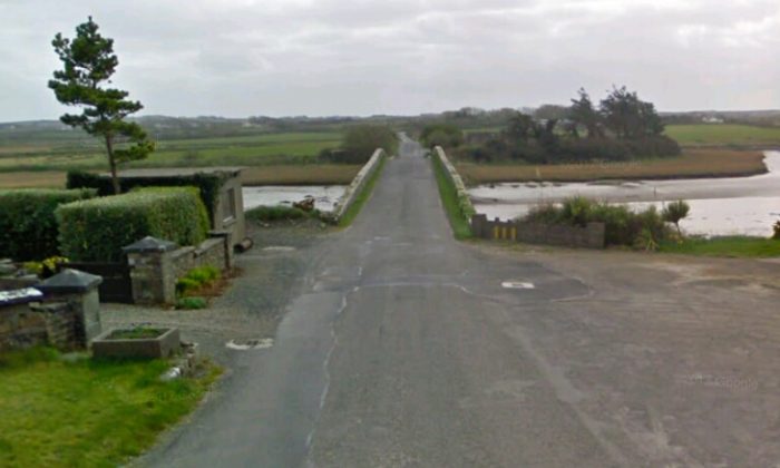
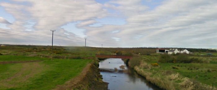
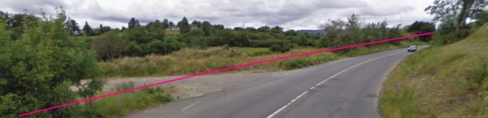
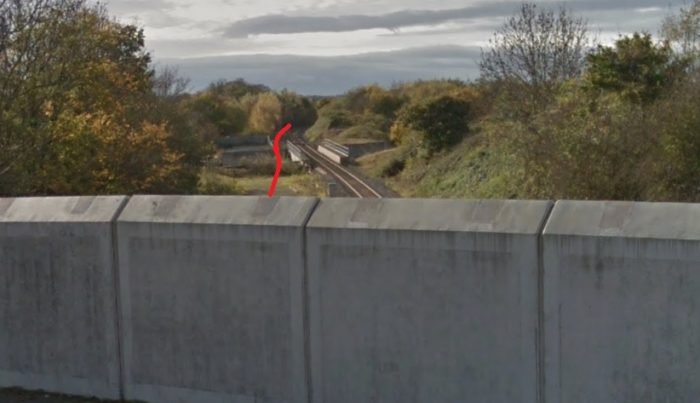
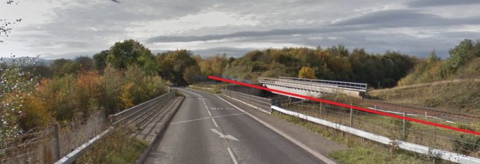
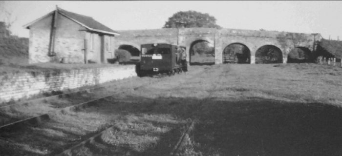
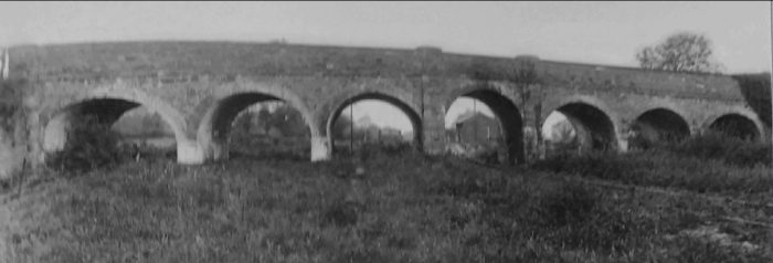
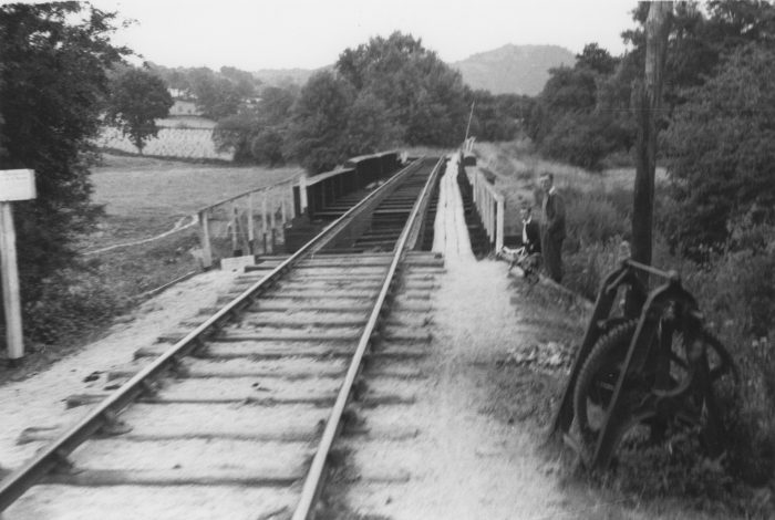
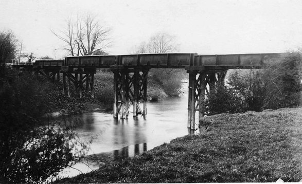
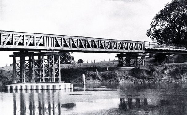
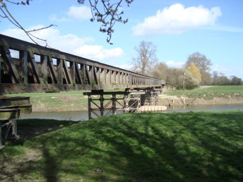
 Ballyconnell lay just over two and a half miles from Ballyheady. The station was always a block-post and a crossing-place. It was approached on a right-hand curve after the line had crossed the Woodford River, canalized as part of the Ballinamore & Ballyconnell canal. The adjacent image is taken from the Woodford River Bridge looking towards Ballyconnell Station. [24]
Flanagan continues his description: “The main buildings were just east of the station gates; in latter days they were the only ones to retain the large clock over the entrance to the booking-hall. There were no buildings on the timber up platform, which did, however, boast a 7,000-gallon water tank supplied by the Atlas Foundry, Belfast. Beyond this platform, to the east, was the yard ground frame which, from about 1914, was covered by a ramshackle ‘cabin’. There was another ground frame at the station gates. Opposite the cabin was a water column, just past which were the trailing points giving access to the goods yard. The latter was very simply laid out, consisting of one siding which opened out into a second line, parallel to the running road. There was a release crossover near the siding stoppers. The northernmost line served the goods store and cattle bank, the latter having another siding of its own. Immediately in front of the goods yard points was the 1:76 Ballyconnell bank which was very convenient for gravity shunting. The Ballyconnell water supply was originally by windmill and one, the last on the C&L, survived until about 1932, when an engine and chain were used to pull it down. The windmill was at first placed in the goods yard but in 1907, when the supply was poor, a new one was erected 200 yards from the station at the Woodford River bridge. At the same time an oil-engine pump was installed and later became solely responsible for the supply.” [1: p138]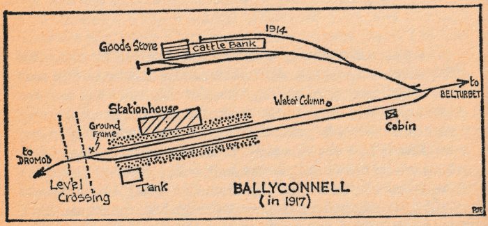
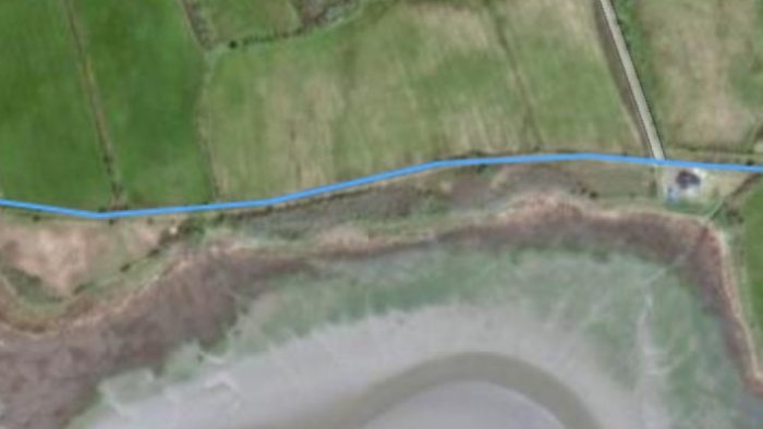
The satellite image below shows the location of the old Woodford River Bridge and the station.The station was just to the south-east of the road.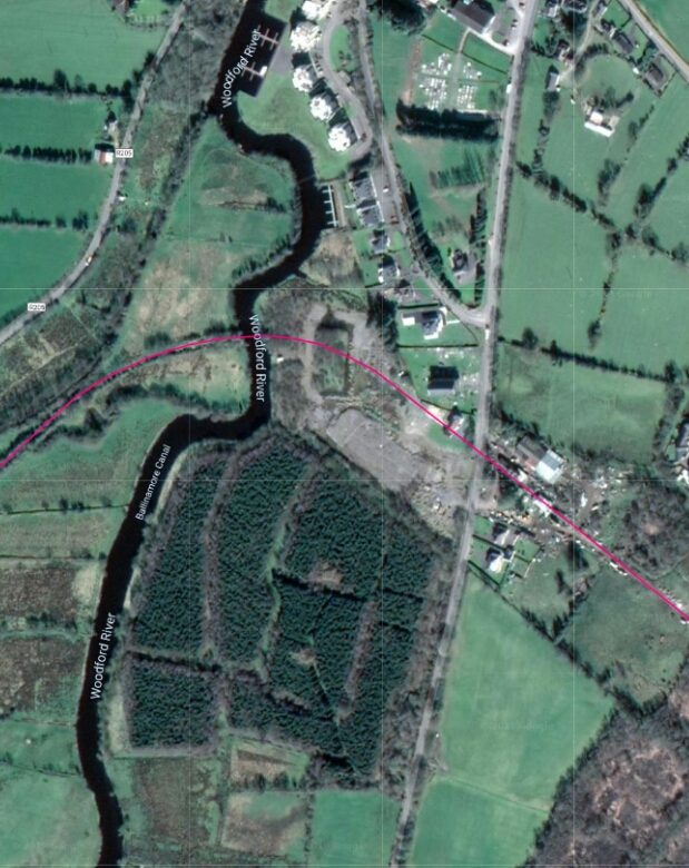
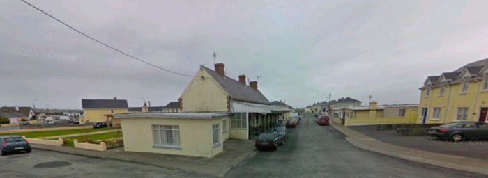
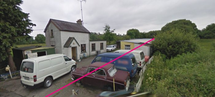
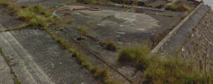
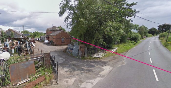 The Ballyconnell station site in 2009, viewed from just north of the location of the level-crossing. The station buildings can still be seen just left of centre and the goods shed faces them across what was the station yard.
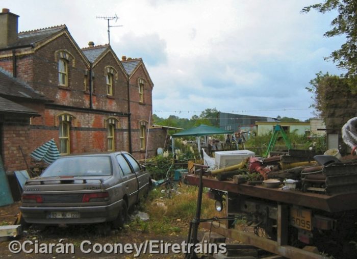 Ciaran Cooney showed an adventurous spirit when he took this picture of the railside of the Station building. He says: “Ballyconnell as viewed from the railway side of the station, where the platforms where once sited. The goods yard is beyond the station building, and the former water tower is on the right. This view is looking towards Belturbet,” (c) Ciaran Cooney. [22]
We read some of Bill Gerty’s words earlier in this post. His personal story continues with his role at Ballyconnell Station:
“Ernest came home one night and said that he had been transferred to Mohill station. He would now have to get lodgings away from home but he could get home on Saturday night as there were no trains running on Sundays, except on special occasions. He told me that there would be a job at Ballyconnell for a lad porter and that I should apply for it, I spoke to Eddie about this and he said that I should take it if I could. He could manage the work at home, there was always neighbours to help if he needed them as he often went out of his way to help them. He was also thinking about the one pound a week he got from Ernest which would no longer be available, it does not seem a lot of money these days but it went a long way in nineteen-forty-four.” [18]
“I went to Ballyconnell and got an interview with Mr Wells the station master and a few days later received a letter to say that I had got the job and that could start work on the following Monday morning. I had an old pair of overalls which I duly washed and although there were a few patches on them at least they were clean it would not be long before I was given a proper uniform. … I arrived at work on the Monday in good time and was introduced to Frank McKiernan who would be over me, I was told by Mr Wells that my hours would be nine until six for six days with Sundays off and the pay would be one pound and ten shillings per week, with this money I would be able to give Uncle Eddie one pound and have ten shillings for myself. The rest of that day was spent with Frank who showed me all the jobs that I would be doing but most of them we would be working together.” [18]
“Bob Wells has a wife who is a school teacher and two young girls, they also have a little dog called Rex. Bob’s mother also lives with them in the station house and I am told by Frank that she is a bit of an old battle axe, I also find out that there are other jobs that I shall be expected to do for the family. They have quite a lot of land around the station enough in fact to be able to keep one cow and also grow some potatoes. My job in the morning, before the first train arrives, is to go and feed the cow in the cowshed and clean her out and the same each evening before I went home, the old battle-axe did the milking. It was just my luck that I arrived there in the Spring so the ground had to be prepared and the potatoes planted in between other jobs. We only had four trains each day to look after, one up and one down in the morning and the same each evening. This may not seem a lot but each time a train arrived we had six to eight wagons to take off the train and usually the same number to go out.” [18]
“The line linked the Great Northern on one side and the Dublin line on the other side. Nearly all the goods coming into Ballyconnell and going out again came and went by rail, at that time there were only three lorries in the area, Ennis the milling company had one and he used the railway every day. Richardson’s the biggest store in Ballyconnell also had a lorry and all their goods arrived by rail. The other lorry was owned by the Magee family, they collected eggs and poultry from all around the country and they arrived at the station every morning and we had to have wagons ready for them. The eggs are packed in boxes of one gross and as Magee is usually late and has to rush into the station office to do the paperwork, it is left to Frank and me to load the eggs. One morning he left the lorry too far away from the wagon and I tried to get it a bit nearer which resulted in several cases flying into the wagon, the wagon has a label on it [EGGS HANDLE WITH CARE] I think on that day it should have said [SCRAMBLED EGGS].” [18]
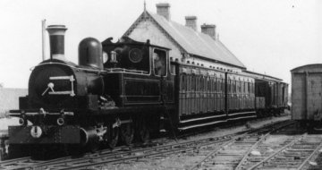
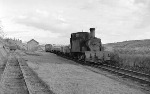
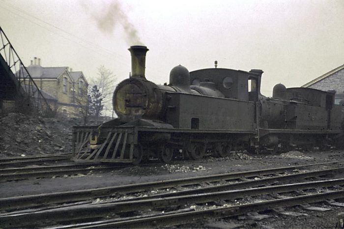
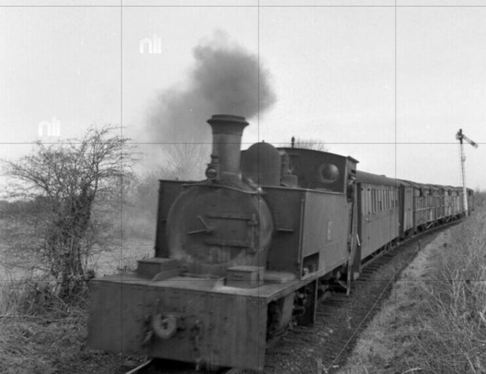
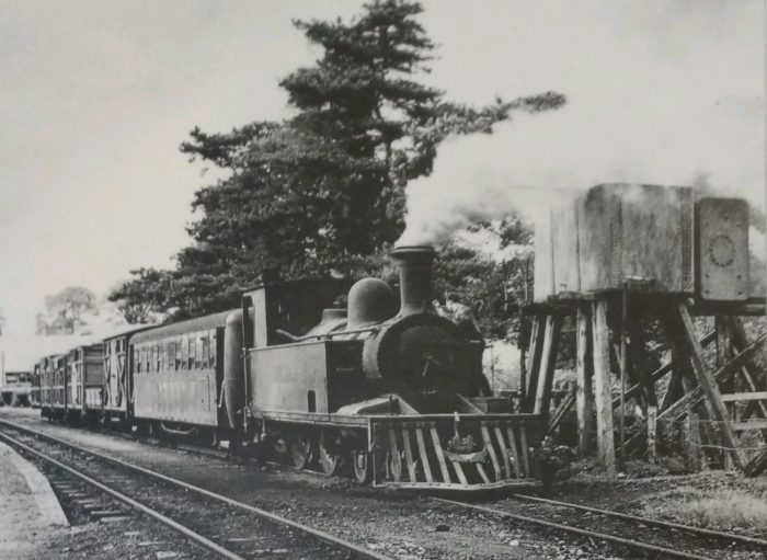
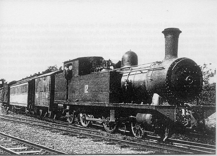 12T (2-4-2T) at Ballyconnell in 1947. [18]
Bill Gerty continues to tell of his time at Ballyconnell Station:
“All the goods that came by rail had to be removed from the wagons and stored in the goods store with the exception of grain and flour, all these sacks had to be counted and checked against the invoice. All spirits and beers had to be weighed carefully because it was not uncommon for some of these to have some of the contents removed on their journey to us. All the wagons that we sent out daily had to be in the correct order for the train to pick them up, in other words a wagon for the next station up the line would have to be the last one on the end of the train.” [18]
“All trains going through our station carried passengers as well as goods. We did not have a shunting engine in our yard so for this Frank and me had to put our backs to the wagons and push them into the correct position. There were six side lines in the yard and Frank showed how all the trap switches and stop blocks worked, as we operated all the signals in the cabin I was also shown how these worked. The phone was not as we know it today, it was a little handle that you turned depending on which station you wanted to call, it could be one, two, two and half, or three turns. When a train was due the station that it left would ring us and it was time for me to go and shut the gates across the main road. I then had to stand on the platform and assist the passengers from their carriages, first class got priority. The engine driver carried a device called a staff, he could not leave the station until I took this from him and took it to the office where Bob would change the brass ticket in it allowing him to proceed to the next station. Wagons coming off the train for us had to be released by Frank and me, we had no such thing as a shunting pole so we had to stand in-between the wagon, which had only one buffer in the middle with a chain either side, release the chains unlock the catches over the buffer and undo the vacuum. This operation was much more dangerous when a wagon had to be coupled up because you had to stand in-between the wagons which were moving in order to drop the catch hook, all this I might add without gloves. Another dangerous operation was when a wagon was released from an engine up a gradient down to our store instead of the engine pushing it down the driver would give it a quick shunt and we had to stand on the side of the wagon with one foot on the brake lever ready to stop it at the store, sometimes this was a bit of guess work depending on how fast the engine pushed it off, too fast and you went flying past the store into the stop blocks to be hurled off the side of the wagon, or sometimes you stood on the brake only to find that this did not work. I often wonder what today’s health and safety department would think about such actions.” [18]
“Cattle fairs were held in most towns once each month and extra trains would be required to take the cattle to various parts of the country. On such occasions there would be a train going to Killyran around the time that I was due to leave work, and as I knew all the engine drivers I used to sling my bicycle up on the tender and ride home on the engine, so I knew how to open the throttle and how to apply the brakes. When it was our fair day we had an engine all day in our yard to shunt the wagons, this was on the eighteenth of each month, on such days the engine driver and fireman would walk into town to have a few drinks at lunchtime so Frank and me took it in turns to have a ride up and down the yard if there were no cattle coming in to be put in wagons.” [18]
“We had a chap who came in daily with a donkey and cart and took small parcels to be delivered into town, the donkey was that used to coming into our yard that he quite often arrived without his owner while he was chatting along the road somewhere. On Friday of each week I was given a list of money to be collected from the bank some in notes and some in silver and pence the list was handed over in the bank and the cashier put the money in a paper bag and handed it back to me.” [18]
“It was my job to look after all the paraffin lamps that were used on the station and this included walking out to the home and outer signals some distance away, filling the lamps up, trimming the wicks and cleaning the glass. The outer signals were quite high up and if it was a windy day you could use a whole box of matches trying to light the lamp. One of my favourite jobs was walking down to the Woodford River where we had a building which housed a pumping engine this had to be started up in order to pump water up to the water tank at the station for the engines.” [18]
“Bob was very keen on having a nice station so flower gardening was given over to a lot of our time in the Spring and Summer months. We got some old lorry tyres which we cut one side off filled them with earth and put them along the platforms, they were planted up and the sides of the tyres were whitewashed they looked a real picture. Apart from these we had some lovely roses, banks of Dahlias, Gladioli and rows of Sweet Peas along the walls, the end result was that we won best kept station on the line which made Bob strut about like a peacock, although he never lifted a finger to do any of the work. It was just the same when Frank and me stopped late in the evenings to make hay to feed his cow he would just stand and watch.” [18]
“My lunch was always the same, two slices of bread and butter nothing else, I had a tin which held tea and sugar enough for two cups per day one lunch time and one in the afternoon I handed this to the old lady who used to make my tea daily. If I had no sugar which often happened she would never put any in for me, inconsiderate I thought for all the work that I did for them, not to worry, what she did not know there was usually a big bag of sugar in the store and with careful manipulation it was possible to get some out without much difficulty.” [18]
“I had been measured up for my uniform and was very pleased when it arrived along with a letter and a ticket for me to go to Dublin for a medical. I had never been to Dublin but Ernest had when he went for his medical. As I was going past Mullingar where he worked I arranged to stop off on the way back, which was on a Saturday, and spend the weekend with him. “You must have some fish and chips when you get to Dublin”, “What the hell is chips!” I said having never had fish and chips.” [18]
We complete this post with a few pictures of Ballyconnell Station when it was in use as a railway station and just after closure in 1959.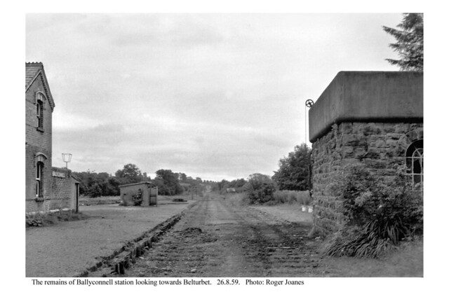
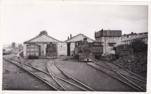
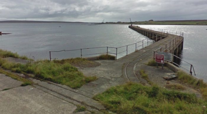
 Above, August 1959 at Ballyconnell Station. The rails and sleepers have already been removed, (c) Roger Joanes. The water tank still sits on its plinth. [23]
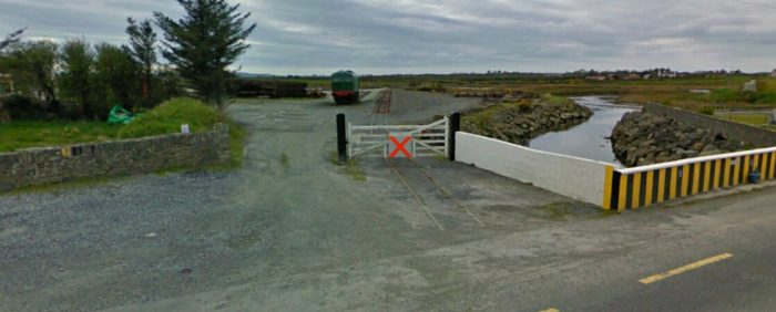
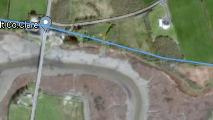
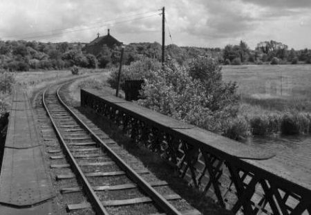
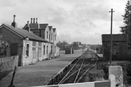
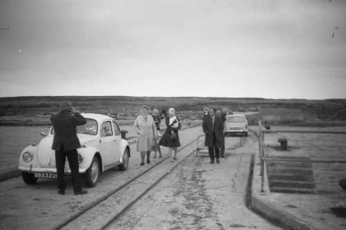
The view from the crossing gates some years before. [24]
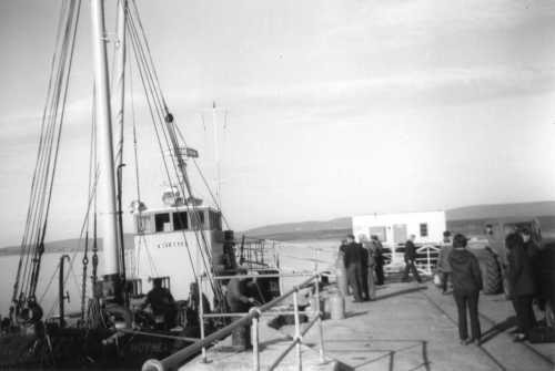
This is followed by a view from the Belturbet end of the station. [24]
References
- Patrick J. Flanagan; The Cavan & Leitrim Railway; Pan Books, London, 1972.
- http://candlgreenway.ie, accessed on 24th May 2019.
- https://maps.nls.uk, accessed on 22nd May 2019.
- https://vimeo.com/297829176, accessed on 27th May 2019.
- http://www.railmaponline.com/UKIEMap.php, accessed on 27th May 2019.
- https://www.flickr.com/photos/nlireland/6073278117/sizes/l/in/photostream, accessed on 27th May 2019.
- John Christopher & Campbell McCutcheon; Bradshaw’s Guide The Railways of Ireland: Volume 8; Amberley Publishing, 2015.
- Bill Gerty; Water under the Railway Bridge; http://www.bawnboy.com/water-under-railway-bridge/index.html, accessed on 28th May 2019.
- http://www.bawnboy.com/water-under-railway-bridge/pages/5-the-visits.html, accessed on 28th May 2019.
- http://www.bawnboy.com/water-under-railway-bridge/pages/8-back-to-killyran.html, accessed on 28th May 2019.
- http://www.bawnboy.com/water-under-railway-bridge/pages/9-water-under-railway-bridge.html, accessed on 28th May 2019.
- http://www.bawnboy.com/water-under-railway-bridge/pages/14-trains.html, accessed on 28th May 2019.
- http://www.iol.ie/~bawnboy, accessed on 29th May 2019.
- http://www.swanlinbar-kildallon.kilmore.anglican.org/newsletter/newsletter-71.html, accessed on 29th May 2019.
- https://www.geograph.ie/photo/2868649, accessed on 29th May 2019.
- http://catalogue.nli.ie/Record/vtls000304139, accessed on 29th May 2019.
- https://irishrailwaymodeller.com/profile/144-phil3150/?do=content&type=forums_topic_post&change_section=1, accessed on 29th May 2019.
- http://www.bawnboy.com/water-under-railway-bridge/pages/23-ballyconnell-porter.html, accessed on 28th May 2019.
- http://catalogue.nli.ie/Record/vtls000304143/MooviewerImg?mobileImage=vtls000304143_001, accessed on 29th May 2019.
- http://catalogue.nli.ie/Record/vtls000304141/MooviewerImg?mobileImage=vtls000304141_001, accessed on 29th May 2019.
- http://eiretrains.com/Photo_Gallery/Railway%20Stations%20B/Bawnboy%20Road/IrishRailwayStations.html#, accessed on 29th May 2019.
- http://eiretrains.com/Photo_Gallery/Railway%20Stations%20B/Ballyconnell/IrishRailwayStations.html, accessed on 29th May 2019.
- https://placeandsee.com/s?as=foto&fk=16086886800, accessed on 29th May 2019.
- http://catalogue.nli.ie/Record/vtls000304138/Map, accessed on 29th May 2019.


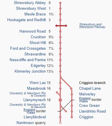


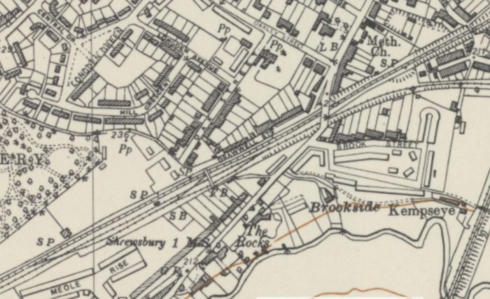
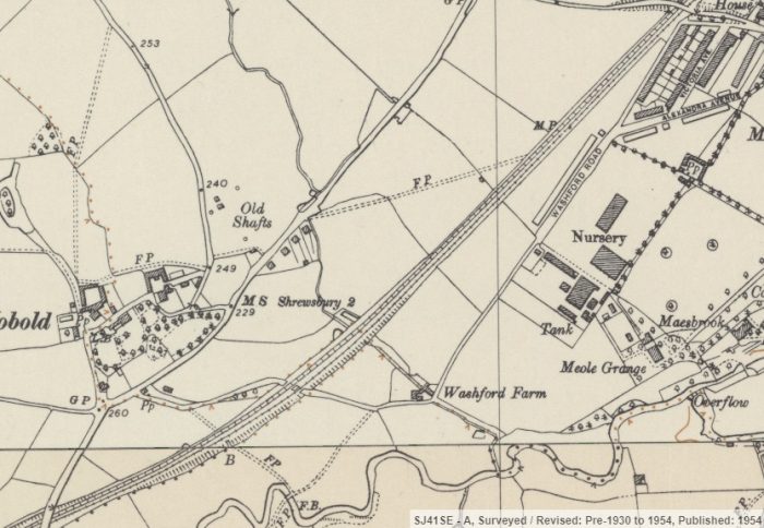
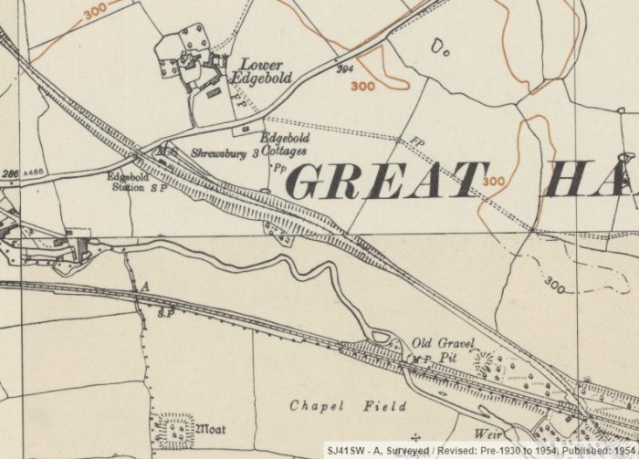
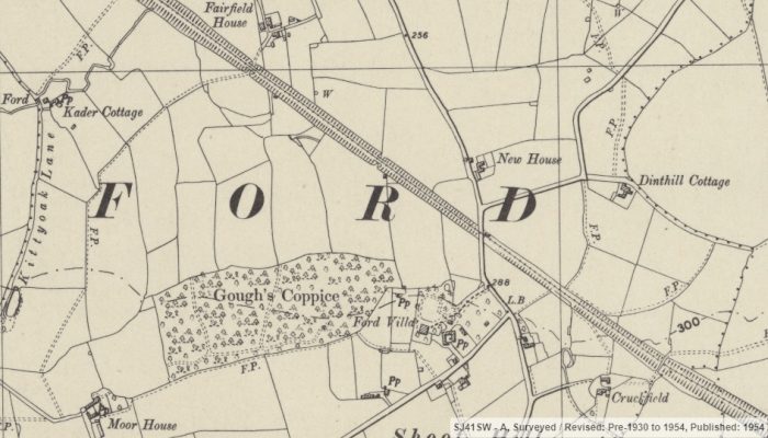

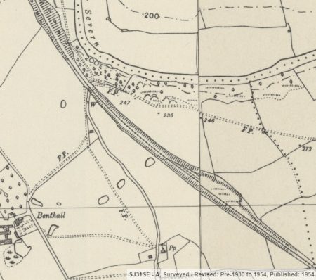

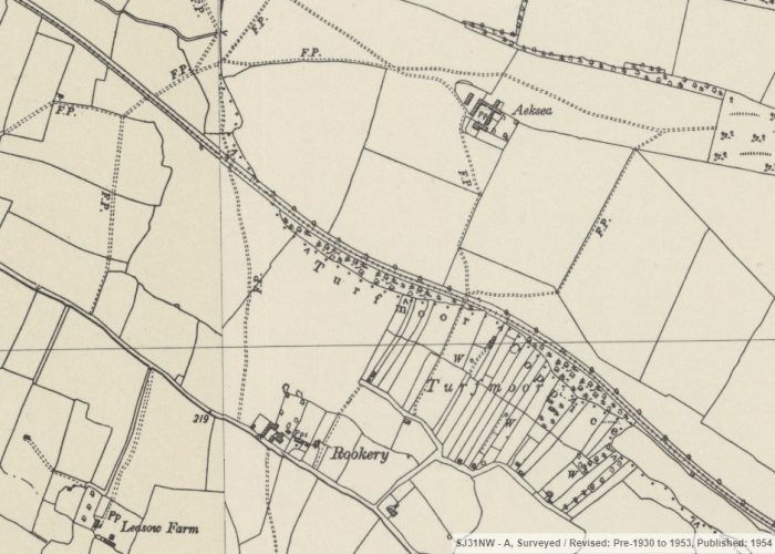


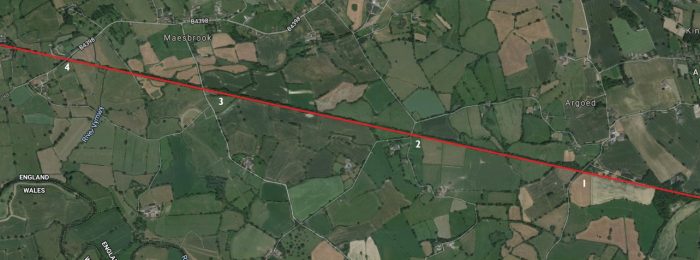
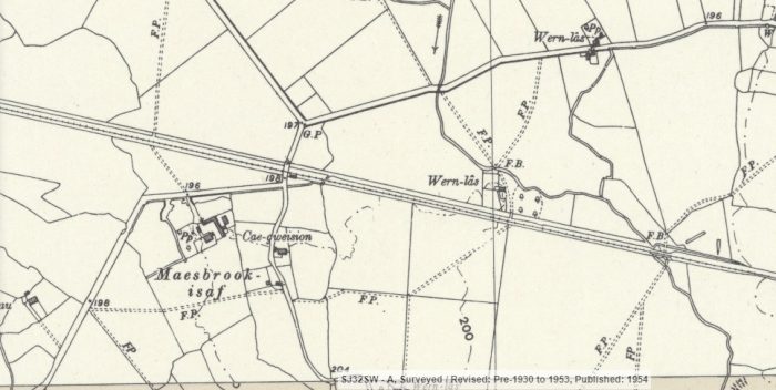

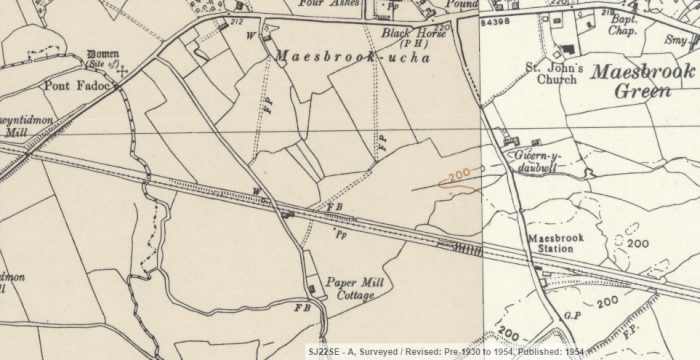
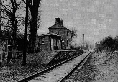
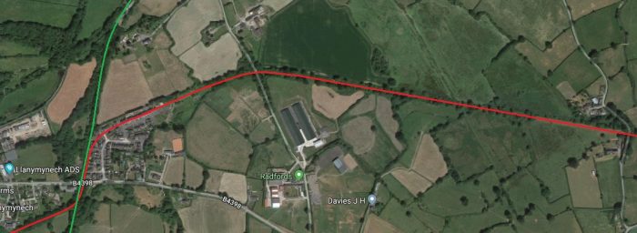
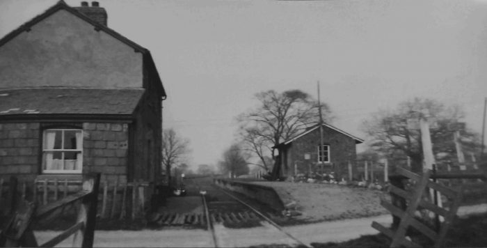
 Maesbrook Station is at location ‘3’ on the satellite image above. It is shown on the OS Map excerpt at the right side of the image. [13]
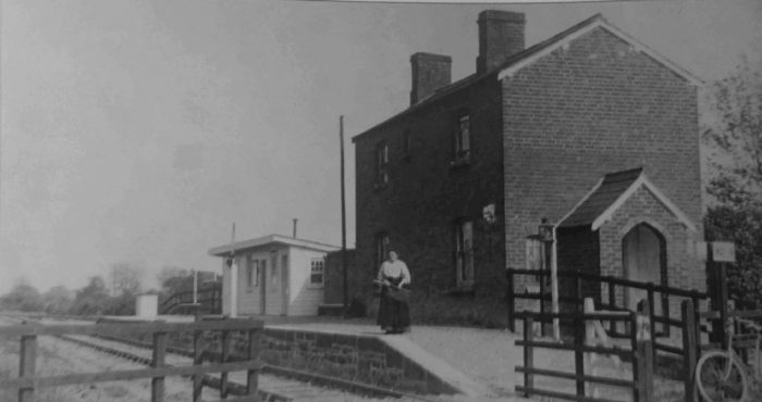


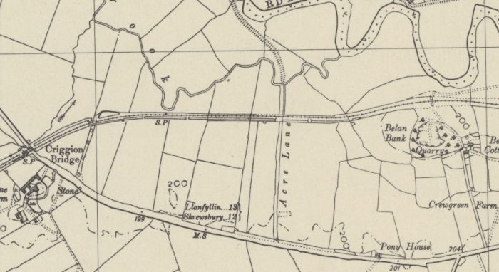

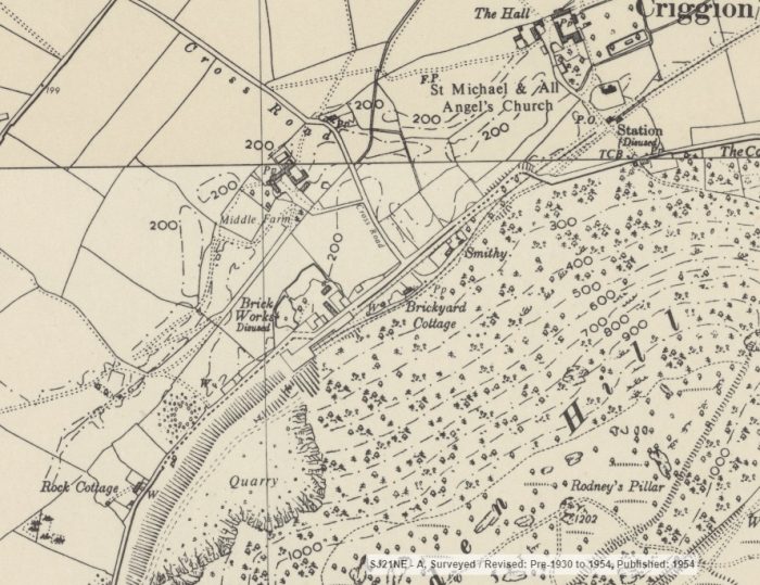
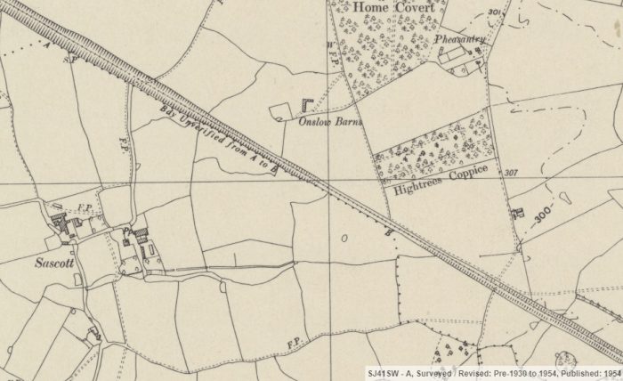
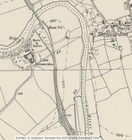
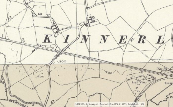
 This OS Map extract shows the brickyard and quarry at Criggion in 1954.