
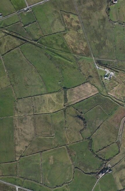
The Line of the West Clare Railway from Moyasta to Kilkee
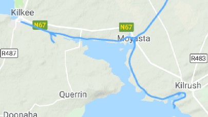 Moyasta was a junction station. The two lines which left to the south and to the west served Kilrush and Kilkee respectively. The two routes feature on the adjacent map. We will focus first on the line to Kilkee on the Atlantic coast.
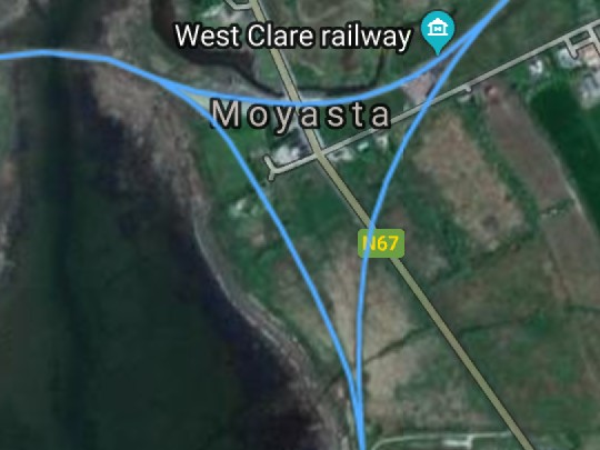 Before we set off, we note two things about the station. First, the presence, in the 21st century, of a preservation line based at the station; and second, the layout of the junction at Moyasta. Although a direct line was provided to allow trains to travel between Kilkee and Kilrush. In practice it was little used in later years as trains tended to enter Moyasta station from either of the two villages and the set off from the station for the other village. This required some manoeuvrings in the station area!
However, when the pier was in use at Cappagh, “the Loop … was extremely useful for allowing a direct passage to through traffic, especially from Cappagh to Kilkee.” [7]
We will spend a little time looking at the preservation line and then move on out of the station and its environs and on to Kilkee. The journey will start by looking at the loop line.
The West Clare Railway [3]
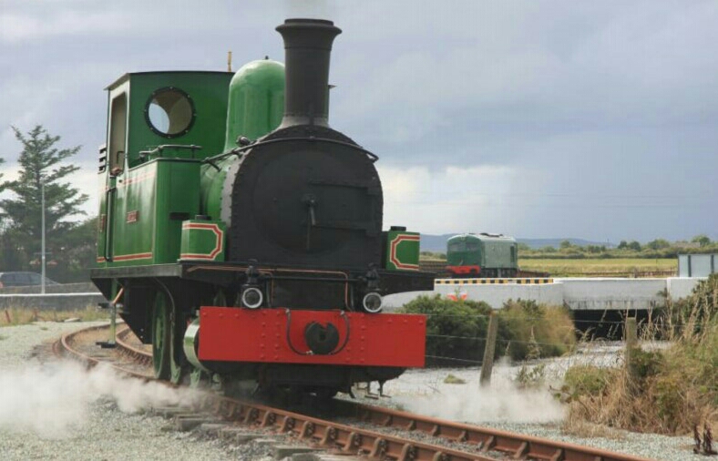
It was not until the mid 1990’s that a local committee attempted to revive this treasured historical railway.
Jackie Whelan became involved when a committee for the Restoration of the West Clare Railway was created in the mid 1990’s. He initially carried out all the preparatory works for the tracks of this railway line, including all excavation works, track laying & fencing on a voluntary basis for this committee.
One objective of the committee was to include the “Slieve Callan” steam engine as part of the proposed West Clare Railway restoration project. At that time this steam engine lay dormant and on display at Ennis Railway Station. This project presented an excellent opportunity to preserve and restore this unique locomotive.
A proposal was made to C.I.E. to remove the engine from its plinth in Ennis. For any proposal to be considered it required proving a commitment to the West Clare Railway restoration, and this was obvious by the substantial preparatory work carried out in Moyasta. An agreement for the removal of the “Slieve Callan” steam engine from Ennis to Moyasta was granted to the West Clare Railway company, amid much consternation in Ennis at the time.
Unsurprisingly, the agreement had conditions, including that the engine be substantially improved or rebuilt within 3 years. This would require enormous funding. At this stage the committee involvement ceased. Jackie then became directly responsible for carrying forward and persevering with raising funds to continually update and improve this unique venture to bring to where it is today.
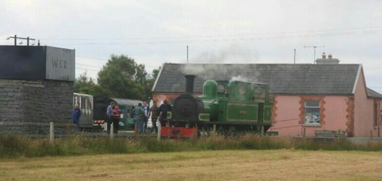
In 2009 the “Slieve Callan” returned, rebuilt and running smoothly, to Moyasta Junction. It now provides visitors and enthusiasts alike with a look into, and experience of, the fascinating railway history of Ireland, and is a fitting tribute to our heritage and to the hard work and efforts of all involved in bringing a steam locomotive back to Moyasta.
Just a few pictures to whet the appetite for more. The first few come from the West Clare Railway website. [3]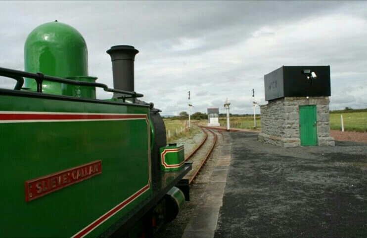
The Loop Line
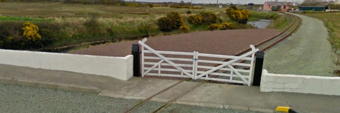
Moyasta has been referred to as, “this railway ‘republic’, this ‘island state of the narrow-. gauge'” [5] Lenihan sought an opportunity, first, to look at the avoiding loop and headed from the station down a little laneway towards the shore. “Almost at once we came to another lane at right angles to it, where stands the last of a row of twelve thatched houses that can be seen in many of the old photographs and which have vanished within the past thirty years. A sign of changing times and improvements in housing, perhaps, but also an indication of the decline in population Moyasta has suffered through the ruin first of its turf trade and finally of the railway. Beyond this lane is the only level crossing on the Loop, called in the railway manuals Moyasta no. 3. The cottage is still in use, but the little platform, on the up side, where so many thousands of Kilkee-bound passengers entrained, looks neglected and forgotten.” [2] 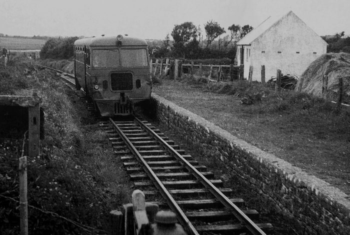 The small platform close to Moyasta No. 3 Crossing which is mentioned by Lenihan above. [1]
A sizeable triangular-shaped inlet of the Shannon, 2 miles long by 1.5 wide, it is bounded by Moyasta on the east, Blackweir on the west and Cammoge Point to the south. “Looked at on the 6-inch map, all its shores appear to be bounded by railway, but that appearing on the southern shore is merely the trace of the ill-fated 1860s line on which rails were never laid.” [4]
Lenihan found walking along the loop line in the late 1980s impractical however as soon as they reached the main line, there “was no further difficulty. The way is clear right to Moyasta river bridge — the ‘Red Bridge’ — and beyond.” [7]
Within the Loop, around one hundred yards from the junction with the Kilrush branch Lenihan “noted traces of a second, parallel, line immediately to [the] left. Here also lay a mound of solidified tar, the sole remnant of the sleeper-tarring plant that was once sited here. In all, the Loop is approximately 600 yards in length and was extremely useful for allowing a direct passage to through traffic, especially from Cappagh to Kilkee.” [7]
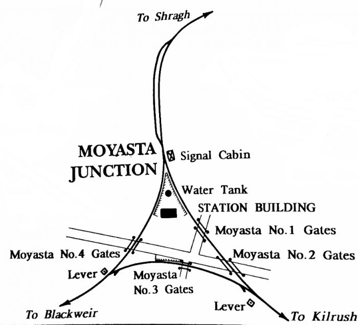 There were four road-crossings at Moyasta, all within a radius of 200 yards of the station-house. By the late 1980s, Lenihan observed that, “as at most other such places, there was nothing, for at Moyasta, just as at Knockdrumniagh, near Ennistymon, road widening has changed utterly the lie of the land.” [7] The plan is taken from Patrick Taylor’s book. [8]
The presence of the preservation railway means that the locations of these crossings are easier to define in the early 21st century.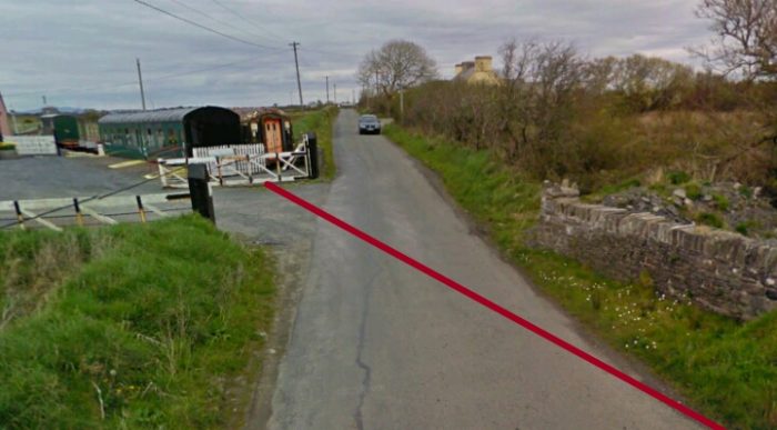
 Moyasta No. 1 Crossing (above).
The adjacent image is taken at Moyasta No. 2 Crossing looking back towards No. 1.
The picture below is also taken at the No. 2 Crossing looking towards Kilrush. The Shannon estuary can be seen in the distance.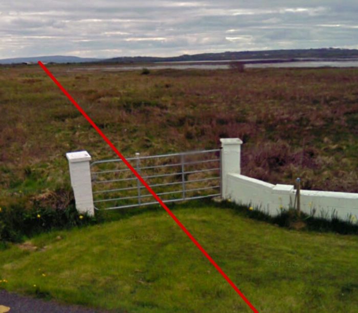
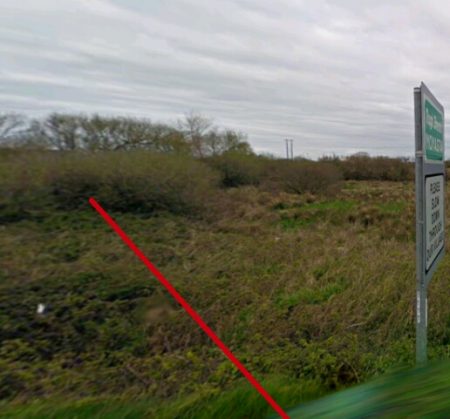
 Moyasta No. 4 Crossing was on the arm of the railway heading for Kilkee. The preservation railway has installed gates cat tyev approximate location of the crossing in the past. This image shows can view back up the Killee arm of the junction to the station house.
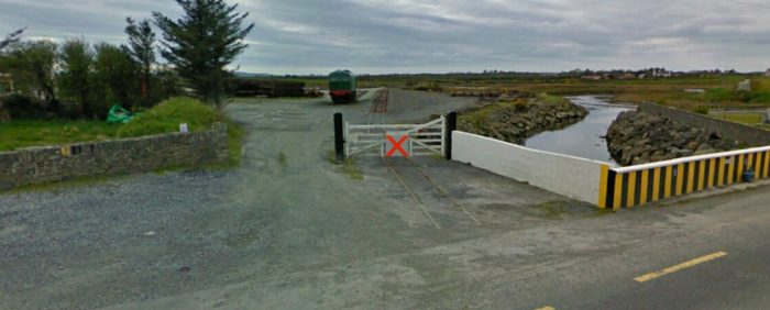 Looking towards Kilkee in the 21st century.
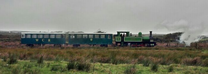
 Moyasta junction with the Kilkee/Kilrush loop on the left. The railcar has left Moyasta Station which is of the extreme right of the picture with a service to Kilrush. As we have already noted, there were few non-stop workings between Kilrush and Kilkee. Trains from one or other village used to enter the relevant platform at Myasta and then propel backwards before using the loop to head on to the other village.
The Line to Kilkee
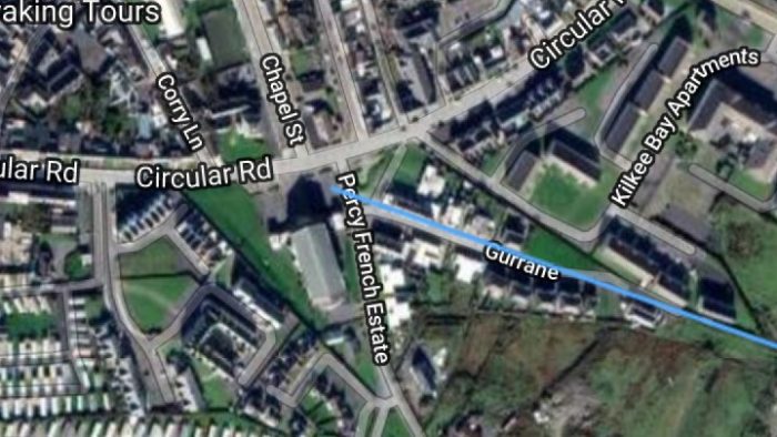
The most significant structure on the line to Kilkee is the ‘Red Bridge’. Its location was chosen in 1884 because the engineer, Mr. Barrington, was convinced that the foundations would be firm. [10][11] “The understanding at that time was that W.M. Murphy would build the 81/2 miles of line from Kilrush to Kilkee for £40,000 and of that sum £1,800 was to be allocated to Moyasta Bridge. Even today, it seems a ludicrously small sum for such a fine piece of work.” [12] The line of the old railway from Moyasta across the ‘Red Bridge’ is shown in blue. The route of the line to Kilkee will be shown in blue rather than red as I have found a site which shows the route superimposed onto Google Satellite images. [13]
The red bridge appears below in the early in the 21st century. [3]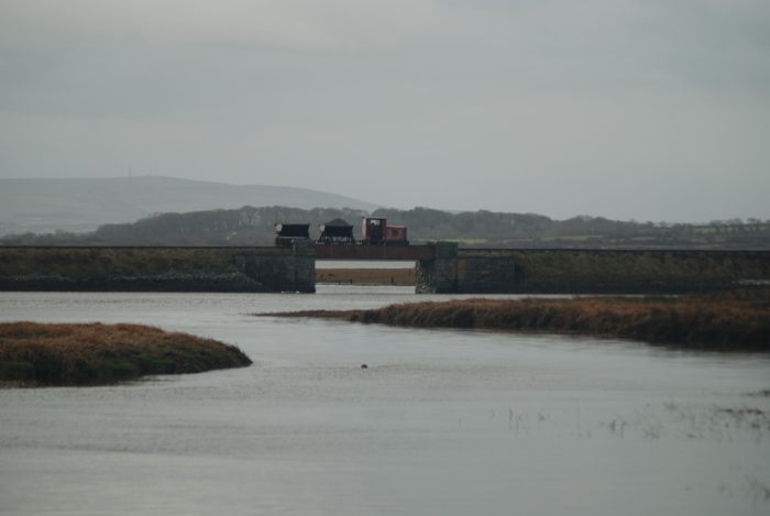 After the bridge, the journey to Kilkee from Moyasta “may fairly be said to divide neatly into two sections: the first, to Blackweir, being almost totally along the northern shore of Poulnasherry Bay, while the second is more inland. On neither part are there any insurmountable obstacles, though all the usual inconveniences and unpleasantnesses are plentiful. But perhaps the most singular fact about this area is the narrowness of the neck of land that separates Kilkee from the upper reaches of Poulnasherry — no more than a mile and a half at most. Without doubt, a time will come when all of the peninsula from Kilkee westwards will be an island.” [9]
The line ran on a causeway from the bridge to firmer ground and the line then curved gradually southward before settling into a westerly trajectory for its 2 mile run to Blackweir.
Patrick Taylor is as succinct as usual in his description of the line to Kilkee. He points out station layout and various items therein and goes on to say: “The line then passed over a culvert adjacent to the level crossing gates, and continued past the loop before crossing over Moyasta or the ‘Red Bridge’ (No.1) under which flowed the waters of Poulnasherry Bay. The bay was to the left of the line, which now took a semicircular course before turning right after passing Purtills accommodation crossing. In the next stretch of partially straight line three level crossings were situated. Moyasta West (No.5) at 43.75 m.p., Baurnmore at 44 m.p. Currane at 44.75 m.p., before Blackweir station at the 45.25 m.p. was reached. The station and platform here were on the down side with level crossing gates provided at the Kilkee end. In the earlier years all trains stopped at this station but at the turn or the century it was reduced to a halt and trains only stopped if required. On leaving Blackweir there was a small bridge (No.5) beyond the level crossing gates and a cattle pass beside Lisdeen bank. There was an up gradient of 1 in 64/58 for a short stretch at this point. On rounding Garveys bend the line continued through treeless turfland past two level crossings, Lisdeen adjacent to 46.75 m.p., and Dough beyond 47 m.p., to Kilkee, 48 miles from Ennis.” [14]
We could, I suppose give the last word to Patrick Taylor and save a lot of time for both you and I, but that rather defeats the object of these posts. So we will continue with a more detailed review of the line.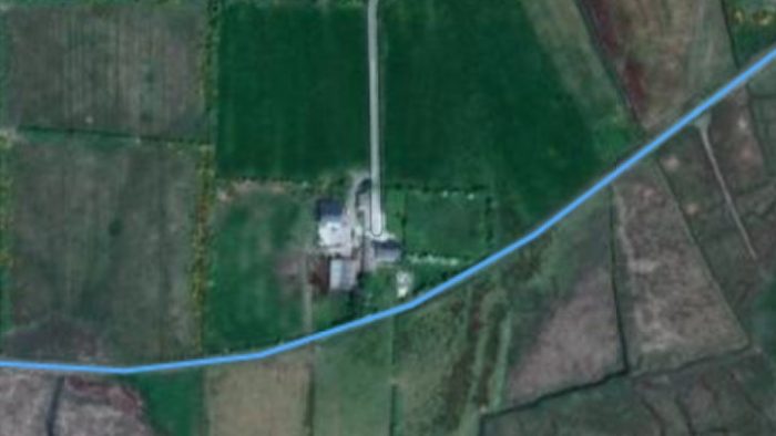 The line curved first to the South and then back onto a westerly route. [13]
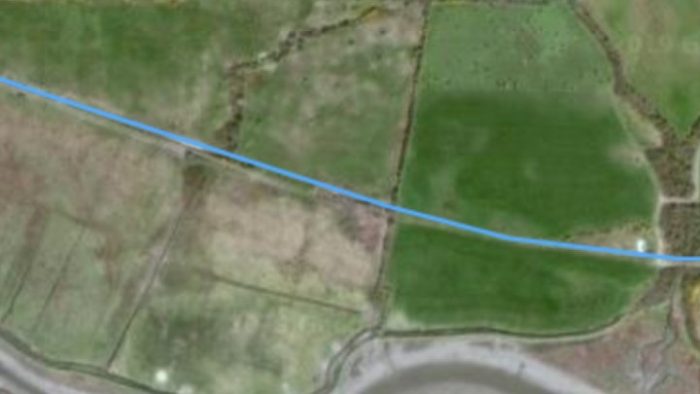
Lenihan says that, “there is scarcely anything of interest until a little causeway is reached, close to Moyasta West no. 5 crossing. Up to this point, the surface is at first smooth and firm but then deteriorates gradually into quagmire.” [12]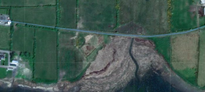 The causeway mentioned by Lenihan is just to the right of centre in this satellite image [13]
 Moyasta No. 5 Crossing is on the right of this image. [13]
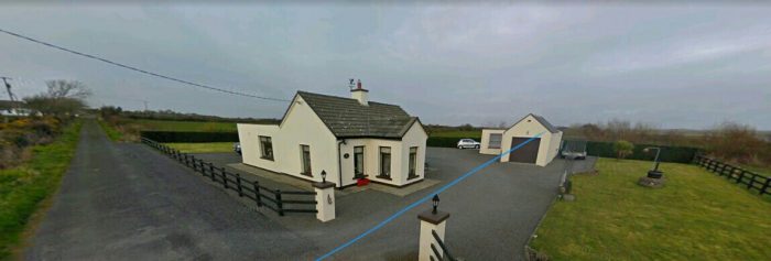 The Crossing-Keeper’s cottage at Moyasta No. 5 Crossing has been refurbished. The blue line shows the line of the railway.
Lenihan, writing in the late 1980s commented: “The house is certainly the original building, and little changed on the exterior: The roof beams still protrude from under the eaves as they did in all the others we had seen which had not been altered. An unpleasant scene awaited us west of the road though. From a wide gateway, through which trains once passed, we could see that the large field ahead had been levelled, and that for at least 400 yards there would be no distinguishing features to guide us.” [15]
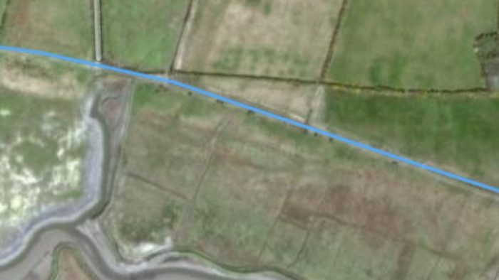
The next crossing is Bawnmore. In the late 1980s the crossing was ramshackle at best and its grounds over grown. By 2008, Lenihan was reporting that the cottage was an almost total ruin, “its remnants as well as the line here inaccessible in a wilderness of whitethorn.” [16]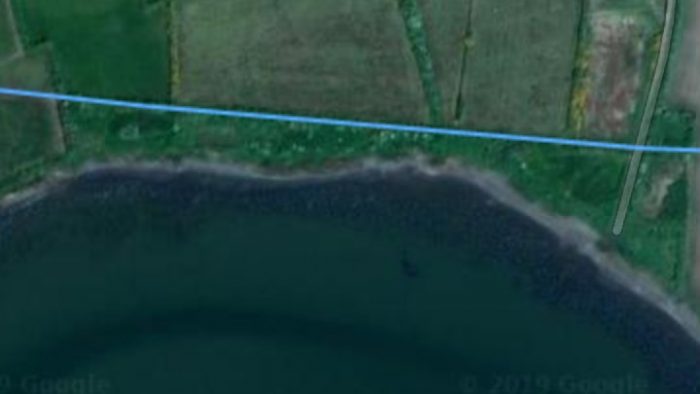 The location of Bawnmore Crossing is at the right side of this image. [13]
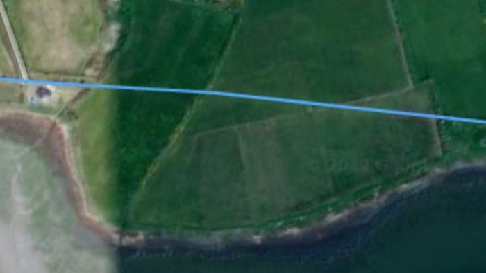 The next crossing was at Garraun. Its location appears on the left of this satellite image. Its cottage was already abandoned in the late 1980s [17] and has deteriorated since. [16]
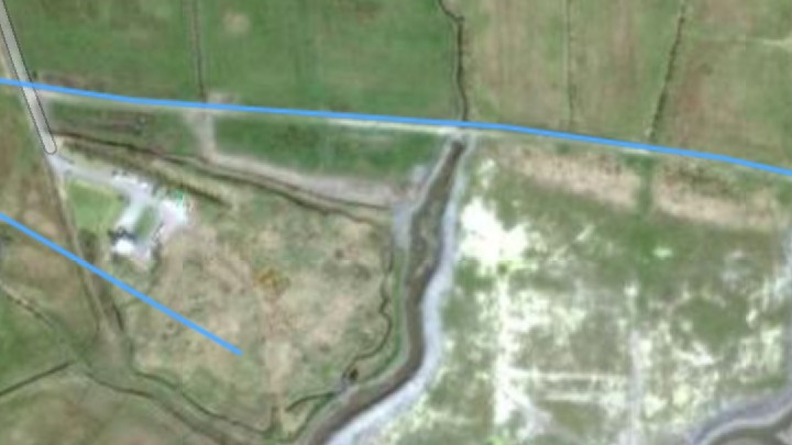
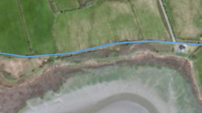 Garraun Crossing location also appears on this image, this time on the right. [13]
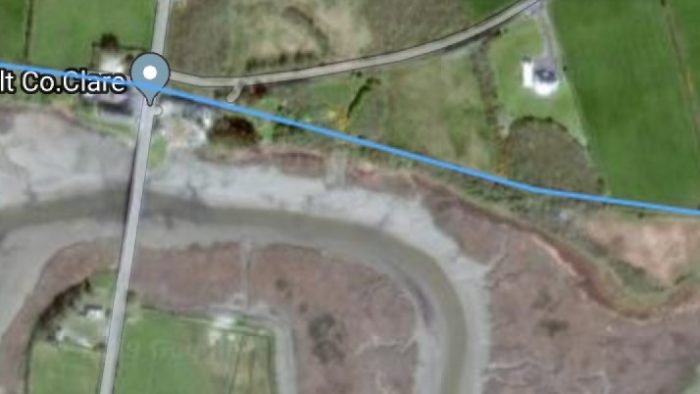 This satellite image shows the next station on the line, Blackweir Station. [13]
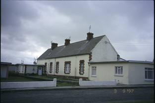
The station buildings at Blackweir were on the down side with a road-crossing at the west end of the station platform. As Taylor notes above, at one time this was a regular stopping point on the line, but in Later years it became a request stop. At 45.5 miles from Ennis, this was the only halt between Moyasta and Kilkee. Again, in the 1980s, Lenihan comments: “The platform still remains intact, on the down side, and the original station-building, a plain, single-storey structure, also stands, parallel to the line and now restored to its original state with only minor external alterations. A large dwelling house has been added at the Moyasta side, and the two blend together extremely well. The glowing accounts we had been hearing of it along the way were certainly borne out by this very pleasing development. Close by, a handsome five-arched stone bridge spans the upper reaches of the bay, and just off the road at its north-eastern parapet is a small quay, used extensively during the heyday of the turf trade, but now semi-derelict.” [18]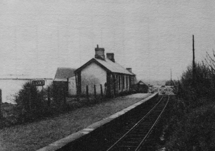
 Blackweir Station in 1952 (above). Since closure of the railway a house has been built at the end of the old station building closest tomtjhe camera, which enlarges the structure considerably. [19] The colour picture which follows the 1952 image shows the new building from the old crossing location, © C. Cooney. [20]
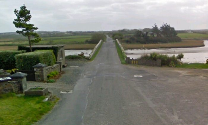 Blackweir Bridge seen from what was the trackbed of the old railway.
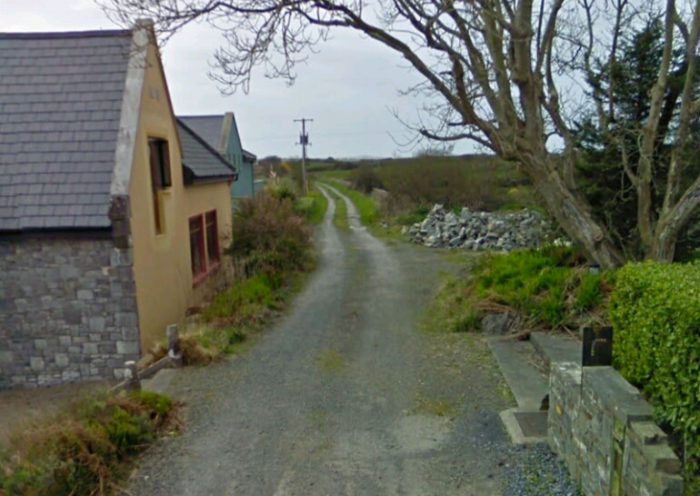 The trackbed ahead is in use as an access road.
As the journey continues, we can see the location of the halt clearly marked on the next satellite image. Access to the old line beyond this point is sufficiently difficulkt as to mean that I have not been able to find photograph of the next length of the line on the internet.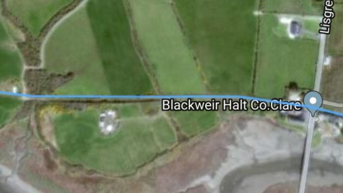
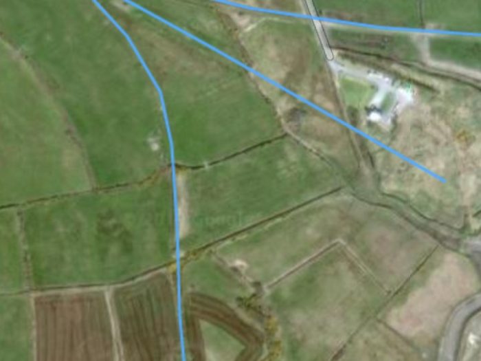 The most striking feature along this length of the old line was its growing proximity to the embankment of what was meant to be the first line in County Clare. Three biue lines appear on the satellite images above. [13] The most northerly of these is the West Clare line on its way to Kilkee. The next line shows the route of one abortive attempt to connect Kilkee and Kilrush in about 1858. These two appear again on the map below, the dotted line on the north side of Poulnasherry Bay is the West Clare route as finally built. The more southerly route is the 1858 scheme.
It is worth reminding ourselves at this point of the shenanigans that took place over the possibility of creating a railway in this part of Co. Clare.
In the years after the Famine, railway fever gripped Ireland, much as it did the whole of the UK at the time. There was a tremendous upsurge in scheme proposals and construction work. In 4 decades, 1845 to 1885, a dozen schemes were promulgated for County Clare. Lenihan says that, “All these plans were similar in some vital respects: they all included as their terminus points Ennis, Kilrush and Kilkee. At that time traffic on the Shannon was considerable, and Cappagh pier had to figure large in any route that hoped to be profitable, but how Cappagh might be made accessible was the subject of widely varying proposals. Essentially, though, there were three routes: from Limerick to Foynes by rail, then to Kilrush by steamer; from Ennis via Kildysart, Kamer and Carrigaholt or Querrin to Kilkee; from Ennis via Ennistymon and Miltown Malbay, then southward.” [21]
Taylor says that, “As well as railways, there were schemes to reclaim land, and build embankments across the Poulnasherry Bay, where the Blackweir and other rivers congregate on their way into the River Shannon, and on towards the Atlantic Ocean. There were also a number of schemes for roadside tramways, as opposed to railways.” [22]
As we have noted already, maps show the most promising of these early lines as a dotted line on the south side of Poulnasherry Bay. The map below is an extract from the Irish OSM Community Map and the older near the or is can be made out to the south side of the West/South Clare Line and running on the south side of the river estuary. [24]
 The earthworks associated with the third blue line can be made out curving to the south below the 1858 scheme’s embankment and then entering a narrow north-south band of woodland on the adjacent satellite image. I do not as yet have any details of this line.
Also be noted on the adjacent satellite image are two features: a rod-crossing to the right of the image and a significant cutting to the left of the picture.
The road-crossing was for a minor laneway. The cutting is Lisdeen Cutting and there is a road-crossing towards the West end of the cutting that bears the same name.
Much of the line over which we have travelled to get to Lisdeen crossing is in use in the 21st century as a series of different access tracks. This ceases at the unnamed crossing mentioned above. 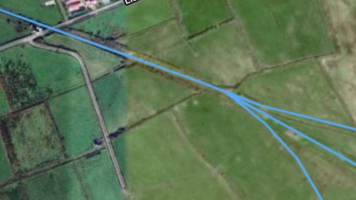 The three old rail routes meet. Only the most northerly ever carried passengers and goods! Lisdeen Cutting and Crossing can easily be made out with crossing in the top left of the satellite image. [13]
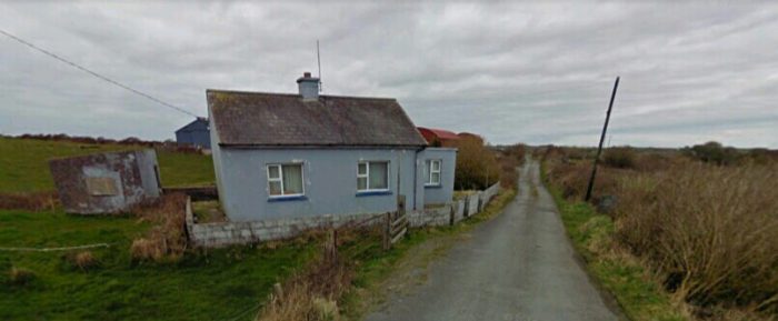 The crossing a keeper’s cottage in the 21st Century. The line runs behind it.
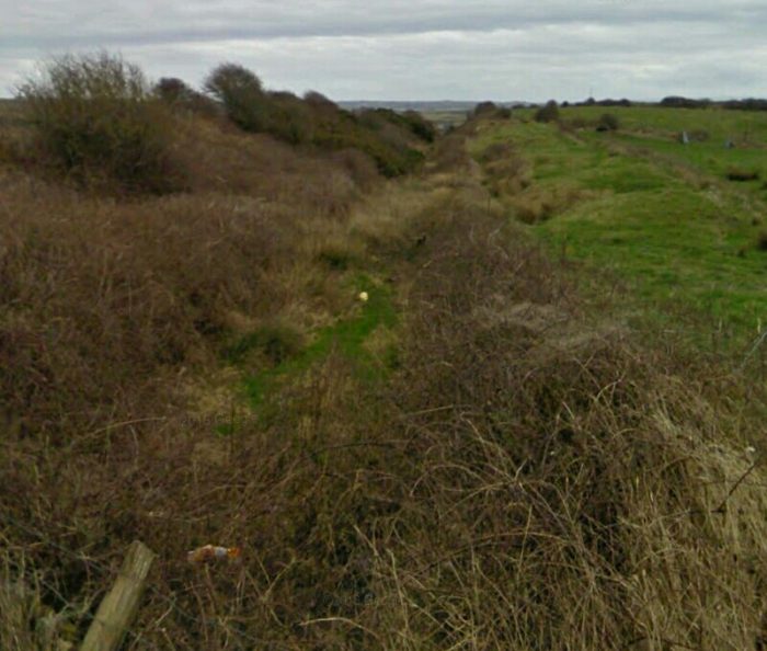 Looking back from Lisdeen crossing through the cutting towards Moyasta.
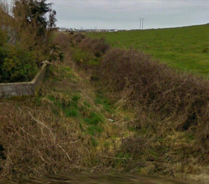 Looking ahead towards Kilkee from the crossing. Our destination can be seen on the horizon.
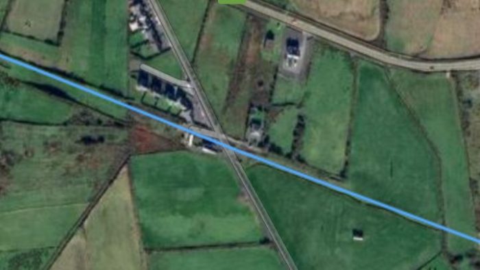 After the end of the cutting we encounter one more road-crossing before we enter Kilkee. Shown on the satellite image above, this was Dough Crossing, just over 47 miles from Ennis and 700 yards from the terminus. [27]
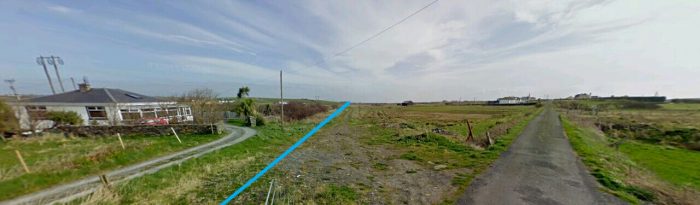 Looking back along the line from Dough Crossing towards Moyasta.
 Looking forward towards the location of Kilkee Station from Dough Crossing.
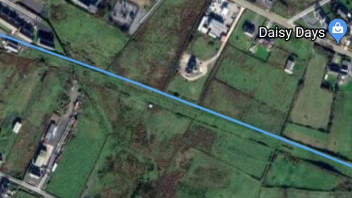
 These last two satellite images get us to the end of the line in Kilkee. [13]
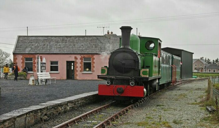
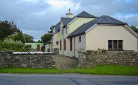
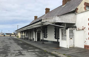
The adjacent image shows Kilkee Station as it appears fptoday when approached from Moyasta. [25]
The picture below is taken from the West.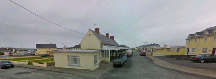
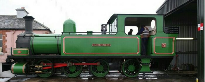
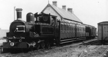 No. 5, Slieve Callan is shiwn at Kilkee in 1950. No.5 has been restored and runs on the preservation line at Moyasta. [28]
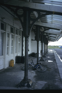
 Three further pictures of the station building in the early 21st century follow. [29]
The first monochrome picture below was taken in 1952 and is contained in Lenihan’s book. [30]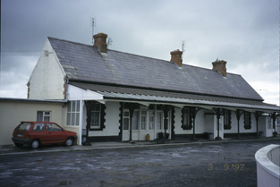
Lenihan describes the scene in the late 1980s: “on the up side, was the station-house itself in a well-paved yard, but surrounded by what appeared to be chalets. Old photos show that one siding led to the turntable, which was sited only yards from where we were now standing, in front of the engine shed; a second to a large building (probably the goods’ store) directly east of it; and that the main running road and passing-loop joined near the signal cabin. But, as in every other station, there is nothing to show this today. A quick inspection confirmed for us that of this terminus of the South Clare the only remnants are these two buildings, both constructed in 1891. The water-column, the 3,800-gallon tank, loading-bank, 23-foot-4-inch turntable and goods’ store have gone the way of all the others.” [30] The second and subsequent monochrome pictures of the station in use are taken from Patrick Taylor’s book. [31]
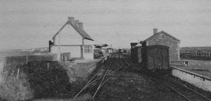 Kilkee Station in 1952, © IRRS. [30]
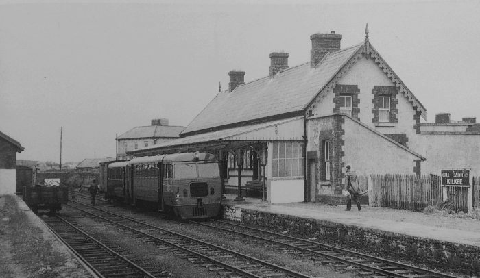 Railcar No. 3387, waiting to leave Kilkee on the 1.45pm to Ennis on 17th June 1954. The train consists of the railcar with a railcar trailer, and one of the ex-Clogher Valley Railway wagon underframes with a Limerick body. This was the standard formation for railcar worked trains, © C.H.A. Townley. [31]
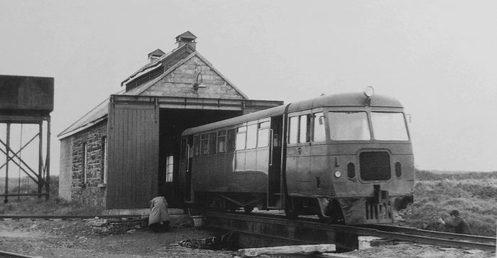 Railcar No. 3388, on the turntable outside Kilkee locomotive shed on 17th July 1958, after working the 5.05pm ex Moyasta Junction, © D.F. Russell. [31]
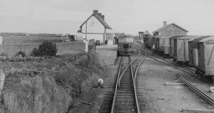 A railcar has just arrived at Kilkee in May 1958. The bus connection waits for passengers while the yard is full of wagons. The goods shed, engine shed and water tank are all visible, © A.M. Davies. [31]
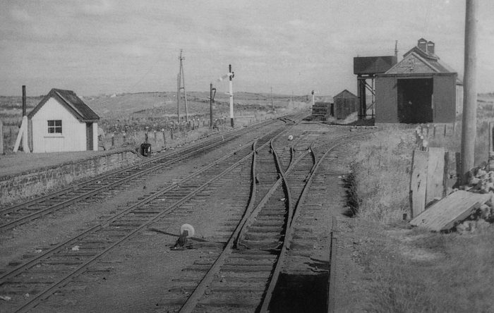 The East end of the station, looking towards Moyasta with the engine shed on the right and the water tank behind it, © C.L. Fry. [31]
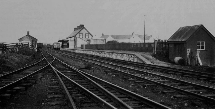 An overall view of Kilkee station looking from the East in 1933. This gives a good indication of the length of the platform! © Patrick Taylor. [31] A sketch plan of the station is shown below. [8]
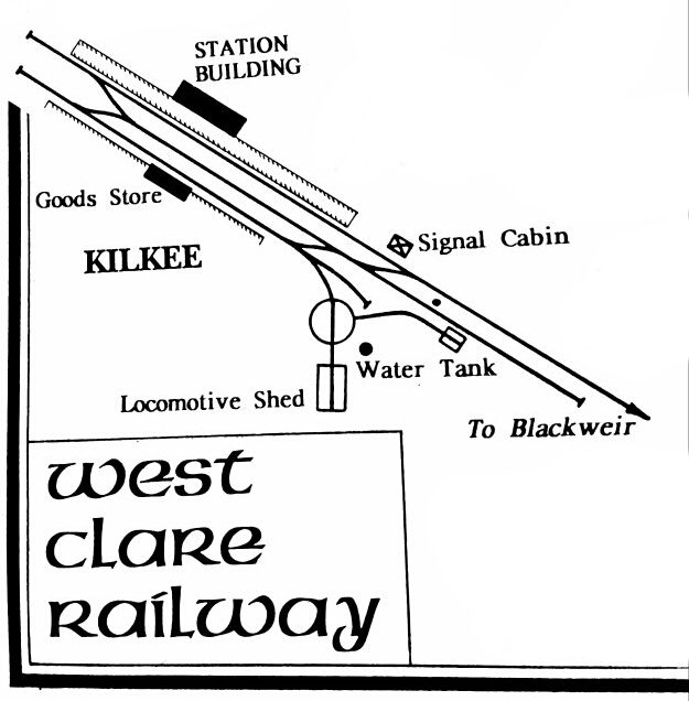 To complete this post we have three miscellaneous images of items of motive power or rolling stock from the West Clare Railway. We still have the line from Moyasta to Kilrush to focus on and hopefully too, some more information about rolling stock and motive power on the line.
Motive Power and Rolling Stock on the West Clare Railway (Miscellaneous Images)
Finally, just a very few images of rolling stock
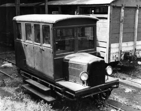 An Inspection Car, taken in 1953, (c) IRRS. [33]
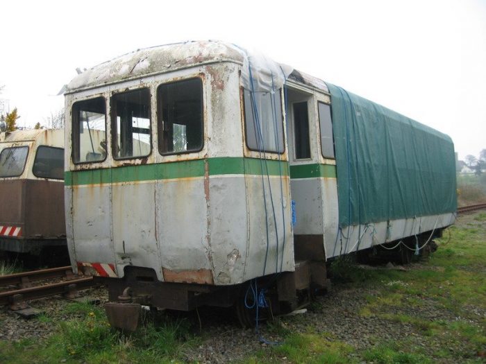
 Ex-West Clare Railcar above, converted to a coach by BnM is now stored on the Waterford & Suir Valley Railway. [34]
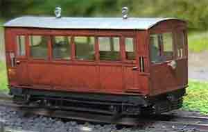
West Clare Drewry Railcar in 3mm Scale made by Mark Fisher. [35]
References
- Patrick Taylor; The West Clare Railway; Plateway Press, 1994, p44.
- Edmund Lenihan; In the Tracks if the West Clare Railway; Mercier Press, Dec. 2008, p226-227.
- http://www.westclarerailway.ie, accessed on 7th May 2019.
- Edmund Lenihan; op. cit., p227.
- Irish Times; 1st February 1961.
- Not used.
- Edmund Lenihan; op. cit., p228.
- Patrick Taylor; op. cit., p48.
- Edmund Lenihan; op. cit., p260.
- Irish Builder;15th January 1885, p22, quoted by Lenihan; op. cit., p261-262.
- Lenihan; op. cit., p261-262.
- Ibid., p 262.
- http://www.railmaponline.com/UKIEMap.php?fbclid=IwAR1t7uT66nNlgLdQOfpDOP2lKzJqdua7Y8GZVS6kwbYKQ7kVDj99aA_cObM, accessed on 6th May 2019.
- Not used.
- Edmund Lenihan; op. cit., p262-263.
- Ibid., p303.
- Ibid., p268.
- Ibid., p272.
- Ibid., p269.
- http://eiretrains.com/Photo_Gallery/Railway%20Stations%20B/Blackweir/IrishRailwayStations.html, accessed on 8th May 2019.
- Edmund Lenihan; op. cit., p17.
- Patrick Taylor; op. cit., p10.
- Not used.
- http://maps.openstreetmap.ie/oocmaps.html?zoom=15&lat=52.66552755081851&lon=-9.611483168775402&layers=B0000TFFFFF, accessed on 8th May 2019.
- http://www.charleshornsby.com/blog, accessed on 8th May 2019.
- Not used.
- Ibid., p277.
- http://www.skibbereeneagle.ie/ireland/west-clare-railway, accessed on 8th May 2019.
- http://www.buildingsofireland.ie/niah/search.jsp?type=images&county=cl®no=20301006, accessed on 9th May 2019.
- Edmund Lenihan; op. cit., p279.
- Patrick Taylor; op. cit., p45-47.
- Not used.
- Edmund Lenihan; op. cit., p23.
- https://www.narrow-gauge.co.uk/gallery/show.php?image_id=4428&cat_id=967, accessed on 9th April 2019.
- http://www.worsleyworks.co.uk/Image-Pages/Image_NG_Irish_WCR.htm, accessed on 9th April 2019.

Pingback: The West Clare Railway – Part 7 – Moyasta to Kilrush and Cappagh Pier | Roger Farnworth
Slieve Callan was Restored by Alan Keef Ltd at a Cost of over £600.000 . The Back of the Railcar is now With Jackey Wheelan in his Quarry near Kilrush . We have a Drewery Railcar from 1927 under Restoration regained from a 5ft-3in to 3ft. We also have the last Railcar Trailer 47C in Dromod on the C&L. Its Chassis is from a T&D Carraige from 1891
I appreciate the comments Michael, thank you.
Thanks for this wonderful work. When I win big, I’m going to restore the line from Kilkee to Moyasta, and maybe even on to Kilkee!! It would be such a great tourist attraction, day trip, enthusiast trap and of course a practical transport between the 1 towns.
maybe even on to Kilrush, obviously!