
The Line of the West Clare Railway from Moyasta to Kilkee
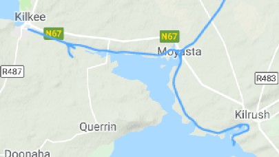 Moyasta was a junction station. The two lines which left to the south and to the west served Kilrush and Kilkee respectively. The two routes feature on the adjacent map. This post focusses on the line to Kilrush and on to Cappagh Pier.
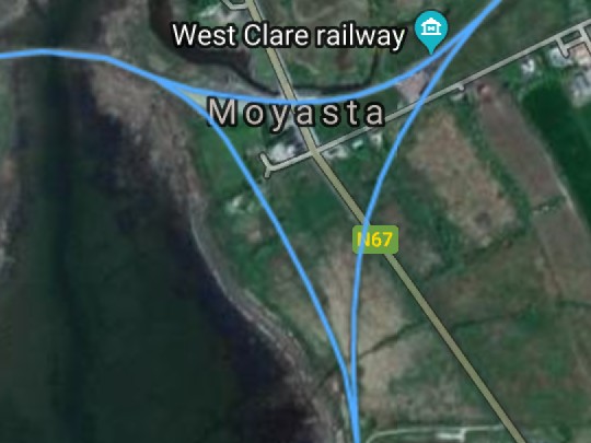 Before we set off, we note two things, as we did in the last post, about the station at Moyasta. First, the presence, in the 21st century, of a preservation line based at the station; and second, the layout of the junction at Moyasta. Although a direct line was provided to allow trains to travel between Kilkee and Kilrush. In practice it was little used in later years as trains tended to enter Moyasta station from either of the two villages and the set off from the station for the other village. This required some manoeuvrings in the station area!
However, when the pier was in use at Cappagh, “the Loop … was extremely useful for allowing a direct passage to through traffic, especially from Cappagh to Kilkee.” [2]
We spent time in the last post in this series looking at the preservation line. The link to that post is: https://rogerfarnworth.com/2019/05/09/the-west-clare-railway-part-6-moyasta-to-kilkee
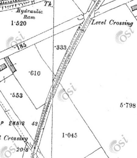
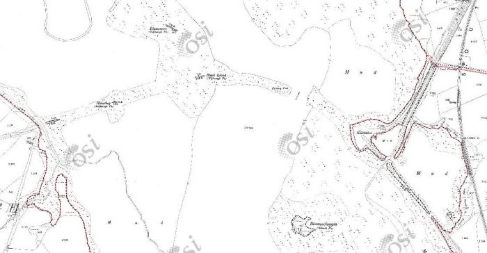
We also considered the loop line in the same post and we will not repeat what was said in that post about the link that made direct services between Kilkee and Kilrush/Cappagh Pier possible.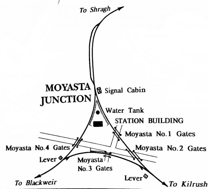 There were four road-crossings at Moyasta, all within a radius of 200 yards of the station-house. By the late 1980s, Lenihan observed that, “as at most other such places, there was nothing, for at Moyasta, just as at Knockdrumniagh, near Ennistymon, road widening has changed utterly the lie of the land.” [2] The plan is taken from Patrick Taylor’s book. [1]
We allow our two guides, Edmund Lenihan and Patrick Taylor to take us out of the station and its environs and on to Kilrush and Cappagh Pier. The presence of the preservation railway means that the locations of the crossings shown above are easier to define in the early 21st century than they might otherwise have been.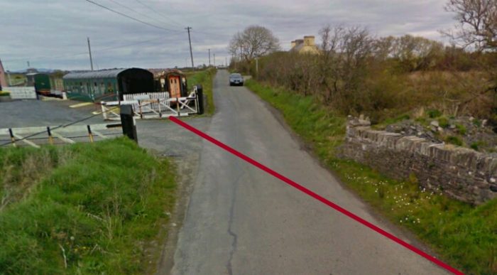
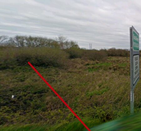 Moyasta No. 1 Crossing (above).
The adjacent image is taken at Moyasta No. 2 Crossing looking back towards No. 1.
The picture below is also taken at the No. 2 Crossing looking towards Kilrush. The Shannon estuary can be seen in the distance.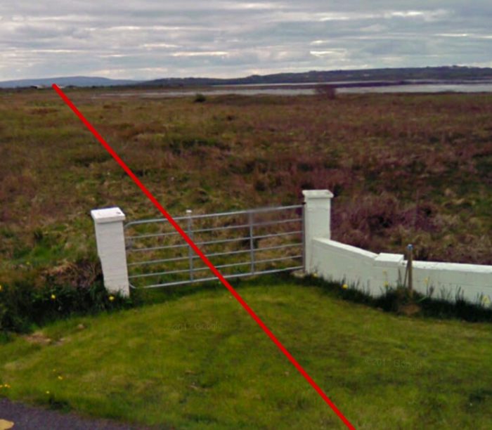
The Line to Kilrush
 Edmund Lenihan comments in the late 1980s that the line from the station beyond Moyasta Crossing No. 1 was so overgrown as to be impassable. [3][7] The forty-third milepost was at Crossing No. 2. This crossing was the site of a serious accident “when a young boy, trying to save the gates from an oncoming trail, was knocked down and killed.” [4]
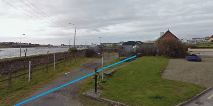
From the road to the junction with the loop is only a relatively short distance. Moyasta junction with the Kilkee/Kilrush loop on the left. The railcar has left Moyasta Station which is of the extreme right of the picture with a service to Kilrush. As we have already noted, there were few non-stop workings between Kilrush and Kilkee. Trains from one or other village used to enter the relevant platform at Moyasta and then propel backwards before using the loop to head on to the other village.
The line continues from the crossing in a wide, graceful sweep along the edge of the bay no more that 300 mm above the high-water level. Effectively the line was on causeway as there is evidence of the sea invading the land beyond the line.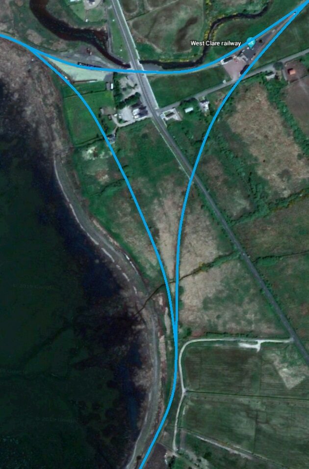 Continuing on into the townland of Carrowncalla North the embankment of the old line acts as a breakwater. After a length of straight track, the line curved southwards again.
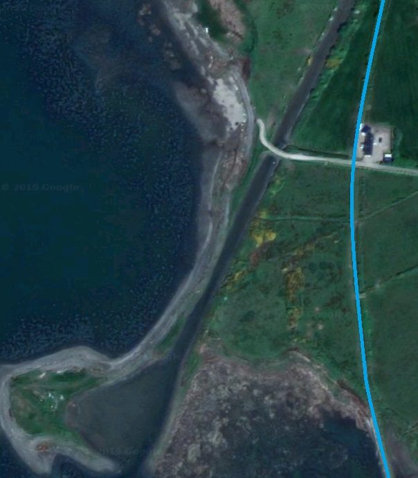
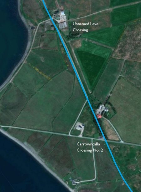
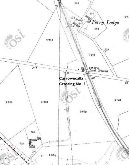
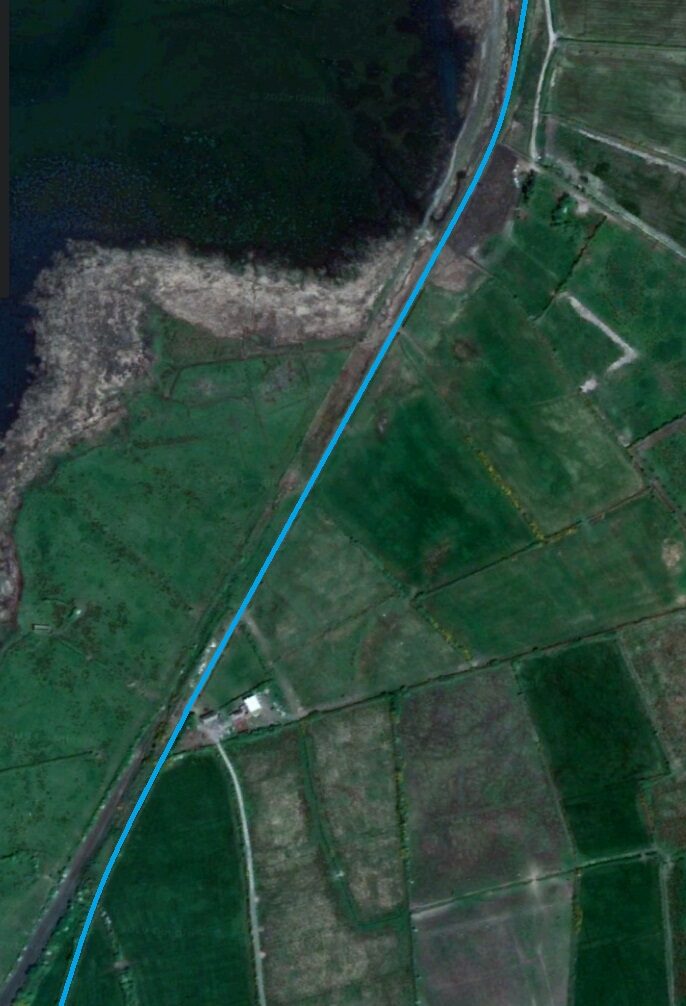 Soon the next road crossing was encountered, Carrowncalla No. 1. In the late 1980s the crossing-keeper’s cottage was intact but seemingly unoccupied. [5] Later, in a return visit in 2008, Lenihan noted that the cottage had been renovated but was still not lived in. [6] 150 yards to the West of the crossing, the road bridged a boat channel. The crossing is shown on the OS Map extract and satellite images below. [7]
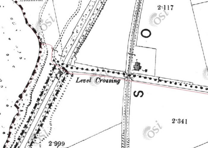
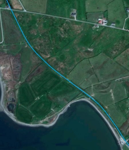
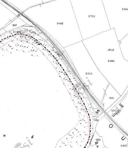
 The narrow neck of land to the west of the boat channel continued on and came to a head at Ilaunalea, 500 metres distant. This can be seen easily on the satellite image above. “From here in 1863 it was proposed to build an embankment across the mouth of Poulnasherry, by way of Black Island and Ilaunbeg, to Kilnagalliagh, on the western shore. It was a daring plan and probably would have succeeded but for the ill-advised attempt to close the mouth of the bay in the face of winter tides.” [5] By the 1980s, only eroded, scattered remains were visible, and that only at low tide.
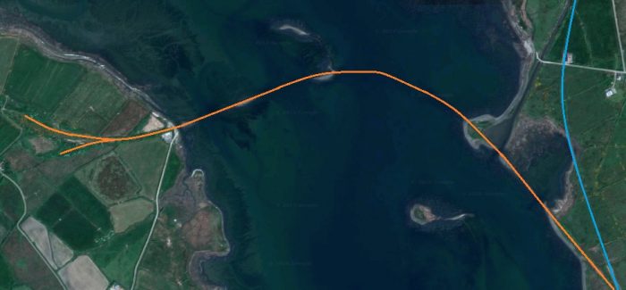
 The blue line on the satellite image above shows the route of the West Clare Railway. The orange line shows the route of the planned but eventually incomplete railway crossing the mouth of Poulnasherry. The orange line could have been extended in a northwesterly direction and looking at satellite image shows the old formation still evident to the Northwest. The importance of the line drawn on the image above to to show its route across the tidal estuary. The embankments show clearly on the OS Map extract from the 1950s, immediately above. [7]
Immediately south of the point where the orange and blue lines diverge/meet (and just off the satellite image above is the location of an un-named accommodation crossing there was then a straight length of track before Carrowncalla No. 2 Crossing. Lenihan diverted a way from the West Clare for a time to explore the coast line and the older earthworks before heading back to the West Clare at the point of this level crossing. [8]
Between the unnamed crossing and Carrowncalla No. 2, the line ran in a straight South-southeasterly direction. In the 21st Century, it is in use as an access road for much of that length. Lenihan visited the level-crossing location again in 2008 and commented that the house had been fully renovated and was now lived in. [6]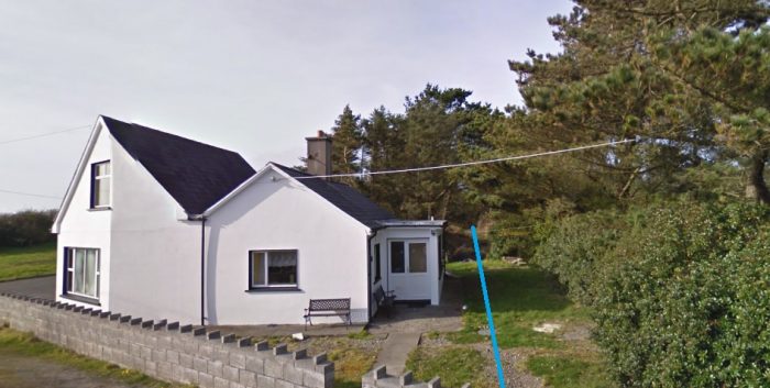 Looking North-northwest along the formation of the West Clare Railway (marked by the blue line) from Carrowncalla Crossing No. 2. The Crossing-keeper’s cottage has been extended to make an excellent modern home. (Google Streetview).
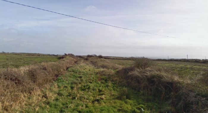 Above, looking South-southwest from the same location. (Google Streetview). The image below comes from Taylor’s book and is taken on the North side of the crossing. [16]
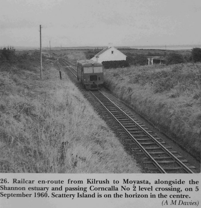
South of Carrowncalla Crossing No. 2 the line curved a little towards the Southeast and ran for a short while alongside a small bay before crossing Brew’s Bridge. The location of Brew’s bridge can just be picked out at the bottom right of the adjacent satellite image.The extract from the OS Maps shows the location clearly, just to the Southeast of the bay. Lenihan has a lot to say about this location. [9]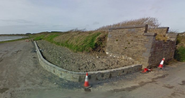
The northern abutment of Brew’s Bridge in 2009. (Google Streetview).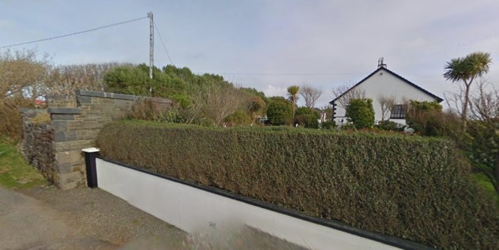 The more southerly of the two bridge abutment in 2009 with the house alongside the old formation as mentioned by Lenihan. (Google Streetview).
Beyond Brew’s Bridge the line gradually turned Eastward. The going was relatively easy.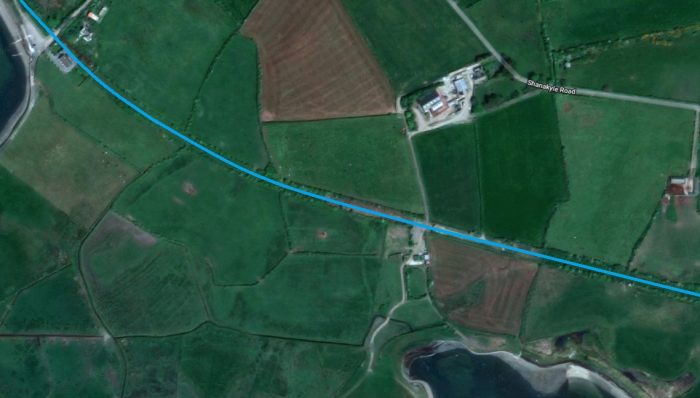
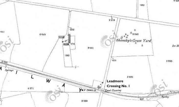 The next crossing was Leadmore No. 1 which was south of the Shanakyle Graveyard. The Crossing-keeper’s cottage here has also been renovated and is lived in. [6][7]
In the 1980s, Lenihan commented that “to enter Leadmore no. 1 cottage was to get a brief glimpse of the past, for the interior of the house was quite unchanged from how it would have looked in West Clare days. An old railway clock, the open fireplace, a drawing of engine no. 5 from 1892, all testified to a lingering regard for old times, though the owner was quite adamant that she had no regrets over the passing away of the railway.” [10]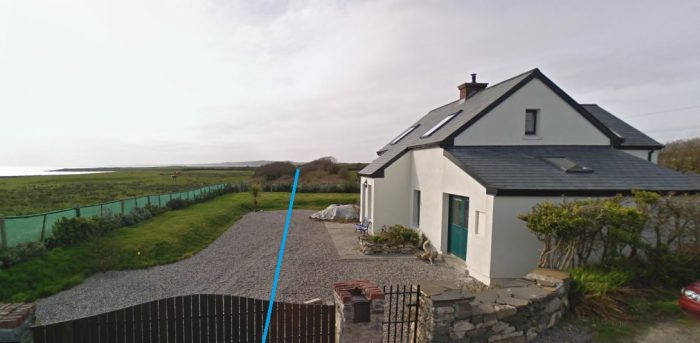 Leadmore Crossing No. 1 with the old keepers cottage to the right and the line back towards Moyasta shown by the blue line. (Google Streetview).
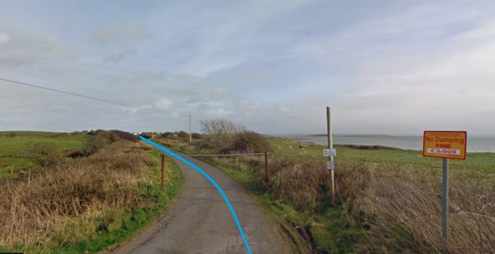 Looking ahead along the line to the East and towards Kilrush from the smae location, (Google Streetview).
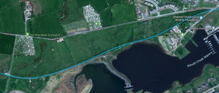 From Leadmore Crossing No. 1, the line heads East-northeast into Kilrush.
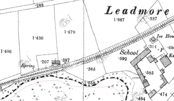 En-route to Kilrush the old line passed through Leadmore village. [7]
One length of the line en-route to Kilrush was close enough to the water to need a revetment constructing to protect the line. That location can be seen above on the left of the OS Map extract. The school shown on the right of the extract is now the location of L&M Keating (Maritime) Ltd. We are actually now very close to Kilrush station. The OS Map extract below shows the first part of the station site which was to the West of the Level Crossing.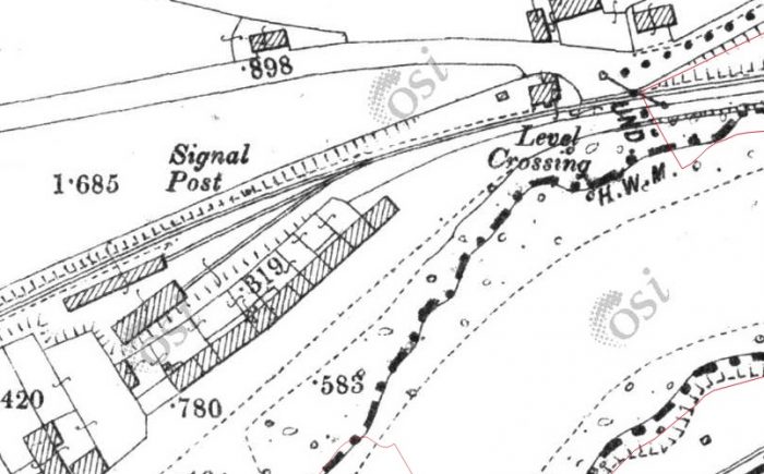 Taylor comments: “The line from the down home signal, where a short steep decline at 1 in 72 commenced, continued past the two road carriage shed, and one road engine shed on the up side, until Leadmore No. 2 level crossing was reached before entering the yard at Kilrush. This crossing, whcih was built on a curve, was protected by up and down signals.” [16]
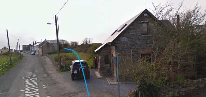 This view looks back along the old line towards Moyasta. The renovated Crossing-keeper’s cottage is on the right. The crossing gates were relatively narrow and the stone pilasters which supported the gate are still evident. (Google Streetview). To the left of the line behind the cottage were two buildings which were rail-served. The engine shed and carriage shed. The engine shed was the smaller building closer to the cottages.
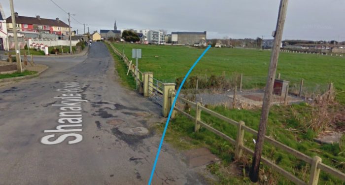 From the same location (Google Streetview), looking into the station yard which in 2009 was now grassland. The station building can be seen in the distance immediately to the left of the blue line.
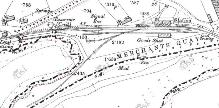
 The station site at Kilrush taken from the East. (Google Streetview in 2011). The station building and platform edge are still visible. The goods shed has been replaced by a corrugated steel roofed structure.
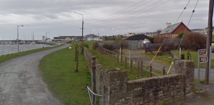 The station site at Kilrush also taken from the East. (Google Streetview). The station building is shown to greater advantage. The old Merchants’ Quay which is on the left of the image, is now (2011) the access route to Kilrush Marina.
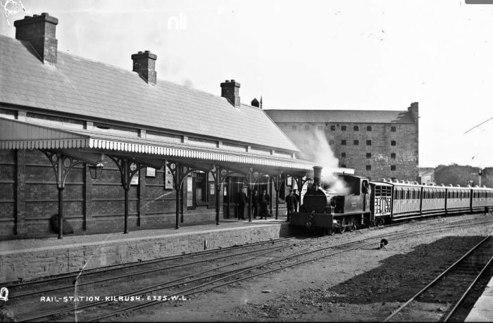 An early (circa. 1890) picture of Kilrush Station taken from the West. [11] The next four pictures are closer looks at this image.
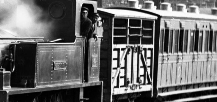
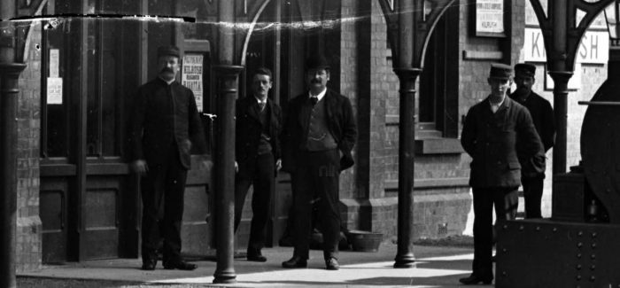
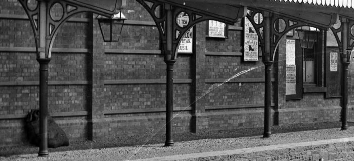
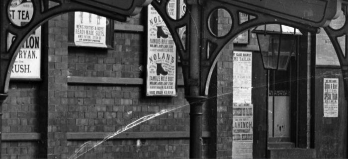
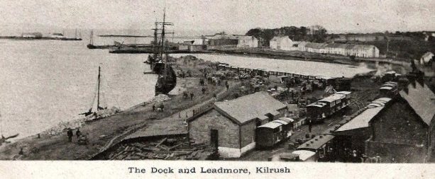 This image shows the view across the station site to the docks/Merchant’s Quay and Leadmore. The old goods shed can be seen in the centre of the picture. [12]
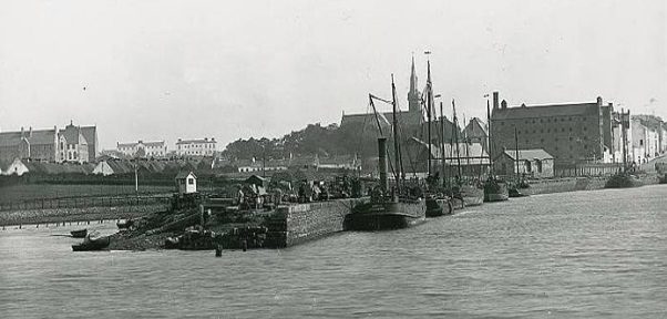 This view of the harbour at Kilrush shows the station building and goods shed, centre-right. A signal and ground-frame hut can be seen centre-left. [12] The image below is an excellent period photograph of the station building. [12]
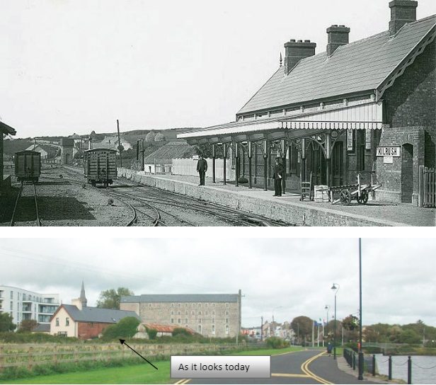 The access road to Kilrush Marina has been improved and is now (2018) metalled and Merchant’s Quay has been refurbished. It provides a good location to take a picture of the station building(s) and Glynn’s Mill building(s) as they appear in the first quarter of the 21st Century. [12]
Taylor describes Kilrush as “the self-styled ‘Capital of West Clare'” [16]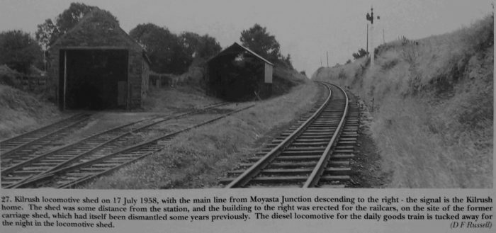 Taylor provides a number of important photographs of the Kilrush station site – the first of these shows the engine shed and carriage shed in 1958. [16]
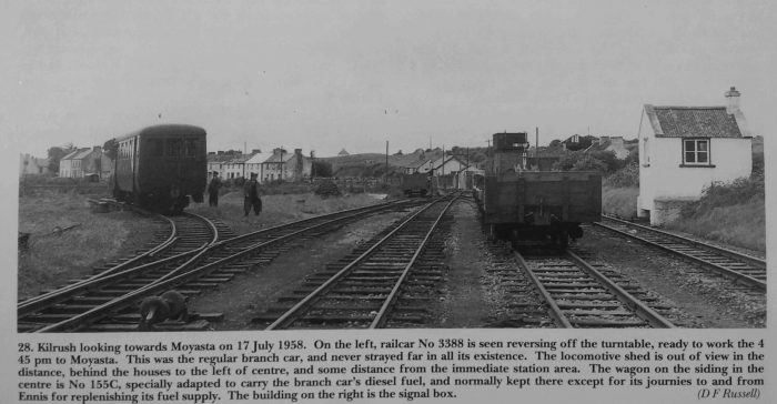 Also taken by D.F. Russell, this picture looks back towards the engine and carriage sheds from the middle of the station yard. [17]
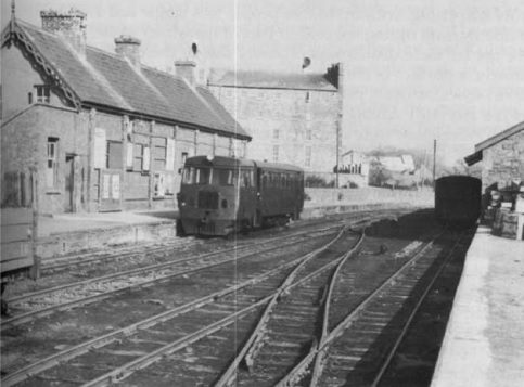 The station in the 1950s viewed from the Goods platform, (c) IRRS No. 10748. [18]
Edmund Lenihan, writing in the late 1980s, having just explored the station site, said:
“Uncomfortable, even dangerous, though it was to have to pick our way through this wasteland, we did it, still hopeful of finding something. We might as well have gone by the road; there were no wonderful discoveries, no magical ending, only the station-house, standing, as always, just across the road from Glynn’s mills and round the corner from Merchants’ Row and Frances Street.” [13]
The station building has been significantly refurbished as the modern photos above show. In 1999, Lenihan wrote:
“In the years since I last visited [Kilrush] a great deal has changed, and for the better, particularly at the station end. Gone is the rubbish dump that defaced the area beside Leadmore no. 2 level-crossing cottage (p.249). It is now as clean and level as a town park, and an unimpeded view of the station is possible from several hundred yards away. ‘Crush marina, which was then only in its planning stage, is now in full operation and has brought life back to the creek, though hardly to the same extent as when Turf Quay, Customs Quay and Merchants’ Quay were in their heyday. Close by, a Scattery Island interpretative centre has been opened, and across the creek, beside Doherty’s timber yard and the site of the removed railway bridge (p. 256), is a new activity centre.” [14]
Writing in 2008, Lenihan describes the station site again:
“The station-house is there, certainly, and is once more a dwelling, for two families now. Its eastern gable, which was disfigured by a large door during the building’s days as a truck garage, has been restored. But the fine triangle of clear ground between it, the marina and Leadmore no. 2, which common sense might suggest should be preserved as a public amenity, is now under pressure of commercial development, despite the fact that the future of some of the similar recent developments in the town is uncertain because of the deflation of the property bubble.” [15]
 T
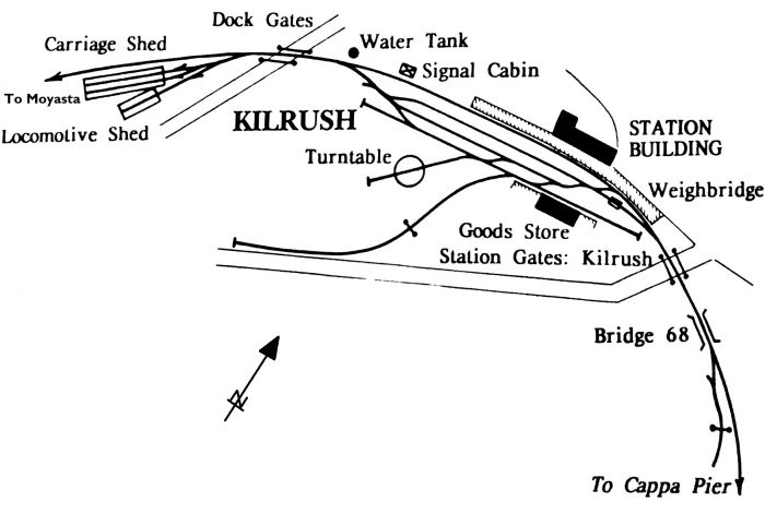
T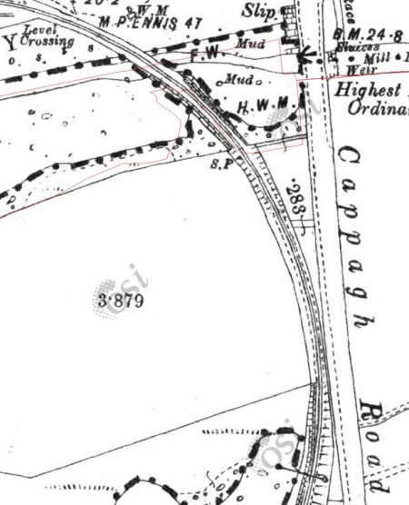 he sketch plan above shows Kilrush station in its heyday. It is provided by Patrick Taylor. [1]
The adjacent OS Map extract shows the West Clare railway continuing beyond Kilrush Station. It turns through 180 degrees on a tight radius curve. The bridge over the tidal channel is Bridge No. 68 shown on the sketch plan above.[7]
The railway then continued in a Southwesterly direction on the South side of Kilrush Creek, as shown in the OS Map further below. [7]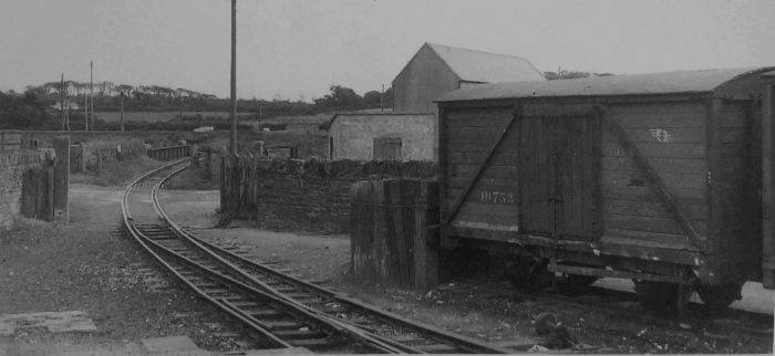 The way ahead to Cappagh Pier. Bridge No. 68 has been removed and replaced with a footbridge, (c) D.F. Russell. [21]
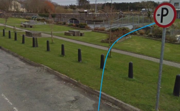 The approximate line of the old railway to Cappagh Pier is shown by the blue line (Google Streetview – 2011). The footbridge is at approximately the location of the old railway bridge.
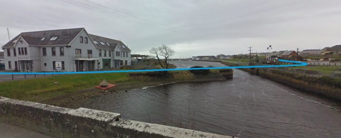 Looking West down Kilrush Creek in 2011 (Google Streetview). The station is visible on the right of the picture the railway embankment and bridge abutment are right of centre.
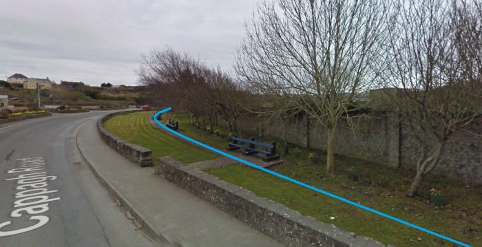 In this picture from 2011 (Google Streetview) the road which used to turn through a very sharp right-angle bend has been diverted to run directly alongside what was the alignment of the railway.
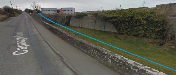 As can be seen in the OS Map extract below the road and rail drift apart on their way westward.
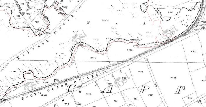
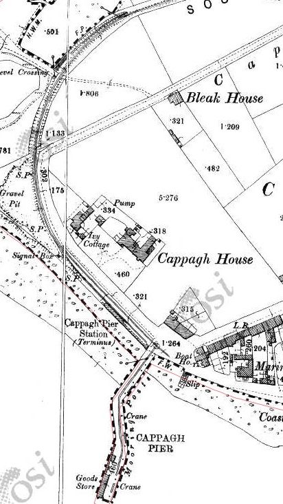 Passing Bleak House on their left, trains from Kilrush then curved round to the South east before entering Cappagh Pier Station close to Cappagh House. Just prior to the station a gravel extraction pit was passed on the right. Beyond the station there was a short gated stub line with a turntable. The turntable gave access to Cappagh Pier and the line ran out to the end of the pier and a Goods Store. [7]
Taylor’s sketch plan of the station and pier is shown below. [1]
Historically there were two platforms at Cappagh Pier Station and each had canopies. Taylor’s comments about the station appear below. The gravel pit in the OS Map extract is now the site of the RNLI station (Google Streetview).
 From this point road and rail run immediately parallel to each other into Cappagh Pier Station (Google Streetview).
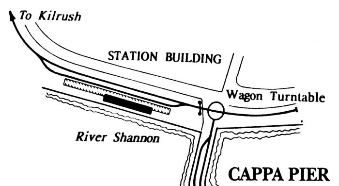
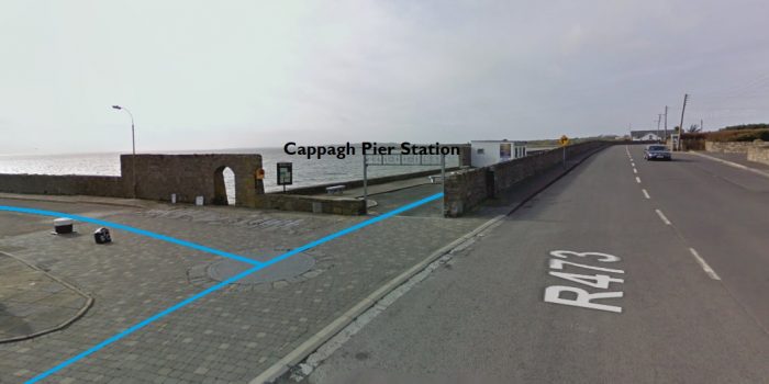 The turntable location is marked in the paving at the site of the station and pier at Cappagh, (Google Streetview).
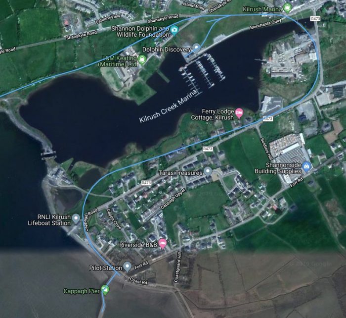 This satellite image shows the full extent of the old line in the vicinity of Kilrush and Cappagh. [19]
 The terminus at Cappagh in 1953, (c) IRRS No. 10439. [20]
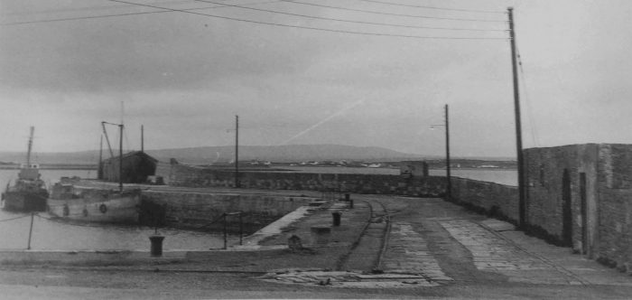 Turning 90 degrees to the left from the above photograph, this is the view down the pier at Cappagh. The turntable is in the foreground and the Good Store is visible at the end of the pier. [21]
Taylor writes: “On the last mile of line from Kilrush to Cappa Pier, after passing through the level crossing gates at 47 m.p., and over the Ballykett stream bridge No.68, past Doherty’s timber yard (where a private siding ran into the yard on the up side) the line veered sharply to the right and ran along the opposite bank of Steamers Quay passing Supples crossing before turning left into Cappa. The line continued through a gate on to a small turntable 9’6″ long which turned wagons singly to the right and on to the pier which was provided with two sidings running parallel. The second siding was installed by the G.S.R. in 1933 for the quick turn round of wagons. Cappa was provided with two running roads and two platforms. The Platforms had overhead concrete roofs and entrance was gained to them at the pier end. The roofs and the down platform were removed by the G.S.R., possibly also in 1933.” [21]
This brings us to the end of our survey of the West Clare Railway. What remains is to look at locomotives and rolling stock in a future post.
References
- Patrick Taylor; The West Clare Railway; Plateway Press, 1994, p48.
- Edmund Lenihan; In the Tracks if the West Clare Railway; Mercier Press, Dec. 2008, p228.
- Ibid., p230.
- Ibid., p231.
- Ibid., p234.
- Ibid., p304.
- http://geohive.maps.arcgis.com/apps/webappviewer/index.html?id=9def898f708b47f19a8d8b7088a100c4, accessed on 2nd July 2019.
- Lenihan, op.cit., p238.
- Ibid., p241.
- Ibid., p245.
- https://www.facebook.com/kilrushcu/posts/railway-station-kilrush-co-clare-circa-1890/1200065626698858, accessed on 4th July 2019.
- https://docplayer.net/58337136-A-tribute-to-kilrush-in-the-great-war-by-ger-browne.html, accessed on 4th July 2019.
- Lenihan, op.cit., p250-251.
- Ibid., p293.
- Ibid., p305.
- Taylor, op.cit., p49.
- Ibid., p50.
- Lenihan, op.cit., p253.
- http://www.railmaponline.com/UKIEMap.php, accessed on 5th July 2019.
- Lenihan, op.cit., p258.
- Taylor, op.cit., p52.

He was right. But there has been a long struggle to get some small section of the line opened with a steam engine to run on it. The campaign seems to have advanced in fits and starts, a bit like the WCR trains themselves, at least if we are to believe Percy French, whose most famous song landed him in court. However, despite some disagreements along the way, and some delays, Jackie Whelan, er, acquired the locomotive Slieve Callan and had it restored. The WCR has now gained support from Clare County Council ; it hopes to extend its short length of track to two miles with a level crossing over the main road, and eventually to link Kilkee to Kilrush via Moyasta. It also intends to provide broad gauge (5 3 ) track for its main-line diesel locomotive and for others that may be based there. No doubt the WCR website will have news of progress.
My father owns a peace of that land which the council want to buy to to continue with their plans who do we need to get speak to please.
Sorry Patricia, I don’t know who you should contact. I hope you can find out from someone more local. Very best wishes
Roger