The Line of the West Clare Railway from Miltown-Malbay to Quilty
Before setting off on the next leg of this journey South along the Atlantic Coast of Co. Clare we take a quick look at the town of Miltown-Malbay which has only existed since about 1800 but grew rapidly: by 1821 it had a population of 600. During the Great Famine (1844 – 1848) many farmers were evicted by the unpopular landlord Moroney. In the years after the famine the (Protestant) Moroney family went on with rack renting and evictions. At one time the population had enough and started a boycott. The government did not like that and imprisoned all pub-owners and shopkeepers who refused to serve the family or their servant. So at the end of 1888 most pub-owners and shopkeepers were in jail! [9]
The Co. Clare Library says the following about the town:
Miltown Malbay or Sráid na Cathrach is at the heart of an ancient area known as Kilfarboy. Sráid na Cathrach translates into “The Street of the Fort”, deriving from the existence of an Iron Age fort (An Cathair) near the site of St. Josephs Parish Church. The earliest inhabitants of the area were likely found on the rising ground to the north and east of the present town, stretching from the fort to the monastic foundation in the townland of Kilfarboy. It is suggested by some that Miltown comes from the Irish “Meall-Bhaigh”, meaning a treacherous coast or bay. It could also have taken the name Malbay from either the tradition of the witch, Mal, being drowned in the bay, or that of the volcanic eruption which drowned 1,008 people and separated Mutton Island from the mainland in 804.
Miltown Malbay grew in part because of developments at nearby Spanish Point. Thomas Moroney built the Atlantic Hotel in the early nineteenth century and for a time it rejoiced in the title of the largest hotel in the British Isles. The seaside resort developed as a refuge for the aristocracy and some of the lodges can still be seen today although only a small portion of the hotel ruin remains.
Miltown Malbay once had five corn mills, of which the ruins of three can still be seen. In 1825 Terence MacMahon owned a corn mill and Mary MacMahon a tucking mill and the growing town was referred to as Poll a Mhuillin. This was later translated as the town of the mill or Milltown.
By 1837 Miltown Malbay contained 133 houses and 726 inhabitants. During the year of the abortive rising, 1867, the local resident magistrate wrote to the Under-Secretary at Dublin Castle because he was “seriously apprehensive of a Fenian outbreak” in the locality.
One of the greatest historical events ever witnessed in the town was the public address delivered by Charles Stewart Parnell in 1885. Although he was almost totally confining himself to parliamentary work at that stage of his career, Parnell agreed to come to Miltown due to his admiration for parish priest, Fr. Patrick White’s involvement in the land struggle. On January 26, 1885, Parnell came to Clare to turn the first sod for the West Clare Railway and later the same day came to Miltown for the meeting. Standing in front of the recently built parochial house, he addressed a crowd of over 20,000 and there were numerous bands in attendance.[10]
The town had a population of 575 according to the 2011 Census. Including the rural area around the town it counts about 1,600 inhabitants. [9]Miltown Church – St. Joseph’s [11]Miltown-Malbay regards itself as the home of traditional Irish music. [12][13][14]
The station building is sited to the Northwest of the town centre and is listed on the Irish National Inventory of Architectural Heritage as follows: “Detached former railway station complex, built 1857, comprising L-plan three-bay two-storey station master’s house with two-bay two-storey return, and four-bay single-storey station to right, having six-bay single-storey flat roof canopy over former platform. Now in use as guest house. Pitched slate roof with rendered chimneystacks. Rendered walls. Cast-iron columns to former platform. Timber sliding sash windows to former station. Replacement uPVC windows to house. Rough-cast rendered chamfered gate piers with wrought-iron gate to site. Former goods shed to site. Foundation stone of West Clare Railway laid by Charles Stewart Parnell to rear of this site.” [3]A Diesel Railcar at Mailtown-Malbay Station, seen from the North. Both the Good Shed and the Station building can be seen in this photograph. Both still stand and are now part of the complex of the guest house/hotel and apartments on the site [6]An Ennis-bound excursion train leaving Miltown Malbay on 16th August 1947, headed by Locomotive 11C. Presumably the wagon next to the engine was either vacuum braked or piped, but the reason for its use is unclear – unless to carry additional fuel for the locomotive. The first three coaches are West Clare ‘all thirds’, followed by two of the saloons. Notice the signal box. This was the last of the West Clare stations, equipped as a terminus complete with turntable and locomotive shed, and the last station with two platform faces, (c) Frank Jones. [16]
Diesel Locomotive No. F503 at Miltown-Malbay Station in 1956. [4]Loco No. F502 pulling a train for Kilrush in September 1960, (c) Roger Joanes. [8]A pickup goods in the hands of Loco 503 at Miltown-Malbay in September 1956 (c) O’Dea Photograph Collection. [7]A view South towards the N67 from under the canopy of the extended and modernised station building. [5]The station layout in its heyday is shown above. [1]
Patrick Taylor describes the station as being “the last station to have both up and down platforms both of which were provided with verandahs. A loco shed, goods store, turntable and water tank (10,000 gals) were also situated here as Miltown-Malbay was the terminus of the West Clare Railway. A staff post with the station building on the down side, it possessed pretty extensive accommo-dation. The signal cabin and a cattle bank were situated on the down side. The water tank, goods store and engine shed were to the rear of the up platform. [15]
He goes on to say that: “On passing the down home signal the up road was connected to the right and a siding veered off to the left to run onto the rear of the down platform. Another siding ran off the up road to the rear of the platform, which served the goods store loading bank and water tower. There were two connecting spurs off this siding, one running on to the turntable and engine shed at the Lahinch side. The other running on to both the up and down road adjacent to the level crossing gates on the Quilty side. The up starting signal was situated beyond the up platform on the up side and a water column was at the end of the up platform on the Lahinch end . The down starting signal and a second water column at the end of the down platform faced towards Quilty.” [15]
The onward route of the line heading South is shown first on the satellite image above and then on the adjacent 1940s OS Map. The South Clare Railway commenced at this station, and ran past three level crossings inside the first half mile. The line passed to the West of the small town of Miitown-Malbay whose centre is shown on the OS Map above.
Taylor continues: “The Lahinch-Miltown Malbay main road was crossed at the station gates and after a minor road at Flag Road No.1, the Miltown-Quilty road was crossed at. Flag Road No.2 crossing. The Miltown-Malbay up home signal was situated on the upside a short distance on the Miltown side of Flag Road No.1. Two bridges, Sextons (No.53) and St. Joseph’s Well river bridge (No. 54) were in close proximity on the next stretch after crossing Braffa level crossing at 28.57 m.p.” [15]
For a bit more detail we turn to Edmund Lenihan. He says that a short piece of shallow cutting is all that remains of the line until it reaches the Flag Road No. 1 crossing which is just 300 yards West of the town’s main crossroads. [2]Looking North from the minor road which was crossed at Flag Road No. 1 Crossing along the route of the old railway line back to the location of the Station. The shallow embankment shows the location of the old railway with Miltown Malbay away to the right of the picture. The image below is taken looking South at the same location.The next crossing was Flag Road No. 2 Crossing and the line crossed Flag Road at this point.The location of the crossing is easily established as there is a different form of boundary wall across the line. This view is taken from Flag Road and looks back towards Flag Road Crossing No. 1.Looking south from Flag Road the route of the line has been built over.
We are now at the top of the adjacent 1940s OS Map. The line is shown all the way through to Quilty on this and the next two OS Maps. The line curves gradually from a southerly trajectory to a southwesterly direction before curving south again at Quilty. The same length of the line is shown below these OS Maps in a series of satellite images from Google Earth. These are interspersed with Google Streetview images and others where available.
Edmund Lenihan spends some pages describing this part of the route. First, after the Flag Road crossings the line drifts towards Mullagh Road. Lenihan encounters two bungalows built over the line of the railway. At that point, adjacent to Mullagh Road the line was in cutting, so to build the two bungalows the cutting had to be filled. Prior to the construction of the two bungalows the cutting must have been immeidate ly adjacent to the road verge. [17]
The adjacent satellite image shows the route of the line tending towards Mullagh Road.
The next two satellite pictures show the two bungalows mentioned above. In these images, taken in around 2015, it appears that much of the railway cutting has been infilled. There are lengths close to the bungalows, both North and South of them where the cutting still appears to exist. In between the satellite images are pictures taken from Mullagh Road which show the line drifting towards the road from the North and then drifting away again to the South.
The photographs taken from Mullagh Road have the rough path of the railway line shown in red.
In the first, Miltown Malbay can be seen in the right-distance. The remaining three form a straightforward sequence with the last shown the route of the railway moving away from the road. The satellite image which folows these four oictures shows the route of the old railway from above.As we travel on towards Quilty, we note that the route of the line now runs across open fields. On the ground there ois little trace of the line. The satellite images keep us on track.
We cross a minor road at-grade. This was a gated crossing and the crossings keeper’s cottage remains in the 21st century. It is approachingvas we leave the adjacent satellite image and shows up clearly at the top of the next satellite image.
In between the two are Google Streetview pictures of the crossing and its immediate environment.A view from the East looking along the minor road. The old railway approached on the alignment shown, travelling behind the crossing-keeper’s cottage.The cottage has been extended towards the alignment of the old railway.The crossing was on a very shallow angle. This view is also taken from the East. The gate posts can still be seen at the far side of the crossing.The line continued on towards Quilty. As it does so, we listen to Edmund Lenihan’s description of the route just a little further ahead along the old line. Clearly he did not have the benefit of satellite imagery.
A few hundred yards beyond the road-crossing the railway crossed the Annagh River again. The bridge can be seenninnthe top right of the adjacent photo.
To the West of the road-crossing the road crossed the Annagh River. It was from McMahon’s corn and woollen mills in the immediate vicinity of thst road bridge that “the village of Miltown took its name in the nineteenth century, and the name of the nearby townland, Poulawillin, still preserves this memory. The bridge, at least 40-feet high, bears the inscription `Built by John Stackpoole, Esq. July 1811′, and has withstood the years with dignity.” [19] Just to the West of the bridge is St. Joseph’s well, the site of regular pilgrimages.
Once the railway crossed the Annagh for the second time it entered the townlands of Annagh. Lenihan’s says: “There was much to admire in the way the river squirmed along in a semi-circle to a huge pool at the base of the embankment close to where the twenty-ninth milepost once stood. A fine place for fishing, without doubt, but extremely deep and dangerous-looking. The current has begun to eat into the foundations of the line, and already land slippage has occurred, leaving a sheer and frightening drop.” [20]
One thing which is a recurrent reality in Lenihan’s book is the swamp-like nature of much of the conditions underfoot and at other times, just how easy it was to loose the route of the line. This next passage from his book gives a good impression of so much of the walks he and his son undertook.
“Our troubles continued, the swamp developing into a small lake. But for the rushes at the edges of the line, we could have made no progress. We hopped along, from one to the next, a business that demanded total concentration. Then, in lightning contrast, when we squelched through a muddy gap we found ourselves faced with a huge levelled field.The line was being elusive again, and succeeded in hiding from us for most of the way to the next crossing cottage half a mile away.” [21]
Lenihan comments that from Annagh No. 2 Crossing, “there was no difficulty in getting to Emlagh crossing, for the way is quite clear and the surface dry. But there was little of interest to be seen. … At the triple boundary, Annagh, Caherrush and Emlagh, a handsome stone culvert lined with Liscannor flags still carries the boundary stream.” [21]
The crossing keeper’s cottage at Emlagh Crossing is still present in the early 21st century and can be seen easily in the satellite image above.
In the adjacent image we see the line from the Northeast arriving at Emlagh Crossing. The image below we look Southwest passed the Cottage.We are now not so very far from Quilty. The village is in sight.
Lenihan continues his tale from the 1980s: “Ahead of us, an odd-looking fence appeared somewhat like a jump on a racecourse, surmounted as it was by a long post. When we reached it we found that it was no post, but one of the steel rails, only the second we had come upon in all the miles since leaving Ennis. A small stream once ran here, but it has been much altered enlarged by excavation, and the culvert demolished in the process. Two hundred yards farther on is another stream, this one the boundary with Quilty East. Here is a more substantial bridge, its stonework and girder facings still firmly intact.” [23]
Further ahead through muddy terrain, Lenihan encountered the stream dividing Quilty East from Quilty West where the bridge “had met the fate of so many others, leaving a 10-foot-wide, 6-foot-deep channel, newly gouged.” [23]
After that the final quarter of a mile towards Quilty was, for Lenihan, easy going. [23]
At Quilty a small estate of houses has been built over the route of the old railway, immediately before the station itself.
Quilty station building remains recognisable in the early 21st century. The station was built on a curve at the 31.5 mile post. It “was on the upside and consisted of a platform, small siding and goods store.” [24]
Well, here’s a thing. …… “A holiday on Orkney sounds lovely but where is the railway interest,” I thought. ……..
We are holidaying on the Orkney Islands (April 2019), the scenery and beaches are wonderful. We were so sure that there would be little to interest me as far as railways are concerned. It seems as though we were wrong!
Sitting in our holiday cottage one morning, I decided to do a little internet research on Railways in the Orkneys, fully expecting to find little or nothing on a railway theme. I was wrong.
The Sanday Light Railway
First I discovered the existence of an erstwhile private railway on Sanday – the Sanday Light Railway. This was a privately owned passenger carrying miniature railway situated in Braeswick, on the island of Sanday, Orkney, Scotland.
The Sanday Light Railway. [1]
The railway was of 71⁄4 in (184 mm) gauge. Construction began in 2000 and the line closed at the end of 2006. It was the most northerly passenger carrying railway in the British Isles, and although it was primarily the owner’s hobby it did achieve the status of a tourist attraction and local curiosity. [1]
The railway sometimes ran one of its two steam locomotives, a 2-4-2 and a 2-4-0, but more often one of three petrol locomotives. The railway also owned a number of items of rolling stock, including a very rare Cromar White first-class carriage. [1]
Although trains had been operating occasionally in some form beforehand, [1] the railway was officially opened to the public in August 2006 by Sir Peter Maxwell Davies just a few months before its closure, which was variously attributed to the owner being unable to keep his promise to hold Sir Peter’s civil partnership ceremony there [1] or unreasonable demands placed upon the railway’s operators by local council officials.
In 2008 the owner was taking legal action against a number of organisations [1] overperceived discrimination and misconduct by those organisations, in relation to the railway, its associated tea-rooms and the abortive civil partnership ceremony.
There are a series of pictures of the line on the Flying Cat blog. [8] There is also a series of short videos of the line on YouTube. For example:
Orcadian Railways
Then I came across an article from 1966 entitled “Orcadian Railways.” This article was written by R.A. Bowen and was carried in the journal of the Industrial Railway Society, ‘The Industrial Railway Record’s. [2]
I should have known that what was at one time a very significant military area would have had some railway provision. The range of gauges was significant. There were relics of standard gauge lines in the 1960s as well as at least two different narrow gauges and …. yes …. even a short monorail system.
A book was written in the mid-1990s by W. Simm entitled ‘Railways of Orkney’. I have just ordered a copy, second-hand. It may therefore be necessary to supplement this post once I have had chance to read that book. [4] a the adjacent image comes from the front cover of that book and shows Orkney’s first steam railway – a construction line on Hoy, operated by the contractors building the naval base on the island between 1914 and 1920. The loco is a small 0-4-0T German built engine and it is hauling a short spoil train. [4]
A Tunnel to Orkney?
Orkney lies less than 10 miles north of the Scottish mainland, a distance short enough to prompt many islanders to wonder if a bridge or tunnel could ever join the two. In 2005, the islands’ local authority investigated whether a fixed link was possible. Research suggested a sub-sea tunnel between South Ronaldsay in Orkney and a point close to John o’ Groats would cost at least £150 million. Would it have been a railway tunnel?
Highland Councillor John Green said at the time: “When you consider that around £11 million a year in subsidy goes into the Pentland Firth ferry – it wouldn’t take long to recoup that by building a tunnel.”
Numerous tunnels covering similar distances underwater have been built in Norway, which provided inspiration to Orkney councillors. [9]
Miscellaneous Matters
There is a short thread on the National Preservation Forum, entitled ‘Orkney’ which considers the presence of railway item in museums on Orkney. [3]
I have found a few relevant photos while searching on thge internet. These are reproduced below:
The Railway Magazine, in July 1951, carried a short article about the the railways within the Guinness Brewery in Dublin. This seems like another excellent subject to look into. The article was entitled, “An Irish Brewery Railway” and was written by Frank Jeffares. [1]
The full article is available in The Railway Magazine Archives. Membership can be purchased as addition to an annual subscription to the magazine.
The Guinness Brewery in St James’s Gate, Dublin was founded by Arthur Guinness in 1759, one of dozens based on the pure water available from the River Liffey. Guinness outlasted and outgrew all its competitors to become one of the greatest brewing empires in the world. During the nineteenth century the business benefited from an explosive growth of sales in Britain. Output reached 750,000 barrels in 1875 and 1.2 million barrels in 1886, by which time St James’s Gate was the largest brewery in the world. [6]
Between 1868 and 1886 Guinness spent over £1 million on capital projects. A Grand Canal tributary was cut into the brewery to enable special Guinness barges to carry consignments out onto the Irish canal system or to the Dublin port. [6]
Two rail systems were also created within the expanded brewery site. There were over 8 miles of 22in. narrow gauge lines and 2 miles of Irish standard gauge (5ft. 3in.) lines within the Brewery site. The factory is built on steeply rising ground close to the Liffey in Dublin. This means a maximum gradient on the narrow gauge of 1 in 40 and a rise between the lower an upper levels of 25ft. according to Jeffares [2] and 50ft. according to Ellison. [3]
Subsequent to the publication of the article in The Railway Magazine, a paper was presented to the Irish Railway Society in 1965 by Paul Ellison which was entitled, “Guinness Brewery Tramways.” [3]
In that paper, Ellison highlight the increase in output from the Guinness Brewery in Dublin in the Victorian era. Output had reached such proportions by the 1870s “that the movement of large quantities of heavy and bulky raw materials and waste products within the brewery was proving a serious obstruction to any future projected expansion. The existing methods (horse tramway, and horse and cart were both slow and cumbersome and very inefficient.” [3]
Acquisition of land between the existing brewery and the River Liffey allowed some expansion to take place and some activities previously carried out in the old brewery were transferred there. Moreover, as this land was situated near the Kingsbridge terminus of the Great Southern & Western Railway (GSWR), a direct connection with the Irish railway network could be effected, with barges working to and from a quay on the Liffey. [3]
The solution to the transport problem lay in the construction of a narrow gauge railway network serving the entire brewery. Much of the basic system was laid between 1873 and 1877 under the supervision of Samuel Geoghegan who joined the brewery engineering staff in 1872 at the age of 28 and rose to the position of Head Engineer in 1875. Mr Geoghegan set himself certain limits on the size of the narrow gauge lines and rolling stock. The track gauge was settled at 1ft10in, the loading gauge was to have a headway of six feet and a maximum width of five feet, and the maximum gradient was to be not steeper than 1 in 40. [3] The picture above shows some preserved rails outside Brewhouse No. 2. [5]
A difference in levels of about 50ft existed between the old brewery and the newer land which sloped sharply down to the Liffey, the two areas being separated by James’s Street. [3]
Ellison goes on to say: “To connect the two halves of the works and overcome the difference in levels, Mr Geoghegan constructed a spiral tunnel in the old brewery and took the narrow gauge line under James’s Street. The spiral section replaced a short-lived hydraulic lift, a clumsy and slow apparatus which could only manage to tale one wagon at a time, causing trains to be broken up and re-assembled on different levels. The single track spiral tunnel contained the line’s steepest gradient, 1in39, and, in 2.65 turns raised the line about 35ft, with a spiral radius of 61.25ft. The narrow gauge track was largely laid in granite setts, for the benefit of road vehicles in the brewery yards, and this also applied to lines laid on the quay. The permanent way itself, where laid in setts, consisted originally of 56lbs per yard iron tram rails fastened to longitudinal sleepers which were laid on cross sleepers. When laid in concrete the rails were set directly in the ground, using wrought iron cross ties. Later, 76lb steel rails having a web and flange were brought into use, being laid on cross sleepers. Narrow gauge points used the tongued, pointed rail found on many early tramways. Two noteworthy features of the narrow gauge network were the marshalling yard (officially known as No.10 Vathouse Yard in the lower half of the brewery which was still in use in September, 1964, together with the tunnel, and also the quay on the Liffey, started in 1873, but demolished in February, 1963. The quay was extended at various intervals until 1913, but nothing remains of it today.” [3] It can be seen in the adjacent image. [9]
The tunnel is described in an article by Bob Thompson on the “Brewery Visits” Webpage [5] as follows:
I visited the brewery in 1969, I believe, as part of a group from the I.R.R.S. (Irish Railway Record Society). Most of the railway had closed by then but I clearly remember our guide lifting a metal cover to give us a view of the railway in the tunnel below.
The tunnel was entered behind the narrow gauge loco shed which was in the yard in front of the No 2 Brew House; the sole brewery in use when I visited back then. The shed was a quarter roundhouse with six or seven roads. One fascinating feature of the tunnel is that there was a branch off it on a lower level that runs under the No 2 Brew House before the line crossed under the road. This was to take coal to heat the boilers and remove the ash.
Around 1901 there was a horrible accident when a train derailed and the locomotive fell into the ash pit; the driver was burned alive.
Once under James’s Street the tunnel continued for some distance after. The tunnel was the only part of the extensive system to be signalled. As a train entered the tunnel the driver turned a disc from “clear” to “halt”. This engaged a similar signal at the end to display the same indication. All other movements were performed by flagmen walking in front of the train.
The tunnel exited on the middle level and continued downgrade towards the River Liffey where it turned through 180 degrees to descend further to reach the lower level. This was where the filled casks were destined to the main storage area prior to despatch, it was also where the empty barrels arrived and were stacked in huge pyramids before cleansing and re-use. Naturally the railway took them back up the hill up to be filled. [5]
The network of tramways in the Guinness Brewery site. [3]
A few years after the construction of the narrow gauge tramway a broad gauge line was laid to connect the lowest level of the brewery, by the river, with the Kingsbridge goods yard. [3] Of that line, Wikipedia says: “The broad gauge tramway connected the brewery with the goods yards of Heuston Station. The system began circa 1880, had a gauge of 5 ft 3 in (1,600 mm) and was horse-drawn but horses were replaced by the narrow gauge tramway’s locomotives on a special haulage wagon. The broad gauge system closed on 15 May 1965. [4]
Narrow gauge signalling was by hand or flag as required except at each end of the spiral tunnel, where a simple method of signalling was in operation. This consisted of two interlocked discs, one being suspended at each end of the tunnel. When a driver approached the tunnel and saw the disc at the vertical, or “clear”, position, he would proceed and turn the disc to the horizontal, or “line blocked”, position as he passed. This automatically caused the disc at the other end of the tunnel to display the same aspect. On leaving the tunnel the driver turned the disc back to the “clear” position. Interestingly, the signalling system is described differently in The Railway Magazine article above. [2][3]
Trains usually worked short trips on each level or between adjacent levels. On the bottom level narrow gauge trains worked between the broad gauge loading and unloading banks, and the cask washing sheds. Often, more than eight thousand casks could be moved by one train in a single day. On the middle level, malt was the chief traffic, trains running between the maltings and the malt store. At the upper and middle levels, trains removed used hops and spent grain to the disposal points, whilst on the upper level malt and hops were taken to the brewhouse. At one time narrow gauge trains also served the jetty, connecting it with the cask cleansing and racking plant. [3]
Two years after construction of the line had started, the first of the narrow gauge locomotives was delivered. This was a small Sharp Stewart 0−4−0 saddle tank costing £445, with inside cylinders (unusual for a narrow gauge locomotive) and numbered ‘1’ in the narrow gauge locomotive stock. It weighed only about two tons and proved to be inadequate for the work. One problem encountered with it was maintenance of the motion, which, being very near the ground, was inaccessible whilst the locomotive was on the road. Later, as more engines appeared on the scene, No.1 was used only for hauling the visitors’ special passenger train, and it was eventually withdrawn from service in 1913. [3][5]
In the following year, 1876, two locomotives were obtained from Stephen Lewin, of Poole, Dorset, at a cost of £366 each; they carried numbers 2 and 3 and were named HOPS and MALT respectively.These locomotives were geared and had large flywheels, similar to steam rollers. Weighing about five tons each they were more powerful than No.1, but repair costs were heavy owing to a lack of springs. They damaged the track and were slow and troublesome in operation. [3][5]
1878 saw the arrival of two larger locomotives. These were Sharp Stewart 0−4−0 side tank engines weighing six tons each and having outside cylinders. Although an improvement on the previous locomotives the motion was still near the ground, and these engines were expensive to operate as dirt could, and did, enter the moving parts. However, as they survived until 1925, they must have had a certain measure of success. [3][5]
None of the first five locomotives being entirely satisfactory, Mr Geoghegan set about designing a locomotive possessing all their best features but without their handicaps. The result was an 0−4−0 side tank engine with horizontally mounted cylinders situated above the marine-type boiler driving through a dummy crankshaft and vertical connecting rods, which in turn drove the wheels. Instead of the cylinders being bolted to the boiler, they were fixed to the frames which were carried the full height of the locomotive above the top of the boiler. The side tanks were also attached to the frames. Another novel feature was the independent spring frame which consisted of eight steel leaves in pairs, two pairs on each side of the locomotive and one pair each above and below the axleboxes. It was attached to the front and back stays, so that by removing the pins and connecting rods, and with the locomotive lifted, the spring frame could be wheeled out from beneath the locomotive to receive attention and maintenance. The general layout of these engines was one of accessibility for repair but with maximum protection from dirt. [3][5] Geoghegan’s drawing is shown in the image above. [5] The principal dimensions of these locomotives were as in the table below: [3]
Cylinders (two)
:
7in diam x 8in stroke
Wheels
:
1ft 10in diameter
Wheelbase
:
3ft 0in
Boiler
:
2ft 5in inside diameter
Boiler tubes
:
64 x 1½in inside diameter
2ft 103/8in long
Boiler pressure
:
180 lbs per sq in
Heating surface
:
13.75 sq ft (firebox)
72.61 sq ft (tubes)
Fire grate area
:
3.24 sq ft
Capacities
:
3½ cwts coal
80 galls water
Axle loading
:
3.6 tons leading axle
3.8 tons trailing axle
Total weight
:
7 tons 8 cwts
Tractive effort
:
2,900 lbs
Max. loading
:
75 tons (level track) 18 tons (1 in 40 grade)
Ellison says that a “prototype locomotive was built in 1882 by the Avonside Engine Company, of Bristol, at a cost of £848, and numbered ‘6’ in the locomotive stock, This was also the last of Guinness’s narrow gauge steam locomotives to be built in England, all others being built by William Spence, of the Cork Street Foundry and Engineering Works, in Dublin. This firm built locomotives 7 to 9 in 1887, 10 to 12 in 1891 and 13 to 15 in 1895. A further four, the largest single order for these engines, were turned out in 1902, whilst 20 and 21 were delivered in 1905. 22 entered traffic in 1912 and the last two finally appeared in 1921. No.6 was withdrawn in 1936 but all the others survived the Second World War and lasted until the introduction of diesel locomotives.” [3]Locomotive No. 15. [10]Locomotives Nos. 22 & 23. [8]
Thompson describes the first of these locos as being “rather odd-looking. To solve the dirt problem it had a heavy box-like frame with the two cylinders mounted on the top horizontally. Their valve gear drove vertical connecting rods which engaged the wheels below. The boiler was inside the “box” with the funnel barely visible. The side tanks were an integral part of the frame.” [5]
The steam locomotive fleet gave good service until around 1940 when it was clear that the maintenance of the ageing steam locomotives was becoming too expensive. This resulted in a decision that the steam fleet should be retired in favour if new diesel propulsion. The restricted loading gauge and sharp curvature of many of the lines presented many difficulties in design. To meet the necessary requirements a seven ton, 37 horsepower “Planet” diesel locomotive was produced by F.C. Hibberd & Co. Ltd., Park Royal, London. The first example, No.25, was built in 1947, and after trials, Nos.26 to 30 followed in 1948. The other six, Nos.31 to 36, were built in 1950, but No.36 was not delivered until 1951, after spending some months at the Festival of Britain Exhibition in London. [3][5][6] The image above shows one of these locomotives in charge of a train of tip wagons. [12]
Ellison notes that “by 1964 more than half of the narrow gauge mileage had ceased to function and some of these locomotives were no longer needed. With spare parts for the diesels becoming difficult to obtain, locomotives 28, 30 and 33 were withdrawn from service in 1961. By September 1964, all three were stored in the marshalling yard, looking much the worse for their sojourn in the open air, spare parts being taken from them as required in order to keep the other nine diesels in service.” [3]
Narrow gauge wagons were of singularly few types almost from the very beginning. “Mr Geoghegan designed the standard tip wagon, built to carry grain, hops and other bulky goods about the brewery. It was built as large as possible within maximum limits of a width of five feet, overall length of eight feet, a height of six feet, and a three feet wheelbase. These four wheeled vehicles had a maximum capacity of eighty cubic feet and a weight in working order of 4 ton. The wagon body, made of bin steel plate, rested on end frames, with rollers enabling the body to be tipped sideways when the load was to be discharged.” [3] These wagons can be seen in the picture above. Engine No. 18, built in 1902, is seen hauling a train of tip wagons. The maximum load normally taken by a locomotive of this type is 75 tons at a speed of four miles an hour on the level. [11]Loads too large for the tip wagons were conveyed on bogie flatcars which had a tare weight of about 1 ton 8 cwt. Large numbers of these vehicles were constructed, but there is nothing unusual except their application to such a small gauge, and that the couplings were carried on the end of the bogie and not on the wagon body.” [3][11]
There were also a few four wheeled vehicles with seats and canopies, painted dark blue, which were provided for the conveyance of parties of visitors about the works. These were still extant in the vicinity of the narrow gauge shed, and preserved locomotive 15, in September 1964.
The broad gauge line dated from the late 1870s or early 1880s. It connected the brewery with what was at the time known as Kingsbridge goods yard, and at its greatest extent possessed about two miles of track, out of the brewery’s one-time overall mileage of ten. Ellison says: “The line started at the loading and unloading banks and then ran out of the premises and along the public highway for about 500 yards to the goods yard. Compared with the narrow gauge lines, this section had a largely level route, as Kingsbridge yard and the lowest part of the brewery, where the line started, were much the same height above the river. This section of line along the public road was laid in granite setts, rather in the manner of a street tramway, right up to the time of closure. Probably unique in Ireland the rail used was of the centre-grooved type on which the wagons ran on their wheel flanges instead of their treads, whilst another notable feature was the unusual points necessary with this type of rail, wherein the whole rail was moved like a stub point.” [3]
Initially horses were used to convey wagons on the broad gauge, but from 1888, hauling and shunting was undertaken by narrow gauge locomotives mounted on unique vehicles called “haulage wagons”, another of Geoghegan’s inventions. A narrow gauge locomotive in a haulage wagon. [10]
“The way in which the haulage wagons functioned was most interesting. A narrow gauge locomotive was lifted by an hydraulic hoist which stood astride a short section of gauntletted, dual gauge track. A haulage wagon was then propelled under the narrow gauge engine and the latter lowered between the frames of the former. Both ends of the locomotive were engaged in the wagon and the wheels of the narrow gauge engine rested on rollers whose shafts were geared to the running wheels of the haulage wagon at 3 to 1 reduction.” [3][10]A view of a haulage wagon from above. On the left are the broad-gauge wheels, and in the centre is one of the rollers driven by the wheels of the narrow-gauge locomotive. Immediately to its right is the casing for the 3 to 1 reduction gears. Since there is almost certainly only one pair of meshing gears, the haulage truck wheels must have gone round in the opposite direction from those on the locomotive.This must have been confusing.The curved bit of metal at top right was presumably to prevent fore-and-aft movement of the locomotive on the rollers. [10]
“Thus, temporarily, a narrow gauge engine became a broad gauge geared locomotive. Until the advent of conventional broad gauge locomotives, this was the exclusive form of broad gauge motive power. They were permitted to work loads of as many as thirteen broad gauge wagons fully laden. Two out of the original total of four of these haulage wagons, with the two 1921 steam locomotives in harness, were working in September 1964.” [3][10]
This apparently ramshackle arrangement was actually very effective, and it operated from 1888 until 1964 at the brewery. As we hgave already noted, four haulage trucks were built. They continued in use even after conventional broad gauge locomotives were purchased in 1921. However, the system does not appear to have been copied elsewhere. At least one of the haulage trucks has been preserved, along with the lifting gantry and winch, and can be seen along with locomotive No 23 at Amberley Museum. [10]
Orthodox broad gauge locomotives were eventually used. “The first was a short lived four wheeled petrol locomotive built by Messrs. Straker & Squire in 1912. It had a four cylinder engine unit of 90bhp output at 500rpm, transmission being by means of a Hele-Shaw clutch; in either direction there were four running speeds. A two cylinder compressor unit mounted on the footplate was driven by a 2½bhp petrol engine and this supplied compressed air for starting the main engine, and for the whistle. After giving considerable trouble in traffic, it was withdrawn from service in 1916 and finally went for scrap in 1921.” [3]
Ellison closes his paper, written in the late 1960s, as follows:
The broad gauge line is now no more, closed as the result of a road widening scheme. 0n Saturday morning, 15th May 1965, No.2 took the last train of vans to Rings bridge yard, and today the casks are taken there by lorry for trans-shipment into railway wagons. The narrow gauge system lingers on, although changing conditions since the Second World War have rendered parts obsolete in favour of other methods of transport. The narrow gauge network north of the marshalling yard, including the lines on the jetty in the lower part of the brewery, all closed in April 1961, but no major closures have taken place since then. Although this interesting brewery tramway will probably be eliminated in the not too distant future, it has served Guinness well and played a very important part in its success story.
The lines across the whole site were gone by the mid-1970s. The narrow gauge railway was in use right up until 1975. As we have already noted the broad gauge was gone by the mid-1960s. Today Geoghegan engine No. 17 and a Planet diesel engine No. 47, both feature in the Transport display at GUINNESS® STOREHOUSE. No. 13 Geoghegan engine is preserved at the Narrow Guage Railway Museum in Wales. [7]
ABBREVIATIONS USED IN LOCOMOTIVE LIST
D
– Diesel
ST
– Saddle Tank
HIW
– Haulage Wagon
T
– Side Tank
P
– Petrol
TG
– Tank loco, geared drive
NARROW GAUGE LOCOMOTIVES
Number
Name
Type
Builder
Number
Year
Disposal
1
0-4-0ST
Sharp, Stewart
2477
1875
Scrapped 1913
2
HOPS
0-4-0TG
Stephen Lewin
1876
Scrapped 1914
3
MALT
0-4-0TG
Stephen Lewin
1876
Scrapped 1927
4
0-4-0T
Sharp, Stewart
2764
1878
Scrapped 1925
5
0-4-0T
Sharp, Stewart
2765
1878
Scrapped 1925
6
0-4-0T
Avonside
1337
1882
Withdrawn 1936, Scrapped 1947
7
0-4-0T
Wm. Spence
1887
Scrapped 1948
8
0-4-0T
Wm. Spence
1887
Scrapped 1948
9
0-4-0T
Wm. Spence
1887
Scrapped 1949
10
0-4-0T
Wm. Spence
1891
Scrapped 1949
11
0-4-0T
Wm. Spence
1891
Scrapped 1949
12
0-4-0T
Wm. Spence
1891
Scrapped 1954
13
0-4-0T
Wm. Spence
1895
To Towyn Museum, Merioneth 1956
14
0-4-0T
Wm. Spence
1895
Scrapped 1951
15
0-4-0T
Wm. Spence
1895
Withdrawn 1957, presented to the Irish Steam Preservation Society; present location not known
16
0-4-0T
Wm. Spence
1902
Scrapped 1951
17
0-4-0T
Wm. Spence
1902
Withdrawn 1962, preserved on site
18
0-4-0T
Wm. Spence
1902
Scrapped 1951
19
0-4-0T
Wm. Spence
1902
Scrapped 1951
20
0-4-0T
Wm. Spence
1905
To Belfast Museum, 1956
21
0-4-0T
Wm. Spence
1905
Withdrawn 1959, noted out of use at the Brewery in August 1965.
22
0-4-0T
Wm. Spence
1912
Withdrawn 1957, noted out of use at the Brewery in August 1965. Now (since 2003) at The Cavan and Leitrim Railway at Dromod. [13]
23
0-4-0T
Wm. Spence
1921
To Brockham Museum, Surrey 1966
24
0-4-0T
Wm. Spence
1921
Retained for preservation
25*
4wD
F.C.Hibberd
3068
1947
26*
4wD
F.C.Hibberd
3255
1948
27*
4wD
F.C.Hibberd
3256
1948
28*
4wD
F.C.Hibberd
3257
1948
Withdrawn 1961
29*
4wD
F.C.Hibberd
3258
1948
30*
4wD
F.C.Hibberd
3259
1948
Withdrawn 1961
31*
4wD
F.C.Hibberd
3446
1950
32*
4wD
F.C.Hibberd
3444
1950
33*
4wD
F.C.Hibberd
3445
1950
Withdrawn 1961
34*
4wD
F.C.Hibberd
3448
1950
35*
4wD
F.C.Hibberd
3449
1950
36*
4wD
F.C.Hibberd
3447
1950
Delivered in 1951 after being exhibited at the Festival of Britain.
* Several Guinness brewery Planets, made by F.C.Hibbard have been preserved also, surviving in the Guinness Storehouse museum, The Ulster Folk and Transport Museum in Cultra Co. Down, and three at the Cavan and Leitrim Railway in Dromod. [14] One of those preserved at the Cavan and Leitrim is the Chassis of No. 36 which was exhibited at the Festival of Britain – please see the comment below by Michael Kennedy of the Cavan and Leitrim Railway dated 9th September 2019.
BROAD GAUGE LOCOMOTIVES
1
4wHW
Wm. Spence
1888
2
4wHW
Wm. Spence
1888
3**
4wHW
Wm. Spence
1893
Now owned by the Railway Preservation Society of Ireland.**
4
4wHW
Wm. Spence
1903
To Brockham Museum, Surrey, 1966, now Amberley Museum.
1
4wP
Straker-Squire
1912
Withdrawn 1916, Scrapped 1921
2
0-4-0ST
Hudswell Clarke
1079
1914
Scrapped 1965
3
0-4-0ST
Hudswell Clarke
1152
1919
Preserved, presented to the Railway Preservation Society of Ireland, 1965. Preserved at Whitehead Railway Museum in Northern Ireland,*** https://youtu.be/psC2fGjw1go
4
0-4-0D
Hudswell Clarke
D700
1949
Scrapped, June 1966
** Please see the note in comments below from Keith –
References
Frank Jeffares; An Irish Brewery Railway; The Railway Magazine, July 1951, p446-449.
The Arigna Valley Extension to the Cavan & Leitrim Railway
If we are to fully understand the circumstances which surrounded a perennial desire by the Cavan & Leitrim Railway to extend through to Sligo, and to accommodate traffic from the Arigna Valley, we need to know more about the Arigna Valley.
Wikipedia tells us that Arigna is situated in Kilronan Parish alongside the picturesque villages of Keadue and Ballyfarnon. It lies close to the shores of Lough Allen. [5]
Mining at Arigna started in the Middle Ages with the mining of iron ore. At the beginning of the 17th century, the iron ore was smelted at Arigna in newly built iron works, using charcoal, which was burnt from the wood of the forests around. But as no organised tree planting took place and the timber eventually ran out, the iron works had to be closed at the end of the 17th century.
More than half a century later, in 1765, the mining of the coal deposits started, and 30 years later smelting was revived using the local coal instead of charcoal. Three brothers, Thomas, Patrick and Andes O’Reilly reopened the smelting operation in 1788. However, the works were forced to close in 1798. Then about 1804, Peter Latouche, a Dublin banker who had previously advanced £10,000 to aid the undertaking, bought the property at a Court of Chancery sale for £25,000. He tried various improvements, including the laying of an iron tramway, about 300 yards long, for the carriage of ironstone, but he too, in time, failed. The works were again silent in 1808 and in the years afterwards became ruinous, all traces of the tramway disappearing. [7]
By 1824, when the ‘Arigna Iron and Coal’ joint-stock company was formed, much rebuilding was necessary. Iron production was restarted in November 1825 and smelting went on for six months. All work then stopped and the company engaged a surveyor to examine the property. This was because of a scandal about the formation of the company, and its after-effects in the form of sabotage at Arigna. The expert, Mr Twigg, submitted a report suggesting the laying of a tramway from the works from the company’s coal drift at Aughabehy and the building of coke ovens on the line near the latter point. It was decided to build the line, and although no smelting was being carried out in the works the men were usefully employed casting the rails required for the line from home-produced iron; later, they were engaged in the construction. [7]
The cost of the tramway was some £1,900—£2,000. It was 5,500 yards long and by April 1831, 5,100 yards had been completed. By the following February the whole line was ready and had been tested. Except for a short section with bar rails, the line was laid with fish-bellied rails, 3 ft long and weighing 35 lb. The sleepers were roughly-cut blocks of granite with an eight-inch hole in the centre to take the spikes. The holes were then filled with molten lead. Close to the Aughabehy terminus, near the coal drift, there was a cable-operated incline section about 200 yards long; a wagon turntable connected it with the short section along the hillside to the mine. [7]
The gauge was 4 ft 2 ins. Apart from the incline, operation was by horse, the fall being calculated to allow a load of nine or ten tons. The earthworks from the coke-yard (at the bottom of the incline) to the works were considerable, there being five or six small bridges and culverts, with embankments of up to 24 feet in height. Trouble with the management of the company prevented the speedy resumption of work and it was not until 1836 that the line was in use. Even then there was trouble and work ceased for good at the Ironworks in 1838. The tramway lay derelict until about 1860 when most of the rails were carted away; the works were also left and gradually became ruinous. Despite hopes in the early 1900s that the industry might be revived, no more iron was made at Arigna and, to finalize the matter, the remaining material of the works was used in the making of the foundations of the Arigna Valley Railway. [7]
Demand for fuel in Dublin drove the industrial and economic development in the region. In 1790s Dublin, years of rising fuel inflation had driven the price of coal to 36-40 shillings per ton, causing “very great distress” to the inhabitants of Dublin. The completion of the Royal Canal allowed for the supply and sale of Arigna coal at 10 shillings per ton. New towns and villages emerged. Drumshanbo has its origin in these industries. [5]
Coal mining continued for many years providing a ready income for the C & L and work for people in the area. In 1958, the Arigna Power Station was opened. It wast the first major power-generating station in Connaught and was designed to burn the Arigna Coal which was semi-bituminous. At its height, the power station burned 55,000 tonnes of coal per year and employed 60 people. [5]
Throughout the life of the C & L, it was Arigna coal which provided its major source of income and it was the building of the power station in Arigna in 1958 which sounded the death knell for the Cavan and Leitrim Railway since coal would no longer be brought out from Arigna, the power station needing all the coal the mountain could provide.
Locals were devastated at the loss of their railway whose familiar sight and sound had become synonymous with the landscape from Belturbet all the way across to Arigna. [12]
Various Extension Plans
Most extension plans associated with the Cavan & Leitrim Railway were concerned with the fairly direct route from Arigna to Collooney and Sligo, via Keadue and Geevagh. [3]
There were extensive plans made as early as the time when the Cavan & Leitrim (C & L) Railway was first mooted to expand its activities. “Despite the effort put into the planning of these extensive schemes in 1884, none came to fruition. … As a result … the C & L had a tendency to take a great interest in any extension plans and sent it received many a deputation over the years.” [1]
Most of these ideas proved unworkable. These included:
A scheme called The Ulster and Connaught Light Railway (1888);
A scheme to link the C & L and the Clogher Valley Railway (1889);
A line from Arigna through Ballyfarnon and Riverstown to Collooney (1895);
A line to Rooskey (1898);
The Bawnboy & Maguiresbridge Railway
Another scheme called The Ulster and Connaught Light Railway (1900-1910);
Another Rooskey proposal (1901-1908);
An English backed broad-gauge scheme from Arigna to Sligo (1907-1910);
A similar scheme (1913-1914).
After this flurry of different proposals the interest in extensions waned. It was not until 1930 that another scheme was proposed. This time it involved converting the entire C & L to broad-gauge removing the worst curves on the line and extending to Arigna. Some exploratory work was undertaken but this scheme also came to nothing. [2]
Patrick Flanagan takes up the story: [4]
“Strangely enough, the C & L did not originally intend to build a line near the Arigna coal-pits. Although the opposite has often been stated, Lawder’s controversial pamphlet of 1884, while eloquently describing the value of the Arigna mineral deposits, made no reference whatsoever to any railway access to the Valley. The only original intention was, according to James Ormsby, ‘to put Arigna station sufficiently near so that the mining companies might make a mineral line of their own down — as they do in Wales’. Anyway, the C & L planned a continuous line to Boyle and this could not have been routed via the mines, owing to the difficult nature of the terrain. The idea of building a separate extension to the mines does not seem to have occurred to the company until February 1894, when a tentative proposal was postponed, pending a reply from the Arigna Mining Company. Nothing came of this.
It was not until 1901 that further steps were taken to get a Valley extension. This time, the matter was investigated in great detail and some interesting proposals emerged. The pro-ceedings began when officials of the Board of Works visited the Valley and then held discussions with the C & L directors. The board men thought the need for a line was a priority matter and in October a scheme was outlined. The proposed line was to be three miles long and, for a considerable part of its length, would pass over the formation of the old Arigna Iron Works tramway. The latter, from Derreenavoggy (the site of the Iron Works) to Aughabehy (the chief mining centre), had been built in 1830-1832 [see above] and boasted substantial earthworks. Though the rails had long since disappeared, the formation was still usable.
The cost of the new line was estimated at about £8,000 and, in addition, it would cost the Mining Company £1,500 to make a connexion with the line by an inclined plane. The C & L directors thought that the Government should grant £5,000 and that the Arigna Mining Company should obtain an Order in Council for the construction of the line and provide £3,000 out of its own capital, which would be the capital of the new rail-way. In return, the Mining Company would receive profits, after payment of working expenses, up to five per cent of the capital expended. Any surplus profit above five per cent would be divided equally between the Treasury, the Mining Company and the C & L, the latter providing rolling stock, and maintaining and working the line at cost price.
On October 15th another meeting was held, and it was reported that the Board of Works had not sufficient money to make a fully-equipped passenger and goods line and that, in any case, the C & L could not legally undertake the contingent liability of a working loss. Mr Digges objected to the suggestion that a private trading concern like the Arigna Mining Company should contribute towards the cost of making the extension and so acquire even a nominal ownership of the line. This, he rightly felt, would operate to the detriment of others who might subsequently start mining operations.
A compromise proposal was that the line be made as a fully-equipped railway as far as the old Iron Works, and that the Mining Company then lay down at its own expense a horse-tramway from the mine to the works. This was rejected after discussion as limiting the usefulness of the extension, and eventually the Board of Works proposed that the line be made exclusively out of public funds and as cheaply as possible, as a mineral siding from Arigna and up the Valley on the site of the old tramway.
The most interesting recommendation of all, however, was that the Arigna Mining Company, and any other mine-owners who wished, might have minerals conveyed over the line in their own wagons and that the Arigna Mining Company should do all the haulage over the siding, under terms to be arranged, with its own light engine.
While this was being digested it was agreed that the Board of Works engineer, T. M. Batchen, with C & L Engineer Maxwell, should visit the site of the old tramway. The inspection was carried out on 5th November 1901, and Batchen returned a detailed report. He was very impressed with the old line, which had been carefully planned and built, and found that the alterations necessary to make the road-bed usable would consist merely of widening cuttings and embankments and purchasing a small amount of land. Although the old form-ation was three and a quarter miles long, Batchen was only interested in the two-mile section from the Iron Works to a point opposite the Arigna Company’s pit, high on the moun-tainside. He estimated the cost of the line from here to the Iron Works at £4,400, using 45-lb rail. One obstacle was that the few people living along the route used it as a road and Batchen was doubtful if it could be acquired without the provision of a new road parallel.
Batchen’s report was overlooked in the course of development of the Ulster & Connaught Light Railway (UCLR) scheme and it was not until 1903 that the question of a Valley line again arose. Leitrim County Council was definite on one point — an extension was necessary and the C & L was asked to promise that it would promote the line as soon as possible. In September 1903, the C & L decided that if a line was built it would work it and finance plans were outlined to the Council. The cost of the line (and another one to Rooskey) was estimated at £20,000 and it was hoped that the Treasury would contribute £10,000, the balance to be raised by the C & L. This the company proposed to do by the reissue of £7,000-worth of cancelled C & L stock at the then premium of £10,000. As this was guaranteed stock, there would be a liability on the ratepayers –five per cent per annum on £7,000 or £350 a year in all — of, which the Treasury would repay £140, 2% of the capital. But the increased profits were reckoned at £1,040, leaving a very comfortable margin. Reasonable as these proposals were, they were rejected by the Council, largely because of the North Leitrim members who wanted an extension of their own (apparently to no particular place). Other factors in the decision were that the line would greatly benefit the much-hated Arigna Mining Company, and would lie wholly in Co. Roscommon. The fact that it would also benefit the Leitrim ratepayers was conveniently overlooked.
Disheartened by this failure, the C & L did nothing more until 1905, when a committee was appointed in April to promote Rooskey and Valley extensions. After a report in May, the C & L, with the support of all directors and the County Council, made a submission to Mr Walter Long, the Chief Secretary for Ireland, seeking a grant of £12,000 for each line. The Council resolution in favour of the move was extremely important, particularly as regards the wording:
We call on the Chief Secretary for Ireland, the Right Hon W. H. Long, MP, to grant the application of the directors of the Cavan & Leitrim Railway for a subsidy towards the ex-tension of their railway, out of the Development Fund. The extension would materially relieve those unfortunate over-taxed ratepayers who unluckily live in the guaranteeing area.
After the submission had reached Mr Long, a deputation of six directors (three of each kind) visited him in London, where they were assisted in their pleading by three local MPs. Mr Long responded quickly and visited the Valley himself on 6th June 1905. Two months later the C & L received a letter from Dublin Castle notifying it that the Government had arranged with the Treasury for a grant of £24,000, as requested, to be charged on the Irish Development Fund. [4]
The proposed line was as outlined on the sketch map below. However, there were problems. In 1906 a series of meetings were held which resulted in the grant of £24,000 being rejected by the County Council. [8] The consequence was the end of C & L extension plans for quite some time. Others brought forward plans to access the Arigna Valley and these were successfully opposed by the C & L. [8] The C & L tried once more, in 1913-1914, to gain approval for the extension. Once again, it failed. This sketch map shows the location of Arigna Station on the C & L, the first proposed length of the extension to Aughabehy and the finally determined length of 3.5 miles from Arigna Station. This would have saved money on construction costs and would have required no additional length to the required ropeway to connect the mine to the railway. Sadly the government grant for the line was rejected by the County Council. [6]
It was the outbreak of the First World War that dramatically altered the political dynamics. All coal and mineral deposits became of vital importance. Arigna’s reserves were not of the same standard as others but nonetheless needed to be developed. The government took time to make up its mind but eventually the decision was taken. Patrick Flanagan explains: [9]
Of primary importance were the Leinster and Connaught coalfields and it was to these that railway access was provided. Under powers conferred by the Defence of the Realm Act, land was obtained and construction was started on railways to serve the Wolfhill collieries of Gracefield and Modubeagh, the Castlecomer-Deerpark mines, and, at Arigna, to make for speedy dispatch of coal from the inaccessible pits of Aughabehy, Derreenavoggy and Rover. The only three-foot gauge line, the Arigna Valley Railway, was the last to be opened — in 1920. The preliminary plans for the line were considered by the Irish Railway Executive Committee in the autumn of 1917, and, this time, no bodies, however august, were going to interfere with matters.
On 28th December 1917, the Executive met and it was agreed that the engineers of the GNR and MGWR be asked to approve the proposals. They reported quickly and a final plan was adopted. It was for a 4.25-mile version of Barton’s 1905 railway, with only the last section to the public road at Aughabehy omitted. The terminus was chosen to suit the Number 1 pit of the Arigna Mining Company. Although the line was Government-sponsored, the GNR was put in charge of construction and the Arigna Mining Company got the job of obtaining the rails and materials and of having them on site ready for the start of construction. The ballast used came from the C & L pit at Aughacashlaun, and much of the foundations were made with the remaining stones of the old Arigna Iron Works.
The section from Arigna station to Derreenavoggy was on unbroken ground and the route chosen followed the winding Arigna River but few earthworks were required. Beyond Derreenavoggy, the more considerable difficulties of the terrain had been ironed out for the old tramway and the main work done was much as Mr Batchen had reckonedin 1901, including widening and strengthening the oid formation and making a rough roadway for the people living nearby.
The materials for the line were ordered on 1st January 1918, and work began in the autumn of that year. The supervising Board of Works wrote to the C & L requesting the use of one of the engines for construction trains and this was agreed to, provided that the C & L could immediately secure return of the engine in an emergency. Engine No 6, May, was chosen for this job and, with Driver Simpson McAdams and Fireman Johnny Gallagher, was based at Arigna station for some time in 1918-1919. The costs were debited entirely to the extension and neither crew nor engine played any part in the normal working of the C & L. Indeed, so completely separate were matters that,. when May needed a boiler wash-out, she did not do the obvious and change places with the regular tramway engine, but was worked in to Ballinamore specially on a Sunday, all necessary servicing being done by her own crew.
This arrangement terminated about mid-1919, when there was a suggestion that another engine be borrowed from the Castlederg & Victoria Bridge Tramway in Co. Tyrone. This plan, however, fell through.
While the extension was being made, planning of its operation was also going on. One of the first topics discussed between the C & L and the Director-General of Transport was that of the extra rolling and locomotive stock the C & L would require to work the new line. Talks began in 1918 and continued for over a year. Also mentioned in 1918 was the question of improved methods of coal transhipment at the C & L terminal station. From the earliest days this had been done by manual labour and it was felt that some more modern method should now be introduced. In December 1918, the idea of an overhead bunker was rejected and it was decided that information be obtained about the transporter wagons in use on the Leek & Manifold Valley Light Railway in England. These were low narrow-gauge trucks wide enough to carry broad-gauge wagons on rails along the truck sides and were peculiar to that line.
Unfortunately the idea was found impracticable on the C & L, where there was insufficient loading-gauge clearance for MGW wagons, and it was decided, instead, to construct one-ton coal-boxes which could be fitted on a flat wagon frame and unloaded by crane. This was tried, with specially-built equipment. but was not continued with for reasons which apparently included loss of time and inadequate crane power. The matter of transhipment remained unsettled and when, in November 1919, the C & L presented a list of ‘wants’ for the new line (including wagon weighbridges, extra staff, engine facilities and forty wagons) it was stated that nothing could be done until the matter was resolved.
The extension was inspected on 17th February 1920, and in the same month a working agreement was discussed with officials of the newly-formed Ministry of Transport. It was pointed out to the C & L that no formal agreement existed for the working of the other colliery lines by the GSWR. They were, in fact, worked in conformity with the general terms of agreement between the Government and the Irish Railways — expenses being recoverable through a compensation account. The C & L agreed to work the Valley line under similar terms but again had to raise the subject of more engines and wagons, and ask for Government assistance. Once more the matter was shelved as the obstacle of transhipment had still not been settled, In fact, it never was, and although the GSR considered mechanical transfer at Dromod, the antiquated system of shovelling continued to the end.
Some action was, however, taken about rolling stock. The Ministry of Transport borrowed twenty 4-ton open wagons from the Northern Counties Committee (NCC) and also obtained extra engines. In February 1920, Mr McAdoo asked for three engines on loan and said he thought that the County Donegal Railway engine Alice, which was then on the Cork, Blackrock & Passage Railway, could be immediately withdrawn for use on the Arigna Valley line. But it: was from the NCC that the engines eventually came. They were Nos 101A and 102A of the old Ballymena, Cushendall & Red Bay Railway and they were used in the final construction work on the extension before being temporarily transferred to the C & L, as from 1st June 1920. They were suitable for immediate use, unlike the wagons which required extra fittings on arrival at Ballinamore. The new Arigna Valley Railway opened on 2nd June 1920. [9]
The Arigna Valley Extension had been built at a cost of £60,000. It was approximately 4.25 miles long and was laid with 56lb Bessemer steel rails fastened directly to the sleepers with fang-bolts.Arigna Station was the terminus of the C & L tramway. The extension line curved sharply across the road just beyond the station platform, (1923). [10]Arigna Station at the end of the tramway from Ballinamore. A short train is in the station under the control of 2-6-0T loco. No. 3T originally from the Tralee & Dingle Railway. The e/tension left the station behind the train beypmnd the station building. [14]This satellite image from Google Earth has been adapted to show both the approximate alignment of the tramway from Ballinamore to Arigna (in red) and the line of the extension (in green). The thick blue line shows the approximate location of the station. The light blue lines are modern roads which can be viewed on Google Street view. The old railway lines can still easily be picked out on Google Earth but are obscured somewhat by the red and green lines above. The station site is overgrown and little can be picked out. Immediately to the West of this image the resolution of the satellite images in Google Earth becomes quite poor and picking out the line of the railway is not possible. Bing provides a parallel mapping service and the satellite images of this area are better.The 1940s OS Maps of ireland do a slightly better job of highlighting the route of the extension. This excerpt matches the satellite image above. The resolution is not the best. [16]This picture is taken at the bend in the road at the top of the left-hand edge of the OS Map above. The railway ran through the location of the barn and behind the house in the picture.The green line shows the route of the railway.The old line ran between the Arigna River and the highway up to Derreennavoggy village. [17]
Patrick Flanagan says: “Leaving Arigna station just west of the platform, the extension line curved sharply across the Mount Allen—Keadue road and began to climb at 1:50. It then fell slightly and undulated to just beyond the half-mile point, where it entered a series of reverse curves, climbing again at 1:50. All this time the line was close to the Arigna River and only left it when an almost unbroken mile climbing at 1:50 began.” [11]The line curved to the North following the Arigna River. My approximate line has drifted a little to the East of the actual route which can be picked out just to the left of the green line.The route of the line is once again shown in green. The thick blue line shows the approximate location of Dorreenavoggy Station/Loop and is what became the terminus of the Extension after the closure of the Arigna Mining Company. On many maps this area is referred to as Arigna Village.
It is difficult to envisage how Flanagan’s description of the line relates to what can be seen in the OS Maps as there is no visual indication of the height being gained by the railway as it travels towards Derreenavoggy on those maps.
The gradient profile in the image below perhaps helps in understanding the steepness of the grade.
Arigna Valley Railway Gradient Profile. [11] A loaded coal train heading down the line from Derreenavoggy towards Arigna Station. [18]The intermediate point of Derreenavoggy was reached on the same grade but on a nine-chain left-hand curve. At 1 mile 34 chains there was an ungated level crossing with the Arigna village-Keadue road and the facing points for two sidings were situated about thirty yards farther on. [11]
As can be seen above, the line then veered right on an eight-chain curve and crossed the road leading up to the mountain coal pits of Derreenavoggy and Rover. Again the crossing had no gates. The mines were located West of Derreenavoggy higher in the hills in the area now set aside as the Arigna Mining Experience.Passing Arigna Chapel, the line was now fully on the road-bed of the old iron-works tramway and remained there almost without a break the whole way to Aughabehy. [11]The view back down the Extension line from Derreenavoggy towards Arigna Station. [15]From the same position but looking West into Derreenavoggy. [15]Further to the West. Now that the line is closed the coal shutes are being used to load lorries. [15]Still further West through the Derreenavoggy site. Two wagons have been abandoned on one of the roads through the ‘station’. [15]The green arrow shows the approximate line of the two roads through DerreenavoggyArigna which are shown in the monochrome images above. The photographer has turned through 180° before taking the picture below. The buildings in the monochrome images may well be thosetof the Arigna Fuel Company in the picture above or they have disappeared and their place has been taken by a tarmac car park.And finally at this location: a monochrome image looking in a westerly direction. The sidings West of the crossing can be picked out. The abandoned longer Extension climbed the hill behind the excavator alongside the road and passed this side of the church. [15] In the image below, the line of the railway through the village has been replaced by tarmac. The bridge shown on the sketch plan of the site seems to have disappeared. The church seems to have received a lick of paint.Although still parallel to the tortuous course of the river, the earlier abandoned extension line beyond Derreenavoggy was jigger up on the hillside and, after crossing the narrow roadway at 1.75 miles, remained on the right-hand side. Having turned northwards it can be picked out on the adjacent OS Map at around the 300ft contour. However, it is impossible to discern the point at which the line switched from the West side of the road to the East.
The approximate alignment of the railway shown by green line on the adjacent Bing satellite image does not define a point at which this occurred.
In general, this section of the line was easier than the first, and although there were gradients of 1:50, none was longer than a quarter of a mile. However, for almost the whole distance the line wound right and left, there being very few straights. The railway turned to the West along with the Arigna River Valley. The OS Map chooses at this point to recognise the status of the line as an Extension Railway. The satellite images provided by Bing continue to be used to look at the route of the line in the 21st century. The Google satellite images still being poor in the first part of this length in 2019.
The earlier tramway and the road ran immediately next to each other and the more modern 3ft-gauge Extension line did the same. As we have noted above the reuse of the earthworks from the earlier tramway saved considerable construction costs when the Extension came to be built. This was particularly true in the case of one specific feature on the route. As the line was approaching its terminus at 3.5 miles from Arigna Station there was a long high embankment on right-hand right-hand curve.
Much of the time it is impossible to determine the line of the Extension as vegetation has encroached close to the single-lane minor road. Just occasionally the formation of the old tramway and so that of the Extension line is visible.
One location where this is true is on the long sweeping curve through which the line changes from a predominantly northerly trajectory to one which heads West. This is visible on the Google Streetview image be!ow the adjacent aerial view.
It seems to be visible as a relatively wide platform alongside and to the right of the narrow lane in the picture.
The road and railway swept round to the West following the valley side. The line was by now approaching the 400ft contour line on the 1940s OS Map.A little farther on, the terminus was entered to the left and at a gradient of 1:82. The site apparently in 1972, still bore the name ‘the Coke Yard’, being the place where the old Arigna company had a row of nine coke-ovens, all of which have long since gone. At 4 miles 12 chains a set of facing points gave access to a loop which veered off to the left. It was for engine run-round and at the far end there was a water-tank fed from a stream up the hillside. Meanwhile, the ‘main line’ had opened into a fan of three sidings, the left-hand one of which ran alongside a low stone-faced loading bank. In addition, there was a trailing shunting neck on an embankment which permitted gravity feeding of wagons into the sidings. [11]Aughabehy Station in 1926. [11]
Directly behind the siding stoppers was the long slope of the hillside leading to the pit of the Arigna Mining Company. As the extension was under construction, the Mining Company was engaged in laying a 24-in gauge three-rail incline railway down to the loading bank. This was approximately 600 yds long and opened briefly into a passing loop at the halfway point; it was cable-operated from a winding-house at the mine. The Mining Company’s line ran on to the loading bank and the hutches were emptied on to a screen for delivery of the coal to the waiting C & L wagons. No weighbridge was provided here, although a wagon one was installed in Derreenavoggy in 1922, after two years of correspondence which ended when Laydens (the Arigna Mining Company’s rivals and, later at any rate, the main coal producers) agreed to forward all their coal from there. [11]
Despite the fact that two extra engines had been specially provided for the extension, its working was integrated with that of the tramway and it was standard practice for the tramway engine to make a trip up to clear the laden wagons. When the tramway was temporarily closed for passengers by the military in 1920, the extension traffic continued, special arrangements being made. An engine used to run out to Aughabehy in the evening to clear the wagons loaded earlier in the day. This arrangement suited the Mining Company so well that it asked the C & L to continue the working, but when the tramway services were restored the old practice was reverted to. The two NCC engines, in fact, were incorporated in the general C & L stock and were used all over the system on trains, regular and special. [11]
Patrick Flanagan says: “Traffic on the extension never came up to expectations and there were never more than five wagons a day from Aughabehy. The financial returns reflected this, showing a loss of £382 up to December 1921. This was repaid to the C & L by the Board of Works, which also had to make good losses on the Wolfhill and Castlecomer lines. The unsatisfactory figures no doubt gave pleasure to a few county councillors, though it can hardly be said that their objections to the line were based on even the flimsiest of economic grounds. In fact, a major contributory factor was the state of the Arigna Mining Company at the time. As far as it was concerned, the extension had been too late in coming — the rot had already set in. The Aughabehy coal-seams were proving erratic and another pit on the opposite side of the valley at Seltannaveeny now produced most of the coal, and this was carted to Arigna station.” [11]
It seems that once the Aughabehy pit had begun to give trouble “things were never again the same. Labour also proved a big problem. While hard facts are difficult to come by, it would seem that very little was done after the early 1920s; the company’s coal-sheds at the C & L stations were removed as early as 1921 — a bad sign. However, Aughabehy was worked in 1926-7, even if it was only for a short time.” [11]
As the months passed after the opening of the line, more and more coal was sent by Laydens from Derreenavoggy. So much so, that with the death of the Arigna Mining Company and its takeover by Laydens, even though the old mine was worked until 1930, the line was shortened to serve Derreenavoggy and not Aughabehy. [13]
The shortage of engines and wagons proved a great drawback to smooth operation, and though the C & L did its best with the borrowed stock, it was not enough. The inadequate arrangements were hotly criticised both in the evidence before the 1922 Railway Commission and in a 1921 Memoir on the Coalfields of Ireland. When the end of government control became imminent the C & L informed the Ministry of Transport that it could only work the line if it was indemnified against any losses. This indemnity was provided and from August 1921 the Board of Works became responsible for the line. The Amalgamation of 1925 did not affect the line and it was not until 1st January 1929, that the Board of Works relinquished responsibility for it. The Great Southern Railways (GSR) then leased it at shilling a year and from then on it was simply part of the C & L. [11]
The remaining segment of the extension really came into its own from about 1934 onwards and was, indeed, responsible for the continued existence of the C & L until 1959. In 1934, Laydens reorganized their mines about Derreenavoggy and installed a ropeway network which connected three mines (Rock Hill, Rover and Derreenavoggy) with the extension sidings. Traffic revived considerably and the GSR dispatched four engines to Bailinamore to cope with it. In addition, a total of forty wagons and two brake vans, mostly from the defunct Cork, Blackrock & Passage line, were sent to the C & L. They were a very welcome. The engines released the remaining C & L locos from other duties to handle the coal traffic. [13]
Despite the fact that traffic was increasing, the GSR included, in its submission to the 1939 Transport Tribunal, a proposal to close the entire section. However, the outbreak of war considerably altered things and again Arigna coal became of vital importance to the whole country. [13] The truncated Arigna Valley line remained open until the closure of the C & L in 1959.
References
Patrick J. Flanagan; The Cavan & Leitrim Railway; Pan Books, London, 1972, p57.
The Line of the West Clare Railway from Lahinch to Miltown-Malbay
We recommence our journey at Lahinch Station. The satellite image below was provided close to the end of the last post in this series.This satellite image allows the whole of the Lahinch area to be included. The area in the curved red box in the station area and is represented below in a sketch plan.Lahinch Station. [1]Lahinch Station around the turn of the 20th Century, with the village beyond. [2]A train from Kilkee waits at Lahinch on its way to Ennis. [5]Lahinch Station in 1961. [2]
As the above pictures show Lahinch Station developed over the years.
Lahinch or Lehinch (Irish: An Leacht or Irish: Leacht Uí Chonchubhair, meaning “The Memorial cairn of O’Connor”) is a small town on Liscannor Bay, on the northwest coast of County Clare, Ireland. It lies on the N67 national secondary road, between Milltown Malbay and Ennistymon, roughly 75 kilometres (47 mi) by road southwest of Galway and 68 kilometres (42 mi) northwest of Limerick. [4]
The town became a popular tourist destination on the Atlantic coast and close to the Cliffs of Moher.The Cliffs of Moher. [6]
Lahinch developed from having just a few cabins in the eighteenth century to having a population of over one thousand people in 1835. However, no significant development took place in the early nineteenth century as the sea front continued to take a severe battering from the Atlantic gales. [3] It was not until later in the century that the infrastructure of the town developed and it became a seaside resort following the opening of the West Clare Railway in 1887. In 1883, the town was struck by a severe storm which destroyed the sea wall and promenade and damaged many buildings. Local governor William Edward Ellis oversaw the repair work which followed and the construction of a new sea wall and promenade were inaugurated by the wife of the Viceroy, Lady Aberdeen, in July 1893. [14]
Lahinch’s popularity and fame depend on two features. First and foremost is the mile-long beach of golden sand stretching along in front of the village, promenade and sandhills. With the growing popularity of sea bathing and the arrival of the West Clare Railway in 1887, people began to arrive in unprecedented numbers. The village’s secondary claim to popularity is its Golf Club. [3]
There was a short ascent out of Lahinch, 1 in 193, across Gregg level crossing, just beyond Mile Post 21 and through Coffey’s Bridge (No. 41) which carried a laneway over the line. With Moy Bay on the west the line crossed over the Lahinch-Miltown Road twice, first at Major’s Bridge (No. 42) and secondly at Crag Bridge (No. 43).
South of Lahinch Station the route described above is now hidden under new development as far as Major’s Bridge (or perhaps it is Crag Bridge). This bridge is the first evidence we can see of the route of the line South of Launch. It spans the modern N67 road.The line was carried on an embankment to the South of Lahinch. Major’s Bridge (see below) has lost its superstructure but it was no doubt of very similar construction to the next structure which can be seen and the bottom of the adjacent satellite image, Crag Bridge (see below). [7]
Crag Bridge (see below) can be seen in the Google Streetview images below. The first picture is taken from the East looking towards the coast. The second photograph is taken from the West looking back along the N67 towards Lahinch.
In both these images the bridge is far more overgrown than it would ever have been while in use before the closure of the railway line.
Patrick Taylor’s choice of names for these two bridges [7] is unlikely to be correct. Edmund Lenihan suggests that the first bridge encountered is Crag Bridge and the second, Major’s Bridge. He comments: “Quite unexpectedly we were at Crag Bridge – or rather, where it had been, for the metal deck which spanned the Milltown road is one of two that have been removed. Before climbing down to the road, we paused for another look at the panorama stretching away southward. The line, embanked all the way, loops off to the southeast like some monstrous snake on its way towards the rugged scenic area known as ‘The Major’s Wood, beyond which the ground rises into the dark ridge of Black Hill, following the coast into the distance towards Rineen.” [8]
In the North Clare Bridge Survey, the second bridge is recorded as Calluragh South Bridge as below. It’s proximity to Moy House suggests that this much have been Major’s Bridge. [11]This length of the line was exposed to the strongest Atlantic weather. So exposed that it was the scene of a derailment on 24th December 1912, caused by a freak wind. [7] Edmund Lenihan, writing in the late 1980s, says: The sizeable cutting which succeeds this long clear stretch has only one claim to fame, so far as I am aware. Here, on a (lay of fierce storm almost eighty years ago, several carriages of an unladen special from Kilrush were derailed — literally blown off the track. [12]
That cutting included Major’s Road Bridge and Major’s River Bridge over the River Moy. Edmund Lenihan comments: “Moy House, white and turreted, [is] situated on rising scenic ground overlooking the coast just west of the Moy River. Built by the Fitzgeralds, landlords of the area, in the early nineteenth century, it was later bought by Major George Studdert, whose descendants lived in it until the 1930s. He lent his title to the fine railway bridge which crosses the river a short distance away. Even yet it is known as `The Major’s Bridge’ and is, with Toloughlahan and Cullenagh, one of those that should be preserved for posterity. The view from it is spectacular. The public road dips into the wooded valley of the Moy River here, and the coincidence of road and rail bridges only yards apart makes this a memorable place.” [12]
Sadly the wooded valley of the River Moy is now choked with blackthorn and the river bridge is, in the 21st Century, seemingly inaccessible.Moy House is now a Georgian country house hotel about 3 kilometres (1.9 mi) south of Lahinch near the village of Moy. Originally set in 15 acres of woodland on the River Moy, it was built in the mid-18th century as the holiday home of Sir Augustine Fitzgerald. Later it was sold to Major Studdert, who gave his name to the bridges over the road and the river on the West Clare. The house was vacant for 10 years, but was purchased by Antoin O’Looney who undertook a three year restoration of the property. It was voted Country House of the Year by Georgina Campbell’s Ireland in 2003. [9][10]Moy House from the sea. [10]South of the second bridge, the line crosses the Moy River and curves slightly to the East before swinging gradually round to the West. The adjacent satellite image and the one directly below show the route.
The location of the Moy River Bridge was adjacent to Major’s Road Bridge. The picture above shows that the river bridge is amidst heavy blackthorn growth.
Both the road and the railway followed the line of least resistance as they climbed to cross Black Hill, travelling first along its flank and heading towards the sea.
Edmund Lenihan found the ground along the route from the river to Moy Bridge almost impassible in the 1980s. Moy Bridge another structure to have had its steel/wrought-iron deck removed. Headroom was no doubt the issue here. Edmund Lenihan says: “The metal deck of Moy Bridge, like the one at Crag, has been removed. Only the stone abutments remain. The reason probably is that it was a particularly low structure, with headroom of no more than 10 feet — hardly high enough to let modern cattle trucks pass. This was also known as Hanrahan’s Bridge, and was made a halt in October 1958 — the last halt, in fact, to be instituted before the closure of the system.” [13]
From Moy Bridge Lenihan talks of the line turning southwestward “more or less paralleling the Miltown road at a distance of never more than 500 yards for the next mile or more, until they swing together again halfway to Rineen school house, whence they curve round the western edge of Drummin Hill and on south to Miltown.” [13]The picture below is taken from Google Streetview and shows the line of the West Clare at the location of the first road (to the right of the image) shown on this satellite image.Miltown is a mere 2 miles from here, but there is still much to encounter on the route of the railway before Miltown is encountered. Edmund Lenihan again: “We left Moy Bridge behind, and framed by the V of the cutting beyond lay the wood we had seen from Crag Bridge as a mere smudge along the side of the hill. As we came closer we saw why it is called the Black Hill: the ‘wood’ consists almost wholly of blackthorn, flattened into the steep hillside by the sea wind, thereby giving the impression of a solid mass. The visual effect created at this time of bare branches is startling. As we passed into the townland of Moybeg, the line had almost swung under the hill, and the distance between us and the wood continued to narrow. It is rough land and very neglected-looking. Water, more than anything else, impresses itself on the eye and ear: sodden fields left and right, a hidden cascade tumbling down somewhere through the wood, and the bay off to the west beyond the road. It is no place for the fainthearted traveller. Where line and wood eventually met we found our way barred by a stout fence and beyond that a jungle. We were soon floundering in bog and marsh.” [15]The line follows the gentlest possible path rising seemingly gradually through the contours and as a result drifts back towards the line of the road as this 1940s OS Map shows. The grade was however really quite steep for the underpowered locomotives of the West Clare Railway.
Lenihan continues his late 1980s perambulation: “All this time the only constant thing was the hill, overlooking us severely to the left; the rest was a mixture of inaccessible thickets followed by the odd patch of reclaimed land. Among the stones at three different places we found chunks of yellow scorched brick and knew we were still on target. These were burned-out fire-bricks from the fire-boxes of the steam locomotives, dumped here with ash and other debris as packing for the sleepers.They were a useful guide to us on several occasions in ground that would have been otherwise featureless.” [16]
“When the line began to rise, it did so gradually at first over 500 yards or so, but then steeply. It is so straight and grown in by hazel up along the flank of the hill that we had to pause every so often in order to check our progress by looking through the branches, out towards the bay.” [17]The un-gated crossing on the minor road at the bottom left of this image is shown in the images below.The un-gated crossing close to the centre of this image is the site of the next picture looking forward along the line.Patrick Taylor’s comments about this length are more succinct than those of Edmund Lenihan: “At Mile Post 22.25 Hanrahan’s Bridge (No. 45) (or Moy Bridge in earlier days) became a railcar stopping place on 1st October 1958 (the last one created before closure). The line, already ascending at 1 in 96 steepens with sections of 1 in 63/64/55 and 52 up Rineen Bank on the flank of the Black Hill – a formidable climb in steam days. Moymore No. 1 and No. 2 level crossing were in this section – close together at Mile Post 23. and Rineen Halt was at m.p. 24.5, opened on 5th May 1952. A ballast siding was once in operation here and in the earlier days trains stopped on request. ” [7]The road and railway ran immediately next to each other for some distance through Rinneen.Again, Patrick Taylor comments: “The line continued by the side of Rineen Hill quite adjacent to the main Lahinch-Miltown public road. which ran parallel with the railway for three miles and at some points was only separated by a stone wall. On this stretch there were two bridges, Rineen over a stream, and Downes (No. 51) which crossed the line at Ballinaphonta, before Miltown-Malbay was reached at Mile Post 27.” [7]
Lenihan takes us on towards Rineen: In the next mile or so, “to Rineen school, there is a dramatic improvement in the quality of the holdings and consequently far more houses. Most of them are just one field in from the road, which means that the railway ran by their front doors. Perhaps this is why, in May 1952, a halt was opened a few hundred yards to the Lahinch side of the school.” [18]Rineen Crossing and Halt in 1953, (c) IRRS. [18]
“Across the road from the school is as good a place as any to get an accurate impression of the condition of the line. Look back – it is there; look forward – nothing. For as far as we were able to see all had been swept away. … Under Drummin Hill, which in places falls cliff-like to the road, railway and highway were separated by only a stone wall, a short way beyond where the 25th Mile Post was located.” [19]
Below the railway along this length is a small stone monument – a plaque commemorating the Rineen ambush, one of the best-known actions of the War of Independence in Clare. From this hill, on 22nd September 1920, a party from the 4th battalion of the IRA attacked a truck bringing police from Miltown to Ennistymon. In the ensuing fight, which was soon joined by British reinforcements, six police were killed with no losses on the part of the attackers!
The consequences for Lahinch, Miltown and Ennistymon were drastic. “Tne orgy of reprisals — burnings and shootings — released against them still remains vivid in the minds of old people. At 7 p.m that night the military invaded Miltown, burning, looting and smashing windows. In the small hours of the morning, when it seemed as if the worst was over, the Tans arrived from their depredations in Ennistymon and Lahinch, and joined by the local RIC they continued the arson, theft and shooting until the following morning. It was a night’s work that destroyed for ever any shreds of confidence that the people of Kilfarboy might have retained in the forces of the Crown.” [20]
The form/layout of the ambush is illustrated in the sketch plan above. [22]
Travelling on, the line has all but been obliterated beyond the Bridge at Rineen which is shown in a sketch (c) M. Lenihan in Lenihan’s book. [21]The North Clare Bridge Survey calls this bridge Drummin (Ibrikan) Bridge. [11]The same location, above, in a Google Streetview image from December 2009.
The momument is at location ‘1’ on the adjacent satellite image, the bridge is at location ‘2’.
The bridge, says Lenihan, is the “most elegant stone-arched crossing remaining on the line today. All its facings and the underside of the eye are of West Clare stone, but it is beginning to deteriorate, probably because of damage done by machines when the bank on its southern side was being cut away. It cannot survive long even in its present condition unless some restorative action is soon taken. [21]
As can be seen on this satellite image and the OS Map from the 1940s, a little way south of the bridge the road and railway separate.
It is very difficult to pick out the line of the railway on Google Earth and it appears to have been just as difficult to follow the line in the late 1980s. Edmund Lenihan comments that a very broken section followed: “with a filled-in cutting, a house built on the line and farm sheds surrounding a second cutting.” [23]
From here, it appears that the line ran in a straight line to Miltown Station. Lenihan says: “We emerged into not only the flat prospect of Fintramore but also an unexpected blaze of wintry sunshine. It cheered us, as did a clear view of the line for over half a mile, embanked all the way across the low bare fields. Off left, the spire of Miltown Church needled the sky, showing us how near we were to the terminus of the West Clare, while a bridge ahead served as a marker of our progress. Just beyond the location of the twenty-sixth milepost, a cattle-pass, 200 yards out, is still entirely intact [location ‘4’ below], but we had eyes only for the bridge [location ‘3’ above and below] and the view around.” [23]“At the bridge, [location ‘3’] we were a little surprised to find the metal deck still in place, but this is probably only because the road which runs underneath does not lead to anywhere of great significance and traffic is not heavy. Though in the town-land of Drummin, it was known as Rineen Bridge.” [23] It is shown below in its listing on the North Clare Bridge Survey. [11]Looking back from location ‘5’ on the 1940s OS Map above, the embankment is visible in the distance under the red line showing the route of the railway. The record from the North Clare Bridge Survey below, shows the infilled bridge at location ‘5’. [11]The next image is taken from the single track road carried by Fintra More Bridge. The view looks South towards Miltown.The partially-filled cutting above clearly shows the line of the railway under the road bridge at location ‘5’. Miltown church spire can be seen on the horizon. Lenihan refers to this as Downes’ Bridge which he says is a “stone-arched span carrying a by-road over the line.” [23]
South from this point the line crossed two streams and a cattle underpass before reaching another highway. Lenihan describes one of these valleys like this: “But now occurs one of those folds in the land which in extent are not large but which possess a beauty that has nothing to do with size alone. A small river flows here a full 25 feet below the level of the surrounding little hills, and it was this space that the builders of the line had to contrive a crossing for. That they succeeded admirably is unquestionable, and far from spoiling the beauty of this secluded place, their well-proportioned embankment and bridge lend it a light touch of order and symmetry. It is well worth a visit, though I suspect that few people know about it, near and all as it is to the town.” [23]
The satellite images provided by Google are relatively poor quality along this section of the line. The streams can only just be made out on the adjacent image. The highway is the erstwhile N67 which fled west from the line earlier in the journey. It is highlighted by the blue line on the satellite images – at the bottom left of the first and entering from the left on the second.
The route of the line either side of the N67 has been heavily built over. The properties built are all domestic dwellings. The OS Map from the 1940s shows road and railway crossing (below) at what appears to be an at-grade crossing rather than a bridge.
Pictures from the 21st Century seem to confirm this. The first photograph below looks back along the route of the line towards Lahinch. The private driveway is roughly along the line of the old railway.
The private house is what was once the old railway station of Miltown-Malbay. In the 21st century this has been refurbished as a home.
The station itself was on the North side of the N67. The second picture below takes a better look at the buildings and the old station canopy is clearly seen in the image.The view back towards Lahinch from the N67 in Miltown. The picture was taken from Google Streetview.The old station layout is clearer in this image. [25]The station while still in use with the road which is now the N67 in the foreground with the crossing gates being opened to allow the passage of the railcar travelling South. The station track layout is also clear in this image and is reproduced as a sketch by Patrick Taylor below. [24]The rail layout at Milotown Malbay. [1]
We finish this part of the journey here in Miltown-Malbay.
References
Patrick Taylor; The West Clare Railway; Plateway Press, 1994, p48.
Edmund Lenihan; In the Tracks if the West Clare Railway; Mercier Press, Dec. 2008, p130-136.
The featured image above shows a ‘Coffee Pot’ at work on the Stinkwood Line. Scratchboard/ Scraperboard Art by Solly Gutman, ‘The Colour of Black and White.’ [20]
I have been reading through old copies of the Railway Magazine from 1951. The 600th Edition of the Magazine was published in April 1951. A fascinating 2ft narrow gauge railway in South Africa is covered by a short article in the magazine and I have been doing a little research into the line.
The Railway Magazine now maintains an Archive of its past editions. Membership can be purchased as an addition to the annual subscription to the magazine itself. The article about the Stinkwood Railway is available through that archive. [1]o
The line ran into the forest from the town of Knysna on the South Coast in the area known today as ‘The Garden Route’. It was used to bring felled Stinkwood timber to the port at Knysna.The line between George and Knysna was until 2009 the last remaining steam hauled mainline service in South Africa. There are renewed hopes that the service will open again provided major repairs are completed on the route. That line is shown schematically by the line of grey diamonds on the pictorial map above. [2] And can be seen on the Google Earth Satellite image below. This line was built some 20 years after the 2ft-gauge line into the forest.The railway from George approaches Knysna across the river estuary.The construction of the estuary bridge in the late 1920s. [21]The construction of the estuary bridge in the late 1920s. [23]Looking West along the river bank towards the estuary bridge. The image comes from Google Street view.Looking East towards the terminus in Knysna.The station approach.The station buildings.The station site viewed across the turntable from Waterfront Drive.Another view from Waterfront Drive which shows the station buildings and watertank.The line to the East of the railway station. The picture is taken on Gray Street looking East.Further East looking South across the lines from Waterfront Drive.Even further East, this time looking East from Waterfront Drive.Looking back to the West from Long Street.Looking East from the same point on Long Street. Long Street is the extension of the causeway from Thesen Island into Knysna and was the route of the old 2ft gauge line from Thesen Wharf to Knysna Station.
The Stinkwood Railway, as the line is named in the Railway Magazine article, [1] was affectionately known locally as the Knysna ‘Coffee Pot’. It was owned and operated by the South Western Railway Co. Ltd and built over a period of three years from 1904 to 1907. [3] It ran from the pier-head in Knysna to Diepwalle in the forest and served for 42 years until its final closure on 30th April 1949. The story of the line as recorded locally is quite different from that in the introduction to the Railway Magazine article which suggests that the line was built around 1920 or thereabouts. One wonders whether R.A. Butler was misled.
The ‘Coffee Pot’ was also the nickname given to the locomotives with their cone-shaped chimneys that ran along the line. The pier-head was actually a government wharf (commonly known as Thesen’s Jetty) on Thesen Island. The line ran through the present-day suburbs of Costa Sarda and Old Place (alongside the Knysna Lagoon) and up to Brackenhill and Deep Walls (Diepwalle) in the Knysna forests. [4] It connected the port of Knysna with sawmills in the Tsitsikamma Forest and had a length of 31 kilometres. [5]
The Cape Colonial Government promulgated an act: the South Western Railway Co. Ltd. Act. (Act No. 16 of 1904), which provided a subsidy of £800 per mile for the construction, and stipulated various conditions. These included the gauge (2 feet or 600 millimetres), and that the quality of the construction materials had to be equal to that of the Government’s own narrow gauge lines. [4].
The company’s directors included local businessmen – these included the saw millers C.W. Thesen (who served as its chairperson for a thirty-five years) and George Parkes. The directors realised that ox-wagons (and Parke’s own steam-driven tractor – which tended to get stuck in the mud on rainy days) – couldn’t meet the demand for timber and that a railway was required. [4] The Wikipedia article on the line says: “In the late 19th Century, during the Second Boer War the timber transport with the help of mules and oxen reached its capacity limit, as many mules and their drivers had been drafted into military service. The 1898 replacing attempt using a steam tractor failed because the machine sank in the muddy roads. For this reason it was decided to build a railway.” [5]
The railway was built between 1904 and 1907 by Carl Westveldt, a Swede, and on its completion, when Westveldt turned down the offer of the post, Mr H. Noren was appointed General Manager. [3][6] It was owned by local businessmen, Messrs. Thesen, Parkes (both named above), Templeman, Morgan, Noble, and others. [4] The railway cost £49 858 : 30% less than the estimate. That cost included compensation for land. All the materials were imported. “The financial position of the Company appeared to be secure enough : in 1913 the [Union] Government [1910] bought over £20 000 worth of the 5% debenture shares, in order to obtain controlling interest in the line. This 73% interest was the source of a certain amount of discontent at later dates, for the affairs of the Railways slowly slid onto the downgrade.”[16][17: p155]
Three Orenstein & Köppel side-tank locomotives (0-4-0T, 0-6-0T and 0-8-0T) providing the motive power. A fourth, British-built model was added in 1930. [4]
The 2ft. narrow gauge railway line transported timber (mostly Stinkwood [7] and Yellowwood [10]) from Diepwalle to Knysna for milling and shipment. It ran three times a week 22 miles (31 kilometres) into the forest, to Diepwalle and back. Spark arrestors were fitted on the engine to prevent forest fires and gave the engines their “coffee pot” look. They were fat, bulbous fittings over their funnels, hence the name. There were 33 trucks designed to carry up to 70 tons of logs.
In Knysna, the line linked Parkes’ Mill to Thesen’s the jetty. There were three stops in the forest, Bracken Hill, Parkes Station and Diepwalle (Deep Wall). The Knysna station was a little corrugated iron building with a pitched roof and lean-to’s on either side lined with wood on the inside. [4]
“The railway also afforded a wonderful means of entertaining visitors and for those who grew up in Knysna, the “Coffee Pot” was part of the holiday fun. Passengers were treated to very leisurely journeys – the train rarely exceeded 6 miles an hour, and beauty spots would be pointed out to the passengers along the way.” [4] If the weather was good, the passengers would sit on benches and chairs set up on an open carriage. The route ran from Knysna to Thesen’s Shop and Sawmill at Brackenhil; then to Parkes Station at Veldman’s Pad (where Mrs. Perks, the ‘Forest Fairy,’ ran a little trading store), and finally to J.H. Templeman’s sawmill at Templeman Station, Diepwalle. The Coffee Pot transported about 28,000 tons of timber a year, and its rolling stock covered about 349,400 miles in total – all without a single serious accident. [26]
The following comments in italics together with the pictures included within the text are taken from notes researched and compiled by Mrs Margaret Parkes & Mrs. V.R. Williams on “South Western Railway Co. Ltd.” on the website http://www.webring.org. [6] The smaller photographs alongside the text in italics are courtesy of Millwood House Museum, Knysna, SANParks, Department of Forestry.
By 1911, the running costs of the railway were a constant worry to the Directors of the Company. There was a general depression in the timber industry, and the distance and costs of transport inhibited local prosperity. But there was a sudden wave of optimism with the discovery of deposits of lignite. The Knysna Lignite Syndicate was formed and hoped to be able to supply locally mined “brown coal” to fire the boilers of the ‘Coffee Pot’ engines. Hopes were high, but sadly, the quantity or quality was inadequate, and by mid-1911 the whole venture fell away.
In May 1916, Knysna was flooded after torrential rains. The flood not only washed away the brand-new concrete bridge over the Knysna river but also some of the railway bridges in the forest. In some places, tons of earth were washed away. Filling and repairs were started immediately and a mere month later, when the first train was again able to run to Diepwalle, approximately 16,368 tons of material had been excavated and deposited to replace what had been washed away.
The railway had to be put out of action during repairs which meant a further loss of revenue. It was a bad year for the Company with World War I and the loss of trade due to the reduction in the number of visiting ships at the port. Meanwhile maintenance and general repairs had to continue to keep the railway line in good order.
At last, in 1919, the Company made a profit! But unfortunately, in that same year the Government moved the sleeper factory from Knysna to Mossel Bay. This was a real blow as the railway would be used even less, with many a repercussion to the fragile economy of the town.
Throughout the 1920s’ and 30s’ maintenance costs and taxation took their toll and soon another engine had to be bought. The S.A.R. provided a 2nd-hand engine no longer required on the Umzinto line. The engine was in good condition and gave many years of service.
But in 1927 perhaps the most serious blow which fell was when the S.A.R. finally connected Knysna with George by the standard 3 ft.6 ins. gauge line and any hopes that they would eventually take over the forest railway were dashed as all narrow gauge lines were considered to be obsolete. Revenues from the wharf had also decreased dramatically as it became so much cheaper to bring goods to Knysna by train than by sea and shipping activities at the wharf died down with fewer ships coming into port.
Financial concerns over the company had still not abated.In 1944 a Committee from the S.A.R. & H. came to Knysna to examine and report on the state of the “Coffee Pot” railway with a view to closing it down. Corrosion was very bad on the line and “broken rails” were likely to become a major problem, and it had already been stated the line would carry no more passengers. Although the S.A.R. & H. recommended closing down the railway due to the deterioration of the line, they were forced to keep it going at least temporarily, because of the shortage of motor transport caused by World War II. It was then decided to have the line re-conditioned with old rails from South West Africa.
In 1946 the re-laying of the track was completed with the second-hand rails and pronounced good for another 20 years. It was a difficult task and took over a year to complete. A modest tribute remains however, in the foot or two of rail set in the pavement on the right hand side of Long Street diagonally opposite Thesen House. But safer rails were not the answer to the problems of the railway. After the end of the war it was used less and less, as it became uneconomical to rail timber and the forestries, merchants and ship owners used private lorries instead. This meant another drop in the Company’s earnings.
The historic decision was taken on 7 November 1947 to liquidate the South Western Railway Company and close down the railway by S.A.R. & H., and was sold to a sugar mill in Natal. The official closing date was fixed for 30 April 1949, and it was Tom Botha who drove the last train on the line. It was a sad day for the people of Knysna to have to bid farewell forever to their unique and beloved little “Coffee Pot” railway and Knysna certainly lost one of its quaint old characters. [6]The fate of the locomotives from the Knysna ‘Coffee Pot’ Line. [22]
The Route of the Line
The Knysna terminus of the line was located on Thesen Island. Thesen Wharf was, at the time of the construction of the railway in the early 1900s, a timber structure which was already showing its age. In 1910, the wharf came under the jurisdiction of the Department of Railways and Harbours. From 1911, the South Western Railway, under agreement with the new administration, took on responsibility for handling all the landing and shipping of the cargo on the wharf. [14]
In 1911, the construction of a concrete wharf (popularly known as Thesen Jetty) was authorised
to replace the worm-eaten wooden one. According to Parkes [15, p132] only three
reinforced concrete wharfs were built in South Africa, the first being at Robben Island, the
“White Jetty” at Mossel Bay and the Knysna wharf. She maintains that the Knysna wharf is
the only one of this type remaining on the continent (Parkes [15], p132).
Thesen Island only started being industrialised in the 1920’s with the re-erection of the sawmill of Thesen & Co which was originally situated at Brackenhill. Among the Thesen papers at the Cape Archives is a letter referring to the power station which generated 13300 KW of power per day for the use of the Industry as well as an additional 23 000 KW per day which supplied the municipality of Knysna. According to M. Parkes [15, p132] at first this was not located on the island but situated in premises next to the Thesen and Company Offices in Knysna. [14]
By 1933, the industrialisation of the island was well underway. The “sawtooth” building housing the hard wood mill was complete along with a small power station, stores, some residential structures, workshops and a small pole yard. The wharf is just on the right-hand edge of the picture and the 2ft narrow gauge railway enters centre-left and curves down to the wharf. [14]The much later picture above was taken in 1947 and shows the ongoing industrialisation of Thesen Island. The concrete wharf features strongly in the bottom right of the photograph.The railway feeding the wharf is evident once again entering the image centre-left. [14]
This final monochrome image (adjacent) shows the island later still in its development. The year is 1977 and although the railway is now long-gone its route is still evident and used as an access road. [14]
As we have seen above, the 2ft- gauge line commenced at the wharf and served Thesen’s plant on Thesen Island before crossing the causeway to the mainland.
The adjacent Google Earth satellite image shows the remaining tracks in the wharf road surface. These have been retained into the 21st century as evidence of the existence of the old railway. The Boat-shed visible in the monchrome photo above shows up clearly on this satellite image, right of centre at the top of the picture.
The next image shows those same lines in 2005. They are the last remnant of the 2ft gauge line in the town of Knysna. [6]
In the early 1980s Barlows, one of South Africa’s industrial conglomerates, purchased Thesen Island and its timber treatment plant from Thesen and Company. Barlows soon realized that the timber processing activities could not be continued on this island located in the midst of such a scenic and eco-sensitive lagoon. At the same time there was growing community concern about the environmental and industrial pollution caused by the factory’s activities. As a result the plant’s doors were finally closed. In the ensuing years the abandoned derelict buildings, machinery and waste dumps increasingly turned into an eyesore and a health hazard.
In 1991 Dr. Chris Mulder, a South African environmental engineer who received his doctorate in environmental design in Houston, USA, proposed a complete redevelopment of the island into a unique residential marina. As the Knysna River estuary is one of the most sensitive ecosystems in the country and a major tourism attraction, the development of Thesen Islands called for extremely careful and sensitive planning covering ecological, architectural, engineering, aesthetic, social and cultural criteria. After eight years of research and planning by Dr. Mulder and his team, approval was finally granted in December 1998 – but with over one hundred strict and complex conditions. In all, ten years passed from initial concept to final approval, involving twenty-five alterations to the master plan! [19] The site of the works, and indeed all of the Island, is now part of a luxury villa complex based around a series of canals.The wharf on Thesen Island. [18]
The causeway north from Thesen Island to the mainland appears in the adjacent Google Maps excerpt. At the half-point along its length there is, today a raised section (shown below) which allows access by boats and which also allows for tidal flows. There was a bridge at this location in the past, but at the time of the railway the causeway level was maintained across the structure.The old trains used to trundle along what is now Long Street north of the causeway and crossed Waterfront Drive before drifting away to follow the line of Mortimer Street and St. George’s Street to reach the location of the old Knysna Station. It appears that the station was located close to the timber merchants visible in the picture taken from Mortimer Street looking towards St. George’s Street below.The image above is a Google Streetview picture taken from Mortimer Street looking North.
The adjacent schematic map highlights the location of the station building. It suggests that it was on the West side of St. George’s Street just to the north of the timber merchants. [2]
The next few pictures show the Knysna Railway Station which was a corrugated iron structure on relatively open ground on what was then the north side of the town of Knysna.
Pictures of Knysna Railway Station on the 2ft gauge line. These were found on the website of the Knysna Museum. [23]
The adjacent sketch map suggests that, from Knysna Station, the line turned East to head towards Park Station. [6] The validity of the location on this map is suspect. The only plan of the route that I have been able to find in published material is that below which is superimposed on a Google Earth satellite image. It places Brackenhill on the N2 road far to the south of the location on the sketch map. The light blue line was known locally as ‘The Siding’. The image above can be found in the archives of http://www.historycape.co.za as RHG_Bulletin No.129 Part 2.[16] “There was indeed a branch line in the forests which was part of the SWR’s original track construction. This branch line of approximately two kilometres ran in an extended loop via a cutting (±5m at its deepest) and a wooden bridge from Brackenhill station to the Thesen saw-mill – at the western end of the Brackenhill village – and Thesen’s large general dealer’s store which was part of the village.” [16]
The RHG Bulletin indicates that most of the route of the Knysna Forest Railway is now on private land. I have used the image above as a reference point to follow the route of the old railway both to the West towards Knysna and to the North towards Diepwalle. The first satellite image below shows the length of the route which as of 4th April 2019 I have not been able to identify.Knysna Forest Railway Station is approximately at the location shown by the green arrow on the left of this image. Thesen Island and its causeway are visible to the south of that location. The red arrow shows the most westerly point of the Knysna Forest Railway that I have been able to identify from satellite images. The images below show the route from that point East at a larger scale.A train takes its ease at the end of the branch-line next to the sawmill. [16]Thesen’s sawmill at Brackenhills. [27]
The adjacent satellite image takes the extrapolation as far Northeast as it will go without being in any way forced.
From the place known as ‘The Siding’, “the main line continued to
Veldmanspad (see the next satellite image below) ….. At the siding there was a single switch point which could divert the train along a branch line which, because of the topography, ran in a wide loop to Brackenhill where Thesen & Co. owned ……… a General Dealer’s store which by contemporary standards was a fairly large
country store.” [16]
The line from Brakenhills to Veldmanspad is not easily visible on Google Earth and it runs far from any highway. The possible route of the line is shown dotted on the Google Earth Satellite images below.The alignment above seems likely from what can be picked out from Google Earth. North of the top edge of this satellite image it is very difficult to identify any particular route for the line until close to Veldmanspad Farm. The route shown below is however speculative. At Veldmanspad, Route 1 follows the line of the modern road. Route 2 seems less likely, but the location at which it leave the R339 is shown in the photograph below.The point where the possible alignment of the old railway leaves the line of the modern gravel road, the R339. The satellite images below assume that the route of the old railway line followed the modern gravel road.At the top of the satellite immediately above the line reached Templeman Station. The location is set aside for a short hike by the forestry authorities. The station served Templeman’s Mill. Both the adjacent picture and the one below show parts of the information boards at the site of the Station
I have been unable to establish beyond doubt the route of the line travelling on to Diepwalle. It seems to me that the most likely route is one which follows the road through the forest.
I hope to continue research on this line to confirm the route taken between Brackenhill and Diepwalle. Please, therefore treat the notes about the remaining length of the route with a degree of caution. …..
Given the layout of the land, it seems highly likely that the old railway followed the shoulder of the modern gravel road as shown on the adjacent satellite image. Towards the top of the image there a road junction. Turning left leads the explorer to the site of a large and old indigenous tree, the “Big Tree.” Heading straight-on keeps to the main gravel road. Bearing right takes on along what appears to be the old track-bed of the railway into Diepwalle.
The Google Streetview picture below shows the junction.The route from here travelled approximately northwards and the curved a little towards the East as it entered Diepwalle.
The satellite image below shows the whole Diepwalle site. The railway terminated here. Sadly, I have so far been unable to determine the layout of the railway at Diepwalle.
The two images above are display boards at Diepwalle. [28]Elephant Walks are provided from Diepwalle today. [29]
The weekday schedule was for the train to depart Knysna at 8.30am and to visit Brackenhill where it would arrive at about 11.00am and leave ten minutes later, arriving at Diepwalle at about 1.00 pm. The locomotive would then return via Brackenhill, to Knysna by about 5.00 pm. [16][24][25]
The South Western Railways ex Natal Government 2 foot Railway narrow gauge 4-6-2T – SAR class NG.3 No.4 – is seen here with a load of timber from the Knysna Forest. The image comes from the South Western Railway Co. Ltd. web-page and it is used there with permission from the Transnet Heritage Foundation. Neg. No. 049638. [6]
References
R.A. Butler; The Stinkwood railway; The Railway Magazine No. 600, April 1951, p249-250, p271.
Stinkwood: Stinkwood (Ocotea bullata – in South Africa Stinkhout) is the common name for a number of trees or shrubs which have wood with an unpleasant odour. [8] Stinkwood occurs from the Cape Peninsula to the Eastern Transvaal, but is absent in the Eastern Cape. It is a Protected Species, and is listed as Endangered in the South African Red List. Stinkwood is considered one of the most highly prized timbers in the world. The Tree is a medium to large evergreen tree, and can grow up to 30m in height. The bark is grey and mottled with white and orange circular patches, becoming rough and scaly. It has horizontal ridges and corky spots when young, but becomes flaky and dark grey-brown with age. The tree usually has a single stem, but sometimes shoots develop from the base of the stem or from an old stem, and these may grow into trees. The bark is greatly sought after for use in traditional medicine. The simple, alternate, leathery leaves are large and a glossy dark green with wavy, entire margins, with paler green below. They have conspicuous “bubbles” (bullae) in the axils of the lower lateral veins. This makes it very easy to identify the tree. Young leaves and leaf stalks can be quite red. Flowers are male, female or hermaphrodite. The small, yellowish-green or creamy flowers are in loose clusters in the axils of the leaf stalks near the tips of the branches. December – February. The fruit resembles an acorn. It is yellowish green to purple when ripe, with a large soft seed – about 20mm long. March – June. [9]
Yellowwood: Yellowwood is distributed across East and South Africa (Podocarpus latifolius, family Podocapaceae [11][13]), it is an easily worked wood which makes little demands on tooling. Trees are slow -growing and can easily reach 600 years of age. [12] Timber has a fine texture and straight grain. Colour is yellow and turns a rich ochre when finished. [13]
The Line of the West Clare Railway from Corofin to Lahinch
We recommence our journey at Corofin Station with the three photos which concluded the last post about the line.
Corofin Station in June 1961, just after closure earlier inn the year, (c) IRRS. [3]Google Streetview image of Corofin Station buildings in 2009.Corofin Station in 2017. [2]Looking back from the R460 through Corofin Station towards Ennis in April 2009.This image is taken in 1956 from a little further away form the station. Several passengers and some goods in sacks await the next train. The loop can be seen beyond the platform and careful inspection of the image shows that there is at least one wagon in the short siding beyond the station buildings. [6]Corofin Station. [25]A view showing a well loaded down goods, hauled by locomotive No 6C, waiting in the loop at Corofin in 1950. Notice that because of the length of the train, being too long for the loop proper, it has had to draw forward into the head shunt. After the other train has passed, it will have to propel back, so as to gain access to the main line. The second vehicle in the train, is horse box No 28C. As none of the South Clare stations had two platform faces, all the loops on this railway were away from the platform, so that passing passenger trains could both use the single platform, (c) Kelland Collection. [20]The Up morning service to Ennis unloading mail at Corofin on 20 August 1959. The train, consisting of one of the railcars, a railcar trailer and luggage van, waits to cross the 9:40 am down goods from Ennis. The loop at Corofin, dating from after the opening of the line, was at the Ennis end of the platform, (c) John Langford. [20]
Corofin Station was the first block post on the line and was 8.75 miles from from Ennis. It was provided with a platform and goods store, with a short siding and passing loop all on the up side. A water tank (145 gals.) was also situated here, and on the Willbrook side adjacent to the platform the railway crossed a public road and level crossing gates were provided. That road is now the R460 noted below. The line from Ennis was fairly level. After Corofin it rose continuously as the country became more hilly and there was a stiff ascent of 1 in 61 from the platform end, although it eased shortly to 1 in 169. [7]Looking ahead from the R460, West-Northwest along the West Clare towards Kilkee in April 2009.Loco. No. 6C approaches Corofin from the West with the afternoon Up goods bound for Ennis in May 1950, (c) P.B. Whitehouse. [6]The line travelled over open country.Looking back East along the line from the next road-crossing.Looking ahead towards the coast. In 2009, the crossing-keeper’s cottage was being renovated.
We are in the townland of Roxton now. Roxton level crossing was beyond the 9.75 mile point. A short platfrom existed on the up side but it was not used after the earlier years. Roxton bridge (No.19) was under the approach embankment to the crossing. The crossing cottage can be seen above, inhabited and, until recently, relatively unchanged from railway days, but a shed was built on the line of the old railway by the side of the cottage. Edmund Lenihan says: “Roxton crossing was once a place of more than passing interest, especially to train crews in steam days, because it marked the beginning of a 2-mile section of almost continuously rising ground. The gradient here is 1/61 and is even worse further on towards Willbrook, so it was a severe test for down trains fully laden. At least 100 pounds of steam was needed to get up here, and that this was not always forthcoming is well attested to by many stories of unscheduled stops.” [4]The old line curved round to the Southwest following the valley of the River Fergus.
This view looks West along the line in 1953 and shows the approach to the Crossing at Willbrook, (c) IRRS. [4]
Views from the at-grade crossing of the minor road in Willbrook at the bottom left of this satellite image are shown below.Willbrook Crossing, looking back towards Corofin.Willbrook Crossing, looking West towards the coast.
Near Willbrook House the Cragganbuoy River (marked as the Fergus River on Google Maps)was crossed twice (bridges No. 22 and 24). From Newton level crossing at the 10.75 mile point to Willbrook halt one mile further on, gradients at 1 in 50 to 1 in 71 had to be surmounted. An up platform was provided at Willbrook halt which opened for traffic in 1888, but was closed in 1898 It reopened in 1904 only to be closed again in 1921. It was finally reopened once again by the G.S.R. in 1929. Willbrook halt was built on a 1 in 59 gradient and it was a formidable start for heavy down trains in steam days, but the lighter diesel units had no difficulty. [7]
On the ascent from Willbrook the Craggounbuoy River was again crossed twice at Upper Willbrook (No.27) and Tullyloughan (No. 28) bridges and the sound of the waterfall here was welcome as it was just before the gradient eased at mile point 12.75. The “Square Bridge” (No. 29) carried a laneway over the line (the first over-bridge since Ennis) before Clouna Halt at mile point 14 was reached. Beyond Willbrook, the railway closely followed the line of the now much reduced River Fergus. At least that is Google Earth’s name for it. Edmund Lenihan refers to it as the Cragganbuoy River. [5]The forested area above was only small trees at the time Edmund Lenihan walked the line in the 1980s. [5]Clouna Halt, one of two stops before Ennistymon was roughly at the centre of this satellite image. [5]
Clouna Halt was a railcar stop. It opened for traffic on 4th May 1954 and was a quarter of a mile before the summit level of 250 feet above sea-level was reached at mile point 14.5. The gradient facing a down train at this point, 1 in 58 was as severe as those facing an up train on the opposite side of the hill, 1 in 62/64/58, and, in the %miler years in particular, the 0-6-0T locomotives often stalled on this section when hauling heavy trains. [7]The two pictures below show the line from location ‘1’ in the satellite image above. The first looks back towards Corofin, the second forward towards Ennistymon. North of this point is Russa Cross which leads me to suspect that the Russa Bridge referred to by Edmund Lenihan must be close to this location.It is difficult to believe that Russa Bridge was at this location (‘1’) as the road and the surrounding land suggest that there was an un-gated crossing at this location. There is certainly no sign of a bridge. However, on the OS Map from the 1940s a cutting can be seen either side of this road – see the image below. The location is to the South of Russa Lough at the right-hand side of the map.Lenihan says that the line passed through some boggy moorland with a gradual fall and under Russa Bridge (No. 31) before reaching Monreal Halt opened 14th December 1952 at the level crossing of the same name (15.75 m.p.). The most likely location for Monreal Halt is marked by the number ‘4’ below. At this point there is a track crossing the line at an oblique angle. Sadly I cannot get a photograph at this location as the track is not covered by Google Streetview.There is an excellent description of this length of the line from Russa Bridge through Monreal Halt and Crossing in Edmund Lenihan’s book. [8]
Lenihan talks of the fast flowing stream in the cutting at Russa Bridge of depths of over 12 inches in the winter months which could be seen easily from the bridge deck. Russa Bridge was once a a hump-backed stone arch bridge which he says that even a Morris Minor could not negotiate ‘without getting caught amidships.’ [9] The bridge had been replaced by the 1980s with what Lenihan describes as ‘not pretty, but at least it is functional’ [9]. It seems that it has now been completely removed and the cutting infilled.
Along the length of the line in the above satellite image Monreal Halt was encountered as noted above (‘4’). In the 1980s, Lenihan and his son were welcomed by the resident in the crossing cottage and treated to tea, bread and jam. She confirmed that the kitchen in which they were sitting was in the Crossing-keeper’s cottage. The location of the crossing was, she said, defined by the fact that it was at the meeting point of the townlands of Monreal and Cullenagh. [10]On the descent to Ennistymon the Corofin-Ennistymon road was crossed at Cullenagh Bridge (No. 33), which is location ‘2’ above. It is intriguing in the early 21st Century. The bridge over the road which used to carry the railway has been retained but the embankment to the West of the bridge has been removed to allow the construction of a large modern house and landscaped gardens. The two pictures below show this location and are taken from Google Streetview.The view from the Southwest.The view from the North East. The modern house can just be seen on the right of this picture. The bridge parapets and steel beams supporting the old railway decking remain in place as doe the track-bed itself over the bridge. The line continues towards Ennistymon increasingly hemmed-in between roads. The picture below is taken from the single track lane at location ‘3’ and shows the route of the line close to the road.Two level crossings Knockdromagh No.1 and No.2 were only 100 yards apart close to the 17.5 mile post. Their location has been lost under the junction between the N85 and the Corofin to Ennistymon road.The old railway route crossed what is now the N85 road at a very shallow angle and followed the north bank of the meandering River Cullenagh into Ennistymon.A closer view showing the old road alignments and the two rail crossings.The line approaching the N85.
Lenihan comments that by the 1980s a house had been built across the line of the railway close to the N85 and the location of Knockdrummagh No. 1 level-crossing. However, he does provide a picture of the line at the crossing. [10] The picture was taken by Mrs Collins of Knockdrummagh back in the 1950s. Lenihan comments that, in the 1980s, the crossing keeper’s cottage shown in the image above was still in existence, little altered from when it was used for its original purpose. As far as I can establish, the house still exists and in a much improved condition in the 2010s. The Google Streetview image below shows it in 2018.The old railway ran to the rear of the cottage in this image.The line continues towards Ennistymon. Just to the North of the line and South of the N85 are the remains of Glan Castle, just visible in the centre of the satellite image above.Glan Castle in 2018.An old postcard of Glan Castle which was to the North of the railway line East of Ennistymon. [19]
After passing Glan Castle, the line curved round into Ennistymon staton. The location of the B&B below marks the old station building which has been much extended.Ennistymon, just over 18 miles from Ennis a was one of the largest stations on the system and the second blockpost. It was noted for its livestock fairs and butter markets. The station building was on the up platform and the station had extensive accommodation including a large yard, loading bank, goods store and car park. It was the first two platform station on the journey from Ennis. Water was supplied to cranes on each platform from a 2860 gallon tank on the up platform. This was filled by a hydraulic ram from a reservoir on Bleakeys Hill, but at times it had to be augmented by hand pumping from the river Cullenagh. There was a pump-house beside the river behind the down platform at the west end of the Station site.
Entering from Ennis, on passing the down home signal the line veered to the left for the down platform and to the right for the goods siding, with the main line continuing on to the Lahinch side of the up platform. Three further sidings on the up side were provided, one for the front of the loading bank, the second for the rear, and the third connecting with the main siding and running parallel to the main line terminating close to the down home signal on the opposite side.
On the left hand side of the down line, the up starting signal and signal cabin were situated, and past the station on the Lahinch side were the water column and down starting signal. On the up road, again at the Lahinch end was the water tank, with another water column at the Corofin end of the platform. The up home signal was placed on the up side on the Lahinch end of the river bridge. A verandah protected the up platform which was separated from the goods store by a short wall. [24]Ennistymon Station. [25]Diesel locomotive No F502, on an Ennis working at Ennistymon on 22 September 1960. Latterly, when the availability of the railcars declined, one passenger working each way was invariably formed of a locomotive and coaches, the coach here is ex Cavan & Leitrim No 1L, after rebuilding at Balinamore works, and transferred to the West Clare section in June 1959. An ex-Tralee brake van brings up the rear, and the driver, looking round his engine, is Jim Murphy., (c) Roger Joanes. [22]Two images above from 1960 taken at Ennistymon Station by Roger Joanes. [12]
The adjacent image shows Loco. No. 3C at Ennistymon.[13]At Ennistymon on 28 July 1952, locomotive No 9C is on the 9:58 am goods from Kilrush, taking water. Driver Tom Reidy is on the engine, (c) C.L. Fry. [21]Loco. No. 1C, on an Ennis working taking water at Ennistymon in 1933. The train consists of an ex West Clare third, a composite, and full brake – the latter is either No 37C or 38C – note clerestory roof (c) Patrick Taylor. [21] Railcar No. 3388, forming the 1:50pm Ennis to Kilrush, calling at Ennistymon on 17 July 1957. The up goods, which it passed here, can be seen leaving in the distance, (c) Colin Bobcock. [21]Ennistymon Station in 1953 with Glan Castle and Blackwell’s road bridge in the background. [18]The station building in the 21st Century. It has been much extended to provide a large B&B. [17]
Ennistymon has a certain notoriety as far as the history and popularity of the West Clare Railway is concerned as it is believed that the particular saga of the acrimonious relationship between Percy French and the West Clare started because river water was being used to fill the water tank at Ennistymon. The story is provided as an Appendix to this post – Appendix 1 below.
Immediately to the West of Ennistymon Station the West Clare crossed the Inagh (Cullenagh) River and the Mill Road in the townland of Ardnacullia North by a three span bridge (No. 37). Immediately beyond, the Bogbere Road crossed over the line on bridge 39. This is the “Town Bridge” and the West Clare continued through a cutting and around the flank of a hill before traversing some open country.Ennistynon Railway Bridge. [15]The North Clare Road Bridge Survey picks up a few railway bridges. This is a copy of the record relating to the railway bridge over the River Inagh at Ennistymon.[16]
The railway travelled West on the South side of the Cullenagh River and passed over Ardnaculla on a steel girder bridge. The image below in the North Clare Road Bridge Survey is taken from the South on Ardnaculla. [16]The same bridge taken from the North in 2009.At the access road to Deerpark the alignment of the railway comes very close to the N67, Ennistymon to Lachinsh road.
Just over 19 miles from Ennis the line crossed a minor road at Madigans Bridge, or Graham’s Bridge and a quarter mile further Workhouse Halt was reached.In the year 1887, a small platform was built close to the Workhouse on the down side to facilitate the guardians of Ennistymon hospital, and certain trains called here at that period. It was closed in 1925 but was reopened for diesel working on the 29th June 1953.
The Ennistymon Union Workhouse is now the Ennistymon Community Hospital. It can be seen on the satellite image above. It was rail-served in that there was a halt on the West Clare Railway next to the site. The adjacent plan shows the site in 1915 and includes the railway and level-crossing. [23]
Ennistymon Poor Law Union was formed in August 1839 and covered around 238 square miles of territory. It was overseen by an elected board of 21 guardians representing the 13 electoral divisions it served. The Workhouse was erected on a 6-acre site to the West of Ennistymon and was ready for use in July 1842. The site is shown in the image above. [23]
Edmund Lenihan write of the Workhouse: “To look at it today, a sleepy district infirmary, one could never imagine the suffering and death that were part of daily life in the years of the Famine. Originally intended to house 600 people, it quickly became grossly overcrowded, as did every other workhouse in thise years. For example, in late 1848 there were 1,150 inmates, between sick and able-bodied. Neglect and disease soon reaped their grim harvest in such conditions. Little wonder! In 1847 a mere 1/11d per week was the accepted cost of maintenance per inmate, and early in 1848 a report by the vice-guardians of the union found dirt, filth, squalor and vermin to be the norm.” [26] [27]
The alignment of the West Clare travelling West from Ennistymon is imposed on a modern image taken from the Hospital access road. There was a level-crossing just to the left of this image.Looking forward from the location of the level-crossing towards the coast. The bungalow looks modern but is either a replacement for or an extended version of the station building at Workhouse Halt.The railway ran through what is now the driveway of a modern bungalow. The high walls of the workhouse/hospital can be seen in the back ground of this view of Workhouse Halt in 1953, (c) IRRS. [26]
As we have already noted the crossing cottage or a successor is still a domestic dwelling. There is, however no sign of the little platform on the up side that was used in the early years when occasional trains stopped to facilitate the workhouse guardians. This sen ice was discontinued in 1925, and only reinstated in mid-1953, with the coming of the railcars. While it was in operation, it is doubtui whether the inmates were much facilitated by it. …. Workhouse Halt, 19.5 miles from Ennis, was the last crossing under the jurisdiction of Ennistymon block-station. [26]
The onward journey to Lahinch is shown on the OS Map from the 1940s below. The Workhouse is close to the centre of the map.It is only a short distance to the modern outskirts of Lahinch from the Hospital. Lahinch Station site is just off this satellite image at the bottom left corner. After passing two further level crossings Lahinsey No.1 and No. 2 between mile post 20 and 20.5, the Station for the seaside resort of Lahinch was reached.Looking back East towards Ennistymon.Looking ahead towards Lahinch Station.Between Lahinch and Ennistymon. facing towards Ennistymon. The switch-blade of the point at the East end of Lahinch Station just features at the bottom of this picture. [14]This satellite image is to a smaller scale which allows the whole of the Lahinch area to be included. The area in the curved red box in the station area and is represented below in a sketch plan.Lahinch Station. [25]Lahinch Station around the turn of the 20th Century. [26]Lahinch Station in 1961. [26]
There is good coastal scenery on either side of Lahinch, and inland are some pretty glens among low hills, with the Glen of the Cullinagh river particularly attractive. Lahinch possesses a beautiful golf course, ideally situated behind the beach on the northern side. The Cliffs of Moher – one of the out standing features of the country, rising sheer above the sea to nearly 700 feet and extending for about five miles along the coast, form one of the grandest stretches of Cliffs in these islands and afford magnificent views along the Atlantic coast. [29]
Lahinch station building is on the up side and as originally built had only one platform and a short siding which was situated on the Miltown-Malbay side. This siding ran on to the goods store at the end of the platform. In August 1911 the layout at this station was rearranged. A second platform was built and a new line of rail laid down turning this station into a passing place. A verandah was built on the up platform, and a signal cabin similar to Ennistymon but with only five levers was also built at the Miltown-Malbay end of the down platform. Electric staff instruments were installed and it became a block post. In August 1953 a turntable was installed which came from Kilmessan on the Clonsilla-Kingscourt branch and which was suitably converted for the turnround of diesel railcars on excursion trains. During steam days, prior to this arrangement, the engines had to run six miles to Miltown-Malbay where a turntable was provided to enable them to turn. [29]A railcar being turned at Lahinch. [26]
We end this part of our journey at Lahinch.
References
P.B. Whitehouse; The West Clare Railway; in The Railway Magazine Volume No. 601, May 1951, p296-298, p320, p345.
From the evidence of Mr Hopkins, Locomotive Superintendent of the West Clare Railway, at the hearing of French -V- The West Clare Railway Company at Ennis on 15th January 1897, reported in the Irish Independent on 13th November 1975.
Appendix 1 – Percy French and the West Clare Railway
Are Ye Right There Michael? is a song by the 19th-century and early 20th-century Irish composer and musician Percy French, parodying the state of the West Clare Railway system in rural County Clare. It was inspired by an actual train journey in 1896. Because of a slow train and the decision of the driver to stop for no apparent reason, French, though having left Sligo in the early morning, arrived so late for an 8pm recital that the audience had left. The ballad caused considerable embarrassment for the rail company, which was mocked in music halls throughout Ireland and Britain because of the song. It led to an unsuccessful libel action against French. [30]
It is said that when French arrived late for the libel hearing, the judge chided him on his lateness. French reportedly responded “Your honour, I travelled by the West Clare Railway”, resulting in the case being thrown out. [31]
In 1898 Percy French sued the directors of the West Clare Railway Company for “loss of earnings” when he and his troupe of entertainers were late for a performance in Moores Hall, Kilkee. He had advertised a concert for 8 p.m. on the evening of 10th August 1896, in Kilkee. He left Dublin that morning and arrived in Ennis on time for the 12.30 train which was due to reach Kilkee at 3.30p.m. The train slowed up approaching Miltown Malbay and when it got to the station there did not go any further. Five hours elapsed before a replacement train arrived and as a result he did not get to the hall in Kilkee until 8.20 p.m. His magic lantern, which was with his luggage, did not arrive until 9.00.
When he reached the hall most of the audience had gone home and the receipts were only £3 instead of the usual £14. A railway company official explained that when the engine took on water at Ennistymon weeds got into the boiler. This became apparent after a few miles and by the time Miltown Malbay was reached the driver decided to put out the fire because of the possibility of an explosion. No further progress was possible and a replacement engine was requested.
French was awarded £10 expenses. The Railway Company appealed but the award stood. The incident led to the song “Are ye right there Michael?” which became one of the most popular numbers in his repertoire. [31] The song is produced below. [30]
Are Ye Right There Michael?
You may talk of Columbus’s sailing
Across the Atlantical Sea
But he never tried to go railing
From Ennis as far as Kilkee
You run for the train in the morning
The excursion train starting at eight
You’re there when the clock gives the warnin’
And there for an hour you’ll wait
And as you’re waiting in the train
You’ll hear the guard sing this refrain:
Are ye right there, Michael, are ye right?
Do you think that we’ll be there before the night?
Ye’ve been so long in startin’
That ye couldn’t say for certain’
Still ye might now, Michael
So ye might!
They find out where the engine’s been hiding
And it drags you to Sweet Corofin
Says the guard: Back her down on the siding
There’s a goods from Kilrush comin’ in
Perhaps it comes in two hours
Perhaps it breaks down on the way
If it does, says the guard, be the powers
We’re here for the rest of the day!
And while you sit and curse your luck
The train backs down into a truck
Are ye right there, Michael, are ye right?
Have ye got the parcel there for Mrs White?
Ye haven’t, oh begorra
Say it’s comin’ down tomorra
And well it might now, Michael
So it might
At Lahinch the sea shines like a jewel
With joy you are ready to shout
When the stoker cries out: There’s no fuel
And the fire’s tee-totally out
But hand up that bit of a log there
I’ll soon have ye out of the fix
There’s fine clamp of turf in the bog there
And the rest go a-gatherin’ sticks
And while you’re breakin’ bits of trees
You hear some wise remarks like these
Are ye right there, Michael? Are ye right?
Do ye think that you can get the fire to light?
Oh, an hour you’ll require
For the turf it might be drier
Well it might now, Michael
So it might
What are the underlying facts?
It is beyond dispute that there was a significant delay of around 5 hours in the journey undertaken by Percy French. The delay occurred when the driver of Locomotive No. ……….. realised that something was significantly awry with his charge and decided to stop the locomotive at Milltown Mallbay rather than risk a possible boiler explosion further along the route to Kilkee.
The problem seems to have been caused by a practice, which was common at Ennistymon in time of low water supply, of taking water from the River Cullenagh. The water tank at Enisstymon was usually supplied from a reservoir on Beakey’s Mountain by gravity flow. But in very dry weather this supply was often inadequate, and men would be detailed to a little pump house to hand-pump water from the river into the tank. [32]
One old hand recalled those days: “Well, the drier summer’d come the better we’d like it. We used to love being in there. An’ often we’d keep pumping when there was plenty of water int he tank.” Under cover int he pump house they could smoke and talk to their hearts’ content, and two small holes in the walls facing the station and the bridge allowed them to keep an eye out for the supervisor. [32]
On 10th August 1896, the 12.20pm train from Ennis to Kilkee, hauled by the new 2-6-2T Locomotive No. 8, ‘Lisdoonvarna‘ took water at Ennistymon. But weeds in the water choked the boiler, and by Lahinch the driver, Michael O’Loghlin, found that he was having troble proceeding. He managed to nusre the tain to Milltown Mallbay but no futher progress was possible. [32]
Another locomotive No. 4, Besborough, was procured to haul the train to Kilkee but there was an excessive delay and the train did not reach Kilkee until 8.25pm. [33]
This post continues a series of reflections on the tramway network in and around Nice which are based on Jose Banaudo’s French language book “Nice au fil du Tram Volume 1: Histoire.” The text below is based on a tranlation from Jose Banaudo’s book. [1]
From 1921 onwards the TNL grew closer to its counterpart in Paris and in 1927 it was integrated into Parisian Group and the TNL headquarters were moved to Paris. Its board began to be Chaired by the Chair of the wider group and a new director of the TNL was appointed, Mr Jacques Schopfer, formerly a rolling stock and traction engineer.
The TNL was now tied to the dictats and intentions of the STCRP, for better or for worse! At the end of the 1920s the tramway was no longer seen as a fast, safe and efficient means of transport, but rather as an obstacle to traffic and an obstacle to progress towards the free movement of cars.
Banaudo says that after initially supplementing their existing network with buses, the public transport operators in both Nice and Paris tried to convert most of the existing lines to buses. They were encouraged by public opinion, the press, tourist information offices, car clubs and many elected officials, both in the Alpes-Maritimes General Council and in the city of Nice. It is not surprising that the new mayor elected in December 1928, Jean Médecin, made the removal of the tracks in Place Masséna and on Avenue de la Victoire one of his election promises.
While these debates were taking place in the city of Nice, work to extend the ‘departmental’ lines at Levens and L’Escarène was suspended and the General Council considered using the infrastructure built to establish roads there.
In the autumn of 1926, the valleys behind Nice were hit by torrential rains. Damage to the TAM network, the lines in the valleys of l’Estéron, Haut-Var, Tinée and especially the Vésubie occured and a massive landslide engulfed the village of Roquebillière and about twenty of its inhabitants died. Closer to the coast, the TNL lines of the Paillon basin were also affected. On 18th November, the flooded river damaged the permanent way on the La Grave-de-Peilie branch, but tram traffic was able to resume on a temporary detour on 15th December.
A large landslide blocked the stretch between Contes and Bendéjun. The road was rebuilt in January 1927, but the TNL took the opportunity to abandon their line between Contes and Bendejun. Ultimately, the General Council accepted this closure.
On 1st December 1927, new arrangememts replaced the city of Nice with the State as the licensing authority for the urban network and ratified the creation of new bus lines. This was approved by a ministerial decree on 5th March 1929. In the spring of 1928, agreement was reached with the General Council to only maintain tram lines where absolutely necessary, particularly when the freight service so required; otherwise, tramway routes would be replaced by bus services.
So, only the rural lines to Contes, La Grave and Sospel were retained out of the wider departmental network, all other lines would be replaced by bus services.
Banaudo comments that passenger numbers were dropping rapidly and there were very few signs of hope. On 30th October 1928 the PLM inaugurated its international service Nice-Breil-Cuneo. The construction work for this line had been a major part of the freight traffic on both the La Grave and Sospel lines for years. The new line provided a much faster link to the communities served originally by the trams. In Sospel alone, the average number of tram passengers fell by 51% and the tonnage of goods by 58%! 1929 marked the beginning of the end for the departmental tramways. The TAM lines to Estéron, Vésubie, Haut-Var, Grasse and Bar closed in April and May. The TNL closures began in the autumn. With the development of car traffic, the elimination of the tramway was considered a priority on coastal arteries. The first line hit by the road-building programme was Nice – Antibes, the Bridges and Roads Department widened the RN7 onto the shoulder occupied by the tramway. As a result, tram traffic ceased on 29th October 1929 between St. Laurent-du-Var and Antibes. The service was replaced by buses. The few power cars kept in Antibes for its urban service were isolated from the rest of the network, sheltered and briefly maintained in the shed near the PLM station. After seven months of this arrangement that service closed on 1st June 1930.
In April 1930, the General Council closed the Monte-Carlo line, the service had already effectively been replaced by a private contractor who used comfortable coaches and frequent departures, every ten or even five minutes during rush hour!
The line between Villefranche and Beaulieu along the Base Corniche [2]
The coastal line was gradually converted to buses. On 9th March 1931, the tramway was closed between Villefranche, Pont-St. Jean, St. Jean-Cap-Ferrat, replaced by a road service. On 18th June the length between Nice and Villefranche gave way to a suburban bus service.
Ligne Nice-Villefranche [3]
Two lines which took so much effort to build and operate were then closed. The first was the Menton to Sospel line.
The snaking route of the Menton to Sospel tramway viewed from behind the Viaduc du Caramel. [4]
For more information about the Menton to Sospel tramway please see the following links:
The traffic on the Menton to Sospel line collapsed after the opening of the Nice to Cuneo railway line. It was closed and replaced by a bus service. The route had only been in service for 19 years.
The next to close was the Nice to Levens line. Details of the route to Levens can be found on the following links:
Two shots of the station at Levens. It had been intended to extend this line from the station into the village of Levens and a tunnel was built to make this possible. after all 5hat expenditure the extension was never opened. [5][6]
The Principality of Monaco did not want to be left out of the trend towards the use of buses. On 8th May 1931, the TNL signed an agreement with the Monaco government to replace two tram services, No. 41 (between Visitation, place d’Armes and St. Roman) and No. 42 (between Monaco Station, place d’Armes and the Casino) with new bus services. Three bus services replaced the two tram routes and a further two bus lines were soon added.
Trams in Monte Carlo. [7]
However, the tramway was not yet totally excluded from Monaco since the TNL line to Menton, still crossed the eastern part of Monaco between the Casino and St. Roman. However, on 28th May 1931 the TNL signed an agreement with the authorities in Menton to prepare the town for the end of tramway services and in January 1932 both the remainder of the Sospel line and the line from Monte-Carlo to Menton were closed.
A tram approaching Monte Carlo from Nice. [8] The bus fleet was not yet up to full strength and it took some months to completely close the tramways around Menton. So it was not until 1933 that the network was finally abandoned. For a short period of transition, the TNL organized a bus route between Beausoleil and La Turbie to replace the rack railway whose operation had just been suspended following a fatal accident in March 1932. The service operated from 25th April to 31st July 1932 before is was passed to a local company. In less than three and a half years, large parts of the TNL tram network had been closed with the full support of various statutory bodies and the local press.
References
Jose Banaudo; Nice au fil due Tram Volume 1: l’Histoire; Les Editions de Cabri, 2004.
Another article from The Railway Magazine in May 1951! This time we are in Ireland, specifically in County Clare.
The May 1951 edition of the magazine carried an article on the 3ft gauge light railway which ran from Ennis to Kilrush and Kilkee. The total length of the railway was about 53 miles. [1]
The Railway Magazine article only touched the surface of the story of the line. This post seeks to pull together available information and provide a survey of the line.
Edmund Lenihan, in his book, “In the Tracks of the West Clare Railway,” says: “Merely to get the first train moving took almost four decades and labyrinthine proposals, counter-proposals, false starts, politicking, bankruptcy and natural disaster. It certainly reads like a saga, and, for good measure, it was largely a family affair between the people of Clare, Catholic and Protestant, landlord and peasant, priest and layman, town and country, with a few important outsiders thrown in to lend spice to the mixture.” [8]
Many attempts were made to provide railway transport connections to West Clare but the area was just too remote for investors to take the risk of spending their money on such ventures. They could not imagine there being enough freight or people for a railway to make a profit. Then, in answer to exactly this problem in such areas of Ireland, Parliament passed an Act called “The Tramways Act” in 1883 the provisions of which included clauses to permit a narrow gauge track (thereby more than halving the building costs) and giving guaranteed returns to the investors. [5]
The 43.4 km (27 mi) West Clare Railway between Ennis and Miltown Malbay was built a few years’ earlier than the South Clare Railway. The first sod was cut on 26 January 1885 at Miltown Malbay by Charles Stewart Parnell, M.P., although actual work on the line had begun in November 1884. [4]
Although some of the list below feels like we are getting ahead of ourselves, Edmund Lenihan provides a list of the major stages in the development and life of the West Clare railway: [8]
1845: First KiIkee—Kilrush/Cappagh rail link propose(‘ by Col. Vandeleur.
1858: First scheme to reach the stage where ground was actually broken to lay a railway in west Clare.
31st July 1871: Ennis and West Clare Railway receives Act of Incorporation and is authorised to build a narrow-gauge line (the first company in Ireland to get such permission).
24th August 1883: Tramways Act passed by Parliament.
15th December 1883: West Clare Railway Company registered.
9th June 1884: South Clare Railway Company formed.
26th January 1885: First sod of West Clare Railway turned by Parnell at Miltown Malbay.
2nd July 1887: West Clare Railway opened for regular services.
9th October 1890: First sod of South Clare Railway turned by Mrs Reeves at Kilkee.
23rd December 1892: South Clare Railway opened for regular services.
1st January 1925: Amalgamation of West Clare Railway and Great Southern Railways.
July 1927: ETS signalling introduced on Ennis-Miltown sections of the West Clare line.
1945: CIE takes over the West Clare line.
1948: Milne Report. First official mention of possible closure of West Clare branch of CIE.
1952-55: Dieselisation.
31st January 1961: Closure of West Clare line.
Back again to the story! The section in italics below comes from ‘In the Tracks of the West Clare Railway’ by Edmund Lenihan. [8][9]
After the Famine, railway fever gripped Ireland just as it did the rest of Great Britain at the time. In the period 1845 to 1885 at least a dozen schemes were proposed for railways in Co. Clare alone.
“The large population of the time may have justified such proposals, but much of the impetus certainly came from landlords whose travels abroad demonstrated to them the advantage of fast and comfortable transport, and emphasised the shortcomings of their own home areas. [10] …... All these plans were similar in some vital respects: they all included as their terminus points Ennis, Kilrush and Kilkee. At that time traffic on the Shannon was considerable, and Cappagh pier had to figure large in any route that hoped to be profitable, but how Cappagh might be made accessible was the subject of widely varying proposals. …. The various plans formulated in the 1840s and 1850s foundered on one common rock: finance, and this largely because they proposed crossing Poulnasherry Bay rather than going round it. Certain progress was made in each of these early schemes but all failed to reach the construction phase.” ….. [8][12]
The failure of the most promising of the schemes led to a twenty year hiatus before another scheme reached construction. In that twenty years there were
“very many meetings and proposals, both for the Kilrush—Kilkee section and for the Ennis—Miltown route, including, in 1871, one for a line from Ennis to Miltown via Corofin, Ennistymon and Lahinch — exactly the route later taken by the West Clare Railway. But practical developments had to await the passing of the Tramways Act in August of 1883, a measure that allowed the interest on capital to be guaranteed by the baronies through which a railway passed.” [8][13]
The directors appointed W.M. Murphy [8] as contractor to build the railway. (Murphy was later to become a major newspaper owner and caused the infamous worker’s lockout in Dublin in the early years of the 20th century.) [5]
Early in 1887 locomotives nos. 1 and 2 arrived, and no.3, Clifden and no. 4, Besborough, had been completed by their builder, W.G. Bagnall of Stafford, and all seemed fair for the completion of work in a short time. [8][14] In fact, various legal and other obstacles had to be overcome and the line only opened on 2nd July 1887. [4]
Whilst the West Clare was being built, a number of the directors who owned lands in the far west of the county decided to form a second company to promote a similar railway serving the towns of Kilrush and Kilkee. These towns had always been the targets for the original railway plans. However, no agreement could be found as to the direction of the railway with many believing that the line could be built across the tidal Poulnasherry Bay with the resulting land reclamation providing rental incomes which would largely defray the costs of building the line. However desirable the plan looked in theory, it was not until Murphy explained that he could not calculate the costs of making the line sea-resistant and could not guarantee the results anyway that the directors finally decided that the South Clare Railway should go to Moyasta where the necessary division of the line would take place and a line built to connect with the West Clare Railway at Miltown Malbay. [5]
Although the South Clare was formed as a Company in June 1884, it was not until 6 years later in 1890 that work started on the extension. [15] The South Clare Railway built the extension from Miltown Malbay to Kilrush, Cappagh Pier (Kilrush Pier) and Kilrush docks with a branch to Kilkee from Moyasta, with work starting on the extension in October 1890 and opening on 11 May 1892. [4] There appears, however, still to have been work to complete after the opening, as one source suggests that the South Clare was not completed until December 1892. [5] The extension was worked by the West Clare Railway and was initially dogged by poor service and time keeping, but this later improved. [4]
“The two companies worked closely together from the very start and many of the officers were common to both. Such was George Hopkins, appointed to design and supervise the rolling stock. Hopkins came to give Dubs & Co of Glasgow a specification for three locomotives the detailed design of which would be left to Dubs. The first of these was Number 5 named “Slieve Callan” which arrived in March 1892. These locomotives were designed to pull the expected loads at the timetabled speed of 25 mph over gradients as fierce as 1 in 50 along a track of 48 miles in length. They were therefore large and powerful engines built to the limits of the permitted loading gauge.” [5]
“The railway timetable for three trains each way between Ennis and Kilkee with branch line connections to Kilrush was published under the sole name of the West Clare Railway in June 1893. From then on, the railway trundled on gaining new passengers as its services became better known. It is, for example, no accident that the Lahinch golf course was laid out at this time – British Army officers could use the railway to travel to the course easily. The Lisdoonvarna Festival each September gained a new lease of life as passengers could get as near as Ennistymon from all parts of Ireland. The Burren cattle trade was enhanced by the ease of transporting the cattle away from the market. The Kilrush Horse Fair and the Lahinch Garland Day celebrations took on a new significance. Kilkee, always a popular resort, became known as the “Brighton of the West” whilst new goods and services were brought to the shops by travelling salesmen, postal services quickened by degrees and newspapers from Dublin became available on the day. By the turn of the century, the timetable was showing 5 trains each way. More than 200.000 passengers travelled the line and 80.000 tonnes of freight and livestock were carried each year with 2/3rds of the passengers travelling during the summer months.” [5]
On 1st January 1925, the rolling stock and locomotives became the property of the Great Southern Railways (GSR). Efforts were made from time to time to modernise the system, and to make it safer and more cost-effective — for example, by the introduction of ETS working in July 1927 and the purchase of two Drewry railcars in 1928. [15][20]
With control being exercised from Dublin inefficiency was no longer tolerated and local sentiment was of much less significance. “A large part of the Ennis carriage-building works and maintenance depot was closed down, and ballast ceased to be quarried locally, all supplies now coming from the GSR quarry at Newbridge, Co. Kildare. [21] The only link with tradition preserved in this regard was that the 1908 decision of the West Clare Company to ballast the line annually in May, June and October was adhered to until the time of the closure of the system in 1961. A proposal was made in 1936 to widen the gauge from 3 feet to the standard 5-foot-3-inches so as to avoid the necessity for transfer of all goods at Ennis Station, but this came to nothing in spite of a lively debate on the matter in the local press which lasted well into the 1940s. The cost would have been out of all proportion to any prospective benefits.” [15]
In subsequent years steam passenger services were replaced by railcars but the financial position did not significantly improve and closure became more and more likely. “And so it was that on 27th September 1960 the death sentence was pronounced: it was declared publicly that the line would close on 31st January 1961.” [16] The line closed on that date.
The Route of the West Clare Railway
We start our survey of the line from the station In Ennis where the West Clare Railway connected with the national railway network. The adjacent image shows the station looking to the South. [4]
The following image shows the view North from the station platform.Ennis railway station in September 1950, with the West Clare Railway carriage in the foreground. The carriage works are in the rear to the left, the engine shed in the centre and the two span Quin Road bridge to the rear right. [2]The same set of carriages, this time looking south towards the station buildings. Both pictures were taken in 1950, (c) O’Dea Photograph Collection via http://www.nli.ie. [2]The West Clare platform at Ennis Station, date unknown.Ennis Station in 1952, (c) IRRS. This picture and that below were taken from approximately the same position but 10 years apart. Just visible on the right-hand side of the picture is the West Clare Engine Shed. In the immediate vicinity of the engine shed were a turntable and carriage works. [16]Ennis Station in 1962, just a short time after the closure of the West Clare Railway. No trace remains! [6]The same location in June 2006, (c) Francoise Poncelet. [3]Ennis Station in June 2017 is shown above looking from the North, Google Streetview. The adjacent satellite image shows the station in 2017 with Quin Road to the north passing over the railway.
Ennis Railway Station is today the terminus station of the Limerick to Ennis Commuter service and a station on the Limerick to Galway intercity service. Passengers for Dublin/Cork or Waterford transfer at Limerick. The station forms part of the Western Railway Corridor, the name given to a group of lines in the west of Ireland between Limerick and Sligo. Five services pass through Ennis on the Limerick–Galway service with more just running Limerick–Ennis. [7]
In the past it was also the terminus of the 3ft-gauge West Claire Railway which ran North from the station alongside the mainline. North of Quin Road the land is shown on the adjacent 1917 OS Map as being used by a rail-served sawmill.
South of Quin Road, the grass triangle on the satellite image above provided facilities for the West Clare Railway. These included a carriage-works a turntable and an engine shed. A platform extended under the Quin Road bridge and a water tank could be found on the North side of the abutments of the bridge.
It is interesting to note that the Sawmill was rail-served by both railways with the broad-gauge having a siding crossing the 3ft-gauge lines.
The facilities shown to the South of the station buildings were those for the main-line. [29]
The adjacent map is the best excerpt that I could find from the GSGS 1-inch map from around 1940. [17]
The map below that is an extract from the Bartholomew quarter-inch map from 1940. Which shown Ennis station and the 3ft-gauge West Clare line leaving the mainline to the North. [18]
The picture immediately below these maps shows the line of the West Clare which ran on the West side of the mainline. The West Clare is long-gone by the time this picture was taken and the mainline track layout has been streamlined
The following monochrome picture looks back through Quin Road Bridge to Ennis Station and shows the two 3ft-gauge lines passing under the bridge.
Two lines of the West Clare Railway originally passed under Quin Road Bridge and served engine shops, a goods shed, loading bays and a transfer bank with a 3-ton crane all in a compound on the North side of the bridge. [16]A diesel railcar about to leave Ennis Station on 25th July 1954, (c) IRRS. The West Clare had its own bridge span under Quin Road. That span has now been blocked off. [16]This general view of Ennis Station was taken in May 1950 by P.B. Whitehouse. The 3ft-gauge Engine Shed can just be seen on the very right of the picture. [30]Loco No. 6C is shunting in front of what is marked on the OS plan as a sawmill at Ennis. Taylor records that building as being a transshipment shed. The year is 1954 or 1955. The broad-gauge siding can be seen crossing the 3ft-gauge to access the shed. Taylor also talks of a loco-repair works being to the right of the transshipment shed, (c) L. Hyland. [31]Loco No. 3C is taking on water in the above image. This is an image from the early 1930s and the loco was less than 10 years old at the time, (c) A.W. Croughton. [31]A ‘Walker’ of Wigan railcar travels north from Ennis Station on the West Clare, alongside is the Irish standard gauge line. [27]This monochrome image shows the two railway lines running parallel across the twin bridges over the River Fergus at Clonroad, around a mile North of Ennis Station, in 1953. The picture is taken looking back towards Ennis. (c) IRRSThis map is another extract from the GSGS 1-inch map from around 1940. It shows the West Clare line leaving the mainline just to the North of the modern R352 Tulla Road which is then pictured in Google Streetview image which follows. The bridge over the Tulla Road is shown in 2017 and clearly shows a modern reinforced concrete deck spanning masonry abutments. [17]Tulla Road Railway Bridge from the West. The West Clare crossed this bridge on the near side of the mainline railway.
Over a distance of about 300 yards north of the Tulla Road the two lines curved gently to the right taking a more northerly path. As they did so they crossed a small stream on a fine stone-arched bridge. One hundred yards further on, at Corrovorrin level crossing, the old road to Ballycoree crossed the two railways. The road is now very much a minor road but was once one of the main roads out of Ennis. [19]
Just beyond this crossing the West Clare Railway diverged from the mainline. Its route is shown approximately by the red line on the satellite image above.The line curved around to travel almost due East before crossing Shaughnessy’s bridge just a stone’s throw from the boundary wall of Our Lady’s Hospital. The curving line through what is now the hosuing estate was known as Tank Curve after the huge hospital water tank.The West Clare continued in a westerly direction crossing the R458 Gort Road. The old road can be seen on the left of the above satellite image joining the alignment of the modern road at the top of the picture. The line continues West towards the River Fergus as shown below.The West Clare crossed the River Fergus on the ‘Lifford Bridge’ as it was called in the Clare Saturday Record report of 20th August 1887, which described an attempt to blow up the bridge that week. Edmund Lenihan comments: “The job was bungled, however, and the bridge still survives, though somewhat the worse for wear. All that remains is the skeleton of girders which once supported the metal deck, and these have not weathered the years well since their laying down in 1886. They are seriously corroded at many points and gave us several heart-stopping moments as we picked our way carefully across. Testing our luck and our balance, we hopped from girder to rotten girder, while under us the Fergus flowed fast and deep. No person in his sane senses would wish to fall in here, but the children of the town often thought otherwise, for on hot summer afternoons the more daredevil among them, bent on mischief, would climb onto the last carriage as the train pulled slowly away from Lifford Halt, ready themselves as it approached this bridge, and then jump off into the river as it crossed.” [19]A few hundred yards further along the old line it crossed Drumcliffe Road on a low girder bridge. The abutments still remain (above). The line then continues to curve round from west to North and crosses a narrow point on Lough Cleggan (on the satellite image below).
We arrive next at a level crossing, the first since Lifford Halt – Erinagh Crossing, in the townland of Reascaun, 3.5 miles from Ennis. The picture above shows the railway formation arriving at the Crossing.
The adjacent satellite image shows that crossing at the bottom of the extract from Google Earth.
The adjoining house no longer looks like a crossing cottage. It has been too much modernised and altered to be recognisable as such. [22]
The picture below shows the bungalow that was once the crossing-keeper’s cottage. North of the extended cottage the line crossed open fields and then, on an embankment, a boggy marsh which is evident at the top of the adjacent image and at the bottom of the satellite image below. North of the marshland the route of the line has been re-landscaped and is very indistinct on the ground and on satellite images. [22]
North of the marshland the West Clare crossed the road running Northeast from Ballygriffey at grade right next to Ballygriffey Castle and on the West side of the small stream which it had crossed on a bridge a couple of hundred yards short of the road crossing.
The monochrome image below shows Ballygriffey Castle and the minor road crossing close by.
As a gated crossing there was a crossing keeper and cottage. Once again the cottage has been so reconstructed that none of its railway features remain.
The crossing, 4.75 miles from Ennis, and we are now entering the 7-mile length to Willbrook that was once under the jurisdiction of Corofin Station.Ballygriffey Castle and railway crossing gates in 1953, (c) IRRS.[23]The extended crossing-keepers cottage is seen above from the Southwest in April 2009.
North of the cottage, a ballast siding was established in 1904 and a quarry opened alongside to supply the needs of the railway after the siding at Skagh Point near Kilrush was closed because of a dispute with the Crown over royalties. Edmund Lenihan comments: “One would be hard put now to say where the siding was, since not alone has it vanished, but the line, too. Yet if some of the survivors of the backbreaking slavery undergone here are to be believed, its obliteration is little loss to the world.To be consigned to ‘duty in Ballygriffey’ was akin to penal servitude, it seems, for even the gangers in command were more truculent here than else-where, as if the place exuded some baleful influence of its own.” [23]
The railway gradually turned towards the Northwest as shown on the adjacent satellite image running to the East of the hamlet of Ballygriffey North and then crossing another marshy area on embankment.The railway crossed open limestone grassland on its way towards Ballycullinan Lough. On the way it crossed three roads. The first of these was the site of Ruan Station and Level-Crossing. The third is now the R476 which itself is heading for the next village on the line, Corofin. [24]Ruan Crossing Gates and Crossing-keeper’s cottage in 1953. [25]A Google Earth image of Ruan Station in the early years of the 21st Century.Looking back along the line towards Ennis in April 2009. The stone pilasters in the centre of the image are the pillars which held the crossing gates.Ruan Station Building. The picture is a Google Streetview image and was taken in April 2009.
Ruan station-house is, “resplendently restored and transformed into an elegant dwelling quite unlike the general run of modern country houses. From the boundary wall to the road, where the crossing gates once stood, the line is now a neat garden and lawn, but even more noticeable is the surrounding stonework, for much care has been taken to preserve it, especially the level-crossing piers. It is altogether a credit to its owner. Hard to believe, looking at it now, that this same building was sold by CIE in October 1962 for the princely sum of £15.” [25]
Properly speaking, this station should not have been called Ruan Station, since it is in the townland of Kilkee East, and the village of Ruan is a good 2.5 miles away. However, it would have been highly confusing, even on the West Clare, to have two destinations of the same name. So Ruan Station it had to be, and Kilkee remained the western terminus of the line.
“Ruan Station was first made a halt in 1888, but only after some rather novel persuasive tactics by the parish priest, Fr Garry. It seems that the railway company had no intention of providing even a halt at Ruan, let alone a station, so the priest (who is described as ‘a tall, powerful man and a forceful character’ who got his own way in most things) took to driving his pony and trap onto the line, forcing the train to stop. The company at last got the message; since it looked as though they would have to be constantly stopping anyway, they decided to make it official in 1888. Ten years later, however, it was closed, only to be reopened in 1904 — whether by Fr Garry’s efforts we do not know. That worthy man continued as parish priest in Ruan until 1912, and is buried there.” [25]
In 1921, the halt was closed again, and the platform removed. [25]
Heading on from Ruan, the line continued in a Northwesterly direction and met the modern D476. The crossing was at grade and at a very shallow angle as can be seen on the satellite image below.For a short distance, the road and railway ran parallel to easch other in close proximity. The road then turned North to Corofin and the railway turned gradually to the West and on the way entered Corofin Station. [24]
Corofin Station in June 1961, just after closure earlier inn the year, (c) IRRS. [28]Google Streetview image of Corofin Station buildings in 2009.Corofin Station in 2017. [26]
We complete the first part of our journey along the West Clare Railway at Corofin.
References
P.B. Whitehouse; The West Clare Railway; in The Railway Magazine Volume No. 601, May 1951, p296-298, p320, p345. (Articles from back copies of the magazine can be found online using a subscription service to The Railway Magazine archives.)
Edmund Lenihan; In the Tracks of the West Clare Railway; Mercier Press, Dec. 2008, p16-19.
Ignatius Murphy; The Kilrush-Kilkee Railway and Reclamation of Poulnasherry Bay; in The Other Clare, Volume 6, 1982, p16.
Ibid, p17. But note also the Clare Journal of 26th March 1849, and 2nd April 1849, which berated the gentlemen of Clare for their lack oof interest in ensuring that the proposed branch line from Limerick to Galway should pass through the county, whereas their Gaway counterparts were suitably active in this matter.
In July 1866 a case of traverse in the matter of Kilrush and Kilkee Railway Company came to court. A Mr. Shannon was claiming £600 compensation for land that was to be taken by the railway in Leaheen and Kilnagalliagh. The company was offering £200. See the Clare Journal,12th July 1866.
Munster News; 29th May 1869 and 25th August 1883.
Clare Saturday Record; 6th March 1886, and L. Hyland, Twilight of the West Clare, 1961, p1 (pamphlet distributed on the day the line closed).
H. Fayle; Narrow Gauge Railways of Ireland; Greenlake Publications Ltd., London, 1946, republished 1970, S.R. Publishers Ltd., London, p78
Edmund Lenihan; In the Tracks of the West Clare Railway; Mercier Press, Dec. 2008, p21-25.
Edmund Lenihan; In the Tracks of the West Clare Railway; Mercier Press, Dec. 2008, p29-32.
Edmund Lenihan; In the Tracks of the West Clare Railway; Mercier Press, Dec. 2008, p40-43.
H. Fayle; Narrow Gauge Railways of Ireland; Greenlake Publications Ltd., London, 1946, republished 1970, S.R. Publishers Ltd., London, p81. These cars, No. 395 and 396, were, in fact, found not to be powerful enough to handle the gradients on the West Clare section of the railway. They were as a reult restricted to use on the more level Kilrush to Kilkee service.
Of all the carriage works, only a carpenters’ shop, employing three men, was left by 1941.
Edmund Lenihan; In the Tracks of the West Clare Railway; Mercier Press, Dec. 2008, p51-54.
Edmund Lenihan; In the Tracks of the West Clare Railway; Mercier Press, Dec. 2008, p57-58.
This post concludes the story of the line by looking at the standard-gauge line which replaced the narrow gauge line. The narrow gauge line was the subject of an article in The Railway Magazine in May 1951. The standard gauge branch line was covered in the July 1951 copy of The Railway Magazine in an article by R.E.G. Read. [1]
The original article is available through The Railway Magazine archive. Membership is available as an addition to an annual subscription to the magazine.
These articles in The Railway Magazine prompt further research and they usually lead to discovery of interesting stories and information.
The rolling stock consisted of 5 locomotives, 4 first-class saloons, 12 third-class coaches and “compo.” brakes, and 52 goods vehicles. [7, (& Appendix 1)] The locomotives included: an 0-6-0T that became No. 3, “A.S. Harris”; two 0-6-2Ts, No. 4, “Lord St. Levan”, and No. 5, “Earl of Mount Edgcumbe”, a picture of this is shown above [1, p466]; one of the ECMR 1871 narrow gauge Neilson tanks, which had received a new boiler in 1899, was converted around 1908 to a standard gauge 0-4-2T, No. 2. [11]
Most of the wagons used by the ECMR on the Calstock incline and the Kit Hill incline were built in local boat yards. [6]
Bere Alston Railway Station is now an unstaffed halt situated near the village of Bere Alston in Devon, 101⁄4 miles (16.5 km) north of Plymouth on the branch to Gunnislake. The branch has survived in a truncated form into the 21st century, almost entirely because Bere Alston, Bere Ferrers, and Calstock are situated in an area which, for geographical reasons, has relatively poor road connections. [3]
Bere Alston station opened 2nd June 1890, built by the Plymouth, Devonport and South Western Junction Railway (PD&SWJR) as part of the company’s line from Lydford to Devonport. Being in effect an extension of the London and South Western Railway’s (LSWR’s) main line from London Waterloo it made it possible for the LSWR to reach Plymouth independently of the Great Western Railway and as such was immediately leased to the LSWR. [5] Unlike the SDR branch, which ran from the east of Plymouth, the PD&SWJR line ran from the west of Plymouth close to the River Tamar and Bere Alston station was situated on this section of line. [13]
It was not until after the Light Railways Act was passed in 1896, that the PD&SWJR looked into a branch line to Calstock to connect to the East Cornwall Mineral Railway (ECMR). The Bere Alston and Calstock Light Railway Order was confirmed by the Board of Trade on 12th July 1900. The Order also included authorisation for the acquisition of the ECMR line and its operation as a passenger light railway, except the rope-worked incline. It was intended that the gauge would remain at 3 ft 6 in, but finance proved impossible to obtain. Eventually the LSWR was persuaded to guarantee borrowings. [5]
The Bere Alston and Calstock Railway (BA&CR) was formed as a subsidiary of the PD&SWJR, and a new Act of 23rd June 1902 authorised it to build the connecting line and to acquire the ECMR. The upgrading of the ECMR was to have been carried out under the General Manager of the ECMR, Capt. Sowton who had been in post since 1883. He lacked light railway expertise so Col. H.F. Stephens was approached and in 1904 became a consultant engineer to the PD&SWJR. In 1905 the board decided to convert the line to standard gauge (probably on advice from Stephens). [5]
The branch opened on 2nd March 1908, with stations at Calstock, Gunnislake, Latchley, Stoke Climsland (later renamed Luckett) and Callington Road (later renamed Callington, despite being a good mile from the village). A halt was opened at Chilsworthy in 1909 and another serving the Seven Stones pleasure ground existed from 1910 to 1917. All were classic Stephens’ stations and demonstrated his firm stamp on detailed constructional and operational features. [11]
There was now considerable local pressure for the railway to be extended from Kelly Bray to Callington proper, but the company would only undertake this if the land were given free. The extension was never undertaken and in 1961, the opening of the Tamar road bridge meant that a bus service from Callington to Plymouth was feasible. The poorly sited Callington station lost all purpose, but the residents of the more inaccessible villages fought the Beeching inspired cuts and gained a limited victory. Although freight trains were withdrawn on 28th February 1966 and the Callington branch was closed completely beyond Gunnislake from 7th November 1966, a Gunnislake–Plymouth via Bere Alston passenger service was retained and still continues. This is apparently the last survivor on the national network of all the Stephens influenced passenger light railways. [11]Loco No. 41275 waits with a Callington train at Bere Alston in March 1962, (c) Mike Roach. [2]
Bere Alston Station: The original PD&SWJR station had seperate Up and Down platforms on the double-track main line. To cater for the Callington branch line a new platform face was built at the back of the Up Main platform, which then became an island, although the branch platform face did not extend as far towards Tavistock as the main line side. At the Tavistock (east) end of the branch platform face was the zero mileage point for the branch. The branch approached the station from the west and at the east end of the platform it connected with the PD&SWJR Up sidings and thence the Up Main. [10]An undated picture from the Mike Morant collection taken almost certainly from a train arriving at Bere Alston from the Callington direction. [2]
Although it was possible for branch trains to run through onto the Up Main line this connection was not signalled for passenger traffic, so the branch always maintained a separate passenger service with no normal through running. The main-line signal-box stood on the Up platform near the Tavistock end, but the branch originally had its own signal-box at the Plymouth (west) end of the same platform. However the branch signal-box was closed in 1927 and its work was transferred to the main-line box, which was extended as a result. [10]Bere Alston signal diagram from 1910. [29]Bere Alston in 1910 and 1970. [29]A plan of the station in 1920. [13]
During the early 1960s the freight traffic declined and steam gave way to diesel multiple units (DMUs) for the passenger service on the branch. There was talk of total closure of the branch, but the poor road access in the area meant that the railway viaduct at Calstock remained an important link across the River Tamar. But on 5th November 1966 the Callington Branch was closed completely beyond Gunnislake and the remaining section stayed open for passenger traffic only. The same year saw the closure on 2nd August of the two sidings (opened in 1908) adjacent to the branch. [13]
On the 6th May 1968 the ex-L&SWR main line beyond the east end of Bere Alston station was closed completely. This radical reduction in the railway service in West Devon left Bere Alston as the terminus of a double-track branch from Plymouth, served only by local trains. However it continued to function as a through station rather than a terminus, because the passenger service was revised so that all trains ran through from Plymouth to Gunnislake with a reversal at Bere Alston. [13]
With the disappearance of freight traffic all the remaining sidings at Bere Alston were removed, along with the branch run-round loop, leaving only a plain single-line on the branch side of the Up platform. The branch now made a simple trailing connection direct with the former Up Main, but the directions were re-named so that the line was now ‘up’ to Plymouth rather than ‘down’. [13]
Down DMUs from Plymouth arrived at Bere Alston and stopped at the former Up platform, then pulled forward and reversed onto the branch. In the return direction the DMU ran off the branch onto the old Up main, then reversed across the eastern crossover onto the old Down main and ran back to Plymouth. [13]
On 7th September 1970 Bere Alston signal-box was closed and the main line to Plymouth was reduced to a single track serving the former Down platform, which is now the only one in use. The branch was re-aligned to make a new junction at the south end of the former Down platform and the junction is now controlled by a 2-lever ground-frame, which is released by a key on the single-line train staff and worked by the guard. After this re-arrangement the island platform was taken out of use and the footbridge demolished. [13]
During the 1970s and early 1980s, Bere Alston station suffered from the neglect that afflicted so many rural railways. All the railway staff were withdrawn and the station was boarded-up, although the former station-master’s house remained in use as a private dwelling. [13]The Bere Alston Station Building in the 1970s, showing general dilapidation. [13]Looking West towards Plymouth in the 1970s. [13]Loco No. 41295 at Bere Alston in the 1960s, before the station became the end of the main line. [19]Two images of the station in the early 21st century. [29]
New British Rail ‘corporate image’ signs and paint appeared, but soon faded and the station slowly rotted and rusted away until BR saw the potential of the line for tourism and rebranded it as the “Tamar Valley Line.” As a result the station was eventually repainted. The former signal box and the waiting shelter survive for use by the Engineers’ Department and indeed the signal-box was refurbished in recent years. Sadly however the former goods yard remains an area of dereliction. [13]Bere Alston Station is some distance from the village. This Google Earth satellite image shows both village and station. The line of trees to the East of the station is the route of the old mainline and the possible route of any new line constructed in 21st century (see the map below). The line to Plymouth runs down the West side of the image and the line to Gunnislake leaves the image in the top left corner. Bere Alston Station on a 21st Century OS Map. [29]
Before we head off up the line to Gunnislake, it is important to note that Devon County Council has an aspiration to re-open the railway line between Tavistock and Bere Alston and provide associated multi-use trails in the surrounding area. The re-opening of this section of line would provide a new, sustainable link between Tavistock and Plymouth for commuter journeys, help to minimise traffic on the A386, link Tavistock to the national rail network and also provide an alternative travel option for leisure, education and retail journeys. The multi-use trails will improve access to the surrounding area, which is designated as the Tamar Valley Area of Outstanding Natural Beauty and is part of the Cornwall and West Devon Mining Landscape World Heritage Site.
The scheme is a nationally significant infrastructure project due to its scale, and as such will require development consent from the Secretary of State for Transport, with the Planning Inspectorate acting on his behalf. The route is shown below. [12]Proposed Tavistock to Bere Alston railway re-instatement and associated multi-use trails. [14]
The route of the old branch line left Bere Alston Station at its Western end and curved away North and West. At the time the 1905 OS 6-inch series of maps was being produced the branch to Callington was under construction and its embankments can be seen on the map extract below form the maps published in 1907. [15]The same location as in the 1907 OS Map above is shown in this Google Earth satellite image.
As can be seen on the excerpt from Sheet SX46NW, an OS Map from 1954, the line roughly followed the contours of the land from Bere Alston to Calstock Viaduct. [16]The line passed under the narrow lane shown on the satellite image below and then curves sharply round to the North and then to the East.Close to Calstock Viaduct the railway passes under a road-overbridge as shown below. This isthe same road as in the picture above.Looking back West along the line from the bridge above as it curves away towards Bere Alston.Looking forward along the line from the bridge above towards Calstock Viaduct in the early 21st century.
The line turns to the North once again and approaches Calstock Viaduct on an embankment as shown on the map[16] and photograph below.A nice view of Calstock viaduct from Devon. Note both the embankment and the fact that the home signal is down for a train from Bere Alston to run across the viaduct to Calstock station beyond, (c) Sid Sponheimer. [2]
Without a doubt the finest piece of engineering on the line was the magnificent twelve arch, 850′ long, viaduct. Despite the threat of closure of the line from the 1960s, this viaduct is still carrying trains today. [8]
Calstock Viaduct: built between 1904 and 1907, the viaduct was very “cutting edge” for its day, being built from pre-cast concrete blocks that were manufactured in a temporary factory on the river bank. Some 11,000 of these, which were not reinforced, were required to complete the twelve arches. The whole thing was built to a very high standard and is as good today as the day the line over it was opened, with the concrete blocks looking just like dressed stone. [8]
The Viaduct is a Grade II* listed structure and is shown on the map below [17] on the Historic England website and described by them as follows:
“Railway viaduct over the River Tamar. Completed March 1908; built as part of the Plymouth, Devonport and South West Junction Railway, which had bought the East Cornwall Mineral Railway in 1894. Precast concrete block, manufactured on site in the casting yard on the Devon side of the viaduct. The viaduct has twelve round arches, with rectangular plan tapered piers, in rusticated blocks, with rounded cutwaters. The arches have imposts and voussoirs, plain parapet and coping; stepped corbel between each pair of arches, forming refuges in the parapet. Built by John Charles Lang, a public works contractor of Liskeard, with engineers W.R. Galbraith and Richard Church, as part of the link line from Bere Alston to the East Cornwall Mineral Railway in Calstock. There are similarities between this viaduct and the viaduct in Poundstock, Cornwall (see Poundstock list). During construction, the blocks and other components were transported across the length of the viaduct by means of Blondins, or aerial ropeways. Until 1934, there was a remarkable vertical hoist, which was used to raise the lower tram wagons between river bank level and the viaduct.” [18]
All did not go well, though, with its construction. The builder, John Lang of Liskeard, was first of all late in arranging for the cement to be delivered, then had problems with the block making as initially they suffered from being pitted with waterholes that required filling with liquid cement. The mix included granite chippings and the supply of both these and the cement was not organised with the result that work was frequently held up whilst awaiting materials. This is probably explained by Lang’s tender for the work which, at £54,680 some £20,000 lower than the next one, was hopelessly inadequate despite his being allowed to increase it from his original figure. When the work was completed he sued for an additional £34,750, eventually settling for £15,000. [8]The two monochrome images above were posted on the Southern Railway Email Group website. They show Calstock Viaduct under construction. [8]Another view of the viaduct under construction, this time from the William Gilhen Archive. [21]An early view of the construction of the Viaduct. [31]A view from Caltock towards the opposite bank of the River Tamar during construction of the viaduct. [24]
The next few pictures are a pastiche of different views of the viaduct.A sketch of the viaduct showing the wagon lift. The vantage point is East of the viaduct. [9, (i_023)]An atmospheric early morning. [22]
The adjacent image shows Calstock and its Viaduct from the air. [23]
The viaduct, below, crosses the tidal reaches of the River Tamar. It used 11,148 concrete blocks, cast in a temporary yard on the Devon bank. [25]The Calstock viaduct and quay with lift soon after completion in 1908. [26]A more panoramic view showing hoist viaduct and wharf. [31]Another view from the village across to the Devon bank. Three of the piers stand in the River Tamar, which is tidal at this point and has a minimum clearance at high tide of 110 feet. [27]The beautiful Tamar viaduct is the focal point of Calstock village. [28]
Calstock Station
Beyond the Viaduct sits the station of Calstock which is high above the village. The first, adjacent, image shows the proximity of station and viaduct. [30]
Calstock Station was situated immediately adjacent to the Cornish end of the viaduct and was on a sharp curve (right-hand for Down trains). The small ground-level signal-box was situated just beyond the Gunnislake end of the platform, adjacent to a water tank. Apart from the single platform and main running line there was a loop siding on the Down side, which gave access to further sidings. One of those sidings led to the wagon lift built at the side of the viaduct, by which single wagons could be lowered to further sidings on the Quay 112′ below. [10]
After Calstock the railway gradually gains height as it travels around the flanks of a promontory of land around which the River Tamar flows. [16]The next three images focus on a road crossing next to Eric Road – Okeltor Crossing. The location is to the Southeast of Beechcroft House on the map above. All three are source from Google Earth and Google Streetview.Looking back (above) along the line towards Calstock from Okeltor Crossing.
The adjacent image was taken in the mid-1960s just a little further back down the line towards Calstock and shows a train approaching Okeltor Crossing. [2]Looking ahead up the gradient facing Northeast from the crossing.
Then line turns sharply to the West following the path of the River Tamar, but at a much higher level. It passes to the North of St. Andrew’s Church and crosses two minor roads. The first as a low-headroom masonry arch bridge, the second at grade.Openstreetmap provided this map excerpt. St. Andrew’s church is off to the right of the image. the masory arch bridge just features on the right of the map.The road-under-bridge looking North.The same bridge looking South.Sandiways Crossing is shown at the extreme left of the map above.
The road-crossing on the left of the map above. The view above looks North across the crossing.
The line continues to twist through the countryside North of Calstock and adjacent the Openstreetmap excerpt and the one below it cover the last part of the new formation laid for the standard-gauge line before it joined the route of the old ECMR travelling North from the Calstock Incline.
The route of the ECMR can be seen entering the second map from the bottom as a dotted line which leads in a linear section of dark green woodland. From this poin on the standard-gauge line followed the old ECMR as far as Kelly Bray. The route can be followed in detail on another post:
There is room here, however for some more photos and maps along the route and a number of these follow below.
Gunnislake Station: The next significant stop on the line is Gunnislake. The old station was located a little further from Calstock than the present terminus. The earlier station’s location is shown on the 1954 6-inch OS Map just below.
Gunnislake was the only passing place on the line and unusually it had an island platform between the loops, with pedestrian access via a subway under the Down loop at the Calstock end. The station was situated a short distance to the west of the main A390 road, which it crossed by a girder bridge whose low headroom was a source of trouble to road traffic for many years. There was a goods yard on the Down side, which was served by a siding adjacent to the Down Loop accessed by a trailing connection at the Callington end. There were another two sidings at the back of the yard, which had a separate connection from the single line side at the Callington end of the station, just at the spot where a minor road crossed the line by a small girder over-bridge. [10]
On the up side there was a single siding adjacent to the Up Loop, which was accessed by a trailing connection at the Calstock end, and in later years it terminated in a buffer-stop opposite the Callington end of the platform. Originally there was also a second trailing connection from the Up Loop to this siding at the Callington end (instead of the buffer-stop), with the siding dividing into two lines which swung away from the railway – probably to serve the local Pearson’s stone quarry. It is not known when these additional sidings and associated pointwork were removed. The signal-box was located at ground level on the Up side of the line adjacent to the (later) buffer-stop of the Up Siding. [10]Gunnislake Station not long after opening. [29]Gunnislake station taken when the branch was very much in use is courtesy the Mike Morant Collection. The view looks South towards Calsotck. Note the large number of vans and wagons in the yard. Just one car and a motorcycle combination are the only evidence of private transport other than a bicycle leaning on the station wall. If living in Gunnislake village the cyclist would have had to face a stiff climb up and a dangerous descent down. [2]A shot of the low bridge over the A390 at the South end of Gunnislake Station as a Bere Alston bound train heads away from the well signposted station. The warning of the 12′ 4″ high bridge ahead is extremely close to the very nasty obstacle. One hopes that there were earlier warnings, (c) Sid Sponheimer. The centre of Gunnislake is nigh on a mile away down a very steep hill. [2]
On 2nd August 1966 all the goods sidings were taken out of use, except for the one immediately adjacent to the Down loop. Three months later on 7th November 1966, the branch was closed completely beyond Gunnislake and then taken up in June 1967, after which the line terminated at a buffer-stop erected just beyond the road over-bridge west of the station. Both platform loops remained in use until further changes on 5th May 1968, when the Down loop and remaining siding were taken out of use. Thereafter there was just a plain line serving the former Up platform face, whilst the buffer-stop was moved east of the over-bridge closer to the station. [10]Gunnislake in the springtime. The passing loop here was taken out of use on the closing of the line beyond this point on 7th November 1967. The very small signalbox by the buffers on the left of the picture was closed 5th May 1968. The sidings, just visible on the bottom right, were taken out of use 2nd August 1968, (c) Sid Sponheimer. [2]The Down side Station building in 1977 just before demolition. [10]
The station building was demolished in the late-1970s and replaced by a small concrete shelter, which itself was replaced in due course by a glass ‘bus stop’ type structure. Part of the former Down Sidings and Down Loop area was converted into a car park for rail passengers. This general arrangement remained in use until the new station was opened at Gunnislake in 1994, after which the old station site was redeveloped for housing in 2003. [10]The low headroom bridge on the A390 is shown above in the last days before its removal. [2]
The adjacent Openstreetmap excerpt shows the location of the new station in relation to the A390. As noted elsewhere the new station was finished and became operational in 1994.
The drawing below was produced at design stage and does not show the actual arrangement of parking bays in the car park.
A copy of the plan of the new station as drawn by Peter Butt Cornwall Railway Society member for Cornwall County Council. [2]The new station on completion in 1994. The old A390 bridge is now just a memory. [2]The overbridge at the North end of the old Gunnislake Station. The picture was taken in 1973 when the railway was closed just around the bend ahead towards Chlsworthy, (c) Trevor Tremethick. [2]Loco No. 41309 works hard up the grade north of Gunnislake. 2nd November 1963, (c) Sid Sponheimer. [2]
Chilsworthy Halt: served the small village of the same name that was situated just below the line. This station was originally just a single platform with a small shelter on the Up side of the single line, situated just west of a minor road overbridge, but in later years there were also a number of sidings in close proximity. The station was closed on 5th November 1966 although the platform was still in existence in 2003 and the access path to it from the adjacent road now forms part of a public footpath. [10]Chilsworthy Station track diagram from 1910. [29]A mixed train stands at Cilsworthy Halt in 1964, (c) Mike Roach. [2]Chilsworthy Halt in the 1950s. [31]A Callington bound train slows to a stop at Chilsworthy in the picture above. No doubt the picture was snapped from the over bridge in the photo immediately above, (c) Sid Sponheimer. [2]
The two smaller pictures show the station after closure: first in September 1973, (c) Trevor Tremethck, and second in July 1980 (c) Peter Butt. [2]
Beyond Chilsworthy a major industrial complex was the next most significant feature alongside the line – Hingston Down Quarry. A loop and siding served the site.The track layout appears on the 6-inch OS Map of 1954. [33]The quarry area is much enlarged in the early 21st century.
Hingston Down Quarry was still in use in 2011 the road which ran parallel to the old railway is still in place and the picture below from Google Streetview shows the quarry buildings in 2010 looking West. The old railway ran on a line which is off the the right of the picture. Latchley Halt: was a couple of hundred metres to the West of the Quarry and is shown on the adjacent map extract. [33]
It had a single platform on the Down side of the running line, which was recorded in 1908 as being 220′ long. Immediately west of the platform the railway crossed a minor road by an un-gated level-crossing. There was a siding on the Up side opposite the platform, which was accessed by a connection facing to Down trains at the Gunnislake end of the station. A small loading platform was located between the main line and siding in front of the main platform and opposite this again outside the siding was the stationmaster’s house and ex-ECMR goods shed. The siding was removed at some unknown date after 1950 and the station itself was closed on 5th November 1966. The station house and trackbed are now in private ownership. [10]A Bere Alston bound train enters Latchley, the train having just passed over the level crossing on the minor road to the West of the Halt, (c). Sid Sponheimer. [2]
The Halt is shown in 1949 in the adjacent image before the removal of the siding (c) P.S. Butt [2]Latchley and Seven Stones Halts in 1910. [29]
Seven Stones Halt: was just a simple platform on the Down side, which was opened in 1910 in order to serve the nearby Phoenix Pleasure Grounds. It is shown on the OS Map above. [34] Sometimes it is referred to as Phoenix Mines Halt after the nearby mines, whose owners contributed to its cost. The halt was closed when the Pleasure Grounds shut during World War I, the date being given variously as 1914 or 1917. A later plan records the platform as being 140′ long. Part of the platform still remained in 2003, over 85 years since it was last used by passengers! Immediately west of the platform the railway crossed a minor road by an un-gated level-crossing. The route of the old standard-gauge line is visible on the right of the picture below, as is the old platform face of the Halt. [10][35]
The Park opened in June 1910 and closed in September 1917 and was built by a local entrepreneur as a leisure grounds on the site of the former Phoenix Brick Works. In ECMR (East Cornwall Mineral Railway) days there may have been a siding feeding the brick works but this had gone by the time the PD&SWJR converted the mineral railway to standard gauge and passenger working in 1908. By all accounts facilities at the Park were basic with a few swings etc. Communal cooking facilities were provided for families on a day out from Plymouth. The grounds were popular with organised group outings, (usually on a Sunday) particularly church groups and the occasional political outing. Occasionally special trains were organised and on one occasion a special train was run for 400 members of the Plymouth Liberal Party. The platform still exists and this and the remains of the former brick works were the home of the Phoenix narrow gauge railway (2ft) who were quite active until asked to vacate the site in 2012. Details and pictures can be found on Bruce Hunts Blog site. [35]
Luckett Station: [34] was known originally as Stoke Climsland. It had a 225′ platform on the Down side and a loop siding opposite it on the Up side, with connections to the main line at both ends of the station. Immediately to the west of the station the line was crossed by a minor road on a girder over-bridge. There was a further siding on the Down side at the Gunnislake end of the platform, with a connection that faced Up trains, and apparently this siding boasted a carriage shed for some years. There was originally a small ground-level signal-box here on the Up side at the Callington end of the loop, but in 1923 this was reduced to a ground-frame. A separate small ground-frame worked the Gunnislake end of the loop siding. The carriage siding was taken out of use on 31st March 1923. The loop siding was taken out of use on 23rd September 1962 and the station itself was closed on 5the November 1966. The station house and trackbed are now in private ownership. [10]Luckett Station (Stoke Climslad Station) in the early 20th century. [31]Luckett Station looking Northwest in 1963. [36]The station site is now in private hands the old track-bed is grassed but the platform shelter remains. The main station buildings have been much altered to suit their owner’s tastes. [36]But they are still clearly old station buildings! [36]Calling the terminus station of the branch Cllington was really a bit of a stretch. There was no extension of the line to Callington beyond the original terminus of the ECMR at Kellybray! [34]
Callington Station at Kellybray: the standard-gauge’s arrival at Kellybray saw the renaming of the terminus and a significant upgrading of the station facilities. The new station was a fairly conventional terminus, with a single platform on the up side and several sidings and a run-round loop on the Down side. However the run-round loop was at the approach to the station, rather than alongside the platform, so arriving trains had to be propelled back out from the platform for the engine to run round. The ground-level signal-box was located at the Gunnislake end of the platform. Rather grandly, as befitted the main station of the Light Railway, Callington also boasted an overall roof over the station platform and main line, with an extension over an adjacent siding that was removed in later years. On the Up side of the line there was a two-road engine shed, which was accessed originally by a connection facing to Up trains close to the end of the platform. [10]Awaiting the first ever train at Callington in 1908. [37]‘Earl of Mount Edgcumbe’ & ‘Lord St. Leven’ at Callington. [31]Passenger train at Callington circa 1910. [31]
A new connection (facing to Down trains) was installed in 1916 on the Up side beyond the Gunnislake end of the engine shed and this led to some cattle sidings. Further changes took place in 1928, with the modification of various sidings and alteration to the connections to the main line. In particular the existing tracks into the west (station) end of the engine shed were removed and a new access provided from the east (Gunnislake) end. The platform was lengthened by 94′ at the eastern end, which meant that the signal-box was moved one chain nearer Gunnislake. Goods facilities at Callington were closed on 28-Feb-1966 and the station was closed completely on 5-Nov-1966. The whole station site has been re-devoloped for both industrial use and residential housing, although one or two of the old buildings from the goods yard still survive. [10]Callington station, the terminus of the branch line. [31]
References
R.E.G. Read; From Bere Alston to Callington; in The Railway Magazine, Volume No. 603, July 1951, p481-486 & p466-467.
One of the prettiest railways around Plymouth is the line of the Plymouth, Devonport and South Western Junction Company, which runs from Bere Alston station to Callington. Originally it was a narrow gauge mineral railway, constructed for the purpose of carrying minerals and stone from the various mines and quarries from Callington and district to Calstock Quay. It was bought by the Company, and worked by them for several years as a mineral line, the ultimate object being to connect it with their main line at Bere Alston, which is being worked as a part of the London and South Western Railway system. In 1908 the Plymouth and Devonport Company re-modeled the mineral line, substituting modern appliances for the old, and converting it into a standard gauge railway. They also built a costly viaduct over the river Tamar, and cut a new line from Calstock to Bere Alston station.
The rolling stock consists of 5 locomotives, 4 first-class saloons, 12 third-class coaches and “compo.” brakes, and 52 goods vehicles. Opened for traffic on March 2, 1908, the line runs through some of the most beautiful scenery in the West. There are no sulphurous tunnels, and one need not be afraid to look out of the carriage windows to admire the beauties of the district, or to inhale the fresh air from the neighbouring hills.
Two 0-6-2 tank engines, the Earl of Mount Edgcumbe and Lord St. Levan, have been doing some fine work over this small line. Some of the gradients are 1 in 38 and several of the curves are of 6 chain radius. The Tamar river is crossed by means of a fine concrete viaduct, and Calstock station is on the western side. On the viaduct a wagon lift, worked by steam, has been erected for lifting loaded and empty wagons from Calstock Quay to the running roads. The capacity of this lift is 16 tons, and the height from the quay to rail level is 110 ft.
A break of journey at Calstock will enable any persons interested in railway appliances to inspect the lift. Calstock, a small town situate on the Cornish banks of the Tamar, is somewhat unique as a parish in this part of the county. Its river scenery is unsurpassed, and unusually variegated. From the time it skirts the parish below the rural and picturesque Horse Bridge to its passage past Cotehele, we have here well wooded and gentle slopes, there beetling crags rising hundreds of feet; then a village nestling amidst rich orchards and fertile gardens; and next an island, small, but like a gem set in the silvery waters. From the tortuous river the ground rises like a series of terraces to Hingston Down, one of the numerous moors running through Cornwall. This has its natural crown and gloryin Kit Hill the highest point in the neighbourhood, whence may be seen such widely different points of the compass as Caradon, Windmill (in Launceston) the tors of Dartmoor, and Saltash railway bridge. The main road which leads to Callington is 700 ft. high, and from it the sea to the south by day and the revolving lights of Eddystone by night are clearly discernible.
After leaving Calstock, the line begins a climb of 400 ft. to Gunnislake station, winding in and out curves of 6 chain radius. If seated in a rear carriage, a passenger can often see the 0-6-2 tank engine toiling with might and main on her way up the grade of 1 in 38 round some sharp curve.The above picture is a typical illustration of one of these curves.
Readers will note the check rail, and the fact that the line is literally cut from the side of the hill. After leaving Gunnislake, still climbing, we get fine views of Brent Tor, Latchley, and the Tamar meandering through the valley hundreds of feet below. Passing along, we come to Luckett station, where the summit of Kit Hill is within easy distance. Here we find a smart and trim lady station mistress, who, single handed, attend, to passenger, parcels and goods traffic, and is responsible for signals. Kit Hill, famous as the highest land in the district, except Caradon Hill, is at an altitude of 1,067 ft. above sea level. Situate about 1½ miles from CallingtonTown, it forms the summit of Hingston Down, whereon are seen a mine stack and buildings, as well as the remains of a large encampment, still marking the scene of a terrible battle fought centuries ago.
The remarkable pile of stones called the “Cheesewring” or “Wringcheese” — so named because they rest upon each other in cheese fashion—is situate on the common called Stowes. Comprising a large mass of granite rock 22 ft. high, these stones over- hang their base so much that the wonder. is how they remain in position. Ten in number, the stones are at the broadest place on the top about 34 ft. diameter, and at the narrowest part of the base about 17 ft. This place is an object of great interest to the tourist, and a natural curiosity. Within a mile to the northward of the Cheesewring, stands another extraordinary assemblage of rocks, termed, owing to their conical arrangement, “SharpPointTor.” The elevation is 1,200 ft. above the sea and the panoramic scenery is very fine. This, with Kilmer, is the highest point in the district of East Cornwall. Tourist and Excursion tickets are issued from all the principal stations on the London and South Western Railway to any station on the Plymouth, Devonport and. South Western Junction Railway, and the line is becoming exceedingly popular for school pleasure parties, extensive accommodation being made at the various grounds on the system.

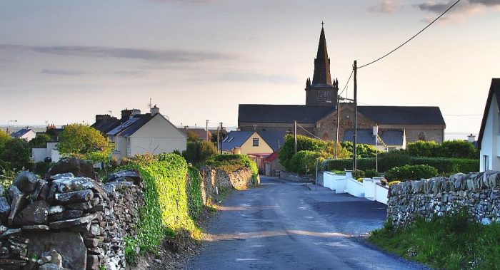 Miltown Church – St. Joseph’s [11]
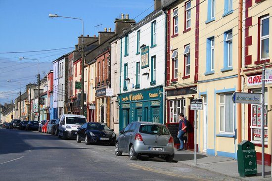
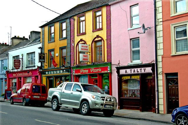
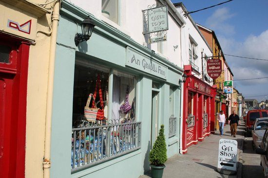
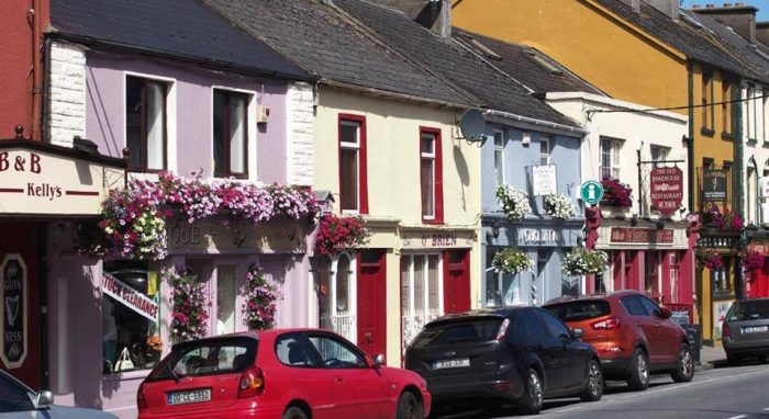 Miltown-Malbay regards itself as the home of traditional Irish music. [12][13][14]
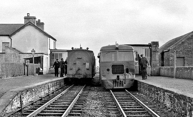 A Diesel Railcar at Mailtown-Malbay Station, seen from the North. Both the Good Shed and the Station building can be seen in this photograph. Both still stand and are now part of the complex of the guest house/hotel and apartments on the site [6]
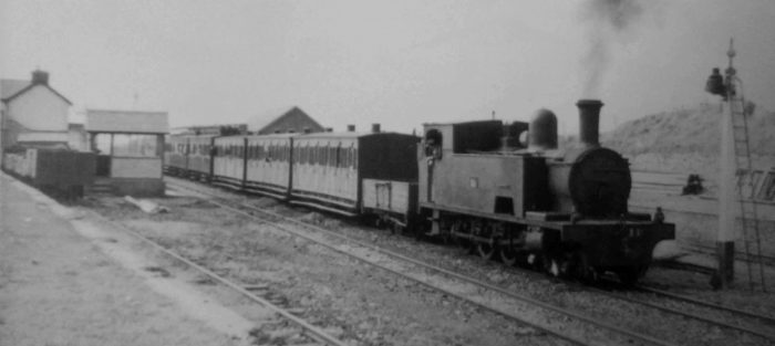 An Ennis-bound excursion train leaving Miltown Malbay on 16th August 1947, headed by Locomotive 11C. Presumably the wagon next to the engine was either vacuum braked or piped, but the reason for its use is unclear – unless to carry additional fuel for the locomotive. The first three coaches are West Clare ‘all thirds’, followed by two of the saloons. Notice the signal box. This was the last of the West Clare stations, equipped as a terminus complete with turntable and locomotive shed, and the last station with two platform faces, (c) Frank Jones. [16]
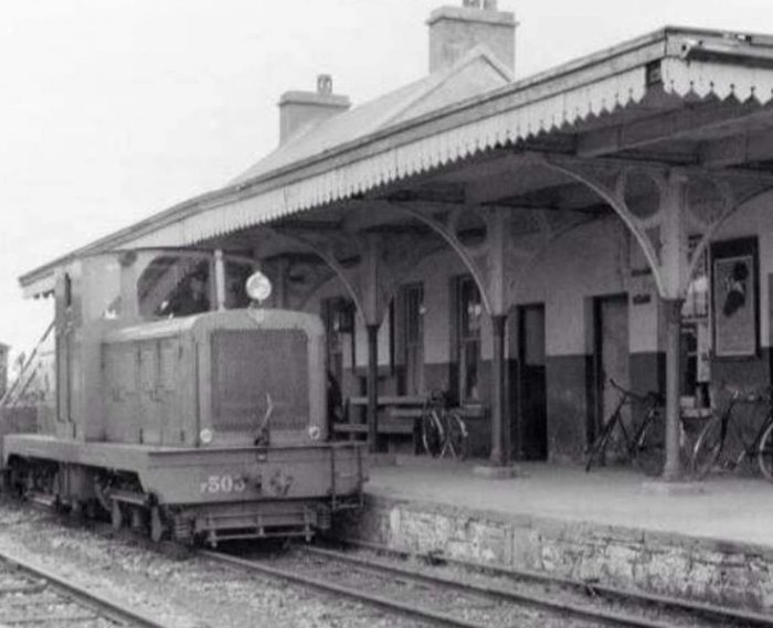 Diesel Locomotive No. F503 at Miltown-Malbay Station in 1956. [4]
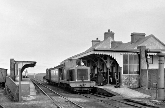 Loco No. F502 pulling a train for Kilrush in September 1960, (c) Roger Joanes. [8]
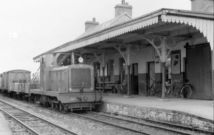 A pickup goods in the hands of Loco 503 at Miltown-Malbay in September 1956 (c) O’Dea Photograph Collection. [7]
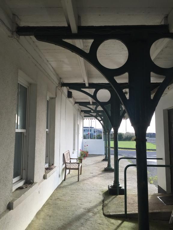 A view South towards the N67 from under the canopy of the extended and modernised station building. [5]
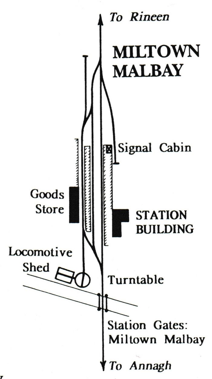
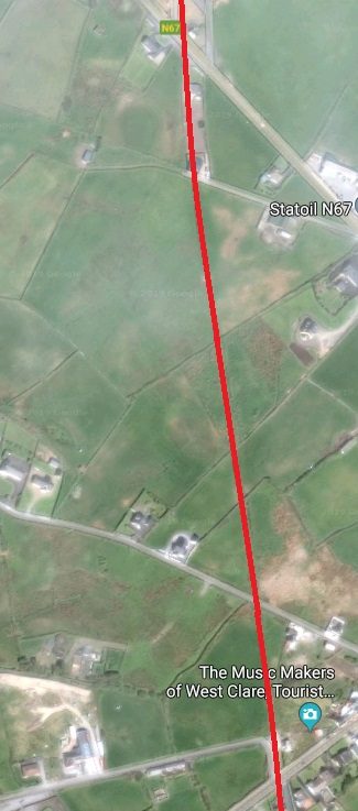
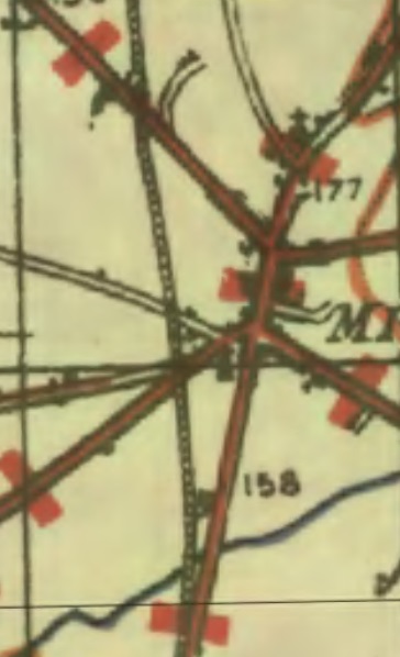 The station layout in its heyday is shown above. [1]
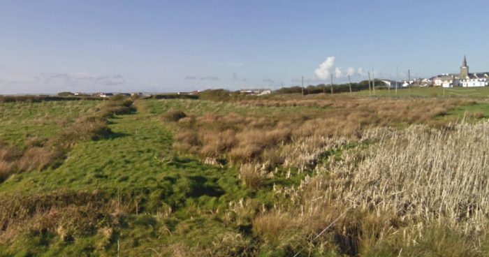 Looking North from the minor road which was crossed at Flag Road No. 1 Crossing along the route of the old railway line back to the location of the Station. The shallow embankment shows the location of the old railway with Miltown Malbay away to the right of the picture. The image below is taken looking South at the same location.
 The next crossing was Flag Road No. 2 Crossing and the line crossed Flag Road at this point.
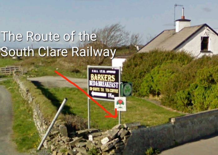 The location of the crossing is easily established as there is a different form of boundary wall across the line. This view is taken from Flag Road and looks back towards Flag Road Crossing No. 1.
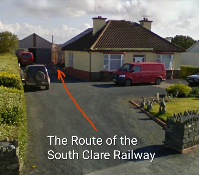 Looking south from Flag Road the route of the line has been built over.
 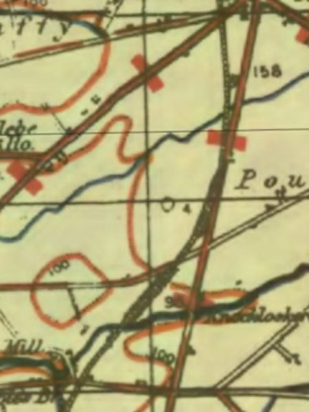 We are now at the top of the adjacent 1940s OS Map. The line is shown all the way through to Quilty on this and the next two OS Maps. The line curves gradually from a southerly trajectory to a southwesterly direction before curving south again at Quilty. The same length of the line is shown below these OS Maps in a series of satellite images from Google Earth. These are interspersed with Google Streetview images and others where available.
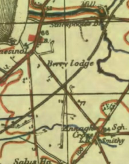
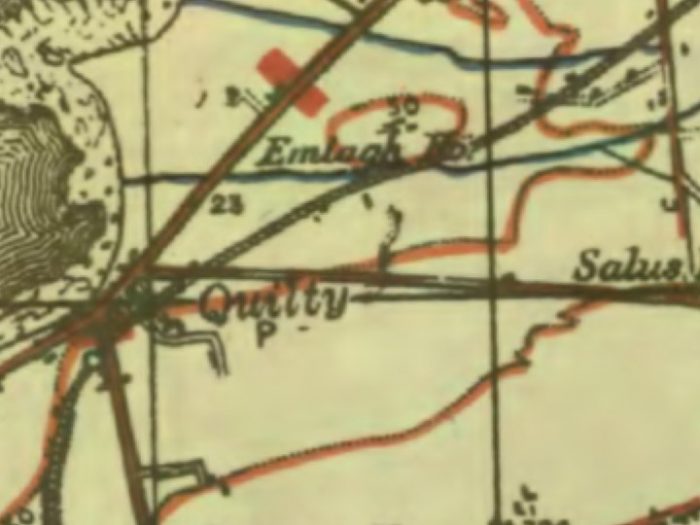
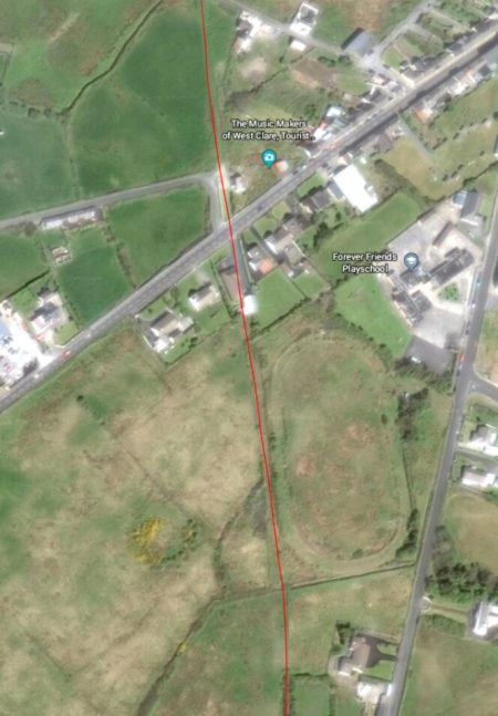
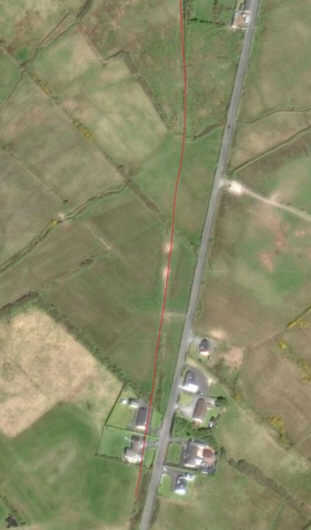
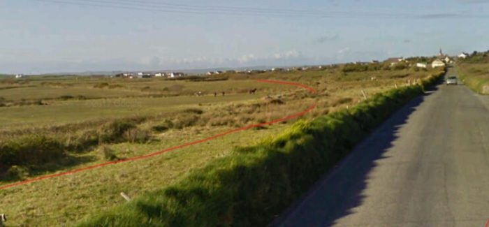
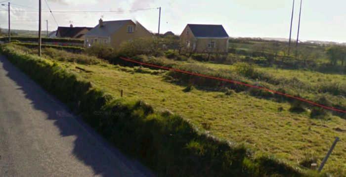
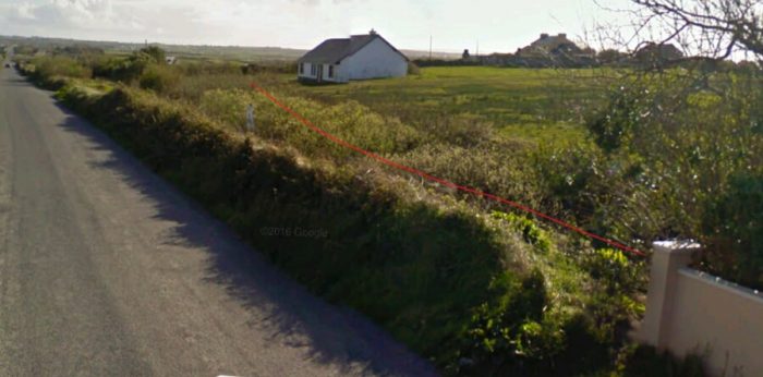
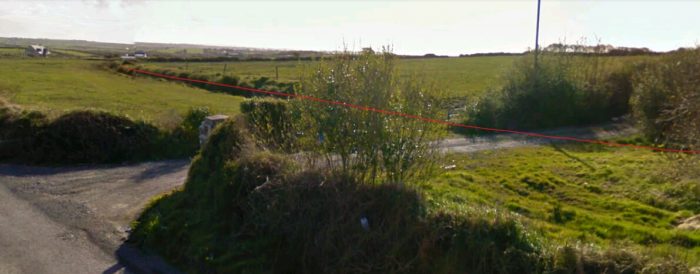
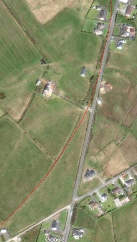 As we travel on towards Quilty, we note that the route of the line now runs across open fields. On the ground there ois little trace of the line. The satellite images keep us on track.
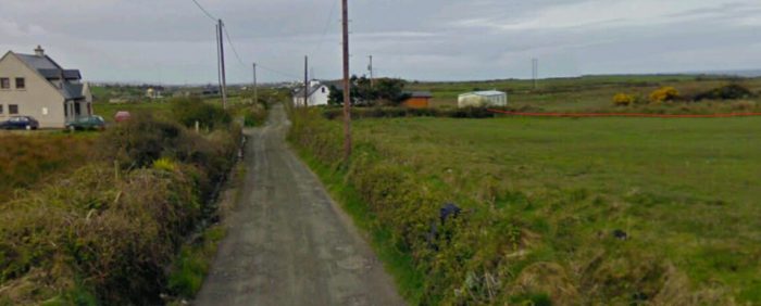 A view from the East looking along the minor road. The old railway approached on the alignment shown, travelling behind the crossing-keeper’s cottage.
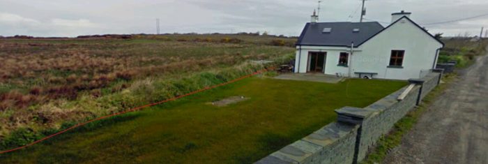 The cottage has been extended towards the alignment of the old railway.
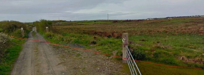 The crossing was on a very shallow angle. This view is also taken from the East. The gate posts can still be seen at the far side of the crossing.
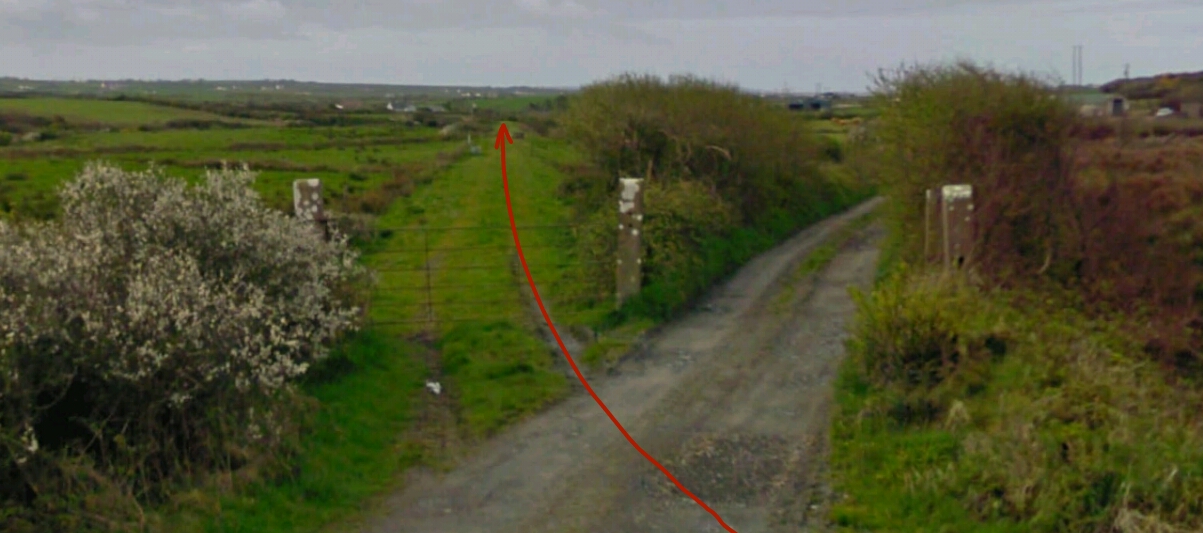
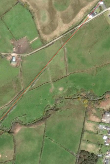 The line continued on towards Quilty. As it does so, we listen to Edmund Lenihan’s description of the route just a little further ahead along the old line. Clearly he did not have the benefit of satellite imagery.
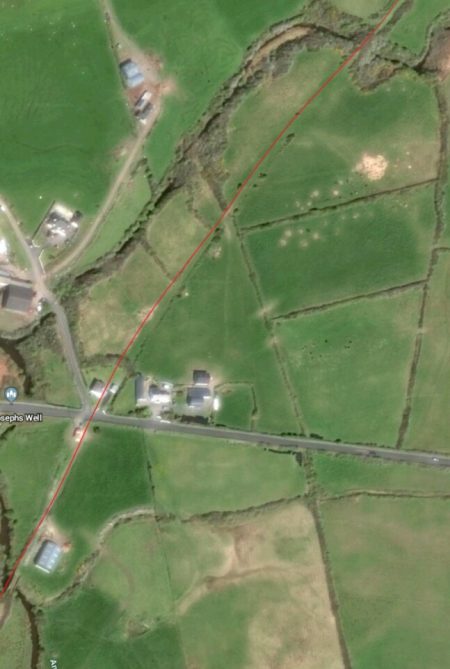
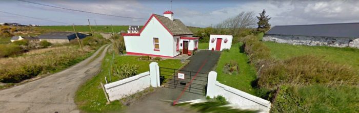
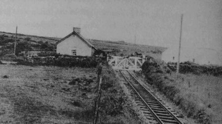 The crossing-keeper’s cottage from Annagh No. 1 Crossing is shown above in 21st century and in the adjacent image from the 1950s © IRRS. [19] The second image is taken from south of the crossing, the first from the single-lane road that the railway crossed.
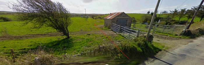 The railway continued South from Annagh No. 1 Crossing.
 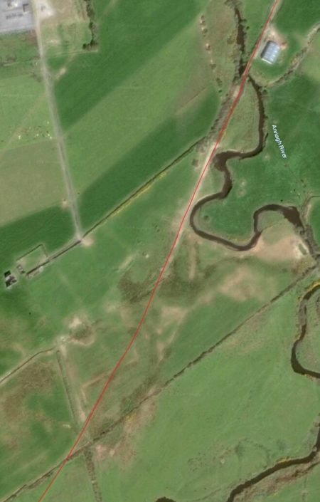 A few hundred yards beyond the road-crossing the railway crossed the Annagh River again. The bridge can be seenninnthe top right of the adjacent photo.
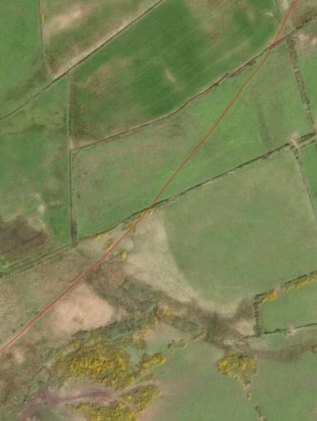
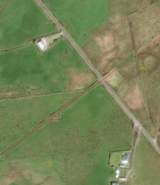
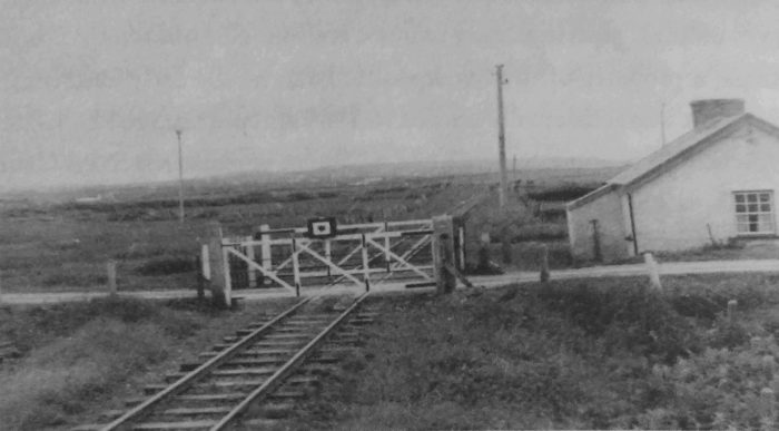 Annagh No. 2 Crossing in 1954, © IRRS. The picture is taken from south of the Crossing. [21]
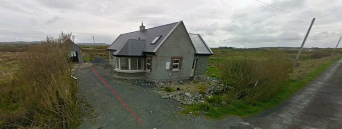 This new-build cottage is in approximately the same position as the old Crossing-Keeper’s Cottage at Annagh No. 2 Crossing.
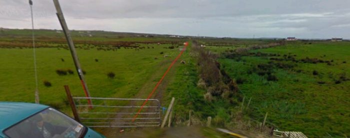
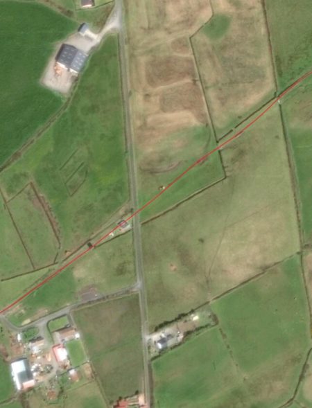 The line ahead.
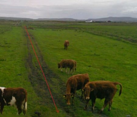
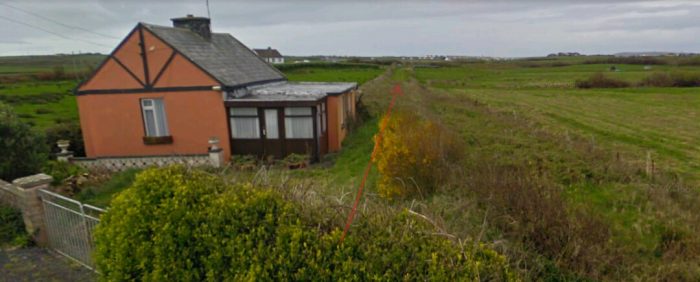
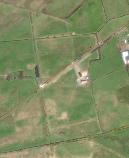 We are now not so very far from Quilty. The village is in sight.
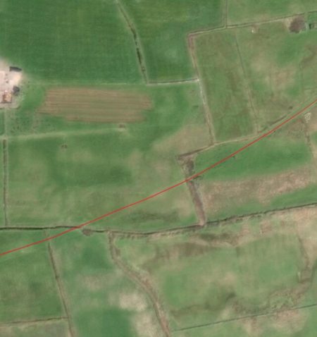
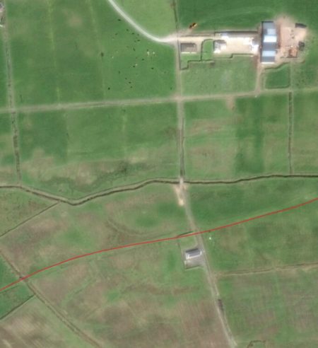
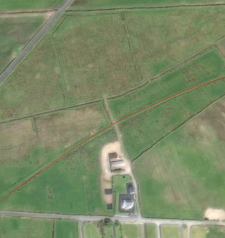
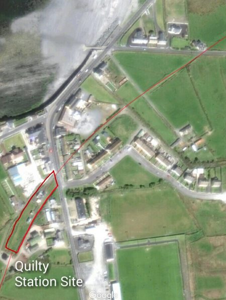
 Diesel locomotive at Quilty Station just before closure, © IRRS. [27]
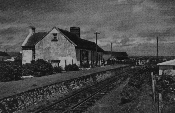 Quilty Station just after closure. The picture was taken on 7th June 1961, © Roy Denison [27]
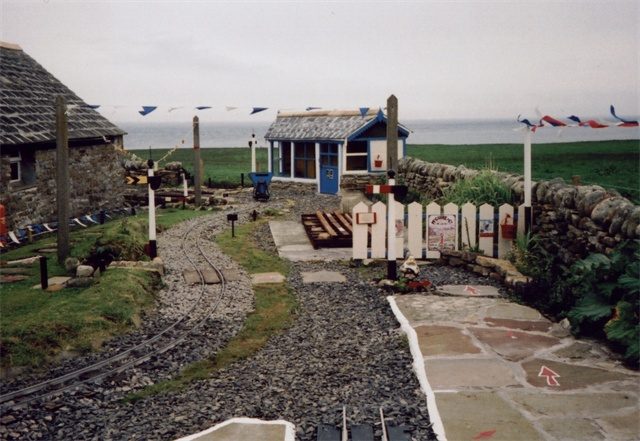
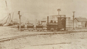
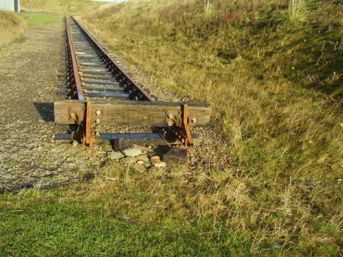
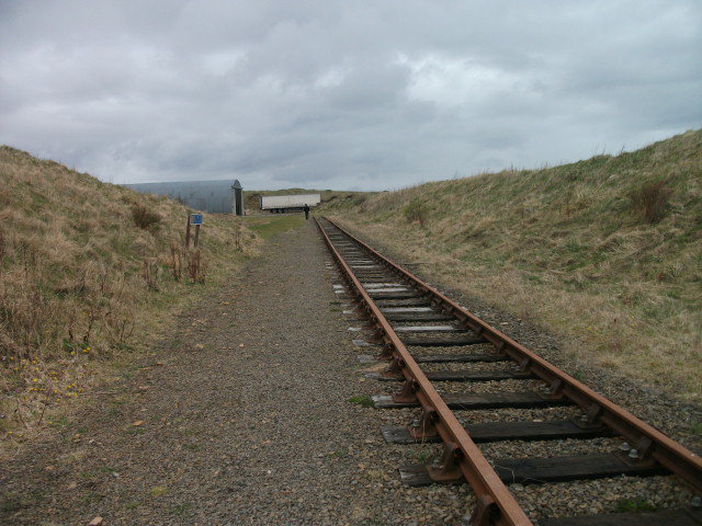

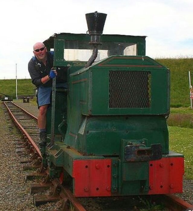
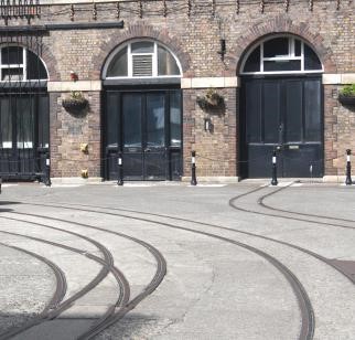
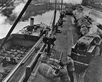
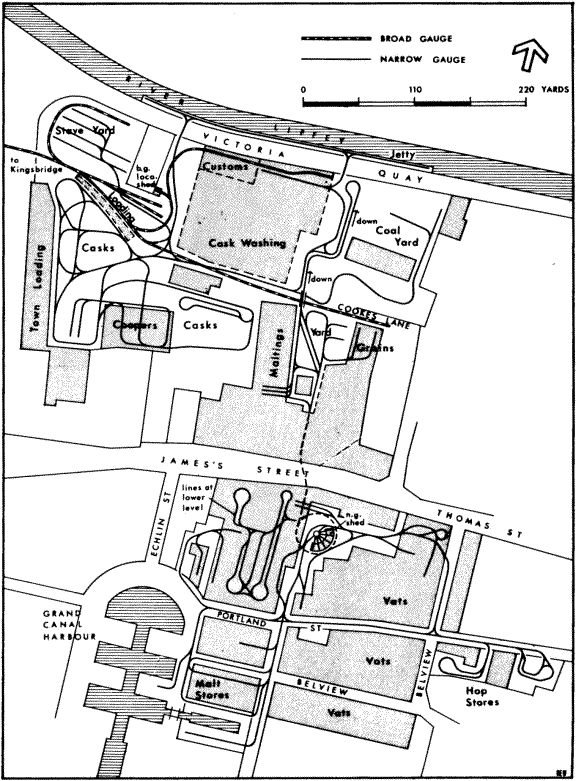
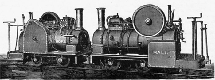
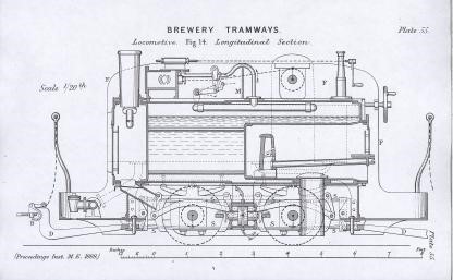
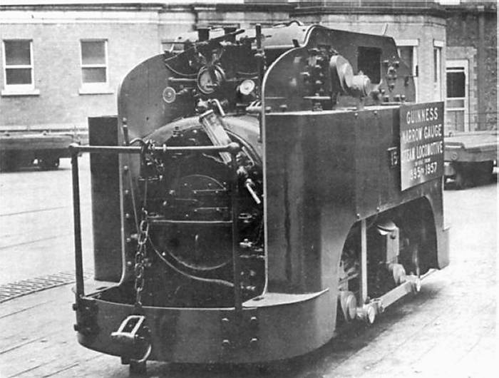
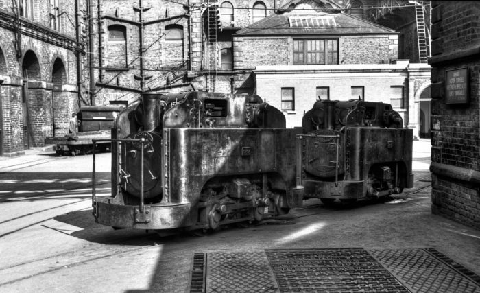

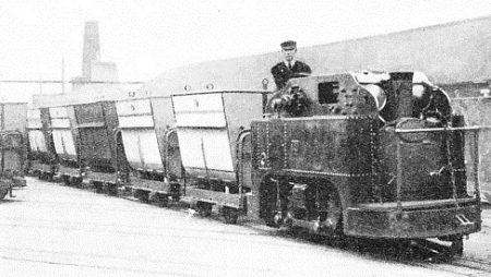

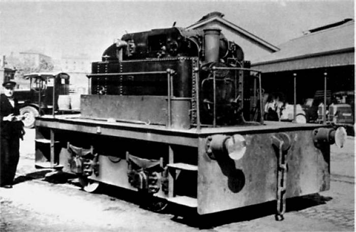
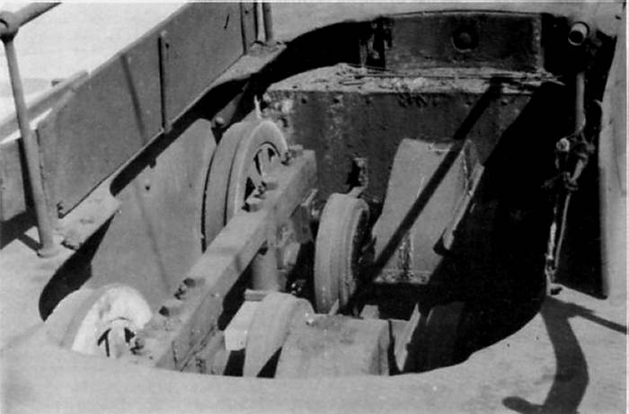

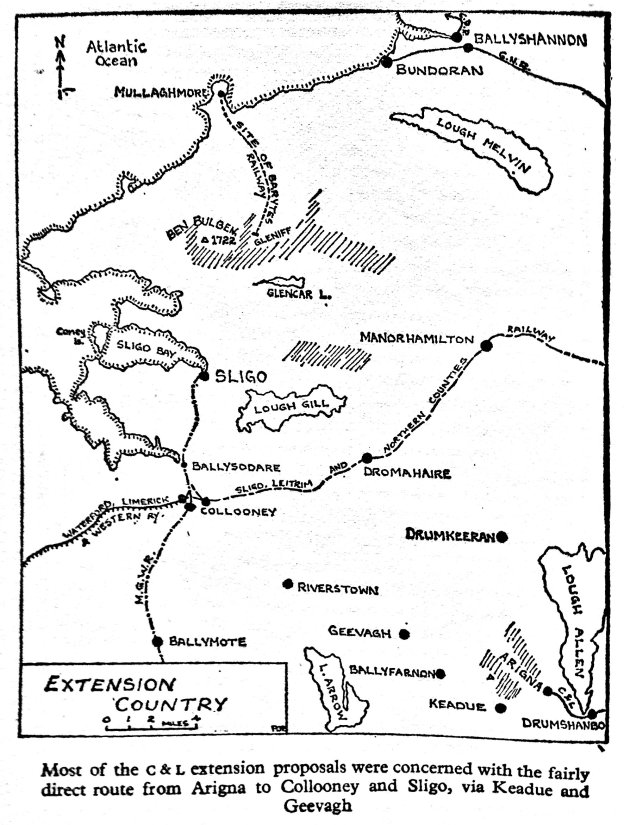
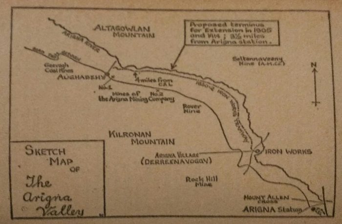
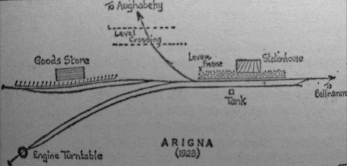
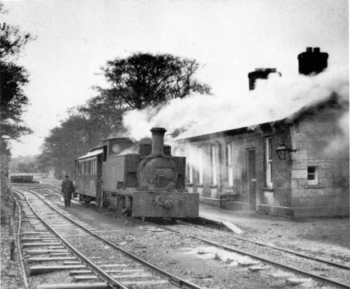
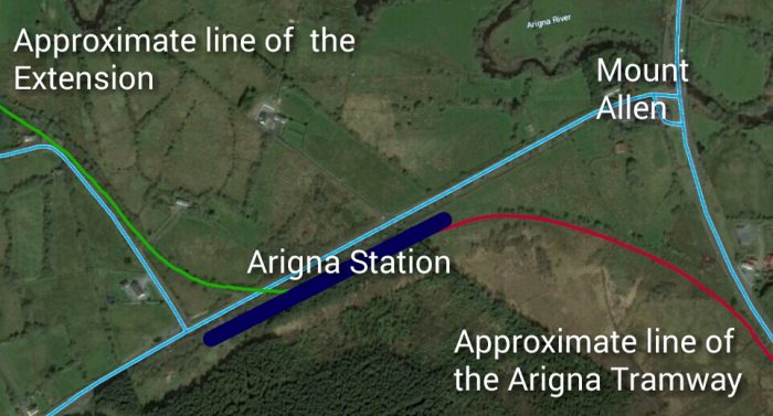
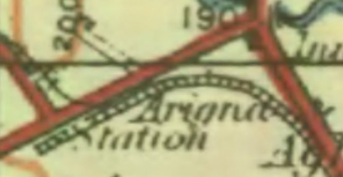
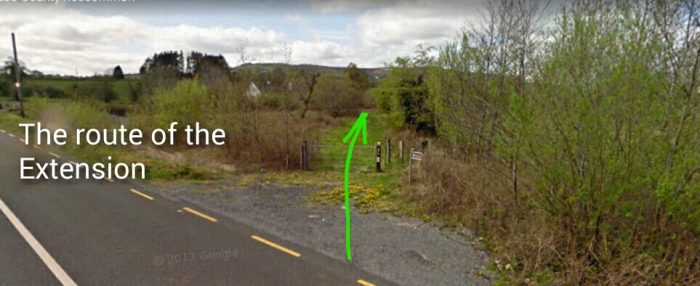
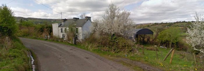
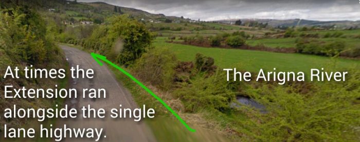
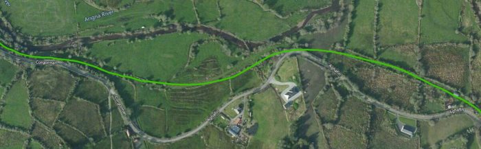
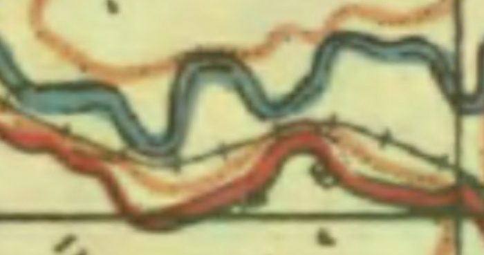
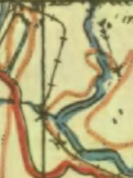
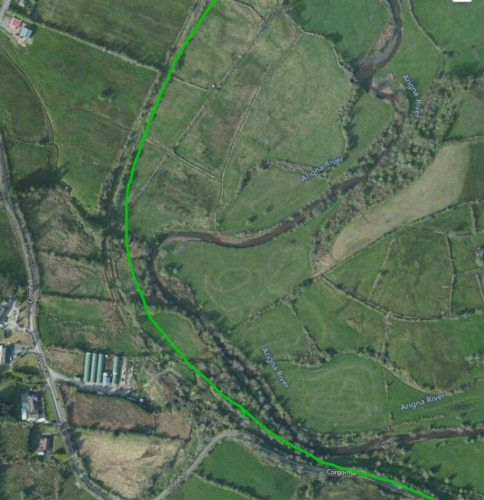
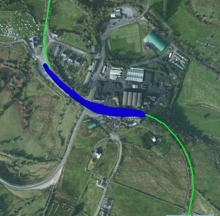
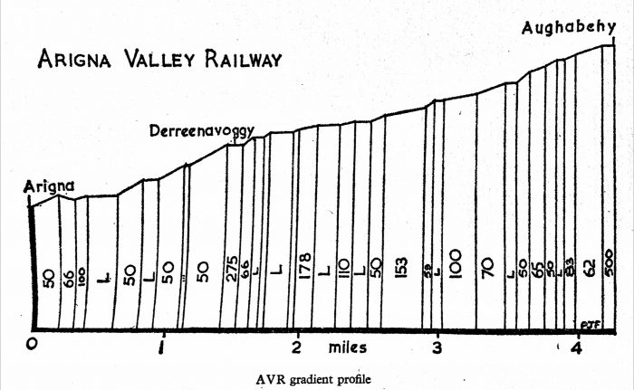
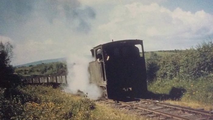
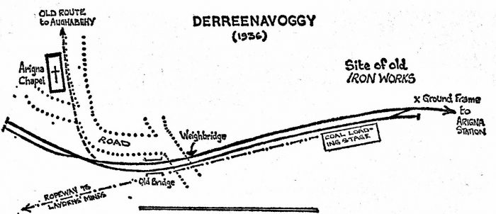
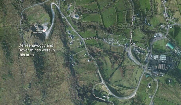
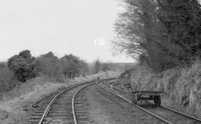
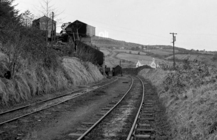
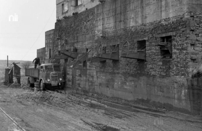
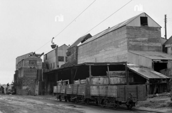
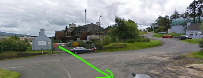
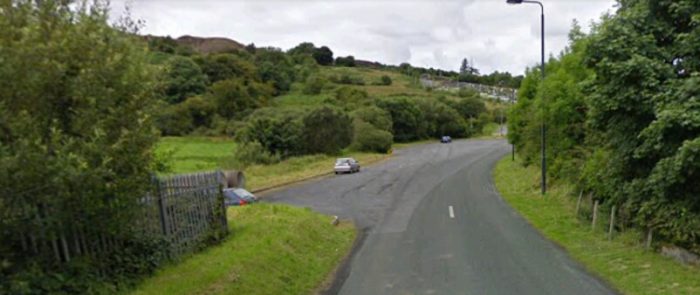

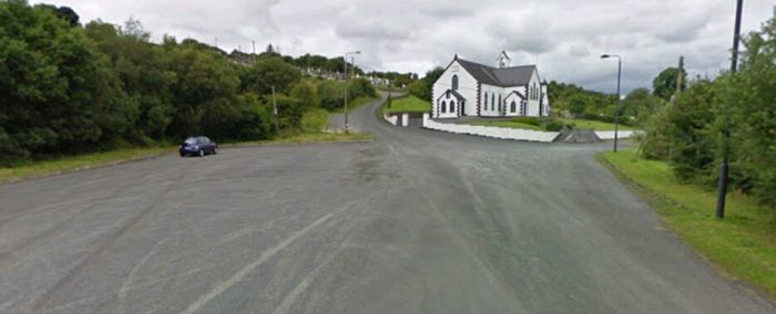
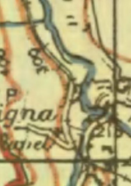
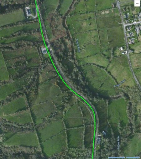
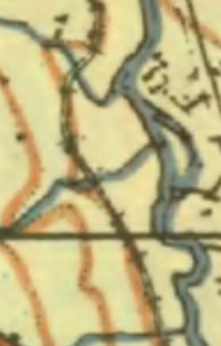
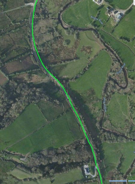
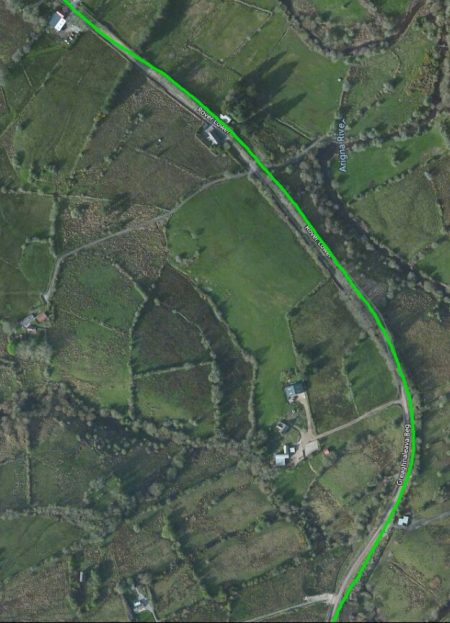
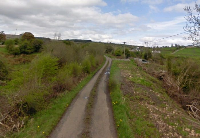
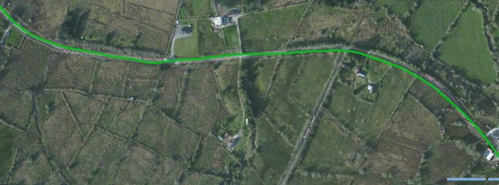
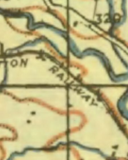
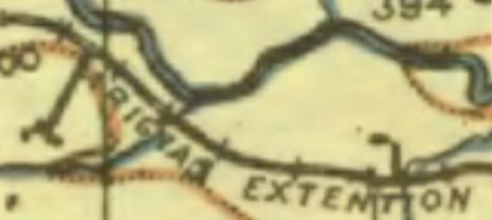
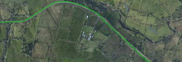
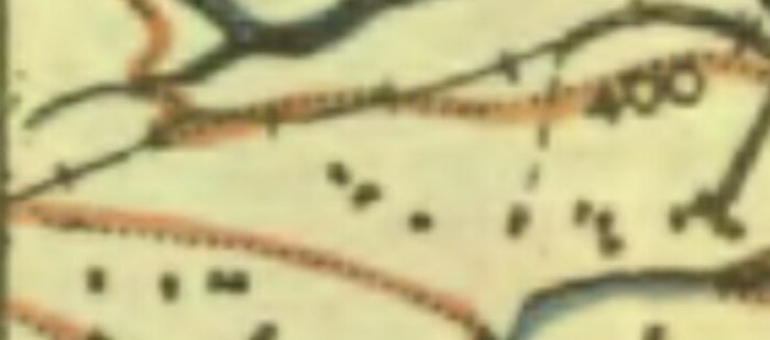
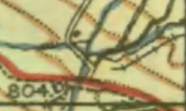
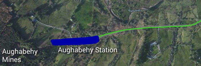
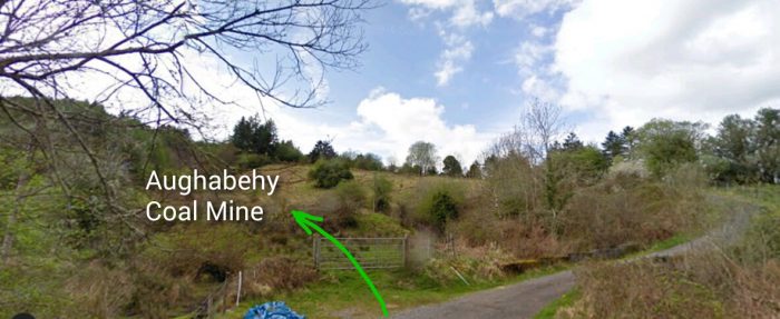
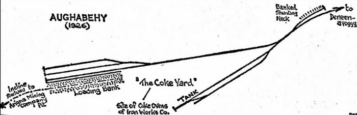
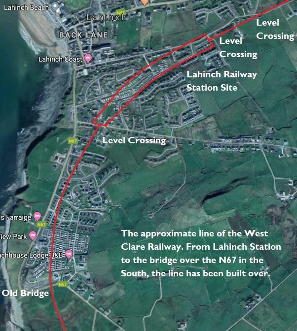
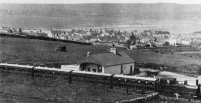
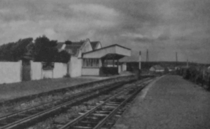
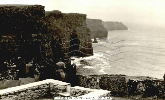
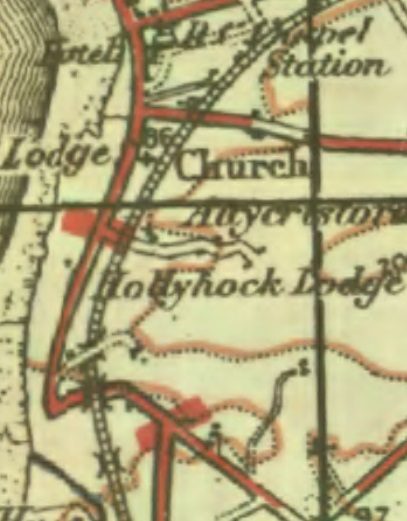
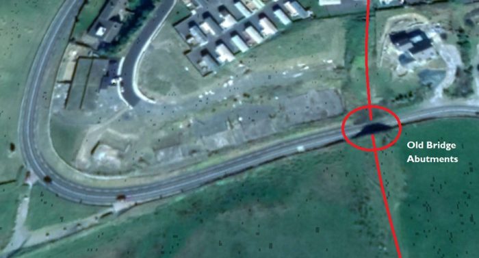
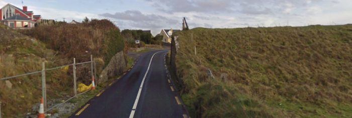

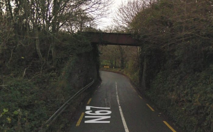
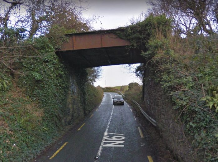
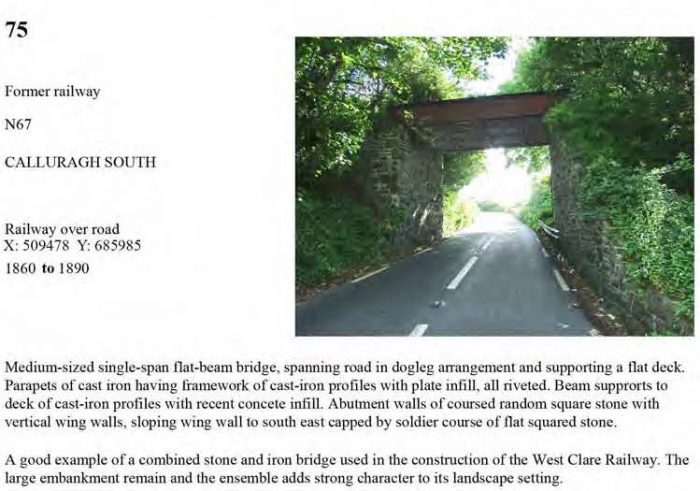
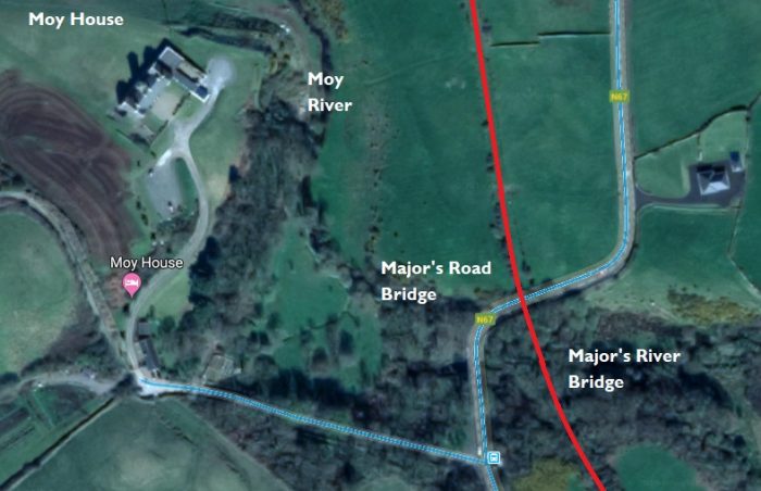
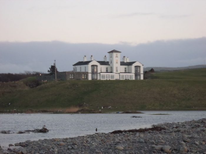
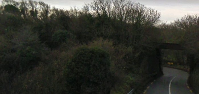
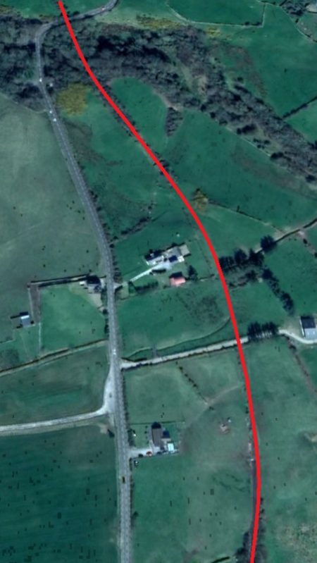
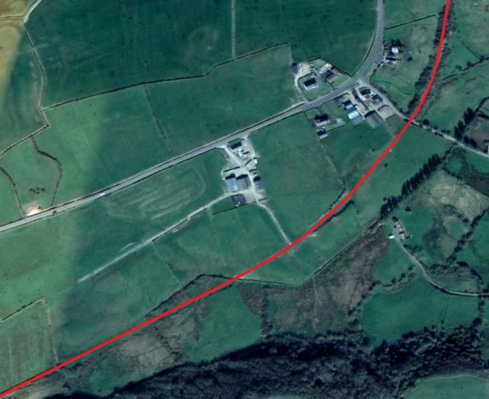
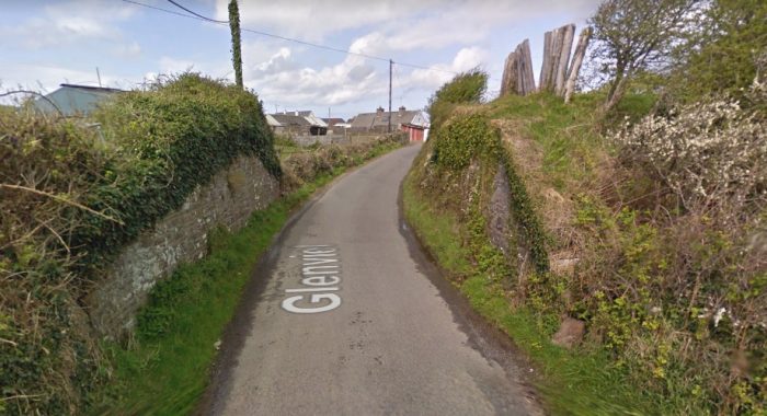
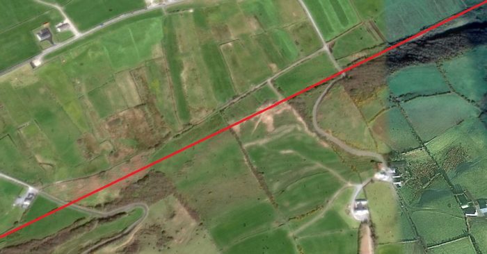
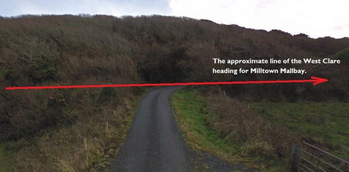
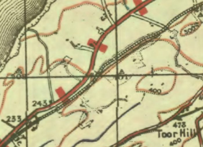
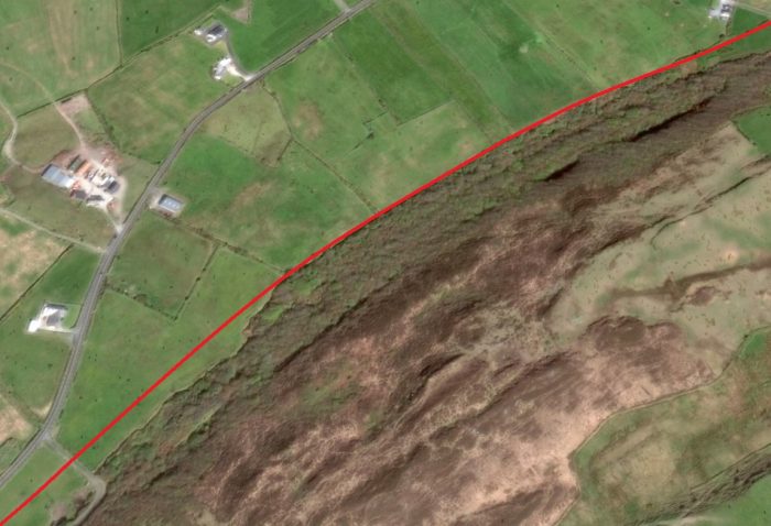
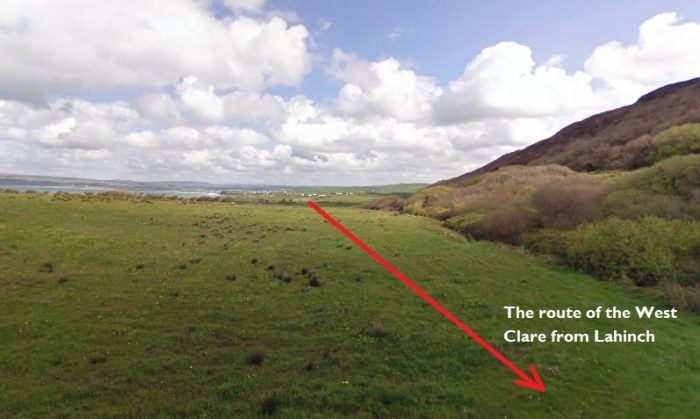
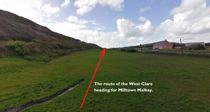
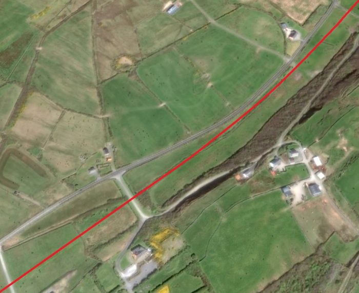
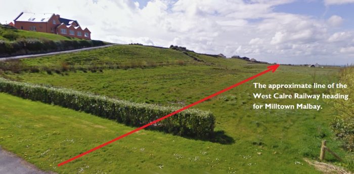

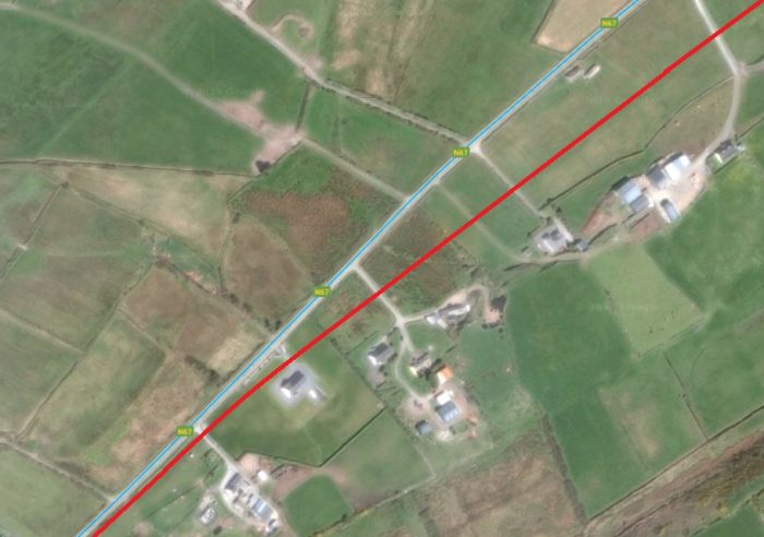
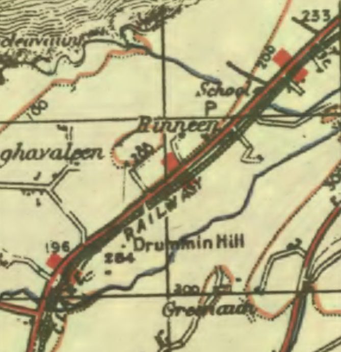
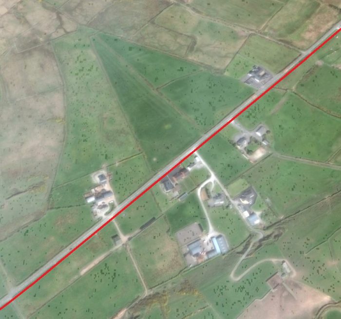
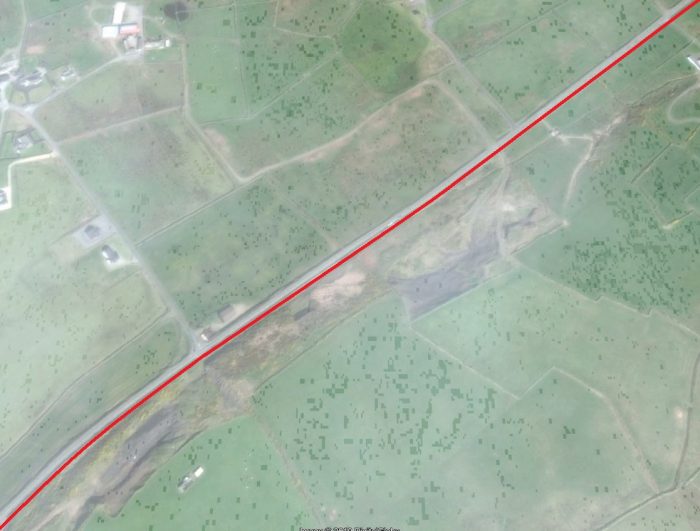
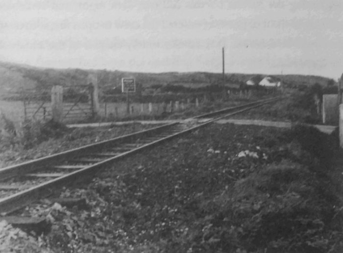
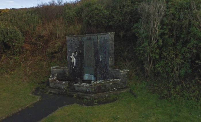
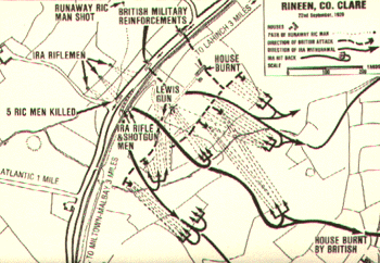
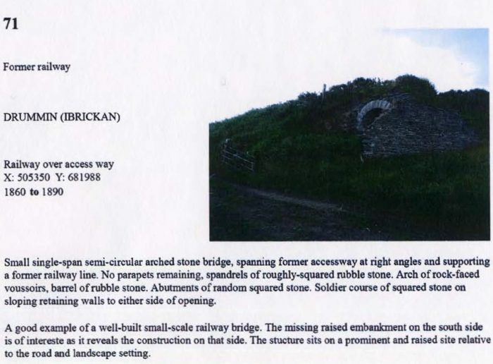
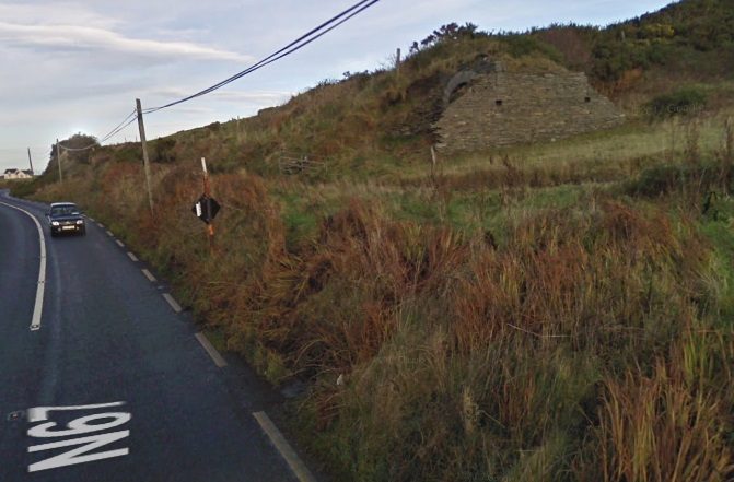
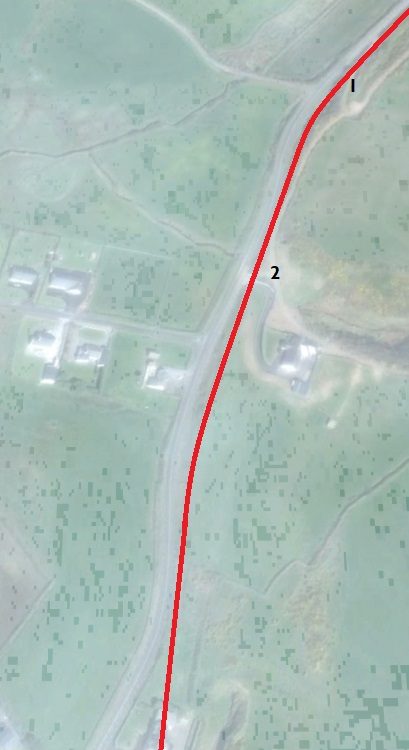
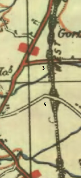
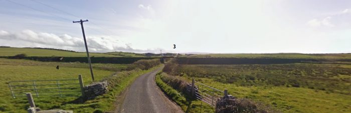
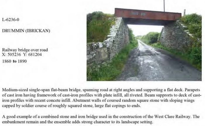
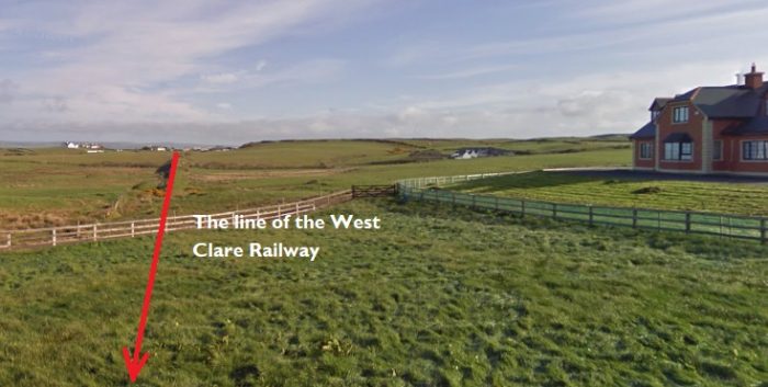
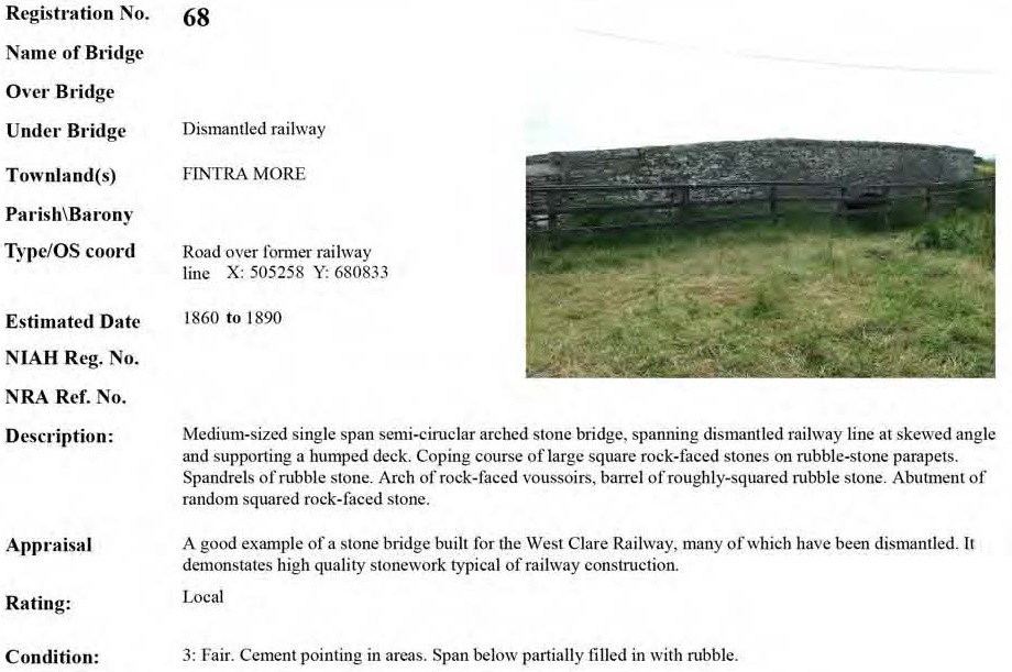
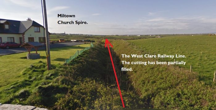
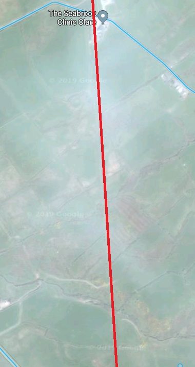

 The partially-filled cutting above clearly shows the line of the railway under the road bridge at location ‘5’. Miltown church spire can be seen on the horizon. Lenihan refers to this as Downes’ Bridge which he says is a “stone-arched span carrying a by-road over the line.” [23]
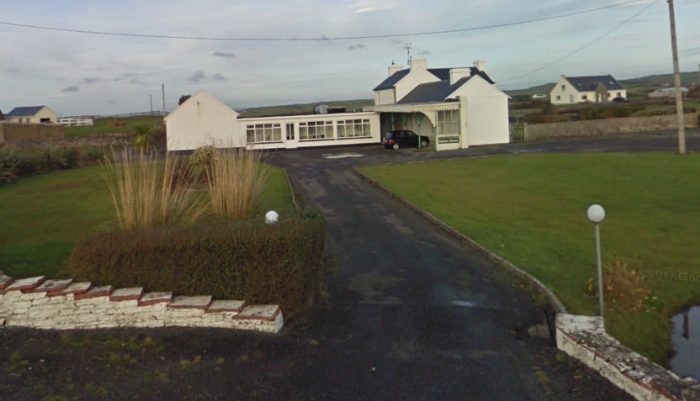
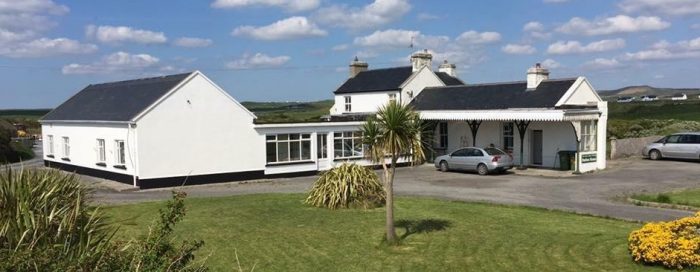
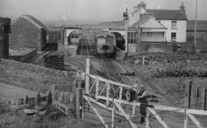
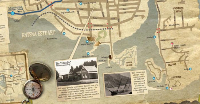
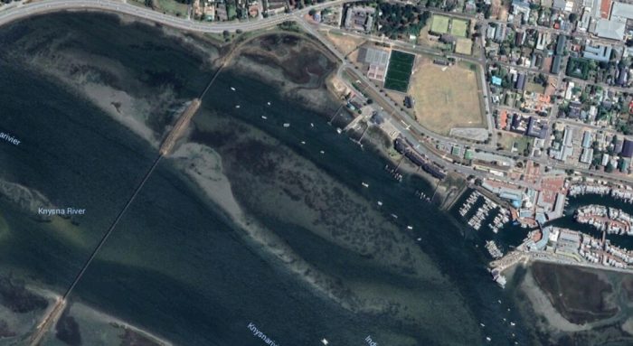
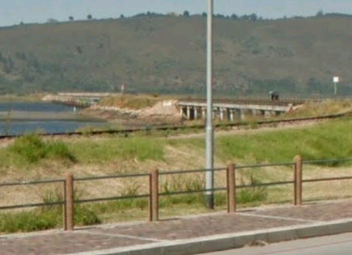
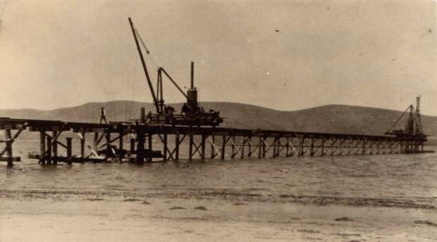
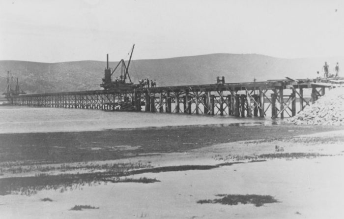

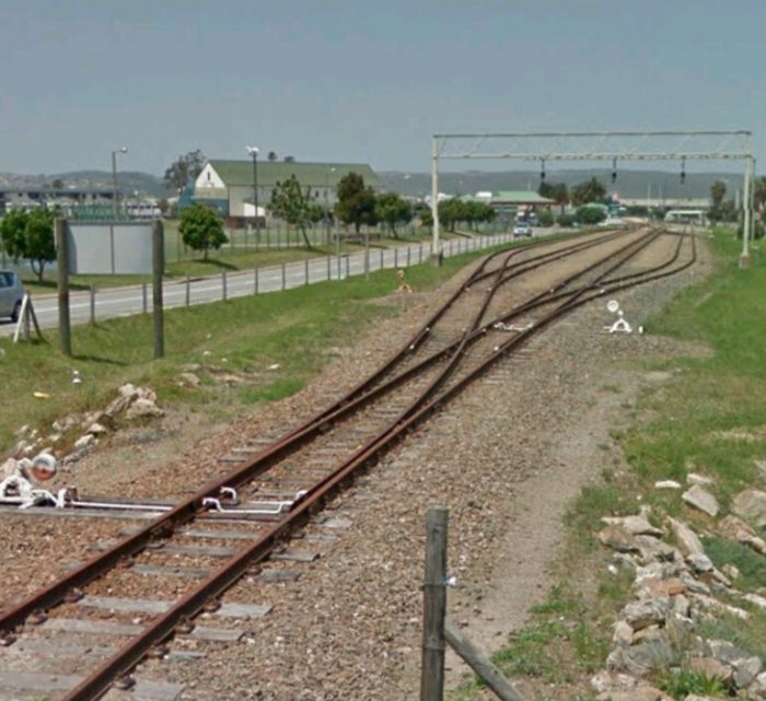
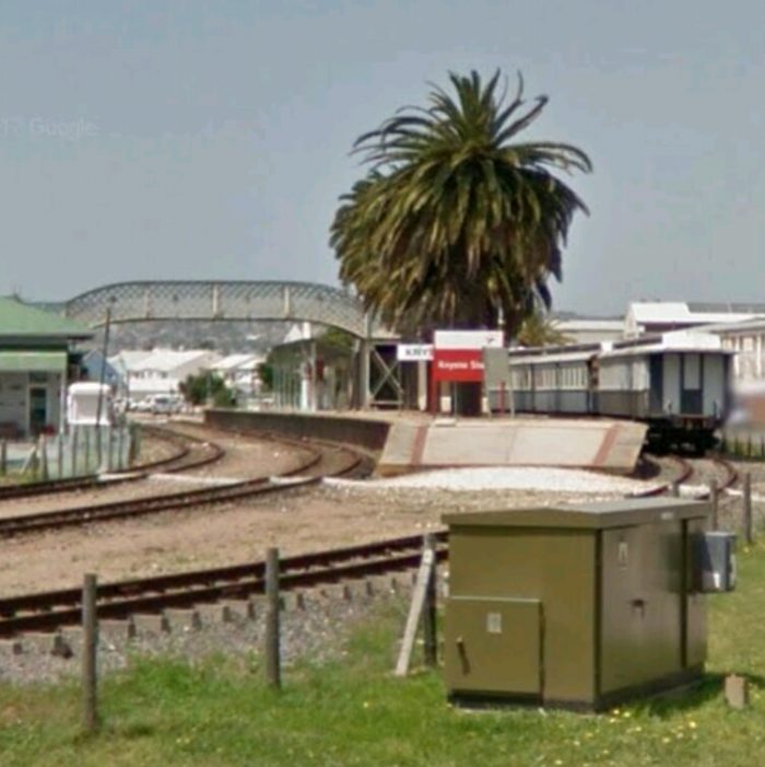
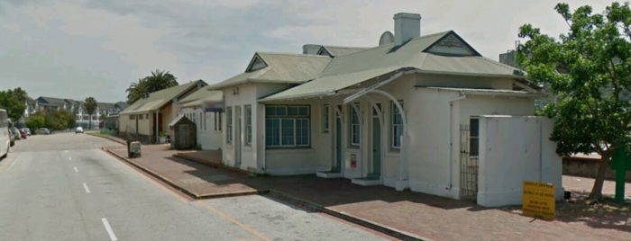
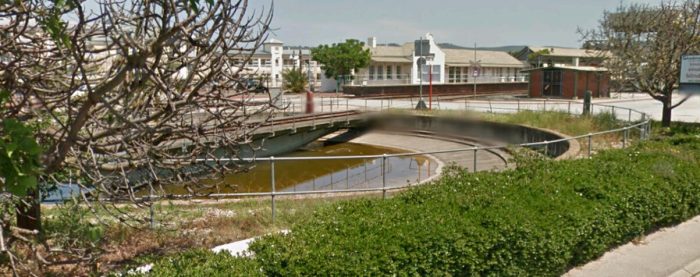
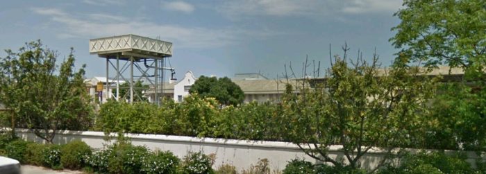
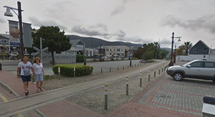
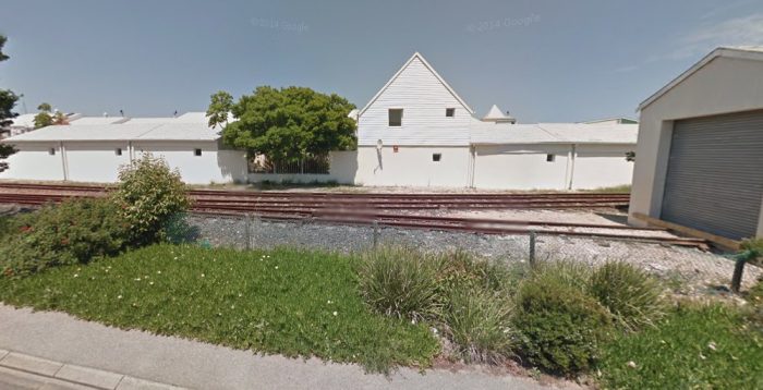
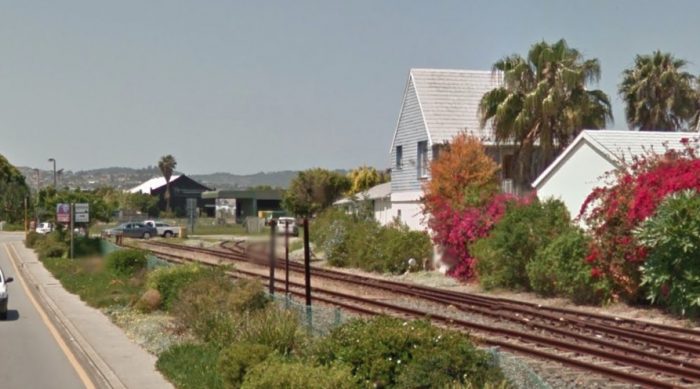
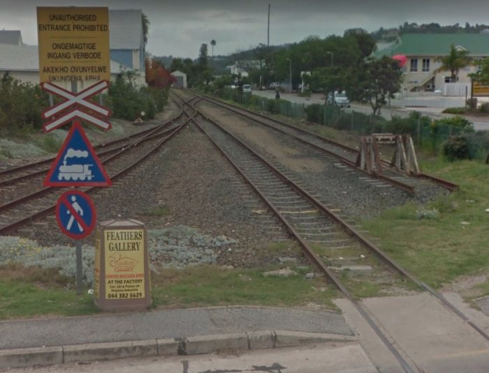

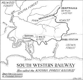


 Throughout the 1920s’ and 30s’ maintenance costs and taxation took their toll and soon another engine had to be bought. The S.A.R. provided a 2nd-hand engine no longer required on the Umzinto line. The engine was in good condition and gave many years of service.
 due to the deterioration of the line, they were forced to keep it going at least temporarily, because of the shortage of motor transport caused by World War II. It was then decided to have the line re-conditioned with old rails from South West Africa.
 In 1946 the re-laying of the track was completed with the second-hand rails and pronounced good for another 20 years. It was a difficult task and took over a year to complete. A modest tribute remains however, in the foot or two of rail set in the pavement on the right hand side of Long Street diagonally opposite Thesen House. But safer rails were not the answer to the problems of the railway. After the end of the war it was used less and less, as it became uneconomical to rail timber and the forestries, merchants and ship owners used private lorries instead. This meant another drop in the Company’s earnings.
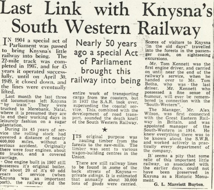
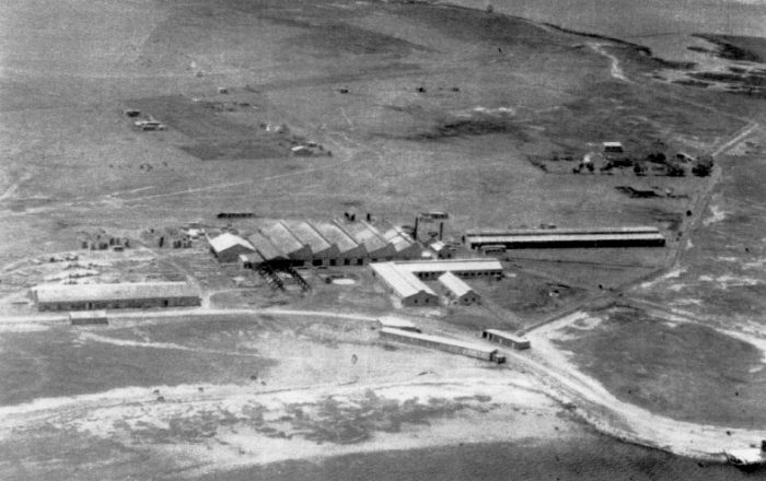

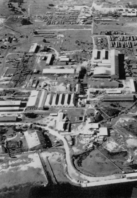
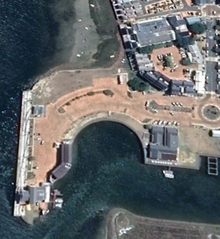
 As we have seen above, the 2ft- gauge line commenced at the wharf and served Thesen’s plant on Thesen Island before crossing the causeway to the mainland.
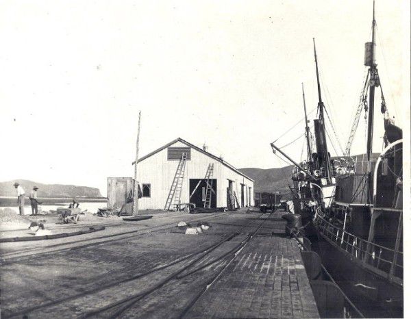
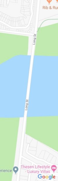
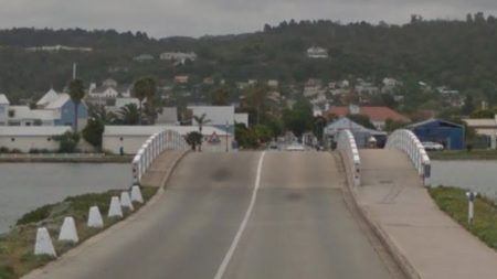

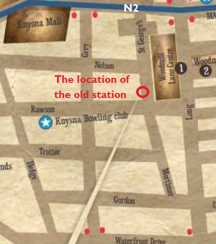
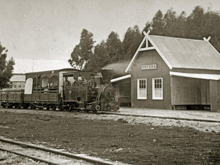

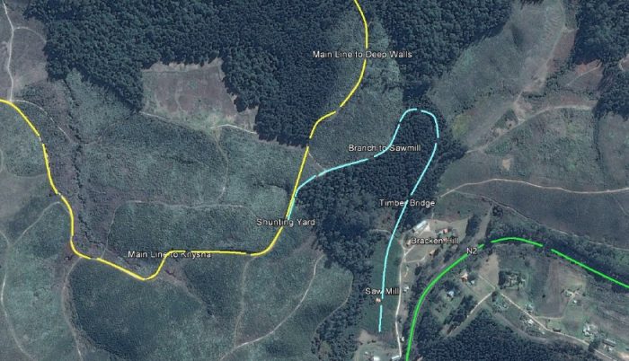
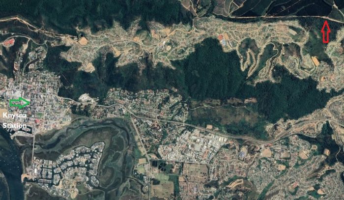
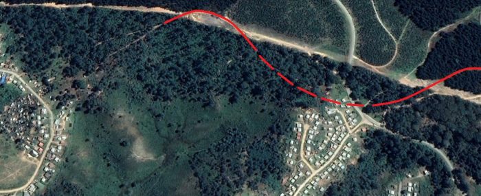
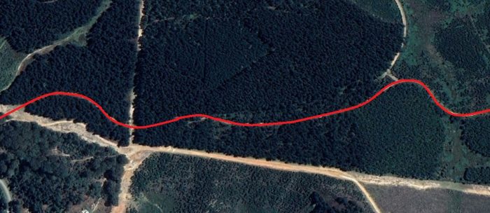
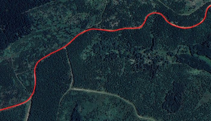
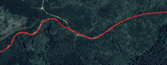
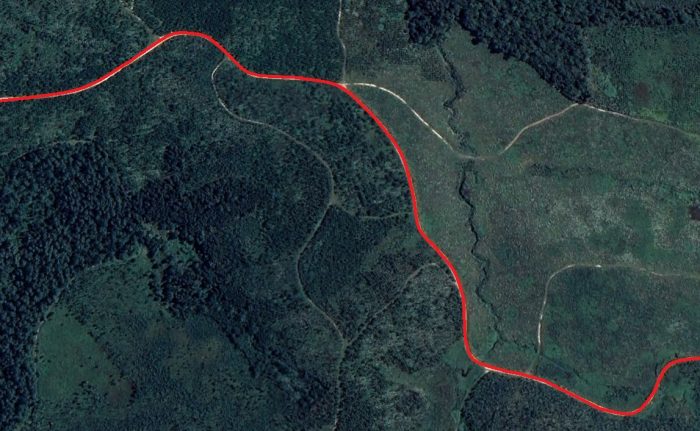
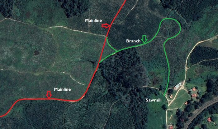
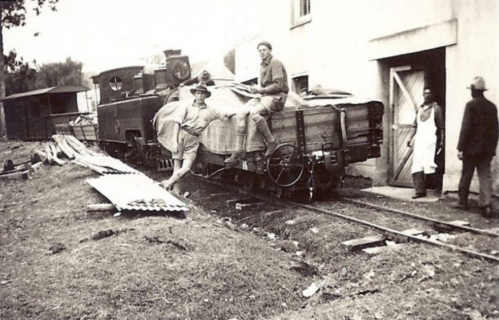
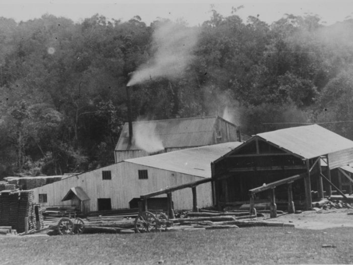
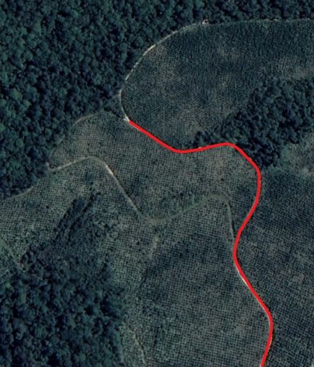
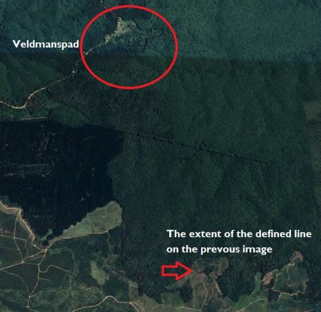
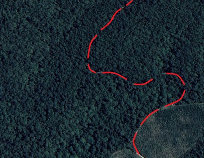
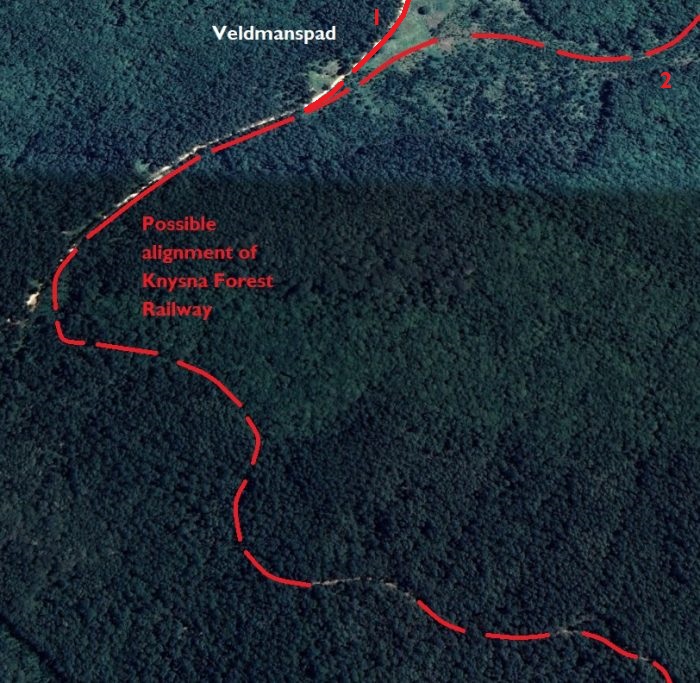
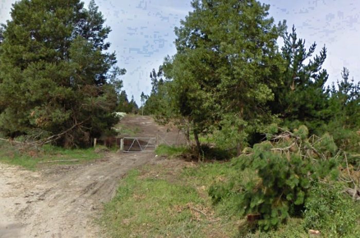
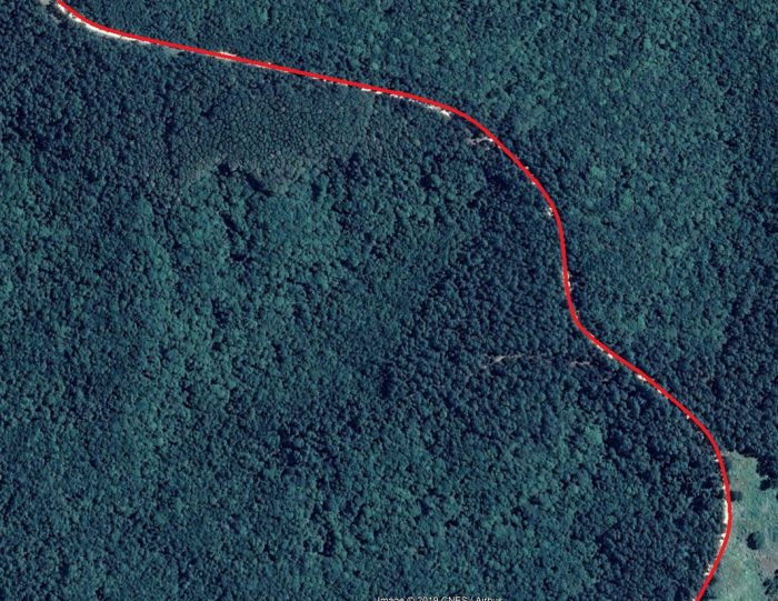
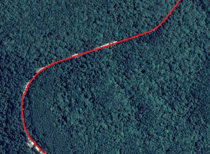
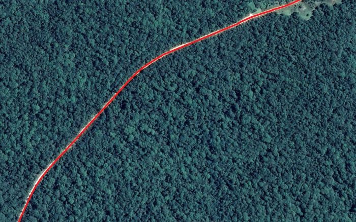
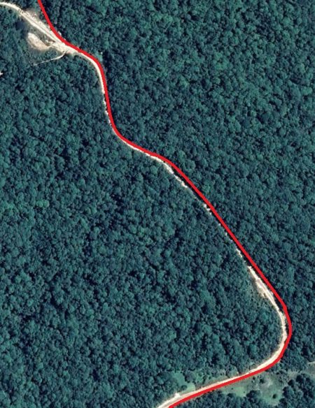
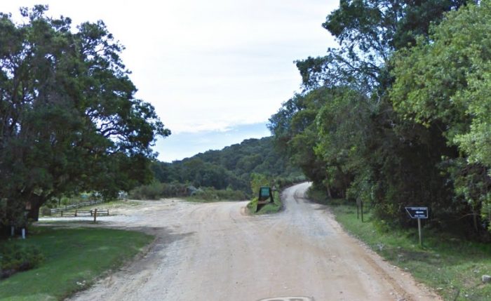
 The route from here travelled approximately northwards and the curved a little towards the East as it entered Diepwalle.
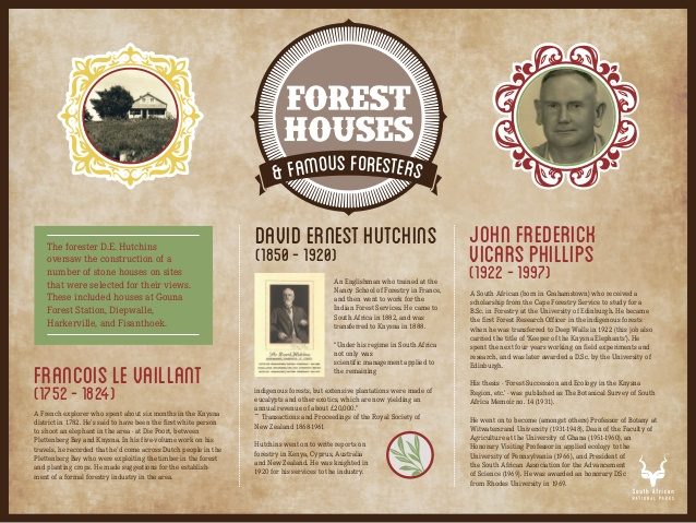
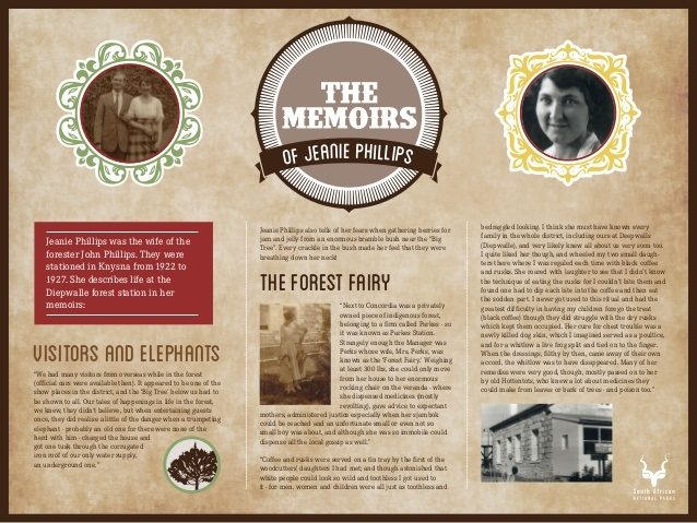
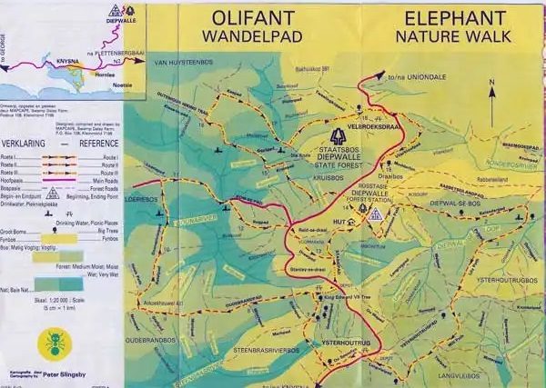
 Elephant Walks are provided from Diepwalle today. [29]
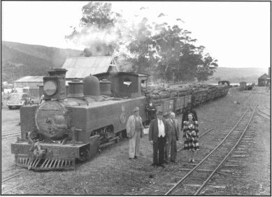
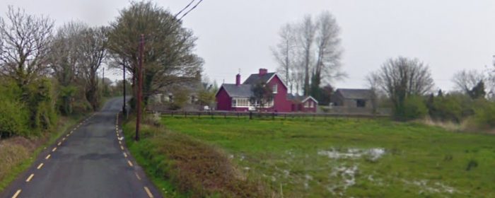
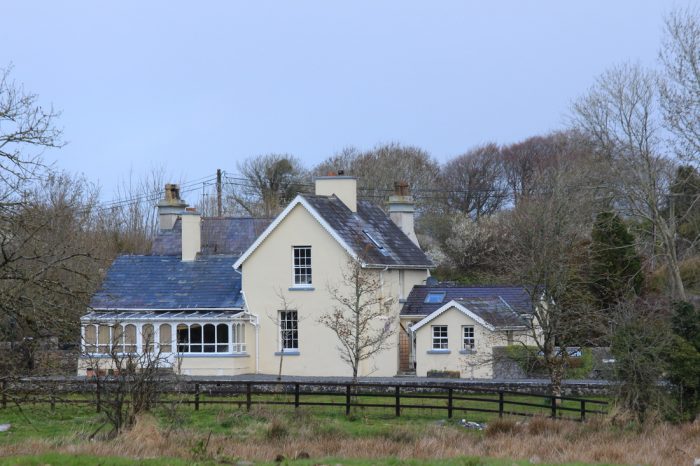

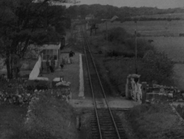
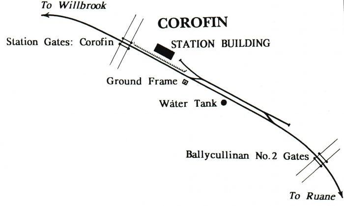
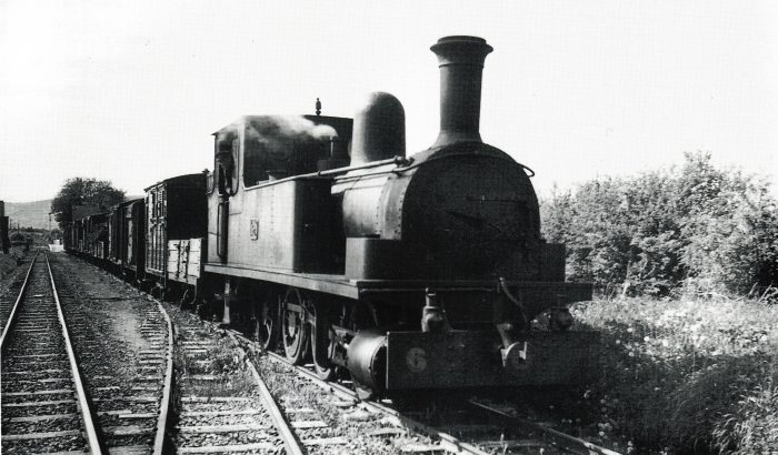
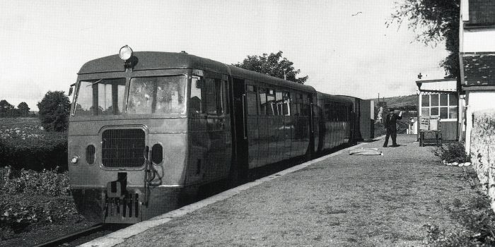
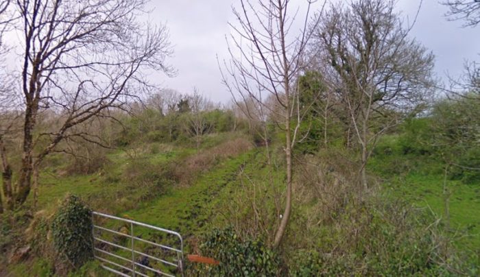

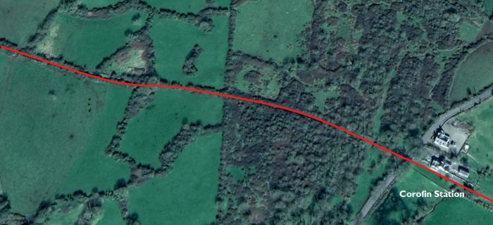

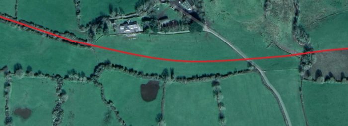
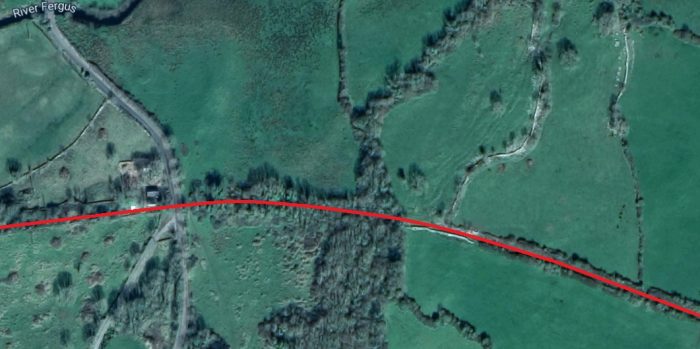


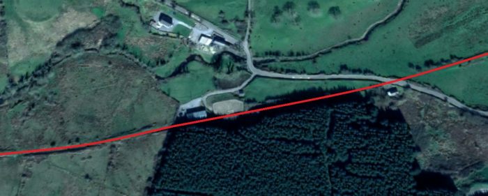
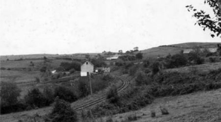
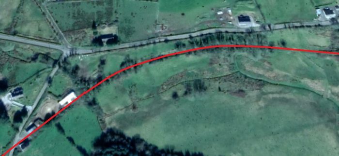
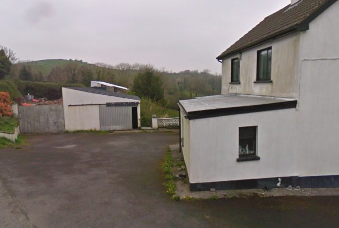

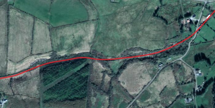
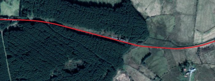
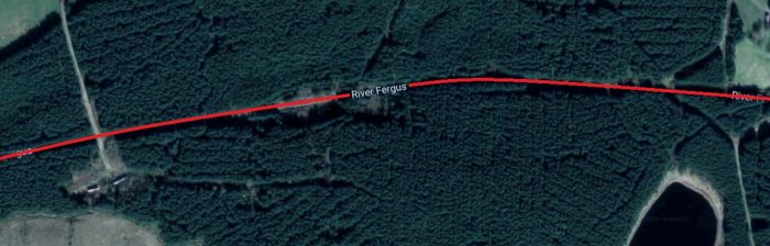
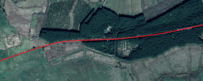


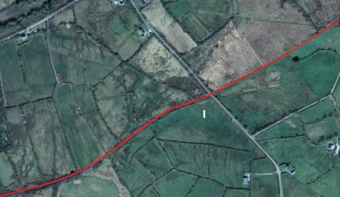
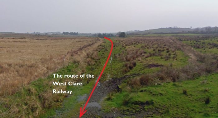
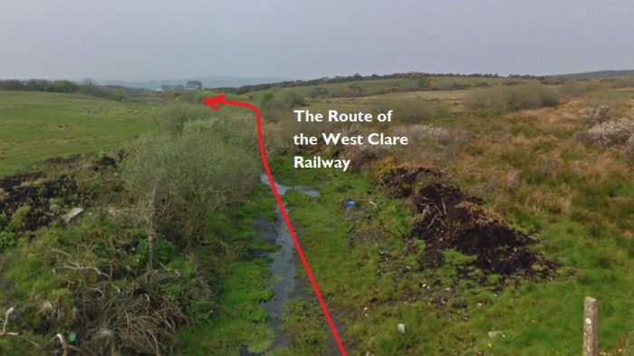


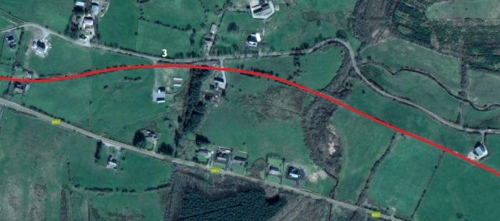


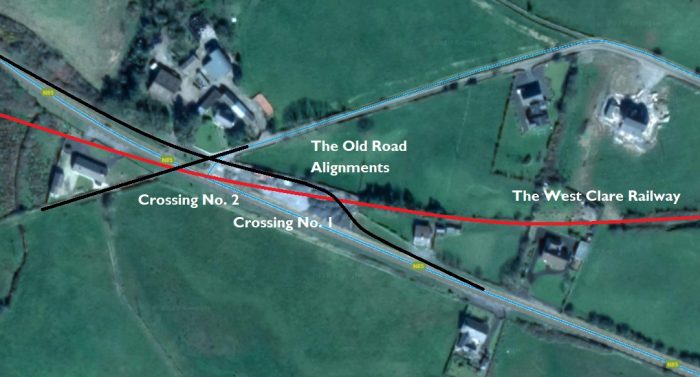
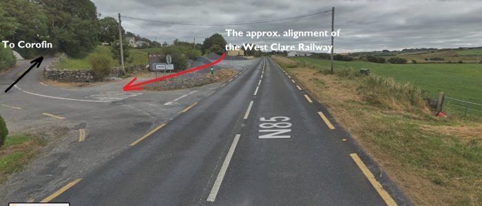
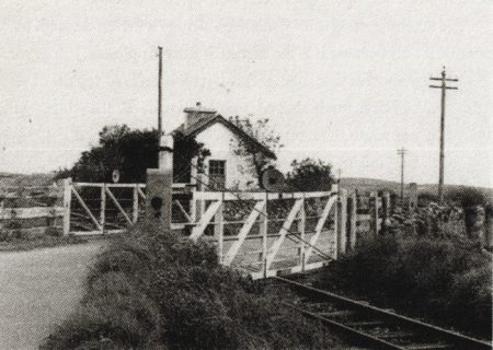
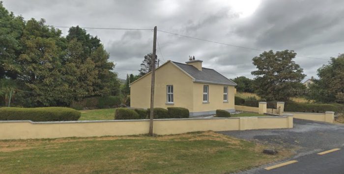

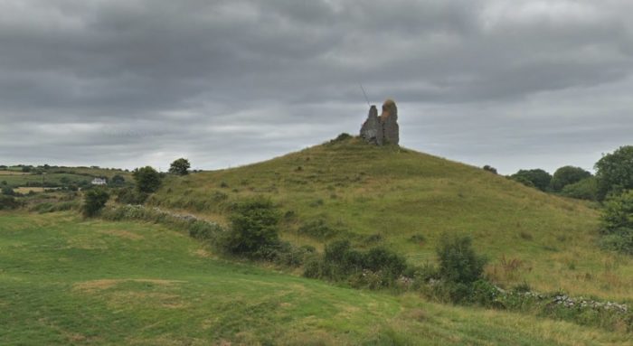
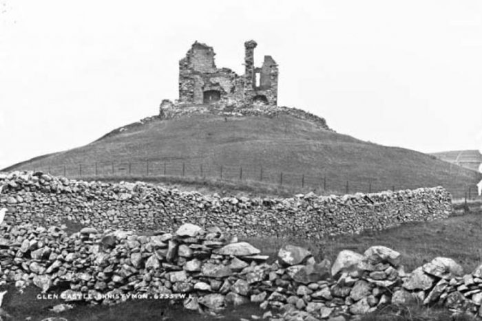
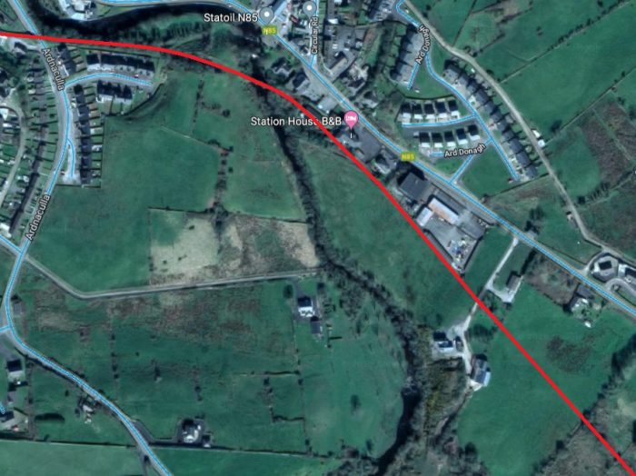

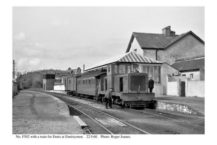

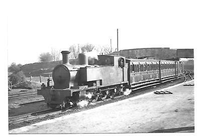

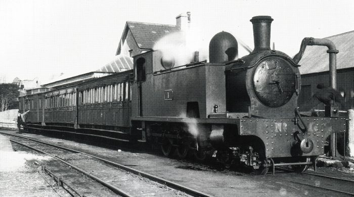
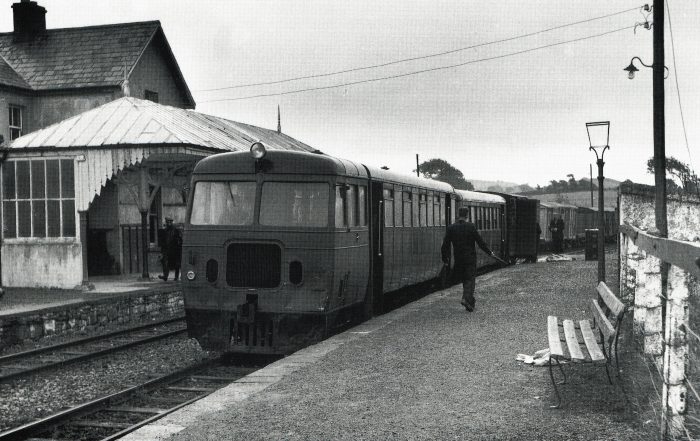


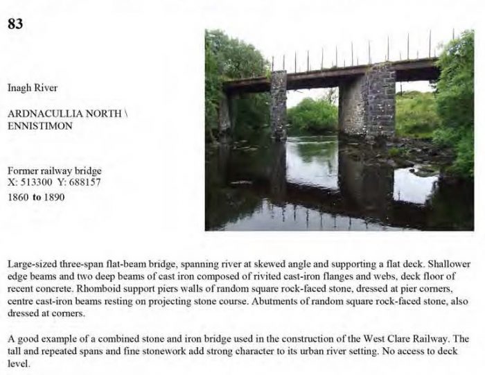
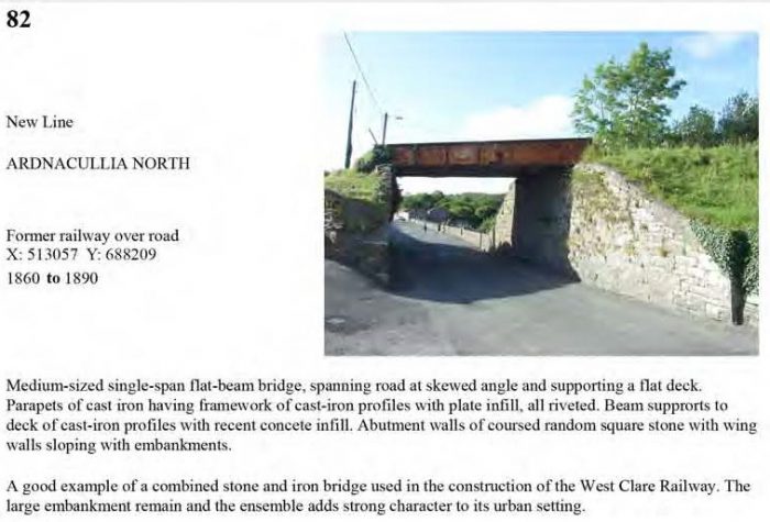
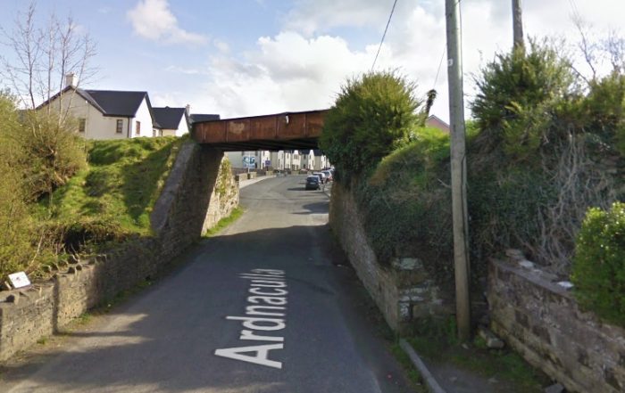
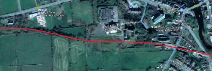
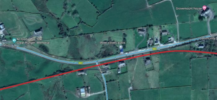
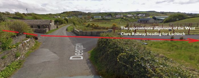
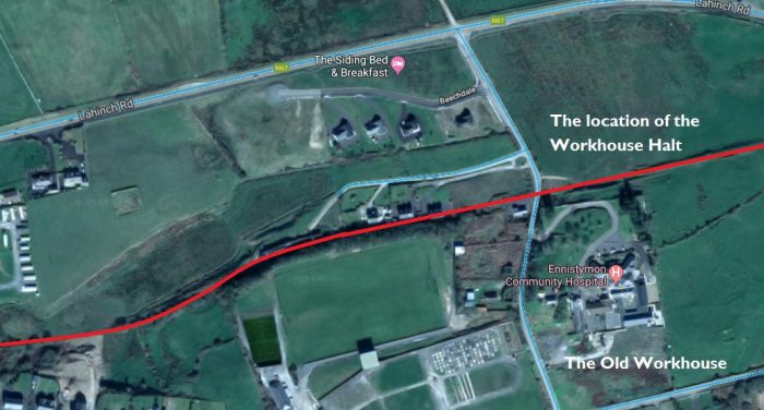
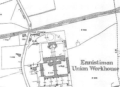
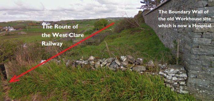
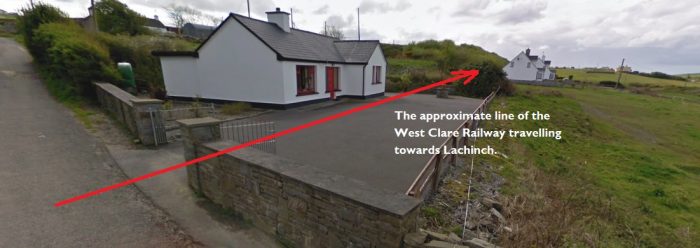
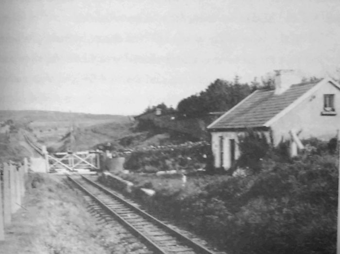
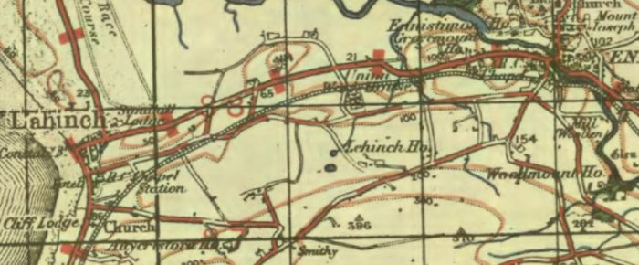
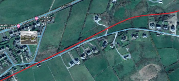
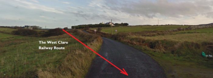
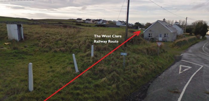
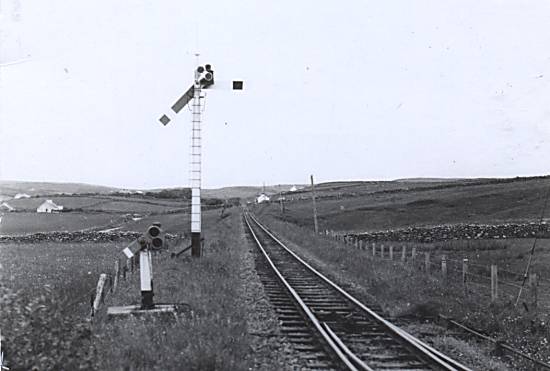
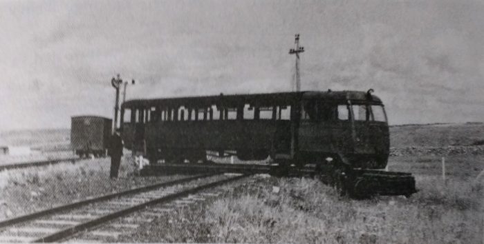
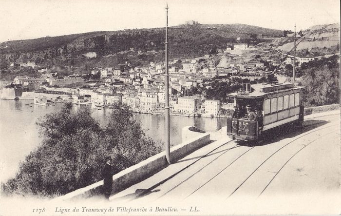
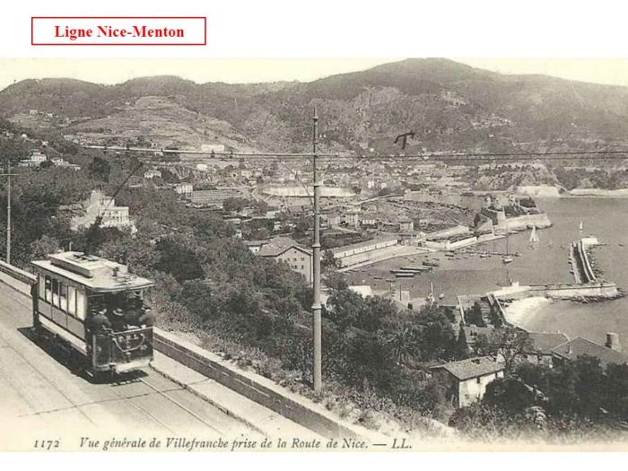
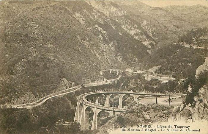

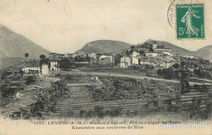
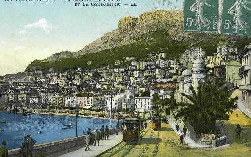
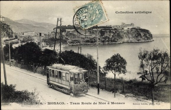
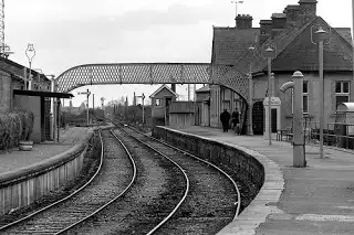
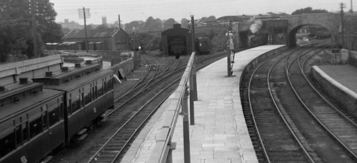


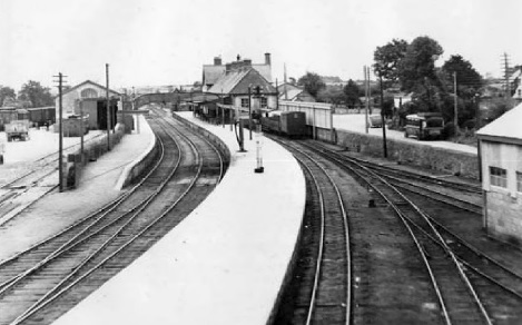
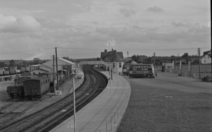
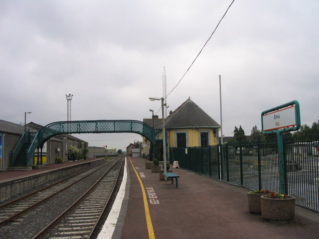
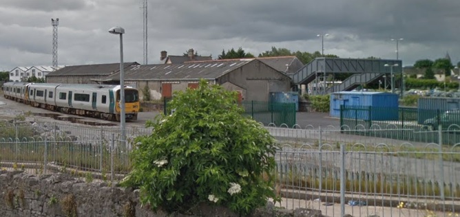


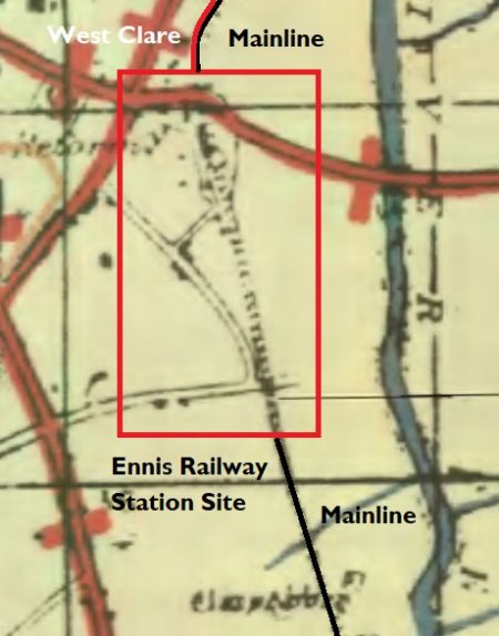
 In the past it was also the terminus of the 3ft-gauge West Claire Railway which ran North from the station alongside the mainline. North of Quin Road the land is shown on the adjacent 1917 OS Map as being used by a rail-served sawmill.
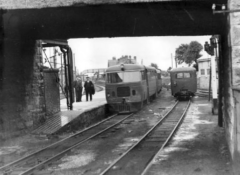


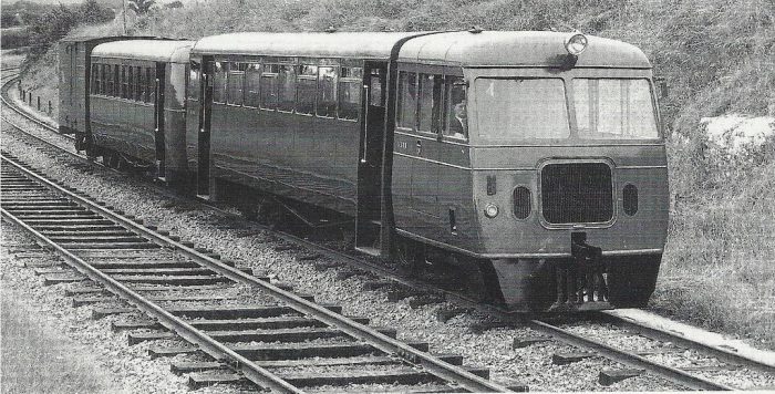

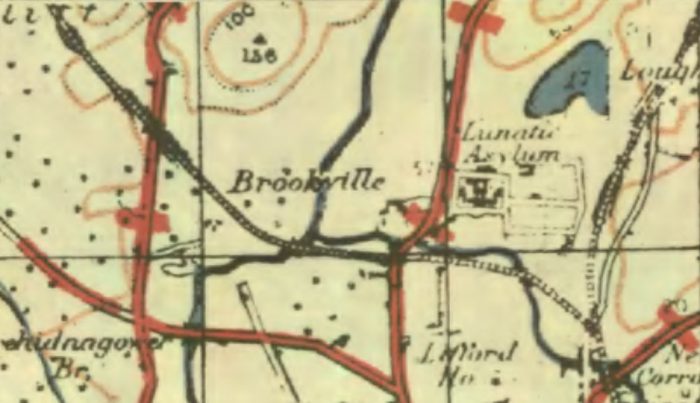
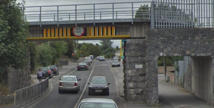

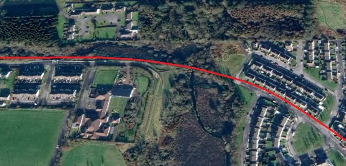
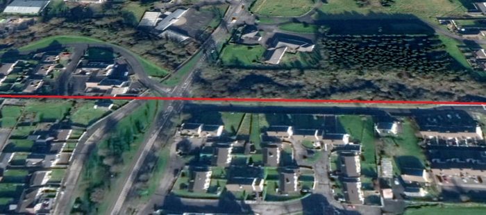

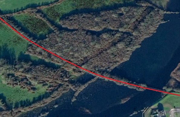


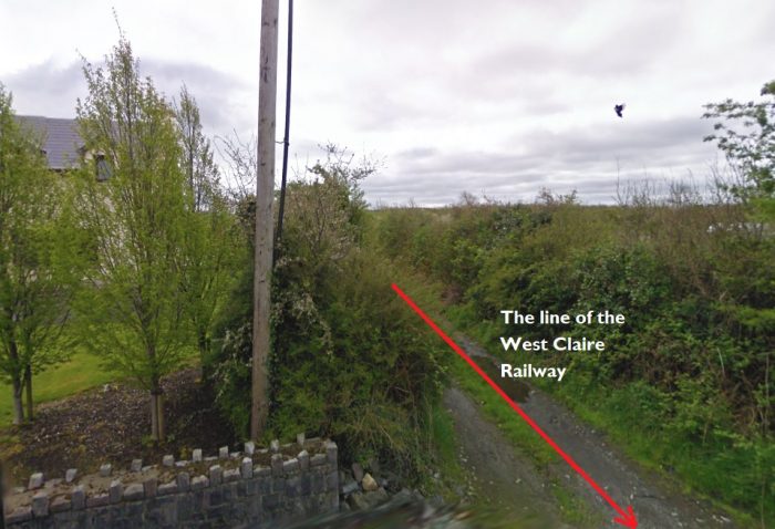
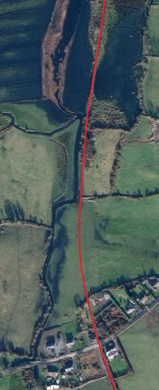
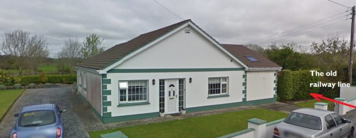
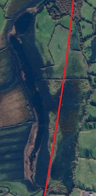
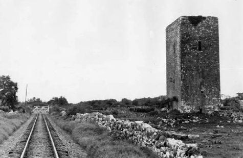

 The extended crossing-keepers cottage is seen above from the Southwest in April 2009.
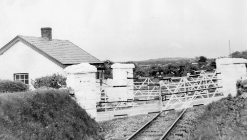


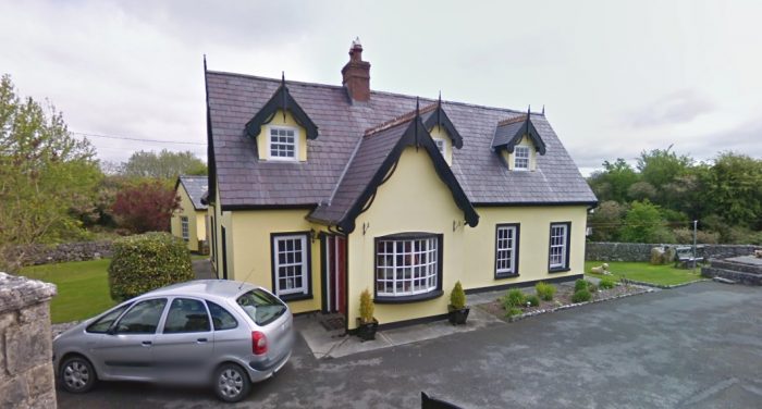
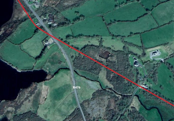
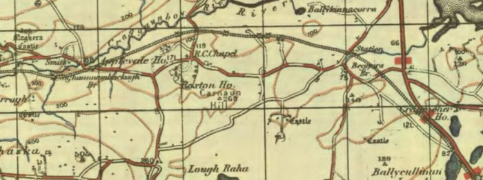
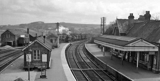
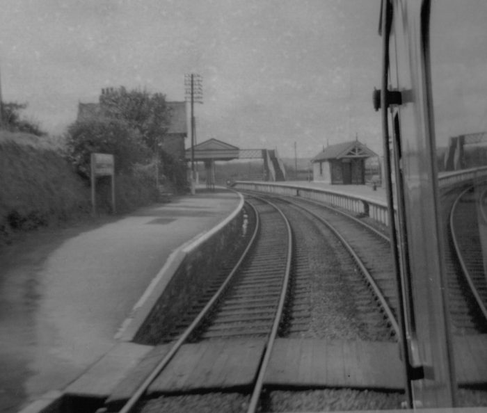
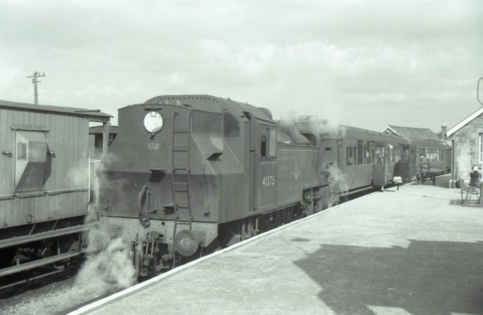
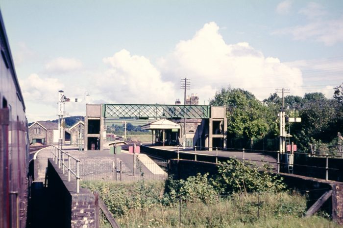

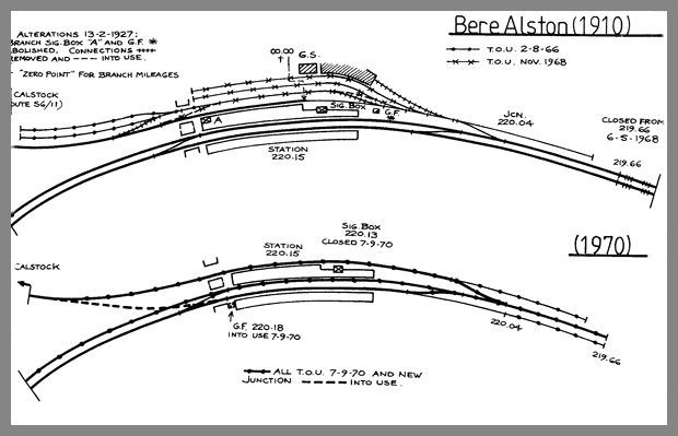
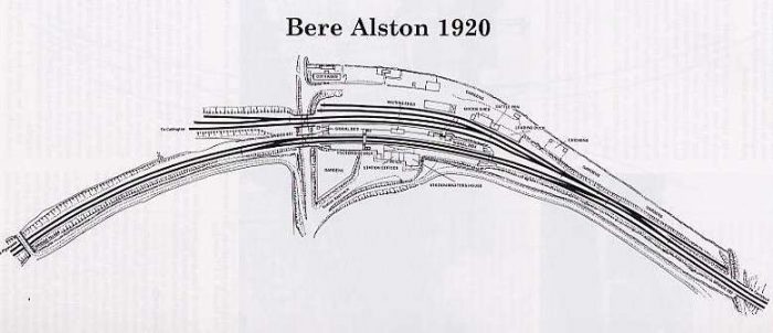
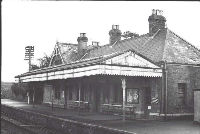
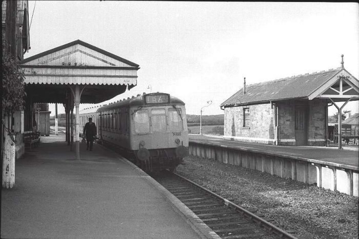
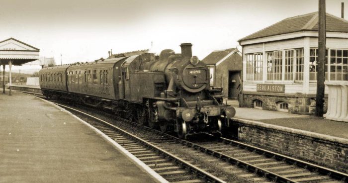
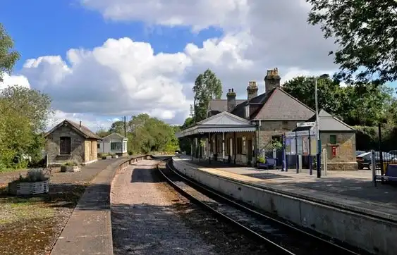
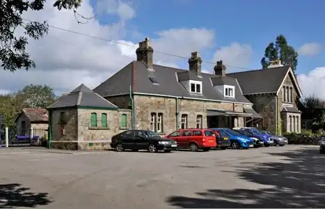
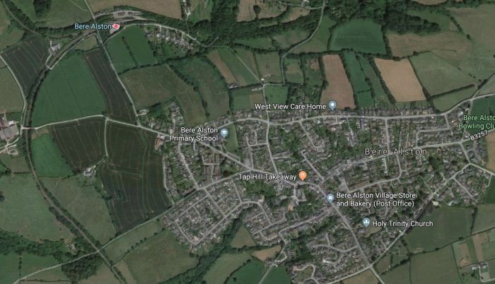
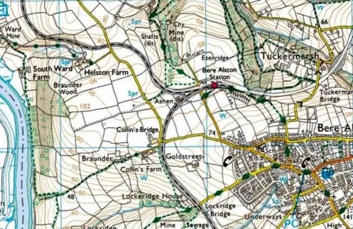
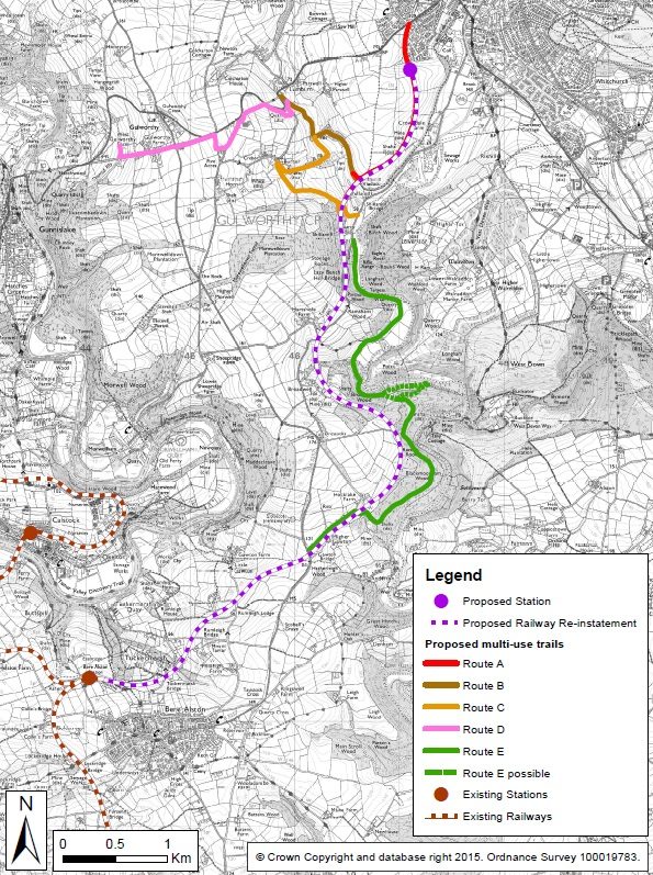
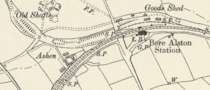
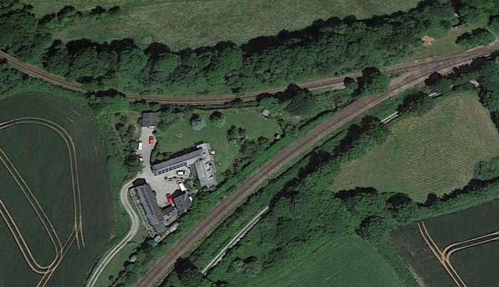
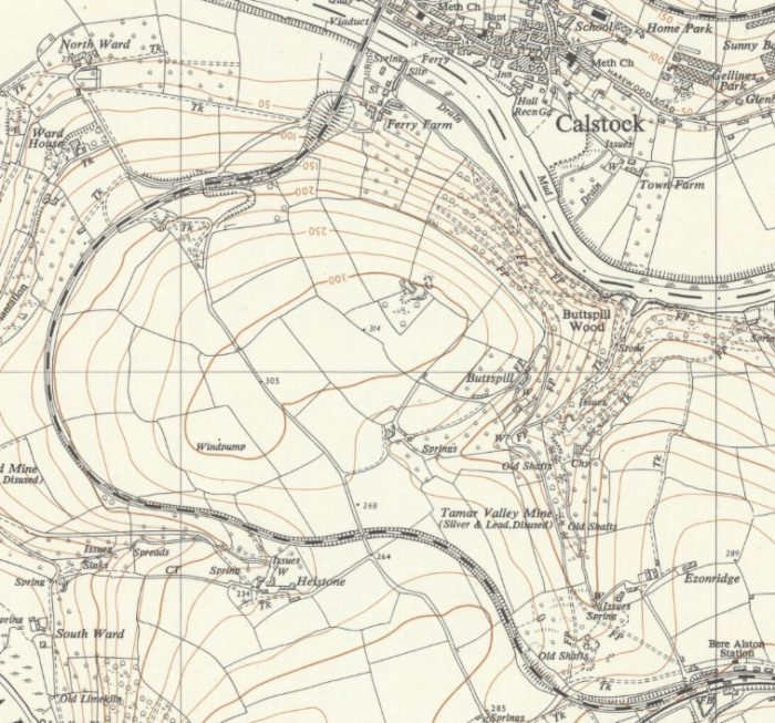
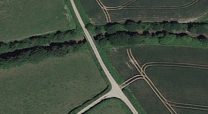
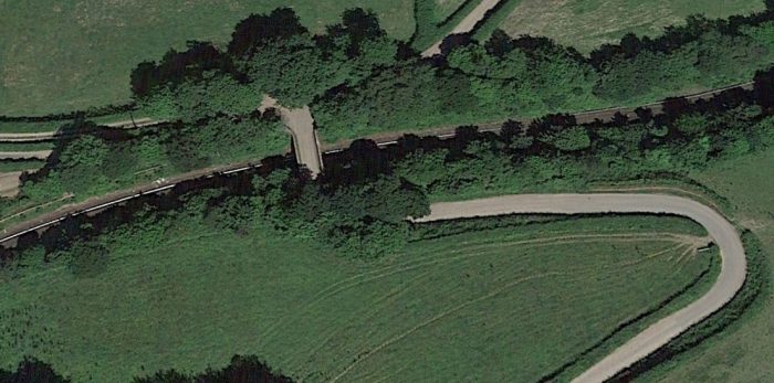
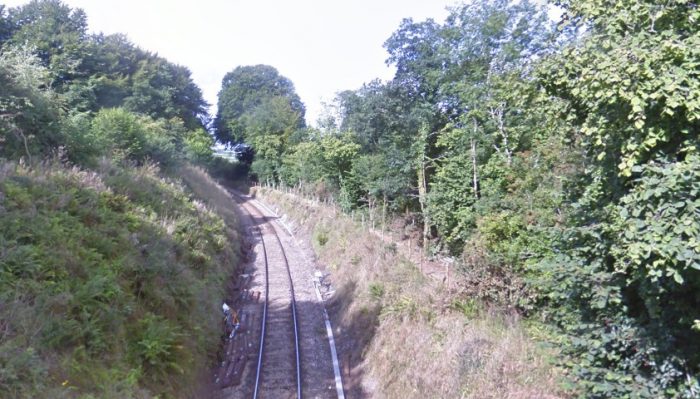
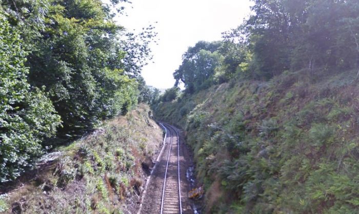
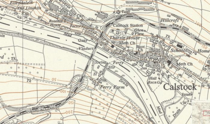
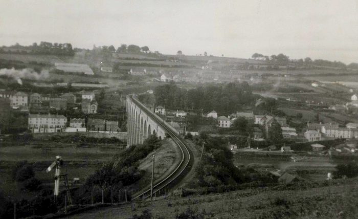
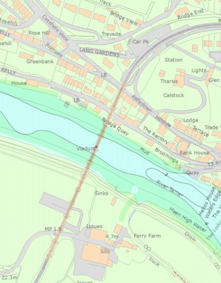
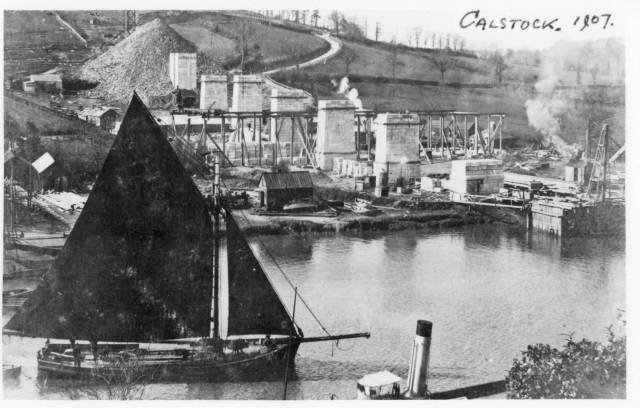
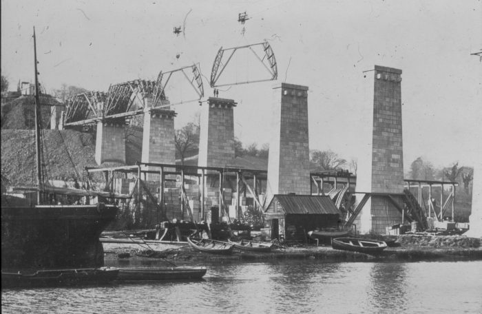
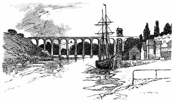

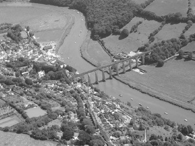
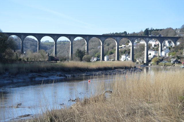
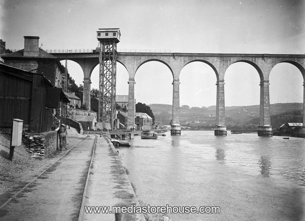
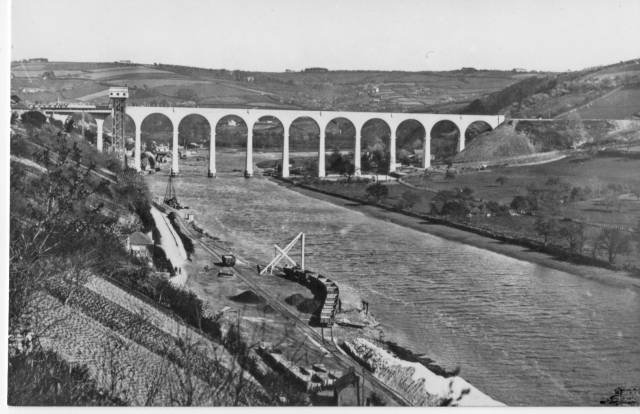
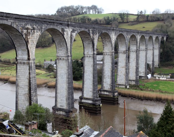
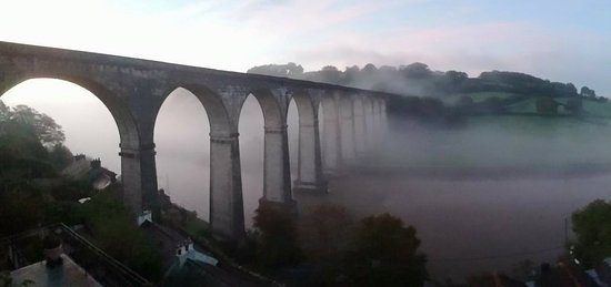
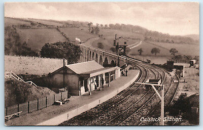
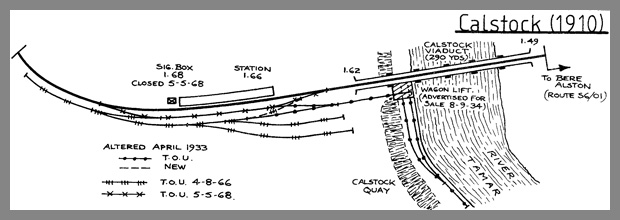
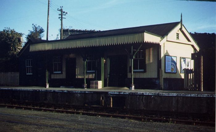
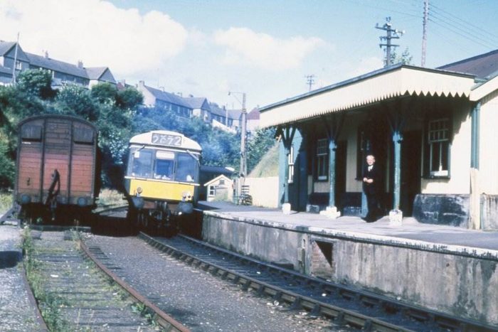

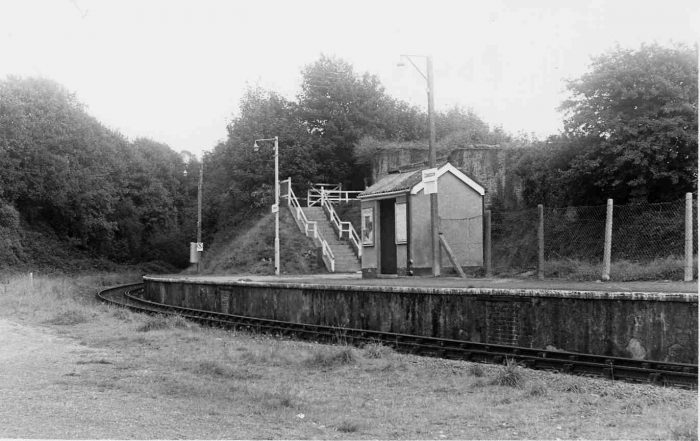
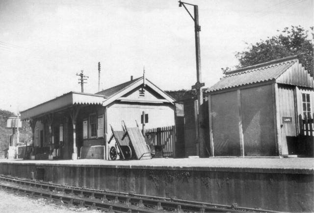
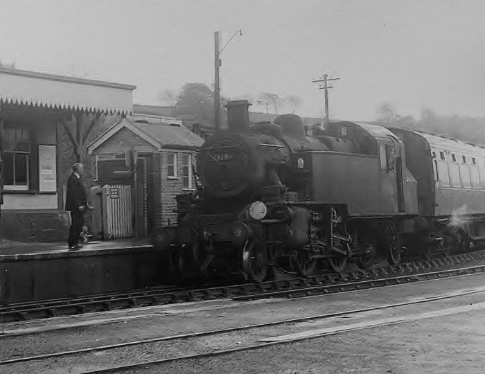
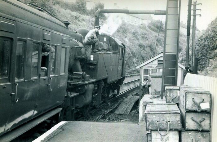
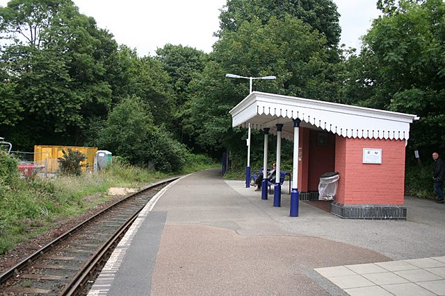
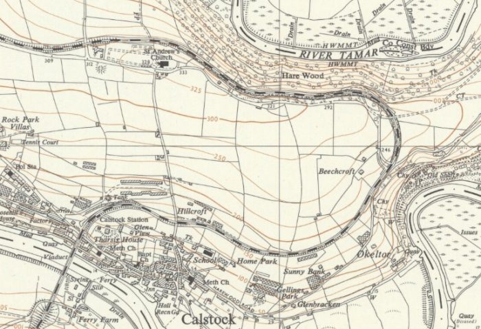
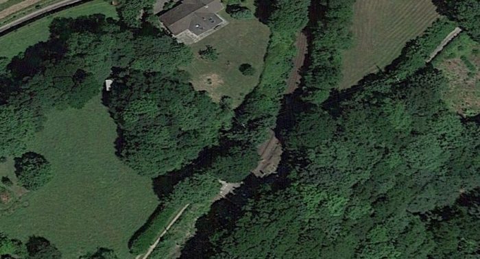
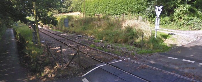
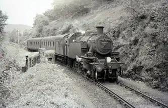
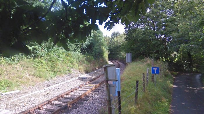
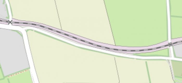
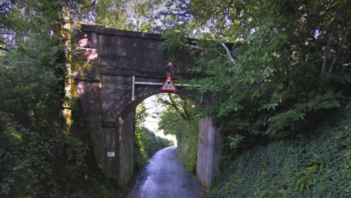
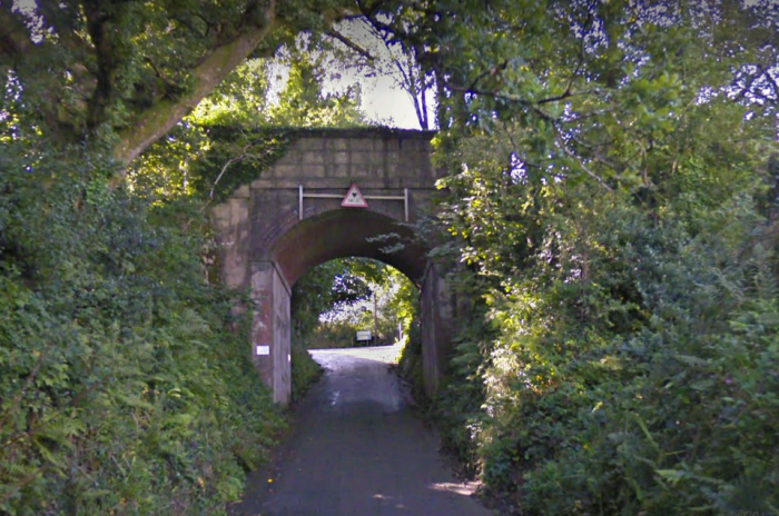
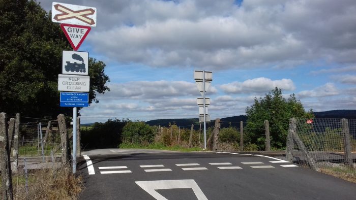
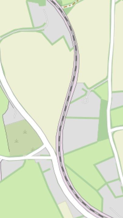
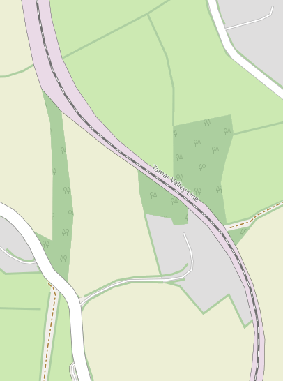
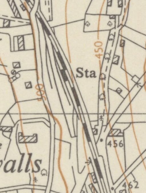
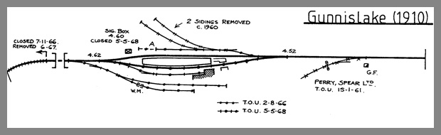
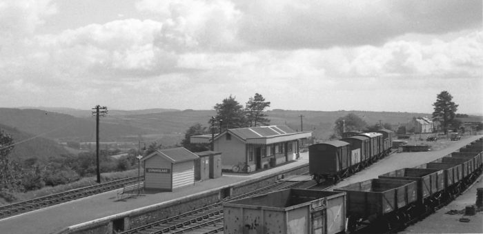
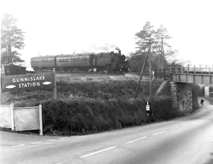

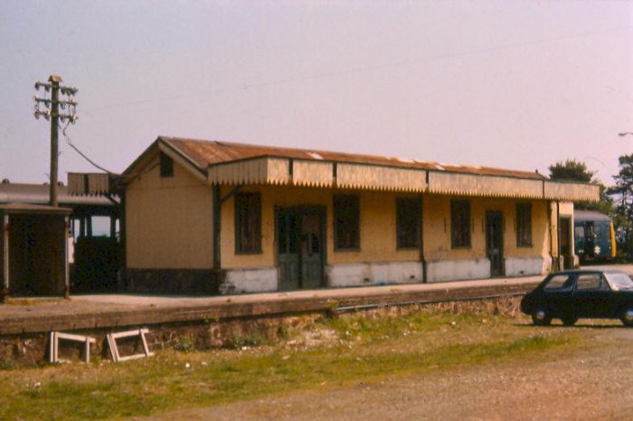
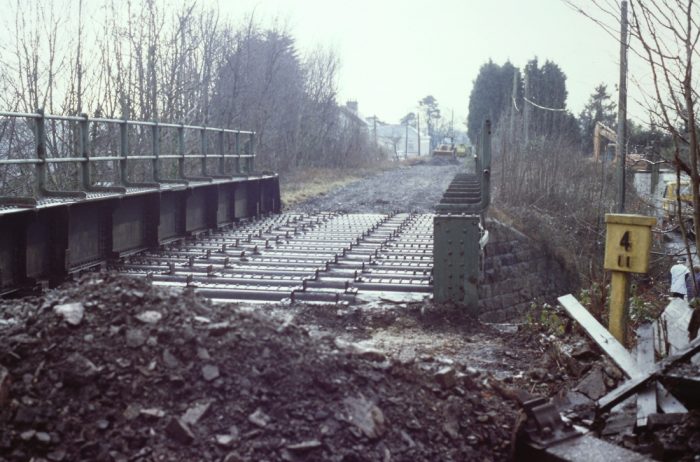
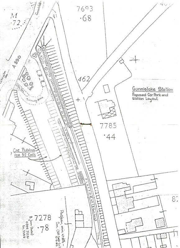
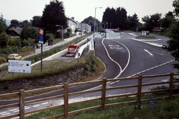
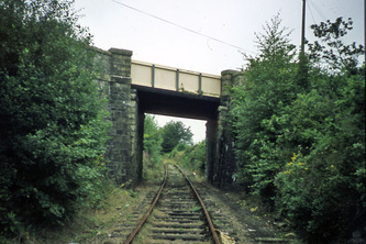
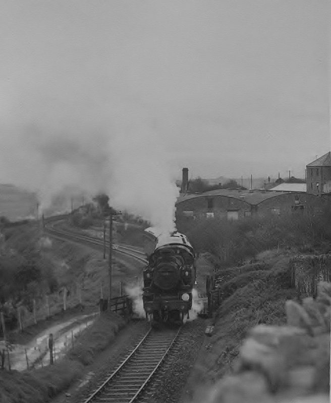
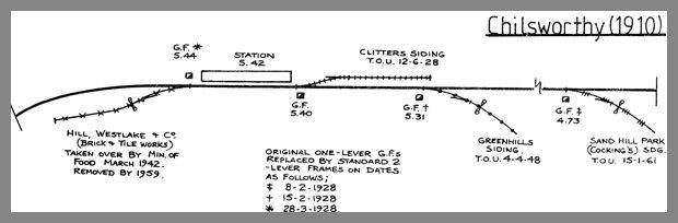
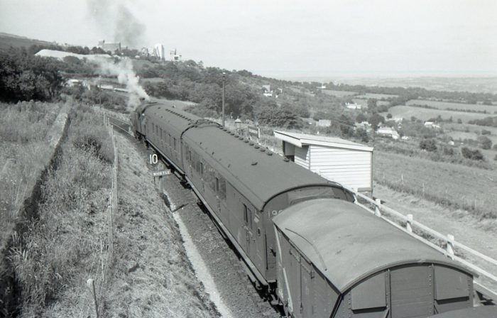
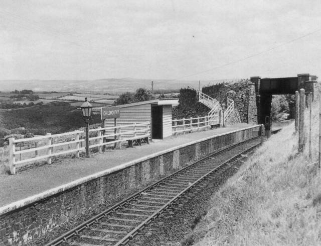
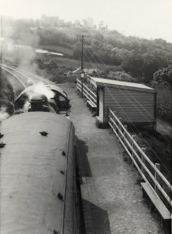
 A Callington bound train slows to a stop at Chilsworthy in the picture above. No doubt the picture was snapped from the over bridge in the photo immediately above, (c) Sid Sponheimer.
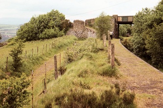
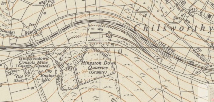

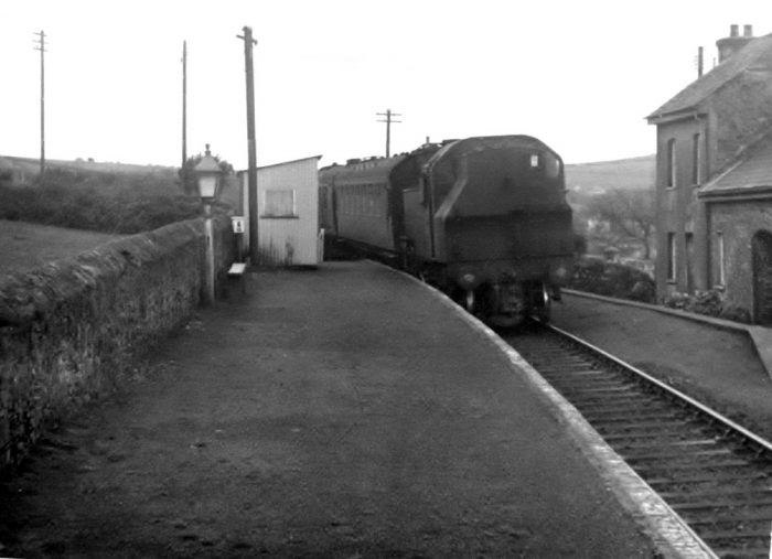

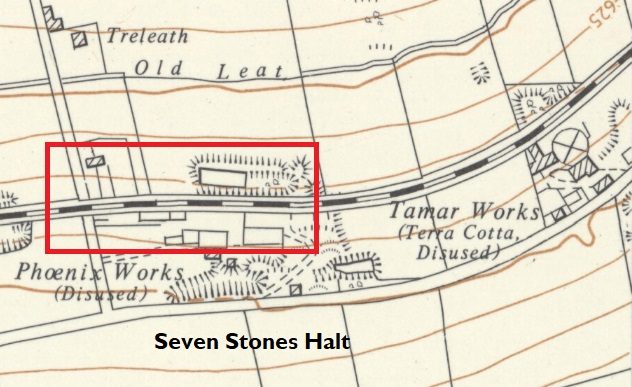
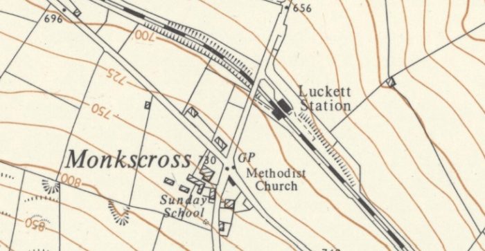
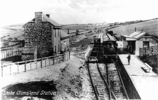
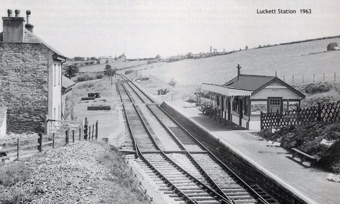
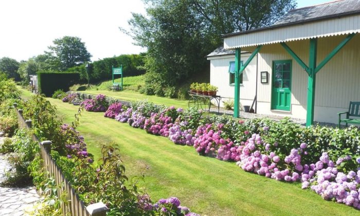
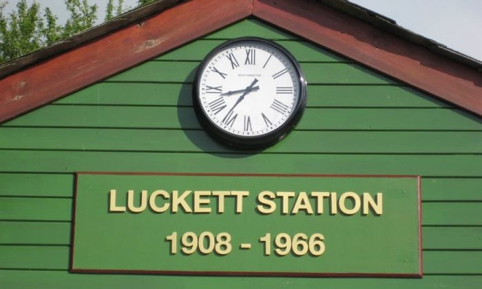
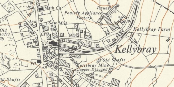
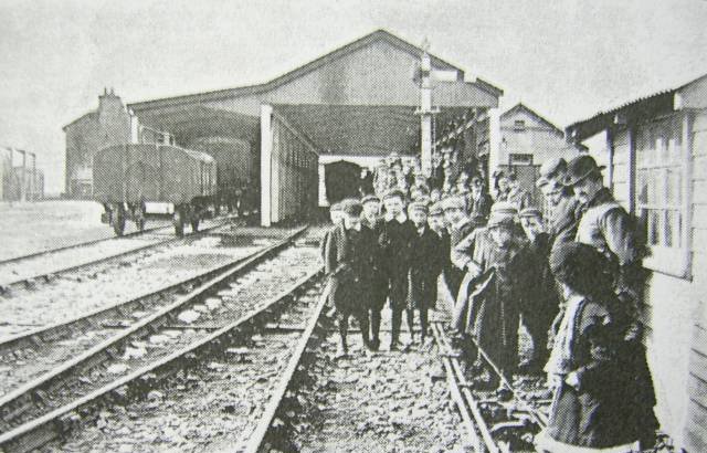
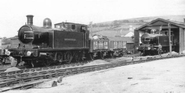
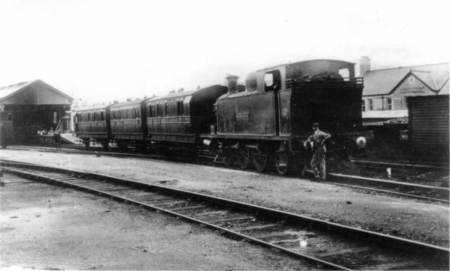
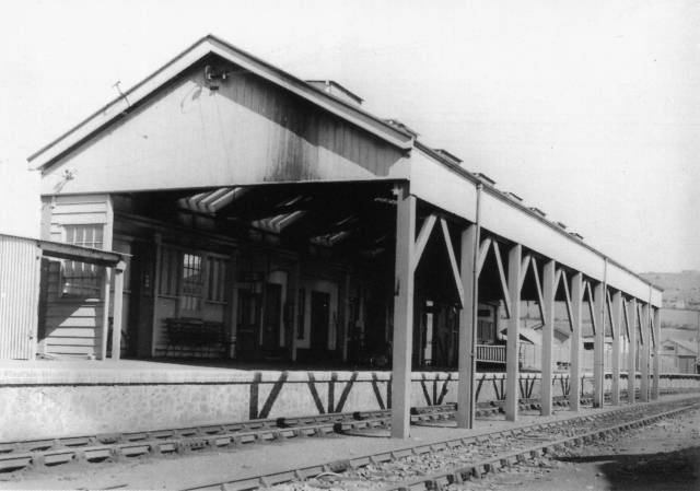
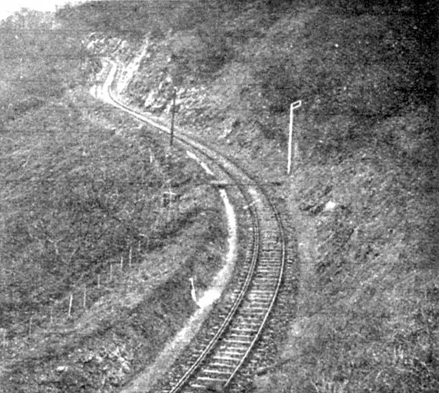

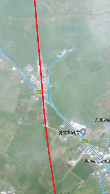