
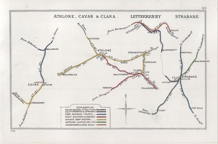
Wikipedia gives us a very short history of the line from Strabane to Letterkenny and provides a single image – the Railway Clearing House map with stations in Strabane and Letterkenny:
“The County Donegal Railways Joint Committee (CDRJC) constructed the Strabane and Letterkenny Railway. It opened for public service on 1 January 1909 with a route length of 19.25 miles. It was the last railway constructed by the CDRJC bringing the network operated by this company to 121 miles. The company pioneered the use of diesel operated railcars, but despite this innovation, closure came at the end of 1959, and the railway was shut on 1 January 1960.” [2]
This history must be worth expanding! It gives so little detail!
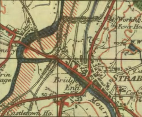
Wikipedia tells us that Letterkenny was already rail-served in 1909. “‘The Londonderry and Lough Swilly Railway Company’ (The L&LSR, the Swilly) was an Irish public transport and freight company that operated in parts of County Londonderry and County Donegal between 1853 and 2014.” [4] Incorporated in June 1853, [5] “it once operated 99 miles of railways. … It closed its last railway line in July 1953 but continued to operate bus services under the name Lough Swilly Bus Company until April 2014, becoming the oldest railway company established in the Victorian era to continue trading as a commercial concern into the 21st century. Following a High Court petition by HM Revenue and Customs, the company went into liquidation and operated its final bus services on 19 April 2014.” [4][7][8]
The first railway station in Letterkenny opened on 30th June 1883. The line out of Derry started out as the “Londonderry and Buncrana Railway” and was absorbed into the L&LSR in 1887. [9] That line is not the subject of this article but it is important to note that Letterkenny had been rail-served for many years before the branch from Strabane arrived in the town.
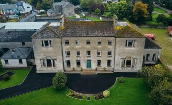
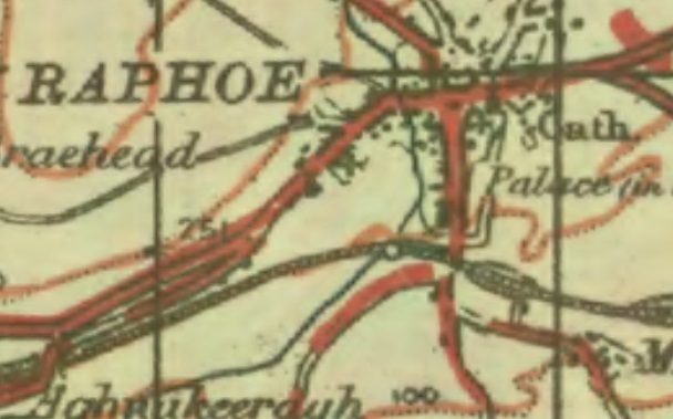
Patterson et al [1: p41] explain that the Co. Donegal Railways from Strabane to Stranolar – which were accessed from Londonderry over either the Great Northern Railway (along the valley of the River Foyle) to Strabane or the more tortuous route owned by the Co. Donegal Railways which passed over the higher ground to the East of the River Foyle, through New Buildings, Collion, Donemana, Ballyheather and Ballymagorry and on to Strabane – ran to the South of an area which included the small towns of Raphoe and Convoy. The L&LSR ran to the North of this area. “At the end of the 19th century, Raphoe had a population of around 700, …. centred around a cathedral, a ruined bishop’s palace and a Royal School. Convoy, only about a third he size of Raphoe, was a manufacturing village with a reputation for woolen textile manufacture. By Donegal standards, the people living there felt they ought to have a railway.” [1: p41]
That sense of entitlement built on endeavours which began as early as 1860 but which foundered on more powerful interests. It wasn’t until around 25 years later that a light railway/tramway was planned between Strabane and Drumcairn and it became more likely that the area would be rail served. However, that scheme also foundered for lack of money. [1: p41]
It was 1902 when a new version of the scheme was proposed at an estimated cost of £100,000 which ran between Strabane and Letterkenny via Lifford, Ballindrait, Convoy and Raphoe. The scheme was the subject of a bill submitted to Parliament in the winter of 1902-3. [1: p41-42] That application failed to achieve its key objective of reaching Letterkenny. The Act only allowed a line from Strabane to Convoy. A further submission was made in 1904 and was successful. The promoters called the line the Strabane and Letterkenny Railway (S&LR) and within no more than a year it had effectively been taken over by the Great Northern Railway in advance of their takeover of the Co. Donegal Railway. [1: p42-43]. Work started on building the line in 1906. Robert McAlpine and Sons were the principal contractor. The line was eventually opened to traffic on New Year’s Day 1909. [1: p43-44]
Patterson et al comment that “since much of the share capital of the S&L had been provided by the Midland and the Great Northern, owners of the CDRJC since 1906, it was natural that the Joint Committee should take over the operation of the line and work it as a branch. ” {1: p44-45]
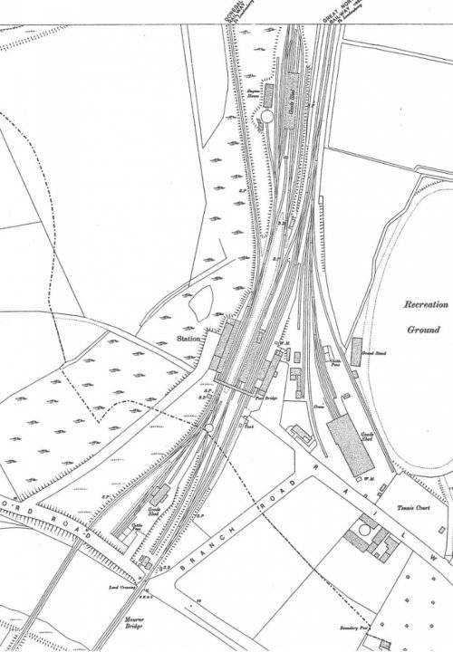
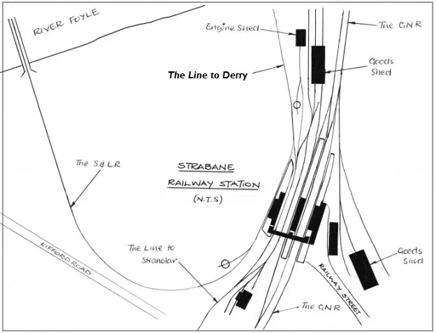
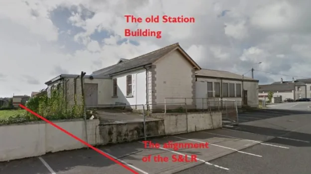
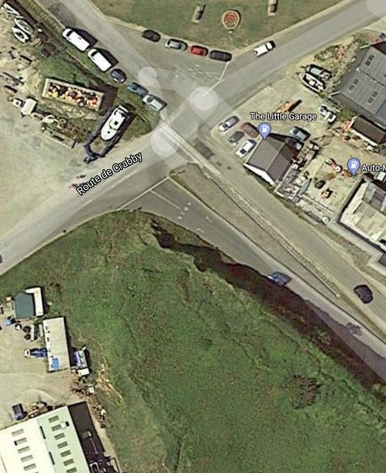
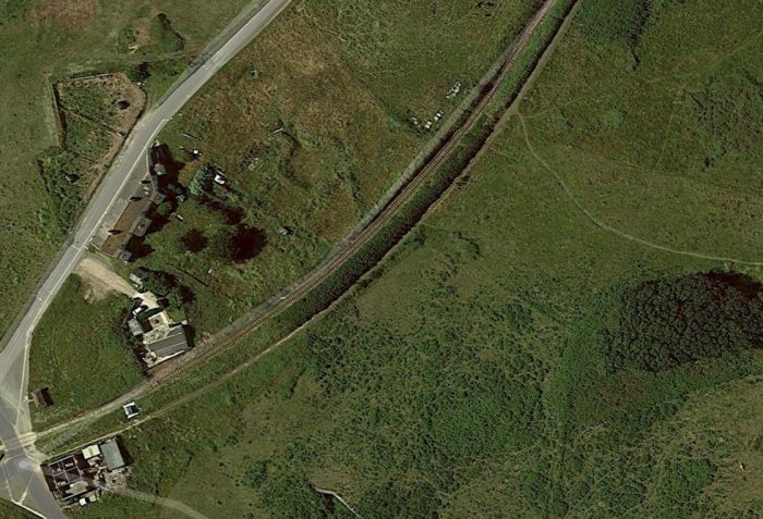
Strabane Railway Station was first opened in 1847 on the Great Northern Irish standard-gauge line. It expanded to include the narrow-gauge Co. Donegal lines in 1894 when the new narrow gauge crossed the river into the southern end of the station.
Prior to the narrow-gauge, the Finn Valley railway shared the southern approach to the railway station with the Irish North Western Railway – the predecessor of the GNR. The Finn Valley Railway was held to ransom for access into Strabane Railway Station. The advent in Ireland of the new 3ft gauge railways encouraged the directors of the West Donegal Railway (WDR) to choose that gauge for their new railway in the late 1870s. After a period of mixed gauge use of Stranorlar Railway Station, Parliament sanctioned the amalgamation of the Finn Valley with the WDR in 1892 and in 1893 powers were obtained for a change of gauge between Stranorlar and Strabane and for the construction of a new narrow-gauge link from the old Finn Valley junction with the GNR into Strabane Railway Station. [1: p19-28] That link appears on the 1905 Ordnance Survey Map above. The map was drawn only a few years before the construction of the S&LR.
My sketch below shows the layout of Strabane Railway Station in the years following the construction of the S&LR.  Strabane Railway Station in the 1930s (c) Roger Farnworth
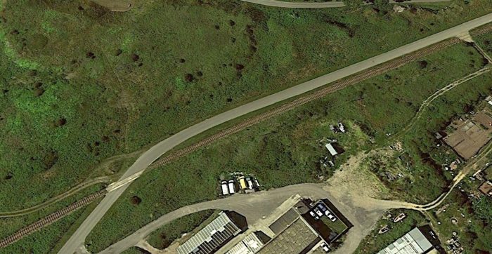
A Journey Along the Line – Strabane to Letterkenny – Part A – Strabane to Raphoe
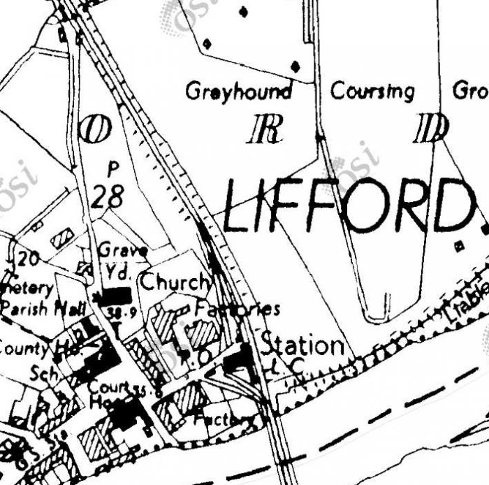
On the GSGS 1940s OS Map, the Strabane to Letterkenny branch is shown leaving the Co. Donegal mainline just to the North of Strabane Railway Station. My sketch above shows the actual arrangement. It was difficult to fairly represent the track arrangement at the station at the scale the GSGS Maps were drfated. Letterkenny trains left Strabane Railway Station at the station platforms and then turned sharply round to the Northwest before crossing the River Foyle and entering Lifford Railway Station.
Recently, I have been consulting with Chris Amundson. The link immediately below shows what is known about the layout of Strabane Railway Station in different eras:
https://www.flickr.com/gp/spw45/mFAX44
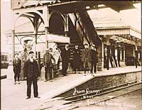
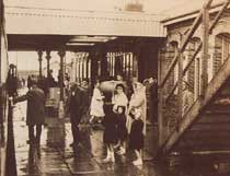
The next few pictures show the footbridge at Strabane Station. The first three are relatively low resolution images posted on the BBC Northern Ireland Your Place and Mine website. [15]
These first three images are taken looking North through the Station. The first is taken from just South of the Western station platform. On the far left of the image the S&LR platform can be glimpsed. The second shows the main station buildings with the footbridge steps to the right of the image. The third looks Northeast under the footbridge towards the main station buildings.
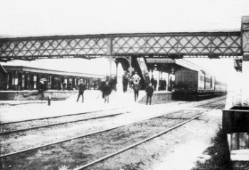
The fourth picture was found on both Sepiatown [16] and OldStrabane webpages [17] It shows the station footbridge, again looking North, from the GNR side of the station. (I have been unable to contact both of the two sites to get permission to share photographs, postcard images, etc., here. Email links, where they exist, no longer function. Should the site owners wish me to remove the images credited to those sites then I will do so and replace them with the links referred to in the references at the end of this article.)
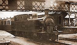
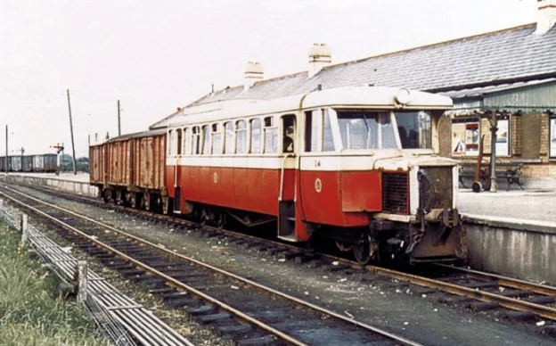
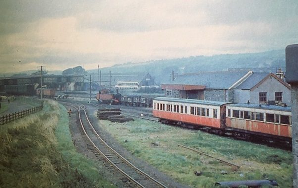
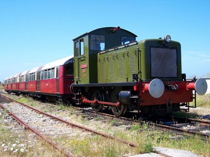
The first colour image shows the station footbridge again, also looking Northeast, this time from close to the Co. Donegal lines turntable. County Donegal Railway No 11 “ERNE” is moving vans in May 1957. [17][18]
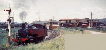
The second colour image shows the same engine (No. 11 ERNE Class 4, 4-6-4 ‘Baltic’ tank), heading away, light engine, from Strabane Railway Station on the Letterkenny line in March 1958. The CDR signal box, and station footbridge are shown in the background. [17][19]
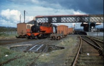
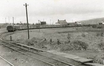
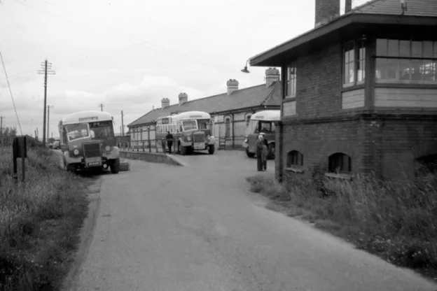
The following image shows a Goods Train approaching Strabane from Lifford, presumably having travelled from Letterkenny. The photographer is looking Southwest from a point near the Signal Box at Strabane. [17][20]
As noted above, these superb images can be found on two sites, http://www.sepiatown.com and oldstrabane.blogspot.com. Each image is individually referenced on the http://www.sepiatown.com website. I have only been able to provide a general reference for the same images on the oldstrabane.blogspot.com website.
Those on the http://www.sepiatown.com website are geographically referenced for their location around the station site.
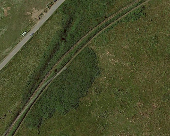
Trains for Letterkenny used the most westerly platform at Strabane Railway Station – Platform No. 5. Trains traversed a very tight curve round to the Northwest, followed a short straight-alignment before crossing the River Foyle.
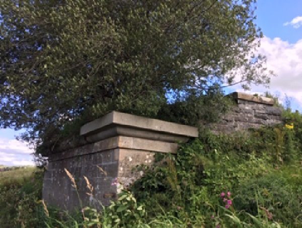
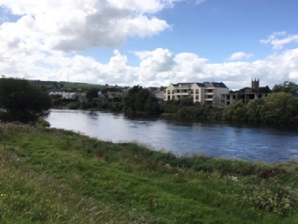
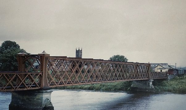
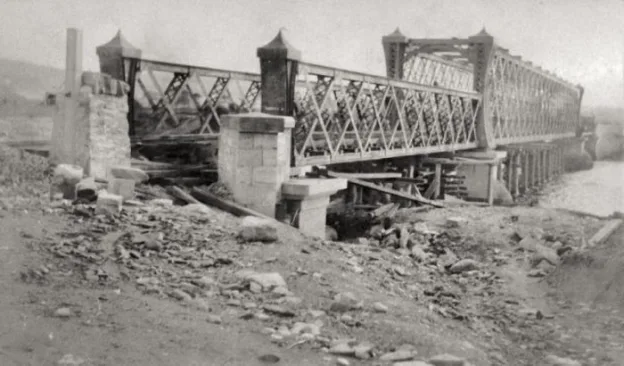
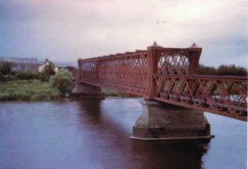
The Strabane/Lifford Railway Bridge over the River Foyle is shown during construction above and much later, probably not long before demolition, in the adjacent photograph.
All that remained in the latter 20th century was the bridge foundations. By the early 21st century, these also were gone.
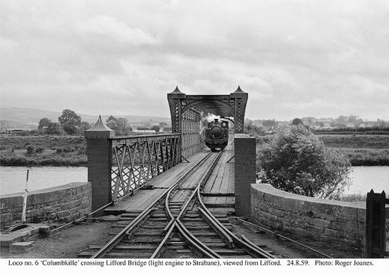
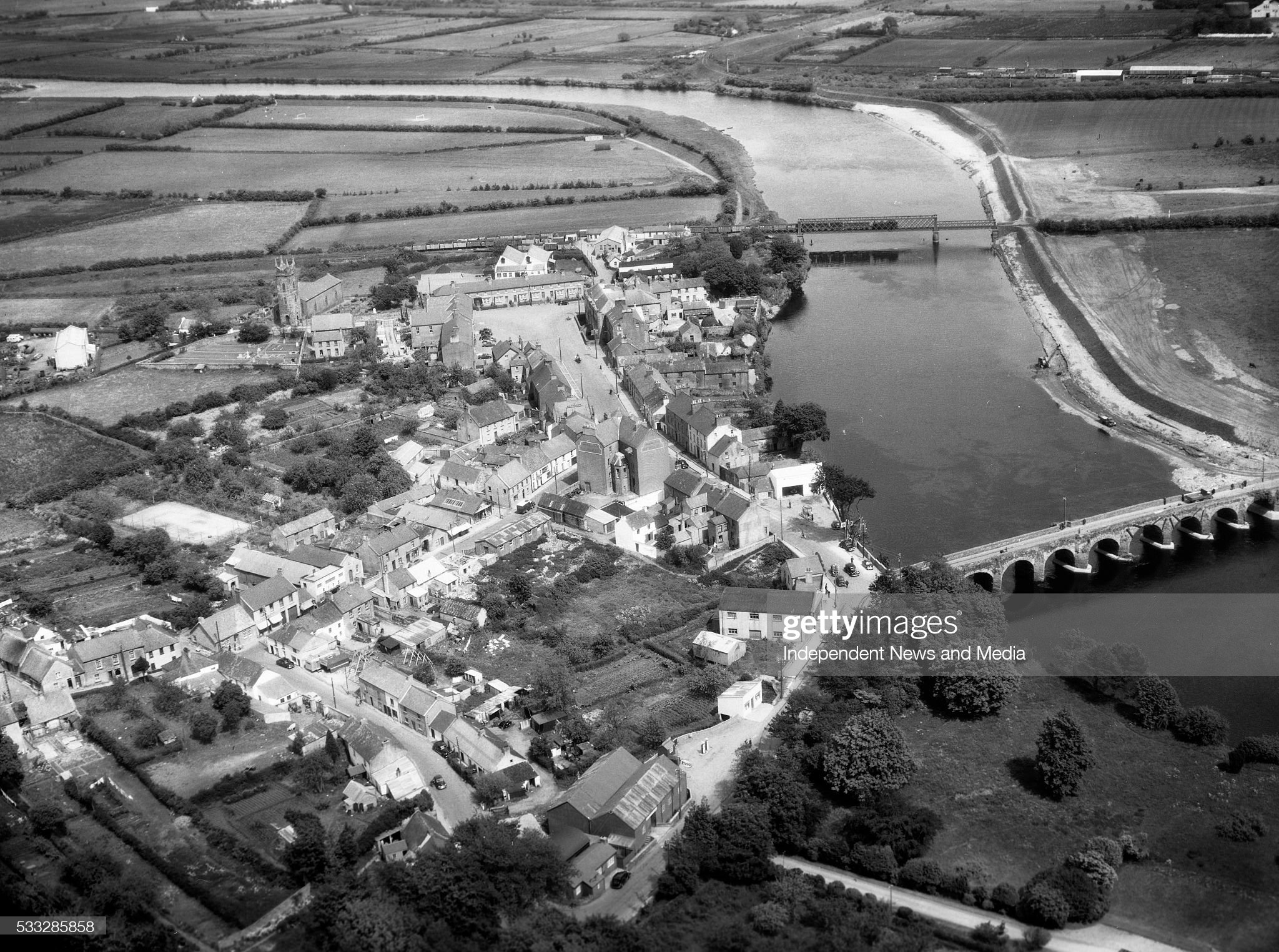
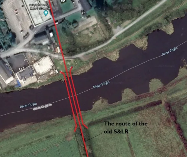
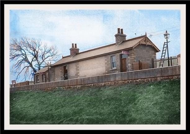
The S&LR bridge can be seen towards the top of this image. Lifford Halt Station is just to the left pf the bridge. This image is embedded with permission from http://www.gettyimages.co.uk. An unidentified Co. Donegal steam locomotive is crossing the bridge in charge of a long goods from Letterkenny. [30]
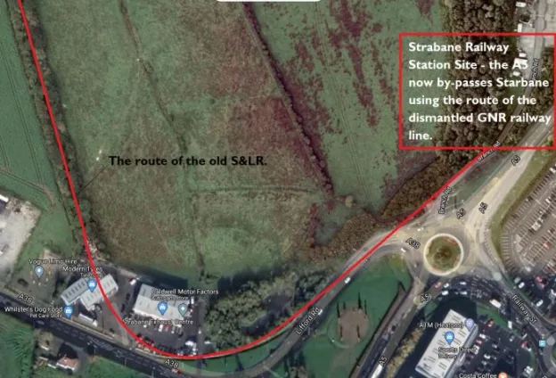
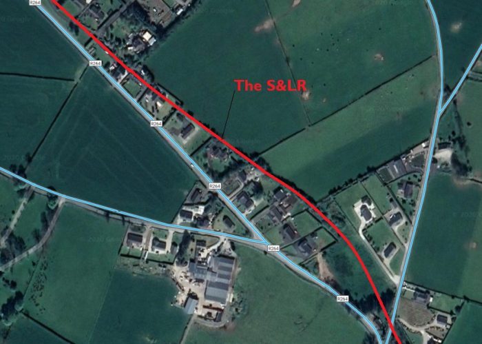
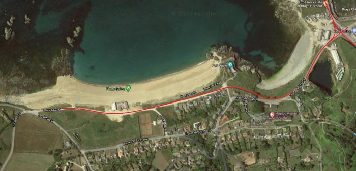
The photo above appears on the Donegal Heritage Centre Facebook page and is embedded here with permission. [31] There is also an excellent photograph of the station and platform in Anthony Burges book, The Swilly and the Wee Donegal. [44: p30] The satellite image below shows the S&LR just North of the location of the old station.
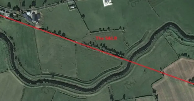
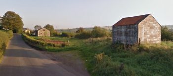
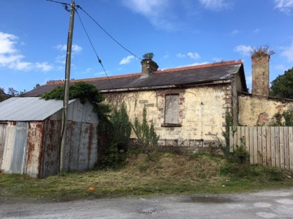
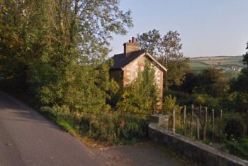
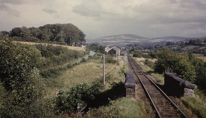
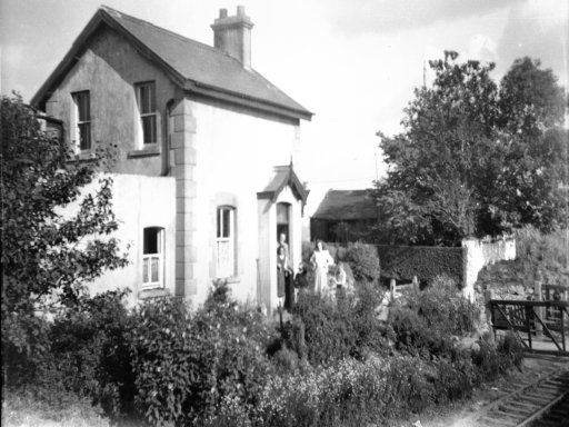
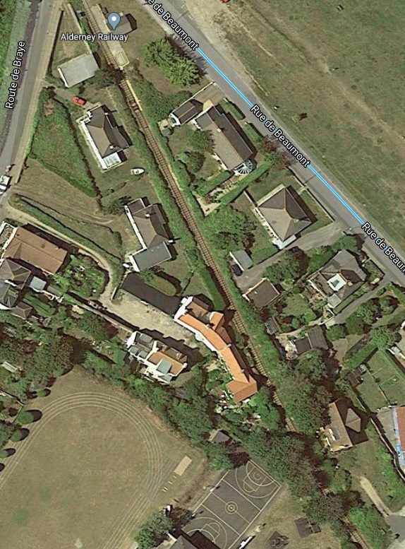
Ballindrait Railway Station was to the Northeast of the village on the North side of the Deele River.
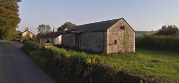
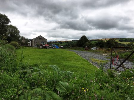
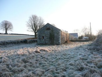
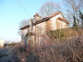
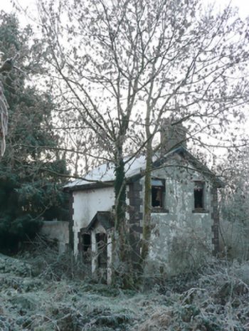
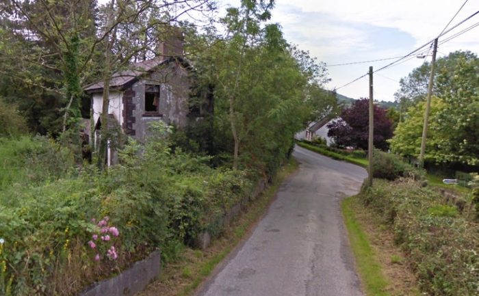
There is a bungalow on the site of the old station, close to the old station house, but many of the buildings associated with the station are also still present. A sequence of views are adjacent to this text, three of which are views on Google Streetview.
The two wintry views are from the Irish National Inventory of Architectural Heritage. [32]
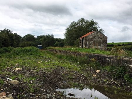
There are also some pictures taken recently by Kerry Doherty which show the site from the alignment of the old railway (these make an excellent comparison with one of the images in the book, The Swilly and the Wee Donegal, by Anthony Burges . [44: p31])
Kerry Doherty’s photos include one of the old goods shed looking towards Lifford.
The station buildings are in a surprisingly good condition having seen little or no maintenance over the years since the closure of the S&LR.
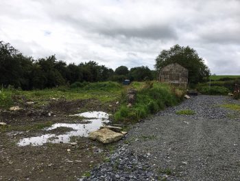
I am particularly grateful to Kerry Doherty for the modern images which appear to be more up-to-date than the Google Streetview images.
Leaving the station, the railway travelled only a short distance due West before crossing the station access road leading up from Ballindrait village on a steel girder bridge.
The bridge deck has been removed and the abutments, if they still exist, are completely obscured by vegetation.
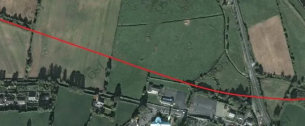
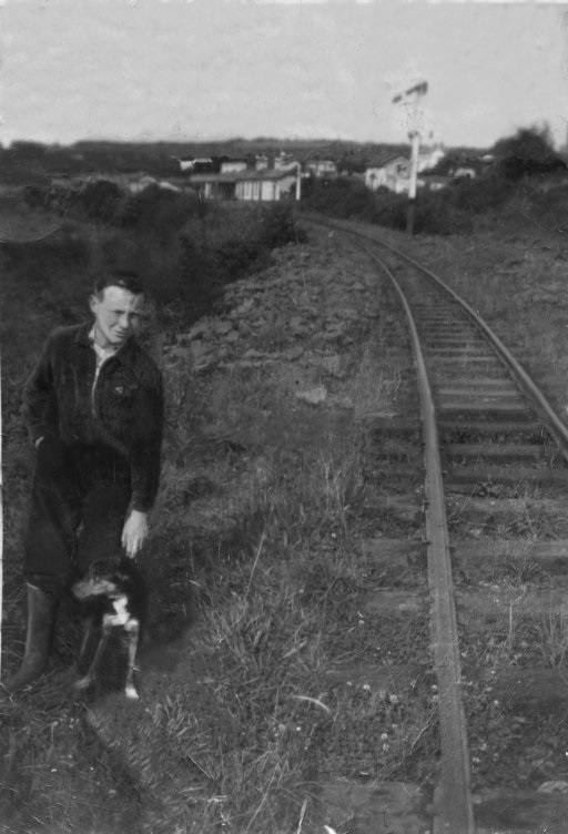
Beyond Ballindrait the S&LR followed the route of the R264 closely. The picture below looks back towards Ballindrait railway station in the year before closure of the line.
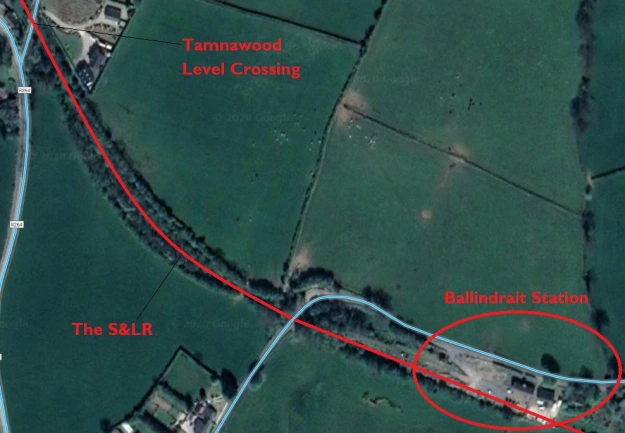
Initially crossing a side road on the level at Tamnawood Crossing. The crossing keeper’s cottage still stands in the early 21st century and is shown below in two images, the first comes from the Irish National Inventory of Architectural Heritage. [33] The second from Google Streetview.
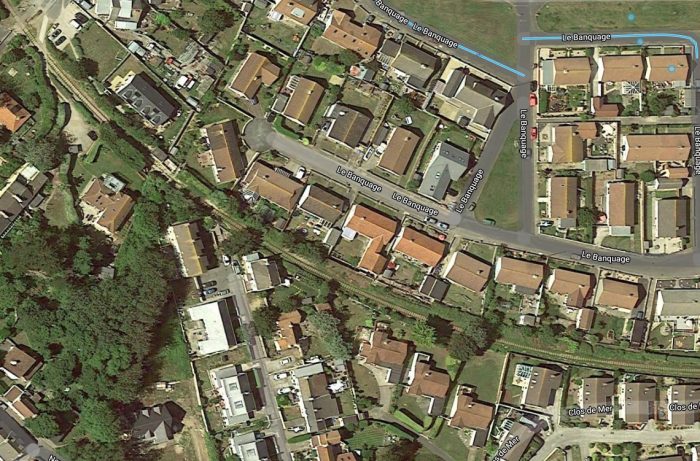
At first it ran along the North side of the road. Modern develop obscures its route. The first two Google Satellite images below show that modern development.
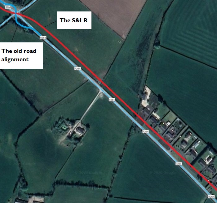 After a few more hundreds of metres, line crossed the R264 on the level. The old road has been realigned at this point. The location can be picked out on the GSGS Map below but is more easily picked out on the larger scale extract provided after the two satellite images.
The approximate alignment of road and rail is illustrated on the Google Streetview photograph below the larger scale map extract.
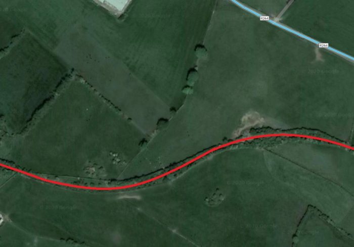
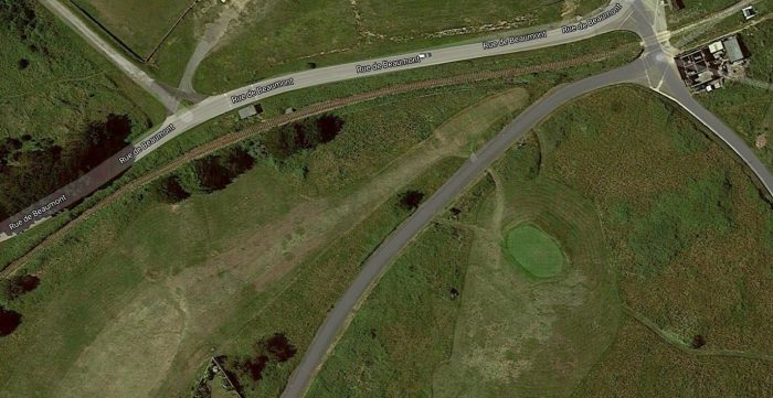
Beyond the road crossing the S&LR followed the South side of the R264, only a few metres away from the carriageway, until it reach Coolaghy Halt where it turned away Southwest from the road.
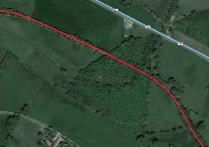
The route as far as Coolaghy Halt is illustrated on the Google Sateliite images below.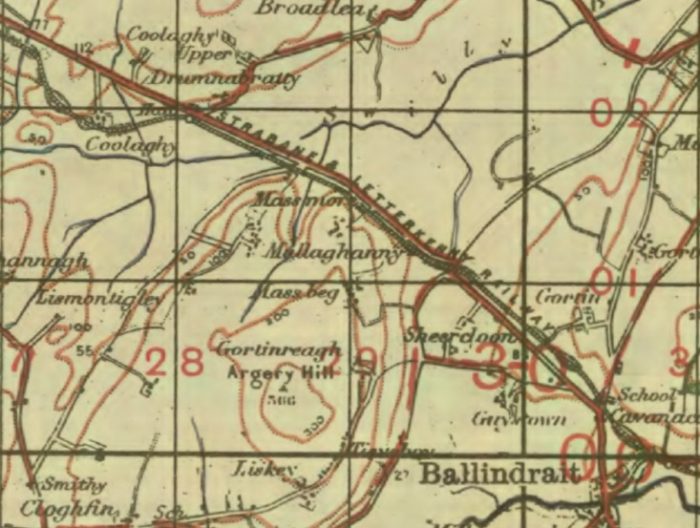 GSGS Map from 1941 shows the route of the Strabane to Letterkenny Railway following the route of the Ballindrait to Raphoe Raod (R264). [34]
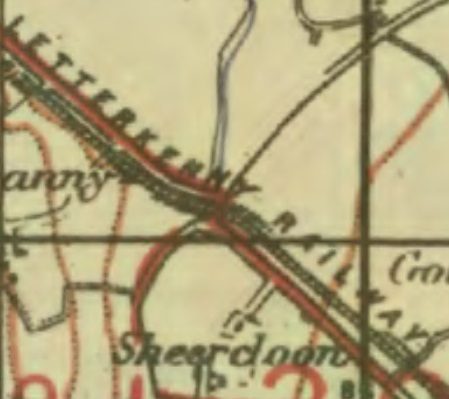 GSGS Map from 1941 shows the point at which the S&LR crossed the R264. [34]
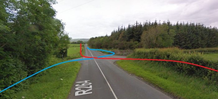 The R264 looking Northwest towards Raphoe showing the approximate alignments of the old road and the S&LR (Google Streetview).
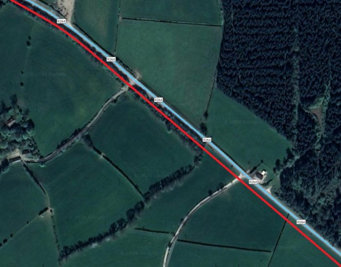
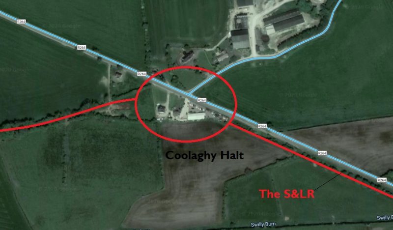
Coolaghy Halt was the first point for some distance that the railway left the side of the old road. The route of the S&LR is still easily picked out as a line of trees and shrubs running West-southwest away from the R264.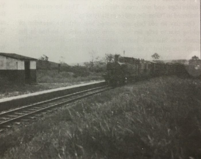 Coolaghy Halt in 1942 from the Tom P. McDevitte Collection courtesy of Kerry Doherty, the image is also reproduced in ‘Railway Days in Strabane’. [43]
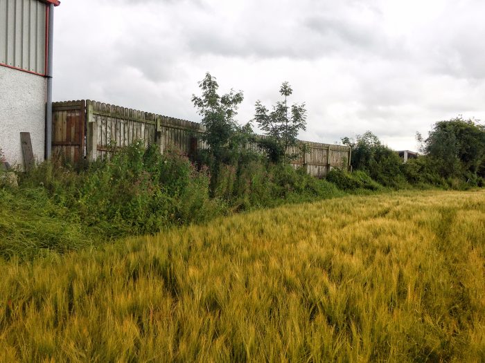 Coolaghy Halt’s location in the 21st century. The platform was where the fence sits today. Photograph by Kerry Doherty. [43]
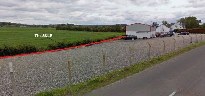 The location of Coolaghy Halt (Google Streetview)
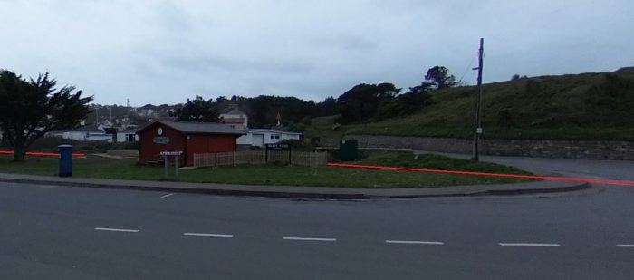
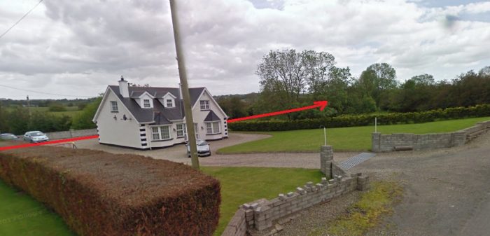 A side road from the Northeast met the R264 at the location of the Halt which was on the South side of the road. The red line on these two Google Streetview images shows the approximate alignment of the old S&LR at this point (Google Streetview).
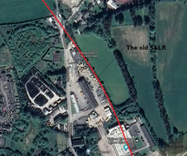
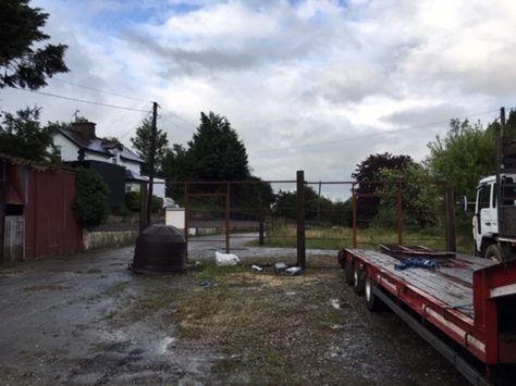
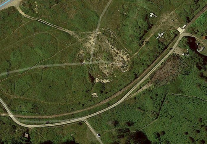
Onward from Coolaghy Halt, the S&LR was only away from the R264 for a few hundred metres, running behind what is now P Connolly Car Sales and Repairs before drifting back towards the road and roughly following its alignment for a few hundred metres before turning away to the Southwest again en-route to what was Raphoe Railway Station.
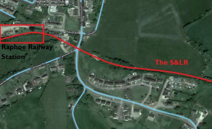
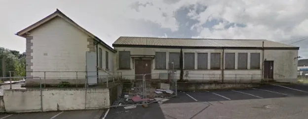
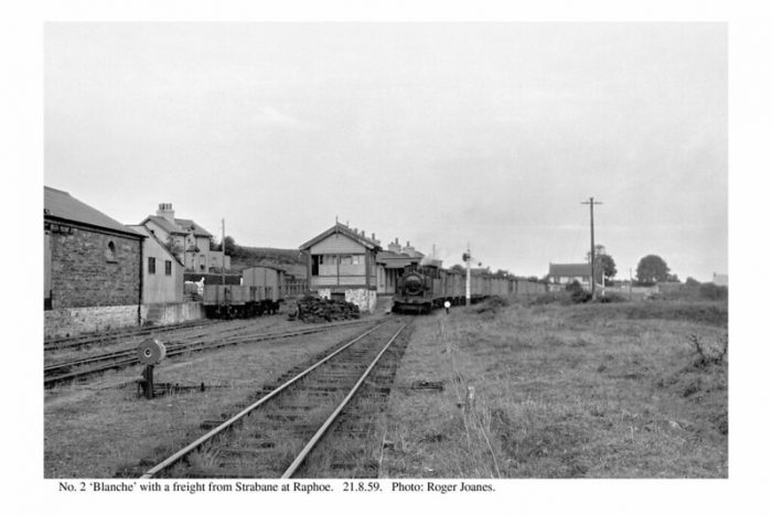
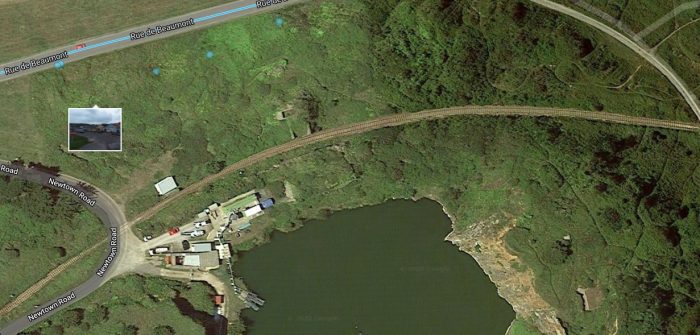
 Raphoe Railway Station sat on the South side of the town. [35]
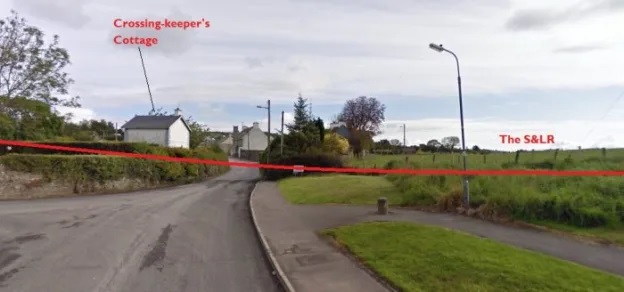
 The Crossing-keeper’s cottage, Gate House 52, in the early 21st century, The photographer is standing on the track-bed, (c) Kerry Doherty. [45]
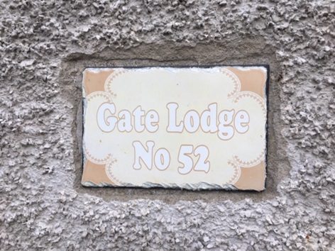 A nice acknowledgement to the railway past, (c) Kerry Doherty. [45]
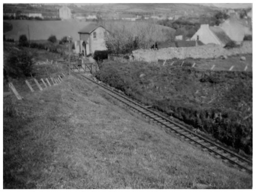
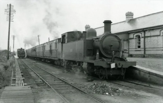
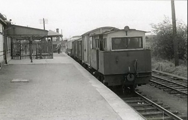
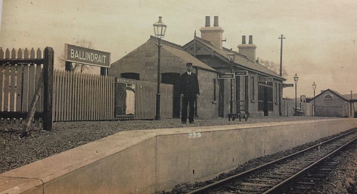
There is an excellent view of the station complex available in Ernie’s Railway Archive on Flickr … https://flic.kr/p/2iRSdWW … That image is best seen as part of that album of photographs on Flickr. [40] The next few pictures show the station while the line was in operation.
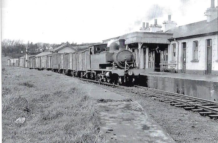
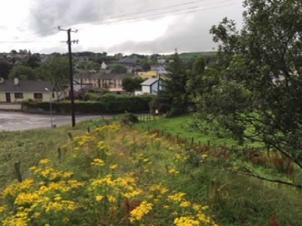
We complete the first stage of the journey along the Strabane to Letterkenny Railway at Raphoe. As we noted at the start of this article, this is a place with a long history and it is worth the stopover to see the town!! There are two superb pictures of the station in Anthony Burges book, The Swilly and the Wee Donegal. [44: p32 &33]
References
- Edward M Patterson (original author), Joe Begley & Steve Flanders (authors of additional material in the Revised Edition); The County Donegal Railways; Colourpoint Books, Newtownards, Co. Down 2014. As noted in my first article about the Co. Donegal Railways this was to have been my holiday reading while walking different parts of the network, but 2020 has been a strange year!
- https://en.wikipedia.org/wiki/Strabane_and_Letterkenny_Railway#:~:text=The%20County%20Donegal%20Railways%20Joint,this%20company%20to%20121%20miles., accessed on 14th July 2020.
- https://commons.wikimedia.org/wiki/File:Athlone,_Cavan_%26_Clara._LetterKenny_Strabane_RJD_113.jpg#/media/File:Athlone,_Cavan_&_Clara._LetterKenny_Strabane_RJD_113.jpg, accessed on 14th July 2020.
- https://en.wikipedia.org/wiki/Londonderry_and_Lough_Swilly_Railway, accessed on 14th July 2020.
- Steve Flanders & Hugh Dougherty, The Londonderry and Lough Swilly Railway; Midland Publishing, 1997.
- Edward M Patterson (original author), Joe Begley & Steve Flanders (authors of additional material in the Revised Edition); The Lough Swilly Railway; Colourpoint Books, Newtownards, Co. Down 2017. This was to have been part of my holiday reading, but 2020 has been a strange year!
- https://donegalnews.com/2014/04/famous-lough-swilly-bus-company-to-close-within-days, accessed on 14th July 2020.
- https://www.independent.ie/irish-news/bus-company-closes-30190034.html, accessed on 14th July 2020.
- https://www.stationhouseletterkenny.com/things-to-do-letterkenny/history-letterkenny-donegal, accessed on 14th July 2020.
- https://www.antaisce.org/buildingsatrisk/bishops-palace-raphoe, accessed on 14th July 2020.
- https://en.wikipedia.org/wiki/St_Eunan%27s_Cathedral,_Raphoe, accessed on 14th July 2020.
- https://twitter.com/rsh_raphoe/status/928058579046883330, accessed on 14th July 2020.
- https://maps.nls.uk/geo/explore/#zoom=15&lat=54.83082&lon=-7.47324&layers=14&b=1, accessed on 14th July 2020.
- http://oldstrabane.blogspot.com/2010/09/1905-ordnance-survey.html, accessed on 14th July 2020.
- https://www.bbc.co.uk/northernireland/yourplaceandmine/tyrone/A716690.shtml, accessed on 18th July 2020.
- http://www.sepiatown.com/812264-Strabane-Railway-Station, accessed on 18th July 2020.
- http://oldstrabane.blogspot.com/2010/10/strabane-railway-station-1930-1959.html, accessed on 18th July 2020.
- http://www.sepiatown.com/813662-Strabane-Railway-Station, accessed on 18th July 2020.
- http://www.sepiatown.com/813665-Strabane-Railway-Station, accessed on 18th July 2020.
- http://www.sepiatown.com/814730-Strabane-Railway-Station, accessed on 19th July 2020.
- http://www.sepiatown.com/814448-Strabane-Railway-Station, accessed on 19th July 2020.
- http://www.sepiatown.com/814729-Strabane-Railway-Station, accessed on 19th July 2020.
- http://www.sepiatown.com/813674-Strabane-Railway-Station, accessed on 19th July 2020.
- http://www.sepiatown.com/814723-Strabane-Railway-Station, accessed on 19th July 2020.
- http://www.sepiatown.com/814657-Strabane-Railway-Station, accessed on 19th July 2020.
- https://cotyrone.com/towns/index.html, accessed on 19th July 2020 and used on a not-for-profit basis as per the copyright notice on the website.
- http://geohive.maps.arcgis.com/apps/webappviewer/index.html?id=9def898f708b47f19a8d8b7088a100c4, accessed on 19th July 2020.
- https://www.buildingsofireland.ie/buildings-search/building/40835005/station-road-lifford-lifford-co-donegal, accessed on 19th July 2020.
- https://www.flickr.com/photos/110691393@N07/11370970966, accessed on 19th July 2020.
- https://www.gettyimages.co.uk/detail/news-photo/lifford-the-centre-of-co-donegal-with-tyrone-on-the-other-news-photo/533285858, accessed on 19th July 2020.
- https://www.facebook.com/DonegalRailwayHeritageCentre/photos/a.1230417866994452/2723764270993130/?type=3&theater, accessed on 19th July 2020 – embedded here with permission..
- https://www.buildingsofireland.ie/buildings-search/building/40834011/ballindrait-railway-station-ballindrait-ballindrait-county-donegal, accessed on 19th July 2020.
- https://www.buildingsofireland.ie/buildings-search/building/40834014/tamnawood-ballindrait-county-donegal, accessed on 20th July 2020.
- https://maps.nls.uk/geo/explore/#zoom=14&lat=54.85980&lon=-7.56551&layers=14&b=1, accessed on 20th July 2020.
- https://maps.nls.uk/geo/explore/#zoom=15&lat=54.87162&lon=-7.60309&layers=14&b=1, accessed on 22nd July 2020.
- https://m.facebook.com/story.php?story_fbid=3010690898967131&id=1223882780981294, accessed on 22nd July 2020.
- http://www.incony.org/History/StartPage.html, accessed on 22nd July 2020 – embedded directly from the website.
- http://www.incony.org/History/StartPage.html, accessed on 20th July 2020 – embedded directly from the website.
- https://www.flickr.com/photos/110691393@N07/11364546546/in/photolist-ijfgKG-ijfnbj, accessed on 22nd July 2020 – permission to use here has been sought and a response is awaited.
- https://flic.kr/p/2iRSdWW, accessed on 23rd July 2020.
- https://www.flickr.com/photos/110691393@N07/11370944925/in/photolist-ijP4Lz, accessed on 23rd July 2020.
- http://www.incony.org/History/StartPage.html, accessed on 22nd July 2020 – embedded directly from the website.
- Kerry Doherty of Ballindrait, Co. Donegal. provided a series of images from his collection of photographs for use in this article.
- Anthony Burges; The Swilly and the Wee Donegal; Colourpoint, Newtownards, Second Impression, 2010.
- After first publishing this article, Kerry Doherty of Ballindrait very kindly sent me a series of pictures which needed to be included in the article. Each of these bears the reference number [45].


 Try to make room today for a child-like faith: seek to find God in every encounter you have with others; seek to receive God’s promises for yourself once again. Let’s allow children to teach us about wonder, about life and joy and hope, and ultimately about faith as well. For, in doing so, I believe that we will discover that the last verses of the reading from Matthew are true. Let’s hear and hold onto Jesus own words: