Monthly Archives: Sep 2018

King’s Lynn Docks Branch – Part 2

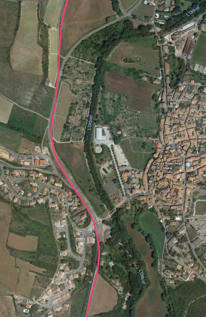
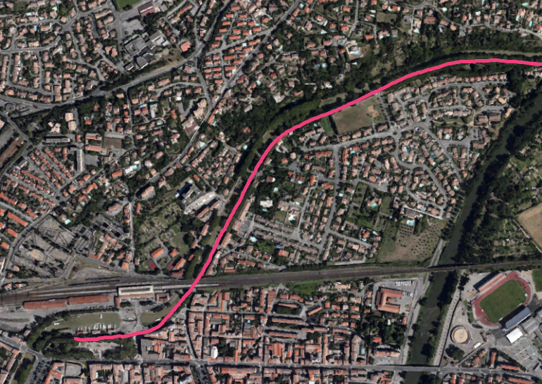
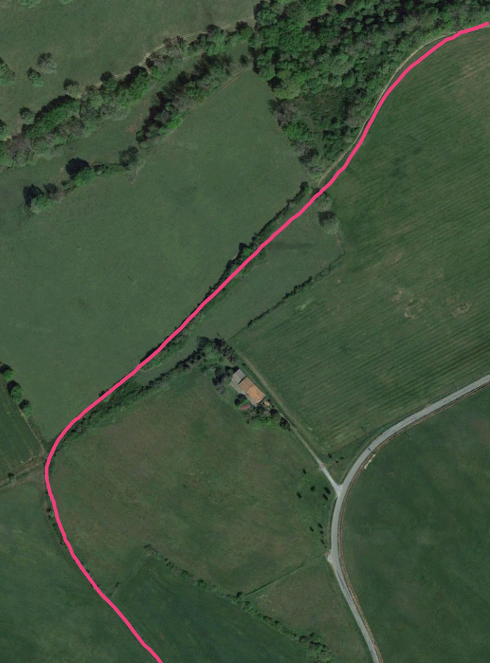
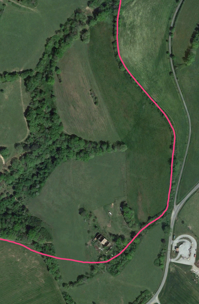
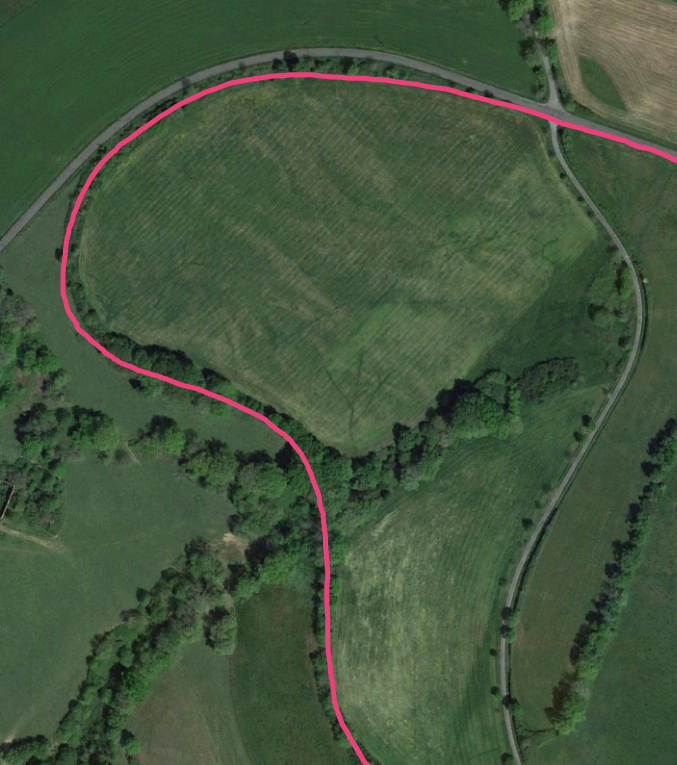
The Dock Branch from the Station to John Kennedy Road was covered in a previous post:

https://rogerfarnworth.com/2018/09/24/kings-lynn-docks-branch-part-1

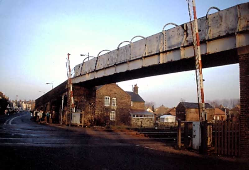
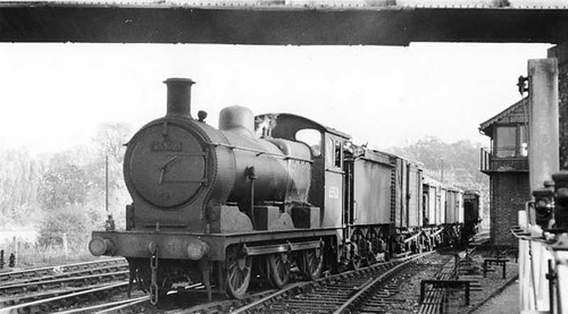
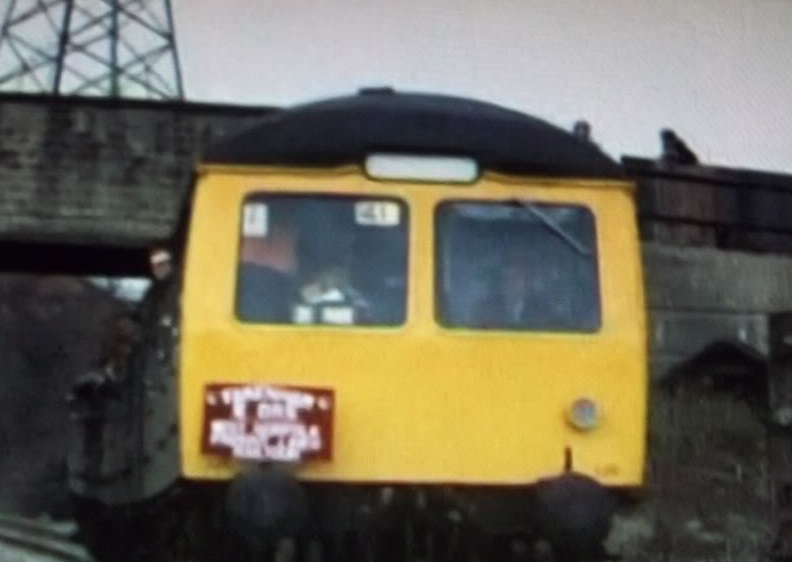
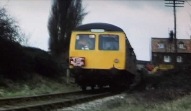
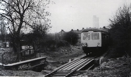
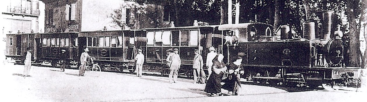
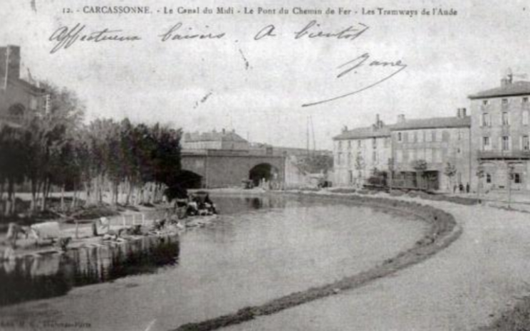
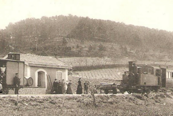
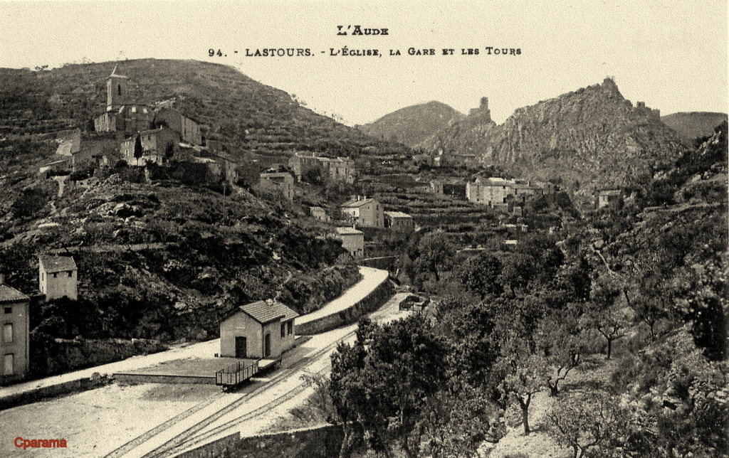
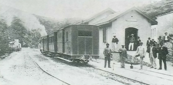
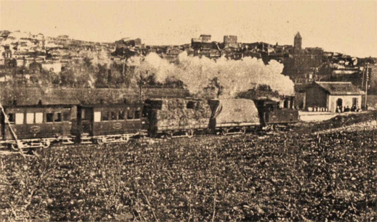
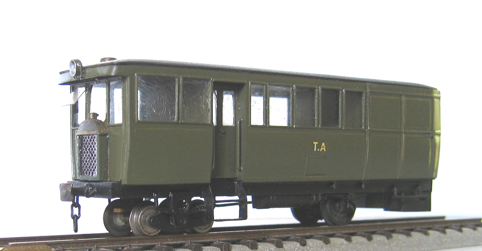
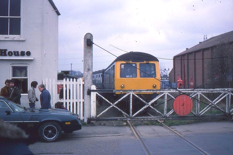
We start this post with two pictures of one of the last passenger carrying trains to travel along the docks Branch at John Kennedy Road Level-Crossing. The images come from the railtour organised by the Fakenham Railway Society in March 1980 which included (among other things) a trip up the docks branch in King’s Lynn. [7]
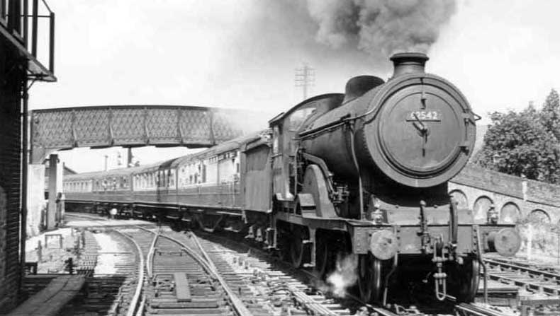
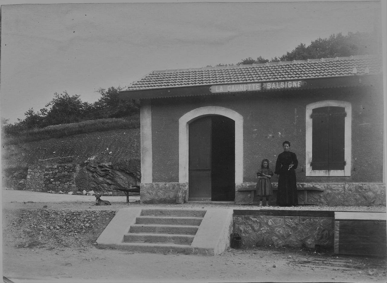
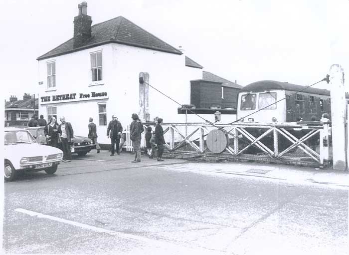
The pub on the left of the last image was ‘The Retreat’, it is much easier to see on this monochrome image. [8]

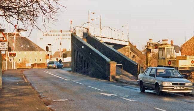
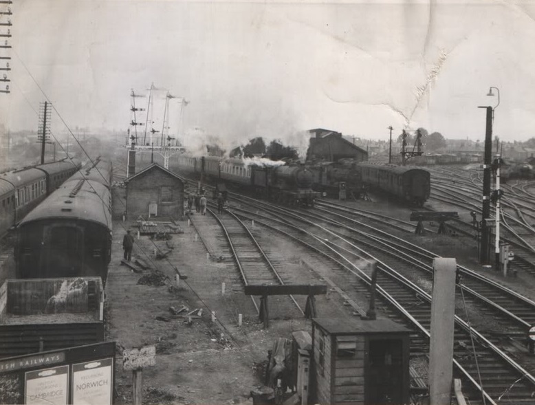
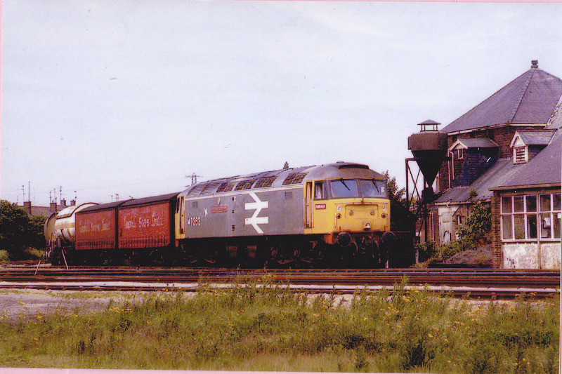
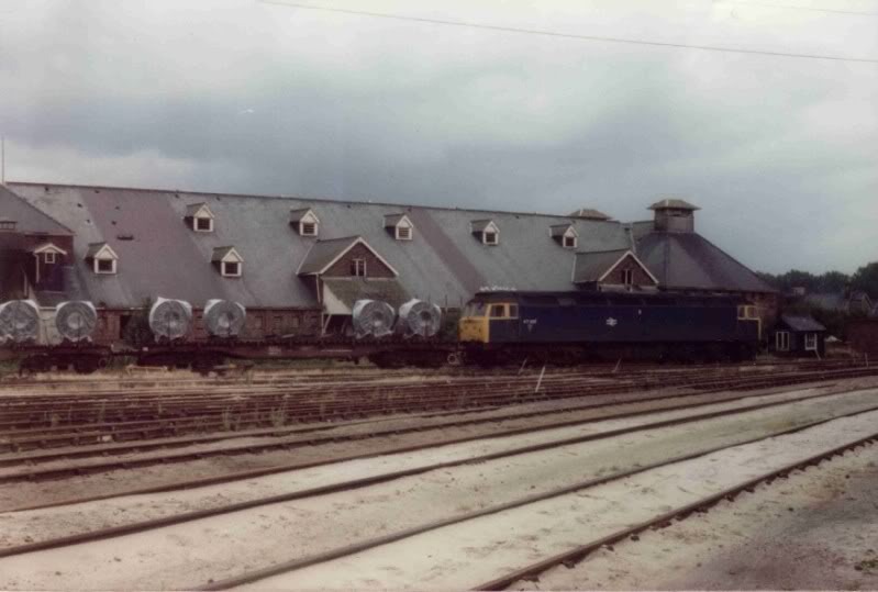
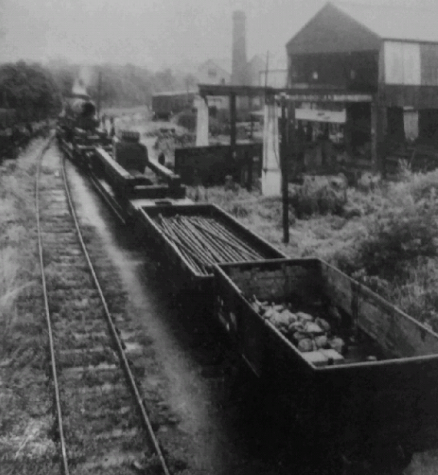
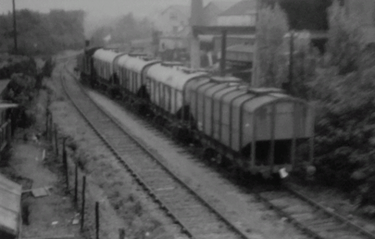
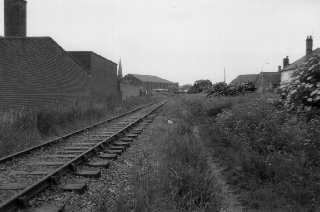
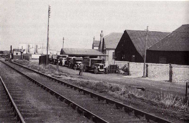
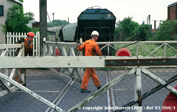
The final freight train to travel along the line is shown in the above image which was taken in May 1993. The last railway movement in the docks recovered remaining rolling stock from the docks in June 1994, (c) John Barrett LRPS – Ref: 93/588/1. [18][19]

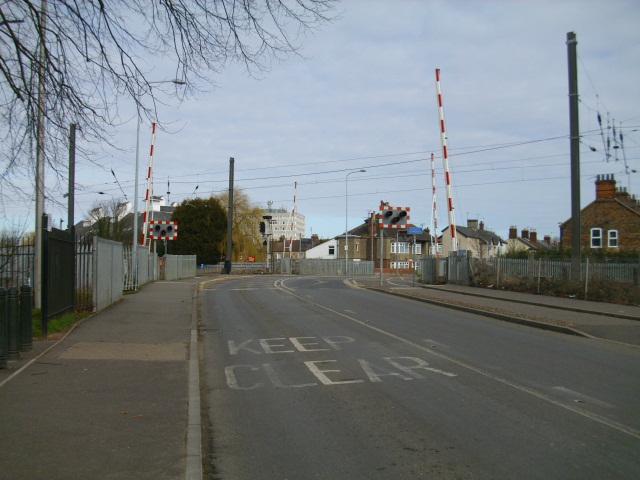
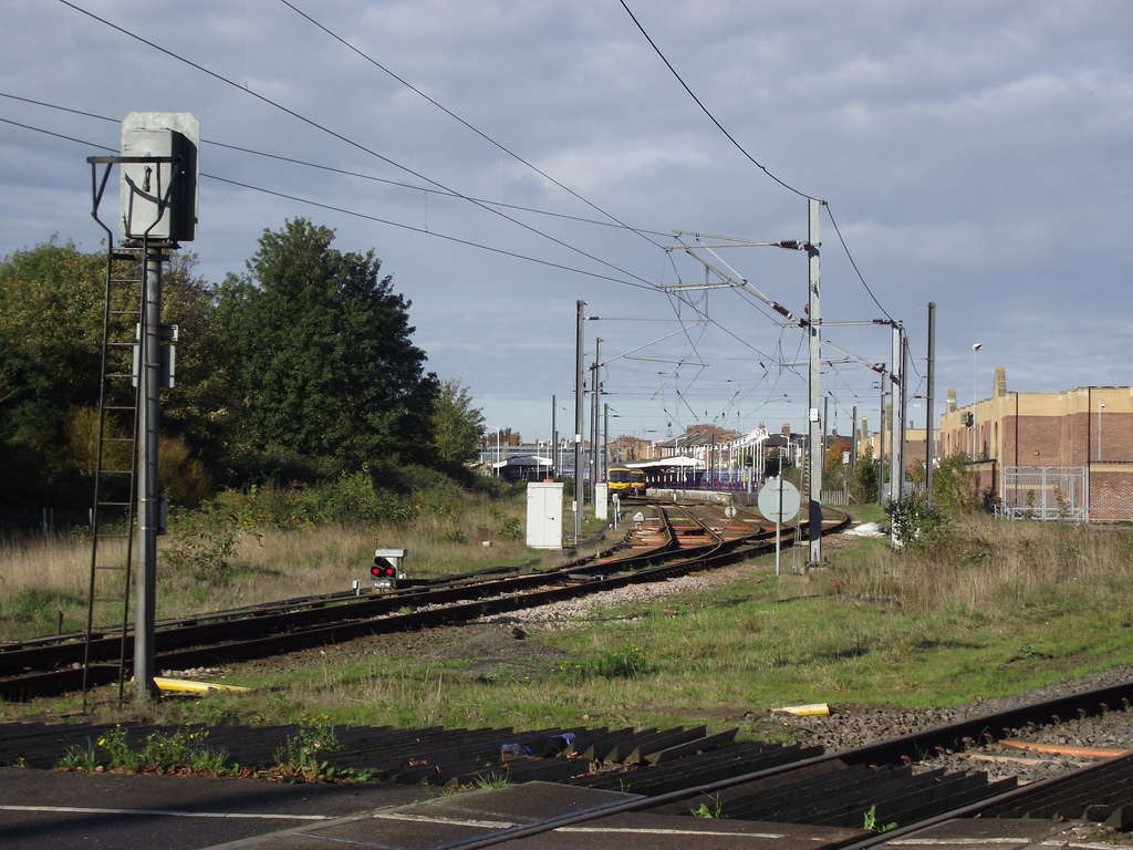
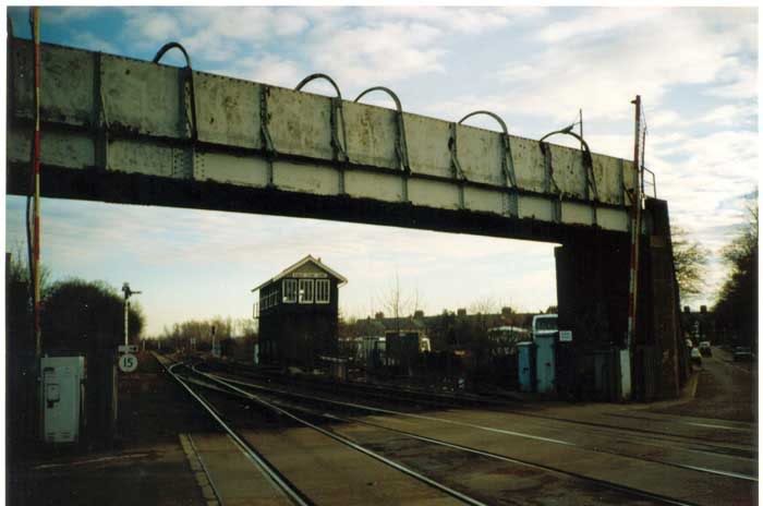
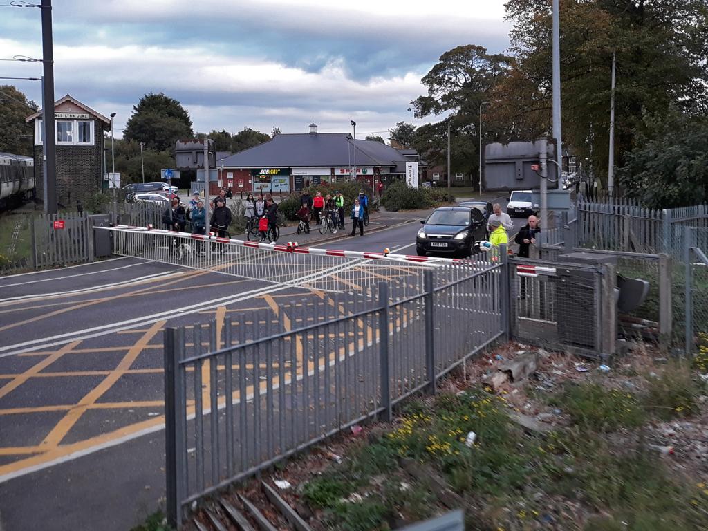
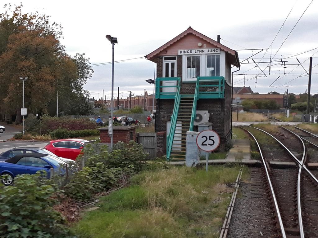
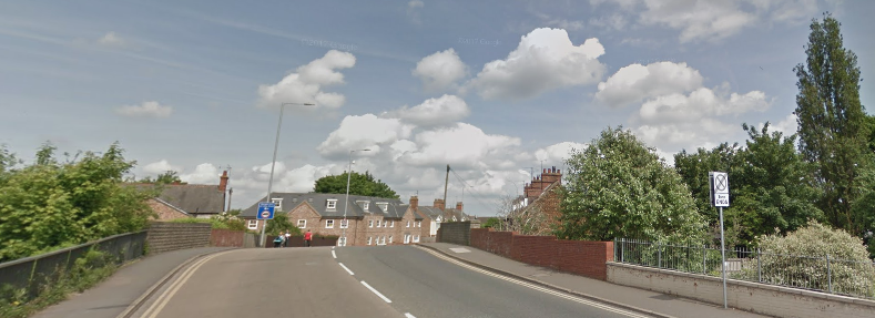
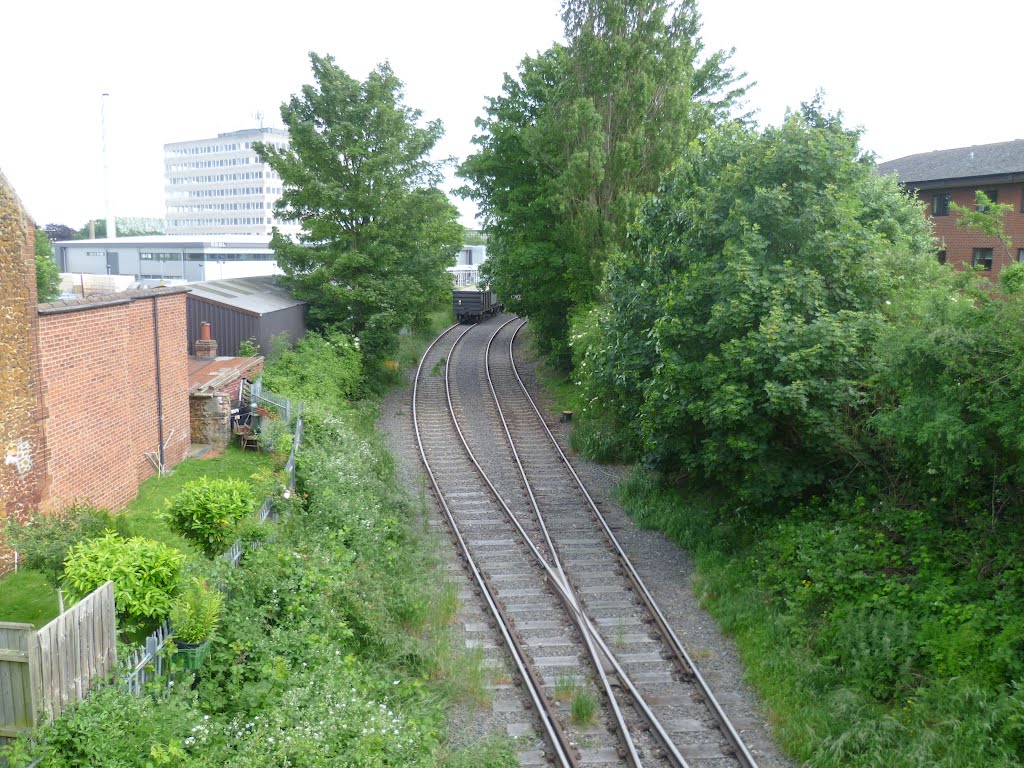
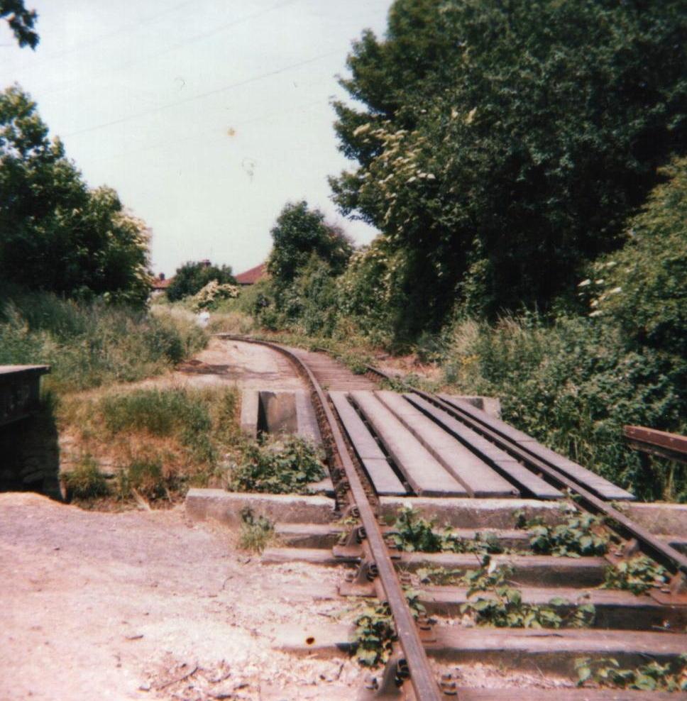
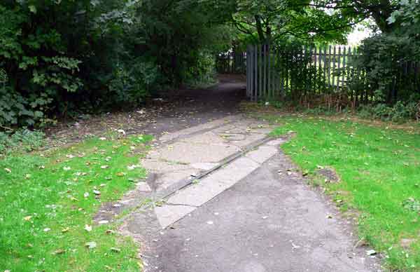
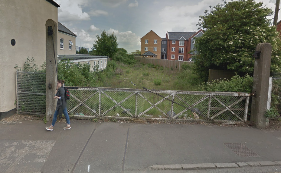
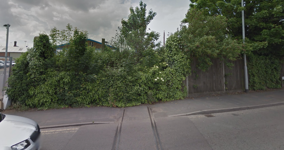
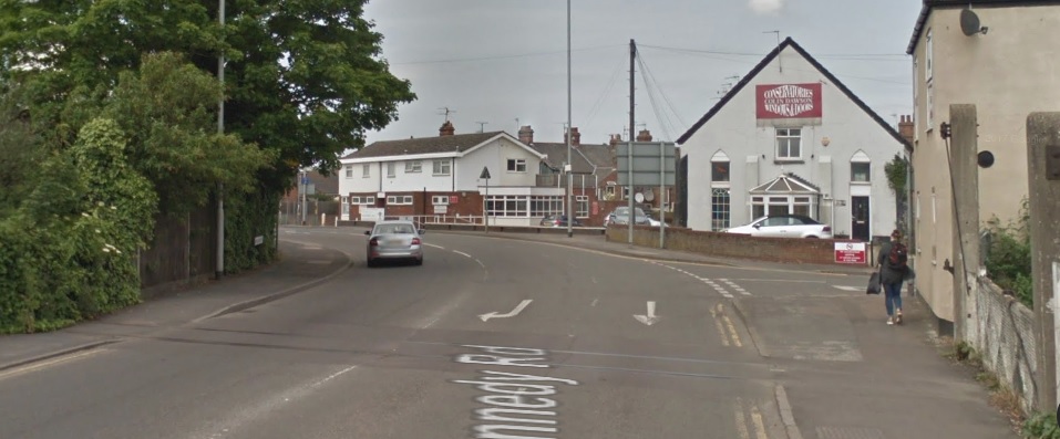
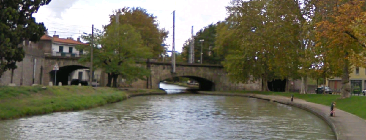
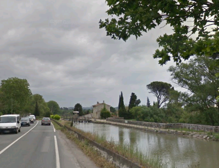
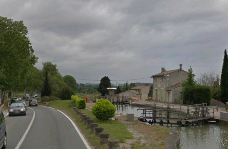
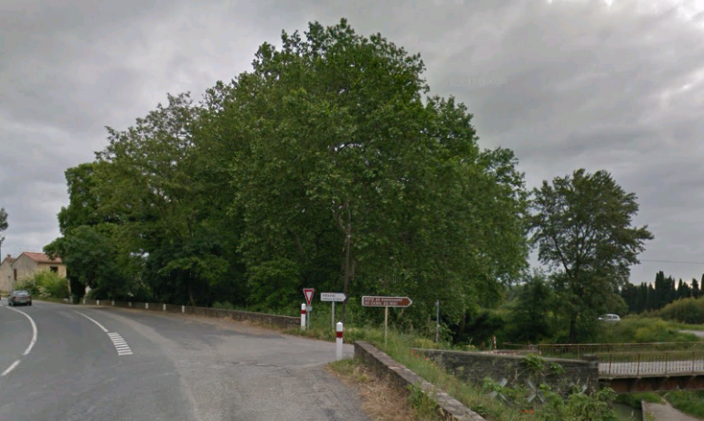
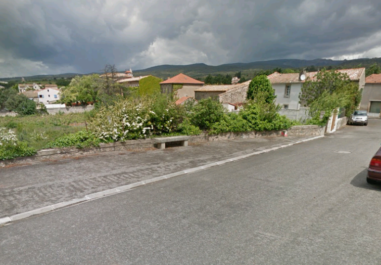
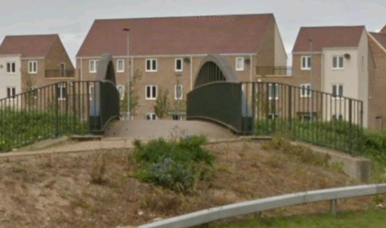
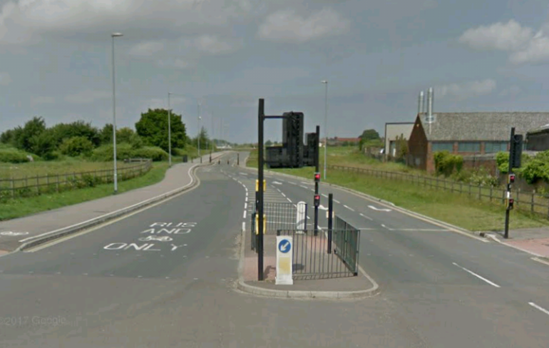
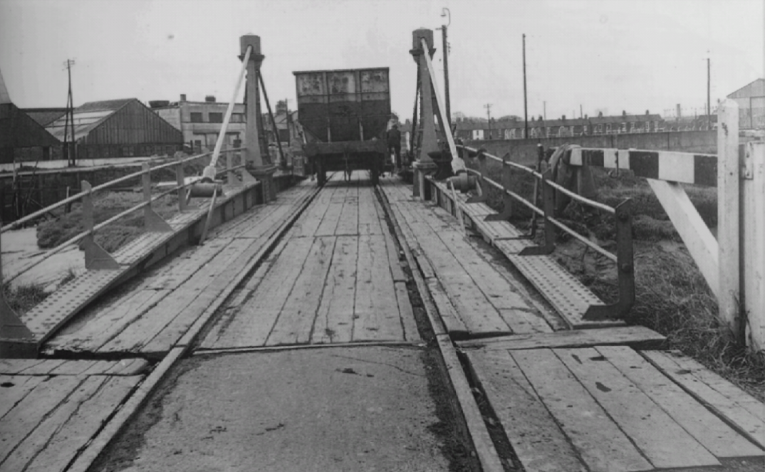
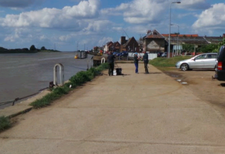
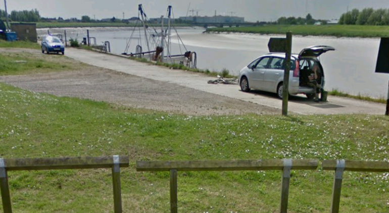
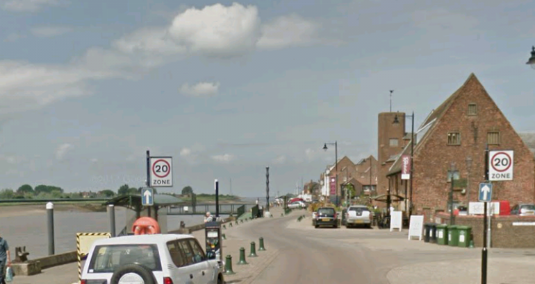
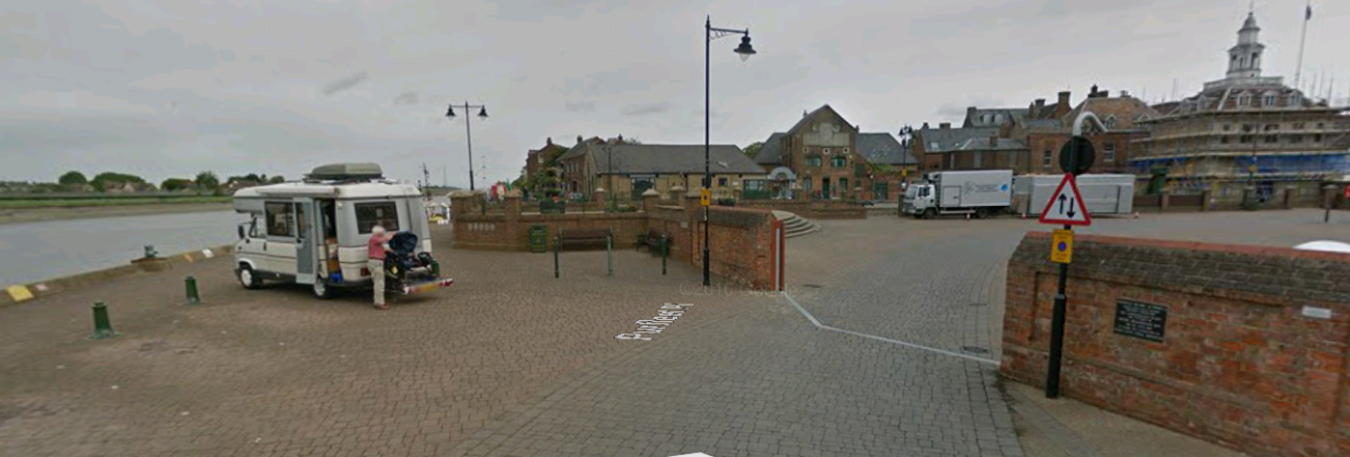
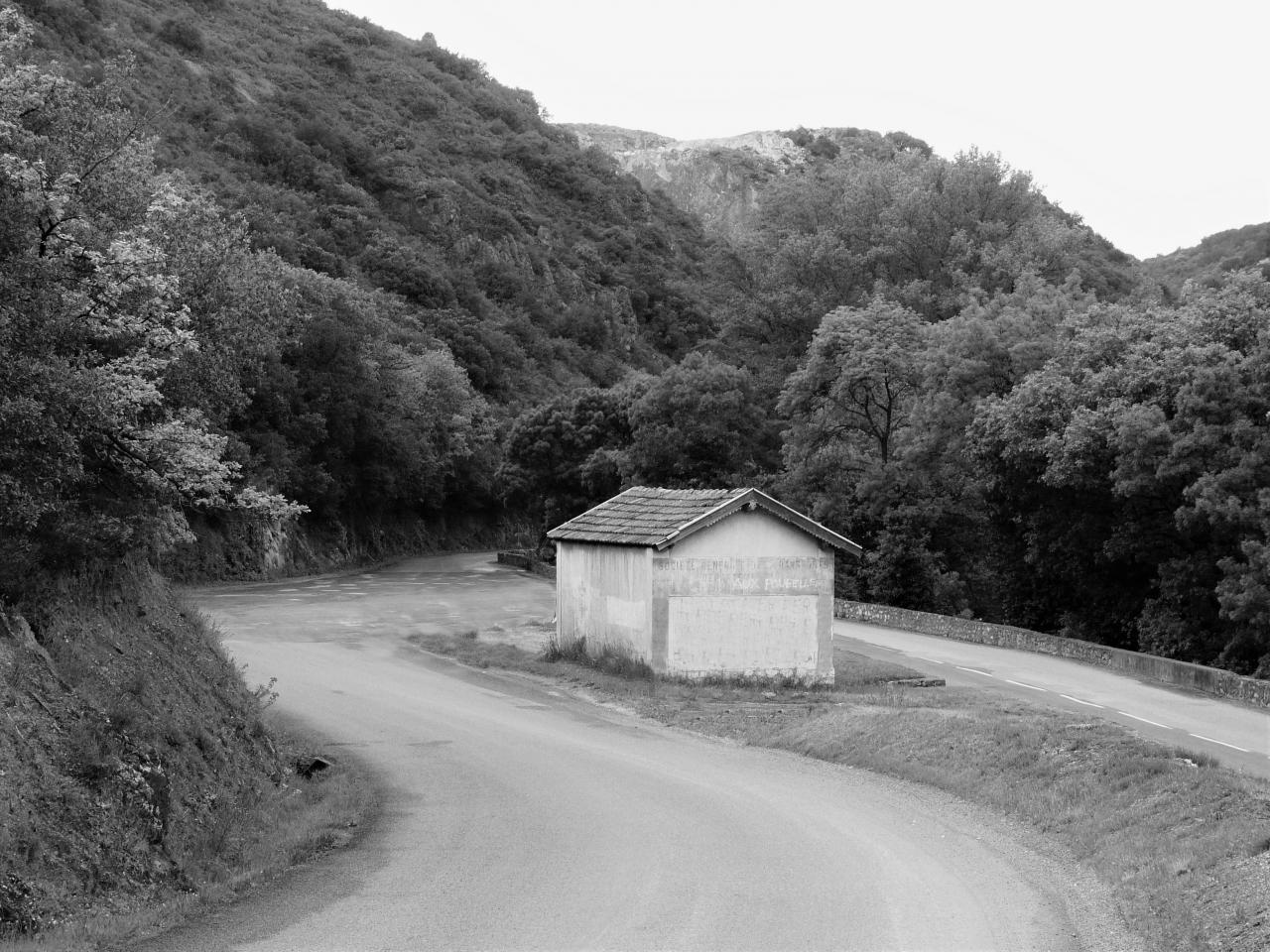
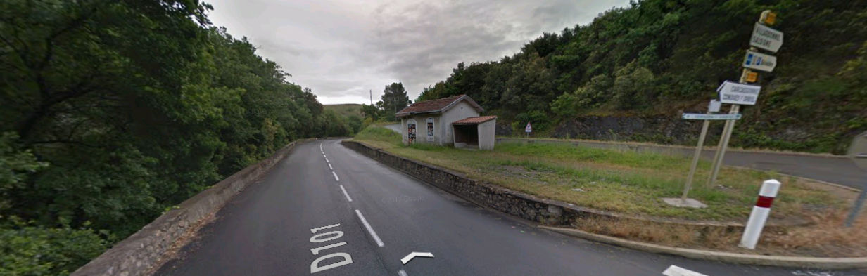
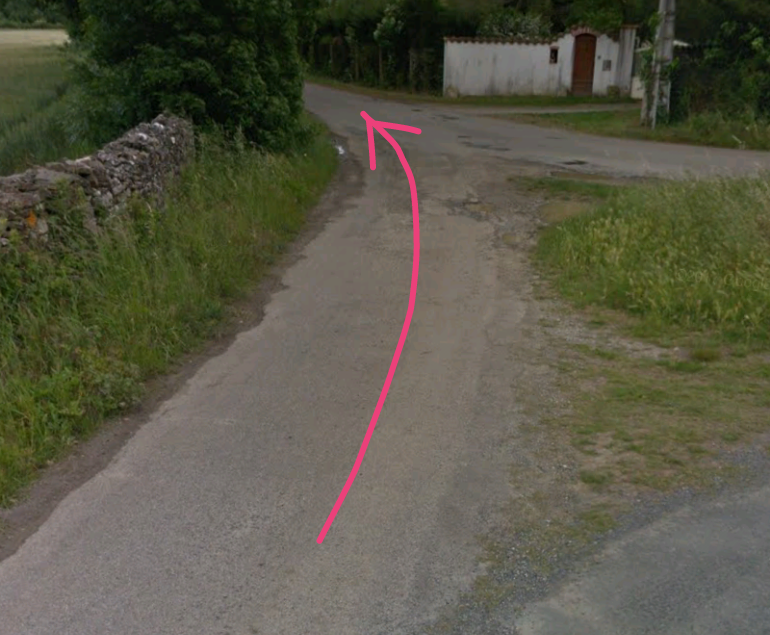
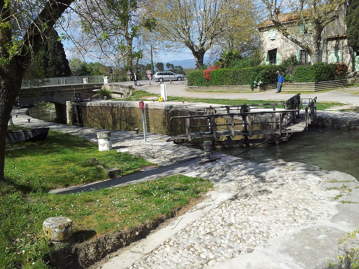
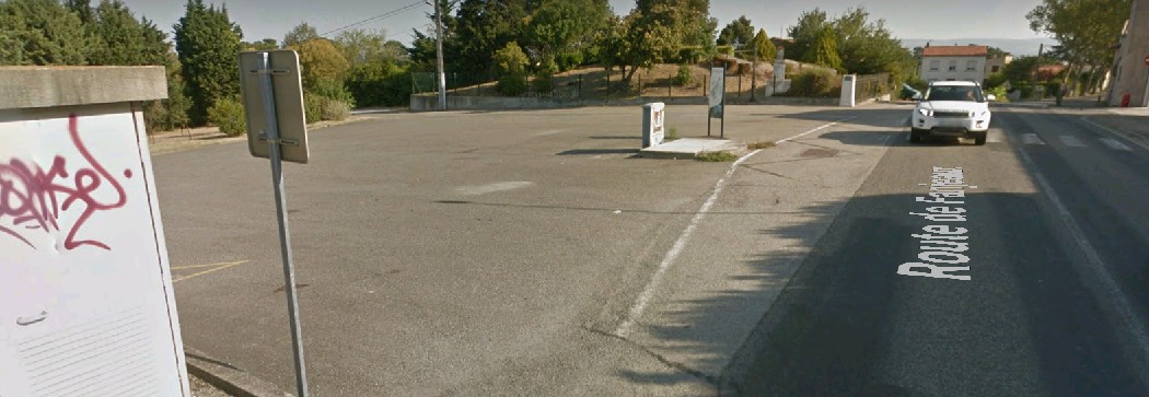
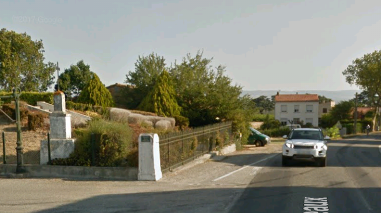
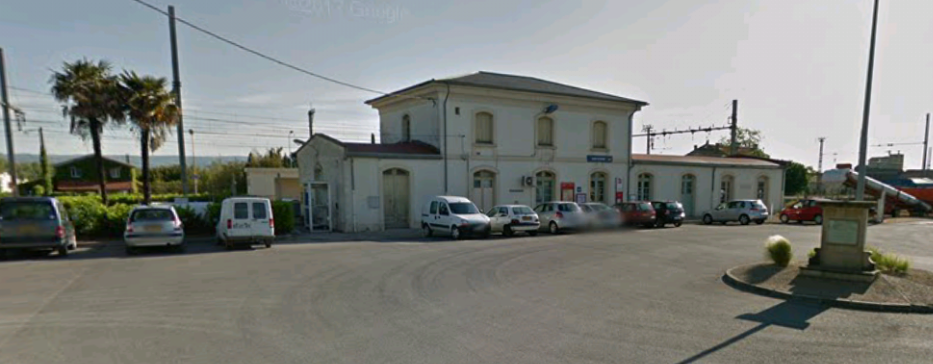
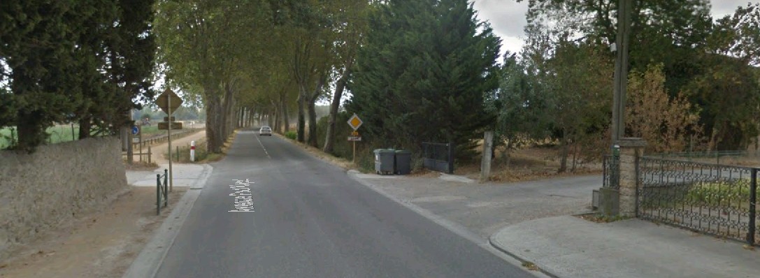
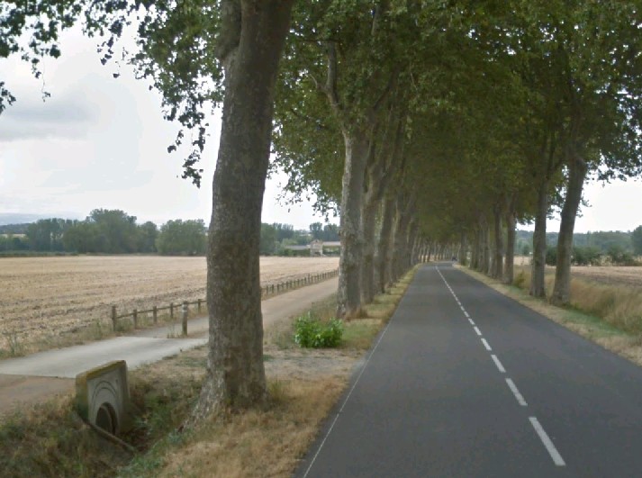
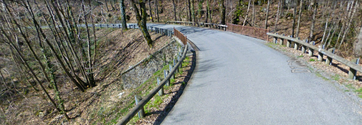
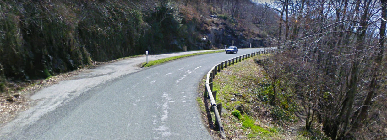
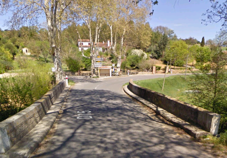
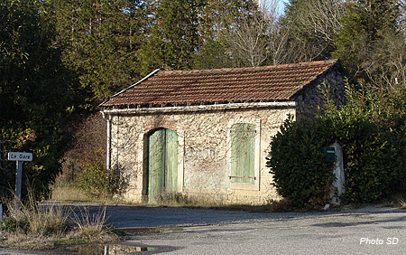
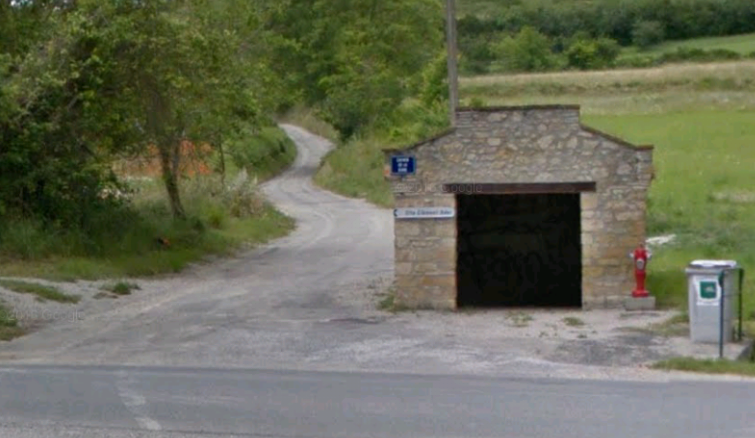
Three images from the Geograph website, http://www.geograph.org.uk, follow, which show the crossing at John Kennedy Road early in the 21st Century. [1]
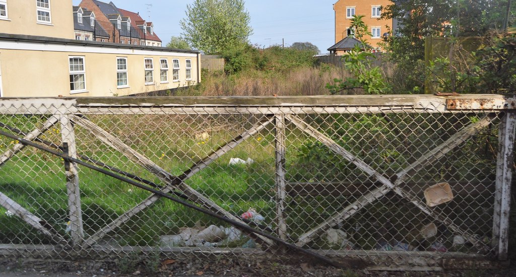
Looking East, back towards King’s Lynn Station © Copyright N Chadwick. [2]
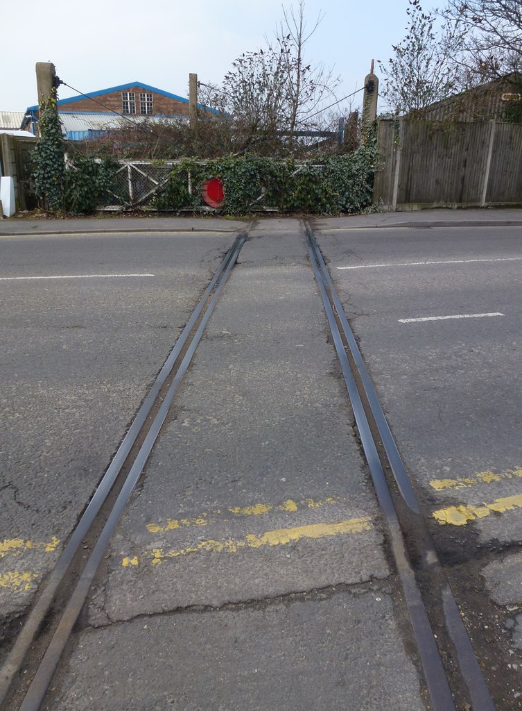
The Road Crossing © Copyright Richard Humphrey. [3]
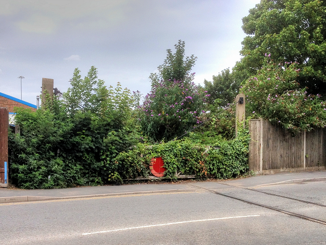
Looking West towards the docks © Copyright David Dixon. [4]

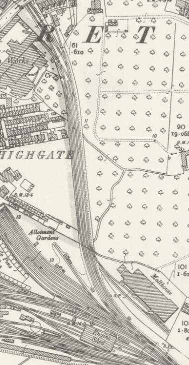
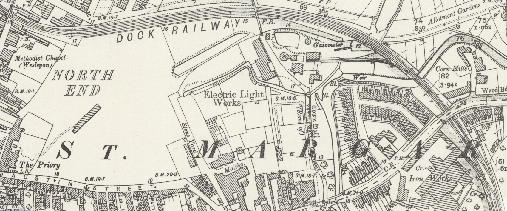
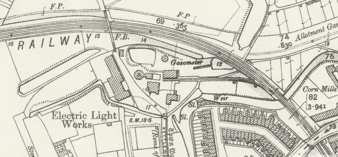
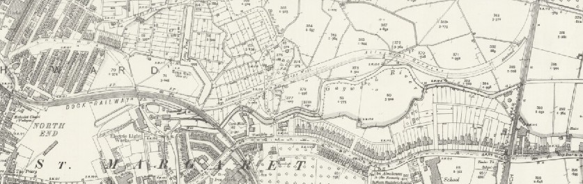
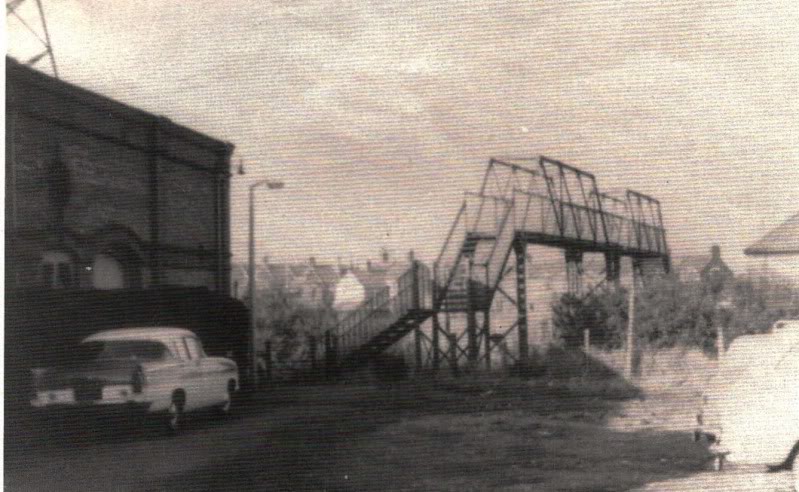
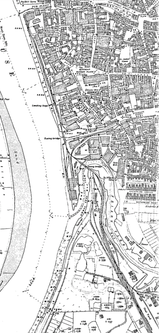
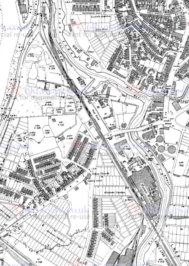
John Kennedy Road was constructed in the mid-1960s. The original road crossing at this location was over Pilot Street.and is shown on the early 20th Century Ordnance Survey map below. To the west of Pilot Street, its level-crossing and footbridge, the docks railways fanned out to serve the two docks at King’s Lynn and their associated industry.
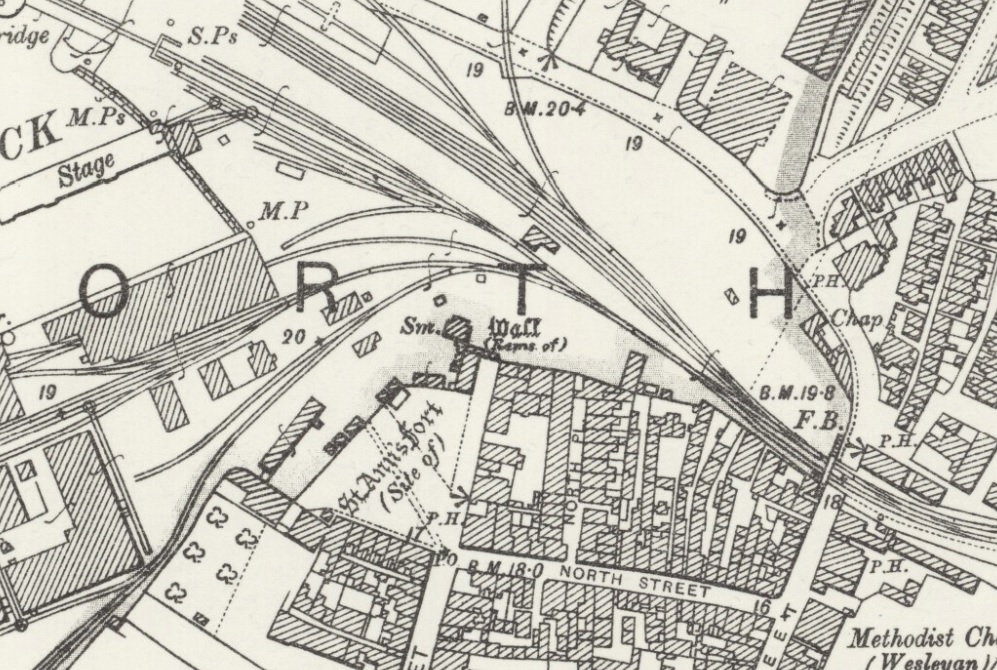
The footbridge shown on the above map is picked out on both the maps below. The left-hand map is from 1886, the right-hand map from 1929. The paired maps were found on the King’s Lynn Forums. [5] The right-hand map shows the Pilot Cinema which I think was where I watched James Bond movies in the 1970s!
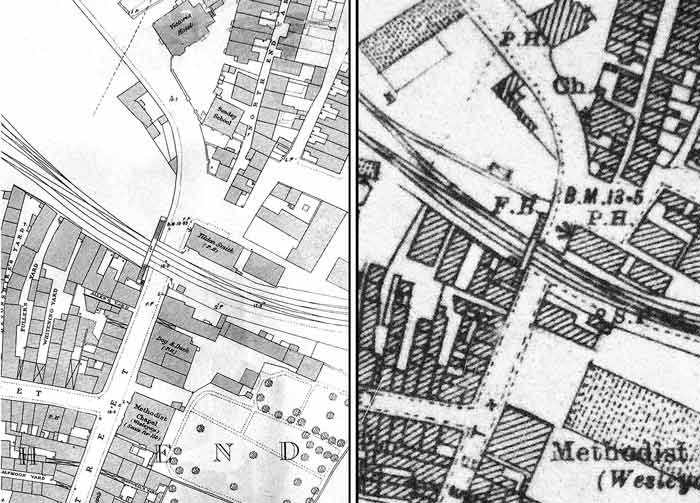
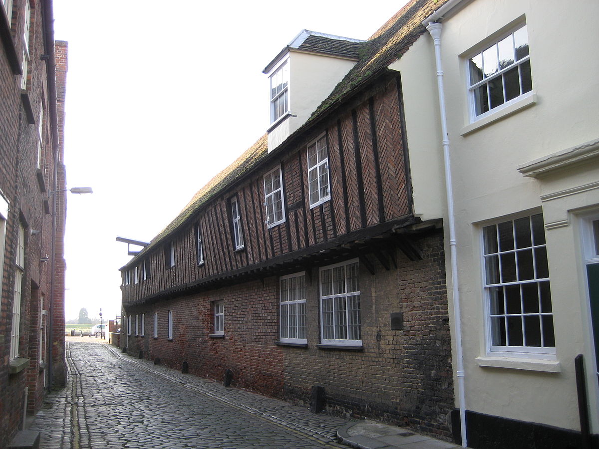
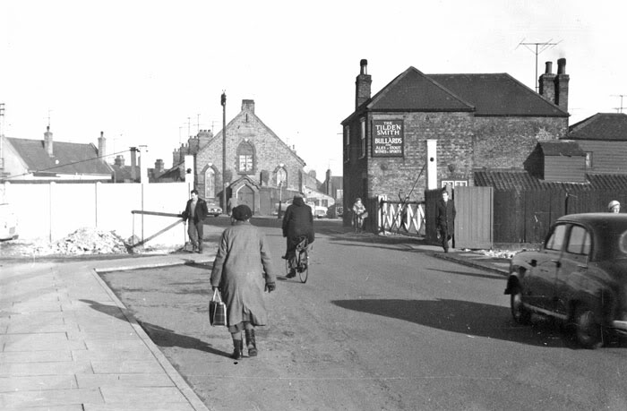
Pilot Street looking North in the late 1950s or early 1960s. The footbridge over the railway has been removed. An accurate date on its removal would date the picture as I believe that John Kennedy Road was constructed in the early to mid-1960s. The pub now known as ‘The Retreat’ was in the days of this photograph known as ‘The Tilden Smith’. [5]
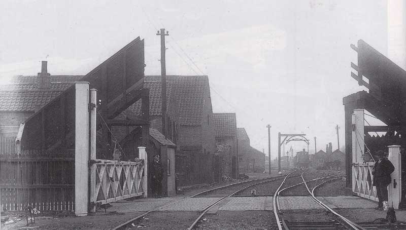
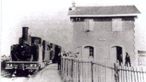
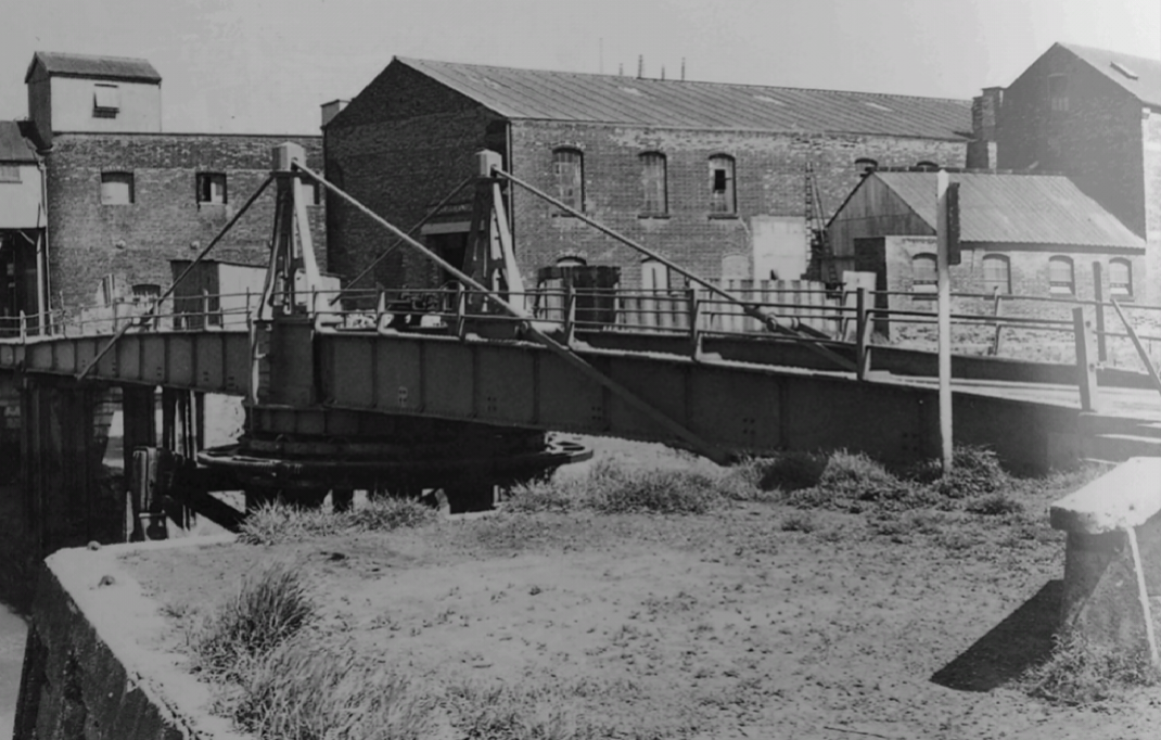
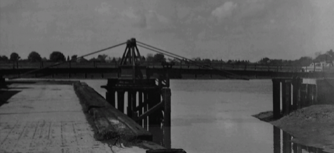
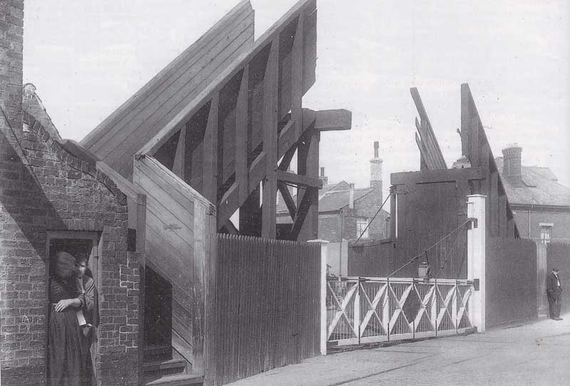
The two pictures above were taken in 1920 not long after a out-of-gauge load removed the main span of the footbridge. [5]
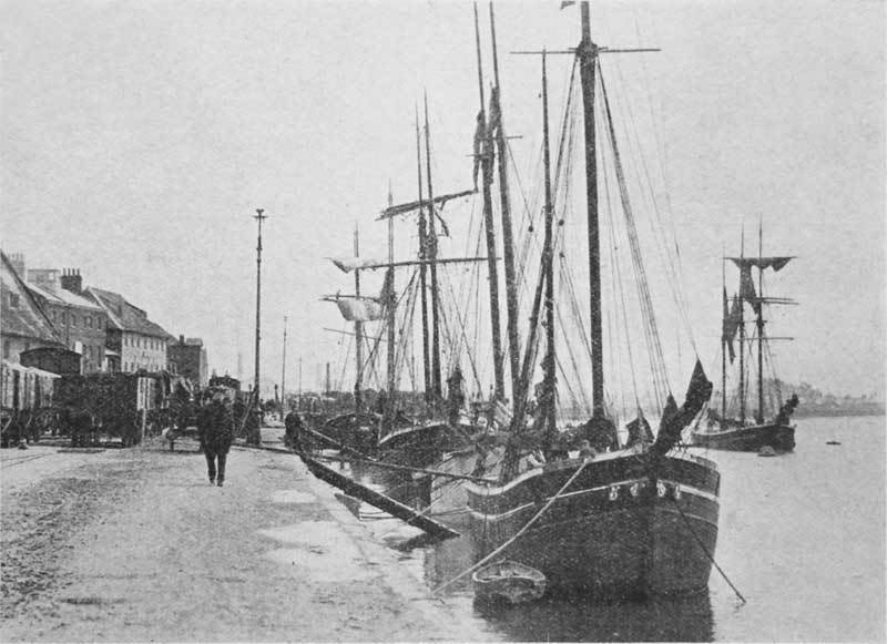
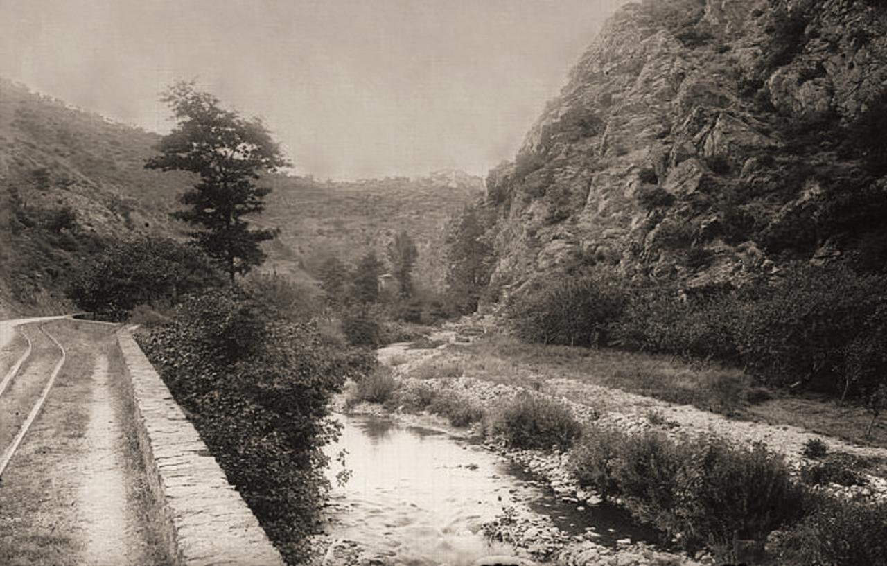
This very early picture of the Fisher Fleet is taken before the stream had been culverted and shows the line of the railway into the docks supported on a wooden trestle. ‘The Tilden Smith’ public house, now ‘The Retreat’ is in the centre of the image. [15]

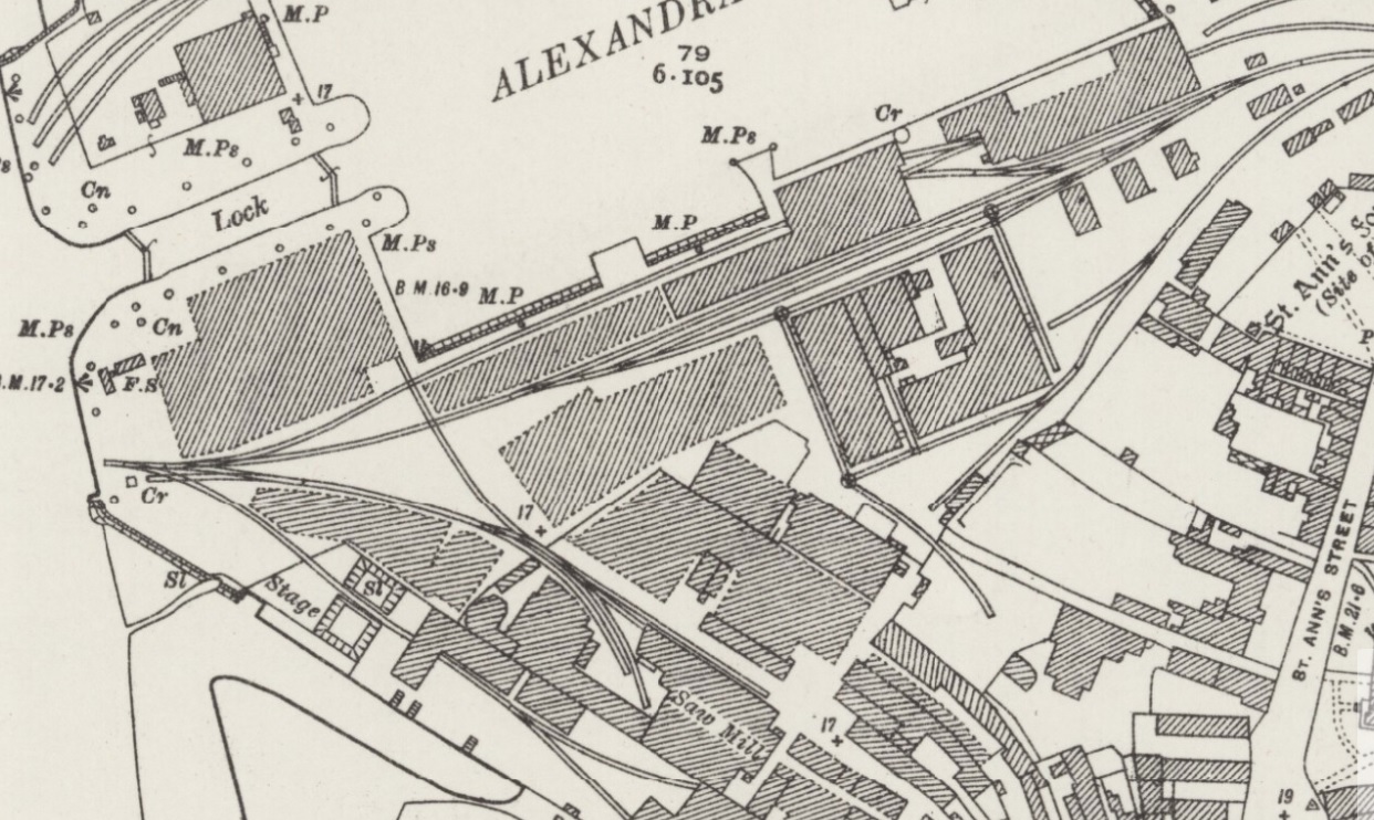
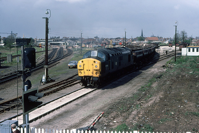
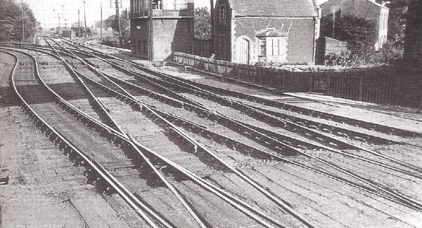
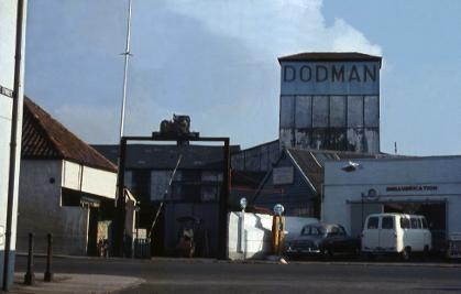
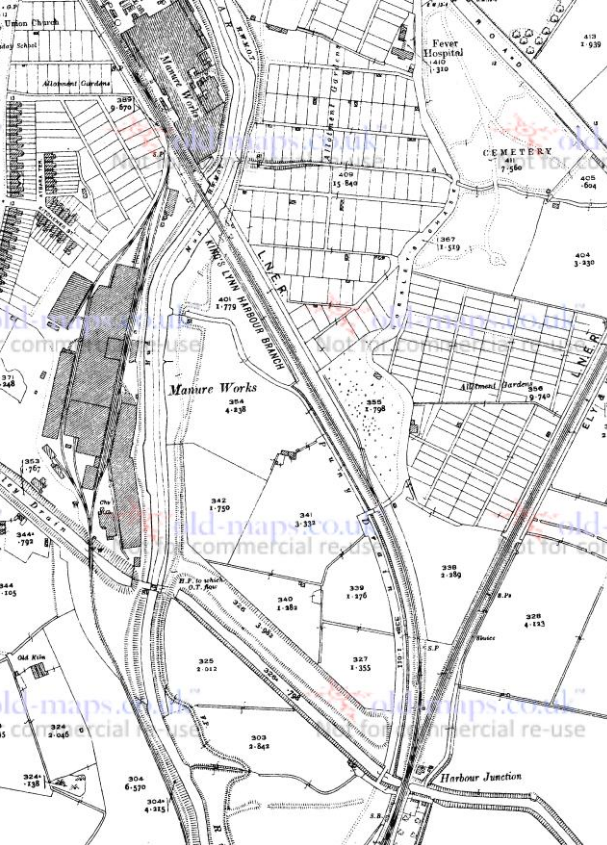
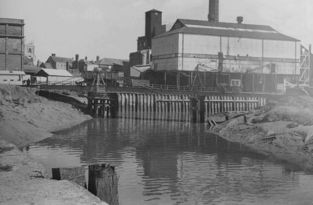
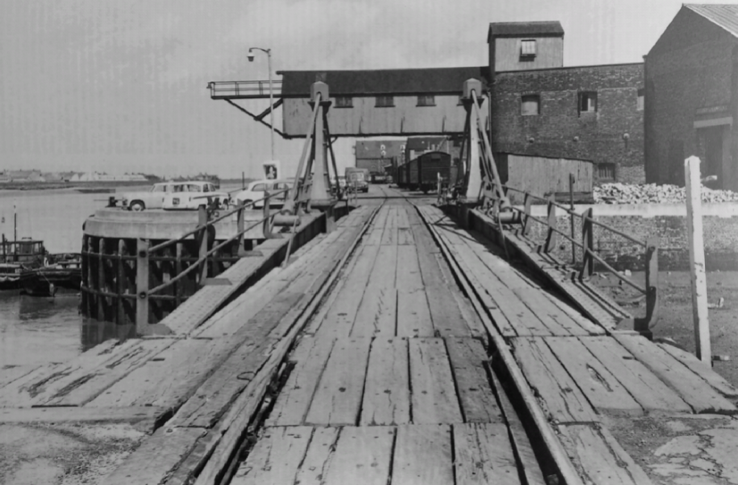
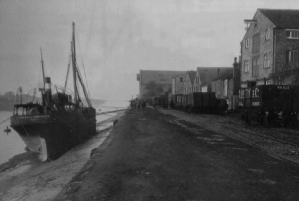
The first of the two monochrome images above gives us the first glance into the docks. It looks West from the crossing on Pilot Street and shows the tracks of the Branch curving slightly to the North. The left-hand track, under the loading gauge, heads towards the Alexandra Dock. The plans below show the southern side of the Alexandra Dock. All of the warehouses and industrial buildings were rail-served. The plan immediately below is from the very early 20th Century. The second plan below comes from the late 1920s. The railway layout is very similar but the structures on the site have developed.
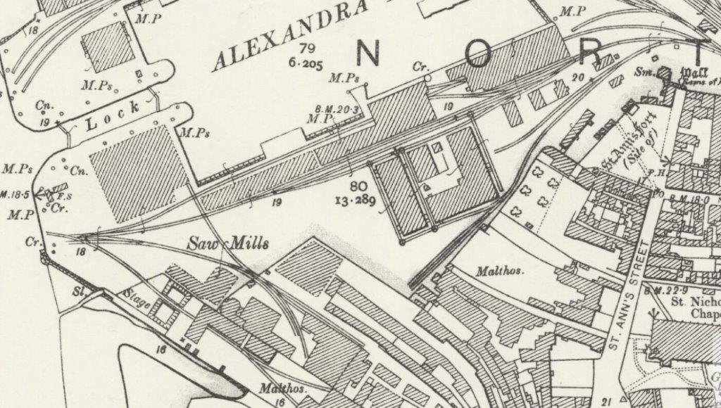
The final layout of the railways around the docks in King’s Lynn is nothing like what was originally intended. The plans for the construction of the docks anticipated a connection to the Harbour Branch further south down the river.

Alexandra Dock

Mike Fell’s book [10] includes the plan below which shows the planned location of the Alexandra Dock with a diversion of Fisher Fleet. The line of a proposed railway is shown curving round the north side of existing buildings and then running beside the river to join the Harbour Branch on South Quay. [10]
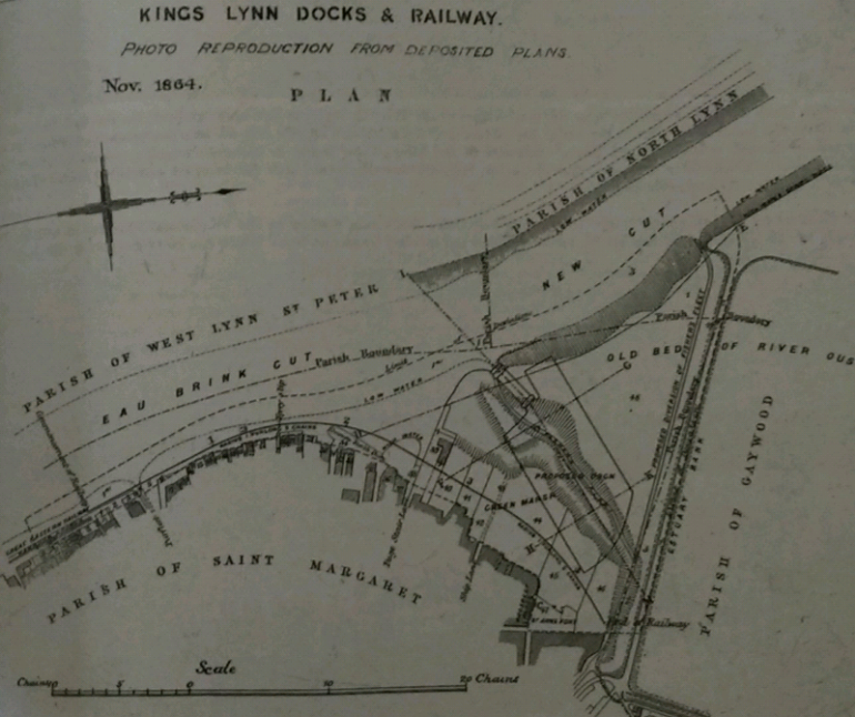
The route would have required a swing bridge across the Purfleet [10: p47] and a timber viaduct 297 yards in length! [10: p23]  “In 1864, the Corporation of Lynn sanctioned a proposal to construct an enclosed dock … The new dock was to be serviced by a new branch railway, half a mile in length, which would connect with the Great Eastern Railway’s harbour branch at the Purfleet and run in front of the existing warehousing.” [10: p45]

The planned route was not constructed, as it proved to be impracticable and expensive [10: p47] and the idea was superseded with a revision of the Docks scheme in 1869 which authorised a new route running from the railway station in a king’s Lynn to the docks. “Under the new authorisation, the dock company had to provide sufficient siding accommodation near to the new junction so as not to interference with GER traffic. Sidings had to be constructed capable of holding 40 wagons in each direction independently of the doc approach railway and the existing GER lines were not to be used for shunting.” [10: p47] An agreement between the various railway companies involved was eventually signed in 1873. 

The early track layout was very quickly proven to be inadequate for the rapidly increasing levels of traffic. By 1877, only a few years after the dock was opened traffic had grown from 33,174 tons in the first year of operation to 174,010 tons of which 157,813 tons was carried by rail. … By 1879, two engines were required to undertake the shunting on the dock whereas one engine had sufficed hitherto. [10: p51]

The adjacent plan comes from the very early years of the Alexandra dock. Fisher Fleet is of a significant length on the plan. The railways are much less well developed, although the basic layout is much as in the later plans of the completed dock above. The track layout expanded quickly in the 1870s. [5]

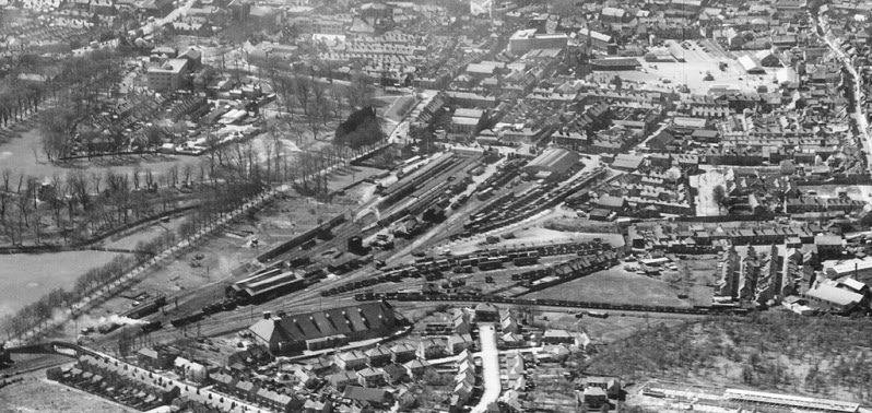
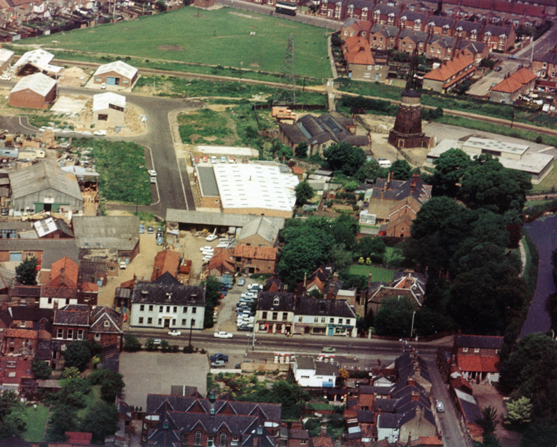
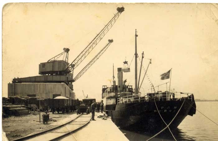
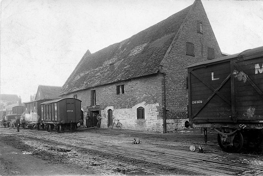
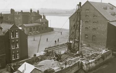
Below the adjacent plan is a picture from the every early life of the Alexandra Dock which I believe was taken from the Southeast of the site. The Coal Yard on the adjacent plan can be seen in the foreground of the image. [7]
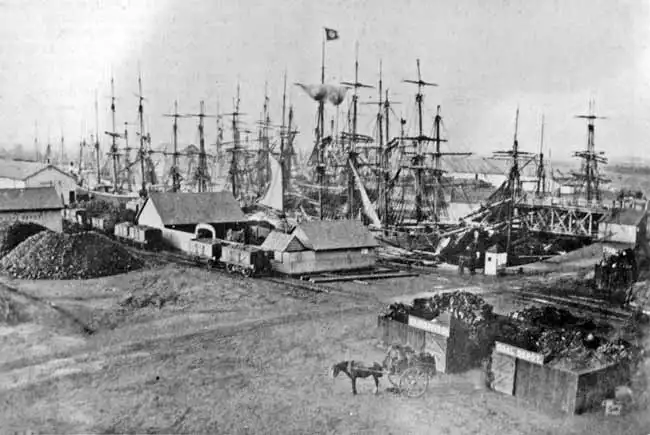
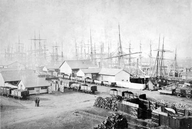
The same location just a few years later, the buildings of the Coal Yard have developed somewhat. [7]
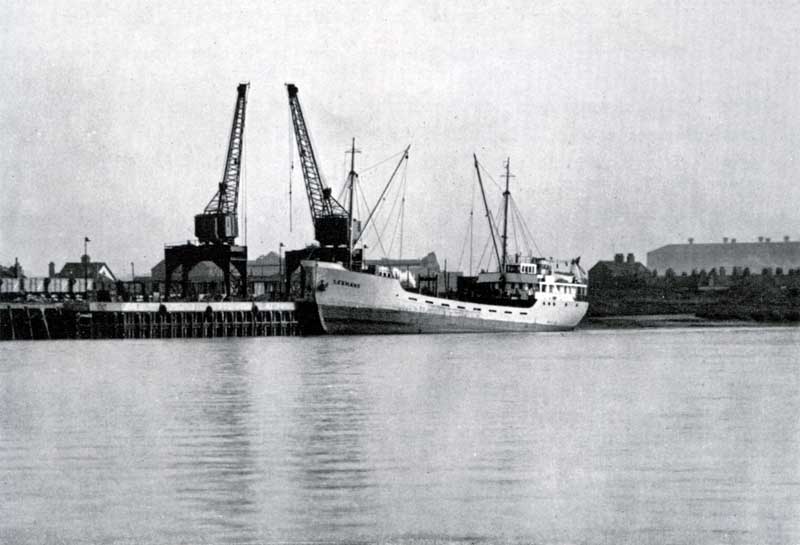
Also from the early life of the Docks, this image is taken from the South Side of the lock providing access from the River Great Ouse into the Alexandra Dock. Railway wagons can be seen on the North side of the Dock in front of the long low warehouse which appears on the plan above. [8]
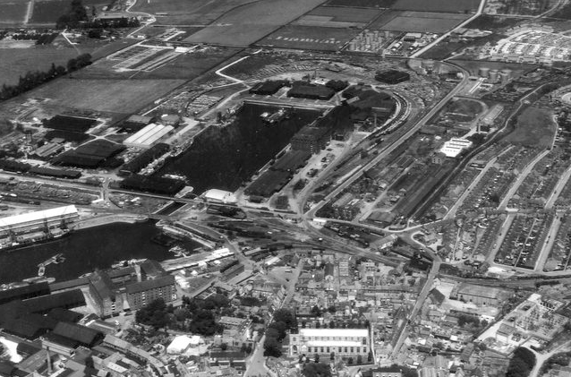
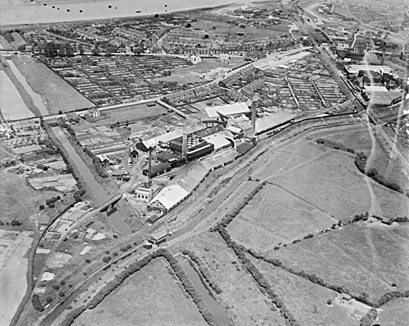
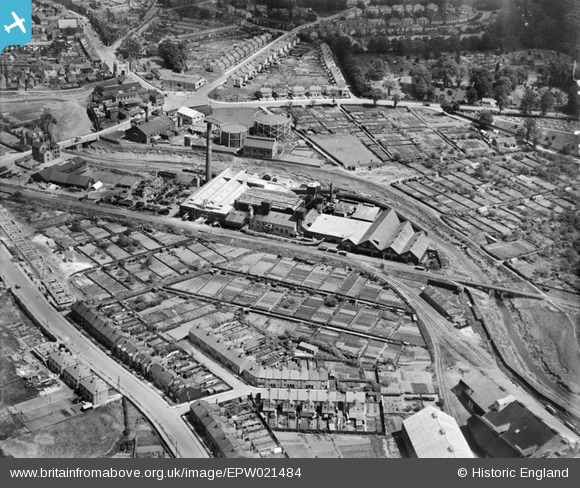
These two aerial images were found on King’s Lynn Forums, the first shows the development around the Alexandra Dock in the mid to late 1920s. [8]
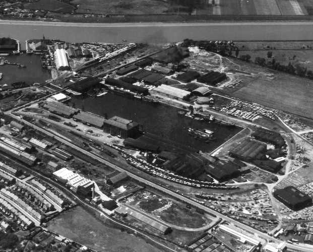
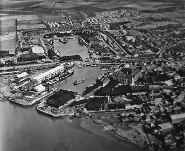
The Alexandra Dock is also in the foreground of this image which was taken in the years soon after the Second World War. [8]
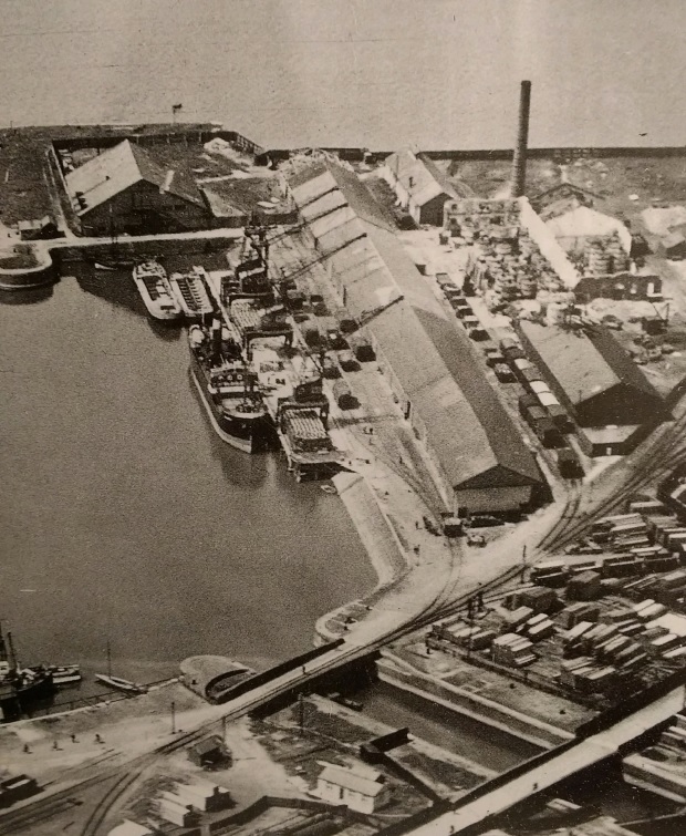
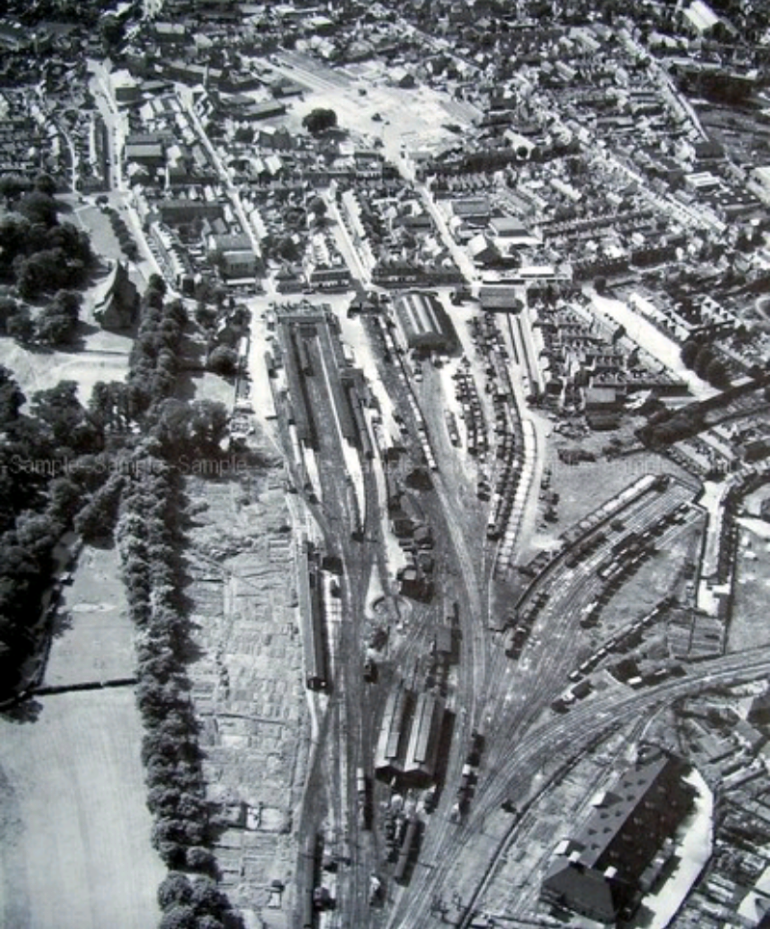
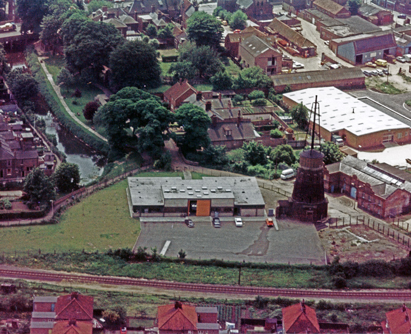
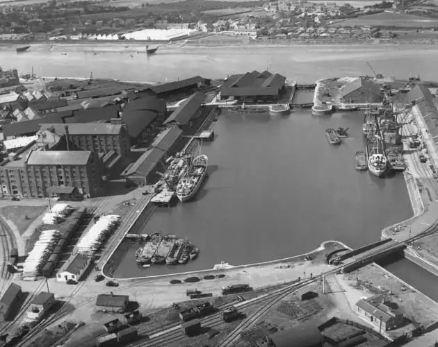
Taken from the Northeast in the late 1950s/early 1960s this image shows one of the swing bridges over the channel which linked the two docks, it provides a good overview of some of the railway tracks around Alexandra Dock and shows the three major warehouses on the South side of the dock. [9]
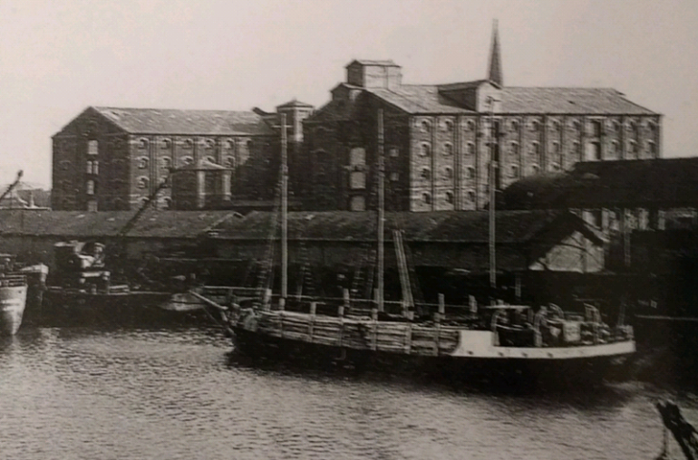
The three large warehouses on the South side of the Alexandra Dock were known as R1, R2 & R3. They are the main focus of this image. The spire in the background is that of St. Nicholas’ Chapel. In the image, R1 is on the right, R3 on the left and R2 is hidden behind. [10: p51, p90]

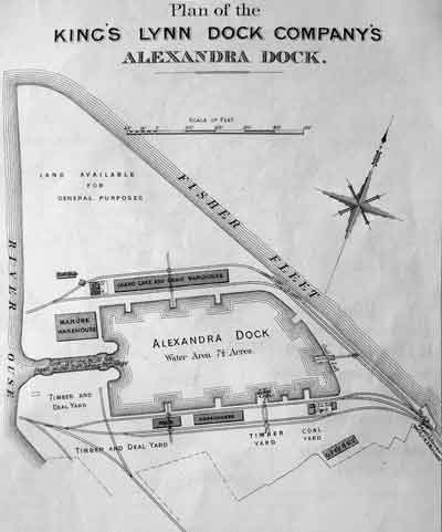
The South side of the Alexandra Dock initially accommodated a series of timber yards, a coal yard and some smaller grain warehouses. These can be seen in the early map of the Dock. That map also shows the dock offices in the bottom right and which csan be seen clearly in the image below from 1928. They are in the bottom left of the picture, looking like a row or terraced houses. [10]
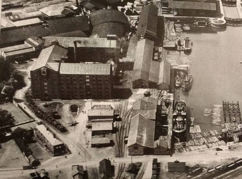
This view from 1928 shows the South side of the Alexandra Dock, the original two sidings are in evidence with the one nearest the dock wall passing through the low level warehousing and the other siding running to the left of the same warehouses. The large grain warehouses are: R1, furthest from the camera; R3, closest to the camera; and R2, linking the other two. To the rear of the image, timber is much in evidence and dark rooves are covered storage areas for timber. There also appears to be timber floating in the dock in the right foreground close to the remains of the old timber jetty (in the bottom right of the picture). The timber sheds are focussed on on the image below. Careful inspection of the picture will show that the timber sheds were well-served by rail. [10]
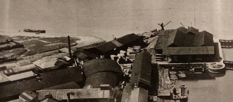
We have already noted the rapid rise in use of the Alexandra Dock. Very quickly, the need for further dock-side accommodation for shipping became apparent and work started to find room for an extension dock. Bentinck Dock was only created after protracted passage of an Act through Parliament and we will come back to that story later in this blog.

There was a rapid expansion of facilities around Alexandra Dock in the late 19th Century. By 1893 two large tall grain warehouses (R1 and R2) had been constructed on the South side of the Dock. Another (R3) was planned. [10: p51] Much of the railway infrastructure was in place and serious concern was being expressed about access to the docks by road. The main access road, Pilot Street was narrow and the route to it through the town was tortuous. [10: p 51]

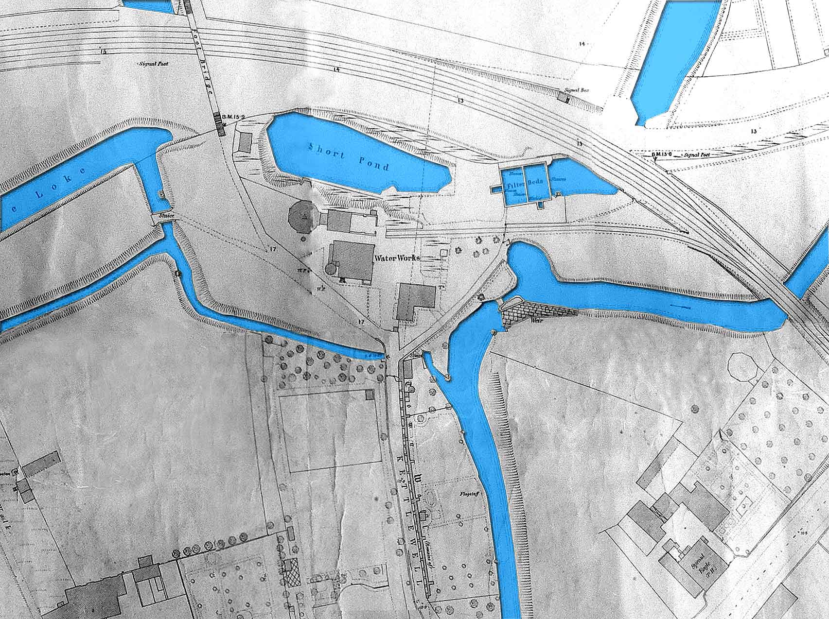
The area immediately to the Northwest of Alexandra Dock was also quickly developing. Rail infrastructure was in place late in the 19th century. By the early 1870s significant structures were already in place – a manure warehouse on the north side of the lock and a long single storey warehouse which was designated as a guano cake and grain warehouse.

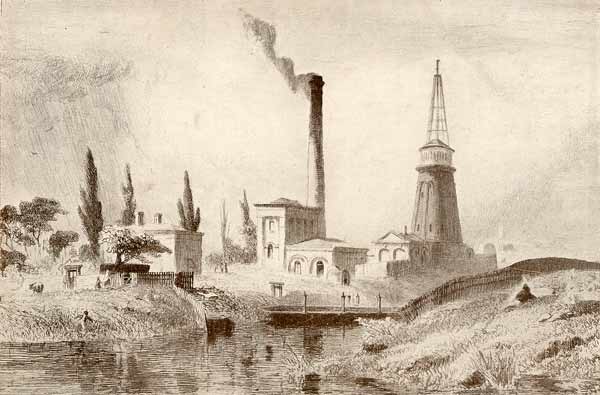
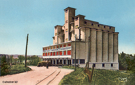
By 1877 an oil mill (Oilcake Manufactory, below) and warehouse had been constructed in the land between the Dock, the new straight alignment of Fisher Fleet and the River Ouse. an additional grain warehouse was built alongside this and the rail infrastructure was amended to cope with the additional traffic. The OS plans from the turn of the century show what was in place at that time. It is important to note the significant storage sidings alongside Fisher Fleet.
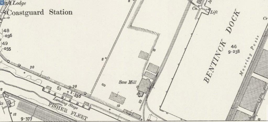
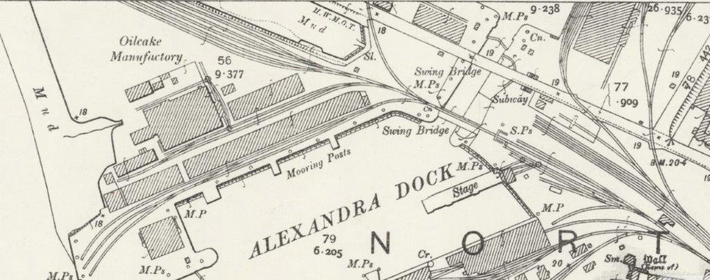
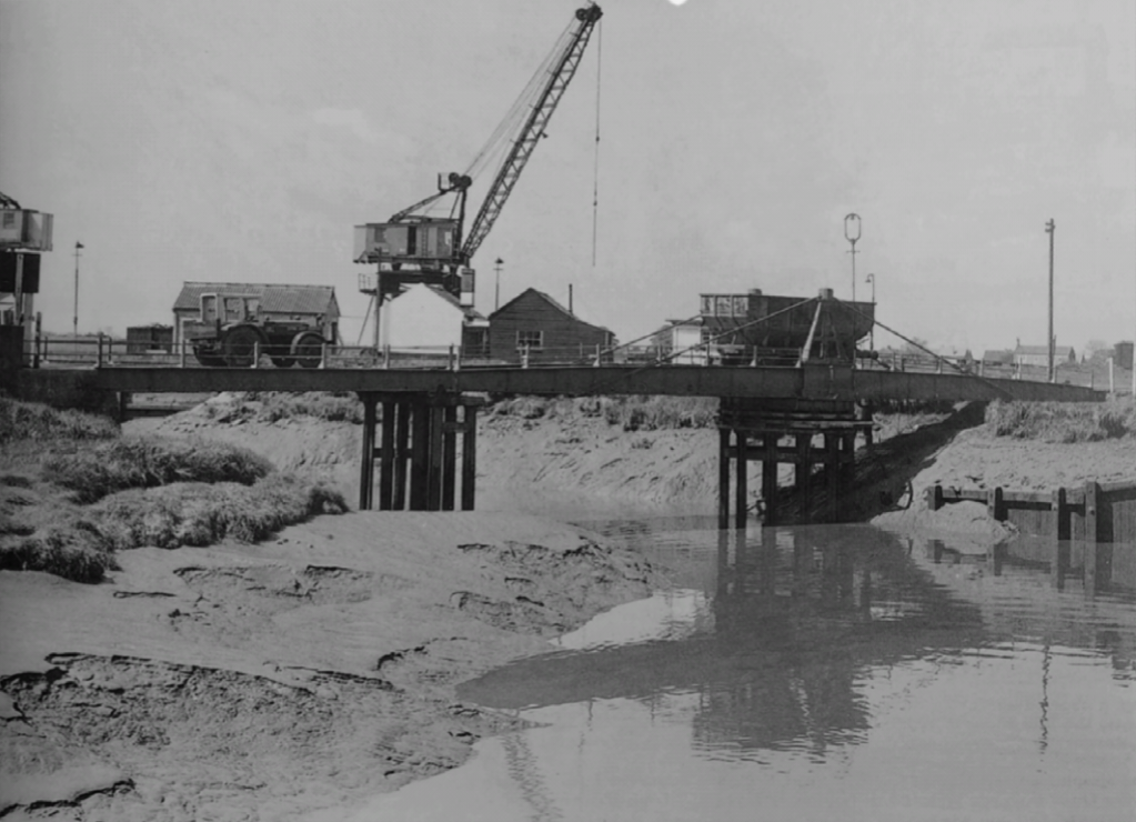
The North side of Alexandra Dock in 1928. The two swing bridges over the channel to Bentinck Dock are in the foreground. The nearest structure had a ban placed on its use as a rail route within the Act of Parliament which authorised the construction of Bentinck Dock. Timber storage is again much in evidence as are the rail sidings between the grain warehouses. The manure warehouse is in the top left and the oil works are shown after a major fire which resulted in the closure of the factory. The chimney was demolished in 1929. [10]
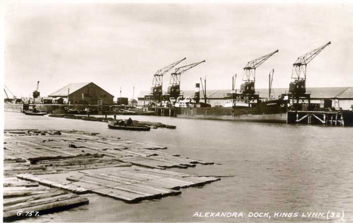
The dock after the removal of the Oilworks chimney. [17]

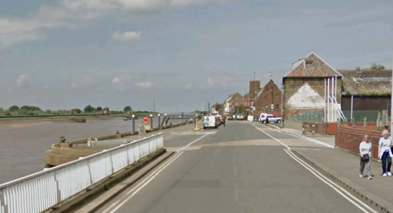
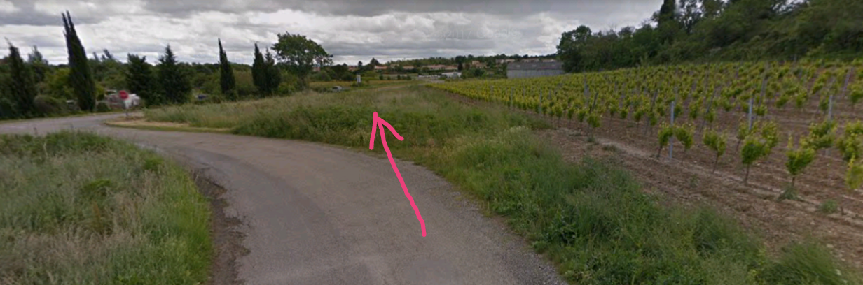
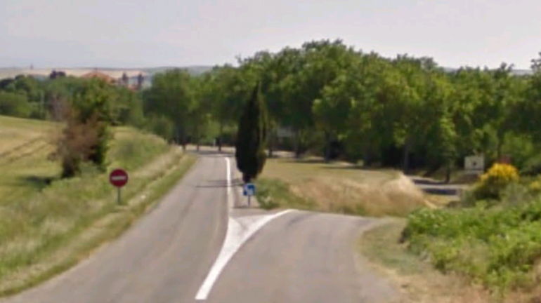
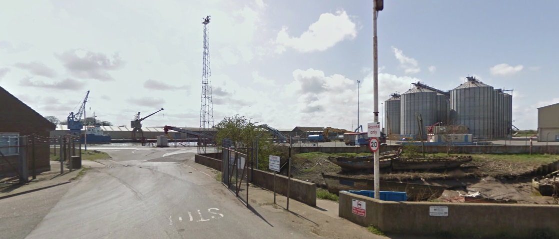
The two pictures above come from Google Streetview and show the access roads to the Alexandra Dock in the 21st Century. In both images, the water of the dock can be made out through the gates of the port. The port is surrounded now by modern industrial buildings and silos.
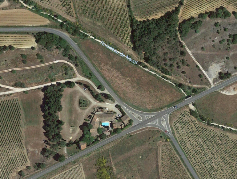
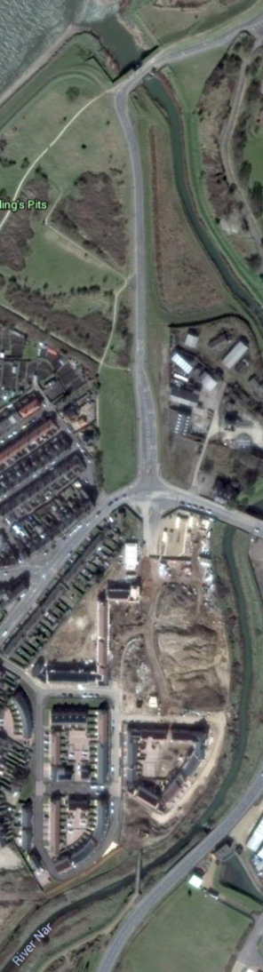
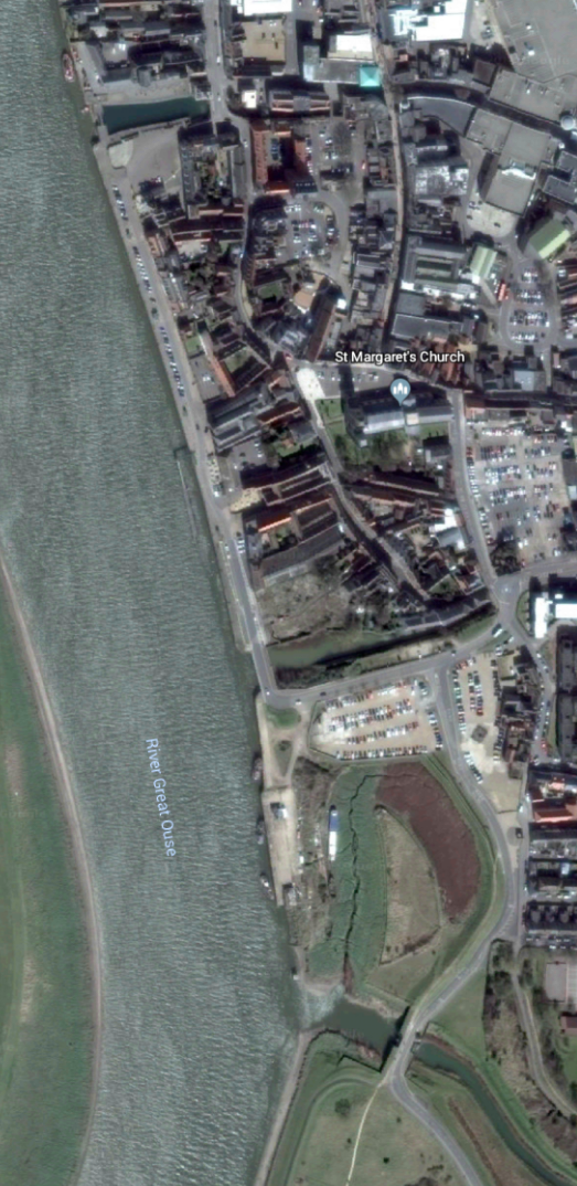
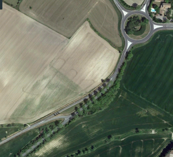
The Dock from above on Google Earth in 2016 the two swing bridges over the channel are easily picked out. The one closest to the top of the image was reserved purely for road traffic and has become a public highway. The other bridge allowed for rail and road access and remains within the limits of the Dock fences.This Google Streetview Image shows both of the swing bridges, the internal docks bridge can be picked out to the left of the control signals for the bridge on Cross Bank Road.
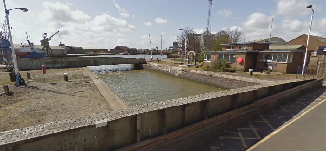
This image gets us the closest to the Alexandra Dock that we can using Google Streetview. It shows both swing bridges and the dock beyond.
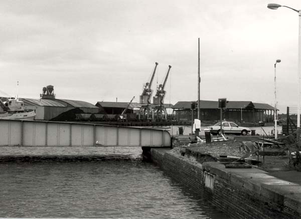
A similar but older view of the Alexandra Dock with the railway/road swing bridge in the foreground.
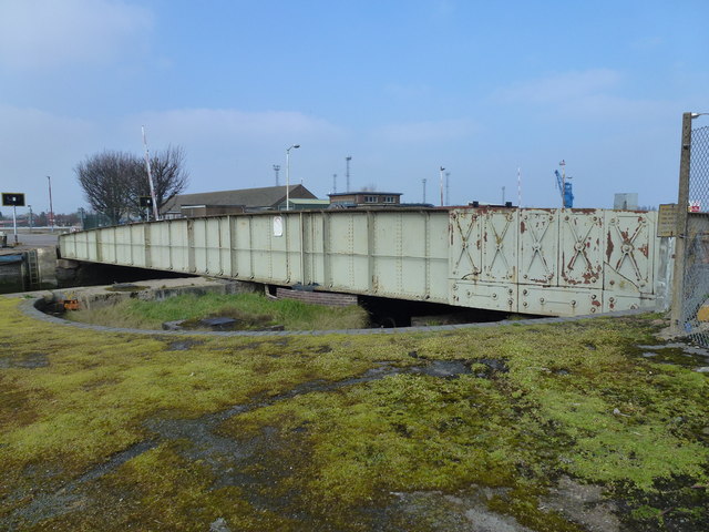
A closer shot of the internal docks bridge which once carried the dock railway. [16]

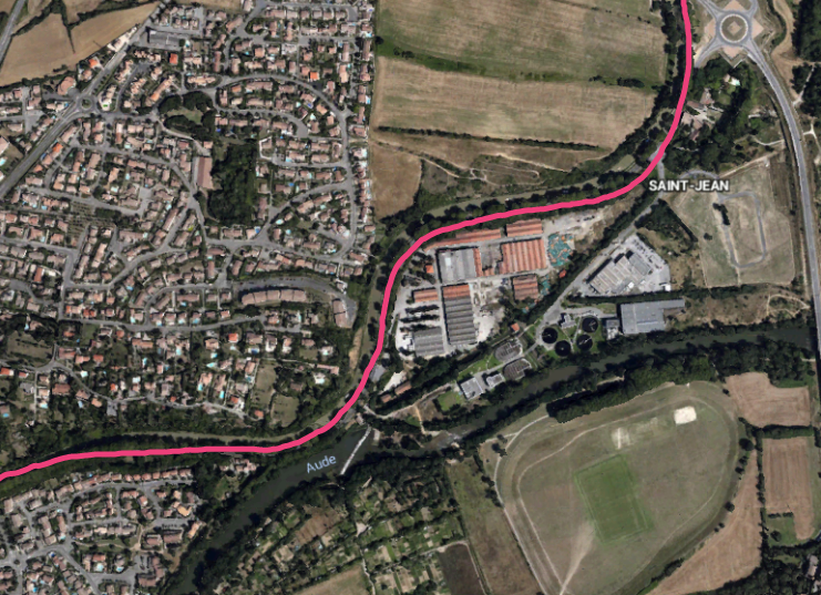
Four rail routes diverged to the Northwest of the bridge above, two of which served the northern side of Alexandra Dock, one served the series of long sidings alongside the Fisher Fleet and one turned North to serve the West side of Bentinck Dock. The remains of this last route are visible curving to the North just to the West of the swing bridge on the satellite image below.
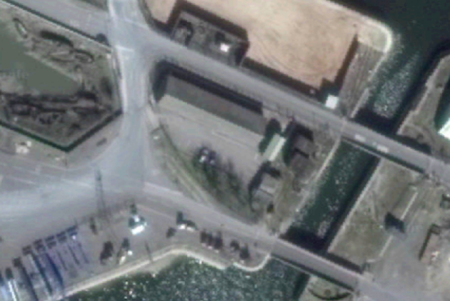
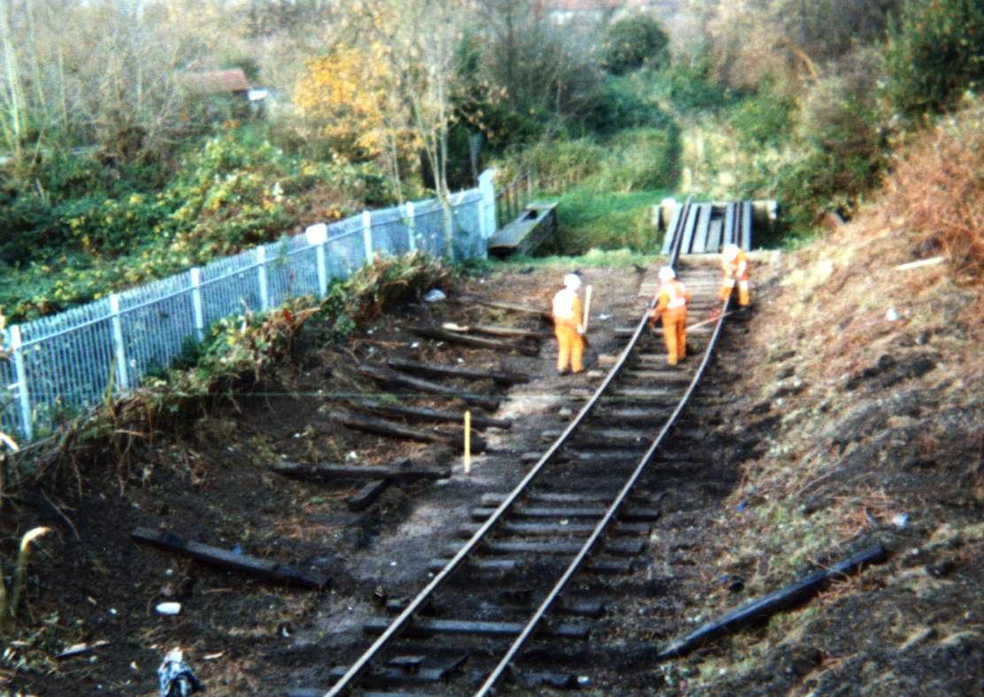
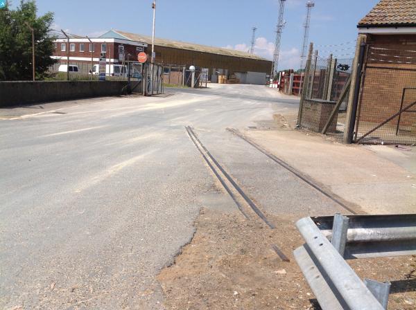
A short length of track remains in the tarmac close to the docks gates on the South side of Cross Bank Road.

The video below shows the channel between the two docks in use, with a ship moving from the Alexandra Dock to the Bentinck Dock. The quality is poor. [20]

The channel in use in the early years of the 21st century. [21]
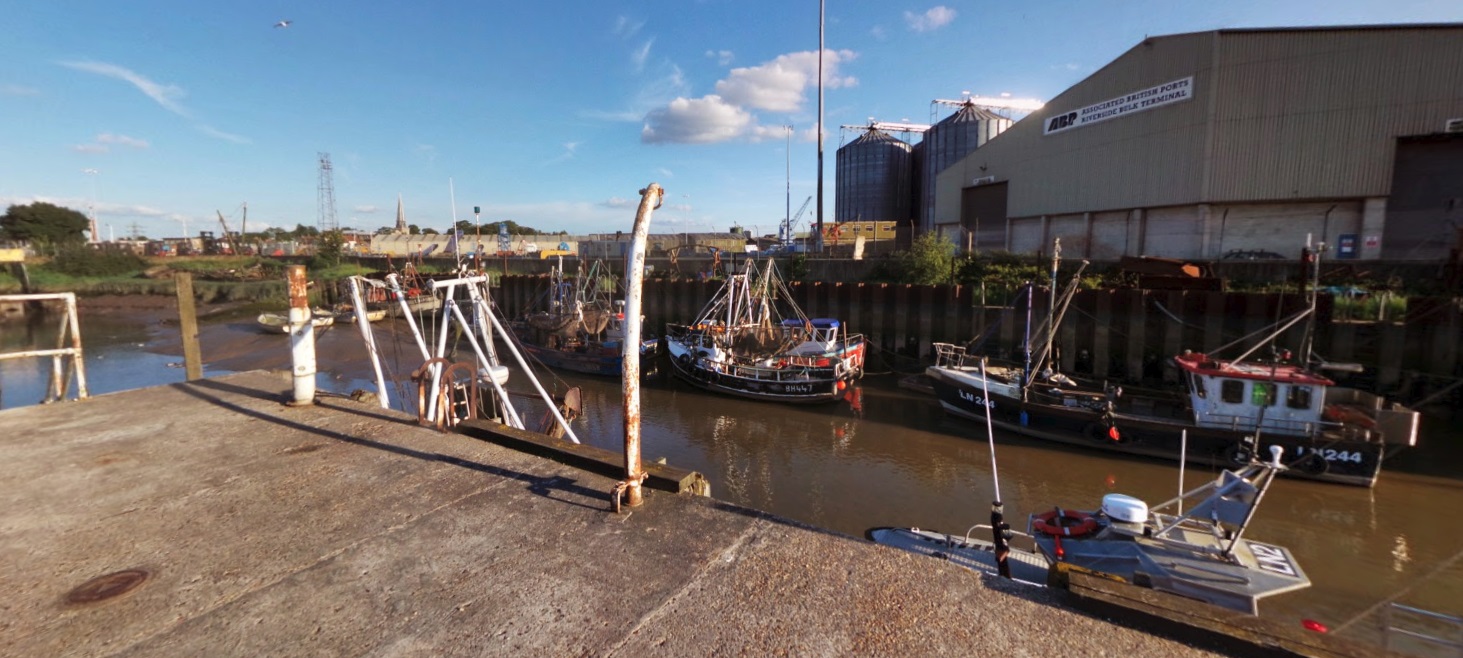
In order to create the channel between the two docks, Fisher Fleet had to be truncated. This is Fisher Fleet in the early 21st century, (c) Martin Pearman on Google Streetview. [22]

References (NB: these references cover parts 2 and 3 about the Docks Branch, if you cannot find the location to which a reference refers in the text of this post, please check in Part 3)

  1. http://www.geograph.org.uk, accessed on 24th September 2018.
  2. http://www.geograph.org.uk/photo/5824045, accessed on 24th September 2018.
  3. http://www.geograph.org.uk/photo/4859696, accessed on 24th September 2018.
  4. http://www.geograph.org.uk/photo/4627190, accessed on 24th September 2018.
  5. http://www.kingslynn-forums.co.uk/viewtopic.php?f=14&t=633, accessed on 24th September 2018.
  6. http://norfolkmuseumscollections.org/#!/collections/search?q=Kings%2BLynn%2BDocks, accessed on 24th September 2018.
  7. http://www.kingslynn-forums.co.uk/viewtopic.php?f=14&t=1386&hilit=docks+railway, accessed on 23rd September 2018.
  8. http://www.kingslynn-forums.co.uk/viewtopic.php?f=14&t=1386&hilit=alexandra+dock, accessed on 24th September 2018.
  9. http://www.edp24.co.uk/news/bird-s-eye-view-of-king-s-lynn-half-a-century-or-more-ago-1-5015740, accessed on 24th September 2018.
  10. Mike G Fell; An Illustrated History of The Port of King’s Lynn and its Railways; Irwell Press, Clophill, Bedfordshire, 2012.
  11. http://www.heritage.norfolk.gov.uk/record-details?MNF13622-Savage%27s-Engineering-Works&Index=12818&RecordCount=56734&SessionID=61d2a652-a74b-4c81-a979-dc394157106a, accessed on 29th September 2018.
  12. https://www.museums.norfolk.gov.uk/-/media/museums/downloads/learning/kings-lynn/a-history-of-savages.pdf, accessed on 29th September 2018.
  13. http://www.kingslynn-forums.co.uk/viewtopic.php?f=14&t=16&start=75, accessed on 30th September 2018.
  14. http://www.kingslynn-forums.co.uk/viewtopic.php?f=14&t=16, accessed on 30th September 2018.
  15. http://www.kingslynn-forums.co.uk/viewtopic.php?t=160, accessed on 30th September 2018.
  16. https://www.geograph.org.uk/photo/4859816, accessed on 30th September 2018.
  17. http://www.kingslynn-forums.co.uk/viewtopic.php?f=14&t=1386&hilit=docks&start=15, accessed on 28th September 2018.
  18. http://www.jcbarrettphotographic.co.uk/portoflynn_railways.html, accessed on 25th September 2018.
  19. http://www.kingslynn-forums.co.uk/viewtopic.php?f=14&t=1386&p=38109&hilit=last+train+docks#p38109, accessed on 30th September 2018.
  20. https://www.youtube.com/watch?v=k-SxJiGGAgk, accessed on 30th September 2018.
  21. http://www.kingslynn-forums.co.uk/viewtopic.php?f=14&t=1386&start=75, accessed on 30th September 2018.
  22. https://www.google.co.uk/maps/@52.7607969,0.3925969,3a,75y,167.73h,83.45t/data=!3m8!1e1!3m6!1sAF1QipM1J3080sMdNrn1EEah9fq3d7RFvQ8zYEXfIBCD!2e10!3e11!6shttps:%2F%2Flh5.googleusercontent.com%2Fp%2FAF1QipM1J3080sMdNrn1EEah9fq3d7RFvQ8zYEXfIBCD%3Dw203-h100-k-no-pi-0-ya215.55334-ro0-fo100!7i5028!8i1477, accessed on 30th September 2018.
  23. http://www.edp24.co.uk/news/aerial-photos-kings-lynn-history-1-5403574, accessed on 30th September 2018.


King’s Lynn Docks Branch – Part 1

King’s Lynn was my home from 1972 to 1978 – my teenage years. I have often thought about investigating the ports and railways of the town. King’s Lynn has a long and distinguished history as a port. Until 1537, the town was called Bishop’s Lynn with a population of 5,500-6,000. Wool, grain and salt were exported and pitch, fish and iron were imported. The adjacent image gives an impression of the town in the Medieval period. [21]

In 1101 Bishop Herbert de Losinga of Thetford began the first Medieval town between the Purfleet and Mill Fleet by building St. Margaret’s Church (now King’s Lynn Minster) and authorising a market. A small prosperous town grew up quite quickly and, in 1204, following a charter from Bishop John de Grey of Norwich, the town became Bishop’s Lynn (Lenne Episcopi).

Trade built up along the waterways that stretched inland from Lynn, and the town expanded and quickly filled the space between the two rivers, Millfleet to the south and Purfleet to the north.

By the late 12th century, a further period of expansion began, more deliberately planned than the first, with wider straighter streets and a much larger market place – this is the second Medieval town between the Purfleet and Gaywood River or Fisher Fleet.

Bishop’s Lynn grew rich on trade, both within Britain and abroad. The Hanseatic League, a powerful German trading organisation made up of merchants from North Germany and neighbouring countries around the Baltic Sea contributed greatly to this prosperity. The legacy of trade can be found in the many merchant houses and other fascinating buildings in this medieval port. Visit West Norfolk provides a good history of the Hanseatic period in the life of the town:

“By the early 13th century Lynn had become a significant market town and seaport, having grown rapidly since 1101 when Bishop Losinga of Norwich recognised it as a settlement on his Gaywood estate. He had endowed the Benedictine monks of Norwich Cathedral with the lordship. Their Priory Church of St Margaret was, nevertheless, only to be built and rebuilt through the wealth of Lynn’s mercantile community, though the Norwich bishops were determined to retain their grip on the town. They had founded a second town and market in the 1140s on the Newland to the north of the first and assumed the lordship of both centres – of Bishop’s Lynn – in 1205. When Lynn received its first royal charter of borough freedom in 1204, giving its merchants a degree of self-government, it was already the third or fourth port of the Kingdom.” [2]

“German merchants from the Baltic and Hamburg secured trading privileges at Lynn in 1271 and these were confirmed, after some local disputes, in 1310. The right to maintain their own houses was a critical concession (other alien merchants had to lodge with burgesses). Lübeckers and other merchants from the East appear to be visiting English ports at the beginning of the 13th century, following traders from Got land, to Lynn, Hull and Boston, then to London. Professor Friedland has also referred to Lynn and Boston as destinations for Hanseatic merchants trying to establish themselves in the West. The Norfolk town accepted them as “the fraternity of the German Hanse” (fratres de hansa alemanies in Anglia existentes, Lynn 1302). Boston and Lynn attracted the German Hanse because their extensive hinterlands offered commercial opportunities and rewards. They travelled to these Wash ports for wool in the 13th century, visiting their annual summer fairs, as did the Lübeckers in 1271.” [2]

“Once the export of wool from England began to fall in the later 14th century, Hanseatic towns tended to link up with particular English ports. German trade to Boston was interlocked with the Kontor at Bergen where Lübeckers enjoyed a dominant role; their ships carried fish to the Wash and took away wool, cloth and salt. Lynn merchants made Danzig their chief destination from the 1380s and, sure enough, it was ships from Danzig that had already started to visit the Norfolk seaport, though Hamburg and Bremen men traded through Lynn too.” [2]

“Herring, timber, wax, iron and pitch were imported into England via Lynn in Hanseatic ships which sometimes carried grain from the Wash to Flanders. Wool, skins, cloth and lead were commodities taken back to Danzig and other German harbours. Lynn merchants sent cargoes to Prussia in Danzig ships and to Bergen in Lübeck bottoms, but none of them appear to have been resident in Norway or Hanseatic cities until the 1380s. Lynn was soon more heavily dependent on the Prussia trade through Danzig than any other English port.” [2]

“A number of Lynn merchants and their associates seem settled in several Baltic seaports by the early 15th century, particularly in Wismar, Stralsund and Danzig. That Lynn treated independently with the Hanseatic cities in the resolution of disputes or grievances testifies to a not inconsiderable presence. Details of this commercial and diplomatic interaction can be found in the memorandum book belonging to William Asshebourne, Lynn’s town clerk. In 1408 he received a letter from Lynn men in Danzig setting out their ordinances recently drawn up for “their company” there. The son of Margery Kempe married a Prussian woman and both travelled to Lynn in 1431, leaving their child in Danzig. Unfortunately, Margery’s son died in Lynn and she escorted her daughter-in-law back to Danzig. There appears also to have been an exchange or transfer of sailors and artisans between Wash and Baltic seaports. A sizeable group of German shoemakers were living in Lynn by the 1420s for example.” [2]

“Commercial relations between England and the Hanse deteriorated following the seizure of its Bay salt fleet (from south-west France to the Baltic) by English privateers in 1449. Then all Hanseatic towns united against England after a major incident off Denmark in 1468. Peace was negotiated at Utrecht in 1473/74 after several years of sea warfare and the German delegation achieved most of its diplomatic aims. It insisted on a free gift of their former trading posts or steelyards at London and Boston and of a new one at Lynn. The Treaty of Utrecht was signed in 1474 and the English King conveyed a quay and tenements in the Norfolk town to the Hanse. Lübeck invited Danzig to take charge of the property, the complex now known as Hanse House. This is today the only surviving Hanseatic business headquarters or steelyard in England.” [2]

After the dissolution of the monasteries by Henry VIII, Lynn changed it name to Lynn Regis – subsequently King’s Lynn – remaining an active port to this day. [1] Henry VIII finally dispossessed the Norwich bishops and transferred full political power to the town’s merchants.

“By the 16th century the east coast trade in corn and coal, mainly involving London and Newcastle respectively, kept the commercial wheels of this Norfolk seaport turning. Though its international trade with the Baltic and south-west France (wine imports were substantial) continued, it was relatively less important than before. Lynn’s hinterland remained the key to its success. In 1722 the travel writer Daniel Defoe was impressed by the fact that the Wash haven enjoyed “the greatest extent” of inland navigation of any English port outside London and served six counties “wholly” and three “in part” with coal, wine and provisions. Lynn was in turn a major corn exporter with granaries lining the river. But the town failed to develop any manufacturing industries in the course of the 18th century and, despite the buoyancy of shipbuilding and brewing, its population was only 11000 in 1801.” [2]

“Lynn’s population doubled between 1801 and 1851 as the market and port expanded with East Anglia playing a leading role in feeding London and the new industrial regions. Then the coming of the railways in the 1840s robbed Lynn of its geographical advantages as river and coastal traffic gave way to the iron road. Population fell from 20,000 to 17,000 in the period of 1851-1871 and economic recovery followed through the building of docks linked to the new national railway network, which sparked the town’s first industrial revolution. New factories began to supply English farmers with machinery, artificial manure and animal feed. Yet the town grew slowly because it was too remote from the industrial regions; its hinterland remained agricultural when food imports into England from America increased to compete with home farmers.” [2]

“Despite the growth of suburbs and some redevelopment in the 1960s and 1970s, the Old Town of King’s Lynn remains of national significance for its architectural and historic interest. Its connection with the Hanseatic League of the Middle Ages was highlighted in 2004 with the visit of the Kieler Hansekogge; then in 2005 the Borough of King’s Lynn and West Norfolk became a member of the New Hanseatic League – England’s first representative.” [2]

The Hanseatic League Warehouse in King’s Lynn is the only surviving League structure in England [17]

The harbour was historically along the waterfront on the river. In the middle ages the River had a more easterly course and some of the medieval buildings were on an island. the river course was moved westwards and Boal Quay and South Quay were formed. King’s Lynn Harbour Branch was constructed to serve these quays. deatils of the Harbour Branch can be found on in this post:

https://rogerfarnworth.com/2018/09/16/kings-lynn-harbour-branch.

The port infrastructure developed in the 19th century following the formation of a docks and railway company in 1865. This built the Alexandra Dock which was completed in 1869 and linked by rail in 1870. By 1876 over 500 ships were using the new dock each year. [3].

The larger Bentinck Dock with a length of 800 metres (2,600 ft) was opened in 1883. [3][4] The port has traditionally relied on exporting agricultural produce for the bulk of its traffic. [3][16]

In the early 21st Century, the docks are operated as the Port of King’s Lynn by Associated British Ports. The port handles around 750,000 tonnes of cargo a year, including agricultural and forest products, chemicals, steel and other metals. [4] Three docks, including the tidal Riverside Quay, can accommodate vessels up to 140 metres (460 ft) in length. [4] The docks cover an area of 39 hectares (96 acres) and include the 25,000 tonne capacity Alexandra Grain Silo complex. [4][16]

The Docks Branch
The branch left the main line at what feels like a major junction just to the East of the Station. Lines to Swaffham and Hunstanton diverge from the main line in initially and easterly direction and the Dock Branch heads away to the north. The busy railway junction was intersected by a level crossing for what became known as Tennyson Avenue. The map below is sourced from the National Library of Scotland and is an extract from the OS Maps of the early 20th Century. [8]

Every train heading for the Docks had to cross Tennyson Avenue.

The picture above shows that pedestrians were not using the footbridge despite the dangers of the busy road. [9] The picture below shows the level-crossing and footbridge as I remember it in the 1980s. [5] I was unaware that the bridge was actually relatively newly refurbished at that time! The original footbridge had less headroom and needed to be lifted to accommodate electrification. It was a lattice-girder structure which was considerably more graceful that that in these images! [9]

The next image shows the same location in the early 20th Century, the footbridge is long gone.

The larger white building beyond the crossing in both images is part of what I knew as King’s Lynn Technical College. It was where my father taught in the Engineering Department until the mid-1980s. In the second of the two images, the bend remains sharp but the sight-lines for road traffic are much improved.

The first picture below is taken looking west from the footbridge steps in the late 1980s. The docks branch curves away to the right. [9]

The next picture is another view towards King’s Lynn Station from Tennyson Avenue in 2010. The docks branch is the line in the immediate right foreground, (c) Gary Troughton. [7]

Compare the sparsity of the track-work in the two images above with that shown in the monochrome image immediately below. The image below looks towards King’s Lynn Station and is taken from the footbridge and the old crossing gates can be seen in the foreground. [9]

The next shows a late 20th Century view looking to the East. The footbridge is still in place and the junction between the docks branch and the main line is visible on the left beyond the 15 mph speed limit sign. The line straight ahead is the remains of the line to Swaffham. [9]

The mainline to Ely and beyond curves to the south around behind the signal box as can be seen in both the images immediately below. [9][25]

Before moving on down the docks branch, here are a couple of images taken when the old footbidge was in place adjacent to the Tennyson Avenue Level-Crossing. [9]

The site has changed dramatically today, the footbridge is gone and shops have been built adjacent to the crossing. These next two pictures were taken at the beginning of October 2018 by Beeyar Wunby on the King’s Lynn Forums website. [28]

Moving on from the junction at Tennyson Avenue Level Crossing,, the branch consisted of a series of sidings in parallel providing space for trains to be marshalled.

There were two significant workplaces alongside the docks branch. The first was the Malthouse and the second the Iron Works. They were int he area of the town known as Highgate and both feature on the adjacent map.

The Malthouse was a substantial building which, in the early 21st Century, is now converted into flats and known as the Maltings. It was rail-served, having its own sidings and stands close to the old station goods yard but on the East side of the Docks Branch with a trailing point providing access to its sidings.

The first image below shows the end of the Malthouse building in 1986. [10]

A train of wrapped coiled steel passes in front of the Malthouse in the later days of the Docks Branch. [19]

This aerial image shows the Malthouse and Tennyson Avenue footbridge in the bottom left. The dock branch runs left to right just above the Malthouse. The station goods-yard is a hive of activity. The engine shed is just above the Malthouse. [11]

The Malthouse and the Engine Shed appear at the bottom of this image. The docks branch heads off to the right of the picture just above the Malthouse. [12]

To the North of the Malthouse, the docks branch followed a straight path to the over-bridge at Gaywood Road (A148) running behind King’s Lynn Technical College campus. In the early (and later) 20th Century there was an Ironworks on the South side of Gaywood Road.

The bridge which took Gaywood Road over the Docks Branch was referred to locally as Dodman’s Bridge. [13] The works were called Dodman’s Ironworks. The image below was taken in the 1930s by someone standing on Dodman’s Bridge and looks East towards Gaywood. The procession is associated with the Norfolk Show which was held in King’s Lynn at that time. There is a healthy discussion on King’s Lynn Forums about the picture! [13]

View East from Dodman’s Bridge along Gaywood Road. The School in the background is Highgate School. [13]

An aeriel view of Dodman’s Works on the South Side of Gaywood Road. The Docks Branch runs between the works and the gable end of the terraced house beyond. [14]

The gates of the factory as seen in the picture above. [14]

Inside the works. [14]

Dodman’s Heavy Load Road Transport. [14]

The pictures of Dodman’s have been sourced from King’s Lynn Forums. [13][14] The works were built by Alfred Dodman. He was a prominent figure in King’s Lynn’s industrial scene. Starting up in 1854 he owned, co-owned and ran several foundries of increasing size until he was leased the site of Highgate Field and built a new foundry there in 1875. The firm mostly made ‘land’ boilers or the Cornish and Lancashire types but eventually branched out into locomotive, traction, portable and marine boilers and hardware. In the early 1900s they began making mining pumps, mill machinery, oil engines and cranes.

In 1902 Dodman’s were contracted to make boilers for the army and navy. In 1905 they were also contracted by the Crown Agents for the Colonies.

Alfred Dodman died in 1908, however the firm continued, manufacturing for the army and admiralty throughout the First World War, and for the navy and RAF in the Second World War. After 1945 the company kept expanding, landing contracts in India and the Persian Gulf. To keep up with technology they moved away from steam and oil power and focused on building pressure machinery for and storage tanks for the petro-chemical and North Sea industries.

In 1972 the directors planned a move to a new site on the Hardwick Industrial Estate, however financial difficulties in 1975 marred this move and forced the company to shut down. The Highgate site was cleared in 1977 for housing. [15] The picture above is taken from ‘King’s Lynn in Colour’ Volume 1. [18]

Dodman’s Bridge in the 21st Century, looking East with the site of the Ironworks to the right.

The view South along the line from Dodman’s Bridge in July 2012. [24]

In this image and the next we see the same location at a much earlier date. Both images are in Mike G. fell’s book about the Docks and their railways. Both images have the Dodman’s works on the right. In the first image a train with items from Portugal passes the works with cattle wagons in the siding beyond. [26]

In this image, a short train of grain wagons passes Dodman’s works on its way from the Docks. [26][27]

The next two pictures were taken on a railtour organised by the Fakenham Railway Society in March 1980 which included (among other things) a trip up the docks branch in King’s Lynn. These two images are taken below the bridge next to Rodman’s on Gaywood Road. Neither image is of the highest quality but they are the only one’s that I can find taken from track-side and including the over-bridge. [19]

North of Dodman’s Bridge and the Gaywood River, the Docks Branch turned to the West on the North side of the Water Mill and Electric Works in North Lynn.

Workmen dismantling the Docks Branch with the Gaywood River bridge beyond. [19] Thanks to SEDFreightman on the RMWeb Forum [29] for the following comment about the photo above: “The photo shows employees of Grant Rail (Railtrack’s contractor) undertaking spot re-sleepering on the section of Dock Branch that was to become the Shunt Neck for a new loop on the Branch formation to allow removal of the loop in Kings Lynn Yard. The photo would have been taken in November or early December 1999.”

The Gaywood River Bridge (above). [19]

The Fakenham Railway Society tour, once again. This time returning from the Docks and crossing the River Bridge. [19]

The Works had a single siding serving it from the Docks Branch. [20] Access by road was via Kettlewell Lane which ran alongside the old town walls from the old Eastgate of the town on Littleport Street (the Western extension of Gaywood Road at the time).

Kettlewell Lane led through the works to the footbridge over the docks branch.

Kettlewell Lane and the Works prior to the construction of the Electric Works. The Gaywood River passes under the Dock Branch at the right side of this map. The siding is shown just to the North of the river. [22]

All that remains of the siding in the early 21st Century. [22]

Gaywood Road appears in the foreground of this image. The works and the Docks Branch are towards the top of the image. [22]

In this image (above), the Docks Branch is in the foreground, the site of the works in the centre with the Electric Works to the right of the image. By the late 1970s and early 1980s the three tracks of the Branch had been reduced to one. [22]

The adjacent sketch shows the works from the River in earlier times. [22]

I can remember undertaking a project for my O-Level in Biology which focussed on ecology of the Gaywood River in 1976, along the length of the river on the map above, but not realising just what was in the immediate area – not the old town walls, nor the industrial archeology either! In the very early years, the Docks Branch appears to have had a connection to the King’s Lynn to Hunstanton line north of Gaywood, the abandoned line is shown on the map below. Appearances can be deceptive. What the map actual shows is an unopened connection from M&GN to it’s planned new terminus at Austin Street. The connection was built in the 1890s along with the proposed new station and crossed the docks branch. The line and station at Austin Street were built to avoid the use of the GER’s King’s Lynn station but were not opened when common sense prevailed and agreement was reached by the M&GN with the GER. Thanks to Iain Scotchman for this correction.

The footbridge over the Docks Branch adjacent to the Electric Works. [22]
The Branch continued West from the footbridge to meet, Pilot Street (which is now John Kennedy Road). The picture below shows this length of the line.

This picture shows the approach to the John Kennedy Road Crossing with the Pilot Cinema to the left of the line and St. Nicholas’ Chapel spire beyond. I twas taken at the end of the 1980s/early 1990s, (c) Bramleyman on http://www.railwayforum.net [30]
At Pilot Street (John Kennedy Road) there was another level-crossing and footbridge as shown below. [20]

The crossing gates on the East side of John Kennedy Road. [23]

Google Streetview provides more up to date images of the crossing.

The crossing gates on the East side of John Kennedy Road.

The West side of John Kennedy Road.

View looking North along John Kennedy Road.

The level crossing on Pilot Street was the effective entrance point to the docks and it is at this point that the present post concludes. A future post will explore what information is available about the railways within the Docks.

References

  1. https://www.visitwestnorfolk.com/places/kings-lynn/history-of-kings-lynn, accessed on 20th September 2018.
  2. https://www.visitwestnorfolk.com/places/kings-lynn/history-of-kings-lynn/hanseatic-kings-lynn, accessed on 20th September 2018.
  3. https://en.wikipedia.org/wiki/King%27s_Lynn_Docks, accessed on 20th September 2018.
  4. http://www.abports.co.uk/Our_Locations/Short_Sea_Ports/Kings_Lynn, accessed on 20th September 2018.
  5. http://www.kingslynn-forums.co.uk/viewtopic.php?f=14&t=353, accessed on 22nd September 2018. This is a link to a topic on King’s Lynn Forums entitled “Tennyson Avenue Level Crossing.
  6. http://abcrailwayguide.uk/tennyson-avenue-public-level-crossing-norfolk#.W6ZULGhKiUk, accessed on 22nd September 2018.
  7. https://www.flickr.com/photos/gary_troughton/5089709764, accessed on 22nd September 2018.
  8. https://maps.nls.uk/view/120848786, accessed on 22nd September 2018.
  9. http://www.kingslynn-forums.co.uk/viewtopic.php?f=14&t=1642&start=60, accessed on 22nd September 2018.
  10. http://www.kingslynn-forums.co.uk/viewtopic.php?f=14&t=6667, accessed on 22nd September 2018.
  11. http://www.kingslynn-forums.co.uk/viewtopic.php?f=14&t=273&start=90, accessed on 22nd September 2018.
  12. https://historicengland.org.uk/listing/the-list/list-entry/1391201, accessed on 22nd September 2018.
  13. http://www.kingslynn-forums.co.uk/viewtopic.php?f=14&t=9192&p=55368&hilit=Dodmans#p55368, accessed on 23rd September 2018.
  14. http://www.kingslynn-forums.co.uk/viewtopic.php?f=14&t=1390&hilit=Dodmans, accessed on 23rd September 2018.
  15. http://www.heritage.norfolk.gov.uk/record-details?MNF61652-Highgate-Iron-Works&Index=53325&RecordCount=57339&SessionID=413fd24e-8645-4c54-b1aa-fc2c80303e66, accessed on 23rd September 2018.
  16. https://www.cambridgeairphotos.com/areas/kings+lynn+and+west+norfolk, accessed on 23rd September 2018.
  17. https://commons.wikimedia.org/w/index.php?curid=6921557, accessed on 23rd September 2018.
  18. http://www.trickysampublishing.co.uk/picture-gallery-2.php, accessed on 23rd September 2018.
  19. http://www.kingslynn-forums.co.uk/viewtopic.php?f=14&t=1386&hilit=docks+railway, accessed on 23rd September 2018.
  20. https://maps.nls.uk/view/120848786, accessed on 23rd September 2018.
  21. http://users.trytel.com/tristan/towns/lynnmap1.html, accessed on 23rd September 2018. Following this link provides access to the details associated with each reference on the image.
  22. http://www.kingslynn-forums.co.uk/search.php?keywords=The+Kettle+Mill, accessed on 23rd September 2018.
  23. https://commons.m.wikimedia.org/wiki/File:King%27s_Lynn_docks_line,_John_Kennedy_Road_crossing.jpg, accessed on 23rd September 2018.
  24. https://mapio.net/pic/p-73764797, accessed on 24th September 2018.
  25. http://www.rmweb.co.uk/forum/viewtopic.php?f=5&t=4818, accessed on 24th September 2018.
  26. Mike G Fell; An Illustrated History of The Port of King’s Lynn and its Railways; Irwell Press, Clophill, Bedfordshire, 2012.
  27. https://www.transport treasury.co.UK, accessed on 25th September 2018.
  28. https://www.railwayforum.net/showthread.php?p=90587#post90587, accessed on 4th October 2018
  29. http://www.rmweb.co.uk/community/index.php?/topic/137599-kings-lynn, accessed on 6th October 2018.
  30. https://www.railwayforum.net/showthread.php?p=90601#post90601, accessed on 8th October 2018.

Tramways de l’Aude – Carcassonne to Caunes Minervois

The Tramways de l’Aude Station in Carcassonne. [1]The facilities for the tramway in Carcassonne were significant. In the sketch plan immediately above we have the detail of the station facilities at ‘C’. The two routes which lead off the plan are: ‘A’, the tramway which runs to the South side of the Canal basin close to the Gare du Midi and then on through the Carcassonne suburbs to the rest of the network; ‘B’ the line feeding the Gare de l’Estagnol, which is marked ‘III’ and ‘IV’ in the plan above. [2]The tramway route to Lezignan is sketched out above and the 1927 timetable is shown immediately above. [1] Two further images of the Station in Carcassonne. The lower of these sows the train immediately across the Canal basin from the La Gare du Midi. [2]

Trains left Carcassonne Station and followed the South/East side of the Canal du Midi out of the city. The route out of the city is covered in the previous blog in this series:

https://rogerfarnworth.com/2018/09/11/tramways-de-laude-lastours-to-carcassonne.The first significant structure encountered was the Compagnie du Midi mainline’s bridge over the Canal which also spanned the tramway and road. In this image a short passenger train can be seen leaving Carcassonne Station and following the curve of the canal basin. [2]A similar picture from 21st Century.

The tramway followed the Canal bank through Saint-Jean before bridging the canal and passing through Pont Rouge.The Canal at Saint-Jean in 21st Century. The picture is taken from the Canal towpath to the south of the lock at Saint-Jean. The tramway ran to the right of the trees flanking the Canal.The Canal du Midi lock at Saint-Jean. The tramway approached the lock behind the trees on the right of the image and then swung sharply over the bridge which is visible beyond the lock, before turning North once again to follow the West bank of the canal.The view Northeast from Pont Rouge. The River Fresquel flows below the Canal and road just this side of the locks in the distance. The tramway ran on the left side of the Canal. The locks at Fresquel (Les ecluses de Fresquel). The tramway ran along the lefthand side of the Canal.The tramway continued alongside the Canal to Carrefour de Bezons.Carrefour de Bezons is a junction station. One line follows the valley of the Orbiel to Lastours. The other followed a wide arc through the French countryside to Lezignan. This route is the lower of the two branches in the sketch plan above.

The tramway first followed the GC8 through Villalier and Villegly and then the GC112 to Villeneuve-Minervois. There is very little evidence of the existence of the tramway along the way.

Villalier is a village with a population of less than 1,000 people. Its population reached a peak of 923 in 1990. [3] It dates back to the 9th century, when it was a castle surrounded by ditches belonging to the counts of Carcassonne, with a small group of houses clustered around the castle. The lands and lordship of Villalier were given, in 1217, by Simon de Montfort to the bishops of Carcassonne who owned them until 1790. [1] Just before entering the village of Villalier the GC8 and the tramway crossed the River Orbiel. [7]The tramway ran through the centre of the village, past the school in the images below.The tramway ran across the front of the school which appears in the image immediately above. The first of the two images shows the tramway, the second is an earlier image of the location from a different angle.The same location in the 21st Century.The tramway ran from the bridge over L’Orbiel through the centre of the village of Villalier. The square to the Northeast side of the village is the location of the school in the images above.

The next village along the route was Villegly. The tramway followed the GC8 from Villalier to Villegly. It was an uneventful journey apart from a small halt for Bagnoles. The village was a short distance to the East of the GC8 at the junction of the IC35 and the IC37. Bagnoles Halt was at the junction of the GC8 (today’s D620) and the IC35 (today’s D35).

Bagnoles is located in a pleasant valley on the left bank of the Clamoux in the middle of vineyards, gardens and meadows. In ancient times it belonged to the Abbey of Lagrasse and later to the monastery of Caunes until the Revolution. It has a Gothic church with a very high square bell tower. [1]The station at Villegly was as shown in the two images below. [9]The approximate alignment of the tramway through Villegly is marked in light pink. The station was at the South side of the village. The station building remains and is just about identifiable on the satellite image North of the roundabout at the bottom of the image. It is to the left of centre in the image below. While the station building was to the West side of the road, the postcard images above show that the tramway followed the eastern shoulder.Villegly is a pretty village with its beautiful renovated church. At the time of Viscount de Minerve in the 13th century, Villegly Castle was a significant structure. it had a stone tower surrounded by an enclosure of high stone walls.The chateau at Villegly. [10]The chateau at Villegly. [10]

The tramway continued through the village of Villegly and on towards Villeneuve-Minervois on the Southeast shoulder of the GC8 (D620) until it met the GC112 (D112). On the way it can crossed the River Clamoux.The D112 leaves the D620 just to the East of the bridge over the River Clamoux. The tramway took the curve and headed North along the shoulder of the GC112 (D112).The bridge over La Clamoux with the junction with the D112 just beyond.

The tramway followed the eastern shoulder of the GC112 (D112) to Villeneuve-Minervois.The tramway/road followed the valley of La Clamoux into Villeneuve-Minervois.

Villeneuve-Minervois is located in the valley of the Clamoux, at the foot of the Montagne Noire. The town dates back to the 9th century. [1] Its castle was probably built under the influence of Isarn of Aragon (canon and archdeacon), between 1195 and 1236. The ancient castle is now a private residence, it is still an imposing building. [11][12]The tramway left the GC112 (D112) on the South side of Villeneuve-Minervois and followed the route of the Chemin des Pins which ran between the GC112 and the GC111 (D111) on the East side of the village. The station was on what is now the Chemin des Pins although there is nothing left to show for it. The pictures below show the station in use. [7] The best modern image that I can find is this provided by Google Streetview. The image uses a much wider angle lens than the ones used for the postcard images of the station.

At the junction between Chemin des Pins and the Avenue du Minervois, the tramway turned East along what was then the GC111 and ran passed the village’s wine co-operative, before heading out of the village.The tramway followed the GC111 (D111) east from Villeneuve-Minervois to its junction with the GC8 (D620). The road junction still bears the evidence of the tramway curve from the D111 to D620 and the route crossed the Ruisseau de Naval.The journey across to Caunes Minervois was relatively uneventful. The roads and the tramway travelled in straight lines with short curves until they entered Caunes.

Caunes-Minervois is a small medieval town. It is known particularly for its ancient Abbey, dating from the eighth century, and for its outstanding red marble that has been quarried locally from Roman times. It was a town with two railway stations. The metre-gauge line from Carcassone to Lezignan was met by a standard gauge branch line from Moez which was the responsibility of the Compagnie du Midi. The Compagnie du Midi station building in the 21st Century. [13]

These next two images indicate the relative positions of the two stations. That on the right in each image is the terminus of the standard gauge branch. That on the left is the tramway station on the through route from Carcassonne to Lezignan. [14][1] The tramway station at Caunes-Minervois. [15][1]

We finish this leg of our journey here in Caunes-Minervois. We note that this is what the tramway itself did until 1910! The arrangement of the tracks at the terminus is shown on the final plan in this post. The solid lines show the track arrangement at the terminus station, the dotted lines show the additional tracks when the line was extended beyond Caunes- Minervois. [16]


References

  1. http://cahiers.de.minerve.pagesperso-orange.fr/HTML/cdf_lezignancarcassonne.html, accessed on 10th September 2018.
  2. http://www.cpaaude.fr/THEMES/TRAMWAYS/index_fichiers/Page2097.htm accessed on 11th September 2018.
  3. https://en.m.wikipedia.org/wiki/Villalier, accessed on 14th September 2018.
  4. http://www.villalier.fr, accessed on 15th September 2018.
  5. https://collection-jfm.fr/p/cpa-france-11-villalier-pont-sur-l-orbiel-158260, accessed on 16th September 2018
  6. https://www.cartes-et-patrimoine.com/aude-villalier-c-65_129_4086.html, accessed on 16th September 2018.
  7. https://www.minervois-gen.org, accessed on 17th September 2018.
  8. http://boutique.genealogie.com/carte-postale/carte-postale-La-Place-de-la-Poste-11600-villalier-11-aude-199282-74506-detail.html, accessed on 17th September 2018.
  9. https://www.cparama.com/forum/villegly-t29082.html, accessed on 17th September 2018.
  10. http://maynys.over-blog.com/article-villegly-le-chateau-121550664.html, accessed on 18th September 2018.
  11. http://www.villeneuve-minervois.com/english/tourisme-patrimoine-monuments.asp, accessed on 18th September 2018.
  12. http://www.map-france.com/Villeneuve-Minervois-11160/photos-Villeneuve-Minervois.html, accessed on 18th September 2018.
  13. https://fr.m.wikipedia.org/wiki/Fichier:Caunes_La_Gare.jpg, accessed on 18th September 2018.
  14. https://fr.wikipedia.org/wiki/Fichier:Caunes_la_Gare_(photo_ancienne).jpg, accessed on 18th September 2018.
  15. http://www.en-noir-et-blanc.com/search.php?mots=car&page=123&nb_results2show=20&booleen=AND&nb_sites_trouves=8769, accessed on 18th September 2018.
  16. Michel Vieux; Tramways a Vapeur de l’Aude; R. Latour Editions 14 rue Sébile 09300 Lavelanet, 2011.

Kings Lynn Harbour Branch

Kings Lynn was my home in the 1970s. From the age of 12 to 18, I attended Kings Lynn Grammar School and lived on the East side of the town. I have recently been reading some old railway magazines and came across an article about the Harbour Branch in Kings Lynn. The article was in Railway Bylines in January 2002.

By the 1970s, it was my presumption that most of the infrastructure in the article in the January 2002 issue of Railway Bylines would have been abandoned or removed. My memories of the riverside in Kings Lynn in the 1970s are of a relatively derelict area of little interest to a teenager. Apparently, the line closed in 1968 and much of the infrastructure was removed at that time. However the rails remained intact in the bridge over the River Nar close to the fertiliser factory until the turn of the millenium. [2]

Kings Lynn was surprisingly included in the rail network early in the development of the UK network. Services between Kings Lynn and Downham Market commenced on 27th October 1846. The Lynn & Ely Railway opened its harbour branch on the same date. It completed the coal handling facilities at the Harbour in May 1848. 1849 saw an extension of the length of the branch as far as South Quay completed. The branch diverged from the mainline to the north of South Lynn.

Access to the branch was controlled by the Harbour Junction Signal Box. The box was completed and in use by 1880. It has a 36-lever Saxby frame. It remained staffed until 8th March 1983. In 1984, it was reduced to the status of a ground-frame and it was closed completely on 10th February 1985. [1]This picture was taken in June 1983. It shows that the box was well maintained right through to closure. [1] It suggests that the fertilizer factory continued to be rail served until the 1980s.Harbour Junction appears at the bottom of this 1920s O.S. Map. [3] The branch crosses the River Nar for the first time North of the junction close to the manure/fertilizer works. The works link both to the Harbour Branch and to the curve in South Lynn between the main north-south line to Kings Lynn Station and the cross-country line south of Kings Lynn. The footbridge shown on the OpenStreetMap plan and in the two pictures taken from the A148 below in almost exactly in the same position as the old bridge over the river. Between the Harbour Junction and the footbridge above, the new A148 (Nar Ouse Way) approximately follows the line of the Branch. North of the footbridge the route of the line is underneath modern housing development which has replaced part of the fertilizer works. North of the old works the line followed a straight north-easterly course crossing what, in my teenage years, was the A148. It was joined, alongside the more northerly buildings of the fertilizer works by the industial railway which served the works.The Branch crossed the Wisbech Road at the point where it is now met by Sandpiper Way. Indeed, the northern end of Sandpiper Way follows the old line which then continues on the north side of the Wisbech Road as Hardings Way.This excellent aerial view (above) of the fertilizer works [4] shows the Branch in the top right. Just above the halfway point on the right side of the photograph is the first bridge over the Nar, then the northern part of the works is followed by the crossing of the Wisbech Road and the coal sidings beyond. [4]


The railway passed just to the West of the Railway Tavern, in the adjacent picture. [5]This aerial image was also sourced from the Historic England Website: ‘Britain From Above’ and shows the Harbour Branch running across the centre of the image with Wisbeach Road at the left hand edge of the image. The River Nar flows under the line to the right side of the picture and the location of the Gas Works is prominent centre-top. Southgates can just be identified in the top left of the image. [7]

Until very recently I had not found any pictures of the level crossing at Wisbech Road. It appears that it was sited just west of the Railway Tavern and under what is now the junction between Wisbech Road, Sandpiper Way and Hardings Way.This picture of the Muck Works in South Lynn shows the Harbour branch and the level crossing at Wisbech Road can be seen to the left of the image. Th eimage was posted on Kings Lynn Forums on 22nd October 2018. [14]This image of flooding in South Lynn was posted on King’s Lynn Forums on 21st October 2018 and shows the gated crossing on Wisbech Road. The image is taken looking westwards. The lighter coloured building is the Railway Tavern. [14]

Looking South from Wisbech Raod along what was the route of the Branch and is now Sandpiper Way.Looking North (above) from Wisbech Road along the old Harbour Branch which now forms Hardings Way.The coal sidings mentioned below would have been on the right-hand side of this image, to the left of the brick built building.

In the adjacent satellite image, the route of the Branch can be picked out by following a straight line from the footbridge at the southerly edge of the image through the building site to Wisbech Road and then along Hardings Way to the bridge over the River Nar at the northerly extent of the picture.

Along the length of the Branch to the north of Wisbech Road, there were a series of coal sidings which were still in evidence in the 1960s. [6]

As can be seen on the 1920s map above, the coal sidings gave way to an extensive area of sidings on the South side of the River Nar. [6] These sidings filled a tongue of land which extended northwards creating a tight loop in the River Nar. At this point the river was usually referred to as Friar’s Fleet. That layout of the river mouth is no longer evident on the ground, nor in the adjacent satellite image. But it can be clearly seen in the 1920s maps which form a part of this blog (above and below). [6]

The tongue of land was connected to the remainder of the harbour on the banks of the River Ouse by a swing bridge which can be picked out easily in the map below.

There were two swing bridges on the line – the first over Friars Fleet and second over Mill Fleet. The article in Railway Bylines has a number of pictures of the swing bridge and these are reproduced below. [1]

The map above shows the northerly extent of the Harbour Branch. It reached northwards to Purfleet and close to the Customs House. [6]This view looks West along the River Nar. The tractor on the bridge was kept  in a converted stable, a reminder of the earlier form of traction used on the sidings. The crane in the background is on the Boal Quay. [1]Another view of the same bridge. This view is taken looking Northeast from Boal Quay. The town is the backdrop to the view, St. Margaret’s Church can be seen in the background. The bridge was moved using a handle which operated a simple geared mechanism. The bridge was constructed by H & M. D. Grissell of Regents Canal Ironworks in London. [1] The swing bridge over the River Nar was built in 1854 when the harbour branch was extended. This view looks Southeast. Road vehicles were prohibited from crossing the bridge. Pedestrians were permitted but it was a tight fit especially when on a bicycle with a wagon to circumnavigate. When the bridge was open to river traffic, a swinging hinged beam was the only deterrent to rail traffic. [1]

There was only a short distance at the neck of Boal Quay between Friars Fleet and Mill Fleet. There were a number of short sidings which served Boal Quay and the adjacent Corn Mill. Boal Quay with clear evidence that the Quay was rail served. [8]Boal Quay taken from West Lynn. The sidings seem to be full of open wagons. [8]Boal Quay in the early 21st Century. A view looking North.Boal Quay – this time the view is looking South.

The line continued over Mill Fleet. The swing bridge was of a similar design to that over Friars Fleet.The swing bridge over Mill Fleet carried the Harbour Branch onto South Quay. This view is taken from the North end of Boal Quay looking Northeast towards the town. The pinnacles of the tower of St. Margaret’s Church can be seen peeping bout above the roof of Gregory & Hampson’s warehouse in the centre. [1]The construction of these bridges was simple. This view is taken looking West across the River Ouse to West Lynn. Boal Quay is to nthe left and South Quay to the right. The Mill Fleet bridge and that across Friars Fleet were demolished at the beginning of 1970, just before I moved with my family to King’s Lynn. [1]I think that this is one of the best pictures (above) that I have seen of the quayside in King’s Lynn. The picture is taken looking North across Mill Fleet and its swing bridge towards South Quay. On South Quay the railway was set in cobbles. The cars parked on South Quay overlooking the River Ouse suggest that the picture was taken in the early to mid-1960s. The handful of vanfit wagons on the South Quay confirm that there is still some rail traffic to be had. [1]

The satellite image clearly shows the old course of Friars Fleet and the shape of Boal Quay. It also shows the full length of the South Quay from Mill Fleet to Purfleet.

South Quay had two sidings along the water’s edge – these were linked at regular intervals to aid shunting.This view of South Quay is taken from almost the same position as the early to mid-1960s photograph above.Marriott’s Warehouse, South Quay in the 1920s (above). [9]

The North end of South Quay is shown in the adjacent image. [10]

Another view of South Quay (below), taken on 18th May 1910. plenty of railway wagons are visible! [11]Motor vessel Gwendolynne Birch at low water alongside South Quay. Scott & Sons furniture warehouse is on the right. The first wagon on the right belongs to Austin & Co., coal merchants from Cambridge. [13]A modern view of South Quay taken from West Lynn and showing Marriott’s Warehouse!  [12]A modern view of South Quay with Marriott’s Warehouse on the right.And finally, a view of the North end of South Quay in the early 21st Century. Flood protection measures are in evidence.

References

  1. Bryan L. Wilson; Nooks, Crannies and Swing Bridges – Fixtures and Fittings on the Kings Lynn Harbour Branch; Railway Bylines, January 2002.
  2. http://www.heritage.norfolk.gov.uk/record-details?MNF13593-Route-of-King%27s-Lynn-Harbour-Railway&Index=12729&RecordCount=57339&SessionID=35f84934-5757-4669-a3fc-9b20c56352a3, accessed on 15th September 2018.
  3. https://www.old-maps.co.uk, accessed on 15th September 2018.
  4. http://www.kingslynn-forums.co.uk/viewtopic.php?f=14&t=1470, accessed on 16th September 2018.
  5. http://www.norfolkpubs.co.uk/kingslynn/nkingslynn/klnrt.htm, accessed on 16th September 2018.
  6. https://www.old-maps.co.uk, accessed on 16th September 2018.
  7. https://www.britainfromabove.org.uk, accessed on 16th September 2018.
  8. http://www.kingslynn-forums.co.uk/viewtopic.php?f=14&t=157&sid=fe93ef8ae649a779d55f01b37425e368, accessed on 16th September 2018.
  9. http://www.kingslynnonline.com/2014/04/lynns-port-and-railways-a-weekend-of-heritage, accessed on 16th September 2018.
  10. http://www.kingslynn-forums.co.uk/viewtopic.php?f=14&t=218&start=15, accessed on 16th September 2018.
  11. http://www.kingslynn-forums.co.uk/viewtopic.php?t=218, accessed on 16th September 2018.
  12. https://www.lynnnews.co.uk/news/water-ski-races-bring-thousands-to-king-s-lynn-quay-1-8015320, accessed on 16th September 2018.
  13. Mike G Fell; An Illustrated History of The Port of King’s Lynn and its Railways; Orwell Press, Clophill, Bedfordshire, 2012.
  14. http://www.kingslynn-forums.co.uk/viewtopic.php?f=14&t=273&start=150, accessed on 21st October 2018.

Tramways de l’Aude – Lastours to Carcassonne

On 6th September 2018, my wife and I travelled down the length of the line from Lastours to Carcassonne. There were not too many opportunities for me to stop to take pictures as we had spent the whole morning following the line from Fanjeaux to St. Denis.

However, it is good to be writing about some things I have seen.

Lastours is located 12 km (7.5 mi) outside Carcassonne, in the valley of the Orbiel. There are four small castles each built on a large 300 m high rocky ridge. The castles were built to control the access to Montagne Noire and the Cabardes region. These are some of the few original Cathar castles left. In the mid-1960s, the village of Lastours had a population of around 500, many working in the mill in the village. The mill is now closed and is used as a visitor centre for the castles on the rock outcrop above. The population in 2008 was 165. [1]

The four castles (Cabaret, Tour Régine, Surdespine and Quertinheux) which are shown on the adjacent schematic plan [3]) illustrate both the pride of the feudal lords and the fragmentation of their power. The castles not only stand as guardians of access into the Black Mountains but also vie with each other for the rile of protector, much as their feudal lords would have been doing. The first mention of Cabaret goes back to 1063. The lords of the place were vassals of the Counts of Béziers and Carcassonne and maintained good relations with the monks of the abbey of Fontfroide . The lords of Cabaret became protectors of the ‘Cathars’ and les parfaits (the perfect ones) who settled there. [2]

A first assault, of Simon de Montfort, against Cabaret in 1210, failed. In 1211, Cabaret eventually submitted voluntarily. But the hostilities towards the crusaders of Simon de Montfort resumed quickly. A Cathar bishop, Pierre Isarn, who stayed at Cabaret in 1223 went up to the stake in 1226 . A new crusader assault took place in 1227 but failed. Finally, the 4 fortresses fell in 1243, although this did not prevent the castellans from continuing their Cathar faith in peace. [2]

As the centuries progressed the village below the castles became a centre for industrial textile-working and the mill was built. The Rabier factory was eventually closed in the mid-20th Century when its production was no longer economic. It is now the tourist reception facility for the Chateaux.

Since 1995, Lastours has been developing a thematic display around mining and metallurgy in the Black Mountains . The region was very rich in iron, copper, lead but especially gold. Gold mines remain operational in the area. [2] Mining areas are shown grey on the map below.The rich mineral deposits in the area, together with the need to transport textile products from Lastours to the wider world became the dominant factors in the push to establish better transport links. As a result the tramway from Lastours was born. It provided effective communication with Carcassonne and the wider railway network. It, in turn, sustained the larger population required as labour in the factory. Products from the surrounding plain could be brought more easily to Lastours.A picture of the factory complex from the 1920s. The chateaux sit above the factory to the right. [3]Damage to factory buildings in floods in 1930. [9]The factory as a visitor centre with one of the chateau above. [8][10]

The Tramway accessed the lower village. It was not possible, because of the constraints of the site, to gain direct access to the mill. As the valley widened, the first opportunity was taken to establish the tramway terminal facilities. Passengers were, of course, expected and provided for but the main focus of investment was the products which would be transported and which would provide the dominant income for the tramway. [10] The small community of Lastours grew in wealth as a result of the immediate access to hydroelectric power and the ability to transport goods to markets. Often these mountain communities that outstripped their neighbours in the plain in economic prosperty. [10] It is however unlikely that this economic prosperty was felt by those who laboured in the mill. It probably secured their jobs even if they remained relatively poorly paid.This image from the 1950s [3] shows the station building in the foreground. It had already survived around 20 years after the closure of the line. Today (2018) the building functions as the village tourist office and bears, on the elevation facing the photographer, a panel describing the tramway and its operation with pictures taken from the book written by Michel Vieux. [4] The station yard in Lastours. [6]The station area is encircled by the blue oval.This is the Station plan shown on the board on the wall of the old station building in 2018. It comes from the book by Michel Vieux and represents the station in 1905. [4]A clearer photograph of the Station at Lastours taken at a different time to the drafting of the plan above. In this image the station has a siding with an end-on connection to the goods platform. [7]Damage to the Station site in the floods in 1930. It is very unlikely that all of the buildings lost in this flood were replaced as the line only had around 2.5 years before closure. [9] The two images above show the station building at Lastours on 6th September 2018. Its use as a tourist information centre has secured its immediate future. The information board about the railway is great. It can be seen in a prominent position in the first of the two pictures. The image below shows that the modern building has been re-roofed, the older overhanging roof has gone.Departure is now imminent. The last image of the Station at Lastours. The water tower and engine shed can be seen in the distance on the left of the picture. [4]The tramway sitting between river and road south of Lastours. [15]

Trams left Lastours on their journey down the valley of the River Orbiel on the left side of the road but very soon they switched to the right (west) side of the road and then entered a short tunnel which was built to smooth out a very tight curve in the road down the valley. There are very few tunnels on the Tramways de l’Aude network and this is one of them. It bears the name Lacombe and is no more than 34m long. The portals are marked on the map above with a red dot and a green dot and are shown below. The pictures were taken from the highway, the first pair in the early to middle part of the 20th CenturyCentury after the tram tracks had been removed, the others in the very early 21st Century, the view of the more southerly portal is now blocked. [15]The north portal. [15]The south portal. [15]The north portal (above). [11]

The south portal taken close to the opening. [11]

The south Portal (below) taken so as to show the road alignment. [11] This view is no longer available as a large concrete barrier has been placed in front of the south portal. Google Earth Streetview is a little out of date as it does not show the barrier which is on the satellite image.

The satellite image clearly shows the large, high concrete barrier which was present when we passed the tunnel on 6th September 2018. I can only surmise that, at night, car headlights shining through the short tunnel have been responsible for some accidents. It would seem likely that cars have not negotiated the tight bends after being led to believe that the tunnel provided a gentler alignment for the road.

After the tunnel, trams continued to follow the western shoulder of the road for a while before then switching back to the eastern side of the road as the halt at Moulin d’Artigues was approached.

The constraints of the site were tight, the road was narrow and it was trapped between the valley side and the River Orbiel. [5] Somehow the engineers of the time managed to fit both the tramway halt and road between the mill and the river.

One might presume that, in the middle of a rural area, a mill of this nature might have been put to annagricultural use. It would be a poor presumption to make, the valley was not rural in the normal use of the word. It was a hive of industrial activity and this mill was used for grinding, crucpshing and then blasting iron ore from Salsigne which was then used in gas purification.

Part of the mill in now in use as a restaurant. The adjacent picture reminds us that when the tramways were closed the valleys they served were not abandoned. Bus services replaced them and often it was the presence of a reliable alternate for of transport which brought about the end of the tramways.

Much of the heavy industry of the valley failed in the mid-20th Century and the resident population moved away to find work.

The trams travelled on down the valley of l’Orbiell’Orbiel to the next halt ‘La Caunette’, thius was at the junction of the road leading to Salsigne and its mines, and close to the lower mining area of La Combe du Sault. At la Caunette Station there was a loading wharf for the Salsigne mines. The wharf and station building remain visible today.A single track branch siding was provided to a loading wharf as shown in the sketch map above. [19] The tramway station had three tracks for the marshalling of tains and to allow two trains to pass each other. Mining products were transported from Salsigne Silver (and Gold) Mines and more immediately from La Caunette Silver Mines. It was a 5km trek to bring goods down from the Salsigne mines and a more arduous uphill trek to take goods transported by the tramway to the mines. [5] The condition of the road was poor and a 600mm gauge railway was provided to transport goods to and from Salsigne. The sketch plans shows its relation to the metre-gauge tramway.

Associated with the mines was a large factory complex at La Combe du Sault. It was a dominant feature in the valley. It processed all the raw materials from the mines.

Incidentally, the gold content in the arsenic ore in the Salsigne mines has been measured as being 12gms/tonne. [5]

The mining complex of La Combe du Sault was of great significance in the 20th Century and greatly enhanced the prosperity of the Orbiel Valley. Once the factory closed, it was demolished in 1986 along with the accommodation which had been provided for workers. [12]

The line continues down the valley following the GC101 (today’s D101). The next significant location marked on the Michelin map is Lassac. It was an inhabited hamlet, with castle, buildings, church placed under the name of Saint-Martin united with the Episcopal Mention of Carcassonne. Its territory is part of the communes of Sallèles-Cabardès and Limousis. The Villa Lassac, was on the right bank of the Orbiel with picturesque garden, orchards, meadows, vineyards, olive groves and mill. [5]

It appears, in 2018, that all that remains are ruins and that the hamlet is uninhabited. There was a major local campaign in the period 2006 to 2009 to prevent destruction of the immediate environs by the Departement. My French is not good enough to understand the technical terms involved but it appears that the issue was the creation of an industrial landfill site at Lassac on what were then polluted stilling ponds from the old works. [13]

As late as 2015 it was reported that the enterprise to create a landfill site at Lassac had failed. The courts declared the enterprise illegal and the Departement cancelled its contract with the company who were to undertaken the work. [14] This leaves unresolved the question of a suitable landfill site for the Aude.This satellite image shows the location of the station at La Caunette at its northern (top) edge.  La Combe du Sault appears at the centre of the picture and Lassac in the bottom part of the photograph.The gateway for La Combe de Sault.Lassac is shown in plan above and the buildings are shown in a photo taken from the D101 below.The river, ford and footbridge at Lassac.

From Lassac, the trams continued down the valley towards Conques-sur-Orbiel. It passes through two further halts on the way. Vic la Vernede was at the site of a priory. The priory at Vic was under the patronage of St. Peter and appeared in the 13th century.

The chapel has relatively recently been renovated.

In La Vernède, there is also a beautiful castle overlooking the valley which included a farm with vegetable gardens, vineyards, meadows, olive trees, herd of merinos thanks to the enlightened vision of its successive owners through time since at least the 17th century. [16] Shortly after passing through the hamlet of Vic la Vernede the tramway switched to the West side of the road and then deviated from the GC101 (D101). It branched away to the West. The route of the diversion can be seen in the picture below, on the right of the image, to the left of the trees. The route of the diversion is initially straight. It then curves to the south.It the encounters the River Rieussec and crosses this on a 13 metre span metal bridge adjacent to the Salitis Road (D901) where the second of the two halts was sited. [5] After the halt the tramway continued in a southerly direction following the route of the lane south of the D901.

One of the abutments of the tramway bridge remain on the north side of the D901. The tramway alignment is just off the D901 to the north and the old bridge abutment is still present.

After the Salitis Road halt the tramway continued in a southerly direction following the route of the lane south of the D901.A new road, the D101A, bypasses Conques-sur-Orbiel and we used this route as we travelled south to Carcassonne on 6th September 2018. The lane which follows the route of the tramway, joins this new road.The D101A enters the photograph above from the left. The old tramway route enters from the bottom of the image and follows the edge of the vineyard field into the middle distance where it meets the D101A.The station was located at the point where the IC35 (the modern D35) met the tramway.Comparing the above pictures of the station and the village of Conques with Google Street view images ties down the station location to the length of tramway to the north of the Route de Villegailheric (D35). The location is shown marked blue on the OpenStreetMap plan.The station provided for trains to pass and also for the loading and unloading of goods. There was a 12m long platform for goods, one siding alongside the platform and another for storing wagons. The sidings were usually full because the line, although a metre-gauge lightly built line, saw heavy traffic. The industrial development of the valley ensured that significant loads were carried. In 1923, 20,600 tonnes were transported on the line. Because of the nature of the permanent way, train lengths and weights had to be limited. The limits placed on movements were: 56 tonnes between Carcassonne and Carrefour de Bezons, 51 tons to Conques, 60 tons from Conques to La Caunette and 51 tons from there to Lastours. [5]

This video has been produced locally. [17]

Travelling on from Conques the tramway followed the GC101 (D201) towards Carcassonne.

The tramway next arrived at the crossroads of Carrefour de Bezons. The station was south of the meeting point of the roads to Conques and to Villalier. It welcomed travelers from Villemoustoussou and the surrounding area. There were three lines in the station which was a junction station and trains could be taken to Caunes as well as to Lastours and Carcassonne. [5] A sketch plan of the station is shown below. [18]The station at Carrefour de Bezons was to the Northeast of the roundabout at the top of the above map close to the Canal du Midi. The tramway then followed the north/west bank of the Canal, first alongside the D149, then alongside the D118d(Route Minervoise) before crossing the Canal to the south/east side and then following what is now called the Route Minervoise all the way to its terminus across the Canal from what is now the SNCF station in Carcassonne. The first part of the route into Carcassonne is approximately shown by pink line on the satellite image below.The area of Carcassonne immediately to the West of the River Fresquel is called Pont-Rouge. There was a halt on the tramway serving this community which was sited close to the road and canal bridge over the Fresquel.At Le Pont Rouge, the double bridge-viaduct and aqueduct over the Fresquel sits alongside a succession of locks which allowed the Canal du Midi to be diverted from its originally proposed route into Carcassonne, permitting the creation of a port capable of serving the interests of the City. [5][22]

From this point the tramway followed the Canal du Midi South along the Route Minervoise (D118) towards Saint-Jean and crossed the Canal at right-angles just to the north of the lock at Saint-Jean.The tramway turned sharply to cross the Canal du Midi from its West bank to its East bank and then arrived at Saint-Jean.The Saint-Jean lock is a single lock on the Canal du Midi, built around 1674. [21]The lock at Saint-Jean.There was a halt at Saint-Jean and the tramway the followed the East/South bank of the canal into Carcassonne.The tramway formation is now covered by a tarmac road, the route Minervoise, on its way into the city.The tramway passes under the Compagnie du Midi mainline and then turns West to run on the South side of the Canal basin.

We finish this blog with a few views of the station and canal basin in Carcassonne and a couple of sketch plans of the tramway facilities in the city.  The Canal basin near the Gare du Midi. The tramway ran on the left of the buildings visible beside the water. The Compagnie du Midi mainline crosses both the Canal, and to the right the road/tramway. The Compagnie du Midi Station in Carcassonne – the Gare du Midi. The tramway ran just off the bottom of this picture. The two smaller pictures below show the overall train-shed roof , first in the 21st Century and second in the early 20th Century.

 Another picture of the Gare du Midi in the early 20th Century.A final shot of the Gare du Midi. The small office in front of the station was of a similar size to one on the opposite bank of the Canal which was the ticket office for the Tramways de l’Aude and which is marked ‘I’ on the sketch plan below.The facilities for the tramway in Carcassonne were significant. In the sketch plan immediately above we have the detail of the station facilities at ‘C’. The two routes which lead off the plan are: ‘A’, the tramway which runs to the South side of the Canal basin close to the Gare du Midi and then on through the Carcassonne suburbs to the rest of the network; ‘B’ the line feeding the Gare de l’Estagnol, which is marked ‘III’ and ‘IV’ in the plan above.

After following this line from Lastours to Carcassonne, my wife and I enjoyed walking round the old Cite of Carcassonne on 6th September 2018.

References

1. https://en.m.wikipedia.org/wiki/Lastours, accessed on 7th September 2018.

2. http://lescathares.free.fr/chateau/lastours.html, accessed on 7th September 2018.

3. http://www.belcaire-pyrenees.com/tag/histoire/9, accessed on 7th September 2018.

4. Michel Vieux; Tramways a Vapeur de l’Aude; R. Latour Editions 14 rue Sébile 09300 Lavelanet, 2011.

5. http://cahiers.de.minerve.pagesperso-orange.fr/HTML/cdf_carcassonnelastours.html, accessed on 7th September 2018.

6. https://www.delcampe.net/fr/collections/cartes-postales/france/autres-communes-10/11-lastours-1910-vallee-de-lorbiel-gare-et-loco-petit-plan-le-chien-fait-lanimation-phot-michel-jordy-carcassonne-591997285.html, accessed on 7th September 2018.

7. https://www.cparama.com/forum/lastours-t29076.html, accessed on 7th September 2018.

8. http://baetlanguedoc.blog50.com/apps/m/archive/2012/02/18/beaux-villages-du-languedoc-7.html, accessed on 7th September 2018.

9. http://conques.e-monsite.com/album-photos/de-1900-a-1950/innondation1930, accessed on 7th September 2018.

10. https://journals.openedition.org/insitu/3412, accessed on 7th September 2018.

11. http://www.tunnels-ferroviaires.org/tu11/11194.1.pdf, accessed on 8th September 2018.

12. Claude Gironis; La Combe du Saut; Editions Qui Lit Vit, 2012.

13. https://www.lindependant.fr/2013/12/12/lassac-nouvelle-victoire-de-terres-d-orbiel,1823748.php, accessed on 9th September 2018

14. https://france3-regions.francetvinfo.fr/occitanie/aude/le-projet-de-decharge-de-lassac-definitivement-enterre-634642.html, accessed on 9th September 2018.

15. http://conques.e-monsite.com/album-photos/de-1900-a-1950/les-tramways-de-l-aude, accessed on 9th September 2018.

16. http://www.belcaire-pyrenees.com/2016/06/conques-sur-orbiel-le-chateau-des-saptes-2eme-partie-et-fin.html, accessed on 9th September 2018.

17. https://youtu.be/S5t02UsNllI, accessed on 10th September 2018.

18. http://www.cpaaude.fr/THEMES/TRAMWAYS/index_fichiers/Page2636.htm, accessed on 10th September 2018.

19. http://www.cpaaude.fr/THEMES/TRAMWAYS/index_fichiers/Page2489.htm, accessed on 10th September 2018.

20. http://www.cpaaude.fr/THEMES/TRAMWAYS/index_fichiers/Page2097.htm, accessed on 10th September 2018.

21. https://fr.m.wikipedia.org/wiki/Écluse_de_Saint-Jean, accessed on 11th September 2018.

22. http://aavccarcassonne.blogs.lindependant.com/apps/m/tag/le+pont+rouge, accessed on 11th September 2018.


Tramways de l’Aude – Fanjeaux to Saissac and Saint Denis

We started by looking at the most westerly line of the Tramways de l’Aude and the story of the line from Belpech to Castelnaudary can be found in two posts:

https://rogerfarnworth.com/2018/08/29/tramways-de-laude-belpech-to-castelnaudary-part-a

https://rogerfarnworth.com/2018/09/02/tramways-de-laude-belpech-to-castelnaudary-part-b

The next most westerly of the Tramways de l’Aude lines was that from Fanjeaux running north through Bram to Saissac and then east to Saint Denis. This is a journey along the route of that line seeking to find any possible remaining evidence of its existence.

Fanjeaux is located west of Carcassonne. Between 1206 CE and 1215 CE, Fanjeaux was the home of Saint Dominic, the founder of the Roman Catholic Church’s Dominican Order, who preached to the Cathars in the area. It is a small town of under 800 people. [1]

Fanjeaux is an important Cathar site. It was a major centre, and in the 13th Century was a significant citadel with a population of over 3,000. [2] It was then surrounded by a moat and defended by ramparts with fourteen towers (tours). Two entries serve as reminders of the medieval gates which controlled entry into the town. Like most Languedoc castra it had a large castle (Château) within its walls. Almost nothing of it remains today.

In 1204 Esclaremond de Foix received the Cathar Consolamentum at the Château here in the presence of her brother, the Count of Foix. The site of the Château hall where the ceremony took place is now marked by a Catholic Dominican chapel, supposedly marking the site of one of Saint Dominic’s miracles. You can trace the old city walls and surrounding dry moat, now marked by a road. An outbuilding belonging to the new Château (13th century) also survives and according to a dubious Dominican tradition once served as Saint Dominic’s Fanjeaux residence. [3]

Bram is part of the old province of Lauragais. It was a centre of Cathar belief and that heresy brought the intervention of Simon de Montfort who, besieged the town in 1210. He succeeded in three days and took revenge on resistants by cutting off the top lip of all his prisoners and gouging out the eyes of all but one. For the last he gouged out only one eye so that he could lead the others out of the town to the château of Lastours.

By the 17th century Bram had outgrown its walls and expanded in concentric circles. It population in the early 21st Century is around 3,100. [11]The citadel and old town of Bram. [12]

Saissac is perched in the foothills of the Montagne Noires (Black Mountains) at an altitude of 467 m and boasts stunning views of the Vernassonne Gorge as well as the valley plain which stretches between Carcassonne and Castelnaudary. It first appeared in history in the 10th century, the name originates from the Gallo-Romain Saxiago. The history of the village is strongly linked the Château built in the 10th century. [13]

The Château de Saissac is a ruined Cathar Castle on a promontory at the southernmost tip of the commune of Saissac, in the Aude département located north-west of Carcassonne.

Saissac is mentioned in a legal document (an Acte) from the Abbey of Montolieu in 958, and again in a text of 960. The village is typical of the Black Mountains and is built between the ravines of the rivers Aiguebelle and Vernassonne, just above their confluence. Things to see in the village include the porte d’Autan, a lavoire built in granite, a second covered lavoire and a fine echauguette. Vestiges of the city walls (enceinte) are still visible around the ancient village. These walls date from the Fourteenth century, the same period that the castle of Saissac was restored. [14]

Saint Denis is a village of less than 500 people. [15] It is located in the foothills of the Black Mountains between the valleys of Alzeau in the west and Linon in the east. It is a little to the east of Saissac.

The tramway provided for the sharing of agricultural produce between the plains and the foothills of the Pyrenees, and trains of wheat and maize from the Lauragais plain also crossed those of milk and butter produced in the pastures of the Montagne Noires. [4]

The journey commences at Fanjeaux. A sketch plan of the station is provided below. The station was situated below the town and was on a long thin site with its main buildings strung out along the hillside. This can be seen in both of the postcard images below the sketch. [5]

The station facilities focussed more on goods than on passengers. The goods shed features clearly in the adjacent picture with the water tower and engine shed beyond. The second image is taken from a distance showing the station in its place beneath the town. It shows even more clearly just how far apart the various facilities were.

The track layout at the station makes far more sense than that seemingly provided at Belpech. It seems to have been spread out to allow it to occupy a place on the steep slopes of the town. An additional postcard picture shows the station and the village of Fanjeaux. [16]My wife and I visited Fanjeaux on 6th September 2018 and I was able to take a number of photographs. The first shows the top of the access road to the Station – Avenue de la Gare.The second is taken below the retaining wall visible in the black and white pictures of Fanjeaux and its station. This is where the station used to be!When trams left Fanjeaux Station, they followed a circuitous route around the village. The station was to the Southwest of the centre of the village and trams headed west, then north, then east, before leaving the environs of the village. The route can easily be picked out on the modern satellite image of the village below.  This map shows one of the advertised footpath trails around the town. It uses the old tramway for over 66% of its length. The station was at the location that I have highlighted in blue. The line continued its journey away from Fanjeaux along the pink line to the right of the map. The tramway ran round the north side of the village. [17]

On 6th September 2018, my wife and I walked the route marked in red above. I took a number of pictures as we walked around the village. A few will suffice here to give an impression of the current state of the old tramway route.The first evidence of the tramway to the east of Fanjeaux is the slip road approaching the roundabout at Prouilhe. The slip-road follows the old tramway formation. Prouilhe was the first halt on the tramway beyond Fanjeaux. Its claim to fame was that it was the location of the mother-house of the Dominican order, ‘Notre-Dame des Prêcheurs’. Evidence of the tramway halt is nonexistent but the monastery and the Covent buildings attached to it are still very much present.From Prouilhe, the tramway continued northeast towards Bram alongside what is now the D4. It passed through Taurines and Villesiscle on the way. There are long straight sections of single- carriageway road with no evidence of the old tramway.The station area at Villesiscle is still a flat open space with little indication of its use as a tramway station in the past.Perhaps clutching at straws here, but the alignment of the boundary fence to the memorial garden suggests that the tramway album alignment dictated its location back from the road.

Heading out of Villesiscle thev D4 approaches the modern motorway. The road was diverted to bridge the motorway and the old road alignment is still visible and not surfaced. It s possibly a good example of what the road might have been like when the tramway was in use?The old road into Bram. The motorway which crossed it can just be seen in the far distance.

The tramway entered Bram along what is now Avenue Georges Clemenceau and Avenue du General de Galle. In those days, ‘Route de Fanjeaux’. Bram, Route de Fanjeaux. The tramway tracks are just visible on the left. [8]The view from almost the same location in 21st Century.

In the centre of Bram, the tramway divided. One branch headed north, the other provided access to the Midi Station.I have found no indication of the actual track arrangement for the Tramway in Bram. The pink lines sketched on the satellite image are indication of the routes which are evident on postcard pictures. The line going north made for Saissac and Saint-Denis and crossed the Compagnie du  Midi line, along with the road at a level crossing which is still in place in the 21st Century.The first of a few images of the line heading towards the level-crossing. [18]

Bram, Avenue de St. Denis. The railway crossing gates can just be picked out in the distance. The view is taken north looking away from the town centre. [7]Bram, Avenue de Canal du Midi, or Avenue de Saint-Denis (today’s Avenue Paul Riquet). This tinted image is taken from a point a little further out of the centre of Bram to the north. The crossing gates for the Compagnie du Midi mainline are more easily seen. It is also possible to make out a point with a branch off the tramway heading in the direction of the mainline railway station. As we have seen above this ward not the main tramway access to the Midi station. [8]This picture is taken from a blog about Saissac written in French by Jean Michel of Saissac. The image shows the arrival of a train from Fanjeaux. A triangular arrangement of tracks existed in this square in Bram. The second arm of that triangle can be picked out running to the left of the train and behind the trees in the foreground of the picture. [18]Bram, Jardin Public. The image above of the arrival of the train is taken in the square behind the photographer of this picture. The road directly ahead is the Avenue de la Gare. [8]Another picture of Avenue de la Gare taken from a similar position. [18]Avenue de la Gare. [19]Avenue de la Gare (above). The goods facilities at the mouth of the combined station yard are visible ahead. [19] On 6th September 2018, I was unable to take a photograph, but I could confirm that the goods shed is still there.The entry of a train from Saissac into the station yard at Bram. [8]

The Mainline Railway Station at Bram was/is positioned to the East of the town centre.Bram, Compagnie du Midi Station. The tramway branch which led into the station yard can be seen in the bottom right of this picture. [8]Bram, Compagnie du Midi, Station Forecourt. [9]Bram, Compagnie du Midi Station Train-shed, 1910. [6]Bram, Compagnie du Midi Station, Train-shed Interior. [6]The Station at Bram from the East. [19]

The overall shed roof is now missing in the 21st Century. The tramway buildings and lines are long-gone.

Returning to the tracks which headed north out of Bram, we cross the level crossing and head out of town. At this point the tramway was on the east (right) side of the road.As we leave Bram behind the road is flanked by an avenue of plane trees. As we approach them, I imagine, without much supporting evidence, that the tramway switches from the East to the West side of the road. If this proves to be incorrect, please forgive the excessive use of my imagination!The cycleway on the left, on the West side of the road, may be on the formation of the old tramway.

We are heading for Saissac, and as the journey continues we pass through a series of different stops – Montplaisir-la-Leude, St-Martin-le-Vieil, Cennes-Monesties, and Cap-de-Port. We also cross the Canal du Midi. We cross the canal just north of Bram.The tramway continues North. The countryside north of the Canal due Midi is relatively flat and it ius likely that the route chosen for the tramway was dictated by the desires and dictates of various landowners. The tramway ran on the western shoulder of what is now the D4. The road seems to have been designed to work with the tram. Long straight sections are punctuated by relatively smooth and generous bends.This OpenStreetMap excerpt shows the route. The Canal is visible in the bottom left of the image. The tramway and GC116 (D4) then crossed the River Fresquel and the present D6113. The first halt north of Bram was at this junction – Montplaisir-la-Leude. North of the River Tenten the tramway/road diverted around the edge of a field before heading for St-Martin-le-Vieil.

Things changed as the tramway reached its next stop in St-Martin-le-Vieil. This was the main village in Canton immediately North of the Canton of Bram.

To access the village the tramway/road crossed the River Lampy on an ancient masonry arch bridge. The picture below is not of the highest resolution but sows the bridge early in the 20th century, perhaps while the tramway was still working. The adjacent 1930s Michelin map shows the tramway crossing the Lampy on a separate bridge to the road. The lie of the land and the road alignment suggest that this is very unlikely. No evidence exists to suggest that the tramway diverged from the road over this length.The bridge is just visible in this modern view of the village.

St-Martin-le-Vieil is a historic Cathar site with three significant elements: the castle; the church and the abbey; and a series of caves excavated by hand in the 9th Century. Its origins go back to the 8th century. 

The castle is mentioned as early as 1180. It was donated by Simon de Monfort to the Abbey of Villelongue in 1213. It was ravaged during the wars of religion (1578 ), rebuilt in 1676 as shown by the date inscribed on one of the faces of the small tower. It seems that by 1759 it still possessed its moat and three towers, the stone from one of which was used in the 1870s to build the town hall and school. [20]

The abbey appeared first in the twelfth century (1152 according to some historians). It became of significance in the crusade against Catharism in the thirteenth century. In particular, Simon de Monfort granted it all the lands of Saint Martin le Vieil. It was plundered by the Protestants in 1568 and saw a slow decline until 1789 when there remained only two religious. It was confiscated in 1792 and auctioned off. It was turned into a farm. Later, in 1916 it was listed as a historic monument and now receives aroun 6,000 visitors a year. [20]

The parish church is dedicated to Saint Martin, it is dated to the 14th century. It was built in the Gothic style and remodelled in the 15th century. [20]

The tramway ran along the GC116 (D4) through the village and continued alongside the road and river until close to Cennes-Monesties.The road to Cennes-Monesties diverges to the left. The tramway continued to the right still following the shoulder of the GC116(D4). There was a halt at this location for Cennes-Monesties. I have been unable to find any details.

For most of its length the Saint-Denis/Saissac line followed the route of the existing roads, but because of the road gradients, 8 kilometres separate lines were created. [18] These next few paragraphs and photographs trace the line as it meanders away from the road over the length between Cennes-Monesties and Saissac.

The first deviation is significant both in direction and length, leaving the road for some distance to the south before swinging round to the north and then following the road, but at a distance to the East as far as the next highway junction. The satellite images below confirm the route which appears only as alteration to the color of the ground or crops along its length. At points it is impossible to verify the line but those parts which can be established indicate the route elsewhere. The tramway leaves the shoulder of the road at this point. The tunnel through the undergrowth marks its most probable line. From this point it curves away to the south.The tramway swings away from the road through shrub-land. Its route is approximately marked by a line of taller trees. Once arable land is reach the route of the tramway shows on the satellite image as a wide curve as marked by the pink line.The pink line is only approximate. In the image above, from the route through the open field the line curves back again towards the East and follows the edge of the elongated copse of trees in the field.

In the adjacent image the north end of we features at the bottom of the picture. The line of the tramway snakes through the open field towards the point at which the two roads in the image meet. The route is most clear at the top of the picture. A small copse appears at the top of this picture. It becomes a much larger copse to the north of the side road as can be seen on the next picture.

The route of the tramway crosses the D4 at a point where the road bends eastward. It is difficult to identify the point at which the tramway began to turn back eastward. One possible location, suggested by some marks in the field to the north, is approximately where the first lighter free trees are to the northwest of the D4. I cannot be sure.. However, the alignment to the north side of that field, as the tramway returned towards the D4, is clear.

The pink line is again only approximate and the actual alignment can be made out crossing the field and turning north. The next halt at Cap-de-Port was adjacent to the building in the bottom right of the next image, not far from the road.

The tramway continued north a distance west of the modern D4. It turned this way and that, seemingly mirroring the changes in direction of the road until, at another junction with a minor road, it struck off away from the present D4 (GC116) and curved round to run along the shoulder of the GC103 (the modern D103).


The OpenStreetMap plan below shows the route of the D103 (and therefore the route of the tramway) into Saissac. Its route out of Saissac is along the D408.

The route of the tramway through Saissac is well preserved as a street – the Allee de la Promenade. The route is again shown in pink on the adjacent satellite image of the town.

The route closer into the town is called the Avenue Georges Clemenceau. It was not suitable as the tramway roue because of the narrowness of the street on the west side of the town and the steep drop, west to east, into the town and then the climb, west to east out of the town-centre. The Allee de la Promenade is shown on the OpenStreetMap plan below.Two postcard images of the station are immediately below.

Saissac [10]The old station of Saissac was built around 1904. The first tram arrived in Saissac on 10th May 1905. The station grounds were first used, after closure in 1932 as part of a sports field (1940). at that time, the station room served as a locker room for Rugby and football teams, eventually the land was used for the present gendarmerie. [22]

The tramway route leaves Saissac on what is now the D408. It was once the GC103. The final leg of the journey to Saint-Denis is short – just 5 or 6 kilometres. Initially the tramway ran on the southern shoulder of the road. It then crossed to the northern side just before entering the valley of l’Alzeau and remained there until reaching Saint-Denis.The bridge in the two postcard views above, taken in the early 21st Century looking back towards Saissac.Looking forward from the bridge, the old tramway formation can be seen on the left.

Very soon after leaving the valley of l’Alzeau the tramway entered Saint-Denis. The remaining pictures in this post show the station at Saint-Denis.

The final picture shows the location of the station in the 21st Century. The site has private dwellings built on it. The main identifying factor is the church tower which appears on the first postcard above.

References

1. https://en.m.wikipedia.org/wiki/Fanjeaux, accessed on 2nd September 2018.

2. http://m.audetourisme.com/diffusio/en/activities/culture-and-heritage/fanjeaux/the-citadel-of-fanjeaux_TFOPCULAR0110000004.php, accessed on 2nd September 2018.

3. http://www.catharcastles.info/fanjeaux.php, accessed on 2nd September 2018.

4. https://www.lindependant.fr/2011/06/26/fanjeaux-sur-le-chemin-de-l-ancien-tramway,35014.php, accessed on 2nd September 2018.

5. http://www.cpaaude.fr/THEMES/TRAMWAYS/index_fichiers/Page1575.htm, accessed on 2nd September 2018.

6. https://www.delcampe.net/fr/collections/cartes-postales/france/bram/cpa-11-bram-la-gare-les-voies-les-quais-483494836.html, accessed on 3rd September 2018.

7. https://www.delcampe.net/fr/collections/cartes-postales/france/bram/11-bram-la-barriere-avenue-de-st-denis-485091341.html accessed on 3rd September 2018.

8. https://www.delcampe.net/fr/cartes-postales/europe/france/11-aude/bram, accessed on 3rd September 2018.

9. https://www.cparama.com/forum/bram-t193.html, accessed on 3rd September 2018.

10. http://saissac.e-monsite.com/pages/la-ligne-de-tramway-de-bram-a-st-denis.html, accessed on 3rd September 2018.

11. https://en.m.wikipedia.org/wiki/Bram,_Aude, accessed on 3rd September 2018.

12. https://catharcountry.tumblr.com/post/172928586207/the-town-of-bram-aude-france, accessed on 3rd September 2018.

13. https://en.m.wikipedia.org/wiki/Saissac, accessed on 2nd September 2018.

14. http://www.catharcastles.info/saissac.php, accessed on 3rd September 2018.

15. https://fr.m.wikipedia.org/wiki/Saint-Denis_(Aude), accessed on 3rd September 2018.

16. https://www.cparama.com/forum/fanjeaux-t273.html , accessed on 3rd September 2018.

17. https://www.google.co.uk/url?sa=t&source=web&rct=j&url=http://fanjeaux.com/wa_files/Tram.pdf&ved=2ahUKEwjghtK6sp7dAhXCBcAKHcrsAnMQFjABegQICBAB&usg=AOvVaw3wVxg8xf3nh0hfQV2KWiOC, accessed on 3rd September 2018.

18. http://saissacdautrefois.e-monsite.com/blog/tramway-bram-saint-denis-aude.html, accessed on 3rd September 2018.

19. https://www.delcampe.net/fr/cartes-postales/europe/france/11-aude/bram?f=keyword:gare-bram, accessed on 3rd September 2018.

20. https://www.saintmartinlevieil.fr/patrimoine-et-tourisme/saint-martin-le-vieil-en-peinture, accessed on 5th September 2018.

21. https://www.delcampe.net/fr/cartes-postales/europe/france/11-aude/autres-communes?f=lieux:pont, accessed on 5th September 2018.

22. http://saissac.e-monsite.com/blog/gardons-la-memoire-intacte/l-ancienne-gare.html, accessed on 5th September 2018.

23. http://saintdenis-aude.fr, accessed on 5th September 2018.

Tramways de l’Aude – Belpech to Castelnaudary – Part B


We continue our journey from Belpech to Castelnaudary, having taken a rest at Salles-sur-l’Hers. The first few pictures are of the area of the station site at Salles-sur-l’Hers. The OpenStreetMap above shows the approximate line of the tramway (pink) and the location of the station (dark blue). The sketch plan shows a station of similar significant to that at Belpech which is covered in the previous post about this line:

https://rogerfarnworth.com/2018/08/29/tramways-de-laude-belpech-to-castelnaudary-part-a

The Station site, shown in the immediately adjacent older postcard view, is still accessible and the lower part of the water tower remains in place. The site ius now in use by the municipal authorities as a technical training centre.

These two pictures are taken from the French language website referenced below. The second attempts to mimic the position of the photographer in the first. The footpath in this second image appears to be in the same location as the railway tracks in the first image. [1]

Tramway patrons would leave Salles village and head towards Castelnaudary on what is now the D15. The first length of the road was known as Avenue de la Gare.The station was immediately to the left of this picture with the photographer standing at the junction of the station access and the main road. [2]Slightly further to the northeast along the road which led to the station. The station entrance is just visible, and the line from Castelnaudary can be seen on the very left of the picture. The distinctive bell wall/tower in the village can easily be picked out on the right of the image. [2]In this old postcard view, the tramway station buildings can easily be picked out on the left. Only the water tower base remains in the early 21st Century. [2]The photographer has attempted to mirror the location of the last shot above. It must have been really difficult to do so. The water-tower base is visible on careful close inspection of the image. The tramway ran just to the left of the trees and it is possible to imagine that, because the verge is high above the adjacent field, we are looking at the tramway formation. [2]

Turning to face northeast, the tramway formation can be seen on the right of the road dropping down to join the road as it crosses the bridge over the River l’Hers Mort and then bearing away to the right to head for Castelnaudary. Both these next two images are taken from Google Street view.After the bridge the D15 follows the bank of the river for about 2.5 kilometres. The old tramway route was to the southwest of the road, between it and the river. The formation of the modern road has swallowed up any remnants of the tramway. A halt at Saint-Andre was followed by another at Nadal close to the crossroads with the D624. Here the tramway turned left to follow the D624 into Montauriol. Theree was a level-crossing across what is now the IC15 (D15) before the tramway followed the north side of the GC19 (D624) towards Montauriol.There is no sign of the tramway in evidence until the cross-roads at Montauriol are reached. At this point, hiding behind a modern hedge, the station building can still be found.The village of Mantauriol is to the south of the road and tramway. The old station building can be seen tight in the top right corner of the satellite image with the village son way south down the D17.

The station at Montauriol was small and the goods facilities were accessed as elsewhere on the line by using a turntable. Passenger facilities were space.

Nothing remains of the station except the small booking office. The building is in such good condition nestled at the foot of the hillside and at the entrance to a private drive, that you might imagine that it is ready to sell your ticket …

The sketch plan has north at the bottom. The facilities were separated from the building that remains,  sited in what is now a private yard. In the picture below, the yard is to the left of the  building. We have been kindly provided with av small sign to make sure that we notice the building. [1]


The next halt/station on the route was Cumies-Payra, again there is no sign of the tramway on the ground between Montauriol and Cumies-Payra. The next limited evidence is at Cumies-Payra where the station location remains but as an open bus/lorry/car park. The Google Street view image below shows the location.The adjacent sketch plan needs rotating through 90° to match the above picture. The through line ran roadside with the ticket office towards the rear of the image.

A turntable provided access from the mainline to two sidings, one of which was provided with a raised unloading platform.

The station at Cumies-Payra is situated midway between the two villages. Payra-sur-l’Hers has a population of around 150 in the early years of the 21st Century. Cumies has a population of around 35 now-a-days. Payra-sur-l’Hers was to the south of the tramway and Cumies to the north. In the 21st Century, they are linked by the D517 which crosses the D624 (the old GC19) and the tramway next to the station site.

Trams continued from Cumies-Payra towards Castelnaudary and arrived at Villeneuve-la-Comptal via Borde-Neuve and Fontcontar.

There are no signs along the road of the presence of the old tramway. The old formation will have been subsumed under the present wider road carriageway. Even the bridges show no sign of the tranway’s existence.North of Borde-Neuve the tramway route separated from the road to give it a better, gentler gradient. One website suggests that the line of then deviation was as marked below. [1]There is no evidence at the bend in the D624 of the divergence of the tramway, as can be seen in the image below.Nor is it possible to pick out the tramway route in the satellite image over the first field north of the D624. Itbis, however possible that the tramway could have followed the farmtrack shown to the east of the satellite image below.If this were to have been the case, the building(s) at the centre-top of the image would have marked the point at which the tramway route could be identified on the ground. Trams would have followed the first part of the farm track back towards the present D624 and then travelled north of that farm track on the hillside. That route is, however, once again, very difficult to pick out.

An alternative much shorter derivation is shown on the Michelin map of the time. I am much more inclined to credit this shorter deviation as being the actual route of the tramway. The extract from the Michelin map shiws the tramway on the north side of the GC19 for some distance from Borde-neuve until the point just above the ‘3’ of the height marker, 329 m. The road and tramway alignments are then close but separate for a distance.The deviation from the route of the road was designed to avoid one steep section of gradient on the road. At its height, the tramway reached 293m above sea-level, at Villeneuve it had dropped to 164m above sea-level. This shorter deviation has much more to support it and there is evidence available in satellite images which support the Michelin mapping.Careful examination of the above image will show remnants of the tramway alignment running from the present-day track on the left, just a few metres to the north of the road and then running to the north of the copse of trees at the right hand side of the picture.This next section of the deviation is more difficult to pick out. I have provided an approximate alignment which is suggested both by contours and topography.This final length of the deviation does not need marking, the tramway route wanders sinuously around on the north side of the modern road.

The image below shows the point at which the road and tramway return to the same alignment.The approach to Villeneuve-la-Comptal with no evidence of the old tramway in sight. The alignment was to the left of the road, probably to the left of the avenue of trees. The small station was at the next riasd junction ahead.The road to the left of the shelter is the Chemin de la Gare.Was this modest building all that was provided for passengers on the tramway? [5]

The tramway continued to follow the northwest side of the GC19 (D624) into Castelnaudary, through what are now the suburbs of the town which reach all the way to Villeneuve. The old Michelin map shows the station on the south side of the town and is additionally marked by a green dot.Before reaching the station the trams passed a large complex of grain silos. These are now owned by Arterris, a large Agricultural Co-operative. [2][8] The buildings dominate the southern half of the town – a veritable cathedral of the agricultural industry which dominated the region. Immediately beyond the silos the tramway crossed the Compagnie du Midi main railway line between Bordeaux and Were.

The Tramways de l’Aude Station shared a location with the Compagnie de Midi Mainline Station. The original approach for trams took them at level across the mainline, but with time this clearly became unsatisfactory. The tramway and road were diverted and a bridge was provided across the mainline of the Compagnie de Midi. The approach to Castelnaudary was across this bridge. This Google Street view image is taken from a point adjacent to the grain silos above.

The sketch plan below shows the two road/tramway alignments with the earlier one in bold. The booking halls for the Tramway and the Midi are numbered ‘2’ and ‘1’ on the plan, respectively. [6]

This bowstring arch bridge was built by March 1922 to carry the road and the tramway over the mainline. The view is taken from the East, on the north side of the Compagnie du Midi mainline. [6]. An early 21st century view of the bridge is below.The OpenStreetMap plan of the modern station site no longer shows any evidence of the Tramways de l’Aude, with the exception of the main station building/ticket office of the TVA which is numbered ’10’ on the plan. The bowstring arch bridge is the bridge at the left of this plan.This monochrome version of the feature image shows Corpet-Louvet No. 27 at the head of a train arriving in Castelnaudary from Belpech. The picture is taken from the station concourse which was shared with the Compagnie du Midi. The ticket office for the TVA is at the left of the picture shrouded in smoke. The building to the right is now the station restaurant! The picture comes from the collection of Gilles Lapasset. [7]A closer view of the TVA Station building taken in 2004 © Bernard Vieu. [7]

The Tramways de l’Aude shared the station forecourt with the Compagnie du Midi and a few photographs of their station follow before the post concludes with some timetables for the tramway.The original station frontage of La Gare due Midi. [9]Two views of the trainshed at Castelnaudary in the early years. [10]Castelnaudary Station in 1997, © J.C. Christol. [10]Castelnaudary Station forecourt in the 21st Century.Castelnaudary Station forecourt in the 21st Century. The train-shed of La Gare due Midi is easily seen at the bottom of the image. The station building for the Tramways de l’Aude is the square building to the bottom left of the picture.

Two timetables for the line, dating from the early years of the 20th Century.From 1913. [3]From 1914. [4]

References

1. http://sgdelestaing.pagesperso-orange.fr/Francais/Tramway4.htm#Epilogue, accessed on 27th August 2018.

2. http://chemins.de.traverses.free.fr/Tramway_Aude/Gare_Salles_Hers.htm, accessed on 29th August 2018.

3. http://chemins.de.traverses.free.fr/Tramway_Aude/Index.htm, accessed on 1st September 2018.

4. http://chemins.de.traverses.free.fr/04533299f60f7f819/0453329a010d0be29.html, accessed on 1st September 2018.

5. http://chemins.de.traverses.free.fr/Tramway_Aude/Gare%20Villeneuve.htm, accessed on 2nd September 2018.

6. http://sgdelestaing.pagesperso-orange.fr/Francais/Tramway.htm, accessed on 29th August 2018.

7. http://chemins.de.traverses.free.fr/Tramway_Aude/Gare_Castelnaudary.htm, accessed on 2nd September 2018.

8. https://www.arterris.fr, accessed on 2nd September 2018.

9. https://fr.m.wikipedia.org/wiki/Gare_de_Castelnaudary, accessed on 2nd September 2018.

10. https://www.cparama.com/forum/castelnaudaey-aude-t24642.html, accessed on 1st September 2018.

Tramways de l’Aude – Overview – Part 3

This third part of the overview of Les Tramways de l’Aude is based on the second and third of a series of three articles provided by Loco-Revue in its magazine in late 1961, written in French by C. Lacombe. It is not a direct translation, and it seeks not to repeat information already provided in the first post in this series. [1]

Traffic: Train lengths on the network were limited to 8 carriages or wagons and a maximum length of 50m. A short section of the network, the line from La Nouvelle to Port La Nouvelle carried a significant summer passenger traffic. Otherwise, the network carried the usual range of customers for a line of local interest: farmers, winemakers, commercial travelers, etc.

From its opening, the network was well patronised. However from 1920, some lines began to see a drop in traffic. Those which continued to see a good level of traffic were those considered to be the ‘main’ lines of the network. Then following table shows these differences and is based on a period of 4 months in 1926.

The main arteries (Lines 1 and 3) have good traffic. The lines in the “suburbs” of Narbonne and Carcassonne (Lines 2, 10, 11 and 12), had high traffic levels, the remainder struggled. The commissioning of railcars, however, brought a marked improvement in the number of passenger trains and passengers. This improvement, was spectacular – a 26.5% on the figures of the previous year!

Passenger services: From their opening, the service on each line was provided by means of three daily return trips, except on the Lézignan to Olonzac section (line 1) where there were four round trips. The overall average speed was between 14 and 20 km/hour which equated to a line speed (stops deducted) of between 16 and 25km/hour. The maximum line speed was intended to be 20km/hour.

From 1909, surveys showed that the average commercial traveller found an improvement in travel times of between 2 and 33 minutes, as can be seen in the table below:

During the Great War, the staff was partly mobilized for the war effort and the company was obliged to reduce the frequency of services to a daily return, except on the Narbonne-Ouveilhan line (Line 11), and on some sections of the Lézignan-Carcassonne Line (Line 1) and Lézignan-La Nouvelle Line (Line 3) where two round trips were maintained daily. Due to the poor condition of the equipment and track, travel times increased considerably on each line.

After the war, the service improved quickly. From 20th March 1920, three daily round trips were secured on Lézignan-Félines section of Line 1, and Lézignan-Fabrezan section of Line 3, while on the rest of the network, two round trips daily allowed a good passenger service. In 1924, the commissioning of a Berliet railcar gave the opportunity to appreciate the flexibility and advantages of these vehicles. In July and September 1926, Dion-Bouton railcars were put into service on Lines 1, 3, 8, 9, 10, 11, 12, allowing the lowering of travel times on these lines.

Subsequently, there were three key dates for travel on the network:

    • 14th June 1930 saw the inauguration of the mixed rail/road service (at which time we see twelve buses and three motor trucks appearing to ensure certain services);
    • 23rd July 1932 saw the reduction of the service to two daily round trips, except on the Lézignan-Olonzac section, which remained at three;
    • 1st January 1933 saw the end of all services.

Goods services: The network carried a large quantity of straw, fodder, wine in casks. From Felines to Termenes, complete trains expedited the transfer of minerals from the mines of Villerouge and dAlbas. On the Carcassonne-Lastours Line, other ore trains came from the Caunette mines.

A number of short branch-lines facilitated shipments of heavy goods, specifically:

    • Off Line 2 – a branch to Société des Mines de la Caunette.
    • Off Line 3 – branches to Société des Mines de Villerouge and Albas.
    • Off Line 3 – various small businesses.
    • Off Line 6 – a branch to a company owned by M. Estrade.
    • Off Line 6 – a line to a Ballast quarry.
    • Off Line 9 – a line to the Ballastiere de Ripaud.

Very few trains were exclusively ‘goods’ trains. Most traffic was provided by ‘mixed’ trains.

At the Gare des Palais (Line 3) a specially arranged set of tracks served as a marshalling yard for freight services for the “Corbiéres Group” of lines. The presence of a yard of this nature on a secondary network is rare.

The Tramways de l’Aude had transfer facilities with the Compagnie du Midi, in Carcassonne, Lézignan, Narbonne, Castelnaudary, Bram, and La Nouvelle. The network also had connections to the Canal du Midi, the largest of which, La Gare de Estagnoi was located in Carcassonne.

Finally, on the Mediterranean, the network had a port which put the network in contact with cargo ships loading at Port-La Nouvelle.

Personnel: The network employed 439 staff in 1912 and 453 in 1913. In May 1924, before the network started to downsize, it had 510 staff. That number had dropped to 476 in July 1924. In 1910, each train included: a conductor, a mechanic, a driver and a brakeman.

Buildings: The central operating department, the depot and the main workshops of the network were located in Narbonne, in an area bounded by the streets of Colbert, Medoc, Cuxac and la Paix. Auxiliary depots existed in Bram, Castelnaudary, Carcassonne, Lézignan and La Nouvelle. Station buildings, except those situated in the major cities (Carcassonne, Lézignan, Narbonne, etc.), were built in a simple manner. There were no facilites. [2]

Equipment: The loading gauge was 2.20m wide, 3.50m high. The rolling stock had a single central buffer, coupling used 2-screw couplings.

Locomotives: the network initially ordered 35 traction units: 0-6-0T steam locomotives, tare 17 tonnes, load capacity 21 tonnes;  steam railcars, Rowan type, combined passenger-goods. The company, however, abandoned the idea of railcars and purchased 35 Corpet-Louvet 0-6-0T 16.5 tonne locomotives. This number rapidly became insufficient. Three further Corpet-Louvet, 0-6-0T, 19 tonne locomotives were purchased in 1908 and a further 3 Corpet-Louvet, 0-6-0T, 17 tonne locomotives were purchased in 1914. This completed the provision on the network.

During the war of 1914-1918, the locomotives were not maintained, and one after another they failed. A team of German prisoners was assigned to the network’s workshops  and undertook repairs.  But locomotive condition deteriorated quickly and by December 1918, only 21 out of 43 locomotives were in working order. These types of locomotives were widely used throughout France.

Coaches and wagons: Passenger cars are of the classic type CFIL: two axles, two end platforms. Numbering 76, they are divided into cars of first class (APf and APo) and second class cars (BPf and BPo); tare: 4,500t. These cars come out of the workshops of the ‘SA of Carrosserie Industrielle’. A first series is recognized by enclosed end platforms, while the second series has the classic open platforms. The goods equipment is also built by the ‘SA of Carrosserie Industrielle’. From its inception, the network had 298 wagons distributed as shown below but, as with the locomotives, this allocation quickly became inadequate and in 1908 a further 100 wagons were delivered to the network.

The towed equipment also suffered from very poor or non-existent maintenance during the war. Also, between 3rd May 1921 and 31st December 1923, it underwent a total revision.

Goods Wagons:

29 vans, two axles, series Dfs, 1 to 29 (these vans have a window in end).

145 flat wagons of two axles, series Hfr and H, Nos. 1 to 145, payload 10 tonnes (these flat cars have a gallery at one end).

65 open wagons of two axles, series Ifm and l, Nos. 1 to 65, payload 10 tonnes (these do not have a ridge cross-member).

53 covered wagons of two axles, Ki and K series, n ° 1 to 53, payload 10 tonnes (these covers have a sliding door on each side)

6 flat wagons of two axles, series L, 1 to 6, payload 10 tons (specially designed to circulate in pairs and so allow the transport of loads up to 12-13 m in length).This image was taken at Saissac. It shows three rail vehicles. The one on the right is a covered, windowed wagon, series K1to K53. The two coaches are difficult to make out properly but one at least appears to have closed end platforms which suggest it came from the first batch of coaches bought by the network.

Railcars: On 1st July 1923 Les Tramways de l’Aude ordered a petrol powered self-propelled car from Ets Berliet in Vénissieux. This 40 hp, 30-seater self-propelled vehicle came into service as soon as it was delivered at the end of 1924.

Lacombe says that he would have liked to be able to provide complete details of the vehicle but, sadly, despite long and patient research, he could not find them. It would seem, however, according to the power, the capacity, the descriptions available, that the first Berlet railcar was of the Berliet RBA 5 type. This type, with a front bogie and a rear-axle engine, had the following characteristics:

1 Engine ……………………… type Z of 40hp

Length over buffers ……………… 11.165m

Wheelbase …………….……..………..…5.00m

Total width ……….………………….……2.20m

Total height ……………………………….3.30m

Length of body ………………………10.075m

Number of seats ……………………………..30

Empty weight …………………………8 tonnes

Satished with the service provided by the railcar, the Company ordered from Ets of Dion-Bouton, on 3rd July 1925, a series of five similar railcars and on 3rd February 1926 a sixth unit. The first five entered service on  4th July 1926; the sixth, in 5eptember1926. These railcars were mounted on the De Dion-Bouton JB type 2 chassis. They had a front bogie and a rear axle engine. The 4 cylinder engine provided 65 hp.

The Dion-Bouton Autorails were of an overall length of 9.78m, body length of 8.88m. The passenger compartment was 3.99m long, the luggage compartment, 2.90m. The capacity was 16 seated and 14 standing.

Often, the railcars pulled and additional coach but circulating alone, these railcars easily handled the steeper gradients on the network.The De Dion-Bouton self-propelled vehicles were a great success, popular with the company and its patrons. This excellent model was made by Michel Viers and the image bears his copyright © Michel Viers. [4]

Lacombe finishes his series of three articles with a few words about conditions on the network. Apparently, Les Tramways de l’Aude had a violent enemy. This was not the road company or the constraints placed on the system but Le Vent d’Autan (the wind of Autan). The wind was of course a hazard for the skirts of the ladies and the hats of the gentlemen, but found the tram an altogether different opponent. …

So, Lacombe says, Judge for yourself: On 28th December 1910, the train for Olonzac painfully climbed the coast of Felines, with a strong head-wind in the storm. But the Corpet-Louvert 0-6-0T reached the top of the gradient despite the strength of the wind. However, on the last curve before the pass which separates the departments of Aude and Herault, and 50 m from the summit, the train suddenly exposed its flank to the enemy and the three passenger cars and the van overturned against the embankment.

Three years later, on 28th November 1913, Train  No. 144, towed by Corpet-Louvert No. 40, consisting of three freight cars, two passenger coaches and a van, left Narbonne at 9:55am for Thézan. The wind blew violently and the locomotive struggled against it. Even so, the trip seemed to be going relatively well. However, just 6 km from its destination after the train had passed Saint-Andre Station, the wind redoubled in violence. The locomotive swayed heavily but remained on the track, so did the three freight cars, but the two coaches and the van were lifted bodily and thrown into the vineyard alongside the track. [3]

References

  1. https://rogerfarnworth.com/2018/08/27/tramways-de-laude-overview-part-1.
  2. C. Lacombe; Les Tramways de l’Aude; Loco-Revue No. 212 – LRPresse, November 1961.
  3. C. Lacombe; Les Tramways de l’Aude; Loco-Revue No. 213 – LRPresse, December 1961.
  4. http://forum.e-train.fr/viewtopic.php?p=71314&sid=719c2f2983cde0e9d38a1b8414d130c2, accessed on 31st August 2018.