
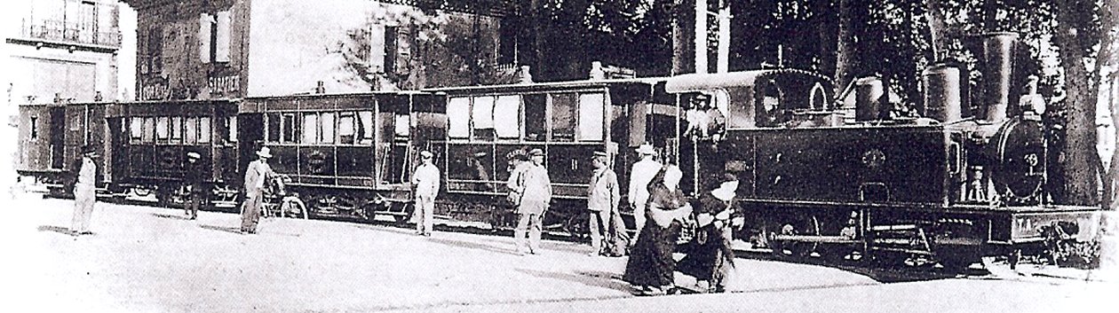
 The Tramways de l’Aude Station in Carcassonne. [1]
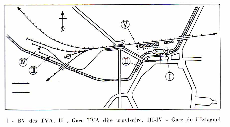
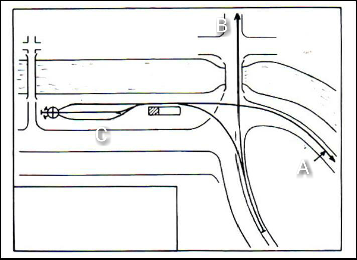 The facilities for the tramway in Carcassonne were significant. In the sketch plan immediately above we have the detail of the station facilities at ‘C’. The two routes which lead off the plan are: ‘A’, the tramway which runs to the South side of the Canal basin close to the Gare du Midi and then on through the Carcassonne suburbs to the rest of the network; ‘B’ the line feeding the Gare de l’Estagnol, which is marked ‘III’ and ‘IV’ in the plan above. [2]
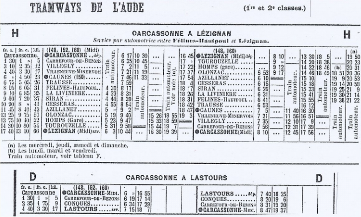 The tramway route to Lezignan is sketched out above and the 1927 timetable is shown immediately above. [1]
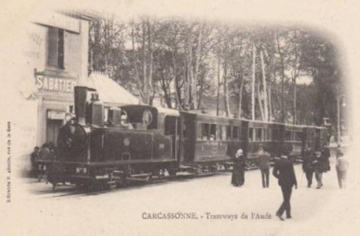
 Two further images of the Station in Carcassonne. The lower of these sows the train immediately across the Canal basin from the La Gare du Midi. [2]
Trains left Carcassonne Station and followed the South/East side of the Canal du Midi out of the city. The route out of the city is covered in the previous blog in this series:
https://rogerfarnworth.com/2018/09/11/tramways-de-laude-lastours-to-carcassonne.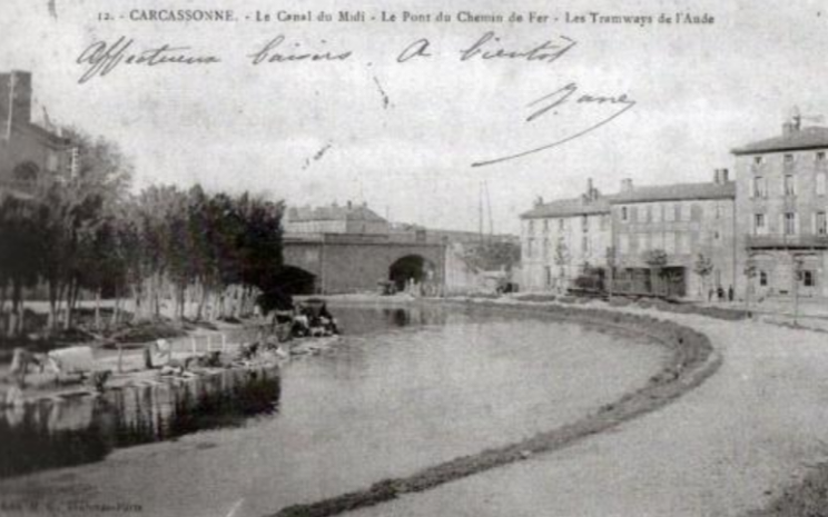 The first significant structure encountered was the Compagnie du Midi mainline’s bridge over the Canal which also spanned the tramway and road. In this image a short passenger train can be seen leaving Carcassonne Station and following the curve of the canal basin. [2]
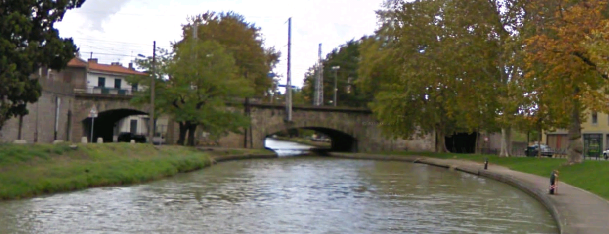 A similar picture from 21st Century.
The tramway followed the Canal bank through Saint-Jean before bridging the canal and passing through Pont Rouge.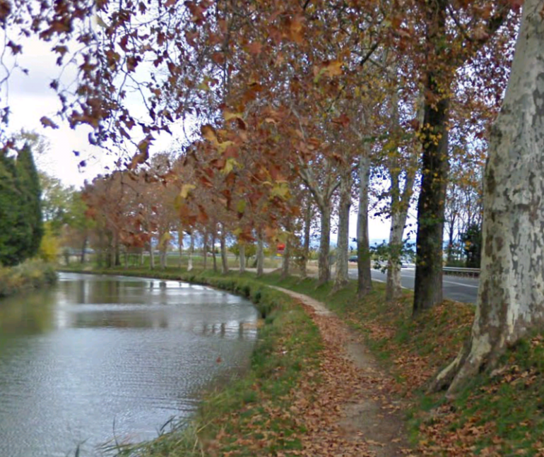 The Canal at Saint-Jean in 21st Century. The picture is taken from the Canal towpath to the south of the lock at Saint-Jean. The tramway ran to the right of the trees flanking the Canal.
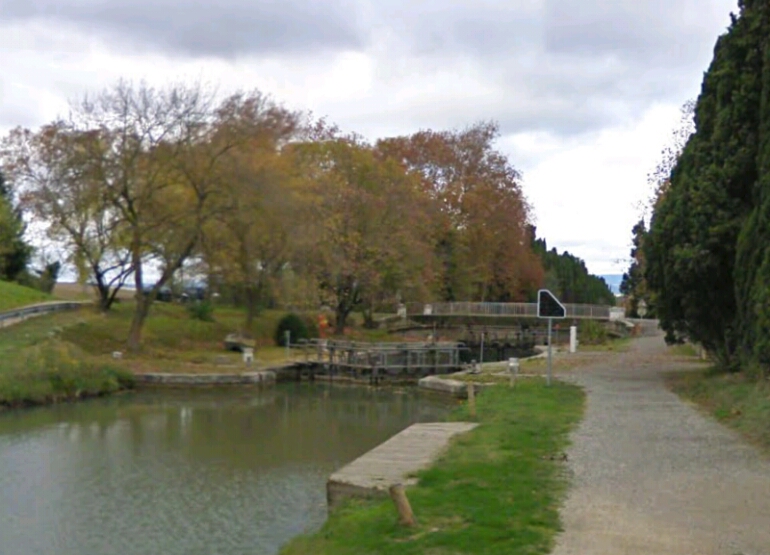 The Canal du Midi lock at Saint-Jean. The tramway approached the lock behind the trees on the right of the image and then swung sharply over the bridge which is visible beyond the lock, before turning North once again to follow the West bank of the canal.
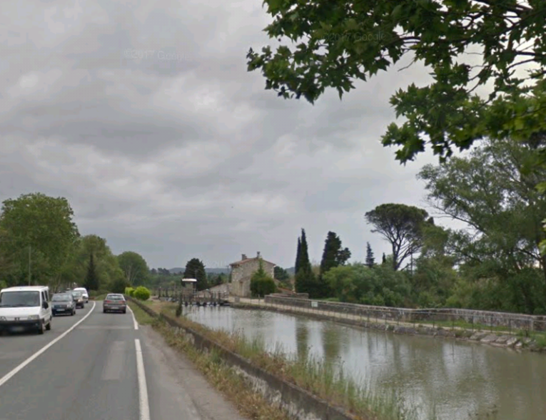 The view Northeast from Pont Rouge. The River Fresquel flows below the Canal and road just this side of the locks in the distance. The tramway ran on the left side of the Canal.
 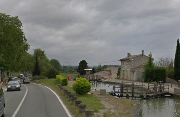 The locks at Fresquel (Les ecluses de Fresquel). The tramway ran along the lefthand side of the Canal.
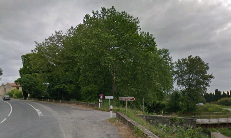 The tramway continued alongside the Canal to Carrefour de Bezons.
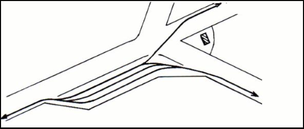
 Carrefour de Bezons is a junction station. One line follows the valley of the Orbiel to Lastours. The other followed a wide arc through the French countryside to Lezignan. This route is the lower of the two branches in the sketch plan above.
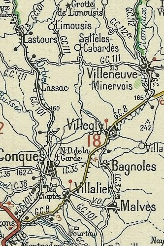
The tramway first followed the GC8 through Villalier and Villegly and then the GC112 to Villeneuve-Minervois. There is very little evidence of the existence of the tramway along the way.
Villalier is a village with a population of less than 1,000 people. Its population reached a peak of 923 in 1990. [3] It dates back to the 9th century, when it was a castle surrounded by ditches belonging to the counts of Carcassonne, with a small group of houses clustered around the castle. The lands and lordship of Villalier were given, in 1217, by Simon de Montfort to the bishops of Carcassonne who owned them until 1790. [1] Just before entering the village of Villalier the GC8 and the tramway crossed the River Orbiel. [7]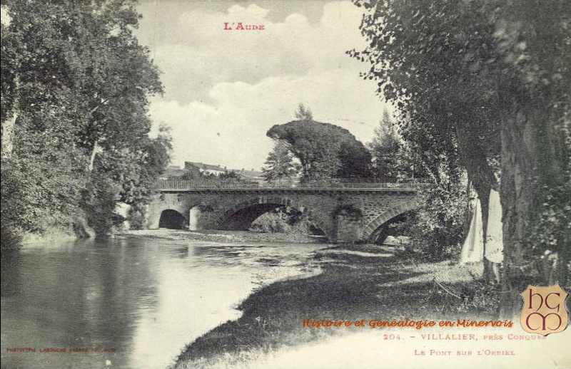 The tramway ran through the centre of the village, past the school in the images below.
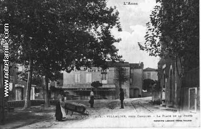
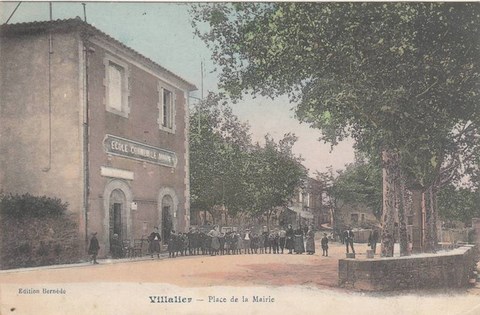 The tramway ran across the front of the school which appears in the image immediately above. The first of the two images shows the tramway, the second is an earlier image of the location from a different angle.
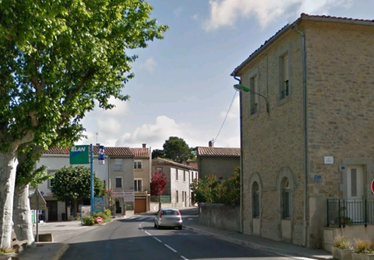 The same location in the 21st Century.
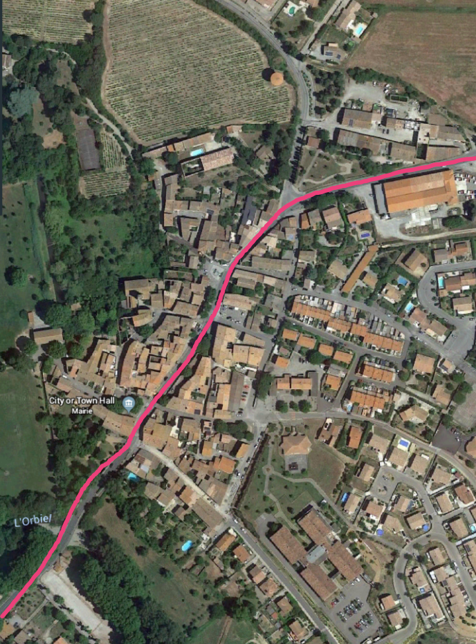 The tramway ran from the bridge over L’Orbiel through the centre of the village of Villalier. The square to the Northeast side of the village is the location of the school in the images above.
The next village along the route was Villegly. The tramway followed the GC8 from Villalier to Villegly. It was an uneventful journey apart from a small halt for Bagnoles. The village was a short distance to the East of the GC8 at the junction of the IC35 and the IC37. Bagnoles Halt was at the junction of the GC8 (today’s D620) and the IC35 (today’s D35).
Bagnoles is located in a pleasant valley on the left bank of the Clamoux in the middle of vineyards, gardens and meadows. In ancient times it belonged to the Abbey of Lagrasse and later to the monastery of Caunes until the Revolution. It has a Gothic church with a very high square bell tower. [1] The station at Villegly was as shown in the two images below. [9]
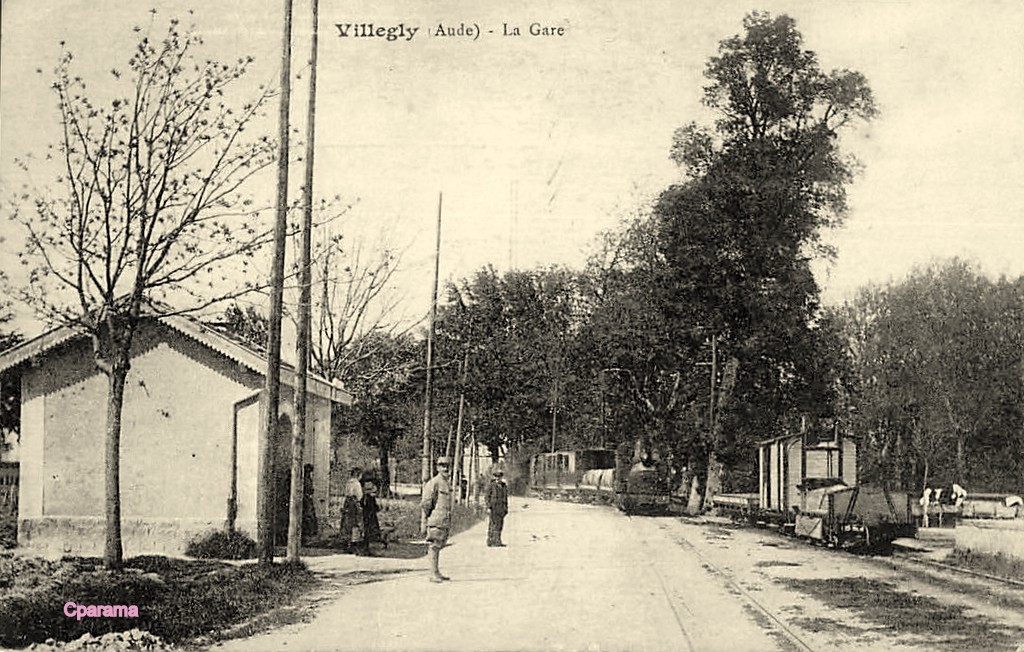
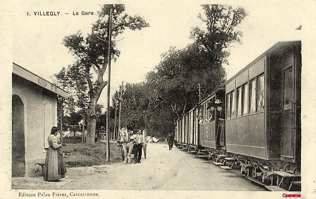
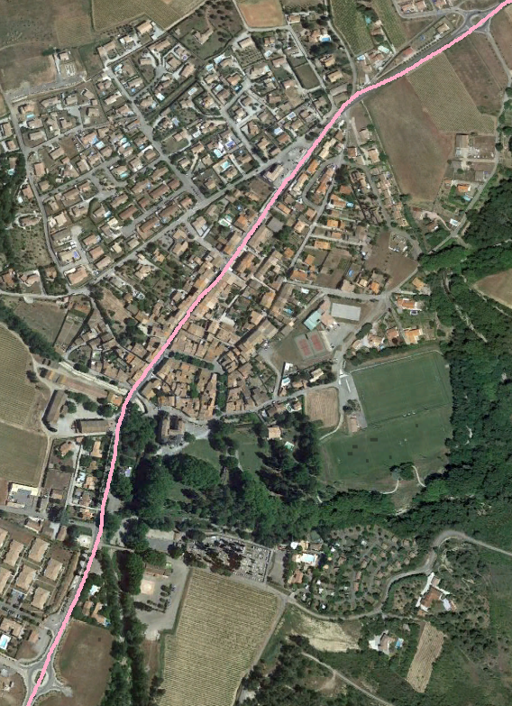 The approximate alignment of the tramway through Villegly is marked in light pink. The station was at the South side of the village. The station building remains and is just about identifiable on the satellite image North of the roundabout at the bottom of the image. It is to the left of centre in the image below. While the station building was to the West side of the road, the postcard images above show that the tramway followed the eastern shoulder.
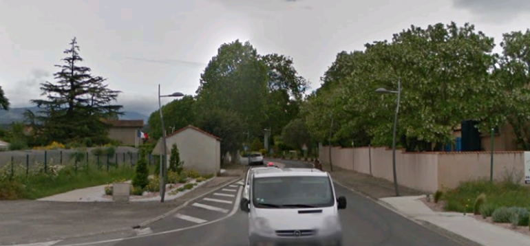 Villegly is a pretty village with its beautiful renovated church. At the time of Viscount de Minerve in the 13th century, Villegly Castle was a significant structure. it had a stone tower surrounded by an enclosure of high stone walls.
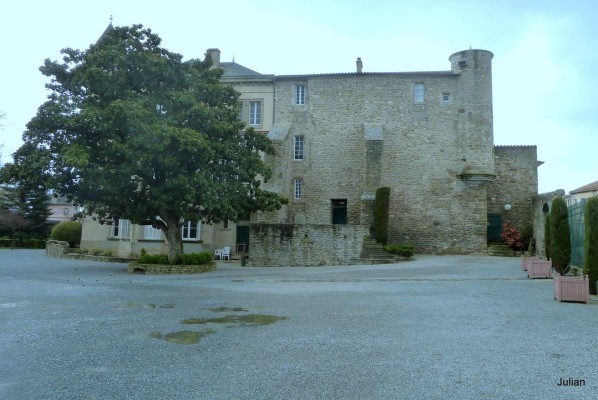 The chateau at Villegly. [10]
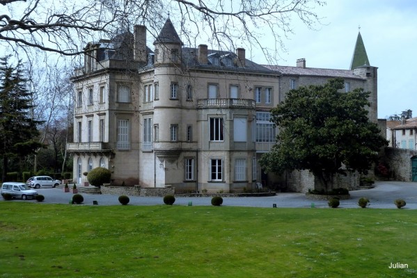 The chateau at Villegly. [10]
The tramway continued through the village of Villegly and on towards Villeneuve-Minervois on the Southeast shoulder of the GC8 (D620) until it met the GC112 (D112). On the way it can crossed the River Clamoux.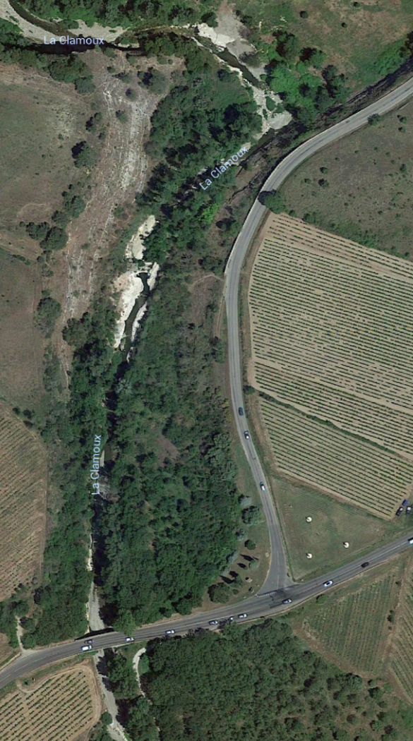 The D112 leaves the D620 just to the East of the bridge over the River Clamoux. The tramway took the curve and headed North along the shoulder of the GC112 (D112).
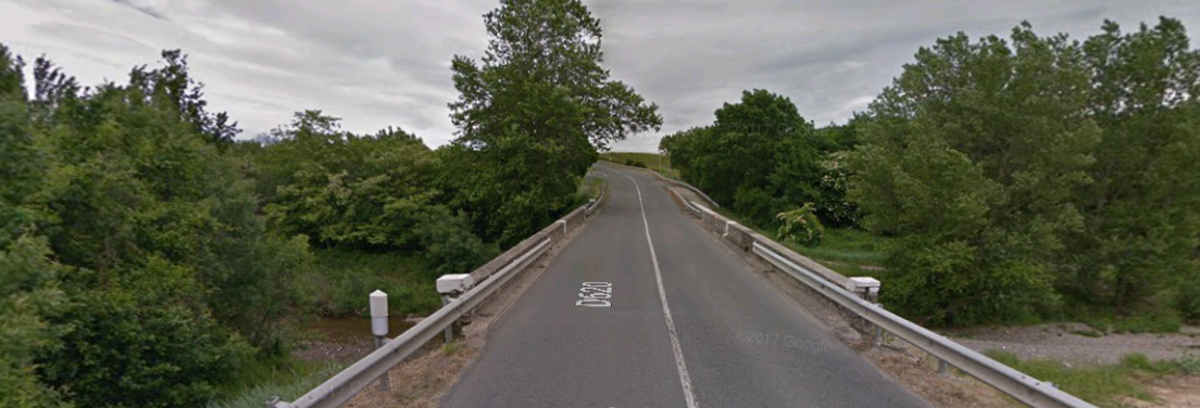 The bridge over La Clamoux with the junction with the D112 just beyond.
The tramway followed the eastern shoulder of the GC112 (D112) to Villeneuve-Minervois. The tramway/road followed the valley of La Clamoux into Villeneuve-Minervois.
Villeneuve-Minervois is located in the valley of the Clamoux, at the foot of the Montagne Noire. The town dates back to the 9th century. [1] Its castle was probably built under the influence of Isarn of Aragon (canon and archdeacon), between 1195 and 1236. The ancient castle is now a private residence, it is still an imposing building. [11][12]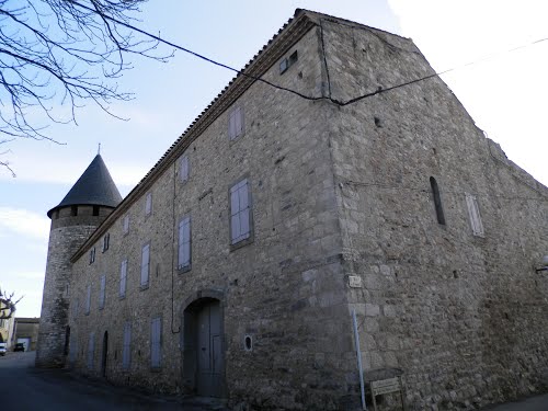
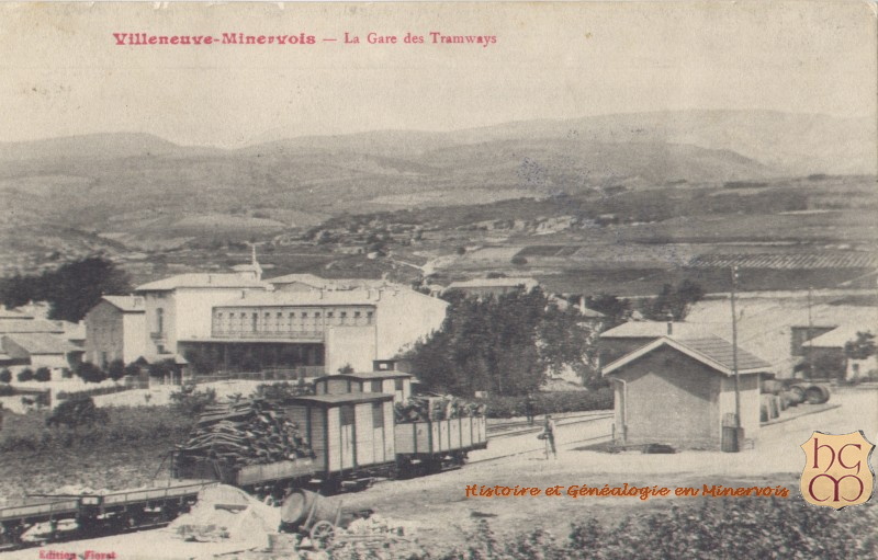
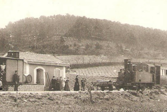
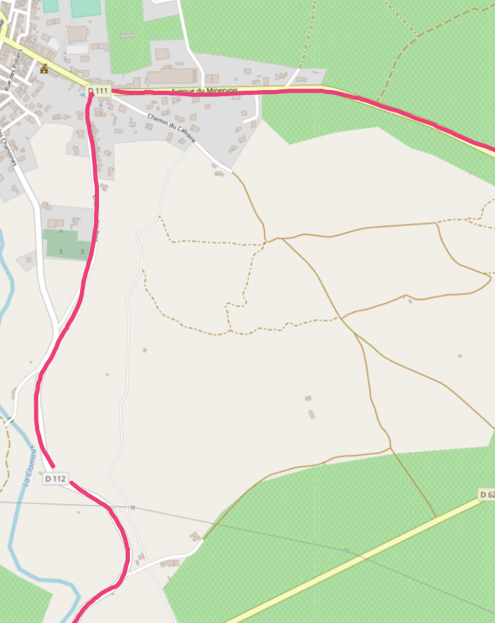 The tramway left the GC112 (D112) on the South side of Villeneuve-Minervois and followed the route of the Chemin des Pins which ran between the GC112 and the GC111 (D111) on the East side of the village. The station was on what is now the Chemin des Pins although there is nothing left to show for it. The pictures below show the station in use. [7]
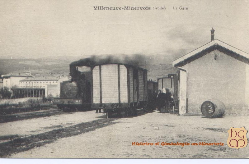
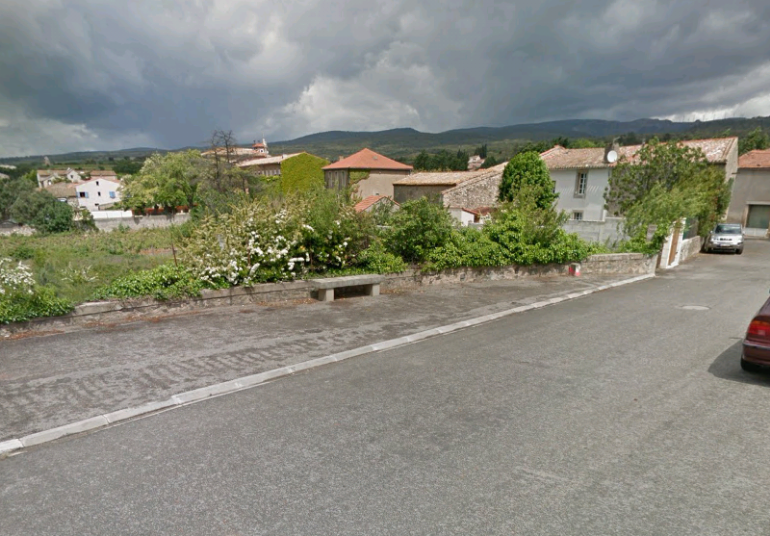 The best modern image that I can find is this provided by Google Streetview. The image uses a much wider angle lens than the ones used for the postcard images of the station.
At the junction between Chemin des Pins and the Avenue du Minervois, the tramway turned East along what was then the GC111 and ran passed the village’s wine co-operative, before heading out of the village. The tramway followed the GC111 (D111) east from Villeneuve-Minervois to its junction with the GC8 (D620). The road junction still bears the evidence of the tramway curve from the D111 to D620 and the route crossed the Ruisseau de Naval.
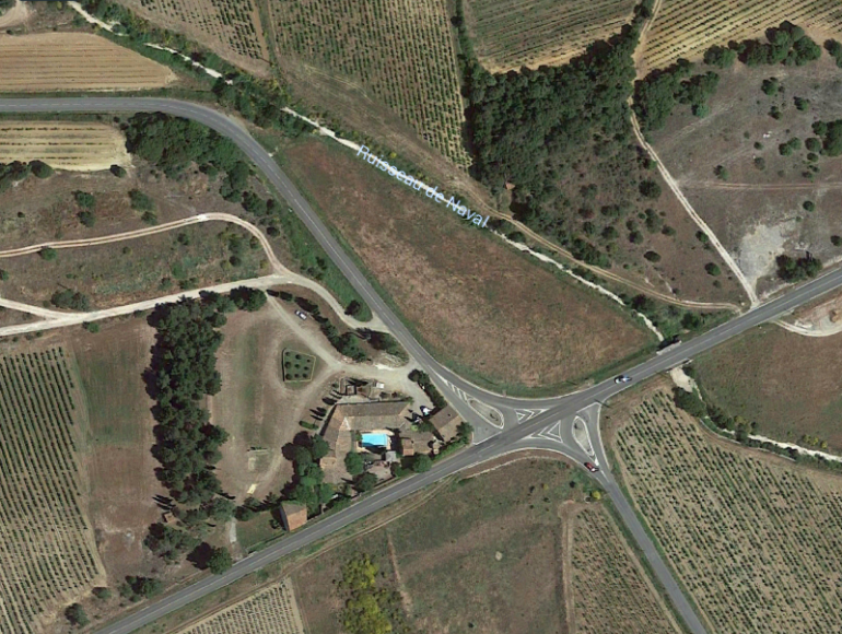 The journey across to Caunes Minervois was relatively uneventful. The roads and the tramway travelled in straight lines with short curves until they entered Caunes.
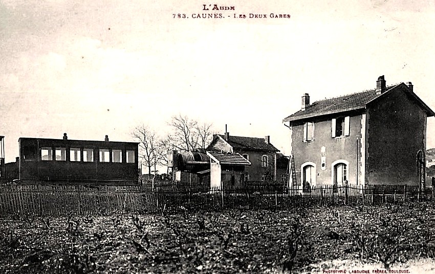
Caunes-Minervois is a small medieval town. It is known particularly for its ancient Abbey, dating from the eighth century, and for its outstanding red marble that has been quarried locally from Roman times. It was a town with two railway stations. The metre-gauge line from Carcassone to Lezignan was met by a standard gauge branch line from Moez which was the responsibility of the Compagnie du Midi.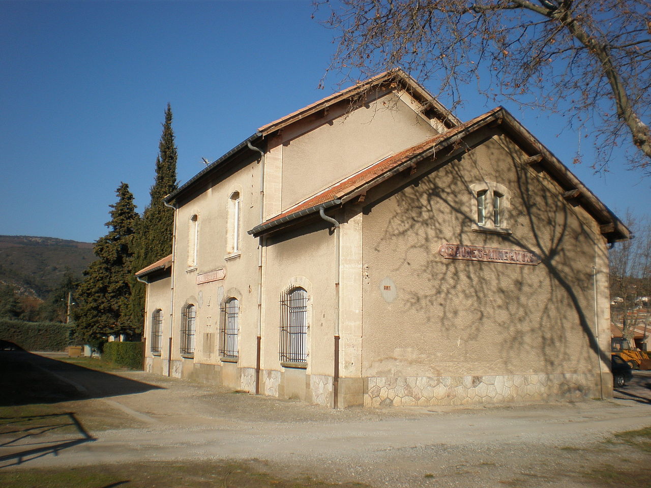 The Compagnie du Midi station building in the 21st Century. [13]
These next two images indicate the relative positions of the two stations. That on the right in each image is the terminus of the standard gauge branch. That on the left is the tramway station on the through route from Carcassonne to Lezignan. [14][1]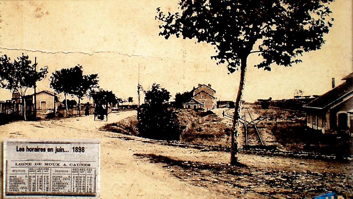
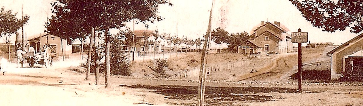
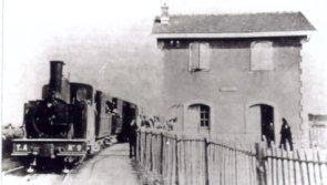 The tramway station at Caunes-Minervois. [15][1]
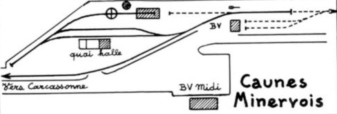
We finish this leg of our journey here in Caunes-Minervois. We note that this is what the tramway itself did until 1910! The arrangement of the tracks at the terminus is shown on the final plan in this post. The solid lines show the track arrangement at the terminus station, the dotted lines show the additional tracks when the line was extended beyond Caunes- Minervois. [16]
References
- http://cahiers.de.minerve.pagesperso-orange.fr/HTML/cdf_lezignancarcassonne.html, accessed on 10th September 2018.
- http://www.cpaaude.fr/THEMES/TRAMWAYS/index_fichiers/Page2097.htm accessed on 11th September 2018.
- https://en.m.wikipedia.org/wiki/Villalier, accessed on 14th September 2018.
- http://www.villalier.fr, accessed on 15th September 2018.
- https://collection-jfm.fr/p/cpa-france-11-villalier-pont-sur-l-orbiel-158260, accessed on 16th September 2018
- https://www.cartes-et-patrimoine.com/aude-villalier-c-65_129_4086.html, accessed on 16th September 2018.
- https://www.minervois-gen.org, accessed on 17th September 2018.
- http://boutique.genealogie.com/carte-postale/carte-postale-La-Place-de-la-Poste-11600-villalier-11-aude-199282-74506-detail.html, accessed on 17th September 2018.
- https://www.cparama.com/forum/villegly-t29082.html, accessed on 17th September 2018.
- http://maynys.over-blog.com/article-villegly-le-chateau-121550664.html, accessed on 18th September 2018.
- http://www.villeneuve-minervois.com/english/tourisme-patrimoine-monuments.asp, accessed on 18th September 2018.
- http://www.map-france.com/Villeneuve-Minervois-11160/photos-Villeneuve-Minervois.html, accessed on 18th September 2018.
- https://fr.m.wikipedia.org/wiki/Fichier:Caunes_La_Gare.jpg, accessed on 18th September 2018.
- https://fr.wikipedia.org/wiki/Fichier:Caunes_la_Gare_(photo_ancienne).jpg, accessed on 18th September 2018.
- http://www.en-noir-et-blanc.com/search.php?mots=car&page=123&nb_results2show=20&booleen=AND&nb_sites_trouves=8769, accessed on 18th September 2018.
- Michel Vieux; Tramways a Vapeur de l’Aude; R. Latour Editions 14 rue Sébile 09300 Lavelanet, 2011.

.jpg)
I find this particularly fascinating as I lived near here 2003-2008. I worked on the Canal du Midi and you may find this of interest: https://www.moet-chandon.co.uk/pages/canal-du-midi.php
I wrote this for a friends website and it covers the Fresquel locks. Cheers Mike Ricketts
Thank you. That is a fascinating read.
Best wishes
Roger
Merci bien pour cette description illustrée du Tramway!
Chanced upon these articles after visiting Lastours and coming across the old station. Thought you might be interested to hear that the steam tram has been commemorated in our village of Villegly by a mural painted on the side of the old tram station, now a rather over-sized cashpoint. It’s based on one of the postcards you included in your article. People have even been able to name two of the people in the picture: Marie Fabre and Jeannot Bonnafous. There’s a mention in the local bulletin (Edition No. 30) and a nice picture too. I’m not an expert on trains or trams but your articles are incredibly well-researched and gave a fascinating glimpse of local history.
Thank you, Mark.