Monthly Archives: May 2018

Goods Services on the Network of the Tramways of Nice and the Littoral (Chemins de Fer de Provence 60)

I was very fortunate indeed. … For my birthday in 2018, my wife bought me two books about the tramways of Nice. Both of these books are written in French by Jose Banuado and published by Les Editions du Cabri. [1]

I am enjoying reading the first of the two volumes at the moment which covers the history of the tramways in Nice. I have had some conversations of a number of forums about the TNL which ran the tramways along the coast and in the city of Nice as well as a number of lines which travelled up into the hilly countryside behind the coast.

One particular area of discussion has been a practice which seems unique to Nice among other major cities in France and possibly much wider afield. The TNL ran not only passenger services but good services as well.

Sadly the story of these activities is apparently currently only available in Jose Banuado’s books which are written in French.

I have used Google Translate to translate the pages of Jose Banuado’s book which relate to the goods traffic on the TNL network. [2]

By 1903, the TNL was at responsible for a 94.3 kilometre network of over 90 kilometres, of which 29km were the urban lines in Nice. The network was operated with 106 powered trams, 32 trailers, 3 tractors (shunting locos) and 22 wagons for the transport of goods.

The increase in traffic required improvements to the rolling stock. “On the urban lines, the original powered vehicles saw extended platforms, and trailers were added on the most loaded services. … New powered vehicles were ordered for the coastal lines: forty vehicles which were more powerful and comfortable were delivered in two batches between 1904 and 1909. They were equipped with air-brakes and coupled permanently into pairs.

Banuado continues: “The transport of goods took off remarkably. This distinguishes the TNL network from its counterparts in most other major French cities. In addition to postal and retail freight traffic on the coast, the Contes cement plant provided substantial tonnages with coal deliveries for its kilns and lime shipments and cement in sacks. But to ensure the best trade, it was necessary to link trams to the other major transport infrastructure of the city of Nice: the commercial port, the PLM station and the Chemin de Fer du Sud.”

As the PLM had done nothing to connect to the Port, Nice made use of trams to make the connection between the PLM station and the Chemins de Fer du Sud station and the port. An agreement was signed on 7th February 1905,  which provided for some minor alterations to the tram network, “the construction of an exchange platform in the sidings of the Chemin de Fer du Sud Station and the electrification of the tracks. This meant that the TNL locomotives could access these sidings. At the other end of the city, the Chamber of Commerce, … took charge of laying tracks on the docks.”

The TNL assigned shunters/power cars and a hundred wagons to the traffic, while the Chemin de Fer du Sud de la France ordered two hundred wagons able to run on the tracks of the trams to the port of Nice and the operation commenced in 1907 after all legal issues had been discussed and agreed.

Banaudo says: The connection to the port of Nice enabled the transport of large volumes of goods, the majority of which concerned the industries alongside the line to Contes (the Contes cement factory, L’Ariane flour mill and the Nice-Riquier gasworks), as well as exchanges with the Chemin de Fer du Sud de la France Station.” The latter provided a route to the PLM. Although the PLM had always refused a direct connection with the trams, it was connected with the Chemin de Fer du Sud Station from 1899 onwards via a short branch-line which linked the two stations, set into the road pavement of the Rue de Falicon (today, the Rue des Combattants en Afrique du Nord). So, ultimately, it became possible to transship goods from a wagon of standard-gauge to a vehicle of the TNL and vice versa.

References

  1. Nice au fil du Tram Volume 1 and 2, Jose Banuado; Les Editions du Cabri.
  2. Nice au fil du Tram Volume 1; p50-52.

The Uganda Railway – Part 14 – Eldoret to Malaba

Back at Eldoret Railway Station, we get ready to travel on. First some bits and pieces about the town we are about to leave [1] …. Eldoret as a town, founded as it was by Afrikaners is almost unique in the British-dominated Kenya of the early 20th century. The first of the Afrikaners, the Van Breda brothers arrived in 1903 and were joined two years later by Franz Arnoldi and his family. The big influx followed shortly thereafter.[2]

In August 1908, fifty-eight families of displaced Afrikaners left Nakuru for the Uasin Gishu plateau after a journey from South Africa by sea and by rail from Mombasa. Led by Jan van Rensburg, they endured an arduous trek laden as they were with wagons that would often get bogged in mud, finally arriving at Sergoit Hill on 22 October of that year. Jan Ernest Kruger would later own the 5,000 Sergio farm, now owned by Sergoit Golf and Wildlife resort.

The land had earlier been surveyed by a the van Breda families and the new arrivals took up leaseholds of between 800 and 5,000 acres (320 and 2,020 ha) on condition that they would develop it within five years. Each family built a shack, put up fences, in-spanned oxen to simple ploughs and turned the first furrows. They sowed wheat, maize and vegetables laying the foundation for the transformation of the Plateau into a prosperous agricultural region.

The farms were later officially registered and each was given a number.[3]

Eldoret’s official town site started in 1910 with the development of a Post Office at “Sisibo”. This was followed shortly after by the arrival of sixty more Afrikaner families in 1911.[4] The governor decided to establish an administrative centre in the area 1912 and thus the Post Office was renamed to a new official town name: “Eldoret” . Becoming an administrative centre caused an enormous increase in trade within the prospective city. A bank and several shops were built.

In the 1950s the town was literally divided into two, along the main street (now Uganda Road), with the Afrikaans on the north and the British on the south. The former took their children to Highland School, (now Moi Girls High School)[5] and the latter, to Hill School.[6] Recreation was also along the divide – ‘Brits’ used the Lincoln Hotel and the Race-Course near the now “Chinese Area” while the Afrikaans converged at the Wagon Wheel for recreation.

Daniel Arap Moi was born nearby and developed the town establishing a second kenyan university, Moi University, and a third international airport. By 1987, only two Afrikaner households remained in Eldoret, with the rest having moved back to South Africa in the late 1950s and early 1960s, in the aftermath of the Mau Mau rebellion[7] and in anticipation of independence.

The city was significantly impacted by the 2007–2008 Kenyan crisis when violence gripped Kenya in the aftermath of controversial presidential elections. The athlete Lucas Sang was murdered about ten kilometres away from the town while on his way home to Chepkoilel. On 1st January 2008 a mob attacked and set fire to a church in the town, where hundreds of people had taken refuge during Kenyan massacres. As a result, about forty to eighty people,[8] mostly Kikuyus, were burnt to death.

Eldoret has been manly peaceful since the 2007-2008 Crisis.

In an earlier post, we showed a picture of the royal train circumnavigating a spiral close to Equator Station on the Nakuru to Eldoret line. This is that Royal train just after it had arrived in Eldoret in 1958. [9]

A recent video filmed at Eldoret Railway Station. [11]

Another video filed close to Eldoret Railway Station. [12]

West of Eldoret trains for Kitale and those for Kampala shared the same railway tracks. Just before the branch-line to Kitale separated from the mainline trains passed through Leseru Station. The station site and the branch-line can clearly be seen in the satellite image below. Leseru Station was some distance east of Leseru village (3 to 4 kilometres) and was probably sited to allow the Kitale branch trains to serve Leseru.Beyond Lesuru, trains passed through Turbo, Kipkarren, Lugari, Webuye, Mulukbu, Bungoma,  Mateka, Myanga and Kimaeti before reaching the border with Uganda at Malaba. This post will take us to the border with Uganda.

En-rote to Turbo the line at first followed the A104 but then looped away to the south only coming back close to the road at the river bridge just to the east of Turbo. The location of the station is marked on the map with a blue square.Diesel in charge of a train somewhere to the west of Eldoret?

The next station was at Kipkarren. To reach the station the railway followed the contours, which predominantly meant following the river valley, whilst the A104 road took a more direct route.Kipkarren Station was close to the Eldoret-Malaba road but perpendicular to it and with the passing loop carried over the A104 on a bridge.

The railway continued to follow the Nazoia River valley, albeit at a higher level than the water course, in a generally north-westerly direction to Lugari. The Market at Lugari is visible at the top of the following satellite image, as is the road/rail crossing at the top right of the image and the river bridge, centre-left.

The next station is Webuye, which is to the south-west of Lugari, both villages can be seen on the map below. and are linked both by the railway and the River Nazoia. The stations are marked by blue squares.Webuye Railway Station.The railway passes under the A104 to the immediate west of Webuye.

Travelling further west, the railway passes close to Webuye Airport and sankes around seeking the most advantageous route on the south-side of the A104, through Mulukbu (Sudi) and on to Bungoma.Mulukbu (Sudi) Railway Station.

Bungoma Railway Station is shown on the adjacent map. The images below are both taken from the South looking back north along the line. The first shows the station platform on the left and the Silos on the right.

The second shows the railway line south of the station and the silos can just be seen at the back right of the image.

The railway west of Bungoma.

The station is shown in plan in the adjacent Satellite image.

Trains for Uganda depart southwards from the station. The railway then turns west and north circling round the south side of the town, before breaking way to the south-west. The map below shows Mateka in the bottom left. I have not been able to pin-point the location of the Railway Station.After Mateka, the line travelled on to the West to Myanga, where it crossed the Sio River and turned north for a short distance running along the East side of the C34, Musokoto-Khwirale road and then heading in a westerly direction once again to Malaba.Myanga Railway Station is marked with a red flag. The bridge over the Sio River is towards the left of the satellite image.

Malaba straddles the border between Kenya and Uganda. I can remember queuing here in 1994 for an hour or so after having been shepherded off the train at 3.00am, before it became clear that the border officials and customs officers on the Uganda side of the border would not be meeting the train and that we would need to go to the customs office in Kampala when the train arrived so as to get passports stamped with an entry visa.

Once the border is crossed there is only a short journey on the train into Tororo. We will pick up the journey again at the border in the next post.

References

  1. https://en.wikipedia.org/wiki/Eldoret, accessed on 27th May 2018.
  2. https://afrikanerway.wordpress.com/2013/07/15/eldoret-a-boer-settlement, accessed on 28th May 2018.
  3. Ronaldo Retief; . Afrikaners trek to East Africa, Old Africa: Stories from East Africa’s Past; Issue 55, 2014, p14-15.
  4. Red strangers: the white tribe of Kenya, ISBN 1-85725-206-3, by Christine Stephanie Nicholls.
  5. http://moigirlseldoret.ac.ke, accessed on 28th May 2018.
  6. http://www.mccrow.org.uk/EastAfrica/Hill_School_now/Hill%20School%20Eldoret%20Kenya.htm, accessed on 28th May 2018.
  7. Remnants of Boer Colony Glad They Stayed in Kenya. 1 April 1987,  http://www.philly.com/philly/archives, accessed on 16th September 2013.
  8. Steve Bloomfield; 80 Children Massacred in Kenyan Church; https://www.independent.co.uk/news/world/africa/80-children-massacred-in-kenyan-church-767602.html, accessed on 28th May 2018.
  9. https://www.pinterest.com/pin/559361216211036993, accessed on 28th May 2018.
  10. Not used.
  11. https://youtu.be/EgkZJncP_Dc, accessed on 7th June 2021.
  12. https://youtu.be/hutty3aL7Y8, accessed on 7th June 2021.

The Uganda Railway – Part 13 – Eldoret to Kitale (A Branch Line)

We begin the next stage of our journey in Eldoret Station. The first picture shows Charan Singh Kundi aboard his train (Class 58 Garratt No. 5817) bound for Kampala from Eldoret. [1]Shunting Eldoret Yard. [2]

Rather than taking the main line towards Kampala, we are first going to take the branch-line to Kitale. Some 20 kilometres to the West of Eldoret the branch to Kitale diverges north from the main line. It’s route is shown on Open Street Map as a dotted line as can be seen below. [7] Its route can be just as easily picked out on the Google Earth satellite image as well.En-route to Kitale the railway passed through 3 stations … Soy, Springfield Halt and Moi’s Bridge. for much of its route it is followed by an unnamed and unnumbered secondary road. Soy Railway Station was perhaps 3 kilometres from the village with which it shared its name.

The satellite image is the best we can do to show the station, which appears to have a passing loop and some simple buildings but nothing more. From Soy the branch-line ran some 8 kilometres in a northerly direction before swinging round to the west.

It joined the line of the B2 road and swung north-west and then north once again. As the railway approached Moi’s Bridge it swung sharply through 180 degrees and then back again to the north. I have carefully checked the line of the railway and the B2 road but cannot find any evidence of Springfield Halt. Perhaps someone wiser than me can say where it is (or was).

Over some significant distance the railway has followed a relative straight path alongside the B2. The need to snake around will have been dictated by the contours of the land. The map below shows the route taken.We are still some kilometres south of Moy’s Bridge, so it is possible that Springfield Halt is/was close to this settlement, although it is not visible on Google Earth. On its way to Moy’s bridge the railway now meanders around before entering Moi’s Bridge Railway Station travelling in a easterly direction. The blue dot on the map below gives the location of the railway station and the bridge over the River Nzoia can be found adjacent to the ‘B2 road-marker.In the satellite image above, Moi’s Bridge Station is in the bottom left and the bridge is just off the top of the picture. The satellite image below is the best overhead image of the bridge available.

However, I have been able to find a video from which I have obtained this photograph. It is not the most stunning shot of the bridge but it does help to understand it construction. It seems to be a three span simply-supported girder bridge with the largest span to the south-east and spanning the river.

After Moi’s Bridge the railway follows the B2 in a generally north-westerly direction until it reaches the suburbs of Kitale. In the centre of the town the railway finishes its journey adjacent to the C45 road – the Mumia Highway.

These next few pictures are taken on the approach to the branch terminus at Kitale. They can mainly be found on the Railway Ramblers website. [3] These pictures were taken in 2009. In 1983, Kitale station was still in use as a goods terminus but passenger services had long-gone. In 1983, a significant amount of the supplies, including food, for a major famine relief project in the Turkana district to the north of Kitale came in by rail and was forwarded by road. There was a Barclay 0-8-0 class 46 shunter stationed there and the regular branch engines were EE 1Bo-Bo1 of class 71 or 72. [4]A close-up of the permanent way, viewed about a kilometre south-east of Kitale station. As can be seen, there is no ballast, although the country’s operational lines are ballasted. This makes it possible that any ballast here has simply settled into the clay. The sleepers are made from neither wood nor concrete but metal, designed so as to grip the clay effectively and (presumably) prevent the whole structure from sinking into the ground when wet. A rail joint with fishplates can be seen in the foreground, while the keys holding the rail to the sleeper are of a fairly modern spring type, used in the UK during the mid 1970s. The tracks of bicycle tyres can be made out between the rails. The demand for Sustrans-style rail-to-trail conversions would be very limited in Kenya, since the locals just help themselves. The empty railway is a far more pleasant way of getting into Kitale than the noisy main road, where vehicles emit amounts of exhaust that would send British clean-air campaigners into a frenzy. The stench of diesel fumes on Kenya’s roads is not a pleasant experience, (c) Jeff Vinter. [3]A typical view along the trackbed, looking north west towards Kitale. The W signs, one facing each way, instruct the driver of oncoming trains to sound his whistle – not for the footpath crossing seen in the foreground, but for the level crossings in front of and behind the photographer, (c) Jeff Vinter. [3]The home starter signal for entering Kitale station yard. The signal is an unusual combination of British styles, using the lattice structure common on the LSWR but the lower quadrant board common on the GWR, (c) Jeff Vinter. [3]The level crossing seen in the background of the photograph above is still protected by this substantial sign, although its neighbour on the far side has begun to topple over (look for the white-painted ends of its arms). Signs like this abound all over the Kenyan railway system, on lines both open and closed. Unusually, this road is made of tarmac and is not full of potholes! (c) Jeff Vinter. [3]The points (turnouts) to Kitale goods yard. As can be seen, the point lever is still in place, as are all of its counterparts throughout this large yard, (c) Jeff Vinter. [3]The crane in the old goods yard survives. Presumably, it is still capable of working, since all the cables and pulleys remain in place – albeit somewhat rusty and in need of lubrication, (c) Jeff Vinter. [3]A view looking south eastwards along the departure platform of Kitale station. The massive building on the left is the extensive goods shed, The crane in the picture above can just be made out in the distance, silhouetted against the sky, (c) Jeff Vinter. [3]A picture of Kitale Station building taken in 1929. [5]Kitale station, viewed from the goods yard, was equipped with only a single platform, although it was very long. The station’s design is what one would expect of a colonial structure built in the early 20th century with its elegant arches and colonnades. The departure road is covered in grass but the rails can just be made out, while the rails in the foreground belong to the main running line within the goods yard. The small stone building behind the telegraph pole was the station master’s office, (c) Jeff Vinter. [3]The picture above was taken in 1930 at Kitale. It shows a small family waiting to take the train which will eventually lead to them returning to the United Kingdom. [6]The running-in board at Kitale station is set some way back from the platform at an angle to approaching trains, presumably so that drivers and passengers could see it better. It declares the station to be 1,895.86 metres above sea level. The original height would probably have been shown in feet, (c) Jeff Vinter. [3]The exit from the platform at Kitale station was suitably grand and still proclaims ‘Kitale Railway Station’, perhaps over 30 years after the last train ran. The door visible behind the colonnade on the right indicates that the railway’s livery was similar to the GWR’s famous ‘chocolate and cream’. After years of neglect, the platform surface is beginning to break up, but it is still in better condition than many of the country’s roads, (c) Jeff Vinter. [3]Kitale station, viewed from the street, has the same colonial styling as on the platform side. The building still, in part at least, serves a public transport purpose, since the banner hung from the guttering on the left advertises the booking office of Matunda Buses. Often, one of Matunda’s vehicles will be seen parked outside, (c) Jeff Vinter. [3]

We finish this post on the concourse outside Kitale Station and prepare to return to Eldoret for the onward journey to Kampala.

References

  1. http://www.sikh-heritage.co.uk/heritage/sikhhert%20EAfrica/sikhsEAfrica.htm, accessed on 27th May 2018.
  2. https://www.google.co.uk/search?q=eldoret+railway&client=tablet-android-lenovo&prmd=mniv&source=lnms&tbm=isch&sa=X&ved=0ahUKEwjXivnk3abbAhUIXMAKHfuPAl8Q_AUIEygD&biw=800&bih=1280#imgrc=4F4p_HGkxIV9gMHGkxIV9gM, accessed on 27th May 2018.
  3. http://www.railwayramblers.org.uk/photo/35photo.htm and http://www.railwayramblers.org.uk/photo/36photo.htm, accessed on 27th May 2018.
  4. Paul Taylor; http://www.railwayramblers.org.uk/photo/35photo.htm, accessed on 27th May 2018.
  5. https://www.theeagora.com/the-lunatic-express-a-photo-essay-on-the-uganda-railway, accessed on 21st May 2018.
  6. http://www.hilarymunro.com/?p=736, accessed on 28th May 2018.
  7. https://www.openstreetmap.org/#map=15/0.5927/35.1861, accessed on 28th May 2018.

The Uganda Railway – Part 12 – Nakuru to Eldoret

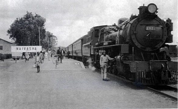
We return to Nakuru to pick up again on what is now the main line. In 1929 the Uganda Railway became Kenya and Uganda Railways and Harbours (KURH), which in 1931 completed a branch line to Mount Kenya and extended the main line from Nakuru to Kampala in Uganda.

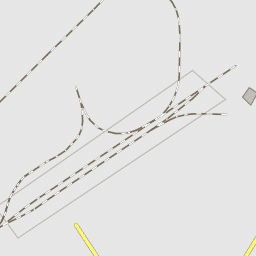
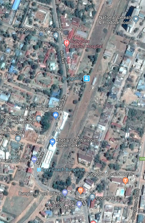
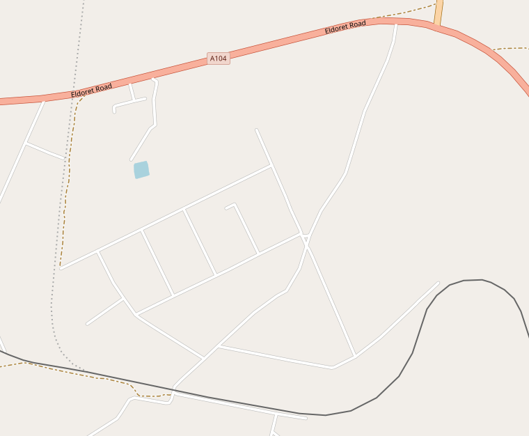
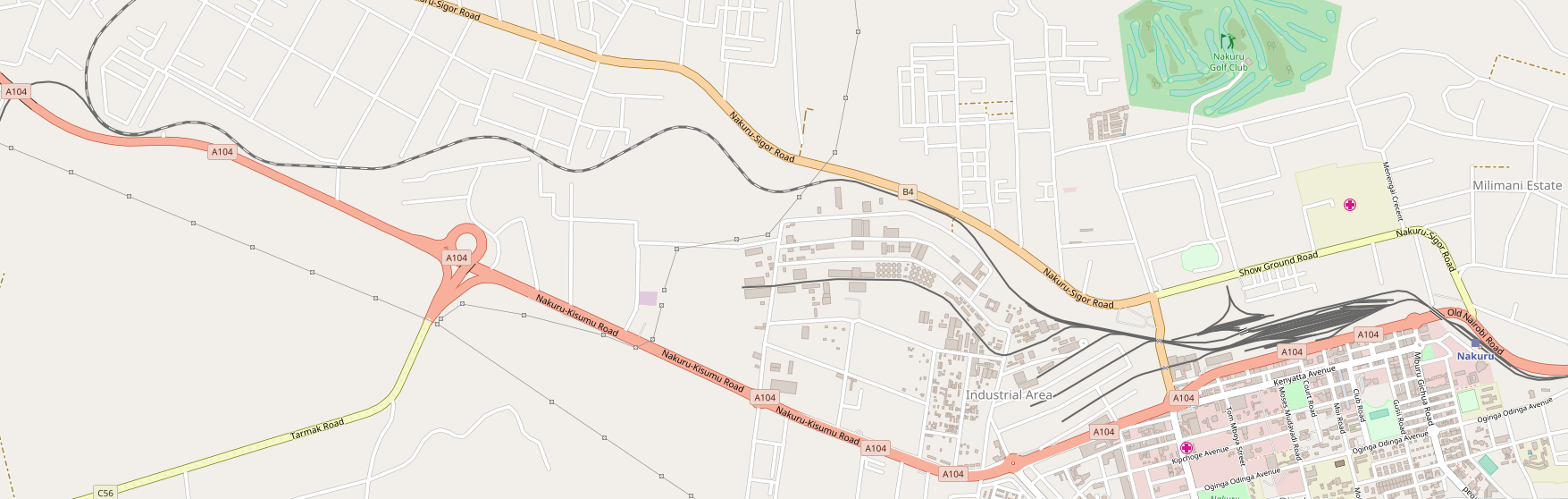
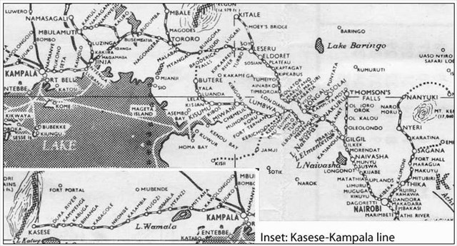
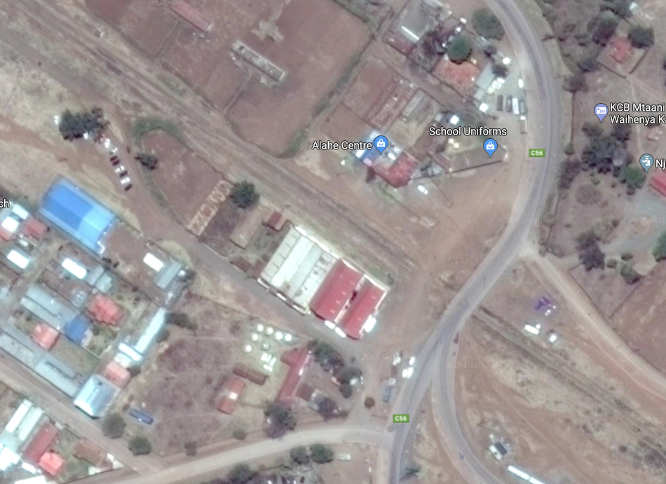
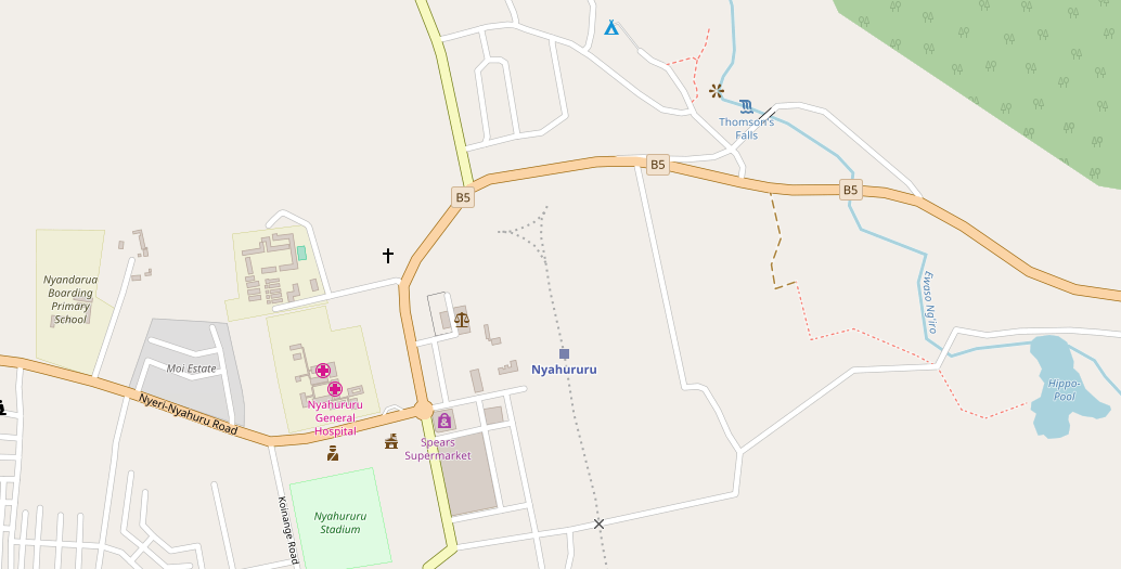
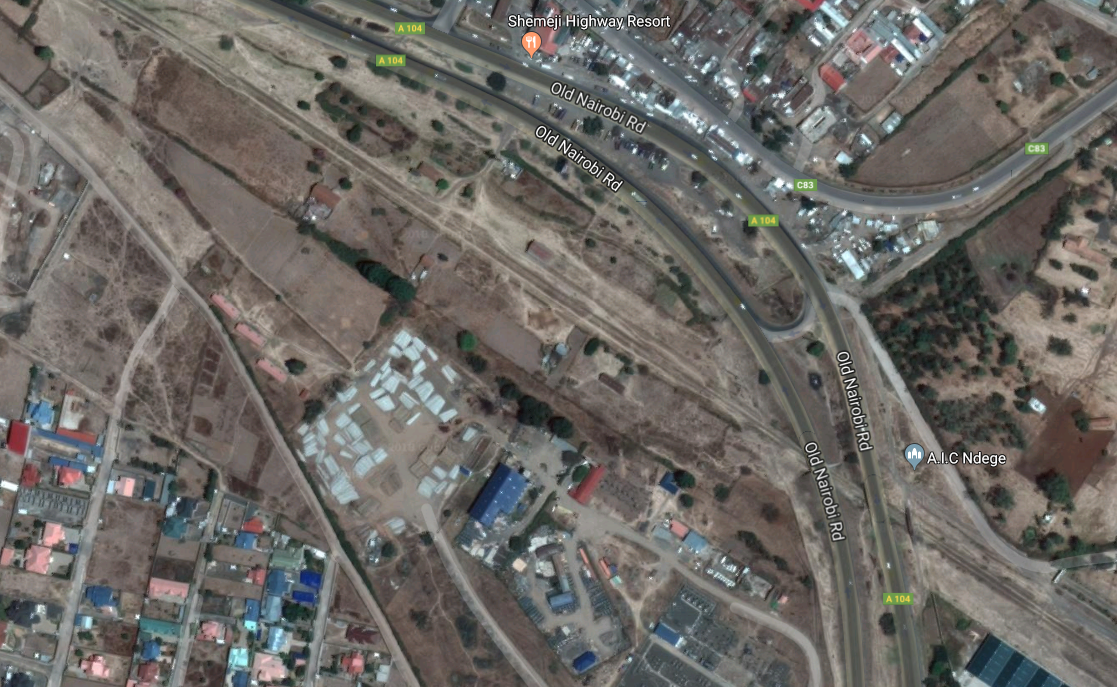
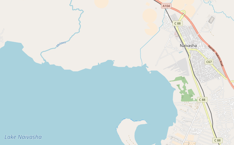
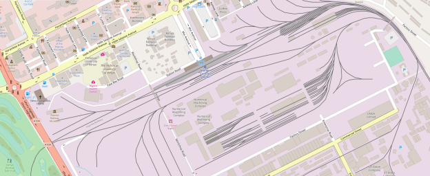
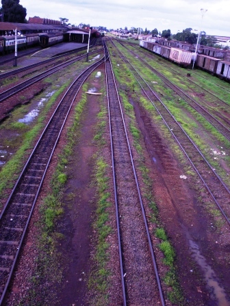
In 1948 KURH became part of the East African Railways Corporation, which added the line from Kampala to Kasese in western Uganda in 1956.[1] and extended to it to Arua near the border with Zaïre in 1964.[2]We start the next part of the journey at Nakuru Station. The map above shows the length of the line to the junction with the line to Kisumu. The MPD can be picked out adjacent to the triangle for turning locos. The passenger station is t the right of the map extract. The Goods Yard is the are to the right of the triangle.

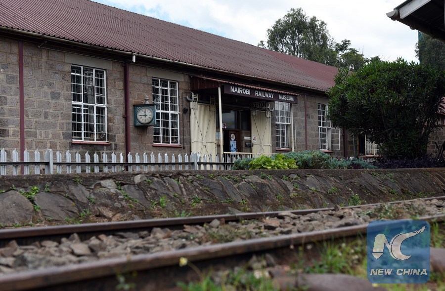
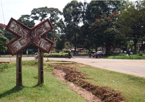
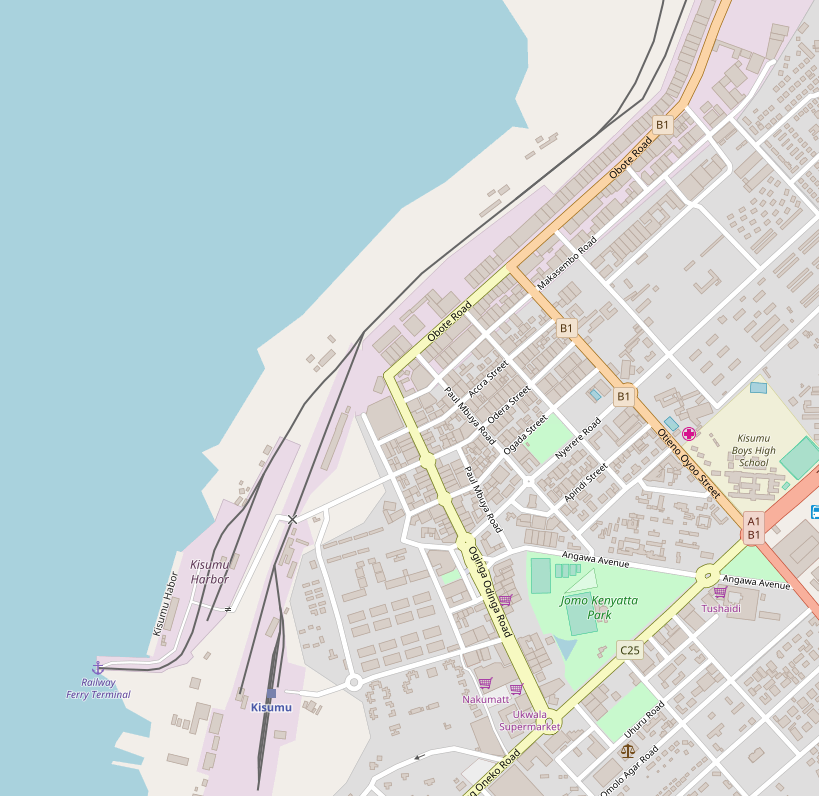
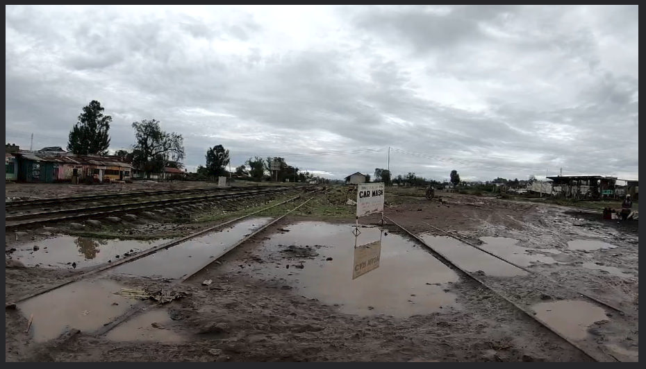
There is good coverage of the station on the earlier post about the line from Nakuru to Kisumu …..

https://wordpress.com/post/rogerfarnworth.com/8058

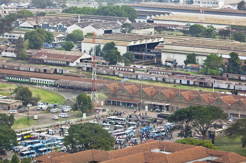
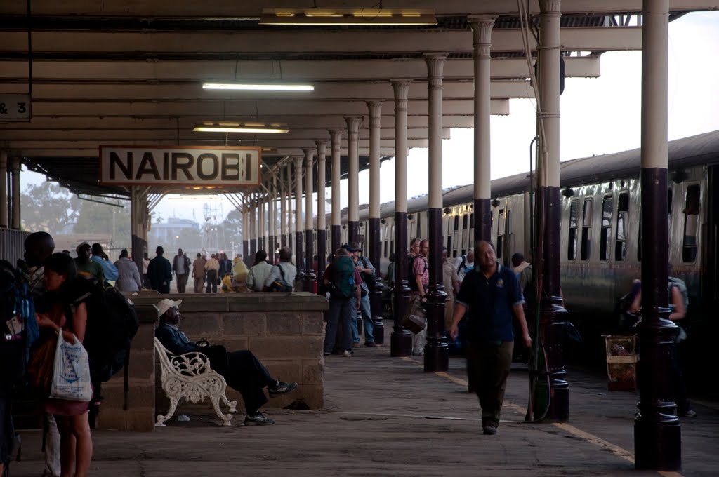
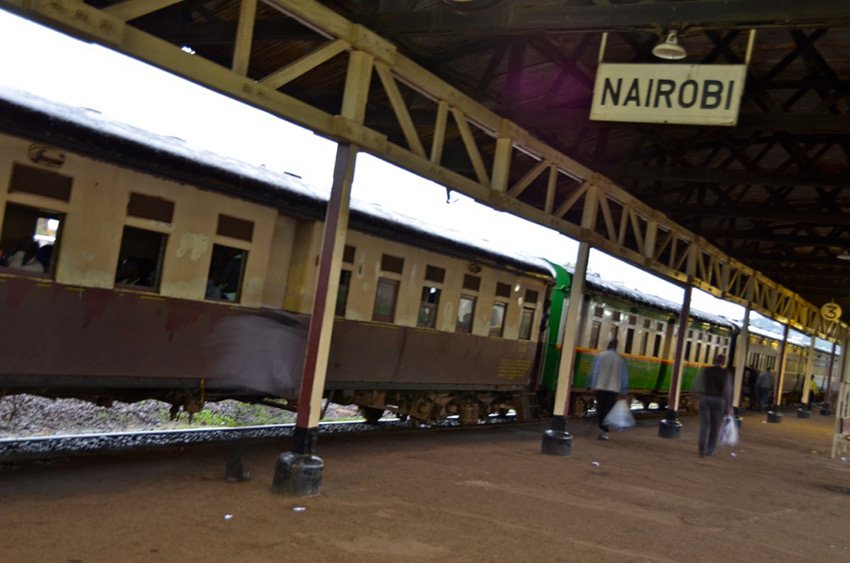
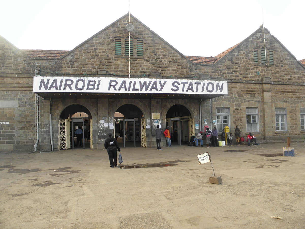
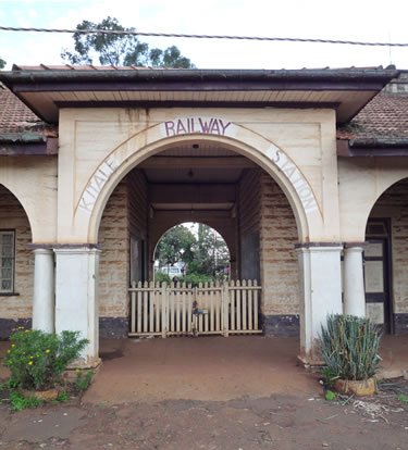
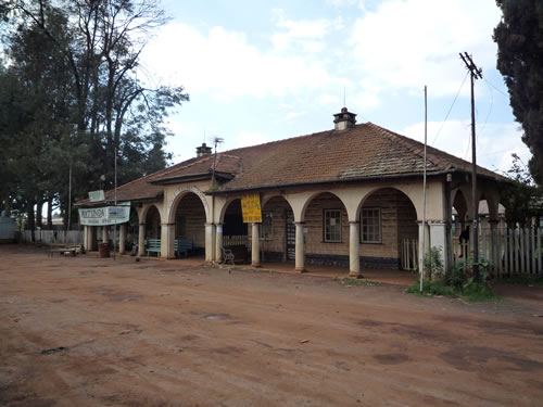
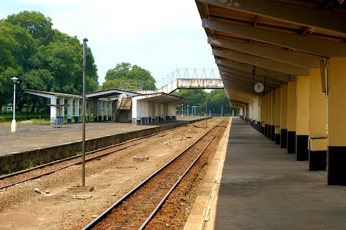
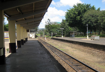
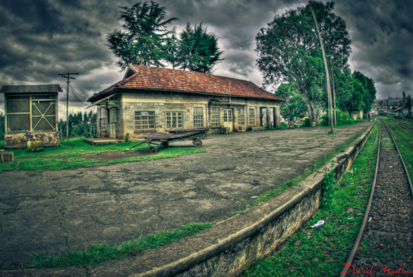
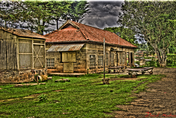
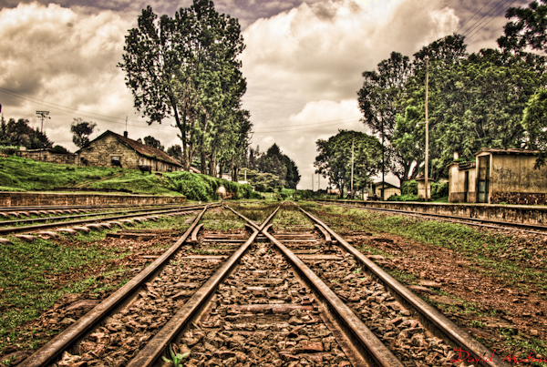
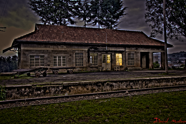
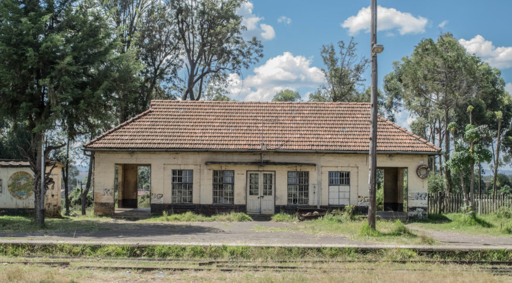
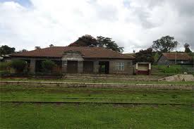
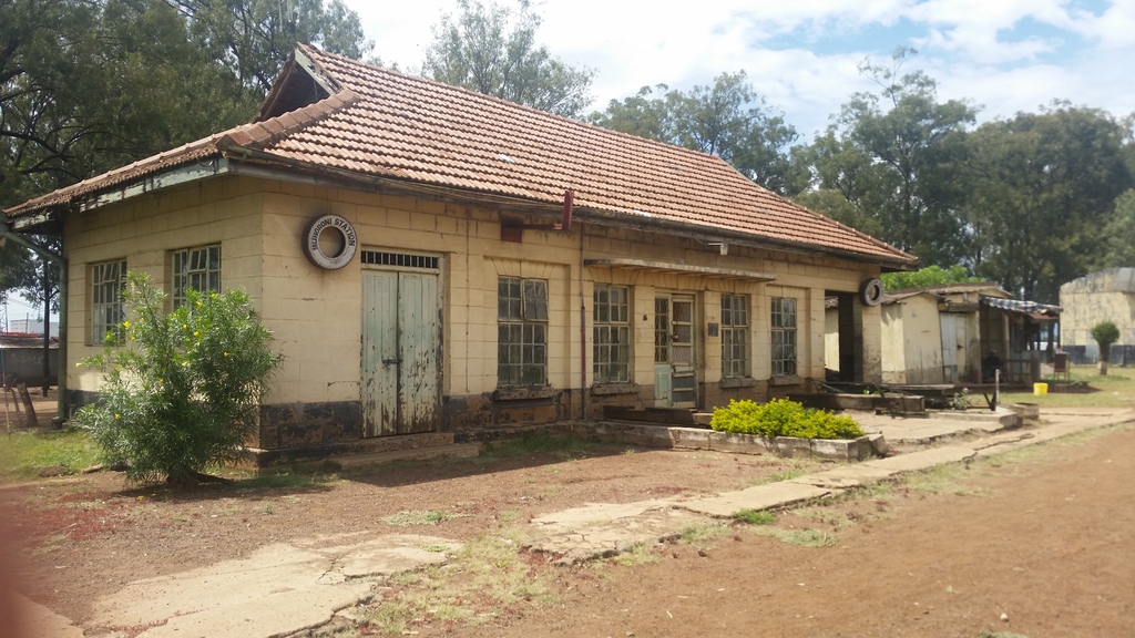
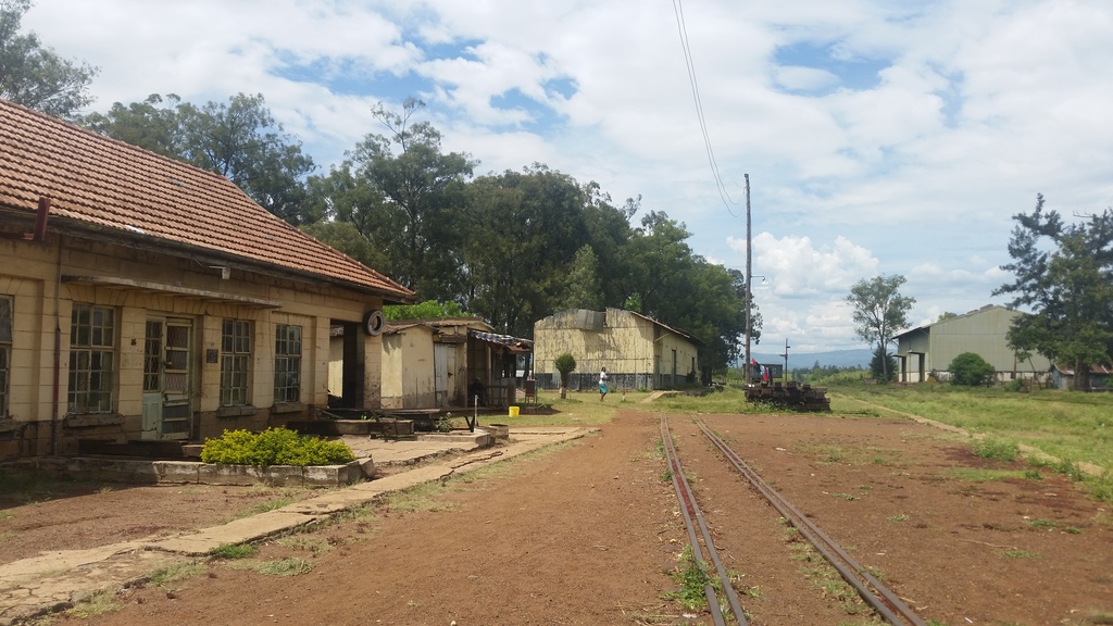
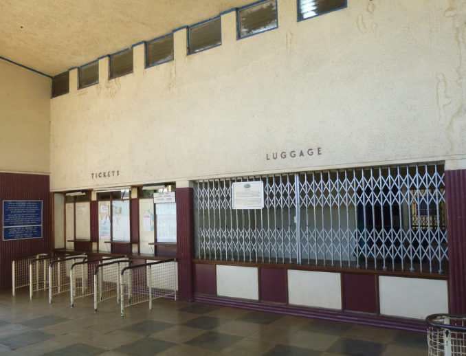
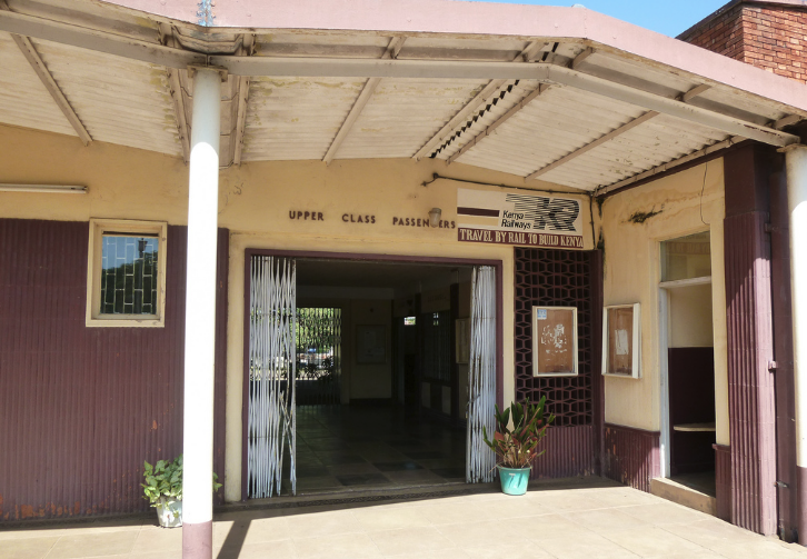
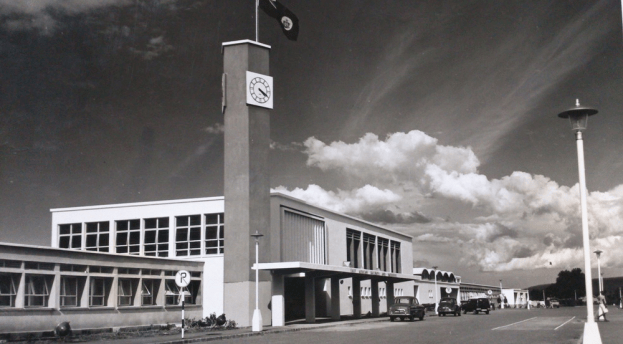
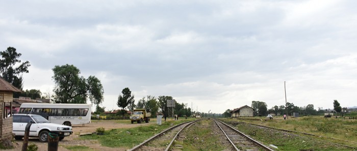
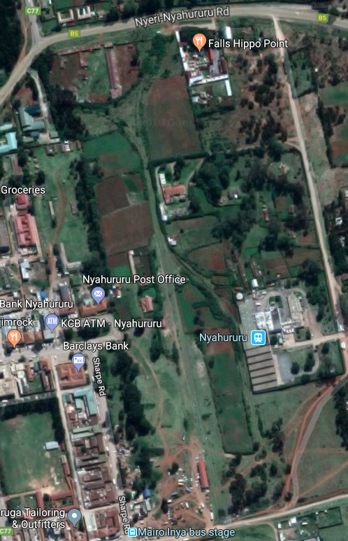
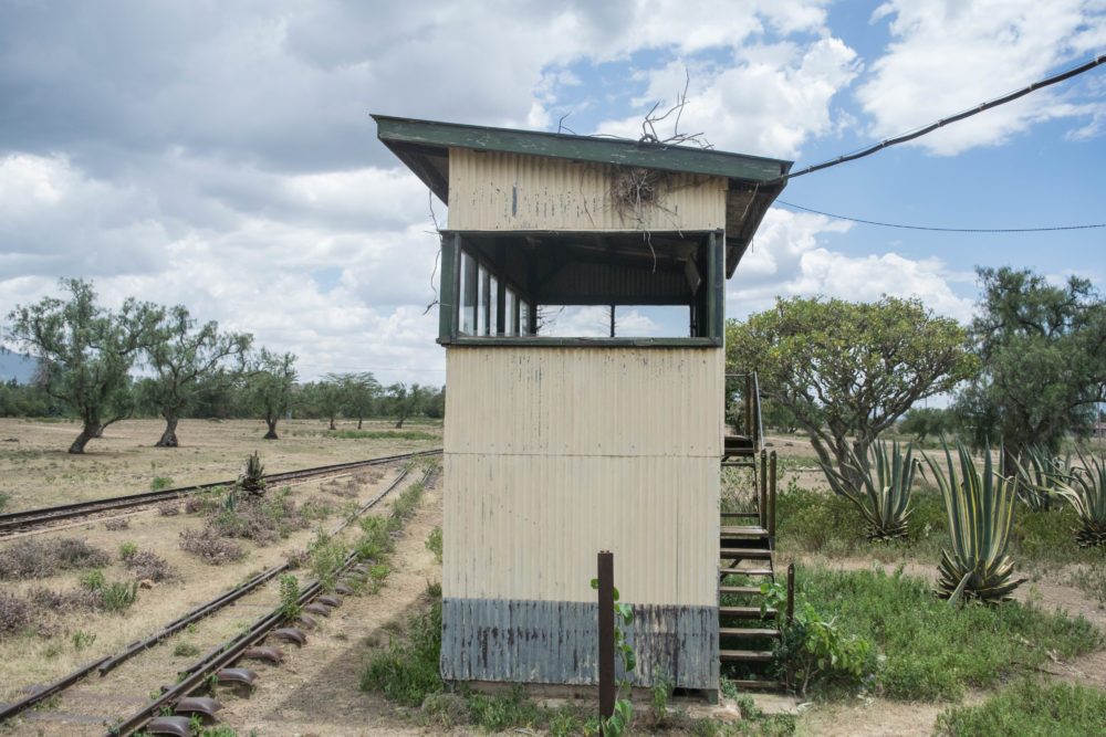
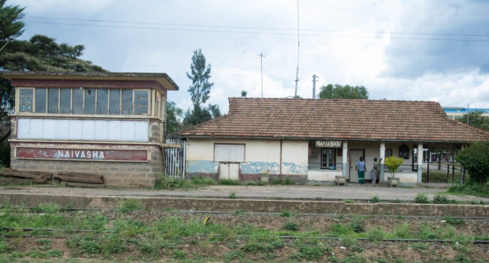
The images immediately below show the Passenger Railway Station at Nakuru in the 21st century – they are sourced as follows – the first from Google Maps and the following three from Google Streetview. ….

Screenshot_20210406-184235

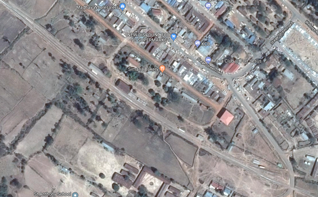
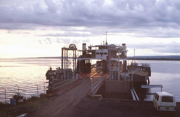
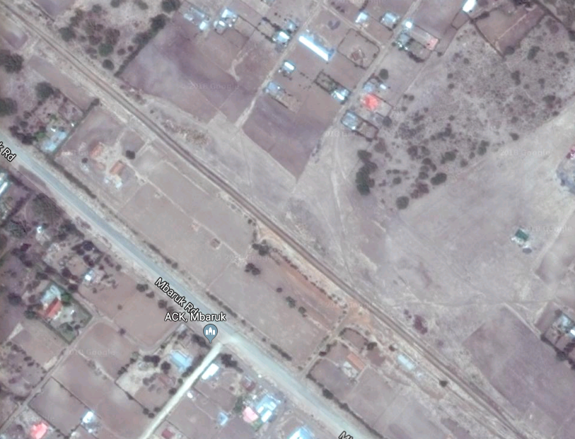
Nakuru Passenger Station – to the Northwest of the station, the line passed immediately over the Nakuru ring-road before swinging round to the West, (Google Maps).

Screenshot_20210406-181709

View from the Road to the East of the Station, (Google Streetview).

Screenshot_20210406-182240

View from the Town Centre roads to the South of the Station, (Google Streetview).

Screenshot_20210406-181422

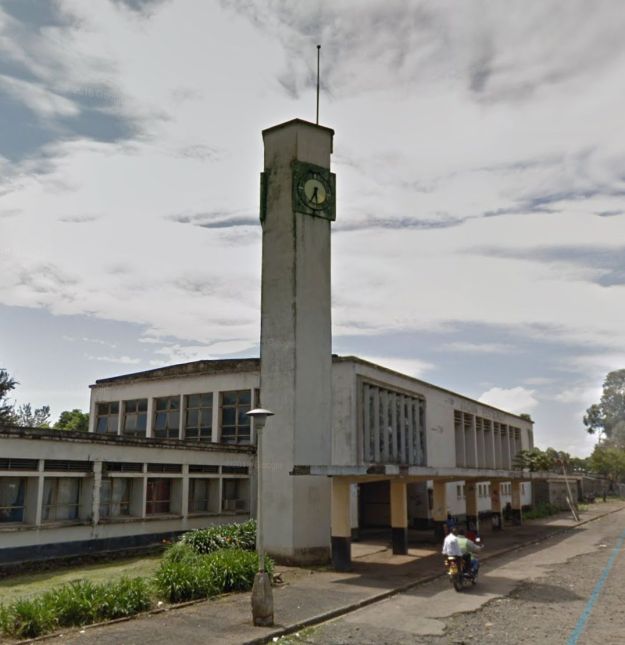
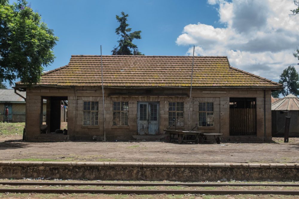
View of the main Station Building from the West, (Google Streetview).

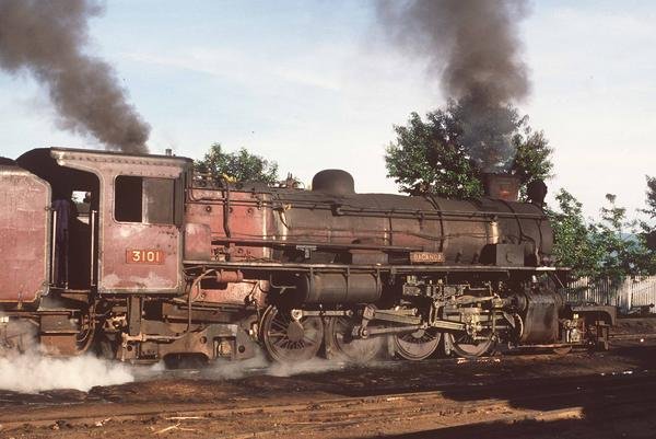
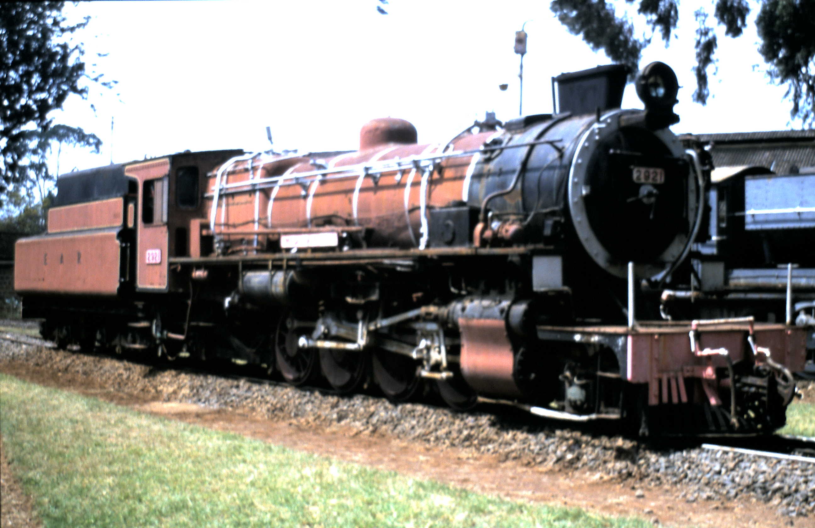
There are a number of sites on the web which have pictures of locomotives at Nakuru Railway Station. These include: …

  • Christopher Yapp took a photograph of Class 30 No. 3020 ‘Nyaturu’ 2-8-4 on a charter in 2005. [5]
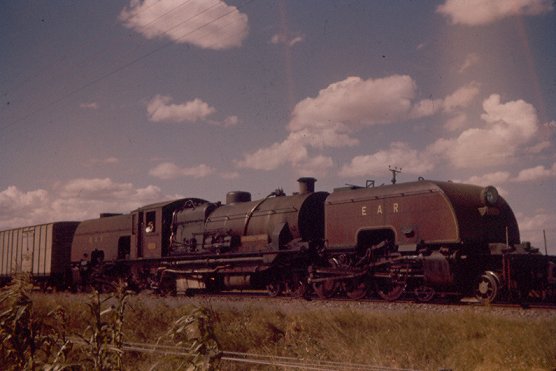
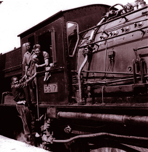
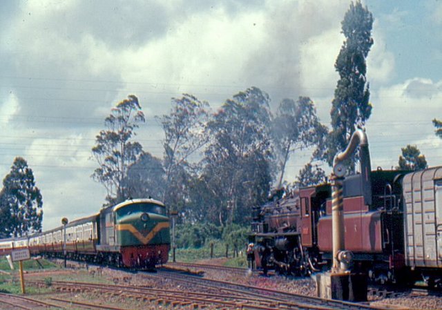
  • An earlier photograph of a Class 60 Garratt (still bearing its Governor’s name plate and without Giesl ejector) waiting to take the Uganda Mail forward from Nakuru was taken by Geoff Pollard. [6]
  • By 1962, Class 58 Garratt locomotives had replaced the Class 60s between Nakuru and Kampala.

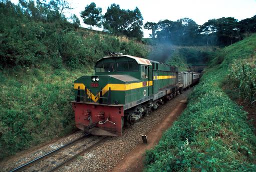
And, between Nairobi and Nakuru, the Class 58 had in turn been replaced by Class 90 1-Co-Co-1 diesels built by English Electric. Malcolm McCrow has a number of pictures of these locos on his website. [6]

Malcolm’s website has photographs of Class 90 diesels at Nakuru. These include Class 90 No. 9010 waiting to take over from the Class 58 above which brought the train from Kampala. Then waiting for the right of way for Nairobi. [6]

The website also has a photograph of No. 9008 at Nakuru at the head of a Kampala to Nairobi/Mombasa courtesy of James Lang Brown. [6]

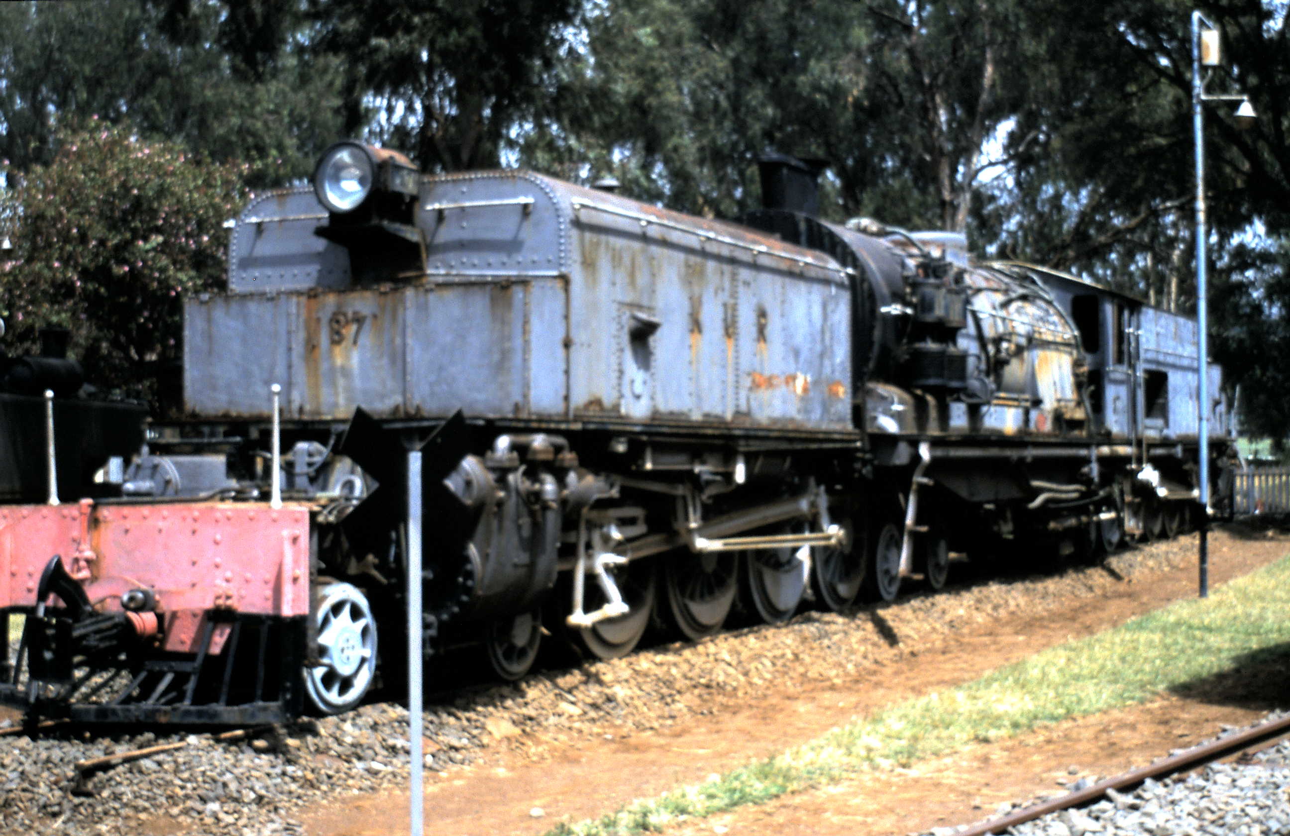
There are also two pictures of Class 87s at Nakuru on Flickr: …

  • Class 87 No 8723 at the head of a train at Nakuru, © Youth With. [7]
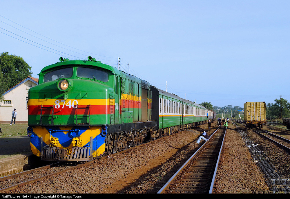
  • Class 87 No. 8739 at Nakuru shunting empty stock, © Christopher Yapp. [8]

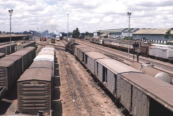
Other locos at Nakuru can be seen at Nakuru:. …

  • On Flickr, Robert Mason has an early morning shot of Tribal Class 29 2-8-2 No. 2905 ‘Digo, in 1967. [9]
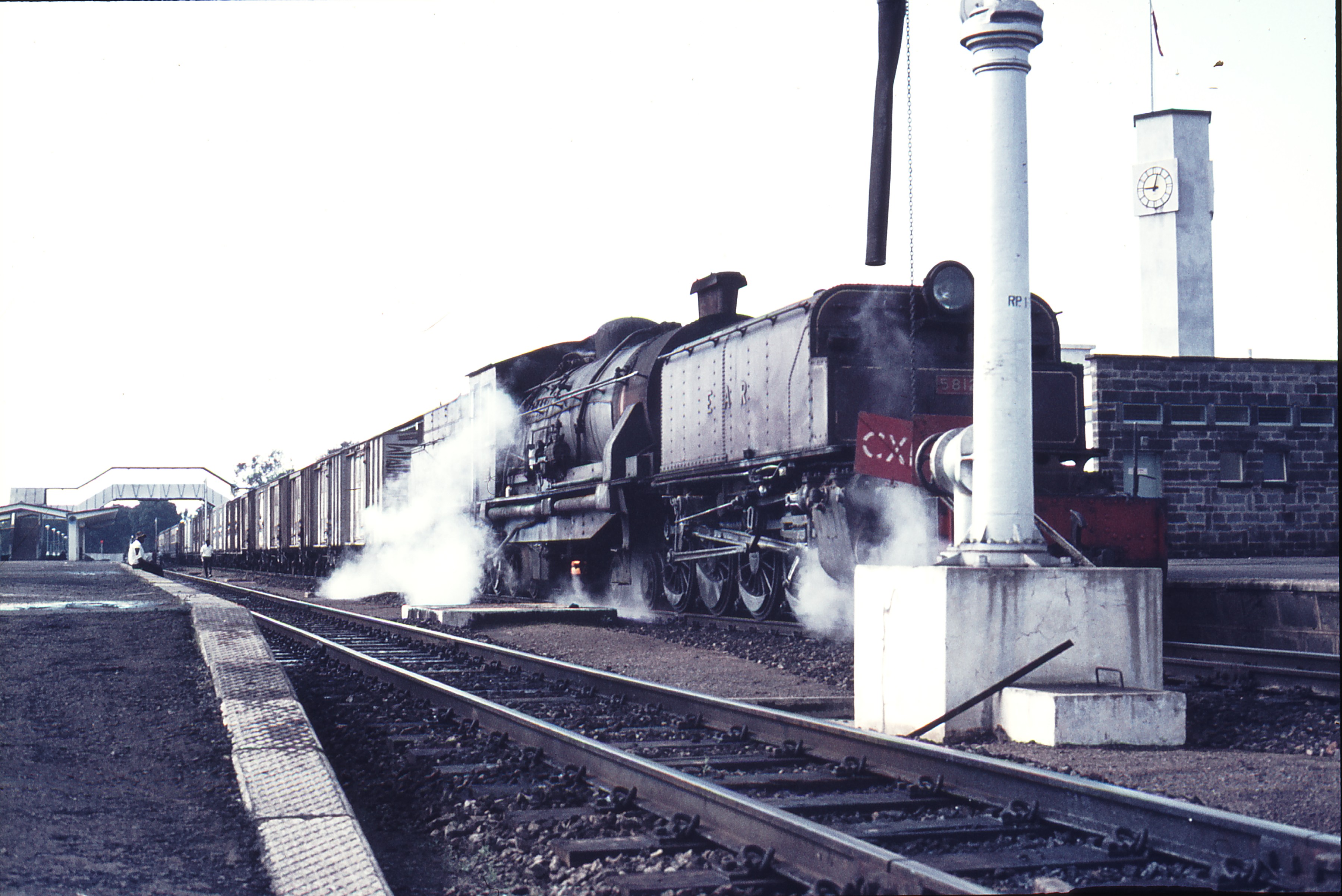
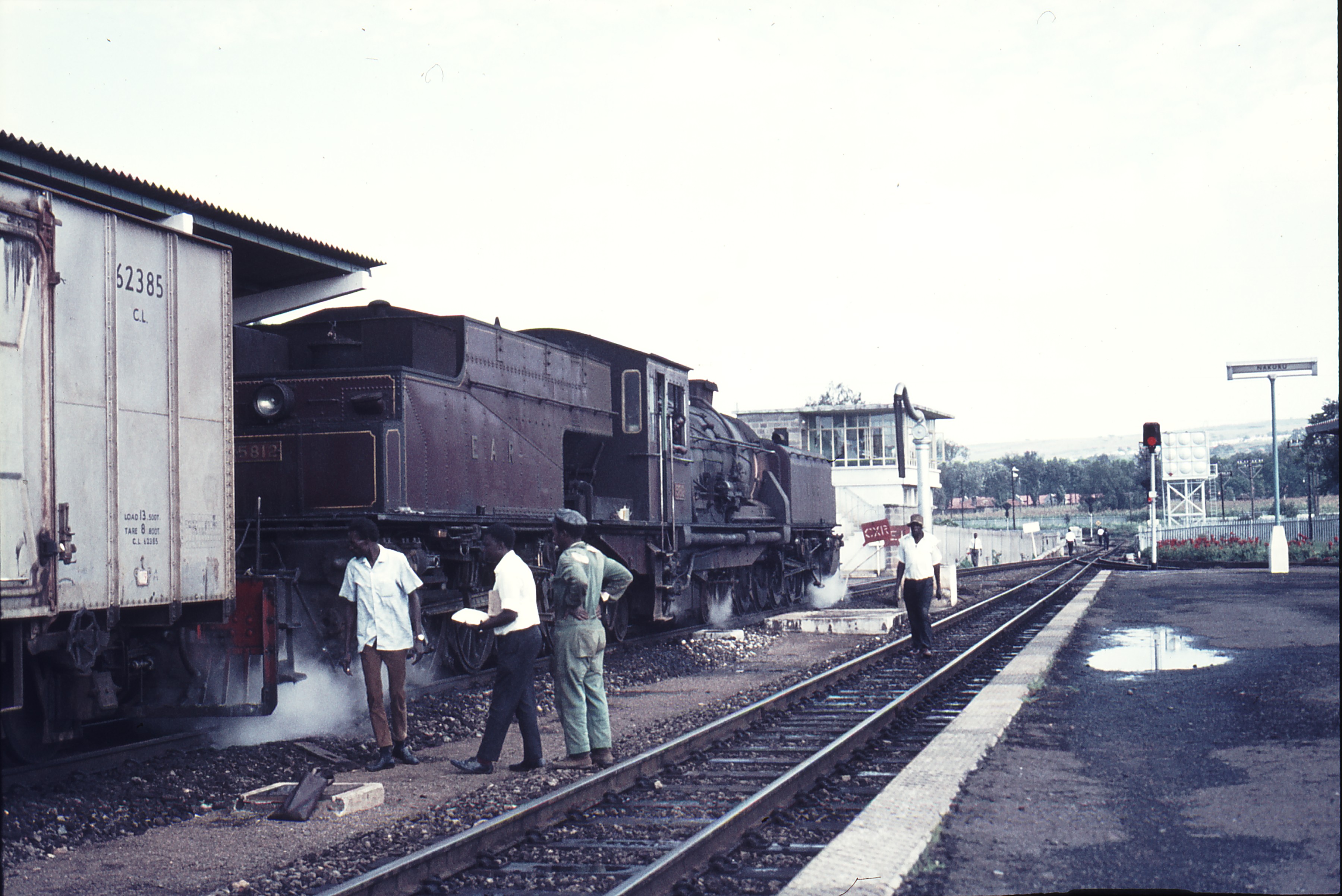
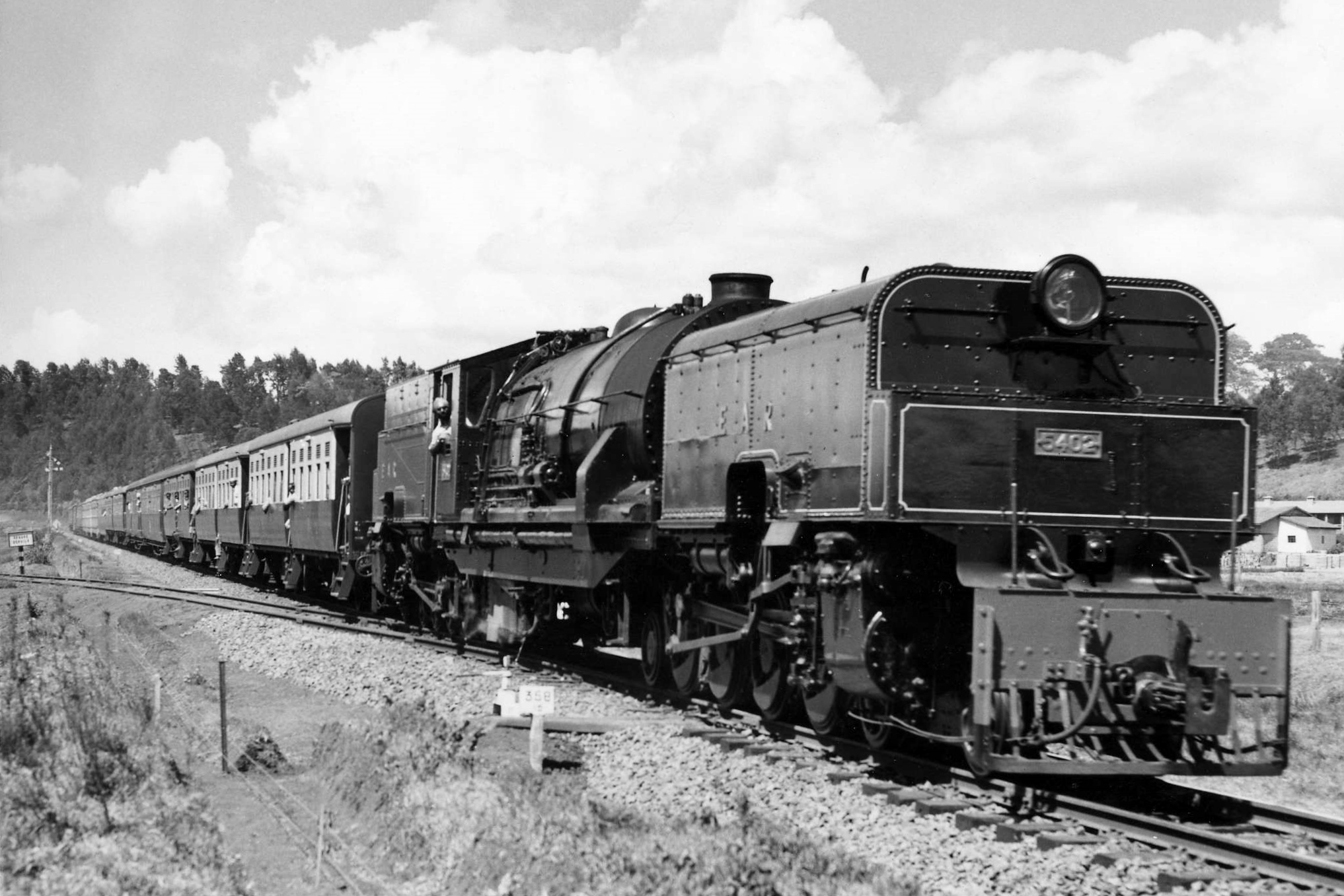
  • Malcolm McCrow has a picture of Kampala bound in 1961,  Class 58 Garratt No. 5804 – lettered EAR&H which has just handed over its train to a Class 60 Garratt which will run through to Kampala. No. 5804 has run round its train and is on its way to the MPD. [6]
  • Kampala bound in 1961,  Class 58 Garratt No. 5804 – the uniquely lettered EAR&H – has just handed over its train to a Class 60 Garratt which will run through to Kampala. No. 5804 has run round its train and is about to go on shed, © Malcolm McCrow. [6]
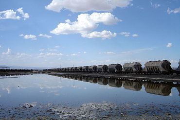
  • Pinterest carries a photograph by Neil Rossenrode of a Class 54 Garratt in Nakuru Goods Yard in 1962. [4]

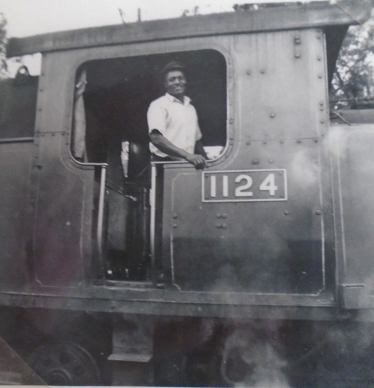
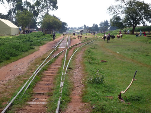
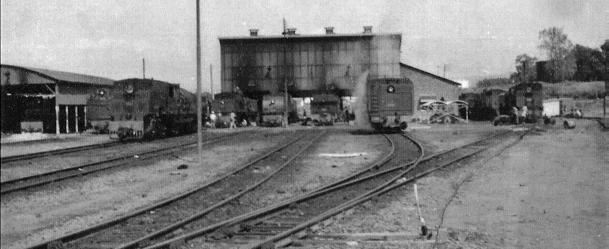
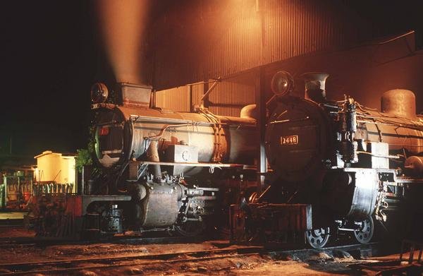
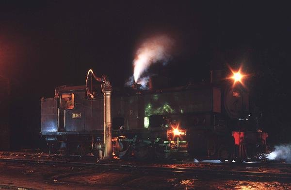
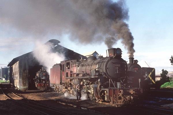
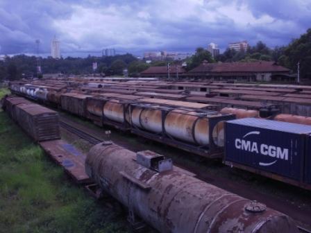
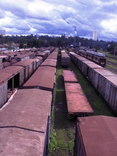
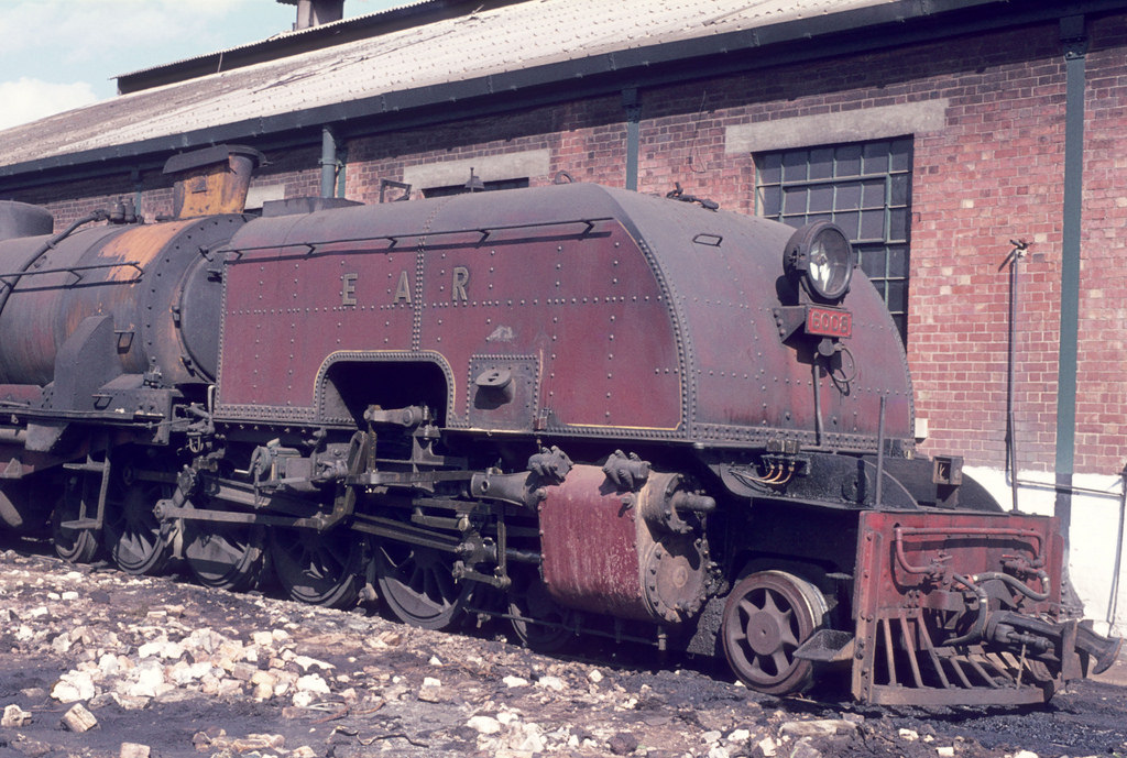
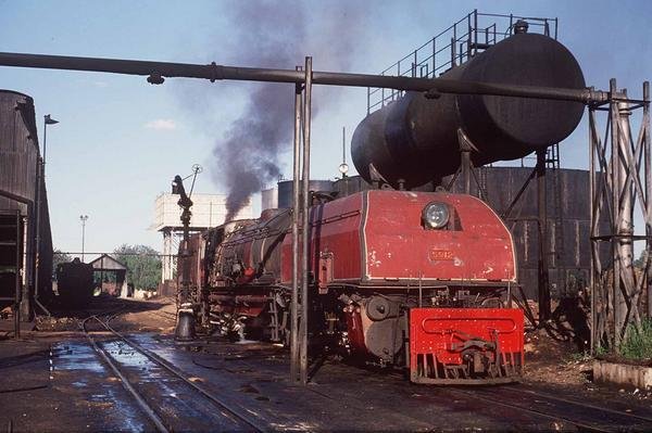
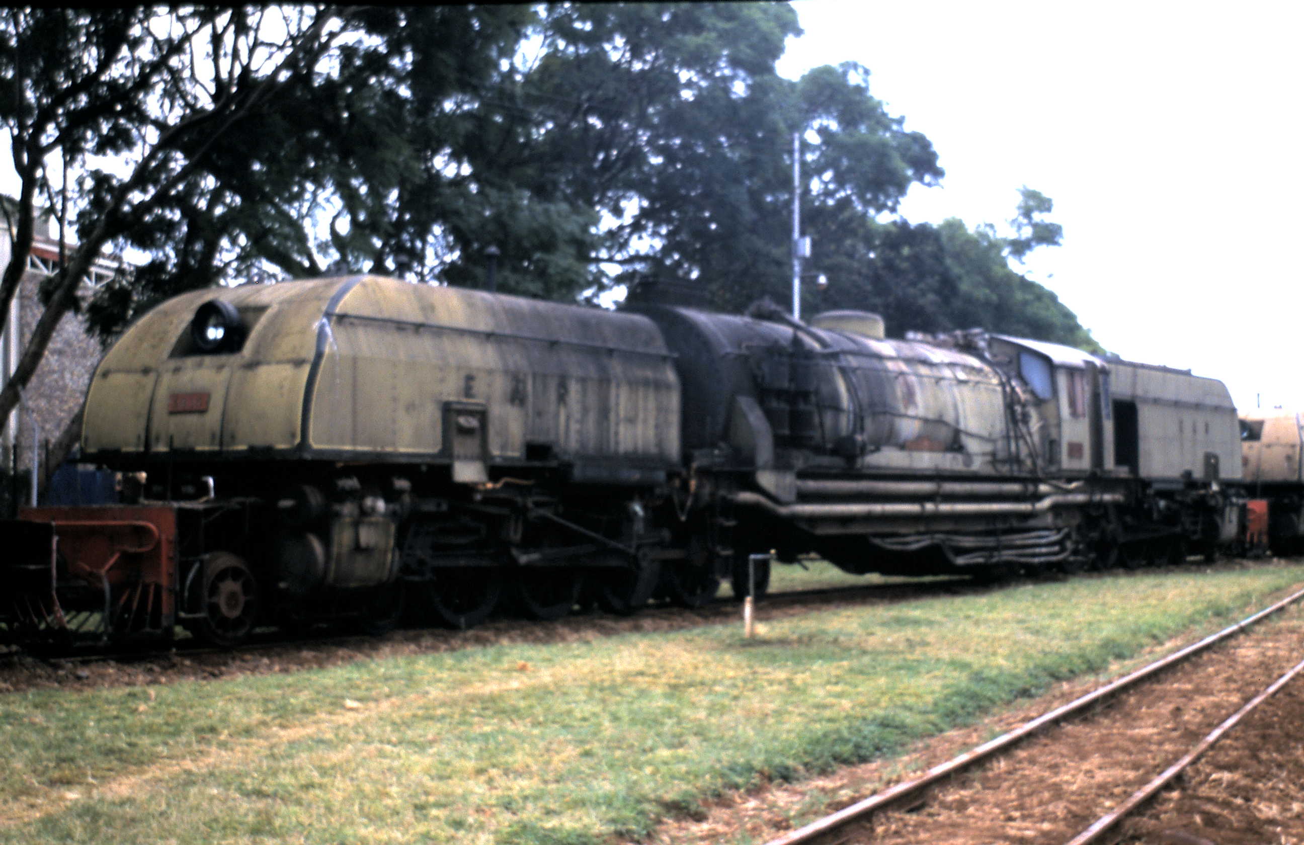
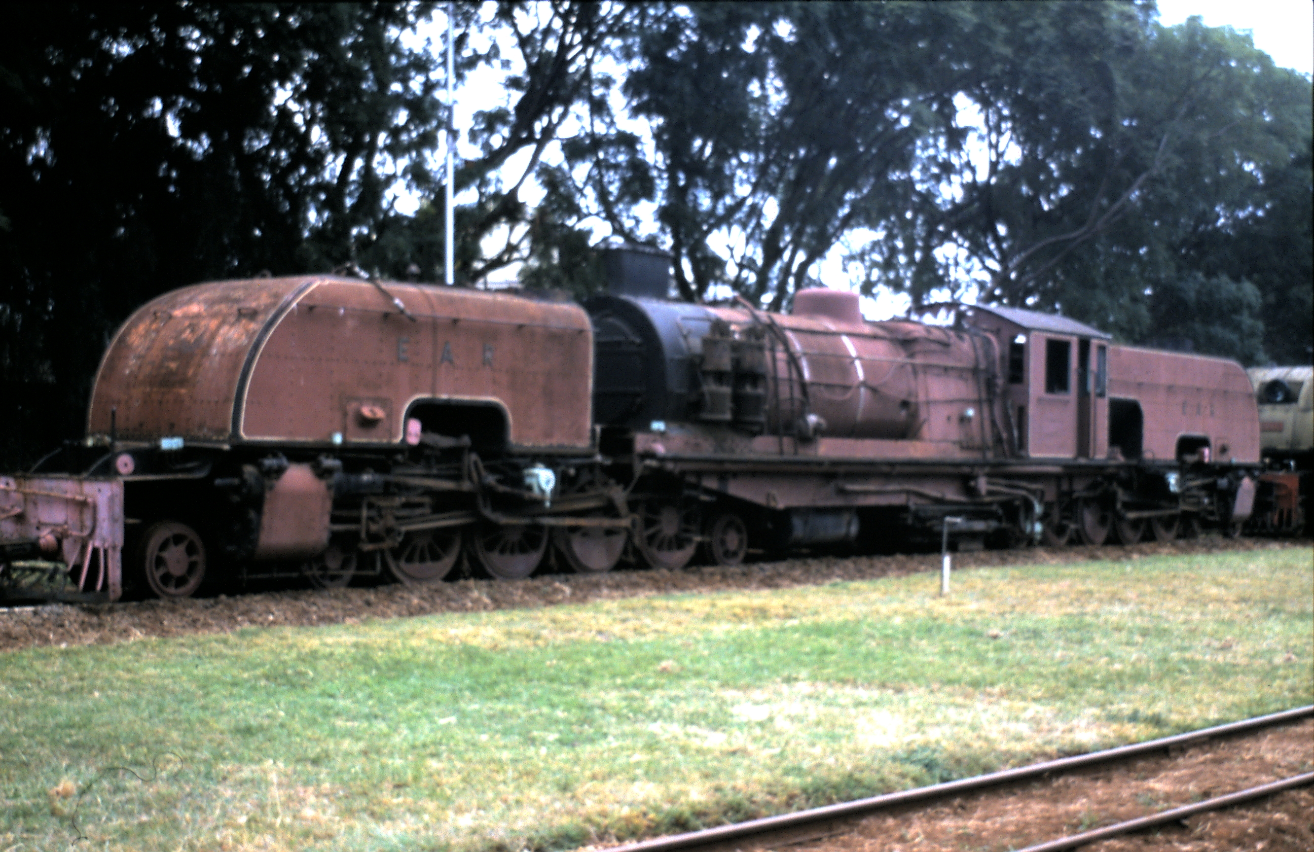
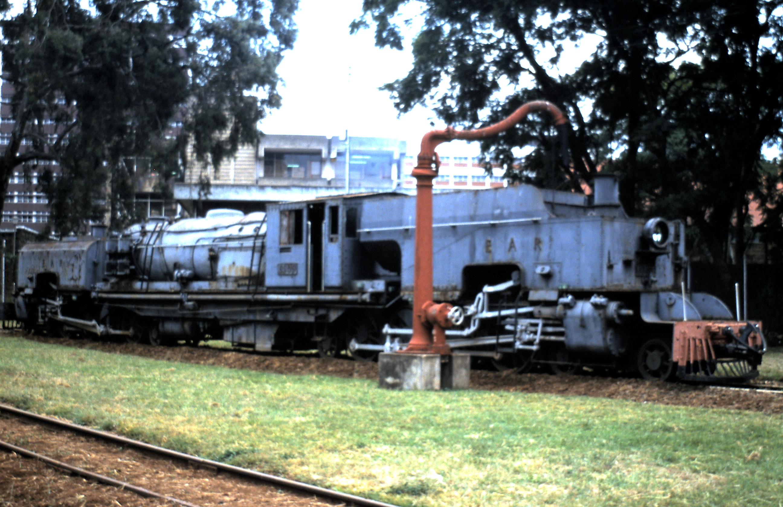
A few pictures of locos at rest in the MPD.Nakuru Shed, © Archie Morrow.[3]
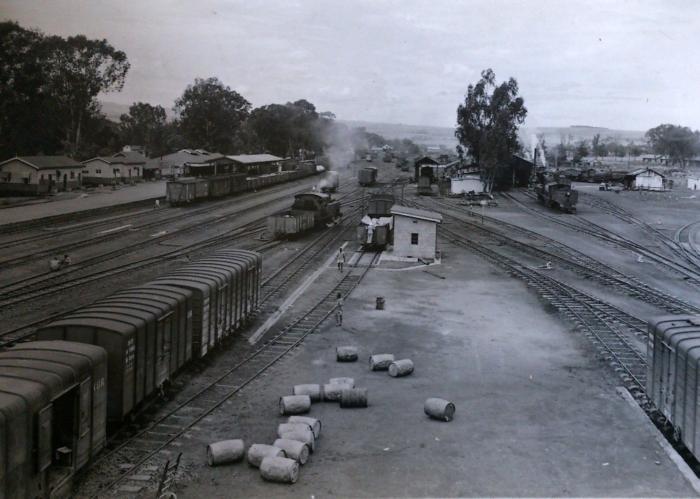
Nakuru Shed and Marshalling Yard.[10]

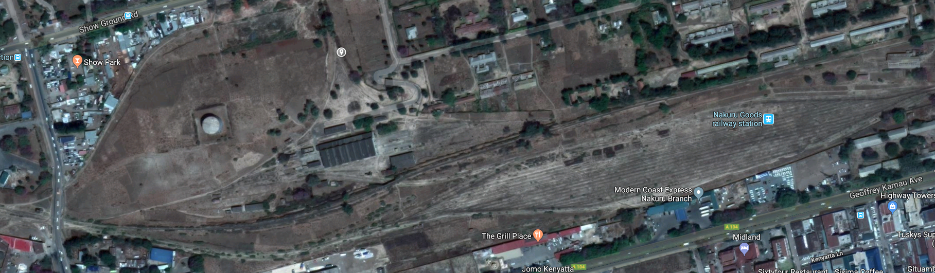
The satellite image below show both the MPD and the Nakuru Sidings.

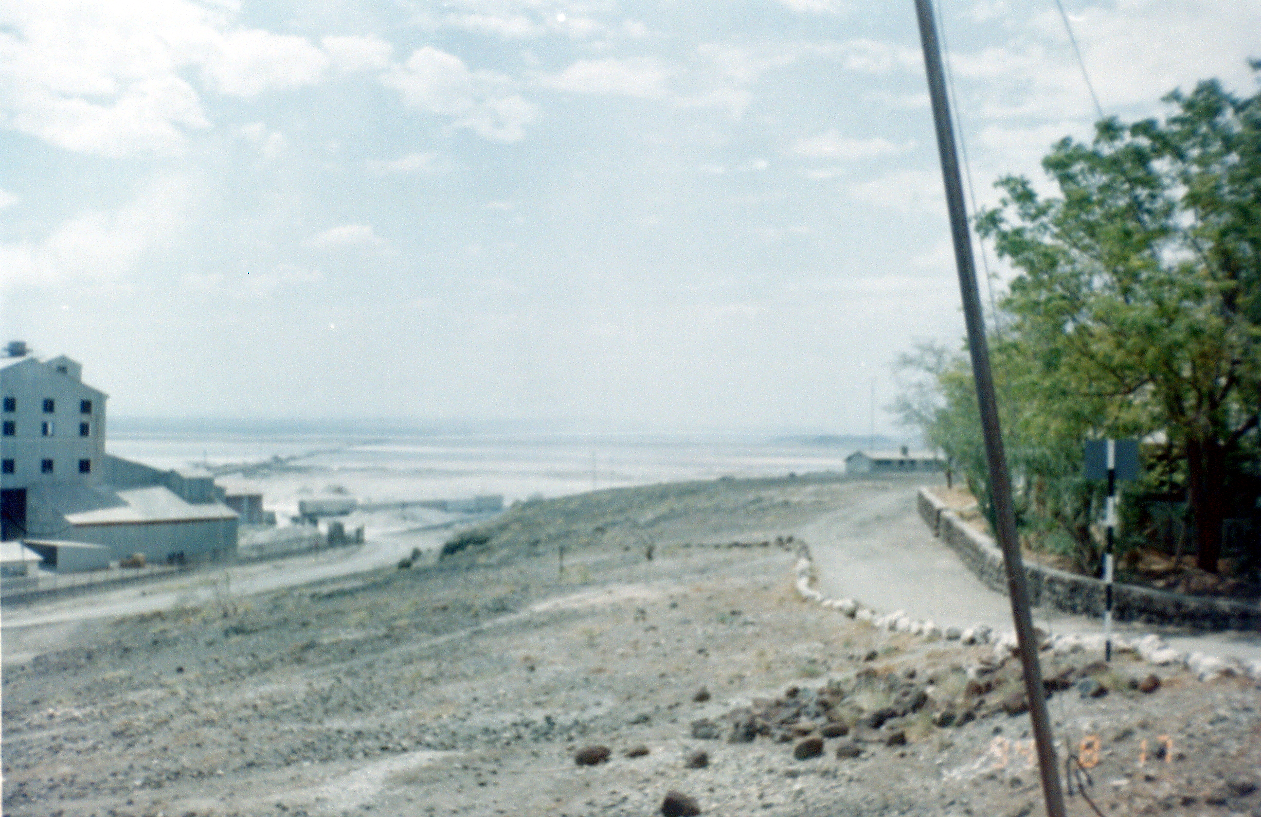
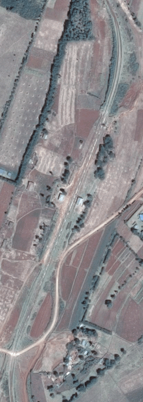
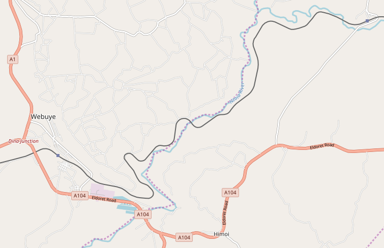
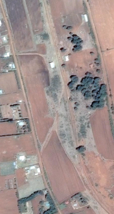
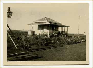
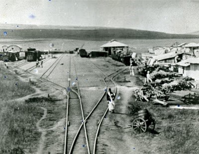
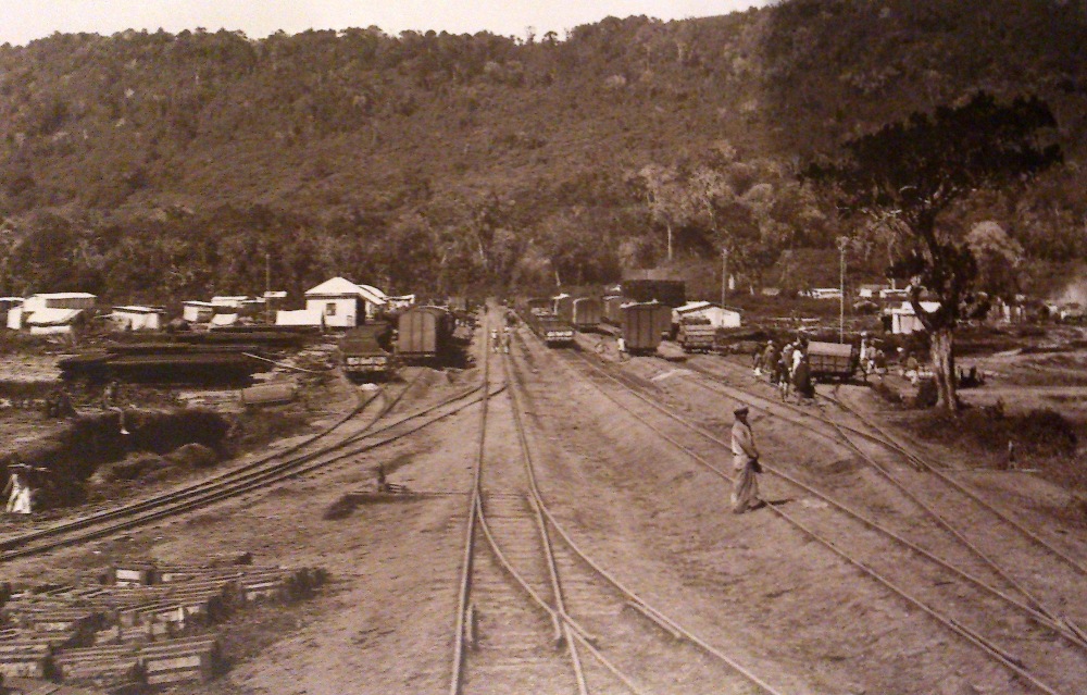
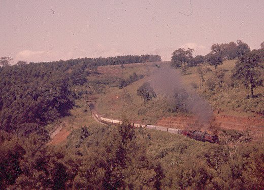
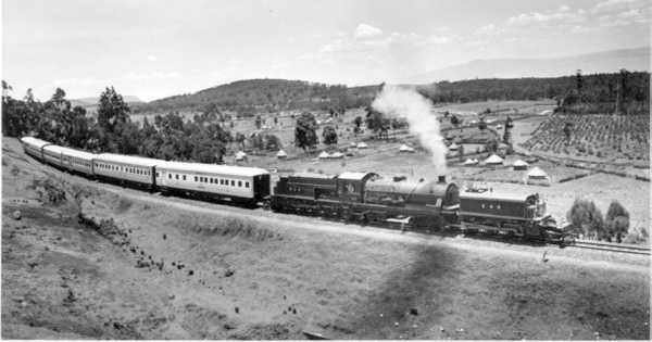
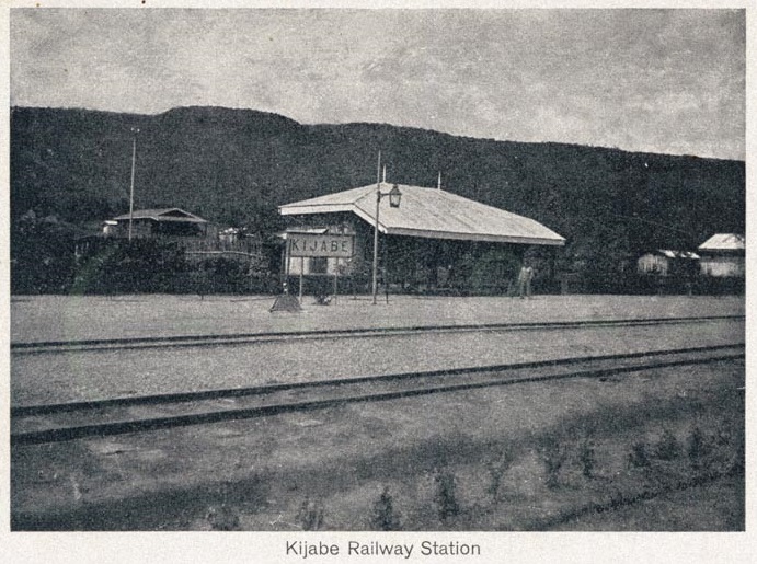
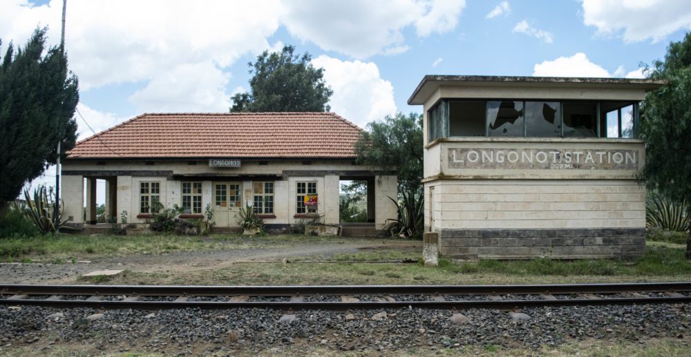
After leaving Nakuru marshalling yard, trains travelled east to the junction with the Kisumu line. After that junction the line turned north through Kiamunyi and then west to Menengai Railway Station which is close to Barclays Airport and some distance from the volcanic crater of the same name which is actually due north of Nakuru. The adjacent image is a very early picture of Menengai Railway Station building.
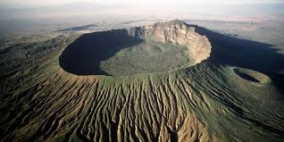
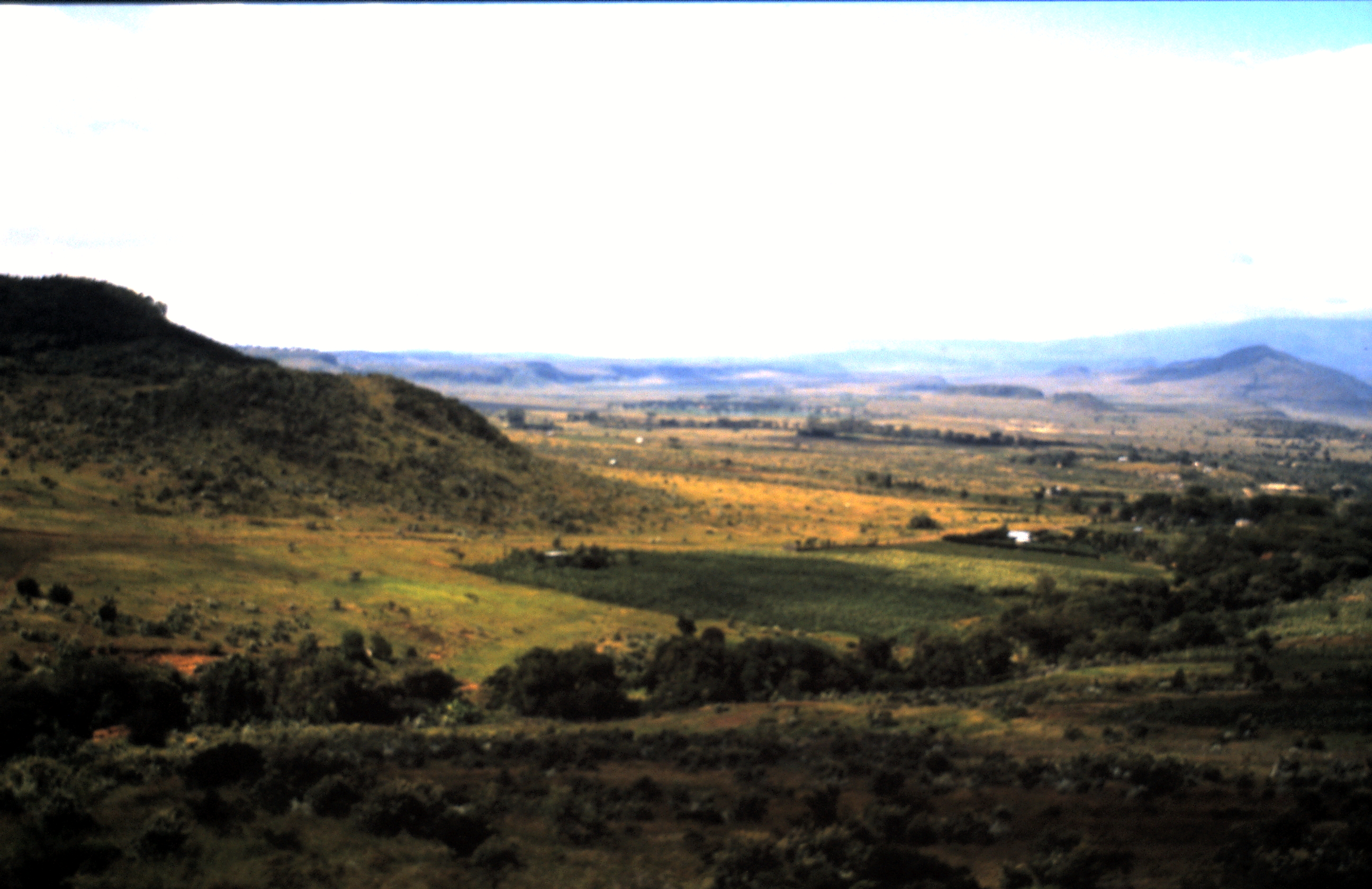
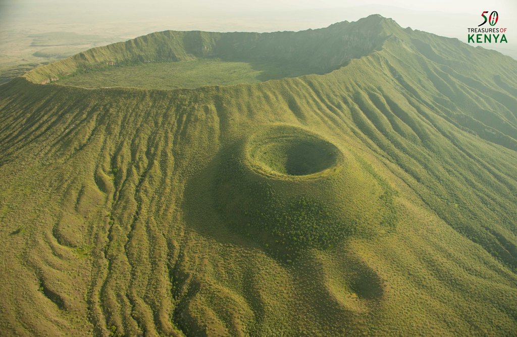
Menengai Crater is a massive shield volcano with one of the biggest calderas in the world. ?It is located in the Great Rift Valley, Kenya and is also the largest volcano caldera in Kenya as well as the second largest volcano caldera in Africa. Farmland occupies its flanks.

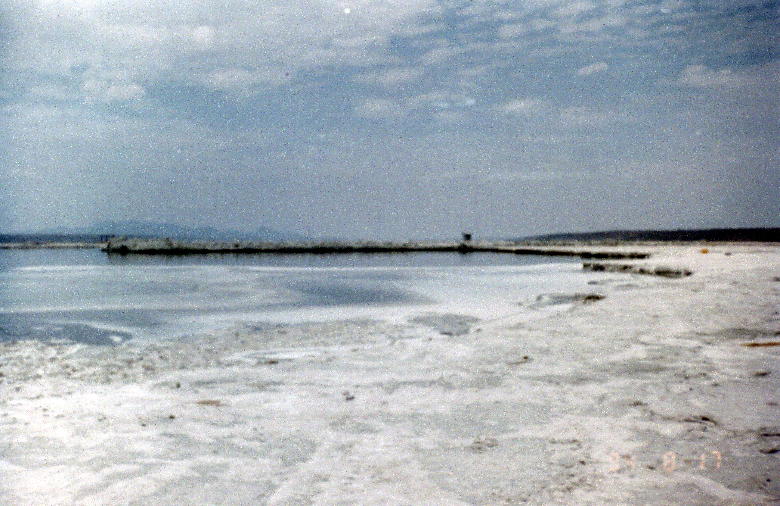
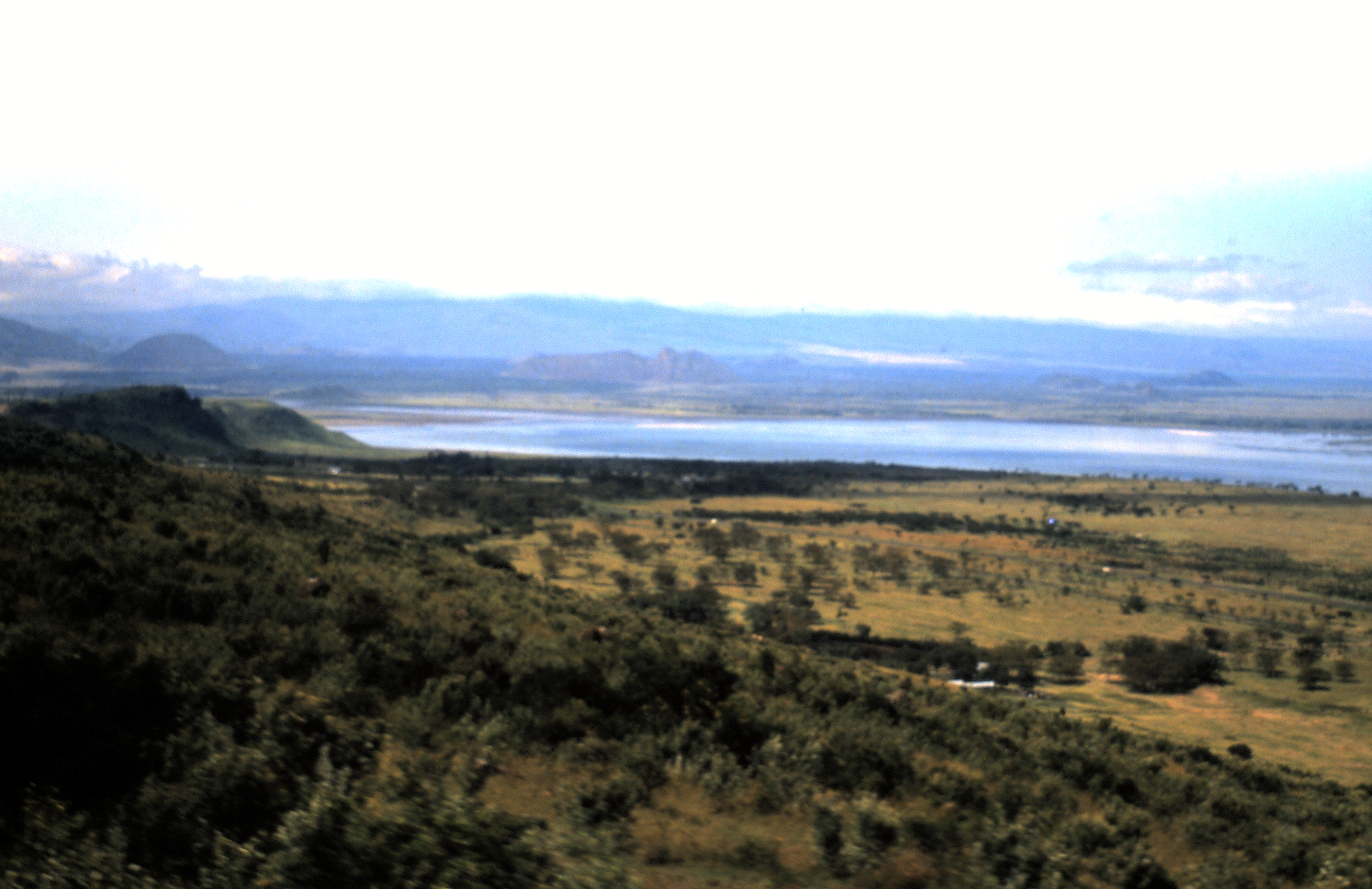
The Menengai Crater is located on the floor of the Rift Valley. The volcano formed about 200,000 years ago and the prominent 12 x 8 km caldera formed about 8000 years ago. The caldera floor is covered with numerous post caldera lava flows. The Menengai volcano is considered one of the best-preserved Krakatau-style calderas in the world.

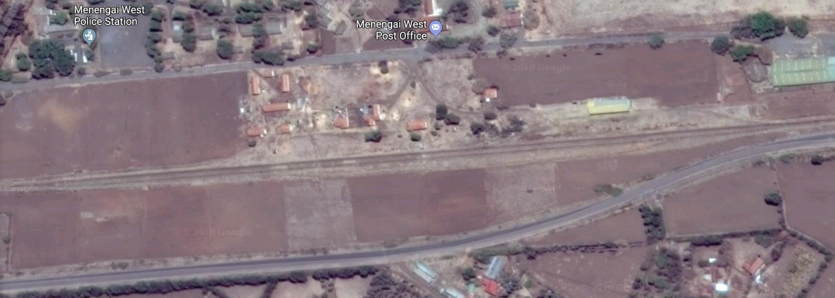
Menengai has very little sediment in the caldera which is a thick mass of lava boulders and inaccessible ridges. Volcanic activity continues and is used for geothermal power generation. The Menengai Creater is located 10 km (6 mi) north of Nakuru. [11]Satellite image showing Menengai Railway Station

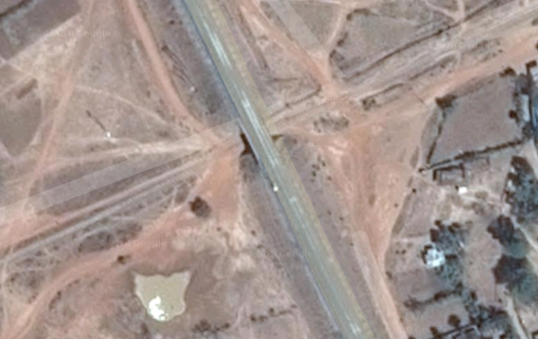
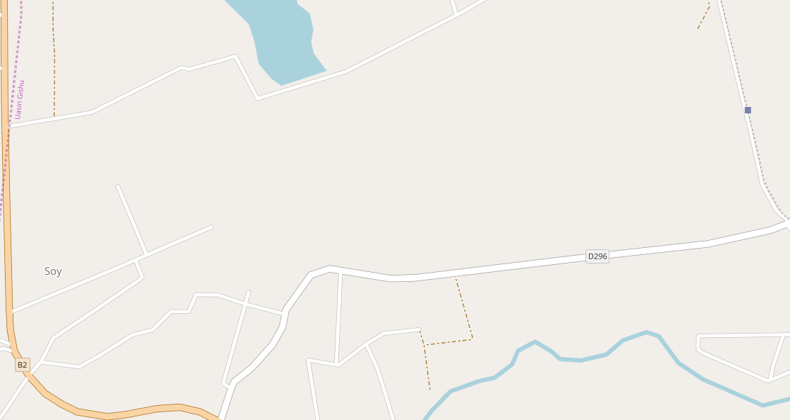
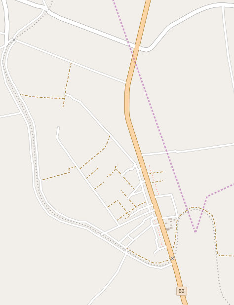
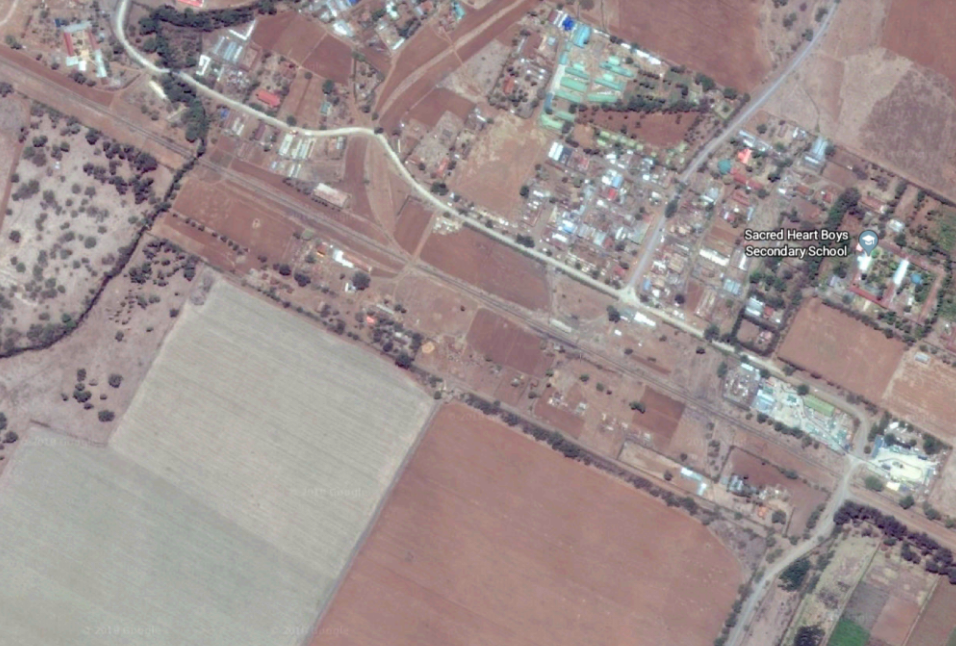
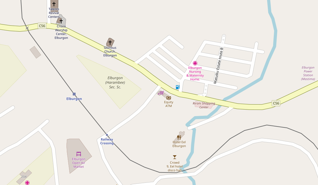
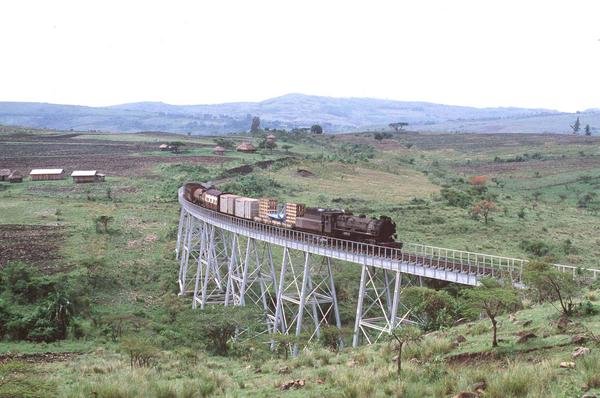
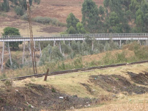
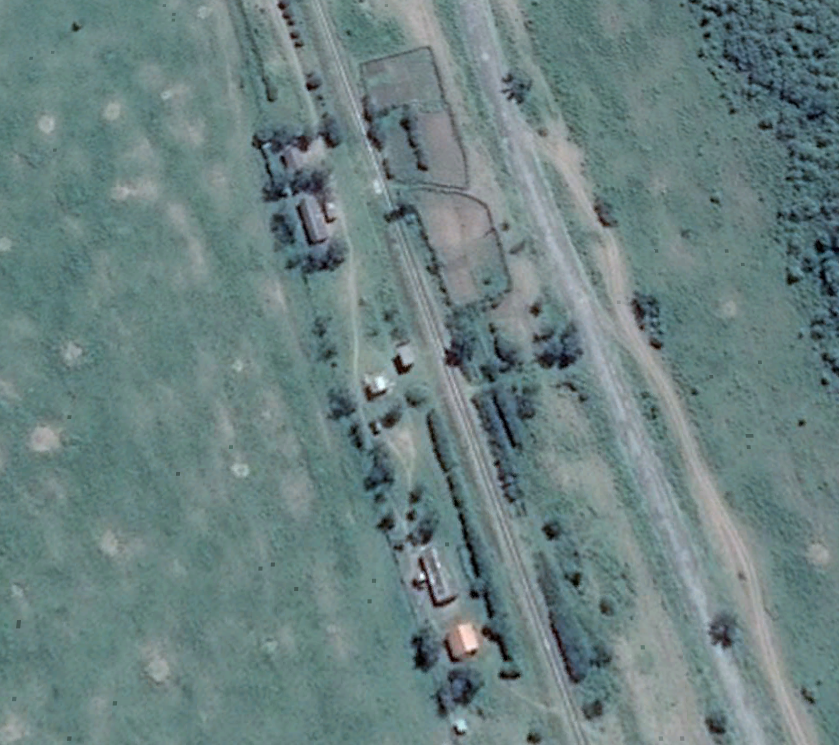
After Menengai, the railway continued in an approximately westerly direction to Rongai which lies 30 km west of Nakuru. It is about 10 kilometres north of Elburgon and 15 kilometres east of Molo, names recognisable as stations on the Kisumu line. The town lies 1912 m (6272 ft) above sea level and has a population of 20878.[12]Satellite image showing Rongai Railway Station

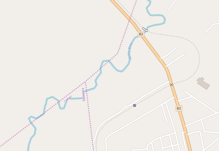
Initially travelling in a west-northwest direction, the railway swings round to the north as it reaches the next station/halt on the route, Visoi, just before leaving Nakuru County and entering Baringo County.

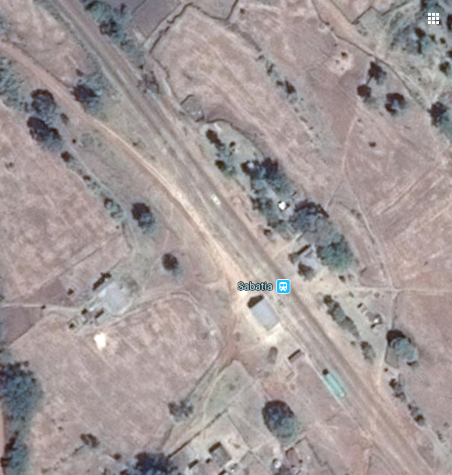
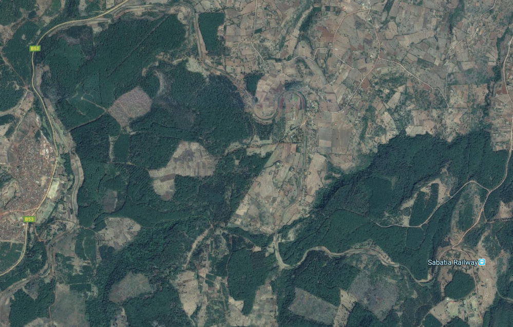
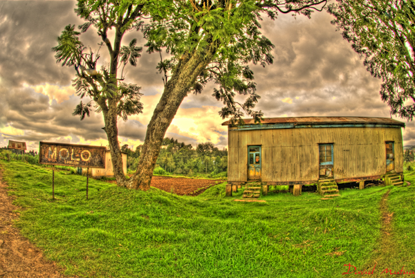
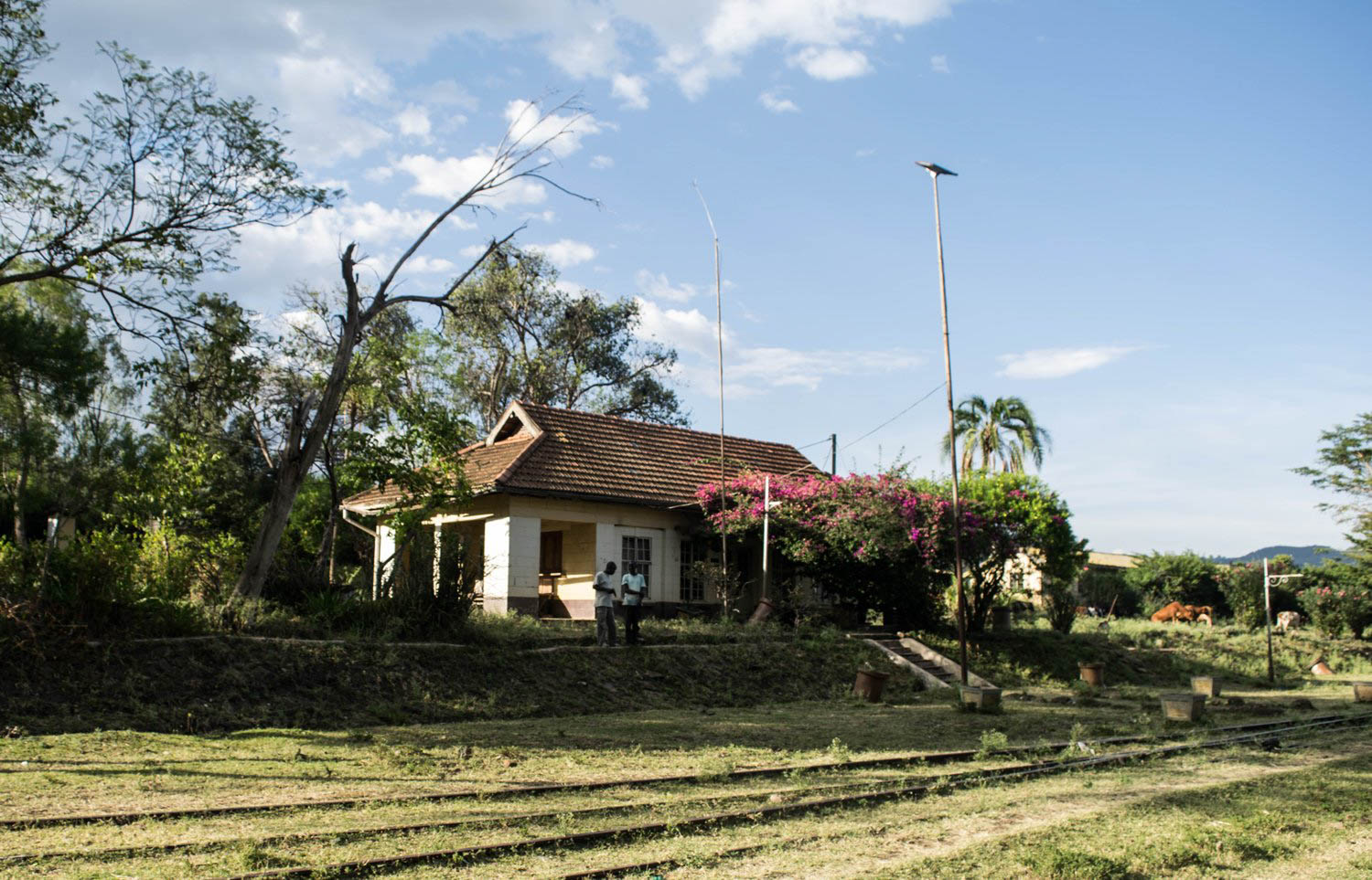
The line then heads to Esageri, meandering around to follow the contours, and on to Sabatia.Sabatia Railway Station.
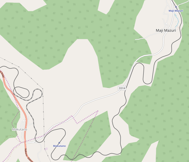
The line snakes around from Sabatia to Maji Mazuri, circling the north side of Koibatek Forest.
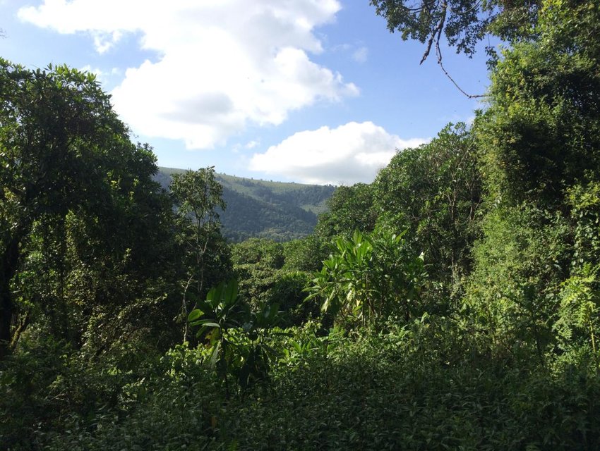
Koibatek Forest.

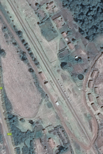
Maji Mazuri is a settlement in Kenya’s Baringo County along the Makutano-Ravine-Kampi Ya Moto highway. This is the most southerly tip of the greater Baringo area. It neighbors Kericho’s Londiani and Nakuru’s Kamara areas. The settlement was formed by migrants who used to work in the Koibatek Forest but were either retrenched or retired at one time. As such Maji Mazuri is home to people from different ethnic groups of Kenya.[13]

After Maji Mazuri come Makutano and Equator.

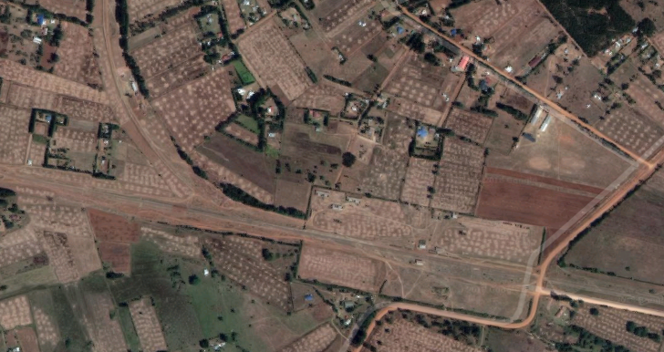
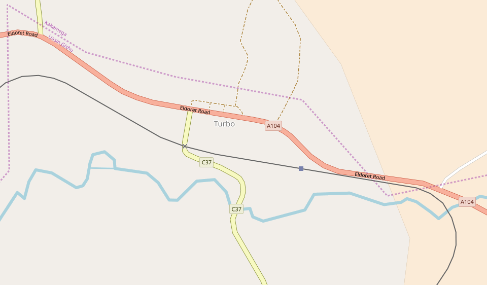
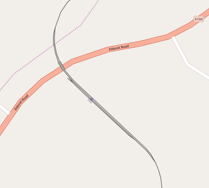
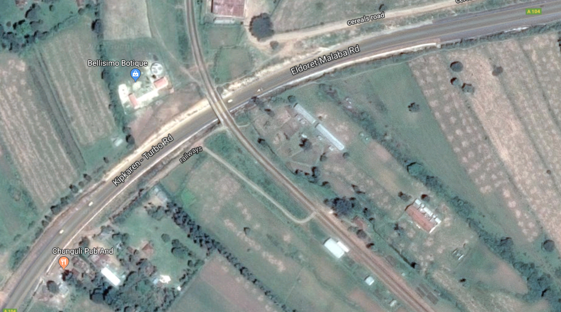
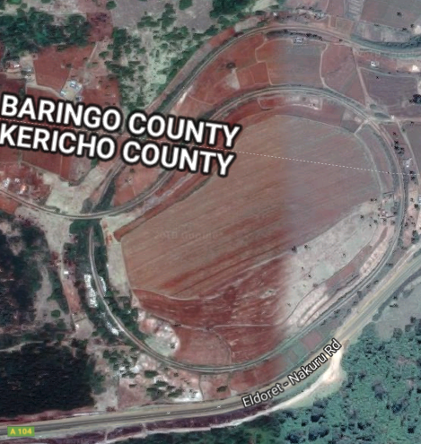
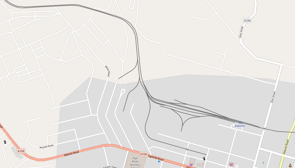
The line reaches Makutano  in a meandering route close to the B53 (D314) road. By now the line is,for a very short distance, back in Nakuru County. The map below shows the route of the line and the County boundary. It also shows, to the north of Makutano township (and back in Baringo County), the second spiral on the line from Mombasa to Kampala. The third is just a short distance beyond the next station, Equator.
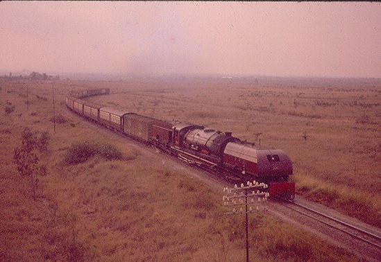
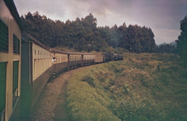
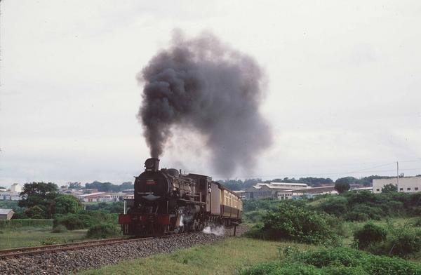
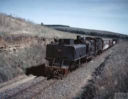
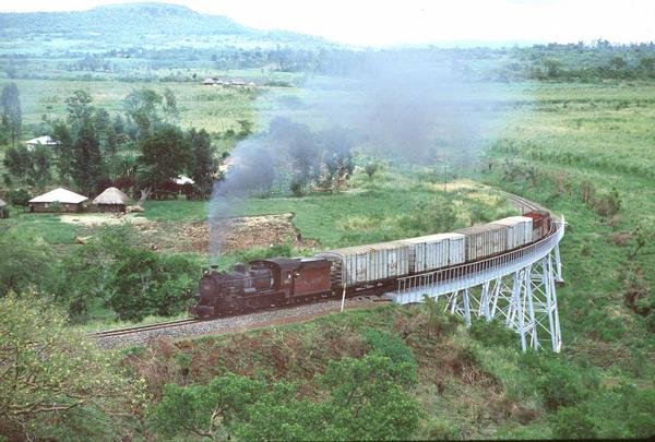
A Kampala bound School Train somewhere in the Highlands – possibly west of Maji Mzuri. The dining car is the fourth coach from the front of the train; the third coach is probably a kitchen car, (c) Malcolm McCrow. [6]

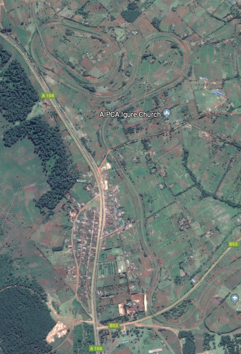
The spiral is also shown on the adjacent satellite image – at the top of the picture next to A104 road to Eldoret. Sadly, in 1994, I think I missed this and the next spiral because day had turned to night at this point on the journey.

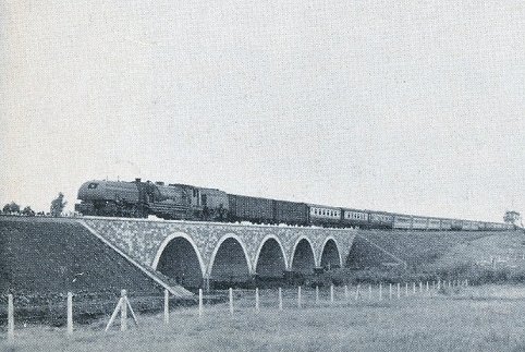
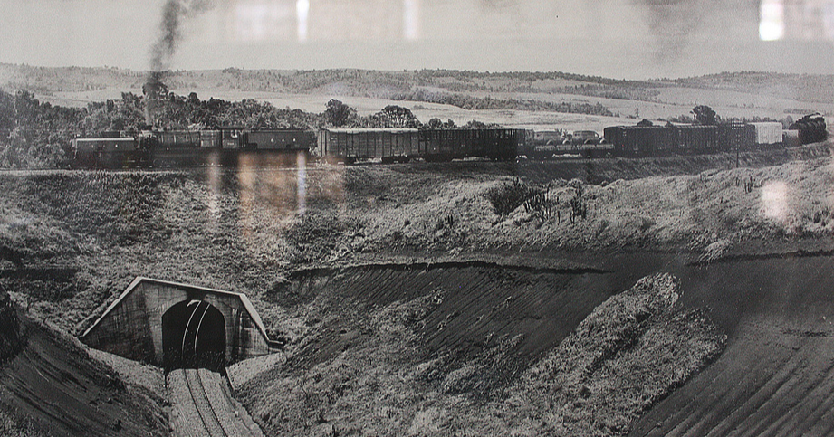
Pictures of the spiral seem to be in short supply. The one immediately below is of the royal train negotiating the spiral. It was carrying the Queen Mother to Eldoret. We will discover the remaining spiral on the line when we look at the length between Kampala and Kasese in due course. [6]

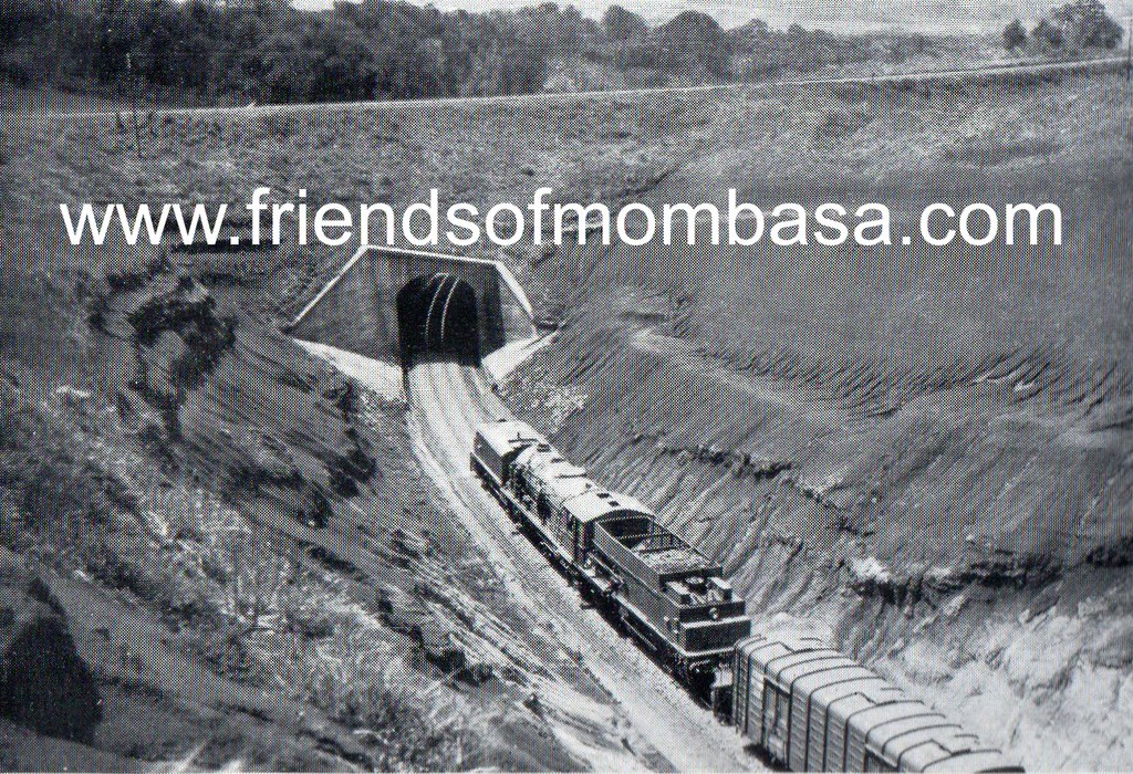
The spiral at the Equator north of Makutano. [14]Despite the legend under this picture (taken through glass) which says that this is an image of the spiral between Equator an Timboroa, careful examination of the layout of the two spirals indicates that this is the spiral between Equator and Makutano. [15]

Embed from Getty Images

The station at Equator is shown in the embedded Getty Images picture above. It is better documented, in photographs, than others we have already passed, particularly on Malcolm McCrow’s website. [6] He includes at least three photographs – one shows the platform sign for the station and the unique Equator marker. Malcolm McCrow says: “The equator runs across the platform at Equator Railway Station. A “Whistle” diamond sign is just visible at the end of the platform. Generally the Mail Train and School Trains did not stop at Equator, but a first class ticket holder on a Mail Train could request a halt at any station where a run through would be the norm. School Trains would stop if booked in advance.”

Alongside a further picture, this time showing the special marker sign and the line of the Equator in white paint, McCrow comments: “Observant passengers would have noticed different equator signs along the trackside as the train wound its way over the equator at least three times. It has been suggested that the train crossed the equator 5 times, but only three points seem to be marked by signs.”

The station building can be seen in the background in the next embedded image from Getty images: ….

Embed from Getty Images

There is a better image of the Station building on Malcolm McCrow’s website  which has been provided by James Lang Brown. [6].

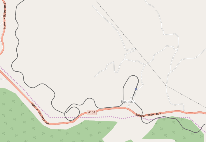
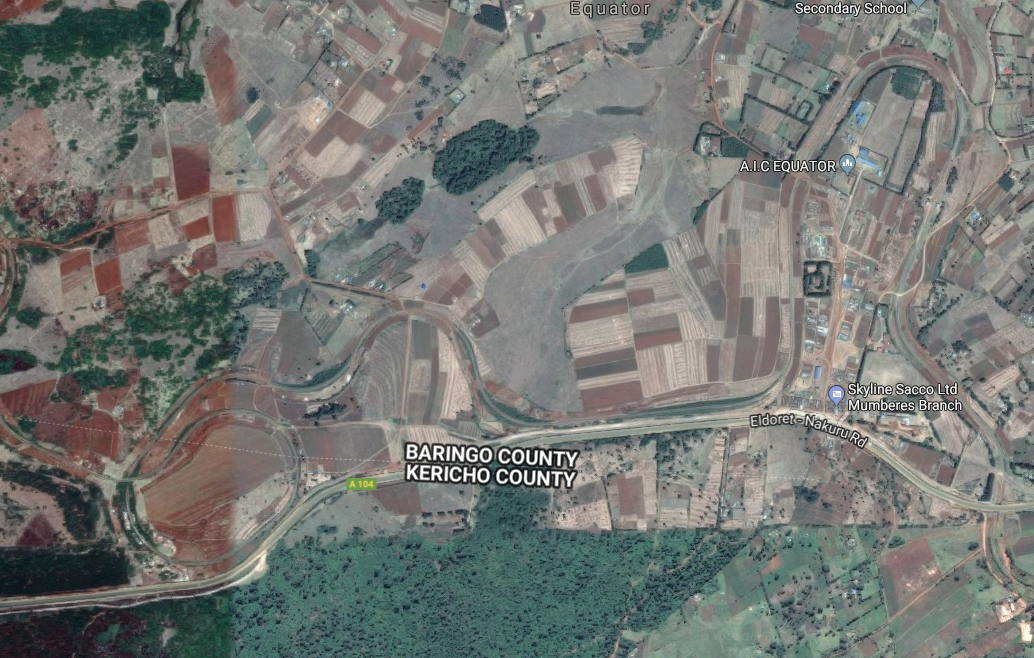
The map and satellite image below show the station at Equator and the second spiral, of which I can find no photographs.The adjacent satellite image is a closer view of Equator Railway Station, and the image blow is a closer view of the spiral. I’d be really interested in seeing any photographs of the two spirals in this post, but particularly of the one to the west of Equator Railway Station.

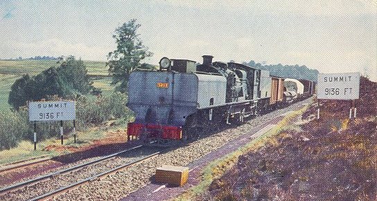
As the railway leaves Equator Railway Station in a Westerly direction it is close to the summit of the line. Equator Railway Station is 8716ft (2492 metres) above sea-level. The summit of the line reaches a height of 9136ft (2785 metres) above sea-level.

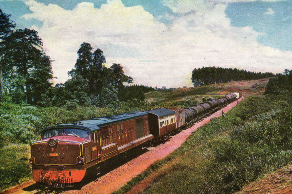
The picture below is a Kenya-Uganda Railway (KUR) Postcard showing KUR Class EC1 still in grey but sporting East African railways and Harbours (EAR&H) Class 50  number board as it heads a Nairobi bound freight over the summit (c) EAR&H. [6]Malcolm McCrow’s website also provides a shot of the summit marker board viewed from a “Nairobi-bound School Train taken from a second class coach behind the only first class one in the consist.” [6]

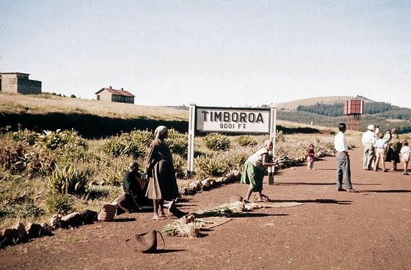
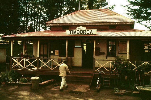
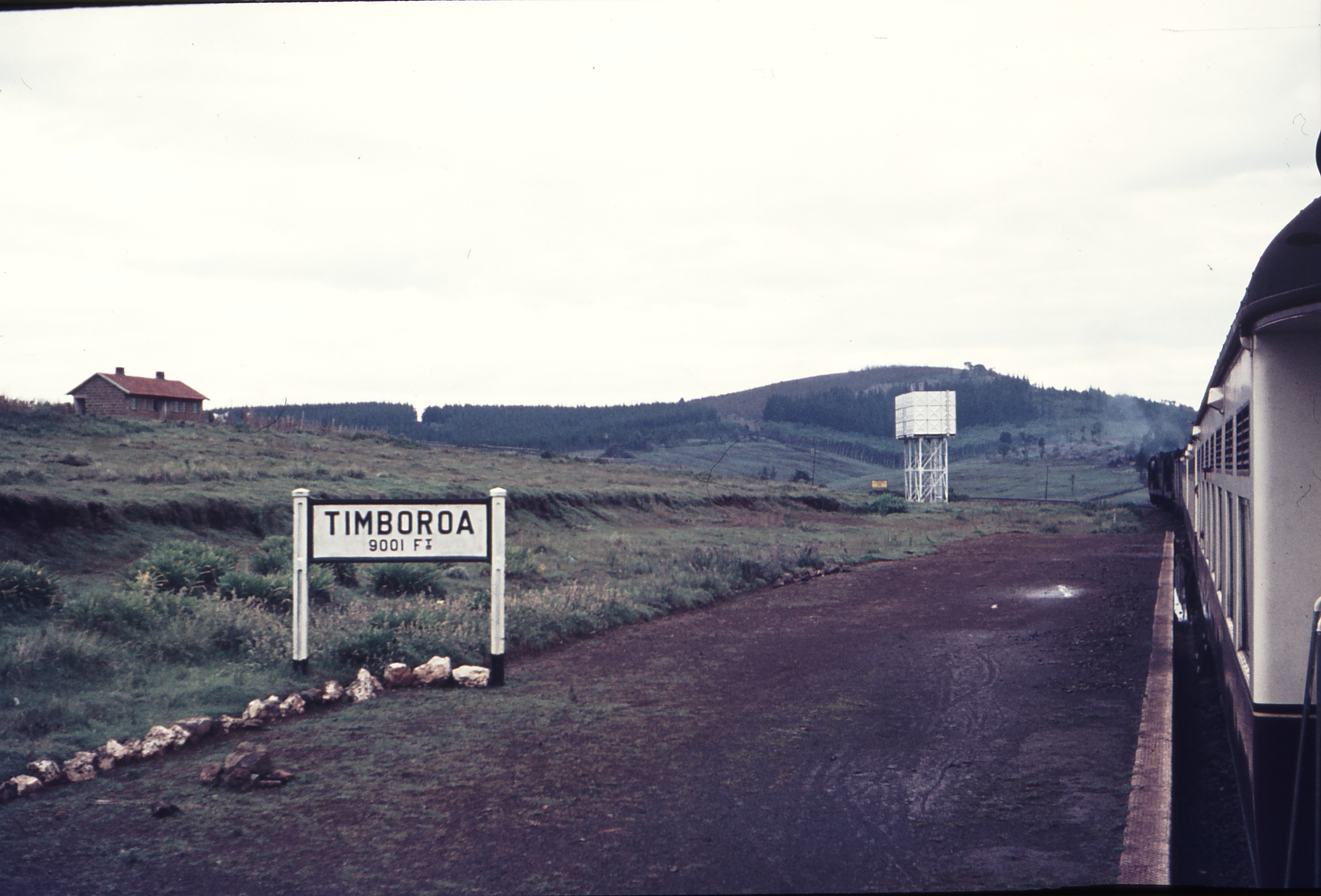
The railway ran parallel to the Nakuru-Eldoret (A104) road, north from the spiral, over the summit, to arrive at Timboroa. Timboroa is just within Baringo County, very close to the border with Uasin Gishu County.At an altitude of 9001ft (2744 metres), Timboroa Railway Station is the 11 highest (non-cable) railway station in the world, and the highest railway station in the Commonwealth. [16]Timboroa Railway Station. [17]111539: Timboroa Kenya Looking East, (c) Weston Langford. [18]

From Timboroa, the railway travelled north through Ainakboi, Tumeiyo, Kipkabus and Kaptagat Stations. Norman and Irene Campbel provide a picture of a school train stopped at Kaptagat in 1961 on Flickr. [24]

Alongside his own photograph of Kaptagat Station, Malcolm McCrow comments: “Trains travelling East would leave Eldoret in the dark, and arrive at Kaptagat just after dawn.” [6]

The adjacent satellite image shows Kaptagat Station which is in a loop in the line which belies the direction of travel. The railway is now travelling in a Northwesterly direction and continues from Kaptagat to Cheploske and Plateau.

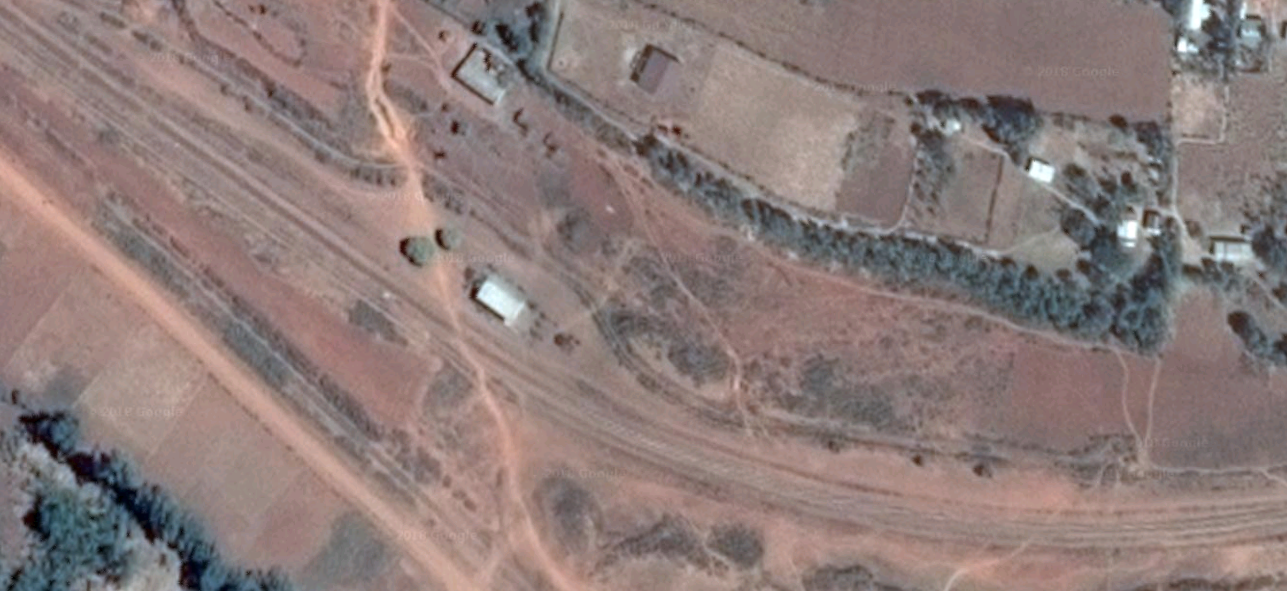
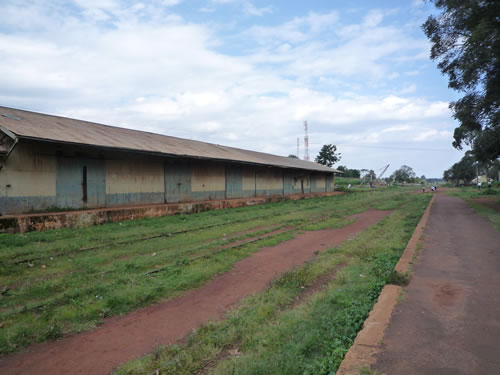
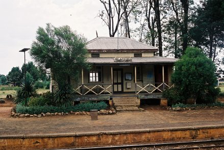
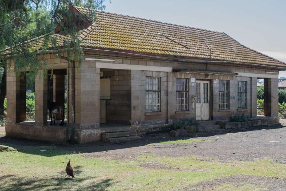
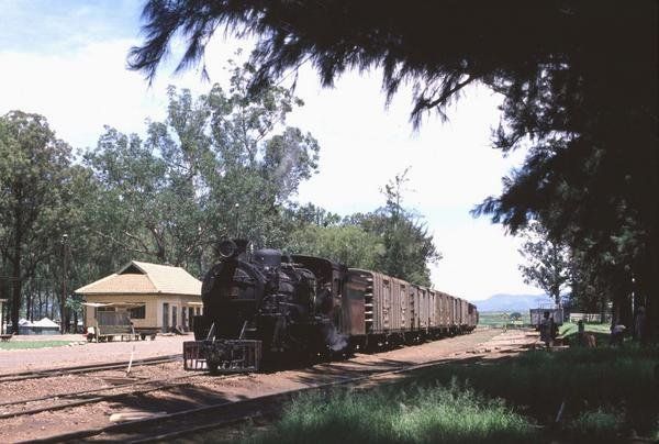
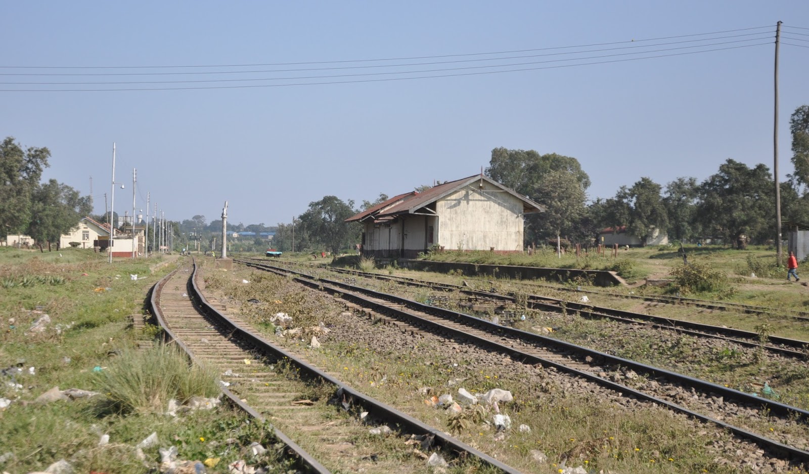
The satellite image below shows Plateau Station. The next photograph shows Plateau Station building.

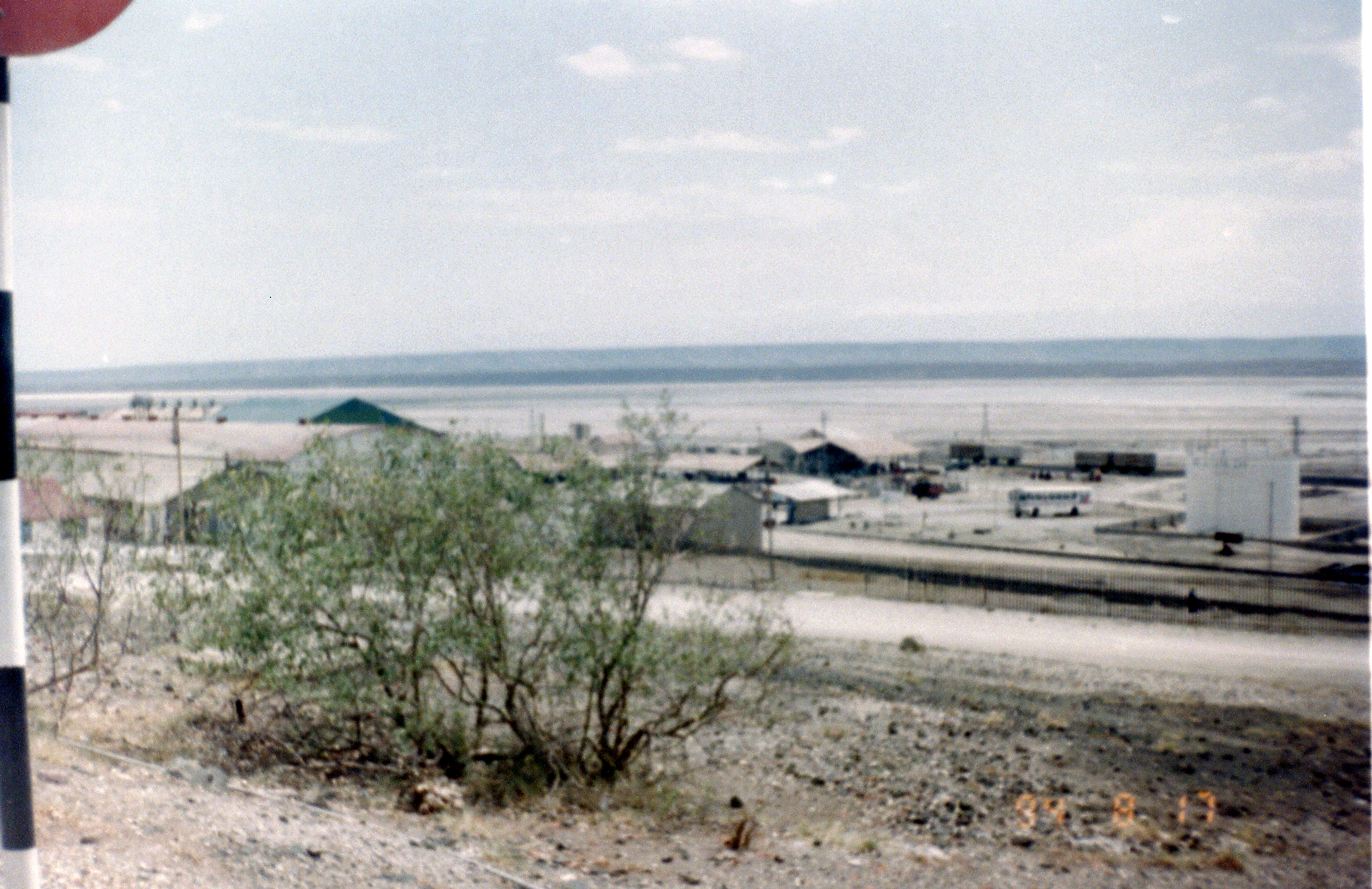
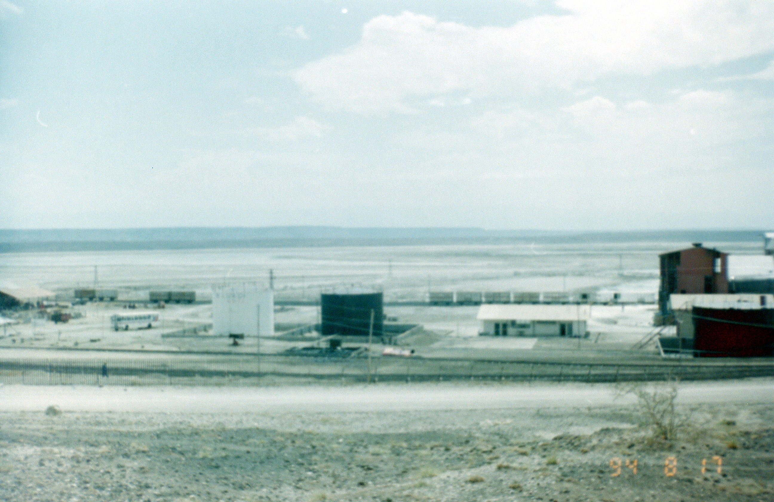
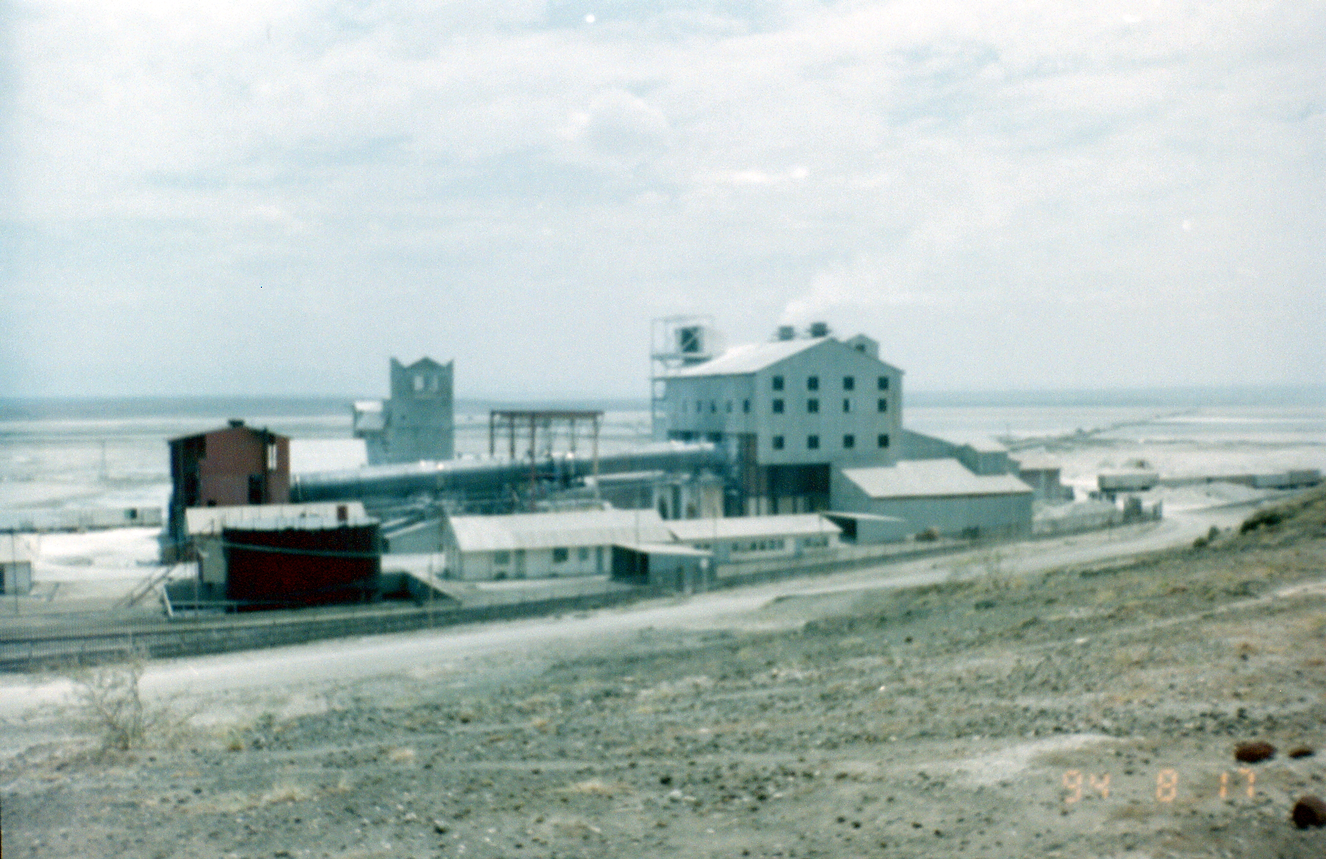
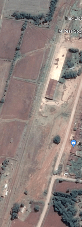
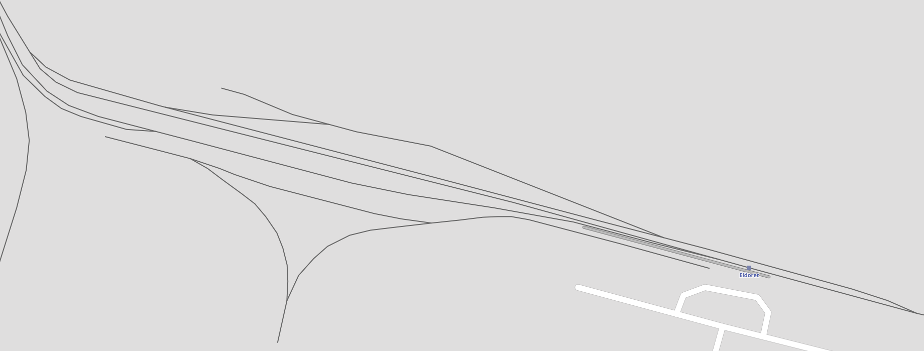
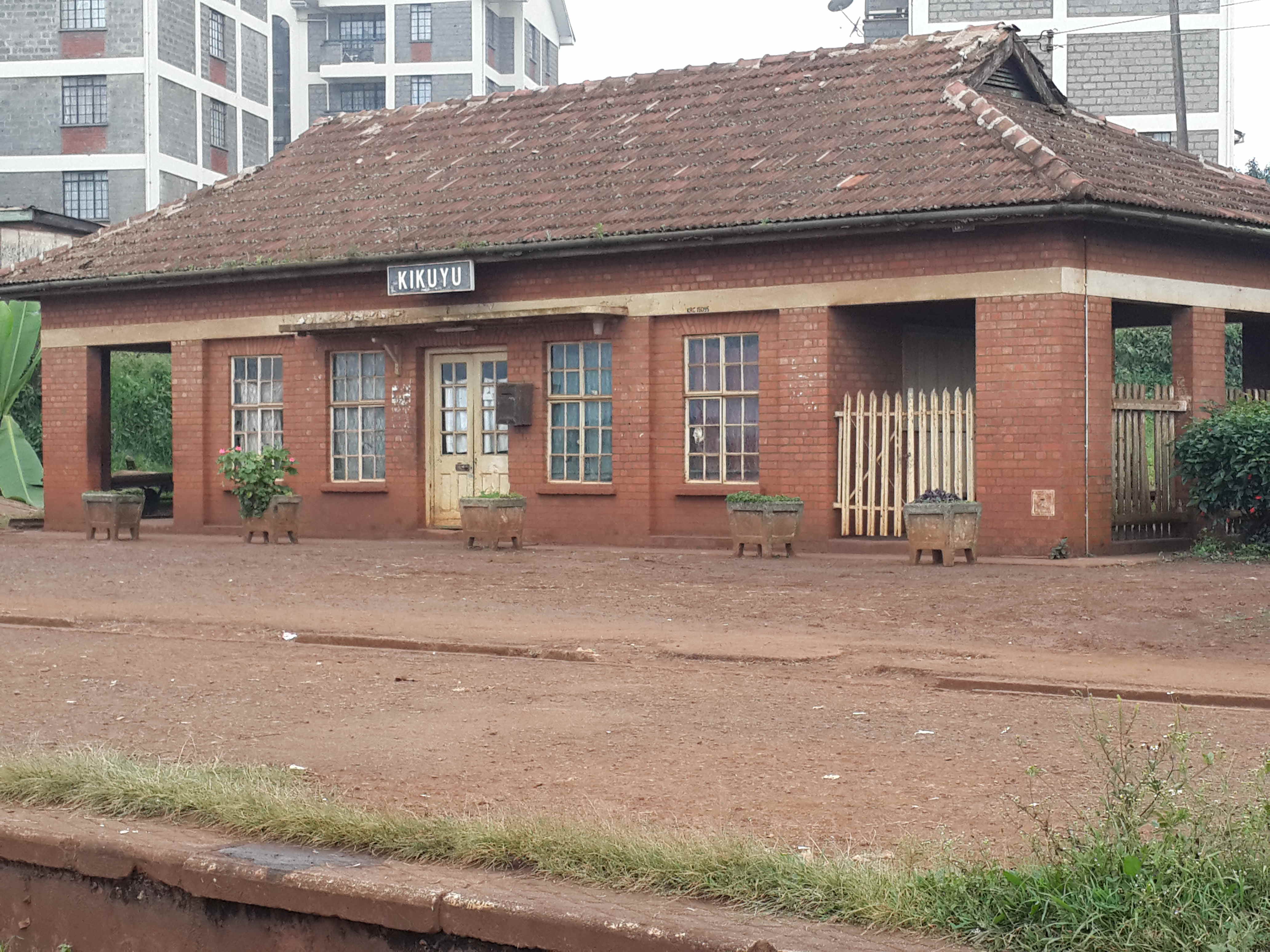
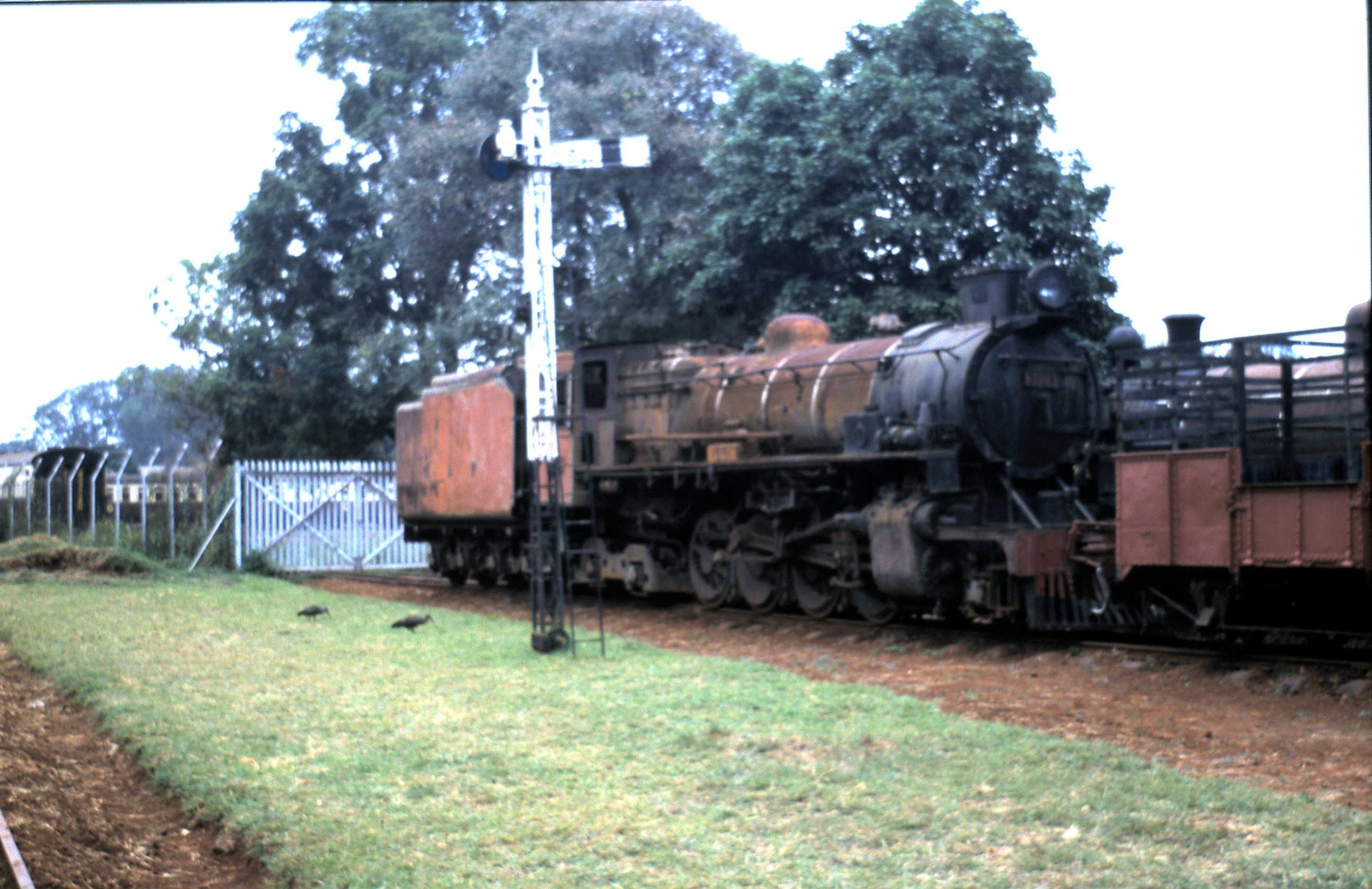
After Plateau, one station remained, Sosian, before trains reached Eldoret. Eldoret is the fifth largest city in Kenya, second only to Kisumu in Western Kenya and the end of this stage of our journey!

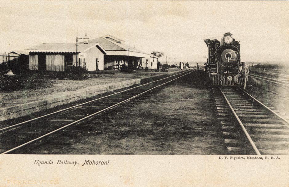
The first train picture below is a very early image from colonial times. The map below shows the track layout at the Station.
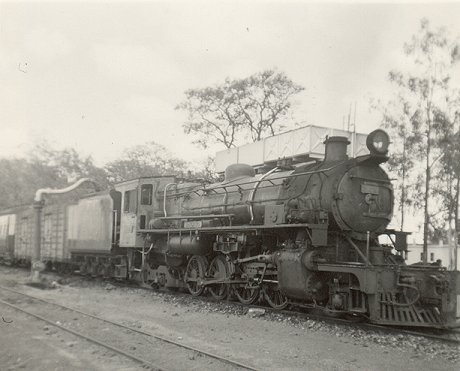
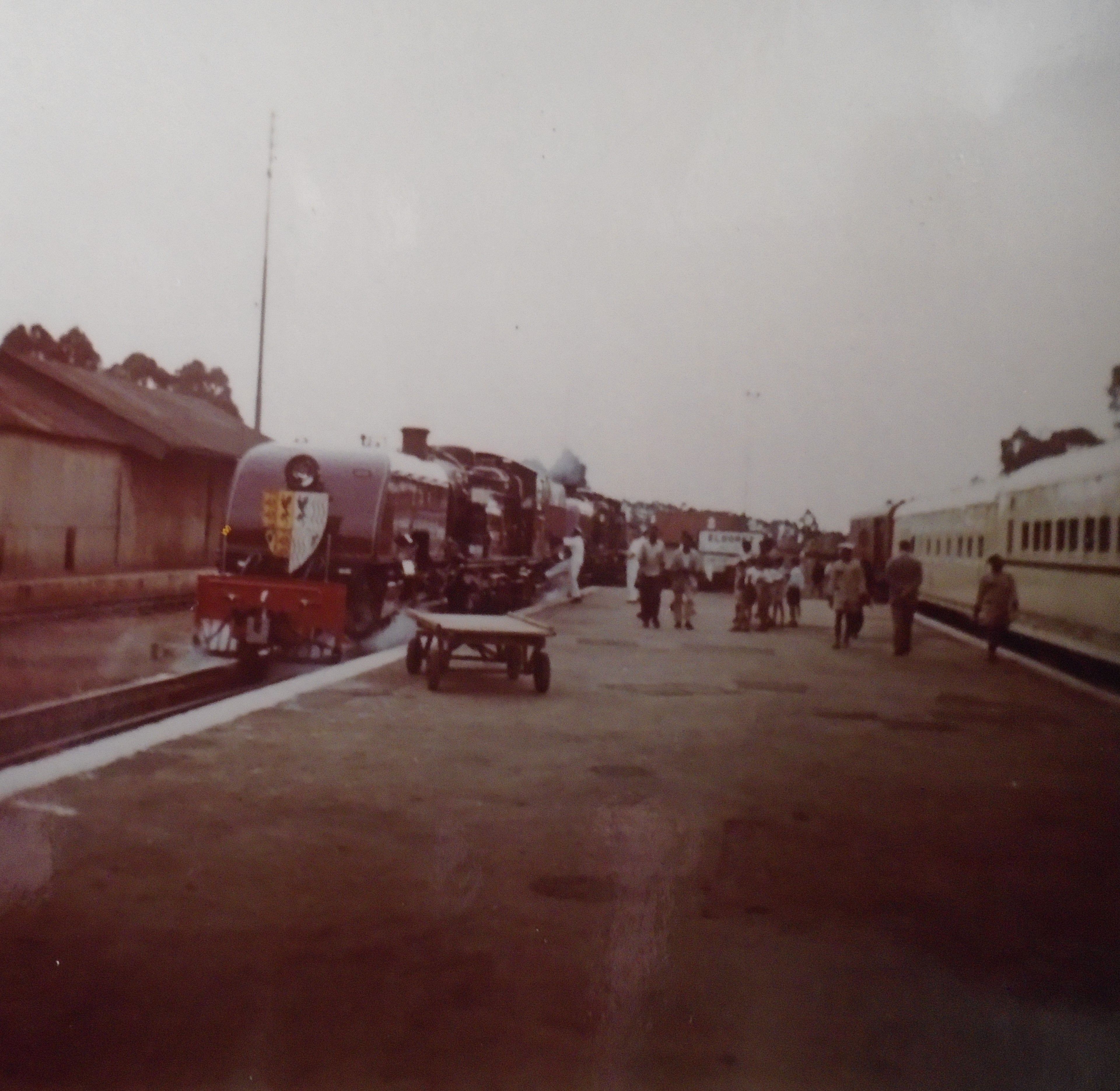
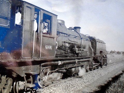
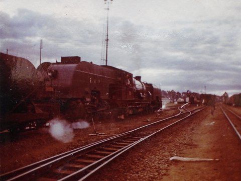
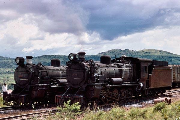
Class 60 no. 6008 at Eldoret in 1958.Derailment Eldoret Yard, 1963 (photo by Neil Rossenrode)
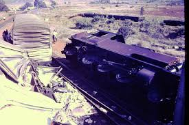
Derailment, Eldoret Yard, 1963 (c) Neil Rossenrode. [21]
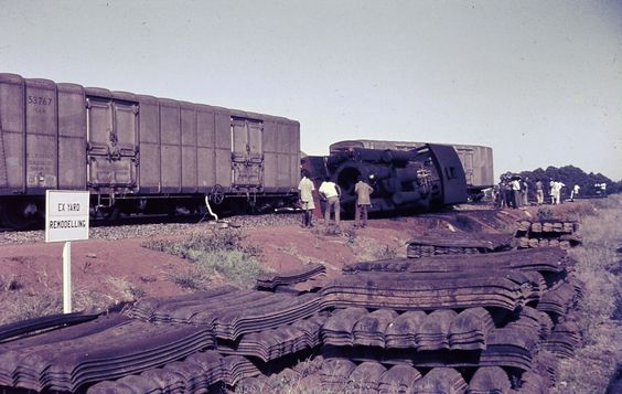
Derailment in Eldoret Yard in 1964, (c) Neil Rossenrode. [20]
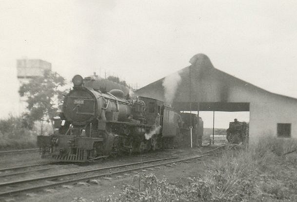
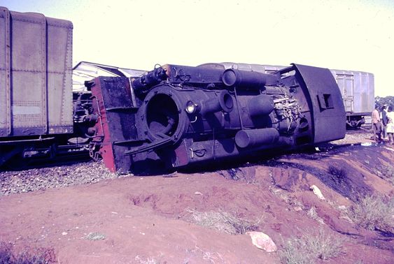
Class 60 in Eldoret Yard, (c) Peter Davis. [22]

References

  1.  “Investing in Uganda’s Mineral Sector” (PDF). http://ugandainvest.com/mining.pdf, accessed on 20th June 2010 – no longer available.
  2. Wikipedia, Uganda Railway; https://en.wikipedia.org/wiki/Uganda_Railway, accessed 15th May 2018.
  3. http://www.oldcambrians.com/Train4.html, accessed 24th May 2018.
  4. https://www.pinterest.co.uk/pin/462463455483881646, accessed 26th May 2018.
  5. https://www.flickr.com/photos/128839707@N03/17430623451/in/photolist-21LmYUY-fN1DNS-dcEEiS-eEjGME-e6J3D7-hGTeBd-RWxLwQ-aeKxoR-F78ngU-RAuADh-dE1BLJ-RWy87C-syhv5x-iWKDzQ-nBk4b-21SDq8g-S7wXDq-sgJGAW-sy9Psw, accessed on 26th May 2018.
  6. http://www.mccrow.org.uk/eastafrica/eastafricanrailways/KampalaNairobi.htm, accessed 24th May 2018.
  7. https://www.flickr.com/photos/youthwith/6775572039/in/photolist-bjJzvz-syhv5x-kb1L9-ijpMZS-5U44mD-bn2NzC-bojoXR-6PHLzC-dxyBy5-ec8xiY-G1SxDj-sgJGAW-6n7s4y-sy9ipf-6riFRd-6riAgq-Xpopdx-4gWSYU-48Eko1-GYcSmb-9RLhA8-F8vFZm-hbYVxX-6SrGXC-mRCD5j-bAnDhS-ab8ZBs-6SrJbQ-cVYkNW-nrEveJ-aeNdcs-dcEEiS-88qc2u-bW6xBx-anC4UM-9phTE9-dhLWA6-9yrcd2-ndUWcA-ow7q5Q-omunYR-5fi4HZ-dhMkh3-9PQA1K-ahCmqV-dhMj1M-9yJt2y-dhMpvT-ejtLxL-dhMpMz, accessed on 26th May 2018.
  8. https://www.flickr.com/photos/128839707@N03/17429023272/in/photolist-sy9ipf-6riFRd-6riAgq-Xpopdx-4gWSYU-48Eko1-GYcSmb-9RLhA8-F8vFZm-hbYVxX-6SrGXC-bAnDhS-ab8ZBs-6SrJbQ-cVYkNW-nrEveJ-aeNdcs-dcEEiS-88qc2u-bW6xBx-anC4UM-9phTE9-dhLWA6-9yrcd2-ndUWcA-ow7q5Q-omunYR-5fi4HZ-dhMkh3-9PQA1K-ahCmqV-dhMj1M-9yJt2y-dhMpvT-ejtLxL-dhMpMz-7Va4eP-cghReq-dhM7nf-dhMhsp-CVvK3Z-ejtLMG-ej6uDv-cghR8s-chyaZb-9XjosD-dhMtx2-ejo3Di-dhMcg8-aeKpAn, accessed on 26th May 2018.
  9. https://www.flickr.com/photos/31312468@N00/6816119855/in/photolist-bojoXR-6PHLzC-dxyBy5-ec8xiY-G1SxDj-sgJGAW-mRCD5j-6n7s4y-sy9ipf-6riFRd-6riAgq-Xpopdx-4gWSYU-48Eko1-GYcSmb-9RLhA8-F8vFZm-hbYVxX-6SrGXC-bAnDhS-ab8ZBs-6SrJbQ-cVYkNW-nrEveJ-aeNdcs-dcEEiS-88qc2u-bW6xBx-anC4UM-9phTE9-dhLWA6-9yrcd2-ndUWcA-ow7q5Q-omunYR-5fi4HZ-dhMkh3-9PQA1K-ahCmqV-dhMj1M-9yJt2y-dhMpvT-ejtLxL-dhMpMz-7Va4eP-cghReq-dhM7nf-dhMhsp-CVvK3Z-ejtLMG, accessed on 26th May 2018.
  10. https://www.theeagora.com, accessed on 21st May 2018.
  11. https://en.m.wikipedia.org/wiki/Menengai, accessed on 26th May 2018.
  12. https://en.m.wikipedia.org/wiki/Rongai, accessed on 26th May 2018.
  13. https://en.m.wikipedia.org/wiki/Maji_Mazuri, accessed on 27th May 2018.
  14. http://www.friendsofmombasa.com, accessed on 15th May 2018.
  15. https://www.flickr.com/photos/bvohra/8223072164/in/photolist-dwDoSh, accessed on 26th May 2018.
  16. https://twitter.com/kresearcher/status/560091036849287168, accessed on 27th May 2018.
  17. https://www.pinterest.co.uk/pin/90986854943791222/?lp=true, accessed on 27th May 2018.
  18. http://www.westonlangford.com, accessed 24th May 2018.
  19. https://www.pinterest.co.uk/pin/559361216210820409, accessed on 27th May 2018.
  20. https://www.pinterest.co.uk/pin/462463455481301933/?lp=true, accessed on 27th May 2018.
  21. https://www.pinterest.co.uk/pin/482377810082083293/?lp=true, accessed on 27th May 2018.
  22. https://www.pinterest.co.uk/pin/559361216210820386/?lp=true, accessed on 27th May 2018.
  23. Not used
  24. https://www.flickr.com/photos/128756940@N02/15602334132/in/photostream, accessed on 27th May 2018.

The Uganda Railway – Part 11 – The Branch from Kisumu to Butere

We start with some useless trivia, or some vitally important information about Kisumu. Which it is depends on your personality and perspective! This is only a very short post about a branch line which has very little traffic on it, the line from Kisumu to Butere.

Kisumu, officially known as Kisumu City (and formerly Port Florence), is a Kenyan inland port city on Lake Victoria and the capital city of Kisumu County, Kenya. At an elevation of 1,131 m (3,711 ft), the city-county has an estimated population of 968,879, while the metropolitan region comprising the city and its suburbs and satellite towns of Maseno, Kondele and Ahero was estimated at over 1 million in early 2017. It is the third largest city in Kenya after the capital, Nairobi, and the coastal city of Mombasa. Kisumu is the principal city of western Kenya, the immediate former capital of Nyanza Province, the headquarters of Kisumu County and the proposed headquarters of the Lake Region Economic Block, which is a conglomeration of 13 counties in Western Kenya. It is the largest city in western Kenya and the second most important city after Kampala in the greater Lake Victoria basin.

Kisumu port was founded in 1901 as the main inland terminal of the Uganda Railway named “Port Florence”. Although trade stagnated in the 1980s and 1990s, it is again growing around oil exports.

Kisumu literally means a place of barter trade “sumo”. The city has “Friendship” status with Cheltenham, United Kingdom and “sister city” status with Roanoke, Virginia and Boulder, Colorado, United States. [1]

As we noted in the last post in this series, Kisumu Railway Station is currently abandonned, although this may change in the relativel;y near future

At the turn of the Twentieth Century, Kisumu was chosen as the destination for the Uganda Railway. Kisumu is not and was not in Uganda. But it was the port on Lake Victoria from which steam ships sailed to Port Bell for Kampala. The Railway did not reach Kampala until the 1930s. After this the mainline to Kisumu became just a branch from Nakuru. In the mid-sixites, two rail ferries – the UMOJA and the UHURU – were commissioned for lake service, principally between Kisumu, Jinja and Mwanza. Here one of them prepares for an evening departure, (c) James Waite. [2]

Before we set off down the short branch to Butere. Here are a few photos of locomotives at Kisumu from the middle of the 20th Century. All are taken by James Waite and used with his kind consent. [2]

Class 31 No. 3130 spends the night at Kisumu motive power depot in company with Class 24 No. 2448 (c) James Waite. [2] Tank Engine No. 1302 lets off steam in Kisumu, (c) James Waite. [2] Morning at Kisumu as Tribal Class No. 3101 gets up steam, (c) James Waite. [2]No. 3101 sets off for a day’s work.  It is perhaps surprising that, as a Kenyan locomotive, it has retained its BAGANDA name plate (c) James Waite. [2]

We leave Kisumu Station travelling for a very short distance back down the line towards Nairobi. Just beyond the station throat and alongside Obote Road the Butere branch leaves the mainline.

The mainline heads north and the branch heads west towards Kisian, running on the North side of the B1 road.Tribal Class No. 3130 (formerly Karamojong) departing Kisumu with one of the three daily services to Butere, (c) James Waite. [2]

Kisian Station. [3]

Yala railway station
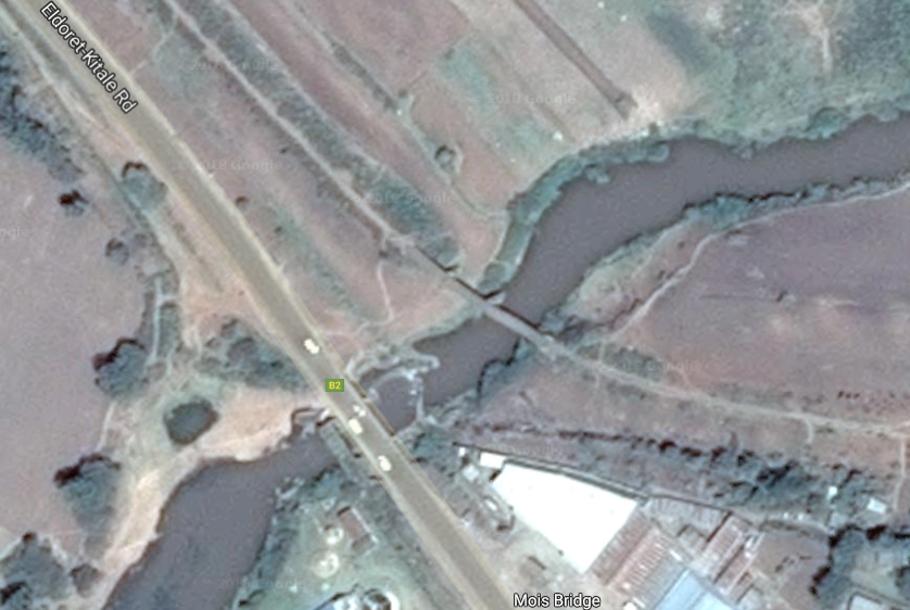
We travel on through Lela Station and very quickly after that through Maseno Station. A short distance further on and the train passes through Luanda Station, and then on over the Yala River to Yala Railway Station. Sadly, there are very few pictures of these stations available on the internet, but one great source is Rob Dickinson’s site. [4]

Beyond Yala, the line travels just a short distance north to Namasoli and then on to the end of the line at Butere. Butere was, like many other town’s in the area heavily dependent on sugar cane.


Apparently not making deliberate smoke for the camera, Tribal Class No. 3130 heads across the equator towards Butere, (c) James Waite. [2]

References

  1. https://en.wikipedia.org/wiki/Kisumu, accessed on 25th May 2018.
  2. http://www.mccrow.org.uk/EastAfrica/EastAfricanRailways/NairobiKisumu.htm, used by kind permission from James Waite, first accessed on 25th May 2018, reviewed on 16th March 2021.
  3. http://www.savetherailway.com, accessed on 24th May 2018.
  4. https://www.internationalsteam.co.uk/safari/kenyawest.htm, accessed on 29th March 2021.

The Uganda Railway – Part 10 – West of Nakuru – the line to Kisumu.

Nakuru railway station sits on the east side of the centre of Nakuru and to the east of the goods yard and MPD. The new station was completed in 1957.Nakuru is a junction station. The original Uganda Railway travelled west from Nakuru to Kisumu on Lake Victoria and a steamer service provided access to Kampala via Port Bell. Once the railway was built to Kampala and beyond, the line to Kisumu became a branch-line. Before we travel on to Kampala on the main-line we need to explore the original line to Kisumu and its branch-line to Butere. Progress along the main line will need to wait for a later post.

We being the journey to Kisumu at Nakuru railway station, which, in its current form, dates from 1957. The picture below shows the station yard at Nakuru around the turn of the 20th Century.Once past the MPD, the line followed the Nakuru-Sgor Road (B4) for a short distance before swinging away to run alongside the Nakuru-Kisumu Road (A104). A short distance travelled on the North side of the A104 led to the junction between the Kampala and the Kisumu lines. The Kampala line set off in a northerly direction and the Kisumu line swung sharply away the south going under the A104 and then south-southeast to run alongside the Tarmak Road (A56) to Njoro and its station.[5]111548: Mile 454-2F West of Nakuru Kenya Mixed to Kisumu 5812, © Weston Longford. [1] Another mixed train is shown in the picture on the right. The image comes from the Imperial War Museum and is entitled, “A Train Leaving Nakuru in the Rift Valley on the Long Climb over the Mau Escarpment to Kisumu in Kenya (Circa 1950s).” This mention of the Mau Escarpment has jogged my memory about an incline on the line to the West of Nakuru and this will require further investigation!

After Njoro, trains ran parallel to the C56 for a kilometre or so before meandering away to the south of the road only meeting it again at Elburgon.At Elburgon the railway swings north, crossing the C56 and circumnavigating a residential area before swinging back once again towards the C56 and crossing two viaducts. These were two trestle bridges as can be seen by the shadows cast by the sun on the satellite image below.Trestle bridges were the typical bridge structures on the Kisumu line. Two of these viaducts are shown in the images immediately below.[2] Both are © James Waite. The line continues to follow the C56 on its journey to the next town, Molo, passing through the small settlement of Turi and over another trestle bridge close to that village.[3]

Molo Railway Station building, like others we have already encountered on the line, s built in stone and so feels a substantial building.

Alongside these notes are two photographs of the station building, they are traditionally shot and as such provide a good insight into what the building was like. The pictures which follow are part of a photo essay by David Mutuma which he has called “Lil’ Town in the Forest”. They are stylised and reflect his perspective on the buildings. They are enjoyable, but further than that, for the purposes of this blog, they pick up details of the station which I have not been able to find in respect of other stations on the line.[4] Beyond Molo, the next station is Mau Summit. This is adjacent to the C56 and easily accessible.A series of stations follow – Londiani, Kedowa, Lumbwa, Kipkelion and Tunnel, before we arrive at Fort Ternan.Londiani. [5]Class 30 No. 3020 ‘Nyaturu’ at Kipkelion Station © Donald Mac.[10]Kipkelion main railway offices above and Lumbwa station buildings below, © Anita Chepkoech. [6]After following the C56 and then the B1 road. The railway finds itself following a circuitous path through the stations above before getting to Fort Ternan. Over the last few kilometres into the town the railway follows the C35. The nature of the landscape means that a series of trestle viaducts were necessary to keep gradient as shallow as possible.Class 87 No. 8740  at Fort Ternan, © Yves Locomot.[7]111557: Mile 536-11F between Tunnel and Fort Ternan, on the same viaduct, Class 58 Garratt No. 5812 is in charge of a westbound mixed goods train. [1]Fort Ternan had a triangle for reversing of locomotives as can be seen in the map extract above and the satellite image below.Fort Ternan Railway Station.[5]
Class 24 No. 2448 waits in the loop at Fort Ternan for the Nakuru goods to arrive, © James Waite.[8]Two Class 24 locos at Fort Ternan in 1977, © Lou Johnson.[9]


We travel on through Koru Station, then Muhoroni Station, and we have pictures of that station below.Then we pass through Chemelil Station, the picture below was taken sometime in the mid-1950s. [11]Chemelil Railway Station.[5]Children cross the tracks at Chemelil.[5]

Further along the line we cross the Nyando River and pass through Kibigori Station. Now travelling due west the line passes through Miwani (below) and Kibos Stations before reaching Kisumu on Lake Victoria.

On the plan below the picture of Miwani, we can see the terminus at Kisumu and also the branch-line which heads westwards to Butere.Kisumu’s station canopies are of a similar design to those at Nyakuru. Sadly, the station gets a lot less use than it used to. It has been closed for some time now and its condition is deteriorating.Kisumu railway station, Kenya

Some of these pictures of the station come from a site dedicated to saving stations along the Lunatic Line and were taken in 2016.[5] Others were taken in 2011,[12] by Richard Portsmouth.

The town holds out a hope that the SGR which will soon reach Naivasha and will continue to Kisumu. The proposal that they have submitted involves the SGR taking over the site of the present station.[13]

The short branch from Kisumu to Butare will be the subject of a separate post.


References

  1. http://www.westonlangford.com, accessed on 25th May 2018.
  2. http://www.mccrow.org.uk/eastafrica/eastafricanrailways/KampalaNairobi.htm, accessed on 24th May 2018.
  3. http://ke.geoview.info/kenya_uganda_railway_bridge_at_turi_molo_in_kenya_built_in_1901,50149067p, accessed on 25th May 2018.
  4. http://www.davidmutua.com, accessed on 25th May 2018.
  5. http://www.savetherailway.com, accessed on 24th May 2018.
  6. https://www.nation.co.ke/lifestyle/dn2/Kipkelion-railway-British-colonialists-George-Hamilton/957860-4254230-28bxr/index.html, accessed on 25th May 2018.
  7. http://www.railpictures.net, accessed on 25th May 2018.
  8. http://www.mccrow.org.uk/eastafrica/eastafricanrailways/NairobiKisumu.htm, accessed on 25th May 2018.
  9. https://www.world-railways.co.uk/general-photo-028, accessed on 25th May 2018.
  10. http://trip-suggest.com/kenya/rift-valley/fort-ternan, accessed on 25th May 2018.
  11. https://www.pinterest.com/pin/554083560377608216, accessed on 25th May 2018.
  12. https://www.flickr.com/photos/62358811@N02/sets/72157626548108635/with/5699139410, accessed on 25th May 2018.
  13. http://architecture.uonbi.ac.ke/sites/default/files/cae/builtenviron/architecture/2_0.pdf, accessed on 25th may 2018.


The Uganda Railway – Part 9 – Naivasha to Nakuru

We start the next leg of the journey at Naivasha Railway Station. Class 30 2-8-4 No. 3020 “Nyaturu” (NBL 27466/1955) stands at Naivasha, it is one of three locomotives restored by Nairobi Railway Museum and was originally in use on the Tanzanian part of the EAR system (c) James Waite. [1]As we leave Naivasha, the railway continues in a north-westerly direction through Morendat Station, over Morendat River Bridge and through Ilkek Station to Gilgil. Morendat Station and River Bridge on Google Satellite Image.Ilkek Station.

Gilgil is the first town after Naivasha along the line.111464: Gilgil Kenya 3124 Chope Derailed – taken on 24th August 1971, (c) Weston Langford.[2] Three images of Gilgil Station seemingly abandonned in 2013 …….[3],[4],[5]Gilgil was the junction station for the line to Nyahururu. This branch ran through Oleolondo and Ol Kalou to reach Nyahururu, the branch terminus. It left the mainline just to the East of Gilgil and followed what is now the C77 road from Gilgil. The line snaked around passing through Gilgil Golf Course and can be seen alongside the 4th hole of the 9-hole course in the image below.[6]After the golf course the line swung away from the C77 to the south-east and then for a very short distance ran alongside what is now the D390 before turning to the north and eventually regaining a path  a 100 metres or a bit more to the east of the C&7 running north towards Oleolondo where the line crossed the road at grade. It conitnued to follow the C77 northwards but now on its west side until reaching a station halt at Ol Kalou.

The old station site at Ol Kalou remains open and undeveloped as can be seen on the adjacent satellite images from Google Earth.

From Ol Kalou the abandonned line continued north alongside the C77, always within about 100 metres of it and then crossing over to the east side of the road a kilometre or two north of Ol Kalou before reaching its terminus at Nyahururu.

In the images above the tourist attraction which probably supported the branch-line while it was in operation can be seen – the Thompson Falls gave their name to the town in colonial times. Nyahururu was founded as Thomson’s Falls after the 243 ft (74m) high Thomson’s Falls on Ewaso Narok river, a tributary of the Ewaso Nyiro River, which drains from the Aberdare mountain ranges. It is on the Junction of Ol Kalou-Rumuruti road and the Nyeri-Nakuru road.

The town grew around a railway from Gilgil opened in 1929 (and now effectively abandoned). As well as providing access to a tourist attraction the line supported local industry. The town was once an important player in the timber milling industry, and the now defunct National Pencil Company had a factory there. It is also an important milk processing hub.[7]

The map and satellite image show the location of the railway terminus and the turning triangle for locomotives.

We return now to the mainline and travel on from Gilgil. The next station on the mainline is Kariandusi.Kariandusi village is a settlement in Nakuru County, Kenya. It is located 17.5 miles from Nakuru town and 7.5 miles from Gilgil town. Inhabitants of Kariandusi settled in the area in early 1980s in the former Lord Egerton Cole and Lord Delamere ranches. The area has a well established tourism industry, with Kariandusi prehistoric site, Lake Elementaita, Several Hot Springs and booming hospitality industry providing the economic growth for the area.[8] It sits close to the lake and under the significant local peak know as Table Mountain.

The prehistoric site is amongst the first discoveries of Lower Paleolithic sites in East Africa. There is enough geological evidence to show that in the past, large lakes, sometimes reaching levels hundreds of meters higher than the Present Lake Nakuru and Elementaita, occupied this basin.

Dating back between 700,000 to 1 million years old, Kariandusi is possibly the first Acheulian site to have been found in Situ in East Africa. Dr. Leakey, a renowned paleontologist, believed that this was a factory site of the Acheulian period. He made this conclusion after numerous collections of specimens were found lying in the Kariandusi riverbed.

This living site of he hand-axe man, was discovered in 1928. A rise in the Lake level drove pre-historic men from their lake-side home and buried all the tools and weapons which they left behind in a hurry. The Acheulian stage of the great hand-axe culture, to which this site belongs, is found over a very widespread area from England, France, and Southwest Europe generally to Cape Town.[9]

The image above is typical of the scenery in this area of the Rift Valley and is taken close to Mbaruk the next station on the line. The satellite image below shows the passing loop and station at Mbaruk.The last station before Nakuru itself is in Nakuru’s suburbs at Lanet and the location is shown in the satellite image below.Nakuru is the final destination for this blog post.

Nakuru was the most modern station on the line – complete with a public address system, colour light signalling and double track westbound between Nakuru East and the divergence of the former mainline to Kisumu.  During stops at Nakuru passengers could buy refreshments, books and newspapers from a trolley which passed down the platform while the locomotive was being changed, © Malcolm McCrow.[10]

111545: Nakuru Kenya 0920 Mixed to Kisumu 5812©Weston Langford.[2]111546: Nakuru Kenya 0920 Mixed to Kisumu 5812©Weston Langford.[2]111547: Nakuru Kenya 0920 Mixed to Kisumu 5812©Weston Langford.[2]

References

  1. http://www.internationalsteam.co.uk/trains/kenya11.htm, accessed on 24th May 2018. The photograph was taken by James Waite. He comments: This photograph, “took a long time to set up, even by the standards of night photos. I had gone out to Naivasha on the empty stock of the steam special and spent the night at the Bell Inn on the main street at Naivasha opposite the station. As I was travelling light I didn’t take a tripod with me and it wasn’t until I was talking to the loco’s support crew over supper the previous evening that I realised they would be lighting up before dawn. I walked over to the station and took my suitcase with me to use as a camera stand. The light was too dim for my camera’s autofocus to work, and its manual focus setting was erratic. I ended up taking something like 20 to 30 exposures, each at a slightly different focus, and only this one worked out properly by the time I had eliminated all those suffering from shake because of the lack of a tripod. I only had ten minutes or so between inky-black dark and too much dawn light as the sun comes up so quickly close to the equator.
    Everyone else on the photo tour had spent the previous afternoon visiting Nairobi works, spent the night in the city and travelled out to Naivasha by road for the start of the photo charter, and I counted myself very lucky to have been able to enjoy the ride in the empty train down the side of the escarpment into the Rift Valley in the afternoon sunshine, as well as being able to take this night shot without having to work around other photographers.
  2. http://www.westonlangford.com, accessed on 25th May 2018.
  3. http://jimstotherssabbatical.blogspot.co.uk/2013/08/sabbaticalday-19-12-august-correction.html, accessed on 25th May 2018.
  4. https://innovation.journalismgrants.org/projects/chinas-train-to-african-development, accessed on 25th May 2018.
  5. https://www.flickr.com/photos/156858441@N07/26344179857/in/photolist-G8WNRx, accessed on 25th May 2018.
  6. http://www.shoestringgolfer.com/2011/11/gilgil-golf-club-great-rift-valley, accessed on 25th May 2018.
  7. https://en.wikipedia.org/wiki/Nyahururu, accessed on 25th May 2018.
  8. https://en.wikipedia.org/wiki/Kariandusi, accessed on 25th May 2018.
  9. http://www.museums.or.ke/kariandusi, accessed on 25th May 2018.
  10. http://www.mccrow.org.uk/eastafrica/eastafricanrailways/KampalaNairobi.htm, accessed on 24th May 2018.

The Uganda Railway – Part 8 – West of Nairobi (Nairobi to Naivasha)

In 1994, I had a few hours waiting at Nairobi Railway Station before getting on the train to Kampala. It was a fantastic journey at a very slow speed with the journey length extended by a 6 hour stop in Jinja waiting for a derailed goods train to be re-positioned on the rails in the section between Jinja and Kampala. My pictures were sadly not of the highest standard and I was having problems with my SLR camera by this time. The next two pictures prove that I was there but achieve little else!Later in my 1994 trip, I spent a day with a friend in Kibera Slum, again, the pictures are of a very low quality. One of the first places encountered by the railway west of Nairobi is the Kibera slum. The date stamp on two of the photos remind me of the time of year I was there. Travelling across Kenya and then into the South West of Uganda became a real expedition as I ended up spending two weeks just over the border from Rwanda at the time of the genocide in that country.

Trains left Nairobi Central Station in a generally south-westerly direction and the line meandered through the suburbs of the city. The adjacent picture shows the interior of a carriage on the train in 1994. The image below shows a Garratt hauled train to the West of Nairobi Station in the post war period, © East African Railways.

Trains first crossed the 9-hole Kenya Railway Golf Course! In 1921, the wife of the Kenya Railways manager, Mrs Couper, established a Golf Club for the Kenya Uganda Railways staff and in 1924 it opened its membership to non-railways staff. The course still revolves heavily around the railway line, which passes straight through the middle of the course. The only hole though where it comes into play is the 2nd, where your tee shot could cause some damage to a passing train if not connected well! [1] The footbridge over the railway can be seen on the right of the first photograph below. The third image below is taken from that footbridge

The line winds its way through the relatively affluent areas before reaching Kibera, 6.6 kilometres (4.1 miles) from the city centre. [2] Kibera is the largest slum in Nairobi, and the largest urban slum in Africa. [3][4][5] The 2009 Kenya Population and Housing Census reports Kibera’s population as 170,070, contrary to previous estimates of one or two million people. [6] Other sources suggest the total Kibera population may be 500,000 to well over 1,000,000 depending on which slums are included in defining Kibera. [7][8][9][10]

Most of Kibera slum residents live in extreme poverty, earning less than $1.00 per day. Unemployment rates are high. Persons living with HIV in the slum are many, as are AIDS cases. [11] Cases of assault and rape are common. There are few schools, and most people cannot afford education for their children. Clean water is scarce. Diseases caused by poor hygiene are prevalent. A great majority living in the slum lack access to basic services, including electricity, running water, and medical care.[12]Significant slum clearance was underway when I was in Kibera in 1994 and the elements of the slum which were on the north side of the railway seem now to have been replaced by high-end apartments, but the slum still exists, as can be seen below.After passing alongside/through Kibera, the railway meanders in a generally westward direction through the Nairobi suburbs, north of the Ngong Road Forest and north of the Racecourse and through Dagoretti Station.The railway travels North-northwest for a time and then switches back, crosses the Nairobi Southern By-Pass and enters Kikuyu Station.Kikuyu Station is 20 kilometres or so from Nairobi, railway officers established a temporary base in Kikuyu while they supervised work on the laying of the track down at the rift valley escarpment. [13]A green liveried East African Railways Corporation Loco heads an all classes passenger train into Kikuyu while a freight train headed by a Class 29 awaits departure, © Kevin Patience. [14]

After Kikuyu, the railway travels almost due north to Muguga and then Limuru. On the way to Limuru, trains pass through a 1.7 kilometre long tunnel.

Limuru is  located on the eastern edge of the Great Rift Valley about 27 kilometres (17 mi), by road, northwest of Nairobi. Most of the area of Limuru is now what was previously known as the “white highlands”, a rich agricultural land just south of the equator. The term “white highlands” derived from the British and other Europeans who realised the productive potential of this area and settled in large numbers with the support of the colonial government, establishing coffee and tea plantations, cereal farms and ranches. The altitude of the town is about 2,500 metres. [15]A Mail Train has just exited Limuru Tunnel, © Iain Mulligan. [14]Limuru Footbridge. [16]From Limuru, trains begin their decent into the Rift Valley, through Uplands (Lari),  Matathia,  Kijabe, Longonot, Suswa and Munyu stations before reach Naivasha in the valley floor.Uplands (Lari) Station.The two images immediately above were taken by me in 1994 looking down into the Rift Valley.Royal train bearing TRH The Duke and Duchess of Gloucester approaching Matathia station in the Kenya Highlands, then to Uganda 1950. [17]Longonot Railway Station. [18]Mount Longonot. [19] SuswaMunyuMunyu Signal BoxNaivasha. [18] Lake Naivasha

Two Postscripts

Postscript A – The Future ………. This length of the Uganda Railway coincides with the current programme of work on the SGR. A line from Nairobi to Naivasha should be completed in 2019. Major work is being undertaken as I write this blog in May 2018. A significant tunnel is being built as part of the work.[20]

Construction of SGR phase II from Nairobi-Naivasha is on course as Kenyans already enjoy the stretch from Mombasa-Nairobi. The extension to the geothermal town on Naivasha was launched by Uhuru in 2015. The line is being undertaken by China Road and Bridge Corporation at a cost of KSh 105 billion.

SGR phase 2 was funded by the Export-Import Bank of China, earmarking a loan of a total of KSh 357 billion. The finance is meant to cater for the construction of the Railway up to Kisumu and rule out land hitches by reimbursing displaced persons.[20]

Postscript B – The Past ……….. In order to allow the original Uganda Railway construction to proceed at pace and incline was created. It was a primitive form of Funicular Railway, built on a steep and straight incline with trolleys on which locomotives and wagons could be lowered. It lasted in operation for only about 15 months before the main railway reached the valley floor and it became redundant.

While the incline was only in use for a few months during the construction of the railway, the main line passed through Escarpment Station until 1948 before being rerouted. [21] The line of the incline can be seen in the satellite image below running west from the Primary school across the centre of the image. and the remains of winding houses can be seen on the image and more clearly on Google Earth.

References

  1. http://www.shoestringgolfer.com/2011/10/kenya-railway-golf-club-nairobi, accessed on 24th May 2018.
  2. “Kibera to Nairobi”. Google Maps. Google, accessed on 26th May 2017.
  3. “A Trip Through Kenya’s Kibera Slum”. International Medical Corps. 27th March 2006, accessed on 31st January 2013.
  4. “Sanitation – vacutug | Participating countries”. Un-Habitat, accessed on 31st January 2013.
  5. http://www.dominionpaper.ca/articles/1703 Machetes, Ethnic Conflict and Reductionism
    Karanja, Muchiri (3 September 2010). “Myth shattered: Kibera numbers fail to add up”. Daily Nation. acessed on 4th September 2010.
  6. Annabel S. Erulkar, James K. Matheka. “Adolescence in the Kibera Slums of Nairobi Kenya” (PDF). Population Council. Archived from the original (PDF) on 11th May 2012, accessed on 10th July 2012.
  7. Understanding the Grassroots Dynamics of Slums in Nairobi: The Dilemma of Kibera Informal Settlements Emmanuel MUTISYA and Masaru YARIME, International Transaction Journal of Engineering, Management, & Applied Sciences & Technologies, Volume 2, No.2 (2011); pages 197–213
  8. Audio Slideshow: Dr. Biden Sees the Neighborhoods of Kenya The White House, United States (June 2010)
  9. Kibera: How slum lords cash in on misery Kimathi Mutegi, The Nation, Kenya (19th September 2013).
  10. Archived copy on the Wayback Machine from 12th October 2013.
  11. “Video: The women of Kibera in Kenya | Amnesty International”. Amnesty.org. 4th March 2009, accessed on 18th October 2010.
  12. Wikipedia, Kibera; https://en.wikipedia.org/wiki/Kibera, accessed on 24th May 2018.
  13. https://www.theeagora.com/the-lunatic-express-a-photo-essay-on-the-uganda-railway, accessed on 15th May 2018.
  14. http://www.mccrow.org.uk/eastafrica/eastafricanrailways/KampalaNairobi.htm, accessed on 24th May 2018.
  15. Wikipedia, Limuru; https://en.wikipedia.org/wiki/Limuru, accessed on 24th May 2018.
  16. http://robertbiu.com/2016/02/13/not-a-weaver-bird-but-a-weaver-man, accessed on 24th May 2018.
  17. https://imagineuganda.wordpress.com/2012/05/11/uganda-50-a-revolving-industrial-aspect, accessed on 24th May 2018.
  18. http://www.savetherailway.com, accessed 15th May 2018.
  19. https://thetreasureblog.wordpress.com/tag/mt-longonot, accessed on 24th May 2018.
  20. https://www.tuko.co.ke/247982-4-glorious-photos-underground-tunnel-sgr-nairobi-naivasha.html#247982, accessed on 24th May 2018.
  21. http://www.friendsoftherail.com/forum/viewtopic.php?t=8362, accessed on 24th May 2018.

The Uganda Railway – Part 7 – Nairobi Railway Station, Good Yard, MPD and Railway Museum

Nairobi is a city that was created by the Uganda Railway! There was nothing on the site of the present capital city of Kenya before railway construction started in the last years of the 19th Century.The first two shots show the location as the settlement was beginning to grow.Train leaving Nairobi for Mombasa in 1900.Nairobi Railway Station in the early 1900s.

Nairobi was founded in 1899 by the colonial authorities in British East Africa, as a rail depot on the Uganda Railway.[1] The town quickly grew to replace Machakos as the capital of Kenya in 1907. After independence in 1963, Nairobi became the capital of the Republic of Kenya.[2] During Kenya’s colonial period, the city became a centre for the colony’s coffee, tea and sisal industry.[3]

The city lies on the River Athi in the southern part of the country, and has an elevation of 1,795 metres (5,889 ft) above sea level.[4]

The present station is utilitarian and functional and shows none of the colonial splendour of some Indian railway stations.Class 58 Garratt ready to leave Nairobi Station for Mombasa (1955).[6] East African Railways Class59 class 4-8-2+2-8-4, No. 5910 “Mount Hanang,” oil fired, weighing in at 251t with a tractive effort of 83,350lbs, is shown in the two pictures above arriving in Nairobi with a goods train from Mombasa in 1970.[7]

Nairobi Railway Station in 1987, © Graeme Wall.[8]

Commuter Trains

The Nairobi suburbs are served by commuter trains. Not all as heavily loaded as that shown below.

There are daily services from Nairobi Suburbs into the Central Station.[11]

An interesting project saw officially sanctioned graffiti replacing unauthorised graffiti. Trains had been badly disfigured but of greater significance was the fact that in the days around  elections in 2007,  the balloting ignited deadly ethnic tensions. Weeks of violence left more than a 1,000 people dead and hundreds of thousands of Kenyans were left homeless. The ethnic tension was particularly toxic in the Kibera, one of the largest slums in Africa, in the heart of Nairobi. It is the focal point of rival ethnicity and unemployed youth.

Hoping to avoid a repeat of that violence in the election process in 2013, a Brooklyn artist and educator Joe Bergner launched a project that used graffiti art to encourage peace and unity against ethnicity and political groups.

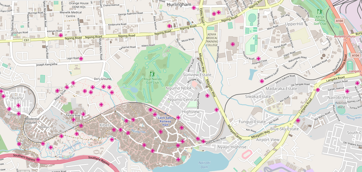
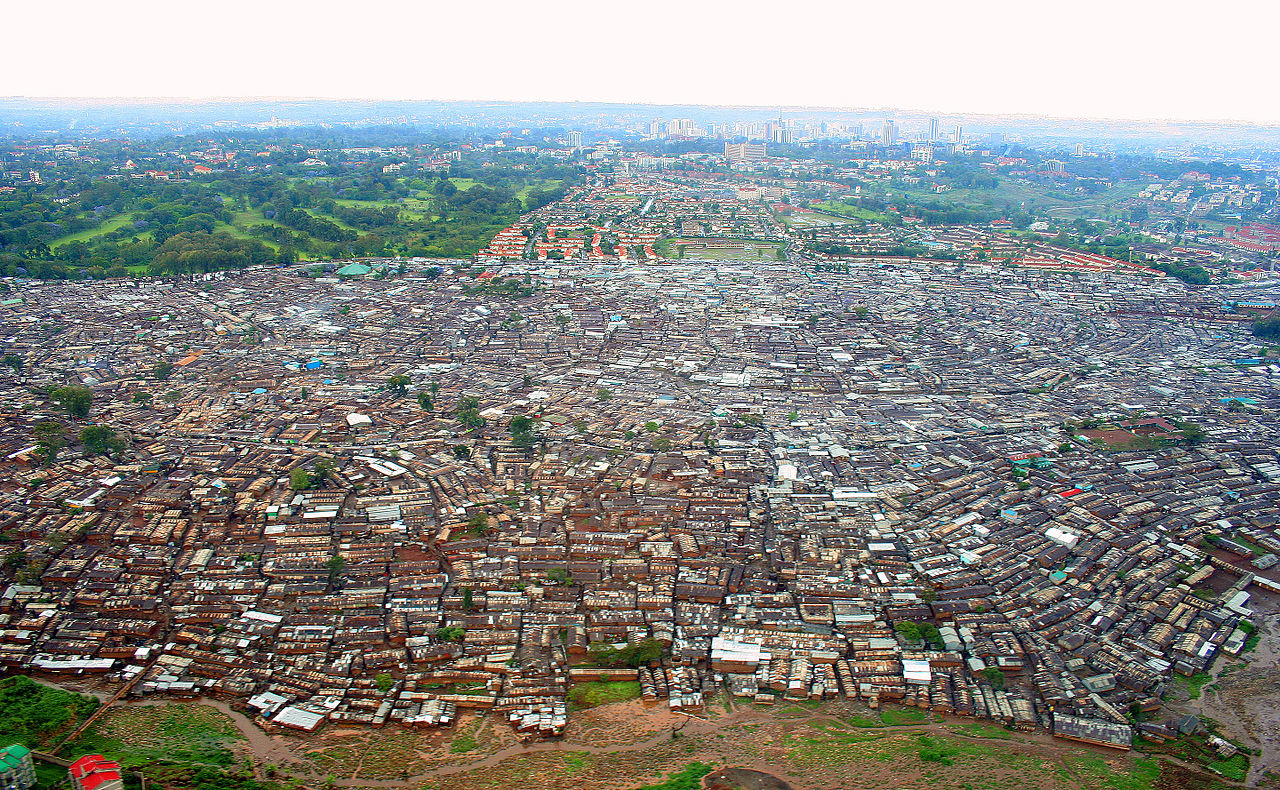
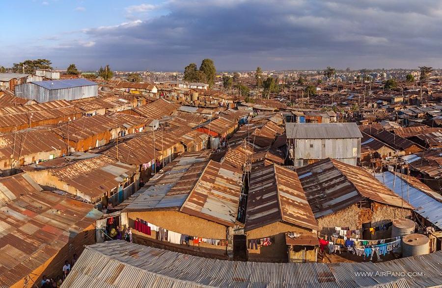
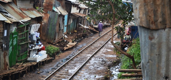
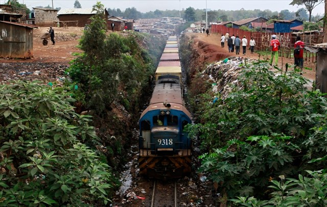
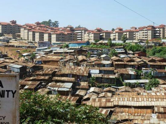
The project is called ‘Kibera Walls for Peace’.  Peace murals were painted by local youth around Kibera. The project approached and worked with Rift Valley Railways to use the commuter trains as a canvas to spread peace messages and togetherness. The railways had been a major target in the previous post-election violence, especially the route through Kibera. In 2007, mobs of young people tore up the train tracks that connect Kenya and Uganda and sold them for scrap metal.

The idea of having graffiti artists come on board to spray the 10 coaches of a commuter train was an idea well received, since most of the Kibera dwellers use the commuter train to and from work. It’s their main means of transport. The train travels through the massive Nairobi slum of Kibera advertising peace. A portrait of Martin Luther King Jnr and the Kenyan flag grace the last coach. The message reads from the front to the back and looks like a sentence that’s beautifully crafted. Tuwache ukabila…tuwache ubaguzi…tuishi kwa amani.[12]

Freight and Goods Sidings

These next few pictures cover the good sidings adjacent to the station.

Sidings close to the platforms.

Oil tanks sitting idle.

The same sidings from a different direction.

Class 31 No. 3143 ‘Somal’ heads a freight through Nairobi Yard. Note the lower quadrant signals: up country the norm was a 3 aspect upper quadrant signal – vertical, line clear; 45 degree, caution; horizontal, stop. © Anthony Potterton.[9]A Class 60 Garratt with name plates removed pauses in Nairobi. © Kevin Patience.[9]Another Class 60 heads a freight out of Nairobi Yard for the Nanyuki Branch, © James Waite.[9]

Nairobi Shed

In Steam days ……EAR Garratt at works entrance, Nairobi Sep 1977, © Whiteflyman.[13]EAR Class 60 Garratt 6008, Nairobi MPD, Sep 1977, © Whiteflyman.[13]Princess Margaret's visit to Nairobi 1956 (Dad - Neil Rossenrode, standing at the back on right)
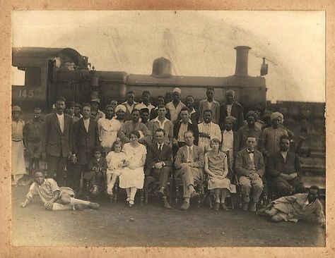
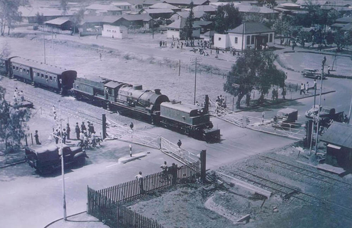
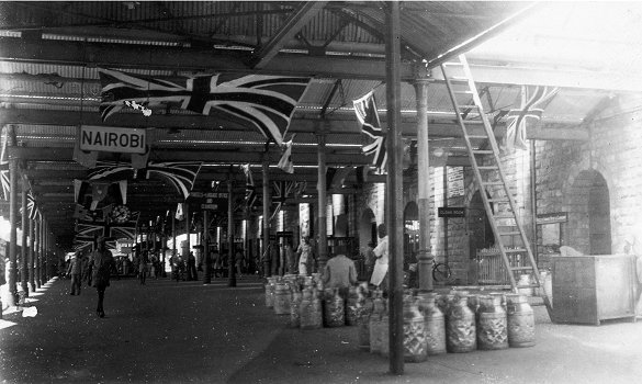
Staff at Nairobi MPD on the occasion of Princess Margaret’s visit in 1956.[14] 5919 ‘Mount Lengai’ at Nairobi Shed, © James Waite.[10] No. 5912 ‘Mount Oldeani’ on the fuelling road at Nairobi MPD, © James Waite.[10] Nairobi Shed in the lengthening shadows of the rapidly setting sun in 1975. A  Class 13 4-8-4T with a Class 31 and two Class 11 tank engines in the background, © Anthony Potterton.[10] Line-up of East African Railways motive power at Nairobi MPD with Class 60 Garratt 6024 Sir James Hayes Saddler prominent left and Class 57/58 right. Five Class 59 Garratts, two Class 29 (Tribal) and two tank engines are also quite clearly discernable. The post card was probably produced around 1955-6, © EAR&H. [10]

Nairobi Railway Museum

I visited Nairobi Railway Museum in 1994. It was in a relatively run-down state and many of the locomotives stored there were rusting away. These next 13 pictures are from 1994 and were taken as slides. The quality is not good but the ability to wander around next to some of the remaining Beyer Garratt locomotives was an experience to remember. The Museum has changed a bit since 1994, and there are now even some of these machines back in steam on the railways in Kenya.Image may contain: train and outdoor5918
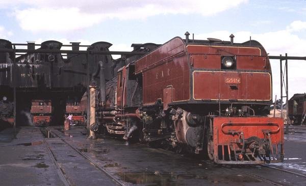
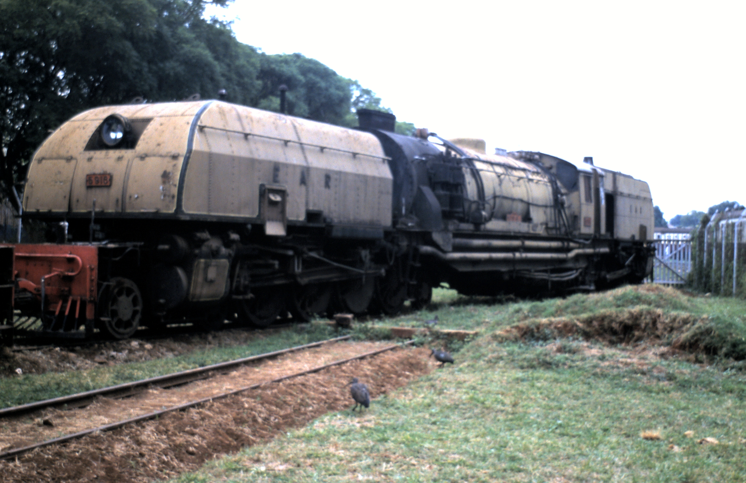
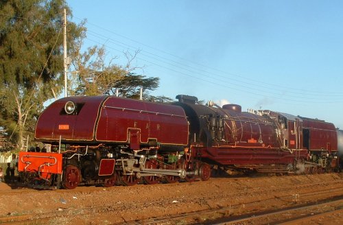
Class 59 Garratt No. 5918 ‘Mt Gelai’ in Steam in 2004.[15]

And finally ….. a drone’s eye view of the Museum in the 21st Century!

References

  1. Roger S. Greenway, Timothy M. Monsma, Cities: missions’ new frontier, (Baker Book House: 1989), p.163.
  2. City-Data.com. “Nairobi History”. http://www.city-data.com, accessed on 22nd May 2018.
  3. “History – Nairobi”. City-data.com, accessed on 22nd May 2018.
  4. AlNinga. “Attractions of Nairobi”. alninga.com. Archived from the original on 30 September 2007, accessed on 22nd May 2018.
  5. Nairobi, Wikipediahttps://en.m.wikipedia.org/wiki/Nairobi, accessed on 22nd May 2018.
  6. https://www.pinterest.com/pin/559361216211036942, accessed on 22nd May 2018.
  7. http://www.norgrove.me.uk/garratts.htm, accessed on 22nd May 2018.
  8. http://www.greywall.demon.co.uk/rail/Kenya/nrm.html, accessed on 22nd May 2018.
  9. http://www.mccrow.org.uk/EastAfrica/EastAfricanRailways/NairobiMombasa.htm, accessed on 15th May 2018.
  10. http://www.mccrow.org.uk/EastAfrica/EastAfricanRailways/NairobiMPD.htm accessed on 22nd May 2018.
  11. https://metaphorimages.photoshelter.com/image/I0000e12YBt5NpVA, accessed on 23rd May 2018.
  12. https://joelukhovi.wordpress.com/tag/rift-valley-railways, accessed on 23rd May 2018.
  13. http://picssr.com/photos/13661517@N06?nsid=13661517@N06, accessed on 23rd May 2018.
  14. https://www.pinterest.co.uk/pin/462463455475676221, accessed on 23rd May 2018.
  15. http://www.greywall.demon.co.uk/rail/Kenya/nrm.html, accessed on 23rd May 2018.


The Uganda Railway – Part 6 – Ulu to Nairobi

Our journey along the Uganda Railway continues ………….

Ulu is our starting point for the next leg of the journey. The station can be seen on the satellite image below. It is at the top of the photograph and approximately in the middle of the image. Ulu is located in the region of Kajiado. The distance from Ulu to Kenya’s capital Nairobi is approximately 69 km/43 miles (as the crow flies).[1]  This next leg of our journey is not a long one!Leaving Ulu for Nairobi, trains travel in a North-easterly direction before eventually swinging round to the North-west towards Konza.Just before we reach Konza a branch-line diverts off the mainline in a south-westerly direction. Konza is the junction for the line which serves Magadi Soda Works. The branch travels via  Kajiado, Kenya Marble Quarry, Elangata Wuas, Singiraini, and Koora to Magadi Soda Works. I visited the Soda Works in 1994, travelling there by car from Nairobi. The first six pictures below are my own and the quality is not great.  Road is the easiest way to access Magadi despite the railway link.[3] One other way of visiting Lake Magadi is to take the Jaza train. [2] Konza Station is reached just after the branch-line leaves the mainline.Early daylight at Konza –  © Peter Ritchie.[4]The line then follows a north-north-easterly path until it reaches Kitengela (Kapiti Plains Estate/Stony Athi) and turns northeast towards Athi River. As the line approaches Athi River it passes the new SGR Station of Athi River and then turns sharply to the west and enters the town. Two short branches leave the mainline at Athi River, serving the Blue Triangle Cement Company (East African Portland Cement) works to the West if the town.Class 58 Garratt in about 1960 – the locomotive has been fitted with a Giesel ejector. No. 5810 is seen at Athi River, 16 miles from Nairobi – © Iain Mullilgan.[4]Class 59 Garratt, No. 5918 sitting in the late afternoon sun at Athi River waiting for the return working above. Below, a fireman’s eye view as the train sets off for Nairobi.[6]EARC 92 Class diesel arriving as Class 59 Garratt No. 5904 Mount Elgon at Athi River – © James Waite.[4]

The mainline crosses the Athi River just after the station and then passes under the new SGR line.Mount Elgon and its train depart across the Athi River for Nairobi – © Iain Mullilgan. [4]Mount Elgon and its train continue across the Athi River for Nairobi – © James Waite.[4]

After crossing the Athi River the metre-gauge railway passes through Marimbeti Station before reaching Embakasi Station. As can be seen from the map below, Embakasi is the location of the present Nairobi terminus of the SGR line, some distance away from the city centre.The next few pictures show Embakasi in the days long before the SGR was imagined!An unidentified 59 Class heading a freight over the Athi Plain – © Iain Mulligan.[4]Class 60 Garratt  No. 6003 Sir Stewart Symes before it was fitted with a Giesel ejector.  The train is near Embakasi – © Iain Mulligan.[4]Class 59 heads No 4 Down near Embakasi. The train would have departed Nairobi at 1545, calling at all stations to Mombasa where it was due to arrive at 0710 the following morning – just 50 minutes ahead of No 2 Down – the Mail Train which will have left Nairobi at 1830 for Athi River, Konza, Mtito Andei, Voi and Mombasa © Iain Mulligan.[4]

Beyond Embakasi the railway passed through a marshalling yard and then through Imara Daima Station before swinging round to the North-East.It then crossed the Ngong River in the southern suburbs of Nairobi.The first passenger train from the coast crosses the Ngong River Bridge which was completed as part of the Embakasi/Nairobi realignment in 1958. PHOTO – EAR&H.[4]

A short branch-line joins the mainline from the East just as it swings round to travel almost due West and is immediately joined by another branch, this time much longer. This branch headed off in a Northerly and then Northeasterly direction and terminated at Nanyuki. On the way it passed through Dandora, Githurai, Kahawa, Ruiru, Kalimoni (Juja), Komo and Thika Stations.Tribal Class 3109 Bahororo takes water at Thika.  © Iain Mulligan.[8]

Beyond Thika, the line passed through Mitubiri, Santamor, Makuyu, Saba Saba, Maragua, Murang’a, Sagana, Makaungu, Karatina, Nyeri, and Naro Moru Stations, before arriving at Nanyuki.

A Class 31 was permanently stabled at Sagana to double head freights over the 3.5% grade to Nanyuki, © Iain Mulligan.[8]

Nanyuki is a market town in Laikipia County of Kenya lying northwest of Mount Kenya along the A2 road and at the terminus of the branch railway from Nairobi. It is situated just north of the Equator. It was founded in 1907 by British settlers, some of whose descendants still live in and around the town. Nanyuki is currently the main airfield (airbase) of the Kenya Air Force. The British Army also keeps a base at The Nanyuki Show Ground (NSG) from where it conducts yearly desert and jungle training exercises on the mountain and in the arid areas to the north.[7]Nanyuki – branch terminus

After passing the Nanyuki branch-line, the railway is now in the industrial heart of Nairobi with a whole series of branches and sidings. Approaching Nairobi Central Station it passes through two more stations/halts, at Makadara and Makongeni. Then we arrive at Nairobi Central Station. The next two photographs are more of my poorer slide photos from 1994. The one’s following have been culled over time off the internet.The map above focusses more specifically on Nairobi Station. The lines leaving the right of the image head for Mombasa, the line leaving the left of the image is the line heading West to Kisumu and to Uganda.

The next post in this series about the Uganda Railway will spend time in Nairobi and will also visit the Railway Museum.[9]


References

  1. http://kenya.places-in-the-world.com/178769-place-ulu.html, accessed on 21st May 2018.
  2. http://www.lakemagadiadventures.com/jaza_train_to_lake_magadi, accessed on 21st May 2018.
  3. Lake Magadi Soda by Road from Nairobi; https://www.tripadvisor.co.uk/ShowUserReviews-g1137919-d6609180-r234172046-Lake_Magadi_Conservancy-Magadi_Rift_Valley_Province.html, accessed on 21st May 2018.
  4. http://www.mccrow.org.uk/EastAfrica/EastAfricanRailways/NairobiMombasa.htm, accessed on 15th May 2018.
  5. https://www.pinterest.co.uk/pin/554083560377607665, accessed on 21st May 2018.
  6. http://www.trevorheath.com/livesteaming/Kenya.htm, accessed on 21st May 2018.
  7. https://en.m.wikipedia.org/wiki/Nanyuki, accessed on 21st May 2018.
  8. http://www.mccrow.org.uk/EastAfrica/EastAfricanRailways/NairobiNanyuki.htm, accessed on 21st May 2018.
  9. http://www.xinhuanet.com/english/2016-05/18/c_135369174.htm, accessed on 22nd May 2018.