In June 1962, the ‘Modern Tramway’ carried a report by J. W. Higgins and Ralph Forty entitled ‘A New Electric Interurban in Japan’. [1]
The Izu Express was at that time Japan’s newest railway. It had opened on 10th December 1961.
In the 21st century, the line is known as ‘The Izu Kyūkō Line’. It is a privately owned railway line of the Izukyū Corporation in Shizuoka Prefecture, Japan. [2]
The line approximately parallels the eastern coast of the Izu Peninsula, a tourist district noted for its numerous hot spring resorts, and golf courses, between Itō Station in Itō and Izukyū Shimoda Station in Shimoda. [2]
The Izu Peninsula showing the route of the Izu Express as produced for the ‘Modern Tramway’ journal. [1: p206]The Izu Peninsula as it appears on Google Maps in 2023. [Google Maps, 8th August 2023]
The line extended “southwards from the National Railways railhead at Ito, 76 miles south-west of Tokyo, to Shimoda on the south coast of the Izu peninsula, serving Kawana, Atagawa and several other resort towns en-route.” [1: p206]
Higgins and Forty continue:
“The mountainous topography of the peninsula has kept Shimoda relatively isolated in recent years, despite the resort development. Shimoda’s place in history stems from this isolation, for the town was chosen as the site for the first American Consulate in 1853 by a Japanese government trying to minimise the impact of foreign influence. The Izu Express Railway, or IKK, electrified at 1500 volts, d.c., has overcome the mountains by long tunnels and many bridges, and the line took almost two years to build; during this period, 34 workers were killed by cave-ins, landslides and other accidents. Completion of the line was a major engineering feat, and required 31 tunnels and 66 bridges of various sizes. These included an elevated structure on concrete pillars between Ito and Minami-Ito, and the Yazu tunnel, some 2,796 metres long, between Kawaza and Inazusa. A new depôt was constructed at Izu Kogen, equipped with car washers and a repair pit.
Shiny blue cars of the line’s small fleet provide local service between Ito and Shimoda at intervals of 25 to 55 minutes, the journey taking about 70 minutes. Three of the workings operate through between Shimoda and Atami, where the JNR 10.5-mile branch to Ito connects with the main Tokaido line, and have two classes of accommodation. The remaining 24 (25 on Sundays) workings make connections at Ito with Ito-Tokyo or Ito-Atami trains, and generally have second-class cars only. The JNR runs through expresses on the new line, using ‘Shonan’-type multiple-unit railcar trains which take 2 hours 50 minutes for the through run from Tokyo. Of three such workings, one operates only at weekends and one appears to be worked by Izu Express cars between Shimoda and Ito or Alami. There are only eleven intermediate stops between Ito and Shimoda; all are passing places, and the separation is unusually wide for a Japanese interurban.
The Tokyu Car Company supplied the 22 passenger cars, which have end doors and transverse seating in keeping with the resort-area nature of the traffic. Car design is up to the best of modern Japanese design, though not as luxurious as the new panorama cars of the Nagoya Railway. Fares are high by Japanese standards, at 230 yen (4s. 7d.) for the run from Ito to Shimoda, compared with 130 yen for the same distance on JNR. However, the express buses which the line replaced charged 260 yen plus 50 yen for a seat reservation, and took two to three hours for the journey.
Inatori station has an additional track for freight and express workings, and Shimoda station has a building which could be used for freight when completed, but on 16th December there was no freight service in operation. There is, however, a package-express service using a car borrowed from the Tokyo Express Electric Railway (TKK). The TKK … controls the Izu Express Railway as well as several other railways and bus routes in Japanese tourist centres, and also the Tokyu Car Company.” [1: p206-207]
“With the 1964 Olympic Games drawing near, development of the Shimoda area into a tourist centre is going ahead rapidly. A Luftseilbahn has been opened from Shimoda to Mt. Nesugata, and hotels are under active construction in readiness for the expected influx of business. So, as over a hundred years ago when Admiral Perry arrived in Shimoda with his black ships and opened Japan to foreign commerce, the IKK has also arrived. Now when the yearly ‘Black Ship Festival’ is held, the tourists will arrive, not by bumpy bus ride, but by a fast smooth, efficient electric interurban ride through the hills and along the beautiful Izu peninsula.” [1: p207-208]
All the cars provided at the opening of the line are 20 metres long and 2.8 metres wide. They were:
Class Kumoha 100: Nos. 101-104 each with 68 seats. Their capacity was set at 150 people which means that when full nearly 100 passengers would have to stand. They were double-ended motor cars.
Class Kumoha 110: Nos. 111-120 each with 74 seats. Their capacity was set at 160 people which means that when full nearly 90 passengers would have to stand. They were single-ended motor cars.
Class Kuha 150: Nos. 151-156 each with 74 seats. Their capacity was set at 160 people which means that when full nearly 90 passengers would have to stand. They were single-ended control trailers.
Class Saroha 180: Nos. 181-182 each with 30 first-class seats and 41 second-class seats. Their capacity was set at 116 people which means that when full 45 passengers would have to stand in second-class. They were two-class trailers.
TKK 3608: a passenger car used for package express workings.
The normal train formation consisted of two sets for Atami-Ito-Shimoda workings, made up: 110+180+110+150+110; for Ito-Shimods workings, there were four sets made up: 150+110 or 150+110+100. TKK3608 ran independently, not as part of a passenger consist.
Wikipedia records 21st century stock as:
“Izukyu 2100 series, Izukyu 8000 series, E257-2000/2500 series. Future Izukyu 3000 series (Former 209-2000/2100 series). Former 185 series.” [2] This listing does not include the cars first used on the line and shown in monochrome above. It was completed before the Izukyu 3000 series entered service in 2022.
J. W. Higgins and Ralph Forty; A New Electric Interurban in Japan; in Modern Tramway and Light Railway Review, Light Railway Transport League and Ian Allan Hampton Court Surrey, Volume 25 No. 294, June 1962, p206-208.
The copy of this book that I bought was a coffee-table size paperback published by Tuttle Publishing. My anticipation was that it might be quite light on detail and full of generic pictures. It is actually a meticulously researched work. Dan Free seems to have spent 25 years on that research.
The book begins by dividing the story into historical periods. The general history of Japan in the years before 1853 is surveyed in the Prologue, [7], (p11-19).
Chapters cover short periods in what was a rapidly developing political landscape. Japan was a place of intrigue and political machinations as the power of the shogun rulers dissipated and became refocused around the emperor.
Foreign powers fought for a prime place of influence over events within Japan. Increasing confidence in indigenous engineering ability among Japanese leaders led to local control beginning to be exercised over construction projects and expensive foreign engineers contracts gradually not being renewed.
The story focusses first on the introduction of railway technology to Japan and the attempts by the Tokugawa Shogunate to offer a concession to the United States. This phase was not long-lived and the balance of power swung round to the influence of the British at the end of the 1860s. “The political double-dealings and diplomatic blunders committed by both the Japanese and Western powers are laid out in impressive detail. For instance, the Shogunate’s rail concession to the United States (although legally binding to the Meiji government) was seen as something to be negated by the former enemies of the Tokugawa who now found themselves in power. Using the time honored Japanese techniques of stalling, failing to reply to diplomatic requests, and not addressing any of the real issues when a reply was given, the Japanese diplomat Sawa Nobuyoshi ran rings around American diplomat Charles DeLong, taking full advantage of his inexperience in the world of international relations. Instead, seasoned politico Harry Parkes of Great Britain managed to maneuver his country into overseeing and supplying (at great benefit to the coffers of English businessmen) the embryonic Japanese rail industry.” [1]
The first railway built was that between Yokohama and Shimbashi in Tokyo between 1870 and 1872.
In 1868 Thomas Blake Glover, a Scottish merchant, had brought the first steam locomotive, “Iron Duke”, to Japan, which he demonstrated on an 8-mile track in the Ōura district of Nagasaki. [1][2] However, after around 250 years of a culture of ‘distrust of foreigners’, construction of the ‘premier’ railway connecting Japan’s former and new capitals by non-Japanese was considered politically unacceptable to the new Japanese regime, and so the government of Japan decided to build a railway from the major port of Yokohama to Tokyo using British financing and 300 British and European technical advisors: civil engineers, general managers, locomotive builders and drivers.[1]
“In order to undertake its construction, foreign experts were contracted, with the specific intent that such experts would educate Japanese co-workers so that Japan could become self-sufficient in railway construction expertise, at which time the foreign contractors were expected to leave the country.” [3]
On 12th September 1872, the first railway, between Shimbashi (later Shiodome) and Yokohama (present Sakuragichō) opened. A one-way trip took 53 minutes in comparison to 40 minutes for a modern electric train. Service started with nine round trips daily. [4]
The line between Kobe and Kyoto was the first railway in central Japan. Further railway building took place from 1877 to 1884 – the short (11.25 mile) line to Otsu was designed and built by indigenous staff; the line from Tsuruga to Shiotsu; Nagahama to Shunjo; and East to the Nobi Plain.This is Shinagawa Station in the late nineteenth century did actually look this rural, with the waves of Tokyo Bay reaching to the very edge of the station. In those days, certainly nobody foresaw that the tiny country station would grow into today’s massive complex. It now services over three quarters of a million passengers daily, making it one of the busiest stations in Japan. In spite of its humble location and looks, Shinagawa Station played a title role in the development of Japan’s railway system. The country’s very first daily train services, which started on 12th June 1872, ran between this station and Yokohama. Yokohama’s foreign settlement had turned into a crucial trading port and was located some twenty kilometers southwest of Shinagawa.
The 6th chapter of the book concentrates on the period from 1880 to 1895 which was a time for extending and better integrating the network across the country. The 6th chapter forms a significant portion of the book [7], (p109-180). The text is well illustrated by postcard views of stations, buildings and track-work. The focus is primarily on the ‘Cape Gauge’ mainlines with only short digressions mentioning the smaller gauge lines which later would become important as industrial lines in the valleys in the mountains.
The 7th chapter covers a period of 10 years from 1895 to 1905. The early part of this chapter highlights the lead in innovation taken by the San’yo as it gradually became a major trunk line. Innovation was essential as the San’yo was something with well established shipping routes connecting the same cities [7], (p183-185).
This period was a time of ‘railway mania’. For example, in 1896 alone, 555 applications for provisional charters were made. Private railways built around 400 miles of railways per year in 1897 and 1898, [7], (p181).
That this was both a time of expansion and innovation is evidenced by the activities of others as well. The Imperial Japanese Government Railways (IJGR) faced intercity competition from the Kansai Railway between Osaka and Nagoya, [7], (p185).
By the end of the Sino-Japanese War, railways “were ever increasingly becoming an integral part of the lifeblood and social fabric of the nation and as the network expanded, the effects began to be felt throughout the realm,” [7], (p187).As the century turned the San’yo Railway Company became increasingly self-confident. They were not afraid to bid for foreign tourist trade: “When this as first appeared in 1904, during the Russo-Japanese War, the progressive line had put in place three steamer routes connecting with Shikoku and a ferry route to Kyushu. It could also state that all its express trains (four in number) were electric-lit, steam heated, and furnished with sleeping and dining cars,” [7], (p197).
During this period, with venture capital in short supply in Japan, smaller towns and industrial concerns took to developing their own light railways. They were known as ‘gyusha kido’ (ox car tramways) or ‘jinsha kido’. They were light railways where oxen were used for motive power and as a result enabled circumvention of the existing statutory framework surrounding railway construction. There was also one example of a logging railway powered by dogs on the island of Shikoku which became known as a kensha (dog car) tetsudo, [7], (p202-203).
The 8th chapter focusses on the short period surrounding the nationalisation of the railways (1906-1912) and is entitled ‘Nationalization and Self-sufficiency’.
“In the aftermath of the Russo-Japanese War, the military emerged as a driving force in Japan, and given its influence on the Railway Council, its views on railway development were increasingly heeded. Preeminent among the railway matters which interested the Ministry of War was nationalization, which was thought would make management and coordination of the railway system much easier in times of war. This added weight to a movement that had been afoot for some time,” [7], (p225)
“With the end of the war, the military, and its political supporters, were not satisfied with the potential for operational integration that a railway system consisting of various private railways seemed to be capable of sustaining. The military successes of the recent war, coupled with the public dissatisfaction with what was perceived to be a less than warranted treaty result and the political situation in China … all combined to tempt Japan to ready itself for even greater acts on the Asian continent. Militarism was becoming ingrained in Japanese foreign policy,” [7], (p225-226)
“If that were to be the course of Japanese foreign policy, a nationalized railway system was seen to be preferable to the one in place. New arguments for nationalization were again brought before the Diet, and the debate renewed. … Nationalization was seen as a means of preventing railway ownership from falling into foreign hands via stock purchases or mortgaging of assets,” [7], (p226)
“The military vociferously asserted its dissatisfaction with the coordinating abilities of the various private railways in the past war, but conveniently ignored the fact that many of the delays and inconveniences were not attributable to internecine squabbles between various private railways, but were more likely the natural consequence of a railway system that was still overwhelmingly single-tracked and strained to its limits,” [7], (p226-227).
“An ambitious program of double-tracking all primary routes might have been just as effective a solution. The various arguments pro and con were posited, but in the end, after more than a decade of debate, the vote for nationalization carried in the Diet on March 31, 1906,” [7], (p227).
“The legislation authorizing the nationalization also provided for the continuation of private railways (and creation of new companies) providing local (ie. non main line) rail transport.” [6]
“However, as most such lines would be less (or un)profitable branch lines, the 1910 Light Railways Act was required to authorize construction of lower cost lines, including 2’6″ gauge lines, in order to enable provision of railways to smaller and/or more remote communities. Some of the resulting lines initially constructed to 2’6″ gauge were later re-gauged to 3’6″ where there was economic justification to do so.” [6]
Throughout the book, Free examines the close ties between the development of the railways and the development of the country and the Japanese economy. He shows how the railways: “aided the rapid development of other industries. Initially relying on foreign suppliers and engineers (not to mention cash strapped by the extravagance of British construction methods), the development of Japanese engineering and the eventual replacement of foreign experts and suppliers by ‘home-grown’ ones shows that the long term goal of ‘sonno-joi’ activists years before actually did see the light of day. In fact, Japan turned the tables, being a major exporter of rail expertise and supplies to its Asian neighbours.” [1]
Free also shows: “how the former samurai class managed to stay among the ranks of the elite by using their government buyouts to become one of the biggest investors in railroads. The hand in hand relationship of Japanese industry with the government is shown in the switch from a national railway system to private industry and back again. The increasing dominance of the military in the political sphere can be seen by the growing influence of the army in rail planning decisions.” [1]
” ‘Early Japanese Railways’ is a rare example of a work that combines technical excellence and a plethora of information with a lively writing style that always gives the human element its due. Combined with an excellent graphical presentation of hundreds of rare photographs, advertising material, timetables, maps, woodblock prints, and postcards, the book provides a fascinating glimpse of Japan as it moved from self-imposed seclusion to being the ‘most Western of Eastern nations’.” [1]
[NB: As far as I am aware permission has been granted for the use of all the photographs below. This is particularly the case of the site rintetsu.net which I have relied heavily on in producing this post. I have sought, where-ever possible to attribute all sources and have no intention of contravening copyright. Should there be an issue with any of the images below, if you are the copyright holder, please contact me. Please accept my apologies in advance if this has occurred.]
This sketch map shows the location of the JR Chuo Line station as a white rectangle. The Kiso Forest Ibarahara (Yabuhara) Forestry Office & yard extended south of the red dot labelled 木曽森林管理署. [1] The darker black line shows the short branch from the JR Station to the transshipment area. The thick green lines show the 762mm gauge lines.Yabuhara JR Chuo Line Station. [2]The yellow arrow shows the route of the short branch to the logging yard. The picture was taken in 1999. [2]Looking back at the station along the approximate line of the short branch in 2014.The approximate line of the branch running into what was the logging yard.A view across the logging yard showing the rote of the branch from the station in the top-right.The sketch plan above shows the arrangement of tracks in the transshipment yard. The yellow lines are those connecting with the JR Chuo Line and are at the approximate position of the red arrow on the image immediately above. The green lines are the 762mm Lines. North is to the right of the sketch. [2]
The adjacent annotated satellite image from Google Maps shows how the area of the sidings has been developed over the years.
The JR transshipment sidngs are shown in 1964 in the image below. Timber is shipped from here all over Japan.The JR transshipment sidings. [3] The same transshipment sidings. [4]An overview of the location showing the JR sidings in the centre of the image and the 762mm lines at the bottom of the picture and above the JR lines. The village is behind. This picture also comes from 1964. [5]This modern image from Google Maps shows the line of the old 762mm gauge railway in 2014. Its location is about two-thirds up the monochrome image immediately above.Less than a kilometre further north the old railway route leave the modern prefectural highway No. 26 when it crosses the river. The old railway remains of the East bank of the river. It appears that the old line was on the West side of highway No. 26 and crossed the road to take the route shown above. The location is marked on the sketch map below by the first indicator arrow above the red dot which marks the southern terminus of the line. [6]A little further north the main line (Green) continues to follow the river while a branch-line (Light Green) heads off the the Northeast. The point is marked by the second indicator arrow above and is shown in 2014 below.The route continues North along the East side of the Kiso River before running through Ogiso (小木曽), the village in the picture below.In Ogiso another branch-line departed from the main logging route. It can be seen branching off the the West across the river close to the top of the sketch map above.The Sasagawa Line left the main line in Ogiso. Currently it is the site of a sawmill. [7]
From Ogiso the line continued on the East bank of the river eventually reaching the modern-day Miso Dam.The Miso Dam is shown at the top of this sketch map. For most of the journey to the dam the railway followed the East bank of the Miso River, only crossing the course of the river close to the location of the modern Dam. [8]Prior to the construction of the Miso Dam the railway crossed the river as shown here and then passed through a short tunnel before continuing up the West side of the river [9]The forest road which replaced the railway before the construction of the Dam. The bridge was built after the railway closed, the tunnel was built for the railway. [9]The same location during construction of the Dam. The bridge span has been removed but the tunnel portal remains (Construction record photos). [9]The railway followed the valley floor as shown above. There is little to see today other than the water of the lake. [10]
The adjacent image was taken as a record photograph before construction of the Dam. The railway route at this point was a long straight section. The longest in the Kiso Forest network. [11]
This next picture is taken at the site of the Takase stop. The caption indicated that there were 4 or 5 tracks at the station. This picture was taken before the flooding of the valley when the Miso Dam was finished. [11]
The line continues northward and branches again towards the top of the modern lake as shown on the sketch plan below. [12]The route of the two lines at the junction is highlighted on the satellite image above. The bridge at the bottom of the satellite image is shown in the picture below. [13]Okinoiso Bridge. [13]The confluence of the two rivers before the formation of the reservoir. This image was also taken as a record photograph before construction of the Dam. The river to the left is the Sasaozawa. [13]
The railway route up the valley of the Sasaozawa was constructed to a lower standard than the main line as it was designated as a working track. The satellite image above shows a spiral track arrangement to allow the logging line to gain the necessary height to continue up the valley. That spiral is shown below.This ramshackle spiral was eventually removed at the end of the Second World War when the Sasaozawa working track was abandonned. [13]
A full survey of the length of the Sasaozawa Line has not been attempted but rintetsu.net carries a few photographs of the line which were taken in 1929 and originally included in a Japanese language book entitled “Ogiso Forest Railway” which was issued by Yabohara Forestry.
The first two of these show Diesel Locomotive No 26 negotiating the spiral. The pictures were taken at different times or on different dates as the train formation is different in each of the pictures. [13]
The third of these images appears immediately below and shows the line further up the Sasaozawa River. The construction techniques are clearly shown. The railway has a temporary look to it and would almost inevitably have been at risk in the event of the river being in spate. [13]This final photograph in the sequence from 1929 shows as the caption says: Trolley riding down gold shoe curve (say horseshoe shape). both the last two photos illustrate the fact that the line use gravity as a tractive force. Pairs of trolleys travelled down the line in the hands of a single brake-man. [13]
Returning to the main line, the adjacent image is one of relatively few which shoe one of the Baldwin steam locomotives at work. The location is north of the confluence between the two rivers. The tunnel is now under water, although at times of low water it is said to be possible to negotiate the tunnel in a canoe. [13]
The next picture shows the forest track that replaced the railway. It is another picture taken for record purposes before the valley was flooded. [13]
Beyond the end of the modern reservoir the landscape has been altered as regrading has been undertaken. The old railway formation is occasionally visible as below. [13]The old railway track-bed is on the right in this image. [13]This image is taken looking back down the old railway line. [13]This is the location of what was once a two track station and passing loop – Senmizawa Station. [13]The old railway continues running northeast along the Miso River Valley following the path of what is now a gravel forest road. There is little evidence left of the old railway as forest road bridges have replaced the old railway structures. [14]
The line travelled on through Funagawa (a station on a curve with a passing loop). The location is shown below in May 2014. [15]Funagawa Station (舟ヶ沢). [15]Funagawa Station (舟ヶ沢) is the lower red dot on the plan the next significant point is where a branch-line heads off to the East at Sawa Bridge of the Pond (池の沢橋梁). [16]The branch-line (the pond line, 池の沢) was built to the same standard as the main line because it was heavily used. [17]
Some distance further along the line comes another branch-line. It appears at the top of the sketch map above at the location of Ogasawa bridge (尾頭沢橋梁).The line from the south enters this plan from the right. The branch-line follows the Ogasawa River. The station is named after the river. [18]The Ogasawa junction with a train coming off the branch line. The branch is clearly a ‘work line’ as the construction standard is lower and it runs on timber piers. The photograph comes from “Ogiso Forest Railway” issued by Yubarahara Forestry Bureau. Note that this train is also pulled by one of the Baldwin Steam Locomotives. [18]Ogasawa Station in 2008. [18]Ogasawa Station in use. It included a logging plant of which the offices are behind the locomotive.The photograph comes from “Ogiso Forest Railway” issued by Yubarahara Forestry Bureau. [18]The line continues up the valley. The Ogasawa Station is the lower red dot above. Hakubaki Station is the red dot at the top of the map. [19]
At times the old line does not follow the forestry track. The 7th Misogawa Bridge (第7味噌川橋梁) is one such location. As the adjacent photograph shows, one of the abutments of the old railway is still visible. [20]
This applies for the 8th Misogawa bridge (第8味噌川橋梁), below. The track-bed between these bridges is indistinct and follows the opposite bank of the river to the forest road. [20]The 7th Misogawa Bridge (第7味噌川橋梁) and the 8th Misogawa bridge (第8味噌川橋梁) are shown above. There are copious photos available on the Japanese language website (rintetsu.net) which can be found by following the link in the references below. [20]Hakubaki station (鉢伏停車場) [20]The rail route continues to completion on the sketch map above. [21]Upper Zokotsuzawa Bridge No. 1. The forest road sits alongside the abutment and piers of the old railway bridge. for many of the structures up the remainder of the valley the picture is the same, a newer forest road bridge alongside old abutments. (上ゾコツ沢橋梁第1号) [22]The sketch map above shows two hairpin bends on the line. This if the first, the photo was taken in 2014 looking north. [22]The hairpin bends. [23]The second hairpin bend. [23] Beyond this point the route of the old line become increasing indistinct but it can be followed on the Japanese language website rintetsu.net. [24]
Just occasionally highlights stand out along the route.These two pictures show a typical bridge on the working line. The construction is entirely from locally sourced timber. [25]
[NB: As far as I am aware permission has been granted for the use of all the photographs below. I have sought, where-ever possible to attribute all sources and have no intention of contravening copyright. Should there be an issue with any of the images below, if you are the copyright holder, please contact me. Please accept my apologies in advance if this has occurred.]
The Nojiri Forest Railway runs alongside the Kiso River. A branch from this line heads up the Atera Valley. The track layout close to the modern Nojiri Railway Station on the JR Chuo Line was complex with a large logging yard adjacent to the mainline. Nojiri Railway Station is shown below as a white line on the map. The red dot next to it is the logging yard.Narrow gauge lines in the area of the Atera Valley and the Kiso Valley confluence. [1]Railways in the immediate vicinity of Nojiri Railway Station. The green lines are the 762mm-gauge lines. To the North of Nojiri Railway Station a short stub line led from the logging yard across a bridge to the Nojiri Forestry repair shop and Forestry Office. The location of the repair shop and forestry office is marked with the letter ‘A’. It is from this point that we start our survey of the lines in this area.The end of the line was in the vicinity of these buildings.This view looks back towards the forestry yard from what was the line of the railway and is now a single lane access road.The mirror in the previous image can be seen to the right of this photo. The railway from the forestry depot crossed the lower road in this image and the road on the left-hand side of the picture on a bridge which had three spans. The shorter side-spans were made of concrete the longer middle span of steel girders.The bridge in place. The road layout is unchanged. The logging yard adjacent to Nojiri Railway Station is off to the left of this picture. The three roads converge on the location of the photographer and travel under the JR Chuo line and yard in a tunnel. [3]This Google Streetview image looks back into the logging yard from the road at it main entrance to the Southwest.This picture is also taken from Google Streetview and is taken from the same location as the previous image but looking to the East across the JR Chuo Line.And this image shows the routes of the two lines which left the yard at its Southwest corner. The first followed the road to the left of the image alongside the JR Chuo Line, the second followed the road alignment on the right of the picture.The route of the first line follows this road. Initially its course was roughly parallel tot he main Chuo Line. but later, after crossing a watercourse it followed that watercourse down to the Kiso River.The watercourse is on the right, the old railway route is the route of the modern single lane road.The bridge shows the location of the Kiso River and the route of the Atera Valley can be seen leaving the Kiso River Valley at this point.The line continued alongside the Kiso River for a short distance to what was the location of a sawmill.This is the location shown on sketch map above. The Japanese text has been translated for me by Ichiro Junpu. [42]. The location of the sawmill is highlighted by one of the large red dots. The black line is a rope transport system which was in use prior to the installation of the Kisogawa bridge. The Atera bridges referred to can, I think, be seen on pictures later in this blog.
The second line from the lumber-yard gate began its decent to the Kiso River more quickly. It curved round in a half-circle before reaching the crossroads below. At this point the railway route crossed a pair of minor roads. Its own route is now a minor road as well. The route across the junction is shown on the Google Streetview image below.It curves back through another half-circle before gradually descending to the valley floor where it turns through another sweeping half-circle to run along the riverside. That next half-circle is shown below.The line ran alongside the river as shown on the adjacent sketch map before drifting away from the river to allow a wide sweep into a significant bridge structure which took it across the Kiso River. The image below shows the route at this point. The old bridge can just be picked out above the more modern road bridge.The embankment approach to the bridge has been lowered as can be seen on the adjacent image. [5]
The image above shows the old bridge as seen from the road bridge over the Kiso River. This image is from Google Streetview.
The adjacent image is taken on a better day. [7]
While the approach embankment has removed, somehow the bridge has remained. It is interesting that the bridge is a mixture of different construction types. From the Nojiri bank of the river: a Warren Truss is followed by the large span open arched-truss bridge and then two plate-girder spans. The two plate girders are on a curve to the left. There is no super-elevation on the curve so trains must have passed across the bridge carefully at slow speed. [7].
The three additional pictures adjacent to this text were taken in 2003. [6]
The size and complexity of this structure is indicative of the amount of money to be made in the early 20th Century from forest logging operations in the Kiso Forest.
It is worth dwelling at this structure for a little while and there are a couple of further photographs and text below which come from another Japanese language website. [8]
The bridge was constructed in 1920. Before this there was a light logging line in the Atera Valley but without direct access to the wider railway network. That line was constructed in 1901. The first trains to cross the Kisogawa Bridge did so in 1921 and were able to run from there into the Nojiri Timber Yard directly. [4][5]
After the construction of the bridge it was two years before a new, more substantive logging line was completed in the Atera Valley. [5]
I have chosen a few pictures from a survey of the bridge undertaken in January 2009 by ‘tyaffic’ who is the author of the “Traffic Remains Research Office” (交通遺跡調査). A much fuller picture of the condition of the bridge at that time can be found on his website. English speakers can use automatic translation software to get a good idea of the text. [8]
The bridge was fabricated by “Nihonbashi Co. Ltd.” [8]Another view from the East bank of the Kiso River. [8]
‘Tyaffic’ describes the bridge like this: From the East, there is an “Upper road Warren Truss (length 24.4 m). Next, …, the powerful, Underworld crown platform truss (length 61.0 m). Next, the upper path plate girder (length 15.9 m ), then another upper path plate girder (length 15.2m) … and lastly also an upper plate girder (15.2 m in length), a total of five spans, a total length of 134.6 m.” [8]An underside view of the Warren Truss. [8]
Three further pictures complete our look at this structure. The first is taken from the East bank of the Kiso River. The remaining two are taken on the opposite (West) bank of the Kiso River and show the curved approach to the main bridge.These three pictures show the approach spans on the West bank of the Kiso River. [9]A logging train crosses the three approach spans to the Kisogawa Bridge. [25]
Beyond the bridge, the railway curved to the South and followed the West bank of the Kiso River.The area to the south of the bridge is overgrown and the route of the railway cannot easily be picked out. [10]
Just before the old railway reached the location of the new road bridge it crossed a mountain stream on what is known as the Nagatogawa 1st Bridge. Its abutments remain.Nagatogawa 1st Bridge abutment are shown in these two images. [10]The house in this picture has been built over the line of the old railway. The route from the Kisogawa Bridge meets the Nojiri Forest Railway at the location of this road junction. The left arrow shows the approximate line of the Nojiri Forest Railway. We will return to the left-hand route, but for now we continue South alongside the Kiso River. [10]
The pictures along the railway line at this point are provided courtesy of the rintetsu.net Japanese language website. A far more comprehensive set of photos can be found by following the links to that site provided at the bottom of this post.This is the location of what was once the Nojiri Stop on the Forest Railway. [10]The line continues Southwards alongside the Kiso River which is just beyond the trees to the left of this image. [13]This is a beautiful area. The Kiso River is visible in this shot. We are aiming for the area beyond the bridge which is visible here. [13]This Google Streetview image takes us closer to the road bridge. The old railway continues immediately next to the river and has been replaced by this single-track tarmac road.This image was taken in 2006 before the new road bridge was installed. [13]The road bridge is relatively new. The old railway continued to follow the river bank.I have not been able to find many images of the railway in use. This appears to have been taken in 1960, when the old Atera River Bridge was in place. The more modern structure was built in 1990 and is shown in the Google Streetview image below. [13]The old railway continued beyond the Atera River.Taken in 1986, this picture shows both the older bridges at this location, (c) Mr. Teruo Hayashi. [13]The route of the old railway beyond the Atera River taken in 2018. [13]This Google Streetview picture shows the route of the old railway a further 0.5 kilometres from the Atera River. The crash barriers on the right of the photograph show the route of the Atera Forest Railway.In this aerial image, it is possible to pick out a logging train travelling along the old railway at the location shown above. [13]The yellow arrow shows the Atera Line which we will return to in due course. [2]Beyond the point where the Atera Line left the Nojiri Line there was a station which probably had three traffic lanes. [13]
The Line continued South beyond this point. It continues to be hidden under the tarmac of this single-lane road. Its route takes it passed the Reading Dam (読書ダム) and after that beyond the limits of the tarmac road, marked by an ‘x’ on the map below.North of the Reading Dam, in the adjacent image, a mixed train is heading towards Nojiri. [21]
The route beyond the tarmac is much less easy to identify! [22]Just beyond the Dam the trackbed has collapsed into the Kiso River, (c) Mr. Walzawa 2008. [23]A few steps beyond the collapse is the first tunnel on the old railway line. [23]The southern portal of the same tunnel. The tunnel is about 55 metres long. Further collapses of the railway have occurred beyond this point. [23]
Key locations on the railway can still be picked out along its route. The next significant bridge is Mike Bridge (三ケ其橋梁) at about 24 metres in length.Mike Bridge from the south abutment. [23]The next tunnel follows immediately after the bridge. This is the North portal. [23]This is the south portal. The tunnel is about 44 metres long. [23]
This is as far as it is reasonable to follow the railway line along the West side of the Kiso River. Further south I have sought to identify the line of the railway where it crosses modern roads in the next tributary valley to the south, close to the Kaki Sokoji Waterway (Canal) Bridge which is marked by the red flag on the satellite image below. The probable line of the railway is shown in red. The line was known as the ‘Persimmon Line’ (柿其線).The line crossed the end of the Canal Bridge and then entered ‘Perspration Station’ (柿其の停車場及び機関区跡) of which only the loco shed and some light rail remain. The loco shed is shown in the adjacent image. [29]
The image below shows the stack of old rails which sits alongside the loco shed. [29]In the above satellite image the Kakiko River can be seen. The railway crossed the river on a girder bridge of which the abutments and pier remain. [29]
The railway was by this time a route of lesser significance and construction standards were lower. [29]
These three satellite images above cover the length of the line as shown on the sketch map above.
Having followed as closely as possible the length of the line south from Nojiri, which I believe is know as the “Kakizo line” and which follows the Kameki River, in the Kakisi valley, [8] we return to look at the Atera Line which follows the Atera River and Valley.The Atera Line climbed away from the main Nojiri Line at a relatively steep gradient. [2]
The nishimiyaushiro.web.fc2.com website claims that the Atera line is the oldest in the Kiso Forest area. [6] If this is the case it is referring to an early line built in 1901. This line was probably replaced by a higher standard line in the years immediately after the building of the Nojiri Kisogawa Bridge in the early 1920s.The line turned gradually into the Atera Valley. [30]
This picture was taken just a little further along the line for the colour photograph above. It probably shows the earliest incarnation of the Atera Railway. [30]The line crossed a minor road and continued to climb. [30]Within a few hundred metres the tarmac comes to an end and the old line’s route becomes a footpath. [30]The old track-bed continues as a footpath. It follows the West bank of the river. [30]The quality of the formation gradually degrades and in certain places has collapsed into the river. [30]The Asi Yamazawa bridge (アシ山沢橋梁). [30]
The adjacent photograph shows the same bridge. This time the photograph is taken from the forest road on the other side of the Atera River. The bridge is about 13 metres long and is on a steep gradient. The abutments are made of concrete and faced in masonry. The girders are mild steel and the bridge was constructed by the Japan Bridge Co., Ltd. Construction started in 1924 and was completed in 1925 (Taisho 14 years). [11]Beyond the Asi Yamazawa bridge the track bed is relatively stable and appears to continue to be used as a footpath. [12]
The route that we are following is the green line on the map below. The tributary of the Atera River is the location of the Asi Yamazawa bridge ( the Japanese text in yellow,アシ山沢橋梁, marks the position)The Atera Valley [14]The old railway formation continues towards the red ‘x’ on the above plan which marks a significant collapse of the track-bed into the Atera River. [12]The first bridge on the line which crosses the Atera River(第1阿寺川橋梁). [15]
The adjacent smaller image was taken in Autumn from the east bank of the river. [16]
The same bridge appears in this Google Streetview photograph taken from the forest road.A closer picture of the bridge showing the Warren Truss to good advantage. [17]Google Streetview shows the bridge again. This time the formation/track-bed is visible adjacent to the forest road as the line turn upstream after crossing the river. the picture below shows this in more detail.The modern single-lane road now sits on the track-bed of the old railway which heads upstream on the East bank of the river.The next crossing of the Atera River. The old railway and the modern road cross the river at the same point. The adjacent image was taken prior to the forest road receiving a tarmac top surface.The oldest bridge at the site was placed on abutments which are just visible in this picture alongside the more modern bridge. [18]
The image below is taken at a large modern car park which provides access to some of the most beautiful river gorge pools that you might imagine. Typical of these pools is the one in the following image.
An Autumn image of one of the azure-blue pools in the Atera Gorge. [24]The railway continued up the West bank of the Atera River.En-route we pass a location where a more temporary logging-line crossed the river. [20]This image is just a few metres along the route of the line from the last image. It was taken in the 1960s. the building in the distance is Tarugaruzawa sand hut (樽ヶ沢ー砂小屋). [25]We have now reached the camp-ground in the top left of this image – Kitazawa Station (北沢停車場). [19]For a time a caboose and a B-Type Coach were exhibited at this site but by 2010 these had been removed. This picture was taken in 2000 (c) Mr Yuzawa. [25]From this point on the old railway formation is only accessible on foot. [26] The route onwards is shown on the sketch map below. [27]The track-bed follows the modern gravel forest road. It was on the right of this picture and is defined by the stones visible in the gravel of the modern road. [26]Just a hundred metres or so further along the line, the old railway turned to the right to cross the Atera River again. The bridge girders are still in position. It was known as the Atera River No. 3 Bridge (阿寺川第3号橋梁). [26]The bridge girders still appear to be in reasonable condition. The grey box in the image is a water-level measuring device. [26]A view from the North bank of the river, upstream of the bridge. The Warren Truss is extended by a short girder bridge. [26]The next station on the railway was Magomezawa Station (奉行沢停車場). A loop was provided here to allow trains to pass. [26]The forest railway continues to follow the North bank of the river. [26]
On the left (above) we pass another temporary wooden structure which is in a state of disrepair. The bridge, when it was in use, provided access for construction traffic for a dam built in one of the Atera River’s tributaries. [26]
The route of the old line then deviates from the gravel forest road as shown in the adjacent image. [28]
The route of the old railway follows the river bank. [28]
The old railway crosses the Atera River once again. The bridge has a walkway over it which in 2006, as the picture below shows, was in good condition. [28]The same bridge taken from the riverbed upstream. Rintetsu.net names this bridge Aoshigawa No. 4 Bridge (阿寺川第4号橋梁). [31]The railway continues alongside the river. [31]
Soon after this the track-bed becomes increasingly difficult to follow with a variety of different collapses and small bridges which no long are accessible. The line continued a significant distance further up the valley as the map below shows. [32]A schematic plan of the hairpin bends on the line. [33]It remains accessible to some degree as far as the red ‘x’ marked on the map above. At that point the railway crossed the Atera River once again. [34] The bridge is shown below.Atera River Bridge No. 5 (阿寺川第5号橋梁). [35]The ongoing route of the railway. The grey line is the gravel forest road. [36]The route continues to follow the Atera River Valley. Its route matches that of the forest road except where gradients are too steep, as below. [37][38]The website “rintetsu.net” continues to follow the route of the old railway right along the valley floor. For much of the distance there is little to see other than the gravel forest road.
We still have not completed our exploration of the railways around Nojiri. We return to the point where the line from Nojiri which crossed the Kisogawa Bridge met the line running along the Northwestern bank of the Kiso River. The “http://www.soleil1969.com” refers to the line heading to the left in the image below as the “Gluteal line” (殿線). [39] The route from the Kisogawa Bridge meets the Nojiri Forest Railway at the location of the road junction in the image above. The left arrow shows the approximate line of the Gluteal Line (殿線). [10]
The adjacent image looks back towards the junction along the Gluteal Line (殿線). [40]The line followed the North bank of the Kiso River. The adjacent plan shows its route. [40]
Along much of this section of the route a tarmac road is all that is left of the old railway route. In the image below, the track-bed was roughly at road level.
Travelling beyond this point road-widening has occurred and the route of the old railway has been lost.
The adjacent image shows the track-bed climbing away from the old road. [40] The same location in 2019 is very different, as the Google Streetview image below shows.The railway route stayed above the line of the old and the more modern tarmac road. The approximate line is the dotted red line in the adjacent picture. [40]
The access to the Shirayama Shrine can just be seen in the adjacent picture. The railway travelled below this shrine and above the road.
In this next image, taken from the approximate location of the building in the image above, the remnants of a railway bridge can be seen. [40]
The next image, below, shows the state of the old railway line to the Northeast of the bridge. [40]
The line continued above the route of the road in the valley. The road turns through two hairpin bends as it seeks to gain height and the line of the old railway crosses its path as shown by the red line below and in the following picture.The approximate line of the old railway is shown on the adjacent plan. The location of the two Google Streetview images above is marked by the arrow and the red text. The most likely route of the railway is that marked by the red dots on this plan and by the red arrows on the Google Streetview image below. [40]The adjacent satellite image probably gives the best perspective on the arrangement of the railway tracks as the railway gained height at this location.
North of this point the old railway track-bed is most likely to have followed the route of the present tarmac road only just above it on the hillside as show below. The line appears to have travelled above the retaining wall at the roadside but below the just visible revetment on the top-left of the Google Streetview image. From this point, for a time, the route of the old railway is hidden in undergrowth on the hillside above the road.
The route continued to follow the road for a little while further before heading away to the West. To gain the necessary height on the hillside, a series of hairpin bends in the railway were necessary. The satellite image below shows the presumed trajectory of the railway as it climbs the hillside.
The adjacent image show the likely path of the railway as it returns to meet the relatively steeply climbing valley road. The blue lines on these two images are the Streetview traces on the Google Earth satellite images.
The image immediately below shows the present road bridge at the location where the old railway crossed the river.
The railway only continued a few more kilometres to the north of this bridge on the east bank of the river. For the majority of its remaining course the old railway track-bed has become the modern single-lane forest road.
This area is referred to on the http://www.soleil1969.com website as Ogawa Tandami (小川御料林), not to be confused with the are to the north which is served by the Ogawa Forest Railway details of which can be found in a separate blog post. [41]
[4] Nojiri Forest Railway is a forest railway that jurisdrucks from the Nojiri Forestry Station originating from Nojiri Station. It was composed of Atera line, Kitazawa line, persimmon line (Kakusotsen), Kitazawa gaze line, giraffe line etc. [4]
[NB: As far as I am aware permission has been granted for the use of all the photographs below. I have sought, where-ever possible to attribute all sources and have no intention of contravening copyright. Should there be an issue with any of the images below, if you are the copyright holder, please contact me. Please accept my apologies in advance if this has occurred.]
The Ogawa Forest Railway
The 762mm line south from Agematsu was known as the Ogawa Forest Railway. A small part of this line has been preserved as the ‘Ohtaki Forest Railway’ at the Akazawa Railway Memorial Hall. Agematsu in the 1960s. [5]
There is an interesting feature in Agematsu which I have discovered on-line. [27] There was a short link line between the high-level railway station and yards and the sawmill in the Kiso River Valley floor. It included a sharp loop as shown in the adjacent image at position ‘A’. [27]
The adjacent image shows at least part of the line still in place in the 1960s. It was very steeply graded and required a very sharp curve to gain the lower level where the sawmill was placed. [28]
The location of the loop is shown above.The adjacent sketch shows it most clearly. [27]
Trains from Agematsu which intended to follow the Ogawa line followed the route north out of Agematsu and crossed the Kiso River using the same bridge as those heading up the Ohtaki Valley. Once over the river, the trains would reverse to take the Ogawa Line.The Ogawa Line travelled South down the West side of the Kiso River. By the mid-1970s there was little evidence that it had been there. The red arrow above shows the route taken by the line from Onibuchi. [1]
Trains ran south for a kilometre or so. The first part of the route can be picked out on the adjacent map close to the Ogawa River. The JNR Chuo line is visible in the top right corner of the map. Initially, the formation has been turned into a modern, tarmacked, single-lane road. The first image below shows the tracks still in position in around 1970. [3]It passes the hydroelectric scheme opposite Agematsu across the Kiso River, bridging the water supply pipes (as can be seen below).The railway then turned gently westward into the valley of the River Ogawa and ran along the North side of the valley. The map below shows the extent of the various routes associated with the Ogawa Forest Railway. The main routes are shown red-dotted on the plan.The Ogawa Forest Railway routes are shown red-dotted on the plan above. [2]
The route of the railway followed this road. [2]
The road meets the highway No. 473 and the line follows that for a short distance before dropping away to the left as shown below.This picture shows this location in September 1982, (c) Teruo Hayashi. At that time the route of the old line was clearly visible form the main road. Although that road itself was much narrower! [4]Shortly after this the railway crossed form the North to the South side of the Ogawa River on the Odano Railway Bridge. The bridge remains in position in the early 20th century as the satellite image above and the adjacent photograph show. [2][29]
The track-bed beyond the bridge is gradually becoming overgrown as these next two images show. [2][6]
The Ogawa Forest Railway continues to follow the South side of the valley for some kiloemetres. Its route can be accessed easily where modern roads cross its path.This Google Streetview image looks back along the line towards Agematsu.The route continues on, parallel to the river.It passes through a number of old station sites on the way. These included Takakura which was located at a crossing point on the Ogawa River.The route of the line approaching Takakura can easily be picked out on the satellite image above.
At Takakura, a bridge marks that spot of the station today. The present concrete bridge may itself be old enough to have been in place when the railway was in use. If not so, there are signs of the abutments of a previous structure at this location. [7]Takakura Bridge. [7]Looking back along the line of the railway toward Agematsu from Takakura Bridge. The road on the left is the old railway route.Looking ahead along the old railway at Takakura Bridge.The map above shows the next section of the journey from Takakura (the red dot on the right of the map). [8]
The adjacent image shows the state of the track-bed beyond Takakura. [9]
The route of the old railway line once again meets tarmac close to Yakisoba Station.The image above looks forward along the line towards Yakisoba Station.
The adjacent picture shows the lumber yard which now sits on the approximate location of the station at Yakisoba (Yakisasa) [10] where the line turns to the south and crosses the Ogawa River once again, as shown below.The bridge over the Owaga River just to the south of the timber yard (Google Streetview).
Once across the above bridge and now on the West bank of the River Ogawa, the line travelled in a southerly direction. Its route is now under the tarmac of a forest road.The next station along the line was Naka Nakao. Two railway bridges spanned the creek on the North side of the River. The station was on a reversing spur as shown above. The modern road runs along the lower of the two lines. The remains of the upper bridge can be seen in the Google Streetview image below.Trains had to reverse over this bridge. [13] The old railway line then ran above the modern road as it headed on.
A schematic plan of the complex track arrangement over the next part of the line is shown below.This schematic plan shows the Akasawa line crossing the Ogawa River on the right side of the map. [15]The Akasawa line follows the yellow line to the left. The line towards Kurosawa followed the modern road. [20]The line to Akasawa crossed the Ogawa River at this point. The bridge piers remain. This is the Ushikabuchi Bridge. [16]The wider area around the confluence of the two rivers. [19]
The Akasawa line led to what is now the Akasawa Forest Railway in the Akasawa Natural Recreational Forest via Ushiguchi and Hinomiya. It is this line that we will follow first.
Once the Ushikabuchi Bridge had been negotiated, trains ran along the eastern side of the river valley as shown above.The railway formation now lies under the road to Akasawa.Between rail/road and river we pass the entrance to the Himemiya Shrine.The shrine relates to a princess who dived into a pool in the river, (c) Ken Matsu. [17]The river pool, (c)110 nari. [21]This map shows the planned walking routes around the Akasawa Centre and the route of the Forest Railway at the Centre. [22]The original track layout at Akasawa, in schematic form. [25]
The following pictures show the line from Akasawa terminal to Maruyamado Terminus further to the South. The first four images show the terminal buildings at Akasawa. All are taken from Google Streetview.View firm the Car park.Station Entrance.Locomotive Sheds.The route ahead.A model of the same location. [23]Looking back towards Akasawa.Looking forward towards Maruyamado Terminus from the same location.Two shots from further along the line!Just missed the train to Maruyamado Terminus.Entering Maruyamado Terminus.At the far end of the terminus station the railway branches in two. To the right is a stub end to allow locomotives to run round their train ready for the return journey to Akasawa. The line to the left continues into the forest but is now only used for storage.A diesel locomotive has run round its train and then pushed the train back beyond the terminus station. [14]
In 2017, Masato Chinu undertook some exploration in the area of the terminus station where a line leaves the tourist line. The line extends some distance into the forest. Its route is the line deviating to the left in the image above. Along the first section some old vehicles are stored. [14]On 13th October 2017 these items of rolling stock were stored on the branch. [14]The line continued for some distance. Scaffold boarding has in places been used to make walking along the route easier. [14]The line continued for at least 2 kilometres into the forest and probably much further. [14]After about an hour’s walking Masato Chinu retracted his steps to Maruyamado Terminus Station. [14]Train en-route back to Akasawa. [24]Two shots taken inside the loco shed/display hall at the museum at Akasawa. [26]
Having covered the Line to Akasawa, we return to the route to Kurosawa.
Just after the Akasawa Line split from the Kurosawa Line, the railway route to Kurosawa deviated from the modern road as shown by the yellow arrow in the adjacent picture. [20] Then the railway crossed the Ogawa River once again. The railway bridge piers can be seen alongside the forest road bridge in the Google Street view image below.The bridge abutments can be seen on the Streeview photograph above and on the adjacent image. [11]
Once over the river, the railway turned to the right and continued alongside the Ogawa River.The Kurosawa Line is now a gravel-surfaced forest road that runs parallel to the Hokutozawa River.
The next location on the route translates to English as ‘Five Store Cabin Stop’ (五軒小屋停車場). There was a junction at this point, the Naka Nakao Line left the Kurosawa line and crossed the Hokutozawa River.
The bridge has deteriorated badly. It was converted to a footbridge on its abutments and beams. The ‘footbridge’ was in a very poor state of repair in 2004. It was the only way of crossing the river at this point to get to the Naka Nakao Line beyond.Two pictures of the Hokutozawa bridge, in a state of decay in 2004, with a ‘temporary’ footbridge placed over it. [30]
The present Hokutozawa bridge replaced an earlier timber bridge whose abutments are still visible from the river. [30]
Naka Nakao Line continued deep into the forest above the Ogawa Forest Railway. Along its route it was possible to look down on all the railway lines in the immediate vicinity.Just beyond the bridge the track was supported by a small retaining wall. [40]
A short distance further from the bridge a section of the old track-bed has collapsed into the river.
Once this length has been negotiated, the track-bed can be followed relatively easily. A couple of pictures of the route are provided here from a set of pictures on the Rintetsu website. [31]
The pictures were taken at different times in 2004 and 2011 but are typical of the condition of the more minor logging railway routes nearly half-a-century after closure.
Returning to the Kurosawa line, the formation of the old railway continues to be covered by a gravel forest road. Along the journey we pass a picturesque waterfall, which can be seen from the old track-bed -see the second image below.The Kurosawa Line continues to head West along the river valley. This picture was taken in May 2009. [32]Otaru Waterfall. [33]The Forest road bridge over the Kisame Kisawa. [34]The old railway bridge sat alongside the forest road bridge. The first railway bridge at this site was a timber structure which was later replaced by a bridge made of two iron girders. [34]Nasayama bridge over the Hokutozawa River. This bridge was built in 1964 after the removal of the old railway bridge in 1962. [35]
The railway continued for some considerable distance to Kurosawa. The formation remained under the modern gravel forest road. At Kurosawa (黒沢) the railway switched back on itself to gain height as shown on the plan below. Kurosawa (黒沢) is on the right-hand side of the map. [36]Traces of track-work at Kurosawa. [37]
Beyond Kurosawa, the railway continued to follow the river valley higher into the mountains. Two tight hairpin bends were necessary. [38]Beyond the hairpins, the route of the railway becomes increasingly indistinct. [39]The route of the Line is shown by the yellow arrow. [39]
It is clear that the Line continued some distance into the forest from this point but its route is relatively indistinct. The track can be followed further in the links provided at reference [41] below.
[NB: I have sought, where-ever possible to attribute all sources and have no intention of contravening copyright. Should there be an issue with any of the images below, if you are the copyright holder, please contact me. Please accept my apologies in advance if this has occurred.]
Acknowledgement: I have been helped to correct Japanese translation/transliteration in this post by Ichiro Junpu who also provided the images relating to the Uguigawa Line below. His own work focusses more recently on Chinese Narrow Gauge Railways. His website: “Narrow Gauge Railways in China” can be found on the following link: http://www.kii762mm.com/modules/pico/index.php?cat_id=250 (for Japanese: http://www.kii762mm.com/index.html)
The Ohtaki Forest Railway
The red-dotted route on the featured map above represents the Ohtaki Forest Railway which came to be representative of the whole Kiso Forest Railway. It had the greatest route mileage and made the most significant contribution in timber carrying revenues. [13]
The Kiso Valley’s first forest railway to use mechanical power was the Ogawa Forest Railway. It was completed in 1916. Other lines quickly followed: the Ohtaki Line, the Atera Line, the Ogiso Line, the Nishinogawa Line, and so on. …. There were 57 routes in all, the length of the lines totaled over 428 kilometres. This can be increased, if all the work areas and sidings are included, to over 500 kilometres. [13]
Construction of the Ohtaki Line was started in 1917 by the Imperial Forestry Bureau. At that time the first 25 km to Kohrigase along the Ohtaki River were completed. Extensions to the system followed relatively quickly – the extension of the main-line to Miure (about 17 kilometres) and branches including the Setogawa, the Uguigawa, branch-lines at Takigoshi and small branches around Ohtaki, Mitake, and Kaida.
By 1975, Japan had entered a period of rapid economic growth, and the transportation environment shifted once again. Railways became electrified and refinements of the internal combustion engine produced trucks that conveniently allowed lumber to be transported without the need for railway tracks. And so the Kiso Forest Railway was deemed to no longer serve an essential function. The Ohtaki line eventually closed in May 1975. [13] As the forest railways disappeared, one after another, Kiso became a focus for public attention. A special program was aired on TV, and as the final operating date approached, bustling tent villages developed at each station. [10]
The last logging trains ran commercially in the Forest in 1976. [1]
It wasn’t until much later, in the summer of 1987, the Akasawa Forest Railway finally resumed operation as a tourist attraction. [10] The line at Akasawa bills itself as The Ohtaki Forest Railway. It Is a remaining remnant of the old Kiso Forest Railway system. It still runs for tourists through Akasawa Natural Recreational Forest, a 300-year-old natural forest. [7] However, it is not on the line of what was originally the Ohtaki Forest Railway. That railway followed the valley of the River Ohtaki a little further North in the Kiso River Valley catchment area. Details of the original line follow here:
The name “Ohtaki Forest Railway” has become synonymous with the Kiso Forest Railway. So perhaps it is important to follow the actual line of that railway alongside the Ohtaki River (its route is shown by the red line on the map above). We will leave the Akasawa line alone for now!
The Ohtaki line was lengthy. It ran for 48 kilometres from Agematsu Station in the East to Hontani, but even at that length it only made up around a tenth of the whole network in its prime. The map is part of 1/200,000 “Iida” from the Geographical Survey Institute, issued on 30th March 1968. [18] The sketch plan above shows, schematically, the network of 762mm lines in and around Agematsu. [21]
An overview of the station and lumber yards at Agematsu. [21]
As we have noted the main Ohtaki Forest Railway closed in the mid-1970s. Pictures can therefore be found from the later period of the line’s operation. Among the photos below are a number selected from the on-line Tsushima Keibendo Photo Gallery. [18] Each item is referenced directly to the page in that gallery and following the link provided in the references at the bottom of this blog is very rewarding. Most of the monochrome images were taken in 1974. I am writing in 2019, so these pictures take us back 45 years. [18]
Agematsu Station in 1973. [18]
Agematsu Station in 1973, this picture is taken looking back towards the location of the first. [18]
Agematsu Forestry Office in 1973, a small 5 tonne diesel locomotive and passenger carriage sit in front of the storehouse. [18]
There were two goods yards at Agematsu and moving between the two required accessed to the larger gauge mainline. Over a short length that railway was dual-gauge as can be seen on the adjacent picture taken in 1974. [11]
There was a substantial operation transferring timber from the narrow gauge line of the Forest to the JNR Chuo Line.
The logging operation at Agematsu. [18]
After leaving Agematsu the line travelled alongside the JNR Chuo line and alongside the Kiso River until it reached the Onibuchi Railway bridge. Here it crossed the Kiso River to its West bank and then followed the river for about 4 kilometres. [18]
The Ogawa Line left the Ohtaki Line at this point. Its route heads off to the right of the monochrome image above. The next two images show this location in the early 21st century.
The modern road bridge sits alongside the old railway bridge. This view from Google Street view is taken in the direction of travel from Agematsu to the Ohtaki Valley.
The old railway bridge can be seen more easily from the West side of the Kiso River. This bridge has already featured in the previous post about the Kiso Forest Railways.
From Onibuchi, the railway formation follows what is now Highway 508 alongside the Kiso River.
A few kilometres further along the line was a timber storage point near Kakehashi Cliff. The English translation of the name appears to be ‘Bar’. The Kiso River flows behind the locomotive in this picture and the JNR line is on the far bank. Above the engine hood of the loco a tunnel/gallery can be seen. [18]
The Ohtaki Forest Railway continued from here either under or alongside what is now the modern Highway 508 and then an unnamed/unnumbered road. The railway then turned to the West on the southside of the Ohtaki Valley, passed what is now the Kiso Dam.
Taken from the opposite bank of the River Kiso, this picture shows a Kiso Forest Railway timber train close to the point where the Ohtaki River meets the Kiso River. [18]
As the line turned into the valley of the River Ohtaki, it followed the Southbank of the river through Numa Station which had a grounded passenger vehicle as a waiting room and Ohshima Station were once a branch-line left the main route to serve Nishinogawa. The modern Route 20 and then Route 473 appear to sit between the Ohtaki River and what was the route of the railway. It appears that the railway sat above Route 473 on the valley side and then crossed it to follow the river.
The Ohtaki Forest Railway crossed the route of the modern road No. 473 on a viaduct. Only the abutment and pier remain.
The Railway then followed the river closely as its course turned to the North in a relatively large loop. For a time the railway formation travelled North and we pick it up once again close to the Ohtaki River on the relatively recently constructed road below.
The line then ran passed the modern Tokiwa Dam and ran along under or alongside what is now Highway 256 and gradually, with the river valley, turned to a southerly course.
At Futagomochi Route 256 crosses the Ohtaki River. The Ohtaki Forest Railway remained on the South side of the river and then travelled alongside Lake Ontake which was formed by the construction of the Makio Dam. An unnamed/unumbered road now follows the Railway’s route beside the lake.
A timber train alongside Lake Ontake, travelling towards Agematsu. [18]
The present road runs into Tajima alongside the Lake. The old railway followed a course slightly to the South and ran behind the buildings that made up the village.
This image shows Tajima Station in 1974. The view is taken from the West looking back along the line to Agematsu. The modern road is off to the left of the picture. Tajima was the closest station to Ohtaki village. [18]
Tajima Station is nearly 21 kilometres from Agematsu. Just beyond it the modern road crosses the narrowing lake. The old railway route continues along the southern side of the valley. It is shown in the image below.
The next location along the route is Matsubara 23 kilometres from Uematsu, where there is now a Sports Park. The station at this location closed well before the line itself was shut down.
Matsubara station was at his location. Nothing of the station is visible in this March 1974 image. [18]
Matsubara is significant in more modern times as the location of a triannual ‘Forest Railway Festival’ which takes place at Matsubara Sports Park. The first of these events took place in 2004, the second in 2007, the third in 2010 and the fourth in 2013, etc. The “Ritsutetsu Club” is based here. It undertakes preservation work. The club was based at Tajima Station but moved to this new location in 2006. [12]
It may be of interest to note that Matsubara Sports Park is a park reconstructed by regrading earth and sand which flowed into Ontake Lake as a result of the Nagano Ken Western earthquake and the Makio Dam Sedimentation Project above the Matsubara station of that time. [18]
The landfill places the route of the old forest line under some 20 metres of fill and the new track runs on top of that landfill. The line is known as the “Seseragi Line.” It was built by volunteers over 5 years to reach a length of about 400 metres in 2007 and over 800 metres in 2010. [18]
The Seseragi Line in 2007. [18]
This locomotive is No. 132 which has been preserved and restored to working order. [18]
The route of the line surrounds the sports park. [15]
Beyond the Sports Park, the railway formation closely followed the river bank.
The next station along the line was at Ohshika, where a line branched off the line that we have been following and followed the valley of the Uguigawa River. It seems that although the Ohtaki line closed in 1975, it was still possible to follow the branch-line in 1977. [2] The adjacent map shows the line.
This map was
published in 1974 by the Geographical Survey Institute and is at 1/50,000 scale. Main stations of the Uguigawa Line are marked with a blue circle and letters. Important locations are marked in red with red lettering. Red ‘x’ symbols mark the extent of accessible lines.
The Railcar No.4 used for the trip in 1977 is shown in the image below, taken at Bohzuiwa Station, which is about halfway along the Uguigawa Line at the point where the line negotiates two tight hairpin bends. [2]
Motor railcar at Bohzuiwa Station in 1977. [2]
Bohzuiwa Station track diagram, the picture above is picture (1) on the plan, the picture below is picture (15). [2]
Another picture of a motor railcar at Bohzuiwa Station in 1977. [2]
The next few pictures give an impression of the state of the Uguigawa Line in 1977. For a much better appreciation of the line please use the link at reference [2] below.
The Tarugasawa bridge. [2]
The Nakanosawa Bridge with the tunnel portal just beyond. [2]
Sukeroku, the end point of Uguigawa line in 1977, this curve radii is very tight. [2]
Level differences can be dramatic! This is the view down on Sukeroku Station from an abandoned line. [2]
Back at the mainline alongside the Ohtaki River we get to Ohshika Station. It is shown immediately below a couple of years after closure. The enlarged extract from the Geographical Survey Institute, 1/50,000 map shows Ohshika Station highlighted by the larger red oval.
Ohshika in 1977, 2 years after the closure of the line. [2]
Beyond the station at Ohshika, both of the two lines entered tunnels which were immediately adjacent to each other.
Beyond Ohshika, the line enters a short tunnel before crossing the River Ohtaki on an arch-shaped iron bridge (Ohshiabuchi).
The two pictures above were taken in 1974 of trains crossing the Ohshikabuhi Bridge. [6] The very short tunnel shown in the second of the two pictures above is seen from its western end in the adjacent image from 2017. Immediately beyond this tunnel,Kohrigase storehouse was at hand which was also the limit of road transport when the line was in operation.
The railway is now travelling on the North side of the Ohtaki River.
A further couple of kilometres along the line Shimokurosawa was reached. The Shimokurosawa Railway Bridge was an excellent location for railway photography.
A forest train crossing the Shimokurosawa Railway Bridge in 1974. The reference provides a link to series of photographs at this location. [4]
Since the days of the railway, the valley has been flooded to create a lake. The same bridge is shown from the later road in the next image. The camera is beyond the bridge in the monochrome image above looking back towards Agematsu.
As the monochrome photograph above and the map below (at the right-hand edge of the map extract) show, just after the line crossed the Shimokurosawa Railway Bridge it entered a tunnel which took it through a significant rock outcrop. That tunnel is just off the modern photograph to the right. The portal is shown below.
The line then followed the river until it reached the scattered village of Takigoshi. Its route to the village forms the foundation of the single track road to Takigoshi.
Although roads are shown on the map below, the only access to this village and beyond was by railway or on foot. It was the abandonment of the railway which, in the main, provided a suitable access route for road vehicles. The railway crosses from East to West and the village and station are at the centre of the map.
Takigoshi Village. The map shows the Shirakawa Branch-line head south from the main line.
A misty day in October 1974 at Takigoshi. [5]
Takigoshi in the snow in March 1974. [4]
The same location in around 2015.
Lattice Girder bridge close to the start of the Shirakawa Line. [4]
The line continues on alongside the River and passes through Ichinose before reaching Tsuchiura Station (marked a Sato on the satellite image).
Ichinose in the 1950s. [17]
Ichinose in the 21st century. [17]
This sketch plan shows the railway close to Miure Dam. Three different routes are shown. At the 40 kilometre point a line to the base of the dam diverges to the south of the main line and then close to the Dam a line diverges close to the mouth of Tunnel No. 25, heading south and then round the southern shores of the lake. [19]
Tunnel No. 25. [20]
The next image is taken on the line running alongside Miure Lake which is the lake behind Miure Dam.
The train in this image is travelling from Hontani back towards Tsuchiura. The picture was taken in October 1974. [8]
Beyond Sato the railway followed the northern bank of Lake Miura to is terminus at Hontani. The red line on the satellite image above is approximate. The route is, in the 21st Century, increasingly overgrown.
Hontani Station was the end of the line. This picture was taken in October 1974.Only light logging lines extended West beyond the station at Hontani. [9]
[NB: I have sought, where-ever possible to attribute all sources and have no intention of contravening copyright. Should there be an issue with any of the images below, if you are the copyright holder, please contact me. Please accept my apologies in advance if this has occurred.]
Railways for the transport of timber from Japanese State and Crown forest locations were first used at around the beginning of the 20th Century. As a result, dependence on rivers and streams lessened and this facilitated the construction of hydro electric dams. [11] In Kiso, as in the other forests, the branch or temporary railway lines were narrow (30-inch gauge), built with maximum grade of 10 percent and curves with minimum radius of 16 feet. The main lines, however, were well-built, well ballasted lines, with many tunnels, with maximum grades of 5 percent and with 42-inch gauge, the standard gauge for Japan and Formosa. This means that logs could not be shipped to their destination without reloading. [4]
The Kiso Forest is centred around the valley of the Kiso River and is famous for the quality of its lumber. Approximately 90% of the Kiso Valley is covered in forest. [6]
Wikipedia says that “The Kiso River (Kiso-gawa) is roughly 229 km long, flowing through the prefectures of Nagano, Gifu, Aichi, and Mie before emptying into Ise Bay a short distance from the city of Nagoya. It is the principal river of the area (along with Ibi and Nagara rivers) and forms a major part of the Nōbi Plain. The valley around the upper portion of the river forms the Kiso Valley.” [15]
“Kiso Valley (Kiso-dani) is a geographical area that centres on the valley of the upper portions of the Kiso River in the southwestern part of Nagano Prefecture in Japan. It is a v-shaped valley with length of approximately 60 km (36 mi) that follows the river as it flows from north by northwest to south by southwest into Gifu Prefecture.” [16]
JapanVisitor tells us that “the upper part of the river valley in Gifu and Nagano prefectures is the most visited. Known as the Kiso Valley (Kisoji) – a district famous for its hiking trails and picturesque towns and villages which were once on the historic Edo Period Nakasendo highway between Kyoto and Edo (Tokyo). High peaks in the Kiso Valley include Mt. Ontake (3,063m) and Mt. Komagatake (2,956m).” [17]
During the Edo period, the ruling samurai class prohibited people cutting the five trees of the Kiso river valley and successive governments made large profits from felling and selling timber. [3]The Kiso River and Region at a time when Nagoya had not already begun to sprawl out into its hinterland. The urban sprawl now extends north across the line of the Kisoro River. [5]
According to WalkJapann the five varieties of trees “the native evergreens of sawara, asuhi, koya maki, nezuko and hinoki (Japanese cypress). The forest had scatterings of cherry (sakura), pine (matsu) and zelkova (keyaki, a relative of the elm but native to Japan) mixed in. All were prized for use in the construction industry because of their beautiful grain, durability, and ease of working.” [3]
An old US forestry resource says that “in the Kiso forest both heavy American and light Japanese skidders proved unsatisfactory, but. a 60,HP gasoline slack-line outfit was giving good service (in 1928). The logs were loaded by hand onto light cars of about 2000 board feet capacity; and these were run, by gravity or by light gasoline locomotives, to landings on the main forest railways. There the logs were shifted to larger cars (about 3000 bd.ft.), which were hauled in 15-car trains by 10 to 11-ton steam locomotives to a junction with the main-line government railway (at Nojiri and Agematsu). At these points they were unloaded and placed in storage yards until th ppey could be taken over that railway to Nagoya, 80 miles distant. Logs were loaded, unloaded, or piled, all by hand, eight times between the stump and the mill. Obviously, the costs were high, even with cheap labour.” [4]
At first, the Kiso Forest Railway focussed solely on the transport of timber and the labourers who were winning that timber from the forest. But the dedicated rail network, penetrating deep into mountainous areas, was soon recognized for its potential to carry human passengers as well. Kiso-hinoki.jp states that residents were eventually permitted to “occupy any vacant seats, also accepting a logistical responsibility. Certificates were issued to the local residents, allowing them to ride for free, although they also became the default baggage handlers. Additionally, in exchange for paying no fare, travelers on the railway also waived any rights to state compensation in the case of an accident. In spite of this, the Forest Railway became a popular and indispensable feature of life in Kiso.” [11]
The Kiso Forest Railway was actually a network of well over 400 km of 762 mm (2 ft 6 in) narrow gauge light (keiben) railway lines that operated in the Kiso Valley in Nagano Prefecture, Japan. Some authorities estimate the the network length to be over 500km. [11] The railway was extensively rebuilt in 1920, with steel bridges and 24 tunnels. [2]The Kiso Forest, Ogawa Line [10]
The railway was used to support the logging of evergreen forests in the region as outlined above. Wikipedia tells us that “the Kiso Forest had historically been the possession of a local lord, but at the time of the Meiji Restoration had become the property of the Imperial family.” [1]
Steam Locomotives:
In 1901, a railway was laid into the forests and was initially worked by hand or animals. The first 0-4-2T locomotives built by the Baldwin Locomotive Works were introduced in 1907. The Japanese Language site Kiso-hinoki.jp states that “The Ogawa Line opened formally in 1916. … Steam locomotives from makers all over the world were analyzed for their application as haulage locomotives. Among them, locomotives from the American company Baldwin earned the strongest reputation and ten of these locomotives were imported, becoming the backbone of the Kiso Forest Railway.” [11]One of the Baldwin 0-4-2T locos. [8]
Further locomotives were obtained from Baldwin, as well as a Shay Locomotive that was transferred to the Alishan Forest Railway in Taiwan when that line opened.
The advent of the Second World War brought turmoil to the Forest Railway. Resources in the country were depleted by the war effort. “Faced with insufficient supplies of coal to power the locomotives, officials turned to scraps of wood and branches from trees felled in the mountains to keep the engines running. However, unlike coal that burned rapidly in the locomotive’s firebox, the new fuel caused still burning sparks to be ejected from the chimney, presenting a fire hazard wherever the trains traveled. After several years of trial and error a greatly enlarged chimney was designed that no longer ejected sparks, and an extended bunker was incorporated to carry the new, bulkier, fuel. In this way, the steam locomotives of the Kiso Forest Railway took on their own distinctive style.” [11] The locos in the images in this blog were adapted in this way.
The War depleted resources further and as the condition of locos deteriorated they were first set aside and then broken up after being requisitioned for the war effort. Of the 10 original Baldwin locomotives, only 3 remained after the War. [11]
The three remaining Baldwin locomotives were retired in 1960. The network had been gradually transitioning from steam to diesel traction. Two of the three locos returned to the United States, via Nagoya Port, and are now preserved at the California State Railroad Museum. [11]
The last remaining locomotive was the first locomotive introduced to the Kiso Valley at the opening of the Ogawa Line and it can be seen in the photographs in this blog. [11]
Kiso Forest railway No. 1 (0-4-2T) is shown in the four images immediately above.
Kiso Forest Railway No.6(0-4-2T) was also built by Baldwin in 1929. It has 28″ drivers and 8-1/2″ x 12″ cylinders, and it weighs 28,000 lbs. It was built to burn wood and to run on 30″ gauge track, but it was converted to oil and 36″ gauge when it returned to the United States in 1960. This interesting little locomotive is on display at the California State Railroad Museum, Sacramento, California.
Kiso Forest Railway No.7 (0-4-2T) was also built by Baldwin but in 1927 (Works No. 60069). For many years after its return to the USA it was stored in a shed at the rear of Moss Motors in Goleta, California. The loco had been donated to the San Luis Obispo RR Museum by owner Philip Goldman. [12] The pictures immediately below were taken in May 1998 just before the locomotive was removed from storage.The third of the three saved locomotives from the Kiso Forest Railway was No. 7 which was transported back to the USA in 1960. In 1998 it was donated by thee Goleta & Shoreline RR for its new home at the San Luis Obispo RR Museum. The video below records that move. [12]
The three remaining Baldwin Locos in 1960. [11]
Diesel Locomotives:
Soon after the Second World War it was obvious that the remaining three Baldwin locomotives were inadequate for the needs of the railway and a process of dieselisation took place. A series of different locomotives were bought for the railways in the forest. The numbers of these logos and small railcars were significant and there is only opportunity to show a representative range of diesel traction as part of this post.
An interesting development at the closure of these railways was the way in which many of these diesel vehicles found a long-term place in the local communities that they had served, becoming static displays at various places in the Kiso Forest. Some of these are shown below.
Diesel No. 118.[18]
Diesel Motor Car No. 4, was initially assigned to the Yabohara Forestry Station and transferred to the Ohtaki Forestry Department around 1972. Although the timing is unknown, the body was replaced by the machinery section of the Uematsu Transportation Forestry Authority. In the later years, it saw service on the Ugi river line. Like No 132, it was transferred to Otaki Village and exhibited and stored in Matsubara Sports Park.[13]
Diesel Locomotive No. 132.This locomotive worked on thethe branc of the Ogawa line of Uematsu, etc., and transferred to Ohtaki Municipal Office in 1964. Later it was active mainly on the Miura Hoya Line. After closure of the Otaki main line in 1975 it was moved to Suwagawa River line. For a time it sat in the car park at Tajima Station for a while, before it was transferred to Otaki Village and exhibited and stored in Matsubara Sports Park. [13]
Motor Car at Tajima Station. [18]Kiso Forest Railway Locomotive No. 128 with a Type C passenger coach and 2 small cargo wagons on static display. The picture is taken of this preserved loco at the campsite near the Amagi Pass. The loco workd on the Amagi Yu Yu line in Izu-shi. The picture was taken in 2010. [22] This diesel locomotive was the main locomotive type on the Kiso Forest Railway. It is a C4 type manufactured by the Sakai Craft Centre. The type was designated DBT 10 by the Kiso Forest Railway. It was a 10 tonne loco. [18]Kiso Forest Railway No. 95 with a Type B Passenger Car and Transport Truck, all on display in the car-park close to Naraichi Station in September 2014. The locomotive is a 5 tonne loco, made at the Sakai Works. [21]Two Forest Railway Motor Cars at Tajima station in 1972. [21]Kiso Forest Railway No. 139 on display at Yunomori campsite (about 8 km from Central Chuo station, Sakashita station) Kiso Forest Motor Car No. 20in 1977 [14]
The adjacent picture shows a diesel Hauled passenger train on the tourist railway in the Kiso Forest – the Akasawa Forest Railway. The tourist line provides a short journey in the forest – a 2.2 kilometre round trip.[11]
No. 136 is an articulated diesel locomotive and it is in the workshop at Uematsu. [18]Kiso Forest Motor Car No. 20, preserved at the entrance to the Woodworking Culture Centre at Koga Village Regional Museum about 5 minutes on foot from Yabihara Station. in 2008. [19]Kiso Forest Railway Locomotive No. 119 stored in Yukigoshi, picture taken in 2012. [20]Diesel Locomotives at the Akasawa Forest Railway. [11]
Type DBT 10 Loco in charge of a logging train in the Kiso Forest. Note the diminutive guards van at the back of the train. [13]
The adjacent map shows the Kiso Valley area with the various parts of the Kiso Forest Railway shown in red and black dots and with the JNR Chuo Line running along the Kiso River on the East side of the map. These different routes will be considered in later posts. Among them, the Owataki Forest Railway was the representative presence of Kiso Forest Railroad, which has the longest route mileage and the heaviest usage. [13] There are a number of YouTube clips showing one or two of the diesel locos in action these include:
And there are a number of Japanese made models which seek to give a good flavour of the line:
Japan: forest resources, forest products, forest policy; United States. Forest Service
Division of forest economics, Forest service, U.S. Dept. of agriculture, 1945; p14-15; sourced from https://books.google.co.uk/books?id=3vfNAAAAMAAJ&pg=PA14&lpg=PA14&dq=exploiting+kiso+forest+timber&source=bl&ots=AuJDLEO2KG&sig=ACfU3U0RSXmf9c9tEO5CwkqzRC2ql5mPYA&hl=en&sa=X&ved=2ahUKEwjlnuLiqazgAhWUShUIHYGuDUYQ6AEwCXoECAUQAQ#v=onepage&q=exploiting%20kiso%20forest%20timber&f=false, accessed on 8th February 2019.
I hope this will be the first of a short series of posts looking at some of the 762mm lines in Japan. …….
1. The Kurobe Gorge Railway
The Kurobe Gorge Railway (Kurobe Kyōkoku Tetsudō Kabushiki Kaisha), or Kurotetsu for short, is a private, 762 mm (2 ft 6 in) narrow gauge railway company operating the Kurobe Gorge Main Line along the Kurobe River in the Kurobe gorge area of Toyama Prefecture, Japan. The adjacent maps show the location on the Gorge. It is marked with the red flags which actually pin-point Unazuki Station.To fulfil domestic electricity demand, the Japanese government began surveying the Kurobe River in 1909 for the Kurobe HEP Plant Project. In 1923, the Japanese government began building a 762mm narrow-gauged railway in Unazuki to transport equipment and personnel to the site. Later on by 1926, the 11.8km long “Kurobe Gorge Railway” reached Nekomata. It was extended to develop the HEP plant. Finally in 1937, the railway reached a length of over 20km and reached Keyakidaira. The line to Nekomata operated on a 600V DC supply. The full route from Unazuki to Keyakidaira is shown in the two map excerpts below. [5]
The present railway was used for the construction of the Kurobe dam for the Kansai Electric Power Company, which was completed in 1963; Kurotetsu was spun off from the power company in June 1971, but remains a wholly owned subsidiary. At its remote terminus, the Main Line links to Kurobe Senyō Railway, which is not open to the general public. [6]
In 1951, the Kansai Electric Power Company was formed to provide electric power for the Kansai region of Japan. Shortly after their formation, the area suffered from drought which caused power rationing. The drought, along with the rapid growth of post–World War II Japan, pushed the company to increase their generating capacity. After a series of geological and hydrological studies of the Kurobe River and Gorge, it was announced in late 1955 that the Kurobe Dam would be constructed. [2][4] Construction began in July 1956 but problems quickly arose while transporting material to the construction site as only one small railway existed through the narrow gorge. [3][4]
Although the railway was built to transport construction materials and personnel, it passed through amazing scenery and a passenger service started in 1953 primarily as a tourism venture. Initially, the journey was considered to be dangerous and various warnings were printed on passenger tickets. [5] As we have already noted, in 1971 a new company was formed by Kansi Electric Power Co., Inc which it named as the “Kurobe Railway Co., Ltd.” This new subsidiary invested, gradually, in better passenger rolling stock. In 2008, the company operated 27 locomotives, 138 passenger carriages and 322 freight wagons. [6]
En-route from Unazuki to Keyakidiara trains first cross a large red steel truss arch bridge which is shown in the adjacent picture. [1] The Shin-Yamabiko (Mountain Echo Tree Spirit) Bridge. The name (yamabiko) was earned by the fact that the sound of the train passing by echoes in the town. Immediately after crossing the bridge the railway enters a short tunnel before following down the eastern side of the Gorge towards Unazuki Dam.
The Dam is the most recent to be built in the Gorge. It was complete in 2001. Before reaching the location of the Dam, trains plunge once again into a tunnel.
Trains do not emerge from that tunnel until well south of the Dam alongside Lake Unazuki and close to one of the power stations in the Gorge – Shin-Yanagawara Power Plant. This hydroelectric power station resembles an ancient European castle and is located on the shores of Lake Unazuki. [1]Yanagibashi Station alongside Lake Unazuki. [7]
Travelling South down the East side of the Gorge, trains pass through Yanagibashi Station before turning East and passing through Moriishi Station.A train heads east out of the tunnel into Moriishi Station, (c) Ryota23. [8]
Travelling East from Moriisi, the line drifts away form the River Kurobe. The next station is at Kuronagi and is on the Northside of and above one of the tributaries of the Kurobe, the River Kuronagi.Here there is a footpath which leads east along that River to some hot springs. Trains leave Kuronagi Station and immediately cross the River Kuronagi over the Atobiki Bridge.Kuronagi Station [9] and the Atobiki Bridge beyond. [10]At a height of 60 meters and a length of 64 meters, this bridge spans the steepest and deepest valley along the rail line. The name is derived from the belief that previously mountain climbers would inch backwards away (atobiki) when they came face-to-face with such a seemingly bottomless valley. [1]
After crossing the River Kuronagi, trains head back towards the East side of the Kurobe Gorge, for a short while traveling southwestwards in tunnel and then reverting to a south-easterly course alongside the Gorge of the Kurobe River. At the point where the railway turns south-eastwards it passes through Sasadaira Station.A train at Sasadaira Station. [11]
The south-easterly course of the Gorge and the railway continues as far as the next Dam at Dashidaira with a station of the same name a little beyond the Dam alongside the lake formed by the Dam.Dashidaira Dam. [12]Dashidaira Station. [13]
The next significant location on the route is that of the Kurobegawa Daini Power Station. This can be seen below on the West side of the River Kuobe.The Kurobegawa Daini Power Station, the railway can be seen under a protective snow roof on the right side of this picture. [14]
Immediately after the power station is passed the railway enters Nekomata Station which was at one time the terminus of the railway.Nekomata Railway Station. [15]
South of Nekomata, the railway continued down the East side of the Gorge. It passed in tunnel under Higashikanetsuriyama and then crossed to the West side of the Gorge. It then passed along the North flank of Nishikanetsuriyama into Kanetsuri Station which is shown in the adjacent picture.
The line continues South on the West side of the Gorge passed the Kanetsuri Hot Springs, through a series of tunnels, and over a series of bridges before reaching the next station at Koyadaira close to the Dam of the same name.Koyadaira Dam and Railway Station.Koyadaira Dam and Railway Station, (c) Laxic Hsiao . [17]
Tunnels and bridges follow, a Power Station is passed and trains eventually arrive at Keyakidaira Station, beyond which lies the Kurobegawa Daisan Power Station, the Shinkurobegawa Daisan Power Station and the Kurobe Senyō Railway which is in private hands. [18] Both of the branches of the private railway provide access to power stations further along the Gorge.
Close to the railway station lies the Keyakidaira Visitor Centre and walks up the valley of the River Babadani are possible across two significant pedestrian bridges.
The first of these is the Okukane Bridge , a vermillion-lacquered bridge spanning the main course of the Kurobe River. The view enjoyed from this 34-meter-high bridge is breathtaking. The second is the Meiken Bridge.
Takashi Oka; The New Japan; The Rotarian, November 1960, p. 22. https://books.google.com/books?id=ajcEAAAAMBAJ&pg=PA22&lpg=PA22&dq=Kurobe+Dam+1956#v=onepage&q=Kurobe%20Dam%201956&f=false, accessed on 30th January 2019.

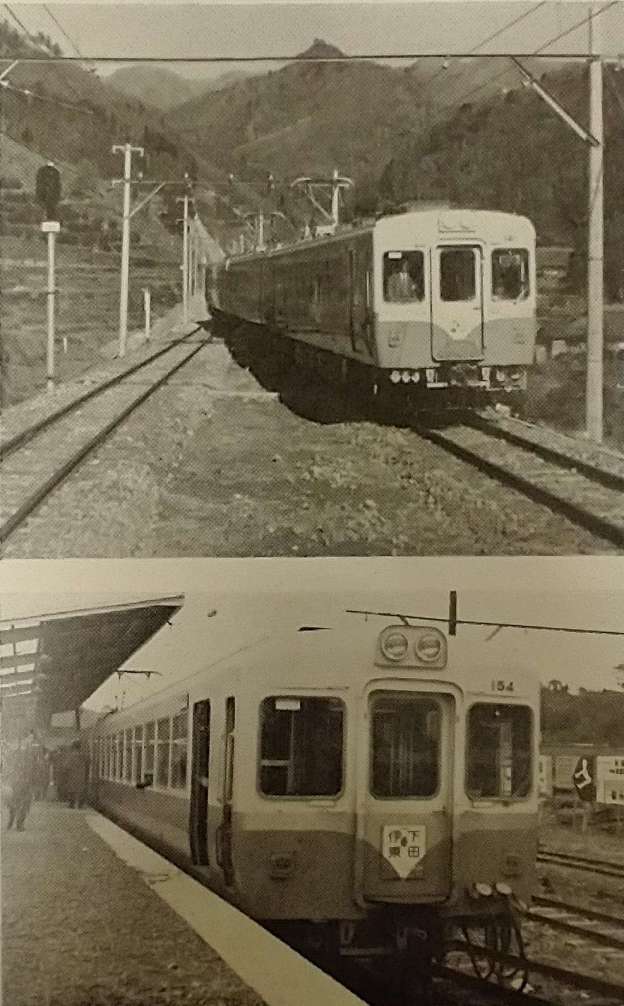
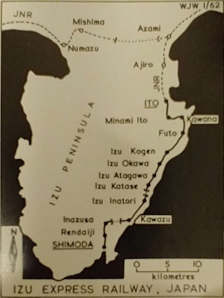
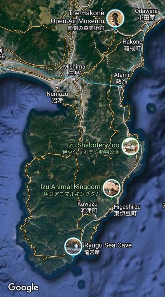

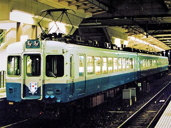
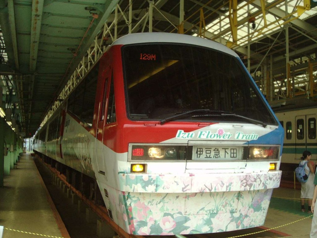
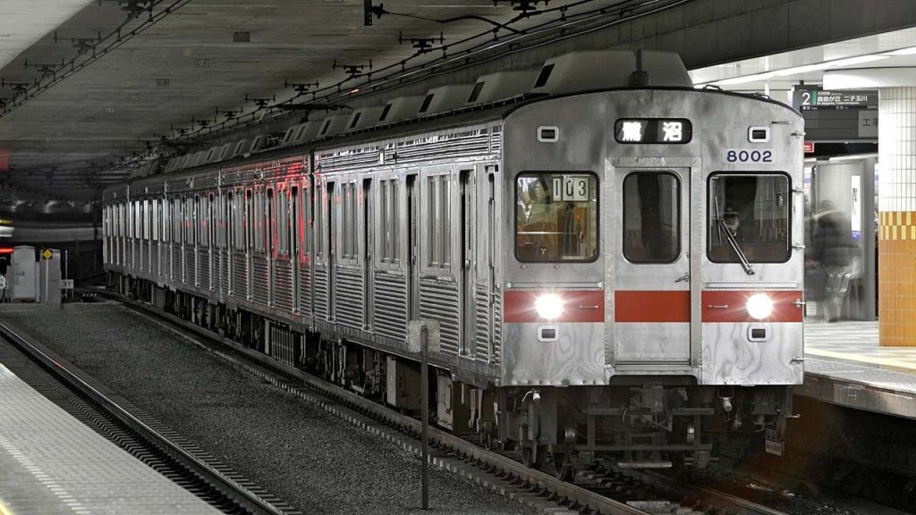
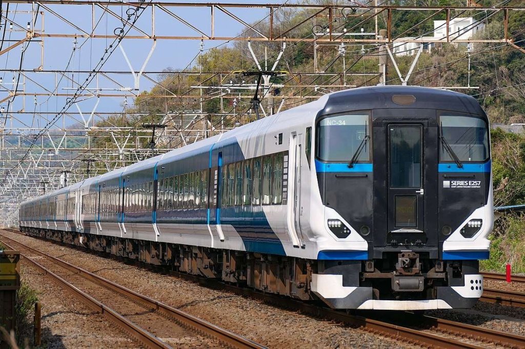
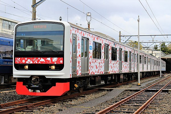
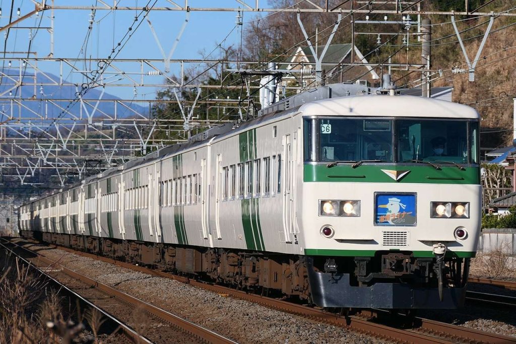


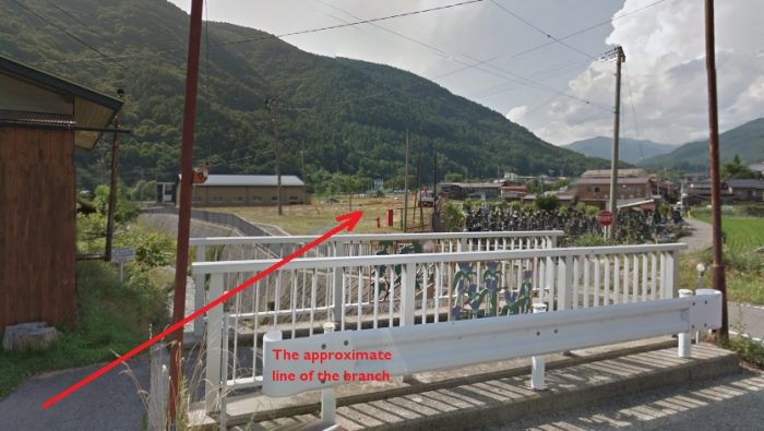
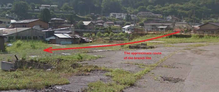
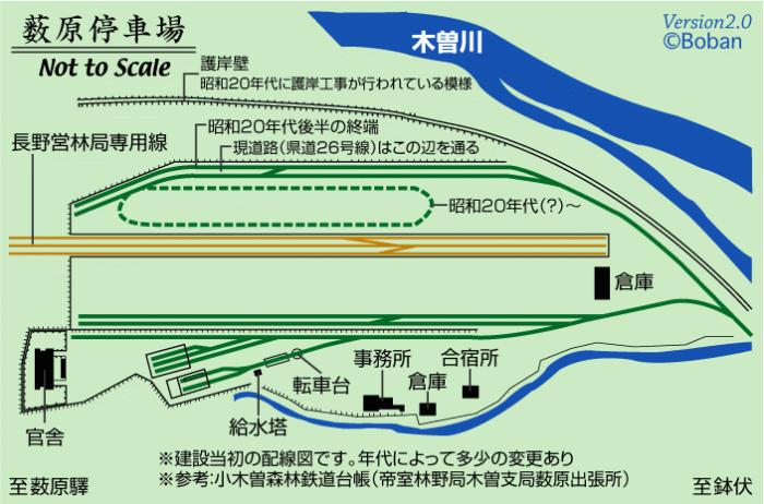
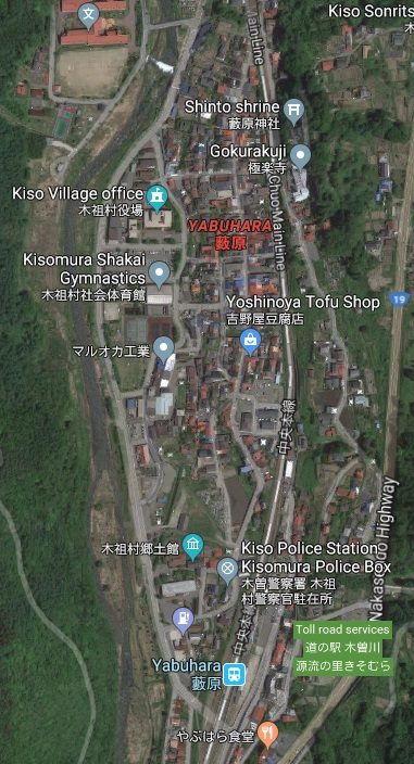
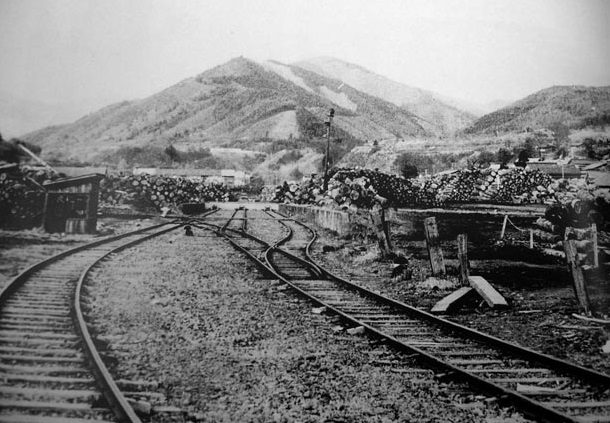
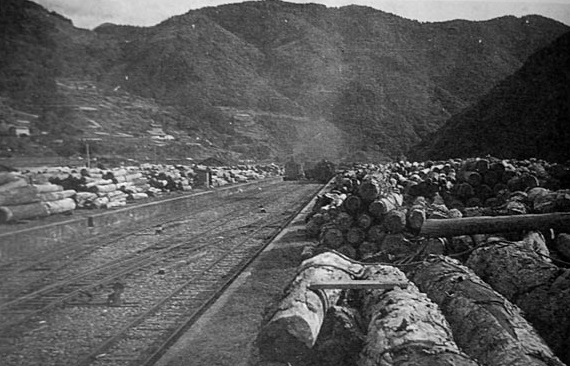
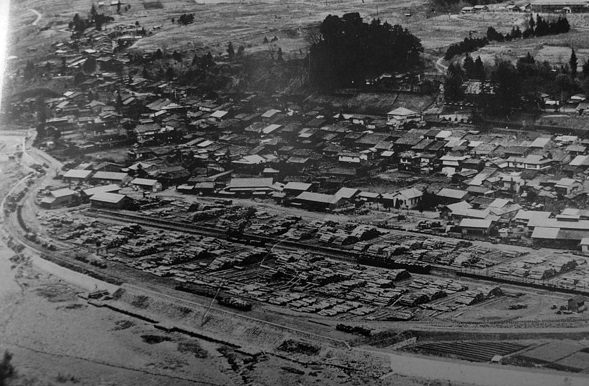
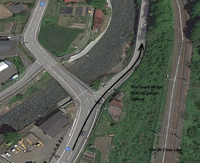
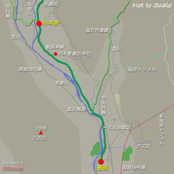
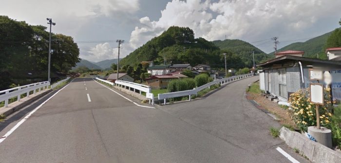
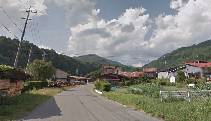
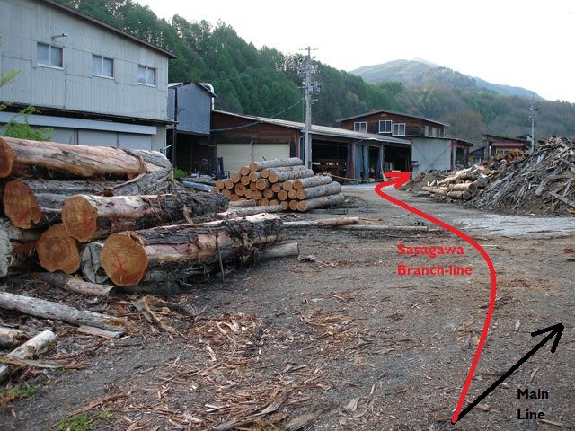
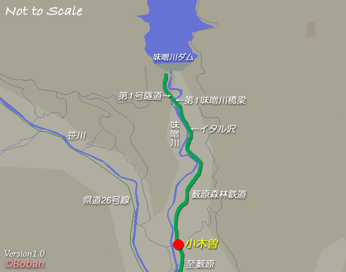

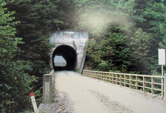
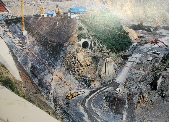
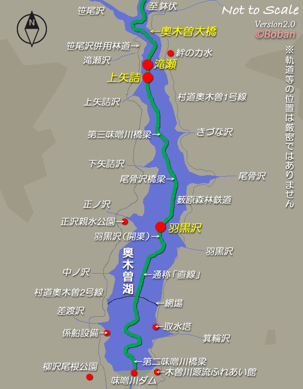
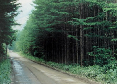
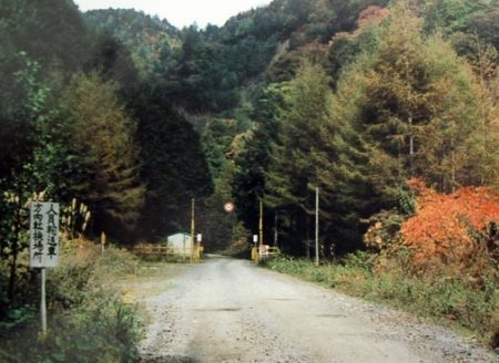
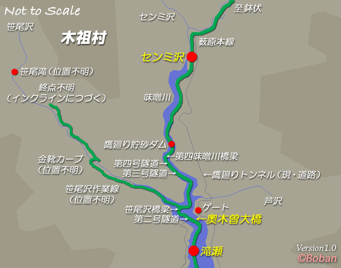
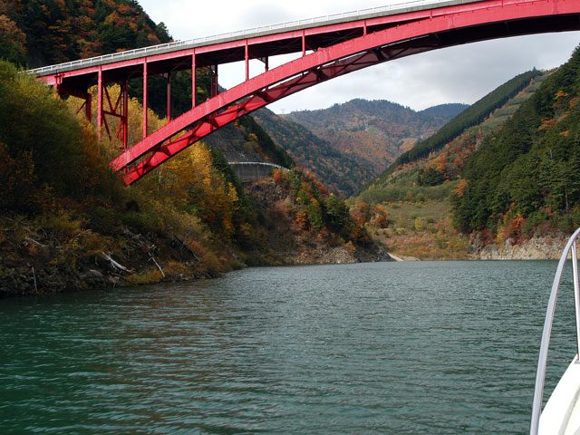
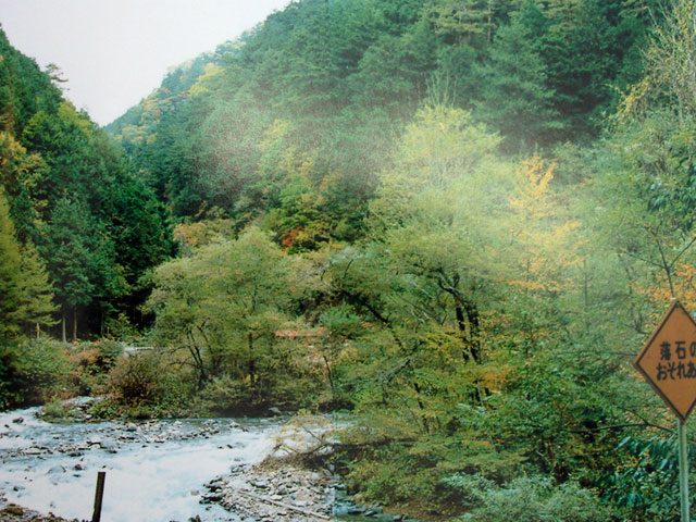
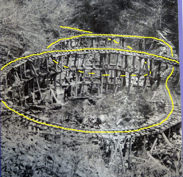
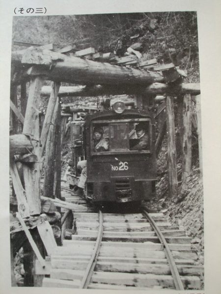
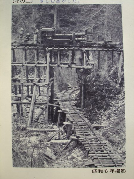
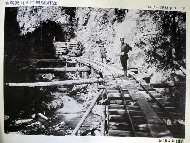
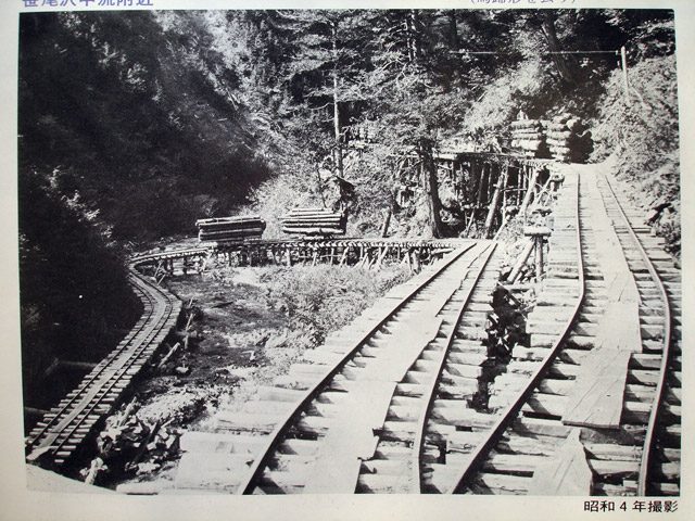

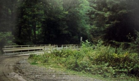
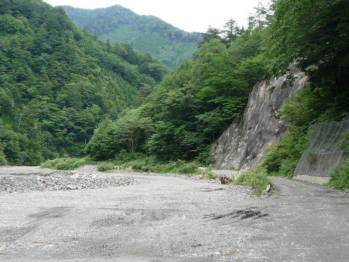
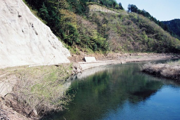
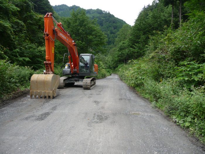
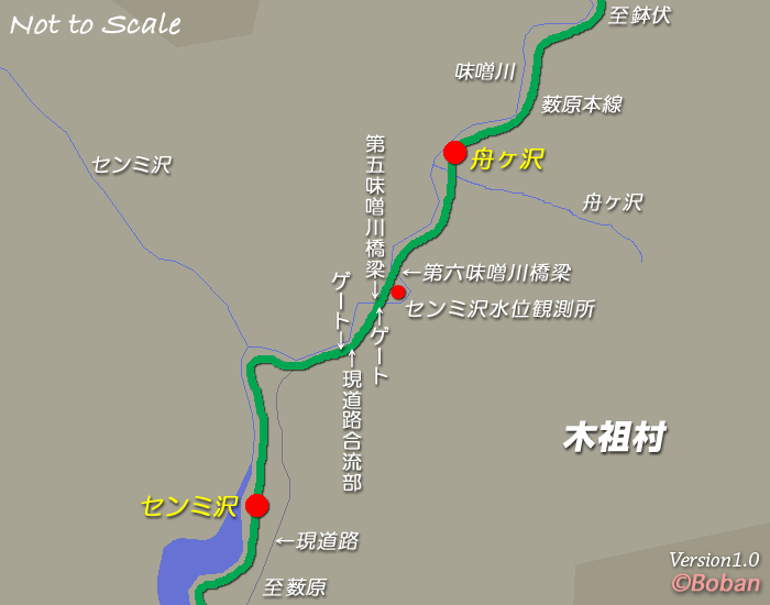
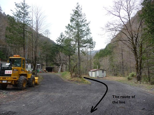
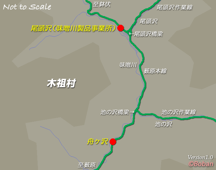

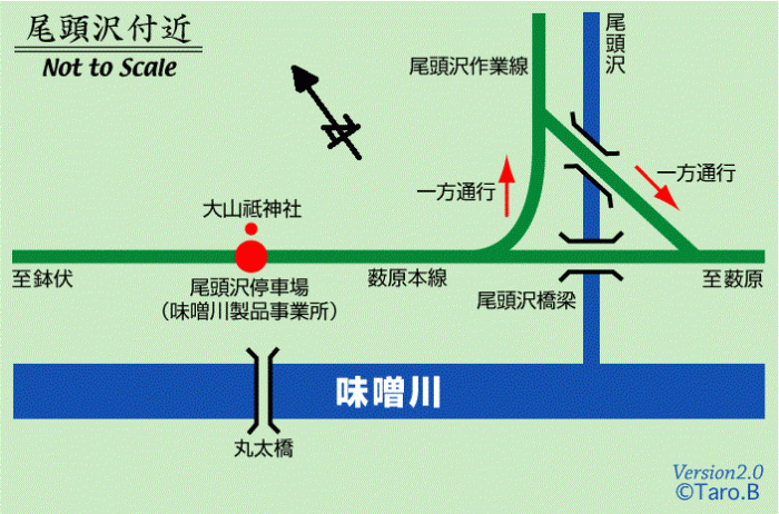
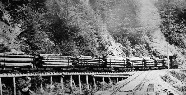
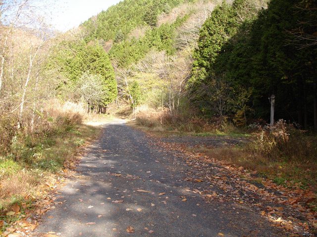

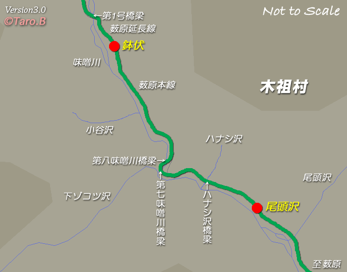
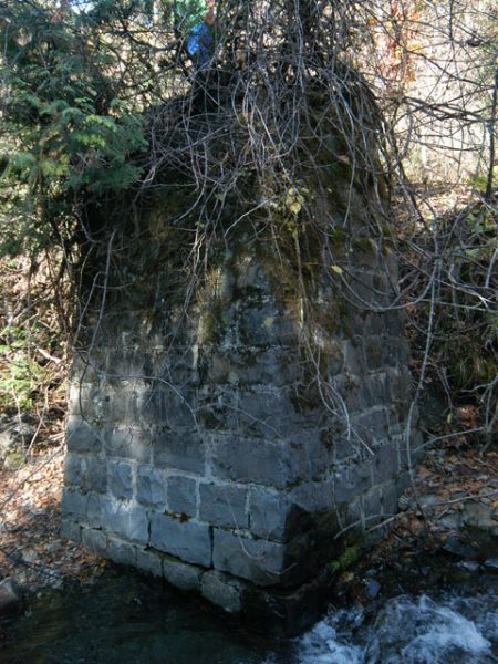
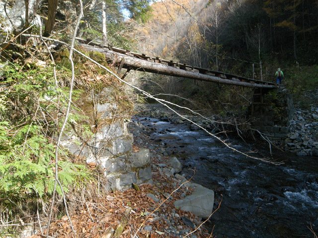
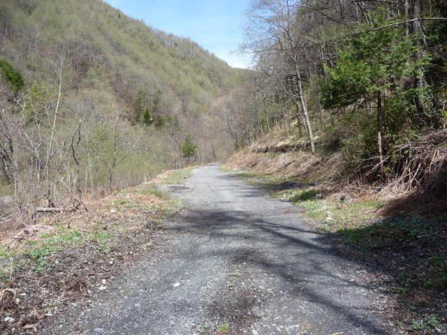
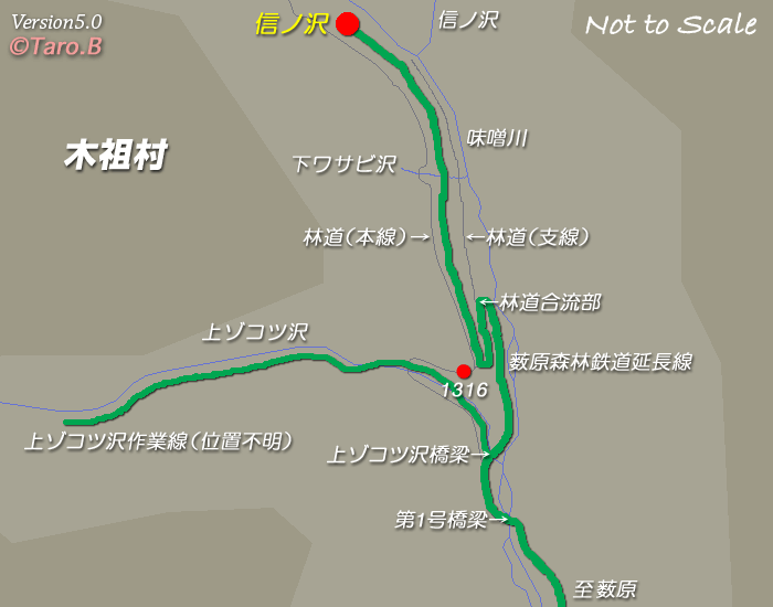

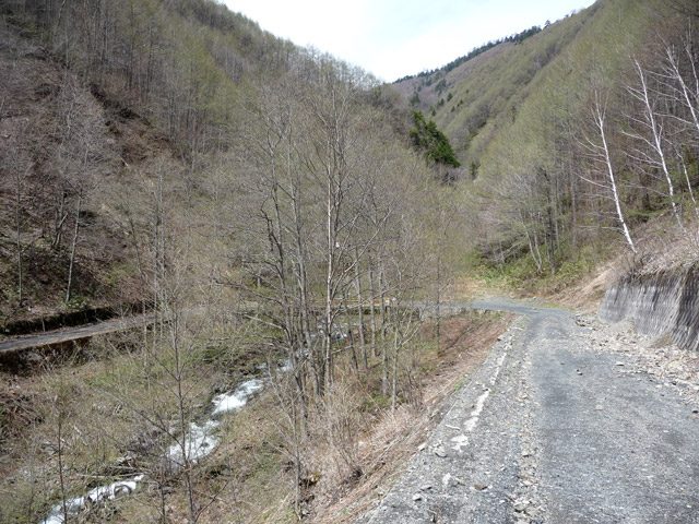
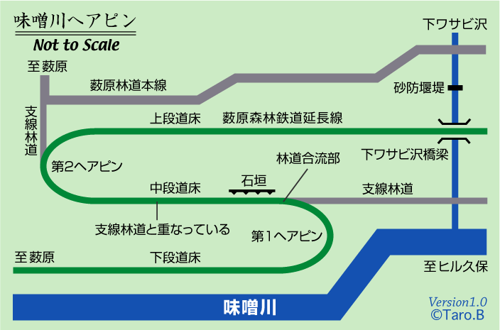
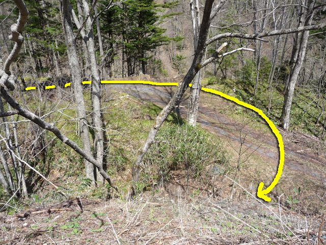
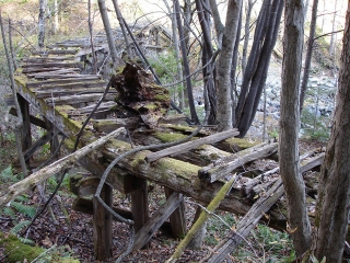
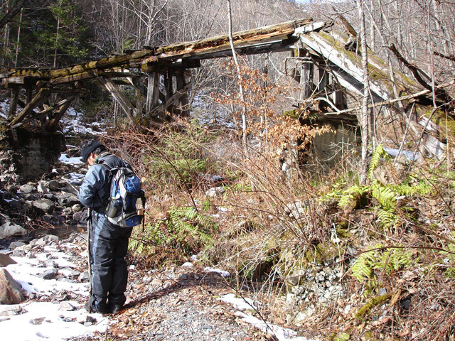
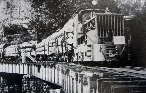
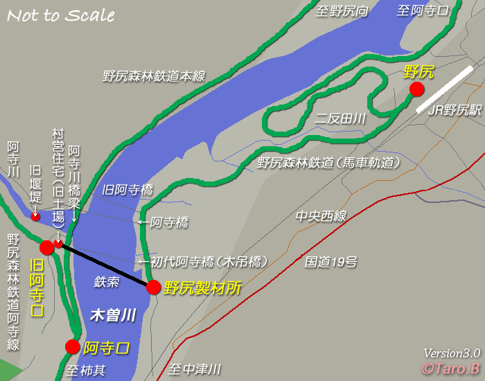
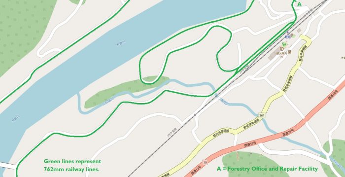
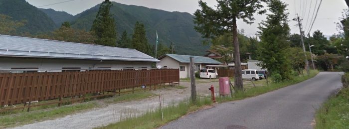
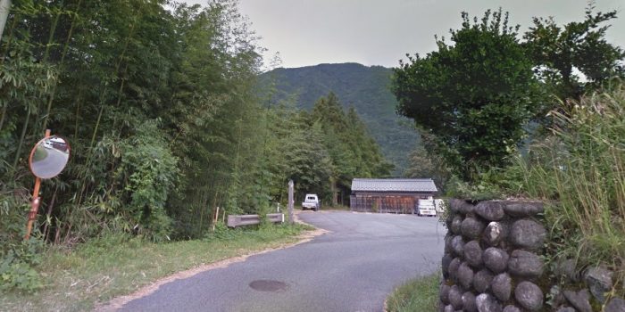
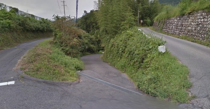
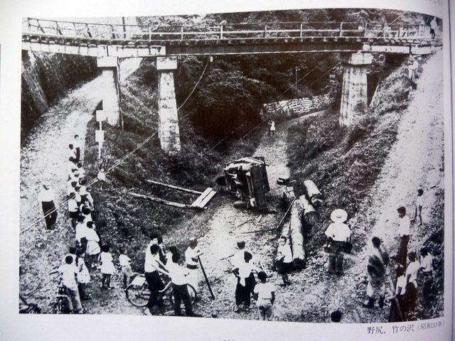
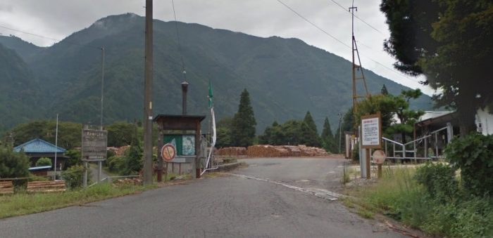
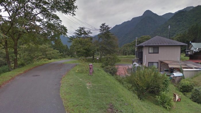
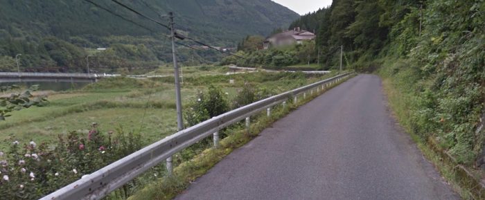
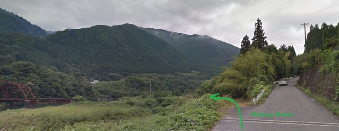
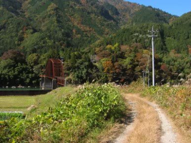
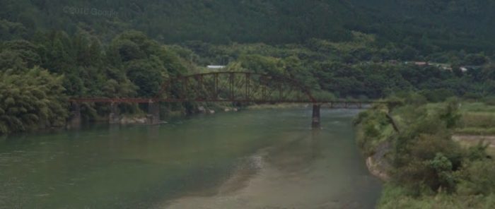
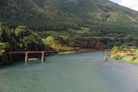
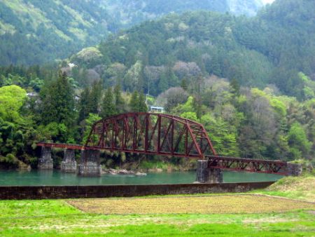
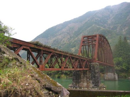
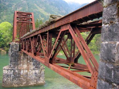
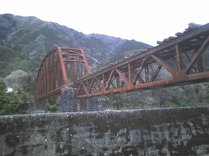
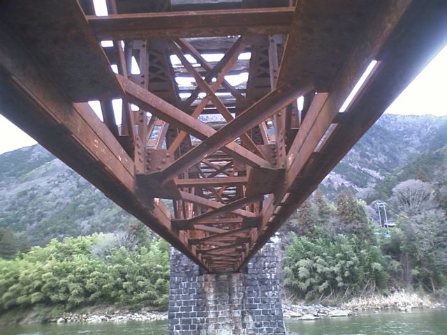


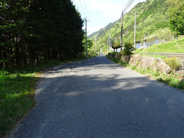
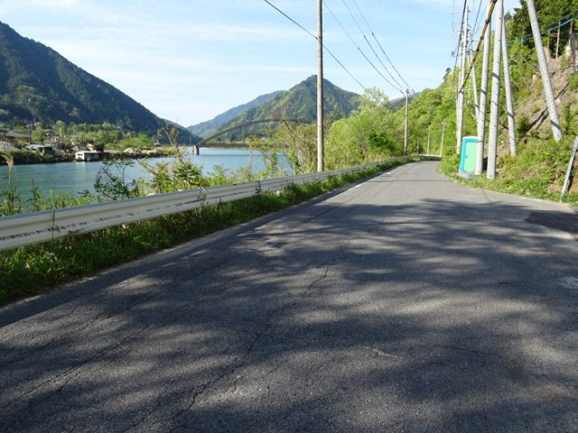
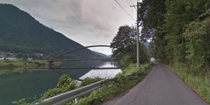
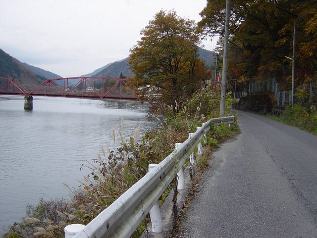
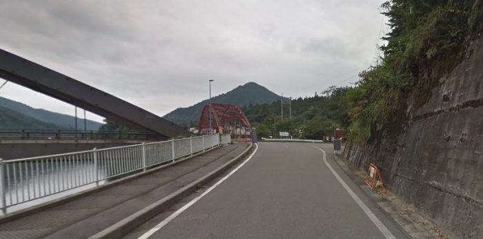
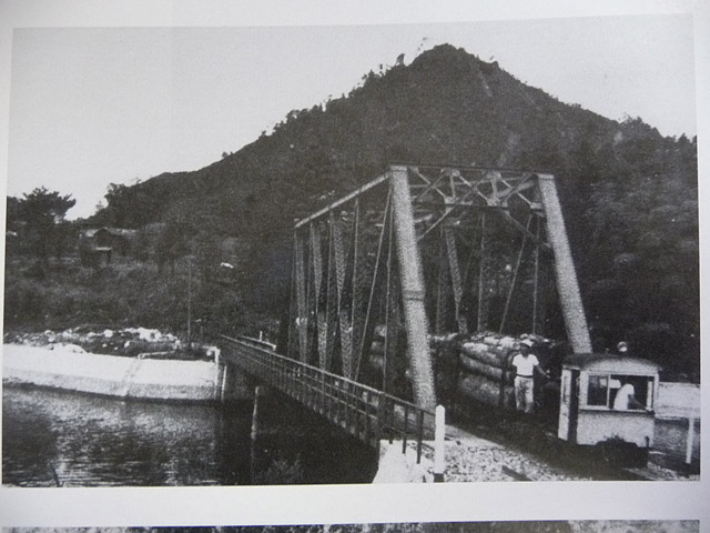
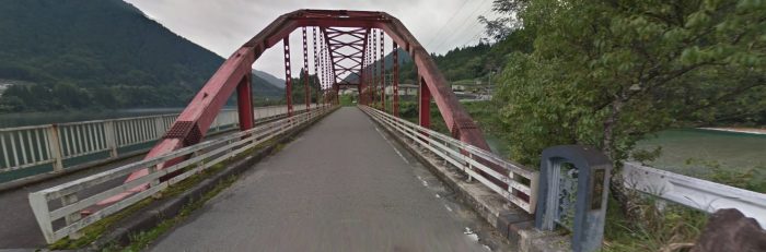
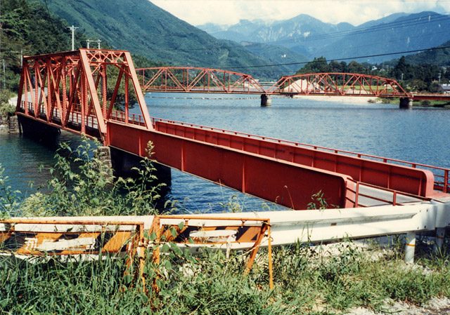
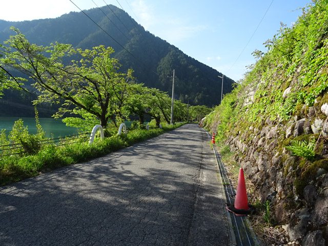
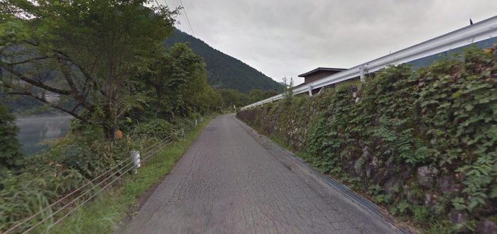
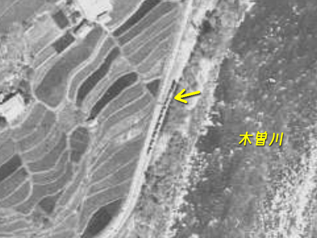

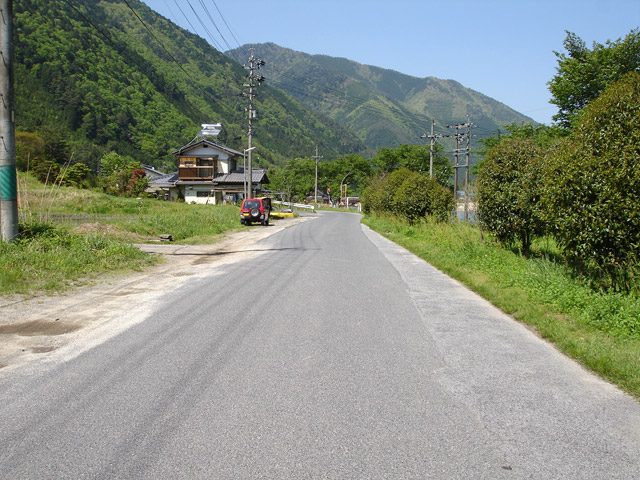
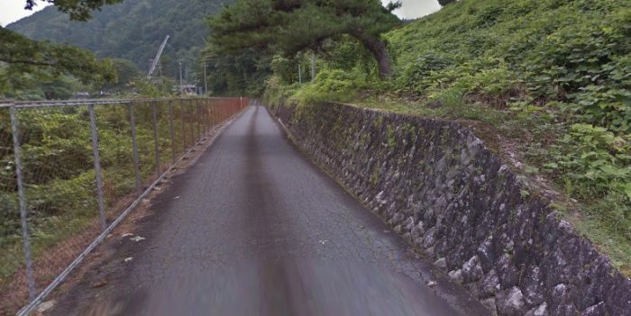
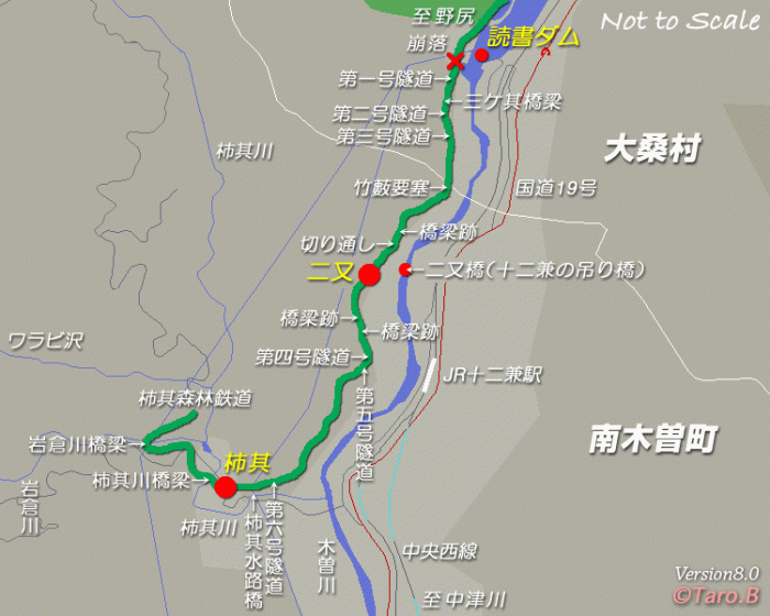
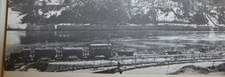
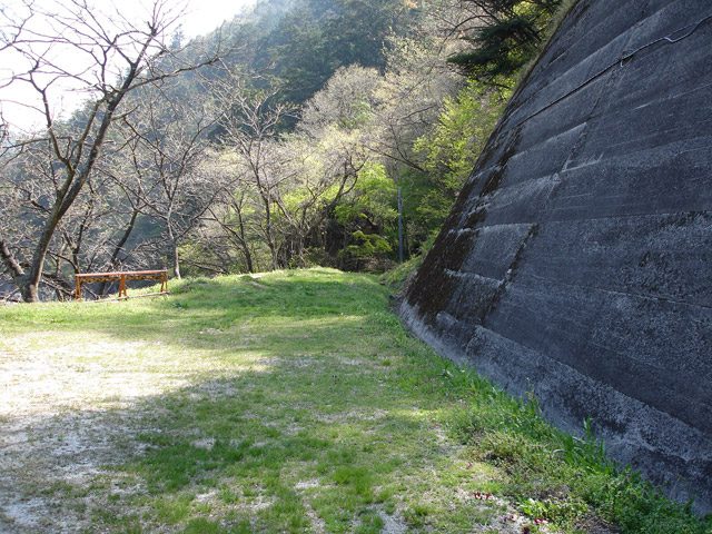
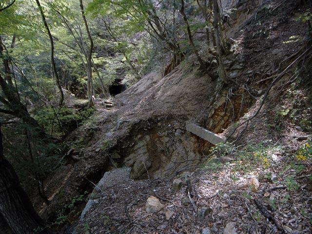
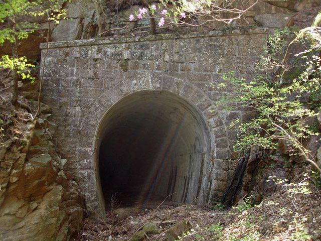
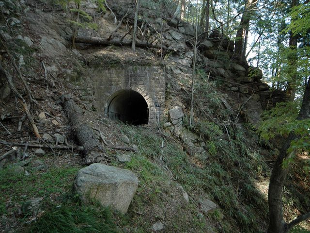
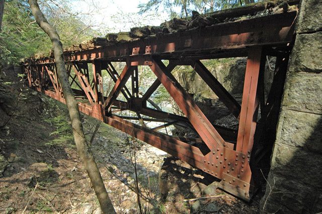
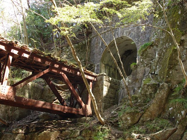
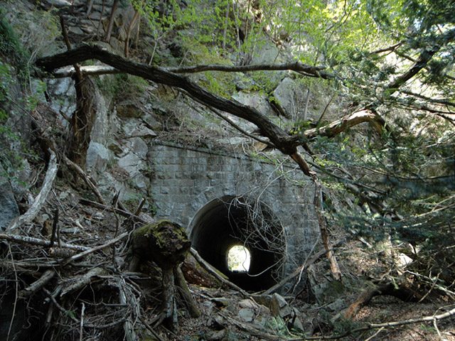
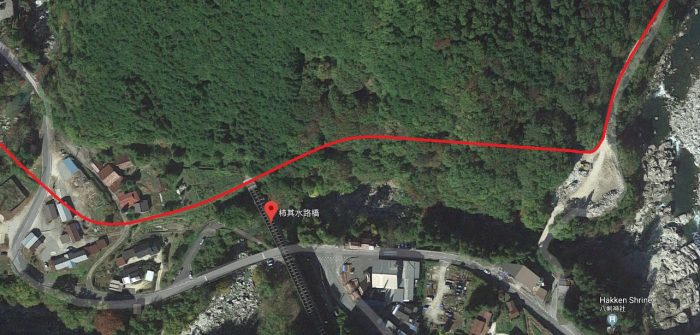
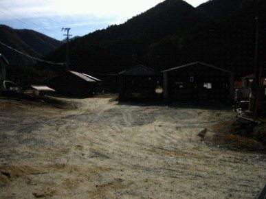
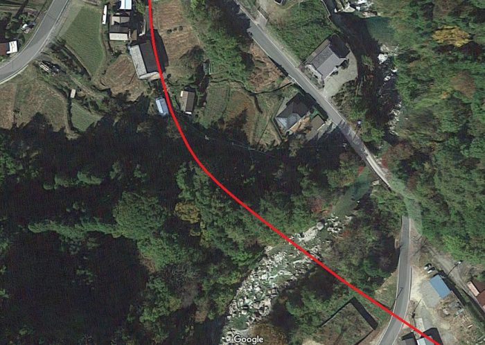
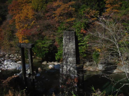
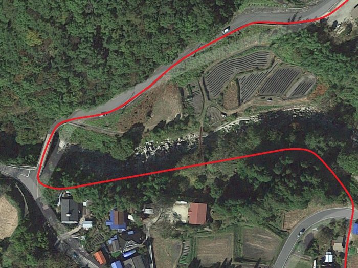
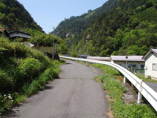
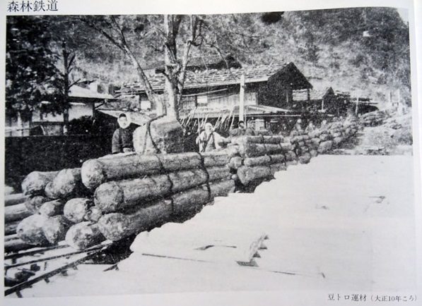
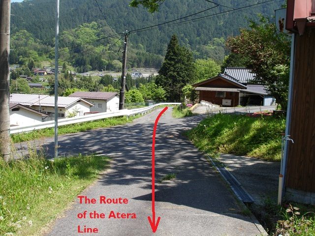
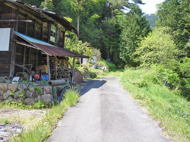
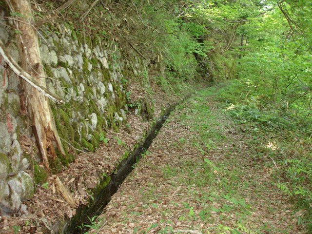
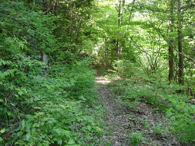
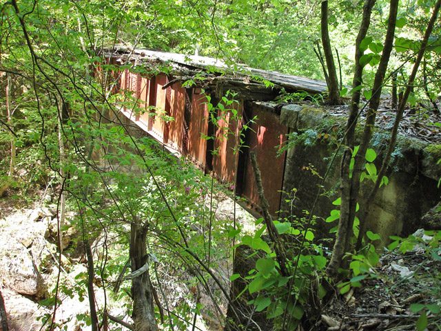
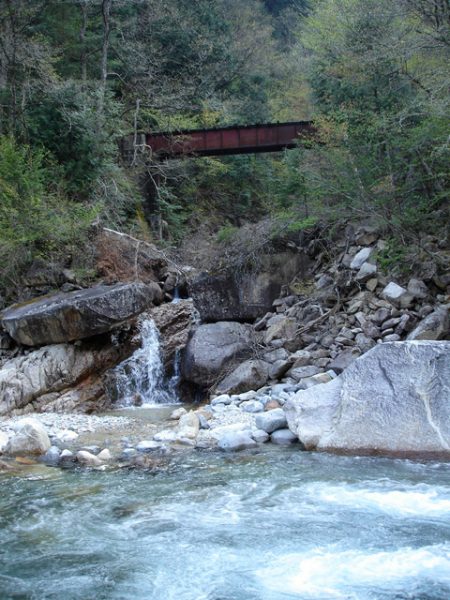
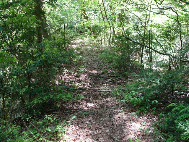
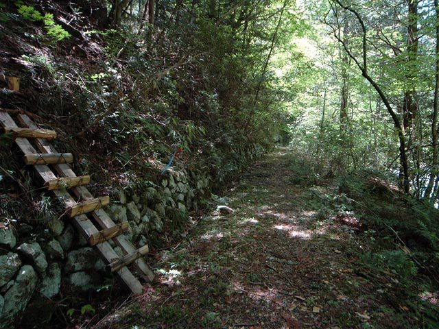
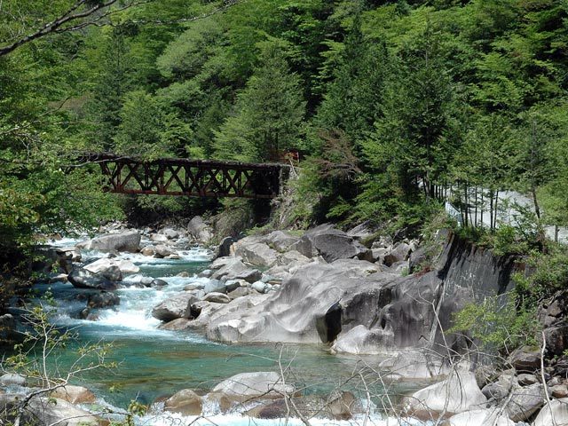

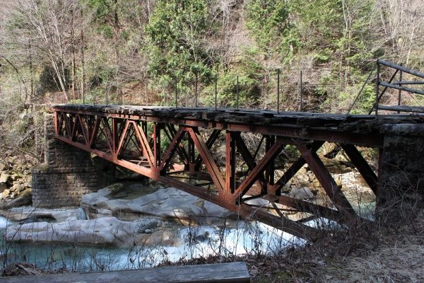
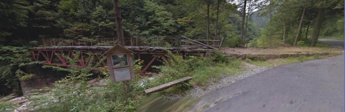
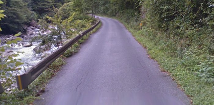

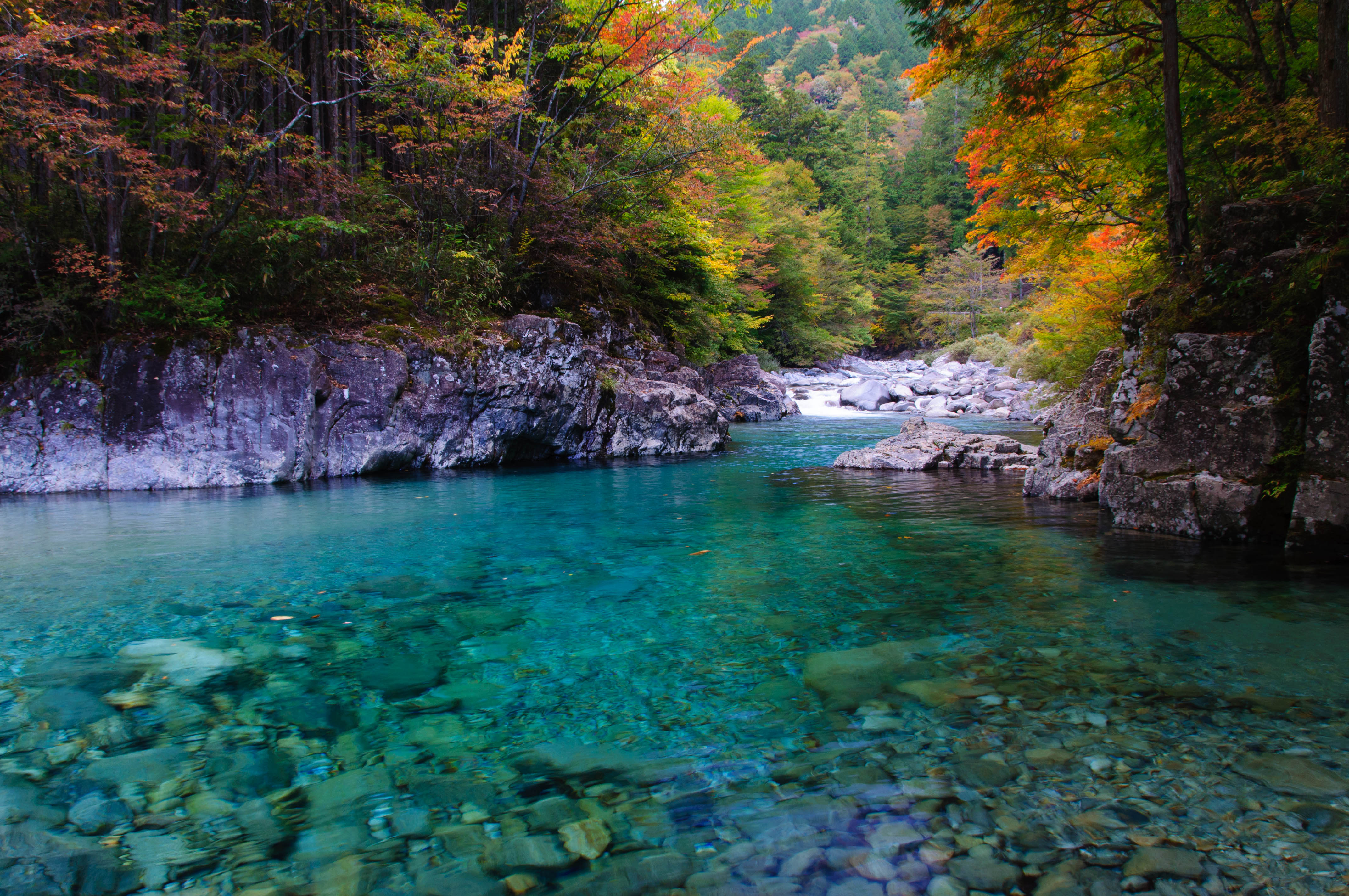
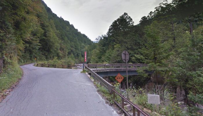
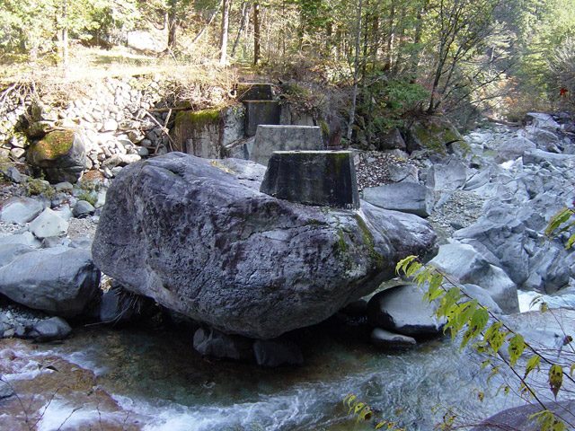
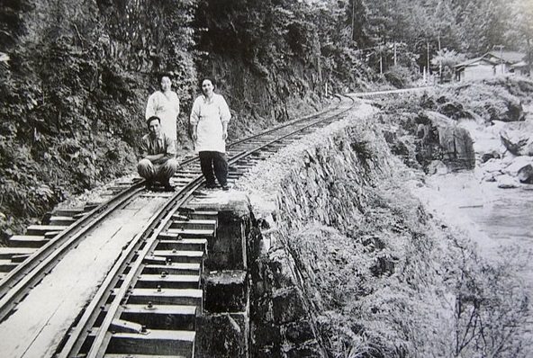
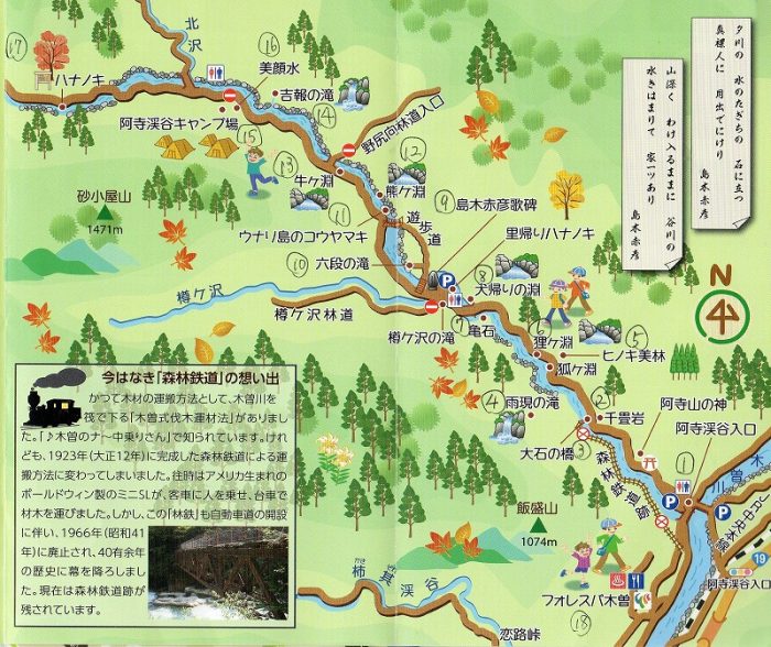
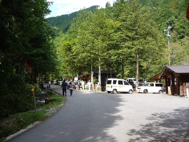
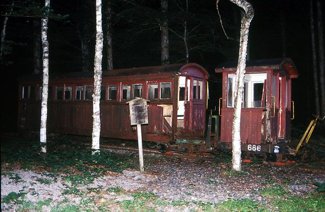
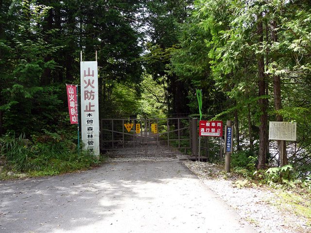
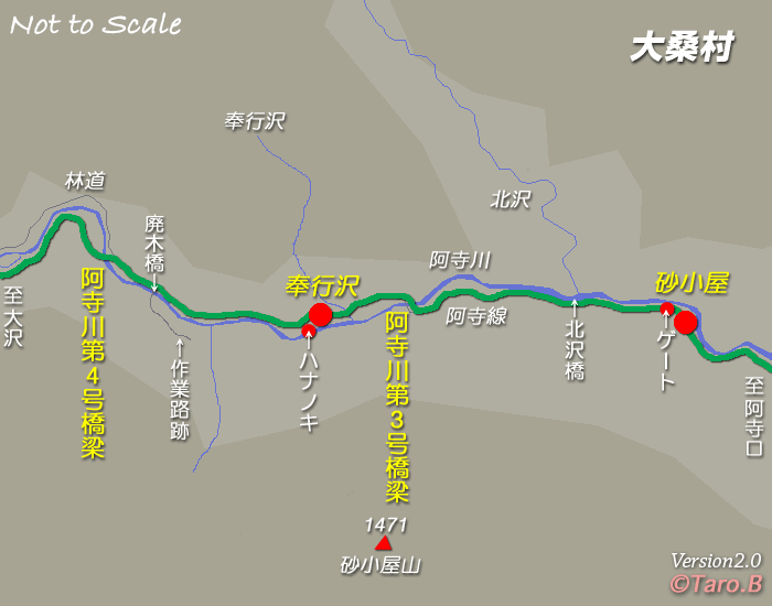
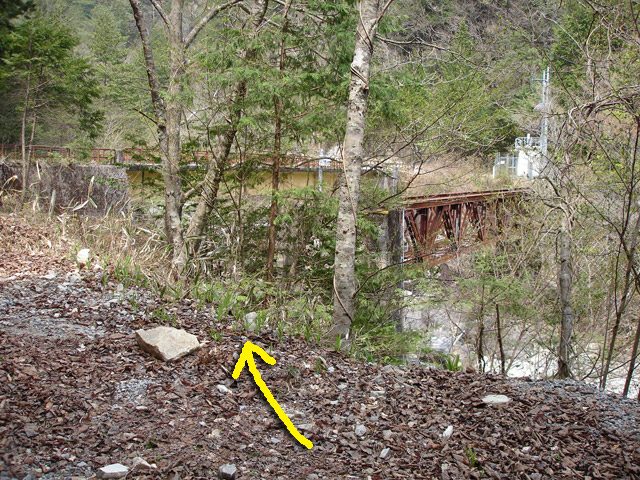
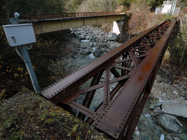
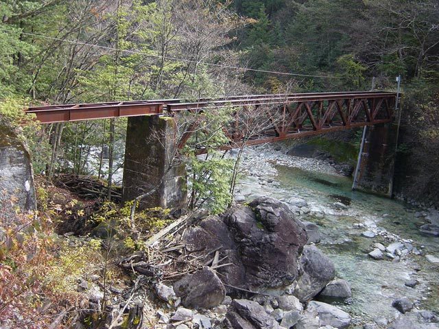
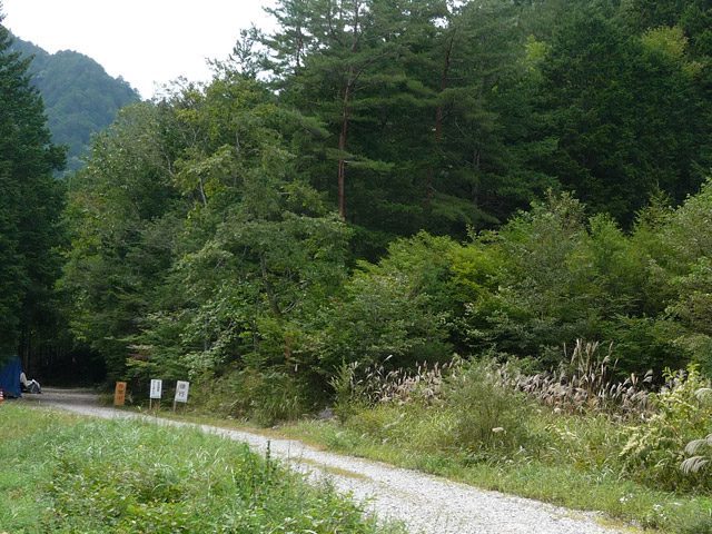
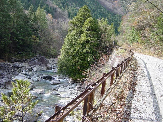
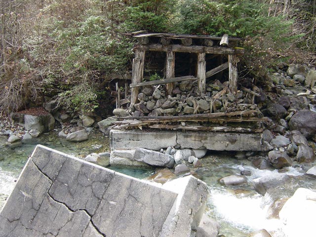
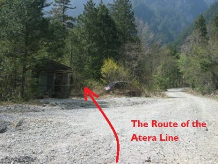
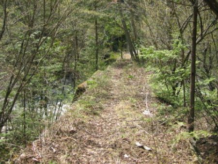
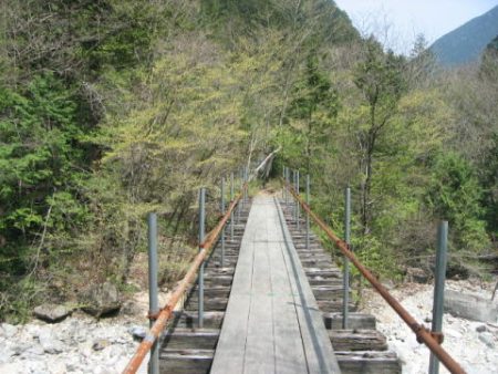
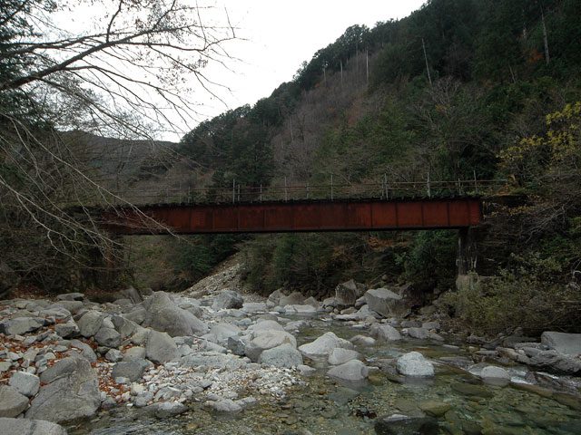
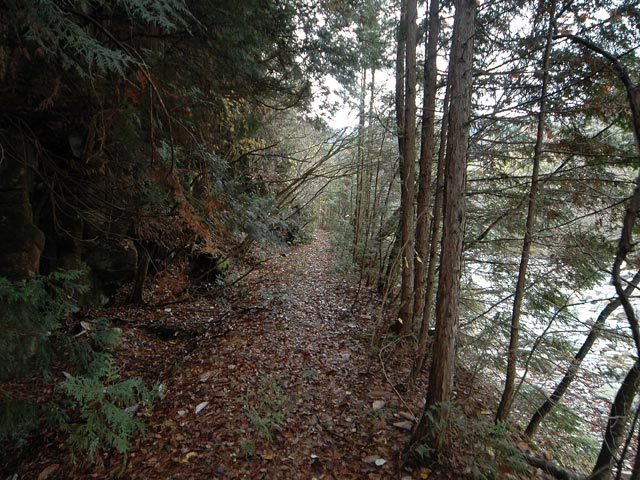
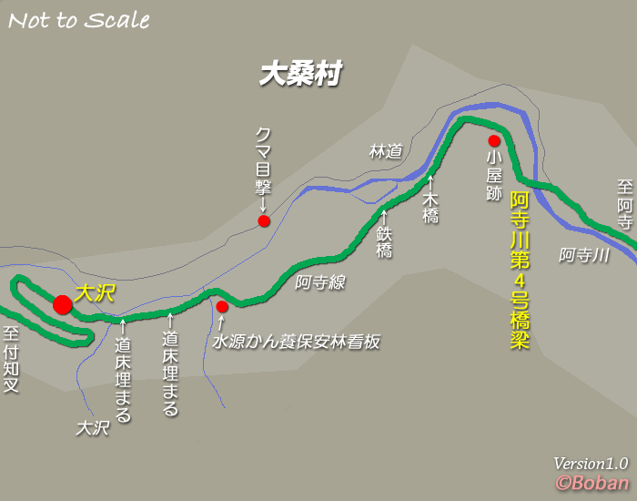
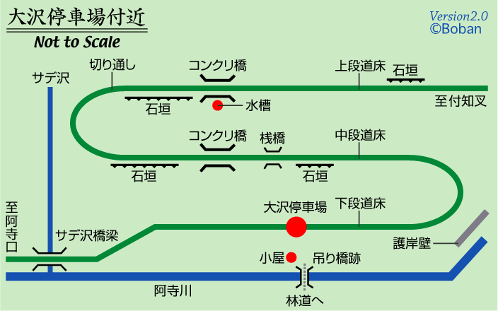
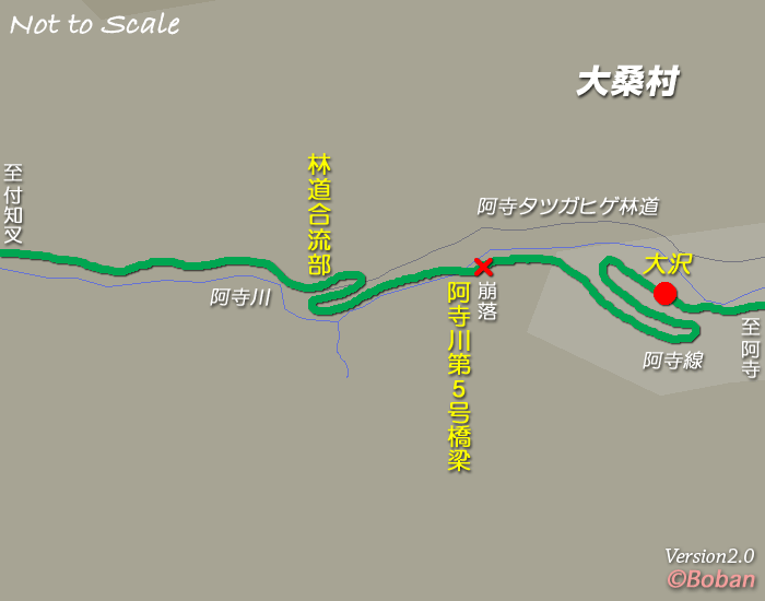
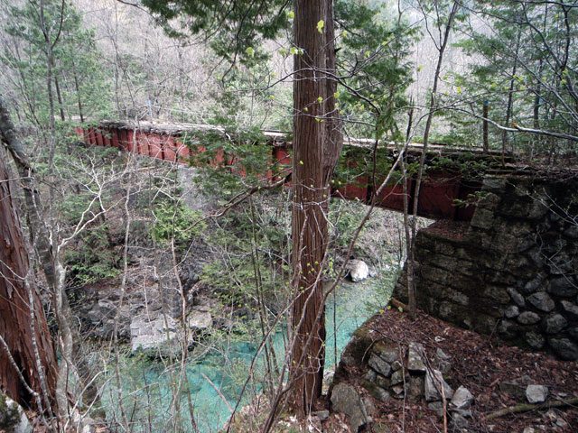
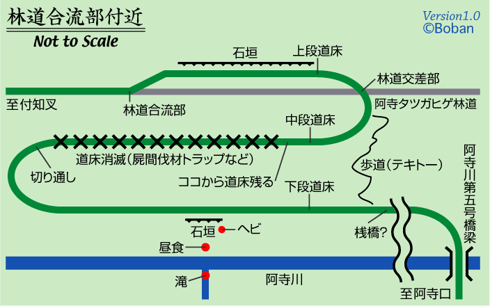
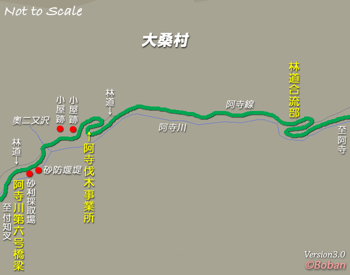
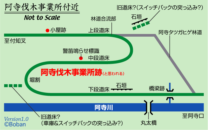
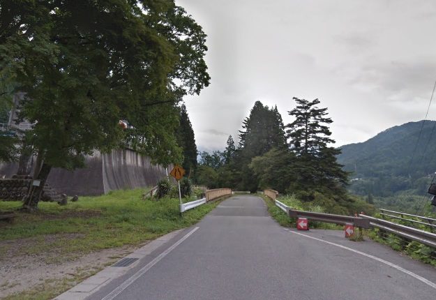
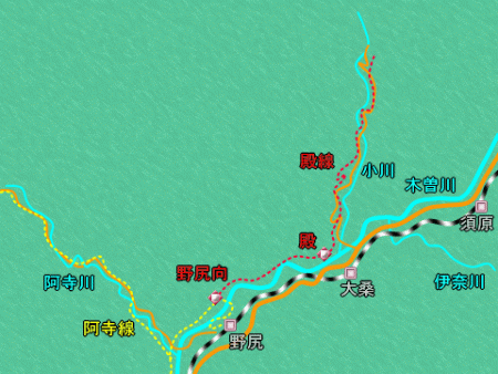
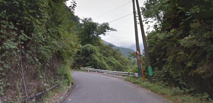
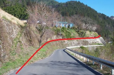
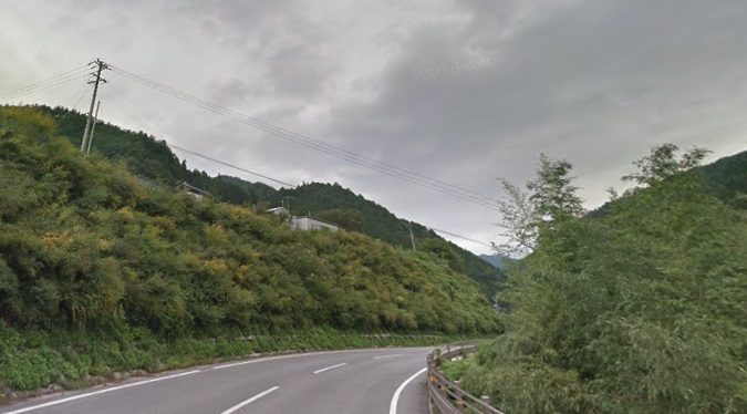
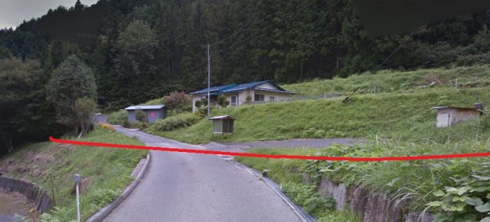
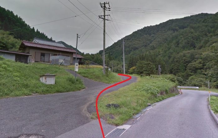
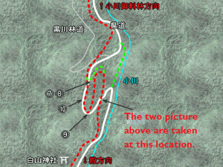
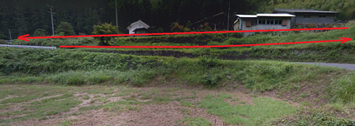
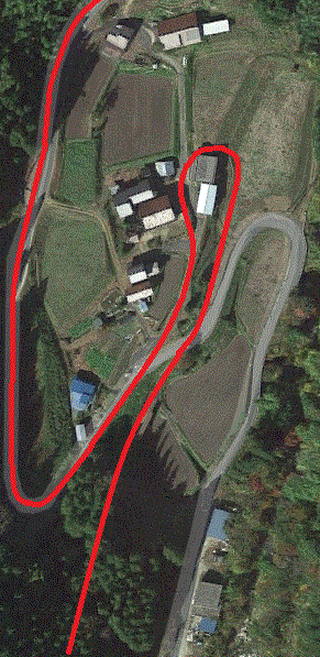
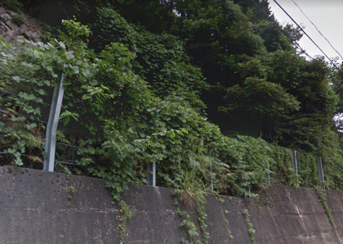
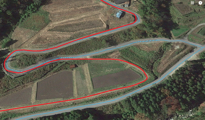
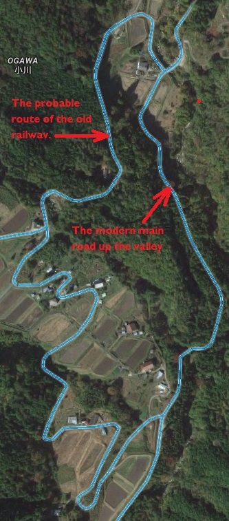
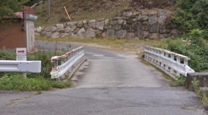
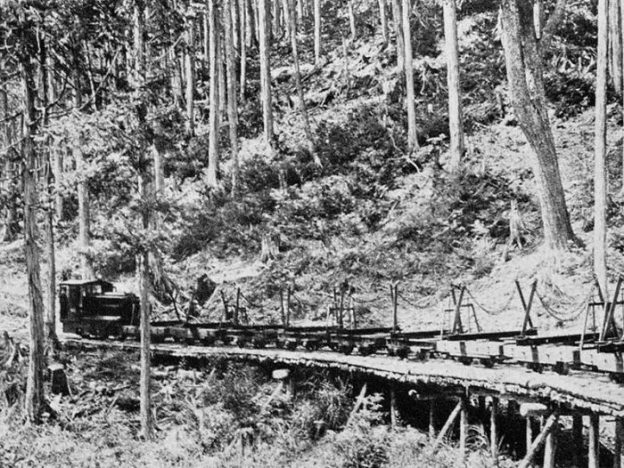
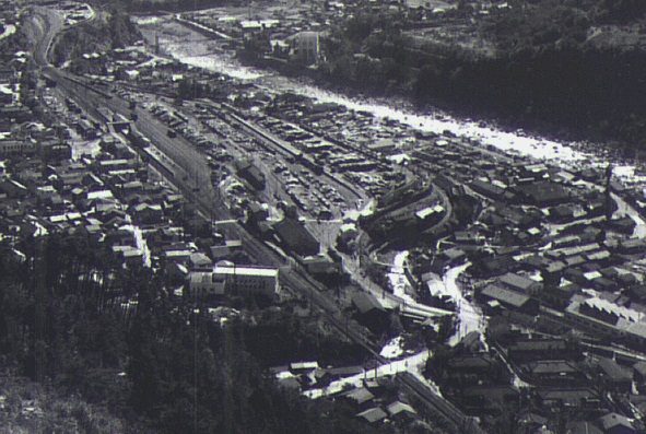
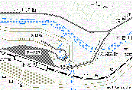
 There is an interesting feature in Agematsu which I have discovered on-line. [27] There was a short link line between the high-level railway station and yards and the sawmill in the Kiso River Valley floor. It included a sharp loop as shown in the adjacent image at position ‘A’. [27]
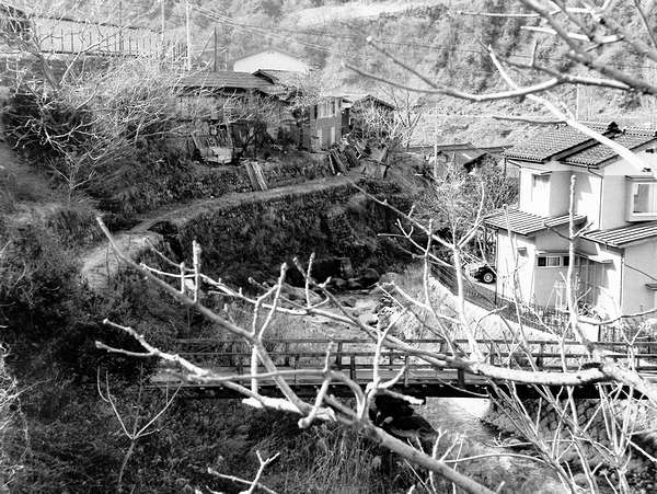
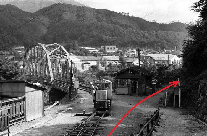

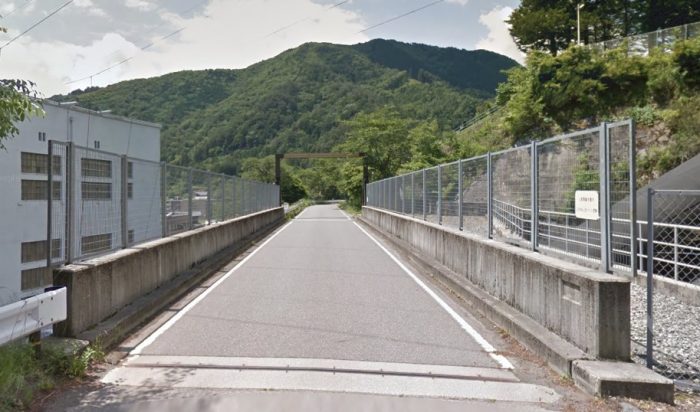
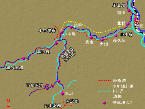
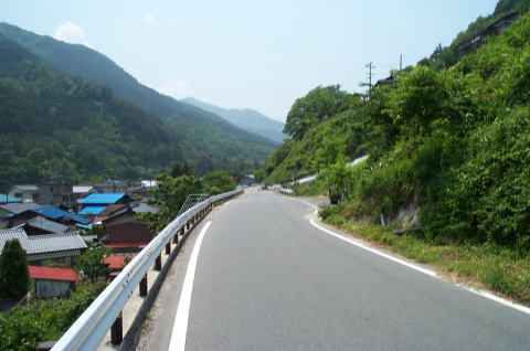
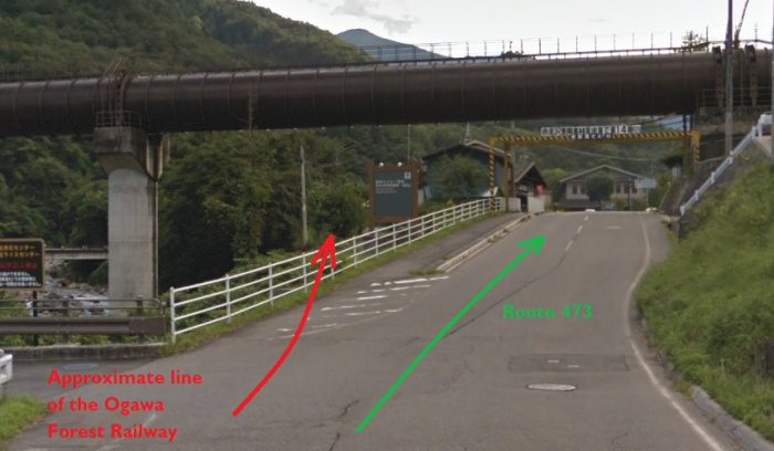
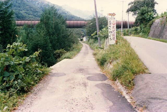
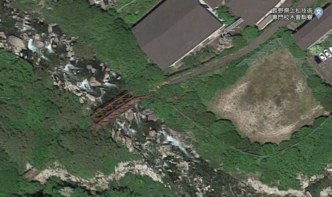
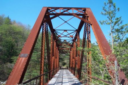
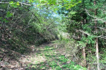

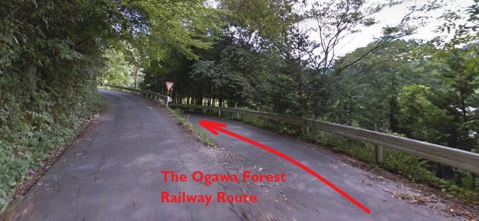
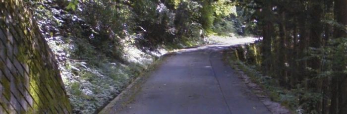
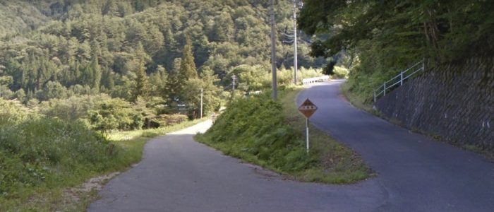
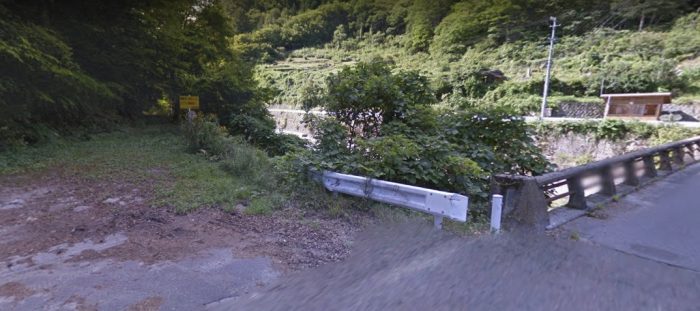
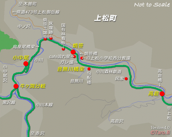
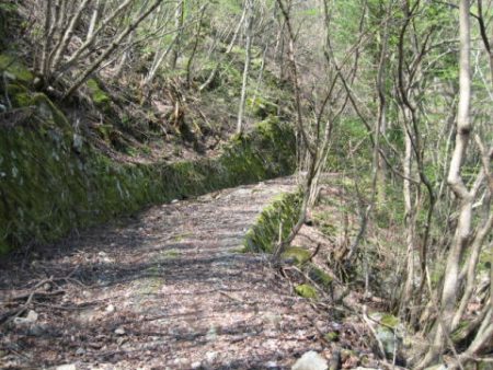

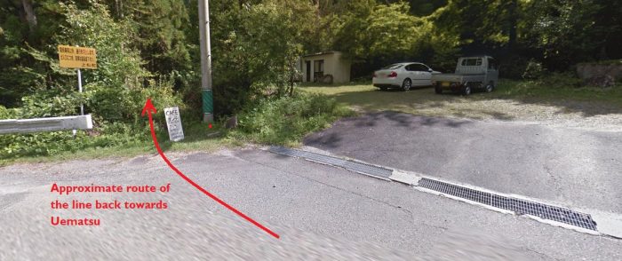
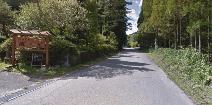
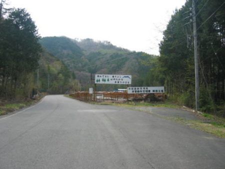
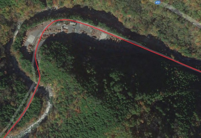
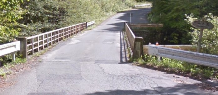
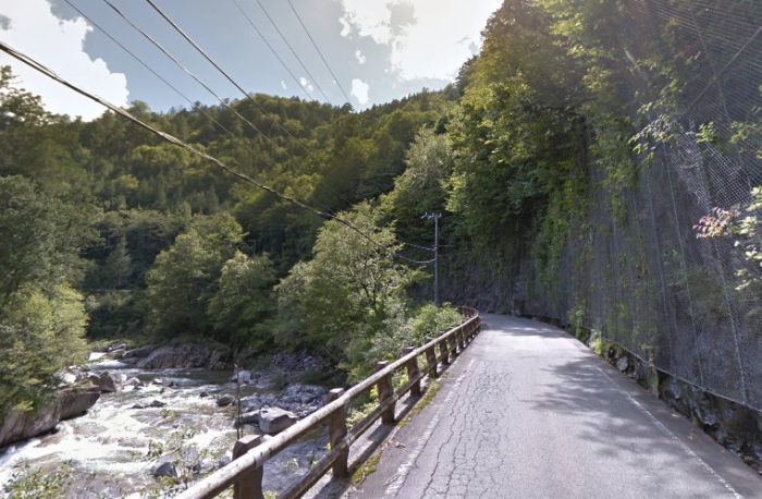
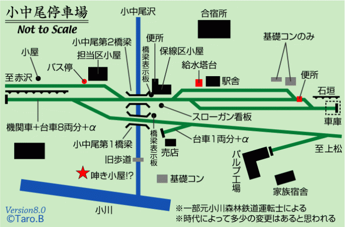

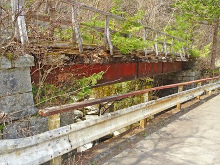
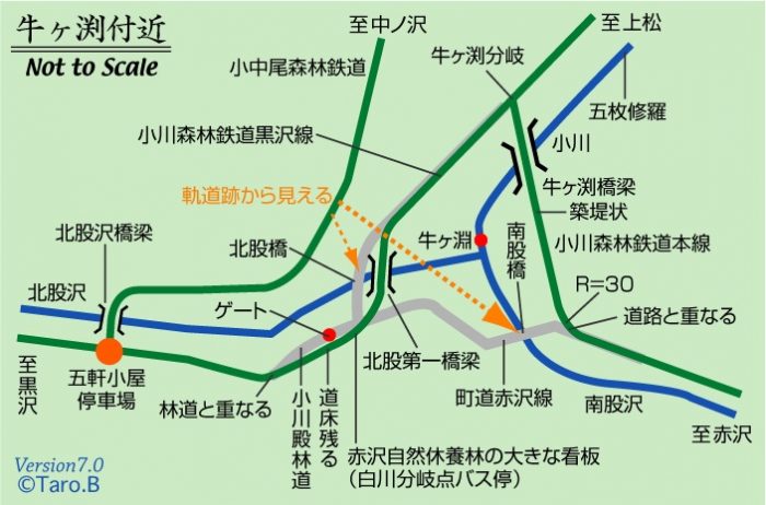
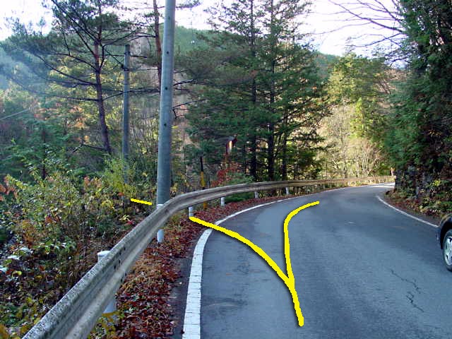
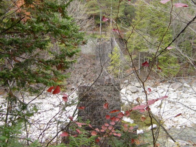
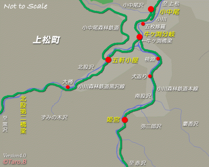
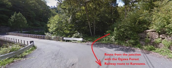
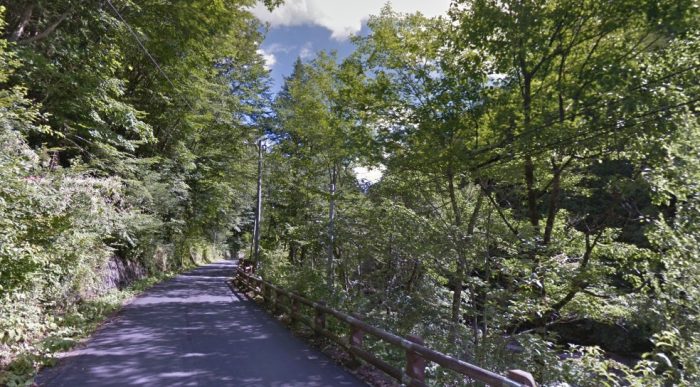
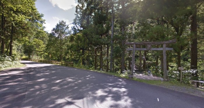
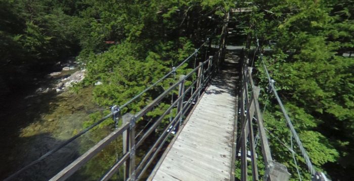
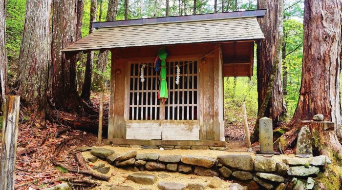
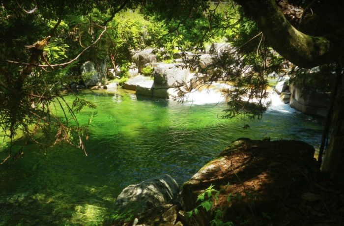
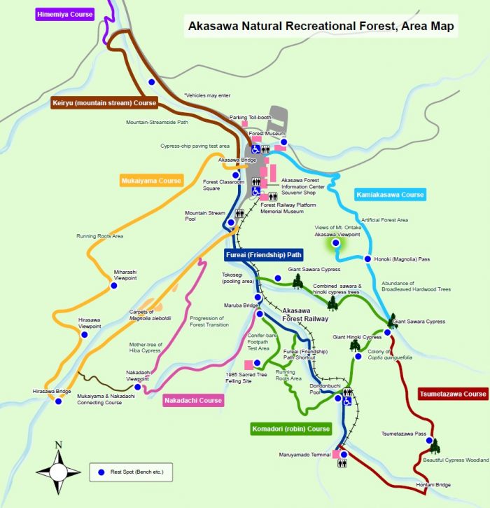
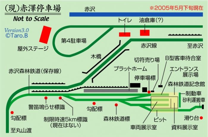
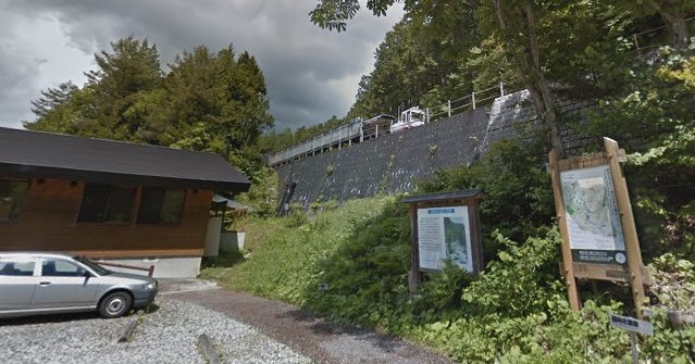
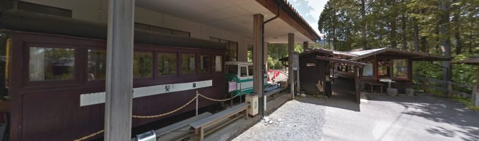
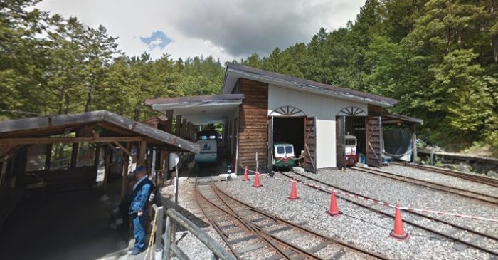
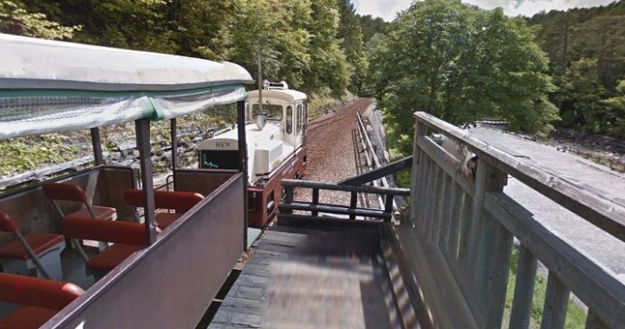
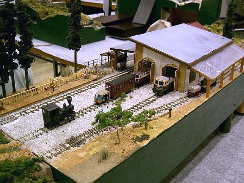
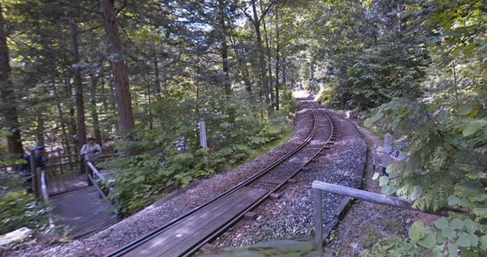
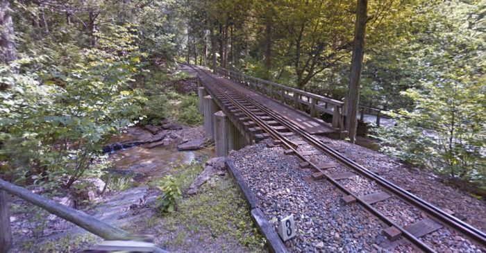
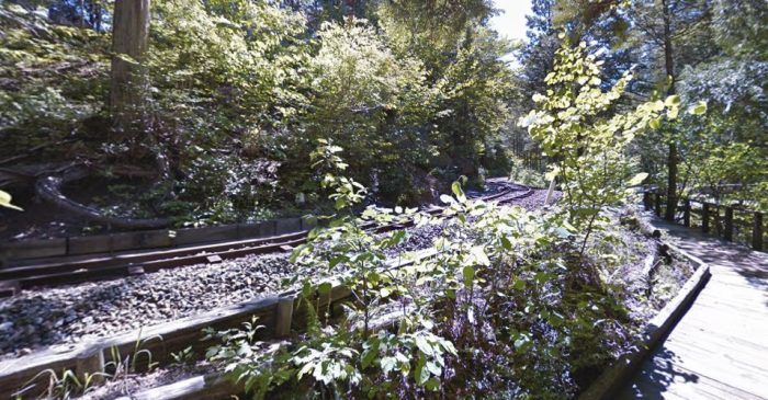

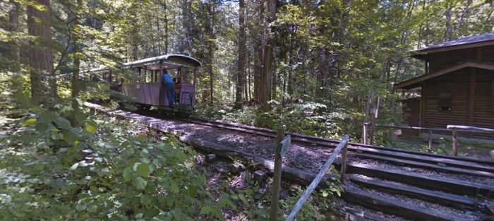
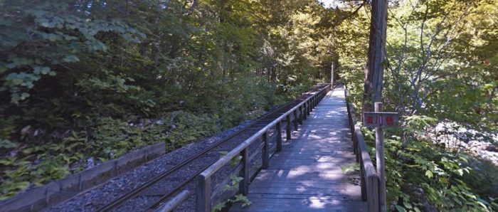
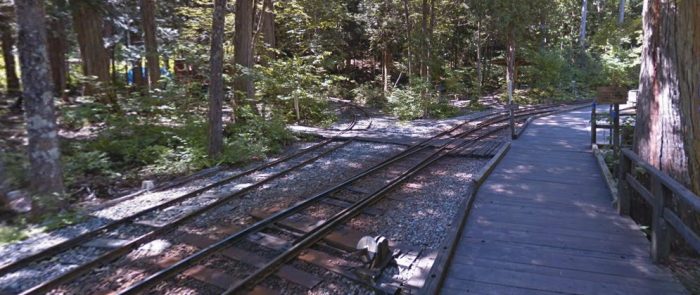

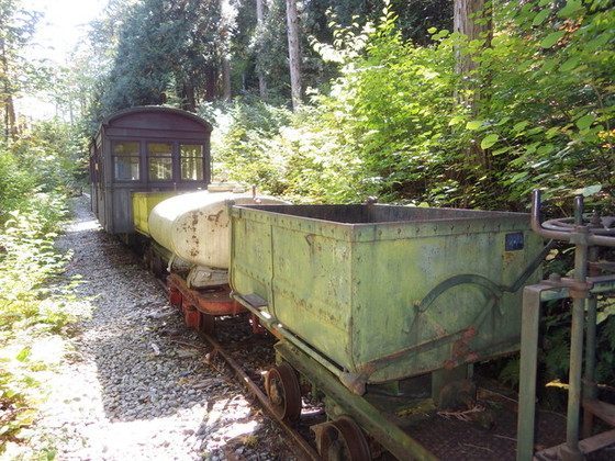
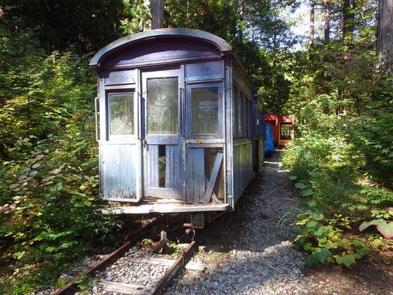
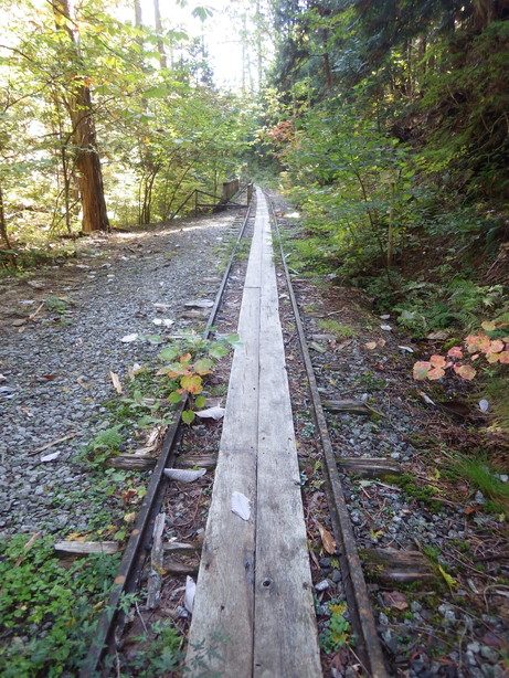
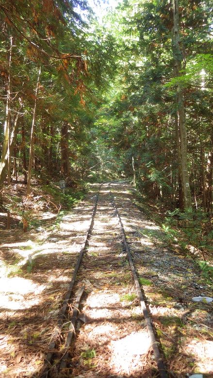
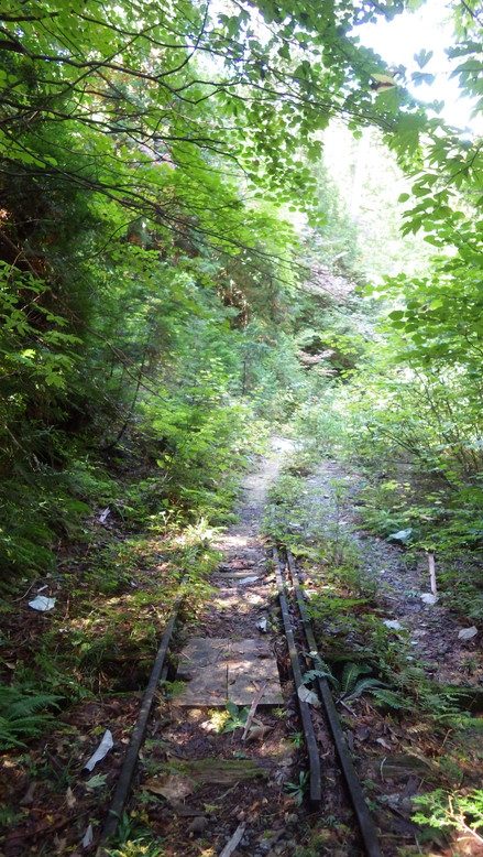
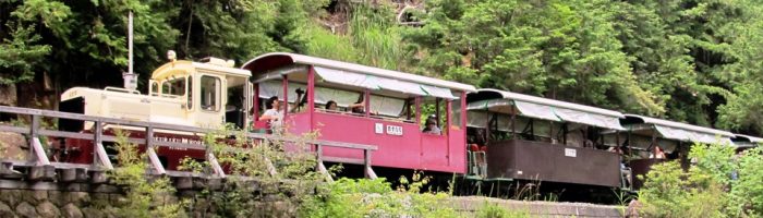
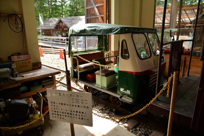
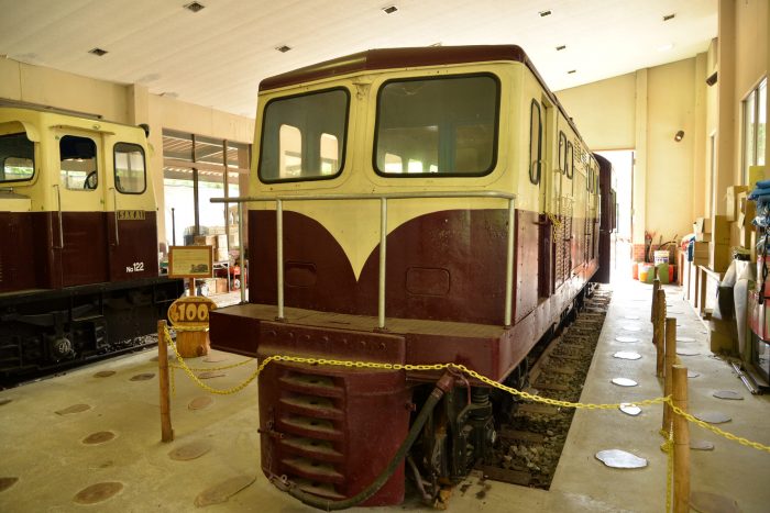
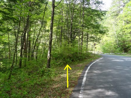
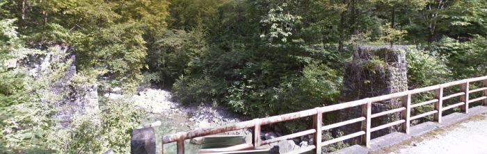
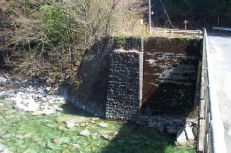
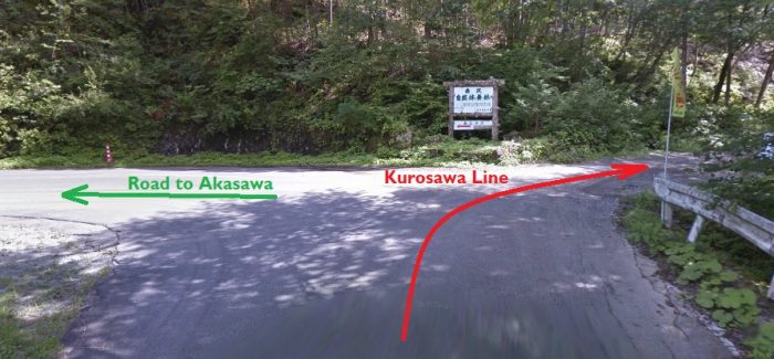
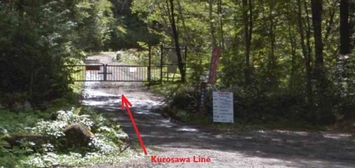
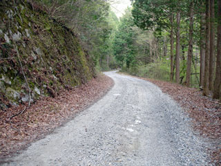
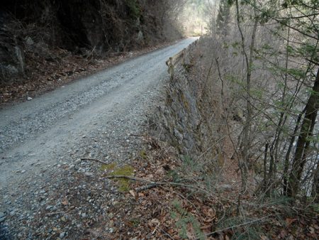
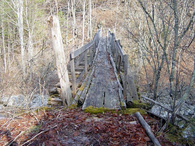
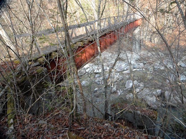
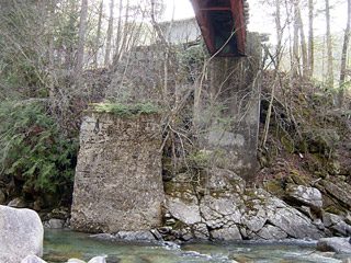
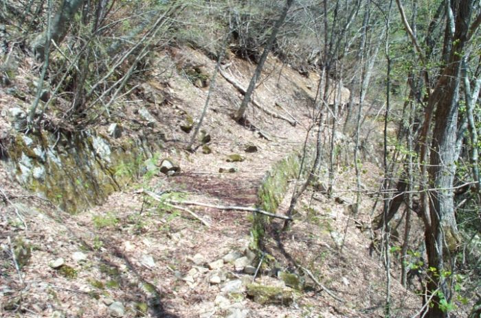
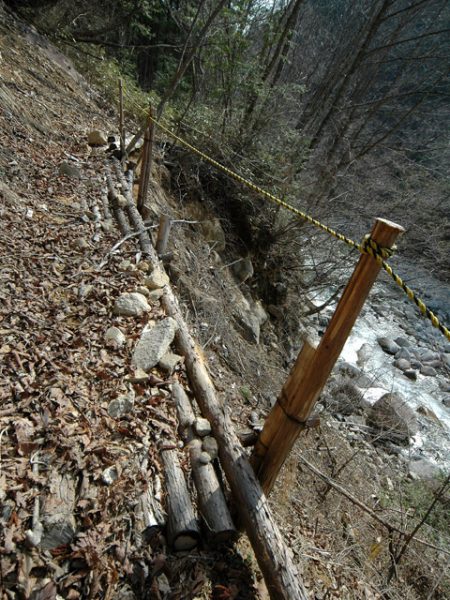
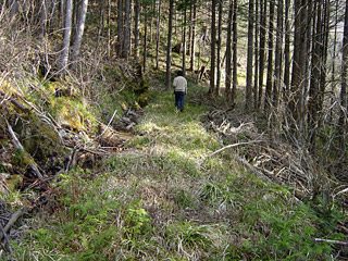

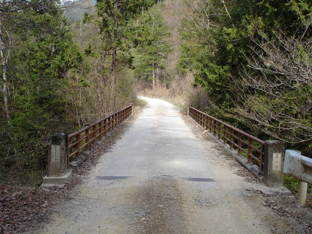
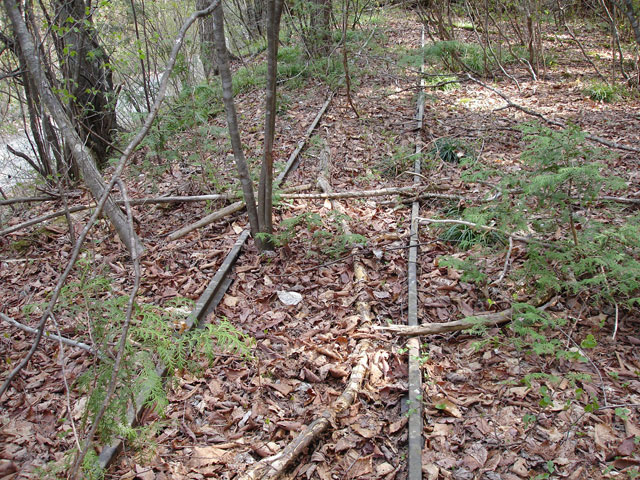
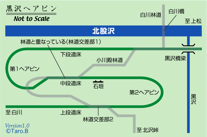
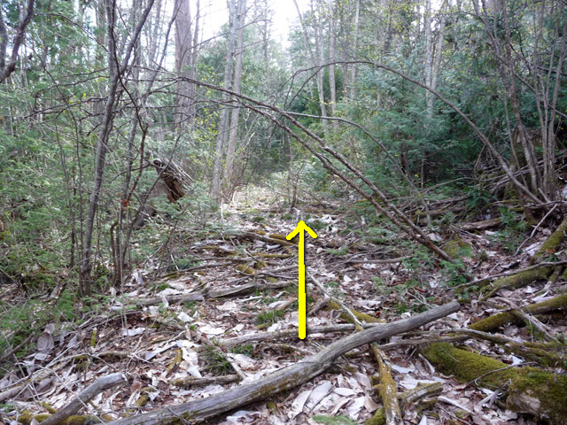
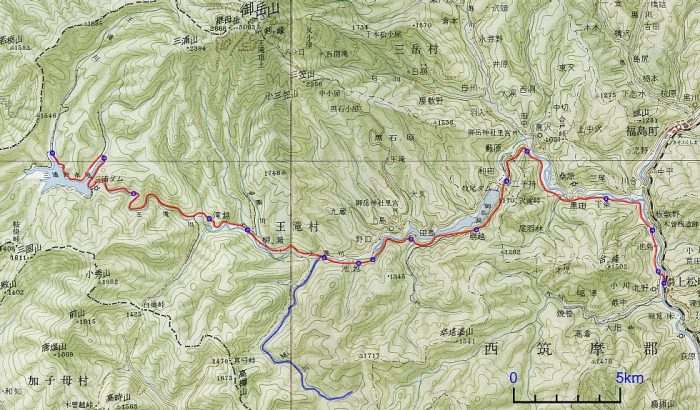
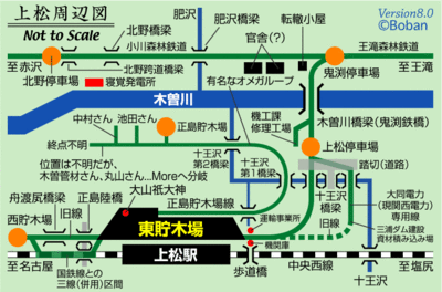
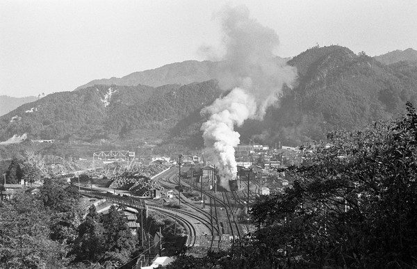
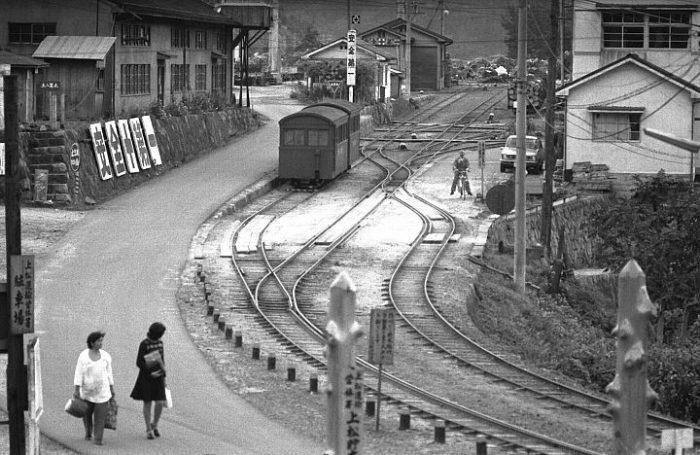
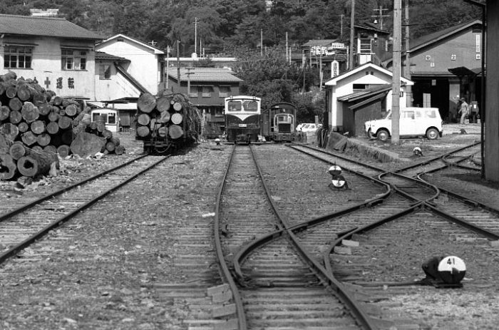
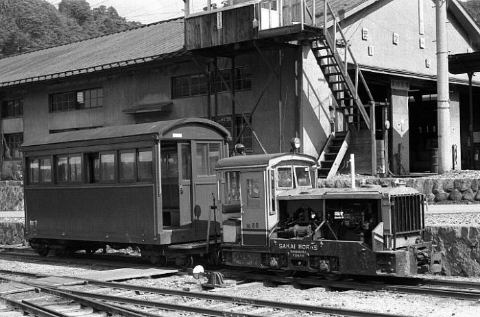
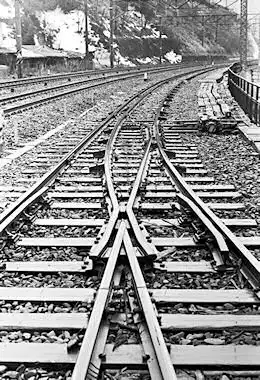

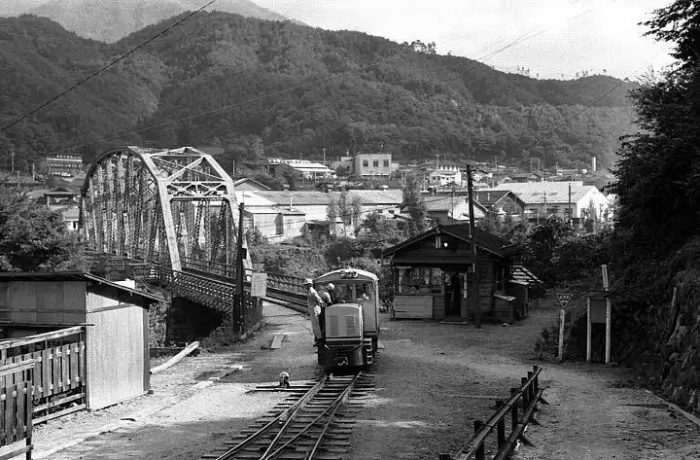
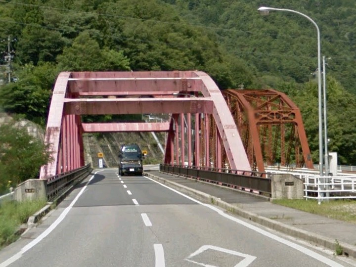
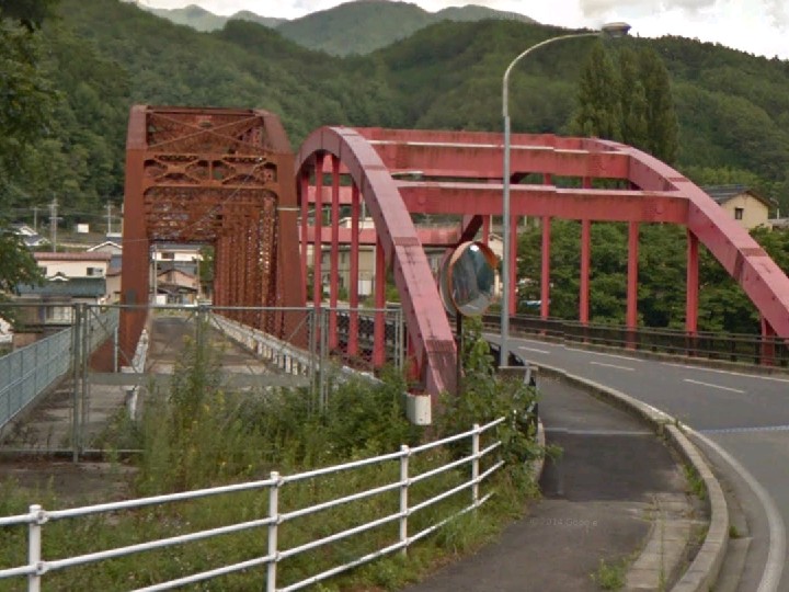
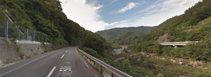
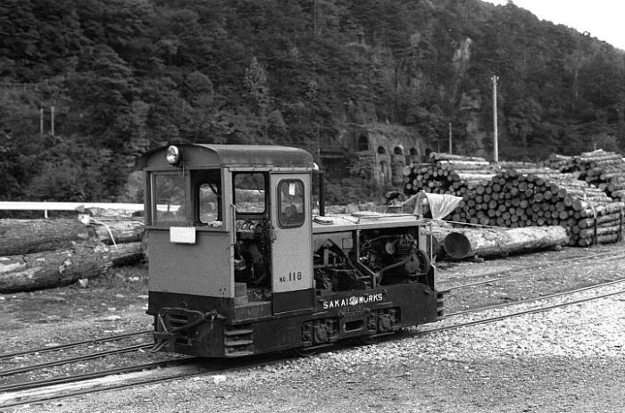
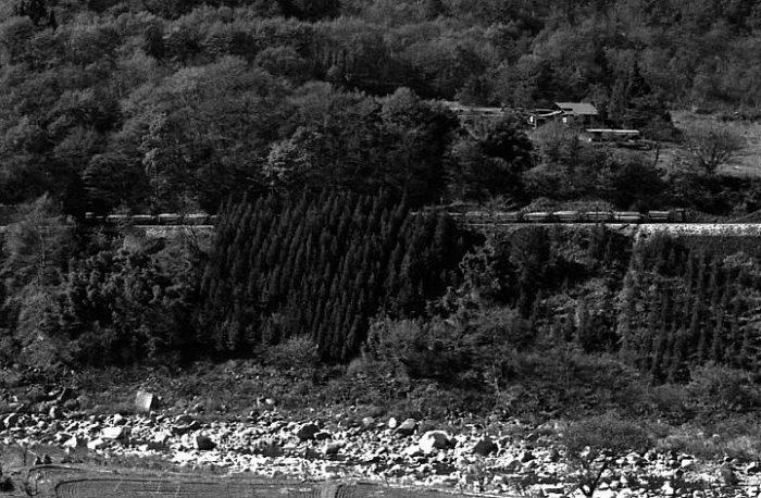
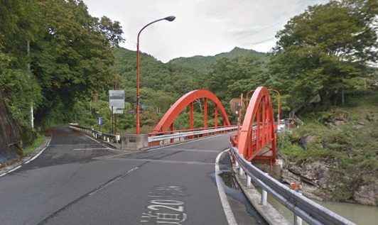
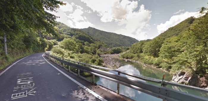
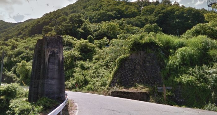
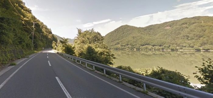

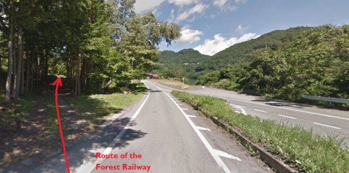
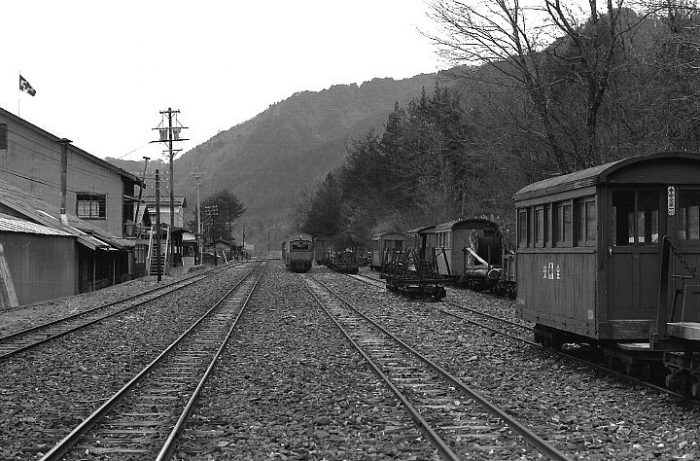
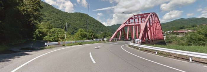
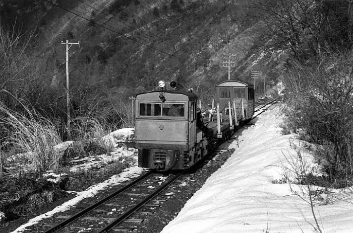

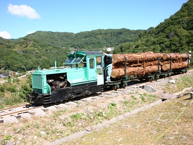
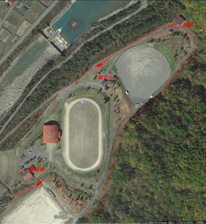
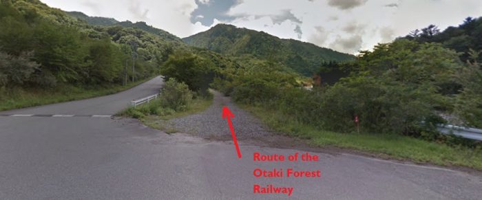
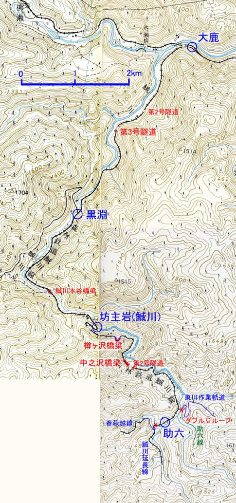
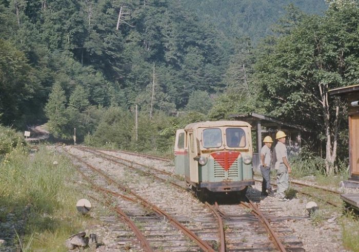
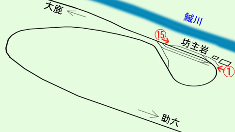
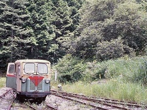
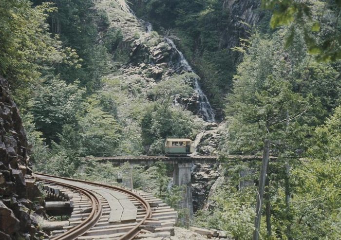
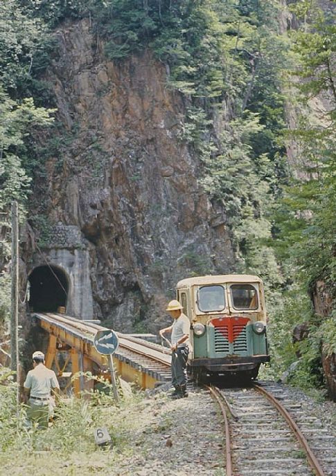
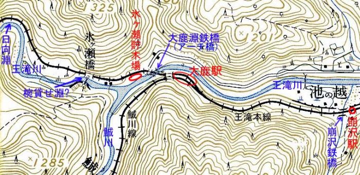
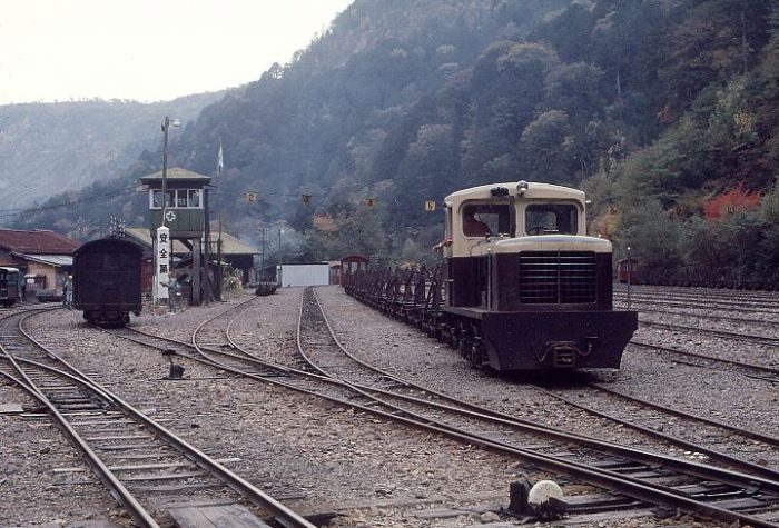
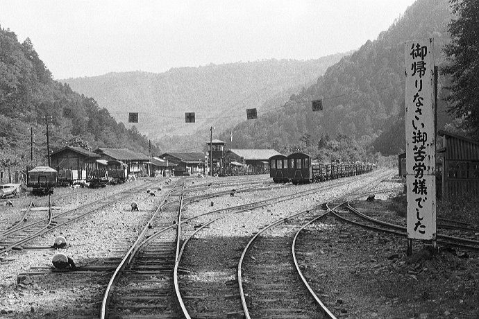
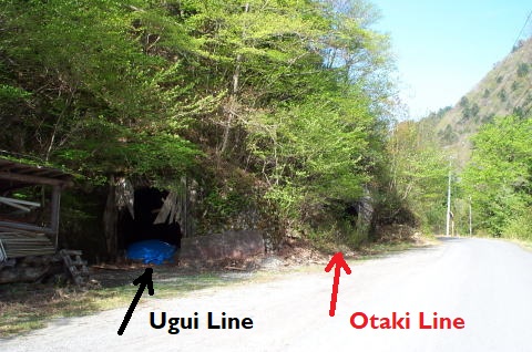
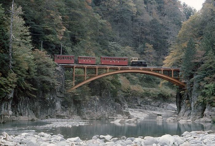
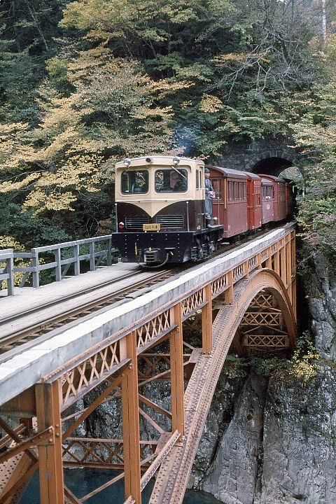
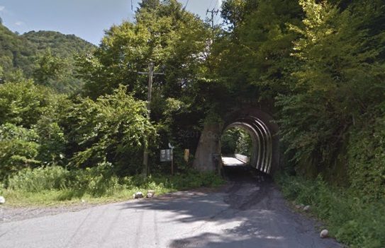
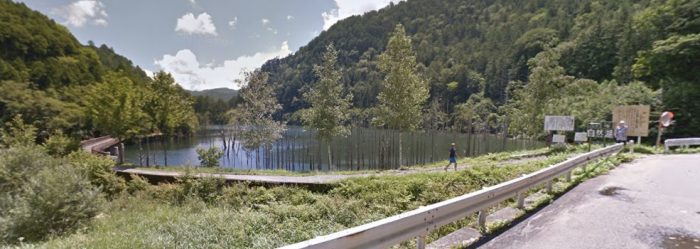
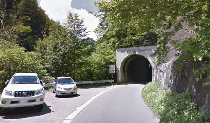
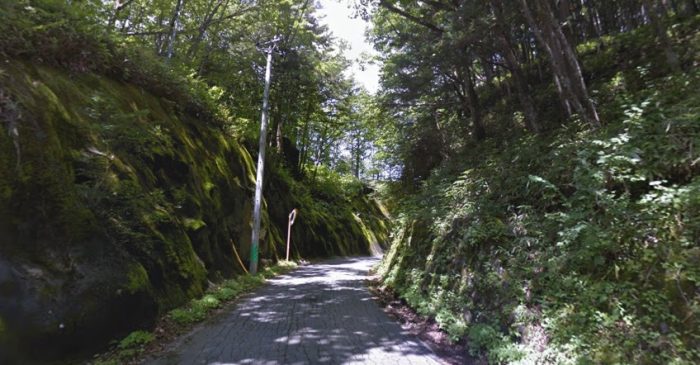
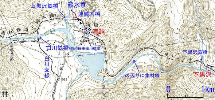
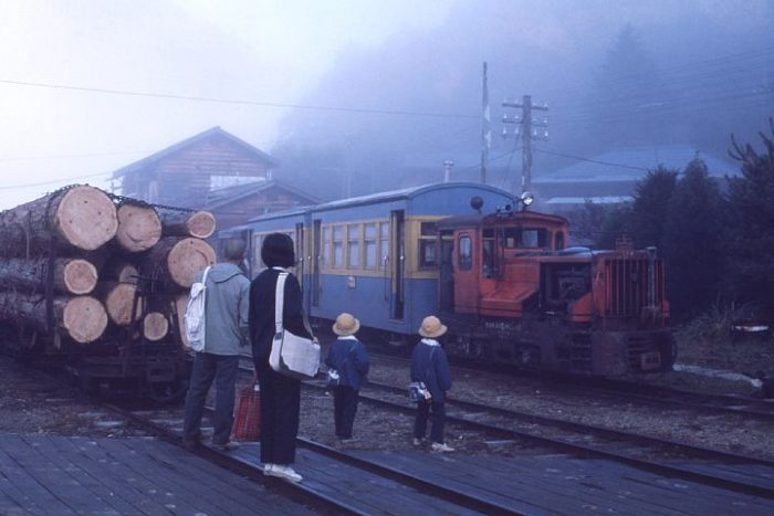
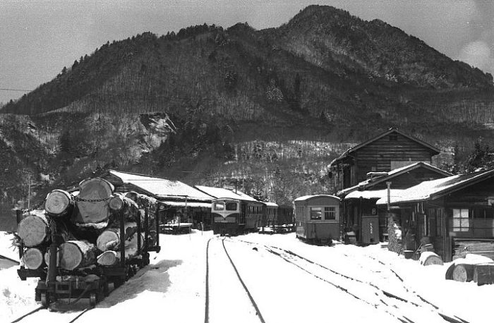
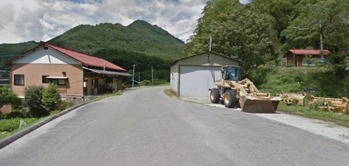
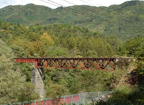
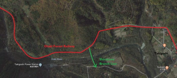
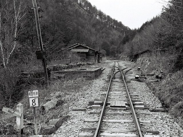
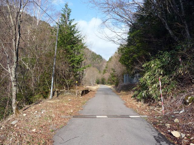
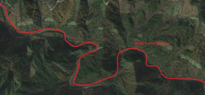

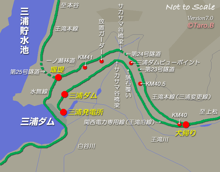
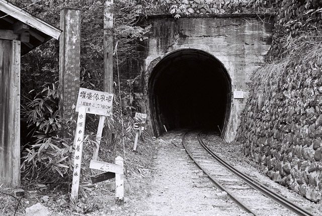
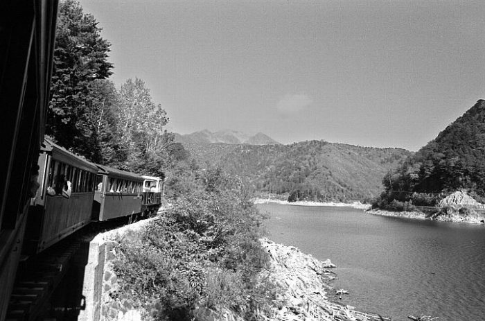
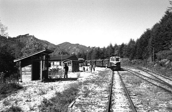
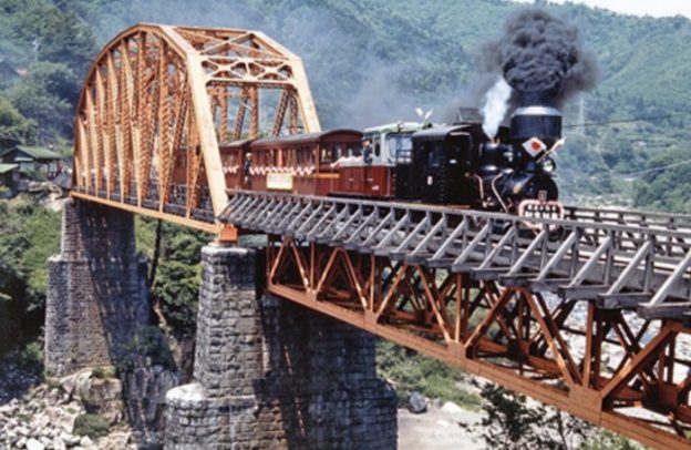


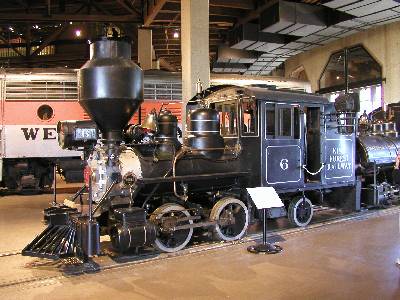


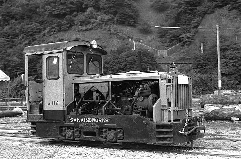
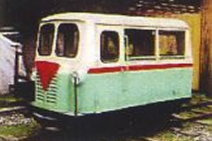
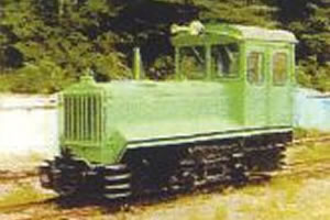
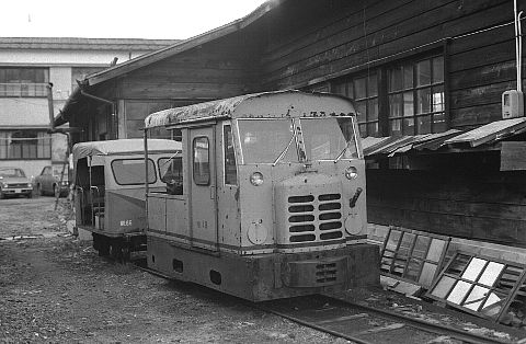
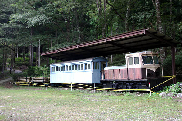
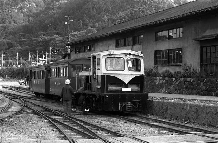 
 
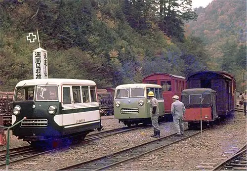
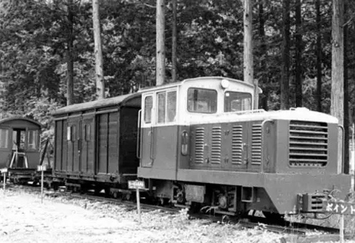


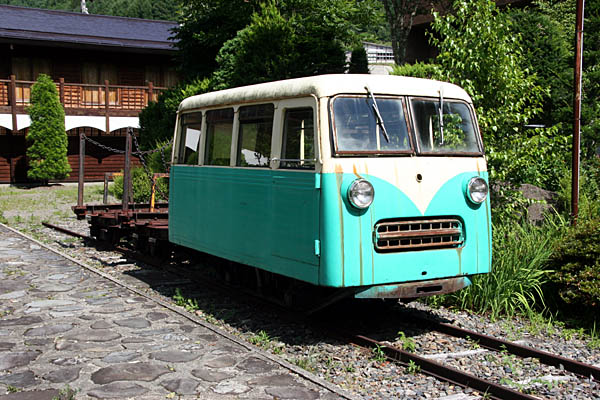

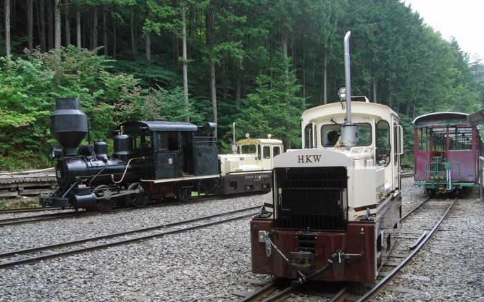


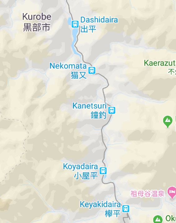


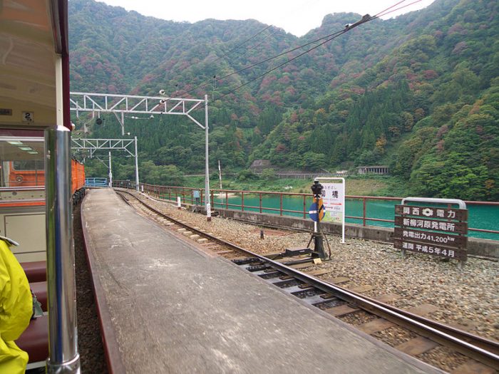
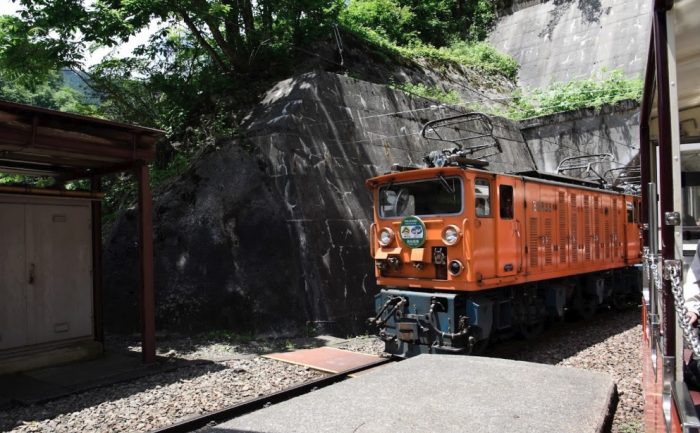
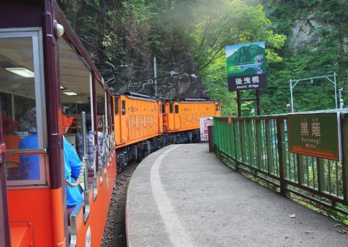

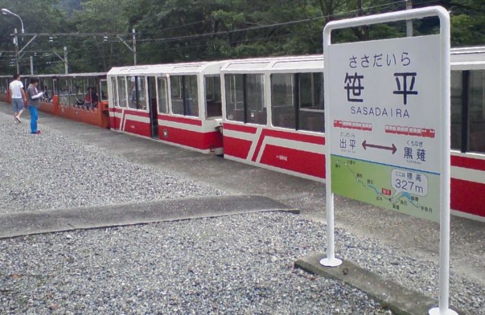
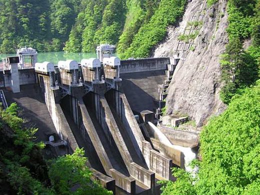
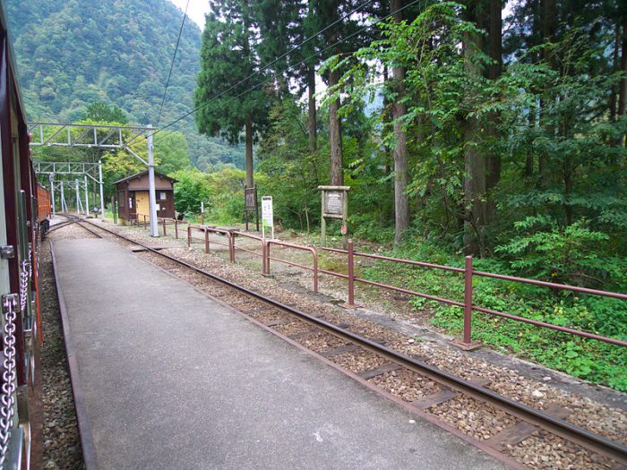
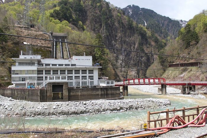
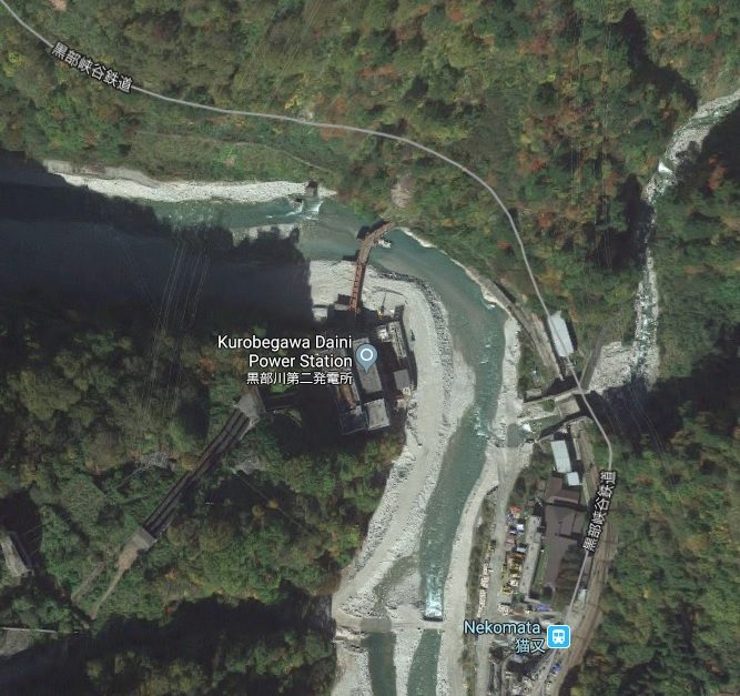
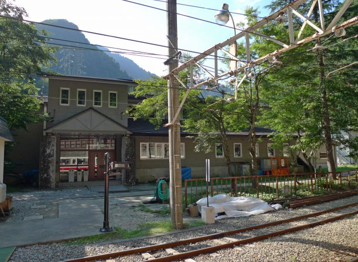

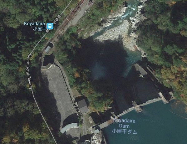

