
[NB: As far as I am aware permission has been granted for the use of all the photographs below. I have sought, where-ever possible to attribute all sources and have no intention of contravening copyright. Should there be an issue with any of the images below, if you are the copyright holder, please contact me. Please accept my apologies in advance if this has occurred.]
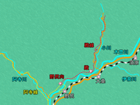
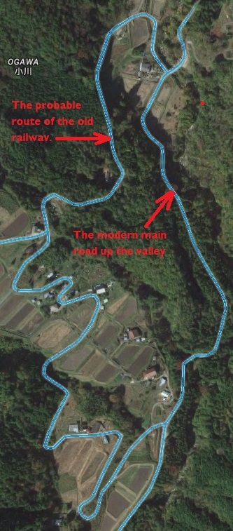
The Nojiri Forest Railway runs alongside the Kiso River. A branch from this line heads up the Atera Valley. The track layout close to the modern Nojiri Railway Station on the JR Chuo Line was complex with a large logging yard adjacent to the mainline. Nojiri Railway Station is shown below as a white line on the map. The red dot next to it is the logging yard.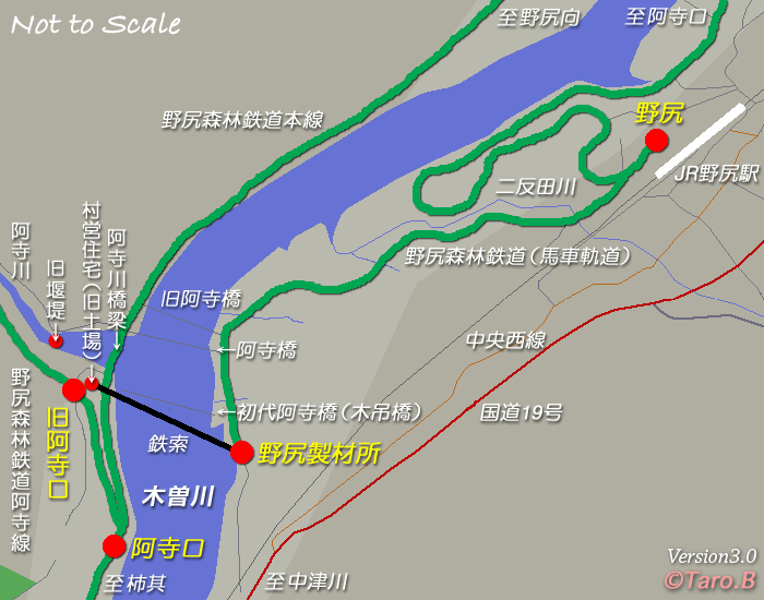 Narrow gauge lines in the area of the Atera Valley and the Kiso Valley confluence. [1]
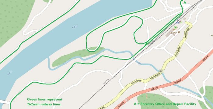 Railways in the immediate vicinity of Nojiri Railway Station. The green lines are the 762mm-gauge lines. To the North of Nojiri Railway Station a short stub line led from the logging yard across a bridge to the Nojiri Forestry repair shop and Forestry Office. The location of the repair shop and forestry office is marked with the letter ‘A’. It is from this point that we start our survey of the lines in this area.
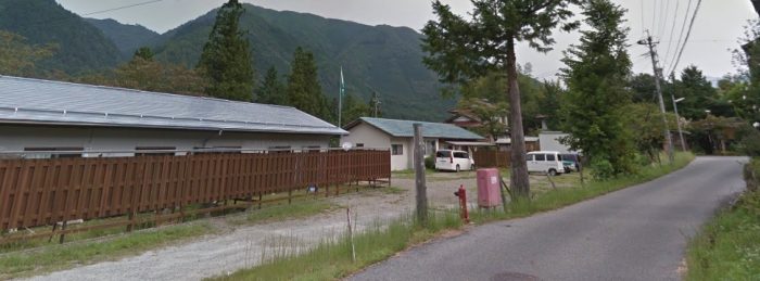 The end of the line was in the vicinity of these buildings.
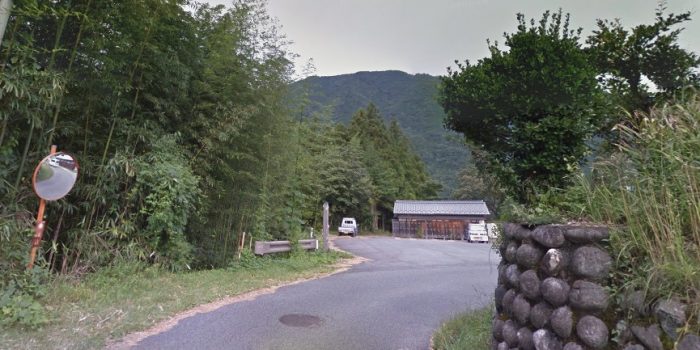 This view looks back towards the forestry yard from what was the line of the railway and is now a single lane access road.
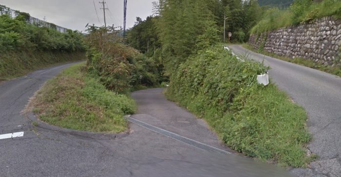 The mirror in the previous image can be seen to the right of this photo. The railway from the forestry depot crossed the lower road in this image and the road on the left-hand side of the picture on a bridge which had three spans. The shorter side-spans were made of concrete the longer middle span of steel girders.
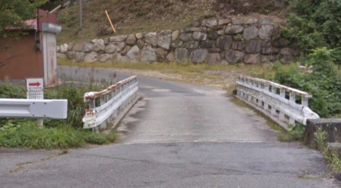
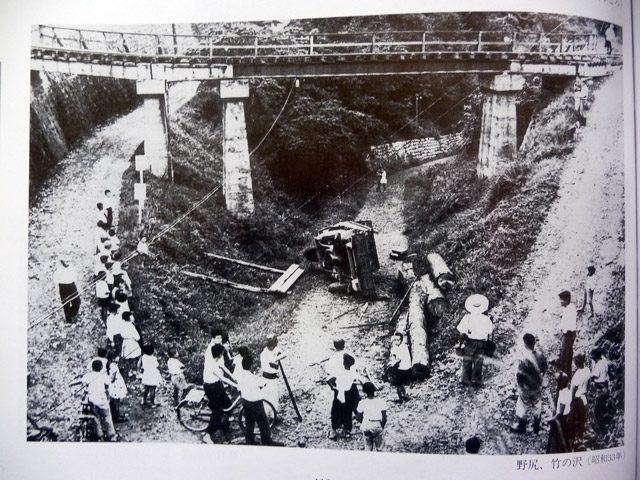 The bridge in place. The road layout is unchanged. The logging yard adjacent to Nojiri Railway Station is off to the left of this picture. The three roads converge on the location of the photographer and travel under the JR Chuo line and yard in a tunnel. [3]
 This Google Streetview image looks back into the logging yard from the road at it main entrance to the Southwest.
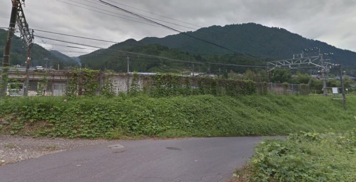 This picture is also taken from Google Streetview and is taken from the same location as the previous image but looking to the East across the JR Chuo Line.
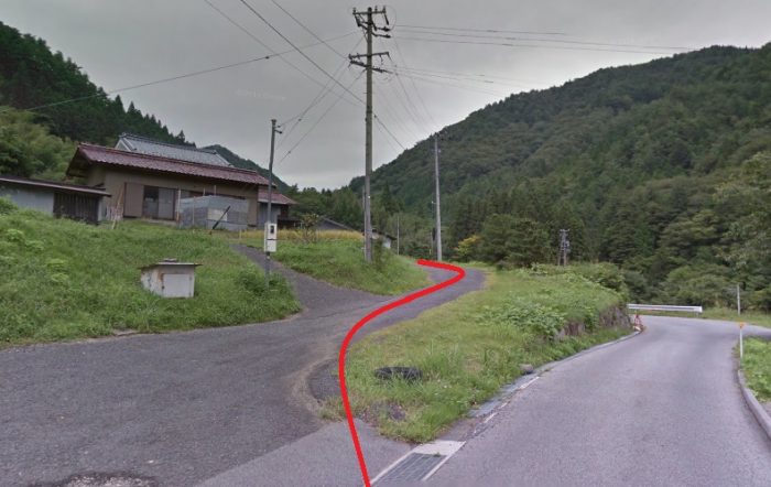
 And this image shows the routes of the two lines which left the yard at its Southwest corner. The first followed the road to the left of the image alongside the JR Chuo Line, the second followed the road alignment on the right of the picture.
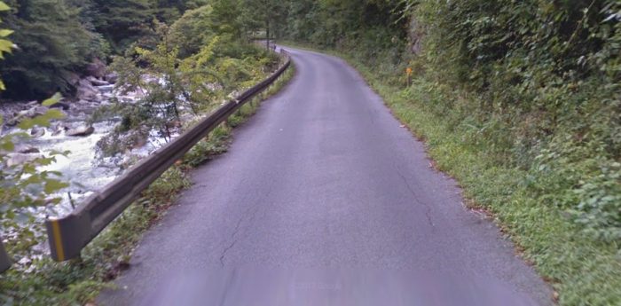
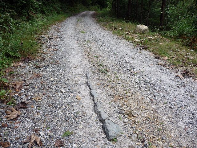
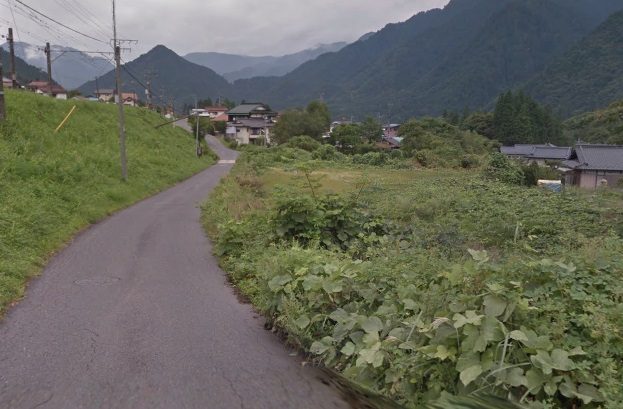 The route of the first line follows this road. Initially its course was roughly parallel tot he main Chuo Line. but later, after crossing a watercourse it followed that watercourse down to the Kiso River.
 The watercourse is on the right, the old railway route is the route of the modern single lane road.
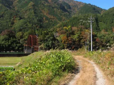
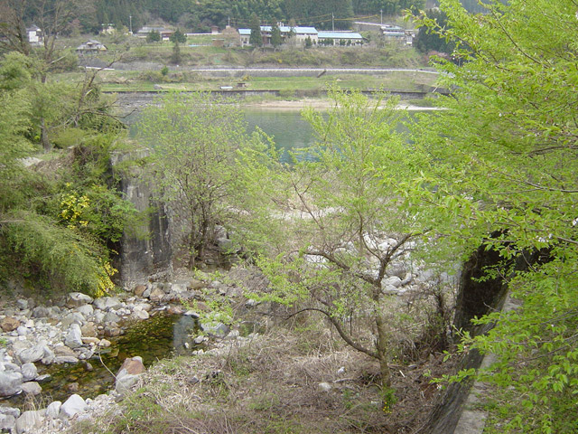
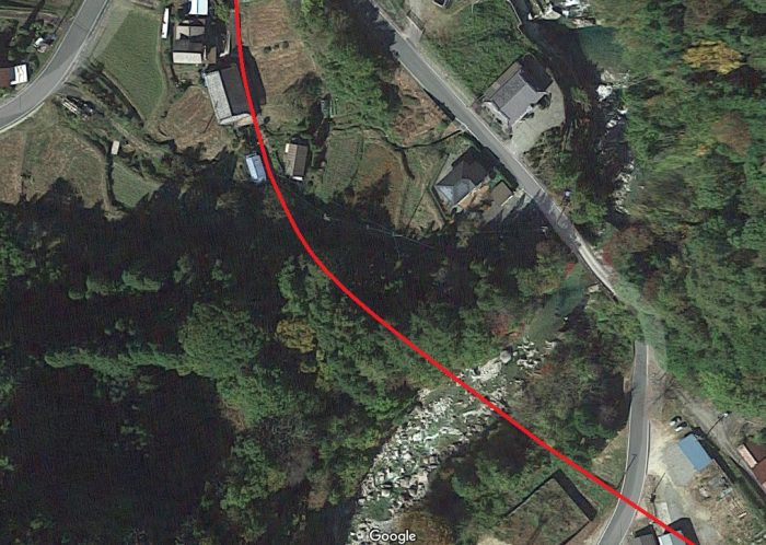
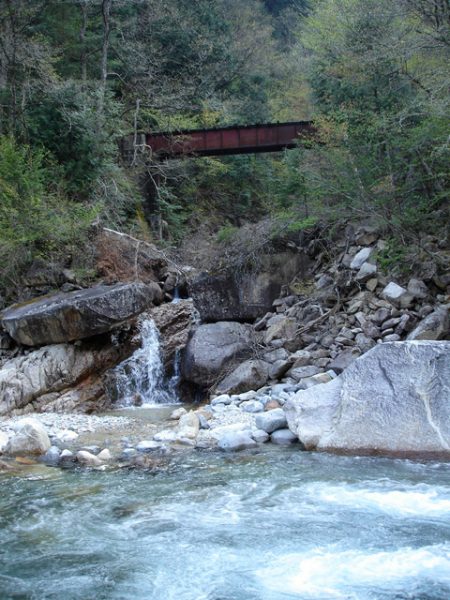
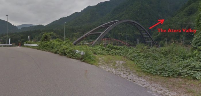 The bridge shows the location of the Kiso River and the route of the Atera Valley can be seen leaving the Kiso River Valley at this point.
 The line continued alongside the Kiso River for a short distance to what was the location of a sawmill.
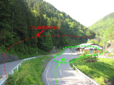
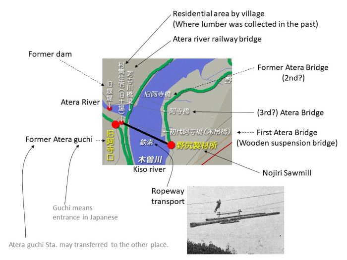 This is the location shown on sketch map above. The Japanese text has been translated for me by Ichiro Junpu. [42]. The location of the sawmill is highlighted by one of the large red dots. The black line is a rope transport system which was in use prior to the installation of the Kisogawa bridge. The Atera bridges referred to can, I think, be seen on pictures later in this blog.
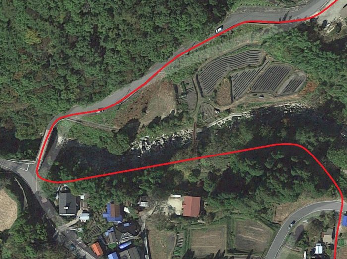
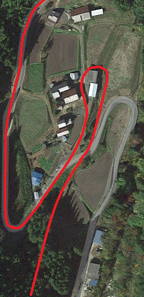
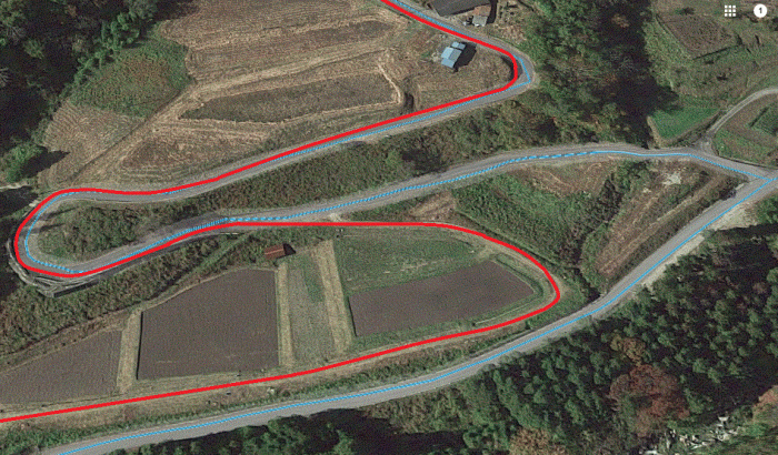
The second line from the lumber-yard gate began its decent to the Kiso River more quickly. It curved round in a half-circle before reaching the crossroads below. At this point the railway route crossed a pair of minor roads. Its own route is now a minor road as well. The route across the junction is shown on the Google Streetview image below.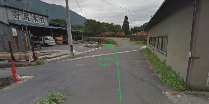 It curves back through another half-circle before gradually descending to the valley floor where it turns through another sweeping half-circle to run along the riverside. That next half-circle is shown below.
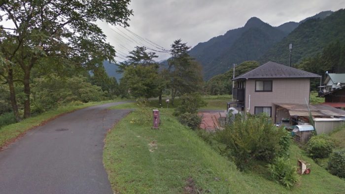
 The line ran alongside the river as shown on the adjacent sketch map before drifting away from the river to allow a wide sweep into a significant bridge structure which took it across the Kiso River. The image below shows the route at this point. The old bridge can just be picked out above the more modern road bridge.
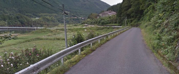
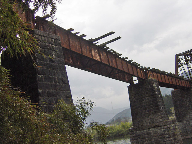
 The embankment approach to the bridge has been lowered as can be seen on the adjacent image. [5]
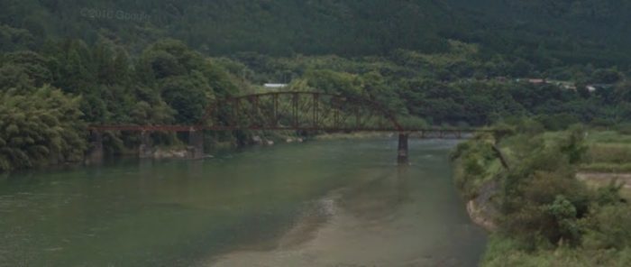
 The image above shows the old bridge as seen from the road bridge over the Kiso River. This image is from Google Streetview.
The adjacent image is taken on a better day. [7]
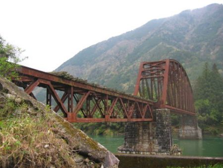
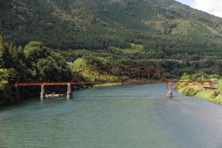
 While the approach embankment has removed, somehow the bridge has remained. It is interesting that the bridge is a mixture of different construction types. From the Nojiri bank of the river: a Warren Truss is followed by the large span open arched-truss bridge and then two plate-girder spans. The two plate girders are on a curve to the left. There is no super-elevation on the curve so trains must have passed across the bridge carefully at slow speed. [7].
The three additional pictures adjacent to this text were taken in 2003. [6]
The size and complexity of this structure is indicative of the amount of money to be made in the early 20th Century from forest logging operations in the Kiso Forest.
It is worth dwelling at this structure for a little while and there are a couple of further photographs and text below which come from another Japanese language website. [8]
The bridge was constructed in 1920. Before this there was a light logging line in the Atera Valley but without direct access to the wider railway network. That line was constructed in 1901. The first trains to cross the Kisogawa Bridge did so in 1921 and were able to run from there into the Nojiri Timber Yard directly. [4][5]
After the construction of the bridge it was two years before a new, more substantive logging line was completed in the Atera Valley. [5]
I have chosen a few pictures from a survey of the bridge undertaken in January 2009 by ‘tyaffic’ who is the author of the “Traffic Remains Research Office” (交通遺跡調査). A much fuller picture of the condition of the bridge at that time can be found on his website. English speakers can use automatic translation software to get a good idea of the text. [8]
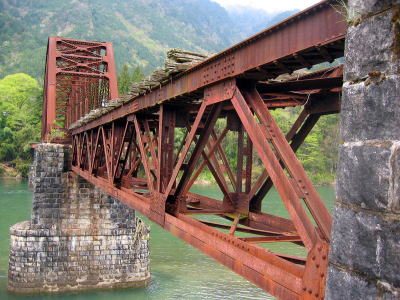
The bridge was fabricated by “Nihonbashi Co. Ltd.” [8]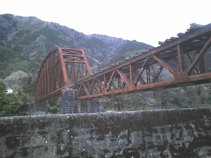 Another view from the East bank of the Kiso River. [8]
‘Tyaffic’ describes the bridge like this: From the East, there is an “Upper road Warren Truss (length 24.4 m). Next, …, the powerful, Underworld crown platform truss (length 61.0 m). Next, the upper path plate girder (length 15.9 m ), then another upper path plate girder (length 15.2m) … and lastly also an upper plate girder (15.2 m in length), a total of five spans, a total length of 134.6 m.” [8]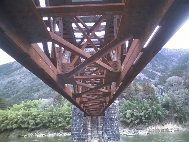 An underside view of the Warren Truss. [8]
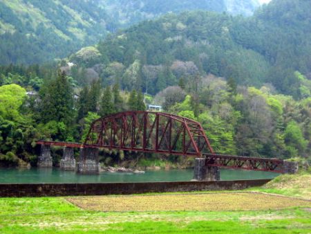
Three further pictures complete our look at this structure. The first is taken from the East bank of the Kiso River. The remaining two are taken on the opposite (West) bank of the Kiso River and show the curved approach to the main bridge.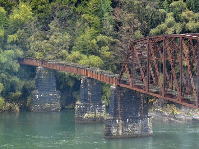
 These three pictures show the approach spans on the West bank of the Kiso River. [9]
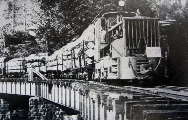
 A logging train crosses the three approach spans to the Kisogawa Bridge. [25]
Beyond the bridge, the railway curved to the South and followed the West bank of the Kiso River.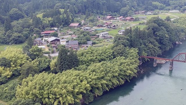 The area to the south of the bridge is overgrown and the route of the railway cannot easily be picked out. [10]
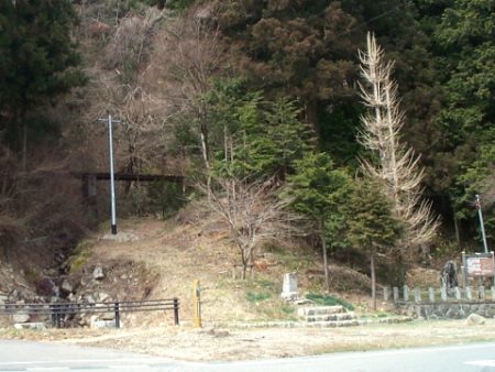
Just before the old railway reached the location of the new road bridge it crossed a mountain stream on what is known as the Nagatogawa 1st Bridge. Its abutments remain.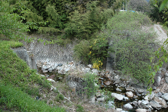
 Nagatogawa 1st Bridge abutment are shown in these two images. [10]
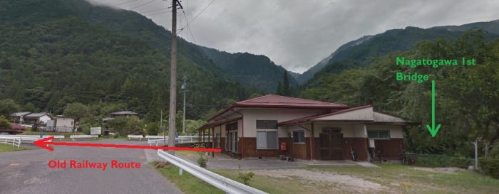 The house in this picture has been built over the line of the old railway.
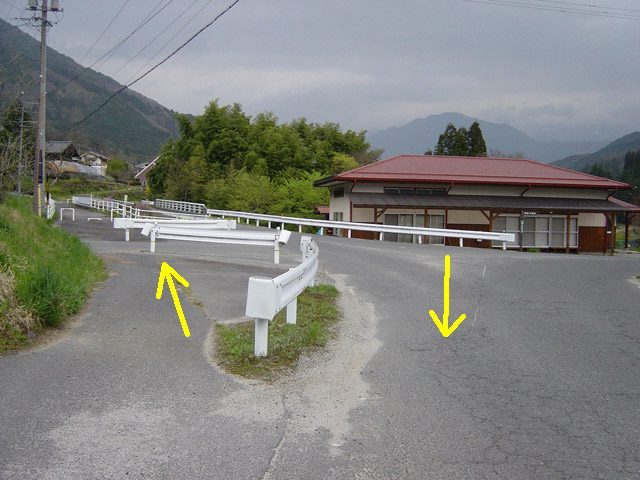 The route from the Kisogawa Bridge meets the Nojiri Forest Railway at the location of this road junction. The left arrow shows the approximate line of the Nojiri Forest Railway. We will return to the left-hand route, but for now we continue South alongside the Kiso River. [10]
The pictures along the railway line at this point are provided courtesy of the rintetsu.net Japanese language website. A far more comprehensive set of photos can be found by following the links to that site provided at the bottom of this post.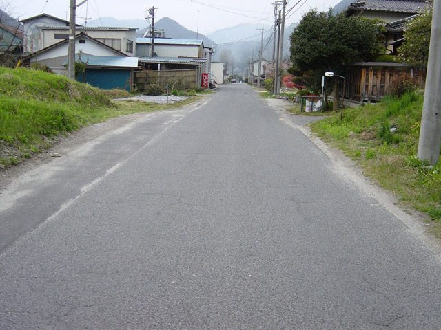 This is the location of what was once the Nojiri Stop on the Forest Railway. [10]
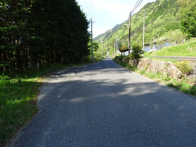 The line continues Southwards alongside the Kiso River which is just beyond the trees to the left of this image. [13]
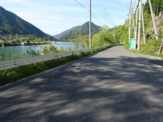 This is a beautiful area. The Kiso River is visible in this shot. We are aiming for the area beyond the bridge which is visible here. [13]
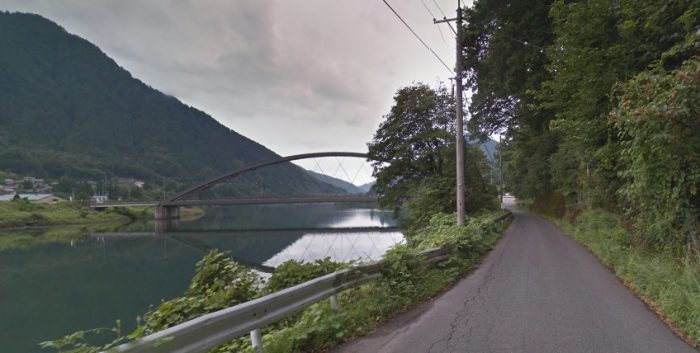 This Google Streetview image takes us closer to the road bridge. The old railway continues immediately next to the river and has been replaced by this single-track tarmac road.
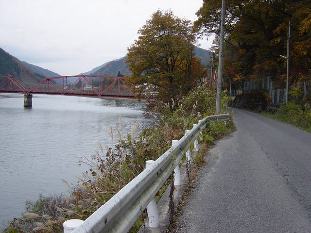 This image was taken in 2006 before the new road bridge was installed. [13]
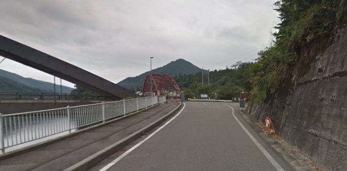 The road bridge is relatively new. The old railway continued to follow the river bank.
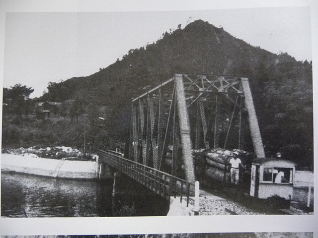 I have not been able to find many images of the railway in use. This appears to have been taken in 1960, when the old Atera River Bridge was in place. The more modern structure was built in 1990 and is shown in the Google Streetview image below. [13]
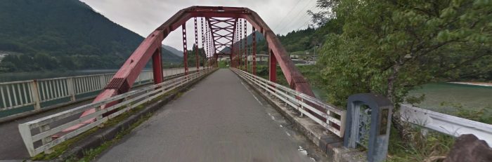 The old railway continued beyond the Atera River.
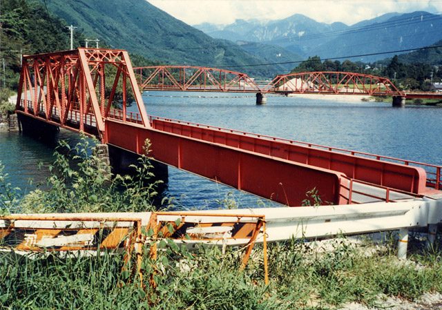 Taken in 1986, this picture shows both the older bridges at this location, (c) Mr. Teruo Hayashi. [13]
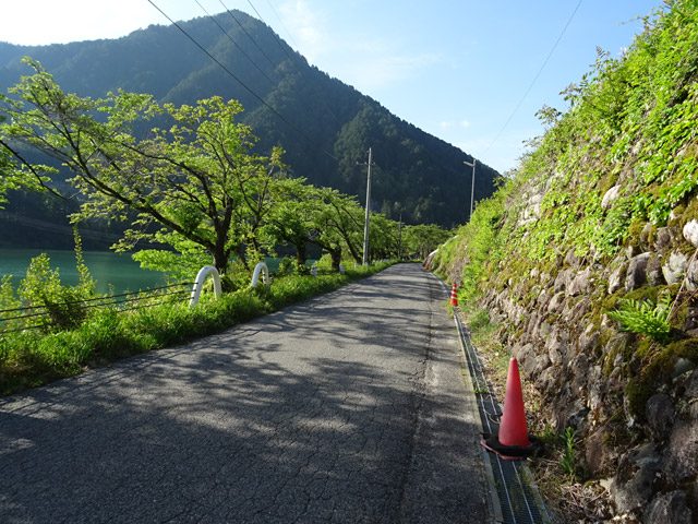 The route of the old railway beyond the Atera River taken in 2018. [13]
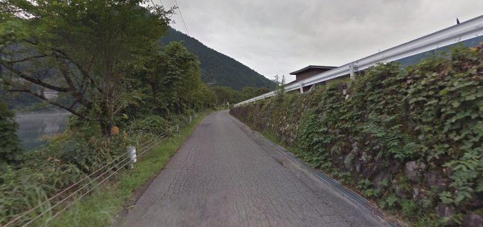 This Google Streetview picture shows the route of the old railway a further 0.5 kilometres from the Atera River. The crash barriers on the right of the photograph show the route of the Atera Forest Railway.
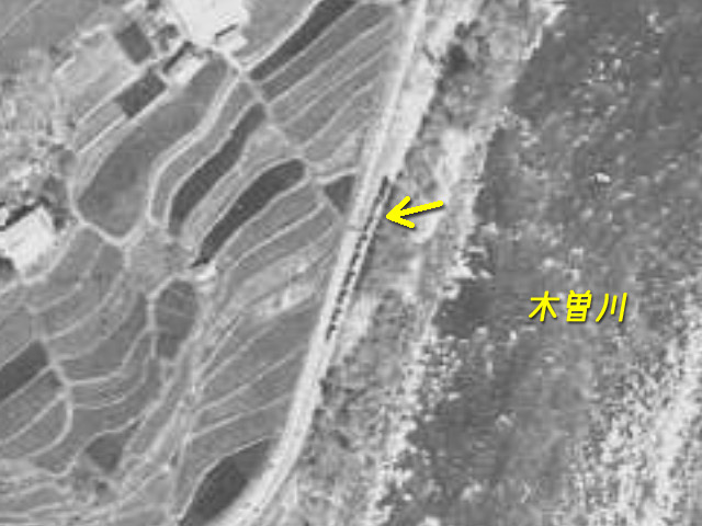 In this aerial image, it is possible to pick out a logging train travelling along the old railway at the location shown above. [13]
 The yellow arrow shows the Atera Line which we will return to in due course. [2]
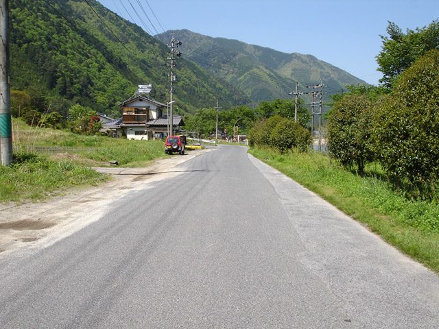 Beyond the point where the Atera Line left the Nojiri Line there was a station which probably had three traffic lanes. [13]
The Line continued South beyond this point. It continues to be hidden under the tarmac of this single-lane road.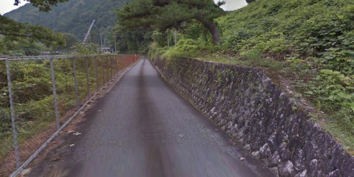 Its route takes it passed the Reading Dam (読書ダム) and after that beyond the limits of the tarmac road, marked by an ‘x’ on the map below.
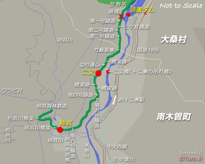
 North of the Reading Dam, in the adjacent image, a mixed train is heading towards Nojiri. [21]
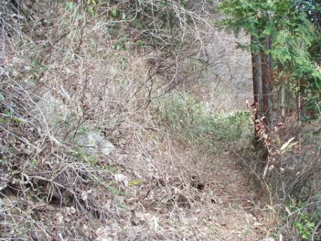
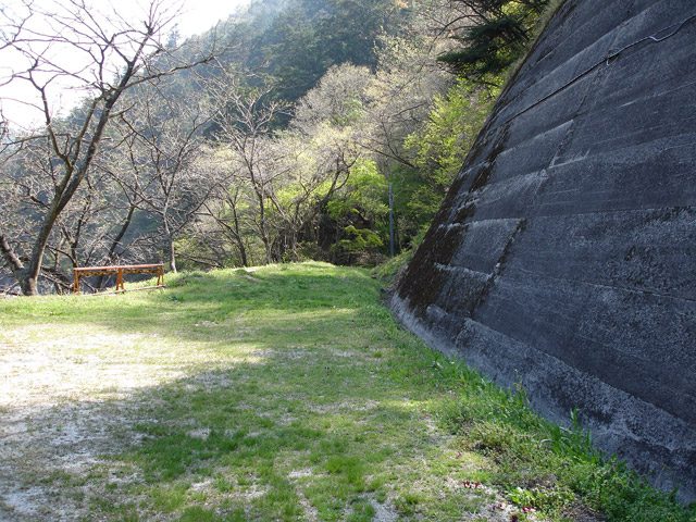 The route beyond the tarmac is much less easy to identify! [22]
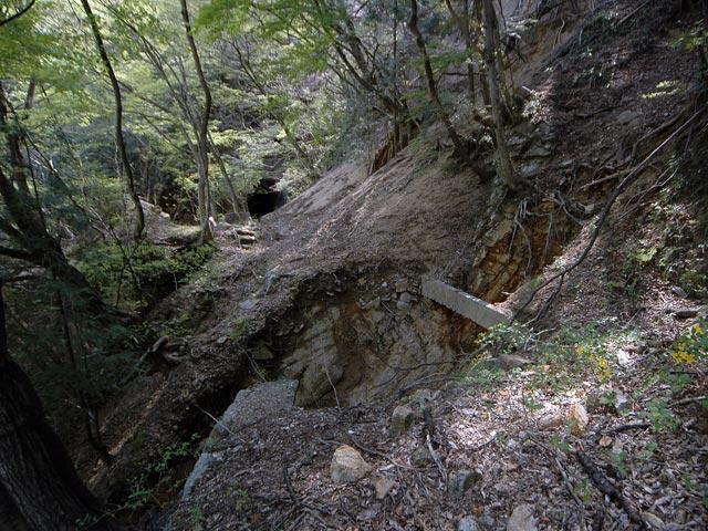 Just beyond the Dam the trackbed has collapsed into the Kiso River, (c) Mr. Walzawa 2008. [23]
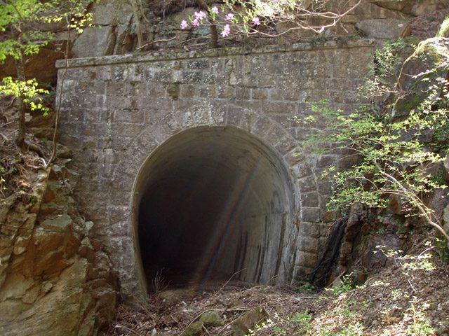 A few steps beyond the collapse is the first tunnel on the old railway line. [23]
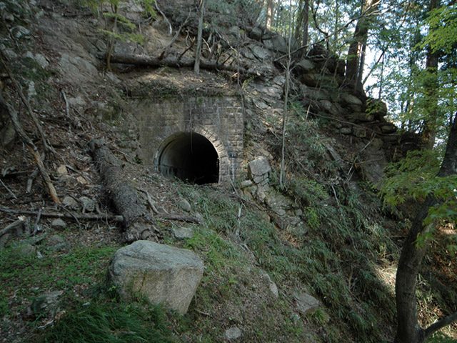 The southern portal of the same tunnel. The tunnel is about 55 metres long. Further collapses of the railway have occurred beyond this point. [23]
Key locations on the railway can still be picked out along its route. The next significant bridge is Mike Bridge (三ケ其橋梁) at about 24 metres in length.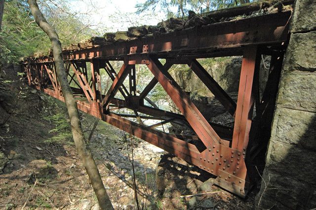 Mike Bridge from the south abutment. [23]
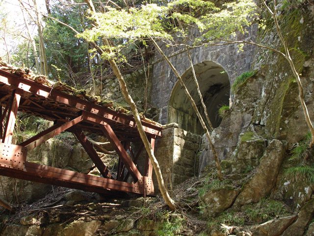 The next tunnel follows immediately after the bridge. This is the North portal. [23]
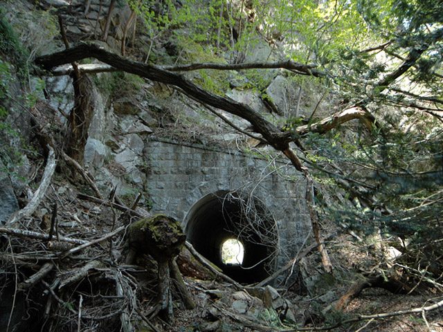 This is the south portal. The tunnel is about 44 metres long. [23]
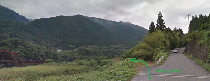
This is as far as it is reasonable to follow the railway line along the West side of the Kiso River. Further south I have sought to identify the line of the railway where it crosses modern roads in the next tributary valley to the south, close to the Kaki Sokoji Waterway (Canal) Bridge which is marked by the red flag on the satellite image below. The probable line of the railway is shown in red. The line was known as the ‘Persimmon Line’ (柿其線).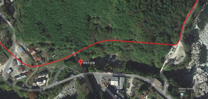
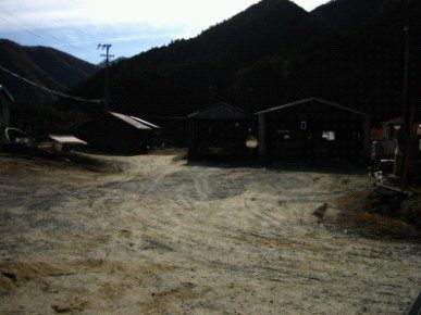 The line crossed the end of the Canal Bridge and then entered ‘Perspration Station’ (柿其の停車場及び機関区跡) of which only the loco shed and some light rail remain. The loco shed is shown in the adjacent image. [29]
The image below shows the stack of old rails which sits alongside the loco shed. [29]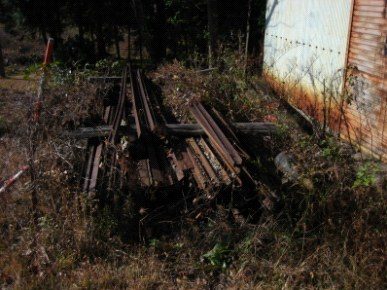
 In the above satellite image the Kakiko River can be seen. The railway crossed the river on a girder bridge of which the abutments and pier remain. [29]
The railway was by this time a route of lesser significance and construction standards were lower. [29]
 These three satellite images above cover the length of the line as shown on the sketch map above.
Having followed as closely as possible the length of the line south from Nojiri, which I believe is know as the “Kakizo line” and which follows the Kameki River, in the Kakisi valley, [8] we return to look at the Atera Line which follows the Atera River and Valley.The Atera Line climbed away from the main Nojiri Line at a relatively steep gradient. [2]
The nishimiyaushiro.web.fc2.com website claims that the Atera line is the oldest in the Kiso Forest area. [6] If this is the case it is referring to an early line built in 1901. This line was probably replaced by a higher standard line in the years immediately after the building of the Nojiri Kisogawa Bridge in the early 1920s.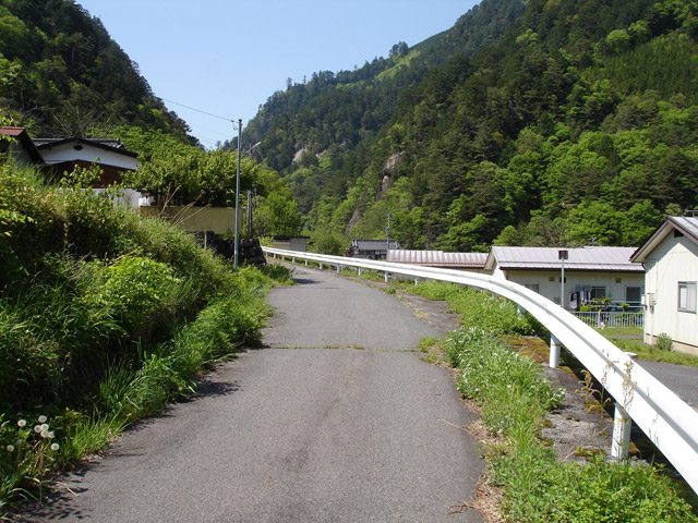 The line turned gradually into the Atera Valley. [30]
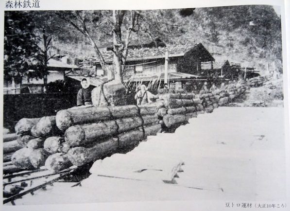
This picture was taken just a little further along the line for the colour photograph above. It probably shows the earliest incarnation of the Atera Railway. [30]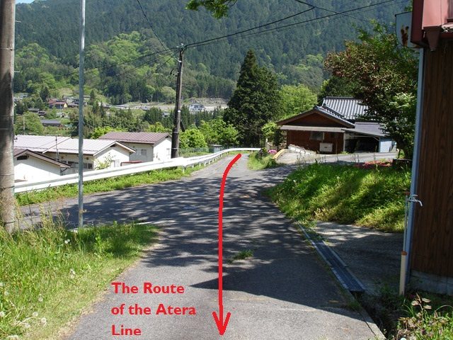 The line crossed a minor road and continued to climb. [30]
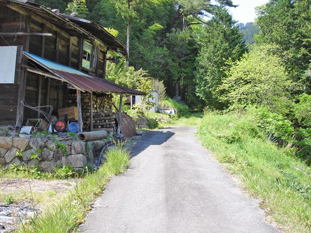 Within a few hundred metres the tarmac comes to an end and the old line’s route becomes a footpath. [30]
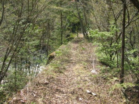
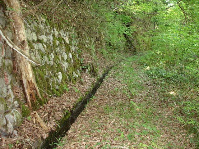 The old track-bed continues as a footpath. It follows the West bank of the river. [30]
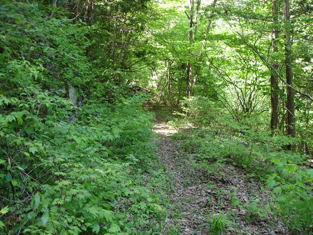 The quality of the formation gradually degrades and in certain places has collapsed into the river. [30]
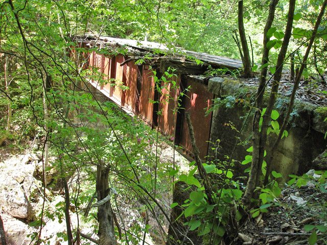
 The Asi Yamazawa bridge (アシ山沢橋梁). [30]
The adjacent photograph shows the same bridge. This time the photograph is taken from the forest road on the other side of the Atera River. The bridge is about 13 metres long and is on a steep gradient. The abutments are made of concrete and faced in masonry. The girders are mild steel and the bridge was constructed by the Japan Bridge Co., Ltd. Construction started in 1924 and was completed in 1925 (Taisho 14 years). [11]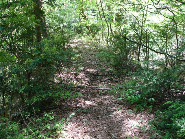 Beyond the Asi Yamazawa bridge the track bed is relatively stable and appears to continue to be used as a footpath. [12]
The route that we are following is the green line on the map below. The tributary of the Atera River is the location of the Asi Yamazawa bridge ( the Japanese text in yellow,アシ山沢橋梁, marks the position)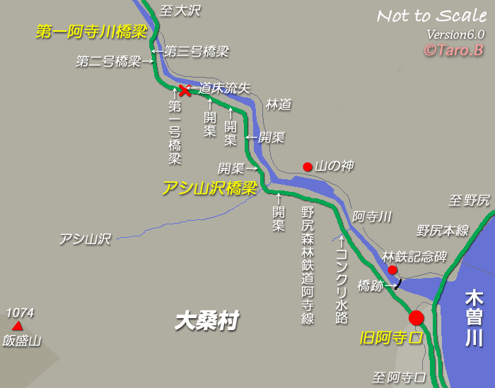 The Atera Valley [14]
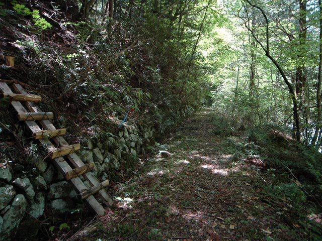 The old railway formation continues towards the red ‘x’ on the above plan which marks a significant collapse of the track-bed into the Atera River. [12]
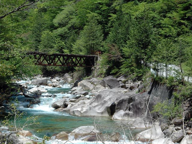
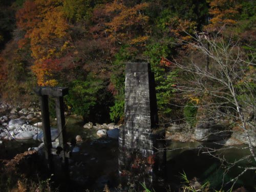
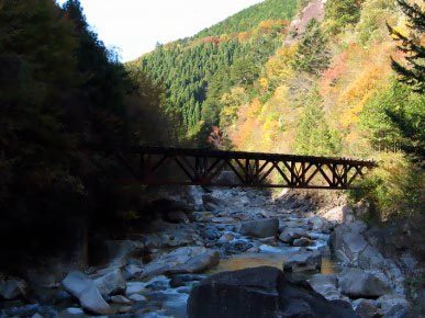 The first bridge on the line which crosses the Atera River(第1阿寺川橋梁). [15]
The adjacent smaller image was taken in Autumn from the east bank of the river. [16]
 The same bridge appears in this Google Streetview photograph taken from the forest road.
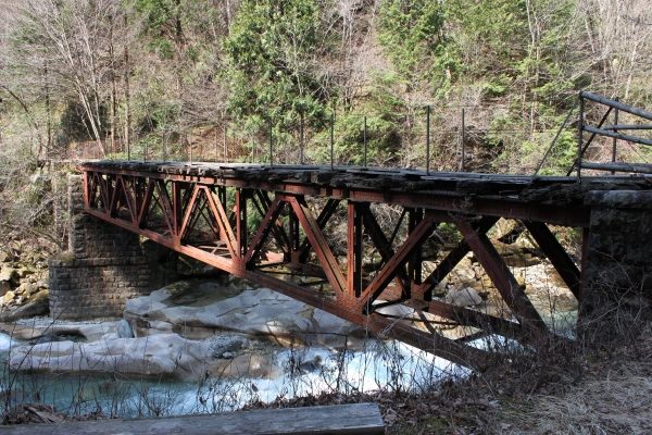 A closer picture of the bridge showing the Warren Truss to good advantage. [17]
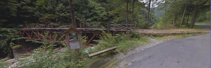 Google Streetview shows the bridge again. This time the formation/track-bed is visible adjacent to the forest road as the line turn upstream after crossing the river. the picture below shows this in more detail.
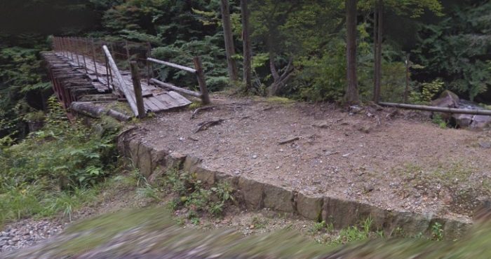
 The modern single-lane road now sits on the track-bed of the old railway which heads upstream on the East bank of the river.
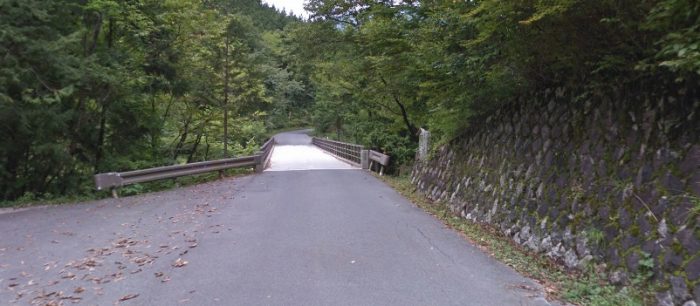
 The next crossing of the Atera River. The old railway and the modern road cross the river at the same point. The adjacent image was taken prior to the forest road receiving a tarmac top surface. The oldest bridge at the site was placed on abutments which are just visible in this picture alongside the more modern bridge. [18]
The image below is taken at a large modern car park which provides access to some of the most beautiful river gorge pools that you might imagine. Typical of these pools is the one in the following image.
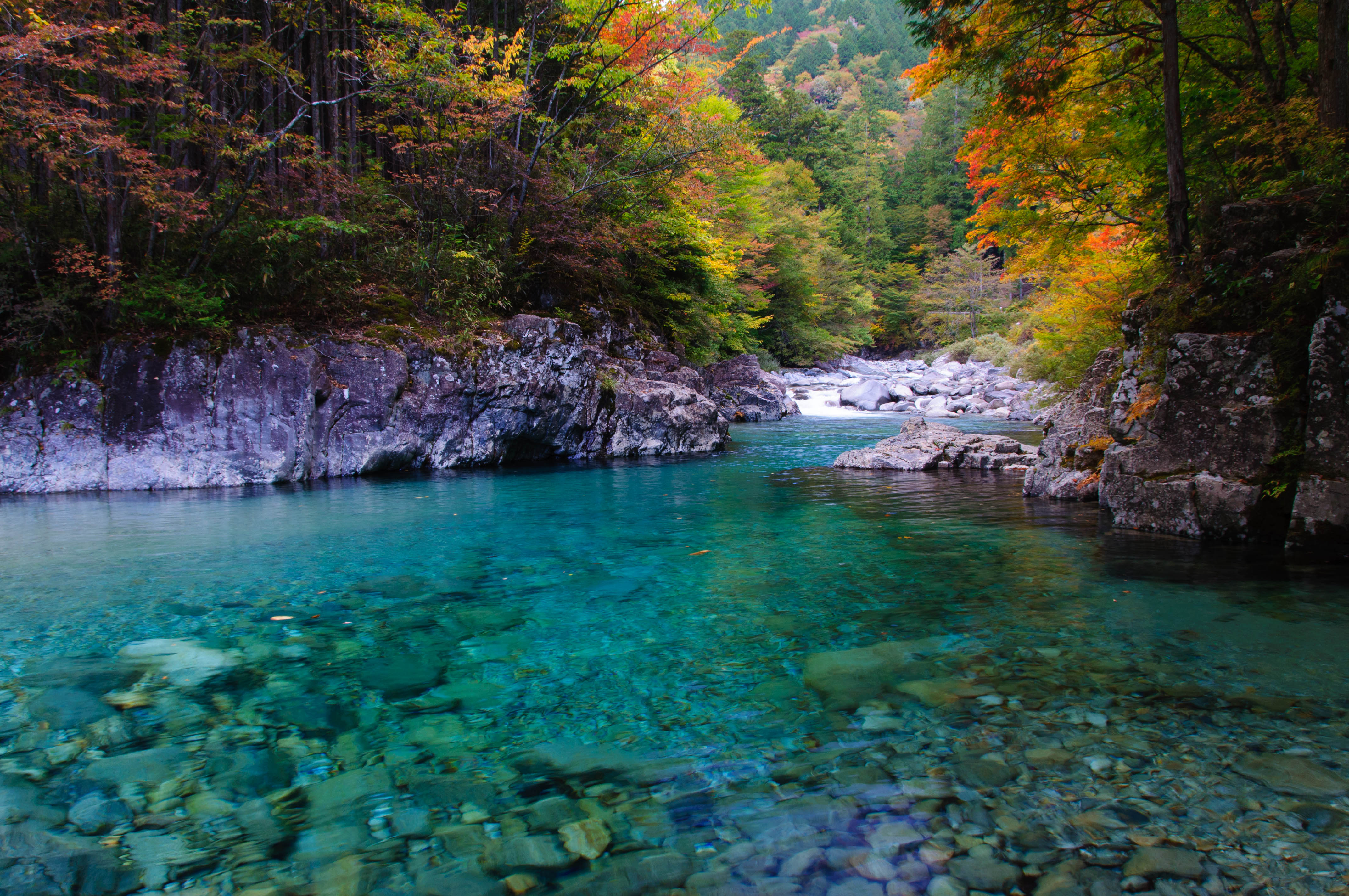 An Autumn image of one of the azure-blue pools in the Atera Gorge. [24]
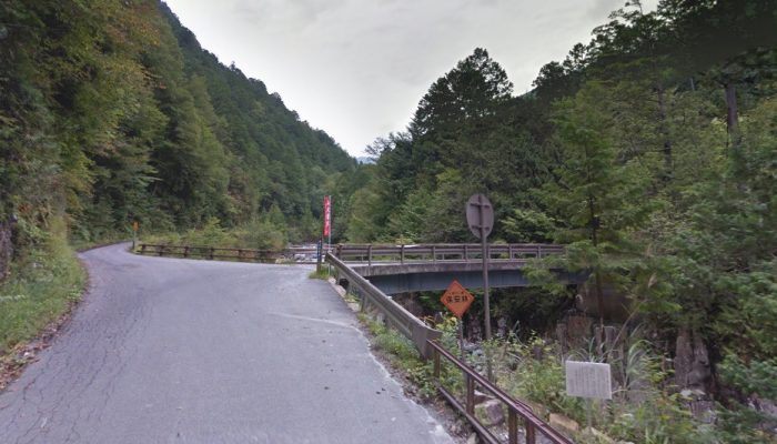 The railway continued up the West bank of the Atera River.
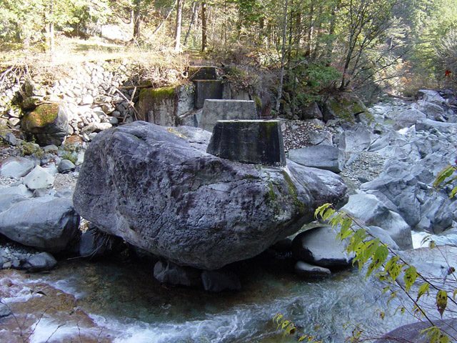 En-route we pass a location where a more temporary logging-line crossed the river. [20]
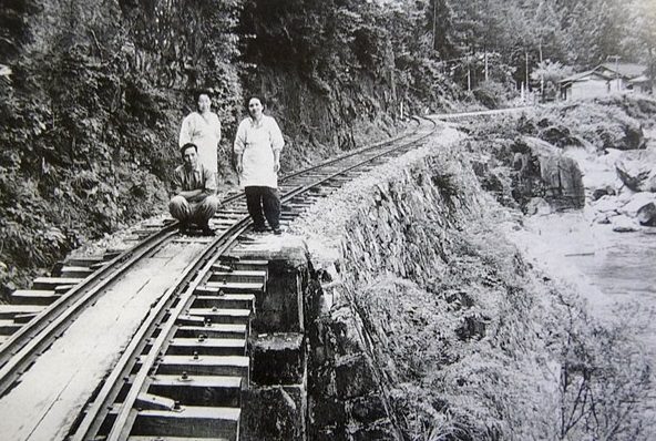 This image is just a few metres along the route of the line from the last image. It was taken in the 1960s. the building in the distance is Tarugaruzawa sand hut (樽ヶ沢ー砂小屋). [25]
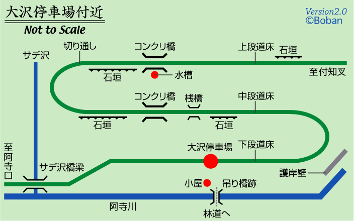
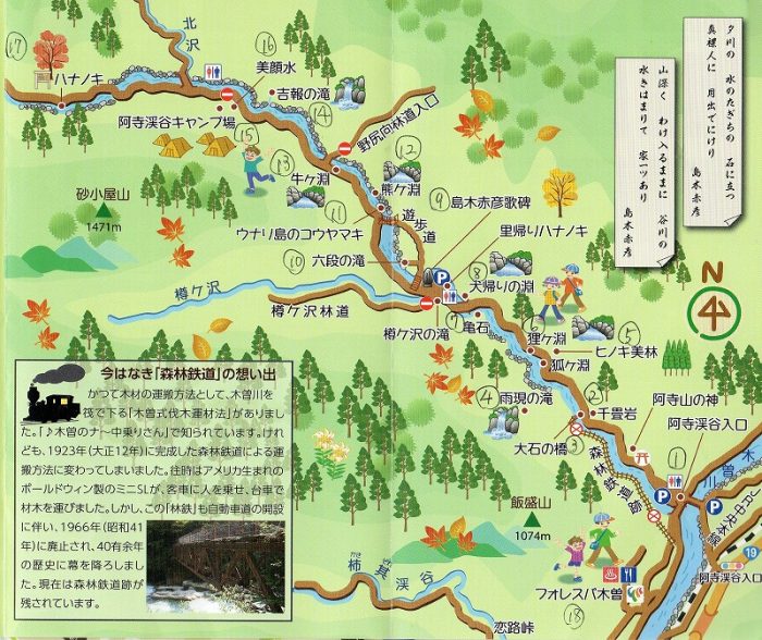 We have now reached the camp-ground in the top left of this image – Kitazawa Station (北沢停車場). [19]
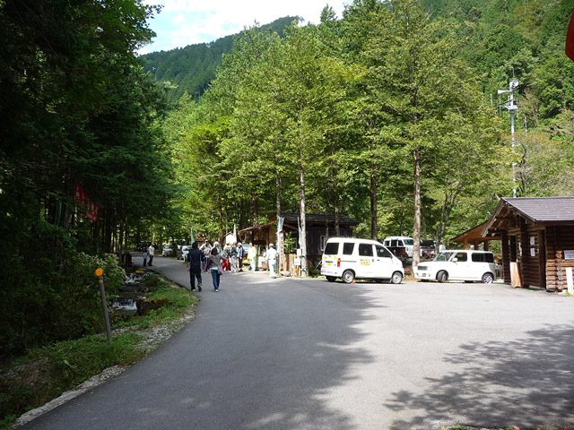
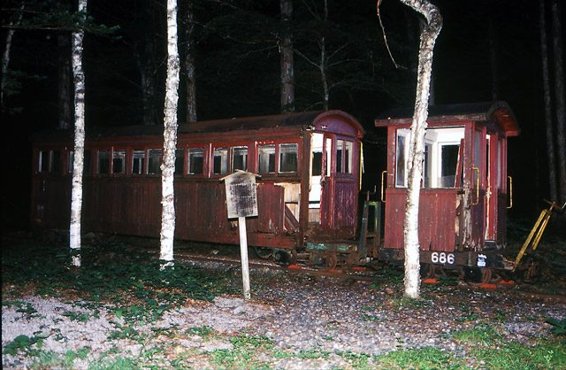 For a time a caboose and a B-Type Coach were exhibited at this site but by 2010 these had been removed. This picture was taken in 2000 (c) Mr Yuzawa. [25]
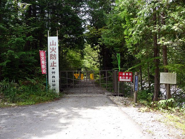 From this point on the old railway formation is only accessible on foot. [26] The route onwards is shown on the sketch map below. [27]
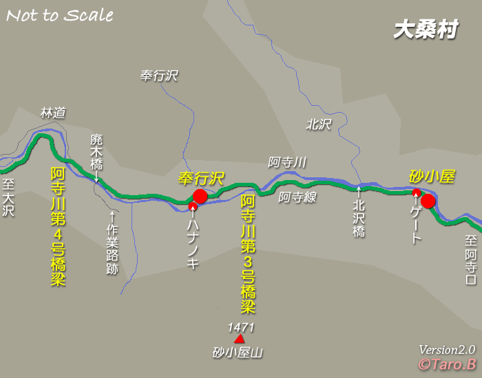
 The track-bed follows the modern gravel forest road. It was on the right of this picture and is defined by the stones visible in the gravel of the modern road. [26]
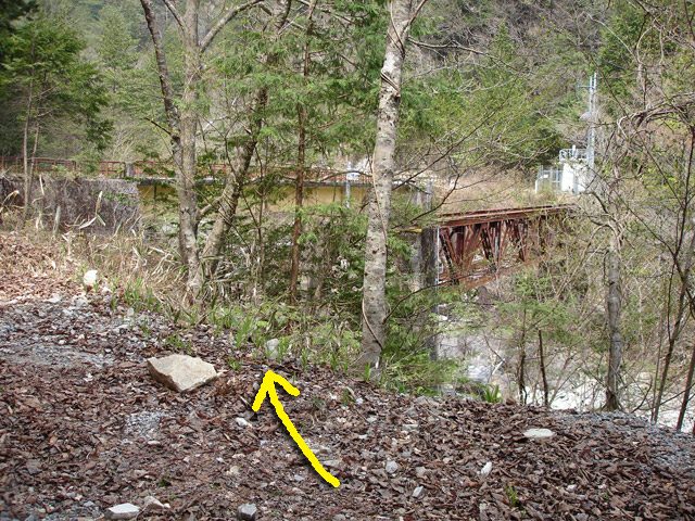 Just a hundred metres or so further along the line, the old railway turned to the right to cross the Atera River again. The bridge girders are still in position. It was known as the Atera River No. 3 Bridge (阿寺川第3号橋梁). [26]
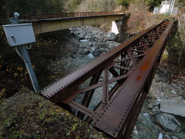 The bridge girders still appear to be in reasonable condition. The grey box in the image is a water-level measuring device. [26]
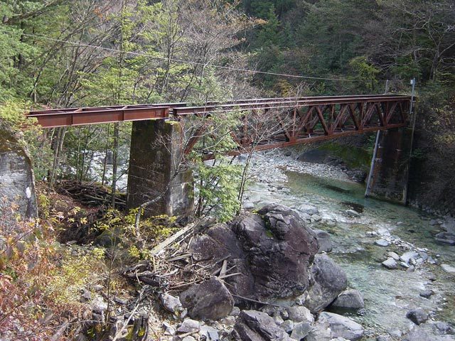 A view from the North bank of the river, upstream of the bridge. The Warren Truss is extended by a short girder bridge. [26]
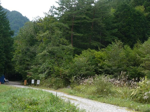 The next station on the railway was Magomezawa Station (奉行沢停車場). A loop was provided here to allow trains to pass. [26]
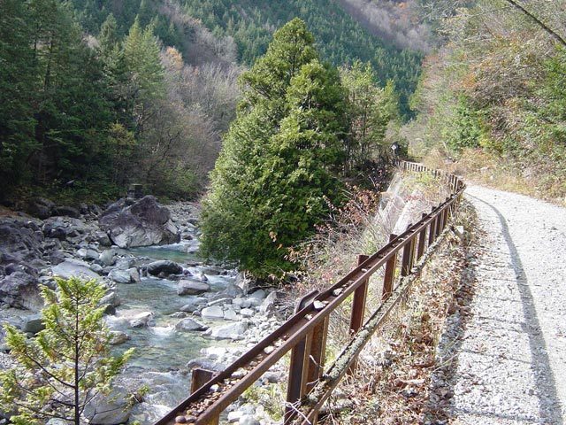 The forest railway continues to follow the North bank of the river. [26]
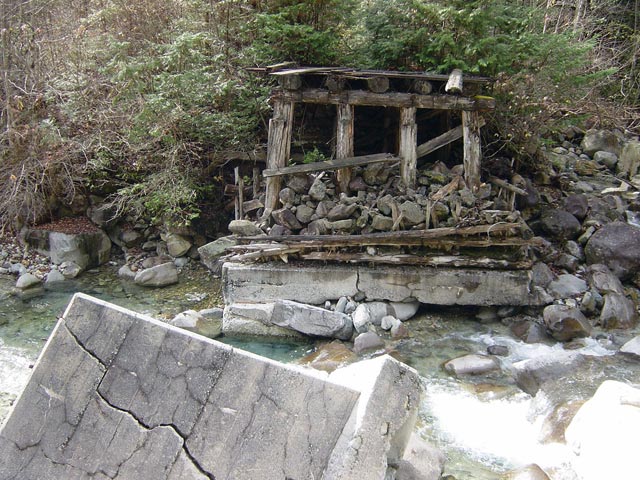
On the left (above) we pass another temporary wooden structure which is in a state of disrepair. The bridge, when it was in use, provided access for construction traffic for a dam built in one of the Atera River’s tributaries. [26]
The route of the old line then deviates from the gravel forest road as shown in the adjacent image. [28]
The route of the old railway follows the river bank. [28]
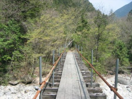
The old railway crosses the Atera River once again. The bridge has a walkway over it which in 2006, as the picture below shows, was in good condition. [28]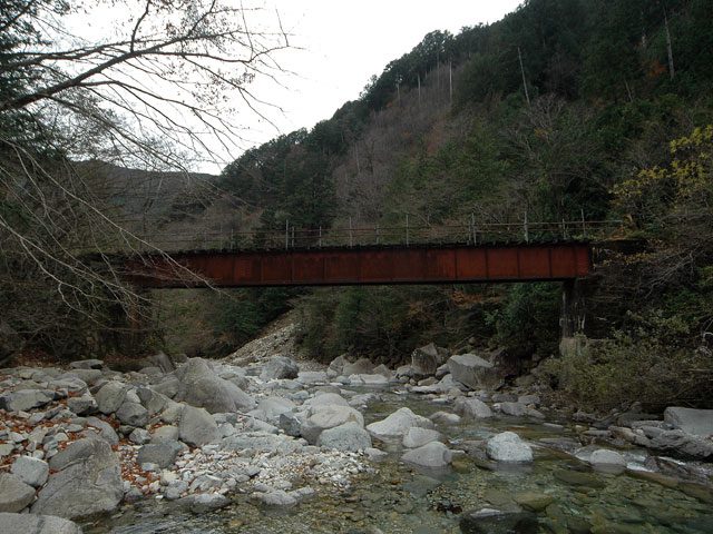 The same bridge taken from the riverbed upstream. Rintetsu.net names this bridge Aoshigawa No. 4 Bridge (阿寺川第4号橋梁). [31]
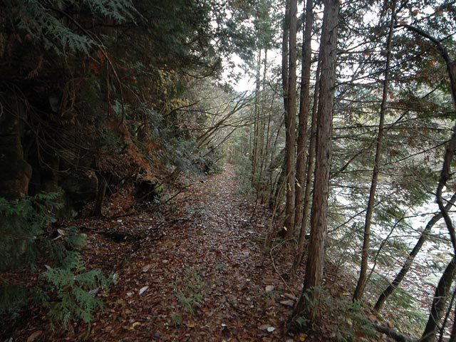 The railway continues alongside the river. [31]
Soon after this the track-bed becomes increasingly difficult to follow with a variety of different collapses and small bridges which no long are accessible. The line continued a significant distance further up the valley as the map below shows. [32]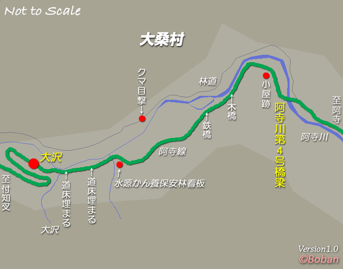
 A schematic plan of the hairpin bends on the line. [33]
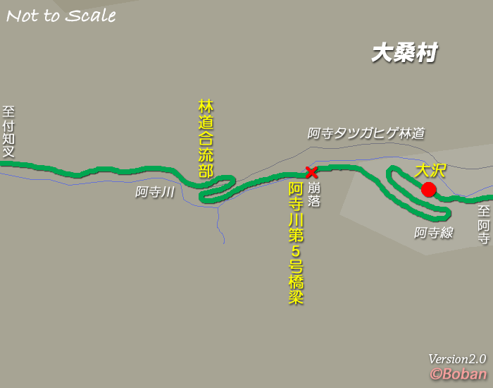 It remains accessible to some degree as far as the red ‘x’ marked on the map above. At that point the railway crossed the Atera River once again. [34] The bridge is shown below.
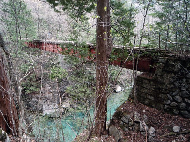 Atera River Bridge No. 5 (阿寺川第5号橋梁). [35]
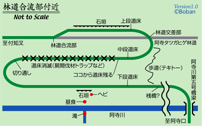 The ongoing route of the railway. The grey line is the gravel forest road. [36]
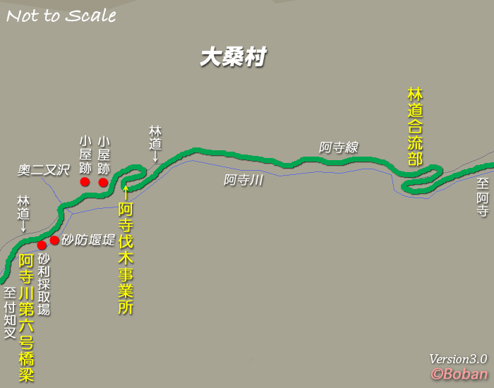 The route continues to follow the Atera River Valley. Its route matches that of the forest road except where gradients are too steep, as below. [37][38]
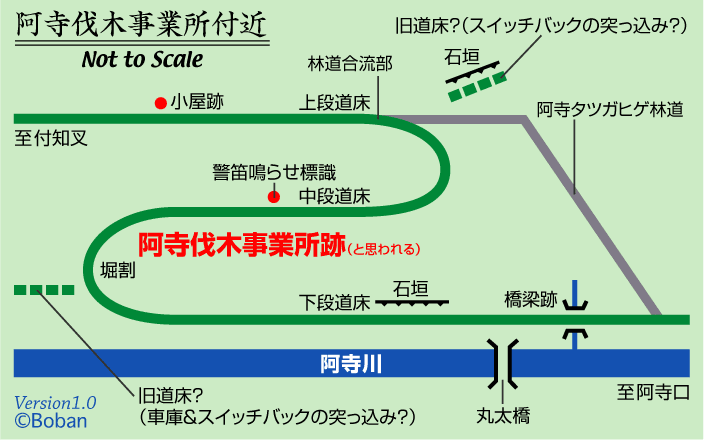 The website “rintetsu.net” continues to follow the route of the old railway right along the valley floor. For much of the distance there is little to see other than the gravel forest road.
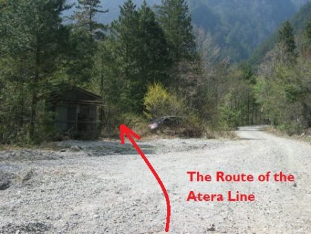
We still have not completed our exploration of the railways around Nojiri. We return to the point where the line from Nojiri which crossed the Kisogawa Bridge met the line running along the Northwestern bank of the Kiso River. The “http://www.soleil1969.com” refers to the line heading to the left in the image below as the “Gluteal line” (殿線). [39]  The route from the Kisogawa Bridge meets the Nojiri Forest Railway at the location of the road junction in the image above. The left arrow shows the approximate line of the Gluteal Line (殿線). [10]
The adjacent image looks back towards the junction along the Gluteal Line (殿線). [40]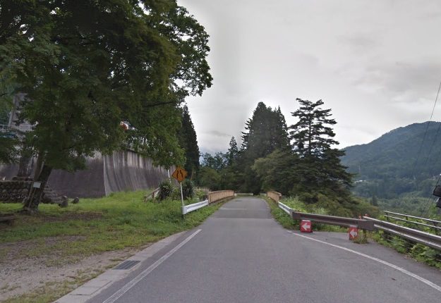
 The line followed the North bank of the Kiso River. The adjacent plan shows its route. [40]
Along much of this section of the route a tarmac road is all that is left of the old railway route. In the image below, the track-bed was roughly at road level.
 Travelling beyond this point road-widening has occurred and the route of the old railway has been lost.
The adjacent image shows the track-bed climbing away from the old road. [40] The same location in 2019 is very different, as the Google Streetview image below shows.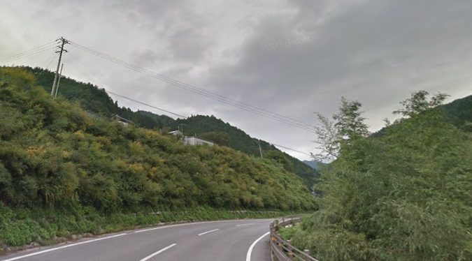
 The railway route stayed above the line of the old and the more modern tarmac road. The approximate line is the dotted red line in the adjacent picture. [40]
The access to the Shirayama Shrine can just be seen in the adjacent picture. The railway travelled below this shrine and above the road.
In this next image, taken from the approximate location of the building in the image above, the remnants of a railway bridge can be seen. [40]
The next image, below, shows the state of the old railway line to the Northeast of the bridge. [40]
The line continued above the route of the road in the valley. The road turns through two hairpin bends as it seeks to gain height and the line of the old railway crosses its path as shown by the red line below and in the following picture.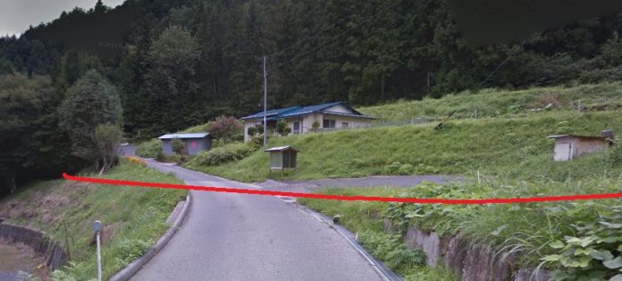
 The approximate line of the old railway is shown on the adjacent plan. The location of the two Google Streetview images above is marked by the arrow and the red text. The most likely route of the railway is that marked by the red dots on this plan and by the red arrows on the Google Streetview image below. [40]
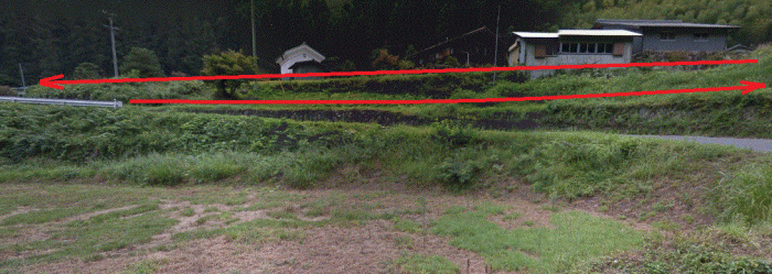
 The adjacent satellite image probably gives the best perspective on the arrangement of the railway tracks as the railway gained height at this location.
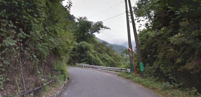
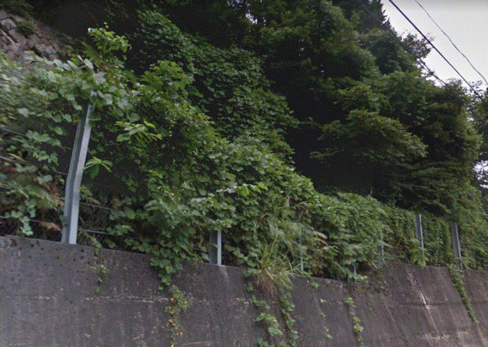
North of this point the old railway track-bed is most likely to have followed the route of the present tarmac road only just above it on the hillside as show below. The line appears to have travelled above the retaining wall at the roadside but below the just visible revetment on the top-left of the Google Streetview image. From this point, for a time, the route of the old railway is hidden in undergrowth on the hillside above the road.
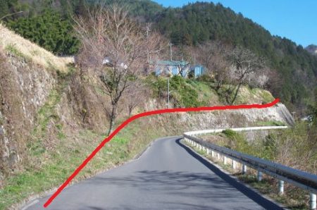
The route continued to follow the road for a little while further before heading away to the West. To gain the necessary height on the hillside, a series of hairpin bends in the railway were necessary. The satellite image below shows the presumed trajectory of the railway as it climbs the hillside.
 The adjacent image show the likely path of the railway as it returns to meet the relatively steeply climbing valley road. The blue lines on these two images are the Streetview traces on the Google Earth satellite images.
The image immediately below shows the present road bridge at the location where the old railway crossed the river.
The railway only continued a few more kilometres to the north of this bridge on the east bank of the river. For the majority of its remaining course the old railway track-bed has become the modern single-lane forest road.
This area is referred to on the http://www.soleil1969.com website as Ogawa Tandami (小川御料林), not to be confused with the are to the north which is served by the Ogawa Forest Railway details of which can be found in a separate blog post. [41]
[4] Nojiri Forest Railway is a forest railway that jurisdrucks from the Nojiri Forestry Station originating from Nojiri Station. It was composed of Atera line, Kitazawa line, persimmon line (Kakusotsen), Kitazawa gaze line, giraffe line etc. [4]
References
- http://rintetsu.net/nagano_06/nojiri06/nojirimap_2.html, accessed on 22nd February 2019.
- http://rintetsu.net/nagano_06/atera01/atera01.html, accessed on 22nd February 2019.
- http://rintetsu.net/nagano_06/nojiri00/nojiri_ns01.html, accessed on 22nd February 2019.
- https://haikyo.info/s/10766.html, accessed on 23rd February 2019.
- http://www.geocities.jp/tentacles344/kisogawakyoryo.html, accessed on 23rd February 2019.
- http://nishimiyaushiro.web.fc2.com/haisen/nojiri1.html, accessed on 23rd February 2019.
- http://kyuragi2011.blog.fc2.com/blog-entry-137.html, accessed on 23rd February 2019.
- http://kotityobunsitu.blog135.fc2.com/blog-entry-76.html?sp, accessed on 23rd February 2019.
- http://rintetsu.net/nagano_06/nojiri04/nojiri1_kb08.html, accessed on 23rd February 2019.
- http://rintetsu.net/nagano_06/nojiri05/nojiri1_kbn1.html to http://rintetsu.net/nagano_06/nojiri05/nojiri1_kbn3.html, all accessed on 23rd February 2019.
- http://rintetsu.net/nagano_06/atera01/atera13.html, accessed on 24th February 2019.
- http://rintetsu.net/nagano_06/atera02/atera15.html, to http://rintetsu.net/nagano_06/atera02/atera23.html, all accessed on 24th February 2019.
- http://rintetsu.net/nagano_06/nojiri06/nojiri1_at01.html to http://rintetsu.net/nagano_06/nojiri06/nojiri1_at12.html, all accessed on 23rd February 2019.
- http://rintetsu.net/nagano_06/atera01/ateramap_1.html, accessed on 23rd February 2019.
- http://rintetsu.net/nagano_06/atera02/atera23.html, accessed on 24th February 2019.
- http://nishimiyaushiro.web.fc2.com/haisen/nojiri1.html, accessed on 22nd February 2019.
- http://www.rinya.maff.go.jp/chubu/press/kikaku/140411.html accessed on 24th February 2019.
- http://www.soleil1969.com/ruinstop/adera/adera2.html, accessed on 24th February 2019.
- http://minsyuku-matsuo.sakura.ne.jp/yorimiti28/aderakeikokuheiku30.html, accessed on 24th February 2019.
- http://rintetsu.net/nagano_06/atera05/atera51.html, accessed on 24th February 2019.
- http://rintetsu.net/nagano_06/nojiri07/nojiri1_ay03.html, accessed on 23rd February 2019.
- http://rintetsu.net/nagano_06/nojiri07/nojiri1_ay06.html, accessed on 23rd February 2019.
- http://rintetsu.net/nagano_06/nojiri08/nojiri1_y2t02.html to http://rintetsu.net/nagano_06/nojiri08/nojiri1_y2t12.html, all accessed on 23rd February 2019.
- https://www.nagano-tabi.net/modules/enjoy/enjoy_76005001.html, accessed on 24th February 2019.
- http://rintetsu.net/nagano_06/atera05/atera52.html to http://rintetsu.net/nagano_06/atera05/atera55.html, all accessed on 24th February 2019.
- http://rintetsu.net/nagano_06/atera06/atera56.html to http://rintetsu.net/nagano_06/atera06/atera64.html, accessed on 24th February 2019.
- http://rintetsu.net/nagano_06/atera06/atemap_3.html, accessed on 24th February 2019.
- http://www.soleil1969.com/ruinstop/adera/adera5.html, accessed on 24th February 2019.
- http://nishimiyaushiro.web.fc2.com/haisen/nojiri2.html, accessed on 23rd February 2019.
- http://rintetsu.net/nagano_06/atera01/atera03.html to http://rintetsu.net/nagano_06/atera01/atera12.html, all accessed on 23rd February 2019.
- http://rintetsu.net/nagano_06/atera06/atera66.html to http://rintetsu.net/nagano_06/atera07/atera70.html, accessed on 24th February 2019.
- http://rintetsu.net/nagano_06/atera07/atemap_4.html, accessed on 24th February 2019.
- http://rintetsu.net/nagano_06/atera08/atera78.html, accessed on 24th February 2019.
- http://rintetsu.net/nagano_06/atera10/atemap_5.html, accessed on 24th February 2019.
- http://rintetsu.net/nagano_06/atera10/atera2_16.html, accessed on 24th February 2019.
- http://rintetsu.net/nagano_06/atera11/atera2_19.html, accessed on 24th February 2019.
- http://rintetsu.net/nagano_06/atera12/atemap_6.html, accessed on 24th February 2019.
- http://rintetsu.net/nagano_06/atera12/atera2_31.html to http://rintetsu.net/nagano_06/atera12/atera2_39.html, all accessed on 24th February 2019.
- http://www.soleil1969.com/ruinstop/ruinstop.html, accessed on 24th February 2019.
- http://www.soleil1969.com/ruinstop/tono/tono001.html to http://www.soleil1969.com/ruinstop/tono/tono003.html, all accessed on 24th February 2019.
- https://rogerfarnworth.com/2019/02/21/japanese-narrow-gauge-762mm-lines-part-4-the-kiso-railway-part-c-the-ogawa-forest-railway
- I have been helped to correct Japanese translation/transliteration in this post by Ichiro Junpu. His own work focusses more recently on Chinese Narrow Gauge Railways. His website: “Narrow Gauge Railways in China” can be found on the following link: http://www.kii762mm.com/modules/pico/index.php?cat_id=250 (for Japanese: http://www.kii762mm.com/index.html).
