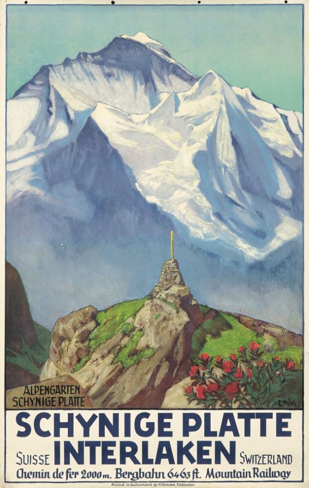
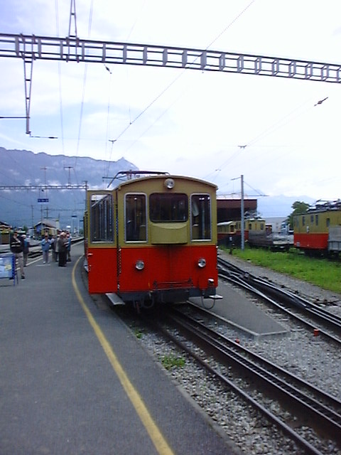
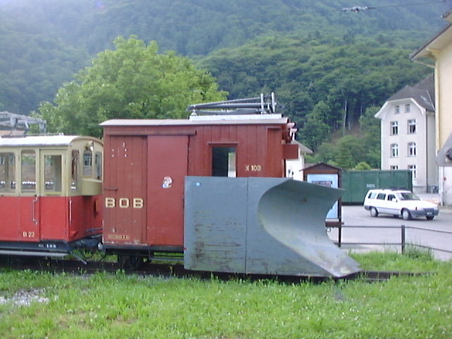
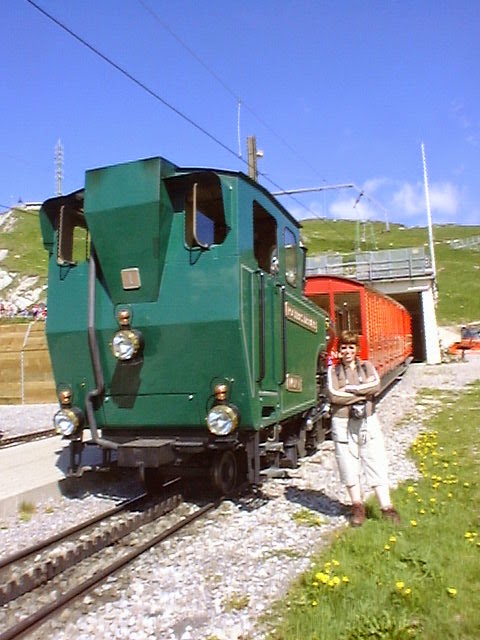
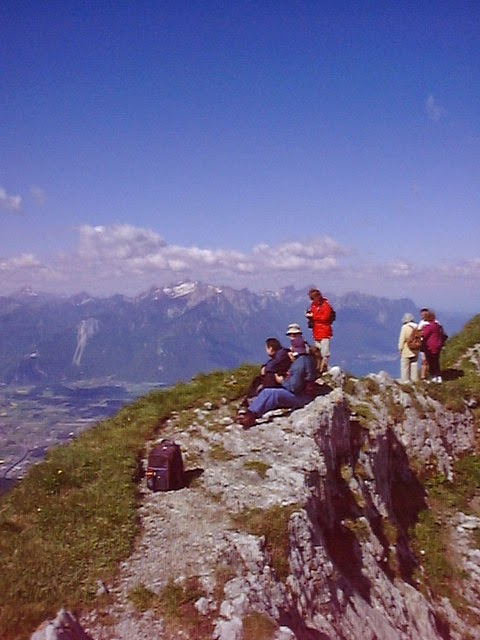
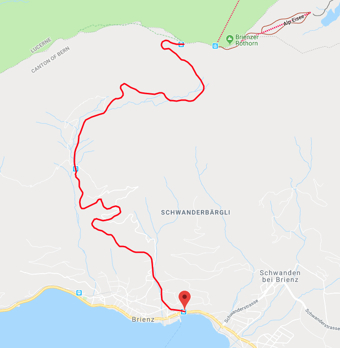
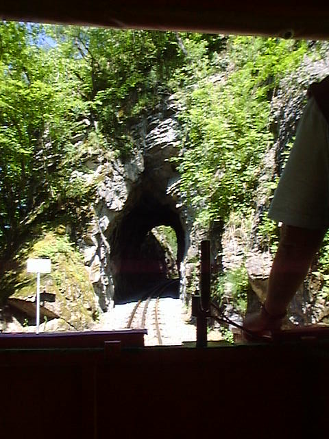
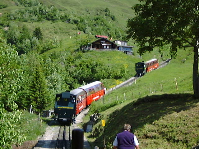
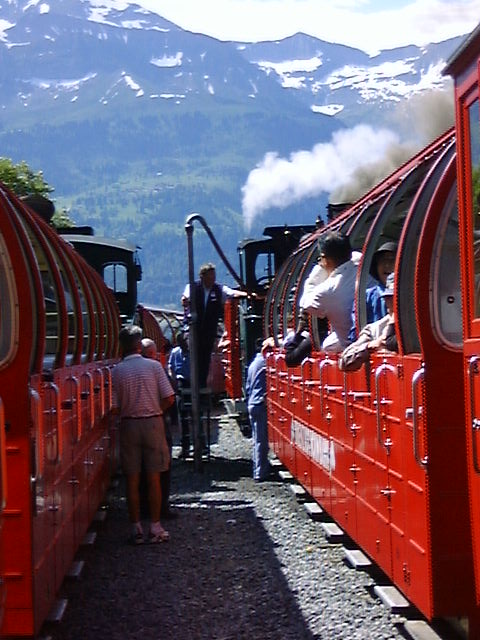
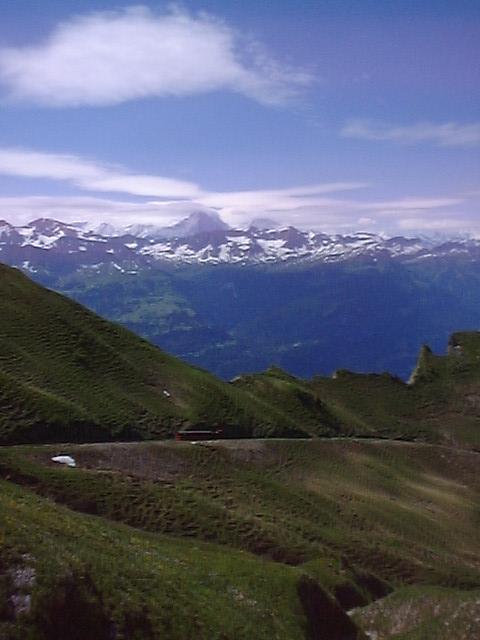
My wife and I visited Switzerland in 2004 and enjoyed travelling extensively by train. One little railway that we enjoyed was the Schynige Platte Railway near Interlaken. The track gauge for this line is 800mm. Trains leave Wilderwil station and run alongside the Berner Oberland-Bahan (BOB) for a third of a mile (0.5km) before turning away, crossing the River Lütschine and climbing the side of the valley. Forest eventually gives way to alpine pasture and views across Lake Thun and Lake Brienz. When the weather is good there are excellent views of the Eiger, Monch and Jungfrau as the train climbs to the terminus at Schynige Platte. In 4.5 miles (7.25km) the line rises 4,659ft (1,420m).[1] The route is shown on the map below.[2]
Close to the station there are a botanical garden,[3] a hotel and a restaurant.
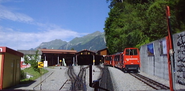
Technical Details: Track-gauge 800mm. Power: 1500 volt DC overhead. Rack: Riggenbach. Maximum Gradient: 1 in 4 (25%). The line’s depot and workshops are located adjacent to Wilderswil Station.
“The line is owned by the Berner Oberland-Bahnen AG, a company that also owns the Berner Oberland-Bahn. Through that company it is part of the Allianz – Jungfrau Top of Europe marketing alliance, which also includes the separately owned Wengernalpbahn, Jungfraubahn, Bergbahn Lauterbrunnen–Mürren, Harderbahn, and Firstbahn.” [1]
Photographs: Except where referenced otherwise, the photographs below were taken by us in 2004. My digital camera in those days was not of the same standard as I am used to now.
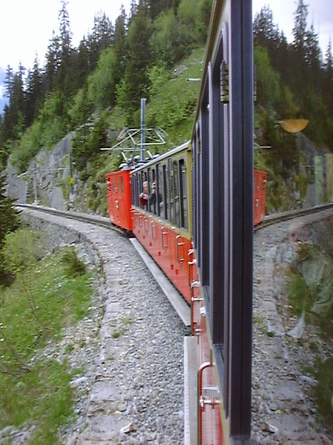
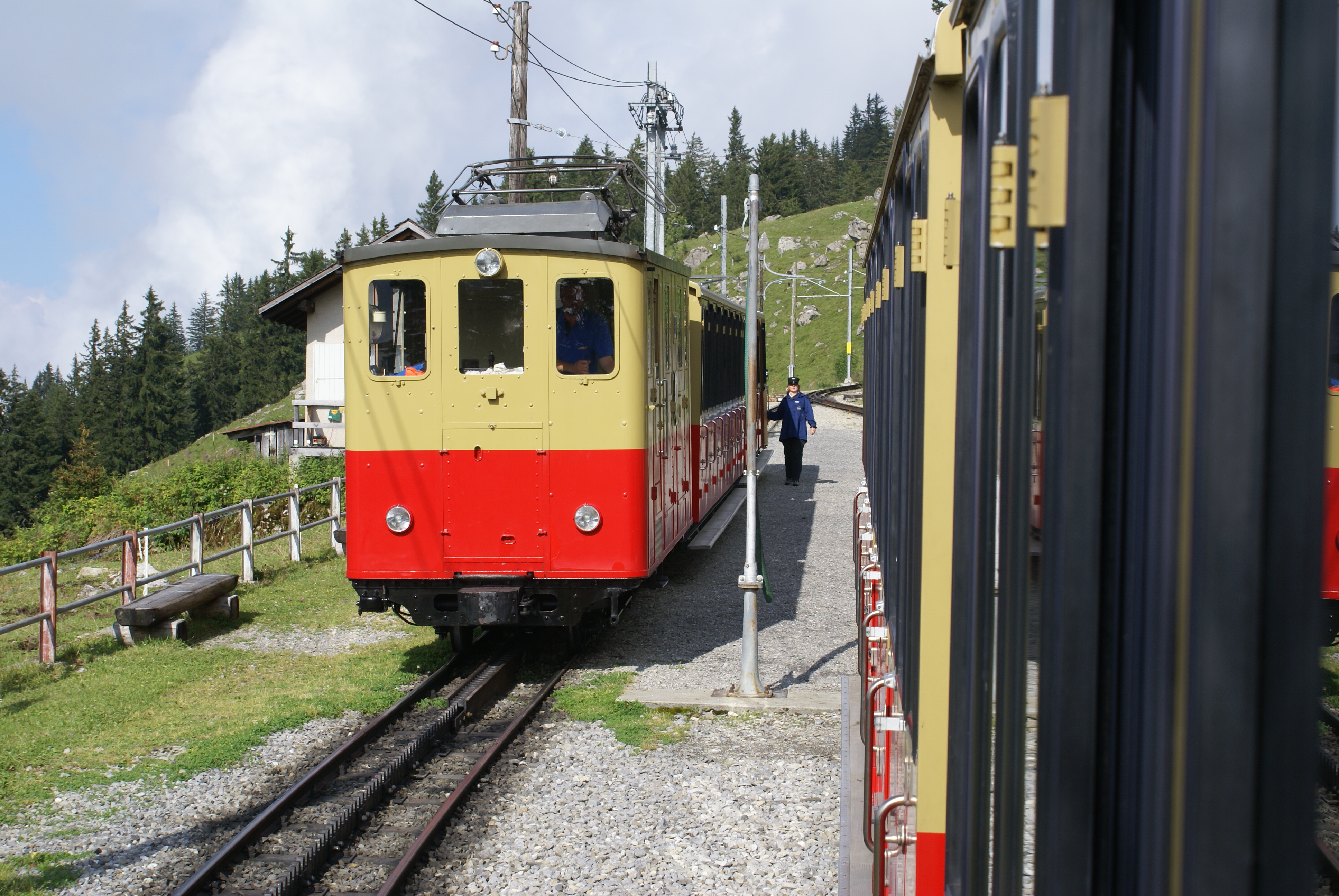
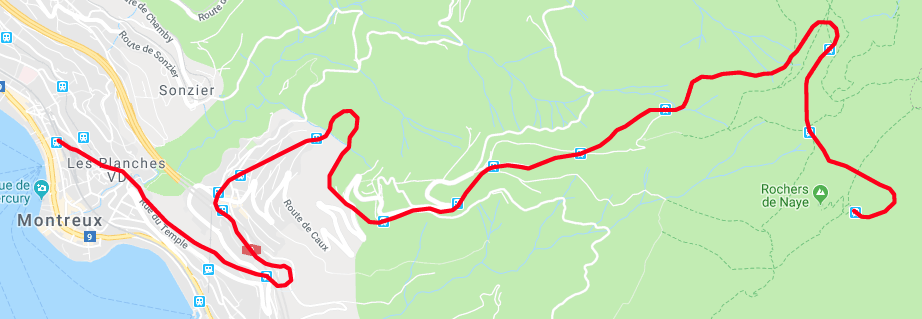
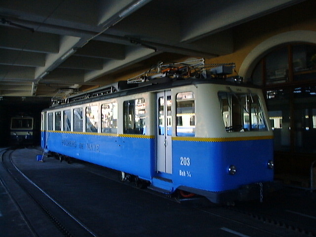
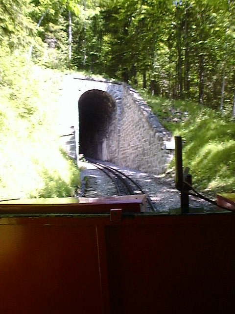
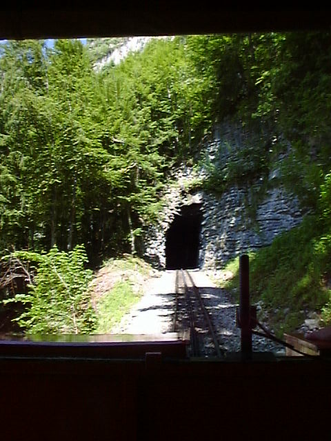
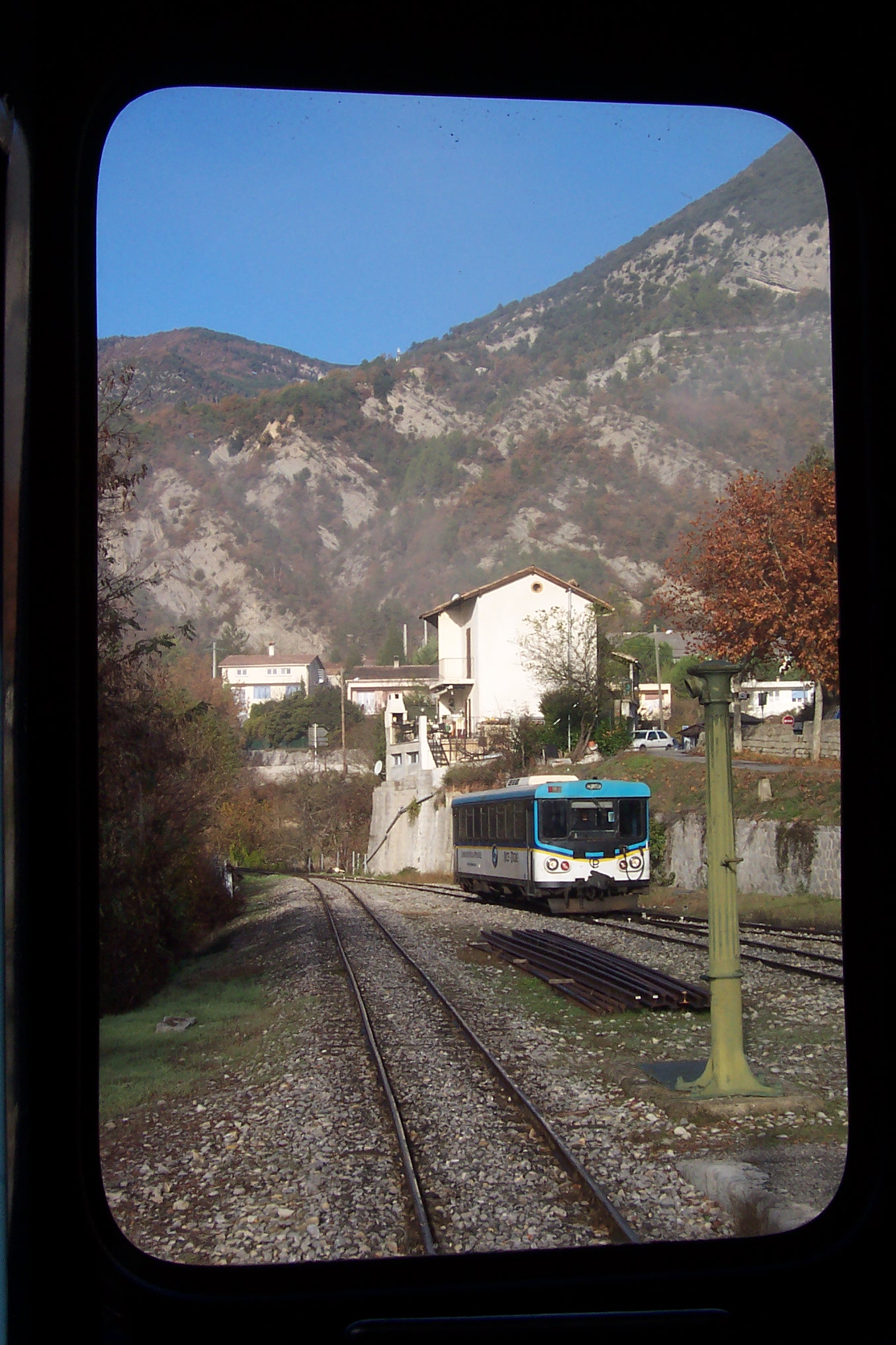
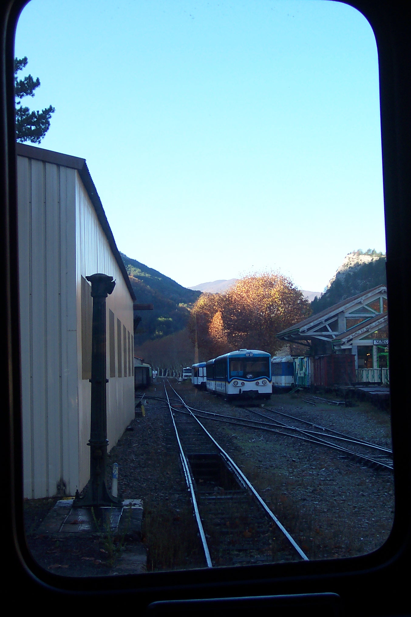
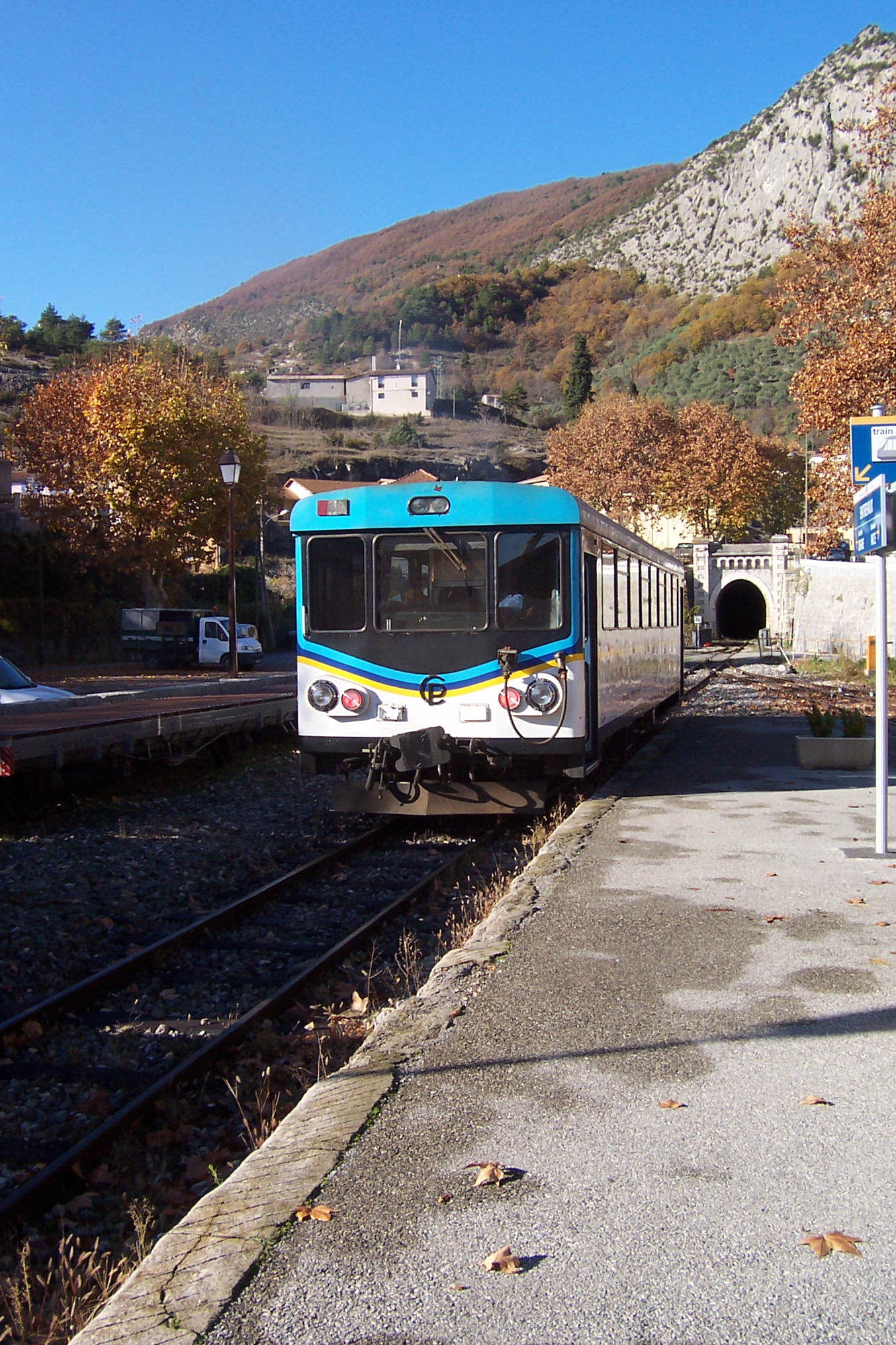
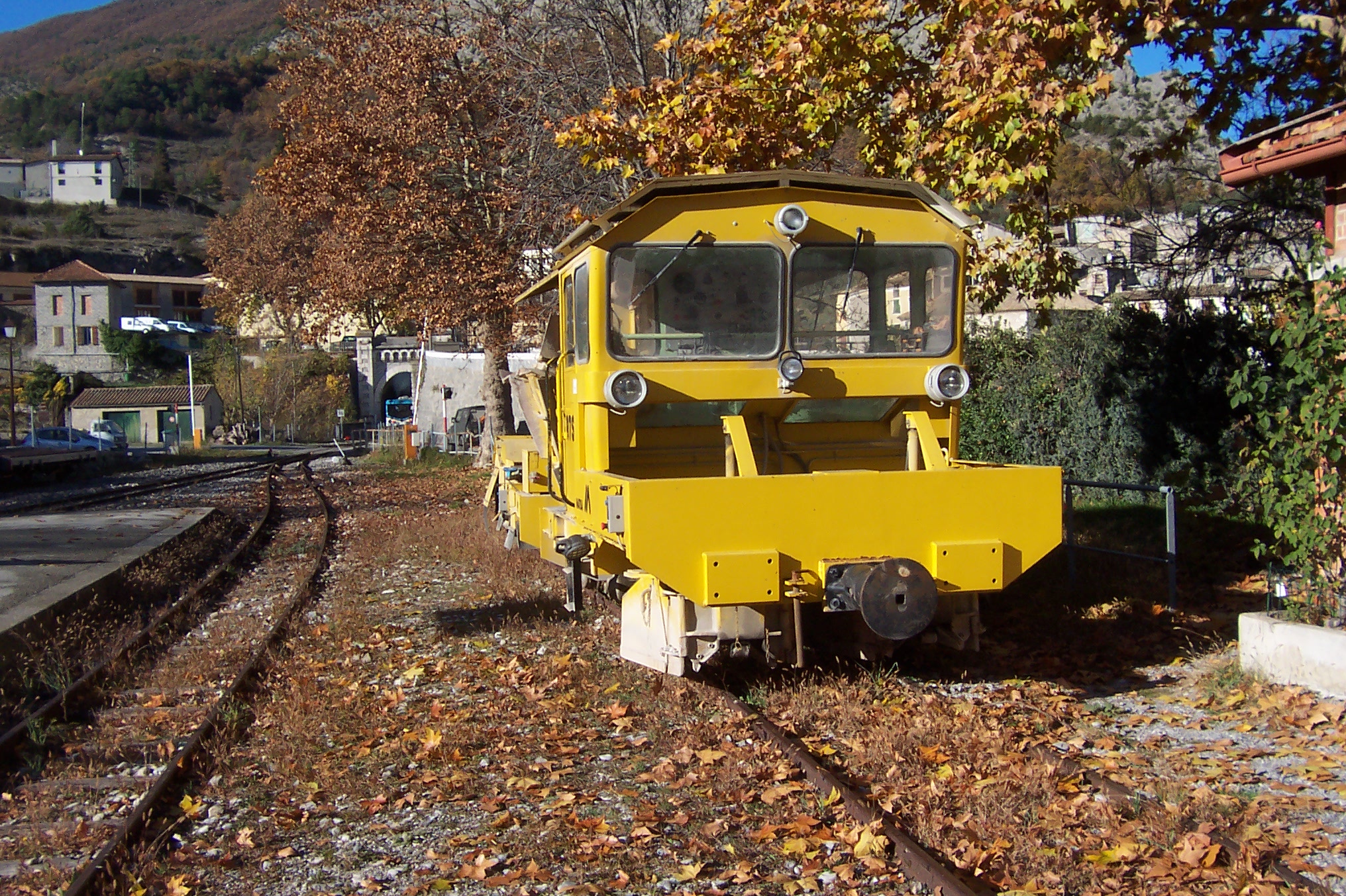
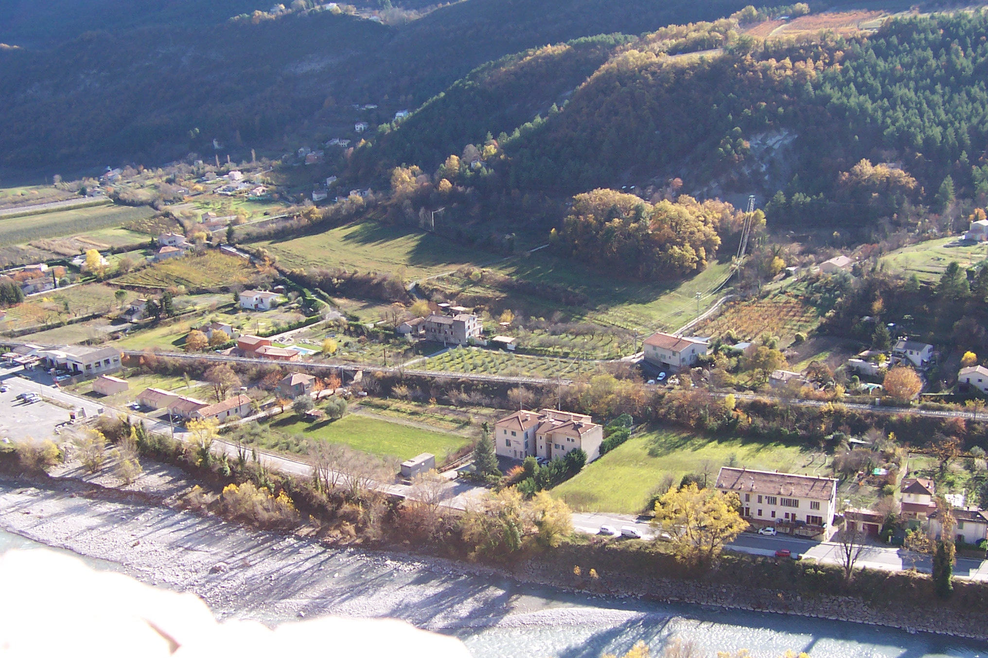
My wife and I travelled this line in 2004. The views were spectacular and the weather wasn’t bad at all! My camera, in those days, was not able to produce high resolution photos. But these give a very good impression of the line and the views from the top. The first image is a map of the line. Trains depart from Montreux station and climb steeply on a rack railway, first in tunnel, and then through the village of Gilon (300m above Montreux) which was historically the start of the steam railway when opened in 1892. The line is known as the MGN (Montreux, Gilon, Rochers-de-Naye) Railway.
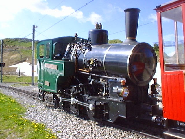
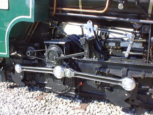
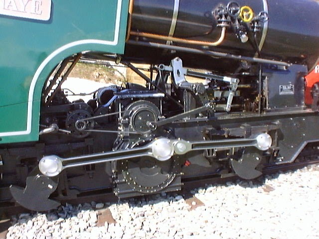
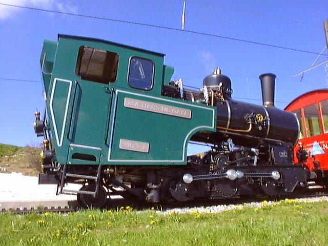
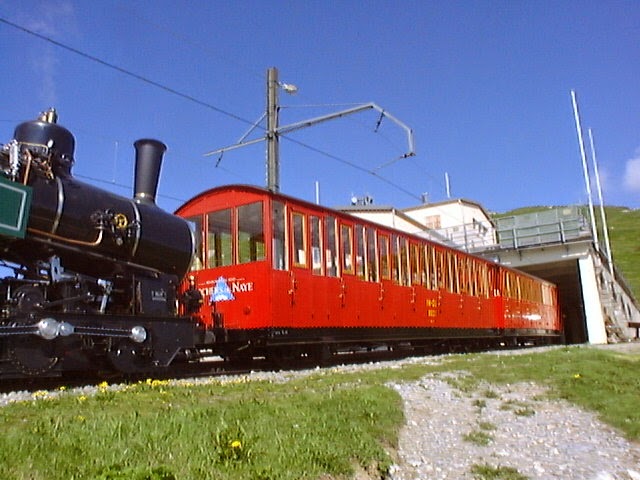
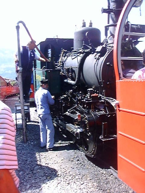
242T66 on the Passions Metrique et Etroite Forum has pointed out to me that in 2004 I was fortunate to enjoy a ride on a steam driven service on the higher reaches of the line (pictures below). It was apparently only for a few summer seasons that the steam service was operated on this line between Caux and Rocher-de-Naye.
242T66 comments that the MGN line was electrified from 1938. It was the early 1990s when the former SLM company at Winterthur built a few modern oil fired steam locomotives for the Brienz Rothorn Bahn and for a couple of Austrian rack railways (Schneeberg and Schafberg Bahnen). At that time, they also built one for the MGN line.
This was H2/3 n° 1 Rochers-de-Naye which features below. A nostalgic steam train was in operation for just a few years before the steam loco was eventually sold to the Brienz Rothorn Bahn.
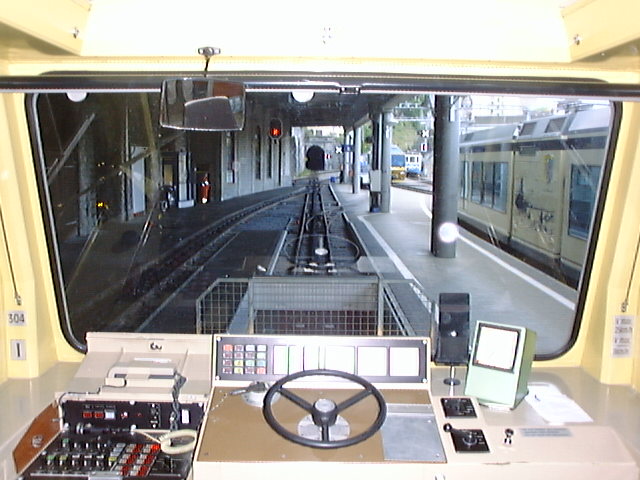
The photographs below were all taken by me. …
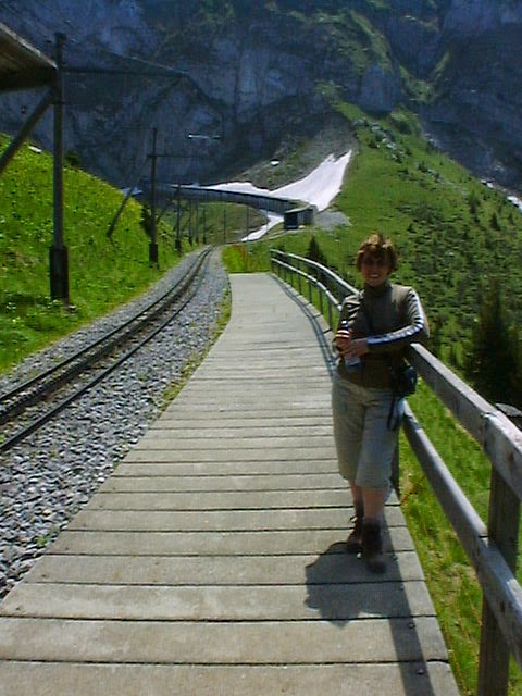
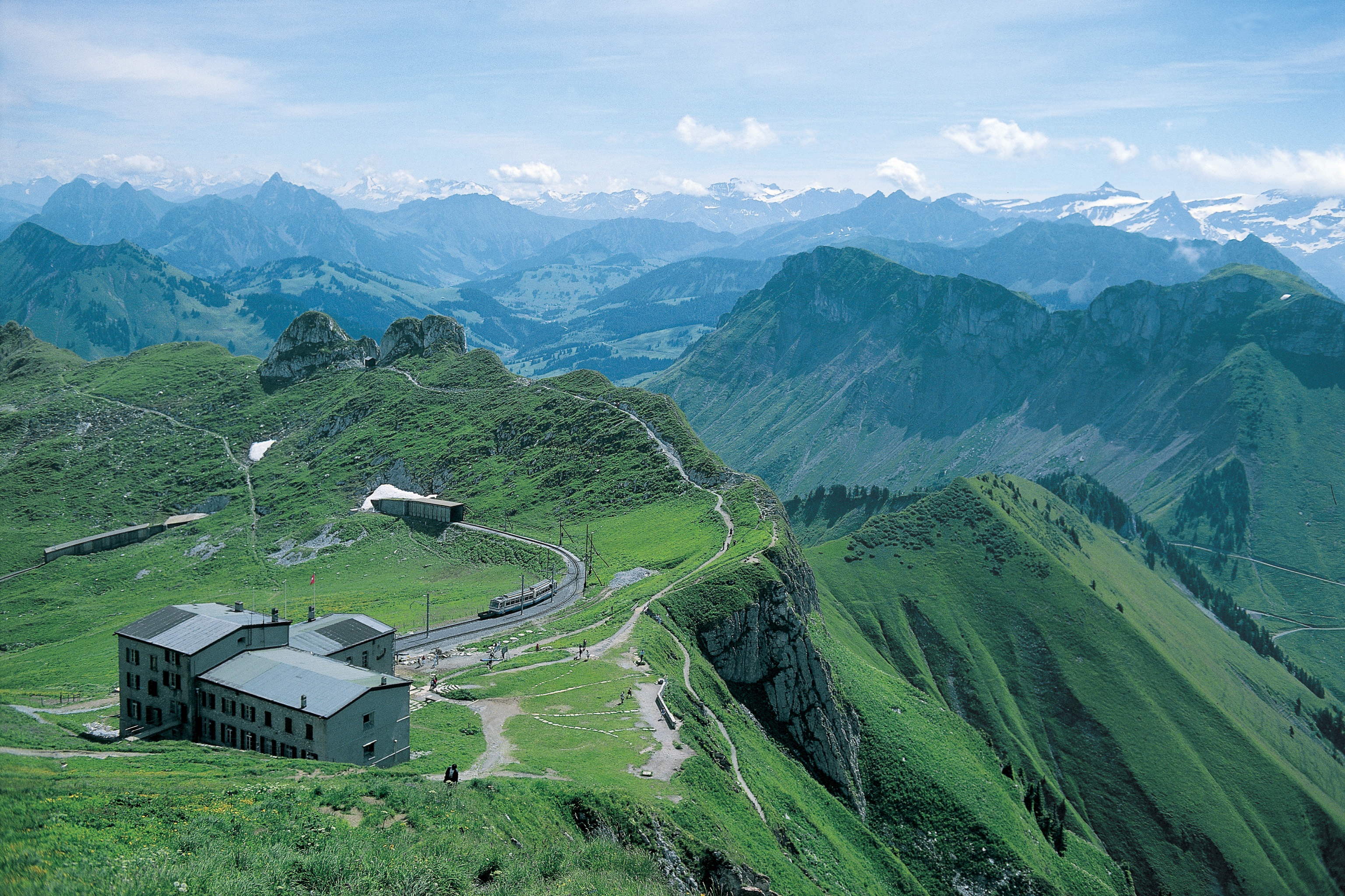
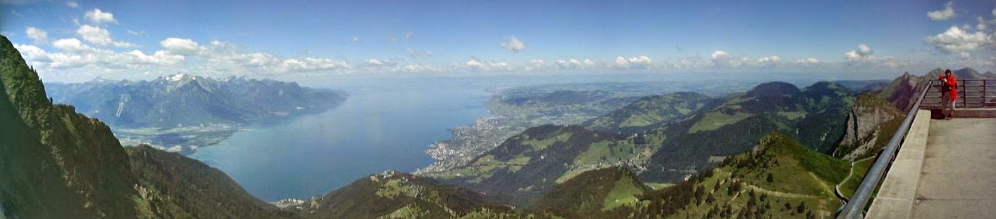
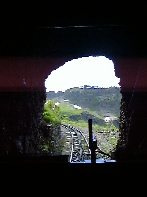
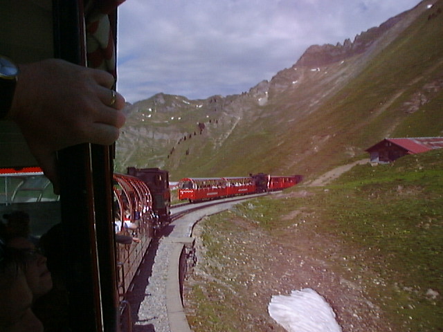
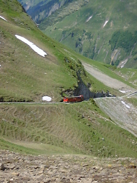
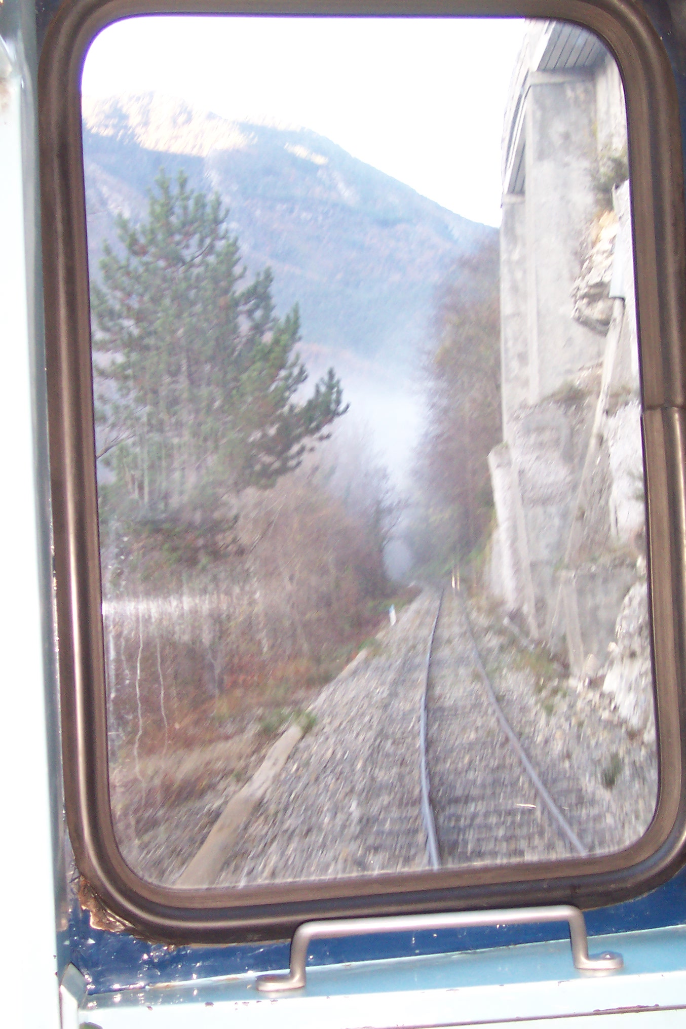
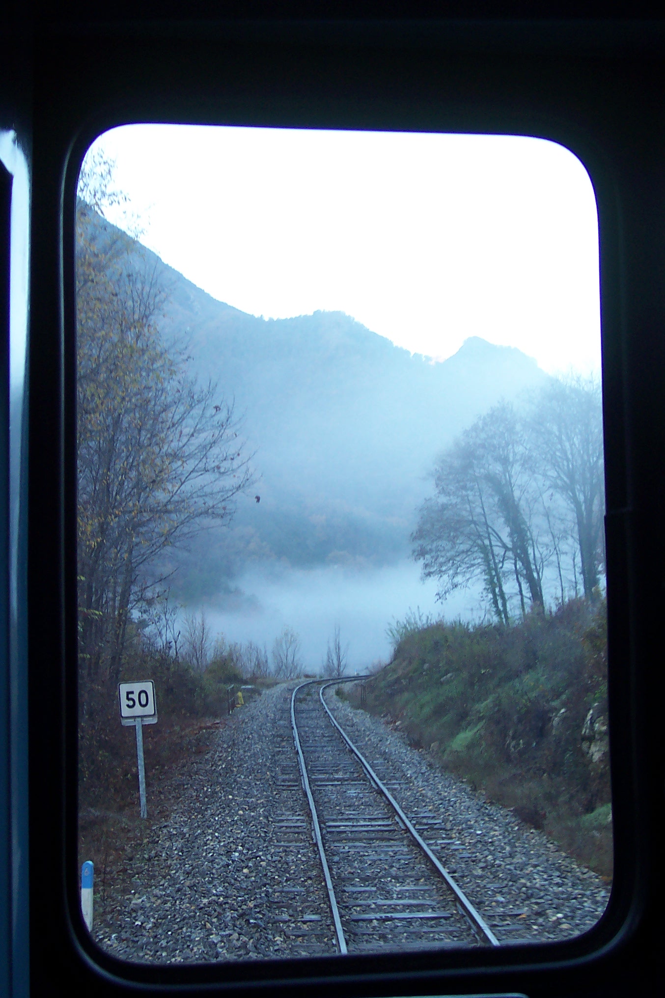
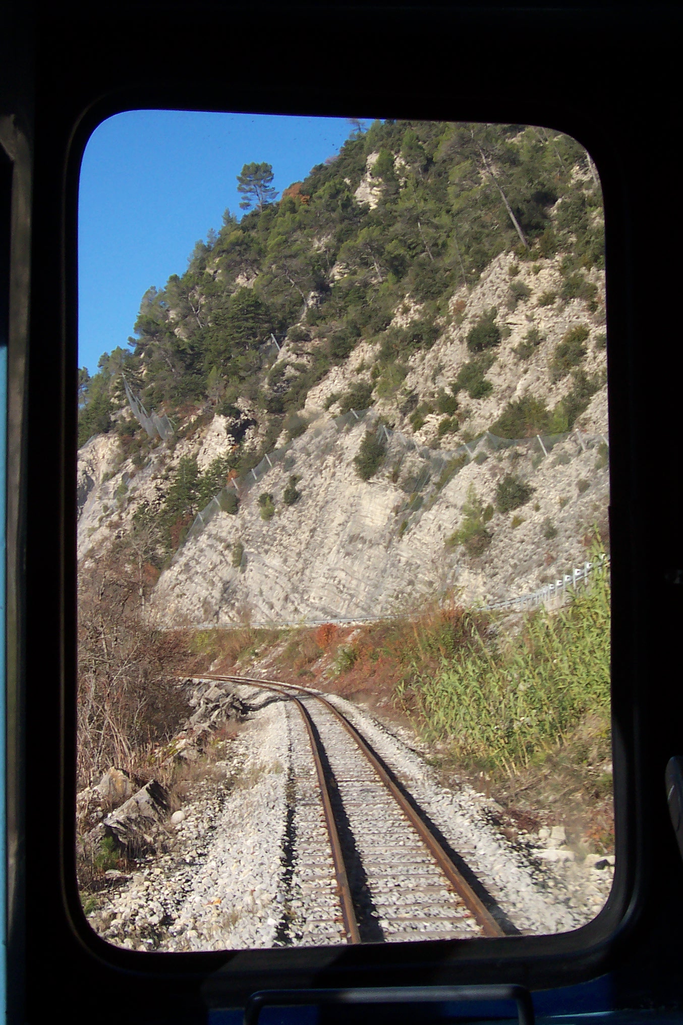
The next few images show the views from the top of the line.
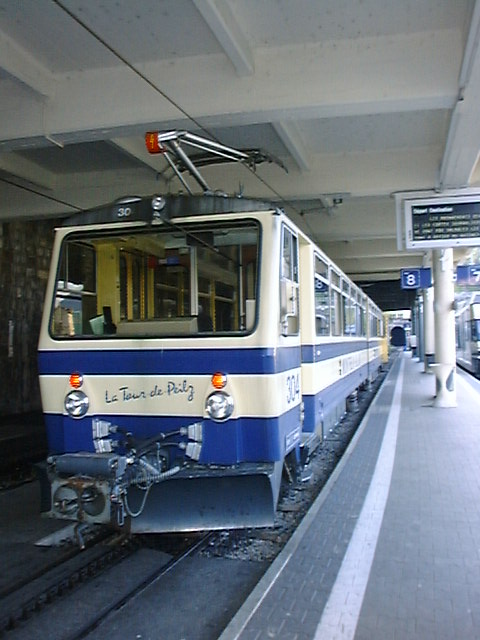
And finally a few images at the bottom of the line, in Montreux
As an aside to the regular blog posts, I am wondering about collating my posts into a series of eBooks. I have developed the first few chapters of the first book, which will be about the Central Var Line in Provence. I would appreciate comments about the draft.
Trains left la Gare du Sud in a Westerly direction before turning first North-West and then round to the south towards St. Philippe. The video below shows the first part of the route from Nice to Colomars (La Manda).[7]
On the map below the site of the original Gare due Sud appears as a void in the right middle of the image with the present station to its West.
The two station sites are covered in the previous post in this series:
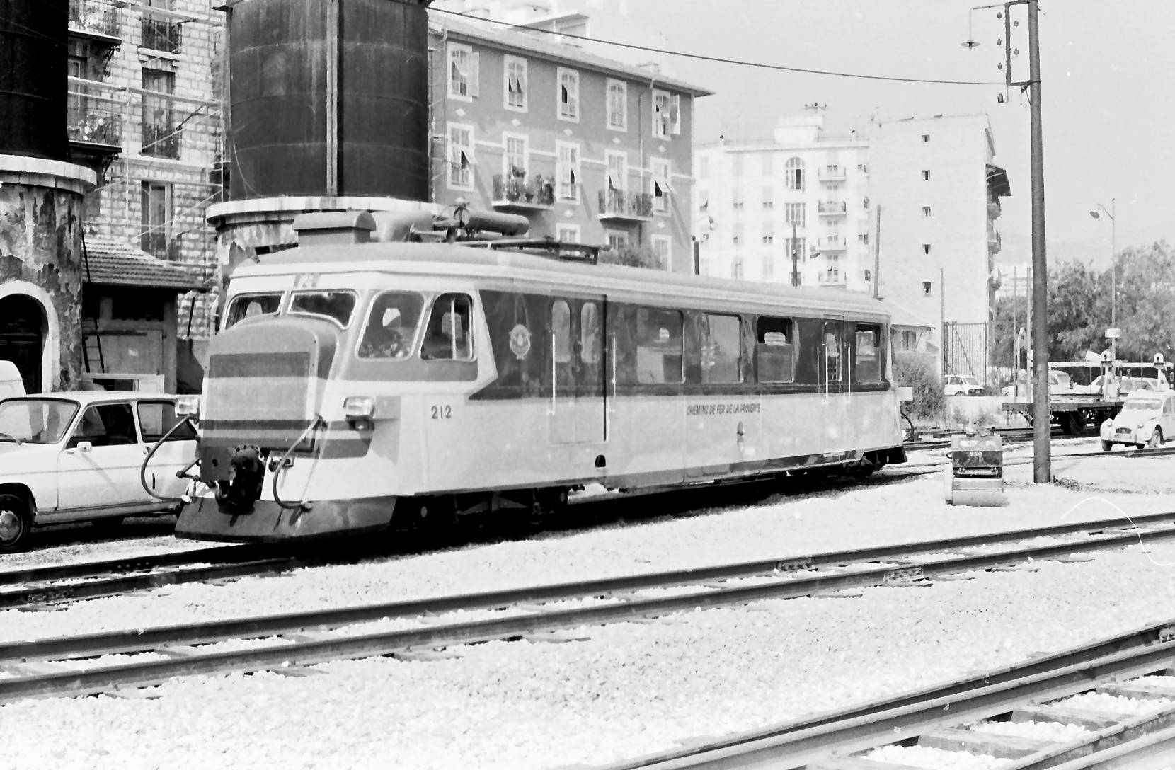
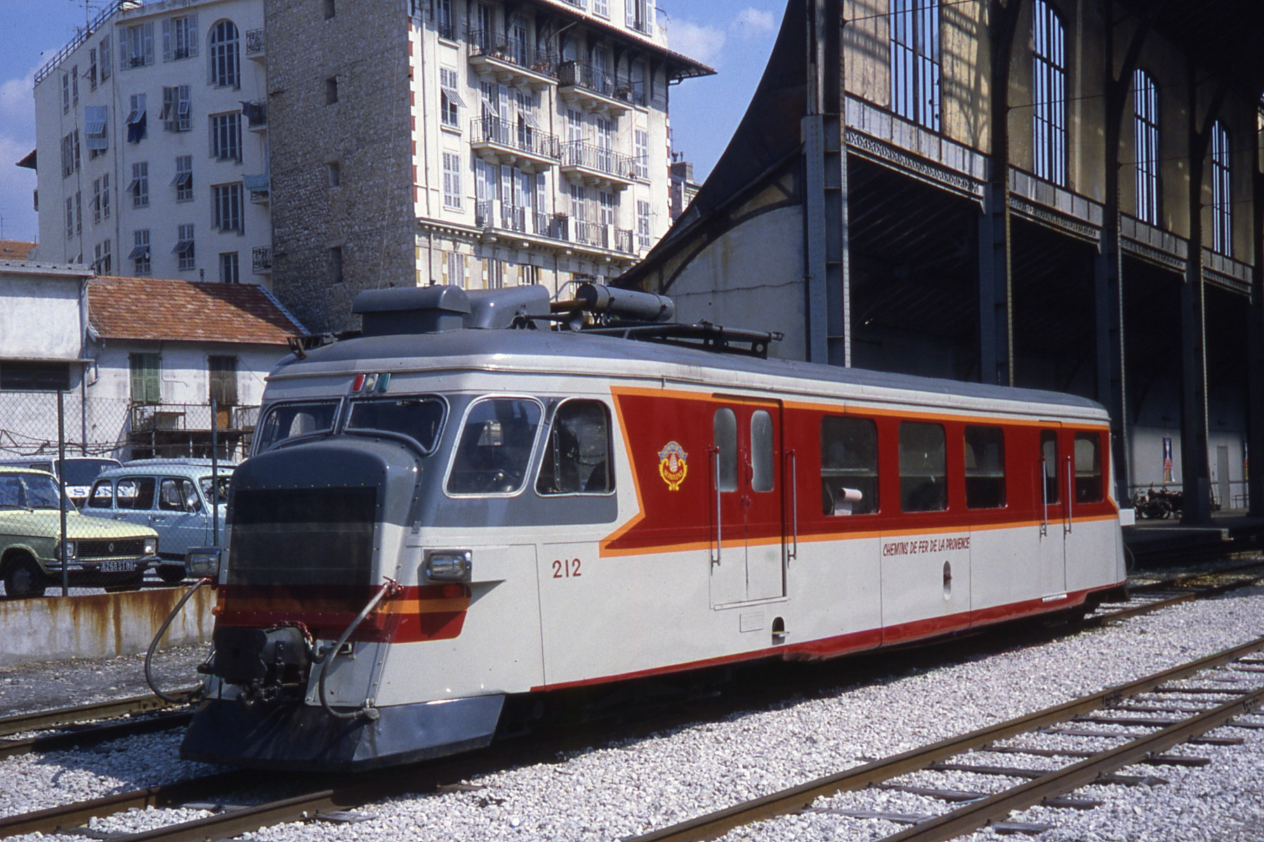
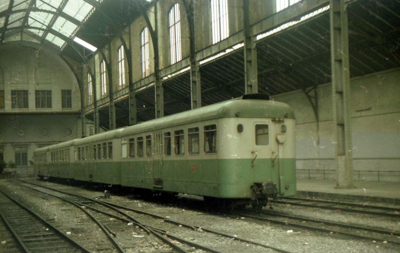
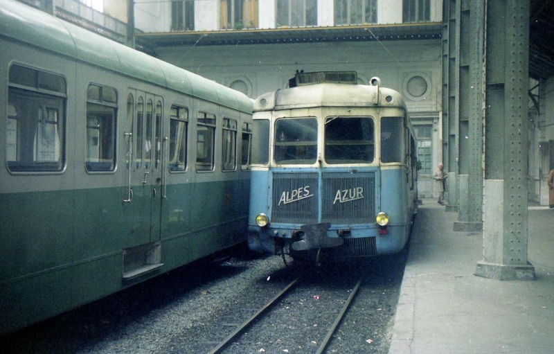
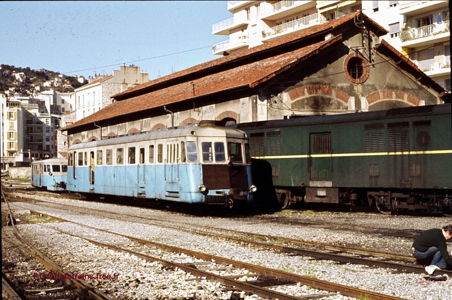
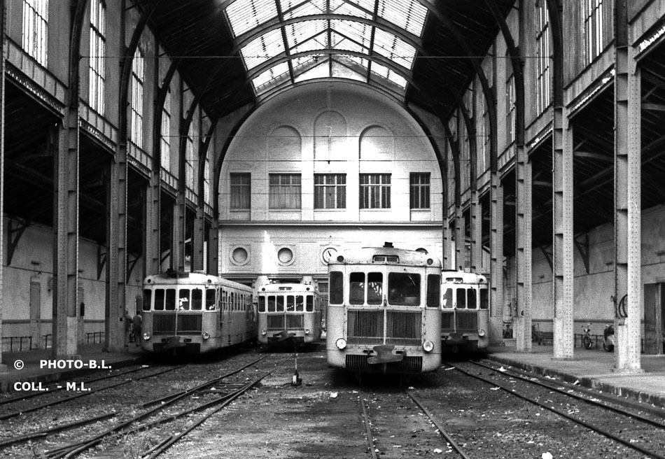
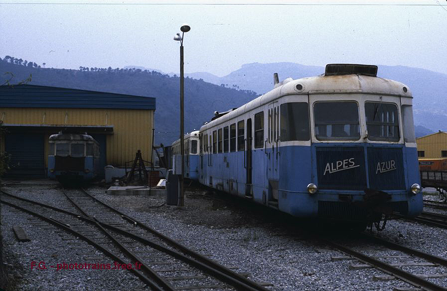
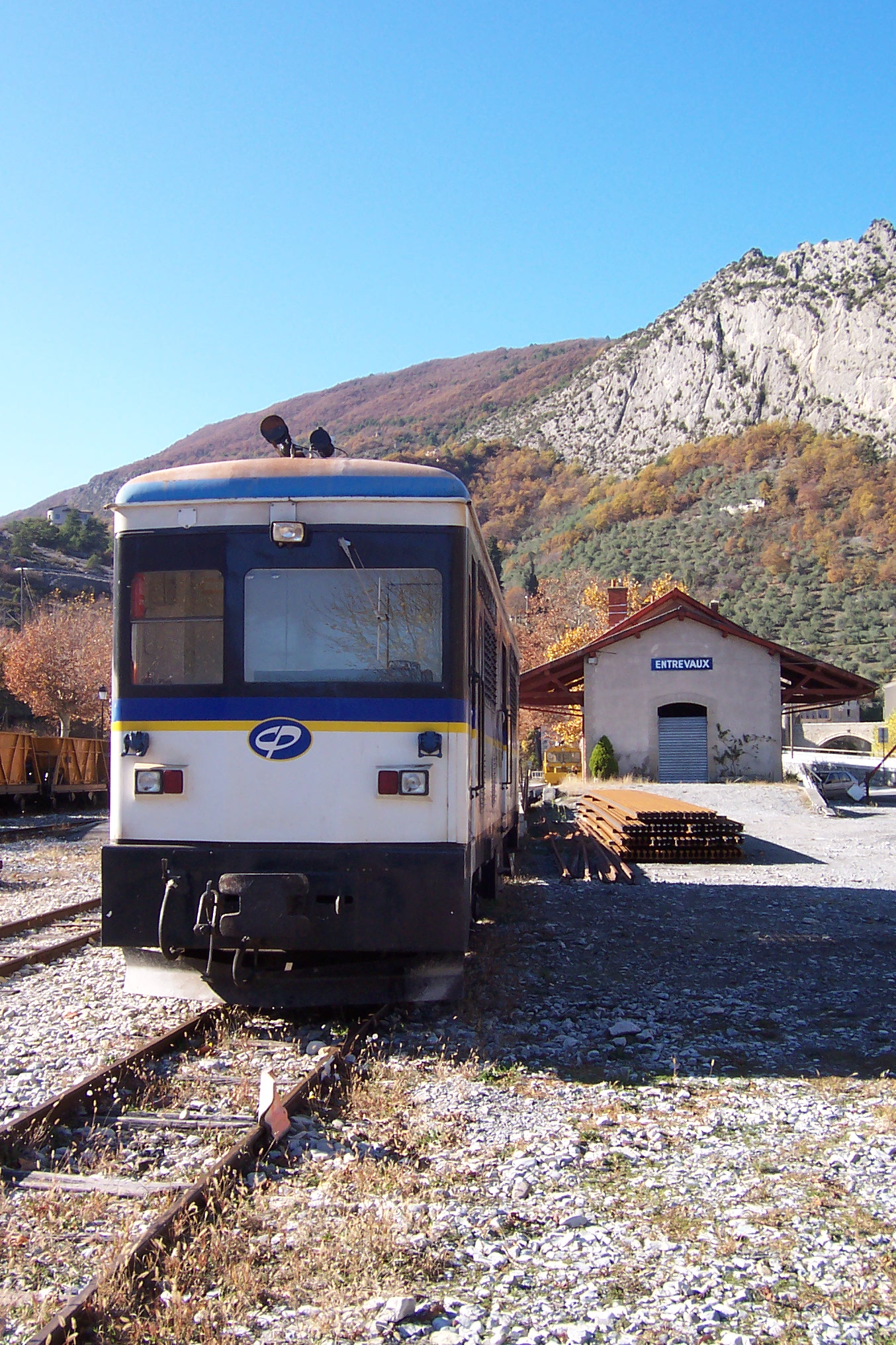
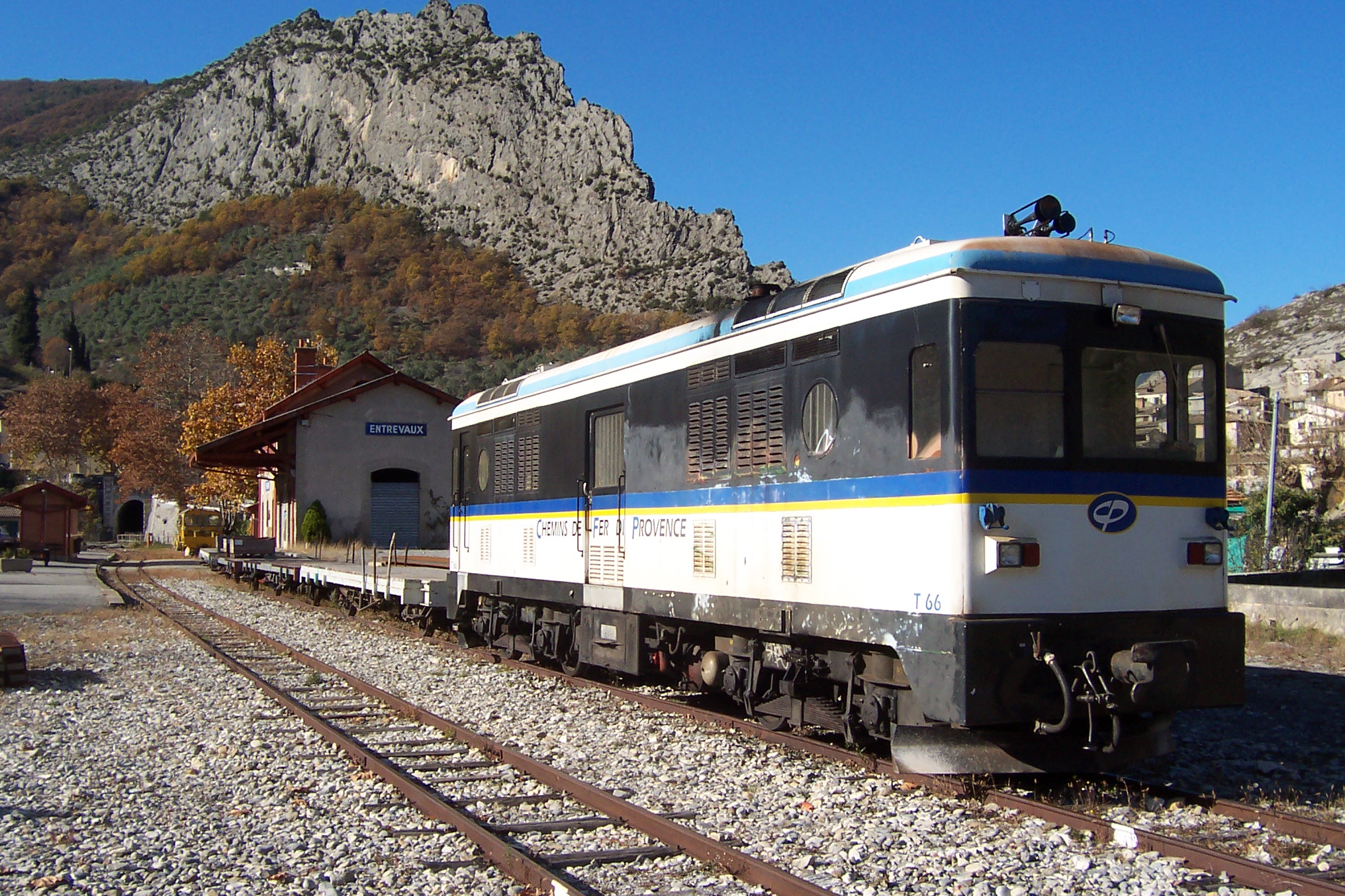
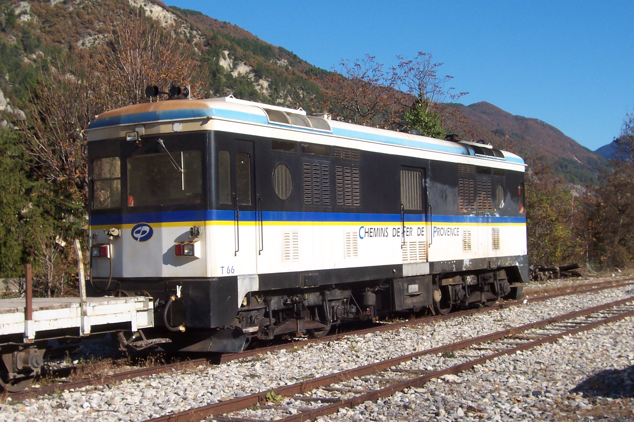
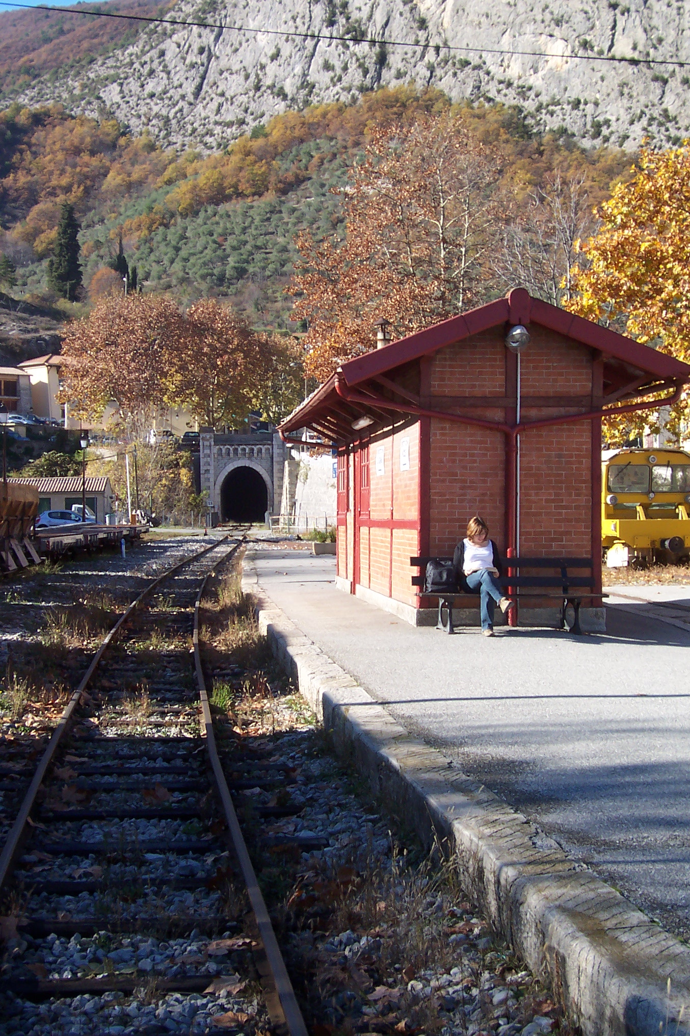
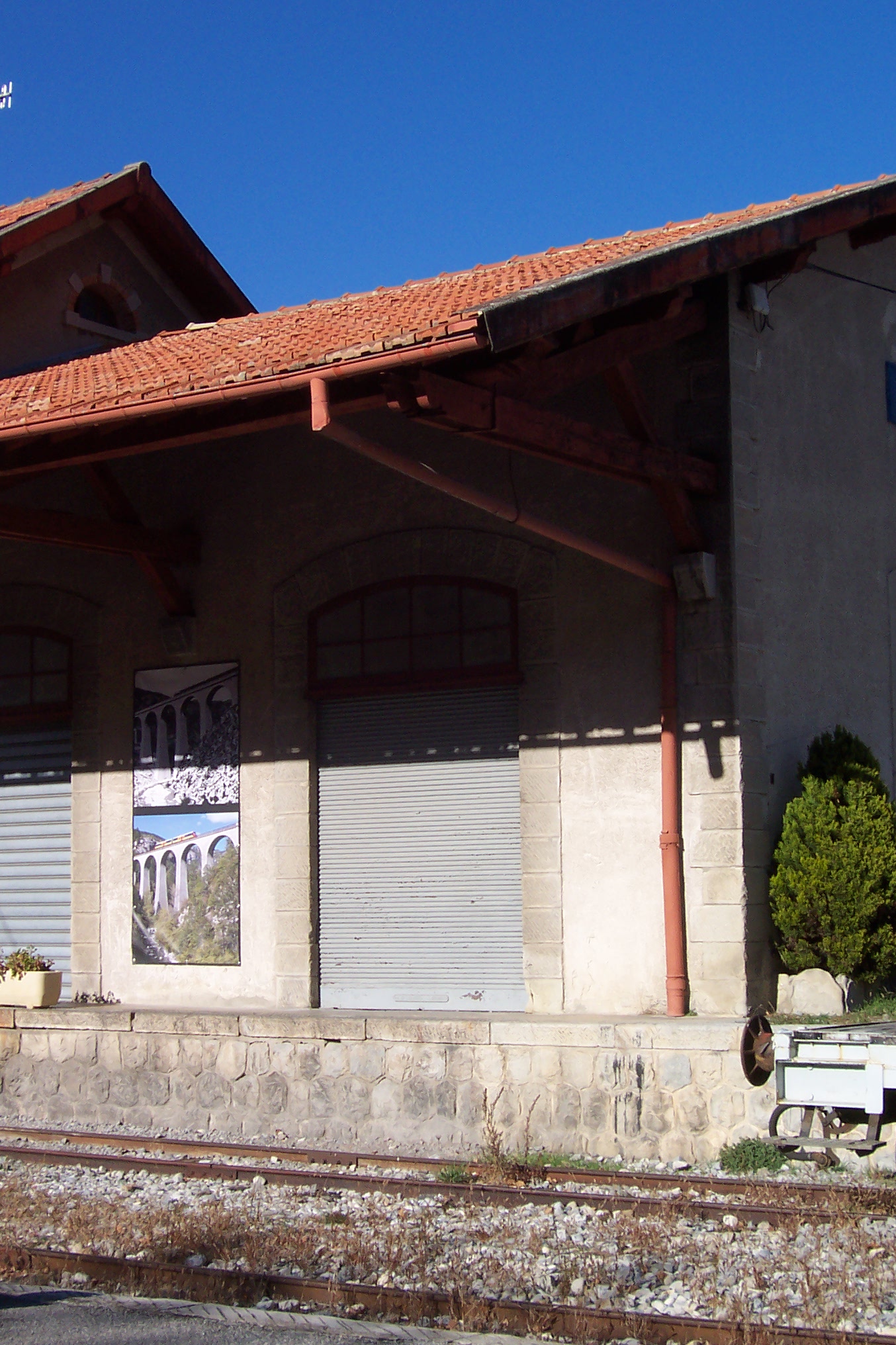
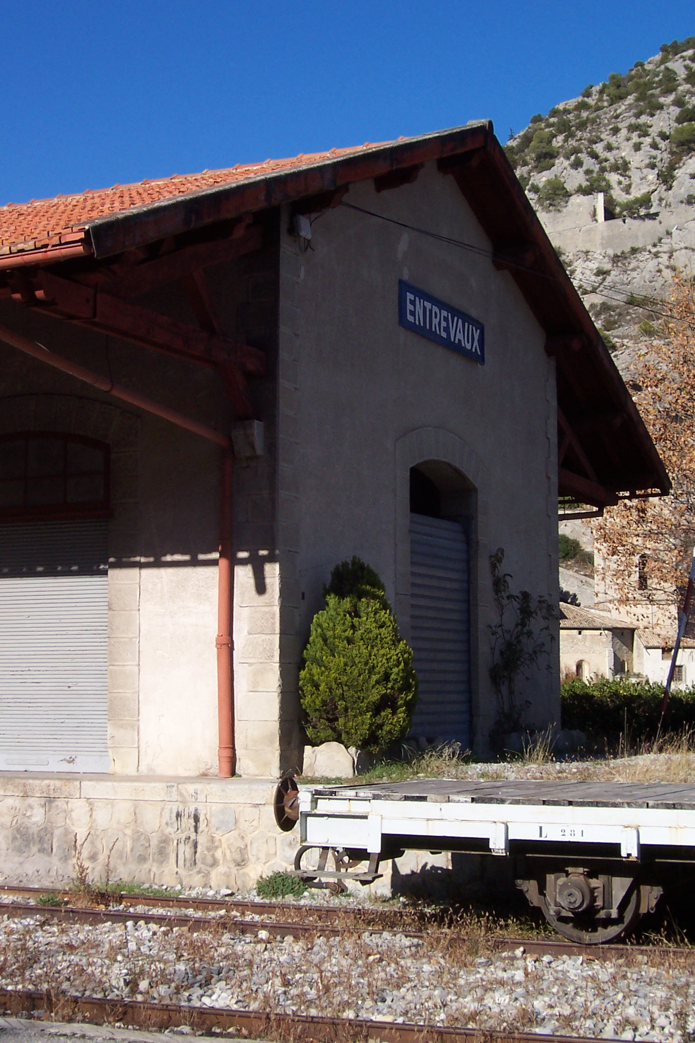
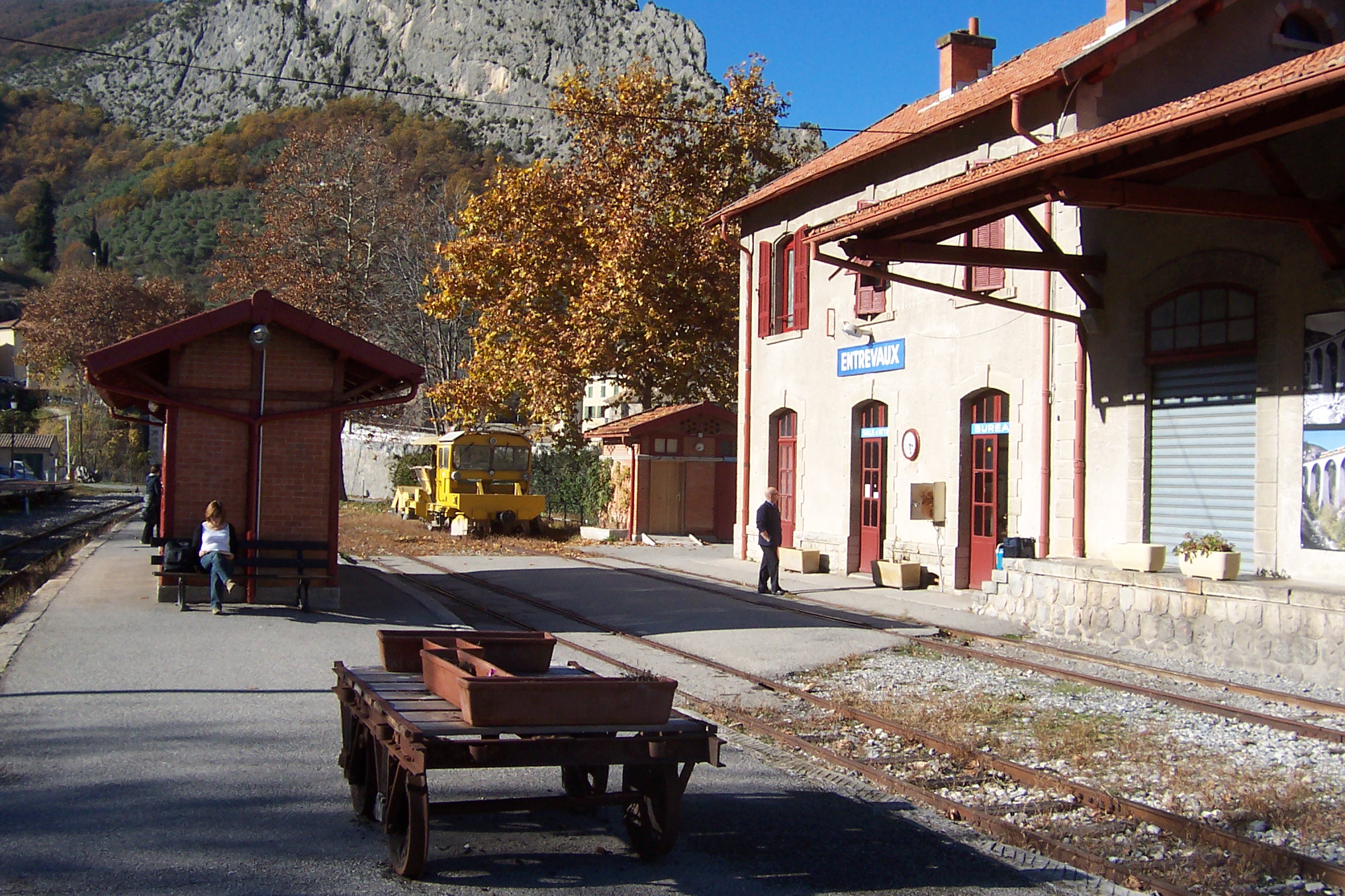
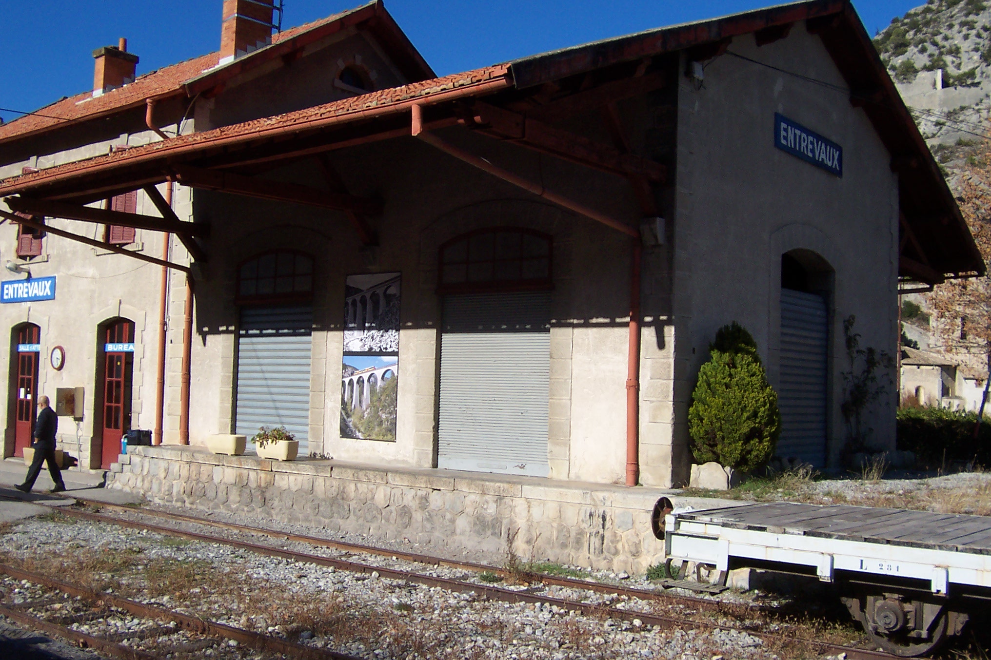
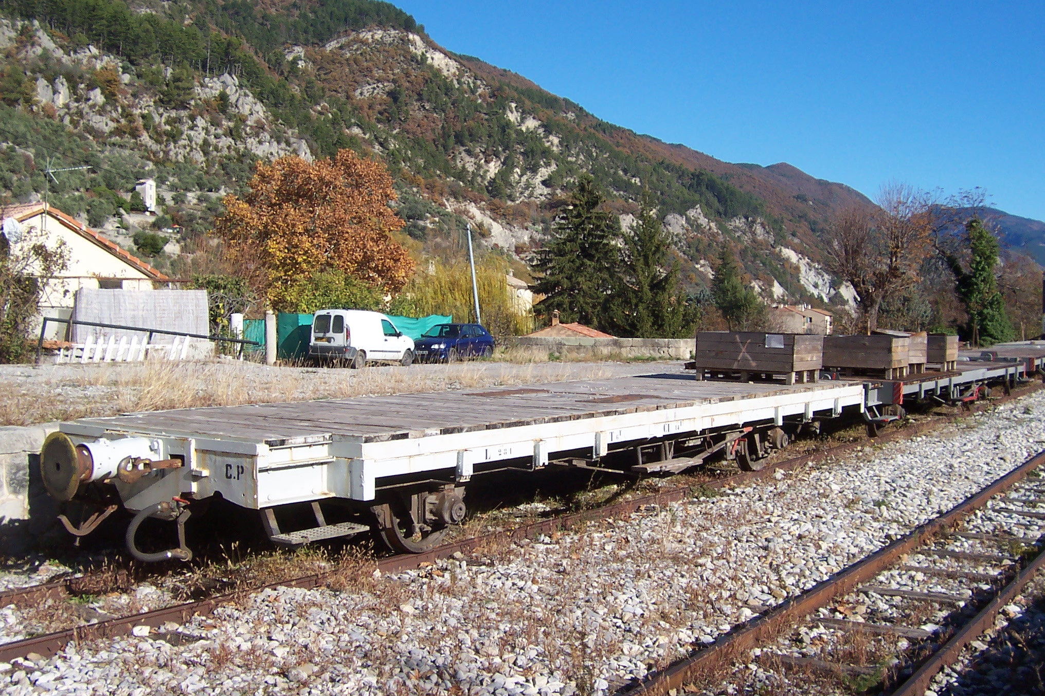
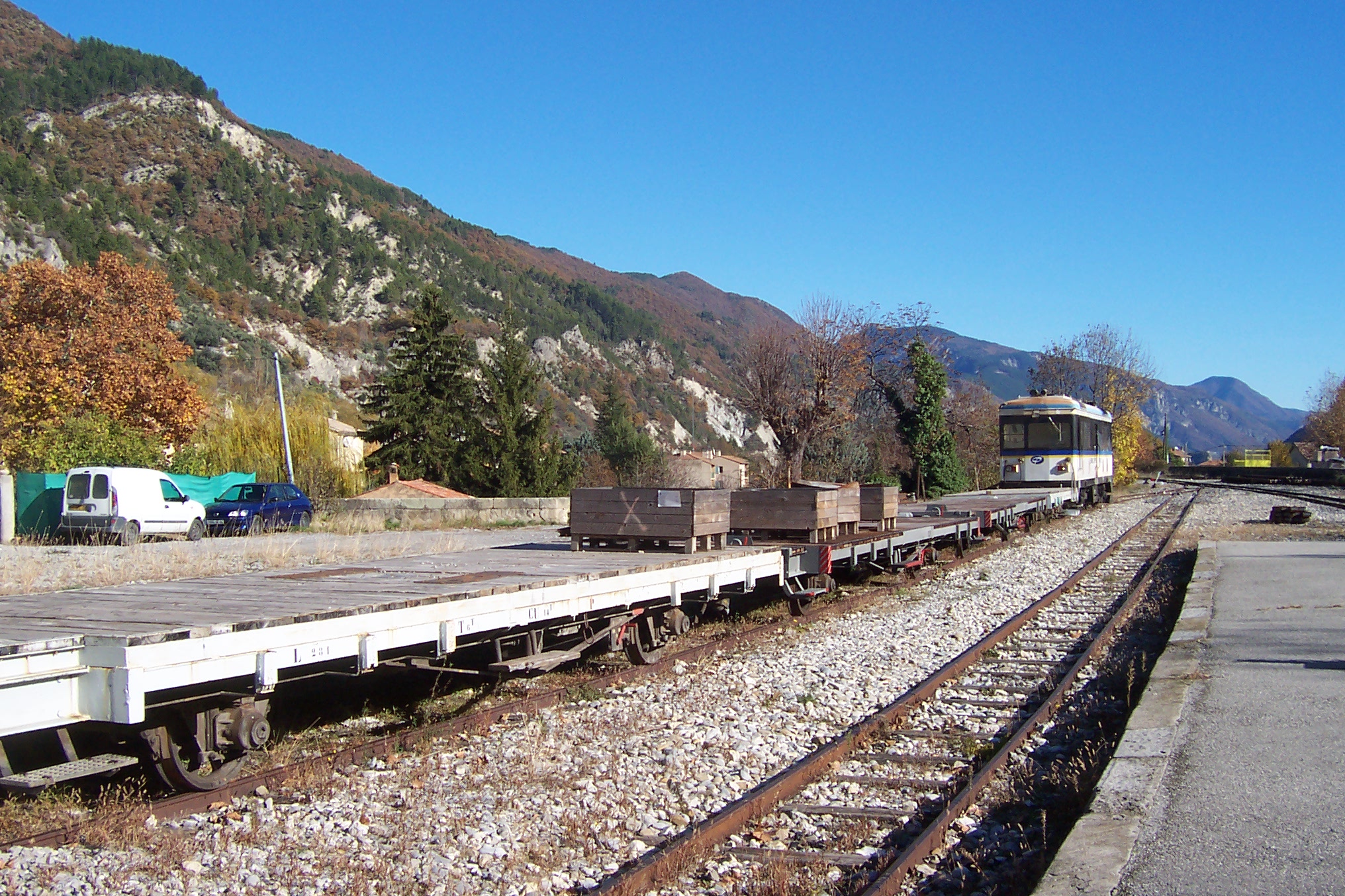
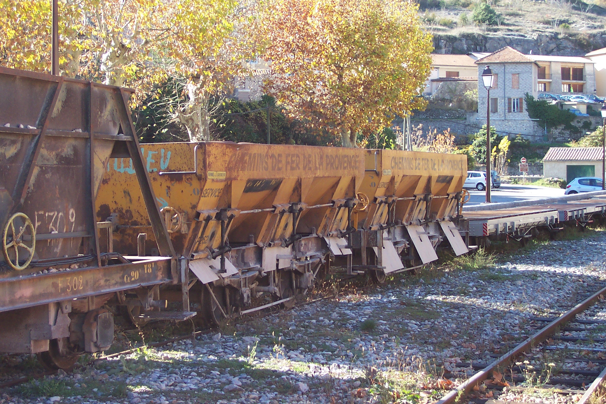
Before we finally leave the site of the two stations, modern and old, here are a few more images of the two stations and rolling stock at the site. The first image is the only one I have found which shows a steam locomotive leaving the old Gare du Sud.More photographs can be found by following the links in the reference section at the bottom of this post. [1]Les tirages sont datés de Juillet 1983. Le jour exact n’a pas été retrouvé (c) Claude Villetaneuse. [14]1984 Autorail Billard en gare de Nice Chemins de fer de Provence.
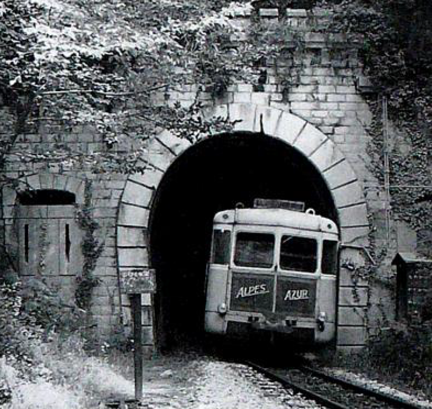
Some amazing photos can be found on various french forums. The next four are from Les Trains de l’Histoire [2] and a thread which focusses on diesel motive power on the Nice-Digne Line.
Taken in 1971/72 (c) Locky on Forum: Les Trains de l’Histoire. [15]
Taken in 1971/72 (c) Locky on Forum: Les Trains de l’Histoire. [15]
Renault autorail at La Gare du Sud (c) Gerard, Forum: Les Trains de l’Histoire [5]
Renault autorails in La Gare du Sud (c) Michel/57 Forum: Les Trains de l’Histoire. [7]
Further photographs can be found on a variety of websites.[3]
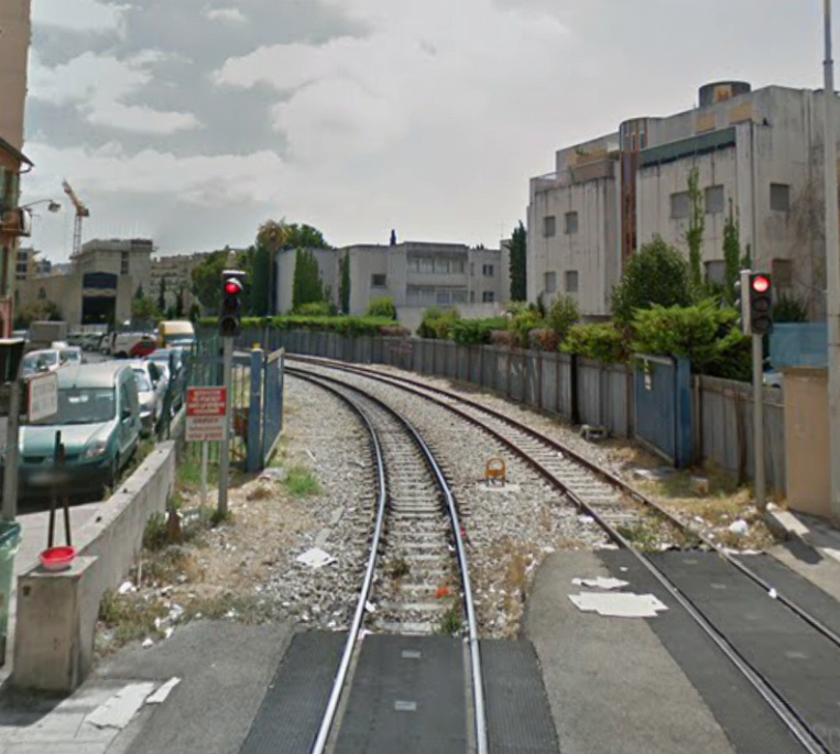
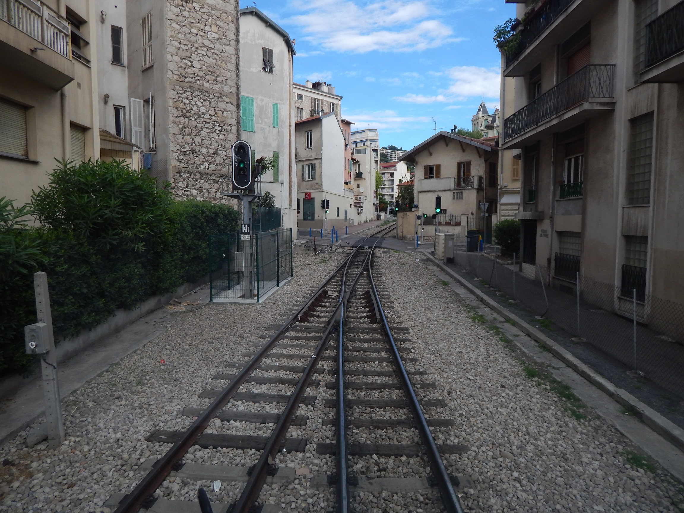
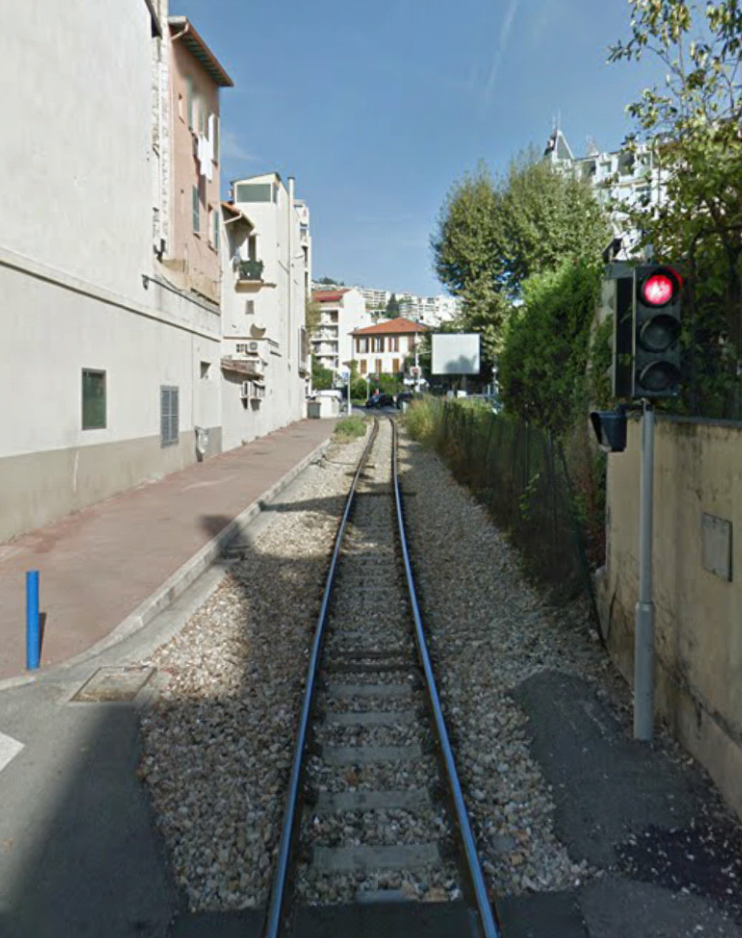
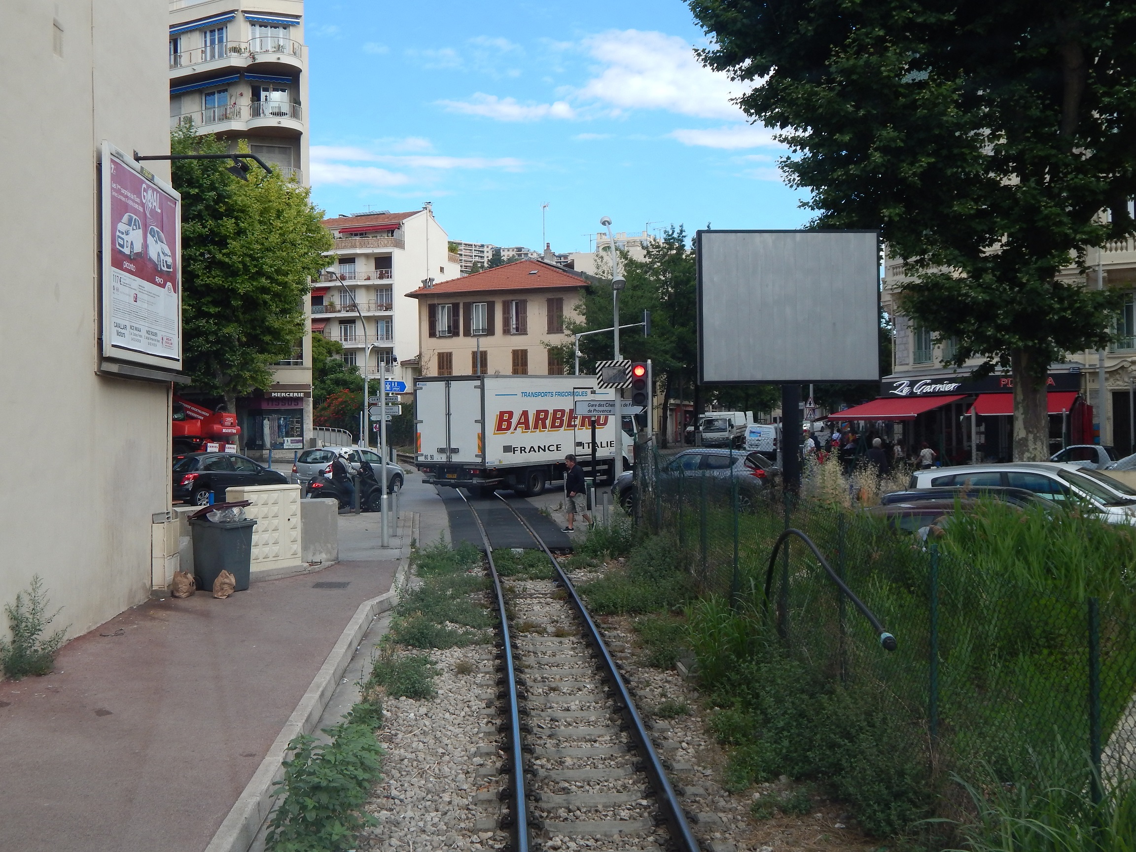
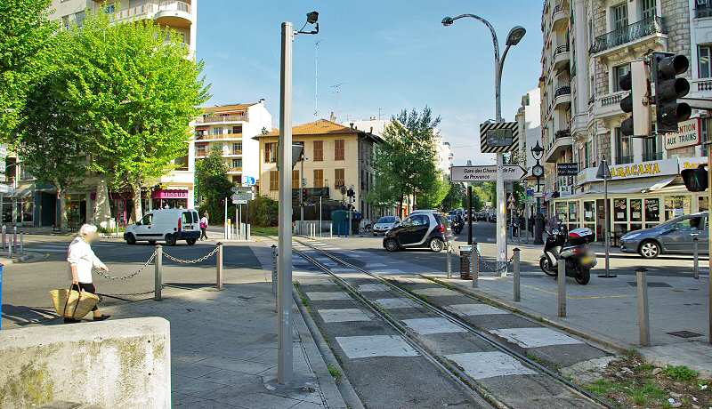
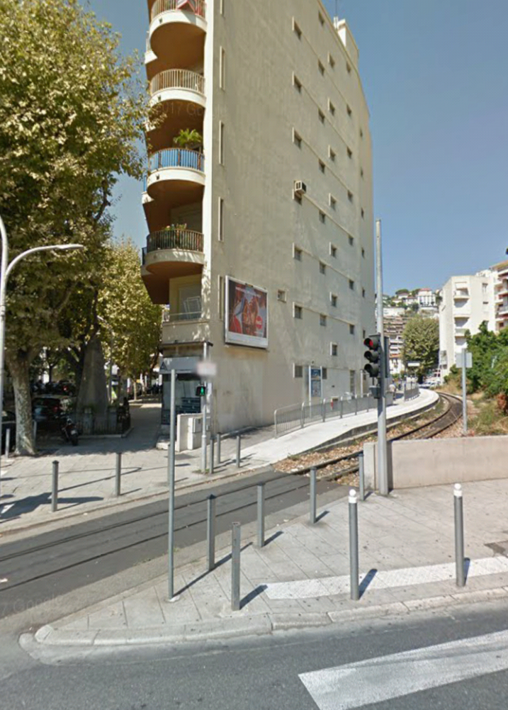
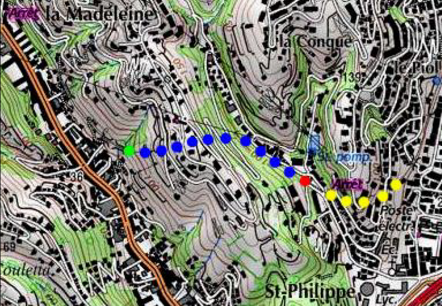
After leaving the old station, trains remained within the station site for some distance. Rue Alfred Binet did not cross the old station site in those days. Trains then had at grade crossings at Rue Dabray, Rue Gutenburg and the junction of Boulevard Joseph Garnier and Boulevard Gambetta. The first small stop on the line was immediately after the road junction.Looking back towards the station from Rue Dabray.Looking ahead from Rue Dabray across Rue Gutenburg. [4]Looking forward from Rue Gutenberg towards the Arrest Gambetta beyond the next road junction.Looking forward to the road Junction at Gambetta [4]The road junction, Google Streetview.
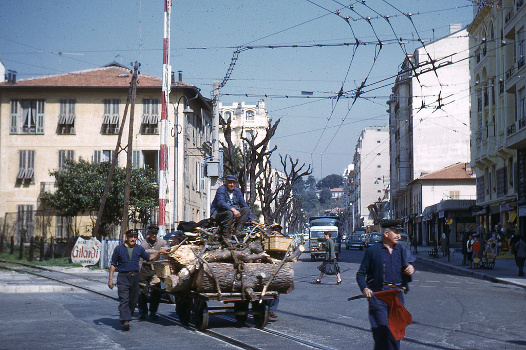
In gentler times – with the red flag to alert traffic! [6]The Arret at Gambetta.Looking forward from the Arret Gambetta.[4]
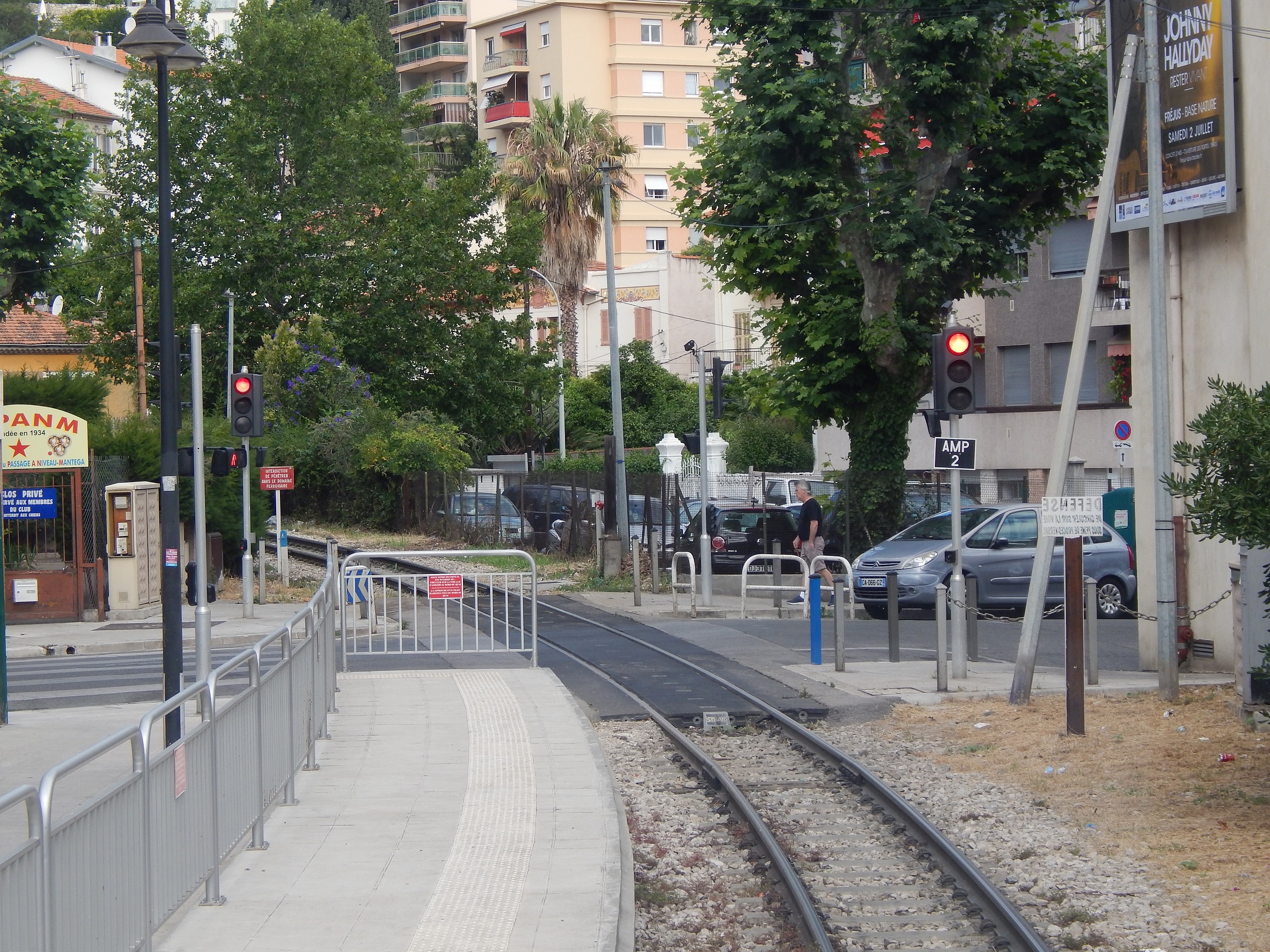
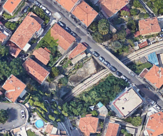
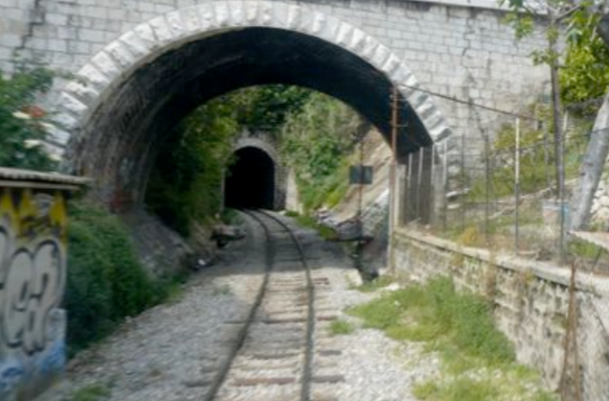
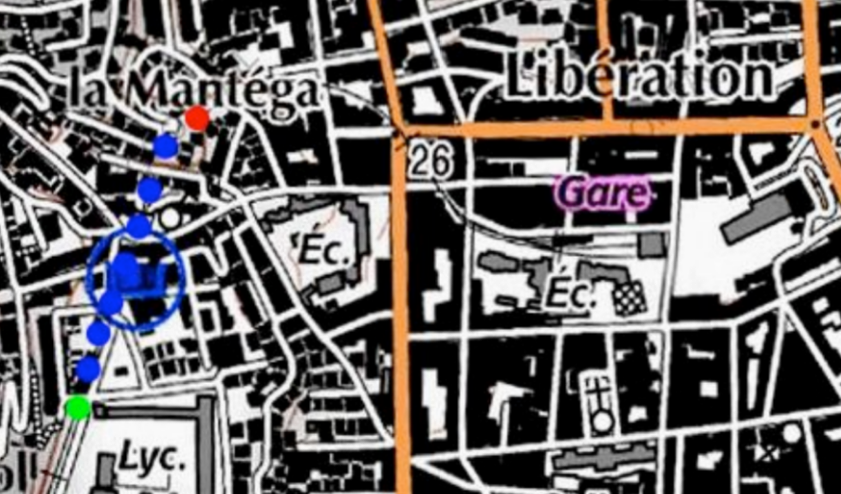
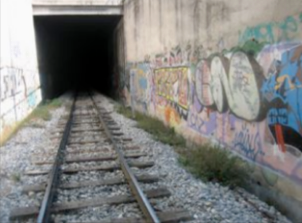
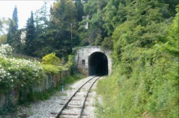
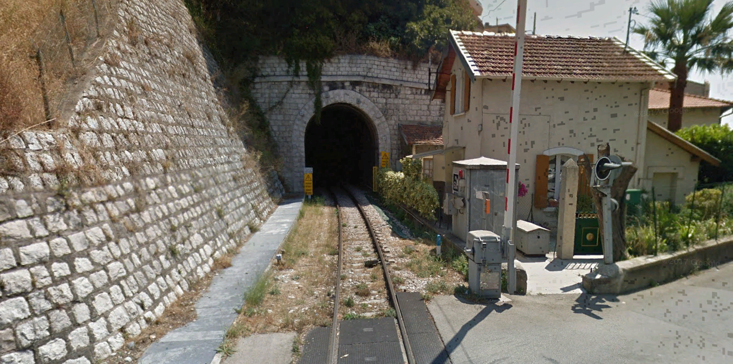
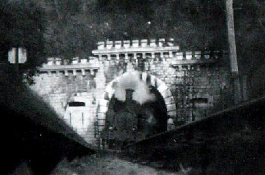
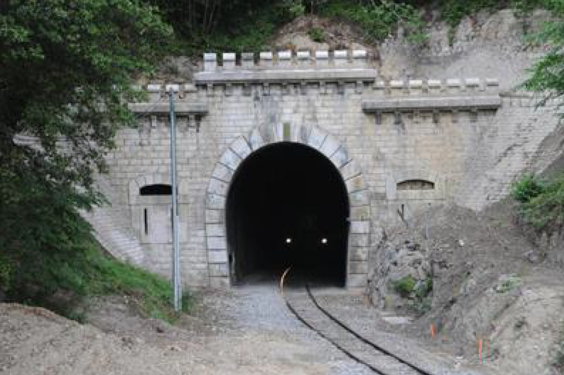
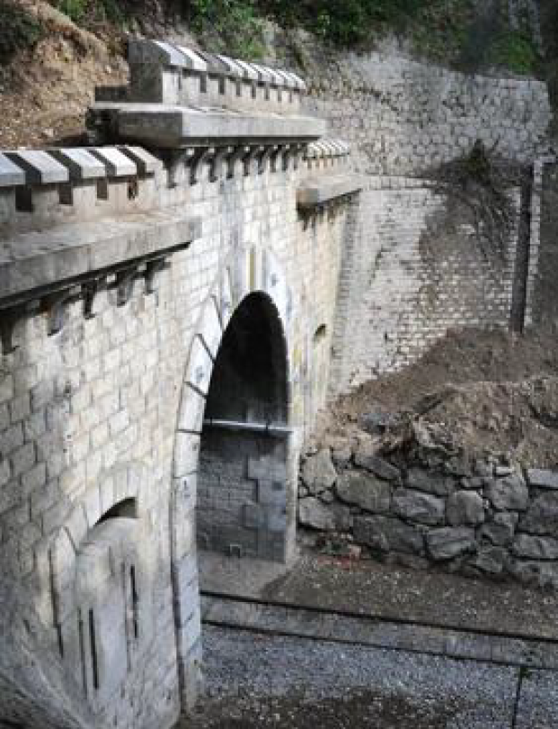
Just beyond the small Station called Gambetta the line curved round under Boulevard Mantega Righi and then entered the tunnel at La Mantega – the tunnel Piol Mantéga.The tunnel was 350 metres long. The current Piol Mantéga Tunnel is the result of the joining of two older tunnels by a modern one of 174 metres in length. The two older tunnels were La Mantega Tunnel (88 metres long) closest to La Gare du Sud, and Piol Tunnel (78 metres long).
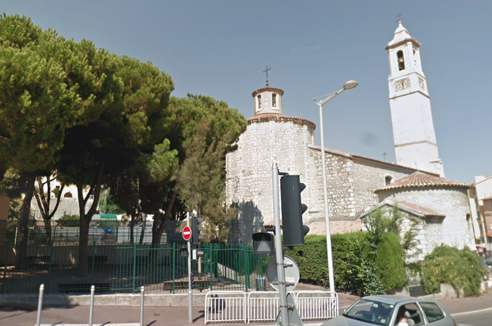
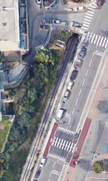
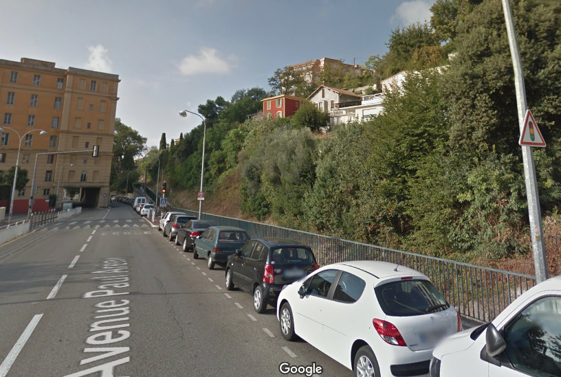
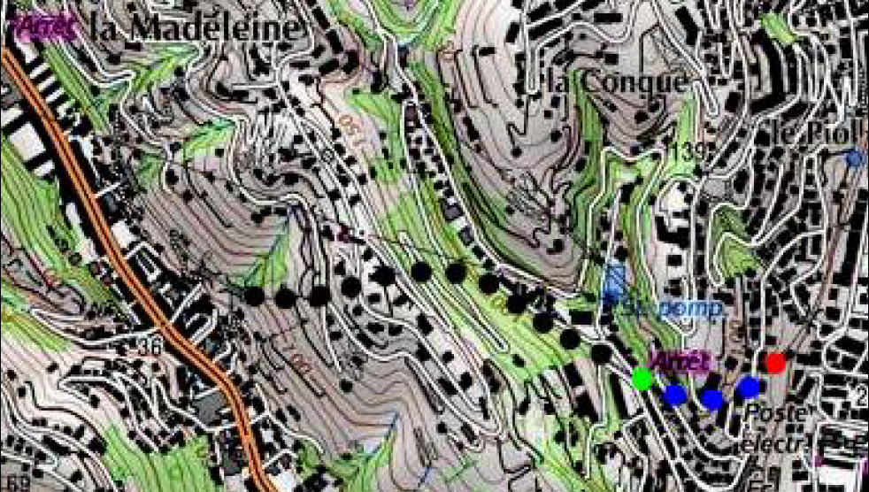
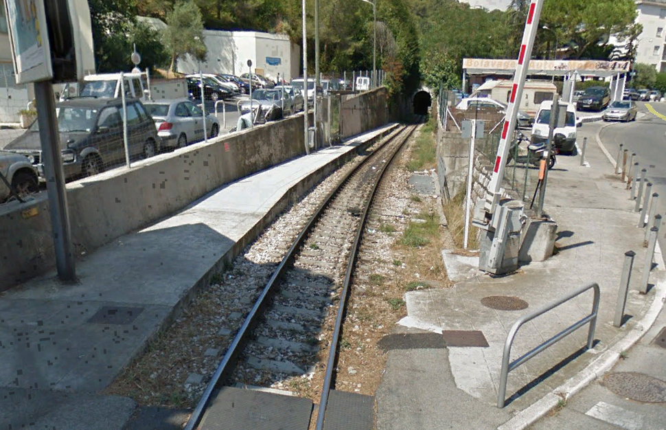
In addition, the entrance to the Piol tunnel was extended by a dozen meters towards Saint-Philippe in concrete. [8]The images below are two views of the cutting between La Mantéga and Piol tunnels close to Saint Paul’s Church. The North portal of Piol Tunnel is visible as well as an aqueduct which carries a small stream over the tunnel. A picture of St. Paul’s Church follows the views of the works. The picture of the church is taken from over the old tunnel portal in the images immediately below. The tunnel runs below the trees to the left of the church.In the photograph above the railway runs to the right of the road (Avenue Paul Arene) towards the next Station, another small halt called Nice-Parc Imperial which can be seen marked Arret on the right side of the map below.The line is shown below in the satellite image from Google Earth
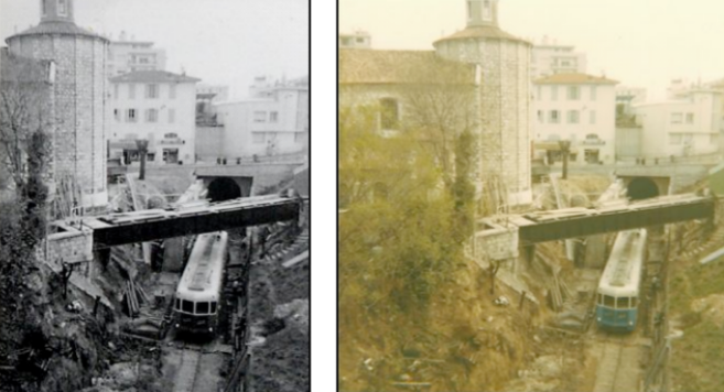
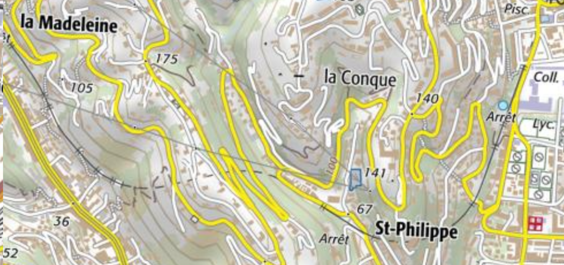
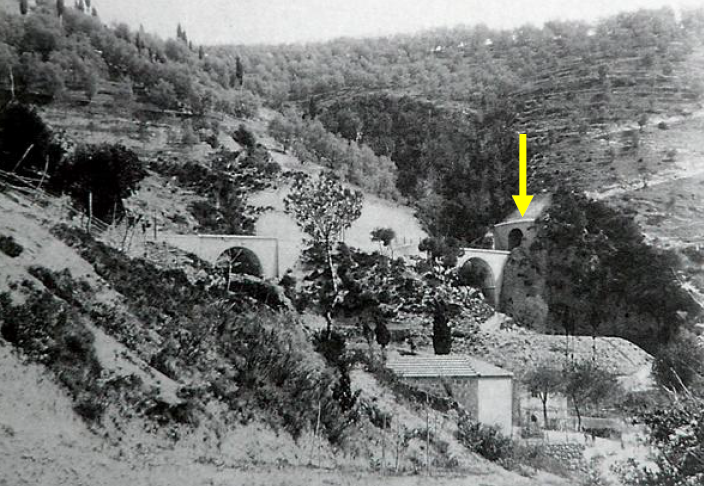
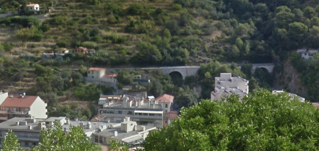
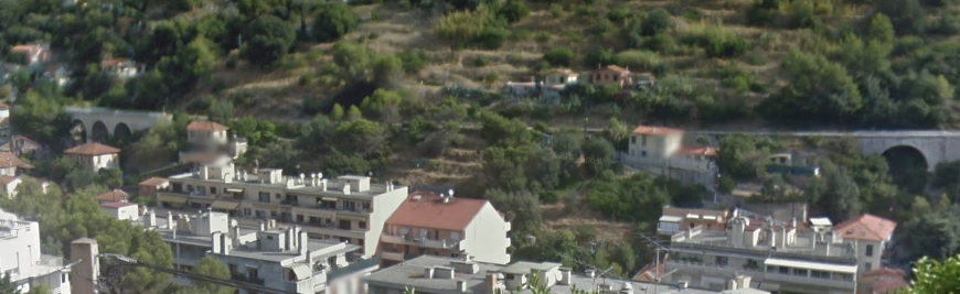
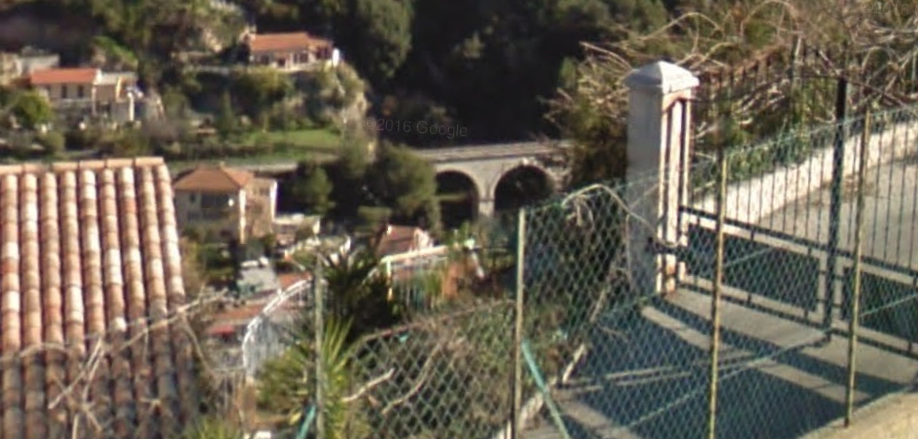
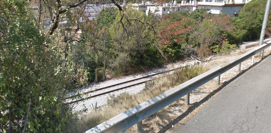
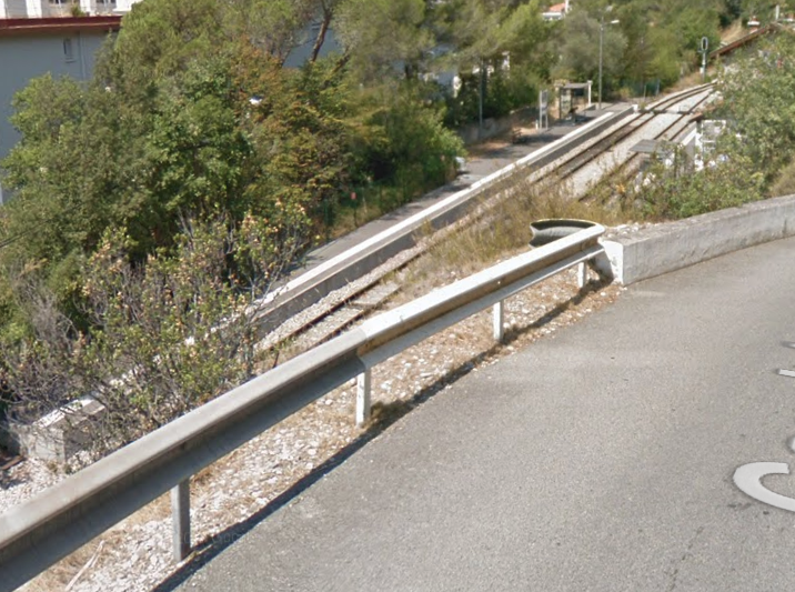
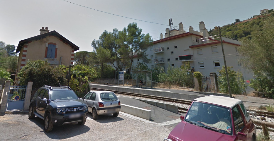
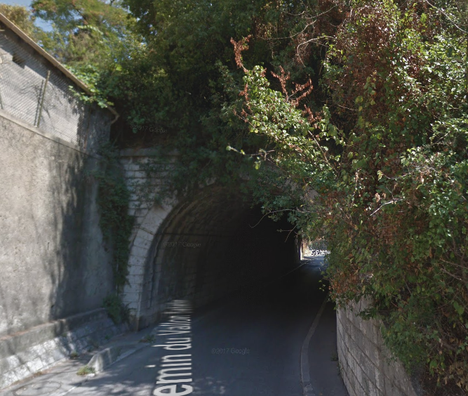
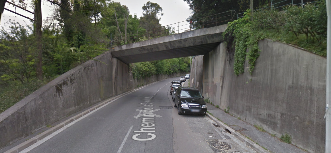
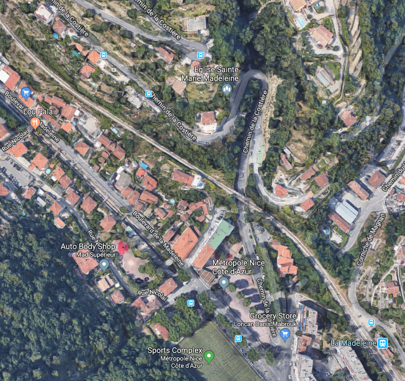
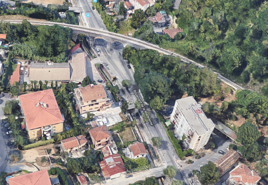
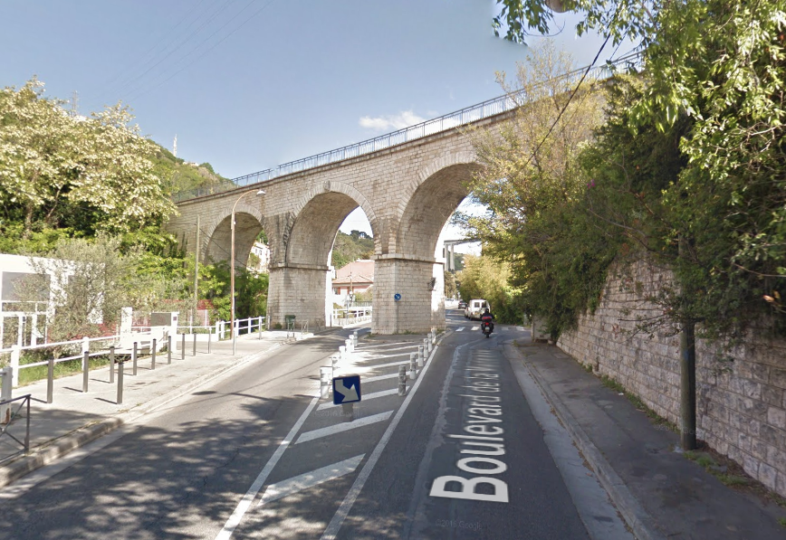
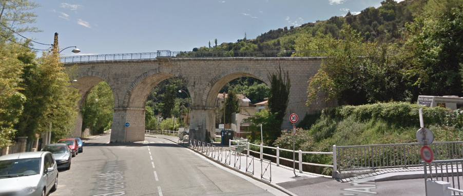
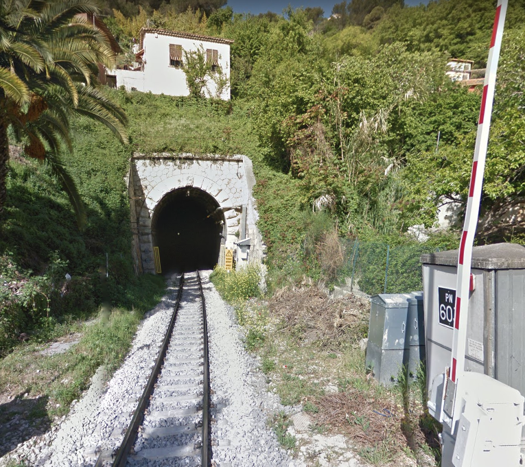
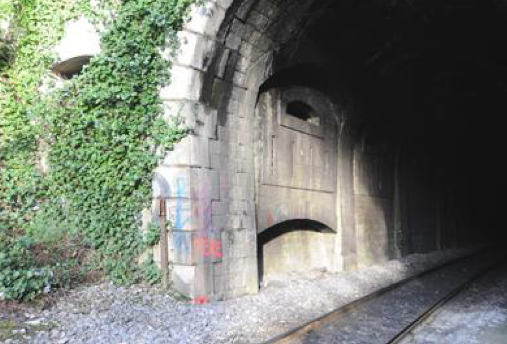
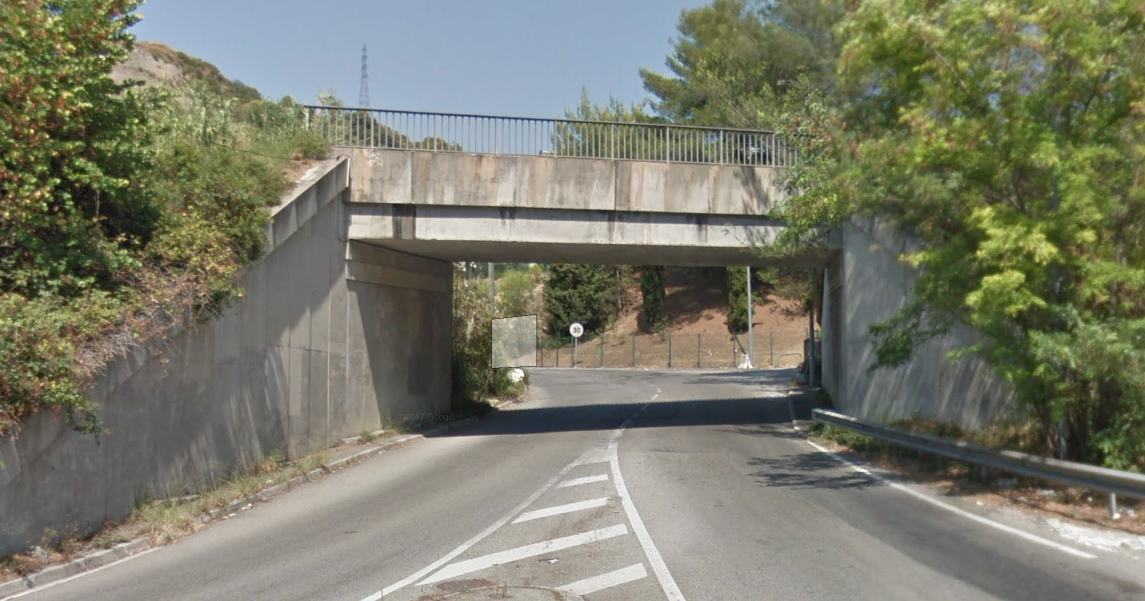
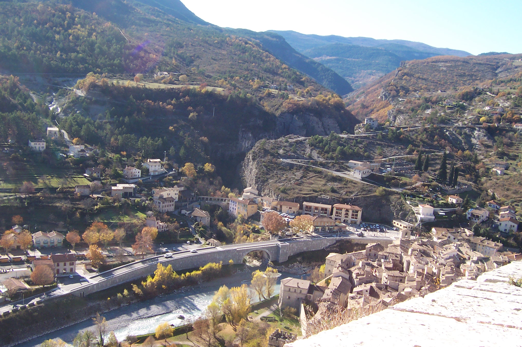
The portal of the next tunnel, that of Saint-Philippe, is just visible in the bottom left of the satellite image. Details of this tunnel can be found on the Inventaire des Tunnels Ferroviaires de France website. [9]Saint-Philippe Tunnel is 255 metres long, in it the line curves round from a south-westerly direction to a north-westerly direction. Leaving the tunnel the line immediately crosses Avenue d’Estienne d’Orves and enters another small halt.The halt of Nice-Saint-Philippe consists of no more than a small concrete platform and immediately precedes the entrance to the next tunnel, that of Saint Pierre.[10] The tunnel was 633 metres long and as the black and white image below shows, trains immediately crossed two bridges after leaving the tunnel. The tunnel portal is marked with a yellow arrow. [10]These last three pictures show the bridges along the hillside and are taken from across the valley. The pictures that follow show the approach to and the location of the next halt – La Madeleine.Chemin du Vallon Sabatier Passes under the railway to the immediate north-west of the station.As does Chemin de la Costière.The line continues North-west from La Madeleine Halt before swinging round to the West and crossing Boulevard de la Madeleine on an elegant viaduct.It then enters another tunnel – le Tunnel de Bellet (also known as le Tunnel de Saint Antoine). The tunnel is 950 metres long and straight enough to be able to see the far end from outside the near portal.The far portal, furthest from La Madeleine is interesting. Because of its proximity to the Italian border, the entrance to the tunnel was been equipped at its construction in 1892 with a fortified defence system. Six years later, in 1898, defences were reinforced by the introduction of a pit 4.2 metres long in front of the portal which in normal times was filled with sand. In times of war, it could either be emptied, or receive explosives to destroy the tunnel entrance if required.
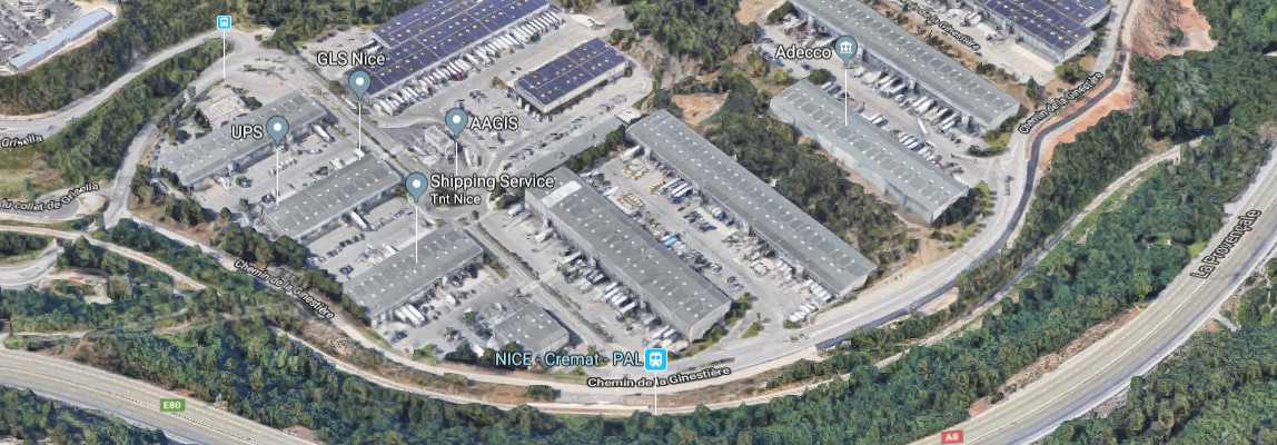
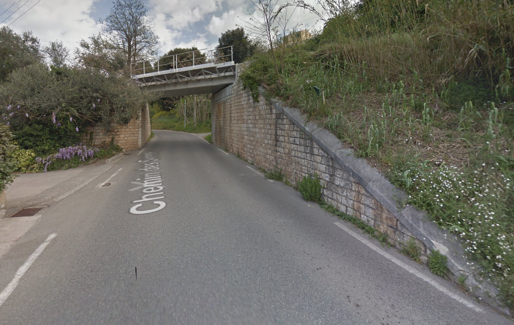
The tunnel portal now sits just under the A8 and can be seen to the right of the satellite image below. The railway continues around the edge of the industrial complex at Cremat and a halt is provided to serve the area – Nice-Cremat-PAL.This was at one time the stop of Zygofolis details of which can be found in the last post in this series. [11] Slip-roads from the A8 now travel under the line using purpose built bridges.
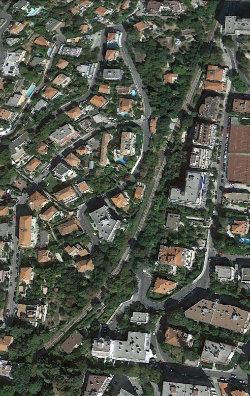
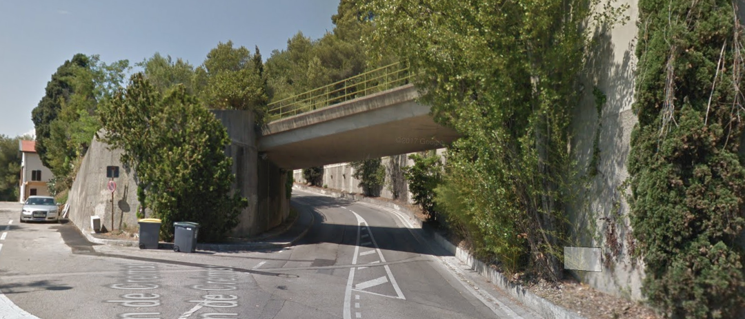
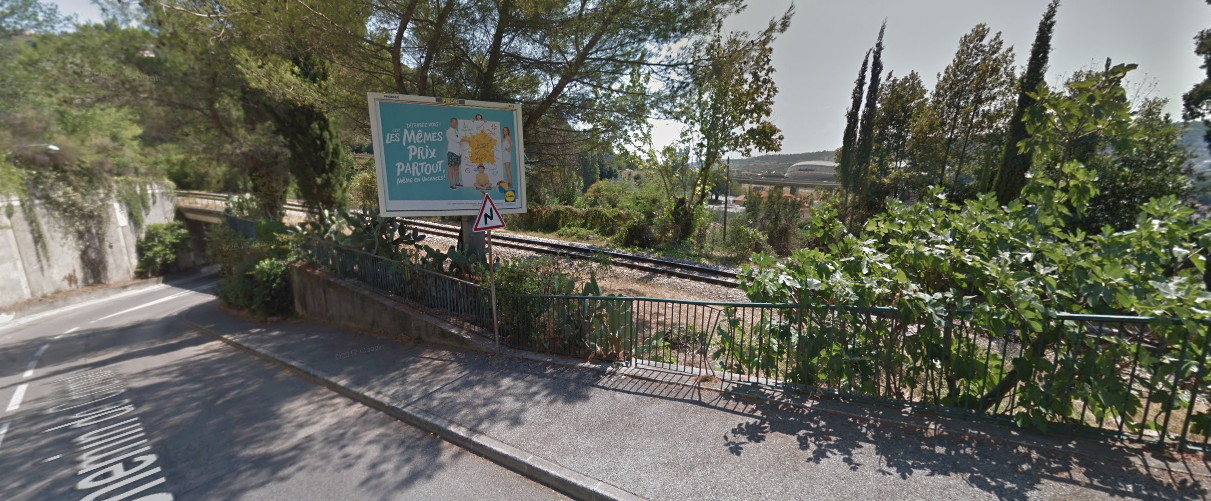
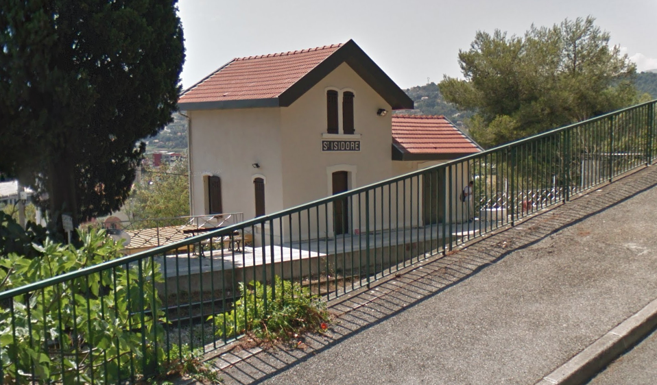
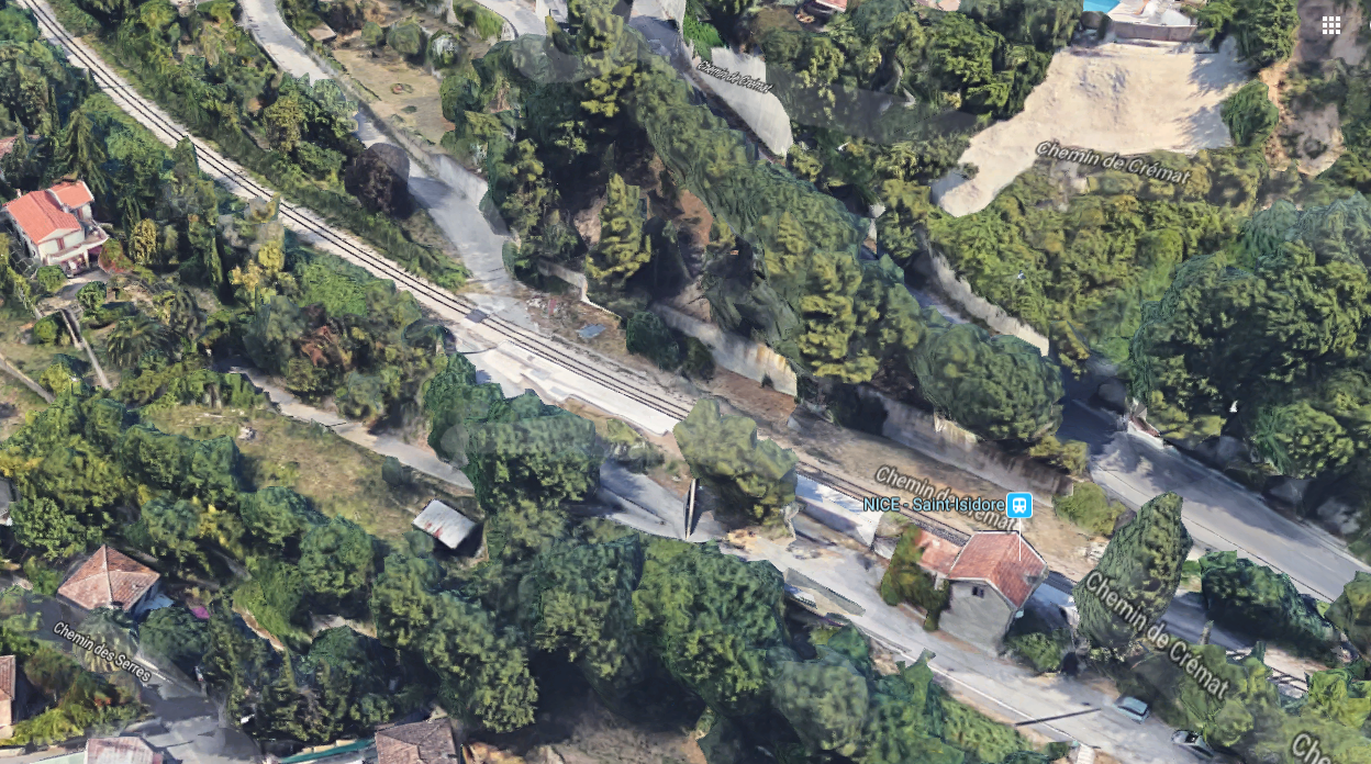
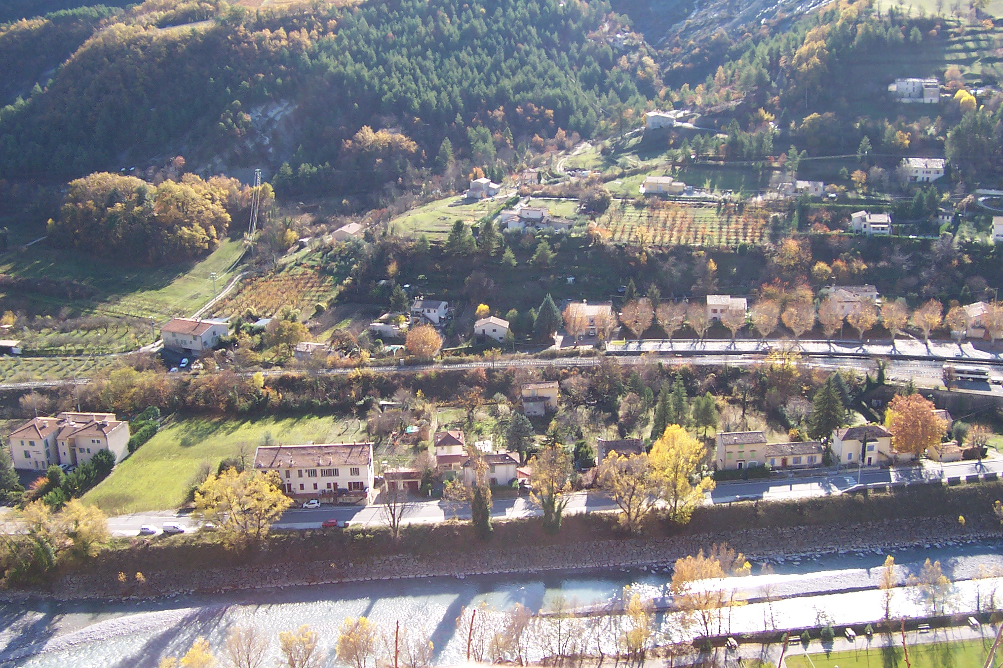
In the picture above, Nice-St. Isidore station building can just be glimpsed to the left of the image. The approach along the line is shown below. The station building can just be glimpsed from the Chemin de Crémat.From St. Isidore, the line continues and turns to a more northerly direction and then switches back towards the North-West and crosses Chemin des Serres and Chemin de la Glacière before entering the complex at Lingostiere.
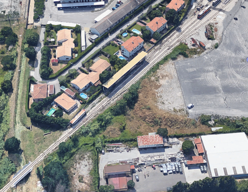
The first image of the depot at Lingostiere has been rotated to show the underpass flood channel at Chemin de la Glacière in the bottom left of the picture. Just to the North-West of this bridge the tracks fan out to serve the depot.The depot at Lingostiere was the main depot on the Nice to Digne Line. The workshops were created in 1975 before that the workshops were in Draguignan despite the closure of the Central Var line in 1949.
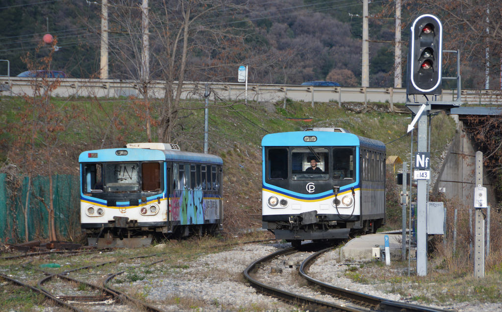
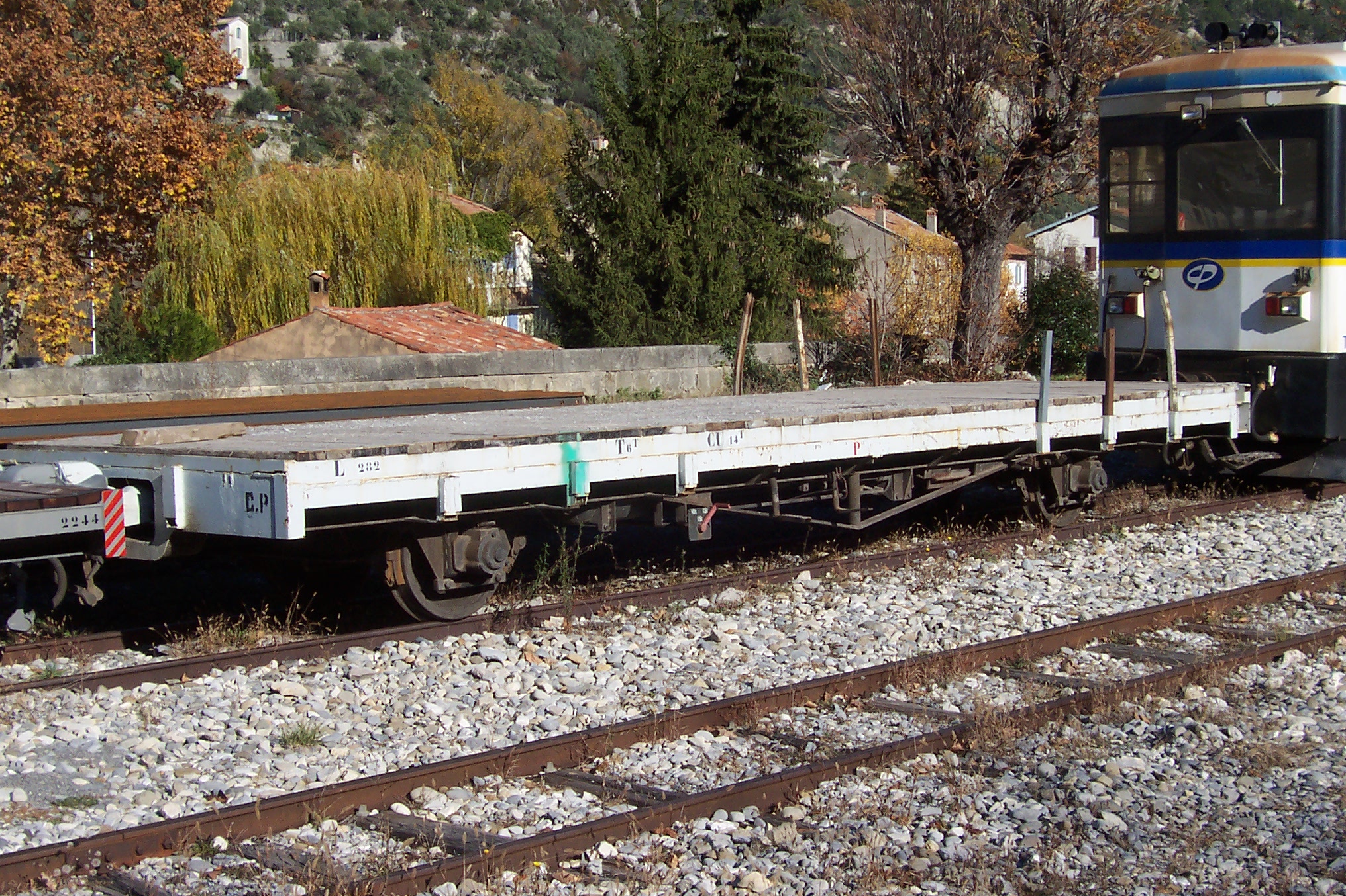
A variety of rolling stock and traction could be observed alongside the line out of Nice towards La Manda.Another photograph from Les Trains de l’Histoire, Sur les Chemins de Fer de Provence (Nice-Digne) shows the depot in 1979. [2]T62 at Lingostière on 14th February 2007. [12]
The following images are from Alain Mionnet. [13]
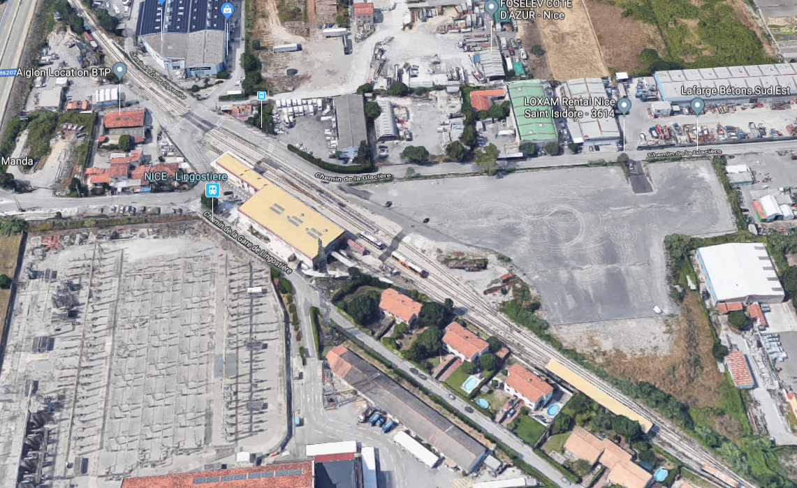
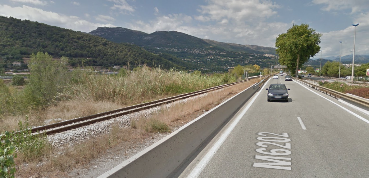
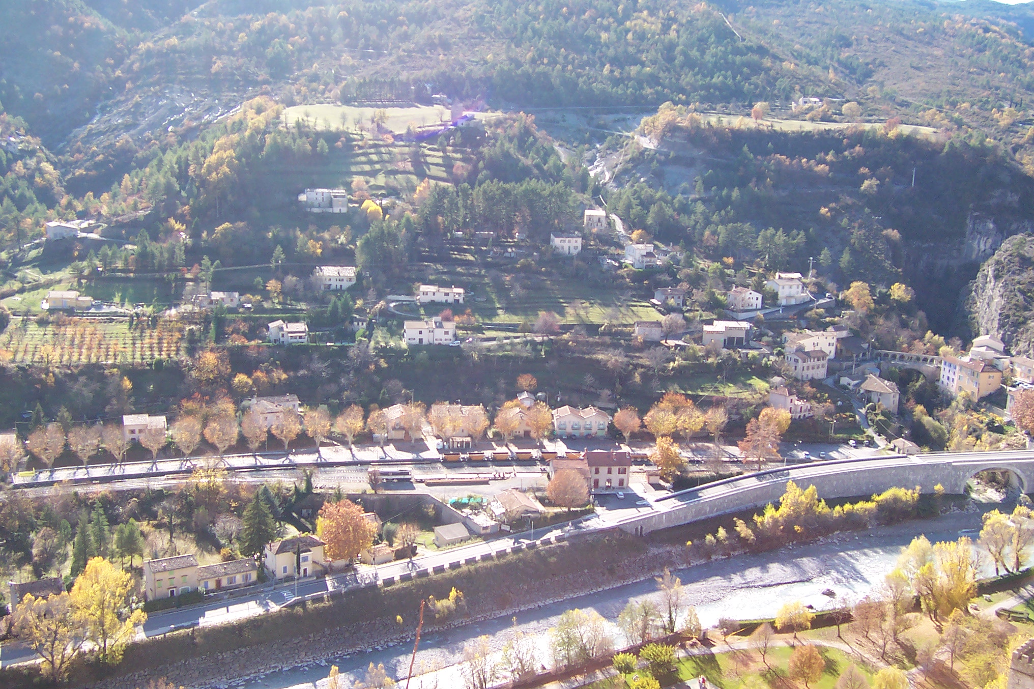
The line leaves Lingostiere and passes under the M6202 dual carriageway before settling in alongside that road. The M6202 and the Chemin de Fer de Provence follow each other for some distance alongside the River Var.
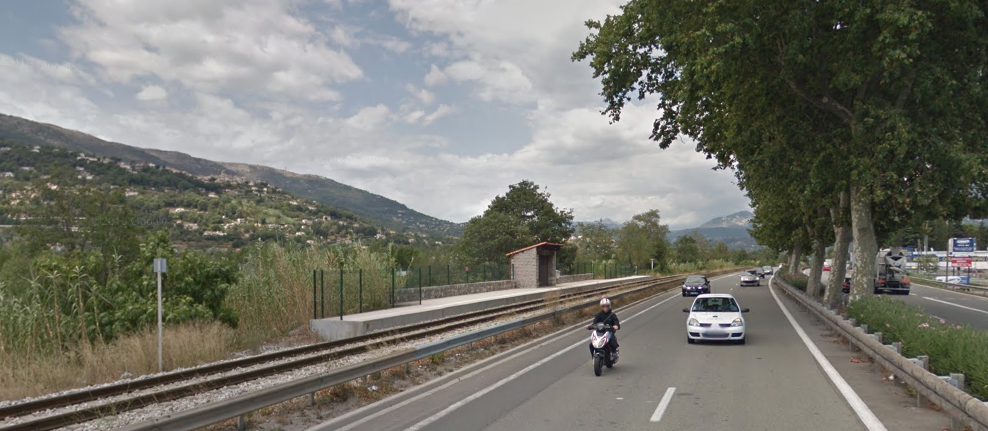
The picture below shows the two running in parallel. The halt visible in the distance is Saint-Sauveur.
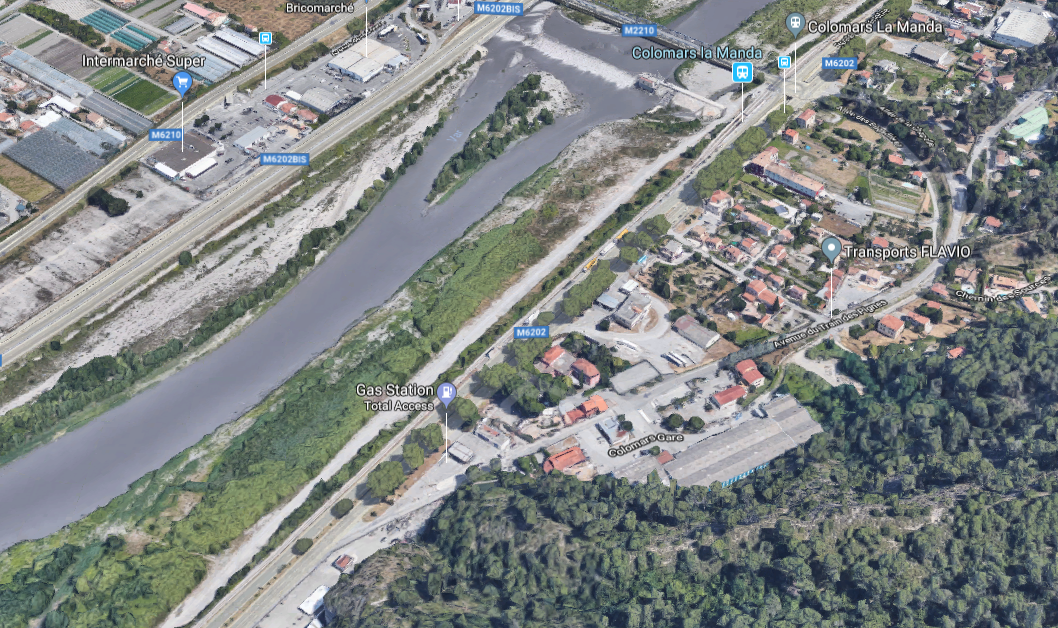
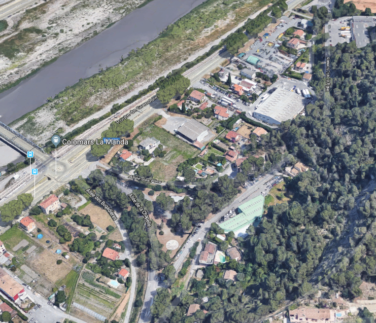
The next halt is Bellet.And the next is Colomars/La Manda. The satellite image below is of great interst to those who are following the original line of the railway. The modern line follows the River side and the M6202, the original line deviated to the East. The wide sweep of the line which branched off the Nice to Digne line can be seen curving round to the La Manda bridge. Even though the railway disappeared in the 1950s, its route is still visible in the layout of the roads at La Manda.A little less obvious because of the trees is the old alignment north of La Manda heading towards Digne-les-Bains. It can still be picked out on the next satellite image below and returns towards the river bank in the top right of the image. If your eyesight is really good you might just be able to make out the name of the road which follows the old line – Avenue du Train des Pignes.
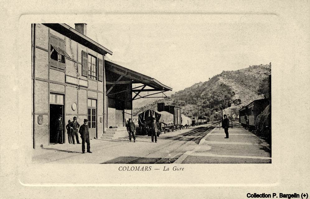
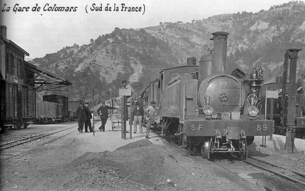
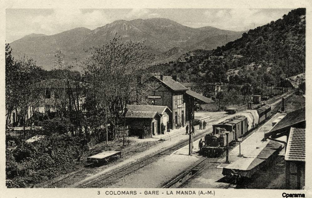
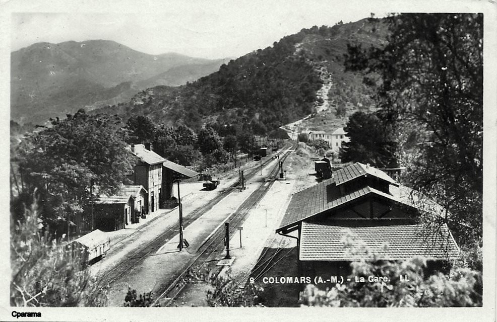
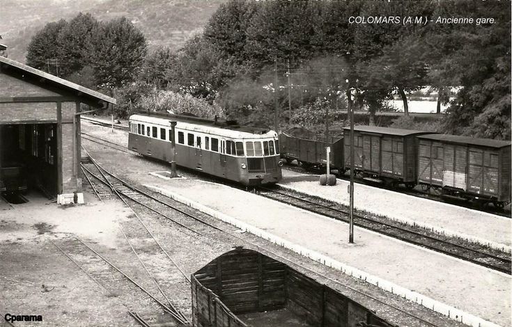
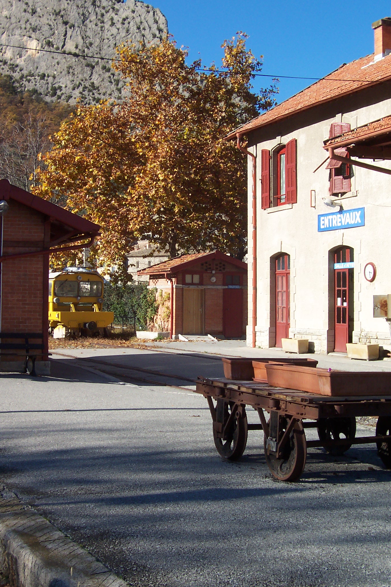
We finish this second part of the journey along the Nice to Digne line by focussing on the station at La Manda which was usually referred to as Colomars in the early life of the line.
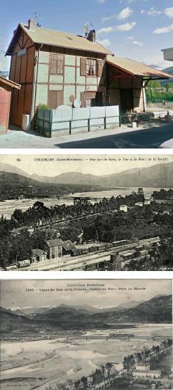
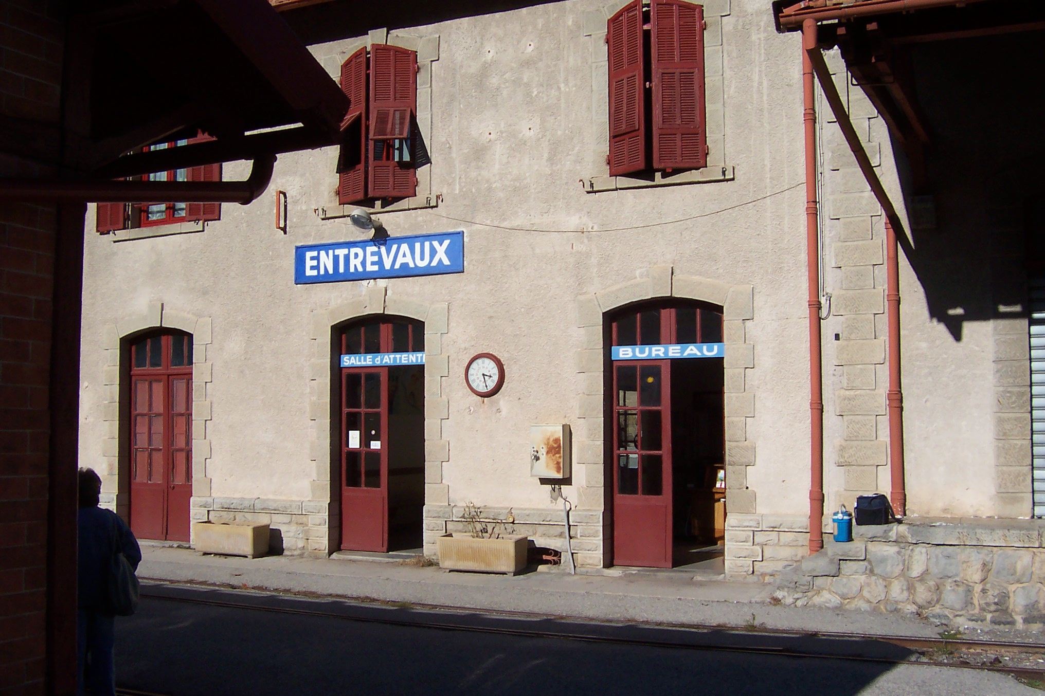
The Ligne de Central Var left the Nice to Digne line at La Manda close to Colomars on the River Var. The station building at Colomars Station remains as evidence of the line. The line branched off the current Digne line just to the north of the hamlet of La Manda.
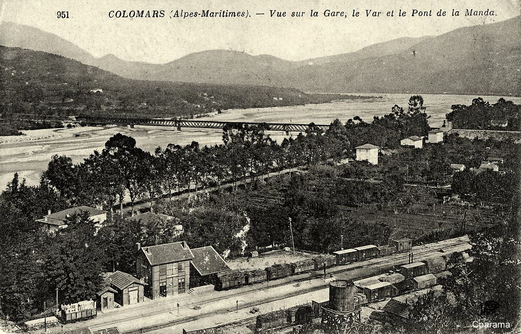
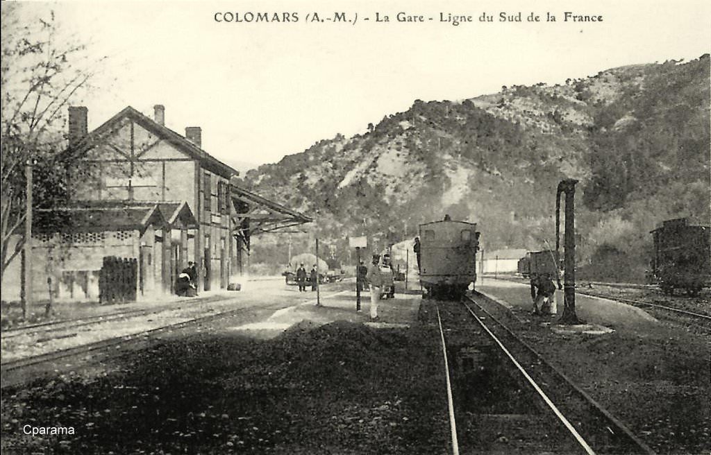
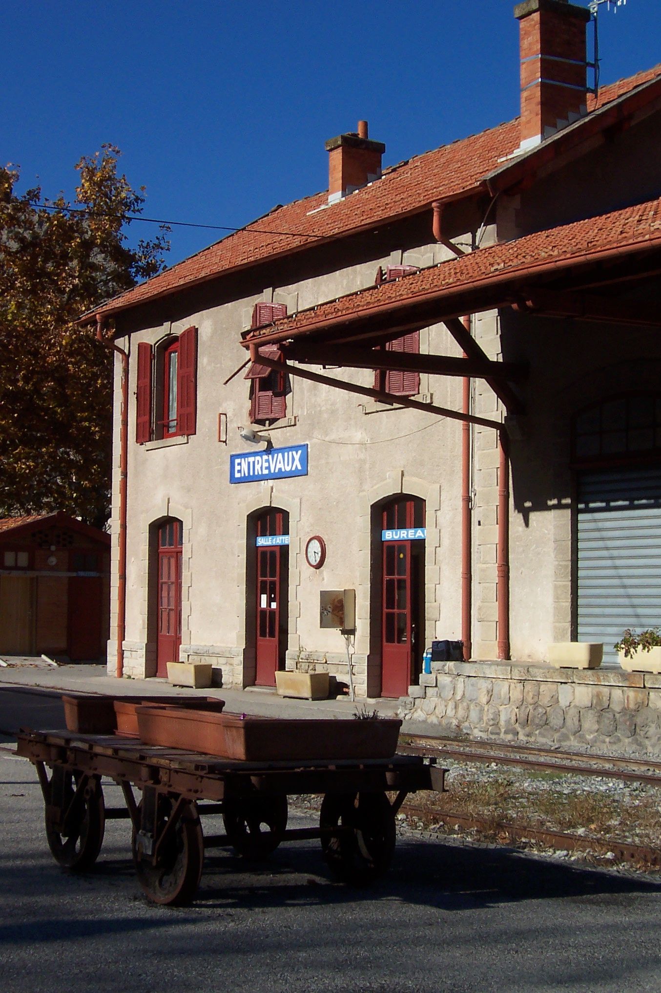
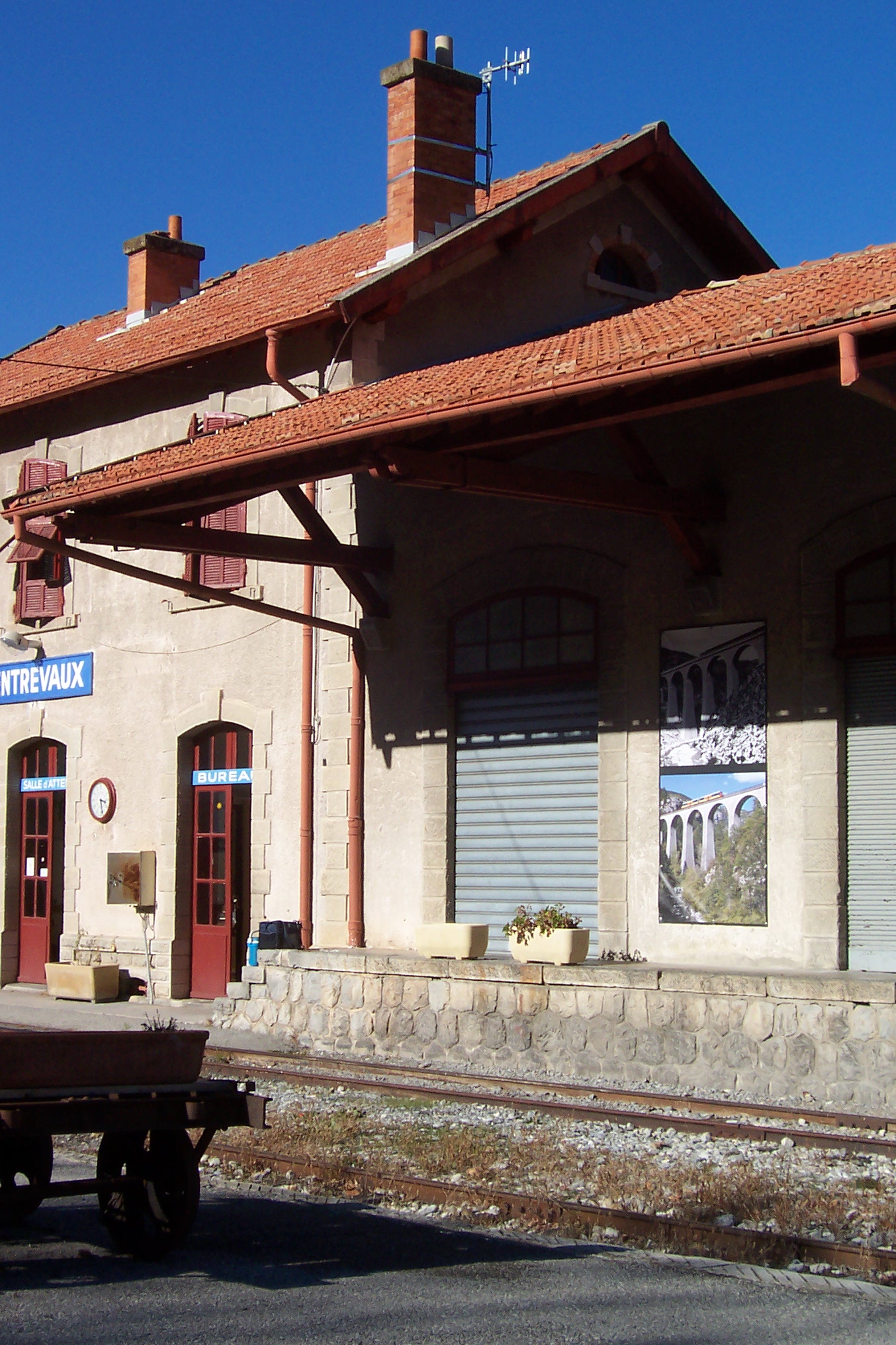
The station construction is typical of many of the stations still evident on the route of the line. A few historic postcards are reproduced here to give an idea of the station in the early years of the 20th century.
The second of these postcard views has been ‘adapted’ by Jean Giletta the photographer to include a hand drawn train. While it is a pity that the photographer did not wait for a real train to cross the bridge, the picture illustrates the nature of the river crossing. The railway line crossed the river on the top of the truss girders with provision between the trusses for road traffic!
Les Trains de l’Histoire, Sur les Chemins de Fer de Provence (Nice-Digne); https://www.tdh-forum.fr/viewtopic.php?t=71551, accessed on 10th April 2018. Copy right for these images rest with the photographers …. the relevant names on that site are: chavance, michel/57, Gérard and there are some great photographs to enjoy there.
Simplon Postcards, Chemins de Fer de Provence – CP, Page 1B: Rolling Stock – Diesel Locos & Trailers; http://www.simplonpc.co.uk/CPb.html, accessed on 12th April 2018.
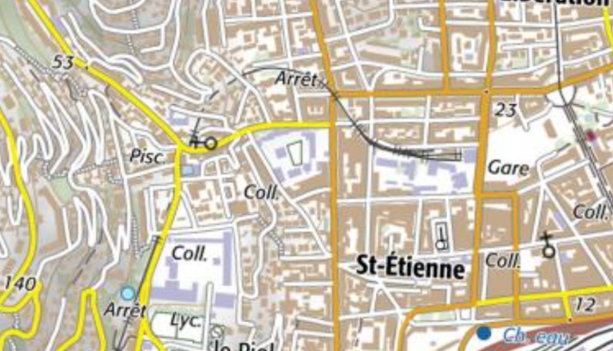
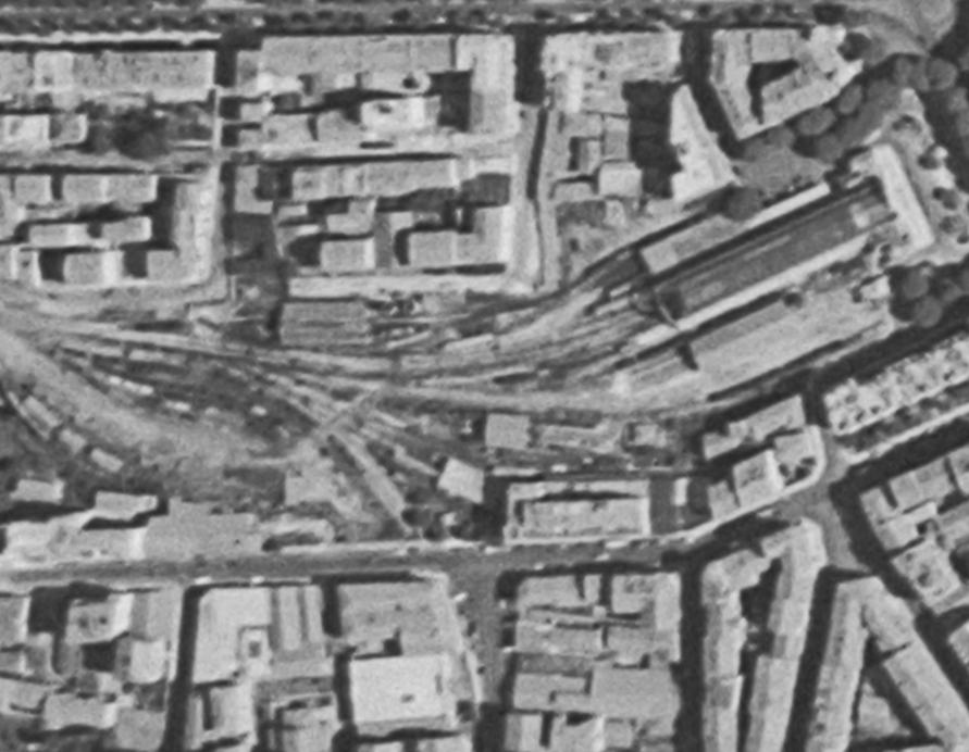
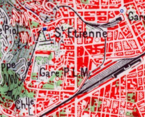
The Chemin de Fer due Sud de la France station, commissioned in 1892, benefited as early as 1899 from a 960 m connection to the PLM network.[1] The route of the connection is shown on the 1958 map of Nice below. La Gare due Sud is the more northerly of the two stations shown on the map.
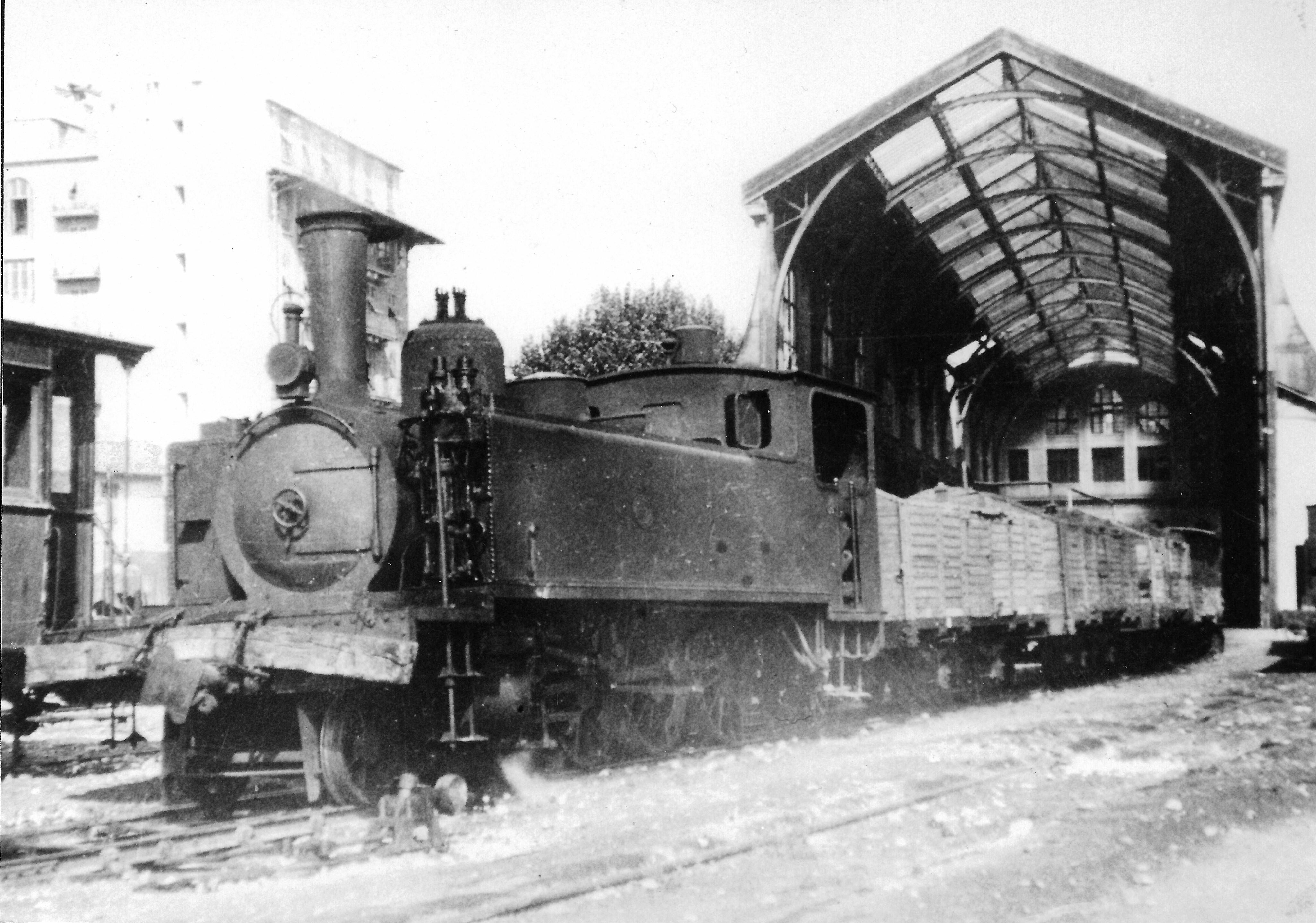
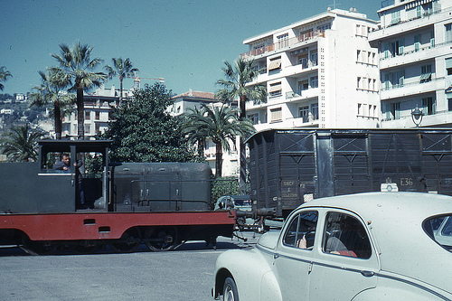
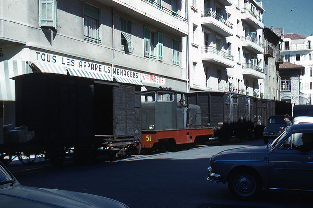
The connection between the CP and SNCF networks was established as dual-gauge line so that normal track wagons could be towed by metre-gauge shunters. In the late 1950s and early 1960s, the passage of freight trains in the middle of the street began to pose a problem with regard to traffic. I have only been able to find a few images of the line in use, taken, I think in 1963 by the same photographer, although available on the internet from different web sites.
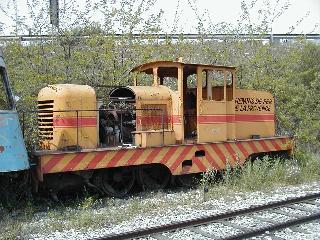
The locomotive in the images above was also recorded on site at la Gare du Sud.1974. [4]
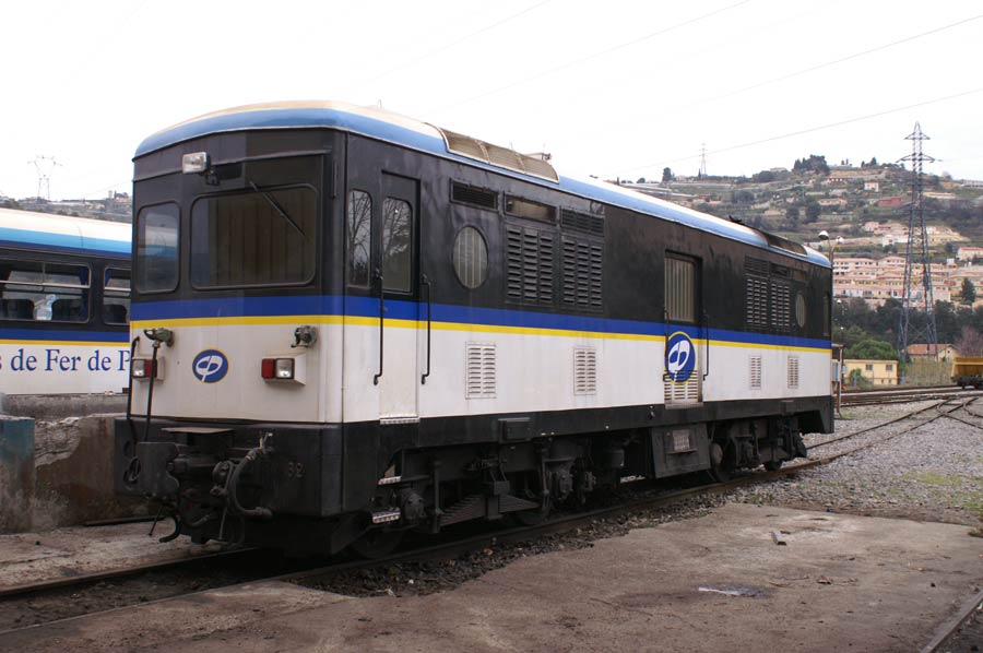
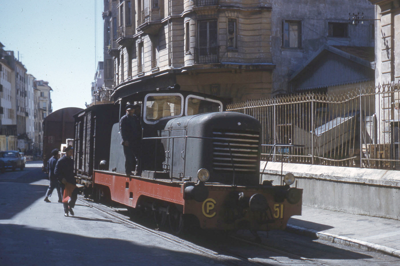
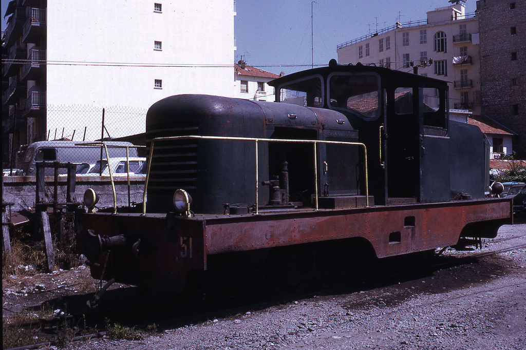
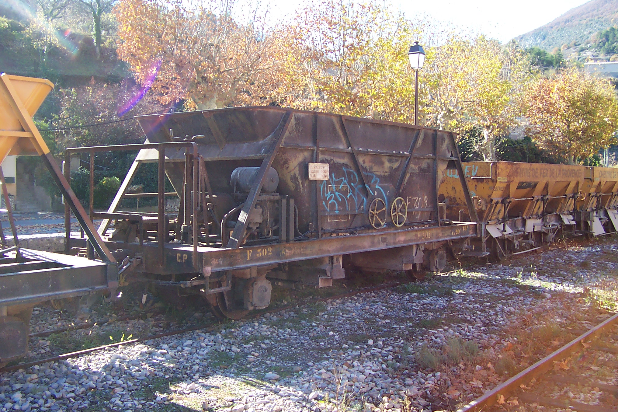
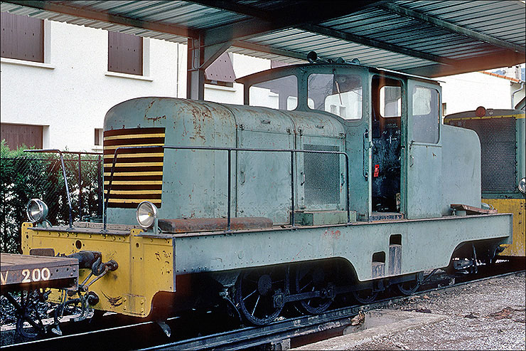
CP51 appears to be an 0-8-0 diesel shunter and seems to have had a long life on the Chemin de Fer de Provence. It was converted from a steam locomotive in 1948 and given the loco number 51. The work was done by the CFD workshop in Montmirail. In these CFD conversions, power was transferred from the diesel engine via a mechanical gearbox that drove one axle. The remaining axles are connected to the drive axle via the coupling rods. The loco was mainly used for traffic between la Gare du Sud and the SNCF station, for the transfer of freight wagons. From 1970, the vehicle was moved to Digne and shunted wagons at the station there. From 1978, the locomotive was used for construction trains and was eventually set aside at Lingostière after an engine failure in 1987. In 2010 it was still in the sidings at Lingostière.[5]
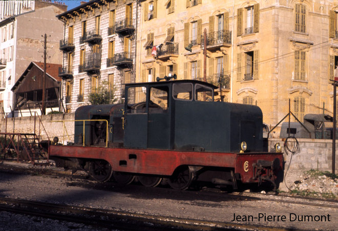
1980. [6]
1981.[7]
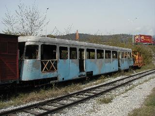
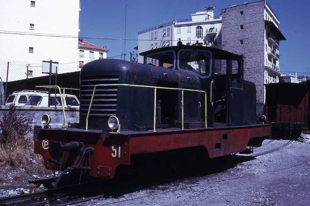
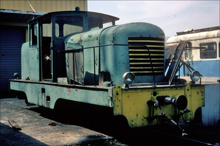
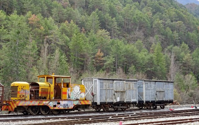
CP51 sits in a decrepit state in the sidings at the depot at Lingostière. [8]
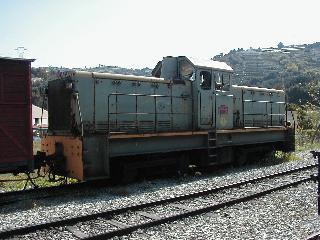
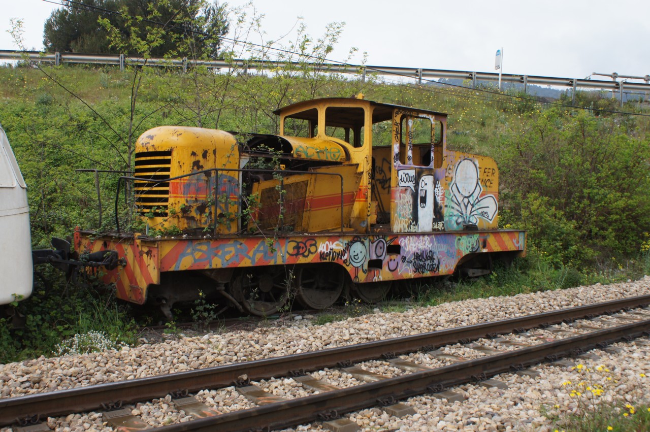
STOP PRESS …… CP51 has been found! It is hiding at Saint-André-les-Alpes! It has been photographed on 25th April 2018 in a siding awaiting restoration! [9]
There is a 3D printed body shell for this locomotive, produced by Shapeways[10] …
Tyrphon, Jean-Pierre Dumont; http://www.passion-metrique.net/forums/viewtopic.php?f=6&t=7790&hilit=locotracteur+cfd&start=240, accessed on 23rd April 2018.
File:CP-51-débris Lingostière 04-2014.jpg; https://commons.wikimedia.org/wiki/File:CP-51-d%C3%A9bris_Lingosti%C3%A8re_04-2014.jpg, accessed on 23rd April 2018 and translated from the German text of the website.
Photograph taken by ‘La bête de Calvi’ on the Passions Metrique et Etroite Forum; http://www.passion-metrique.net/forums/viewtopic.php?f=2&t=4143&sid=71f9e15a23794923765a790b153b2cc8&p=416169#p416169, accessed on 25th April 2018.
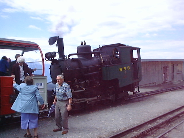
My wife and I travelled this line in 2004. The views were spectacular and the weather was in our favour! My camera, in those days, was not able to produce high resolution photos. But these give a very good impression of the line and the views from the top. The first image is a map of the line.
242T66 on the Forum Passions Metrique et Etroite, very kindly, pointed out that the pictures that I originally posted on this blog came from another Rack Railway – the MGN (Montreux, Gilon, Rochers-de-Naye) Railway. Those have been moved to another blog post (https://rogerfarnworth.wordpress.com/2018/04/16/the-rochers-de-naye-line) and photos from 2004 of the BRB now follow below!
The link below takes you to an excellent video of the line:
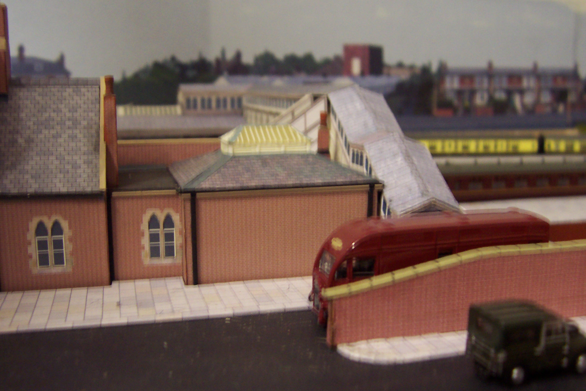
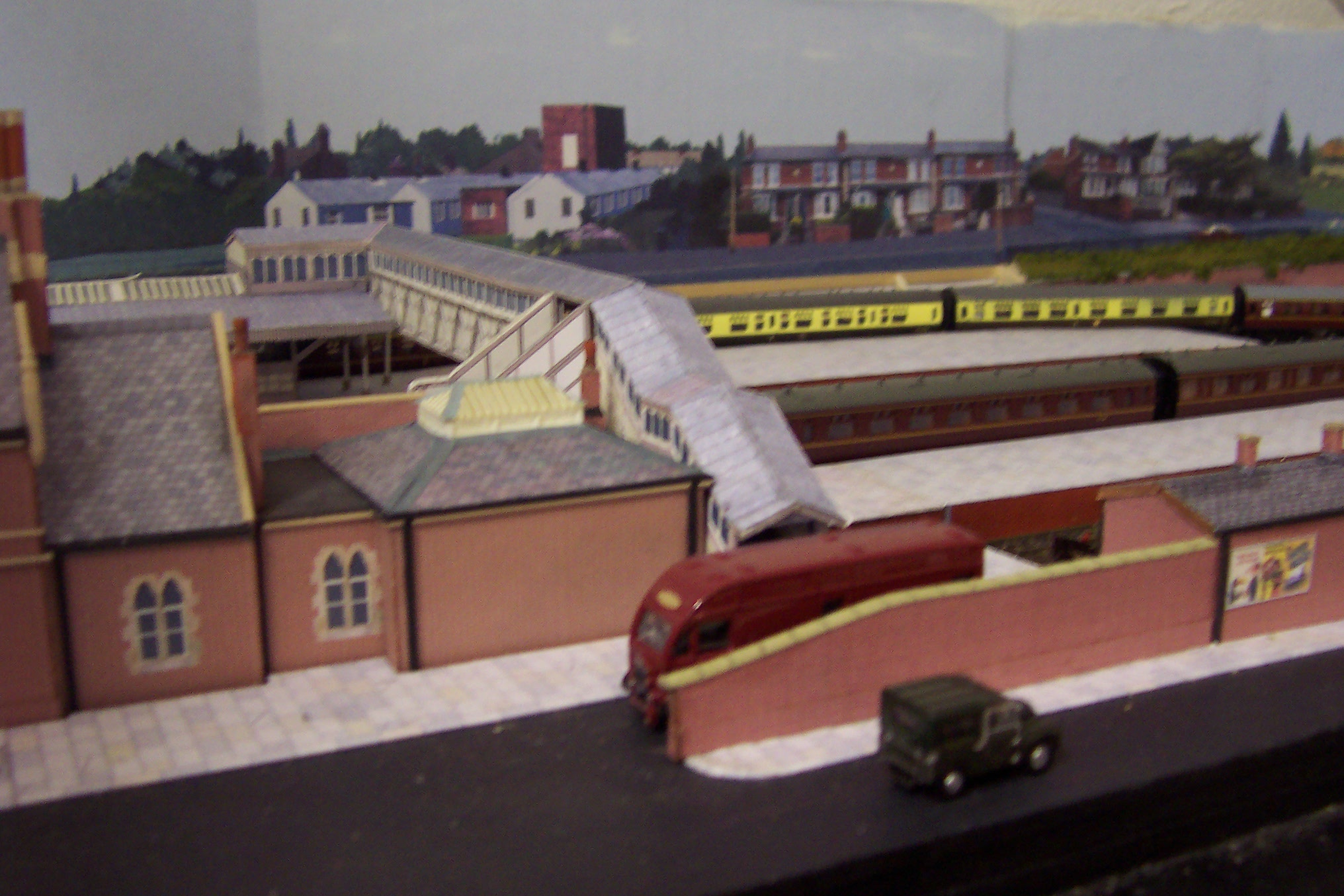
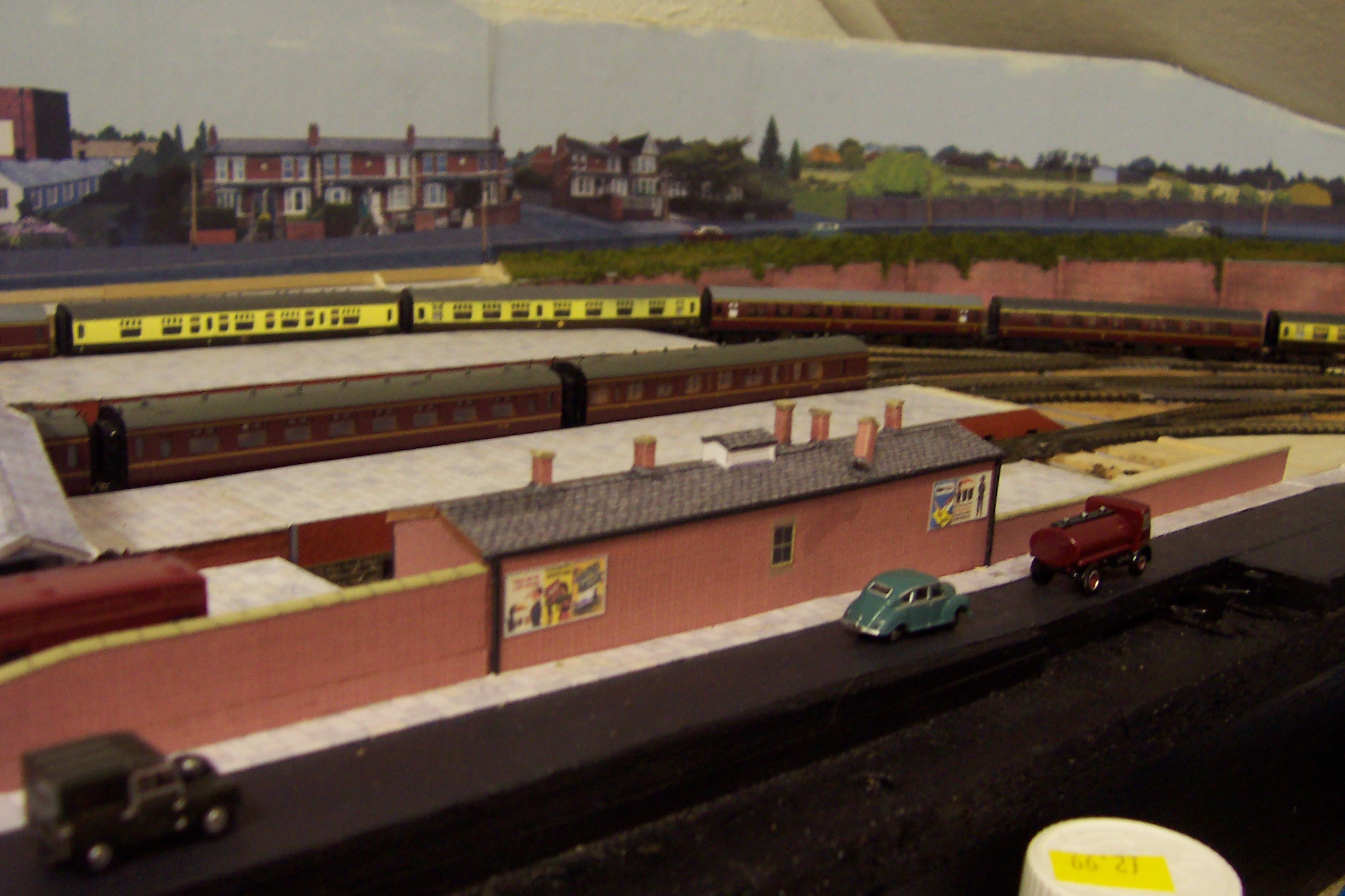
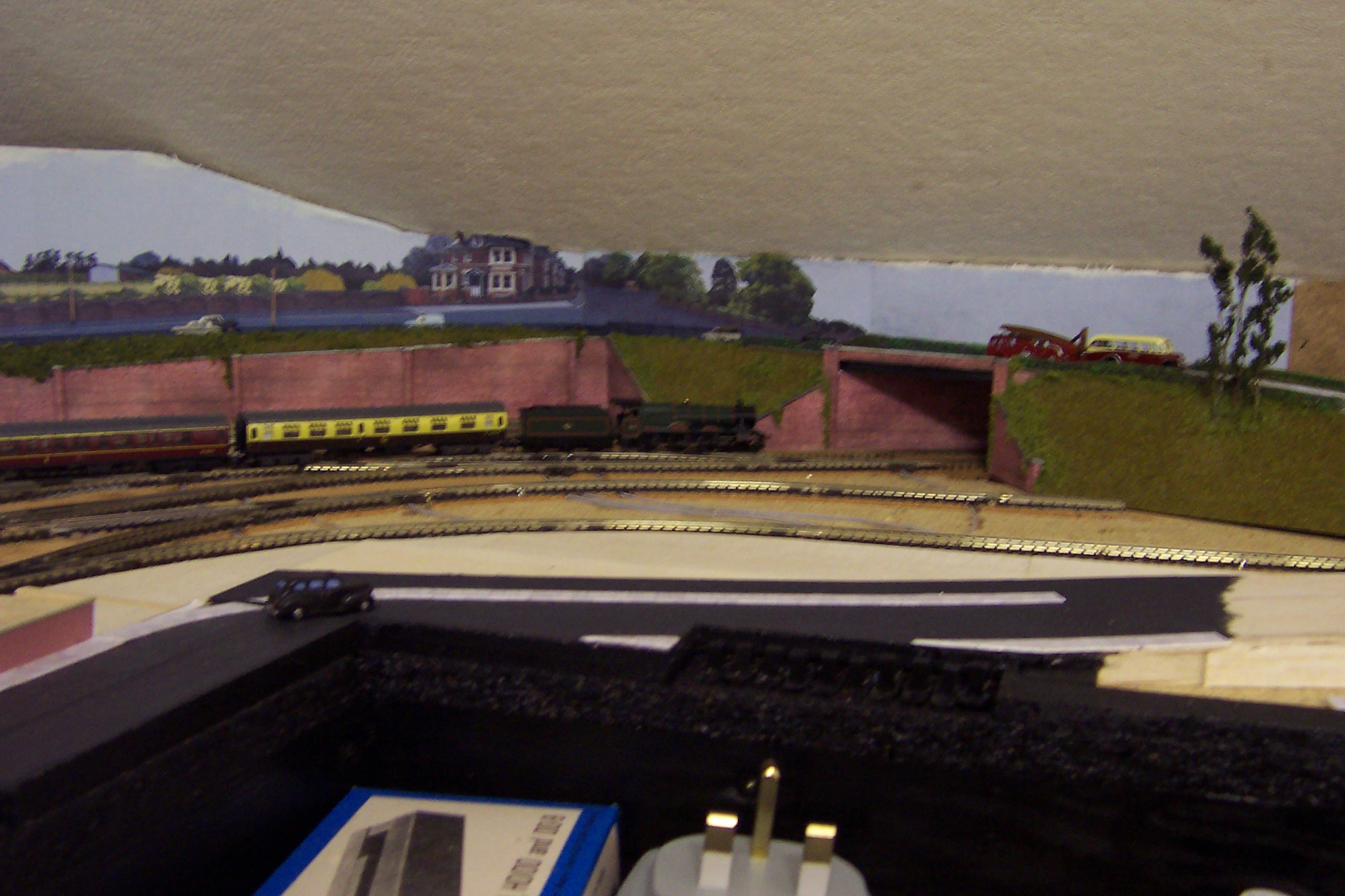
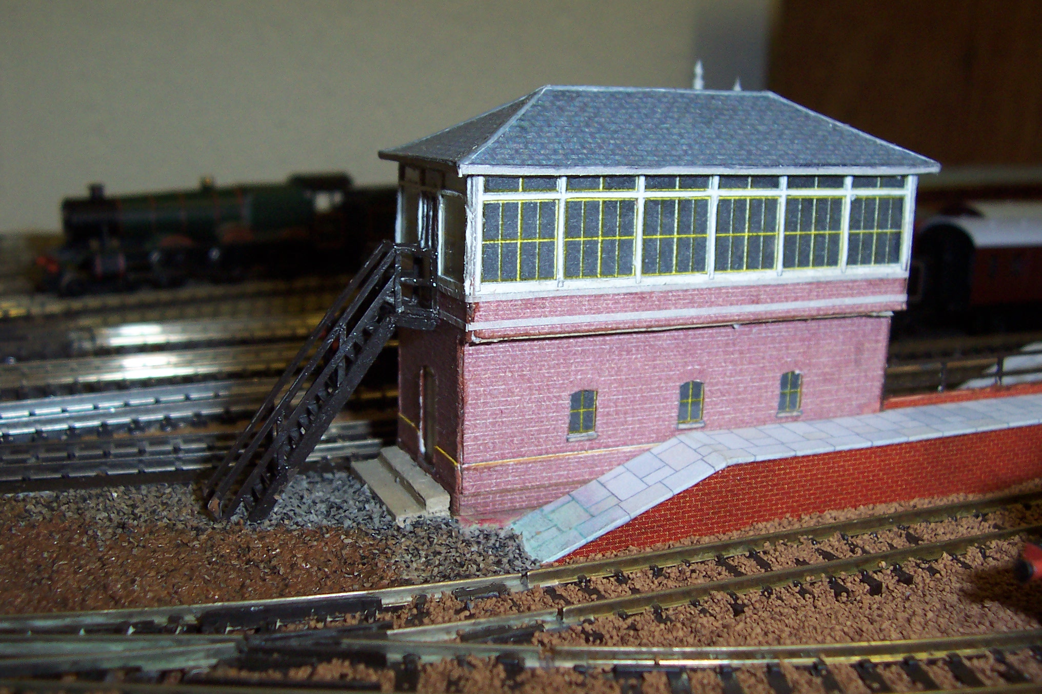
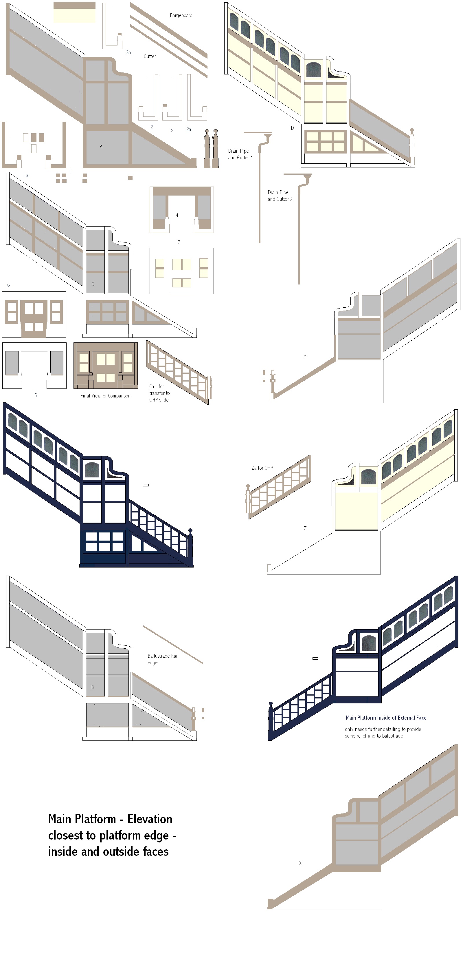
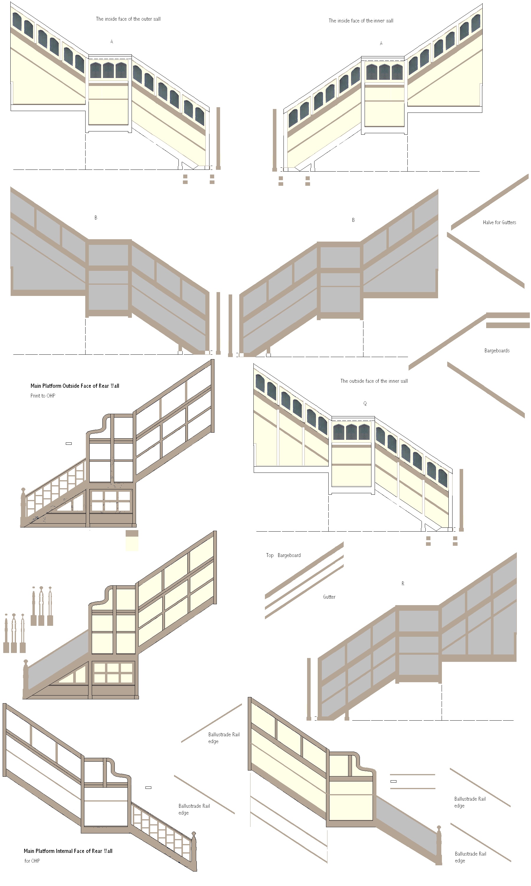
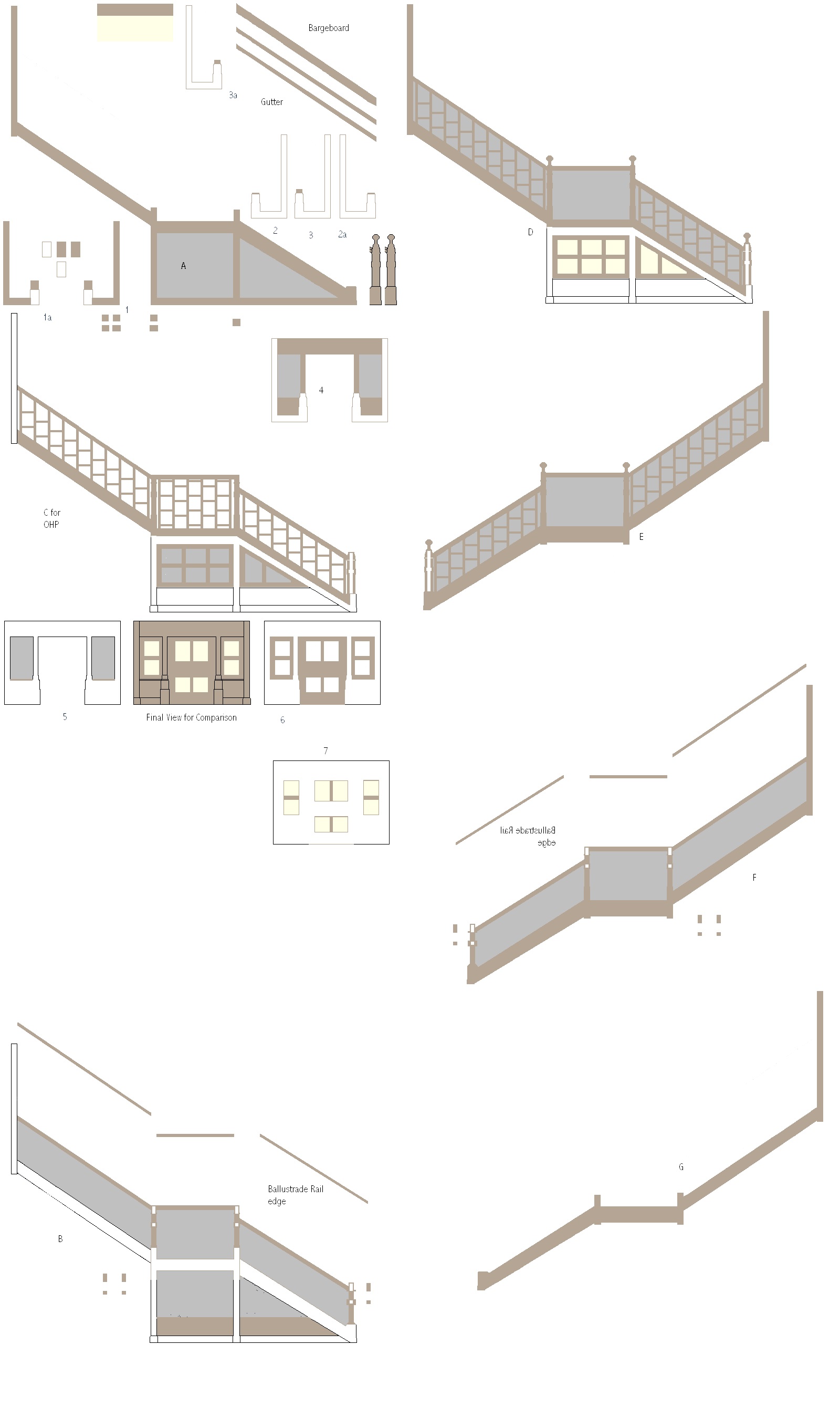
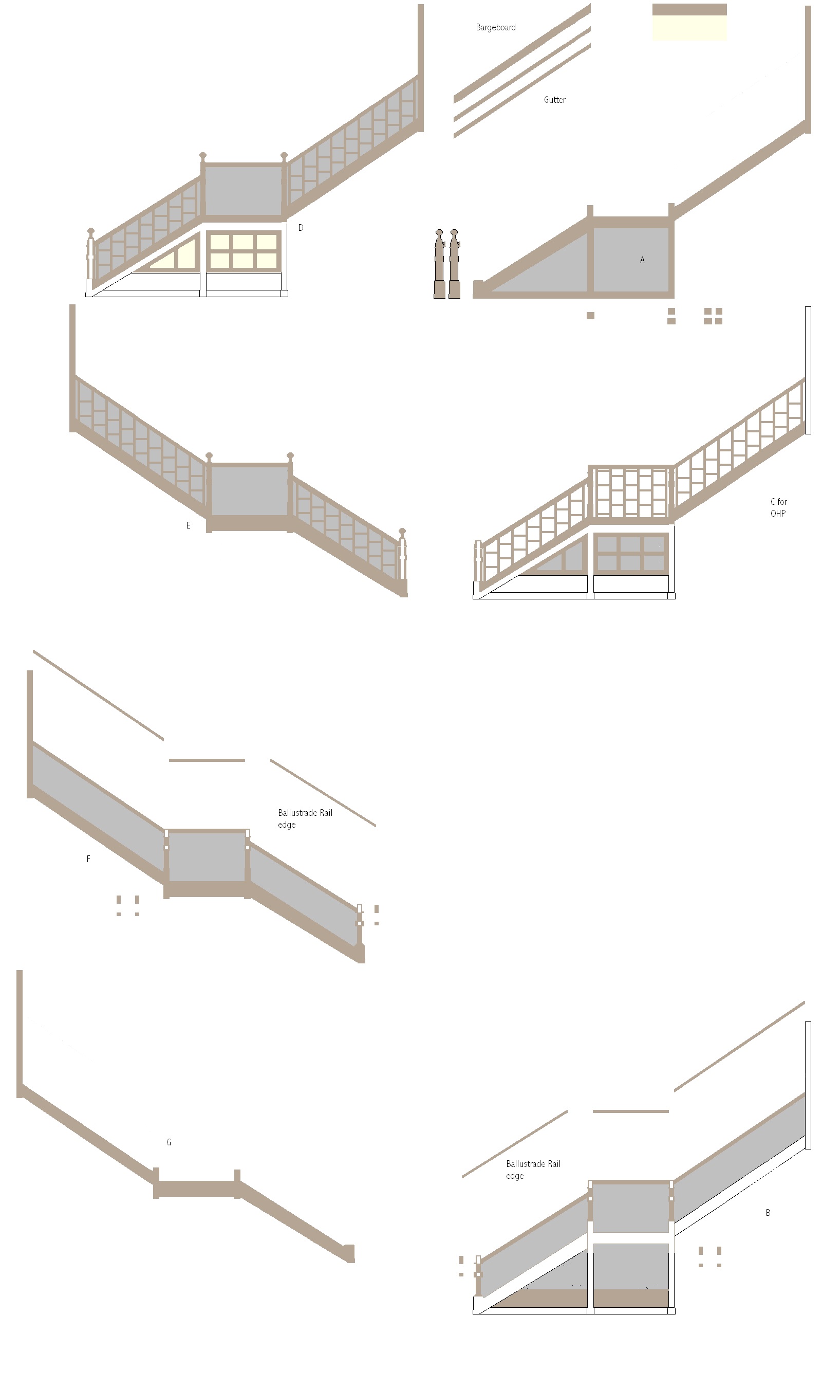
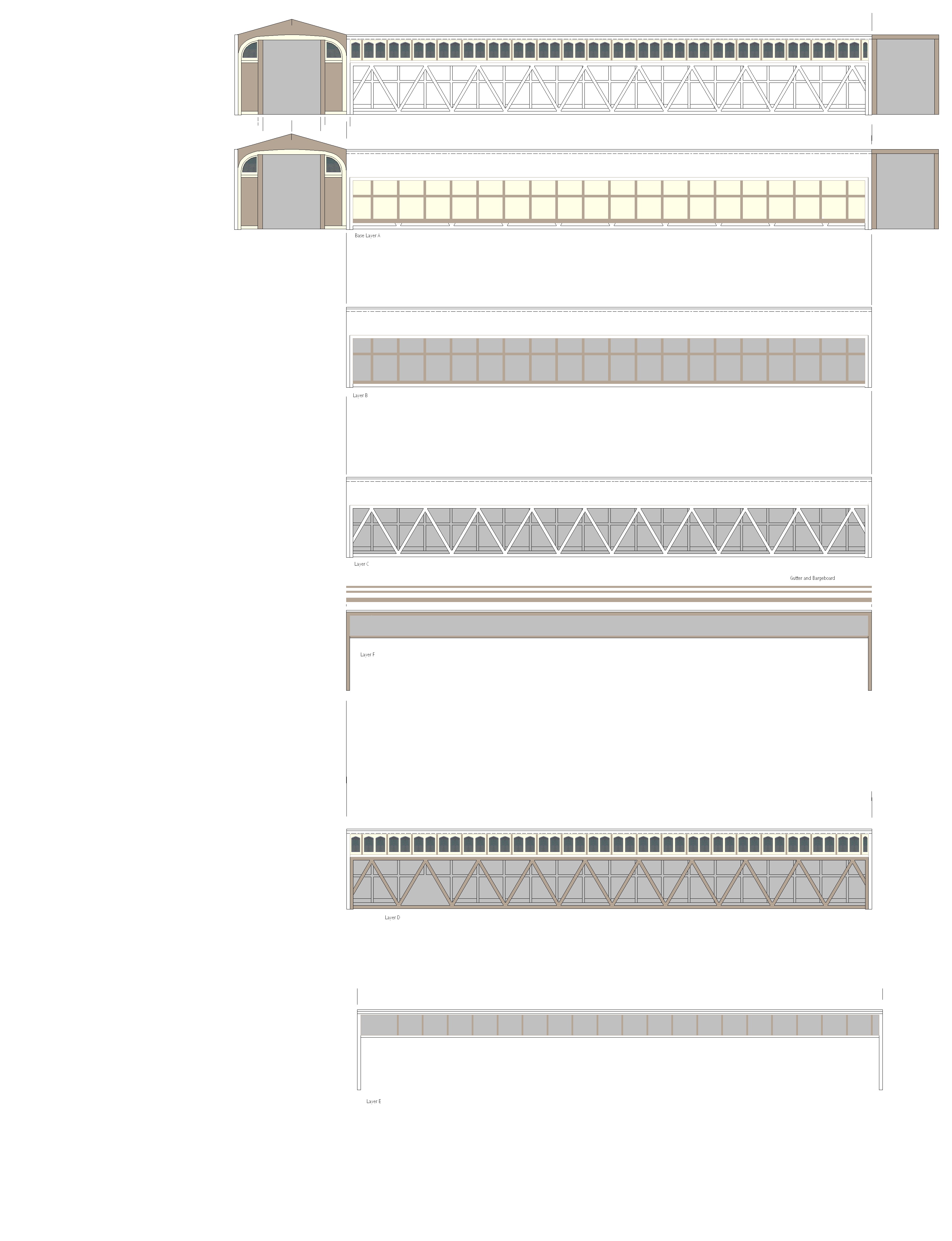
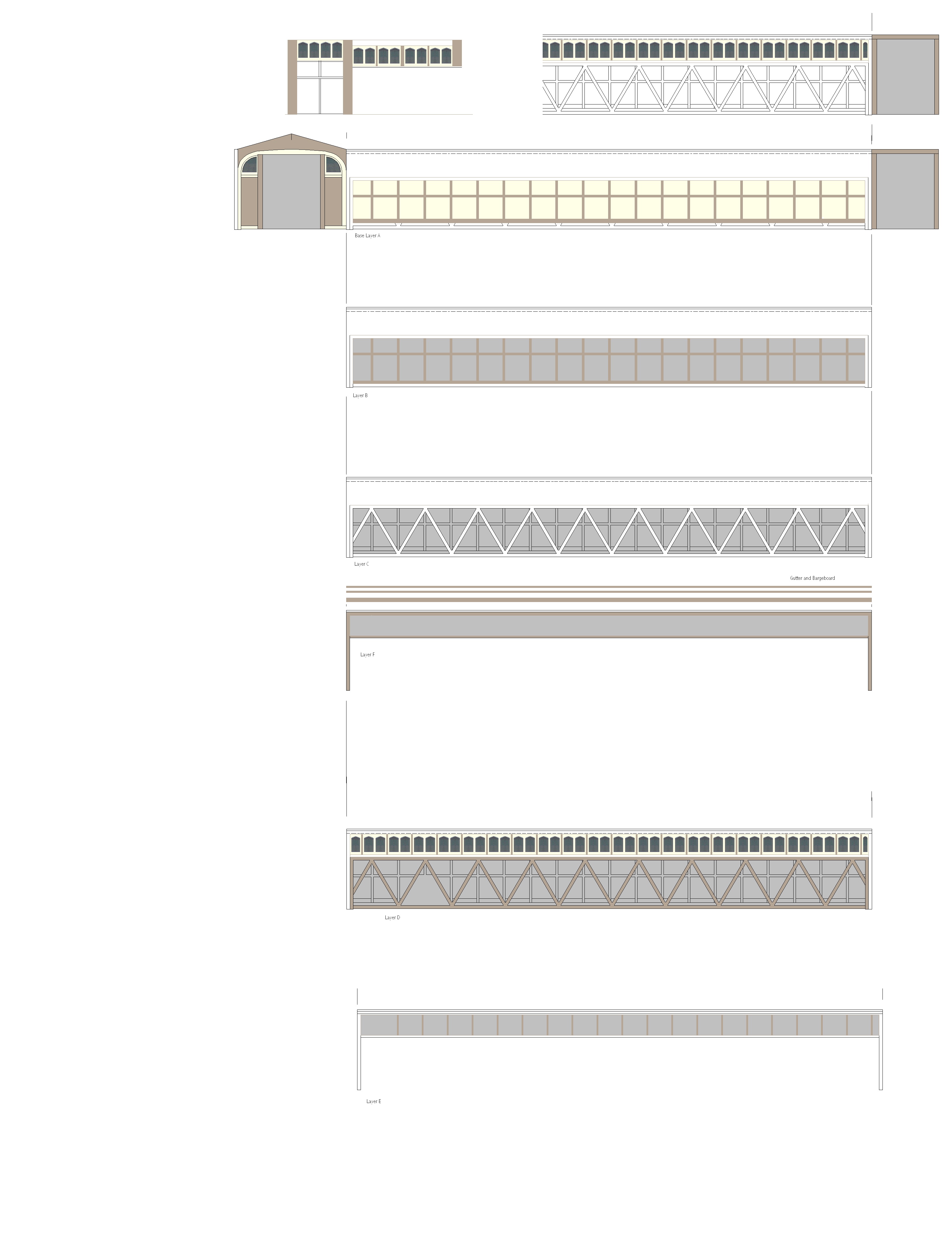
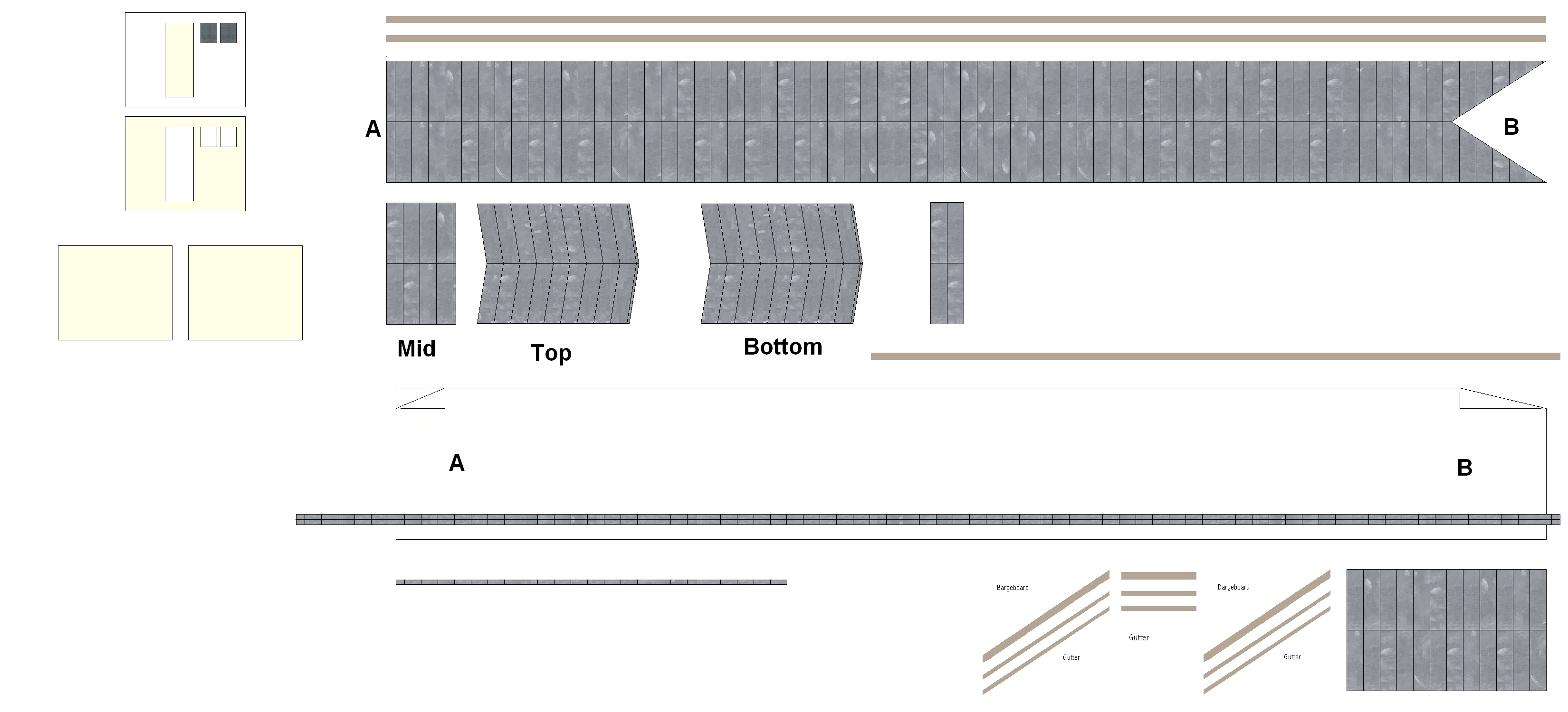
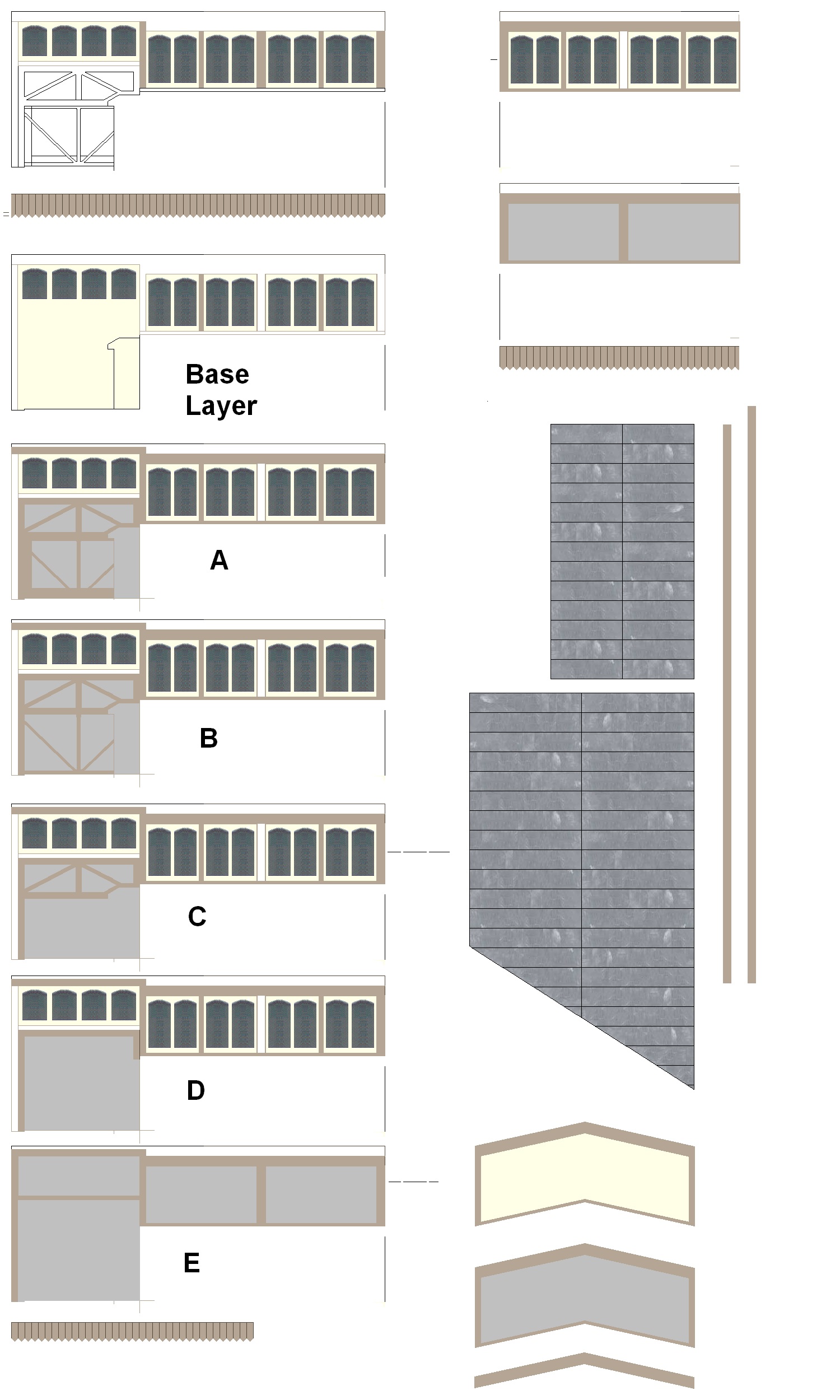
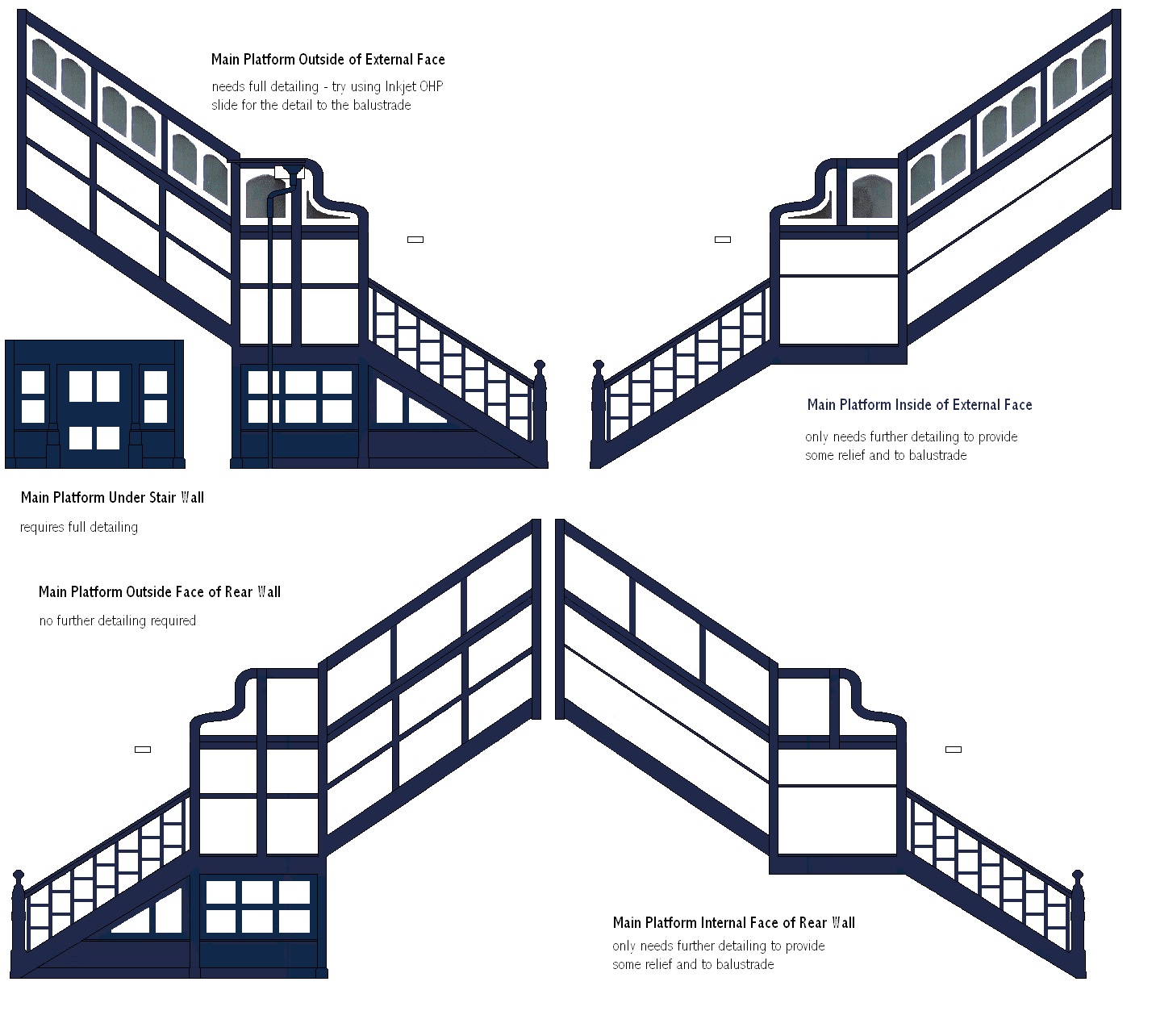
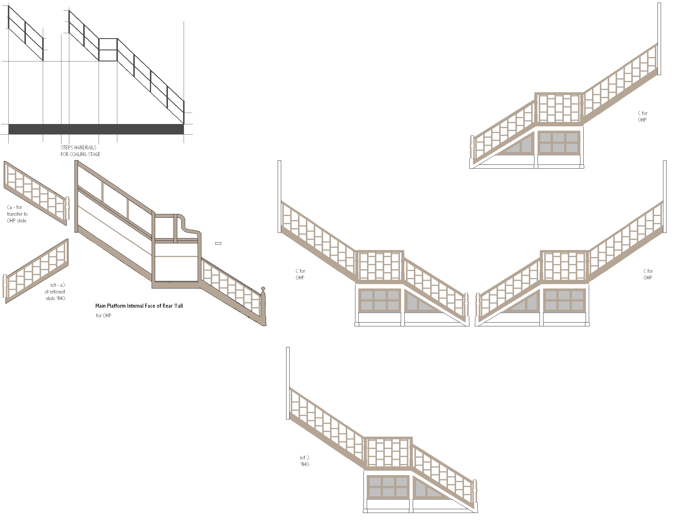
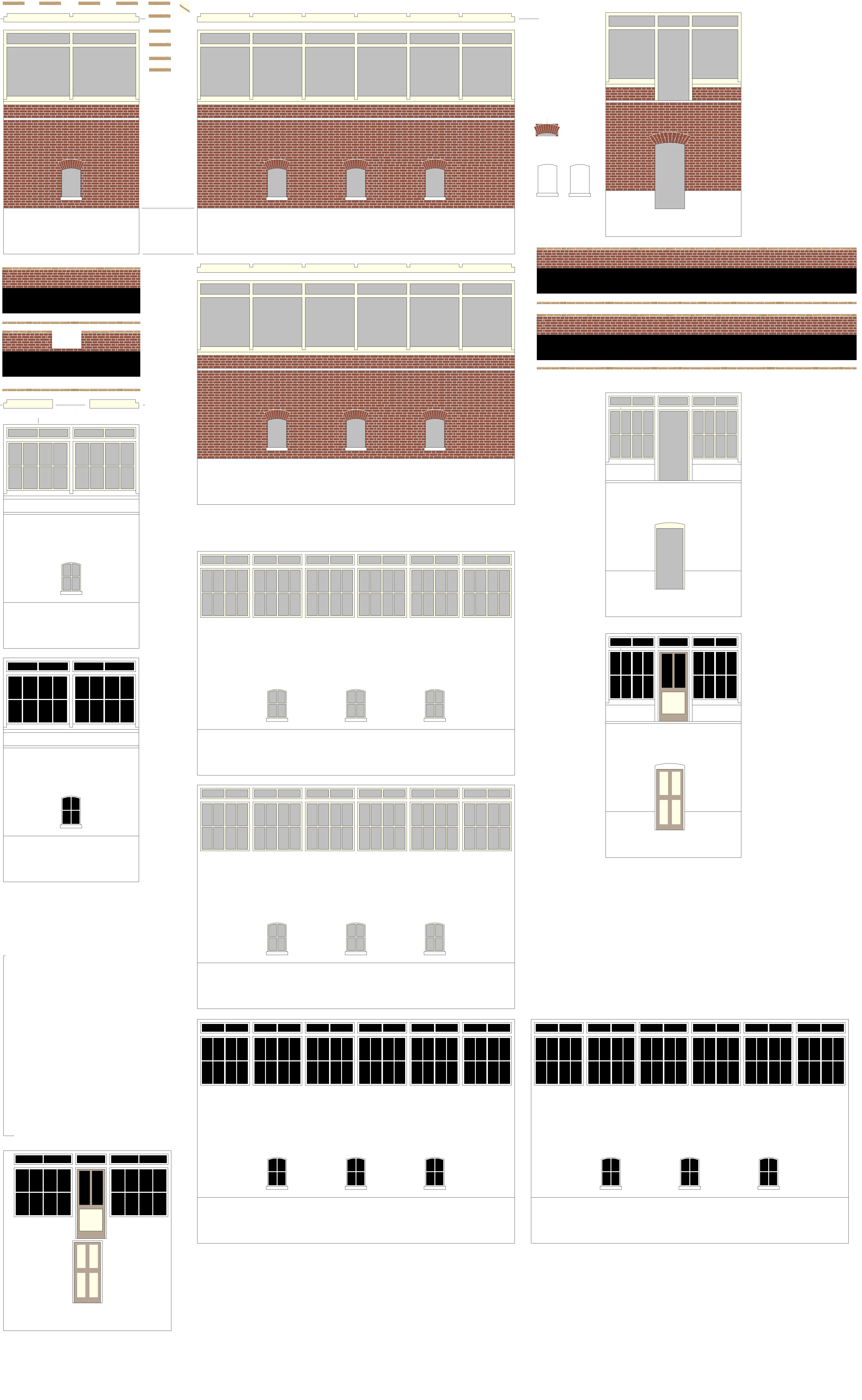
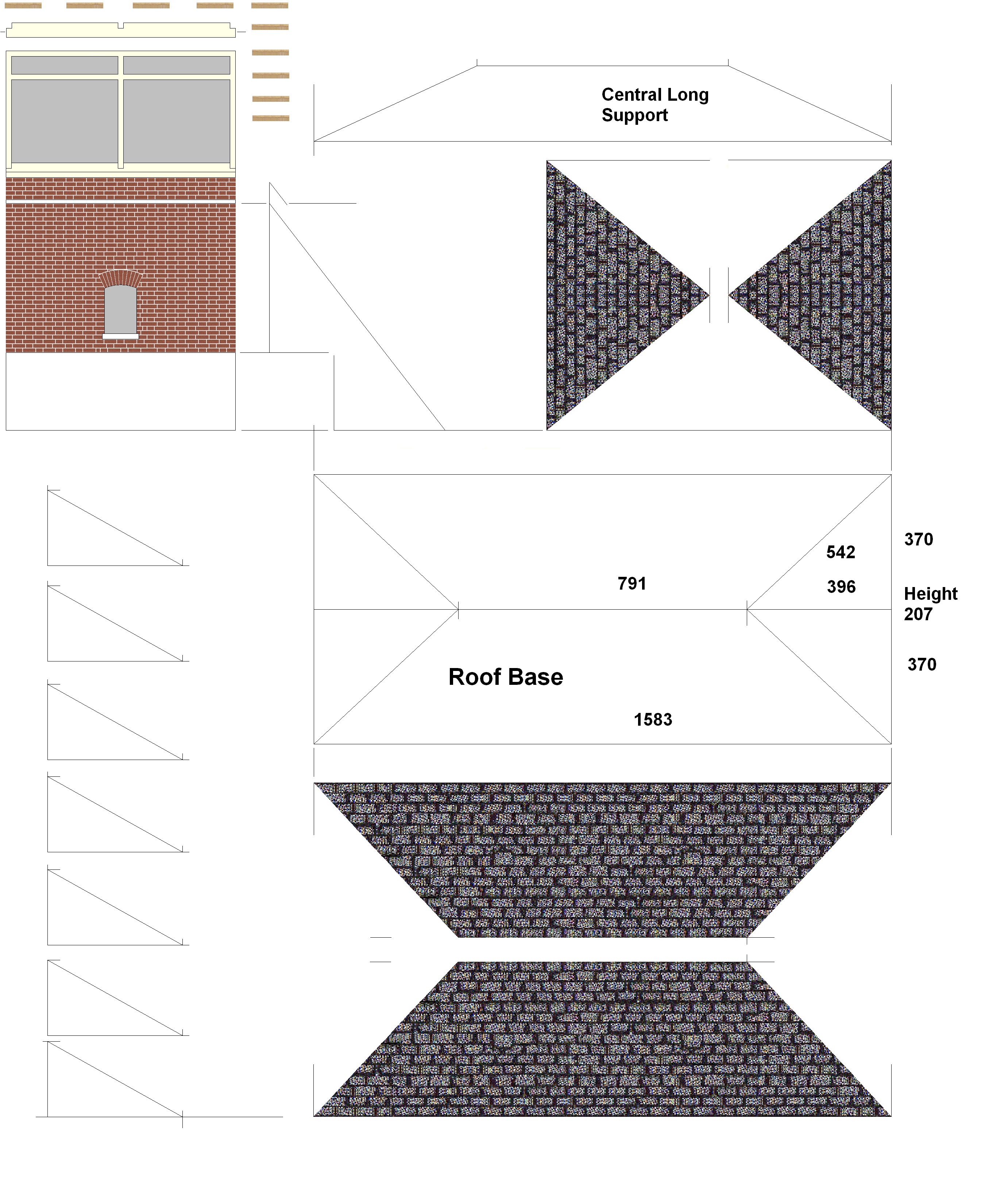
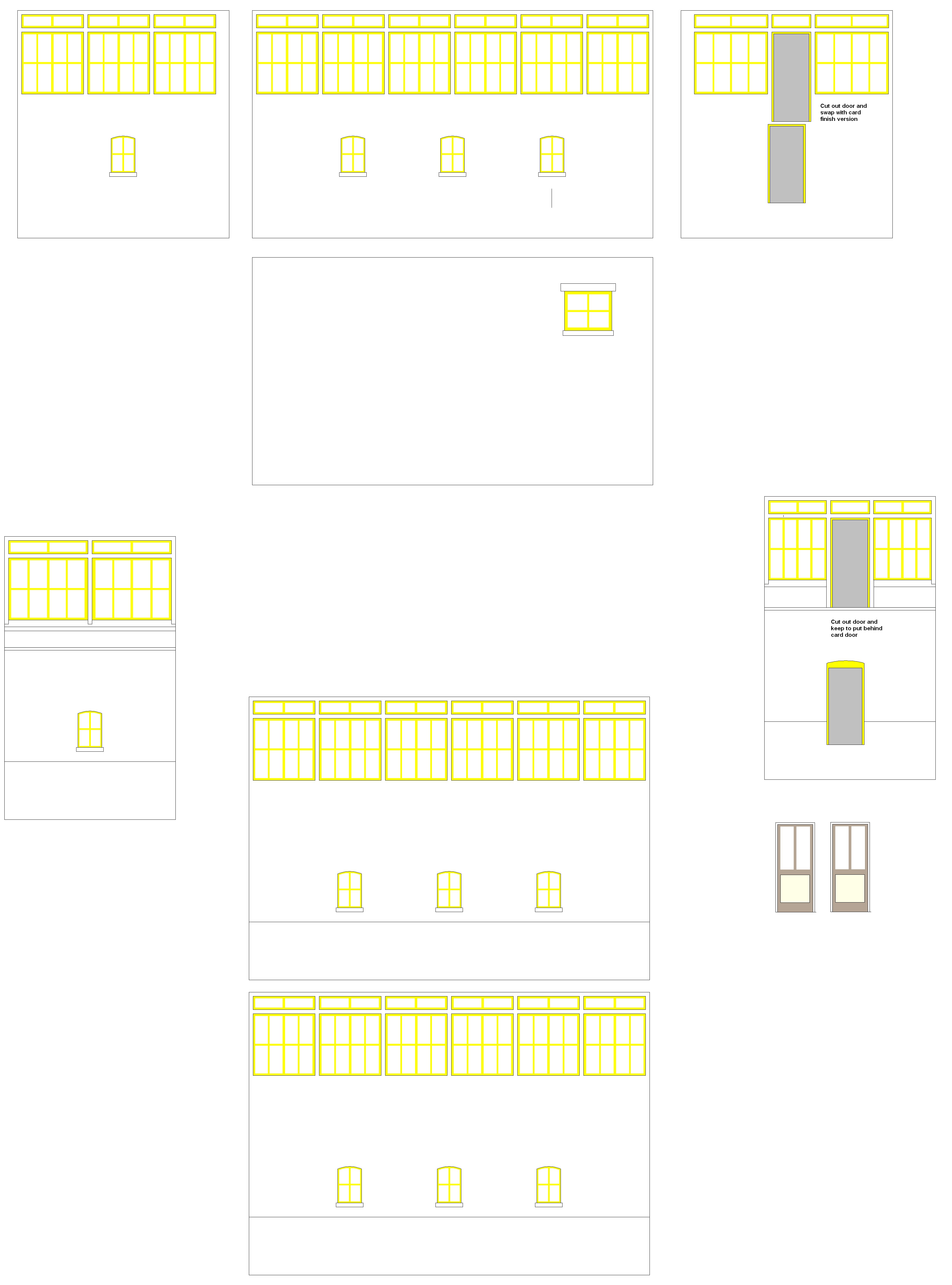
This post carries a series of images from ‘Paint’ which were drawn and then built up in layers to create the N Gauge model of Hereford Station Footbridge.

 Close to the station there are a botanical garden,[3] a hotel and a restaurant.
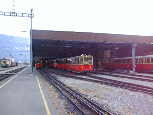


 Taken at Schynige Platte Station by Uve Mockel in 2004.[5]


