Monthly Archives: Apr 2020

Luke 24:13-35 – The Emmaus Road – Again

The featured image above  was the work of Rowan LeCompte (American, 1925–2014) and Irene Matz LeCompte (American, 1926–1970), Third Station of the Resurrection: The Walk to Emmaus (detail), 1970. Mosaic, Resurrection Chapel, National Cathedral, Washington, DC. Photo by Victoria Emily Jones. [1]

But we had hoped ……………

The BBC Radio 4 Sunday Service on 26th April was led by Revd. Prof. Jennifer Strawbridge and the Revd. Dr Steve Nolan. [2]. The theme was: “But We Had Hoped ……

I have been reflecting on that short phrase over the past few days. I don’t think I have ever really noticed that little phrase before Sunday.

“But we had hoped …” is an expression of lament. As Professor Strawbridge explained, these are among “the most heart-breaking and realistic words in all of Scripture: … ‘But we had hoped’.”

But we had hoped. …

Everthing has changed for these two people on the road to Emmaus. As Professor Strawbridge explained in the service on Sunday, “Jesus, who they thought was their Lord, was crucified and with his death, their hope for redemption and restoration has died as well. Moreover, the tomb of this hoped-for saviour is empty, his body is gone, and while rumours are flying around that he is alive, they have seen nothing to suggest this is true and they are going home.”

These two friends have lost hope. Hope has withered and died and they are bereft, sad and confused. Going home is all they have left to do.

Professor Strawbridge went on to say that “the words, ‘but we had hoped’, linger in the air. … So much is contained in those four words which speak of a future that is now irrelevant. And pain stems, not only from the tragedy of what has happened, but the empty space of all that could have happened but won’t.”

She continues,” ‘But we had hoped’ are words that speak to each of us still. Not because we enjoy wallowing in dark and sentimental emotions, but because they are true. …

  • But we hoped to celebrate Easter with our communities in person.
  • But we had hoped not to get ill.
  • But we had hoped to be so productive in our isolation.
  • But we had hoped not to feel lonely.
  • But we had hoped we could do more to help.
  • But we had hoped for one final hug.

‘But we had hoped’ infuses our days and our lives in ways big and small.”

‘But we had hoped ….’ is an expression of lament which must for many, if not all of us, say something, at least, about what we feel at this time. It may become a growing and significant element of our feelings as the next month or two unfolds.

“But we had hoped ……”

What we longed for is no longer going to happen! What we longed for has already gone! We cannot get it back! What does life hold for us now? ……

Professor Strawbridge went on to say that, “with this story on the road to Emmaus, more often than not we jump over these first bits to the recognition of resurrection and the burning hearts in the disciples, without recognizing that the same hearts that are burning within them have also been broken.”

It seems to me the most important part of this story of the “Road to Emmaus” is not so much an amazing truth of resurrection breaking into the lives of Jesus’ friends but the darkest of statement of loss which is expressed by the two friends to the stranger who meets them on the road. “But we had hoped ….,” and all that we had hoped for has gone for ever. Deep, dark depression. All hope is gone.

The distance from Jerusalem to Emmaus was about 7 miles. ….

How long does it take to walk 7 miles?

I guess it depends on our age and state of health. The most able of us might walk it in under two hours, for some of us 7 miles is an impossibly long distance to walk, for most of us it will probably take us around 3 to 3.5 hours.

The darkest times for all of us, when we experience them, do last a long time. But how long? The time will vary, it will be different for each of us. Throughout these darkest times, expressing our lost hopes will be so very important. Whether in anger or grief, sorrow or sighing, throughout the darkest times are these … “But Lord, we had hoped ……….”

Jesus himself draws near to us. His Spirit lives with us and in us. But we probably cannot recognise the Lord’s presence in the middle of what we face. Walking this road, for us, will take a while. As we walk this road, we will have to take our own time. And throughout the journey, our faith will probably only be expressed in the reality of loss, “But we had hoped ……”

Our faith somehow keeps us engaging with God, even when what we say to God cannot possibly be expressed to others but it is so full of doubt, anger, hatred and lament. …

“But we had hoped ….”

“We had really hoped, Lord. We had believed in you for the future and you seem to have taken it all away and left us with nothing. How can we possibly continue to believe in you? How?” ….

Professor Strawbridge said in that broadcast, that if we fail to recognise in the story of the Emmaus Road, “that the people filled with overwhelming joy are the same ones who were filled with fear and despair.” If we do not grasp, “that throughout their fear and despair, whether those disciples recognized it or not, they were not alone.” Then, in our rush to get to the news of the resurrection, we miss the crucial reality, “that even in the place of confusion and despair, the Risen Lord walked alongside the disciples.”

We can see that Jesus’ presence with those friends on the Road to Emmaus is robust and challenging.  But the challenges come from someone who is walking with them on the road. And he continues to walk with them, whatever the length of the journey, until they reach their place of safety, their home. It is also a presence which does not impose on them. It does not, ultimately, intrude. For Jesus would have continued on the road had they not invited him into their home.

And it is in their home, in the middle of all that is normal, in the simplest of ways, as they share that evening meal together, that finally they recognise their Lord.

Jesus walks with each of us: ahead of us, behind us, but most definitely with us, into all that we fear, into the unknown daily present, into a shrouded, frightening, confusing and uncertain future.

References

  1. https://artandtheology.org/2017/04/28/the-unnamed-emmaus-disciple-mary-wife-of-cleopas, accessed on 30th April 2020.
  2. https://www.bbc.co.uk/sounds/play/m000hmx2, available to listen to until the 25th May 2020, although the transcript should be available via the hyperlink for some time, accessed on 26th April 2020.

Railways in Iran – Part 7 – Some limited reflections on Iran’s Railways in the 21st century

For Iranians, life changed dramatically in 1979.

It is easy, from a Western perspective, to assume that Iran is a country that has chosen to avoid progress. So, I have to admit to being surprised by the current state of the railways in Iran. The network has been developing at a significant pace. Since 1979 there have been a significant number of major construction projects and there have been some significant changes in motive power.

There are holiday companies [1][2][3] advertising railway trips to Iran. Given what is reported about the instability of the country and its sponsorship of, what to Western eyes are, terrorist groups, these holidays do not feel very attractive. Yet the picture on the ground in Iran is seemingly one of relatively energetic technological development. “Since the first railway project was implemented [after] the revolution, 12 railway projects, that is 4676 km of the total 10171 km of the total network have been constructed. That is about 46% of the total rail routes in the country.” [21]

I hope that this article will provide a taster of what things are like on the railways in Iran today.

Before looking at the situation in detail, here is a video which focusses on the Trans-Iranian Railway in recent times. It was shared by D6700 a member of RailUKForums as part of a thread about Iranian Railways. [4] It is produced by a German team but the dialogue is in English. It gives a good impression of technological developments and notes a reluctance from many of the people encountered to talk with the Western film-crew.

The Trans-Iranian Railway. [4]

The notes that follow are inevitably far from comprehensive and rely heavily on sources on the internet (which are all referenced). A railway map of the network in Iran in the 21st century is provided by the national rail service, Islamic Republic of Iran Railways. The schematic plan they provide is shown immediately below. Not all routes are however shown on the map.The Iran Railway Network in the 21st century. [6] 

Wikipedia [5] notes the long-distance schemes which were undertaken by the Islamic Republic of Iran Railways in the 21st century, these include:

Bafq — Kashmar                        800km     1992—2001 (but see the comments  below)

Kerman — Bam                          225km     1999—2002

Bam — Zahedan                         546km     2000—2009

Isfahan — Shiraz                         506km     2001—2009

Khorramshahr — Shalamcheh   16km     2009—2012

Gorgan — Incheh Borun              80km     2012—2013   [22]

Tehran — Hamedan                   268km     2001—2017   [23]

Arak — Kermanshah                  267km     2001—2018   [24]

In addition to long-distance services, Iran has also developed commuter service for the major cities and a series of light rail/tramway schemes too.

For example, Tehran Metro carries more than 3 million passengers a day. [7] In 2014, 815 million trips were made on Tehran Metro. As of 2019, the total system was 229 kilometres (142 miles) long, [8] 186 kilometres (116 miles) of which is metro-grade rail. It is planned to have a length of 430 kilometres (270 miles) with 9 lines once all construction is complete by 2025. [9][10]

Commuter Services are currently available in Tehran, Tabriz, Kuzestan, Lorestan, Mashhad and Mazandaran-Golestan. [5]

Commuter and Metro Services are not covered in detail in this article and will have to await  a further post as time permits. ……..

Major Schemes

Wikipedia provides the list of schemes [5] above which shows construction, commencing in 1992, of a line from Bafq to Kashmar. Farrail, however, indicates that the line from Bafq to Kashmar and on to Mashhad was not started until 2001, this is verifiable from other sources as well. [11] [12]

1. Bafq to Kashmar and Mashhad – Despite its relatively small size, [13] Bafq has become a major junction on the Iranian rail network. Kashmar is in the Northeast of the country. It is in Razavi Khorasan Province and is located near the River Sish Taraz in the western part of the province, and 217 kilometres (135 miles) south of the province’s capital Mashhad. In  the 2006 census, its population was 81,527, in 21,947 families. [14][15] The city is the fourth most important pilgrimage city in Iran. [16] It is a major producer of raisins and has about 40 types of grapes. It is also internationally recognized for exporting saffron, and handmade Persian rugs. [14] It appears to be some distance from the railway. The town of Mehneh, approximately 50km Southeast of Kashmar, is close to the railway but has no railway station. This is also true of Shadmehr, which is 55km due East of Kashmar. Mashhad is the second-most-populous city in Iran and the capital of Khorasan-e Razavi Province. It had a population of 3,372,660 (in the 2016 census), which includes the areas of Mashhad Taman and Torqabeh.[27] It was a major oasis along the ancient Silk Road connecting with Merv to the East.

Trains to Mashhad from Bafq have about 800km to travel to their destination.

As we have already noted and as shown below, the Railway Station at Bafq is on the South side of the town.Bafq Railway Station is on the South side of the town of Bafq. It shown at the bottom of this map extract [17]

East of Bafq Station a triangular junction has the line to Kerman and Bandar Abbas heading away to the South and the line to Kashmar setting off the Northeast. A short distance beyond the town limits this line also divides. The more northerly of the lines serves the Choghart Iron Ore Mine.Choghort Iron Ore Mine in February 2019 (c) Reza 39 (Google Maps). [18]Choghort Iron Ore Mine in January 2020 (c) S.I.G Group (Google Maps). [19]

The main line then also curves round to the North by-passing the industrial complex which surrounds Cloghort MIne and continues on towards Kashmar. It curves past another open-cast mining site and climbs into the hills by means of a series of loops. Mining sites and sidings are a regular occurrence on the route through the hills.

This satellite image shows the trailing connection with the branch-line which serves Chadormalu Iron Ore Processing Plant (at the bottom of the picture) and the loop which allows trains from the branch to head towards Bafq (Google Earth).

En-route through the hills a trailing junction is made with a line that serves Chadormalu Iron Ore Processing Plant and extends on some distance to Meybod. (See Part 5 of this series. [20])

Leaving Yazd Province the line enters South Khorasan Province and continues predominantly in a Northeasterly direction across open wilderness and gradually getting closer to Route 68. A long tunnel takes the line very close to the road and the two transport modes run alongside each other to Dashteqarrān and Tabas.

Tabas is the first station on the line after leaving Bafq. In the satellite images there are a signficant number of large open wagons stored in a significant number of sidings.

Tabas Railway Station is sited to the Northwest of the city (Google Earth).

Leaving Tabas, the line heads North-northwest for a distance, passing through a small station at Dehshour before once again turning towards the Northeast and then leaving South Khorasan Province and entering Rasavi Khorasan Province.

The railway line runs into more mountainous territory once again and almost immediately passes through a long tunnel. It then crosses further open plains near Neygenan. A view typical of this area can be found below the satellite images of Tabas Station.

After some distance the line passes under Route 87/91 and through the adjacent railway station pictured in the landscape satellite image further below.

A closer view of Tabas Station (Google Earth).

Before the railway passes under Route 95, the surrounding land begins to be more cultivated. The line then passes to the Southeast of Mehneh and follows Route 95 towards Torbat Heydarieh Railway Station.

The Station at Torbat Heydarieh is also shown on a satellite image below.

After passing under Route 36, the line heads in a northerly direction, looping round to gain height as it once again enters hilly terrain and then follows Route 95 once again. After a time in the mountains the railway line  returns to relatively flat land. It passes Fathabad before once again entering the hills.Open plains near Neygenan. [25]Route 87/91 and its adjacent railway station (Google Earth).Torbat Heydarieh Railway Station (Google Earth).

Closing in on its destination of Mashhad the line encounters a triangular junction close to Dizbad Pa’in. At Dizbad Pa’in, the line heading North West through Dizbad Railway Station heads for Neyshabur and the North. That running to the Southeast heads for Mashhad. Triangular junction east of Dizbad Pa’in and south of Mashhad (Google Earth).

Between Dizbad Pa’in and Mashhad, a further triangular junction sees the line to Mashhad continuing North and a line to Turkmenistan heading East. Almost immediately, trains travelling East enter Martyr Motahhari Railway Station shown on the satellite image below. The line passes through the mountains and on to Sarakhs and over the Garagumskij Canal in Turkmenistan. [22]Martyr Motahhari Railway Station (Google Maps).Mashhad Railway Station (Google Maps).

The line terminates at Mashhad, and, rather unusually for Iran, the station is well within the city limits.

2. Kerman to Zahedan via Bam: Construction started on the line from Kerman to Bam (225km)  in 1999 and was finished in 2002. The 546km line from Bam to Zahedan was started in the year 2000 and finished in 2009. In a previous article we noted that Kerman‘s population was 821,394, in 221,389 households, making it the 10th most populous city of Iran.[15]

Wikipedia comments: “Kerman is … the most important city in the southeast of Iran. It is also one of the largest cities of Iran in terms of area. Kerman is famous for its long history and strong cultural heritage. The city is home to many historic mosques and Zoroastrian fire temples. [28]

Bam‘s popluation at the 2006 census was 73,823, in 19,572 families. [15] Before the 2003 earthquake, Bam had gradually developed as an agricultural and industrial centre, and until the 2003 earthquake was experiencing rapid growth. In particular, the city is known for its dates and citrus fruit, irrigated by a substantial network of qanats (gently sloping underground channels transporting water from an aquifer or water well to surface for irrigation and drinking). [30]

Zahedan is the capital of Sistan and Baluchestan Province. At the 2016 census, its population was 587,730. [31]

Kerman Railway Station (Google Maps)

The new line set off from Kerman Railway Station in a Southerly direction, heading for Reyan. The Railway Station at Reyan is on the Northeast side of the town.

From Reyan, the line heads South-southeast before later turning due East, then Southeast, then East again to head for Bam.

Bam Railway Station is well outside the town limits to the South. The line so far has been relatively level.

Reyan (Ryan) Railway Station (Google Earth).Bam Railway Station (Google Earth).

Beyond Bam the railway turns East. It passes under Route 84, the Bam-Narmashir Road and then follows Route 84 (now the Zahedan-Narmashir Road) on its Northside to the state boundary. The line then enters Sistan and Baluchestan Province and leave Route 84 behind. It crosses open country gradually drifting slightly to the North of East before it encounters mountainous country. The line follows river valleys, first Northeast, then in an Easterly direction, but with tight curves and steep grades, and then predominantly in a South-southeast direction  still in mountainous country towards Shuru.

The railway leaves the mountains close to Shuru and then follows the Zahedan-Shuru Road, often switching from one side to the other of the road, to meet Route 95 beofre following Route 95 until close to Zahedan, where the line turns directly East and runs across the South side of the city.

The line runs due East across the south side of the city and then connects with the old line which served Zahedan’s Central Station – the old line linking with Pakistan. The two images immediately below show the old railway station at Zahedan.Zahedan’ Central Railway Station. One of a few which relies on a turntable to turn locomotives rather than a triangle (Google Maps).Zahedan’s Central Railway Station – The view from the concourse. [32]

There is a newer station to the South of the City just to the West of the point where the line from Bam meets the line which heads off to Pakistan. This station is shown on the satellite image below.Zahedan Railway Station (Google Maps).

3. Isfahan to Shiraz – Isfahan is almost precisely due South of Tehran. We have noted before that it is the third largest city in Iran with a population of more than 2 million people. [33] Shiraz is the fifth-most-populous city of Iran . It has a population of around 1.9 million and is one of the oldest cities of ancient Persia. [34]. The size of the population of these two cities suggests that a railway line linking the two makes economic sense, particularly given that otherwise Shiraz would have remained isolated from the rail network in Iran.

As we have already seen, the station at Isfahan is a terminus trains all leave the station heading to the Northeast before turning south to a junction with the inter-regional lines. We have already followed a line West from Isfahan to Zarrin Shahr. [35] The route to Shiraz takes that line as far as Seyd Abad Railway Station. Then, immediately south of Seyd Abad Railway Station a junction allows the railway to Shiraz to head East back towards Route 65 (the Isfahan-Shahreza Expressway). The road and railway share the same corridor to Shahreza.

Shahreza Railway Station is situated on the Southwest side of the city, immediately adjacent to the Ring Road (Route 65) and the line and road continue roughly together to the Isfahan Province boundary and then enter Fars Province. The line follows along the Southwest side of Route 65 (now the Shahrez-Abadeh Expressway) to Abadeh Railway Station and then passes under Route 78 (Eqlid-Sumaq Road) and heads through open country to meet Route 65 (now the Abadeh-Safashahr Expressway) again.

South of Safashahr Railway Station the line runs on the East side of Route 65 (Sa’adatshahr- Safashahr Expressway) before heading away to the South-southeast and then South across the Qaderabad-Harat Road and then through open country in a westerly direction before running for a short distance alongside the Qaderabad Road before following Route 65 (Sa’adatshahr- Safashahr Expressway) into Sa’adat Shahr railway station. From there the railway stays alongside Route 65 (now the the Marvdasht-Sa’adatshahr Expressway). The line and road trun south for a short distance before they separate temporarily. The railway curves away to the West through an outcrop and then emerges from a short tunnel and back to align with Route 65, adjacent to a village called Khalaftahuneh. It then heads generally in a Southwesterly direction towards the city of Shiraz, crossing the Nahr-Azam River and entering Shiraz Railway Station.

Shiraz Railway Station (Google Maps).

The picture below shows the view of the station at Shiraz on the approach from the main road.Shiraz Railway Station in 2016 (c) Hussein Karim Almaliki (Google Maps [36]

4. Khorramshahr to Shalamcheh – this is a short, 16 km length of line in the South of the country. Khorramshahr  was used as an alternative port during the Second World War and a line was built from there North to join the Trans-Iranian Railway. This resulted in a significant increase in the port capacity for the supply effort to Russia during the War.

Passenger Train en-route between Khorramshahr and Shalamcheh, (Google Maps).

Khorramshahr is also known as Muhammarah. In the 2016 census its population was 133,097. It is an inland port city located approximately 10 kilometres (6.2 miles) north of Abadan. The city extends to the right bank of the Arvand Rud waterway near its confluence with the Haffar arm of the Karun river. [37]

Shalamcheh is situated on the border with Iraq, north-west of Abadan. The town was one of the main sites of invasion of Saddam Hussein’s Iraq in the Iran–Iraq War. Some 50,000 Iranians died in the fighting around the town, and there is today a war memorial in their memory. [38]

The line West from Khorramshahr appears to be truncated some distance short of the border at Shalamcheh with no evidence of more than a single line running to a terminus and no obvious station. However, Google Earth’s imagery close to the border comes from 2004 while only a short distance to the East the imagery comes from 2016. The line is visible in the 2016 imagery and, unsurprisingly (as it was built between 2009 and 2012), not visible on the 2004 imagery.

There are plans at present (2019/2020) to extend this rail link to Basra in Iraq. [39][40][41][42] This would create a rail corridor running between Iran and Syria.

5. Gorgan to Incheh Borun 

Gorgan lies approximately 400 km (250 mi) to the north east of Tehran, some 30 km (19 mi) away from the Caspian Sea. In the 2006 census; its population was 269,226, in 73,702 families. [15][43]

Incheh Borun is little more than a small town on the border between Iran and Turkmenistan. At the 2006 census its population was 1,764, in 334 families.[15][44] Its station is about 1 km Northwest of the small town.

Gorgan Railway Station (Google Maps).

The line from Gorgan to Incheh Borun forms part of the Kazakhstan – Turkmenistan – Iran transit corridor east of the Caspian Sea which is being developed under a 2007 agreement between the three countries. The section within Kazakhstan was opened on 11th May 2013, and the Turkmen section was under construction in 2013. Bogie changing facilities are to be provided at the break of gauge in Incheh Borun. [22] The Iranian section, a length of 80 km (50 miles) was completed in 2013. The full line was opened in 2014. [45]

The line from Bandar Torkaman travels East to Gorgan. Around 15 to 20 km short of Gorgan there is a junction. The line into Gorgan continues Eastward and the line to the border turns to the North and follows Route 73 to Incheh Borun.

Transfer facilities are provided at Incheh Borun to allow for the change of gauge between the two countries. Iran uses the international standard gauge of 1,435 mm (4 ft 8 12 in). Turkmenistan and Kazakhstan use the Russian standard gauge of 1,520 mm.

6. Tehran to Hamedan (Hamadan)

Hamedan (Hamadan) is believed to be among the oldest Iranian cities. It is possible that it was occupied by the Assyrians in 1100 BCE; the Ancient Greek historian, Herodotus, states that it was the capital of the Medes, around 700 BCE. At the 2016 census, its population was 676,105 in 210,775 families. [46]

Construction of the line between the two cities was started in 2001 but not finished until 2017. [5] Work stopped in 2004 before being restarted after the easing of sanctions in 2015. [23]

Hamedan Railway Station is sited some distance Northeast of the city itself. The line now continues South of Hamedan for no more than a kilometre. I guess to allow for future expansion of the railway network.

Just North of the station a junction allows for trains to travel towards Tehran (first heading North) and for a route travelling in a Northwesterly diirection which at the time the Google satellite images were taken in the  first quarter of the 21st century was under construction.

The route to Tehran first heads North for some 15 to 16 kilometres before running parallel to Route 37/48 in a Northeastlerly direction, and then parallel to the Saveh to Hamedan Freeway (No. 6) in a more easterly direction. It passes under Route 47 and continues to follow the same transport corridor as the Freeway (at times running immediately adjacent to the road. Route 48 re-appears and for a reasonable distance takes up an alignment between the Freeway and the railway. Close to Nowbaran Route 48 crosses the railway, as in a kilometre or two, does the Freeway.

The Freeway and the railway continue to follow similar paths but with the railway now on the North side of the Freeway as far as Saveh Railway Station.

Saveh Railway Station is 6 or 7 kilometres North-northwest of the city. A little to the East of Saveh, the land begins to rise and the railway and the Freeway find their own way into the hills. Beyond this point it is the Tehran to Saveh Freeway (No. 5) that the track follows.

A line from the South meets the Tehran-Hamedan line near Parandak and from this point two lines head Northeast. The more southerly of these lines passes through Roodshur Railway Station.And then through a series of sharp curves to gain height while also crossing the Shur river valley.The more Northerly of the two lines climbs more steadily and in a gracefully curved bridge crosses the Shur valley.The two lines eventually come togther as they approach Robat Karim Railway Station in Vahidieh on the Southwestern apporaches to Tehran. The line then passes through Kolmeh Station and Eslamshahr Station on the southside of Aprin and on into Tehran.

7. Arak to Kermanshah 

This is another line for which construction started in 2001 and was then held up by sanctions. Completion was finally achieved in 2018. It needed 175 kilometres of track laying across a difficult terrain which included building three kilometres of tunnels and seven large bridges. [24]

Kermanshah is located 525 kilometres (326 miles) from Tehran in the western part of Iran. According to the 2016 census, its population was 946,681 (and the 2019 estimate is 1,046,000). [47]

Arak has a population of 526,182, in 160,761 families. [15] The city is nicknamed the “Industrial Capital of Iran”. Arak produces around 50% of the needs of the country in steel, petrochemical, and locomotive industries. [48]Kermanshah Railway Station (c) Mohammad Yousefvand, (Google Maps).

Kermanshah sits adjacent to the border with Iraq in Iran’s western hills. As befits a line completed in the last few years, its station is of a highly modern design.

The line from Kermanshah heads East under the City By-pass – Route 48 – and then runs parallel to Route 48 on its Southern side, crossing under Route 35 and then over the Gamasiab River near Faraash. Route 48 stays on the Western side of the river.

The railway passes from Kemanshah Province into Lorestan Province and finds itself travelling through hilly terrain. It, once again, crosses the River Gamasiab and follows its Northern slopes into the hills. In a short distance along the valley the line leaves Lorestan Province and enters Hamadan Province. Three crossings of the River Gamasiab are quickly followed by a short curved tunnel and then another bridge close to Khalenjah. Now, once again, on the North side of the river, two tunnels precede another crossing of the River Khorram Rud, a tributary of the Gamasiab.

The railway is now on the higher plateau and turns to the North, passing under Route 52 and entering another curving tunnel in which it turns to the East. The land here appears much more fertile.  The line travels a distance alongside Route 52, through the Railway Station at Firuzan.The two, road and rail, separate soon after Firuzan Station with Route 52 heading way to the South. Later the line crosses Route 37 (the Malayer to Borujerd Highway).


Malayer Railway Station (Google Streetview).Malayer Railway Station (c) Jabbar Sattari, (Google Maps).Malayer Railway Station (Google Maps).

After the Station, the Railway passes under the Arak-Malayer Highway. The Highway and the Railway then share a transport corridor past Zangeneh and Cheshme Zoragh before the railway turns South-southwest leaving the highway heading East-southeast. The line passes to the West of Jalayer and then curves sharply to the East and rejoins the Arak-Malayer Highway which when it is joined by the Arak-Borujerd Highway becomes Route 56.

Shazand Oil Refinery (c) homayoun varzeshdost (Google Maps).

Close to Hesar and Tureh the road turns North and the Railway passes to the South of Hesar. On the North side of Akbar Abad the line turns sharply to the North, running past the Shazand Oil Refinery.

It rejoins the Arak-Borujerd Highway (Route 56) just before entering The Railway Station at Samangan.

Samangan Railway Station, (Google Maps).

The Road and Railway contiue together through Feyjan Bala and Senejan where the separate once again as the Road follows the North side of the increasingly urbanised area and the Railway, the South and then runs into Arak Railway Station.

Arak Railway Station (Google Maps).

……………………


References

  1. https://www.coxandkings.co.uk/destinations/middle-east/iran/private-travel, accessed on 3rd April 2020
  2. https://surfiran.com/iran-tour/iran-train-tour-persian-caravan, accessed on 3rd April 2020.
  3. https://www.farrail.com/pages/touren-engl/Standard-and-broad-gauge-railways-in-Iran-Zahedan-Mashhad-Bandar_Abbas-2019.php, accessed on 3rd April 2020.
  4. https://www.railforums.co.uk/threads/iran-railways.202543 (YouTube link: https://youtu.be/lqSoLVkYYu0), accessed on 25th March 2020
  5. https://en.wikipedia.org/wiki/Islamic_Republic_of_Iran_Railways, accessed on 29th March 2020.
  6. https://www.iranrail.net/network.php, accessed on 4th April 2020.
  7. http://in.reuters.com/article/2011/03/05/idINIndia-55349520110305, accessed on 4th April 2020.
  8. https://web.archive.org/web/20160318034423/http://www.tehran.ir/Default.aspx?tabid=40: http://www.tehran.ir; archived from the original on 18 March 2016, quoted in reference [10] below and noted on 4th April 2020. This article is not in English and will need translation software it it is to be read in English.
  9. “Tehran Metro, Iran”. Railway-Technology.com. Archived from the original on 1 July 2014; quoted in reference [10] below and noted on 4th April 2020.
  10. https://en.wikipedia.org/wiki/Tehran_Metro, accessed on 4th April 2020.
  11. https://www.farrail.com/pages/touren-engl/Railways-in-Iran-2016.php, accessed on 4th April 2020.
  12. M. Frybourg et B. Seiler; Globe Trotter : Des trains en Iran; Objectif Rail n°77 September/October 2016, p 68-85.
  13. https://en.wikipedia.org/wiki/Bafq, accessed on 4th April 2020.
  14. https://en.wikipedia.org/wiki/Kashmar, accessed on 4th April 2020.
  15. Census of the Islamic Republic of Iran, 1385 (2006); Islamic Republic of Iran. Archived from the original (Excel) on 11th November 2011 and quoted by Wikipedia in references [13] and [14] above and in references [28] and [29] below..
  16. “دومین شهر زیارتی خراسان رضوی”. khorasan.iqna.ir, quoted in reference 16 above and noted on 4th April 2020. This article is not written in English and will need translation software it it is to be read in English
  17. https://www.waze.com/en-GB/livemap, accessed on 4th April 2020.
  18. https://www.google.co.uk/maps/place/Choghart+Iron+Mine/@31.7003018,55.4698463,3a,75y/data=!3m8!1e2!3m6!1sAF1QipPYLmKr21Z-kKbP9-liOIvQOc7bUKvobIJgUXTI!2e10!3e12!6shttps:%2F%2Flh5.googleusercontent.com%2Fp%2FAF1QipPYLmKr21Z-kKbP9-liOIvQOc7bUKvobIJgUXTI%3Dw114-h86-k-no!7i4128!8i3096!4m13!1m7!3m6!1s0x3fa82f568572170b:0x5a1d010a9aa87c!2sBafgh,+Yazd+Province,+Iran!3b1!8m2!3d31.6216425!4d55.4139392!3m4!1s0x3fa8273801690549:0x2c64d562f8ad363!8m2!3d31.700303!4d55.4698473#, accessed on 4th April 2020.
  19. https://www.google.co.uk/maps/place/Choghart+Iron+Mine/@31.700303,55.4698473,3a,75y,90t/data=!3m8!1e2!3m6!1sAF1QipPMm5u7jHg1feIHONAM9Xhl8ashkIa1GQkO8Yly!2e10!3e12!6shttps:%2F%2Flh5.googleusercontent.com%2Fp%2FAF1QipPMm5u7jHg1feIHONAM9Xhl8ashkIa1GQkO8Yly%3Dw203-h123-k-no!7i1200!8i733!4m13!1m7!3m6!1s0x3fa82f568572170b:0x5a1d010a9aa87c!2sBafgh,+Yazd+Province,+Iran!3b1!8m2!3d31.6216425!4d55.4139392!3m4!1s0x3fa8273801690549:0x2c64d562f8ad363!8m2!3d31.700303!4d55.4698473#, accessed on 4th April 2020.
  20. https://rogerfarnworth.com/2020/04/05/railways-in-iran…rom-1980-to-1999, written in April 2020.
  21. https://www.tinn.ir/بخش-شرکت-ساخت-توسعه-زیربناها-16/44902-مقایسه-بهره-برداری-از-خطوط-ریلی-قبل-بعد-از-انقلاب-سال-تا-جدول, accessed on 6th April 2020 and translated using Google Translate.
  22. https://www.railwaygazette.com/news/infrastructure/single-view/view/iran-inaugurates-railway-to-border-with-turkmenistan.html, accessed on 6th April 2020 and quoted in reference [5] above.
  23. https://www.railwaygazette.com/news/infrastructure/single-view/view/tehran-hamadan-railway-opened-by-president-rouhani.html, accessed on 6th April 2020 and quoted in reference [5] above.
  24. https://www.presstv.com/Detail/2018/03/20/556070/Iran-railway-Rouhani-Kermanshah-Iraq, accessed on 6th April 2020 and quoted in reference [5] above.
  25. https://www.google.co.uk/maps/place/Neygenan/@34.302021,57.3525574,3a,75y/data=!3m8!1e2!3m6!1sAF1QipPgRSnb3niAHFzEvByGD8Qa2mGGOACPzLm0Wjgs!2e10!3e12!6shttps:%2F%2Flh5.googleusercontent.com%2Fp%2FAF1QipPgRSnb3niAHFzEvByGD8Qa2mGGOACPzLm0Wjgs%3Dw86-h114-k-no!7i1536!8i2048!4m5!3m4!1s0x3f0c40c3cad3fc83:0x4d2189b4cc1fa01!8m2!3d34.3020213!4d57.3524952#, accessed on 4th April 2020.
  26. https://en.wikipedia.org/wiki/Mashhad, accessed on 6th April 2020.
  27. “Razavi Khorasan (Iran): Counties & Cities – Population Statistics in Maps and Charts”. http://www.citypopulation.de/php/iran-khorasanerazavi.php, accessed on 6th April 2020, and quoted by Wikipedia in reference [26] above.
  28. https://en.wikipedia.org/wiki/Kerman, accessed on 30th March 2020.
  29. https://en.wikipedia.org/wiki/Bam,_Iran, accessed on 6th April 2020.
  30. https://en.wikipedia.org/wiki/Qanat, accessed on 6th April 2020 and quoted by Wikipedia in reference [29] above.
  31. https://en.wikipedia.org/wiki/Zahedan, accessed on 6th April 2020.
  32. https://www.google.com/maps/place/Zahedan+Railway+Station/@29.4799927,60.8749292,3a,75y,90t/data=!3m8!1e2!3m6!1sAF1QipNbAwS0nhAJvzjWZwTfWfIOo1-MRpoLjF-Ge7bY!2e10!3e12!6shttps:%2F%2Flh5.googleusercontent.com%2Fp%2FAF1QipNbAwS0nhAJvzjWZwTfWfIOo1-MRpoLjF-Ge7bY%3Dw114-h86-k-no!7i4160!8i3120!4m5!3m4!1s0x3ee7375adbd012a9:0xa702253341447988!8m2!3d29.4799927!4d60.8749293#, taken in October 2019 (c) Amin Shahraki Kia, accessed on 6th April 2020.
  33. https://en.wikipedia.org/wiki/Isfahan, accessed on 13th April 2020.
  34. https://en.wikipedia.org/wiki/Shiraz, accessed on 14th April 2020.
  35. https://rogerfarnworth.com/2020/03/30/railways-in-iran-part-4-1970s, published on 30th March 2020.
  36. https://www.google.co.uk/maps/place/Shiraz+Railway+Station/@29.7650944,52.4332488,3a,79.4y,90t/data=!3m8!1e2!3m6!1sAF1QipPJnYN2GJFLAu_822azykjx_ZAotEGghvxW83FO!2e10!3e12!6shttps:%2F%2Flh5.googleusercontent.com%2Fp%2FAF1QipPJnYN2GJFLAu_822azykjx_ZAotEGghvxW83FO%3Dw128-h86-k-no!7i929!8i622!4m5!3m4!1s0x3fb21943761b5367:0x405883f5466c3369!8m2!3d29.7641336!4d52.4314056, accessed on 14th April 2020.
  37. https://en.wikipedia.org/wiki/Khorramshahr, accessed on 28th April 2020.
  38. https://en.wikipedia.org/wiki/Shalamcheh, accessed on 28th April 2020.
  39. https://en.irna.ir/news/83239949/Shalamcheh-Basra-railroad-to-boom-trade-with-West-Asia, accessed on 29th April 2020.
  40. https://www.al-monitor.com/pulse/originals/2018/11/iran-iraq-syria-railway.html, accessed on 29th April 2020.
  41. https://theiranproject.com/blog/2019/03/12/shalamcheh-basra-railroad-to-boom-trade-with-west-asia, accessed on 29th April 2020.
  42. https://ifpnews.com/iraq-syria-working-on-joint-railway-project-with-iran, accessed on 29th April 2020.
  43. https://en.wikipedia.org/wiki/Gorgan, accessed on 29th April 2020.
  44. https://en.wikipedia.org/wiki/Incheh_Borun, accessed on 29th April 2020.
  45. http://country.eiu.com/article.aspx?articleid=1112552295&Country=Iran&topic=Politics&subtopic=For_4, accessed on 29th April 2020.
  46. https://en.wikipedia.org/wiki/Hamadan, accessed on 29th April 2020.
  47. https://en.wikipedia.org/wiki/Kermanshah, accessed on 29th April 2020.
  48. https://en.wikipedia.org/wiki/Arak,_Iran, accessed on 29th April 2020.

Luke 24:13-35 – The Emmaus Road

How has Easter left you feeling? First looking into the blackness of Good Friday – then the celebrations of Easter Sunday and the resurrection. All of which has felt so very strange in these weeks of lockdown. ……………

Children off school for so long. Trying to find things for them to do, encouraging them to learn. The lack of clarity over what the future holds, the fear that everything will be different but without any idea what that might really mean. The concern for loved ones and the fear for one’s own health. Living together with family and finding that it is not easy to stay together is a relatively small space for such a long time. Wishing that rather than irritability and lack of sleep we were on good form for those we love.

On top of all that, are the regular things that have to be sustained, work for some, volunteering for others, dealing with chronic conditions which we’ve had for a long-time before Coronavirus came along. It’s been a chaotic time. There’s been enough of a cocktail of different things to leave us all exhausted, or confused.

In our Gospel reading two people are struggling to get on with their lives amid the confusion of that first few days after the first Easter. Good Friday’s sense of despair isolation and loneliness has been turned on its head by strange rumours of resurrection. People running backwards and forwards, rumour and counter-rumour, no one sure just what to believe.

And as they walk on the road to Emmaus, weary, sad and confused,  perhaps we can feel some sympathy for them. As they trudge along they are trying between them to make some sense of what has happened. … And then we read these words. “While they were talking Jesus himself came near and went with them.”

And as the story unfolds and as their journey progresses we read that their hearts begin to burn within them as they listen to him talk. At first he is a stranger to them, they don’t recognise him, but then, just before he leaves them, they see him break bread and in an instant their eyes are opened and they see the risen Lord Jesus for who he is.

Some of us might recognise something of the story reflected in our own lives. We feel drawn to faith but at the same time it all seems a bit of a mystery. Then we are on the road with these two people. … Others of us might see the confusion and depression of the two travellers as part of our story, we too are on the road with them. … Some of us know the story of faith quite well, but the journey we’re on has become long and tedious and it is so hard to see the destination. We too are on the road with those two disciples.

Others of us are struggling with what is happening around us, the pace of change, Covid-19, the seeming lack of real direction, trouble in our relationships, vandalism on our estates, our fear which at times threatens to overwhelm us. Yes, we too are on that same road with those two people.

We can, if we choose to, bring everything that we experience, and with which we honestly struggle, to that journey, to that walk. Whether because we are in this together or because it is true for us as an individual – all of us in some way are on this journey with the two friends going to Emmaus.

In the midst of everything – before we are even sure who it is, there is someone walking along the road with us – a seeming stranger – if we knew the end of our story we’d know who it was – but now we cannot recognise him. As we talk together online, as we use social media or as we sit alone and quiet; as we pray with faith or as we struggle to believe. Jesus himself comes near and goes with us.

And as we continue on our journey of life, unsure what the future holds, even if we don’t recognise him, Jesus himself walks with us. And we have the opportunity to encounter Jesus not only as the unknown friend on the road – but as the one who welcomes us with nail torn hands into the warm embrace of God’s love. And in our shared faith, we take him in some mysterious unfathomable way into our lives and he becomes one with us in soul and body.

Take a few moments now in silence to imagine yourself walking on a journey. … See the stranger approach you and walk quietly alongside you on the road. … Walk with him, enjoy in your imagination talking to him as you walk. …

And as you go on with your life today say these words to him. “Lord, make yourself known to me in the mundane and the ordinary, speak to me and help me to listen to you.”

The Gloucester and Cheltenham Tramroad – Part 1

The featured image at the head of this article appears later in the text as well. It comes from an old article in The Railway Magazine. In the February 1953 edition of the magazine. The article in The Railway Magazine followed the route of the Gloucester and Cheltenham Tramroad from Gloucester to Cheltenham and Leckhampton Hill. [11]

The Gloucester and Cheltenham Tramroad was built, primarily, to transport of coal from Gloucester’s docks to the rapidly developing spa town of Cheltenham and to transport of building stone from quarries on nearby Leckhampton Hill. [1][2]

It was ”opened for mineral traffic on 2 July 1810. The line was a 3ft 6 in (1,067mm) gauge plateway, with cast iron plates on stone blocks. Wagons with plain wheels could run on the plates and were guided by an upstand on the plates. The route was single track, but passing places were provided at four to the mile, or more frequently. It appears that more passing places were added later, no doubt in response to higher traffic densities.” [1][2]

A steam locomotive was tried out on the line in 1831 or 1832. The engine was ‘Royal William’, built at Neath Abbey Ironworks. It was an 0-6-0 tender engine. It caused traumatic breakages of the tramplates and for a time the Company thought seriously about converting the line to an edge railway, something which would not have had the approval of traders who used the line at the time. [1]

There is an excellent schematic map of the route of the Tramroad provided in an online publication from the Gloucestershire Society for Industrial Archaeology (GSIA) https://www.gsia.org.uk/gct/gsia-tramroad-history.pdf [10]

Very little of the tramroad remains visible today. The urban areas of Cheltenham and Gloucester have grown closer together over the years and the roads linking them have been widened and realigned. What does remain in the 21st Century? …. We will discover this as we follow the route of the tramroad below and in a second article!

The Route of the Tramroad – starting from the Quarries at Leckhampton Hill

Careful inspection of the 6″ OS Maps published around the turn of the 20th Century shows the old 3ft 6in [17] tramway still in place close to Leckhampton Quarries. The extent of the network was, by this time, drastically curtailed from that which existed in the heyday of the tramroad in the early to mid-1800s. The map extract below shows the tramroad terminating at the Stables and Depot close to the Sanatorium on Leckhampton Road. [12]Two passing loops can be seen, one close to Hill Cottage and the other close to Cotteswold (to the north of Ashmead). The southern terminus of the line was high above the main Leckhampton Quarries at Brownstine Quarry just at the southern edge of the map extract above. The black line on the satellite image below shows the approximate line of the tramroad.From the location of the old Sanatorium and the Tramroad Depot the line headed North along Leckhampton Road. We will return to that length of the line once we have a better idea of the various tramways and workings around Leckhampton Hill. Key locations on the modern satellite image are marked by flags.

The focal point of the network of tramways on the hills was close to the Limekiln remains flagged above. The sketch map below illustrates this. It shows what remained in around 1925. The majority of these tramways were narrow gauge (3ft 6in [17: p38]). As was the mainline of the tramway from Cheltenham to Gloucester with its branch up to Leckhampton Hill. The sketch map also sows a newer standard-gauge line it was planned would link to exchange sidings and to the line from Cheltenham to Banbury. Only around a mile and a quarter of the work on this line was completed. That did, however, include a significant incline with a bridge under Daisybank Road. This illustration comes from ‘Old Leckhampton’ by David Bick. The locations marked with numbers are: 1. Devil’s Chimney; 2. Bottom Incline; 3. Middle Incline; 4. Top Incline; 5. No name; 6. Dead Man’s Incline; 7. No name. [13][17] 

Cheltenham Borough Council Map of Historic Features at Leckhampton Hill. This map was published in 2003. The tramway routes shown in yellow and are quite hard to make out on the map. [18]

This sketch map was carried in the February 1953 edition of The Railway Magazine and shows the tramway running from the quarries in the bottom right of the map. [11: p120]

“Leckhampton Hill was a source of Cotswold stone of varying quality. The best stone was suitable for carving for interior use and some of this can, for example, be found in the Cheltenham College Chapel. However, the bulk of it was of lower quality and used for the likes of road stone and gravel and as a source material for the production of lime.” [14]

Most quarrying took place on the North and West faces of the hill and the visible areas of rock face which remain in the 21st Century are there as a result of the quarrying work. This is even true of the well-known Devil’s Chimney on the West face of the hill. One quarry, Brownstone, was on the top of the hill remote from the escarpment.

Devil’s Chimney and the view from the top of the Leckhampton Escarpment, (c) Adrian Pingstone, 4th June 2006 – Public Domain. There was a quarry incline between the present view point and the Devil’s Chimney. [15]

Engraving of the Devil’s Chimney Incline. [16]

Devil’s chimney was formed as a result of the construction of the incline, shown above, up to the top of the Hill, to allow the stone to be removed down the hill by trucks, it left an isolated section of rock that was then weathered over time, and possibly shaped by mischievous quarrymen. [14] Research on line resulted in the discovery of the image below, posted by Gordon Braithwaite, which shows quarry excavation in 1923 in the area close to where the Limekilns were being built. [7]

The Middle Incline, which starts by Tramway Cottage, is shown in a photograph on the website of the Friends of Leckhampton Hill and Charlton Kings Commom as it was in 2016. [14] The Friends of Leckhampton Hill and Charlton KIngs Common have also provided a shot of the incline at work in 1902 – taken when Tramaway Cottage was demolished as part of riots that year.

Middle Incline is shown at the right-rear of this photograph of the demolished Tramway Cottage in 1902. [14]

In the 1920s some major work was undertaken at Leckhampton Hill and a standard-gauge incline was installed.  It was an ambitious scheme in which four large limekilns were to be built near the Focal Point of the railways. “The lime produced would be transported off the hill on a standard gauge railway. …. By September 1924 the limekilns and one and a quarter miles of railway track including the long incline had been completed. However, the project was not a success and all production stopped about two years later and the plant [was] sold in August 1927.” [17]

The Standard-gauge incline (see the adjacent picture, [14[23] connected with further standard gauge tracks (on which was run a small steam engine) which ran eastwards towards the Cheltenham to Banbury line  at Charlton Kings. Hisoric England records the line as follows: “A 20th century mineral railway is visible as earthworks on aerial photographs. The railway connected the lime kilns at Leckhampton quarries to the Banbury and Cheltenham Direct Line, near Charlton Kings station. The railway was a standard gauge railway, constructed in 1924 to connect the works on the hill with the depot at Southfield Manor Farm and then the main railway line to the northeast. The railway was subsequently disused by 1927.”[17][19]

The standard-gauge line postdated the Cheltenham to Gloucester Tramroad and its branch to the quarries. David Elder says that little is known of this “ill-fated scheme, begun in 1922, to produce lime on the hill and transport it to Charlton Kings by a specially built standard-gauge railway. Today, the concrete foundations of four large steel limekilns are the main visible reminders of this project, which only lasted five years. The scheme was funded by a government loan to ease unemployment after the First World War.” [5]

Construction of the limekilns was completed by September 1924. “Standing 23.5 metres high it was hoped that, once the kilns had been fired up using producer gas made from coal, they could make 300 tons per day. However, this level was never attained and the resulting lime was not of sufficiently good quality to make the enterprise worthwhile. The standard-gauge railway, connecting the kilns to a depot at Southfield Farm in Charlton Kings and thence to join the railway line at Charlton Kings, employed a three-rail system with a halfway passing point below an overbridge … [at] Daisybank Road. … In the end, although an impressive engineering feat, it produced little of real benefit.” [5] 

Jock Leonard published a short piece about the standard-gauge line and its locomotives in a blog in 2015. [6]  That drew my attention to a Facebook group called ‘Days Gone by in Cheltenham’. In that group, a search for ‘Leckhampton Quarries’ produced some great pictures of the old tramways and the limekilns on the site. Some of those photographs are included below along with others from different sources on the internet and in literature. All are fully referenced at the bottom of this article.

Bottom Incline:

The bottom of Bottom Incline. it was at this point that the public tramroad gave way to the quarry tramroads. Interetsingly, Bick gives the date of this photograph as being around 1895. This is evidence that a length of the tramway alongside Leckhampton Road was retained in use after the closure of Gloucester & Cheltenham Tramroad as a whole, in 1861. Bick says: “Here the Leckhampton branch of the Gloucester and Cheltenham Tramroad met C. B. Trye’s quarry lines. c. 1895. (c) A. T. Bendall.” Leckhampton Road/Hill can be seen on the left of the picture. [9: p32a][21]The point where the tramway from Bottom Incline drew alongside Leckhampton Road, as it is in the 21st century. (Google Streetview).The top of Bottom Incline showing the winding gear most clearly. [8]

The Line between Middle and Bottom Incline:

The line crossed Leckhampton Road/Hill at grade at the junction with Daisy Bank Road.

The Tramroad and road crossing location in the 21st century (Google Streetviw).

Middle Incline:

At the bottom of the Middle Incline. The tramway curved round to Daisy Bank Road which is behind the camera, (c) B. Baxter. [11: p121]Middle Incline [8]Middle Incline. [21][23]Tramway cottage in the 21st Century (Google Streetview).

Devil’s Chimney Incline:

I believe that this is an etching of the winding gear at the Devil’s Chimney Incline. If this is the case, then the chimney is just out of the picture to the right. [8]

The 1923-1924 Lime Kilns:

Before we look at the pictures of the limekilns below, there is an interesting aside which is worth noting, that is that there was a 2 ft Narrow Gauge Railway which conveyed the limestone needed by the kilns. It was “a 2ft gauge “Jubilee track” railway which ran on a ledge which can be traced in part today. At the far end the trucks were pushed across a bridge which connected the cliff face to the kilns and the stone was then tipped from the trucks into the kilns. The change in level along the route may have required a small incline to have been built but it is not clear where this was.” [25: p41]

The Limekilns built between 1923 and 1924 – I believe that his is the same location as the image of quarrying above from Gordon Braithwaite [7]. This is another image sourced by Albert Hands. [8]The view from above the Limekilns constructed in the 1920s provides and excellent view of  both the top of the Middle Incline, for which the winding drum can be seen, and the standard-gauge incline which superseded it, to its right. [21] A wider version of the same image can be found in David Bick’s booklet which shws that the work to build the standard-gauge incline destroyed the higher parts of the Middle Incline, leaving just the short stub visible in the picture here. [9: p32e]

The focal point of the tramway system with Top Incline heading away to the upper right of the picture (c) T.F. Coke. The line heading towards the camera was at this time the access to some short sidings but in the past had been the tramway route round to the incline at the Devll’s Chimney.. [9: p32c][21]

Dead Man’s Quarry:

Dead Man’s Quarry was a lter addition to the excavations at the Leckhampton site it was not until 1905, according to Bick [9] that this quarry needed a tramroad and a new incline.

Dead Man’s Quarry 1911, (c) H.G.W. Household [9: p32c][23].Horse-drawn empty tram ‘train’ returning to Dead Man’s Quarry, Leckhampton in June 1911, (c) H.G.W. Household. [9: p32b][23]

The Standard Gauge Incline and Sidings:

The Linekilns and the Standard-gauge incline are in a very real sense just a footnote to the story of the Cheltenham & Gloucester Tramroad. They appeared late and lasted nothing but a few years!

This first photo shows a Great North of Scotland Railway wagon half-way up the rope incline.  It seems unlikely that it was just visiting. Had it been bought or leased by the quarry company – we will never know!

post-189-0-54638400-1474630702_thumb.jpg

Great North of Scotland on the Standard-Gauge Incline at Leckhampton. [24]

There are very few images available which show the standard gauge railway and incline one is much earlier in this article and shows the standard gauge incline, that view looks roughly Southwest up the incline towards the limekilns. The next image, below, shows that incline during its construction. …. Again the view faces up the incline towards the kilns.

The standard gauge incline and Daisy Bank Bridge under construction. [21]

Steam power was used on the line at the bottom of the incline and this has been covered in a short article by Jock Leonard: “Standard gauge steam locomotives working at the Leckhampton Quarry, circa 1920.” [26] (https://jockleonard.wordpress.com/2015/01/17/standard-gauge-steam-locomotives-working-at-the-leckhampton-quarry-circa-1920.)

The Friends of Leckhampton Hill and Charlton Kings Common  and the GSIA (Gloucestershire Society for industrial Archaeology) arranged with Cheltenham Borough Council and LifeChart for a display to be placed at the Limekilns site (shown below) which aids visitors in interpreting what they encounter. [14][20]The GSIA & Friends of Leckhampton Hill and Charlton Kings Common display board at Leckhampton Quarries and Limekilns. [14]

The OS map extract below shows that by the time of the publication of the OS 1:25,000 series (1937-1961) very little of the old tramway remained, just a short length behind the old Tramway Depot.

Returning to the line of the old tramroad/tramway branch from Leckhampton Hill into Cheltenham. The quarry tramway lines were served by a Depot alongside Leckhampton Road. The Depot was built in about 1810. it was the location of the Leckhampton Industrial Estate (although I think it has now been developed for housing). In 1923 the depot was transferred to Southfield Farm. [25: p41]

North of the Depot, the old tramroad ran along the west verge of Leckhampton Road towards Cheltenham. When we see images, particularly in the next article in this series, of a tramway in the centre of Leckhampton Road, we need to remember that the tramway in those images is a later tramway which operated in the early 20th Century and which was primarily a passenger tramway. The image below comes from the year 1900, the trees in the verge have just been planted, there is no evidence of a tramway in the centre of the road and the old tramway rails are still evident to the west of the road, on the right of this picture.

Leckhampton Road under reconstruction. The old tramroad rails appear still to be available at this time as the tramroad wagon on the right of the image testifies. Although some sources do suggest that the rails were lifted when the old tramway closed in 1861, [27][9: p50][23] Bick is clear that the length at this location survived into the 1890s.  He says that Trye who owned the quarries in 1861, “retained about 500 yds. of line down the side of Leckhampton Road to a point opposite the Malvern Inn, where he established a stone wharf. This bit of line, the last of the Gloucester and Cheltenham Tramroad, was not taken up until the late 1890s.” [9: p51 (and very briefly on p29)]Leckhampton Road in the 21st Century at approximately the same location as the image above (Google Streetview).

References

  1. https://en.wikipedia.org/wiki/Gloucester_and_Cheltenham_Tramroad, accessed on 18th April 2020.
  2. David VereyAlan Brooks; Gloucestershire 2: The Vale and the Forest of Dean;
    Yale University Press, 2002, p99
  3. https://www.gloucestershirelive.co.uk/news/gloucester-news/gallery/remnants-gloucesters-industrial-revolution-littered-3221228,, accessed on 18th April 2020.
  4. https://www.geograph.org.uk/photo/70782, accessed on 18th April 2020.
  5. David Elder; Secret Cheltenham; Amberley Publications Ltd,  Stroud, Gloucestershire, 2009; accessed via https://books.google.co.uk/books?id=IZOSDwAAQBAJ&pg=PT25&lpg=PT25&dq=standard+gauge+railway+-+Leckhampton+hill&source=bl&ots=AlpLRjl9CA&sig=ACfU3U2VfASkKY18B8xFWUB4y7WiNsgVVQ&hl=en&sa=X&ved=2ahUKEwjm3au7rfzoAhW1Q0EAHVfRAIIQ6AEwB3oECAoQAQ#v=onepage&q=standard%20gauge%20railway%20-%20Leckhampton%20hill&f=false, accessed on 22nd April 2020.
  6. https://jockleonard.wordpress.com/2015/01/17/standard-gauge-steam-locomotives-working-at-the-leckhampton-quarry, accessed on 22nd April 2020.
  7. https://www.facebook.com/gordon.braithwaite.1?fref=gh&hc_location=group&__tn__=%2CdC-R-R&dti=243104989178394, accessed on 22nd April 2020.
  8. Albert Hands who posted these images on the facebook group “Days Gone by in Cheltenham” has sadly passed away and his permission cannot be sought for their inclusion here, neither can their provenance be checked;  https://www.facebook.com/groups/243104989178394, accessed on 22nd April 2020.
  9. D.E. Bick; ‘The Gloucester & Cheltenham Railway and the Leckhampton Quarry Tramroads’; The Oakwood Press, 1968.
  10. https://www.gsia.org.uk/gct/gsia-tramroad-history.pdf, accessed on 18th April 2020.
  11. B. Baxter; The Route of the Gloucester & Cheltenham Railway; The Railway Magazine, February 1953: p117-121 & p133. NB: Mike Farmer has noted a small error in the drafting of the map: “The road labelled ‘Liberton Road’ on the map [p120] just by Landsown Railway Station is mis-named: it should be ‘Libertus Road’.” (please see the comments on this post below). This map is the featured image for this article.
  12. https://maps.nls.uk/geo/explore/#zoom=17&lat=51.86676&lon=-2.07397&layers=6&b=1, accessed on 19th April 2020.
  13. D.E. Bick; ‘Old Leckhampton (Its Quarries, Railways, Riots and the Devil’s Chimney)’; 2nd Edition, Runpast Publishing, Cheltenham, 1994; noted in reference [14] below.
  14. https://www.leckhamptonhill.org.uk/site-description/industrial-archaeology/#/ accessed on 20th April 2020.
  15. https://en.wikipedia.org/wiki/Devil%27s_Chimney_(Gloucestershire)#/media/File:Devils.chimney.viewpoint.at.leckhampton.arp.jpg, accessed on 21st April 2020.
  16. https://www.google.co.uk/imgres?imgurl=https%3A%2F%2Fnews.bbcimg.co.uk%2Fmedia%2Fimages%2F53100000%2Fjpg%2F_53100654_gsia_4_june_docks_leck_hill.jpg&imgrefurl=https%3A%2F%2Fwww.bbc.co.uk%2Fnews%2Fuk-england-gloucestershire-13617786&tbnid=77PCeAPdUap-vM&vet=12ahUKEwjtl7yKifnoAhV8gM4BHQZqD8EQMygVegQIARAm..i&docid=0rTDiH0XyNGl-M&w=976&h=549&q=Incline%20Devil%27s%20Chimney%20Gloucestershire&client=opera&ved=2ahUKEwjtl7yKifnoAhV8gM4BHQZqD8EQMygVegQIARAm, accessed on 21st April 2020.
  17. Ray Wilson; The Industrial Archaeology of Leckhampton Hill; in the Gloucestershire Society for Industrial Archeaology Journal, 2001, p38-46, https://gsia.org.uk/leckia.pdf, accessed on 21st April 2020.
  18. Leckhampton Hill and Charlton Kings Common Management Plan – Issue No. 2 , April 2003; Cheltenham Borough Council; https://www.google.co.uk/url?sa=t&rct=j&q=&esrc=s&source=web&cd=5&ved=2ahUKEwj7_KjynPzoAhUhmVwKHV1nAIAQFjAEegQIBhAB&url=https%3A%2F%2Fwww.cheltenham.gov.uk%2Fdownload%2Fdownloads%2Fid%2F830%2Fleckhampton_hill_and_charlton_kings_common.pdf&usg=AOvVaw0VNsgqsbUK894hVhn2DDh0, accessed on 22nd April 2020.
  19. https://www.pastscape.org.uk/hob.aspx?hob_id=1509734, accessed on 22nd April 2020.
  20. https://lifechart.co.uk/services/heritage-trails/leckhampton-hill, accessed on 22nd April 2020.
  21. https://www.facebook.com/photo.php?fbid=2403959226287834&set=gm.1156616937827190&type=3&theater&ifg=1, posted on the ‘Days Gone by in Cheltenham’ website by Bridget Capon on 18th November 2018, accessed on 22nd April 2020.
  22. https://leckhamptonlhs.weebly.com/uploads/5/8/8/7/5887234/bulletin_no_1_pdf(1).pdf, accessed on 23rd April 2020.
  23. http://www.cheltenhamsouthtown.org/tramroad.html, accessed on 23rd April 2020.
  24. https://www.rmweb.co.uk/community/index.php?/topic/114180-standard-gauge-light-railways-goods-stock/page/2, accessed on 23rd April 2020.
  25. https://www.gsia.org.uk/reprints/2001/gi200135.pdf, accessed on 23rd April 2020.
  26. https://jockleonard.wordpress.com/2015/01/17/standard-gauge-steam-locomotives-working-at-the-leckhampton-quarry-circa-1920, accessed on 21st April 2020.
  27. https://www.facebook.com/photo.php?fbid=10153275218432453&set=gm.465134820308742&type=3&theater&ifg=1, posted on the ‘Days Gone By in Cheltenham’ website by Nik Thomas on 14th May 2015, accessed on 23rd April 2020.

Appendix 1 – THE INDUSTRIAL ARCHAEOLOGY OF LECKHAMPTON HILL – Ray Wilson – Extract from the Gloucestershire Society for Industrial Archaeology Journal for 2001 pp. 35-46

TRAMROAD INCLINES – Table 1 (p43)


John 20:19-31 – Thoughts for the Second Sunday of Easter

Doubting Thomas

How often have you sat in a room with a group of friends and realised that you’ve lost track of what they’re talking about? Like you’ve dozed off for a bit and the conversation has dramatically changed direction. How did you feel? It can be a quite lonely or confusing experience.

I don’t have many Manchester United memories, except perhaps the famous cup final in 1979. Being an Arsenal supporter, I remember the excitement of Arsenal’s 3-2 win in the FA Cup that year.

However, there is one United memory that sticks in the mind. An episode which I was reminded of recently on facebook when someone posted a clip about times not to leave the room to put the kettle on. Nearly 21 years ago, Wednesday 26th May 1999 – I’d been watching the Manchester United/Bayern Munich UEFA Champions League Final on TV. The match took place in the Nou Camp Stadium.

I had to go out to do a Baptism visit, there was perhaps only a minute or two to go and United were losing 1-0, they were on the rack and going nowhere. The result was a foregone conclusion – Bayern Munich had obviously won the cup.

I wasn’t out that long, but I missed the key last minutes of the match. When I got back, I couldn’t believe what people were saying. United had scored twice in the last minute – they’d won. I wasn’t there – and if there hadn’t been independent accreditation of the victory, I would not have believed what people were telling me!!!

Whether we wake after having dozed off in a crowded room, or we were just not there when a key event happened – we easily feel ostracized and left out. No matter what anyone says, it still feels that way.

We’re not told why Thomas wasn’t in the upper room that first Easter evening when Jesus visited his disciples. We could spend time trying to imagine where he was – but we won’t! Suffice to say, he missed the key event, the turning point, the moment that changed defeat into victory. And how did he respond? In exactly the same way as most of us would have done. …

thomas-slide2

Thomas couldn’t believe what the others told him. I doubt any of us would have done under those same circumstances. … Seeing is believing – but so is sharing in an experience with others. Thomas not only didn’t see what happened, he was left out of the experience that everyone else shared. He was in a lonely place, wanting to believe, wanting to share in everyone else’s happiness, but unable to do so. He hadn’t been there, he hadn’t seen Jesus.

Thomas’ reactions and feelings are understandable. And as we read the story we can see that Jesus thought so too. he provided aa repeat of the same encounter – one in which Thomas could share. Jesus gently reminded Thomas of his outburst – no indignant rebuke, just words which drew Thomas back to faith. Thomas’ response is one of the clearest statements of Jesus’ divinity in the Bible. Having seen the truth of the resurrection he cannot but exclaim, “My Lord and my God!”

The next 3 verses are important, they are pivotal to John’s message:

Jesus said to him, “Have you believed because you have seen me? Blessed are those who have not seen and yet have come to believe.” ….  Now Jesus did many other signs in the presence of his disciples, which are not written in this book. But these are written so that you may come to believe that Jesus is the Messiah, the Son of God, and that through believing you may have life in his name.

John has led his readers through a story – a story which allows those readers to meet Jesus and begin to understand who he is. It’s a journey of discovery, one in which we can identify with the different characters, feel their emotions, struggle with them to understand what Jesus is doing and saying. Thomas’ words are the culmination, the pinnacle of the story – the point where even the strongest of doubters expresses faith. Jesus response is not just for Thomas’ ears, not just for the disciples, but for all who read John’s Gospel in coming generations. “Don’t think,” says Jesus, “that the disciples were in some way special because they saw all these events first hand. Rather, blessed are those who read the stories and encounter Christ through the work of his Spirit in their lives and the lives of those around them.”

“Blessed,” says Jesus,  “are all who read this Gospel, who struggle with doubts & come to believe that he is the Son of God.”

We’ve not missed out on the party, we can still be part of the events which changed defeat into victory. We too can own the risen Jesus as our Lord.

This is good news – particularly for those of us who struggle with doubt; for those of us who’d like to believe more strongly than we do; for those of us who see other people’s faith, or the joy they seem to experience in their Christian life, and feel that we are somehow missing out. The story of Thomas is important because it embraces doubt.

The story is also important because it embraces change. Everything is different, Jesus was dead and is now alive. This changes everything – nothing can now be the same. Thomas struggles to accept the new situation. For so many of us change is difficult to handle, yet it is happening all the time. We need to continue to engage with the communities around our churches, looking for new ways to serve, new ways to make Christ known and to bring hope where there is despair. We need to accept that the future for the Church of England is one with significantly less stipendiary clergy – perhaps one third less in numbers in ten years time – and we need to imagine new forms of ministry both lay and ordained, new ways of being church. Nothing is the same as it was, nothing will be the same as it was, and we want to shout out the loudest “No!” that we can manage.

There are two key things we need to take away from this passage.

First – it’s OK to be honest – don’t pretend that everything is OK when it isn’t,. Don’t manufacture faith if it isn’t there. We can express our fears and we can express our doubts. In fact expressing our fear and our doubt is often, like it was for Thomas, the first step to faith.

Second – this story of doubt and faith is made the crowning moment of John’s Gospel – the pinnacle – Jesus reaching out to his loyal but doubting and fearful follower, not in anger but in love. Thomas’ exclamation, “My Lord and my God!” is the point at which John choses to rest his case. Honest struggling with change, honest struggling through doubt towards faith is given the highest honour in John’s Gospel.

So, don’t be discouraged if the pace of change or the circumstances we face are a struggle. Don’t be discouraged if believing is a struggle.

12_pasc_c_tFor many football fans, winning or losing is a life or death issue. But here we go beyond issues of life or death, we’re concerned with eternity.

Be encouraged as you struggle to be faithful in an ever changing context, when at times everything you hold dear seems threatened. Be encouraged as you struggle to believe, for the story of Thomas makes clear that God loves the open and honest doubter.

Saturday 18th April 2020

I switched on my desktop computer this morning to find that the Church Times was offering me a series of interviews of songwriters. I don’t have a fully-encompassing membership for on-line access to the Church Times so I looked down the selection of interviews in the Church Times email which included writers such as Nick Cave, Michael Kiwanuka, Grace Petrie and Matt Redman, and decided to read just one. The article article about Matt Redman which was first published in 2016 when “10,000 Reasons: Stories of faith, hope, and thankfulness inspired by the worship anthem,” by Matt Redman and Craig Borlase (David C. Cook, £9.99) was published. [1]

In Madeleine Davies interview with Matt Redman, a number of things caught my eye. [2] They chimed with some thoughts that I had been having about the value of the Psalms in our worship.

1. First, some things from that interview ….

Matt Redman

“While undergoing brain surgery in 2015, Reuben Hill was asked by surgeons to sing, to reassure them that the speech centre of his brain was unharmed. The song he chose was “10,000 Reasons”, [1] by Matt Redman and Jonas Myrin. “Whatever may pass And whatever lies before me Let me be singing When the evening comes,” he sang.” – Madeleine Davies starts her article with this very short story. There are songs which get inside our heads, and clearly this one was right at the forefront of Reuben Hill’s thinking.

She goes on to say that, “The song echoes both Psalm 103 in its refrain (“Bless the Lord, O my soul”) and those that find the Psalmist exhorting himself to remember God’s goodness. It also contains a nod to John Newton’s “Amazing Grace” in its anticipatory verse (“Still my soul will sing Your praise unending, ten thousand years, and then forevermore”).” Two powerful passages from scripture and the hymnody of the past.

Speaking of those words, Ms Davies continues to say that the inspiration for this verse, with its reference to failing strength and the end drawing near, was one of Matt Redman’s favourite lines which come from Charles Wesley’s “In age and feebleness extreme”, dictated on his death bed in 1788. She quotes:

In age and feebleness extreme,
Who shall a helpless worm redeem?
Jesus, my only hope Thou art,
Strength of my failing flesh and heart:
O could I catch one smile from Thee,
And drop into eternity!

It seems that Matt Redman found/finds great inspiration in the Psalms: “Pointing to the high proportion of laments in the Book of Psalms, Mr Redman spoke of the importance of songs that address pain. ‘There is no one who escapes pain, heartache, confusion, stress. . . It’s not just relevant to people in church. If you sing honest songs that are raw and real, they will be relevant to people’s lives outside the church’. . .”

“Young people needed to be reminded,” says Matt Redman, that “the Church is an ancient family, and we have this rich family history and heritage. . . It’s best not to write that off as we are standing on the shoulders of giants.”

2. Now, the Psalms

These comments apply to our own historic hymnody, which  still speaks with great power, perhaps because it is rooted as much in pain as in joy. But they apply most fully to the hymnody of the scriptures – the 150 Psalms recorded for us in the Hebrew Scriptures and appropriated by Christians in our Old Testament.

We struggle with the text of some of these Psalms because they seem to be either too negative, or too aggressive. They express sentiments that we feel perhaps should not be voiced out loud. So, we bracket off the parts that upset our sensitive natures – the Anglican church literally does this in its Psalmody. We want to make our worship about love and faithfulness and we want it to be about expressing positive thoughts. ………..

When we do this, we misunderstand what Psalms are primarily about. They are not so much about praying the vengeance of God on our enemies but rather about the honest expression of the depth of our feeling and at times our anger. This is lament rather than aggression. It is the honest expression of our hurt, our anger, our fear, our loss to the only person who ultimately can carry those feelings and who can help us through them – to God.

The Lament is something vital for our times. Something which, for our sanity, we cannot do without.

This week, Jo (my wife) and I have been reading a psalm each morning. [3] We are doing it because we have set these psalms for our church congregations to read as a shared act of prayer each day. Over the past three days we have read Psalm 77, [4] Psalm 82 [5] and Psalm 86. [6] They are psalms which express something of the confusion and fear of the times which our world is experiencing at the moment. Listen to a few of the sentiments expressed:

Psalm 77: 1-3

I cry aloud to God;  I cry aloud to God and he will hear me. In the day of my trouble I have sought the Lord;  by night my hand is stretched out and does not tire; my soul refuses comfort. I think upon God and I groan; I ponder, and my spirit faints.

Psalm 77: 6-9

I commune with my heart in the night; my spirit searches for understanding. Will the Lord cast us off for ever? Will he no more show us his favour? Has his loving mercy clean gone for ever? Has his promise come to an end for evermore? Has God forgotten to be gracious? Has he shut up his compassion in displeasure?

Psalm 82: 2-4, 8

‘How long [O. Lord] will you judge unjustly and show such favour to the wicked? ‘You were to judge the weak and the orphan; defend the right of the humble and needy; ‘Rescue the weak and the poor; deliver them from the hand of the wicked. …………………

Arise, O God and judge the earth, for it is you that shall take all nations for your possession.

Psalm 86: 1-4

Incline your ear, O Lord, and answer me, for I am poor and in misery. Preserve my soul, for I am faithful; save your servant, for I put my trust in you. Be merciful to me, O Lord, for you are my God; I call upon you all the day long. Gladden the soul of your servant, for to you, O Lord, I lift up my soul.

It is only through the honest expression of what we feel, to a God who hears our prayer, that we will find any hope and peace. I still remember well the time when I was suffering with acute depression and the only part of scripture that I could read was the Psalms. I found in them the honest expression of my fear, my doubts and my confusion.

“There are times when life is so hard, when those who are against us appear to be so powerful that we fall into a state of utter despair. We feel our ……… enemies have such control over our lives and fate that we begin to doubt whether even God has the power to save us from this disaster. ………….”

In these times, when we are losing those we love and respect, to a pandemic that seems to be completely beyond our control; when we are contemplating funerals with few or no mourners; when careworkers and NHS staff have to watch those they are caring for facing painful struggle at the end of their lives, while at the same time risking their own health and well-being; when hospital chaplains stand alongside those who work so hard but can only offer their presence in the midst of that pain; and when we cannot come together physically to worship. It is the Psalms which offer us the opportunity for honest grappling with pain that we most need. No feelings need to be excluded when we express our concerns to God – our anger, our doubt, our anxiety, our hurt are all acceptable, all embraced by the love of God.

And as God sits with us in the pain he continues to point so very gently to the Cross. The place where God, in the person of Jesus, reached out arms of love and embraced all that we could lay on him. The Cross is the measure of the love of God, there can be no hiding from the truth at the Cross. Great pain, unbelievable anguish, harsh actions by those who do not understand, faithless and faithful together in one place. the whole of life caught, trapped in the experience of a few hours. And the hurtful and horrible truth of the words expressed by Jesus who feels so much pain:

“My God, my God, why have you forsaken me? Why have you left me alone to die here? Where are you now?”

I like the title of the article in the Church Times about Matt Redman: “Honest songs will be relevant to people’s lives,” [2] but the truth is actually more profound than that. The truth is that we will only be able to handle the deep dark nights of the soul when we bear that soul honestly before God, when wide hide nothing in our worship, when we refuse to pretend that things are OK.

At the moment, in April 2020, they are, clearly, anything but OK. ……………….

References

  1. https://myktis.com/songs/10000-reasons, accessed on 18th April 2020.
  2. Madeleine Davies; Honest songs will be relevant to people’s lives; Church Times, 12th August 2016;https://www.churchtimes.co.uk/articles/2016/12-august/news/uk/honest-songs-will-be-relevant-to-people-s-lives, accessed on 18th April 2020.
  3. The Common Worship Psalter; https://www.churchofengland.org/prayer-and-worship/worship-texts-and-resources/common-worship/common-material/psalter, accessed often but on this occasion on 18th April 2020. The booklet we have prepared is in the Appendix below.
  4. https://www.churchofengland.org/prayer-and-worship/worship-texts-and-resources/common-worship/common-material/psalter/psalm-77, accessed on 18th April 2020.
  5. https://www.churchofengland.org/prayer-and-worship/worship-texts-and-resources/common-worship/common-material/psalter/psalm-82, accessed on 18th April 2020.
  6. https://www.churchofengland.org/prayer-and-worship/worship-texts-and-resources/common-worship/common-material/psalter/psalm-86, acessed on 18th April 2020.
  7. https://www.scross.co.za/2014/01/strength-from-psalm-77, accessed on 18th April 2020.

Appendix

Praying together through the month


Book Series Review – Neil Parkhouse: “British Railway History in Colour”

Over the last few years I have been collecting and reading a series of books written by Neil Parkhouse and published by the Lightmoor Press, an imprint of Black Dwarf Lightmoor Publications Ltd.

The author of the series is Neil Parkhouse. He and Ian Pope are the leading lights of the publishing house. Both are experts in railway history and infrastructure, and they publish some of the best railway history literature on the market.

I have quite an extensive library of railway books, but if you were to tell me that I could only keep say 15 to 20 books from the whole library. This series (5 books so far) would make up one third of the total and books by Ian Pope would also be included, specifically the two books on the Forest of Dean Railway and the five volumes which make up the series on the Severn & Wye Railway. (The earlier volumes in that series were jointly authored with Bob Howe and Paul Karau). I guess thatI’d probably also want to keep the books I have about the Railways in and around Hereford which I model in N Gauge.

Neil Parkhouse has, for many years, been collecting colour photos of the railways of Gloucestershire and this series of books is the result. The series is ambitious, and I can imagine that it is a labour of love for Neil Parkhouse. His enthusiasm shines out from the pages of each book. The series title is ”British Railway History in Colour” and Neil Parkhouse hopes soon to broaden the series out beyond the immediate area of Gloucestershire.

I have the full series up to and including Volume 4A and cannot recommend them highly enough. A very short introduction to each volume in the series follows here, a longer introduction can be found on the Lightmoor Press website:

Volume 1: West Gloucester & Wye Valley Lines: Second Edition – if you purchase the first edition, be sure to pick up the supplement which contains all the changes between the two editions.

This volume, and those which follow, relies on an army of photographers who from the late 1950s onwards determined to record the railway scene, and particularly on those who chose to use the medium of colour transparencies. In this volume he concentrates on the Southwest of the county, an area of striking natural beauty with a long history of industrial activity.

The Lightmoor website introduces this volume by saying that, ”The aim has been to show the infrastructure – stations, signal boxes, goods yard, engine sheds – which has been lost, as much as the trains and their motive power. Along the way, some of the other locations which were once railway served – such as docks, quarries and industrial works – are also illustrated.” [1] The book certainly achieves those objectives and, in effect, is a pictorial commentary on life in this part of Gloucestershire in the middle years of the 20th century.

This volume has colour images from the 1930s through to the mid 1970s. It is a feast for sore eyes!

Volume 2: Forest of Dean Lines and the Severn Bridge – the horse operated tramroads of the Forest of Dean were later turned into railways and for a time provided both for passengers and freight. By the time embraced by this series, these Railways were drafting toward their final years. This volume covers the full range of routes within the Forest and also looks at the Severn Bridge.

The period covered by this volume is, ”from the late 1950s to the mid 1970s, when traffic on the branch to Parkend finally ceased and the Dean Forest Railway took over.” [1]

Volume 3: Gloucester Midland Lines Part 1 : North – the Midland Railway surprised many at the time by transgressing, in the mid 1840s, into what was Great Western Railway territory.  It bought the Birmingham & Bristol Railway and as a result gained access to Gloucester. Neil Parkhouse had thought to cover the Midland line and its associated branch lines in Gloucestershire in one volume but the material has ultimately provided three really engaging volumes of colour photography. This first volume focuses on the routes on the north side of Gloucester. The subsequent volumes look at the Midland lines on the South side of the city.

Volume 4A: Gloucester Midland Lines Part 2: South – I have just finished reading this volume. It covers the Midland Mainline between Gloucester Eastgate Station and Stonehouse. Its illustrations come from the period between 1959 and 1975. It also looks at a number of other lines as well.

My brother-in-law lives in Nailsworth, and it has been good to see images of the station in the 1950s/60s. For a time he lived in a flat in the Railway Hotel which can be seen in at least one of the photographs which Neil Parkhouse has drawn together. I was, however most interested in the three ancillary lines in Gloucester itself that Neil Parkhouse explores: the Tuffley Loop; the High Orchard Branch serving the docks; and the Hempsted or New Docks Branch. [4]. I want to explore these areas more, when times and opportunity permits.

These books do that to you. They draw you in, not only in your imagination but in a way that begs you to explore not only the past but the present as well.

Volume 4B: Gloucester Midland Lines Part 3: South – This is the one book in the series that has been published so far that I have yet to purchase. I am looking forward to getting it in the near future. Lightmoor Press say of this book that, “The pictures range from circa 1959 to 1975, illustrating the end of the steam age, the dawn of the diesel age and the start of the BR blue years in colour, whilst also showing the huge amount of railway infrastructure that has now gone, much of it within this period.” [5] If it is anywhere near as good as the earlier volumes, it will be an absolute delight.

The personal reviews of this series posted on Amazon, are very positive, almost every review posted is a 5* review! ………………..

“Yet more wonderful photographs bringing the age of steam back to life. Every time I look at [this book] something new appears in a photograph – truly evocative.” [2]

“Packed throughout with excellent, unseen before (especially in colour) photographs.” [2]

“Excellent, wonderful photography, congratulations to all that contributed to this book, it evoked precious memories of the happiest childhood, I could smell the engines again and see the excited faces of lads around the stations or sheds, after school or on weekends.” [2]

“A lot of the photographs in the book put the train in the landscape, giving you a great sense of the railway within the Forest. However it’s the captions that go with the photographs that for me make the book, they are incredibly detailed and do much to enhance the book.” [3]

“Absolutely brilliant book full of high quality colour photographs I own many books on British Railways but none as good as this one. This book is a comprehensive [g]em on the Forest Of Dean Lines, cannot get over the high quality photographs from times long past 100% recommend.” [3]

“An excellent book.” [6]

If you want to sample the contents before purchase, then the Lightmoor Press website provides a few photographs from each volume in the series.

References

  1. http://lightmoor.co.uk/category.php?section=CatBRColour, accessed on 17th April 2020.
  2. Amazon: https://www.amazon.co.uk/Gloucester-Midland-Lines-Part-British/dp/1911038184/ref=sr_1_4?dchild=1&qid=1587155094&refinements=p_27%3ANeil+Parkhouse&s=books&sr=1-4#customerReviews, accessed on 17th April 2020.
  3. https://www.amazon.co.uk/Forest-Dean-Lines-Severn-Bridge/dp/1899889981/ref=sr_1_3?dchild=1&qid=1587155094&refinements=p_27%3ANeil+Parkhouse&s=books&sr=1-3#customerReviews, accessed on 17th April 2020.
  4. http://lightmoor.co.uk/books/gloucester-midland-lines-part-2-south/L8665, accessed on 18th April 2020
  5. http://lightmoor.co.uk/books/gloucester-midland-lines-part-3-south/L8672, accessed on 17th April 2020.
  6. https://www.amazon.co.uk/Gloucester-Midland-Lines-Part-Westerleigh/dp/1911038672/ref=sr_1_1?dchild=1&qid=1587155094&refinements=p_27%3ANeil+Parkhouse&s=books&sr=1-1#customerReviews, accessed on 17th April 2020.


Railways in Iran – Part 12 – Photographs from the Second World War

While searching for information about the railways of Iran on the internet I came across a set of photographs taken by one particular soldier in Iran during the Second World War. The photos are held at the Lancaster City Museum which provides a home for the King’s Own Royal Regiment Museum. [1]

I contacted the Museum with a view to including some of these photographs in my article about the Railway of Iran between 1910 and 1945. The curator, Peter Donnelly, was very happy for me to do this and commented:

“I am happy that you can use the images with a link back to the King’s Own website. They are an interesting collection of photos from a former King’s Own soldier, and would always be good to know a little more about them!” [2]

On reflection, and with the museum’s approval, it seems to me that rather then hiding these photos within the text of another article, I should give them a more prominent place in this series of articles by allocating a post to those images and only then referencing them in the article which covers the period of the Second World War in Iran.

The photographer was Sergeant Frederick Winterburn and he has eleven pages of photographs on the King’s Own Royal Regiment Museum’s website. The eleventh page of these relates to his service in Iran. [3] His photographs carry the overall reference KO2953 and the photographs from Iran are in the range 220 to 324. They are protected by copyright asserted by the King’s Own Royal Regiment Museum and they are used with permission. [2]

Frederick Winterburn enlisted into the King’s Own Royal Regiment on 18th September 1931, as number 3710004, signing up for seven years regular service and five in the reserve. He left the regiment in 1938, but was recalled from the Reserve on the outbreak of the Second World War. In February 1940 he transferred to the Royal Engineers and served with Number 159 Railway Construction Company in Iran and Italy. His peace time job appeared to have been with the permanent way department of London Transport, thus his service with the Railway Construction Company would appear logical. [3][4]

The collection of documents and photographs covers his service with both the 1st Battalion, King’s Own and the Railway Construction Company. The material held by the museum is available on eleven web-pages and includes:

  1. Index of documents and photographs [3]
  2. Documents and booklets
  3. Funerals in Egypt
  4. Funeral of Lieutenant Colonel Irvine, Commanding 1st Battalion, King’s Own
  5. Soldier Portraits and Groups
  6. 1st Battalion King’s Own in Egypt 1930-32
  7. 1st Battalion King’s Own and Wellington, Southern India
  8. Miscellaneous Photos
  9. Ships and Boats
  10. Colombo, Ceylon
  11. Railways and 159 Railway Construction Company [4]

It is the last page of these which interests us in this series of articles.

All the photographs can be accessed on line and I have reproduced here a selection of the one’s most relevant to the series of articles I have been writing about the Railways of Iran. The page heading is: Railways and 159 Railway Construction Company, Royal Engineers, Second World War.

This first picture shows men hard at work digging foundations. It is not possible to ascertain whether the excavation is railway related, all that can be said is that the work is taking place in close proximity to the railway. At the rear of the picture it is possible to make out a railway embankment and the railway itself. Given the sequence of these photographs, this is most likely to have been taken in Iran. Reference No. KO2953/220.

This picture of a group of soldiers was taken in 1942 and probably shows members of the 159 Railway Construction Company, Royal Engineers, in Iran. Reference No. KO2953/238

This photograph shows the site of a railway accident, a run-away train, near Shahzand in Persia, now Iran, in 1942. The incident took place on 4th November 1942. The picture shows the recovery operation underway.  This is the first of a sequence of images which relate to the accident. Reference No. KO2953/242. The reference numbers for the other photographs that Winterburn took that day are: KO2953/243 to KO2953/247

Loading of goods wagons, probably somewhere along the length of the Trans-Persian (Trans-Iranian) Railway. Reference No. KO2953/248

This image shows a soldier posing alongside what was probably the Trans-Iranian Railway. The tunnel portal is typical of those built for the Trans-Iranian. Reference No. KO 2953/265

Tehran Railway Station, Iran during the Second World War. Reference No. KO2953/275.

Railway sidings and the station at Tehran, Persia, now Iran, in the Second World War. Reference No. KO2953/276

This Locomotive is a 2-8-2 tender locomotive in use during the War. This is an excellent picture of a USATC S-200 class locomotive designed by Capt. Howard Hill in late 1940. Despite their magnificence, these locomotives were unable to pull the loads required of them in the Elburz mountains and were used in conjunction with Beyar-Garratt articulated locomotive. These locos would cover the distances where the grades were not too steep and the Beyer-Garratts were reserved for the steep 2.8% grades in the mountains – particularly between Pol-e-Sefid and the summit at Gaduk. The loco bears the number 42405 The first two digits specify its Class using the continental notation which is based on axles rather than wheels – 4 powered axles coupled together and 2 axles which have the smaller wheels are are purely load-bearing gives the Class number of 42, 405 is the engine number in that Class. Reference No. KO2953/277.

The locomotive depot in Tehran during the Second World War. Reference No. KO2953/278.

Railway locomotive in collision with run-away tanker wagons, between Samangan and Shahzand, Persia, now Iran on 4th February 1943. Reference No. KO2953/279. This is one of two photographs of this accident the second one is reference KO2953/280.

Recovering of railway locomotive which had run into the traverser-pit at the locomotive depot in Tehran. Reference No. KO2953/281

A fantastic action photograph take in very close proximity to the running lines of the Trans-Iranian Railway and high in the mountains. Notice the snow on the hills adjacent to the tracks. This is a steam-powered goods train. Reference No. KO2953/283.

Another USATC S-200 class 2-8-2 designed by Capt. Howard Hill in late 1940. The 2-8-2 locomotive has failed to wait for the turntable to be aligned and as a result has lost its tender into the turntable pit. A second 2-8-2 is working to re-rail the stricken locomotive. Reference No. KO2953/323. Another picture was taken on the same occasion and referenced KO2953/324, but not reproduced here, allows the stricken locomotive to be identified  as a USATC S-200 class 2-8-2  No. 42452.

I find these photographs fascinating. There are an amazing range of photographs on the King’s Own Royal Regiment Museum site. I encourage others to access their site. [1]

References

  1. http://www.kingsownmuseum.com, accessed on 8th April 2020.
  2. Email 11.45am 9th April 2020, from kingsown@lancaster.gov.uk.
  3. http://www.kingsownmuseum.com/ko2953pageone.htm, accessed on 10th April 2020.
  4. http://www.kingsownmuseum.com/ko2953pageeleven.htm, accessed on 8th April 2020.

Railways in Iran – Part 5 – From 1980 to 1999

For Iranians, life changed dramatically in 1979.

It is easy, from a Western perspective, to assume that Iran became a country that has opted out of progress. Clearly, in late 1979 and the early 1980s there was a significant hiatus in the life of the country but this was temporary and as the 1980s progressed the economy began to improve and new railways became something of a touchstone by which to judge economic progress and growth.

Wikipedia [5] highlights the long-distance schemes which were undertaken by the Islamic Republic of Iran Railways between 1979 and 1999, these include:

Route Length in km Date of Construction
Bafq — Bandar-Abbas 626 1982—1995
Mashhad — Sarakhs 165 1993—1997
Aprin — Maleki 24 1993—1997
Badrud — Meibod (Meybod) 254 1996—1998
Aprin — Mohammediya 122 1994—1999
Chadormalu — Meibod (Meybod) 219 1992—1999
Mohammediya-2 — Mohammediya-1 6 1994—1999 (but see below – the build time for this length of railway seems overly long and interestingly matches that for the Aprin to Mohammediya line)
Bafq — Kashmar (and Mashhad) 800 1992—2001 (but see the note on this line below)
Kerman — Bam 225 1999—2002 (this line is essentially integral to the line to Zahedan. It has therefore been left to be covered alongside the longer extension in a future post

Construction work was on a significant scale. The revolution may have resulted in a temporary halt to major construction work but the emphasis must be on the word ‘temporary’ as by 1982 major work on the line between Bafq and Bandar-Abbas was underway. The 626 km length of this line took 13 years to complete.

The long-distance major rail schemes tabulated above are:

Bafq — Bandar-Abbas: Bafq in Yazd Province, at the 2006 census,had a population of 30,867 in 7,919 families. [11] Bandar Abbas is a port city and capital of Hormozgān Province  on the Persian Gulf in the South fo Iran. The city occupies a strategic position on the narrow Strait of Hormuz, and it is the location of the main base of the Iranian Navy.  At the 2016 census, its population was 526,648. Bandar Abbas was a small fishing port of about 17,000 people in 1955, prior to initial plans to develop it as a major harbour. By 2001, it had grown into a major city. [12]

As we have already noted, this railway line extends for 626km and was built in the period from 1982 to 1995. Bafq is located on the Yazd to Kerman line. The line to Bandar Abbas branches off the older line to Kerman to the East the Railway Station, which is on the south side of the town..Bafq Railway Station at a busy time (Google Earth).This satellite image has picked up a train travelling from Bafq to Bandar-Abbas a few kilometres to the Southeast of Bafq (Google Earth). This is one a a signifcant number of trains which can easily be picked out on satellite images. The line, while being single track, is well-used.Typical of the line as it passes through the Weestern part of Kerman Prvince and through Anar county close to the station at Bayaz. [14]

Ahmad Abad Railway Station

Sirjan Railway Station.

On leaving the Yazd Province, the line crosses Kerman Province, passing through stations such as Bayaz, Ahmad Abad, Khatunabad and Sirjan before entering Hormozgān Province,

On its way South the line served a number of different mineral and other concerns. Often providing a series of exchange sidings at the end of a branch-line. An example is shown on the landscape satellite image below the satellite image of Sirjan Railway Station.

The scenery in Hormozgān Province is much more mountainous and the railway passes through a myriad of relatively short tunnels on its way South.The line follows the River Rostam through the mountains, crossing it a number of times.

The exchange sidings shown below are just to the West of a large triangular junction which is shown on the following satellite image at a smaller scale.

At the triangular junction, one line heads almost due East for few kilometres to serve Bander- Abbas passenger station which appears on the satellite image below. The station sits on the North side of the city.

The other line heads South to the Hormozgan Steel Company and then on to the docks.

Bandar Abbas serves as a major shipping point, mostly for imports, and has a long history of trade with India, particularly the port of Surat. Thousands of tourists visit the city and nearby islands including Qeshm and Hormuz every year.

Bandar Abbas Railway Station (Google Earth).The Hormozgan Steel Company (Google Earth).The Hormozgan Steel Company in 2015 (c) Ali Nik (Google Maps) [15]

Wikipedia provides the table [5] above which shows construction of two further lines commencing in 1992 – a line from Bafq to Kashmar, and a line between Chadormalu and Meibod. Together, these two lines would have amounted to around 1020Km of railway.

Farrail, however, indicates that the line from Bafq to Kashmar and on to Mashhad was not started until 2001, and that the only line commenced in 1992 was that between Chadormalu and Meibod, this is verifiable from other sources as well. [22] [24]

Chadormalu to Meibod (Meybod)

Meybod Railway Station is on the line between Yazd and Qom. Meybod Railway Station is a few kilometres to the West of the city. In the 2006 census, Meybod had a population of  58,295, in 15,703 families. [6][23].Meibod (Meybod) Railway Station (Google Earth).The junction between the Qom-Yazd railway and that linking Meybod and Aghda is a few kilometres to the Northwest of Meybod (Google Earth) The point where the Maybod-Aghda line and the Qom-Aghda lines meet is just visible in the bottom right of the satellite image.

From the West, trains from Aghda line turn sharply away from the route to Yazd , turning through nearly 180° to head first due North towards Qom. For trains from the South, the route to Qom turns away North from the line to Aghda just north of Meybod Railway Station. Those two lines then converge as they head North, as shown in the staellite image below.Just before passing under the modern Route 71, Naein to Ardakan Expressway and entering Ardakan Railway Station, the two lines finally join, as shown in the adjacent image.

Then to the North of Ardakan Railway Station the line to Qom and the line to Chadormalu diverge. The junction is literally at the top edge of the adjacent satellite image.

From Ardakan the line to Chadormalu turns Northeast and converges on the Qom-Chadormalu line. Once the two meet the railway continues heading Northeast for some distance.

The first set of hills encountered diverts the railway first to the East and then require it to loop its way through the topography and head off in a southeasterly direction as shown on the satellite image above. The line continues in this direction, passing under Route 68 and then turning East at a point which means that it avoids the next range of hills to the East. It passes to the South side of those hills and then continues and a predominantly Easterly direction to Chadormalu.

Wikipedia tells us that Chadormalu Iron Ore Mine and processing plant are situated in an otherwise uninhabited stretch of the Dasht-e Kavir desert about 180 km northeast of Yazd and 300 km south of Tabas, about 40 km off the Yazd – Tabas road. The ore deposits at Chadormalu were discovered in 1940 and construction of the mine complex began in 1994. Production was started in 1999. In the same year, the site was connected to the Iranian rail network near Meybod. [25]

An relatively short distance further to the East the line now joins the Bafq-Kashmar-Mashhad line which is described below.

Bafq to Mashhad via Kashmar – Despite its relatively small size, [11] Bafq has become a major junction on the Iranian rail network. Kashmar is in the Northeast of the country. It is in Razavi Khorasan Province and is located near the River Sish Taraz in the western part of the province, and 217 kilometres (135 miles) south of the province’s capital Mashhad. In  the 2006 census, its population was 81,527, in 21,947 families. [6][16] The city is the fourth most important pilgrimage city in Iran. [17] It is a major producer of raisins and has about 40 types of grapes. It is also internationally recognized for exporting saffron, and handmade Persian rugs. [16] Mashhad is the second-most-populous city in Iran and the capital of Khorasan-e Razavi Province. It had a population of 3,372,660 (in the 2016 census), which includes the areas of Mashhad Taman and Torqabeh.[3][4] It was a major oasis along the ancient Silk Road connecting with Merv to the East.

Wikipedia suggests that construction of this line started in the 1990s, [5] however, other, possibly more reliable, sources suggest otherwise. [1][2] This line has therefore been allocated to the subsequent article on Iran’s railways which deals with the period from the year 2000 onwards.

Mashhad to Sarakhs – this line runs from Mashhad [3] to Sarakhs was once a stopping point along the Silk Road, and in its 11th century heyday had many libraries. [7] Much of the original city site is now just across the border at Serakhs in Turkmenistan. According to the national census, in 2006, the city’s population was 33,571 in 8,066 families[6][8]

Southeast of Mashhad, a triangular junction sees the line South towards Kahmar and Bafq turning away to the Southwest and the line to Serakhs and Turkmenistan heading East. Almost immediately, trains travelling East enter Martyr Motahhari Railway Station shown on the satellite image below. The line then travels in a predominantly Easterly direction, passing to the North of Razavieh and under the Mashhad to Sarakhs Road (Route 22) and following that road, on its North side until reaching Razavieh Railway Station and then climbs through the mountains. It continues to follow Route 22 for some way before striking off to the South-east of the road looking for the most suitable route through the topography a little to the Southwest of Mazdavand. The line tunnels under the two highest ridges in the mountain range as shown below, before winding back down under the Paskamar Road and onto more level ground.By this time the railway is travelling in a North-northeasterly direction. It meets the Mashhad to Sarakhs Road (Route 22) once again just a kilometre or two before running into Sarakhs Railway Station. The line runs Southwest to Northeast across the satellite image below. The Railway Station is in the centre of the image.Sarakhs Railway Station sits between two large marshalling yards (Google Maps).

Just beyond Sarakhs the line corsses the border into Turkmenistan and continues to cross the Garagumskij (Karakum) Canal in that country. [9][10]

Aprin to Maleki – This line was built in the period from 1993 to 1997 and was the first part  of a longer line which linked Maleki to Mohammediya via Aprin. Aprin is in the Southwestern suburbs of Tehran. The satellite image below shows the town boundaries as a red line with a railway sitting just to the North. There is seemingly little to suggest why this became an important line until we begin to look at what has been happening since the relaxation of sanctions in 2015. Aprin is to be a significant transport hub and will be developed over a number of years. International contractors and rail companies have become involved in what is a major infrastructure development in the 21st century. Called Aprin Dry Port, the facility will connect Iran’s port cities to the centre of the country in Tehran and will act as Iran’s central cargo train intersection, The contract for the work was signed in September 2016. It is a 25 years contract which will receive an investment of $30 million for its first phase, which will take 2.5 years to become operational. Plans were made for this development in the late 1970s but are only coming to fruition in the early 21st century. [11][14]

Trains will be able to load containers directly from ships at Persian Gulf ports and carry them to Aprin in 60 hours. Clearance procedures will be undertaken at Aprin. The contractor has guaranteed a minimum load traffic of 400,000 TEU (Twenty-Foot Equivalent Unit) through the port. The railways company is also planning to develop a double-stack rail transport system from Bandar Abbas (port city by the Persian Gulf) to Aprin in two years. [11][14]

The dry port is especially significant since it is being developed at the same time as the North-South Corridor is under construction. The international corridor will take cargos from India on board ships to Iran, and from there to Azerbaijan, Moscow, and eventually Europe. [11][14]

Looking at a wider area around Aprin on Google Earth shows a very significant concentration of rail lines in the immediate vicinity of Aprin, the satellite image immediately below shows these lines.The rail network in the immediate vicinity of Aprin (Google Maps).

The line leaving the satellite image above on the top right runs across Tehran to link with the main line. just to the west of Tehran Railway Station. There are a number of loactaios in Tehran which are marked as ‘Maleki’ on Google Maps, one is just to the East of Tehran Railway Station a little to the North of the locomotive depot. I cannot be sure of the location of the Maleki referred to in the Wikipedia article. [5] The name is, however, used consistently in other sources, [eg. 25]

The line leaving the Satellite image of Aprin above in the bottom left runs to Mohammediya and beyond. It crosses an open plain with no significant features.Mohammediya Railway Station (Google Maps)Mohammediya Railway Station in 2017(Google Maps)

It is of particular interest that the line form Maleki through to Mohammediya via Aprin was built between 1993 and 1999 as it indicates that the proposed dry port in Aprin was in the minds of the Iranian regime in the 1990s. It is now part of modern Iranian plans for six such dry ports country-wide. [28][29]

A dry port is a terminal situated in an inland area with rail connections to one or more container seaports. A container freight train service runs between the seaports and the dry port, on a service timetable that is integrated with the schedules of the container ships arriving at the seaport. [28][30]

Badrud to Meibod (Meybod) Badrud is in Isfahan Province. At the 2006 census, its population was 14,391, in 3,709 families. [27]. The line from Meybod was constructed between 1996 and 1998. Its railway station is to the South-southeast of the town as can be seen on the Satellite image below.Bad (Badrud) and its Railway Station (Google Maps).Badrud Railway Station (Google Maps).

The Railway Station is just to the West of a railway junction, as can be seen above. The route South heads up into the nearby hills, through Espidan Railway Station and on to join the railway to the East of Sejzi Railway Station, below.

Sejzi Railway Station (Google Maps)

The line heading Southeast from Badrud, travels through Zavareh and Naein Railway Stations before leaving Istafan Provence and entering Yazd Province and reaching Meybod. The line predominantly runs in a Southeast to South-southeast direction over its full length.

Mohammediya-2 — Mohammediya-1 – this is a very short stretch of line which was built between 1994 and 1999. The six kilometres involved took 5 years to complete.  Mohammediya appears to sit very close to QOm – just to its Southeast and the line from Aprin appears to make a 90 degree junction with the Main line just to the South of QOM. I have been unable to dientify the position of a second location within 6km of distance of Mohammediya Station, although it is less than 10km from the main line. Other sources [eg. 25] do not separate the construction of the railway in this location into separate parts, seemingly including this section in with teh whole line from Aprin to Mohammediya.

References

  1. https://www.farrail.com/pages/touren-engl/Railways-in-Iran-2016.php, accessed on 4th April 2020.
  2. M. Frybourg et B. Seiler; Globe Trotter : Des trains en Iran; Objectif Rail n°77 September/October 2016, p 68-85.
  3. https://en.wikipedia.org/wiki/Mashhad, accessed on 6th April 2020.
  4. “Razavi Khorasan (Iran): Counties & Cities – Population Statistics in Maps and Charts”. http://www.citypopulation.de/php/iran-khorasanerazavi.php, accessed on 6th April 2020, and quoted by Wikipedia in reference [3] above.
  5. https://en.wikipedia.org/wiki/Islamic_Republic_of_Iran_Railways, accessed on 29th March 2020.
  6. Census of the Islamic Republic of Iran, 1385 (2006); Islamic Republic of Iran. Archived from the original (Excel) on 11th November 2011 and quoted by Wikipedia in references 8,11, 12, 16……………………………………………. below.
  7. Sarakhs city in Khorasan Razavi province; Travel to Iran, Visit Iran; Iran Tourism & Touring. The website is itto.org which was created by http://www.sirang.com, Sirang Rasaneh, accessed on 10th April 2020 and quoted in reference [8] below.
  8. https://en.wikipedia.org/wiki/Sarakhs, accessed on 10th April 2020.
  9. https://www.railwaygazette.com/news/infrastructure/single-view/view/iran-inaugurates-railway-to-border-with-turkmenistan.html, accessed on 6th April 2020 and quoted in reference [5] above.
  10. https://en.wikipedia.org/wiki/Karakum_Canal, accessed on 10th April 2020.
  11. https://www.wroseco.com/index.php?m=news&a=card&id=95&name=ground-shipping-rolling-towards-prosperity-for-tehran-and-beyond, accessed on 10th April 2020.
  12. https://en.wikipedia.org/wiki/Bafq, accessed on 4th April 2020.
  13. https://en.wikipedia.org/wiki/Bandar_Abbas, accessed on 4th April 2020.
  14. https://ptbgroup.biz/Group/Aprin-Perse, accessed on 10th April 2020.
  15. https://rail-news.ir/خروج-چند-واگن-باری-در-بلاک-اضطراری-بیاض, accessed on 4th April 2020.
  16. https://goo.gl/maps/mTpsZ1MPsVzBqxRt6, accessed on 4th April 2020.
  17. https://en.wikipedia.org/wiki/Kashmar, accessed on 4th April 2020.
  18. “دومین شهر زیارتی خراسان رضوی”. khorasan.iqna.ir, quoted in reference 16 above and noted on 4th April 2020. This article is not written in English and will need translation software it it is to be read in English.
  19. https://www.waze.com/en-GB/livemap, accessed on 4th April 2020.
  20. https://www.google.co.uk/maps/place/Choghart+Iron+Mine/@31.7003018,55.4698463,3a,75y/data=!3m8!1e2!3m6!1sAF1QipPYLmKr21Z-kKbP9-liOIvQOc7bUKvobIJgUXTI!2e10!3e12!6shttps:%2F%2Flh5.googleusercontent.com%2Fp%2FAF1QipPYLmKr21Z-kKbP9-liOIvQOc7bUKvobIJgUXTI%3Dw114-h86-k-no!7i4128!8i3096!4m13!1m7!3m6!1s0x3fa82f568572170b:0x5a1d010a9aa87c!2sBafgh,+Yazd+Province,+Iran!3b1!8m2!3d31.6216425!4d55.4139392!3m4!1s0x3fa8273801690549:0x2c64d562f8ad363!8m2!3d31.700303!4d55.4698473#, accessed on 4th April 2020.
  21. https://www.google.co.uk/maps/place/Choghart+Iron+Mine/@31.700303,55.4698473,3a,75y,90t/data=!3m8!1e2!3m6!1sAF1QipPMm5u7jHg1feIHONAM9Xhl8ashkIa1GQkO8Yly!2e10!3e12!6shttps:%2F%2Flh5.googleusercontent.com%2Fp%2FAF1QipPMm5u7jHg1feIHONAM9Xhl8ashkIa1GQkO8Yly%3Dw203-h123-k-no!7i1200!8i733!4m13!1m7!3m6!1s0x3fa82f568572170b:0x5a1d010a9aa87c!2sBafgh,+Yazd+Province,+Iran!3b1!8m2!3d31.6216425!4d55.4139392!3m4!1s0x3fa8273801690549:0x2c64d562f8ad363!8m2!3d31.700303!4d55.4698473#, accessed on 4th April 2020.
  22. https://www.google.co.uk/maps/place/Neygenan/@34.302021,57.3525574,3a,75y/data=!3m8!1e2!3m6!1sAF1QipPgRSnb3niAHFzEvByGD8Qa2mGGOACPzLm0Wjgs!2e10!3e12!6shttps:%2F%2Flh5.googleusercontent.com%2Fp%2FAF1QipPgRSnb3niAHFzEvByGD8Qa2mGGOACPzLm0Wjgs%3Dw86-h114-k-no!7i1536!8i2048!4m5!3m4!1s0x3f0c40c3cad3fc83:0x4d2189b4cc1fa01!8m2!3d34.3020213!4d57.3524952#, accessed on 4th April 2020.
  23. https://www.farrail.com/pages/touren-engl/Railways-in-Iran-2016.php, accessed on 4th April 2020.
  24. https://en.m.wikipedia.org/wiki/Meybod, accessed on 4th April 2020.
  25. M. Frybourg et B. Seiler; Globe Trotter : Des trains en Iran; Objectif Rail n°77 September/October 2016, p 68-85.
  26. https://en.wikipedia.org/wiki/Chadormalu, accessed on 10th April 2020.
  27. https://en.wikipedia.org/wiki/Badrud, accessed on 13th April 2020.
  28. https://financialtribune.com/articles/economy-domestic-economy/66209/iran-plans-to-establish-six-dry-ports, accessed on 13th April 2020.
  29. https://www.unescap.org/sites/default/files/Iran-DP-WGM-1.pdf, accessed on 13th April 2020.
  30. https://www.academia.edu/8540005/Feasibility_of_establishment_of_Dry_Ports_in_the_developing_countries_the_case_of_Iran, accessed on 13th April 2020.

Railways in Iran – Part 8 – Foreign Articles – Collection B

More from the SJK Postvagen Forum. As noted in my previous article, I have used Google Translate to perform a basic translation of each piece and then I have sought to clarify and paraphrase what has resulted from the automatic translation. I trust that this continues to be of interest. …

in this post we have lengthy ‘excerpts’ from a book by Ingolf Boison, the director of a documentary made about the Railways of Iran just before the outbreak of the Second World War. It is very clear, when watching the full film, that construction of the lines shown had only very recently been completed. The book: Banen Skal Bygges Paa Seks Aar (The Railway Built in 6 years). The film:  “Iran – Det Nye Persien.”  Details of the film are provided in the references below. The film is worth watching, however, the commentary is in Danish. [1][2]  The book tells a great story and with translation software it is all worth reading. I have limited myself to just translating the text where there are links (however tenuous) with the railway itself. Most of the references within the text are to the Northern section of the Trans-Iranian Railway.

1. The material in italics below is translated from the original Danish. It is a lengthy, but interesting account! it is made up of chapters from a book about the filming of a hour long documentary. The original Danish text can be found on the SJKPostvagen platform. In some places the text has been slightly abridged. [1] Chapters 6, 7 and 8 are immediately below. [1: p38-78]

Chapter 6: A Deal made with a Handshake – We did not come to Iran as tourists, we had a big job ahead of us and we’re keen to start. We were staying with Engineer Saxild in his splendid home on the outskirts of Tehran, ‘Villa Kampsaxa’, and as soon as we had unpacked, the discussions about  preparing for filming began.  We did not have a ready-made screenplay from home, not even a fixed plan for the film’s story.  The request to undertake this project came at very short notice, we did not have time to sit in Copenhagen and write a screenplay for a documentary film about “Iran and the Trans-Iranian Railway” – which was the assignment that we had been giving assignment solved.  Engineer Saxild had travelled to Tehran a week before us, and prior to his departure he had only had the opportunity to briefly tell us about the country and the work.  We had looked at maps and studied photographs and had realized that it was a great story that we were going to try to squeeze into a movie of an hour’s length. It was not just a cinematic task showing the work of Danish Engineers in a strange land. It was much more than that. 

We are so insular at home in Denmark, that we neglect our skilled people’s efforts abroad.  Very infrequently do we have their work documented.This film was very important and had to succeed if Danes were to understand the work completed by their countrymen alongside comrades from Sweden and Norway. The collaboration between Nordic engineers  made a deep impression on one, it was essential for the success of the work. This well-oiled organization, involved 55,000 Workers working  600 million hours, 0.5 million tons of Cement, 2 million cubic metres of masonry, 1.5 million sleepers and 10,000 tons of rail, to build 1000 km of railway in Iran, and the contract was agreed with a handshake.

Could we manage to explain to people at home how the Nordic Community works out here in the Orient? How Swedes and Norwegians are not just nice people from a couple of neighboring countries, partners together with us. It was not only at enjoyable gatherings in the Scandinavian Club or in the spartan engineering houses on the line that one felt it, but across the whole working community, which for eight months we were permitted to be a little part of. Real Nordic co-operation is occurring down here, and it the rhythm of this work and its results that we have been tasked with portraying. The task required all our energy. Great confidence was shown in us, and at times the responsibility was almost crushing.

Initially, there was no talk of a Danish version of the film at all. For the time being, a Persian version was to be made which was intended to honor the Shah, and a French version, which could shown to the many employees of the Kampsax Consortium and their relatives.

After our first night in Villa Kampsax, we sat in the evening in a corner of the large living room, talking movies. An acute attack of gastroenteritis had forced me into a rather unplanned retreat when the dessert was served.  I was now sitting, trying to cure my stomach with with strong Coffee, Cognac and a good Danish Cigar. I was trying, together with Axel (Lerche), to find out how a Danish engineering company was sat here in Tehran as Counselor to the Shah and responsible for the construction of 1000km of railway, part of which runs through some of the world’s most inaccessible mountain regions. Engineer Saxlld had invited five of his employees to this share lunch with us and to participate in the planning of our work. We had already received a wealth of factual and technical information on the construction of the Trans-Iran Railway, but we asked to hear the about whole adventure from the beginning. Who better to tell us than those we were with that evening.

Engineer Erik Kayser (the Technical Director for the Southern end of the line from Tehran to the Persian Gulf) sat next to our host. Chief Engineer Mogens Blach was also with us. He was the overseer the construction of the Southern Line and also undertook the survey of the line. Also with us were, the jovial Norwegian, Karl Olsen, Chief Engineer for the completed Northern Line between Tehran and the Caspian Sea, Engineer Aage Jensen, who was looking to help us organize filming on the Southern Line, and the Kampsax Consortium’s Secretary General, John Petersen. All were tried and tested veterans in the employ of the Consortium.

“Everything started at Trollhåttan as far back as 1913,” said Engineer Saxild. “The Danish engineering firm Saabye & Lerche, which had carried out several contracts in Sweden, had been assigned to build a small section of the railway from Trollhåttan to Nossebro. The contract was completed, but, partly because of some unforeseen technical difficulties, and partly because the company had to pay costs as a result of a forest fire caused by a Tipper Truck, the work was completed at a loss. Saabye & Lerche took the this on the chin and did not seek compensation.”

“Someone in Trollhattan noticed this and promised that he would seek to repay Saabye & Lerche for their positive attitude. His name was Major John Nystrom, one of the leaders of the large Swedish locomotive company, Nydquist & Holm, and he kept his word.”

“In 1917, Kampmann, Kierulff and I,” said Saxild, “had started our Company, and in the course of a few years we had very full order books, both at home in Denmark and in England, where we had formed a subsidiary called Saxild & Partners. I had no desire to stay in England for a time it was neceessary.”

“Nystrom,” Engineer Kayser added, “did not forget his 12-year-old promise to Saabye & Lerche, even though it was twelve years old,”

Engineer Saxild continued, lighting a cigarette. “Our work in England was in full swing, and I was visiting Copenhagen, where Kampmann and Kierulff had a lot to do, including some port facilities in Jutland. It was a Saturday afternoon in October 1926. We were sitting in the office in Vestergade and about to go home when the telephone rang. It was Engineer Saabye. He asked us to come to a meeting that afternoon. Major Nystrom and CEO Anderson from Nydquist & Holm and Attorney Holmgren from Gothenburg Handelsbank wanted to talk about two contracts for railway construction in Turkey. They had been offered the work but wanted us to undertake it.”

“It turns out that CEO Andersson had negotiated to sell 100 locomotives and 1500 freight wagons to the Turkish Government, but the Turks had made the sale conditional on the Swedish company building two railway lines, totaling about 1000 km, in the northern and southeastern part of the country.”

“Nydquist & Holm was not prepared to build the railways, but wanted to fulfil the delivery of rolling stock. Enquiries were made with major Swedish engineering companies without success.  Major Nystrom remembered Saabye & Lerche. He called Engineer Saabye and offered him the work, adding that it was a very contract which could easily run into hundreds of millions. Saabye delayed his response for a meeting with the Swedes. They travelled on the ferry on the same day.”

“During the negotiations, it was quickly realized that a decision had to be taken quickly. The Turks had set a deadline eleven days hence. After a week, the engineer, Baron Otto Lerche, Engineer Per Kampman and Supreme Court Attorney Albert V. Jørgensen travelled to Ankara with the Swedes, and after some demanding negotiations, the contract was signed. A Consortiumcalled the “Swedish-Danish Group” (“Nohab”) was formed and a commitment was made to start work in the field on 1st June 1927 and to complete the work within 5 years. The cost was estimated at 200 million Danish Kroner. We had around 85 committed to the work and another 50 from other nations, predominantly Swiss. When the work was in full swing, 19000 men were employed. 119 major bridges were built, 3000 smaller ones, 104 tunnels and 65 stations.”

“Without going into detail about Turkey,” engineer Saxild said, “It formed the background to the company working in Iran. Work was completed on schedule and the Turks began to look for other work for the Company to undertake.  It didn’t take long for a chance to emerge in neighbouring Iran.”

“You forgot to tell the story of Muchtar Bey …, ” the Legation Council said.

“Yes,” smiled Engineer Saxild, “Muchtar Bey was former Minister of Public Works in Turkey and, while working there, acted as a kind liaison officer between the Turkish Government and the Danish-Swedish Group. We had had an excellent collaboration, and Muchtar Bey had made many savings for us through his excellent negotiating skills. As a thank you we invited him for a trip to Denmark, and Engineer Kampmann was guide for him on the tours around Copenhagen and North Zealand’s attractions. They looked at museums, drank beer at Tuborg, visited Frederiksborg Castle, visited farming and cooperative dairies, were at Kronborg, and God knows where.”

“What made the biggest impression on the Turkish minister during his visit in Denmark, was not our industry or agriculture, not the Tivoli-garden, the cycling girls or other tourist shows,  but that the Danish peasants dared to leave their milk churns by the road unguarded … This filled him with the greatest astonishment and admiration. He believed that there must be people who could be trusted who lived in Denmark!”

“How much Muchtar Bey talked about Danish milk churns when he returned to Turkey, I don’t know – but it may well be that the story was not without some significance,” said Saxild.

By this time it had grown late and many things were still to be discussed. A work plan needed draft into some sort of shape, aides needed to be selected. Introductory visits had to be prepared to the Ministry of Traffic as well as to see top Police officers, who had to issue Travel and Photography licenses, and many other things had to be discussed. The story of how the Iranian Adventure began had to wait for another day.

Chapter 7: The Railway Must be Built in Six Years The headquarters of the Kampsax Consortium were on Avenue Hechmat-ed-Dowleh in Tehran – a former Prime Minister’s Residence, set in the middle of a beautiful garden. Behind the large goldfish pond you can glimpse a high wall which protects the neighbor’s park from curious glances. The neighbor was none other than Reza Shah, the ruler of Iran.

It has been necessary, on three occasions, to extend the building after Nordic engineers took it over in 1933. The large two-storey building now houses over 160 Engineers, Technicians and Office People, 45 of whom are Scandinavians and the rest Swiss, Armenians and Iranians.

We were guided around the building to meet the leaders of the many departments. The basement floor contained a Printing Department, a Photographic Studio and a very large Material Testing Laboratory, where physical and chemical analysis of Building Materials were performed from all the major construction work around the country. We were told that the head office had its own mail connections to each employee at work on the line. Even the most remote workplace received mail and supplies twice a week.

“But it’s not always everyday and routine requests that come from comrades in the field,” said the head of the purchasing, V. Simonsen. “We have arranged for the different categories of requisitions to be printed on vouchers of different colours. Everything that is for private consumption, for example, must be written on red vouchers. On one occasion,a red voucher came from an Engineer on the line asking for engagement rings to be purchased. The engineer in question lived in a very lonely place, so it was quite natural that the requisition aroused some curiosity in the office. We cautiously undertook investigations and discovered that it was an Armenian Beauty in a small village  who had captivated the young Dane’s heart. We did not doubt that he had proper intentions, and that he had decided that the Covenant should be sealed with engagement rings. The Chief Engineer for section in question decided to talk seriously to the young Engineer on his next inspection tour – but fortunately, the engagement had already gone awry by the time he got there.”

“Another time we had a magnificent tiger skin sent in from one of our Engineers up on the Northern Line,” Simonsen continued, “with a request to send it for tanning. We did that, and a few weeks later we sent a wagon down to the tanner to pick up the fur. When the wagon came back to the office, I nearly had a stroke – the tiger was stuffed! And not only that, but the good tanner had done it in a way that revealed that he had never seen a picture of a tiger, let alone a living specimen of the breed. His head was down between his forelegs, his back swaying like an old donkey, and – best of all – his tail was rigid in the air like a pet cat. We had to open the beast up, take out the hay, remove the stick in the tail – and send the fur back to the tanner!”

“Finally, let me tell you what happened when we got an order from an Engineer in Qum for a 10 barrels of  Igas kits – these are something you use to put in tiles. It was difficult to obtain, but in the end the Iranians I had put on the job succeeded in procuring the 10 barrels which were then sent to Qum. When our Engineer in Qum opened the barrels, they contained resin in place of the kits. However, the engineer was not slow on the uptake, he immediately sent us a slightly ironic letter, accompanied by a red voucher for 100 Violins …”

A total of around 300 men were employed within the Consortium’s own technical and administrative departments at the head office and on the line, but the workers employed by the Contractors in the Construction work and thus, indirectly, under Kampsax’s control, amounted to between 45 and 55,000 men.

Of course, with such a large workforce, accidents could not be avoided completely and significant health problems arose. Therefore, 2% of the Railway Construction costs was  reserved for the administration of a “Sanitation Service” run by an Iranian Consultant. 500 men were employed within this Organization as doctors, nurses and ambulance drivers, and each of the 50 lots – i.e., sections of 12 to 17 km in length – into which the project was divided had its own small hospital, In addition, the Consortium built three large hospitals.

We went with Chief Engineer Blach on a visit to the Ministry of Transport, where great interest had been shown in Kampsax’ plan for a documentary film about the buildign of the railway. The Minister had submitted the idea to the Shah and obtained his Majesty’s sanction.

“The head of the department agreed by phone to see us at 11.00am,” Chief Engineer as we entered his office, but he sat down and let us chat for a little while.

We asked him to tell us more than we heard the previous evening. We asked, “How did this Iranian Adventure really begin?”

“I can probably tell you a little more,” Engineer Blach smiled and pressed a button. “Saeta Khaveh,” he said to the Iranian worker who came in. A little later, he returned with three Cups of fragrant, black “Turkish” Coffee with lots of grounds in the bottom.

“I was in Cairo when things started here in Iran. My work in Turkey was finished and I was in the process of setting up a contract in Egypt.

It was during March 1933. I was called by Engineer Kampmann from the Copenhagen office. I’ll never forget that conversation – it’s almost as if it was yesterday that I had it. Remember, I had just finished my work on the Turkish Northern Line from the Black Sea to the south in Anatolia, and although Icould barely breathe because of the temperature, I still missed the comrades and the joy that struggling together towards a common goal can provide.

“We are submitting a bid for work on the Trans-Iranian Railway,” Kampmann said on the telephone. “It is an even more demanding job than in Turkey, do you want to join us again? You have 24 hours to think about it and I will call again. If you want the job, you need to be in Tehran by Sunday!”

It was a Tuesday and time was short. I realized that if I had to complete my obligations in Cairo, there was no time to waste. And besides, there was no shadow of doubt in my mind that I wanted to be there again. So, when we talked, I said yes and immediately proceeded to dispose of my house and pack my suitcases. The day after I flew to Baghdad and from there went by car to Tehran. It was a distance of 1000 km, but I kept my appointment and was in Tehran on the Sunday evening.

At that time, Director Kayser was already in Tehran. He had worked as a Chief Engineer on the Northern Line in Turkey, and on an Inspection trip in Anatolia he had received a telegram, in which the Copenhagen headquarters asked him to return immediately to Denmark, where he, after being given instructions, would travel through Russia to Tehran. He did not take long to think either.

“How did we get the job here in Iran?” continued Engineer Blach, “I just need to sketch out a few details for you.”

“Reza Kahn took power in Iran in 1921 and was declared Shah in 1926, but already in 1922 he had established a monopoly on tea and sugar, the tax on which was allocated to a fund the construction of railways. He believed that the construction of such an important railway as the Trans-Iranian, which, with at 1400 km, would connect the Caspian Sea to the Persian Gulf and would undoubtedly have great strategic and economic significance, should not be financed by external loans; but should be entirely under the control of the country.”

“One quickly discovers here that tea and sugar are important to every self-respecting Persian. He drinks tea several times a day and will usually have 5 or 6 lumps of sugar in each glass. It is no wonder, that funding arrived quickly. By 1927, the funds were sufficiently large to allow the Shah to begin work, and he allied himself with an international syndicate of railway contractors who embarked on the design and construction of the railway. For the time being work started on the flat stretches near the Caspian Sea in the North and the Persian Gulf in the South and headed towards the interior of the Country.”

“That was, as I said, in 1927 – at the same time as we started work in Turkey. After two years work on the Trans-Iranian Railway, it had reached around two hundred kilometres into the country from each end, but then suddenly progress ceased. Partly because of the terrain, partly because of the climate – especially in the southern part of it – foreign engineers began to struggle with the work and the Shah lost confidence in them … and that was crucial. Their contract was cancelled and the Iranian government began trying to carry on the work itself.”

“To the north, it was one of our former employees from Turkey, the Swedish Engineer Lindahl, who led the work, and to the South, an American called Caroll. At the centre, in Tehran, sat an old Swiss professor who was a railway specialist but did not possess the leadership skills needed to direct such a large enterprise. The Northern Line was built according to Swedish Principles, in the South, work was in line with American ideas, while the management in Tehran tried in vain to get both parties to use the Swiss construction standards. The backbone needed to push this through was totally lacking, and so it did not happen.

“From Turkey, the Swedish-Danish Group had, of course, kept abreast of developments in neighbouring countries, and in the autumn of 1932 the management sent an observer to Tehran. He brought an extremely flattering letter of recommendation about the work of the Consortium in Turkey from the Foreign Minister, Kemal Attaturk to his colleague in Tehran, and it did not take long before the Iranian Government wanted to commence negotiation with a representative of the Consortium.”

So it was that Kayser came down here with directives from Kampsax’s head office in Copenhagen, and on March 22, 1933, Director Saxild arrived to lead the final negotiations. On April 22, the contract was signed and work was immediately underway. Many of the Employees from Turkey were scattered across the globe, but managed to get most of them back together, while many new ones were hired, both from the Nordic countries and other places.

“Don’t you think it was the biggest contract any Danish engineer has put his name to?” I interjected.

“Yes,” replied Engineer Blach, “you can safely assume that. initially the contract was worth around 550 Million Danish Kroner – later when the decisions was taken to separate the work into different ‘lots’, the revised price was agreed as 600 Million. What was dangerous about the Contract were the deadlines set by the Shah. He wanted the railway completed – and quickly completed – and so he had put a condition –  his sine-qua-non –  into the contract: the railway must be completed in six years. As a further stipulation, the construction time for the Northern Line from the Caspian Sea to Tehran – or rather, from the city of Shahi, where Lindahl’s line had reached – was set for four years. As you may know, the North Line was completed in May 1937, two months before the date agreed.”

“How in the world can one calculate such a thing, it must then be an equation with several unknowns?” I asked.

“We had the experience of Turkey, but still a good portion of optimism was required to deal with the conditions … but we had that,” Blach smiled.  “The greatest difficulty was that in Iran there were insufficient capable and strong entrepreneurial firms able to undertake the work. Through the good-will created in Turkey, the Consortium had good connections in various countries. Kampsax itself would not be building the line – the Consortium is the Government’s advisory and authorized engineers and acts as a kind of government department. It would offer the individual parts of the work to others and organise international tendering. Kampsax’ main task was to determine the route of the railway, carry out all technical studies and projections and then, on behalf of the Government, supervise the performance of the work. So, we manage the sums allocated to the railway, make all payments and report to the Ministry.”

“The advantage of this scheme is that we both have the same authority as the Ministry but have maintained our full independence as a private enterprise. We have no intricate and bureaucratic business processes and so can make decisions and act quickly wherever possible, I am 100% sure that otherwise we would not be able to accomplish such a comprehensive task within the deadlines that we have committed ourselves to.”

I can tell you that in 1933, before the work started, Engineer Saxild and I devised a detailed program for the work. We are building the tracks from both ends, and according to the plan, the rails from the north are to met the rails from the South in August 1938 at a site located 290 km north of Salehabad (a town about 250km from the Persian Gulf) We will see if we can achieve this!”

“When I came here from Cairo, the contract was not yet signed, but the government had so much confidence in us. The signing went well and I was immediately sent down to Salehabad for a talk with American Chief Engineer Caroll and the other Americans down there.

It all started quite oddly, I had met with the Minister of Transport, Ali Mansour, and was now discussing some details with his Head of Department, who was Armenian. We agreed that I should travel to Salehabad as soon as possible.

“We must get you a vehicle,” said the head of the department, and sent a servant with an order. A little while later, the servant returned with a rather frail taxi driver, whom he had picked up on the street, and now a costly scene began to unfold. For a long time, the Head of Department and the driver bartered over the price of the, around 700km, trip from Tehran to Salehabad. One moaned over the price, the other over the offer, but eventually the gentlemen agreed and I left. Before I walked out the door, the head of the department told me that if I needed money down there, I could just telegraph to him.

“When I had been in Salehabad for a few days, I became aware that those winding-up the US Office needed to remove equipment, so I telegraphed for some money to keep the work going. The following day an amount came, around 500,000 Danish Kroner, or 1.5 million Persian Rials! That is what you can call confidence! …”

“People might see that as exciting, but for me it was the challenge of seeing a railway built in 6 years that was exciting,” continued Engineer Blach. “But it wasn’t until later that I got to know the South Line terrain properly, that was once we did the first Reconnaissance and had to walk or ride the entire route. The Canyon District areas in Luristan could not be traversed at all at that time. There was neither road nor path, and the service roads that now exist, we were only finished a few years late. Anyway, ” he said, “you will soon get the opportunity to to see what it looks like!”

“The first thing we did when the Contract was confirmed was to take over the work underway in the north and south, and it wasn’t long before around six thousand men were at work. The next step was to determine the alignment of the remainder of the line – around 1000km. On the Iranian plateau, this task was not very complicated, but in two places the line would pass through such difficult terrain hardly ever encountered by railways elsewhere in the world. One place is on the Northern Line – the Elbruz mountain range. It extends in a west-easterly direction, parallel to the Caspian Sea coast. You can’t get around it, you have to go through it. The ascent from the flat coastal country up to the high mountain pass (over 2000m above sea-level) is so steep that the route has to chosen very carefully – but you must go to the Northern Line with Karl Olsen one of these days, then he will show you what I mean. I cannot describe it adequately.

But the other place – down on the South Line – I can describe. But here too, one must see it in order to form the right notion of how unlikely it was that we would plot a route through the terrain. Come here and see.”

We went to the big map on the wall. Engineer Blach’s eyes glowed as he followed the meandering route of the line with his finger. You could feel that every point on this stretch brought amazing experiences, but at the same time fierce battles against nature, a battle where man and machine eventually won through. 

The route from the Iranian plateau into the wild mountains of Luristan Province, follows a river, Ab-in-Diz, a rippling stream that for some distance  winds through a series of canyons, deep mountain gorges with almost vertical cliff walls on both sides. Do-Rud and Shabazan, located here, are 150 km apart. There are no less than 200 tunnels with a total length of over 60 km on this 150km stretch. The terrain is harsh.

“I was the leader,” Blach continued, “of the first Reconnaissance Expedition on the South Line, and it took us 24 days to cover the 150km. There was neither road nor path, often we had to crawl, even on mountain sides, where otherwise only goats could move. Often we had to make great detours, in one place the terrain was so difficult that it took us 2 days to make 6km.”

“It was no ordinary walk – it was july and the thermometer reach 52°C in the shade and we were sweating so much that the water ran off us. Of course, there were limitations over how much water we could carry, but there were absolutely no limits to what we could drink when we found a source of fresh water. Each person needed 12-13 litres of water a day to counteract the body’s tremendous loss of moisture.

“We often had to swim across the Ab-i-Diz River, or if the current was too strong, we’d haul ourselves across on a rope which a native bearer would have fixed to the far bank. The natives had their own method when it came to crossing the river. They brought a sewn goatskin into which they breathed air, and then they sat down on the dead goat and paddled across the river with the luggage on their heads. As a rule, the current took them they would end up several hundred yards down the river – but they always managed to get across. There was one of these bearers that we always followed with a special interest when paddling across the river. It was he who carried our meager stock of whiskey … you must not think life was hard for us, on the contrary, while the sun was in the sky, there was no talk of having to stir spirits – if you started it, you would quickly be dismissed – but at night, when we got to our tents dead tired and had something to eat, then we always had to have a drink before we went through the day’s observations and measurements.”

“Did you not face unpleasantness from wild animals or hostile natives?” I asked.

“Well,only once was it close to going wrong. But it was not the natives who were the problem. We were crossing a fairly narrow mountain canyon. I arrived a little ahead of the others. Suddenly, I see something rising from shrub a close of me. It was an unusually large male wild boar with some mighty fangs. For a couple of seconds it stared at me, then it charged. I only had a small 6mm Winchester rifle with me – and trying to stop a tormented Wild boar with it would be the same as trying to stop a locomotive with a bow and arrow. I stood, nailed to the spot- there were high cliffs on both sides – the situation looked pretty hopeless. Of course I cried out to our rifle men, but they were 50 yards away, and I stood between them and the boar.”

“Suddenly a gun went off, the boar stumbled, got up again, and then, 3 or 4 metres it collapsed, kicked a bit and then lay still. It was one of the security men, … he, no doubt had saved my life.”

“I also remember one particular evening when the reconnaissance party stopped by the Ab-i-Diz River to camp. A little distance from the camp-site, the river broke a narrow gap, an almost vertical cliff that went down to the water’s edge. While the bearers were raising the tents, the Swedish engineer Hacklin and I went to the cliff to see what was beyond. As we approached, we heard a noise a little ahead. It sounded like it came from the other side of the river, but it was only about a metre wide at this point.

“I readied my rifle,  which, after the story with the wild boar, rarely left me, and carefully listened. As we came around the protruding cliff, we saw a strange sight on the other bank. With his back against the cliff wall, a large bear stood and struck out violently with its forepaws at two leopards attacking it from both sides. What their problems was, we could not see, and I did not feel the need to get involved with my rifle  – and besides, it wasn’t long before the animals disappeared.”

“Are there many snakes here in Iran?” I asked.

“No,” Engineer Blach replied, ” At least, I have not seen very many and most of them were quite small. Scorpions on the other hand, there are many of them. I once had an unpleasant experience with one. I had put my sun helmet off for a moment in order to rest, and when we  went on, I put it on as usual. I must have been half an hour later when I noticed something creeping in my hair. When I took off my helmet, a big scorpion fell out … I was very lucky. There are many who have become seriously ill after being stabbed by one of these beasts. Always remember to shake your boots in the morning when you are now out in the field, and for a safety’s sake also look inside your helmet!”

“What happened after this first survey?” I asked.

“We sent out a new survey team to make maps which made a survey to create rough  tachymeter maps, which form the basis for more detailed mapping of the terrain. From the maps/plans the final route of the line is laid out in the field. Then we had to build a service … as close to the route of the line as possible. For instance, between Shabazan and Do-Rud, this work took over two years. Only after this, could compressors and drilling equipment be brought to the locations where the tunnels were to be drilled. In many places … the service road had to be blasted into vertical cliff walls and interim bridges had to be built before the construction of the railway itself could begin.

But even though at times progress seemed slow, actually work is raging ahead!. What you will probably discover as you follow the South Line, is that there are large stretches which are unfinished. The Contract period still has 18 months to run, we will be finished in the six years promised. All of us in Kampsax are dedicated to that goal. Most of the Contractors also take pride in meeting their obligations and deadlines – and if someone does not, well, they are removed and Kampsax undertkaes the work at the Contractor’s expense.”

“Has everything gone according to plan, or have any unforeseen events occurred that have delayed the work?” I asked.

“On the whole it has gone according to plan, but in some places we have been surprised, it can’t be denied. You will better understand these locations when you are on site. Remember to ask Karl Olsen to tell you about the Spring River at Abbasabad and the large landslides at the Miånkola – I should probably give Aage Jensen some tips from the South Line. For example, several times, a mountain slope has started to move when work begins.”

Engineer Blach looked at his watch and pressed a button.

“Now we must meet with the ministry,” he said, and told a servant who stepped in arrange the car to take us there.

Fifteen minutes later, we sat with Department Manager Methat in his large, bright office in the Ministry of Transport, and for a few minutes we exchanged news before we began to discuss ‘Le  film du chemin de fer transiranien’ – The conversation took place in French, so I had to draw on my schoolbook French and tough it out. A servant came in with the obligatory glass of tea.

“Chai, Messieurs …”

Chapter 8: Three Gradient and Other Things – The brown, deserted landscape outside Tehran warmed as the sun penetrated the morning cold Behind us, the city disappeared in the gray-white dust cloud that followed our car. Looking towards Rey, you could still see the smoke column from the cement factory’s chimney, but soon it too was obliterated by the dust.

The transition from city to country is very sudden when you leave the capital in an easterly direction along the old caravan road towards Meshed (Mashhad). After the last low houses, surrounded by yellow, clay-clad walls, you are immediately out in completely undeveloped terrain.

Unlike other major cities, no migrant houses, no villas or colony gardens, no emerging industrial areas mark the transition. The bare, steep mountain slopes to the east of the city have not experienced Tehran’s expansion in the way that the fertile areas northwest of the city, where the summer towns of Shimran and Golhak are located in the slopes of the Elbruz Mountains.

The terrain became more hilly as we approached the mountain range itself. Without slowing our the pace, but with constant use of the car’s two-toned horn, Michel, Karl Olsen’s Armenian driver, drove around a slowly moving caravan of heavily loaded camels. We got a hard stare from the first Camel … With deep contempt, it looked at the alarming, … metal box pushing past – Why such haste, you foolish people? I have much further to go than you, all the way to Meshed (Mashhad), nine hundred miles to the East, I have to walk, before reaching My Goal – and see if I hurry? I might get there, insh ‘Allah …

The Chief Engineer turned to us with a cheerful look behind his horned glasses. “These camels are ridiculous animals. …  Apparently, they look with great contempt on us humans, especially on those of us who are busy. An old Persian once told me that if you take the lead camel and place it further back in the caravan, it will refuse to move on, and soon after it will die of shame.” And we can believe in that story, as we watch them now walking in such a ‘grandiose’ manner as they are now …

The road gradients steepen and the road wanders and in sweeping curves and hairpin bends through the Elbruz Mountains. As we reached a tight curve with a deep abyss on one side and an almost vertical cliff wall on the other, Michel gave a grin and hit the brakes. The roadside along the abyss was marked with white stone, but two of them had been overturned, and tyre tracks continuing beyond the edge showed that an accident had occurred here. We jumped out of the car – and there, 50 metres down in the canyon, lay the remains of a large truck.

Michel went to a couple of road workers, who were repairing the road a little further ahead. When he came back, he explained that the accident only happened 4 hours previously. Probably, the driver fell asleep at the wheel (from fatigue or opium). His crushed body was taken to Tehran by a passing vehicle.

A few kilometres further on, where the road ran down a cliff-edge we passed a large memorial stone at the roadside.

“This was the scene of  a terrible accident some years ago,” Karl Olsen said. “It was a dramatic event and the Shah was at the scene. … The Shah was on his way to his properties in the province of Mazanderån by the Caspian Sea. In front of the Shah’s car was a large vehicle with a Division of Soldiers from his bodyguard. As it drove down the steep hill, the brakes suddenly failed, and instead of reducing the speed by shifting to low gear or driving toward the mountainside, the driver jumped off to save his life. The result was  that the vehicle fell into the ravine. All his passengers were killed. The Shah got out of his car, walked over to the driver and shot him on the spot with his revolver!”

The road began to turn in a northerly direction. The bright sunlight, which fell on the brown, deserted valley sides, disappeared for a few moments as we drove through a road tunnel. Another couple of serpentine twists in the road and suddenly, after rounding a protruding rock, the landscape opened up and a great panorama lay ahead of us. The road descended towards a beautiful valley with green fields and lush vegetation, through which a stream wandered. The Western Horizon was dominated by the mighty, snow-white cone of Demavend, which rose several thousand metres above the nearest peaks in the Elbruz chain. To the north, the brown landscape sloped up towards the Gaduk Pass, the highest point on the northern line of the Transiran Railway.

We looked at the clock and noted the time and position of the sun in a pocketbook. Several pages were already filled with notes on camera settings on the route and ideas for filming. For the time being, there was only talk of reconnaissance, as we had not yet obtained photography permit from the police.

We had not seen anything of the Railway yet. It ran in a large arc from Tehran to the southeast before turning north, and we were to encounter it first at the town of Firuzkuh on the other side of the valley we were now in. At the town, the railway crosses the highway from Tehran and the road divided in two – one route heading east to holy city of Meshed (Mashhad) near the Afghan border, the other following the railway across the pass at Gaduk and through the valley of the River Talar to Shahi and on to the Caspian Sea.

At Gaduk, we sat talking on the platform outside a small, cement-grey station building. A sign with Persian letters told those who could read it that this was Gaduk, 218 km from Tehran and about the same distance from Bandar Shah on the Caspian Sea. But not a word that we were at the highest point of the North Line – 2100 metres above sea level.

“Why are engineers always so damn businesslike,” Axel said. “It would have been quite good for the travelers to know that they now found themselves at the highest point of the Northern Line.”

“I must correct you now,” replied Karl Olsen. “Kampsax did not have the responsibility for the station signs. These have been set up by the Iranian Railways themselves. However, it would be incorrect to designate the Station here as the Northern Line’s highest point. It is inside the mountain ahead. The tunnel, which starts just north of the Station, is 2880 m long, From the far end, the profile of the tunnel is not a straight line – at some point the ascent is interrupted, and the line begins to descend towards the station here and then further down onto the high plateau. The highest point is 1300 m from the tunnel opening. You can see the opening ahead.”

We followed his gaze. A few hundred metres from the platform where we sat, the shiny rails disappeared into a black hole in the mountain – the Gaduk tunnel. …

The north line was not yet open for regular traffic, but when we passed Firuzkuh, the stationmaster had told us that a postal train was on the way from the north and that we would be able to meet it in Gaduk if we rushed.

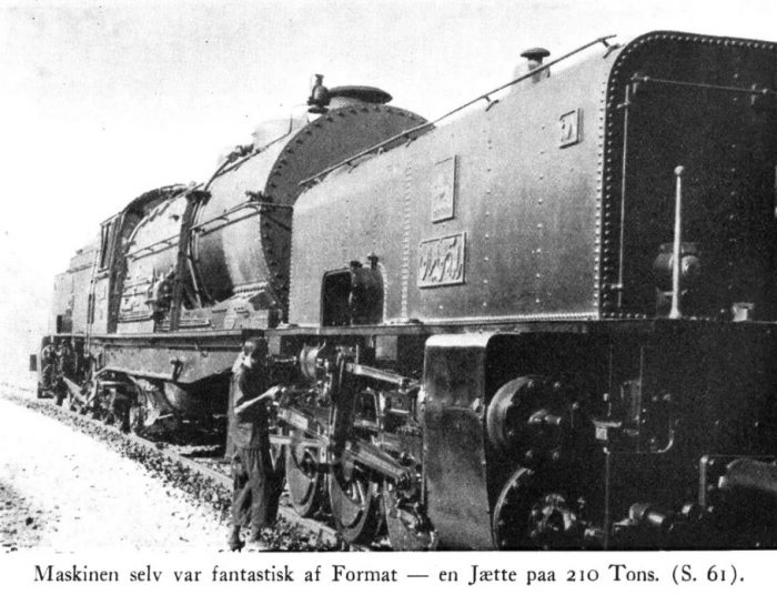
A giant Beyer-Garratt Locomotive which weighed-in at 210 tons. [1: p61]

Michel floored the accelerator, and we had probably sat for a quarter-of-an-hour on the platform before the sound of a train could be heard from the Tunnel. A large, yellow spotlight appeared inside the dark hole before immediately fading into the shining sunlight as the hissing monster of a locomotive pushed out of the tunnel opening. Slowly, the train pulled forward and stopped in front of the small station building. It consisted of a long row of goods wagons, a mail van and one passenger coach carrying with Iranian Technicians and railway workers. The locomotive itself was amazing. Its format and construction far removed from the usual perception of a locomotive. Beyer & Peacock, of Manchester could be seen written on the boiler. A giant Beyer-Garratt Locomotive which weighed-in at 210 tons.

“Yes, it’s a British locomotive,” said Karl Olsen, a so-called ‘Garratt’, specifically designed for railways in difficult mountain terrain with tight curves and steep gradients.  As you can see, it consists of three parts, the boiler in the middle and two steam engines – the one in front carries a large water tank, the other includes the tender, which contains fuel for the oil-fired boiler. The three parts of the locomotive are interconnected in such a way that they can rotate in relation to each other. An ordinary, large locomotive with a similar traction would be far too rigid to handle the tight curves on the line on the far side of the Gaduk pass. As we drive north in a little while, I’ll show you one of the most remarkable railway routes in the entire world.”

The Garratt locomotive was disconnected from the train, the two the whistle was blown, and slowly the beast moved off on its twenty-eight wheels into a siding, where it stood quietly and chattered to itself – a giant of two hundred and ten tons relaxing after the effort it had made. A large locomotive of a more normal appearance was now attached to the train. The brass letters on the cylinders indicated that it was built by Nydquist aand Holm from Trollhåttan, Sweden. A little later, the train set off south towards Tehran, and we went out and woke Michel, who was sleeping at the wheel of our car.

We had probably driven a kilometre north of the station when Karl Olsen turned towards us and pointed down towards the floor of the car.

“We are now crossing the track,” he said, “The tunnel is just down below.”

The climb in the Elbruz Mountains was over. After a few minutes’ drive, the road cut through a narrow mountain pass and then began to descend towards the Talår valley. A little further ahead, the road and the railway again intersected, just off the northern end of the long Gaduk Tunnel. But now it was the road that was lower. We drove under the track through one arch of a viaduct. As we drove on down the valley we could see that the level difference between the railway and the road became bigger and bigger. Both road and rail were descending from the 2000 metre high Gaduk Pass as quickly as possible – the road was winning the race

The chief engineer suddenly ordered Michel to stop the car and decreed that now we had to “go to the fields for a quick look”. It was a long and rather strenuous climb, after which we sat and caught our breath on the western slopes of the Talar valley. On the horizon in the East, the peaks and ridges of the Elbruz Mountains spread out. Across from us, but a little further south, a wide valley intersected with the Talar Valley. We could see the railway across the valley on a long viaduct and then it disappeared into the mountain opposite. Another line emerged from the valley floor below the viaduct and continued perpendicular to this into the same mountain a few hundred meters from the first tunnel opening. It looked pretty mysterious. Further north, three railway lines ran above and below each other along the same hillside. If this was the same railway then it looked like a roller-coaster of gigantic dimensions.

Presumably we looked rather disoriented and Karl Olsen smiled when he saw our inquiring eyes. He then pulled out a large card from his pocket.

“Here is a Plan of the Line from Shahi to Firuzkuh,” he said. “Now try to forget that we have come via Gaduk today – it is all easier to understand if we start from the north, up from the Caspian Sea. The ascent from the lowland forest districts and rice fields in Mazanderån up to Gaduk is far too steep for a regular railway to manage it in a straight line. because of the distance involved it would both be expensive and very impractical to construct a rack railway here, so there was nothing else to do but to let the line make a series of fantastic turns and at the same time climb into the hills at gradients as steep as 2.8% (28m per km), which is close to the limit of the maximum that a railway can achieve. Now see how it looks on the map. From Shahi to Gaduk is 82km  but the height difference between the two places is over 2000 m, and this means that the length of the railway needs to be as much as 115 km. Over the first fifty kilometres road and railway follow each other and are almost equal in length, but then the track can no longer cope with the climb and starts to ‘spoon out’.”

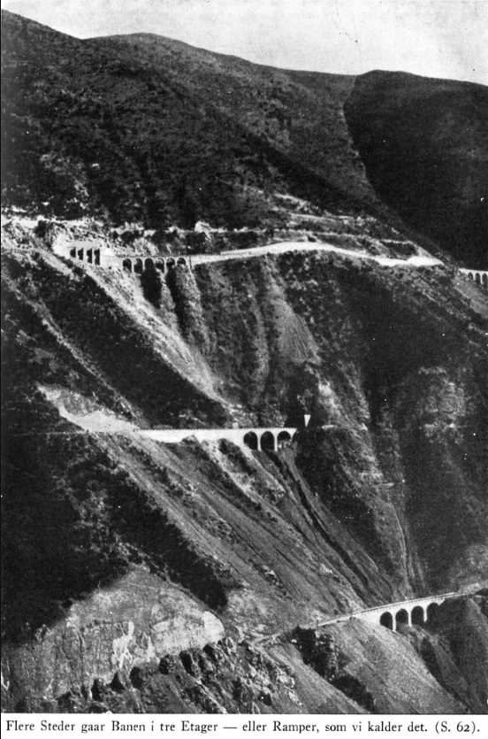
The three-tier railway climbing into the mountains. [1: p62]

Karl Olsen pointed to the map. “Here at Lot 5, the difficulties begin. As you know, we divide the work on the line into ‘lots’ or sections – there are ten from Shahi to Gaduk – and on the map you can see what curves the railway must describe to gain enough height. Several places on this stretch include a three-story railway. We let the line follow tight curves in tunnel maintaining a steep gradient. Then the line runs in the opposite direction before it turns again and runs towards it goal. You can see on the mountain over there what this looks like. The train comes from the north on the lower ramp, turns inside the mountain and returns … along the middle ramp. 4-5 kilometres further north, the train runs through a turning tunnel and then comes out onto the upper level, where it continues south again. That way, you win a couple of hundred feet in height. What you see in the Churab Valley over there is another system. The railway on the Viaduct and the line running perpendicularly to it are parts of the upper circuit of a figure eight. The lower part of the figure eight lies inside the mountain to the south of the viaduct. To understand it best you have to ride the line probably in a work vehicle and with a map in hand.”

Axel and I exchanged a look. “Cartoons,” we mouthed to each other.

Describing labyrinth in a film would be very difficult. Normal images alone would not be enough, but combined with Cartoons it might be possible.

“Going on, the Churab Valley caused us quite a lot of trouble,” Karl Olsen continued. “It was difficult to find the simplest and most economical solution. Several ideas were formed and followed up but none of them were satisfactory. It was the Swede Hacklin, the Iranian State Engineer for the track, who found the solution. At a meeting where the choice was to be made between the proposals, Hacklin came in quite quietly, swept aside all the many plans and drawings and scratched the figure eight onto a piece of paper. When he was done, he quietly listened again and went home to sleep. The other people in attendance reluctantly accepted that his solution was right.”

“If you want a few figures about the route through the Talar Valley, I can tell you that the distance along the road from Lot 5’s northern boundary to Gaduk Station is 29 km, the height difference between the two points is about 1400 m and the length of the railway is not less than 61 km. On that stretch alone we had to build 50 Tunnels and 36 larger bridges.”

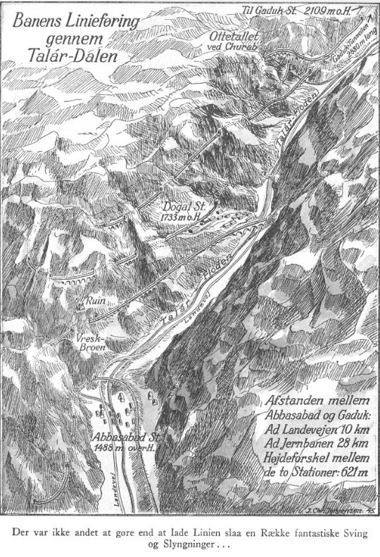
There was nothing left but to let the line take a series of fantastic turns. … [1: p65]

We travelled on North passed the three-tier tracks at Dogal. The lower track runs roughly at the same level as the road and the upper track a few hundred metres up the mountainside. Up close, we could see how difficult it must have been to build these three levels along the mountain. Viaducts, galleries, tunnels and retaining walls all mutually overcoming the  mountain which is furrowed furrowed from the upper tier to the bottom of the valley and scarred by huge slides of excavated material. …

A few kilometers further on, the Valley  narrowed and formed a gorge. On a rock ledge over 100m above the road one could glimpse the ruins of an old fort whose strategic location over the caravan road through the pass was well-chosen. The builder of the castle, however, could not have dreamed that his castle would have a railway as its immediate neighbour!

Further on beyond the pass, the landscape changed character. The valley became wider, and the high mountains on the west turned into soft, rolling, hills. On the eastern side, the mountains were almost steeper than before, and just off the small village of Abbasabad, whose clay-clad huts spread between the road and the almost dried-up river valley, the mountainside was intersected by a deep gorge.

“The Vresk Valley,” Karl Olsen said, “and we are honestly a bit proud of the bridge over it.”

We looked up. The narrow, V-shaped mountain gorge was held together at the top by a slender bridge structure whose elegant arch stood shining bright in the low afternoon sun – a beautiful revelation of modern engineering. We asked Karl Olsen to tell us a little about the Bridge’s Data.

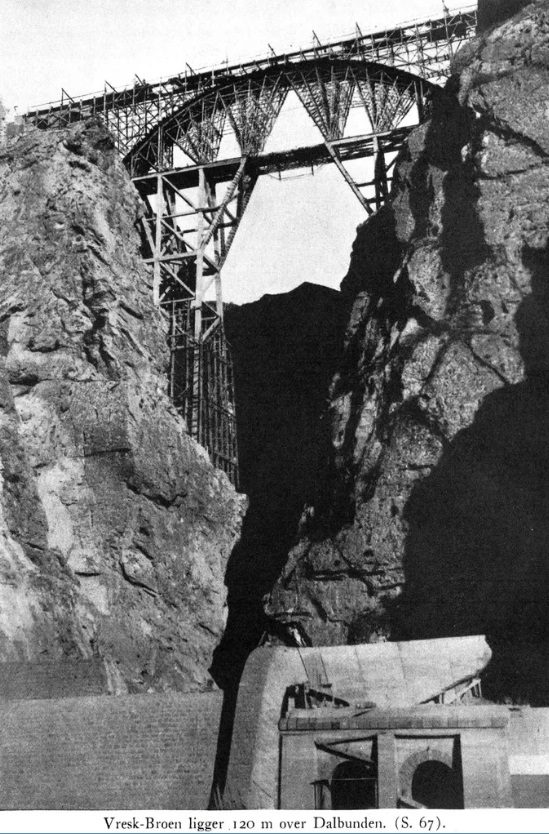
The Vresk Bridge sits 120 m above the valley floor. [1: p67]

“… The bridge is 120 metres above the valley floor, and its length is 86 m. Like most of the bridges up here, it is made up of cast cement blocks – it gives greater elasticity than reinforced concrete, something that has significance in a terrain like this, where earthquakes occur quite frequently.  On 29th July 1934, we had a terrible experience while working here in the Vresk Gorge. The line curves away from Abbasabad Station and enters a turning tunnel that ends just before the ravine, in the bottom of which runs a small innocent looking stream. when planning the project, we had expected a lower bridge that would take the railway across the creek to a tunnel on the other side, through which the line would continue along a long detour to the north and through a new turning tunnel to climb the 120 m up to the Vresk bridge.”

“While we were working on the little bridge down at the bottom of the gorge, there was a prolonged period of rain which caused some flooding, but our calculations still held sway, and no one in the village was worried. In the afternoon of 29th July, a violent cloudburst occurred and in the evening, disaster happened. A flood of water came tumbling through the gorge with tremendous force, a debilitating mass of water, soil, and stone that took everything with it, a swelling so massive that stones of up to half a cubic meter were bobbing along on the surface of the water. Everything that was in the way of this wave was swept away, both the bridgework and part of the village. Unfortunately many lives were lost during the disaster. This little creek … which, in living memory had caused no problems but just trickled down into the Talar Valley in a culvert under the road and with many village houses on its banks, even a large teahouse … caused catastrophic disaster. The river of mud came roaring down the bed of the small creek. Two of our Engineers, the Norwegian Haugen and the Dane Weitemeyer, lived in Kampsax’s House on the western slope of the vealley. They heard a noise like roiling thunder from the Vresk gorge, followed by a crackling, roaring sound and screams from many people down in the village. They rushed there, and it was a terrible sight that met them. The road was torn down, and the village split into two parts. A broad strip, where everything was ravaged, was drawn across the small community. The large teahouse, which was always full of guests at this time, had disappeared, and many other houses were also gone. The flood had unimaginable power – large boulders were torn down through the village and thrown into the Talår River, which was also swollen and several places over-topped its banks. The next day, many mutilated corpses were fished out of the river up to more than 20 km further north.”

“The disaster meant, of course, that the line had to be crossed over the Vresk gorge in another way, and we now changed the project so that the railway went through the tunnel and under the canyon. Over that tunnel section, we built a very broad and very solid channel which took the creek over the railway instead of under it. This prevent damage should the incident be repeated. And it did. Despite the fact that even the oldest residents of Abbasabad had never experienced anything like it, the event was repeated just three years later. ….. Sadly just 6 months after the first flood Abbasabad experienced another natural disaster, a violent earthquake, which occurred at night. Engineer Weitemeyer later said that there had been a strange, eerie mood all day in the village. The dogs were moaning, and the old Mullahs whispered that there was “something in the air.” Engineer Haugen and he had obviously not believed in the old men’s accident alerts – but on the other hand it really did not surprise them when the earthquake came. Some damage occurred, Kampsax’s large hospital building which sat above the village was badly damaged, but in comparison with the flood, the city escaped relatively unscathed.”

“Indirectly, this earthquake, nearly cost Engineer Weitemeyer his life. Every year, the Persians celebrate a religious celebration in memory of a Muhammadan martyr, Hussein. According to tradition, it takes the form of a kind of passionate game with a procession in which the participants – and often the spectators – experience religious ecstasy. In the past, it was common for them to whip or cut themselves. …. The mullahs in Abbasabad had done what they could to excite the people before the celebration, including telling them that the earthquake was an outpouring of Allah’s wrath against these strangers – Faranghi – who went around drilling holes in the mountains to no benefit to the world. As the procession, followed by a mighty crowd of spectators, passed through the town, Weitemeyer was so careless as to try to photograph it. Although he was some distance form the festivities, it was noticed, and a moment later, he was surrounded by hundreds of excited people. The camara was torn from him, and the crowd began to throw stones at him. Bleeding from major wounds to his head, Weitemeyer became unconscious. He was bravely dragged into the police station by Iranian police officers and kept there for a while. Taking him to hospital was not possible because of the risk of further attack from the crowd. He had to stay at the Police Station for several hours, and only when the native workers, who had at first threatened to storm the Station, withdrew, could he be carried to the Hospital. Fortunately, he recovered from the wounds, and the workers soon forgot their anger.”

“Well, now we’d better greet Zimbelius,” Karl Olsen ended, and gave Michel the order to drive up to the Kampsax House.

We drove through the village and up a side road on the western slope. The only houses in Abbasabad itself that did not seem ready to collapse simply at the thought of a flood, were the railway station and the police station. Many of the cottages stood empty and dilapidated – it was evident that while Abbasabad had had a hectic flowering while the railway was under construction, it now seemed ready to slumber again or possibly develop into a decent little station town.

Zimbelius turned out to be a young Austrian engineer in Kampsax’s service who, together with a Danish engineer, Kildehøj, oversaw some additional track installations. They lived in a small stone house a short way up the mountainside with a magnificent view of the Abbasabad Valley and over to the Vresk Bridge which hovered over the deep gorge in the mountainside opposite. The site had previously been the headquarters for the work on the Northern Line, and some distance down the slope lay Kampsax’s Hospital and some Buildings belonging to the Contractors. The office building itself was now transformed into a rest-house, and this is where we would spend the night.

An unusually skeletal Persian Waiter with speckled henna-colored hair came out to the car to take our suitcases.

“Salå-åm Aleikum,” he said and bowed deeply.

“Salå-åm, Ali,” replied Karl Olsen and turned to Zimbelius, who came out of the house, followed by his young wife with a little daughter on his arm. When I greeted Mrs. Zimbelius, who was Austrian just like her husband, she suddenly asked – in perfect Danish – how Mrs. Bolette Lund in Hellerup felt.

I think I looked pretty confused. I think I looked pretty confused.  Admittedly, my lovely old hostess was known as an excellent French teacher, but that her reputation should have reached all the way to Abbasabad sounded a bit strange.

“I can understand that you are astonished,” Mrs. Zimbelius smiled, “but the explanation is straightforward. I lived as a Viennese child with Professor Ejnar Nielsen in Ahlmann’s Alle, where Mrs. Lund was often a guest. She often told me about the students who lived with her and about the crazy things they did, and I think your name appeared quite often in her stories.”

It was a cheerful evening in the young engineer’s home, and it was quite a time before Karl Olsen told Ali to turn on his lamp and escort us over to the little rest-house.

That the first day out on the line left us buzzing. …. The next day our trip continued north. From Abbasabad, which is at about 1500m above sea level, the road descended steeply towards the Lowlands. … Eventually, the terrain becomes so smooth that railway road are easy. The tall, sparsely wooded mountains, now behind us, the countryside was friendly and smiling, with forested hills on either side of the wide river valley. We approached Iran’s dining room, the fruit-barren northern part of Mazanderån Province. One rice field after another appeared. In most of the fields, the rice was harvested and stacked is small golden ‘nests’, Open huts storing rice were surrounded by posts and barbed-wire fences to guard against wild pigs. In several places , the guards were children, whose only weapon was a kind of rubbish or a metal plate on which they hammered to frighten the large animals.

“This is one of Iran’s worst Malaria districts we are going through right now,” Karl Olsen said, “And the mortality among the workers when we built the track here was, to begin with, incredibly high. Engineer Wright, who was the top manager of all the construction work on the North Line, and Dr. Torfeh, the Iranian Chief of the the ‘Service Sanitaire’, organized a huge battle against the Malaria. The entire workforce was handed quinine but they would not take it. Large quantities of quinine suddenly entered the market in Tehran – the workforce preferred to sell it. Then they tried something new. Every day, all the workers were lined up, and health workers went along the rows and put quinine pills in their mouths.”

“When it was discovered that several of the workers pretended to swallow the pills and then spat them out in the alley, they were served the quinine in dissolved form with the order to swallow it immediately and then open his mouth again- to be sure that this had happened. ……”

“The quinine mitigated the worst effects of the malaria, but the disease still ravaged terribly. … The Hundreds of swampy rice fields in the area were excellent hatching grounds for the malaria mosquitoes. Engineer Wright prepared a detailed Report to the Ministry with radical proposals to change things. The case was presented in the highest level, and the Shah was not long in making his decision – all rice cultivation was immediately banned in the districts through which the railway ran. The farmers who cultivated the fields there had to move temporarily to other places or take up work on the railway, and shortly after the fields had dried up, the cases of malaria were reduced considerably. It was a tough but effective decision,” concluded Karl Olsen.

Miånkola – for the stranger, a poetic-sounding name for a small village about 25 km south of Shahi, the city where Kampsax’s work on the Northern Line had begun. For the more dedicated and especially for the engineers who worked on this section during the first difficult year, the name Miånkola will always mean a series of dramatic events that were developing into a serious crisis situation during the construction of the Trans-Iranian Railway.

We stopped at a small cluster of houses on the right bank of the Talar River. It was almost impossible to understand that it was the same river that we had followed all the way up from the Gaduk Pass. It wasn’t just because the river was broader down here in the lowlands, but the landscape it flowed through here looked as if it was in a completely different part of the world. ……

A dense, subtropical forest growth, rich in vines, mistletoe and other spiny plants, spread in most places right down to the river. …

Through the dense scrub we could glimpse the railway on the other side of the river, a little up the slope. The line ran through a cutting and in a couple of places passed through a tunnel that cut into the slope over a longer stretch.

“The difficulties here at Miånkola were something we inherited from the people who had started the work up here,” Karl Olsen said. “I was Head of the Engineering  (or the Technical Bureau, as we call it) in Tehran and had more to do with the theoretical side of the work. The one who could best tell you what happened here is Engineer Wright. What he doesn’t know about Miånkola is not worth knowing …”

What more Karl Olsen told us about the battles the engineers had with the terrain conditions at Miånkola, I have forgotten. I can remember that we drove on to Shahi and that same evening back to Abbasabad.

Not until several years later, when writing this report, did I visit Engineer Wright in Copenhagen and ask him to tell me about the events in Miånkola.

“I came to Tehran in July 1933, as Director of the Kampsax Consortium,” Engineer Wright began, “and was assigned the Leadership of the Work on the Northern Line with Chief Engineer Park as my closest Employee. The Foreign Consortium, which began construction of the track in 1927, built the line from Bandar Shah on the Caspian Sea to Shahi. … The government then tried to build on its own, and up here it was the Swede Lindahl who was given the leadership. The work on the excavations for the track was then sub-contracted to Tricheron’s, smaller Contractors who each had a stretch of the line, and it soon became clear that the task at Miånkola was much more difficult than expected and caused difficulties which the sub-contractor could not overcome. It was a very demanding job. The slope where the railway was to go was highly water-bearing, and as digging commenced, the ground lost stability There was imminent danger of a landslip.”

“The route of line was not chosen by us and could not now be changed. …  As you know, we had committed to finishing the North Line in four years, and the Shah followed the work with the greatest interest. He still kept a close eye on progress, and regularly drove along the line, at least twice a year, so that he could see progress with his own eyes.”

“In November 1933,” Engineer Wright continues, “the Shah came to Miånkola, where I had the opportunity – with the Minister of War as an interpreter – to explain to him the particular difficulties we had and the precautions we had taken to overcome them. The Shah seemed to be pleased with the situation and invited me to be his guest at the races on the Turkmen steppe at Bandar Shah a week later.

I myself was not so confident. I knew we had a way to go before the difficulties were overcome. In particular, there was a place near Miånkola where the risk of a major landslide was very high. Several minor landslides had already occurred at this site before we arrived. It was initially intended to take the line across the protruding slope in a cutting, this was revised to using a cut-and-cover tunnel. However, nature itself had its own ideas. Before the Tunnel was completely finished, the ground on either side of the line pushed in on the half-finished tunnel walls. The walls were strengthen by timber frames but they moved like cardboard.”

“We dismissed the sub-contractor and took on the work ourselves. We had to undertake new excavations and started to build a new tunnel. As we were doing so, we discovered that the ground was still moving. It was about 500,000 cubic metres of material and it was still moving at about 2cm a day!

taking the railway through this “floating” soil mass was, of course, impossible. We worked out where the so-called “sliding layer” was located, and introduced drainage tunnels that followed this layer, this eventually dried and anchored the soil mass. The tunnel walls were made extra strong and the foundations were taken down to solid ground beneath the Sliding layer – 7 metres down. A couple of thousand men worked day and night for many months at Miánkola, and in addition to our lead engineer at the site, Moses, we sent one of our best people up there, “Shanghai”-Pedersen, a man who had many years engineering experience in China (hence his nickname) and good experience of working in difficult ground.”

“But problems rarely come alone. Immediately after we solved one problem, another arose. This time it was a little further south. Here, too, we worked our way through unstable soils, and between Christmas and New Year some violent landslides occurred, which completely closed a large excavation and buried tunnel workings.”

“Engineer Saxild elsewhere at this time, and the situation was critical. Pressure was placed on Kampsax, and the Shah became impatient. In reality, the whole contract hung in a thread. However, Engineer Kayser, who was the Chief Engineer in Saxild’s absence, retained his composure, and together he and I went up to Miånkola accompanied by Chief Engineers Blach and Park, and the Engineers from the nearest Sections, Austrian Rabcewics and Dane Lehmann. In short shrift, we worked out remedial action, the implementation of which we knew we could guarantee to the Government.”

“But it was not just about purely technical matter,” Engineer Wright continued, “it was very urgent, because the Shah wanted progress ,but was also participating in intrigue, along with others, seeking to paralyze Kampsax at the start of our work on the line. It became a matter of pride for us, that we manage the Miånkola section as well as possible. In order that theses difficulties did not slow the work, … we  built a temporary bridge along the river bank, on which the track could by-pass the problem section.”

“These were exciting months, and I admit there were times when it was quite nerve-wracking. The awareness that 500,000 cubic metres of earth was relentlessly slipping downhill, while over a thousand men worked around the clock to prevent a violent landslide from destroying the new Tunnel, and handling the Shah’s increasing impatience with progress, was not always good for one’s rest at night. But out on the line, there was no nervousness on display. Moses and “Shanghai” took care of our affairs, and although the ground moved significantly before we had it stabilized, the work was completed without major mishap. The Shah was gradually reassured by watching progress, despite all the difficulties.”

“Incidentally,” he said, “our return trip to Tehran was pretty dramatic. South of Miånkola we could see that heavy grey clouds were hiding the Elbruz mountains to the south, and we had not driven long before it started to snow. In the aftermath, there was a hugh snowstorm, and by Sorkhabad, only around 40 km south of Miånkola, the road was completely blocked by snow. It was of the utmost importance for us to get to Tehran quickly to present our plans to the Government. We had to leave the cars, and with great difficulty, we pushed through the snowdrifts on foot to reach Abbasabad, where Rabcewics was living at that time. It was a 10km walk in a strong snowstorm, and frankly we were more dead than alive when we arrived.”

“We had to wait at Abbasabad until the blizzard had subsided and the roads through the Talat Valley had been made fairly passable. With great difficulty, the driver dug out the cars at Sorkhabad, and all available crews were assigned to removing snow, so that we could continue the journey.”

“But it went slowly. After a few days of waiting in Abbasabad, we started driving up towards Gaduk. But again, at Churab, we had to give up, as the Gaduk Pass was completely blocked by the snow. We stayed with Kirchmair, an Austrian Kampsax Engineer who lived in the Churab Valley, while 200 workers were sent to move the snow in the Pass.”

“Up at the Pass itself there was a sad accident during the snowstorm. A caravan had been surprised by the snow at night and had tried to reach the village of Gaduk, which was nearby. Only 200 metres from the village, people, camels and donkeys could not continue and froze to death.”

“I do not know how cold things were on this occasion,” engineer Wright continued, “but several times I have experienced the thermometer showing more than 30 degrees of frost up in the highlands. Moreover, one of the officials of the Iranian Government almost shared the fate of the people in the caravan. It was Chief Engineer Chagakhi, who was on his way to Miånkola to look at the problem of the big landslides. Between Firuzkuh and Gaduk, he got stuck in the snow, and he was fully engaged in digging out when we finally reached Churab. Once he had got rid of the snow and heard what we had to say about the prevailing conditions, he turned round and drove back to Tehran with us.”

“The difficulties at Miånkola were eventually overcome, and when the Shah saw how the work proceeded according to the plan we had set, he relaxed a little. But,” concluded Engineer Wright, “Miånkola is a chapter in the history of the construction that we will never forget,.”

2. The additional material below is also translated from the original Danish. It continues the account by Ingolf Boison about the filming of a hour long documentary. The original Danish text can be found on the SJKPostvagen platform. In some places the text has been slightly abridged. [1] Chapter 10 is immediately below. [1: p93-107]

Chapter 10: Shahernes Shah

“Government officials must show fidelity, impunity, energy and activity. They must endeavour to make the people wise, strong and powerful and to care for their welfare in accordance with my wishes.”

It was not an empty phrase when Reza Shah uttered these words at his coronation in April 1926 at Golestan Palace in Tehran. He needed the complete commitment of his officials to implement the huge reform program he had planned so as to improve the country.

Before he began his speech, the Prime Minister had placed the golden jewel-studded “Pahlevi Crown” on his head … and now sitting on Nadir Shah’s famous peacock throne, he told the important people gathered around him, how he expected then to develop the country. The time of ancient Persia was now over. From a ‘quantite negligable’ the country would now again become a state to be reckoned with, and occupy a place worthy of its historical past.

Reza Kahn, as he was previously known, was born in 1878 in the province of Mazanderan as the son of a reputed officer. Through a long life as a soldier, he had served his country and seen how it had gradually lost its independence and sunk into a sphere of interest divided between Russia and Great Britain. By the end of the previous World War he had become the Colonel of the North Persian Cossack Brigade, where he had been serving since he was 22 years old. It is said that when the English General Ironside served for a time as an instructor of the Cossack Brigade, he persuaded Reza Khan – to whose talents he was not blind – to promise that he would not revolt against the ruling Shah. However, as conditions in Persia became increasingly miserable, Reza Shah decided to organize a coup against the incumbent government, and in 1921, when the foreign political situation created the opportunity, he gathered his forces in Kazvin and went to Tehran. The capital immediately surrendered and a new Government was deployed. Reza Khan became Commander-in-Chief of the Army, later Minister of War and in 1923, Prime Minister. The country’s nominal ruler, Ahmåd Shah, who belonged to the Kadjar dynasty, stayed in Paris, where he … seemed not to care about what happened in Persia.

Reza Shah had not forgotten his promise to General Ironside, but when Ahmåd Shah, despite numerous requests, refused to leave Paris, Reza Khan wrote to General  Ironside, explaining to him the disastrous position for the country and asking to be released from his promise. The English General agreed, and after another vain request to the Shah to return home, Reza Khan let him resign, after which he himself was made ruler and ascended the throne as Shahernes Shah.

And then Reza Shah went on to reorganize his country. He had initiated some cultural and material reforms immediately after the coup in 1921, but now came the serious step towards realizing the great plans he had laid for the country’s future. The first thing he did was to modernize the Army and create peace in the country. The judiciary was changed to accord with more European, democratic patterns and finances were brought under the direction of an American expert, Dr. Millspaugh. Iran is now one of the few countries that is virtually free of foreign debt, and even major reforms have been implemented without the need for borrowing.

It has already been mentioned how the funds for the railway construction were provided through a tax on Tea and Sugar monopoly. … Another important factor in Iran’s financial status, the Oil Concessions, must be mentioned.

In the business world, new modes of operation and methods have been introduced, modern factories are popping up around the country, and the animal in front of the plough is gradually being replaced by the tractor. But this entire reformed program would not be possible without a radical improvement in the means of transport and a thorough enlightenment among the people. Iran’s 15-16 million Inhabitants in a country of more than 1.6 million square kilometres (an area 36 times the size of Denmark) should now be closer to, and get easier access to, the country’s products. Reza Shah’s plan was that modern roads and a railway across the country had to replace the old Caravan Roads. And it happened. In 1937, over 20,000 km of roads were built, and work on the Trans-Iranian Railway was so advanced that it was expected its inauguration would be celebrated in advance of the six years allocated for its construction.

Within the cultural realm, development under Reza Shah’s rule has been of an almost explosive nature. In 1923, there were 612 schools throughout Iran. Ten years later, that number had risen to 5339 — plus 22 kindergartens! School attendance is now required for all children between the ages of 7 and 13, and in the village schools, agricultural subjects are also taught during the final school years. In the next generation, illiteracy will become a rarity in Iran. In Tehran, in addition to several modern schools, a large university has now been built with six faculties and a number of other higher education institutions.

For Iranian Women, the 1930s have transformed their existence. From the former secluded life of the Harem, where only the Lord of the House may come, and where any form of knowledge acquisition was considered inappropriate, they have now stepped into life as free and equal members of the community.

Formerly, when an Iranian woman was about to go outside the walls of the home, she was tightly veiled in the so-called Tchådor, a large – as a rule black – piece of clothing that concealed her from head to toe, and which was either provided with a narrow wire or horsehair net in front. Only her eyes were visible.

When the “veil” was removed, it was a breach of centuries of tradition, an event one would expect to shake the Iranian community in its foundations. But the Shah had wisely prepared the ground for several years. He knew that the Priesthood would fanatically oppose the plan, and allowed the development to happen gradually.

The Madjless (the Iranian Parliament ) had, in 1935, passed a new marriage law that significantly improved the woman’s position. In the same year, a women’s company was established in Tehran with the daughter of Shah himself, the beautiful Princess Shams-e-Pahlevi as the Honorary President. The rising enlightenment and the women’s own desire for liberation led to less strict adherence to the veil – the days of the Tchådor were over.

Arthur Christensen talks in his “Cultural Sketches” about the historic day in Tehran – 8th January 8 1936 – when the veil was officially abolished and the European clothing was introduced. At the inauguration of a new school, the Shah drove through the main streets of the city, led by his two daughters, Princess Shams and Princess Ashraf – both in European clothes – and at the party, the Ministers came with their wives, …  The Shah gave a speech to female students, reminding them that while the women did not count on the censuses of the past, all Iranian women had now been enabled to exercise their maternal duties in the right way and at the same time enjoy rights, which are theirs as Members of the Society.

“The Tchådoren has fallen!” –  The news spread quickly across the country, and in the cities most women gradually followed the example of Tehran. Even the clergy got carried away. At the holy tombs of Meshed and Qum, receptions are held, where the highest officials of the mosques were present with their unveiled wives – just yesterday a fantastic and blasphemous thing, which no one would dare to do, now, today a proof of the release of the Iranian woman and of the Shah’s power.

The veil was not only dropped, it was also forbidden. On one of Tehran’s main streets, in the winter of 1938, I saw a police officer walking toward a European lady, who has got out of a car outside a restaurant, and politely, but definitely encouraging her to take off the light veil, which she had over her head to keep her hairstyle …

But out in the remote villages, the new fashion did not arrive so quickly. On our travels around the country we saw many women who had not yet removed the Tchador. In Djamshid, the police were not as rigourous as their colleagues in the capital. … The official fall of the veil was  perhaps one of the most characteristic features of the rapid development of the country. Another thing which emphasized to the world that this was anew era, was the Shah’s decision to change the country’s name from Persia to Iran. The memory of the period of weakness during the Kadars had to be eradicated, so a name was chosen that dated back to the most ancient history of the land, as a symbol of its rebirth. Iran or Argan, is believed to be a name attributed to the common ancestors of the Persians and Indians. As early as the 17th century before the birth of Christ, Iranian tribes from their settlements on the steps of Russia and Turkestan began to descend towards the land between the Caspian Sea and the Persian Gulf, and gradually they established themselves in an area roughly similar to the present Iran.

It was not just through the change of the country’s name, that Reza Shah sought to keep a glorious past in the mind of his people. The new architecture that grew up, not least in the redevelopment of Tehran, styled to reflect ancient Persian buildings such as the palaces of the Achaemenid kings of Persepolis and Susa.

But most clearly, the efforts of the Shah are evident in an endeavour to enlighten the youth of the country – the future of the nation. In schools, history has become one of the most important subjects, and on the sports fields the new generation’s health is being built up. Thousands of Iranian young people are now members of the National Scout Corps, not a copy of the Italian Boy Scouts or the German Hitler Youth, but a Scout movement just like ours in Denmark. We attended a big show for Crown Prince Muhammad Reza at the stadium on the outskirts of the capital. Boy Scouts and Girl Scouts and athletes from all over the country showed up to demonstrate their skills. Their performances were neat, but did not really impress a Dane. The whole thing was so new and sport was still in its infancy in Iran. What made an impression on us was something else entirely.

We had been told that the Crown Prince, now 18 years old, had stayed for a couple of years in Switzerland for the sake of his education and had returned as a happy young man who wanted to be kind to everyone. A couple of times we had seen a glimpse of him as he whistled through the streets of Tehran in his big Mercedes Benz. Now we had him as close as a film photographer can get to someone who is Crown Prince of Iran. Djamshid first thought that 20m as an ordinal mortal should get to the son of his Imperial Majesty. He reluctantly followed us as we stepped a little closer, and then stood  in a very tense state. While filming, we had the opportunity to watch the young, future Shah. He was very elegant in his scout uniform and handed out silver prizes to the winners of the various competitions.

But not a smile, not a handshake, not one word, did he expend on the young people who came to receive their prizes. Stiff as a board, he stood there. … it was inevitable that we compared him to the relaxed attitude of the Danish King at a national match. The Crown Prince of Iran could not even be himself with his scouting companions.

This episode at the stadium had confirmed our presumption that an Oriental ruler – at least a Shah of Iran – is regarded in his country as an almost extraterrestrial being, owed a far greater submissiveness than we in Europe are accustomed to showing our own rulers. But at the same time the Shah had decided that every citizen of his kingdom could telegraph him if they had anything to complain about, and the Telegrams should be dispatched free of charge!

We had now spent a month in Iran and had heard a lot about Reza Shah Pahlevi and also seen many of the great reforms and works he had undertaken. We knew that His Imperial Majesty was not only highly respected by his minions, but also – and rightly – feared. He did not consult about in the execution of his major reforms, and several people spoke to us about just how  uncomfortable it was to feel his wrath. … We had often discussed the possibility of filming the Shah, and one day we were told that our wish would be fulfilled, and in a way we had not dreamed.

“We will be at the railway station tomorrow morning at 6.45,” said Engineer Saxild at lunch. “I have been allowed to follow the Shah’s train up to Bandar Shah. He has to go up and attend the annual race on the Turkmen Steps.”

We certainly weren’t late the next morning, on the contrary. At 6.25 am two cars rolled out of the gate of the Kampsax Villa.

First an open Buick Convertible, led by Engineer Saxild in a jacket and top-hat, then our Dodge with Hrairr at the wheel and filled with film gear and bedding. Once Hrairr had driven us and our gear to the Station, he would immediately drive north and meet us at Bandar Shah in the evening. Djamshid was supposed to stay home. The Shah would probably take care of us today – but we had a young Iranian from Kampsax with us as an interpreter.

It was the first voyage His Majesty would make on the completed part of the Trans-Iranian railway from the capital to the Caspian Sea. Maybe he was just as excited about the trip as we were …

As we approached Tehran railway station, … we could see that there was nothing standard about the journey . Police officers stood in every street, and the nearer we came to the station, the closer the ranks became. That morning the general population had to confine themselves to admiring the beautiful building from about 500 metres away – only those with special permits could gain access. In front of the Station gates were some tall, Iranian officers in full regalia, the entire ministry, some officials and engineers from the Kampsax Consortium — all in top-hats, jacket and freshly pressed trousers. Engineer Saxild joined those waiting and we sorted out our cameras. At 7 o’clock the small group in top-hats and clattering sabers fell silent. Precisely at that moment, the Shah’s black Rolls Royce rolled into the railway station. But Reza Shah’s unusual personality meant that he ignored the waiting dignitaries, all of whom had now taken their positions required by the court etiquette when the Shah was in close proximity. He stopped near the civilians and the station gates instead of in front of the red carpet and the imperial private entrance. Out he and the Crown Prince stepped and wandered into the main hall of the Station while the dignitaries scampered to take new places. Having convinced himself that everything was as it should be in the main hall, something he had obviously he had doubted – the Shah, followed by the Crown Prince and the Dignitaries, came out of the main entrance and went to his private entrance. Our cameras spun, and thanks to Shah’s little maneuver, we got a far better picture than expected.

Reza Shah’s power and personality radiated impressively from him. A tall, slightly hunched figure – he was now about 60 years old – in a simple khaki uniform without signs of rank and distinction. His eagle nose and strong eyes reflected an indomitable will. A man, accustomed to command and accustomed to the obedience of others.

The Crown Prince followed his Father at a reverent distance as he entered the private salon. The walls were of light green alabaster, on the black and white marble floor stood heavy bronze furniture, upholstered in gold brocade. After a short rest, the Shah headed down the wide ‘escalier d’honneur’ to the waiting train. The locomotive was Swedish – manufactured in Trollhåttan – as were the elegant First Class coaches and the Shah’s two shiny white carriages at the rear of the train. One last fanfare from the band on the platform and the train slid off along the Northern Line.

The first part of the journey ran through a comfortless Salt Desert where all life seemed to have been extinguished. A single camel caravan and a pair of large vultures gliding under the cloudless sky only emphasized this reality. But on this day the desert had come alive – soldiers with planted bayonets stood guard along the track and straightened up as Shahernes Shah passed by in his white carriage.

“Chai, Messieurs.” … a white-clad Lakaj servant stood in the door and reached out with a tray of steaming tea glasses. Sabi, our Iranian interpreter, explained that the tea was from the Shah’s private Plantation in Lahidjan, the finest country could provide. Exactly every half hour, the servant came back with new steaming glass … “Chai, Messieurs, s’il vous plait. …”

We now entered the Hablerud Valley, surrounded by rugged mountain formations, often of the most unusual shapes, and whose colour scheme is simply stunning . In the radiant sun, they glowed in different shades from crimson and purple to green, and one roll of colour film after another ran through our cameras.

The Iranian Minister of Commerce, Ala, a well-travelled and cultured man who spoke perfect English, settled in our compartment and asked us about conditions in Denmark. We were just talking about the Co-operative Movement, when suddenly a long-drawn whistle came from the locomotive and the train, with hissing brakes, began to slow and then stopped. The minister turned as pale as a corpse, and everyone stood up. A police officer in the corridor pulled out his revolver and dashed out. The Shah’s heavily armed bodyguard unit, which was located in the front carriage, jumped off the train with the guns at the ready – the halt had happened in quite a desolate mountain range, perhaps it was an assault on the Shah …

In the train there was great confusion. Ministers and officials were gathered around – it was a scandal that such a thing could happen. But what had happened? … Was the locomotive broken? Or was the track blocked? Everyone feared the wrath of the Shah and the heavy consequences this could have. Finally, there was a technician who went to ask the driver what happened. It seems as though a brake chord had been pulled somewhere in the train. This message only helped to heighten the confusion – was there still be the danger of an assault, despite the guard posts and the patrols along the line? Perhaps the one who had stopped the train was in cahoots with the bandits …? When the tension was at its peak, a young, jacket-clad Iranian entered carriage. He was Secretary to Prime Minister Djam and had been in the Shah’s Salon wagon when the train stopped. The young man looked really excited, and when he had told us what he knew, everyone burst into laughter. By the Prophet’s beard, was it not the Shah himself who had pulled the emergency brake! He had asked what the handle on the wall was for, and Traffic Minister Ahy had explained how to use it. Immediately the Shah pulled the emergency brake handle to ascertain, on the spot, whether his subordinates had everything in order. I can almost hear the sigh of relief that came from the Minister of Transport, when the brake worked as it should …

Lunch, now served in our compartments, tasted twice as good on after the recent events. First was a Casserole full of light, large-grained caviar, then a portion of scented pilaf with mountains of rice, and finally oranges, figs, dates and nuts.

We had now passed Gaduk and passed through the long tunnel and on through the figure of eight and the three grades in quick succession and on into the land of the rice fields and primeval forests. The Shah himself owned large properties in northern Mazanderan, and the interest he showed in local conditions was evident when the train, at his request, stopped at one of the small stations. The village authorities and the stationmaster stood with their hands on their stomachs, and the local scouts paid tribute when the Shah stood on the platform and gave his orders. Axel and I had for once realized the hopelessness of complying etiquette. You can’t both film and keep your hands on your stomach …

In the afternoon, we reached the railway station at Bandar Shah, which is located on the Turkmen steppe at the southeast corner of the Caspian Sea, not far from the Soviet-Russian border. Both the exterior and interior of the building were adorned with magnificent carpets. Shortly after arriving, the Shah’s chefs began serving dinner. You sat and balanced your plate, as best you could, on the platform, in the waiting room and in the train. Despite the imperial extras on the whole journey from Tehran, there was no alcohol or spirits served until now. Both golden Dubrowka vodka and heavy spiced Shiraz wine suddenly appeared – a pleasant change from the eternal Chai. Perhaps the appearance of this nectar was in connection with the fact that His Majesty and his companions had left the train at the station before Bandar Shah and had been taken out to the Shah’s palace in the vicinity.

The darkness had rested long over the Turkmen steppe before calm fell over the small station, and soon a peaceful snoring was heard behind the mosquito nets in the compartments and waiting rooms, where Imperial Iranian Ministers and Officer as well as two Danish Film Photographers slept safely after the day’s efforts.

After the races at Bandar Shah, the jockeys really needed a rest – and probably also their horses. Most of the races included 30-40 horses, ridden by small Turkmen boys aged 10-13 years. The same boys rode all day but on new horses each time. The shortest race was 3.6km long, the longest 12.8km. The winner of the longest race took only 16 Minutes and 54 seconds!

In total, the boys rode about 35 km each on the racetrack in a rising heat, which admittedly only reached 37 ° C, but which felt suffocating due to the humid air. For the sake of completeness, we should add that all the young Jockeys had come riding from their villages far away from Bandar Shah and started out for home immediately after the races.

From his pavilion, as an old equestrian officer, the Shah followed events with expert interest, not least the races in which his own horses participated. There were no presentations to make. Quietly and earnestly, he stood looking out over the course, and between the races he walked back and forth inside the Pavilion in conversation with the Crown Prince. During one of these strolls, the Shah came very close to our cameras.

Of course, we sought for a natural approach in our filiming, and for a moment he stared at us – one had the feeling that he could see right through one – then he suddenly turned around, seeming to be anything but pleased with our presence. He called a General and gave him an order, and the General then came straight to us, and shouted a whole lot of obnoxious Persian words. We disappeared at a quite pace! We understood nothing!

When we arrived at Security, Sabi told us that the Shah had said that we could photograph him once, perhaps two times – but three times was too much. …

Axel and I started of south early the next morning with Hrairr and Sabi. We had also met a charming female passenger, a young Swedish Engineer, who had was staying in Bandar Gaz, the station before Bandar Shah. We had met her on the platform the evening before … and had promised to drive her home. When we set off southwards from the port city, Hrairr wanted to follow a shortcut to Bandar Gaz across the steppe, which was as flat as a living room floor to drive on. At first we followed a caravan track which seemed to lead in the right direction. After a while we ended up in a Turkmen village, which provided some excellent film material. … We ran through metre after metre of film. We felt like a couple of school boys playing in forbidden areas without the teacher’s attention.

In Bandar Gaz, after we delivered the young lady to her slightly disoriented husband, we encountered a typical oriental street scene with stalls, donkeys and camels, and in Polesefid, a couple of old men making food on a fireplace. But then things went wrong. In the middle of the recording, a policeman ruched to us and demanded that we account for what we were doing. Sabi managed to soothe things down and he gave us permission to drive on with a promise that we would film nothing more on the way. We didn’t either, but it turned out that the repoprt of our crimes went ahead of us and when we reached Abbasabad we were arrested. The police denied us permission to continue to Tehran before conferring on the phone with the Chief of Police in the Capital. However, we were allowed to go up to Engineer Zimbelius’ home, while Hrairr had to stay at the police station.

When, after two hours, we were allowed to continue, we were aware tthat things were quite heated when we arrived in Tehran. A couple of days went by and we were told that Colonel Seif wanted to talk to us. A secretary from Kampsax, the Armenian Gharakhan, came with us, among other things – as he himself said with a smile – to be able to refer the case to Engineer Saxild if we were to be held …

From his knowledge of things, he thought that the Iranian Police’s attitude was very poor. As we entered the Bureau of Police, a large, blue-painted building on Maidan-e-Sepiih, facing the Imperial Bank, Gharakhan pointed to a hole in the sidewalk, explaining that the gallows used to be erected there until a few years back. Now they undertook executions in the prison outside the city.

We decided to take the fight to the enemy, and, as a lawyer, Axel arranged the case as an attack rather than a defence. … The Colonel appeared to be a small friendly man with dark, wise eyes.

” Look here, Colonel,” began Axel, “we came here to Iran to make a movie that could be of great propaganda value for your country, and then we are bothered by your servants because we are filming a couple of old men toasting their dinner …”

“And a Turkmen village and camels in Bandar Gaz,” Colonel Seif interrupted with a friendly smile, and then he gave us an accurate description of what we had done from morning till evening in the last two days, while simultaneously running his batton over a stack of reports lying in front of him on the desk.

We were mute for a moment. Who could know that the Iranian secret police was so effective? But Axel quickly got on and continued his prosecution, which stated that it was us and not the police who had reason to feel offended, and that not a man in Europe could watch our film if it was exposed of all oriental Colour. When he was done, Colonel Seif rang a bell. An officer came in and stood just inside the door. Whether it was on purpose or if it was just a coincidence, I do not know, but the seconds before the Colonel gave his order were pretty nerve-wracking.

“Chai,” he said finally, and we let out a sigh of relief. He offered us a cigarette, and the case was “settled.” Djamshid was to follow us on all future recordings, and if, with his permission, we recorded cultural scenes, we had to promise to use them only as a flattering backdrop to the portrayal of the progress the country had made under the rule of His Imperial Majesty.

After another glass of Chai, we parted as good friends, and Colonel Seif promised that the police in Abbasabad would get a repremand …

References

  1. The reference information for this material was provided in Danish: Ingolf Boisen; Banen Skal Bygges Paa Seks Aar (The Railway Built in 6 years); http://www.postvagnen.com/sjk-forum/showthread.php/12693-Irans-Järnvägar, accessed on 2nd April 2020. The book referred to is about the making of a film about Iranian Railways – “Iran – Det Nye Persien.” An extract is provided on YouTube: https://youtu.be/1-LDW0e0SRg. Interestingly there are shots of railcars in use as well as steam. The full film can be watched on this link: https://filmcentralen.dk/museum/danmark-paa-film/film/iran-det-nye-persien.
  2. https://www.dfi.dk/viden-om-film/filmdatabasen/film/iran-det-nye-persien, accessed on 5th April 2020.
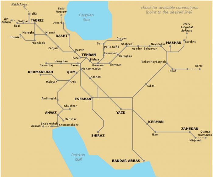
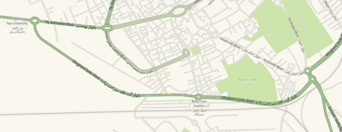
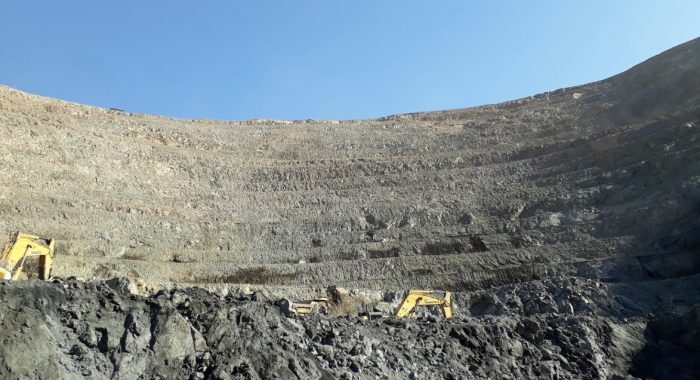
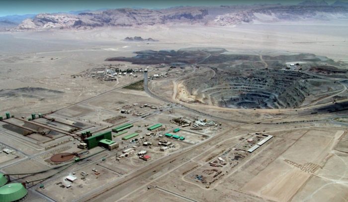
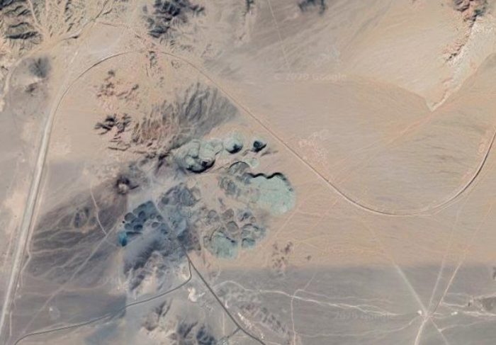
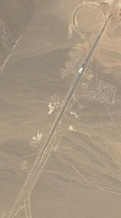
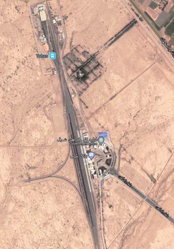
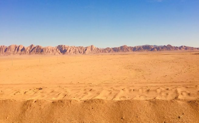
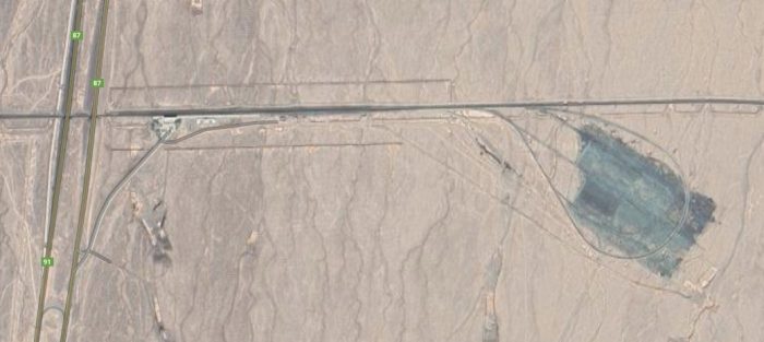
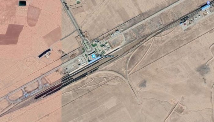
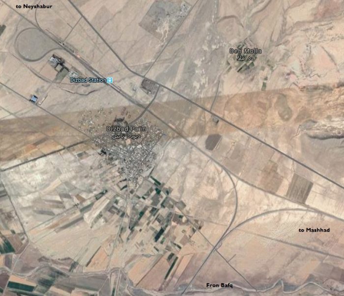
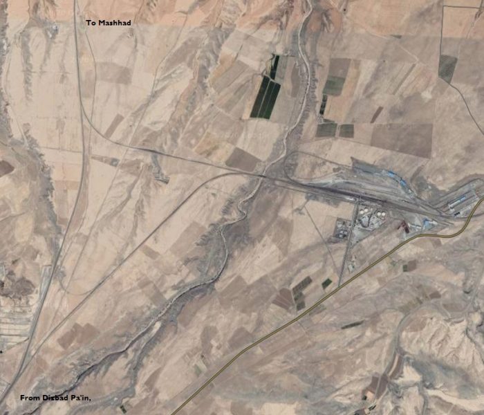
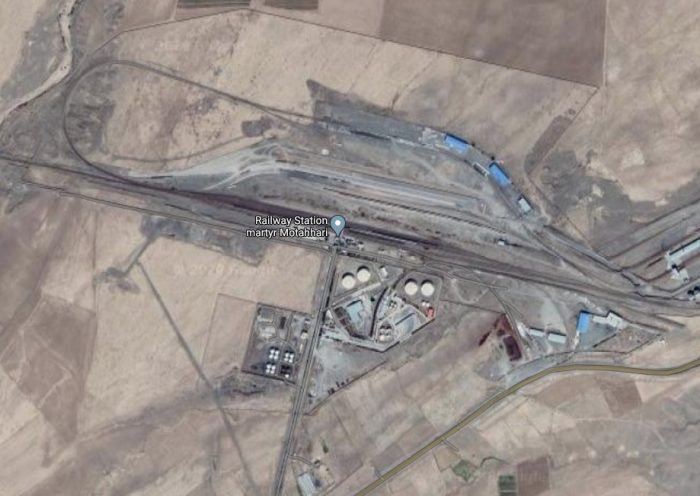
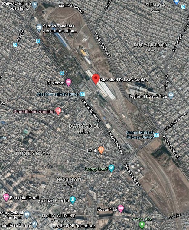
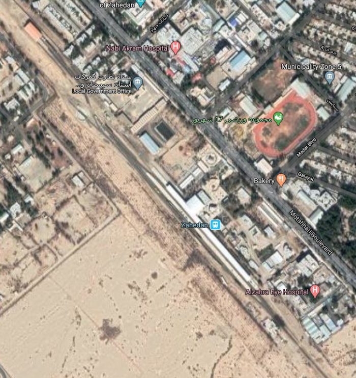
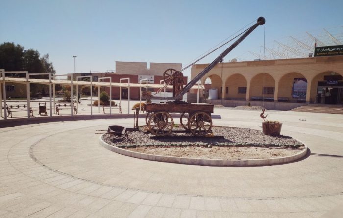
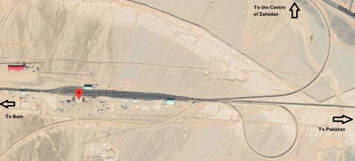
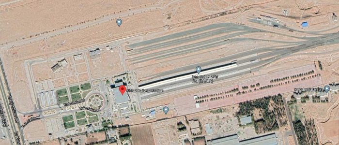
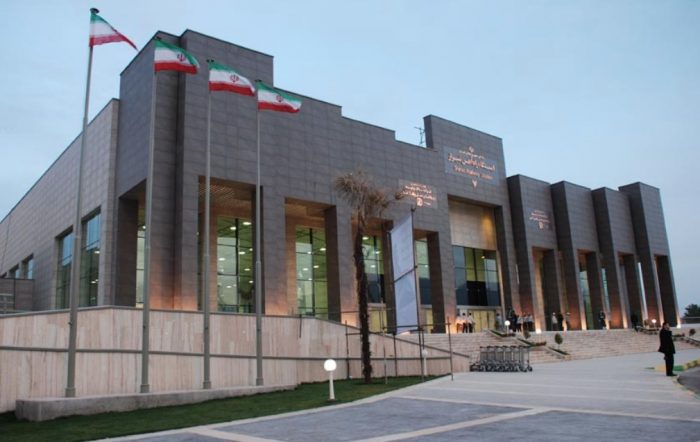
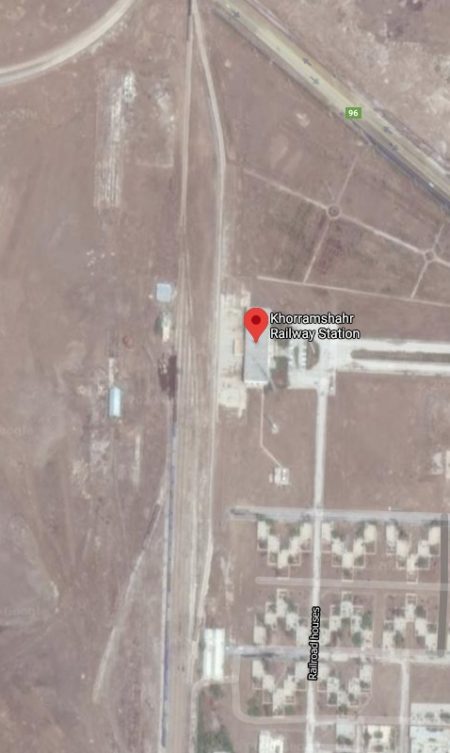
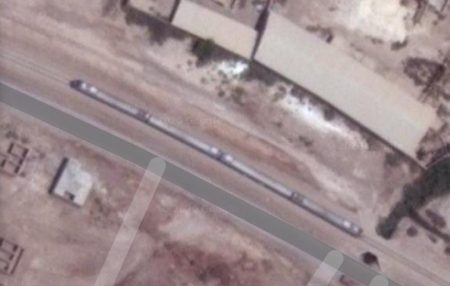
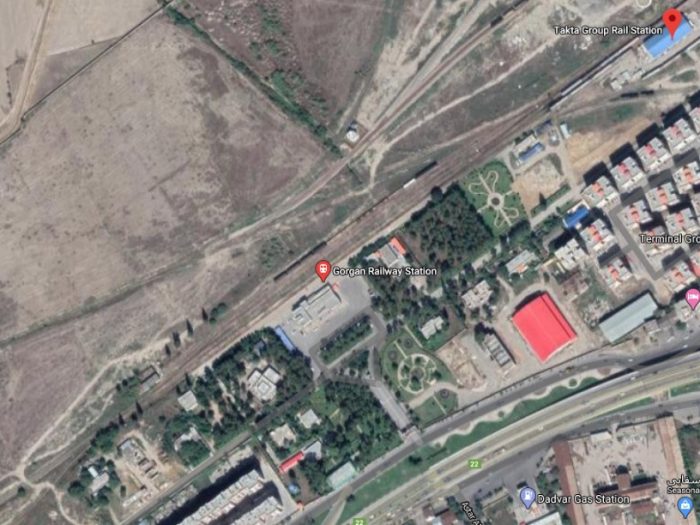
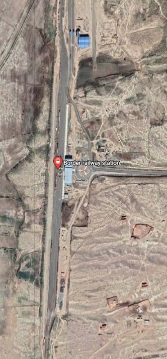
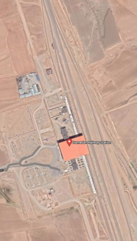
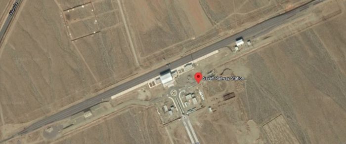
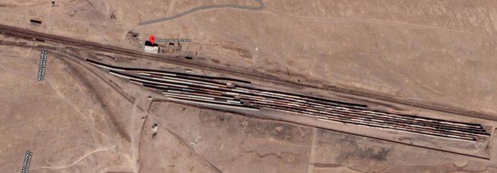
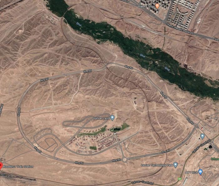
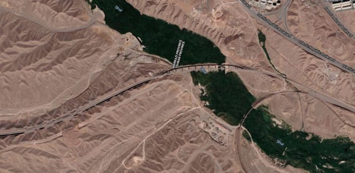
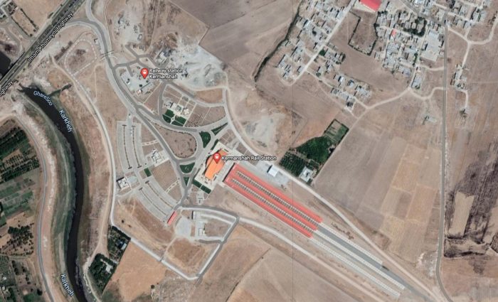
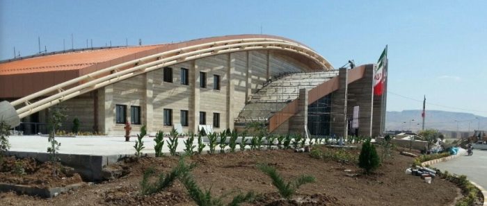
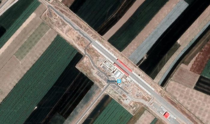
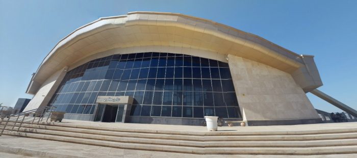
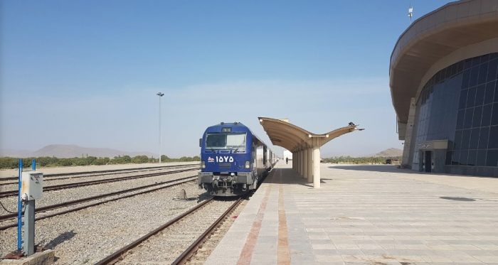
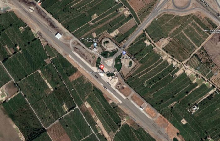
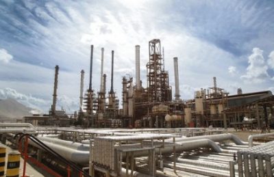
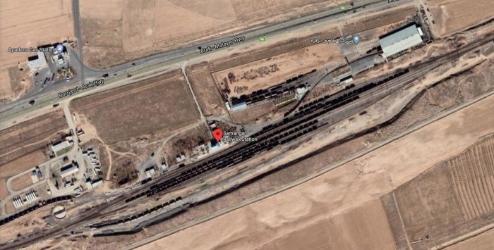
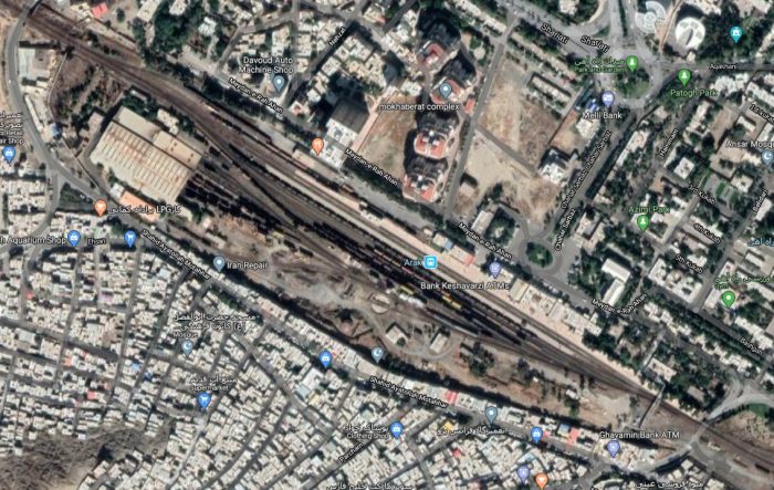
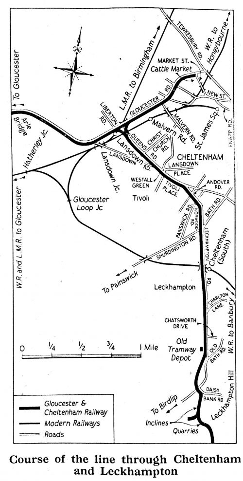
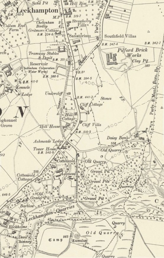
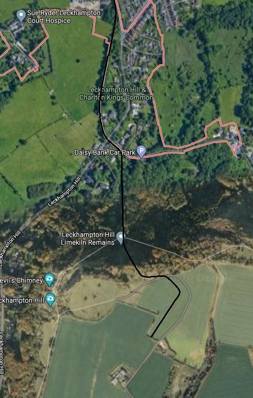
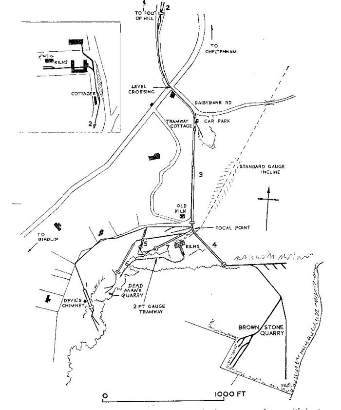
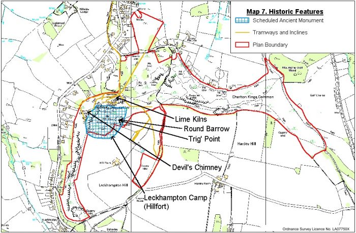
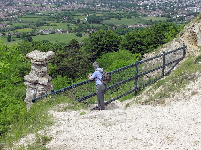
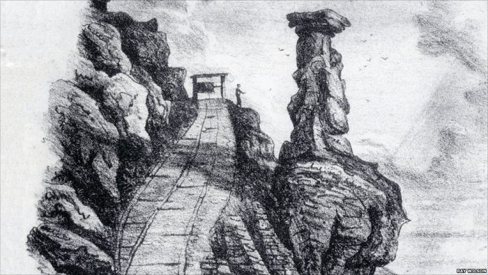
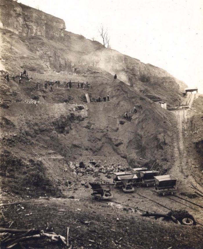
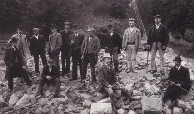
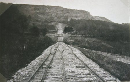
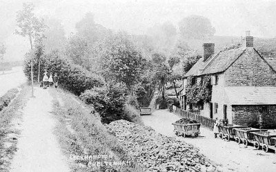
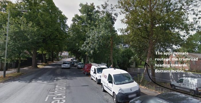
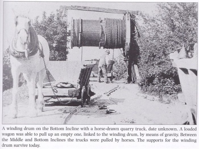
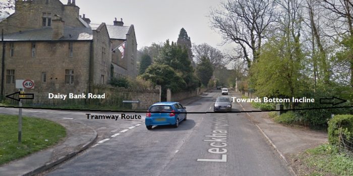
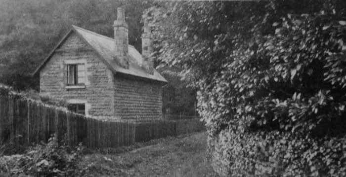
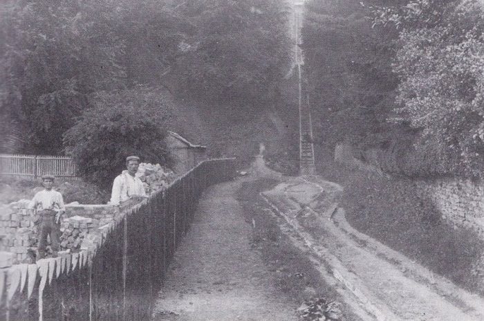
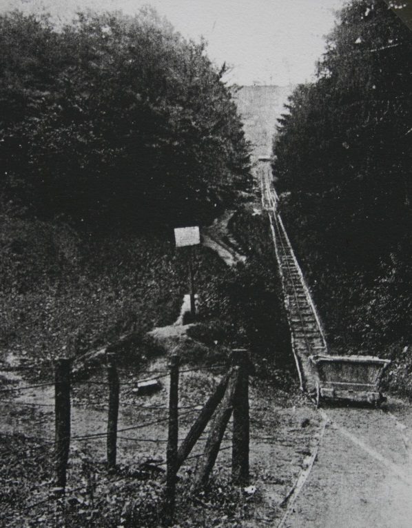
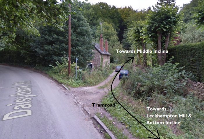
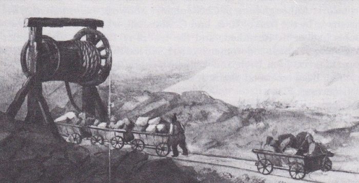
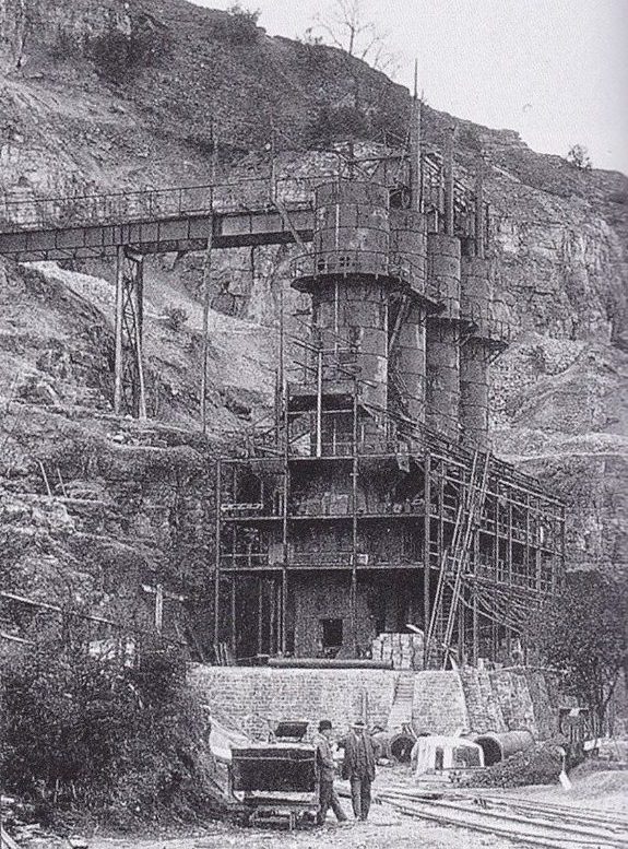
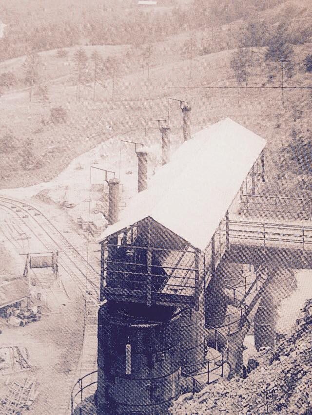
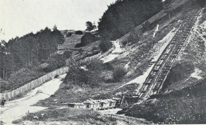
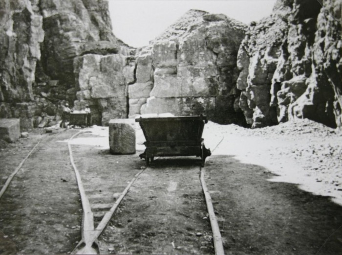
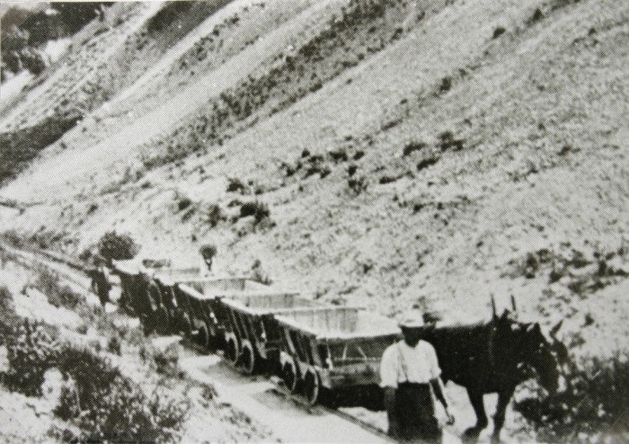
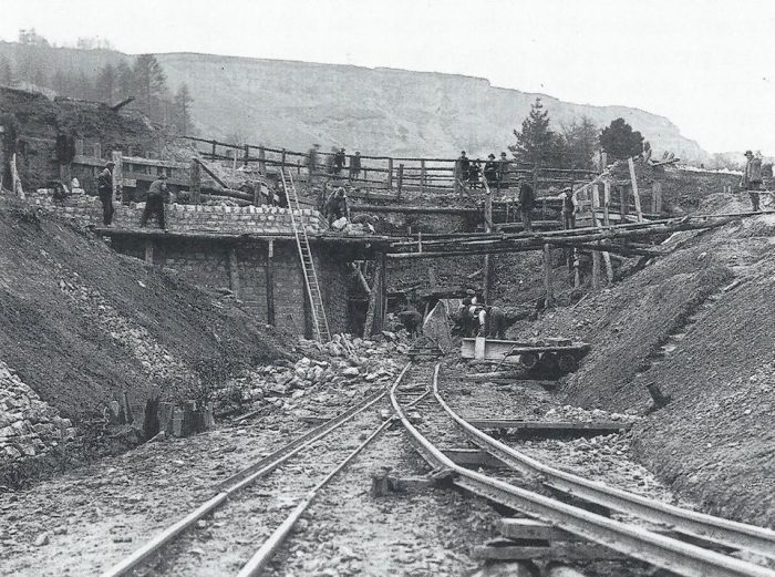
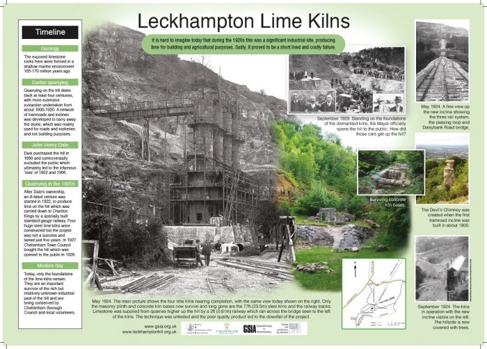
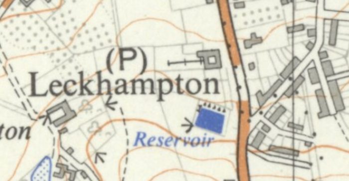
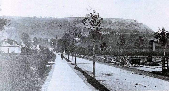
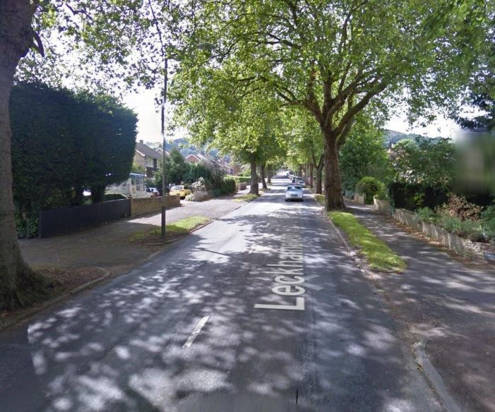
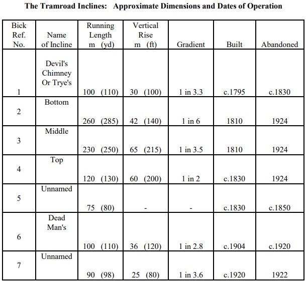
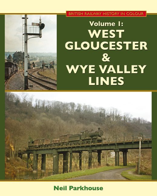
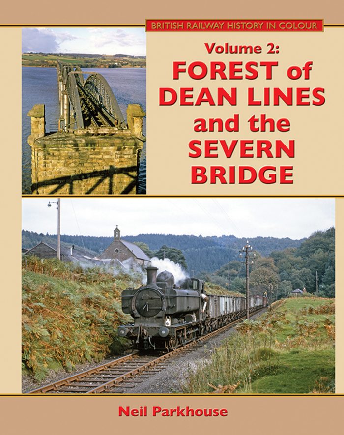
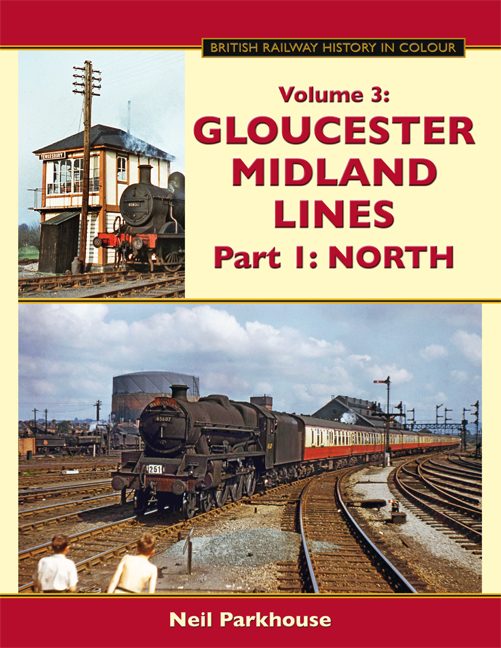
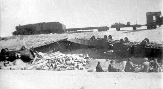
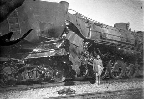
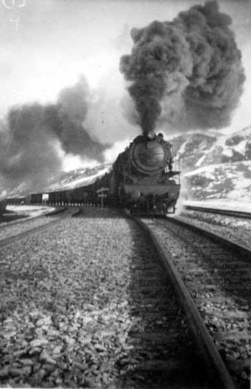
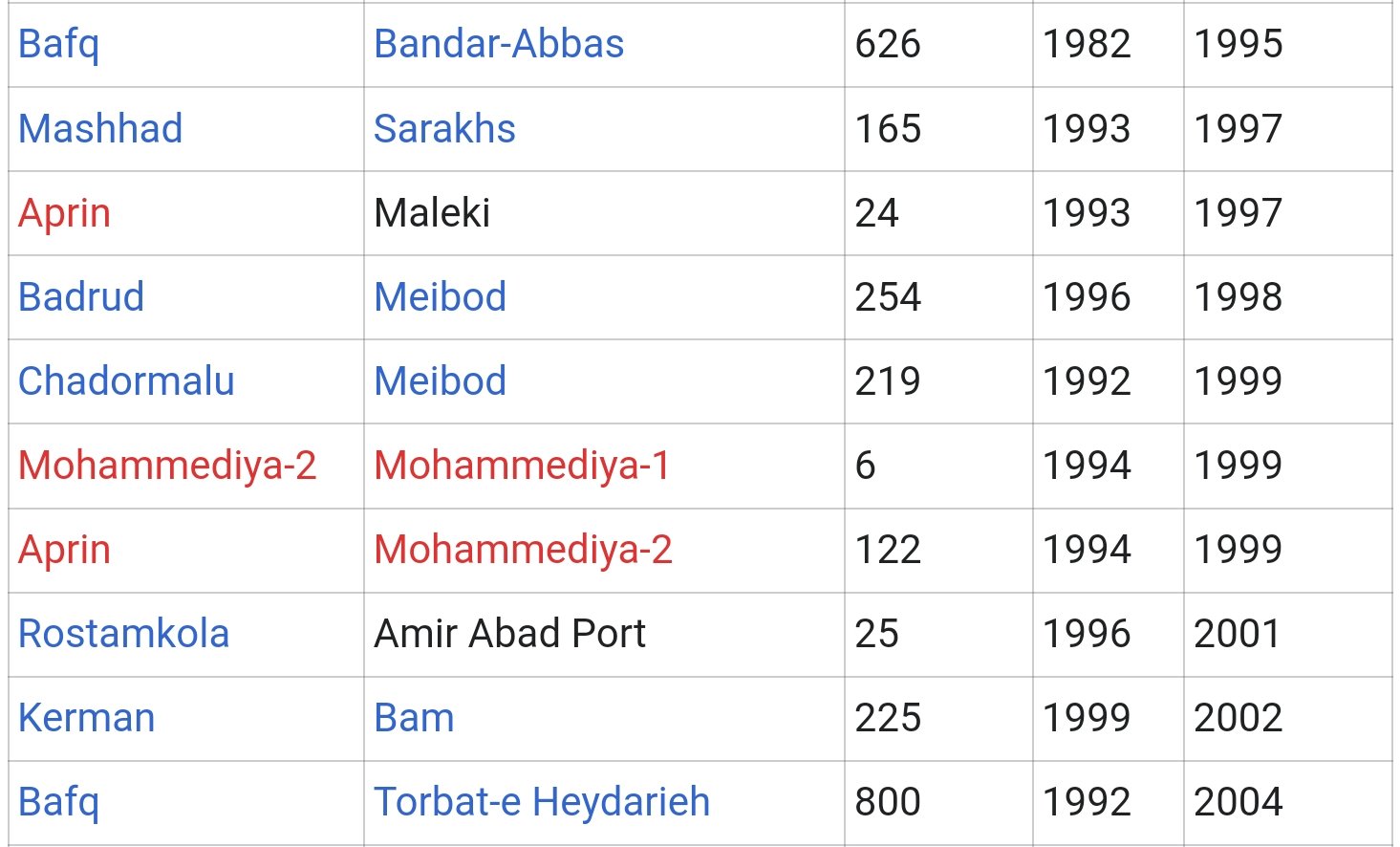
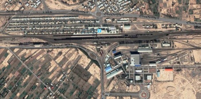
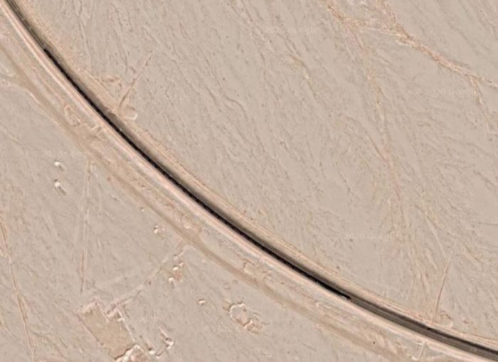
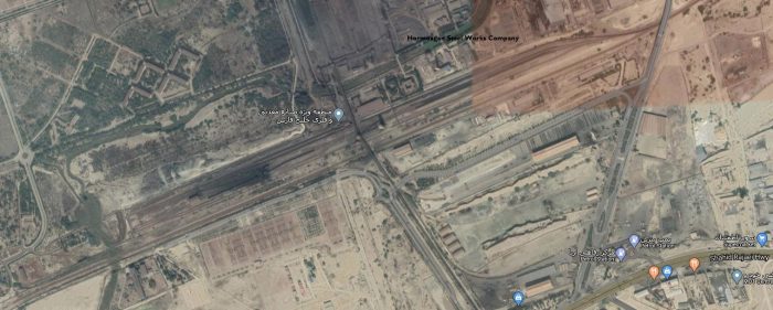
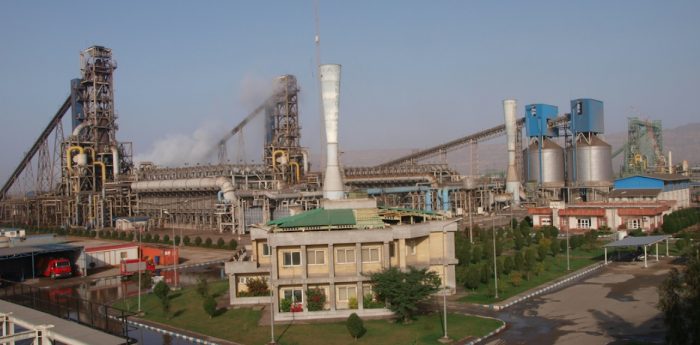
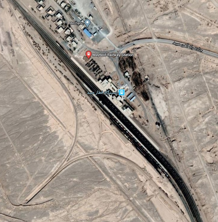
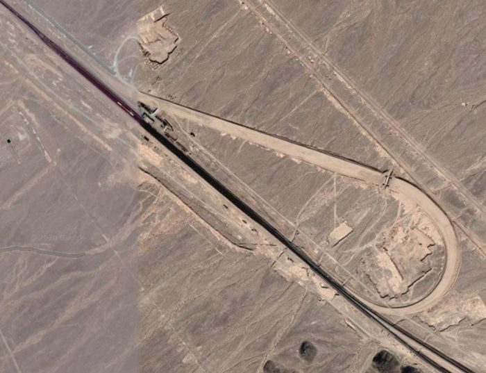
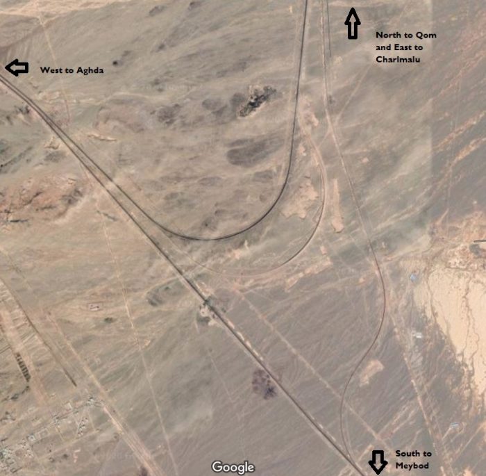
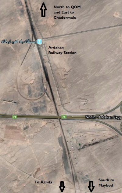
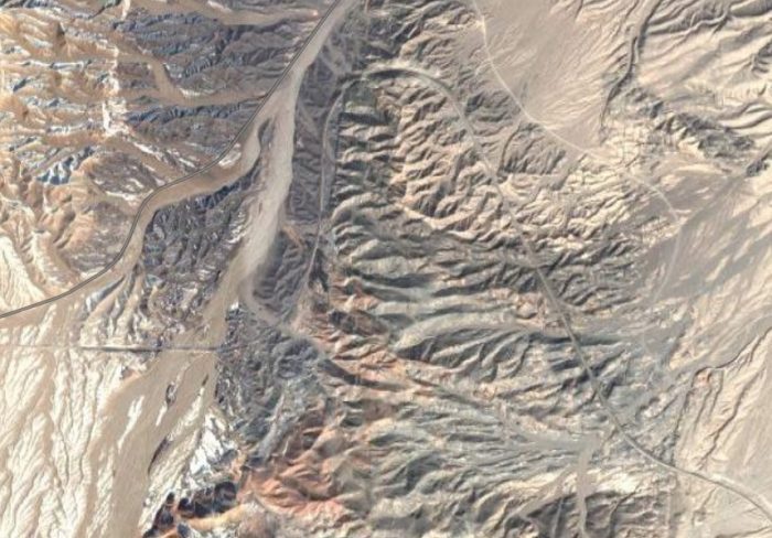
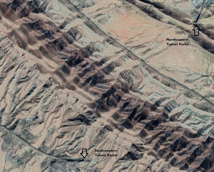
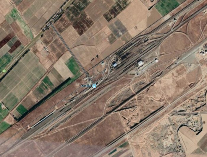
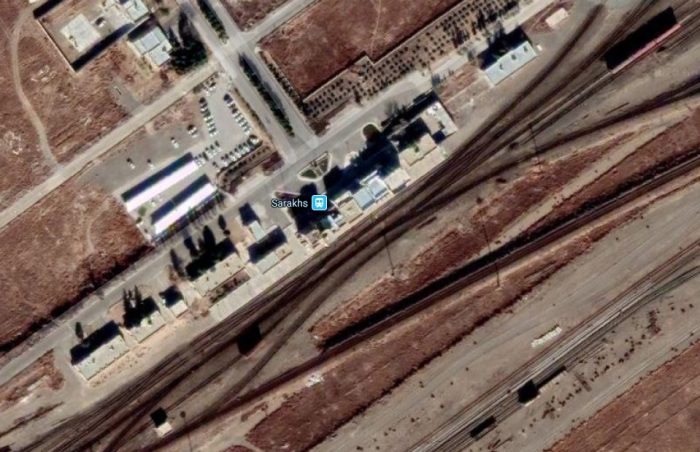
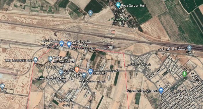
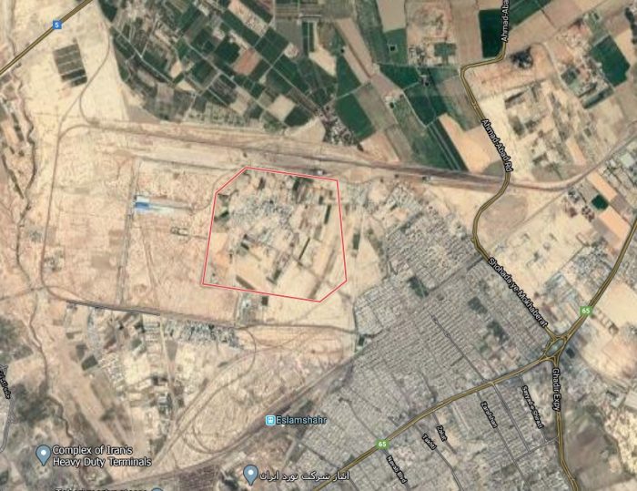
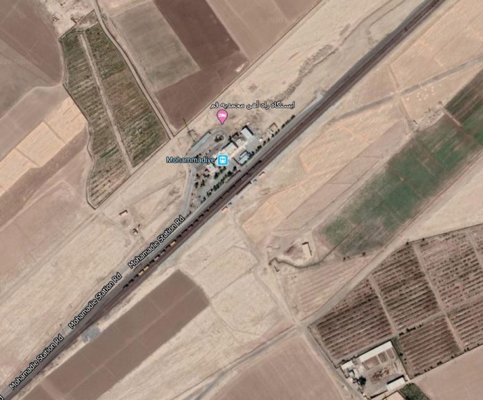
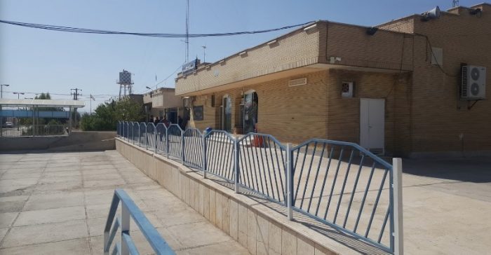
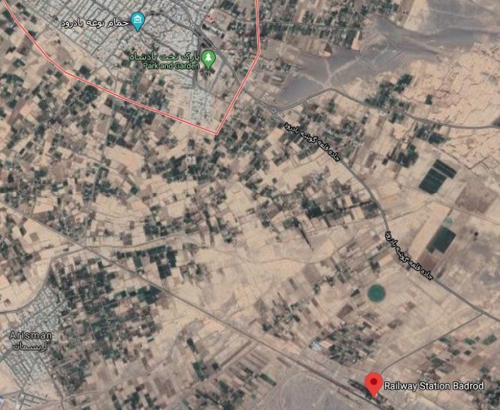
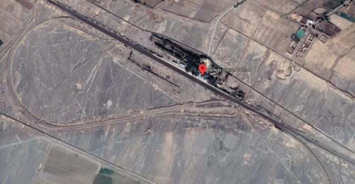
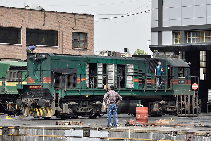
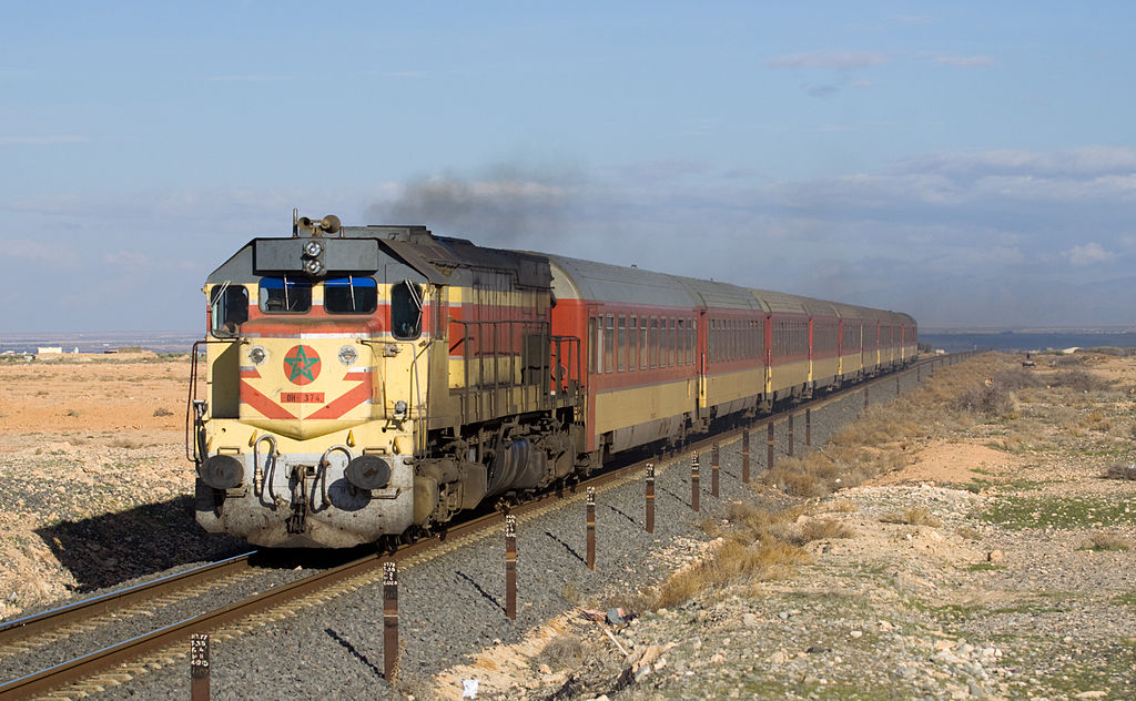
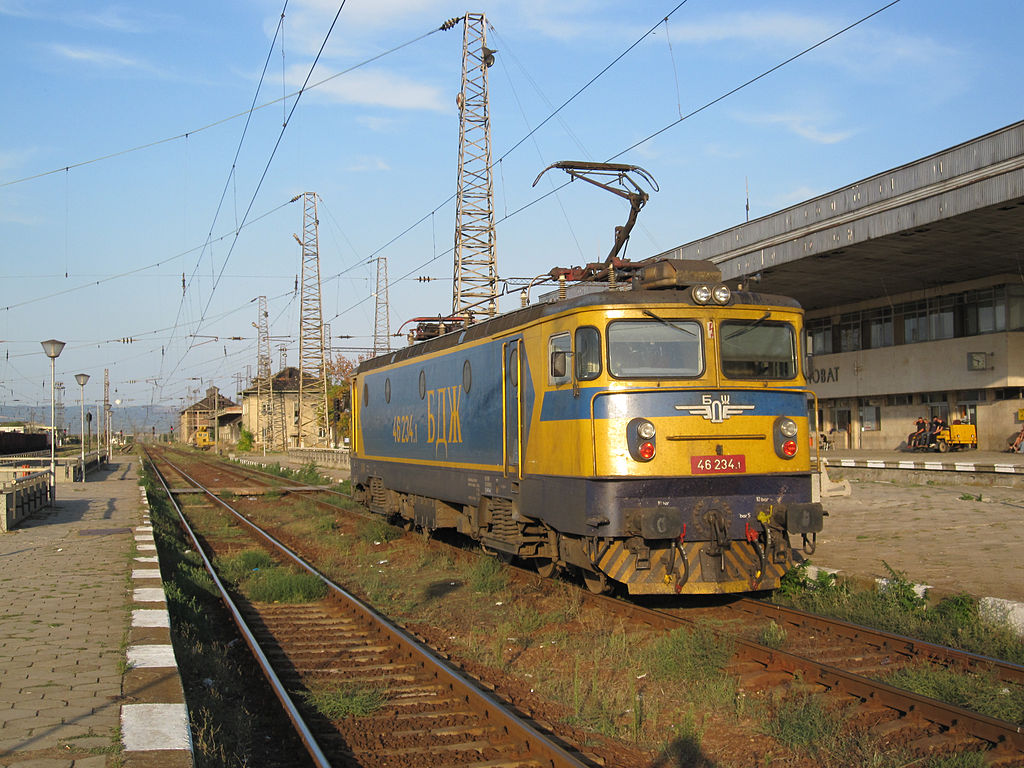
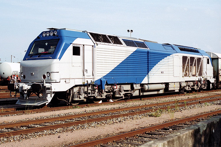
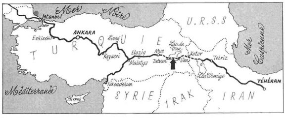
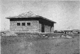
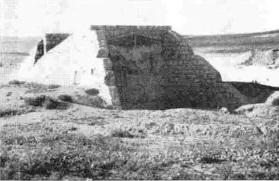
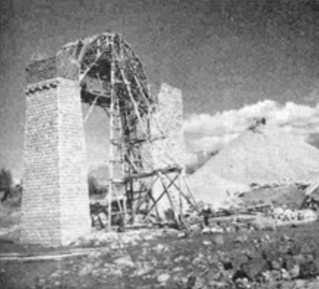
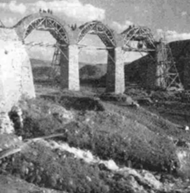
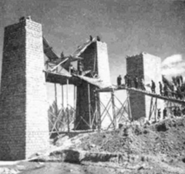
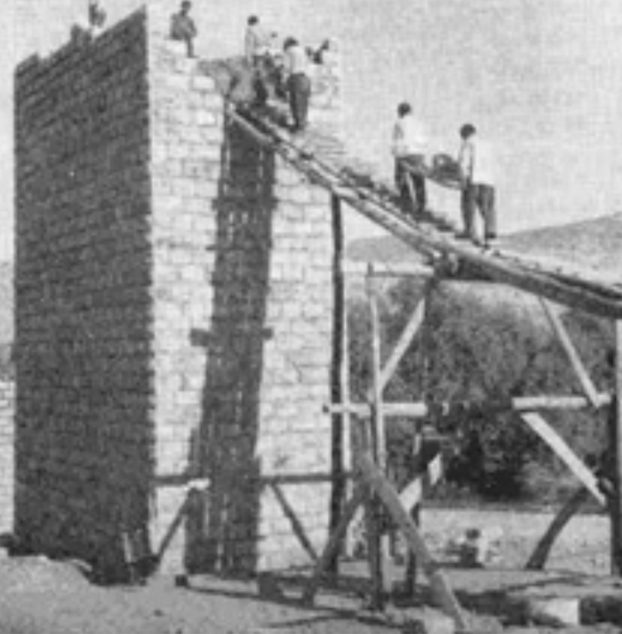
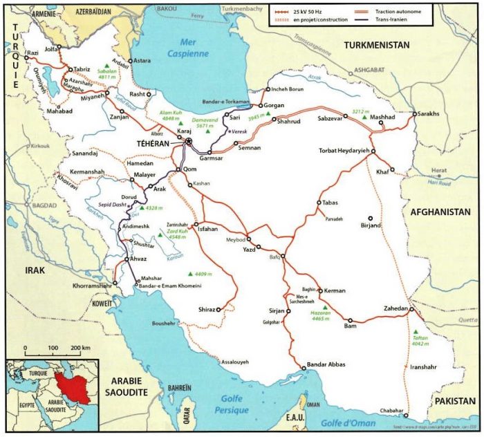
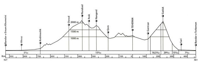
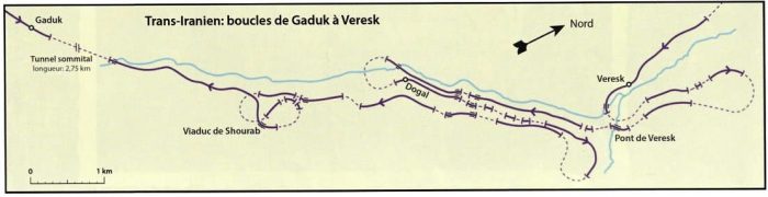
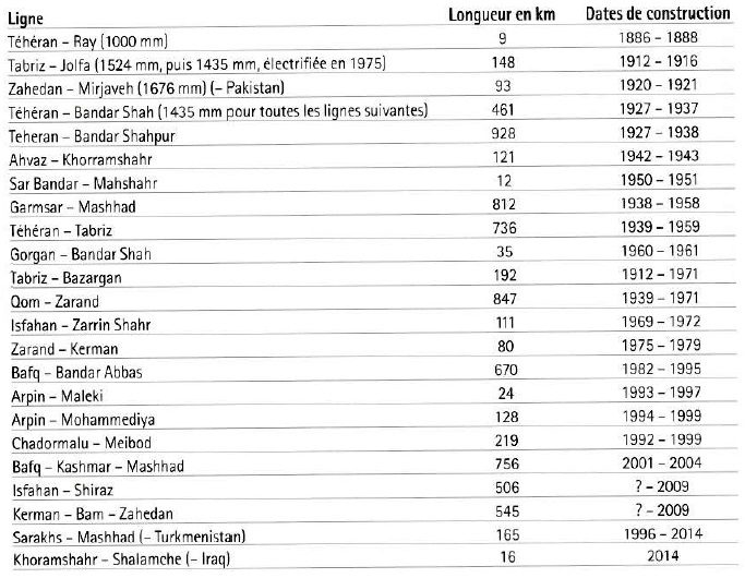
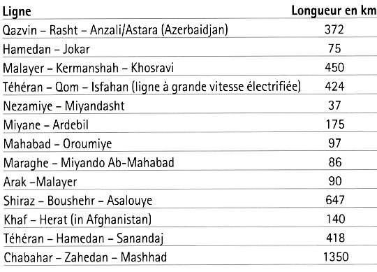
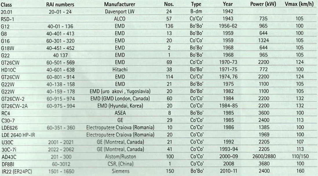
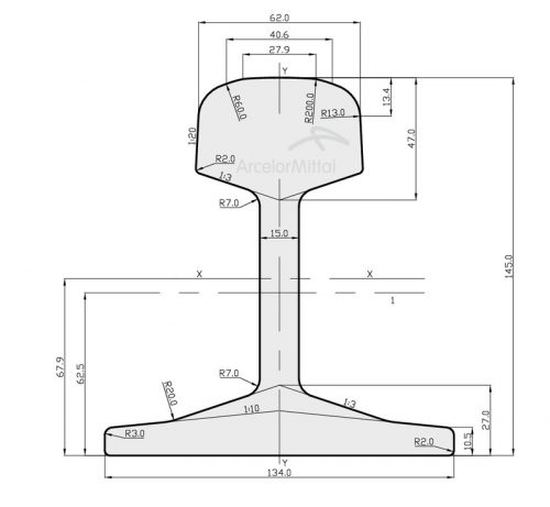
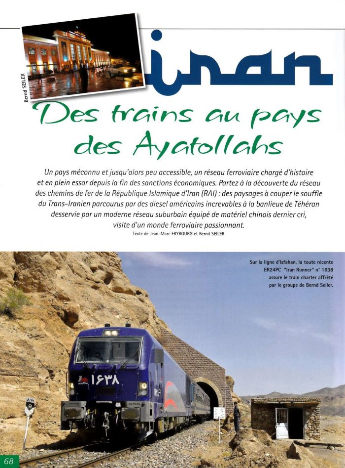
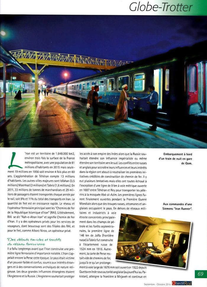
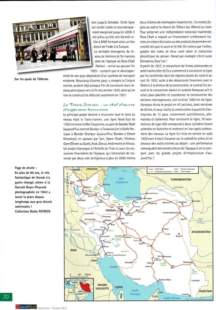
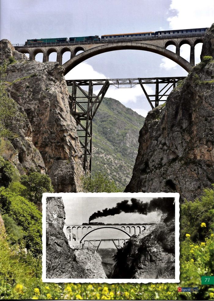
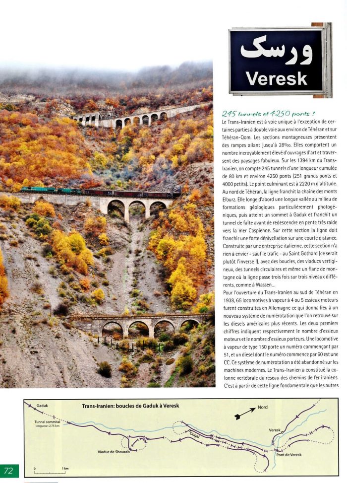
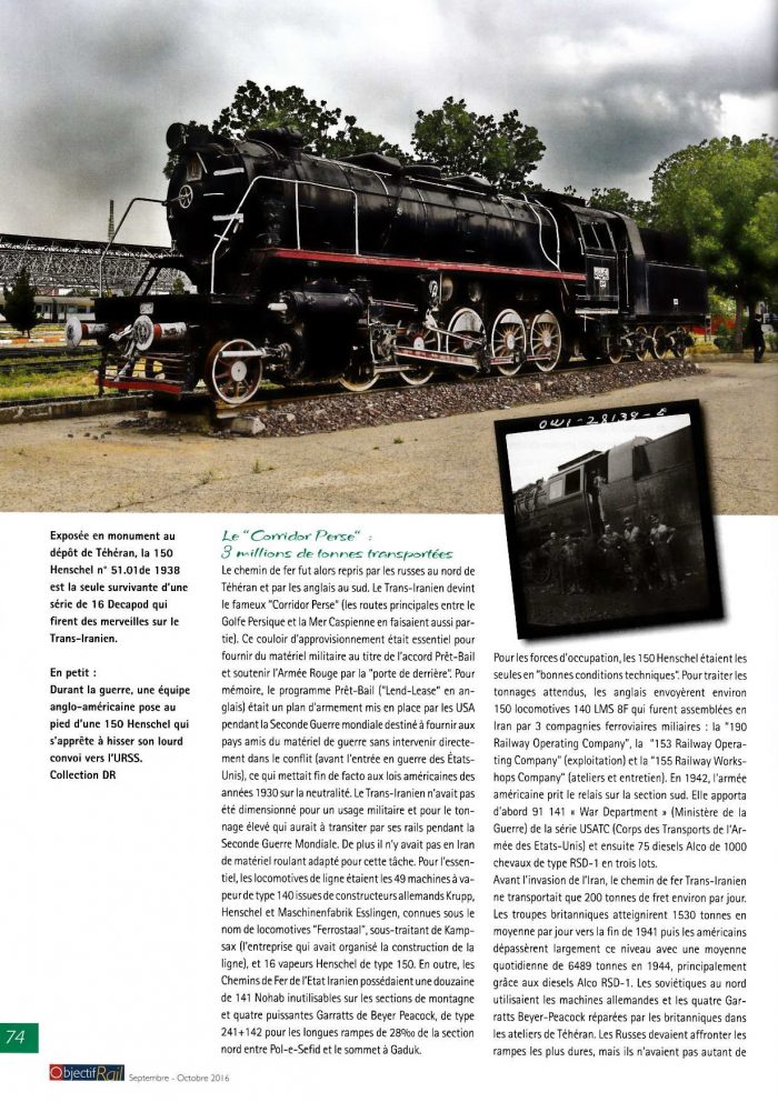
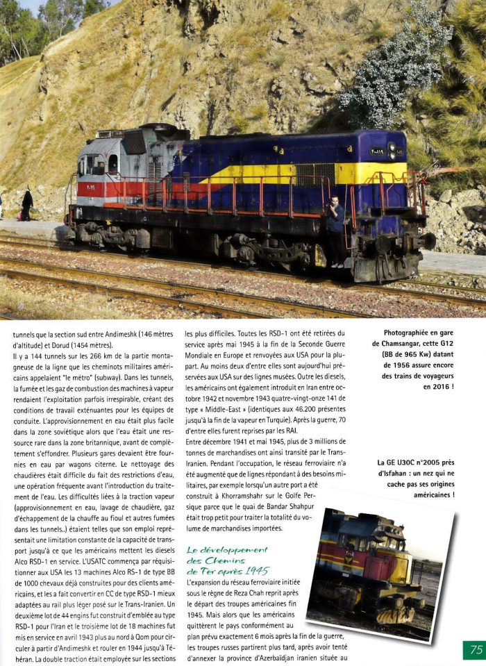
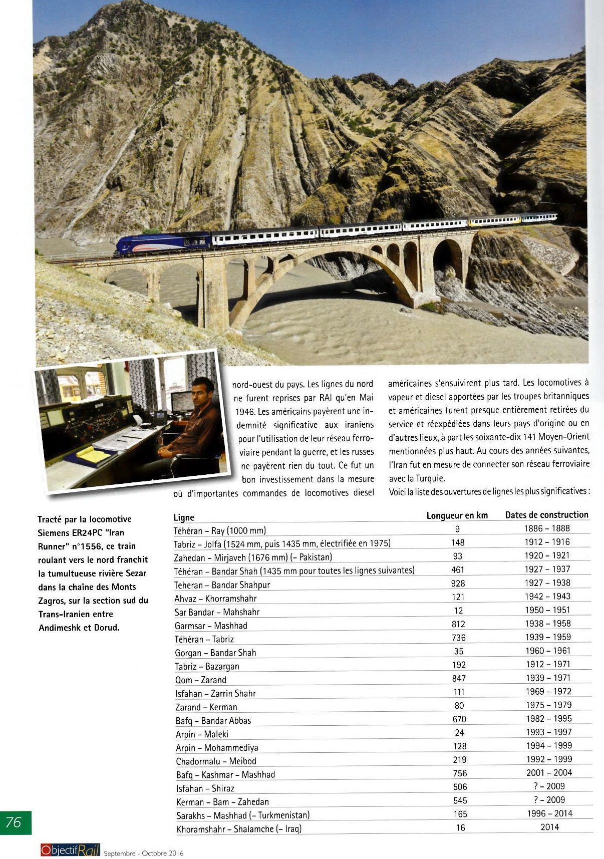
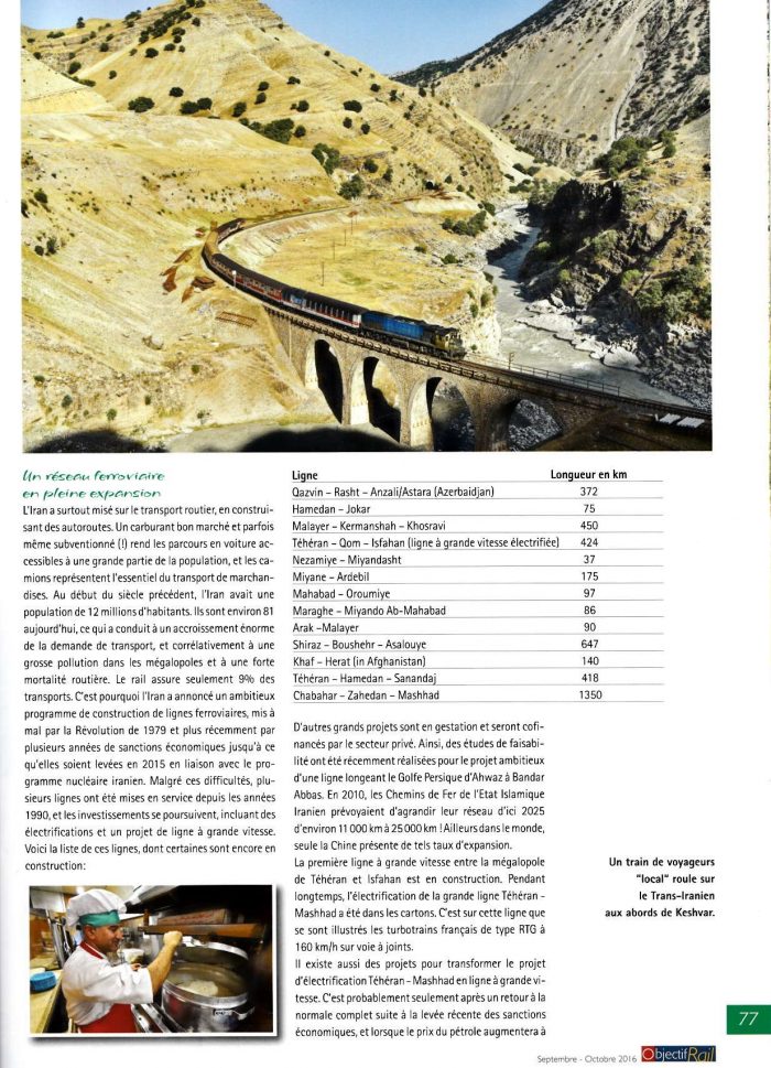
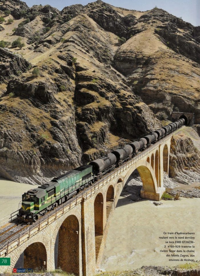
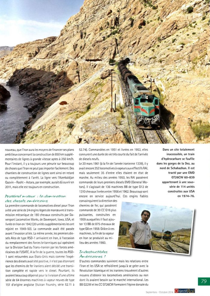
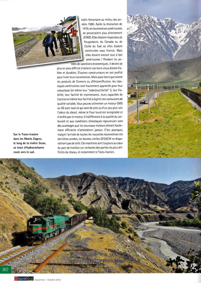
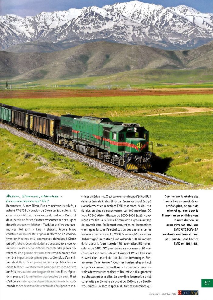
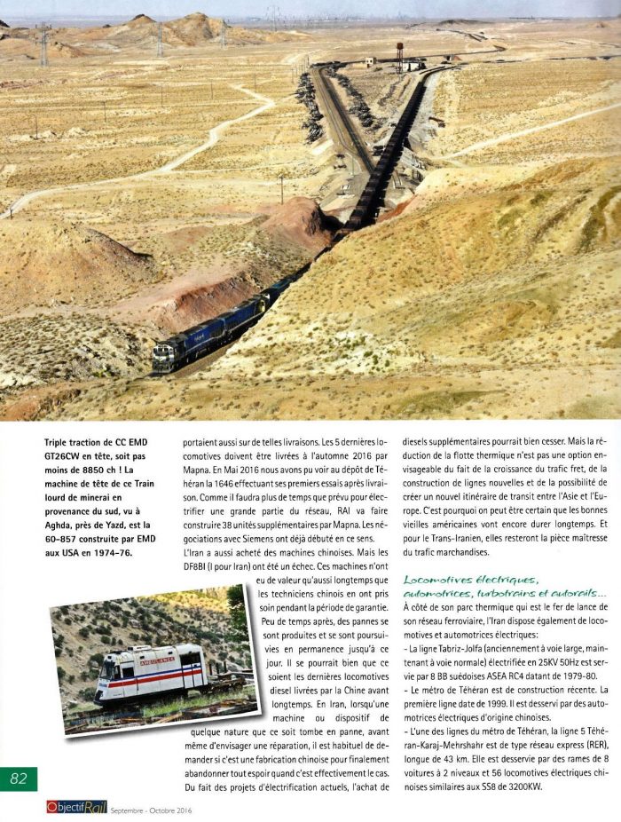
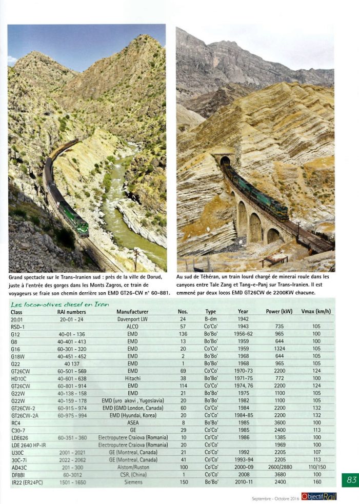
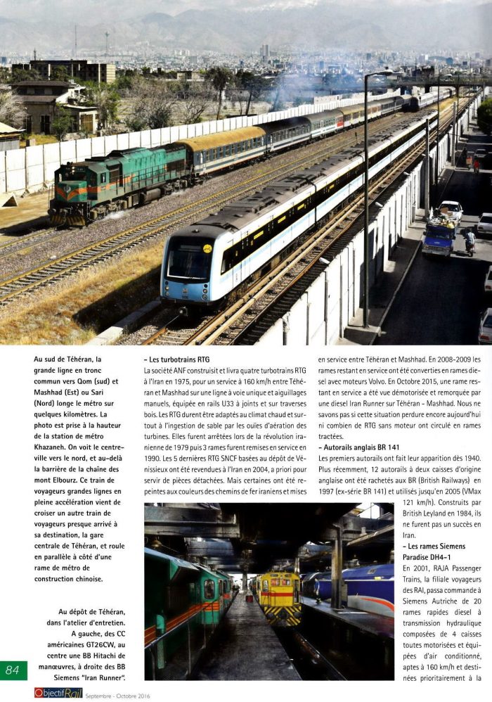
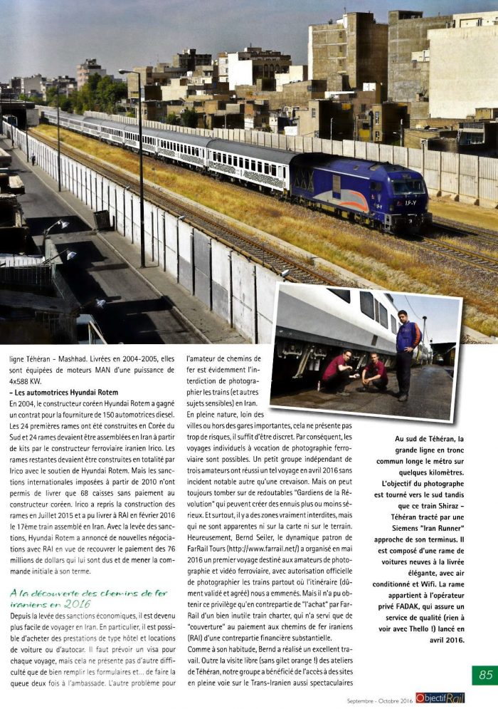
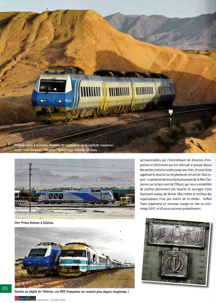