
The travel section of the Saturday Guardian Magazine on 23rd May 2023 included a few pages about train journeys in Europe (pages 72 to 77). This is the fourth part of a look at those pages and includes more reader’s recommendations of journeys by train. It includes a few more uploaded by the Guardian online.
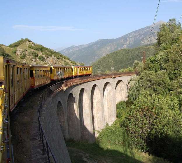
The featured image for this article is a photograph of Le Petit Train Jaune which runs from Villefranche-de-Conflent to Latour de Carol/Enveitg in the Pyrenees, © A1AA1A and licensed for reuse under a Creative Commons licence (CC BY-SA 3.0). [33]
Further Guardian reader’s recommendations for rail journeys can be found here. [2]
4. Readers’ Favourite Railway Journeys – Part B
F. Vintage Locomotives in Tuscany
“We took the Treno Natura from Siena last May for a whole day out in the beautiful Tuscan countryside. It’s a real steam engine with classic coaches. Most passengers were friendly locals: we only encountered two other foreign tourists, a Swiss couple. A band came aboard to entertain us, and an optional walk through vineyards was also available. Fabulous value at only €42 each.” [3][Reader: Nigel Gould]
The Treno Natura (Nature Train) is a restored historic steam train from the 1930s that takes passengers on scenic, slow-paced journeys through the Tuscan countryside, departing from Siena’s main station.
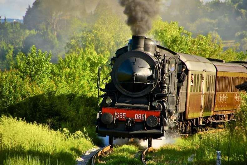
The Treno Natura has a mixed schedule from March through October, to combine a scenic ride with special events like festivals, markets, sagras and food and wine tastings. Departing from Siena, the train alternates routes, taking you to the gorgeous Val d’Orcia, to Asciano, Montalcino and other historic towns, where you can enjoy special food markets, antique markets, festivals or other events. You can also combine your ride with a walk through Italy’s postcard-perfect landscapes, and dine in authentic Tuscan trattorias. [20]
G. Alpine beauty on the Montreux to Interlaken line
“From Montreux station I took the MOB railway to Interlaken. Weaving up through vineyards, Lac Léman shimmers below as the panorama broadens. Suddenly, you’re in pine forests and glimpsing jagged mountain crests. Bridges straddle rushing white water. The clanging and hooting warnings for road crossings. A long tunnel. Then burst into alpine pastures peppered with chalets. Le Pays d’Enhaut. Valleys filled with crisp air, summer cowbells, flowers and crickets – perfect for long walks. Or winter-snow-muffled land, all skis and fondues. Arriving in Château-d’Œx feels like discovering a new world.” [3][Reader: Christian Vassie]
The Montreux to Interlaken line, operated by the GoldenPass Express (GPX), is a 3-hour and 15-minute scenic journey through Switzerland. Thanks to pioneering variable-gauge technology, the train seamlessly connects Lake Geneva to the Bernese Alps without requiring a change of trains at Zweisimmen.
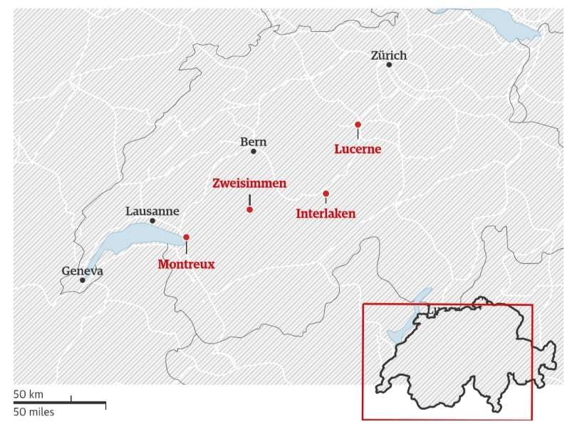
As the train winds up the hillside above Lac Léman’s north shore, leaving Montreux behind, the bustle of the ‘Swiss Riviera’ gives way to the tranquil farming country of the Pays d’Enhaut, followed by the upmarket resort of Gstaad, before a gentle descent to Interlaken, between the twin lakes of Thun and Brienz in the Bernese Oberland.
One of our earliest family holidays abroad was a two week stay in Château-d’Œx. I was probably 14 years old at the time. The memories of the alpine pastures and the train at that time are vague. Much later in my 40s we travelled the line again after a night in Montreux and before staying on a caravan site close to Interlaken. A change of train was necessary at Zweisimmen.
This 70-mile route, crosses the röstigraben (the French-Swiss German language border) and links some of Switzerland’s most famous tourist centres.
Caroline Bishop tells us that since the early 2020s there has no longer been a need to change trains at Zweisimmen. The result of something that counts as a technological first. The Montreux Oberland Bernois railway (MOB) and BLS (the two train companies operating the line) were determined to develop a bespoke bogie which could narrow or widen to fit the different widths of the two railways, as well as adjust to their different platform heights. [21]
At Zweisimmen, The train crosses a special gauge-adapting ramp in Zweisimmen at a low speed of up to 15 km/hr. The train’s weight is momentarily relieved, allowing the variable-gauge bogies to slide the wheels closer together or further apart. The carriage is automatically raised or lowered from 35 cm to 55 cm, to align the doors with the different platform heights. Because the railway networks use different electrical voltages 900 V DC and 15 kV AC, a locomotive is attached or detached during the process. It takes just 8 minutes in all with the physical gauge and height changes happening in just a few seconds. [24]
The video below shows the process: [25]
Incidentally, the Golden Pass Line is not the only line to leave the lake shore at Montreux. The line to Rochers de Naye also claims away from the lakeside town. Rochers de Naye is a 2,042-metre-high mountain in the Swiss Alps, towering over Lake Geneva (Lac Léman) and the town of Montreux. It boasts panoramic views of the Alps (including Mont Blanc and the Eiger), it is easily accessible all-year-round by a historic 50-minute cogwheel train from Montreux.
The journey up Rochers de Naye departs from Montreux Station, climbing over 1,600 metres through forests, alpine meadows, and steep rocky ridges. The Montreux–Rochers-de-Naye railway line is an electrically operated rack railway of 800 mm track gauge of 800 mm. The line operates via the village of Glion, on the mountainside above Montreux, where it connects with the Territet–Glion funicular. [22]
Please see here for more about the Rochers de Naye railway. [23]
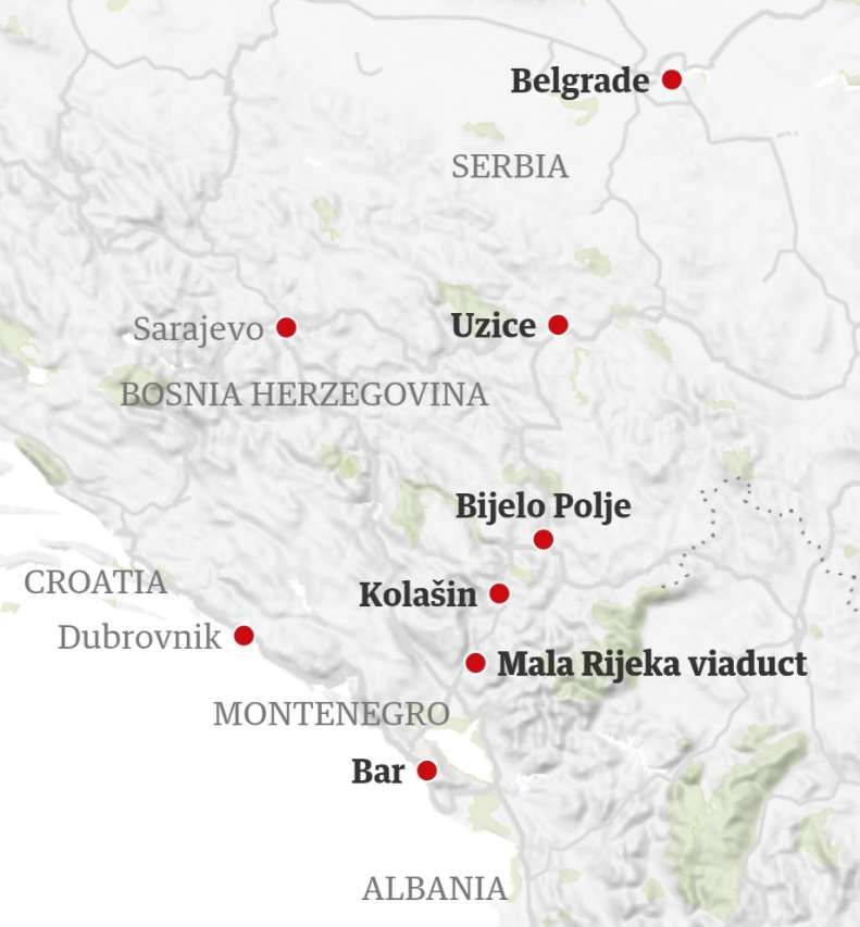
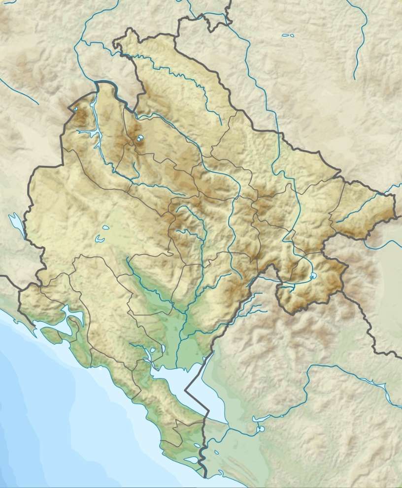
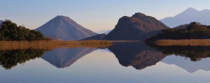
H. Slow travel at its best: Belgrade to Bar
” The train trip from Belgrade to Bar must be one of the slowest in Europe, taking 11 hours to cover 296 miles. At €23, it was probably the best-value travel money I’ve ever spent. In fact, the train trip was about the only time in my life when I longed for a journey to go slower rather than faster. It took me through some of the most dramatic scenery I’ve ever seen. Passing through deep gorges, canyons and mountain peaks, the train crossed more than 400 bridges and seemed to stop at every village. The Mala Rijeka viaduct was a highlight. The route took in spectacular dams, ancient monasteries and stone houses where old black-clad women waved at us from open kitchen windows. At one point, the passengers got out to feed a herd of goats and once we were overtaken by a mountain cowboy on a galloping horse. For the last part, you can see swimmers and sunbathers on Adriatic beaches.” [3][Reader: Peter]
The railway journey from Belgrade (Serbia) to Bar (Montenegro) is 476-kilometres (296-miles) in length. It features 254 tunnels and 435 bridges, including the Mala Rijeka Viaduct and it descends from the mountains to the Adriatic coast. There are two direct trains, one during the day and one at night. The Daytime Train (‘Tara’): Runs during the summer season. It departs around 09:00/09:45 and arrives in Bar around 21:00. In 2026, a standard second class single ticket costs €24. The best views can be seen when sitting on the right side of the train travelling from Belgrade to Bar.
Camilla Bell-Davies describes the route like this:
“After leaving a sun-drenched Belgrade behind, it’s not long before we’re gazing out at the rolling hills of the verdant Valjevo and Užice wine regions. The scenery becomes more dramatic as the line reaches the Zlatibor mountain range. We’re tempted to get off and explore Tara national park, which has excellent hiking trails and wild camping spots. But we press on, gathering speed past well tended fields and roaming goats.
“We pass through a slice of Bosnia-Herzegovina and back into Serbia again. In 1976, there were no border checks between these Yugoslav republics. Today, stern border guards rap on the carriage door at each crossing and hawkers board the train and sell beer, burek (pastries) and cigarettes.
“After our third border crossing, the pastoral hills swell into Montenegro’s Black Mountains, which dodge in and out of view between the tunnels and bridges. At Kolašin, a town near Durmitor national park, we stop to stretch our legs and peer up at monasteries atop impossible summits. How fun it would be to climb them. Next time, we think, as the long hoot of the train’s whistle signals our departure.
“Within an hour we reach the dizzying Mala Rijeka viaduct. Our train briefly resembles the Hogwarts Express soaring over the Scotland’s Glenfinnan viaduct in the Harry Potter films. After that, the mountains taper to the brutalist blocks of Montenegro’s capital Podgorica – named Titograd from 1946 until 1992. There’s little to recommend it, so we keep going to Virpazar on Lake Skadar, where we stop and spend a day pottering in a boat.” [26]
Camilla Bell-Davies continues:
“Half of the lake falls within Albania’s borders, and the Accursed mountains double up in the reflection of the water. These days the main division is a culinary one: Albania prepares the lake’s carp in a sizzling prune and tomato sauce called tavaë krapi, and Montenegro eats the freshwater fish salted and pickled, which is best tasted right by the water at the Restaurant Silistria.
“The next afternoon, we’re back on the train for the last stretch. At sunset, the Adriatic hoves into view. The sea opens to one side, the oranges and pinks in the sky melting into the water. For the final hour we swing past craggy headlands and sand-swept bays, arriving in Bar as darkness falls.” [26]
The Belgrade to Bar railway was completed in 1976. It was built by the Yugoslav State Railways (JŽ) and was 25 years in the making.
Sections of the railway were completed as follows:
- Resnik – Vreoci in 1958
- Podgorica – Bar in 1959
- Vreoci – Valjevo in 1968
- Valjevo – Užice in 1972
- Užice – Podgorica in 1976
It is now operated by JŽ’s successor companies, Železnice Srbije (ŽS), Željeznice Republike Srpske (ŽRS) and Željeznička Infrastruktura Crne Gore (ŽICG). [29]
During the 1990s, the line had a chequered history:
- In February 1993, the short Bosnian section of the railway was the site of the Štrpci massacre.
- Maintenance of the Belgrade–Bar railway suffered from chronic underfunding during the 1990s, which has resulted in the railway deteriorating and becoming unsafe. This culminated in the Bioče derailment, when a passenger train derailed, causing the deaths of 47 passengers. As a result, efforts are being made to thoroughly reconstruct the railway.
- The Serbian part of the railway was targeted several times by NATO during its bombing campaign in 1999, seriously damaging portions of the railway.
- The small section that passes through Bosnia and Herzegovina was blown up by SFOR ground forces in the late 1990s. [29]
Repair work on the line is progressing gradually. In 2016, Serbia started a thorough reconstruction of its portion of the line in order to restore its original maximum speed of 120 kilometres per hour (75 mph). The first section, between Belgrade and Valjevo (27% of the Serbian part of the line) was completed in 2017. [29]
Since 2017, the Belgrade to Bar railway has undergone targeted, phased overhauls rather than a total route modernization, with hundreds of kilometers of track still awaiting upgrades. Progress has been split between Serbian and Montenegrin territories, heavily backed by the European Union and international loans.
In Serbia:
- Resnik–Valjevo Section: Completed in 2017/2018, this USD $80 million upgrade by Russian Railways International rehabilitated a 77.6 km stretch of the railway. It restored maximum passenger speeds to 120 km/hr on this length of the line.
- Valjevo to the Montenegrin Border: Engineering and technical documentation for the reconstruction of the remaining 210 km down to the border was initiated. However, construction has remained in the planning phase, with Serbian authorities estimating the total required investment for their remaining sections at €1.5 to €2 billion. [30]
In Montenegro:
- Vrbnica–Bar Line Rehabilitation (2016–2020): Technical assistance with – and structural work on – the main Montenegrin corridor were completed with European Investment Bank (EIB) support.
- Bar–Golubovci Upgrade: The European Union and the EIB committed a €175.6 million financial package to modernize a key 39 km stretch, improving reliability, safety, and increasing network capacity.
- Kos–Trebešica Section: Targeted rehabilitation actions on this highly vulnerable section were launched to prevent bottlenecks and secure the combined maritime-railway transport with the Port of Bar.
- Future Upgrades: Montenegro still requires major structural repairs across an estimated 160 km of its portion of the line. [30]
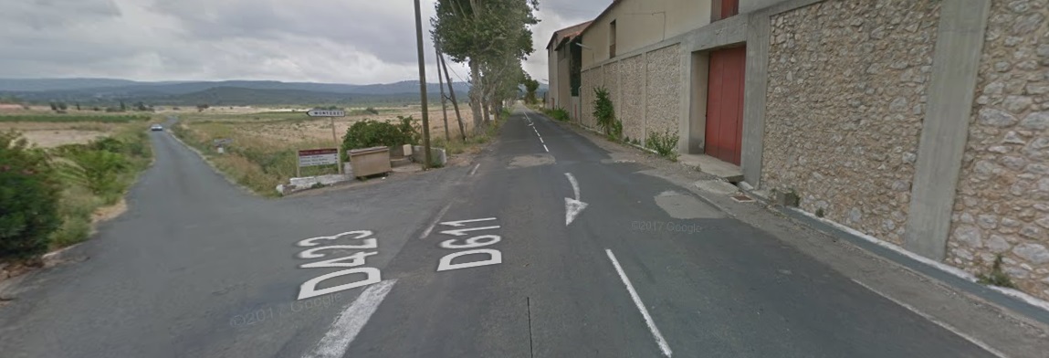
I. Through Italy’s Apennines to Rome from the Adriatic
“The cross-country east-west train trip from Pescara on the Adriatic to Rome is magnificent. It traverses the spine of Italy, single track all the way across the Apennines, stopping at towns such as Sulmona and Avezzano. The scenery changes as the route traverses mountain passes and ridiculous gradients before descending to plains over a period of 3 to 4 hours.” [3][Reader: Stephen]
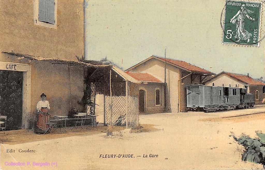
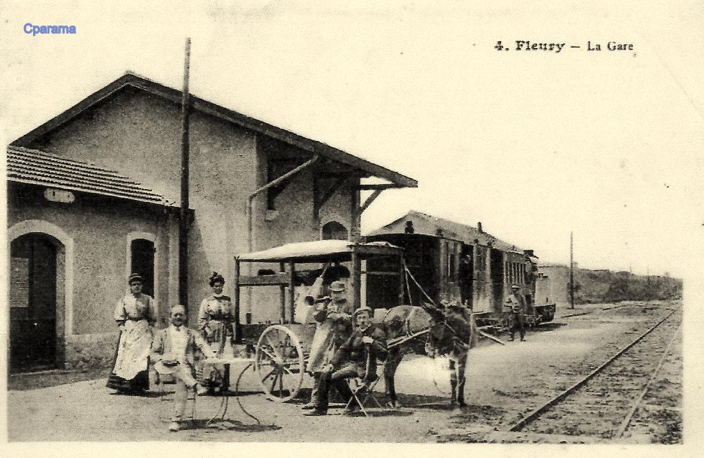
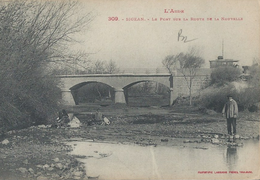
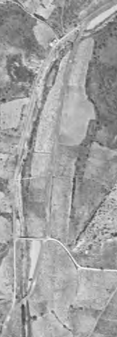
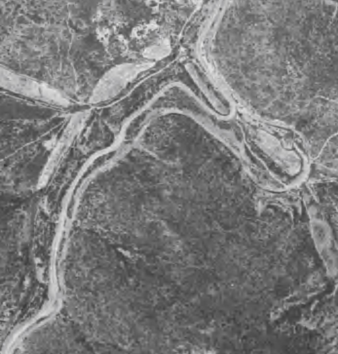
The railway between Pescara and Rome is a 240-kilometre (150-mile) long railway line, that connects Rome with Tivoli, Avezzano, Sulmona and Pescara. The route operates through the regions of Lazio and Abruzzo. It was built in stages between 1873 and 1888. [9]
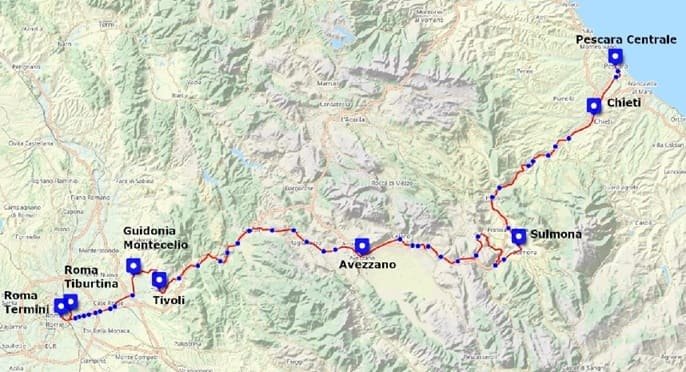
The line between Pescara and Popoli opened on 1st March 1873. That between Popoli and Sulmona opened on 1st November 1873. Tivoli to Mandela opened on 10th December1884. Mandela to Cineto Romano opened on 25th November 1885. Rome to Tivoli opened on 1st August 1887. The line between Sulmona and Avezzano opened on 28th/30th July 1888. [10]
It seems possible that the great experience that Stephen had on this line is not likely to be available for too much longer. …
Major upgrading of the route has been ongoing throughout the 2020s and was scheduled for completion by 2026. [4] Once all work has been completed, the number of trains covering the route will double and the journey time will drop from 3 hours 20 minutes (at best) to around 2 hours. But it is not at all clear how soon that might be.
The project has faced problems along the way. It was put on hold in October 2023, when Italy missed out on 1.5 billion euros from the EU Recovery and Resilience Fund. Although it seems that “the Italian government is now ready to partly refinance the initiative with 951 million euros. Around 720 million euros were unlocked by the Interministerial Committee for Economic Planning and Sustainable Development (CIPESS) via the EU Cohesion Fund. The remaining 231 million euros are coming from the funds for non-deferrable works.” [6]
On 6th March 2024, RailFreight.com reported that the funding made available by the Italian Government related primarily to the length of the line which is within the Abruzzo region. That scheme is separated into two lots, the first (Lot 1) envisioned the doubling of the line connecting the Interporto d’Abruzzo terminal to Manoppello. Lot 2 entailed laying a second track between Manoppello and Scafa. In total, these lines amount to roughly 13 kilometres of the roughly 240 making up the whole Rome-Pescara line. This is a very small portion of the whole line.
There are two further “lots that still need to be addressed: the Sulmona – Pratola Peligna and [the] Tagliacozzo – Avezzano sections, for which there does not [yet] seem to be any plan.” [6] Original intentions were also to improve the line from the Airport “terminal to Pescara via Chieti. No new decisions have been made for this section either as of yet.” [6]
Railfreight.com note that even after the present schemes are completed much of the route will still be single-track, old and with steep sections and tunnels that do not meet current European standards.
It transpires, even so, that progress has not been without problems. As of May 2026, work on the first two lots mentioned above is underway but the likely completion date is now in 2028.
The low-resolution video below gives an idea of progress made by early 2026: [8]
So, perhaps the deduction to be made is that it still might be worth taking a journey along the line for some time to come!
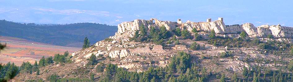
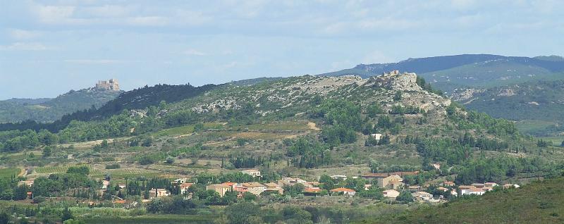
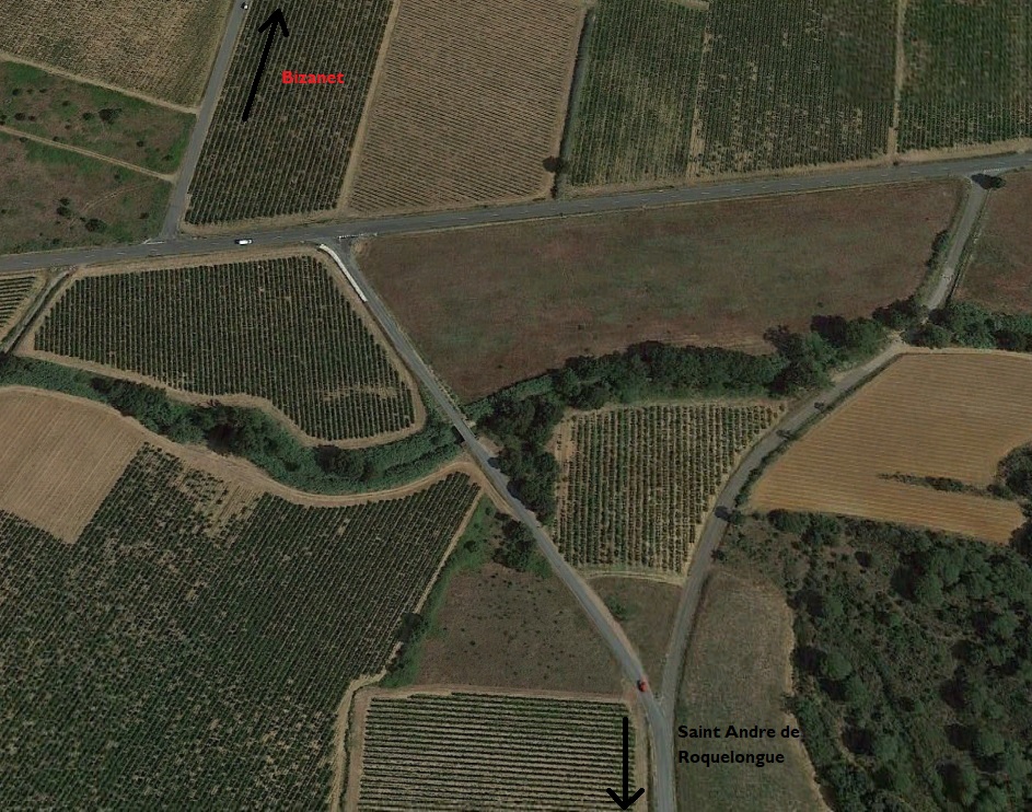
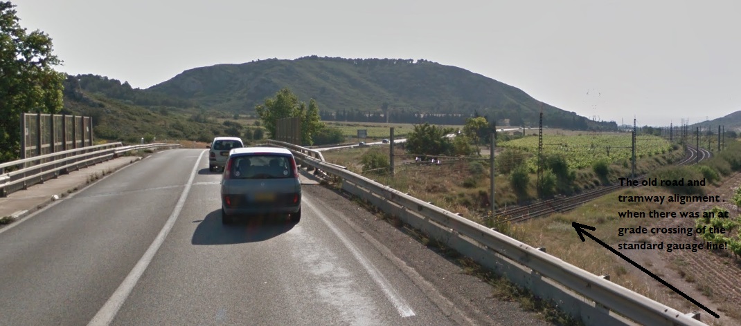
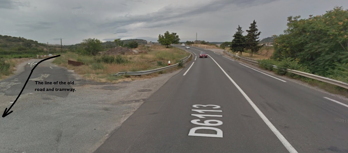
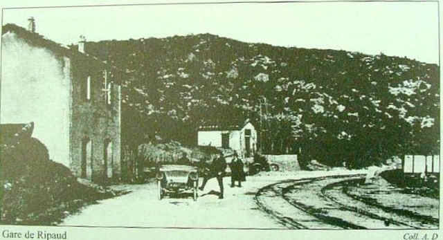
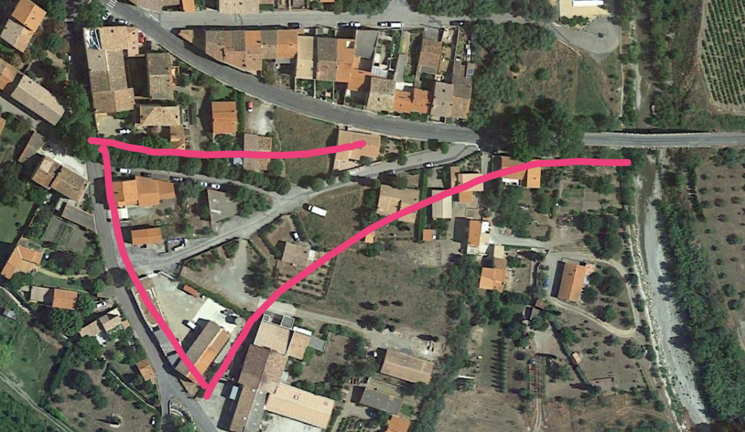
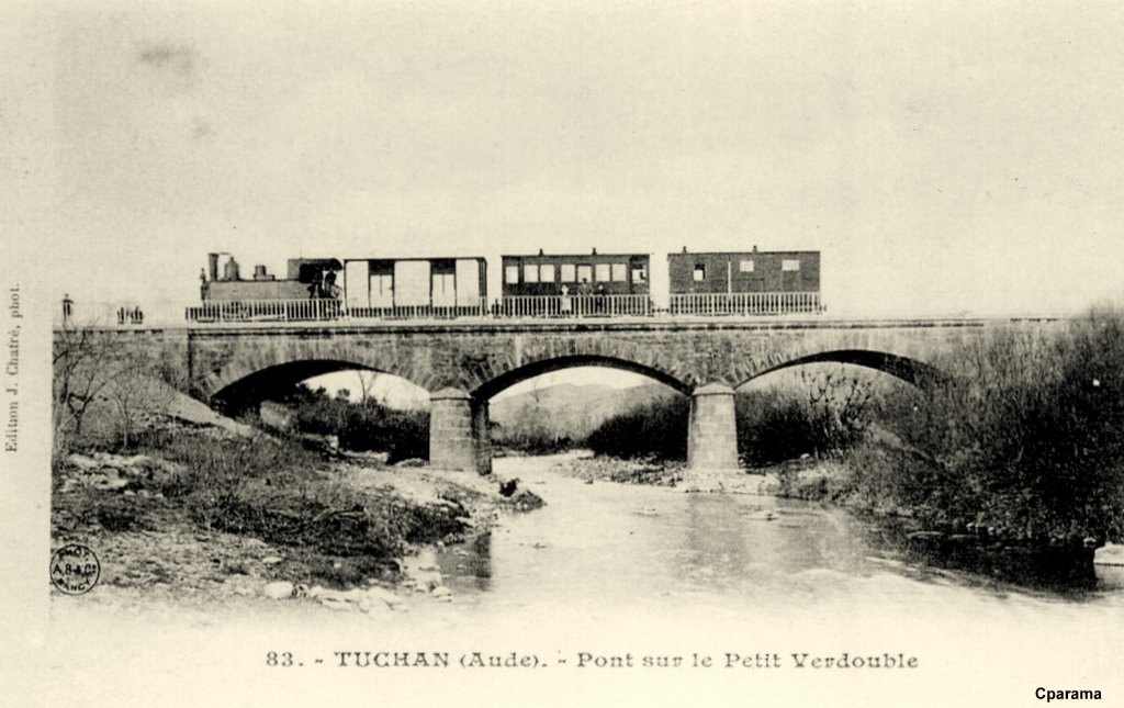
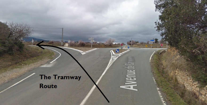
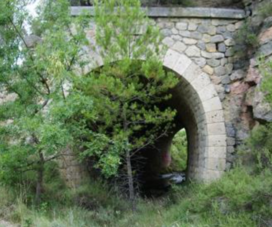
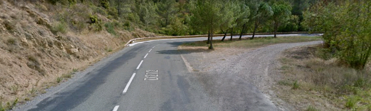
Incidentally, on a journey through Sulmona one should also note the existence of another line which runs from Sulmona to Isernia. It is named ‘Ferrovia dei Parchi’. [11]
Ferrovia dei Parchi
The line is given this name on account of the special nature of the places it passes through. Its spectacular route passes through the Maiella National Park and the Abruzzo, Lazio and Molise National Park. [11]
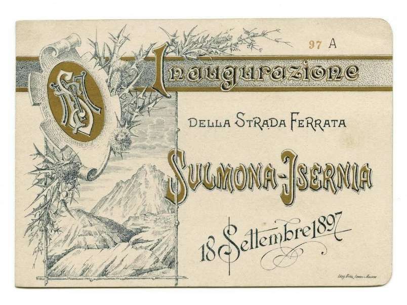
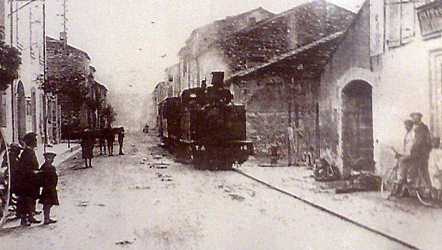
An invitation card to the opening (Inaugurazione) of the Sulmona-Isernia railway (Della Strada Ferrata Sulmona-Isernia) on 18th September 1897 © Public Domain. [12]
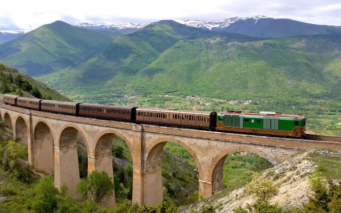
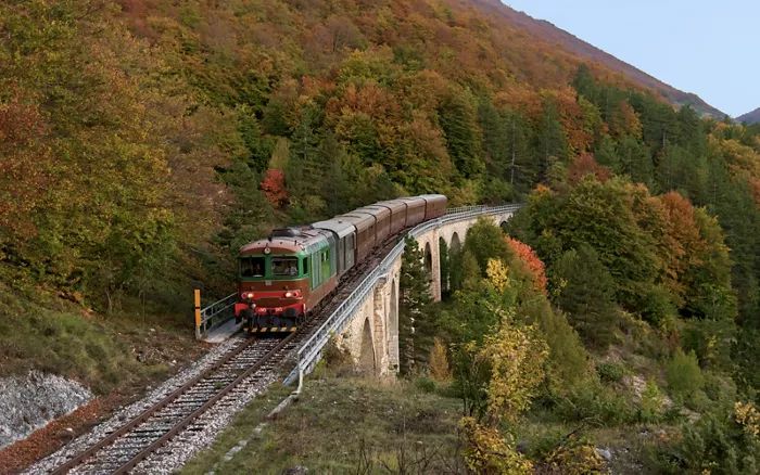
Opened on 18th September 1897, the Sulmona-Isernia was destroyed by the Germans during World War II. It was rebuilt and relaunched in 1955 as far as Castel di Sangro, and reached Carpinone in 1960. The line, which has never been electrified, has always been linked to steam locomotives. In the 1980s, was allowed to quietly deteriorate with no significant maintenance undertaken. In 1995, ticket offices were closed and several stations were downgraded to mere halts, until eventually, the line’s connection to the line from Pescara to Rome was severed in the early years after the millennium. [11]
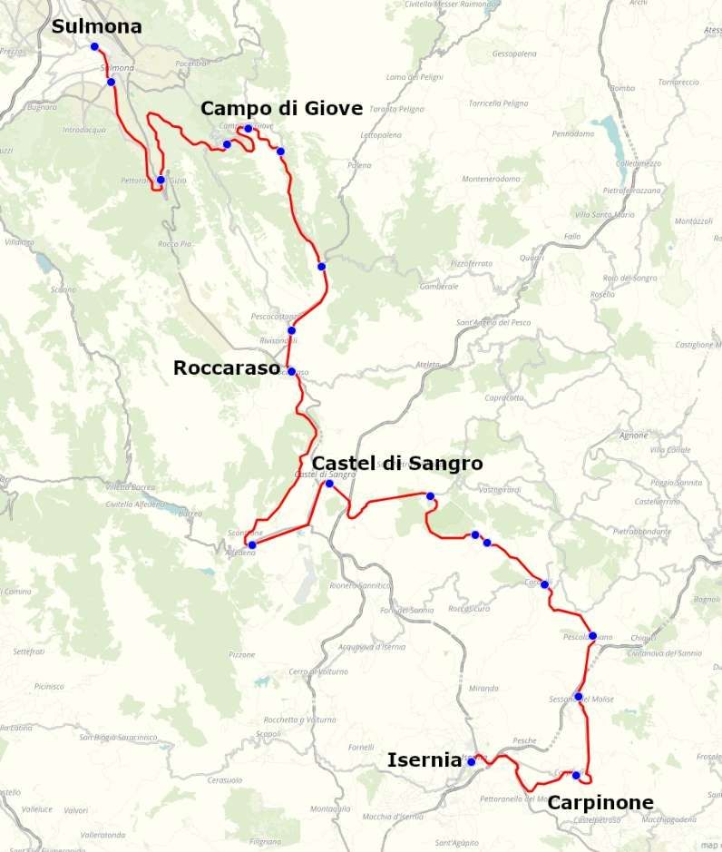
Nowadays, the line has been given a new lease of life as a tourist railway. It was superbly engineered when it was built. Despite the mountainous territory through which it runs the Ferrovia dei Parchi climbs gently up the mountainsides using viaducts, curves and tunnels, never exceeding gradients of more than 28%. It is over 128 km in length, 25 km of which are in 58 tunnels. Those tunnels are among more than one hundred engineering works carrying the line including bridges and viaducts. In addition, there are more than 300 aqueducts, bridges, avalanche barriers and overpasses, as well as 21 different stations. [11]
The tourist train runs in the summer months – June to September – booking in advance is advised and packages are available with accommodation in Sulmona included. [12][13]
“The service uses vintage carriages consisting of wagons dating back to the 1930s, such as Corbellini and Centoporte carriages , generally hauled by an FS D.445 diesel locomotive.” [15]
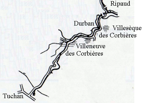
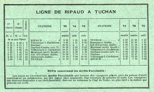
J. Best way to See the Pyrenees? On a Little Yellow Train!
“Le Train Jaune runs between Villefranche-de-Conflent and Latour-de-Carol in France. ‘Le Canari’, as it’s known locally, climbs to 1,595 metres at Bolquère-Eyne during its spectacular 40-mile (63km) route. Fresh mountain air, breathtaking views and valley-crossing suspension bridges can all be experienced either from the train’s bright yellow open-air wagons or from within the cosy comfort of its carriages. It is the best way to discover the wonders of the Pyrenees. My wife and I went for our honeymoon and fell in love with the little yellow train. [3][Reader: Joe Brownen]
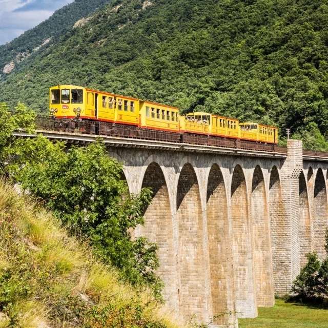
Highlights on the journey include crossing the UNESCO-listed Gisclard Suspension Bridge, the Séjourné Viaduct, and rolling through the Cerdagne plateau.
The train takes 3 hours for a one-way trip from Villefranche-de-Conflent to Latour de Carol/Enveitg and the cost is €22.50 (or €5 if you got a special summer offer from the “Region Occitanie”). A return trip takes 6 hours minimum (there is a stop of a few hours at the terminus) for €45 full price. (Prices correctly in May 2026.) [16]
The Ligne de Cerdagne, usually referred to as Le Train Jaune is a 1,000 mm (3 ft 3 3⁄8 in) gauge railway. The line serves 22 stations, fourteen of which are ‘request stops’. There are 19 tunnels, the longest of which is the Tunnel du Pla de Llaurar with a length of 380 metres.
Amongst the various structures along the line are the two viaducts over the River Têt which are mentioned above. They are classified as Historic Monuments because of their architectural and technical importance:
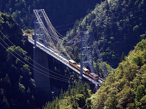
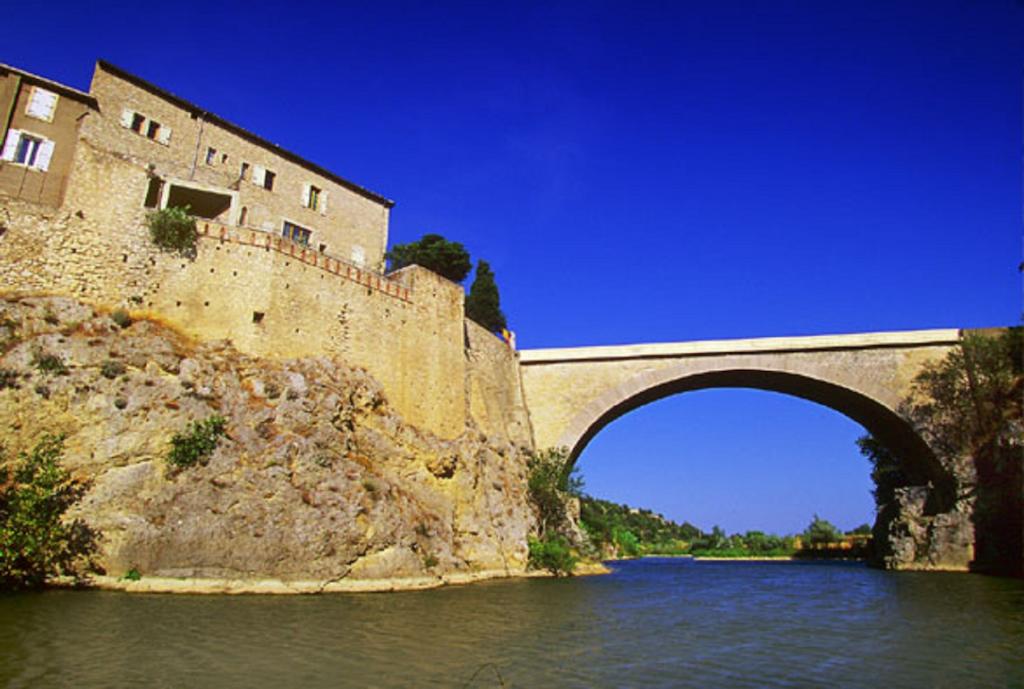
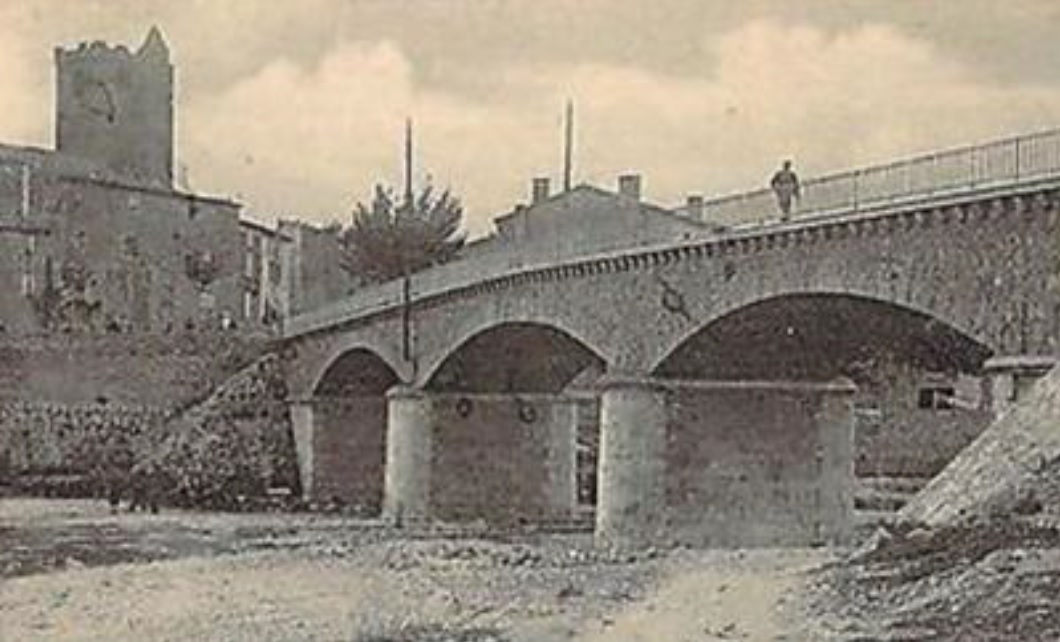
The Pont Cassagne (also known as Pont Gisclard) is 253 metres (830 ft) long and, unusual for a railway bridge, a suspension bridge – the only one in France located on an operating railway. In 2023, a major project was carried out to replace 12 of the suspension cables © Cevenol2 and licensed for reuse under a Creative Commons (CC BY-SA 2.0 fr). [18]
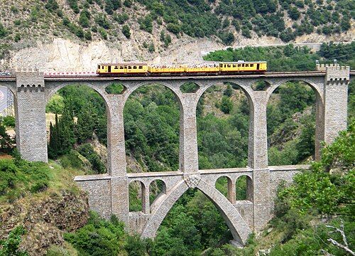
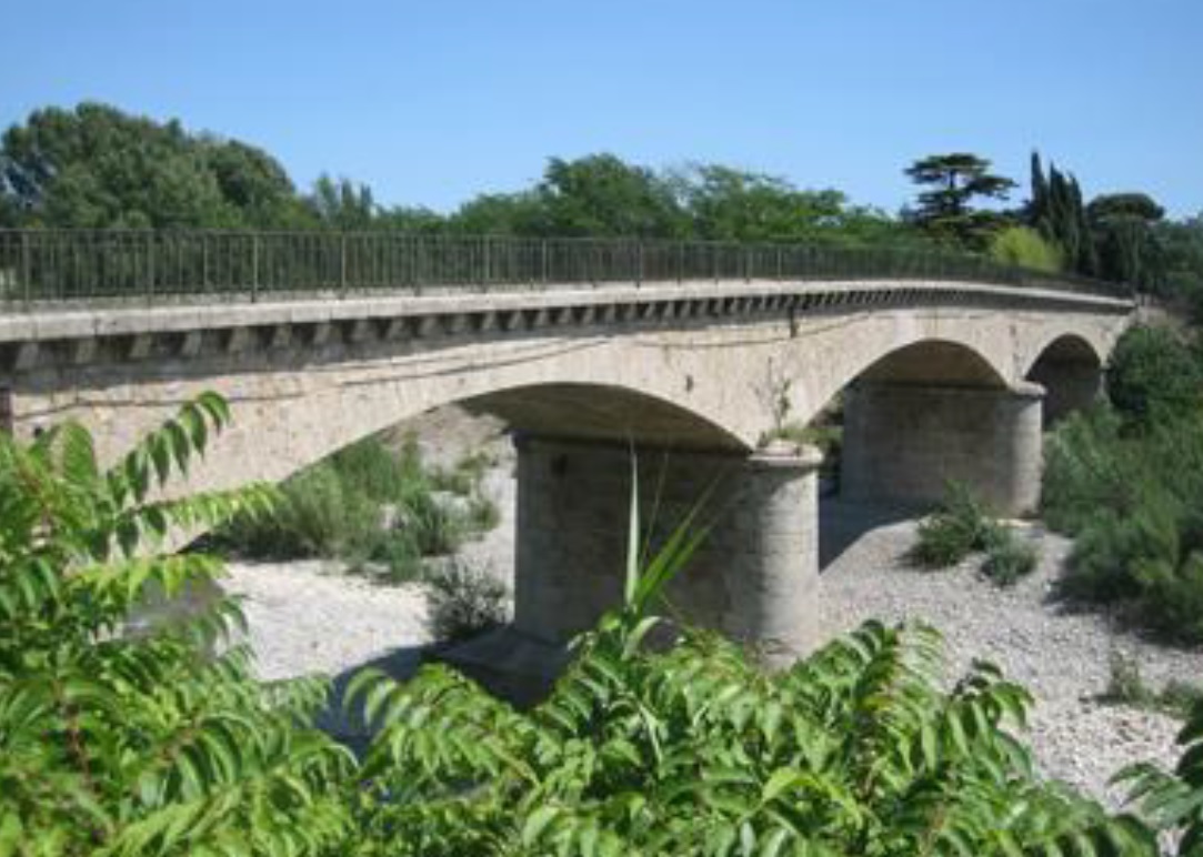
The Pont Séjourné, a 236.70 metre-long masonry viaduct in the town of Fontpédrouse. [19]
The line is single-track with passing loops. Trains are powered by electricity at 850 volts DC, supplied by a third rail. The power is supplied by hydro-electric generators on the River Têt. The maximum speed of the train is 55 km/h (34 mph). Modern two-car multiple units are used, as well as older powered cars with trailer carriages. Line maintenance vehicles are stored at Villefranche-de-Conflent. [17]
Construction started in 1903 and the section from Villefranche-de-Conflent to Mont-Louis was completed in 1910, followed by the extension to Latour-de-Carol in 1927. [17]
The website for le Petit Train Jaune can be found here. [32]
References
- Readers’Travel Tips: Favourite Train Trips; in Saturday (the Guardian Magazine), 23rd May 2026, p75.
- https://rogerfarnworth.com/2026/05/27/the-guardian-lifestyle-travel-saturday-23rd-may-2026-part-3-readers-favourite-railway-journeys-part-a
- https://www.theguardian.com/travel/2026/may/22/readers-favourite-scenic-european-railway-journeys-trains, accessed on 25th May 2026.
- https://www.fsitaliane.it/en/strategic-projects/rome-pescara-line-.html, accessed on 27th May 2026.
- https://it.wikipedia.org/wiki/File:Ferrovia-rm-pe.png, accessed on 27th May 2026.
- https://www.railfreight.com/infrastructure/2024/03/06/doubling-of-rome-pescara-railway-partly-back-on-track, accessed on 27th May 2026.
- https://youtu.be/ubiP4tuAzbk?si=HsWYksmW14pXdIIe, accessed on 27th May 2026.
- https://youtu.be/_L8txHrI_U0?si=TMAn-BwN7z1y_zJe, accessed on 27th May 2026.
- https://en.wikipedia.org/wiki/Rome%E2%80%93Sulmona%E2%80%93Pescara_railway, accessed on 27th May 2026.
- https://www.trenidicarta.it/aperture.html, accessed on 27th Mat 2026.
- https://www.italia.it/en/italy/things-to-do/snow-train-ferrovia-dei-parchi, accessed on 27th May 2026
- https://ferroviadeiparchi.it, accessed on 27th May 2026.
- https://ferroviadeiparchi.it/shop, accessed on 27th May 2026.
- https://it.wikipedia.org/wiki/Ferrovia_dei_Parchi#/media/File%3AFerrovia_Sulmona-Isernia.png, accessed on 27th May 2026.
- https://it.wikipedia.org/wiki/Ferrovia_dei_Parchi, accessed on 27th May 2026.
- https://letrainjaune.fr/en/horaires-et-infos, accessed on 28th May 2026.
- https://en.wikipedia.org/wiki/Ligne_de_Cerdagne, accessed on 28th May 2026.
- https://en.wikipedia.org/wiki/Ligne_de_Cerdagne#/media/File%3APont_gisclar_082004.jpg, accessed on 28th May 2026.
- https://en.wikipedia.org/wiki/Ligne_de_Cerdagne#/media/File%3AViaduc_sejourne%2C_train_jaune%2C_fontpedrouse.jpg, accessed on 28th May 2026.
- https://www.summerinitaly.com/guide/steam-train-from-siena#google_vignette, accessed on 25th May 2026.
- https://www.theguardian.com/travel/2022/dec/07/switzerlands-brilliant-new-train-route-direct-from-montreux-to-interlaken, accessed on 26th May 2026.
- https://en.wikipedia.org/wiki/Montreux%E2%80%93Glion%E2%80%93Rochers-de-Naye_railway_line, accessed on 26th May 2026.
- https://rogerfarnworth.com/2018/04/16/the-rochers-de-naye-line
- https://www.gpx.swiss/en/stories/technology, accessed on 26th May 2026.
- https://youtu.be/74mKjQpPzNA?si=48XvU8X2a_eNaBZx, accessed on 26th May 2026.
- https://www.theguardian.com/travel/2024/sep/18/mountains-beaches-history-belgrade-bar-best-train-rides-europe-serbia-montenegro, accessed on 26th May 2026.
- https://en.wikipedia.org/wiki/Lake_Skadar, accessed on 26th May 2026.
- https://undiscoveredmontenegro.com/lake-skadar-national-park, accessed on 26th May 2026.
- https://en.wikipedia.org/wiki/Belgrade%E2%80%93Bar_railway, accessed on 26th May 2026.
- https://seenews.com/news/serbia-montenegro-seek-eu-support-for-belgrade-bar-railway-revamp-1262919, accessed on 26th May 2026.
- https://www.tourisme-pyreneesorientales.com/destination/incontournables/le-train-jaune, accessed on 28th May 2026.
- https://letrainjaune.fr, accessed on 28th May 2026.
- https://en.wikipedia.org/wiki/Ligne_de_Cerdagne#/media/File%3ATrainJaune_viaduc.jpg, accessed on 28th May 2026.


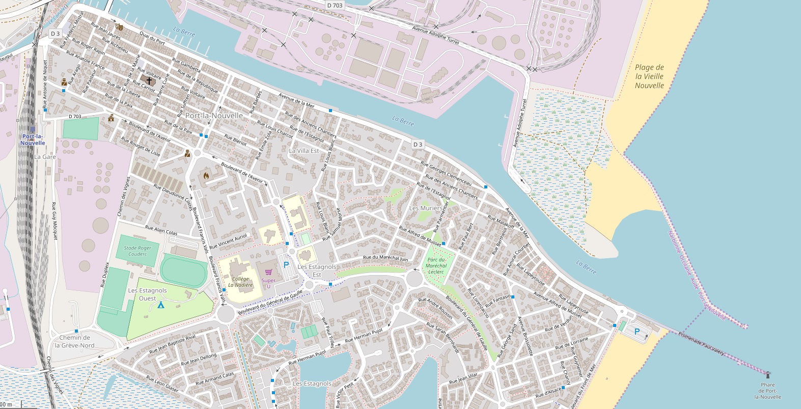

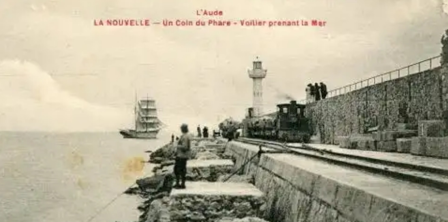
 This image (above) is the one used as the record image on the internet listing of France’s lighthouses!
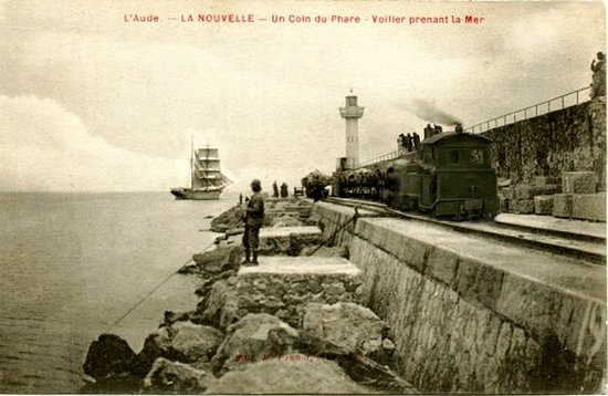
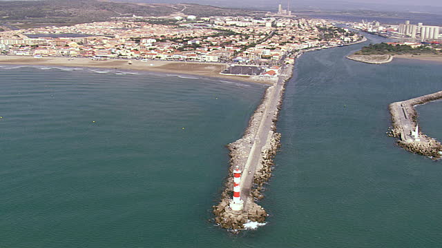


