
Trams to Ouveillan took a relatively tortuous route out of Narbonne. The route is covered well on this link:
For the sake of completeness, some of the details on that link are repeated here ….
Narbonne
The tramway station was sited on the forecourt of the Gare du Midi as shown in the image below. The tramway station building is on the right of the picture.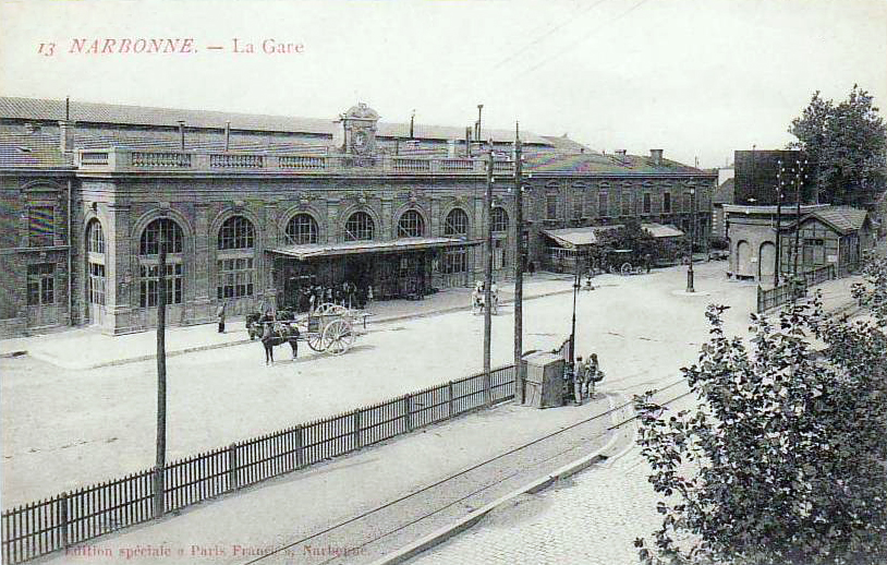 Trams to Ouveillan left the station in a southeasterly direction travelling roughly in parallel with the Midi mainline. The route to Thezan (Line No. 1, below) hugged the boundary wall of the Gare du Midi’s yard, the route to Ouveillan (Line No. 3, below) diverted slightly to the East.
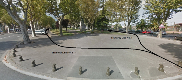
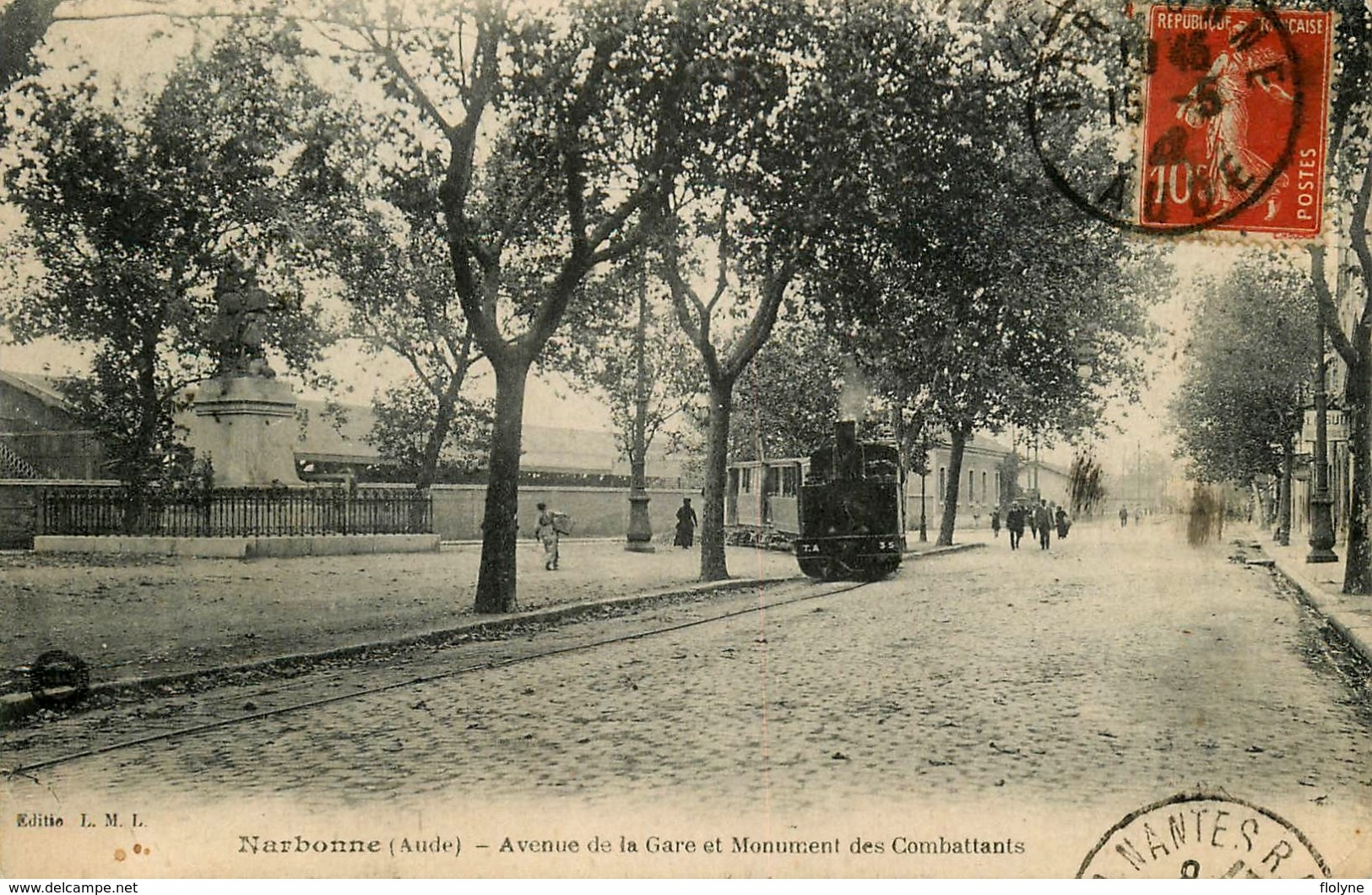 The tram (above) leaves the station and heads Southwest. It follows this route to the East of the Statue des Combatants. [7]
 The tram continues heading South towards the Canal du Midi. [8]
 This image shows a tram further along the route to Ouveillan (Line No. 3 above). It has reached the point on its route which is furthest to the Southwest and is now passing under the standard gauge line before turning Northeast. [9]
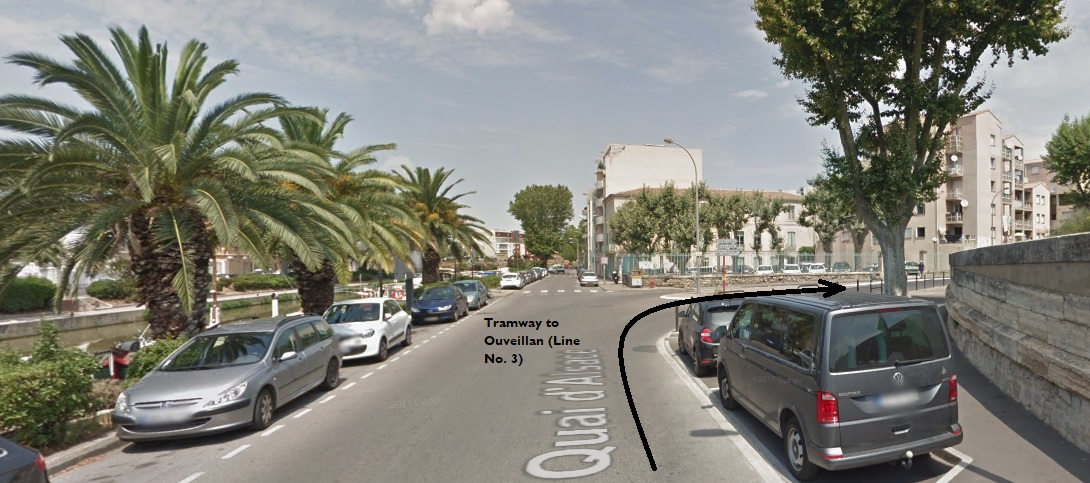 The tramway route to Ouveillan (black arrow) ran along what is now the Quai d’Alsace and then turned Northeast as shown below.
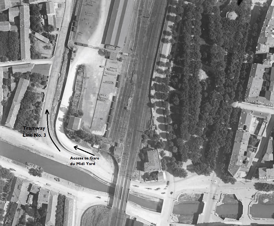
 The tramway passed under the Standard Gauge line as shown in the 1930 aerial image above and then turned North around the boundary wall of the station goods yard. [10]
It then followed that boundary wall in a northeasterly direction. Its own marshalling yard is shown on the adjacent image. [10]
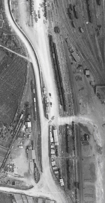
The next image shows the further extension of the line alongside the Western boundary of the Gare du Midi goods yard heading North-east towards Cuxac-d’Aude. [10] The monochrome images above have been aligned to show the tramway running up and down the photograph. It actually ran in a more northeasterly direction. The tramway followed what is now the D913 Rue de Cuxac along the western side of the large standard gauge facilities until it reached a branch to a series of sidings and a transshipment wharf/shed. At this point the mainline drifted to the West to follow the line of the Canal du Midi. It can be seen running towards the top left of the picture above. [17]
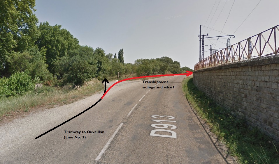 This Google Streetview image shows the line of the tramway to Ouveillan in black and the approximate line of the route into the transshipment yard and wharf in red. In this post we are following the black arrow!
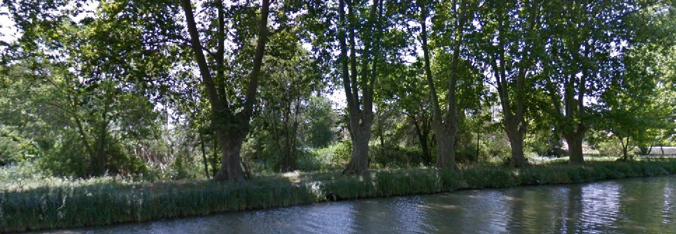 The tree to the right of this image marks the point vthat the tramway aligns itself to the Canal. For some distance now the trams ran alongside the Canal behind the line of trees which flanked the Canal.
The next two views show the Canal du Midi flanked by trees. I believe that the tramway ran beyond the trees on the far bank of the Canal in each image.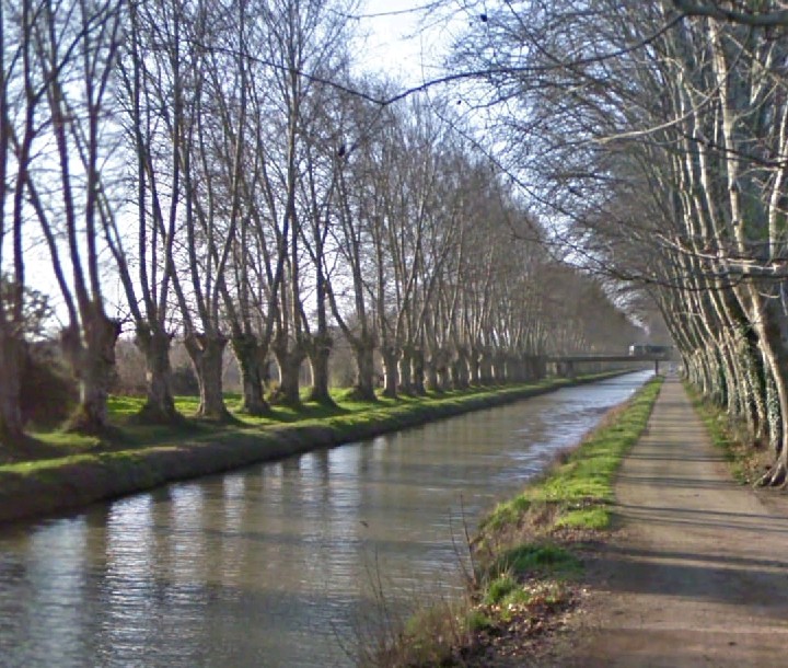 The Canal du Midi looking South.
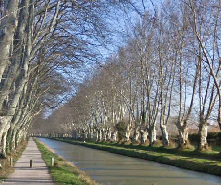 The Canal du Midi looking North from the same location.
 The trams had an easy journey alongside the Canal and only left it when the Canal turned away from the route the tram needed to take to Cuxac.
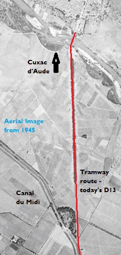
The tramway alignment was approximately as shown on the aerial photograph from 1945. The bridge over the River Aude can be seen clearly in the aerial image just at the point where the tramway reaches the village of Cuxac d’Aude.
Cuxac d’Aude
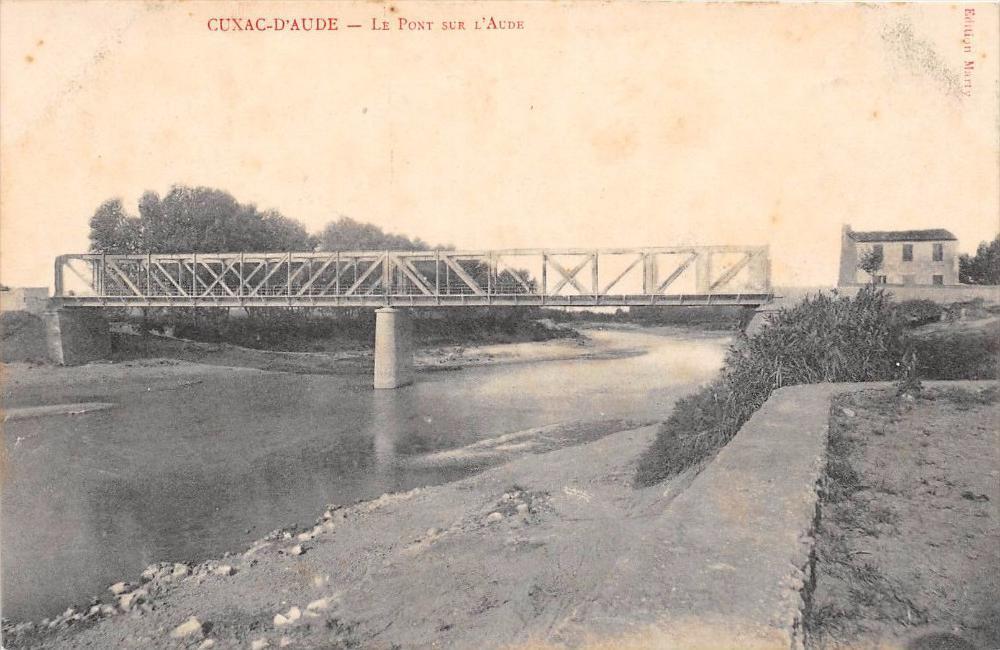
The village of Cuxac was approached by trams crossing the Rive Aude on the bridge illustrated below. [2] The bridge was a steel truss girder bridge which has now been replaced.
 The first image below is shows the centre of Cuxac from the air in 1945. The bridge over the River Aude can be picked out at the bottom of the picture. The tramway station is at the centre of the red oval. The tramway route is marked as a red line. [6]
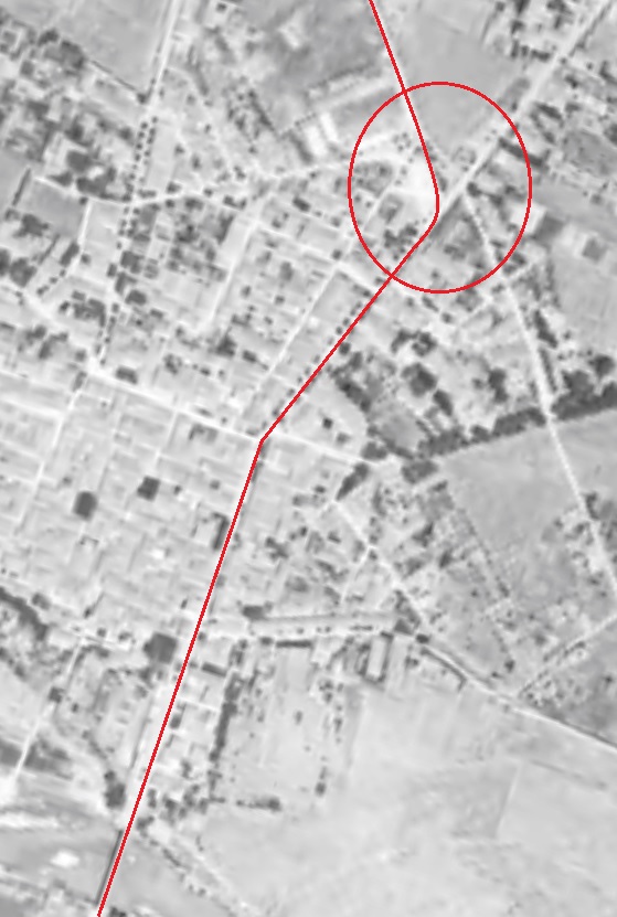
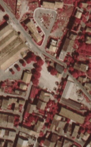 The station location is shown in the mid 1970s on the next image (adjacent), and in the mid-1980s in the one below. [6]
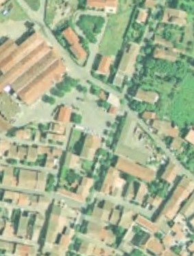
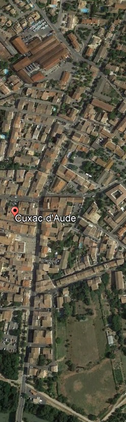 The final image (adjacent), shows the same area in the early 21st century from Google Earth. The tramway route is still evident in the street layout and the station building has been preserved and is in private ownership. It is used as a pizza takeaway business in the 21st century!
The picture immediately below is an image taken from north of the junction central to the adjacent image just above the town name and pink marker. The view looks southwards down Boulevard Jean Jaures. The curve in the tramway lines accommodates the change in direction of the road at the junction which is also evident in the adjacent image. [2]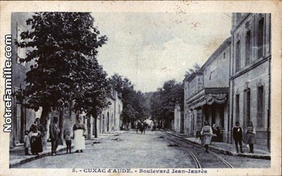 The second image (below), taken Just to the south of the one above, looks south towards Narbonne and so bears the legend, L’Avenue de Narbonne. [2]
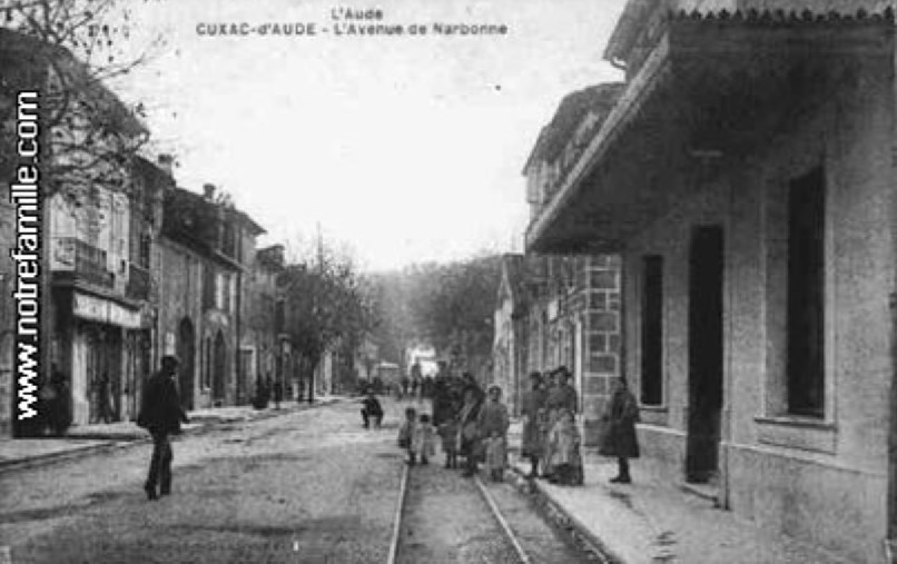
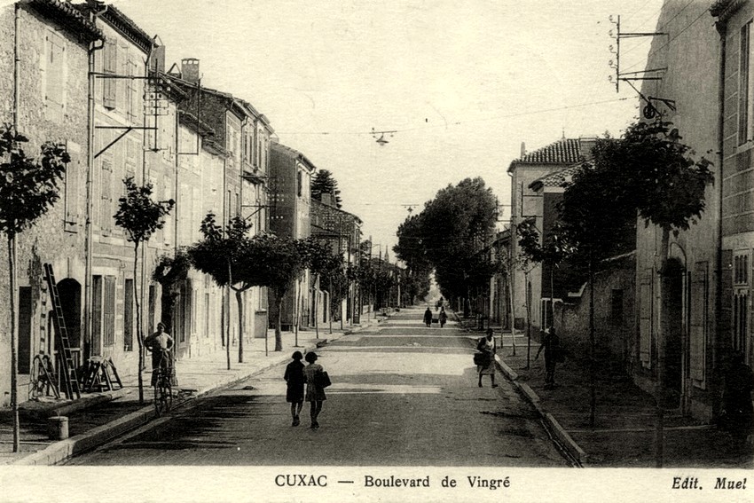 A similar location after the removal of the tramway. The street is now known as the Boulevard de Vingre. [4]
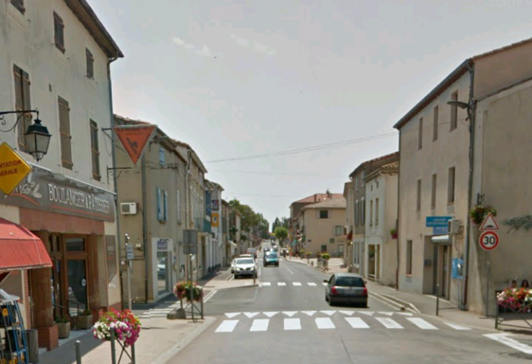 Boulevard Jean Jaures or Boulevard de Vingre (D13) in the early 21st century. This image was taken from approximately the same location as the first postcard view of the street, also looking South.
Travelling North-northeast from the centre of the village along what is now the D413, the trams ran on the West side of the road until they reached what was, in the early 20th century, primarily, open ground on the edge of the village where the station was built. A tram arrives at the Station in Cuxac from Narbonne having travelled through the village first. [3]
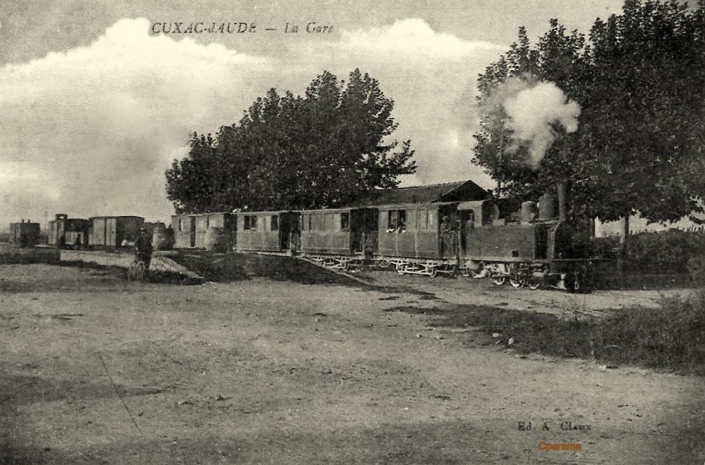 This tram has travelled from Ouveillan and will go on through the village of Cuxac d’Aude to Narbonne. It obscures the view of the station building. [3]
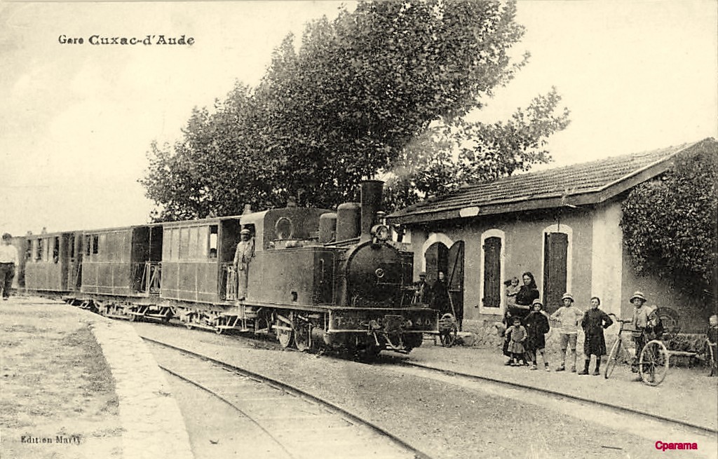 This tram has also travelled from Ouveillan and will go on through the village of Cuxac d’Aude to Narbonne. [3]
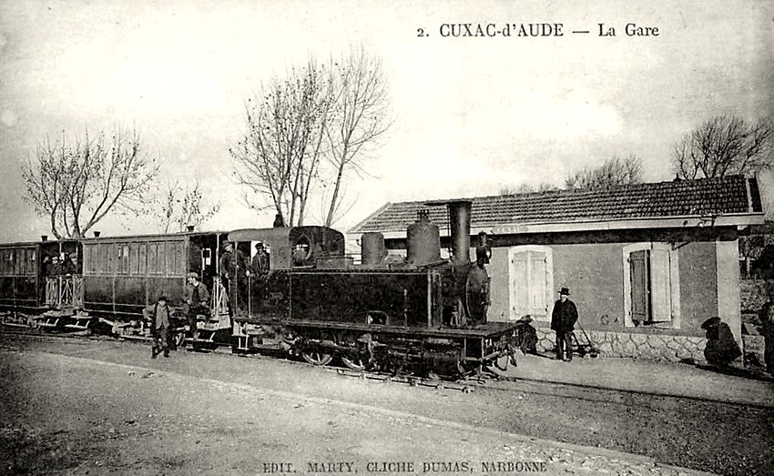 This and the previous monochrome image show the station building to good effect. [4]
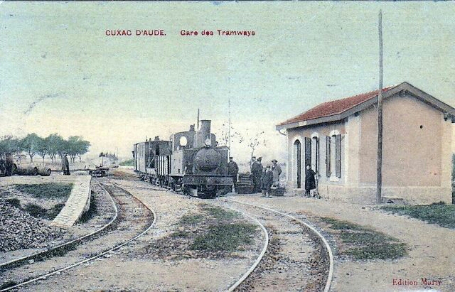 This view shows the line ahead to Ouveillan as a tram arrives from there on its way to Narbonne. [5]
The journey to Ouveillan from Cuxac was over relatively level ground. Trams followed what is now the D13 through to Ouveillan, after travelling through the suburbs of Cuxac on the Rue Louis Mestre.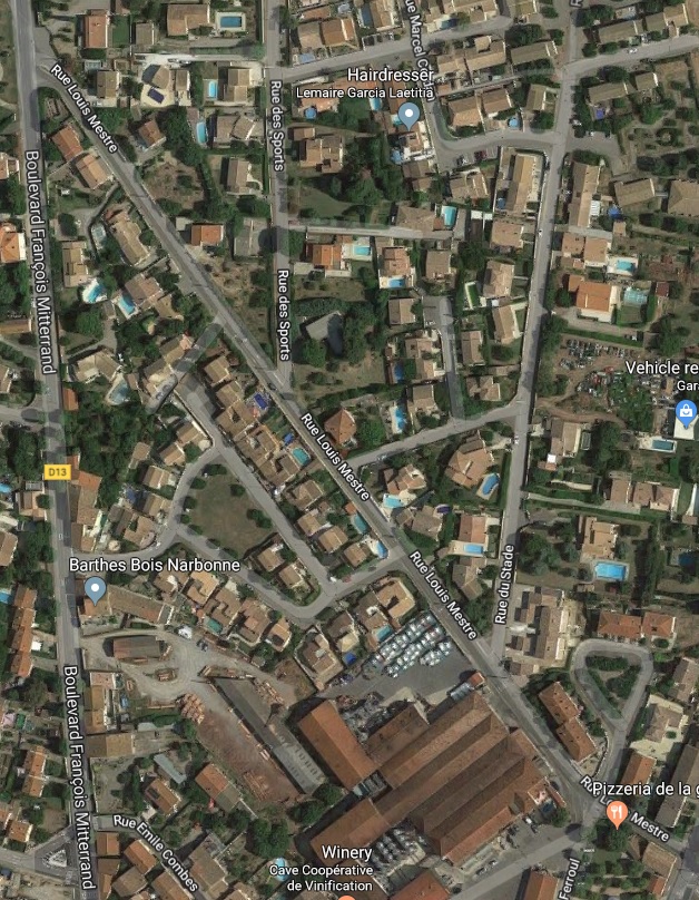
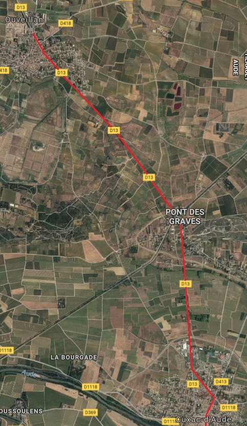 On the way, trams passed through what is now known as Pont des Graves, as can been seen on the adjacent satellite image from Google Maps.
Pont des Graves
At this point the current D13 bridges the Canal d’Atterrissement de l’Etang de Capestang.
Back in 1939, which is the date of the earliest aerial image available, the bridge and canal were in place but the small community of Pont des Graves had still to form. This can be seen clearly on the aerial image below. [10]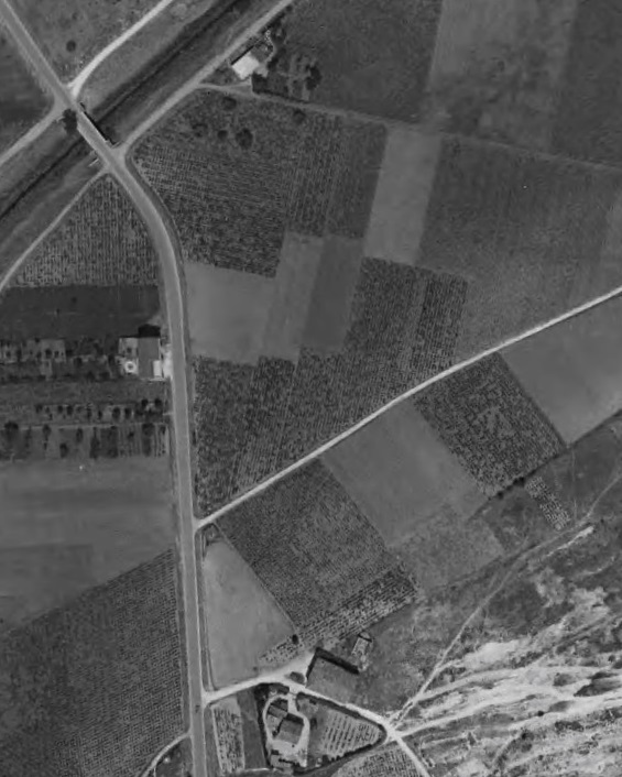 The journey from Pont des Graves to Ouveillan was direct and level, following the D13.
Ouveillan
The tramway entered Ouveillan along the Avenue de Narbonne.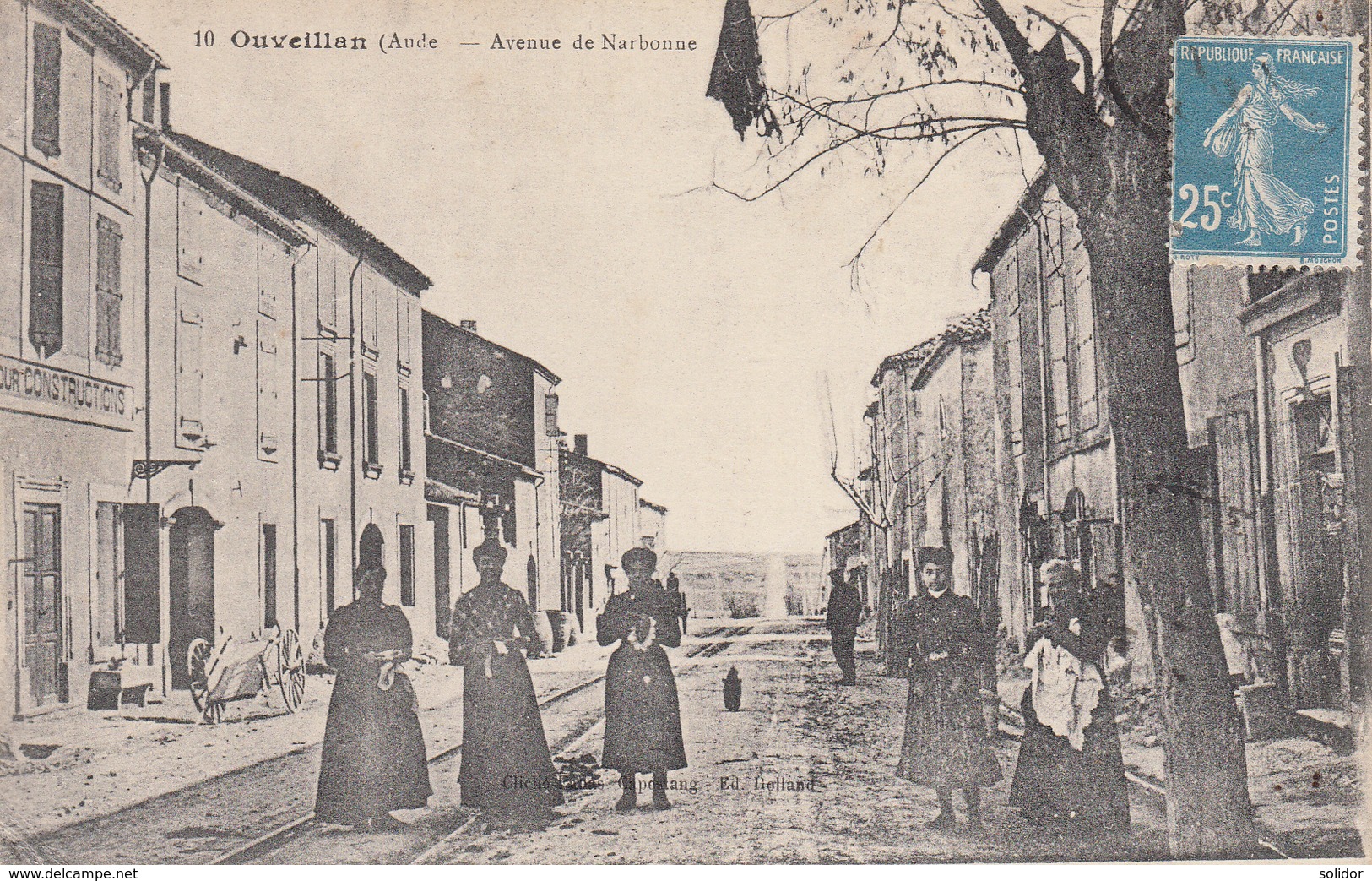 The tramway on Avenue de Narbonne. This view looks towards Cuxac. [1]
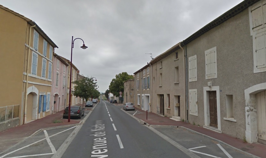 Approximately the same location in the early 21st century.
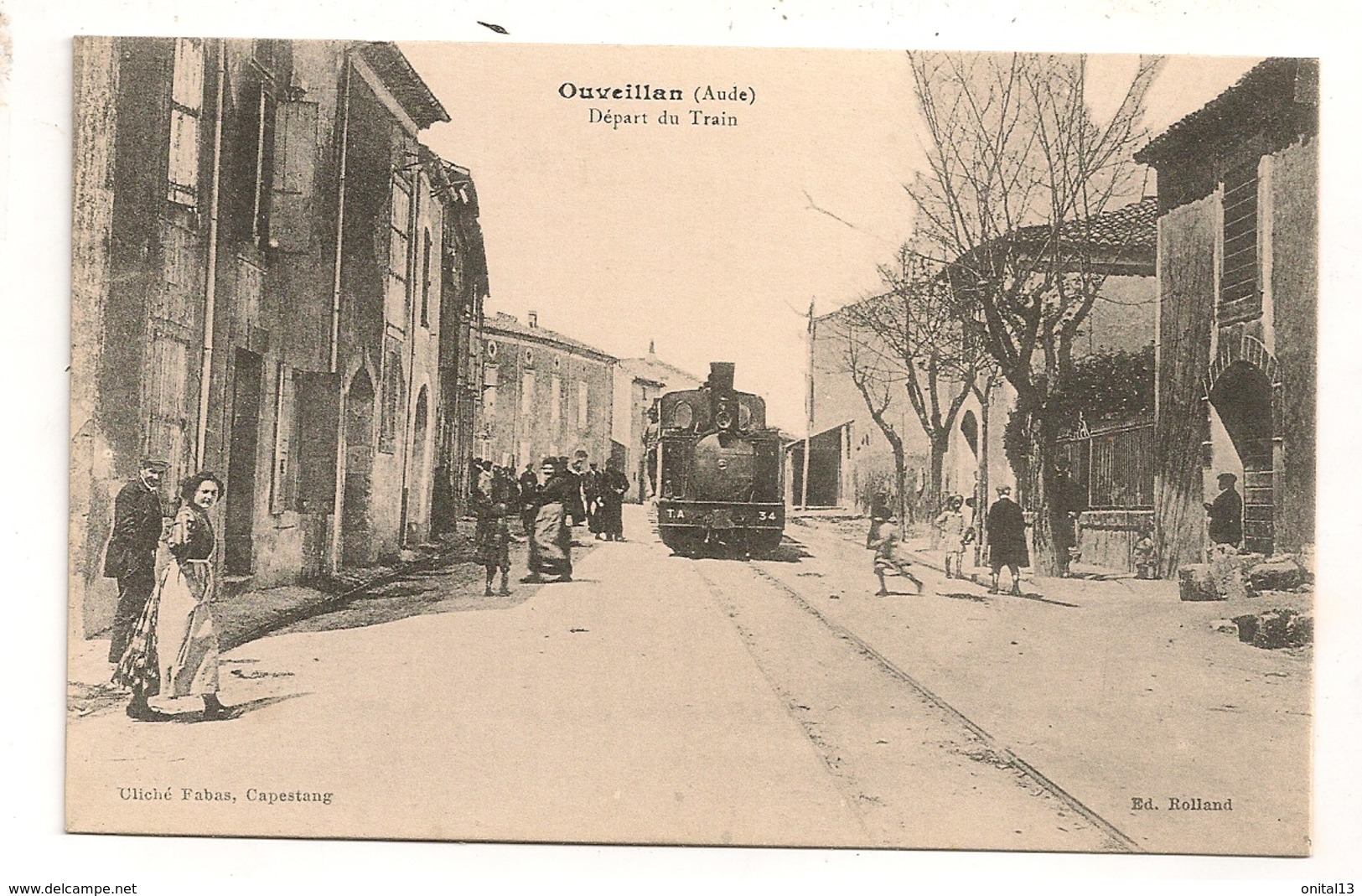 A train heads away from Ouveillan tramway station along the Avenue de Narbonne. [1]
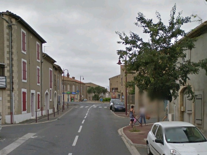 Approximately the same location in the early 21st century.
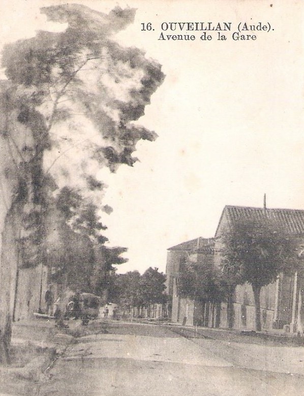 Further Northwest along what is now the D13, the tramway is still visible, and this card refers to the road on which it is running as Avenue de la Gare. [1]
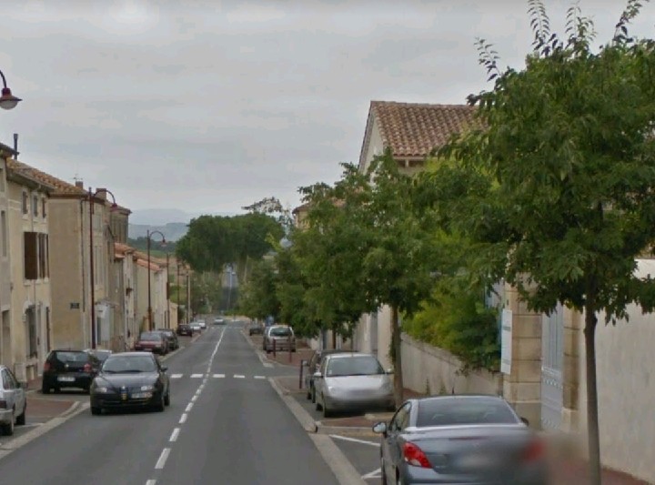 The same location, once again in the 21st century.
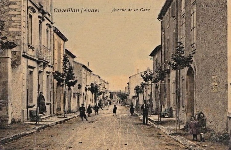 This is an earlier, pre-tramway view of the Avenue de la Gare. [11]
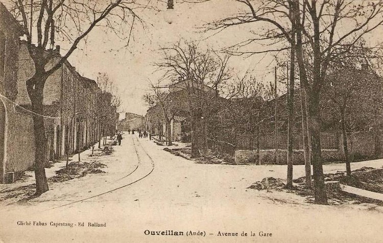 This time the tramway is in place. The station is off to the left of the photographer. [11]
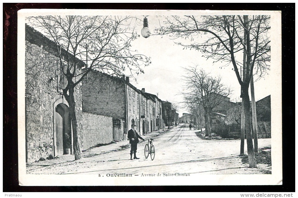 Avenue de la Gare was also known as Avenue de Saint Chinian. It bears that alternative name today and is part of the modern D13. This postcard view looks back Southeast towards the centre of Ouveillan. [1]
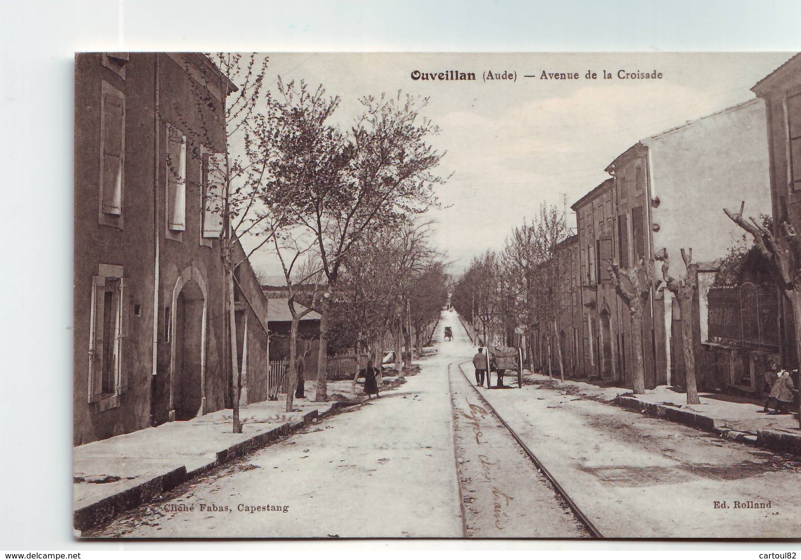 It seems that the road was known also as Avenue de la Croisade. This excellent view shows the tramway bearing off the main road into the station site. [1]
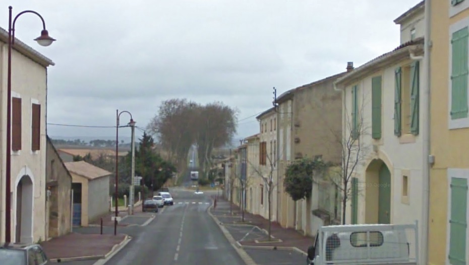 Almost exactly the same location in the early 21st century. The station site is to the right of the main road beyond the houses.
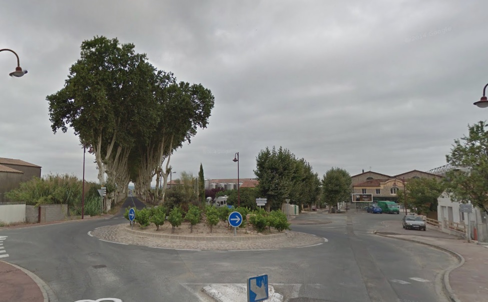 The station was in the open area to the right of the plane trees.
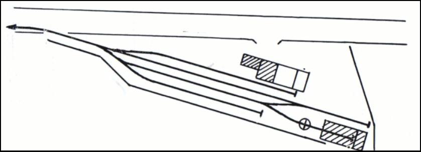 In the light of the size of other Tramways de l’Aude stations the terminus at Ouveillan was well provided for in infrastructure terms and it was sited adjacent to what would become the wine co-op buildings of the town which can be seen in the Google Streetview image above. [12]
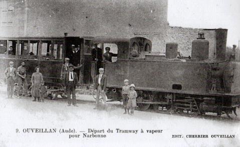
We finish this post with two images from the terminus at Ouveillan.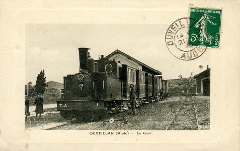
References
- https://www.delcampe.net/fr/cartes-postales/europe/france/11-aude/autres-communes?f=keyword:ouveillan, accessed on 25th November 2018.
- https://www.communes.com/cartes-postales-anciennes-cuxac-d-aude, accessed on 25th November 2018.
- https://www.cparama.com/forum/cuxac-t6776.html, accessed on 25th November 2018.
- http://www.en-noir-et-blanc.com/cuxac-d-aude-p1-1339.html, accessed on 25th November 2018.
- I picked up this image some time ago and did not keep a link reference for it. I cannot now find its original location on the internet. I will gladly add the relevant link if someone is able to point it out, accessed on 25th November 2018.
- https://remonterletemps.ign.fr, accessed on 25th November 2018.
- https://www.delcampe.net/fr/collections/cartes-postales/france/narbonne/narbonne-train-locomotive-avenue-de-la-gare-et-monument-des-combattants-chemin-de-fer-belle-animation-453866037.html, accessed on 2nd November 2018.
- https://www.delcampe.net/fr/collections/cartes-postales/france/narbonne/aude-11-narbonne-joli-plan-sur-les-boulevards-de-la-gare-et-du-college-avec-voiture-ancienne-animation-janson-343316390.html, accessed on 2nd November 2018.
- https://collection-jfm.fr/t/cartes-postales-anciennes/france/11-aude/narbonne-11, accessed on 4th November 2018.
- https://remonterletemps.ign.fr, accessed on 8th November 2018.
- http://www.belcaire-pyrenees.com/2016/10/test.html, accessed on 26th November 2018.
- http://www.cpaaude.fr/THEMES/TRAMWAYS/index_fichiers/Page2347.htm, accessed on 26th November 2018.

Thank you for the photos of the Tramways de l’Aude. It is always fascinating, when travelling in France, to recognise the traces and buildings of the former narrow gauge lines. I remember seeing in the early fifties, when I was barely into my teens, some of the remains of the Vendee lines beside what was then the N137, including a dismantling train (parked). I can also remember seeing the disused electric lines in the Haute? Vienne in 1950. (The “Village Martyr” of Oradour sur Glane still had the tracks and overhead in place in about 1983 – the men who returned from work in Limoges were among those burned in the church.) Ou sont les neiges d’antan? Your coverage was very thorough: thank you again for posting it.
Best wishes David Gibbs
Thank you, David.