
Narbonne’s tramways have been explored in some depth in my previous post …..
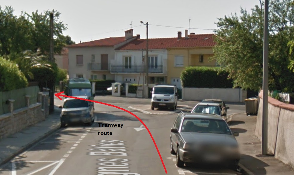
The route to Fleury set off Northeast from the tramway station on the forecourt of the Gare du Midi in Narbonne. After a very short distance the tramway route turned to a more southeasterly direction and in turn, within a short distance, left behind the suburbs of Narbonne.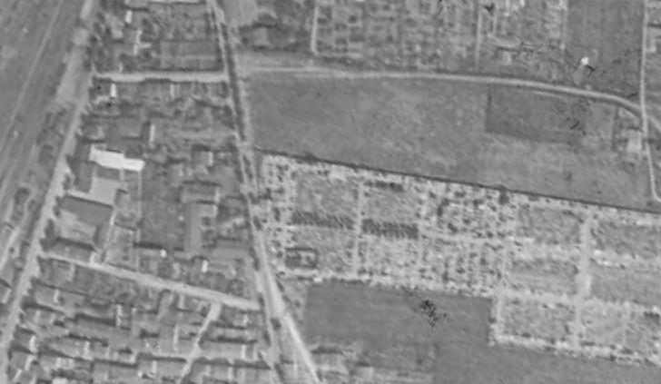 Things in the early 21st century are much different. In the image above the line can be seen leaving the station and heading East. [1] In the image below that line is now a road flanked by domestic dwellings. The cemetery appears to be essentially unchanged.
 The route as far as Vinnasan is shown on a composite of aerial photographs from 1939 to 1958 below. [1] Most of the route followed what is now the D68 over relatively flat countryside. I have not been able to find any images of the tramway between Narbonne and Vinnasan. The Google Streetview images below show the route of the tramway through what were open fields and are now suburbs of Narbonne.
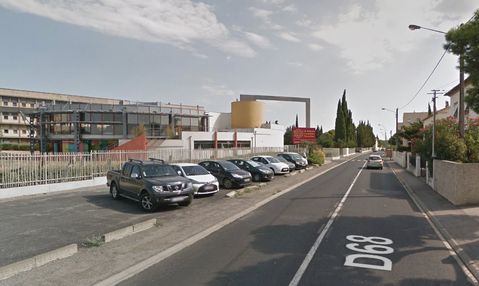
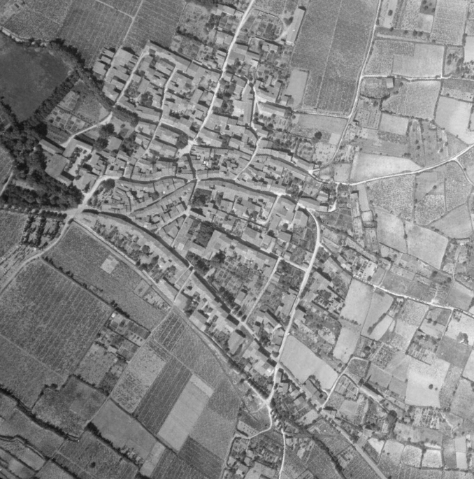
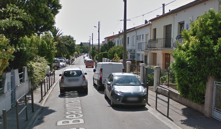

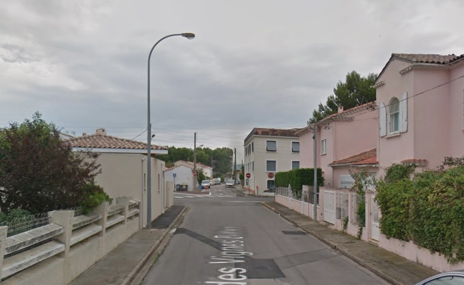
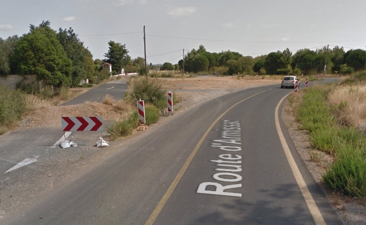 The old road and tramway route are on the left.
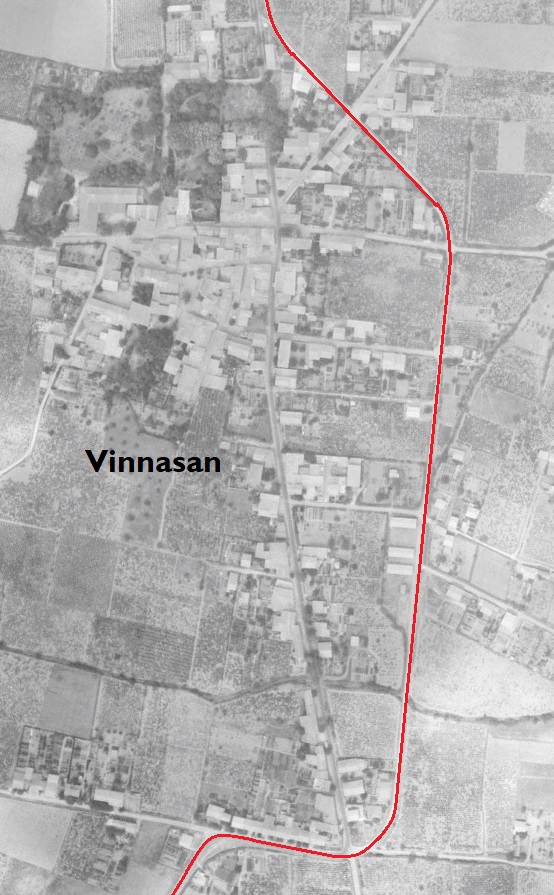
The tramway crossed farmland and a number of irrigation canals before reaching Vinnasin.
Vinassan
Vinnasan is now sited very close to the A9/E80 Autoroute which runs just to the East of the area of the adjacent aerial image. The tramway route has been superimposed onto an aerial image from 1958, although it would by that date have been long-gone.
This is a close-up image of the top right of the above ‘snake’ illustrating the length of the route to Vinnasan from Narbonne. The tramway by-passed the centre of the village, taking a more easterly route than the main north-south road through the village (now the D31).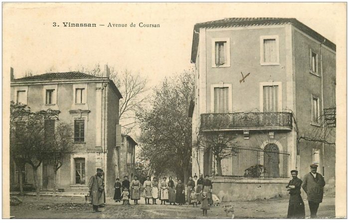
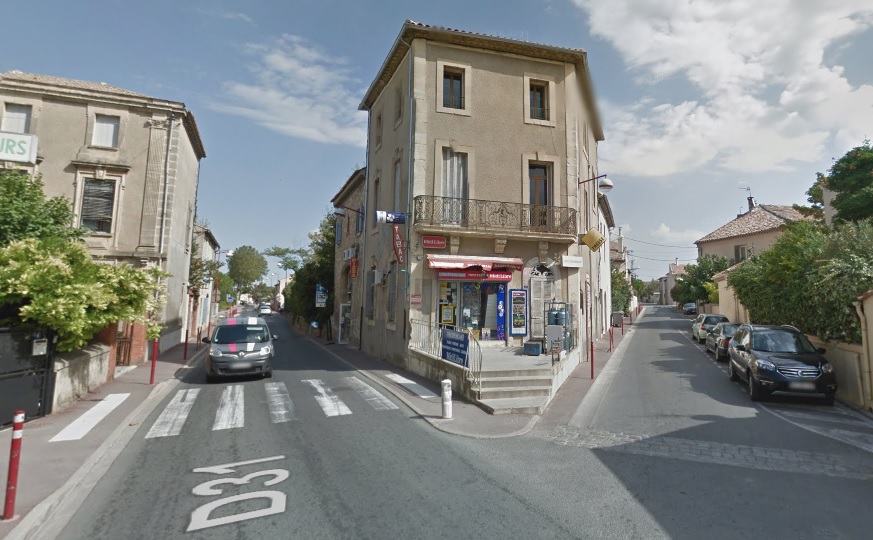
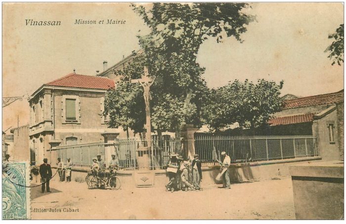
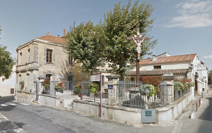 The postcard images above come from the central area of Vinnasan, both taken from the main north-south road which is now the D31. They are matched to modern images which show relatively little change. [2][3] The tramway ran to the east of the main village road.
North of Vinnasan, the tramway followed the modern D31 north to a T-junction with the road between Coursan and Salled’Aude. The present day D1118 meets the D31 and the D31 turns East to Salles d’Aude.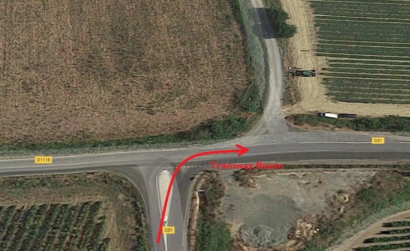
From the junction the tramway continued eastwards to Salles d’Aude past the Winery of Chateau Pech-Celeyran-Saint-Exupery.
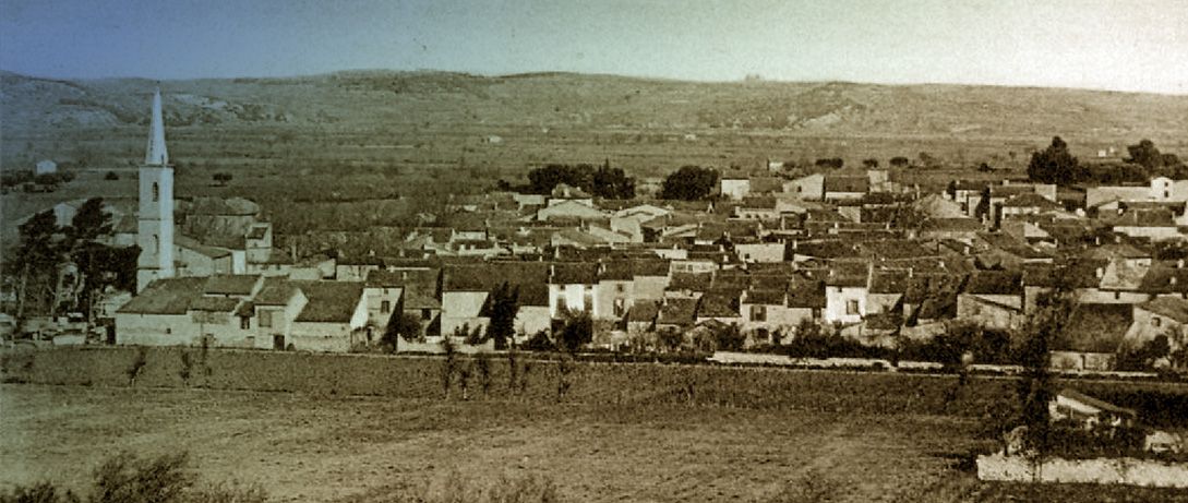
Salles d’Aude
 This 1945 aerial image shows Salles d’Aude and the road which is now the modern D31 crossing the lower half of the old village from West to East, entering immediately below the woodland in the top left of the image and exiting off the bottom edge of the image close to the right-hand corner. The vestiges of the tramway route can be seen to the south side of the properties which flank the road [1]
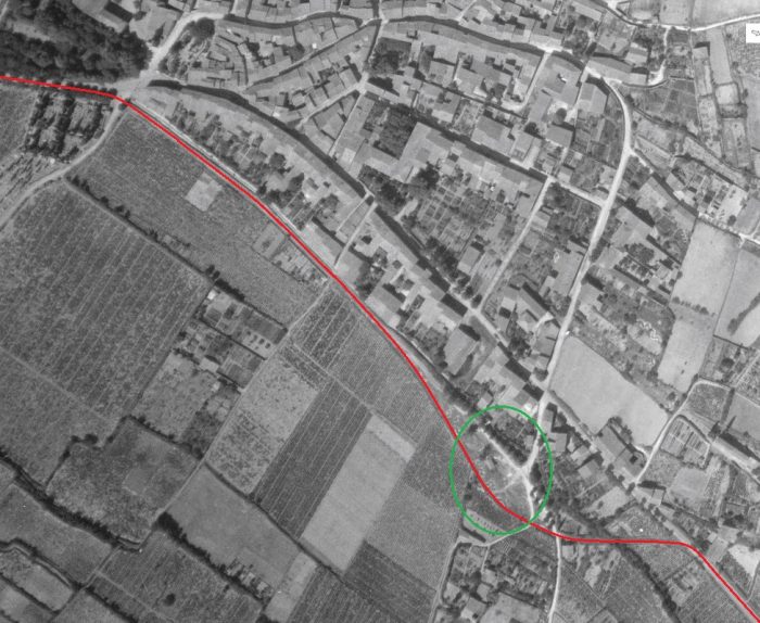
 This picture is taken from South of the village and shows the tramway route on embankment in front of the village. It runs approximately along the line of what is now Rue du Grimal. [4]
The station was sited to the Southeast of the village in the area highlighted by the green ellipse on the aerial image above, which places it some distance to the right of the picture immediately above.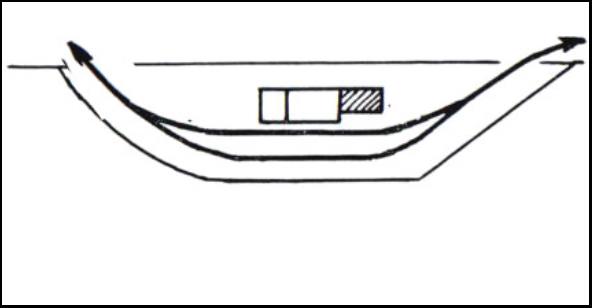 Sketch plan of the Station at Salles d’Aude. [5]
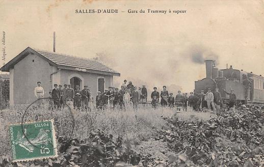 The Station at Salles d’Aude. [5]
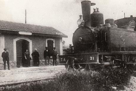 Corpet-Louvet 0-6-0T No. 21 at Salles d’Aude. [5]
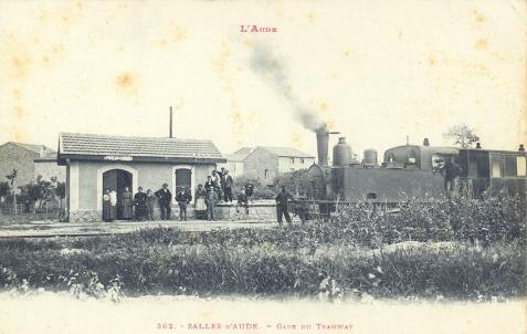 Another Corpet-Louvet 0-6-0T, this time unidentified, at the Station. [5]
It was only a short distance from Salles d’Aude to Fleury d’Aude. Tha station at Salles D’Aude was at the topleft of the satellite image below. The tramway route is shown in red and the location of the station at Fleury d’Aude is shown with a green box both on the satellite image and the aerial photo below.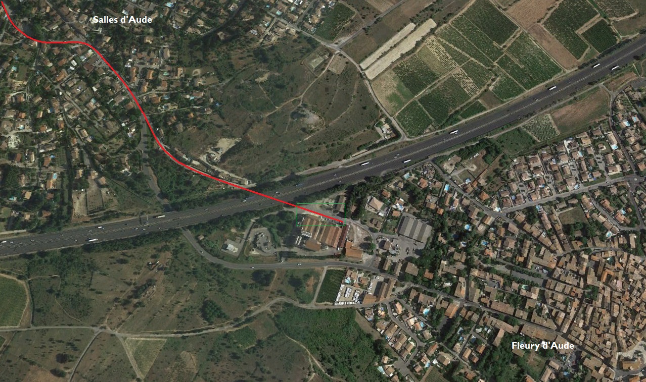

Fleury d’Aude
The western entrance to the village is shown on this extract from a 1945 aerial photograph. The tramway station location is highlighted by the green rectangle. By 1945, the station site had already been subsumed into the Co-op site.
The centre of the village of Fleury d’Aude is shown below on the next 1945 aerial image. The central circular area of the old village is typical of many such villages in Southern France. The smaller aerial image above was taken at the same time as the one below and abuts directly onto it.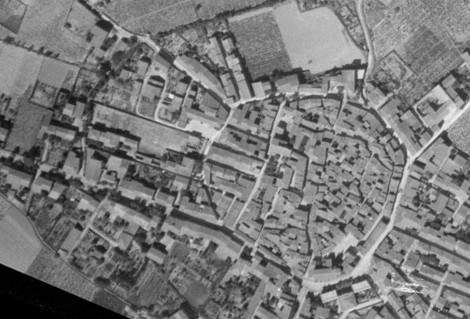 The station was out to the West of the centre of the village. The building in the bottom right of the green rectangle appears in a number of the pictures below. It is at the right-had side of the sketch plan below, just beyond the station site boundary on the sketch. It can be seen beyond the tram in the first postcard image below. [5]
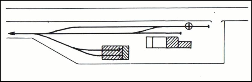
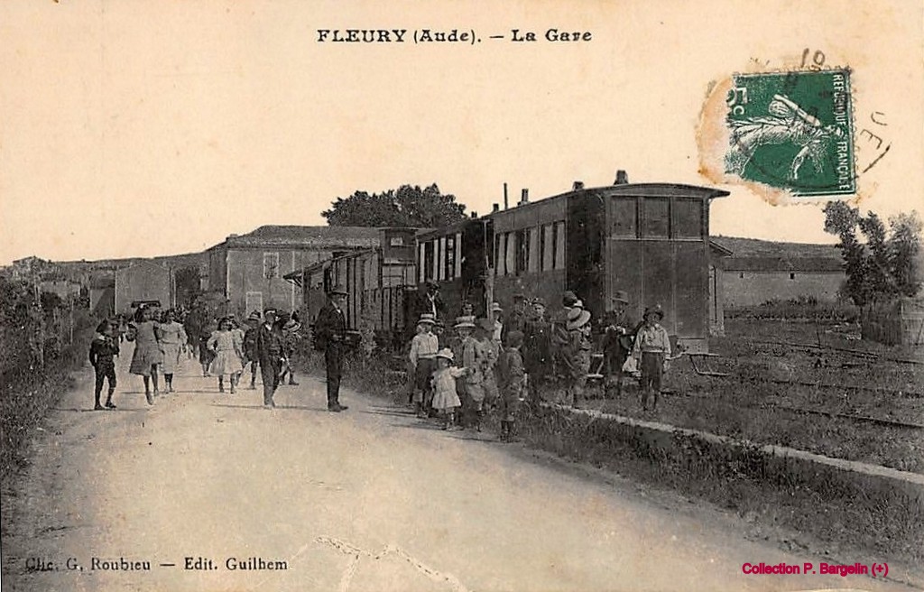 The station at Fleury d’Aude. [6]
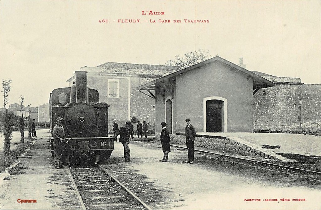 Corpet-Louvet 0-6-0T No. 1 at Fleury d’Aude Station. [6]
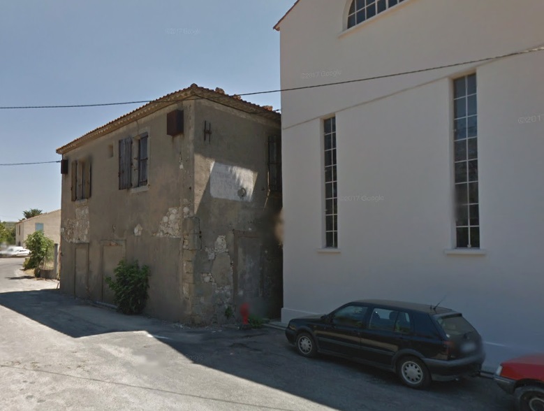 The two images above show the building referred to in the last paragraph above. The first is a closer image of the building on an early 20th century postcard the second is taken in the early 21st century.
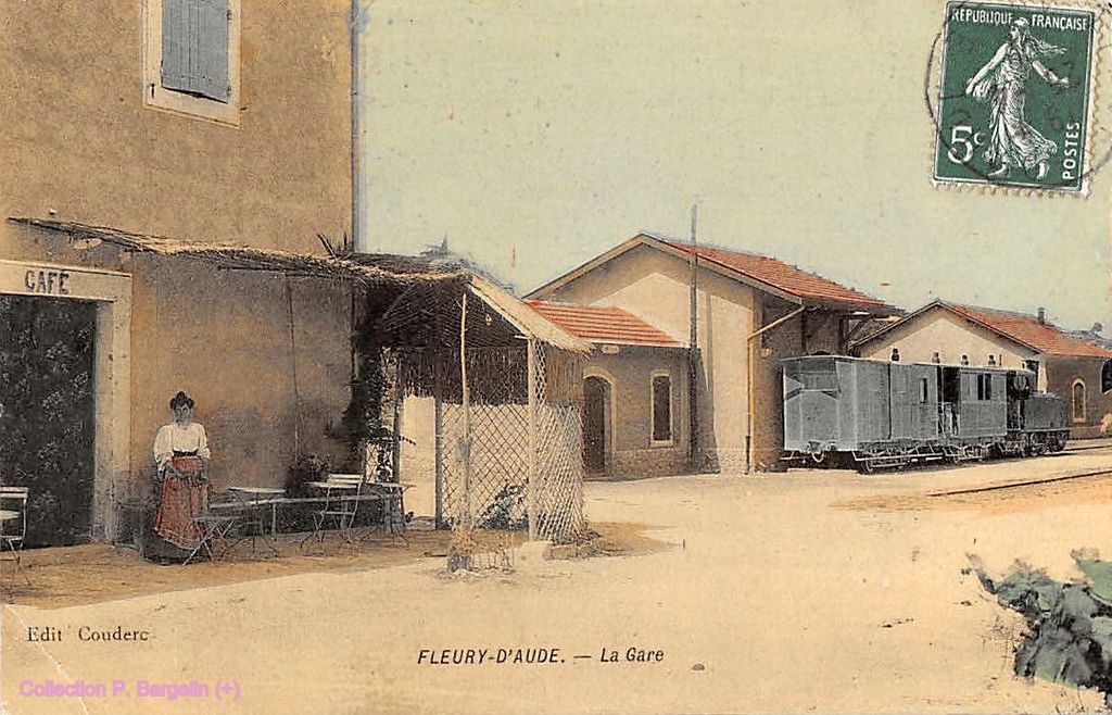 The station cafe and passenger and goods facilities. The engine shed is visible behind the locomotive which is preparing to leave for Narbonne. [6]
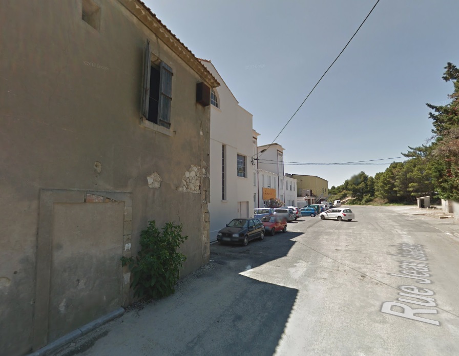 The cafe building in the early 21st Century with the modern Co-op buildings on the site of the station.
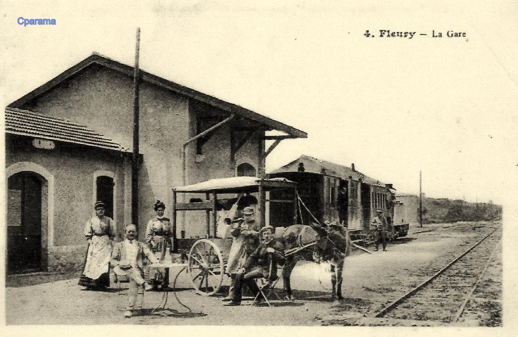 Fleury d’Aude Station. [6]
The Co-op which was built on the station site is called La Vendemiaire.[7] The Co-op was created in 1937 and the building opened its doors to the wine harvest in 1938. In 1979, 652 members still cultivated 889 hectares of vines (just a little more than one hectare per cooperator) and the cellar vinified 91,000 hectoliters of table wines.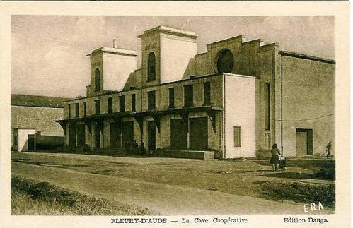 The Co-op building soon after construction in the late 1930s. The tramway station was under the forecourt and the facade of the new building. The brick building at the left of the picture is the building which housed the station cafe and appears in images above. [8]
This is the final planned post on the Tramways de l’Aude.
I hope that you have enjoyed the journey.
References
- https://remonterletemps.ign.fr, accessed on 20th to 27th November 2018.
- https://www.fortunapost.com/cartes-postales-francaises/3261-carte-postale-ancienne-11-vinassan-avenue-de-coursan.html, accessed on 15th November 2018.
- https://www.fortunapost.com/cartes-postales-francaises/3262-carte-postale-ancienne-11-vinassan-mission-et-mairie-petrolette-sur-cale.html, accessed on 30th November 2018.
- http://www.sallesdaude.fr/fr/decouvrir/un-peu-dhistoire, accessed on 30th November 2018.
- http://www.cpaaude.fr/THEMES/TRAMWAYS/index_fichiers/Page1105.htm, accessed on 15th November 2018.
- https://www.cparama.com/forum/fleury-d-aude-t259.html, accessed on 15th November 2018
- http://www.lavendemiaire.com, accessed on 3rd December 2018.
- http://www.cavescooperatives.fr/article-27593489.html, accessed on 2nd December 2018.

Reblogged this on By the Mighty Mumford and commented:
EVIDENCE OF TRAINS—BY THE SHAPES OF BUILDINGS…MORE THAN ONE MIGHT CONSIDER!