Category Archives: Scandinavia

The Guardian Lifestyle Travel – Saturday 23rd May 2026 – Part 3 – Readers’ Favourite Railway Journeys – Part A

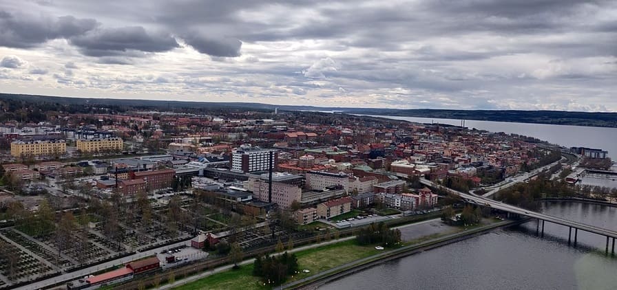
The travel section of the Saturday Guardian Magazine on 23rd May 2023 included a few pages about train journeys in Europe (pages 72 to 77). This is the third part of a look at those pages and focuses on some reader’s recommendations of journeys by train. It includes a few more uploaded by the Guardian online.

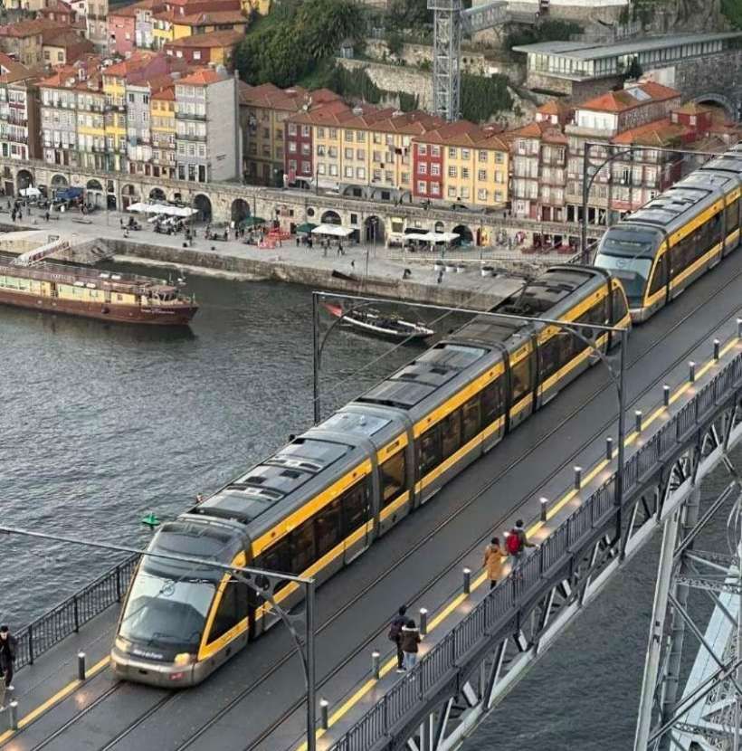
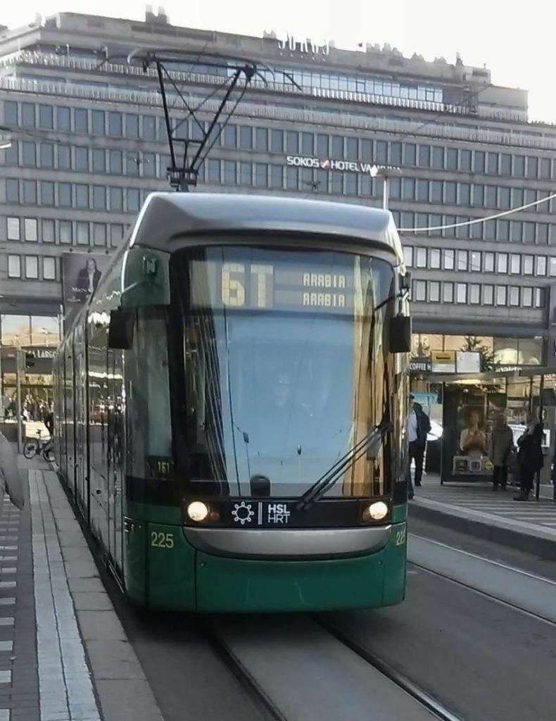
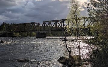
The featured image for this article is a Flexity Outlook Eurotram at Trindade station in Porto, Portugal, © Cornelius Kibelka and licensed for reuse under a Creative Commons licence (CC BY-SA 2.0). [3]

3. Readers’ Favourite Railway Journeys

A. A Dramatic Metro Line in Porto

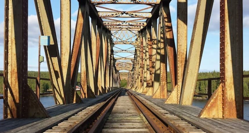
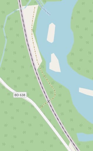
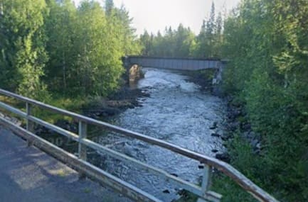
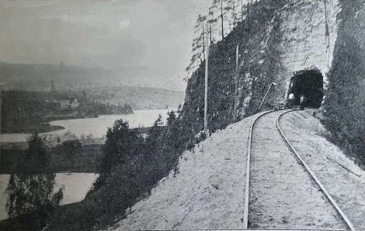
“I love the surprise of urban rail. Porto’s metro D line heading south emerges from mundane darkness underground to suddenly skim rooftops and then rattle across the fantastic Eiffel-inspired Dom Luís I bridge. Choosing to walk back across the metal deck is a completely different experience.” [1: p75][12][Reader: Amy]

A map of the Metro in Porto. The yellow line is line D. It runs from Hospital Sãn João to Santo Ovidio. It is the one Metro line that crosses the Rio Douro. [2]

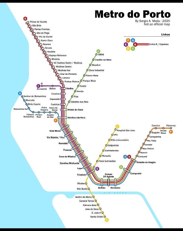
The Porto Metro (Portuguese: Metro do Porto) is the light rail network in Porto. It runs underground in central Porto and above ground into the city’s suburbs. The first parts of the system have been in operation since 2002. The network uses low-floor tram vehicles. [3]
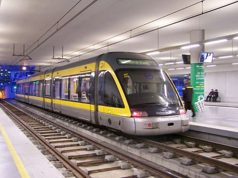
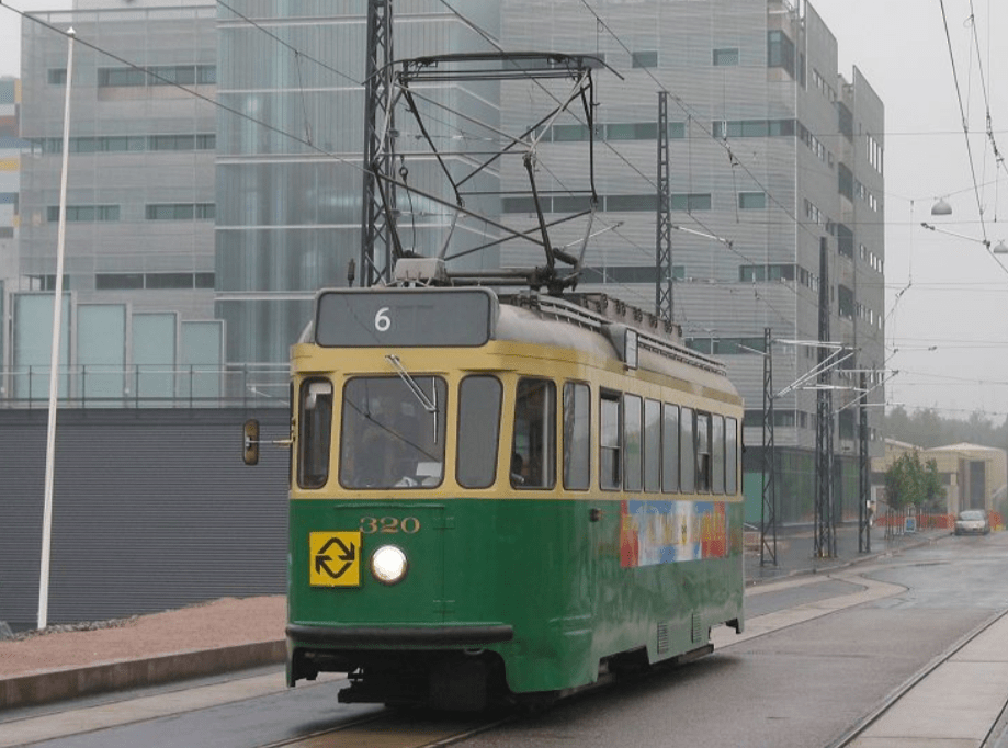
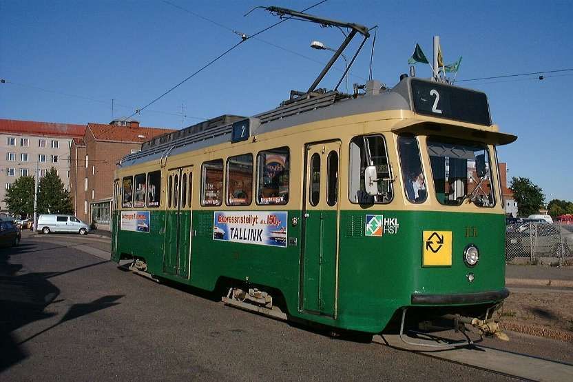
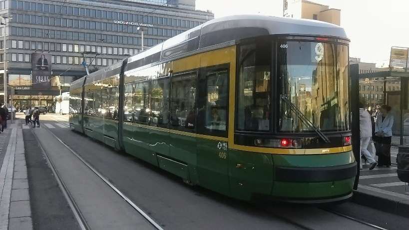
A Flexity Outlook Eurotram at Trindade station, © Cornelius Kibelka and licensed for reuse under a Creative Commons licence (CC BY-SA 2.0). [3]

The Socimi Eurotram (later sold as the Bombardier Flexity Outlook (E)) is an electric tramcar originally designed for the tram system of Compagnie de Transports Strasbourgeois (CTS). Initially produced by Socimi, after the company became bankrupt Eurotrams were manufactured first by ABB Group’s transportation division, then by Adtranz and finally by Bombardier Transportation, who marketed the tram as part of their Flexity Outlook range.” [4]

One of the Flexibilty Outlook Eurotrams crossing the Dom Luis I bridge over the Rio Duoro, © Sergei Gussev and licensed for reuse under a Creative Commons licence (CC BY 2.0). [5]
An aerial view of the Dom. Luis 1 Bridge over the Rio Douro in Porto. The bridge carries a road on a lower deck and the Metro Line D on the upper deck, © Deensel and licensed for reuse under a Creative Commons licence (CC BY 2.0). [6]
The Dom. Luis I Bridge seen from the West, © Milton Li, June 2019. [Google Maps, May 2026]

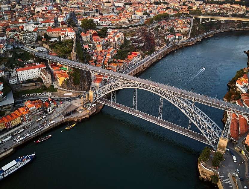
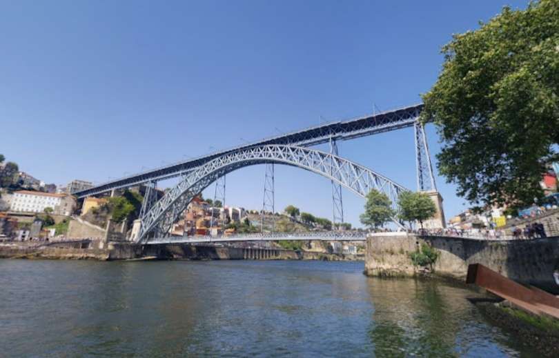
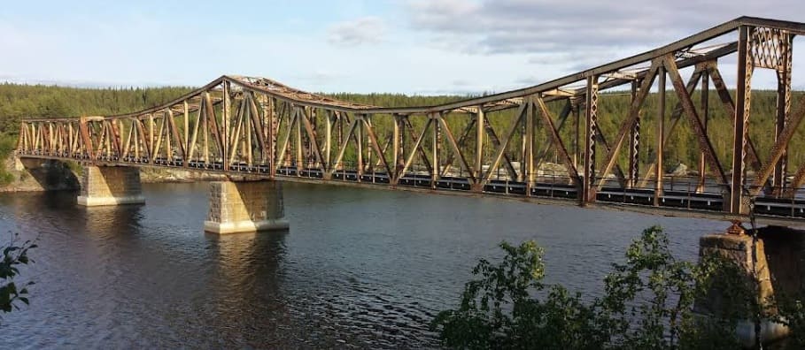
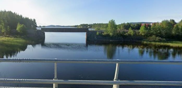
The bridge was designed by Theophile Seyrig and opened at the end of October 1886. In the 21st century, “the bridge’s upper level is used by pedestrians and by line D of the Porto Metro, whilst the lower level is used by buses, taxis, cyclists and pedestrians. The lower level links to the Porto waterfront, including the Praça da Ribeira and the lower station of the Guindais Funicular, at its northern end, and to Gaia waterfront, with its Port wine lodges, at its southern end. The upper level connects to Porto city centre and São Bento station at its northern end, and adjoins the Serra do Pilar Monastery and the upper station of the Gaia Cable Car at its southern end.” [6]

In 1879, Gustave Eiffel presented a project to construct a new bridge over the Douro, with a high single deck in order to facilitate ship navigation. This project was rejected due to dramatic growth of the urban population, which required a re-thinking of the limits of a single-deck platform. … A competition was initiated in November 1880, in order to construct a double-deck metal bridge, which included projects by Compagnie de Fives-Lille, Cail & C., Schneider & Co., Gustave Eiffel, Lecoq & Co., Société de Braine-le-Comte, Société des Batignolles (which submitted two ideas), Andrew Handyside & Co., Société de Construction de Willebroek (also two projects) and John Dixon. It was in January of the following year that deliberations by the committee supported the project of Société de Willebroek, a design that cost 369,000 réis and provided better carrying capacity. On 21st November 1881, the public work was awarded to the Belgian Société de Willebroek, from Brussels, for 402 contos. It was to be administered by Théophile Seyrig, the former partner of Gustave Eiffel and author of the project. Seyrig had also designed the Maria Pia bridge that was constructed by Eiffel & cie, hence the resemblance of his new bridge to the Maria Pia bridge. Construction began on the Luis I bridge alongside the towers of an earlier suspension bridge, the Ponte Pênsil, which was disassembled.” [6]

By 26th May 1886, the first weight experiments began, with the transport of a 2,000 kilograms (4,400 lb) per metre. On 30th October construction of the main arch and upper deck were concluded, resulting in its inauguration the very next day. On 1st November, a toll system began to operate under the administration of the winning company, that was equal to 4 reís per person. The following year the lower deck was inaugurated, completing the project. During its ceremonies, the bridge was blessed by Bishop D. Américo.” [6]

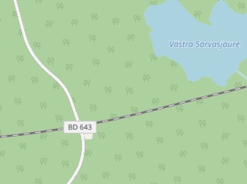
Line D (yellow line) opened on 17th September 2005 between Câmara de Gaia in Vila Nova de Gaia and Pólo Universitário in the North. At the northern end, the São João Hospital and IPO stations, were not brought into service until March 2006 due to safety concerns. At the southern end, the line was expanded until D. João II in May 2008 and then to Santo Ovídio in October 2011. In June 2024, the line was extended southwards by 3.15 km with three new stations added, Manuel Leão, Hospital Santos Silva and Vila d’Este. [3]

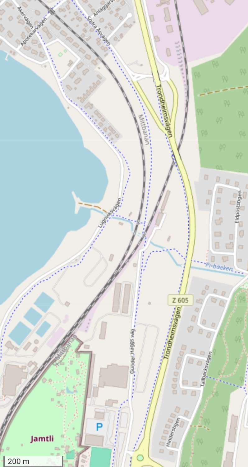
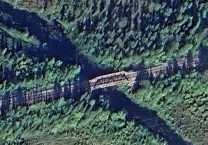
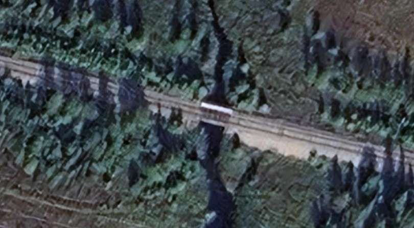
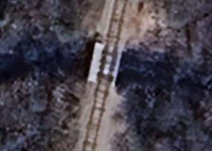
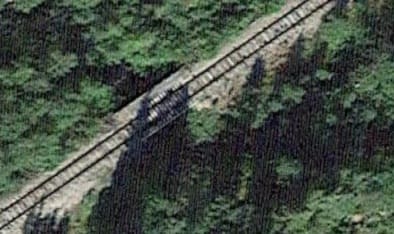
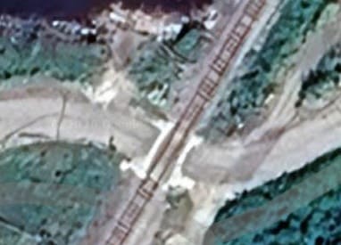
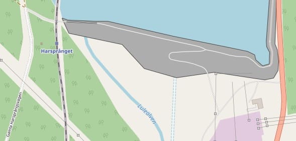
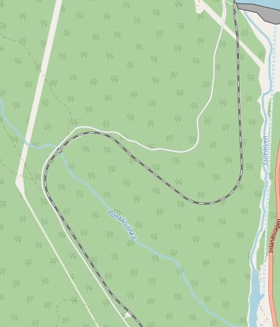
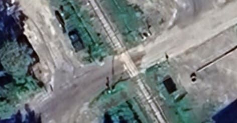
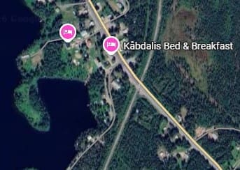
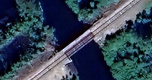
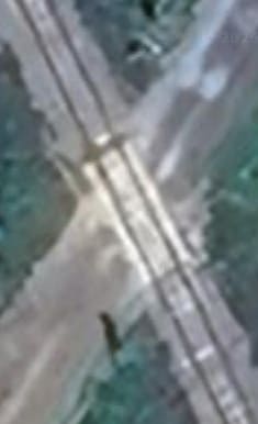
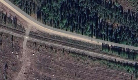
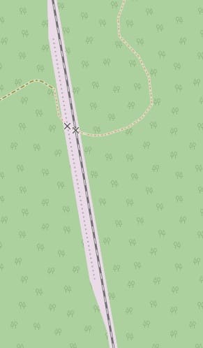
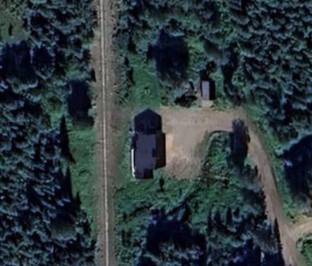
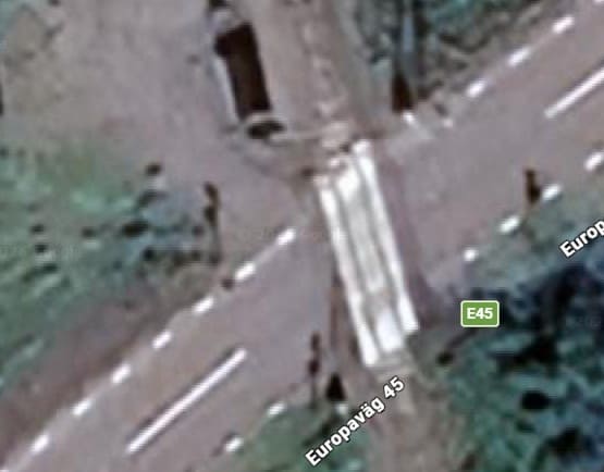
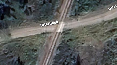
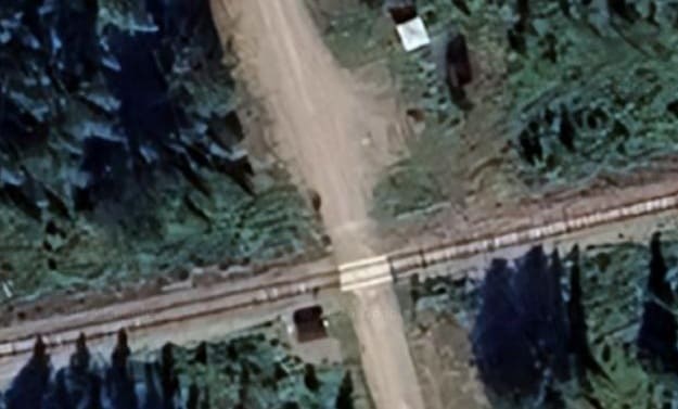
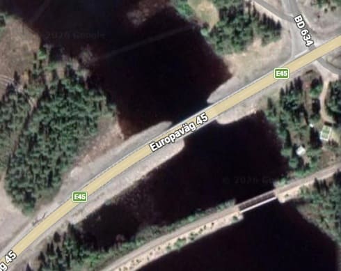
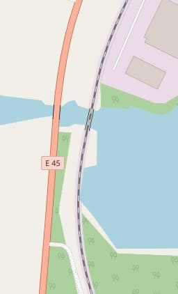
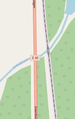
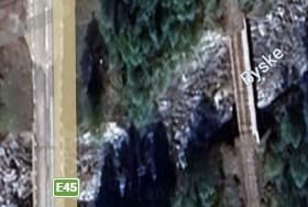
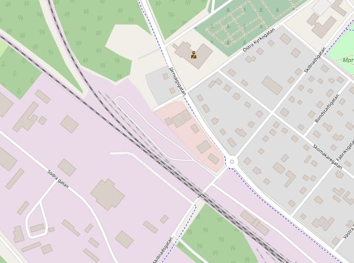
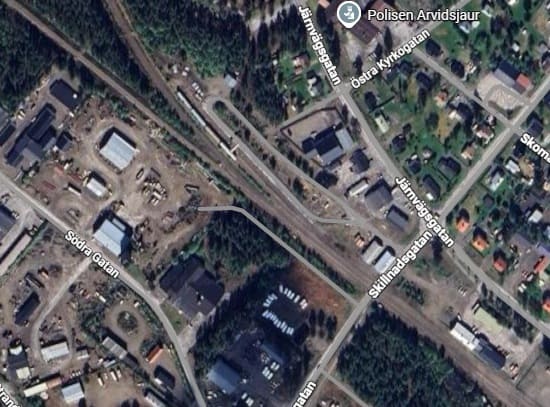
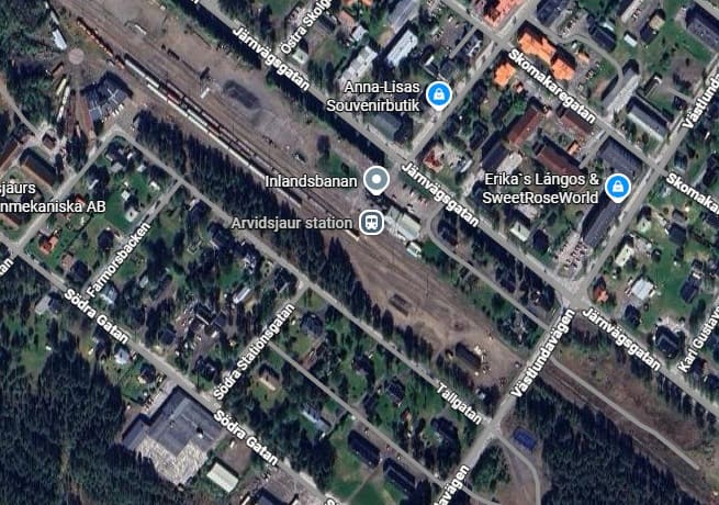
The Guardian reader (Amy) speaks of the tram emerging from the darkness of the tunnel before crossing the bridge. The tunnel mouth can be seen in the satellite image immediately below.

This satellite image shows the location mentioned above. Trams emerge from underground on the North side of the Rio Douro and are soon high above city streets such as Escardas do Codecal and Av. Gustavo Eiffel and then crossing the river. [Google Maps, May 2026]

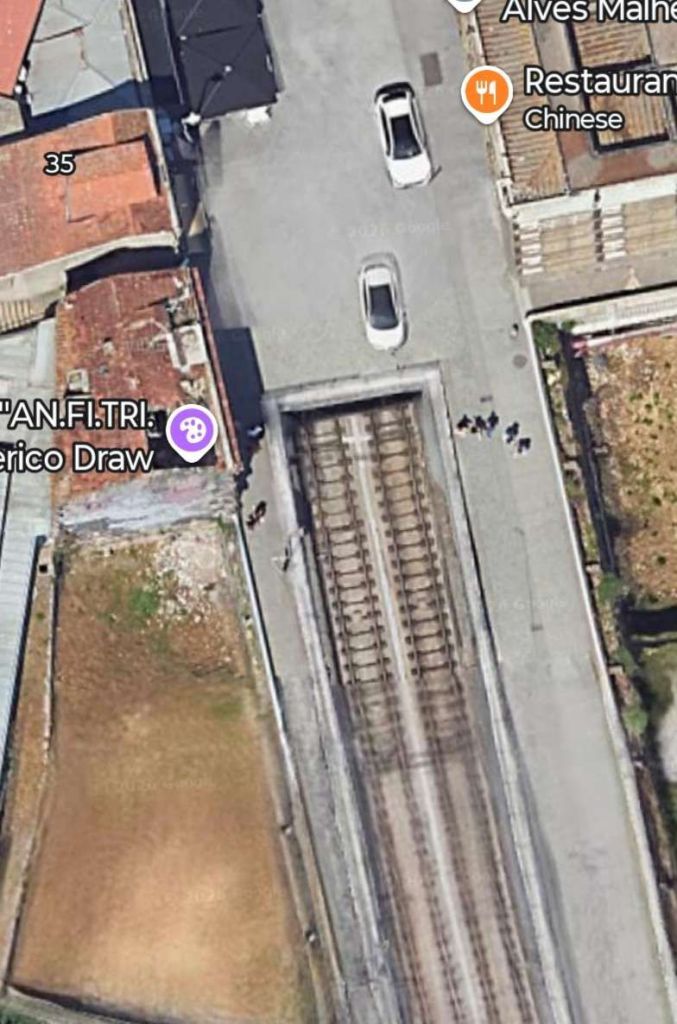
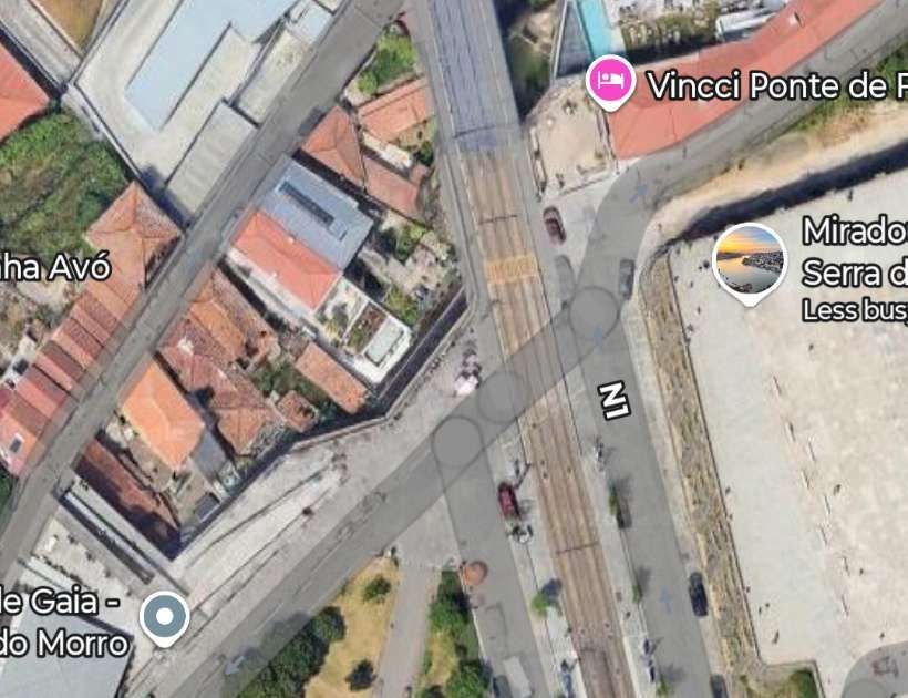
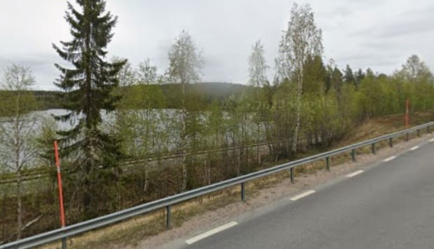
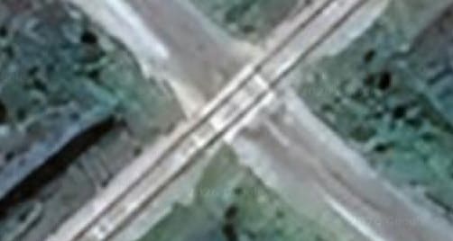
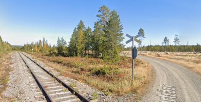
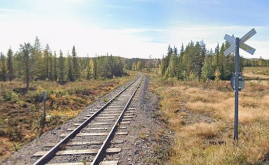
On the South side of the river trams fly over R. da Cabo Simeo and Calcada da Serra before meeting and crossing R. Rocha Leao at level.

Metro line D runs North to South, crossing R. Rocha Leao at level. [Google Maps, May 2026]
Looking North towards the Rio Douro from R. Rocha Leao. [Google Streetview, June 2025]
Turning through 180°, this is the view South along Metro Line D from R. Rocha Leao. [Google Streetview, June 2025]

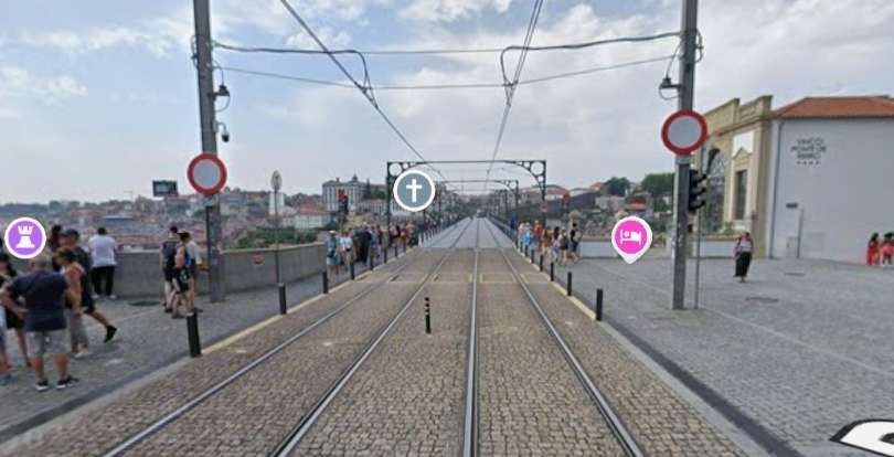
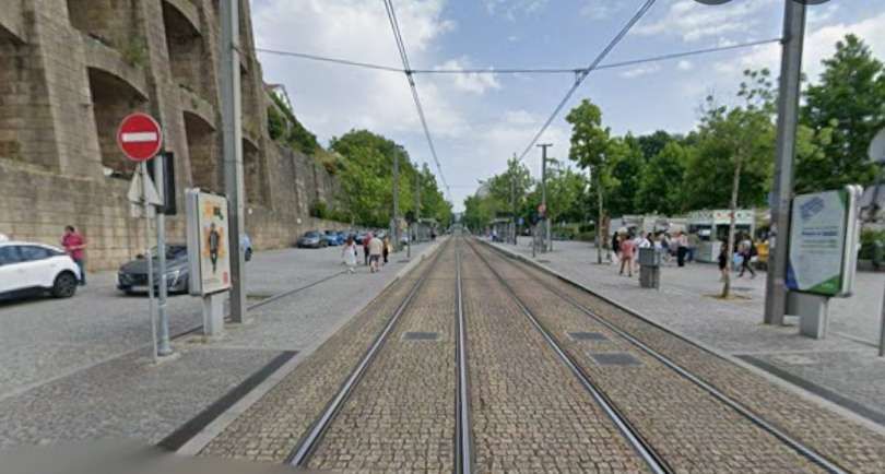
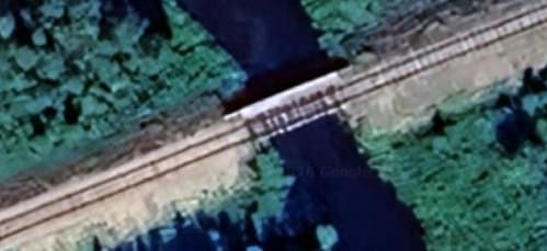
The Guardian reader talked of crossing the bridge on the Metro and then walking back over it afterwards!

B. Fjords and Waterfalls in Norway

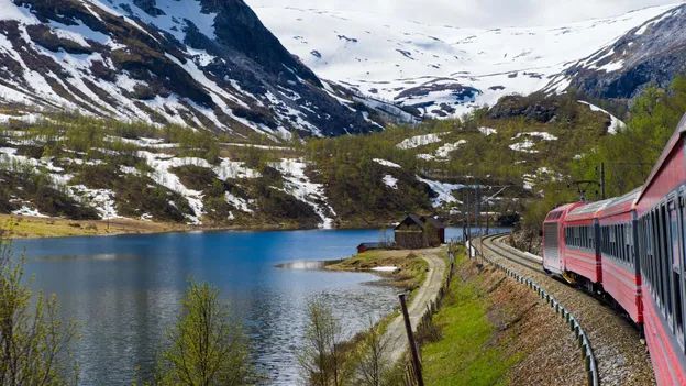
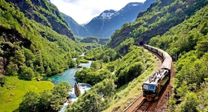
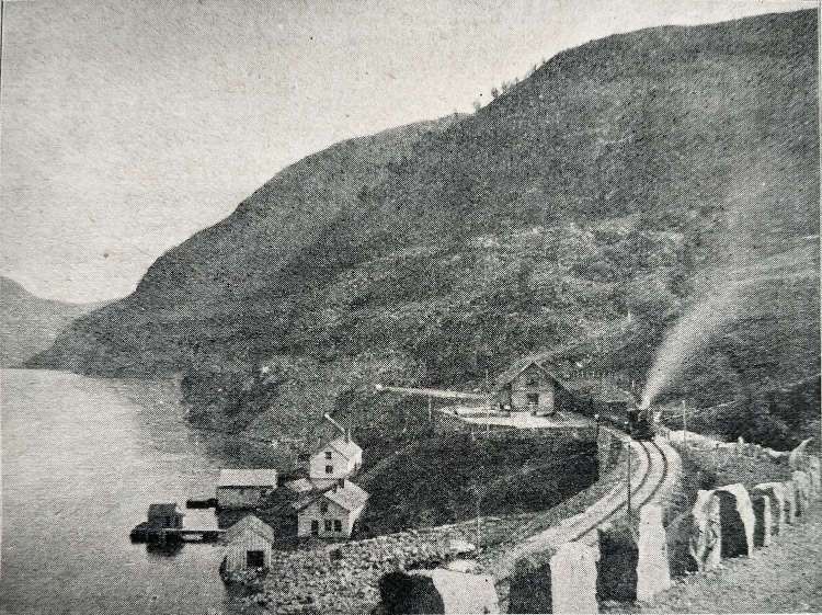
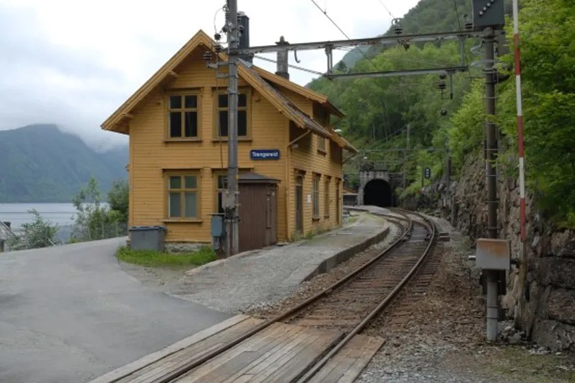
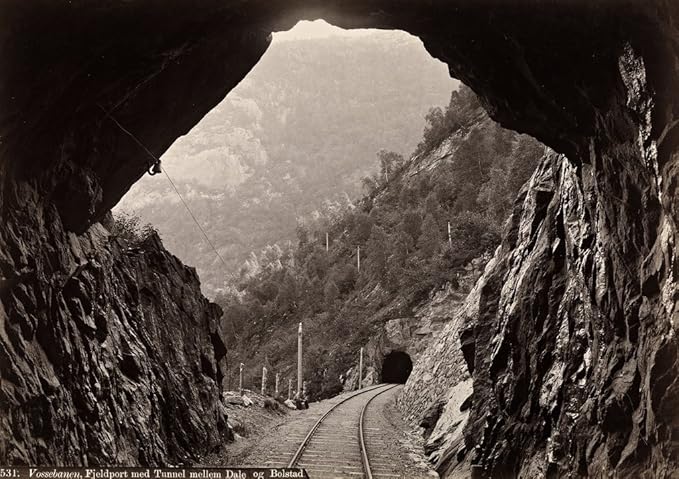
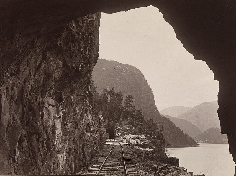
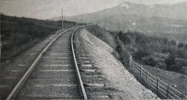
“I travelled across Norway by rail on the spectacular Bergensbanen, running between Oslo and Bergen, and the unforgettable Flåmsbana branch line. The Bergensbanen crosses the high mountain plateau of Hardangervidda, passing lakes, forests and snow‑covered peaks before descending toward the fjords of western Norway. At Myrdal, I transferred on to the steep Flåmsbana, which drops dramatically to Flåm on the Aurlandsfjord, with waterfalls and sheer-sided valleys at every turn.” [1: p75][12][Reader: Daniel]

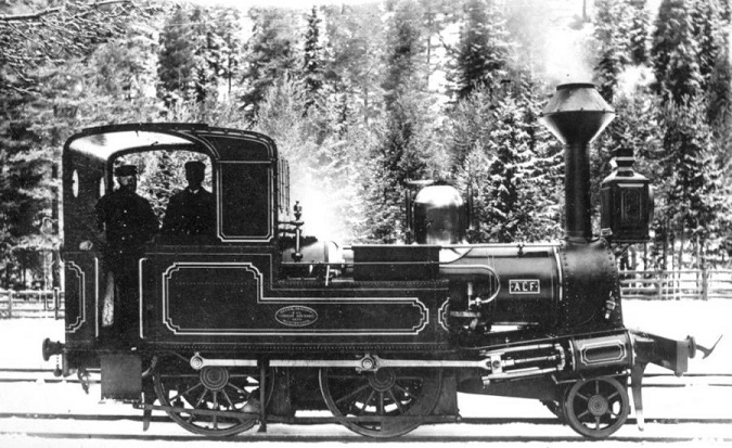
The Bergensbanen is a spectacular 496-kilometre railway connecting Oslo and Bergen in Norway. Taking approximately 7 hours, it is Northern Europe’s highest mainline railway, reaching 1,237 metres above sea level. The line runs 4 to 6 times daily, offering stunning views of Hardangervidda mountain plateau and deep fjords.

Trains on the Bergensbanen are operated by Vy. [7] Highlights along the way include Finse (the highest station), Myrdal (transfer to the Flåm Railway), and Voss (a major skiing hub).

The Bergensbanen is actually a 371-kilometre (231 mile) long scenic standard-gauge railway line between Bergen and Hønefoss, Norway. However, the name is often applied to the entire route from Bergen to Oslo, including the Randsfjord and Drammen lines between Hønefoss and Oslo, covering a total distance of 496 kilometres (308 miles). [8]

The Bergen Railway (Bergensbanen)
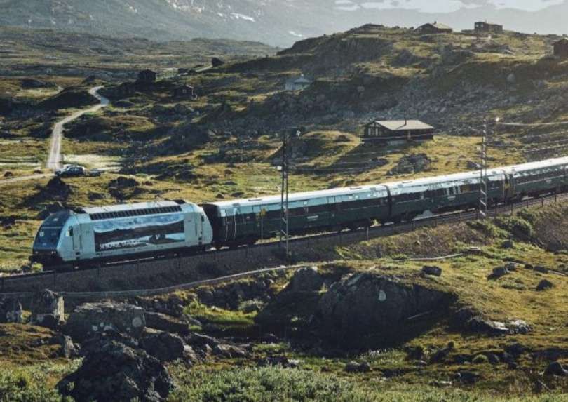
Between Oslo and Bergen by train, © Vy/Øivind Haug. [9]
Connecting Norway’s stylish capital with its most picturesque city, the 496km, 39-station Oslo-Bergen railway is one of the world’s most beautiful train journeys, © MariusLtu/Getty Images. [10]
The route crosses the inhospitable Hardangervidda plateau, which soars more than 1km above sea level, © Stockstudiox/Getty Images. [10]

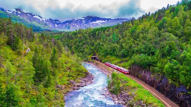
The Flåmsbana is one of the most beautiful train rides in the world and it takes you past mountains and waterfalls you will not forget.

The Flåm Railway. © Morten Rakke. [9]

An article about the Flam railway can be found here. [11]

C. An Electric Gem in Germany

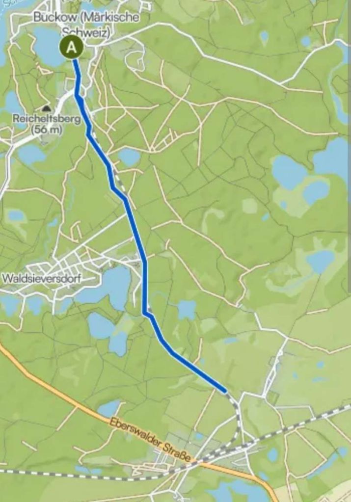
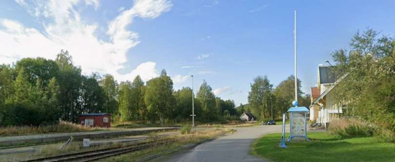
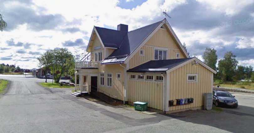
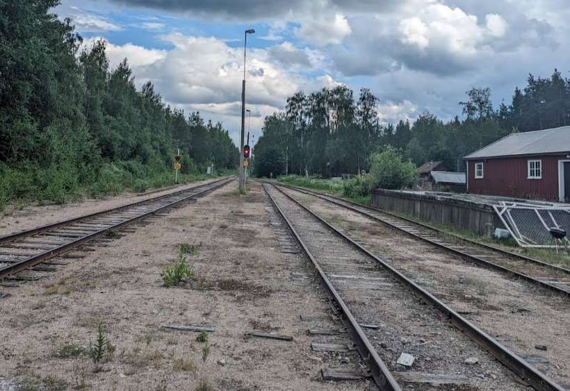
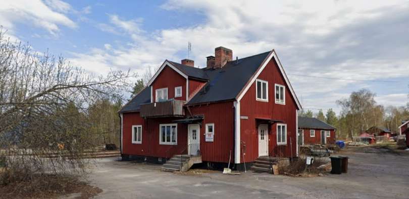
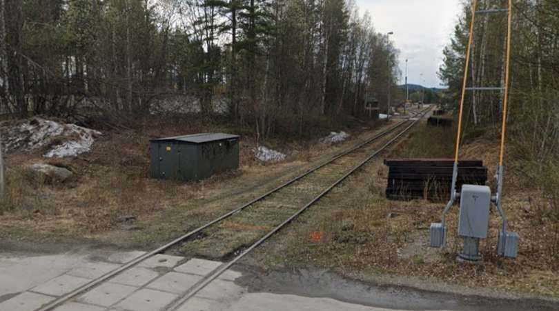
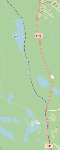
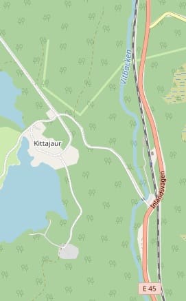
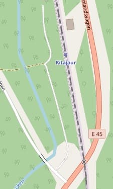
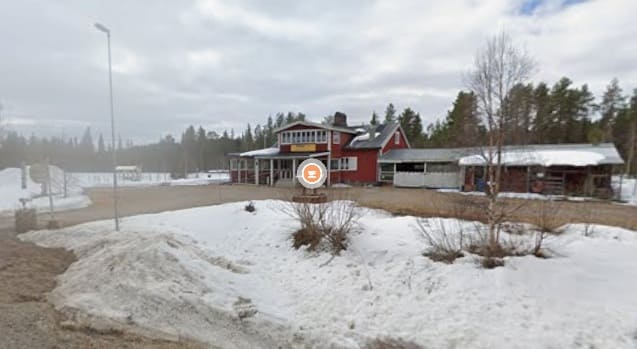
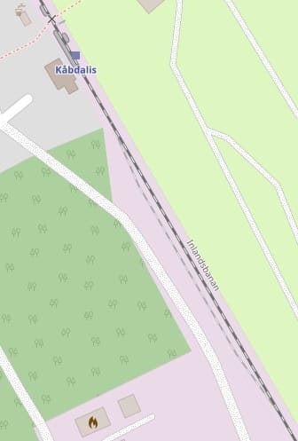
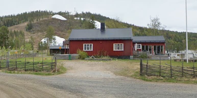
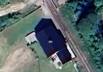
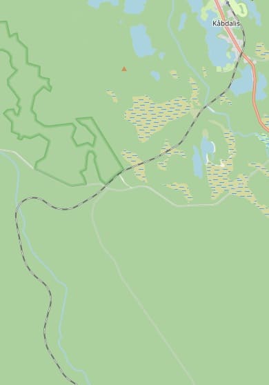
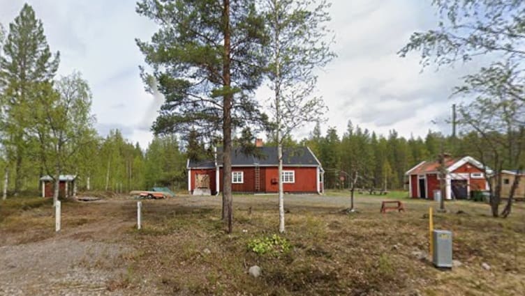
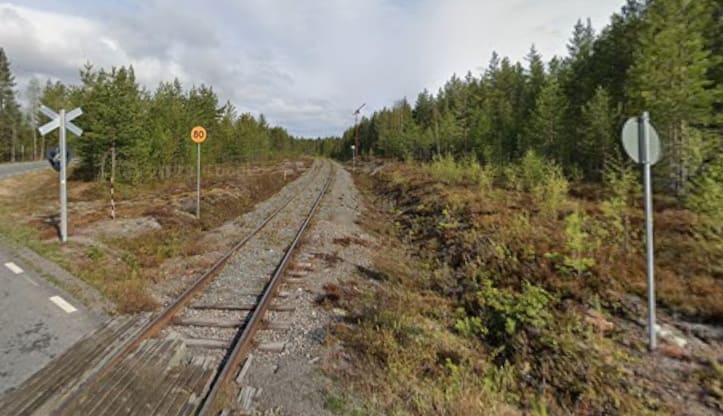
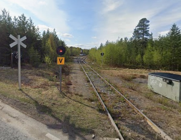
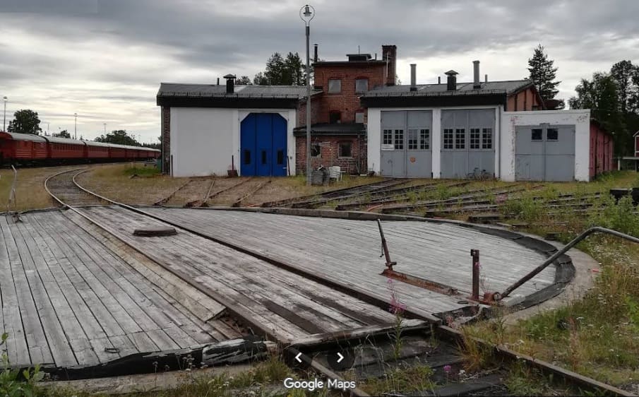
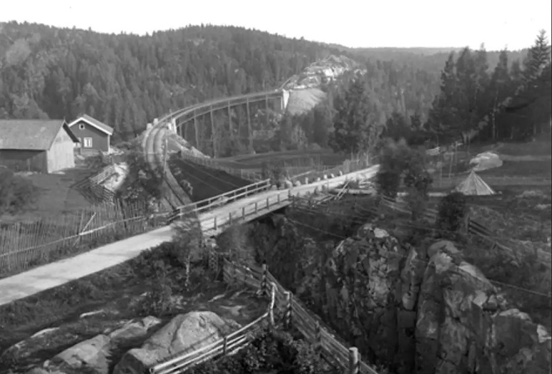
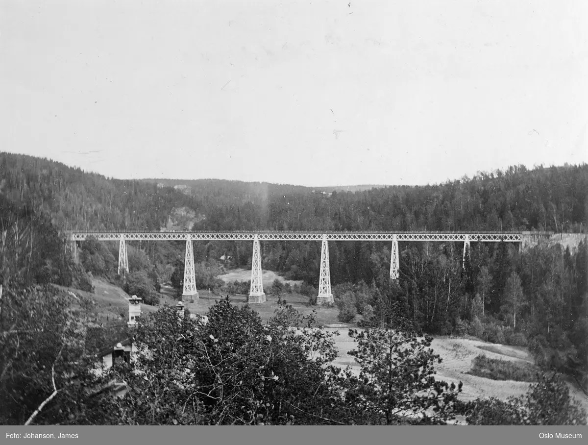
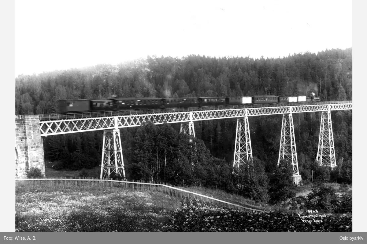
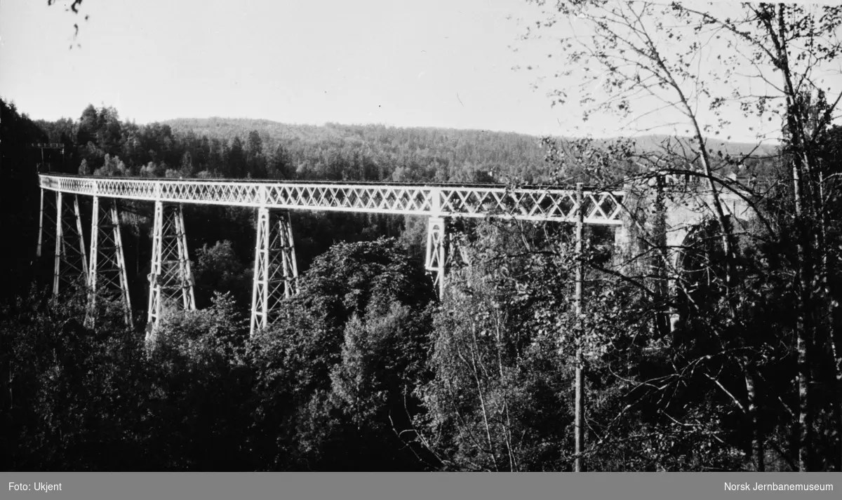
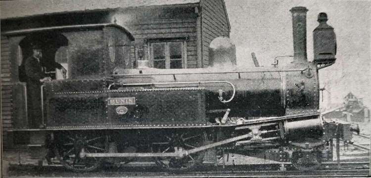
“I took the RB26 train from Berlin-Lichtenberg to Müncheberg and changed for the Buckower Kleinbahn historic narrow gauge railway. Opened in 1930 as an early electric railway, it closed its regular service in the late 1990s. It is now volunteers who run the line that takes you through the rolling hills of Märkische Schweiz in Brandenburg to the pretty spa town of Buckow. Here, I visited the residence of Bertolt Brecht and Helene Weigel on the peaceful reedy shores of Lake Schermützel, before returning refreshed to the Berlin bustle.” [1: p75][12][Reader: Rachael]

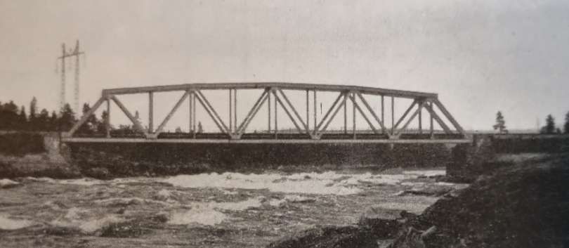
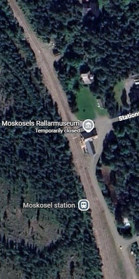
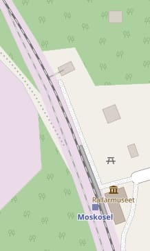
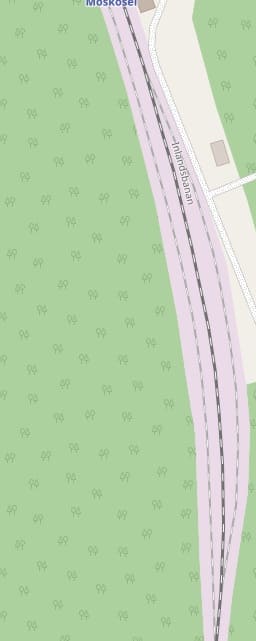
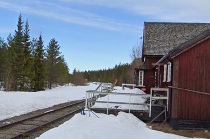
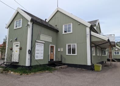
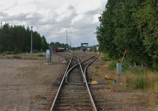
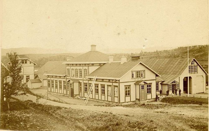
The Buckower Kleinbahn railway runs from Buckow to/from Müncheberg a round journey of close to 10km.
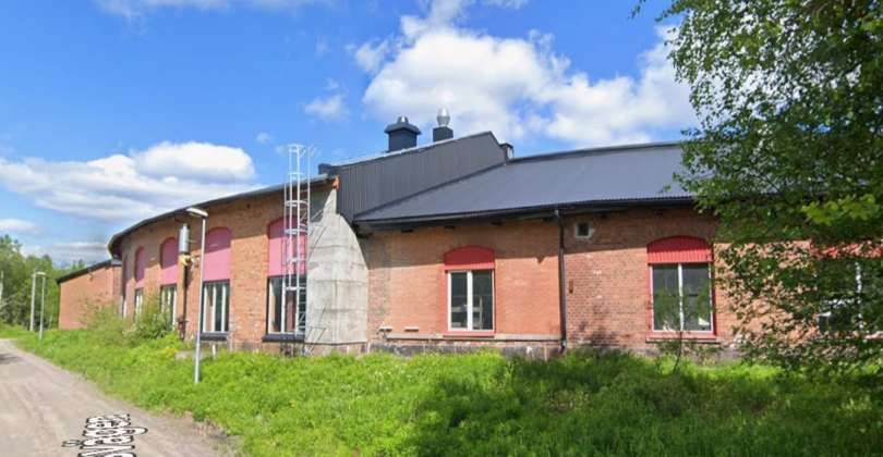
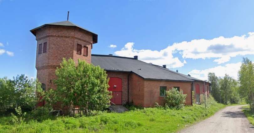
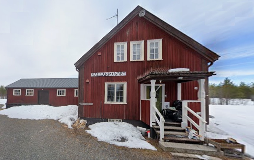
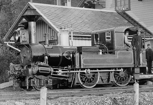
The blue line approxi.ates to the route of the preservation railway line. [14]

The little railway museum in Buckow’s train station building illustrates the history of Buckow’s narrow-gauge railway, as well as of other private and secondary railways, such as the Müncheberg narrow-gauge railway, the Oderbruch train and the ‘Royal Prussian Eastern Line’ (now the RB 26). There are also many exhibits of all sizes and ages, relating to general railroading in Germany.” [13]

A range of diesel and electricity-powered vehicles from the time between 1920 and 1986 are presented in the outdoor area of the Buckow train station. In addition to this, the old rectifier facility of Buckow’s narrow-gauge railway is home to an exhibition about railway power technology, as well as railway signalling and safety.” [13]

“Buckow’s narrow-gauge railway (Buckower Kleinbhan) with historic vehicles operates on weekends from April to October, and it is inseparably linked to the railway museum. Visitors coming from Berlin can board the museum train at Müncheberg station and are taken to Buckow via Waldsieversdorf with very friendly assistance. Children of all ages get to look over the train driver’s shoulder and interested adults can take part in a training course and obtain a certificate as an honorary train driver of the Buckow narrow-gauge railway.” [13]

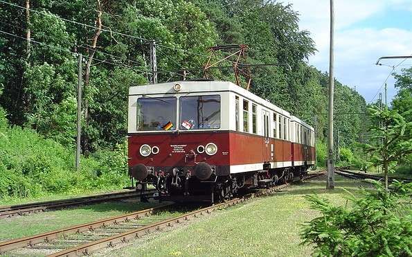
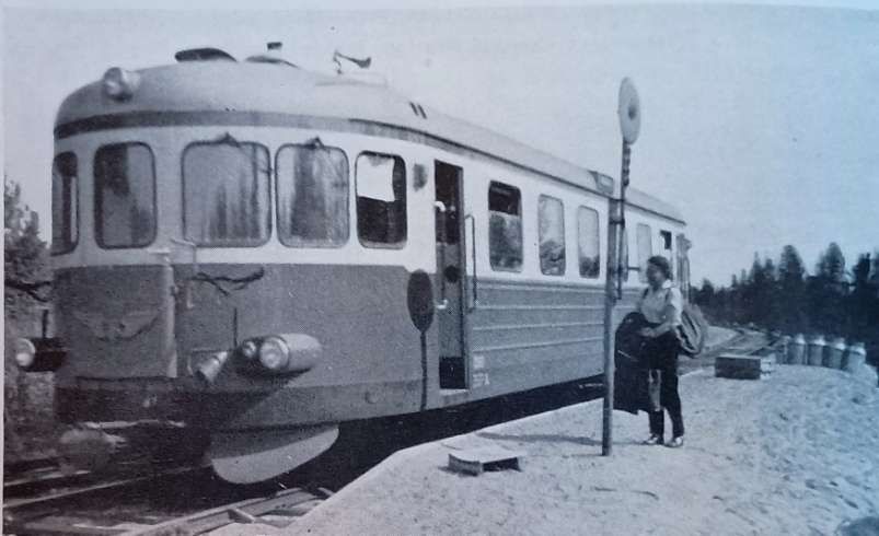
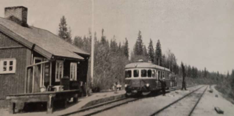
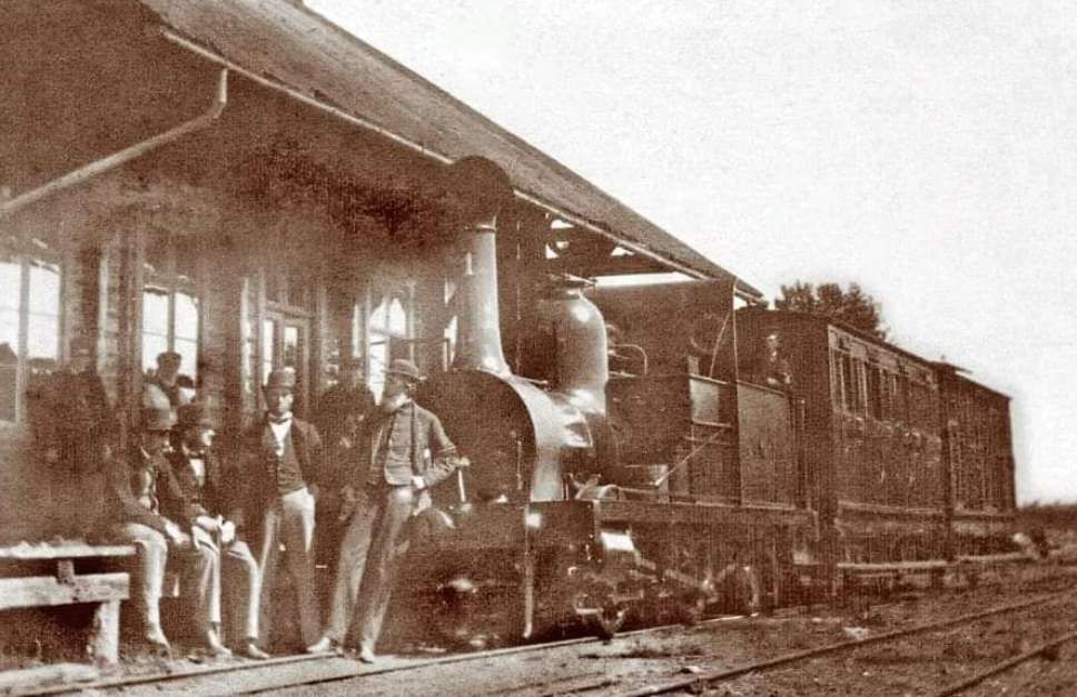
This historic electric railcar is one of a number of such vehicles, Class 279 or ET188 types, with some refurbished in the early 1980s, which run on the Buckower Kleinbahn railway, © Museumsbahn Buckower Kleinbahn e.V. [13]

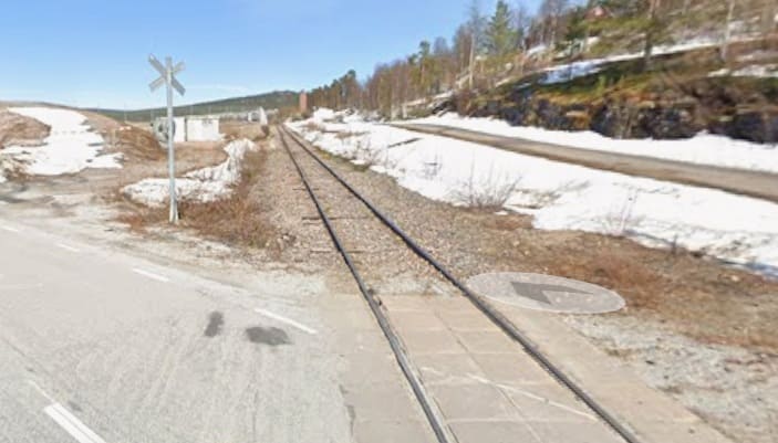
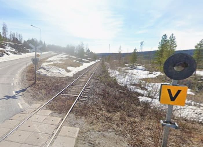
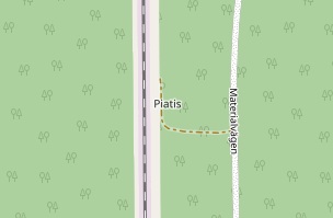
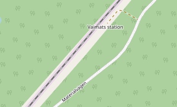
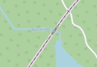
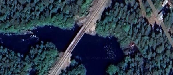
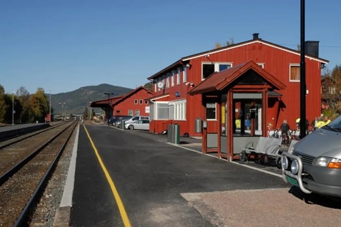
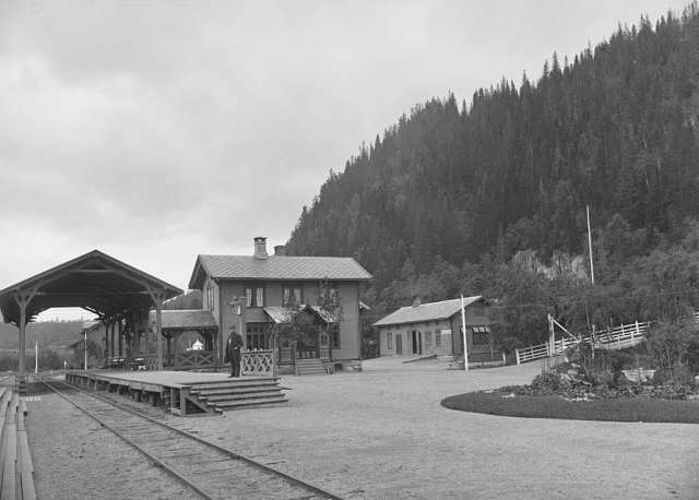
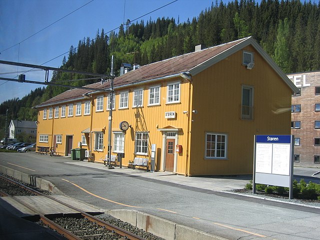
D. The Swiss Watchmakers’ Line

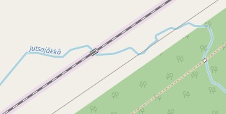
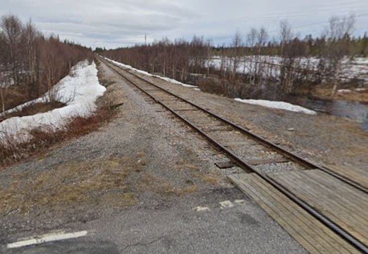
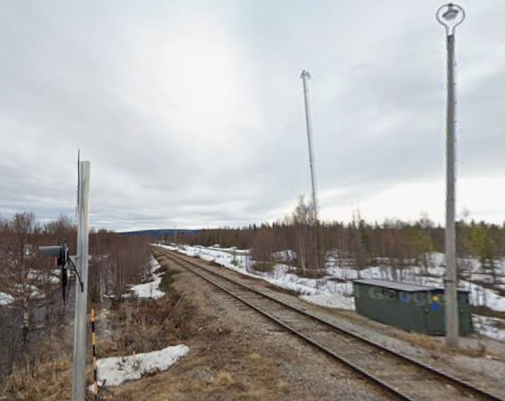
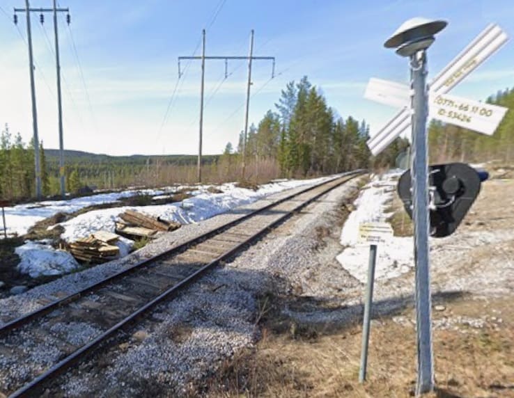
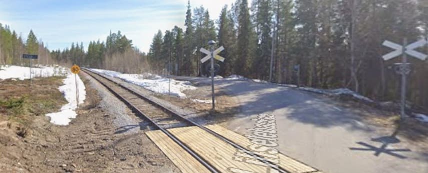
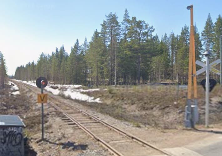
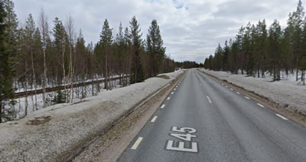
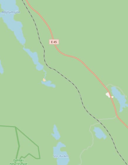
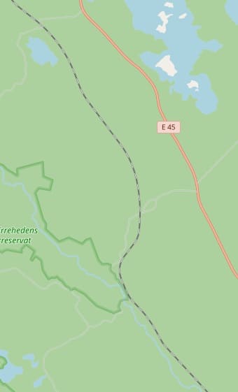
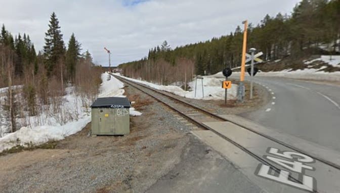
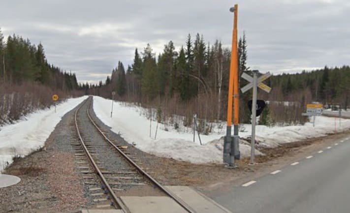
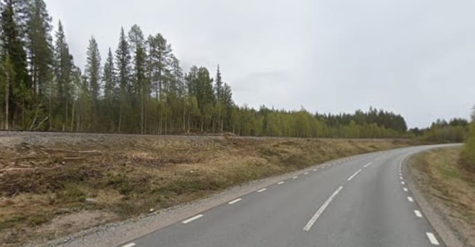
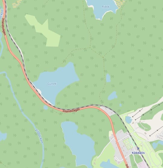
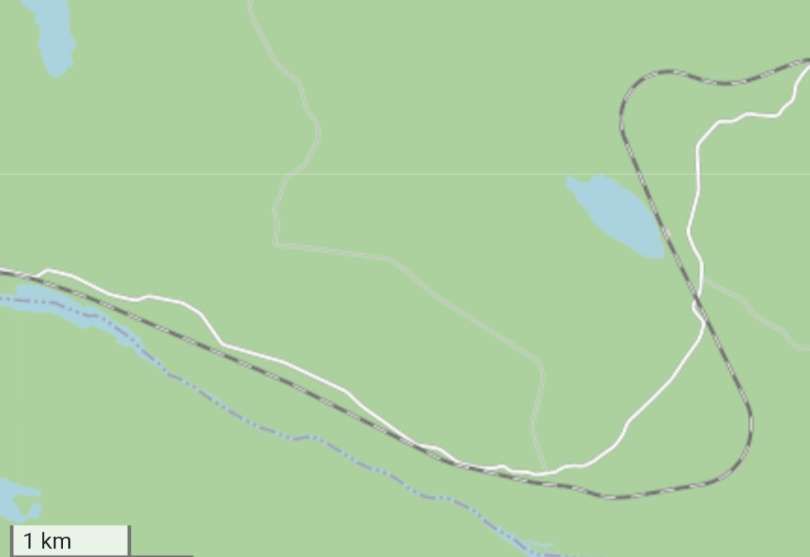
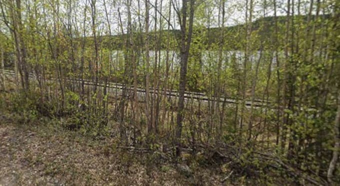
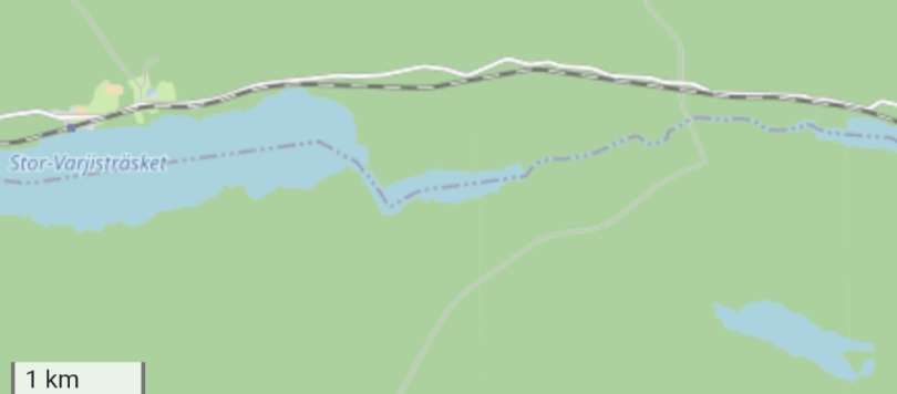
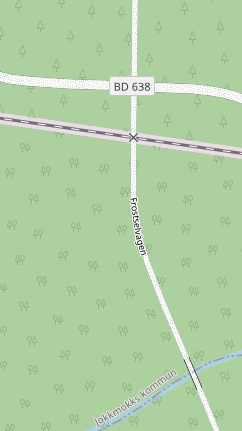
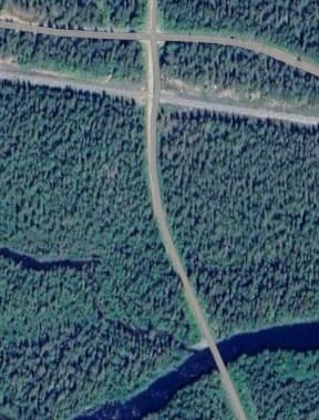
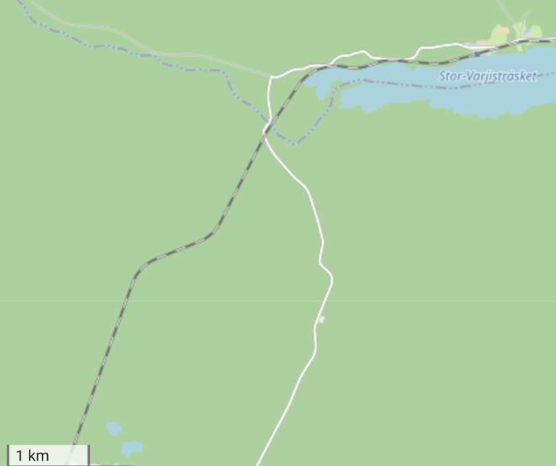
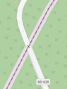
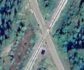
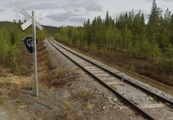
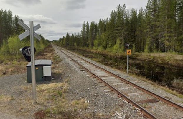
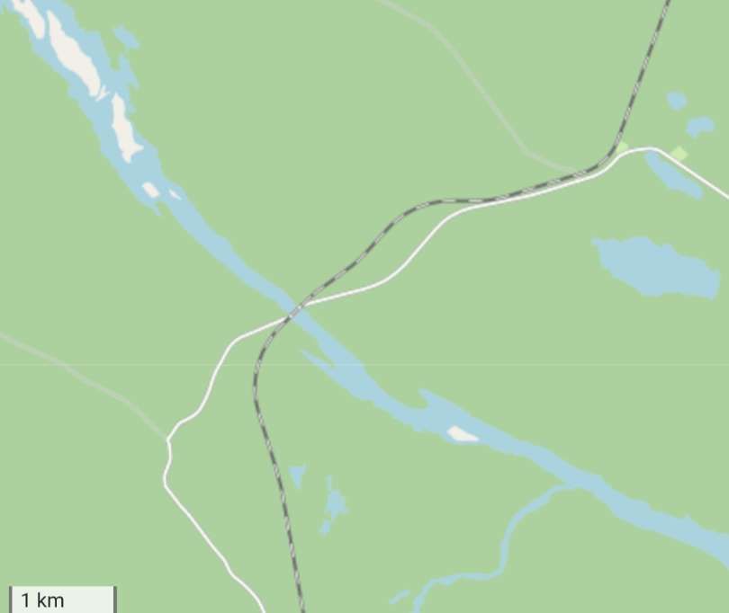
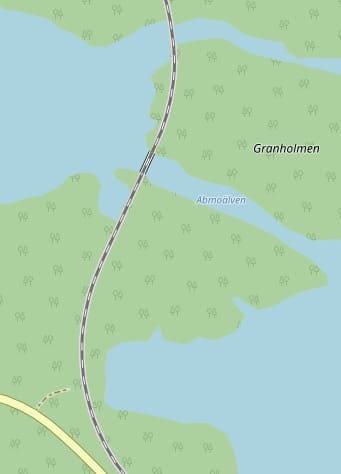
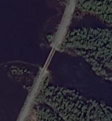
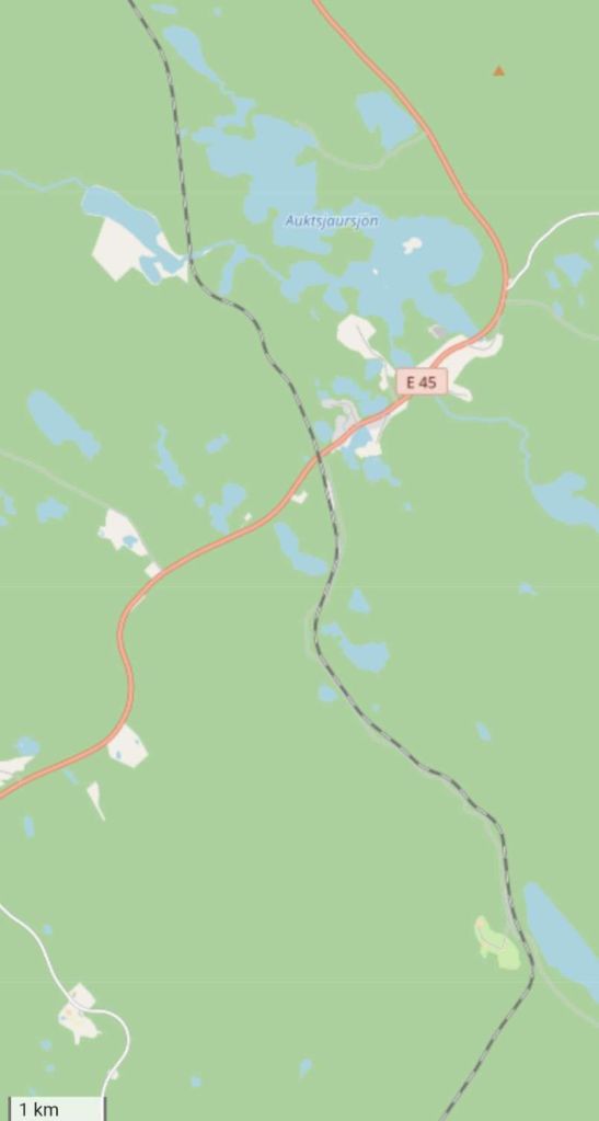
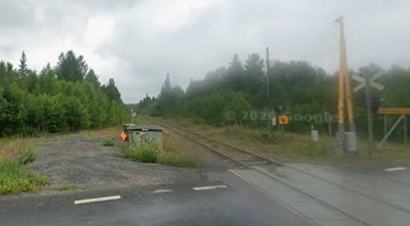
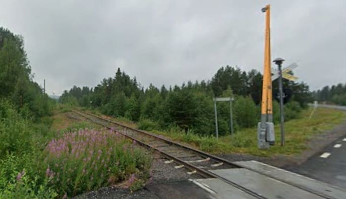
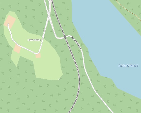
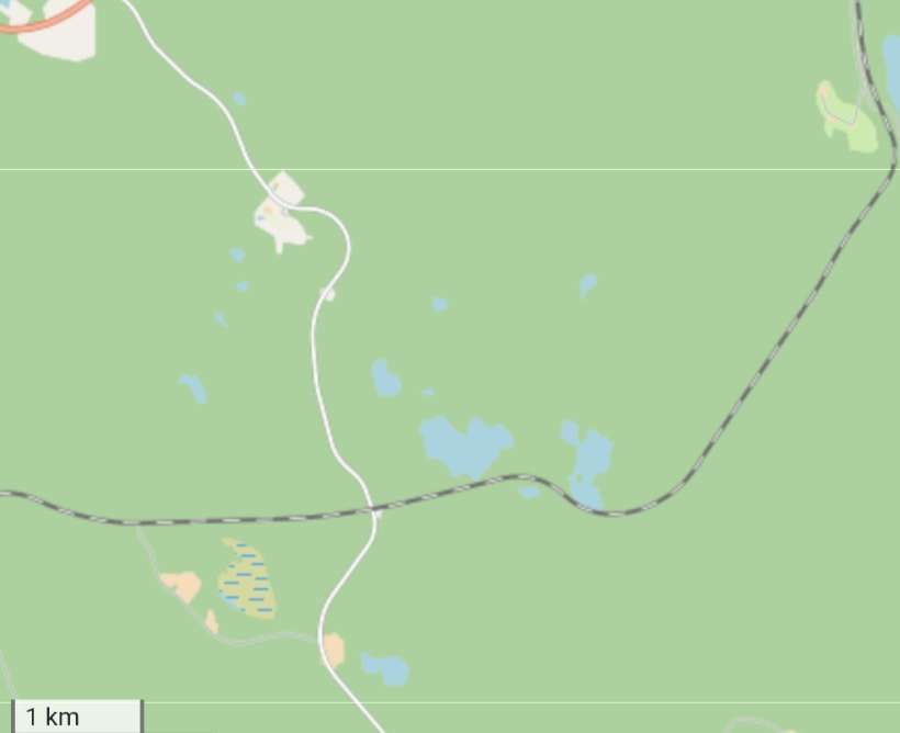
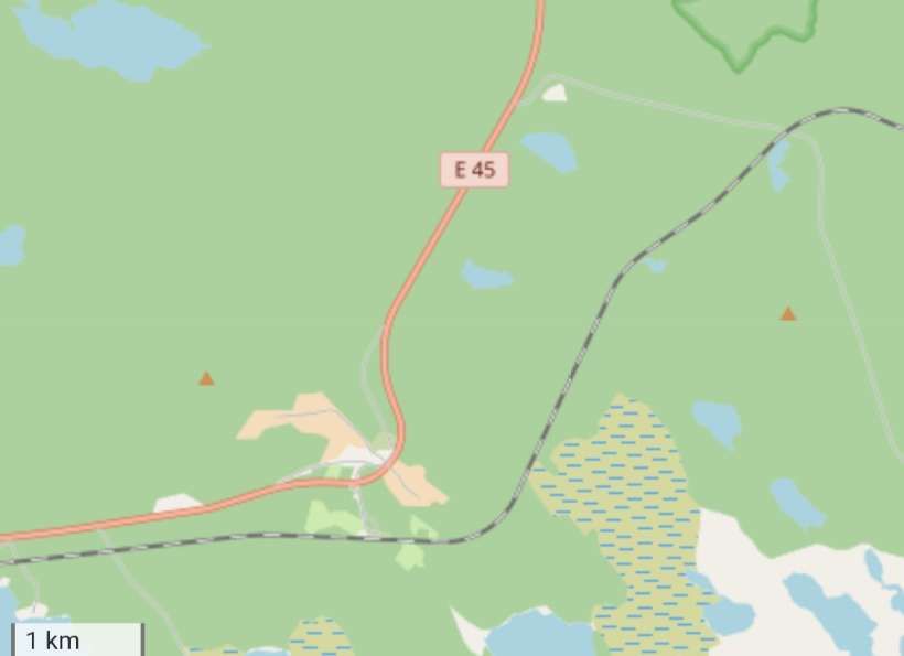
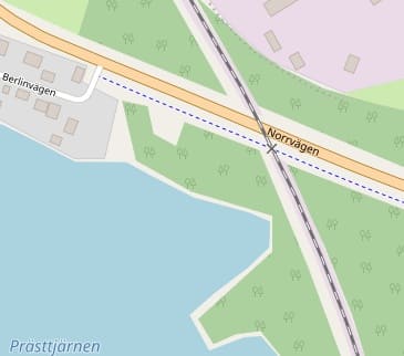
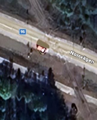
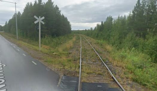
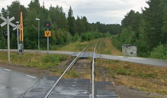
“When time is not important, a little-known French railway line allows you to enter Switzerland through the valley of the watchmakers. The line from Besançon in France drifts through the beautiful Jura foothills to Le Locle, a Swiss watchmaking town. No one got on or off at L’Hôpital-du-Grosbois, a byway station en route named after a leprosy hospital. A line that Dr Beeching would probably have closed still delivers you into Switzerland on time. [1: p75][12][Reader: Martin]

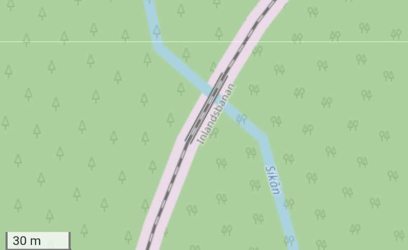
The “Watchmakers’ Line” (La Ligne des Horlogers) is a historic cross-border railway connecting Besançon, France, to La Chaux-de-Fonds/Le Locle, Switzerland. Named in honour of the region’s rich horological heritage, it spans the Jura mountains

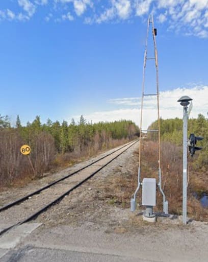
Winding through the rugged terrain of the French Pays Horloger (Watchmaking Country) and the Swiss canton of Neuchâtel, the line is a marvel of 19th-century railway engineering. It features numerous tunnels and viaducts built to conquer the steep alpine inclines. The route is actively served by TER (Transport Express Régional) trains on the French side and connects seamlessly with the Swiss rail network.

The TER (regional) train takes approximately 1 hour and 15 minutes to cover the 48-kilometre distance. There are around 9 direct trains per day in both directions.

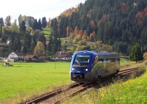
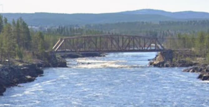
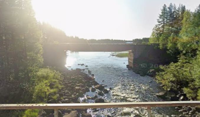
A standard train on the route between Besançon, France and La Chaux-de-Fonds/Le Locle, Switzerland. [16]

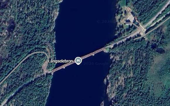
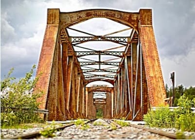
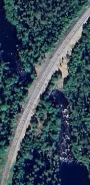
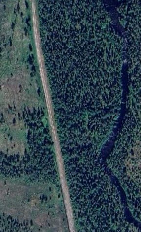
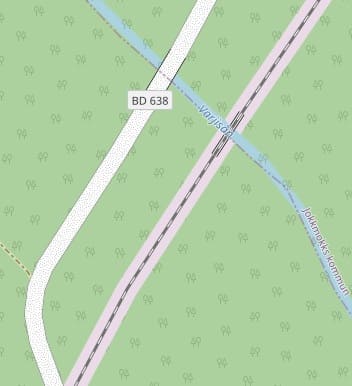
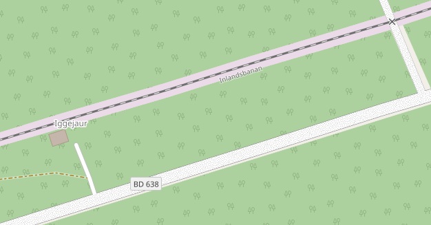
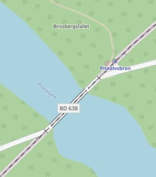
From 1st March to 31st October 2021, SNCF Réseau carried out major modernization work on the Horlogers line, a century-old mountain line, which connects Besançon (25) to La Chaux-de-Fonds in Switzerland for a budget of €55.5 million. These works reinforced structures (bridges, tunnels, walls, and trenches), renewed 35 km of track for €49 million (€19.4 million from the French State, €19.4 million from the Bourgogne-Franche-Comté Region, €6 million from INTERREG, and €4.2 million from SNCF Réseau), made the Morteau and Valdahon stations accessible to all for €1.5 million (€0.75 million from the French State and €0.75 million from the Bourgogne-Franche-Comté Region), and modernized the signaling system to allow TER regional trains in the Bourgogne-Franche-Comté Region to continue operating in Switzerland for €5 million (€2.5 million from the French State and €2.5 million from the Bourgogne-Franche-Comté Region). After a complete eight-month service interruption on the line, traffic between Besançon and Morteau resumed on 31st October, and between Morteau and La Chaux-de-Fonds on 23rd December 2021. [15]

The site of La Chaux-de-Fonds/Le Locle consists of two towns situated close to one another in a remote environment in the Swiss Jura mountains, on land not particularly suited to farming. Planned in the early 19th century, after extensive fires, the towns owed their existence to the watchmaking industry. Their layout along an open-ended scheme of parallel strips on which residential housing and workshops are intermingled reflects the needs of the local watchmaking culture that dates to the 17th century and is still alive today.

E. Charmed by the Vienna to Zagreb train

“The journey from Vienna to Zagreb saw mountainous central Europe relax into Balkan charm. Stunning Alpine scenery melted into forest, settling down into rolling hills as we passed through Graz and reached the Slovene border, stopping for an hour’s changeover at the tiny Zidani Most station, where we enjoyed afternoon beers gazing over lush Slovenian countryside. The connection to Zagreb boasted dramatic lake scenery that gave way to farm land, golden in evening light, as we passed into Croatia, soon rattling into its underrated capital. We booked this through Omio, which came in relatively cheaply at £41.” [12][Reader: Matt]

It is possible to get a direct train. According to thetrainline.com, the journey takes about 6 to 6.5 hours, covering roughly 370 km. Tickets can start around €25 to €35. There are normally 11 trains per day travelling from Vienna to Zagreb and tickets for this journey start from £25.89 when you book in advance. [17] The raileurope.com website quotes a lowest fare at under £22.00. [18]

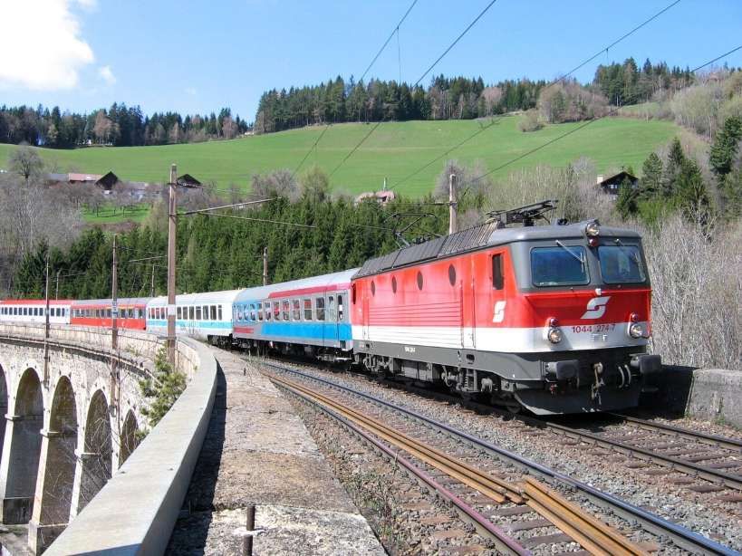
The train journey from Vienna to Zagreb transitions from spectacular Alpine peaks to lush river valleys and rolling Balkan countryside. The journey takes you through southeastern Austria and northern Slovenia before arriving in Croatia. To catch the best views, sit on the left side of the train when departing Vienna to look down into the Semmering valleys. When traveling through Slovenia, sit on the right side to enjoy the best riverside views.

Shortly after leaving Vienna (Wiener Neustadt), the train climbs the Semmering Pass. This is a UNESCO World Heritage site, famous for winding viaducts, tunnels, and panoramic views of steep mountain valleys and dark pine forests.

The Semmering Pass railway and surrounding scenery, © C.Stadler/Bwag and licensed for reuse under a Creative Commons licence (CC BY-SA 4.0). [19]
An international express on the Semmeringbahn, pulled by 1044 274-7 in 2004, © Herbert Ortner and licensed for reuse under a Creative Commons licence (CC BY 3.0). [19]

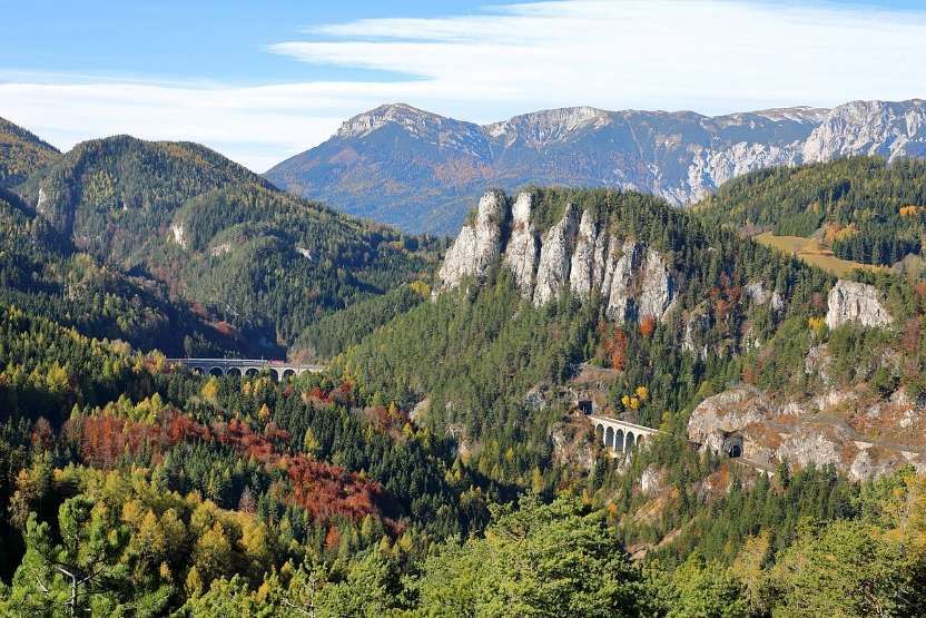
As you descend from the mountains, you’ll pass through the rolling, green agricultural landscapes and vineyards surrounding the city of Graz.

Crossing the border, the scenery becomes dramatic. The train tracks hug the winding Savinja and Sava rivers, passing through deep gorges and canyons flanked by dense forests and rural villages.

The rugged terrain flattens out into the golden farmlands and charming countryside of northern Croatia before pulling into Zagreb’s main station, Zagreb Glavni Kolodvor.

Further suggestions for rail journeys from Guardian readers can be found in the fourth of this series of articles based around the Guardian Saturday Magazine of 23rd May 2026.

References

  1. Readers’Travel Tips: Favourite Train Trips; in Saturday (the Guardian Magazine), 23rd May 2026, p75.
  2. https://www.reddit.com/r/TransitDiagrams/comments/gidbxm/ocdiagram_metro_do_porto_portugal, accessed on 25th May 2026.
  3. https://en.wikipedia.org/wiki/Porto_Metro, accessed on 25th May 2026.
  4. https://en.wikipedia.org/wiki/Socimi_Eurotram, accessed on 25th May 2026.
  5. https://commons.wikimedia.org/wiki/File:Vila_Nova_de_Gaia_(52734250241).jpg, accessed on 25th May 2026.
  6. https://en.wikipedia.org/wiki/Dom_Lu%C3%ADs_I_Bridge#/media/File%3ADom_Lu%C3%ADs_I_Bridge_(36961760686).jpg, accessed on 25th May 2026.
  7. https://www.vy.no/en/train/routes/the-bergen-line, accessed on 25th May 2026.
  8. https://en.wikipedia.org/wiki/Bergen_Line, accessed on 25th May 2026.
  9. https://en.visitbergen.com/visitor-information/travel-information/getting-here/bergensbanen-oslo-to-bergen-by-train, accessed on 25th May 2026.
  10. https://www.bbc.co.uk/travel/article/20230130-the-highest-rail-route-in-northern-europe, accessed on 25th May 2026.
  11. https://rogerfarnworth.com/2019/01/01/the-flam-railway-in-1950
  12. https://www.theguardian.com/travel/2026/may/22/readers-favourite-scenic-european-railway-journeys-trains, accessed on 25th May 2026.
  13. https://www.brandenburg-tourism.com/poi/seenland-oder-spree/industrial-culture/eisenbahnmuseum-and-buckower-kleinbahn-train-museum, accessed on 25th May 2026.
  14. https://www.komoot.com/smarttour/3623001, accessed on 25th May 2026.
  15. https://www.sncf-reseau.com/fr/cp/bourgogne-franche-comte/ligne-horlogers-modernisee-entre-besancon-et-morteau, accessed on 25th May 2026.
  16. https://www.railwaypro.com/wp/colas-consortium-to-modernise-ligne-des-horlogers, accessed on 25th May 2026.
  17. https://www.thetrainline.com/en/train-times/vienna-to-zagreb, accessed on 25th May 2026.
  18. https://www.raileurope.com/en-gb/destinations/vienna-zagreb-train, accessed on 25th May 2026.
  19. https://en.wikipedia.org/wiki/Semmering_railway, accessed on 25th May 2026.

The Modern Tramway – June 1951 – Reinstatement of a Street Tramway Route in Helsinki

The featured image for this article is the pikkuruotsalainen (“Little Swede”) tram, built by ASEA in Sweden. Together with its open summer trailer,  they became a beloved pair on city tracks. The breezy trailers were especially popular on hot days, so much so that passengers sometimes clung to the running boards or jumped off before the tram had fully stopped. Though open trailers were meant only for summer use, wartime shortages forced them into winter service under tarpaulins. Their final flourish came during the Helsinki Olympics in 1952, when crowds crammed aboard one last time before the trailers disappeared from daily traffic, © Helsinki City Museum, Public Domain. [19]

A short letter from Kaj Arnold Larsen, Engineer of Helsinki Tramways was published in The Modern Tramway in June 1951. [1]

It seems that the editors of The Modern Tramway were delighted when examples that bucked the seemingly overwhelming trend of closures could be cited.

K. A. Larsen wrote:

“Service 5 of the Helsinki (Finland) tramway system passes through the centre of the city, traversing the narrow Alexander Street for part of its distance. The passenger frequency in 1948 was 12.5 passengers per car kilometre. In June, 1949, tramway operation of this route ceased and diesel buses were substituted as it was thought that bus operation would be more economical and would speed up the traffic flow. Staff economy was to be effected by using eight buses (i.e., eight drivers and eight conductors) instead of six trams, each with its own trailer (six drivers and twelve conductors). It was soon found that 15 buses, with a total crew of 30. and a 2-minute headway instead of the trams 5-minute headway, were necessary. Street parking had to be forbidden in Alexander Street as the congestion in rush hours was making impossible the working of the 60-seater diesel buses through the street. Even without street parking, the situation was not noticeably relieved.

Faced with this object lesson, the authorities wisely decided to restore the tram service along the route as soon as sufficient cars were available. Trams are now running again, and the traffic is moving without difficulty.

Next year the Helsinki tramways will take delivery of a number of new bogie tramcars of a design which combines the best features of P.C.C. and modern Swiss practice. These cars will have a passenger capacity of 100 and a maximum speed of 38 m.p.h. They will be used with one or two trailers and will replace 30-year-old cars. Extensions to the tramway system are planned and headways are to be decreased.” [1]

Larsen concludes:

“We shall then be able to show the public that higher speed and better acceleration and deceleration can be obtained with trams than with buses and that without bad odour and poisonous gases. We are not unaware of the advantages of oil and trolley-buses and we use them on suitable routes.” [1]

In the 21st century, the Helsinki Tram network are part of the public transport system organised by Helsinki Regional Transport Authority and operated by Metropolitan Area Transport Ltd (Finnish: Pääkaupunkiseudun Kaupunkiliikenne Oy) in Helsinki. The trams are the main means of transport in the city centre. 56.8 million trips were made on the system in 2019. In addition to the older tram network, there is a single light rail line that was opened in October 2023. Although technically compatible with the tram network, the light rail line is separate from the city centre tram network. [2]

The modern tram network in Helsinki. [3]

Public transport in Helsinki was initiated in 1888 by Helsingin omnibussiosakeyhtiö, using horse-drawn omnibuses. “In 1889, Helsingin Omnibussiosakeyhtiö acquired the right to construct tram lines. The next year, the company changed its name in Helsingin raitiotie- ja omnibussiosakeyhtiö (abbreviated HRO). Electric traction was considered as a power source for the new system, but due to lack of funds, and the city council’s negative attitude towards electric trams, the decision was made to use horse-drawn trams instead. The new system was built to a track gauge of 1,000 mm. Test traffic started in December 1890, but the network wasn’t officially opened until June 1891. The capacity of the horse tram system soon proved insufficient, but the conversion to electrified trams was postponed until the price of electrification of the network reached lower levels.” [16] At this time, the network was 8.5 kilometres in length.

A 1988 Finnish postage stamp depicting a horse-drawn tram in Helsinki 1890-1900, © Posti-ja telelaitos and made available as Public Domain. [5]

In the latter half of the 1890s, Julius Tallberg acquired the right to construct an orbital tram system around the city that would have linked the existing HRO lines and parts of the city not covered by the HRO lines. After negotiations, Tallberg and his associates transferred the construction permit of the orbital line to the HRO in return for a large number of HRO stock shares.” [16]

Kummer trams in Helsinki in the early 20th century, © Public Domain. [16]

In 1897, HRO received the right to construct an electrified tramway into Helsinki. A call for bids was sent out the following year, and the contract was awarded to the Germany-based O.L. Kummer.” [16]  Under the contract, Kummer were required to build and electrify the new network and provide the trams to be used on it. In addition, Kummer had to run the system for up to 3 years to prove the quality of its work. Running the system, resulted in significant profits for Kummer and, as a result, by 1901, HRO had assumed responsibility for operating the tram network. The four lines of the developing network after electrification were all single-track.

Although the single-track lines proved to be inadequate it was some time before the HRO was willing to fund the conversion. In 1906, “the company applied for and received permission to convert their track network into double-track. The contract also specified certain lines that HRO had to operate, as well as certain extensions that had to be built.” [16]

The contract for converting the tram network into double track was awarded to the Swedish ASEA. Conversion work began in 1908 and was completed in 1910. From 1908 until 1919, ASEA also supplied the HRO with a total of 78 trams and 70 trailers.” [16]

ASEA delivered 67 trams of this type, nicknamed “Pikkuruotsalainen” (English: Little Swede), to HRO between 1908 and 1918. HKL 32 (originally HRO 77) is photographed on line 15 in 1954, © B. Okkola, Public domain. [16]

ASEA (Allmänna Svenska Elektriska Aktiebolaget) was a Swedish industrial company founded in 1883 in Västerås. Renowned for electrical engineering and infrastructure, it produced early industrial robots, transformers, [trams,] and locomotives.” [4]

In 1909, the network expanded to include the island of Kulosaari – a private line owned by Brändö Spårvägsaktiebolag

In 1913, a tram line reached Alppila. In 1914, the network was also expanded into Taka-Töölö and Hermanni.

Another private line (built by Aktiebolaget M.G. Stenius) linked the existing HRO tracks in Töölö to Munkkiniemi and Haaga.

In 1926, HRO acquired Aktiebolaget M.G. Stenius and, two years later, Brändö Spårvägsaktiebolag also passed into HRO ownership. As a result, HRO again became the sole owner and operator of trams in Helsinki.” [16]

The tram network reached its apex in 1930, when the network covered a larger area than ever before, … there were 14 lines in operation.” [16]

The first trams built in Finland for Helsinki came from Suomen autoteollisuus in 1940–1941. HKL 169 photographed on line 5 in 1957, © Public Domain. [7]

At the end of 1944 the City of Helsinki acquired the entirety of HRO, which now became a municipal transport authority under the name Helsingin Kaupungin Liikennelaitos (HKL)” [16]

During the 1950s a total of 105 Finnish-built double-bogie trams (Karia types HM IV and HM V, Valmet types RM 1 and RM 3) were delivered to the HKL.” [16]

The Karia HM IV was a Finnish-built tram  delivered in the mid-1950s, © Kari Paavola (2004), permission to use here has been requested. [8]

Two other images of the Karia HM IV can be found on these links:

https://transphoto.org/photo/527278

https://transphoto.org/photo/527279

The Karia HM IV was a classic Finnish-built tram that operated in Helsinki during the 1950s and 1960s. Delivered in the mid-1950s, these double-bogie “Mustang” derivatives were foundational in modernizing Helsinki’s local public transport network before the introduction of the modern tram fleets.

Tram No. 11, type HM V, on Line 2 in September 1999, © Peter Van den Bossche and licensed for reuse under a Creative Commons licence (CC BY-SA 2.0). [6]
Tram No. 339 is a restored Valmet RM1 type tram owned by Stadin Ratikat Oy, on charter drive on the new tracks on Fredrikinkatu in Kamppi in April 2009. It was built in 1955 and withdrawn from active service in 1987 and subsequently used as an advertisement tram before being acquired by Stadin Ratikat and then taken to Tallinn for restoration in 2002. The restoration was completed in Helsinki in 2004, © Kalle Id, and  licensed for reuse under a Creative Commons licence (CC BY-SA 3.0). [9]
A Valmet RM3 tram photographed by Leino Osmo in 1965 held by Helsinki City Museum, © Public Domain. [11]

Despite the experience of the ‘experiment’ reported by The Modern Tramway in 1951. Helsinki planned on the gradual removal of its trams. … “During the 1960s all plans for expanding the tram network were put on hold while resources were concentrated on the planning of the metro and additional bus connections. At the same time plans were drawn for the termination of the tram network by the year 2000. In 1969 Helsinki city council made the decision that in the future tramlines would be confined to the inner city, while the metro would serve the suburban areas; the tram system would be terminated, at earliest in the year 2000. This decision required the acquisition of new trams to replace the last two-axle trams, the oldest of which dated from the 1920s. Originally the plan was to acquire fairly new second-hand articulated Duewag GT6 trams from Copenhagen, but the deal fell through and in the end new articulated trams were acquired from Valmet (type Nr I) in 1973–1975. These trams were planned to be the last trams to be acquired for traffic in Helsinki.” [16]

Valmet Nr 1 Tram No. 34 in Hakaniemi on line 7A. This tram was built in 1973, © Kalle Id and licenced for reuse under a Creative Commons licence (CC BY-SA 3.0). [12]

The ‘Valmet Nr I’ trams are articulated six-axle vehicles built at the Valmet aircraft factory between 1973 and 1975, they are based on the German Düwag GT6 design. About 50 of these iconic high-floor vehicles remain in regular service across the city’s network. [13]

During the early 1970s the decision to terminate the tram system was reconsidered and eventually reversed. In 1976, the tram network was expanded for the first time since 1955, when the new connection into Itä-Pasila was opened (then line 2, present line 7). Another expansion was opened in 1980, when tracks in Katajanokka were expanded eastward to a new residential area (then line 5, present line 4). In 1981 another group of articulated trams, based on the Nr I type, were ordered from Valmet. Classified as Nr II, these trams were delivered between 1983 and 1987, allowing the withdrawal of the majority of the 1950s-built trams (types HM IV and RM 1 in their entirety), as well as withdrawal of all trailers.” [16]

A Valmet Nr II Tram, vehicle No. 99, Valmet Nr II trams were delivered to Helsinki between 1983 and 1987. [My photograph, September 2016]
A Valmet Nr II Tram, vehicle No. 92. The NrII trams were modernized between 2006 and 2011 to include a low-floor section, becoming known as MLNRV class. The added sections were built by Verkehrs Industrie Systeme in Germany and installed in Finland by HKL. [My photograph, September 2016][10]
The NrII trams were originally painted in an orange and grey livery, but it proved unpopular and both classes were later repainted in the traditional yellow and green colours. This is NrII number 73 in Market Square on line 1, 1987, © Felix O, and licensed for reuse under a Creative Commons licence (CC BY-SA 2.0). [15]

In 1985 the tram network was extended to West Pasila (line 7). In the mid-1980s the tram lines were radically reorganised: line 5 was closed down and the routes of lines 2, 3B, 3T, 4, 7A, 7B, 8 and 10 altered to a smaller or larger degree.” [16]

The next expansion of the network occurred in 1991, when the connection from Ruskeasuo to Pikku Huopalahti was opened (line 10). In the 1990s wide-ranging plans were made for expansion and improvement of the tram system. These included the Jokeri orbital light rail line connecting Itäkeskus to Leppävaara, extensions of the system to Munkkivuori, Koskela, Viikki, Malmi, Arabianranta and to the harbour areas Jätkäsaari, Munkkisaari and Kalasatama, which were to be freed from shipping activities and to become brownfield sites for residential and office development. In addition to the extensions, the plans included a partially tunneled light rail line linking Erottaja to Pasila via Töölö.” [16]

In 1999, Helsinki purchased a fleet of low-floor Variotram trams from Adtranz (which became Bombardier in 2001). The new generation trams suffered from persistent technical difficulties and the whole batch has to be returned to Germany. To cover their absence the city purchased ten second-hand trams from Mannheim, Germany.

Wikipedia informs us that, “The purchase of the Bombardier trams was never completed due to the reliability problems. Instead, a deal was reached that required Bombardier to keep a certain minimum number of trams in operation. Bombardier opened its own depot in Helsinki for this purpose in mid-2008.” [16]

An articulated, low-floor tram on Kaivokatu, outside Helsinki Railway Station. This tram is a Bombardier Variotram MLRV2, This specific tram, identified by number 225, is shown traveling on line 6T toward Arabia. [My photograph, September 2016]

The purchase of a new series of 40 low-floor trams was initiated in 2007, and the trams were eventually ordered from the Finnish manufacturer Transtech in December 2010. Two photographs of these trams appear below. …

Another articulated, low-floor tram at the tram stop on Kaivokatu. This is a Škoda Artic tram. This series of trams was designed specifically for Helsinki’s challenging conditions by the Finnish manufacturer Transtech Ltd, which is part of Škoda Transportation. [My photograph, September 2016]
Another view of a Škoda Artic articulated tram also on Kaivokatu, © Bahnfrend  and licenced for reuse under a Creative Commons licence (CC BY-SA 4.0). [14]

The extension of the network from Arabia into the new residential development area in Arabianranta (lines 6 and 8) was … opened in 2004. Line 6 was extended from Arabia to Arabianranta in 2004 and line 8 from St. Paul’s church in 2007. The new number 9 line opened on 10th August 2008, connecting Kolmikulma in central Helsinki to East-Pasila and replacing bus line number 17, albeit having been truncated from both ends compared to the initially planned version. This marked the opening of the first new tram line in Helsinki since the (re-)opening of line 2 in 1976.” [16]

“The first phase of the extension of line 8 to Jätkäsaari was opened on 1st January 2012, and the extension of line 9 to the ferry terminal in Jätkäsaari via Kamppi on 13th August 2012.” [16]

Some interesting trams need to be noted:

  • From the autumn of 2010 to December 2012, a Culture Tram was operated for limited hours on three days of the week (Wed, Thu, Fri) on the additional line no. 5, whose route ran from Ooppera to Linjat via Rautatientori. The Culture Tram had various art exhibitions and performances on board. Highlights included performances by the singers of the Finnish National Opera and concerts as a part of the Flow Festival. The tram is an eight-axle Duewag tram, originally purchased from Mannheim, Germany, and refurbished specifically for this purpose. It is retained as part the fleet and available on charter basis for events that could use the equipment installed in it. [16]
The Culture Tram once ran regularly on Line 5. It is now available on a charter basis, © JIP and licensed for reuse under a Creative Commons licence (CC BY-SA 3.0). [17]
  • The Pub Tram – Spårakoff is currently under renovation and temporarily unavailable. It is a tram converted into a pub, touring the central sights of Helsinki city centre. The ride features beer, wine, cider, refreshments, fun and great views. There is even a toilet on board. It is an historic HM V type tram converted to be used as a bar! Two photographs appear below. …
A HM V tram which has been kitted out as a pub. [My photograph, September 2016]
Another view of the ‘pib tram’ taken late in the evening and a little out of focus. [My photograph, September 2016]

As of 2 September 2024, the network consists of 11 individually numbered city centre tram lines and one numbered light rail line. Lines 1 and 8 operate on a slightly different route during weekends when they go to the West Harbour terminal, indicated with a “T” suffix on the line number. Lines 3N and 9N are operated on a slightly modified line 3 and 9 route respectively during night time. The light rail line 15 is currently the only tram line in Helsinki to also reach the neighbouring city of Espoo, all other lines travel inside Helsinki only.” [2]

References

  1. K. A. Larsen; Reinstatement of a Street Tramway Route in Helsinki; in The Modern Tramway, Volume 14. No. 162, June 1951, p 138.
  2. https://en.wikipedia.org/wiki/Trams_in_Helsinki, accessed on 17th May 2026.
  3. https://www.reddit.com/r/TransitDiagrams/comments/14ft4sz/map_of_the_tram_system_of_my_hometown_helsuinki_in, accessed on 17th May 2026.
  4. https://en.wikipedia.org/wiki/ASEA, accessed on 17th May 2026.
  5. https://commons.wikimedia.org/wiki/File:Horse-Tram-1988.jpg, accessed on 17th May 2026.
  6. https://en.wikipedia.org/wiki/History_of_trams_in_Helsinki#/media/File%3ATram_2_in_Helsinki.jpg, accessed on 17th May 2026.
  7. https://commons.wikimedia.org/wiki/File:HM_I_tram_Helsinki.jpg, accessed on 17th May 2026.
  8. https://phototrans.eu/14,55273,0.html, accessed on 17th May 2026.
  9. https://commons.wikimedia.org/wiki/File:RM1_Kamppi_2009-04-03.jpg, accessed on 17th May 2026.
  10. https://commons.wikimedia.org/wiki/File:MLNRV_Hakaniemi_2010-05-03.JPG, accessed on 17th May 2026
  11. https://www.finna.fi/Record/hkm.674CAE85-12DF-4246-B249-596DF1703379, accessed on 17th May 2026.
  12. https://en.wikipedia.org/wiki/Valmet_Nr_I#/media/File%3ANr_I_34_in_Hakaniemi.jpg, accessed on 17th May 2026.
  13. https://en.wikipedia.org/wiki/Valmet_Nr_I, accessed on 17th May 2026.
  14. https://en.wikipedia.org/wiki/Trams_in_Helsinki#/media/File%3AHKL_HST_Artic_435%2C_Kaivokatu%2C_2019_(04).jpg, accessed on 17th May 2026.
  15. https://en.wikipedia.org/wiki/History_of_trams_in_Helsinki#/media/File%3ANrII_tram_in_Helsinki_in_1987.jpg, accessed on 17th May 2026.
  16. https://en.wikipedia.org/wiki/History_of_trams_in_Helsinki, accessed on 27th May 2026.
  17. https://en.wikipedia.org/wiki/History_of_trams_in_Helsinki#/media/File%3AHelsinki_Culture_Tram_from_the_outside.jpg, accessed on 17th May 2026.
  18. https://www.raflaamo.fi/en/restaurant/helsinki/sparakoff, accessed on 17th May 2026.
  19. https://finland.fi/life-society/trams-carry-the-future-in-helsinki-and-elsewhere-in-finland, accessed on 21st May 2026.

Sweden’s Inland Railway (Inlandsbanan) – Part 1 – Introduction and the Route of the Railway from Gällivare to Arvidsjaur

The featured image for this article is a picture of Swedish State Railways (Swedish: Statens Järnvägar) Locomotive No. 907 at Arvidsjaur Railway Station. The image is dated May 1935, (c) Public Domain. [60]

Known as Sweden’s Inland Railway, the Inlandsbanan “extends from Gällivare, in Lapland, to Kristinehamn, on Lake Väner, in Värmland, a distance of 800 miles, through scenery that ranges from the tundra of the Arctic to the forest lands of Central Sweden.” [1: p826]

The line is known for its leisurely pace, allowing for wildlife spotting (reindeer, elk) and spontaneous stops, with onboard hosts providing commentary. Trains operate with daily departures during the 3 months of high summer, often with packages that include hotels. It also operates for 4 months in the winter.

It was built between 1908 and 1937, and was designed to connect inland northern Sweden, avoiding the coast for security reasons and to foster regional development.

The Railway Magazine.of December 1958 carried an article about the line written by M. D. Greville & H. A. Vallance. [1]

The northern length of the Inlandsbanen from Ostersund to Gällivare. Ostersund features in the OpenStreetMap images below and appears at the South end of the portion of the line shown in the first of two maps of the line. [1: p827]

Vallance and Greville wrote: “The inland route was first projected at the end of the nineteenth century as a private enterprise, to carry iron ore from Lapland and timber from Central Sweden to a new port on the west coast, north of Gothenburg. No progress was made with this scheme, and in 1907 the Swedish Government decided to begin the construction of the northern part of the railway from Östersund, on the main line from Bräcke to Storlien, on the Norwegian frontier, completed in 1882.” [1: p826]

Östersund in May 2021, (c) Hult and licenced for reuse under a Creative Commons licence (CC BY-SA 4.0). [13]

Östersund is the capital of Jämtland. It is located at the shores of Sweden’s fifth-largest lake, Storsjön, opposite the island Frösön. With a total population of 50,960 (2017) Östersund is the 22nd most populous city in Sweden. [14]

Östersund appears on this second map of the route which shows the Southern length of the line which extends to Kristinehamn. [1: p827]

The completed line runs from Gällivare, in the North, to Kristinehamn in the South, passing through Östersund which is the most significant location along the line.

Stops along the line recorded by Greville and Vallance include: Kasajakk, Kuosakabba, Jutsajaure, Luspebryggan, Porjus, Harspranget, Liggavagen, Jokkmokk, Piatis, Maitum, Kerkejaure, Kabdalis, Iggejaur, Moskosei, Tjappsaive, Uttertrask, Arvidsjaur (a junction station serving the line to Jorn), Juitrask, Avaviken, Gullon, Slagnas, Buresjon, Sorsele (which was the Northern terminus of the line from 1929 until the line was completed), Blattnicksele, Gubberget, Sarttrask, Storuman (which was the junction for the line to Hallnas), Vinlidsberg, Norrheden, Fiandberg, Vojman, Volgsele, Vilhelmina (the northern terminus of the line from 1918 to 1929), Vlogsjorfors, Meselefors, Granberget, Dorotea, Hoting (the junction station for the line to Forsmo), Lovberga, Ulriksfors (which became a junction station when the line to the North opened in 1912, with the original line to Stromsund becoming a short branch line), Tannviken, Gisselas, Sikas (whuch was a junction station for the short line to Hammerdal), Bjorvallen, Munkflohogen, Norderasen, Haggenas, Litsnaset and Östersund. [1: p827]

South of Östersund, Greville and Vallance record the following stations: Brunflo (the Junction station on the line to Bräcke), Hackas, Svenstavik, Asarna, Kvarnsjo, Rojan, Sortjarn, Overhoodal, Jamnvallen, Alvros, Sveg, Bodarsjon, Sidertjarn, Lillhamra, Alvho, Gratback, Emadalen, Orsa (which is the junction station for the line to Bollnas), Mora (the junction station for the lines to Alvdalen, Falun and Borlange), Vika, Vimo, Van, Vansbro (the junction station for the lines to Sarna and Ludvika), Vakern, Sagen, Neva, Oforsen, Lesjobruk, Langban, Persberg, Nyhyttan (the junction for the line to Filipstad and beyond), Herrhult (the junction station for the lines to Gothenburg and Galve), Slabraten, Sjoandan and Kristuinehamn. [1: p827]

The city of Östersund sits on the East shore of Lake Storsjön. The railway line between Bräcke and Storlien, on the Norwegian frontier, hugs the lakeshore. It enters the map extract near the bottom-right corner and leaves close to the E14 near the top-left. The Inland line (Inlandsbanan) leaves the Bräcke to Storlien line North of Östersund and leaves this map extract towards the top-right. [8]

Östersund Railway Station, the line to Bräcke leaves this map extract in the bottom-right corner. The roundhouse at Östersund is also at the bottom left of this image. [8]

The junction: the line to Storlien hugs the shore of Lake Storsjon, the Inlandsbanan heads away to the North. [8]

The 74 miles North from Östersund to Strömsund were opened in 1912. Strömsund was the terminus of the line until the line was opened further to the North. [1: p826]

What became the main line to the North can be seen in the bottom-right of this map extract. Strömsund was served from that time on (1918) by a short branch line. The junction was at Ulriksfors which is just off the bottom right of this image. [10]

Strömsund Railway Station is now its bus station. [10]

Strömsund Station seen from the Northwest. The tracks ran along the right side of the building which is now the town’s bus station. [Google Streetview, July 2024]
The line from Strömsund to Ulriksfors is shown by the red line running from the left side of this satellite image to meet the Inlandsbanen in the bottom-right of the image. [Google Maps, April 2026]

Ulriksfors Railway Station sits just to the North of the railway bridge over the Faxälven River. (Google gives the river the name ‘Fängsjön’.) [11]

The railway bridge over the river, seen from the East from the road bridge over the river. [Google Streetview, July 2024]
Ulriksfors Railway Station seen from the Southwest. [Google Streetview, September 2023]

The line was then continued northward from Ulriksfors to develop wide and very sparsely-inhabited areas in Lapland. The 80 miles from Ulriksfors to Vilhelmina were brought into use in 1918 and, after an interval of 11 years, the 87 miles thence to Sorsele were opened in 1929.” [1: p826]

Vilhelmina and Sorsele are shown below. …

Vilhelmina Railway Station was on the West side of the town between it and Lake Vojmän. The railway was opened through to the town from the South in 1918. [12]

Vilhelmina had 3,657 inhabitants in 2010. [15]

The town centre, (c) Konky2000 and licenced for reuse under a Creative Commons Licence (CC BY-SA 3.0) [15]

A closer view on OpenStreetMap of Vilhelmina Railway Station. [12]

The same area as it appears on Google’s satellite imagery. [Google Maps, April 2026]
The building closest to the camera is the bus station at Vilmelmina. [Google Streetview, September 2025]

The next two photographs show a steam locomotive which used to work on the Inlandsbanan which has been stabled in a short spur to the North of the bus station building. …

The two photographs show a decommissioned SJ E2 class 2-8-0 steam locomotive, specifically number 1127, which is preserved as a monument at the train station in Vilhelmina, Sweden. [Google Streetview, September 2025]
The same locomotive as it appeared in 2018. It was last in steam on the Inlandsbanan in 1972, © Marcus Bäckström. [Google Streetview, April 2026]
Vilhelmina Railway Station seen from the North in 1958, © H. A. Vallance. [1: p828]
Looking Northwest through the site of the railway station. The station building is behind the tree on the right of the image. [Google Streetview, September 2025]
Vilhelmina Railway Station building seen from the North. [Google Streetview September 2010]

Sorsele was the next terminus location as the line was gradually built to the North. It was the northern terminus of the line from 1929 until the connection to the line being built South from Gällivare was made. [16][Google Maps, April 2026]

Sorsele Railway Station in 2014, (c) Reinhard Dietrich and licenced for reuse under a Creative Commons licence (CC0 1.0 Universal). [17]

While the line was progressing gradually North from Östersund to Sorsele, construction started from a junction with the line to Narvik (in Norway) at Gällivare. [2][3]

Greville & Vallance tell us that, “A temporary track, to carry materials for the construction of a big hydro-electric power station, had been laid for 33 miles to Porjus in 1911, and this section was opened for goods traffic in 1916, and for passengers in 1925. The 29 miles from Porjus to Jokkmokk were brought into use in 1927. The intervening gap of 163 miles from Jokkmokk to Sorsele was bridged in two sections, from Sorsele to Arvidsjaur (55 miles) in 1933, and from Arvidsjaur to Jokkmokk (108 miles) in 1937. Between 1924 and 1930, cross-country lines were opened from Hoting to Forsmo, and from Storuman to Hallnas, to connect the new inland route with the older main line from Stockholm to Lapland.” [1: p826]

We will pick up details of these different locations as we travel along the line from Gällivare to Kristinehamn in this and future articles.

Historically, the southern half of the route, from Östersund to Kristinehamn, falls into two parts. The Kristinehamn-Sjöandan Railway, seven miles long, was constructed between those places as early as 1850, as part of a system of narrow-gauge railways and canals connecting the local iron foundries with Lake Vaner and, via the Gota Canal, with the sea. It was at first worked by horses, but became steam-operated in 1858, and in 1859 started to carry passengers. In 1873, this line was acquired by the Ostra Varmlands Railway, converted to standard gauge, and extended for 29 miles to Persberg in 1875, part of another narrow-gauge line, the Kroppa Railway, being incorporated.” [1: p826]

Greville and Vallance continue: “Between 1889 and 1891, the Östra Värmlands Railway opened the 102 miles from Persberg, through Vansbro, to Mora, where a connection was made with the Falun-Rättvik-Mora Railway, which was extended for eight miles from Mora to Orsa in 1892. The 77 miles from Orsa to Sveg were built by the Orsa-Härjedalens Railway, and opened in 1909 The whole line from Kristinehamn to Sveg passed into the hands of the Swedish State Railways between 1917 and 1919. … The remainder of the route was built by the State, in a southerly direction from a junction with the Bräcke-Östersund line at Brunflo, nine miles from Östersund. The 42 miles from Brunflo to Åsarna were brought into use in sections between 1916 and 1918, and the 63-mile link between Åsarna and Sveg was completed in 1922.” [1: p829]

Following the Route of the Railway – Gällivare to Arvidsjaur

Gällivare is at the northern end of the Inlandsbanan. We start our journey along the line from here. …

Gällivare. [Google Maps, April 2026]

Gällivare Station sits alongside the Vassara River on the Southwest side of the town. The line to Narvik heads away to the West, North of the top of this map extract.  The Inlandsbanan also leaves heading West from the triangle. The line heading Southeast across the Vassara River heads for Luleå and thence to Stockholm via the coastal line. [Google Maps, April 2026]

The next two images are taken from OpenStreetMap’s mapping and, between them, show the length of the station site at Gällivare. …

The North end of Gällivare Railway Station site. The triangular junction is worth noting at the top of this extract. [7]

The South end of Gällivare Railway Station site. The significant roundhouse should be noted at the top of this image. [7]

Two closer views of Gällivare’s roundhouse: one cartographic, [7] the other satellite. [Google Maps, April 2026]

The Roundhouse seen from the South on Sandviksvagen. [Google Streetview, June 2022]
The Roundhouse seen from the Northwest on Sandviksvagen. [Google Streetview, June 2022]
Gällivare Station looking North. A diesel railcar for the inland line is at the platform on the extreme left, © H. A. Vallance. [1: p826]
Gällivare Station seen from the road in 2012, © Svjo and licenced for reuse under a Creative Commons licence (CC BY-SA 3.0). [4]
Gällivare Station, looking North [3]
Gällivare Station, looking Northeast. [5]
Gällivare Station, looking East. [6]

Trains travelling South on the Inlandsbanan set off from Gällivare Railway Station in a northerly direction. North of the Roundhouse they bear round to the West.

Greville and Vallance talk of the line in 1958: “The line is single track throughout, with passing loops at most stations. Unlike the railway to Narvik, it is not electrified. Apart from the bridges over the numerous rivers, heavy engineering works have been avoided, and the gradients are undulating, and frequently quite steep. For many miles, the railway passes through forests and tundra, almost devoid of habitation. The country is rather flat, but is relieved by several lakes, and there are distant views, towards the west, of the Lapland mountains, including Kelneksise (8,900 ft.) the highest mountain in Sweden. Herds of wandering reindeer are frequently seen, and may even hold up the train while they cross the unfenced line to reach their feeding grounds. Laspebryggan, 28 miles from Gällivare, is the starting point for the popular journey by boat along a chain of lakes to Stora Sjöfallet, the finest waterfall in Sweden, and considered by many to be the most magnificent in Europe.” [1: p829]

Looking North, the line out of Gällivare runs Northwest before curving round to the West. The yellow machine is a Speno International rail grinding train, specifically model RR 48M-7. It is designed for rail rectification, removing small layers of metal from the railhead to eliminate surface cracks and irregularities.  This keeps the track in good condition, preventing derailments and ensuring a smoother, quieter journey for passengers and freight.  [Google Streetview, June 2022]
A closer view of the front unit on the train in the siding. [Google Streetview, June 2022]
The line heading South runs through Gällivare Railway Station. The Inlandsbanan is the line leaving this map extract centre-left with the line to Narvik to its North. The line leaving the extract top-right runs only a short distance through Koskullskulle to Vitåforsgruvan. Just on the Southwest side of the curve there is a rail-served facility which appears to be newly built. [7]
The rail-served building which appears to be a modern locomotive/traction stabling facility. [Google Maps, April 2026]
The same building seen from the road. [Google Streetview, June 2022]
Mineral production at Vitåforsgruvan, Malmberget in Lappland, Sweden. This site is rail-served with its own branch heading North from Gällivare, © Anders Damberg. [9]

Heading West the Inlandsbanan bridges the Sikträskbäcken River which feeds into Lake Vassaraträsket close to which Gällivare sits.

The truss girder bridge over the Sikträskbäcken. [Google Maps, April 2026]

The bridge as it appears on OpenStreetMap’s mapping. [18]

The line continues in a westerly direction for some considerable distance. …

Kasajokk (Kasajakk) Station. [19]

There was a passing loop at this location. [Google Maps, April 2026]

The bridge over the Gassajahka River. [20]

The Gassajahka River bridge. [Google Maps, April 2026]

Ödemarksvagen forest road and railway station. [21]

Ödemarksvagen Railway Station. [Google Maps, April 2026]

After passing through Ödemarksvagen, the line begins to turn to the Southwest, eventually passing through Avvakajjo station.

Avvakajjo Railway Station can be seen on OpenStreetMap. Bottom-left, there was once a track for storage of a track maintenance vehicle at this location. [22]

There is no easily identifiable location on Google Maps.

After Avvakajjo the line begins to turn to a South-southwest bearing and then bridges the Vuosmajákka River.

The bridge over the Vuosmajákka River. [Google Maps, April 2026][23]

Jutsajaure Halt. [24][Google Maps, April 2026]

Jutsajakka River. [25][Google Maps, April 2026]

The line continues Southwest crossing the BD827 road and entering Luspebryggan Halt. [26][Google Maps, April 2026]

Looking Northwest along the Inlandsbanen from the BD 827. [Google Streetview, May 2024]
Looking Southeast along the Inlandsbanen from the BD 827. The halt of Luspebryggan is just ahead. [Google Streetview, May 2024]

Beyond Luspebryggan, the line turn towards the South, running along the lakeshore (Store Lulwvatten) to Porjus.

The small town of Porjus. [27]

Porjus Railway Station. [Google Maps, April 2026] [27]

Porjus Railway Station, seen from the Northeast. This photograph was taken on the E45 approaching Porjus. [Google Streetview, May 2024]
Looking North along the lakeside, with the railway curving round to the North as it sets off for Gällivare. [Google Streetview, May 2024]
Porjus Railway Station building which is also a B&B, offering opportunities for glamping!
[Google Streetview, May 2024]

A short distance further along the line it is crossed by a short access road from the E45 to the lakeshore. [Google Maps, April 2026]

Looking Northwest along the lakeshore towards Porjus Station from that level-crossing to the lake shore. [Google Streetview, May 2026]
Looking Southwest along the line. [Google Streetview, May 2024]

A short distance along the line a little further than the point where the line leaves the lakeside it is crossed by the BD819. [Google Maps, April 2026]

Looking back towards Porjus from the level-crossing on the BD819.
[Google Streetview, May 2024]
Turning through 180°, this is the view Southwest along the line. [Google Streetview, May 2024]

Porjus is the site of a significant hydroelectric power station which was built below ground in the early 1900s, the purpose was to provide electricity for the Malmbanan Railway, which was used to transport iron ore. The new hydroelectric power plant and electrification contributed to a strong growth in Sweden’s mining industry. [45]

Construction of the Porjus power plant began in 1910. In 1915, Gustaf V inaugurated the Porjus power plant by telephone, as his advisors did not consider it safe to make such a long journey in the middle of the war. Porjus quickly became a hub in an industrial Sweden that was consuming increasingly more energy. When the power plant was inaugurated, there were already 20 hydroelectric power plants around the country, but Porjus received a lot of attention because of its geographical location and because the construction technology was very advanced for its time.” [45]

The power plant is located underground, blasted into the rock. The number of turbines in the old power plant increased between 1920 and 1960 to nine units. The turbines are still operational but are not used in normal operation. Two of the old units have been converted into research units and are used to test new technology and equipment.” [45]

A new power plant with two new units was built in 1971–1975. All new transformers were built underground, and therefore no new building was needed. … The old dam has been replaced by a rockfill dam with a dense core of moraine. It has been built immediately downstream of the old dam, and has two new spillways that are closed by segmental gates.” [45]

Greville and Vallance comment that “A run of some thirty miles through mountainous and well-wooded country brings the train to the girder bridge over the rapid Lilla Lule Alv (Little Lale River) and to Jokkmokk (800 ft. above sea level), formerly a Lapp village and market centre, but now a thriving modern town.” [1: p829]

We continue our journey South from Porjus.

Just beyond the level-crossing at the BD819 there was another Halt – Porjusfallen Halt, after which the line curved round to the South. [27]

A further level-crossing took the railway over Lillselebacken, the BD826 road. [Google Maps, April 2026]

Looking back North towards Porjus from the level-crossing on Lillselebacken, the BD826 road.
[Google Streetview, May 2024]
Looking South at the same location. [Google Streetview, May 2024]

Beyond Porjus the Inlandsbanan followed the banks of the Lulealven River/Lake in a southeasterly direction, for about 3 miles before turning West to bridge the river.

The bridge over the Lulealven River – named ‘Långselebron’. [Google Maps, April 2026]

The view Northeast through the bridge, © Helen Hagegren, July 2023. [Google Maps, April 2026]

The ‘Långselebron’, © Oleh, August 2017. [Google Maps, April 2026]

A final view of the ‘Långselebron’, © Oleh, August 2017. [Google Maps, April 2026]

Beyond the bridge, the line turns South and runs along the West bank of the river/lake. The next Halt is at Harspranget adjacent to the dam.

Harsprånget (the Hare’s Leap), was formerly one of the finest falls in Sweden, but by 1958, the water had been diverted to a new power station. [1: p829]

Harspranget Halt sat at the West end of the reservoir. dam. The E45 ran alongside the lake/river on the opposite bank. Google records the body of water held by the dam as ‘Harsprangsselet’. [28]

This view looks South from the E45 at a point about 1 km North of the dam. The road drops to the level of the foot of the dam over the that 1 km. [Google Streetview, May 2024]

The railway follows the West, bank of the river for another kilometre or so before turning relatively sharply to the Northwest to follow the contours round the valley of the Bahkkojahka River. [28]

The Steinbrücke Pakkobron © Per Naeslund, July 2025. [Google Maps, April 2026]

The line follows the West bank of the Lulealven River which is dammed once again a little further down stream. The E45 crosses the river at this point running at the top of the dam, before bridging the railway. [29]

Looking Northwest along the Inlandsbanan towards Porjus. [Google Streetview, May 2024]
Looking Southeast along the railway from the level-crossing on the E45 (the same level-crossing).
[Google Streetview, May 2024]
Travelling South the railway and the E45 run parallel to each other in close proximity.
[Google Streetview, May 2024]

Road and rail pass close to Vajkigaur and just a short distance further South the line crosses the BD 818 close to its junction with the E45. [30]

Looking North along the Inlandsbanan from its level-crossing with the BD 818. [Google Streetview, May 2024]

Looking South along the Inlandsbanan from the same level- crossing. [Google Streetview, May 2024]

A short distance further South at Haraudden both road and rail cross the Lulealven River to the South of another dam. [31][Google Maps, April 2026]

The view of the rail bridge over the Lulealven River from the bridge carrying the E45 across the river at the base of the dam which is visible in the images above. [Google Streetview, May 2024]

The same structure in 1958, © H. A. Vallance. [1: p828]

Just a short distance Southeast the line enters Jokkmokk. [32][33] ….

The town of Jokkmokk as seen on Google’s satellite imagery. [Google Maps, April 2026]
Jokkmokk as it appears on OpenStreetMap’s mapping. [34]
Jokkmokk Railway Station. [Google Maps, April 2026]
Jokkmokk Railway Station as it appears on OpenStreetMap. [34]
Jokkmokk Railway Station, © wassen and authorised for reuse under a Creative Commons licence (CC BY-SA 3.0). [35]
Looking Northwest through the station site, © Roman Klupper, 2020. [Google Maps, April 2026]
Looking Southeast through the station site, © gesla, 2024. [Google Maps, April 2026]
The station forecourt and Jokkmokk Railway Station building. [Google Streetview, May 2024]

Greville and Vallance tell us that “A granite pillar at the station commemorates the opening of the inland line in 1937 by the Crown Prince of Sweden (now King Gustaf VI Adolf) The inscription includes a facsimile of the Crown Prince’s signature.” [1: p829]

The level-crossing at Kyrkogaten. [Google Maps, April 2026]
Looking back towards Jokkmokk Station from the level-crossing at Kyrkogaten. [Google Streetview, May 2024]
Looking Southeast from the level-crossing at Kyrkogaten. [Google Streetview, May 2024]
The Line to the South of Jokkmokk. [36]

Some three miles south of Jokkmokk, the train crosses the Arctic Circle, marked by white boards and stones, and heralded by a long blast on the whistle.” [1: p829]

The Station at the Arctic Circle is on the first section of the line to travel Southwest after leaving Jokkmokk. [36]
Google’s satellite imagery marks two separate locations. That shown on OpenStreetMap is the more southerly of the two. [Google Maps, April 2026]
The Artic Circle sign on the Inlandsbanan, © Benutzer:Jojo86 and licenced for reuse under a GNU Free Documentation licence (GNU FDL). [37]

An Inlandsbanan train stopped at the Arctic Circle, (c) Chihiro Tanaka, 2016. [Google Maps, April 2026]

An Inlandsbanan train heading for Gällivare, sitting at the Arctic Circle Station, (c) Martin Divis, 2010.
[Google Maps, April 2026]
The next length of the line brings it back close to the E45. [38]

There is a Halt at Piatis which is accessed by a short path from the maintenance road which runs alongside the railway. [38]

There is a further halt shown on the OpenStreetMap at Vaimats. [38]

The line bridges the Appokalven River. [38][Google Maps, April 2026]

The next length of the line follows the same route as the E45 road (Klockarvägen). it crosses the road at Tarrajaur a small settlement at the head of a lake which bears the same name. [39]

A closer view of Tarrajaur. [39]
Looking back towards Jokkmokk. [Google Streetview, May 2024]
Looking ahead along the line. The railway is bridged by a footbridge close to the road before it turns away to the South. [Google Streetview, May 2024]
A diesel railcar at Tarrajaur. This was a conditional stop where the disc signal was used to indicate that passengers were waiting to be picked up, (c) H. A. Vallance, 1958. [1: p832]

The line then runs Southeast alongside the E45 road on the West side of the road.

The next Halt is named Maitum. [39]

The building at the centre of this satellite image is at Maitum Halt. [Google Maps, April 2026]
The building which appears at the centre of the map and satellite image above, seen from the E45.
[Google Streetview, May 2024]

The line continues running Southeast. [40]

And again, the line continues running Southeast. [41]

Kerkejaure Halt sits to the North of Lill Kurken, the small lake at the top right of the image. A much closer view shows both a platform and building

This much closer view shows both a platform, a building and a road crossing at Kerkejaure. [41]
Kerkejaure on satellite imagery. [Google Maps, April 2026]

When the line next runs alongside the E45, it has turned closer to the South. [42]

Kittajaur is a small settlement with its own station. [42]
The Polar Station at Kittajaur. The line runs on the far side of the building and the railway platform is to the left of the building. [Google Streetview, May 2024]
Looking back North towards the station from the E45 level-crossing. [Google Streetview, May 2026]
Looking South from the same road crossing. [Google Streetview, May 2024]
Continuing South, the road and the railway are at times seen close together. This is a typical location looking Southeast from the E45, the railway can be seen close by but at a higher level.
[Google Streetview, May 2023]
This next length of the line takes us as far as Kabdalis. [43]
The line is seen here alongside the E45 with lake Gurtek beyond. The photograph looks East from the road.[Google Streetview, May 2023]

On the approach to Kabdalis, the line crosses an access road to an electrical substation/industrial site. [Google Maps, April 2026]

Looking Northwest from the level-crossing. [Google Streetbview, May 2023]
Looking Southeast from the same level-crossing towards the station at Kabdalis.
[Google Streetview, May 2023]

Kabdalis Railway Station: a passing loop is provided to the Southeast of the station platform. [43]

Kabdalis Railway Station seen from the approach road. The platform is beyond the building and extends to the left of it as well. [Google Streetview, May 2023]
Kabdalis Railway Station.
[Google Maps, April 2026]
The line to the South of Kabdalis. [44]

The railway crosses the E45 again just to the South of Kabdalis. [Google Maps, April 2026]

Looking back North from the level-crossing on the E45 towards Kabdalis Railway Station. [Google Streetview, May 2023]
Looking South from the level-crossing on the E45 towards Kabdalis R. [Google Streetview, May 2023]

After the road crossing the road and railway take significantly different paths South. …

A few hundred meters along the line after passing Lake Satermjaure, the line bridges the Vitbacken River. [44][Google Maps, April 2026]

After crossing a forest track and a few kilometres along the line, it bridges the Arpatsbacken River. [44][Google Maps, April 2026]

After another forest track is crossed the line crosses the Tunokvagen forest road at a Level Crossing. [44][Google Maps, April 2026]

A few kilometres beyond the Tunokwagen, the railway crosses the Sikan River by means of a high embankment and culvert. [44][Google Maps, April 2026]

A very short distance South of the river crossing was Kvanberget Halt. [44][Google Maps, April 2026] There was a passing loop at this Halt as can be seen in the monochrome image below from The Railway Magazine article below. The small station building does not feature on OpenStreetMap nor Google’s satellite imagery.

Southbound diesel railcar at Kvänberget, between Käbdalis and Iggejaur, © H. A. Vallance, 1958. [1: p828]
Beyond Kvänberget, the line continues South for a short distance before turning to the West. The road shown on this map extract is the BD638. [46]
The Railway Station/Halt at Tellejåkk sits on the North side of the BD638. the hamlet of Tellejåkk sits a short distance along the BD638 to the Southeast. [46]
The location of the Halt at Tellejåkk. The short platform is beyond and to the right of the building at the centre of the image. There is a passing loop provided at this location. [Google Streetview, May 2023]

A short distance to the West of of the Halt at Tellejåkk the line bridges the Telebacken River alongside the road. [46][Google Maps, April 2026]

The rail bridge over the Telebacken seen from the BD638. [Google Streetview, May 2023]
Although travelling predominantly in a westerly direction the line does not follow a straight path. Here it can be seen diverting to the South and running beside Lake Guvrejavrre where there was another Halt on the line. [47]

Lake Guvrejavrre and the Halt at Kuri. [47]{Google Maps, April 2026]

The railway crosses the BD638 at a level-crossing just to the south of the Halt. [47][Google Maps, April 2026]

Looking North from the level crossing at the BD638. [Google Streetview, May 2023]
Looking South from the level crossing at the BD638. [Google Streetview, May 2023]

Road and rail, heading West, are at times very close together. The Varjisan River is towards the bottom of the map extract. [47][Google Maps, April 2026]

Looking West along the BD638 at the location shown above. [Google Streetview, May 2023]

Lake Frostselet is a widening of the Varjisan River. At times the road and railway sit close to its banks. [47][Google Maps, April 2026]

Looking South from the BD638 in the early spring. Both railway and lake are visible. Later as leaf growth continues, neither will be easily seen from the road. [Google Streetview, May 2023]
Road, railway and river continue heading West. [48]

A side road from the BD638, the Frostselwagen, crosses the railway on the level. [48]

Looking south from the BD638 the level-crossing is visible from the main road! [Google Maps, April 2026]
The level-crossing at Frostselwagen. [Google Streetview, May 2023]

The next station on the line – Varjistrask – sits on the North side of (the Lake) Stor- Varjistrasket. [48][Google Maps, April 2026]

Varjisträsk Station building seen from the train with snow still on the ground. It is not possible to see the station building from the BD638, (c) Karlsson, June 2017. {Google Maps, April 2026]
West of Varjistrask, the line turns to the Southwest. [49]

It bridges the Varjisan River just to the West of Stor-Varjistrasket and adjacent to the BD638. [49][Google Maps, April 2026]

Looking Southeast from the bridge carrying the BD638 over the Varjisan River, the bridge carrying the railway over the river can be seen easily. [Google Streetview, May 2023]

Almost immediately to the Southwest of the river bridge the BD638 crosses the railway on the level. [49][Google Maps, April 2026]

Looking Northeast from the level-crossing over the BD638 towards the location of the bridge over the Varjisan. [Google Streetview, May 2023]
Looking Southwest from the level-crossing. [Google Streetview, May 2023]
Continuing Southwest the line passes through Iggejaur, bridges the Pitealven River at Pitealvsbron and then turns to the South. [50]

The Halt at Iggejaur. [50][Google Maps, April 2026]

The combined road/rail bridge (Piteälvsbron) over the Pitealven River. [50][Google Maps, April 2026]

The small Halt at Pitealvsbron and the bridge seen from close to the Halt. [Google Streetview, September 2009]

Looking South over the bridge, which is a shared road and rail bridge. [Google Streetview, September 2009] And a of the bridge from the East, (c) Gustavo Azevedo, 2025, [Google Maps, April 2026]

This location South of Pitealvsbron has a passing place but is not named either on Google Maps or OpenStreetMap. [50][Google Maps, April 2026]

As can be seen from the satellite image an access road runs from the BD638 to the location which, together with passing loop would suggest the existence of a Halt in the past.

This extract from OpenStreetMap’s mapping shows the line running South-southeast into Moskosei. [51]

On its way towards Moskosel, the line runs between the BD638 and the Abmoalven River, a tributary of the Pitealven River. [51]

As can be seen in the image immediately above, the railway can be seen from the BD638, looking Northeast. [Google Streetview, May 2023]

Road, rail and river run practically adjacent to each other as we continue South-southeast towards Moskosel. [51]

The view West from the BD638 across the railway to the Abmoalven River. [Google Streetview, May 2023]

Another bridge – this one crosses the Abmoalven. [51][Google Maps, April 2026]

On the approach to Moskosel the line crosses the BD629 (Abmorvagen) at a level crossing. [51]

The crossing at Abmorwagen (BD629). [Google Maps, April 2026]
Looking Northwest from the level-crossing on Abmorwagen. [Google Streetview, May 2023]
Looking Southeast towards the station at Moskosel. [Google Streetview, May 2023]

Moskosel Railway Station site. [Google Maps, April 2026][51]

Moskosel Railway Station had a long siding to the North of the station platform and two loops off the main running line to the South of the station platform. These can be seen in the extracts from OpenStreetMap’s mapping immediately above.

The Railway Station building at Moskosel is, in the 21st century, a small railway museum which It focuses on the history of the “rallare” (railway construction workers) who built the Inland Railway. [Google Streetview, April 2021]
Looking North, this view shows the station platform at Moskosel. [Google Streetview, April 2021]

Seen from the East across the single line through the station, this is the platform side view of the station building, (c) dirk-steffen, 2025. [Google Maps, April 2026]

The station is quite a distance Northwest of Moskosel town centre. [51]

South of Moskosel, the line first finds its own way to the Southwest. ….

The line to the Southwest of Moskosel: it passes to the West of Lake Linkosjon and heads Southwest, passing to the South of Lake Sierbra before turning South once again. [52]

Tjappsaive Halt is at the end of a long side road off the E45 road. [52][Google Maps, April 2026]

The line continues South from Tjappsaive Halt, crossing the E45 again on the way. [53]

Before reaching the level-crossing, the line bridged the Grantraskan which flowed between Lake Levas and Lake Auktsjaursjon. [53][Google Maps, April 2026]

The level-crossing at Auktsjaur and the Halt which is just to the South of the crossing. [53]

The E45 level-crossing. [Google Maps, April 2026]
Looking North from the crossing. [Google Streetview, July 2025]
Looking South. [Google Streetview, July 2025]

Auktsjaur Railway Station is a halt without a passing loop. The village it serves sits to the Northeast of the station straddling the E45. [Google Maps, April 2026]

Auktsjaur Railway Station seen from Uttertrask road. the railway line runs behind the building. [Google Streetview, September 2021]
A little way South of the station Uttertrask crosses the line. [Google Maps, April 2026]
Looking back North towards Auktsjaur Station from the road-crossing with Uttertrask.
[Google Streetview, September 2021]
Looking South down the line from the same road-crossing.
[Google Streetview, September 2021]

Road and rail cross again at the hamlet of Uttertrask alongside Lake Uttertrasket. [53][Google Maps, April 2026]

Looking North towards Auktsjaur from the road crossing above. [Google Streetview, September 2021]
Looking South from the same crossing. [Google Streetview, September 2021]
On this next map extract, Uttertrask appears top right, the line turns to travel West, running to the South of two lakes Vastra Sarvasjaure and Ostra Sarvasjaure. It then crosses the BD643. [54]

The road-crossing at the BD643. [54][Google Maps, April 2026]

Still travelling ina predominantly westward direction the line crosses this next map extract and takes up closer order with the E45 again near the small village of Akkavare. [55]

Akkavare Village and Halt. [55][Google Maps, April 2026]

This last OpenStreetMap wide area extract covers the run in to Arvidsjaur. [56]

The E45 and the Inlandsbanan bridge the channel linking Lake Vastra Kikkejaure and Lake Arvidsjaurjon. Both are on causeways which are breached by short bridges. [56][Google Maps, April 2026]

This photograph shows the Inlandsbanan bridge as it is seen from The E45. This image faces Southeast. [Google Streetview, August 2025]

The E45 and the Inlandsbanan cross the channel linking Lake Stentrasket with Lake Arvidsjaurjon. [56][Google Maps, April 2026.

An early morning view of the Inladsbanan bridge seen, looking East, from the E45 bridge.
[Google Streetview, August 2025

A little further South road and rail bridge the Svardalven River, Google has this as the Byske. [56][Google Maps, April 2025]

Looking Northeast from the E45 along the Byske/Svardalven. [Google Streetview, August 2025]
We are now on the approach to Arvidsjaur and its Railway Station. As the line enters the outskirts of the town, close to the Prasttjarnen Lake it crosses Norrwagen. [56]

The line crosses Norrvagen. [Google Maps, April 2026]

Looking Northwest along the line. [Google Streetview, August 2025]
Looking Southeast towards the Railway Station. [Google Streetview, August 2025]
Arvidsjaur Railway Station used to be a junction station. with two arms of the inlandsbanan entering the station from the Northwest and a line to Jörn leaving to the Southeast. The line to Jörn has been lifted. The 75-km Jörn–Arvidsjaur railway line (opened 1928, closed 1990) connects Arvidsjaur with the main line at Jörn. While disused, there are potential plans to reopen it for defence purposes. This map extract shows the two arms of the Inlandsbanan meeting to the Northwest of the railway station. Note also the two sidings on the North side of the running lines. [56][57]
The same area as it appears on Google’s satellite imagery. Note the rolling stock in the sidings on the North side of the running lines. [Google Maps, April 2026]
Looking Northwest in mid-winter from the level-crossing at Skillnadsgatan.The line from the North is at the centre of the image, the line for the South is shown to the left and the sidings mentioned above are on the right side of this photograph. [Google Stretview, January 2021]
Similarly in the grip of winter this view looks from the same road-crossing towards Arvidsjaur Railway Station. The Inlandsbanan line from the North is at the centre of the image, that for the South is on the right side of the picture. The sidings are on the left of the image. [Google Streetview, January 2021]
This map extracts focuses on the Railway Station at Arvidsjaur with the two arms of the inlandsbanan entering from the Northwest and the sub of the line to Jörn running only a very short distance to the Southeast, acting as no more than a head shunt for the station. At the top-left of the image the locomotive depot can be seen on the South side of the running lines. [56]
A similar area as it appears on Google’s satellite imagery. There is a lot of rollingstock visible in the sidings at the station. There also appear to be some single car and two-car DMUs in the locomotive depot at the top-left of the image. The ‘head shunt’ can be picked out crossing Västlundavägen and heading for the bottom-right of the image. [Google Maps, April 2026]

The old locomotive shed/depot now acts as a stabling point for railbuses that are used on the Inlandsbanen. [56][Google Maps, April 2026]

The locomotive depot at Arvidsjaur is used for the stabling of railcars, (c) dirk-steffen, 2025. [Google Maps, April 2026]
A winter view of the station buildings at Arvidsjaur, seen from Tallgatan (South of the station).
[Google Streetview, January 2021]
A view in early spring (March) of the station buildings at Arvidsjaur, from the station approach.
[Google Streetview,March 2021]

The station building seen from the North, (c) dirk-steffen, 2025. [Google Maps, April 2026]

The station building seen from the East, (c) gesla 26.11, 2024. [Google Maps, April 2026]

Steam at Arvidsjaur on 20th May 1935, Locomotive No. 907, no known copyright restrictions. [60]

More photographs of the site of the railway station and some rolling stock can be seen here. [58]

Looking Northwest from the road-crossing at Västlundavägen into the site of the railway station. [Google Streetview, July 2025]
Looking Southeast along what was the line to Jörn which now acts as a head-shunt for the railway station. [Google Streetview, July 2025]

Arvidsjaur had a population of 4,635 in 2010. During the winter months, major car-manufacturers perform arctic trials in the Arvidsjaur area. The town also fosters tourism by offering snowmobile tours, trekking, skiing, fishing and dogsled rides. Arvidsjaur is a Swedish adaptation of the Ume Sámi word árviesjávrrie, derived from árvies (“generous” or “one who gives abundantly”) and jávrrie (“lake”), referring to the fishing in the nearby lake of the same name. Aruens järff by was the Swedishized name of the Sámi village where the Arvidsjaur Church was built in 1607. [59]

It is at Arvidsjaur that we take a break on our journey South down the Inlandsbanan.

References

  1. M. D. Grenville & H. A. Vallance; Sweden’s Inland Railway; in The Railway Magazine, December 1958; Tothill Press, London, 1958, p826-832 & p870.
  2. Gällivare is 744 miles (1,198 km) from Stockholm. It a quaint mining town and the gateway to the mountains, forest and glaciers of Laponia. This small town of around 8,500 people is an ideal base from which to venture into the surrounding wilderness. (The Laponia World Heritage Site includes the spectacular national parks of Sarek, Stora Sjöfallet and Muddus) Gällivare’s museum allows one to learn about the lives of the town’s early settlers as well as the culture of the region’s indigenous Sami communities. A guided tour of the Aitik Copper Mine, one of the largest mines in Europe, is available. Expedia suggests visits to the town’s historic churches including: the tiny Old Church (Gällivare Gamla Kyrka), which dates back to the 18th century; and the white New Church (Gällivare Nya Kyrka) which was designed by architect Emil Langlet. A visit to Malmberget would give a further glimpse into this region’s industrial past. Malmberget is home to a branch of the LKAB Iron-Ore Mine which offers daily tours. A visit to Kåkstan, a historical “shanty town” museum village, dating back to the 1888 iron-ore rush should be included in any itinerary. [3]
  3. https://www.expedia.co.uk/Gallivare.dx1308, accessed on 19th April 2026.
  4. https://commons.wikimedia.org/wiki/File:G%C3%A4llivare-station-5.jpg, accessed on 19th April 2026.
  5. https://commons.wikimedia.org/wiki/File:G%C3%A4llivare_station_%28DSCF0855%29.jpg, accessed on 19th April 2026.
  6. https://commons.wikimedia.org/wiki/File:G%C3%A4llivare-station-1.jpg, accessed on 19th April 2026.
  7. https://www.openstreetmap.org/#map=15/67.14337/20.63916, accessed on 19th April 2026.
  8. https://www.openstreetmap.org/#map=11/63.1973/14.6639, accessed on 19th April 2026.
  9. https://www.researchgate.net/figure/Mineral-production-at-Vitaforsgruvan-Malmberget-in-Lappland-Sweden-Photo-Anders_fig1_264006617, accessed on 19th April 2026.
  10. https://www.openstreetmap.org/#map=13/63.84192/15.56361, accessed on 19th April 2026.
  11. https://www.openstreetmap.org/#map=13/63.83321/15.61672, accessed on 19th April 2026.
  12. https://www.openstreetmap.org/#map=14/64.62064/16.63751, accessed on 19th April 2026.
  13. https://en.wikipedia.org/wiki/%C3%96stersund#/media/File:%C3%96stersund_3.jpg, accessed on 20th April 2026.
  14. https://en.wikipedia.org/wiki/%C3%96stersund, accessed on 20th April 2026.
  15. https://en.wikipedia.org/wiki/Vilhelmina, accessed on 20th April 2026.
  16. https://www.openstreetmap.org/#map=13/65.52822/17.52354, accessed on 20th April 2026.
  17. https://commons.wikimedia.org/wiki/File:Bf_Sorsele.JPG, accessed on 20th April 2026.
  18. https://www.openstreetmap.org/#map=15/67.14943/20.53101, accessed on 21st April 2026.
  19. https://www.openstreetmap.org/#map=17/67.139085/20.372847, accessed on 21st April 2026.
  20. https://www.openstreetmap.org/#map=19/67.140804/20.355332, accessed on 21st April 2026.
  21. https://www.openstreetmap.org/#map=18/67.158108/20.133092, accessed on 21st April 2026.
  22. https://www.openstreetmap.org/#map=19/67.125529/20.025827, accessed on 21st April 2026.
  23. https://www.openstreetmap.org/#map=17/67.100023/19.996829, accessed on 21st April 2026.
  24. https://www.openstreetmap.org/search?query=Avvakajjo++sweden&zoom=15&minlon=38.63063335418702&minlat=-5.445123599992578&maxlon=38.669900894165046&maxlat=-5.416584834447957#map=16/67.06372/19.92198, accessed on 22nd April 2026.
  25. https://www.openstreetmap.org/search?query=Avvakajjo++sweden&zoom=15&minlon=38.63063335418702&minlat=-5.445123599992578&maxlon=38.669900894165046&maxlat=-5.416584834447957#map=16/67.06084/19.90829, accessed on 22nd April 2026.
  26. https://www.openstreetmap.org/search?query=Avvakajjo++sweden&zoom=15&minlon=38.63063335418702&minlat=-5.445123599992578&maxlon=38.669900894165046&maxlat=-5.416584834447957#map=16/67.03214/19.80031, accessed on 22nd April 2026.
  27. https://www.openstreetmap.org/search?query=Porjus++sweden&zoom=14&minlon=19.773588180541996&minlat=66.945190478894&maxlon=19.85212326049805&maxlat=66.9676331513497#map=13/66.96011/19.82217, accessed on 22nd April 2026.
  28. https://www.openstreetmap.org/search?query=Porjus++sweden&zoom=14&minlon=19.773588180541996&minlat=66.945190478894&maxlon=19.85212326049805&maxlat=66.9676331513497#map=15/66.88487/19.81730, accessed on 22nd April 2026.
  29. https://www.openstreetmap.org/search?query=Porjus++sweden&zoom=14&minlon=19.773588180541996&minlat=66.945190478894&maxlon=19.85212326049805&maxlat=66.9676331513497#map=13/66.80483/19.87676, accessed on 22nd April 2026.
  30. https://www.openstreetmap.org/search?query=Porjus++sweden&zoom=14&minlon=19.773588180541996&minlat=66.945190478894&maxlon=19.85212326049805&maxlat=66.9676331513497#map=14/66.65719/19.83526, accessed on 22nd April 2026
  31. https://www.openstreetmap.org/search?query=Porjus++sweden&zoom=14&minlon=19.773588180541996&minlat=66.945190478894&maxlon=19.85212326049805&maxlat=66.9676331513497#map=14/66.63137/19.83019, accessed on 22nd April 2026.
  32. Jokkmokk is a locality and the seat of Jokkmokk Municipality in Norrbotten County, province of Lapland, Sweden, with 2,786 inhabitants in 2010. The Lule Sámi name of the place (composed of the individual words jåhkå and måhkke) means “River’s Curve,” due to the meandering river that runs through it. As in other towns in Lapland, the Swedish language is dominant, accessed on 23rd April 2026. at an official level in Jokkmokk in modern times. The settlement is just north of the Arctic Circle. [33]
  33. https://en.wikipedia.org/wiki/Jokkmokk, accessed on 22nd April 2023.
  34. https://www.openstreetmap.org/#map=18/66.607141/19.839935, accessed on 22nd April 2026
  35. https://commons.wikimedia.org/wiki/Category:Jokkmokks_station#/media/File%3AJokkmokk_EG_29.05.00.jpg, accessed on 22nd April 2026.
  36. https://www.openstreetmap.org/#map=14/66.55468/19.91518, accessed on 23rd April 2026.
  37. https://commons.wikimedia.org/wiki/File:Polarkreis_inlandsbanan.jpg, accessed on 23rd April 2026.
  38. https://www.openstreetmap.org/#map=12/66.4121/19.6612, accessed on 23rd April 2026.
  39. https://www.openstreetmap.org/#map=12/66.4097/19.6873, accessed on 23rd April 2026.
  40. https://www.openstreetmap.org/#map=12/66.3347/19.7378, accessed on 23rd April 2026.
  41. https://www.openstreetmap.org/#map=12/66.2821/19.8250, accessed on 23rd April 2026.
  42. https://www.openstreetmap.org/#map=14/66.17832/19.93143, accessed on 23rd April 2026.
  43. https://www.openstreetmap.org/#map=14/66.16070/19.95975, accessed on 23rd April 2026.
  44. https://www.openstreetmap.org/#map=12/66.1152/19.9543, accessed on 23rd April 2026.
  45. https://powerplants.vattenfall.com/sv/porjus, accessed on 24th April 2026.
  46. https://www.openstreetmap.org/#map=12/66.0492/19.8382, accessed on 26th April 2026.
  47. https://www.openstreetmap.org/#map=13/66.04406/19.74827, accessed on 26th April 2026.
  48. https://www.openstreetmap.org/#map=12/66.0433/19.5814, accessed on 26th April 2026.
  49. https://www.openstreetmap.org/#map=13/66.02569/19.46280, accessed on 26th April 2026.
  50. https://www.openstreetmap.org/#map=12/65.9845/19.3401, accessed on 26th April 2026.
  51. https://www.openstreetmap.org/#map=12/65.9106/19.3737, accessed on 26th April 2026.
  52. https://www.openstreetmap.org/#map=14/65.82168/19.36199, accessed on 26th April 2026.
  53. https://www.openstreetmap.org/#map=14/65.73805/19.38825, accessed on 26th April 2026.
  54. https://www.openstreetmap.org/#map=13/65.68087/19.37327, accessed on 26th April 2026.
  55. https://www.openstreetmap.org/#map=14/65.66172/19.23659, accessed on 26th April 2026.
  56. https://www.openstreetmap.org/#map=12/65.6098/19.1239, accessed on 26th April 2026.
  57. https://www.railfreight.com/infrastructure/2025/08/20/a-railway-in-sweden-might-reopen-after-25-years-for-defence-purposes, accessed on 27th April 2026.
  58. https://www.google.com/maps/place/Arvidsjaur+station/@65.5887896,19.1703657,3a,75y,90t/data=!3m8!1e2!3m6!1sCIHM0ogKEICAgICdnoO7Kw!2e10!3e12!6shttps:%2F%2Flh3.googleusercontent.com%2Fgps-cs-s%2FAPNQkAF7iE4sU9sWfNsY4tQneVZJD4ZVnmm2yRD1sLH82kvTj42WnEy0k4G354uijjEuR2Gklqw7GPUYqFbes8SbOc_Yqx_JIDirBKN4tWFyBJBUF7Hvsqcu3AW9I7WDdBtkGLs1xhs%3Dw114-h86-k-no!7i4080!8i3072!4m7!3m6!1s0x467857e4d73f311f:0xa1a8fee6020ccd46!8m2!3d65.5888094!4d19.1692597!10e5!16s%2Fg%2F12hhgqb0n?entry=ttu&g_ep=EgoyMDI2MDQyMC4wIKXMDSoASAFQAw%3D%3D, accessed on 27th April 2026.
  59. https://en.wikipedia.org/wiki/Arvidsjaur, accessed on 27th April 2026.
  60. https://picryl.com/media/statens-jarnvagar-sj-e-907-arvidsjaur-station-anlagd-1927-c74560, accessed on 27th April 2026.

Through Norway by Rail – The Railway Magazine, November 1899

E.E. Speight tells of his own experiences travelling by rail in Norway. In an article which is primarily a travelogue rather than a technical piece. He fails to mention the gauges of the different railways that he travels along. [1] The matter of the differing gauges of railways in Norway is covered in some paragraphs below.

In 1899, Norway had around 1,300 miles of railway. The principal elements were lines running:

  • from Christiania South towards Sweden reaching the border at Kornsjo (169 km – the Smaalensbanen);
  • from Christiania East towards Sweden reaching the border beyond Kongsvinger;
  • from Christiania to Trondhjem (562 km) with branches to Lillehamer, Otta and from Elverum to Kongsvinger;
  • from Trondhjem to Storlien (108 km) to meet the line in Sweden from Stockholm;
  • from Christiania South to Drammen, Laurvik and Skien (204 km) with branches to Randsfjord, Kongsberg and Kroderen, Horten and Brevik.
  • between Christiansand and Byglandsfjord (Saetersdal); Stavanger and Ekersund (Jaederbanen); and Bergen to Vosse (108 km).

The city of Oslo was founded in 1024. In 1624, it was renamed Christiania after the Danish king; in 1877, the spelling was altered to Kristiania. In 1925, it reverted to its original medieval name of Oslo.

It seems as though E.E. Speight may have missed the 1877 memo about the renaming of the city, and so continued to refer to Kristiania as Christiania. Reading in the 21st century we need to read Christiania as Oslo.

In the 21st century, the Norwegian railway system comprises 4,109 km of 1,435 mm (4 ft 8 1⁄2 in) (standard gauge) track of which 2,644 km is electrified and 274 km double track. There are 697 tunnels and 2,760 bridges. [2]

This was not the case in the early years of the network. The first railway in Norway was the Hoved Line between Oslo and Eidsvoll and opened in 1854. The main purpose of that railway was to move lumber from Mjøsa to the capital, but passenger service was also offered. In the period between the 1860s and the 1880s Norway saw a boom of smaller railways being built, including isolated railways in Central and Western Norway. The predominant gauge at the time was 1,067 mm (3 ft 6 in) (narrow gauge), but some lines were built in 1,435 mm (4 ft 8 1⁄2 in) (standard-gauge), particularly where those lines connected to the standard-gauge lines of Sweden. [2]

When building the Norwegian Trunk Railway (1850-1854), Robert Stephenson built the line to British standard gauge. This line was very expensive; Pihl argued that narrow-gauge railways would be less expensive to construct, he argued successfully for 3 ft 6 in (1,067 mm) gauge. During the railway construction boom of the 1870s and 1880s all but the Kongsvinger Line, the Meråker Line and the Østfold Line were built with narrow gauge, leaving Norway with two incompatible systems. [7]

The 3ft 6in gauge was chosen by Carl Pihl in 1857 as the ‘standard-gauge’ for Norwegian railways. Pihl was a civil engineer and director of the Norwegian State Railways (NSB) from 1865 until his death in 1897. [7]

A number of main line railways were built to the 3 ft 6 in (1,067 mm), to save cost in a sparsely populated mountainous country. This included: the Hamar – Grundset Railway which commenced operation in 1861; the more challenging Trondheim – Støren Railway which commenced operations in 1864; and Norway’s first truly long-distance line, the Røros Line, connecting Oslo and Trondheim (in 1877).

In 1883 the entire main railway network had been taken over by Norwegian State Railways (NSB), though a number of industrial railways and branch lines continued to be operated by private companies. [2]

It was the decision of the Norwegian Parliament to construct the Bergen line to standard-gauge (in the year following Phil’s death), which finally settled the debate over gauges. By this time, it had been demonstrated that standard-gauge lines built to the same specifications as the narrow gauge could be constructed at the same cost. [7]

Ultimately, all narrow-gauge lines owned by the NSB  were either closed or converted between 1909 and 1949, at a cost many times larger than the initial savings of building them narrow.

Projects such as the Bergen Line and the Sørland Line (also built to standard-gauge) were connecting all the isolated railways and transshipment costs were becoming significant. [7]

Some private railways had 750 mm (2 ft 5 1⁄2 in) and one had 1,000 mm (3 ft 3 3⁄8 in) gauge. A few railways are in part still operated as museum railways, specifically the Thamshavn Line, Urskog–Høland Line and the Setesdal Line. [3]

The Thamshavn Line (Norwegian: Thamshavnbanen) was Norway’s first electric railway, running from 1908 to 1974 in what is now Trøndelag county. Today it is operated as a heritage railway and is the world’s oldest railway running on its original alternating current electrification scheme, using 6.6 kV 25 Hz AC. It was built to transport pyrites from the mines at Løkken Verk to the port at Thamshavn, as well as passengers. There were six stations: Thamshavn, Orkanger, Bårdshaug, Fannrem, Solbusøy and Svorkmo. The tracks were extended to Løkken Verk in 1910. [4]

The Urskog–Høland Line (Norwegian: Urskog–Hølandsbanen), also known as Tertitten, is a narrow gauge (750 mm (2 ft 5 1⁄2 in)) railway between Sørumsand and Skulerud in Norway. [5]

The Setesdal Line (Norwegian: Setesdalsbanen) was a railway between Kristiansand and Byglandsfjord in southern Norway, 78 km (48 mi) long. It was built with a narrow gauge of 1,067 mm (3 ft 6 in), and opened to Hægeland 26 November 1895, and to Byglandsfjord 27 November 1896. Stations along the line included Mosby, Vennesla, Grovene (Grovane), Iveland and Hægeland. Now, 8km of this line is open as a heritage railway. [6]

By the 21st century, of the operational (non-heritage) railways in Norway, only the Trondheim (Trondhjem) Tramway has a different gauge, the metre-gauge, 1,000 mm (3 ft 3 3⁄8 in). [2]

Returning to Speight’s article in The Railway Magazine, he refers his readers to a government publication in French and Norwegian which provided excellent statistical information and maps/plans – De Offentlige Jernbaner, Aschehoug & Co., Christiania. This appears to have been a regular, annual, publication and copies from later years can be purchased online. [8]

Speight focus was on describing his own experiences on the rail network in Norway. He entered Norway from Sweden on a train which ran direct from Helsingborg (in Sweden) to Christiania (Oslo) remarking on the spaciousness and comfort of the Norsk-Svensk hurtugtog, or fast train.

His first sight when opening the curtains of his train compartment in the morning was drizzle at the station in Frederikstadt. His first rail with rail journey in Norway was travelled at a very slow pace with long waits at stations in the route to Christiania (Oslo). He comments on the dramatic scenery and on the difficulties which must have been experienced in building the line on which he was travelling. Speight points his readers to the illustration below, which shows the Ljans viaduct (admittedly the photo quality is poor) and he says: “The train winds in and out among rocks and trees and over many a gorge, passing the most picturesque little  wooden homesteads all the way from Ljan, a few miles out of the city. One of the pretty villas was a smoking ruin as we passed, and the conductor told me that the day before it was all right, and that such fires were a common occurrence. At the upper window of another of these wooden villas, standing just over the water of an inlet of the fjord, appeared two faces, and the conductor cheerily saluted his wife and little child, as he does three times each week on his return from Sweden.” [1: p449]

Ljans Viaduct near Christiania (Oslo). Sadly, the picture included in the Railway Magazine is too grainy, [1: p448] This image was found on an internet form and appears to be the same image that was used in The Railway Magazine, © Olaf Peder Martin. It is held in the collection of the Norsk Jernbarnemuseum. The Ljans viaduct was completed in 1878. The bridge was sold to Christiania Spigerverk after the line got re-aligned towards Hauketo in 1925. It was blown up to provide materials for nails in 1929. [9]

The three photographs immediately above are further photos of Ljans Viaduct taken before 1929 all of which are in the collection of the Norsk Jernbarnemuseum. [9]

Speight continues: the main station in Oslo “adjoins the quays, and is at the bottom of the main street which runs up past the chief shops to the Castle, Carl Johan’s Gade, or Johan as it is known all over Norway.” [1: p449]

The trip from Copenhagen to Christiania (Oslo) was advertised as an 18 hour or a 22 hour journey. In Speight’s view, the journey could have been completed in either 12 or 14 hours. The causes for the length of the journey, in Speight’s view were “the length and weight of the trains, the frequent long stops and the form of locomotive used. … They [were] manifestly incapable of taking the eight or ten corridor carriages over the gradients on this line. … The [then] present total of stopping time amount[ed] to about three hours; this [was] partly accounted for by the fact that meals [were] taken in the stations, and at the customs station a long stay [was] made. But there [was] no need for the five or ten minutes’ stops made at many of the small stations where the little business could [have been done]  in a quarter of the time. If the two Governments cared to run … an express, from Helsingborg, stopping only, say, at Halmstad, Gothenburg, Trollhättan, Frederikshald, Frederik stadt and Moss (running a steamer thence to Horten for quick connection with Skein and Drammen) the journey  should [have been completed] in 12 hours, the more easily if a restaurant car were [to be] attached to save long stops.” [1: p450]

Speight then travelled Southwest from Oslo along the line which had termini in Skein, Kroderen and Kongsberg. He complains that no first class carriages were provided on the line and comments again about the slow speed of the service despite expresses being provided. He says: “An approach is made towards running expresses, four trains daily passing between Christiania and Drammen, 33 miles, without a stop, but with an occasional crawl, in an hour and a half. There are obstacles to fast speed on this line also, as there are many crossings and such gradients that for the heavy trains it is necessary to have a small engine at each end The point of depar ture in Christiania is situated by Piperviken, a quay for coast steamers. Vestbanens station is smaller than the Eastern station, but none the less cold and uncomfortable. There is no refreshment room, and some of the less known Midland stations, say Bingley or Keighley, are palaces in comparison. The trains, however, are comfortable, being provided with through passages, open to the public, and irregularly disposed seats – some like an English tram car, others saloon fashion.” [1: p450]

Speight has only praise for the scenery on the line: “The scenery along the line is remarkably attractive. Inland, after leaving the western bights of Christiania fjord, the road is cut through many pretty bits of English scenery, and at busy, timber-laden Drammen the sea again appears. It is near Holmestrand, however, that a typical form of Norwegian railway is traversed, where high speed is manifestly impossible. On one side are cliffs, pine-clad and bird-haunted; on the other, beating against a low sea-wall, the water of the fjord. Holmestrand is a little seaside resort which is becoming very popular. The railway here runs close under the cliffs, and the town spreads on the narrow steep between the line and the beach. Down to Tönsberg, a viking town of lost glory, the train is backed, to be run out after a short stay on to the main line again, a proceeding which would have been unnecessary had the station been built some half-mile from the present one. The district between Tönsberg and Laurvik is meadow and shrubby rockland, abounding in ancient memories of rich plundering days. In one field near the railway is the famous Gokstad mound, whence, some years back, the large viking ship was taken which now stands in the University Museum at Christiania.” [1: p451]

At Sandefjord, one of the most prettily situated towns in Norway, at the head of a four-mile fjord, with wooded rocky banks, [were] many signs of prosperity, and goods wagons are constantly to be seen in the sidings and down at the harbour, to which a branch line runs through the town. From here the line goes over the crest of the hill to Laurvik, a growing port, where passengers from Christiania for English ports are taken on board. Though the distance from Christiania is only 98 miles, the quickest train, the 11.17 p.m., takes 4 hr. 40 min. to make the journey, and one wretched “blandet-tog,” or mixed goods and passenger, actually spends 10 hr. 40 min. on the way. There is a morning train from Laurvik to Christiania which takes 11 hours, being passed on the way by another. Those who are unfortunate enough to be reduced to riding in one of these mixed trains have a dreadful time.” [1: p451]

This line, after leaving Laurvik, passes through Porsgrund, famous for its porcelain, and ends at Skien, a thriving manufacturing town.

Speight was unable to travel over the lines which run from the coast inland, those from Christiansand to Byglandsfjord, Stavanger to Ekersund, and Bergen to Voss. He comments that the “two latter are perhaps too well known to English tourists to need description. … Two of the views accompanying this article (Trangereid Station and the mountain tunnel between Dale and Bolstad) will remind visitors to Bergen of the marvellous manner in which the engineering difficulties along the Vossebanen have been overcome.” [1: p451]

Trengereid Station on the Bergen-Vosse railway. [1: p449]
Trengereid Station on the Bergen-Vosse railway in the 21st century. Some remodelling of the station building has taken place, © Njal Svingheim. [10]
A tunnel (Fjeldport med Tunnel) on the Bergen-Vosse Railway (the Vossebanen) between Dale and Bolstad. Sadly, the image in The Railway Magazine is grainy and a little blurred. [1: p447] This is the same image found online. The Vossebanen is oldest part of the Bergen line. The line was started in 1875 and opened in 1883. The stretch was originally 106.7 km long, with 52 tunnels and 15 stops. After several line changes, the Vossebanen is today 86 km. The original stations of the track were designed by Balthazar Lange. Vossebanen is urban but also scenic. There is quite a lot of passenger trains but also a lot of freight traffic on the line. [11]
This photograph is taken at approximately the same location as the one immediately above and also shows the Fjeldport med Tunnel, © Mo i Rana, Public Domain. [12] Photographs of other tunnels in the area can be found here. [13]

Speight now turns from the smaller lines in Norway to what was known as the trunk line to the North, “a line which by the very nature of the country it passes through must always attract the attention of those who are “railway mad.” Its seclusion and remoteness from the general tourist-route, added to the fact that from the map it appears to traverse a most romantic part of the country, stealing through the mountains, like the Midland line from Settle to the North, lends an air of mystery.” [1: p451-452]

From Oslo (Christiania), the train leaves “the large station by the docks at 1.45pm and runs to Eidsvold and over an inlet of Lake Mjosen into Hamar (on that section of the line built originally by an English company, and called Hovedbanen) steadily at 26 miles per hour, through meadow, wood, and lakeside scenery. At Hamar a change of trains is  made, and all the passengers rush into the refreshment-room for ‘mid-dag’, an abundant meal of three courses, which costs about two shillings. Ample warning is given, and then you take places in a most comfortable corridor-train which seats and sleeps two persons only in each first-class compartment, a convenience which makes the journey no hardship, and which is regulated from the booking-office in Christiania. After leaving Hamar the pace is slow but very steady, and one’s attention is wholly occupied by the view from the windows. Fairly level country is passed through until Elverum, twenty miles from Hamar, then begins a slow climb, which lasts for eight hours. Elverum is 608 feet above the sea, and Tyvold, the highest point on the line, which is passed about two in the morning, 2,158 feet.” [1: p453]

Tonset (Tynset) Railway Station, 1,520ft above sea-level. [1: p450]
An old postcard view of Tynset Railway Station from 1924, © Carl Normann, Public Domain. [14]
Tynset Railway Station in the 21st century. [15]

The line climbs alongside the River Glomen for 150 miles, alternately on one bank then the other, until “settling down to a regular position east of the stream, under steep wooded cliffs. The river was filled with timber floating down from the mountains. … Across the valley which grew narrower hourly were mountain-ridges, whose summits were white with snow. Under them nestled farms the whole way, though their share of sunlight and warmth seemed to be small. Here and there would appear clusters of prosperous looking farmsteads, with telephone lines running from one to another. And all the while the long train was slowly making its way up through cuttings and tiny rock tunnels, along sandy strips of road among the fragrant pines.” [1: p453-454]

A tunnel and embankment on the railway, near Koppang. This gives a good idea of the valley at one of its wider parts.
Koppang Railway Station in the early 20th century, © Hamar Thjems, Public Domain. [16]
Kappang Railway Station in the 21st century. [17]

Speight continues: “Koppang was the supper-place, where we had twelve minutes to drink milk and eat smörbröd, i.e., sandwiches of bread and fish, cheese, or meat. After leaving this station the conductor began to prepare the beds, and when they were ready they were indeed cosy. Sleep came easily after the mountain air, and although the intervening grades of the slope were missed, this only heightened the surprise with which I looked out of the window after suddenly waking at two o’clock. The scenery had changed entirely. We were running along the side of a bare, wintry ridge, and the next minute passed gingerly over a roaring torrent. It was light, as the June nights are in Norway, and … everything was covered with snow, altogether such a view as one might get among the upper heights of Craven in winter. I had missed Röros, the high mining town, which I specially had hoped to see, but it was gratifying to have returned to consciousness just at the very highest point of the line.” [1: p454]

Stören Railway Station, near Trondhjem. [1: p453]
Stören Railway Station in the 21st century © Beagle84 and used here under a Creative Commons Licence (CC BY-SA 3.0). [18]

It took five hours to drop 2,100ft to sea-level at Trondhjem, “here everything was cold and desolate, and all the barns were dripping. … At Stören, reached [at] about five, the conductor brought us coffee and biscuits from the refreshment room. … From Stören we ran the 33 miles into Trondhjem in an hour and a half … and at 6.55 am, the train drew up alongside the harbour, where in old days the Hansa ships docked.” [1: p454-455]

The line beyond Trondhjem … runs over the mountains into Sweden, … it provides one of the most fascinating railway journeys possible. … From Trondhjem the line runs along the bends of the fjord for many miles, turning finally inland at a place called Hell. …  Then we enter Stördal, a narrow valley much resembling Upper Wharfdale, but with higher fells on each side and steeper falls of water coming down through the trees. For thirty miles the train creeps along into the heart of the mountains, past isolated farms, and always near the river, for the valley is only a few yards wide in places. The cart-road is grass-grown and one can see that the railroad is responsible for most of the traffic. Time after time one seems to be running straight into the hills; then a bend is turned and another mile or so of valley appears, with wonderful variety of forest and mountain views.” [1: p455]

When the train arrived at Gudaan a locomotive was attached behind, and then the train was pushed and pulled up through the otherwise bleak and desolate forest. Speight continues: “So well do we climb that in one hour we have actually ascended 1,000 feet, and when we reach the Swedish frontier station, [Storlien], sixty-six miles from Trondhjem, we are over 2,000 feet above the sea, in a wilderness of deep snow, though it is already June.” [1: p455]

A severe climb on the railway towards Storlien. [1: p454]
Storlien Railway Station in its early years – 1880, © Public Domain. [19]

This laborious journey between Norway and Sweden was necessary because there was constant traffic between Sweden and Trondhjem and trains can be very heavy. Speight refers us to Samuel Laing, who, he says, “lived in this region about the year 1834, [and] dwells at some length on the trade route over into Sweden, traversed in winter by sleighs, the best railroad in the world, he says. His astonishment would have been worth recording had he been told that in time an actual railroad would penetrate these wilds of the Keel, and that comfortable, spacious carriages would daily find their way through those bleak woods.” [1: p455]

At Storlien, Speight, left Norway, continuing his journey into Sweden.

Early Locomotives in Norway

Speight commented on locomotives in Norway in 1899 seemingly being underpowered for the duties expected of them. He only provided one photograph of a locomotive in the article which is shown below. No details of the locomotive appears in his article. …

An 2-4-0T Norwegian Locomotive! Speight provides no details about the loco. It appears that it carries the name Munis. [1: p451]

It seems as though Norway’s early narrow gauge steam locomotive classes were numbered using roman numerals by the NSB (I,II,III,IV,V, etc). [20] There is a limited amount of information available online about these locomotives, but it seems that a lot of the earliest classes were 2-4-0T locos. However, the first 3ft 6in gauge steam locomotive on Norway’s railways was an 0-4-2T, not a 2-4-0T but of a similar size to the other tank locomotives pictured above and further below. This 2-4-0T locomotive was No. 1 of the Hamar – Grundset Railway and is shown below at Løten station. The date was 18th October 1861, and it is believed that the photo was taken during a test run. Regular timetabled operations commenced on the railway the following month. The locomotive was built by Robert Stephenson & Co. in 1860. I found the photograph on transpressnz.blogspot.com. [25]

No. 1 of the Hamar – Grundset Railway shown at Løten station on 18th October 1861. It is believed that the photo was taken during a test run. [25]

I have not been able to clarify which class of locomotive is pictures in E.E. Speight’s article. Similar sized locos are pictured below but all different in some way from E.E. Speight’s photograph – different cab, different dome, different chimney.

An example of the NSB Class II 2-4-0T side tank locos is shown below.

NSB Class II 2-4-0T Loco No. 3 Hakon. [24]

The NSB Class III locos were a class of six side tank 2-4-0T locomotives. They were built by Beyer, Peacock and company from 1868 to 1871 as part of the III class for the Norwegian State Railways. They were designed, built and operated for small local passenger trains for which they operated until the 1920s.

NCB Class III 2-4-0T Loco. No. 21, Alf. [22]

The NSB Class IV (or Tryggve Class) locos were 1,067 mm (3 ft 6 in) narrow gauge 2-4-0T steam locomotives built by Beyer, Peacock & Co. in Manchester, England. [21] This was a class of twenty-five side tank 2-4-0 locomotives. The first of the class was built by Beyer, Peacock and company in 1866 and the last built in 1882 also by Beyer, Peacock and company and originally classed II and XV from 1898. In 1900 the class was re-designated IV and IX and operated by the Norwegian State Railways until 1952 when the last one was withdrawn. The class was named Tryggve after the first locomotive of the class which was also numbered two. [23]

NCB Class IV 2-4-0T Loco No. 8, Cudrun at Melhus station. [23]

All these locomotives could well have been encountered by Speight on his journey through Norway.

References

  1. E.E. Speight; Through Norway by Rail; in The Railway Magazine, London, November 1899, p447-455.
  2. https://en.m.wikipedia.org/wiki/Rail_transport_in_Norway, accessed on 11th September 2024.
  3. https://en.m.wikipedia.org/wiki/Narrow-gauge_railways_in_Norway, accessed on 11th September 2024.
  4. https://en.m.wikipedia.org/wiki/Thamshavn_Line, accessed on 11th September 2024.
  5. https://en.m.wikipedia.org/wiki/Urskog%E2%80%93H%C3%B8land_Line, accessed on 11th September 2024.
  6. https://en.m.wikipedia.org/wiki/Setesdal_Line, accessed on 11th September 2024.
  7. https://en.m.wikipedia.org/wiki/Carl_Abraham_Pihl, accessed on 11th September 2024.
  8. For example: De Offentlige Jernbaner: Driftsberetning For Norsk Hoved-jernbane … https://amzn.eu/d/5nfTiC5; and https://www.yumpu.com/no/document/read/19751486/de-offentlige-jernbaner-beretning-om-de-norske-jernbaners-drift-1-, accessed on 12th September 2024.
  9. https://www.skyscrapercity.com/threads/norway-railways.935718/page-9, accessed on 12th September 2024.
  10. https://www.banenor.no/en/traffic-and-travel/railway-stations/-t-/trengereid, accessed on 12th September 2024.
  11. https://www.amazon.co.uk/POSTER-Vossebanen-Fjeldport-Bolstad-replica/dp/B00P5I624K, accessed on 12th September 2024.
  12. https://no.m.wikipedia.org/wiki/Fil:528._Vossebanen,_fjeldport_med_Tunnel_mellem_Dale_og_Bolstad_-_no-nb_digifoto_20151106_00106_bldsa_AL0528_(cropped).jpg, accessed on 12th September 2024.
  13. https://jenikirbyhistory.getarchive.net/topics/rail+tunnels+in+vestland/historical+images+of+vaksdal, accessed on 12th September 2024.
  14. https://en.wikipedia.org/wiki/Tynset_%28novel%29#/media/File:7040_Tynset_Station_-_no-nb_digifoto_20150807_00223_bldsa_PK29688.jpg, accessed on 12th September 2024.
  15. https://help.g2rail.com/stations/tynset, accessed on 12th September 2024.
  16. https://upload.wikimedia.org/wikipedia/commons/thumb/7/7c/Koppang_stasjon.jpeg/1280px-Koppang_stasjon.jpeg, accessed on 12th September 2024.
  17. https://www.banenor.no/en/traffic-and-travel/railway-stations/-k-/koppang, accessed on 12th September 2024.
  18. https://commons.wikimedia.org/wiki/File:Storen_stasjon_Rorosbanen_2008.JPG, accessed on 12th September 2024.
  19. https://jenikirbyhistory.getarchive.net/media/storlien-station-3b47b4, accessed on 12th September 2024.
  20. https://en.wikipedia.org/wiki/Norwegian_State_Railways_rolling_stock, accessed on 12th September 2024.
  21. https://en.wikipedia.org/wiki/NSB_Class_IV, accessed on 12th September 2024.
  22. https://locomotive.fandom.com/wiki/NSB_Class_III, accessed on 12th September 2024.
  23. https://locomotive.fandom.com/wiki/NSR_IV_%22Tryggve%22_Class, accessed on 12th September 2024.
  24. https://digitaltmuseum.no/search/?aq=classification:%22RU%22,%225288%22, accessed on 12th September 2024.
  25. https://transpressnz.blogspot.com/2024/07/norwegian-0-4-2t-from-1860.html?m=1, accessed on 12th September 2024.