
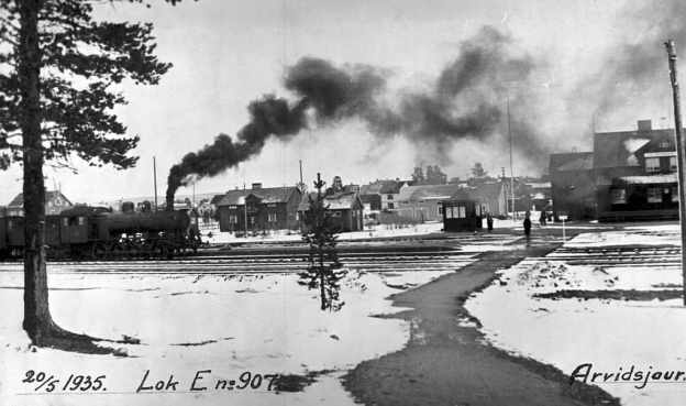
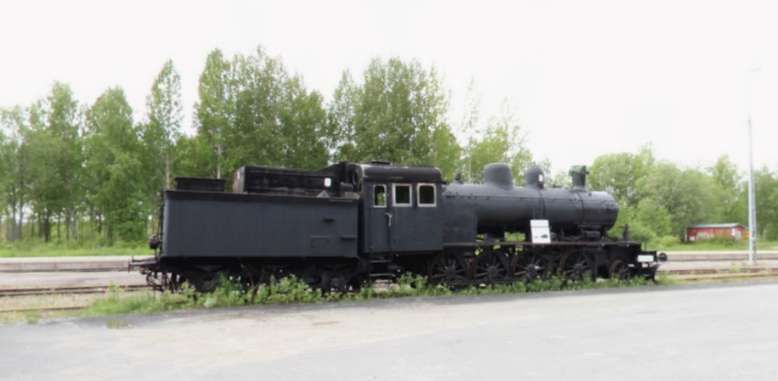
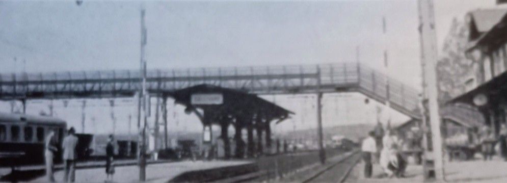
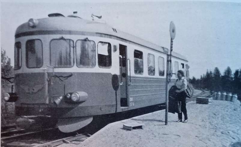
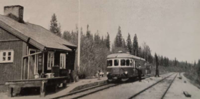
The featured image for this article is a picture of Swedish State Railways (Swedish: Statens Järnvägar) Locomotive No. 907 at Arvidsjaur Railway Station. The image is dated May 1935, (c) Public Domain. [60]
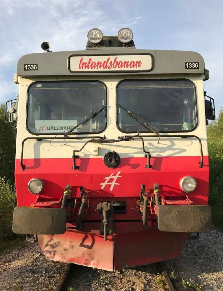
Known as Sweden’s Inland Railway, the Inlandsbanan “extends from Gällivare, in Lapland, to Kristinehamn, on Lake Väner, in Värmland, a distance of 800 miles, through scenery that ranges from the tundra of the Arctic to the forest lands of Central Sweden.” [1: p826]
The line is known for its leisurely pace, allowing for wildlife spotting (reindeer, elk) and spontaneous stops, with onboard hosts providing commentary. Trains operate with daily departures during the 3 months of high summer, often with packages that include hotels. It also operates for 4 months in the winter.
It was built between 1908 and 1937, and was designed to connect inland northern Sweden, avoiding the coast for security reasons and to foster regional development.
The Railway Magazine.of December 1958 carried an article about the line written by M. D. Greville & H. A. Vallance. [1]
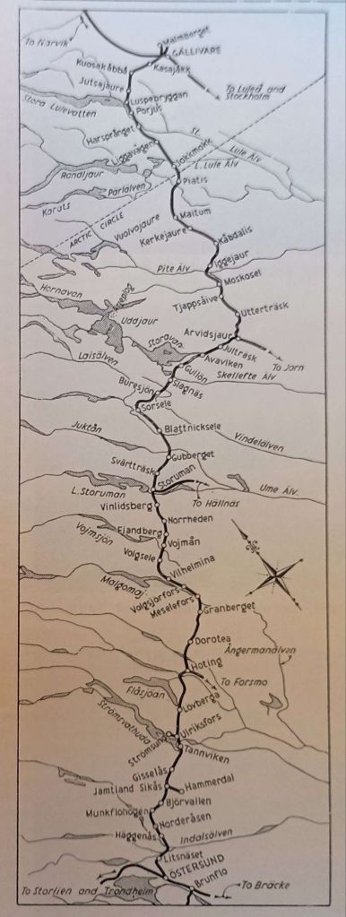
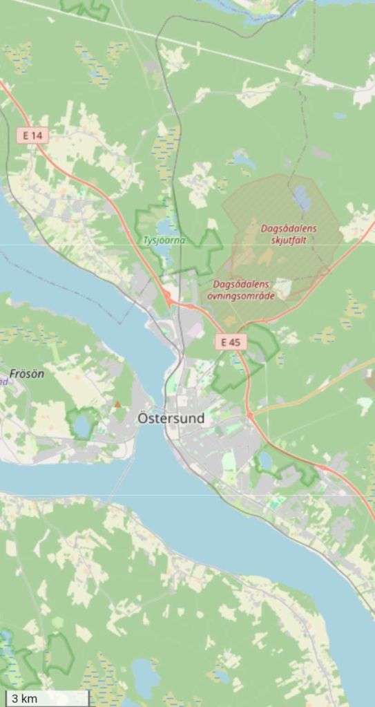
The northern length of the Inlandsbanen from Ostersund to Gällivare. Ostersund features in the OpenStreetMap images below and appears at the South end of the portion of the line shown in the first of two maps of the line. [1: p827]
Vallance and Greville wrote: “The inland route was first projected at the end of the nineteenth century as a private enterprise, to carry iron ore from Lapland and timber from Central Sweden to a new port on the west coast, north of Gothenburg. No progress was made with this scheme, and in 1907 the Swedish Government decided to begin the construction of the northern part of the railway from Östersund, on the main line from Bräcke to Storlien, on the Norwegian frontier, completed in 1882.” [1: p826]
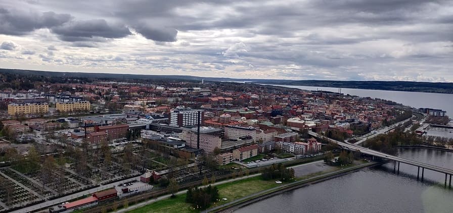
Östersund is the capital of Jämtland. It is located at the shores of Sweden’s fifth-largest lake, Storsjön, opposite the island Frösön. With a total population of 50,960 (2017) Östersund is the 22nd most populous city in Sweden. [14]
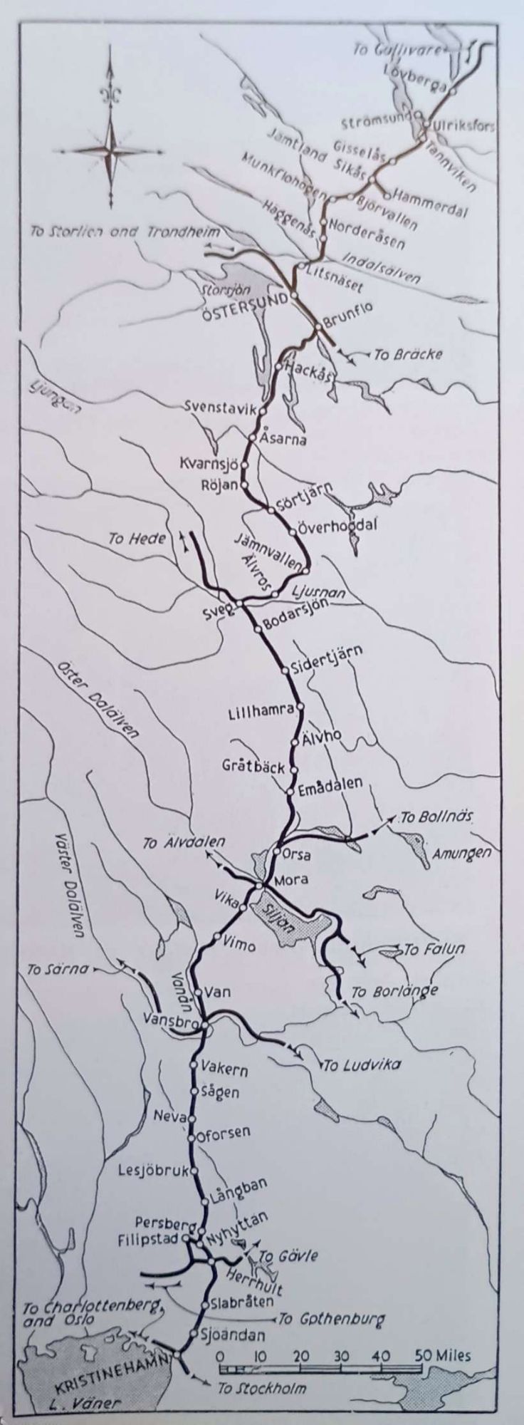
Östersund appears on this second map of the route which shows the Southern length of the line which extends to Kristinehamn. [1: p827]
The completed line runs from Gällivare, in the North, to Kristinehamn in the South, passing through Östersund which is the most significant location along the line.
Stops along the line recorded by Greville and Vallance include: Kasajakk, Kuosakabba, Jutsajaure, Luspebryggan, Porjus, Harspranget, Liggavagen, Jokkmokk, Piatis, Maitum, Kerkejaure, Kabdalis, Iggejaur, Moskosei, Tjappsaive, Uttertrask, Arvidsjaur (a junction station serving the line to Jorn), Juitrask, Avaviken, Gullon, Slagnas, Buresjon, Sorsele (which was the Northern terminus of the line from 1929 until the line was completed), Blattnicksele, Gubberget, Sarttrask, Storuman (which was the junction for the line to Hallnas), Vinlidsberg, Norrheden, Fiandberg, Vojman, Volgsele, Vilhelmina (the northern terminus of the line from 1918 to 1929), Vlogsjorfors, Meselefors, Granberget, Dorotea, Hoting (the junction station for the line to Forsmo), Lovberga, Ulriksfors (which became a junction station when the line to the North opened in 1912, with the original line to Stromsund becoming a short branch line), Tannviken, Gisselas, Sikas (whuch was a junction station for the short line to Hammerdal), Bjorvallen, Munkflohogen, Norderasen, Haggenas, Litsnaset and Östersund. [1: p827]
South of Östersund, Greville and Vallance record the following stations: Brunflo (the Junction station on the line to Bräcke), Hackas, Svenstavik, Asarna, Kvarnsjo, Rojan, Sortjarn, Overhoodal, Jamnvallen, Alvros, Sveg, Bodarsjon, Sidertjarn, Lillhamra, Alvho, Gratback, Emadalen, Orsa (which is the junction station for the line to Bollnas), Mora (the junction station for the lines to Alvdalen, Falun and Borlange), Vika, Vimo, Van, Vansbro (the junction station for the lines to Sarna and Ludvika), Vakern, Sagen, Neva, Oforsen, Lesjobruk, Langban, Persberg, Nyhyttan (the junction for the line to Filipstad and beyond), Herrhult (the junction station for the lines to Gothenburg and Galve), Slabraten, Sjoandan and Kristuinehamn. [1: p827]
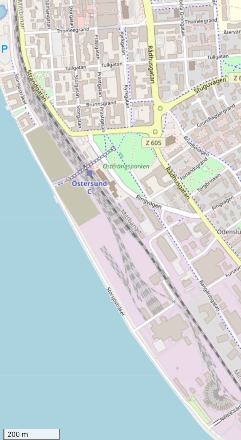
Östersund Railway Station, the line to Bräcke leaves this map extract in the bottom-right corner. The roundhouse at Östersund is also at the bottom left of this image. [8]
The 74 miles North from Östersund to Strömsund were opened in 1912. Strömsund was the terminus of the line until the line was opened further to the North. [1: p826]
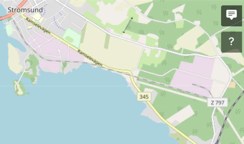
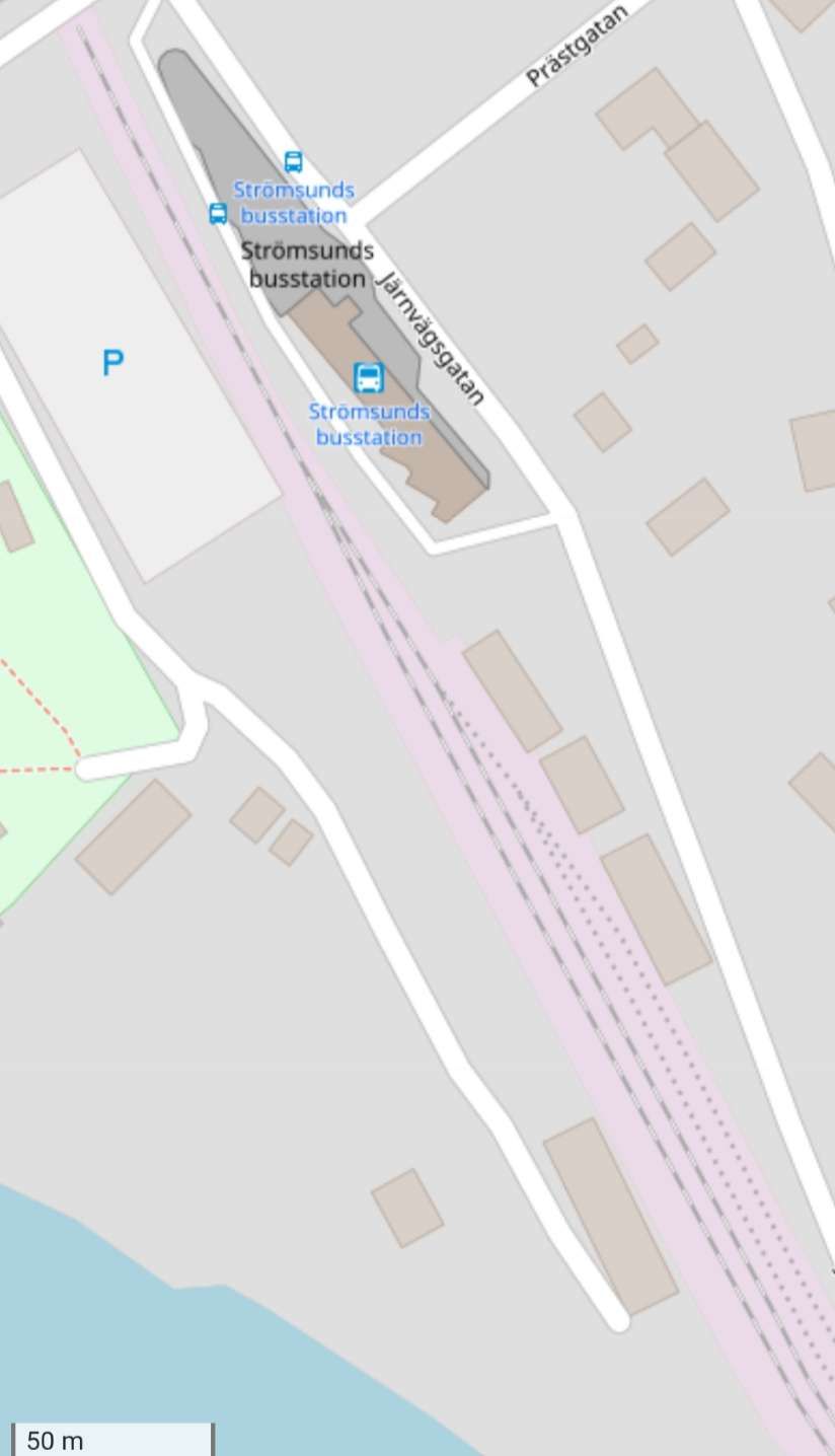
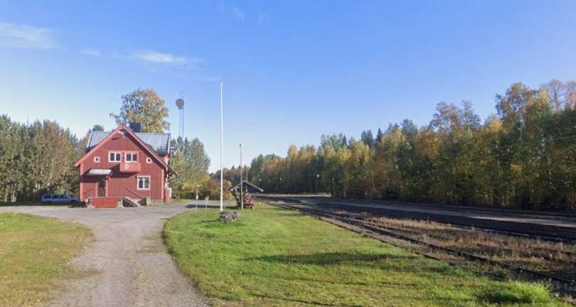
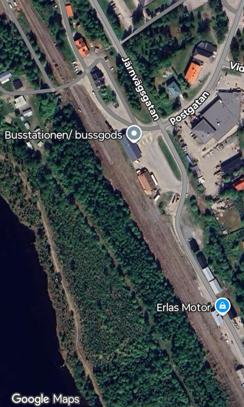
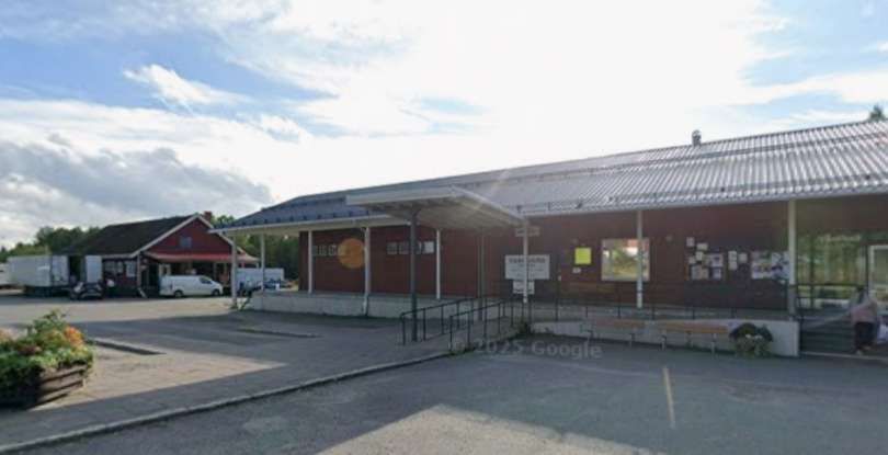
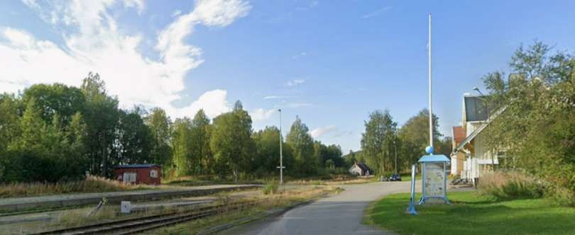
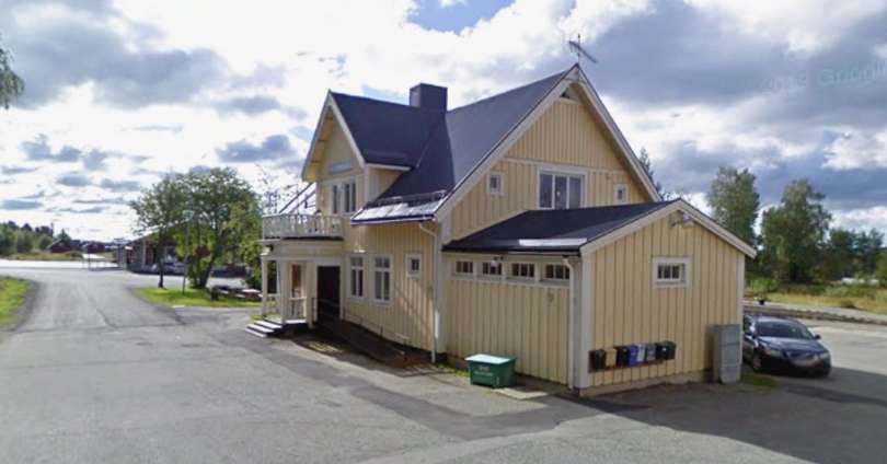
Strömsund Railway Station is now its bus station. [10]
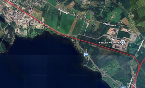
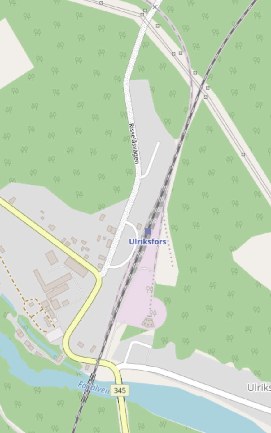
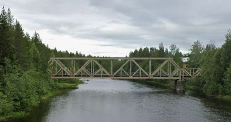
Ulriksfors Railway Station sits just to the North of the railway bridge over the Faxälven River. (Google gives the river the name ‘Fängsjön’.) [11]
“The line was then continued northward from Ulriksfors to develop wide and very sparsely-inhabited areas in Lapland. The 80 miles from Ulriksfors to Vilhelmina were brought into use in 1918 and, after an interval of 11 years, the 87 miles thence to Sorsele were opened in 1929.” [1: p826]
Vilhelmina and Sorsele are shown below. …
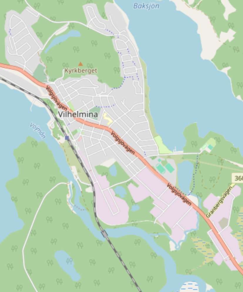
Vilhelmina Railway Station was on the West side of the town between it and Lake Vojmän. The railway was opened through to the town from the South in 1918. [12]
Vilhelmina had 3,657 inhabitants in 2010. [15]
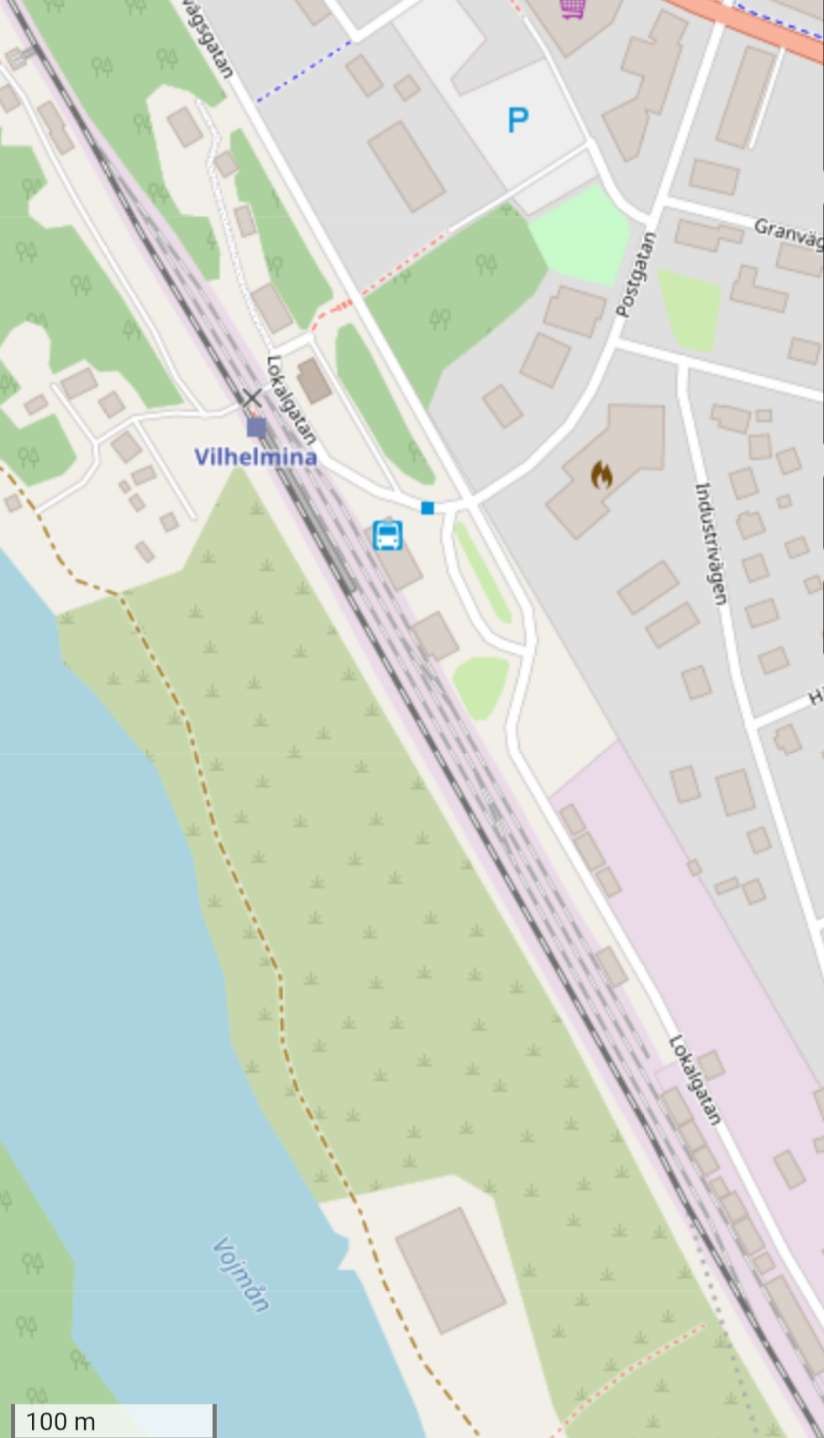
A closer view on OpenStreetMap of Vilhelmina Railway Station. [12]
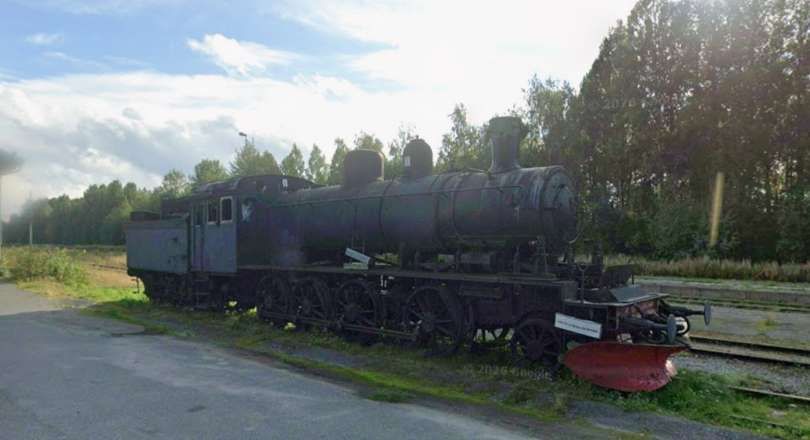
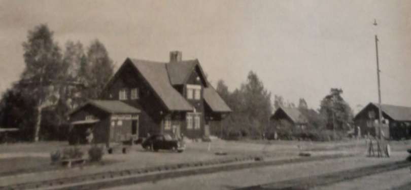
The next two photographs show a steam locomotive which used to work on the Inlandsbanan which has been stabled in a short spur to the North of the bus station building. …
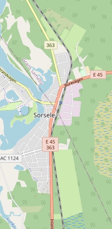
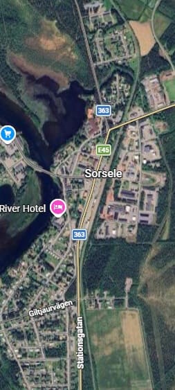
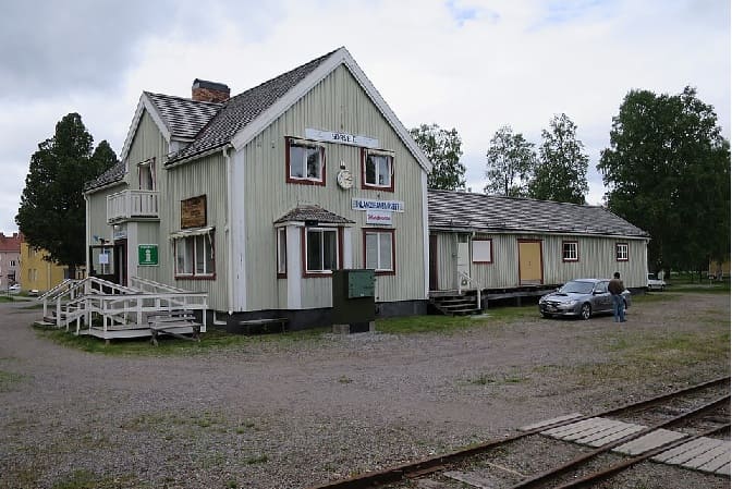
Sorsele was the next terminus location as the line was gradually built to the North. It was the northern terminus of the line from 1929 until the connection to the line being built South from Gällivare was made. [16][Google Maps, April 2026]
While the line was progressing gradually North from Östersund to Sorsele, construction started from a junction with the line to Narvik (in Norway) at Gällivare. [2][3]
Greville & Vallance tell us that, “A temporary track, to carry materials for the construction of a big hydro-electric power station, had been laid for 33 miles to Porjus in 1911, and this section was opened for goods traffic in 1916, and for passengers in 1925. The 29 miles from Porjus to Jokkmokk were brought into use in 1927. The intervening gap of 163 miles from Jokkmokk to Sorsele was bridged in two sections, from Sorsele to Arvidsjaur (55 miles) in 1933, and from Arvidsjaur to Jokkmokk (108 miles) in 1937. Between 1924 and 1930, cross-country lines were opened from Hoting to Forsmo, and from Storuman to Hallnas, to connect the new inland route with the older main line from Stockholm to Lapland.” [1: p826]
We will pick up details of these different locations as we travel along the line from Gällivare to Kristinehamn in this and future articles.
“Historically, the southern half of the route, from Östersund to Kristinehamn, falls into two parts. The Kristinehamn-Sjöandan Railway, seven miles long, was constructed between those places as early as 1850, as part of a system of narrow-gauge railways and canals connecting the local iron foundries with Lake Vaner and, via the Gota Canal, with the sea. It was at first worked by horses, but became steam-operated in 1858, and in 1859 started to carry passengers. In 1873, this line was acquired by the Ostra Varmlands Railway, converted to standard gauge, and extended for 29 miles to Persberg in 1875, part of another narrow-gauge line, the Kroppa Railway, being incorporated.” [1: p826]
Greville and Vallance continue: “Between 1889 and 1891, the Östra Värmlands Railway opened the 102 miles from Persberg, through Vansbro, to Mora, where a connection was made with the Falun-Rättvik-Mora Railway, which was extended for eight miles from Mora to Orsa in 1892. The 77 miles from Orsa to Sveg were built by the Orsa-Härjedalens Railway, and opened in 1909 The whole line from Kristinehamn to Sveg passed into the hands of the Swedish State Railways between 1917 and 1919. … The remainder of the route was built by the State, in a southerly direction from a junction with the Bräcke-Östersund line at Brunflo, nine miles from Östersund. The 42 miles from Brunflo to Åsarna were brought into use in sections between 1916 and 1918, and the 63-mile link between Åsarna and Sveg was completed in 1922.” [1: p829]
Following the Route of the Railway – Gällivare to Arvidsjaur
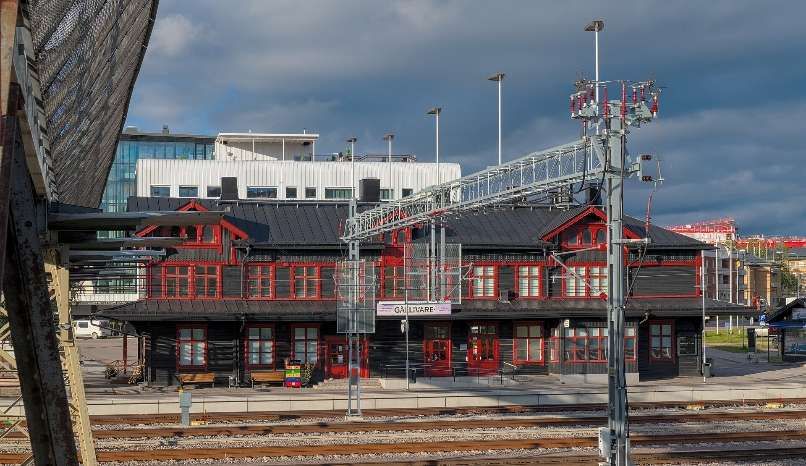
Gällivare is at the northern end of the Inlandsbanan. We start our journey along the line from here. …
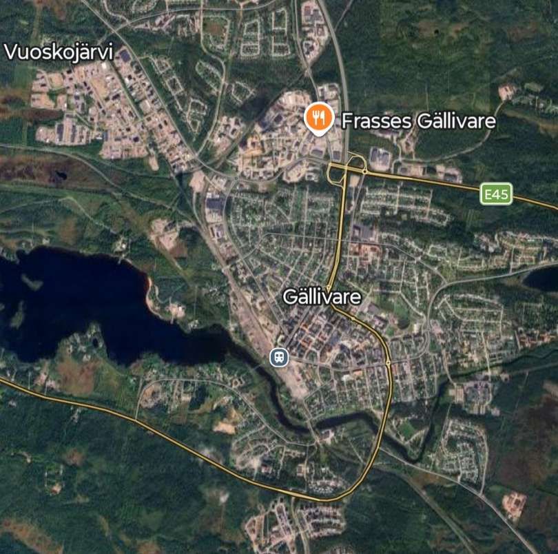
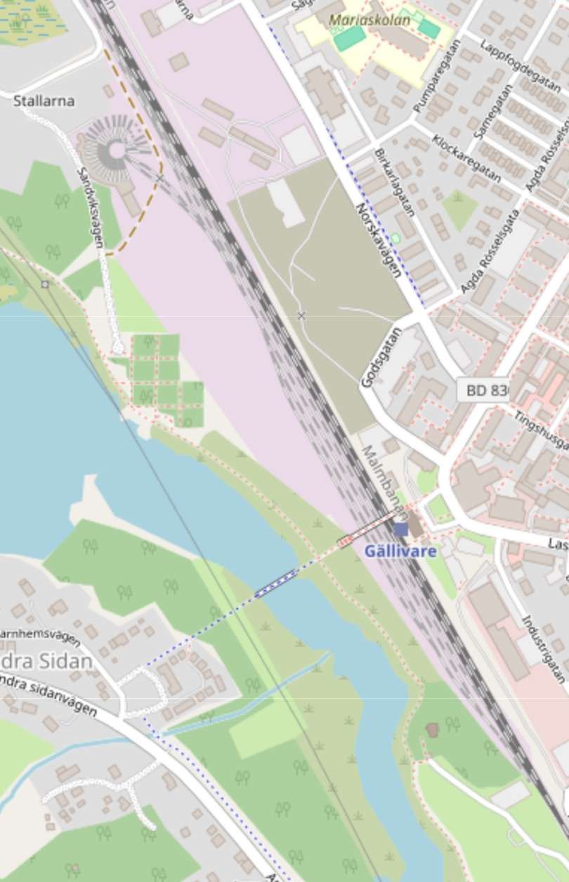
Gällivare Station sits alongside the Vassara River on the Southwest side of the town. The line to Narvik heads away to the West, North of the top of this map extract. The Inlandsbanan also leaves heading West from the triangle. The line heading Southeast across the Vassara River heads for Luleå and thence to Stockholm via the coastal line. [Google Maps, April 2026]
The next two images are taken from OpenStreetMap’s mapping and, between them, show the length of the station site at Gällivare. …
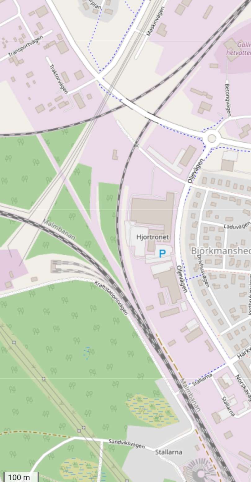
The North end of Gällivare Railway Station site. The triangular junction is worth noting at the top of this extract. [7]
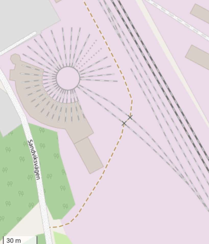
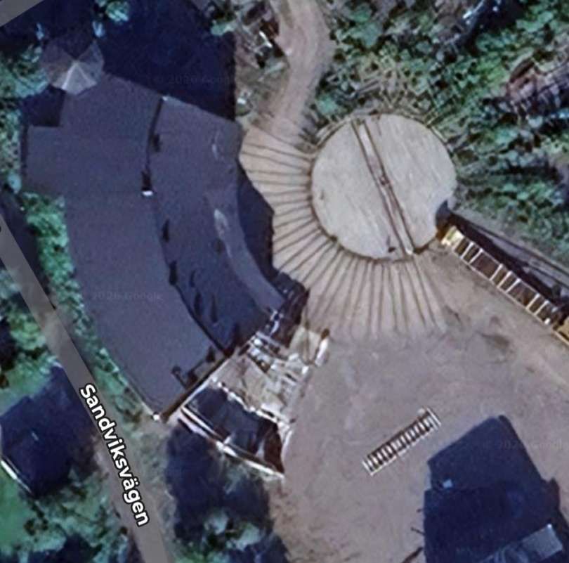
Two closer views of Gällivare’s roundhouse: one cartographic, [7] the other satellite. [Google Maps, April 2026]
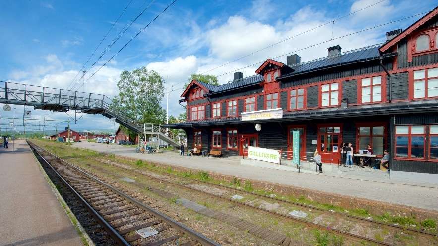
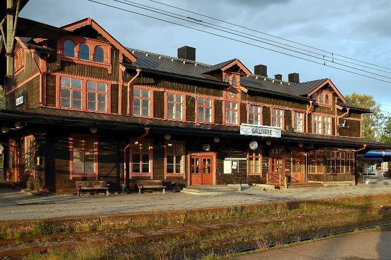
Trains travelling South on the Inlandsbanan set off from Gällivare Railway Station in a northerly direction. North of the Roundhouse they bear round to the West.
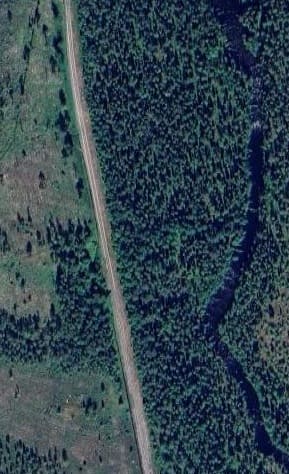
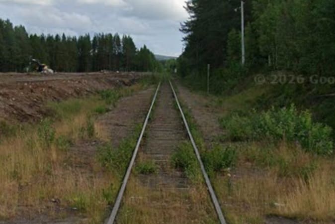
Greville and Vallance talk of the line in 1958: “The line is single track throughout, with passing loops at most stations. Unlike the railway to Narvik, it is not electrified. Apart from the bridges over the numerous rivers, heavy engineering works have been avoided, and the gradients are undulating, and frequently quite steep. For many miles, the railway passes through forests and tundra, almost devoid of habitation. The country is rather flat, but is relieved by several lakes, and there are distant views, towards the west, of the Lapland mountains, including Kelneksise (8,900 ft.) the highest mountain in Sweden. Herds of wandering reindeer are frequently seen, and may even hold up the train while they cross the unfenced line to reach their feeding grounds. Laspebryggan, 28 miles from Gällivare, is the starting point for the popular journey by boat along a chain of lakes to Stora Sjöfallet, the finest waterfall in Sweden, and considered by many to be the most magnificent in Europe.” [1: p829]
Heading West the Inlandsbanan bridges the Sikträskbäcken River which feeds into Lake Vassaraträsket close to which Gällivare sits.
The truss girder bridge over the Sikträskbäcken. [Google Maps, April 2026]
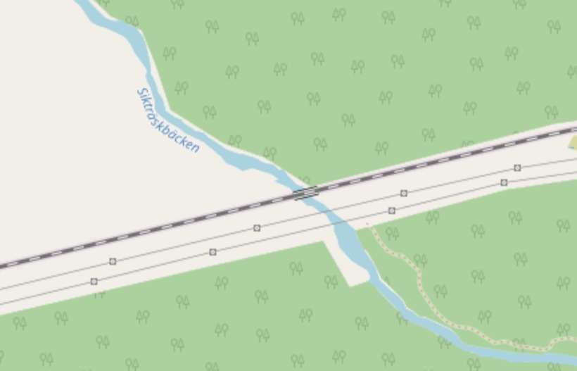
The bridge as it appears on OpenStreetMap’s mapping. [18]
The line continues in a westerly direction for some considerable distance. …
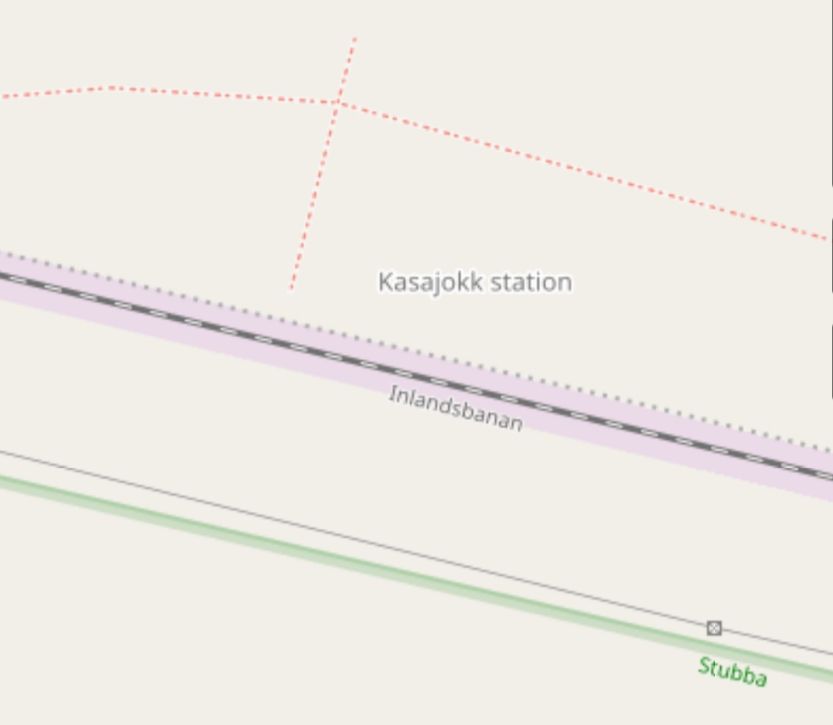
Kasajokk (Kasajakk) Station. [19]
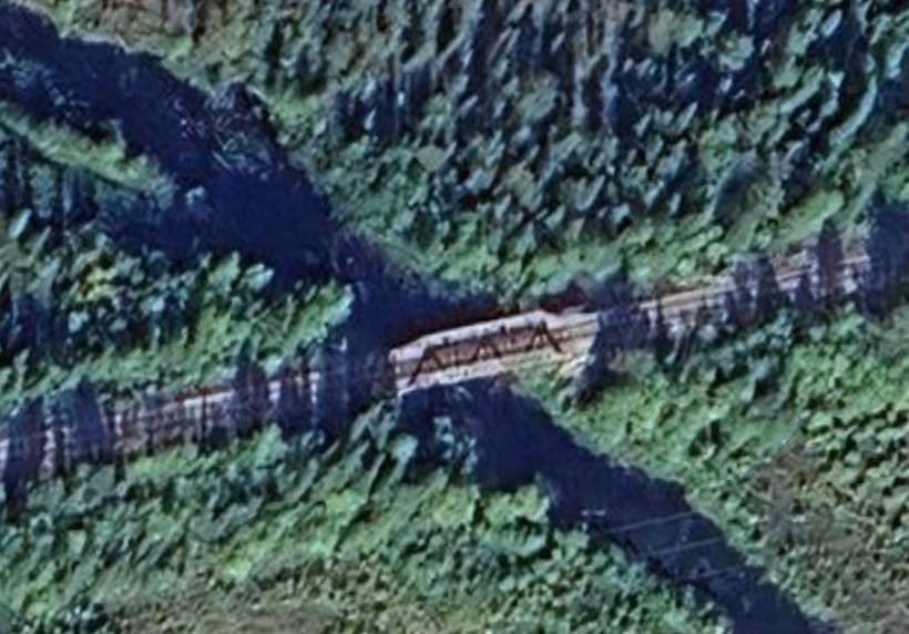
The bridge over the Gassajahka River. [20]
The Gassajahka River bridge. [Google Maps, April 2026]
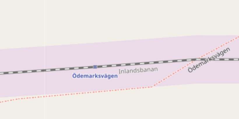
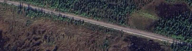
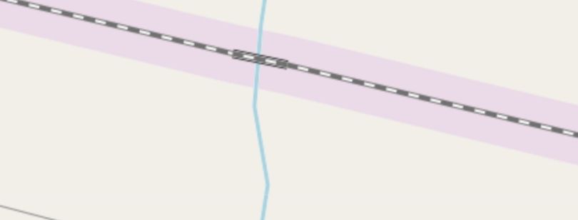
Ödemarksvagen forest road and railway station. [21]
Ödemarksvagen Railway Station. [Google Maps, April 2026]
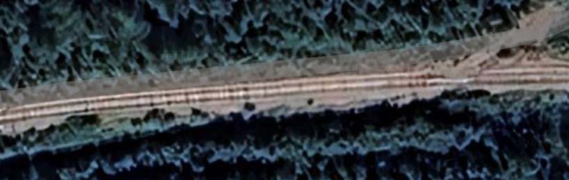
After passing through Ödemarksvagen, the line begins to turn to the Southwest, eventually passing through Avvakajjo station.
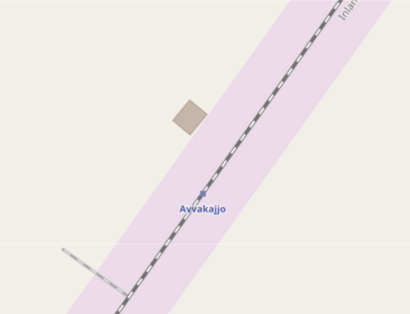
Avvakajjo Railway Station can be seen on OpenStreetMap. Bottom-left, there was once a track for storage of a track maintenance vehicle at this location. [22]
There is no easily identifiable location on Google Maps.
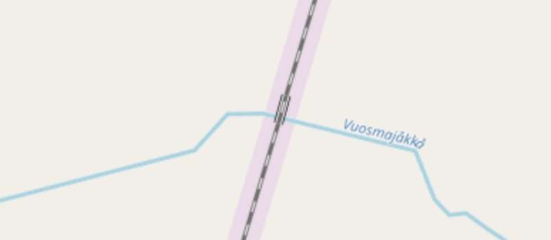
After Avvakajjo the line begins to turn to a South-southwest bearing and then bridges the Vuosmajákka River.
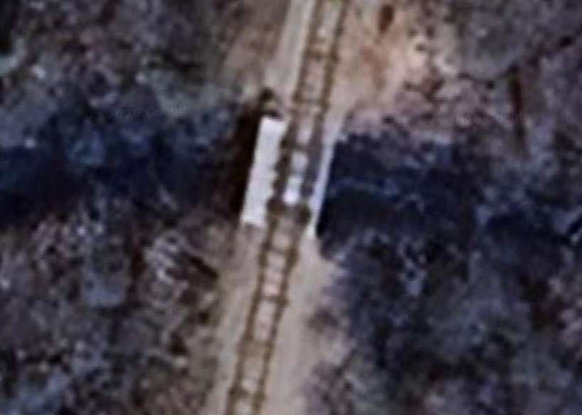
The bridge over the Vuosmajákka River. [Google Maps, April 2026][23]
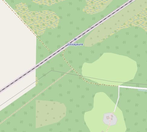
Jutsajaure Halt. [24][Google Maps, April 2026]
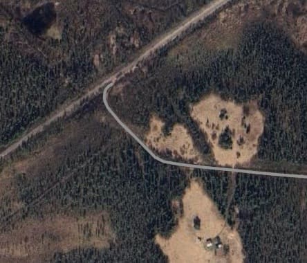
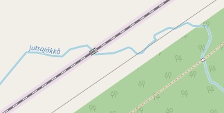
Jutsajakka River. [25][Google Maps, April 2026]
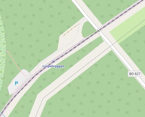
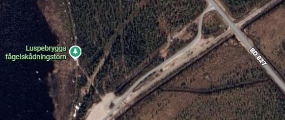
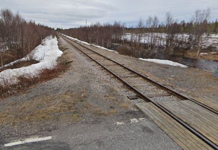
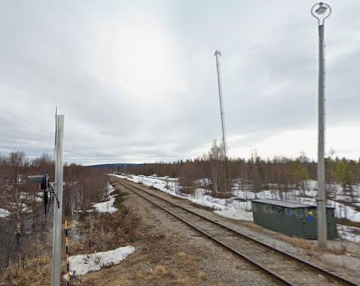
The line continues Southwest crossing the BD827 road and entering Luspebryggan Halt. [26][Google Maps, April 2026]
Beyond Luspebryggan, the line turn towards the South, running along the lakeshore (Store Lulwvatten) to Porjus.
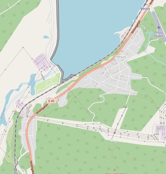
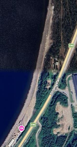
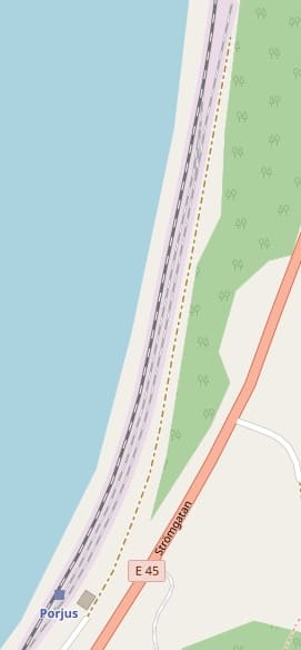
Porjus Railway Station. [Google Maps, April 2026] [27]
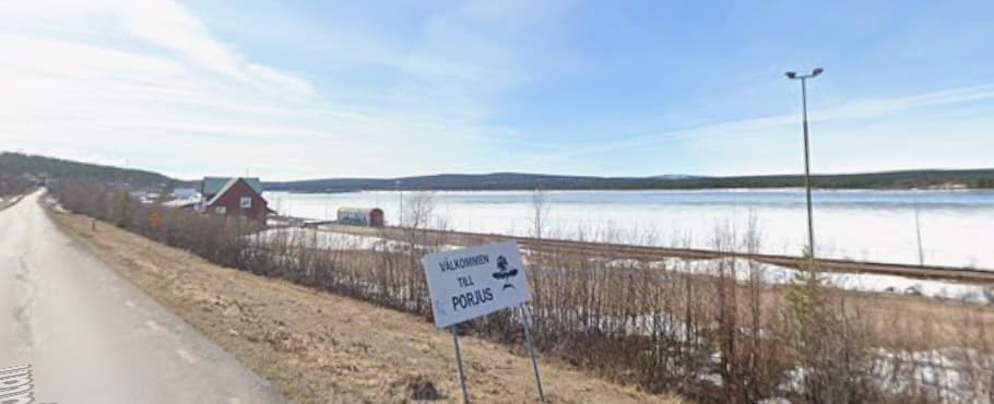
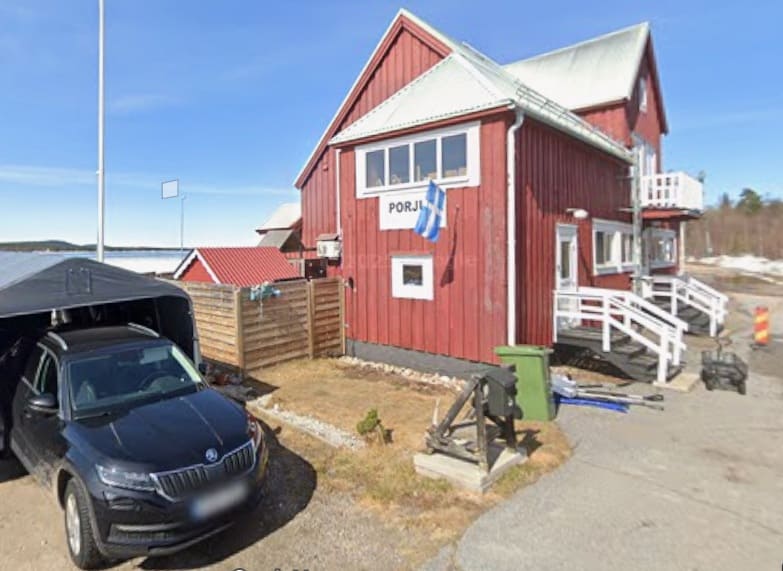
[Google Streetview, May 2024]
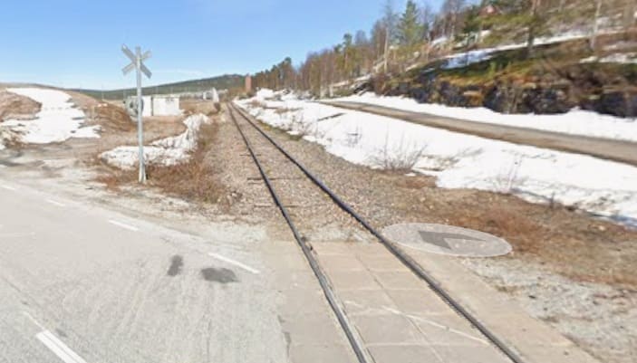
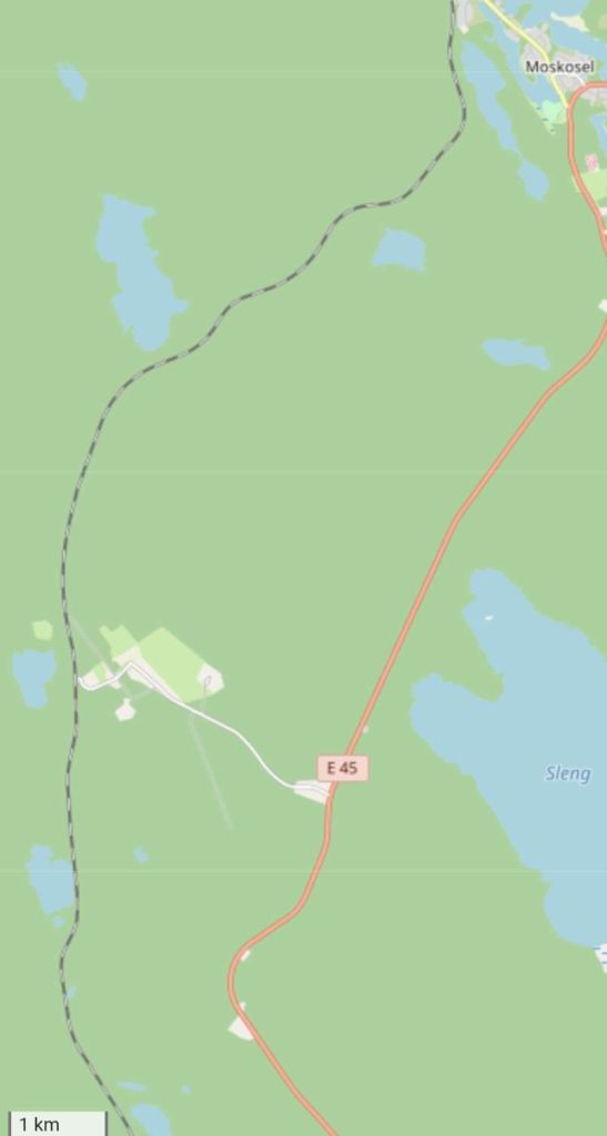
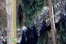
A short distance further along the line it is crossed by a short access road from the E45 to the lakeshore. [Google Maps, April 2026]
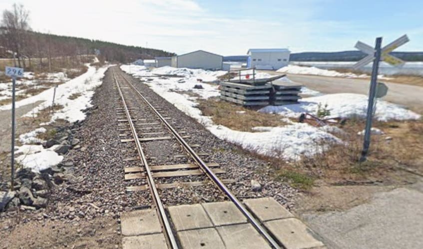
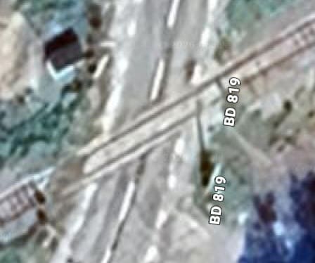
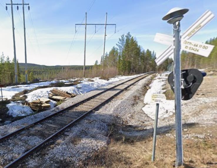
A short distance along the line a little further than the point where the line leaves the lakeside it is crossed by the BD819. [Google Maps, April 2026]
[Google Streetview, May 2024]
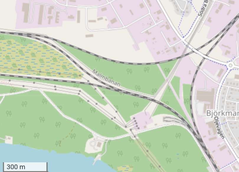
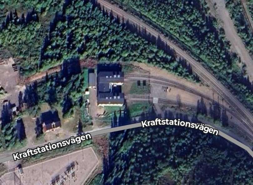
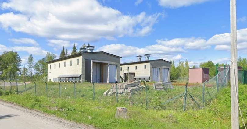
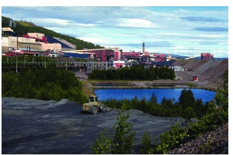
Porjus is the site of a significant hydroelectric power station which was built below ground in the early 1900s, the purpose was to provide electricity for the Malmbanan Railway, which was used to transport iron ore. The new hydroelectric power plant and electrification contributed to a strong growth in Sweden’s mining industry. [45]
“Construction of the Porjus power plant began in 1910. In 1915, Gustaf V inaugurated the Porjus power plant by telephone, as his advisors did not consider it safe to make such a long journey in the middle of the war. Porjus quickly became a hub in an industrial Sweden that was consuming increasingly more energy. When the power plant was inaugurated, there were already 20 hydroelectric power plants around the country, but Porjus received a lot of attention because of its geographical location and because the construction technology was very advanced for its time.” [45]
“The power plant is located underground, blasted into the rock. The number of turbines in the old power plant increased between 1920 and 1960 to nine units. The turbines are still operational but are not used in normal operation. Two of the old units have been converted into research units and are used to test new technology and equipment.” [45]
“A new power plant with two new units was built in 1971–1975. All new transformers were built underground, and therefore no new building was needed. … The old dam has been replaced by a rockfill dam with a dense core of moraine. It has been built immediately downstream of the old dam, and has two new spillways that are closed by segmental gates.” [45]
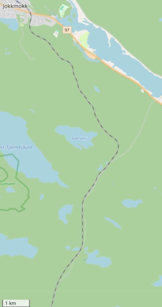
Greville and Vallance comment that “A run of some thirty miles through mountainous and well-wooded country brings the train to the girder bridge over the rapid Lilla Lule Alv (Little Lale River) and to Jokkmokk (800 ft. above sea level), formerly a Lapp village and market centre, but now a thriving modern town.” [1: p829]
We continue our journey South from Porjus.
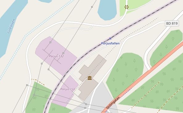
Just beyond the level-crossing at the BD819 there was another Halt – Porjusfallen Halt, after which the line curved round to the South. [27]
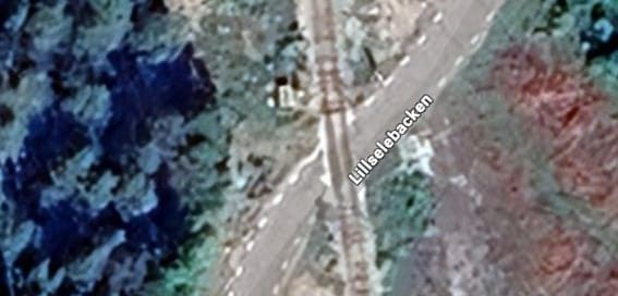
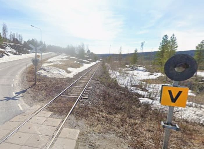
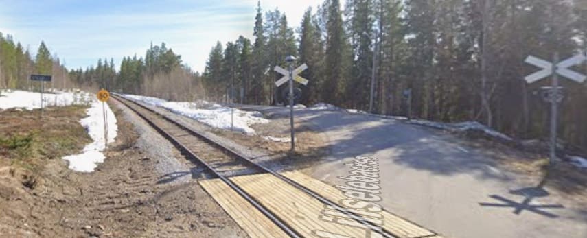
A further level-crossing took the railway over Lillselebacken, the BD826 road. [Google Maps, April 2026]
[Google Streetview, May 2024]
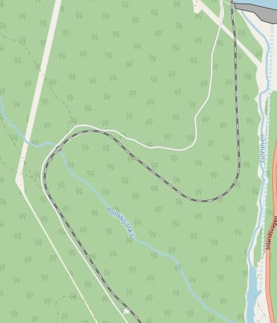
Beyond Porjus the Inlandsbanan followed the banks of the Lulealven River/Lake in a southeasterly direction, for about 3 miles before turning West to bridge the river.
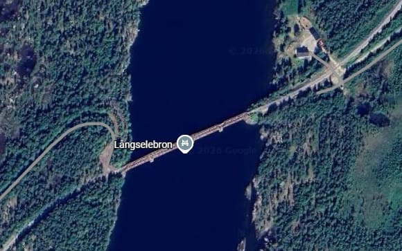
The bridge over the Lulealven River – named ‘Långselebron’. [Google Maps, April 2026]
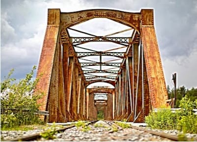
The view Northeast through the bridge, © Helen Hagegren, July 2023. [Google Maps, April 2026]
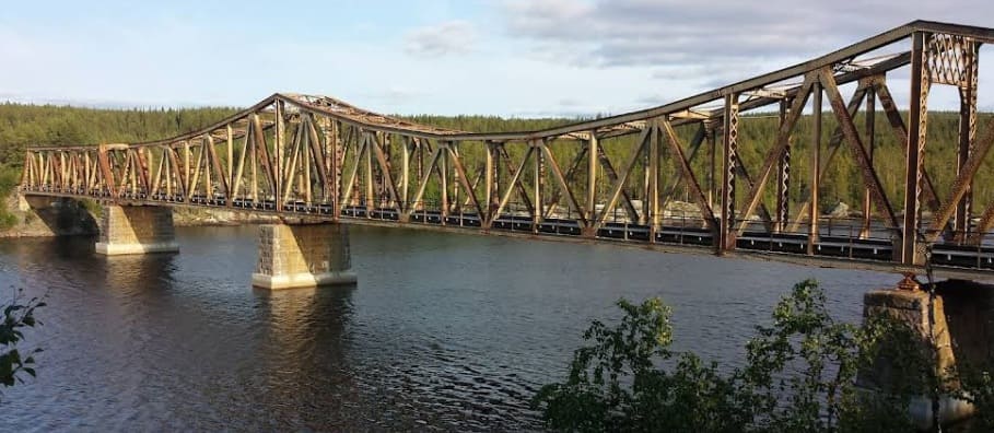
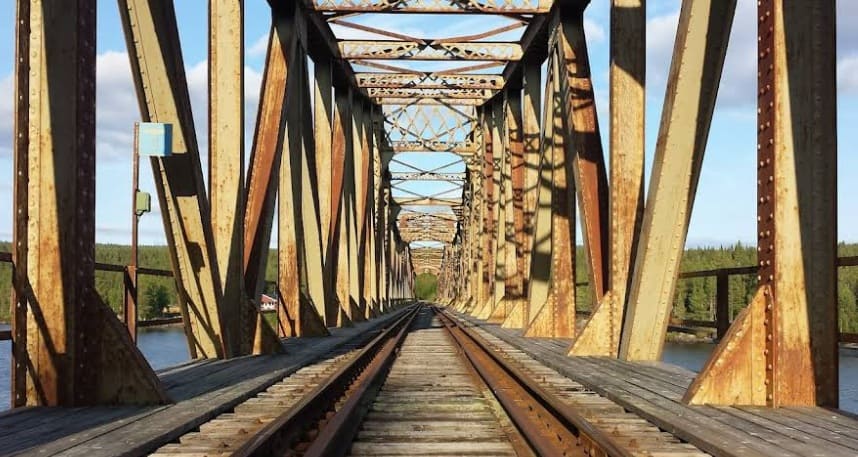
A final view of the ‘Långselebron’, © Oleh, August 2017. [Google Maps, April 2026]
Beyond the bridge, the line turns South and runs along the West bank of the river/lake. The next Halt is at Harspranget adjacent to the dam.
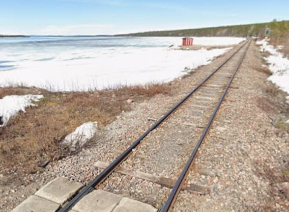
Harsprånget (the Hare’s Leap), was formerly one of the finest falls in Sweden, but by 1958, the water had been diverted to a new power station. [1: p829]
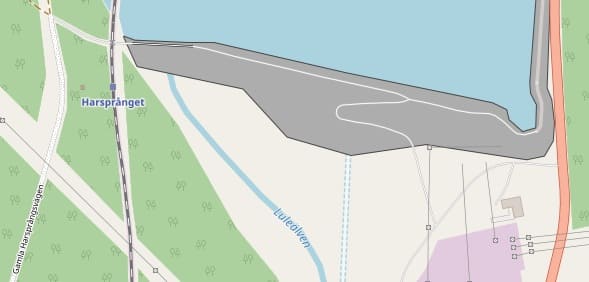
Harspranget Halt sat at the West end of the reservoir. dam. The E45 ran alongside the lake/river on the opposite bank. Google records the body of water held by the dam as ‘Harsprangsselet’. [28]
The railway follows the West, bank of the river for another kilometre or so before turning relatively sharply to the Northwest to follow the contours round the valley of the Bahkkojahka River. [28]
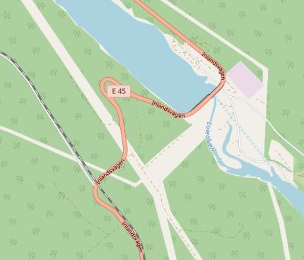
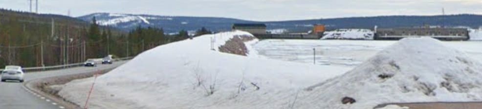
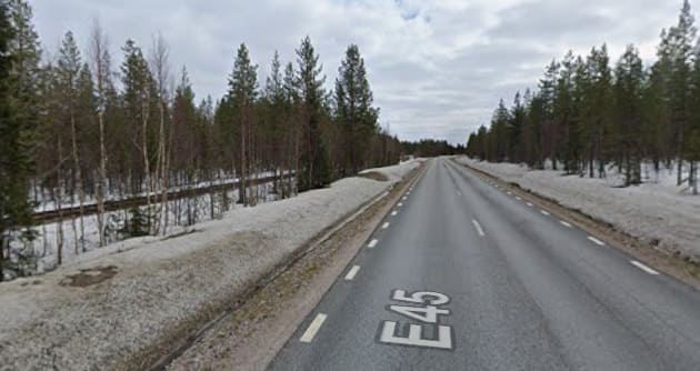
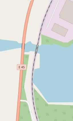
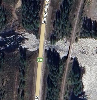
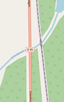
The line follows the West bank of the Lulealven River which is dammed once again a little further down stream. The E45 crosses the river at this point running at the top of the dam, before bridging the railway. [29]
[Google Streetview, May 2024]
[Google Streetview, May 2024]
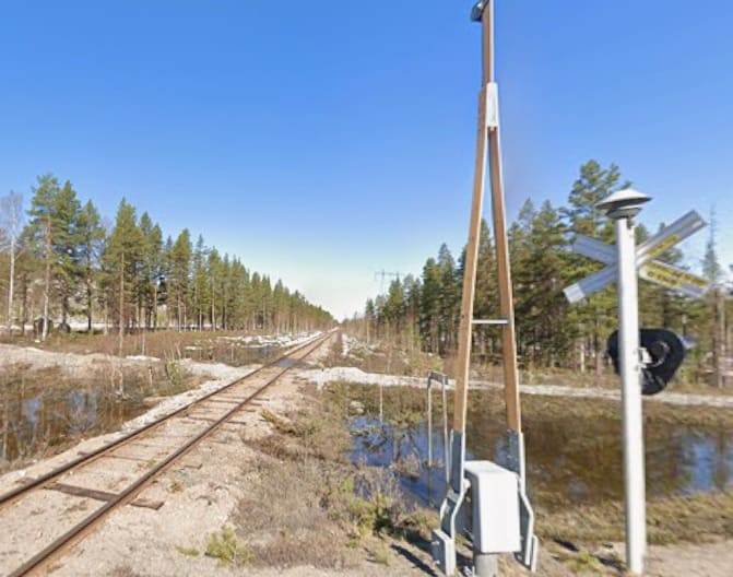
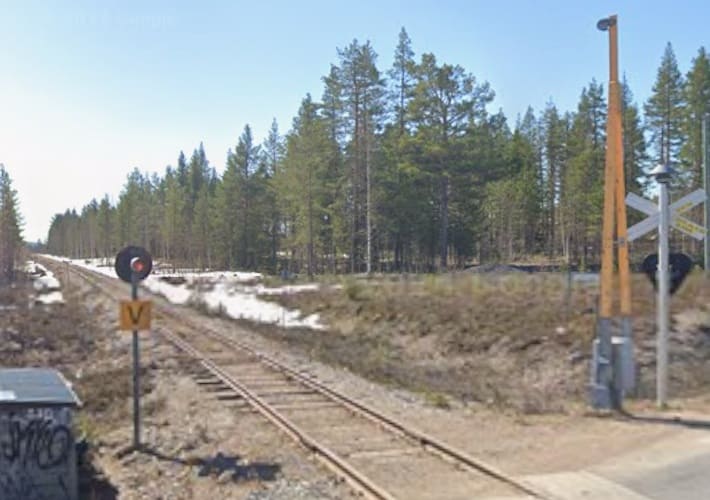
Road and rail pass close to Vajkigaur and just a short distance further South the line crosses the BD 818 close to its junction with the E45. [30]
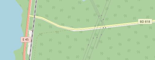
Looking North along the Inlandsbanan from its level-crossing with the BD 818. [Google Streetview, May 2024]
Looking South along the Inlandsbanan from the same level- crossing. [Google Streetview, May 2024]
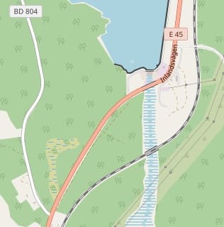
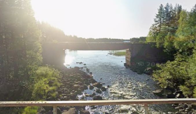
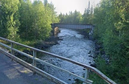
A short distance further South at Haraudden both road and rail cross the Lulealven River to the South of another dam. [31][Google Maps, April 2026]
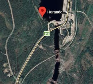
The view of the rail bridge over the Lulealven River from the bridge carrying the E45 across the river at the base of the dam which is visible in the images above. [Google Streetview, May 2024]
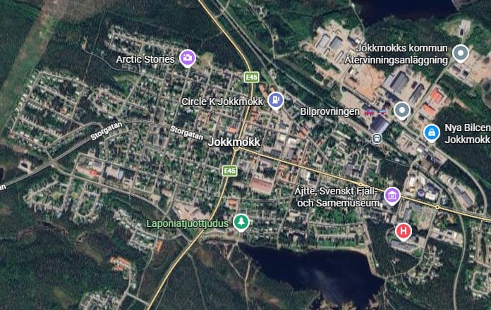
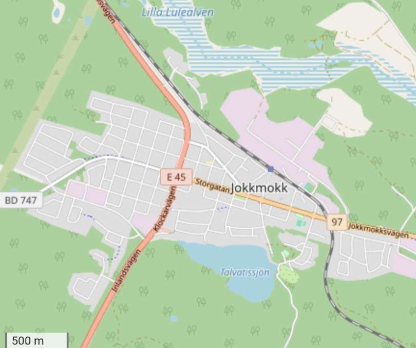
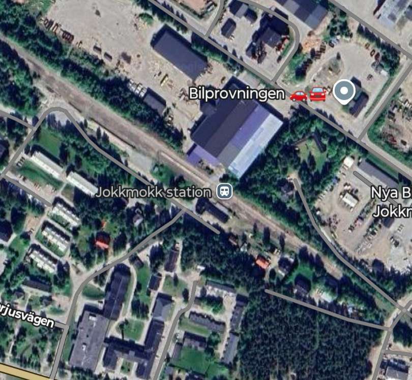
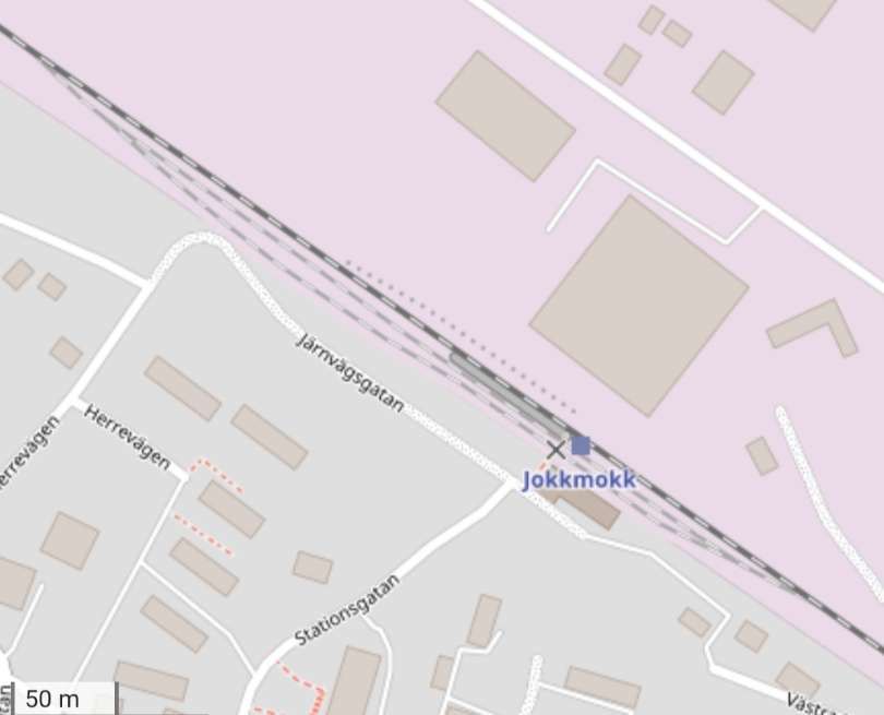
Just a short distance Southeast the line enters Jokkmokk. [32][33] ….
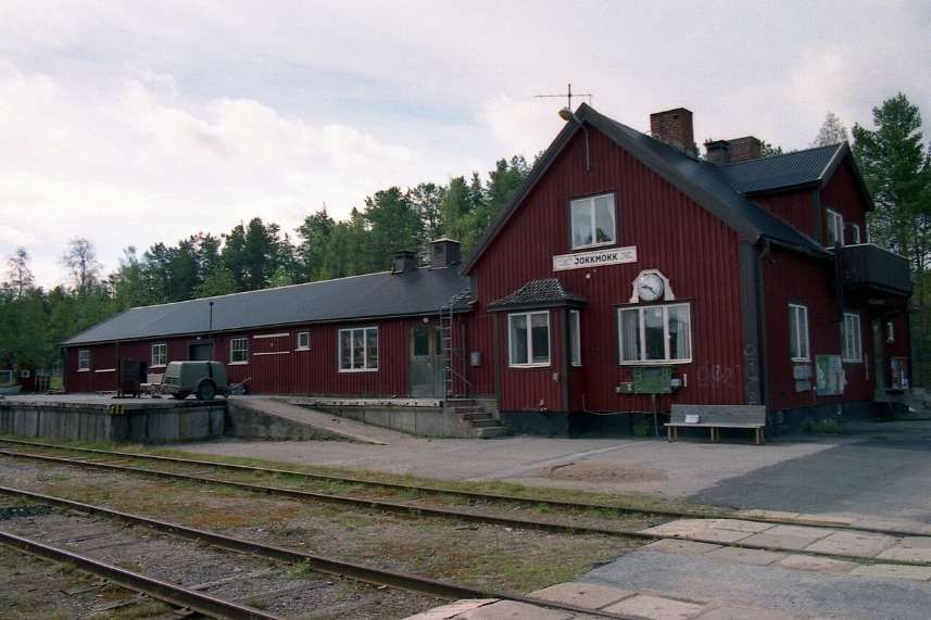
Greville and Vallance tell us that “A granite pillar at the station commemorates the opening of the inland line in 1937 by the Crown Prince of Sweden (now King Gustaf VI Adolf) The inscription includes a facsimile of the Crown Prince’s signature.” [1: p829]
“Some three miles south of Jokkmokk, the train crosses the Arctic Circle, marked by white boards and stones, and heralded by a long blast on the whistle.” [1: p829]
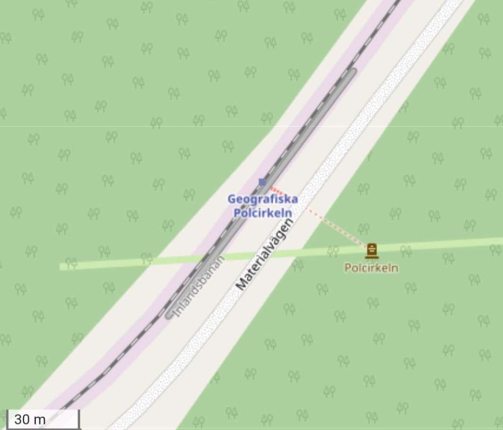
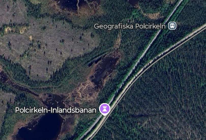
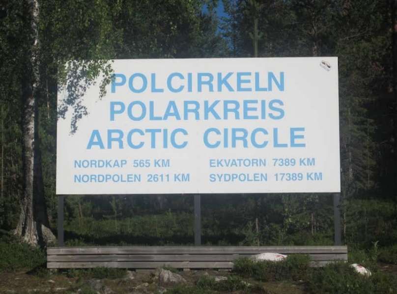
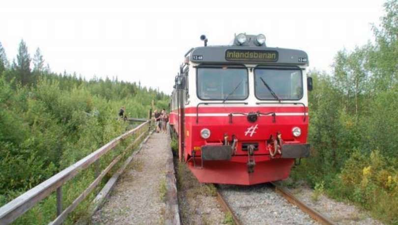
An Inlandsbanan train stopped at the Arctic Circle, (c) Chihiro Tanaka, 2016. [Google Maps, April 2026]
[Google Maps, April 2026]
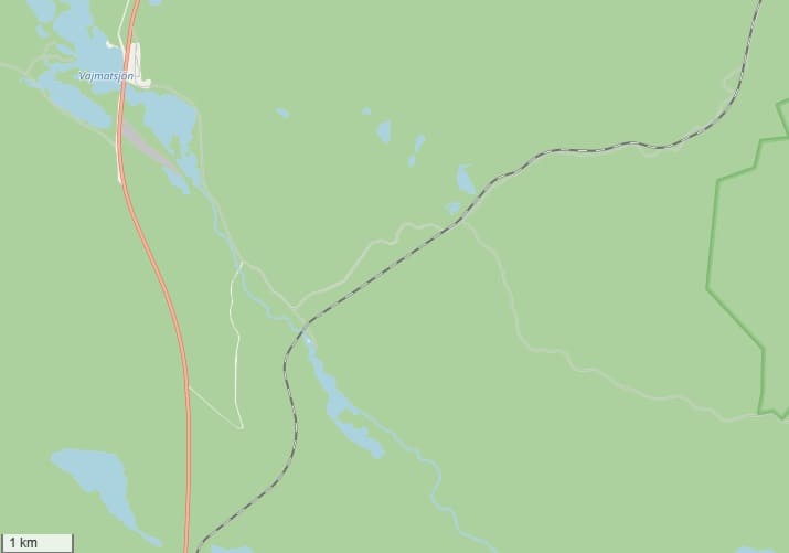
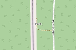
There is a Halt at Piatis which is accessed by a short path from the maintenance road which runs alongside the railway. [38]
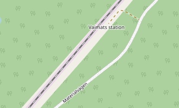
There is a further halt shown on the OpenStreetMap at Vaimats. [38]
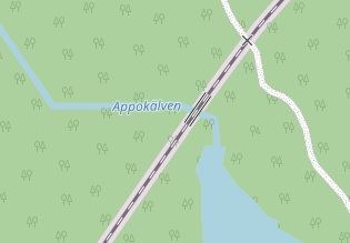
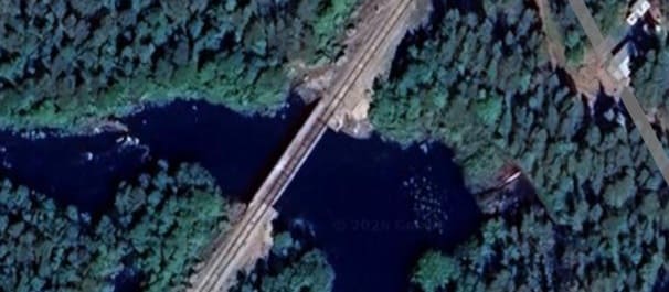
The line bridges the Appokalven River. [38][Google Maps, April 2026]
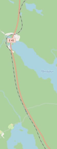
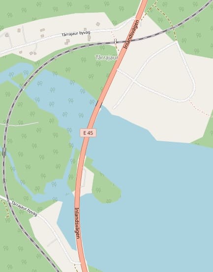
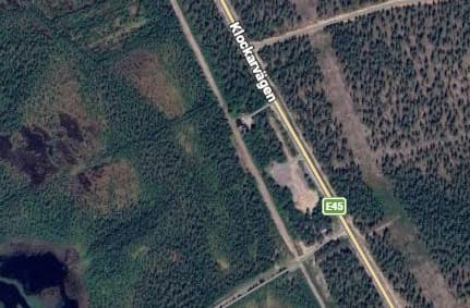
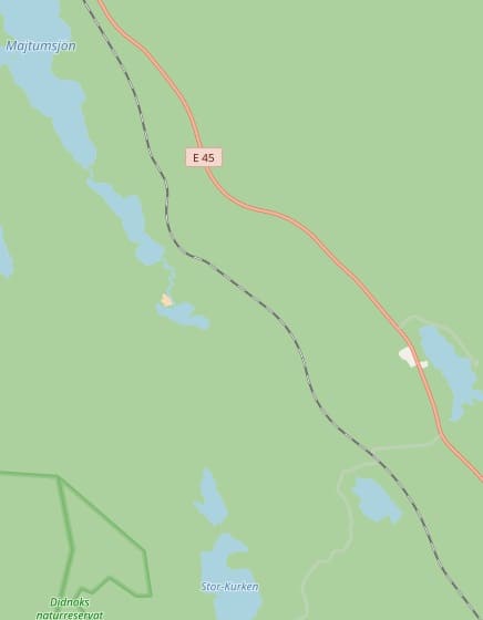
The next length of the line follows the same route as the E45 road (Klockarvägen). it crosses the road at Tarrajaur a small settlement at the head of a lake which bears the same name. [39]
The line then runs Southeast alongside the E45 road on the West side of the road.
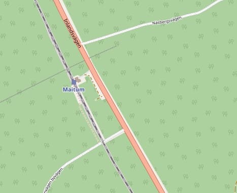
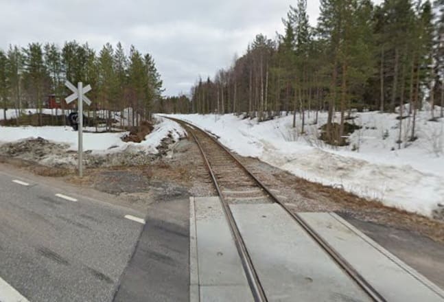
The next Halt is named Maitum. [39]
[Google Streetview, May 2024]
The line continues running Southeast. [40]
And again, the line continues running Southeast. [41]
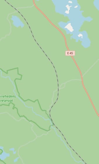
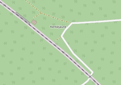
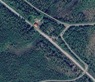
Kerkejaure Halt sits to the North of Lill Kurken, the small lake at the top right of the image. A much closer view shows both a platform and building
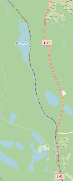
When the line next runs alongside the E45, it has turned closer to the South. [42]
[Google Streetview, May 2023]
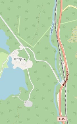
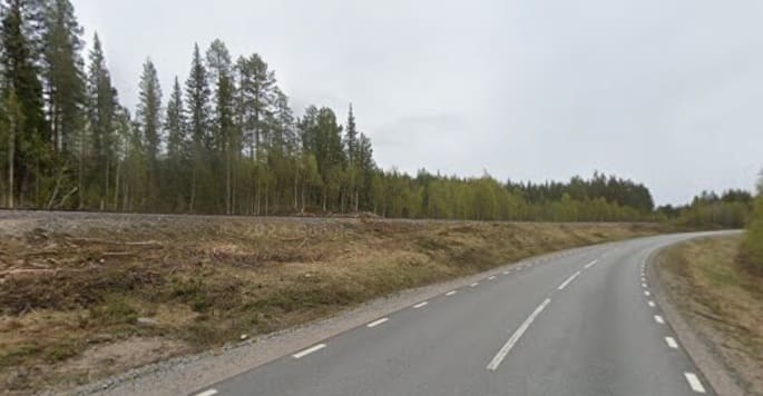
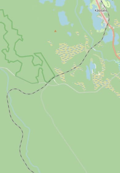
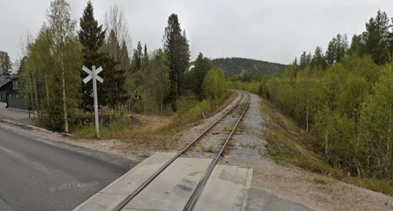
On the approach to Kabdalis, the line crosses an access road to an electrical substation/industrial site. [Google Maps, April 2026]
[Google Streetview, May 2023]
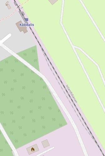
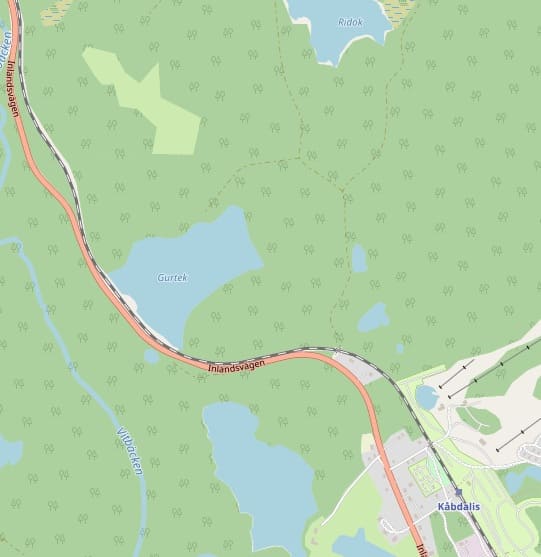
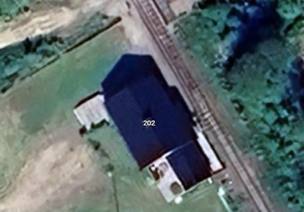
Kabdalis Railway Station: a passing loop is provided to the Southeast of the station platform. [43]
[Google Maps, April 2026]
The railway crosses the E45 again just to the South of Kabdalis. [Google Maps, April 2026]
After the road crossing the road and railway take significantly different paths South. …
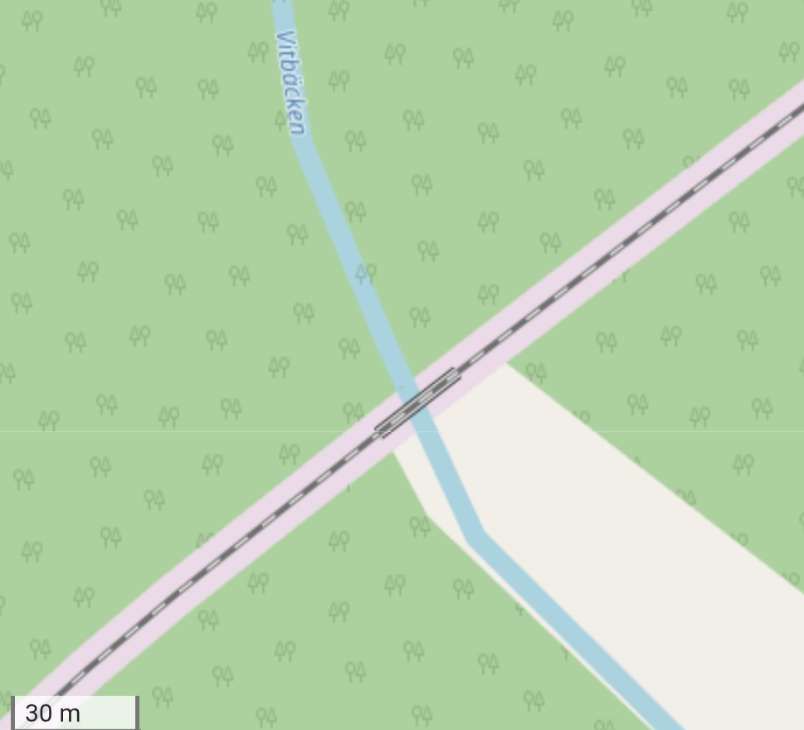
A few hundred meters along the line after passing Lake Satermjaure, the line bridges the Vitbacken River. [44][Google Maps, April 2026]
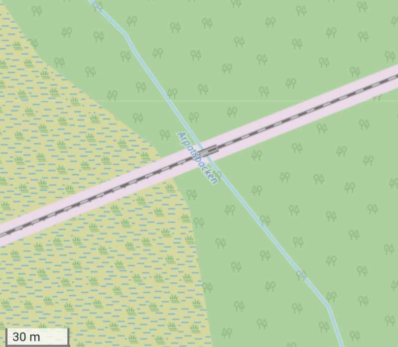
After crossing a forest track and a few kilometres along the line, it bridges the Arpatsbacken River. [44][Google Maps, April 2026]
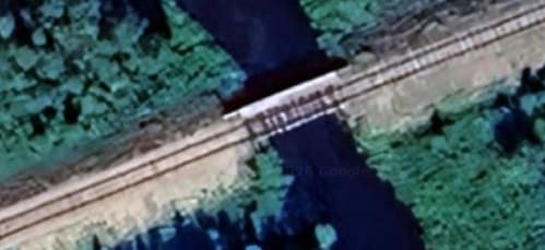
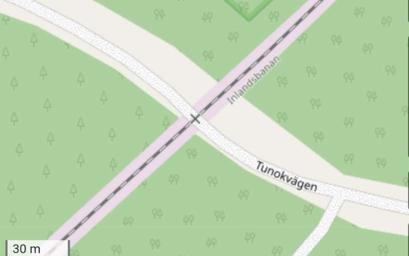
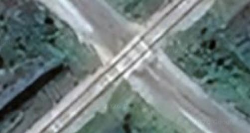
After another forest track is crossed the line crosses the Tunokvagen forest road at a Level Crossing. [44][Google Maps, April 2026]
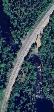
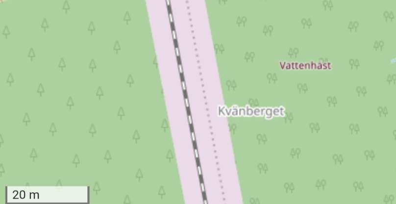
A few kilometres beyond the Tunokwagen, the railway crosses the Sikan River by means of a high embankment and culvert. [44][Google Maps, April 2026]
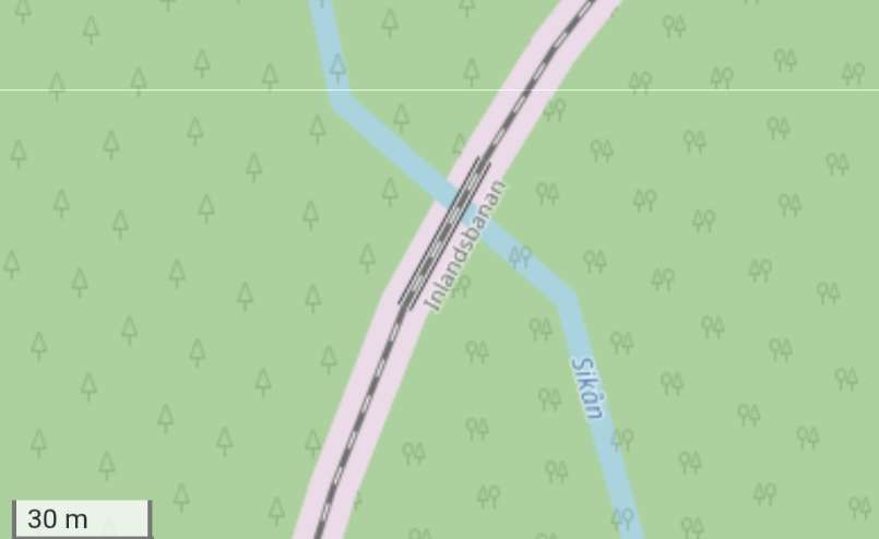
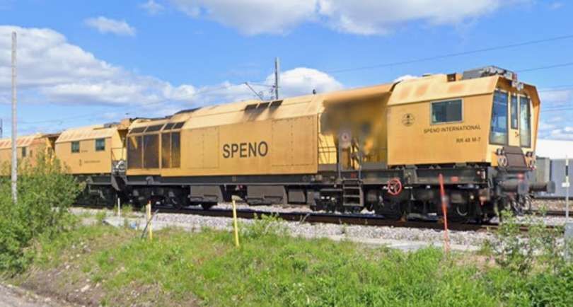
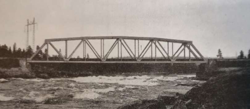
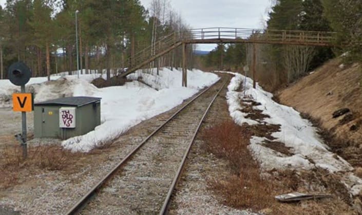
A very short distance South of the river crossing was Kvanberget Halt. [44][Google Maps, April 2026] There was a passing loop at this Halt as can be seen in the monochrome image below from The Railway Magazine article below. The small station building does not feature on OpenStreetMap nor Google’s satellite imagery.
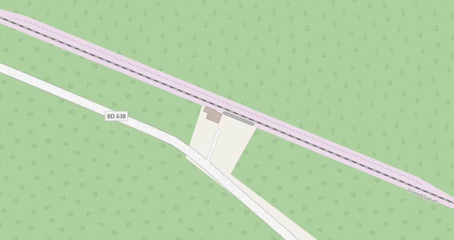
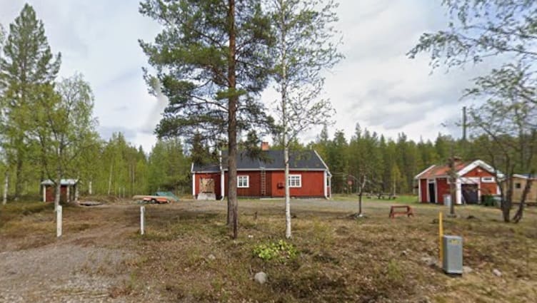
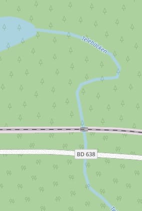
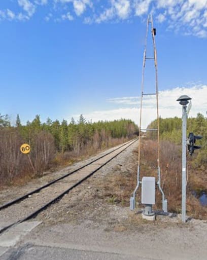
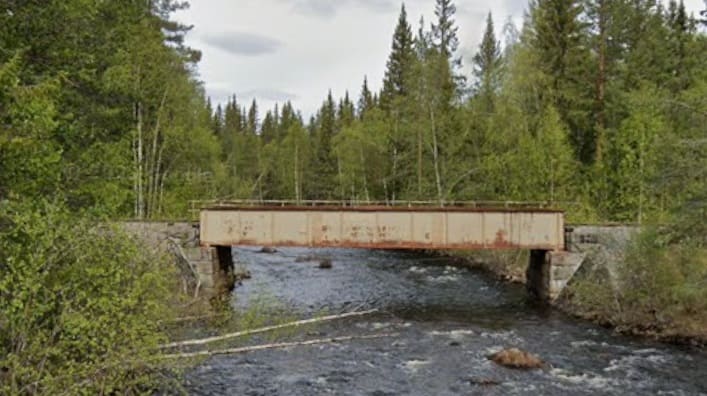
A short distance to the West of of the Halt at Tellejåkk the line bridges the Telebacken River alongside the road. [46][Google Maps, April 2026]
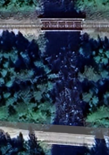
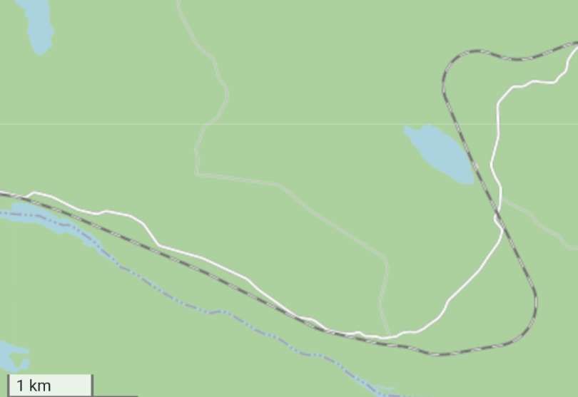
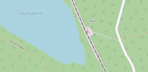
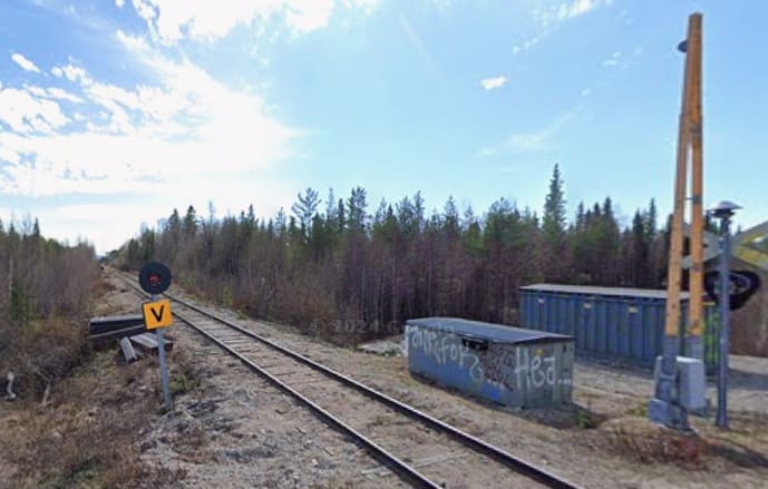
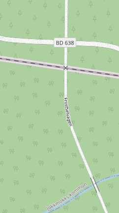
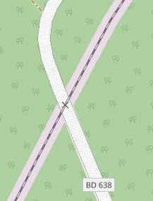
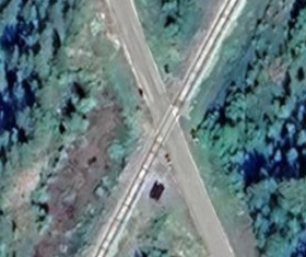
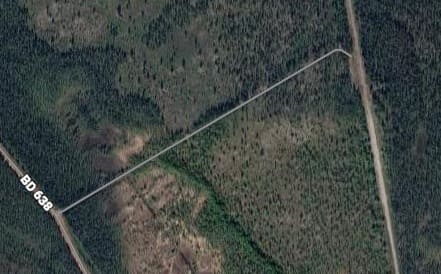
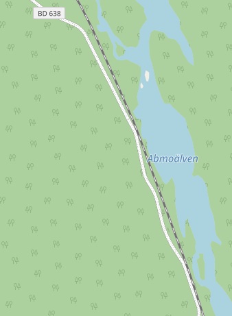
Lake Guvrejavrre and the Halt at Kuri. [47]{Google Maps, April 2026]
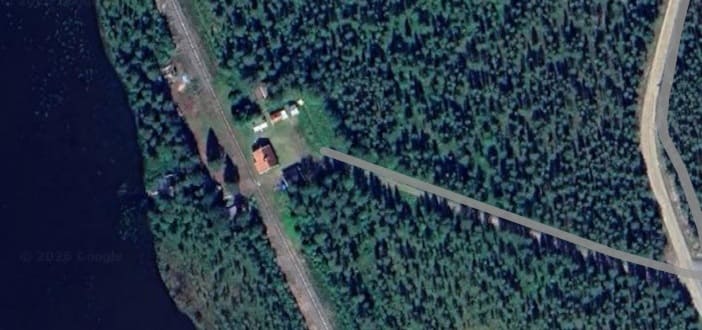
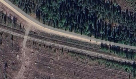
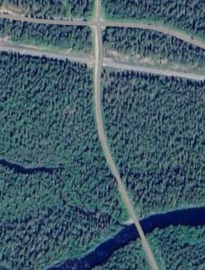
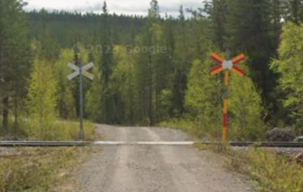
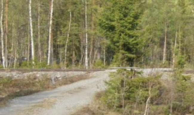
The railway crosses the BD638 at a level-crossing just to the south of the Halt. [47][Google Maps, April 2026]
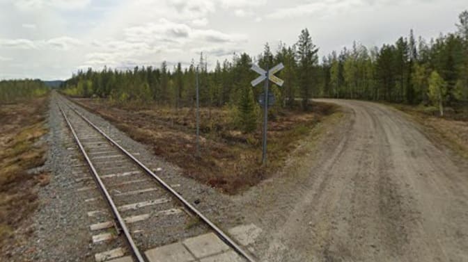
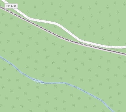
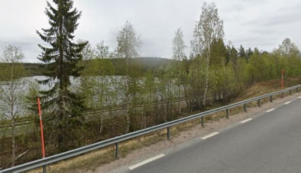
Road and rail, heading West, are at times very close together. The Varjisan River is towards the bottom of the map extract. [47][Google Maps, April 2026]
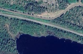
Lake Frostselet is a widening of the Varjisan River. At times the road and railway sit close to its banks. [47][Google Maps, April 2026]
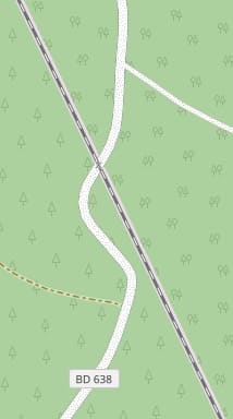
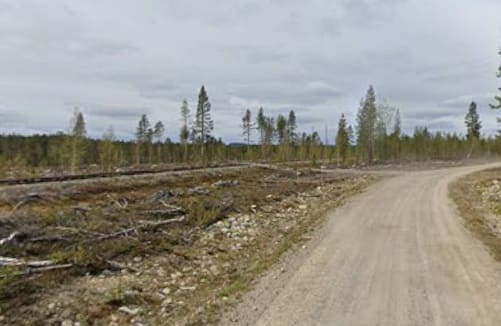
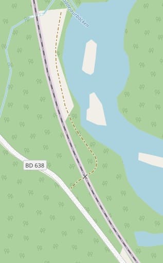
A side road from the BD638, the Frostselwagen, crosses the railway on the level. [48]
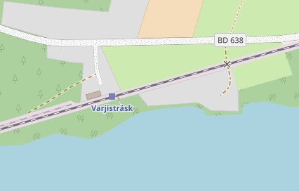
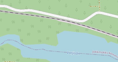
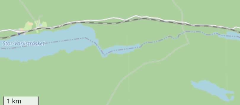
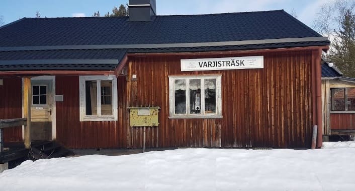
The next station on the line – Varjistrask – sits on the North side of (the Lake) Stor- Varjistrasket. [48][Google Maps, April 2026]
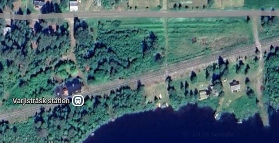
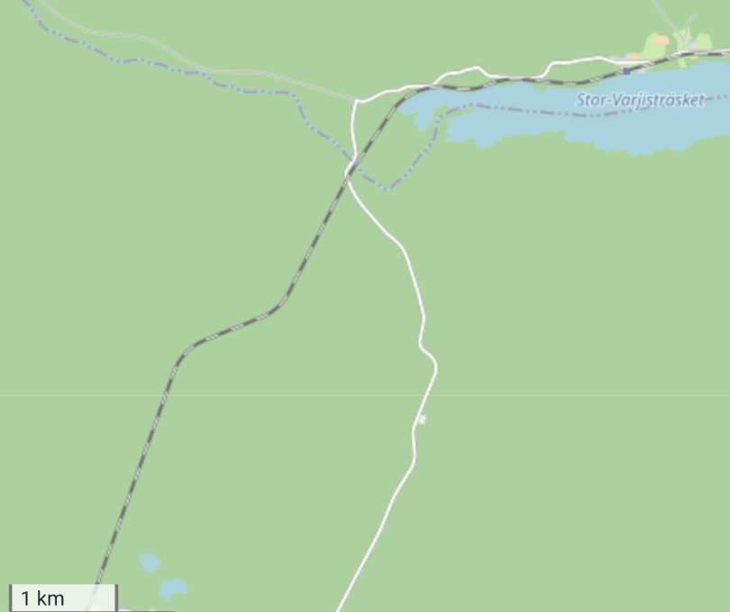
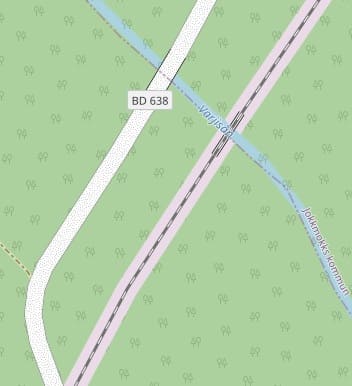
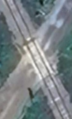
It bridges the Varjisan River just to the West of Stor-Varjistrasket and adjacent to the BD638. [49][Google Maps, April 2026]
Almost immediately to the Southwest of the river bridge the BD638 crosses the railway on the level. [49][Google Maps, April 2026]
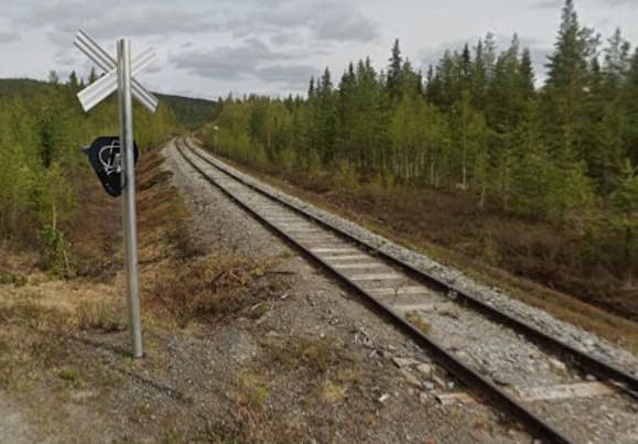
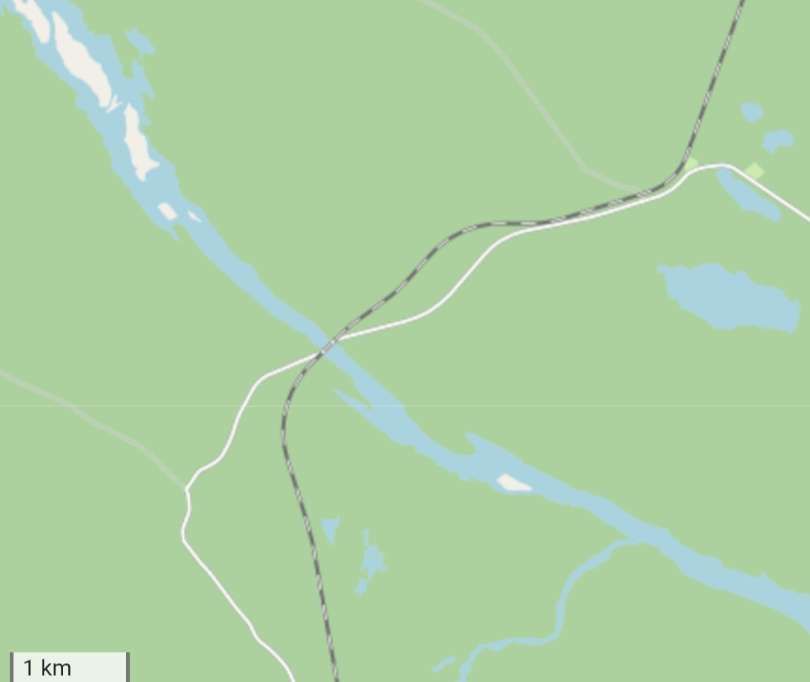
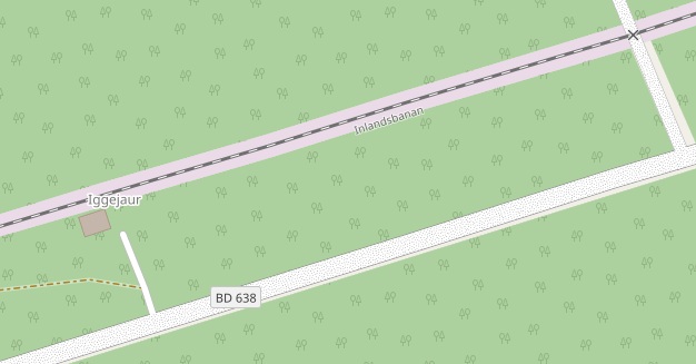
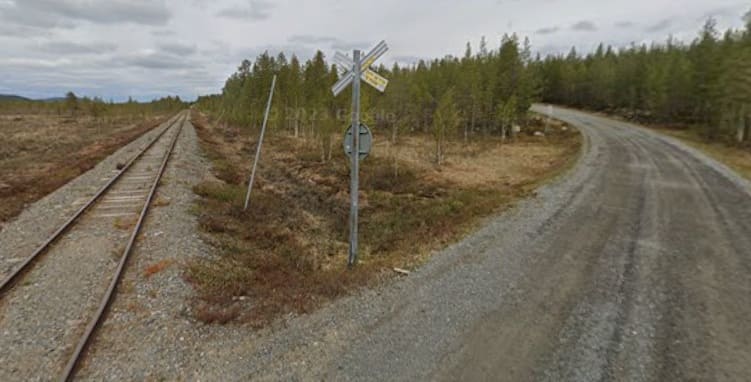
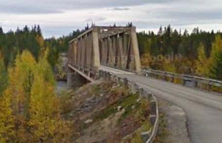
The Halt at Iggejaur. [50][Google Maps, April 2026]
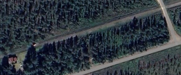
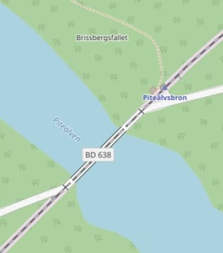
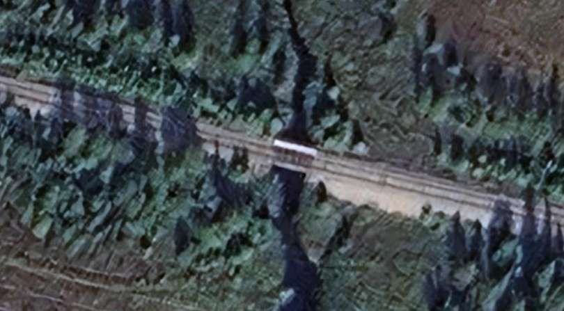
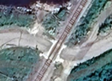
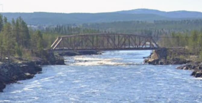
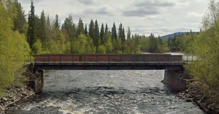
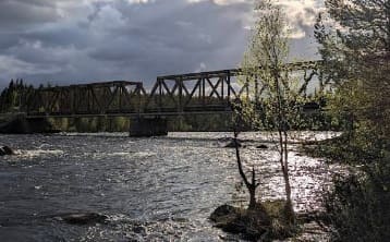
The combined road/rail bridge (Piteälvsbron) over the Pitealven River. [50][Google Maps, April 2026]
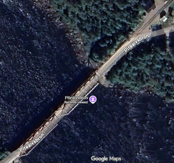
The small Halt at Pitealvsbron and the bridge seen from close to the Halt. [Google Streetview, September 2009]
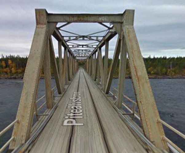
Looking South over the bridge, which is a shared road and rail bridge. [Google Streetview, September 2009] And a of the bridge from the East, (c) Gustavo Azevedo, 2025, [Google Maps, April 2026]
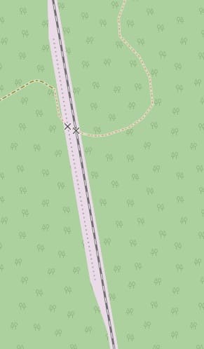
This location South of Pitealvsbron has a passing place but is not named either on Google Maps or OpenStreetMap. [50][Google Maps, April 2026]
As can be seen from the satellite image an access road runs from the BD638 to the location which, together with passing loop would suggest the existence of a Halt in the past.
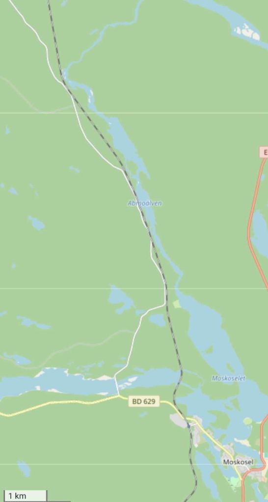
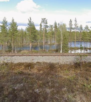
On its way towards Moskosel, the line runs between the BD638 and the Abmoalven River, a tributary of the Pitealven River. [51]
As can be seen in the image immediately above, the railway can be seen from the BD638, looking Northeast. [Google Streetview, May 2023]
Road, rail and river run practically adjacent to each other as we continue South-southeast towards Moskosel. [51]
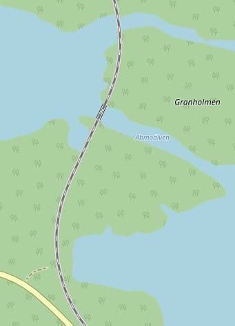
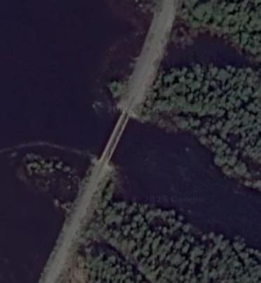
Another bridge – this one crosses the Abmoalven. [51][Google Maps, April 2026]
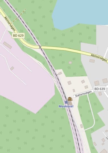
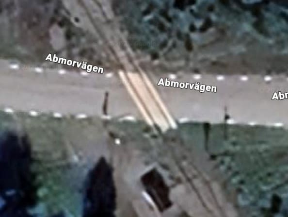
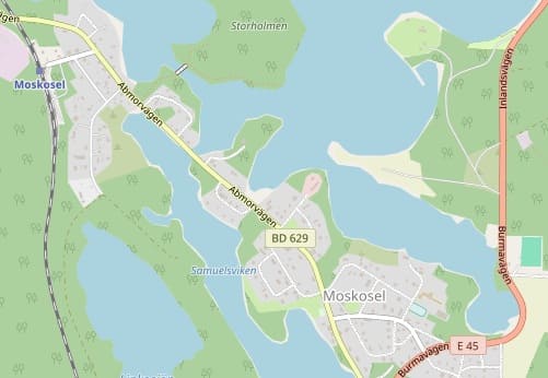
On the approach to Moskosel the line crosses the BD629 (Abmorvagen) at a level crossing. [51]
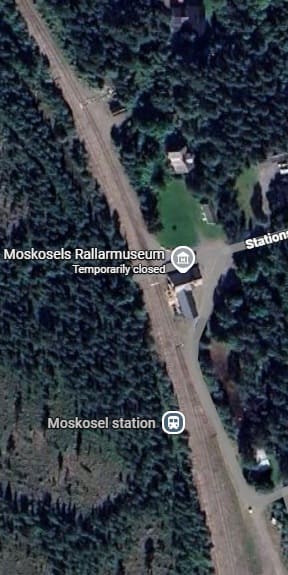
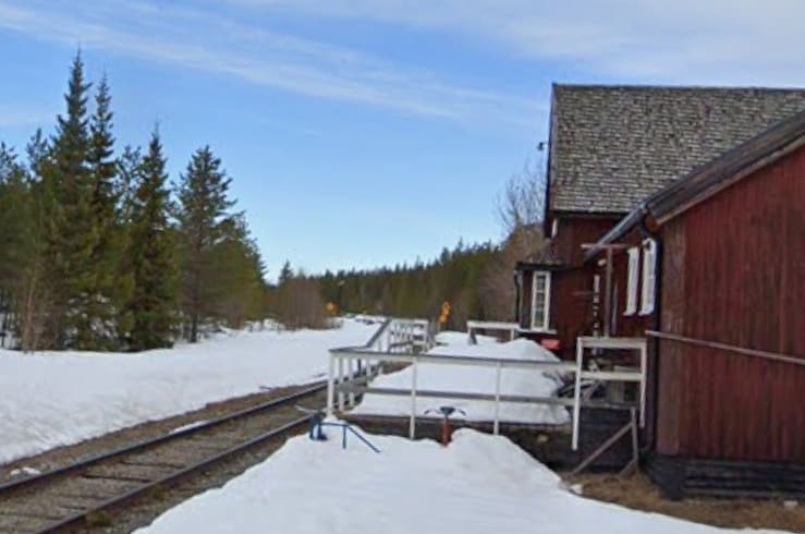
Moskosel Railway Station site. [Google Maps, April 2026][51]
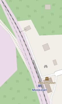
Moskosel Railway Station had a long siding to the North of the station platform and two loops off the main running line to the South of the station platform. These can be seen in the extracts from OpenStreetMap’s mapping immediately above.
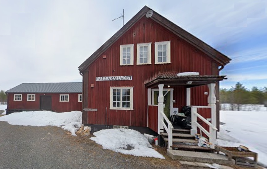
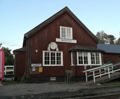
Seen from the East across the single line through the station, this is the platform side view of the station building, (c) dirk-steffen, 2025. [Google Maps, April 2026]
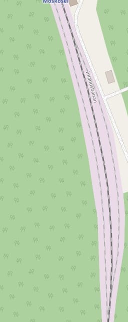
South of Moskosel, the line first finds its own way to the Southwest. ….
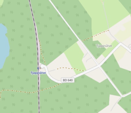
Tjappsaive Halt is at the end of a long side road off the E45 road. [52][Google Maps, April 2026]
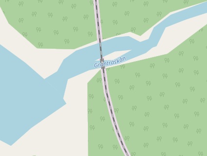
Before reaching the level-crossing, the line bridged the Grantraskan which flowed between Lake Levas and Lake Auktsjaursjon. [53][Google Maps, April 2026]
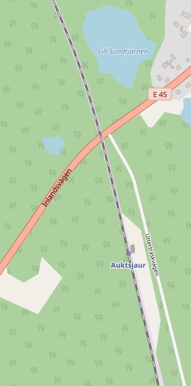
The level-crossing at Auktsjaur and the Halt which is just to the South of the crossing. [53]
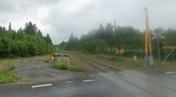
Auktsjaur Railway Station is a halt without a passing loop. The village it serves sits to the Northeast of the station straddling the E45. [Google Maps, April 2026]
[Google Streetview, September 2021]
[Google Streetview, September 2021]
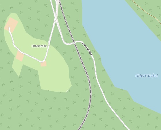
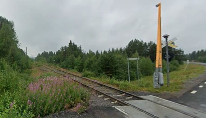
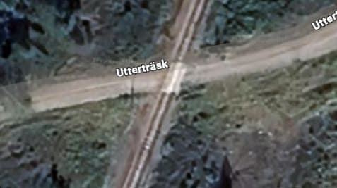
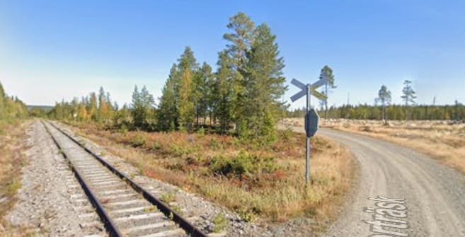
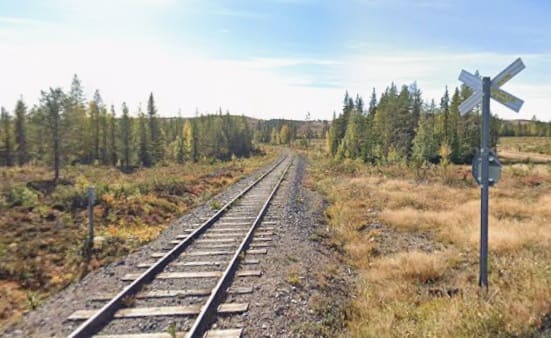
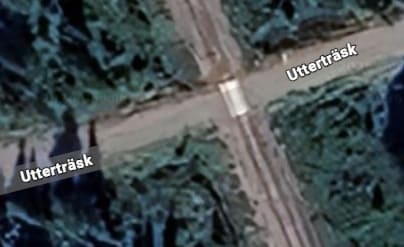
Road and rail cross again at the hamlet of Uttertrask alongside Lake Uttertrasket. [53][Google Maps, April 2026]
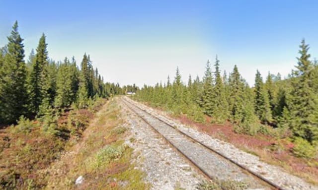
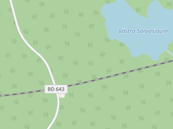
The road-crossing at the BD643. [54][Google Maps, April 2026]
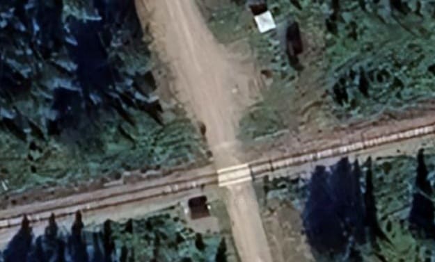
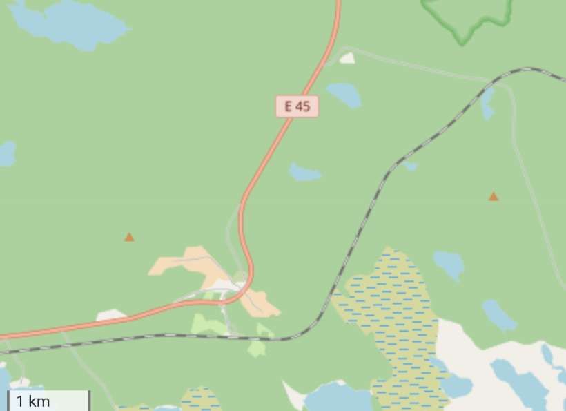
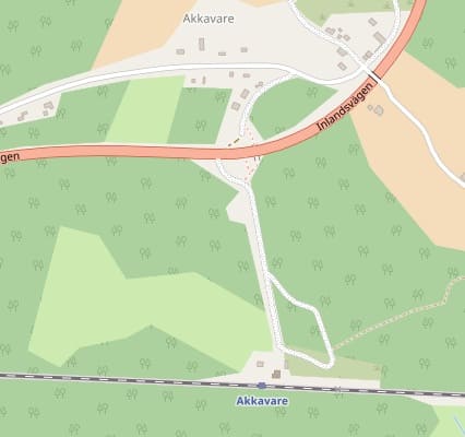
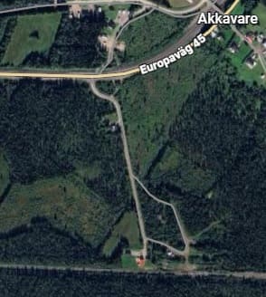
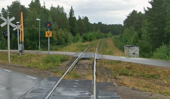
Akkavare Village and Halt. [55][Google Maps, April 2026]
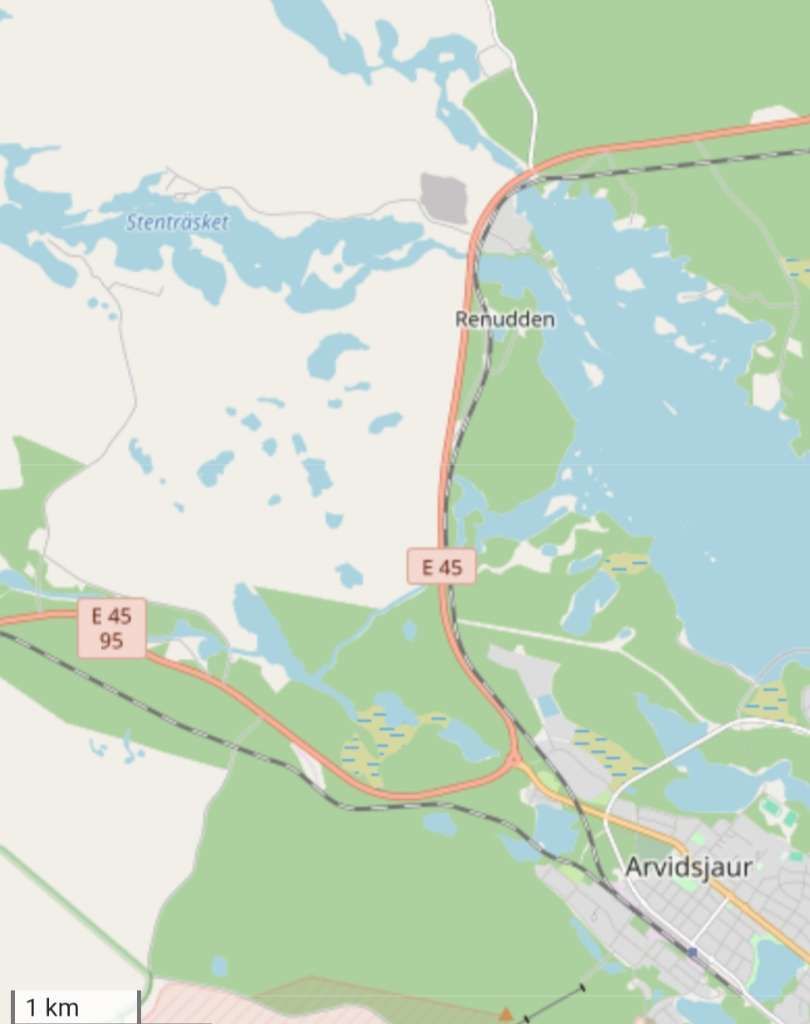
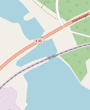
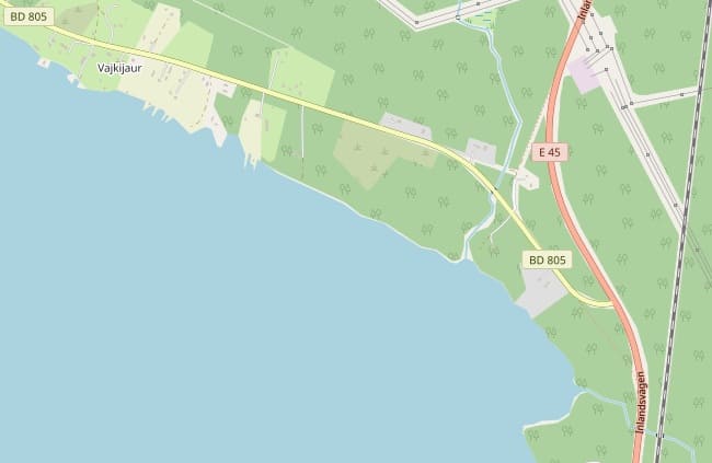
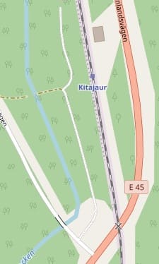
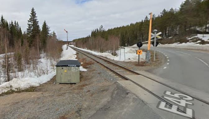
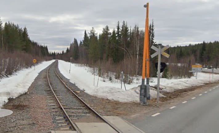
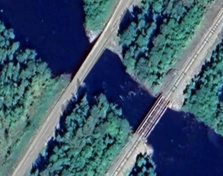
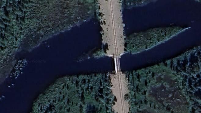
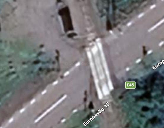
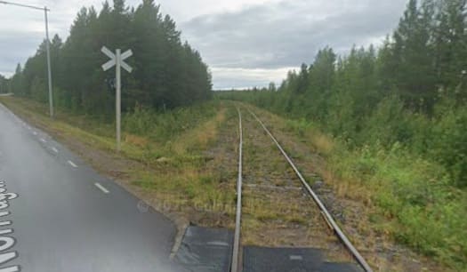
The E45 and the Inlandsbanan bridge the channel linking Lake Vastra Kikkejaure and Lake Arvidsjaurjon. Both are on causeways which are breached by short bridges. [56][Google Maps, April 2026]
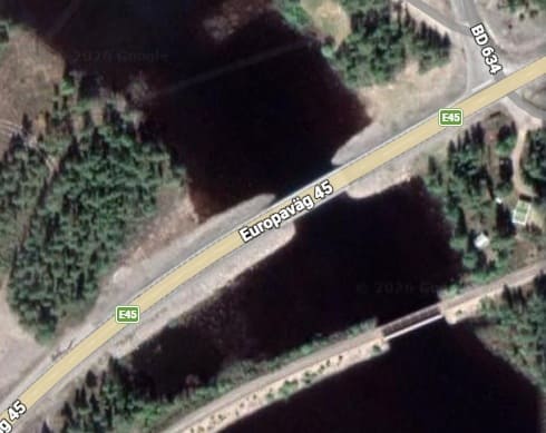
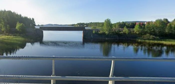
The E45 and the Inlandsbanan cross the channel linking Lake Stentrasket with Lake Arvidsjaurjon. [56][Google Maps, April 2026.
[Google Streetview, August 2025
A little further South road and rail bridge the Svardalven River, Google has this as the Byske. [56][Google Maps, April 2025]
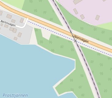
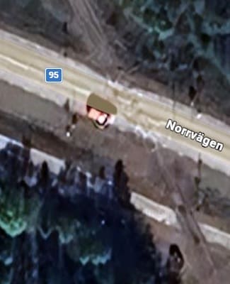
The line crosses Norrvagen. [Google Maps, April 2026]
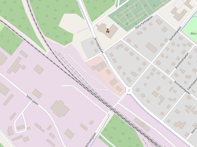
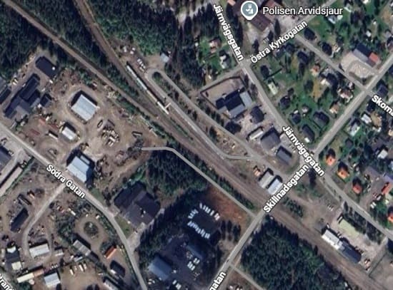
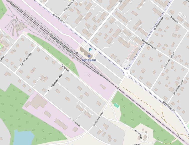
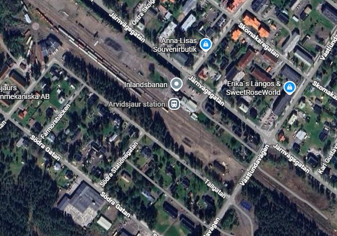
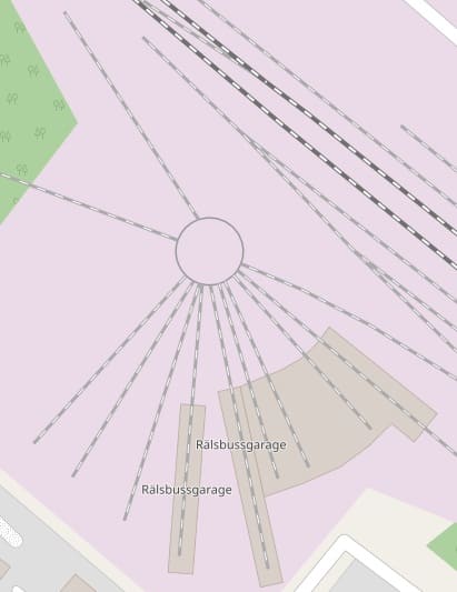
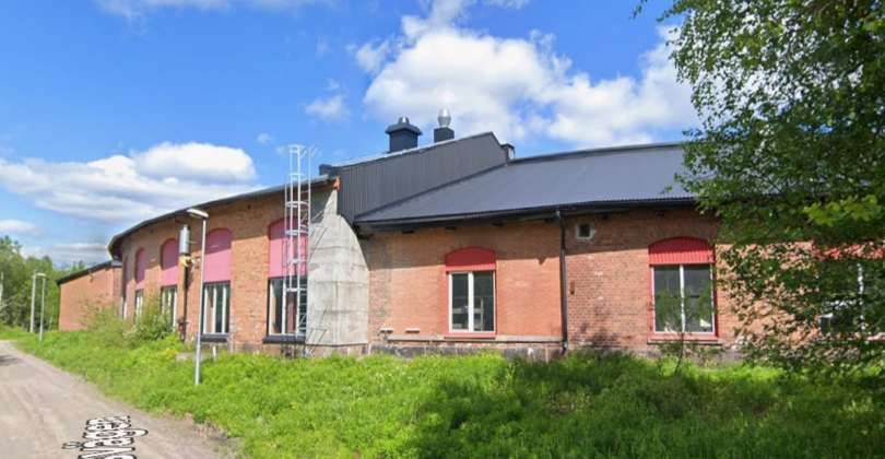
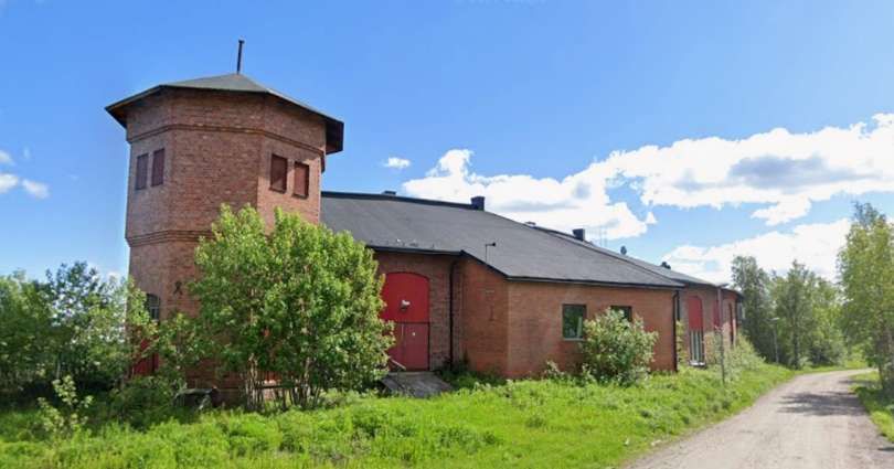
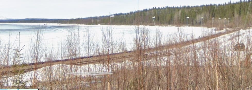
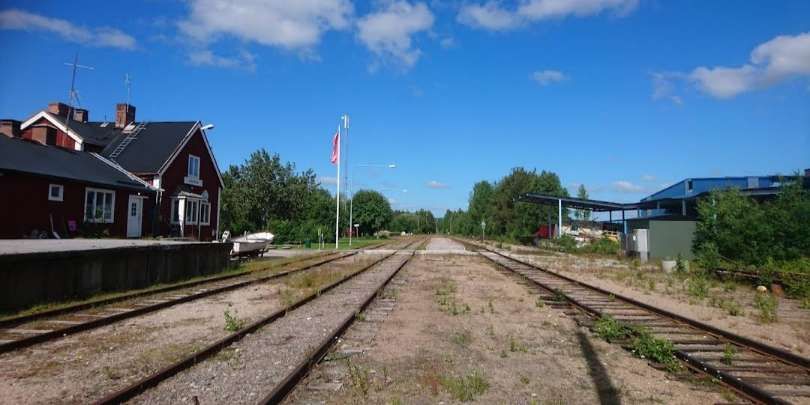
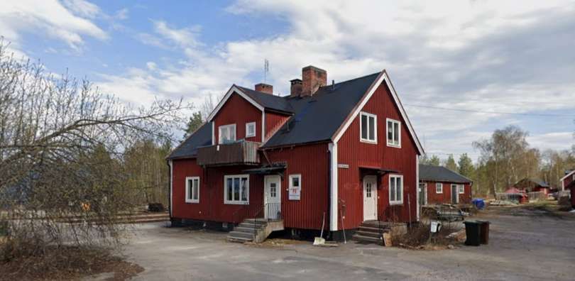
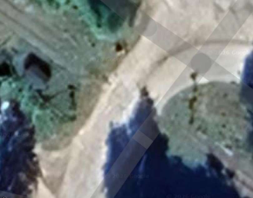
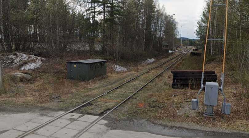
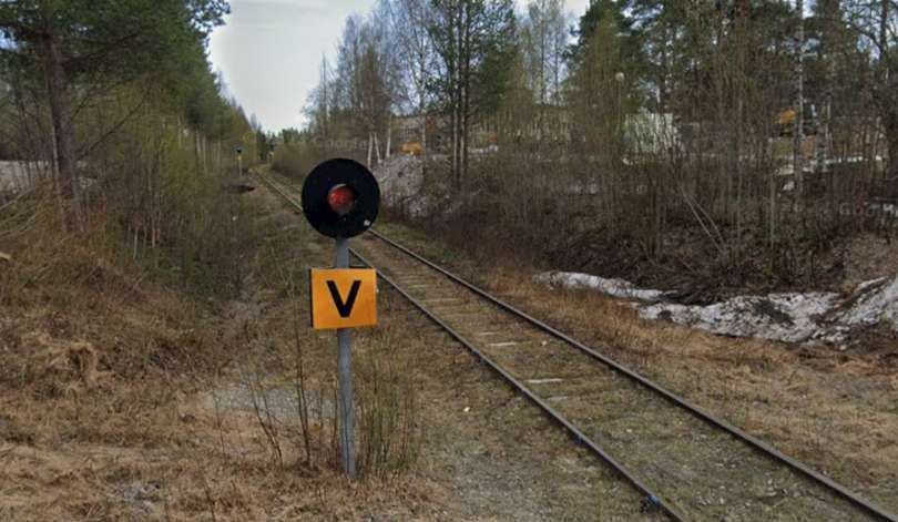
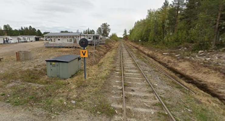
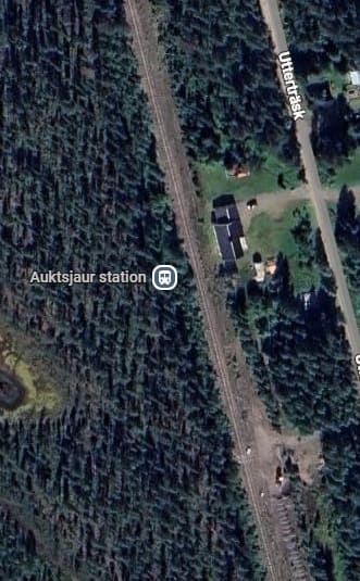
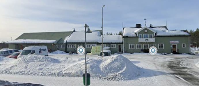
The old locomotive shed/depot now acts as a stabling point for railbuses that are used on the Inlandsbanen. [56][Google Maps, April 2026]
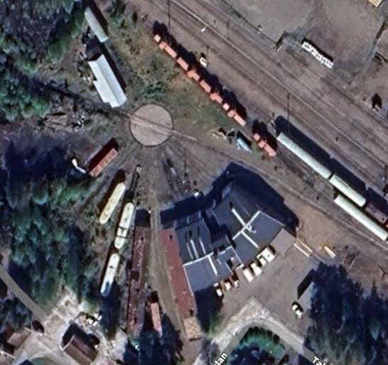
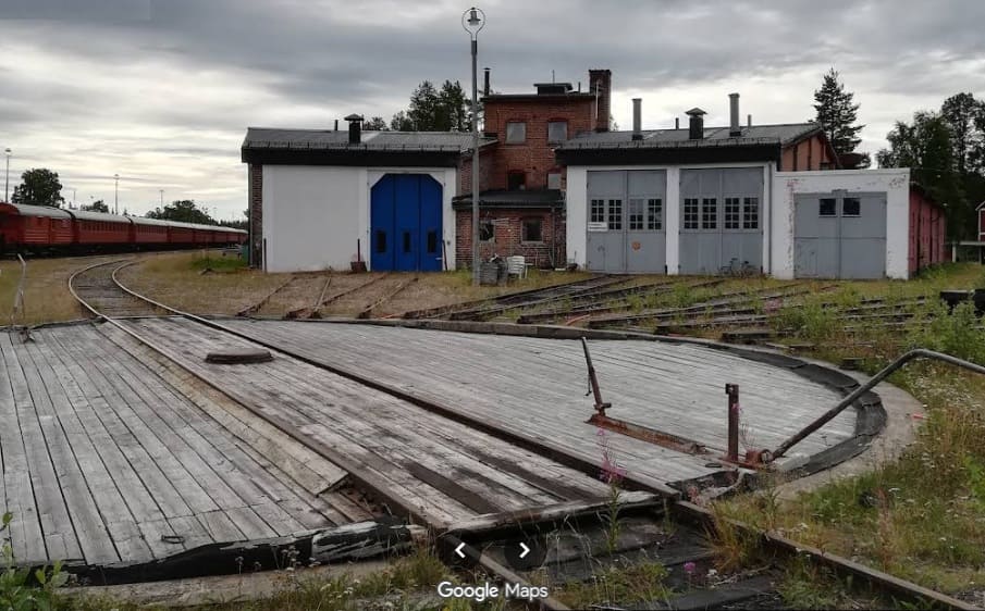
[Google Streetview, January 2021]
[Google Streetview,March 2021]
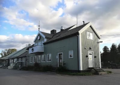
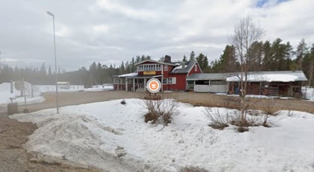
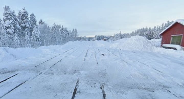
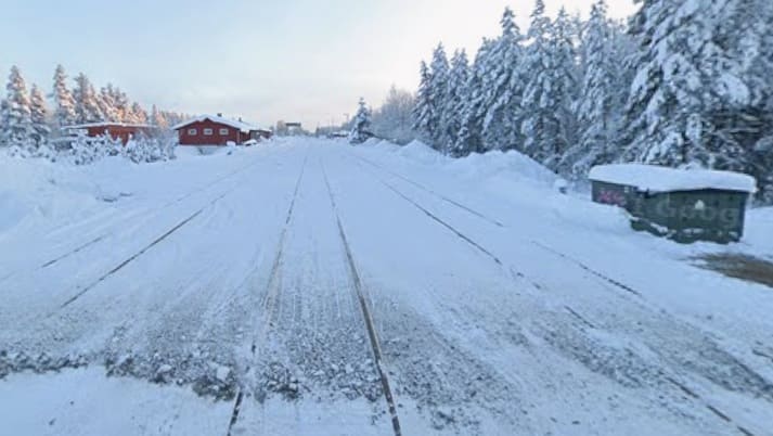
The station building seen from the North, (c) dirk-steffen, 2025. [Google Maps, April 2026]
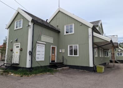
The station building seen from the East, (c) gesla 26.11, 2024. [Google Maps, April 2026]

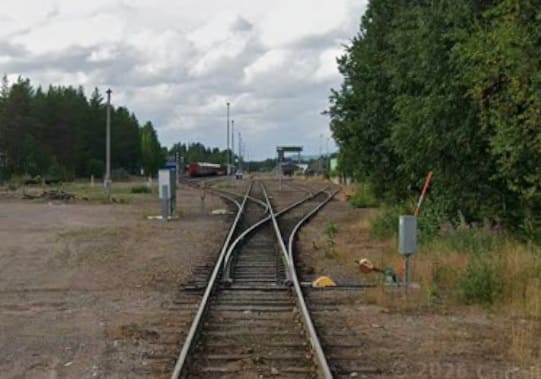
More photographs of the site of the railway station and some rolling stock can be seen here. [58]
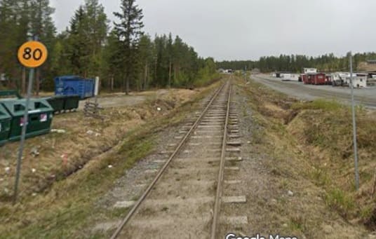
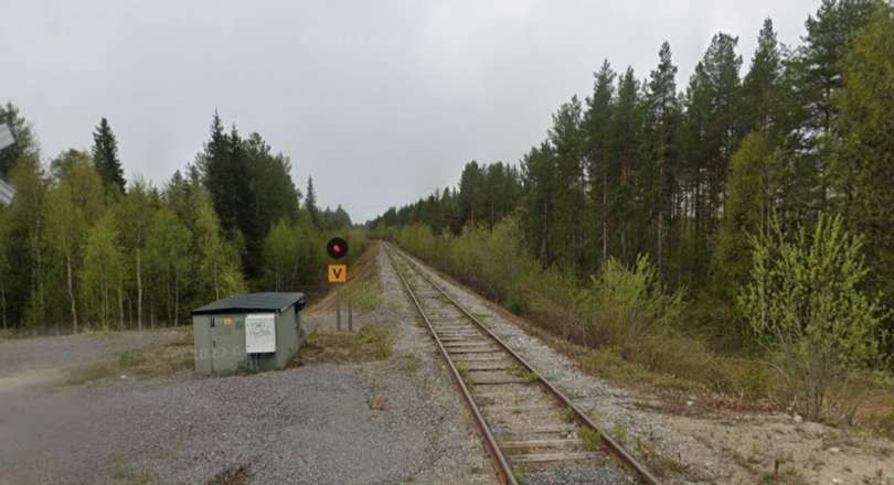
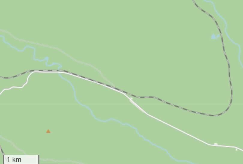
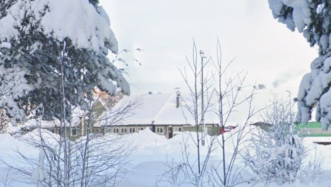
Arvidsjaur had a population of 4,635 in 2010. During the winter months, major car-manufacturers perform arctic trials in the Arvidsjaur area. The town also fosters tourism by offering snowmobile tours, trekking, skiing, fishing and dogsled rides. Arvidsjaur is a Swedish adaptation of the Ume Sámi word árviesjávrrie, derived from árvies (“generous” or “one who gives abundantly”) and jávrrie (“lake”), referring to the fishing in the nearby lake of the same name. Aruens järff by was the Swedishized name of the Sámi village where the Arvidsjaur Church was built in 1607. [59]
It is at Arvidsjaur that we take a break on our journey South down the Inlandsbanan.
References
- M. D. Grenville & H. A. Vallance; Sweden’s Inland Railway; in The Railway Magazine, December 1958; Tothill Press, London, 1958, p826-832 & p870.
- Gällivare is 744 miles (1,198 km) from Stockholm. It a quaint mining town and the gateway to the mountains, forest and glaciers of Laponia. This small town of around 8,500 people is an ideal base from which to venture into the surrounding wilderness. (The Laponia World Heritage Site includes the spectacular national parks of Sarek, Stora Sjöfallet and Muddus) Gällivare’s museum allows one to learn about the lives of the town’s early settlers as well as the culture of the region’s indigenous Sami communities. A guided tour of the Aitik Copper Mine, one of the largest mines in Europe, is available. Expedia suggests visits to the town’s historic churches including: the tiny Old Church (Gällivare Gamla Kyrka), which dates back to the 18th century; and the white New Church (Gällivare Nya Kyrka) which was designed by architect Emil Langlet. A visit to Malmberget would give a further glimpse into this region’s industrial past. Malmberget is home to a branch of the LKAB Iron-Ore Mine which offers daily tours. A visit to Kåkstan, a historical “shanty town” museum village, dating back to the 1888 iron-ore rush should be included in any itinerary. [3]
- https://www.expedia.co.uk/Gallivare.dx1308, accessed on 19th April 2026.
- https://commons.wikimedia.org/wiki/File:G%C3%A4llivare-station-5.jpg, accessed on 19th April 2026.
- https://commons.wikimedia.org/wiki/File:G%C3%A4llivare_station_%28DSCF0855%29.jpg, accessed on 19th April 2026.
- https://commons.wikimedia.org/wiki/File:G%C3%A4llivare-station-1.jpg, accessed on 19th April 2026.
- https://www.openstreetmap.org/#map=15/67.14337/20.63916, accessed on 19th April 2026.
- https://www.openstreetmap.org/#map=11/63.1973/14.6639, accessed on 19th April 2026.
- https://www.researchgate.net/figure/Mineral-production-at-Vitaforsgruvan-Malmberget-in-Lappland-Sweden-Photo-Anders_fig1_264006617, accessed on 19th April 2026.
- https://www.openstreetmap.org/#map=13/63.84192/15.56361, accessed on 19th April 2026.
- https://www.openstreetmap.org/#map=13/63.83321/15.61672, accessed on 19th April 2026.
- https://www.openstreetmap.org/#map=14/64.62064/16.63751, accessed on 19th April 2026.
- https://en.wikipedia.org/wiki/%C3%96stersund#/media/File:%C3%96stersund_3.jpg, accessed on 20th April 2026.
- https://en.wikipedia.org/wiki/%C3%96stersund, accessed on 20th April 2026.
- https://en.wikipedia.org/wiki/Vilhelmina, accessed on 20th April 2026.
- https://www.openstreetmap.org/#map=13/65.52822/17.52354, accessed on 20th April 2026.
- https://commons.wikimedia.org/wiki/File:Bf_Sorsele.JPG, accessed on 20th April 2026.
- https://www.openstreetmap.org/#map=15/67.14943/20.53101, accessed on 21st April 2026.
- https://www.openstreetmap.org/#map=17/67.139085/20.372847, accessed on 21st April 2026.
- https://www.openstreetmap.org/#map=19/67.140804/20.355332, accessed on 21st April 2026.
- https://www.openstreetmap.org/#map=18/67.158108/20.133092, accessed on 21st April 2026.
- https://www.openstreetmap.org/#map=19/67.125529/20.025827, accessed on 21st April 2026.
- https://www.openstreetmap.org/#map=17/67.100023/19.996829, accessed on 21st April 2026.
- https://www.openstreetmap.org/search?query=Avvakajjo++sweden&zoom=15&minlon=38.63063335418702&minlat=-5.445123599992578&maxlon=38.669900894165046&maxlat=-5.416584834447957#map=16/67.06372/19.92198, accessed on 22nd April 2026.
- https://www.openstreetmap.org/search?query=Avvakajjo++sweden&zoom=15&minlon=38.63063335418702&minlat=-5.445123599992578&maxlon=38.669900894165046&maxlat=-5.416584834447957#map=16/67.06084/19.90829, accessed on 22nd April 2026.
- https://www.openstreetmap.org/search?query=Avvakajjo++sweden&zoom=15&minlon=38.63063335418702&minlat=-5.445123599992578&maxlon=38.669900894165046&maxlat=-5.416584834447957#map=16/67.03214/19.80031, accessed on 22nd April 2026.
- https://www.openstreetmap.org/search?query=Porjus++sweden&zoom=14&minlon=19.773588180541996&minlat=66.945190478894&maxlon=19.85212326049805&maxlat=66.9676331513497#map=13/66.96011/19.82217, accessed on 22nd April 2026.
- https://www.openstreetmap.org/search?query=Porjus++sweden&zoom=14&minlon=19.773588180541996&minlat=66.945190478894&maxlon=19.85212326049805&maxlat=66.9676331513497#map=15/66.88487/19.81730, accessed on 22nd April 2026.
- https://www.openstreetmap.org/search?query=Porjus++sweden&zoom=14&minlon=19.773588180541996&minlat=66.945190478894&maxlon=19.85212326049805&maxlat=66.9676331513497#map=13/66.80483/19.87676, accessed on 22nd April 2026.
- https://www.openstreetmap.org/search?query=Porjus++sweden&zoom=14&minlon=19.773588180541996&minlat=66.945190478894&maxlon=19.85212326049805&maxlat=66.9676331513497#map=14/66.65719/19.83526, accessed on 22nd April 2026
- https://www.openstreetmap.org/search?query=Porjus++sweden&zoom=14&minlon=19.773588180541996&minlat=66.945190478894&maxlon=19.85212326049805&maxlat=66.9676331513497#map=14/66.63137/19.83019, accessed on 22nd April 2026.
- Jokkmokk is a locality and the seat of Jokkmokk Municipality in Norrbotten County, province of Lapland, Sweden, with 2,786 inhabitants in 2010. The Lule Sámi name of the place (composed of the individual words jåhkå and måhkke) means “River’s Curve,” due to the meandering river that runs through it. As in other towns in Lapland, the Swedish language is dominant, accessed on 23rd April 2026. at an official level in Jokkmokk in modern times. The settlement is just north of the Arctic Circle. [33]
- https://en.wikipedia.org/wiki/Jokkmokk, accessed on 22nd April 2023.
- https://www.openstreetmap.org/#map=18/66.607141/19.839935, accessed on 22nd April 2026
- https://commons.wikimedia.org/wiki/Category:Jokkmokks_station#/media/File%3AJokkmokk_EG_29.05.00.jpg, accessed on 22nd April 2026.
- https://www.openstreetmap.org/#map=14/66.55468/19.91518, accessed on 23rd April 2026.
- https://commons.wikimedia.org/wiki/File:Polarkreis_inlandsbanan.jpg, accessed on 23rd April 2026.
- https://www.openstreetmap.org/#map=12/66.4121/19.6612, accessed on 23rd April 2026.
- https://www.openstreetmap.org/#map=12/66.4097/19.6873, accessed on 23rd April 2026.
- https://www.openstreetmap.org/#map=12/66.3347/19.7378, accessed on 23rd April 2026.
- https://www.openstreetmap.org/#map=12/66.2821/19.8250, accessed on 23rd April 2026.
- https://www.openstreetmap.org/#map=14/66.17832/19.93143, accessed on 23rd April 2026.
- https://www.openstreetmap.org/#map=14/66.16070/19.95975, accessed on 23rd April 2026.
- https://www.openstreetmap.org/#map=12/66.1152/19.9543, accessed on 23rd April 2026.
- https://powerplants.vattenfall.com/sv/porjus, accessed on 24th April 2026.
- https://www.openstreetmap.org/#map=12/66.0492/19.8382, accessed on 26th April 2026.
- https://www.openstreetmap.org/#map=13/66.04406/19.74827, accessed on 26th April 2026.
- https://www.openstreetmap.org/#map=12/66.0433/19.5814, accessed on 26th April 2026.
- https://www.openstreetmap.org/#map=13/66.02569/19.46280, accessed on 26th April 2026.
- https://www.openstreetmap.org/#map=12/65.9845/19.3401, accessed on 26th April 2026.
- https://www.openstreetmap.org/#map=12/65.9106/19.3737, accessed on 26th April 2026.
- https://www.openstreetmap.org/#map=14/65.82168/19.36199, accessed on 26th April 2026.
- https://www.openstreetmap.org/#map=14/65.73805/19.38825, accessed on 26th April 2026.
- https://www.openstreetmap.org/#map=13/65.68087/19.37327, accessed on 26th April 2026.
- https://www.openstreetmap.org/#map=14/65.66172/19.23659, accessed on 26th April 2026.
- https://www.openstreetmap.org/#map=12/65.6098/19.1239, accessed on 26th April 2026.
- https://www.railfreight.com/infrastructure/2025/08/20/a-railway-in-sweden-might-reopen-after-25-years-for-defence-purposes, accessed on 27th April 2026.
- https://www.google.com/maps/place/Arvidsjaur+station/@65.5887896,19.1703657,3a,75y,90t/data=!3m8!1e2!3m6!1sCIHM0ogKEICAgICdnoO7Kw!2e10!3e12!6shttps:%2F%2Flh3.googleusercontent.com%2Fgps-cs-s%2FAPNQkAF7iE4sU9sWfNsY4tQneVZJD4ZVnmm2yRD1sLH82kvTj42WnEy0k4G354uijjEuR2Gklqw7GPUYqFbes8SbOc_Yqx_JIDirBKN4tWFyBJBUF7Hvsqcu3AW9I7WDdBtkGLs1xhs%3Dw114-h86-k-no!7i4080!8i3072!4m7!3m6!1s0x467857e4d73f311f:0xa1a8fee6020ccd46!8m2!3d65.5888094!4d19.1692597!10e5!16s%2Fg%2F12hhgqb0n?entry=ttu&g_ep=EgoyMDI2MDQyMC4wIKXMDSoASAFQAw%3D%3D, accessed on 27th April 2026.
- https://en.wikipedia.org/wiki/Arvidsjaur, accessed on 27th April 2026.
- https://picryl.com/media/statens-jarnvagar-sj-e-907-arvidsjaur-station-anlagd-1927-c74560, accessed on 27th April 2026.
