
 Back at Eldoret Railway Station, we get ready to travel on. First some bits and pieces about the town we are about to leave [1] …. Eldoret as a town, founded as it was by Afrikaners is almost unique in the British-dominated Kenya of the early 20th century. The first of the Afrikaners, the Van Breda brothers arrived in 1903 and were joined two years later by Franz Arnoldi and his family. The big influx followed shortly thereafter.[2]
In August 1908, fifty-eight families of displaced Afrikaners left Nakuru for the Uasin Gishu plateau after a journey from South Africa by sea and by rail from Mombasa. Led by Jan van Rensburg, they endured an arduous trek laden as they were with wagons that would often get bogged in mud, finally arriving at Sergoit Hill on 22 October of that year. Jan Ernest Kruger would later own the 5,000 Sergio farm, now owned by Sergoit Golf and Wildlife resort.
The land had earlier been surveyed by a the van Breda families and the new arrivals took up leaseholds of between 800 and 5,000 acres (320 and 2,020 ha) on condition that they would develop it within five years. Each family built a shack, put up fences, in-spanned oxen to simple ploughs and turned the first furrows. They sowed wheat, maize and vegetables laying the foundation for the transformation of the Plateau into a prosperous agricultural region.
The farms were later officially registered and each was given a number.[3]
Eldoret’s official town site started in 1910 with the development of a Post Office at “Sisibo”. This was followed shortly after by the arrival of sixty more Afrikaner families in 1911.[4] The governor decided to establish an administrative centre in the area 1912 and thus the Post Office was renamed to a new official town name: “Eldoret” . Becoming an administrative centre caused an enormous increase in trade within the prospective city. A bank and several shops were built.
In the 1950s the town was literally divided into two, along the main street (now Uganda Road), with the Afrikaans on the north and the British on the south. The former took their children to Highland School, (now Moi Girls High School)[5] and the latter, to Hill School.[6] Recreation was also along the divide – ‘Brits’ used the Lincoln Hotel and the Race-Course near the now “Chinese Area” while the Afrikaans converged at the Wagon Wheel for recreation.
Daniel Arap Moi was born nearby and developed the town establishing a second kenyan university, Moi University, and a third international airport. By 1987, only two Afrikaner households remained in Eldoret, with the rest having moved back to South Africa in the late 1950s and early 1960s, in the aftermath of the Mau Mau rebellion[7] and in anticipation of independence.
The city was significantly impacted by the 2007–2008 Kenyan crisis when violence gripped Kenya in the aftermath of controversial presidential elections. The athlete Lucas Sang was murdered about ten kilometres away from the town while on his way home to Chepkoilel. On 1st January 2008 a mob attacked and set fire to a church in the town, where hundreds of people had taken refuge during Kenyan massacres. As a result, about forty to eighty people,[8] mostly Kikuyus, were burnt to death.
Eldoret has been manly peaceful since the 2007-2008 Crisis.
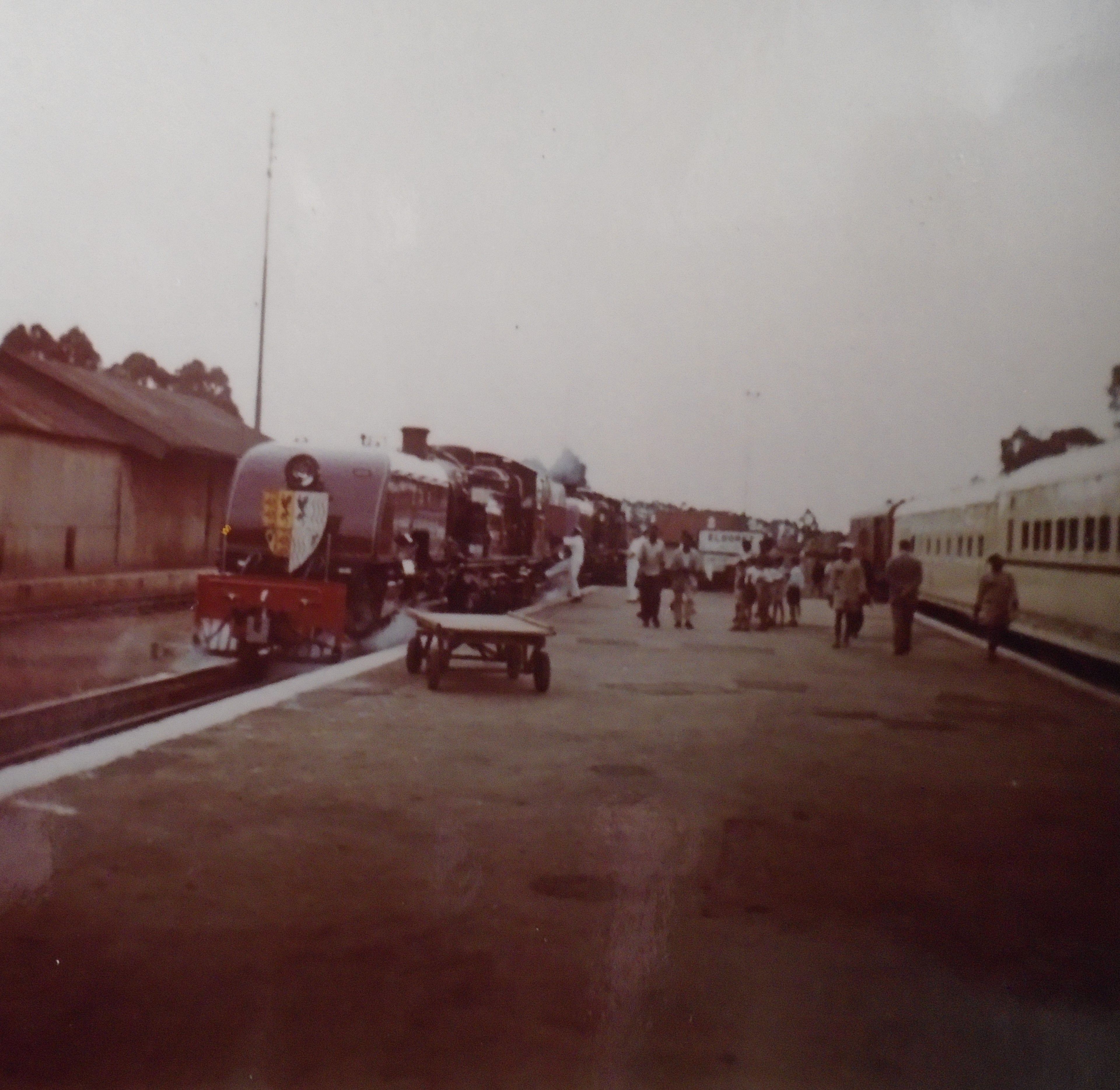 In an earlier post, we showed a picture of the royal train circumnavigating a spiral close to Equator Station on the Nakuru to Eldoret line. This is that Royal train just after it had arrived in Eldoret in 1958. [9]
A recent video filmed at Eldoret Railway Station. [11]
Another video filed close to Eldoret Railway Station. [12]
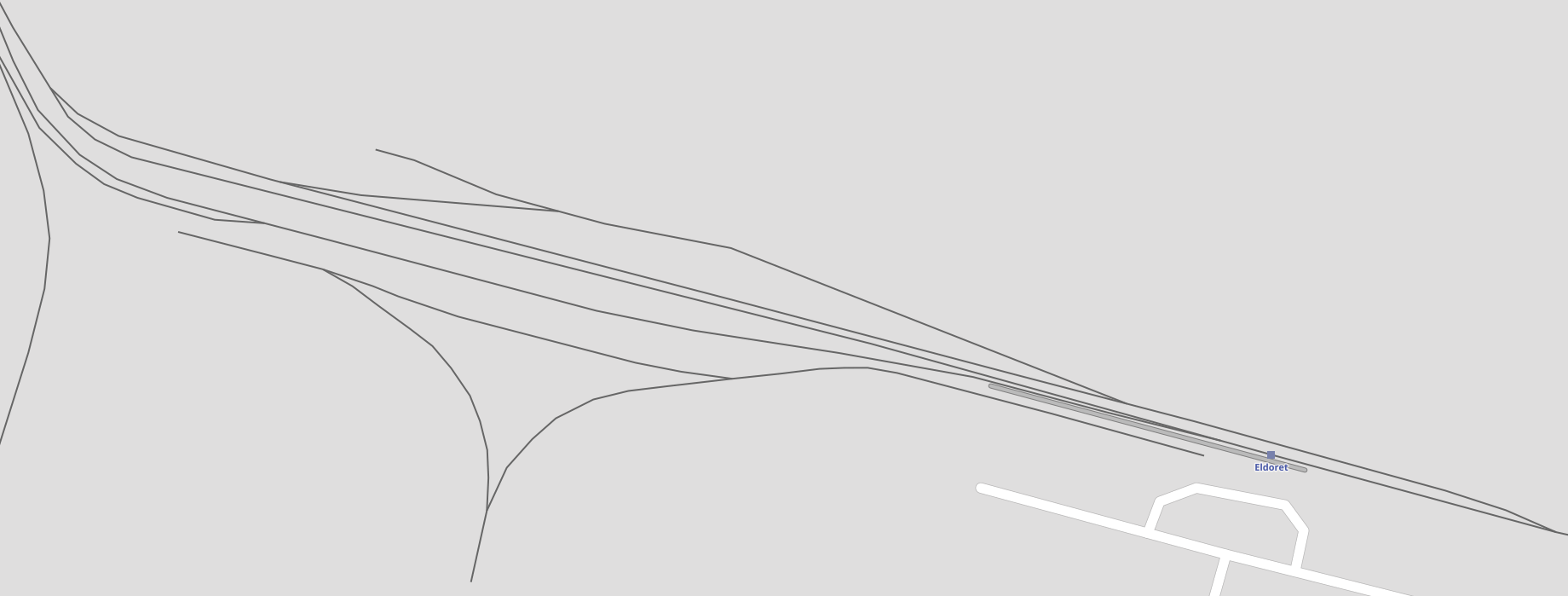
West of Eldoret trains for Kitale and those for Kampala shared the same railway tracks. Just before the branch-line to Kitale separated from the mainline trains passed through Leseru Station. The station site and the branch-line can clearly be seen in the satellite image below. Leseru Station was some distance east of Leseru village (3 to 4 kilometres) and was probably sited to allow the Kitale branch trains to serve Leseru.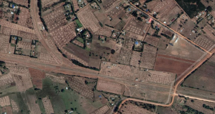 Beyond Lesuru, trains passed through Turbo, Kipkarren, Lugari, Webuye, Mulukbu, Bungoma, Mateka, Myanga and Kimaeti before reaching the border with Uganda at Malaba. This post will take us to the border with Uganda.
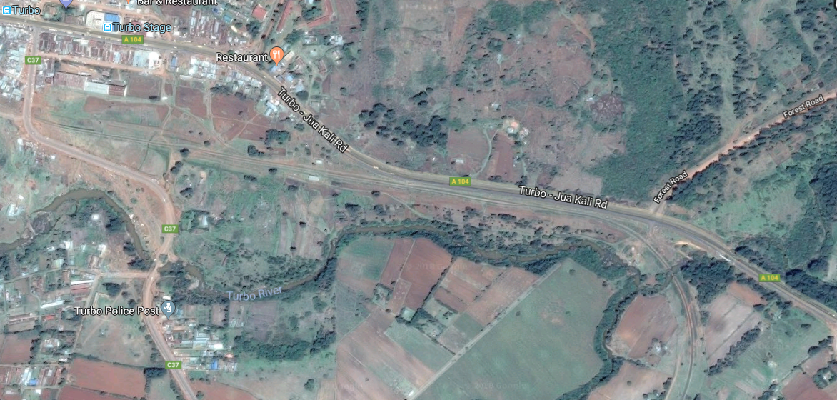
En-rote to Turbo the line at first followed the A104 but then looped away to the south only coming back close to the road at the river bridge just to the east of Turbo. The location of the station is marked on the map with a blue square.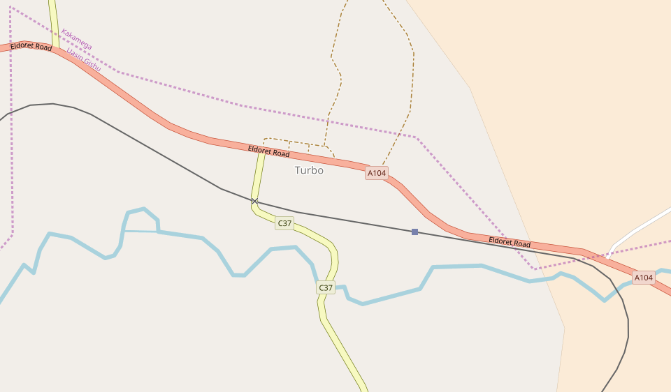
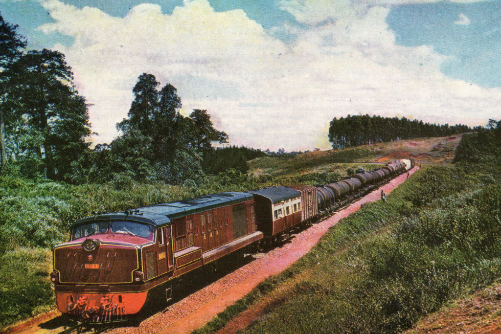 Diesel in charge of a train somewhere to the west of Eldoret?
The next station was at Kipkarren. To reach the station the railway followed the contours, which predominantly meant following the river valley, whilst the A104 road took a more direct route.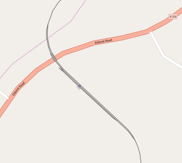
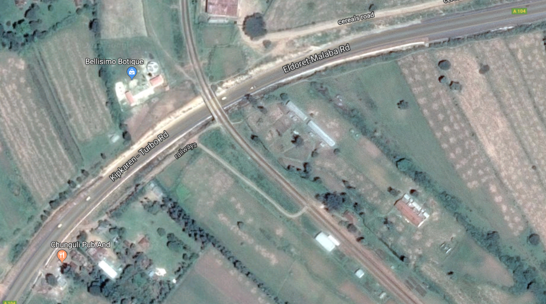 Kipkarren Station was close to the Eldoret-Malaba road but perpendicular to it and with the passing loop carried over the A104 on a bridge.
The railway continued to follow the Nazoia River valley, albeit at a higher level than the water course, in a generally north-westerly direction to Lugari. The Market at Lugari is visible at the top of the following satellite image, as is the road/rail crossing at the top right of the image and the river bridge, centre-left.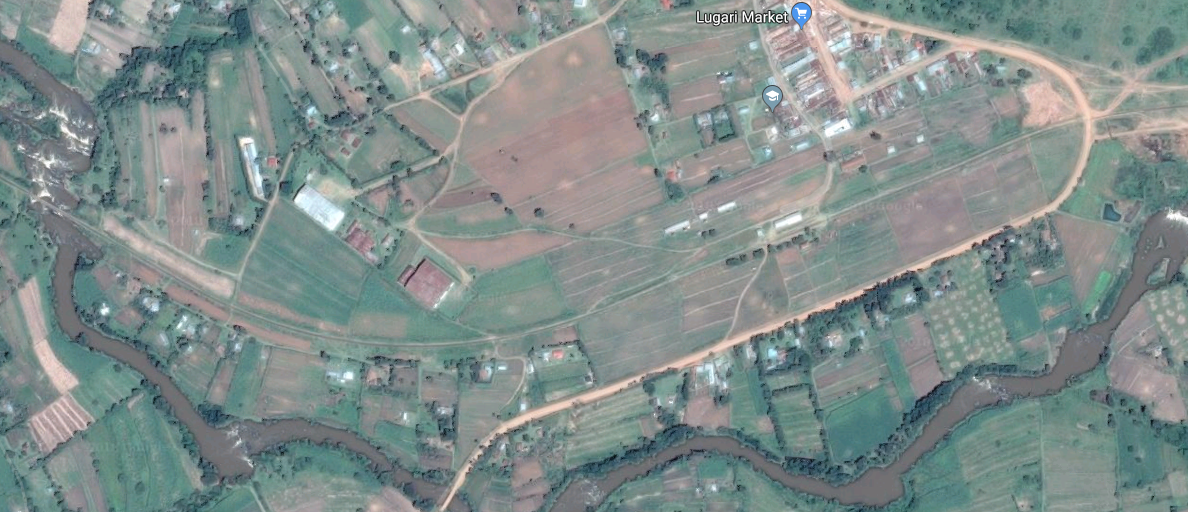
The next station is Webuye, which is to the south-west of Lugari, both villages can be seen on the map below. and are linked both by the railway and the River Nazoia. The stations are marked by blue squares.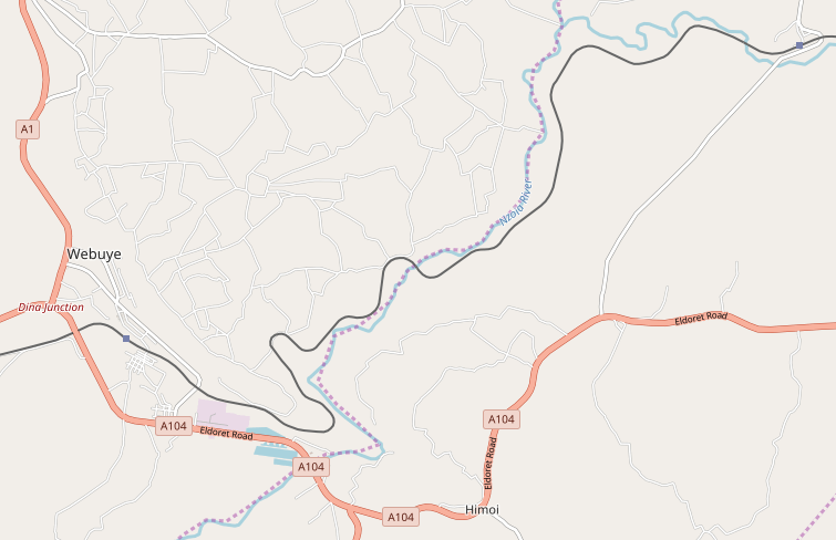
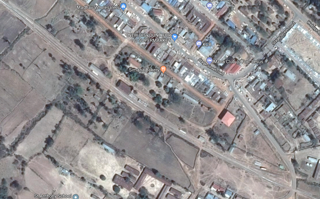 Webuye Railway Station.
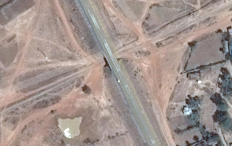 The railway passes under the A104 to the immediate west of Webuye.
Travelling further west, the railway passes close to Webuye Airport and sankes around seeking the most advantageous route on the south-side of the A104, through Mulukbu (Sudi) and on to Bungoma.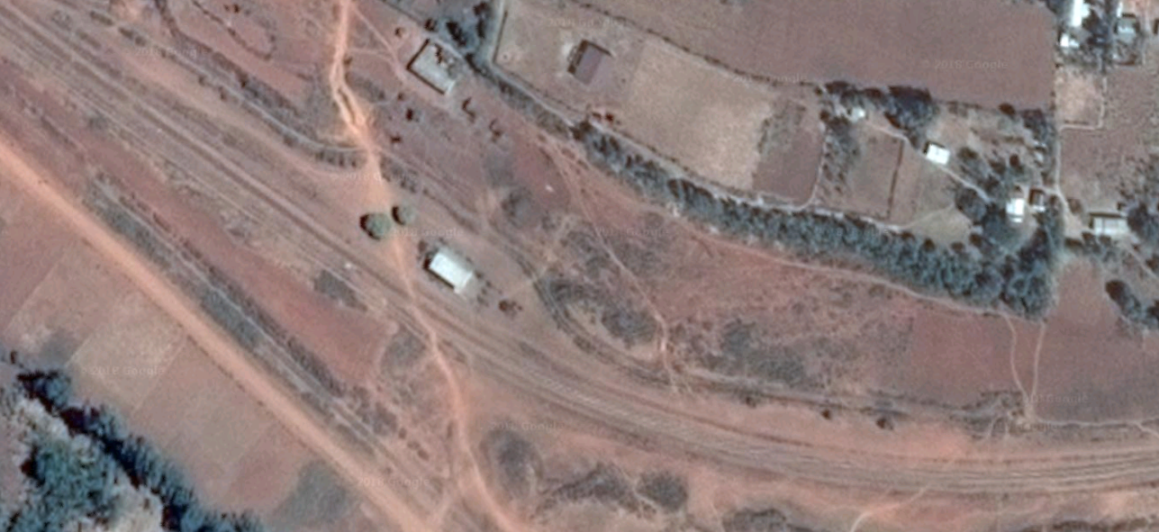 Mulukbu (Sudi) Railway Station.
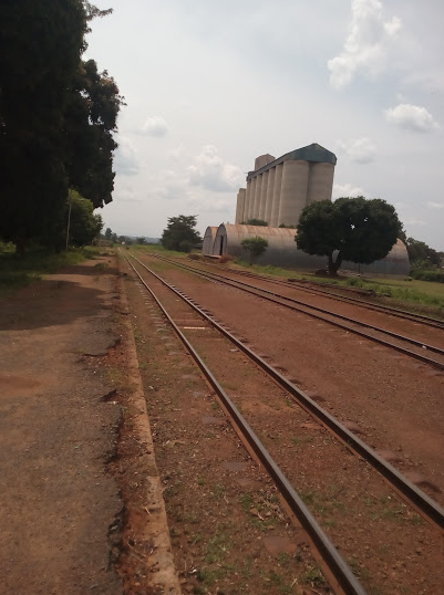
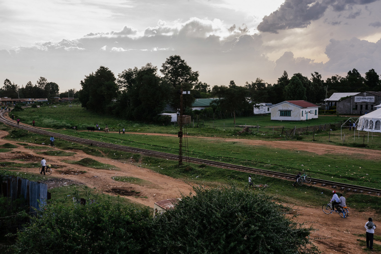
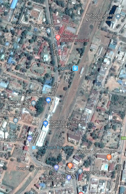
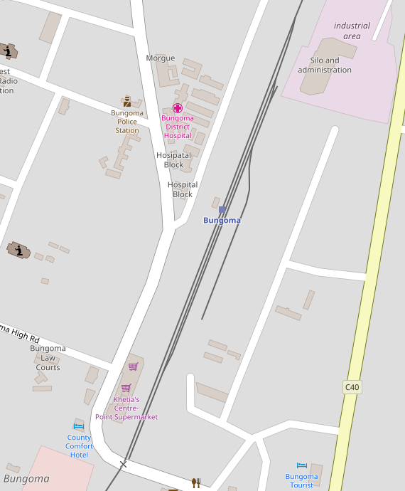 Bungoma Railway Station is shown on the adjacent map. The images below are both taken from the South looking back north along the line. The first shows the station platform on the left and the Silos on the right.
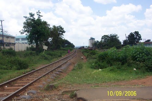
The second shows the railway line south of the station and the silos can just be seen at the back right of the image.
 The railway west of Bungoma.
The station is shown in plan in the adjacent Satellite image.
Trains for Uganda depart southwards from the station. The railway then turns west and north circling round the south side of the town, before breaking way to the south-west. The map below shows Mateka in the bottom left. I have not been able to pin-point the location of the Railway Station.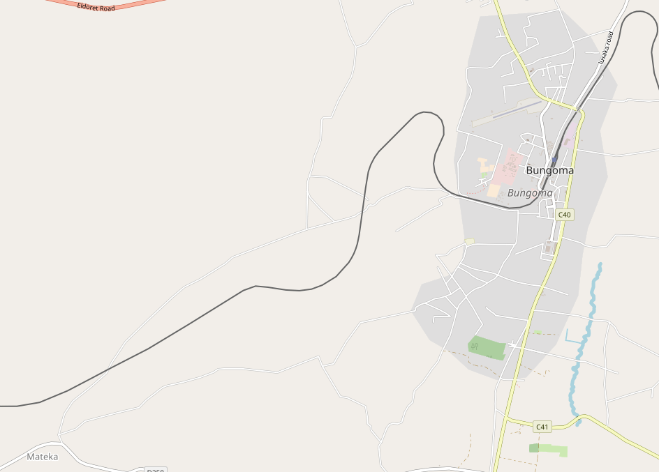 After Mateka, the line travelled on to the West to Myanga, where it crossed the Sio River and turned north for a short distance running along the East side of the C34, Musokoto-Khwirale road and then heading in a westerly direction once again to Malaba.
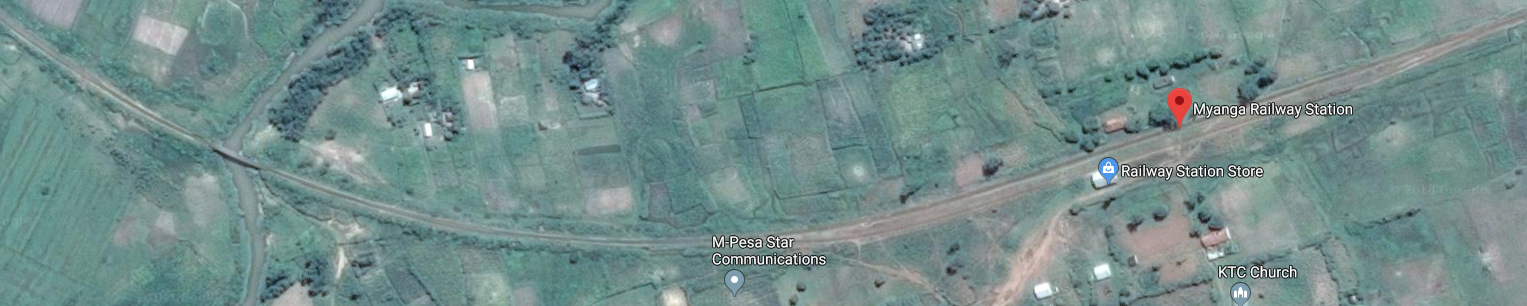 Myanga Railway Station is marked with a red flag. The bridge over the Sio River is towards the left of the satellite image.
Malaba straddles the border between Kenya and Uganda. I can remember queuing here in 1994 for an hour or so after having been shepherded off the train at 3.00am, before it became clear that the border officials and customs officers on the Uganda side of the border would not be meeting the train and that we would need to go to the customs office in Kampala when the train arrived so as to get passports stamped with an entry visa.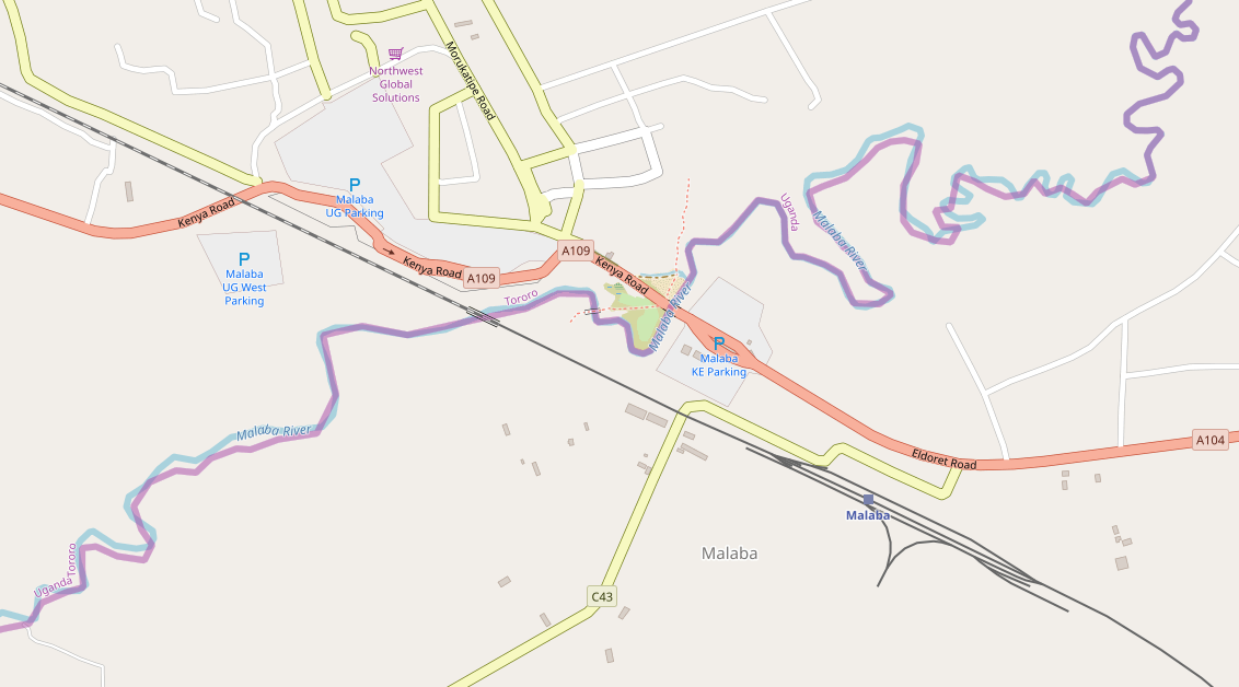
Once the border is crossed there is only a short journey on the train into Tororo. We will pick up the journey again at the border in the next post.
References
- https://en.wikipedia.org/wiki/Eldoret, accessed on 27th May 2018.
- https://afrikanerway.wordpress.com/2013/07/15/eldoret-a-boer-settlement, accessed on 28th May 2018.
- Ronaldo Retief; . Afrikaners trek to East Africa, Old Africa: Stories from East Africa’s Past; Issue 55, 2014, p14-15.
- Red strangers: the white tribe of Kenya, ISBN 1-85725-206-3, by Christine Stephanie Nicholls.
- http://moigirlseldoret.ac.ke, accessed on 28th May 2018.
- http://www.mccrow.org.uk/EastAfrica/Hill_School_now/Hill%20School%20Eldoret%20Kenya.htm, accessed on 28th May 2018.
- Remnants of Boer Colony Glad They Stayed in Kenya. 1 April 1987, http://www.philly.com/philly/archives, accessed on 16th September 2013.
- Steve Bloomfield; 80 Children Massacred in Kenyan Church; https://www.independent.co.uk/news/world/africa/80-children-massacred-in-kenyan-church-767602.html, accessed on 28th May 2018.
- https://www.pinterest.com/pin/559361216211036993, accessed on 28th May 2018.
- Not used.
- https://youtu.be/EgkZJncP_Dc, accessed on 7th June 2021.
- https://youtu.be/hutty3aL7Y8, accessed on 7th June 2021.
