
Kings Lynn was my home in the 1970s. From the age of 12 to 18, I attended Kings Lynn Grammar School and lived on the East side of the town. I have recently been reading some old railway magazines and came across an article about the Harbour Branch in Kings Lynn. The article was in Railway Bylines in January 2002.
By the 1970s, it was my presumption that most of the infrastructure in the article in the January 2002 issue of Railway Bylines would have been abandoned or removed. My memories of the riverside in Kings Lynn in the 1970s are of a relatively derelict area of little interest to a teenager. Apparently, the line closed in 1968 and much of the infrastructure was removed at that time. However the rails remained intact in the bridge over the River Nar close to the fertiliser factory until the turn of the millenium. [2]
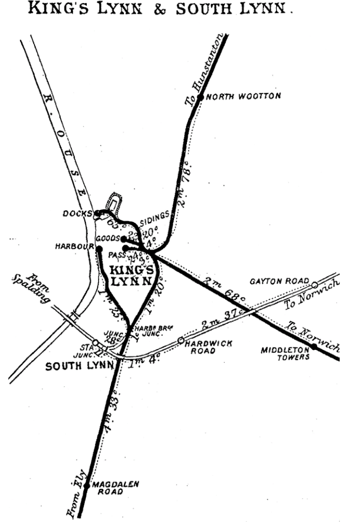
Kings Lynn was surprisingly included in the rail network early in the development of the UK network. Services between Kings Lynn and Downham Market commenced on 27th October 1846. The Lynn & Ely Railway opened its harbour branch on the same date. It completed the coal handling facilities at the Harbour in May 1848. 1849 saw an extension of the length of the branch as far as South Quay completed. The branch diverged from the mainline to the north of South Lynn.
 Access to the branch was controlled by the Harbour Junction Signal Box. The box was completed and in use by 1880. It has a 36-lever Saxby frame. It remained staffed until 8th March 1983. In 1984, it was reduced to the status of a ground-frame and it was closed completely on 10th February 1985. [1]
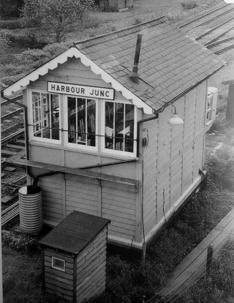 This picture was taken in June 1983. It shows that the box was well maintained right through to closure. [1] It suggests that the fertilizer factory continued to be rail served until the 1980s.
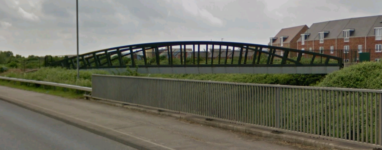
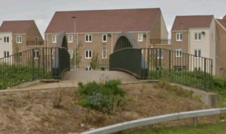
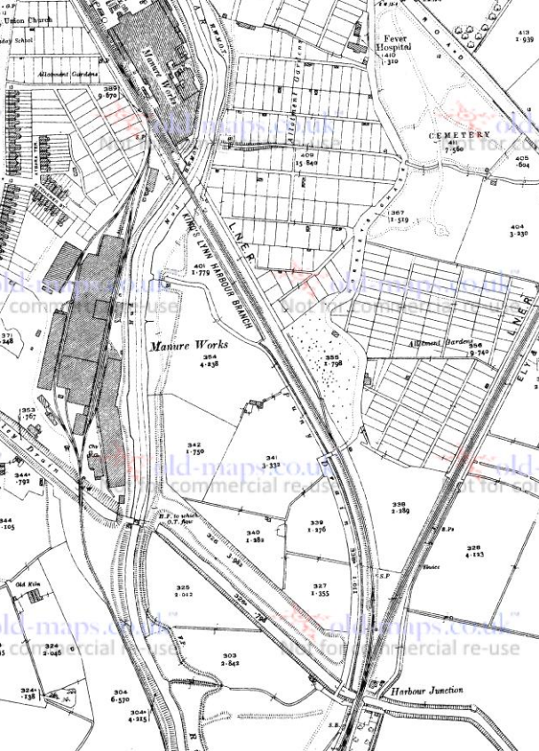 Harbour Junction appears at the bottom of this 1920s O.S. Map. [3] The branch crosses the River Nar for the first time North of the junction close to the manure/fertilizer works. The works link both to the Harbour Branch and to the curve in South Lynn between the main north-south line to Kings Lynn Station and the cross-country line south of Kings Lynn. The footbridge shown on the OpenStreetMap plan and in the two pictures taken from the A148 below in almost exactly in the same position as the old bridge over the river.
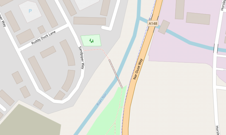
 Between the Harbour Junction and the footbridge above, the new A148 (Nar Ouse Way) approximately follows the line of the Branch. North of the footbridge the route of the line is underneath modern housing development which has replaced part of the fertilizer works. North of the old works the line followed a straight north-easterly course crossing what, in my teenage years, was the A148. It was joined, alongside the more northerly buildings of the fertilizer works by the industial railway which served the works.
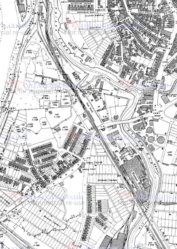 The Branch crossed the Wisbech Road at the point where it is now met by Sandpiper Way. Indeed, the northern end of Sandpiper Way follows the old line which then continues on the north side of the Wisbech Road as Hardings Way.
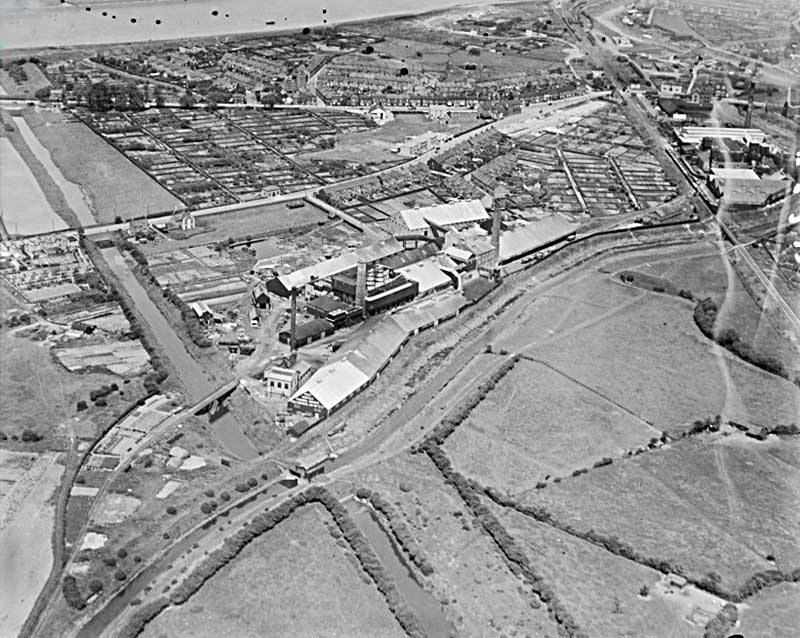
 This excellent aerial view (above) of the fertilizer works [4] shows the Branch in the top right. Just above the halfway point on the right side of the photograph is the first bridge over the Nar, then the northern part of the works is followed by the crossing of the Wisbech Road and the coal sidings beyond. [4]
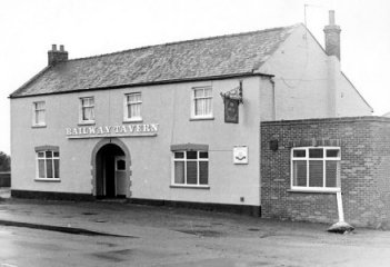
The railway passed just to the West of the Railway Tavern, in the adjacent picture. [5]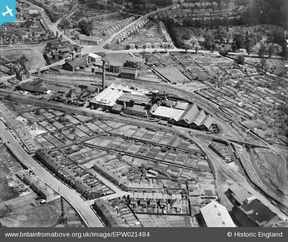 This aerial image was also sourced from the Historic England Website: ‘Britain From Above’ and shows the Harbour Branch running across the centre of the image with Wisbeach Road at the left hand edge of the image. The River Nar flows under the line to the right side of the picture and the location of the Gas Works is prominent centre-top. Southgates can just be identified in the top left of the image. [7]
Until very recently I had not found any pictures of the level crossing at Wisbech Road. It appears that it was sited just west of the Railway Tavern and under what is now the junction between Wisbech Road, Sandpiper Way and Hardings Way.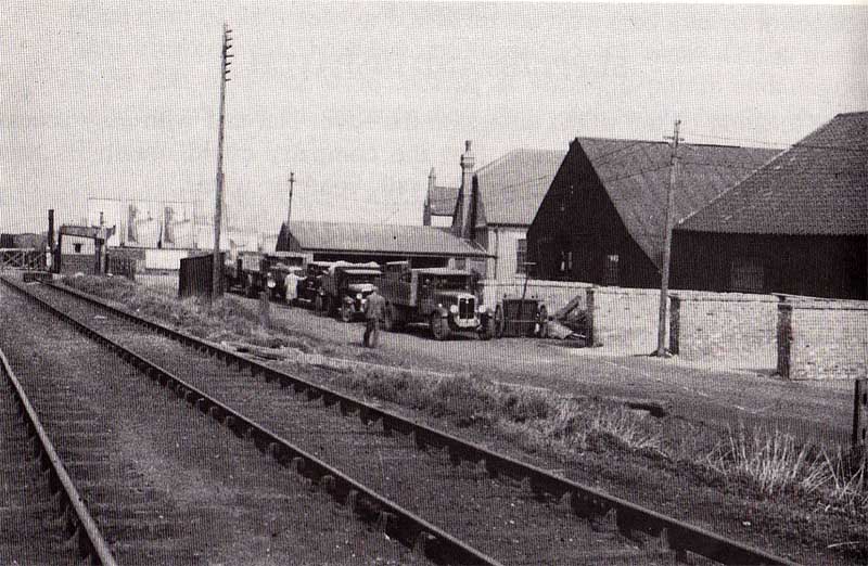 This picture of the Muck Works in South Lynn shows the Harbour branch and the level crossing at Wisbech Road can be seen to the left of the image. Th eimage was posted on Kings Lynn Forums on 22nd October 2018. [14]
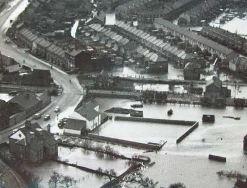 This image of flooding in South Lynn was posted on King’s Lynn Forums on 21st October 2018 and shows the gated crossing on Wisbech Road. The image is taken looking westwards. The lighter coloured building is the Railway Tavern. [14]
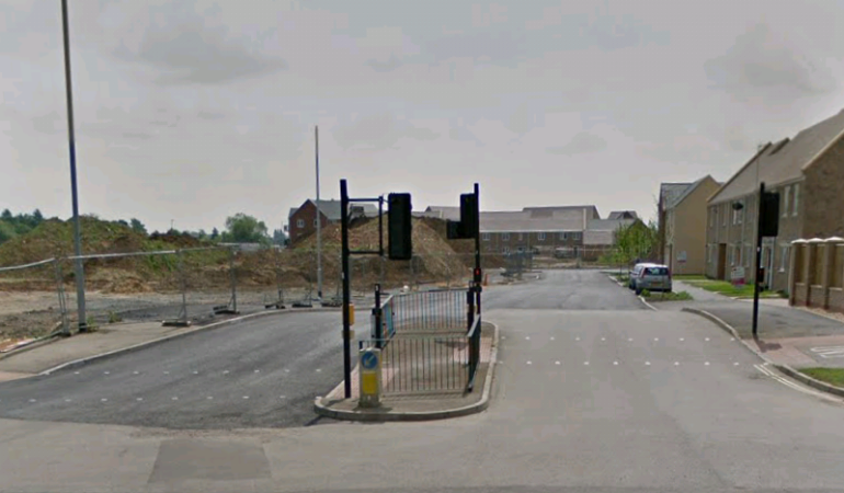 Looking South from Wisbech Raod along what was the route of the Branch and is now Sandpiper Way.
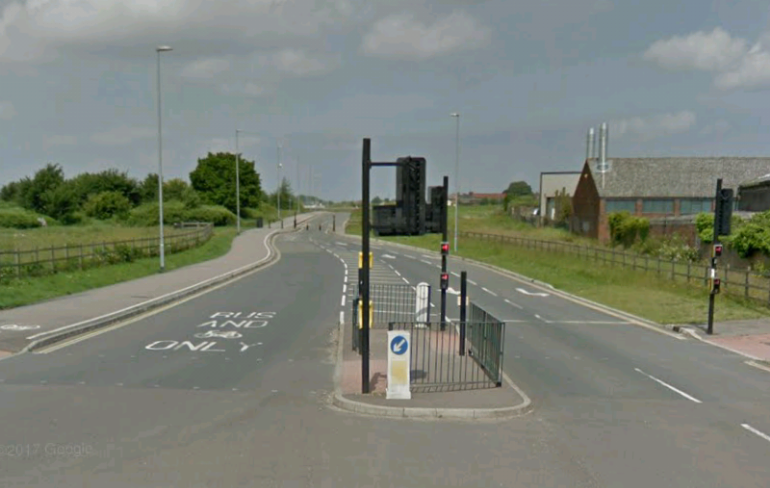
 Looking North (above) from Wisbech Road along the old Harbour Branch which now forms Hardings Way.The coal sidings mentioned below would have been on the right-hand side of this image, to the left of the brick built building.
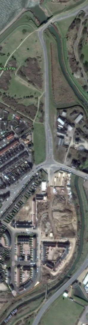
In the adjacent satellite image, the route of the Branch can be picked out by following a straight line from the footbridge at the southerly edge of the image through the building site to Wisbech Road and then along Hardings Way to the bridge over the River Nar at the northerly extent of the picture.
Along the length of the Branch to the north of Wisbech Road, there were a series of coal sidings which were still in evidence in the 1960s. [6]
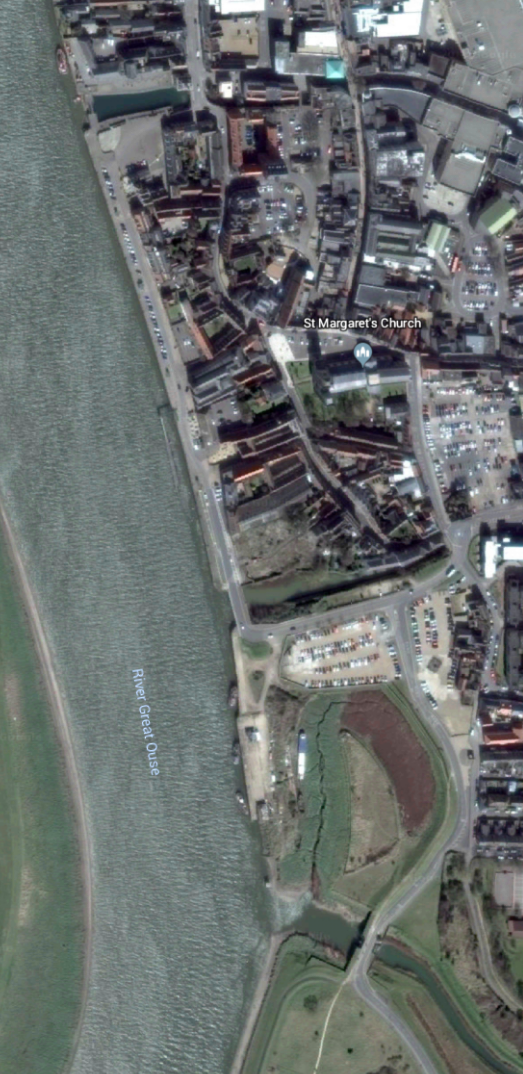
As can be seen on the 1920s map above, the coal sidings gave way to an extensive area of sidings on the South side of the River Nar. [6] These sidings filled a tongue of land which extended northwards creating a tight loop in the River Nar. At this point the river was usually referred to as Friar’s Fleet. That layout of the river mouth is no longer evident on the ground, nor in the adjacent satellite image. But it can be clearly seen in the 1920s maps which form a part of this blog (above and below). [6]
The tongue of land was connected to the remainder of the harbour on the banks of the River Ouse by a swing bridge which can be picked out easily in the map below.
There were two swing bridges on the line – the first over Friars Fleet and second over Mill Fleet. The article in Railway Bylines has a number of pictures of the swing bridge and these are reproduced below. [1]
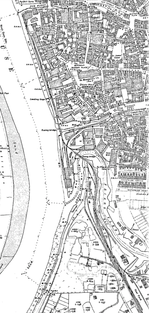
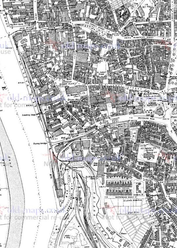 The map above shows the northerly extent of the Harbour Branch. It reached northwards to Purfleet and close to the Customs House. [6]
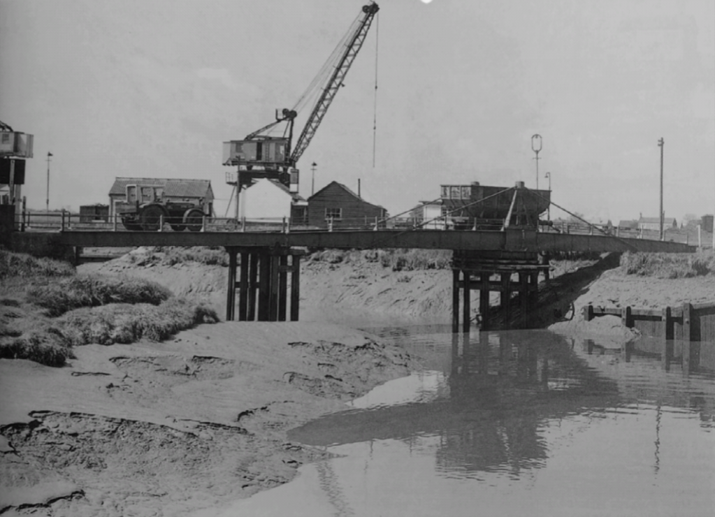 This view looks West along the River Nar. The tractor on the bridge was kept in a converted stable, a reminder of the earlier form of traction used on the sidings. The crane in the background is on the Boal Quay. [1]
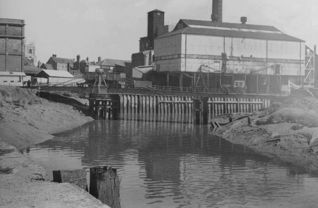 Another view of the same bridge. This view is taken looking Northeast from Boal Quay. The town is the backdrop to the view, St. Margaret’s Church can be seen in the background. The bridge was moved using a handle which operated a simple geared mechanism. The bridge was constructed by H & M. D. Grissell of Regents Canal Ironworks in London. [1]
 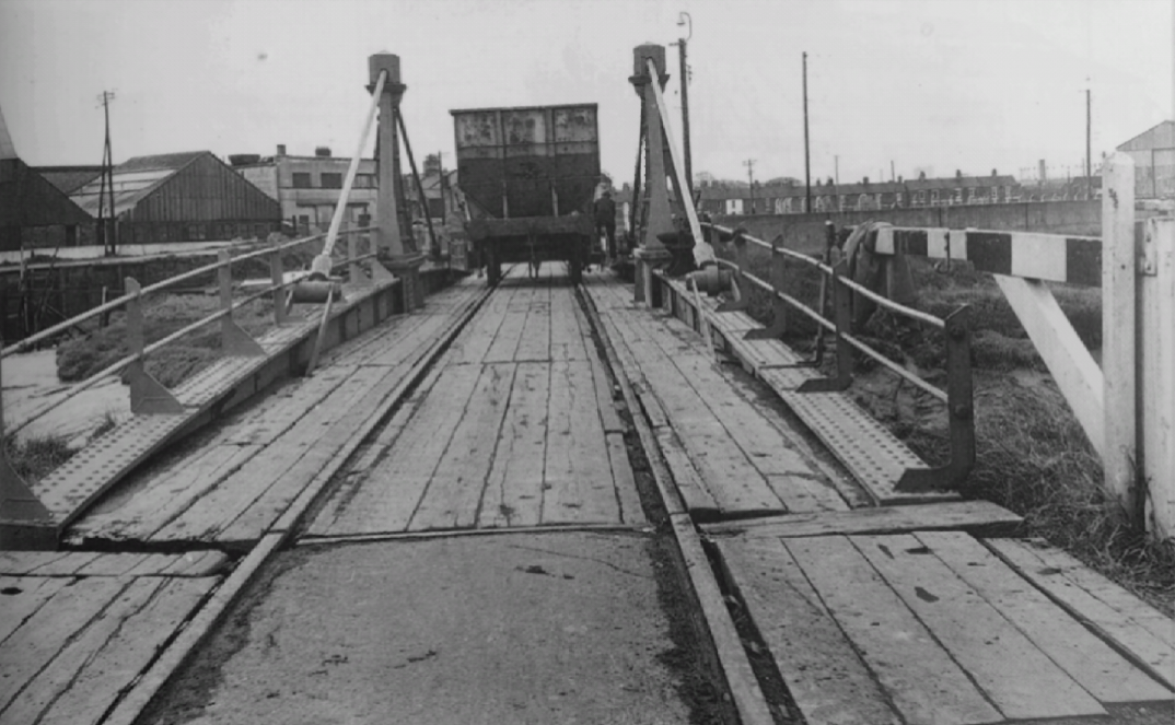 The swing bridge over the River Nar was built in 1854 when the harbour branch was extended. This view looks Southeast. Road vehicles were prohibited from crossing the bridge. Pedestrians were permitted but it was a tight fit especially when on a bicycle with a wagon to circumnavigate. When the bridge was open to river traffic, a swinging hinged beam was the only deterrent to rail traffic. [1]
There was only a short distance at the neck of Boal Quay between Friars Fleet and Mill Fleet. There were a number of short sidings which served Boal Quay and the adjacent Corn Mill. 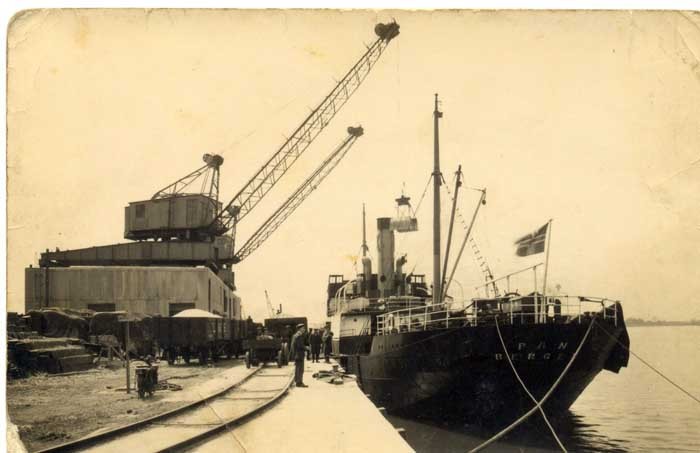 Boal Quay with clear evidence that the Quay was rail served. [8]
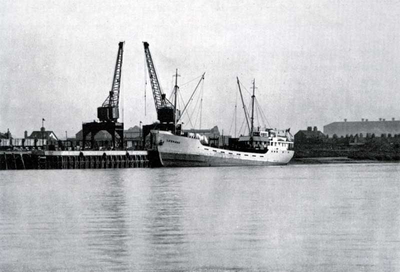 Boal Quay taken from West Lynn. The sidings seem to be full of open wagons. [8]
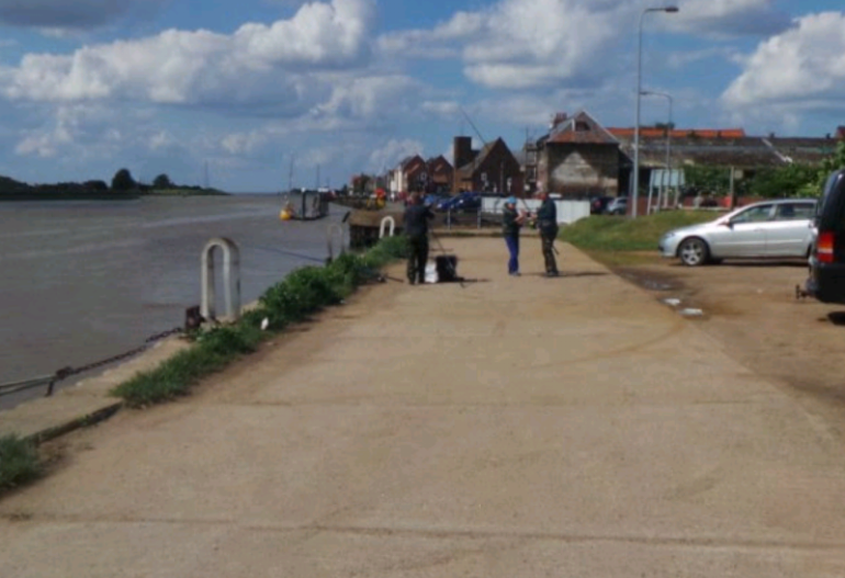 Boal Quay in the early 21st Century. A view looking North.
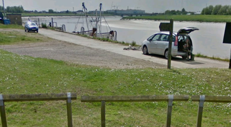 Boal Quay – this time the view is looking South.
The line continued over Mill Fleet. The swing bridge was of a similar design to that over Friars Fleet.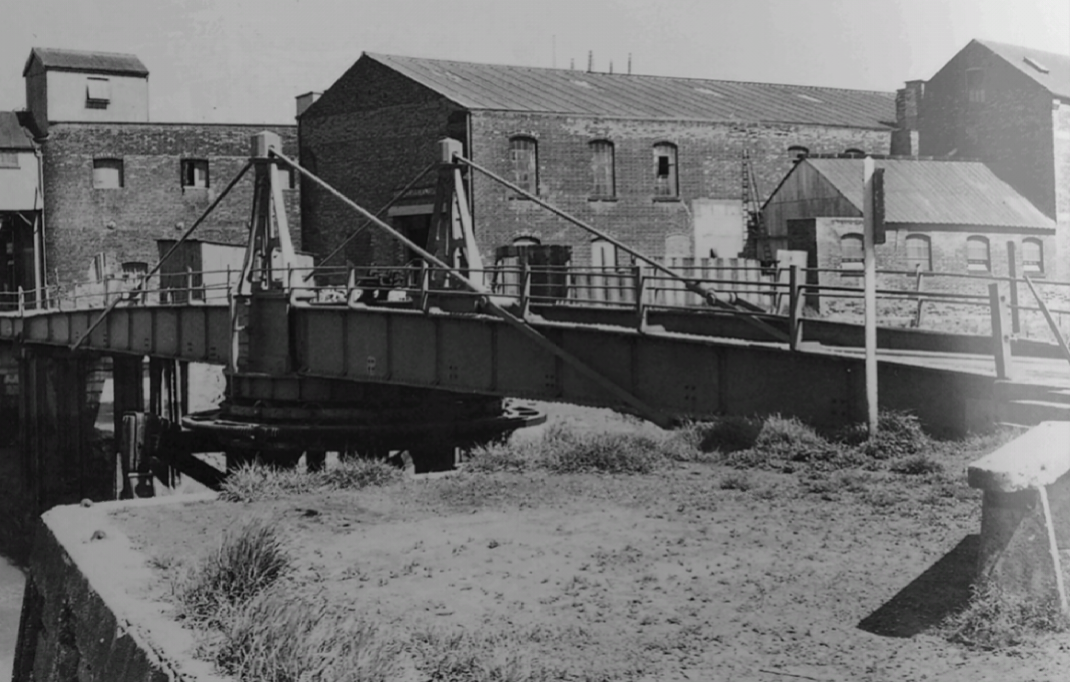 The swing bridge over Mill Fleet carried the Harbour Branch onto South Quay. This view is taken from the North end of Boal Quay looking Northeast towards the town. The pinnacles of the tower of St. Margaret’s Church can be seen peeping bout above the roof of Gregory & Hampson’s warehouse in the centre. [1]
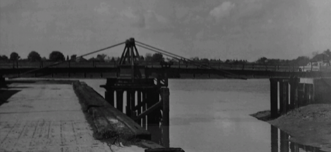 The construction of these bridges was simple. This view is taken looking West across the River Ouse to West Lynn. Boal Quay is to nthe left and South Quay to the right. The Mill Fleet bridge and that across Friars Fleet were demolished at the beginning of 1970, just before I moved with my family to King’s Lynn. [1]
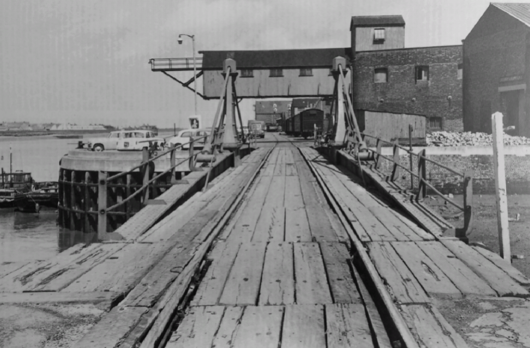
 I think that this is one of the best pictures (above) that I have seen of the quayside in King’s Lynn. The picture is taken looking North across Mill Fleet and its swing bridge towards South Quay. On South Quay the railway was set in cobbles. The cars parked on South Quay overlooking the River Ouse suggest that the picture was taken in the early to mid-1960s. The handful of vanfit wagons on the South Quay confirm that there is still some rail traffic to be had. [1]
The satellite image clearly shows the old course of Friars Fleet and the shape of Boal Quay. It also shows the full length of the South Quay from Mill Fleet to Purfleet.
South Quay had two sidings along the water’s edge – these were linked at regular intervals to aid shunting.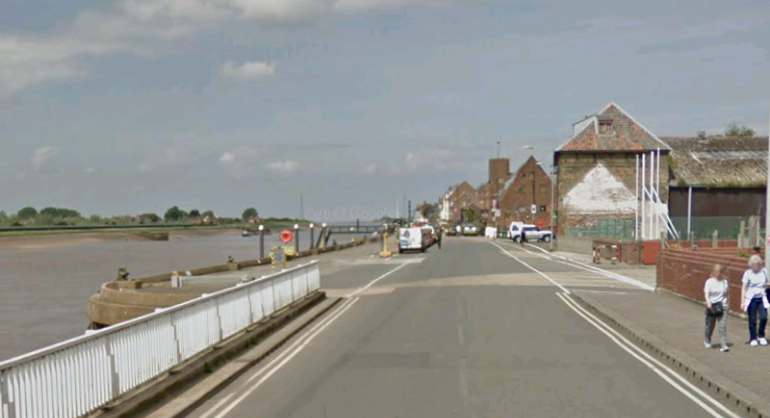 This view of South Quay is taken from almost the same position as the early to mid-1960s photograph above.
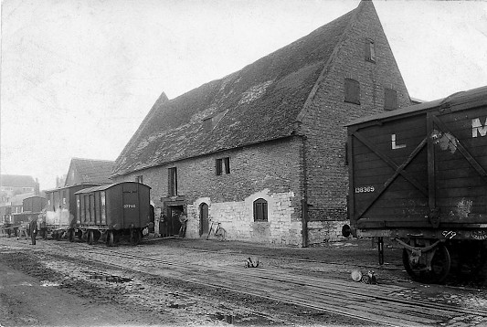
 Marriott’s Warehouse, South Quay in the 1920s (above). [9]
The North end of South Quay is shown in the adjacent image. [10]
Another view of South Quay (below), taken on 18th May 1910. plenty of railway wagons are visible! [11]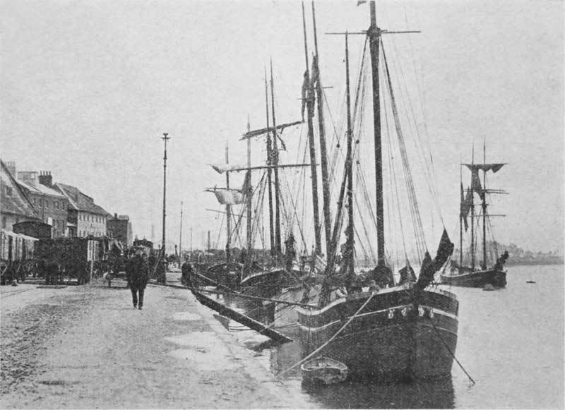
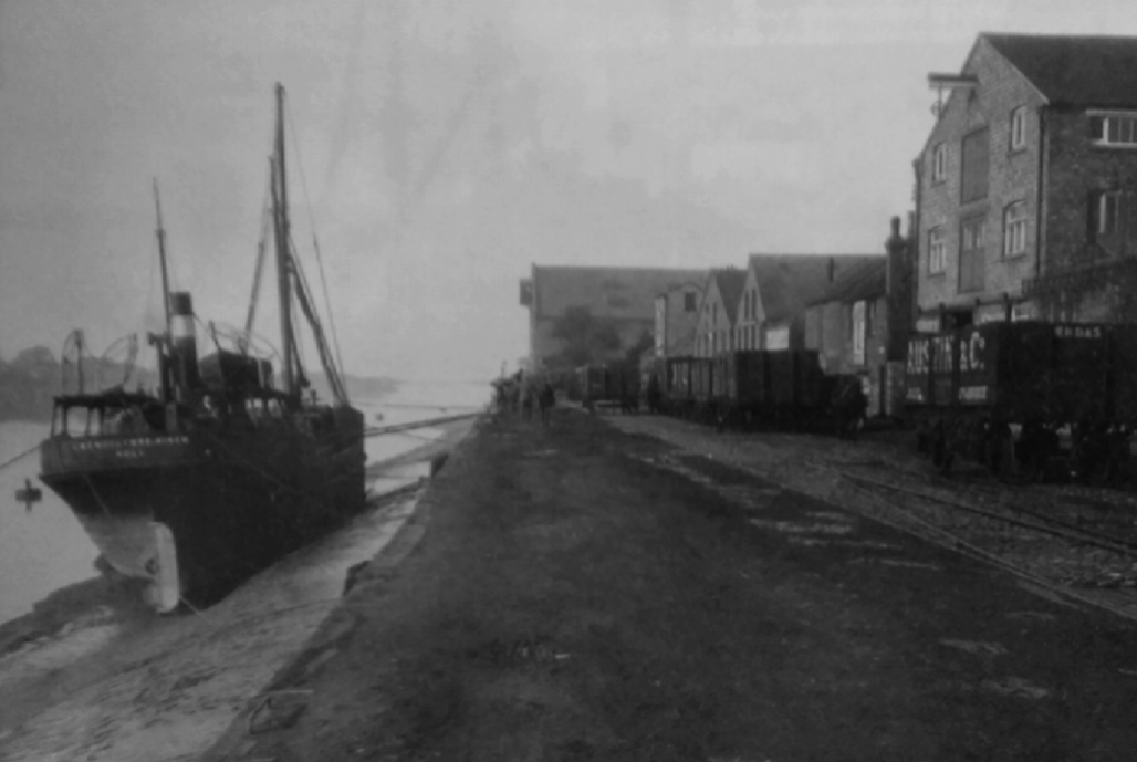 Motor vessel Gwendolynne Birch at low water alongside South Quay. Scott & Sons furniture warehouse is on the right. The first wagon on the right belongs to Austin & Co., coal merchants from Cambridge. [13]
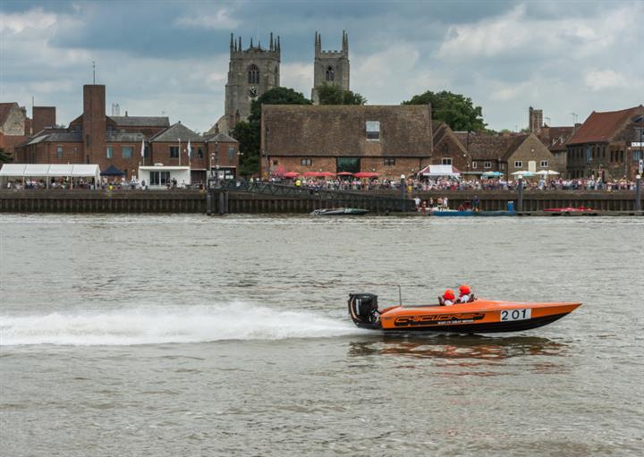 A modern view of South Quay taken from West Lynn and showing Marriott’s Warehouse! [12]
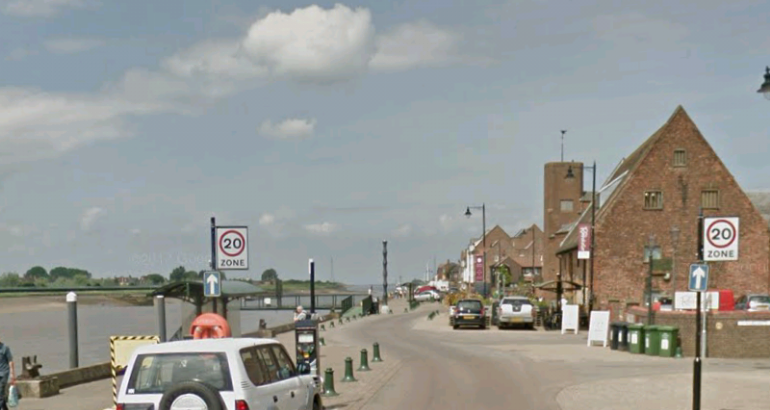 A modern view of South Quay with Marriott’s Warehouse on the right.
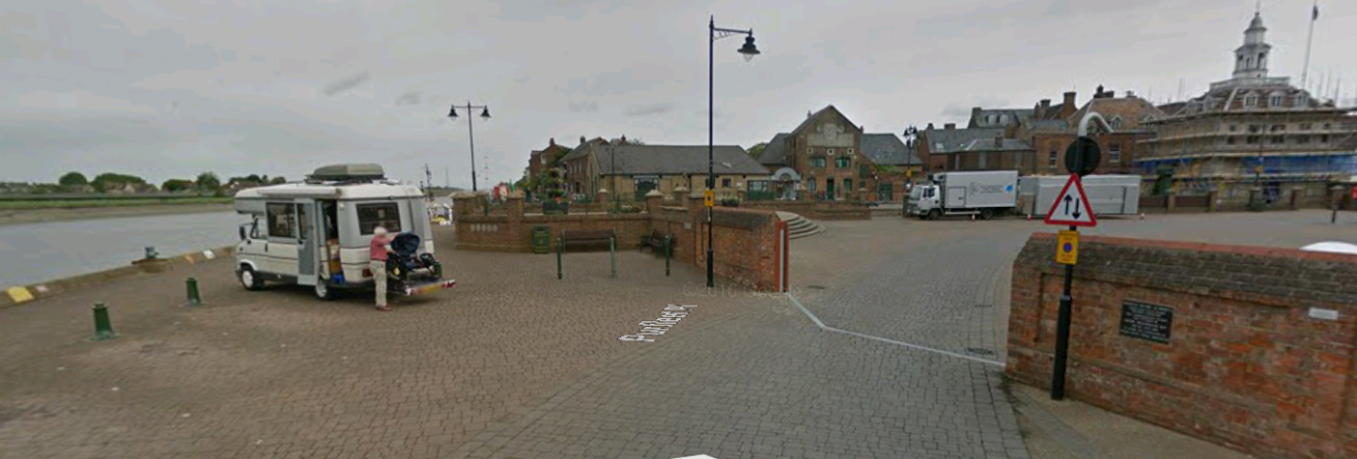 And finally, a view of the North end of South Quay in the early 21st Century. Flood protection measures are in evidence.
References
- Bryan L. Wilson; Nooks, Crannies and Swing Bridges – Fixtures and Fittings on the Kings Lynn Harbour Branch; Railway Bylines, January 2002.
- http://www.heritage.norfolk.gov.uk/record-details?MNF13593-Route-of-King%27s-Lynn-Harbour-Railway&Index=12729&RecordCount=57339&SessionID=35f84934-5757-4669-a3fc-9b20c56352a3, accessed on 15th September 2018.
- https://www.old-maps.co.uk, accessed on 15th September 2018.
- http://www.kingslynn-forums.co.uk/viewtopic.php?f=14&t=1470, accessed on 16th September 2018.
- http://www.norfolkpubs.co.uk/kingslynn/nkingslynn/klnrt.htm, accessed on 16th September 2018.
- https://www.old-maps.co.uk, accessed on 16th September 2018.
- https://www.britainfromabove.org.uk, accessed on 16th September 2018.
- http://www.kingslynn-forums.co.uk/viewtopic.php?f=14&t=157&sid=fe93ef8ae649a779d55f01b37425e368, accessed on 16th September 2018.
- http://www.kingslynnonline.com/2014/04/lynns-port-and-railways-a-weekend-of-heritage, accessed on 16th September 2018.
- http://www.kingslynn-forums.co.uk/viewtopic.php?f=14&t=218&start=15, accessed on 16th September 2018.
- http://www.kingslynn-forums.co.uk/viewtopic.php?t=218, accessed on 16th September 2018.
- https://www.lynnnews.co.uk/news/water-ski-races-bring-thousands-to-king-s-lynn-quay-1-8015320, accessed on 16th September 2018.
- Mike G Fell; An Illustrated History of The Port of King’s Lynn and its Railways; Orwell Press, Clophill, Bedfordshire, 2012.
- http://www.kingslynn-forums.co.uk/viewtopic.php?f=14&t=273&start=150, accessed on 21st October 2018.

Reblogged this on Part Time Spotter and commented:
Wonderfully written and researched article on Kings Lynn Docks railways.
I Remember going to South Quay and Boal Quay during our holidays to Heacham in the 60s.We used to watch the cranes on Boal Quay unloading the Potash for the Fertilizer works and the wagons being shunted about by the Fordson tractor one at a time. I never saw any Locos though but there were some interesting variations of hopper wagons used all internal user.
Also a former King’s Lynn resident though 2006-2018,delighted to read your account.
Explored many of the aspects of railways in Lynn. Pleased that some of the old formations can still be traced.
Thank you, will hope to see further posts
My brother-in-law Mr Reg Gilbert when being made redundant at Sutton Bridge, as Foreman, due to the closure of the joint line on 28th February 1959, took the position of Inspector at South Lynn which covered the Dock branch, after closure he took up position as Travelling Ticket Inspector at Kings Lynn.
I’m a professional archaeologist and infrastructure planner from King’s Lynn and as the chair of the West Norfolk and King’s Lynn Society I organised a very successful conference on the railways, the port and Lynn in 2014 at Marriott’s Warehouse Trust, South Quay. If I’d know, you would have been a most welcomed guest speaker! Nice article with images and references. It is nice, as a landscape archaeologist, to see how you have traced, walked and document the route and aspects of past and extent infrastructure. There is perhaps more, but not much to trace I suspect. For example, there is a concrete post, lower quadrant single (I believe) at the South Lynn/NORA/Ouse Way junction with the London line, still in place – for now. As part of the NORA development construction of commercial units are under way! One suggestion on picture/reference 10: the North part of South Quay, is perhaps best termed, as known and mapped ‘King’s Staithe’, with the Bank Hotel there as it is now. Again – a most excellent account and with fieldwork – a joy to read. Really good to read and very much appreciated – perhaps you might like to give a lecture locally in King’s Lynn, when convenient? With good wishes, Clive (Dr. Clive Jonathon Bond, Chairperson, West Norfolk and King’s Lynn Archaeological Society, Visiting Fellow, Department of Archaeology, Anthropology and Geography, The University of Winchester).
Hello, thank you for your kind comments. Traced and documented is true. Walked? Less so. I have found Google Maps to be an excellent source.
I have good memories of teenage years in Lynn and visit occasionally but all family links have gone now. I’d be really interested, if the conference papers are still available, in reading through the 2014 conference presentations.
I produced a series on the Docks Railways as well, you can read them on here.
Where did you pick up the article from? Was it a local Facebook group?
Best wishes
Roger
Dear Roger, yes, I picked up the article on Facebook. I liked your post, then followed the link. The 2014 conference has not been published (yet), but I do have the booklet and also presentations. So, if you e-mail me, I can look them out and forward them to you. With good wishes, Clive
Hello Clive, thank you for getting back to me. My email address is rogerfarnworth@aol.com. Best wishes. Roger.
A wonderful piece of work, a real record of the past.
Well Done indeed.
Ant Robinson
Thank you, Ant.