
On 6th September 2018, my wife and I travelled down the length of the line from Lastours to Carcassonne. There were not too many opportunities for me to stop to take pictures as we had spent the whole morning following the line from Fanjeaux to St. Denis.
However, it is good to be writing about some things I have seen.
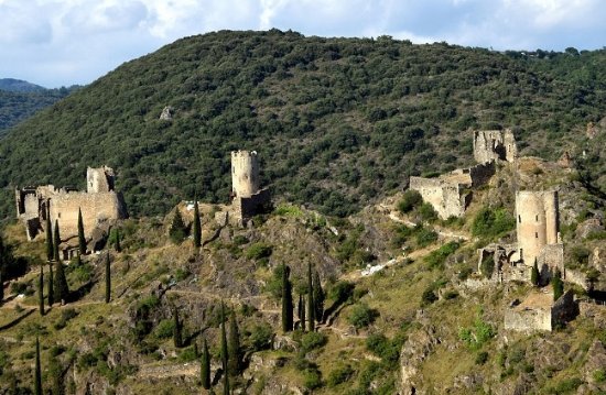
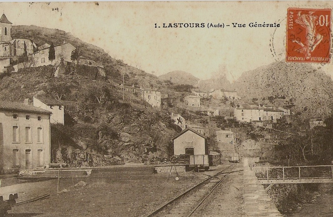
Lastours is located 12 km (7.5 mi) outside Carcassonne, in the valley of the Orbiel. There are four small castles each built on a large 300 m high rocky ridge. The castles were built to control the access to Montagne Noire and the Cabardes region. These are some of the few original Cathar castles left. In the mid-1960s, the village of Lastours had a population of around 500, many working in the mill in the village. The mill is now closed and is used as a visitor centre for the castles on the rock outcrop above. The population in 2008 was 165. [1]
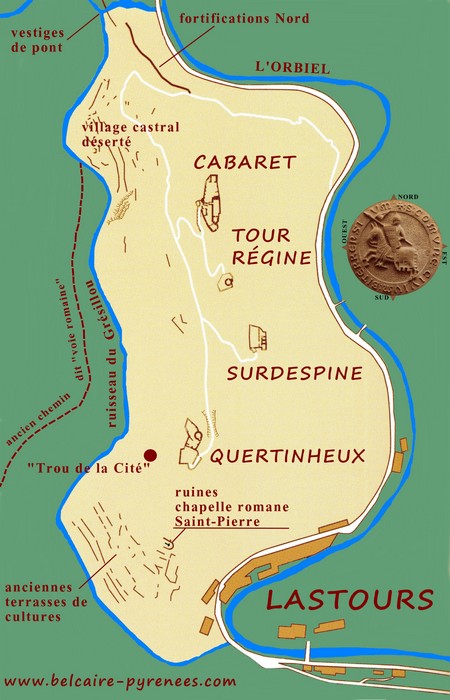 The four castles (Cabaret, Tour Régine, Surdespine and Quertinheux) which are shown on the adjacent schematic plan [3]) illustrate both the pride of the feudal lords and the fragmentation of their power. The castles not only stand as guardians of access into the Black Mountains but also vie with each other for the rile of protector, much as their feudal lords would have been doing. The first mention of Cabaret goes back to 1063. The lords of the place were vassals of the Counts of Béziers and Carcassonne and maintained good relations with the monks of the abbey of Fontfroide . The lords of Cabaret became protectors of the ‘Cathars’ and les parfaits (the perfect ones) who settled there. [2]
A first assault, of Simon de Montfort, against Cabaret in 1210, failed. In 1211, Cabaret eventually submitted voluntarily. But the hostilities towards the crusaders of Simon de Montfort resumed quickly. A Cathar bishop, Pierre Isarn, who stayed at Cabaret in 1223 went up to the stake in 1226 . A new crusader assault took place in 1227 but failed. Finally, the 4 fortresses fell in 1243, although this did not prevent the castellans from continuing their Cathar faith in peace. [2]
As the centuries progressed the village below the castles became a centre for industrial textile-working and the mill was built. The Rabier factory was eventually closed in the mid-20th Century when its production was no longer economic. It is now the tourist reception facility for the Chateaux.
Since 1995, Lastours has been developing a thematic display around mining and metallurgy in the Black Mountains . The region was very rich in iron, copper, lead but especially gold. Gold mines remain operational in the area. [2] Mining areas are shown grey on the map below.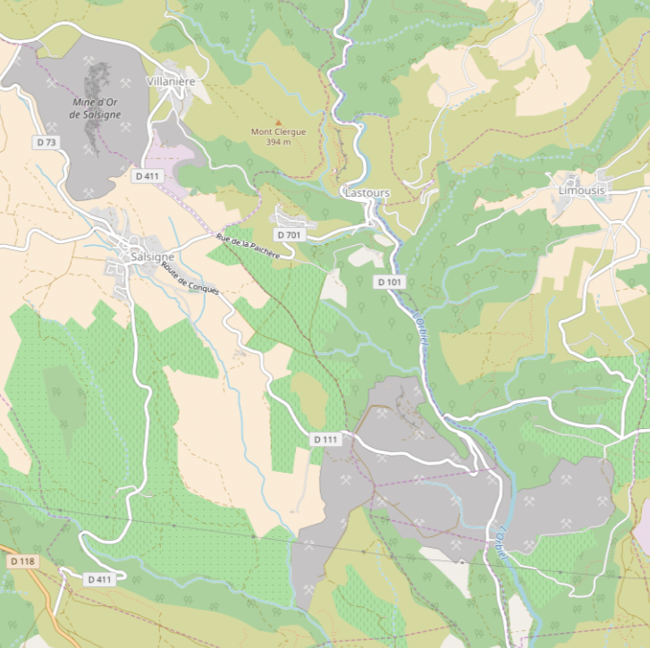 The rich mineral deposits in the area, together with the need to transport textile products from Lastours to the wider world became the dominant factors in the push to establish better transport links. As a result the tramway from Lastours was born. It provided effective communication with Carcassonne and the wider railway network. It, in turn, sustained the larger population required as labour in the factory. Products from the surrounding plain could be brought more easily to Lastours.
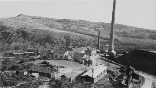
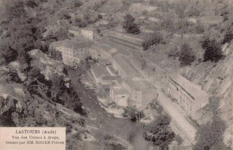 A picture of the factory complex from the 1920s. The chateaux sit above the factory to the right. [3]
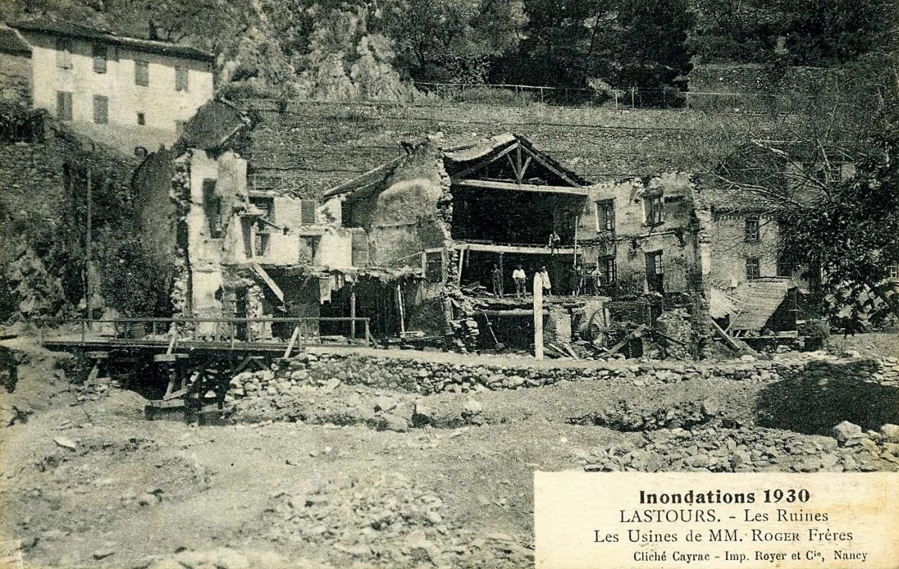 Damage to factory buildings in floods in 1930. [9]
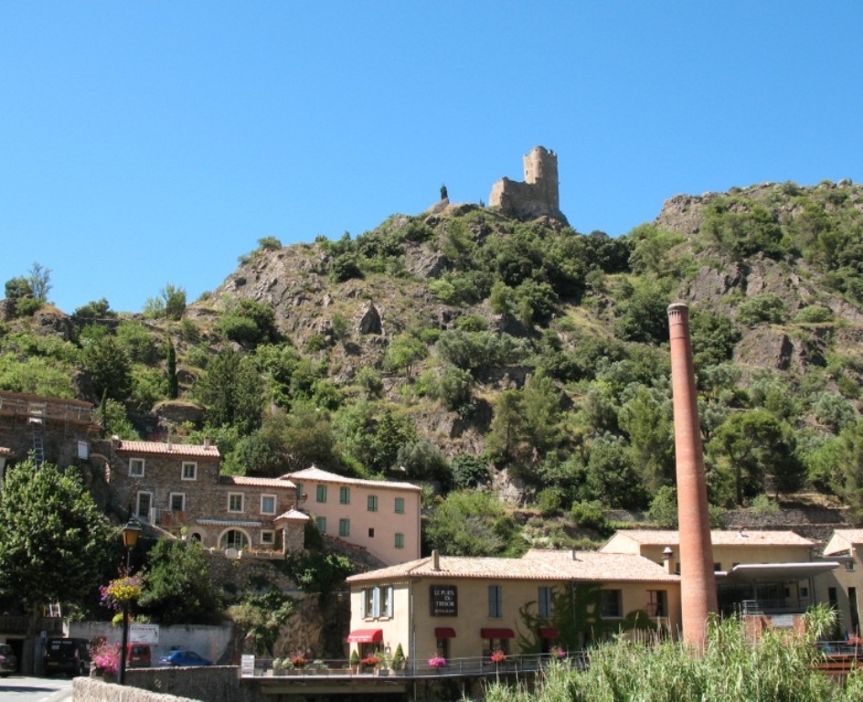 The factory as a visitor centre with one of the chateau above. [8][10]
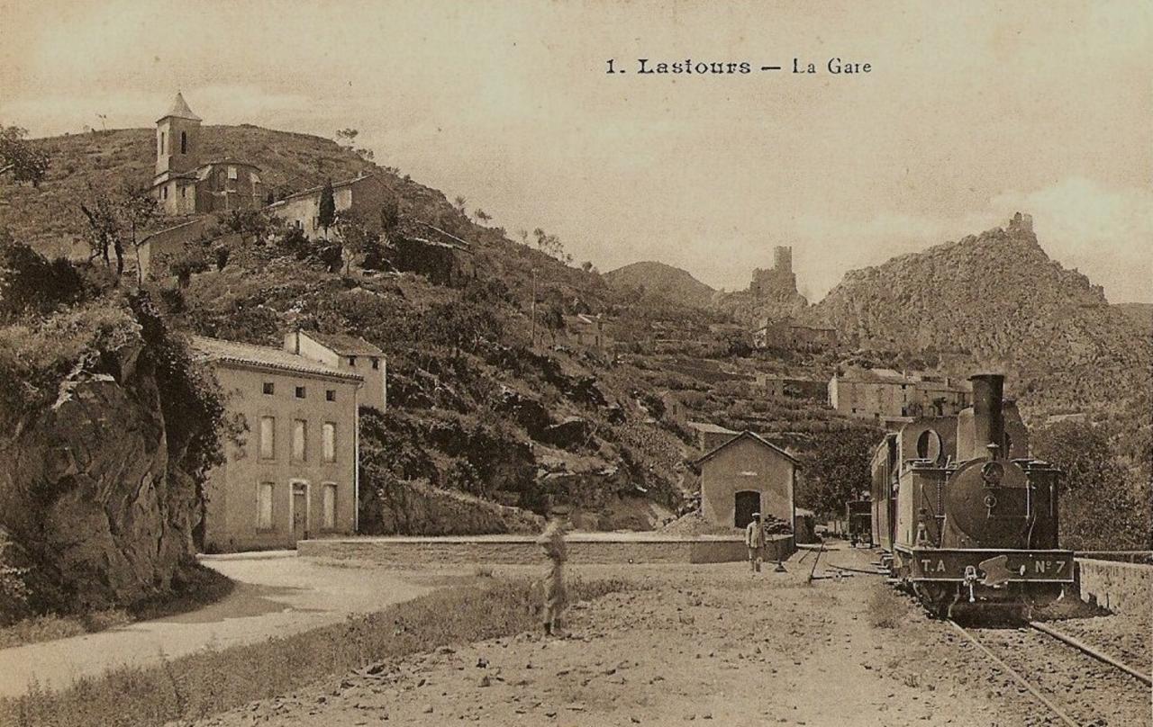
The Tramway accessed the lower village. It was not possible, because of the constraints of the site, to gain direct access to the mill. As the valley widened, the first opportunity was taken to establish the tramway terminal facilities. Passengers were, of course, expected and provided for but the main focus of investment was the products which would be transported and which would provide the dominant income for the tramway. [10] The small community of Lastours grew in wealth as a result of the immediate access to hydroelectric power and the ability to transport goods to markets. Often these mountain communities that outstripped their neighbours in the plain in economic prosperty. [10] It is however unlikely that this economic prosperty was felt by those who laboured in the mill. It probably secured their jobs even if they remained relatively poorly paid.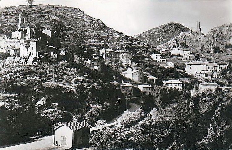 This image from the 1950s [3] shows the station building in the foreground. It had already survived around 20 years after the closure of the line. Today (2018) the building functions as the village tourist office and bears, on the elevation facing the photographer, a panel describing the tramway and its operation with pictures taken from the book written by Michel Vieux. [4]
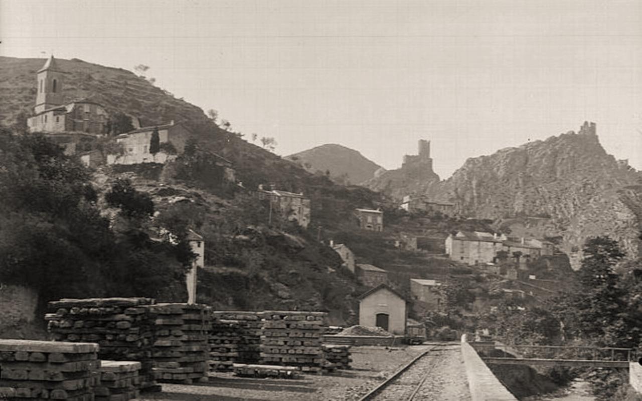
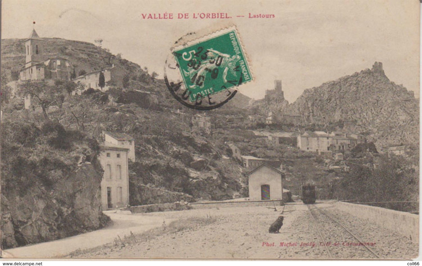
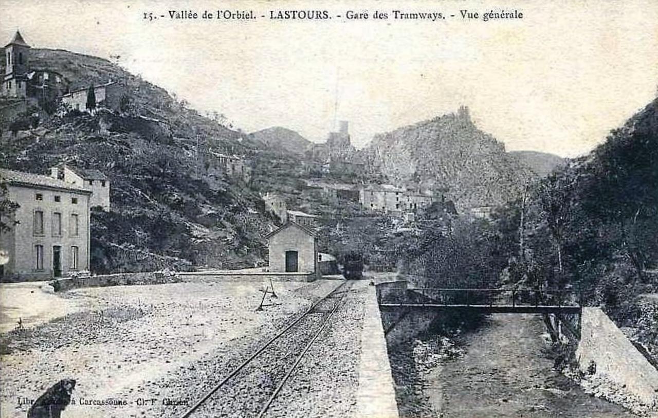 The station yard in Lastours. [6]
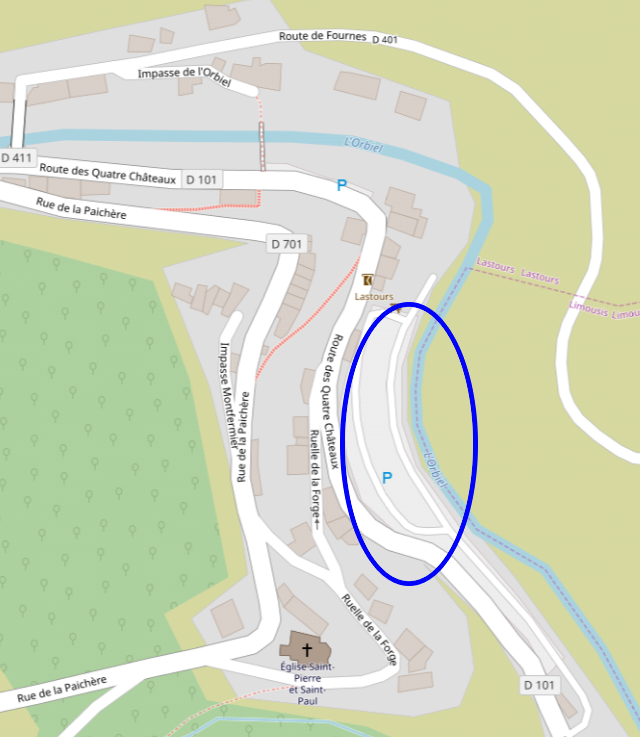 The station area is encircled by the blue oval.
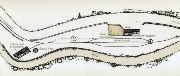 This is the Station plan shown on the board on the wall of the old station building in 2018. It comes from the book by Michel Vieux and represents the station in 1905. [4]
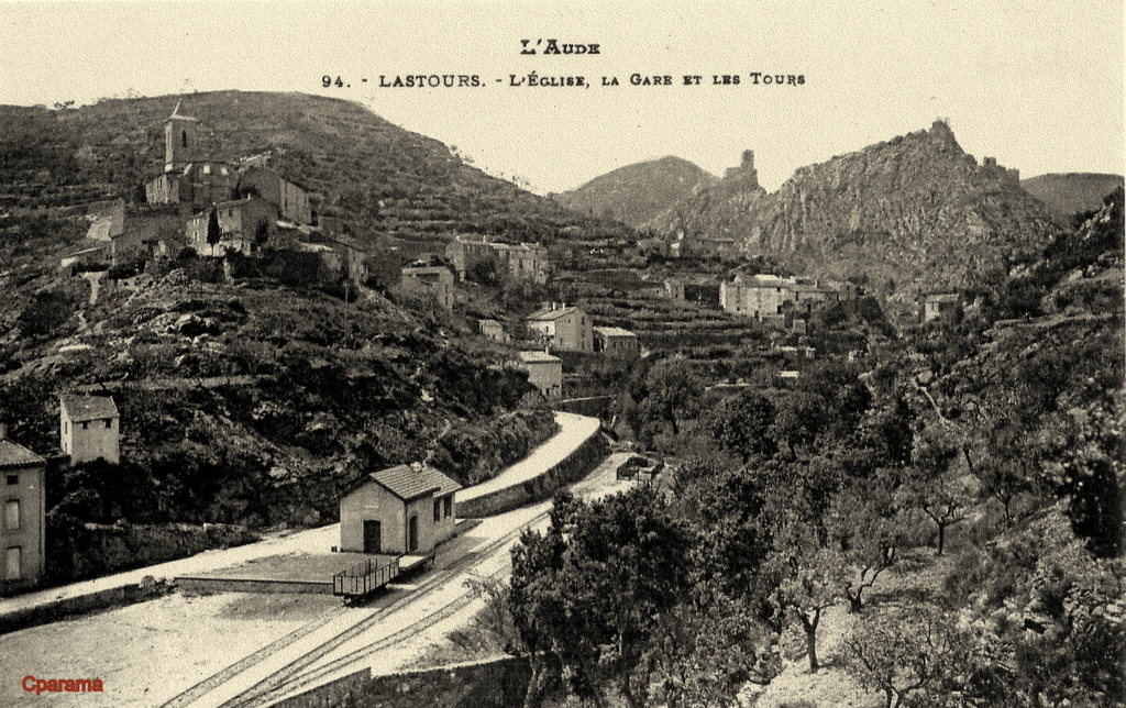 A clearer photograph of the Station at Lastours taken at a different time to the drafting of the plan above. In this image the station has a siding with an end-on connection to the goods platform. [7]
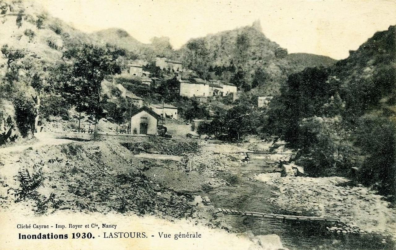 Damage to the Station site in the floods in 1930. It is very unlikely that all of the buildings lost in this flood were replaced as the line only had around 2.5 years before closure. [9]
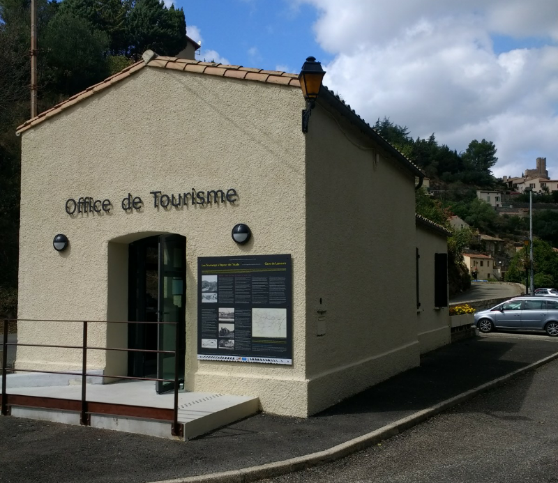
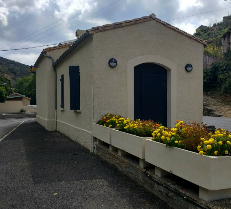 The two images above show the station building at Lastours on 6th September 2018. Its use as a tourist information centre has secured its immediate future. The information board about the railway is great. It can be seen in a prominent position in the first of the two pictures. The image below shows that the modern building has been re-roofed, the older overhanging roof has gone.
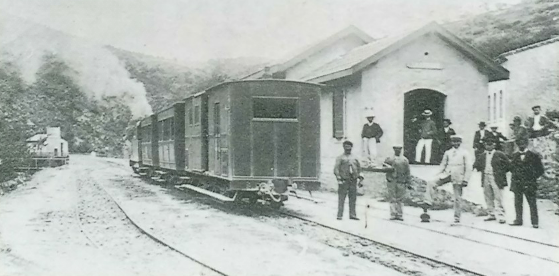 Departure is now imminent. The last image of the Station at Lastours. The water tower and engine shed can be seen in the distance on the left of the picture. [4]
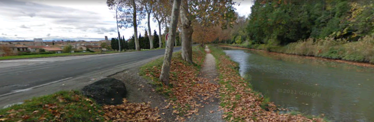
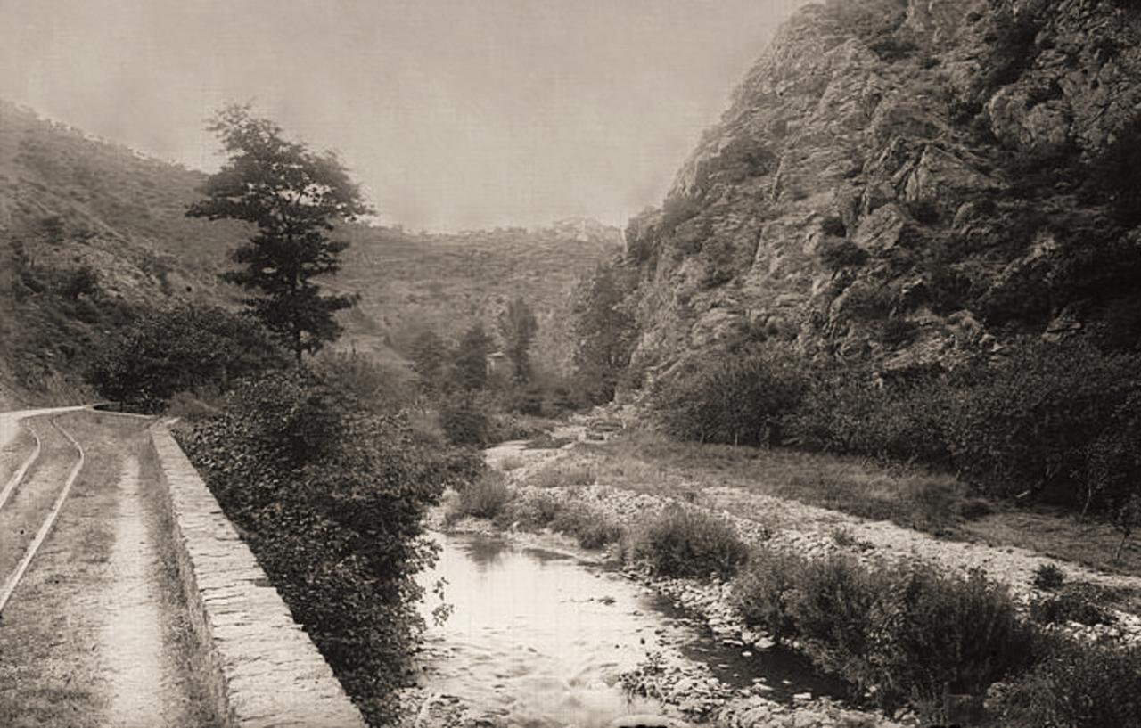 The tramway sitting between river and road south of Lastours. [15]
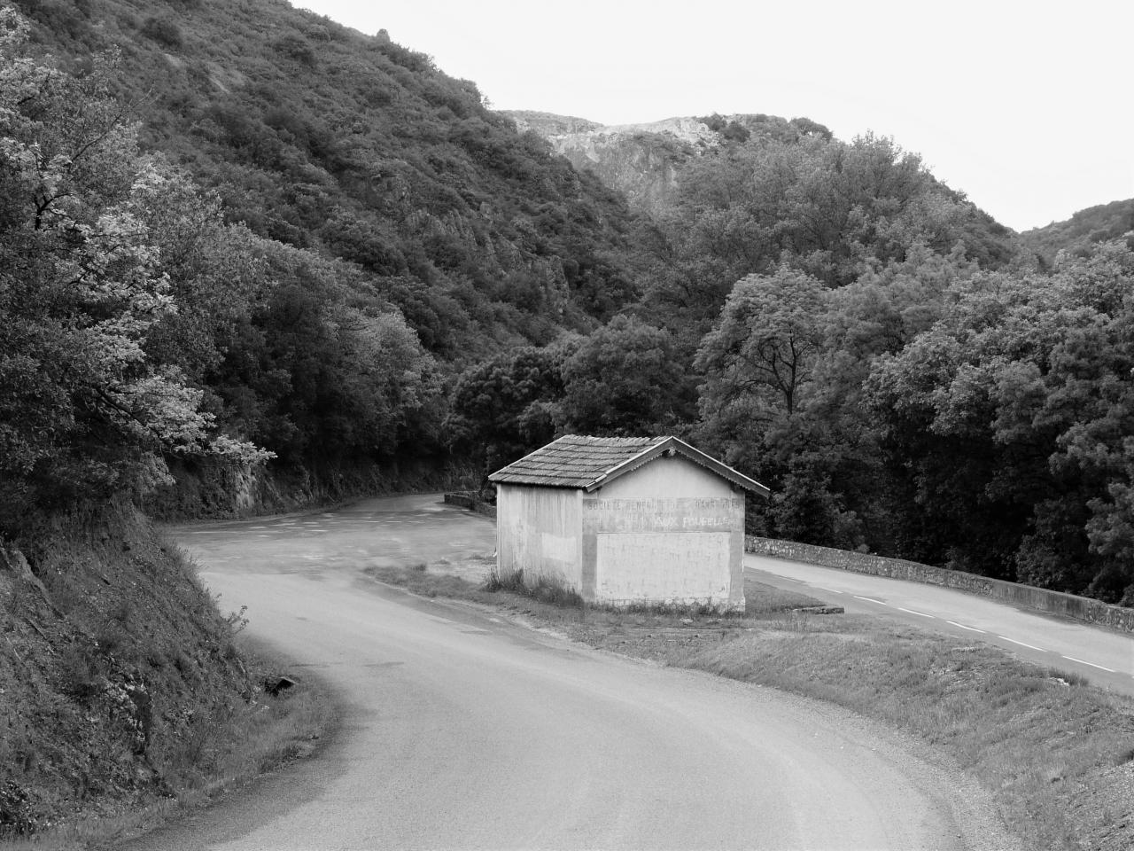
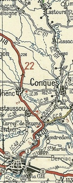
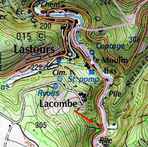 Trams left Lastours on their journey down the valley of the River Orbiel on the left side of the road but very soon they switched to the right (west) side of the road and then entered a short tunnel which was built to smooth out a very tight curve in the road down the valley. There are very few tunnels on the Tramways de l’Aude network and this is one of them. It bears the name Lacombe and is no more than 34m long. The portals are marked on the map above with a red dot and a green dot and are shown below. The pictures were taken from the highway, the first pair in the early to middle part of the 20th CenturyCentury after the tram tracks had been removed, the others in the very early 21st Century, the view of the more southerly portal is now blocked. [15]
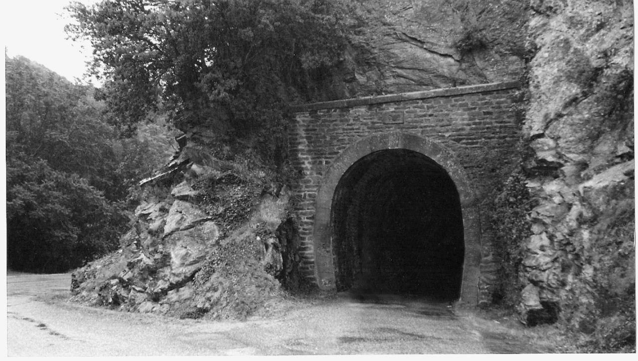 The north portal. [15]
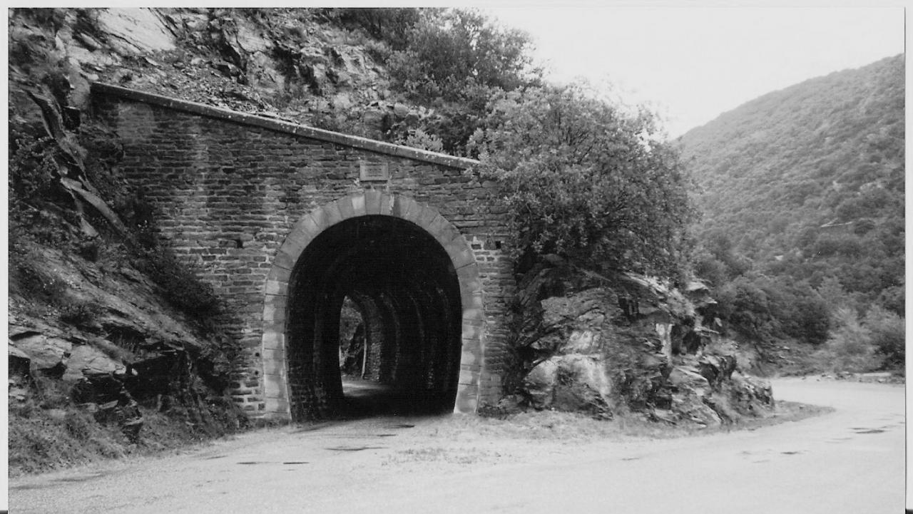 The south portal. [15]
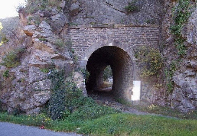 The north portal (above). [11]
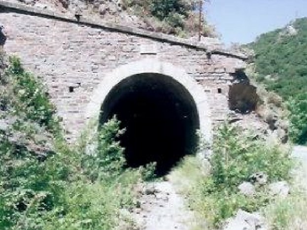
The south portal taken close to the opening. [11]
The south Portal (below) taken so as to show the road alignment. [11] This view is no longer available as a large concrete barrier has been placed in front of the south portal. Google Earth Streetview is a little out of date as it does not show the barrier which is on the satellite image.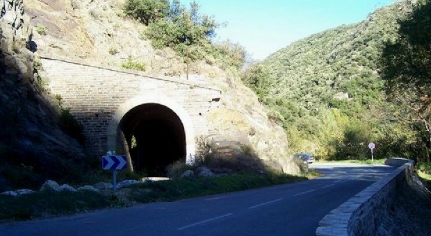
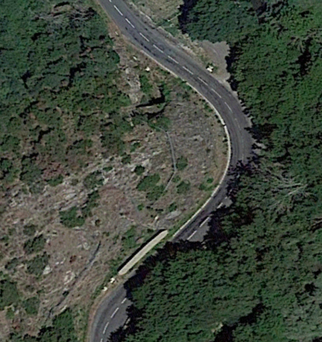
The satellite image clearly shows the large, high concrete barrier which was present when we passed the tunnel on 6th September 2018. I can only surmise that, at night, car headlights shining through the short tunnel have been responsible for some accidents. It would seem likely that cars have not negotiated the tight bends after being led to believe that the tunnel provided a gentler alignment for the road.
After the tunnel, trams continued to follow the western shoulder of the road for a while before then switching back to the eastern side of the road as the halt at Moulin d’Artigues was approached.
 The constraints of the site were tight, the road was narrow and it was trapped between the valley side and the River Orbiel. [5] Somehow the engineers of the time managed to fit both the tramway halt and road between the mill and the river.
One might presume that, in the middle of a rural area, a mill of this nature might have been put to annagricultural use. It would be a poor presumption to make, the valley was not rural in the normal use of the word. It was a hive of industrial activity and this mill was used for grinding, crucpshing and then blasting iron ore from Salsigne which was then used in gas purification.
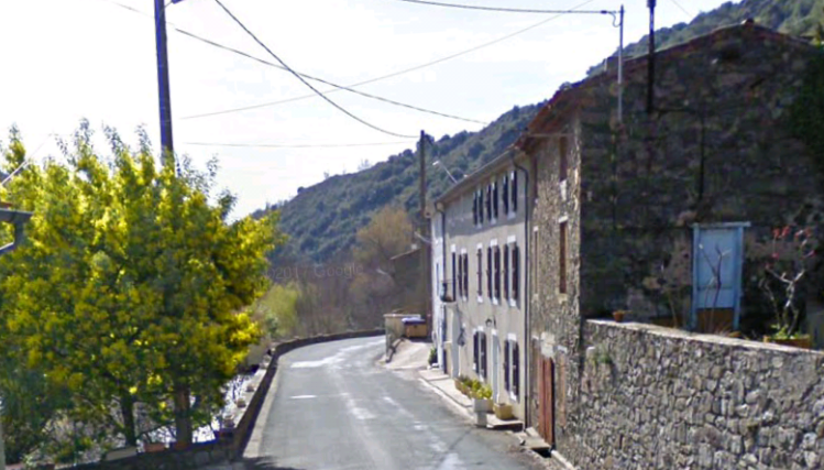
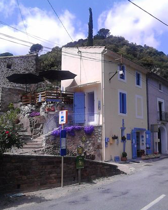
Part of the mill in now in use as a restaurant. The adjacent picture reminds us that when the tramways were closed the valleys they served were not abandoned. Bus services replaced them and often it was the presence of a reliable alternate for of transport which brought about the end of the tramways.
Much of the heavy industry of the valley failed in the mid-20th Century and the resident population moved away to find work.
The trams travelled on down the valley of l’Orbiell’Orbiel to the next halt ‘La Caunette’, thius was at the junction of the road leading to Salsigne and its mines, and close to the lower mining area of La Combe du Sault. At la Caunette Station there was a loading wharf for the Salsigne mines. The wharf and station building remain visible today.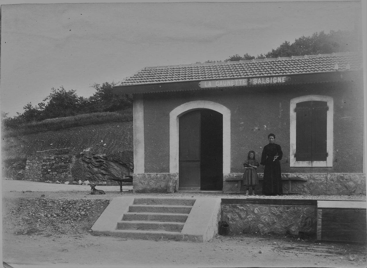
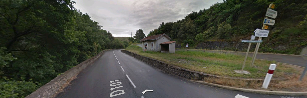
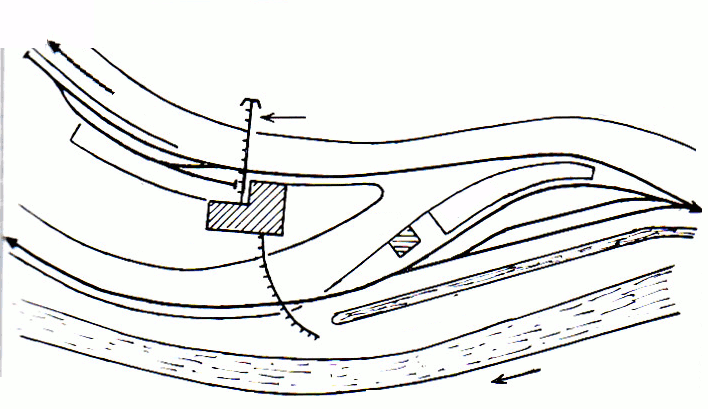
 A single track branch siding was provided to a loading wharf as shown in the sketch map above. [19] The tramway station had three tracks for the marshalling of tains and to allow two trains to pass each other. Mining products were transported from Salsigne Silver (and Gold) Mines and more immediately from La Caunette Silver Mines. It was a 5km trek to bring goods down from the Salsigne mines and a more arduous uphill trek to take goods transported by the tramway to the mines. [5] The condition of the road was poor and a 600mm gauge railway was provided to transport goods to and from Salsigne. The sketch plans shows its relation to the metre-gauge tramway.
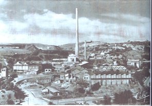 Associated with the mines was a large factory complex at La Combe du Sault. It was a dominant feature in the valley. It processed all the raw materials from the mines.
Incidentally, the gold content in the arsenic ore in the Salsigne mines has been measured as being 12gms/tonne. [5]
The mining complex of La Combe du Sault was of great significance in the 20th Century and greatly enhanced the prosperity of the Orbiel Valley. Once the factory closed, it was demolished in 1986 along with the accommodation which had been provided for workers. [12]
 The line continues down the valley following the GC101 (today’s D101). The next significant location marked on the Michelin map is Lassac. It was an inhabited hamlet, with castle, buildings, church placed under the name of Saint-Martin united with the Episcopal Mention of Carcassonne. Its territory is part of the communes of Sallèles-Cabardès and Limousis. The Villa Lassac, was on the right bank of the Orbiel with picturesque garden, orchards, meadows, vineyards, olive groves and mill. [5]
It appears, in 2018, that all that remains are ruins and that the hamlet is uninhabited. There was a major local campaign in the period 2006 to 2009 to prevent destruction of the immediate environs by the Departement. My French is not good enough to understand the technical terms involved but it appears that the issue was the creation of an industrial landfill site at Lassac on what were then polluted stilling ponds from the old works. [13]
As late as 2015 it was reported that the enterprise to create a landfill site at Lassac had failed. The courts declared the enterprise illegal and the Departement cancelled its contract with the company who were to undertaken the work. [14] This leaves unresolved the question of a suitable landfill site for the Aude.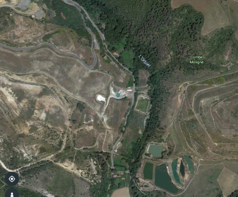 This satellite image shows the location of the station at La Caunette at its northern (top) edge. La Combe du Sault appears at the centre of the picture and Lassac in the bottom part of the photograph.
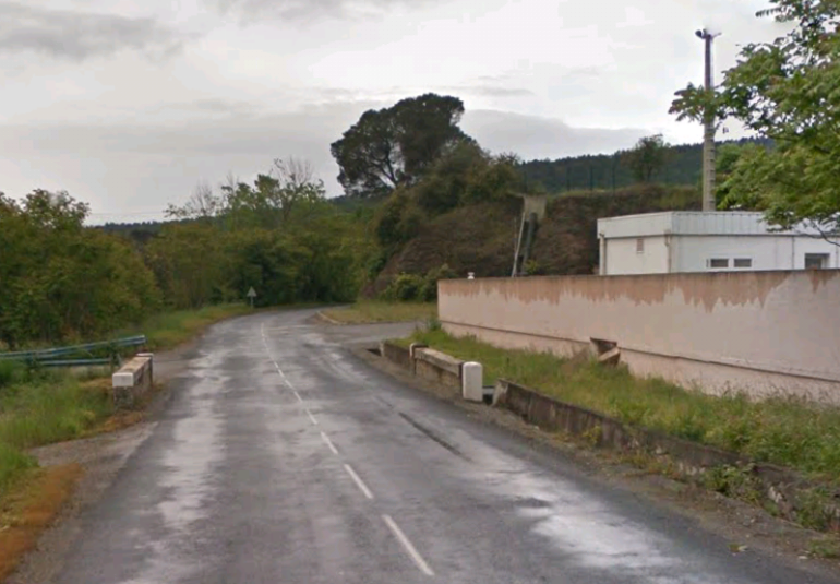 The gateway for La Combe de Sault.
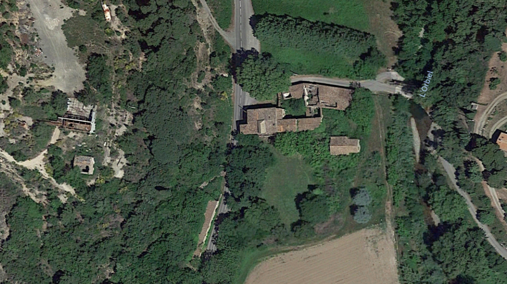 Lassac is shown in plan above and the buildings are shown in a photo taken from the D101 below.
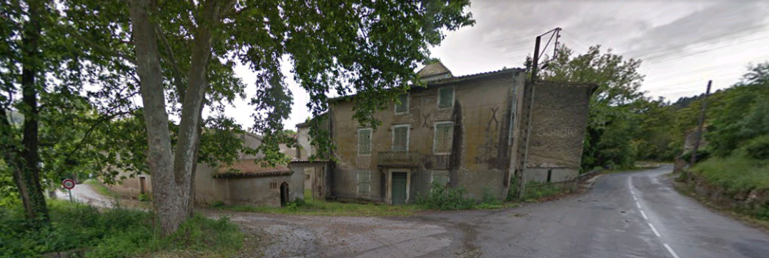
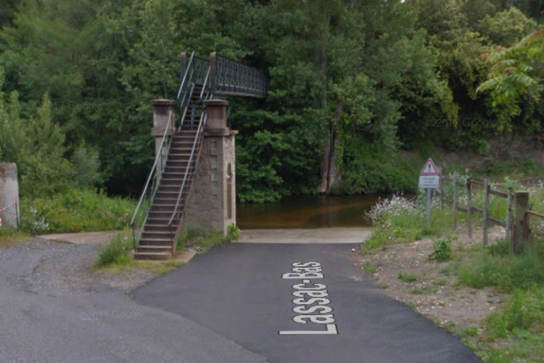 The river, ford and footbridge at Lassac.
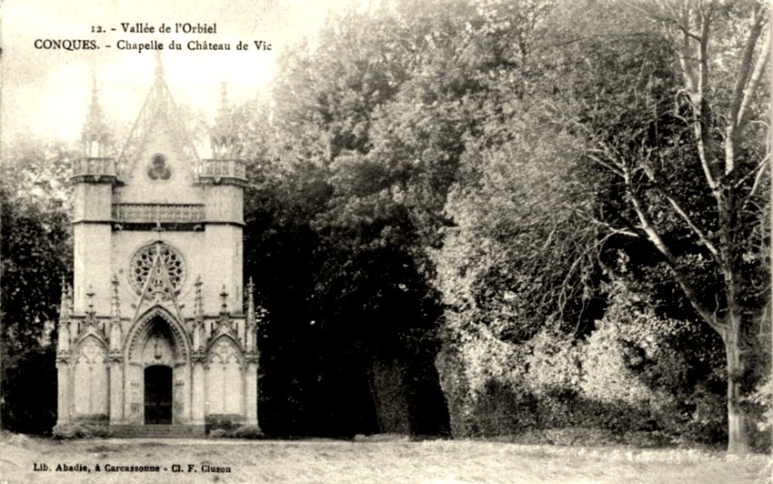
 From Lassac, the trams continued down the valley towards Conques-sur-Orbiel. It passes through two further halts on the way. Vic la Vernede was at the site of a priory. The priory at Vic was under the patronage of St. Peter and appeared in the 13th century.
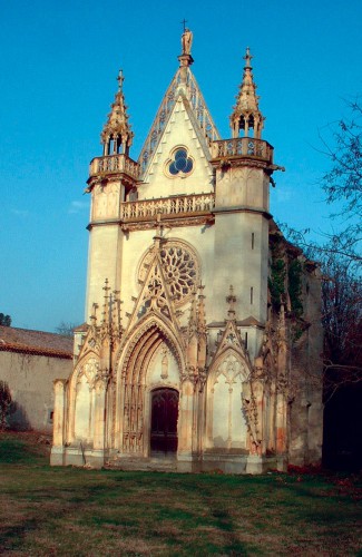
The chapel has relatively recently been renovated.
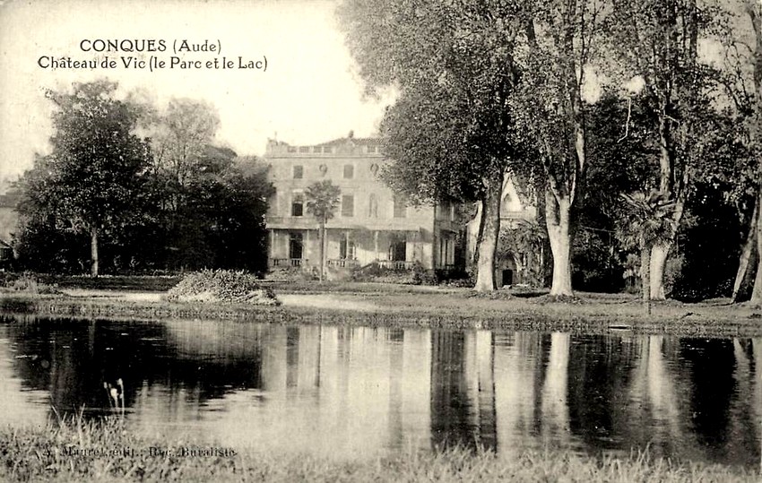
 In La Vernède, there is also a beautiful castle overlooking the valley which included a farm with vegetable gardens, vineyards, meadows, olive trees, herd of merinos thanks to the enlightened vision of its successive owners through time since at least the 17th century. [16]
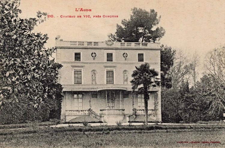
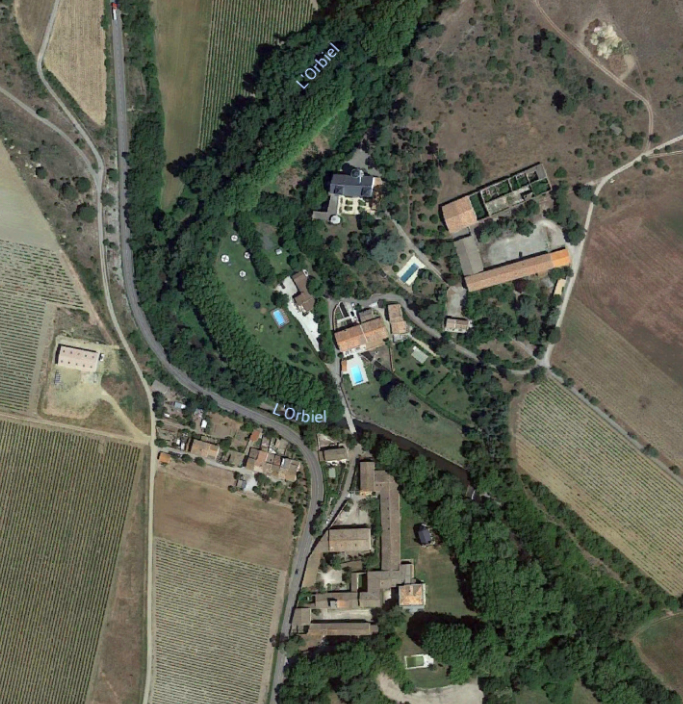
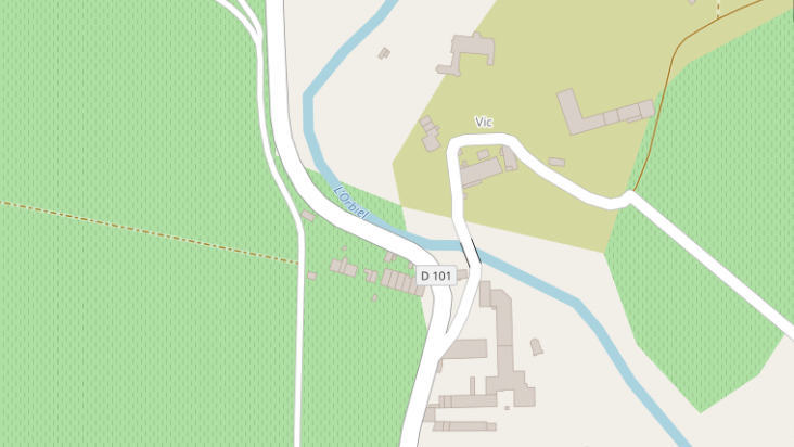 Shortly after passing through the hamlet of Vic la Vernede the tramway switched to the West side of the road and then deviated from the GC101 (D101). It branched away to the West. The route of the diversion can be seen in the picture below, on the right of the image, to the left of the trees.
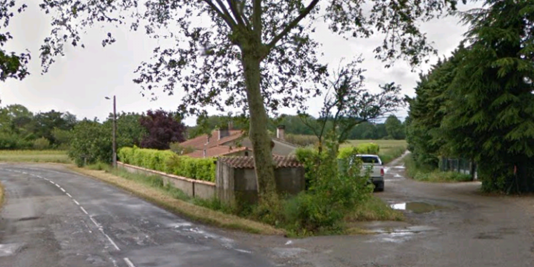
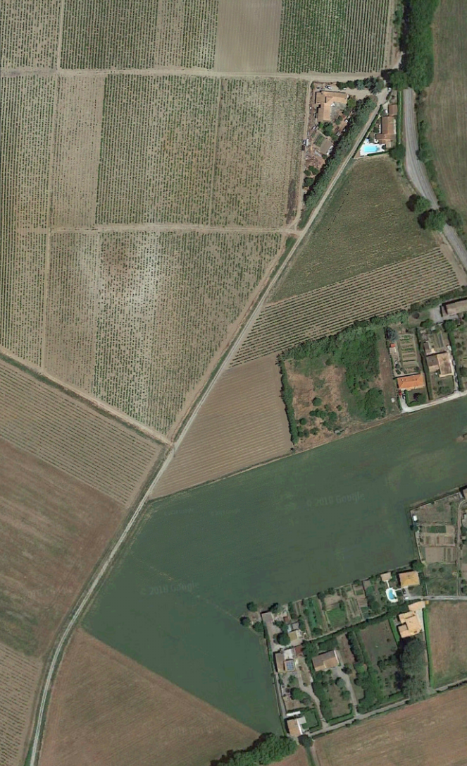 The route of the diversion is initially straight. It then curves to the south.
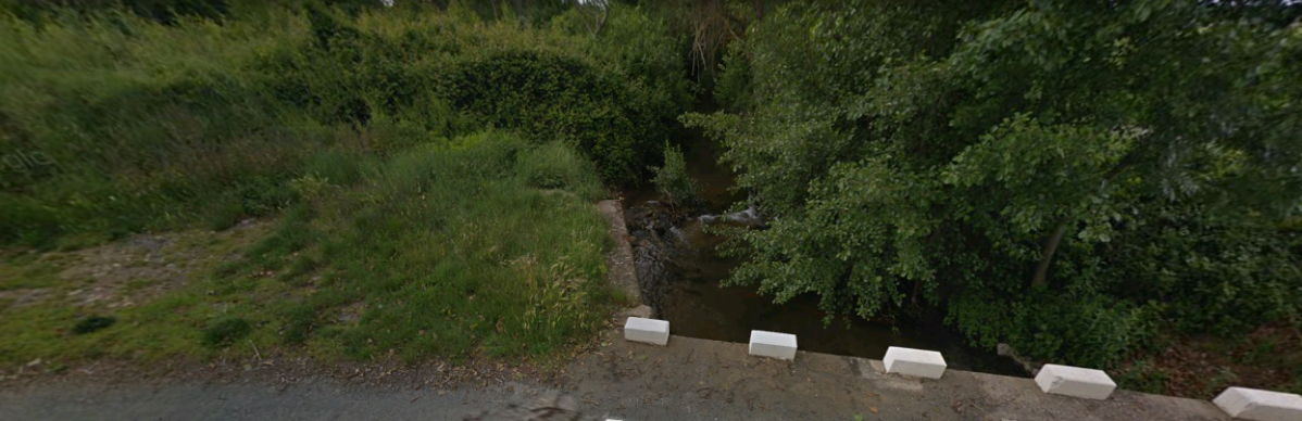
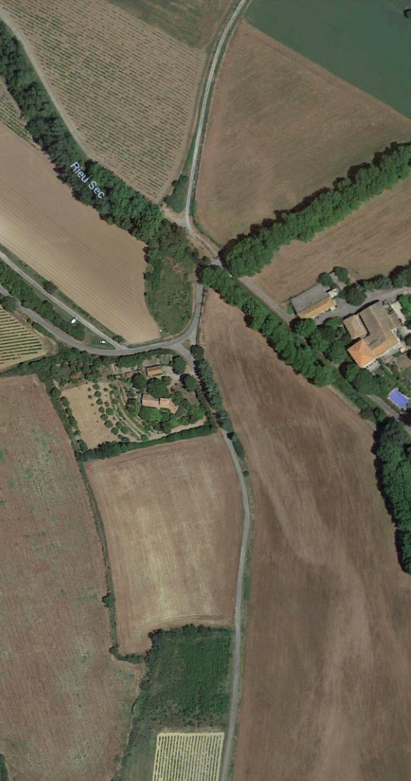 It the encounters the River Rieussec and crosses this on a 13 metre span metal bridge adjacent to the Salitis Road (D901) where the second of the two halts was sited. [5] After the halt the tramway continued in a southerly direction following the route of the lane south of the D901.
One of the abutments of the tramway bridge remain on the north side of the D901.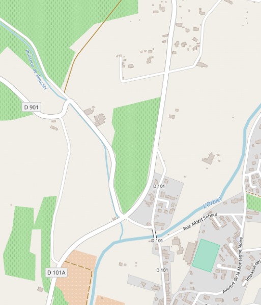
 The tramway alignment is just off the D901 to the north and the old bridge abutment is still present.
After the Salitis Road halt the tramway continued in a southerly direction following the route of the lane south of the D901.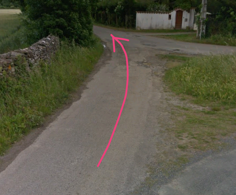 A new road, the D101A, bypasses Conques-sur-Orbiel and we used this route as we travelled south to Carcassonne on 6th September 2018. The lane which follows the route of the tramway, joins this new road.
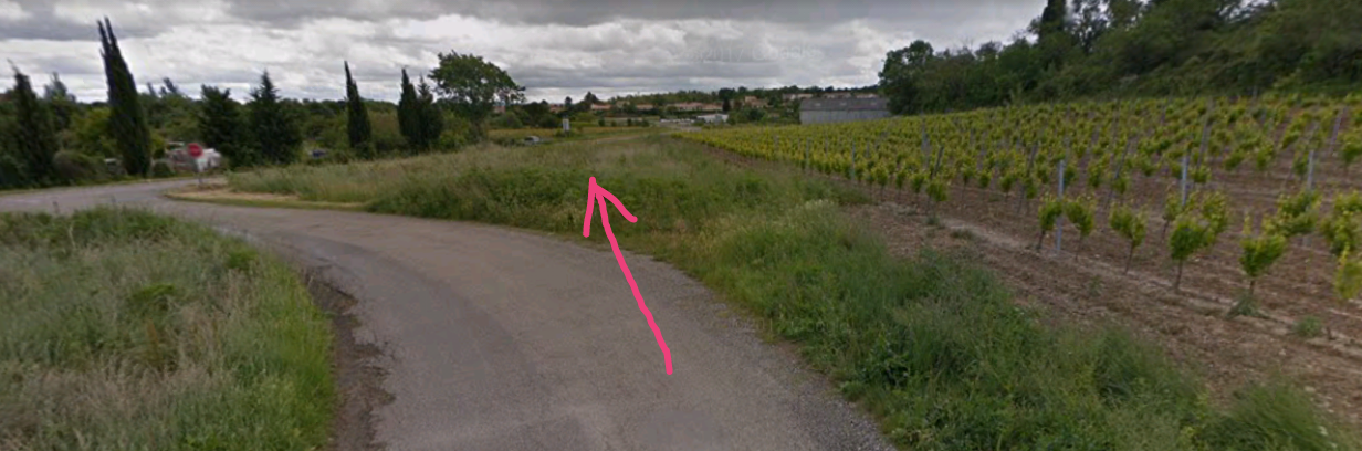 The D101A enters the photograph above from the left. The old tramway route enters from the bottom of the image and follows the edge of the vineyard field into the middle distance where it meets the D101A.
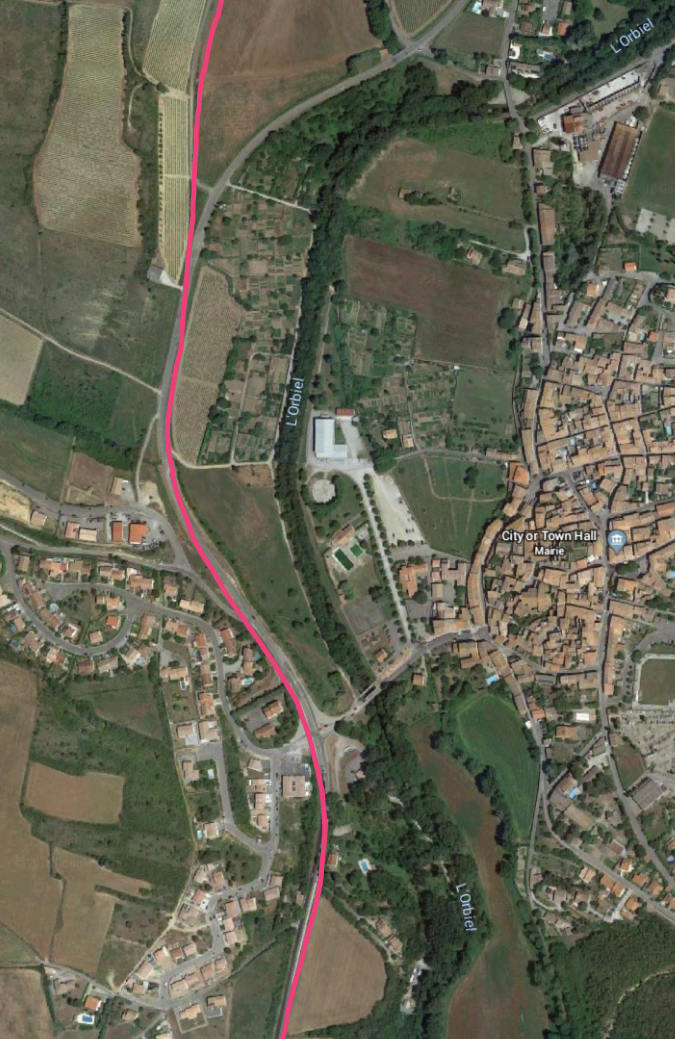 The station was located at the point where the IC35 (the modern D35) met the tramway.
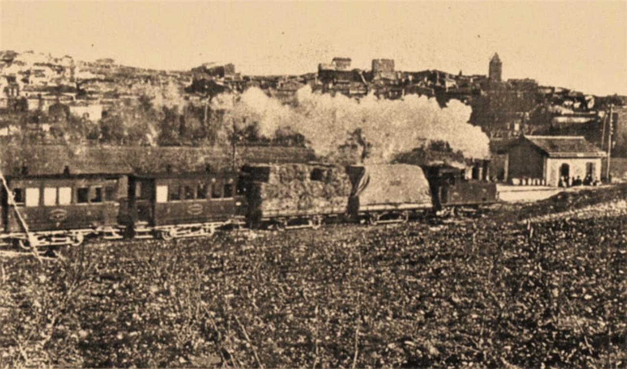
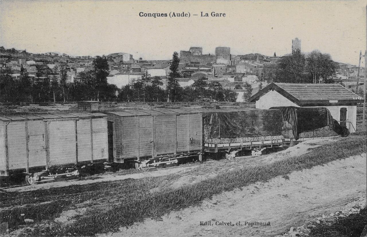
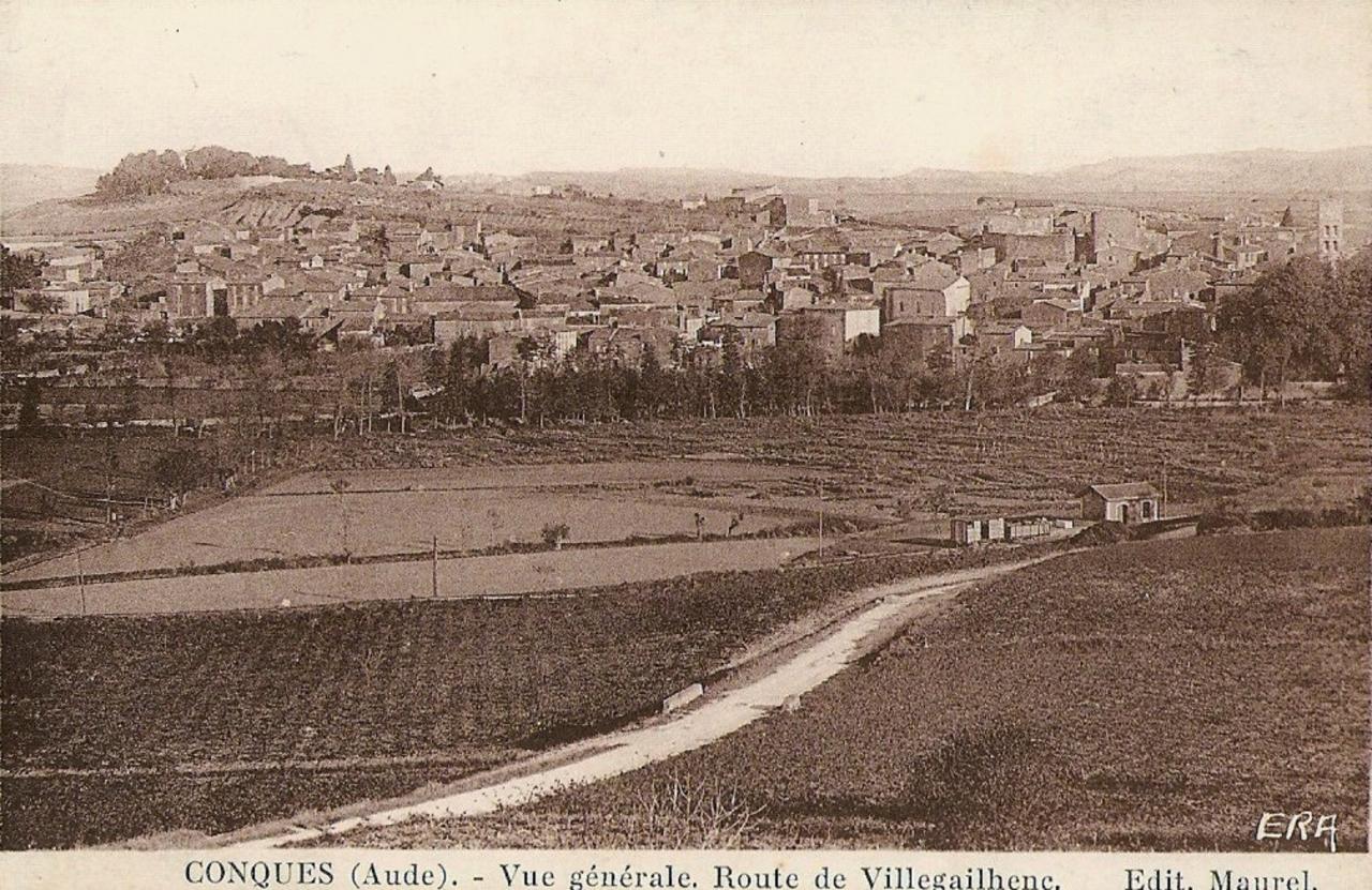 Comparing the above pictures of the station and the village of Conques with Google Street view images ties down the station location to the length of tramway to the north of the Route de Villegailheric (D35). The location is shown marked blue on the OpenStreetMap plan.
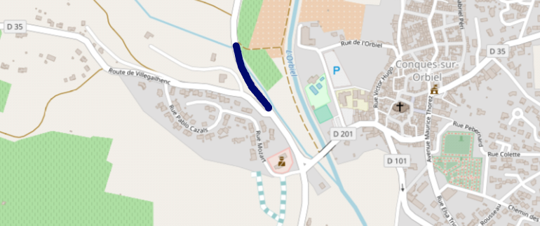 The station provided for trains to pass and also for the loading and unloading of goods. There was a 12m long platform for goods, one siding alongside the platform and another for storing wagons. The sidings were usually full because the line, although a metre-gauge lightly built line, saw heavy traffic. The industrial development of the valley ensured that significant loads were carried. In 1923, 20,600 tonnes were transported on the line. Because of the nature of the permanent way, train lengths and weights had to be limited. The limits placed on movements were: 56 tonnes between Carcassonne and Carrefour de Bezons, 51 tons to Conques, 60 tons from Conques to La Caunette and 51 tons from there to Lastours. [5]
This video has been produced locally. [17]
Travelling on from Conques the tramway followed the GC101 (D201) towards Carcassonne.
The tramway next arrived at the crossroads of Carrefour de Bezons. The station was south of the meeting point of the roads to Conques and to Villalier. It welcomed travelers from Villemoustoussou and the surrounding area. There were three lines in the station which was a junction station and trains could be taken to Caunes as well as to Lastours and Carcassonne. [5] A sketch plan of the station is shown below. [18]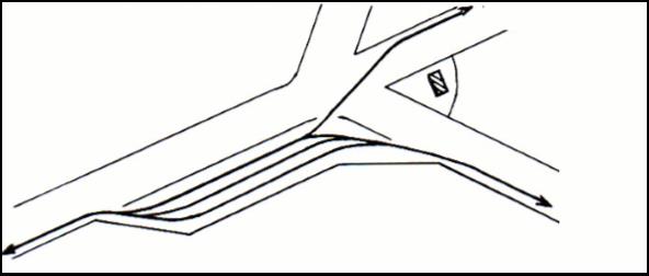
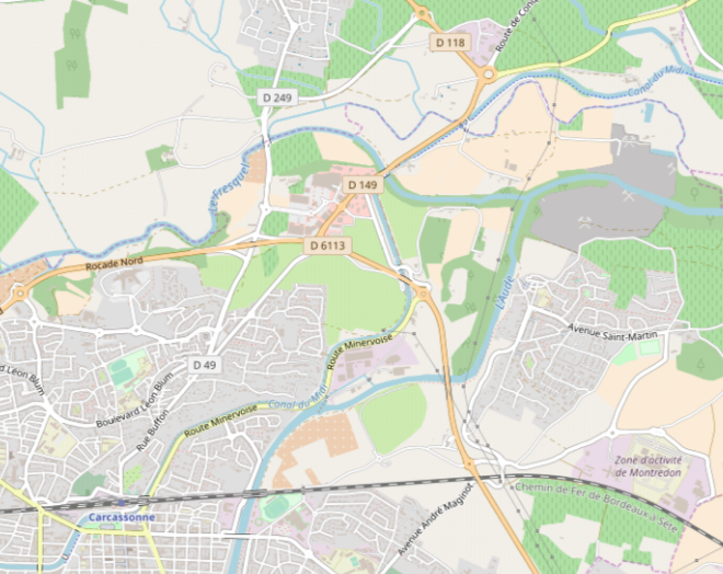 The station at Carrefour de Bezons was to the Northeast of the roundabout at the top of the above map close to the Canal du Midi. The tramway then followed the north/west bank of the Canal, first alongside the D149, then alongside the D118d(Route Minervoise) before crossing the Canal to the south/east side and then following what is now called the Route Minervoise all the way to its terminus across the Canal from what is now the SNCF station in Carcassonne. The first part of the route into Carcassonne is approximately shown by pink line on the satellite image below.
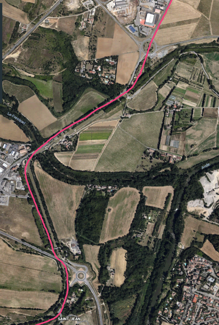 The area of Carcassonne immediately to the West of the River Fresquel is called Pont-Rouge. There was a halt on the tramway serving this community which was sited close to the road and canal bridge over the Fresquel.
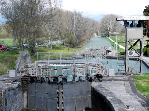 At Le Pont Rouge, the double bridge-viaduct and aqueduct over the Fresquel sits alongside a succession of locks which allowed the Canal du Midi to be diverted from its originally proposed route into Carcassonne, permitting the creation of a port capable of serving the interests of the City. [5][22]
From this point the tramway followed the Canal du Midi South along the Route Minervoise (D118) towards Saint-Jean and crossed the Canal at right-angles just to the north of the lock at Saint-Jean.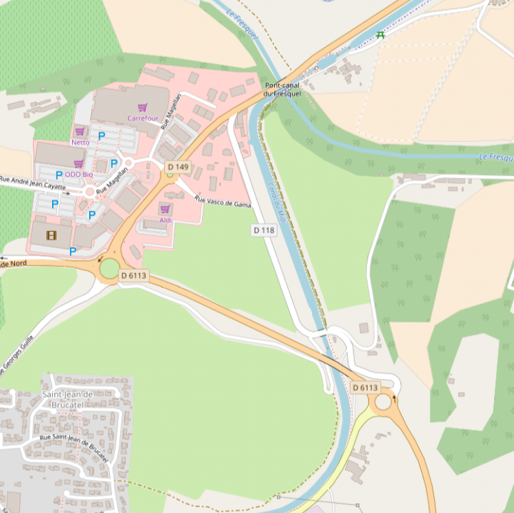
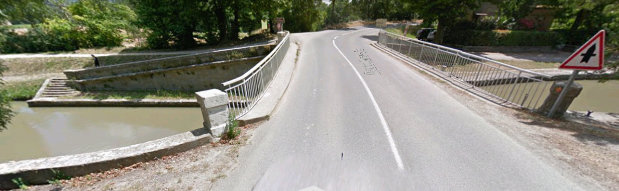 The tramway turned sharply to cross the Canal du Midi from its West bank to its East bank and then arrived at Saint-Jean.
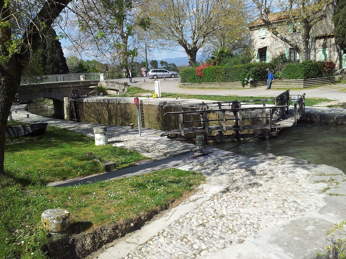 The Saint-Jean lock is a single lock on the Canal du Midi, built around 1674. [21]
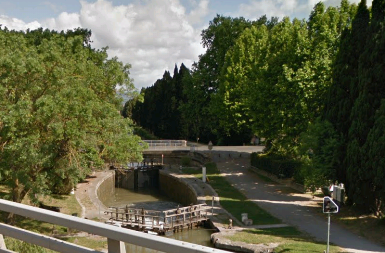 The lock at Saint-Jean.
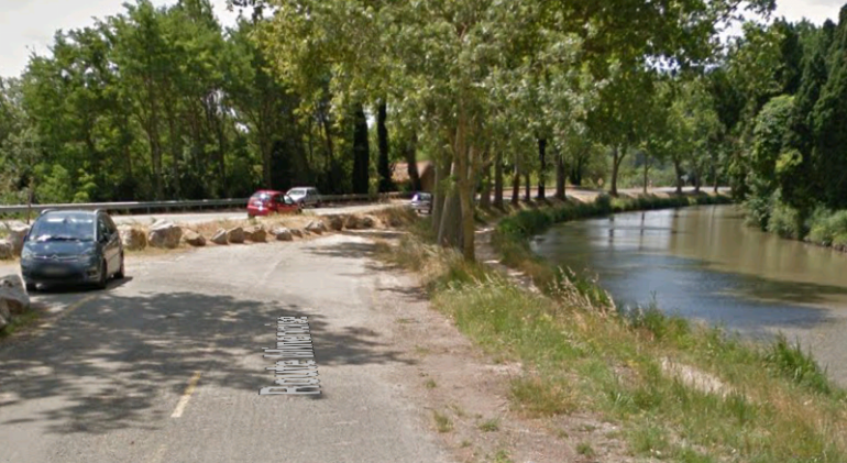 There was a halt at Saint-Jean and the tramway the followed the East/South bank of the canal into Carcassonne.
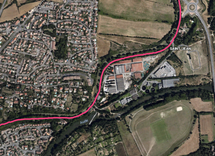
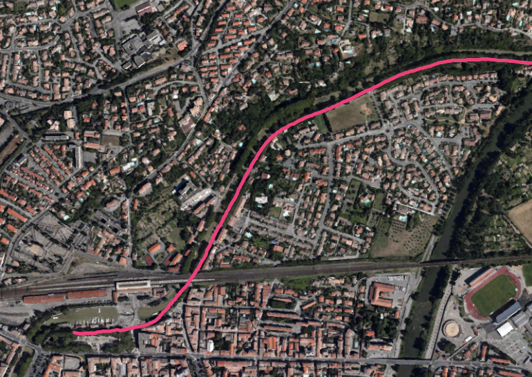
 The tramway formation is now covered by a tarmac road, the route Minervoise, on its way into the city.
 The tramway passes under the Compagnie du Midi mainline and then turns West to run on the South side of the Canal basin.
We finish this blog with a few views of the station and canal basin in Carcassonne and a couple of sketch plans of the tramway facilities in the city.  The Canal basin near the Gare du Midi. The tramway ran on the left of the buildings visible beside the water.
 The Compagnie du Midi mainline crosses both the Canal, and to the right the road/tramway.
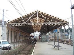
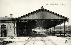
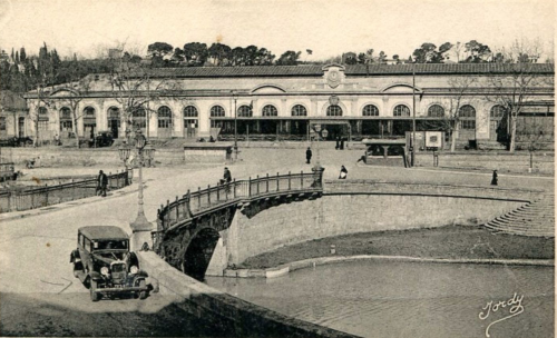 The Compagnie du Midi Station in Carcassonne – the Gare du Midi. The tramway ran just off the bottom of this picture. The two smaller pictures below show the overall train-shed roof , first in the 21st Century and second in the early 20th Century.
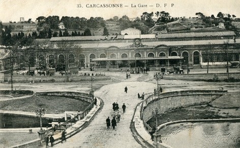 Another picture of the Gare du Midi in the early 20th Century.
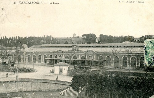 A final shot of the Gare du Midi. The small office in front of the station was of a similar size to one on the opposite bank of the Canal which was the ticket office for the Tramways de l’Aude and which is marked ‘I’ on the sketch plan below.
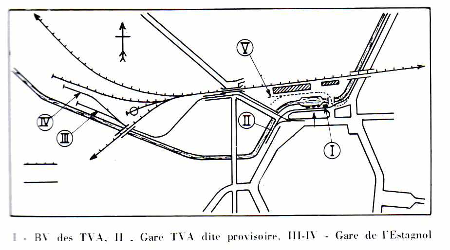
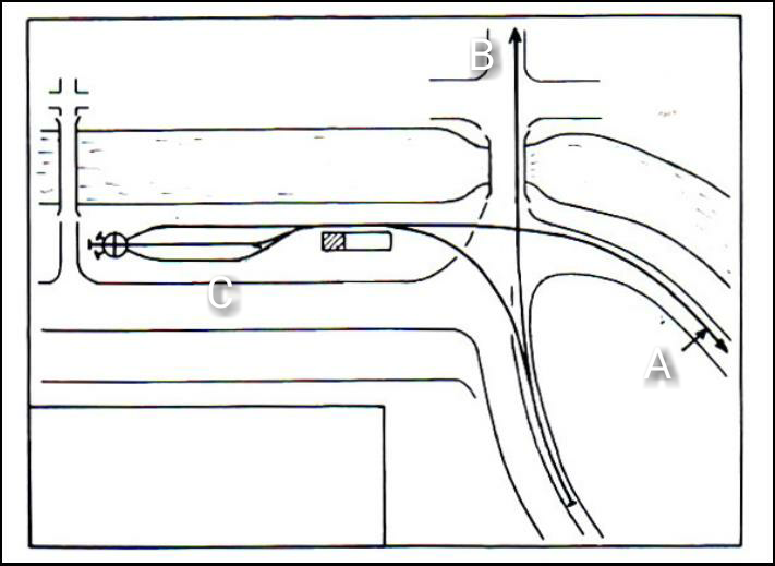 The facilities for the tramway in Carcassonne were significant. In the sketch plan immediately above we have the detail of the station facilities at ‘C’. The two routes which lead off the plan are: ‘A’, the tramway which runs to the South side of the Canal basin close to the Gare du Midi and then on through the Carcassonne suburbs to the rest of the network; ‘B’ the line feeding the Gare de l’Estagnol, which is marked ‘III’ and ‘IV’ in the plan above.
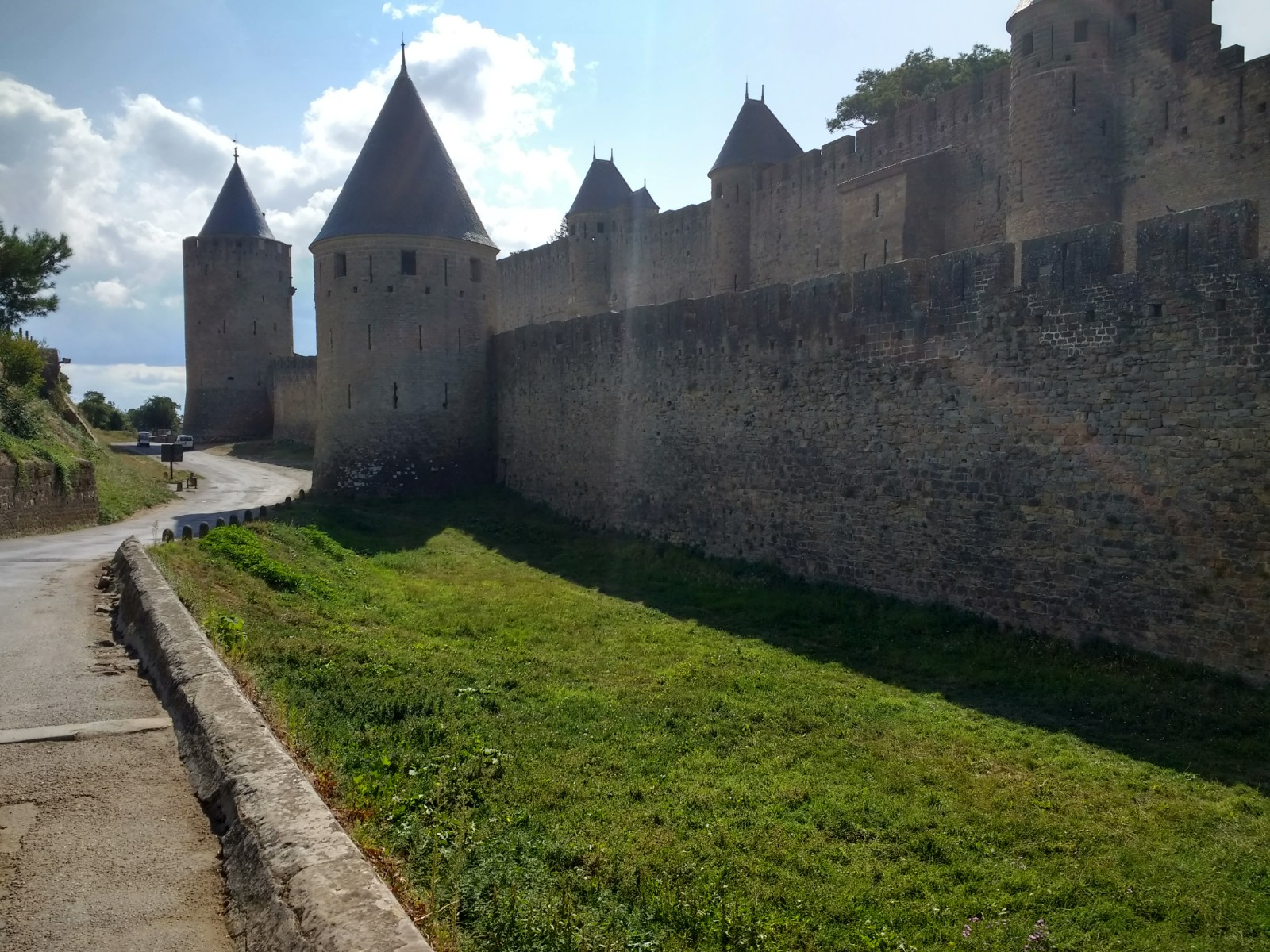
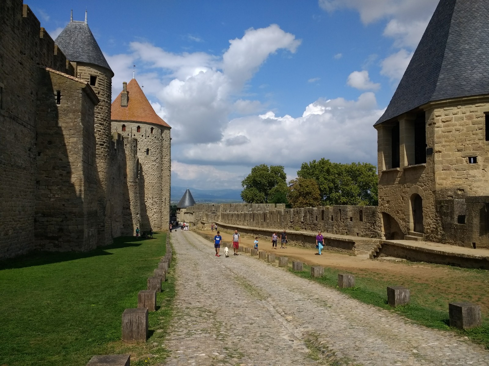
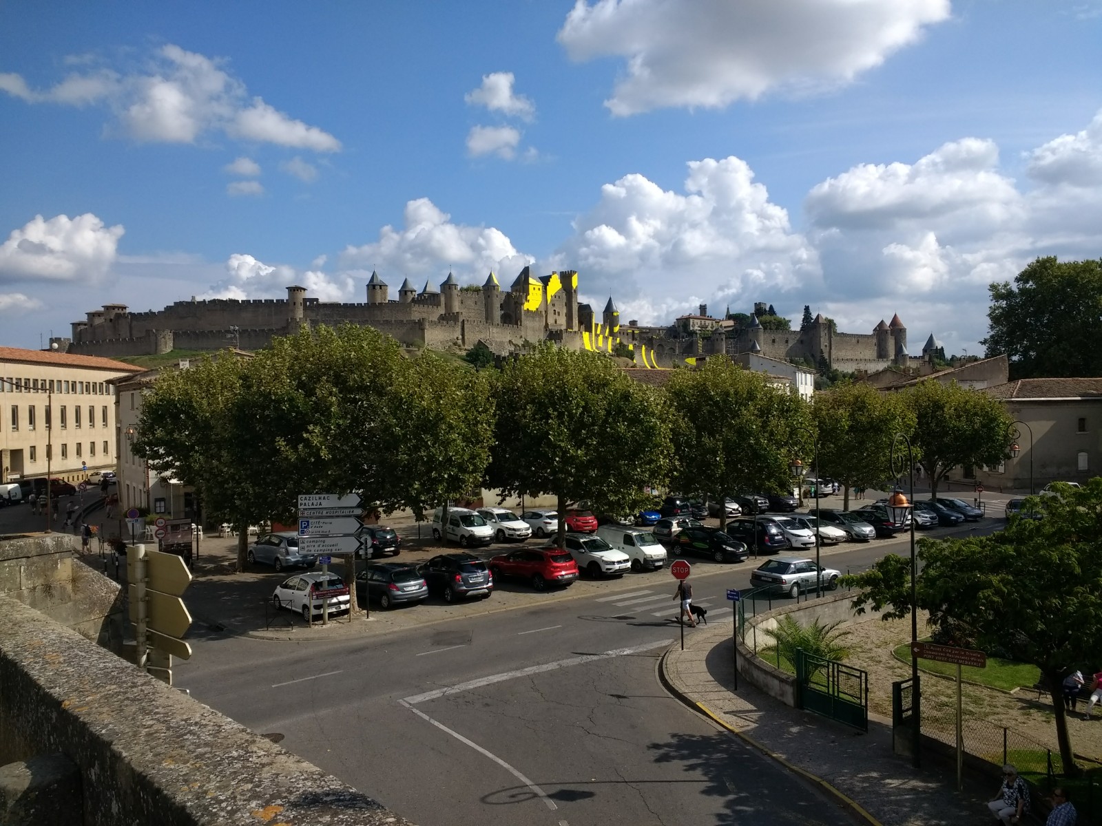
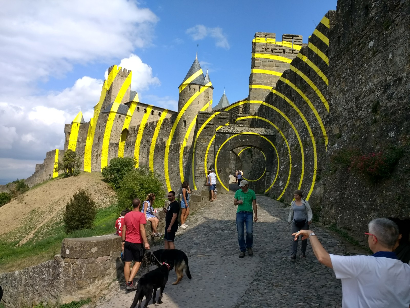
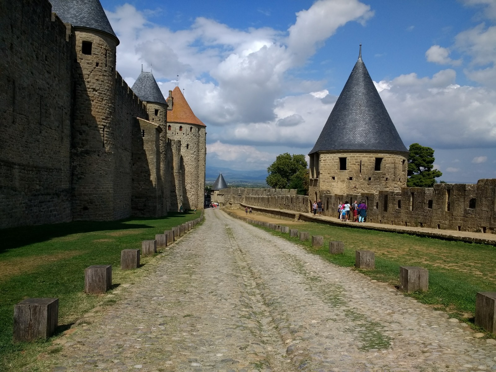
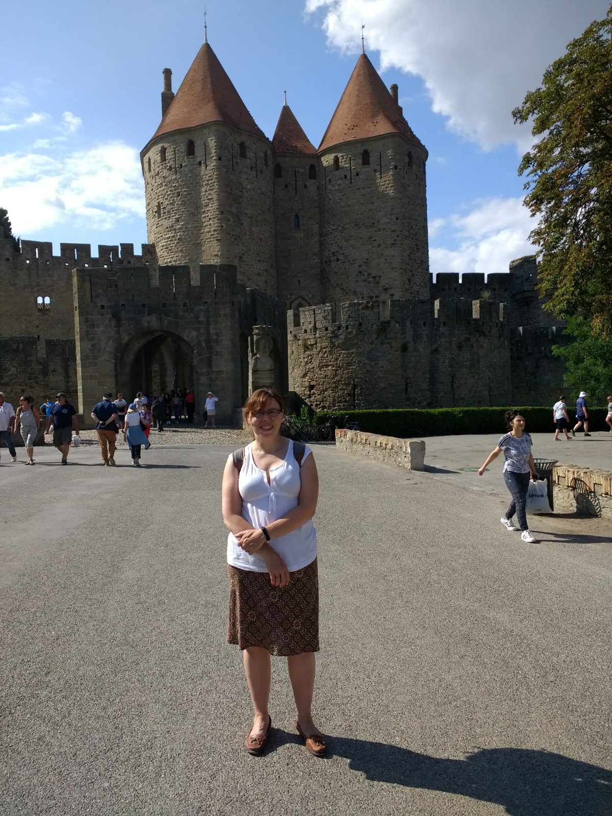
After following this line from Lastours to Carcassonne, my wife and I enjoyed walking round the old Cite of Carcassonne on 6th September 2018.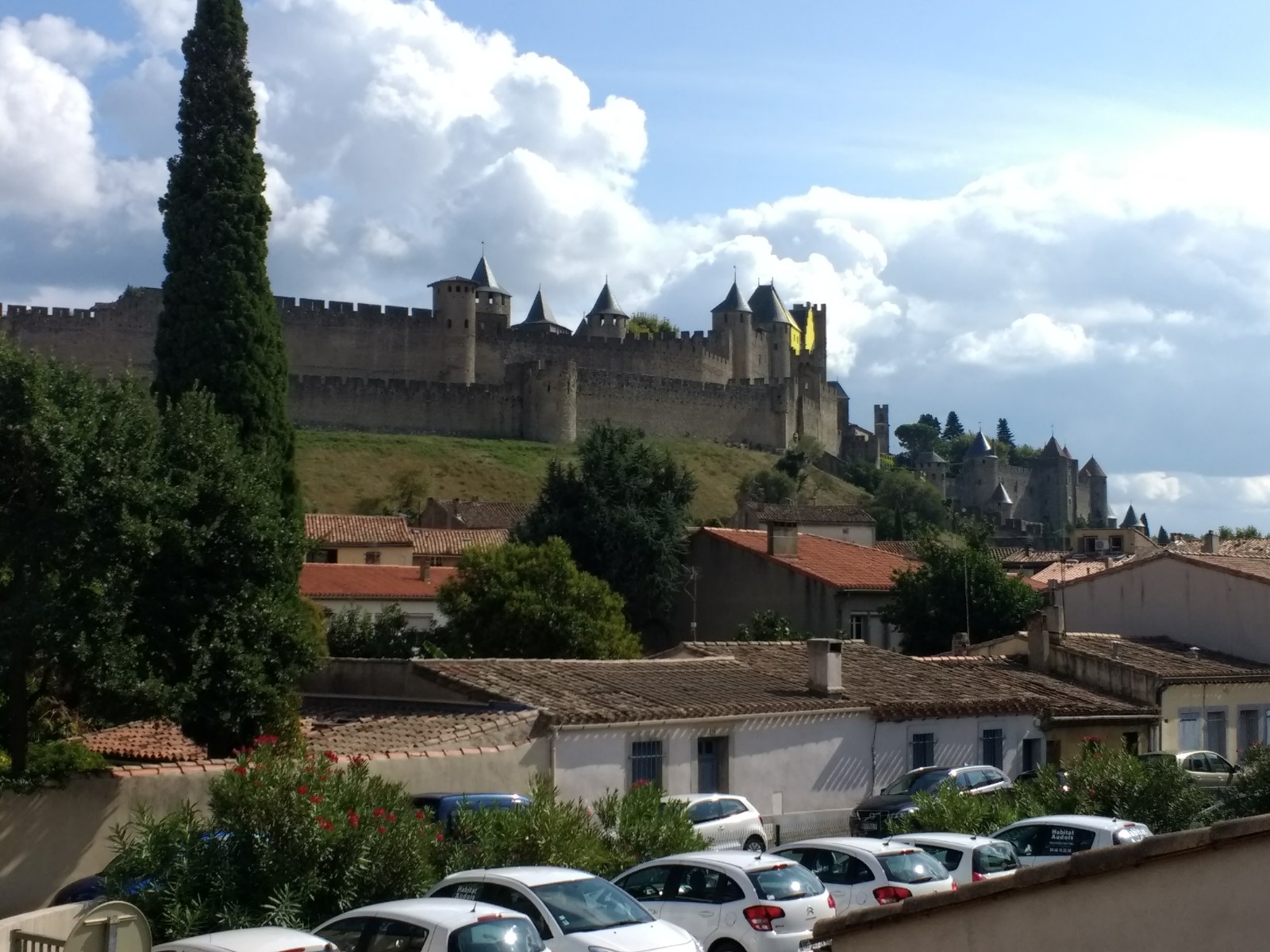
References
1. https://en.m.wikipedia.org/wiki/Lastours, accessed on 7th September 2018.
2. http://lescathares.free.fr/chateau/lastours.html, accessed on 7th September 2018.
3. http://www.belcaire-pyrenees.com/tag/histoire/9, accessed on 7th September 2018.
4. Michel Vieux; Tramways a Vapeur de l’Aude; R. Latour Editions 14 rue Sébile 09300 Lavelanet, 2011.
5. http://cahiers.de.minerve.pagesperso-orange.fr/HTML/cdf_carcassonnelastours.html, accessed on 7th September 2018.
6. https://www.delcampe.net/fr/collections/cartes-postales/france/autres-communes-10/11-lastours-1910-vallee-de-lorbiel-gare-et-loco-petit-plan-le-chien-fait-lanimation-phot-michel-jordy-carcassonne-591997285.html, accessed on 7th September 2018.
7. https://www.cparama.com/forum/lastours-t29076.html, accessed on 7th September 2018.
8. http://baetlanguedoc.blog50.com/apps/m/archive/2012/02/18/beaux-villages-du-languedoc-7.html, accessed on 7th September 2018.
9. http://conques.e-monsite.com/album-photos/de-1900-a-1950/innondation1930, accessed on 7th September 2018.
10. https://journals.openedition.org/insitu/3412, accessed on 7th September 2018.
11. http://www.tunnels-ferroviaires.org/tu11/11194.1.pdf, accessed on 8th September 2018.
12. Claude Gironis; La Combe du Saut; Editions Qui Lit Vit, 2012.
13. https://www.lindependant.fr/2013/12/12/lassac-nouvelle-victoire-de-terres-d-orbiel,1823748.php, accessed on 9th September 2018
14. https://france3-regions.francetvinfo.fr/occitanie/aude/le-projet-de-decharge-de-lassac-definitivement-enterre-634642.html, accessed on 9th September 2018.
15. http://conques.e-monsite.com/album-photos/de-1900-a-1950/les-tramways-de-l-aude, accessed on 9th September 2018.
16. http://www.belcaire-pyrenees.com/2016/06/conques-sur-orbiel-le-chateau-des-saptes-2eme-partie-et-fin.html, accessed on 9th September 2018.
17. https://youtu.be/S5t02UsNllI, accessed on 10th September 2018.
18. http://www.cpaaude.fr/THEMES/TRAMWAYS/index_fichiers/Page2636.htm, accessed on 10th September 2018.
19. http://www.cpaaude.fr/THEMES/TRAMWAYS/index_fichiers/Page2489.htm, accessed on 10th September 2018.
20. http://www.cpaaude.fr/THEMES/TRAMWAYS/index_fichiers/Page2097.htm, accessed on 10th September 2018.
21. https://fr.m.wikipedia.org/wiki/Écluse_de_Saint-Jean, accessed on 11th September 2018.
22. http://aavccarcassonne.blogs.lindependant.com/apps/m/tag/le+pont+rouge, accessed on 11th September 2018.

Bonjour
Je découvre ces articles sur les Tramways à Vapeur de l’Aude .
Vous êtes bien documentés sur le sujet et votre article est très bien fait .
Evidement , parlant mal l’anglais , j’ai utilisé la traduction en français .
En complément de votre article ,la voie des TVA continuait vers le pont d’Artigues puis descendait le long de la voie SNCF rue Soumet , puis bifurquait rue Bertrand Lamourelle (patron de la friperie qui occupait le pâté de maison avec les Docs Méridionaux ) jusqu’à l’avenue Sémard , puis vers le pont SNCF de la ligne Carcassonne-Quillan .
Passé sous ce pont , le train passait à gauche en site propre le long du canal ( et non pas par la rue des Tramways comme on pourrait le croire ) jusqu’au dépôt .
le dépôt des TVA se trouve encore au bord du canal du Midi , après le dépôt SNCF . Malheureusement le château d’eau a été détruit il y a quelques années , et le bâtiment du dépôt n’est pas loin de s’écrouler .
En complément encore :
Lors d’une visite dans la Friperie Lamourelle nous y avons découvert une plaque tournante avec des vestiges (quelques traces ) en voie métrique . la voie métrique avait été remplacée par des coupons la voie portable Péchot de l’armée . une voie SNCF rentrait dans l’usine pour les livraison et expéditions de ballots de tissus un wagon plat PLM servait pour transborder les ballots de tissus d’un quai à l’autre ? et un locotracteur Deutz permettait les manœuvres des wagons SNCF sur l’unique voie . Cette voie venait de Limoux alors que celle qui entrait dans les Docs Méridionaux venait de la gare .
Voilà mon petit exposé est terminé .
Je vais attaquer la lecture de la sute des ces articles audois .
Bonne journée
Pierre-André Cousigné
Dear Pierre-André
Thank you for making contact. I have translated your comments into English as my French is not very good. The English text follows after this quick reply. I hope I have understood enough of what you have written.
Good morning I discovered these articles on the Aude Steam Tramways. You are well documented on the subject and your article is very well done. Obviously, speaking English poorly, I used the French translation. In addition to your article, the TVA track continued towards the Pont d’Artigues then went down along the SNCF track on rue Soumet, then branched off onto rue Bertrand Lamourelle (owner of the thrift store which occupied the block with Docs Méridionaux) until ‘to avenue Sémard, then towards the SNCF bridge of the Carcassonne-Quillan line. Passing under this bridge, the train passed on the left along the canal (and not via rue des Tramways as one might think) to the depot. The VAT depot is still located on the banks of the Canal du Midi, after the SNCF depot. Unfortunately the water tower was destroyed a few years ago, and the depot building is close to collapsing.
During a visit to the Friperie Lamourelle we discovered a turntable there with remains (a few traces) of metric gauge the metric gauge had been replaced by coupons the portable Péchot track of the army an SNCF track entered the factory for the delivery and shipment of bales of fabrics a PLM flat car was used to transship the bales of fabrics from one dock to another? and a Deutz shunter allowed the SNCF wagons to be maneuvered on the single track. This route came from Limoux while the one which entered Docs Méridionaux came from the station.
So my little presentation is finished. I’m going to start reading the rest of these Aude articles.
Good day
Pierre-André Cousigné
I will try to follow your comments on Google Earth.
Best wishes
Roger