
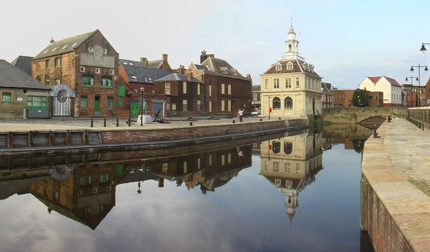
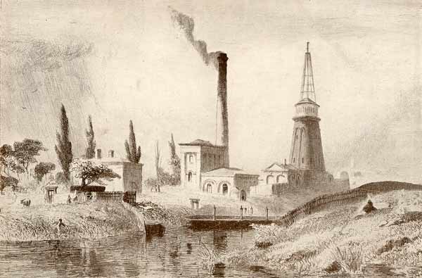
King’s Lynn was my home from 1972 to 1978 – my teenage years. I have often thought about investigating the ports and railways of the town. King’s Lynn has a long and distinguished history as a port. Until 1537, the town was called Bishop’s Lynn with a population of 5,500-6,000. Wool, grain and salt were exported and pitch, fish and iron were imported. The adjacent image gives an impression of the town in the Medieval period. [21]
In 1101 Bishop Herbert de Losinga of Thetford began the first Medieval town between the Purfleet and Mill Fleet by building St. Margaret’s Church (now King’s Lynn Minster) and authorising a market. A small prosperous town grew up quite quickly and, in 1204, following a charter from Bishop John de Grey of Norwich, the town became Bishop’s Lynn (Lenne Episcopi).
Trade built up along the waterways that stretched inland from Lynn, and the town expanded and quickly filled the space between the two rivers, Millfleet to the south and Purfleet to the north.
By the late 12th century, a further period of expansion began, more deliberately planned than the first, with wider straighter streets and a much larger market place – this is the second Medieval town between the Purfleet and Gaywood River or Fisher Fleet.
Bishop’s Lynn grew rich on trade, both within Britain and abroad. The Hanseatic League, a powerful German trading organisation made up of merchants from North Germany and neighbouring countries around the Baltic Sea contributed greatly to this prosperity. The legacy of trade can be found in the many merchant houses and other fascinating buildings in this medieval port. Visit West Norfolk provides a good history of the Hanseatic period in the life of the town:
“By the early 13th century Lynn had become a significant market town and seaport, having grown rapidly since 1101 when Bishop Losinga of Norwich recognised it as a settlement on his Gaywood estate. He had endowed the Benedictine monks of Norwich Cathedral with the lordship. Their Priory Church of St Margaret was, nevertheless, only to be built and rebuilt through the wealth of Lynn’s mercantile community, though the Norwich bishops were determined to retain their grip on the town. They had founded a second town and market in the 1140s on the Newland to the north of the first and assumed the lordship of both centres – of Bishop’s Lynn – in 1205. When Lynn received its first royal charter of borough freedom in 1204, giving its merchants a degree of self-government, it was already the third or fourth port of the Kingdom.” [2]
“German merchants from the Baltic and Hamburg secured trading privileges at Lynn in 1271 and these were confirmed, after some local disputes, in 1310. The right to maintain their own houses was a critical concession (other alien merchants had to lodge with burgesses). Lübeckers and other merchants from the East appear to be visiting English ports at the beginning of the 13th century, following traders from Got land, to Lynn, Hull and Boston, then to London. Professor Friedland has also referred to Lynn and Boston as destinations for Hanseatic merchants trying to establish themselves in the West. The Norfolk town accepted them as “the fraternity of the German Hanse” (fratres de hansa alemanies in Anglia existentes, Lynn 1302). Boston and Lynn attracted the German Hanse because their extensive hinterlands offered commercial opportunities and rewards. They travelled to these Wash ports for wool in the 13th century, visiting their annual summer fairs, as did the Lübeckers in 1271.” [2]
“Once the export of wool from England began to fall in the later 14th century, Hanseatic towns tended to link up with particular English ports. German trade to Boston was interlocked with the Kontor at Bergen where Lübeckers enjoyed a dominant role; their ships carried fish to the Wash and took away wool, cloth and salt. Lynn merchants made Danzig their chief destination from the 1380s and, sure enough, it was ships from Danzig that had already started to visit the Norfolk seaport, though Hamburg and Bremen men traded through Lynn too.” [2]
“Herring, timber, wax, iron and pitch were imported into England via Lynn in Hanseatic ships which sometimes carried grain from the Wash to Flanders. Wool, skins, cloth and lead were commodities taken back to Danzig and other German harbours. Lynn merchants sent cargoes to Prussia in Danzig ships and to Bergen in Lübeck bottoms, but none of them appear to have been resident in Norway or Hanseatic cities until the 1380s. Lynn was soon more heavily dependent on the Prussia trade through Danzig than any other English port.” [2]
“A number of Lynn merchants and their associates seem settled in several Baltic seaports by the early 15th century, particularly in Wismar, Stralsund and Danzig. That Lynn treated independently with the Hanseatic cities in the resolution of disputes or grievances testifies to a not inconsiderable presence. Details of this commercial and diplomatic interaction can be found in the memorandum book belonging to William Asshebourne, Lynn’s town clerk. In 1408 he received a letter from Lynn men in Danzig setting out their ordinances recently drawn up for “their company” there. The son of Margery Kempe married a Prussian woman and both travelled to Lynn in 1431, leaving their child in Danzig. Unfortunately, Margery’s son died in Lynn and she escorted her daughter-in-law back to Danzig. There appears also to have been an exchange or transfer of sailors and artisans between Wash and Baltic seaports. A sizeable group of German shoemakers were living in Lynn by the 1420s for example.” [2]
“Commercial relations between England and the Hanse deteriorated following the seizure of its Bay salt fleet (from south-west France to the Baltic) by English privateers in 1449. Then all Hanseatic towns united against England after a major incident off Denmark in 1468. Peace was negotiated at Utrecht in 1473/74 after several years of sea warfare and the German delegation achieved most of its diplomatic aims. It insisted on a free gift of their former trading posts or steelyards at London and Boston and of a new one at Lynn. The Treaty of Utrecht was signed in 1474 and the English King conveyed a quay and tenements in the Norfolk town to the Hanse. Lübeck invited Danzig to take charge of the property, the complex now known as Hanse House. This is today the only surviving Hanseatic business headquarters or steelyard in England.” [2]
After the dissolution of the monasteries by Henry VIII, Lynn changed it name to Lynn Regis – subsequently King’s Lynn – remaining an active port to this day. [1] Henry VIII finally dispossessed the Norwich bishops and transferred full political power to the town’s merchants.
“By the 16th century the east coast trade in corn and coal, mainly involving London and Newcastle respectively, kept the commercial wheels of this Norfolk seaport turning. Though its international trade with the Baltic and south-west France (wine imports were substantial) continued, it was relatively less important than before. Lynn’s hinterland remained the key to its success. In 1722 the travel writer Daniel Defoe was impressed by the fact that the Wash haven enjoyed “the greatest extent” of inland navigation of any English port outside London and served six counties “wholly” and three “in part” with coal, wine and provisions. Lynn was in turn a major corn exporter with granaries lining the river. But the town failed to develop any manufacturing industries in the course of the 18th century and, despite the buoyancy of shipbuilding and brewing, its population was only 11000 in 1801.” [2]
“Lynn’s population doubled between 1801 and 1851 as the market and port expanded with East Anglia playing a leading role in feeding London and the new industrial regions. Then the coming of the railways in the 1840s robbed Lynn of its geographical advantages as river and coastal traffic gave way to the iron road. Population fell from 20,000 to 17,000 in the period of 1851-1871 and economic recovery followed through the building of docks linked to the new national railway network, which sparked the town’s first industrial revolution. New factories began to supply English farmers with machinery, artificial manure and animal feed. Yet the town grew slowly because it was too remote from the industrial regions; its hinterland remained agricultural when food imports into England from America increased to compete with home farmers.” [2]
“Despite the growth of suburbs and some redevelopment in the 1960s and 1970s, the Old Town of King’s Lynn remains of national significance for its architectural and historic interest. Its connection with the Hanseatic League of the Middle Ages was highlighted in 2004 with the visit of the Kieler Hansekogge; then in 2005 the Borough of King’s Lynn and West Norfolk became a member of the New Hanseatic League – England’s first representative.” [2]
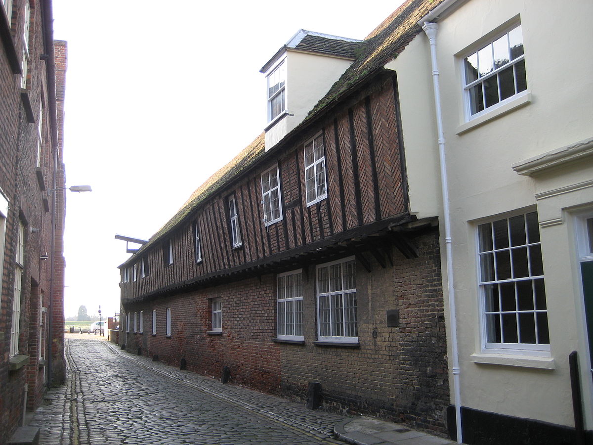
The Hanseatic League Warehouse in King’s Lynn is the only surviving League structure in England [17]
The harbour was historically along the waterfront on the river. In the middle ages the River had a more easterly course and some of the medieval buildings were on an island. the river course was moved westwards and Boal Quay and South Quay were formed. King’s Lynn Harbour Branch was constructed to serve these quays. deatils of the Harbour Branch can be found on in this post:
The port infrastructure developed in the 19th century following the formation of a docks and railway company in 1865. This built the Alexandra Dock which was completed in 1869 and linked by rail in 1870. By 1876 over 500 ships were using the new dock each year. [3].
The larger Bentinck Dock with a length of 800 metres (2,600 ft) was opened in 1883. [3][4] The port has traditionally relied on exporting agricultural produce for the bulk of its traffic. [3][16]
In the early 21st Century, the docks are operated as the Port of King’s Lynn by Associated British Ports. The port handles around 750,000 tonnes of cargo a year, including agricultural and forest products, chemicals, steel and other metals. [4] Three docks, including the tidal Riverside Quay, can accommodate vessels up to 140 metres (460 ft) in length. [4] The docks cover an area of 39 hectares (96 acres) and include the 25,000 tonne capacity Alexandra Grain Silo complex. [4][16]
The Docks Branch
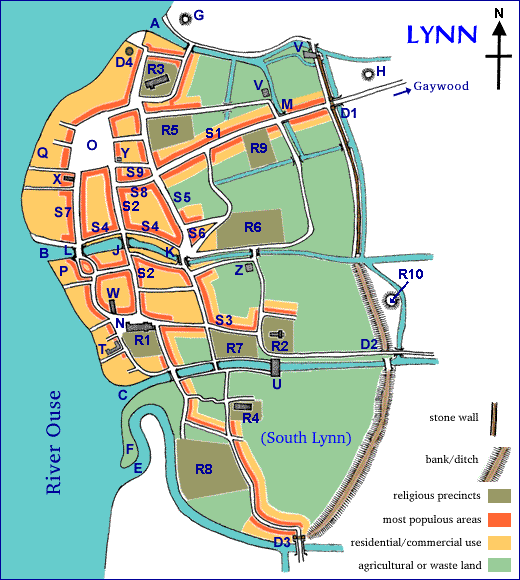
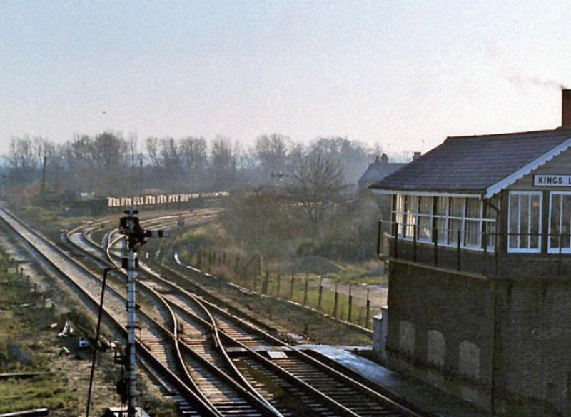
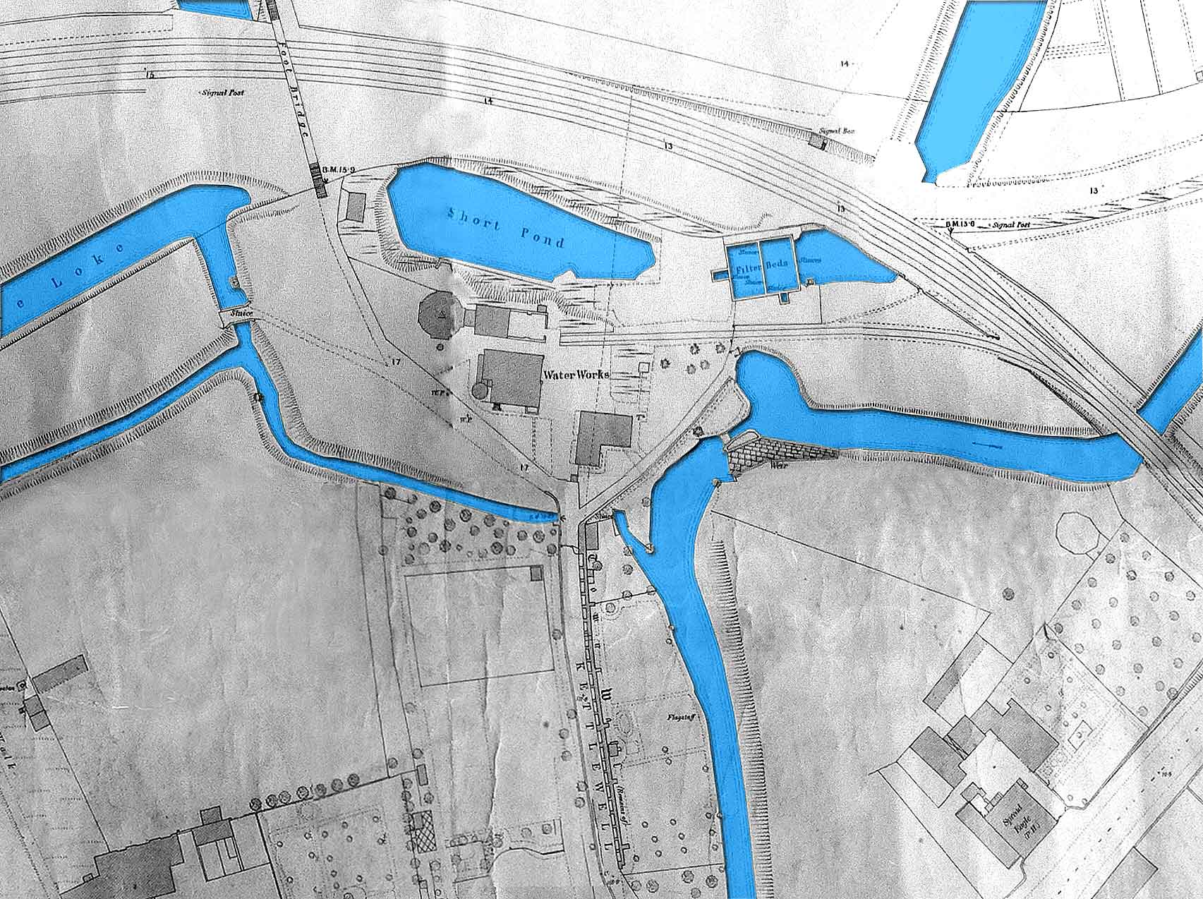
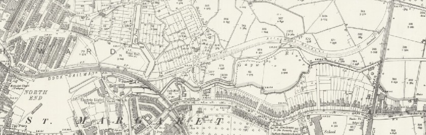
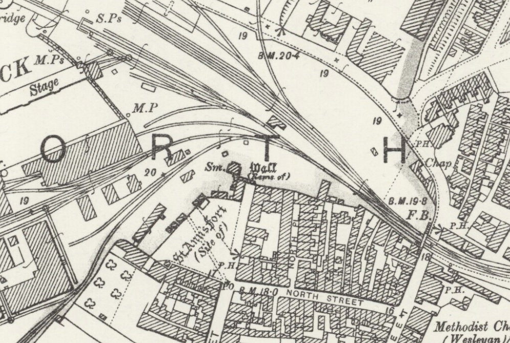
The branch left the main line at what feels like a major junction just to the East of the Station. Lines to Swaffham and Hunstanton diverge from the main line in initially and easterly direction and the Dock Branch heads away to the north. The busy railway junction was intersected by a level crossing for what became known as Tennyson Avenue. The map below is sourced from the National Library of Scotland and is an extract from the OS Maps of the early 20th Century. [8]
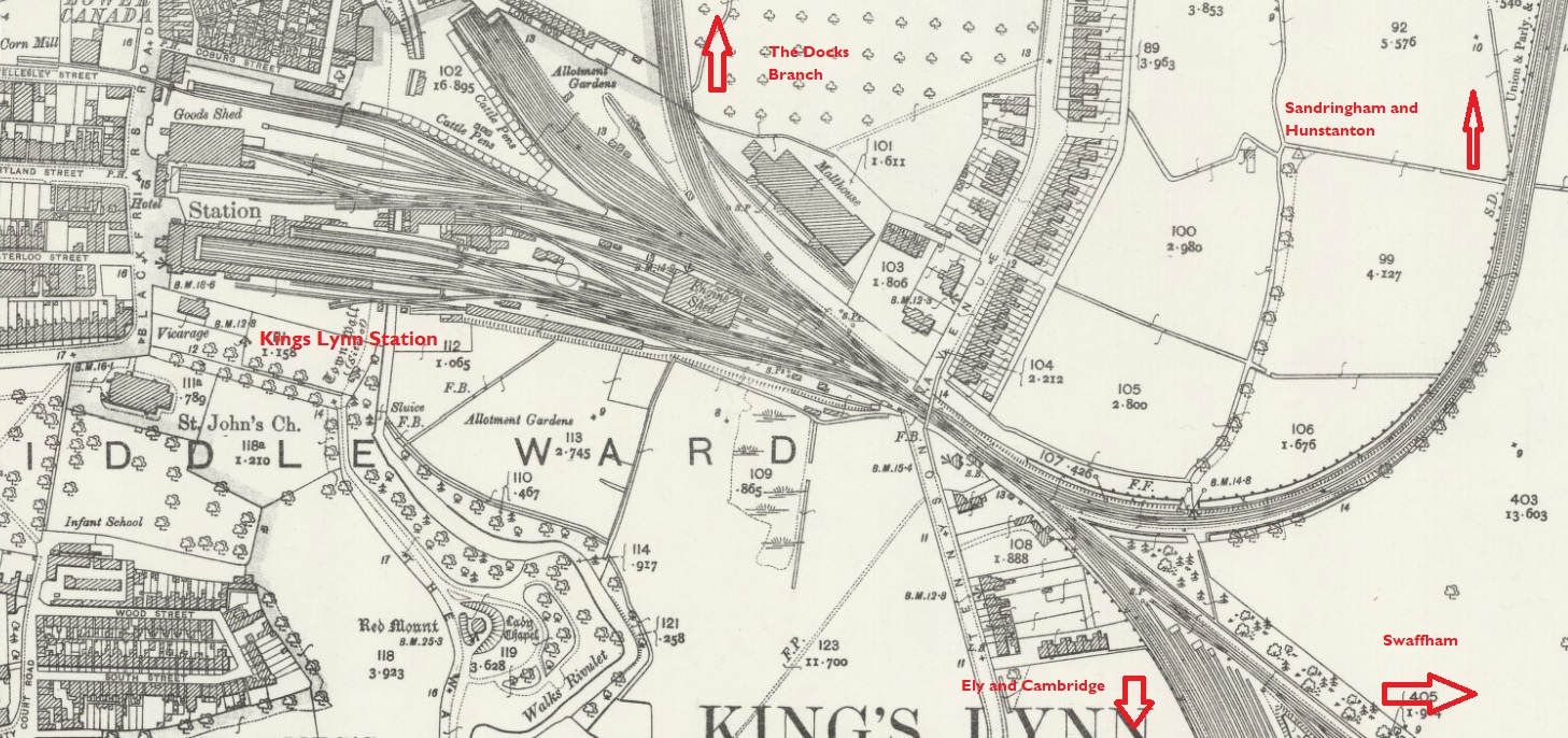
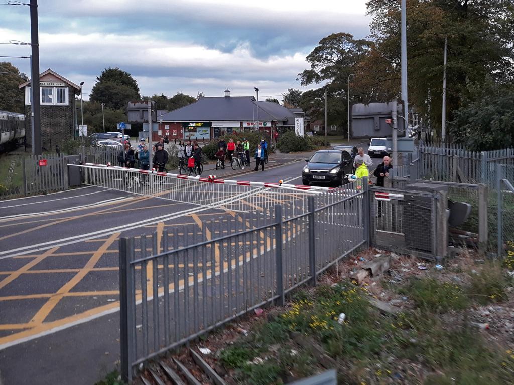
Every train heading for the Docks had to cross Tennyson Avenue.
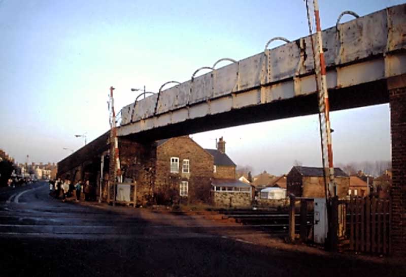
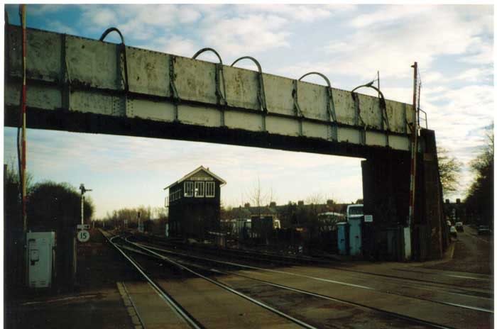
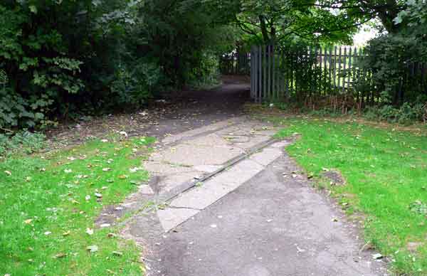
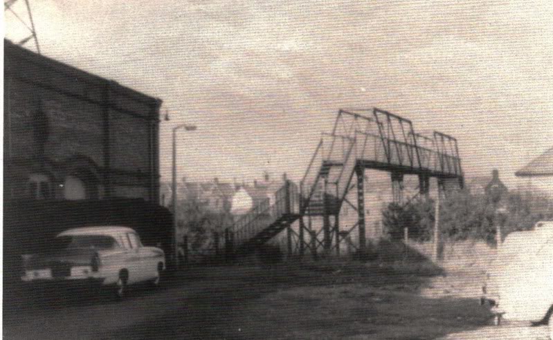
The picture above shows that pedestrians were not using the footbridge despite the dangers of the busy road. [9] The picture below shows the level-crossing and footbridge as I remember it in the 1980s. [5] I was unaware that the bridge was actually relatively newly refurbished at that time! The original footbridge had less headroom and needed to be lifted to accommodate electrification. It was a lattice-girder structure which was considerably more graceful that that in these images! [9]
The next image shows the same location in the early 20th Century, the footbridge is long gone.
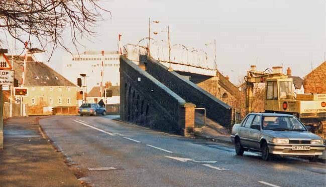
The larger white building beyond the crossing in both images is part of what I knew as King’s Lynn Technical College. It was where my father taught in the Engineering Department until the mid-1980s. In the second of the two images, the bend remains sharp but the sight-lines for road traffic are much improved.
The first picture below is taken looking west from the footbridge steps in the late 1980s. The docks branch curves away to the right. [9]
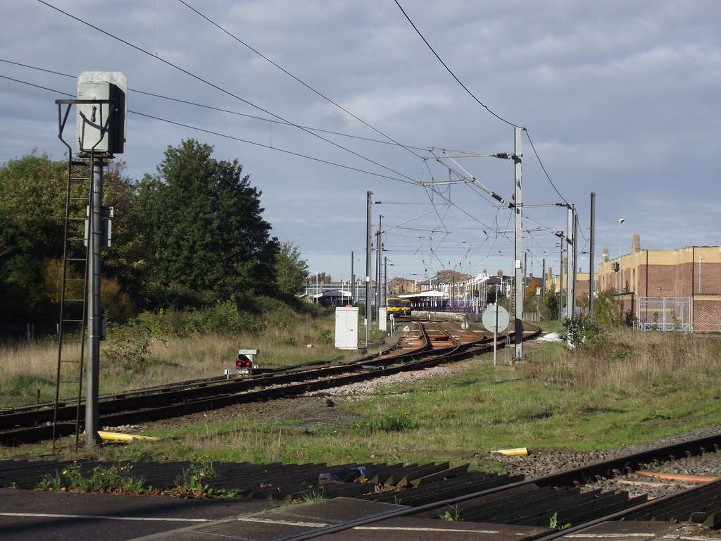
The next picture is another view towards King’s Lynn Station from Tennyson Avenue in 2010. The docks branch is the line in the immediate right foreground, (c) Gary Troughton. [7]
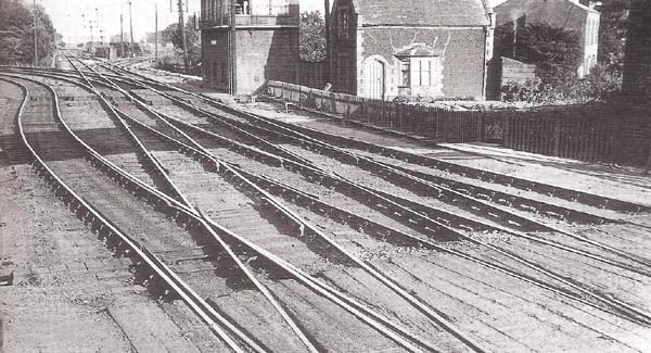
Compare the sparsity of the track-work in the two images above with that shown in the monochrome image immediately below. The image below looks towards King’s Lynn Station and is taken from the footbridge and the old crossing gates can be seen in the foreground. [9]
The next shows a late 20th Century view looking to the East. The footbridge is still in place and the junction between the docks branch and the main line is visible on the left beyond the 15 mph speed limit sign. The line straight ahead is the remains of the line to Swaffham. [9]
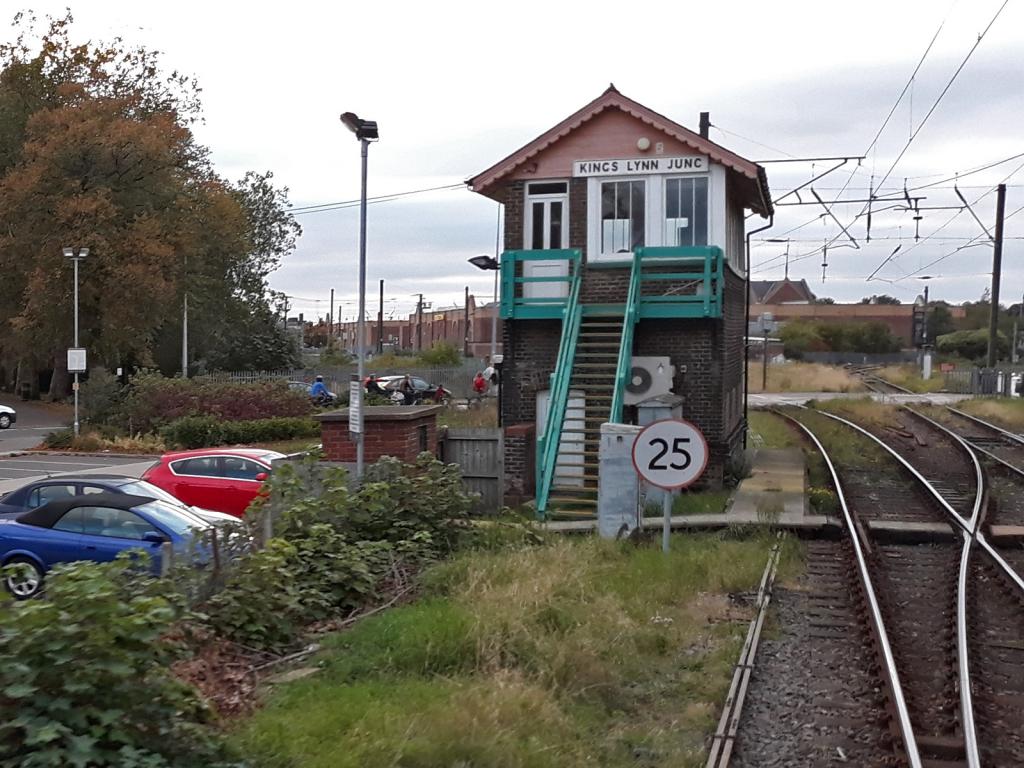
The mainline to Ely and beyond curves to the south around behind the signal box as can be seen in both the images immediately below. [9][25]
Before moving on down the docks branch, here are a couple of images taken when the old footbidge was in place adjacent to the Tennyson Avenue Level-Crossing. [9]
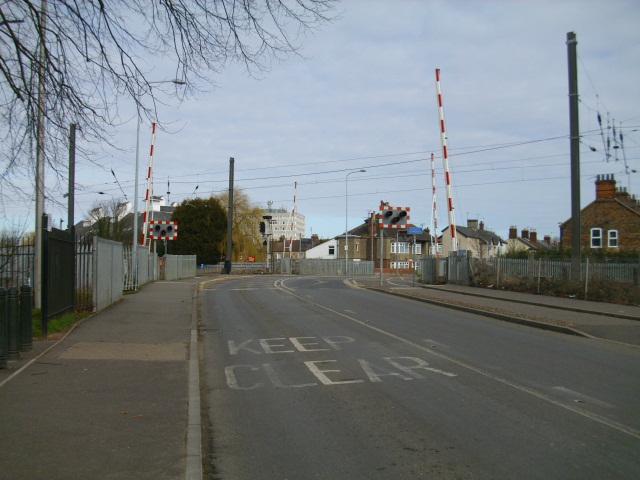
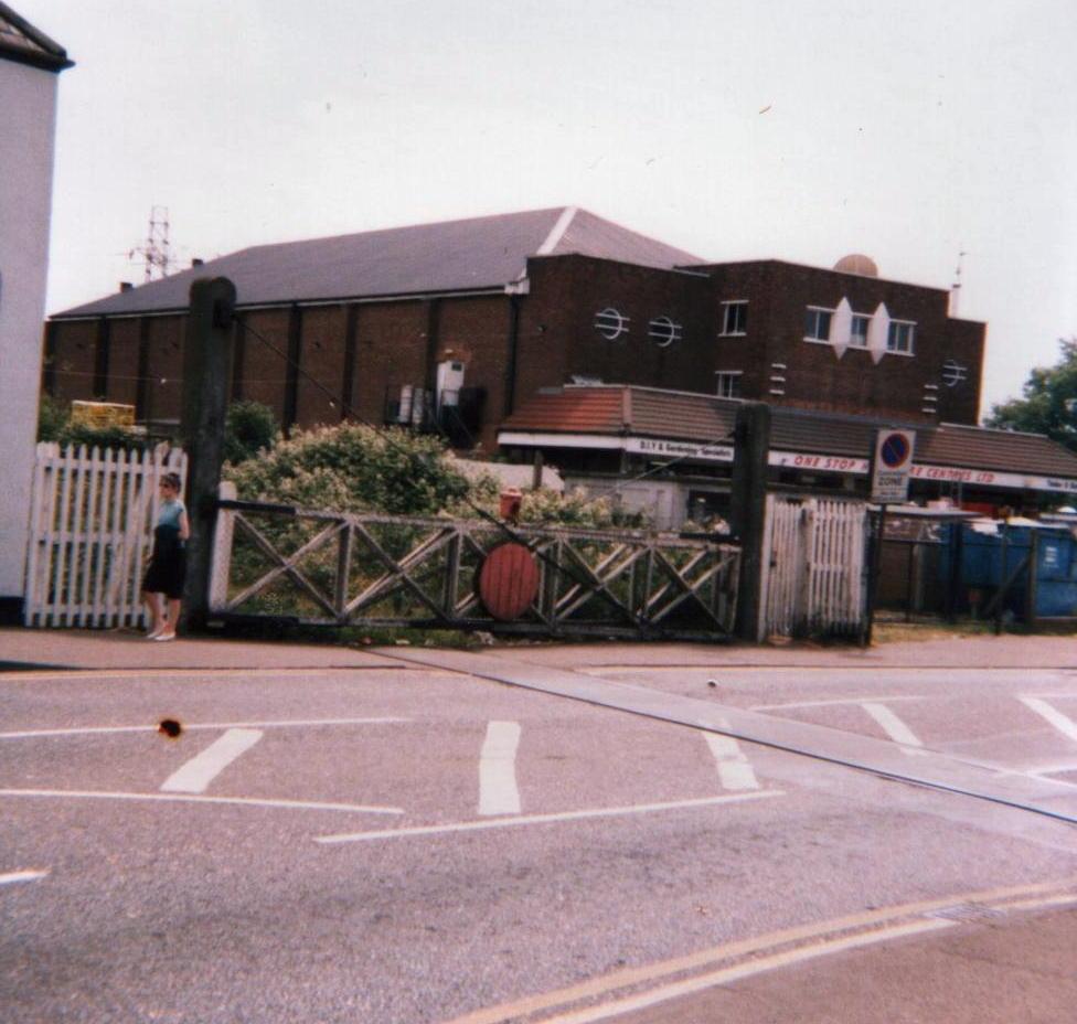
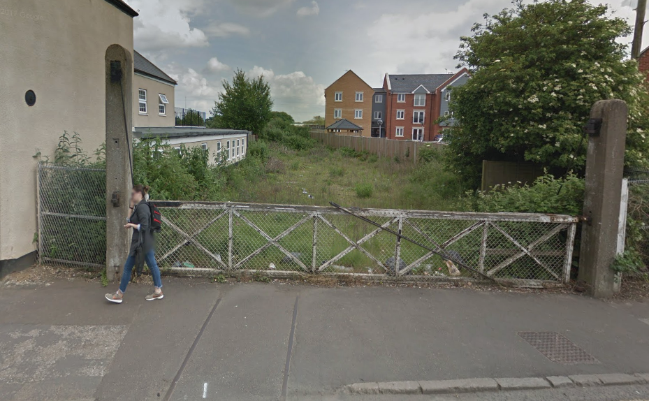
The site has changed dramatically today, the footbridge is gone and shops have been built adjacent to the crossing. These next two pictures were taken at the beginning of October 2018 by Beeyar Wunby on the King’s Lynn Forums website. [28]
Moving on from the junction at Tennyson Avenue Level Crossing,, the branch consisted of a series of sidings in parallel providing space for trains to be marshalled.
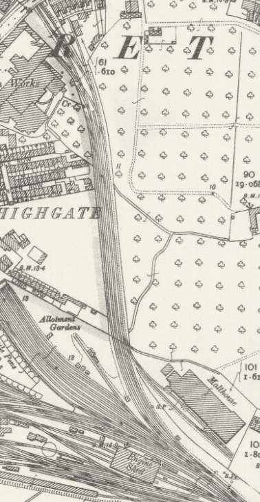
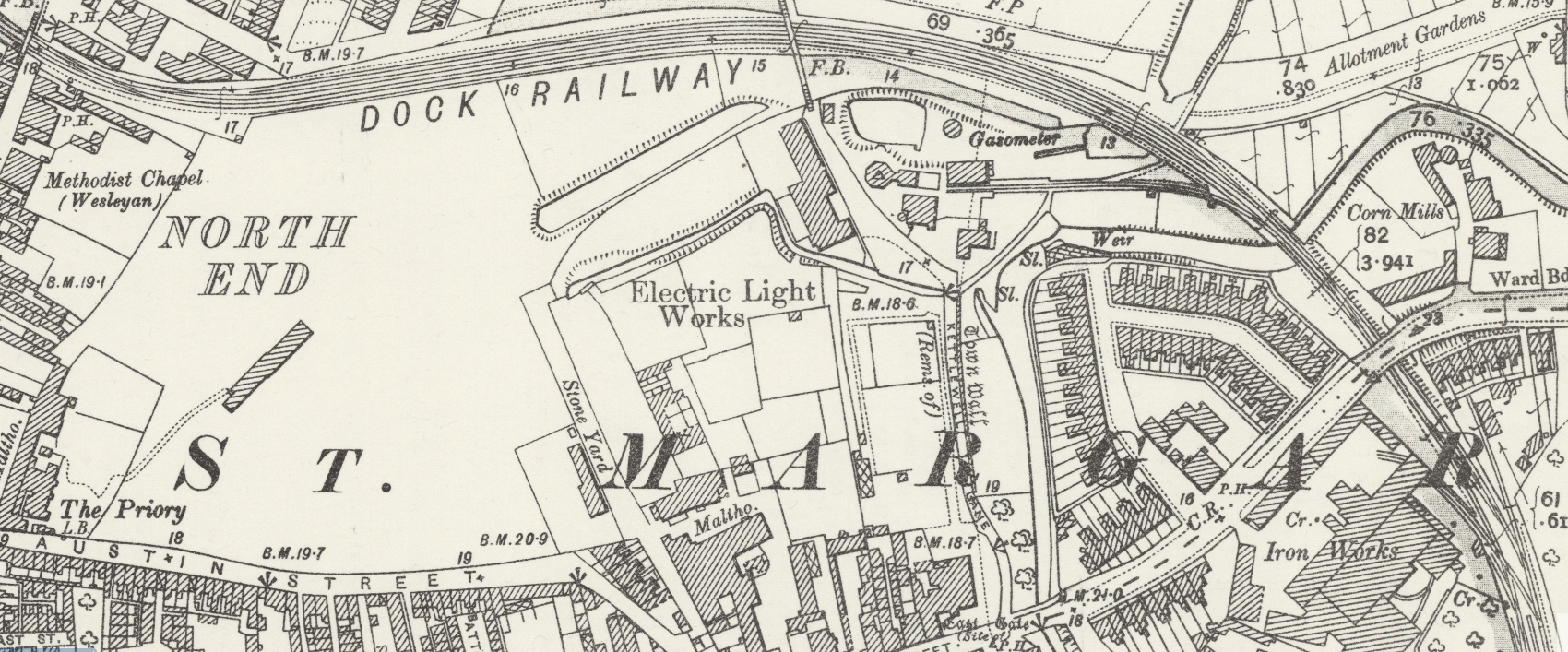
There were two significant workplaces alongside the docks branch. The first was the Malthouse and the second the Iron Works. They were int he area of the town known as Highgate and both feature on the adjacent map.
The Malthouse was a substantial building which, in the early 21st Century, is now converted into flats and known as the Maltings. It was rail-served, having its own sidings and stands close to the old station goods yard but on the East side of the Docks Branch with a trailing point providing access to its sidings.
The first image below shows the end of the Malthouse building in 1986. [10]
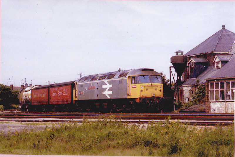
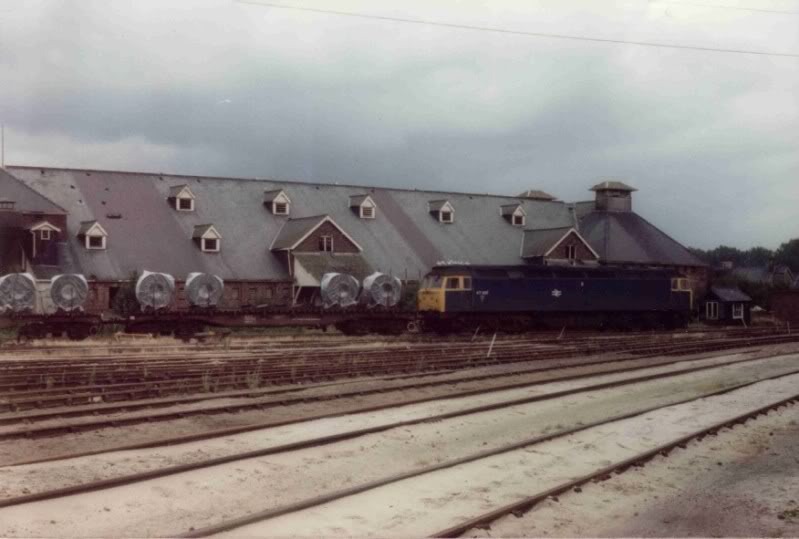
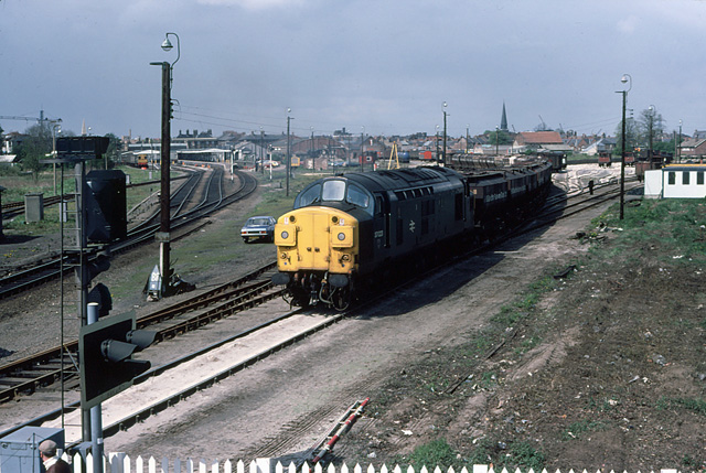
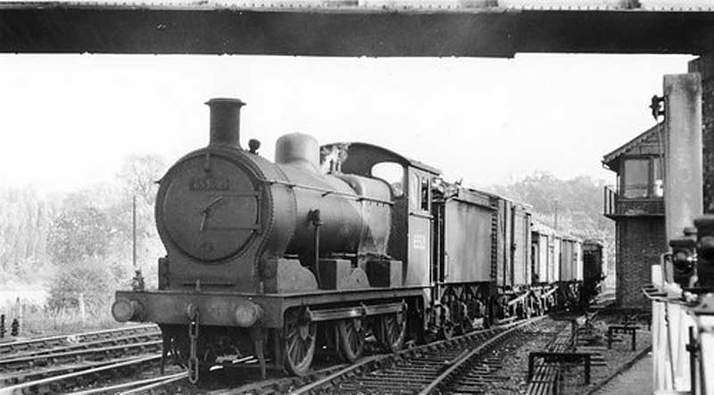
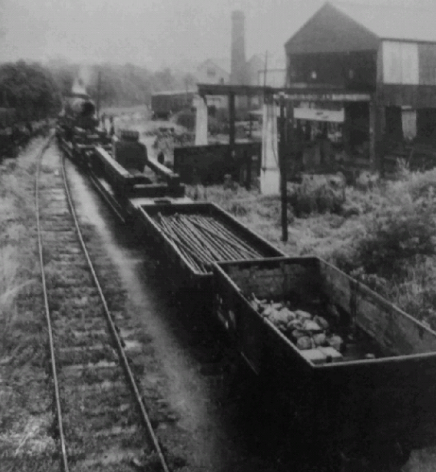
A train of wrapped coiled steel passes in front of the Malthouse in the later days of the Docks Branch. [19]
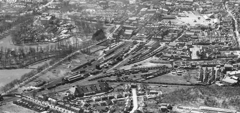
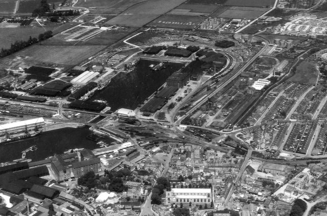
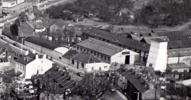
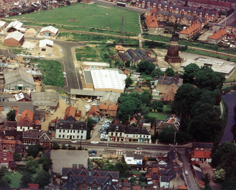
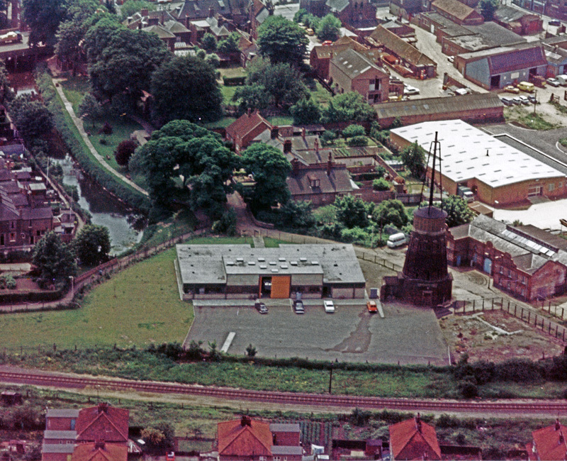
This aerial image shows the Malthouse and Tennyson Avenue footbridge in the bottom left. The dock branch runs left to right just above the Malthouse. The station goods-yard is a hive of activity. The engine shed is just above the Malthouse. [11]
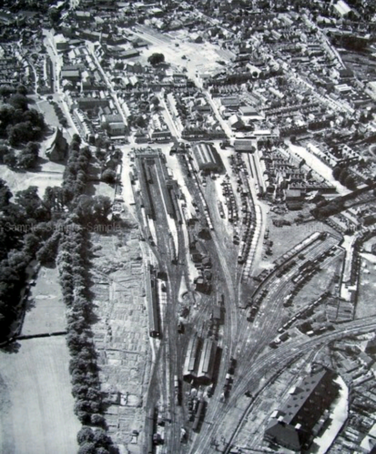
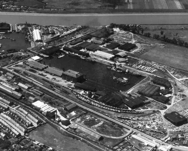
The Malthouse and the Engine Shed appear at the bottom of this image. The docks branch heads off to the right of the picture just above the Malthouse. [12]
To the North of the Malthouse, the docks branch followed a straight path to the over-bridge at Gaywood Road (A148) running behind King’s Lynn Technical College campus. In the early (and later) 20th Century there was an Ironworks on the South side of Gaywood Road.
The bridge which took Gaywood Road over the Docks Branch was referred to locally as Dodman’s Bridge. [13] The works were called Dodman’s Ironworks. The image below was taken in the 1930s by someone standing on Dodman’s Bridge and looks East towards Gaywood. The procession is associated with the Norfolk Show which was held in King’s Lynn at that time. There is a healthy discussion on King’s Lynn Forums about the picture! [13]
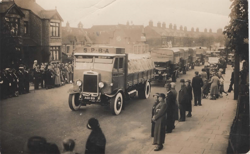
View East from Dodman’s Bridge along Gaywood Road. The School in the background is Highgate School. [13]
An aeriel view of Dodman’s Works on the South Side of Gaywood Road. The Docks Branch runs between the works and the gable end of the terraced house beyond. [14]
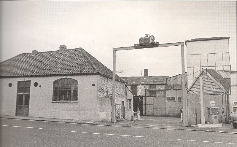
The gates of the factory as seen in the picture above. [14]
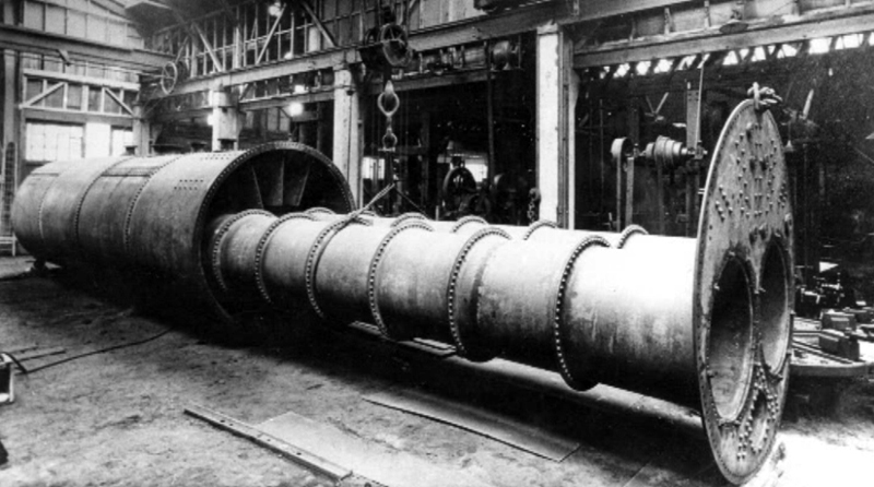
Inside the works. [14]
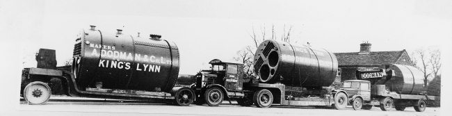
Dodman’s Heavy Load Road Transport. [14]
The pictures of Dodman’s have been sourced from King’s Lynn Forums. [13][14] The works were built by Alfred Dodman. He was a prominent figure in King’s Lynn’s industrial scene. Starting up in 1854 he owned, co-owned and ran several foundries of increasing size until he was leased the site of Highgate Field and built a new foundry there in 1875. The firm mostly made ‘land’ boilers or the Cornish and Lancashire types but eventually branched out into locomotive, traction, portable and marine boilers and hardware. In the early 1900s they began making mining pumps, mill machinery, oil engines and cranes.
In 1902 Dodman’s were contracted to make boilers for the army and navy. In 1905 they were also contracted by the Crown Agents for the Colonies.
Alfred Dodman died in 1908, however the firm continued, manufacturing for the army and admiralty throughout the First World War, and for the navy and RAF in the Second World War. After 1945 the company kept expanding, landing contracts in India and the Persian Gulf. To keep up with technology they moved away from steam and oil power and focused on building pressure machinery for and storage tanks for the petro-chemical and North Sea industries.
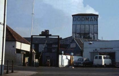
In 1972 the directors planned a move to a new site on the Hardwick Industrial Estate, however financial difficulties in 1975 marred this move and forced the company to shut down. The Highgate site was cleared in 1977 for housing. [15] The picture above is taken from ‘King’s Lynn in Colour’ Volume 1. [18]
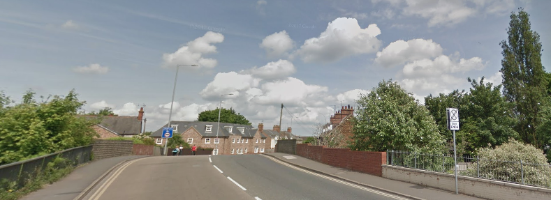
Dodman’s Bridge in the 21st Century, looking East with the site of the Ironworks to the right.
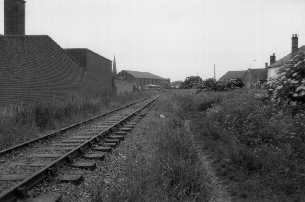
The view South along the line from Dodman’s Bridge in July 2012. [24]
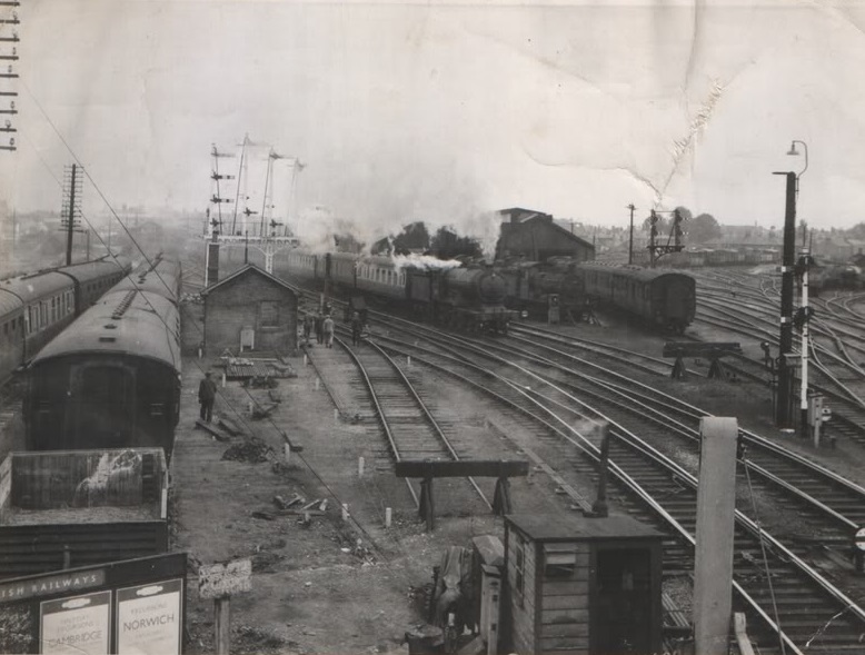
In this image and the next we see the same location at a much earlier date. Both images are in Mike G. fell’s book about the Docks and their railways. Both images have the Dodman’s works on the right. In the first image a train with items from Portugal passes the works with cattle wagons in the siding beyond. [26]
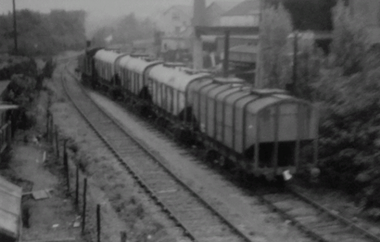
In this image, a short train of grain wagons passes Dodman’s works on its way from the Docks. [26][27]
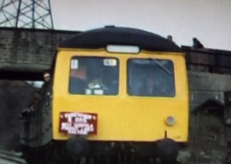
The next two pictures were taken on a railtour organised by the Fakenham Railway Society in March 1980 which included (among other things) a trip up the docks branch in King’s Lynn. These two images are taken below the bridge next to Rodman’s on Gaywood Road. Neither image is of the highest quality but they are the only one’s that I can find taken from track-side and including the over-bridge. [19]
North of Dodman’s Bridge and the Gaywood River, the Docks Branch turned to the West on the North side of the Water Mill and Electric Works in North Lynn.
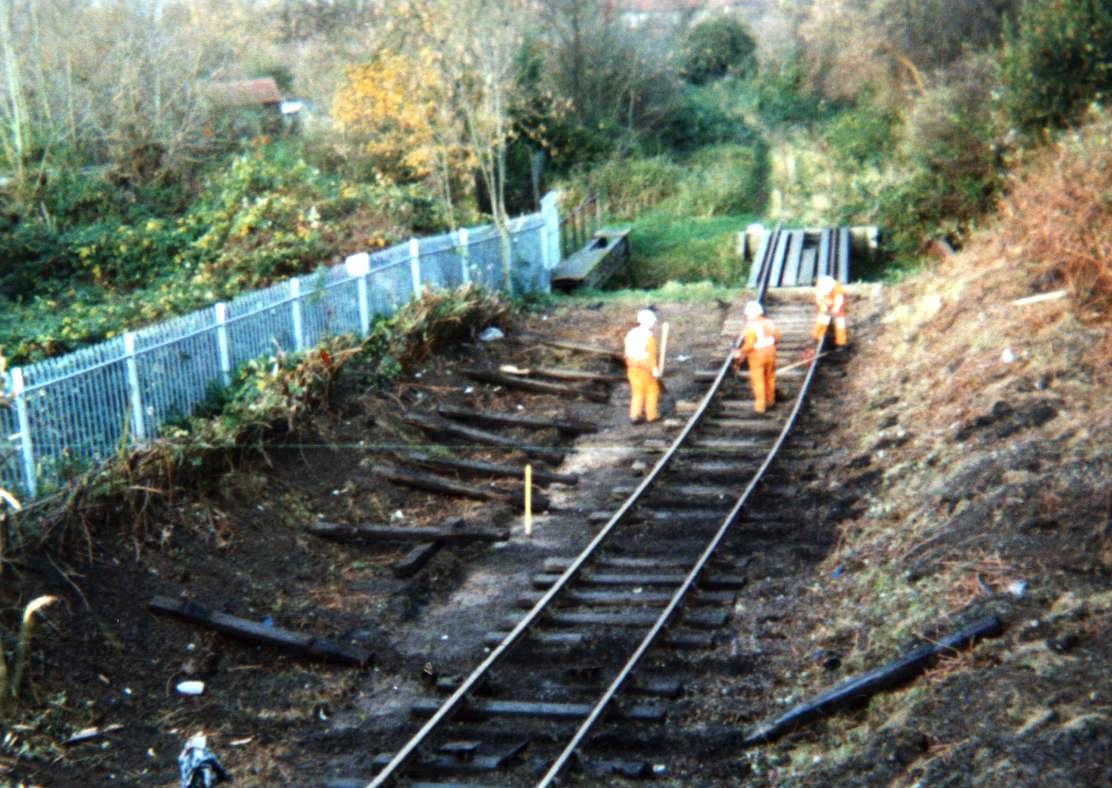
Workmen dismantling the Docks Branch with the Gaywood River bridge beyond. [19] Thanks to SEDFreightman on the RMWeb Forum [29] for the following comment about the photo above: “The photo shows employees of Grant Rail (Railtrack’s contractor) undertaking spot re-sleepering on the section of Dock Branch that was to become the Shunt Neck for a new loop on the Branch formation to allow removal of the loop in Kings Lynn Yard. The photo would have been taken in November or early December 1999.”
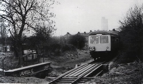
The Gaywood River Bridge (above). [19]
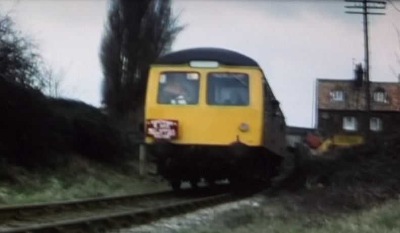
The Fakenham Railway Society tour, once again. This time returning from the Docks and crossing the River Bridge. [19]
The Works had a single siding serving it from the Docks Branch. [20] Access by road was via Kettlewell Lane which ran alongside the old town walls from the old Eastgate of the town on Littleport Street (the Western extension of Gaywood Road at the time).
Kettlewell Lane led through the works to the footbridge over the docks branch.
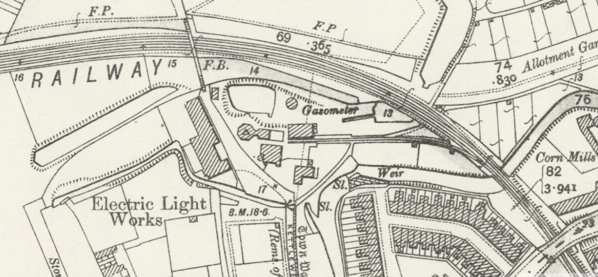
Kettlewell Lane and the Works prior to the construction of the Electric Works. The Gaywood River passes under the Dock Branch at the right side of this map. The siding is shown just to the North of the river. [22]
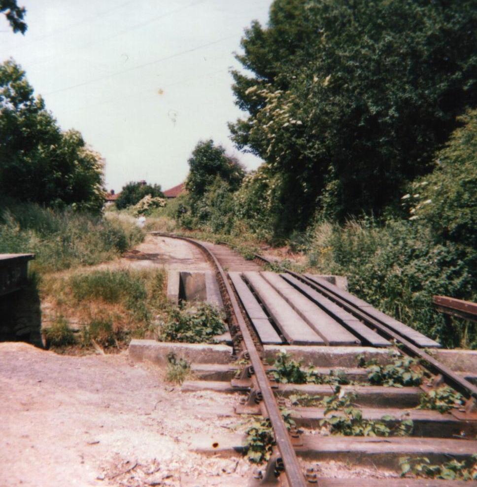
All that remains of the siding in the early 21st Century. [22]
Gaywood Road appears in the foreground of this image. The works and the Docks Branch are towards the top of the image. [22]
In this image (above), the Docks Branch is in the foreground, the site of the works in the centre with the Electric Works to the right of the image. By the late 1970s and early 1980s the three tracks of the Branch had been reduced to one. [22]
The adjacent sketch shows the works from the River in earlier times. [22]
I can remember undertaking a project for my O-Level in Biology which focussed on ecology of the Gaywood River in 1976, along the length of the river on the map above, but not realising just what was in the immediate area – not the old town walls, nor the industrial archeology either! In the very early years, the Docks Branch appears to have had a connection to the King’s Lynn to Hunstanton line north of Gaywood, the abandoned line is shown on the map below. Appearances can be deceptive. What the map actual shows is an unopened connection from M&GN to it’s planned new terminus at Austin Street. The connection was built in the 1890s along with the proposed new station and crossed the docks branch. The line and station at Austin Street were built to avoid the use of the GER’s King’s Lynn station but were not opened when common sense prevailed and agreement was reached by the M&GN with the GER. Thanks to Iain Scotchman for this correction.
The footbridge over the Docks Branch adjacent to the Electric Works. [22]
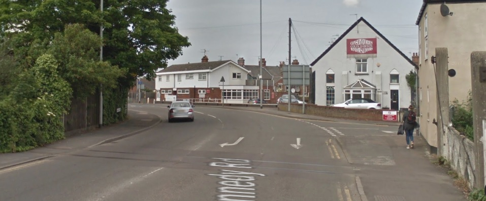
The Branch continued West from the footbridge to meet, Pilot Street (which is now John Kennedy Road). The picture below shows this length of the line.
This picture shows the approach to the John Kennedy Road Crossing with the Pilot Cinema to the left of the line and St. Nicholas’ Chapel spire beyond. I twas taken at the end of the 1980s/early 1990s, (c) Bramleyman on http://www.railwayforum.net [30]
At Pilot Street (John Kennedy Road) there was another level-crossing and footbridge as shown below. [20]
The crossing gates on the East side of John Kennedy Road. [23]
Google Streetview provides more up to date images of the crossing.
The crossing gates on the East side of John Kennedy Road.
The West side of John Kennedy Road.
View looking North along John Kennedy Road.
The level crossing on Pilot Street was the effective entrance point to the docks and it is at this point that the present post concludes. A future post will explore what information is available about the railways within the Docks.
References
- https://www.visitwestnorfolk.com/places/kings-lynn/history-of-kings-lynn, accessed on 20th September 2018.
- https://www.visitwestnorfolk.com/places/kings-lynn/history-of-kings-lynn/hanseatic-kings-lynn, accessed on 20th September 2018.
- https://en.wikipedia.org/wiki/King%27s_Lynn_Docks, accessed on 20th September 2018.
- http://www.abports.co.uk/Our_Locations/Short_Sea_Ports/Kings_Lynn, accessed on 20th September 2018.
- http://www.kingslynn-forums.co.uk/viewtopic.php?f=14&t=353, accessed on 22nd September 2018. This is a link to a topic on King’s Lynn Forums entitled “Tennyson Avenue Level Crossing.
- http://abcrailwayguide.uk/tennyson-avenue-public-level-crossing-norfolk#.W6ZULGhKiUk, accessed on 22nd September 2018.
- https://www.flickr.com/photos/gary_troughton/5089709764, accessed on 22nd September 2018.
- https://maps.nls.uk/view/120848786, accessed on 22nd September 2018.
- http://www.kingslynn-forums.co.uk/viewtopic.php?f=14&t=1642&start=60, accessed on 22nd September 2018.
- http://www.kingslynn-forums.co.uk/viewtopic.php?f=14&t=6667, accessed on 22nd September 2018.
- http://www.kingslynn-forums.co.uk/viewtopic.php?f=14&t=273&start=90, accessed on 22nd September 2018.
- https://historicengland.org.uk/listing/the-list/list-entry/1391201, accessed on 22nd September 2018.
- http://www.kingslynn-forums.co.uk/viewtopic.php?f=14&t=9192&p=55368&hilit=Dodmans#p55368, accessed on 23rd September 2018.
- http://www.kingslynn-forums.co.uk/viewtopic.php?f=14&t=1390&hilit=Dodmans, accessed on 23rd September 2018.
- http://www.heritage.norfolk.gov.uk/record-details?MNF61652-Highgate-Iron-Works&Index=53325&RecordCount=57339&SessionID=413fd24e-8645-4c54-b1aa-fc2c80303e66, accessed on 23rd September 2018.
- https://www.cambridgeairphotos.com/areas/kings+lynn+and+west+norfolk, accessed on 23rd September 2018.
- https://commons.wikimedia.org/w/index.php?curid=6921557, accessed on 23rd September 2018.
- http://www.trickysampublishing.co.uk/picture-gallery-2.php, accessed on 23rd September 2018.
- http://www.kingslynn-forums.co.uk/viewtopic.php?f=14&t=1386&hilit=docks+railway, accessed on 23rd September 2018.
- https://maps.nls.uk/view/120848786, accessed on 23rd September 2018.
- http://users.trytel.com/tristan/towns/lynnmap1.html, accessed on 23rd September 2018. Following this link provides access to the details associated with each reference on the image.
- http://www.kingslynn-forums.co.uk/search.php?keywords=The+Kettle+Mill, accessed on 23rd September 2018.
- https://commons.m.wikimedia.org/wiki/File:King%27s_Lynn_docks_line,_John_Kennedy_Road_crossing.jpg, accessed on 23rd September 2018.
- https://mapio.net/pic/p-73764797, accessed on 24th September 2018.
- http://www.rmweb.co.uk/forum/viewtopic.php?f=5&t=4818, accessed on 24th September 2018.
- Mike G Fell; An Illustrated History of The Port of King’s Lynn and its Railways; Irwell Press, Clophill, Bedfordshire, 2012.
- https://www.transport treasury.co.UK, accessed on 25th September 2018.
- https://www.railwayforum.net/showthread.php?p=90587#post90587, accessed on 4th October 2018
- http://www.rmweb.co.uk/community/index.php?/topic/137599-kings-lynn, accessed on 6th October 2018.
- https://www.railwayforum.net/showthread.php?p=90601#post90601, accessed on 8th October 2018.

Pingback: King’s Lynn Docks Branch – Part 2 | Roger Farnworth
Pingback: King’s Lynn Docks Branch – Part 3 | Roger Farnworth
Reblogged this on Part Time Spotter and commented:
Wonderfully written and researched article on Kings Lynn Docks railways. Part 1.
Reblogged this on sed30's Blog and commented:
Love Kings Lynn
Pingback: King’s Lynn Docks Branch – Part 1 | Roger Farnworth – sed30.com
Absolutely fascinating
Thank you!
Roger,
Your comment regarding a M&GN connection to the docks branch is incorrect! What the map actual shows is the built in the 1890s but un-opened connection from the M&GN to it’s planned new terminus at Austin Street which crossed the docks branch on the level. The line and station at Austin Street were built to avoid the use of the GER’s Kings Lynn station but was not opened when common sense prevailed and agreement was reached by the M&GN with the GER.
Thank you Iain. I will make some alterations!
The modern wagon load you refer to as cable drums are coiled steel wrapped.
Thank you for bothering to get in touch. I have just amended the relevant sentence. Kind regards. Roger.