
This is my final post about the railways of Orkney, I think. ……………
Since returning from the Orkneys, I have received a copy of Wilfred F. Simms book, “The Railways of Orkney.” It was published in 1996 and appears to be out-of-print. This copy came via an on-line sales site that we all know.
Simms’ book is a short A5-sized book and simply typeset. It is a mine of information on the railways of Orkney. Before we look as some of the historic built railways it is worth noting that Orkney had its own plans for a public railway as early as 1876 – The Kirkwall to Stromness Railway. John Buchanan assessed the feasibility of the line and advised that 3’0″ gauge should be adopted, “as in the Isle of Man, and that the ‘proposed line would commence at Kirkwall at or near The Ayre on the Peeries Sea and follow the course of the highway by Finstown and Stenness and terminate at or near the present Steamboat Quay at Stromness’. Route length would have been 14.5 miles and the line would present ‘no engineering difficulty’, intermediate stations would have been at Finstown and Stenness. Total cost of the line was estimated at £50,000.” [1: p28] it did not get built!
More recently, in 1977 a local businessman, Ronald Spiers imported a standard gauge steam loco from Scotland intending to create a tourist line near Kirkwall. Various difficul;ties arose and after time spent languishing in a field near Kirkwall the loco was returned to Scotland. {1: p28]
A. Industrial Railways
Simms focusses first, in his book, on the industrial railways of Orkney which include a Herring Railway, lighthouse railways, shipbreaking railways and quarry railways
Herring Railways
Herring were, for a period of time, very significant to the economy of Orkney. ” Railways were often associated with the herring fishing and curing industry in both Shetland and Scandinavia: but only one such system is definitely recorded for Orkney. It is possible that narrow gauge railways were used in other Orkney fishing stations but only at Papa Steinway do actual relics remain to this day in the form of piers, sheds, railway track and trucks.” [1:p4]
The largest centre of the industry was Stromness. It became so by 1898 but was abandoned by the fleet within ten years. It may have used narrow gauge track during that time but rails were often used solely as guideways along which to roll herring barrels rather than as a railway with trucks. This practice occurred on Papa Stronsay as can be seen in one of the three sepia images below.
“Stronsay and Papa Stronsay had extensive gutting and curing sheds and new piers were constructedto allow larger boats to berth: these ports remained the most important of the Orkney centre right up into the 1930s when the introduction of factory techniques, larger boats, depletion of stocks, and ultimately the Second World War stopped North Sea fishing.” [1:p4]
On Papa Stronsay the original stone “Bountifur pier with its wooden extension was laid with 1’8″ gauge track and a number of small four-wheel wood-framed hand-propelled trucks used to transport the fish from the moored boats to the curing sheds. A further three lightweight metal piers were constructed on the south shore to the east of the stone pier using a mixture oMf old rails and girders: these linked with a second area of curing and gutting sheds.” [1:p4] The herring fleet at Papa Stronsay! [2]
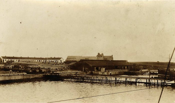 The pier at Papa Stronsay, notice the stacks of Herring Barrels. [2]
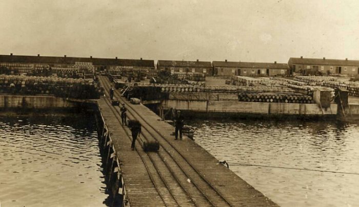 Workers roll barrels of salted herring down the pier to a waiting ship. [2]
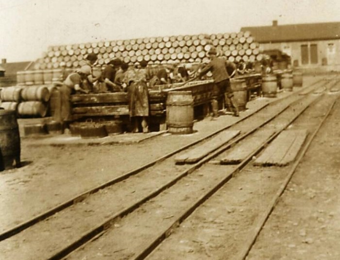 The rails on the quay leading to the pier, note the people at work preparing the herring and the stacks of barrels again. [2]
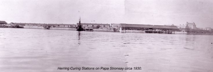 Later in the history of the industry a calmer image from the 1930s! [3]
Lighthouse Railways
It is interesting to note that there were a number of short railways associated with the work of the Northern Lighthouse Commissioners.
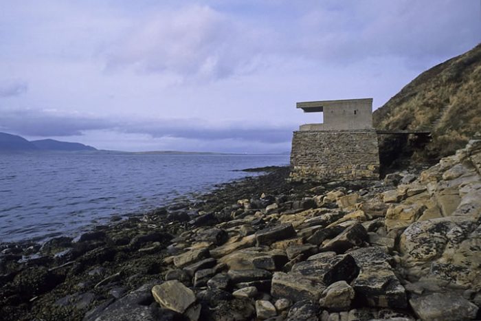
Stromness Service Depot built it’s own gasworks in 1904 and installed 2’6″ gauge track of a length of 70 yards to facilitate the movement of coal by small hand-worked trucks into its store on the west side of the pier. Later, it installed a 25 yard section of standard gauge track to assist in moving large buoys on a single flat four-wheeled truck. [1: p5]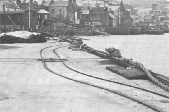 The narrow gauge track at Stromness referred to above. [4]
Sule Skerry is one of a pair of small islands which lie 30 miles to the west of Orkney mainland. A lighthouse was built, commencing in 1892 and in 1894 a 2’6″ gauge inclined railway was installed between the lighthouse and the two possible landing places on the rock. A small haulage engine was installed close to the lighthouse tower so that a cable could be used to operate the two sections of the railway. Usage was dependent on prevailing weather and tides. Simms says that, “a single four-wheeled truck was used to transport heavy stores. … The railway appears to have continued in intermittent use until the 1970s. The tower has since been converted to an automatic light and all deliveries of materials are made by helicopter. The derelict railway remains in-situ slowly corroding away in the salt spray.” [1: p5]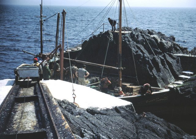 A landing at Sule Skerry, the railway track and wagon are visible in the image. [5]
Copinsay is a small island east of the Orkney mainland. Construction of a light house on this island started in 1914. Construction materials were brought by steamers and unloaded via a pier built for the purpose at the west end of the island. A railway of about three-quarters of a mile in length was installed which took supplies from the low western shores to the high cliff-top location of the lighthouse on the eastern cliffs. Steam winches were used to haul flat trucks from the pier to the construction site.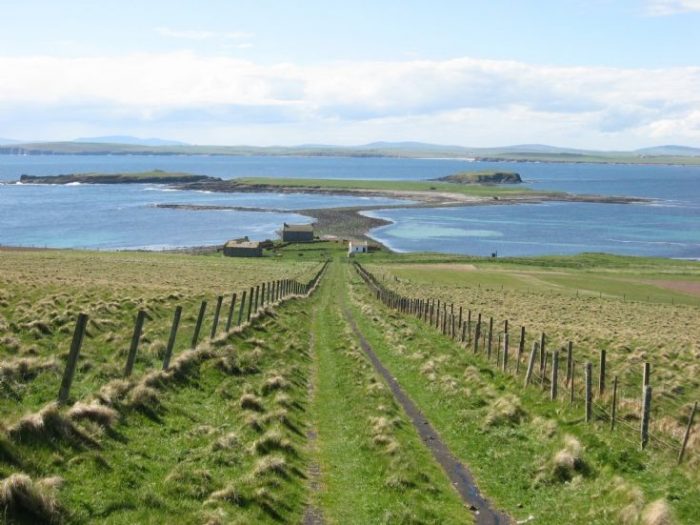 The line is now long-gone and the island is a bird sanctuary. However, the course of the old railway can still be picked out as a grassy track running up the spine of the island. [1: p6] This image shows the route of the railway up from the low western area of the island in 2009, (c) Richard Evans. [6]
The Mail Boat Railway North Ronaldsay
North Ronaldsay pier is the only pier which was served by a permanent standard gauge railway. A 100 yard line linked the pier to the boat storage yard and was in use until sometime in the 1960s. [1: p6]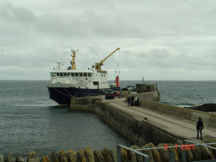 North Ronaldsay Pier in 2007. The railway can be seen set into the pier surface. [7]
The Shipbreaking Industry
In 1924, Cox and Danks, Lyness, Hoy purchased 28 of the German naval vessels which were part of the scuttled German High Seas Fleet. The raising of these vessels would at the time been one of the worlds greatest salvage feats. In the winter of 1924, a fully equipped breakers yard was established.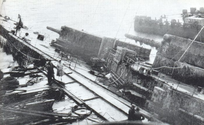 The Hindenburg heeling over to starboard on the first attempt at raising her in 1926. She appears to be alongside a pier and a railway is visible in the foreground. [8]
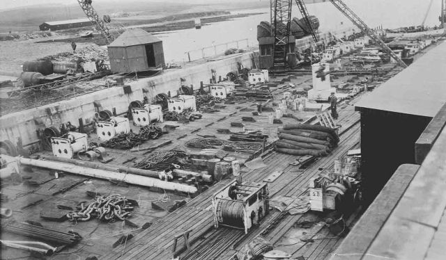 The sheer scale of this operation is unimaginable without the photographic evidence! [9]
Simms says: “Little is known of the railway system in use at this time: although sections of both 2’0″ and 4’8.5″ gauge remained in-situ at the former naval base. What is clear is that at least one steam locomotive was in use on the 4’8.5″ gauge lines throughout Cox and Ranks tenure of the base.” [1: p7] When the battle cruiser Moltke was being dismantled alongside the pier, the existing standard gauge railway on the pier was “diverted by piles onto the ships hull and laid along its length. A steam locomotive hauled a small crane onto the hull and openings were cut through which heavy machinery was removed. This system was then applied in the case of the ships, Bremse, Seydlitz and Kaiser.” [1: p7]
In 1931, the Allow Company, later known as Metal Industries, Lyness, bought out Cox and Danksand continued operating from the old naval base. “It is known that the steam locomotive was still in operation in 1937 when the Friedrich der Grosse was towed south for scrap.” [1: p7] In 1939 ship-raising was abandoned as the naval base became operational once again.
Stone Quarries
Many of the stone quarries in Orkney were used for road stone and had short lengths of narrow gauge track installed to assist with moving materials from the working face to the crushing plant.
Orkney County Council Quarry Lines were generally worked on an ad-hoc basis with track and equipment being moved as required. “At all sites lightweight 2’0” gauge ‘Jubilee’ type was used with wagon turntables rather than points. Track was moved along the working dace as work progressed, and the loaded trucks pushed to the foot of a cable-operated incline leading to the crushing plant. … By the mid-1960s this system still operated in Cursiter Quarry on Mainland, and Lythes Quarry on South Walls (Hoy).” [1: p8] Records indicate that this system was also used in the past at a number of different quarries on Mainland (Chinglebraes,Harray, Orpjir, St. Ola, Springfield and Work well) and at North School Quarry on Stronsay.
Private Quarry Lines were established at Quoys Quarry near Linkness at the northern end of Hoy and at the Witter Quarry west of The Ayre (connecting South Walls with the rest of Hoy).
B. Contractor’s Railways
Lyness Naval Base, Hoy had been recognised as strategically important well before the outbreak of the first world war but it was not until late 1914 that work was commenced at the site. The contractor was Baldry, Yerbergh & Hutchinson. One of their sub-contractors, the Glasgow firm, Kinnear & Moodie, installed a railway to transport stone from a quarry to the main wharf construction site. This is likely to be the first locomotive-worked rail system in Orkney. It operated from 1914 to around 1920 when work on the base was suspended.
The railway was 2’0″ gauge and used two or three small German-built tank locos rated at 20hp. They brought a series of small skip wagons from the quarry.
In 1917, a standard gauge railway was installed “to assist in construction of both the main wharf and RN Fuel Depot facility by either another of the contractors … or … by the Admiralty itself. … Evidence shows large wooden-bodied side-tipping wagons in use at the base.” [1: p9]
Two standard gauge steam locomotives were operating on the site until 1920 when the operation was scaled back and abandoned. The two track gauges were probably used by Cox & Danks and definitely during WW2.
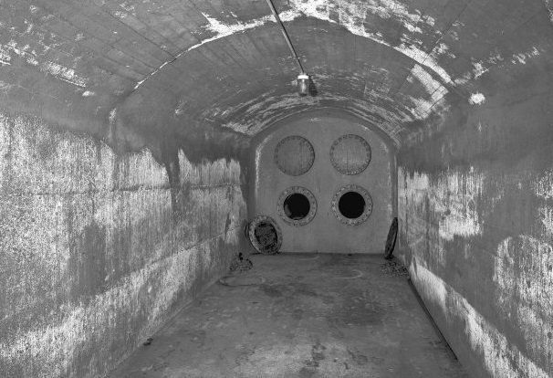
The Underground Oil Storage Tanks, Wee Fea, Hoy were situated above and behind the naval base. The need for these tanks was recognised in 1926 but construction did not start until 1938. It was September 1942 before the first storage tank was completed and August 1943 before all six were finished. [1: p10] The images below show the surface evidence of the tanks.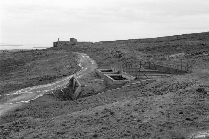
 The first image above highlights how well disguised the oil tanks in the hillside at Wee Fea were. [10]
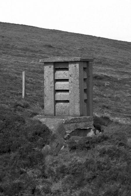
The second image (adjacent) shows a ventilation shaft. [10]
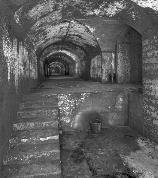
The third image, below, shows the main entrance route into the tunnels and tanks as it appears in the 21st century. [10]
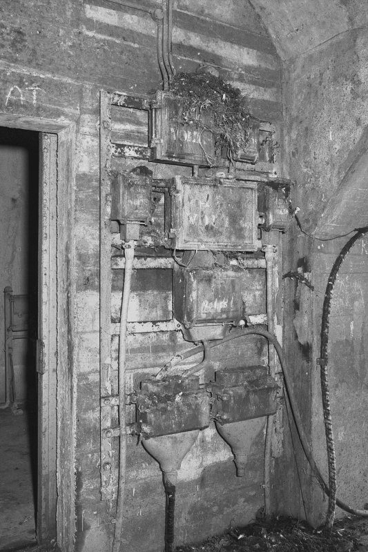
Further below are some internal images, more of which can be seen on the Canmore (National Record of the Historic Envionment) website. [10]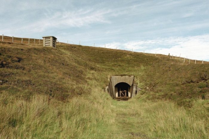 Spoil was removed using a 2’6″ gauge railway. Good quality rock was transported by road to assist in the construction of the Golden Wharf in Lyness. Substandard spoil was disposed of on the hillside. Two diesel locomotives were recorded as working in the project.”Eventually the railway exceeded a mile in length, and ran partway round the hillside (virtually on the 400′ contour) by means of a substantial embankment: connecting the two main adits and quarrying sites.” [1: p10] The following images show some of the interior of the underground site.
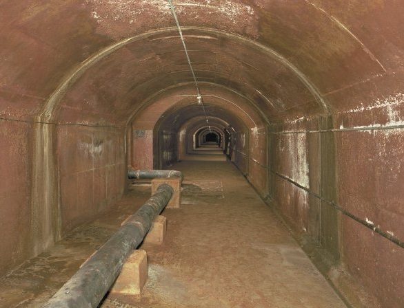
The Burray-Hunda Causeway strengthened and enlarged the natural causeway between Burry and Hunda. Initially it had been intended to use clay to undertake this work. Storms proved how inadequate this would be and as a result a 2’0″ railway was constructed from the site of the causeway to a suitable quarry on Burray. This railway was lengthened as required during the work. “‘Jubilee’ type side-tipping trucks were filled at the quarry by a Ruston-Bucyrus digger and hauled to site by small diesel locomotives, of which two were recorded in use at this location.” [1: p11]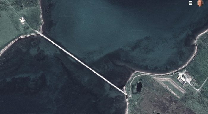 This causeway became part of an inner submarine defence stretching from Flotta via the Calf of Flotta and Hunda to Burray. A removable boom linked the Calf of Flotta to Hunda. This was perceived as necessary after the sinking of HMS Royal Oak in 1939.
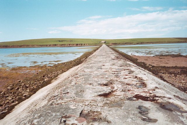 The Hunda Causeway seen from Burray. [11]
 The Churchill Barriers were the considered long-term response to the sinking of HMS Royal Oak in 1939. The blocking ships clearly failed to prevent the access by the U-47 submarine and better defences were required. 11th May 1940 saw the start of work on the barriers when an advance party of men and equipment arrived and were conveyed by barges to Lamb Holm and Glimps Holm to set up temporary camps and construct piers. Mobilisation took time and it was not until August 1941 that construction of Barriers 1,2 and 3 (as shown on the adjacent satellite image) commenced.
Simms says:
“The magnitude of the project is not so easy to appreciate today as we now live in an era where gigantic machines can gouge out undersea tunnels: but at its time the building of the barriers was an enormous (and somewhat unproven) project. Much of the initial work was carried out using fairly simple equipments and an enormous amount of muscle power.
Wartime restrictions and the deployment of many of the contractor’s men on other projects left them very short of able-bodied men and the decision was taken to send Italian prisoners of war to the islands to assist in building the barriers – which from then on became known as causeways so as not to breach the Geneva convention. Most of the Italians had been captured in North Africa and the climatic change must have been quite a shock. … At the height of the construction period in mid-1943 about 200 contractors and 550 Italians were employed on the four causeways. The prisoners finally left the islands in Spring 1945.
Records show that the construction of the barriers used 24 cranes, 58 locomotives of 2’0″ and 3’0″ gauges, 260 wagons and 10 miles of railways. The number of locomotives quoted seems excessive and subject to some doubt when one considers that at their maximum the railways only extended to slightly over four route miles. Extensive research by railway societies and others has only resulted in about fifteen locomotives being positively identified. Many of the steam locomotives came from reservoir construction projects in the United Kingdom, some of the diesels (after overhaul and conversion from metre gauge) from the Balfour Beatty Kut Barrage contract in Iraq.
The construction method chosen was to lay barriers of stone rubble or stone in wire mesh baskets (bolsters) until water level was reached and then cement blocks were placed along either side of the rock barrier to prevent the tide from sweeping over the causeway itself. The primary construction phase was carried out by end or side tipping from railway trucks, end tipping by lorries and dumper trucks, or by use of the aerial cableways constructed across each barrier which could accurately place both rock and blocks. The barrier foundations used more than a quarter of a million tons of rock and stone, and the causeways on top used over 50000 blocks of concrete. Total length of the barriers constructed is about 11/2 miles, in places over water 59 feet deep.” [1: p12]
2’0″ gauge railways were used to remove overburden and waste at the quarries. 3’0″ gauge was used for the ‘mainlines’ which transported rock and concrete blocks. Standard or broad gauge was used for the cranes in the block yards and on the causeways.
Causeway No. 1 was completed by April 1943. Work started at the northern end. Lorries were used for delivery of quarried stone. Rail was used, both standard gauge and 3ft gauge, to link the blockyard to the West of the causeway to the causeway work site. The standard gauge was used by the stream cranes. The 3ft gauge lines were used both to bring material to the block making area and to transport completed blocks to the causeway. The block yard on the mainland closed in June 1944. [1: p13] On Lamb Holm, materials were landed at the new pier and a large quarry was excavated to the East. The quarry made use of 2ft gauge lines and a 3ft gauge line ran from the quarry “in a westerly direction past the head of Barrier No. 2 and around the island edge (past the contractor’s power station) to the south end of No. 1 barrier, it’s cableway and blockyard.” [1: p14]
Lamb Holm blockyard was established in March 1943, standard gauge track was used for the steam cranes and 3’0″ gauge served the whole complex. The yard closed after 15 months of use.
Causeway No. 2 linked Lamb Holm with Glimps Holm. It was just over 2000ft long. As elsewhere, 2’0″ gauge lines were used to remove quarry overburden with tracks being moved as required. A 3’0″ gauge line linked the new pier (constructed in 1940) with first the quarry and then the base of the cableway. Later the line was extended onto the causeway to allow wagons to be end-tipped. Earthworks for the line are still visible. Glimps Holm: a view West along the railway track bed towards the quarry, taken in 1987. [1: p16]
Simms says that ” owing to the island’s isolation, it is highly probable that diesel rather than steam locomotives were used. The railway operated from mid-1940 until October 1942.” [1: p14] By October 1942, the quality of the rock from the quarry had deteriorated and it was decided to source stone for the barrier from Lamb Holm.
Causeway No. 3 linked Glimps Holm with Burray, a distance of around 1400ft. It was effectively complete in May 1943. The most extensive railway network was to be found on Burray.
A new pier was constructed near Ward Point and a large quarry opened close to it. A blockyard was established below a workers camp at Warebanks in September 1942. A 3’0″ gauge railway was installed from the pier to Warebanks and onto barrier No. 3. The railway was then extended towards Northfield at North Links to obtain sand for the blockyard.
Simms commented in 1996: “Substantial relics of the line’s earthworks remain, including a deep cutting near Ward Point quarry … and the base of a locomotive shed just west of the A961.” [1: p23]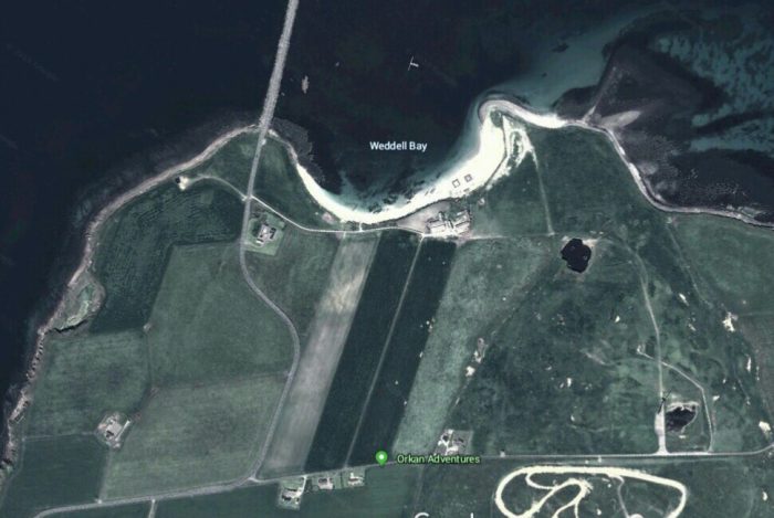 The north of Burray. Ward Point quarry is to the left of the image on the coast. As far as I can tell, the red line shown on the satellite image below is the approximate line of the 3’0″ railway on the north coast of Burray.
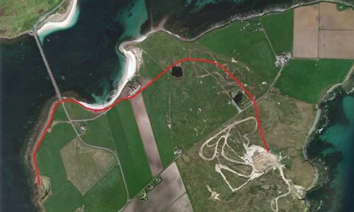 There was a further Causeway on south side of Burray, linking it with South Ronaldsay.
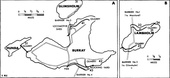 Sketch plans of the railways on Burray and Lamb Holm. [18]
Causeway No. 4 – work on this causeway did not start until July 1942 and it was built by May 1943. It was about 2000ft long. Work started at the north end on Burray where the contractor’s power station and blockyard were situated. A 3’0″ guage railway was laid from Burray Village Pier via a reversal to the blockyard which sat above Sea Taing and Housebreck quarry (where 2’0″ gauge lines were in use). Standard gauge tracks were used for the steam cranes. The blockyard closed in June 1944.
At the South end of the causeway, Balfour beatty sublet the work to Willian Tawse & Co., a Perth based firm. Rock from the quarry on Eastside proved unsatisfactory and a new quarry was opened up at Hoxa to the West of St. Margaret’s Hope. Road vehicles brought the stone to a loading point at Carra Point. “A twin track 3’0″ gauge railway was extended forwards onto the causeway in the direction of Burray as work progressed: rapid progress was made.” [1: p23] Diesel locomotives were employed here. No relics remain at this site. Interestingly sand has built up so much on the eastern side of the barrier that it is impossible to believe that there was ever open water there. The amount involved is actually staggering! As can be seen below.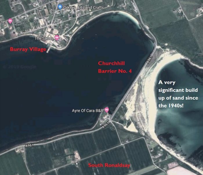
 The view of the newly developed sand dunes from Google Streetview, taken from the south end of the causeway!
 The view from the North end in 2014.
C. Military Railways
The Army was very limited in its use of railways in Orkney. Use was limited to 2’0″ lines linking storage huts at Muckle Rysa Camp on Hoy and at Houton and Stromness Camps on Mainland. There was also an inclined railway at Scad Head Battery on Hoy. [1: p24] This was “a self-acting incline about 900 yards long to serve a gun battery at Scad Head half way along the totally unpopulated section of the north-east coast of Hoy. The line ran from a camp set on top of a hill to the emplacement on the clifftop below, but it has been removed so effectively that even its gauge is now in doubt.” [18]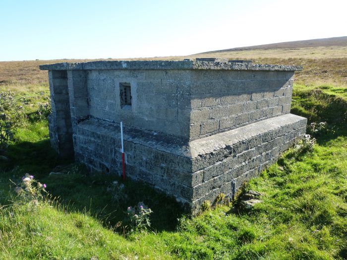 WW2 Army building Muckle Rysa. [12]
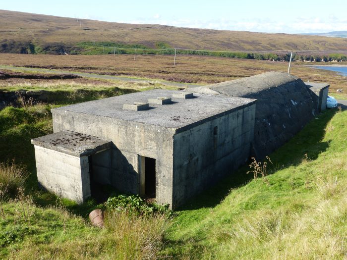 WW2 Engine House, Muckle Rysa. [13]
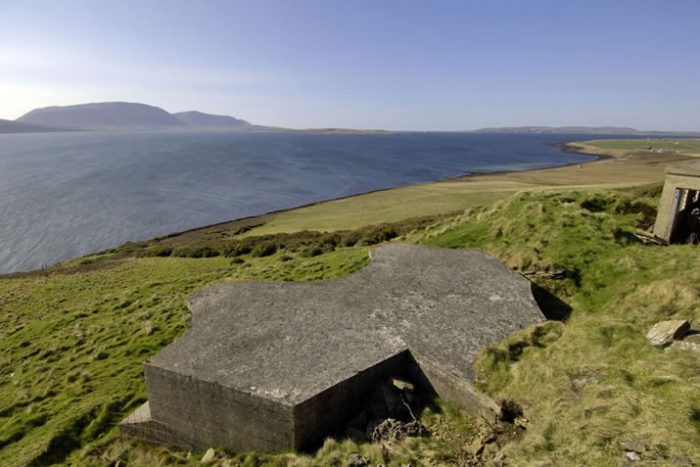
 Two images from Houton Battery on Mainland. [14]
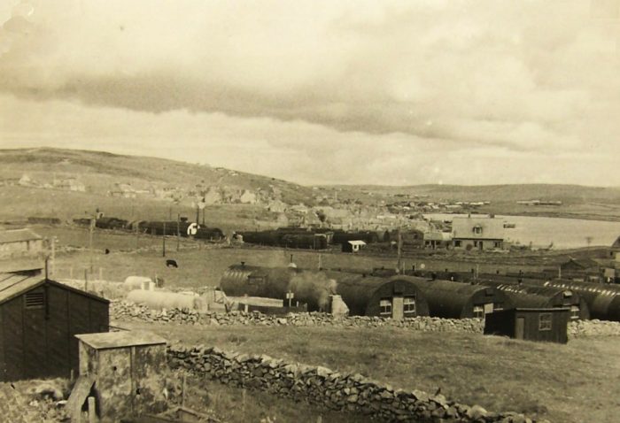 Stromness Army Camp during WW2. [15]
The Royal Airforce deployed balloons during World War 1 for observation purposes around Scapa Flow. During World War 2, unmanned barrage balloons were introduced to force enemy planes to fly higher or to damage and bring down aircraft. [1:p24]
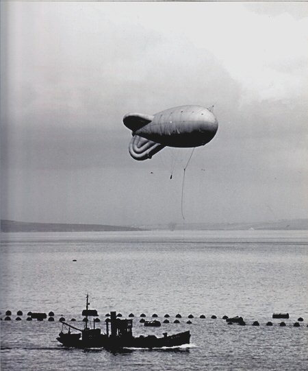
 “To defend the naval anchorage at Scapa, a special Squadron was created. The advance party arrived in Orkney in January 1940 and headquarters set up on Ore Hill above Lyness. Balloons were flown from sites on Hoy, Flotta, Fara and from trawlers moored in the Flow. [16] A second Squadron was formed in summer 1940.” [1: p24]
Ore Hill Balloon Depot, Hoy had a 40″ gauge man-powered railway to assist with moving gas cylinders which made use of a home-built wood-bodied flat wagon.
Rinningill Hydrogen Gas Factory, had a 2’0″ gauge railway installed on a newly constructed steel pier on Ore Bay which ran to an inland storage area reached by a steep incline. Eventually this small network included the factory and reach about 250 yards in extent. Simms says that in 1991, parts of the line were still visible . The pier was, by that time, in a dangerous state.
Fara Balloon Sites – Fara provided a natural protection to Lyness and was ideal for the deployment of barrage balloons. There were 6 balloon site on the island and a 2’0″ gauge railway was installed around a lot of the coastland of the island to service those sites. Gas was shipped from the Rinnigill Factory to Fara Pier and moved round the island on small flat four-wheeled trucks by a 20hp Ruston &Hornsby diesel locomotive.
Flotta Balloon Sites – at the advent of the war, Flotta was heavily fortified and used as a huge camp with an adjacent storage and supply base. A 2’0″ gauge railway was installed on the island which linked the older stone fishing pier to the new concrete ferry pier and to the base storage areas. The length was probably no more than 150yds. “By 1990, only a few corroded rails along the shore and an upturned metal truck chassis complete with wheels and axle-boxes remained, just below the high-tide mark Southwest of the fishing pier.” [1: p26] There are a few images below which show a narrow gauge line on the old pier at Flotta. [17]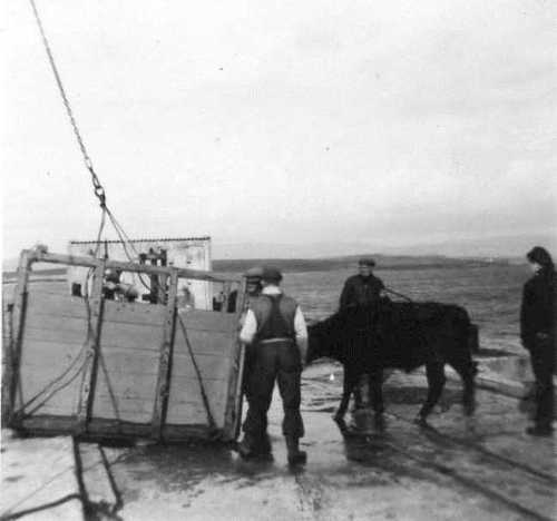 Loading cattle onto the Hoy Head, (c) K Desmond. [17]
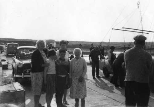 In this family photo, a car is being loaded from the pier onto the Hoy Head. The tracks remain visible in the pier surface. [17]
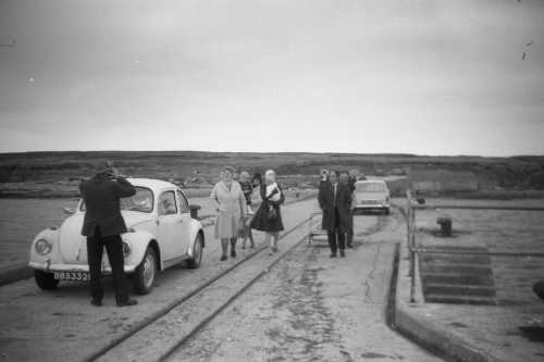 Railway tracks are prominent in this picture. [17]
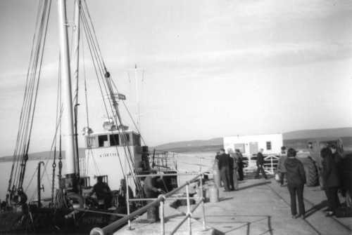 Protective railings have now appeared on the pier. The railway is still prominent. [17]
The Royal Navy – feverishly mounted preparations in WW1 to protect Scapa Flow from enemy attack as soon as the decision had been made to make Scapa Flow the Grand Fleet Base. However, supply problems and other issues left the fleet waiting to move into their new base until April 1919 which was months after the signing of the Armistice in November 1918. This meant that almost as soon as the fleet had finally moved into its base, it went to a peace-time footing and much of the infrastructure was sold off or removed.
Lyness Naval Base – the first section of the base to become operational was the refueling facility which was completed in 1917. The remainder remained in contractor’s hands through beyond the end of the War.
” in 1936 a start was made on extensively modernising the base, new wharves were built and William Arrol & Co. constructed underground tanks on Wea Fea whilst Balfour Beatty had the contract for the surface tanks located behind the pump house. … At the start of the Second World War only 400ft of the part completed quay was ready for use and this was taken over by the Boom Defence Depot. During the War the Flow became the main base for the British Home Fleet. The quay, locally known as Golden Wharf on account of both the high cost and the lengthy period of construction was not completed until Spring 1944″. [1: p26-27]
The standard gauge railway system was deemed to have lain derelict since the Great War. In fact it had been used by Cox and Danks and later by Metal Industries. It was relaid and extended for use by the travelling cranes required for laying and recovering anti-submarine booms. Much of the track still existing at Lyness in the 1990s was from this period and the date 1937 could be seen stamped on some of the pointwork. [1: p27]
Four steam cranes were used during the War. In 1945, the base was ‘moth-balled’ and finally closed in 1956.
Lyness Torpedo Depot was established on the North side of Ore Bay in the late 1930s. Some 2’0″ gauge track was pressed into service to serve the assembly factory and later extended to the storage areas on the West. Much of the track remains but there is no record of what locomotives were used on the system [1: p27]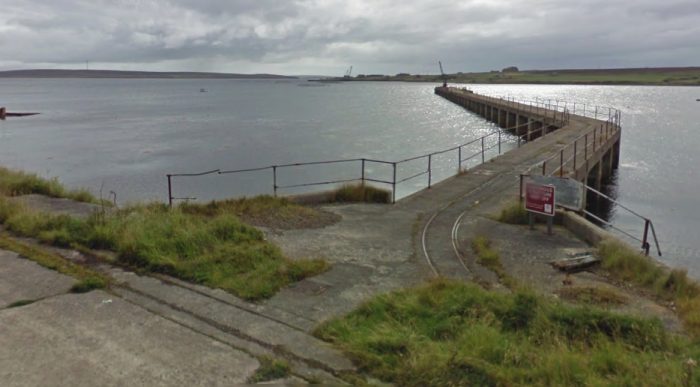
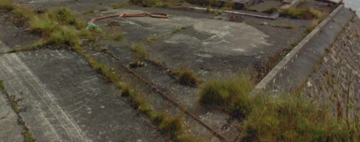 2’0″ gauge track in evidence at Lyness on the North side of Ore Bay.
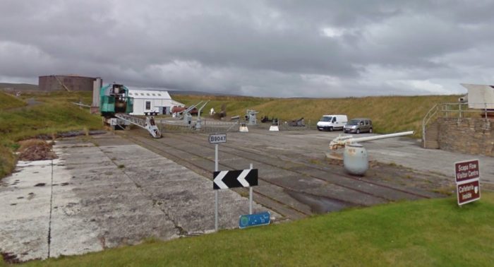 Standard gauge track in evidence at the Scapa Flow Visitor Centre.
And finally. …
D. Scapa Flow Visitor Centre
The visitor centre was closed when we visited in May 2019. Pictures in my earlier posts show a little of what exists at the site (see previous posts in this series:
https://rogerfarnworth.com/2019/04/29/the-railways-of-orkney; and
A short 100 metre length of metre-gauge track was constructed at the Visitor Centre in 1992. The gauge was chosen for the locomotive owned by the Centre rather for historical accuracy.
There are a number of railway exhibits at the Visitor Centre which is awaiting major works funded by Heritage Scotland. These include: [1: p29-31]
- A Ruston and Hornsby Diesel Mechanical Locomotive, originally owned by the Royal Navy. 30hp, 1000mm gauge and weight 4 tons.
- A Ruston and Hornsby Diesel Mechanical Locomotive, originally owned by the War Department. 20hp, 2’0″ gauge and weight 3 tons.
- A Wingrove & Rogers Battery-Electric Locomotive, originally owned by the Royal Navy. 2’6″ gauge and weight 7 tons.
- A Cowans Sheldon Steam Crane, originally owned by the Royal Navy. Standard gauge (a bogie steam travelling crane).
- 2 no. Harrison & Cammell Flat Trucks
- 4 No. miscellaneous railway trucks – three at 2’0″ gauge and one at standard gauge.
References
- Wilfred F. Simms; The Railways of Orkney; Self-published, printed by Gadds, Worthing, 1996.
- https://papastronsay.com/island/index.php, accessed on 14th May 2019.
- https://photos.orkneycommunities.co.uk/picture/number22715.asp, accessed on 14th May 2019.
- https://www.irsociety.co.uk/Archives/10/orcadian_railways.htm, accessed on 1st May 2019.
- https://en.wikipedia.org/wiki/Sule_Skerry, accessed on 14th May 2019.
- https://photos.orkneycommunities.co.uk/picture/number24499.asp, accessed on 14th May 2019.
- http://www.northronaldsaylighthousecottages.co.uk, accessed on 14th May 2019.
- https://www.naval-history.net/WW1z12aCox.htm, accessed on 14th May 2019.
- https://photos.orkneycommunities.co.uk/picture/number589.asp, accessed on 14th May 2019.
- https://canmore.org.uk/site/174004/hoy-wee-fea-underground-oil-fuel-tanks, accessed on 14th May 2019.
- https://en.wikipedia.org/wiki/Hunda, accessed on 14th May 2019.
- https://hoyorkney.com/attractions/hoy-history/wartime-heritage/hoy-wwii-archaeology/explore-wwii-hoy-and-walls/loc-survey-north-walls-rysa-to-pega, accessed on 18th May 2019.
- https://hoyorkney.com/attractions/hoy-history/wartime-heritage/hoy-wwii-archaeology/explore-wwii-hoy-and-walls/wwii-hoy-walls-rcahms-sites, accessed on 18th May 2019.
- https://www.northlinkferries.co.uk/orkney-blog/orkneys-wartime-history, accessed on 18th May 2019.
- https://www.aboutorkney.com/2019/04/21/stromness-in-wartime, accessed on 18th May 2019.
- http://www.crashsiteorkney.com/barrage-balloon-sites, accessed on 18th May 2019.
- https://lurdy.wordpress.com/2015/03/31/celebration-on-flotta-pier, accessed on 18th May 2019.
- https://www.irsociety.co.uk/Archives/10/orcadian_railways.htm, accessed on 25th April 2019.

re lyness torpedo 2″ gauge track ,do you know where it went from the pier and how far the distance was https://rogerfarnworth.com/2019/05/18/the-railways-of-orkney-part-3/ .was trying to get you to link to sites on lambsholm /wine and rum making enterprise which i think is on that rail track .
see email from coolzhangis@yahoo.co.uk sent to admin@rogerfarnworth.com all three of you are trying to record /promote but you are not working together to give coherent story .Each island i feel perhaps port needs its article . a generic Orkney article all over the place is confusing to say the least and whilst you have some map from Lyness it is not intersctive and way too small to see where the rail tracks are or indeed which pier has the torpedo track and where it goes to .
Thanks for article , you’ve put in a lot of work .https://rogerfarnworth.com/2019/05/18/the-railways-of-orkney-part-3/
Hi Colin,
THis all seems a little confusing. I don’t have an email address admin@rogerfarnworth.com (that I know of), sorry.
If you want to email me, please would you use rogerfarnworth@aol.com. I will do my best to respond direct to you about the issues you raise. The blog about Orkney is a holiday blog so it might not have all the detail that you would like.
Kind regards
Roger