
This post covers the first part of the line leaving Beziers Nord Station and heading for Montpellier. The line to Beziers from Saint Chinian was covered elsewhere:
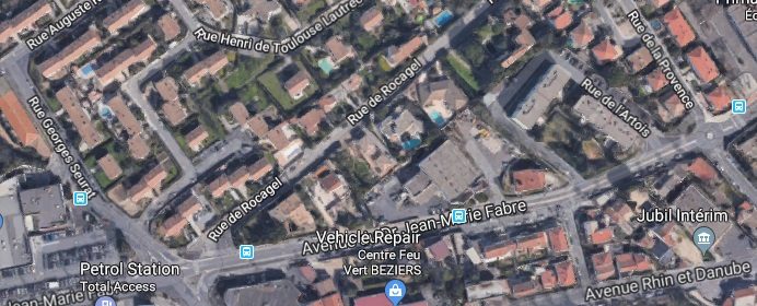
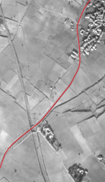
The route of the line out through the suburbs of Beziers is shown on the map below. [3]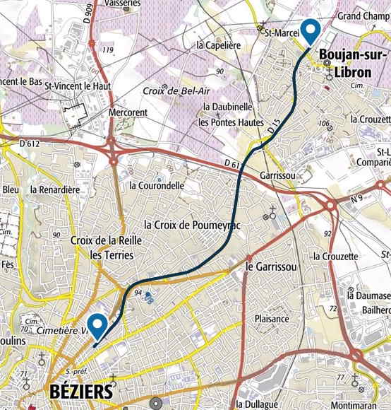 The aerial image from the early 1960s below shows the path of the line as it separates from the line from Saint-Chinian. It is worth comparing this image with one close to the end of the last post on the Railways of l’Herault. The connection between the two lines which allowed trains to travel East-west and vice-versa which was visible in the aerial image from the 1940s has now gone. It has been replaced by a Co-operative building left-of-centre on this image. [1]
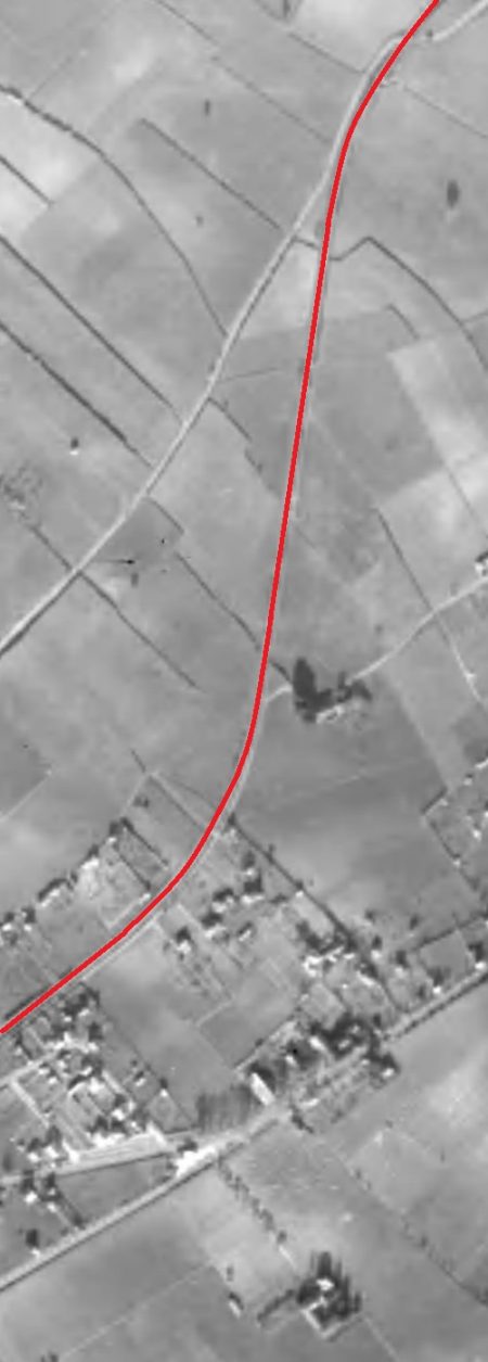
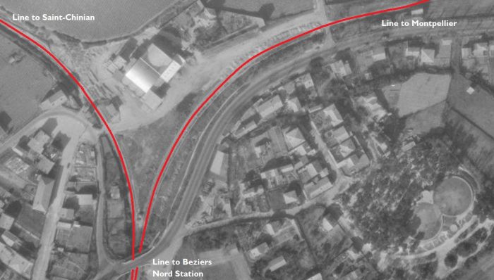
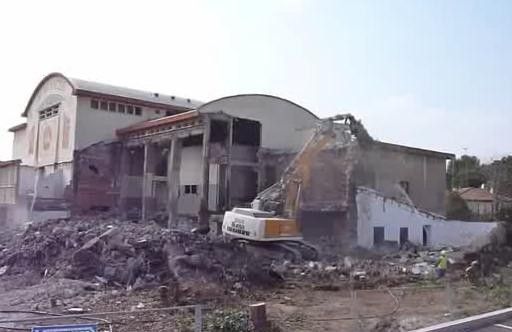 The Cooperative building has itself been replaced. It is shown in the adjacent image being demolished in the early years of the 21st Century. [2]
Its replacement is a uniquely designed block of flats which roughly looks like half a donut.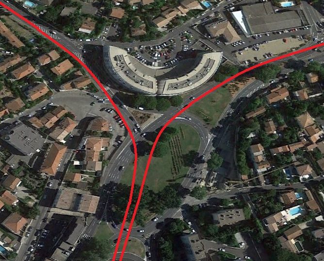 The approximate railway alignments overlaid on a Google Earth satellite image from 2018. The Co-op building has been demolished and the semi-circular flats have replaced it.
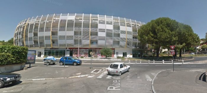 The block of flats in July 2018 on Google Streetview.
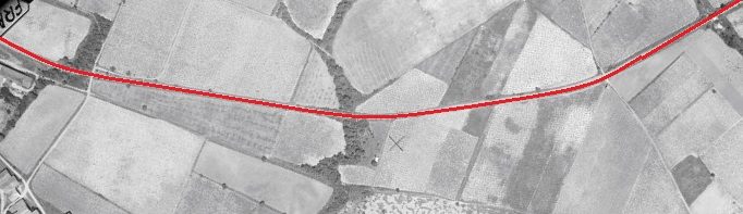
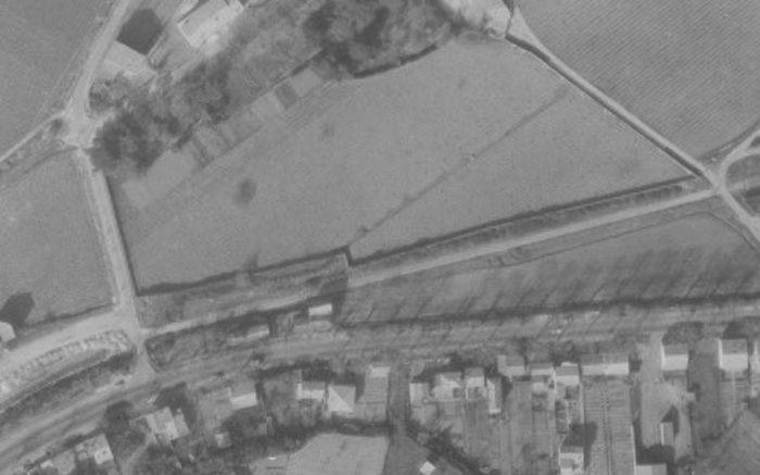 In the 1950s, the line immediately left the urban area and travelled across open fields. In this image it runs across the middle of the picture. [1]
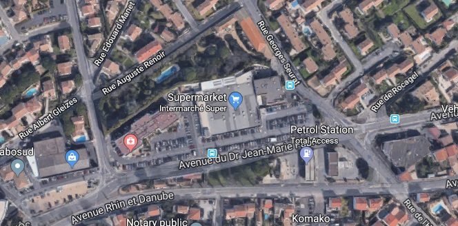 The road layout shows that the central area of this satellite image approximates to the image above. This time the date is in the 2010s rather than the 1950s.
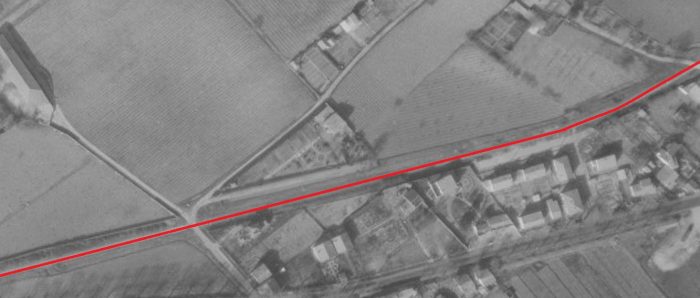
 The two images above show approximately the same area. The reference point is the housing in the bottom right of both pictures. The railway route is now a road – Avenue du Dr. Jean-Marie Fabre. [1]
The line soon turned away to the North as shown on the adjacent aerial images from the early 1950s.
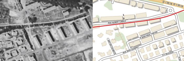
The route follows what is now the Boulevard du Languedoc. Two modern pictures of the road from July 2018 are shown below.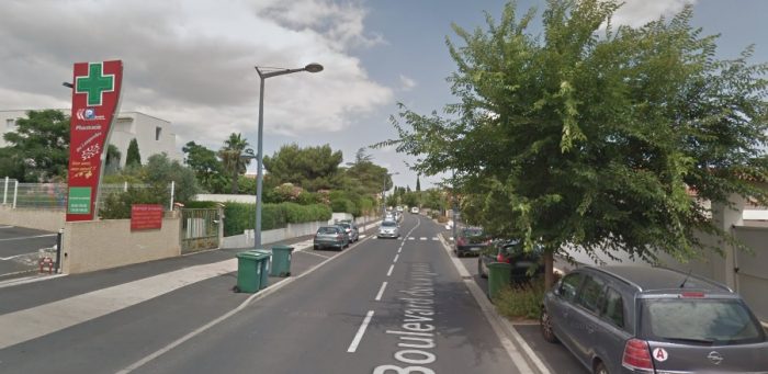 Boulevard du Languedoc.
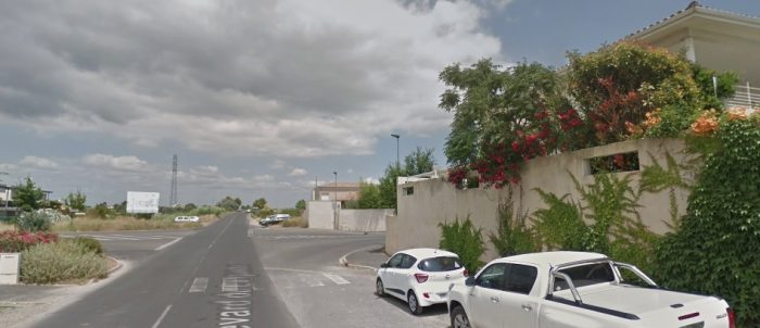 Further along Boulevard du Languedoc.
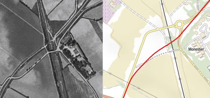
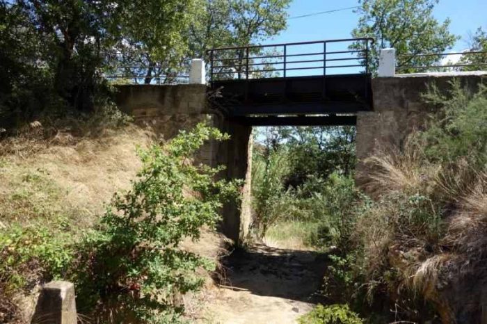
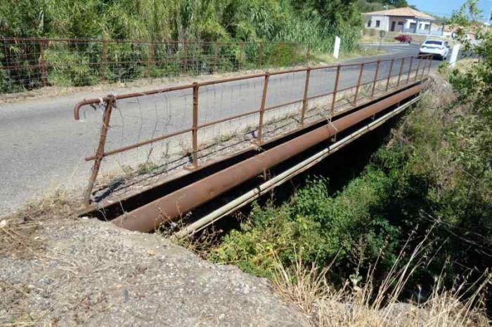
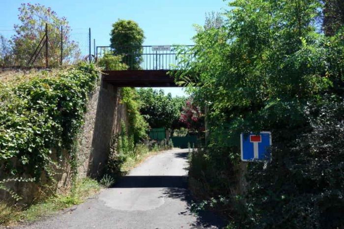
The secondary line crossed the single-track line running North from Beziers Midi Station through Bedarieux and on beyond Millau. The bridge is now gone but it was a very short distance north of the old road bridge.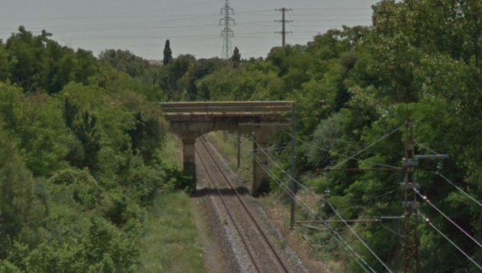 The original road bridge as seen in Google Streetview from the modern road bridge below. The old railway route crossed the line between the modern and older road bridges as shown on the map above. [1]
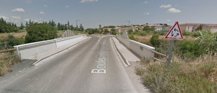
 The modern road bridge is seen from road-level above.
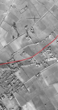
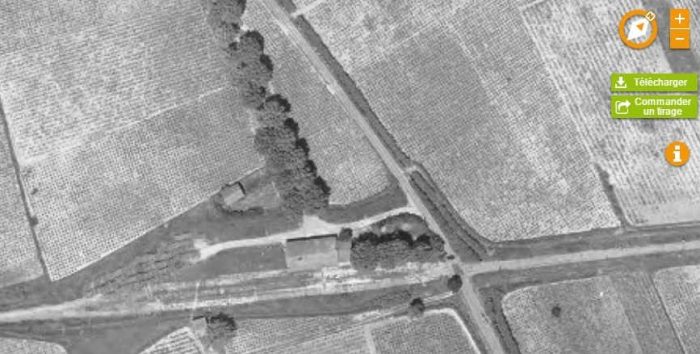
The route of the old railway continues as shown in the adjacent 1963 aerial image towards Boujan. [1]
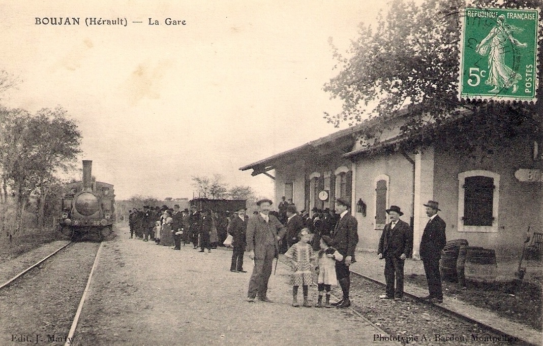
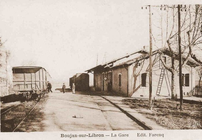
The Station at Boujan-sur-Libron was situated close to the Co-operative building in the village. The aerial image of the site from the early 1960s is not of the highest quality but it does show the relative positions of the Co-op building and the station building. The two buildings feature quite prominently in the aerial photograph, just on the north side of the village. 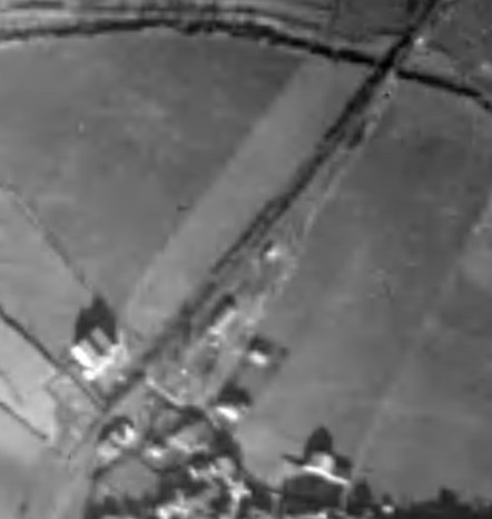
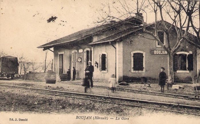
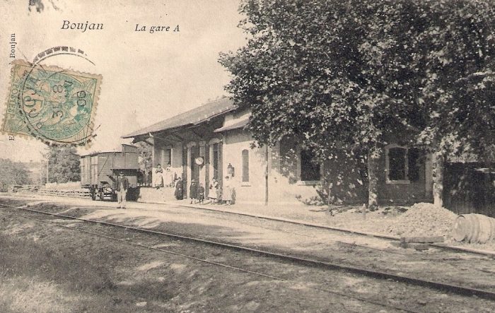
The 4 images below the aerial images are from postcards used in the early 20th century showing the railway station site and building which is typical of many of these structures along the length of the line. [3][4]
The Co-op building, “Les Vignerons”, is still standing in the early 21st century. It features in the first colour picture below. It was created in 1936. In 1979, 65,614 hectoliters of table wines were vinified for 360 members cultivating 632 hectares of vines. [5]
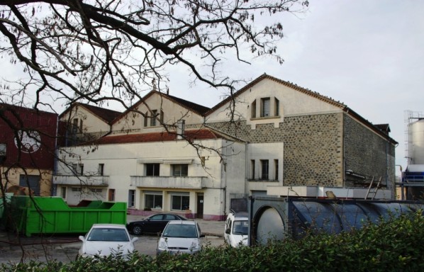 Boujan-sur-Libron Co-op. [5]
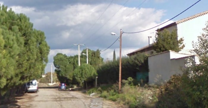 The site of the station in the early 21st Century. The buildings on the right are on the site of the old station building. The road is named, ‘Le Chemin de la Ancienne Gare’.
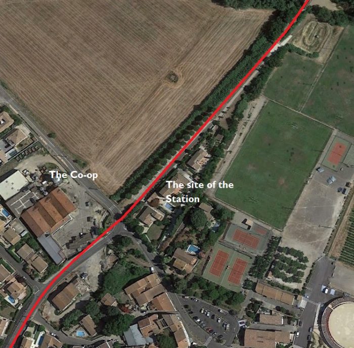 The route of the old railway has recently been improved as a short access road and then a walkway/ cycleway.
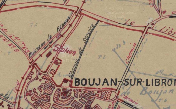 A hand drawn map of the village and station from the early 20th Century. [6]
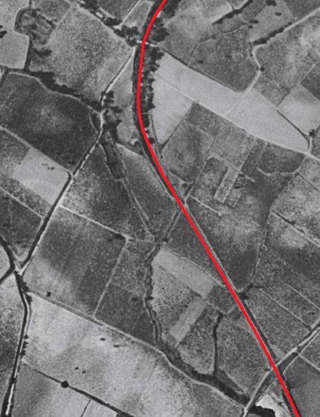
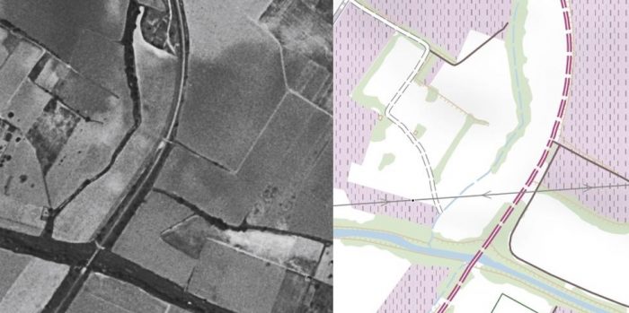 The cycleway is marked on the modern map by the lilac dashes. The old aerial image of the same area shows that this is the route of the railway. The bridge in the bottom of both images crosses the Libron River. [1]
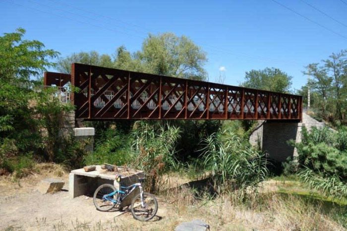 The bridge over the Libron River after the line has been converted to a greenway. [6]
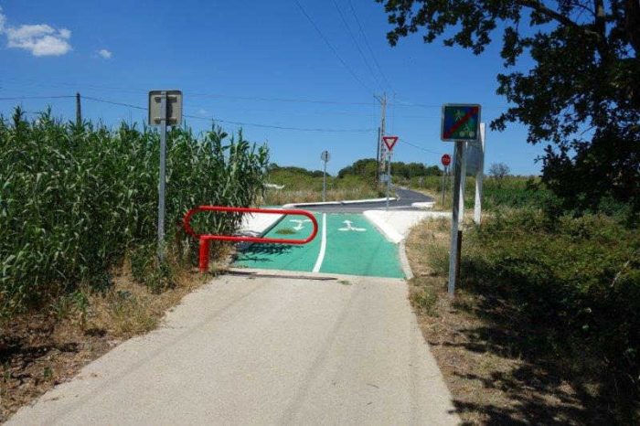 The new cycleway approaches a junction with the Route Guillaume-Thomas Raynal. [6]
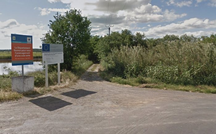 Looking back toward Boujan along what was the old railway from Route Guillaume-Thomas Raynal in 2013 just before work on the cycleway/greenway commenced.
 The picture above is taken looking forward along the route of the railway from the same location in 2013. The old track-bed now forms the single-track road, Route Guillaume-Thomas Raynal. Both these images are taken from Google Streetview.
The adjacent aerial image shows the line continuing on to the North from the location of the last two Google Streetview pictures. [1] With the opening of a greenway, the old road was closed at around the point where the cutting starts at about the top third point of this image.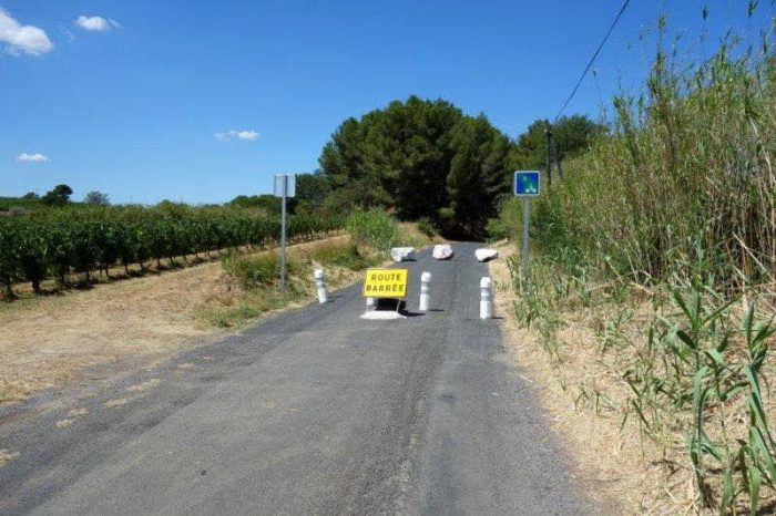 Immediately after a field access the route of the old railway is now closed to motor vehicles. [6]
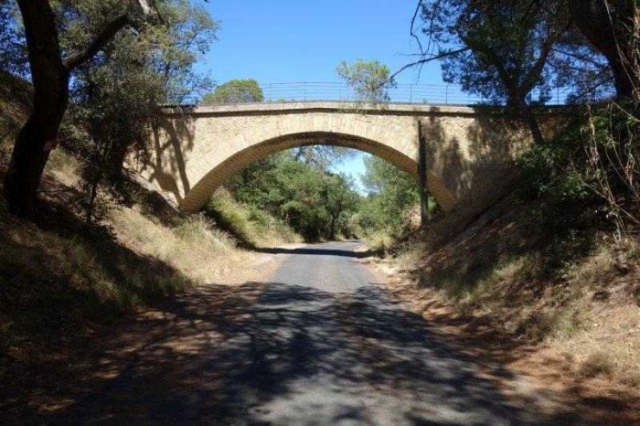 Now in cutting, the old railway passed under the Chemin Rural 8. [6]
 Access to motor vehicles to the old track-bed is once again permitted, as shown above, a little beyond the end of the cutting at les Oliviers. [6]
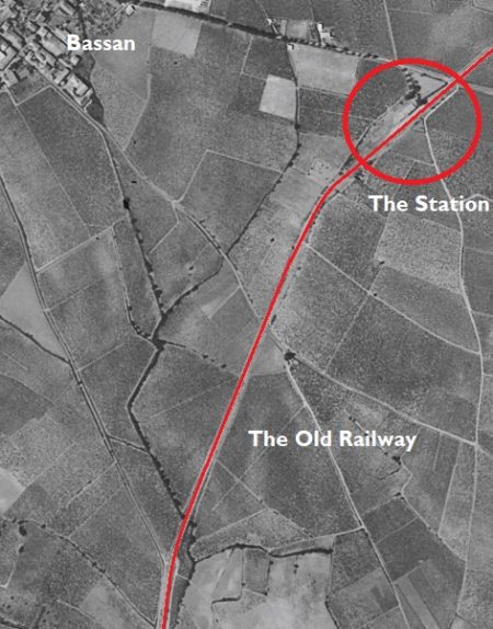
We are now heading for the village of Bassan further to the North. On the way, the line passed close to le Castellou and Grangette, as the IGN map illustrates. [1]
The line crosses a small metal accomodation bridge between le Oliviers and le Castellou, as shown in the map below.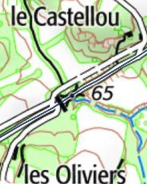
 The accommodation bridge which allow surface run-off and access beyond the railway embankment. The Creek de Boute Sirvain is dry in this image. The picture is taken from another country road which runs parallel to the old railway. [6]
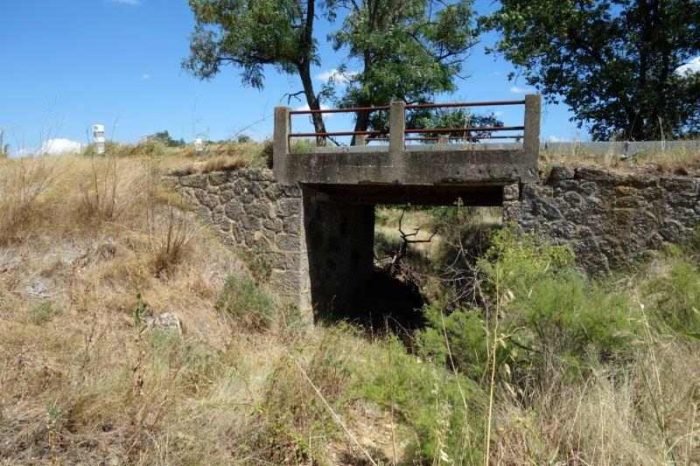
 A series of small bridges, as above, allowed the railway to cross small streams along its route. [6]
The adjacent aerial image shows the line as far as Bassan station site. [1]
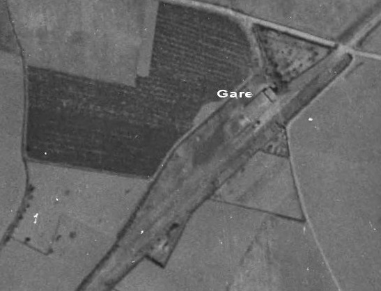
The aerial photograph below focusses on the station site. It was taken in 1944. [6] The next two pictures were taken in the early 21st century and show the station building which has been converted to a private home.
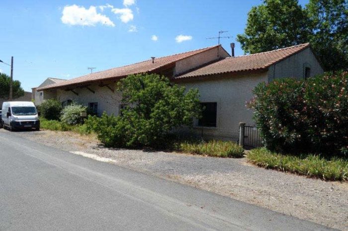 The station building at Bassan has been converted to a private house. [6]
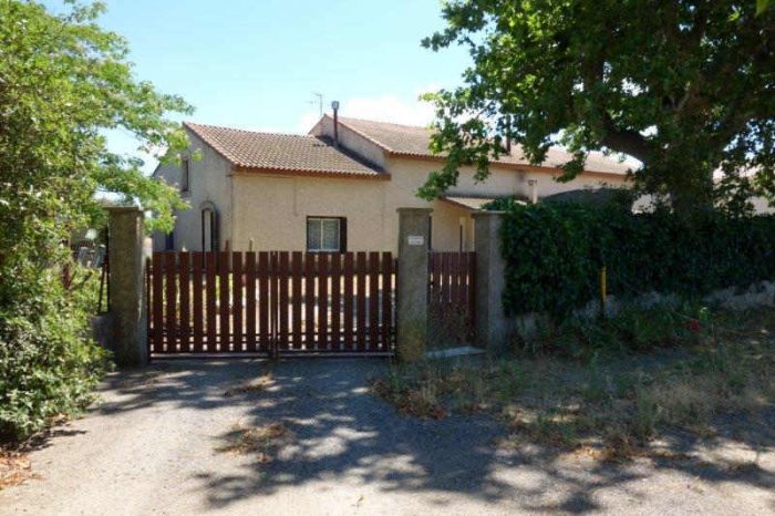 The old station building at Bassan. [6]
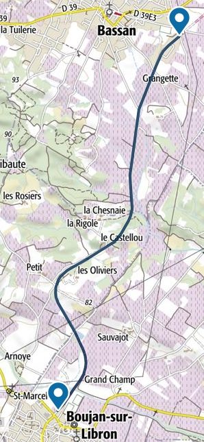
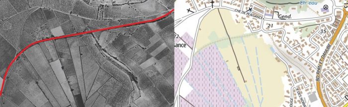
From Bassan, the line travelled Northeast in a straight line for close to 3 kilometres before reaching the outskirts of Servian as shown below. The last kilometre or so was alongside the D39. [8]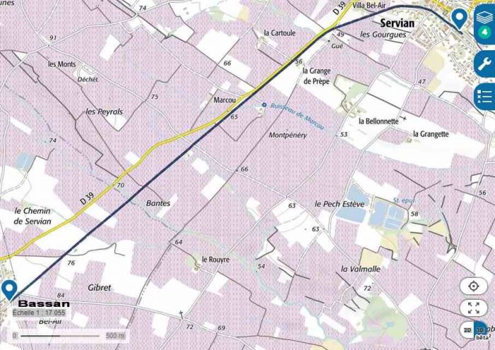 Trains left Bassan station and crossed the present Avenue de la Gare, (D39E3). The railway formation was used as a road for several decades before it was converted into a greenway in the 2010s.
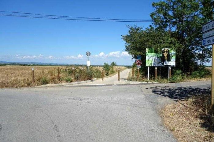 The new greenway. [8]
Along the length of track to Servian the present greenway crosses a series of access roads to farms and vineyards. The picture below shows the view from the old track-bed up the access road to the Domaine Montpenery. [8]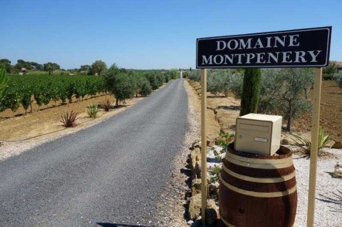
Towards the end of the long straight section of line trains ran alongside the D39. The road and railway had separate bridges over the small Merdanson stream.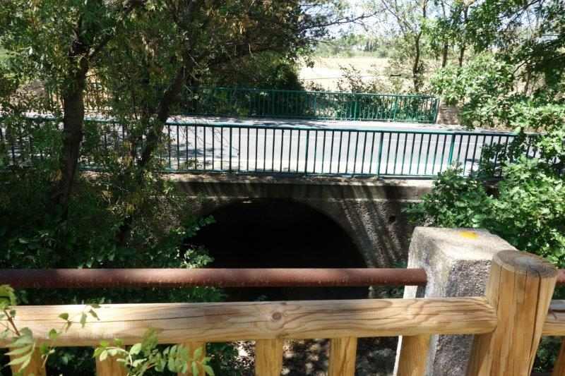 The D39 crosses the stream on a masonry arch bridge. [8]
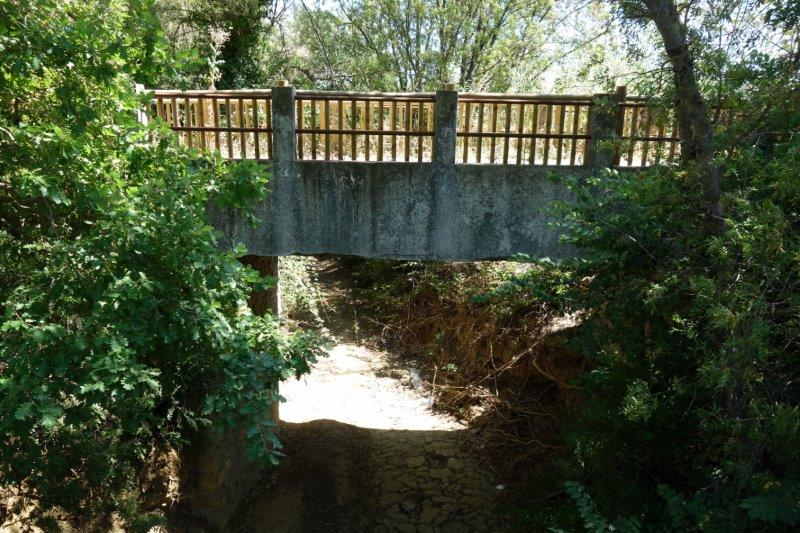 The railway crossed, and the present greenway crosses, the stream on a concrete bridge. [8]
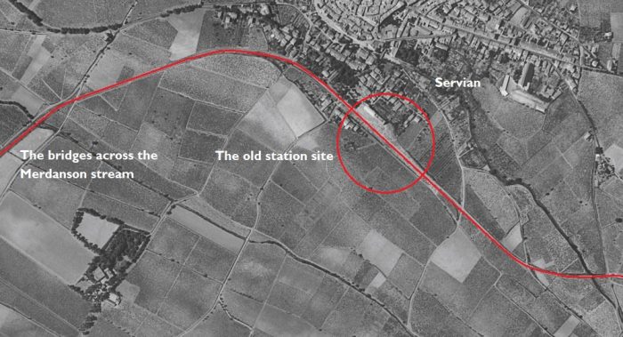 As the railway approached Servian its course changed from a Northeasterly trajectory to a Southeasterly direction. [1]
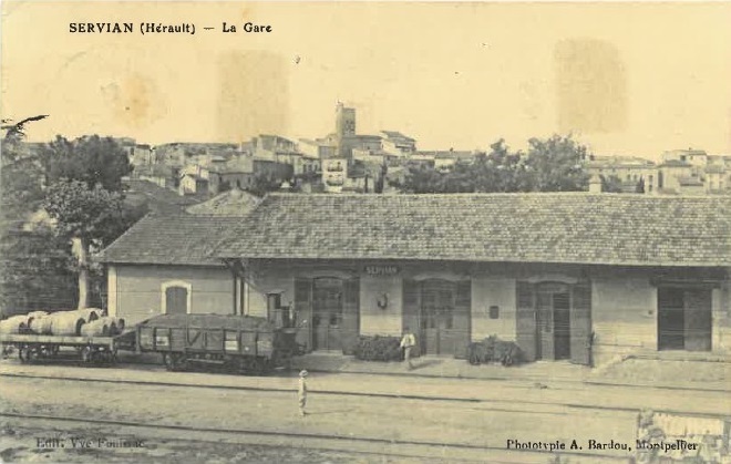
 The station at Servian viewed above from the Southwest. [9]
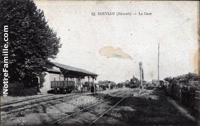
In the adjacent picture the station is seen looking from the Northwest. [10]
The next image is also a view from the Northwest but the scene depicted is wider and includes the water-tower. [9]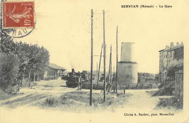
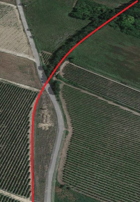
Beyond Servian, the next relatively significant location on the old line is Valros which is almost due East of Servian. The line dips southwards before head in a generally northeasterly direction to Valros.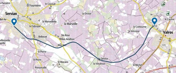 The route of the old railway between Servian and Valros. [11]
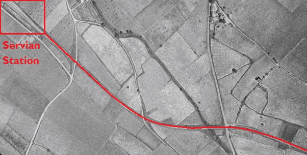
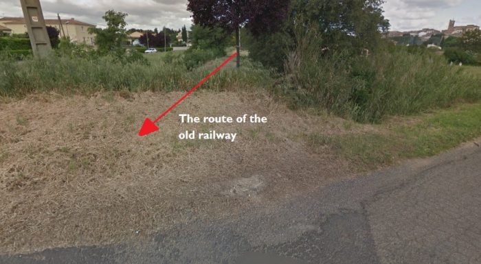 Looking back Northwest along the line of the old railway towards the station at Servian from the Chemin du Verger.
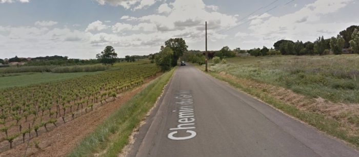 Looking ahead to the Southeast along Chemin de Grillet which overlies to railway formation.
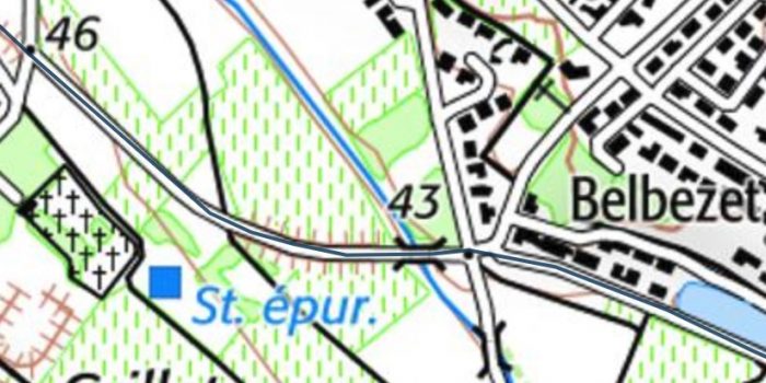
 The bridge over the Lene River at the point marked 43 on the above map. [11]
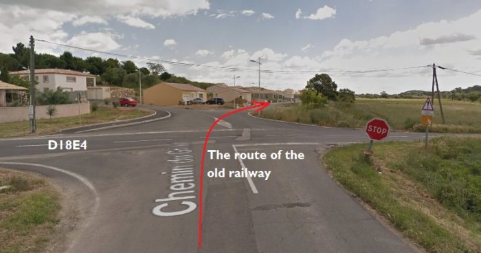 The railway crossed the modern D18E4 and followed what is now the Chemin de Briol.
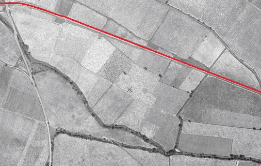
 The red line on the image above follows the old railway which has become the Chemin de Briol. [1]
Just beyond the right side of the image above the line turns Northeast as shown in the adjacent image. [1]
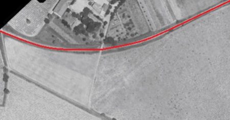
The group of buildings visible on the aerial image immediately above is Teisserenc Delafon Longeon, the Domaine Mas Viel . [1]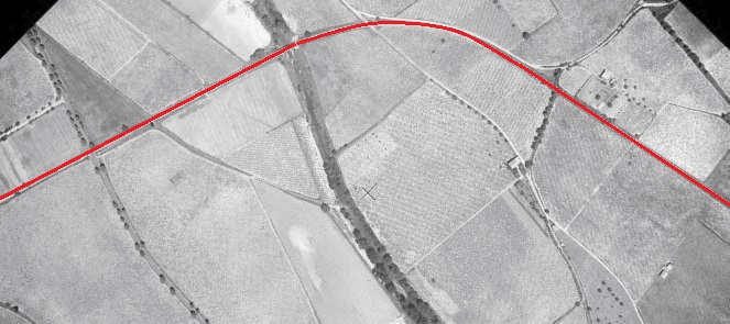 After crossing the modern D18, visible on the left of the aerial image, the railway also crossed the Thongue River and then turned back towards the Southeast. [1]
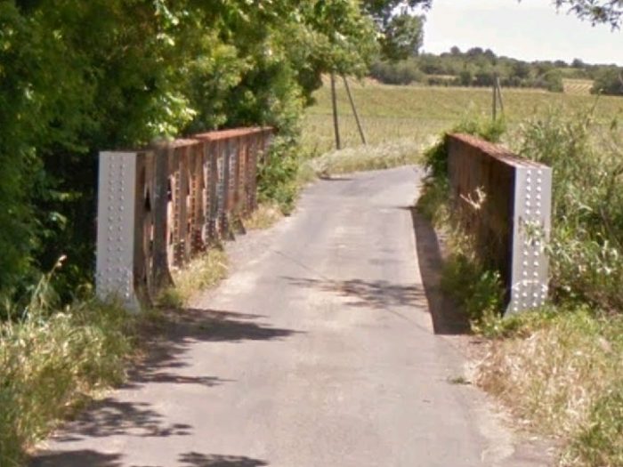 The old railway bridge over La Thingie is still in use carrying a single track lane which follows the old railway formation.
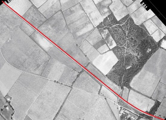
 A series of aerial images from the 1950s take the line towards Valros. [1]
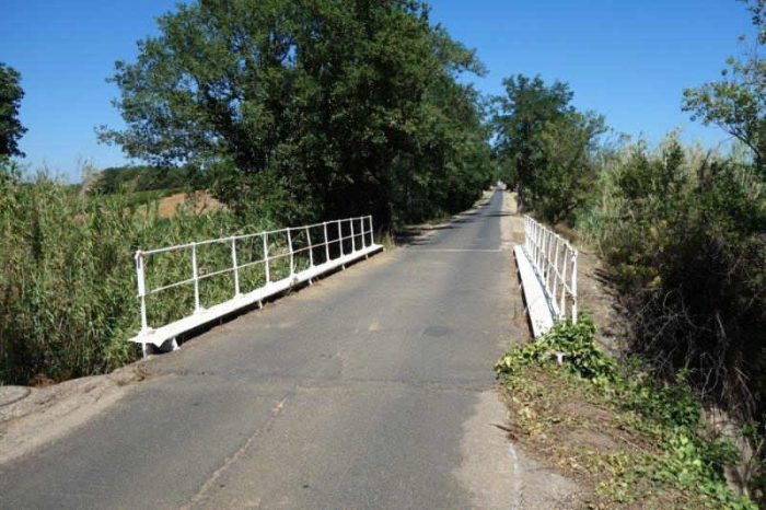
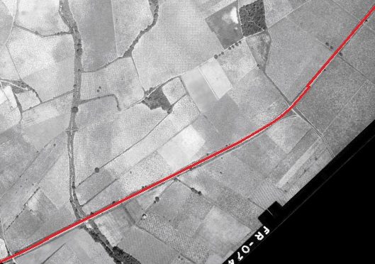
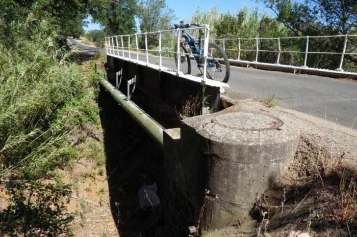 Two photographs of the bridge over the Ruisseau de St. Michael is in the bottom left of the aerial photograph above and the map below. [11]
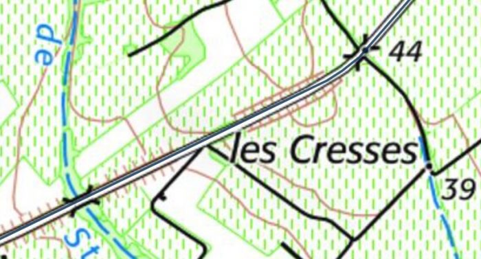

 The land plan above shows the Ruiseeau de St. Michel running down the left side of the map with the line of the old railway running up the right-side. [13]
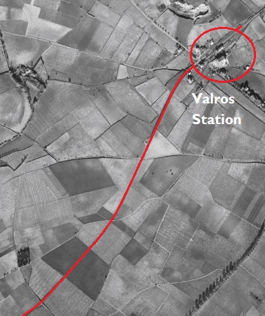
The adjacent aerial image from the 1960s takes the line as fat as Valros Station [1]
The aerial photograph below was taken in the 1940s. It shows the station at Valros while still in use. [13]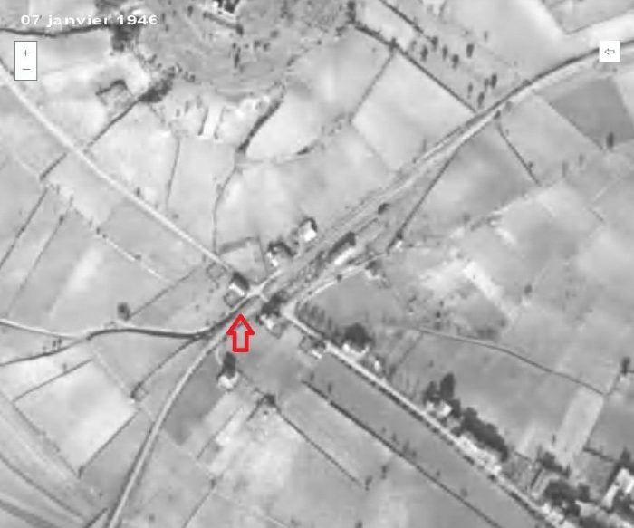
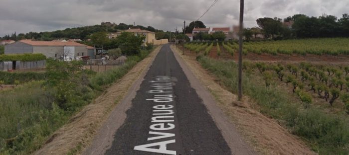 Approaching Valros on Avenue du Petit Train, the single track road which runs along the formation of the old railway. The picture is taken from Google Streetview.
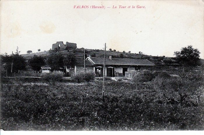 Valros Station buildings. [12]
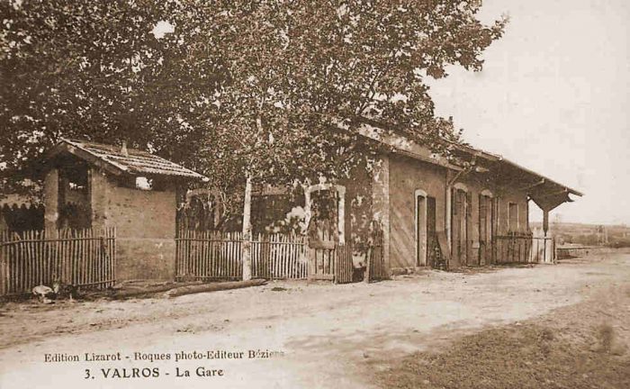 Valros Station buildings. [13]
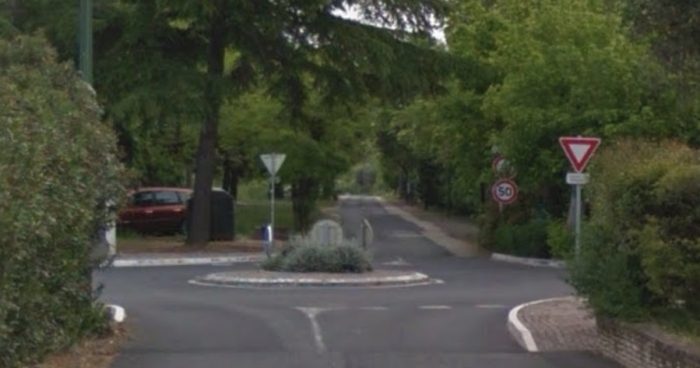 The view from Avenue du Petit Train into the station site in the 21st century.
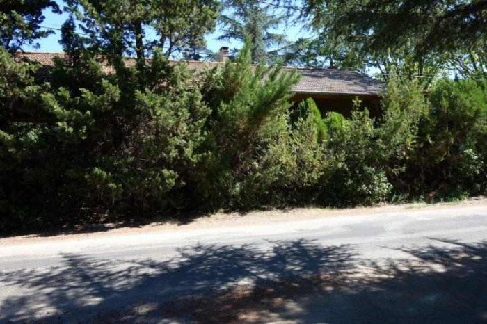
 The station building is now a private dwelling. [13]
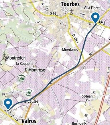
As shown on the adjacent map, from Valros, the railway head Northeast to Tourbes. [14]
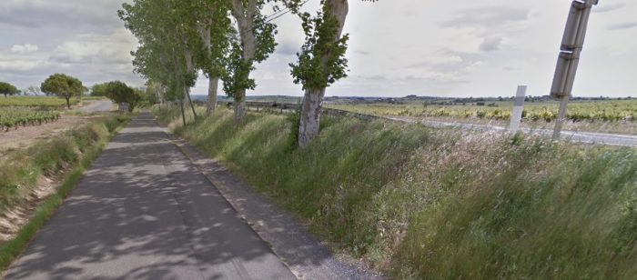
The single track road which follows the old track-bed continues to carry the name Avenue du Petit Train through a mixture of pine and deciduous broad-leaf trees. [14]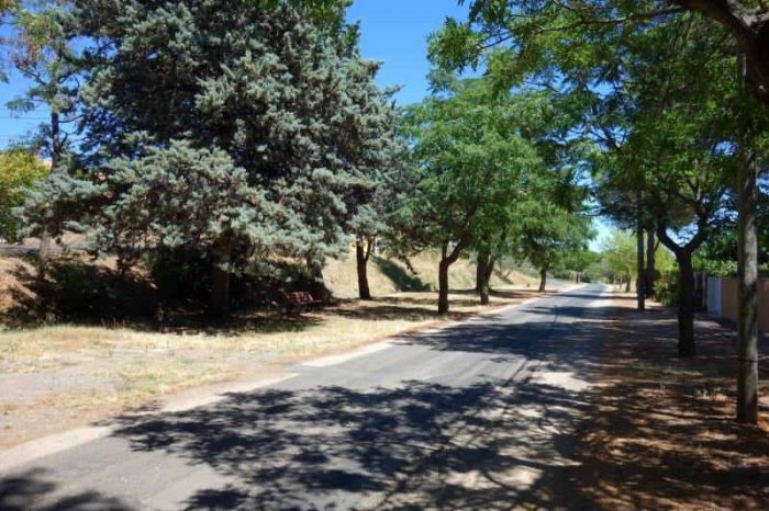
 The route continues alongside the N9 which can be seen above and to the right of the tarmac covered formation of the railway.
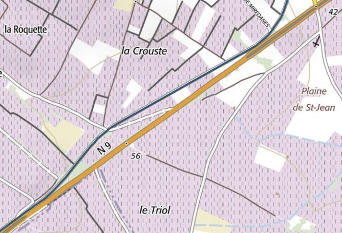
 The N9 and the old railway follow each other towards Tourbes. [14]
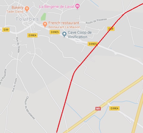
Approaching Tourbes the line and the road separate. The railway heading to the North so as to better serve the village. The old station site was to the Southwest of the D39E5 on the adjacent map. The aerial image below shows it in the 1960s. [1]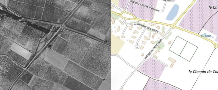
 A closer view of the station building, again from the air. Please note that the north point on this aerial image i as about 30 degrees to the vertical. [14]
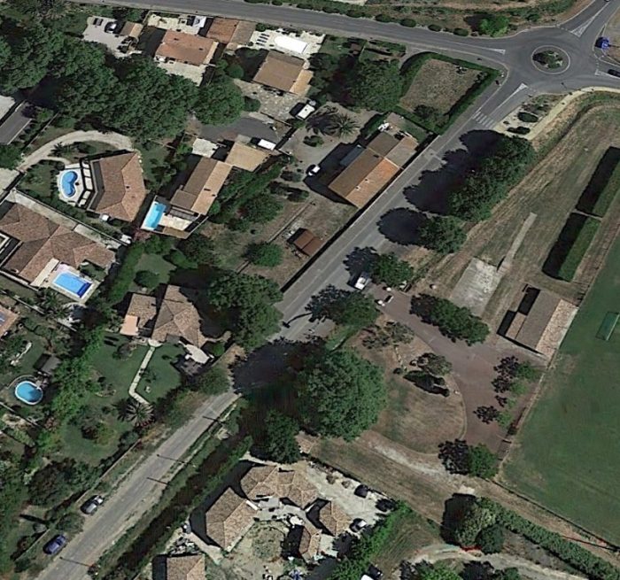 This satellite image from Google Earth shows that the station building remains in the early 21st century. The road continues to bear the name, ‘Avenue du Petit Train’. While the station building retains its original footprint, its conversion into a private home has resulted in the addition of an additional storey as can be seen in the Google Streetview image below.
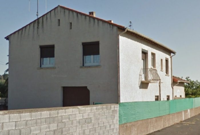
 From Tourbes station trains continued in a Northeaterly direction towards Pezenas. [15]
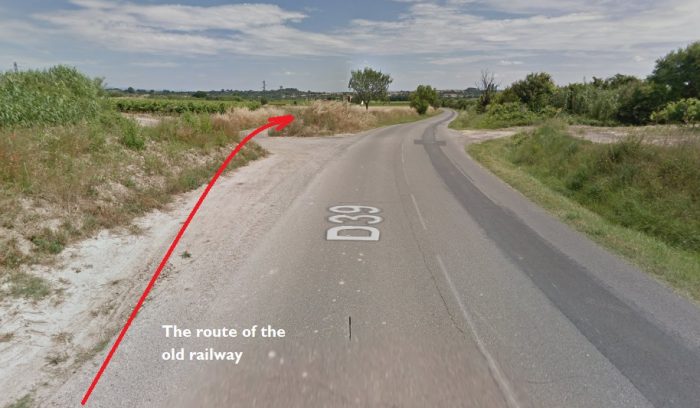
The railway route has been taken over by the D39 to the Northeast of the station in Tourbes. The two separate about a kilometre from the station. at the top of the images below. [1]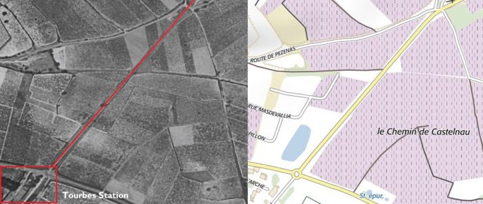
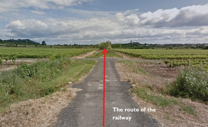 It is almost a surprise to find the railway route leaving the tarmac behind!
 But it isn’t for long. Just a few hundred meters along the track-bed it is back in use as a modern highway providing access to the local cemetery which is to the right of this picture which looks back down the line towards Tourbes. The cemetery can be seen easily on the map below. [1]
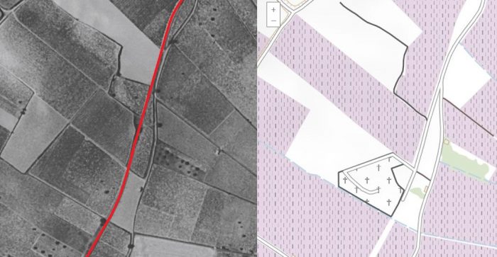
 In the two images immediately above, the aerial photograph and the map, the old railway formation can be seen curving into Pezenas.
The first curve is described in the adjacent Google Maps Satellite image. From this point the old railway gradually rose above the surrounding land on an embankment which allowed in to cross an accommodation road by means of a simply supported steel bridge which was at the location shown on the map below.
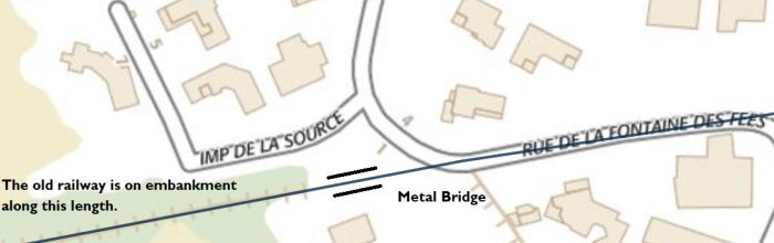
 Steel girder bridge carrying the old railway over an accommodation road on the approach to Pezenas. [15]
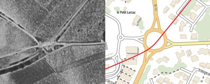 The original railway track-bed from this point on has been lost under modern development. Both the D13 and new housing developments on both sides of the road have obliterated the original formation. The approximate line of the old railway is shown above and below. [1]
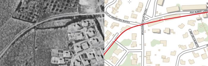
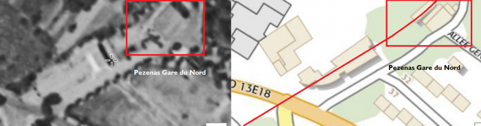 The station at Pezenas. [1]
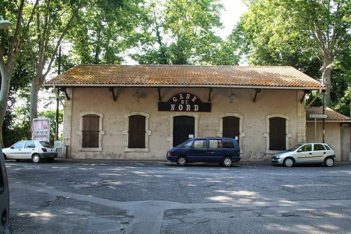 La Gare du Nord, Penezas. [16]
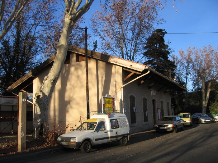 La Gare du Nord, Penezas. [17]
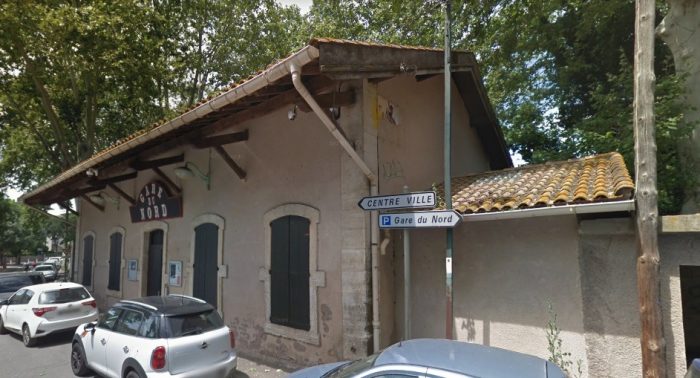 La Gare du Nord, Penezas.
We finish this part of our journey here in Pezenas.
The nearest railway station is now at Agde. Two single track lines used to serve Pézenas. The track from Béziers has been removed, though the station (Gare du Nord) still exists as a cultural centre.
Although notionally still part of the national rail network, in reality the line from Vias, near Agde, is closed. It was used into the 21st century by occasional freight trains serving a quarry further north. Since at least 2011, a section at St Thibéry, some five miles (8.0 km) to the south of Pézenas, is in use as a ‘Pedalorail’ leisure facility. However, the track remains in place throughout and the Gare du Midi is extant and in use as a medical centre.
References
- https://remonterletemps.ign.fr, accessed on 22nd March 2019.
- http://www.centerblog.net/journal-intime/15183-6569317-deconstruction-de-la-cave-cooperative-de-beziers-, accessed on 22nd March 2019.
- http://passes-montagnes.fr/htlm1/vf_interet_local-10.html, accessed on 25th March 2019.
- https://www.geneanet.org/cartes-postales/search/?country=FRA&go=1&page=1&place=Boujan-sur-Libron®ion=LRO&size=40&subregion=F34&zonegeo=H%C3%A9rault%2C+France, accessed on 24th March 2019.
- http://www.cavescooperatives.fr/article-boujan-sur-libron-herault-102598516.html, accessed on 25th March 2019.
- passes-montagnes.fr/htlm1/vf_interet_local-11.html, accessed on 25th March 2019.
- http://archives-pierresvives.herault.fr/ark:/37279/vta5599beff9fbd5/dao/0#id:1600875409?gallery=true&brightness=100.00, accessed on 25th March 2019.
- http://passes-montagnes.fr/htlm1/vf_interet_local-12.html, accessed on 25th March 2019.
- https://magalas-ensemble.fr/jadis-chemin-de-fer-de-1900, accessed on 25th March 2019.
- https://www.communes.com/ville-servian, accessed on 25th March 2019.
- http://passes-montagnes.fr/htlm1/vf_interet_local-13.html, accessed on 25th March 2019.
- https://www.geneanet.org/cartes-postales/view/7421958#0, accessed on 25th March.
- http://archives-pierresvives.herault.fr/ark:/37279/vta5599bfd8541be/dao/0#id:585155917?gallery=true, accessed on 26th March 2019.
- http://passes-montagnes.fr/htlm1/vf_interet_local-14.html, accessed on 26th March 2019.
- http://passes-montagnes.fr/htlm1/vf_interet_local-15.html, accessed on 26th March 2019.
- http://www.idherault.tv/35330/la-gare-du-nord-pezenas, accessed on 26th March 2019.
- https://fr.wikipedia.org/wiki/Fichier:Chemins_de_fer_de_l%27H%C3%A9rault_-_P%C3%A9zenas_gare_c%C3%B4t%C3%A9_cour.jpg, accessed on 26th March 2019.

Hello Roger,
I have been reading with interest your posts of the lost French standard gauge railways in the south west
We recently moved to Pezenas and I enjoy running and cycling in the small roads in the countryside around the town.
I found an update to your post: Railways of Herault – Route B – Beziers to Pezenas Line. The last section between Tourbes and Pezenas next to the new cemetary has now been cleaned up to create a through walkway/cycleway following the old track. You have two pictures that could do with updating. I would have included them here, but it doesn’t allow attachments.
If you are intersted Icould send some updated pictures.
Please let me know.
Regards
Dave
Thank you Dave, my email address is rogerfarnworth@aol.com