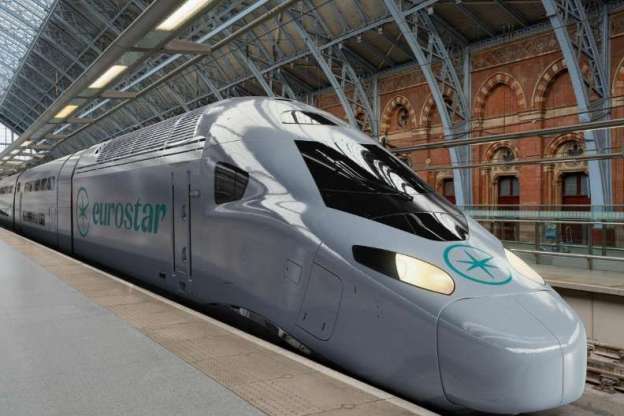
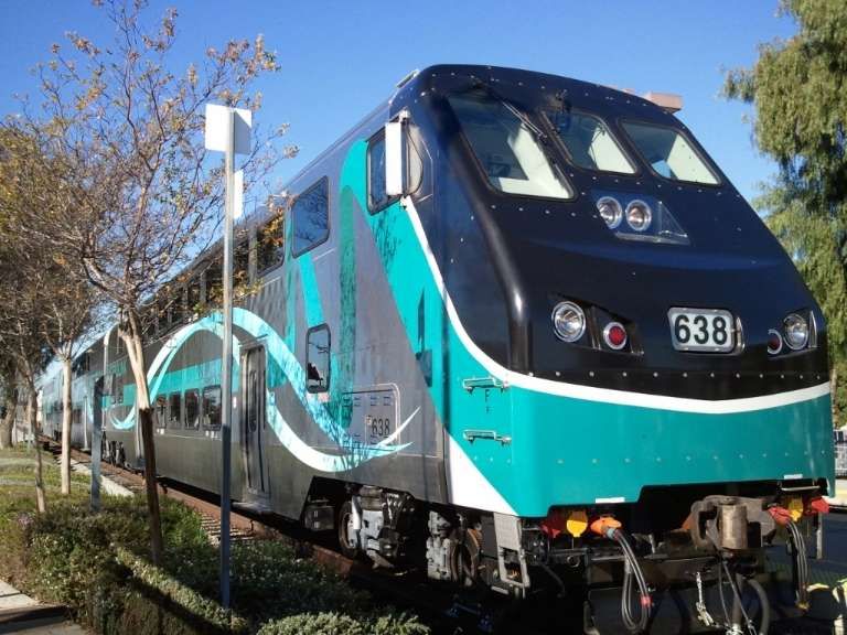
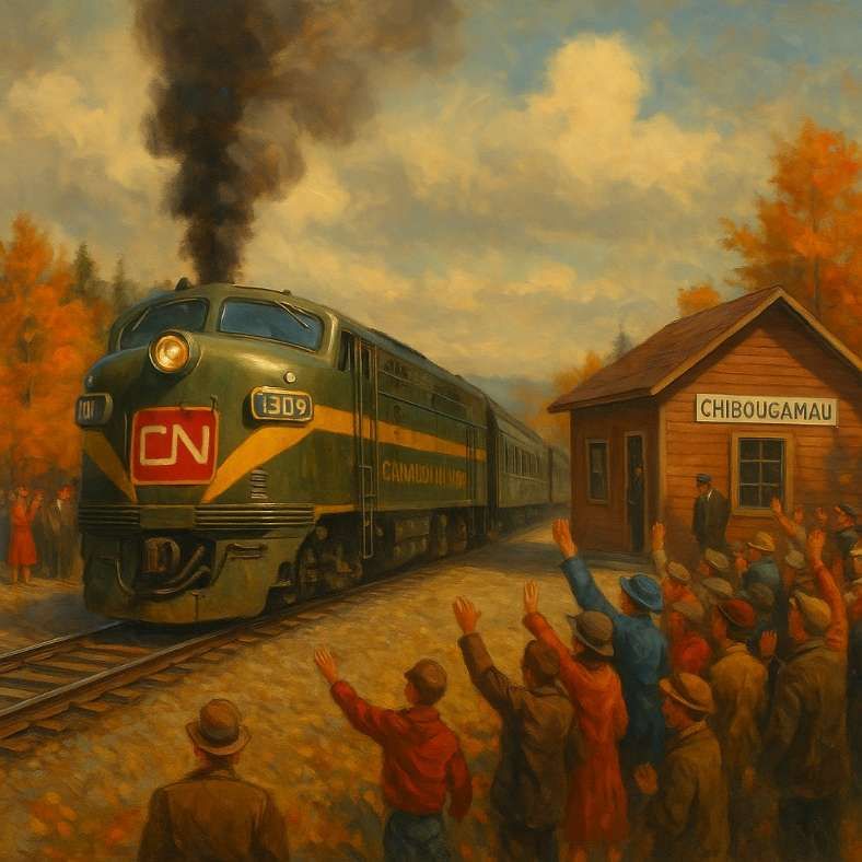
It was announced on 22nd October 2025 that the lines through the Channel Tunnel would see double-decker trains by 2031. An order was placed for their construction and delivery in October 2025. [6]
The featured image for this article shows what one of these trains would look like in Eurostar’s grey livery. The fully electric fleet of trains will be named Eurostar Celestia, which comes from the Latin word caelestis, meaning ‘heavenly’. The colour of the train has not yet been decided, but the current colour of Eurostar trains is grey, dark blue and yellow. Each train would be 200m long. Currently two are run together making an entire service 400m long. Double-decker trains don’t have twice as many seats as a single-deckers though, just because there needs to be room for interior steps, but there would be a fifth more seats. This means an increase from just under 900 seats on the current service to just over a thousand. [6]
“A bilevel car (American English) or double-decker coach (British English and Canadian English) is a type of rail car that has two levels of passenger accommodation as opposed to one, increasing passenger capacity (up to 57% per car in extreme cases).” [1]
Examples of Double-Deck Coaches/Trains in a Few Different Countries
France
“Double deck carriages date to at least as early as the second half of the 19th century. In France several hundred ‘voitures à impériale’ with seats on the roof were in use by the Chemins de fer de l’Ouest, Chemins de fer de l’Est and Chemins de fer du Nord by 1870, having been in use for over 2 decades; the upper deck was open at the sides with a light roof or awning covering the seats.” [1]
Marc Andre Dubout tells us that “the success of the railway with the public, the rise of the suburbs forced the companies to design double-decker carriages whose capacity was almost double that of conventional railway cars. Built from 1855 by the Compagnie de l’Ouest, … these carriages represent the flowering period of the Impressionist painters who took the trains on Sundays to go and paint in the countryside … not so far from Paris. It is the era of the boater and the joys of picnics by the water.” [4]
Dubout continues to say that these carriages weighed 8 tons and had 4 compartments downstairs and space for 34 sitting upstairs which could be reached by external staircases at the end of the carriage. [4]
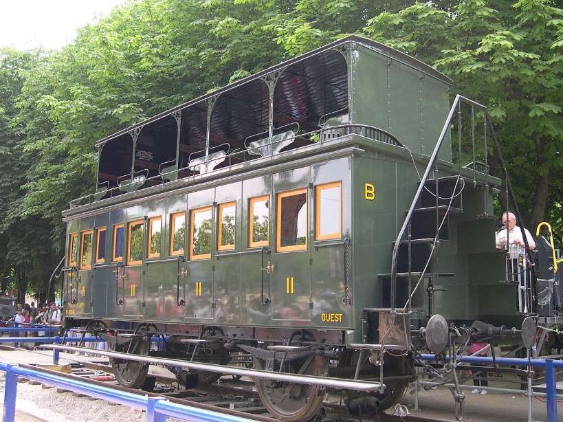
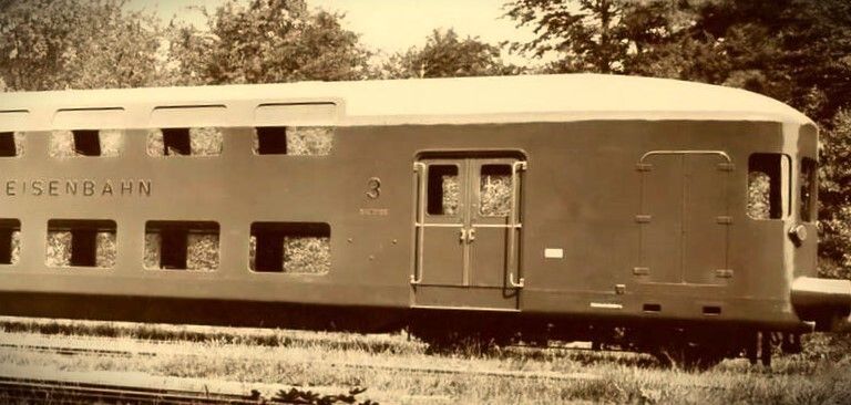
“In the 1860s, M.J.B. Vidard introduced two-storied carriages on the Chemins de fer de l’Est, with a full body, windows, and doors; the design lowered the floor of the lower storey to keep the center of gravity low. Vidard’s carriages had a total height of 13 feet 8 inches (4.17 m) with the head height in the lower part of the carriage only 5 feet 5 inches (1.65 m); the carriages had a capacity of 80 persons (third class) in a 2 axle vehicle of 13 tonnes fully loaded.” [1][5]
This image is embedded here from another webpage. This carriage was built by De Dietrich & Cie in 1899. [5]
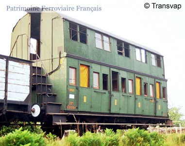
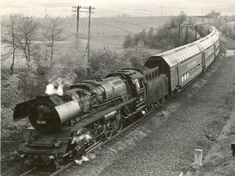
“The first all-steel Chemins de fer de l’État double deckers are an early example of split-level cars.” [1] “The first ten carriages were delivered by Brissonneau et Lotz, now part of Alstom, in 1933. The Voiture État à 2 étages were used as permanently coupled sets of carriages and used for réversibilité (push-pull operation), driving the train from the end passenger car and the steam locomotive pushing, on the Réseau Saint-Lazare. They often operated once in the morning, taking commuters to work, and once in the evening, returning them back home. They were also briefly used on the Réseau Montparnasse in shorter sets of six cars.” [3]
“Fifty cars were built, which accommodated the increasing suburban traffic from the beginning of the 20th century. They were supplemented by 380 Talbot passenger cars and 200 Standard EMUs. The last of the class were only withdrawn in 1984, after introduction of the VB2N in 1975.” [3]
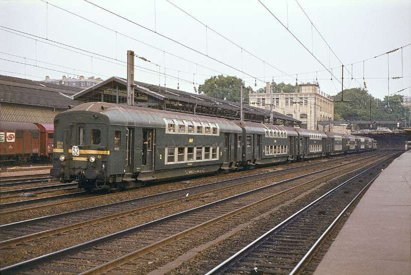
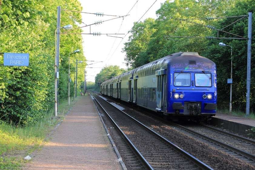
The Voiture de banlieue à 2 niveaux (shortened to VB2N) “is a type of double-deck set of passenger carriages used on Transilien, the commuter rail network in the Île-de-France region of France. The carriages are unpowered and designed to be paired with an electric locomotive.” [7] They were built between 1974 and 1984, refurbished between 2002 and 2008. Since 2012, the VB2N trains were being shifted from busier RER and Transilien lines to less busy routes on the Transilien network as new equipment came online, most notably the single-level Z 50000 and double-deck Regio 2N(Z57000) trainsets. The VB2N trains have been being retired gradually since 2021. [7]
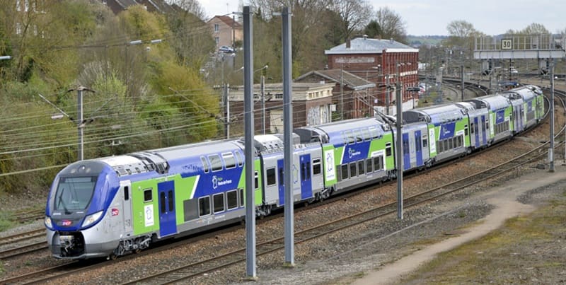
The double-deck Regio 2N trainsets are a family of a double-deck, dual-voltage electric multiple unit trainsets built for French rail operator SNCF to serve its regional rail routes (TER, Transilien, and RER). The trains utilize a unique and highly configurable design. One of the end cars is single-deck and designed to accommodate wheelchair users, the other end car is double-deck. The intermediate cars are either double-deck with no doors accommodating seated passengers traveling long distances or single-deck with two double doors per side accommodating standing passengers traveling short distances. Trains can be configured with six, seven, eight or ten cars. Additionally, the seating can be configured for intercity service (2+1 seating in 1st class, 2+2 seating in 2nd class), regional service (2+2 seating throughout), or high-capacity commuter service (3+2 seating throughout). These trains were designed and originally built by Bombardier, but during delivery the company was bought by Alstom, which completed the order. A total of 447 trainsets have either been built or are under construction at the Alstom Crespin factory since 2012. The first set was placed into regular passenger service in September 2013. [8]
Regio 2N in TER Hauts-de-France livery at Gare de Longueau, (c) Thierry Martel and licenced for reuse under a Creative Commons Licence (CC BY-SA 4.0). [9]
Germany
Double-decker trains in Germany (Doppelstockwagen) originated in 1935–36 with LBE commuter coaches, evolving from East German, Görlitz-built articulated trainsets in the 1950s-70s into widespread regional use. Following reunification, Deutsche Bahn modernized these coaches to become the dominant, high-capacity standard for regional lines, and in 2015, introduced them as Intercity 2 for long-distance routes. [11][12][13]
Early Beginnings (1930s-1950s): The first double-deckers were built by WUMAG at Görlitz for the Lübeck–Büchen–Hamburg railway in 1935, pioneering push-pull operation in Germany.
East German Development (DDR): VEB Waggonbau Görlitz became a hub for double-deck technology, producing two- to five-car articulated sets (Doppelstockgliederzüge) for the Deutsche Reichsbahn, with over 4,000 sets produced for the Eastern Bloc.
West Germany (DB): In contrast to the East, the West German Deutsche Bundesbahn initially focused on single-level carriages until adopting modern 2nd generation Class 760 cars in the early 1990s.
Post-Reunification & Regionalization: After 1990, Deutsche Bahn heavily adopted modern, single-coach bilevel designs for regional rapid transit across Germany.
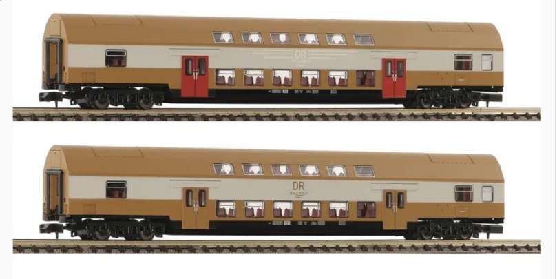
N Gauge models produced by Fleischmann (6260075). These two double-decker coaches are available as a set. They are typical of the style of single coach bilevel designs used for regional rapid transit across Germany. [16]
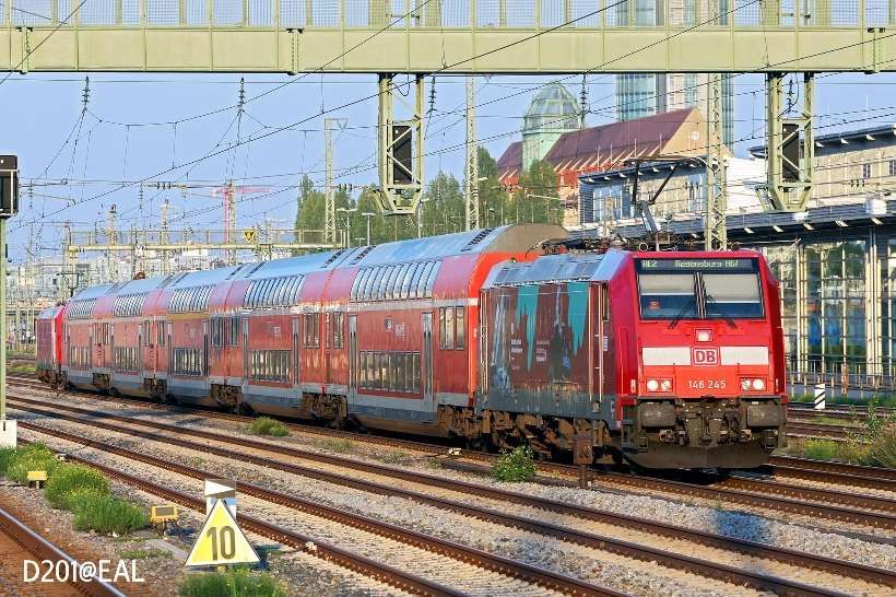
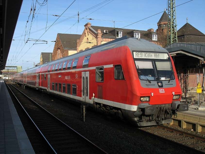
Early 21st Century: typical trains were red double -decker carriages hauled by electric locomotives (such as Class 146 or 147), and featuring high-capacity seating for commuters. [11][12]
DB Regio BR 146 locomotive in charge of a typical double-decker consist at Munich. This image was shared by Samson Ng on the World Electric Locomotives Facebook Group on 7th February 2026. [19]
This YouTube video shows a DB Region BR147 locomotive bringing its train into Angermunde Station with a train to Stralsund Hbf. [20]
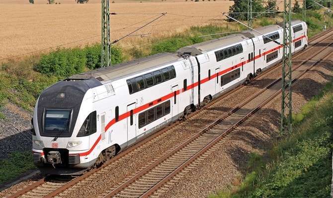
Intercity 2 Era (2015-Present): In 2015, Intercity 2 trains, a mix of Bombardier and Stadler “kiss” trains, were introduced for long-distance services, capable of 160 km/h, though they have been criticized for offering regional-style comfort on long routes. [13]
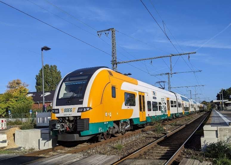
Private operators such as ODEG [21] and National Express Germany [22] use modern Siemens Desiro HC double-deck sets, often featuring a mix of single and double-deck cars for faster boarding. [11][12]
Bilevel trains are widely used across the USA and Canada for high-capacity commuter services and long-distance travel. Primarily using Bombardier/Alstom BiLevel Coaches in cities and Amtrak Superliners on national routes, these trains maximize passenger volume, with the Bombardier model operating in at least 14 different transit authorities.
Examples of operators are:
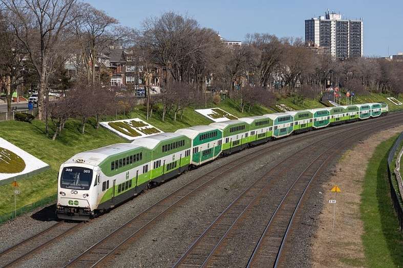
GO Transit (Canada):
GO Transit uses a bilevel passenger railcar (currently built by Alstom and previously by Bombardier, Hawker Siddeley Canada, the Canadian Car and Foundry (Can Car), and the UTDC) is used by a number of different North American commuter and regional rail operators, they feature a distinctive octagonal profile. The principal operator is GO Transit in the Golden Horseshoe, which operates some two-thirds of the total produced fleet. [26]
The BiLevel coaches were designed by Toronto’s regional commuter rail service, GO Transit and Hawker Siddeley Canada in the mid-1970s as a more efficient replacement for GO’s original single-deck coaches and cab cars. A trial was first undertaken with a borrowed Chicago & North Western Gallery Car. [27]
This image is embedded from the Transit Toronto website. It shows GO GP40-2L locomotive No. 9811 pulling a borrowed Chicago & North Western Gallery Car past Bayview Junction in April 1976 to test the feasibility of double-decker passenger coaches on the system. The test was a success, although GO would eventually adopt its own special model of bilevel coaches. This image is on the Transit Toronto website courtesy the D&T Illingsworth collection. [28]
Metrolink:
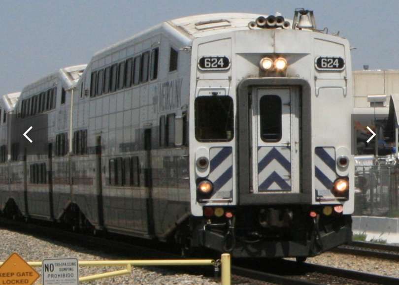
Metrolink in Southern California operates high-capacity, double-decker passenger coaches to maximize commuter transport efficiency without needing extra tracks. The fleet primarily consists of older, octagonal-shaped Bombardier BiLevel Coaches and newer, silver Hyundai Rotem BiLevel cars, often featuring white and blue or modern silver liveries. The Bombardier BiLevel Coaches were the same design as those operating on the GO network. [29]
Hyundai Rotem began marketing commuter rail cars in 2006 to compete with other railcar manufacturers in North America such as Bombardier Transportation and Kawasaki Heavy Industries Rolling Stock Company. An assembly plant opened in Philadelphia, Pennsylvania, in 2008 to meet American requirements; it closed a decade later. Significant users include: MBTA Commuter Rail (Massachusetts Bay Transportation Authority); Metrolink; and Tri-Rail, a commuter rail service linking Miami, Fort Lauderdale and West Palm Beach in Florida. [32]
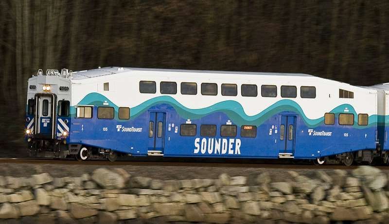
Sound Transit (Seattle):
Sound Transit serves the city of Seattle in Washington State in the Pacific Northwest of the USA. It makes use of Bombardier BiLevel Coaches.
These have been in use on the Sound Transit network since the early 2000s. Sound Transit has made multiple orders over time, with new cars arriving in 2017 and 2022 to support service expansion on the South Line and a programme of refurbishment planned to begin in 2027. [32]
While there has been a significant use made of double-decker carriages on the continent and in North America. These vehicles have been largely absent in British railway history. The primary cause has been the tight loading gauge on British railways.
In recent years railway construction in the UK has seen a larger loading gauge used. The fruit of this policy is the plans to use double-decker carriages through the Channel Tunnel and on HS1.
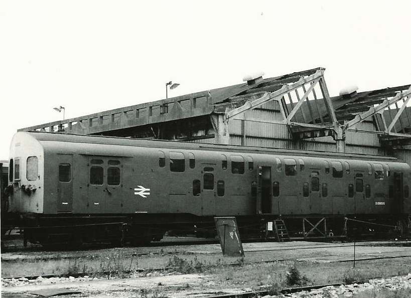
However, these new carriages will not be the first to run on British metals. In the late 1940s Bulleid, the Chief Mechanical Engineer of the former Southern Railway, introduced two double-decker trains to the route between London Charing Cross and Dartford. These SR Class 4DD trains had split level floors with alternately high and low passenger compartments. They were no higher than regular carriages and so could travel on the Southern Railway network. “It was hoped that the SR Class 4DD could fit almost a third more commuters on board. But things didn’t get off to a great start, when the carriages were pulled for modifications after just one day in service. They subsequently revealed various other shortcomings, one of which … was the windows not opening.” [34] A ventilation system had to be fitted to overcome the problem.
The Southern Railway designed SR Class 4DD carriages were introduced as an experiment in 1949 just after nationalisation. [35]
Apparently, passenger capacity was improved by the SR Class 4DD, but the compartments were just not comfortable and because there were more passengers boarding and alighting, the train service was slowed down
Ostdeutsche Eisenbahn GmbH (ODEG) is the largest private railway operator in eastern Germany, operating passenger services across Berlin, Brandenburg, Mecklenburg-Vorpommern, Saxony, and Saxony-Anhalt. Founded in 2002, it is a 50/50 joint venture of Netinera and BeNEX, operating 17 lines.
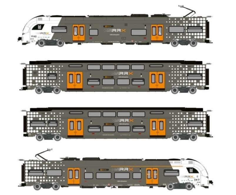
National Express Germany (a subsidiary of the British Mobico Group) is a major private rail operator in North Rhine-Westphalia, operating regional lines including the Rhein-Ruhr-Express (RRX) RE1, RE5, and RE11, as well as RE7 and RB48. Using Siemens Desiro HC trains, they provide run services covering 20 million km annually as of 2023.
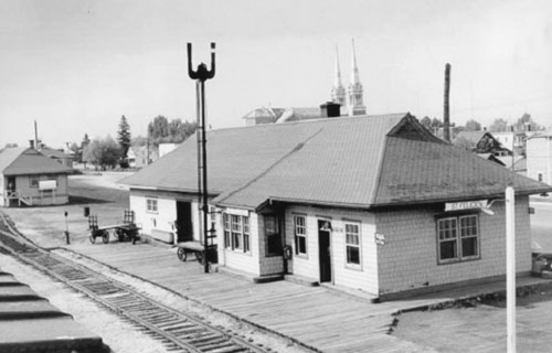
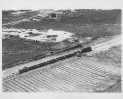
The featured image above is a photograph of Saint Felicien Railway Station in 1959. [9]
In the North of Québec, some 300 miles from Montreal, there is an area of extensive mining – deposits of copper, zinc, gold and cobalt wee being mined in the mid-20th century. In the first half of the 21st century, Northern Quebec’s mining sector is a significant part of the province’s economy, focusing on gold, nickel, lithium, graphite, iron, and copper, focusing on gold, nickel, lithium, graphite, iron, and copper, with major operations like Glencore’s Raglan (nickel) and Agnico Eagle‘s Canadian Malartic (gold) leading the way, alongside emerging lithium projects in the James Bay region, leveraging Quebec’s hydropower for cleaner operations and creating jobs in remote areas like Nunavik, despite logistical and environmental challenges.
Raglan Mine is, today, a large nickel mining complex in the Nunavik region of northern Quebec. “It is located approximately 100 kilometres (62 miles) south of Deception Bay. Discovery of the deposits is credited to Murray Edmund Watts in 1931 or 1932. It is owned and operated by Glencore Canada Corporation. The mine site is located in sub-arctic permafrost of the Cape Smith Belt, with an average underground temperature of −15 °C (5 °F).” [1]
In 2025, the mining complex “is served by and operates the Kattiniq/Donaldson Airport, which is 10 nautical miles (19 km; 12 miles) east of the principal mine site. There is a gravel road leading from the mine site to the seaport in Deception Bay. It is the only road of any distance in the province north of the 55th parallel. As the complex is remote from even the region’s Inuit communities, workers must lodge at the mine site, typically for weeks at a time. From the mine site employees are flown to Val D’or, or in the case of Inuit employees, their home community. Ore produced from the mine is milled on-site then trucked 100 km (62 mi) to Deception Bay. From Deception Bay the concentrate is sent via cargo ship during the short shipping season (even by ice breaker it is only accessible 8 months of the year)to Quebec City, and then via rail to be smelted at Glencore’s facilities in Falconbridge, Ontario. Following smelting in Ontario, the concentrate is sent back to Quebec City via rail, loaded onto a ship and sent to the Glencore Nikkelverk in Kristiansand, Norway to be refined.” [1]
Agnico Eagle’s Canadian Malartic is, in 2025, one of Canada’s largest gold mines, located in Quebec’s Abitibi region, transitioning from open-pit to a major underground operation (Odyssey Mine) to extend its life, with Agnico Eagle becoming sole owner in 2023 after acquiring Yamana Gold’s share. This significant asset is a cornerstone of Agnico’s Abitibi operations, aiming for long-term value through expansion and exploration, supporting regional growth. [2]
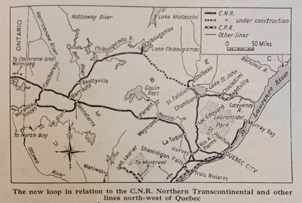
The Canadian National Railways network to the Northwest of Québec City. [3: p203]
Canadian National Railways were authorised to open up northern Québec by a Bill passed in the Canadian Parliament in 1954. The resulting Act approved the construction of two new lines. “One line was to run from Beattyville to Chibougamau, a distance of 161 miles, and the other for 133 miles from St. Felicien to a junction near Chibougamau with the line from Beattyville.” [3: p201]
Beattyville to Chibougamau – Construction
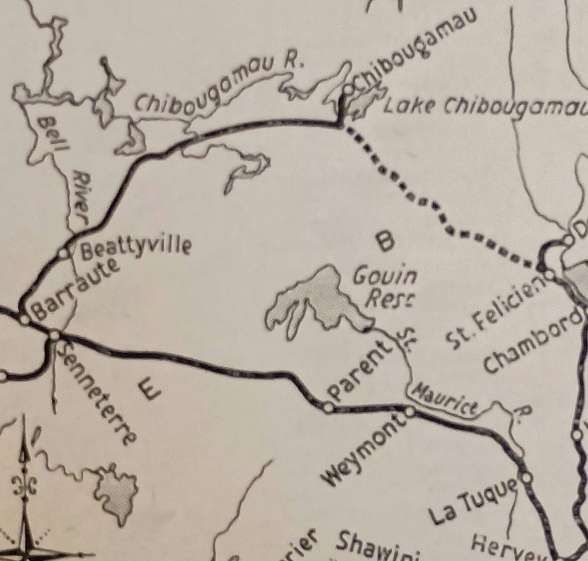
“The line to Beattyville provided a direct route from the rich mining area around Chibougamau to the ore smelting plant at Noranda, some 250 miles west of the Quebec-Ontario border, and its construction was undertaken without delay. Work started in November, 1954, and the railway was completed in November, 1957, to Beattyville, where it joined the existing 39-mile branch from Barraute, on the CNR northern transcontinental route.” [3: p201] It appears below as a solid line on the extract from the map above. [3: p203]
The line from Beattyville to Chibougamau was completed in November 1957, the line between St. Felicien and Chibougamau was under construction in 1959. [3: p203]
The engineering work (ground, earthworks, drainage and bridge substructures) for the railway between Beattyville and Chibougamau was contracted in two separate contracts: Beattyville to Bachelor Lake and Bachelor Lake to Chibougamau. Trackwork was laid by railway staff and comprised 85-lb. rails on creosoted sleepers, ballasted with gravel obtained from local deposits along the route. Construction presented significant challenges, “arising primarily from the climate and the ‘muskeg’ [bog]. During the long winters, temperatures fell to -95 deg. F., or 63 deg. C below zero, and blizzards were frequent. In summer, 90 deg. F. was common, and the attacks of the vicious black-fly were devastating. Work on the ‘muskeg’ resulted in the formation in the first instance, and later in lengths of newly-laid track disappearing without trace into the treacherous bog. All these conditions made transport and the movement of heavy mechanical equipment exceedingly difficult at different times, and the flies and extremes of temperature were most trying for those engaged on the works.” [3: p202]
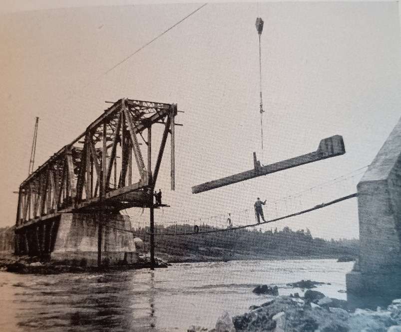
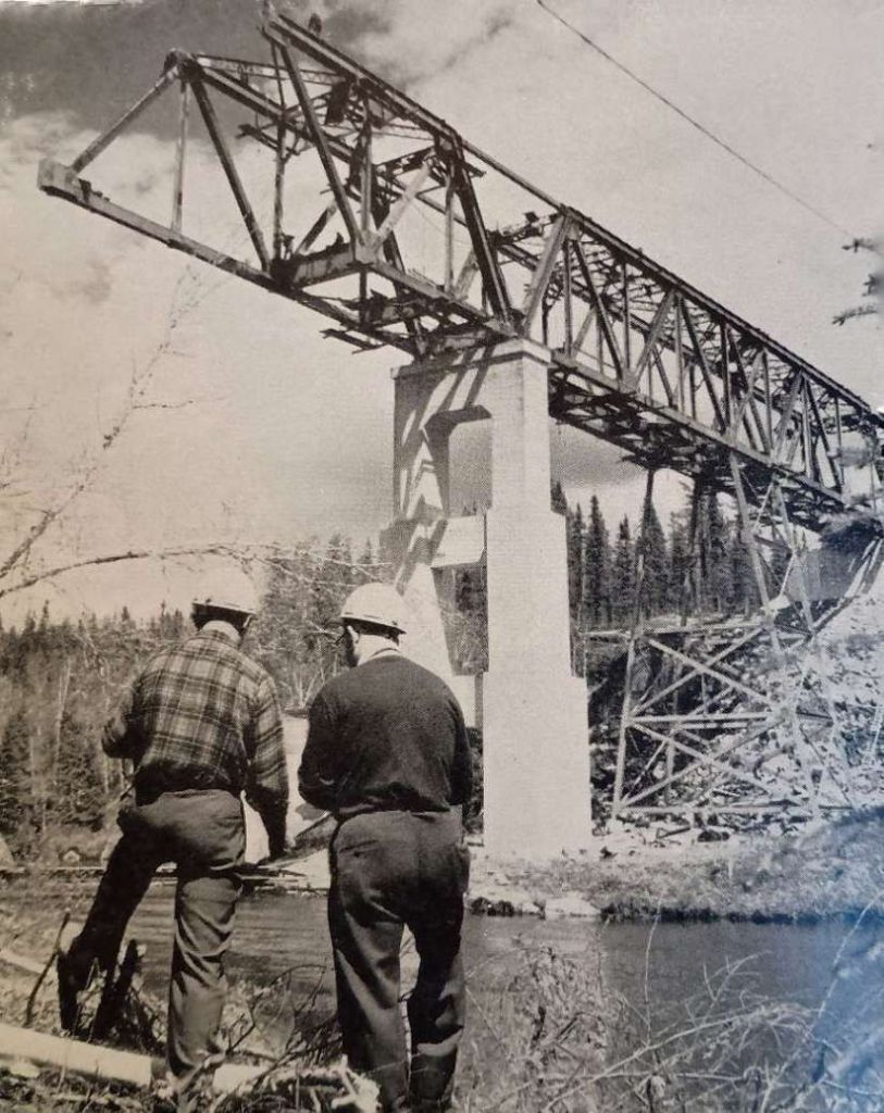
The Railway Magazine article highlights work on the Bell River bridge. …
Construction by the cantilever method of the main (western) span of the Bell River Bridge, the eastern span being used as a counterweight with tie backs between the top chords of the two spans. [3: p201] which consists of two 196 ft. 10 in. through girder spans. The Warren trusses are 30 ft. 6 in. high. [3: p203]
The site chosen for the Bell River Bridge was “at the head of Kiask Falls Rapids where the normally-broad Bell River [was] only 200 ft. wide in its main channel and 25 ft. deep; when the water level [was] high, the velocity of the current [was] over 25 m.p.h. The river banks and bed [were] of solid rock, and the concrete abutments and pier [were] founded on it. The western span [was] over the main stream, the eastern being across the shallow part of the river. The trusses were designed to have a roadway cantilevered out from them.” [3: p203]
Although the most difficult to construct, the Bell River Bridge was not the only important structure on the line. The article cited the crossing of the Chibougamau River which “required three spans of 100 ft. each; the first bridge over Opamica Lake ha[d] one span of 90 ft. and two of 45 ft.; and the second bridge ha[d] one span of 200 ft. and two of 45 ft.” [3: p206]
St. Felicien to Chibougamau – Construction
The line from St. Félicien was begun in September, 1955, and was due for completion at the end of 1959. “Except for the first 15 easy miles out of St. Félicien, it passes through considerably rougher country than does the route from Beattyville. It joins that line at a point known as Chibougamau Lake, or Coche Lake, a few miles from Chibougamau.” [3: p206]
Here again “the clearing of the ground, the formation earthwork, and the drain-age were carried out by contract in two sections (1) the first 66 miles from St. Félicien, and (2) the remaining 67 miles to the junction with the line from Beattyville. On the first section, the formation ha[d] been completed [by early 1959], and about 50 miles of permanent way and bridge work [were also] finished. The contract for the second section was not let until 1957.” [3: p206]
Lighter rail (80-lb.) was used on the first 40 miles of the line from St. Felicien, with 85-lb. rails used on the remainder of the route. “The ruling gradient was “1 in 80 and the sharpest curvature about 22 chains. There [were] 14 bridges with single spans up to 196 ft. 10 in., some of considerable height. Construction was plagued by the same difficulties as the line between Beattyville and Chibougamau. In addition, the route required the excavation of deep cuttings and construction of high embankments.
“The first bridge on the line [was] over the Salmon River, less than two miles from St. Félicien. It consist[ed] of two through-type plate-girder spans each of 100 ft. The substructure, built by contract – in common with six other bridges in the first 66 miles – was begun with a coffer-dam for the pier, with the intention of founding it on the rock river bed. It was then found that this rock was of in-sufficient thickness for that purpose and rested on sand. Accordingly, 35-ft. sheet-piling was driven to enable concrete foundations to be constructed.” [3: p206]
At the time that The Railway Magazine article was being written, it noted that “The largest bridge is being built to – span the Cran River Ravine, which has a bottom-width of 400 ft. and a depth of 100 ft. Two 196 ft. 10 in. spans are being used, and the pier is 96 ft. in height above normal water level. Here again, the river is fast-flowing, and a cableway 1,200 ft. long between supports 140 ft. high was erected for the construction. It had a capacity of seven tons. The pier was built in the form of three superimposed arches each 30-36 ft. high. The cantilever trusses of the bridge are nearly 100 ft. above the river.” [3: p206]
Cran River Bridge under construction using the cantilever method aided by a cableway. [3: p202]
“Of the other 12 bridges, one [had] one span of 196 ft. 10 in. and two of 75 ft.; another [had] two spans of 100 ft.; and several [had] 90-ft. spans of the plate-girder type. The considerably more numerous bridges, and the rougher terrain, on the railway from St. Félicien … inevitably made progress less rapid than on the line from Beattyville.” [3: p206]
The line between Chibougamau and Saint-Felicien opened on 28th October 1959. “The opening of the St. Félicien–Chibougamau line was more than a local event—it represented Canada’s broader postwar push to develop its northern frontiers. The project mirrored similar efforts across the country, where railways extended into resource-rich but isolated territories. The line remains a vital part of northern Quebec’s transportation network, used by CN to support freight and industrial traffic. While passenger service eventually declined, the railway continues to play an important role in the forestry and mining sectors, underscoring its enduring importance more than six decades later.” [13]
A Possible Northward Extension
Work was started on a northern extension from Chibougamau but the anticipated traffic on the lines South of Chibougamau did not occur. North of Chibougamau civil engineering work was undertaken but rails were never laid. There remains a visible, overgrown route with a built bridge over the Stain River that’s now only accessible by river or the old railway formation itself. This unfinished project, built for accessing northern mineral wealth in the mid-20th century, remains a testament to early northern development, with its earth embankment and bridge still visible as a “green road” through the forest, despite being washed out in places.
To see something of this abandoned line, please follow this link. [4]
Operation
Concentrated ore was the main commodity being transported by the CN Railroad from Chibougamau followed by lumber and by-products of lumber transformation such as wood chips used to make paper.
However, from the end of the 1980’s, mining operations declined in the Chibougamau region with a resulting drop in the demand for rail transport and a loss of income for the CN.
The Line in the 21st Century
Investigation of the line in the 21st century is hampered by the climate conditions in the area. Google Streetview has limited access to the area and much of what can be provided is of snowbound images with little sign that a railway is in use.
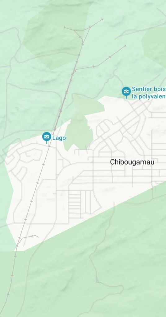
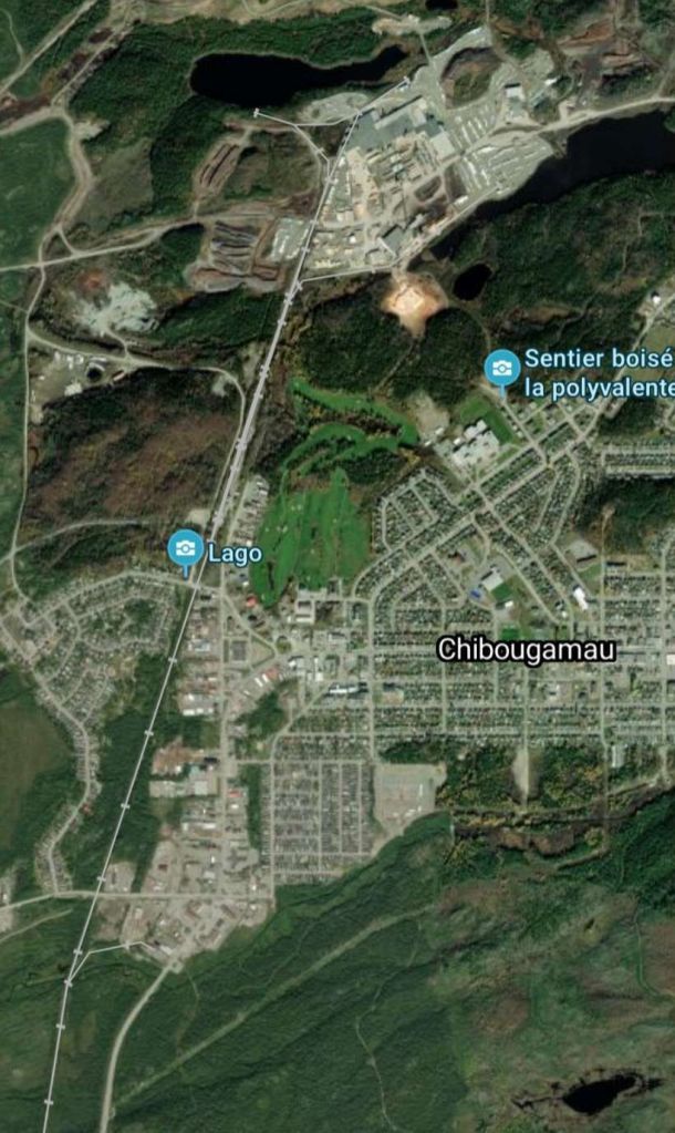
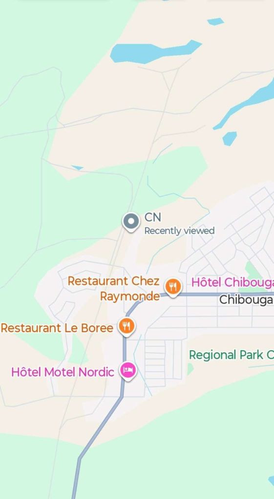
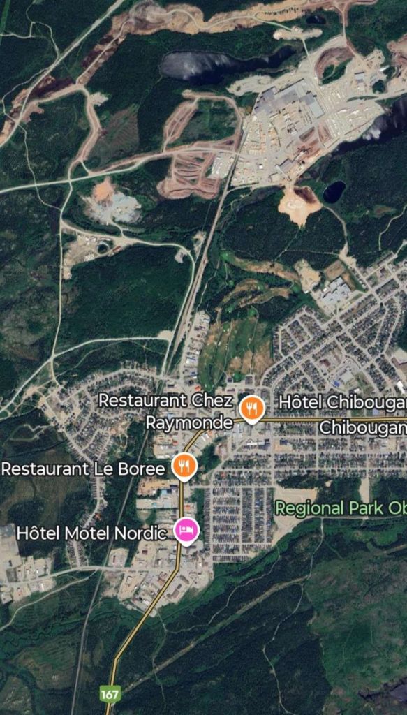
Bing and Google Maps imagery showing the area around the railhead at Chibougamau are reproduced below.
The railhead at Chibougamau. [Bing.com/Maps, December 2025]The same area shown on Bing.com’s satellite imagery. [Bing.com/Maps, December 2025]Whilst superior in some ways Google Maps is less effective at highlighting rail routes. This is the same area on Google Maps. [Google Maps, December 2025]The same area on Google Maps’ satellite imagery, the rail line is a little clearer than on Google’s mapping. [Google Maps, December 2025]
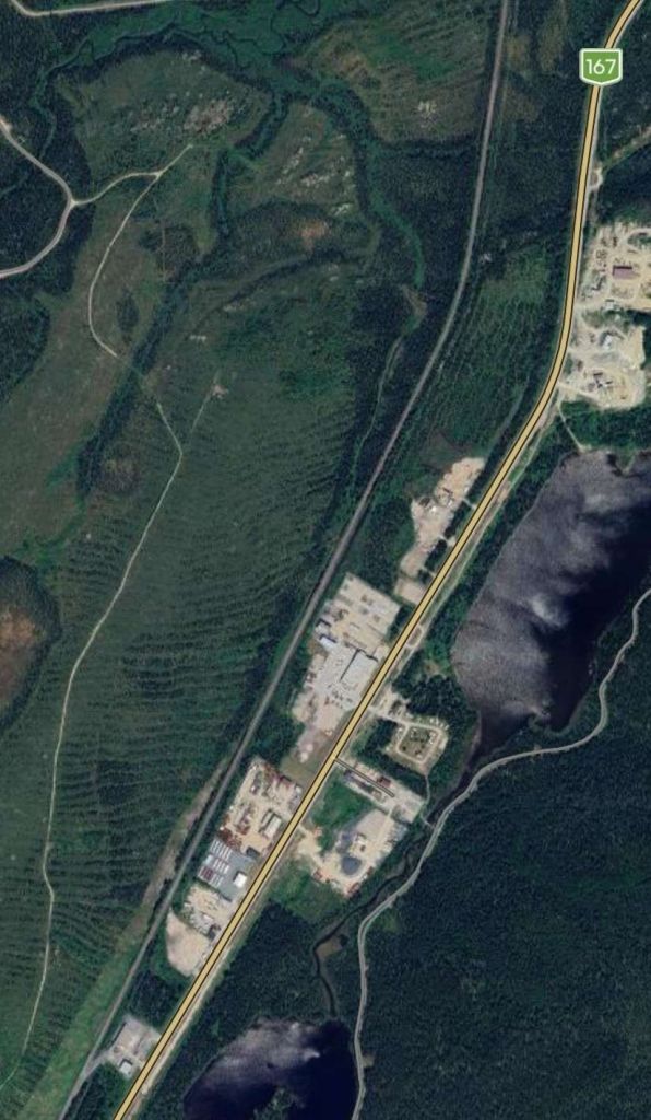
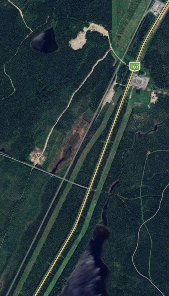
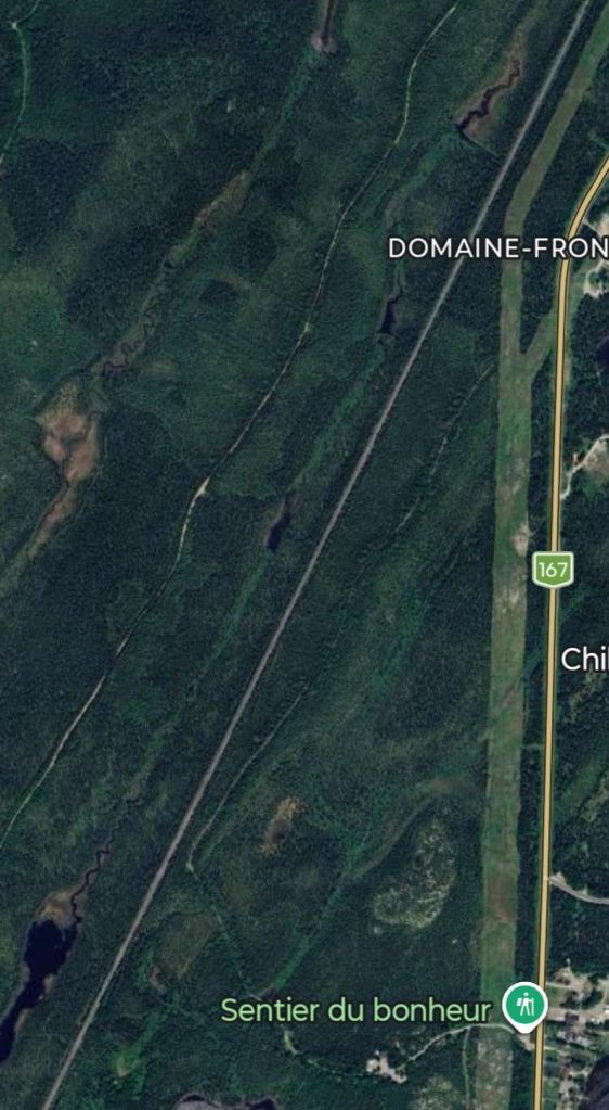
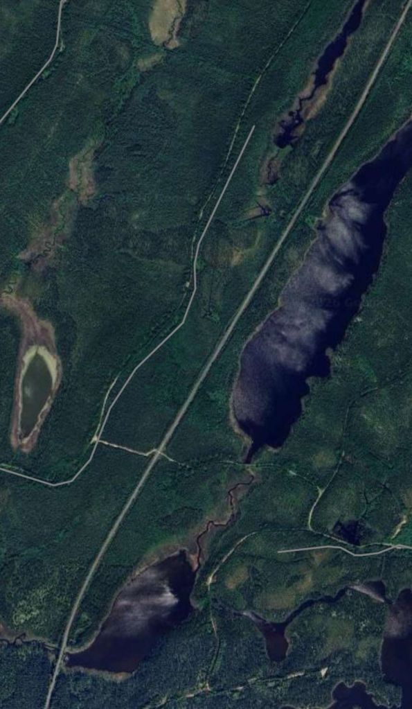
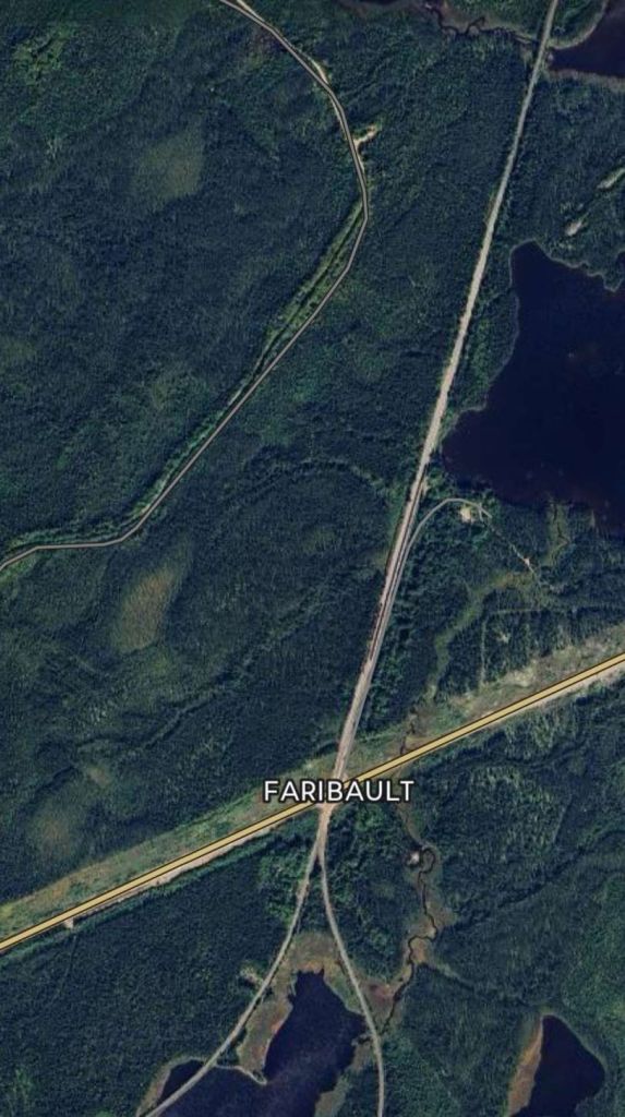
The next five Google Maps satellite images show the length of the line as far as the junction where the routes to Beattyville and St. Felicien diverge. ….
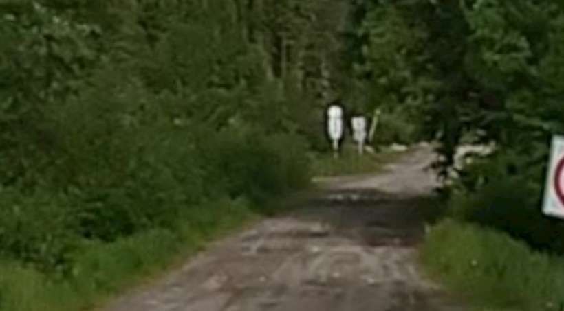
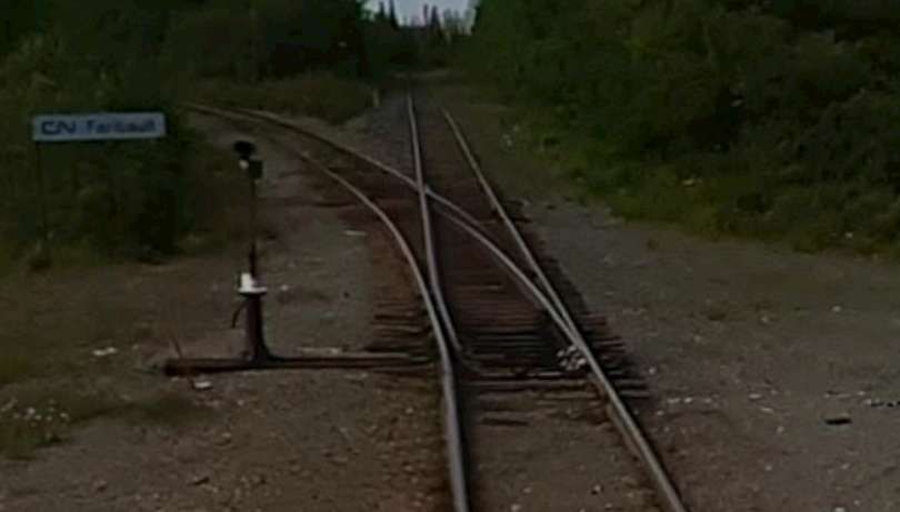
The view West-northwest from route QC167 along the dirt road which leaves the QC167 at the green flag on the above satellite image. [Google Streetview, July 2022]The lines to Beattyville (heading away to the Southwest) and St. Felicien (heading South) diverge at Faribault just to the South of route QC113. [Google Maps, February 2026]Looking North from route QC113 at Faribault. [Google Streetview, July 2022]Looking South from route QC113 at Faribault. At the junction, the line to St. Felicien bears away to the left, that to Beattyville continues straight ahead. [Google Streetview, July 2022]
The location and river are named after George-Barthélemy Faribault (1789–1866). He was a prominent Quebec-born librarian, historian, and archivist known for his extensive collection of Canadian historical documents. The Faribault River flows East towards James Bay. [5]
From Faribault the line to Beattyville and Barraute turns West and runs close to the QC113. …
The line from Faribault to Barraute
Five further satellite images follow the route. Occasionally the line comes close enough to the highway to be seen looking South from the road.
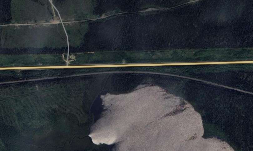
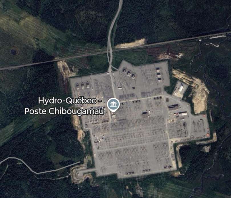
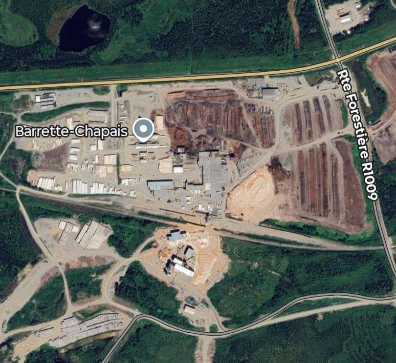
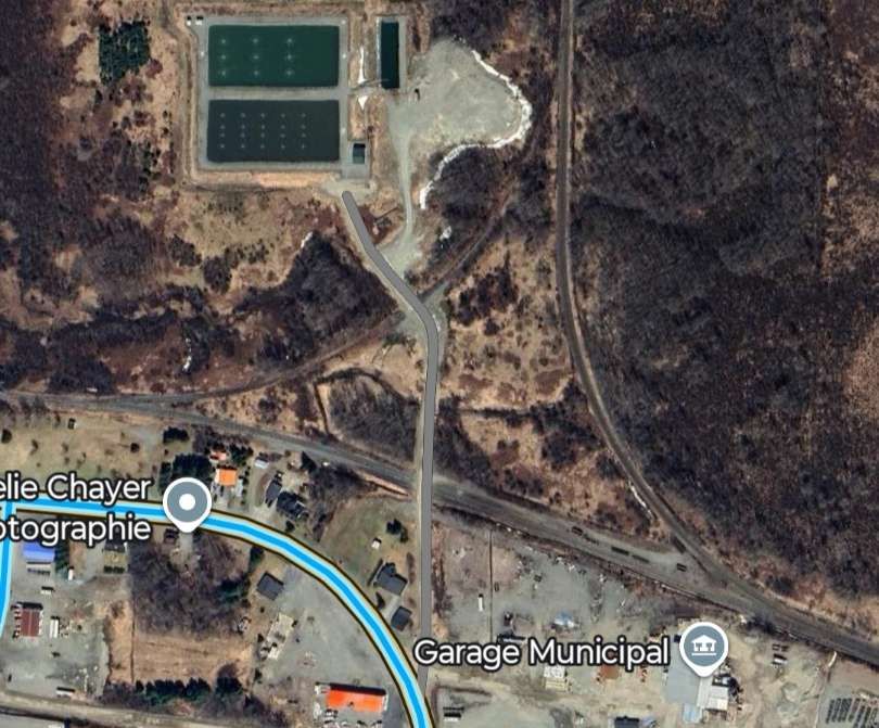
Two satellite images which show the line to Beattyville turning to the West and at one location running very close to the QC113 highway. [Google Maps, February 2026]At the centre of the satellite image above the rails can be seen when looking South from the highway. [Google Streetview, October 2018]Here the line is again close to the highway, but shrouded from it by the dense forest. [Google Maps, February 2026]The line passes to the North of ‘Hydro-Quebec Poste Chibougamau’ [Google Maps, February 2026]And continues West to run to the South side of Barrette-Chapais. [6][Google Maps, February 2026]Careful inspection of this aerial image of Barrette-Chapais which looks West across the site will show the railway at the left side of the image. [Google Maps, 2020]
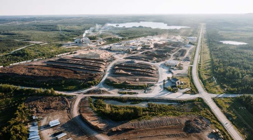
Barrette-Chapais is both the largest sawmill complex in Quebec and the largest forest management authority in Quebec.
Its facilities include a yard, a sawmill, a planing mill, a thermal power plant, and wood kilns. A wide range of wood products for the construction, energy, and pulp and paper sectors are manufactured there and then distributed in Canada and internationally. It employs 350 people throughout the full year. [6]
Barrette-Chapais provides comprehensive planning, management, and supervision of its forestry operations. The team plans harvesting, land access, and infrastructure alignment with environmental considerations to supply its sawmill complex . A significant amount of management and logistical work is carried out year-round. There are 150 workers in the field with 5 forest camps. [6]
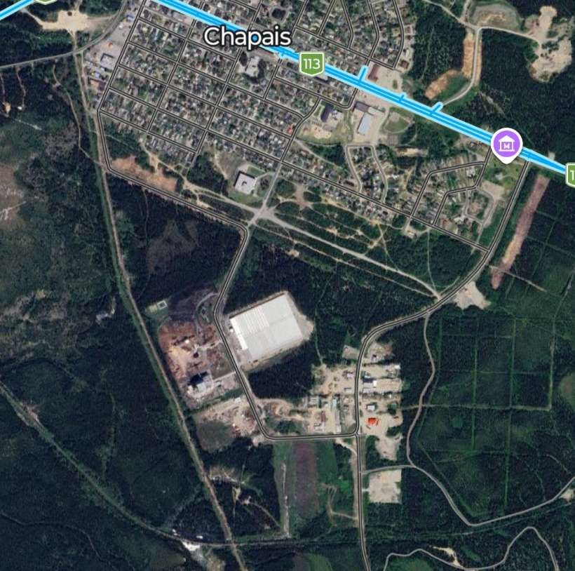
Continuing to the West, the line runs to the South of the township of Chapais.
The town of Chapais and highway QC113 are at the top of this satellite image. The railway can just be made out running across the image from the East, turning to the Northwest after crossing a dirt road left-of-centre. [Google Maps, February 2026]
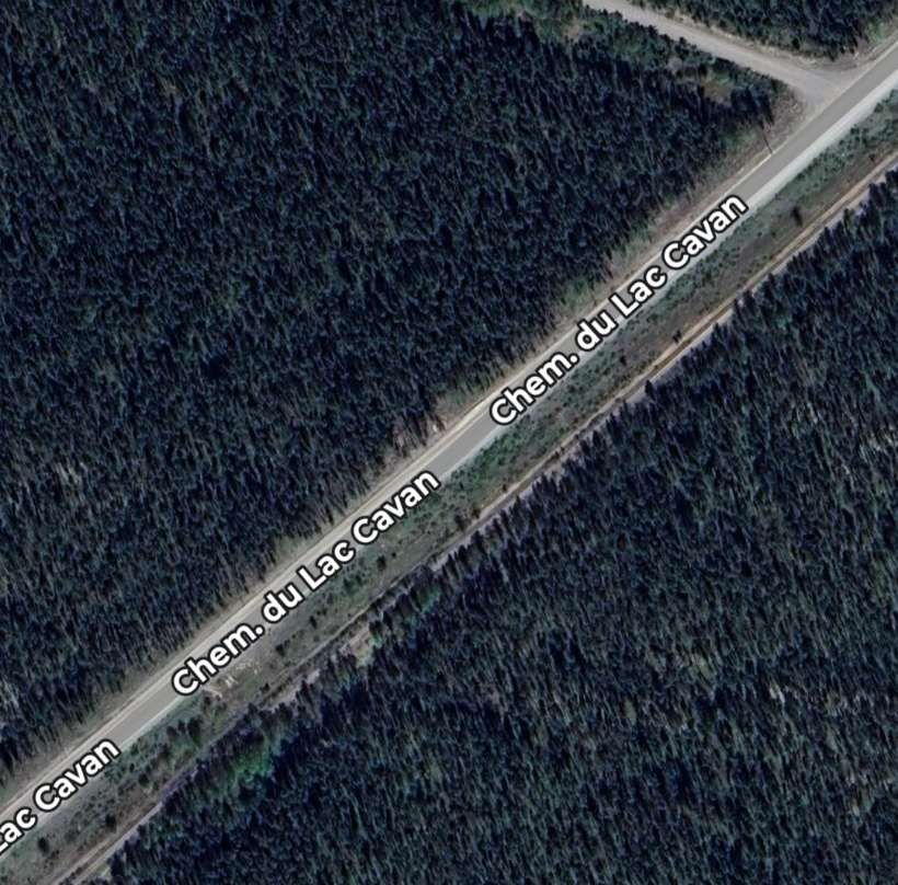
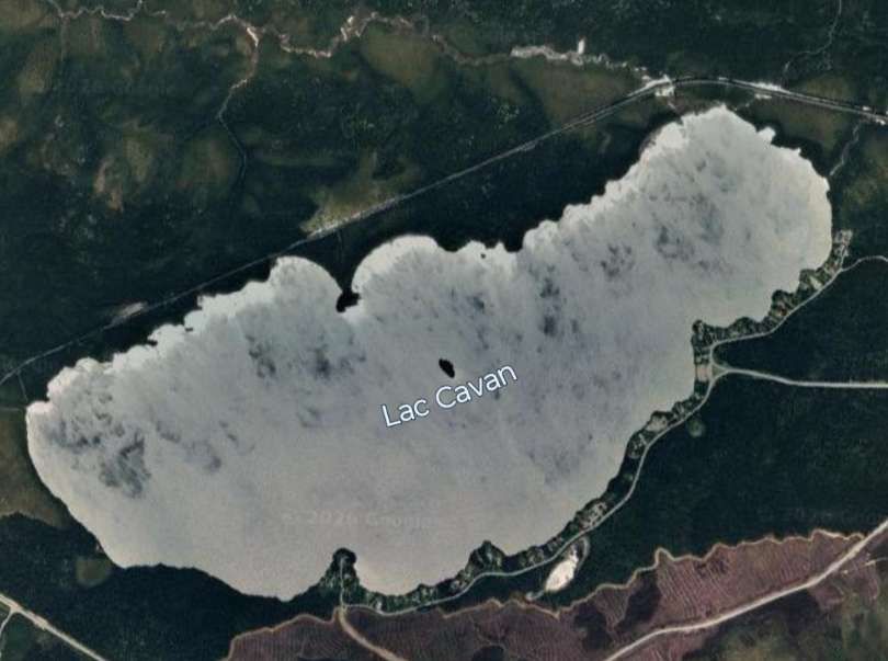
Somewhere along this length of the old railway the rails disappear, probably having been lifted to allow vehicular use of the formation. The old line continued Southwest alongside the Chemin du Lac Cavan. …
This is just one satellite image which shows the Chemin du Lac Cavan and the railway running Southwest in parallel, just a short distance apart. Google Streetview does not, in 2026, follow the route of this road. [Google Maps, February 2026]
A branch from the main line (also now lifted) appears to have run into Chapais.
As we have already noted, the main line of the railway ran alongside Chemin du Lac Cavan before it passed to the North of Lac Cavan. ….
Lac Cavan with the line of the old railway visible along its North shore. [Google Maps, February 2026]
The route of the old line heads West-southwest into the forested wilderness, passing to the South of Lac Beauchesne, then some distance to the North of Lac O’Melia.
It ran South of Lac Kitty and Lac Ford the line ran along the North shore of Lac du Calumet.
Then it ran to the South of Lac Hancock, to the North of both Lac Eleanor and Lac Barbeau.
Some distance to the South of Lac Mandarino and Lac Cady the line ran closer to the North shore of a body of water that appears to be unnamed on Google Maps, before being found on the South side of part of Lac Father.
The line continued to the North of Lac Relique and between two arms of Lac Father before bridging Lac Father at a point where the width of the channel was relatively limited, before then running along the North shore of another arm of Lac Father. After which it ran on the South side of another arm of Lac Father.
Continuing in a westerly direction the line eventually passes to the South of Lac Bachelor
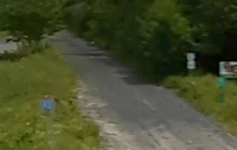
Near Goeland, the line crossed the QC113 again. …
Looking back along the line from the QC113. There is no sign of rails. [Google Streetview, July 2022]Looking forward along the line from the QC113. Similarly there is no sign of rails in this view. [Google Streetview, July 2022]
The old line ran on, passing South of Lac Waswanipi, heading generally towards the Southwest.
At Miquelon, the route of the railway crossed the QC113 again. …
Looking North, back along the route of the line from the QC113. [Google Streetview, October 2018]Looking South along the route of the line. The girder bridge spanning the river channel at Miquelon can be seen ahead. [Google Streetview, October 2018]The railway bridge at Miquelon, seen from the bridge carrying the QC113. [Google Streetview, October 2018]
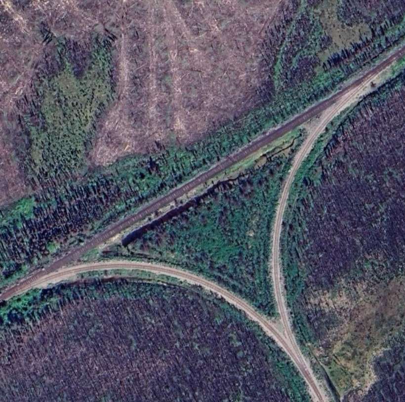
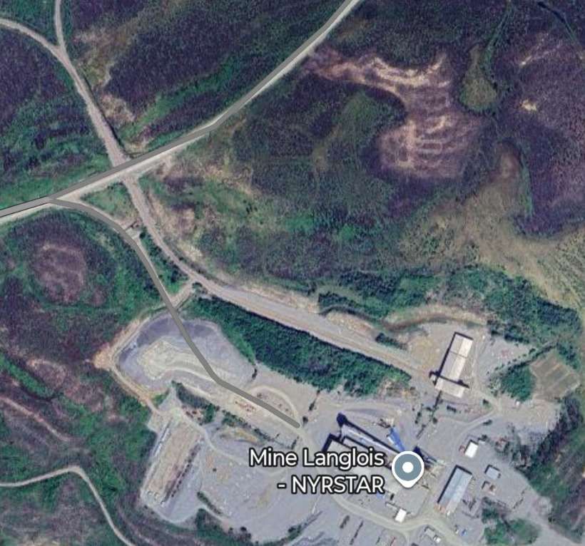
The old line continued Southwest, passing Southeast of Lac Burger. Then, through Grevet where Google Maps appears to show at least remnants of the old railway. Just to the Southwest of which, Google Maps shows a triangular junction providing access to a rail head associated with ‘Mine Langlois (NYRSTAR)’
The triangular Junction to the Southwest of Grevet which provides access to a rail head associated with ‘Mine Langlois (NYRSTAR)’ [Google Maps, February 2026]Mine Langlois (NYRSTAR) and its rail siding. [Google Maps, February 2026]
NYRSTAR is a leading international manufacturer of Zinc. Its headquarters are in The Netherlands. The Langlois Mine seems to have stopped production late in 2019. [7] As of February 2026, the rail infrastructure seems to still be in place.
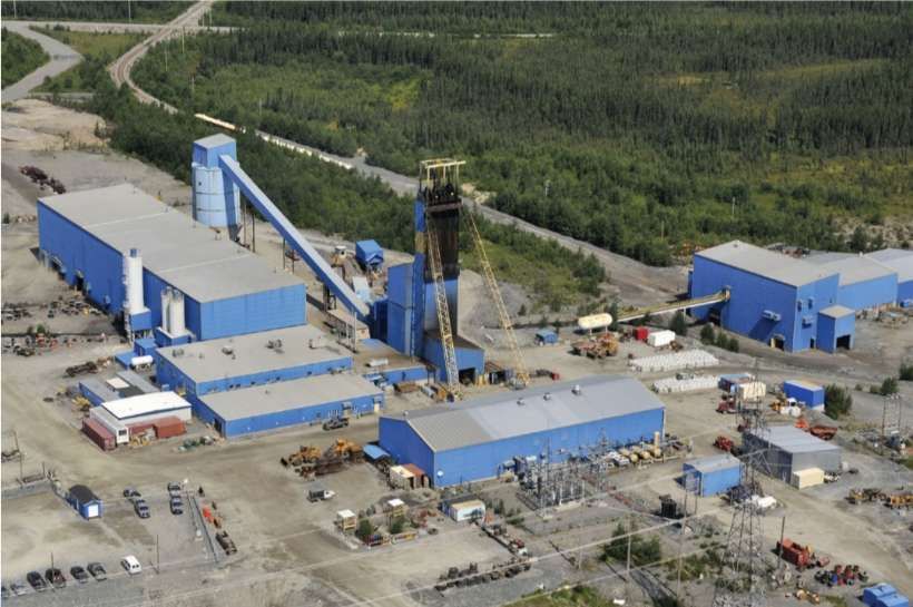
An aerial view of the Langlois Mine in Quebec, seen from the Southeast. The triangular junction can be seen in the top-left of this image with the railhead at the building on the right of the image. [8]
It seems as though the line to the Southwest of Grevet was in regular use while Langlois Mine was operational. The rails remain in place in the third decade of the 21st century.
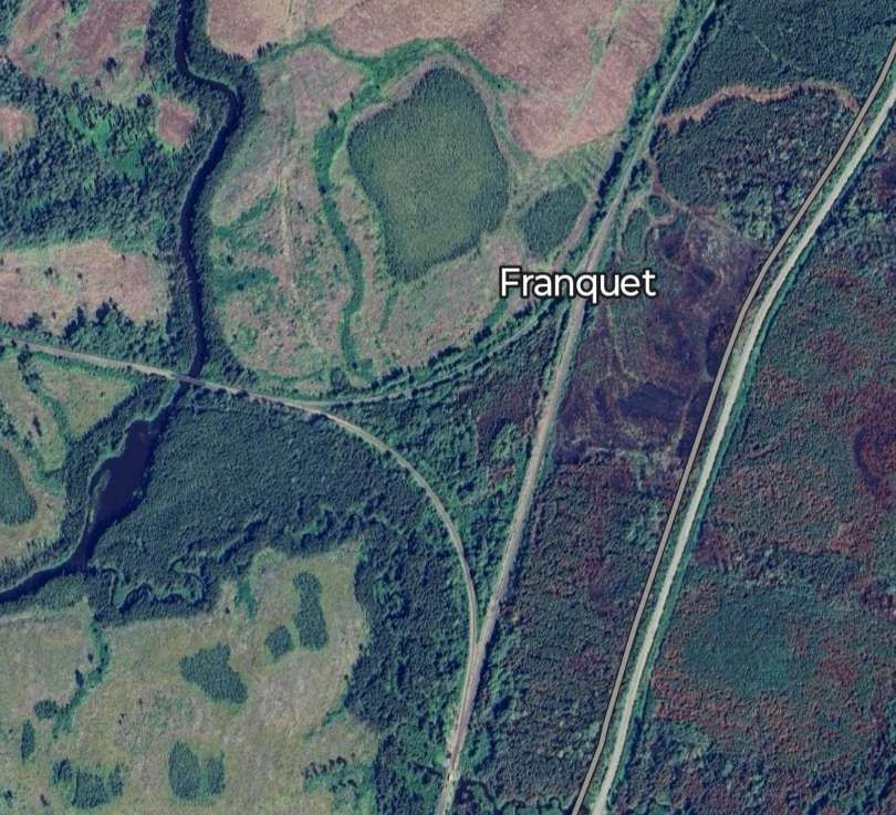
Another triangular junction is visible on Google Maps at Franquet. …
The triangular junction at Franquet. [Google Maps, February 2026]
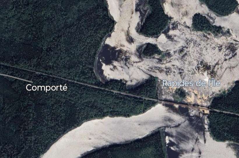
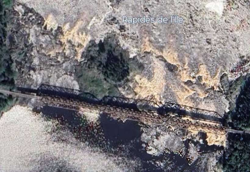
The line heading West from the triangular junction above continues West for some distance. It crosses the QC113 and Route 1055 before reaching Les Rapides de l’Ile and Comporte.
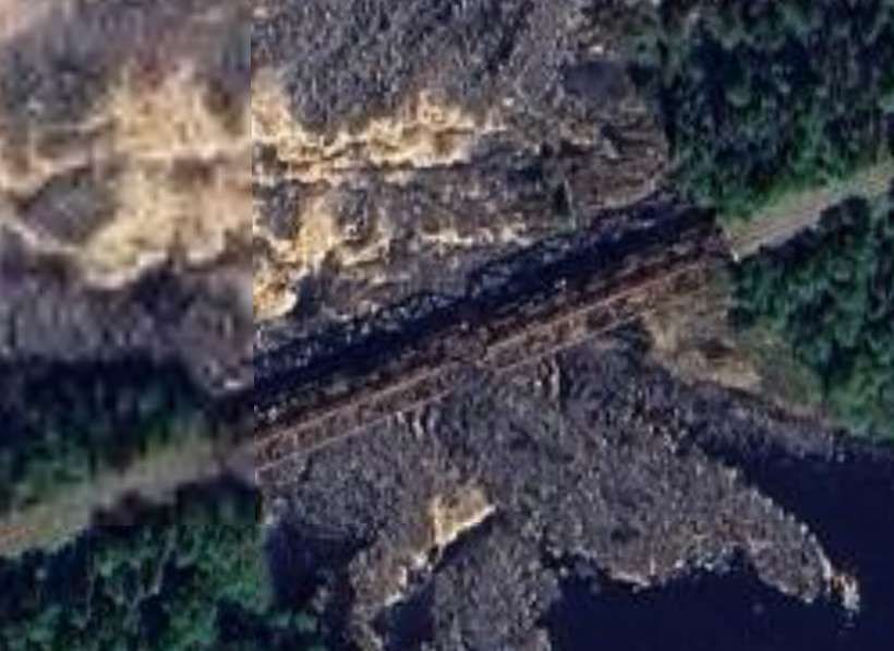
Looking Southeast from the QC113 towards Franquet. [Google Streetview, July 2022]Looking Northwest from the QC113. [Google Streetview, July 2022]Les Rapides de l’Ile and Comporte. [Google Maps February 2026]The rail bridge at Les Rapides de l’Ile. [Google Maps, February 2026]
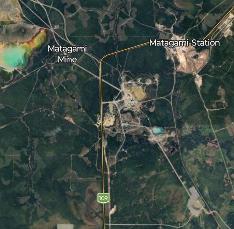
Beyond Comporte, the line gives rail access to mines close to Matagami. The mines were to the South and West of the township.
The mines to the South and West of Matagami can be seen on this satellite image. Top-left is Matagami Mine, bottom-right is Bracemac-McLeod Mine and unnamed mine sits at the heart of the image and top-right close to Matagami township is a mine labelled Matagami Station. A triangular rail junction sits middle -right, North of the Bracemac-McLeod Mine. [Google Maps, February 2026]
Returning to Franquet, we continue South-southwest along the line towards Beattyville and Barraute.
The line passes to the Southeast of Île Kâmicikamak and passes to the Southeast of Quevillon and its nearby ‘Hydro-Quebec – Poste Lebel’.
Continuing Southwest the line bridges the Riviere Bell.
The railway bridge over the Riviere Bell. [Google Maps, February 2026]
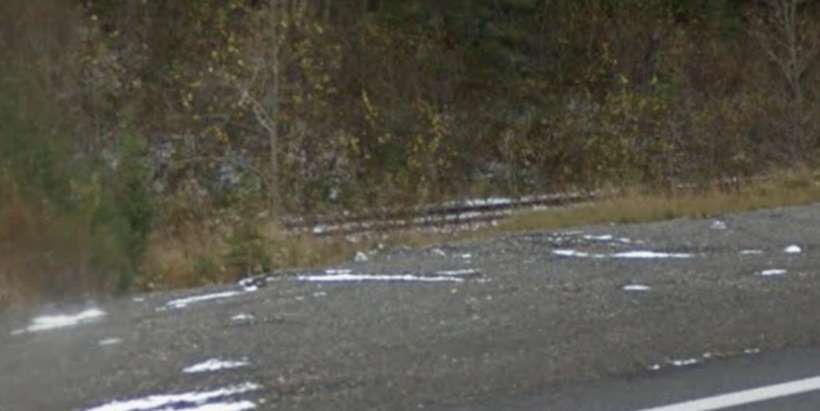
Further South and West the line crosses the QC113 again. …
Looking back along the line from the QC113. [Google Streetview, October 2018]Looking ahead towards Beattyville and Barraute. [Google Streetview, October 2018]A short distance further South and West the QC113 runs alongside the line for a few hundred metres. The undergrowth was low enough when this picture was taken, for the railway to be visible from the road. [Google Streetview, October 2018]
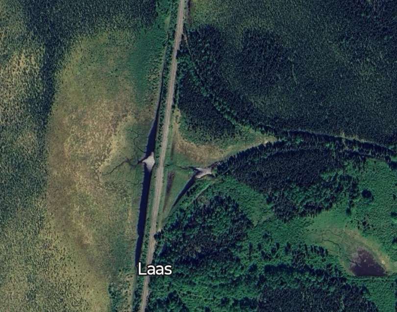
Further South, the remains of a turning triangle are visible on satellite imagery at Laas. …
The turning triangle at Laas. [Google Maps, February 2026]
The line continues South and West, passing to the North and then West of Lac Despinassy.
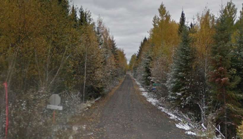
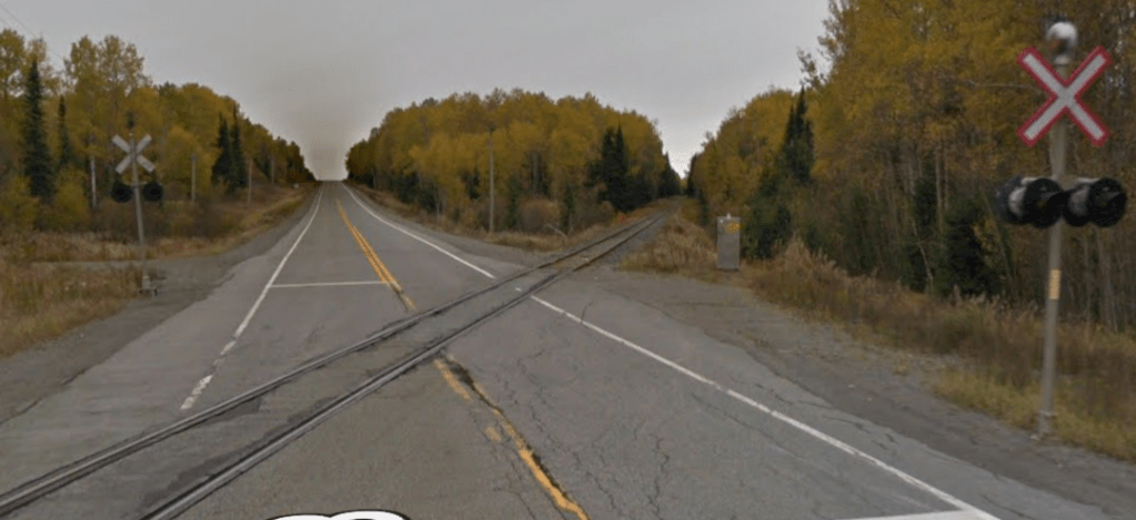
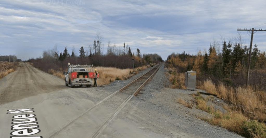
It crosses 6th Avenue North, also at an oblique angle. This is the view North-northeast, back along the line. [Google Streetview, October 2022]This is the view South-southwest, along the line. [Google Streetview, October 2022]
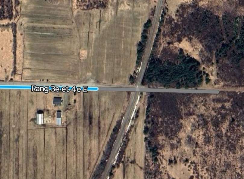
It is only a very short distance to the next road crossing. …
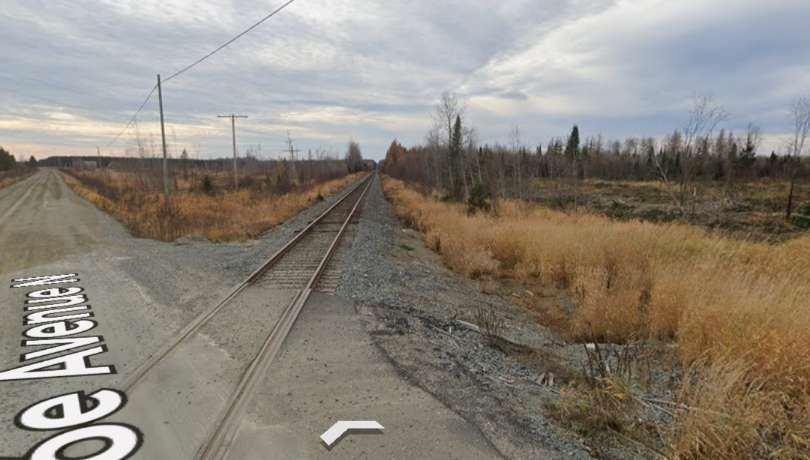
The view North-northeast towards the last road crossing from the crossing at Ranges 3 et 4 East [Google Streetview, October 2022]Looking ahead down the line towards Barraute from adjacent to the same road crossing. [Google Streetview, October 2022]
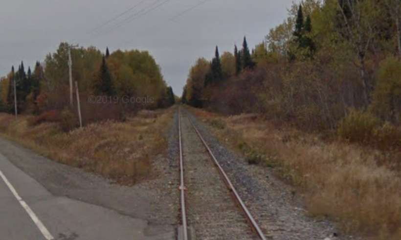
The next road crossing is at CH Des 1 & 2 Rang. …
Looking back along the line from the road crossing. [Google Streetview, October 2022]The lens on the camera was misted obscuring a view directly along the line towards Barraute, so this is the best view available of the line ahead. [Google Streetview, October 2022]
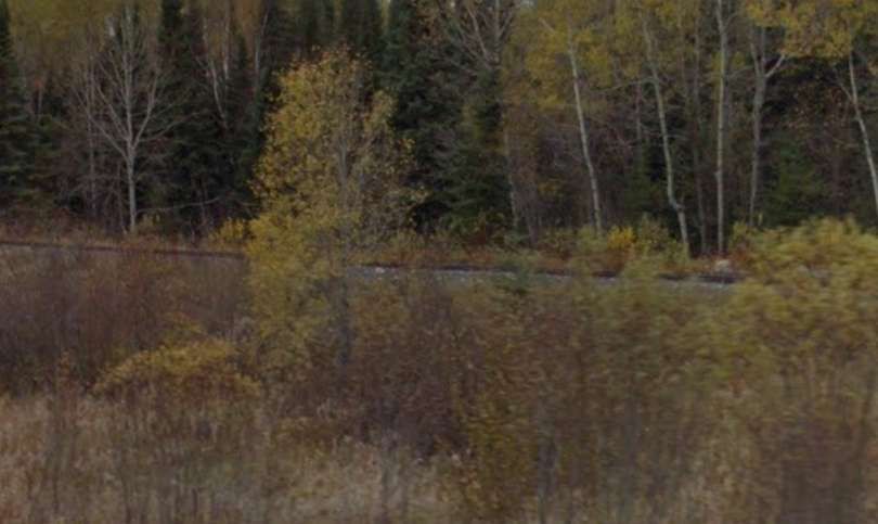
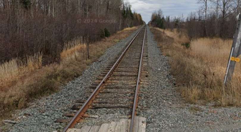
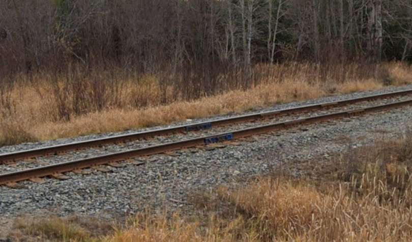
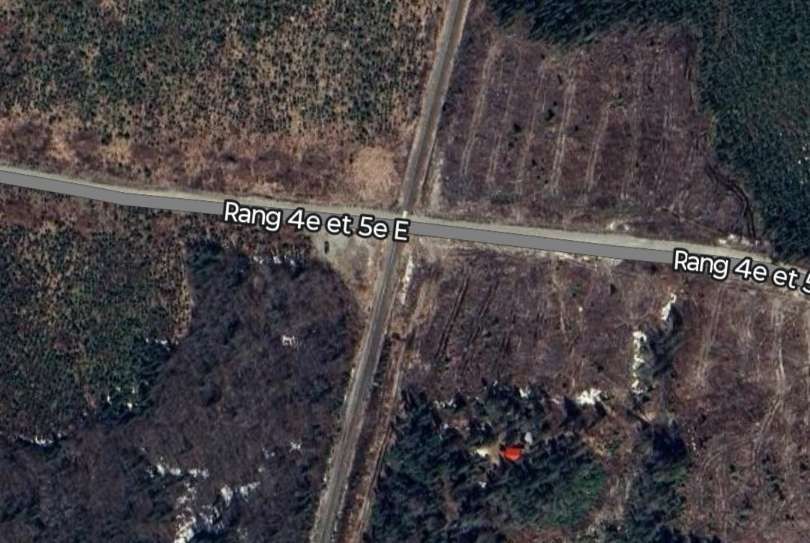
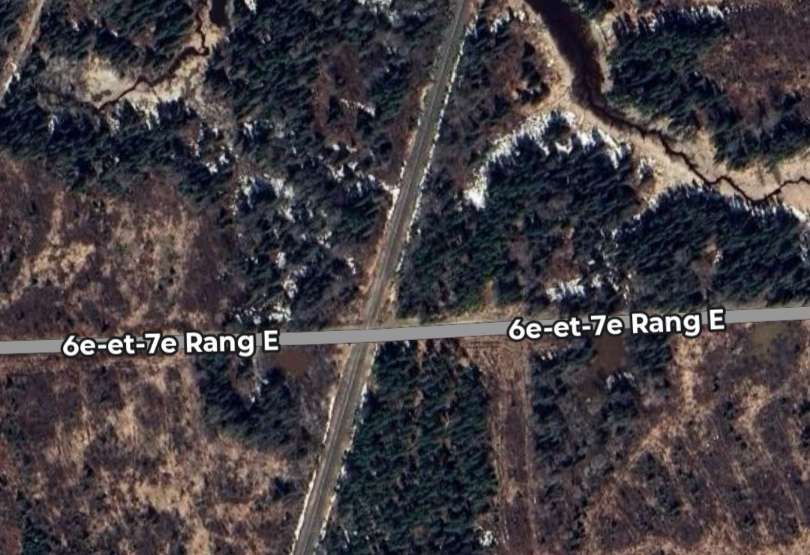
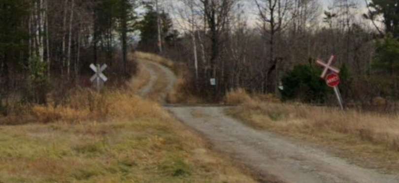
The line continues in a South-southwest direction crossing a number of roads which did not warrant the use of the Google Streetview camera – 6th & 7th Rang E, Rang 4th & 5th East, Rang 3rd & 4th East. Although for the last of these a distant view of the level-crossing is possible.
We are closing in on the township of Barraute now. I have not been able to identify the location of Beattyville on Google Maps.
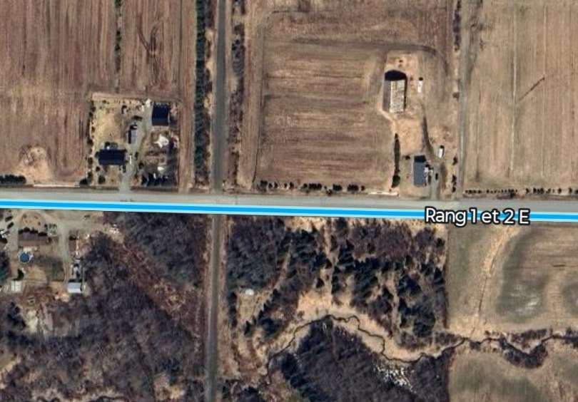
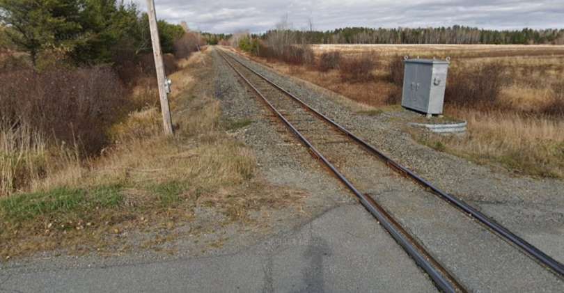
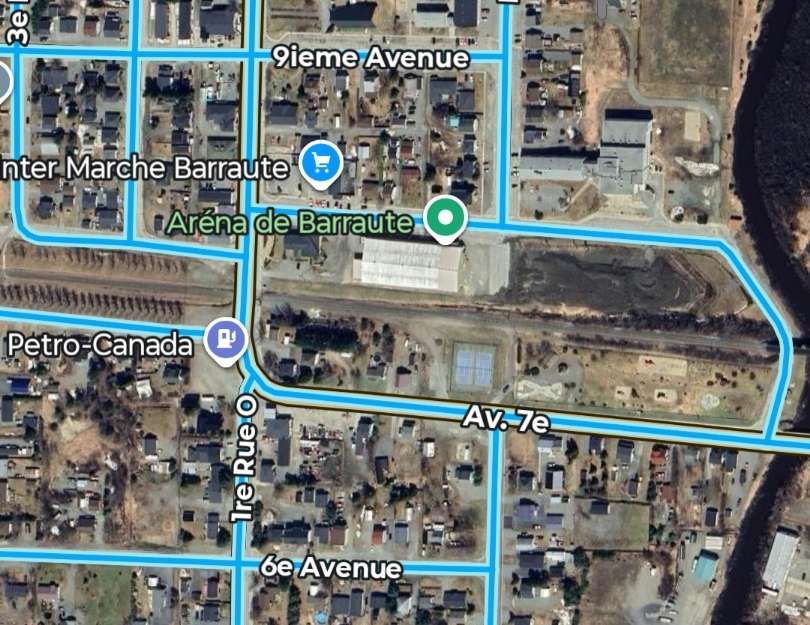
The crossing at Rang 1st and 2nd East. [Google Maps February 2026]Looking North from the above crossing. [Google Streetview, October 2024]Looking South from the same crossing. [Google Streetview, October 2024]The triangular junction with the wider Canadian rail network. [Google Maps, February 2026]The line running through the centre of Barraute. [Google Maps, February 2026]A girder bridge spans both a town road and the river at Barraute. This view looks North from 8th Avenue. [Google Streetview, October 2024]This view shows the same bridge from the Northwest on 8th Avenue. [Google Streetview, October 2024]
The next two photographs show the East-West line through the Centre of Barraute.
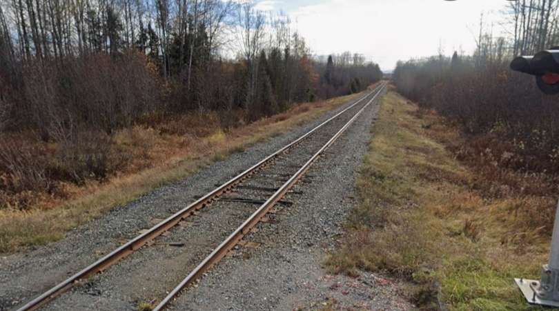
Looking East from the crossing on QC397. [Google Streetview, October 2024]Looking West from the crossing on QC397. [Google Streetview, October 2024]
Having travelled all the way to Barraute, we now return to the junction South of Chibougamau (at Faribault).
The line from Faribault toSt. Felicien
We are back at Faribault and taking the line to the East from the junction. ….
We now take the more easterly route from the junction at Faribault, which passes to the East of a lake which Google Maps does not name. [Google Maps, February 2026]We head off to the left at the Faribault junction. [Google Streetview, July 2022]The line heads sinuously to the South on the East side of the lake at Faribault. [Google Maps, February 2026]It then heads away to the Southeast. [Google Maps, February 2026]
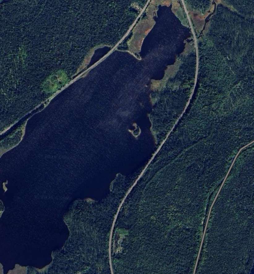
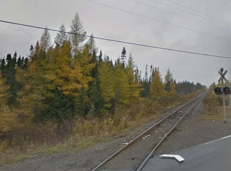
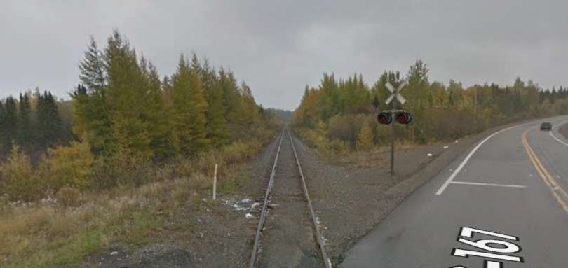
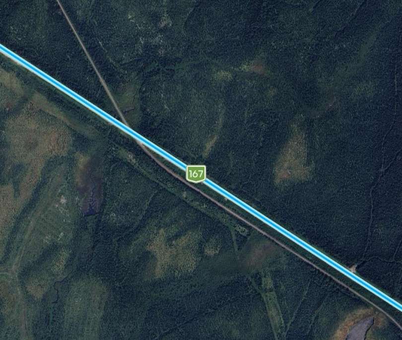
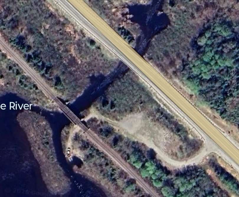
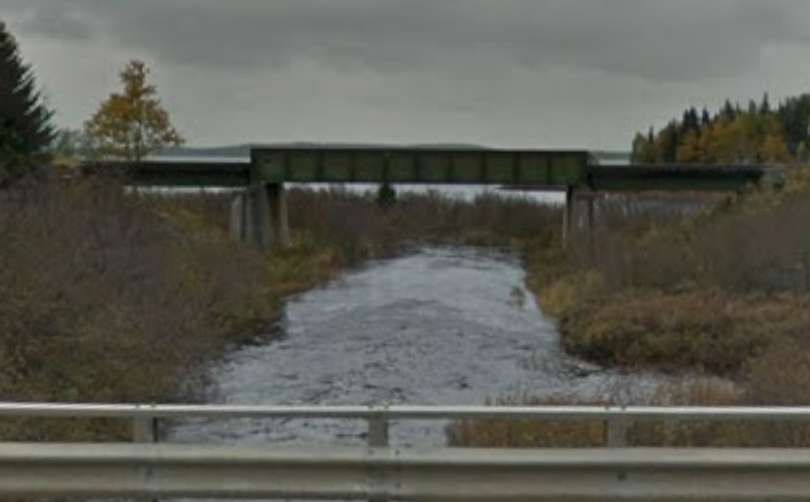
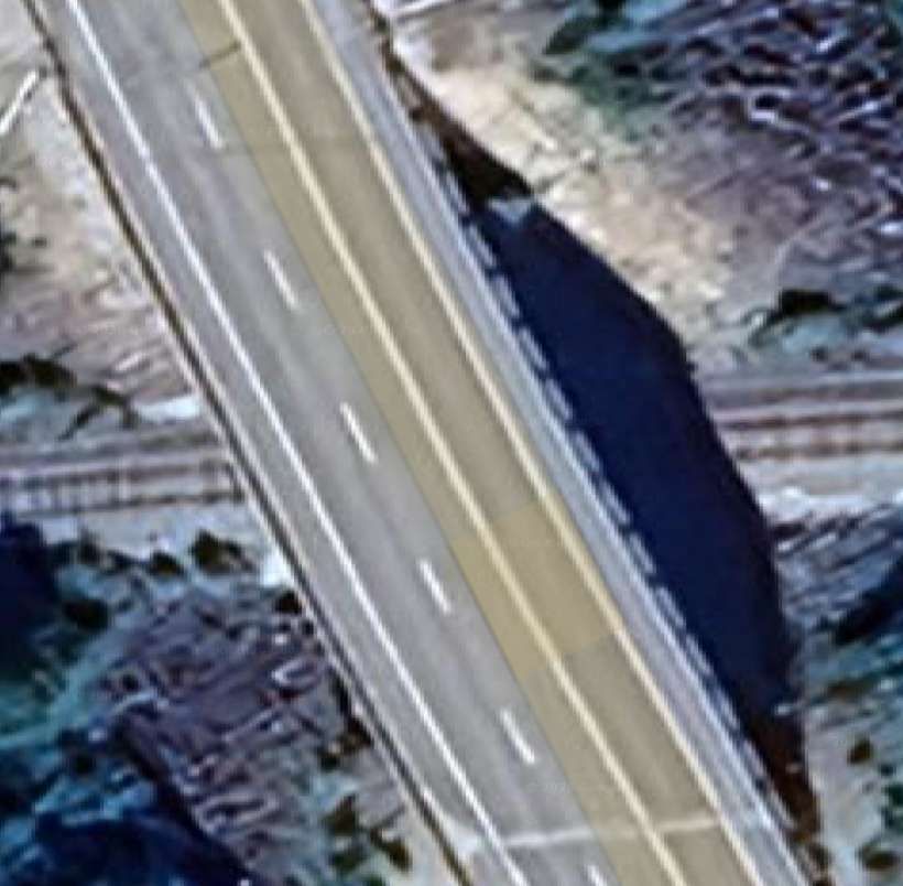
The line meets the QC167 at a level-crossing close to the South end of Lac Gabrielle, bridging the River South of Lac Gabrielle just to the East of the QC167. …
The line to St. Felicien crosses the QC167 at a level crossing and then is carried over the lake outfall on a steel girder bridge. [Google Maps, February 2026]Looking Northwest along the line towards Faribault. [Google Streetview, October 2018]Looking Southeast along the line towards St. Felicien. [Google Streetview, October 2018]
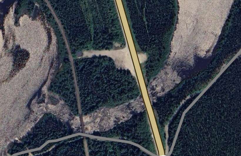
The line turns to the South and for a short distance runs parallel to both the QC167 and the River Chibougamau before bridging the river via a lattice girder bridge. …
The bridge carrying the line across the River Chibougamau. [Google Maps, February 2026]
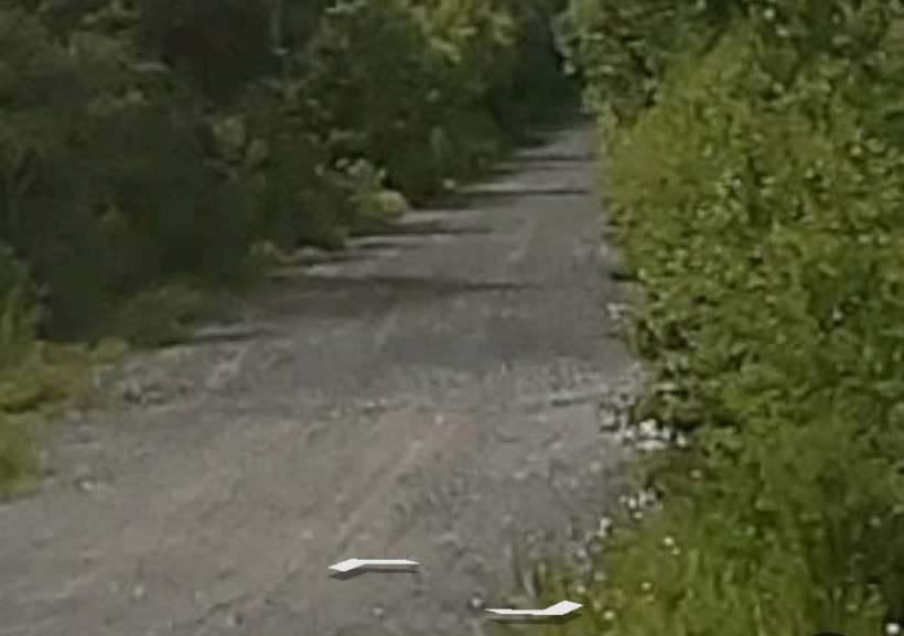
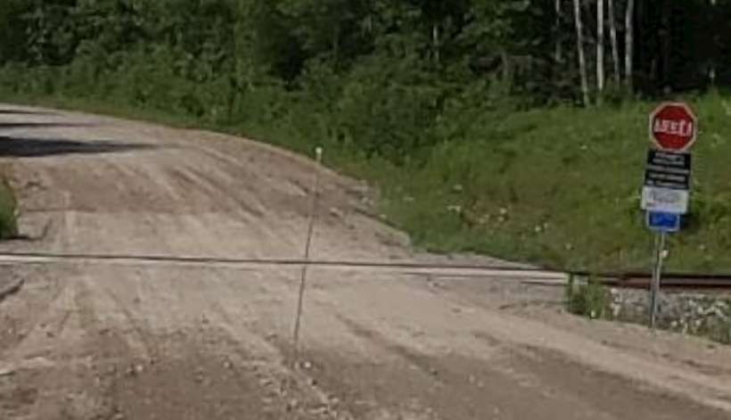
A short distance further Southeast the line crosses a dirt road, Chemin du Domain Rustique at a level-crossing. …
The rail crossing seen from the Northeast from the Chemin du Domain Rustique. [Google Streetview, September 2022]A
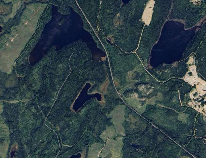
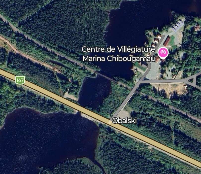
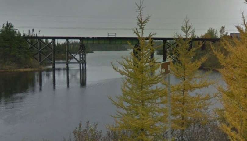
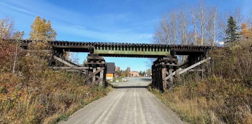
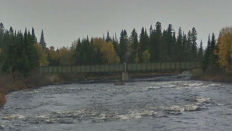
At Obalski, close to the Chibougamau Marina, the line bridges and arm of Lac Chibougamau
The QC167 and the railway bridge an arm of Lac Chibougamau. [Google Maps, February 2026]The rail bridge seen from the QC167 to the South. [Google Streetview, October 2018]The rail bridge over the Chemin du Lac Chibougamau Sud, seen from the South. [Google Streetview, October 2022]
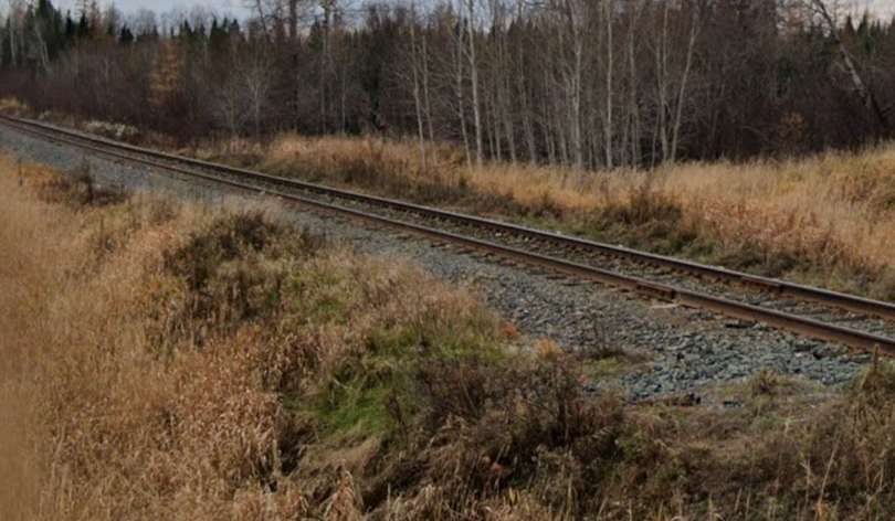
The railway heads on into the wilderness, first to the East-southeast, then to the Southeast, to the South and to the South-southeast passing to the East of a body of water not named on Google Maps, then between two further unnamed lakes.
The line runs South-southeast on the East side of Lac Dufresne and then to the West of Lac Blondin before crossing the QC167 again and then running alongside it as far as Lac Malo.
The line crosses the QC167 again. [Google Maps, February 2026]A misted lens means that this is the best possible view back along the line towards Chibougamau. [Google Streetview, July 2022]Very damp conditions meant that visibility on the QC167 was poor when this photograph was taken. It does show the line crossing the highway and then running parallel to as it heads first to the Southeast and then to the South. [Google Streetview, July 2022]
Further South the line bridges the River Biosvert near Lac Charron. …
The railway and the QC167 cross the River Boisvert close to Lac Carron. [Google Maps, February 2026]Again in damp conditions, the railway bridge over the River Boisvert can be made out to the East of the QC167 bridge. [Google Streetview, October 2018]
The line continues South on the East side of Lac la Blanche, before running parallel to the QC167 again, although not easily seen from the road because of the density of the vegetation.
Road and railway then cross the Coquille River and run down the East side of Lac Nicabau.
The QC167 and the railway cross the Coquille River with the large Lac Nicabau to the Southwest. [Google Maps, February 2026]A rather fuzzy image showing the railway bridge as seen from the QC167. [Google Streetview October 2018]
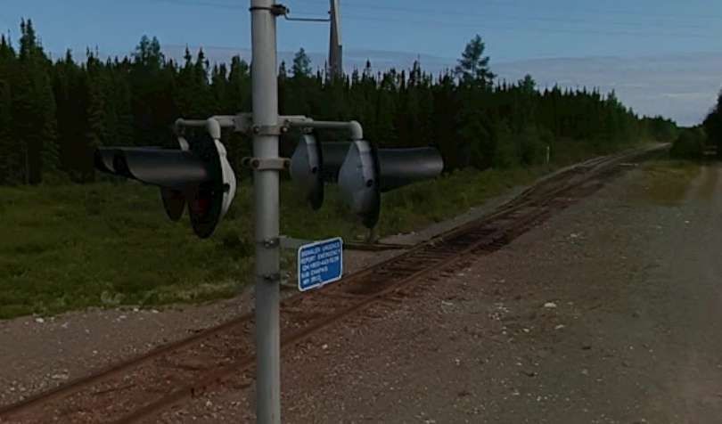
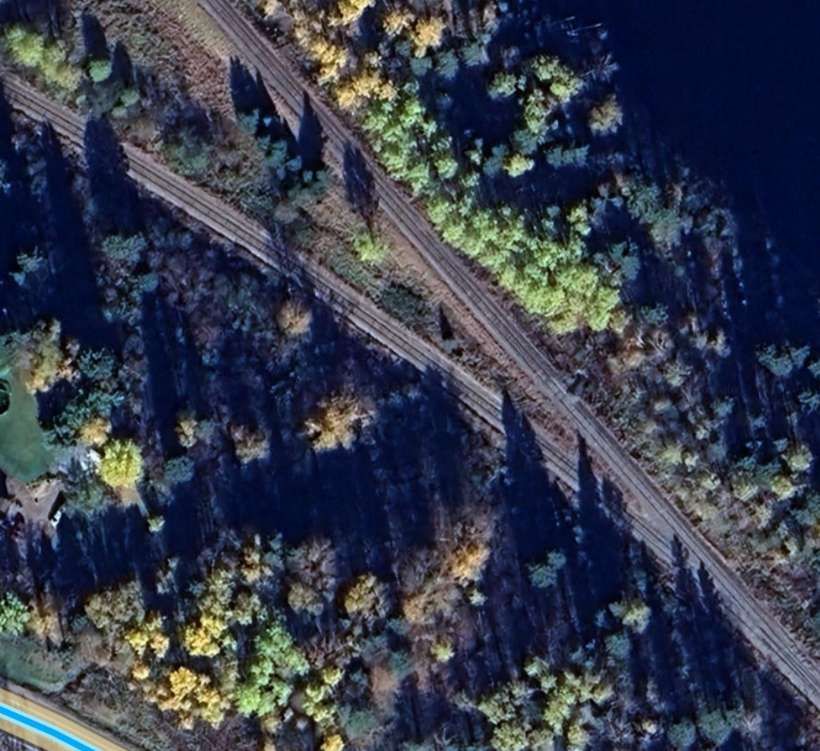
The railway continues to run Southeast at varying distances from the QC167 running to the North of Lac Ducharme and on through land dotted with a myriad of lakes of different sizes before once again taking close order with the QC167 to the Northwest of Lac Chigoubiche. It then runs down the Northeast flank of the lake continuing to follow relatively closely, the QC167. Indeed running immediately adjacent to it on one occasion. …
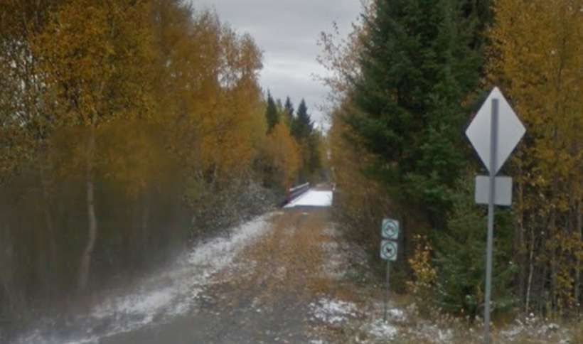
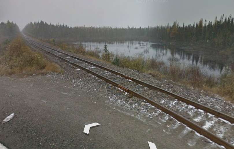
A view South from the QC167 with the railway alongside. [Google Streetview, August 2025]
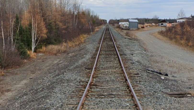
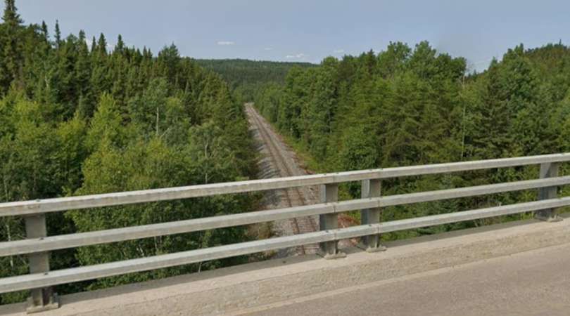
Beyond this, the line runs directly alongside Lac de la Loutre. Some considerable distance further along the line it passes under the QC167.
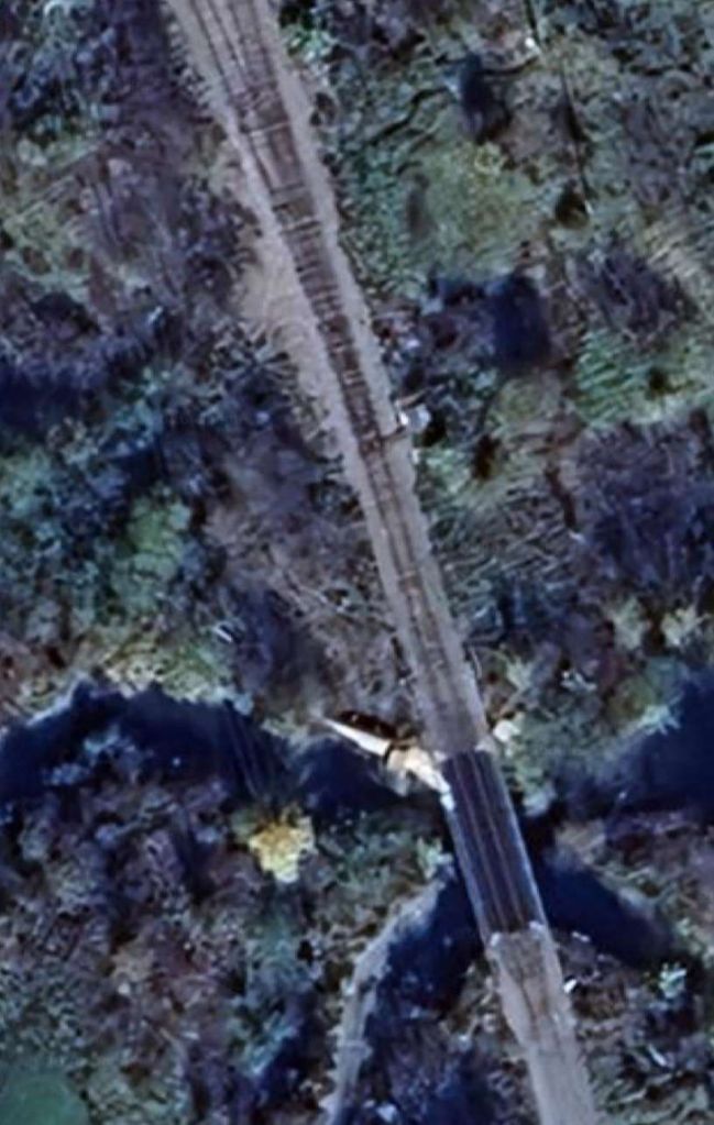
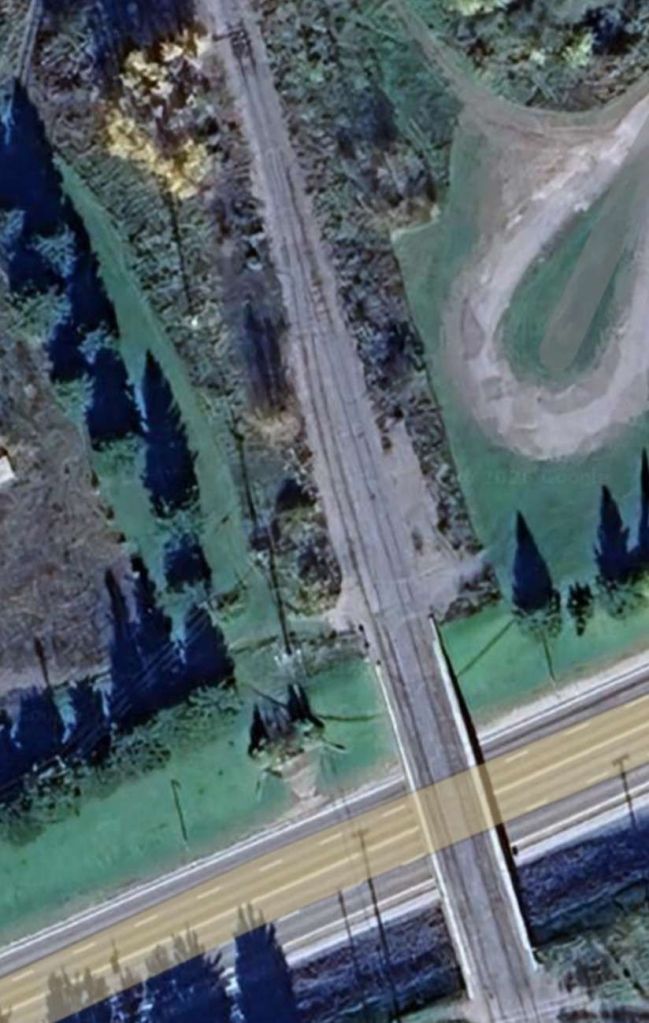
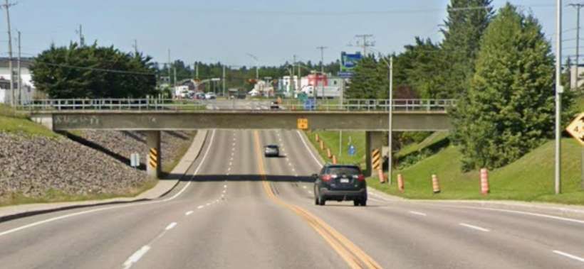
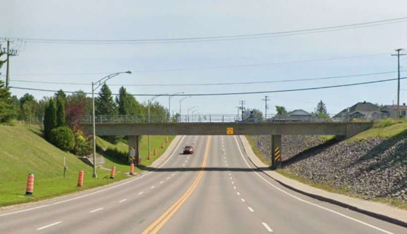
The QC167 passes over the line to St. Felicien. [Google Maps, February 2026]Looking back to the West along the line. [Google Streetview, August 2025]Looking ahead along the line to the East. [Google Streetview, August 2025]Looking Northwest from Rue St-Joseph North at La Dore. [Google Streetview, July 2024]Looking Southeast from Rue St-Joseph North. [Google Streetview, July 2024]
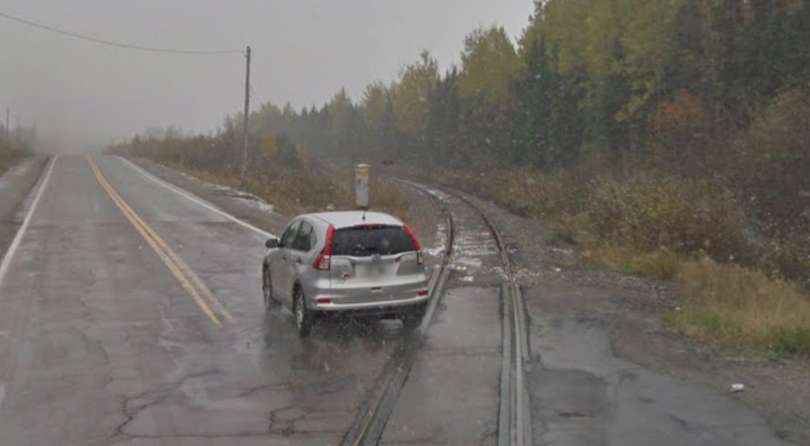
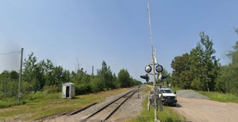
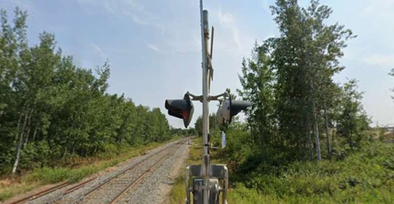
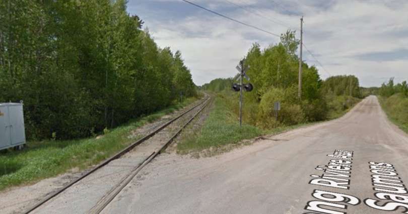
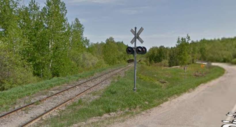
We are now approaching St. Felicien. The next road crossed is Rang Riviere Sub Saumons.
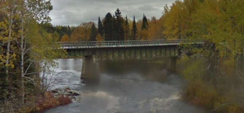
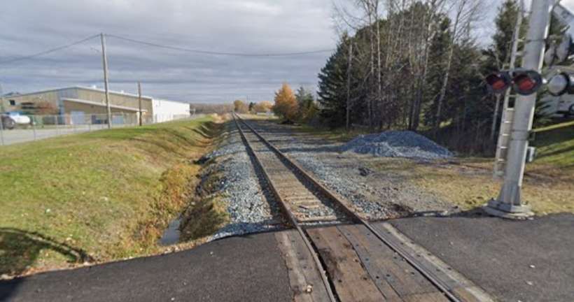
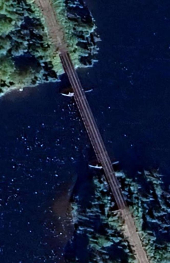
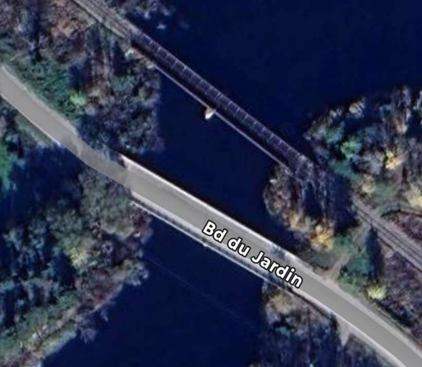
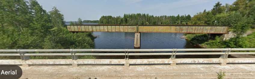
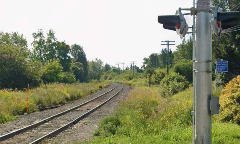
Looking back Northwest from the level-crossing. [Google Streetview, May 2012]Looking Southeast towards St. Felicien from the crossing. [Google Streetview, May 2012]The road and rail bridges over the mouth of the Riviere Aux Saumons (the larger river to the North of the rail bridge is the Riviere Ashuapmushuan). [Google Maps, February 2026]The rail bridge on the Google Maps satellite image above, as seen from the bridge carrying the Boulevard du Jardin over the River. [Google Streetview, July 2024]The rail junction to the Southeast of the river bridge where the line from Chibougamau joins the line from Normandin and beyond. [Google Maps, February 2026]
The line continues alongside the Riviere Ashuapmushuan into Saint-Felicien. …
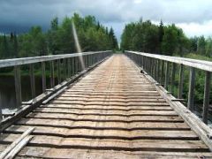
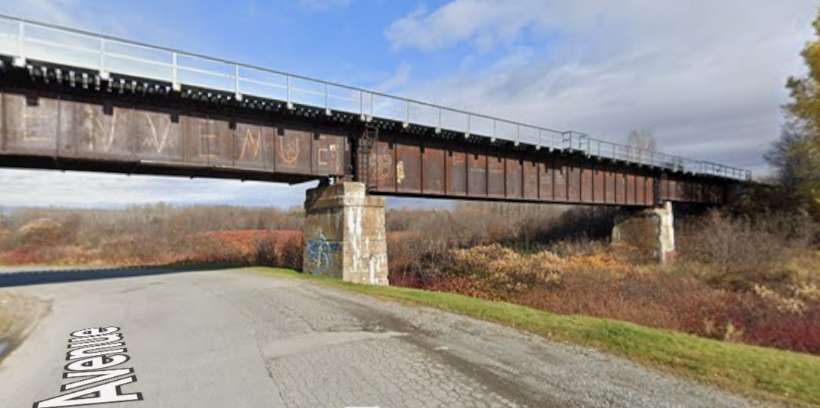
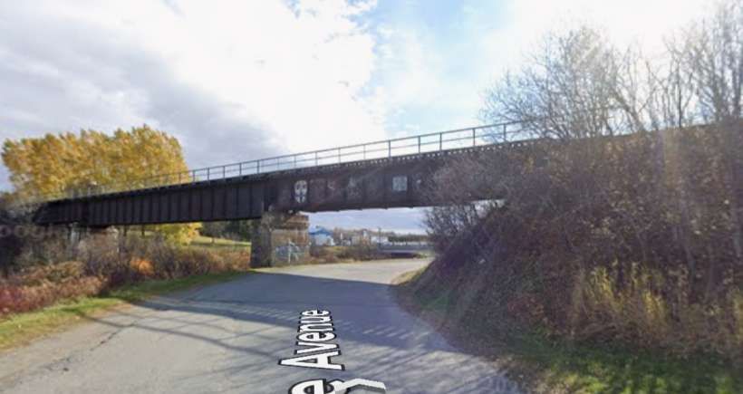
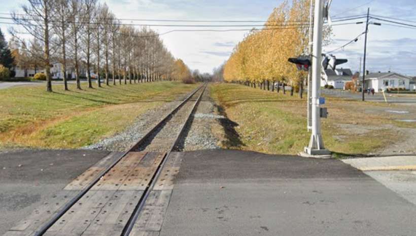
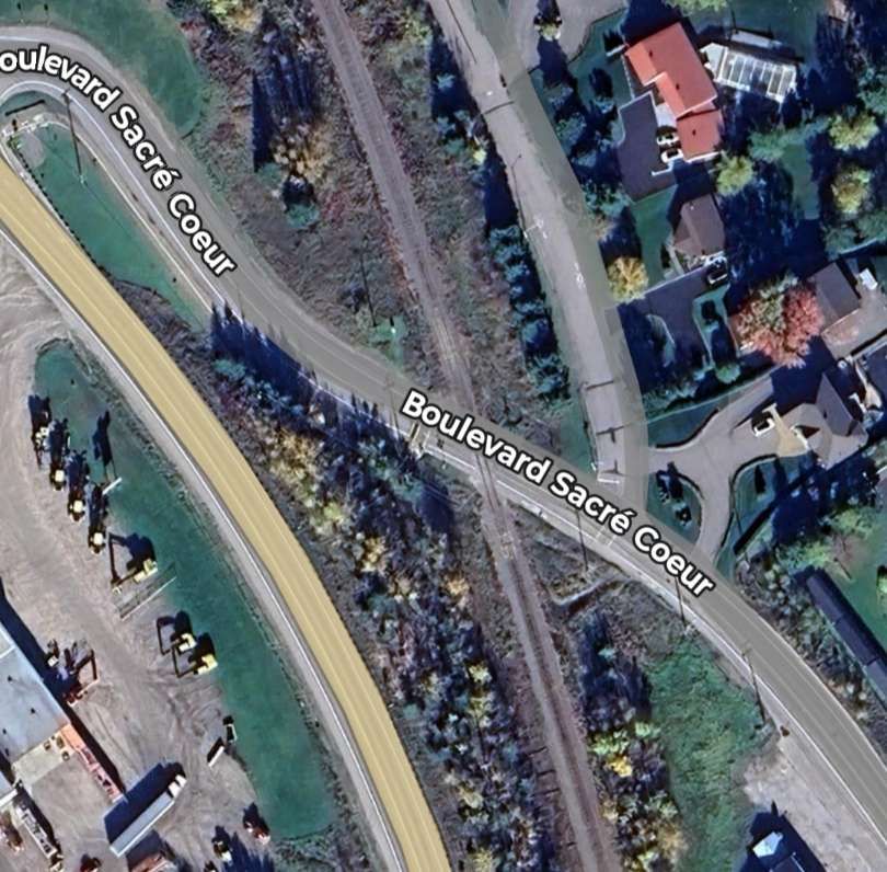
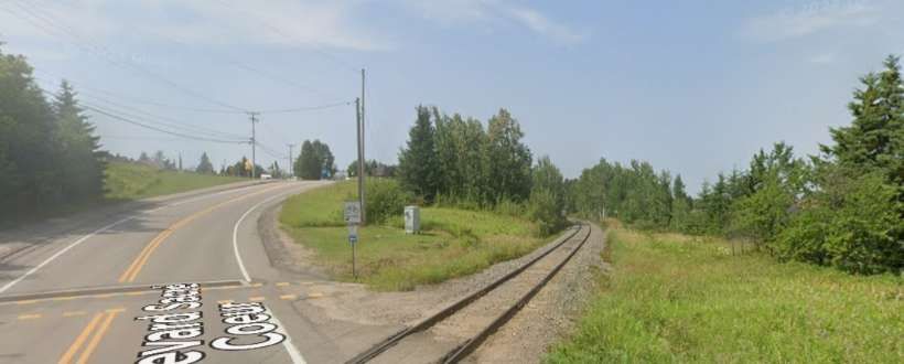
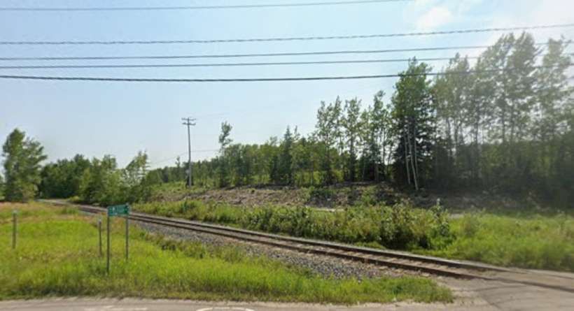
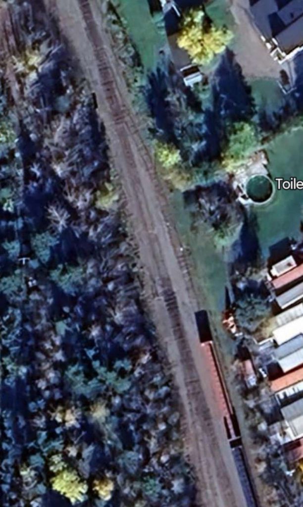
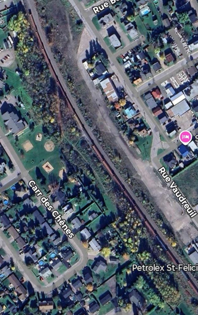
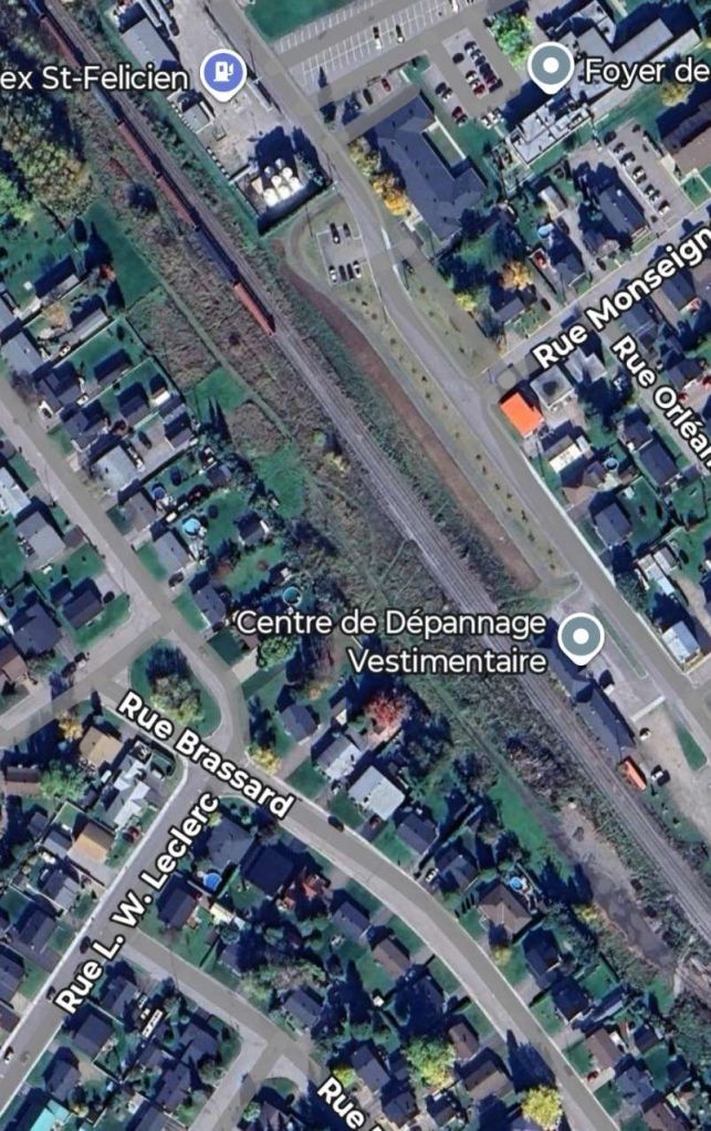
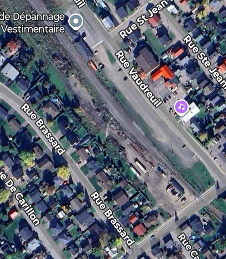
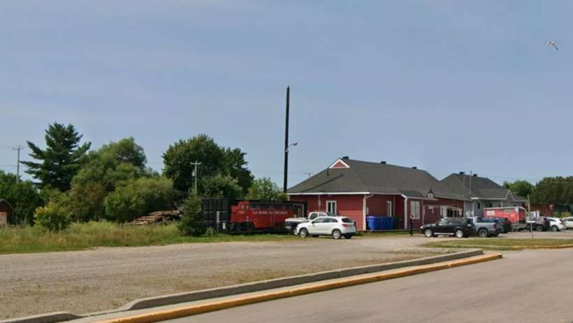
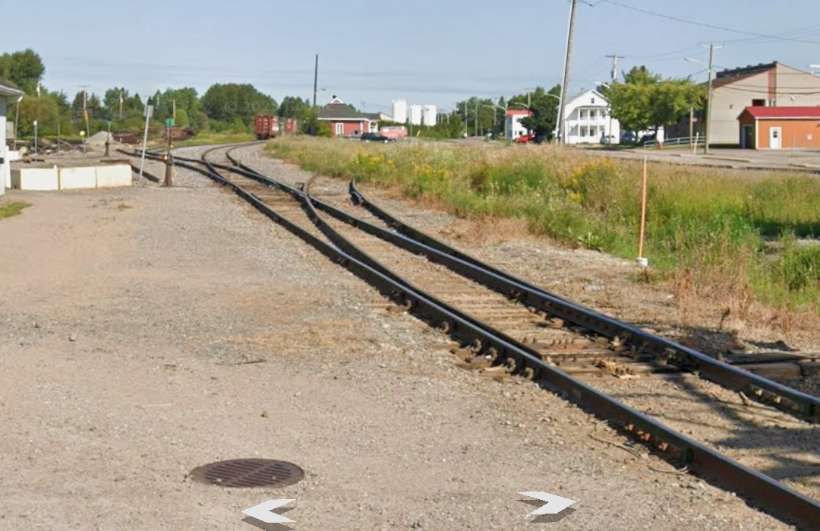
The line crosses Boulevard Sacre Coeur at ground level. [Google Maps, February 2026]Looking back to the North-northwest along towards Chibougamau and Normandin. [Google Streetview, July 2024]The line ahead towards the centre of Saint Felicien. [Google Streetview, July 2024]Just a short distance to the South of Boulevard Sacre Coeur the line divided into three running lines of which two are available for storage at any one time. [Google Maps, February 2026]The three lines return to one just to the North of a bridge over a small tributary to the Ashuapmushuan River. [Google Maps, February 2026]Shortly beyond the stream bridge the line divided once again as it approaches Saint-Felicien Railway Station. It then bridges Boulevard Saint-Felicien on a reinforced concrete three-span bridge. [Google Maps, February 2026]The railway bridge seen from the West on Boulevard Saint-Felicien. [Google Streetview, August 2025]The railway bridge seen from the East on Boulevard Saint-Felicien. [Google Streetview, August 2025]The Northwest end of the station yard. [Google Maps, February 2026]The central area of the station yard with rail buildings on the right of the satellite image. [Google Maps, February 2026]The Southeast end of the station site. [Google Maps, February 2026]Saint-Felicien Railway Station in the late 1950s. [9]The rail buildings at Saint Felicien, seem from the Southeast. [Google Streetview, August 2025]The view Northwest into the Saint Felicien Station site from Rue Notre Dame [Google Streetview, August 2025]The view of the line Southeast from Saint Felicien to the rest of the Canadian network as seen from Rue Notre Dame [Google Streetview, August 2025]
Saint Felicien
In 1911, the government expropriated land under the Indian Act, permitting the James Bay & Eastern Railway the necessary ground for the railway to join Roberval to Saint-Félicien. [10]
We have already seen above that the line from Saint Felicien to Chibougamau was under construction in the late 1950s.
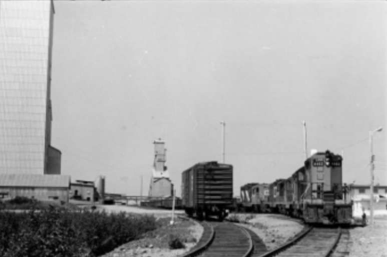
The arrival of the first train from Chibougamau at Saint-Felicien in the late 1950s. [11]


.jpg)