Tag Archives: Ireland

The Guardian Lifestyle Travel – 23rd May 2026 – Part 5 – Over Land & Sea: Magical Views and Sea-Hugging Routes on Europe’s Best Coastal Train Lines – Part A – Scotland, Ireland and Germany

The travel section of the Saturday Guardian Magazine on 23rd May 2023 included a few pages about train journeys in Europe (pages 72 to 77). This is the fifth part of a look at those pages. …

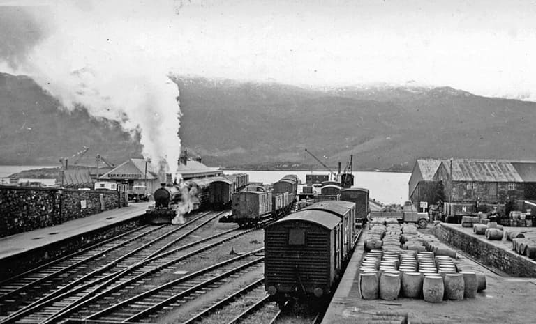
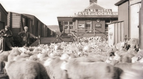
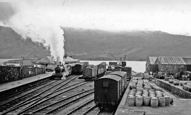
The featured image for this article is a view looking Southeast towards the buffers at Kyle of Lochalsh Railway Station and across the Kyle to Skye in 1939, the ferry to Kyleakin is off scene to the right. A train is leaving for Dingwall and Inverness, managed by an ex-Highland 4-6-0 locomotive, © Walter Dendy and licensed for reuse under a Creative Commons Licence (CC BY-SA 2.0). [14]
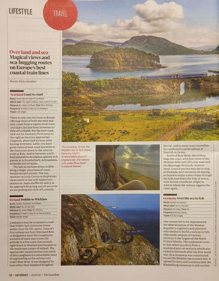
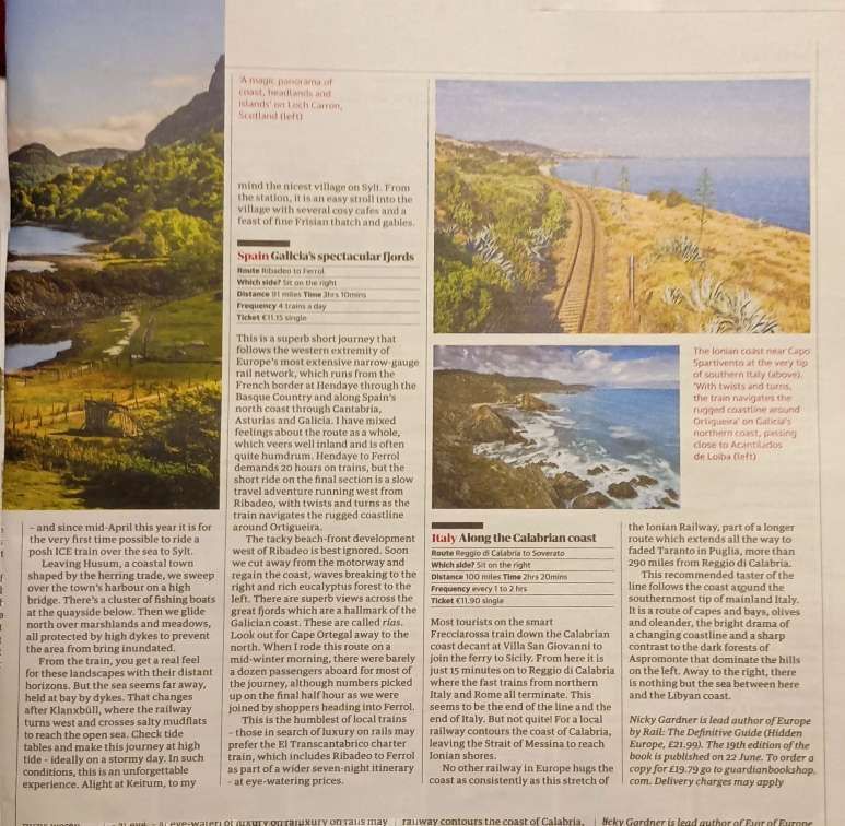
The two pages of Nicky Gardner’s article. [1: p76-77]

Nicky Gardner, lead co-author of the guidebook ‘Europe by Rail’, has championed slow travel across the continent’s most scenic routes. Her writings highlight sea-hugging railways where travellers can take in spectacular coastal panoramas, deep fjords, and dramatic cliffs right from the carriage window. The short Guardian article featuring a few such routes was written by her and is directly quoted here.

5. Europe’s Best Coastal Train Lines

A. Scotland: Coast to Coast

The first line Nicky Gardner chooses to highlight is operated by ScotRail. Travelling the Inverness to Kyle of Lochalsh line will set you back £32 for a single ticket The journey is 83 miles and takes 2hrs 40mins. There are 4 trains a day (only two on Sundays). Sit on the right side first and then switch to the left. …

Nicky Gardner writes:

“There is only one rail route in Britain offering views of both the west and east coasts from a regular local train, and that’s the line from Inverness to Kyle of Lochalsh. For the east coast, look out for Cromarty Firth away to the right as the train approaches Dingwall, about half an hour after leaving Inverness. Later, you have good views of west coast sea lochs as the train runs down to the Atlantic coast at Kyle. And in between you’ll find alliterative desolation aplenty as it pauses at Achnashellach, Achnasheen, Achanalt and Attadale.

“The last 20 minutes down to Kyle bring a magic panorama of coast, headlands and islands. The sun sparkles on Loch Carron with glorious views north to the wild Applecross peninsula. Seals shuffle for safety as we approach Duncraig and all too soon we are pulling into Kyle of Lochalsh.” [1: p76]

The Kyle of Lochalsh line is a primarily single-track railway line in the Scottish Highlands, from Dingwall to Kyle of Lochalsh. Many of the passengers are tourists, but there are also locals visiting Inverness for shopping, and commuters. All services are provided by ScotRail and run beyond Dingwall to Inverness. In the past there were some through services to and from Glasgow, Edinburgh or Aberdeen. None of the 63-mile (101 km) line is electrified, and all trains on the line are diesel-powered, as are all other trains in the Scottish Highlands.” [2]
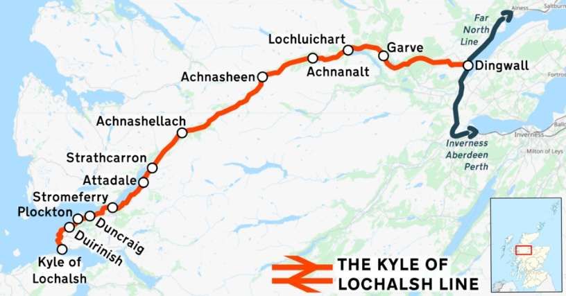
The Kyle of Lochalsh line is shown on this image in red, © OpenStreetMap contributors and licensed for reuse under a Creative Commons licence (CC BY 3.0). [2]
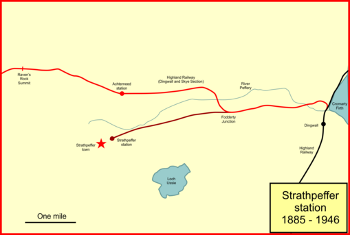
This image shows the first few miles of the Kyle of Lochalsh line and the Strathpeffer Branch. The Kyle line survives the Strathpeffer line is closed. The station immediately to the North of Strathpeffer is now closed. It was once name Strathpeffer and the name was changed to Achterneed when the Strathpeffer branch opened, The next marked location close to the left of this image is not a station but the first high point on the Kyle of Lochalsh line – Raven’s Rock Summit, (c) Afterbrunel and licensed for reuse under a Creative Commons licence (CC BY-SA 4.0). [2]

When the first section of the Dingwall & Skye Railway opened on 19th August 1870 the area around Strathpeffer area became much better connected. However, because of the resistance of a local landowner, the Dingwall & Skye railway was pushed further North and had to run up a steep gradient (1 in 50) to a much higher line on the valley side. The new line had a station named ‘Strathpeffer’ but it was 2 miles from the spa on a relatively steep road. It would have been so much better had the line been able to follow the valley floor. With Strathpeffer’s rise in popularity it became necessary to build a branch line into the village.
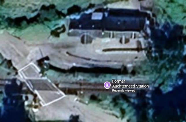
The former station at Achterneed. [Google Maps, June 2026]
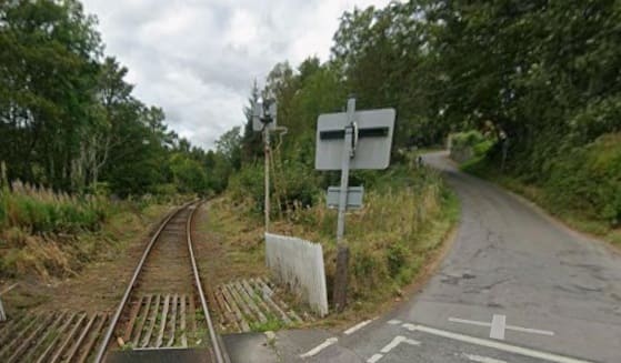
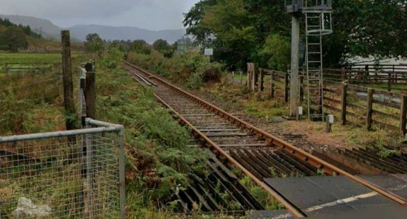
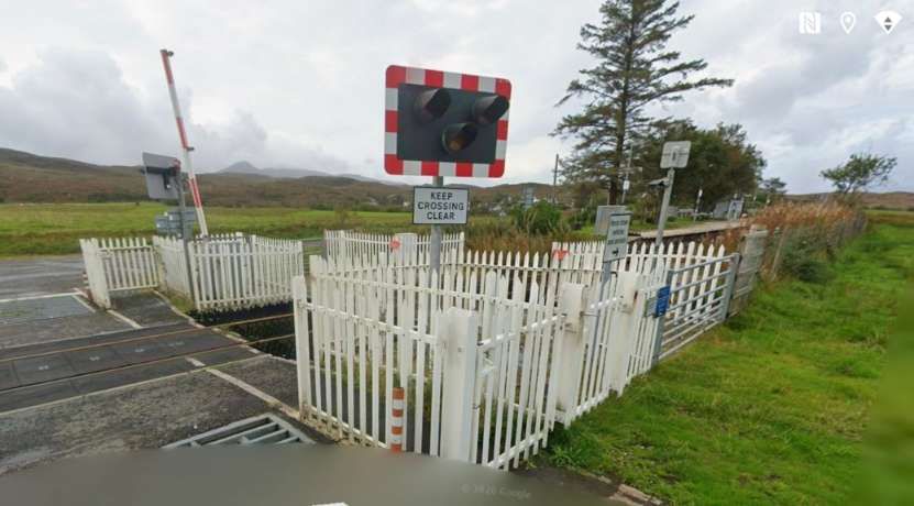
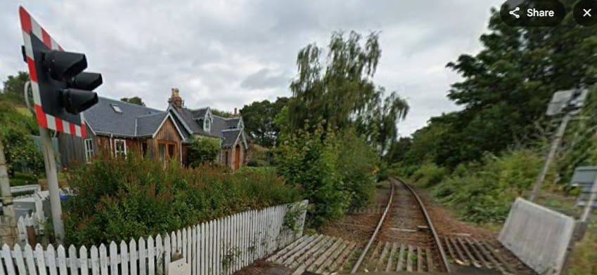
Looking back towards Dingwall from the road-crossing at Achterneed. [Google Streetview, September 2025]
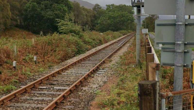
Looking ahead along the line towards Kyle of Lochalsh from the road-crossing at Achterneed. [Google Streetview, September 2025]

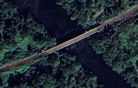
The railway bridge over the Black Water at the East end of Loch Garve. The line runs along the South shore of the loch before turning Northwest and running into Garve Railway Station. [Google Maps, June 2026]
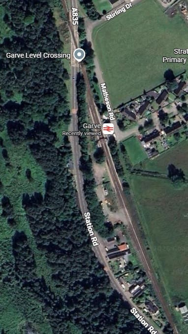
Garve Railway Station. [Google Maps, June 2026]
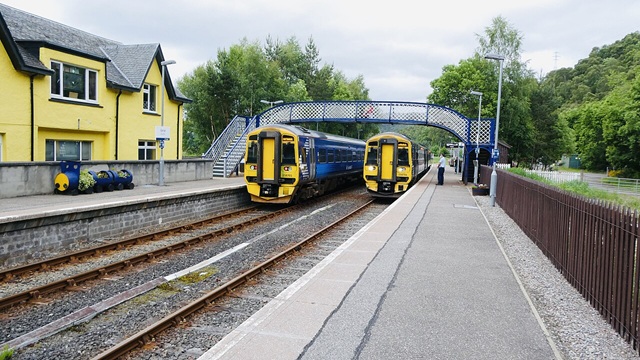
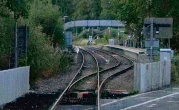
Two Class 158 Diesel Multiple Units (158701 and 158704) operated by Abellio ScotRail pass each other at Garve station’s passing loop, with services bound for Inverness and Kyle of Lochalsh respectively, (c) Sexy Simon and licensed for reuse under a Creative Commons licence, (CC BY-SA 4.0). [3]
Looking back into Garve Railway Station from the A835 level-crossing. [Google Streetview, September 2025]

Looking ahead along the line towards Kyle of Lochalsh from the level-crossing on the A835 at Garve. [Google Streetview, September 2025]

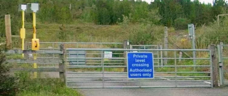
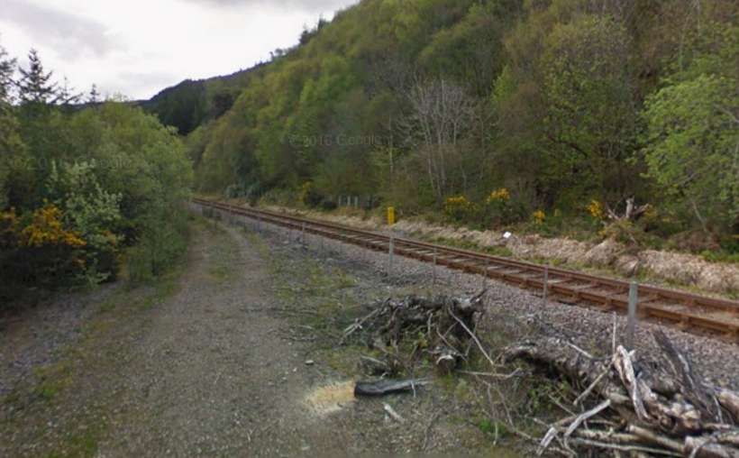
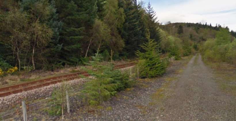
The line runs alongside the A835 and then the A832. Alongside the A832, it crosses this forestry access road. A short distance to the West of this crossing the A832 turns away to the Northwest. [Google Streetview, September 2025]

The line then turns to the Southwest to meet the North shore of Loch Luichart and runs West along the North shore before crossing the outfall from Mossford Hydroelectric Power Station. The line can be seen in the bottom-right of this satellite image. [Google Maps, June 2026]

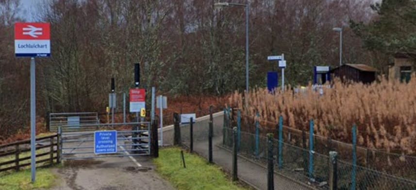
Loch Luichart Railway Station seen from the approach road looking Southwest towards the station. The station sits above the North shore of the Loch at its western end. [Google Streetview, December 2021]

The original station at Lochluichart (called Lochluichart High) was opened by the Dingwall and Skye Railway in August 1871. It sat at a lower level than the present station.

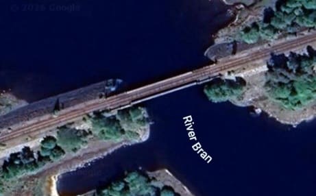
Soon thereafter the line crosses the River Bran. In the 1950s the Conon Valley hydro-electric scheme raised the water level of Loch Luichart which required the railway line to be diverted onto higher ground and a new station to be erected. [Google Maps, June 2026]

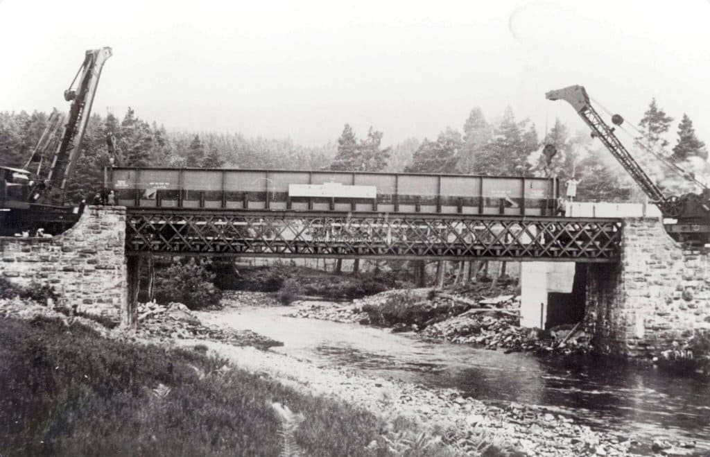
The new line was known as the Lochluichart Diversion. It required a replacement bridge over the river. This image shows construction work on the bridge in the 1950s, (c) Am Bailie. [4]

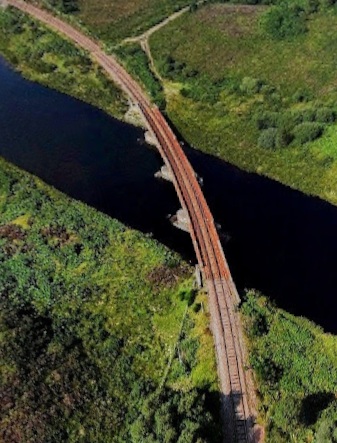
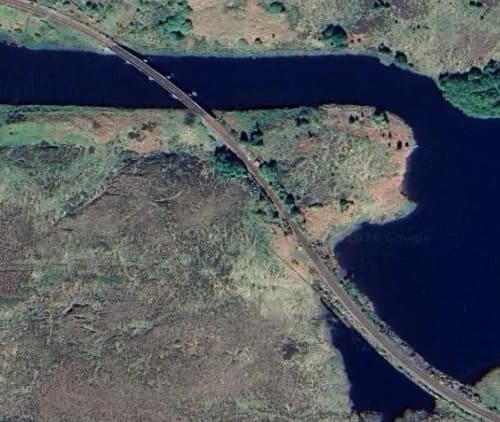
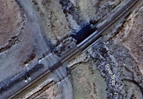
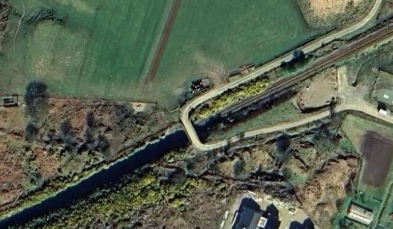
The line ran on the South shore of Loch a’ Chuilinn before turning Northwest to cross the channel of the River Bran at its western end. A satellite image is below. [Google Maps, June 2026] The adjacent image is a drone’s eye view of the same bridge, (c) Brian McInally (August 2021). [Google Maps, June 2026]

Now on the North bank of the River Bran, the line runs West passing Loch Achanalt and through then request stop of the same name.

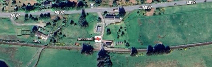
Achanalt Request stop and the A832. The River Bran runs just below the bottom of this image and just intrudes into it at the bottom-left. From this point on for a reasonable distance the line runs on the South side of the A832, with the River Bran to the South of the line. [Google Maps, June 2026]
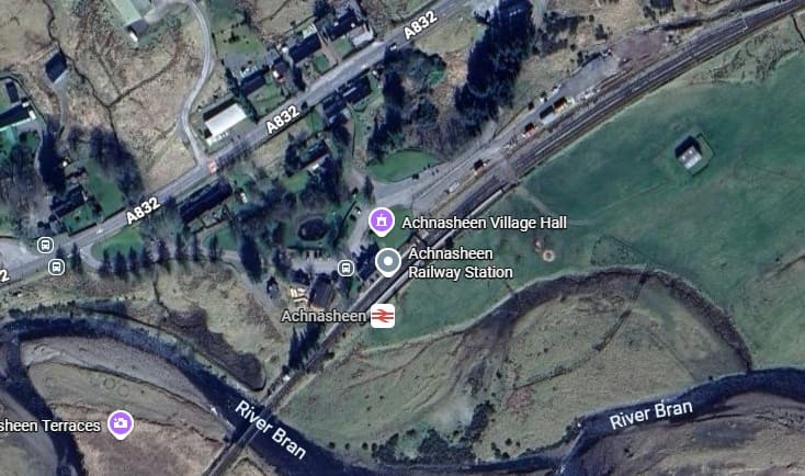
The next railway station is at Achnasheen just before the next bridge over the River Bran. [Google Maps, June 2026]

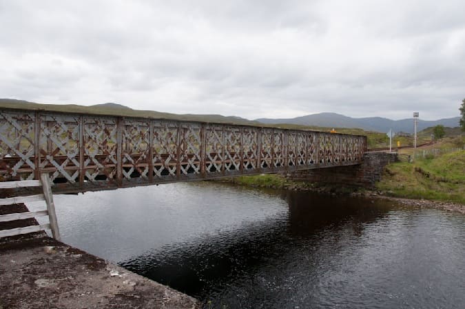
Achnasheen Railway Bridge spans the River Bran at the Southwest end of Achnasheen Railway Station. It is a single lattice-girder span of unusually light construction, with masonry abutments. [5]

Then, parallel to the A890, the line runs down the East side of Loch Gowan and continues to follow the River Bran upstream, crossing the River once again on a much smaller structure.

After the line bridges a tributary of the River Bran, this next bridge over the River Bran itself encounters a much smaller river! [Google Maps, June 2026]

The A890 runs to the North of Loch Scaven, the railway on the South side of the Loch. Both continue West-southwest across moorland and woodland.

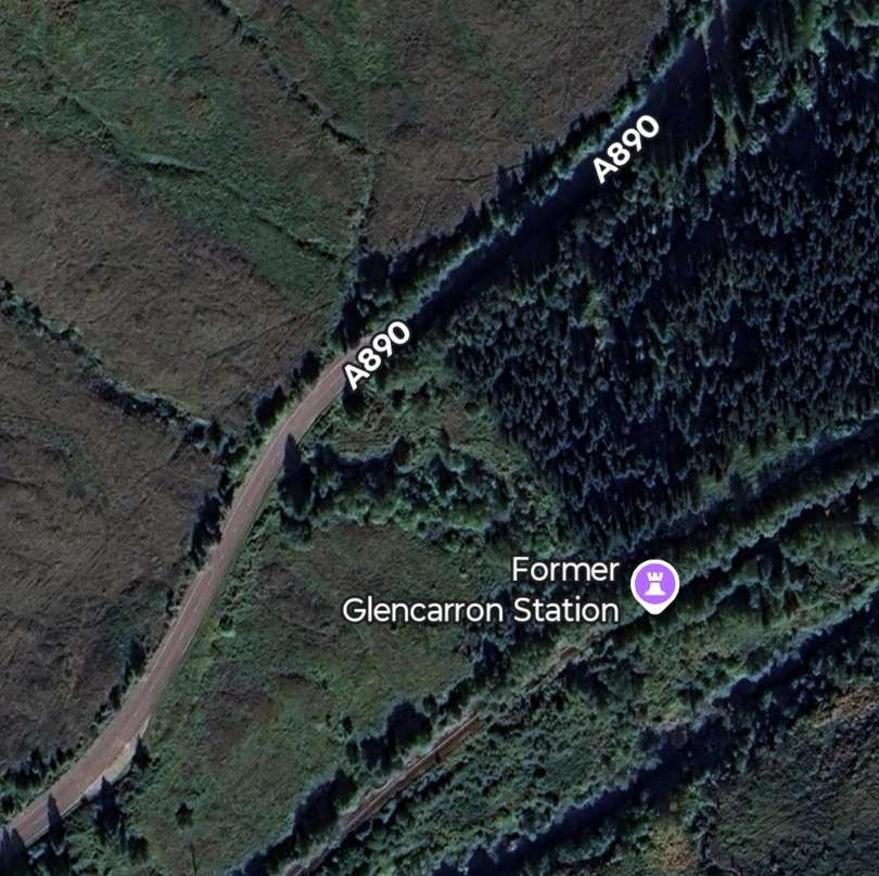
The former Glencarron Railway Station is surrounded by woodland. The station was known as Glencarron Platform. [6]

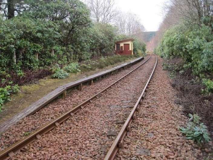
Glencarron Platform was opened in 1873 on the Highland Railway’s line from Dingwall to Kyle of Lochalsh, this remote station closed in 1964. It had originally been for the sole use of the landowner but was later opened to all travellers. [7]

This view looks south west from the trackside at Glencarron Platform, towards Achnashellach and Kyle in 2015. 51 years after official closure, somebody appeared to be looking after it, © Nigel Thompson and licensed for reuse under a Creative Commons Licence, (CC BY-SA 2.0). [7]

Southwest of Glencarron Platform the railway followed the A890 down the valley of the River Carron. The Road was Northwest of the line, the river was to the Southeast of the line.

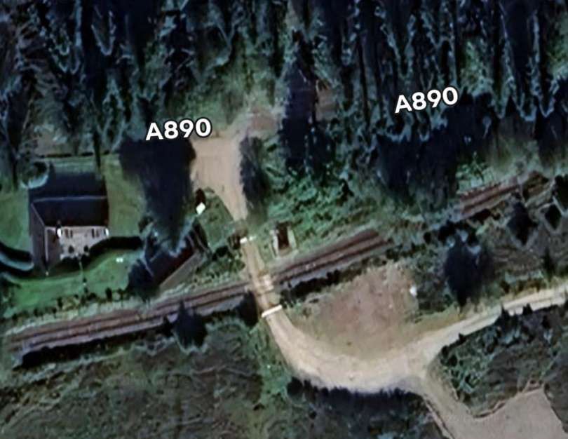
Further Southwest, a forest access road crossed the line at a level-crossing. [Google Maps, June 2026]
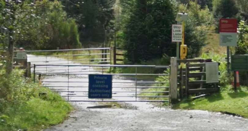
The level-crossing seen from the A890. [Google Streetview, September 2025]
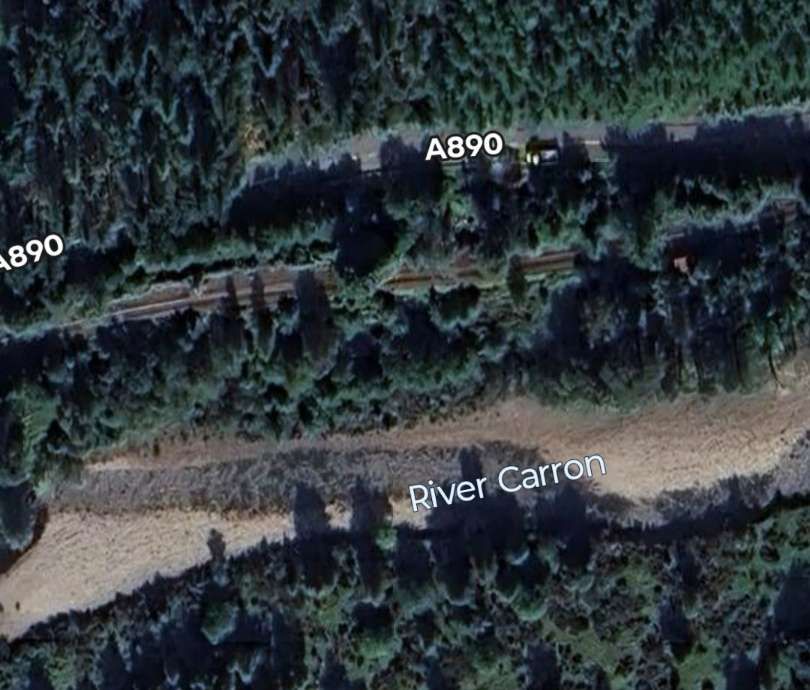
River, road and railway continue West from the crossing. [Google Maps, June 2026]
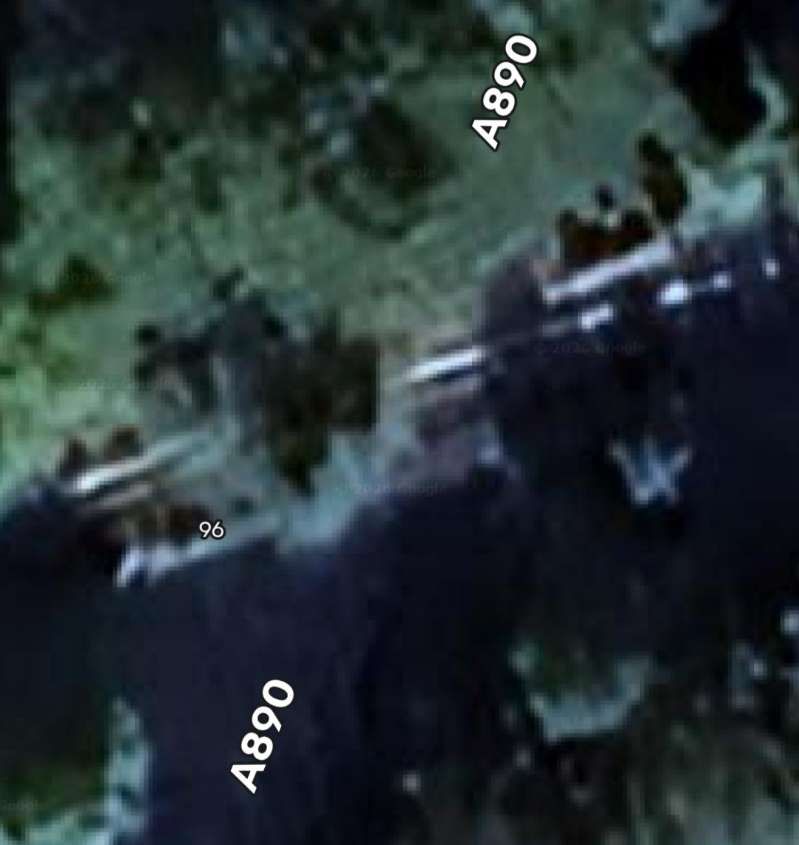
Further West again, the A890 passes under the railway. [Google Maps, June 2026]
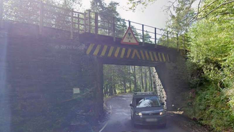
This view looks South through the underbridge which was designed only for a single line of traffic. [Google Streetview, September 2025]
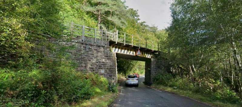
This view looks North through the same bridge. [Google Streetview, September 2025]

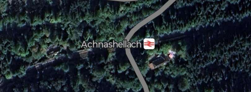
The valley of the River Carron is heavily wooded and the line disappears at times under the canopy. Even Achnashellach Railway Station is difficult to make out from above!

Achnashellach Railway Station is a request-stop. [Google Maps, June 2025]
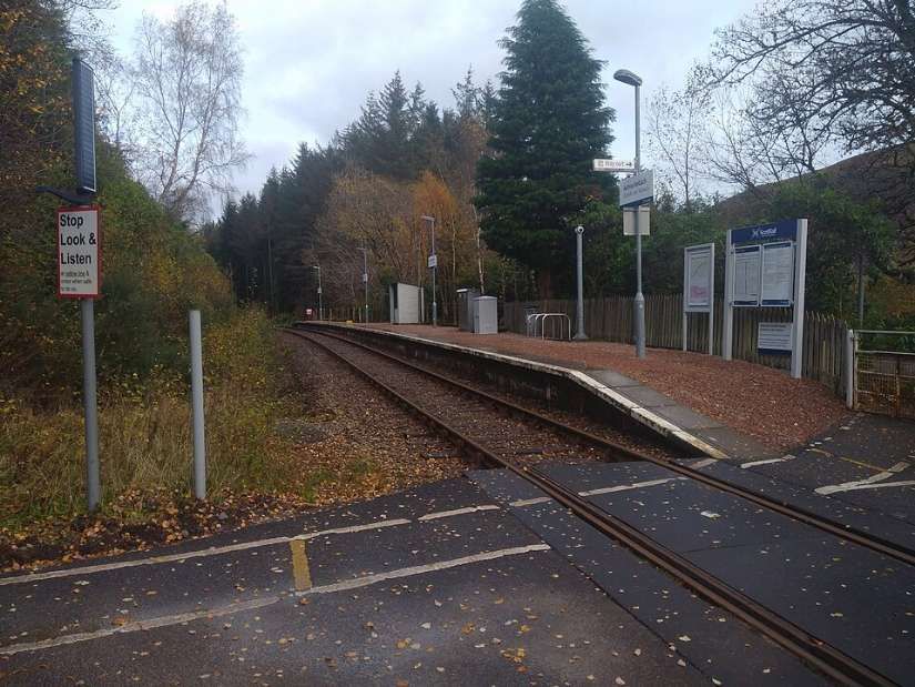
Achnashellach Railway Station is a request stop. It is seen here from the road-crossing at its western end, © Felix Saward and licensed for reuse under a Creative Commons licence (CC BY-SA 4.0). [8]
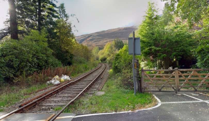
Looking along the line towards Kyle of Lochalsh from the crossing at the West end of Achnashellach Railway Station, © Roger Spo. [Google Streetview, October 2014]

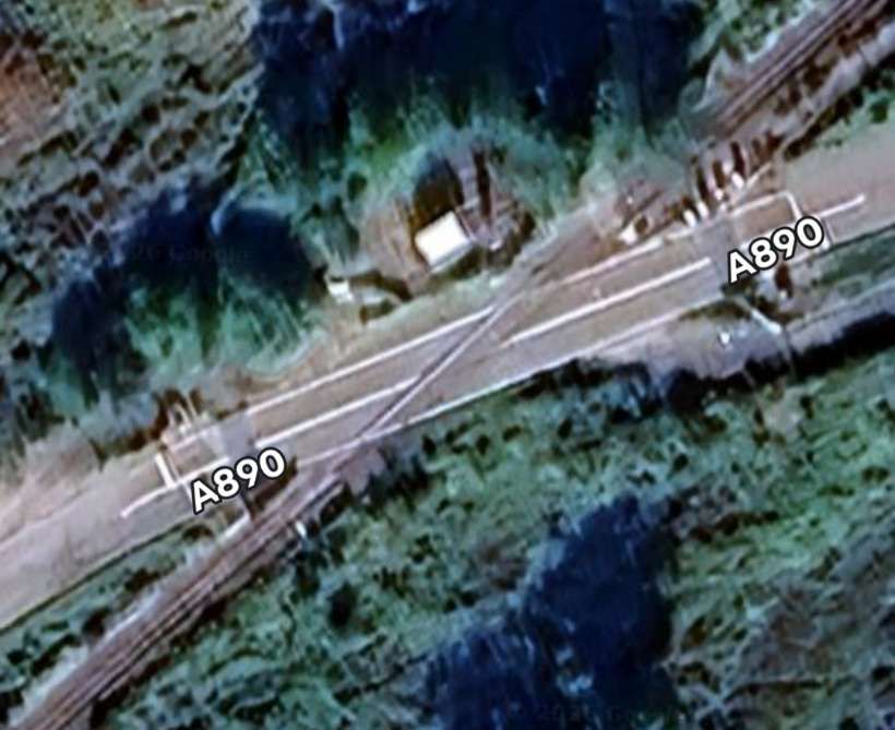
The A890 and the railway run to the Northwest of Loch Dugaill at the Southwest end of the loch the railway crosses the A890 again.

The road crossing to the Southwest of Loch Dugaill. [Google Maps, June 2026]
Looking Northeast along the Carron valley towards Dingwall. [Google Streetview, September 2025]
Looking Southwest along the Carron valley towards Kyle of Lochalsh. [Google Streetview, September 2025]

The road and the railway run in close proximity for quite a distance.

At times the line and the A890 ran immediately next to each other. [Google Streetview, September 2025]
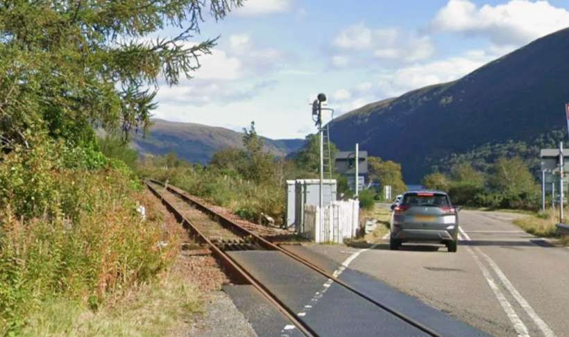
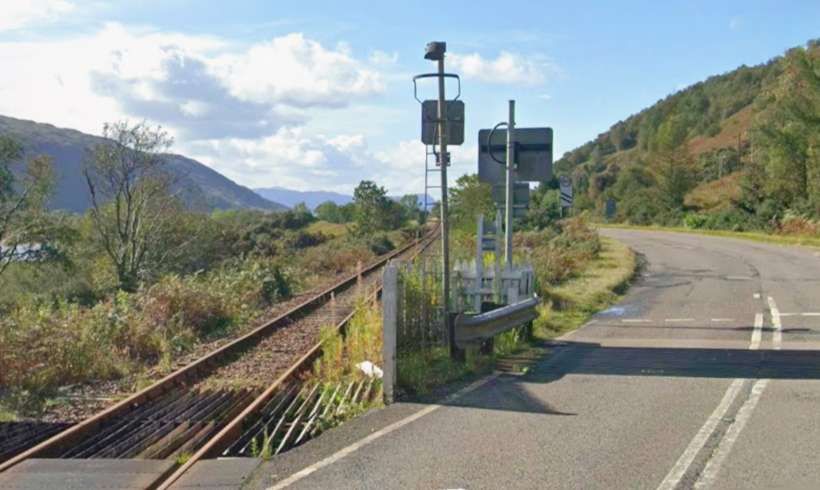
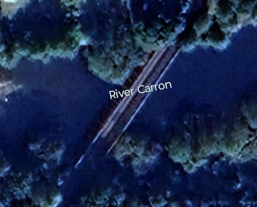
The road and the railway gradually pull apart before the railway bridges the River Carron. [Google Maps, June 2026]
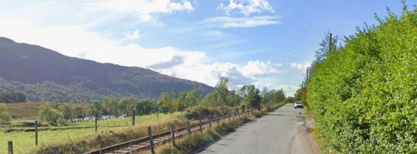
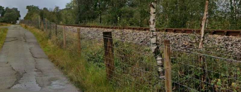
A short distance to the Southwest of the river bridge a little used minor road runs immediately alongside the line on its East side. This photograph faces West-southwest. At this point the line is on a slight embankment. [Google Streetview, September 2025]
A few hundred metres further Southwest the minor road crosses the line at this level-crossing. [Google Maps, June 2026]
Looking back Northeast towards the bridge over the River Carron. [Google Streetview, September 2025]
Looking Southwest towards Strathcarron Railway Station from the same level-crossing. [Google Streetview, September 2025]
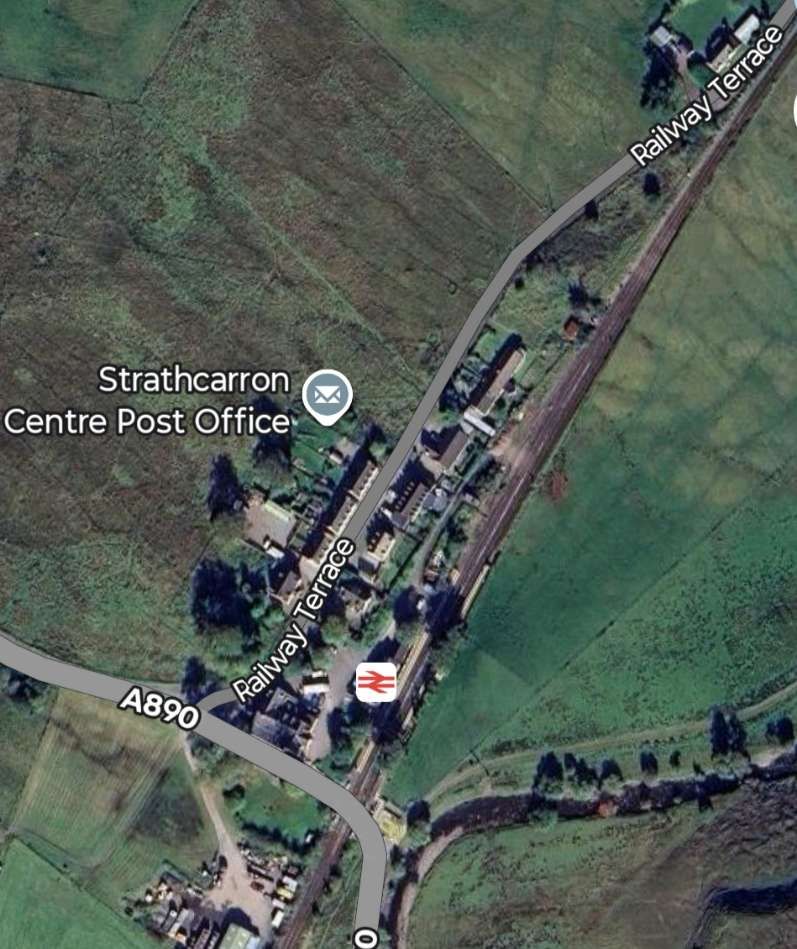
Strathcarron Railway Station is the next significant point on the route. The A890 crosses the line immediately  to the South of the station platforms. [Google Maps, June 2026]
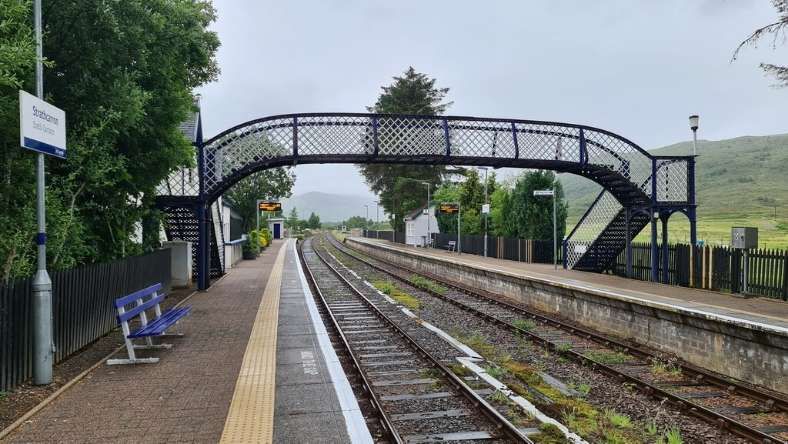
Strath Carron Railway Station looking North,  © Chris Morgan and licensed for reuse under a Creative Commons licence (CC BY-SA 2.0). [9]
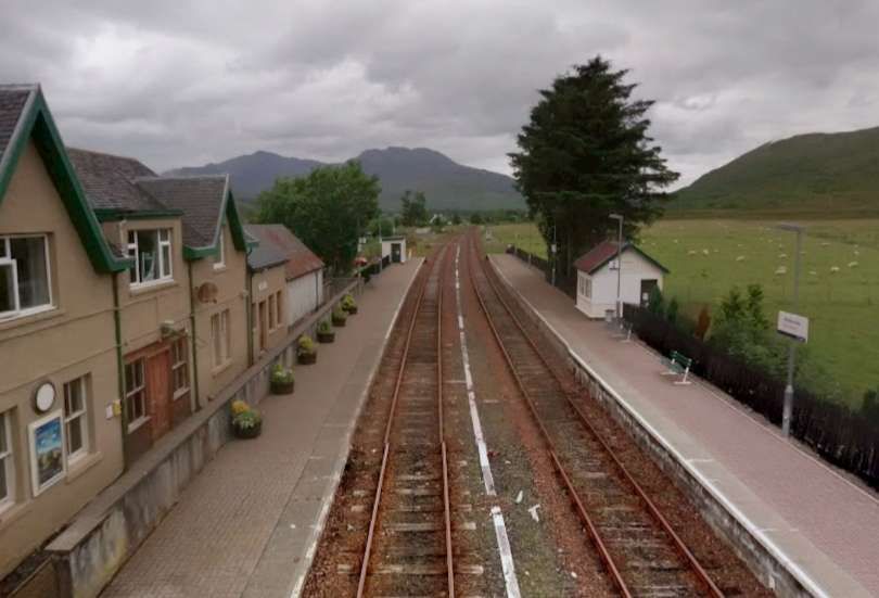
The view North from the station footbridge, © Roger Spo. [Google Streetview, July 2015]
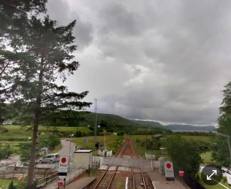
The view South from the station footbridge, © Roger Spo. [Google Streetview, July 2015]
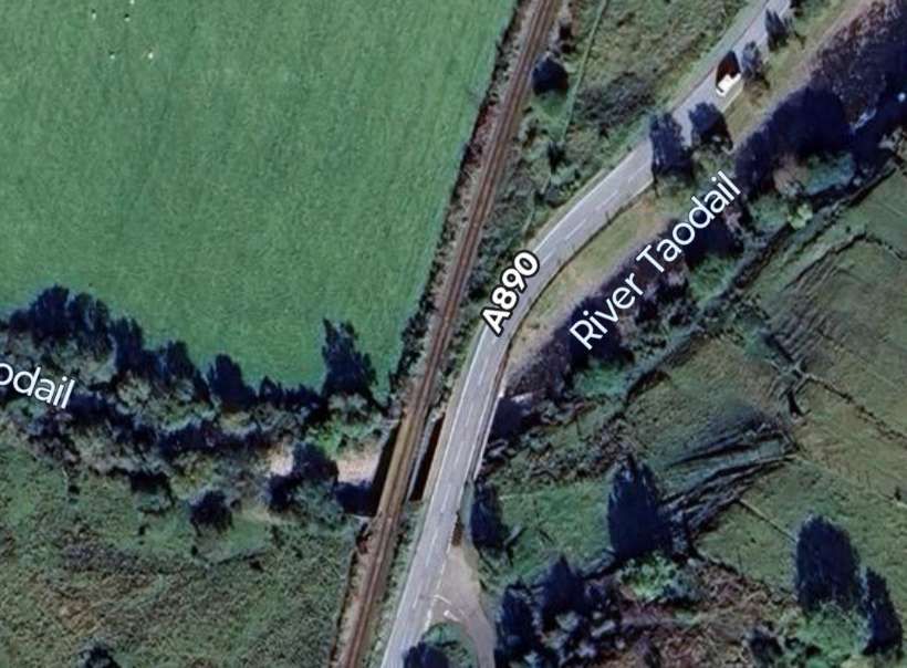
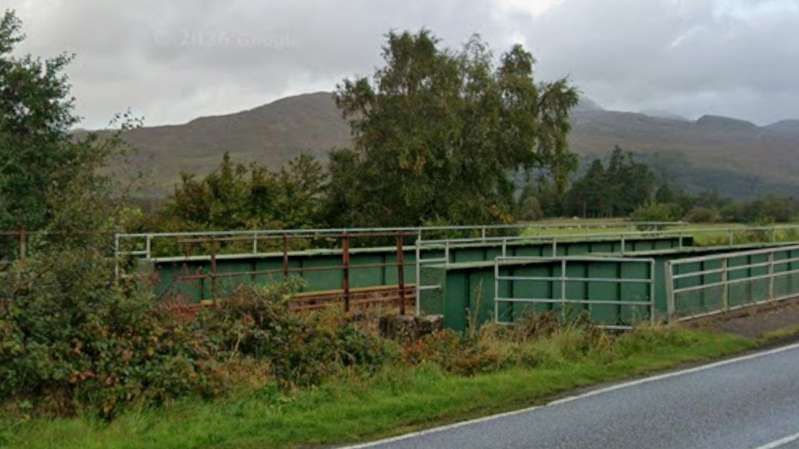
Both the road and the railway cross the River Taodail a short distance South of Strathcarron Railway Station.
Looking North from the A890 a little to the South of the River Taodail, the real bridge can be seen alongside and to the West of the road. [Google Streetview, September 2025]
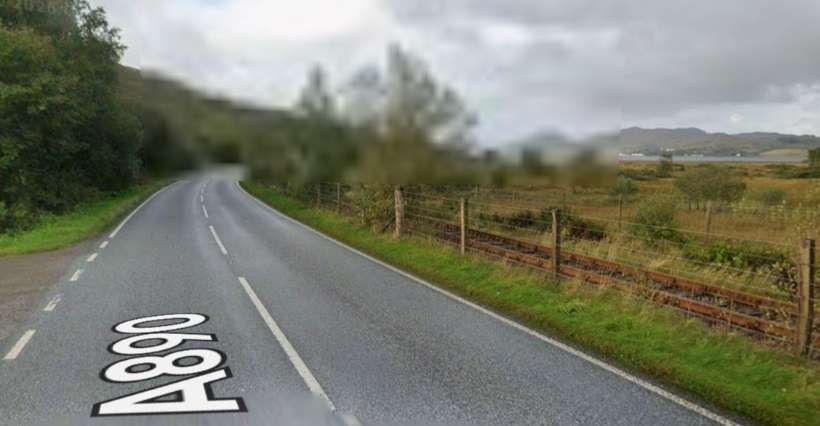
Looking South from a similar location on the A890, the railway can be seen taking close order with the road. [Google Streetview, September 2025]
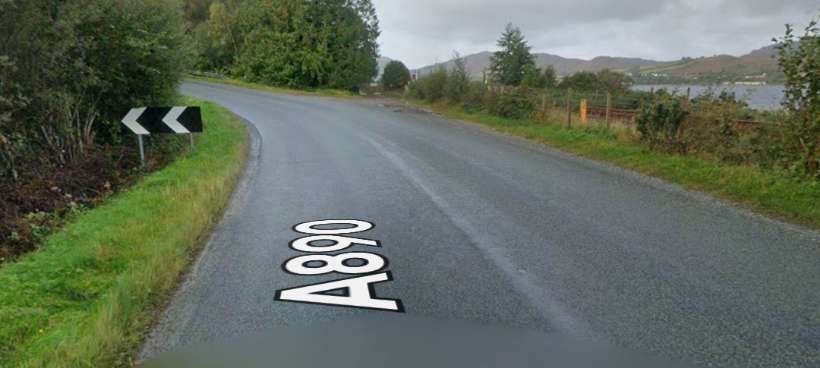
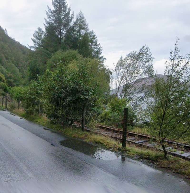
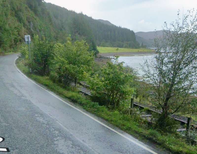
A little further South the road and the railway begin to separate. The railway heads for Attadale, Stromeferry and Plockton and remains close to the shore of Loch Carron. The road ducks in and out from the shore and the line of the railway as it heads towards Kyle of Lochalsh. This is the first deviation inland. [Google Streetview, September 2025]

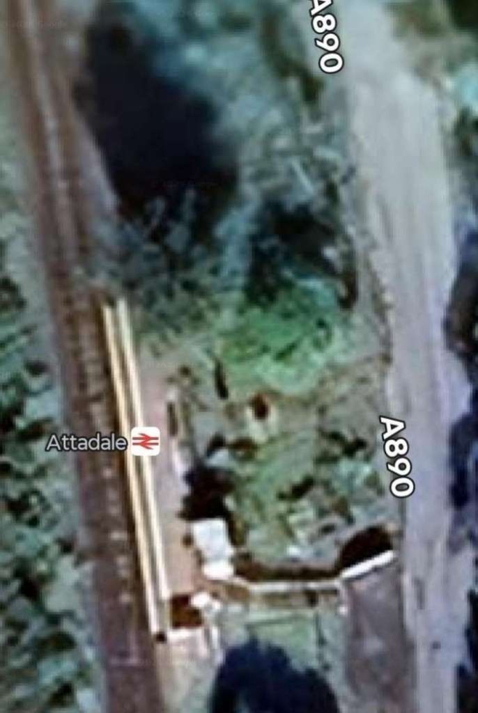
Both road and rail are close once again at Attadale Railway Station which served/served the Attadale Estate and Attadale Gardens. [Google Maps, June 2026]

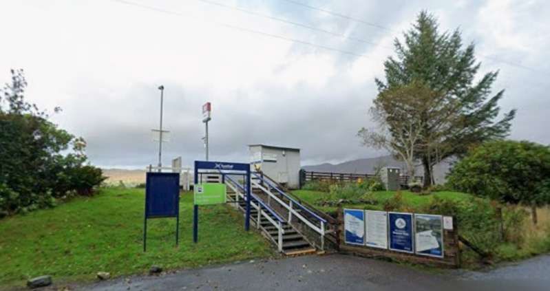
Attadale Railway Station. [Google Streetview, September 2025]

The road and railway remain close together for a distance to the South of Attadale Station, passing through Stromeferry Tunnel.

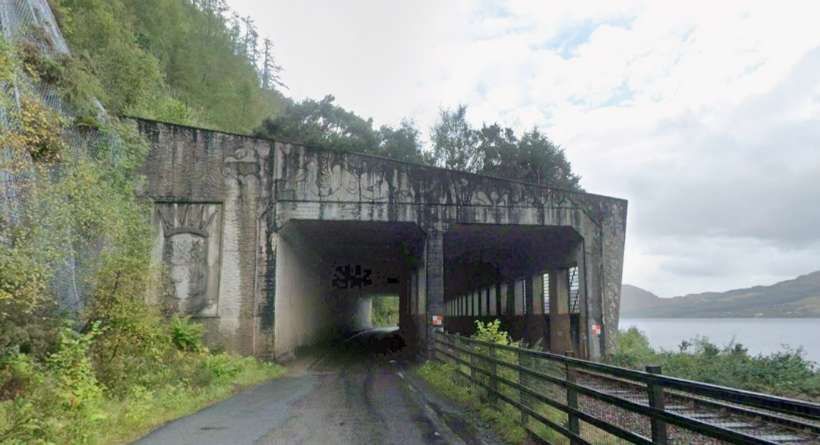
The Strathcarron Tunnel was designed to provide protection for both the railway and the A890. Current arrangements mean that the road is close and traffic diverted to run through the rail tunnel under strictly controlled traffic arrangements. [Google Streetview, September 2025]

The tunnel is a concrete structure which covers both the railway and A890, it protects the railway and road from the cliff above. The tunnel was built in the 1970s. When the Stromeferry Bypass road opened, it met the older road from Strathcarron and in doing so resulted in the closure of the Strome Ferry crossing from Stromeferry to North Strome Pier. [10]

The cutting back of the cliff face for the road resulted in instability and the surface was netted to prevent rockfalls. [11]

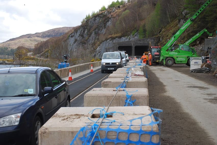
Work became necessary on the cliff face, the space for doing this needed the road traffic to be diverted onto the line of the railway. Matting was placed on the railway to allow this and an arrangement that interlocked the railway signalling with the road traffic lights. [11][12]

Looking Northeast through Strathcarron Tunnel during traffic restriction in place in 2018. In this photograph we see that vehicles are running over the line of the railway and controlled by interlocked traffic lights and railway signals. [12]

Since 2012, the Highland Council have been consulting with local people and drawing up a number of plans to alleviate the rockfall problem in the future. “Widening the existing route is now seen as a complete non-starter, although netting on the cliff faces, and regular monitoring of their condition, have kept the road open. The two main proposals remaining are … to redirect the road around the back of the hills from Attadale to Glen Udalain, or to build a bridge at Strome. This second option would also see the pretty lochside village of Lochcarron bypassed, with a new road around the back on the hillside, although doubtless this could be put back as a long term aspiration, with the bridge still built. In both of these options the present road below the cliff would then be converted to a rock trap to protect the railway, with the two ends remaining open for local access.” [13]

Southwest of the Strathcarron Tunnel road and rail run close together along the shore of the loch. [Google Streetview, September 2025]

The close alignment continues for some distance further to the Southwest. [Google Streetview, September 2025]

With the A890 now a little further inland the railway approaches Stromeferry. This view looks back along the line to the Northeast. [Google Streetview, May 2010]
Looking ahead towards Stromeferry Railway Station at the same location. [Google Streetview, May 2010]
Stromeferry Railway Station. [Google Maps, June 2026]
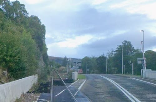
Stromeferry Railway Station seen from the West. [Google Streetview, April 2009]
A little further down the coast an approach road to the shore passes under the line by means of a low arch bridge. [Google Streetview, September 2025]
The line bridges the mouth of Abhainn Srath Ascaig. [Google Maps, June 2026]
It also crosses the mouth of a small lagoon. [Google Maps. May 2026]
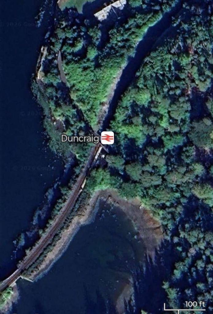
And then it enters Duncraig Railway Station and across the mouth of another lagoon. [Google Maps, June 2026]
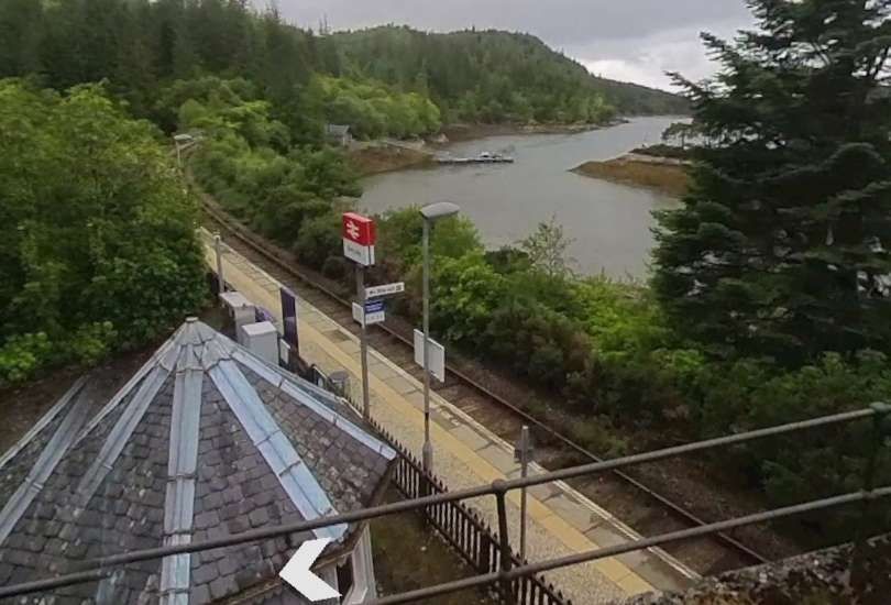
Duncraig Railway Station seen from the access road bridge. [Google Streetview, June 2025]
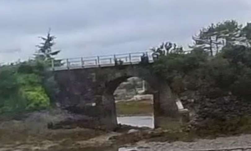
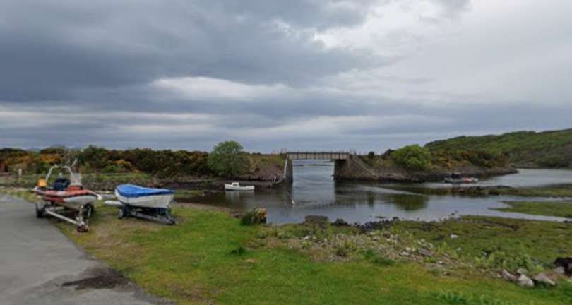
The arch bridge over the mouth of the lagoon to the Southwest of Duncraig Station. [Google Streetview, June 2025]
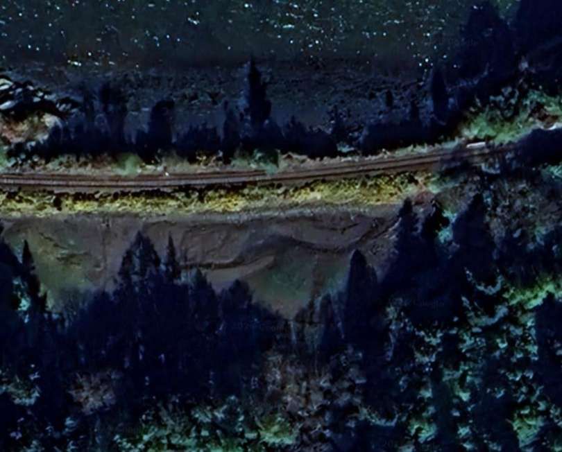
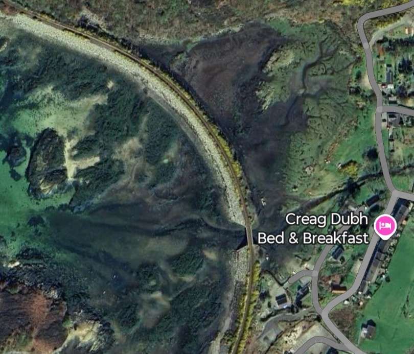
Another bridge (smaller this time) over the mouth of another lagoon formed by an embankment carrying the line. [Google Maps, June 2026]
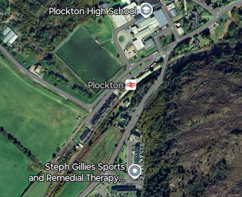
The next significant location along the line is Plockton Railway Station. [Google Maps, June 2026]
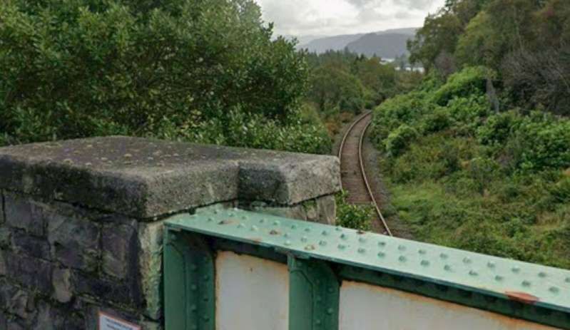
Looking back East along the line from the road bridge over the railway station. [Google Streetview, September 2025]
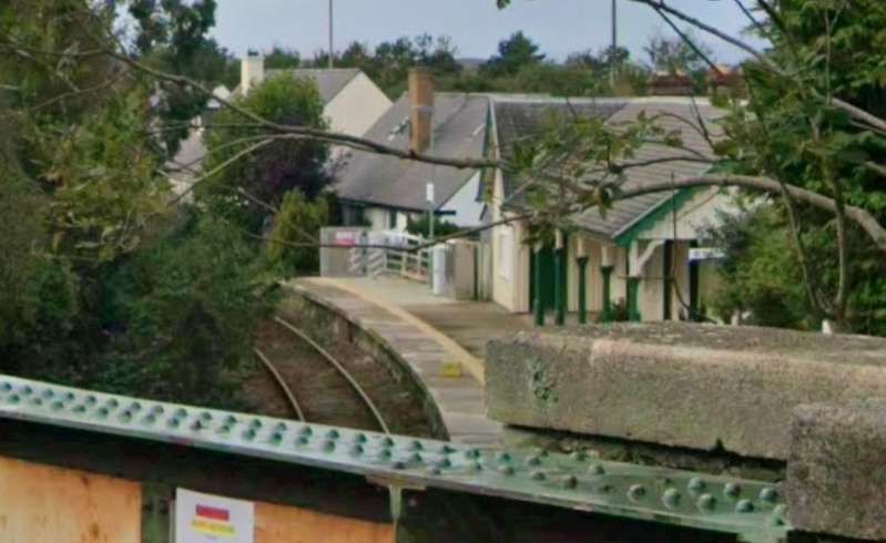
Plockton Railway Station as seen from the road bridge over the Northeast end of the station site. [Google Streetview, September 2025]
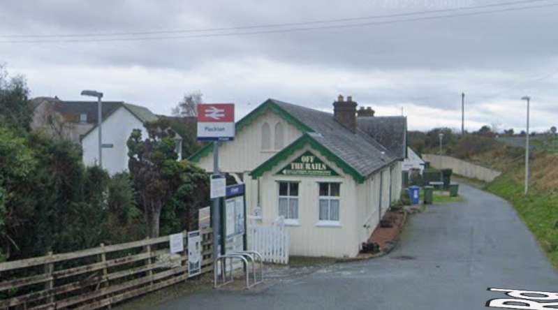
The Station building seen from the Northeast on Station Road. [Google Streetview, November 2021]
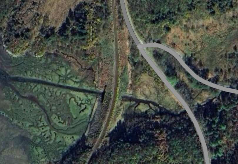
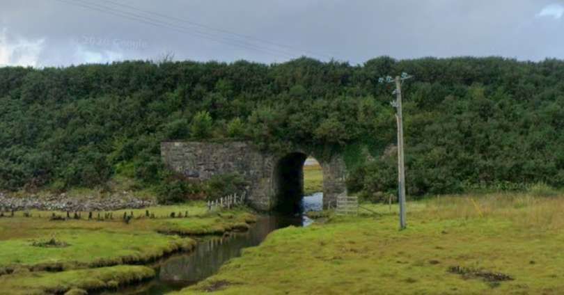
The line then crosses another stream as it flows into the loch. [Google Maps, June 2026]
The embankment at this location is relatively significant in height, the steam passes under the line via a stone-arched culvert. [Google Streetview, September 2025]
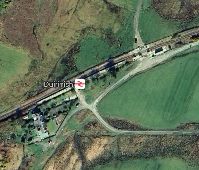
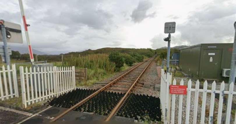
At Duirnish Railway Station the line crosses a minor road serving a few properties on the loch shore. [Google Maps, June 2026]
Looking Northeast from the road-crossing. [Google Streetview, September 2025]
Duirnish Railway Station seen from the Northeast. [Google Streetview, September 2025]
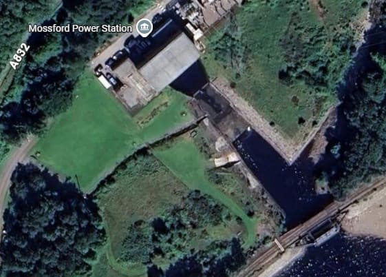
Shortly after passing through Duirnish Railway Station the line is bridged by another minor road. [Google Maps, June 2026]
Another embankment takes the line across an inlet from the loch. [Google Maps, June 2026]
A more substantial structure, this time a steel girder bridge spans the channel through this embankment. [Google Streetview, May 2026]
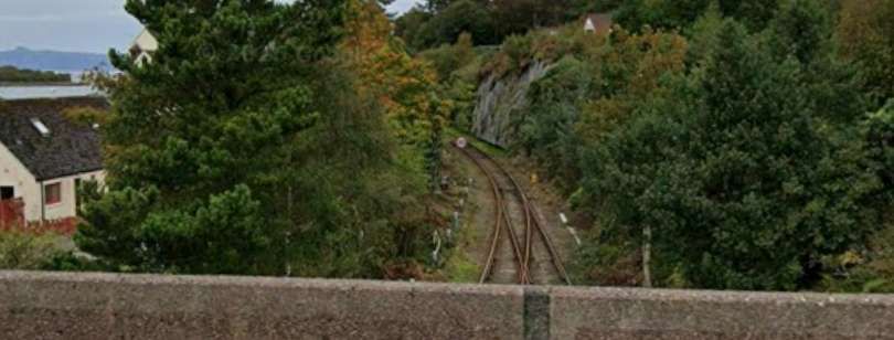
Looking North from Main Street Bridge. [Google Streetview, September 2025]
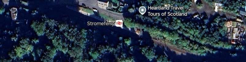
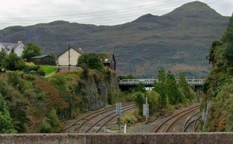
Looking South from Main Street Bridge. [Google Streetview, September 2025]
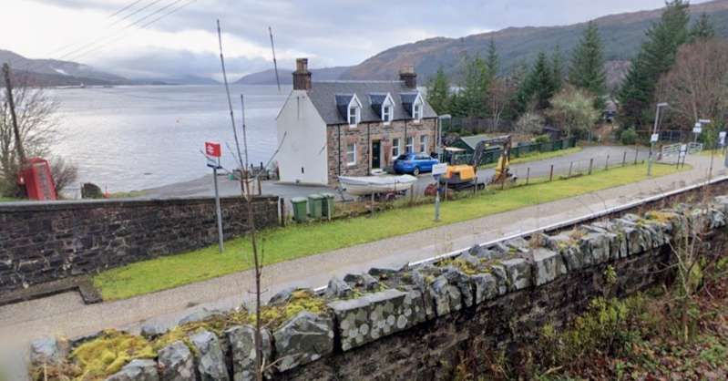
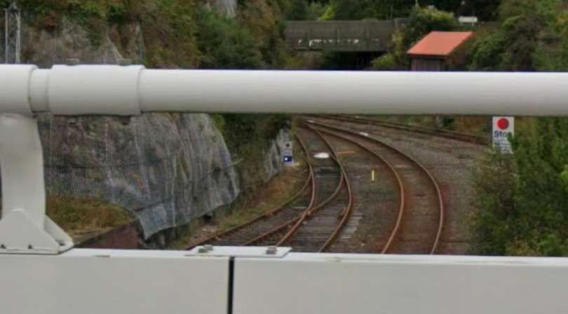
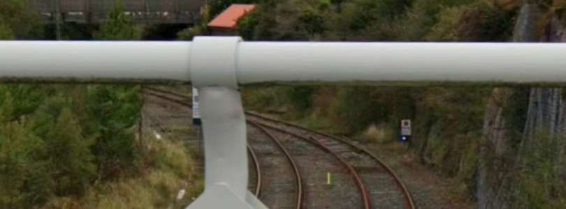
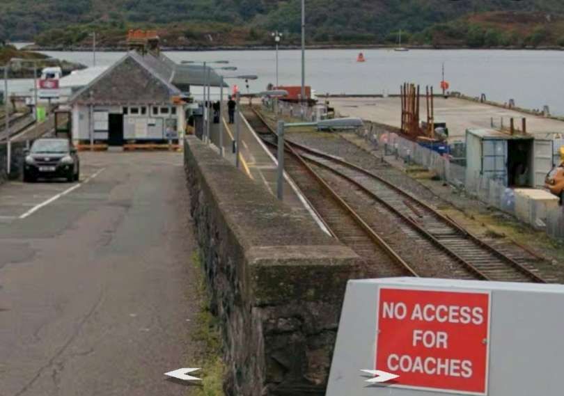
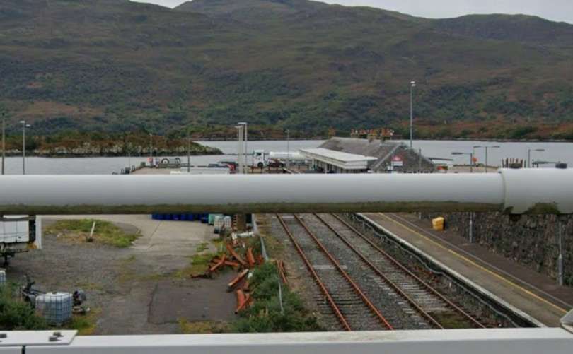
Two images looking North from The bridge carrying Station Road across the two arms of the railway entering Kyle Station. [Google Streetview, September 2025]
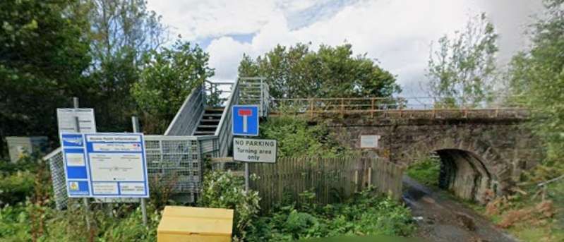
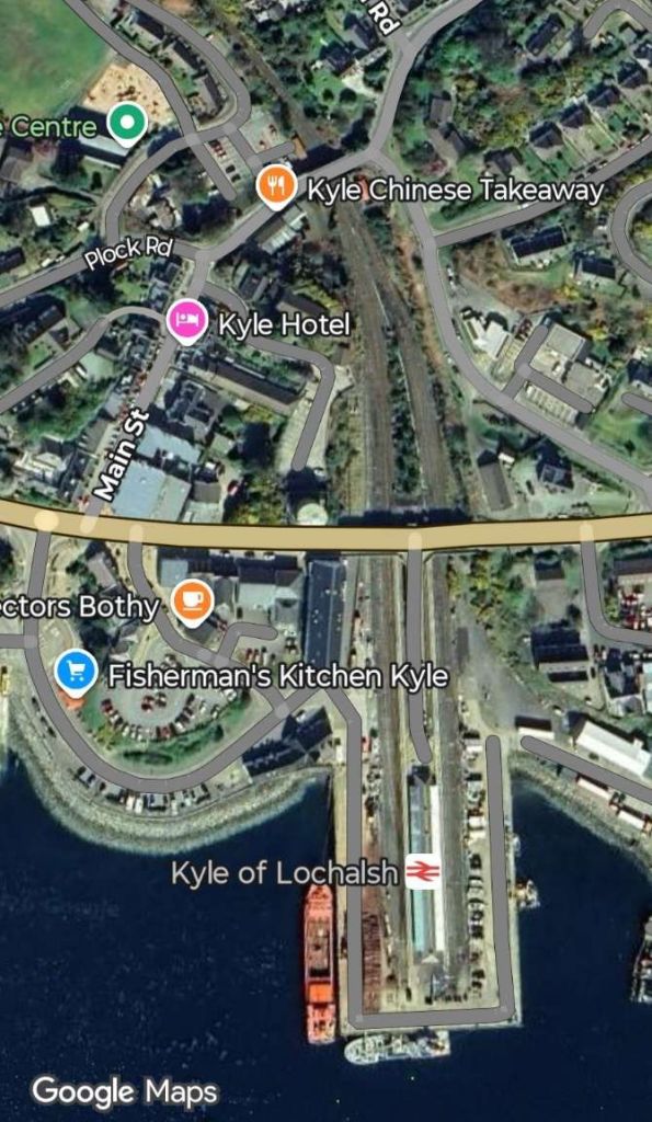
Looking South at the lines to the West of Kyle of Lochalsh Railway Station’s island platform. [Google Streetview, September 2025]
A view of the West side of the station in 1939. The ferry to Kyleakin is off scene to the right. A train is leaving for Dingwall and Inverness, with an ex-Highland 4-6-0, (c) Walter Dendy and licensed of reuse under a Creative Commons licence (CC BY-SA 2.0). [14]
Looking South at the lines to the East of Kyle of Lochalsh Railway Station’s island platform. [Google Streetview, September 2025]
Sheep ready to be loaded onto a train in the years between WWI and WWII. This is one of a number of images of the Kyle line held by the Museum in Kyle of Lochalsh station building. [15]

B. Ireland: Dublin to Wicklow

Irish Rail operates the Dublin Connolly to Arklow line. The 50 mile journey takes 1hr 45mins and costs only €8.85. There are 6 trains each day with 3 on Saturday and Sunday. Make sure to sit on the left.

Nicky Gardner writes:

“Londoners may be surprised to read that Dublin had commuter trains earlier than the UK capital. Ireland’s first railway ran from Westland Row to Kingstown (now Dún Laoghaire), a stretch of track that is now the prelude to a fine route that extends right down to Wexford and Rosslare in the south-east corner of Ireland. The spectacular coastal section just south of Dún Laoghaire is a remarkable piece of engineering as the railway cuts under Bray Head. It was designed by none other than Isambard Kingdom Brunel, and in many ways resembles his celebrated coastal railway at Dawlish in Devon.

“South of Bray Head, the railway hugs the coast, with fine views of the Wicklow Hills well off to the west and the Murrough Wetlands closer to hand. Coastal purists may opt to stop at Wicklow, but I recommend staying on board to enjoy a short foray through the hills and down the Vale of Avoca, with its lush woodland. Alight in Arklow where the railway regains the coast again.” [1: p76]

The line to Dún Laoghaire (and beyond) is part of the Dublin DART network. It is a fast, frequent, and electrified commuter rail system. Originally it ran only along the coast of the Irish Sea, connecting Malahide and Howth in north County Dublin through the city centre down to Greystones in County Wicklow. The DART servesd32 stations and consisted of 53 route kilometres of electrified railway (46 km (29 mi) double track, 7 km (4.3 mi) single), and carried to up 23 million passengers per year. [16] That original network ahs been expanded.
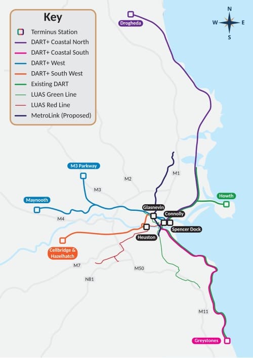
The adjacent image shows the expanded DART network with the original line shown in green. The route that Nicky Gardner highlights is the line shown Magenta and Green to the South of the centre of Dublin with its terminus at Greystones in Co. Wicklow. [16][17]
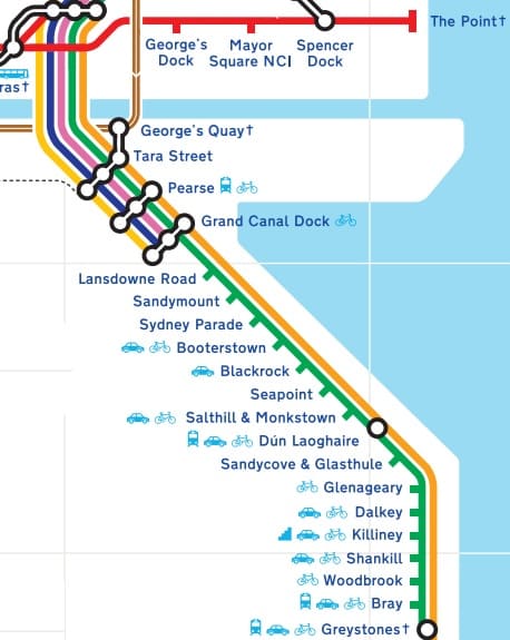
Leaving the centre of Dublin, the Southbound DART follows the coast closely all the way to Greystones. Each of the stations on the route South from Connolly Street Railway Station is shown on the extract from Dublin’s schematic transport map above. [17]
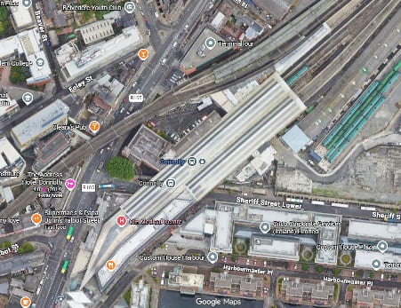
Connelly Street Railway Station – the DART platforms serving the line to the South are those at the top-right of the image, with the DART leaving the image on the lower left. The DART runs on a viaduct above the city streets. [Google Maps, June 2026]

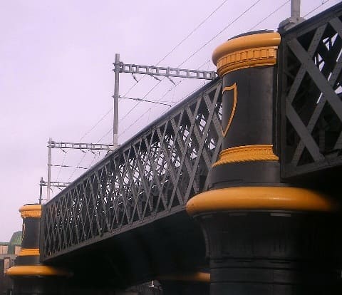
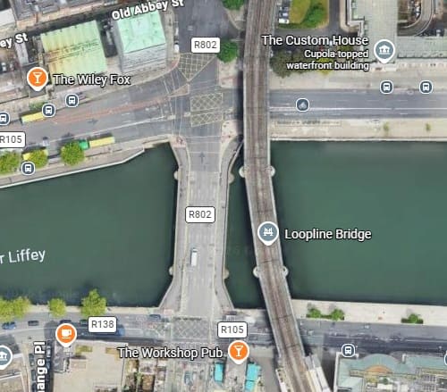
Leaving Connolly Street Station heading South, trains on the DART cross the River Liffey at high level The Bridge is known as the Cumann na mBan Bridge, this utilitarian steel-truss viaduct connects Connolly Station on the northside to Pearse Station on the southside. Designed by John Chaloner Smith (engineer to the Dublin, Wicklow and Wexford Railway), the bridge was built between 1889 and 1891. It consists of wrought iron lattice girders on a double row of piers with five spans. The viaduct is approximately six metres above street level and supports two railway tracks. [18]
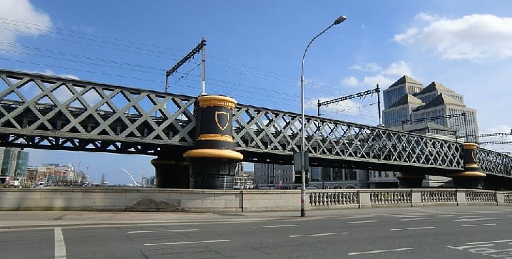
The bridge carrying the DART over the River Liffey (c) YvonneM and licensed for reuse under a Creative Commons Licence (CC BY-SA 3.0). [20]

A closer photograph of the bridge taken in 2008, (c) KGGucwa (Public Domain) [19] and (below) a satellite image showing the bridge. [Google Maps, June 2026]
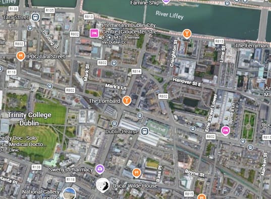
After crossing the River Liffey, the DART runs through Tara Station (top-left) and Pearce Station towards the bottom of the image at the centre. [Google Maps, June 2026]

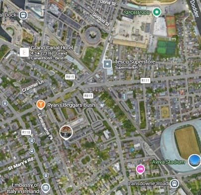
The line continues heading Southeast through Grand Canal Dock Station and Lansdowne Road Station. Just to the South East of Lansdowne Road Station the DART crosses the River Dodder (just off the image to the bottom-right). [Google Maps, June 2026]
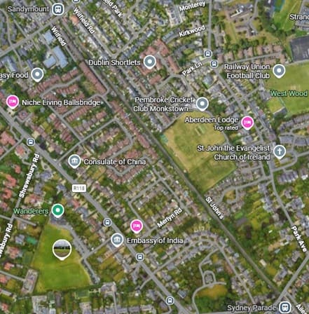
The next two stations are Sandymount (top-left) and Sydney Parade (bottom-right). [Google Maps, June 2026]
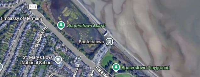
Well before DART trains reach Booterstown Railway Station, they are running Southeast along the coast.
[Google Maps, June 2026]
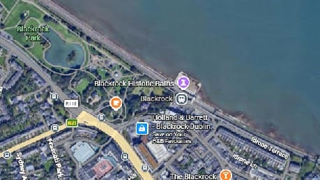
Blackroack Park is passed before Blackrock Railway Station, [Google Maps, June 2026]
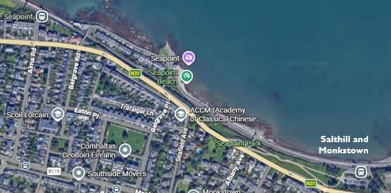
The next two stations are ‘Seapoint’ and ‘Salthill & Monkstown’. [Google Maps, June 2026]
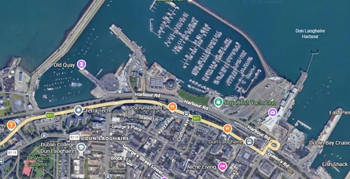
Next come Dún Laoghaire and its railway station. [Google Maps, June 2026]
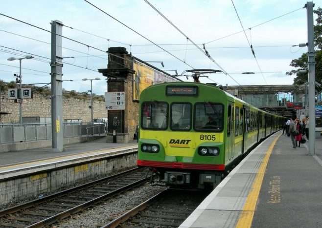
Looking Southeast along the platform used by trains for Dublin, © Paul Sharp. [21]
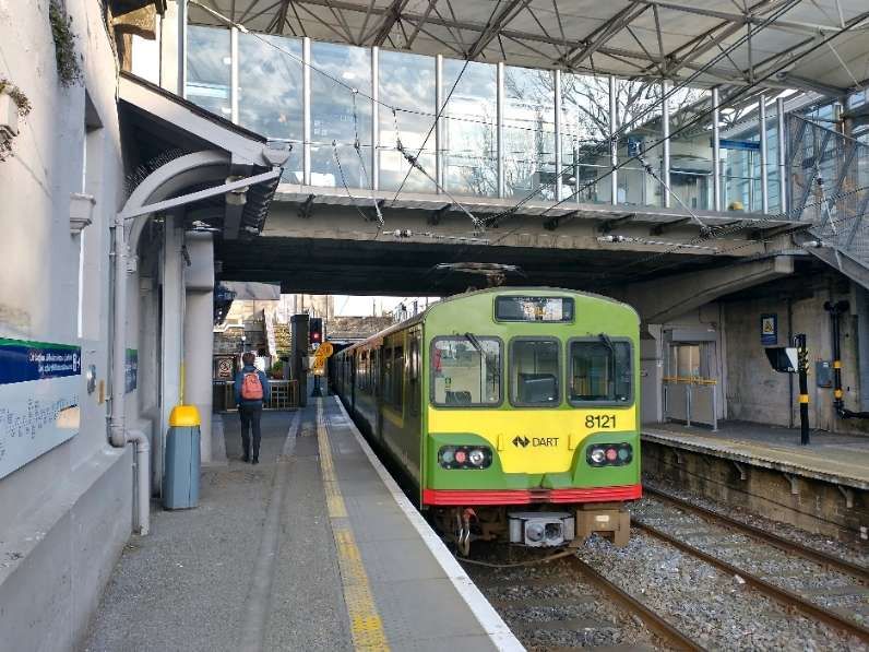
Looking Southeast along the platform used by Southbound trains, © MOs810 and licensed for reuse under a Creative Commons licence (CC BY 4.0). [22]

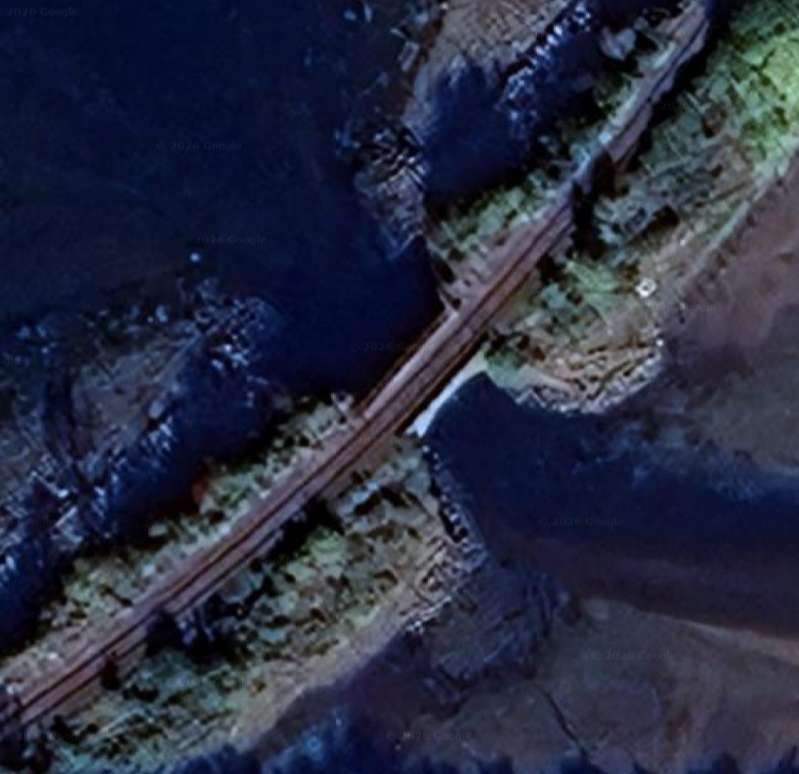
Nicky Gardner’s focus is on the length of the line to the South of Dún Laoghaire. Immediately to the Southeast of the Station the line passes in tunnel under the central sea front area of the town.
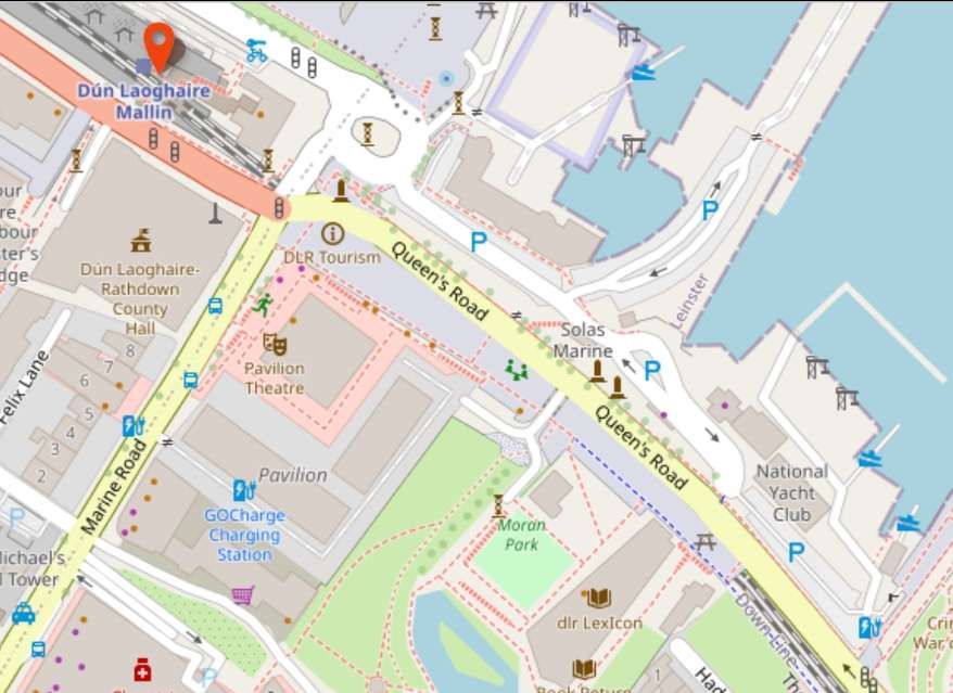
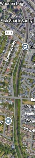
This OpenStreetMap extract shows the tunnel more clearly than some mapping. [21]

Leaving the tunnel to the South East of Dún Laoghaire, the line first head South and passes through Sandycove & Glasthule Station. [Google Maps, June 2026]
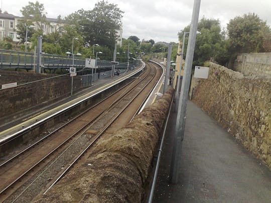
Sandy Cove and Glasthule Station facing South, (c) Autarch and licensed for reuse under a Creative Commons licence (CC BY-SA 3.0). [23]
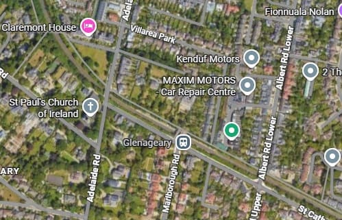
Turning Southeast the line continues through Glenageary Station. [Google Maps, June 2026]

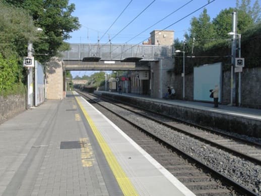
Glenageary Railway Station looking Southeast, (c) Doug Lee and licensed for reuse under a Creative Commons licence (CC BY-SA 2.0). [24]
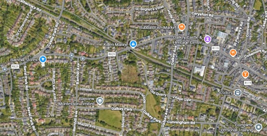
The line continues Southeast through Dalkey Railway Station. [Google Maps, June 2026]

Dalkey Railway Station seen from the Southwest, (c) Andrewrabbott and placed in the Public Domain. [25]
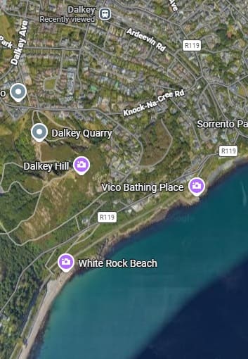
South of Dalkey the line turns through South to South West and follows the coast towards Killiney, shown below. [Google Maps, June 2026]
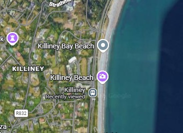
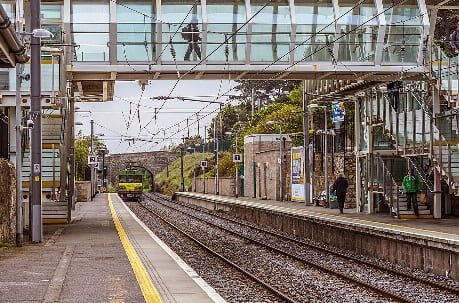
Killiney Station facing South, (c) William Murhy and licensed under a Creative Commons licence. (CC BY-SA 2.0). [26]

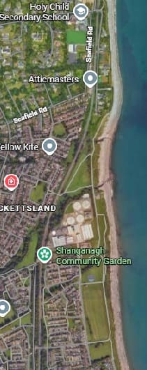
Further to the South the line passes through Shankill Railway Station heading South. [Google Maps, June 2026]
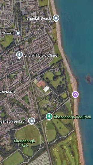
The line continues South from Shankill Railway Station through Woodbrook Railway Station and then Bray Daly Railway Station.
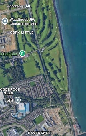
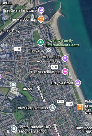
Woodbrook Station is at the top of the first of these images, Bray Daly in the top half of the second. [Google Maps, June 2026]
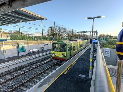
Woodbrook Railway Station looking South with a Northbound service sitting at the platform. [27]

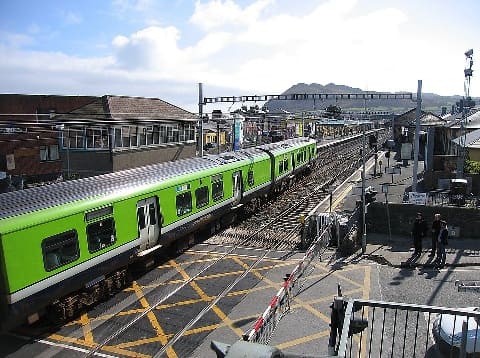
Bray Daly Railway Station looking South with an IE 29000 Class DMU heading South across the level-crossing at the North end of the Railway Station. [28]

South of Bray Daly Railway Station trains run through storage sidings which hold trains during off-peak hours to provide a peak hour service North through Dublin. As the line heads South through these sidings the line become a single track and heads East at first to run alongside the sea and then curving around Bray Head. The single-track line clings to steep cliffs, offering dramatic views of the Irish Sea as it weaves through historic tunnels. A series of photographs of this next length of the line can be found here. [29]

The route around the headland was surveyed and engineered by … Isambard Kingdom Brunel, who at the time was engaged with the construction of the Dublin & Wicklow Railway’s line from Bray to the county town of Wicklow further south. The section of line around the headland from Bray to Greystones was first opened in 1855. The line featured several engineering structures, including tunnels and several wooden trestle built viaducts. High maintenance costs and constant damage from the sea resulted in several deviations from the original 1855 route, the first of which involved the construction of new tunnel (No.1) in 1876, however a section of the 1855 alignment was retained as ‘Worthington Siding’ until 1882. The second occurred in 1879 between No.2 and 3 Tunnels, and the final deviation was implemented as late as 1917, which involved the construction of the longest tunnel (No.4) at 1,042 yards long at the southern end of the headland.” [29]

All of the deviations eliminated the Brunel’s viaducts and cliff sections, the line now taking on the name Brunel’s Folly due to the route’s reconstructions. Today there are four tunnels in total, including some smaller nameless ones. A well maintained pathway between Bray and Greystones overlooks the majority of the railway line.” [29]
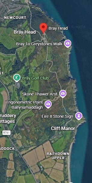
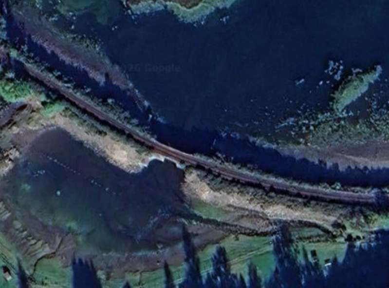
Bray Head: the railway ran close to the sea around the headland. [Google Maps, June 2026][30]
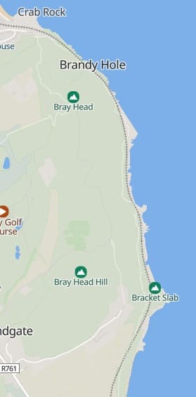
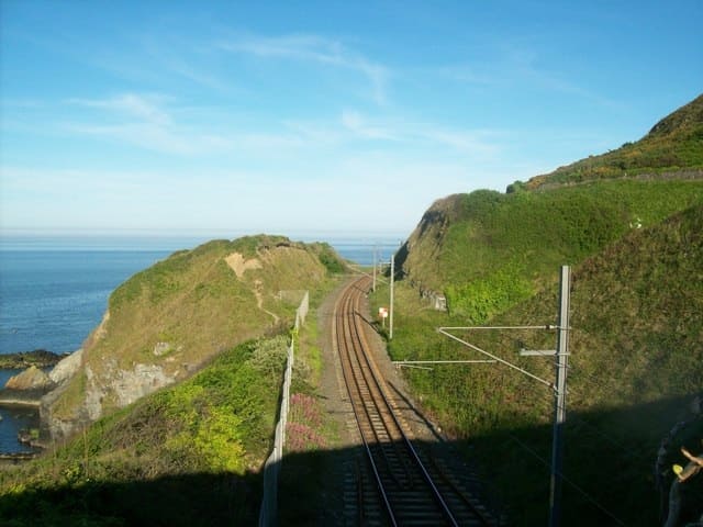
The railway around Bray Head, (c) Stuart Fisher (2008) and licensed for reuse under a Creative Commons licence (CC BY_SA 2.0). [31]

The railway is somewhat less dramatically sited as it heads further South, through Greystones and on to Wicklow. [Google Maps, June 2026]
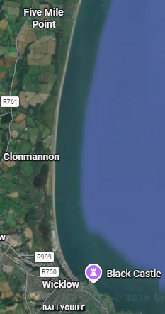
Perhaps it is worth noting that this journey only costs €8.85 single or €17.70 return!

C. Germany: Over the Sea to Sylt

Nicky Gardner suggests that it is best to sit on the left of the train as it leaves Husum to travel to Keitum. A 44 mile journey will cost €21.60 single and take an hour to complete. Trains on the Marschbahn line run hourly and are operated by Deutsche Bahn (DB). [32]

She writes:

“One cannot fail to be impressed by the determination of the Weimar Republic’s engineers and planners who needed to build a railway to Sylt. This sandy outpost of German territory is the largest of the North Frisian Islands. The traditional route to Sylt relied on a ferry from a mainland port on territory which was ceded to Denmark after the first world war. So a causeway was constructed across the Wadden Sea to reach Sylt. It opened in 1927, and a century later the Hindenburg causeway is still car-free – and since mid-April this year it is for the very first time possible to ride a posh ICE train over the sea to Sylt.

“Leaving Husum, a coastal town shaped by the herring trade, we sweep over the town’s harbour on a high bridge. There’s a cluster of fishing boats at the quayside below. Then we glide north over marshlands and meadows, all protected by high dykes to prevent the area from being inundated.

“From the train, you get a real feel for these landscapes with their distant horizons. But the sea seems far away, held at bay by dykes. That changes after Klanxbüll, where the railway turns west and crosses salty mudflats to reach the open sea. Check tide tables and make this journey at high tide – ideally on a stormy day. In such conditions, this is an unforgettable experience. Alight at Keitum, to my mind the nicest village on Sylt. From the station, it is an easy stroll into the village with several cosy cafes and a feast of fine Frisian thatch and gables.” [1: p76-77]

The line to Sylt runs North out of Hamburg. As the train glides gently through the flat expanse of Schleswig-Holstein, picturesque views of green meadows and the Kiel Canal open up. Shortly before arrival, the route offers an unforgettable panorama: the Wadden Sea stretches out before you with its characteristic tidal creeks. [32]
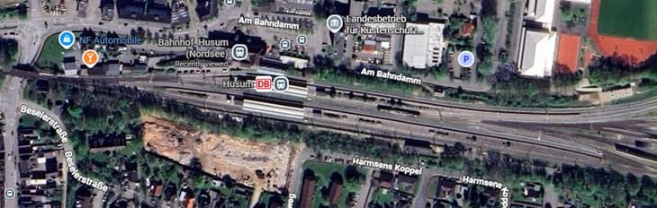
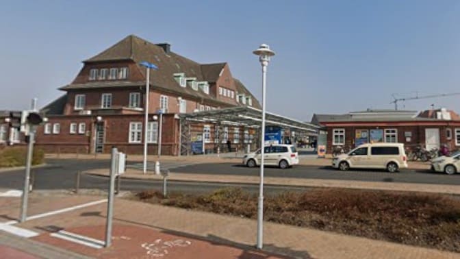
Husum (Nordsee) Railway Station. [Google Maps, June 2026]
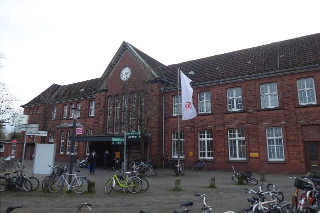
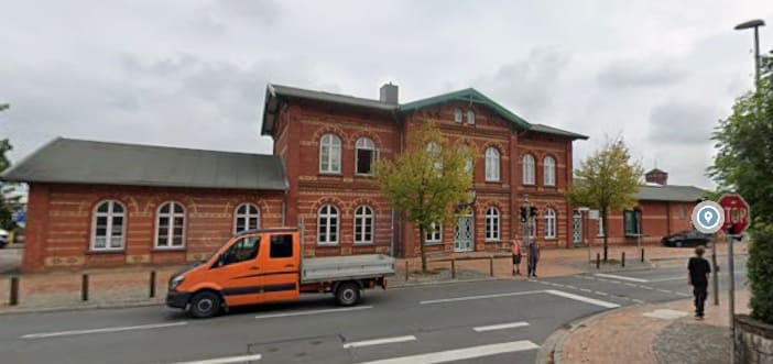
Husum Railway Station Building is a substantial structure, (c) Mef.ellingen and licensed for reuse under a Creative Commons licence (CC BY-SA 4.0). [34]
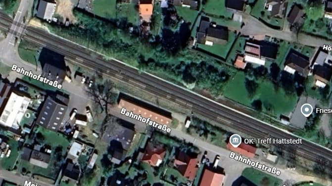
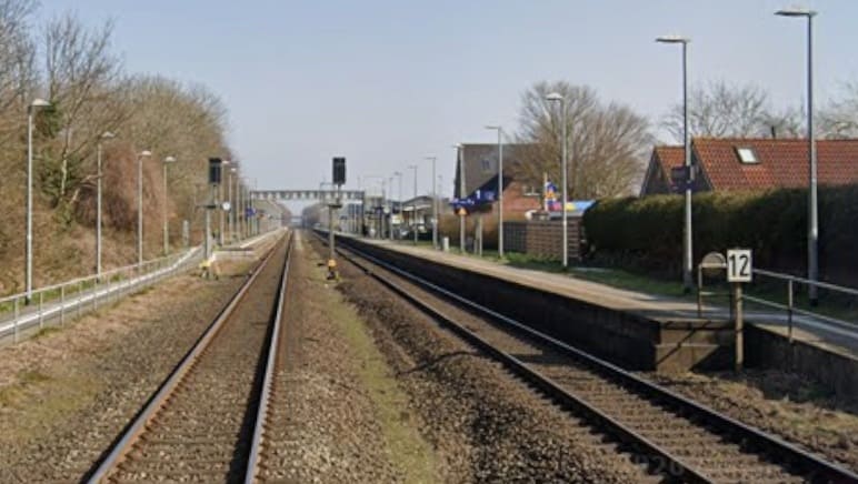
Hattstedt Railway Station. [Google maps, June 2026]
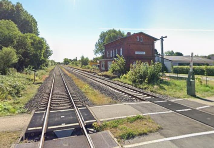
Hattstedt Station seen from the level-crossing at the West end of the station site.
[Google Streetview, August 2022]

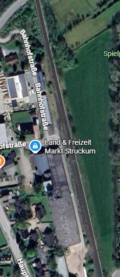
The next station on the line is in Struckum – although, as can be seen below it appears no longer to be in use as a station. [Google Maps, June 2026]
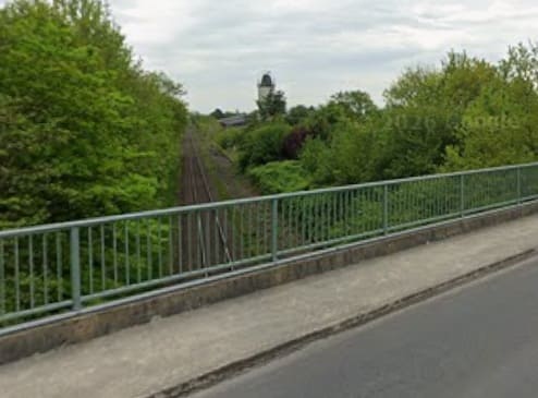
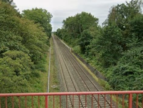
Looking South through the site of the station from Brückenstraße which bridges the line just off the top of the satellite image of the site. [Google Streetview, May 2022]
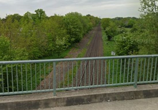
Looking North from the bridge on Brückenstraße. [Google Streetview, May 2022]

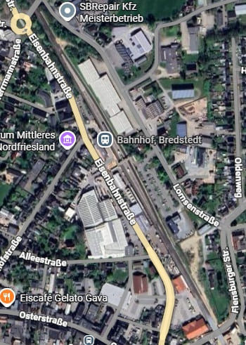
The next station is only a short distance further North in Bredstedt. [Google Maps, June 2026]
Bredstedt Railway Station building seen from the West [Google Streetview, September 2023]
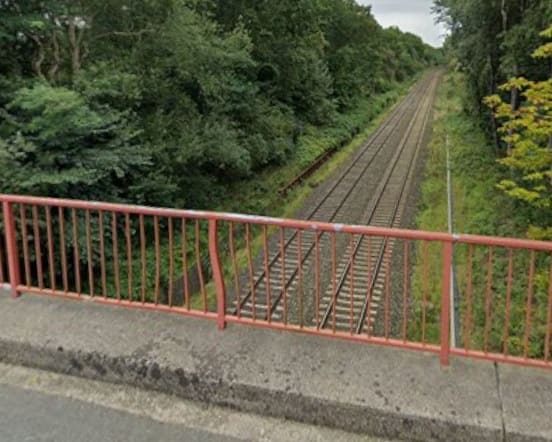
Theis view looks back towards Bredstedt from the bridge carrying Margarethenberg over the line. [Google Streetview, September 2023]
Turning through 180°, this view shows the line heading North towards Langenhorn.
[Google Streetview, September 2023]
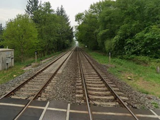
Looking back South towards Bredstedt from the level-crossing at Beekensweg.
[Google Streetview, May 2022]
The line ahead to the North from the same level-crossing. [Google Streetview, May 2022]

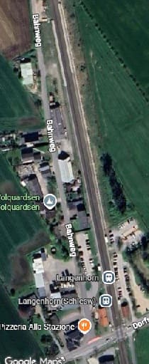
The next station is at Langenhorn. [Google Maps, June 2026]
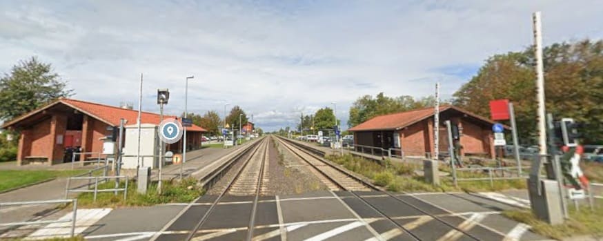
Langenhorn Railway Station seen from the level-crossing at its South end. [Google Streetview, September 2023]

The line continues on a straight alignment just to the West of North. The next image shows the view North along the line at the Dorpstraat level-crossing in Bargum.
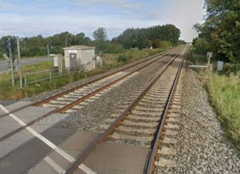
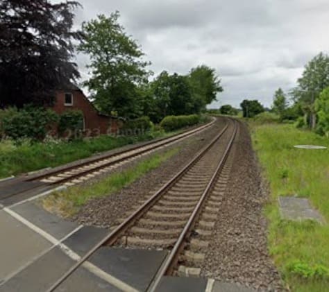
Looking North at the Dorpstraat Level-Crossing in Bargum. [Google Streetview, September 2023]

The view North from the railway-crossing on Dorfstraße at Stedesand. [Google Streetview, June 2022]
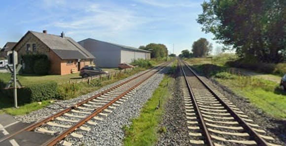
Looking Southeast from the level-crossing on Dorfstraße in Risum-Lindholm. [Google Streetview, September 2023]
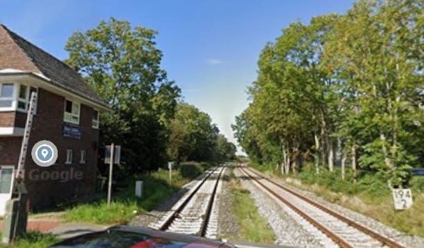
Looking Northwest at the same level-crossing. [Google Streetview, September 2023]
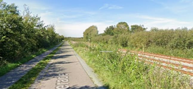
Further Northwest, this is the view along Legerade with the railway alongside.
[Google Streetview, September 2023]

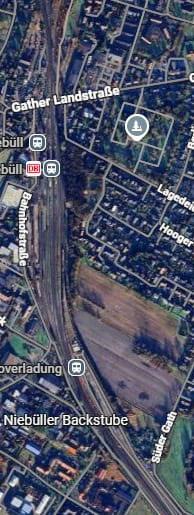
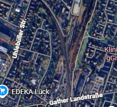
The next railway station at Niebüll is in two parts. There is the normal passenger facility towards the top of the adjacent satellite image. To the South of this station is the loading point for the SyltShuttle at Niebüll – Niebüll Autoverladung. It is the point that vehicles travelling to Sylt are loaded onto the shuttle trains – ‘Blue’ or ‘Red’ [Google Maps, June 2026]
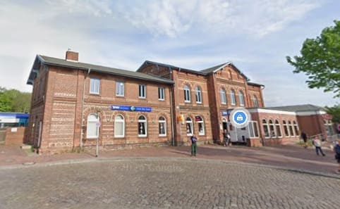
Niebull Railway Station building seen from the West. [Google Streetview, May 2022]
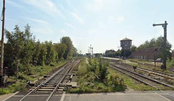
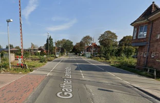
Looing East across the level-crossing on Gather Landstraße at the North end of the Railway Station site. [Google Streetview, September 2023]
Looking Southinto the Station site from the crossing at Gather Landstraße [Google Streetview, September 2023]

North of the Railway Station in Niebull a junction divides the single line heading North from the line serving Sylt which head Northwest. [Google Maps, June 2026]
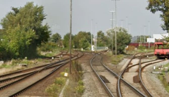
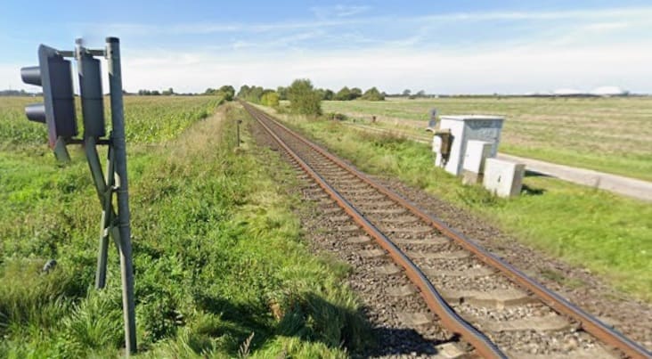
The line to Sult heads to the left (Northwest) after crossing Gather Landstraße [Google Streetview, September 2023]
Looking Northwest from the level-crossing at Süderende. [Google Streetview, September 2023]
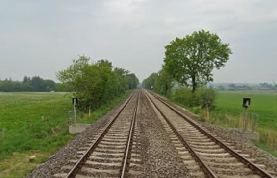
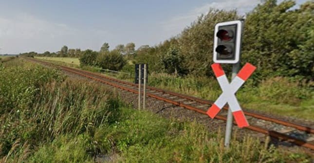
The w ide-open, expansive and flat countryside is once again emphasised by this view North from the level-crossing at Süderdeich. [Google Streetview, September 2023]

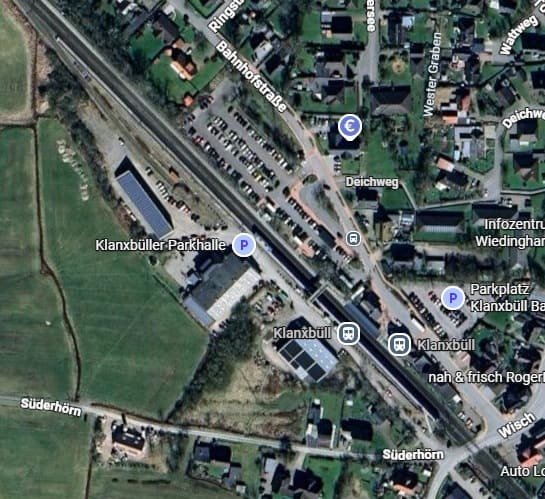
Klanxbüll, Schleswig-Holstein is the final station on the mainland before the embankment/causeway that takes the railway across the Wadden Sea. [Google Maps, June 2026]
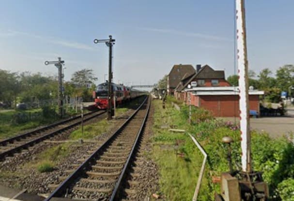
Klanxbüll, Schleswig-Holstein as seen from the level-crossing at the Southeast end of the station site. [Google Streetview, September 2023]
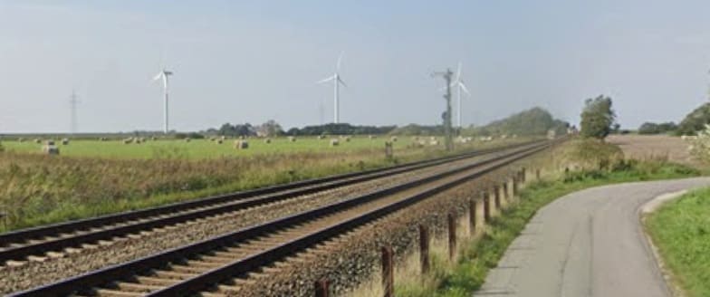
Wide open flat lands on the approach to the Wadden Sea. [Google Streetview, September 2023]

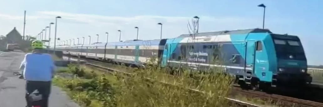
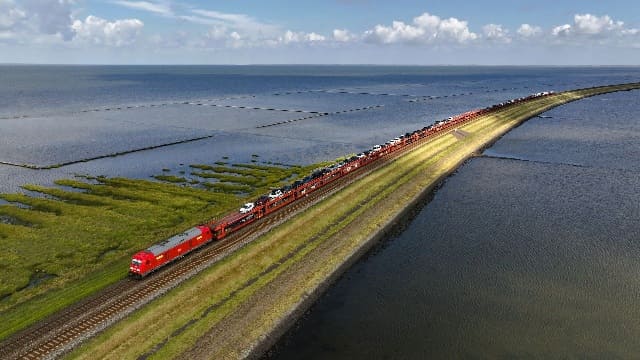
A drone’s eye view of the shuttle service operated by DB (the Red Train) which crosses the embankment leading to Sylt. [35]
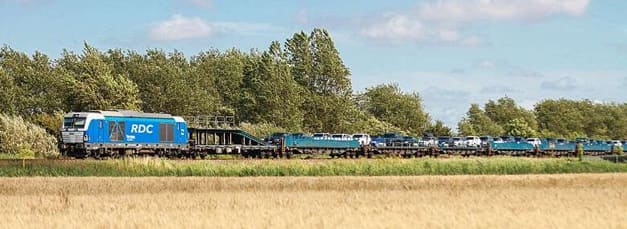
The Blue Train covers the same route – it is operated by RDC Deutschland (Railroad Development Corporation). [36]

A drone’s eye view of the shuttle service operated by DB which crosses the embankment leading to Sylt. [35]
The first railway station on Sylt is Morsum. [Google Maps, June 2026]
Morsum Railway Station seen from the level-crossing at the West end of the station site.
[Google Streetview, March 2022]
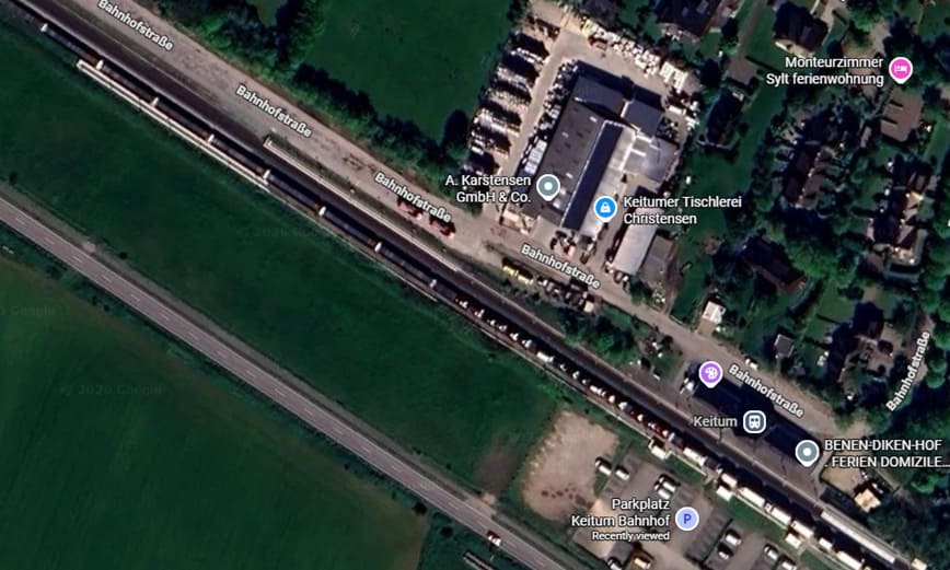
Keitum Railway Station. [Google Maps, June 2026]
Train sitting at Keitum Railway Station enroute to Westerland Railway Station. [Google Streetview, August 2025]

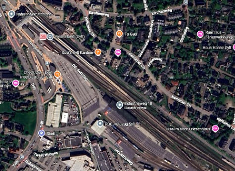
Westerland Railway Station on Sylt. Car trains unload and load here. [Google Maps, June 2026][Google Streetview, March 2022]
Westerland is the end of the line and the last kilometre or two from Keitum to Westerland are not particularly scenic. It seems as though Nicky Gardner is happy to get off the train at Keitum. The flat landscape and the significant crossing of the Wadden Sea by train are positive attributes of a line, that to me at least, seems to be less than Nicky Garner promises it will be.

The next article in this series will be the last. It focuses on a line in Northern Spain and a line in Southern Italy.

References

  1. Nicky Gardner; Over Land & Sea: Magical Views and Sea-Hugging Routes on Europe’s Best Coastal Train Lines; in Saturday (the Guardian Magazine), 23rd May 2026, p76-77.
  2. https://commons.wikimedia.org/wiki/File:Strathpeffer_1885.png, accessed in March 2025.
  3. https://en.wikipedia.org/wiki/Garve_railway_station, accessed on 4th June 2026.
  4. https://www.ambaile.org.uk/asset/27725, accessed on 4th June 2026.
  5. https://www.kweimar.de/Bilder_XML.php?ket=HL947#nowhere, accessed on 4th June 2026.
  6. https://en.wikipedia.org/wiki/Glencarron_Platform_railway_station, accessed on 5th June 2026.
  7. https://www.geograph.org.uk/photo/4413959, 5th June 2026.
  8. https://en.wikipedia.org/wiki/File:Achnashellach_Station_Nov2019.jpeg, accessed on 5th June 2026.
  9. https://www.geograph.org.uk/photo/7531766, accessed on 5th June 2026.
  10. https://www.facebook.com/share/p/1DDYwfmA2y, accessed on 5th June 2026.
  11. https://www.railscot.co.uk/locations/A/Avalanche_Shelter, accessed on 5th June 2026.
  12. https://www.networkrailmediacentre.co.uk/news/new-system-signals-changes-for-stromeferry-motorists, accessed on 5th June 2026.
  13. https://www.sabre-roads.org.uk/wiki/A890/route, accessed on 6th June 2026.
  14. https://www.geograph.org.uk/photo/5128618, accessed on 7th June 2026.
  15. https://www.kylestationmuseum.org/about/the-kyle-line, accessed on 7th June 2026.
  16. https://en.wikipedia.org/wiki/Dublin_Area_Rapid_Transit, accessed on 7th June 2026.
  17. https://www.dublinpublictransport.ie/dublin-train-map, accessed on 7th June 2026.
  18. https://en.wikipedia.org/wiki/Loopline_Bridge, accessed on 7th June 2026.
  19. https://commons.wikimedia.org/wiki/File:Butt-railway-bridge.JPG, accessed on 7th June 2026.
  20. https://commons.wikimedia.org/wiki/File:Loopline_Bridge.JPG, accessed on 7th June 2026.
  21. https://www.ouririshheritage.org/content/knowyour5k/dun-laoghaire-mallin-railway-station-3, accessed on 7th June 2026.
  22. https://en.wikipedia.org/wiki/D%C3%BAn_Laoghaire_railway_station#/media/File%3ADART_Dublin_train_2023_(3).jpg,, accessed on 7th June 2026.
  23. https://en.wikipedia.org/wiki/Sandycove_and_Glasthule_railway_station, accessed on 8th June 2026.
  24. https://commons.wikimedia.org/wiki/File:Glenageary5.jpg, accessed on 8th June 2026.
  25. https://commons.wikimedia.org/wiki/File:DalkeyRailwayStation.JPG, accessed on 8th June 2026.
  26. https://commons.wikimedia.org/wiki/File:Killiney_station.jpg, accessed on 8th June 2026.
  27. https://en.wikipedia.org/wiki/Woodbrook_railway_station#/media/File:Woodbrook_Station,_Northbound_DART_02.jpg, accessed on 8th June 2026.
  28. https://en.wikipedia.org/wiki/Bray_Daly_railway_station, accessed on 8th June 2026.
  29. http://eiretrains.com/Photo_Gallery/Railway%20Stations%20B/Bray%20Head/IrishRailwayStations.html, accessed on 8th June 2026.
  30. https://mapcarta.com/37562730/Map, accessed on 8th June 2026.
  31. https://www.geograph.org.uk/photo/1323345, accessed on 8th June 2026.
  32. https://int.bahn.de, accessed on 8th June 2026.
  33. https://www.sylt.de/en/anreise-mobilitaet/bahnanreise, accessed on 8th June 2026.
  34. https://en.wikipedia.org/wiki/Husum_station_(Germany)#/media/File:P1020943_Bahnhof_Husum_2019.jpg, accessed on 9th June 2026.
The Modern Tramway – March 1951 – The Hill of Howth Tramway

Following on from an article written in May 2023, after a visit to Howth, which can be read here, [1] I found an article about the Tramway by C. L. Fry in the March 1951 issue of The Modern Tramway. [2]

The May 2023 article covers the route of the line in some detail.

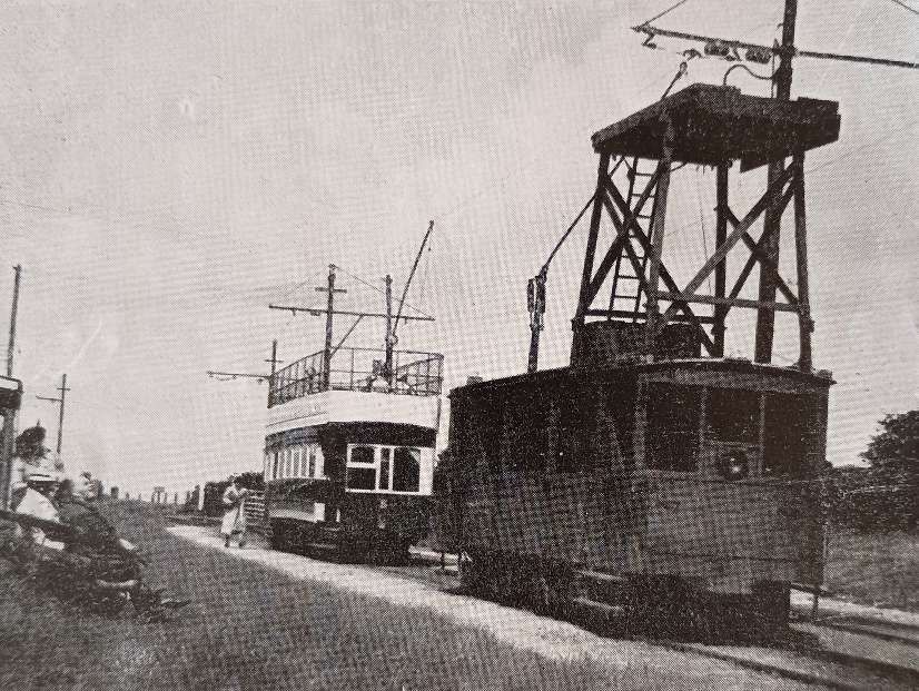
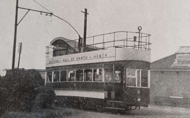
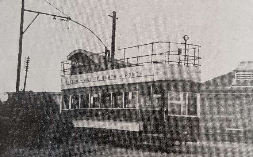
The featured image for this article is a Standard Double-deck tramcar sitting at Sutton Station on the Hill of Howth Tramway © F. Jeffares, Public Domain. [2: p50]

C. L. Fry wrote:

“A very delightful summer outing can be had by availing oneself of the excellent service operated by the Great Northern Railway (Ireland) on its Dublin local line from Amiens Street Station to Howth. Perhaps the best way would be to leave the train at Sutton Station and there board a G.N.R. Hill of Howth tram which leaves Sutton Station, and winds its way round and over the Hill. The tramway at its summit reaches a height of 350 feet above sea level. From the top of the Hill, and the tramway goes almost to the top (560 ft.) it is possible to see the Mountains of Mourne on the north side, the Wicklow Hills on the south side, and the wonderful view of Dublin Bay and Bray Head. The view at night time, with the reflection of millions of lights glittering in the sea across the bay is equally marvellous. For 1s. 6d., a ticket may be purchased to include a trip by railcar to the tramway terminus and then by the tramway round and over the Head, and back to Dublin by diesel railcar.” [2: p50]

A repeat of the featured image for this article which shows a Standard Double-deck tramcar sitting at Sutton Station on the Hill of Howth Tramway © F. Jeffares, Public Domain. [2: p50]

Fry continued:

“The tramway, which is single line throughout, runs mainly in a reserved right-of-way, about one-third of this being on the side of the road. The track is laid with standard type bull head rails, with the wooden keys on the inside so that it is only necessary for the milesman to walk the line once to see if all the keys are tight. There is, however, about a half-mile of standard tramway grooved rail from Sutton Cross to the foreshore near St. Finton’s – one of the first calling places after Sutton Cross. This track, of course, is sunk in the carriageway. There are many passing-places on the line, and each one of these is signalled to the next passing-place by the driver, thereby preventing a car from the opposite direction entering the single line section, though cars may follow in the same section. The line is 5.25 miles long and starts from the railway station at Sutton and ends at Howth railway station.

“It is at Sutton that the car sheds, fitting shop, and former power station are situated (power is now taken from the Electricity Supply Board); the voltage is 550 d.c. The car shed has three lines side by side and a point of interest is the fact that there is a 3-way overhead frog with a moveable tongue, which is hand-operated from the base of the post, so that the trolley will take the correct wire to go into the sheds.

“This tramway was opened on 7th June 1901, and is now the only electric tramway in the Irish Republic. Within a couple of years of the opening day, the Company had eleven bogie tramcars, all of which are still working more or less in the same condition as when first built. Nos. 1-8 were built by the Brush Engineering Co., are mounted on Brill maximum-traction trucks, and have vestibuled platforms. They are 31ft. 4in. long by 7ft. 6in. wide, and carry 30 passengers in the saloon, and 37 on the upper deck. They are painted blue and cream. Nos. 9 and 10 were built by Milnes, are rather larger, and are mounted on Peckham maximum-traction trucks. They are painted in the standard mahogany colours of the G.N.R.(I) carriages. These cars are unusual, insofar as they have a combination of ‘knife-board’ and transverse seats downstairs, to enable people to admire the beautiful scenery to be seen on this journey. Seating capacity is 33 in the saloon, and 40 on the upper deck: the cars have vestibule ends, and are 33ft. long and 7ft. 6in. wide. All ten cars on this tramway have open tops. The trolley poles are mounted on the extreme side (the sea-side) of the tramcar. Car No. 11 is a works vehicle; it is really a wagon with a tower at one end used for repairing the overhead. The trolley in this case is mounted on the centre line of the roof at the opposite end from the tower. This car is mounted on Brill maximum traction trucks, and is 24ft. 3in. long and 7ft. 3in. wide.” [2: p50-51]

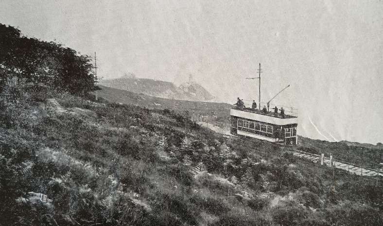
A tramcar ascending Howth Hill, © F. Jeffares, Public Domain. [2: p51]

“All the passenger trams are fitted with air brakes, which are charged with compressed air to 75lb. per square inch at the car sheds every morning. They also have regenerative and hand brakes for control on the very steep hills on which they operate, the gradings being as steep as 1 in 16.25. Nos. 1-8 are fitted with electric heaters downstairs.

“While the Dublin United Tramway [D. U. T.] Company’s line was operating to Howth, there were two extremely unusual features:

“(1) Although both tramways were built to the standard Irish railway gauge of 5ft. 3in. and at Sutton Cross cars of the G.N.R. tramways crossed the D.U.T. on the same level, there was no point or other physical connection to enable cars of the two Companies to interchange. The G.N.R. single overhead wire was fitted with insulators on both sides of the two D.U.T. overhead wires at this crossing, the actual length of G.N.R.(I) wire taking D.U.T. current being about 6ft.

“(2) At Howth the G.N.R. Tramway again crossed the D.U.T., but this time on an over bridge, the G.N.R.(I) descending to the level of the D.U.T. Again there was no physical connection.

“Incidentally, of course, this is the level of the railway station at Howth. The tramway is on one side of the railway platform. The railway journey from Sutton is but 2 miles” [2: p51-52]

This image shows the service car in use at the summit of the line, with a passenger car behind, © F. Jeffares, Public Domain. [2: p52]

“Another item of interest in the fact that the overhead consists of a single wire from the Summit to Howth while it is double all the way (with the exception of the old D.U.T. crossing already referred to) in the other direction to Sutton.

“The tramway has, on the whole, been very well maintained by the G.N.R. Extensive renewals of track have taken place quite recently and overhead posts which have corroded owing to the action of sea air have had steel bars inserted and have been filled with concrete.

Some ten years or so ago buses were operated for a short time but were withdrawn as the tramway service was more suitable owing to the hilly nature of the line. Today, the position unfortunately is rather uncertain, and while a splendid service is operated in the summer, the number of passengers using the service in the winter enables only a skeleton service to be operated.

“Regarding the future of this delightful tramway, one thing is certain, that Mr. G. B. Howden, General Manager, G.N.R.(I) and also General Manager of Coras Iompair Eireann, who has done his best to maintain every branch line, will, I have no doubt, do all in his power to keep this line open as long as traffic warrants it.” [2: p52]

References

  1. https://rogerfarnworth.com/2023/05/14/the-hill-of-howth-tramway
  2. C. L. Fry; The Hill of Howth Tramway; in The Modern Tramway, Volume 14, No. 159, March 1951, p50-52.

The Cavan and Leitrim Railway at Dromod again. …

It has taken me a while to get round to completing this article! ….

Saturday 6th May 2023 was the first time that I had been able to visit the Cavan & Leitrim at Dromod. A planned visit in 2020 was prevented by the COVID-19 pandemic and the associated lockdown which was enforced for our safety.

We were en-route, on 6th May, from Co. Donegal to Dublin after two great weeks following the route of the Burtonport Extension Railway between Burtonport and Letterkenny.

I had been intending to drop in to see the preservation society at Dromod either on the way to Co. Donegal or on the return journey. The second option worked in best with our travel arrangements.

My wife granted me an hour or so of freedom to explore the site at Dromod. Jo decided that she’d enjoy reading her novel more than traipsing around another railway related site. She had, after all, spent a good bit of her holiday walking along the track bed of abandoned railways.

My previous articles about Dromod and the first length of the Cavan & Leitrim Railway from Dromod to …. can be found on these links:

https://wordpress.com/post/rogerfarnworth.com/18449, and

https://wordpress.com/post/rogerfarnworth.com/19957.

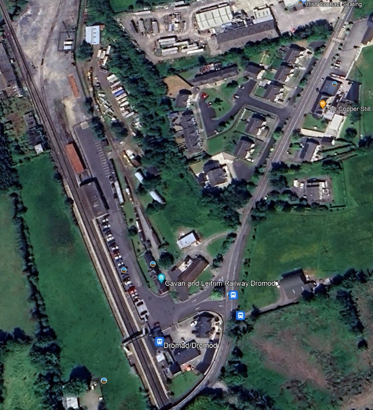
The first image below shows the site of the two stations at Dromod as they appear on Google Earth’s satellite imagery.

Dromod’s railway stations as they appear on Google Earth. [Google Earth, 18th July 2023]

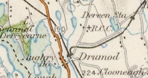
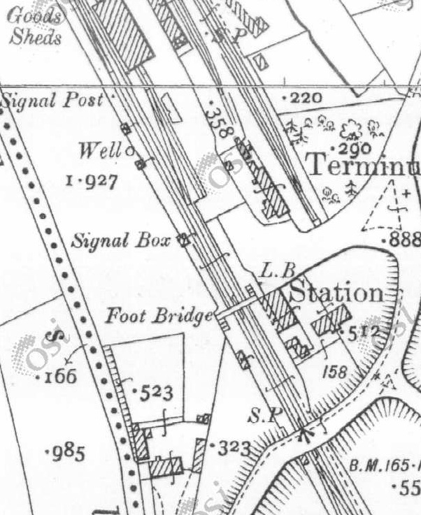
Drumod/Dromod on the 1″ OSi mapping of the mid-20th century. The Iarnrod Eireann Line runs from the centre-bottom of the image in a Northwest direction. The Cavan & Leitrim Railway curved away to the East from its terminus close to the mainline station.

Dromod Iarnrod Eireann Railway Station seen from the road-bridge over the approach to the station from the South. The Cavan & Leitrim Station building is hidden behind the mainline building. The Goods Shed associated with the mainline station can be seen beyond the footbridge sitting at the end of the platform. [Google Streetview, September 2019]
A platform level view of the Iarnrod Eireann Station looking North. The Cavan & Leitrim Railway Station sits behind the Station buildings in this view. Just visible above the train is the roofline of the mainline Goods Shed. [1]
The Station Approach seen from the East. The Cavan & Leitrim Railway terminus can be seen on the right of the picture, the Iarnrod Eireann Station building is on the left. [Google Streetview, May 2009]
The Cavan & Leitrim Railway terminus buildings at Dromod as seen from the Station Approach to the mainline station. The platform face was approximately on the line of the picket fence.[Goggle Streetview, May 2009]
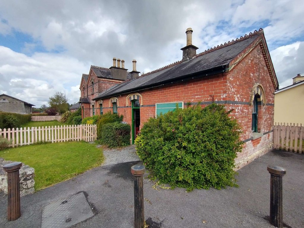
The street side approach to the station building. The photograph is taken looking North. [My photograph, 6th May 2023]
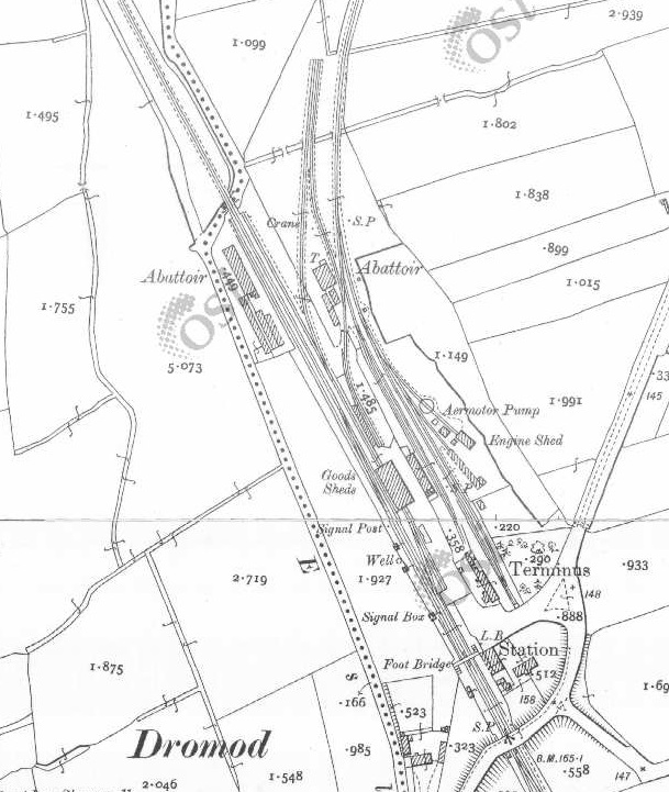
The two stations as they appear on the 25″ OSi survey of the early 20th century. The northern approach to each station seems to have been guarded by an abattoir! [2]
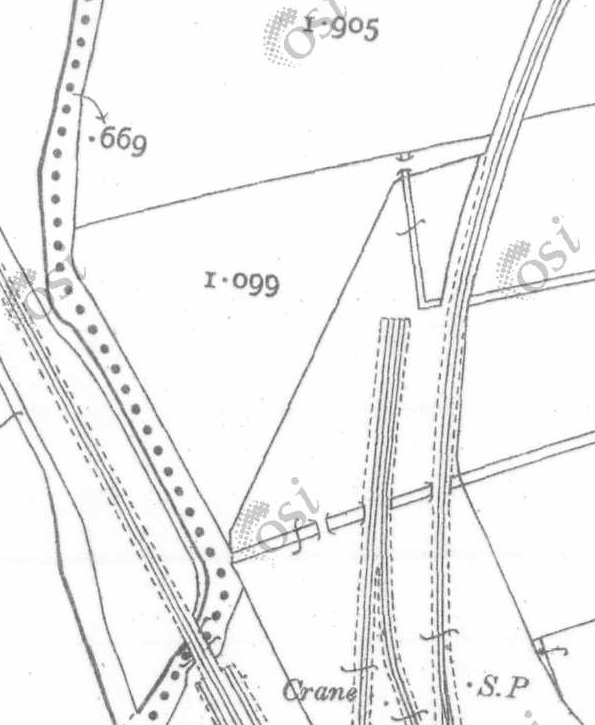
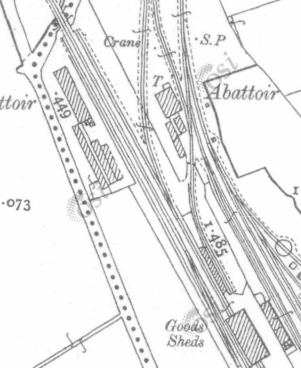
Three enlarged extracts from the same mapping make it easier to pick out details at the two station sites. North of the mainline Goods Shed, there appears to have been a goods transfer platform with the 3ft gauge siding on its East side and an Irish standard-gauge line on its West side. These three map extract do not properly show the Cavan & Leitrim Railway carriage and engine shed. The next map extract shows both these buildings which were to the North of the passenger facilities. [2]
This map extract from the 25″ OSi survey shows the Cavan & Leitrim carriage shed, engine shed and turntable close to the centre of the image, the standard-gauge Goods Shed and the transfer platform are to the left of the image. [2]

The preservation line is only short in length and extends as far as the limits of the site permits towards Mohill. However, it is rightly proud of its work and continues to achieve much more than might be expected given the relatively small number of volunteers. You can visit its website by clicking here. [3]

Trains run on Saturdays, Sundays and Mondays. The group also has a transport museum, with narrow-gauge trains of every gauge, buses, planes, fire engines and artillery guns from WW1 and WW2.

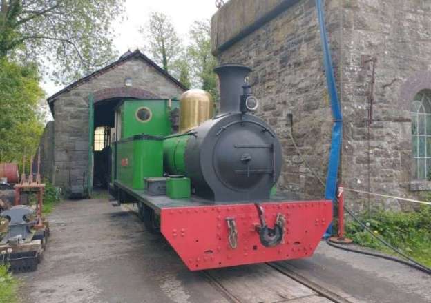
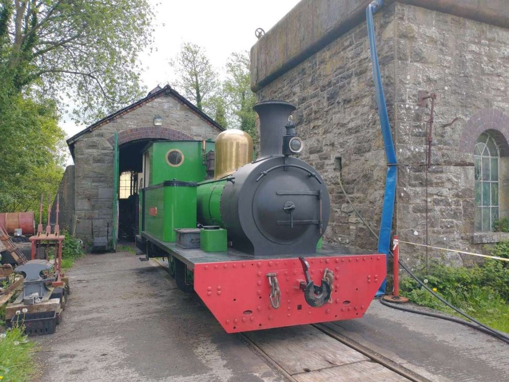
‘Nancy’ sits alongside the Water Tower, outside the Engine Shed, at Dromod. She was not in steam on 6th May 2023. [My photograph, 6th May 2023]

‘Nancy’ was refurbished in the years prior to the pandemic. Work was finally completed in 2019. ‘The Railway Hub‘ reported the completion of the work on 22nd September 2019: “The restoration of the Cavan & Leitrim Railway’s Avonside 0-6-0T Nancy is officially complete after 22 years’ work and £160,000 investment. The former ironstone loco returned to steam at Alan Keef’s Ross-on-Wye workshops in March, but was delivered to Dromod without its brass dome cover as this was still being manufactured by ‘The Dorset Copperfish’. The new dome was finally delivered by Alan Keef on 27th July, and C&L volunteers wasted no time fitting it to Nancy as a final finishing touch.” [4]

The pictures taken at the preservation/museum site below are predominantly my own and were taken on 6th May 2023. By no means are these an exhaustive survey of the exhibits at Dromod.

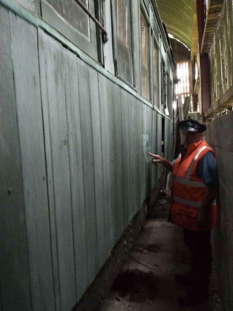
We start with Michael Kennedy showing me Tralee and Dingle Railway Carriage No.10 (1891) which is stored in the carriage shed at Dromod awaiting restoration.

Tralee and Dingle Railway Carriage No.10T (1891) which is stored in the carriage shed at Dromod awaiting restoration. Michael is pointing to the faded CIE logo on the carriage side. It was in 1945 that Córas Iompair Éireann (CIÉ) was founded, uniting the Great Southern Railways with the Dublin United Tramway Company. The name means “Irish Transport Service” in the Irish language. CIÉ began its operations on 1st January 1945 as a private company with shares traded on the Dublin stock exchange. The Tralee & Dingle Railway became part of its empire! [My photograph, 6th May 2023]
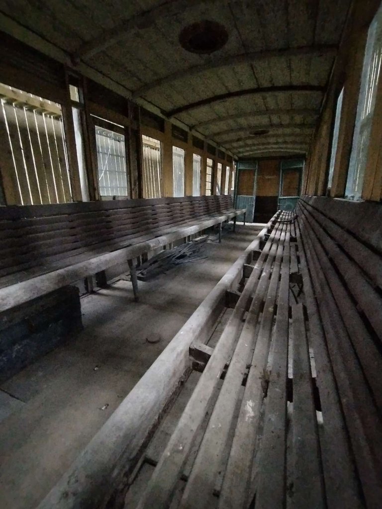
An internal view of Tralee & Dingle Carriage No. 10T which sits under cover awaiting restoration. [My photograph, 6th May 2023]

Tralee & Dingle Railway Carriage No. 10T sits in the Carriage Shed at Dromod awaiting restoration. It is one of a pair of Tralee &Dingle carriages (7T and 10T). Its sister (7T) is currently in Cumbria. Both carriages were built by the Bristol Wagon and Carriage Works, 7T in 1890 and 10T in 1891. They served on the Tralee & Dingle until it closed to passenger traffic in 1939 and we’re then moved to the West Clare Railway.

They served on the West Clare until the West Clare section was dieselised in the 1950’s and the carriages became redundant, they were then sold off as bodies and used as holiday homes and huts. Number 7T and 10T became huts for drainage contractor Gerry Walsh. Micheal Kennedy recovered the carriages a number of years back. 7T is being restored in Cumbria, as of 2023, work is ongoing on the bogies and chassis.

To find out more about these carriages and about donations to the work being undertaken please follow this link. [5]

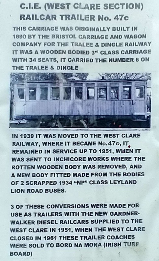
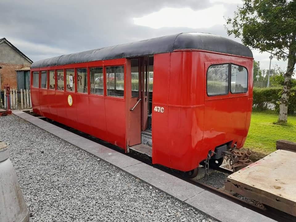
Also at Dromod is railcar trailer No. 47C of the CIE West Clare Section. Originally built in 1890 by the Bristol Carriage and Wagon Company for the Tralee & Dingle Railway as a wooden bodied 3rd Class 34 seat carriage, it carried the number 6 on the Tralee & Dingle. On one of its windows is a short history of carriage conversions undertaken to make railcar trailer No. 47C.

The information sheet on the side of Carriage No. 47c. [My photograph, 6th May 2023]
Carriage No. 47c alongside the platform at Dromod. This photograph was shared on The 3ft Gauge Enthusiasts Facebook Group by Philip Bedford on 2nd October 2021. [6]
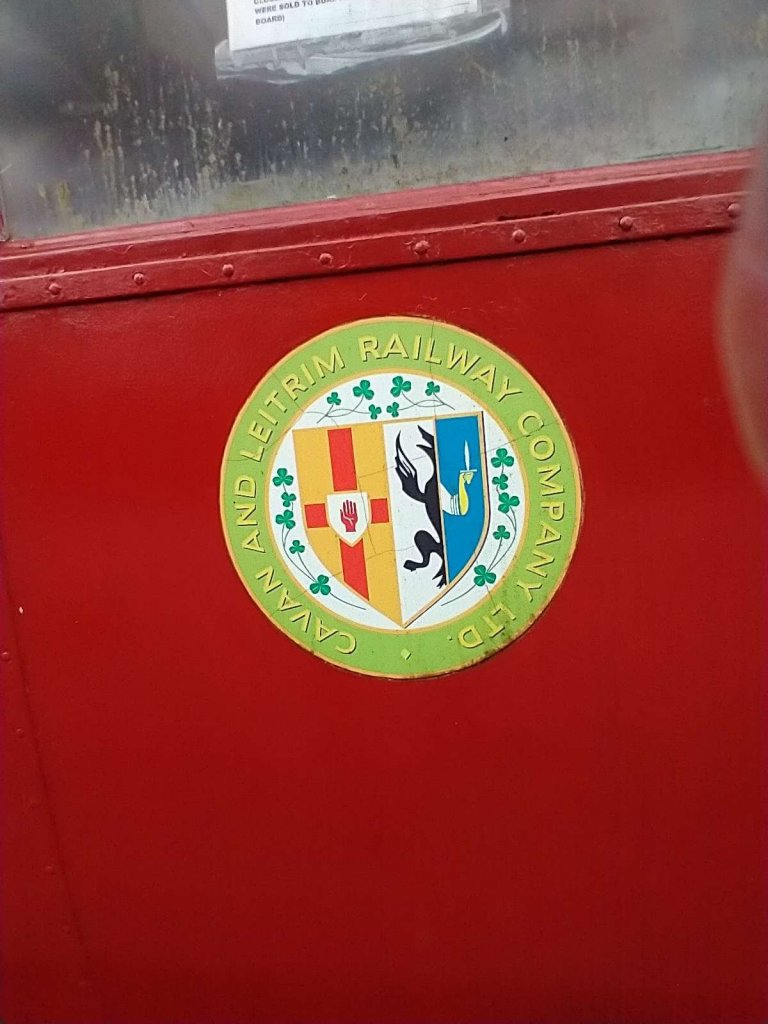
The Cavan & Leitrim Railway logo on the side of Carriage No. 47c. [My photograph, 6th May 2023]
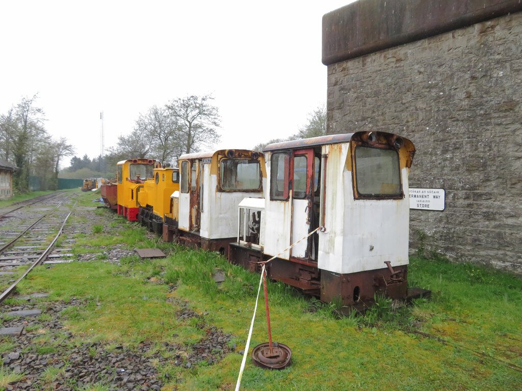
Ex-Bord Na Mona locos at Dromod on Saturday 22nd April 2023, © Gareth James and licensed for reuse under a Creative Commons Licence (CC BY-SA 2.0). [7]
More ex-Bord Na Mona at Dromod on 6th May 2023. [My photograph, 6th May 2023]
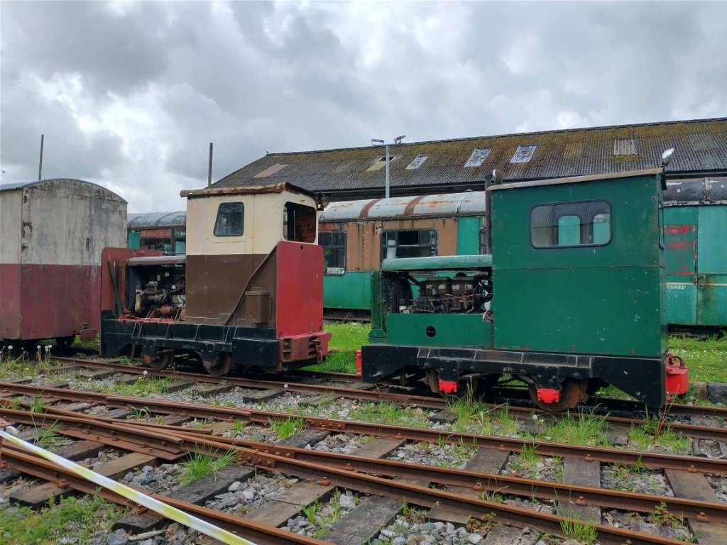
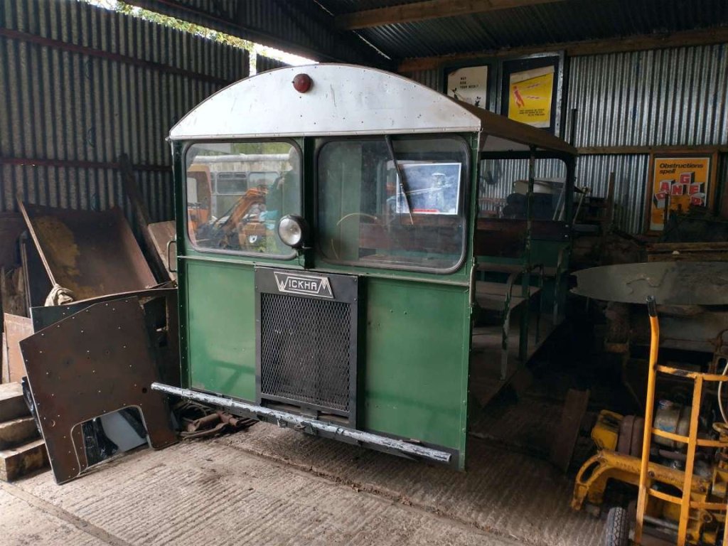
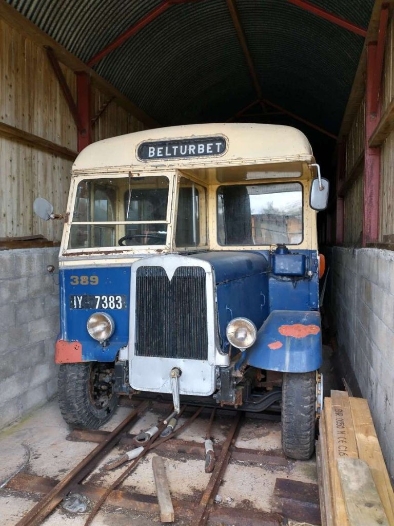
A Wickham Trolley in the shed at Dromod. This is number W6/11-4 (Works No. 9673). It was once based at Lochaber and was used for inspection duties on the 3ft gauge Lochaber system which included a section of railway going up Ben Nevis! It arrived at Dromod in the winter of 1996. [My photograph, 6th May 2023]
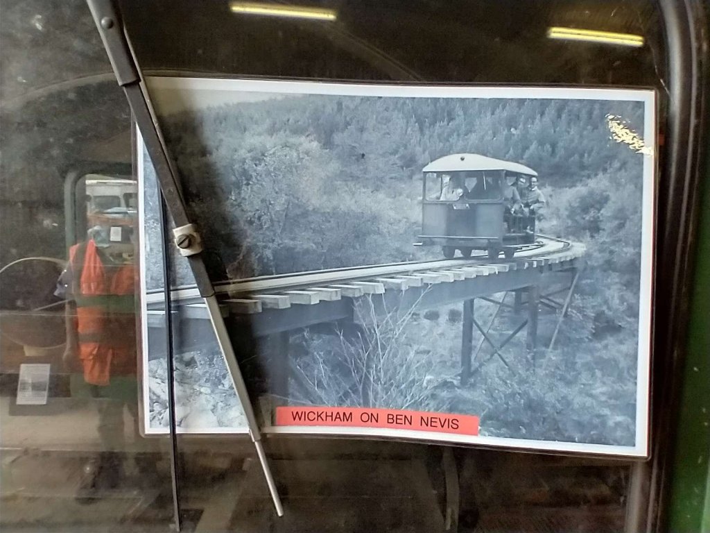
Affixed to the front window of the Wickham Trolley is a picture of it in use on Ben Nevis. [My photograph, 6th May 2023]

Wikipedia informs us that “the Lochaber Narrow Gauge Railway was a 3 ft (914 mm) narrow-gauge industrial railway. It was a relatively long line, built for the construction and subsequent maintenance of a 15-mile-long (24-kilometre) tunnel from Loch Treig to a factory near Fort William in Scotland.[1] The tunnel was excavated to carry water for the Lochaber hydroelectric scheme in connection with aluminium production by British Aluminium. The railway came to be known colloquially as the ‘Old Puggy Line’.” [7]

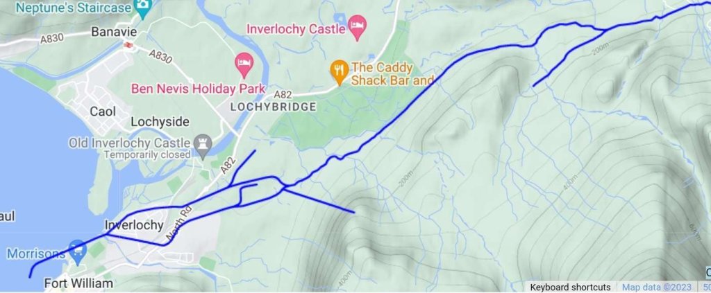
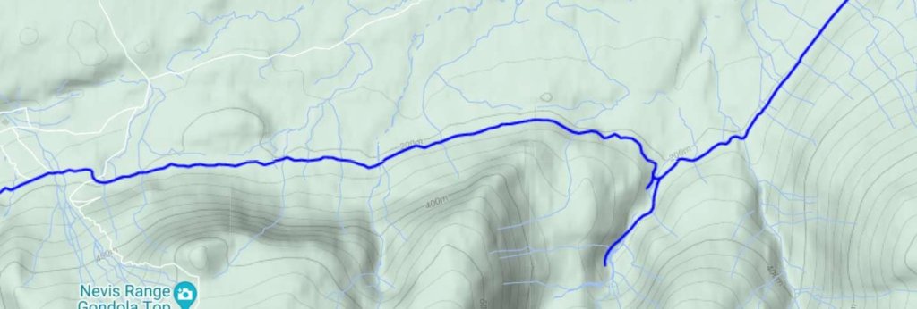
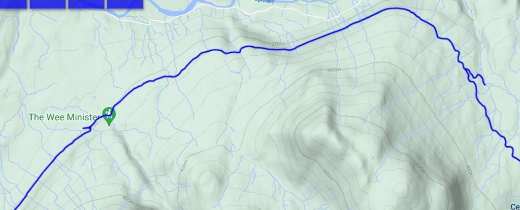
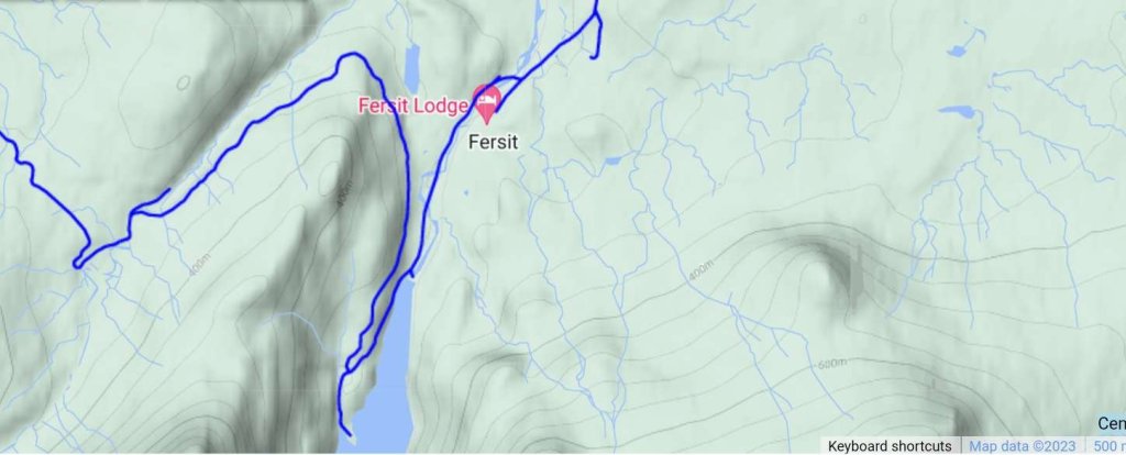
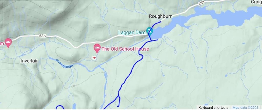
A proper look at the Lochaber Narrow Gauge Railway is for another time but it ran from Fort William to Loch Treig and on to the Laggan Dam on Loch Spean, as shown below.

Thes five extract from RailMapOnline taken together show the full length of the Lochaber Narrow Gauge Railway. Opened in 1925, the Lochaber Narrow Gauge Railway finally closed in 1977. [8]

Back to the Cavan and Leitrim at Dromod. The museum includes a series of different means of transportation. Just a few photos from my visit in 2023.

A Great Northern Railway Gardner bus sits in front of carriage 10T in the carriage shed. [My photograph, 6th May 2023]
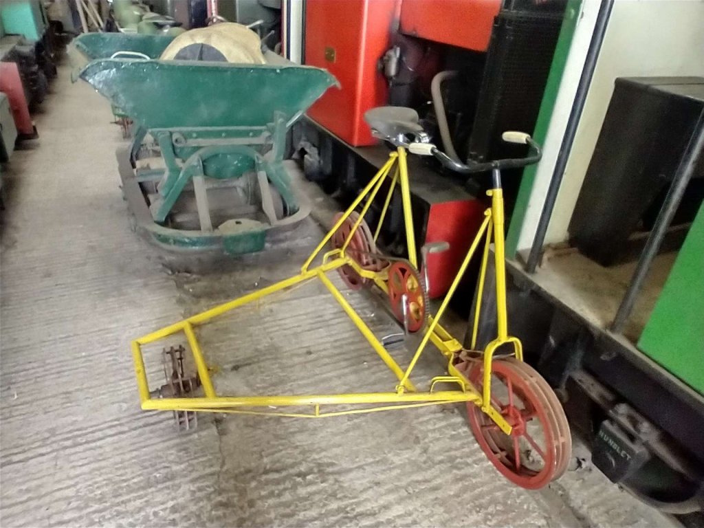
One of the Bergbolagen Rail Tricycles restored by volunteers at the Cavan and Leitrim Railway. This tricycle was last in use by Bord na Mona on Clonsast Bog in County Kildare. [My photograph, 6th May 2023]

https://youtu.be/oxa_s5WfWn8 [11]

The Cavan and Leitrim Railway has restored two 3 foot gauge Bergbolagen Rail Tricycles, part of a batch purchased by Bord na Mona (The Irish Turf Board) in 1957 from the Bergbolagen Company in Stockholm, Sweden, the yellow one was used on Clonsast Bog in County Kildare, the green one (running second on the video) was used on Boora Bog in County Offaly. Andrew Wilson kindly donated the parts (rescued in the 1970s) from which both of these machines were restored. [9]

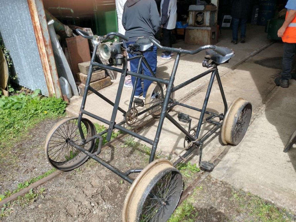
A replica 3 ft gauge rail inspection bicycle built by Cavan and Leitrim volunteers using the frames of 2 1920s “High Nelly’s” and original early 1900s american Teetor & Hartley wheels. [My photograph, 6th May 2023]
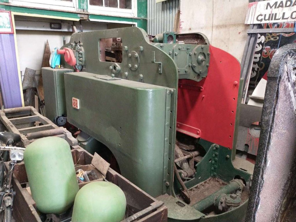
The Guinness Steam Loco (No. 22) at the Cavan & Leitrim at Dromod was 100 years old in 2012 which made it 111 years old in 2023. This is it, in storage at Dromod on 6th May 2023. Loco No. 22 was built in Spense’s foundry, Cork Street, Dublin in 1912.
It was part of an extensive network of locos in the Guinness brewery at St. James’s Gate in Dublin and continued in operations until 1957. In August 2003, No. 22 arrived in Dromod and since then, hard work began to restore it back to its former glory. So far the bodywork has been restored. No. 22 isn’t fully restored. Its Boiler is missing. The task of replacing it has proven challenging as it is designed to run on a 1ft 10in track, slightly narrower than the standard of 2ft. However that doesn’t mean it will never be restored. The Cavan & Leitrim continue in their search for the best replacement boiler and hope some day soon No. 22 will return to steam. [10]

Hidden amongst series of different important relics are two wagons. The first shown below comes from the West Clare Railway, the second

A chassis and frame from a 5 ton covered wagon from the West Clare Railway in storage at Dromod. [My photograph, 6th May 2023]
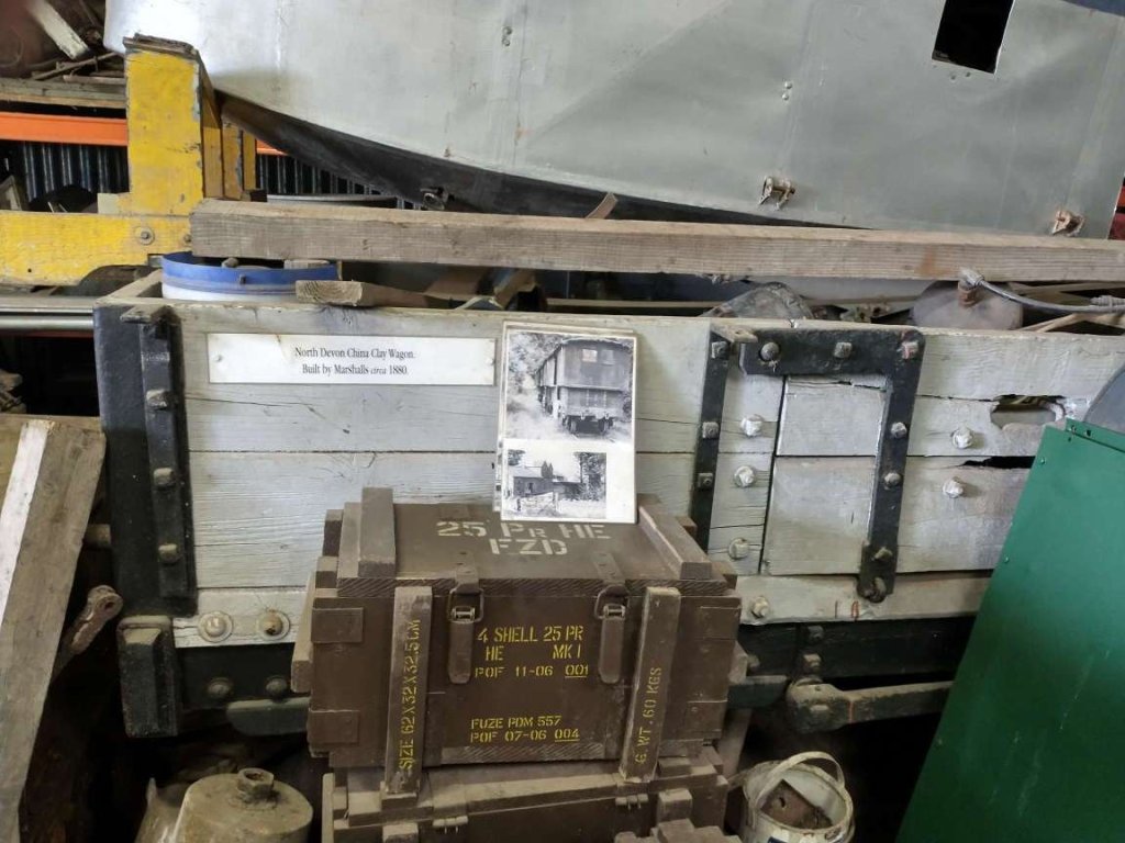
A 2-plank China Clay wagon from North Devon built by Marshalls in 1880 in store at the Cavan & Leitrim Railway at Dromod. [My photograph, 6th May 2023]
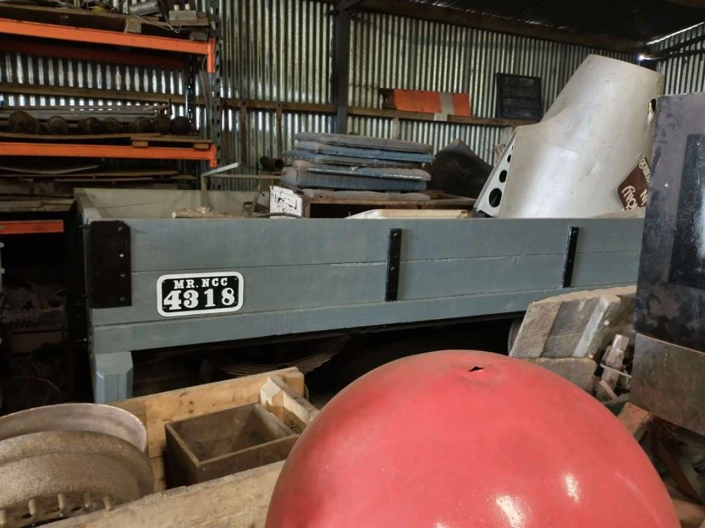
A restored two-plank wagon No.4318. [My photograph, 6th May 2023]

References

  1. https://www.irishrail.ie/Admin/IrishRail/media/Stations/dromod_pic.jpg, accessed on 18th July 2023.
  2. https://osi.maps.arcgis.com/apps/webappviewer/index.html?id=bc56a1cf08844a2aa2609aa92e89497e&extent=608964.6235%2C603547.0536%2C610175.0947%2C604299.7947%2C2157, accessed on 18th July 2023.
  3. https://www.cavanandleitrimrailway.com, accessed on 18th July 2023.
  4. https://www.therailwayhub.co.uk/7671/new-dome-completes-22-year-restoration-of-nancy-at-dromod, accessed on 18th July 2019.
  5. https://www.cavanandleitrimrailway.com/post/railbike, accessed on 19th July 2023.
  6. https://m.facebook.com/groups/1529628147328240/permalink/2815090888781953, accessed on 23rd July 2023.
  7. https://en.m.wikipedia.org/wiki/Lochaber_Narrow_Gauge_Railway, accessed on 3rd August 2023.
  8. https://www.railmaponline.com/UKIEMap.php, accessed on 5th August 2023.
  9. https://www.cavanandleitrimrailway.com/post/other-bike, accessed on 5th August 2023.
  10. http://thecavanandleitrimrailway.blogspot.com/2012/06/guinness-brewery-steam-loco-celebrates.html?m=1, accessed on 6th August 2023.
  11. https://youtu.be/oxa_s5WfWn8, accessed on 6th August 2023.

The Lough Swilly Railway continued. … Letterkenny to Derry – Part 1

Letterkenny once had two railway stations immediately adjacent to each other. One was the terminus of the County Donegal Railways Strabane to Letterkenny branch. The other was a through station on the Lough Swilly (when operation in the first half of the 20th century it’s formal title was the ‘Londonderry & Lough Swilly Railway’).

The two railway stations in Letterkenny lay side by side. That to the North was the terminus if the County Donegal Railways branch which connected Letterkenny to Strabane. That to the South was the Lough Swilly station through which passed trains between Burtonport and Derry. OSi 6″ to 1 mile last series. [3]
The same area as shown on the railmaponline.com satellite imagery. Contrary to what appears on the image, both railway lines ran on the South side of Ramelton Road. That shown in Orange is the Lough Swilly line. [4]

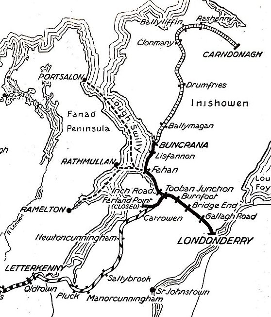
In an East-Southeast direction, the two companies’ lines ran parallel for some distance, before the Co. Donegal line headed away to the South through Convoy and Raphoe before crossing the border at Lifford and meeting the other Co. Donegal lines at Strabane. The Loch Swilly found its way to Derry via Tooban Junction where a significant branch line to Buncrana and Cardonagh left the line to Derry.

To the West, the Lough Swilly’s Burtonport Extension Railway meandered across the moors and between small villages nearer the coast.

Three articles cover the Strabane to Letterkenny branch of the Co. Donegal Railways. They can be found on the following links. ….

Co. Donegal Railways, Ireland – Part 4 – Strabane to Letterkenny (Part A – Strabane to Raphoe)

Co. Donegal Railways, Ireland – Part 5 – Strabane to Letterkenny (Part B – Raphoe to Convoy)

Co. Donegal Railways, Ireland – Part 6 – Strabane to Letterkenny (Part C – Convoy to Letterkenny)

The Burtonport Extension of the Lough Swilly is covered in four other articles which can be found on these links. …

The Burtonport Extension of the ‘Londonderry & Lough Swilly Railway’ – Part 1

The Burtonport Extension of the ‘Londonderry & Lough Swilly Railway’ – Part 2

The Burtonport Extension of the L&LSR (Londonderry & Lough Swilly Railway) – Part 3 – Cashelnagor Railway Station to Barnes Gap

The Burtonport Extension of the L&LSR (Londonderry and Lough Swilly Railway) – Part 4 – Barnes Gap to Letterkenny. …

The Lough Swilly’s line between Derry and Letterkenny was built in stages and included a change of track gauge from 5ft 3in to 3ft.

The railway was initially planned as the Derry and Lough Swilly Railway Company when an application for incorporation was filed in 1852,  … The company opened its first line, a 5 ft 3 in (1,600 mm) link between Derry and Farland Point, on 31st December 1863. A branch line between Tooban Junction and Buncrana was added in 1864 and much of the Farland Point line was closed in 1866.” [1][2: pxiv]

Wikipedia’s history of the railway company goes on to say that “in 1883, the 3 ft (914 mm) narrow gauge Letterkenny Railway between Cuttymanhill and Letterkenny was opened and the L&LSR connected with it by reopening the Tooban Junction – Cuttymanhill section of its Farland Point line. The L&LSR worked the Letterkenny Railway, and in 1885 it converted its track from 5 ft 3 in (1,600 mm) gauge to 3 ft (914 mm) narrow gauge to enable through running. In 1887, ownership of the Letterkenny Railway passed to the Irish Board of Works, which continued the agreement by which the L&LSR operated the line.” [1][2: pxiv & p3]

Carndonagh was reached by an extension completed in 1901 and Burtonport by a one completed in 1903. Both lines were constructed as joint ventures with the UK Government, with ownership and liabilities shared between the two parties. During this period the company did not make a profit, and struggled to meet its debts.” [1][2: p2 & p3]

The Lough Swilly Railway between Letterkenny and Derry in 1926. © Public Domain. [1]

Letterkenny to Newtowncunningham

Letterkenny to Newtoncunningham. The L&LS railway is shown on this extract from OSi mapping of the mid-20th century. [3]

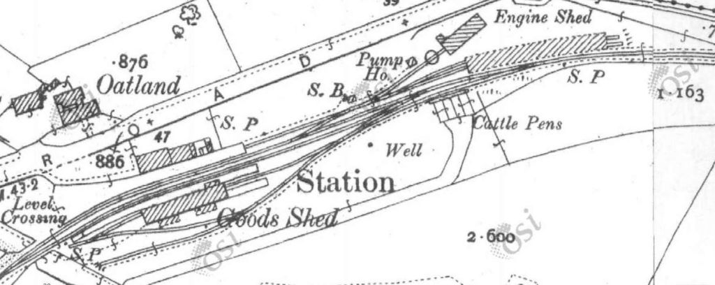
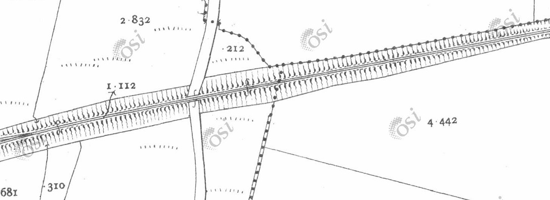
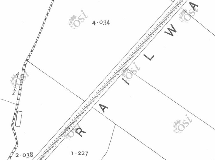
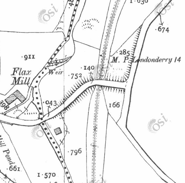
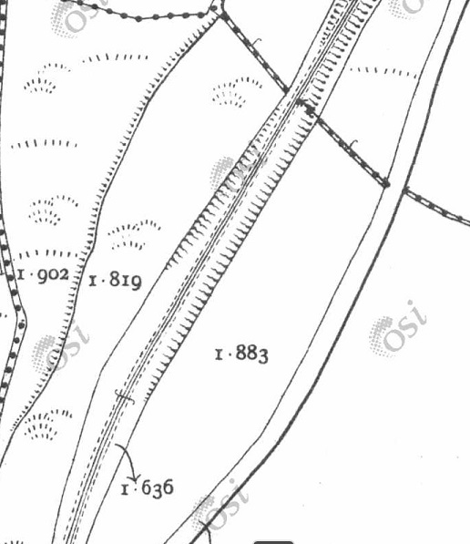
The first map extract from OSi mapping which appears close to the top of this article shows the Co. Donegal and the Lough Swilly stations in Letterkenny. The 6″to 1 mile series as digitised is not the clearest mapping. An earlier 25″ to 1 mile series shows only the Lough Swilly line but is of a higher quality.

These first two 25″ OSi map extracts show only the Lough Swilly Station and line. When the Co. Donegal branch was constructed the Ramilton Road had to be realigned northward.
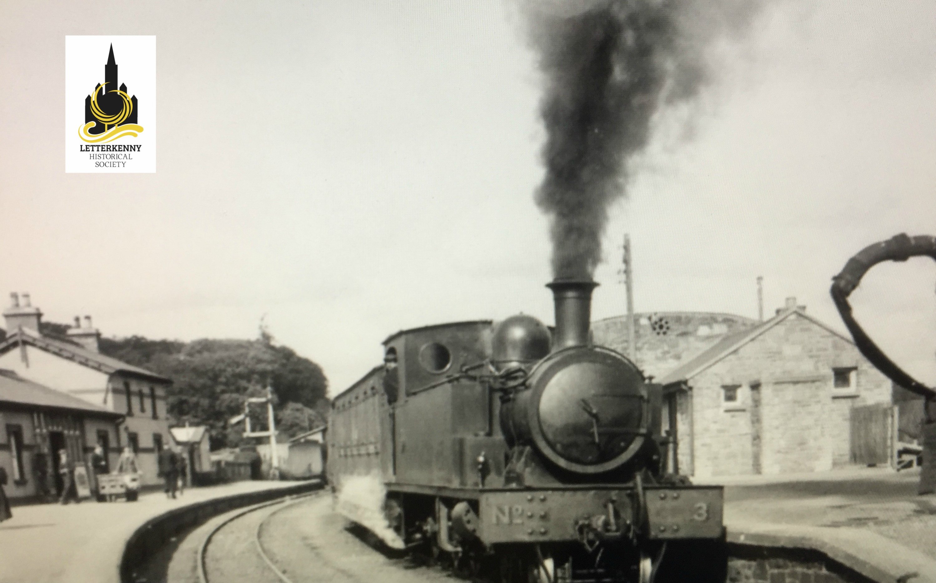
Letterkenny & Burtonport Extension Railway (L&BER) No. 3 was a 3ft gauge 4-6-0T, built by Andrew Barclay & Sons Co. in 1902 for the Letterkenny and Burtonport Extension Railway. The line was operated by the L&LSR. No.3 was scrapped in 1954. It is seen here heading from Burtonport to Letterkenny, © Courtesy of Trainiac on Flicker (Public Domain). [8]

Ernie’s Railway Archive on Flickr has a range of photographs of the L&LS Letterkenny Railway Station site from the 1950s, the links are embedded here below, click on each link to see the image in Ernie’s Railway Archive on Flickr:

https://flic.kr/p/2nMqBvu – The L&LSR Station site from the East in 1952. The carriage shed is closest to the camera on the right of the image. The locomotive shed and turntable are hidden behind the carriage shed. At the centre-top of the image, the Goods Shed can be seen.

https://flic.kr/p/2nM8xYs – The Goods Yard of the L&LSR in 1952. Beyond wagons L&LSR No. 124 and L&BER No. 73 the Goods Shed and the passenger station building can be seen.

https://flic.kr/p/2nWyB5y – The L&LSR Goods Yard in 1952. The side elevation of the Goods Shed is visible beyond the wagons in the yard. Prominent in the picture is L&LSR Wagon No. 71.

https://flic.kr/p/2nCR8dg – L&LSR No. 12 is featured in this image from 1952. No. 15 is just poking its nose into the shot on the left.

https://flic.kr/p/2kHNdD9 – L&LSR No. 8 is being turned on Letterkenny’s turntable on 27th June 1952.

https://flic.kr/p/JoWHRY – L&LSR No.15 sits in front of Letterkenny WaterTower in 1953.

https://flic.kr/p/BWoyiF – L&LSR No3 at Letterkenny. On the left, the image is framed by the wall of the Goods Shed. The crossing gates at the West end of the station are visible beyond No. 3’s train. The passenger facilities are on the right. Note the coach acting as a brake van for the train. (c) JW Armstrong/ARPT

https://flic.kr/p/BvajsP – L&LSR No. 12 in the Engine Shed at Letterkenny, (c) JW Armstrong/ARPT

https://flic.kr/p/2ma5Lo3 – The L&LSR Station at Letterkenny on 1st July 1959 after the rails had been lifted. The Goods Shed door is closed (on the left) and the station buildings are on the right.

https://flic.kr/p/2k1hGvQ – The L&LSR operated a daily goods service by lorry after the closure of the line. A company rail lorry bearing the number plate IB7024 is shown standing where trains would once have passed, adjacent to the station building at Letterkenny. The photograph was taken on 23rd August 1954.

Other photographs of Letterkenny’s L&LSR railway station can be found on Flickr or elsewhere on line:

The last engines to be built for the Swilly were a pair of extraordinary 4-8-4Ts, weighing 58 tons each. No 6, with LSR diamond on the tanks, is outside Letterkenny shed on 15 June 1948. This image was shared on eBay [5]
L&LSR No. 3 at the head of a train from Derry at Letterkenny Station, either heading for Burtonport or terminating at Letterkenny. The image was shared by Letterkenny History on their webpage. [6]
Plenty to see in this shot at Letterkenny. Locomotive No. 12 is facing the photographer and a CDR engine is in the background. Shared by Kerry Doherty on the L&LSR Facebook Group on 1st February 2021. [7]
A goods train has just arrived from Derry in June 1950, © John Edgington c/o Pendragon Collection and shared on the Donegal Railway Heritage Museum Facebook Page. [9]
The L&LSR’s Letterkenny Station, seen from the Northeast. Either this train has just arrived from Burtonport or is setting off for Derry. This image was shared by Gabe J. McTuile on the Letterkenny Community Heritage Facebook Group on 19th January 2017. [10]
The two Letterkenny Railway Stations. The terminus of the Strabane to Letterkenny Branch of the Co. Donegal Railways Joint Committee is on the left. The L&LSR station which sat on the line between Derry and Burtonport. This image was shared on the Donegal County Museum Facebook Page on 20th February 2013. [11]
Another view of the two station buildings in Letterkenny. This image was shared by Keiran Kelly on the Letterkenny Community Heritage Facebook Group on 13th October 2014. [12]

These next images show the railway station buildings in Letterkenny after the closure of both lines.

The remains of both station buildings can be seen at the centre of this aerial image. There  are quite a few of the Lough Swilly Bus Company’s fleet of buses visible. This image was shared by Gabe J. McTuile on the Letterkenny Community Heritage Facebook Group on 18th June 2016 . [13]
The Co. Donegal terminus in Letterkenny is now repurposed as the passenger facilities for the town’s bus station. My photograph, 29th April 2023.
The length of the two lines between the stations and Port Bridge, superimposed on Google Maps satellite imagery. [April 2023]
Leaving the Station site, the two railway lines ran parallel to each other. Both lines crossed the old Port Road by means of girder bridges with stone abutments. The lines then crossed the River Swilly by means of lattice girder bridges alongside the road bridge. After which, the Co. Donegal line rose above the L&LSR, turning South as it bridged the L&LSR line. [13]
The North abutment of one of the bridges which carried the two lines over the Port Road. © Kerry Doherty. [17, May 2020]
Looking ahead along the line of the two railways towards the River Swilly. The remaining abutment is alongside the camera. The plaque which can be seen in the foreground close to the abutment illustrates what the bridges would have looked like, © Kerry Doherty. [17, May 2020]
The plaque mentioned above, © Kerry Doherty. [17, May 2020]
Port Bridge, Letterkenny, seen from the South, presumably before the construction of the Co. Donegal Railway Structure.  [14]
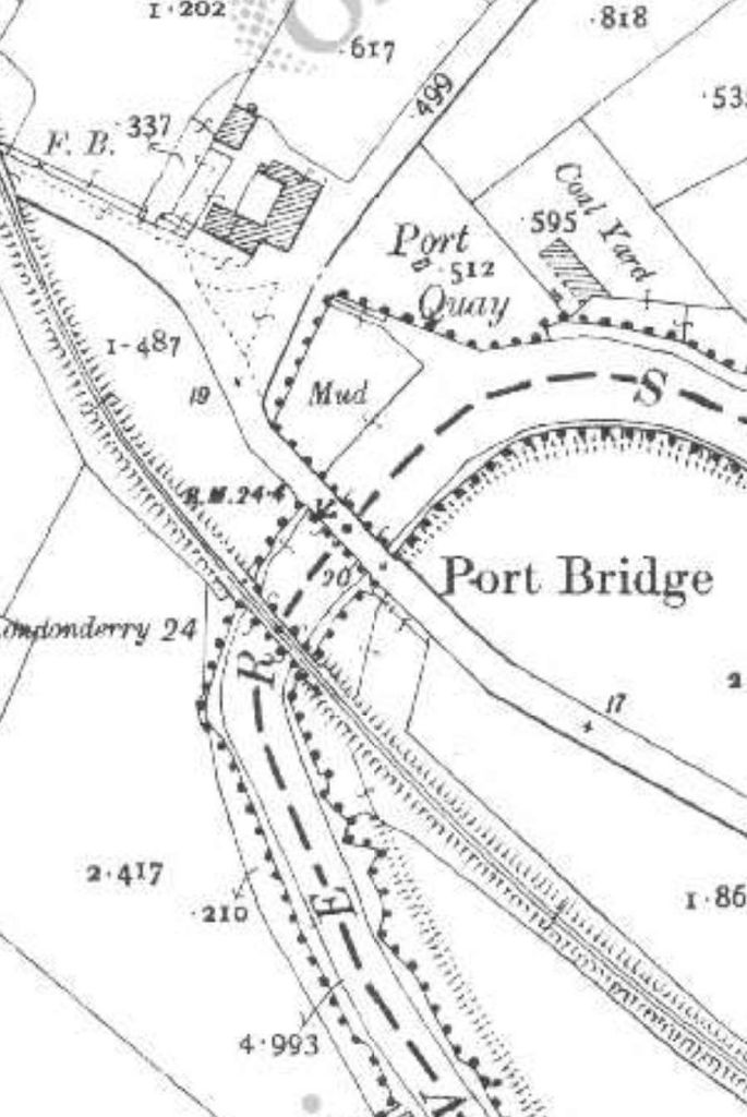
An extract from the 1st edition 6″ OSi mapping which shows just the road bridge. [15]
The same location after the construction of the L&LSR line from Derry to Letterkenny as it appeared on the 25″ OSI mapping.. [15]
The same location once more. This is an extract from the last 6″ edition of the OSi mapping. [15]
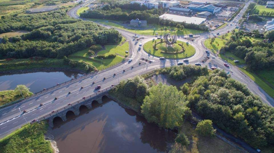
A modern aerial view of Port Bridge (seen from the downstream side) and the Polestar roundabout. This image was shared by Gabe J. McTuile on the Letterkenny Community Heritage Facebook Group on 1st February 2017. [16]
Looking Northwest along the N56 towards the Polestar roundabout. The modern bridge sits directly over the location of the old railway bridges scanning the River Swilly. [Google Maps, April 2020]
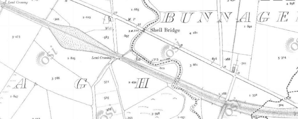
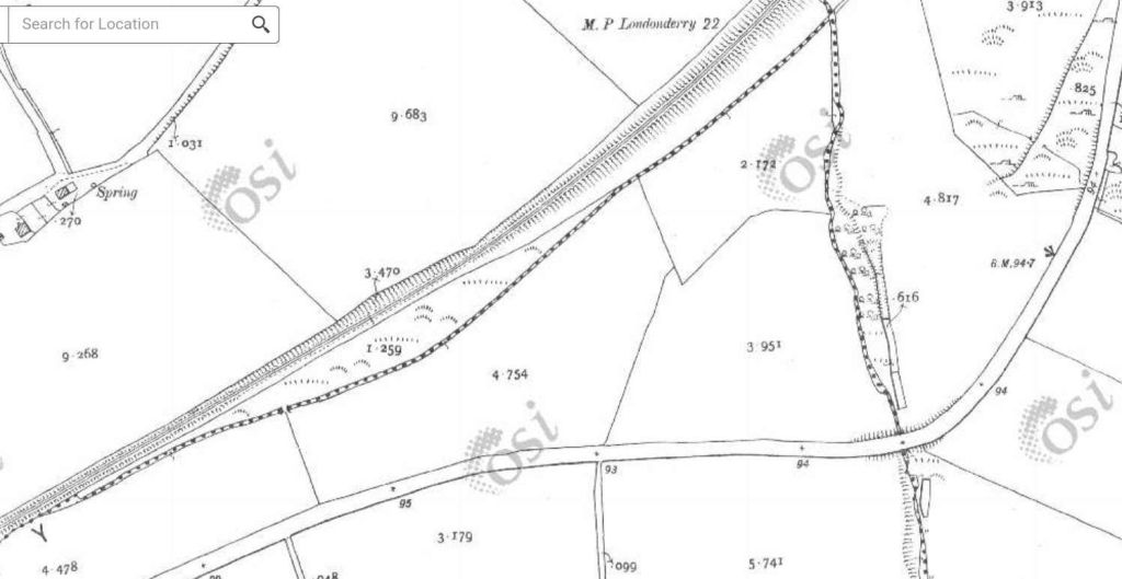
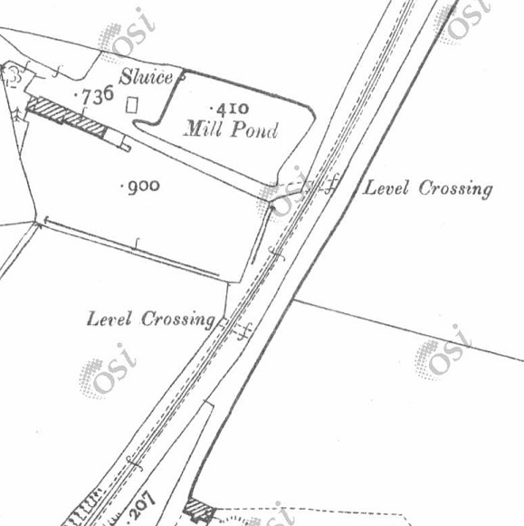
This extract from the 25″ OSi mapping which predated the construction of the CDR branch. The old main road to Derry runs parallel to the railway line to the North. Another road rises on an embankment to cross the L&LSR. [15]
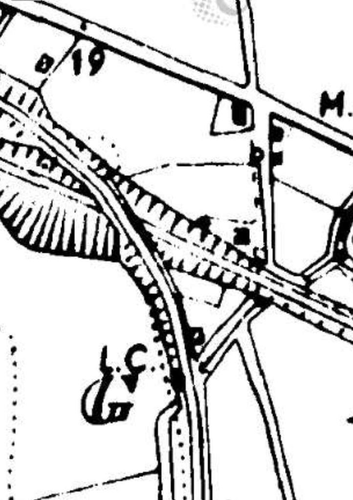
The same location on the last 6″ OSi survey. The embankment has been shifted to accommodate the CDR branch. [15]
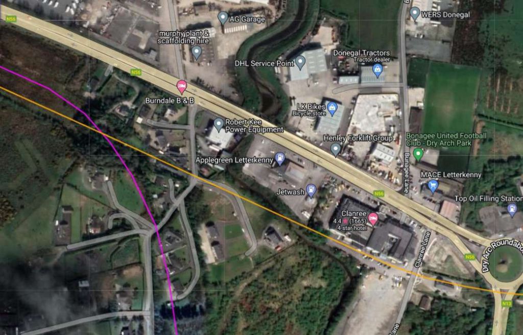
Approximately the same area as covered by the 25″ extract above as shown on the railmaponline.com satellite imagery. The road alignment shown in the OSi extracts above remains. The bridge over the two lines has been partially infilled. [4]
The embankment highlighted above is to the right of this image. The area adjacent to the white van is the bridge location. The area under the bridge has been altered to act as garage space. This image is the view westward from the modern N56.  [Google Street view, April 2023]
Dave Bell and Steve Flanders describe the use of the bridge arches in the 1980s like this: “The present owner of the filling station has made good use of the bridge by bricking up one side and building a garage against the other. In effect he now has a garage with three bays, the roof of which is actually the side road.” [18: p47] There are two pictures of the arched bays in Bell and Flanders book.
Kerry Doherty also very kindly supplied this photograph which shows the arches of the old bridge inside the garage facility, (c) Dave Bell. [17]

A short distance to the South East the CDR branch crossed the Lough Swilly and turned away to the South.

The next extract from the 25″ OSi survey. [15]
The immediate area of the bridge carrying the CDR over the Lough Swilly line as shown on the last 6″ OSi mapping.. [15]
Approximately the same area as covered by the 25″ extract above. [4]
As we have already noted, after crossing the River Swilly the two railway lines ran approximately parallel to each other. The Co. Donegal branch line climbed gradually until it was able to bridge the Lough Swilly line and head away to the South. By the time this picture was taken the Lough Swilly line had closed and had been lifted. This picture was kindly supplied by Kerry Doherty. It shows Co. Donegal Railway No. 5 Drumboe at the head of a goods train in 1959, © J.G. Dewing, Color-rail. [17]

A short distance to the East of the over bridge the Lough Swilly line crossed another road at a level crossing.

The site of the level-crossing as shown by Google Maps [May 2024]
At the site of the level-crossing, this view looks back towards Letterkenny along the line of the old railway. [Google Streetview, August 2021]
Also at the level-crossing this view looks ahead to the Southeast along the line of the railway. [Google Streetview, August 2021]

A few hundred metres to the Southeast the line crossed Clanree Lane at the level.

The old railway ran approximately along the line of parked cars in the Clarence Hotel carpark in this Google Maps satellite image, across Clanree Lane and through the house which has been built over the old railway. [Google Maps, May 2024]
Looking back along the line of the Lough Swilly Railway from the location of the level-crossing on Clanree Lane. [Google Streetview, August 2021]
Looking East from the lpcation of the level-crossing on Clanree Lane. The house has been built over the old formation. [Google Streetview, August 2021]
The next length of the old railway as shown on the 25″ OSi survey. [15]
The same length of the Lough Swilly Railway as it appears on railmaponlin.com’s satellite imagery. The old railway formation is buried under the earthworks of the modern N13 road. [4]
This next extract from the OSi 25″ survey shows the old road to Derry passing under the Lough Swilly. [15]
The route of the Lough Swilly Railway continues to be located under the earthworks of the N13 dual-carriageway. [4]
This next OSi extract (from the 25″ survey shows the line meandering to the North. [15]
The N13 continues to follow the route of the old railway. [4]
The 25″ OSi survey again. … The line continues to follow the contours as it curves around higher land. [15]
Railmaponline.com continues to show the line of the Lough Swilly Railway in orange. [4]
This next extract from the OSi 25″ survey shows the Lough Swilly Railway crossing the old main Road by means of a bridge and continuing to cut e round towards a southerly alignment. [15]
For much of this extract from railmaponline.com the route of the old railway is followed by the N13. However close to the bottom-right of the extract the route of the Lough Swilly Railway turns South away from the modern N13. [4]
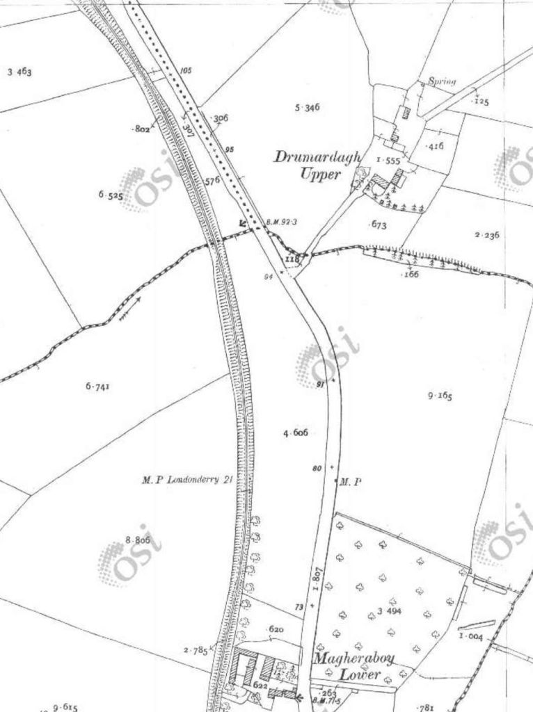
Travelling South toward Pluck, the line ran along the West side of the old road to Derry. [15]
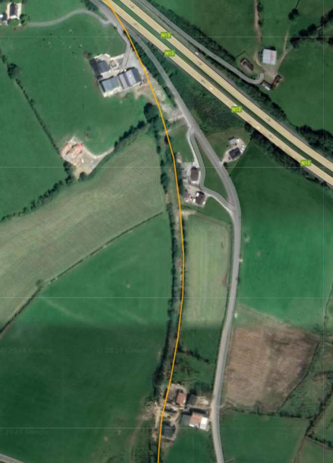
Railmaponline.com’s satellite imagery shows that the route of the old line is still marked by hedge lines which mark the old boundaries of railway land. [4]
On the approach to Pluck Station the line bridged a narrow lane before curving round into the station.When the line was built the lane providing access to the station was diverted to allow it to bridge the line. The bridge is visible in the bottom-right of the extract. [15]
The modern satellite imagery shows that the road layout around Pluck Station is little changed. [4]
Looking East along the minor road shown in the top half of the map extract and satellite image above. The bridge abutments of the railway bridge crossing the road remains. [Google Streetview, August 2021]
An enlarged extract from the 25″ OSi survey showing Pluck Station. [15]
The same location as it appears on Google Maps. The original station building at Pluck is now in private hands and much extended/altered. [Google Maps May 2024]
Pluck Station building in 1901, seen from the North [19]
The much altered and extended building that was once Pluck Station building, seen from the North. [Google Streetview, April 2011]
Pluck Station railway bridge seen from the road to the West of the structure. The road looped round over the bridge and provided access to the Station from the South. [Google Streetview, April 2011]
To the Southeast of Pluck Station, after passing under the station bridge, the Lough Swilly Railway crossed a culverted stream and a narrow road. [15]
The same area as shown on the map extract above. The orange line represents the route of the Lough Swilly Railway. Field boundaries and hedgerows delineate the route on the ground. [4]
To the Southeast of Pluck Station the railway crossed a narrow lane by means of a stone-arched bridge. This image shows the bridge from the North. [Google Streetview, July 2021]
This next extract from the OSi 25″ survey shows the line continuing in a southeasterly direction and crossing over a further road by means of ankther stone-arched bridge. Two roads would have crossed the line in short succession had the most easterly of these not been diverted. [15]
The railmaponline.com satellite imagery shows the heavily wooded embankment which once carried the railway. [4]
Looking North though the bridge which carried the old railway over the minor road at the top left of the extracts above. [Google Streetview, July 2021]
Looking Southeast along the minor road which was diverted as part of the construction of the Lough Swilly Railway. The railway embankment is on the left of this image and the bridge in the photograph above is behind the camera to the left. [Google Streetview July 2021]
The line then curved round through East to a east-northeastly direction. A further road crossed the line in the bottom-right of this extract. [15]
The satellite image shows that the line has been ploughed back into the landscape over much of the length covered in these extracts. Towards the right of this extract, a farm track can be seen following the line of the old railway. [4]
Looking back along the line of the Lough Swilly Railway to the West. The farm track sits on the line of the old railway. [Google Streetview, July 2021]
The road mentioned in the satellite image and the map extract above is shown on the left side of this next extract from the OSi 25″ survey. A further road appears at the right of this extract. When the line was built that road was diverted so as to be able to bridge the line. [15]
From the road on the left of these extracts a further length of the old railway has been ploughed back into stable land. At the third point in this image the route of the old line is once again shrouded by trees. As can be seen here and below, the road diversion remains in place but the cutting appears to have been infilled and there is no longer any evidence of the bridge over the railway. [4]
Looking ahead from the road on the left of the two extracts above, facing East along the line of the old railway. The line ran to the right of the trees behind the black farm building. It crossed this minor road on the level. [Google Streetview, July 2021]
A Streetview image showing the road at the right of the map and satellite images above. The Lough Swilly Railway passed under the road at this location. As noted above there is no evidence except for the road alignment that the railway was present. [Google Streetview, July 2021]
The sinuous curving of the line continues on this next extract as the line continued to cross open farmland. The road at the left of this image is that at the right of the last map extract. [15]
Even without the orange line provided by railmaponline.com, the route of the old railway would be easy to pick out. [4]
The line then entered Manorcunningham Station. [15]
This is the same area as shown on the map extract above. The route of the old Letterkenny to Strabane road shows up as a grey line on the satellite imagery. The modern road was constructed long after the closure of the railway. [4]
This is the point at which the old main road leaves the modern road. Road traffic ran across the North side of the railway station and then turned sharply to the South to cross the line at the East end of the station. [Google Streetview, July 2021]
This enlarged extract from the 25″ OSi survey focusses on Manorcunningham Railway Station. [15]
This satellite image shows the same area as that covered by the map extract above. [4]
Manorcunningham Railway Station in the first half of the 20th century. [20]
A similar view of the Railway Station as it appeared in the 1980s. This image was included in Dave Bell and Steve Flanders book: The Londonderry and Lough Swilly Railway: A Visitor’s Guide and used by kind pe
The old station forecourt as seen from the modern N14. [Google Streetview, July 2021]
An enlarged view of the old Manorcunningham station building in the 21st century. [Google Streetview, July 2021]
A better view of the station building. This image was shared on the Donegal Railway Heritage Museum Facebook Page on 25th December 2021. [21]
A modern view of the platform side of Manorcunningham Station. [Google Streetview, July 2021]
The old main road ran on the North side of the station and railway line and at the end of Manorcunningham station site, turned sharply to the South passing under the railway. The abutments of the bridge carrying the railway over the road can still be found by following the old main road where it diverts from the modern N14. [My photograph, 10th May 2024]
A further road crossed the line close to Drumoghill. [15]
This extract from railmaponline.com satellite imagery covers a similar area to the map extract above. The Lough Swilly Railway’s route now runs Northeast in a straight line. There is no sign of the short viaduct which spanned both river and road as can be seen in the enlarged map extract below. [4]
This enlarged extract from the OSi 25″ survey shows the erstwhile viaduct close to Drumoghill. [15]
Looking Southeast along the line of the minor road approaching Drumoghill through the location of the old railway viaduct. [Google Streetview, July 2021]
Remains of the viaduct which crosses the stream. The section over the road has been removed. This and the following three photographs were shared on the Londonderry and Lough Swilly Railway Facebook Group by Willie Rodgers on 13th December 2021. [23]
Three photos taken in sequence looking and walking Northeast along the L&LSR from the location of the old viaduct shown on the enlarged map extract above. These pictures were all shared on the Londonderry and Lough Swilly Railway Facebook Group by Willie Rodgers on 13th December 2021. [23]
After Drumoghill, the Lough Swilly Railway continues Northeast over open farmland. [15]
Approximately the same area as shown on the map extract above. A green lane marks the line of the old railway. Hedges mark the extent of railway land. [4]
Turning further towards the North, the line ran to the East of Tullybogly. [15]
The Lough Swilly Railway passed beneath a minor road as it travelled North. [4]
Looking East along the lane which bridged the Lough Swilly Railway to the South of Tullybogly. The road can bee seen to rise and then fall away quickly after crossing the old line. [Google Streetview, July 2021]
The line continued Northeast passing close to Monclink where there was a single siding. [15]
A similar area as covered in the map extract above. A racetrack has been built over the line of the old railway at Monclink (Manor Race Track). [4]
This next extract from the OSi 25″ survey shows the line curing round towards the East and entering Sallybrook Station. [15]
The same length of the Lough Swilly Railway as shown on the railmaponline.com satellite imagery. [4]
An enlarged extract from the 25″ OSi mapping showing the Sallybrook Station site and the adjacent creamery. The road crossing ran through the heart of the station site at level, with the goods shed to the East of the road and passenger facilities to the West of the road. [15]
Approximately the same location as the enlarged extract from the OSi mapping showing the station location. [4]
Sallybrook Station House, seen from the North in July 2021. The brick out building was built on the platform after closure of the line. [Google Streetview July 2021]
Sallybrook Station as illustrated in Dave Bell and Steve Flanders book: The Londonderry and Lough Swilly Railway: A Visitor’s Guide; County Donegal Railway Restoration Society and used by kind permission of Steve Flanders and the Donegal Railway Heritage Museum. The two images on the right show the station as it was in 1953, © H.V. Casserley. Those on the left show the s[18: p41]

Anticipating that the Sallybrook Station House would’ve been fully renovated, we drove down the access road and discovered that no further work had been undertaken since the July 2031 photo was taken. Two pictures of the building are included here.

The station forecourt side of Sallybrook Station building, [My photograph, 10th May 2024]
Looking West along the line of the Lough Swilly Railway along the platform side of the Station building. [My photograph, 10th May 2024]
Looking Northwest from the minor road across the level-crossing at Sallybrook Station. [Google Streetview, July 2021]
Looking ahead, East, at Sallybrook Station, towards Newtoncunningham. [Google Streetview, July 2021]
The next extract from the 25″ OSi survey shows the length of the line immediately yo the East of Sallybrook Station. Land levels are such that the Lough Swilly Railway [passed over the next road. [15]
Google Maps shows the same location in the 21st century. [Google Maps, 15th May 2024]
Looking North along the minor road which appears in the map extract and the image above. The trees to the right and left of the road mask the embankment which carried the old railway. The bridge at this location has been removed. [Google Streetview, October 2021]

This next series of extracts from the 25″ OSi survey shows the Lough Swilly Railway crossing opens country between Sallybrook Station and Newtoncunningham Station.

The seven map extract above show the Lough Swilly Railway traversing open country/farmland in a generally Northeasterly direction. [15]
This satellite image from Google Maps shows that same length of the line as covered by the seven extracts immediately above. Field boundaries remain as they were at the time of the 25″ OSi survey. Over parts of this length of the line, hedgerows which used to flank the old railway have disappeared. [Google Maps, 16th May 2024]
This next extract from the 25″ OSi survey shows the point at which Castleblaugh crossed the line. [15]
A similar area to that shown on the map extract immediately above as it is shown on Google Maps satellite imagery in the 21st century. [Google Maps, 16th May 2024]
Looking East along Castleblaugh, the only indication of the old railway at this point is the crest in the road alignment at the point where the road bridged the line. [Google Streetview, July 2021]

From Castlebaugh heading North to Milltown much of the old railway formation has been ploughed back into the landscape. The next few 25″ OSI survey extracts show the line as it was.

The eight extracts from the 25″ OSi survey show the length of the railway between the road bridge carrying Castleblaugh and that at Milltown. [15]
The length of the Lough Swilly Railway from Castleblaugh to Milltown as shown on railmaponline.com’s satellite imagery. Much of the formation of the old railway has been ploughed back into farmland. [4]
The Flax Mill at Milltown and the road bridge over the Lough Swilly Railway. [15]
Railmaponline.com’s satellite imagery shows the same area close to the old flax mill, as it appears in the 21st century. [4]
The bridge at Milltown as it appears in the 21st century. This view looks from the East over the bridge towards the location of the flax mill. [Google Streetview, July 2021]
Looking South from Monad Road along the line of the old railway. The curtting at this location has been infilled and only the bridge parapet remains visible. [Google Strettview, July 2021]
Looking North from Monad Road along the line of the Lough Swilly Railway towards Newtoncunningham. More of the cutting of te old railway can be seen in this direction. [Google Streetview, July 2021]

The next 4 extracts from the 25″ OSi survey cover the length of the line as far as Mason Lodge and the overbridge at that location.

Four extracts from the OSi 25″ survey take us as far as Mason Lodge and the bridge over the line at that location. [15]
The length of the line covered by the four map extracts above as it is shown on railmaponl;ine.com’s satellite imagery. [4]
An enlarged extract from railmaponline.com’s satellite imagery focussed on the location of the bridge over the line adjacent to Mason Lodge. [4]
Looking West across the old bridge over the Lough Swilly Railway adjacent to Mason Lodge. This 21st century image shows the bridge parapets still in place. [Google Streetview, July 2021]
Looking South along the old railway the cutting is heavily overgrown in the 21st century. [Google Streetview, July 2021]
Looking North over the bridge parapet in 2021a private property straddles the old formation with the line running close to the hedge in the foreground and through the out-building ahead. {Google Streetview, July 2021]
From a point a little further to the North on the minor road which ran parallel to the old railway, it is possible to make out the stone arch which carried the road over the line. It is masked by the landscaping of the private garden. [Google Streetview, July 2021]
The line continued Northward in cutting. [15]
As this next extract from the 25″ OSi survey shows, where the cutting came to an end and before the line ran North onto embankment there was a further road crossing, this time at level. [15]
This extract from railmaponline.com’s satellite imagery covers the same length of the old railway as the two map extracts immediately above. The bridge close to Mason Lodge appears at the southern edge of the extract, the level crossing noted above appears at the top of this image. [4]
This photograph shows the view looking West across the line of the old railway at the location of the lvel-crossing. [Google Streetview, March 2011]
Looking South along the line of the Lough Swilly Railway from the levle-crossing noted above, the formation continues to be defined by boundary hedges although, in the 21st century, it is in private hands. [Google Streetview, March 2011]
Looking North from the location of the level crossing. The approximate route of the old railway is shown by the orange line. [Google Streetview, March 2011]
This next extract shows that the line North of the level crossing was on a relatively significant embankment. [15]
Continuing to the North, this next extract from the 25″ OSi survey shows a significant viaduct which carried the line over a stream. [15]
The line then crossed a more significant road by means of another bridge. This road was to become the N13 linking Letterkenny to Derry. [15]
The location of the level-crossing appears at the bottom of this next extract from railmaponline’s satellite imagery, the N13 at the top and the viaduct location just above the centre of the image. [4]
Looking Northeast along the N13 through the location of the bridge which carried the Lough Swilly Railway over the road. [Google Streetview, November 2022]
Looking South from the N13 the rail embankment has been removed for some distance from the modern road, but the embankment can be seen in the distance. Railway land at this location was wide enought o accommodate the full width of the embankment and remains delineated by the modern hedges seen in this image. [Google Streetview, November 2022]
Looking Northwest from the N13, the embankment has not been removed. The stonework of the bridge abutment and the springing at the base of the arch which spanned the old road before its widening can clearly be seen. [Google Streetview, November 2022]
The two extracts from the 25″ )Si survey show the southern approach to the station at Newtowncunningham. [15]
Newtowncunnigham Railway Station as shown on the 25″ OSi survey. The station was sited in the area known as Moyle. [15]
The site of Newtowncunningham Railway Station as shown on railmaponline.com’s satellite imagery. The bridge at the North end of the station has been removed and the road realigned. The Station House and the Water Tower remain. The Station House in private hands. [4]

(c) National Inventory of Architectural Heritage (@niah_ireland [Instagram], @NIAH_Ireland [Twitter])

Two views of Newtowncunninham Railway Station House, now in private ownership, (c) National Inventory of Architectural Heritage (@niah_ireland [Instagram], @NIAH_Ireland [Twitter]). [22]

Newtowncunningham Station Water Tower. The National Inventory of Architectural heritage describes this as a “freestanding single-bay two-storey former railway water tower associated with Newtowncunningham Railway Station, built c. 1883, having rendered platform over surmounted by timber-clad metal water tank.” (c) National Inventory of Architectural Heritage (@niah_ireland [Instagram], @NIAH_Ireland [Twitter]). [22]

The Station House seen from the road. [My photograph, 9th May 2024]

We complete this article here at Newtowncunningham Railway Station. The next article in this series will look at the line from Newtowncunningham to Derry.

References

  1. https://en.m.wikipedia.org/wiki/Londonderry_and_Lough_Swilly_Railway, a cessed on 30th April 2024.
  2. S. Maxwell Hajducki; A Railway Atlas of Ireland; David & Charles, Newton Abbot, 1974.
  3. https://osi.maps.arcgis.com/apps/webappviewer/index.html?id=bc56a1cf08844a2aa2609aa92e89497e, accessed on 30th April 2024.
  4. https://railmaponline.com/UKIEMap.php, accessed on 1st May 2024.
  5. https://www.ebay.co.uk/itm/293669517301?mkcid=16&mkevt=1&mkrid=711-127632-2357-0&ssspo=vFhrxofnRnO&sssrc=4429486&ssuid=afQhrar7TGK&var=&widget_ver=artemis&media=COPY, accessed on 13th July 2023.
  6. https://www.letterkennyhistory.com/the-railways, accessed on 13th July 2023.
  7. https://m.facebook.com/groups/788818974978955/permalink/1011585592702291, accessed on 13th July 2023.
  8. https://www.flickr.com/photos/29903115@N06/48627305973, accessed on 3rd May 2024.
  9. https://www.facebook.com/share/p/wdwkAfVanbCPbvmT, accessed on 3rd May 2024.
  10. https://www.facebook.com/share/AEut2yYnGpVF5Bdu, accessed on 3rd May 2024.
  11. https://www.facebook.com/share/LY7arTwvoZJ3iVTs, accessed on 3rd May 2024.
  12. https://www.facebook.com/share/p/qUSZXS8nL2jjKiYG, accessed on 4th May 2024.
  13. http://geohive.maps.arcgis.com/apps/we2bappviewer/index.html?id=9def898f708b47f19a8d8b7088a100c4, accessed on 27th and 28th October 2020.
  14. https://catalogue.nli.ie/Record/vtls000332873, accessed on 5th May 2024.
  15. https://osi.maps.arcgis.com/apps/webappviewer/index.html?id=bc56a1cf08844a2aa2609aa92e89497e, accessed on 5th May 2024.
  16. https://www.facebook.com/share/p/8ZMXsiwAdUZFuj7X, accessed on 5th May 2024.
  17. In 2020, Kerry Doherty of Ballindrait very kindly sent me a series of pictures of the Co. Donegal Railways Strabane and Letterkenny Railway route. Each of these, in this article, bears the reference number [17].
  18. Dave Bell and Steve Flanders; The Londonderry and Lough Swilly Railway: A Visitor’s Guide; County Donegal Railway Restoration Society.
  19. http://donegalgenealogy.com/1901pluck.htm, accessed on 8th May 2024.
  20. https://www.donegaldaily.com/2024/03/19/plans-for-reinstatement-of-old-east-donegal-railway-line, accessed on 9th May 2024.
  21. https://www.facebook.com/share/p/WPFKVTW43vPdgCJY, accessed on 9th May 2024.
  22. https://www.buildingsofireland.ie/buildings-search/?query=&location_type=building&county=DG&town=Newtowncunningham&townland=&group=&type=&date_from=&date_to=, accessed on 16th May 2024.
  23. https://www.facebook.com/groups/788818974978955/permalink/1209152166278965/?app=fbl, accessed on 2nd June 2024.

The Donegal Railway Heritage Trail.

On 28th February 2022 the Donegal Railway Heritage Centre announced that, with funding provided through the “Creative Ireland” programme administered by Donegal County Council, they completed the production of a map of County Donegal showing some of the main Donegal railway heritage still to be seen across the County and into Northern Ireland.

Niall McCaughan, Manager of the railway Museum stated: “In recent years there has been an increased interest in railway heritage, locally, nationally and internationally. Here in Donegal is no different, but the uniqueness of the railways that operated across Donegal has a special place in the hearts of the local population, not to mention too the international interest it rightly deserves. Although much of our great railway heritage has disappeared over the decades, there still is surprising a lot about, hidden in plain sight and some of Donegal’s railway heritage is still in operation for different purposes, including as the Bus Éireann bus station in Letterkenny and their depot in Donegal town, both previously part of the Donegal railway network. This includes Station buildings, halts, Gatehouses, bridges, etc. With this in mind, we have produced a simple easy to read folded “Heritage Trail” guide for the county, as well as some locations just across the border.” [1]

I picked up one of these leaflets at the Heritage Centre in Donegal Town. It is a really well-prepared fold-out map with a significant number of important locations on both the Londonderry and Lough Swilly Railway (which served the Northern half of County Donegal from its station in Derry) and the Co. Donegal Railways network.

If you are planning a holiday in Co. Donegal then writing off for one of the leaflets would be worthwhile. They are supplied free, provided the buyer covers postage and packing costs. Alternatively, the leaflet is also available to download as a .pdf file, here. [2]

This is a low resolution copy of the map which forms part of the heritage trail leaflet. Each of the numbered locations has its own short note and photograph on the reverse side of the leaflet. [2]
Just a few of the locations highlighted in the leaflet. [2]

This is an excellent leaflet providing a great way to plan a trip round Co. Donegal to find railway heritage and to enjoy Donegal’s wonderful scenery. Don’t get so focussed on the railway history that you miss the superb beaches and the rugged moorland scenery.

The leaflet’s suggested stop-off points can supplemented by some excellent railway walking.

The first 6 km of the line from Burtonport (on the L&LSR [3]) is an easily accessible, well-maintained walk. Full details of the walk and associated historic photographs can be found on this link:

The Burtonport Extension of the ‘Londonderry & Lough Swilly Railway’ – Part 1

A further excellent walk, part metalled, runs between Falcarragh Railway Station and the Foot of Muckish Trailhead, also on the L&LSR, which can be found within this link:

The Burtonport Extension of the L&LSR (Londonderry & Lough Swilly Railway) – Part 3 – Cashelnagor Railway Station to Barnes Gap

An easy stroll is also available adjacent to Lough Connell which can be found within this link:

The Burtonport Extension of the ‘Londonderry & Lough Swilly Railway’ – Part 2

Lough Connell, Meenderrynasloe, Co. Donegal. The old railway ran along the North side of the lough. Parking is available at the West end of the lough. [Google Maps, 5th June 2023]

It is also possible to follow other lengths of the line which are part of other walking trails or which require a little more adventurous spirit. The full length of the Burtonport Extension of the L&LSR is covered by the series of of which the three above are a part.

References

  1. https://www.govisitdonegal.com/blog/february-2022/donegal-railway-heritage-trail-guide-launched, accessed on 28thbMay 2023.
  2. https://www.govisitdonegal.com/getmedia/840d4949-e1f3-4ea2-97b1-c2757fb3e3c2/Donegal-Railway-Heritage-Trail-FINAL.pdf.aspx
  3. The L&LSR served the northern area of Co. Donegal with a main terminus in Derry. The L&LSR was the ‘Londonderry & Lough Swilly Railway’.