
My wife and I were due to take our annual holidays in 2020 in April and May. We would have been staying in Co. Donegal in Ireland and would, among other things, have explored some parts of the old 3ft gauge railways which served Co. Donegal.
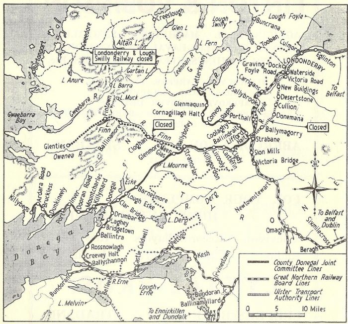
Map of the Co. Donegal 3ft-gauge railway network. [25]
Closing of the Glenties Branch, County Donegal Railways Joint Committee
Passenger services were withdrawn on 13th December 1947, from the Stranorlar-Glenties branch of the County Donegal Railways Joint Committee in Ireland. The stations affected were Glenmore, Cloghan, Ballinamore, Fintown, Shallogans and Glenties. The branch of 3ft-gauge and 24.5 miles in length was constructed under the Light Railways (Ireland) Act of 1889, and opened on 23rd June 1894.
This seems to be far too short an obituary to the Glenties Branch. So, it seemed to me that I should start looking at the Co. Donegal Railways by looking at the Glenties Branch.
As part of my holiday reading, I had set aside the updated version of E.M. Patterson’s book about the Co. Donegal railways (which I first read as a teenager). That 2014 book has been a companion over a couple of weeks of lockdown in 2020. [3]
The Glenties Branch ran through a very rural part of Co. Donegal and seemingly stopped short of what could be considered a ‘sensible’ destination – the Atlantic Coast. Indeed it seems as though there were quite a few people in Ardara on the coast who thought that way. There was a concerted campaign over many years to get a short extension built between Glenties and Ardara. [3] But more of that later!
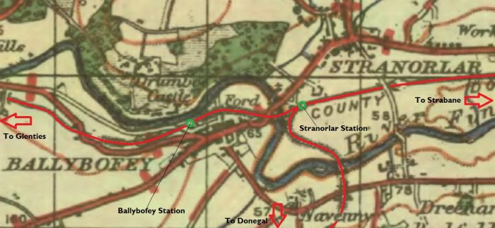
Grace’s Guide tells us that the line between Stranorlar and Glenties was 24 miles (38 km) long and that It opened in 1895. [2] Stranorlar and Ballybofey (located on the other side of the River Finn) together, form the “Twin Towns.” [5] It might interest you to know that there are no schools or churches in the town of Ballybofey itself, all these amenities were governed by laws during plantation times when certain Catholic buildings were not allowed within a specified range of Protestant towns. Times have changed a little now as Stranorlar has both a Roman Catholic and a Church of Ireland church. Both of the Twin Towns have their own railway station.
Stranorlar Railway Station was a junction Station with the line to Glenties branching off the Donegal to Strabane line. Ballybofey Railway Station was on the other side of the River Finn. Ballybofey Railway Station opened on 3rd June 1895 and closed on 15th December 1947 along with the rest of the Glenties branch.
Wikipedia tells us that Stranorlar Railway Station was built by the Finn Valley Railway and opened on 7th September 1863 and finally closed on 6th February 1960. “The old railway station was demolished to make way for a new bus garage owned and run by Bus Éireann. To celebrate the millennium, the old clock from the railway station was restored and installed in a new clock tower which sits at the old pedestrian entrance to the railway station yard. The town remains the main depot for Bus Éireann within County Donegal.” [5]
When first built, the station was the terminus of an Irish standard-gauge (5ft 3in – 1600mm) line which ran from Strabane to Stranorlar. It served in this form for a number of years. In 1880 work commenced on the West Donegal Railway which was built to 3ft-gauge and for a time Stranolar served in this new mixed-gauge era.
 In 1892, the Finn Valley Railway merged with the West Donegal Railway to form a new company, the Donegal Railway Company. The line from Stranorlar to Strabane was then reconstructed to (3 ft – 914mm) gauge. [6] Conversion took very little time as it only required the moving of a single rail and respiking of the railchairs on the smae sleepers that had been used for the 5ft 3in gauge line. As we have already noted the branch to Glenties opened in 1895.
The story of all machinations which eventually brought all these lines into the same fold is told well by Patterson, Begley and Flanders and does not need repeating here. [3]
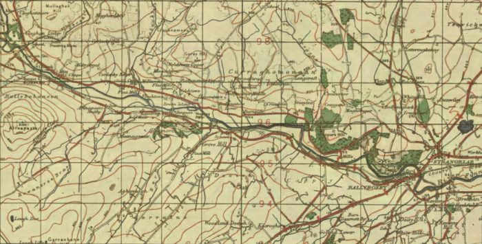
An extract from the Ireland GSGS one inch OS Map Series of the early 1940s [4]
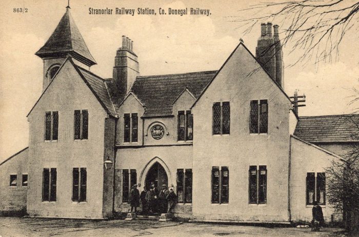
The station building in Stranorlar taken from the station forecourt. This image is shared with the kind permission of David Parks. It appears on his blog: Irish Postcards: irishpostcards.wordpress.com. [8]
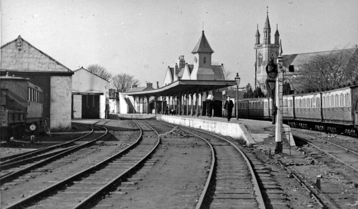
Stranorlar Railway Station in 1948 (c) Wlater Dendy CC BY-SA 2.0. [7]
 The image above looks into the site of Stranorlar Railway Station from the direction of Strabane. I found it on the Irish Railway Modeller’s Forum. [27] The contributor had found it on Facebook.
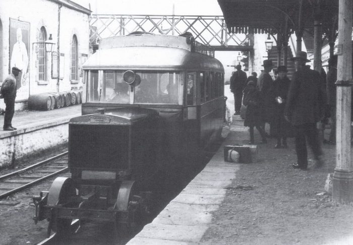 Railcar No 8 arrives at Stanorlar from Glenties sometime in the 1930’s. These railcars had a single front axle and a chain-driven rear bogie, and did not provide the most comfortable rides, (c) John Langford. This image was found on the Donegal Railway Heritage Centre’s Facebook page and is used by kind permission. [40]
I have recently been given access to some station plans from the Co. Donegal Railways produced by Chris Amundson. The link immediately below shows what is known about the layout of Stranorlar Railway Station in different eras.
https://www.flickr.com/gp/spw45/J3354A
Stranorlar, based on Ordnance Survey and numerous photographs, (c) Chris Amundson (CC BY-SA 2.0), included by kind permission . [41]
The next two images show Stranorlar in the mid-1950s and come from the blog, “Hyde Park Now!” and are, in turn, sourced by that site from elsewhere. [25] In giving permission to use these two images, londonblogger expresses concern that it is easy for the historic content of blogs to be lost or dissipated in the sharing of images. The two blogs from ” Hyde Park Now! are very much worth a visit and give a great overall context to this post which focuses on one part of the whole network. These are the relevant links:
https://hydeparknow.uk/2019/12/31/the-county-donegal-railways [25]
https://hydeparknow.uk/2020/01/14/the-county-donegal-railways-2 [26]

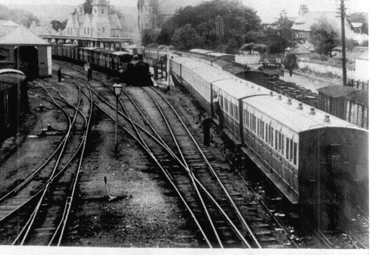
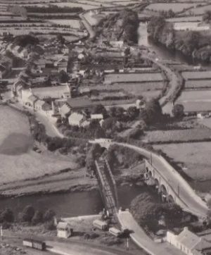
 Stranolar was effectively the headquarters of the Co. Donegal Railways. ‘londonblogger’ on the blog ‘Hyde Park Now!’ notes that it had “an extensive works for the maintenance of rolling stock.” [25] In the first of the two pictures above the maintenance facility is shown to really good advantage. Railcars were serviced in the buildings to the left of the image and steam locomotives to the right.
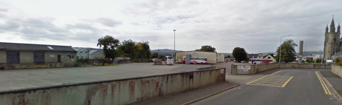 The site of Stranorlar Railway Station as it appeared in 2009 – it functions as Bus Eireann’s Stranorlar Depot. None of the railway infrastructure and buildings remain. (Google Streetview).
Stranorlar to Clohan, GSGS Map of the early 1940s. [30]
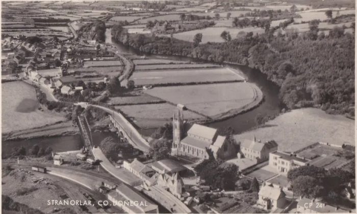 This image shows just how short the distance was from the end of the station platform, used by the Glenties Branch trains, to the bridge over the River Finn at Stanorlar. The village of Ballybofey can be seen at the top of this image. It had its own station. The image is used by kind permission from of David Parks. It appears on his blog: Irish Postcards: irishpostcards.wordpress.com. It was first published by ‘Aero-Views’, Dublin. [28]
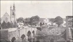
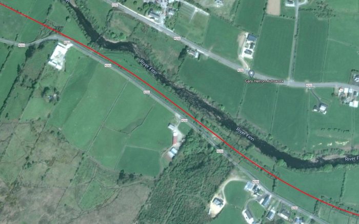
The Glenties branch can be seen crossing the bridge over the River Finn and then cuvidn around the North side of Ballybofey after having been crossed by the main road (N15) on a single-span stone-arch bridge. [28]
Those abutments remain in the 21st century and can be glimpsed from the N15 as it approaches and then crosses the River Finn on its stone-arch viaduct. On the Stranorlar bank of the river, the line first passed over a narrow lane serving the river side on a girder-bridge before crossing the river. The remains of that bridge and the East abutment of the bridge can be seen on the first colour image below. You can just pick out the River Finn in the greenery to the right of the image. The stonework to the bottom right is a length of coping from the road-bridge parapet.
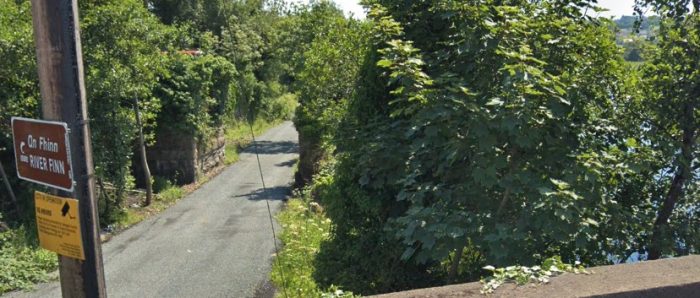
The Glenties Branch Bridge over the River Finn, east abutment. The picture was taken in June 2018 (Google Streetview).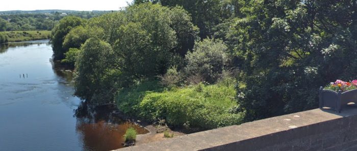 It is impossible to pick out the stone abutment to the West of the River Finn among the greenery on the river banks. This picture was also taken in June 2018. (Google Streetview).
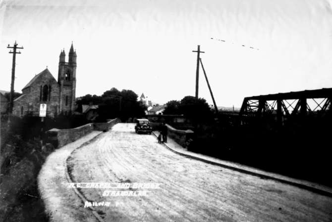 The view back into Stranorlar across the River Finn from Ballyfoley. The Glenties Branch Railway Bridge over the River Finn can be seen on the right of this picture [33]
 A postcard view of the Bridge over the River Finn (The Linen Hall Library Collection – available for sharing) [35]
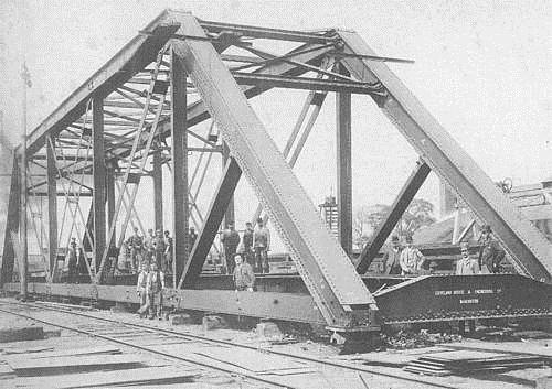
The River Finn Railway bridge at Stranorlar/Ballybofey during construction of the line. The superstructure sits alongside the railway awaiting being moved into position across the river. The image is from the geocache webpage for this location. [36]
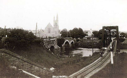
A postcard view looking back across the River Finn from Ballybofey towards Stranorlar Railway Station. Both of the river bridges are in the photograph, as is the bridge wingwall of the stone arch bridge which carried the road over the Glenties Branch. [37]
The route of the old branch-line to the Northwest of the N15 is now hidden by redevelopment. The early 1940s GSGS One-inch Map shows the railway crossing Back Road on an overbridge and then running alongside the river into Ballybofey Railway Station. [29]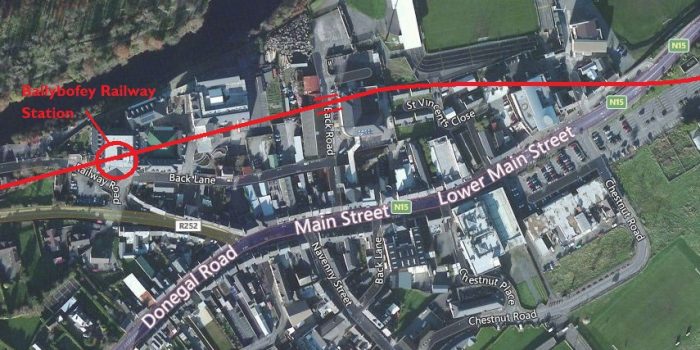 The approximate line of the old railway which ran across the North side of the village of Ballybofey, lifted from the GSGS Map of the early 1940s. [29]
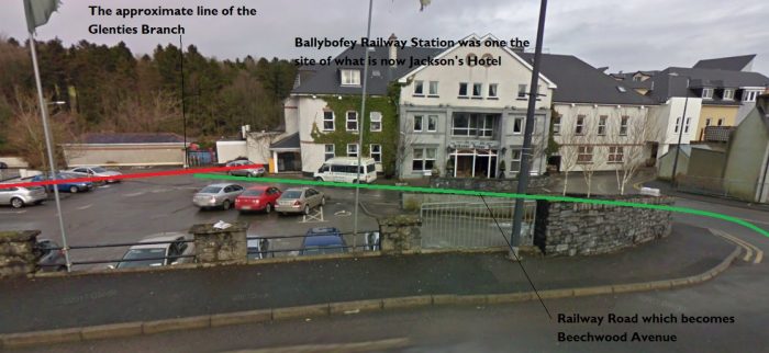 The site of Ballybofey Railway Station. This picture was taken in 2010 (Google Streetview)
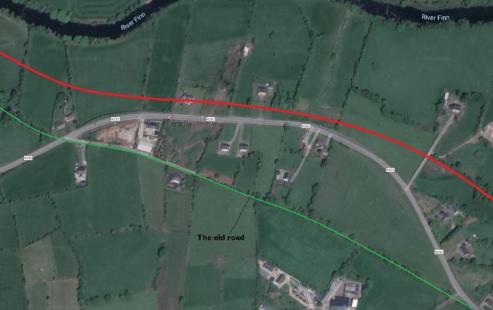
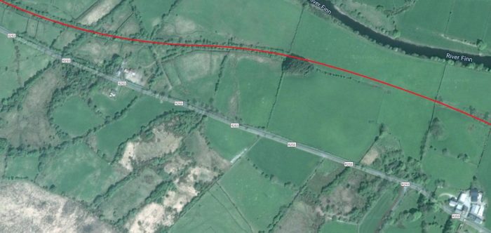
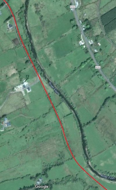
At the West end of Ballybofey Station the line crossed what is now Railway Road/Beechwood Avenue on the level and then ran between Beechwood Avenue and Glenfin Street/Road (R252) parallel to the River Finn. The first length is now buried under domestic dwellings.
After a short distance the R252 (Glenfin Road) crossed the old line on an over-bridge. With the closure of the line, it became possible for a small road improvement scheme to straighten out the line of the roadas shown below.
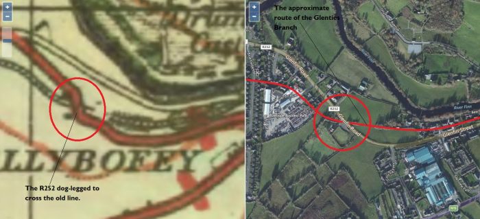
The Glenties Branch West of Ballybofey. [31]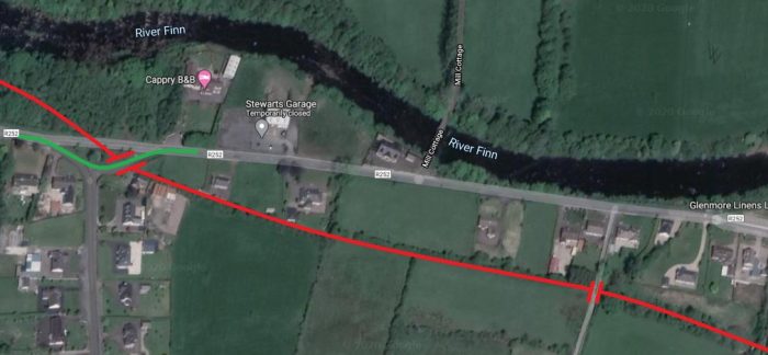 After passing under an accommodation bridge the line continued in a westerly direction with the R252 once agin dog-legging to cross it close to the River Finn (Google Earth).
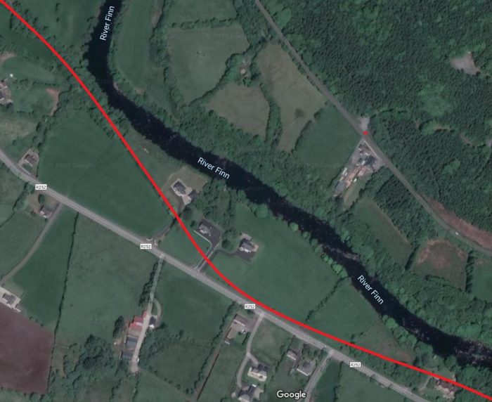
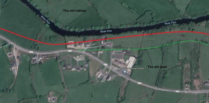
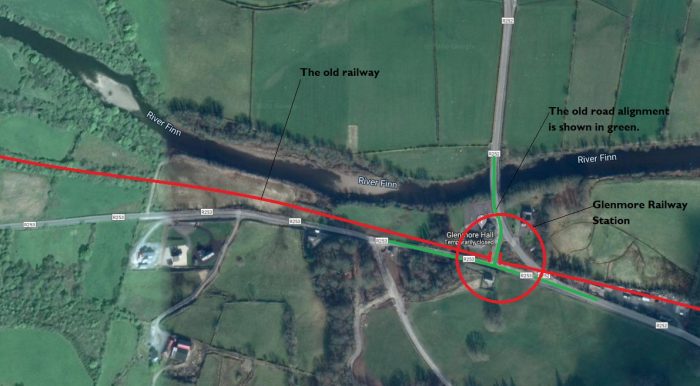
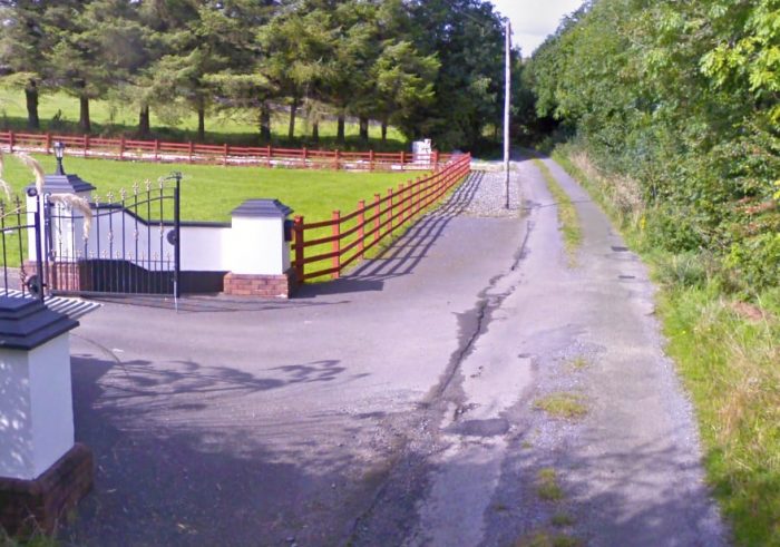
 Glenmore Railway Station opened on 3rd June 1895. [32] There is no evidence of its existence in the early 21st century. The church which is marked on the GSGS Map of the early 1940s is still standing to the West of the old road junction. The railway passed to the South of the Church between it and the R253. I have shown the location ringed in red on the satellite image immediately above. The R252 curves through what would have been the station site. there would have been a level-crossing and the point above where the line crossed the old road (marked with a break in the red line).
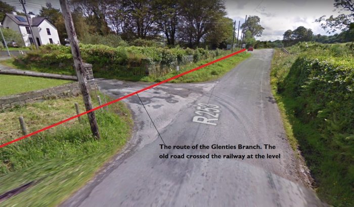 Looking East from the R253 adjacent to the churchyard at Glenmore in July 2011 (Google Streetview).
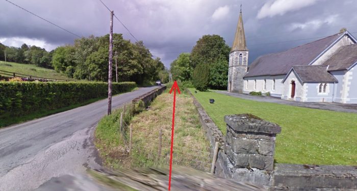 The line of the old railway is so much easier to determine when the boundary walls still remain in place. This view looks to the West from the old road junction, again in July 2011. Glenmore Church can be seen on the right (Google Streetview).
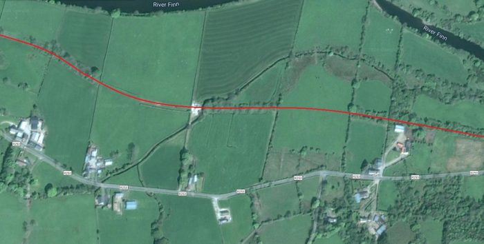
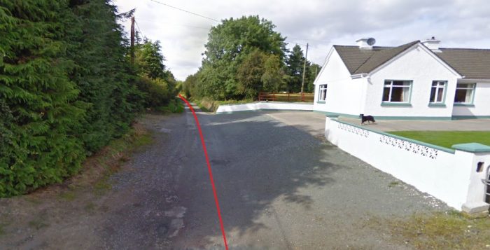
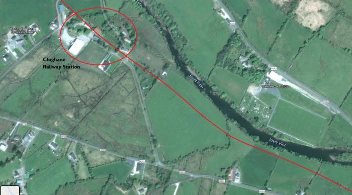 Cloghan Railway Station was a couple of kilometres South of the Village with the same name. The old railway turned gradually to the Northwest as it approached the station, still following the River Finn. The old station building retains the designation Station House although it is in the Townland of Gortiness. It has been extended along the line of the old platform tp the Southeast.
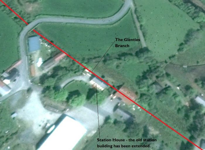
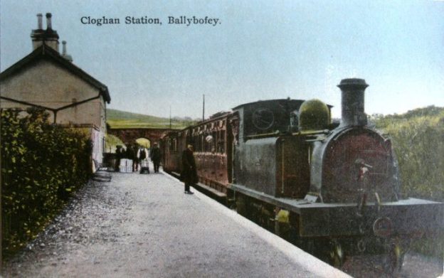
 This postcard view of Cloghan Station is a colourised monochrome image. It is taken from the Southeast. The station building can be seen on the left of the image and the road bridge can be seen beyond the platform. Permission to include this image was very kindly given by David Parks. It appears on his blog: Irish Postcards: irishpostcards.wordpress.com. [8]
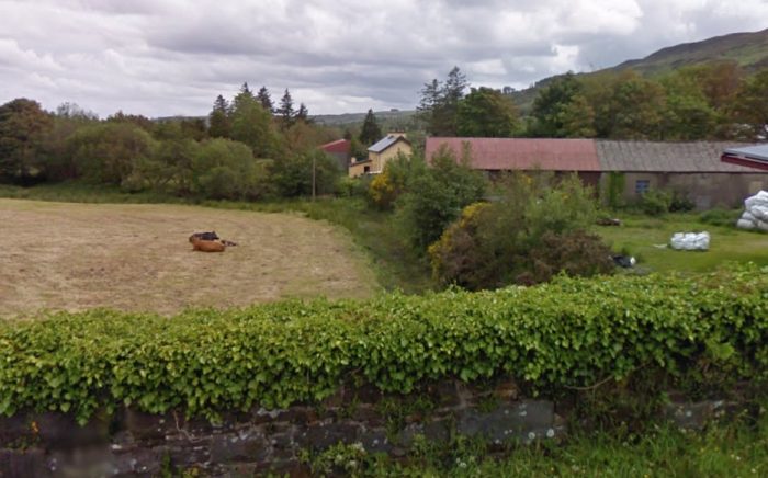 This view shows the old Station House which is in cream at the centre of the picture. It is taken from the road bridge shown in the postcard view, looking Southeast along the route of the old railway line. The line is marked by the line of bushes running towards the Station House (Google Streetview).
 The old Station House at Cloghan Railway Station. The image comes from June 2011. The first three windows from the left on the 1st floor were part of the original building. The extension is on the right (Google Streetview).
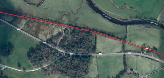
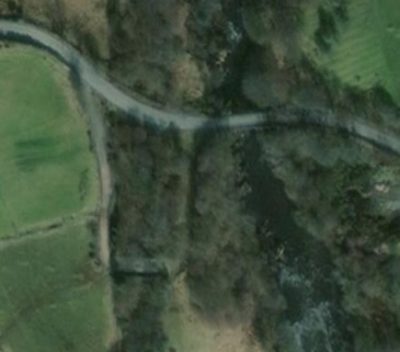
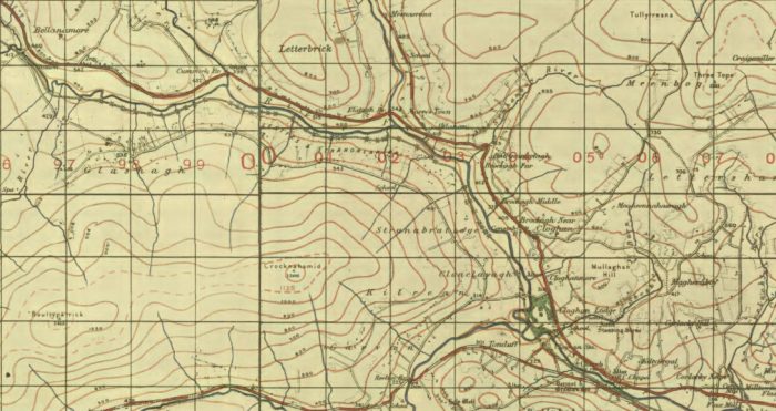
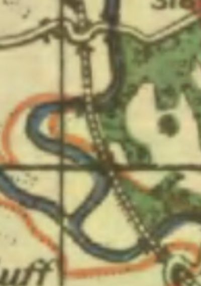 From Cloghan Railway Station the Glenties Branch turned North, crossing the River Finn twice as shown on the adjacent extract from the GSGS 1940s Map and continued up the Finn Valley. The next three photographs show the route of the line at the road bridge marked at the top of the map extract which was about a kilometre South of the village of Cloghan.
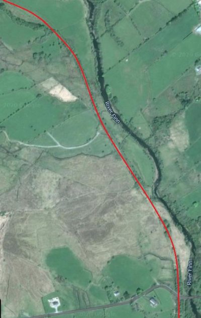
The first is a view on Google Streetview which is taken from just to the West of the the River Finn road bridge at the top of the adjacent map extract. The road alignment on the extract needs verifying. It seems as though the position of the railway was a little closer to the river.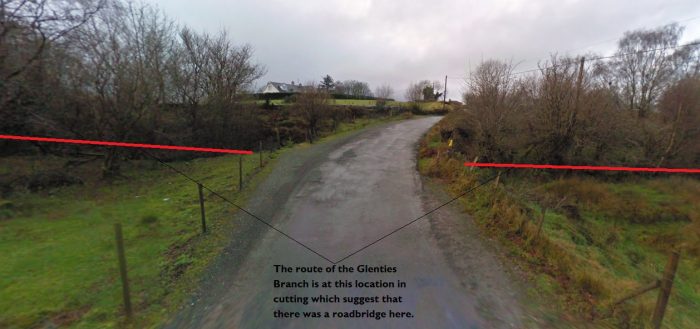
The second image is a close up satellite view from Google Maps which has had the old railway route at its centre.The old road alignment is marked by the cartographers who have provided the road overlay to the satellite images associated with Google Maps. Teh road used to turn sharply to the South after crossing the river to a point where crossing the line was possible. It is not clear whether this was a bridge or a level-crossing.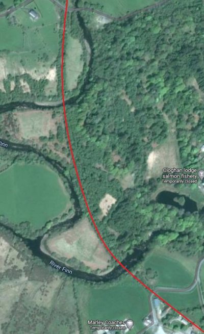
I have been unable to find photographs of the two bridges over the River Finn. Nor are there any photos of the road crossing point near the top of the satellite image.
The next image shows the Glenties Branch alignment through this area. The red line, again, show the route of the railway.
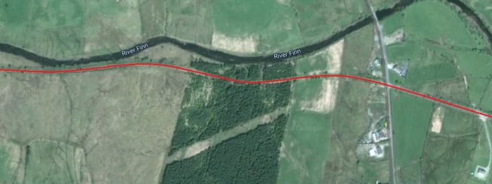
The next map extract is at a smaller scale and shows the route of the old line to Ballinamore. The valley of the River Finn turns once again to the West after passing Cloghan village and the railway remained on the West and then South side of the river.
These next two satellite images follow the old railway route along the West side of the River Finn before it turns to the West again.
The first runs across open fields alongside the River Finn. The second continues in the same vein. At around the half-point of the satellite image extract a farm access track now uses the old railway formation as it travels North.
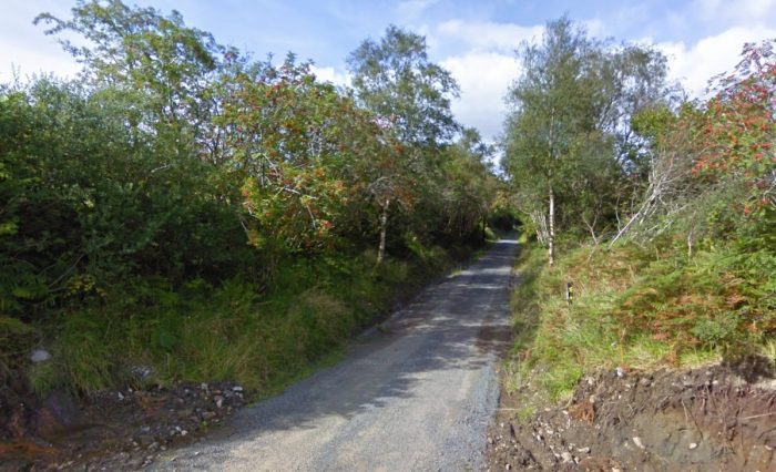
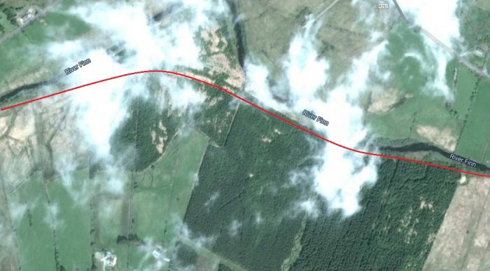
The first landscape image below is another satellite image which shows the gradual change of direction of the old line as it swung round towards the West. The next, illustrates the condition of the railway formation in 2009, At that time the gravel surface had newly been relaid. Further to the North the track shows up as having been tarmacked in 2009.
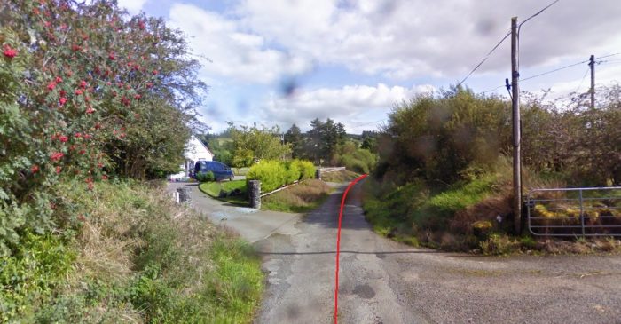
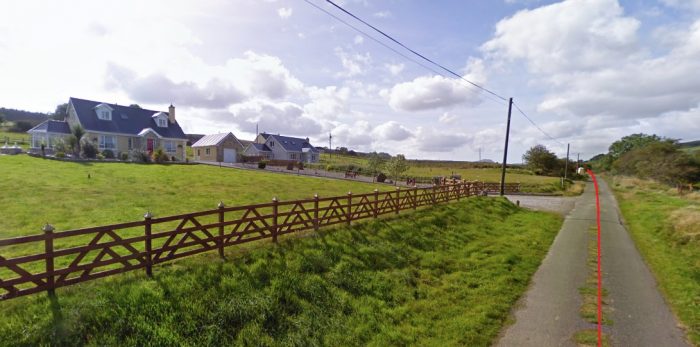
A sequence of photographs from Google Streetview covers the next few kilometres of the old railway. Various dwellings have been built since the closure of the line which have the old railway formation as their only access route.
A good number of these homes appear to have been constructed since the turn of the 21st century.
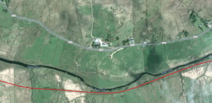
Eventually the tarmacked length of the old formation ends where the old railway crossed another road. A satellite image follows the Google Streetview photographs and again picks up the line close to that road crossing.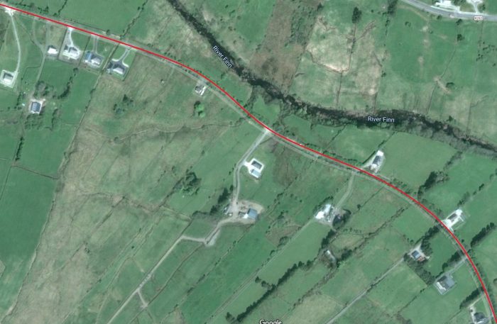
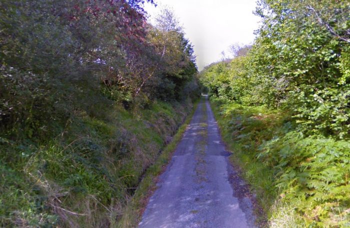
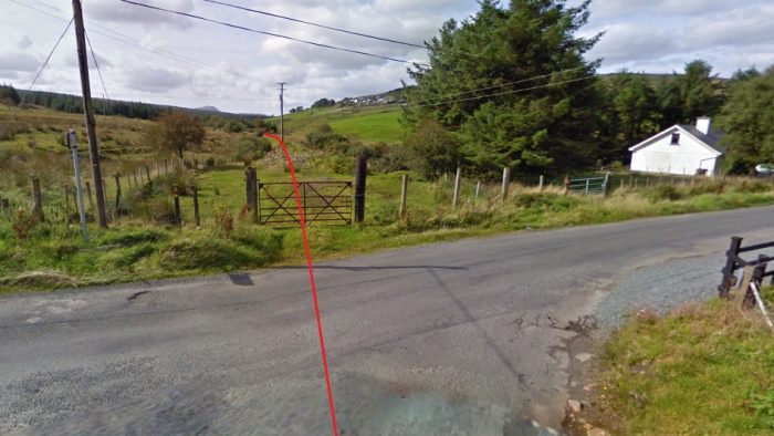
 The last Streetview photograph above shows the point at which the old railway formation meets what is now a local road. If the road had been present during the life of the Glenties Branch, this would have been a level crossing probably without gates. However the GSGS map (see below) does not show a road at this location in the early 1940s.
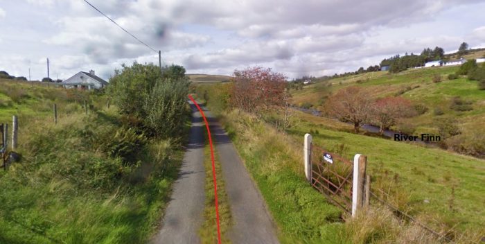
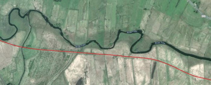
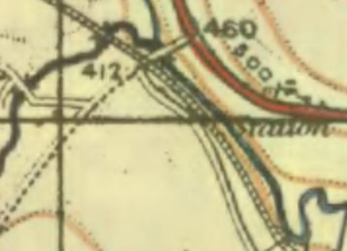
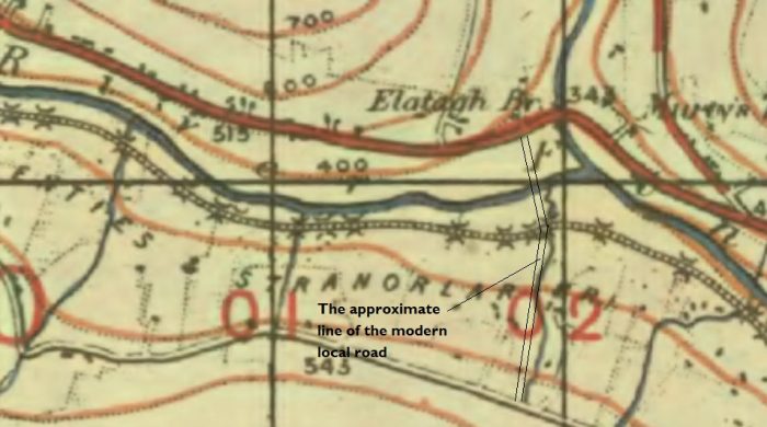 The Glenties Branch continued westward on the South side of the River Finn. There was a need for a significant number of culverts to allow land drainage to reach the river. They show up particularly well of the extract from the GSGS map above.
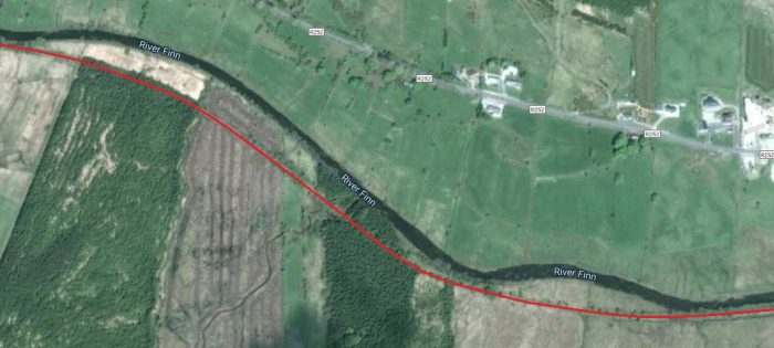
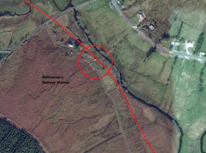
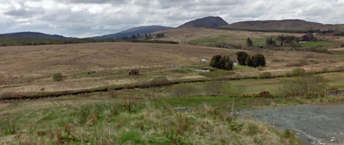 Ballinamore Station Building in 2010 seen from the R252. It is difficult to imagine a more remote location for a Station Halt nor a more run-down, but still standing, corrugated iron building. As we can see in the last picture of this article, the platform face still remains! (Google Streetview)
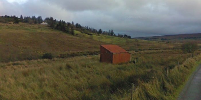 Ballinamore Station Building! It was still standing in 2020 as can be seen on the Satellite image above. This picture was taken in 2009 (Google Streetview).
Ballinamore Railway Station opened in June 1895 and closed in December 1947. [38]
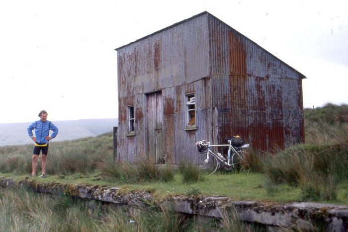
Former Ballinamore County Donegal Railway Station, June 1990 – The photographer says, “Miles from anywhere, not a house or tree in sight. Once the haunt of snub-nosed diesel railbuses. Ballinamore station, opened in 1895 was about half way between Glenties and Stranorlar on the CDR County Donegal Railway.” (Scanned slide) (c) G Sludge (Attribution-ShareAlike 2.0 Generic (CC BY-SA 2.0)). [39]
We have reached the end of this first part of the journey from Stranorlar to Glenties. It is hard to think of a worse place to stop and we only do so because it is roughly at the half-way point on the journey to Glenties.
References
- The Railway Magazine: ‘Notes and News’; May & June 1948 edition. Volume 94 No. 575, p202.
- https://www.gracesguide.co.uk/County_Donegal_Railways_Joint_Committee, accessed on 21st May 2020.
- Edward M Patterson (original author), Joe Begley & Steve Flanders (authors of additional material in the Revised Edition); The County Donegal Railways; Colourpoint Books, Newtownards, Co. Down 2014.
- https://maps.nls.uk/geo/explore/#zoom=15&lat=54.80218&lon=-7.77993&layers=14&b=1, accessed on 21st May 2020.
- https://en.wikipedia.org/wiki/Stranorlar, accessed on 21st May 2020.
- https://en.wikipedia.org/wiki/Finn_Valley_Railway, accessed on 21st May 2020.
- https://en.wikipedia.org/wiki/Stranorlar_railway_station#/media/File:Stranorlar_station,_County_Donegal_Railways_Joint_Committee,_1948_(geograph_5307210).jpg, accessed on 21st May 2020.
- https://irishpostcards.wordpress.com/transport, accessed on 23rd May 2020.
- https://www.flickr.com/photos/irishswissernie, accessed on 23rd May 2020.
- https://www.flickr.com/photos/irishswissernie/23589146660/in/album-72157662649694575 – CDRJC Stranorlar, goods entering from Strabane 1958 (c) Henry Emeleus/ARPT, accessed on 23rd May 2020.
- https://www.flickr.com/photos/irishswissernie/16492159115 – Stranorlar 1957, accessed on 23rd May 2020.
- https://www.flickr.com/photos/irishswissernie/23256677994 – CDRJC Stranorlar Railcar No. 19, 1958 (c) Henry Emeleus/ARPT, accessed on 23rd May 2020.
- https://www.flickr.com/photos/irishswissernie/6180278429/in/album-72157662649694575 – CDRJC Stranorlar just after closure 1960, taken from the Eastern approach from Strabane, accessed on 23rd May 2020.
- https://www.flickr.com/photos/irishswissernie/23858764346/in/album-72157662649694575 – CDRJC ‘Erne’ on shed at Stranorlar in 1958 (c) Henry Emeleus/ARPT, accessed on 23rd May 2020.
- https://www.flickr.com/photos/irishswissernie/41879605651/in/album-72157662649694575 – Class 5 on shed at Stranorlar in 1958, accessed on 23rd May 2020.
- https://www.flickr.com/photos/irishswissernie/23258058353/in/album-72157662649694575 – CDRJC Stranorlar in 1958 (c) Henry Emeleus/ARPT, accessed on 23rd May 2020.
- https://www.flickr.com/photos/irishswissernie/23539544992/in/album-72157662649694575 – 0956-3 Railcar Stranolar station (c) J W Armstrong/ARPT, accessed on 23rd May 2020.
- https://www.flickr.com/photos/irishswissernie/23258060463/in/album-72157662649694575 – CDRJC Stranorlar station, Railcar No. 19 arrives from Donegal in 1958. The former Glenties platform is in foreground (c) Henry Emeleus/ARPT, accessed on 23rd May 2020.
- https://www.flickr.com/photos/irishswissernie/15872003843/in/album-72157662649694575 – goods wagons outside the General Store at Stranorlar Railway Station in 1957, accessed on 23rd May 2020.
- https://www.flickr.com/photos/irishswissernie/16304711660/in/album-72157662649694575 – close-up of the plaform canopy columns at Stranorlar Railway Station in 1957, accessed on 23rd May 2020.
- https://www.flickr.com/photos/irishswissernie/6180266037/in/album-72157662649694575 – CDRJC Stanorlar Railcar No. 19 on Killybegs service on 8th July 1956 (b726), accessed on 23rd May 2020.
- https://www.flickr.com/photos/irishswissernie/6180279023/in/album-72157662649694575 – colour image of Stranorlar Railway Station in 1958, taken from the Southwest, accessed on 23rd May 2020.
- https://www.flickr.com/photos/irishswissernie/6180277183/in/album-72157662649694575 – CDRJC_Stranorlar: Railcar No. 18 on the turntable in 1958, accessed on 23rd May 2020.
- https://www.flickr.com/photos/irishswissernie/6180272243/in/album-72157662649694575 – Stranorlar Railway Station Footbridge. Picture taken in May 1963 after closure of the line, accessed on 23rd May 2020.
- https://hydeparknow.uk/2019/12/31/the-county-donegal-railways, accessed on 23rd May 2020. The map of the network was in turn sourced from Twitter: https://twitter.com/velvetninja1/status/1188118651536314369
- https://hydeparknow.uk/2020/01/14/the-county-donegal-railways-2, accessed on 23rd May 2020.
- https://irishrailwaymodeller.com/topic/7262-donegal-railway/page/2, accessed on 23rd May 2020.
- https://irishpostcards.wordpress.com/aerial-cards, accessed on 24th May 2020.
- https://maps.nls.uk/geo/explore/side-by-side/#zoom=17&lat=54.80016&lon=-7.78155&layers=14&right=BingHyb, accessed on 24th May 2020.
- https://maps.nls.uk/geo/explore/#zoom=13&lat=54.81900&lon=-7.84274&layers=14&b=1, accessed on 21st May 2020.
- https://maps.nls.uk/geo/explore/side-by-side/#zoom=16&lat=54.79994&lon=-7.79374&layers=14&right=BingHyb, accessed on 26th May 2020.
- https://en.wikipedia.org/wiki/Glenmore_railway_station, accessed on 26th May 2020.
- https://www.heritageweek.ie/whats-on/event/past-times-photograph-exhibition, accessed on 26th May 2020.
- https://m.facebook.com/TheTwinTownsDonegal, accessed on 26th May 2020.
- https://www.postcardsireland.com/postcard/roman-catholic-church-and-road-and-rail-bridges-ballybofey, accessed on 24th May 2020.
- https://www.geocaching.com/geocache/GC27NQG_finn-valley-bridges-ballybofey-bridge?guid=0e6f9849-1b77-432e-bc57-a34712885176, accessed on 26th May 2020.
- http://ballybofeyandstranorlar.com, accessed on 26th May 2020. (A subsequent internet search to find this image only produced a similar but watermarked version of the photograph.)
- https://en.wikipedia.org/wiki/Ballinamore_railway_station, accessed on 28th May 2020.
- https://www.flickr.com/photos/sludgeulper/3611611930, accessed on 29th May 2020.
- https://www.facebook.com/DonegalRailwayHeritageCentre/photos/a.1230417866994452/2944521065584115/?type=3&theater, accessed on 15th July 2020.
- Chris Amundson has been working on a series of large scale map plans of the Co. Donegal Railway Stations. He has very kindly allowed me to link to that work. (https://www.flickr.com/gp/spw45/y49162)

.jpg)
Pingback: Co. Donegal Railways, Ireland – Part 2 – The Glenties Branch – Ballinamore to Glenties | Roger Farnworth
WONDERFUL SITE THANKS I LIVE IN DUBLIN BUT MY MOTHER WAS BROUGHT UP IN BALLYBOFEY SPENT HER CHILDHOOD PLAYING ON THE RAILWAY
Our family spent six years in Glenties when my father was assigned to the Garda Siochana station in Glenties. Thanks for posting such a detailed investigation of the old RR line.
Pingback: The Donegal Railway Heritage Centre | Roger Farnworth