The Burtonport Extension of the ‘Londonderry & Lough Swilly Railway’ – Part 2

This second article about the Burtonport Extension covers the length from Kincasslagh Road Railway Station to Cashelnagor Railway Station.

The first of these articles can be found at:

The Burtonport Extension of the ‘Londonderry & Lough Swilly Railway’ – Part 1

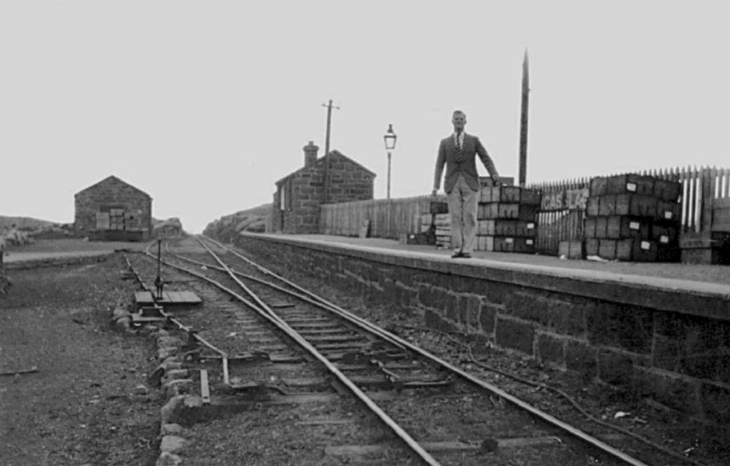
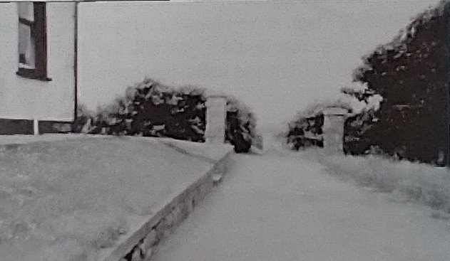
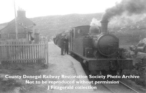
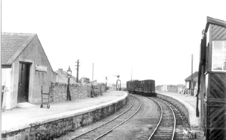
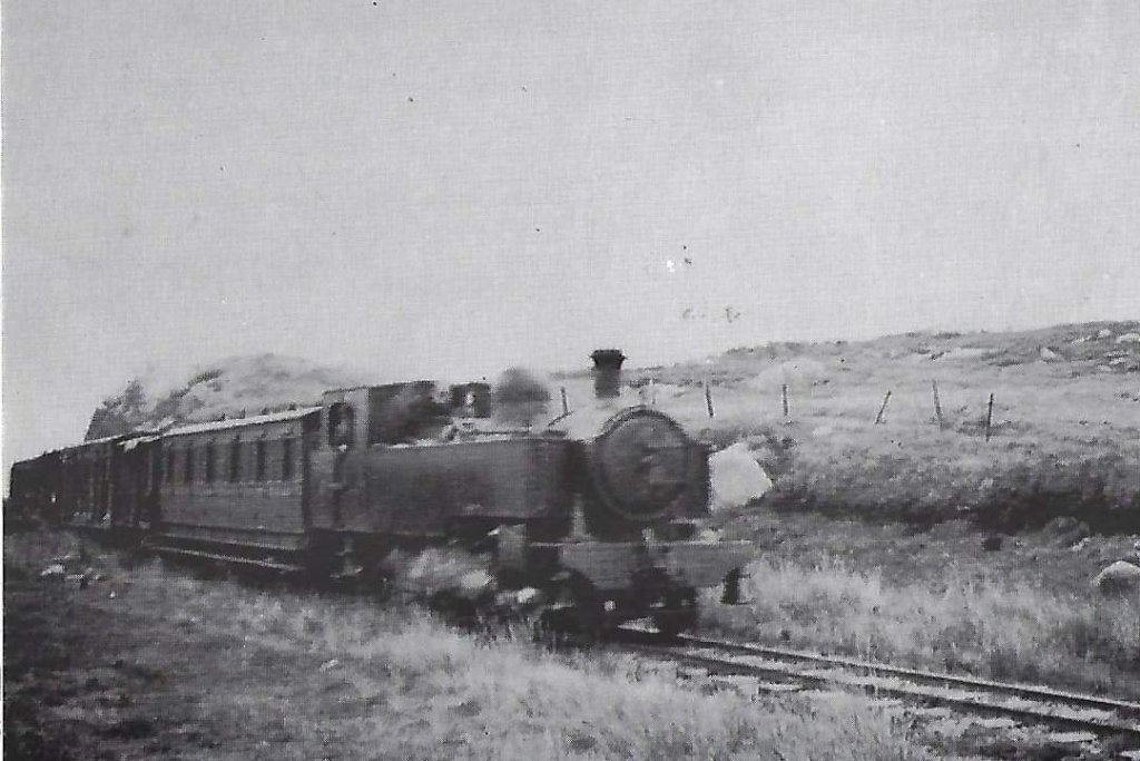
Kincasslagh Road Railway Station as seen in Joe Begley’s article about the January 1921 ambush. [1]

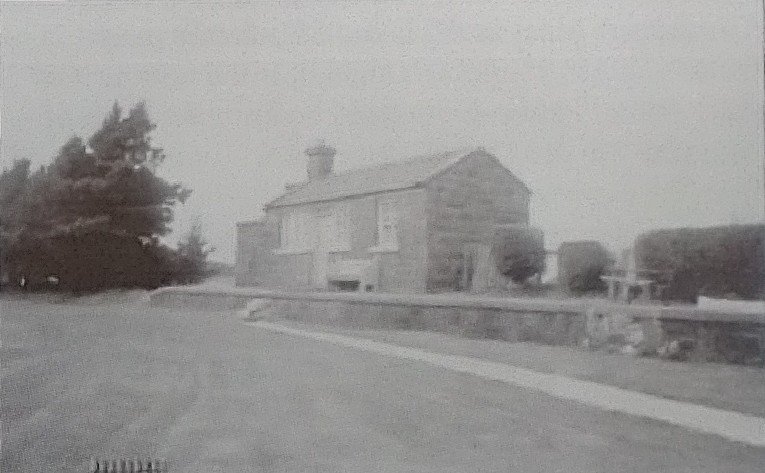
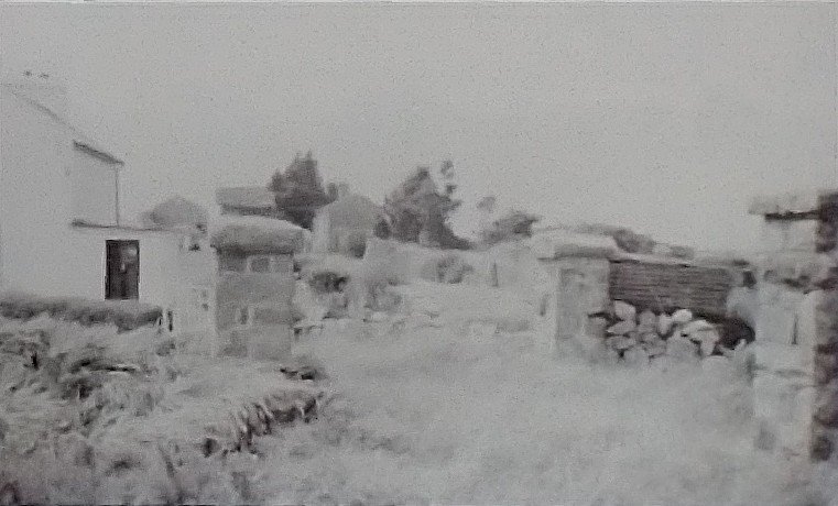
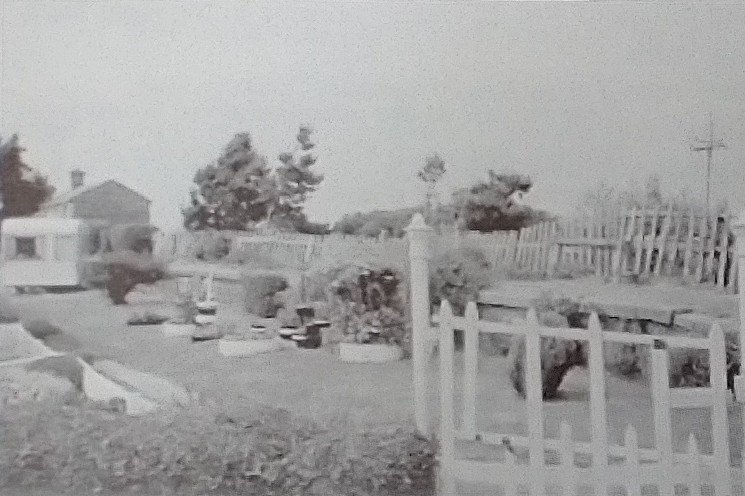
The next four photographs come from Dave Bell and Steve Flanders book,’The Londonderry and Lough Swilly Railway: A Visitor’s Guide‘. [2: p82]

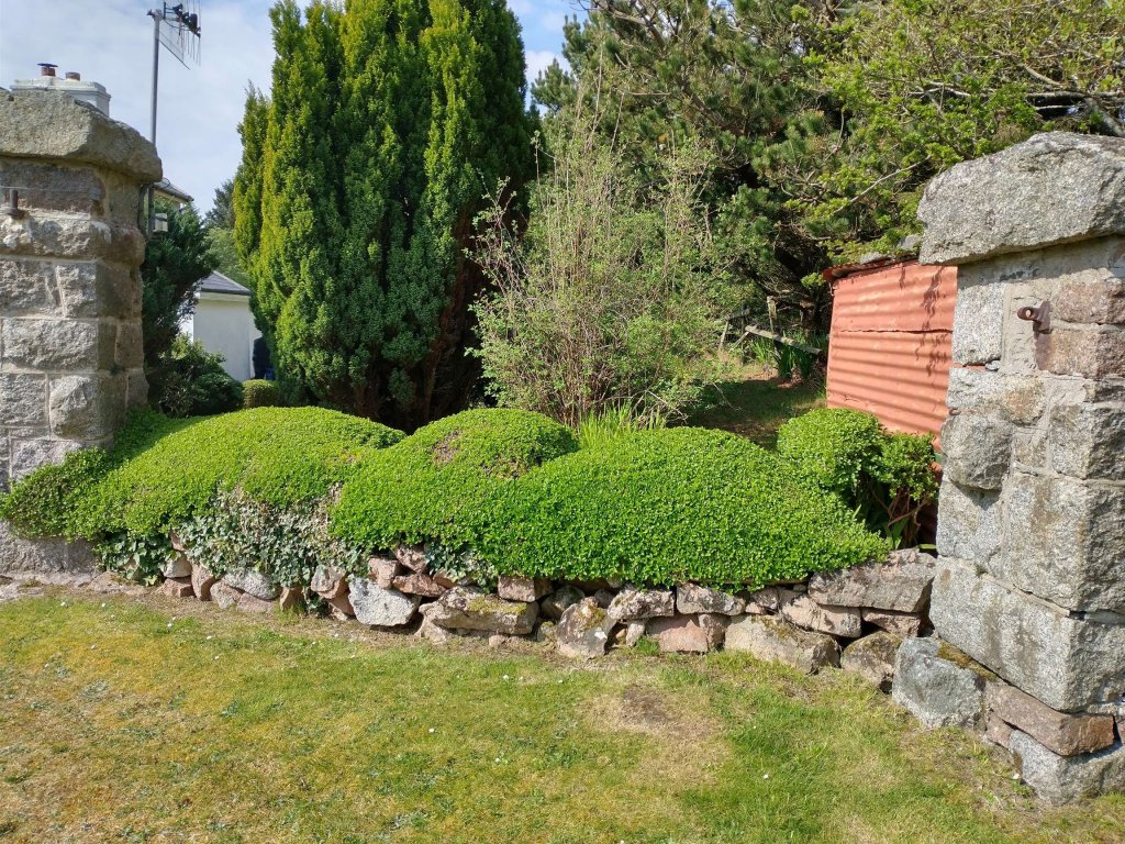
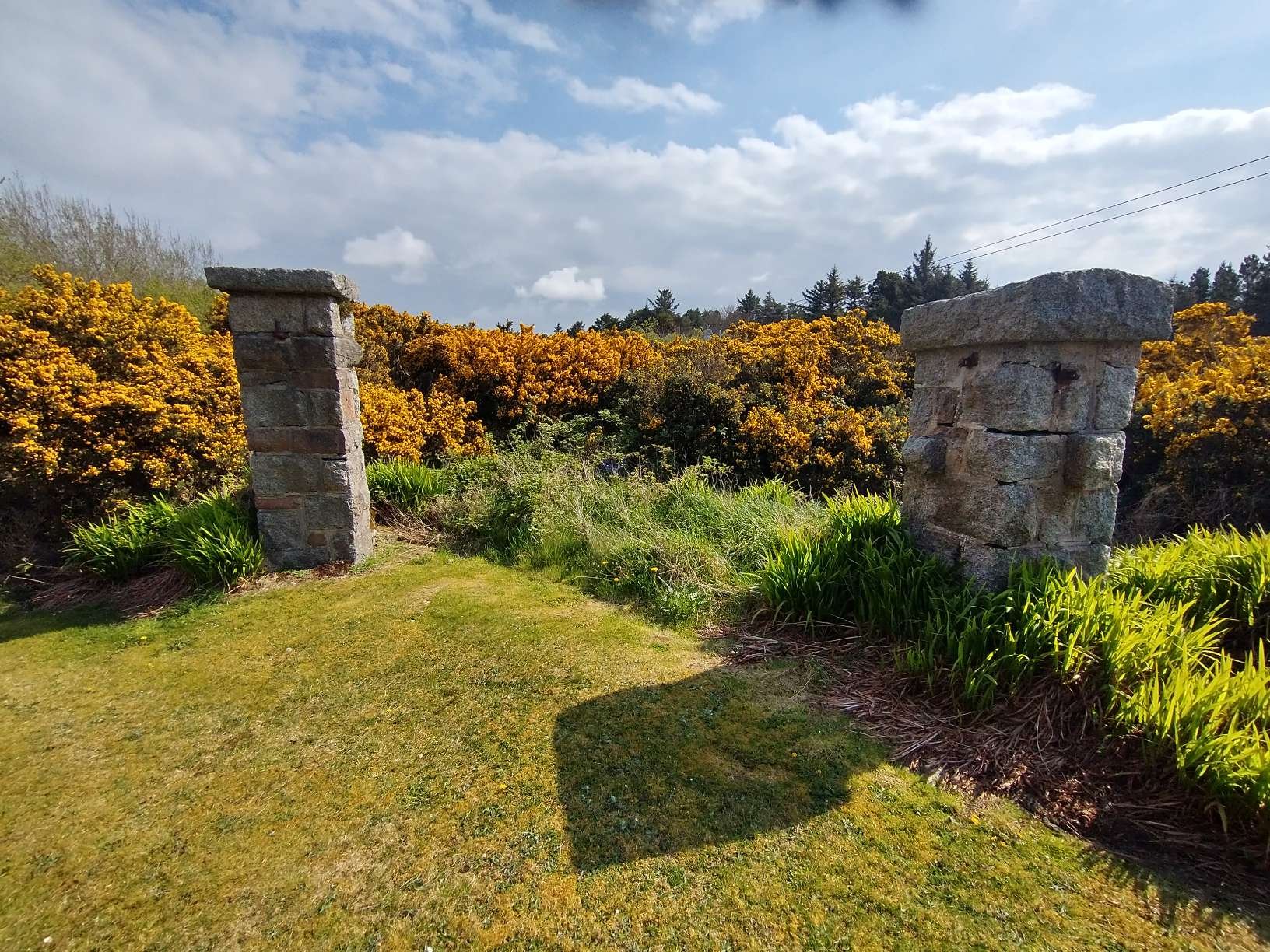
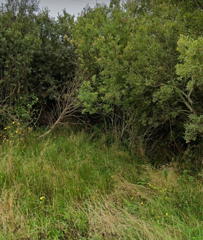
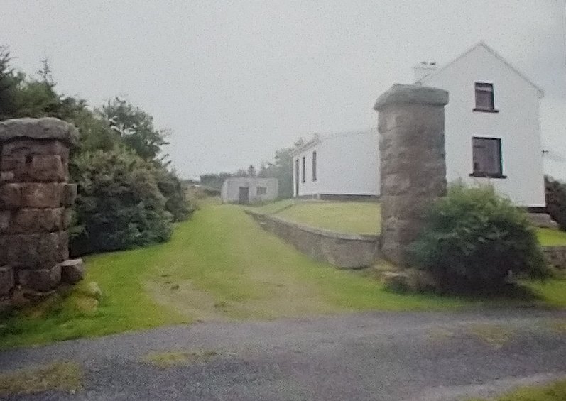
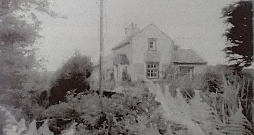
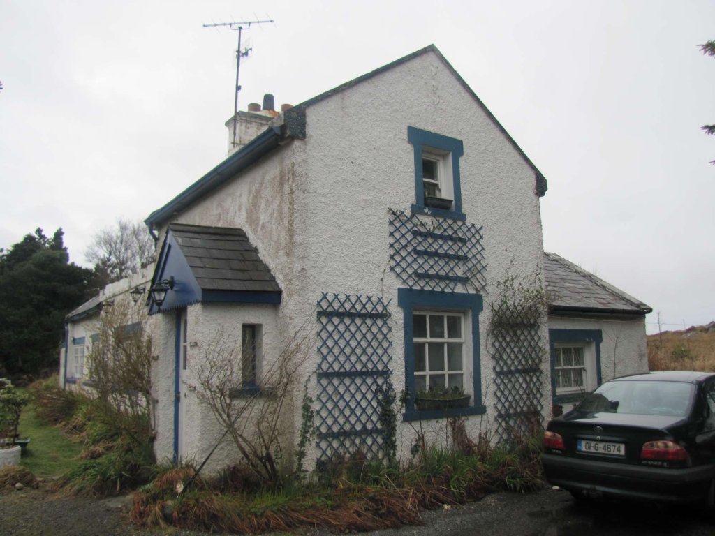
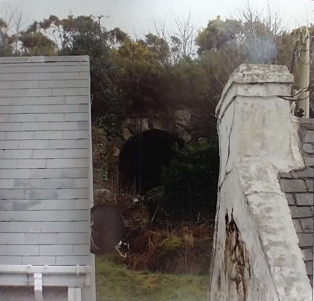
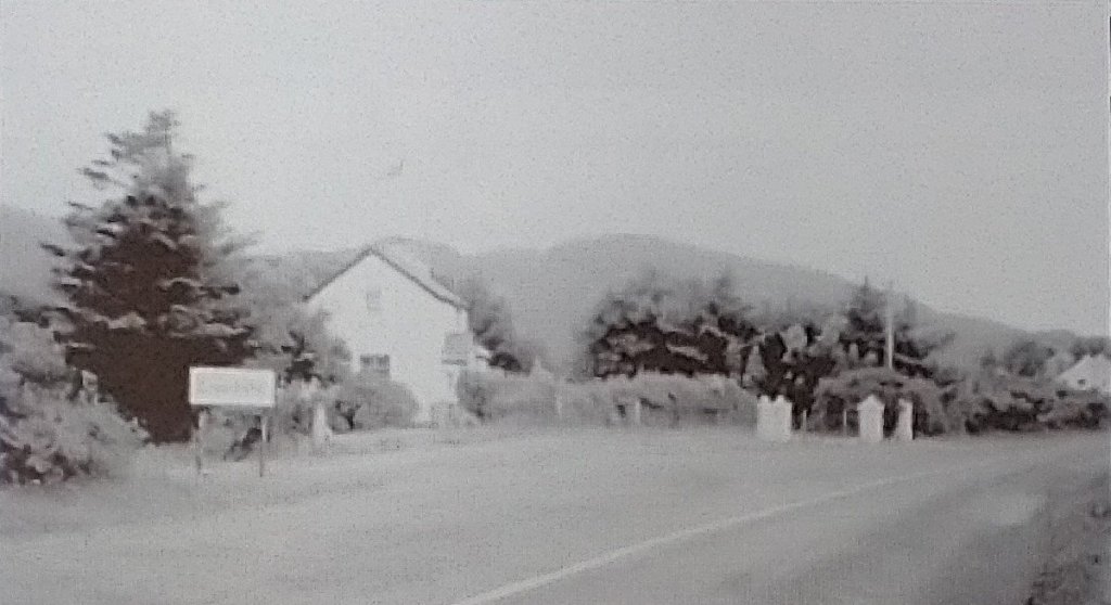
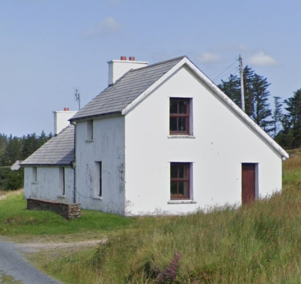
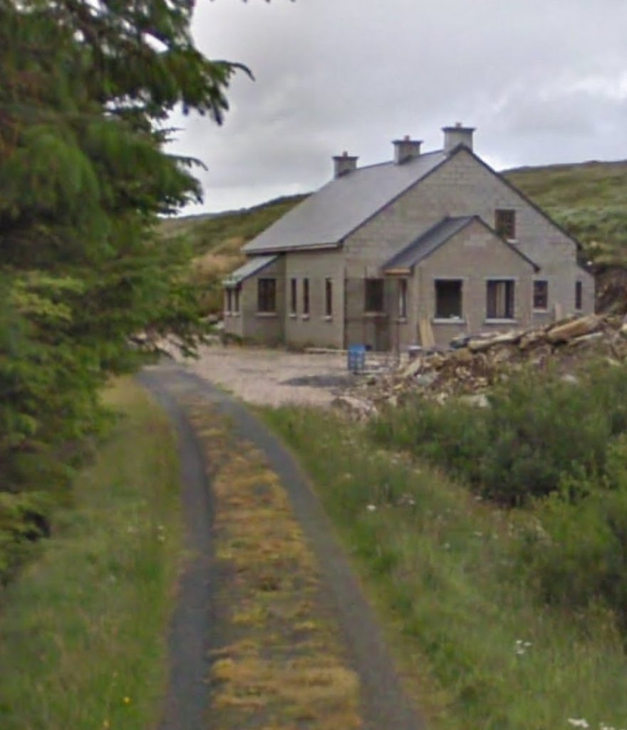
The passenger building at Kincasslagh Road Station as it appeared in the late 1980s. [2: p82]
The view Southwest through the site of the Station from what was once the level crossing. [2:p82]
Stepping beyond the pillars which supported the crossing gates, this view again looks Southwest through the site of the Station. [2:p82]
The old road and level crossing at the site. The road was diverted to the East of this location. The building on the left is the Crossing Keeper’s Cottage (No. 21). [2:p82]

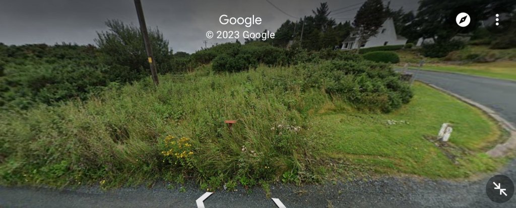
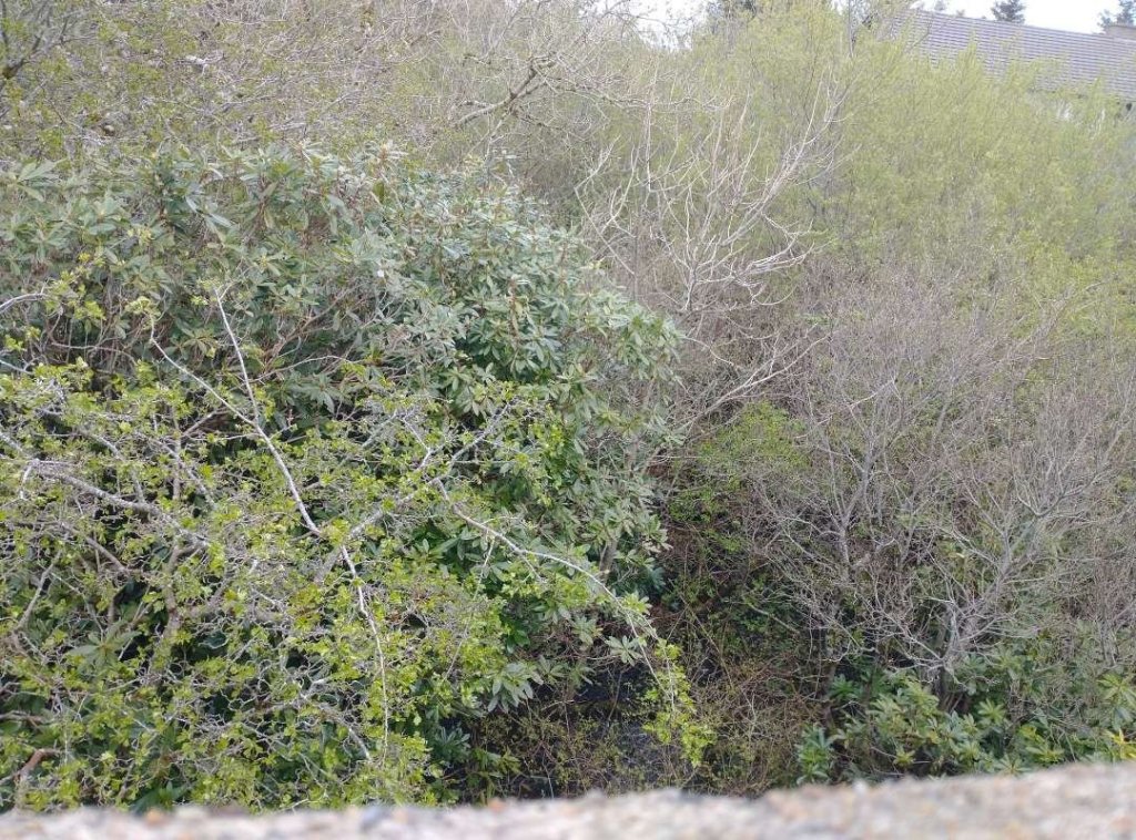
The undergrowth at this location, (and possibly the garden planting too) has grown significantly in the last 30 years.

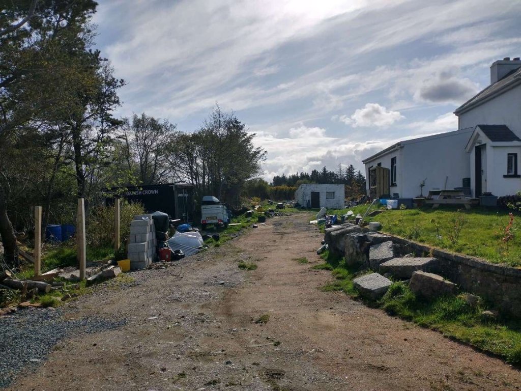
These pictures featured at the end of the first article about the Burtonport Extension. [My photographs, 23rd April 2023]

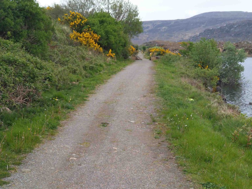
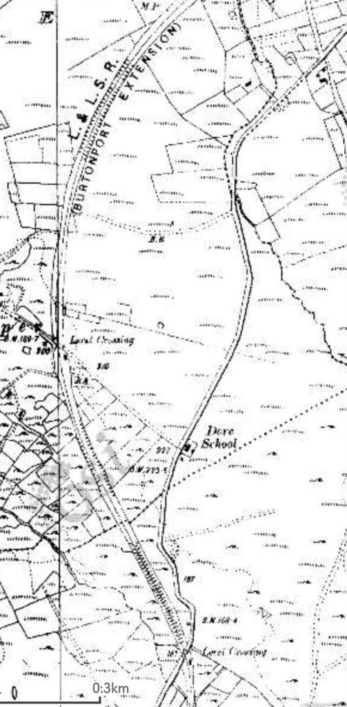
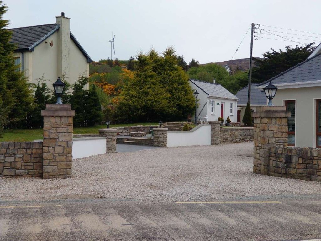
We start this part of the journey with a short time to reflect at Kincasslagh Road Railway Station. The station was the location of the first action in the War of Independence in 1918. The memorial shown below sits on the road at the Northeast end of Kincasslagh Road Station.

The English text on the memorial reads: TO COMMEMORATE THE FIRST ACTION IN THE WAR OF INDEPENDENCE, WHEN THE IRISH VOLUNTEERS RESCUED TWO COMRADES, JAMES WARD & JAMES DUFTY FROM BRITISH TROOPS THIS PLACE ON THE 4TH DAY OF JANUARY 1918.

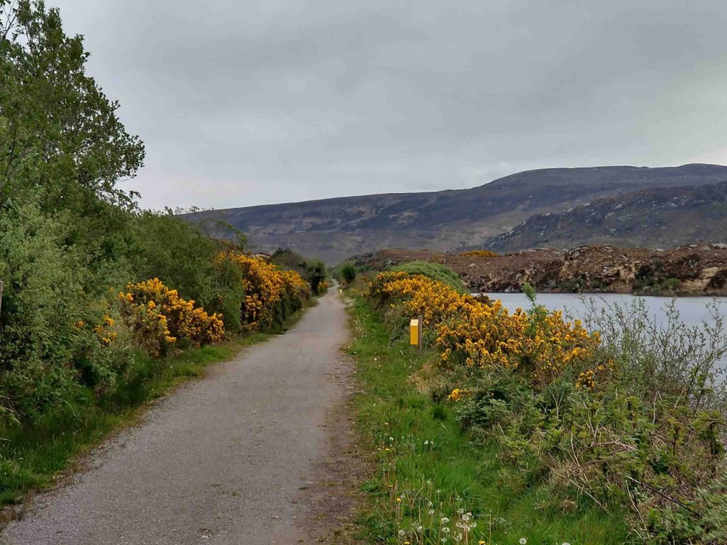
Joe Begley has written an excellent piece on a later ambush which occurred on 12th January 1921 and the events that surrounded it. [1] That ambush took place in a cutting to the Northeast of Kincasslagh Road Railway Station, known locally as Paddy Ghráinne’s Cutting.

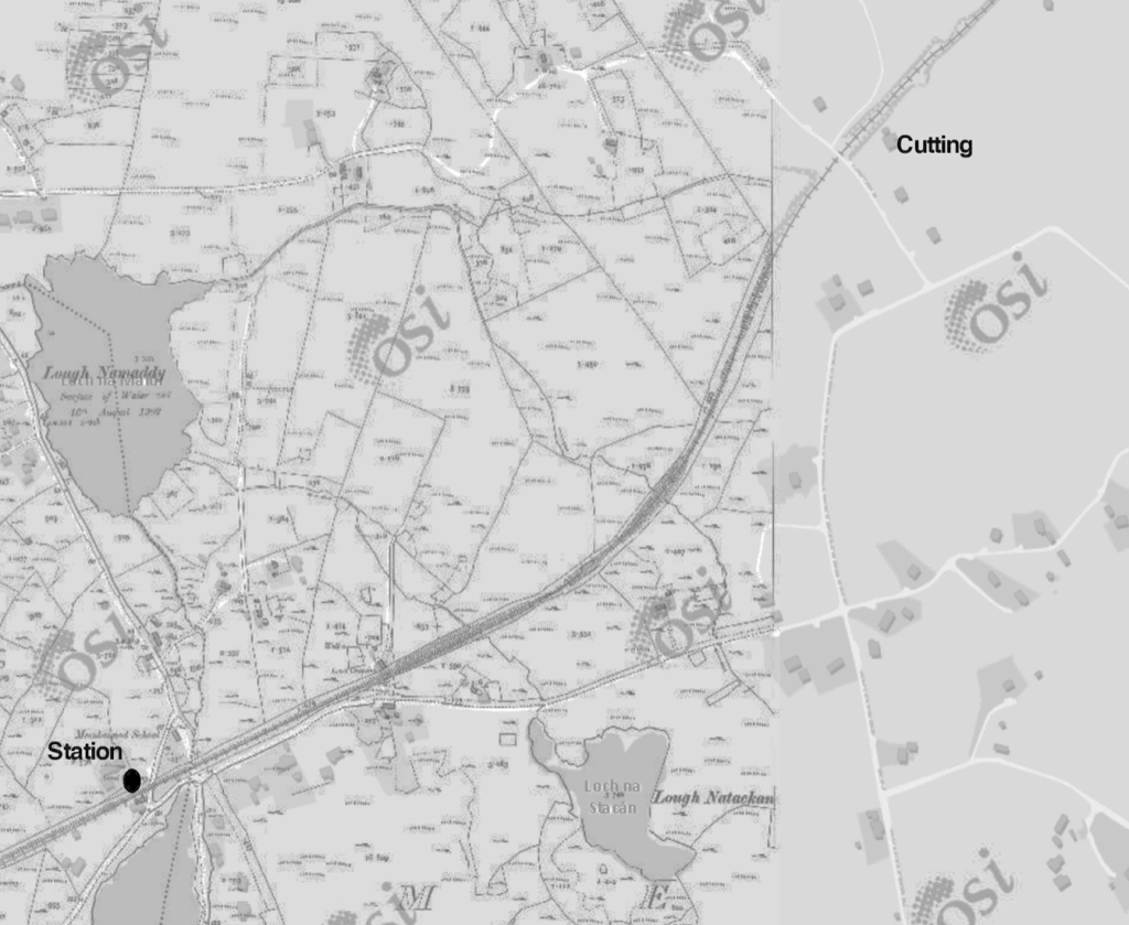
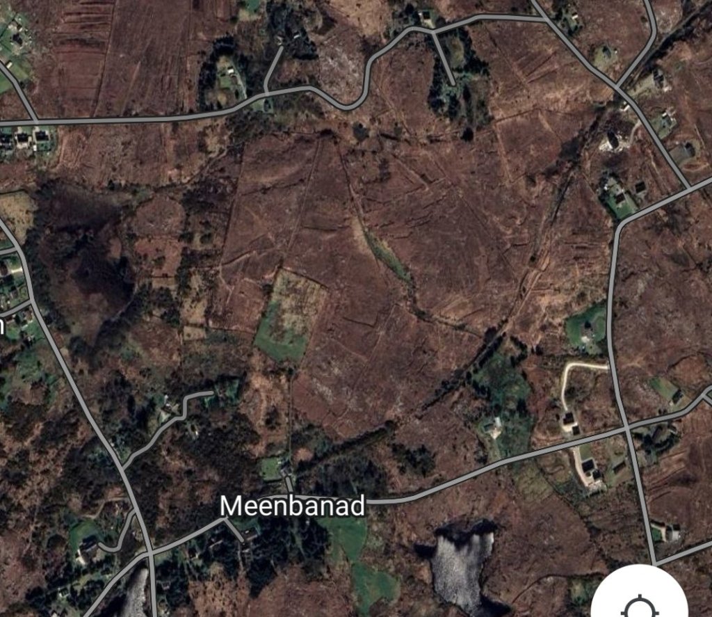
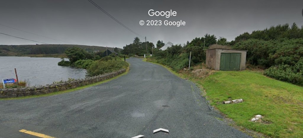
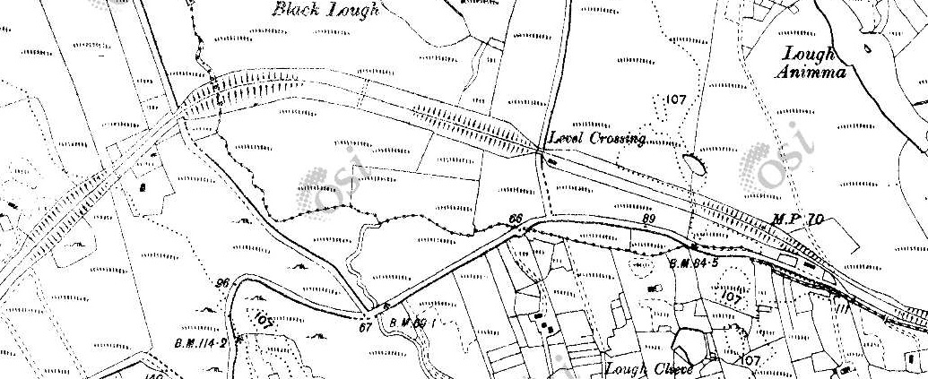
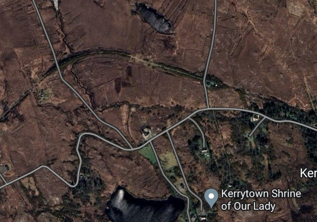
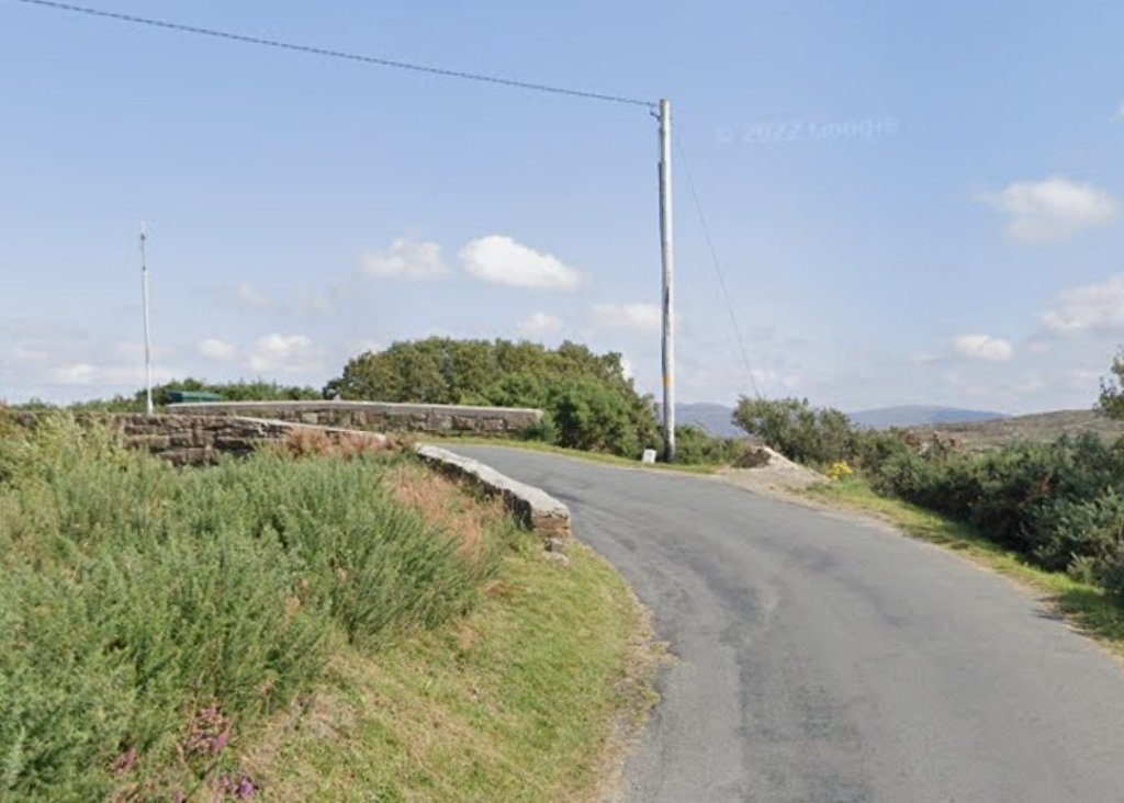
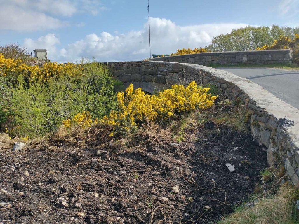
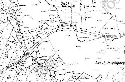
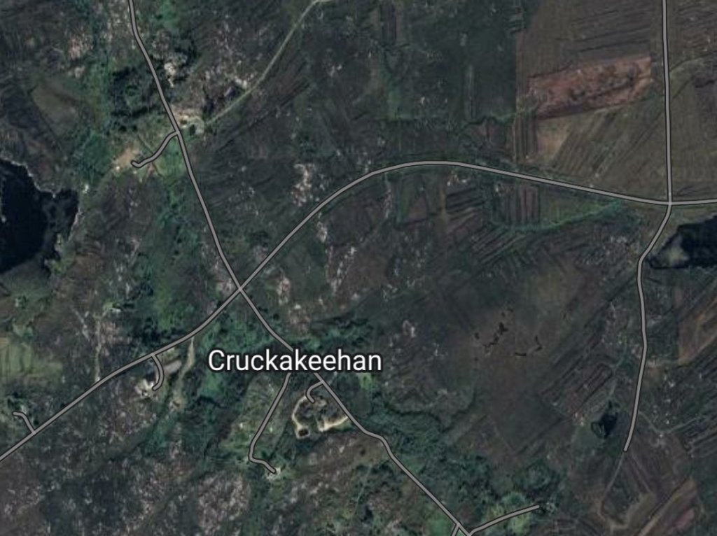
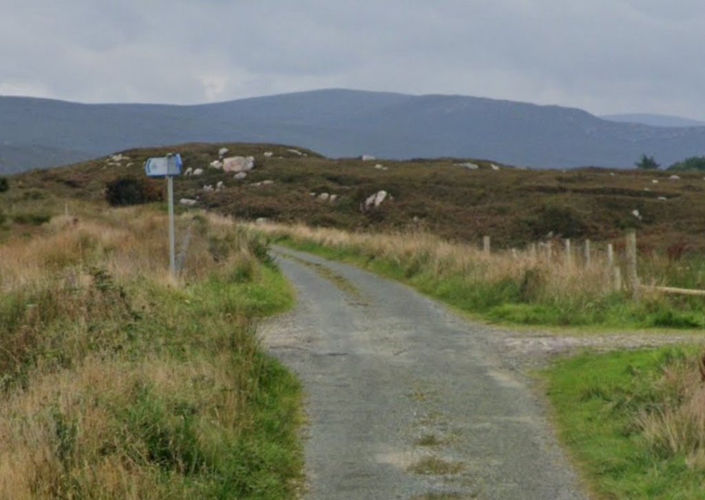
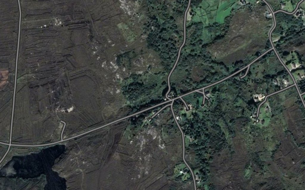
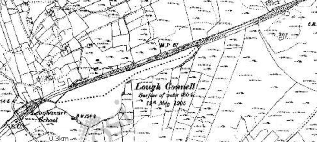
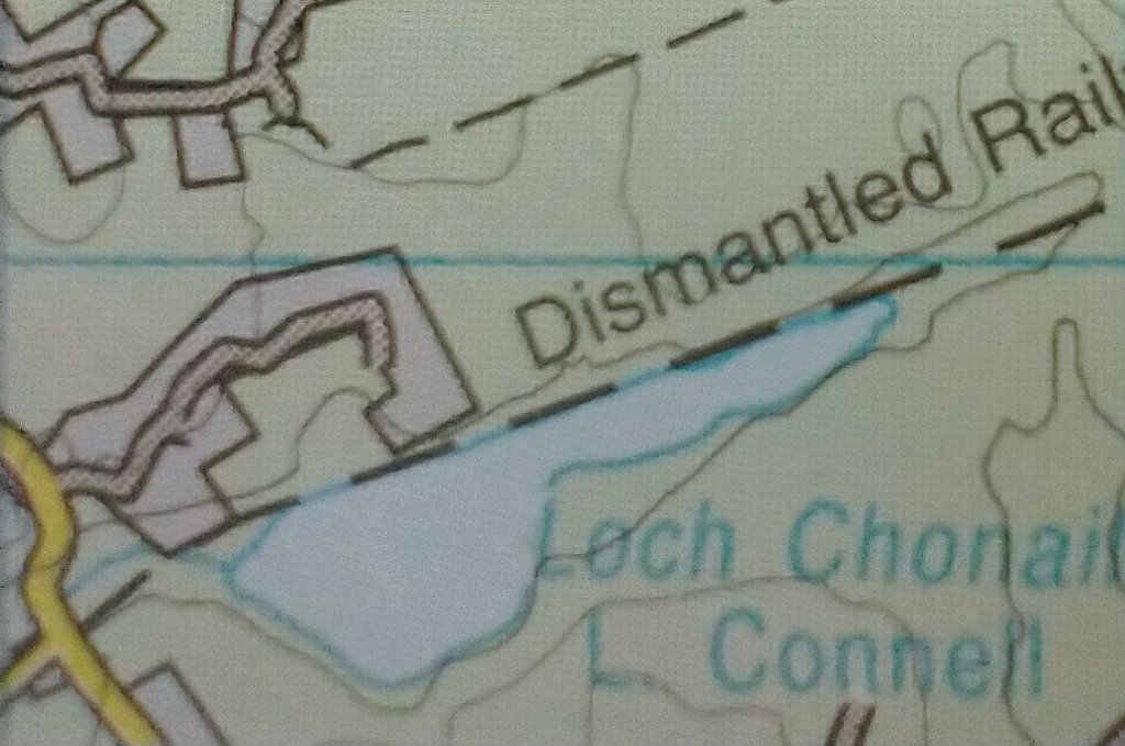
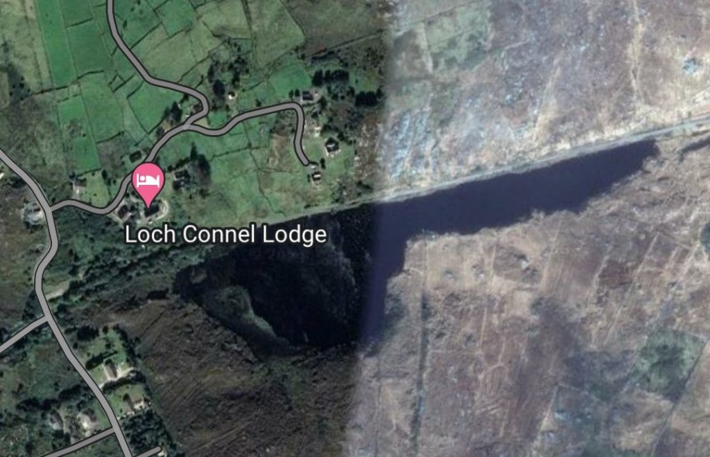
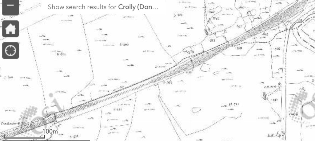
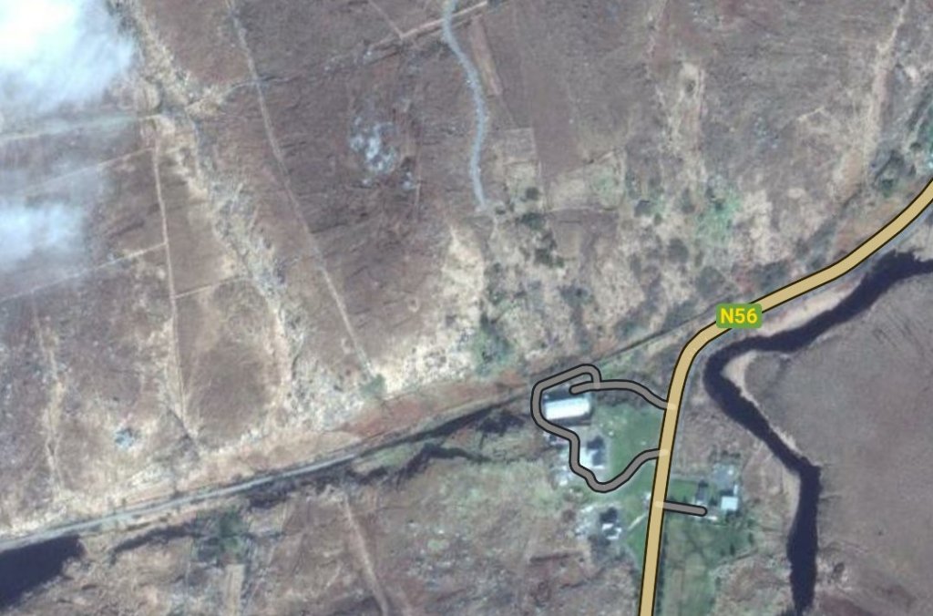
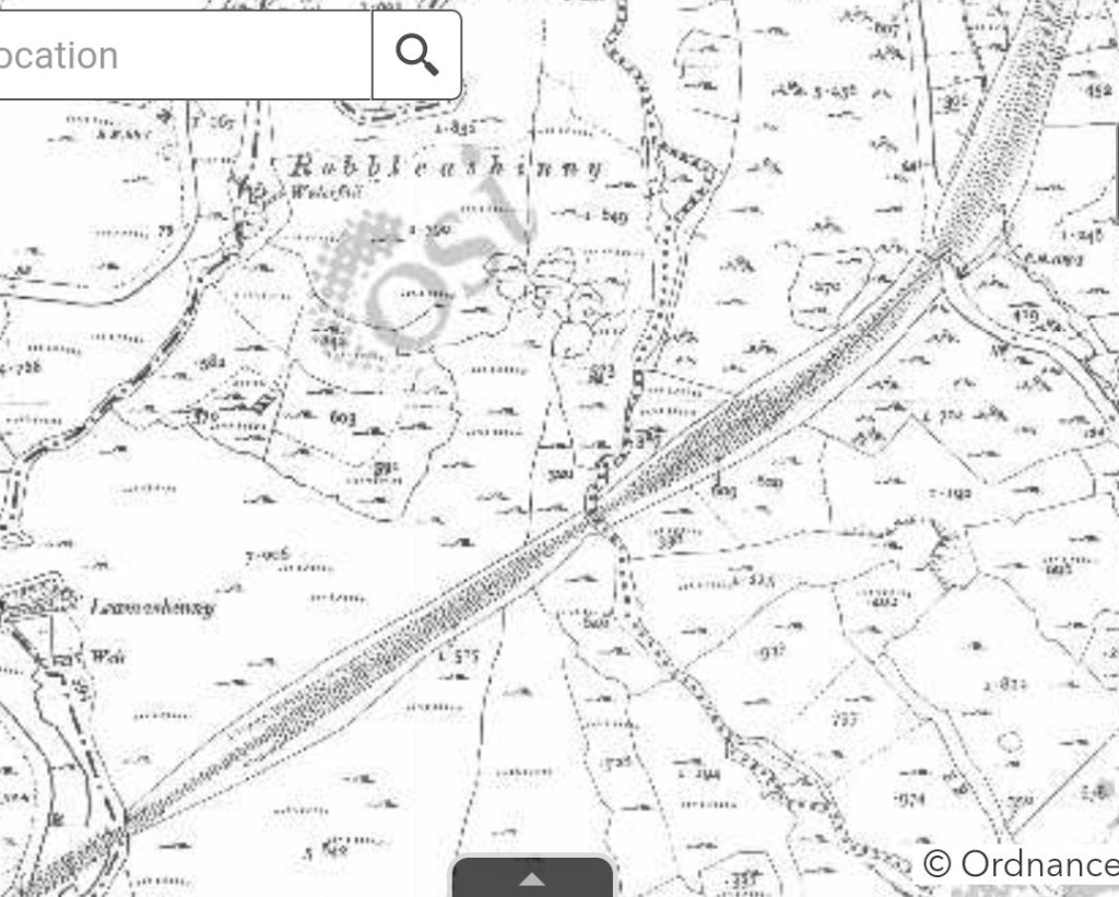
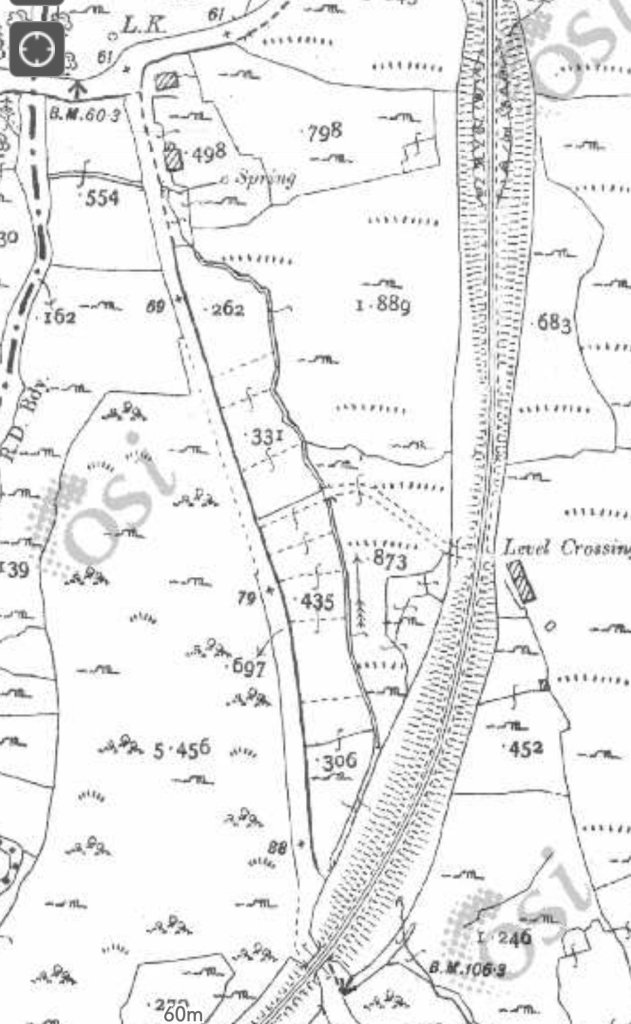
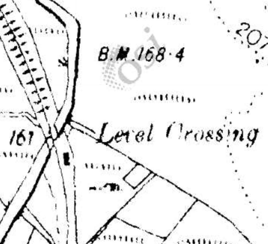
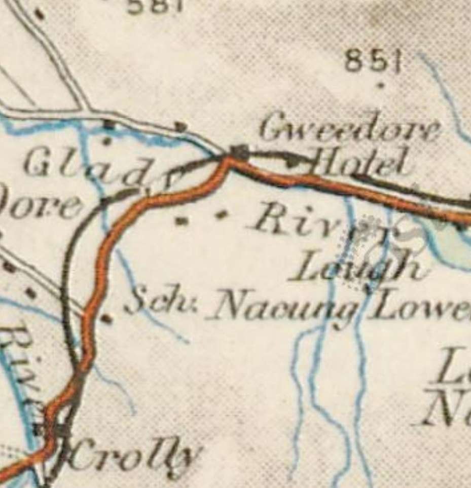
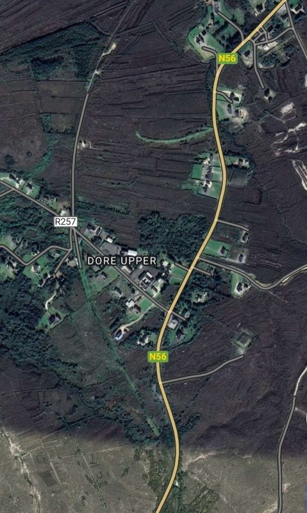
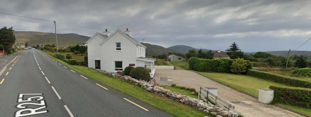
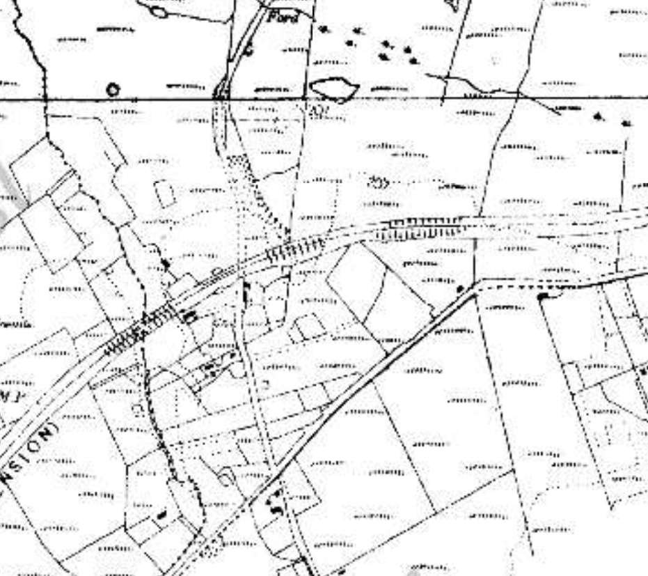
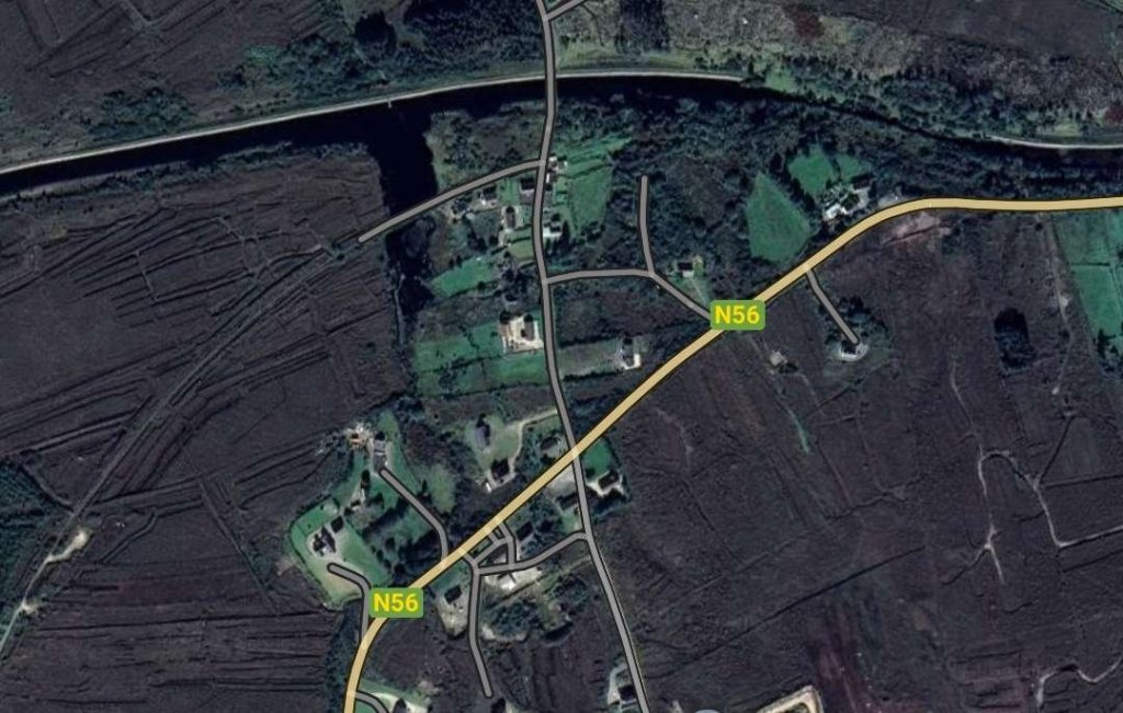
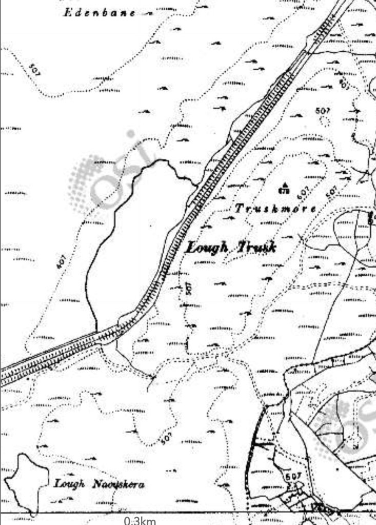
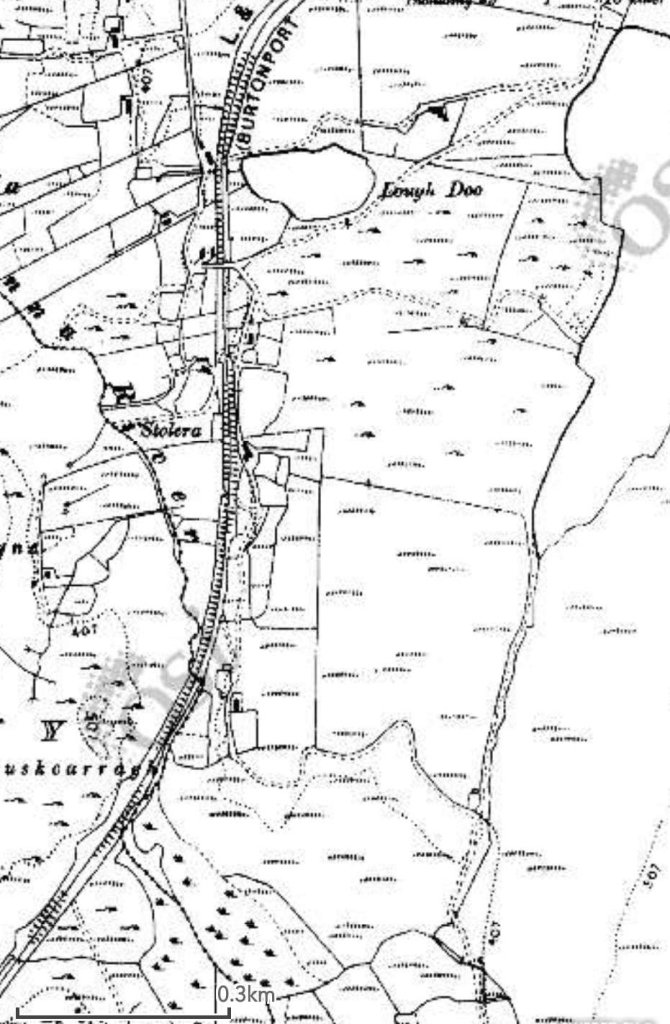
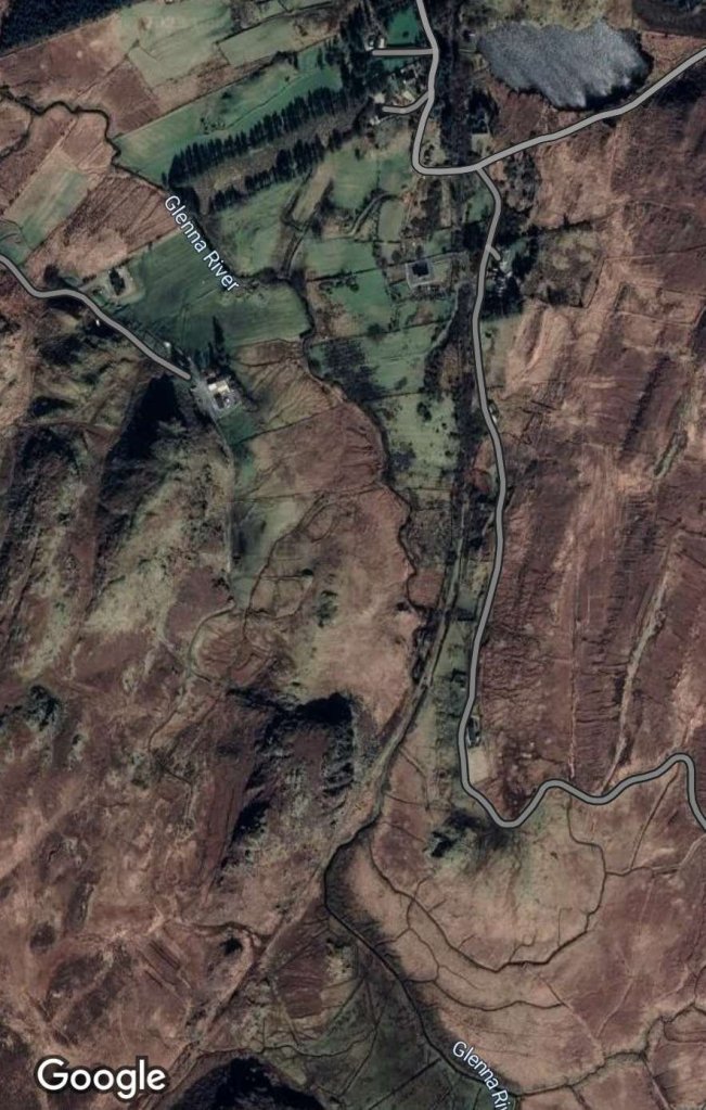
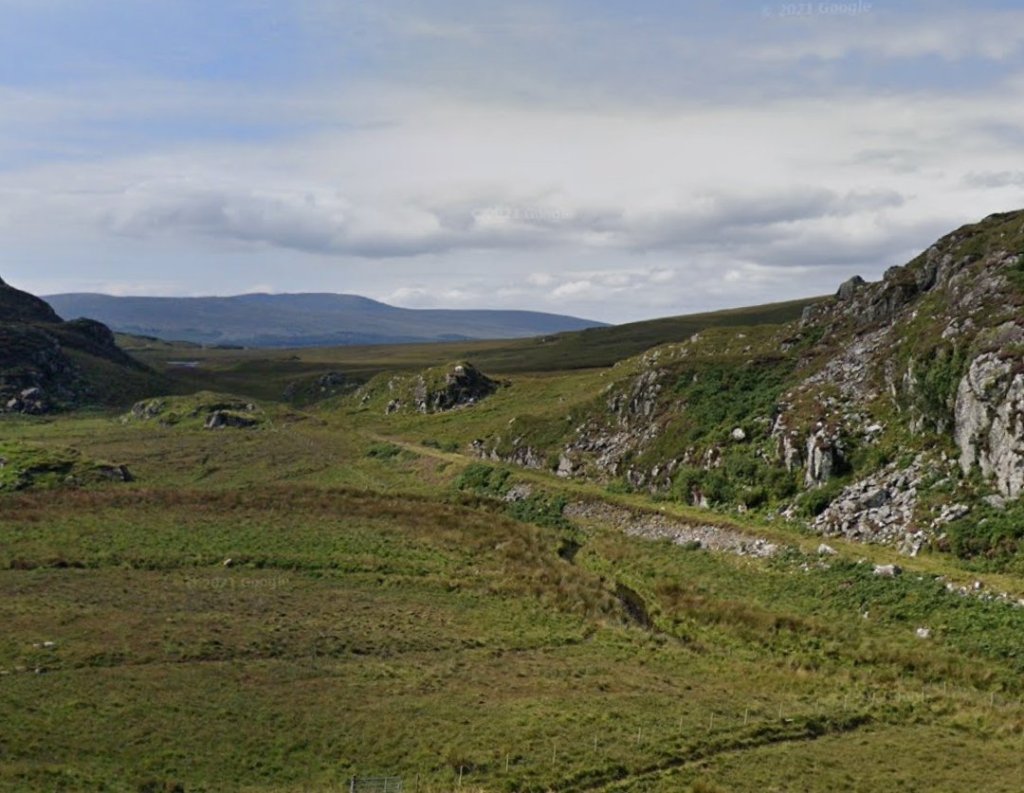
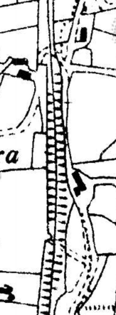
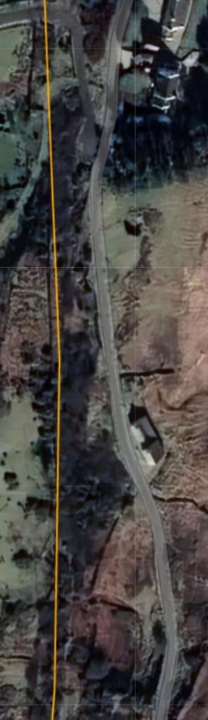
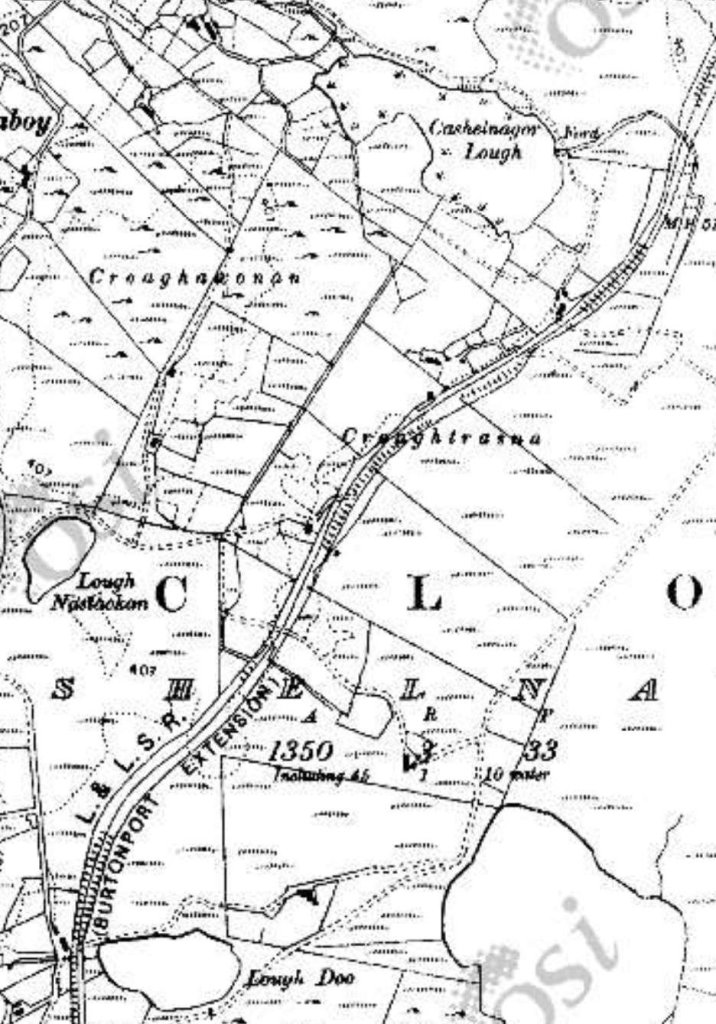
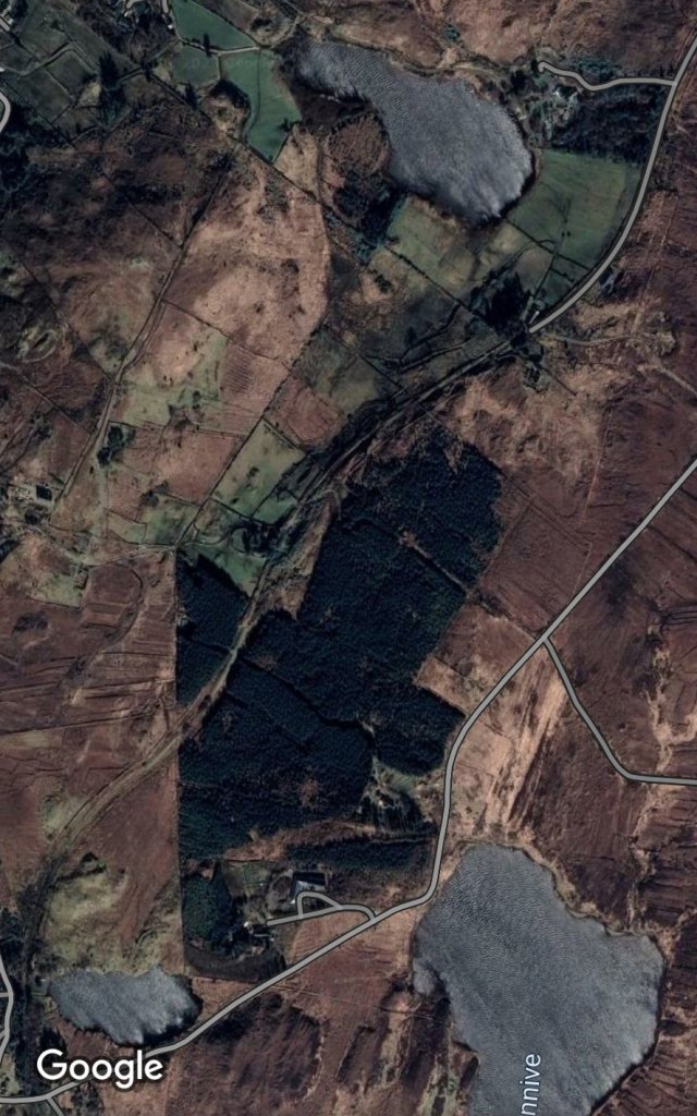
An extract from OSi mapping as shared by Joe Begley. The location of Kincasslagh Road Railway Station is marked in the bottom left of the image. The cutting where the 1921 action took place is marked top-right. [1]
The same area as shown on the map extract above but now on modern satellite imagery. [Google Maps, 30th April 2023]
The cutting where the January 1921 action took place, Paddy Ghráinne’s Cutting. [Google Streetview as shard be Joe Begley][1]

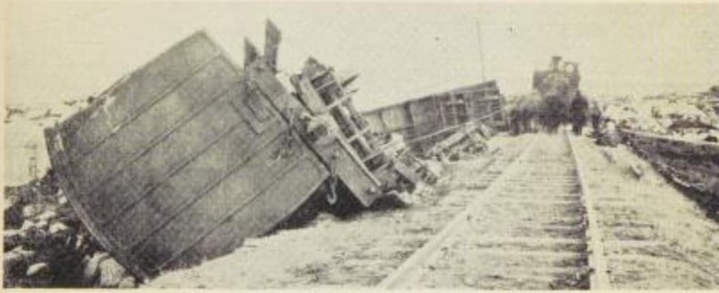
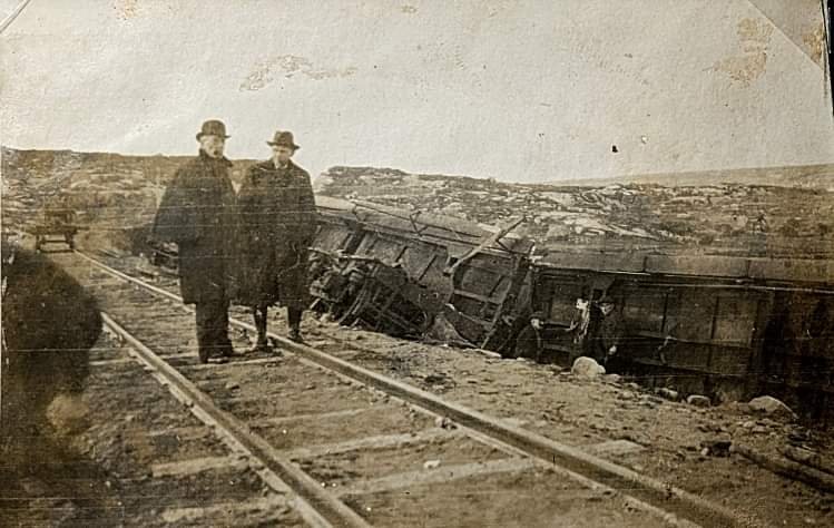
Joe Begley explains that the area close to Kincasslagh Road Railway Station was often in the news in the War of Independence and this latest episode brought a temporary end to services on the Burtonport Extension. [1]

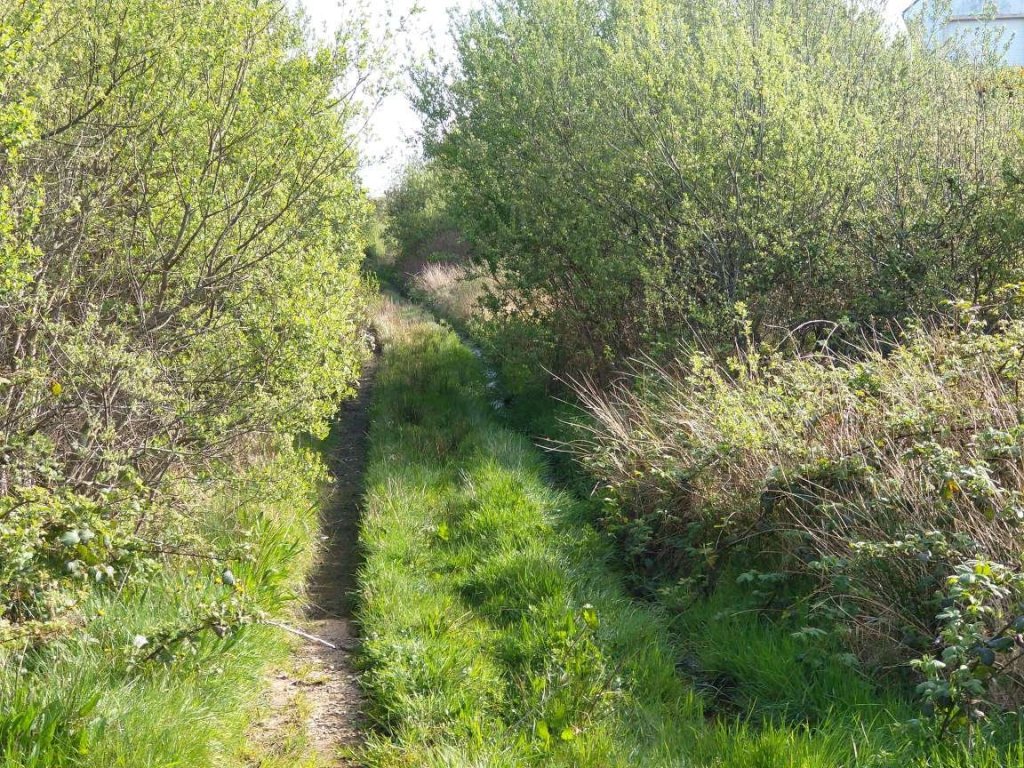
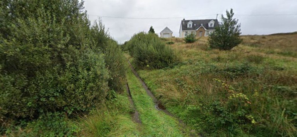
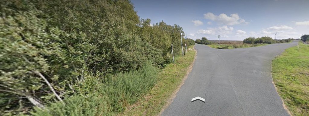
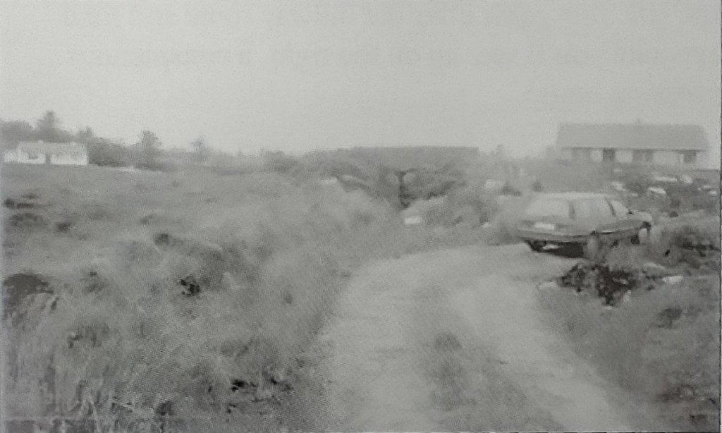
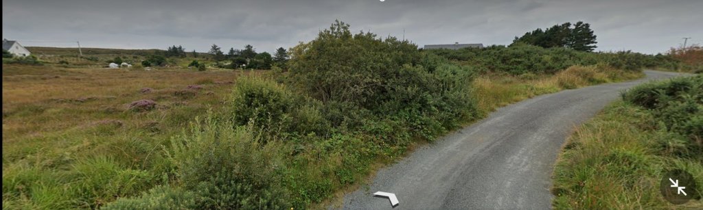
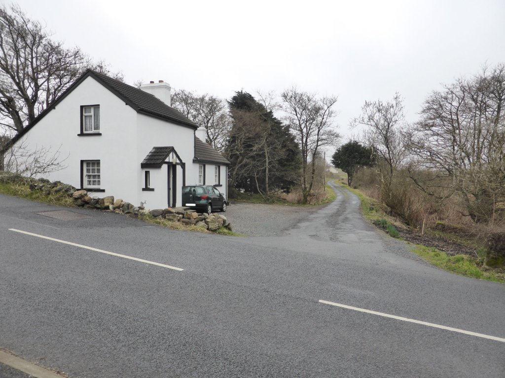
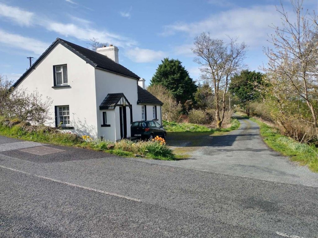
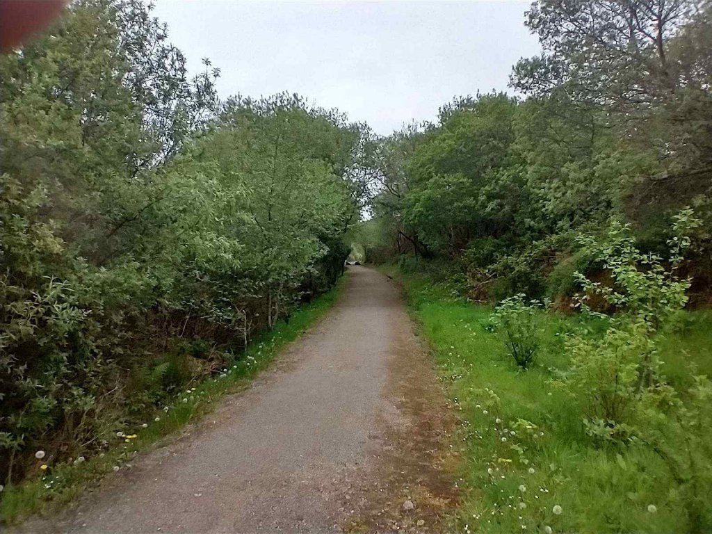
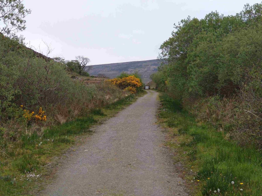
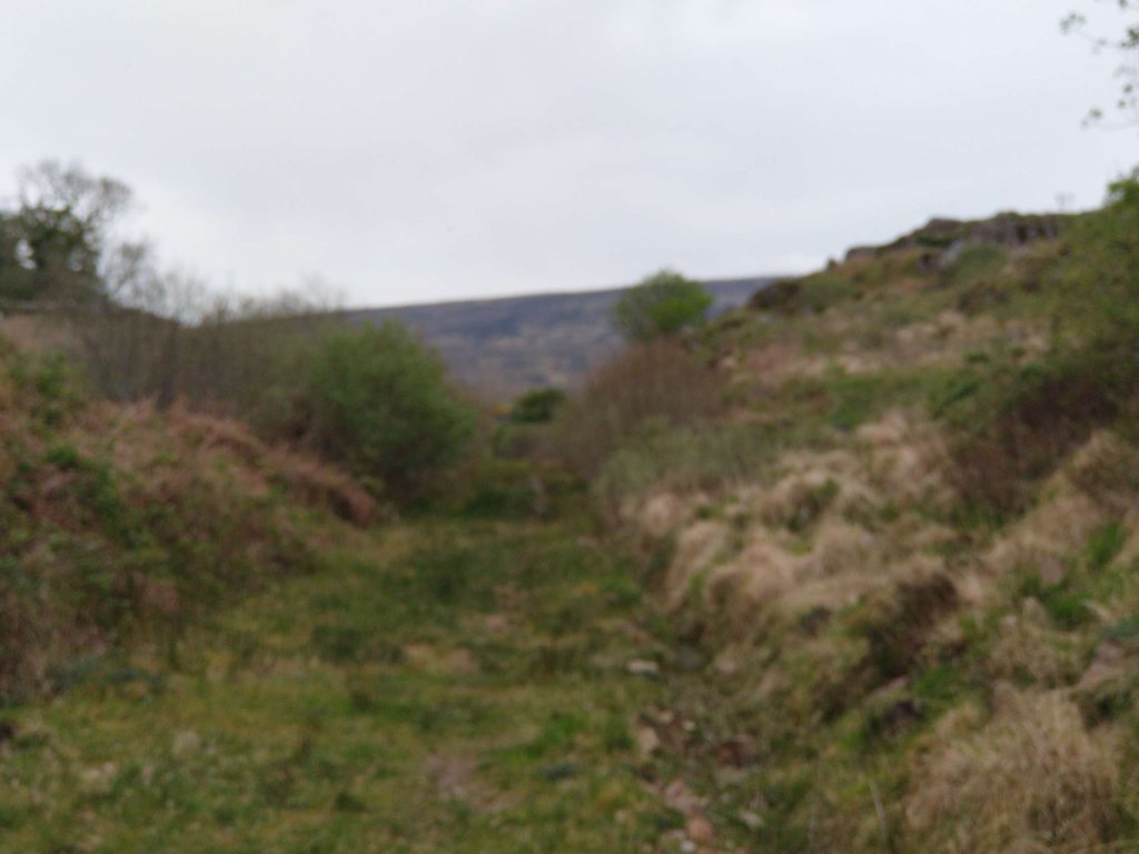
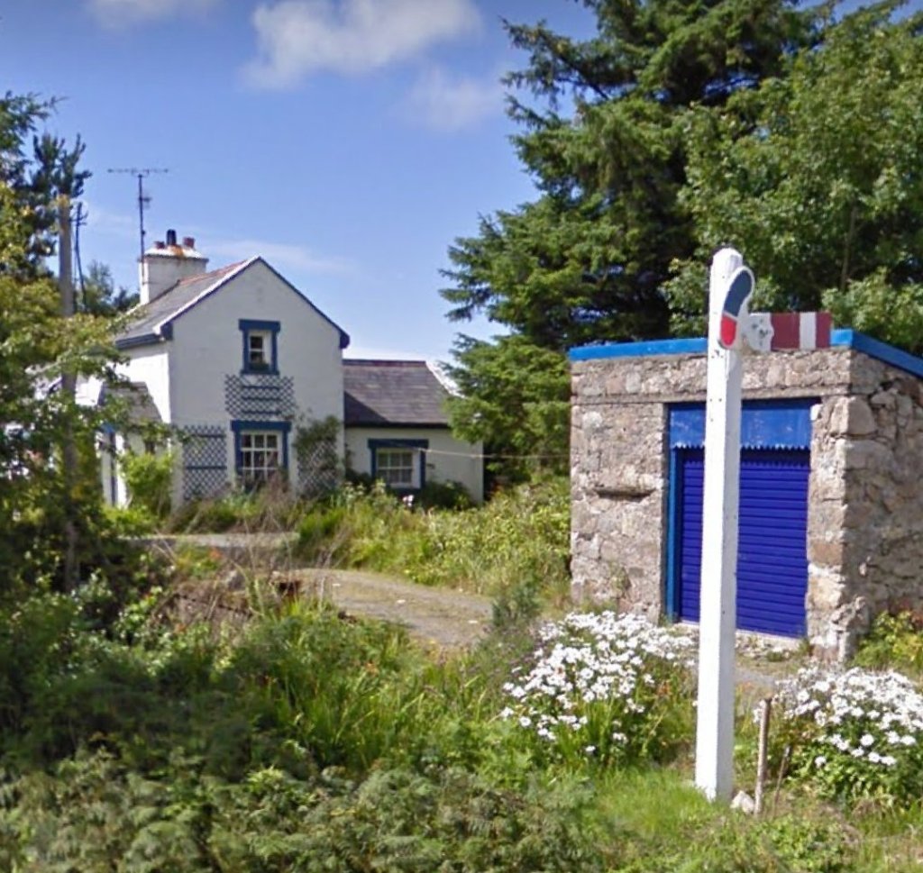
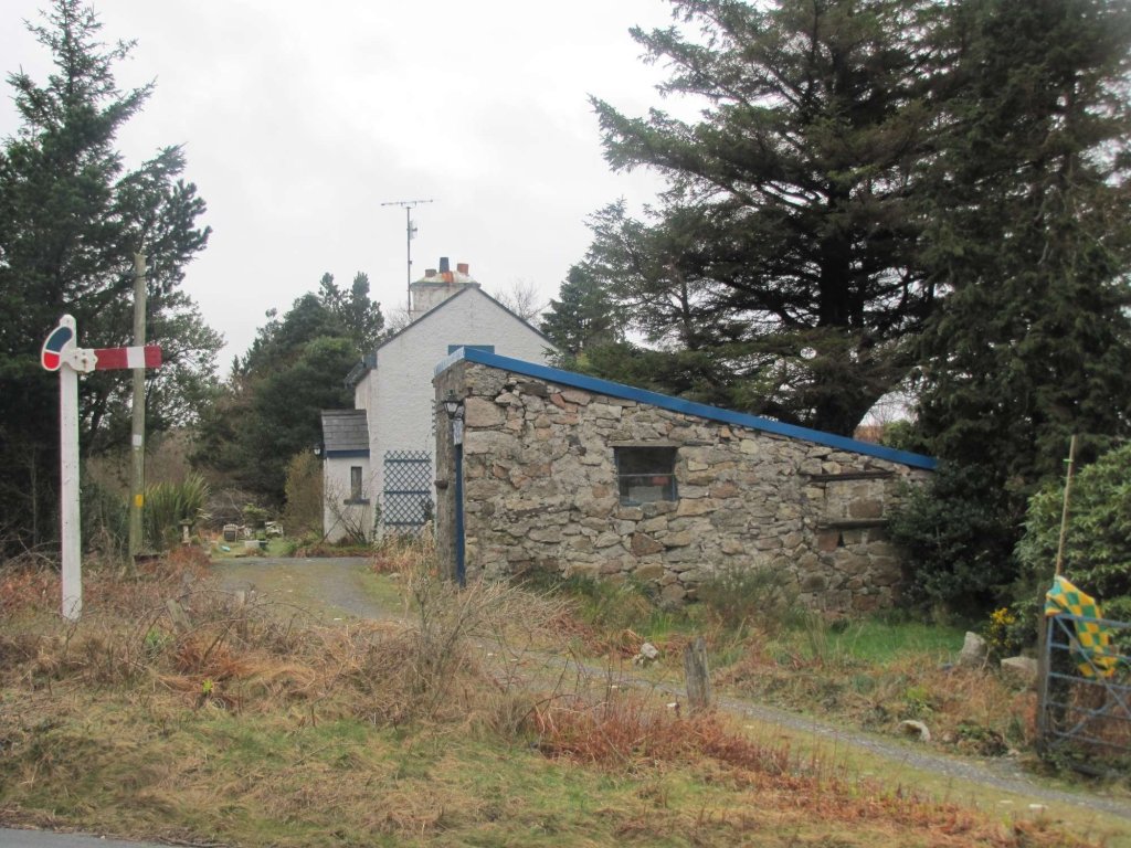
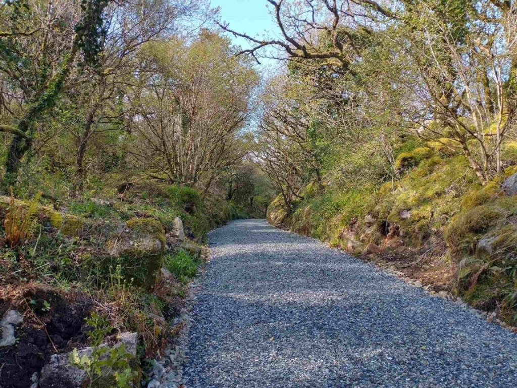
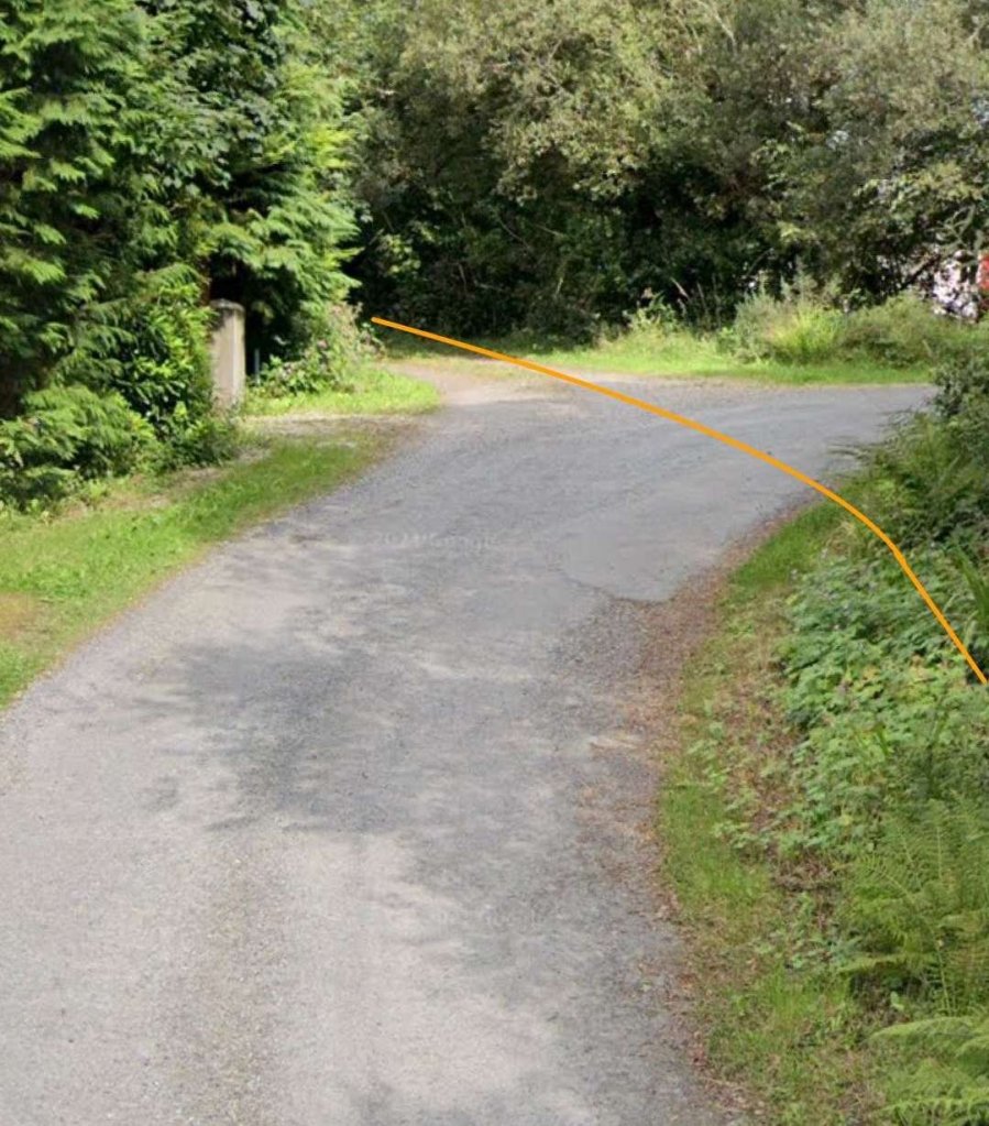
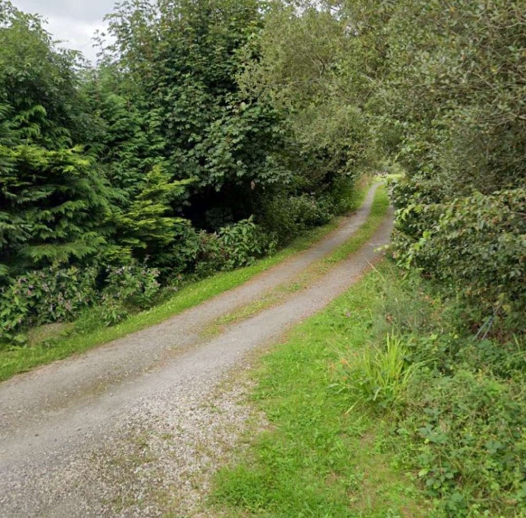
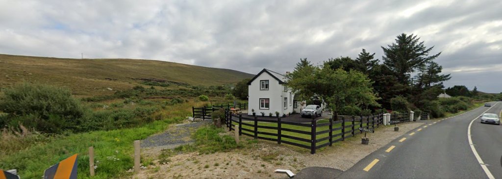
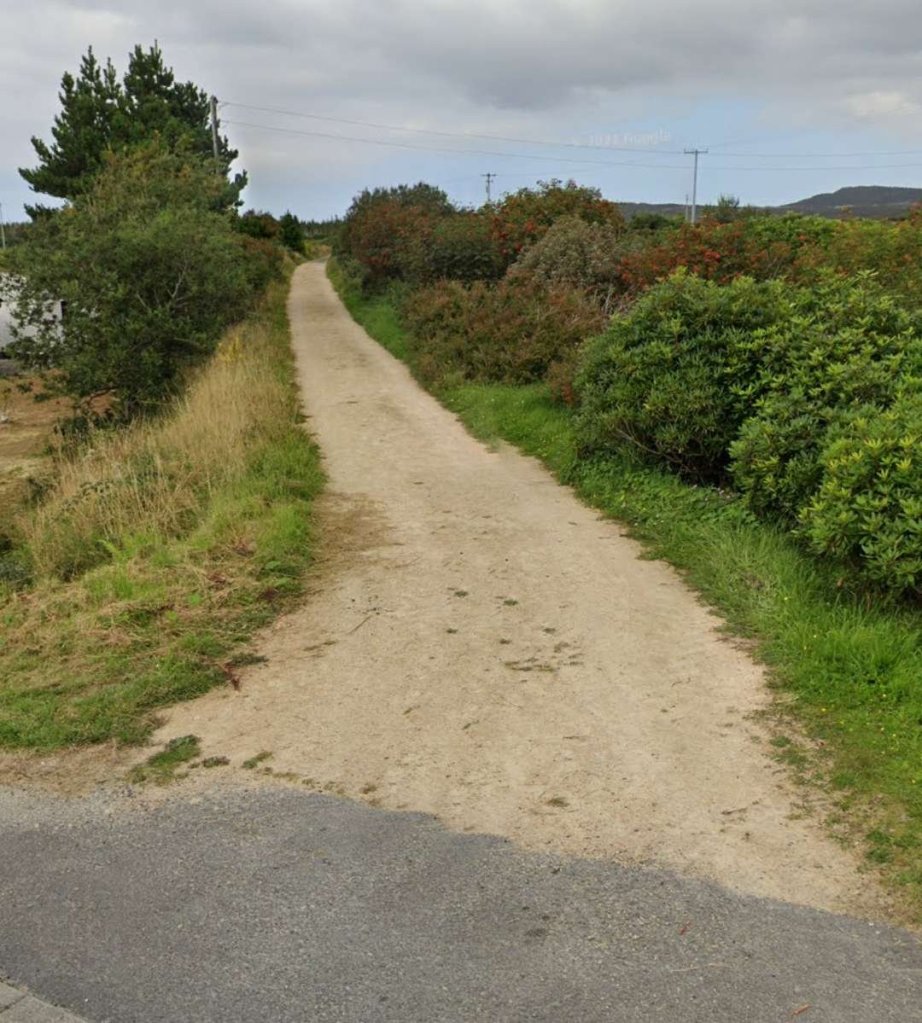
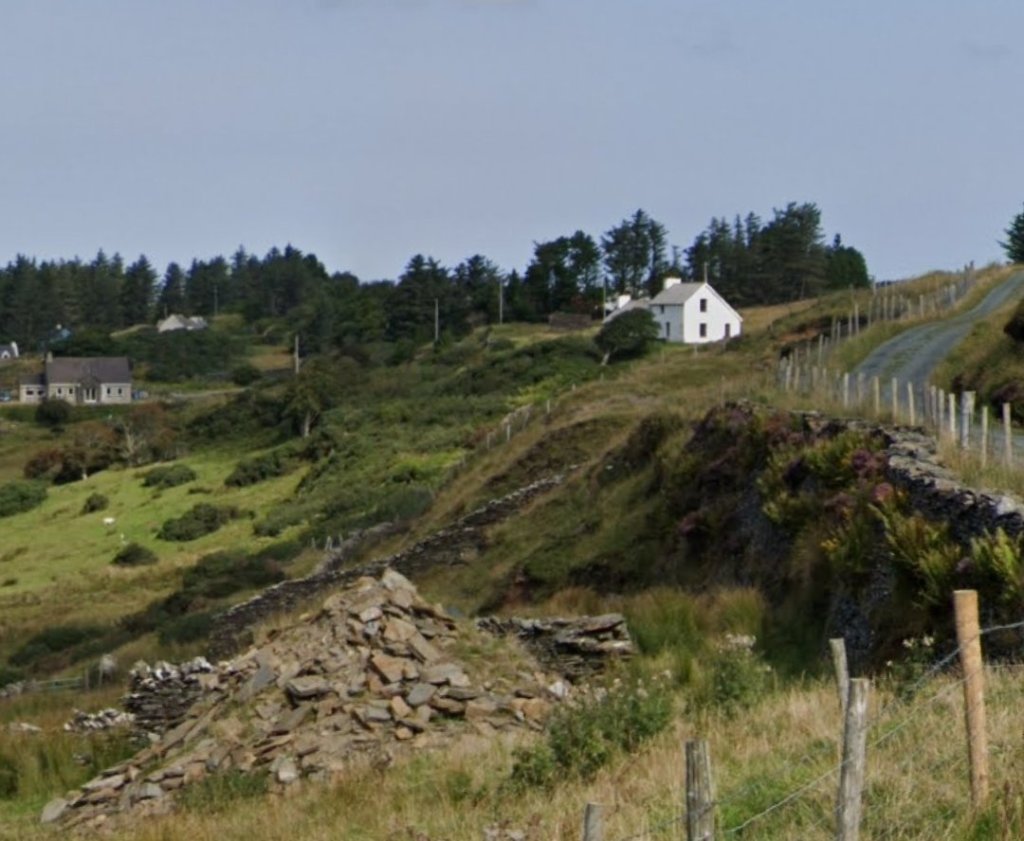
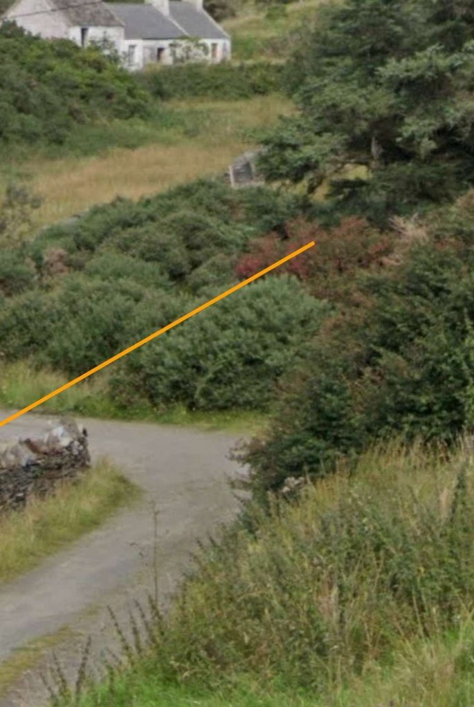
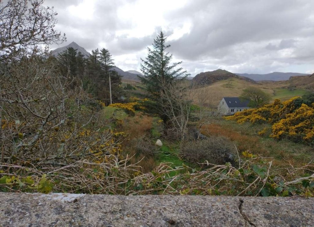
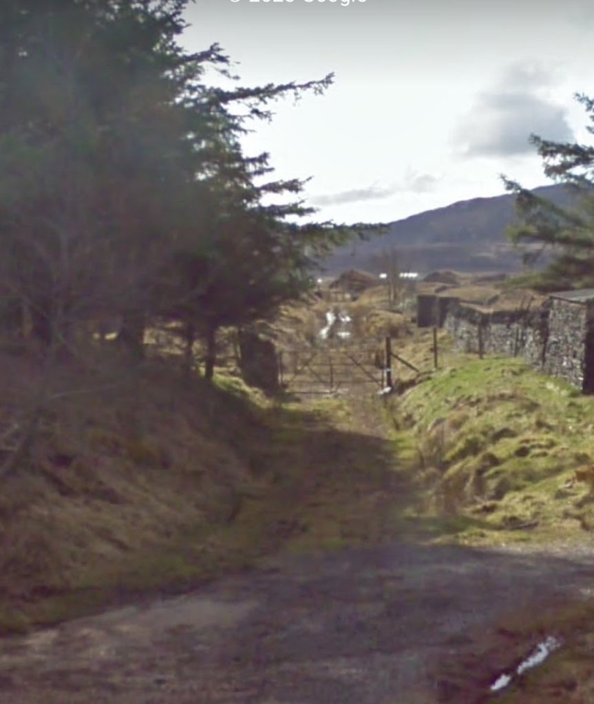
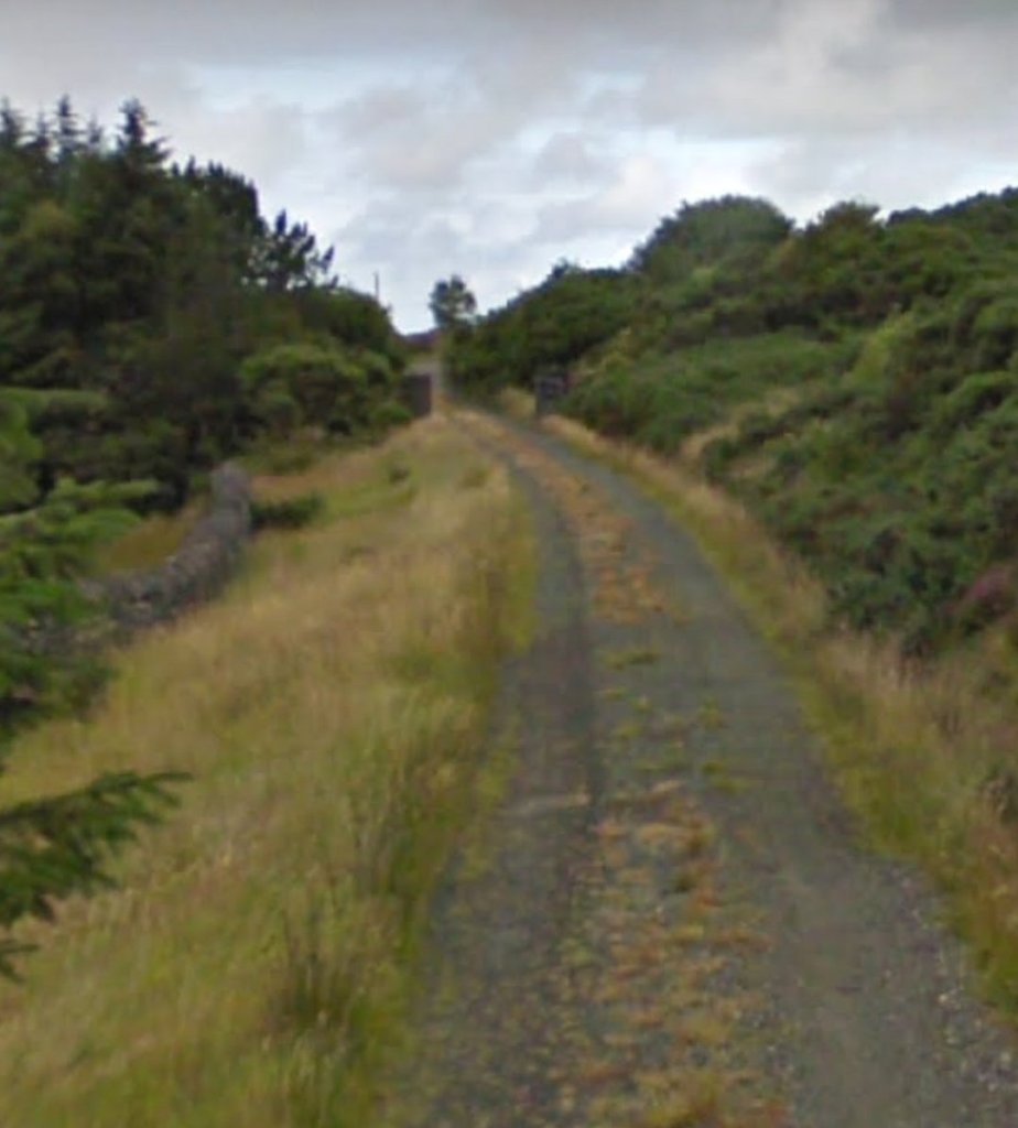
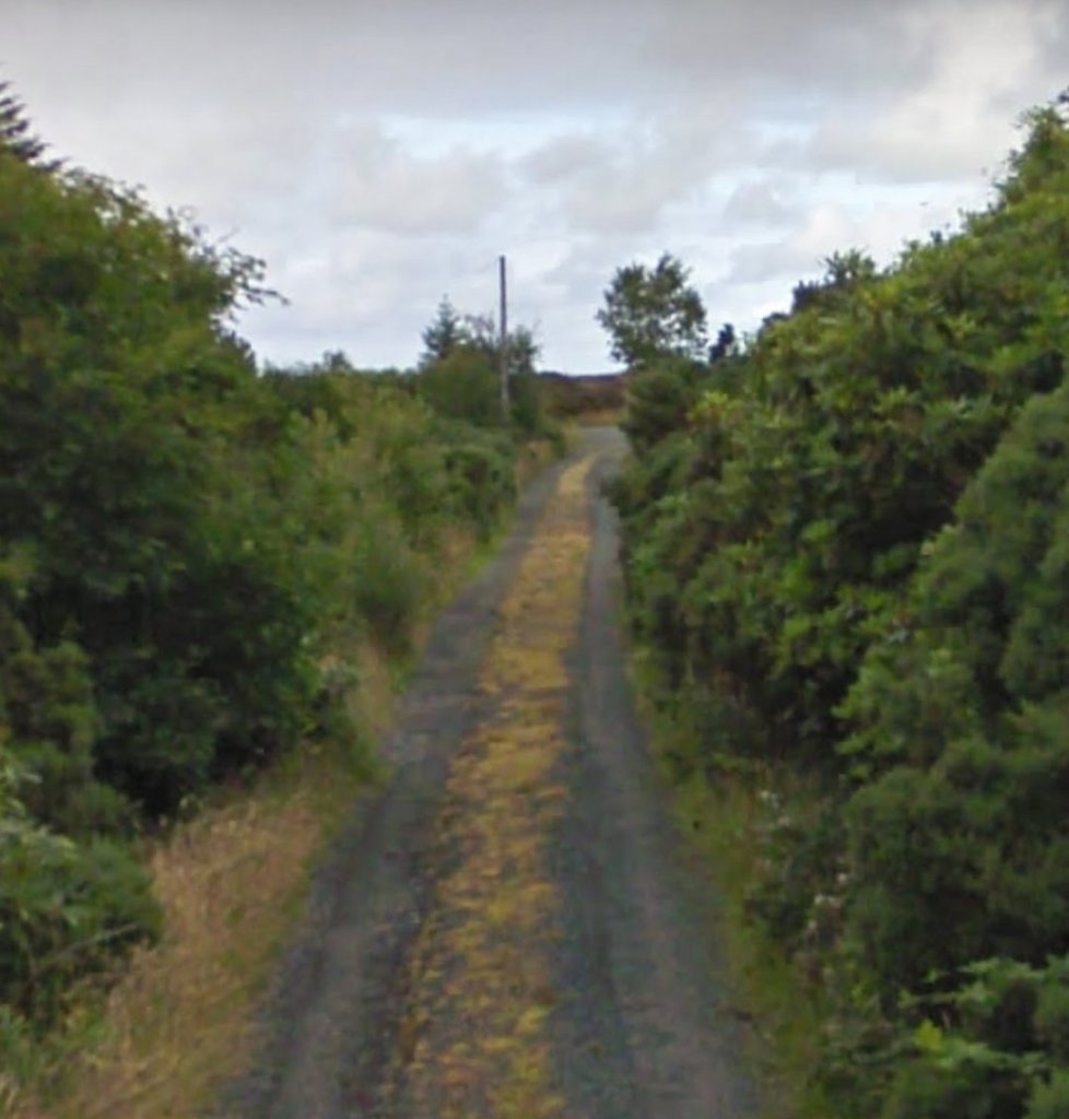
Looking back through the site of Kincasslagh Road Railway Station. The garage sits on the line of the old railway. The old railway crossing is hidden behind the undergrowth beyond. The Crossing Keeper’s Cottage (or Station House) can be seen just above the vegetation to the left of the garage. [Google Streetview, April 2022]
The view Northeast along the old railway from the newer road crossing its route. A road ran parallel to the old railway on its South side. Much of the next length of the old line is overgrown. Google Streetview, April 2022]
Looking Northeast from a point to the East of Kincasslagh Road Railway Station. The old railway ran alongside the road on the left side of the picture. Its route has been reclaimed by nature. [Google Streetview, April 2022]

The satellite image above shows the route of the old railway in today’s landscape. Leaving Kincasslagh Road Railway Station in a Northeasterly direction the line passes through cuttings and over low embankments curving first towards the North and then back to the Northeast. Just before it reaches the cutting where the 1921 action took place it crosses a minor road at level.

This is the view looking Southwest along the old railway from its level crossing with the minor road. Little of value can be seen because of the density of the vegetation. [Google Streetview, April 2022]
The view Northeast from the same minor road. The vegetation disguises the fact that this is the same location as the monochrome Streetview image shared by Joe Begley above. [My photograph, 24th April 2023]
A similar view in April 2022. The track follows the line of the old railway. [Google Streetview, April 2022]
The 6″ Ordnance Survey of Ireland (OSi) of 1906 shows the next length of the old line. I was unable to access the 25″ mapping for this immediate area.  Paddy Ghráinne’s Cutting is at the left of the image. The first road to cross the line to the Northeast of the cutting does so still by means of an underbridge. The second did so by means of a gated level crossing with Crossing Keeper’s Cottage No. 20 immediately adjacent to it. [3]
This satellite image from Google Maps covers the same area as the OSi map extract above. The old railway can easily be picked out along the majority of this length, first running Northeast and then curving round to the Southeast. The roads referred to below are even easier to distinguish as Google Maps shows them as an overlay on the base imagery. At the right side of this image the line of the old railway runs adjacent to the road that paralleled it for a short time East of Kincasslagh Road Railway Station. [Google Maps, 30th April 2023]
The underbridge mentioned above is a stone arched structure with a relatively low headroom. This is the view of it from the Northwest on the road that it spans. [My photograph, 24th April 2023]
The same bridge viewed from the Southeast. [My photograph, 24th April 2023]
At the location of Crossing Keeper’s Cottage No. 20, this is the view Southwest along the route of the old railway. [My photograph, 24th April 2023]
Crossing Keeper’s Cottage No. 20 as seen in 2017. The old railway ran to the left of the single storey building in the distance, © Joe Begley. [4: p171]
The same location in 2023, also viewed from the lane which crossed the railway at this location. [My photograph, 24th April 2023]
The next length of the old railway line as shown on the 1906 6″ OSi mapping. We can see the railway running alongside the highway from the left edge of the map extract to almost the centrepoint. The road turns away to the South with another road crossing the line over another bridge. The Burtonport Extension Railway then heads out into ope country travelling in a Northeasterly direction. [3]
This next satellite image covers the same area as the 6″ OSi map extract above. As in the map extract, the route of the old railway runs close alongside the highway from the left edge of the image to close to the bottom-centre of the image. The two roads shown on the map extract remain but a further narrow road now runs along the line of the old railway. It forms a junction with the older highway just to the North of the bridge over the railway formation. [Google Maps, 30th April 2023]
Looking East along the highway adjacent to the line. The old railway to the left of the road between the rock outcrop and the road. [Google Streetview, 30th April 2023]
The road junction at the bottom-centre of both the map extract and satellit image above. The old railway route is still to the left of the road, now in an overgrown cutting. [Google Streetview, 30th April 2023]
The road turns North and bridges the old railway on another stone-arched bridge. The view is taken looking East. [Google Streetview, April 2022]
The bridge. The stone arch appears to have been partially infilled. [My photograph, 24th April 2023]
The view East over the bridge parapets. The cutting is heavily overgrown. [My photograph, 24th April 2023]
Looking South towards the road bridge over the old railway with the newer road turning off to the East. The white van is about to cross the bridge. [Google Streetview, April 2022]
The view West along the old railway in the late 1980s, © Steve Flanders. [2: p79]
Looking West along the line of the old railway. Its route runs directly ahead of the camera through the bushes which have filled the cutting as far as the bridge we have just crossed and beyond. The road curves round to the right to meet that crossing the overbridge. [Google Streetview, April 2022]
Looking East from approximately the same location with the overbridge behind the camera. For a distance ahead the road uses the old railway’s formation. [My photograph, 24th April 2023]
The route of the Burtonport Extension looking Northeast close to the edge of the map extract and satellite image above. [Google Streetview, April 2022]
The 1906 6″ OSi mapping showing the next length of the old railway line. The line curved slightly further to the Northeast before swing back towards the Southeast and then switching back towards the Northeast as it passed Lough Naglagory/Nagladary. [3]
The same area as covered in the map extract above. Google Maps shows the road which follows the old railway formation snaking across the satellite image and being crossed by two other roads. The first of the two roads appears on the map extract above, the second does not and can be presumed to have been constructed after 1906.
Looking Northeast along the line of the Burtonport Extension at the location of the first crossing point. This was an ungated crossing. [Google Streetview, April 2022]
Looking East along the line of the old railway at the location of the second (more Easterly) road crossing. While the last road crossing the line was tarmacked, this road has a gravel surface. The crossing was again ungated. [Google Streetview, April 2022]
Across this next extract from the 1906 6″ OSi mapping, the old line travelled in a Northeasterly direction. Only one main point of interest appears on the extract, that is a level crossing towards the top-right of the image. [3]
Approximately the same area as shown on the map extract above. The old railway formation continues to be followed by the single track road. There was a ungated crossing in the centre of the image where a track crossed the railway and a gated crossing, top-right, close to Loughanure School. [Google Maps, 30th April 2023]

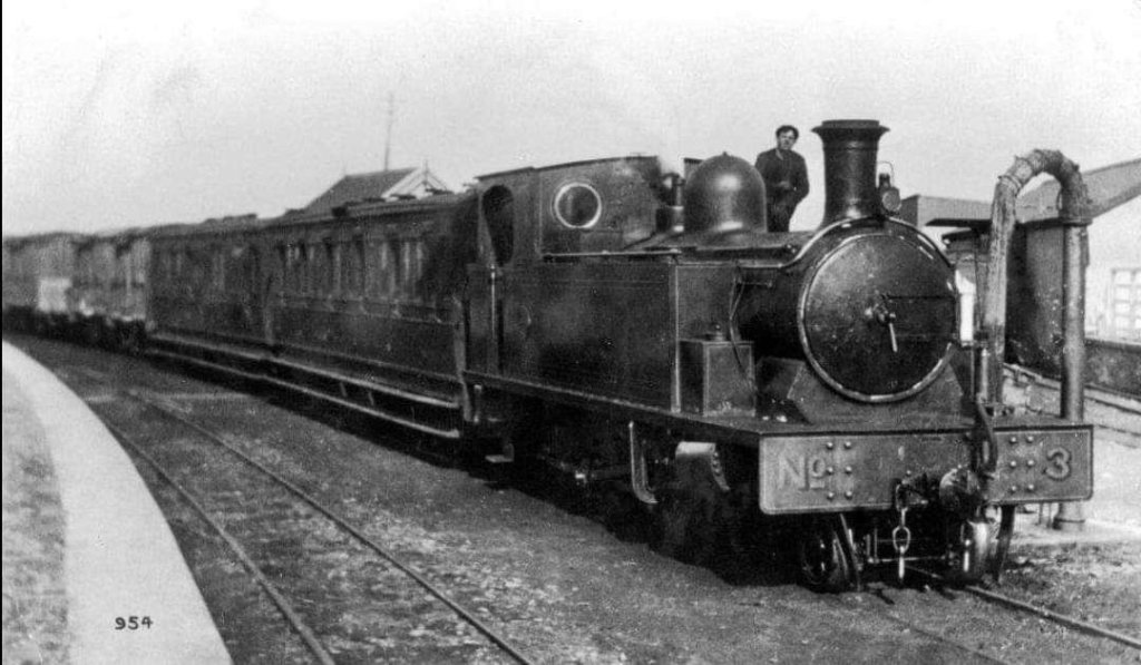
I have searched a widely as I can and have only found a couple of images of rolling stock on this section of the line, both relate to the same incident in February 1923.

Joe Begley comments: “This accident occurred between Kincasslagh Road and Crolly stations near “milepost 68¾” – this is situated along what is now a narrow road built on the trackbed that runs from Loughanure Gate House (No 19 – just by the start of the Lough Connell railway walk) to near Kerrytown and is about 1½ miles from said gate house. The train, the 8.30 am from Burtonport with only three passengers, was on an 8 ft embankment above the surrounding rock and bog when a tremendous gust lifted three of the four vehicles and tipped them down the bank. Only the Guard’s brake van and engine were left on the rails. The passengers were badly shaken but had escaped serious injury and were assisted into the shelter of the van, while the driver went on light engine to Crolly to summon help. By the time he returned, another great gust had swept the guard’s van off the track, though fortunately by this time, the passengers had been given refuge in a nearby house. Though the railway had suffered numerous attacks during the troubled years of the early 1920’s, this incident was solely down to the hand of Nature.” This photograph was shared on the Lower Rosses/Gweedore History Discussion Forum Facebook Group on 3rd December 2023, and on the Londonderry and Lough Swilly Railway Facebook Group by Peter Boyle on 4th December 2022. [9]
This photograph was taken by J.J. Brady on 7th February 1923. The figure on the right hand side is William Napier, locomotive superintendent of the railway. The other gentleman is the chairman Trew Colquhoun. This photograph was shared on the Londonderry and Lough Swilly Railway Facebook Group on 10th February 2023 by Peter Napier, William Napier’s grandson. [10]
The road continues to follow the old railway formation. This is a view looking Northeast through the location of the ungated crossing at a point close to the centre of the map extract above. [Google Streetview, August 2010]
Crossing Keeper’s Cottage No. 19 in early 2017, © Joe Begley. Very little has changed in the 6 years between this image and the one below. [5]
Looking back to the Southwest, towards Burtonport, at the location of Crossing Keeper’s Cottage No. 19. It seems that a number of trees have been removed from the area to the left of and beyond the cottage [My photograph, 24th April 2023]
The route of the old railway looking Northeast from the location of Crossing Keeper’s Cottage No. 19. Ahead the old railway ran along the North side of Lough Chonail (Connell). A railway walk begins from a car park just to the North of this location. [Google Streetview, September 2021]
The 1906 6″ OSi mapping shows the old railway running along the North shore of Loch Chonail (Connell). [3]
The modern OSi Discovery Series Map No.1 clearly shows the dismantled railway continuing Northeast from the location of Crossing Keeper’s Cottage No. 19 – the road junction at the bottom-left of this image.
A satellite image of the same area as in the two maps above. [Google Maps, 1st May 2023]
The old railway route looking Northeast from the beyond the cycle route sign above. [My photograph, 3rd May 2023]
The old railway route alongside Lough Chonail, © Rosses Historical Tours and shared on Facebook on 15th August 2020. Rosses Historical Tours kindly allowed me to share this image when I thought walking this part of the route would not be possible for me. [7]
The old railway route looking Northeast from approximately the same point as in the image above. [My photograph, 3rd May 2023]
Further to the Northeast. [My photograph, 3rd May 2023]
The old railway route on a ledge above the lough. [My photograph, 3rd May 2023]
The old railway route looking Northeast from beyond the end of the lough. [My photograph, 3rd May 2023]
About 500 metres beyond the end of the lough the old line crossed onto private land. The barrier across the line can be seen in the distance in this image. [My photograph, 3rd May 2023]
A physical barrier across the line of the old railway prevents access along the line towards Crolly Railway Station. This the view along the route taken from the position of the barrier. [My photograph, 3rd May 2023]
As it approached Crolly Railway Station, the line turned towards the North before heading Northeast again. This next extract from the 25″ OSi mapping shows it running alongside what became the N56. It was higher than the road over much of this length but almost at the same level by the top of this map extract. [3]
This satellite image from Google Maps shows a similar area, but extends through to Crolly Railway Station which can be seen top-right. The track leaving the N56 and crossing the route of the old railway appears relatively significant on the satellite image and warranted noting as an ungated crossing on the OSi map extract. [Google Maps, 1st May 2023]
The view North from the N56 where the lane to the level crossing had a junction with the N56. Although visible on the satellite image above, it is difficult to pick out the line of the lane in this image. The darker line of bushes which runs from the left of the image across 75% of the picture is probably the line of the old railway. [Google Streetview, September 2009]
This extract from the 25″ OSi mapping shows a level crossing to the Southwest of Crolly Railway Station, illustrates the track-plan and the siting of the Goods Shed immediately adjacent to the main road. It also, shows the level crossing to the Northeast of the station and the river bridge. [3]
Crolly Railway Station looking Northeast. This picture was shared on the Lower Rosses/Gweedore History Discussion Forum Facebook Group by Séimidh Ó Dubhthaigh on 1st July 2012. It is shared here under a general agreement with Jim McBride of the Donegal Railway Heritage Centre to allow use of Donegal Railway Heritage Centre’s archives in these articles about the Burtonport Extension Railway. [17]
It is very difficult to identify the location of the Goods Shed alongside the N56. The most likely location is some partial remains of a building to which this sign is fixed. The alignment of the building, its angle to the road, make it likely that it’s is all that remains of Crolly Railway Station Goods Shed. [Google Streetview, September 2021]
This satellite image focusses specifically on the site of the passenger railway station, level crossing and river bridge at Crolly. [Google Earth, 1st May 2023]
The location of the level crossing on the N56. The old railway crossed the road at this location and headed Northeast along the track to the right of the image. [Google Streetview, August 2021]
Crolly Station in the late 1980s, © Steve Flanders. [2: p79]
A view of Crolly Railway Station in August 2010, taken looking Southwest from the position of the level crossing on the N56. [Google Streetview, August 2010]
This is the first of a sequence of three photos taken of Crolly Railway Station in 2014. This photograph was taken looking into the station site from the N56, © Joe Begley. [5]
The station house at Crolly Railway Station in 2014, © Joe Begley. [5]
Looking Southwest along what was once the station platform of Crolly Railway Station in 2014, © Joe Begley. [5]

Crolly Railway Station building was gutted by fire in October 2015.

Fire damage to Crolly Railway Station buildings in 2015, © Irish Mirror. [8]
Crolly Railway Station in 2021. The picture is taken from almost exactly the same location as that taken in sunshine in 2010. [Google Streetview, August 2021].
Looking Northeast from the N56 adjacent to Crolly Railway Station. The bridge which carried the old railway over the river is roughly at the centre of this image.  [Google Streetview, September 2021]
The river bridge appears in the bottom-left of this extract from the 25″ OSi mapping. At the centre of the image the old railway crossed a culverted stream. In the top-right it bridged a minor road. [3]
A similar area to the map extract above is shown on this Google Maps satellite image. The minor road in the top-right now provides access to a ready-mix concrete plant among other things. The bridge carrying the railway constrained Headroom and had to be removed. In both the map extract and this image, the old railway route can be seen curving round to the North. The culvert and the road bridge are shown below on enlarged map extracts. [Google Maps, 1st May 2023]
Looking Southwest along the old railway back towards Crolly Railway Station from the location of the demolished bridge. [My photograph, 24th April 2023]
The location of the demolished railway bridge. This photograph is taken facing Northeast. The lorry is sitting on the formation of the Burtonport Extension Railway which heads away to the left. [My photograph, 24th April 2023]
The bridge referred to above is shown at the bottom of this next extract from the 25″ OSi mapping. North of the bridge the line was on high embankment for a short distance before entering a deep cutting. [3]
The deep cutting continues on this 25″ OSi extract before giving way to high embankment. At the third point of the image following the line from the top of the image a bridge can be made out. It is shown in the next photograph below. [3]
This photograph, taken on an overcast day in 2014 shows a bridge carrying the old line high above the houses of Crolly, © Joe Begley. [4: p170]

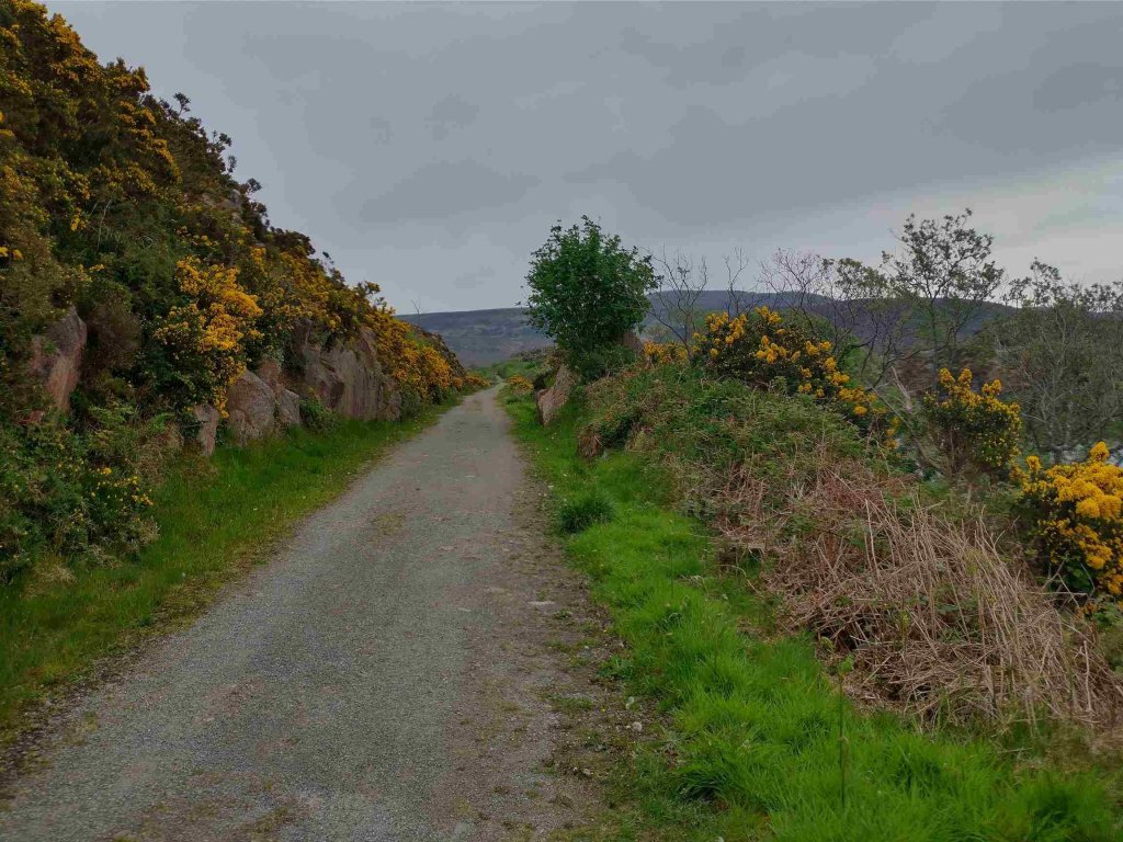
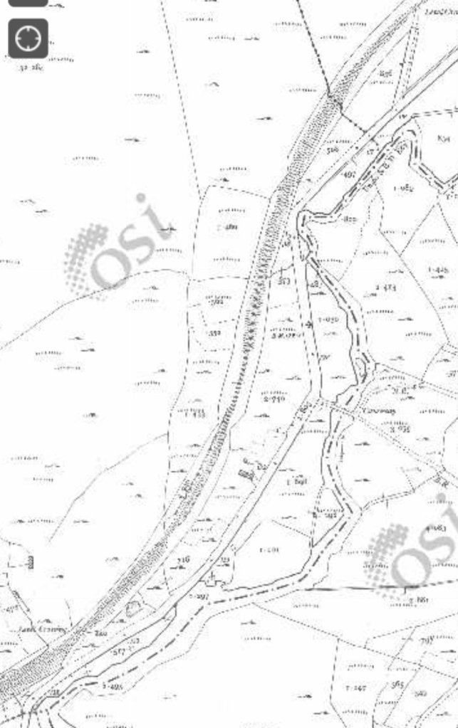
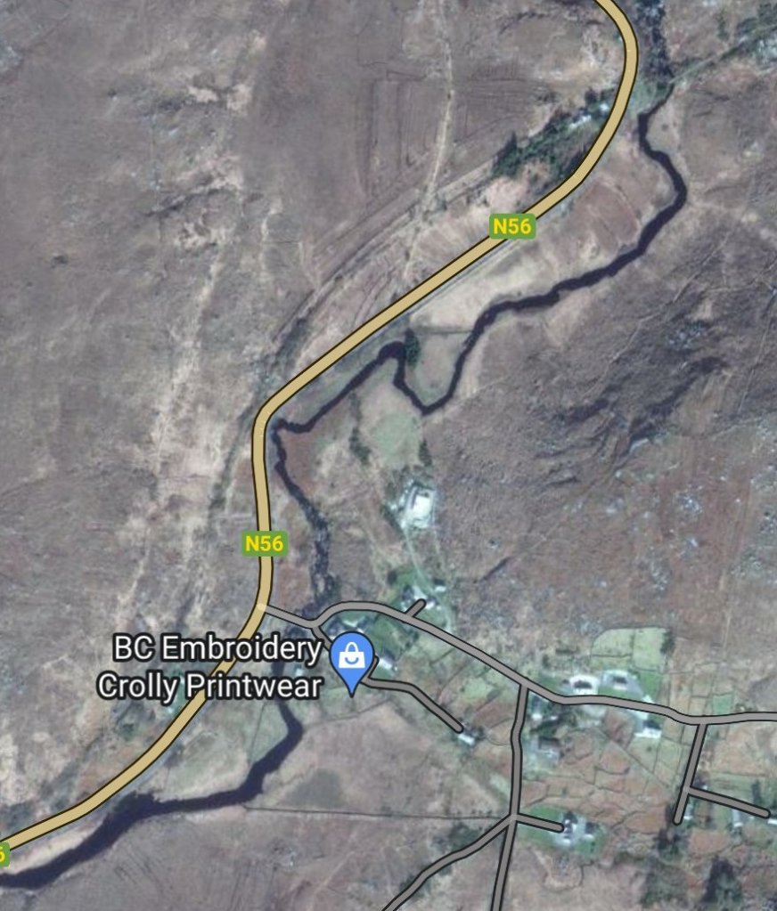
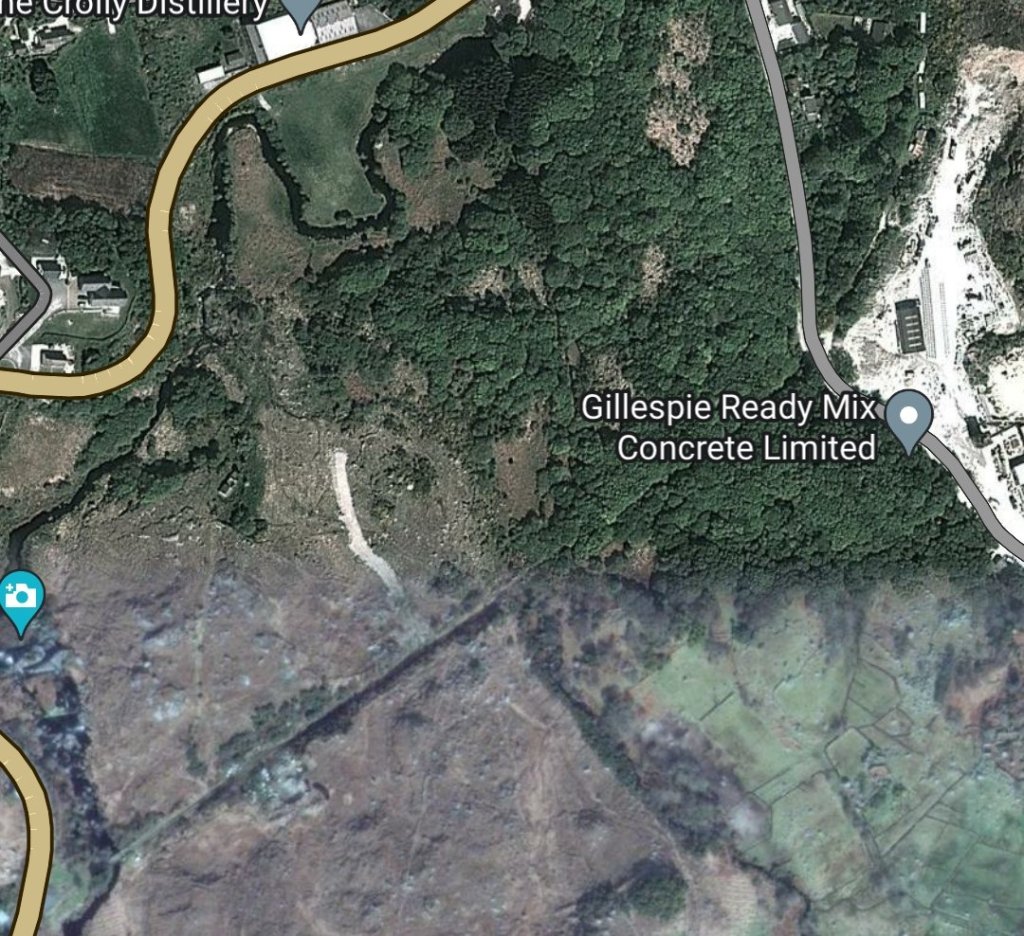
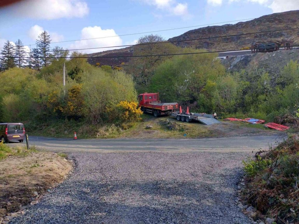
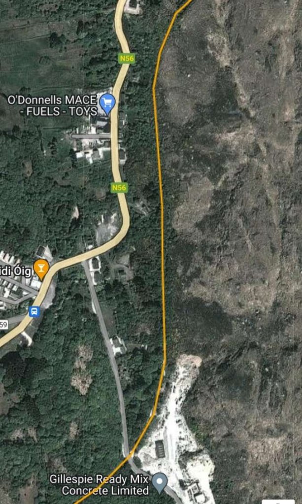
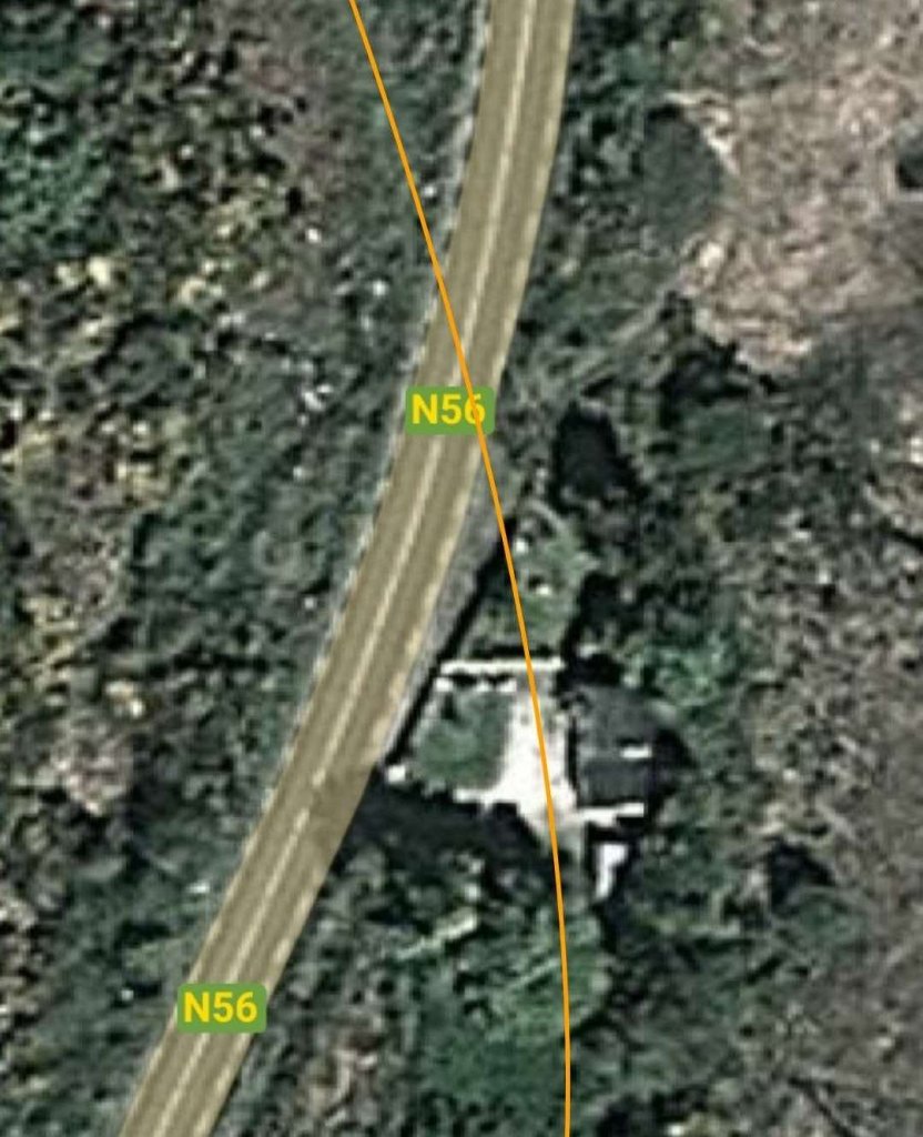
It is difficult to make out the line of the old railway as it runs North on the East side of Crolly village. RailMapOnline.com can be a real help in these circumstances. An extract from their map base with the line shown in orange is provided below.

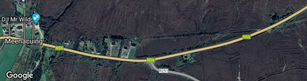
RailMapOnline.com is able to show the line of the old railway imposed onto Google Maps satellite imagery. The bridge which has been demolished was close to the concrete works at the bottom of the image. The bridge in the picture above is seen between houses across the N56 from the petrol station. [11]

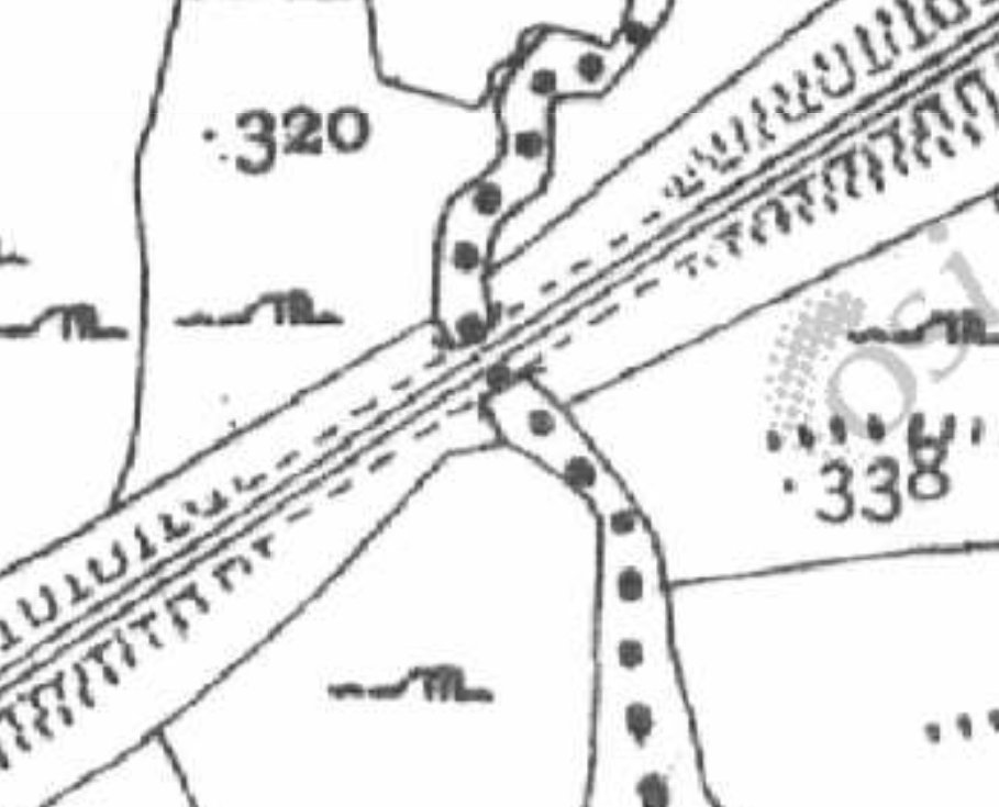
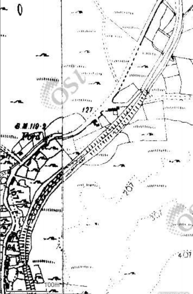
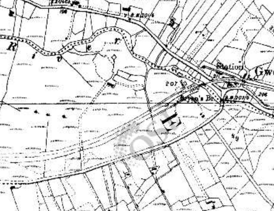
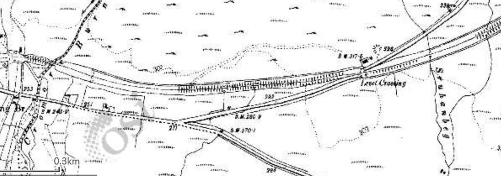
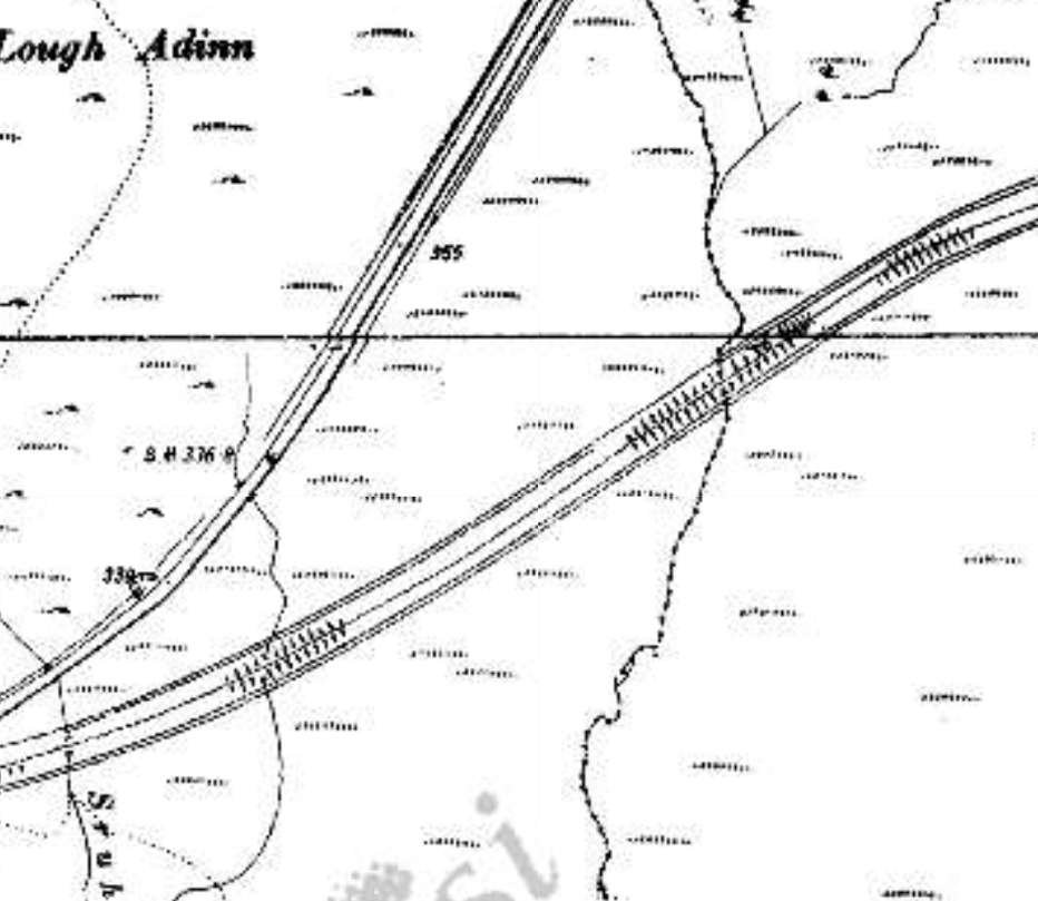
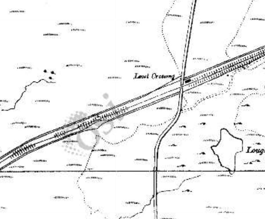
Not every sheet of the 25″ OSi mapping is available through the OSi historic maps portal so for the next length of the Burtonport Extension Railway we need to rely on the 6″ OSi mapping.

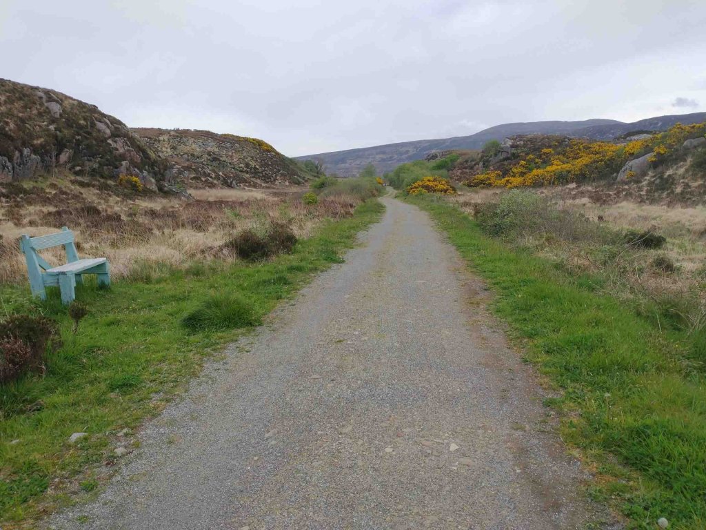
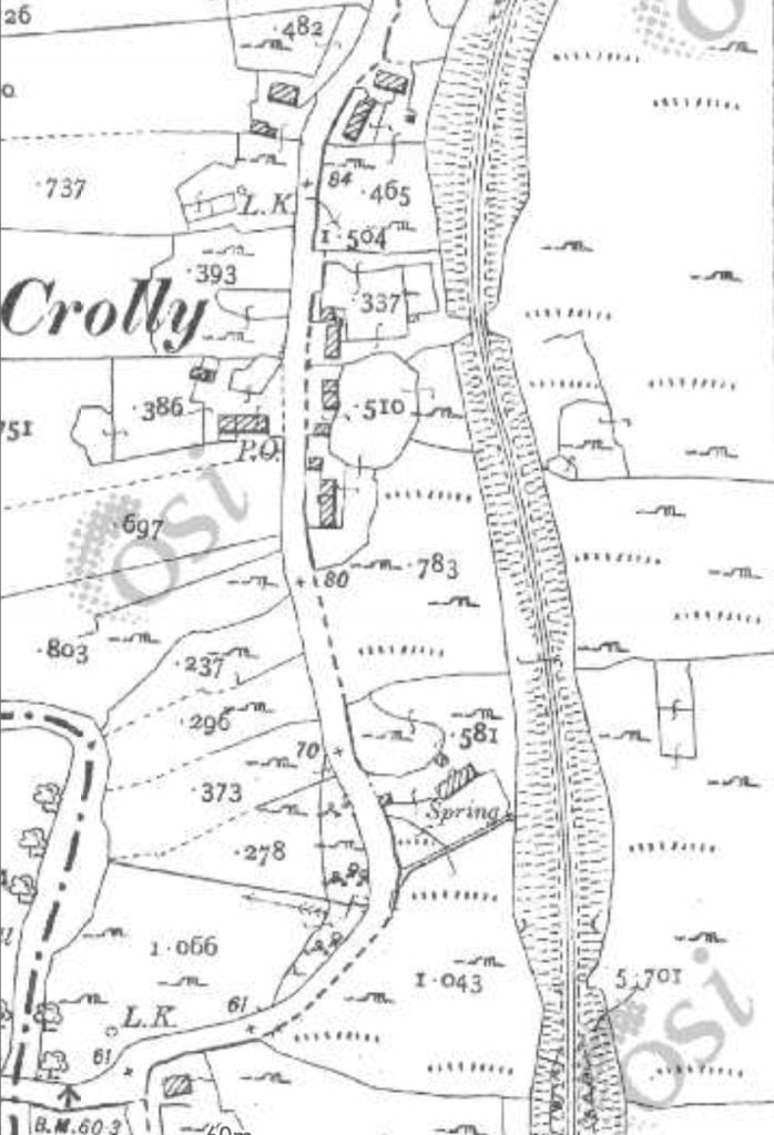
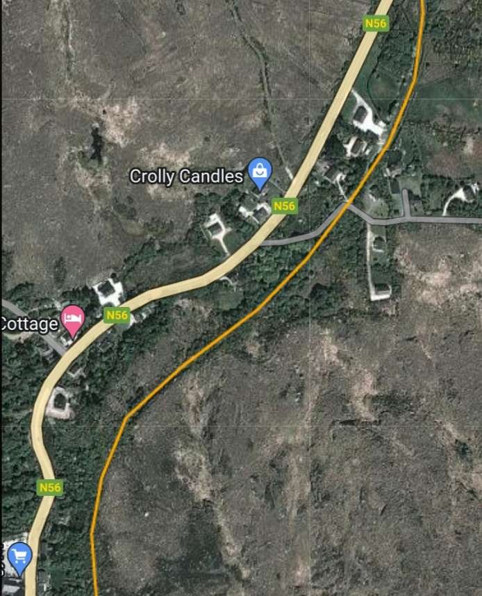
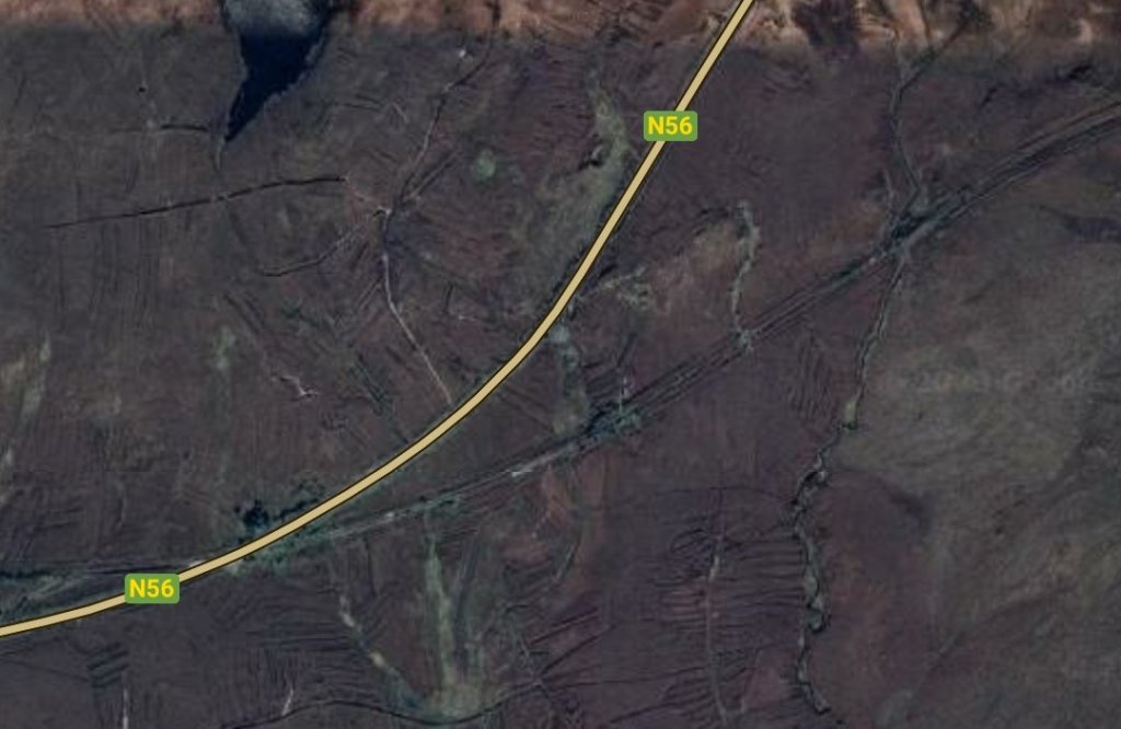
The old railway ran high above the village of Crolly. The road rose as it travelled North and by the top of this map extract road and railway were at the same level. [3]
The same area is shown the base Google Map satellite imagery used by RailMapOnline.com. The route of the old railway is again shown by the orange line. [11]

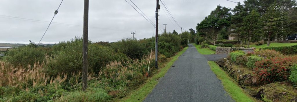
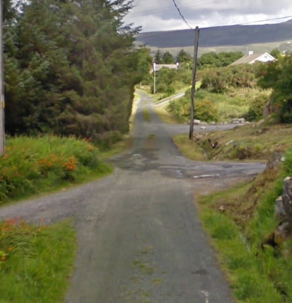
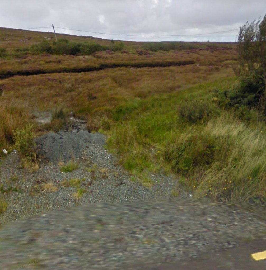
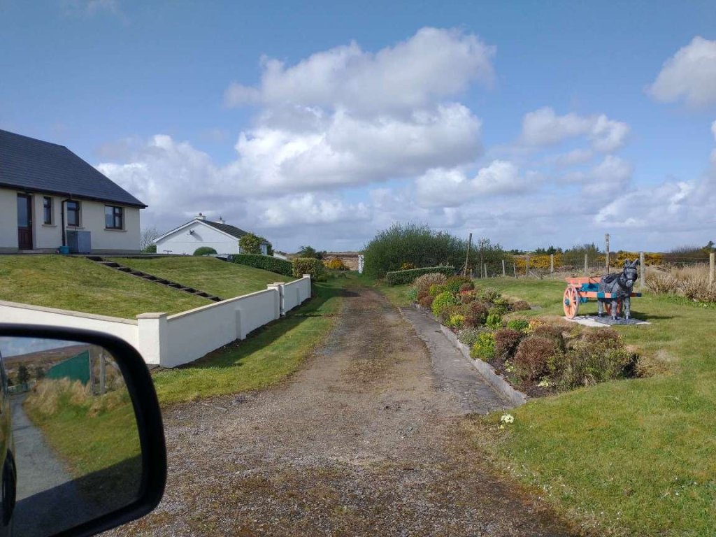
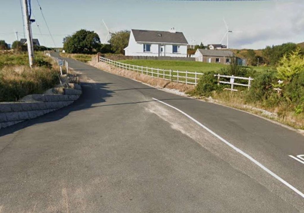
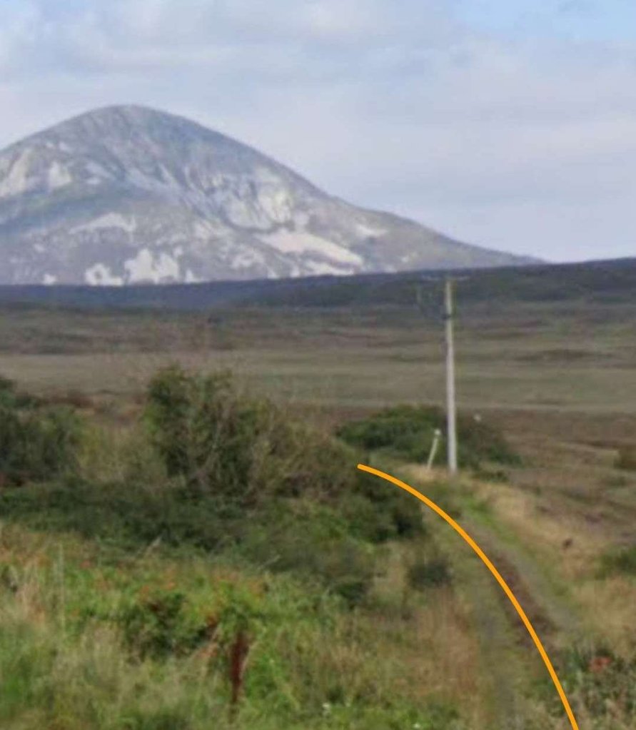
On its way Northeast the old line crossed what would have been an unmetalled road aas shown on the satellite image above. That track is in the 21st century a metalled minor road as shown below.

What was once more than a track but in the ,21st century is a metalled single track road crosses the line of the old railway at an ungated crossing. [Google Streetview, September 2021]
The line running Northeast away from the minor road. [Google Streetview, September 2021]
This extract from the 1906 6″ OSi mapping shows the level crossing at the point where the Burtonport Extension Railway crossed what is now the N56. Crossing Keeper’s Cottage No. 18 is shown to the East side of the old railway. [3]
The same location in the 21st century. [Google Maps, September 2021] with the line of the old railway drawn on by me.
Crossing Keeper’s Cottage No.18 alongside the N56 in the late 1980s or early 1990s. The old railway ran to the right side of the cottage, © Steve Flanders. [2: p79]
Crossing Keeper’s Cottage No.18 alongside the N56 in September 2021. [Google Streetview, September 2021]
Seen from the N56 in 2021, this side elevation shows that the cottage has been extended. The car sits on the line of the old railway. [Google Streetview, September 2021]
This 1″ map from the 1940s shows the Burtonport Extension Railway taking a wise arc from travellin North to running East. We continue following it in the next few images. [3]
This extract from the 6″ OSi mapping of 1906 shows Crossing Keeper’s Cottage No. 18 near its bottom edge and No. 17 adjacent to its left edge as the old railway curves through North and begins its sweep to the East. [3]
Relatively open moorland means that the route of the old railway can easily be picked out in this Google Maps satellite image from Crossing Keeper’s Cottage No.18 alongside the N56 at the bottom of the image to the point where it crosses the modern R257 and continues curving round toward the East. [Google Maps, 2nd May 2023]
Looking South from the R257 the old railway can be seen to the left of Crossing Keeper’s Cottage No. 17. [Google Streetview, September 2021]
Looking North from the R257, the old railway can be seen curving away in a wide arc toward the East. [Google Streetview, September 2021]
This next extract from the 1906 6″ OSi survey shows the line completing its curve to the East. [3]
This satellite image from Google Maps covers much the same area as the map extract above. The route of the old railway curves in from the left, follows the line of a track noted by Google Maps and then crosses a minor road. It appears then to disappear into trees. North of the line if the old railway in this image is the Clady Canal which provides the water supply to the Clady Power Station.  [Google Maps, 2nd May 2023]
Looking back Southwest along the line of the old railway towards Crolly from the minor road mentioned above. [My photograph, 24th April 2023]
Looking Northeast along the line of the old railway from the same minor road. [My photograph, 24th April 2023]
Looking West along the Clady Canal. [Google Streetview, September 2021]
Looking East along the Clady Canal towards Gweedore. [Google Streetview, September 2021]

As we have already noted the Clady Canal feeds water to the Clady Power Station. The Clady Hydroelectric Station is a 4.2 MW power station situated in the Gweedore area of Co. Donegal.

Construction started in 1954, with the station going into full operation in 1959, when it also synchronised to the Donegal 38 kV network.
Two lakes form the basis of this hydro scheme: Dunlewey Lough and Lough Nacung are situated in a valley 61m above sea level and are drained by the Clady River, which enters the sea at Bunbeg.” [18]

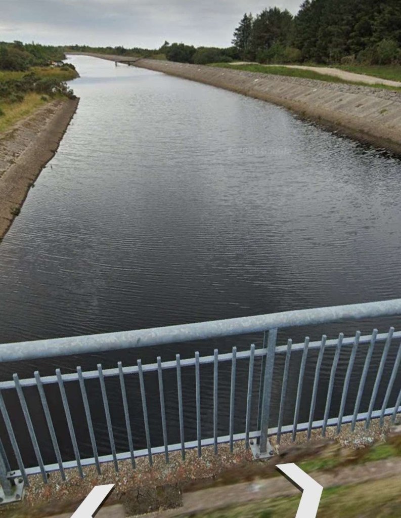
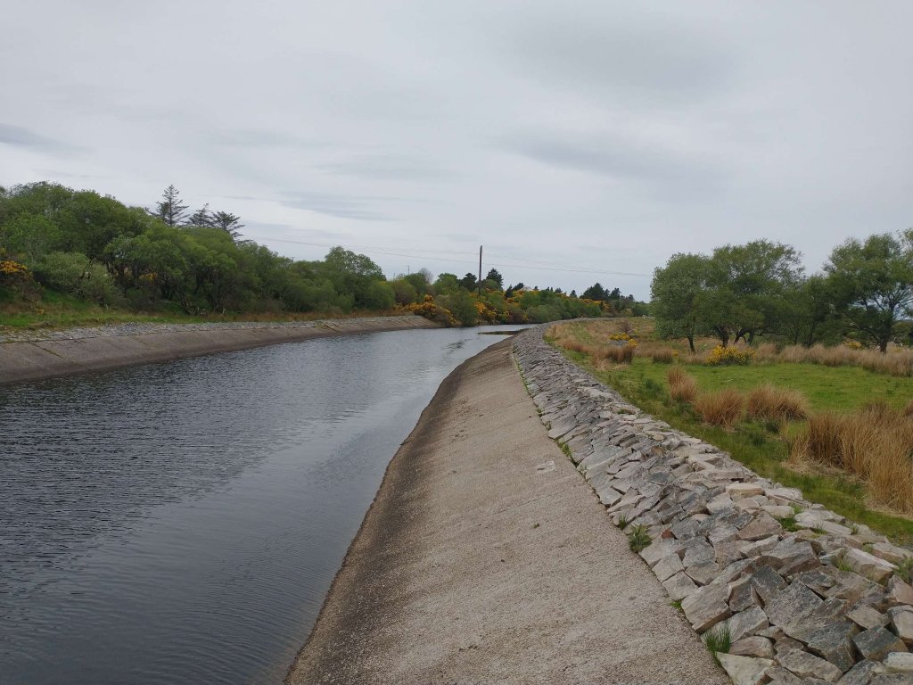
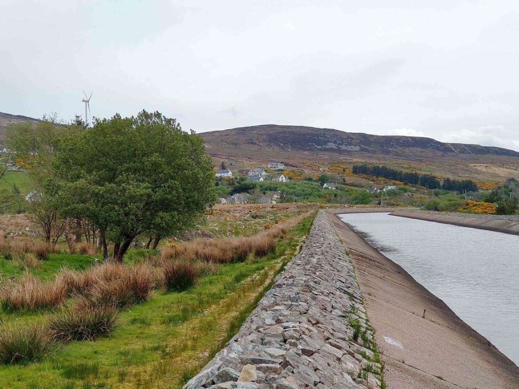
Both of the lakes were enlarged to create the storage capacity needed to run the station. Dunlewy Lough through the construction of the Cung Dam at the promontory between the two lakes. The Clady River has been partially diverted by Gweedore Weir into a 2.5 km canal which runs across country to the rim of a deep valley which forms the tidal estuary of the Gweedore River. This is the canal that we have noted. As we will see, its route conflicts with what was the route of the Burtonport Extension Railway.

A 500m steel penstock carries the water from that canal down to the generating station at sea level. … Overall, the normal range of storage is from 60.96m OD (Ordnance Datum) to 63.70m OD. Gweedore Weir has also raised the level of Lough Nacung with a storage range from 60.96m OD to 61.57m OD. … The powerhouse is equipped with a horizontal Francis-type turbine, coupled to a generator with a capacity of 4.2 MW.” [18]

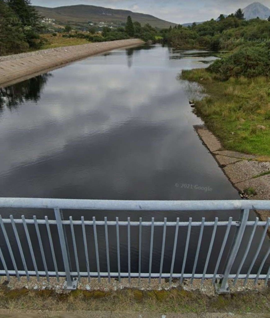
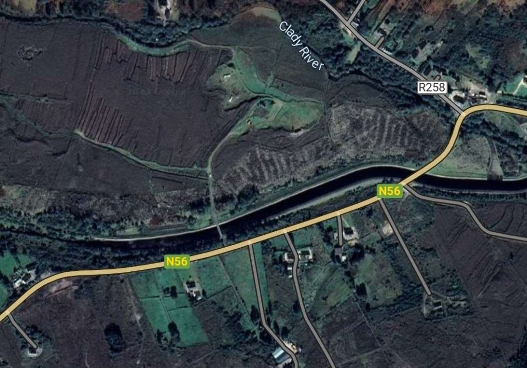
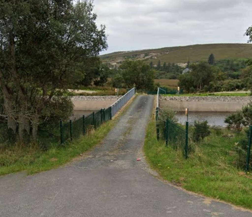
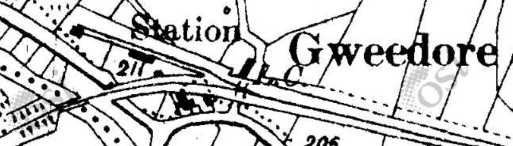
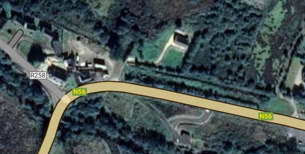
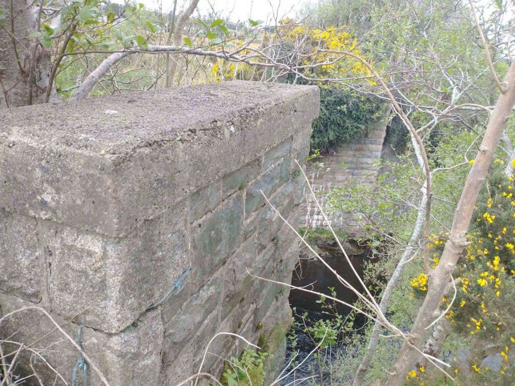
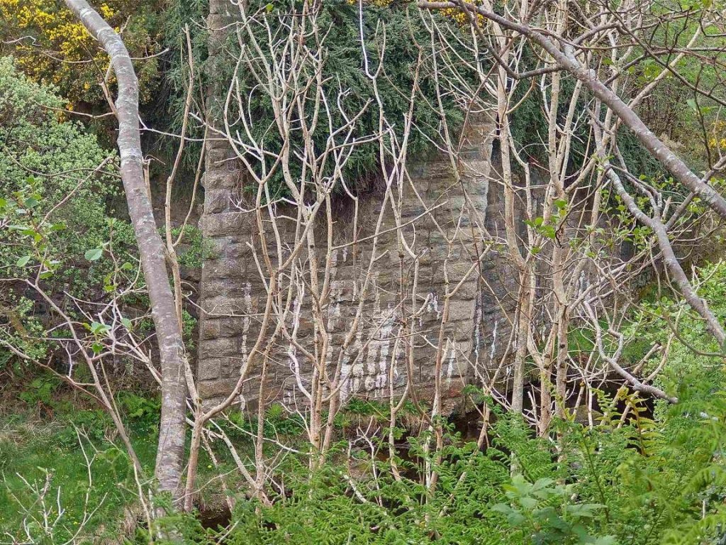
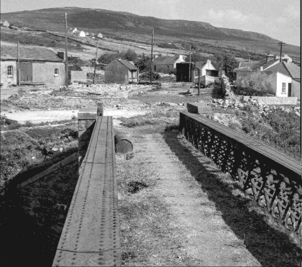
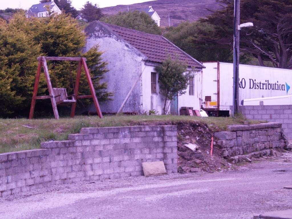
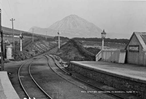
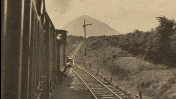
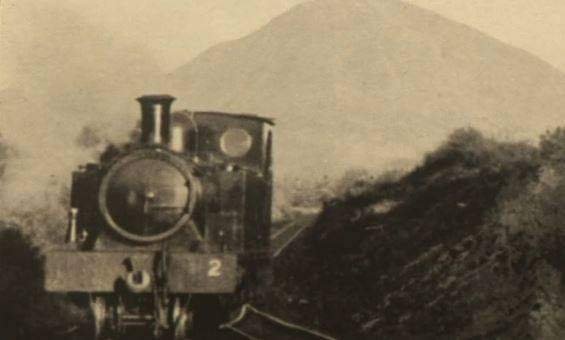
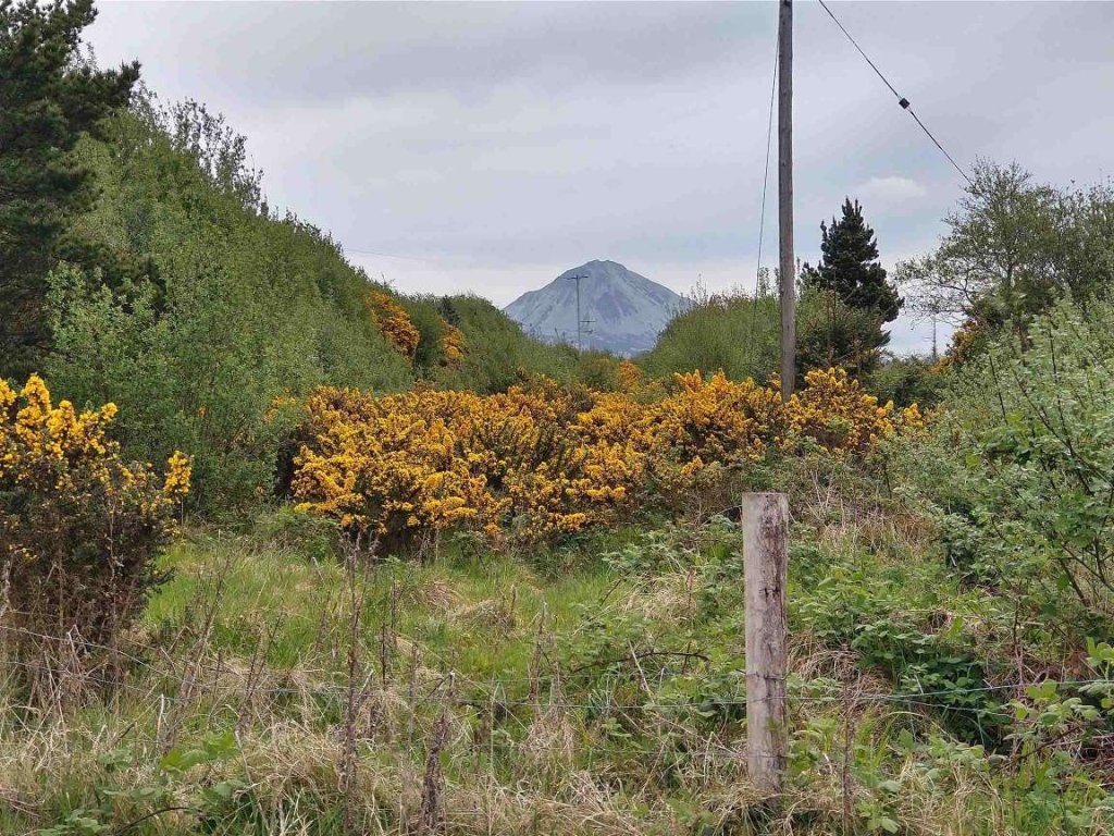
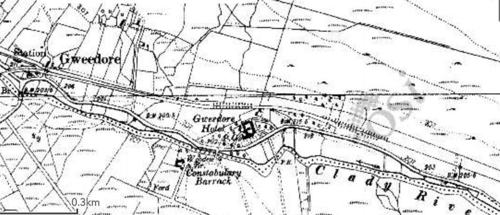
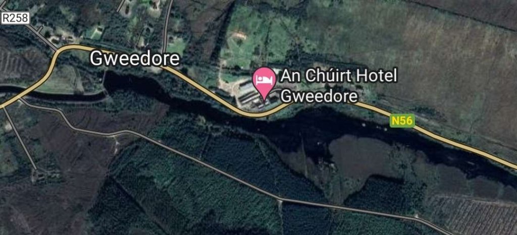
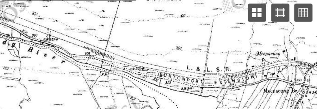
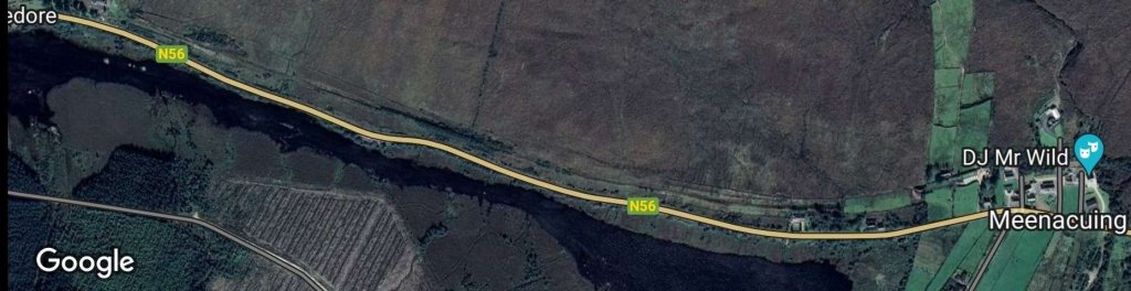
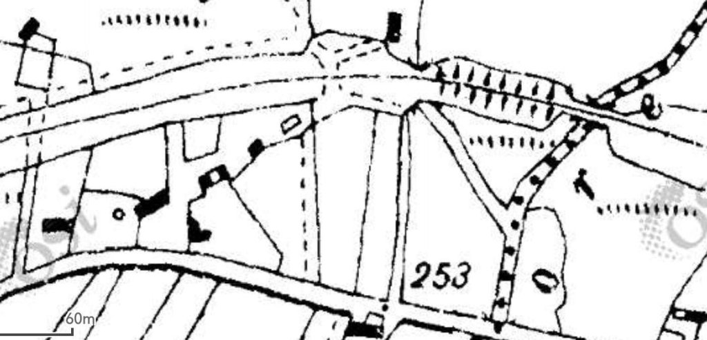
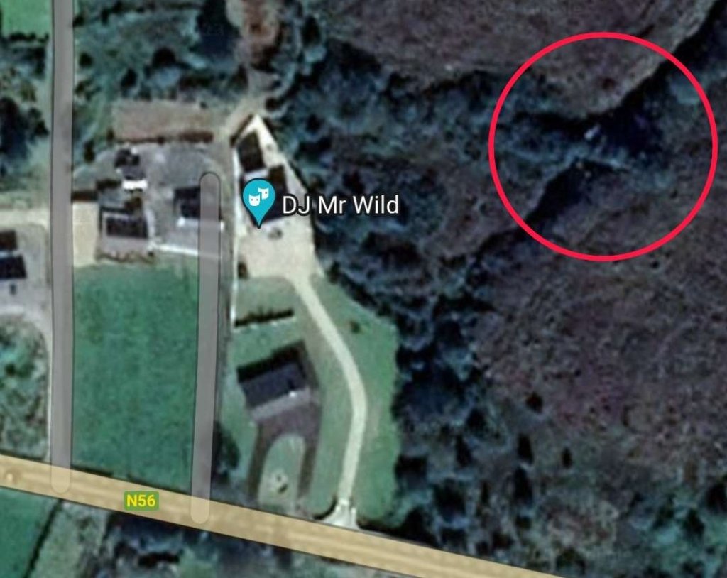
This next extract from the 1906 6″ OSi survey shows the old railway line reaching the Station at Gweedore. [3]
This satellite image covers approximately the same area as the map extract above. The Clady Canal runs adjacent to the N56 and from the left edge of the image to the access bridge at the centre of the image follows the line of the old railway. East of that point the line slips away in a Northeasterly direction,, heading for what was its bridge over the River Claddy to the North. [Google Maps, May 2023]
The minor road bridge over the Clady Canal. To the right of this bridge the route of the old railway slides away to the North. [Google Streetview, September 2021]
The view West along the Clady Canal from the North end of the bridge in the last photo. The old railway and the canal follow a similar line to this point. [My photograph, 3rd May 2023]
The view East from the North end of the same bridge. The old railway route and canal gradually separate from this point. The canal curves away to the right and is crossed by the N56. The railway heads towards its bridge over the River Clady. [My photograph, 3rd May 2023]
This enlarge extract from the 6″ mapping shows the bridge on the approach to the Station from the West. A level crossing took the line over what is now the R258 and the line ran through the station. The track layout shown on this OSi map extract is not correct. A passing loop was provided at the station and there were also goods facilities. [3]
A similar area on the modern satellite images provided by Google Maps. The immediate area of the station has been redeveloped but some signs of the old railway and it’s station remain.
The abutments of the railway bridge over the River Clady seen from the Northeast and looking along the side of the old bridge towards the Southwest. [My photograph, 3rd May 2023]
The Southwest abutment of the bridge over the River Clady seen from alongside the Northeast anutment. [My photograph, 3rd May 2023]
This photograph shows the station throat as seen from the lattice girder bridge over the River Claddy in the 1950s. A road (now the R258) crossed the line between the bridge and the station. The Goods Shed can be seen on the left of the image. A waiting shelter is the next building to the right. The dark structure to the right of centre is the water tower. This photograph was shared on the Burtonport Heritage Facebook Group by Joe Begley on 31st August 2020. [12]
Looking East through Gweedore Railway Station before the closure of the station and the lifting of the railway tracks. The waiting shelter can be seen on the left with the water tower beyond. This photograph was shared by Joe Begley on the Lower Rosses/Gweedore History Discussion Forum Facebook Group on 19th November 2016. [13]
The waiting shelter at Gweedore Railway Station survived the dereliction of the site through to the present day. This is an undated photograph. It was shared by Joe Begley on the Lower Rosses/Gweedore History Discussion Forum Facebook Group on 19th November 2016. [13] It also appears in the book about the line that Joe Begley co-authored with Steve Flanders and E.M. Patterson. 4: p169]
This modern photograph shows the station site in May 2023 as viewed from the West. The Goods Shed appears to have been replaced by houses, the western end of the station appears to be in the grounds of a newer property which can just be seen on the right side of the image. Carefully preserved in the grounds of that property is the waiting shelter noted in the three images above. The platform edge has been retained as a dwarf wall in front of the waiting shelter. [My photograph, 3rd May 2023]
This photo was shared on the Burtonport Old Railway Walk Facebook Page on 26th November 2011 with the following comment: “‘An Mhuc Dubh’, the Black Pig, at Gweedore Station – very very hard to imagine, when you look at the wild countryside, that big trains like this used to travel back and forth to Derry every day. We will never see their like again.” [21]
Looking West through Gweedore Railway Station before the closure of the station and the lifting of the railway tracks.bThe station name is carried by the building on the left. The wooden structure on the right probably houses a ground frame which controlled the points in the vicinity of the station. This photograph was shared by Joe Begley on the Lower Rosses/Gweedore History Discussion Forum Facebook Group on 19th November 2016. [13]
Looking West through Gweedore Station in the early 1970s. At that time the platforms remained, if grassed over. The two buildings noted below are present as is the watchtower, This photo was shared as a comment by Pete Leigh on a post on the Londonderry and Lough Swilly Railway Facebook Group in April 2022. [16]
This picture shows the building of which a gable end fronted onto the platform on the South side of the railway station. In 2017, Joe Begley and Steve Flanders commented that this building was still present along with the waiting shelter shown above. [4: p169] As can be seen in the image below it has survived at least until 2023! This photograph was shared by Joe Begley on the Lower Rosses/Gweedore History Discussion Forum Facebook Group on 19th November 2016. [13]
A slightly wider angle view of the station site from the East. The building on the left in this image is on the left of the older image above. The platform has gone on both sides of what would have been the running lines where the articulated lorry trailer is standing. [My photograph, 3rd May 2023]
The East end of Gweedore Railway Station with Errigal in the distance. This photograph was shared by Liam O Siadhail on the Lower Rosses/Gweedore History Discussion Forum Facebook Group on 18th November 2016. [14]
Leaving Gweedore Railway Station heading East. This photograph was shared on the Lower Rosses/Gweedore History Discussion Forum Facebook Group by Séimidh Ó Dubhthaigh on 15th October 2015. [15]
This photograph shows Locomotive No. 2 at the East end of Gweedore Railway Station. The loco is possibly running round a train or shunting at the station. This picture was shared as a comment about the picture immediately above, also by Séimidh Ó Dubhthaigh in October 2015. [15]
This photograph is my attempt to replicate the three monochrome images above in May 2023. The track ed of the old railway East of Gweedore Railway Station is overgrown with gorse bushes. [My photograph, 3rd May 2023]

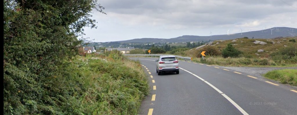
Beyond Gweedore Railway Station, the line of the old railway has become overgrown. It runs along the North side of the N56 for some distance.

The next length of the Burtonport Extension Railway as shown on the 6″ OSi mapping of 1906. The Gweedore Hotel of 1906 is,in the 21st century, the An Chuirt Hotel. [3]
A similar area to that shown on the 6″ mapping above. [Google Maps, May 2023]
We know that this photo is taken close to Gweedore Railway Station. The exact location is not clear. It is at least possible that Londonderry & Lough Swilly Railway 4-6-2T No. 14 had only just left Gweedore with a passenger train for Letterkenny in September 1938, © Gordon Tucker. This image was shared by Donegal Railway Heritage Centre on their Facebook Page on 25th April 2021. [19]
This view of the first road junction to the East of Gweedore Railway Station shows the proximity of the line of the old railway to the modern N56. The road centre-line shows that the first few metres of the side road climb steeply to meet the formation level of the old railway before leveling out at the point where the road crossed the old railway at an ungated crossing. Once across the old railway formation the road begins to rise again. [Google Streetview, 3rd May 2023]

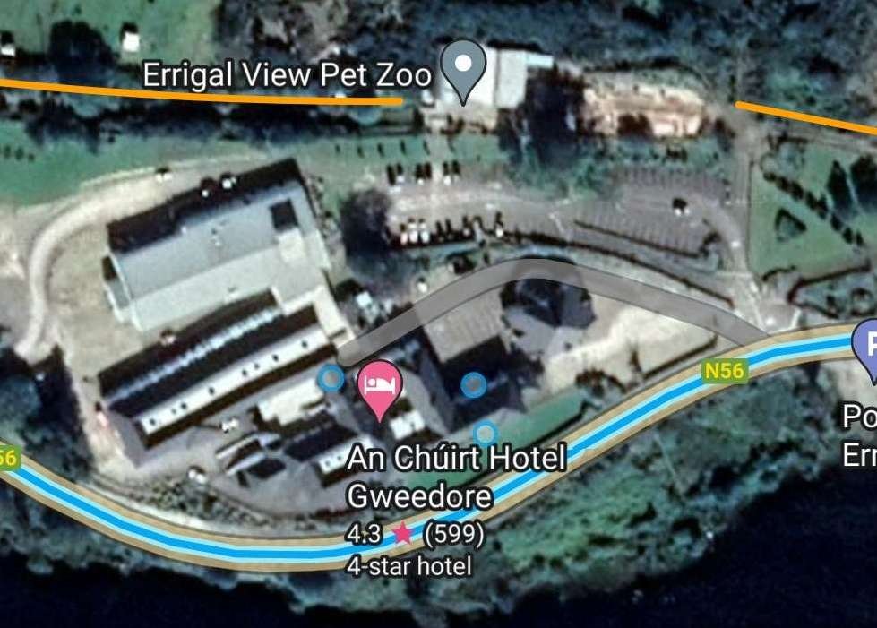
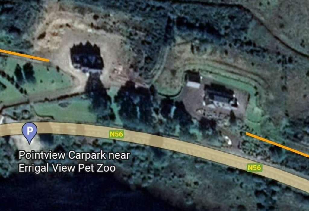
It seems as though the An Chuirt Hotel has expanded and that its site now includes what was once railway land. The Errigal View Pet Zoo also straddles the line of the old railway.

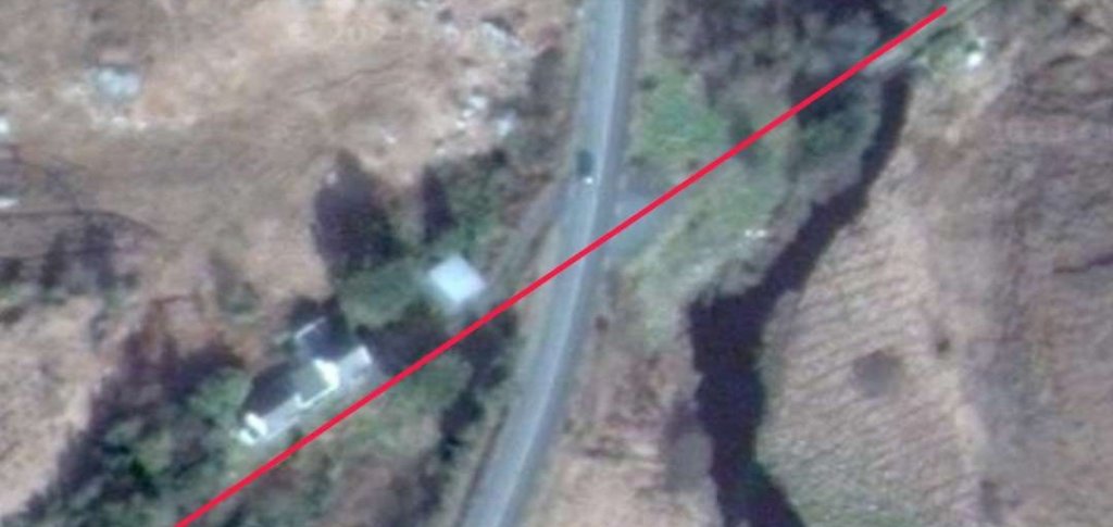
The An Chuirt Hotel and the Errigal View Pet Zoo. The line of the old railway is illustrated by the orange line at either side of this Google Maps image. [Google Maps, 3rd May 2023]

Immediately to the East of the Errigal View Pet Zoo two larger properties straddle the route of the old railway.

This is an enlarge satellite view of the two properties mentioned above. The line of the Burtonport Extension Railway is marked by the two orange lines, one at each side of the satellite image. [Google Maps, 3rd May 2023]
This next length from the 1906 6″ OSi mapping takes us as far East as the Crowmore Burn. [3]
This satellite image covers approximately the same area as shown in the map extract above. The line of the old railway can easily be seen on the North side of the N56. [Google Maps, 3rd May 2023]
An enlarged extract from the 1906 6″ survey which shows the arch bridge which spanned Crowmore Burn. [3]
The bridge crossing Crowmore Burn which outfalls into Lough Nacung Upper is highlighted by the red circle in the top-right of the satellite image. This image focusses on the bridge and its immediate vicinity. [Google Maps, 3rd May 2023]
The bridge which carried the old railway over the Crowmore Burn still stands today, although it seems to have quite. growth of gorse above the spandrel walls and parapets. [My photograph, 24th April 2023]
To the East of Crowmore Burn the old railway and the road gradually converged both in height and plan until the Burtonport Extension Railway crossed what is now the N56 at level. The crossing was gated and Crossing Keeper’s Cottage No.16 sat adjacent to it. [3]
Approximately the same area as shown in the map extract above. The route of the old railway can be seen north of the N56 until crossing it towards the left of the satellite image. [Google Maps, 3rd May 2023]
The view back towards Gweedore from the location of the level crossing close to Crossing Keeper’s Cottage No. 16. [My photograph, 24th April 2023]
Joe Begley shared this photograph of Crossing Keeper’s Cottage No. 16 on the Londonderry and Lough Swilly Railway Facebook Group on 10th March 2022. It was taken in 2017, © Joe Begley. [20]
These two images show Crossing Keeper’s Cottage No.16 after the relatively recent removal of surrounding trees and shrubs and a partial renovation. [My photographs, 24th April 2023]
The view along the line of the old railway looking East. [Google Streetview, September 2021]
The view along the line of the old railway from beyond the conifers on the line of the railway, looking East. [Google Streetview, September 2021]
To the East of Crossing Keeper’s Cottage No. 16, the main road and the old line separated quite quickly. The road turned a way to the North and the railway set an East by Northeast course as this extract from the 1906 6″ OSi mapping shows. [3]
Approximately the same area as shown in the map extract above as it appears on modern satellite imagery. [Google Maps, 4th May 2023]
This next extract from the 1906 6″OSi mapping shows that within a very short distance the old railway crossed a minor road at a gated crossing. Crossing Keeper’s Cottage No.15 sits to the North of the line. [3]
A similar area to that shown on the map extract above. The 21st century narrow roads are clearly marked and the route of the old railway can be made out running East-northeast across the image. [Google Maps, 4th May 2023]
Looking back along the route of the old railway towards Crossing Keeper’s Cottage No. 16. [Google Streetview, September 2021]
Looking forward along the route of the old railway towards Cashelnagore. The railway ran to the right of Crossing Keeper’s Cottage No. 15. [Google Streetview, September 2021]
As this next map extract shows, the old railway skirted the Eastern shore of Lough Trusk, curing round to travel in a Northeasterly direction. [3]
Lough Trusk sits at the bottom edge of this satellite image. The line of the Burtonport Extension Railway can be seen to the immediate right of the lake and the heading Northeast. [Google Maps, 4th May 2023]
Looking back along the line of the old railway towards Crossing Keeper’s Cottage No. 15 which can be seen just below the horizon. [Google Streetview, September 2021]
These two views (both from Google Streetview) of the old railway as it runs alongside Lough Trusk were taken a couple of hundred metres apart. I have included both because they emphasise that when the weather was good a ride on the Burtonport Extension Railway would have been quite a special way to experience the beauty of Co. Donegal. [Google Streetview, March 2010]
This next extract from the 1906 6″ OSi mapping shows the line to the Northeast of Lough Trusk passing through the gap between Edenbane and Truskmore. [3]
This satellite image covers the same area as the map extract above. The photographs below are taken from the minor road which can be seen running South to North through the centre of the image. The old railway runs alongside that road at a lower level before passing to the West of Lough Doo which can be seen at the top-right of the image. as can be seen in the photographs below this is a particularly beautiful length of the Burtonport Extension Railway. [Google Maps, 4th May 2023]
Looking Southwest through the gap between Truskmore, on the left, and Edenbane, on the right, towards Lough Trusk. The old railway can be seen on embankment running across the East face of Edenbane. [Google Streetview, September 2021]
Looking East toward Edenbane. The old railway can be made out beneath the rock face. [Google Streetview, September 2021]
Ahead is Crossing Keeper’s Cottage No. 14 which sits high above the route of the old line which ran across the bottom of the slope supporting the house and road. [Google Streetview, September 2021]
Crossing Keeper’s Cottage No. 14. [Google Streetview, September 2021]

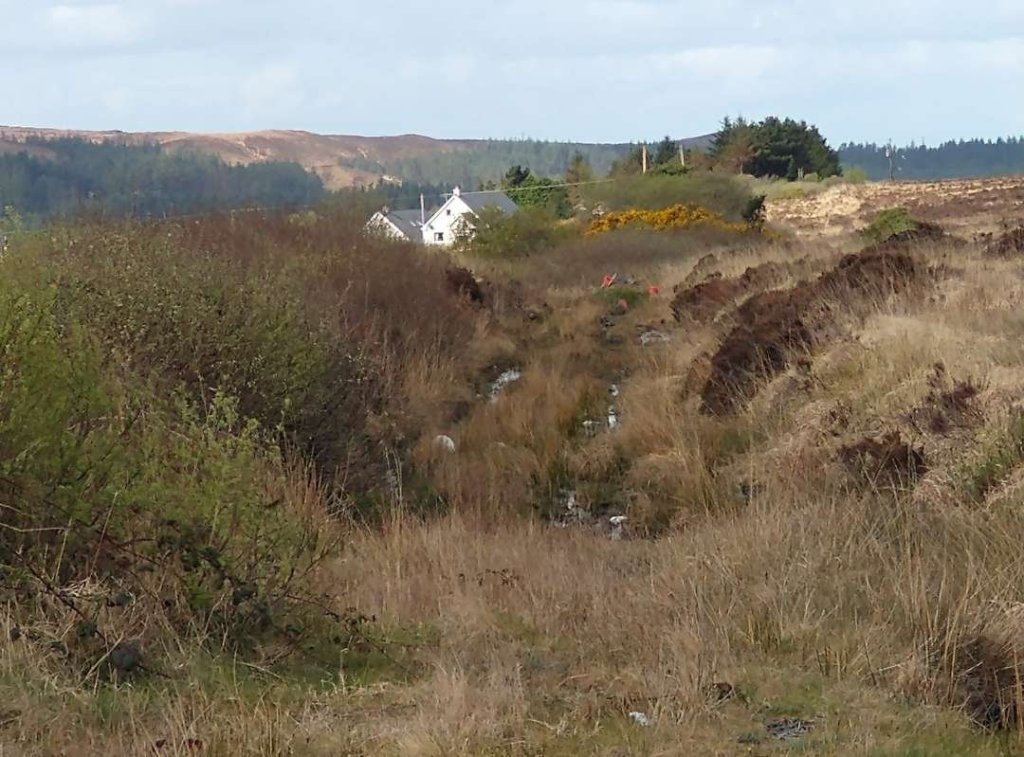
It seems that there were two crossings close together at the bottom of the slope to the left of the road. These can be seen on the map extract to the left below, either or both may have been gated but I have not been able to establish whether either were.

It is possible to see the more northerly of the two crossings from the road close to the Crossing Keeper’s Cottage and I have provided a photo below which also shows the route of the old railway in orange.

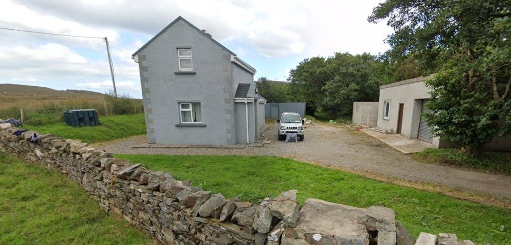
The location and f one of the crossings adjacent to Crossing Keeper’s Cottage No. 14. [Google Streetview, September 2021]

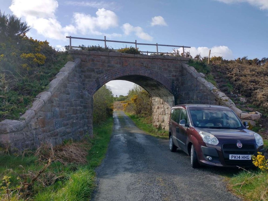
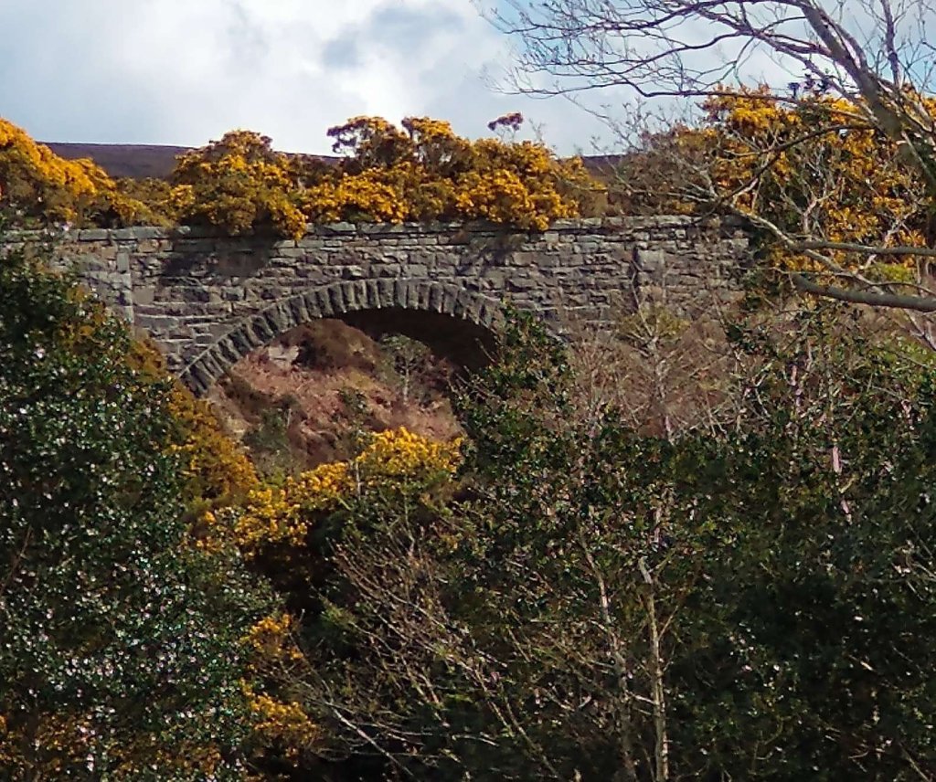
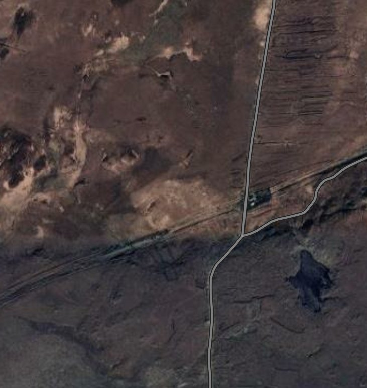
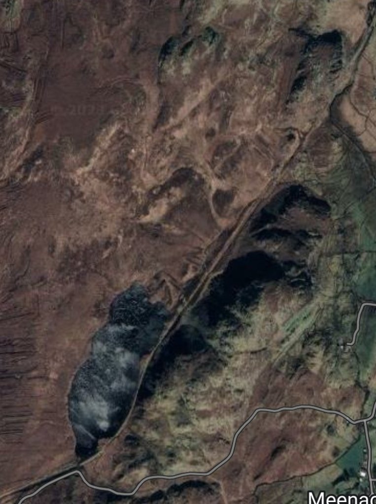
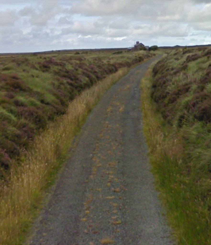
North of the Cottage the minor road splits with one arm crossing the railway on a stone arch bridge and the other heading towards Cashelnagor Railway Station passing on the Southeast side of Lough Doo.

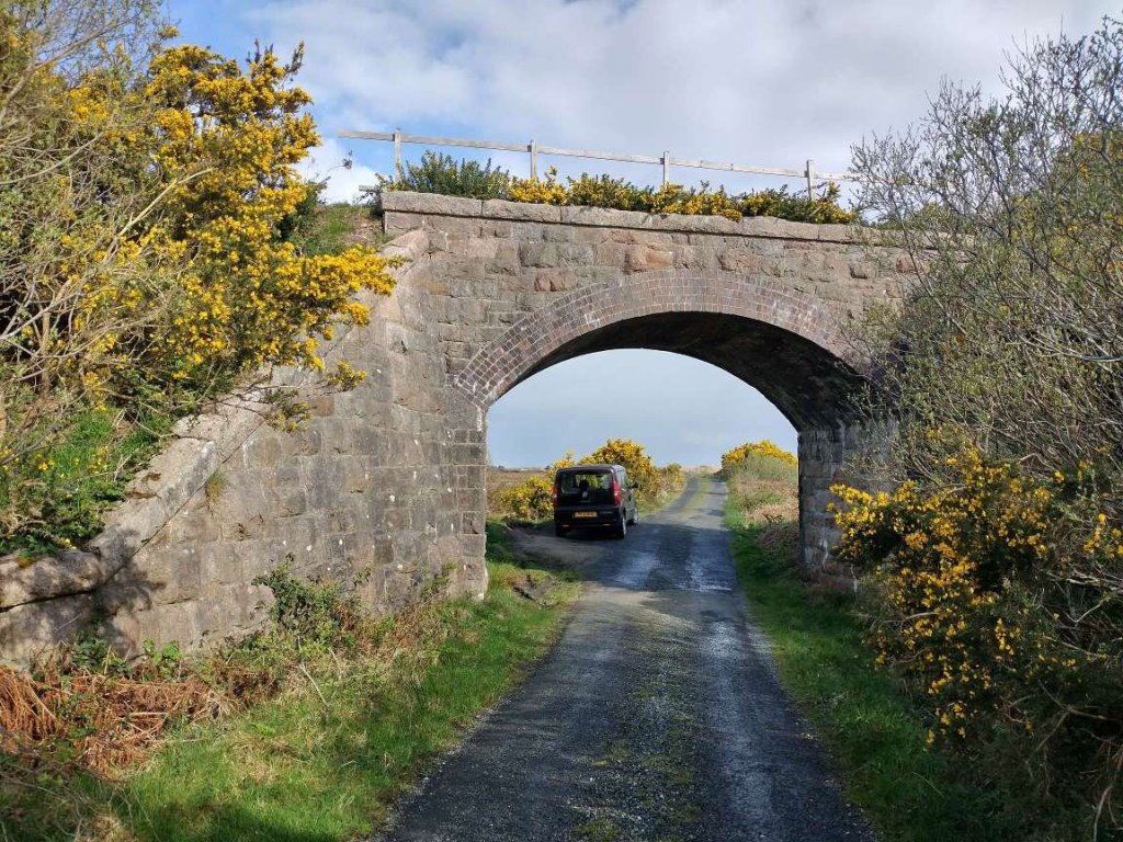
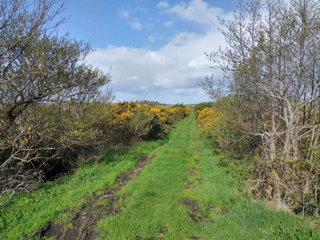
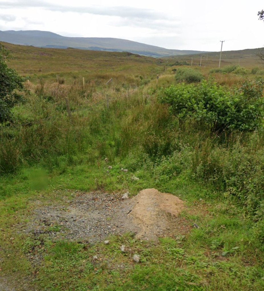
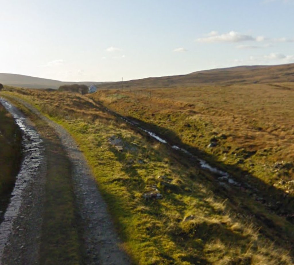
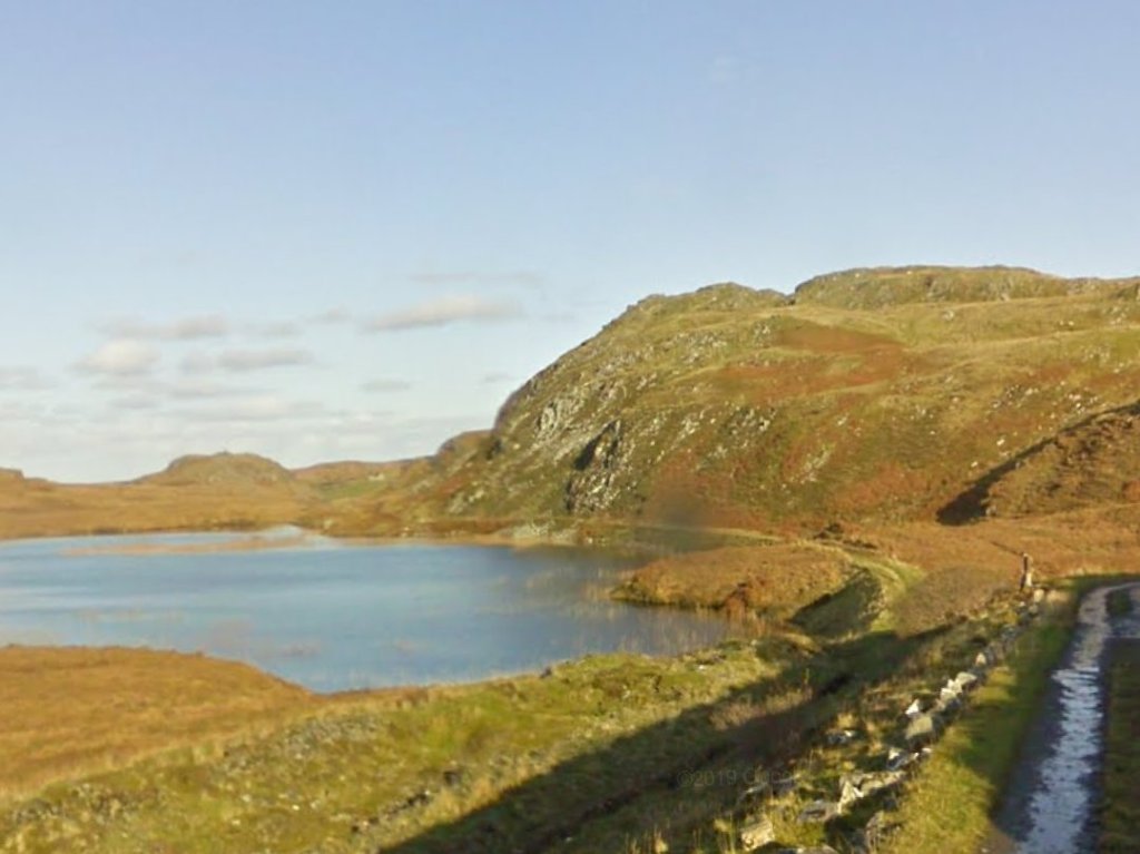
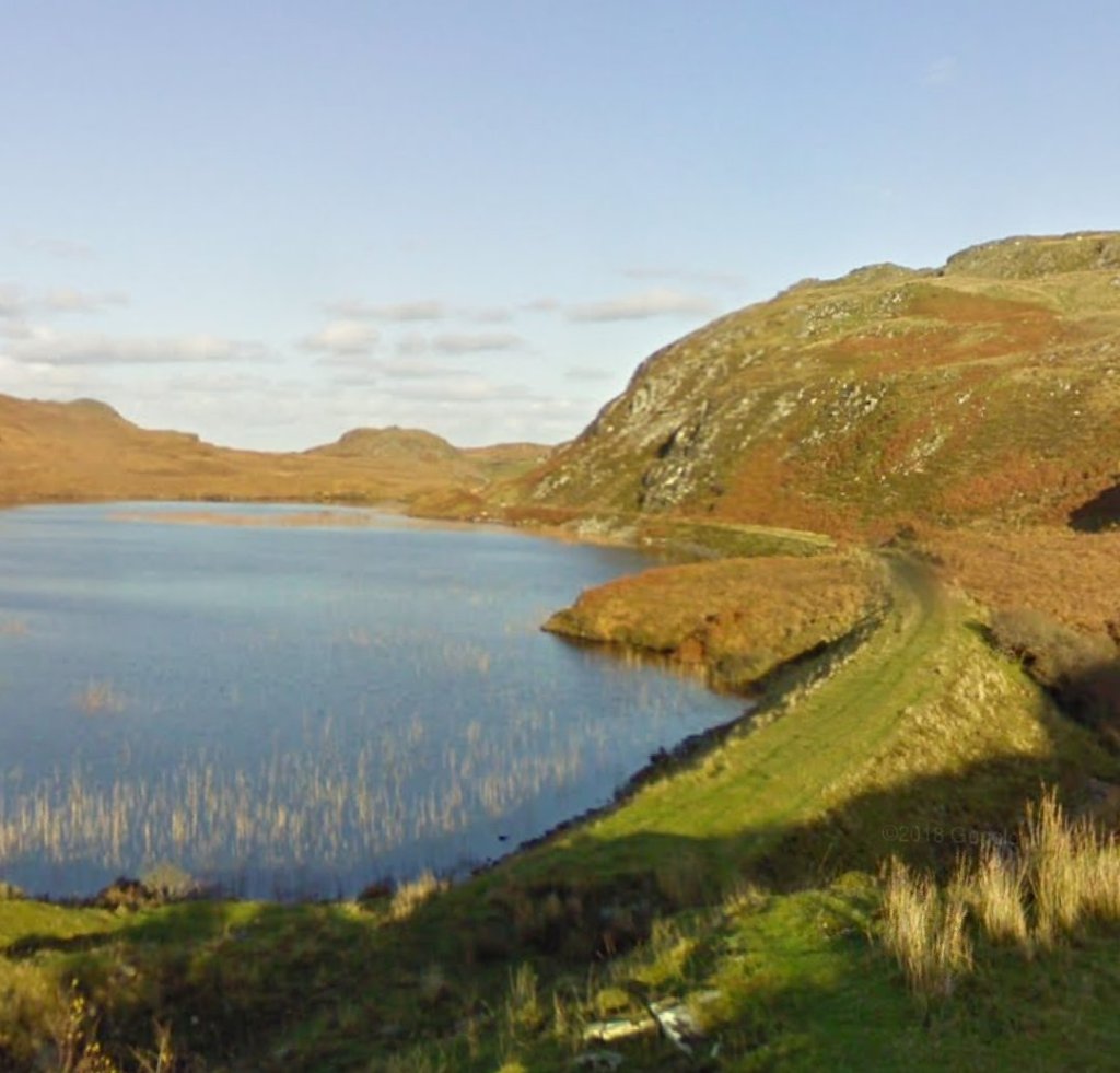
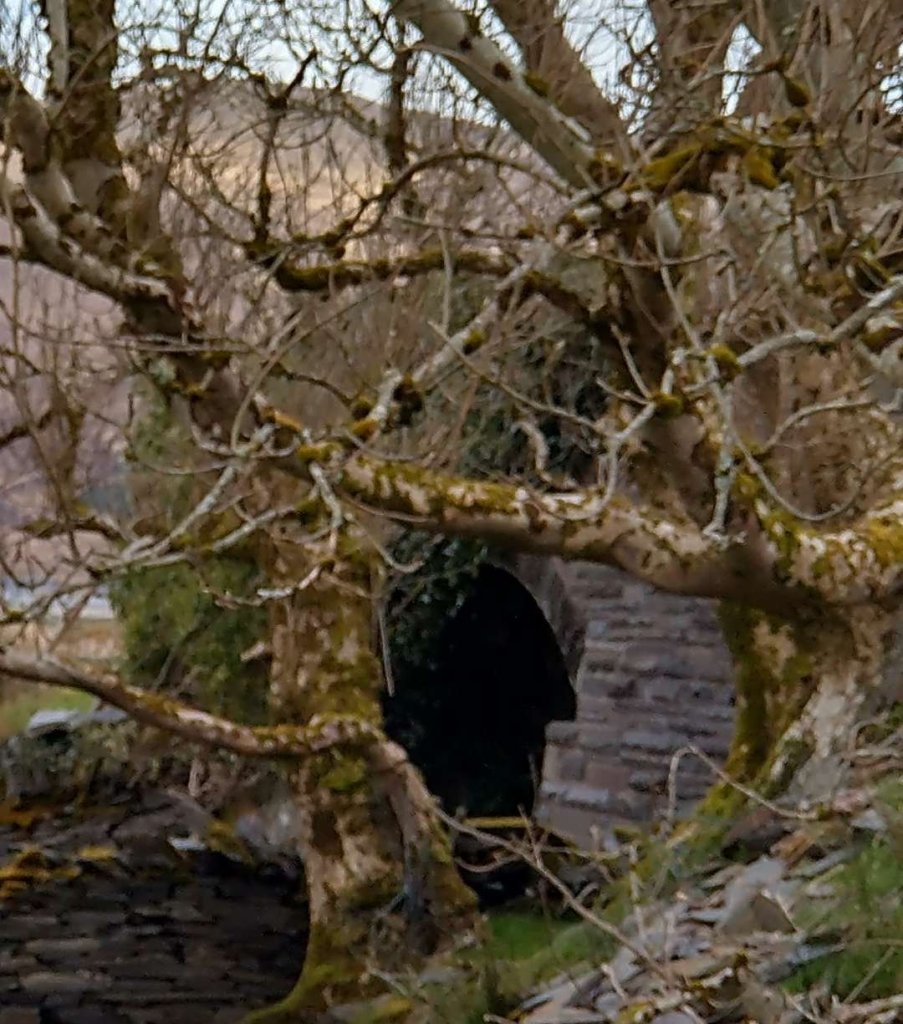
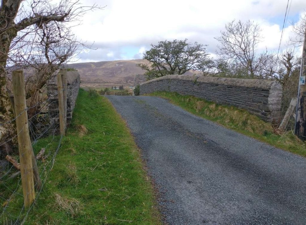
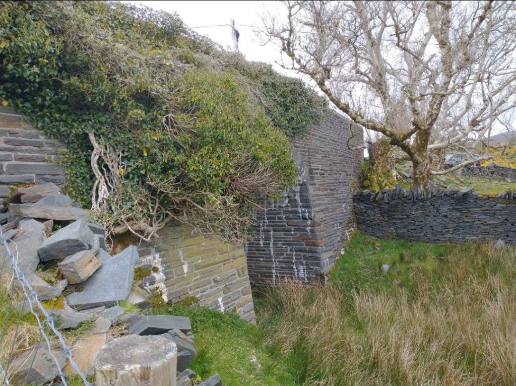
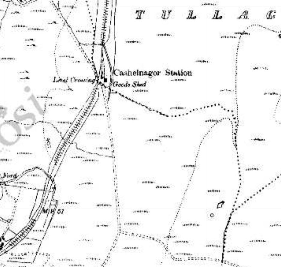
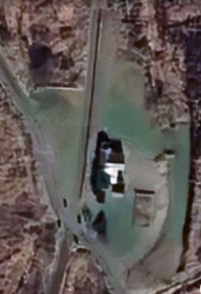
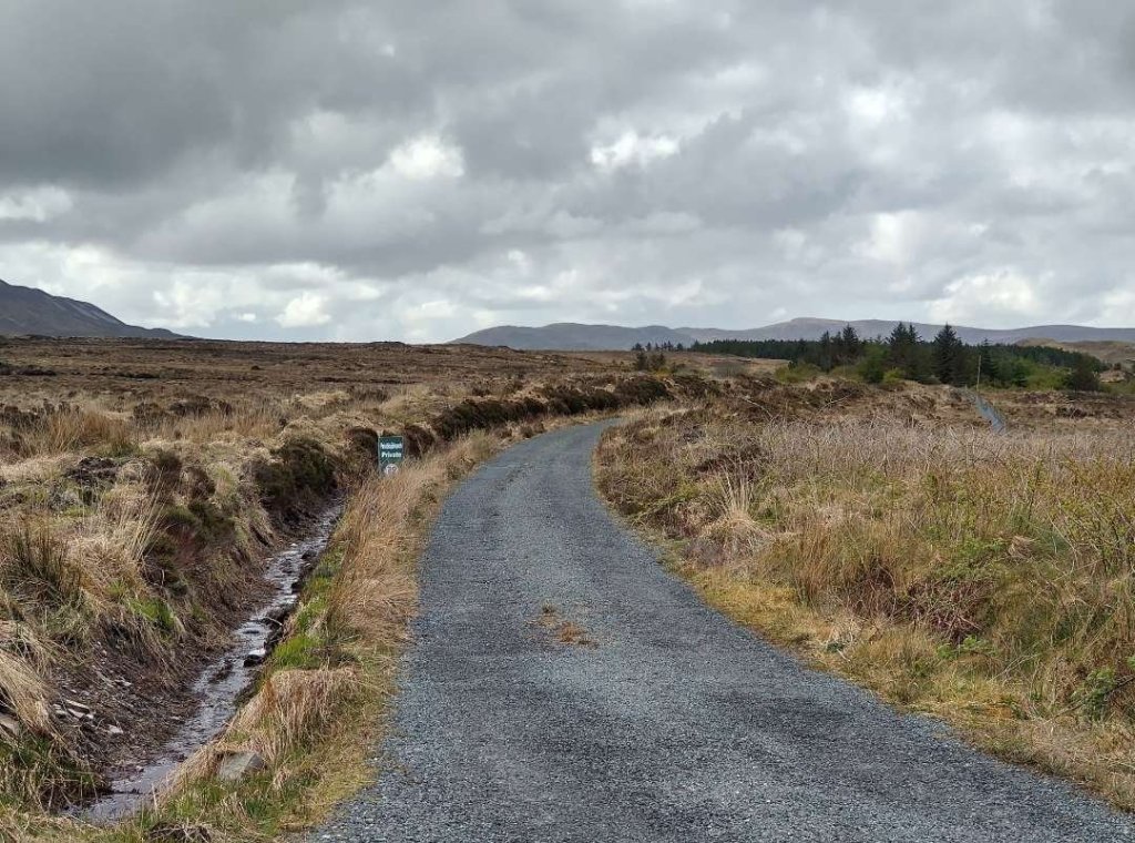
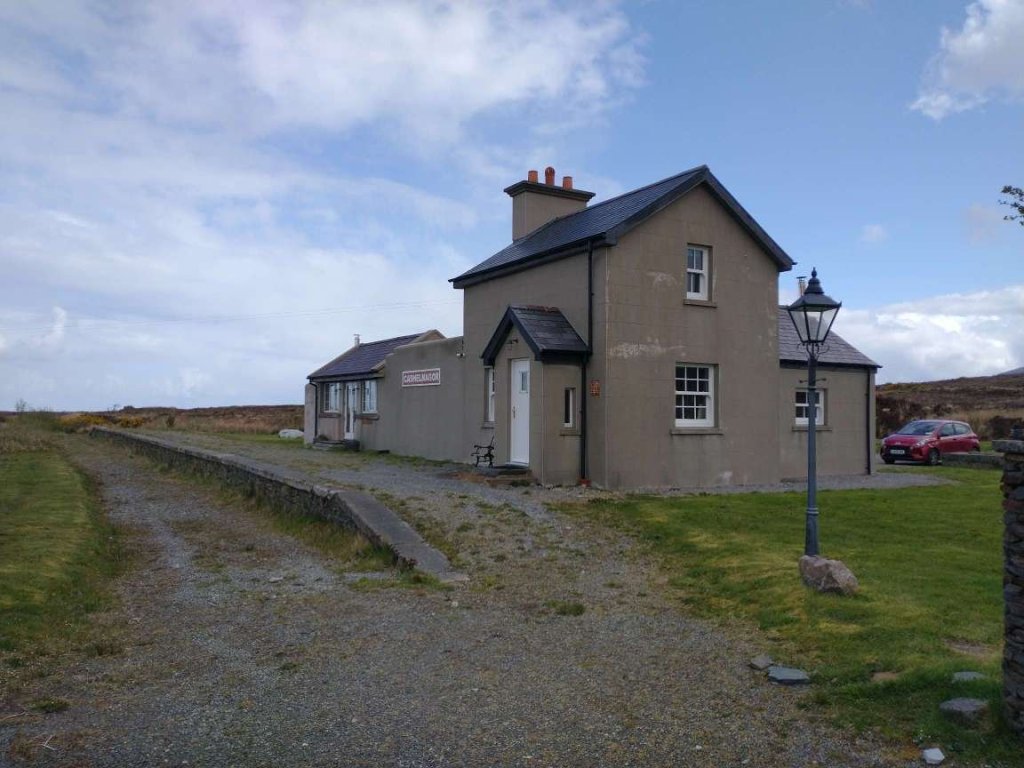
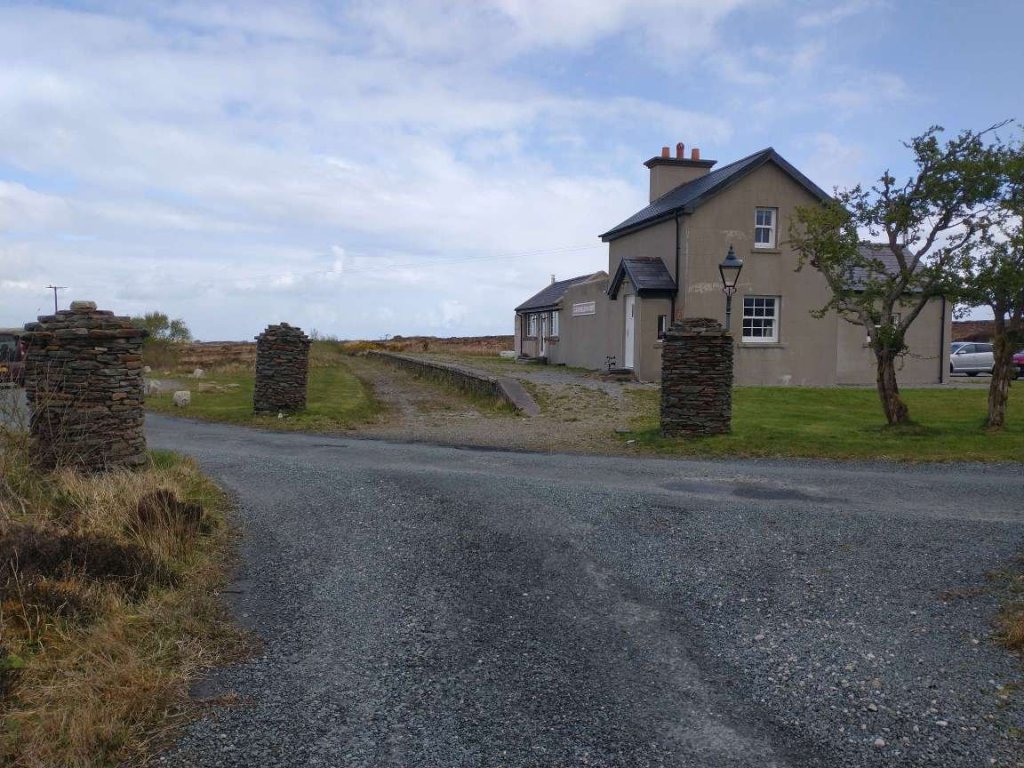
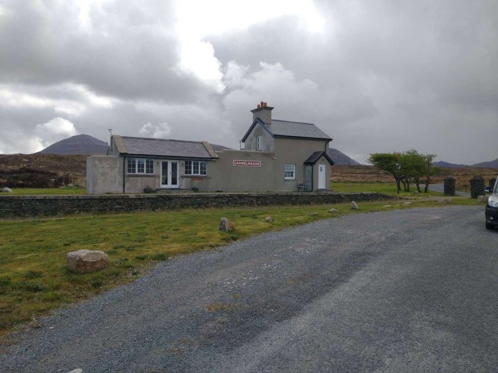
The stone arch of the bridge can be seen through the trees on the left of the road as one approaches by road from the South. [My photograph, 24th April 2023]
The bridge parapets seen from the East. [My photograph, 24th April 2023]
The South face of the structure seen from the Southwest corner. [My photograph, 24th April 2023]
Looking South over the bridge parapets back towards Lough Trusk. [My photograph, 24th April 2023]
Looking North over the bridge parapets. The railway cutting is overgrown. [My photograph, 24th April 2023]
The railway continues North on the West side of Lough Doo. The 25″ OSi mapping is still unavailable for this length of the line on-line. This is the 6″ OSi mapping of 1906. When we reach Cashelnagor we will be able once again to view the 25″ mapping. [3]
This satellite image covers much the same area as the map extract above. Both the old railway route and the present day road can be seen either side of Lough Doo at the bottom of the image. [Google Maps, 4th May 2023]
Looking back Southwest along the old railway towards Lough Doo. [Google Streetview, March 2010] This length of the route is in private hands, despite this it seems as though the Google camera car covered the metalled track South from Cashelnagor twice in 2010.
At the end of the metalled length of private road, looking Northeast towards Cashelnagor. [Google Streetview, March 2010]
About 200 metres further Northeast. [Google Streetview, March 2010]
And again, a further 200 metres Northeast. [Google Streetview, March 2010]
Cashelnagor Railway Station comes into sight on the horizon. [Google Streetview, March 2021]
Cashelnagor Railway Station features towards the top of this 1906 6″ OSi map extract. [3]
Cashelnagor Railway Station as shown on the 25″ OSi mapping. It had reasonably substantial buildings, both passenger and goods, and stood in a remote position high in the moorland if Co. Donegal. [3]
The station site as it appears on Google Earth. In 2923, the passenger facilities have been restored and now provide a unique holiday rental property. The outline of the old goods shed is still marked [Google Earth, May 2023]
Looking back to the Southwest along the line of the old railway from the road outside Cashelnagor Railway Station. [My photograph, 24th April 2023]
Cashelnagor Railway Station as it appeared in 2010. [Google Streetview, March 2010]

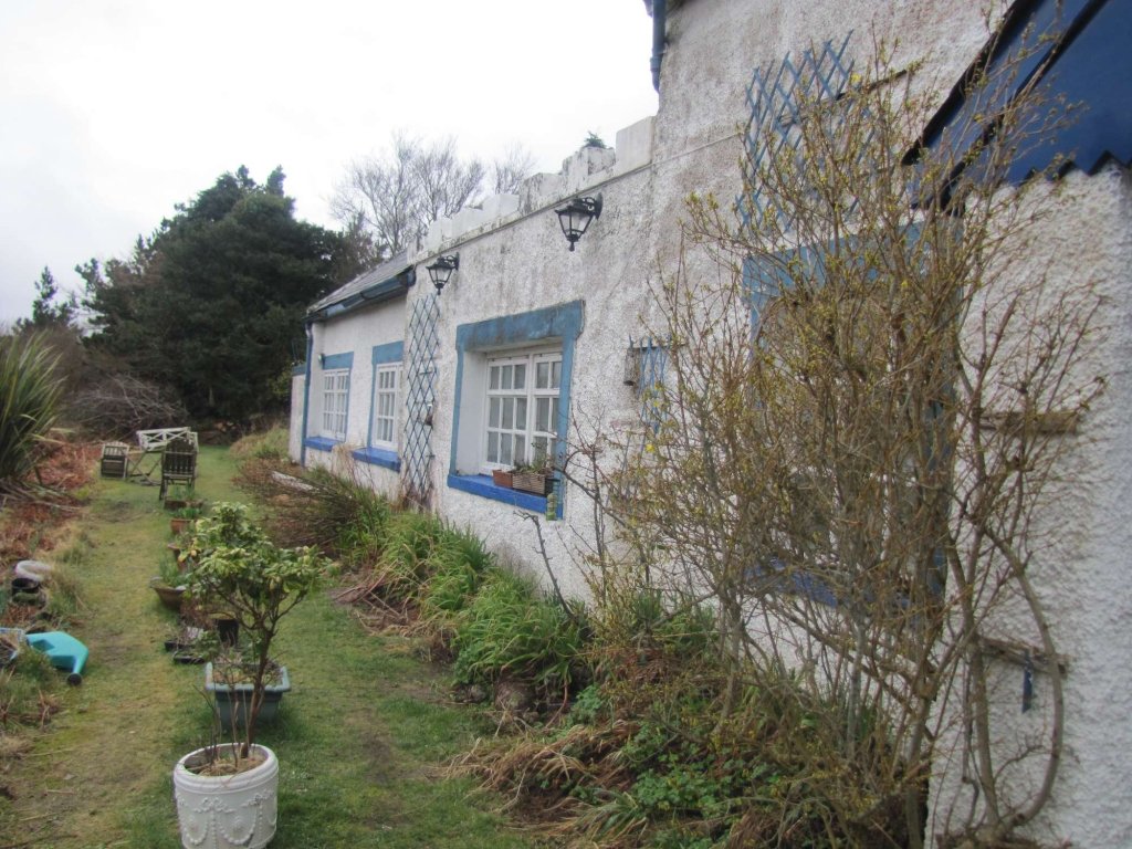
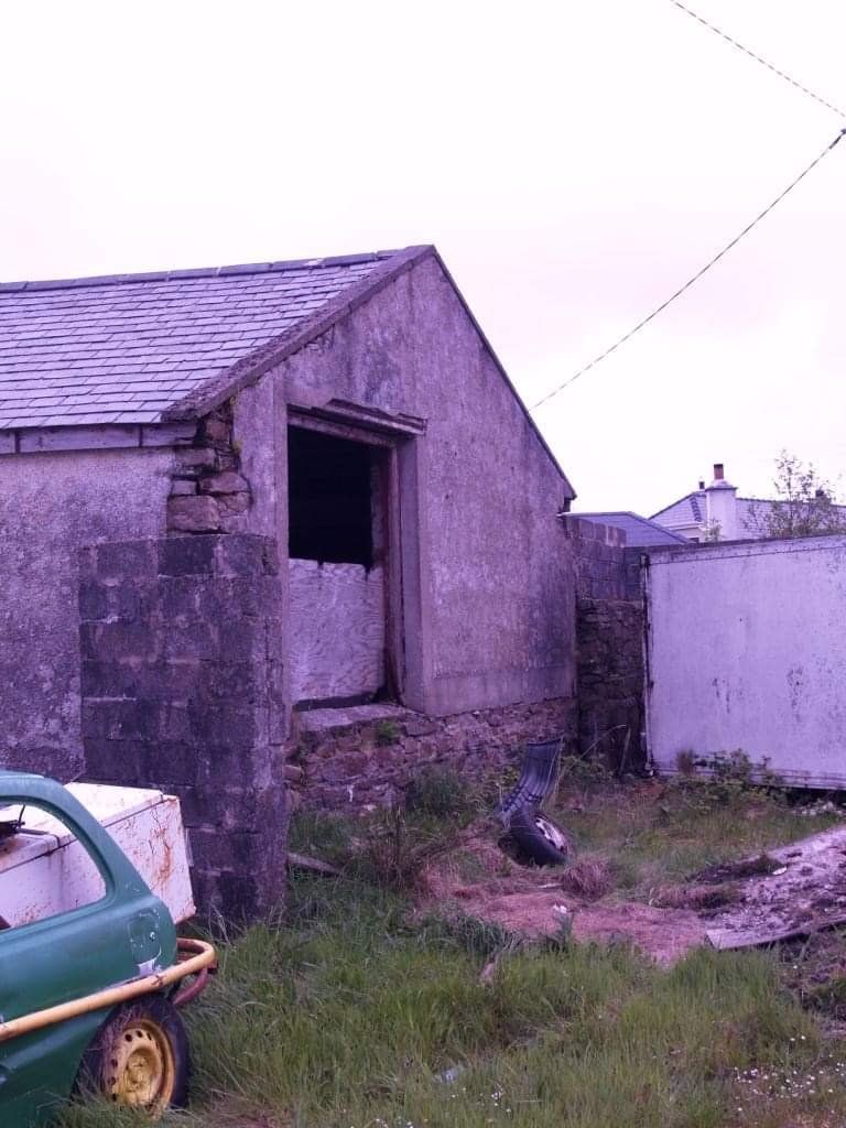
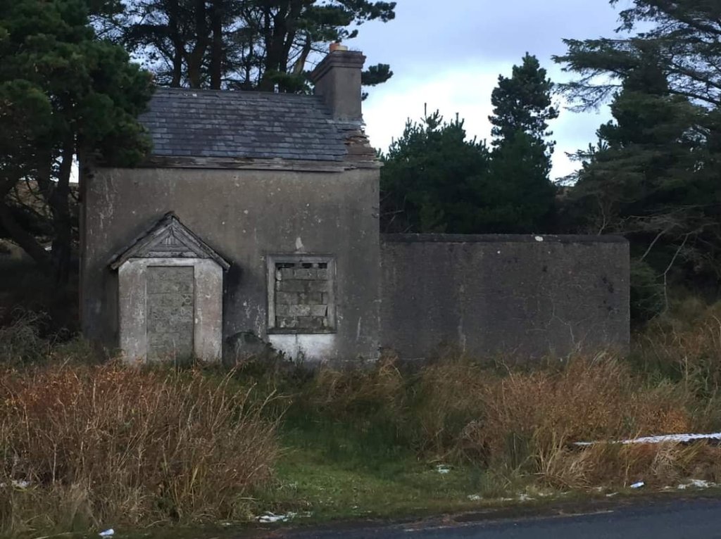
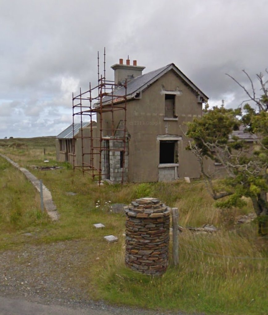
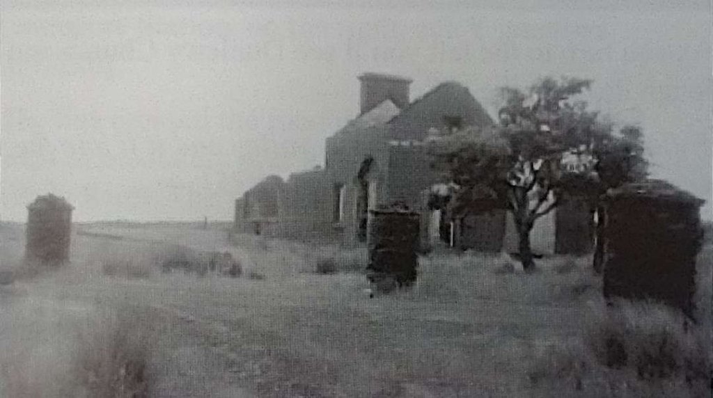
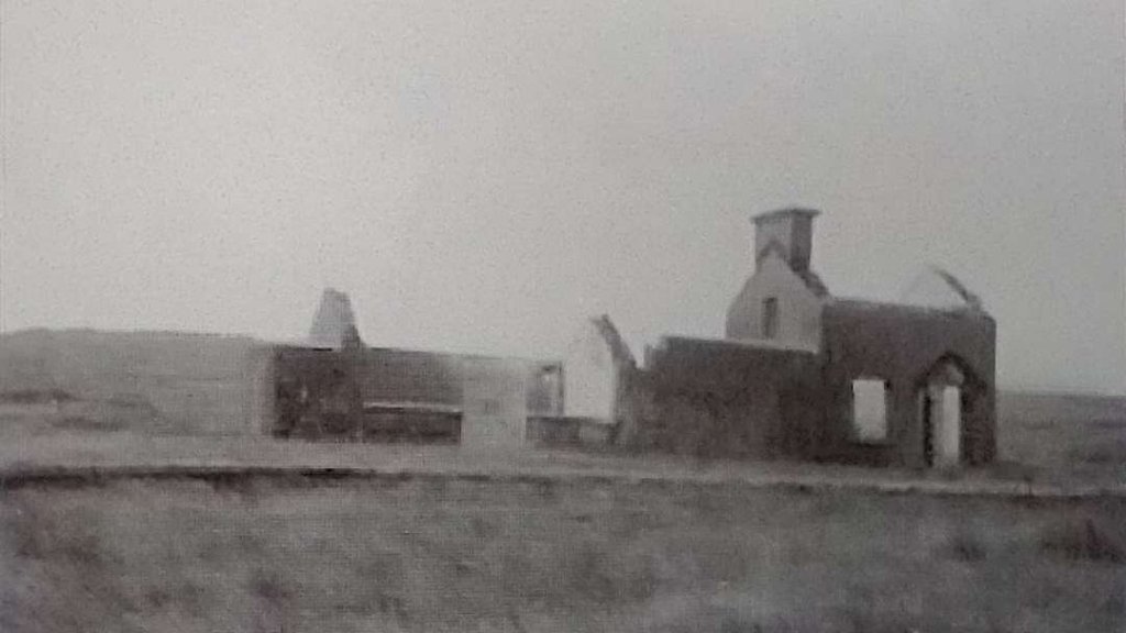
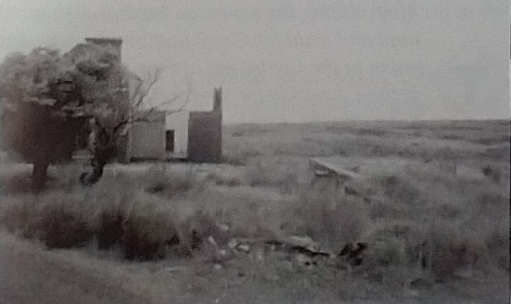
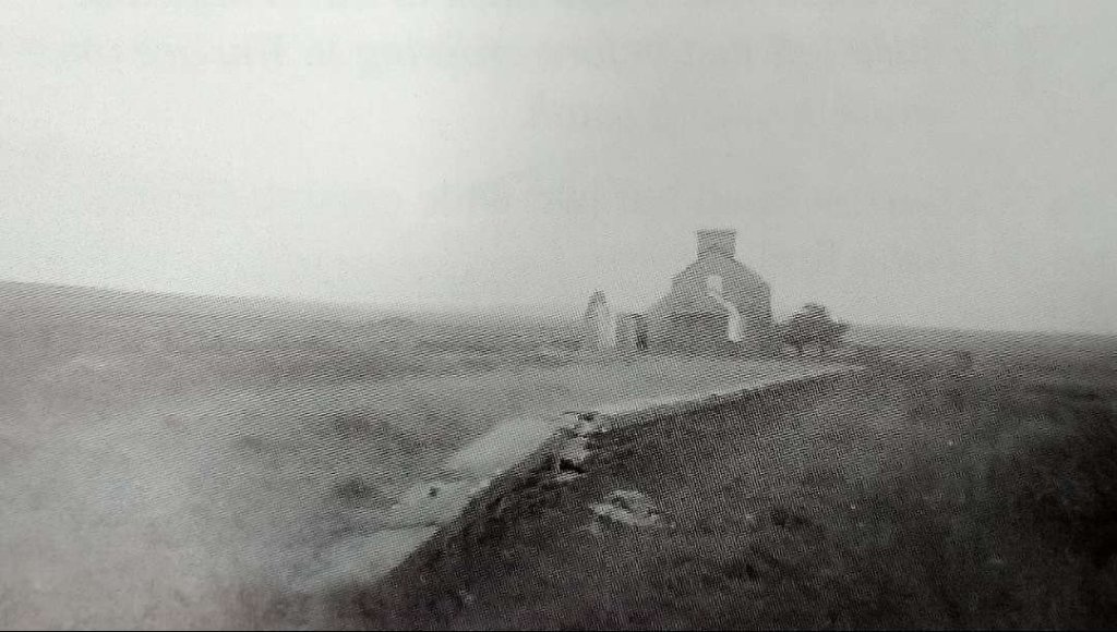
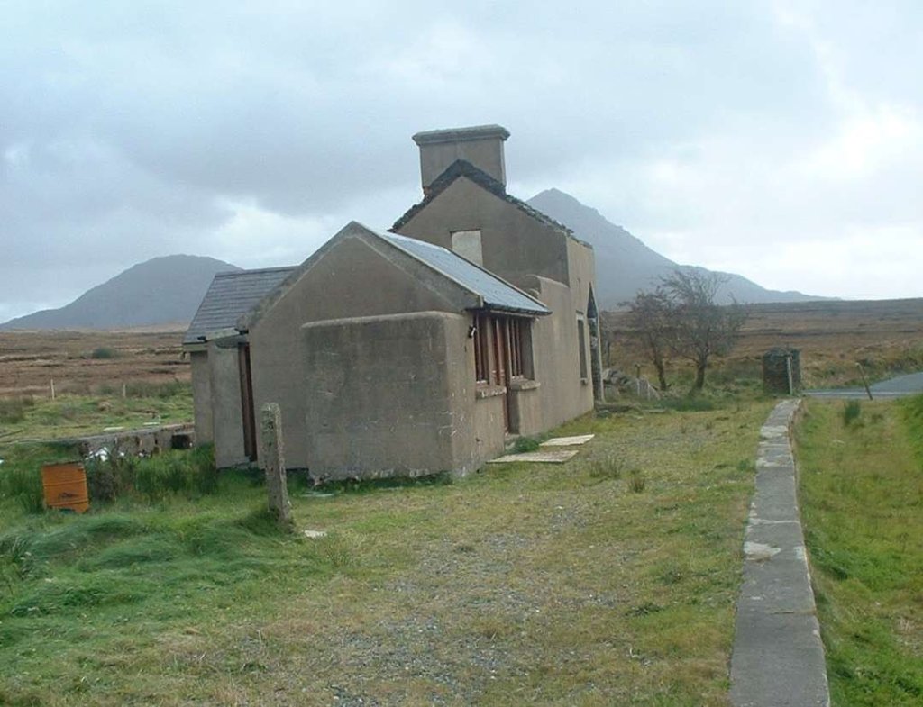
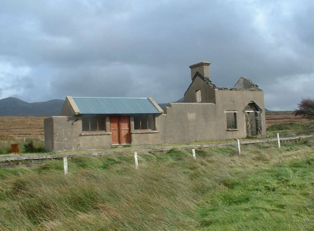
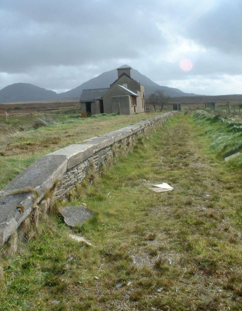
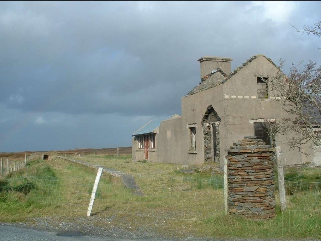
The next few photographs show Cashelnagor Railway Station as it appeared in the late 1980s/early 1990s.

The four monochrome photos above are courtesy of Steve Flanders and Dave Bell and are used with the kind permission of Jim McBride acting on behalf of the Donegal Railway Heritage Centre. [2]

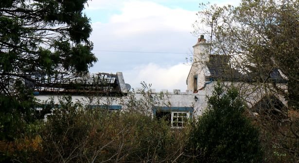
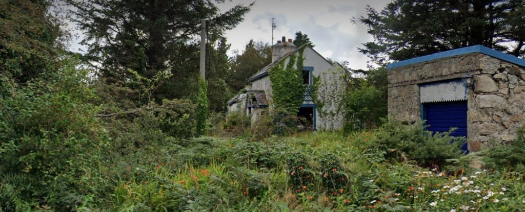
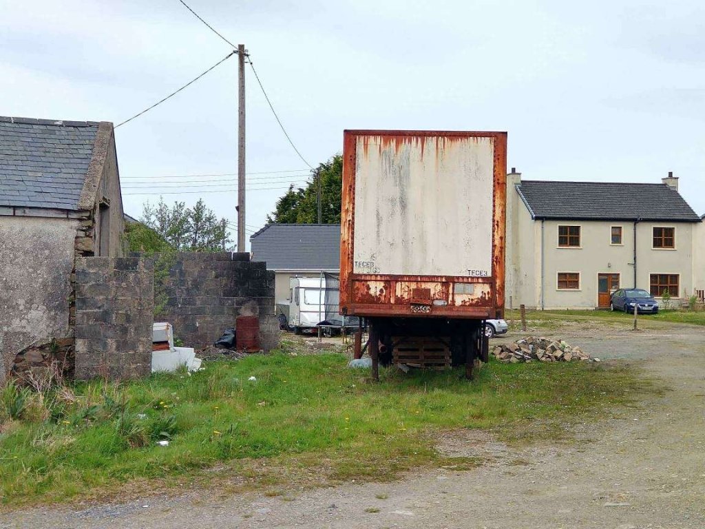
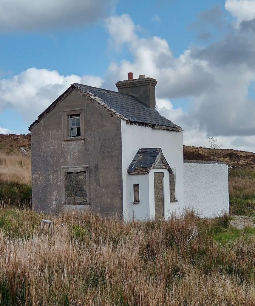
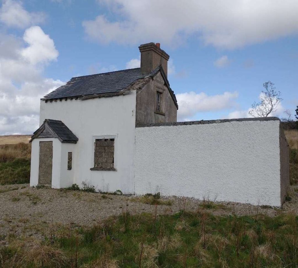
Joe Begley very kindly sent this next series of photos by email. They represent the condition of the buildings in 2004.

The four photos above are shared courtesy of Joe Begley and show Cashelnagor Railway Station in 2004, © Joe Begley. [5]

These next three photos show the Station buildings as they appear in 2023

The three photos above were taken at the end of a day following part the route of the Burtonport Extension Railway. [My photographs, 24th April 2023]

It is just possible that you might enjoy staying at this remote location, if so you could check out Cashelnagor Railway Station’s website:

https://cashelnagore-railway-station.business.site/

Alternatively you might want to finish reading this article by watching a video or two:

https://fb.watch/kkwHnqUIgT/

References

  1. https://donegalheritage.com/2021/01/12/train-ambush-1921, accessed on 30th April 2023.
  2. Dave Bell & Steve Flanders; Donegal’s Railway Heritage Guide No. 2, The Londonderry & Lough Swilly Railway: A Visitor’s Guide to the old railway and all the bits that can still be seen; County Donegal Restoration Society, Donegal Town, Co. Donegal, 198…
  3. https://osi.maps.arcgis.com/apps/webappviewer/index.html?id=bc56a1cf08844a2aa2609aa92e89497e, accessed on 30th April 2023.
  4. Joe Begley, Steve Flanders & E.M. Patterson; The Lough Swilly Railway: Revised Edition; Colourpoint Books, Newtownards, 2017.
  5. Joe Begley very kindly sent me a number of photographs as attachments to an email which were taken during the preparation of the book immediately above.
  6. https://watchingthedaisies.com/2019/04/10/52-weeks-of-thankfulness-week-30, accessed on 1st May 2023.
  7. https://m.facebook.com/RossesHistoricalTours/posts/1353976138126584/?force_faceweb=true#, accessed on 1st May 2023]
  8. https://www.irishmirror.ie/news/irish-news/home-paedophile-john-barrow-gutted-6710075.amp, accessed on 1st May 2023.
  9. https://m.facebook.com/groups/788818974978955/permalink/1452142765313236, accessed on 1st May 2023.
  10. https://m.facebook.com/groups/788818974978955/permalink/1501615597032619, accessed on 1st May 2023.
  11. https://www.railmaponline.com/UKIEMap.php, accessed on 2nd May 2023.
  12. https://m.facebook.com/groups/burtonportheritage/permalink/2989672094470982, accessed on 2nd May 2023.
  13. https://m.facebook.com/groups/historyforum/permalink/1226599440735034, accessed on 2nd May 2023.
  14. https://m.facebook.com/groups/historyforum/permalink/1225392974189014, accessed on 2nd May 2023.
  15. https://m.facebook.com/groups/historyforum/permalink/960069370721377, accessed on 2nd May 2023.
  16. https://m.facebook.com/groups/788818974978955/permalink/1285672935293554, accessed on 30th April 2023.
  17. https://m.facebook.com/groups/historyforum/permalink/387912997937020, accessed on 2nd May 2023.
  18. http://wikimapia.org/31733160/Clady-Hydroelectric-Station, accessed on 3rd May 2023.
  19. https://m.facebook.com/story.php?story_fbid=pfbid02NdK5qyv67AADMsuHxZXE3mZwiXw755zAaods3rqCEP3VJYqia5Ju79GZskYhagXel&id=1223882780981294, accessed on 3rd May 2023.
  20. https://m.facebook.com/groups/788818974978955/permalink/1264392730754908, accessed on 4th May 2023.
  21. https://m.facebook.com/burtonportrailway/photos/a.272196396164954/272196459498281/?type=3, accessed on 4th May 2023.
  22. https://fb.watch/kkwHnqUIgT, accessed on 5th May 2023.
  23. https://youtu.be/qTxN-T1_eNQ, accessed on 5th May 2023.

1 thoughts on “The Burtonport Extension of the ‘Londonderry & Lough Swilly Railway’ – Part 2

  1. Julian

    Fascinating- thank you for sharing that with the World.

    The Rly Station Man, on TV last night , prompted me to have a look.

    Thank goodness for Casserley- at least there are some pics from Operational days!

    Reply

Leave a comment

This site uses Akismet to reduce spam. Learn how your comment data is processed.