Egyptian National Railways is the national railway network of Egypt. Founded in 1854, it is the oldest railway system in Africa and the Middle East. [7] A separate article provides more detail about the history of the railways of Egypt which can be found here. [9]Other articles are under preparation in July 2026.
This article focuses on relatively recent news about the railways of Egypt. …
A. Cairo Monorail Project: The 56.5km East Nile line began operations in March 2026, serving 22 stations with driverless technology, reducing Cairo congestion. A second line, bringing the total network to over 100km, is under development.
B. High-Speed Network: Siemens Mobility is constructing a 2,000 km network, featuring Velaro and Desiro HC trains traveling up to 250 km/h, covering 60 cities.
C. Modernisation: of Egypt’s 10,000 kilometre rail network. ……
A.Cairo Monorail Network
Recent articles about various railways in Egypt include the news that Egypt has just opened a new monorail, 56 kilometres in length.
The featured image shows one of the twenty-two station s on the route. [1][2]
Solomon Ekanem reports that Egypt has officially launched the 56.5-kilometre East Nile monorail – Africa’s longest – marking a major milestone in the country’s push to modernise urban transport and expand green mobility infrastructure.
The East Nile monorail, connects Cairo’s Nasr City to the New Administrative Capital. It is a driverless monorail which calls at 22 stations. It is intended to ease congestion and improve urban connectivity. It is Africa’s longest single monorail line and part of the continent’s largest monorail network when combined with a second line. The eco-friendly, automated system reduces energy consumption by 30% compared to conventional electric rail.
President Abdel Fattah al-Sisi inaugurated the driverless system on Friday 20th March 2026 and then travelled alongside families of fallen Egyptian soldiers on the monorail from the Al-Fattah Al-Alim Mosque station to the Financial District, passing through key residential zones.
Transport Minister Kamel al-Wazir described the project as a “civilizational leap,” noting that it aligns with government efforts to deploy eco-friendly transport systems that reduce fuel consumption and road congestion. The rubber-tyred, fully automated system operates on elevated tracks, minimizing disruption to existing road networks.
El-Mosheer Tantawy Mosque sits close to the monorail, one station of the monorail can be seen beyond the mosque in this image. [1][2]
“The East Nile monorail … is part of a broader network — the “Cairo Monorail” system — which includes a second line linking 6th of October City. When both lines are combined, the network stretches to about 96 km, making it Africa’s largest monorail system overall. In simple terms, the East Nile route holds the record for a single line, while the full Cairo network holds the continental record for total system size. Built by a consortium including Alstom, Orascom Construction, and Arab Contractors, the project features 40 trains capable of reaching speeds of up to 80 km/h, with intervals as short as 90 seconds. The system integrates with Cairo’s Metro Line 3 and the Light Rail Transit (LRT), with future links planned to Metro Lines 4 and 6.” [1]
“Equipped with platform screen doors, LED displays, and accessibility features, the monorail is expected to play a central role in reshaping Cairo’s urban mobility and supporting the shift toward sustainable transport.” [1]
Ekanem’s report is echoed by a report in Egypt Today. [2]
Cairo Monorail was first conceptualized in the late 2010s to combat the rise of traffic in the Greater Cairo area, and to provide a rapid transportation option for suburban residents. The Monorail was also thought of as a rail link between Cairo and Egypt’s New Administrative Capital. “Funding for the project was secured and obtained through a mix of local and international investments. This included a substantial loan facilitation agreement between the National Authority for Tunnels and JP Morgan Europe Limited, as well as contributions from other financial institutions such as the European Bank for Reconstruction and Development (EBRD) and the European Investment Bank (EIB). The total funding amounted to approximately 4.5 billion Euros.” [4]
It was reported in August 2019, that French rolling stock manufacturer, Alstom, would lead a consortium which includes The Arab Contractors: Osman Ahmed Osman & Co and Orascom. The consortium would sign a 2.7 billion Euros contract to design, construct, operate, and maintain the two monorail lines. Upon completion of construction, the consortium will operate and maintain the network for 30 years. [4]
Hill International highlighted their involvement with the project in a post on LinkedIn four years ago. They were providing project management, design review, and implementation supervision services for the New Administrative Capital City and 6th of October City (East and West) Lines. [3]
B. High-Speed Network: This network is a planned 2,000 km network which Siemens Mobility is constructing. It will feature Velaro and Desiro HC trains traveling up to 250 km/h, covering 60 cities. The network will include three lines:
Line 1 (Green Line): Connects Ain Sokhna to Marsa Matrouh via Cairo. Line 2: Connects Cairo to Abu Simbel. Line 3: Connects Qena with Hurghada and Safaga.
The project includes 15-year maintenance by Deutsche Bahn and involves upgrading 7 key rail stations via Thales, focusing on increasing freight capacity to 13 million tonnes annually.
Egypt has a bold vision to build one of the world’s largest high-speed rail networks. Siemens Mobility is committed to delivering fully integrated, sustainable transportation solutions tailored to Egypt’s unique environment. The High Speed rail project “will span over 2,000 kilometres. It will ultimately connect all the major cities and reach nearly 90% of the population. Once complete, Egypt will have the sixth-largest high-speed network in the world. It will significantly reducing travel times, cutting CO₂ emissions, and boosting sustainable local economic development.” [6]
Siemens Mobility’s 15-year maintenance commitment covers the entire fleet for Egypt’s new high-speed rail network ensuring long-term operational excellence. This network will cut travel times by up to 50%. It will offer millions of passengers safer, more reliable, and more comfortable journeys. [6]
Currently completed to over 65%, the first phase of Egypt’s Ain Sokhna to Marsa Matrouh high-speed train is set to begin operations in 2027. The 670-kilometre line will include 21 stations! [6]
C. Modernization: In addition to new lines, Egypt is modernizing its existing 10,000 km network with new trainsets from Talgo, locomotives from Progress Rail, and new traffic control systems to improve efficiency.
The Railway Gazette International reported in September 2025 that Hitachi Rail has deployed a centralised traffic control system to manage 19 stations on the 200 km Cairo to Alexandria line. [5]
“The initial contract for the programme was signed in 2013, and has since been extended to encompass more than €100m of investment. The mechanical and electrical signalling has been replaced with a modern electronic system, including digital interlockings, new signals and motorised drives. A fixed and mobile telecommunications system has been installed, with drivers able to communicate with the operations manager in case of emergency or failure. Level crossings have been modernised, and technical buildings constructed.” [5]
“The modernisation project will enable Egyptian National Railways to increase the maximum speed of trains by 40 km/h to 160 km/h, reducing the journey time between the two cities to 2½ h. The route’s throughput is also set to grow by 40% to a maximum of 286 trains/day. A progressive increase in the number of freight trains is planned, allowing the line to carry 15 per day in 2030 and 50 per day by 2060.” [5]
In November 2025, TravelMole.com reported that Egypt had showcased a new high-speed train. [6]
“On 10th November 2025, German technology giant Siemens unveiled the Velaro high-speed train in Cairo, which had been specifically adapted to withstand the harsh climate conditions of Egypt. The official presentation occurred during TransMEA 2025, the region’s leading exhibition for transportation and logistics in the Middle East and Africa. The Siemens Mobility Velaro high-speed train is specially adapted for Egypt’s desert conditions. It can reach a speed of up to 250 km/h and offers seating for 489 passengers. The company will deliver 41 Velaro trains to the Egyptian rail network.” [6]
On the same day, “the Desiro HC regional train successfully completed its first train run on newly constructed tracks near the 6th of October Depot, West of Cairo. The Desiro High-Capacity regional train is a key element of Egypt’s new high-speed rail network, with 94 trains set to provide efficient and comfortable regional transport. Specially adapted for Egypt’s climate, each train offers up to 849 passenger spaces and advanced features such as air conditioning,” [6]
“With a top speed of 160 km/h, the Desiro HC fleet will play a vital role in connecting cities along the Green Line. This line consists of a 660 km network connecting Cairo to Ain Sokhna, Alexandria, and Marsa Matrouh. The Green Line is already referred to as the ‘Suez Canal on Rails’.” [6]
Freight – in June 2026, reports the Railway Gazette, Egyptian National Railways signed four freight corridor upgrade contracts.
An Alstom-led consortium has signed four contracts worth €690m with Egyptian National Railways for the modernisation of two strategic freight rail corridors. Together with Rowad Modern Engineering and Concrete Plus, Alstom will upgrade the 6th October City – Alexandria and Belbes – 10th Ramadan City lines. The upgrades aim to reduce transit times by up to 80 minutes and improve connections between Egypt’s logistics hubs and seaports. [8]
In addition to these ‘Heavy Rail’ commitments, Egypt is also seeking to modernise its tram networks and Cairo’s Metro.
Egypt’s major tram modernization focuses on the historic Al Raml tramway in Alexandria, which suspended operations on 1st April 2026. Managed by the National Authority for Tunnels (NAT), the €236 million overhaul converts the 14.1 km heritage line into a fast, digitally controlled light rail system slated to finish by late 2028. [10]
Hitachi Rail has secured a contract to deliver the rail systems and digital technologies that will modernise and upgrade the Alexandria Raml Tram – the first modern tramway project of its kind in Egypt. The contract was awarded by the Hassan Allam Construction and Arab Contractors joint venture and will significantly improve speed, capacity and reliability on one of the world’s oldest continuously operating tram systems. [10]
The Alexandria El Raml Tram is the oldest tramline in the Middle East and Africa, dating back to 1863. Despite its age and limited modernisation since the 1960s, it remains one of the few tramways globally to operate double-deck vehicles in regular service. The new contract marks a major step in the line’s transformation. [10]
Under the agreement, Hitachi Rail will supply advanced signalling and communications systems, a modern Operational Control Centre, SCADA, CCTV and access control, passenger information systems, and on-board equipment. Together, these systems will help deliver a faster, safer and more efficient public transport service aligned with Egypt’s Vision 2030 goals for sustainable mobility. [10]
The modernisation programme includes the reconstruction of 24 stations and 13.2 km of track. Once completed, the new system will:
reduce travel time from 60 to 35 minutes
double operational speed from 11 km/h to 21 km/h
cut headways from 9 minutes to 3 minutes
increase capacity from 4,700 to 13,800 passengers per hour per direction
This capacity boost will ease congestion, support modal shift and reduce CO₂ emissions while improving daily mobility across Alexandria. [10]
The El Raml Tram upgrade represents a significant milestone for Hitachi Rail’s growing presence in Egypt’s rail and metro sector. The company is already involved in key national programmes, including the Greater Cairo metro network, the LRT and monorail systems, and AFC modernisation initiatives. [10]
Hitachi Rail continues to expand its local footprint through engineering, financial, legal and operational teams established in Egypt. The company has increased localisation of IVVQ activities for CBTC systems and developed automated fare collection (AFC) projects that promote high-tech employment and diversity. These align with Egypt’s industrial and economic development priorities.[10]
Digital passenger information and multimodal payment systems are becoming central to Hitachi Rail’s offering in the region. For example, the upcoming Abu Qir Metro in Alexandria will integrate TRANSCITY™ AFC, enabling payments via QR codes, contactless cards, EMV bank cards and NFC mobile devices. [10]
“The contract will see us modernize and upgrade the oldest electric tram system in Africa, transforming it into a reliable, efficient, and digitally enhanced transportation system. The project underlines the capabilities of Hitachi Rail technologies in the rehabilitation and modernization of tramway systems,” Carlo Piacenza, SRS MEA Regional Director, Hitachi Rail, said. [10]
Urban Transport Magazine reported in April 2026 that, “with the closure of the long-established Ramleh tramway, Alexandria is currently undergoing one of the most radical system transformations in urban rail transport in North Africa. The project exemplifies a global trend: replacing historically evolved tramway systems with higher-capacity light rail infrastructure — and the associated trade-offs.” [11]
Alexandria’s tramway network is among the oldest in the world: opened as early as 1863 and electrified from 1902, the Ramleh line in particular developed into one of the city’s most important east–west corridors. With around 80,000 passengers per day and a route length of approximately 32 km, it was a central component of the urban transport system. [11]
At the same time, the system suffered from decades of underinvestment. Low average speeds of around 11 km/h, ageing infrastructure and limited reliability significantly constrained its performance. Against the backdrop of increasing congestion and ongoing urbanisation, comprehensive modernisation gradually moved to the forefront of transport policy. [11]
Until its closure, operations on the Ramleh tramway were characterised by a remarkably heterogeneous and ageing fleet. The core of the services was provided by modernised vehicles from Kinki Sharyo, complemented by locally Tatra Yug units. In addition, a number of second-hand high-floor trams originally built by Düwag in the 1960s and acquired from Copenhagen remained in service. This mix of vehicles from different generations and technical standards reflected both the long operational history of the line and the prolonged lack of fleet renewal, resulting in increasing maintenance complexity and declining reliability in the final years of operation. [11]
The transition to the new system began in early 2026 with a phased shutdown. Following initial restrictions in February, operations were completely suspended on 1 April 2026. Since then, the existing infrastructure — including tracks, power supply and stops — has been undergoing comprehensive dismantling. The complete interruption of services represents a deliberate break with historical continuity, in contrast to many European modernisation projects, where upgrades are often carried out while operations continue. [11]
In place of the conventional tramway, a modern light rail system with significantly altered parameters is being developed. Approximately 13 km of the route will be fundamentally upgraded and partially realigned. [11]
Key elements include:
Increase in average speed from 11 to around 21 km/h
Reduced stop density (approximately 500 m spacing)
Modern signalling and control systems
Introduction of 30 high-capacity vehicles (Hyundai Rotem)
The project is thus clearly aimed at increasing capacity and efficiency, and conceptually aligns more closely with light rail or metro systems than with traditional tramways. [11]
Since early 2026, operations on the Ramleh tramway have been gradually wound down: following initial test closures in February, partial suspension began on 11th February, before services were fully discontinued on 1st April 2026. [11]
In the weeks leading up to this, the network saw something of a series of “farewell runs”, before the final trams ceased operation in early April. In parallel with the closure, comprehensive dismantling of the infrastructure began, including tracks, overhead lines and, in some cases, adjacent urban spaces. [11]
The transformation has met with considerable criticism in Alexandria and is the subject of intense public debate. While the government presents the project as a necessary step towards modernisation to increase capacity and speed, many residents view it as a profound intervention in the city’s historic urban fabric. [11]
A central point of criticism is the planned elevation of the route. More than half of the future line, which will be around 13 km long, is to run on viaducts. Critics fear that the existing tree-lined right-of-way will be replaced by “concrete stilts”, leading to a loss of the city’s characteristic urban landscape. [11]
Furthermore, it is argued that the shift towards a faster system, more strongly segregated from general traffic, may bring operational advantages but could come at the expense of urban integration. Urban planners warn that the new infrastructure is geared more towards throughput and speed, and less towards public realm quality and local accessibility. [11]
Transport impacts have also been viewed critically: even during the construction phase, the suspension of services has exacerbated traffic problems, as replacement services have only been able to compensate for demand to a limited extent. Some observers see this as an indication that, in the short term, the transformation could even lead to increased reliance on private motorised transport. [11]
Finally, the loss of cultural heritage plays a central role in the public debate. For many residents, the tramway is not merely a mode of transport, but an integral part of the city’s identity. Critics therefore speak of a tension between modernisation and “cultural dislocation”. [11]
Reopening is scheduled for the end of 2027. Whether the new system will meet expectations in terms of performance and attractiveness will depend largely on how successfully operational efficiency can be balanced with urban integration. [11]
Cairo’s Metro:–
As of 2024, Cairo’s Metro has 84 stations of which 5 are transfer stations, with a total length of 106.8 kilometres (66.4 mi). The system consists of three operational lines numbered 1 to 3. It is part of an integrated transport network.
Map of Cairo Metro, LRT, and Monorail lines. Thick lines indicate lines in operation and hollow lines indicate lines under construction or in planning, (c) BasilLeaf and licensed for reuse under a Creative Commons licence, (CC BY-SA 4.0). [12]
As the biggest and most densely populated megacity in Africa and the Middle East, Greater Cairo had a strong case for a metro. In 1987 that population stood at 10 million residents, not counting the two million or so commuters who came into Cairo every day to work. The capacity of Cairo’s public transport infrastructure was around 20,000 passengers/hour, which increased to 60,000 after the construction of the metro. [13]
In the 2020s, “Cairo has more than 20 million people in its metropolitan area, and the chaos on the surface can be disorientating for anyone arriving for the first time: gridlock that stretches for kilometres, constant horns, intersections that follow no obvious logic. But beneath all that noise there is a system that organises the movement of millions of people every day. The Cairo Metro — officially the Cairo Metro or مترو القاهرة — is the backbone of public transport in this megalopolis, the first metro ever built in Africa, and the first in the entire Arab world.” [14]
In 2023, Cairo Metro carried 1,460 million passengers, which works out to around 5 million journeys a day — a figure that puts it among the most heavily used metro systems in Africa and the Arab world. For most of its passengers, the metro is not an alternative to other options; it is the only realistic way to cross the city in a reasonable amount of time. [14]
What makes this system distinctive is not only its history but its composition. Line 1 was born from the conversion of existing suburban railway corridors, combining surface sections with a few kilometres of tunnel through the historic heart of the city. Line 2 was a first for the continent: it crosses the Nile through a tunnel, the first railway tunnel under that river anywhere in Africa, a genuinely complex engineering achievement. Line 3, the most modern, was under construction in phases for over a decade and represents the biggest technological step forward in the system, with better stations and newer trains. It was completed in 2024. [14]
For travellers arriving in Cairo, the Metro is an indispensable tool for connecting the historic centre with modern districts, Ramses train station and the main residential areas. At present, the Cairo Metro does not reach the Pyramids of Giza. [14]
The density of Greater Cairo makes any underground construction extraordinarily complicated. Several sections were built directly beneath narrow alleyways, centuries-old markets, multi-storey buildings and layers of pre-existing infrastructure. Expropriations in historic districts such as Khan El Khalili, or in densely populated residential neighbourhoods, required lengthy and costly negotiations. In some stretches engineers opted for cut-and-cover construction with minimal disruption; in the historic centre, tunnel-boring machines were the only viable approach. [14]
The system at present operates trains from different generations depending on the line.
Line 1 still runs sets from the original era — nine-car trains with capacity for over 2,000 passengers, revised and upgraded over the decades. Some were refurbished by Hyundai in the early 2010s. [19] Others are being refurbished by Mitsubishi at present. [14][17]
Line 2 has more modern stock acquired in the 1990s and early 2000s. [18] The National Authority for Tunnels has awarded CAF three contracts totalling more than €450m for the modernisation and maintenance of trainsets on Cairo Metro Line 2 and the maintenance of trainsets on Line 1. [14][20]
Line 3 works with the newest trains, some of them from contracts signed with Alstom in 2020/2021 for the supply of new Metropolis units. [14][21]
Line 4 connecting to Giza is under construction. The line is ultimaely intended to be 42 kilometres in length. [15] A first phase of 18-19 kilometres and between 15 and 17 stations planned, it will connect the El-Malek El-Saleh area with north-west Giza, bringing the Metro significantly closer to the Pyramids zone for the first time. The project includes lifts for passengers with disabilities and modern access management systems built into the original design. Opening is estimated at being in the first half of 2028. [14][16]
Phase 1 runs largely underground, serving 17 stations, from the boundary between Cairo and 6th of October City to Grand Egyptian Museum, Remaya Square, Haram Street, Giza Station, El-Malek El-Saleh and Fustat. Gewaily says that Line 4 will carry approximately 2 million passengers a day when completed. [16]
Four high-performance Herrenknecht tunnel boring machines were deployed for tunnel construction. They commenced excavation at the end of 2023 and the beginning of 2024, ensuring efficient and precise tunnelling under challenging geological conditions. [15]
Mitsubishi is supplying 23 trains for the line, the first of was scheduled for delivery In May 2026, construction of depot facilities and the installation of electromechanical systems. Civil works are being undertaken by domestic firms Arab Contractors, Orascom, Concord, Petrojet, and Hassan Allam Construction. [16]
A Mitsubishi Kinki Sharyo train manufactured for the Cairo Metro Line 4. Phase 1 of Line 4 is scheduled to open in the first half of 2028.The contract includes supplying 184 metro cars to be delivered between 2026 and 2028.The trainsets are being shipped from Kobe, Japan, to Alexandria, Egypt. [16]
The government is currently considering three further phases for Line 4:
Phase 2: Fustat – New Cairo Phase 3: Hadaeq El Ashgar – Hosary Square, and Phase 4: New Cairo – the Capital Airport. [16]
The extended line will provide interchange with the planned metro Line 6, the Light Rail Transit (LRT) network and both the East of Nile and West of Nile monorail lines. [16]
Also planned is an extension to Line 3 to reach Cairo International Airport. It will add roughly 7 kilometres and 5 new stations from the Heliopolis area to the airport terminal. As of mid-2026 there is no confirmed opening date: the project has been announced on several occasions, but financing and timescales are not yet settled. [16]
Line 5 and Line 6 and the long-term network. The Greater Cairo master plan envisages a network of up to six metro lines plus complementary systems including the monorail, long-distance high-speed rail and extensions to the new satellite cities. Line 6 is planned to connect Shubra with Maadi, providing a new north-south axis that takes pressure off Line 1. All of these projects extend beyond 2030. [16]
Trams in the city have been electrically powered since the system was opened in 1895; there were never any horse-driven or steam-powered trams in Bratislava. It is the one of two urban tram systems in Slovakia with the other system located in Košice. Conversions to standard-gauge rails have been proposed in the past, but the network continues to use metre-gauge track. In the 21st century, rolling stock consists of 211 tram vehicles and trams operate on five lines over approximately 42 km (26 mi) of track. [2]
This vintage postcard features a panoramic view of Hurbanovo námestie in Bratislava. It is included here under a Creative Commons licence (CC-BY-NC-SA 2.0). [4]
Gerald Druce wrote:
“Bratislava, a town of some 150,000 inhabitants, is the capital of Slovakia and is situated near the southern frontier of Czechoslovakia, on the north bank of the river Danube. Before 1918 Slovakia formed part of the Hungarian section of the Austro-Hungarian Empire
“A Swiss firm, the Bratislava Electric Power and Lighting Company, founded in 1895, was given powers to build and operate an electric tramway. Construction was rapid and operation commenced in 1896 on metre gauge tracks. Tramway extensions followed the expansion of the town and the system gradually developed into its present form. The Company was nationalised at the end of the war, but the tramway is now municipally owned. There are about 9 route miles of track in use, most of which is double and a considerable amount of which is in reservation.
“The focal point of the system is Stalin Square where there is a large tram station from which the routes radiate to the outer termini. One line runs west along the Square and then turns north and is carried on reserved track along an embankment to the Central Station. Another continues north for a short distance and then bifurcates, one route continuing north to Dynamitka, and the other turning east to Nova Doba and Zatisie. Both these routes are mostly reserved track at the side of the road; that to Dynamitka is single track with passing loops. In the other direction from Stalin Square the track runs south towards the Danube. At the ‘Savoy’, the Nova Ves line turns west; after a short section of private right-of-way the track is laid on a central reservation all the way to the terminus. This route has recently been extended for nearly a mile. The other route from the ‘Savoy’ continues to the Danube Bridge and then turns east to the depot; there is also a single-track loop from the ‘Savoy’ to the Danube Bridge, which is used in the anti-clockwise direction by services 1 and 2. There is another loop at the Central Station; elsewhere the trailers are shunted by means of a double set of crossovers.
“The following services are operated:
1 – Central Station – Savoy.
2 – Zatisie – Savoy.
3 – Dynamitka – Nova Ves.
4 – Nova Doba – Danube Bridge (Depot).
“Services are frequent on all the routes and trailers are used on all except service 4. An all-night service is provided with one car working alternately on services 1 and 2.
“Despite the frequent service the cars are always full and the undertaking has found it profitable to employ two conductors per car, making a crew of five for a two-car train. A flat rate of 2kcs. 50h. (3d.) is charged on all town services (buses, trolleybuses and trams) and two transfers are allowed, although it is only possible to change once and make the complete journey by tram, the principal use of the second transfer being for the bus feeder-services.
“The cars, all of which are single-truck and are vestibuled, are painted brick-red and cream, with a grey roof. A pantograph is used for current collection. The oldest motor cars now running were built about 1910 and are used on service 4 and for extras. In 1923, six centre-entrance cars were obtained from Ringhoffers of Prague, but were not entirely satisfactory and two have been rebuilt as works cars. After this a return was made to a modernised version of the end-platform design, with separate drivers cabs and cushioned seats; this design was adhered to until 1939 and 15 more are now on order. Most of the trailers are similar to the standard motor cars, but there are still a few older ones running which have a clerestory roof. There are also four small centre-entrance trailers rebuilt from early motor cars which are used in pairs on service 3. Four new trailers built in the tramway workshops were placed in service in 1949/50. The undertaking now owns 36 motor cars and 28 trailers.” [1: p277]
“Before the war an interurban line ran from Bratislava to Vienna, operated by electric locomotives hauling long bogie trailers with open end platforms. In Bratislava, the interurban trains used the Stalin Square tram station and ran over the local system’s track to the Danube Bridge. At the end of the war the bridge was blown up, by which time the tram service had been discontinued. Although the junction at the north end of the bridge is still in place the track on the south side of the river, which was laid in the road, has been taken up and the overhead has been removed. Nevertheless the course of the tramway can easily be traced.” [1: p276]
Gerald Druce wrote his article in 1951, which was at the very beginning of the Socialist era. Wikipedia talks of the war (WW2) year and in the years immediately following:
“After the outbreak of the war, transport demands were sharply increased which had an effect on tram services. Night services had to be cancelled after 10 pm. In 1941, construction of the tunnel under Bratislava Castle, which is now used by trams, began. The tunnel construction took 8 years and the tunnel was put into operation in 1949. During the Second World War, it served as an anti-aircraft cover and was later used by car transport and pedestrians. Since 1983, it has been designated exclusively for trams.” [2]
“In 1942, classic pantographs were installed on the network. Two more years later, the number designation of tram lines and other modes of transport was introduced. Just before and during the Red Army’s occupation of the city in 1945, all public transport, including the railroad, was halted in the city. After the liberation, 90% of the network was damaged, and extensive repairs began to correct this.” [2]
Another view of Hurbanovo námestie (Hurban Square) in the Old Town district of Bratislava in 1968. The tram in the image is a ČKD Tatra T2 tram. [5]
Wikipedia only provides a very short comment on the period of communist control:
“In 1950s, first 6MT trams appeared. The track from Karlova Ves was doubled and the last monorail section disappeared. Since 1952, the number of lines has increased to five.” [2]
That reference to a monorail is intriguing and will be worth following up!
Post-Communism
Tram lines were opened on the just-completed housing estates. The operation of Tatra T2 trams was terminated and the construction of the metro started but it was stopped a year later.
A proposal to swap Bratislava’s tram tracks to standard-gauge was considered and came to nothing. “The 1990s marked the modernisation of the rolling stock (K2S, T3G, T3Mod, etc.) and brand new trams of the Tatra T6A5 type were delivered between 1991 and 1997. At this time, however, the tram network became very congested.” [2]
More Recent Times
After more than 20 years of metro proposals being discussed, in 2002, all plans for the metro were officially cancelled and preparations began to replace it with rapid transit trams. “The first steps were only taken in 2006, when the Petržalka tram project was submitted for an environmental impact assessment and the first steps were taken for the start of construction. The start of construction was planned for the summer of 2007. At a similar time, Škoda 06 T trams were tested in Bratislava. This vehicle was originally developed for the Italian city of Cagliari, where a 960mm track gauge is used, while for the tests in Bratislava its chassis was modified to 1,000 mm.” [2]
The first stage of the construction of the tramway to Petržalka over the Old Bridge was the rebuilding of the Old Bridge which was opened on 16th February 2016.
“Construction of the first length of the new network was undertaken by a consortium of three firms led by Eurovia SK. The project was valued at €58 million plus VAT. As much as 85% of the project’s cost was financed from European Union funds, while the state contributed 10% and the city contributed 5%.” [2]
The funds also allowed for the purchase of thirty air conditioned low-floor Škoda 30T trams and thirty Škoda 29T trams. In addition to trams, the city also bought trolleybuses, and completed modernisation of the Tatra K2 tramcars. By February 2010, only the Skoda 29T and 30T trams and renovated or new Tatra K2S and Tatra K2G cars have been running on Bratislava’s rails.
The Škoda 29T trams were single-directional, five-section low-floor trams. The Škoda 30T trams were bidirectional variants of the 29T trams.
“On 15th June 2020, reconstruction started on the section between the stops Cintorín Rača and Záhumenice on Račianska radial. The reconstructed line was opened on 7th September 2020. On 27th July 2025, the second stage of the Petržalka tram line was opened.” [2]
During the 1950s, German trams transitioned from older, war-damaged wooden vehicles to new, streamlined standard designs that supported the postwar Wirtschaftswunder (economic miracle). Standard designs emerged in both East and West Germany, heavily influencing urban transit.
In West Germany, operators sought to replace aging fleets with standardized models to streamline manufacturing and repairs:
The Verbandswagen (VÖV): Developed by the Association of Public Transport Companies (VÖV) starting in 1950. These were traditional two-axle trams that could be built quickly using existing components but featured a more modern, modernized exterior.
DÜWAG Großraumwagen: (Articulated Trams) Introduced in the early 1950s by DÜWAG (Düsseldorfer Waggonfabrik), these four-axle, bogie-mounted trams revolutionized West German transit. They featured wide doors for easy boarding, large windows, and better passenger flow.
Munich’s M-Wagen: Built by Josef Rathgeber, the first units of this iconic, four-axle, bogie-style tram were introduced in 1949/1950 to begin rebuilding Munich’s transport network.
The Modern Tramway writes, at the end of 1951, about a standard tramcar being developed by committee in West Germany in the very early 1950s which would become known as the DÜWAG Großraumwagen (DÜWAG Articulated Tram):
“The tramway sets of the large German cities normally consist of one 4-wheel motor car and two 4-wheel trailers, each with a length of 8 to 10 metres, and each capable of transporting about 70 persons. In contrast with the post-war construction programmes of other European countries, German post-war tramcars have for the most part adhered to this tradition, as witness the 4-wheel K.S.W and Aufbau types of which some hundreds are now in service. Exceptions are the 1949 6-wheel cars of Munich and the 1950 bogie cars in Hamburg, high-capacity cars operating in trains of two cars (motor and trailer) only.
“Early in 1950, it was announced that a Committee, consisting of representatives of the tramcar-building industry and of several West German tramways (among them Hanover, Düsseldorf, Wuppertal, Cologne, Duisburg and Dortmund) were working on plans for a standard tramcar which would compare with the latest models of other countries, notably the U.S.A., Sweden and Switzerland. The car would be an all-electric single-ended unit about 14 metres long, mounted on two 4-wheel bogies equipped with the latest rubber springing devices, and capable of transporting 100 passengers; a two-car train of such cars (motor car and trailer) would therefore replace three-car train of the usual 4-wheel cars, with consequent economy in staff. Pay-as-you-pass operation with a seated conductor would be incorporated, since the load would exceed the capacity of a mobile conductor.
“The first prototype car and trailer began to take shape late in 1950 at the works of the Düsseldorfer Waggonfabrik in Düsseldorf, to the order of the Hanover tramways, who meanwhile evolved and constructed the special electrical equipment. The car and trailer were delivered to Hanover in March of this year, and entered public service on 28th April for the period of the Heavy Industries Fair. It is fitting that the honour of operating the first car should be accorded to the Hanover tramways, since the General Manager, Dr. Ing. Philipp Kremer, played the leading part in the evolution of the design and the principles which have led to its realisation. Numerous visits were made to other European countries operating modern tramcars to study features not hitherto tried in Germany, and in the case of the Belgian P.C.C. cars and certain other modern designs we were privileged to supply Dr. Kremer with material from the files of The Modern Tramway.
“The details which follow refer specifically to this initial prototype train for Hanover, since many details of the final standard design will be decided only after experience is gained with several slightly differing prototype cars operating in different cities:” [1: p273]
The principle dimensions of the prototype tram. [1: p273]
“The all-steel body, so constructed that damaged parts can be replaced rapidly in case of minor collisions, has a rounded form and a sharply inclined front windscreen to minimise reflections from the brightly-illuminated car interior. The electrically worked folding doors are of a new design with increased window-space, the motor car has three doors at the rear, giving one double-width and one single width opening: passengers enter by these doors and congregate on the large rear platform before paying their fares to the seated conductor and passing to the saloon. The conductor’s desk is placed immediately forward of the rear entrance, with a good view of passengers boarding. Exit is by means of a double-width door in the centre of the car and a further double width exit is provided at the front, the doors of which are controlled by the motorman. An ordered flow of passengers is thus ensured, from the rear of the car to the centre and front, and once passengers are accustomed to the system a marked reduction in loading and unloading time is expected. The trailer has the same treble width rear entrance, but as in this case the seated conductor has to control both entrance and exit doors, the latter, again treble-width, are located in the centre of the car only and the front exit is dispensed with. As the cars travel only with closed doors, roof ventilators are provided, together with opening upper portions to all windows. It is hoped in particular that the folding doors will eliminate accidents caused through passengers attempting to ride on the steps or to board or alight from cars in motion.” [1: p274]
A schematic drawing on which individual prototypes were based. The Hanover variant of the design is shown here, with the inclined windscreen. [1: p274]
“The Hanover motor car and trailer are mounted on a type of 4-wheel inside-frame bogie truck developed by the Waggonfabrik Uerdingen in 1938, and used also for the post-war fleet of bogie cars in Hamburg. Special emphasis is placed on the elimination of noise, by incorporating rubber in the springing and elsewhere. The motor car has rubber-insert resilient wheels of the Swedish S.A.B. design; the trailer uses the recently-patented resilient wheel of the Bochumer Verein. These features combine to give a remarkably quiet and shock-free ride.
Wagonfabrik Uerdingen (Uerdingen Wagon Factory), merged with Düsseldorfer Waggonfabrik (Düsseldorf Wagon Factory) in 1935. The firm operated under the name DÜWAG (or Duewag) and was one of the leading manufacturers of railway and tramway vehicles in Germany. In fact, from the 1960s onwards, Duewag, had close to a monopoly of the market in Germany.
In the 21st century, the firm is a manufacturer of regional and high-speed trains as part of Siemens Mobility. [5][6]
Over the years Duewag produced a series of different rail vehicles and tram/light rail vehicles including: the Duewag T4 tramcar; the Duewag GB6 tramcar; the Duewag GT6 tramcar in various versions; the Duewag GT8 tramcar in various versions; the Duewag GT12 tramcar; the SL79 trams in Oslo; Hanover’s TW 400 trams; Hanover’s TW 6000 trams; Stadtbahnwagen Type M/N trams/light rail vehicles used by in used by several Stadtbahn and tramways in Germany, Austria, Poland, Romania and Turkey; Stadtbahnwagen Type B vehicles used on Stadtbahn networks in North Rhine-Westphalia, Bursa and Turkey; SSB DT8 used on the Stuttgart Stadtbahn system, produced in multiple iterations by various manufacturers; Hong Kong Light Rail Phase 1 (Comeng); Phase 2 (Kawasaki); and Phase 3 (A Goninan) bogies; Siemens-Duewag U2 which was used on the Frankfurt U-Bahn, Edmonton LRT, the Calgary CTrain), the San Diego MTS, in Mendoza, and in Sacramento; Siemens SD-400 for the North and South American market, and Siemens-Duewag Supertram for use on the South Yorkshire Supertram light rail network.
Resilient wheels of the Swedish S.A.B. (Svenska Aktiebolaget Bromsregulator) design are specialized railway wheelsets featuring a sandwich of compressed rubber pads inserted between the central wheel hub and the outer steel tire. This elastic connection significantly dampens noise, absorbs high-frequency vibrations, and reduces wear on both tracks and rolling stock. Not just suitable for trams, these wheels have a heavy rail application as well, and are standard for BR Class 86/2 electric locomotives. [7]
The Modern Tramway article continues:
“The electrical equipment of the prototype tram was devolved and constructed in the Glocksee workshops of the Hanover tramways. The controller has 20 driving notches (12 series and 8 parallel, the last notch with 50% field-weakening) and 17 braking notches, and is mounted beneath the floor of the car, between the trucks. it is actuated mechanically from the motorman’s position by means of an ingenious rod-and-bevel-gear device, which allows the motorman, using his hand-wheel, to regulate the controller exactly as if it was mounted on his driving platform. This feature was developed during the war by the Hanover tramways, and has given good service on the modern 4-wheel cars of the 222-231 series; it renders the controller immune to collision damage and greatly reduces the amount of wiring necessary. An inspection hatch is provided in the floor of the saloon. The four AEG half-voltage GBM 320 type motors have a rating of 50 kW. and permit a high rate of acceleration and a speed of 60 km.p.h. in normal service.” [1: p274]
AEG GBM 320 50kW motors were direct-current (DC) series-wound traction motors which were manufactured by AEG and SSW (Siemens-Schuckertwerke) and were widely used in mid-20th-century European light rail vehicles.
The Modern Tramway article continues:
“Braking is effected on the motor car as follows:
1. By an electric brake with 17 notches, the current thus produced also applying the disc brakes of the trailer car through solenoids, as is usual in Germany.
2. By an electro-magnetic track brake (four shoes with a force of 4,000 kg. each).
3. By a hand-lever-actuated oil brake working through brake drums on the armature shafts of each motor.
“The trailer also has a mechanical handbrake working on braking discs on each of the four axles. The track-brake shoes and the trailer solenoids are also wired for operation at 24 volts from the car’s battery, should the need arise.
“Secondary electrical equipment is grouped in a battery-fed 24 volt circuit (with a Bosch charging unit fitted with automatic cut-in and cut-out), and comprises: emergency lighting, twin headlamps (close and distant), rear light, door motors, moving trafficator-arms and regulation side-lamps, loudspeaker and optical signalling system with passenger-buttons. The provision of a low-tension supply enables normal automobile accessories to be used, with consequent economy. Current collection is by a twin-beam pantograph mounted well forward, and the motor car and trailer are joined by a Scharfenberg automatic coupling, incorporating all electrical connections, of the type used on the elevated railway (and the latest trams) at Hamburg. Normal bar couplings are provided at the ends of the train for use in emergency.
“The new Hanover train has undergone prolonged tests, and to the end of May the car had completed 11,000 km. in public service, an average of 220 km. per day.” [1: p275]
The Scharfenberg automatic coupling is a commonly used type of fully automatic railway coupling. Designed in 1903 by Karl Scharfenberg in Königsberg, Germany (today Kaliningrad, Russia), the coupler has gradually spread from transit trains to regular passenger service trains, although outside Europe its use is generally restricted to mass transit systems. [8]
The Modern Tramway article continues:
“A second 2-car train, differing in several important details, was completed at the end of May and delivered to the Rheinische Bahngesellschaft (Düsseldorf tramways); although the cars had not entered public service late in August their appearance on tests has caused much public interest by reason of their bold light green colour scheme. The motor car represents an attempt to drive both axles of a 4-wheel truck from one motor, mounted longitudinally, this feature is experimental, and further prototype cars will revert to the 4-motor principle using layouts and transmissions embodied in the P.C.C. car and the Swiss standard car respectively. The Düsseldorf car also lacks the inclined windscreen of the Hanover model. One prototype car will be constructed to the metre gauge, and operated for test purposes by the tramways of Wuppertal.” [1: p275-276]
“Orders have already been placed for 70 of the standard cars, partly by means of special credits accorded by the Transport Ministry of the West German government; standard-gauge models are to operate in Düsseldorf, Dortmund, Cologne, Duisburg and on the Siebengebirgsbahn (Bonn), metre-gauge models in Wuppertal and Bochum-Gelsenkirchen. There is little doubt that, once the final design is evolved and mass-production commences, many further orders will be forthcoming.” [1: p276]
This was indeed the case
A significant number of these trams were delivered to tram networks around Germany. There were design differences which were requested by different networks. The most obvious difference between these trams was the design of the front windscreen.
“The single-ended trams featured three different types of windshields, each named after its initial design: a flat windshield (Düsseldorf type), a slanted windshield (Hanover type), and a split slanted windshield (Kiel type), derived from the American PCC tram . The double-ended trams all had flat windshields.” [4]
Furthermore, several licensed versions of this type were produced. These – almost all single-ended trams – were built between 1954 and 1977 under the direction of various companies and are, or were, particularly common in Austria .
We have already noted that the very first DÜWAG articulated tram was delivered to Üstra in Hanover in 1951, followed by series production vehicles from 1952 onwards. In addition to Hanover, initially only Düsseldorf received several prototypes. German Wikipedia tells us that, “Most operators did not procure series production trams until 1954, when the Duewag tandem drive with one motor per bogie became available. The Duewag articulated trams were also available as bidirectional vehicles . The electrical equipment and control systems were supplied by Siemens , BBC , or Kiepe Elektrik.” [4]
Keil: a Duewag large-capacity tramcar No. 251 at the Schloßgarten stop in June 1963, is just one example of the ubiquity of the standard tram design. [9]
How come, Germany has so many cities with their own tram network?
“In the 21st century, Germany still has an extensive number of tramway networks (Straßenbahn in German) … Some of these networks have been upgraded to light rail standards, called Stadtbahn in German. Straßenbahn and Stadtbahn schemes are usually operated on the legal foundation of the BOStrab, the Tramways Act of Germany.” [2]
“Tramways served as the primary means of urban transport in Germany until the early 1960s when they were systematically replaced by buses. However, in the 1980s tramways began to reappear; experts spoke of the ‘renaissance of the tramway’. In the 1990s tramways had again become a modern means of public transport. Popular notions of fashion have been used by scholars to explain this cycle of acceptance rejection and restoration. Tramways were a highly visible manifestation of commodity culture and people projected onto them not just travel destinations but more broadly their desires, ideas and beliefs.” [2]
In the early 1950s, electric trams were still the backbone of German urban transport. However, later in the decade, the rise in private car ownership led to a car-centric shift. Many cities—particularly in West Germany and West Berlin—viewed trams as old-fashioned and began replacing them with buses and underground metros (U-Bahn). [3]
“These plans were only partly fulfilled due to high costs and booth Munich and Nuremberg ended up retaining and later expanding portions of their tram networks. Other cities, like Hanover and Stuttgart, pursued a middle ground by putting trams in tunnels through the city centre with the intent to eventually convert them to an U-Bahn. By the 1980s, virtually all German cities abandoned these costly full-conversion schemes and trams stayed on the surface.” [3]
So, Germany kept, and modernised, many of its tram networks. “Today, an unrivalled 60 cities still run trams, stitching together new housing, walkable neighbourhoods and low-car lifestyles. This essay shows how those tracks survived the mid-century cull and why they remain a cornerstone of Germany’s greener, people-first urban renaissance.” [3]
“In East Germany, trams were even more dominant. Socialist transport policy emphasised public transport, and funding was limited for widespread motorways. As a result, every major East German city kept its trams and many were expanded. Leipzig, Dresden, and Magdeburg extended tram routes into new Plattenbau (prefabricated apartment) quarters during the 70s and 80s. Tram networks continued to be expanded after reunification. In East Berlin a 4.5km tram line opened in 1991 through the large Hellersdorf housing estate, providing crucial links to a growing suburban district. Reunified Germany inherited a robust base of tram systems across both East and West.” [3]
‘Creat Strreets’ [3] tell us that factors which led to many more tram networks being retained than in other countries such as the UK and the USA include:
Economic realities: A postwar economic boom in the UK and US meant that car ownership skyrocketed. Meanwhile, Germany was still in a deep economic depression. After the formation of West Germany in 1949, federal and state governments continued to provide funding for municipally owned transport companies, including trams.
Policy and planning: German cities remained denser, more compact, and more mixed-use and city councils were pragmatic about transport. German tram companies often remained publicly owned and focused on long-term service. By the 1970s, the oil crises also reminded Germany of the value of electric transport, helping halt further closures.
Cultural differences: It’s difficult to understand Germany’s decision to retain trams without understanding that to German policymakers keeping trams would have seemed like the pragmatic, sensible and safe option, whereas a switch to buses would have been an unknown risky option. Furthermore, unlike in the UK and US where trams came to represent the past and the car became an important status symbol, public transport in Germany never acquired a social stigma. Trams were not associated with poverty or obsolescence, but rather with efficiency. German cities were among the first to recognize the downsides of car dependency, too: pollution, congestion, and hollowed-out city centres. Rather than widening roads and doubling down on motorways, cities such as Freiburg reinvested in trams as part of traffic calming and pedestrianisation strategies.
Continuous modernization: Rather than letting systems decay, German operators never stopped investing in new tramcars and technology. From the 1950s, Düsseldorf based DÜWAG began supplying West German cities with modern articulated trams, and cities like Düsseldorf, Frankfurt, and Hannover introduced new, higher-capacity trams. This kept service quality high and public support strong. Trams were reimagined as a modern, attractive, clean transport, integrated into pedestrian zones and designed with attractive vehicles and stops. In contrast, many North American and British trams had been neglected and unmodernised, making buses seem like an improvement in comparison.
The tram-train: Germany was an early adopter of the tram-train (or “Stadtbahn”) concept that mixes tram and metro elements. The best-known example is in Karlsruhe. By using dual-voltage tram vehicles, Karlsruhe linked street tramlines to existing regional rail tracks, effectively merging local and regional transport. This model has since inspired tram-trains in cities like Saarbrücken and Kassel and in Cologne and Frankfurt some tram lines go underground and now run as light-rail metros in the centre while still operating on streets in outlying areas. It’s a case where Germany led in expanding tram usage at a time when others were only starting to consider reintroducing trams.
Pragmatism: Where other countries pursued replacing trams with buses, German cities often kept trams that still served dense areas well. They chose a flexible approach which allowed for gradual upgrades rather than wholesale dismantling.
Strong municipal operators: Many tram systems remained in the hands of publicly accountable city utilities, giving them a long-term investment outlook. This made it easier to plan for continuity and renewal.
Public acceptance and use: Even during the car boom of the 1960s and 70s, trams were well-used. As other forms of transport became congested or expensive, trams kept their niche and their advocates.
Return on Investment: Returns for trams was higher than for road-building, particularly when urban regeneration effects were included. A 2025 study by MCube and the Technical University of Munich, commissioned by Deutsche Bahn, found that every €1 spent on local public transport generates around €3 in added economic value for Germany’s GDP.
References
The New German Standard Car; in The Modern Tramway, Volume 14, No. 168, December 1951, p273-276 & p280.
Pittsburgh is situated at the point where the Allegheny and Monongahela rivers converge to become the River Ohio, historically it is the most important Iron and Steel Centre in the United States.
Jackson wrote:
“It is also one of the greatest American Tramway strongholds. The present population of the city is just under 674,000 and the surrounding industrial area is densely peopled.
Public transport began in 1859, when the first horse cars ran, and up till 1902 there were a large number of competing tramway companies. In that year, these companies were brought together under the Pittsburgh Railways Company, which is still the operator today [(late ,1950)]. There are now 1,187 trams, 666 of them being P.C.C. cars. There are over 542 miles of 5ft. 2 in. gauge track. This network of 79 routes sprawls over the whole urban and suburban area, serving more than 50 communities from Sewickley in the west to Trafford and Pitcairn in the east and from Aspinwall and Etna in the north to Washington and Charleroi in the south. These latter two places are about 28 and 20 miles respectively from the centre of the city and the tramway routes serving them are of interurban character. The Charleroi line actually runs beyond that town to a point further south in the borough of Roscoe. It has a branch to Donora and California. Half-hourly service is provided on these two interurban lines.
“Many of the suburban routes have private right-of-way and reserved track.” [1: p160]
“All tram services are designated by numbers (1 to 99, with gaps) and by names which usually indicate the district served or the principal street the route traverses, All-night cars operate in most districts between 1 a.m. and 5 a.m. “Car Stop” discs are attached to the overhead wire and at heavy loading points where more than one car loads at the same time, special signs are placed on the overhead wires reading: ‘First Car’, ‘Second Car’ and, in some cases, ‘Third Car’.
“The first P.C.C. car arrived on 26th July, 1936, and the remainder were delivered (all from the St. Louis Car Co.) as follows: 1937 (175 cars), 1938 (25 cars), 1940 (100 cars), 1942 (100 cars), 1944 (50 cars), 1945 (115 cars), 1948 (100 cars). Included in the 1945 batch was No. 1600, the first standard 1945 model all-electric, standee-window P.C.C. car to be produced. It was included as a sample model by agreement. (All subsequent P.C.C. cars ordered after 1945 were standardized to that design (with ceiling fans and monitor roof optional) replacing the electric-air operated, non-standee window P.C.C. design originating in 1935).” [1: p162]
“Thirty-seven of the P.C.C. cars have been modified for interurban operation on the Washington and Charleroi lines. These modifications include replacing Clark B-2 trucks with St. Louis B-3 trucks, replacing H-B. lifeguard fenders with ‘cow-catchers’, provision of sirens, cash registers and an emergency tool kit over the windows ahead of the centre doors. The cars are also equipped with baggage racks. Some of the interurban P.C.C. cars are also equipped with radio telephones. Pittsburgh is the only system using single-ended, single-unit P.C.C. cars in long distance interurban service and the only system to use all-electric cars on this type of service. All Pittsburgh’s P.C.C. cars are one-man operated, with front entrance (P.A.Y.E.) and centre exit.” [1: p162-163]
Tram No. 1614, emerging from the tunnel at South Hills Junction, running outbound from Pittsburgh to Washington Pa.) on the inter-urban route. This junction carries 6 city and 2 inter-urban services, all operated by PCC. cars. [1: p163]
Tram No. 1647 outbound from Washington Junction to Washington (Pa.). This tramcar is one of 12 specially equipped for inter-urban service with type B3 trucks, siren, emergency tool kit and cash register. [1: p163]
At its height, the Pittsburgh Railways Company operated 666 P.C.C. streetcars, the third-largest fleet in North America, after Toronto (745) and Chicago (683). The network comprised 68 streetcar routes, of which three remain in operation in partially modernized form as part of the Pittsburgh Light Rail system. [3]
Financially, the Pittsburgh Railway Company struggled. Its lease and operate business model proved hard to support and the company declared bankruptcy twice, first in 1918 lasting for 6 years and then again in 1938, this time lasting until 1st January 1951. Company costs rose in the early twentieth century. PRC faced constant pressure from the city to improve equipment and services and workers would walk out when a pay raise was rejected.
When A.A. Jackson was writing about the network for The Modern Tramway, the company was still in bankruptcy.
On 26th July 1936, the PRC took delivery of P.C.C. streetcar No. 100 from the St. Louis Car Company. It was placed in revenue service in August 1936, the first revenue earning PCC in the world. The company went on to purchase a very large number of these vehicles in batches of 100 on most occasions. Jackson’s table giving details of the PRC fleet (above) shows that after purchasing car No. 100 in 1936: cars 1000-1099 were purchased/leased in 1937; cars 1100- 1199 were purchased/leased in 1937/1938; cars 1200-1299 were bought/leased in 1940; cars 1400-1499 arrived in 1942; cars 1500-1564 were purchased/leased in 1944/1945; cars 1600-1699 arrived in 1945; cars 1700-1799 arrived in 1949. During much of this time the PRC was bankrupt.
Despite the size of the network, it was not able to withstand the winds of change and large scale abandonments of lines began in the late 1950s, usually associated with highway or bridge work. [3]
As examples:
highway improvements in the Duquesne-McKeesport area resulted in the replacement of tram services with buses on 21st September 1958;
The replacement of the Point Bridge with the Fort Pitt Bridge precipitated the abandonment of many routes to the West End, all on 21st June 1959. In the end, the company had to abandon 27 miles (43 km) of street track in situ and was awarded $300,000 as compensation.
These events “marked the beginning of significant abandonments: 90 percent of the network was dismantled over the next decade.” [3]
A network that seemed to A.A. Jackson to have a bright future was by 1970 a pale shadow of the network in the early 1950s.
Similar things were happening in respect of the PRC Interurban network:
“The Charleroi interurban line was cut back to the Allegheny County border at Library (Simmons loop) in June 1953. It continued to operate until the 1980s as 35 Shannon-Library and became the southern portion of 47L Library via Overbrook when Light Rail Vehicles (LRVs) replaced [trams]. The [tram] loop was removed in 2004. In 2010 this line became the Blue Line – Library, and in 2020 was renamed the Silver Line – Library.” [3]
“The Washington line was cut back to the county boundary at Drake in August 1953 and eventually became the 36 Shannon-Drake. This in turn became the southern portion of 42 South Hills Village (excluding the new link from Dorchester to South Hills Village, which was built in 1984). The final portion of the interurban from Dorchester to Drake was renamed 47 Drake, finally closing in 1999 and bringing to an end P.C.C. Streetcar operation in Pittsburgh.” [3]
P.C.C. No. 1791, route 10 West View. [4]
Pittsburgh Light Rail
The Pittsburgh Light Rail is the successor to the original Pittsburgh Railway Company. Some residual parts of the old network are in use as part of the Pittsburgh Light Rail system.
“The Pittsburgh Light Rail (commonly known as The T or the Trolley) is a 26.2-mile (42.2 km) light rail system in Pittsburgh, Pennsylvania, serving the city and surrounding suburbs. The system operates as a deep-level subway in Downtown Pittsburgh, but runs mostly at-grade in suburban areas south of the city. It is largely linear in a north–south direction, with one terminus near the central business district and two termini in the South Hills. The system is owned and operated by Pittsburgh Regional Transit.” [5]
The Pittsburgh Light Rail network is made up of three lines – the Blue Line, the Red Line and the Silver Line. This map shows the three lines superimposed on an OpenStreetMap base layer. [6]
“The system is one of the surviving first-generation streetcar systems in North America, with portions of the network dating to 1903, when they were operated by the Pittsburgh Railways Company. It is one of three light rail systems in the United States that continues to use the broad 5 ft 2 1⁄2 in (1,588 mm) Pennsylvania trolley gauge rather than the 4 ft 8 1⁄2 in (1,435 mm) standard gauge. In 2025, the system had a ridership of 3,104,400.” [5]
On 1st March 1964, the PRC system “was acquired by the newly established Port Authority of Allegheny County (PAT), which also assumed operations of more than 30 other transit companies in the region, including bus operators and the incline lines. The state hoped the consolidation would help stabilize the system as the private companies all had separate fare structures, labour agreements, and, in some cases, overlapping routes, while ridership had declined in the preceding years.” [5]
PAT undertook a program of consolidation and modernisation. MOT tram routes were converted to bus operation which it believed reflected lower operating and maintenance costs and reduced capital requirements. “By the early 1970s, only a small number of trams routes remained, primarily those using the Mount Washington Transit Tunnel to reach the South Hills, retained in part because they operated on private rights-of-way separate from street traffic.” [5]
PAT also planned to introduce guided busways. The programme was given the name ‘Skybus’. However investment was curtailed in the late 1970s because of public opposition.
Stage I
Planning shifted toward reconstructing the remaining tram lines as a modern light rail system, resulting in a ‘Stage I’ plan, the first phase of a broader program to develop a new light rail network. “The project included reconstruction of the Beechview line, construction of a short branch to South Hills Village, and a 1.1-mile (1.8 km) subway through downtown. Reconstruction of the existing line included double-tracking formerly single-track segments, replacing jointed rail with continuous welded rail, and upgrading the overhead power system to modern catenary.” [5]
“Only the busiest stops were rebuilt with high-level platforms, while lower-ridership stops retained low-level, street-level boarding. Because this work preceded the Americans with Disabilities Act of 1990, full systemwide accessibility was not required. The design also allowed continued operation of P.C.C. cars on unmodified portions of the network, with some shared stations providing both high- and low-level boarding.” [5]
Construction started at the end of 1980. The first modern light rail cars began operating on 15th April 1984. A full service across the subway, the rebuilt Beechview line, and the South Hills Village branch was operating by July 1985. [5]
Funding for upgrades to the segment of the line between Castle Shannon and South Hills Junction was approved in May 1985, including $20 million in federal grants. The entire Stage I project was declared complete on 22nd May 1987, at a total cost of $522 million, which included the purchase of 55 light rail vehicles. [5]
“The line from South Hills Junction to Castle Shannon via Overbrook (now called the Overbrook Line, part of the Blue and Silver lines) was first constructed by the Pittsburgh and Castle Shannon Railroad (P&CSRR) between 1872 and 1874. In 1905, Pittsburgh Railways leased the route, and between 1909 and 1910, converted it to dual gauge, retaining the existing narrow gauge for the coal-hauling trains and adding the broad 5 ft 2 1⁄2 in (1,588 mm) Pennsylvania tram gauge for passenger service using trams (streetcars). While the line was electrified with overhead power, the coal trains continued to use existing steam locomotives.” [5]
The Beechview line was rebuilt during the 1980s, but the Overbrook line remained largely unchanged and continued to be operated using P.C.C. cars. “The reconstruction of this line would be part of the Stage II project, to be performed at a future date pending additional funding. However, the condition of the track and infrastructure of the Overbrook line continued to deteriorate and in 1993, Pittsburgh Regional Transit determined the line to be unsuitable for safe operation in its current state and suspended service on the line. The line remained dormant until 1999, when the PRT broke ground on the Overbrook Line reconstruction project.” [5]
“The rebuilt Overbrook line was essentially an entirely new line built along the original line’s right of way. As had been done with the Beechview line prior, the rebuilt line was completely double-tracked with continuously welded rail, pandrol clip fixation, upgraded catenary and signaling, and other improvements. The rebuilt line included eight accessible stations with high-level platforms; unlike the Beechview line, no street-level stops were retained. The Overbrook line reopened in June 2004, at a total cost of $386 million, including the cost of purchasing 28 LRVs. Coinciding with the opening, Pittsburgh Regional Transit purchased 28 additional light rail cars to support the line and increase overall system capacity. At this time, the 55 existing cars were completely rehabilitated as well. In addition, as part of the Stage II project, upgrades to the traction power network, Operations Control Centre, and signals and communications had been implemented.” [5]
In January 1999, Pittsburgh Regional Transit began planning for the construction of a light rail line to connect Pittsburgh’s Downtown and North Shore. Federal funding was approved for the extension on 6th February 2004.
The main project involved twin-bore tunnels below the Allegheny River to connect a refurbished Gateway Station, which was the former Downtown terminus, to North Side station, located just west of PNC Park, and Allegheny station, located just north of Heinz Field. The completed project opened to the public on 25th March 2012. The final cost was $523.4 million. [5]
“From 2024 to 2028, PRT is undertaking a system-wide program of track rehabilitation across the network. The work includes phased closures, single-tracking, and temporary service reroutes. … In 2024, sections of the Red Line were closed for track replacement, resulting in single-tracking operations, shuttle bus substitutions, and a temporary Red Line Short service between Dormont Junction and Overbrook Junction. During part of this period, Red Line trains were also rerouted over the Blue Line alignment.” [5]
That programme continues in 2026.
Future light-rail and rapid-transit extensions are mapped out in the 25-year ‘NEXTransit‘ plan. [12]
Rolling Stock
The majority of Light Rail Vehicles (LRVs) in use on the network are Siemens SD-400 units, introduced to the network between 1985 and 1987. These units were rebuilt by CAF (Construcciones y Auxiliar de Ferrocarriles) in 2005–2006 and are currently numbered from 4101–4155. (Seven units salvaged for parts, then scrapped.) CAF also supplied 28 of their own design of LRV between 2003 & 2004. [5]
References
A. A. Jackson; An American Tramway Stronghold; in The Modern Tramway, Volume 14, No. 163, July 1951, p160 & p162-163.
“Udine is the chief town of the north-east Italian province of Friuli and is situated some 80 miles north-east of Venice. Its 70,000 inhabitants are served by the metre gauge tramcars of the Tranvie del Friuli. There are three town services, operated by 18 four-wheel single-deck cars, and two interurban lines, each with its own cars.” [1]
“Horse tramways were established towards the end of the last century, and operated from the Piazza Liberta (then known as Piazza Vittorio Emanuele) to the station (circular) and to Porta Gemona, where a depot was built.” [1]
“An interurban steam tramway was constructed to connect the city with San Daniele, to the north-west. The Udine terminus and depot of this line were connected to the town tramways.” [1]
The Udine to San Daniele Tramway opened in 1889. Its engineer was Adolf Gründorf and it was managed in the early years by the German banker Karl Neufeldt, it was the first (and only) steam tramway in Friuli, although as early as 1924, under the management of engineer Giacomo Cantoni, it was able utilise electric locomotives. [3]
Although officially a tramway, due to its numerous stations and depots, the length of its trains, and the fact that it was often separated from the road, the Udine–San Daniele line resembled a small railway. [3]
None of its locomotives or other rollingstock survived its closure. [3]
Jacques continued:
“In 1908, the town lines were electrified and 14 single-truck cars were purchased; they were built in 1907 by the Electric Company of Milan and had bow collectors. The connecting track between the town system and the San Daniele line was closed at the time of the electrification.” [1]
“During the 1920s considerable improvements were made to the system; cars were overhauled and tracks renewed where necessary, most of the station route being reconstructed with double track, partly on reservation. The Porta Gemona service was extended to Chiavris along the track of the newly-opened electric interurban tramway Udine-Tarcento.
“On 2nd July 1932, an extension of the town tramways was opened on the main Venice road, westwards, on side reservation, as far as San Rocco (via Nervesa); in the following October the line was further extended to its present terminus at San Caterina. On 6th January 1947, the reserved-track line from Chiavris to the Hospital, a branch from the Udine-Tarcento interurban, was opened.
“The present tram fleet comprises the original 14 cars built in 1907 (Nos. 1-14), four cars purchased from Gorizia (Nos. 51-54) and the cars used on the San Daniele and Tarcento lines. All are 4-wheeled except the motor trams on the Tarcento line. The San Daniele interurban tramway is now worked by battery operated motor-cars, although occasionally one of the original steam locomotives is seen. Trailers on this line are closed, with end platforms, and are similar to those used on the former Giants Causeway tramway. The four cars bought from Gorizia are larger than the 1907 class and were built in 1927. They originally ran with central-partitioned saloon and end platforms, but in 1949 and 1950 were rebuilt with folding platform doors and conductor’s seat, and the partitions were removed, ready for ‘pay as you pass’ service.
“The management plan to modernise Nos. 1-14 completely, and the first car to undergo this treatment, No. 13, emerged from the workshops entirely transformed. The ends and roof were removed, as were the partitions between the saloon and the platforms. The longitudinal seats were replaced by transverse single seats. New control equipment was fitted and the exterior and new roof finished in streamline fashion with large windscreens. [1: p107]
The Friuli tramways were an interurban and urban transport network, active primarily in the first half of the twentieth century, connecting Udine with neighbouring towns such as Tarcento and San Daniele del Friuli. Operated by the Società Tranvie del Friuli (TdF) since 1923, these electric lines (often nicknamed ‘white trams’) were crucial to the region’s economic development before road transport became more reliable in the 1950s. [2]
The main tram lines in Friuli were:
Udine-Tarcento Tramway (1915-1955): Also known for its white colour, the line arrived in Tarcento in 1927, quickly connecting the Torre torrent valley to Udine and the railway station.
A vintage photograph showing the “White Tram” in Tricesimo. [3]
Udine-San Daniele Tramway (1889-1955): An important interurban line that connected the capital to San Daniele del Friuli, characterised by a route that acted as a true local railway, operated with accumulator-powered electric locomotives from 1924 onwards.
Udine Urban Network (1887-1950 approximately): Started with horse-drawn traction and then electrified from 1908 thanks to Arturo Malignani and the Friulian Electricity Company, the urban network shared depots and infrastructures with the interurban lines.
In the 21st century, Udine does not have an active tram system. The historic, 1000 mm gauge tramway network, which opened in 1887 and once operated through the city centre (including Piazza Vittorio Emanuele), was decommissioned and closed in 1952. Public transport is now managed by Arriva Udine via an extensive bus network. [10]
When Jacques wrote his short article for The Modern Tramway, little did he know that the Udine tram network had only a year or so before it was closed!
References
Peter J. Jacques; The Tramways of Udine and District; in The Modern Tramway, Volume 14, No. 161, May 1951, p107.
I have a few older copies of Modern Tramway which I had not yet read. The first of these is the January 1951 issue, this is a second reflection from that copy of the Journal.
As the London network began to close a significant number of trams were sold. This copy of Modern Tramway notes that the remaining ‘Felthams’ were sold to Leeds City Transport.
By the late 1920s trams operated by both the Metropolitan Electric Tramways and the London United Tramways were increasingly aged. The two operators co-operated in the development of a new tram design – the ‘Feltham’. Conceived following detailed research and the construction of a number of prototype cars, the production ‘Felthams’ all entered service by the early 1930s. However, the LPTB’s plans for converting tram routes to trolleybus operation soon saw these modern cars transferred from north of the River Thames to south of the river. Here the production cars mostly survived until the final conversion programme. This was not the end of the story, however, as the majority were sold for further service to Leeds, where the last survivors were to see the final closure of the West Riding system in November 1959. The book explores the story of the ‘Felthams’ in London, Leeds and Sunderland. [2]
“In 1929 the Metropolitan Electric Tramways (MET) placed into service an experimental tramcar, No. 320, manufactured by the Union Construction Company which was located in Feltham. This tram was of a significantly more advanced design than other experimental cars that the MET had trialled in the previous few years, and was the first of three prototypes that led to the final design of what became known as the “Feltham” trams. Two more experimental tramcars were then constructed: MET No. 330 later the same year, and No. 331 the next. After experience in passenger service was assessed, the best features of each were combined to form the final design.” [3][4]
After service in London until 1949 and into the very early 1950s, 92 of these trams were to be purchased by Leeds City Transport. In January 1951, Modern Tramway reports:
“The purchase of the remaining 92 London ‘Feltham’ type cars by Leeds City Transport at a cost of £500 each is a wonderful bargain for the latter city; a bus with the same expectation of life as one of these still very modern cars would cost about £4,000, and a new bogie tram at least £7,000.
“On arrival at Kirkstall Works the trucks are completely stripped and all worn parts are replaced. The hornways where worn are built up by a welding process. It has been found necessary to replace the rubber blocks used in the driving-wheel hornways in London by the correct springs, and the tyres are turned to the standard Leeds profile.
“It was found that the car bodies were structurally quite sound on arrival from London; all that it has been necessary to do to the exterior has been to replace damaged panels and to remove dents in the dash; internally, all the woodwork has had the old varnish removed and has been repolished with a light oak finish, all interior panels being finished in light brown. The seats are removed from the cars and the upholstery thoroughly cleaned. Any cars that are received with seat coverings in poor condition will be re-upholstered in the standard Leeds red leather. A combined route-number and destination blind has been fitted, the apertures used in London for displaying the service number having been painted out; a lower saloon side indicator-blind is also provided. The front exit has not been restored for passenger operation, the air-operated front door being used solely for perambulators and luggage.
“The cars, which are arriving at the rate of two a week, are being numbered from 501 upwards in the order of arrival from London, up to 515 having been received at the time of writing and up to 504 being in passenger service. Arrangements have been made with London Transport for the ex-Metropolitan cars with B.T.H. equipment to be despatched first, to be followed by the ex-London United cars with G.E.C. equipment. The ex-Metropolitan and ex-London United cars will be classified in Leeds as types UCC/1 and UCC/2 respective’y.
“The livery finally decided upon for these cars is ‘British Electric Traction’ red all over, relieved by a cream band below the upper saloon windows and a cream panel above the lower saloon windows. The cars are lined out in gold and the roof, trucks and lifeguards are painted Brunswick black. Car No. 503 lacks the cream bands, whilst car No. 501 is still in London Transport livery.
“The cars have proved very satisfactory in service and are popular with the passengers. Those at present in service operate from Torre Road Depot which will eventually operate ‘Felthams’ exclusively. The riding qualities of these cars on the long reserved-track routes to Crossgates and Templenewsam are good. The Leeds undertaking is to be congratulated on obtaining and reconditioning these fine cars.” [1: p6]
The ‘Felthams’ served in Leeds until the closure of that city’s network in 1959. Wikipedia talks of 90 rather than 92 of these trams operating in Leeds. [3] The Seashore Trolley Museum in Maine, USA agrees with this assessment. [5]
The Seashore Trolley Museum reports:
“Car No. 341 was one of this class known as the ‘Felthams’ (after their place of construction). The ‘Feltham’ cars were the result of a complete vehicle redesign similar to the development of the PCC car in the USA at about the same time. No. 341 was one of 54 cars built for the MET which served London’s northern suburbs. At over 40 feet long, the ‘Felthams’ were relatively long and had a tapering body, large entrance/exit vestibules and a low floor height. A distinctive feature was the higher floor for the operator’s cab. Rather than using overhead wires, London trams (including the MET trams) drew power from an underground conduit, similar to systems in Washington, DC and New York City. When the London Passenger Transport Board acquired the Metropolitan Electric in 1933, No. 341 became No. 2085. The car survived the World War II blitz, but the LPTB’s policy was to replace trams with trolley buses and expanded underground lines. The ‘Felthams’ were the last new trams purchased for London. After 1938, most of LPTB’s remaining tram lines were in South London. In 1948, LPTB was nationalized and became the London Transport Executive. The last London tram ran in 1952. The tram system in Leeds acquired 90 ‘Felthams’ from London Transport in 1950, including No. 2085, which became No. 526 at Leeds. Leeds painted its trams red and used overhead bow collectors rather than trolley poles. Leeds abandoned its trams in 1959.” [5]
Two other ‘Felthams’ have been preserved:
Car No 331 (LTPB No. 2168) which was transferred to Sunderland. This tram was a central entrance prototype which was numbered 100 when in service in Sunderland. It now is part of the National Tramway Museum, Crich, collection. [3]
Car No. 355 (LTPB No. 2099, later Leeds No. 501) is now part of the collection at London Transport Museum, Store, Acton, London. [3]
The featured image for this article shows a Bagnall saddle-tank engine and train of two 100-seat workmen’s cars in L.N.W.R. livery on the Wolverton and Stony Stratford Tramway.
Wolverton Works
The LNWR works at Wolverton. The tramway crosses this plan on Stratford Road. [13: p19]
An enlarged key to the plan above which details the use of each building on the LNWR Site. [13: p19]
“Mainly by reason of the growth of the London North Western Railway works at Wolverton in the late 1870s, and the establishment of McCorquodale’s printing works alongside in 1878, a scheme to link the old market town of Stony Stratford, on Watling Street, with the London & North Western Western Railway station at Wolverton by means of a light railway began to take tangible form in 1882.” [1: p547]
Wolverton Railway Works was established in Wolverton, Buckinghamshire, by the London and Birmingham Railway Company in 1838 at the midpoint of the 112-mile-long (180-kilometre) route from London to Birmingham. The line was developed by Robert Stephenson following the great success of the Liverpool and Manchester Railway line. [2]
“The Victorian era new towns of Wolverton and New Bradwell were built to house the workers and service the works. The older towns of Stony Stratford and Newport Pagnell grew substantially too, being joined to it by the Wolverton and Stony Stratford Tramway and the Wolverton to Newport Pagnell Line (a branch line), respectively. The trams were … hauled by steam locomotives: the tram cars were certainly the largest ever in the UK and possibly the world.” [2]
After a survey of all possible sites for the London and Birmingham Railway works, “Wolverton was chosen due to its co-location alongside the wharfing facilities of the Grand Union Canal, thereby also enabling the railway company to gain an easy agreement to build a viaduct over the canal company’s land at this point.”
“In 1837, Edward Bury of Bury Curtis & Kennedy of Liverpool was appointed Locomotive Superintendent of the London to Birmingham railway with his headquarters at Wolverton. However, as Wolverton was simply considered to be a repair shop for the engines his Liverpool firm supplied to run on the line, he left the running of the Works to his Shop Foreman.” [3]
It became necessary for expansion to take place to accommodate, service and repair the increasing amount of rolling stock owned by the Company. “A large engine shed was built, said to be cathedral sized, together with all supporting facilities which also enabled the Works” [3] to produce, locomotives in house.
J E McConnell was appointed Superintendent in 1847. He built his first locomotive in 1849. This was “the prototype of the ‘Bloomer’ class (the wheels and works being more exposed the engines became know as Bloomers after Mrs Amelia Bloomer who was trying to reform ladies dress). During his time at Wolverton he made many innovations such as train heating, failsafe braking, hollow axles, boilers, fireboxes etc. Early in 1851, the first Bloomer engines were running.” [3]
Bloomer was a name used to refer to three similar classes of 2-2-2 express passenger locomotives designed by James McConnell. “A total of seventy-four were built between 1851 and 1862. The classes were similar in design and layout but differed in dimensions.” [4]
A LNWR engine No. 602, a Small Bloomer Class Locomotive. The photograph was taken circa. 1868 at Rugby’s coke sheds. The Class was introduced in 1854, they were inside-cylinder inside-frame single-wheelers with 6′-6″ driving wheels. [4]
“In 1859, thirty four engines were transferred from Crewe to Wolverton which involved further expansion of the Works. Under McConnell the Works flourished but unfortunately for him Mr Richard Moon was appointed Chairman of the Company and there was a clash of personalities resulting in McConnell retiring. A year or two after his retirement the engineering works were transferred to Crewe. Before the transfer to Crewe, 165 engines had been built at Wolverton.” [3]
“Expansion of the Works again took place during 1864 when Wolverton became the Carriage Works for the LNWR and the manufacturing shops were converted to enable carriages to be built, painted and repaired. In 1869 two Royal Saloons for Queen Victoria were built at Wolverton. Sadly in 1872 the locomotive shop finally closed and Wolverton became exclusively a carriage works until in 1877 it was the largest in Britain.” [3]
It seems that the original railway main line through Wolverton crossed land which was needed for the expansion of Wolverton Works. Two previous stations had been situated in the original route of the main line. “The first station was built for the opening of the London and Birmingham Railway on 17th September 1838, on the embankment just north of the canal above Wolverton Park. It proved to be temporary as the railway company purchased an additional 13.5 acres to the south, where they built a larger, more permanent station in 1840, at the east end of Church Street.” [8]
To avoid passing through the Wolverton Carriage Works, a railway main line deviation to the east was opened in August, 1881. The present Wolverton Station was built on the new line.
This rather fuzzy extract from the 25″ Ordnance Survey of 1898, published in 1900 shows the extent of the Railway Works at that time. To the West of the Railway Works was the site of McCorquodale’s Printing Works which can just be made out at the left edge of this map extract. The Grand Junction Canal sits between the Works and the Railway Station. [9]
McCorquodale’s Printing Works
McCorquodale’s Printing Works were one of a series of such establishments. McCorquodales built premises in Wolverton in 1878. The firm specialised in registered envelope manufacture, but undertook many other government and security printing contracts. The “history of the company commenced in 1841. George McCorquodale opened a stationers shop in Liverpool which became the Liverpool Printing and Stationery Company Ltd. The company prospered and five years later George opened the first McCorquodale printing works at Newton-le-Willows in Lancashire, specialising in providing a service to the ever expanding railway network.” [5]
Further factories were opened in Glasgow and London in the 1870s. In Wolverton, men were employed in the railway works but their daughters remained unemployed. “Sir Richard Moon, Chairman of the London & North Western Railway had an idea for solving the problem and contacted his friend George McCorquodale and suggested that he build a printing works in the town. George thought it an admirable suggestion and in 1878 he opened his registered envelope factory – success was immediate. The works rapidly increased in size and diversified into printing books, forms and commercial stationery.” [5]
“By 1886, McCorquodales of Wolverton was known as one of the finest printing factories in the country and employed 120 women and 20 men. Most of the girls started work at the age 13 or 14 and were normally employed until they married. Girls were encouraged to remain in the factory as long as possible and a £10 wedding grant was given to those who had completed 10 years service. Until 1909 staff worked a 54 hour week starting at 6am with a half day on Saturday. The company were also quick to provide the best welfare and working facilities in the area, and the staff were provided with dining, reading and recreation rooms. A Good Samaritan Society was started and pension funds paid for holidays and service bonuses.” [5]
Lee tells us that in 1882 a special meeting of Stony Stratford ratepayers considered a proposal to apply to the Board of Trade for an Order to sanction a tramway between Wolverton and Stony Stratford. “The ratepayers approved, subject to the track nowhere exceeding 6 ft. in width. A company was formed, apparently by these local interests, and was incorporated on 4th November 1882, as the Wolverton & Stony Stratford Tramways Co. Ltd. The Chairman was Abraham Culverhouse, and the Secretary John George Ventris Field Johnson. The company failed to get under way, and was placed in voluntary liquidation on 3rd September 1883. One of its few corporate acts seems to have been the granting of consent, two days after it went into liquidation, to the registration of a new company with a similar (but not the same) name.” [1: p547]
“Meanwhile, a Tramways Order had been promoted by Frederick Charles Winby, a civil engineer and contractor, and this was granted on 16th July 1883. It authorised [a tramway] 2 miles 54 chains [in length], mainly of single line, 4 ft. gauge, from the new Wolverton Station (opened in August, 1881) to the northern end of High Street, Stony Stratford.” [1: p547]
Wolverton to Stony Stratford and beyond
From the new station the tramway ran South along the road built to bridge the diversion line and the Canal at the South end of the site of Wolverton Railway Station. This road had once been a footpath.
The fullest extent of the tramway. [1: p549]
The company promoted by Winby took the name, ‘The Wolverton & Stony Stratford & District Tramways Co. Ltd‘. It acquired all the rights and interests of Winby in the Tramways Order of 1883. Lee tells us that “It had an authorised capital of £20,000 in £1 shares, which was increased to £30,000 on 27th October 1883. The latter fact seems to have been forgotten, although it was duly registered and the requisite stamp duty paid. Indeed, the company had very little regard for the niceties of the Companies Acts, and actually varied its corporate name on the Memorandum and Articles of Association respectively. Thereafter, it could never remember the precise title shown on the certificate of registration, which is the one used above. Winby contracted to build the line, and to take part of the price in shares, but the whole arrangement fell through. The company was dormant until 1886, and only 34 shares were issued.” [1: p548]
C.H. Wikinson, a local contractor that promoted a number of schemes in the area (such as a link between Newport Pagnell and Olney), “entered into a contract with the company on 18th August 1886, to build the line for £13,325, and on 8th September 1886. agreed under an indenture to accept £2,000 in shares. The name of the company was changed on 5th October 1886, to the Wolverton, Stony Stratford & District Light Railways Co. Ltd., and its shares were offered for sale. They were taken up by a large number of local [people], and the work proceeded rapidly.” [1: p548]
Lee continues: “The line as authorised in 1883 received Board of Trade sanction on 20th May 1887, in respect of 2 miles 15 chains single line and 40 chains double. It was built to the 3 ft. 6 in. gauge instead of the 4 ft. originally authorised. Public passenger traffic was begun on 27th May 1887, between the Barley Mow Inn, Stony Stratford, and Wolverton Station, with tramway-type steam locomotives hauling very large covered-top double-deck tramcars. The ordinary fare was 2d., with a special cheap rate for workmen, whereas the horse bus that had previously served the route charged 6d.” [1: p548]
Allan Edwards says: Wolverton “grew rapidly to an austere and symmetrical pattern, its housing owned by the railway company and leased to its employees; it seemed almost to be a northern industrial town misplaced in the agricultural heart of England. Stony Stratford meanwhile declined, becoming largely a dormitory town for its now larger neighbour. … By 1880, hundreds of workmen were walking daily to Wolverton from Stony Stratford and the surrounding villages. An alternative form of transport was a horse bus from Stony Stratford but the fare for this was 6d (22p) for a single journey, a price beyond the wage of the workmen of the now London & North Western Railway Co., or the new McCorquodale’s printing works whose average wage was only 30 shillings per week (£1.50).” [13: p15]
The old bus service did not run to a timetable, only travelling when there were sufficient passengers. “Average bus receipts were between £2 and £3 a week, but the tramway takings rapidly became £45 a week, largely by reason of the use of the line made by employees at the Wolverton carriage Works and at McCorquodale’s. Weekly tickets were issued to them at 1 shilling and entitled them to 4 journeys a day.” [1: p548]
Wolverton was a railway town built to accommodate the workers. It has since expanded significantly. Much of the old Works site and the railway ‘village’ of terraced housing form a Conservation Area in the 21st century.
Allan Edwards describes the route of the tramway through Wolverton like this: Outside Wolverton Station goods yard there was a turning triangle on a steeply descending section of road and a link into the station goods yard. From this location, trams “climbed steeply on a right-hand curve to the road bridge over the 4-track railway line where tramway passengers could board outside the overline buildings of the LNWR station. The tramway then continued up and over the lines leading into the railway works. … With its track in the centre of the highway the tramway passed the railway workshops, the town of Wolverton being entirely on the left-hand side. Virtually continuous brick walls to the right sealed off first the LNWR works and then McCorquodale’s printing factory. It was nearly three quarters of a mile before the tramway line abruptly left the town behind, moving to the lefthand side of the road.” [13: p17]
McCorquodale’s Printing Works were beyond the western extent of Wolverton’s railway town. [12]The tramway continued West along Stratford Road. [12]The area today is much more developed! [14]Continuing West along Stratford Road following the route of the old tramway. The Tesco Superstore is behind the brick built buildings on the right of this image. [Google Streetview, September 2023]The old tramway continued along Stratford Road. [Google Streetview, September 2023]And again, further West on Stratford Road. [Google Streetview, September 2023]
The next three images continue to show Stratford Road running along the South side of the site of Wolverton Works. …
[Google Streetview, September 2023][Google Streetview, September 2023][Google Streetview, September 2023]
We are now beyond the West end of the Works site. The next three images show Stratford Road heading West towards a modern roundabout at Old Wolverton Road. …
[Google Streetview, September 2023][Google Streetview, September 2023][Google Streetview, September 2023]
Edwards says that, “The route was almost straight but a fierce hill faced engines travelling towards Wolverton at almost the halfway point of the route where the old road to Wolverton (the remaining buildings of the original hamlet somewhat west of the new industrial town having by this time received the suffix ‘Old’) diverged from the newer, more direct course that the tramway traversed.” [13: p17]
Old Wolverton Road meets Stratford Road at an acute angle. The tramway continued West along Stratford Road. [12]In the 21st century, Old Wolverton Road has been realigned to meet Stratford Road at a roundabout as part of a western bypass around Wolverton. [14]
The next three Google Streetview images take the route of the tramway across the modern roundabout at the junction between Stratford Road and Old Wolverton Road to the original junction between the two roads. …
[Google Streetview, September 2024][Google Streetview, September 2024]Wolverton Park is to the North of the junction in this Streetview image. [Google Streetview, September 2024]
Lee provides just one paragraph which relates to the route travelled. He tells us that “In its maximum form, the undertaking began at the cattle sidings, Wolverton Station, and ran as a single line in the middle of the road through Wolverton. It then kept to its own track for about a mile, on the south side of the road to a point half a mile before the Wolverton Road joins the main Holyhead Road. The line there crossed over the Wolverton Road to its own track on the north side, but transferred once more to the middle of the public road through Stony Stratford. It thus traversed Wolverton Road to the junction, and turned sharply to the right (north west) along the Holyhead Road, here called High Street, and later Watling Street. At Old Stratford, the Deanshanger extension turned even more sharply to the left from Watling Street, and ran on its own track on the left-hand (south-east) side of the road.” [1: p549]
As we have already seen, Edwards description gives a little more detail: “Shortly before entering Stony Stratford the line abruptly cut across to the opposite side of the road. More than one pioneer motorist was apparently taken unawares by the sudden appearance of a steam tram engine and its trailers across his bows!” [13: p17]
This photograph was taken a few hundred yards from Stony Stratford. Allen Edwards says that the line crossed the road just ahead of the camera. A sign was provided as a warning, but apparently the sudden movement of the tram across the road surprised many pioneer motorists. [13: p17]After the junction with Old Wolverton Road Descent to Wolverton Park, the tramway continued West-southwest on Stratford Road. [12]The road and tramway ran to the South side of Wolverton House. [12]And continued West-southwest towards Stony Stratford. [12]This extract from railmaponline.com’s satellite imagery covers much the same length of the Stratford Road as shown in the three OS map extracts immediately above. The A5 dual carriageway is clearly an addition to the landscape. As is the road immediately to its West. [14]Stratford Road facing Southwest with the modern A5 spanning the route of the old tramway. [Google Streetview, September 2024]To the West of the A5 Stratford Road crosses Queen Eleanor Street. [Google Streetview, September 2024]
This next smaller map extract brings the line to the edge of the Ordnance Survey map sheet and shows the beginning of the housing at the eastern edge of Stony Stratford. [12]
Edwards continues his description of the line: “Entering the town the line again took up position in the centre of the road. It had traversed just one mile from Wolverton. After a few hundred yards the road came to a T-junction with Watling Street outside The Forester’s Arms public house.” [13: p17]
This next extract is from the 1923 Ordnance Survey, published in 1925. It shows the tramway heading towards the road junction in Stony Stratford. The tramway depot features in the top left of the extract. [15]The tramway depot as shown on the 1898 25″ ordnance survey. At this time, an additional access from the depot to Wolverton Road ran along what, in the 21st century, is known as St. Mary’s Avenue. There was a loop behind the depot which turned South-southeast running through the depot building and down to Wolverton Road along St. Mary’s Avenue. [21]The old tramway runs Southwest towards the road junction in Stony Stratford. Railmaponline.com shows a loop at the location of the tramway depot, but not the detailed track layout in the depot. [14]Facing towards Stoney Stratford just a couple of hundred yards beyond Queen Eleanor Street. [Google Streetview, September 2024]Continuing down Wolverton Road towards the centre of Stony Stratford. [Google Streetview, September 2024]St. Mary’s Avenue was one of the access points to the Tram Depot. [Google Streetview, September 2024]The main access to the Tramway Depot. [Google Streetview, September 2024]The LNWR track plan of the tram depot at Stony Stratford. It comprised a large shed for holding the tramcars, and a smaller one for the engines and the repair facilities. As far as is known all the repairs were undertaken in situ, but there were few machine tools available. Also in the depot were coaling and watering arrangements for the engines. [17]Looking into the Tramway Depot site from the access road. After the tramway closed the building (behind the garage in the foreground, so not visible) was used as a bus depot [Google Streetview, June 2023]The current building on the site of the tramway depot. [Google Maps, January 2026]Continuing Southwest down Wolverton Road. [Google Streetview, September 2024]Approaching the Junction with High Street, Stony Stratford. The Forresters Arms is on the right. [Google Streetview, September 2024]A passing loop occupied the highway with the tramway turning to the Northwest. On this 1898 survey, the tramway is shown terminating just after the 90° turn onto the High Street in Stony Stratford. [15]This extract from the railmaponline.com satellite imagery includes the length of line in the extract above and extends a little to the West. St. Mary & St.Giles Church, which is just beyond the West side of the OS map extract above can be made out towards the left of this image. [14]
The view Northeast along Wolverton Road in Stony Stratford. The depot is behind the housing in the middle distance. To the left of the camera the tramway ran away to the Northwest. The Forresters Arms is on the left side of the photograph. This image was shared on the Stony Stratford Photos Facebook Group by Edward Corney on 20th November 2018. [22]
Edwards says that at the junction adjacent to the Forresters Arms, “The tramway turned right … to continue northwards beyond The Cock and The Bull hotels for another half mile to terminate outside The Barley Mow public house, the last building in the town.” [13: p17]
Looking Northwest along High Street, Stony Stratford. [Google Streetview, September 2024]The 25″ 1898 Ordnance Survey, published in 1900 does not show the tramway running Northwest along High Street, Stony Stratford. Which suggests that it was removed by the publication date in 1900. We know that the line was active until at least 4th September 1899. [15][1: p549]The line ran Northwest along High Street, Stony Stratford passing the Rising Sun public house and originally terminating at the Barley Mow Public House opposite the town’s Gas Works. [15]This extract from the railmaponline.com satellite imagery shows the length of the route of the old tramway from St. Mary & St. Giles Church (bottom-right) to the River Great Ouse (top-left). [14]The Barley Mow Public House was the terminus of the first length of the line and the point at which the extension to Deanshanger started. The length of Watling Street shown on this OS map extract is within the length of the line shown on the last extract from the railmaponline.com satellite imagery above. [15]St. Mary’s & St. Giles Church, High Street, Stony Stratford [Google Streetview, September 2024]Looking Northwest along High Street from just outside the church. [Google Streetview, September 2024]Further Northwest on High Street, looking towards the River Great Ouse. [Google Streetview, September 2024]Heading towards the River Great Ouse along the line of the old tramway. The Stony Stratford by-pass (Queen Eleanor Street) joins the road ahead of the camera. [Google Streetview, September 2023]
An extension, which opened fully in 1898, continued Northwest from the Barley Mow towards the River Ouse and the County border.
Lee tells us that from the outset, it had been intended to cater also for goods traffic: “this was not begun until March, 1888. A contract was made with the LNWR. to deliver its goods, which was stated to save the main-line railway £500 per annum. With an eye to goods traffic principally, Wilkinson promoted an extension from High Street, Stony Stratford, to Deanshanger, which was sanctioned by Order of 19th July 1887, authorising 2 miles 3 chains of 3 ft. 6 in. gauge. Deanshanger was the location of the Britannia Ironworks, the agricultural implement works of E. & H. Roberts, established in 1820.” [1: p548]
Allan Edwards tells us that, “Leaving The Barley Mow and taking its normal position in the middle of the road the extension travelled straight for almost three quarters of a mile over the embankment that carried the highway across the floodplain of the River Ouse. The river was the county border. Climbing very steeply into the Northamptonshire village of Old Stratford, the line then swung sharp left onto the Buckingham road. A separate depot and workshop for this section of line was established at this corner. … The line then ran parallel to the Buckingham arm of the Grand Junction canal to Deanshanger where it terminated on the village green outside The Fox & Hounds public house. This extension was sanctioned by the Board of Trade on 24th May 1888 and immediately came into public use.” [13: p18]
It seems that a section of 14 chains from the bottom of High Street, across the Great Ouse, to Old Stratford, was built quite quickly and opened later in 1887. “The major portion of the extension was complete at the time a visit to the undertaking was paid by the Civil & Mechanical Engineers Society on Saturday, 12th May 1888, and the party was given a run over the new line. Sanction of the Board of Trade was given on 24th May 1888, to 1 mile 56 chains single and 13 chains double of the Deanshanger extension, and this appears to have been brought into use for public passenger and goods traffic forthwith, extending from Old Stratford to The Green, Deanshanger, near the Fox & Hounds Inn. The intended extension to the Dukes Head Inn was never buiit. From Wolverton to Deanshanger, the through fare was 4d. This section seems to have remained Wilkinson’s property, and to have been leased to the company.” [1: p548]
The road bridge over the River Great Ouse can be seen in the bottom right of this next extract from the 1898 25″ Ordnance Survey. [15]Only a short distance further Northwest at the junction adjacent to the Swan Inn and Smithy in Old Stratford, the tramway extension turned left and soon found itself following the Buckingham Branch of the Grand Junction Canal. [15]This extract from the railmaponline.com satellite imagery covers the same length of the old line as the two extracts from the OS mapping immediately above. [14]The Tramway route crossed the River Great Ouse on the road bridge. [Google Streetview, September 2024]The Tramway turned left at the junction in Old Stratford onto what in the 21st century is called Deanshanger Road. [Google Streetview, September 2024]Heading South-southwest along Deanshanger Road, along what was the route of the extension to the tramway to Deanshanger. [Google Streetview, September 2024]The tramway continued South-southwest alongside the canal. [15]And again the tramway route followed the Buckingham Branch of the Grand Junction Canal. [15]The tramway continued South-southwest as the canal turned away towards the West. [15]This extract from the railmaponline.com satellite imagery covers the majority of the length of the line as shown on the three OS map extracts immediately above. [14]Deanshanger Road facing South. [Google Streetview, September 2024]A relatively tight curve appears to have taken the tramway onto the road to Deanshanger. However, the research that was done to prepare the railmaponline.com representation of the line suggests that the line left the highway and ran on its own formation for a few hundred yards. [18]This extract from the railmaponline.com satellite imagery takes the line as far as the OS map extract above. The route of the old line is shown in this image following the Buckingham Branch of the Grand Junction Canal. A modern public footpath/cycleway is shown taking a tighter curve. Could the alignment of the footpath/cycleway be that of the old tramway? [14]The modern Deanshanger Road joins the A422 as it heads South. The route of the old tramway is probably followed by the tarmac footpath to the left of the no entry sign. It follows the line of the old road. [Google Streetview, September 2024]The footpath shown on the right of this image matches the line of the old tramway. [Google Streetview, September 2024]If the footpath/cycleway is on the line of the old tramway, then the bridge over roundabout is on the line of the old tramway. [Google Streetview, July 2018] Running parallel to the canal but a distance to the South, the tramway/road headed towards Deanshanger. [18] Continuing to the West on the South side of Northfield’s farm and the Buckingham Branch of the Grand Junction Canal the edge of the Ordnance Survey map sheet is reached before the road entered Deanshanger. [18]This final extract from the Ordnance Survey mapping of the turn of the 20th century shows the settlement of Deanshanger with its Iron Works. The tramway terminated adjacent to the Fox & Hounds Inn, the intended extension to the Dukes Head Inn in the bottom-left of this map extract. [19]The remaining length of the tramway as shown on the railmaponline.com satellite imagery. [14]Heading West along the line of the old tramway on Stratford Road. [Google Streetview, May 2023]Further West on Stratford Road. [Google Streetview, May 2023]Approaching The Green, Deanshanger where the tramway terminated. [Google Streetview, May 2023] The line beyond the Fox & Hounds was not built. It was also intended to link the Iron Works to the tramway as shown here. This short link was also never built. Britannia Iron Works was owned by E.H. Roberts. The Iron Works was always satisfied with using the canal for exporting its finished products and could not be persuaded to use the tramway. [20]Krauss Engine and 50-seater tramcar at the Green, Deanshanger, in 1888. [1: p550]
Operation
Edwards tells us that “On Friday 17th May 1887 prior to the Whitsuntide holiday horses pulled the first tram from Wolverton station goods yard to Stony Stratford tram depot. On board were Charles Aveline (the Managing Director) and other officials of the tram company. For the return journey the horses were replaced by one of the two Krauss tram engines. Local school children were given free tickets.” [13: p17]
By 1st September 1887, Lee tells us, “the issued capital was no less than £20,000, which must be regarded as a gross over-capitalisation. Nevertheless, the nominal capital was increased on 21st June 1889, by £5,000, stated to be beyond £20,000, as the nominal increase of 1883 had been forgotten, and additional stamp duty was paid. A further change of name was also made at this period, and became effective on 26th July 1889, whereby the legal title became the ‘Wolverton, Stony Stratford & District Tramroads Co. Ltd.’ Shortly afterwards, the company declared itself insolvent, and went into voluntary liquidation on 4th September 1889. This was not acceptable to the creditors, and by Court Order of 26th October the winding up was made compulsory, and subject to the Court. The undertaking was placed in the hands of the official liquidator on 17th December, and the line was closed. Much of it was never reopened.” [1: p549]
The original portion, between Wolverton and Stony Stratford, was purchased by a syndicate of Bedford businessmen who reopened the Wolverton to Stony Stratford section in November 1891 and it was known as the ‘Wolverton, Stony Stratford District New Tramway’ and this was formally incorporated on 15th September 1893 with a capital of £5000 in £100 shares. The nominal capital was increased by £3000 (30 shares) at the end of January 1907. It ran until liquidation in 1919. The Deanshanger extension never re-opened. [16][1: p551]
Lee continues: “For many years the Stony Stratford terminus was at the Cock Hotel, but by 1910 the line was curtailed to a few yards in High Street, and in 1919 the terminus was at the Foresters Arms. After the first world war, the line was rapidly approaching derelict condition, and the company’s financial difficulties compelled it to go into liquidation on 17th July 1919; George Henry Margrave (then Secretary and Manager) was appointed liquidator. The local authorities refused to take over the line, and it seemed that the service would be finally abandoned, despite the fact that it had been conveying some 700 workmen daily, principally employees of the Wolverton Carriage Works and of the printing works of McCorquodale & Co. Ltd.” [1: p551]
Grace’s Guide continues: “In the early 1920s the line was taken over by the London and North Western Railway (LNWR) who purchased a new W. G. Bagnall tram locomotive. After the LNWR was merged into the London, Midland and Scottish Railway (LMS) the line was soon closed, in 1926.” [16]
After purchase by the LNWR, the tramway was completely re-laid with concrete placed beneath the rails to strengthen them. Lee tells us that “under LNWR management the staff consisted of three drivers, three conductors, one fitter, one bricklayer and two labourers.” [1: p551]
Under LNWR management prior to the ‘grouping’, the surviving rolling stock “comprised three small four-wheel locomotives, five bogie double-deck cars, and two 10-ton coke trucks. The passengers continued to be principally Stony Stratford men employed at the Railway Works or at McCorquodale’s in Wolverton. They then numbered about 600 daily, of whom some 550 were weekly season-ticket holders. Although the number of men employed at the works increased as time went on, the working loss to the L.N.W.R. increased also, on account of the competition of motorbuses which gave a quicker service. In 1926, no fewer than 12 of these vehicles plied between Wolverton and Stony Stratford, and the trams, with their speed limit of 8 m.p.h. were almost deserted. Schemes of electrification were considered by the railway company (by now the L.M.S.R.), but they all proved too costly, and the climax came with the General Strike of that year, when on 4th May the service was suspended, never to be resumed. Latterly, the services (which, according to the railway company’s timetable, were run “subject to the condition of roads and other circumstances permitting”) had comprised about 14 trips each way, with one or two additional on Saturdays. There were three cars in each direction on Sundays. The journey time was 15 minutes. The official abandonment was announced on 19th May 1926, and it was stated that the company had been losing £2,000 a year on the service. Latterly the total takings were only about £30 a week. [1: p553]
The LMS negotiated with Buckinghamshire County Council (BCC) which took over the track in 1927 with the Ministry of Transport’s consent. BCC immediately began lifting the track and reconstructing the road surface. Work began in June 1927, by November 1927 the length between Watling Street and Clarence Road in Stony Stratford was completed. The section between Clarence Road and McCorquodale’s Printing Works was addressed between October 1933 and June 1934.
Rolling Stock– Locomotives
Lee tells us that, “the original locomotives consisted of two German engines supplied by Krauss & Company of Munich to a standard design then used in many continental cities for steam tramways. Some accounts of the line have stated that three, and even four, engines were provided at first, but the Board of Trade Returns to 30th June 1887, show only two, and others (if any) were presumably on loan. They had outside cylinders 8 in. in diameter by 12 in. stroke, wheels 2 ft. 6 in. in diameter, and a 5 ft. wheelbase. The working pressure was 175 lb. per sq. in. and they were non-condensing. Stephenson valve gear was used.” [1: p553]
Edwards tells us that these Krauss locomotives, “with their distinctively European canopies and massive oil lights, soon earned the tramway the nickname ‘the little German‘.” [13: p17]
These Krauss locomotives were similar to tram locomotives sent to the Chiemseebahn in the same year, but smaller. They were rated at 40 hp and were governed to run no faster than 10 mph (16 km/h). Board of Trade regulations also required that the running gear had to be shrouded, steam exhaust had to be directed into condensers to avoid visible steam, smoke as well had to be invisible and had to be almost noiseless. [24]
This is one of the Krauss 0-4-0 metre-gauge tram locomotives built for the Chiemseebahn in the same year as those built for the Wolverton & Stony Stratford Tramway – this is Works No. 1813 of 1887. It is in excellent condition in the 21st century, operable and in frequent service. It is unique – in that this is the only example still working in regular commercial service on the line for which it was supplied. A diesel-powered replica now helps out. [25]
Sadly, unlike the locomotives sent to the Chiemseebahn, the Krauss locomotives supplied to the Wolverton & Stony Stratford Tramway “were found to be unable to handle the heavy passenger rolling stock, and two, more powerful, engines were supplied in 1887 by Thomas Green & Son of Leeds, designed to haul two large passenger cars fully loaded. These had 9 in. cylinders by 14 in. stroke, 2 ft. 6 in. wheels, and a 5 ft. wheelbase; the working pressure was 175 lb. These engines were of the tramway type with atmospheric condensers on the roof. The total loaded weight was 9-9.5 tons. A further locomotive was secured in 1900 from the Brush Electrical Engineering Co. Ltd., Falcon Works, Loughborough, which was generally similar to the Green engines, and had inside cylinders 7.5 in. in diameter by 12 in. stroke. This also worked at 175 lb. pressure and had an atmospheric condenser.” [1: p553]
Thomas Green commenced building tramway locomotives in 1882. [27] These locomotives were initially of the Wilkinson’s patent, built under licence. This design used a vertical boiler and a vertically mounted engine which drove one set of wheels through gears. The second pair of wheels was driven through coupling rods. The exhaust passed through a chamber in the firebox to provide reheat, which in principle would make the steam invisible. The speed governor was an “Allen” paddle type which acted on the reversing gear. [26]
Thirty-nine Wilkinson type trams were delivered before Green’s developed their own design using a horizontal boiler, inclined cylinders and Joy valve gear. These tram engines first appeared in August 1885. The machine quickly evolved such that Green’s tram engines became one of the market leaders. [26][27] It was Green’s own design of tram engine that was supplied to the Wolverton & Stony Stratford Tramway.
Lee continues: “After the acquisition of the line by the LNWR., a four-coupled saddle-tank engine was secured, in 1921, from W. G. Bagnall Limited of Stafford. Excepting that the motion was boxed in, this locomotive was of conventional railway design, without the tramway type casing over the upper works. Outside cylinders were 10 in. in diameter by 15 in. stroke the coupled wheels 2 ft. 9.25 in. in diameter, and the wheelbase 5 ft. The working pressure was only 150 lb. The saddle tank carried 300 gal. of water and the side bunkers had a capacity of 18 cu. ft. The total weight in working order was 16 tons. This engine was finished in standard LNWR. livery. As the standard chimney was found to be too short for the comfort of upper deck passengers, an ugly stove-pipe extension was added.” [1: p553]
The passenger rolling stock consisted of large double-deck covered-top tramway cars which were mounted on bogies; “there were at first five in all, built by the Midland Carriage & Wagon Company, then of Shrewsbury, and these lasted throughout the life of the undertaking. The three of the largest type each seated 100 and were 44 ft. long and 5 ft. 9 in. wide; they were intended for the workmen and were said to be the largest tramway vehicles in the country. ” [1: p554]
Edwards comments that the 44ft long 100-seat tramcars were the largest “to run in this country until the Swansea and Mumbles Railway built their gigantic electric cars many years later. The coaches had two inward-facing benches on the lower deck and a single continuous slatted bench on the upper deck where passengers faced outwards. The upper sides were open to the elements apart from waist-high decency boards above which were fitted canvas blinds.” [13: p18]
Edwards continues: “Capstan-operated brakes were fitted on each end platform, the locomotives also being equipped to operate the trailer braking by pull-rods and chains. The couplings of these cars were attached to the bogie centres. Originally the illumination was provided by oil lamps but acetylene lighting was later installed to be replaced again by conventional Pinsch gas lighting after the takeover of the line by the LNWR.” [13: p18]
Lees says that “Another car, upholstered, accommodated 80 passengers and was 38 ft. long and 6 ft. wide; and one [which] seated only 50 passengers, was 24 ft. 6 in. long, and 5 ft. 9 in. wide.” [1: p554]
Edwards mentions that the 80-seat tramcar had “neither decency boards or blinds on the upper deck as first built and, most unusually and inconveniently, internal landings to the staircases from the platforms. Decency boards and blinds were added later.” [13: p18]
The 50-seat tramcar “was the only one to be fitted with upholstered seating. One presumes that it was intended for use at times when the workmen would not be travelling. None of the tramcars carried external numbers and all of those mentioned were to last the lifetime of the undertaking.” [13: p18]
“A sixth car is shown in the Board of Trade Returns for the year ended 30th June 1888, and continued to feature until 1911. This was a small single-deck open-sided vehicle with curtains, seating 20 passengers, which does not appear to have been used after the closure of the line in 1889. For many years it remained in the depot at Stony Stratford.” [1: p554]
Other Rolling Stock – Goods
In its early years the undertaking had a number of parcel vans and small goods wagons, as well as 10-ton coal and coke trucks, 24 ft. long, also built by the Midland Carriage & Wagon Company. Eight goods trucks were shown in the return to the Board of Trade for 30th June 1888, at the time goods traffic was begun. It seems that goods traffic declined quite early in the history of the undertaking and all the parcel vans and most of the wagons were sold for scrap. Two of the wagons were of interest in having wheels with adjustable flanges so as to be capable of operating either on rail or road. The flanges were in sections and so arranged that they could be withdrawn inside the tread surface. When the train reached the Cock Hotel, they were, hauled off the line by horses to effect delivery at the door of the consignee. Two horses are shown in the company’s stock in 1888 and 1889. In its later years, the traffic was wholly passenger, apart from the carriage of mails.” [1: p554]
And finally
Grace’s Guide says that, “The line was unusual for a British street tramway being entirely worked by steam locomotives; indeed it was the last steam worked street tramway in the United Kingdom.” [16]
References
Charles E. Lee; The Wolverton and Stony Stratford Tramway; in The Railway Magazine, Volume 98 No. 616; Tothill Press, London, August 1952, p547-554.
Transport for Greater Manchester (TfGM) has indicated that it is considering a plan to extending the already proposed East Didsbury to Stockport extension of the Metrolink tram network. The extension would utilise the underused railway line between Stockport and Denton.
Talk is of utilising tram-train technology on this possible new extension.
Should this proposal be approved it would link Stockport to Tameside and could also provide a link to Manchester Airport
The Mayor of Greater Manchester, Andy Burnham spoke of bold plans to deliver a decade of growth for Greater Manchester. He said that “developing the Bee Network and delivering better bus, tram and train connections will be fundamental to [that] growth story.” [2]
He continued: “For too long, Denton has been overlooked and by working up the tram-train option to connect Denton and the wider area to the Metrolink is a big step toward unlocking opportunities for local residents and businesses. … We’re committed to extending Metrolink to Stockport and beyond as part of our efforts to connect all our districts to the tram network and delivering a truly integrated transport network for everyone.” [2]
TfGM is already working with Stockport Council to develop a business case for bringing trams to Stockport. The Strategic Outline Case [4] – the first step in the process – is exploring a ‘core’ extension from the existing Metrolink stop at East Didsbury to Stockport town centre. The extension through Denton is not part of those ‘core’ proposals but, “as part of the work on the business case, TfGM is also considering how this may unlock future extensions. One option being worked up includes using tram-train technology – where services can run on both tram and train tracks – to run beyond Stockport town centre along the Denton rail line, connecting the area firmly into the wider Metrolink network including links to Tameside and Manchester Airport.” [2]
Good progress has been made on the first stage of the Stockport Metrolink extension business case, with TfGM now working to complete all required technical work ahead of submission to the Department for Transport in early 2026. Construction on the ‘core’ element of the project could begin by the end of the decade, if approvals and funding are acquired.
Andrew Gwynne, MP for Gorton & Denton, said: “For years I’ve campaigned, alongside the local community, for improved transport links to Denton and across the constituency. I’m delighted that as part of the Metrolink extension plans, TfGM are looking seriously at using the rail line as an option for tram-train services. … Improved connectivity is key to opening up opportunities for our people and communities, and supporting the growth ambitions across the city region.”
Navendu Mishra, MP for Stockport, said: “Since my election to the House of Commons in December 2019, I have been pushing the Government to fund the extension of Manchester’s Metrolink tram network into my constituency of Stockport, and I thank the Secretary of State for Transport, the Chancellor and Transport for Greater Manchester for backing the extension to our town centre. … This will be a significant boost for Stockport’s connectivity and local economy, helping people to get to work, school and healthcare appointments more easily and sustainably as well as unlocking new homes and jobs.” [2]
Leader of Tameside Council, Cllr Eleanor Wills, said: “The options being developed to utilise the Denton rail line to expand Metrolink and better connect Ashton to Manchester Airport via Stockport have the potential to be truly transformational. … The Ashton Mayoral Development Zone is an exciting and vital opportunity to unlock Ashton’s potential, providing new homes and quality jobs. With even better transport links we can set ourselves up to for good growth for many years to come.” [2]
Leader of Stockport Council, Cllr Mark Roberts, said: “I’ve always said when it comes to MetroLink that it should be ‘Next Stop Stockport not Last Stop Stockport’ to the help deliver the ambition we have -the delivery of Metrolink and improving public transport connectivity across the borough and Greater Manchester is something we can all get behind.” [2]
TfGM says: “With Greater Manchester embarking on a decade of good growth, the city region is committed through the Greater Manchester Strategy to developing a transport system for a global city region – with 90% of people within a five-minute walk of a bus or tram that comes at least every 30 minutes.” [2]
In June 2025, the government awarded Greater Manchester £2.5 billion through Transport for the City Regions funding for a pipeline of projects including a tram line to Stockport and tram-train services connecting Oldham, Rochdale, Heywood and Bury, new Metrolink stops and modern new interchanges. … The £2.5 billion is part of a package of investment Greater Manchester is seeking to deliver its growth ambitions in full – with the city region seeking to work collaboratively with Government on exploring new funding models for major transport and other infrastructure projects. [3] As of December 2025, Metrolink is the UK’s largest light rail network, with 99 stops connecting seven of the 10 boroughs of Greater Manchester. Record numbers of people are also getting onboard, with 45.6 million trips made in 2024 – up from 33.5m trips in 2022. [2]
The £2.5 billion investment for the Greater Manchester city-region is targetted at enabling the Bee network become fully-electric, zero-emission public transport system by 2030. Local rail lines will be brought into the Bee Network by 2030, fully integrated bike, bus, tram and train travel for the first time outside London. New electric buses, tram lines, tram stops and transport interchanges are among pipeline of projects which will deliver far-reaching benefits across Greater Manchester. Mayor Andy Burnham said that further progress on the next phase of the Bee Network will now be delivered at an unrelenting pace.
Greater Manchester will create an all-electric local public transport network:
Greater Manchester will bring rail into the Bee Network. “Local rail lines will be integrated with the Bee Network, … the move will see major improvements to stations, including making more fully accessible, as well as capped fares.” [3]
Greater Manchester will deliver major projects to drive green growth. “A pipeline of transport projects – including a tram line to Stockport and tram-train services connecting Oldham, Rochdale, Heywood and Bury, new Metrolink stops and modern new interchanges – will support the delivery of thousands of new homes, skilled jobs and green growth.” [3]
Greater Manchester’s current transport strategy is made up of a number of documents, including:
Greater Manchester Transport Strategy 2040.
A Five-Year Transport Delivery Plan 2021-2026 (including 10 local implementation plans).
Several supporting sub-strategies that all contribute to meeting regional transport ambitions and building the Bee Network.
In 2025, Greater Manchester are currently working on a new strategy – the Greater Manchester Transport Strategy 2050 – that will replace the current documents. [5]
You can find out more about the Greater Manchester Transport Strategy 2040 using these links:
The Greater Manchester Transport Strategy 2050 has been promoted by Mayor Andy Burnham. [8]
“Plans for a subway network in the city centre could become reality by 2050 if Greater Manchester makes good on ambitions set out within its latest rail strategy. … The 48-page strategy sets out a roadmap for the city region’s rail network, which needs to expand to keep pace with a growing population. … Among the highlights is the intention to develop an underground network by 2050.” [8]
“Starting at Piccadilly, where the city wishes to create a subterranean through-station as part of Northern Powerhouse Rail, the underground would provide increased network capacity without significant land take. … Taking Metrolink below ground [could] also minimise the disruption that would be caused if works were to take place at street level and push Manchester towards its target of doubling the number of intercity trips made by rail.” [8]
“The ripple effects of taking the network underground include easing the pressure on the Castlefield Corridor, ‘one of the most overburdened rail routes in the country’, according to the strategy.” [8]
The underground plan is just one part of the strategy for the city-region strategy that also includes upgrading stations, introducing tram-train technology on existing rail lines to widen the Metrolink’s reach, and delivering the Northern Arc – a new line between Manchester and Liverpool that would ultimately form part of Northern Powerhouse Rail. Land around rail hubs in the city region, including a huge development opportunity at Piccadilly similar in scale to that at Kings Cross, could support the delivery 75,000 new homes and unlock £90bn in economic uplift across the North West by 2050.
According to Andy Burnham, “Greater Manchester’s rail network plays a vital role in supporting [its] communities, powering [its] economy, and opening doors to opportunity – but for long has been held back from its true potential. … The way projects and services are planned and delivered is changing, with long needed reform giving the city-region a once-in-a-generation opportunity to reshape rail for Greater Manchester.” [8]
A year after the rail vision was unveiled a more simplified fare system on the Bee Network was announced. Andy Burnham said: “Simplifying rail fares is a key first step in making train travel easier and more accessible and the key to bringing local rail services into the Bee Network from December 2026. … Greater Manchester has a proud railway heritage, and our vision, developed with the industry, is about ensuring that everyone in our city-region can benefit from better connections, more reliable services, and a transport network that meets the needs of future generations.” [8]
Sitting beneath the city-region strategy is the more local SEMMMS (South-East Manchester Multi-Modal Strategy) which was settled in 2001 and the much later SEMMMS Refresh (2018) which identified measures required to meet future transportation needs in the Southeast of the city region centred on Stockport. These measures included: Metrolink/tram-train routes to Marple, Stockport town centre, the airport and Hazel Grove; segregated bus routes and bus priority schemes; improved rail services and new/ improved rail stations; new roads e.g. A6 to M60 Relief Road; new and improved walking and cycling routes and facilities on and off the highway; improved public realm in the district and local centres; creation of connected neighbourhoods that encourage the use of more sustainable forms of transport; the provision of transportation infrastructure needed to be supported by the introduction of smarter choices to encourage the use of sustainable transport. [9][10][11]
An extract from the TfGM plan for transport, looking forward towards 2040. It is intended that a tram-train service will run North from Stockport through Reddish, Denton and Guide Bridge to Ashton-under-Lyne. A similar service is planned to connect from Manchester Airport through Cheadle to Hazel Grove with a link North into Stockport to connect with the line through Denton. This schematic plan also shows the link from East Didsbury into Stockport. [12]
And finally …
Railway-News.com reported on 10th December 2025 that on 9th December 2025, TfGM Launched a Consultation on Future of Public Transport. The consultation invites people who live, work, travel, visit or study in Greater Manchester to help shape the future of the city region’s travel network by giving their views on the new GM Transport Strategy 2050, as well as the GM Transport Delivery Plan (2027-37). [13]
The proposed Plan will set out a framework “for how the Bee Network might be utilised to help Greater Manchester continue to become the growth capital of the UK through to 2050, whilst also addressing inequality and creating a greener city region.” [13]
The Consultation will run until 9th March 2026.
Backed by 2.5 billion GBP in government funding; TfGM’s plans “aim to deliver a number of transport projects through to the 2030s, resulting in what TfGM intends to be a world-class transport system. They will support both overall economic growth and the delivery of the new £1 billion Greater Manchester Good Growth Fund, which will in turn pump-prime a set of projects, drive growth and generation and ensure equal spending across the city region as a whole.” [13]
“The Bee Network is set to begin incorporating rail services by 2028, with TfGM aiming to provide 90% of the city region with five-minute access to a bus or tram that arrives at least every 30 minutes.” [13]
“GM transport strategy and delivery plans include keeping the local transport network safe and reliable via the renewal and maintenance of roads, Metrolink network and rail facilities; simplifying of fares, ticketing, bus services and introduction of new stops and services, as well as interchanges, Metrolink lines and expanded walking, wheeling and cycling networks; and the transformation of all local rail lines by incorporating them into the Bee Network.” [13]
“A detailed delivery programme listing schemes is set out in the GM Transport Delivery Plan 2027 – 2037, which is split into three phases, along with works in the regional centre and a wider ongoing set of works across the city region.” [13]
In addition to online feedback; a series of face-to-face drop-in sessions are planned to take place across Greater Manchester. The documents which are available to read online through clicking on these links:
For an overview of both documents, please click here. [16]
TfGM want to hear from anyone with an interest in the future of transport in Greater Manchester. They outline how you can respond here. [17] The deadline for participation is 9th March 2026.
Returning to where this article started, this is what the consultation draft of the Greater Manchester Transport Strategy 2050 document says about Stockport:
“Stockport town centre: Over the last decade, Stockport Council has spearheaded a £1bn transformation of its town centre. One of the UK’s largest town centre regeneration programmes, it has enabled the town to buck the trend of decline, with successful schemes across leisure, commercial and residential uses. Since 2019 Stockport Mayoral Development Corporation (MDC) has played a powerful role in accelerating this transformation, delivering a residential led masterplan for Stockport Town Centre West. The MDC is a radical new approach to tackling future housing need and the changing role of town centres, delivered through a unique collaboration between the GM Mayor and Stockport Council. It brings together powers devolved to the Greater Manchester Mayor, combined with strong local leadership from Stockport Council and the long-term commitment of the government’s housing agency, Homes England, to deliver an ambitious vision for the future of Stockport town centre. Over the past 6 years in collaboration with its many partner organisations the MDC moved from innovative concept to proven delivery vehicle, with over 170,000 sq. ft. new Grade A offices at Stockport Exchange, 1,200 new homes completed or on site and a state-of-the-art new transport Interchange with two-acre rooftop park. Reflecting this success and the Council’s continued growth ambitions, in 2025 the Council and GMCA agreed to expand the boundary of the MDC to cover the whole of the town centre and doubling its housing target to 8,000 homes by 2040.” [14]
A Strategic Outline Case (SOC) is the first part of developing a business case for major infrastructure projects. The two further stages are the Outline Business Case (OBC) followed by the Full Business Case (FBC). In the case of extending Metrolink to Stockport approval is required from the Department for Transport (DfT) to progress through each stage.
We begin this article with a look at maps of the Piazza Raffeale de Ferrari and its immediate environs over the years around the turn of the 20th century. The Piazza became one of two focal points for tramways in the city (the other was Caricamento).
I found the series of maps interesting and they provoked a desire to find out more about the network of horse-drawn and later electric trams and tramways of Genoa. ….
Italian Wikipedia informs us that: “The first public transport in Genoa was provided by a horse bus service linking the city centre and Sampierdarena, that started in 1873. In 1878, the French company Compagnia Generale Francese de Tramways (CGFT, French General Company of Tramways) began to build a horse tram system.” [16][17]
Towards the end of the century, the new urban plan led to the construction of new roads with wider carriageways, principal among these were:
Via Assarotti connecting Piazza Corvetto to Piazza Manin;
Via XX Settembre, built between 1892 and 1899, widening Strada Giulia and connecting the Palazzo Ducale (Piazza de Ferrari) with Porta Pila and the banks of the River Bisagno (once the eastern boundary of the city);
Corso Buenos Aires, once outside the city walls, was lowered to the level of Ponte Pila and the new Via XX Settembre, to form a single artery that would connect the centre with the Albaro district;
Corso Torino, perpendicular to Corso Buenos Aires.
After this work was done, the city began to look more modern and the widened streets made room for tramways in the centre and East of the city. The municipal administration began to plan new lines, both towards the eastern suburbs and in the central districts of the city. [19]
The city welcomed competition and set up a series of concessions which were given to different groups: the French Company kept the Western concession; Val Bisagno and the hilly areas to two Swiss businessman (Bucher & Durrer); and the east of the city was granted to a group of local businessmen. [19][20: p66]
The two parties, other than the French, formed companies: Bucher created the Società di Ferrovie Elettriche e Funicolari (SFEF) in 1891. [20: p85] The Genoese entrepreneurs founded the Società Anonima Tramways Orientali (SATO) in 1894. [20: p120] The two companies took on the two concessions which envisaged electric traction on metre-gauge lines to accommodate running on the narrow winding streets of the city centre. [19]
“By 1894, SFEF had achieved no more than a single short electric tram line between Piazza Manin and Piazza Corvetto, whilst SATO had not progressed beyond the planning stage. The CGFT system had extended through the city and the Val Polcevera, but was still horse operated.” [16][17]
“In 1894, the German company Allgemeine Elektrizitäts Gesellschaft (AEG) … bought both the SFEF and SATO companies. The following year AEG created the company Officine Electrical Genovesi (OEG), … which took over the city’s existing electricity supply company, and the Società Unione Italiana Tramways Elettrici (UITE), … which purchased the CGFT’s concession. By the end of 1895, AEG had a monopoly of both electricity supply and public transport provision in the city.” [16][17] Under AEG’s “ownership, SFEF and SATO developed a tram network of more than 53 km (33 mi) reaching Nervi and Prato, whilst UITE electrified their lines to Voltri and Pontedecimo.” [16][17]
As we have already noted, the first electric traction line connected Piazza Corvetto to Piazza Manin, running along Via Assarotti. [20: p92] It was activated by SFEF on 14th May 1893 [20: p96] The single-track line was 800 metres long and ran on a constant gradient of 7% [20: p95]; the tickets cost 10 cents. The electrification (600 V DC) was via an overhead cable and was carried out by AEG of Berlin, which, as we have already seen, later acquired a significant shareholding in the company. [19][20: p86-87]
In subsequent years the SFEF network expanded rapidly; in 1895-96 the Monte line to the North of the city centre entered into service, including the Sant’Ugo spiral tunnel; in 1896 the line from Piazza Principe to Piazza Brignole was born. It included two tunnels in the Castelletto area. [21: p20] , In 1897, the Val Bisagno line up to Prato began operation. [19][21: p26]
The first SATO line entered into service on 26th July 1897, connecting Piazza Raibetta to Staglieno through the Circonvallazione a Mare, [20: p122] followed two years later by the long coastal line to Nervi. [20: p127] In 1900 the eastern trams reached the central Piazza de Ferrari, travelling along the new Via XX Settembre which was formed through widening of the old Via Giulia. [19][21: p53]
The two networks, SFEF and SATO, were technically compatible and the two companies, both controlled by AEG, soon unified the two networks. [20: p142]
“Finally in December 1901, AEG merged SFEF and SATO into an enlarged UITE.” [16][17]
The enlarged UITE found itself managing 70 km of network, divided between the 30 km of the ‘Western network’: (formerly the French Company) and the 40 km of the ‘Eastern network’ (formerly SFEF and SATO). [20: p170-171] The unification of the network led to an increase in overall traffic, symbolised by the creation of the vast ring terminus in Piazza de Ferrari in 1906. [20: p129]
This seems the right time to look again at the ‘ring terminus’ in Piazza de Raffeale Ferrari. ….
In 1908, after three years of construction work, Galleria Certosa (Certosa Tunnel) was put into use. It facilitated tram journeys to and from the Polcevera valley, avoiding the crossing of San Pier d’Arena. [19][21: p38] The tunnel connected Piazza Dinegro, in the port area, to the Rivarolo district in Val Polcevera. It was 1.76 km long. [22]
In 1934, Galleria Certosa was used every day by five lines: Tram No. 9 (San Giorgio-Rivarolo), tram No. 10 (San Giorgio-Bolzaneto), tram No. 11 (San Giorgio-Pontedecimo) and the two circular lines between San Giorgio and Sampierdarena. [22]
Having noted the construction of Galleria Certosa in the early years of the 20th century (above), it is worth looking at some other tunnels which were built to facilitate the movement of trams.
Galleria Vittorio Emanuele III (renamed Galleria Giuseppe Garibaldi on 27th November 1943)
There seems to be quite a story to the life of this tunnel! The first two photographs show the first tunnel. They focus on the portal in Piazza Della Zeccan.
These next two photographs show the tunnel as it was first widened in the form which preceded the Galleria Vittorio Emanuele III which had a much smaller bore.
Named after Christopher Columbus, whose house was nearby, the gallery was opened to the public in the 1930s and was hailed as the city’s gateway to the sea. It connected Piazza de Ferrari and Piazza della Vittoria.
Now long gone, there was a tram tunnel on Via Milano to the Southwest of the city centre. It took the tramway (and roadway) under San Benigno Hill. It was.built in 1878 by the Compagnia Generale Francese dei Tramways for its horse-drawn trams. Its Southwest portal was in Largo Laterna. Its Northeast portal is shown in the first image below.
In the early years of the 20th century, the municipal administration began to consider the idea of taking control of the tram service. In anticipation of this, in 1913, it built its own line from Marassi to Quezzi, known as Municipal Line A, it was operated by UITE on behalf of the Municipality. [19][21: p44]
Before the start of World War 1, the tram network provided these services: [19]
21 De Ferrari – Manin – Staglieno 22 De Ferrari – Manin 23 De Ferrari – Manin – Castelletto 24 De Ferrari – Manin – Castelletto – San Nicholo 25 Circuit in the hilly suburbs 26 Piazza Principe – Corso Ugo Bassi 27 De Ferrari – Zecca – Principe 28 Caricamento – De Ferrari – Galliera ‘Ospital 29 De Ferrari – Carignano 30 Circular Raibetta – Brignole – Corvetto – Raibetta 31 De Ferrari – Staglieno – Molassana – Prato 32 De Ferrari – Staglieno – Molassana 33 De Ferrari – Pila – Staglieno 34 Staglieno – Iassa 35 Pila – Staglieno 36 Pila – Staglieno – Molassana 37 De Ferrari – San Fruttuoso 38 De Ferrari – Foce 39 De Ferrari – San Francesco – Sturla – Priaruggia – Quinto – Nervi 40 De Ferrari – San Francesco – Sturla – Priaruggia – Quinto 41 De Ferrari – San Francesco – Sturla – Priaruggia 42 De Ferrari – San Francesco – Sturla 43 De Ferrari – Villa Raggio – Lido 44 De Ferrari – Tommaseo – San Martino – Borgoratti 45 De Ferrari – Tommaseo – San Martino – Sturla 46 De Ferrari – Tommaseo – San Martino 47 De Ferrari – Tommaseo 48 Raibetta – Pila
III. Municipal line:
A De Ferrari – Quezzi
The Western Network, particularly before World War One
Lines 1 to 11 constituted the Western Network. All of these lines had their city centre terminus at Piazza Caricamento. The Piazza is shown on the adjacent 1916 map.
The map shows part of the Port area of Genoa (Genova) in 1916 with a significant series of standard-gauge railway sidings in evidence (black lines) and some red lines which indicate the metre-gauge tram routes. Piazza Caricamento is close to the water halfway down the map extract. [31]
There were three main routes out of Piazza Caricamento, one of which followed the coast round to meet the lines on the East of the city. The other two shared the bulk of the services leaving the piazza. One of these two routes ran West through San Pier d’Arena (Sampierdarena), the other ran through Galleria Certosa.
The route to San Pier d’Arena (Sampierdarena) closely follows the coast and ran through the Galleria on Via Milano before the San Benigno Hill was raised to the ground.
Pictures of the Galleria can be seen earlier in this article.
West of the Galleria, the original tramway ran along what is now Via Giacomo Buranello (what was Via Vittorio Emanuele) to Sampierdarena. This route appears to the North of the SS1 on the satellite image below.
Before looking at line further West from Sampierdarena we need to note a line which was added to the network before WW1.
A second tramway was built which ran alongside the railway sidings on what is now the SS1, it was then Via Milano, towards Sampierdarena. The route is illustrated by the mid-20th century view below.
That route along Via Sampierdarena (Via Milano and Via Colombo) and then Via Pacinotti is illustrated at the bottom of the map below. After running along the centre of Via Sampierdarena, trams turned inland, heading Northwest to join the earlier route, West of Piazza Vittorio Veneto on Via Pacinotti.
A map provided by the Marklinfan.com Forum which shows the new coastal tram route mentioned above. [92]
The Western Network’s Coastal Line(s)
At Sampierdarena the original lines of the Western network separated. Some lines continuing along the coast and others turning inland. The lines diverged at the West end of Piazza Vittorio Veneto. The coastal line ran along what is today Via Frederico Avio, then turned onto what is now Via Antonio Pacinotti, before turning West on what is now Via Raffaele Pieragostini, crossing the River Polcevera at Ponte di Cornigliano, running along Via Giovanni Ansaldo before joining Via Cornigliano at Piazza Andrea Massena.
We have followed the Western Network as far as we can along the coast. We now need to look at the line(s) of the Western network which ran up the valley of the River Polcevera from Sampierdarena.
To do this we need to return to Piazza Vittorio Veneto in Sampierdarena.
The Western Network and Val Polcevera (the Valley of the River Polcevera)
The lines to the North left Piazza Vittorio Veneto at its Western end, passing immediately through an underpass under the FS Standard Gauge railway.
In the 19th century the route was known as ‘Via Vittorio Emanuele’. In the early years of the 20th century the road was renamed ‘Via Umberto 1’. In 1935, the city gave the road the name ‘Via Milite Ignoto’ (the Unknown Soldier). This decision appears to have been short-live as very soon the road was divided into two lengths, the more southerly length becoming ‘Via Martiri Fascisti’, the remaining length, ‘Via delle Corporazioni’. After the end of Word War Two renaming again occurred. In 1945 the names which continue to be used in the 21st century were chosen – ‘Via Paolo Reti’ and ‘Via Walter Fillak ‘. Fillak and Reti were partisans in WW2. [59][66]
A view from above … This is Piazza (Via) Vittorio Emanuele seen from the West. The tram tracks can be seen heading away through the underpass in the foreground. [75]
The route of this part of the old tramway network begins at this rail underpass (where the street is now named, ‘Piazza Nicolo Montano’, having once been Via Nino Bixio), [65] before running along Via Paolo Reti and then Via Walter Fillak. Just beyond the underpass the railway station access left the road on the left. The first old postcard views below show this location.
Two pixelated, low definition images showing the bottom end of what was Via Umberto 1. One the left in both images is the incline leading to the Sampierdarena Railway Station forecourt. [59]A tram sits at a stop at Piazza Montano. This image was shared on the Foto Genova Antica Facebook Group by Annamaria Patti on 22nd May 2022. [3]Three further postcard views, of better quality, of the bottom end of Via Umberto 1, (c) Public Domain. [59][62][63]The view to the Northeast from the rail underpass in 2024. The station approach is on the left. The old tramway curved round to the left below the station approach’s retaining wall. [Google Streetview, August 2024]Just a little further along the old tram route. The retaining wall on the left supports the station approach road. The tramway ran on along what is now Via Paolo Reti. For some distance the road was flanked by a retaining wall supporting the FS standard-gauge railway. [Google Streetview, August 2024]
The adjacent Google satellite image shows roads over which the old tramway ran. In the bottom right is Piazza Nicolo Montano. It is also possible to make out the station approach ramp which has a number of cars parked on it. In the immediate vicinity of the passenger railway station, railway buildings can be seen separating Via Paolo Reti from the railway but very soon the road and the railway run side-by-side with the railway perhaps 2 to 3 metres above the road. Via Eustachio Degola passes under the railway just to the North of the station buildings. Towards the top of the satellite image, Via Paolo Reti can be seen turning away from the railway wall. [Google Maps, December 2024]
Via Paolo Reti (the former Via Umberto 1) turns away from the railway wall which is now much lower than it was near the station buildings. [Google Streetview, August 2024]Via Umberto 1, looking North from the bend visible in the photograph above where the road leaves the side of the railway, (c) Public Domain. [68]Via Paolo Reti (once Via Umberto 1) at the same location as the monochrome image above. [Google Streetview, August 2024]
The monochrome image below purports to show Piazza San Marino. As far as I can work out the piazza was historically, ‘Piazza Vittorio Emanuele III’ and later renamed for another partisan from World War 2 – ‘Piazza Ricardo Masnata’.
A relatively low quality image of Piazza San Marino and Via Umberto 1. The piazza later became Piazza Ricardo Masnata. This view looks North with a tram visible on the left, (c) Public Domain. [64]Piazza Ricardo Masnata, looking North. There is little to link this image from 2024 with the monochrome image above, other than the alignment of the roads and the shape of the piazza. However, at the centre of this image is a lower building which also appears in the monochrome image. [Google Streetview, August 2024]Via Umberto 1 looking North from what became Piazza Ricardo Masnata, (c) Public Domain. [67]The same location in the 21st century. [GVia Umberto 1, now Via Walter Fillak with a tram heading towards Genoa. [69]The same location on Via Walter Fillak in the 21st century. [Google Streetview, August 2024]
The line from Sampierdarena ran towards Certosa where, once Galleria Certosa was completed, it met the line through the tunnel.
The tramway followed Via Celesia through Rivarolo (Superior). Rivarolo and Via Celesia can be seen at the bottom of this extract from openstreetmap.org. [79]
This image from the early 20th century looks North along Via Celesia. Space on the street was clearly at a premium! [80]Via Celesia in the 21st century. [Google Streetview, August 2024]
North of Via Celesia, the tramway ran along Via Rivarolo.
This postcard shows the junction at the North end of Via Celesia, circa. 1920s. Via Rivarolo is ahead. This image was shared on the C’era una volta Genova Facebook Group by Mario Vanni on 18th August 2019, (c) Public Domain. [82]The smae location in the 21st century. [Google Streeetview, August 2024]This next extract from openstreetmap.org shows Via Rivarolo entering bottom-left. Trams ran on into Teglia on Via Teglia and continued on to Bolzaneto (in the top-right of this extract) along Via Constantino Reta. [79]This postcard view looks South along what is now Via Teglia (then Via Regina Margherita. This image was shared on the C’era una volta Genova Facebook Group by Elio Berneri on 19th October 2020, (c) Public Domain. [83]A very similar view at the same location in the 21st century. [Google Streetview, August 2024]Car 906 in service on line 7 Caricamento – Pontedecimo, one of the longest of the UITE, is seen here running in Bolzaneto. The photograph was taken facing North. In the background you can see another Tramcar, as well as a third on the track in the opposite direction, (c) Public Domain. [84]A similar North facing view in Bolzaneto in the 21st century. [Google Streetview, August 2024]A tram waits at Piazza del Municipio in Bolzaneto. This image was shared by Mario Vanni on the C’era una volta Genova Facebook Group on 8th July 2021, (c) Public Domain. [85]A very similat view of the same location in the 21st century. The road on which the bus is standing is now known as Via Pasquale Pastorino. [Google Streetview, August 2024]A few hundred metres to the Northeast is the area known as ‘Bratte’. A tram waits in the mid-20th century to set off for Caricamento. This image was shared on the C’era una volta Genova Facebook Group by Roberto Della Rocca on 12th December 2020. [86]A similar view at the same location in the 21st century. [Google Streetview, August 2024]
North of Bratte, Trams crossed the River Secca, a tributary of the Polcevera, following Via Ferriere Bruzzo and then continued North alongside the River Polcevera on Via San Quirico.
Tram No 79 leads a trailer car South on Via San Quirico in the first decades of the 20th century. It seems as though Ponte Tullio Barbieri can be seen behind the tram. This image was shared by Sergio De Nicolai on the C’era una volta Genova Facebook Group on 21st October 2018. [88]A similar location on Via San Quirico in the 21st century. [Google Streetview, July 2022]
Trams passed under the FS Standard-gauge lines close to Ponte Tullio Barbieri. [Google Streetview, June 2022]Trams ran on through the centre on San Quirico on Via San Quirico.Before returning to the side of the river, passing under the railway again. [Google Streetview, July 2022]
The next length of the journey is the last. Trams terminated at Pontedecimo. [79]
A tram and trailercar on Lungo Polcevera in Pontedecimo close to Pontedecimo Railway Station, This image was taken looking South along the river bank and was shared by Giorgio Gioli on the C’era una volta Genova Facebook Group on 4th November 2020. [89]This view looks South along the bank of the River Polcevera at a location similar to that in the image above. [Googler Streetview, January 2021]
The central piazza in Pontedecimo. The terminus of the tram service. This image was shared on the C’era una volta Genova Facebook Group by Roberto Cito on 29th October 2023. [87]Trams terminated in Pontedecimo. [Google Streetview, July 2022]The tram depot at Pontedecimo. This image was shared on the C’era una volta Genova Facebook Group by Alessandro Lombardo on 30th October 2019. [90]
After completing a series of articles about Genova’s transport system at the end of 2024, beginning of 2025, I came across a series of three articles in the ‘Light Rail & Modern Tramway Journal’ dating from 1995. This article covers those three pieces. …
Written, 30 years ago, Barry Cross’ articles help us to engage with the changes to the transport systems in Genova over the decades.
Part 1: August 1995 – The Demise of the Old Tram Network and the Development of the Metro
Barry Cross says that “as far as tramway enthusiasts are concerned, the city lost most of its attractions in the 1960s, when the remaining interurban tram routes were abandoned, and public transport became synonymous with travelling by diesel bus. … Nevertheless, the curious topography of the city, which to all intents and purposes is built on a narrow coastal enclave, has meant that some rather curious forms of public transport have survived. Flying the tramway flag during the lean years has been the Granarolo rack tramway, whose two cars resemble both tramway and funicular vehicles. … Then there are the two conventional funiculars: the Sant’Anna and Zecca-Righi, which provide rapid access from the port to the residential districts in the hills above. Finally, the Genova-Casella electric light railway offers one of the most scenic and exhilarating rides to be found anywhere on the European continent.” [1: p251]
In the years prior to 1995, the municipality once again “decided to embrace tramway technology, in a desperate effort to improve public transport because of the severe deterioration in traffic conditions. The result [was] the construction of an entirely new light metro, recreating in part the coastal tramway abandoned in the 1960s. Despite only three stations having so far [in 1995] opened, patronage of the line already exceed[ed] expectations.” [1: p251]
In May and June 1964, Modern Tramway carried a two-part article on the tramways and light railways of Genova by Joachim von Rohr. Barry Cross attempts, in his articles, to show developments in the city up to 1995. This will provide an opportunity to compare the situation in the mid-1990s with that in 2024/2025.
“In the 1960s, many Italian cities felt the urge to ‘modernise’ their public transport systems, a term which all too often meant the closure of efficient, if rather run-down tramway networks. Genova was no exception. Unusually, it was the urban routes that closed first, these being abandoned in the late 1950s, although the interurban routes continued to operate (and decline) well into the 1960s. … The interurban system essentially consisted of four metre-gauge routes emanating from the central Genova Caricamento terminus. Two of the routes ran along the coast, one west to Voltri (16.9 km) and the other east to Nervi (approximately 12 km), while the other two served inland destinations, along the Polcevera valley to Pontedecimo (15.1 km) and to Prato (13.6 km), situated in the Bisagno valley.” [1: p251]
Cross continues: “On 25th May 1964, the so-called ponente route to Voltri was abandoned to the west of Sampierdarena, involving the withdrawal of seven separate services. Worse still, tram tracks in Via Francia were also lifted to permit construction of a connection with the strade soprelevata (elevated roadway), in which the municipal authorities had placed so much faith as a means of decongesting the city’s narrow and winding streets. … As a direct result of this, route 7 had to be cut back from Caricamento to Sampierdarena and route 26 entirely abandoned on 27th June. Furthermore, the survival of the Pontedecimo route had become ever more precarious given that its only connection to the rest of the system was henceforth via the Certosa tram tunnel.” [1: p251]
The Pontedecimo route survived until 1st October 1964. On that day, “tramway operation through the Certosa tunnel ceased. All remaining routes were replaced by motor buses on 27th December 1966, the last tram to run in public service being car 935 on route 12 to Prato.” [1: p251]
By the 1960s, trams in the 700 and 800 series were the oldest on the network, dating from 1931 and 1934, both bogie cars. All were very much at the end of their working lives and were the first to be scrapped. Two of the 700 series trams are shown below. The first is No. 762, the second is No. 766. Trams No. 751-800 were bidirectional bogie-cars built in 1931. These were known as ‘long Casteggini’ type trams. [4][5]
The 800 series were numbered from 801 to 820 (UITE) were bidirectional bogie-cars built by Piaggio in 1932. These were known as ‘short Casteggini’ type trams. [4] Tram No. 821 is shown below at the tram terminus at Bratte in Bolzaneto. This image was shared on the Foto Genova Antica Facebook Group by Enrico Pinna on 14th October 2023. [6]
There were three types of articulated car on the network at that time. Cross says that “the most numerous of these were the 78 cars of the 1600 series, which were single-ended and the result of rebuilding from older stock, while the 15 cars of the 1700 were double-articulated vehicles ‘two-rooms-and-a-bath’ variety, also rebuilt from older cars in 1954-5, Maintenance of all of these cars was poor in their final years in service. … Genova’s most modern interurban cars were the six-axle 1100 series, built in 1942, of which there were only four examples, and the streamlined bogie cars of the 900 series. Both were bi-directional, with the articulated cars carrying two trolleys. The 900-series cars were the backbone of the interurban service and predominantly worked routes 10, 11, 16, 24 and 26. Both series were well maintained. with an eye to resale once the interurban network had been closed.” [1: p251]
Details of these four tram types can be found here. [7]
It was hoped that first, Beograd and then Zagreb might purchase the 900 series, even Madrid seems to have made enquiries, but “two and a half years after the Genova tramways closed, [the 900 series] cars were still to be found standing in their depots and were eventually broken up, with no buyer having been found.” [1: p251]
Cross recorded that “two cars, 962 and 973, were preserved, and in 1989 a scheme emerged to use them to provide passenger services on a metre-gauge heritage tramway, linking Piazza Caricamento and Piazza Ferrari along a pedestrianised Via San Lorenzo. However, in true Italian style, nothing [had] yet been decided.” [1: p252] I have not been able to find any evidence that the heritage service was brought into operation.
Cross goes on to say that “Articulated cars 1101-4 were sold to the Neuchâtel tramway (TN) in Switzerland, with car 1104 arriving on 29th March 1966 for a set of preliminary trials. These were so successful that TN bought all four and put them into service on route 5 in Autumn 1966. The Genova trolley poles were replaced by pantographs, and heating also had to be fitted, since this had been totally unnecessary in the balmy Mediterranean climate.” [1: p252]
Interurban trams were replaced by FS multiple-unit, rapid-transit trains along the coast between Nervi and Voltri or Pontedecimo in order to reach the centre of Genova. Withdrawal of the city centre trams “left Genova with 130 trolleybuses as its only means of electric urban public transport, but even these eventually succumbed to replacement by diesel bus. However, as time passed, it became ever more obvious that a huge mistake had been made in withdrawing the trams. … The elevated roadway did not prove the panacea that its planners had wished for, while motor buses did nothing to improve the traffic flow … their stops on Genova’s narrow, winding and steep roads effectively blocked the flow of all traffic!” [1: p252]
The municipality decided to reopen the Certosa tram tunnel for use by diesel buses. This required forced air ventilation to maintain reasonable air quality in the tunnel. It “reopened for bus operation on 1st October 1967, although width restrictions made it impossible for two-way working. … Instead, a token block system had to be introduced, with buses passing through the tunnel in alternate directions at nine-minute intervals. This resulted in a serious capacity problem during the rush hour, which could be overcome only by sending convoys of three instead of single buses through the tunnel. … Unfortunately, the tunnel’s ventilation system simply could not cope with the upsurge in exhaust emissions. Indeed, the Il Lavoro’ newspaper shocked the general public when it featured a photograph of a bus on route 10 leaving the tunnel with its driver clearly seen wearing a gas mask!” [1: p252]
Other solutions had to be found. “In the 1920s, Genova had been tempted to undertake construction of a conventional heavy metro, influenced by the developing trend in some other European cities. However. successful implementation of the proper scheme had been undermined by its daunting cost.” [1: p252]
A study by the Marron Institute of Urban Management looking at possible urban transit solutions considered a number of Italian cities including Genova. It comments: “Despite several attempts in the interwar period to develop metro rail networks in Rome, Milan, Genoa and Naples, the first proper metro line opened only in the mid-1950s. Metro construction finally gained momentum during the postwar years, characterized by fast urbanization and dramatic economic growth, but was hindered by the lack of a national transit policy, which finally emerged in the late 1980s, and by an essentially car-oriented transport policy.” [8: p15]
The idea of Metro for Genova was resurrected in 1972. “Trial borings were undertaken as a prelude to the construction of an 18-km two-line metro system. Ironically, the first line would run along the coast from Multedo in the west to Sturla in the east. duplicating in part the withdrawn coastal tramway! … The economics of building even a single cross-city line with, at most, two branches, proved beyond the financial capability of a city with a population of only 800,000. The decision not to proceed with the scheme was inevitable, leaving the city’s transport planners with little option but to continue with the status quo until a viable alternative could be found. … In the early 1970s, an alternative plan [was] put forward … to reuse old railway tunnels abandoned in the post-war period to provide a metro-style suburban rail service. The success of this scheme relied upon FS permitting metro cars to share tracks with conventional trains on the existing harbour line. But this it was not prepared to do. … After a change of political control in 1975, the Comunale di Genova set up a joint FS-AMT (Azienda Municipalizzata Trasporti) commission to examine the possibility of reusing previously-abandoned railway infrastructure to provide some sort of metro service. … A visit was paid to the Grazie tunnel, linking Brignole with Piazza Cavour, to assess its suitability, and also to the former Certosa tramway tunnel.” [1: p252]
Use of the Certosa tunnel by diesel buses had proved to be a failure. Instead of converting it for use by trolleybuses “it was proposed to build a Metropolitana Leggera (light metro) linking Rivarolo with Brignole by means of the tunnel. … Phase 1 would involve the construction of the Rivarolo Principe section. A reserved alignment would be built along Via Iori and Via Canepari, from where the trams would run through the tunnel to Dinegro. Here, traffic-light priority would allow the cars to cross Via Venezia and move to a further surface reservation along Via Buozzi. Finally, at Principe FS station, there would be a turning circle formed by Via Adua and Via San Benedetto. The Board of Directors of the AMT gave the project its full backing, with the Comunale following suit shortly afterwards. On 24th February 1981, the municipality, doubtless with an eye on the forthcoming June elections, approved an ITL 8000 M grant for the rehabilitation of the Certosa tunnel. although inflation eventually pushed this up to ITL 11 000 M. The central government also became involved, pledging investment worth ITL 165 000 M to build the entire 7.645-km Rivarolo-Brignole line. Ansaldo Trasporti was subsequently awarded a turnkey contract to both build and equip the line.” [1: p252-253]
Cross continues: “On 8th February 1982, the Certosa tunnel was closed to bus traffic for the last time. … In all, 540 days were spent on rehabilitating the tunnel structure, although much more work was required before tram services could start. … In 1985, work on the project proceeded very slowly, while some drastic changes were made to the eventual alignment. In the revised plan, none of the surface sections of the line had survived. From Rivarolo to Brin, the line would be on an elevated alignment, crossing the double-track FS railway line via the Compasso park. Trams would then pass through the Certosa tunnel and cross under Via Venezia and Piazza Dinegro via a new 300-m cut-and-cover subway, continuing to Principe entirely in subway. The Principe-Brignole section would still run on the dock railway as planned, then via the Grazie tunnel to Brignole FS.” [1: p253]
The municipality set a “theoretical capacity of 36 000 passengers per hour and direction [for] the line, whose trains would draw current from a 750-volt de overhead contact wire. However, curves of 150-m radius would have to be negotiated, and rolling stock would have to be designed to operate on tunnel gradients as steep as 4%. The track design would require sleepers to be enclosed in rubber sleeves to absorb noise and vibration, following successful use of such a system in Wien (Vienna).” [1: p253]
This was a much heavier metro than had originally been planned, and would be both more expensive and slower to implement – the first phase costing ITL 1150,000 M and taking 9 years to build! It was hoped to start passenger services by the end of 1989, in the end it opened in June 1990. The first phase was 2.6 km in length and had cost ITL 100,000 M/km! The line proved to be very popular. “One and a half years later, 3.5 million passengers had used the line. … It had been hoped that the line would be extended from Dinegro to San Giorgio in 1992. However, more delays ensured that only the 900m Dinegro-Principe section would be ready in time. This was duly inaugurated on 27th July 1992, and was expected to increase substantially the initial line’s patronage, since Principe is Genova’s main long-distance railway terminus and a new suburban station, San Tomaso, was being built nearby. A further two ‘metro’ sets were put into service to cope with the expected increase in traffic.” [1: p253]
Cross was writing in 1995 and reported that work was ongoing on the next length of the Metro. In the end, work on that next section of the line to Caricamento was not completed until 2003. The next section to De Ferrari (underground station at Piazza De Ferrari) was completed in 2005, and that to Brignole in 2012. [9][10]
Part 2: September 1995 – Casella Line Begins to Realise Tourist Potential
Cross notes the significant delays which affected the first scheme promoted by the ‘Societédi Ferrovie Elettriche Liguri‘ (SFEL) in 1915, which meant that It was not “until 1926 that construction was able to start on the metre-gauge line, which was to be electrified at 2.4 kV DC by the ‘Societé Ernesto Breda, which won contracts to supply the overhead and sub-stations, as well as the initial rolling stock.” [2: p295]
He also comments on the use of the contractor’s steam locomotive “to power the first train between Genova and Casella Deposito on 24th June 1929; then, on 31st August, the operating company laid on a special train for the Archbishop of Genova’s pastoral visit to Pino, with a regular passenger service starting the following day. However,” he says, “the line’s official inauguration had to wait until 28th October 1929.” [2: p295]
The line was notable for 60-metre radius curves and maximum gradients of 4.5%, imposed on engineers by the need to cross steep gradients between the Bisagno, Polcevera and Scrivia valleys. cross continues: “A non-counterweighted catenary was preferred over most of the line, although a simple transversal suspension overhead sufficed in stations, depot area and between the upper terminus and the depot. Very light 27 kg/m rail was standard throughout. The initial fleet of Breda vehicles operated by SFEL was:
3 Bo-Bo motor baggage cars (001-003) rated at 270 kW, featuring the novel Breda-Somaini energy recuperation system;
4 3rd-class bogie trailers (50-53);
3 1st/3rd-class trailers (20-22);
16 assorted goods wagons.
The Casella Deposito-Casella Paese section, originally planned in 1930, eventually opened in 1952, crossing the Scrivia river via a new combined road/rail bridge. Trains shared the road with cars, and the 1 km line terminated in mid-highway on the village outskirts.” [2: p295]
Cross comments that, throughout its life, the line made use, primarily, of second-hand rolling stock. “The first items acquired as early as 1935. In that year, three railcars came from the Montebelluna-Asolo and Montebelluna-Valdobbiadene lines operated by the former ‘Societé Veneta’, which ceased trading in 1931. These vehicles had been built at Padova by MAN in 1913 for operation at 975 V DC, but had to be modified at Genova. They had distinctive match-boarded sides, maximum-traction trucks, and retained original fleet numbers 054-056. With only two motors per car, they were rather slow, particularly with trailers.” [2: p295]
Cross notes that “World War II did little permanent damage, although rolling stock was worn out after almost continuous use evacuating families from Genova city while under bombardment. The Government Commission, which assumed managerial responsibility for the line in 1949, acquired supplementary stock from the 950-mm ‘Sangritana’ light railway (SFAA), almost totally destroyed in the war.” [2: p295] Of these, two electric locomotives were re-gauged, they were numbered 28 & 29, had 360-kW motors which “drew power via two pantograph-style bow collectors, one leading and one trailing, and could reach speeds of 50 km/h. They kept their original numbers when put on the Casella line in the 1950s and later acquired bus-type seats for 16 passengers.” [2: p295]
In January 1963, the line acquired significant amounts of stock and fixtures of the Ferrovia Elettrica Val de Fiemme (FEVF), which operated the Ora-Predazza metre-gauge line “three Bo-Bo baggage locomotives [B51-52, A2] driven by 310 kW motors and capable of a maximum speed of 60 km/h; three three-bogie rail cars … which drew power via a single rhomboidal pantograph to feed a 310 kW motor permitting speeds of 60 km/h; 36 bogie-trailers, of which C101-2 were long vehicles and C103-6 short; and … several goods wagons.” [2: p295] Of the fixtures, “the FEVF provided two static converters, replacing the FGC’s original generating equipment. These were installed at Vicomorasso and raised the line voltage from 2.4 kV DC to 2.6 kV. Unfortunately, this new equipment did not permit recuperation of energy and resulted in withdrawal of all earlier rolling stock, except that acquired from Sangritana lines.” [2: p295]
Furthermore, “in 1968, the recently-closed Spoleto-Norcia (SSIF) electric light railway yielded four 950-mm gauge railcars, built by Carminati & Toselli/TIBB in 1926 and later rebuilt by Casaltra/TIBB in 1957 with new electrical equipment, with 360-kW motors permitting maximum speeds of 60 km/h. They arrived at Genova in 1970 and entered revenue service a year later, the delay being for regauging. … Although originally numbered A1-4, they were altered to A4-7 to avoid conflict with earlier-acquired FEVF stock.” [2: p295]
Cross talks of the line struggling through the last 40 years of the 20th century. “When Joachim von Rohr visited the FGC in 1963, he noted Casella depot was particularly run down. Although renewal of the ballast was taking place, the use of short, not welded rails, plus a tendency to bend rail at joints, made for some eventful running. … On 17th January 1974, railcar A3 was derailed on poor track. On 31st October, a judge ordered closure on safety grounds, so urgent repairs were undertaken to permit a limited reopening between Genova and Sant’Antonino, and Campi SL and Casella in early 1975. Full operation resumed on 2nd March, with railcars now fitted with speedometers. … Money was not forthcoming to repair damaged A3, and the poor mechanical state of locomotive 28 also prompted its withdrawal. However money was made available to replace original rail with heavier 36-kg/m lengths, a task not completed until 1979. Maximum speeds were raised slightly, to reduce journey times from 1 hr to 55 min. In 1980-1, Casella Paese terminus was relocated from street to reserved track, and a new depot built at Vicomorasso. … In early 1990, Ansaldo Trasporti was awarded a contract to upgrade FGC installations. Overhead was replaced at a cost of ITL 5500 million, with original masts replaced by standard fitments. Voltage was raised to 3 kV DC, and a 1987 government grant allowed replacement of two sets of manual points in stations by electric ones.” [2: p295]
A gradual programme of rolling stock modernisation began in the early 1970s, “two-tone blue livery replaced the original red and cream, replaced in turn in 1980 by brown and cream. This new livery was to grace nine trailers rebodied by the Mantovana-based company ‘Gleismac’ in the early 1980s. However, C103-4 were not included, whilst C22 had already been rebuilt into a bar car at the end of the 1960s. Then, in 1985, damaged railcar A3 was completely rebuilt with a newly-designed body, chopper-controlled electronics from EEA of Genova, and two pantographs. At the same time, two Faiveley double-bracket pantographs were experimentally fitted to B51 and A4. … ‘Gleismac’ also supplied a BB diesel-hydraulic locomotive for works trains and insurance against power failure. Built by Gmeinder of West Germany in 1964, it was sold to ‘Gleismac’ from the ‘Sudwestdeutsche Eisenbahn Gesellschaft’ (SWEG) in 1986, and is now numbered D1. More recently, the bogies of disused locomotives B51-2 have been used by ‘Firema-Cittadella’ to build two new electric railcars, identical in appearance to existing railcar A3. The first, A8, was handed over to the FGC on 28th June 1993, with A9 following on 28th October. Unlike A3, both new cars can operate in multiple.” [2: p 295-296] Writing in 1995, Cross expressed the hope that if new bogies could be found, B51 might return to traffic. As far as I can tell, this did not occur. He also noted that Ferrocarril Genova Casella (FGC) was planning to buy two entirely new railcars similar to A3, A8 and A9 and three new trailers with a baggage compartment and a lift for the disabled. Two were built in 1998 (A11 and A12).
Cross also suggests that FGC planned “to rebuild railcar Al, with only A2 to be left in its original Carminati & Toselli 1920s condition. Both [were] reported fitted with modernised bogies. As for the four ex-Spoleto-Norcia railcars, at least one [was to] be de-motored to become a trailer. A4 [had] been given a new coat of cream and brown, and trailer C21, rebuilt by ‘Gleismac’ in the early 1980s, a curious livery of cream and blue.” [2: p296]
More information about railcars on the line can be found here. [12]
Looking forward from late-1995, Cross anticipated the purchase by the FGC of surviving rolling-stock from the closed Rimini-San Marino light railway. That line was operational for only twelve years between 1932 and 1944. “A significant engineering feat of its time, it included seventeen tunnels, three bridges, and three viaducts to negotiate the steep terrain. During the Second World War, the line was bombed and closed, after which its tunnels sheltered refugees during the Battles of Rimini and San Marino. After the war, the railway was abandoned in favour of the SS72 state road, San Marino Highway, and Funivia di San Marino. … In 2012, an 800-metre (1⁄2-mile) section was reopened as a heritage railway in San Marino, running between Piazzale della Stazione and near Via Napoleone.The restored section comprises the original railway’s final horseshoe turn through the 502-metre (1,647-foot) Montale tunnel.” [13] Cross anticipated that the FGC would buy the “four electric railcars, five trailers and 14 wagons, most for revenue service in Genova,” [2: p296] that were not required for the planned heritage line.
Cross comments that the distance of the Genova terminus at Piazza Manin from the central area of the city, means that the walk is quite daunting in summer months, but an extension into the heart of the city would be impractical because of the difference in height between the city centre and Piazza Manin. The terminus is situated high above the Bisagno valley which means that passengers see some fine views of the city soon after leaving the station. In describing the route, Cross speaks of a long viaduct “at Sant’Antonino which has four 10-metre arches. Departing services climb Sunday me 271 m in 9 km to reach Trensasco, located at 364 m above sea level. The line is cut into a ledge on the valley wall and near Cappuccio runs around the so-called ‘Colombo curve’ over the Viminate slope. The sharp bends give an exhilarating ride and are testament to the fact that the line engineers chose to bend with valley contours and even enter side valleys to avoid major tunnelling and expensive viaducts. … The line passes only through areas of sparse population, and former station buildings are so dilapidated it is often impossible to make out their names. Just before arriving at Campi (10 km), a small tunnel takes the line away from the main valley and shifts interest to the other side of the line. At Campi itself, up and down trains generally pass, and the guard of the ascending train has to advise control of his train’s arrival via a lineside telephone.” [2: p296]
“Having arrived at 365 m above sea level, the line then descends towards Torrazza (11 km) and Vicomorasso (15 km), where the only sub-station is located and a spur line gives access to a small car shed. Withdrawn rolling stock has also been dumped here in recent years, while the station also provides passing facilities. Thereafter, the real assault begins and the line passes through some spectacular mountain scenery by means of loops and a spiral tunnel, climbing 100 m in a mere 2km before emerging into the Polcevera basin, with its notable chestnut and acacia woods. For one brief instant it is possible to see tracks below at three different levels! Another passing point is the small halt of Sant’Olcese Tullo.” [2: p296]
Cross continues his anecdotal account of a journey North along the line. He says that “the line continues to climb, although less dramatically in the mountainous terrain. There is one particularly dramatic hairpin bend near Sant Olcese, and near the following halt of Busalletta, fine views can be obtained of Monte Sella, 811 m. The railway summit is reached at Crocetta halt, 458 m above sea level and 22 km from Genova. It is possible to see the parallel road, which has done much to abstract traffic away from the line in recent years. There are also many small level crossings along the length of the line; the insignificant ones remain unprotected, while major crossing points are guarded by either automatic half-barriers and warning tones or simply flashing lights and audible tones.” [2: p296]
“Casella Deposito (24 km) is just before the main depot site and has only an anonymous raised concrete platform to betray its whereabouts. The main line leads into a three track fan at the depot, where maintenance equipment is located and vehicle overhauls carried out. Nearby is the site of a quarry which supplied the FGC’s ballast. Appreciable goods traffic (now all lost), led to a ramp being built at Piazza Manin station to permit stone to be directly off-loaded from wagons into lorries in the street below.” [2: p296]
“Trains must reverse to gain the Casella village line, sometimes achieved with a second railcar. On the last leg of the journey, the 1952-built combined road and rail bridge has the railway track on reserved and fenced aligament to one side. Thereafter, it is less than 1 km to the terminus, on the outskirts of the small village of Casella. Two-track Paese station is unmanned, although there is a small bar to welcome thirsty passengers. … The village has no special tourist attractions other than a few bars and restaurants, all mentioned in the FGC timetable. However, the cool mountain air makes a change from the oppressive heat of the coast, and an important magnet for day-trippers.” [2: p296]
Cross notes his sources for his article of which two are articles in the predecessor journal to the Light Railway and Modern Tramway – Modern Tramway. He quotes the news pages of that magazine from 1962 onwards and a specific article by Joachim von Rohr. [14] He also consulted an article in Mondo Ferrovario. [15]
As a separate note within his article, Cross comments on what he records as ‘The FGC’s First Serious Efforts to Attract New Traffic‘. …
“At the start of the 1970s, the FGC began its first serious attempts to attract excursion traffic. While Genova municipal authorities were doing their best to dissuade unnecessary car journeys in the city, the light railway offered free parking at Genova Piazza Manin station to holders of return tickets. … This certainly offered scope for development, given the dramatic and beautiful countryside and ancient churches and forts within reasonable walking distance of stations.
This initiative has developed quite dramatically, and the policy of the FGC is now oriented towards the tourist market. It has put together a Belle Epoque train, formed of ‘heritage’ stock. The three-car train made its inaugural run on 5th November 1989 and is powered by the oldest surviving electric locomotive in Italy, No. 29 of the former Sangritana railway. … Passenger accommodation consists of ex-Val di Fiemme trailers C101 and C104, which retain original wooden furniture and bronze and brass fittings, accompanied by bar car No. C22. A major overhaul on No. C22 was undertaken in 1990, considerably upgrading its interior and also increasing capacity. … In expectation of an increase in visitors for the 1992 Columbus anniversary celebrations, the historic train had a regular Saturday working during June, July and August. The train has proved popular with both wedding and communion parties.
Near both Campi and Sardorella stations, the FGC has created playgrounds and picnic areas; the facilities at Sardorella can only be reached via the FGC. In 1990-1, the FGC began a bicycle transport service using a specially converted wagon; alternatively, customers can hire bicycles at cheap rates in Casella village.” [2: p296]
The images below show Locomotive D1 which operates the tourist train. …
Locomotive D1 responsible for a single coach. [18]
And here with two coaches. [18]
And here, escaping from a tunnel portal. [19]
“Locomotive D1 was built in 1964 on behalf of the German railways by the manufacturer Gmeinder & Co. by adapting the MaK V100 standard-gauge locomotive to metre gauge, it was numbered V52 902 (later 252 902) and used on the 28 km long Mosbach-Mudau metre-gauge line. When it’s service on that line came to an end (2nd June 1973), it was first converted to standard-gauge by Gmeinder and used by Sudwestdeutsche Eisenbahngesellschaft (SWEG) which put it to work on the Breisach-Endingen-Riegel line (numbered VL46-01). In 1986, it was sold to the Gleismac company which converted it to metre-gauge and then sold it to the FGC. It was used to haul construction and passenger trains during the renovation of the overhead line. It was then set aside at Casella Deposito for over 10 years until in 2008 it was sent to Monopoli where it was rebuilt by 2014 and it returned to service on the line in November 2015.” [12][16][17]
Sadly, when we stayed in Genova in November 2024, the line was not operational and undergoing significant maintenance.
Part 3: October 1995 – Granarolo, Funiculars and the Guidovia
Cross’ third article about Genova begins by looking at the rack railway which ran from Piazza Principe, adjacent to Genova’s principal railway station to the small hilltop community of Granarolo. … Cross says: “The project was approved on 15th February 1896 and the line opened as an electric rack tramway on 1st January 1901, although the SGFM subsequently passed into liquidation on 2nd March 1902. Management of the line was then transferred to the Societé De Bernardi & Co (DBC), but this lasted only until 1907, when the concession passed to one Luigi Parodi, a former director of DBC. Upon his death in 1918, the municipality assumed control of the line, overhauled it and handed day-to-day management over to the Consorzio Nazionale Cooperative Combattenti, which stayed in control until 30th November 1934. On the following day, the Azienda Autonoma Autobus became the new owner of the line, this being then absorbed by the Unione Italiana Tranvie Elettriche! Despite the bewildering number of owners in the early years, the line has somehow managed to remain open ever since with no change in ownership.” [3: p333]
“The 1.1-km tramway was built to the unusual gauge of 1200 mm, entirely on reservation. The lower station is at Salita di San Rocco (24 m above sea level) and the upper at Granarolo (220 m). The maximum gradient is about 23.5%. The Riggenbach rack system was chosen, with the rack at railhead level. Rail came from the Ilva company, 21 kg/m in 10.5 m lengths. … In 1950, the line was slightly extended at the upper station to permit a combined depot and workshop to be built. The lower station was also rebuilt, but still contains the inscription Ferrovia Principe Granarolo. The lower terminus is just to the west of Principe FS station and was built between two long tunnels. The lower part of the line runs through the city’s busy San Rocco district. At the passing loop, there is a station for ascending cars only. Beyond, the line has been laid directly on the slope of the Granarolo hill.” [3: p333]
Cross reports that: “The earliest recorded rolling stock was rebuilt in 1929 by Piaggio of Genova with CGE electrical equipment and two 38-kW Ansaldo traction motors. The bodies are unusual, with longitudinal seating, stepped floors and an inclined roof at the upper end, not unlike funicular cars. The two cars are 7.8 m long, 1.9 m wide and have four external doors, two per platform, and two interior doors. Service speed is 7 km/h, both ascending and descending, and capacity is 45 passengers. … The tramway uses a 550 V dc overhead contact wire, with current supplied from a sub-station which also supplied the urban trams. Each car has two trolleys, although during the day descending cars require no current, since the main braking system does not use the trolley; cars descending at night are obliged to raise one trolley to provide on-board illumination. … An interesting safety feature that persisted until recently was the fitting of two small wheels to the lower end of each car to extend the wheelbase and prevent their overturning in the event of an emergency stop. At the end of each journey, the driver wound up a counterweight, to activate an emergency braking system. This unusual device required the driver to keep his hand on a special wheel to hold off the brakes while the car was in motion. The cars had a conventional rheostatic brake which effectively operated on the cogwheel. Since there was no moveable paintwork, the cars were also fitted with double-flanged wheels on my new side and unplanned broad rollers on the other to permit negotiation over the midway passing place.” [3: p333]
Cross continues: “When both the urban and suburban tramways closed, the municipality had to make a decision on the rack line. Rather than scrap a substantial tourist asset, it was decided to undertake a major overhaul of the line and also rebuild the first of the two tramcar-type vehicles. From August 1975 to July 1976, services were suspended while all the rail was renewed and the two cars lost some of their idiosyncratic features. Two-tone green livery was replaced by orange. … In 1981, the service was modified to reflect completion of a parallel road, which at last made it possible for the AMT to put on a parallel bus service. The rack tram now [in 1995] runs every 30 minutes and its 15-minute journey time normally requires only one car, the other being stationed either at the upper terminus or near the Via Bari halt, where there is an inspection pit.” [3: p333]
Cross notes that “The Granarolo rack tramway has always suffered from a lack of traffic. In the early 1960s, it only carried 1000-1200 passengers per day and, today [in 1995] the situation is little changed. However, long-term plans for the line envisage its extension down to the coast and also further up into the mountain, where it will connect with the Genova-Casella light railway, rerouted to serve the planned upper terminus. … Older plans proposed converting the line into a funicular, reducing the current four staff to three, even two if the whole line were automated. However, in 1989, consultants MTC-Italia proposed upgrading the line whilst maintaining it as a rack tramway, suggesting replacement of the Riggenbach system by ‘something easier to maintain’ and widening the gauge to 1435mm.” [3: p333]
Cross reported that plans would have included “two new standard-gauge bogie cars, 24.5 m long and 2.2 m wide, with a maximum permitted axle load of 8 tonnes. Each car would accommodate 36 seated and 172 standing passengers. An acceleration of 1 m/s² was proposed, with a surprisingly high maximum speed of 75 km/h. The traction supply would have to be upgraded to 750 V DC. Although approved by the AMT in November 1990, no finance [had] yet been released to enable it to be implemented. In 1994, both cars were painted in red, bringing their livery into line with that [of] the two urban funiculars.” [3: p333]
Wikipedia notes that “In 2002, car 2 was sent away for an overhaul, but the bankruptcy of the original contractor and the involvement of a replacement in an alleged bribery scandal meant that the overhaul was not completed and the car returned to the line until March 2019. The overhaul included the replacement of the car floor, lighting, safety systems, electric drive, air conditioning and a new driver’s seat. Between 2002 and 2019, service was provided by car 1 operating alone. AMT now [2019] plans to use the rebuilt car to double the service frequency to every 15 minutes. ” [21]
Forward to 2024/2025 and our visit to Genova in November 2024. … When we were in Genova, we found this rack railway closed for maintenance work. Fabio Canessa reported in 20th May 2024 [20] on endless inconvenience for the inhabitants of Genova, with the line to Granarolo to be closed for major works for 2 years and the principality still waiting for news on an additional car for the line. [The notes from his report below have translated into English by Google Translate.]
Canessa noted that a series of interventions that would “force the closure of the system between the valley terminus and the stop on Via Bari for the entire duration of the construction site. … It [would] involve replicating the same interventions carried out in 2012 on the upstream section. … The project, includes the consolidation of the historic walls, which are no longer up to standard, the creation of a lateral walkway to allow passengers to move away safely in the event of a breakdown, a sort of overflow pipe that runs parallel to the railway and discharges the water collected by the canal, the reconstruction of the pylons with the same look as the upper section and the reconstruction of the overhead line. …In addition, the stop on Via Centurione , which is currently unusable on the downstream side, will be fixed.” [20]
“For the works, just over 2 million euros [were] allocated by the Region under an agreement with the Ministry of Infrastructure dating back three years. However, these resources are not yet available to AMT [on 20th May 2024], …the contract is being awarded, … but …. the works cannot be assigned until the Region … [provides] the money. The situation should be unblocked by June [2024] so that the construction site can be opened in the summer. In the meantime, the expropriations are being defined , which will concern small portions of private land necessary to move back the pylons and make room for the walkway.” [20]
“The bottom line, for the residents of San Teodoro and Granarolo who often have no alternatives to the rack railway except walking, is that until 2026 the service will be limited to the via Bari-Granarolo section . Initially there was talk of 12-18 months, then the forecasts worsened. Unfortunately not all the work can be done at the same time, safety must be guaranteed.” [20]
“The same section of the rack railway was closed for six months in 2021 to replace the tracks, sleepers, pylon plinths and also part of the contact line. The odyssey began in the early 2000s with the start of restyling work on one of the two cars , a story that lasted almost twenty years. … Speaking of carriages, it is not yet certain what the timing will be for the third one: the Region had allocated 3.5 million euros for the construction. … The contract was awarded to SVI of Lucignano (Arezzo) with a contractual expiry date set for September 2028. Even in this case, however, the Region must first unlock the necessary resources.” [20]
The Principe – Granarolo Rack Railway. [22]
The Zecca Righi Funicular
Cross tells us that plans to build “the Zecca Righi rack-braked funicular were first brought to the attention of the Genova public by a Mr Bucher on 30th June 1891. This was to start in Piazza della Zecca and proceed northwards in tunnel for 700 m. A station at Carnonara would have public access in an open shaft at 348 metres, while Montegalletto station was to be located at the upper entrance to the tunnel. Here, a transfer would be made to a second line, 820 m long and built entirely above ground. This would feature two intermediate stations, at Fossato and San Simone, with the upper terminus situated at the Chiappe wall on Righi mountain, from where tremendous views can be obtained of the Bisagno valley.” [3: p333]
Cross notes that Abt rack braking was preferred. ABT rack braking utilises two or even three different rack profiles, each half offset from each other. Trackopedia says that, “The tooth spacing is larger than with the other rack systems (120 mm). The advantage is that the profiles are always installed offset, so there are no full joints. Due to the low thickness of the profiles, they can be fitted or rotated much more easily by hand, which makes maintenance easier. In the curve, the outer profile should theoretically be longer. With short profiles, the difference in length is equalized at the joint.” [23]
Initially, a 900-mm track gauge was chosen for the line, “but this was later changed to metre gauge. The project was given the go-ahead and construction of what was classed as a secondary railway was begun. The upper line opened on 30th April 1895, while the steeper gradients encountered on the lower line delayed its opening until 13th February 1897.” [3: p333]
“The two lines gave trouble-free operation for the next 70 years, but were rebuilt into a single funicular during a much-needed modernisation programme instigated by AMT, the new owner. Bell of Luzern undertook the conversion, with two high-capacity metal-bodied cars replacing the original wooden rolling stock. The new funicular cars had rigid suspension and driving gear consisted of 2 x 125-kW motors, permitting a speed of 4.4 m/s. Each car could accommodate 100 passengers, restricting the maximum one-way traffic flow to 400 passengers per hour, with a 15-minute journey time.” [3: p333-334]
Cross continues: “A second modernisation programme was announced in 1985. It was decided to introduce partial automation to reduce staff costs, with Ansaldo Trasporti and Nuova Agudio awarded the contract. The line was closed on 3rd August 1987 and replaced by substitute buses. The old track was replaced by heavier 50 kg/m rail mounted on rubber to reduce noise emission, while the winding motors, electrical equipment, telephone system and safety equipment were also replaced. The modern day line is 1.4 km long with a difference in height of 278 m between the two termini. Average gradient is 19.9%, with some sections as steep as 34%. … The new twin-car units, driven by 2 x 458-kW winding motors, and with sliding doors, have a speed of 6 m/s, cutting the journey time to 10 minutes and increasing the one-way passenger capacity to about 1800/hour, each train holding up to 156 passengers (16 seated) on seven stepped levels. Modern suspension has also greatly improved the ride quality, while electricity for car lighting is picked up by a mini-pantograph from a simple overhead.” [3: p334]
Cross concludes his notes about this funicular: “The two-car trains, which have been painted in a striking red livery with an orange zig-zag stripe outlined in white, can call at all seven stations, although the intermediate stops at Carbonara, Santa Nicola (urban bus connection), Madonnetta (religious shrine), Preve and San Simone are request stops signalled both by passengers waiting on station platforms and those inside the cars. The starting sequence is automatic, but cars are nevertheless, single-manned. No tickets are sold on any funicular premises, although ticket cancellers are provided on cars, and the tariff is that of the urban bus network.” [3: p334]
The Sant’ Anna Funicular
The Sant’ Anna Funicular on 18th May 2015 – Car No. 1 at the summit station, (c) Tiia Monto and licenced for reuse under a Creative Commons Licennce (CC BY-SA 3.0). [29]
Cross offers two short paragraphs about this line. …
“There are not many rail lines offering an end-to-end journey time of around one minute, but this is all that is necessary to travel on the 353 metres between Piazza Portello and Corso Magenta on the Sant’ Anna funicular. So short is the line that it is possible to see both cars from either station. The present day installations were supplied by Agudio Poma of Torino and consist of two small red cars, driven by a 42-kW motor, with bodywork from Merighi, Neri & Roversi.” [3: p334]
“Operation is automatic, although each car has a driving cab, and the 54-m height difference, starting at 20 m above sea level at Piazza Portello, is undertaken at a track speed of 4 m/s, with the passing place at a relatively flat location. Each car has eight seats on two stepped levels with a nominal total capacity of 30, giving a capacity of 180 passengers per direction per hour, with departures every ten minutes. Entry to the funicular is controlled by a turnstile, with boarding and alighting passengers segregated. The line is operated by AMT, so one day FS-AMT passes can be used.” [3: p334]
La Guidovia del Santuario della Guardia
In my survey of the different lines serving Genova, I missed this line completely. This is perhaps not surprising as it closed in October 1967!
A 1934 advertising poster for the line. [26]The sanctuary of the Madonna della Guardia, on Mount Figogna, in the Polcevera Valley, is frequented by believers from all over Liguria. Around 1490 the apparition of the Virgin to a peasant gave rise first to a simple chapel and then, between 1528 and 1530, to a true sanctuary. In 1890 there was a further renovation with the construction of the current church. A hospice was built next to it and the complex covered the entire summit of the mountain. [27]
This map of the line can be found on the Marklinfan.com website and is embedded here The terminal at Serro can be seen in the bottom-right of the image. The shrine is towards the top-left of the sketch map. [26]A watercolour sketch of one of the Cars used on the line. [27]
Cross says: “Some 250,000 visitors per year are attracted to the religious shrine on Monte Figogna, 817 m above sea level and from where spectacular views can be obtained over the Polcevera valley and the Mediterranean. The idea of providing a fixed link emerged in 1891, although a Belgian initiative dating from 1906 stalled for want of finance. It was not until 1926 that the Ferrovia Santuario della Guardia company was founded and subsequently undertook construction. … On 29th July 1929, the company inaugurated an initial 8.8-km section, linking the lower station of Serro di San Quirico, halfway between Bolzaneto and Pontedecimo and at 66 m above sea level, with a temporary upper terminus at Ca’Bianca (676 m). From Genova, it was possible to reach Serro, nestling between two steelworks and some oil refineries, via the UITE tramways. The remaining 1.7-km section was finally opened on 23rd June 1934. In all, there was a 130-m height difference between upper and lower termini with maximum gradients of 8.3% (the average was 6.5%) and minimum curve radius of 25 m. The line was single-track, with seven passing points and 10 Intermediate stations.” [3: p334]
Cross comments: “The Guidovia was highly unusual in that it featured petrol-engined solid-rubber-tyred vehicles which followed two parallel 200-mm wide concrete tracks. Inside these, conventional metre-gauge Vignole 9 kg/m rails acted as a guide path for flanges located on the inside of the wheels. … Iron tie-rods separated the rails at a fixed gauge, with conventional sleepers unnecessary since the weight of the vehicles was placed off the rails and on the concrete pathways. Known as the Laviosa guidance system, it was invented by the Corazza brothers, who owned the line. Rubber tyres were chosen because they gave twice the adhesion of steel wheels acting on steel rails, and made it possible for the vehicles to overcome the numerous steep gradients on the slopes of Monte Figogna.” [3: p334]
Annotated in Italian, this sketch shows the construction of the permanent way. [26]
Construction work showing the light Vignole rails and the ties which maintained the guage. This image is embedded from the marklinfan.com website. [26]
This image shows the size of the concrete bed on which the rubber-tyred wheels would run. [26]
This is probably the earliest form of guided bus technology used across the world and should be seen as the precursor of a number of other systems. [25]
Cross continues: “Both freight and passengers were carried, with passenger cars often hauling goods wagons. The journey was usually accomplished in 45 minutes at a speed of 12 km/h, although the cars had a theoretical maximum speed of 18 km/h. … The weekday timetable consisted of five return journeys, ten at weekends, although many other specials were put on for groups of visitors. Indeed, it was not unknown for the Guidovia to carry 3000 passengers in one day. In all, 30-35 staff operated the line, of which 11 were drivers, each responsible for the upkeep of his own vehicle. The depot and workshops were next to the lower terminus, which was equipped with a small turntable; others also at the upper terminus and at Gaiazza.” [3: p334]
The Cars were unidirectional and required turning at both terminii of the line. Staff called the turntables used ‘giostre‘ (carousels).
A Car being turned at the Serro terminus. [26]
A Car being turned at the upper terminus. [26]
A superb view of the Santuario della Guardia and the summit station of the Guidovia. [28]
This image shows both an unidentified Car and the Santuario della Guardia. It is embedded here from the stagniweb.it website. [28]
“The original fleet consisted of five bi-directional 90-hp petrol-engined cars (1-5), built by Officine Laviosa of Piacenza, with bodies made of waterproof oil-cloth. There were two Giardiniera trailers. In 1936, three single-cab cars (6-8) of slightly higher capacity were added. Changes were made to cars 1-5: their rear cabs were removed and a more powerful, 120-hp diesel engine fitted. In 1952, the two existing trailers were motored, using MAN diesel engines, to cater for rising patronage. An eleventh aluminium-bodied car also existed.” [3: p334] Cross was unable in his article to provide details of that aluminium-bodied car. More details have come to light since he wrote his article.
This picture of aluminium-bodied Car No. 11 is embedded from the marklinfan.com website. No. 11 was the last Car built for the line. Built in 1955 to cope with the increase in users, it was made of aluminum and had different windows, double lights, and was equipped with automatic compressed air doors. It was built in the company’s Serro Workshops. [26]Another photograph of Car No. 11 taken at the summit station. This image is displayed on one of the explanatory panels at the station. [28]A drawing of one of the earlier Cars also from the display boards at the summit station. [28]
1:200,000 Touring Club Italiano map from 1964 shows the route of the line. The Guidovia is drawn from Madonna della Guardia to Bolzaneto. [28]
Cross says that at about the same time as Car No. 11 was built, Cars No. 2 and No. 4 underwent a complete revision, involving a livery change from light green to two-tone green. Ultimately, “the line closed in October 1967 with the expiry of the company’s concession. Track and superstructure had been allowed to deteriorate, and rolling stock was also life-expired. In the 1970s, the company laid on a bus service on a new road that had opened up the Santuario.” [3: p334]
A few pictures follow which have been embedded from the stagniweb.it website. They give a good idea of the condition of the line in the 21st century. …
The tie-bars and rails. [28]
The concrete platform. [28]
Approaching the summit. [28]
The display boards at the summit are housed in a shelter which simulates one of the old cars used on the line. [28]
Cross acknowledged the following sources for his notes on the rack railway, the funiculars and the Guidovia line;
Ferrovia Principe-Granarolo by A. Sasso & C. Serra (Mondo Ferroviario, October 1991).
The Tramways and Light Railways of Genova by J. von Rohr (Modern Tramway, June 1964)
Nuova Funicolare per Genova by Alessandro Sasso (Mondo Ferroviario, April 1990).
News pages of Modern Tramway 1962 et seq Guidovia della Guardia by A. Sasso & C. Serra Mondo Ferroviario, December 1990).
The Tramways and Light Railways of Genova byl von Rohr, (Modern Tramway, June 1964)
References for this full article
Barry Cross; Genova: Back in the Tramway Business Part 1: The Interurbans and the ‘Light Metro’; in Light Rail & Modern Tramway, August 1995, p251-253.
Barry Cross; The Tramways of Genova Part 2: Casella Line Begins to Realise Tourist Potential; in Light Rail & Modern Tramway, September 1995, p295-296.
Barry Cross; The Tramways of Genova: Concluded: Granalaro, Funiculars and the Guidova; in Light Rail & Modern Tramway, October 1995, p333-334.

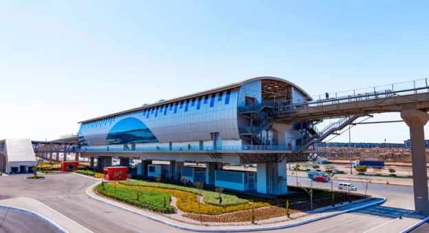
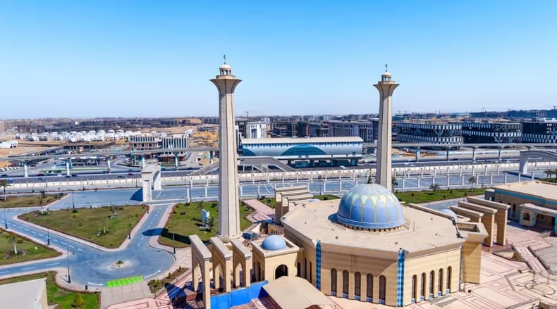
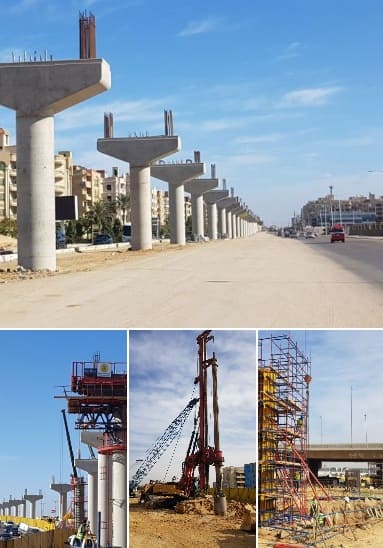
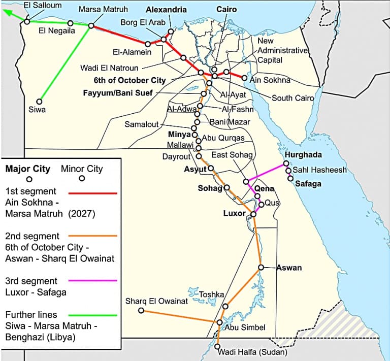
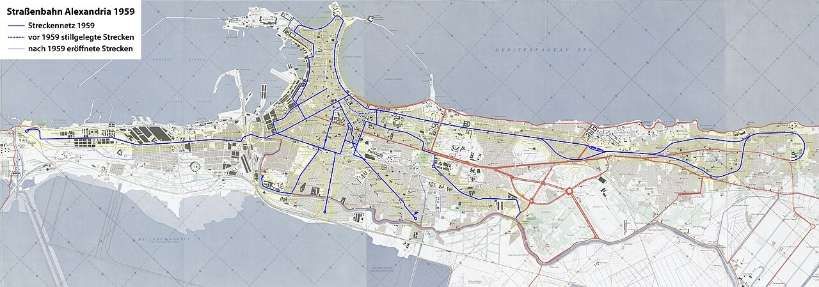
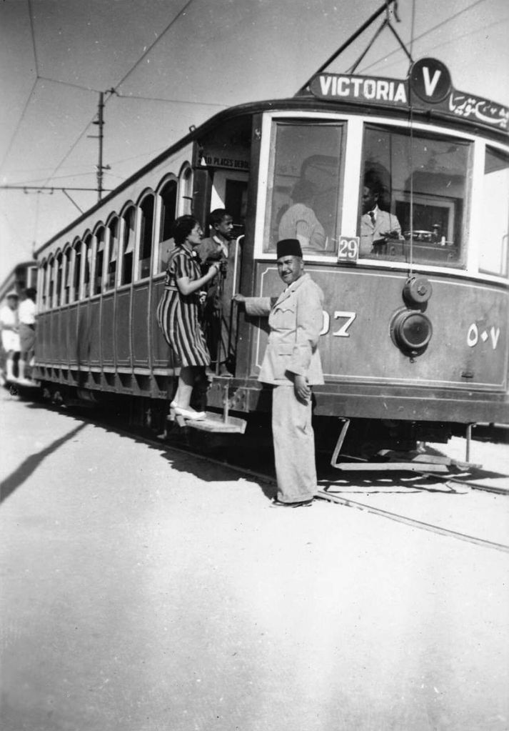
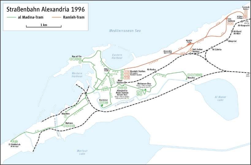
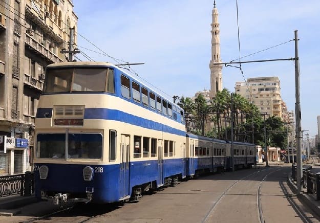
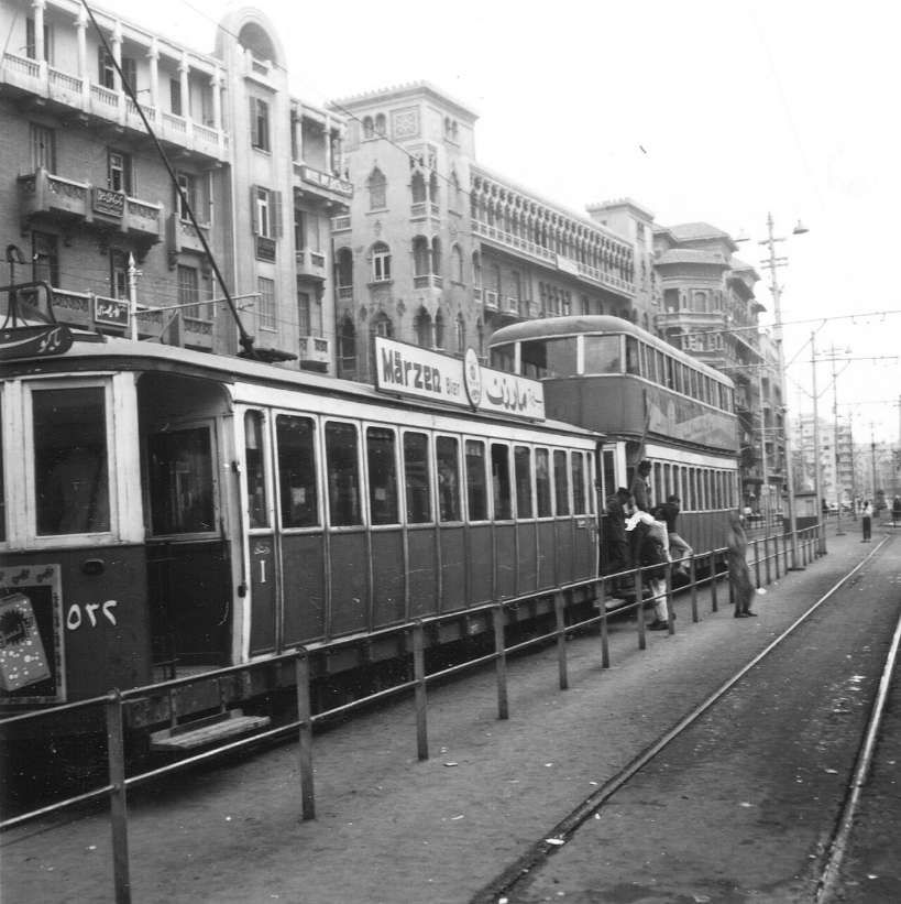
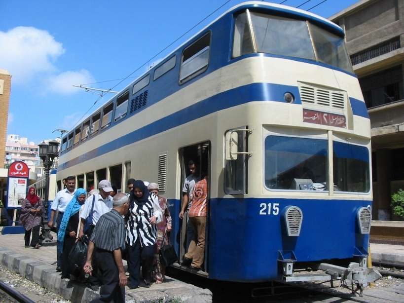
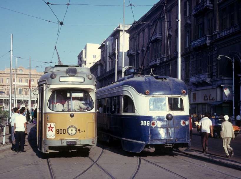
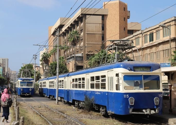
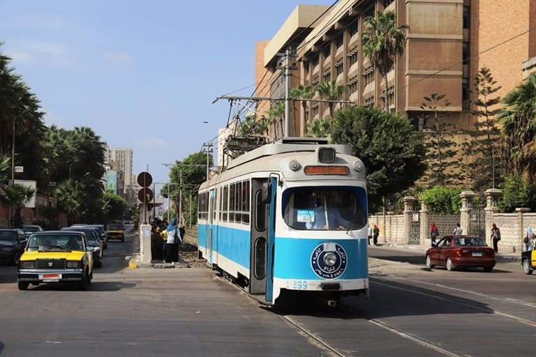
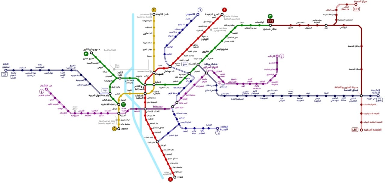
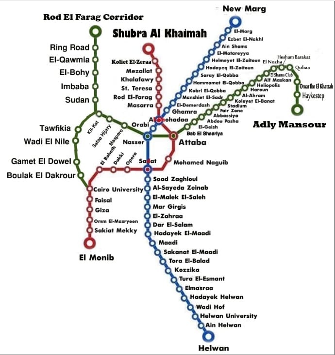
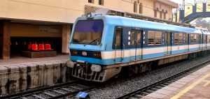
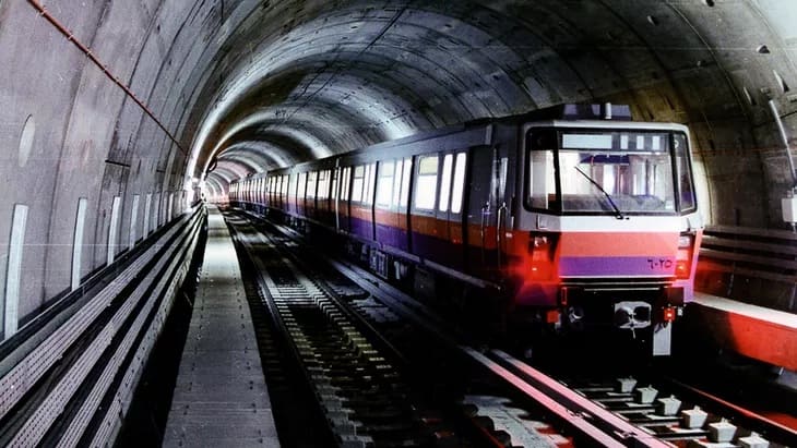
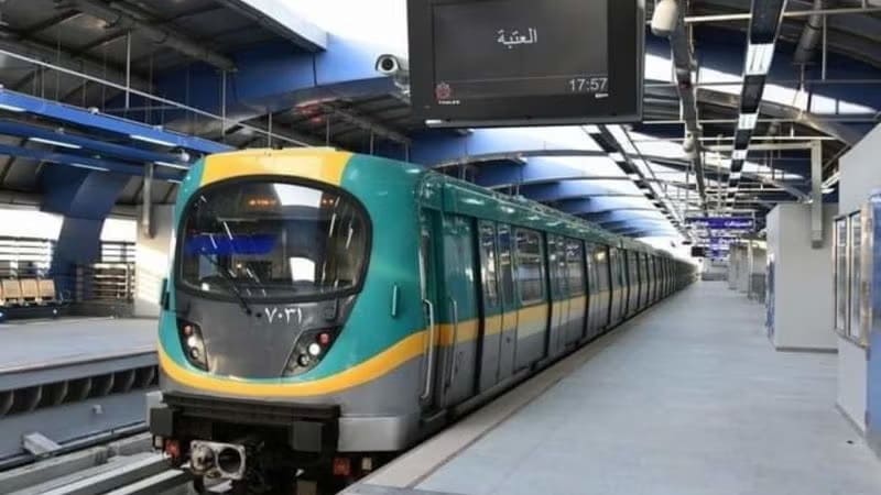
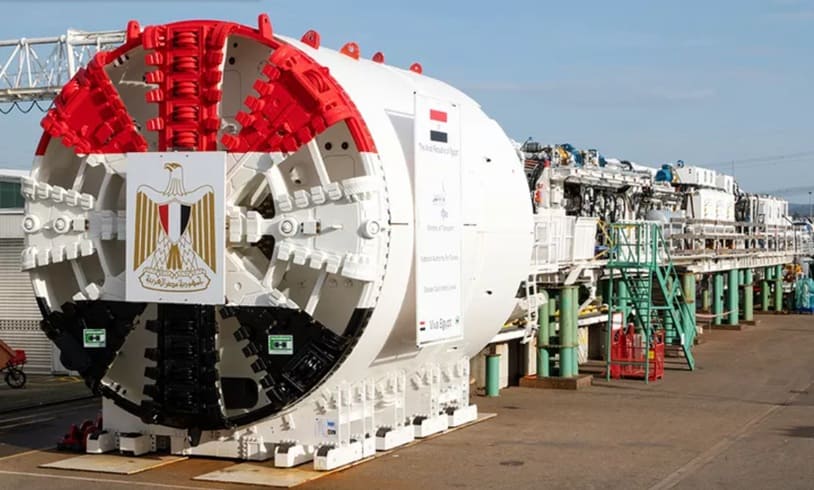
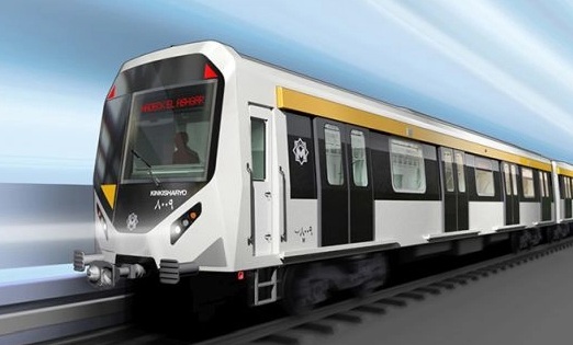
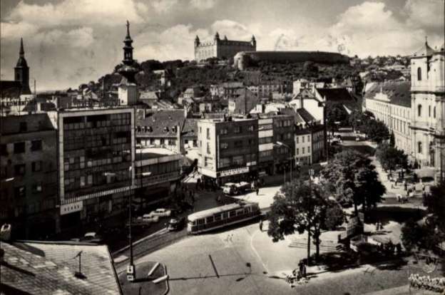
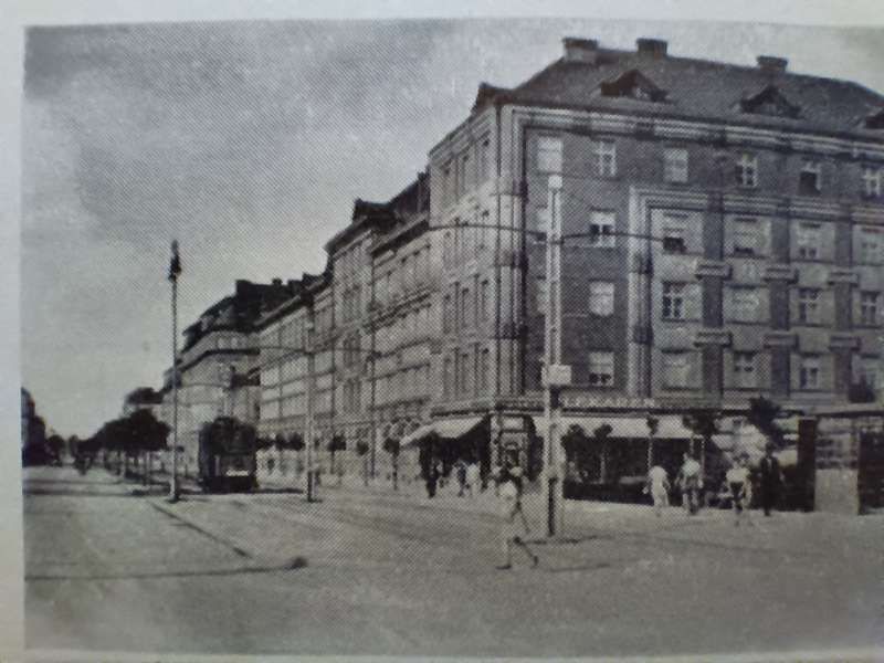
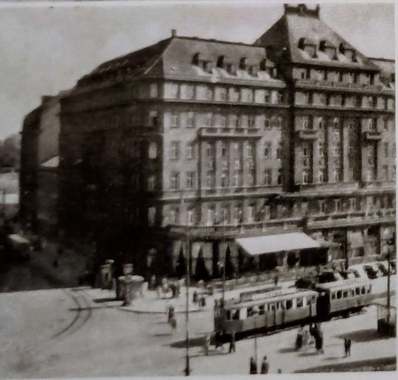
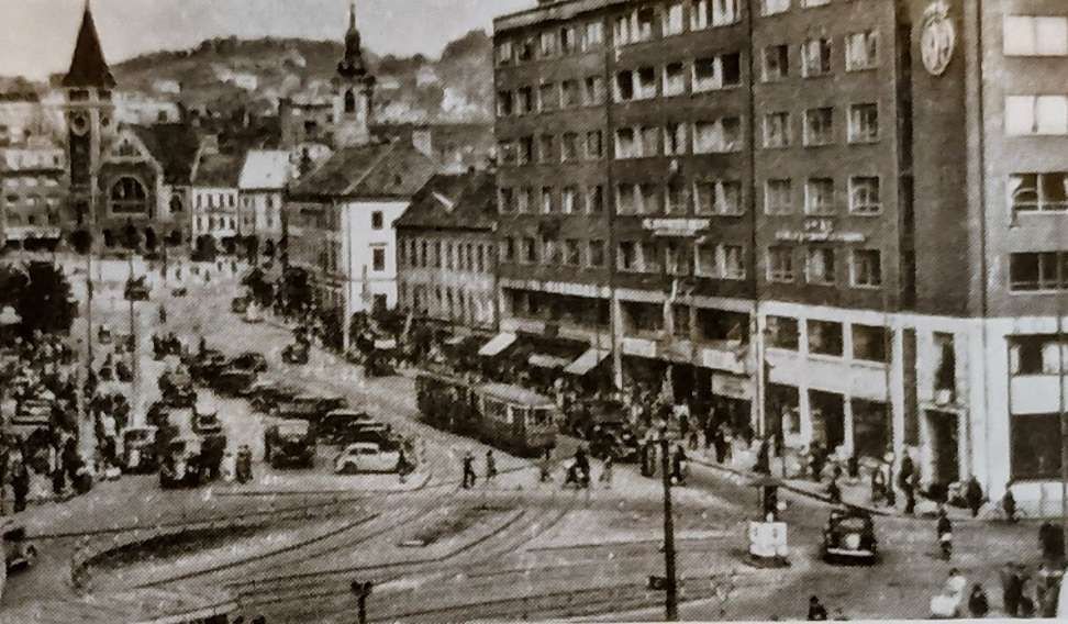
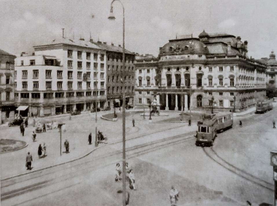
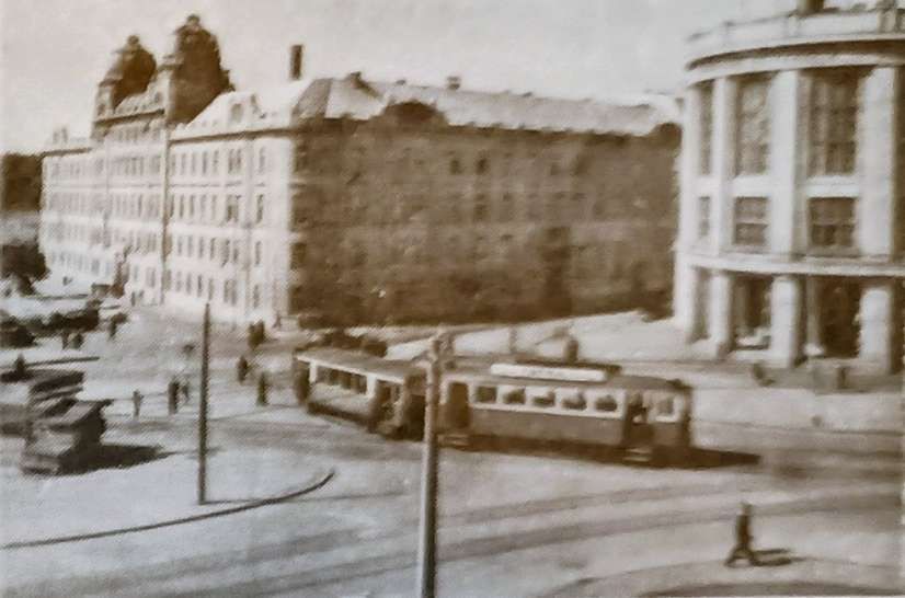
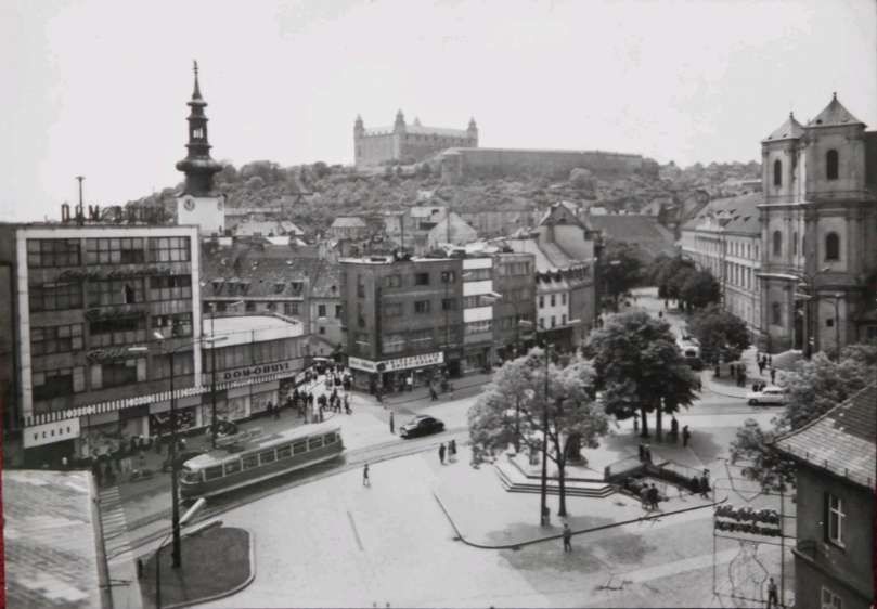
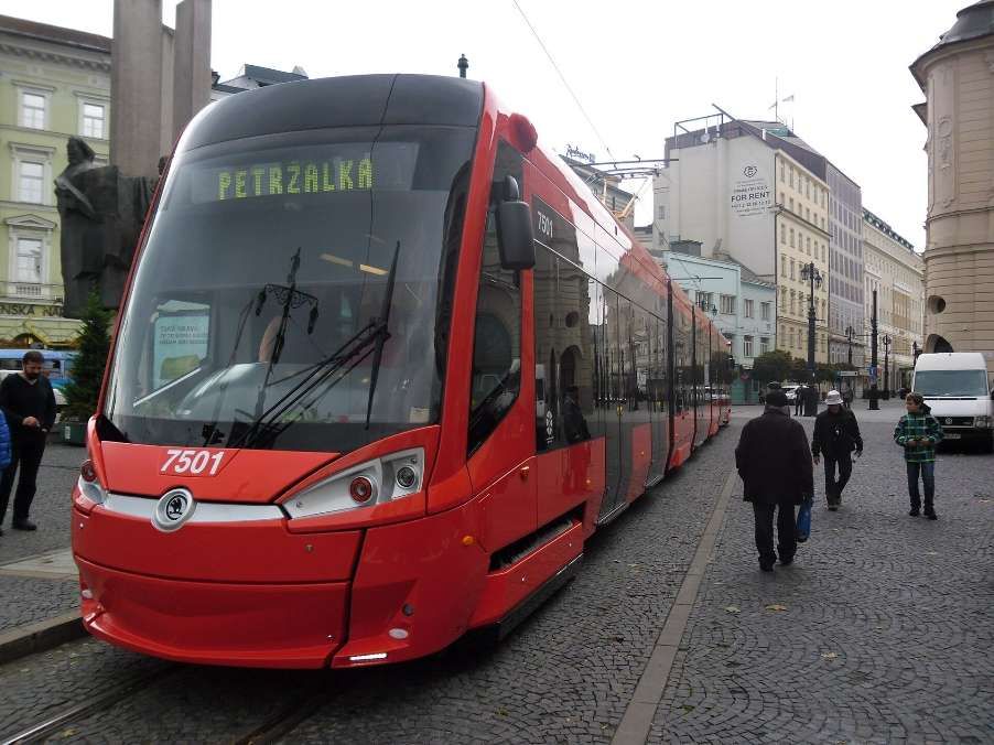
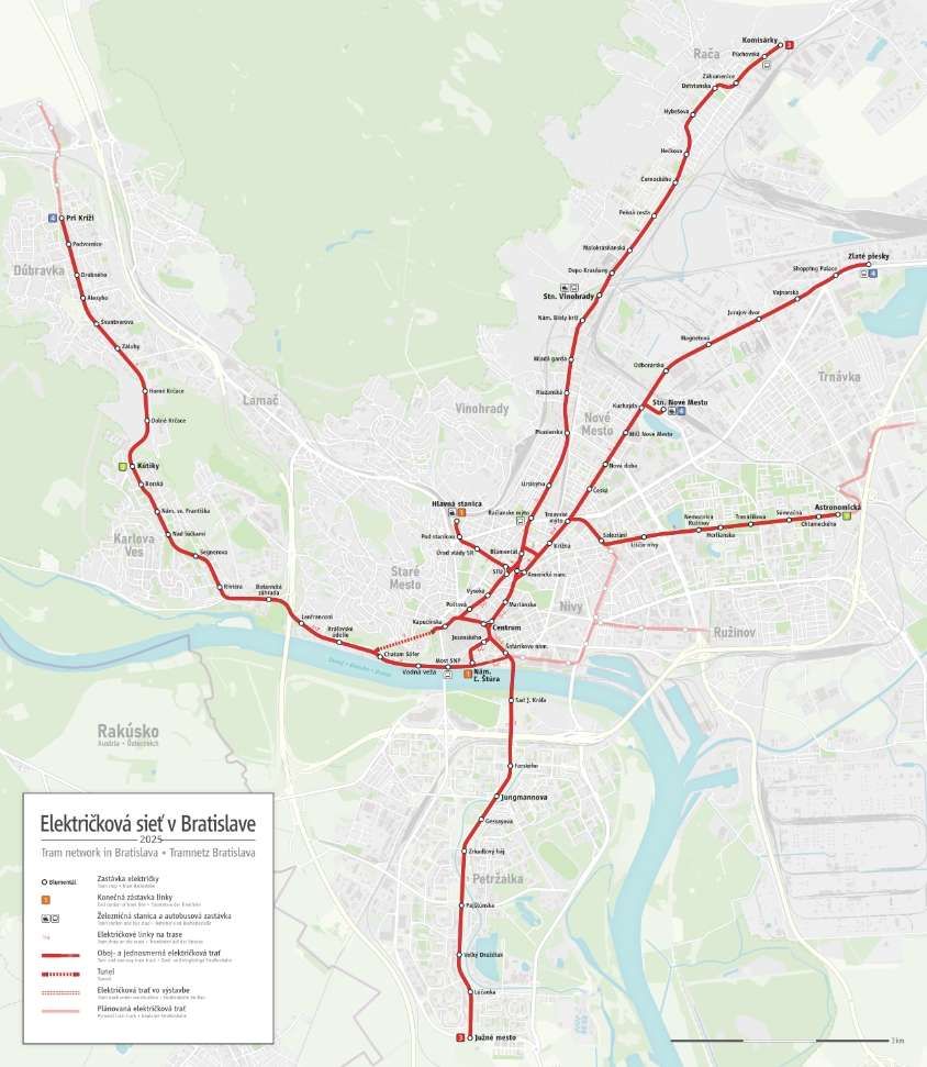
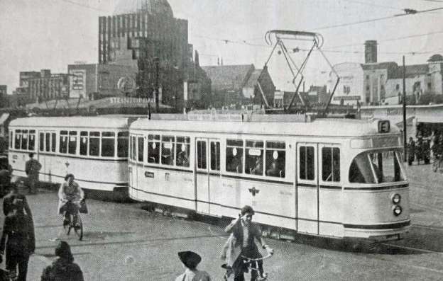
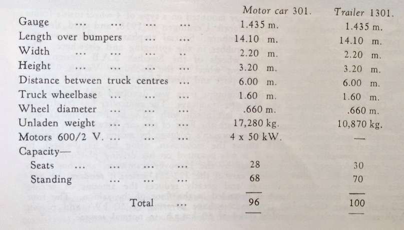
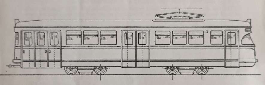
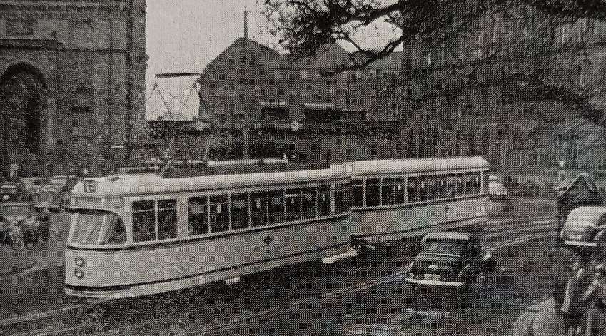
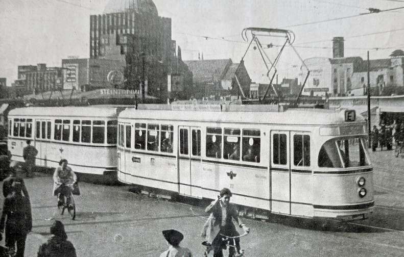
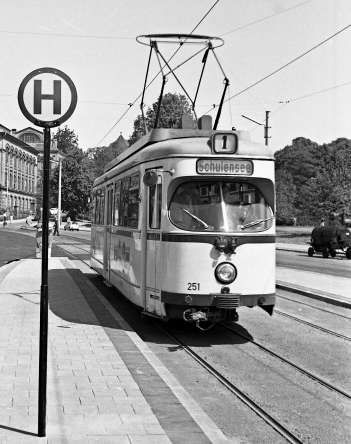
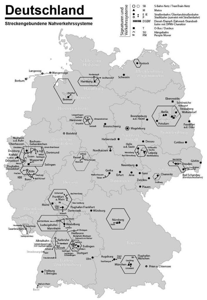
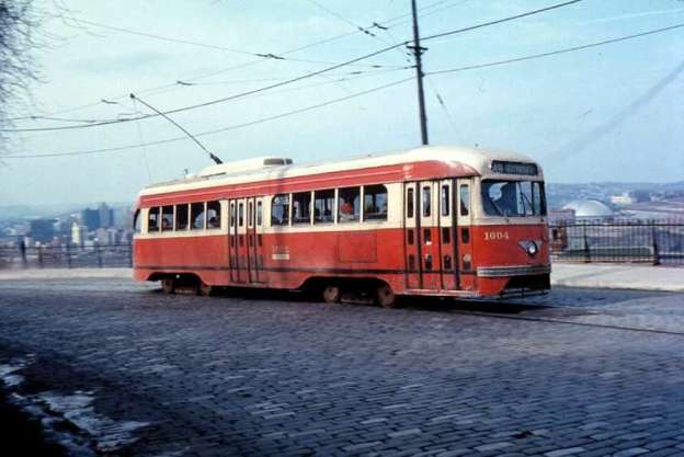
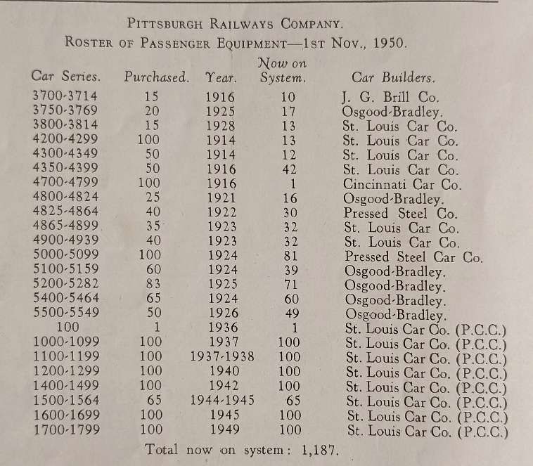
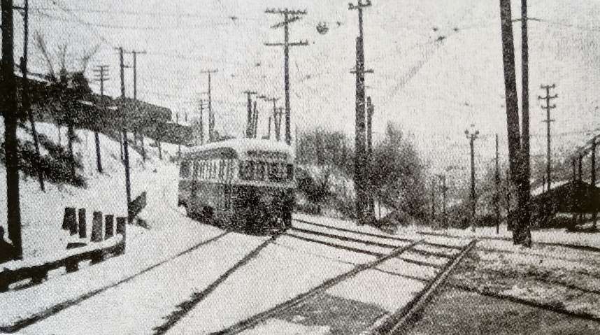
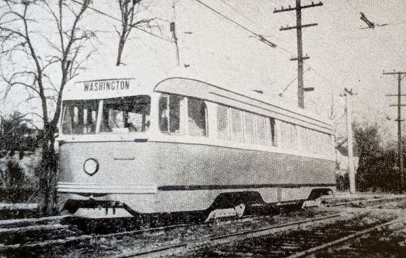
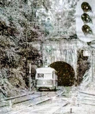
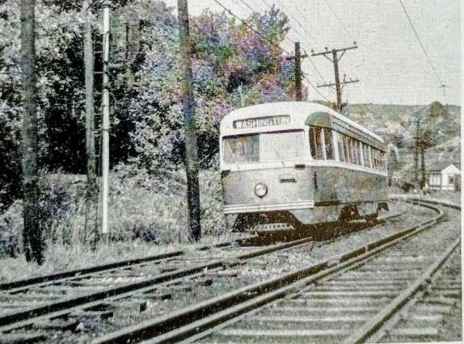
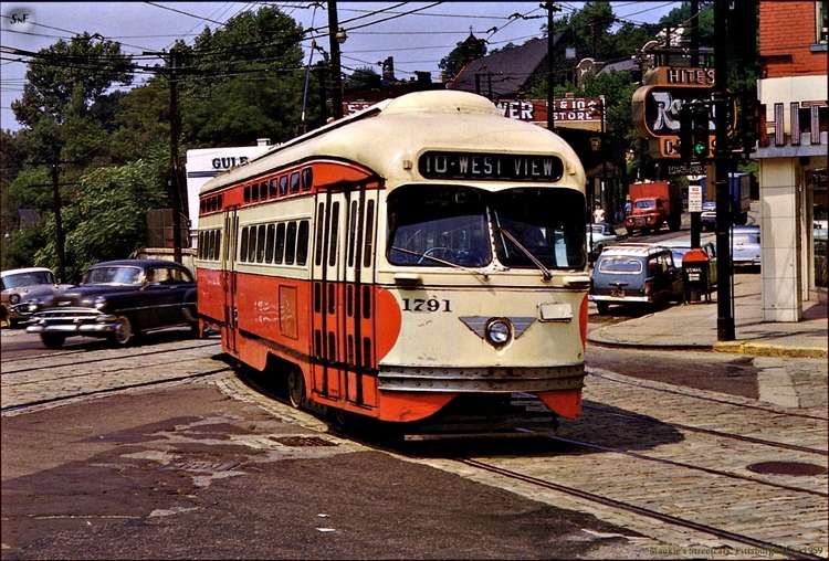
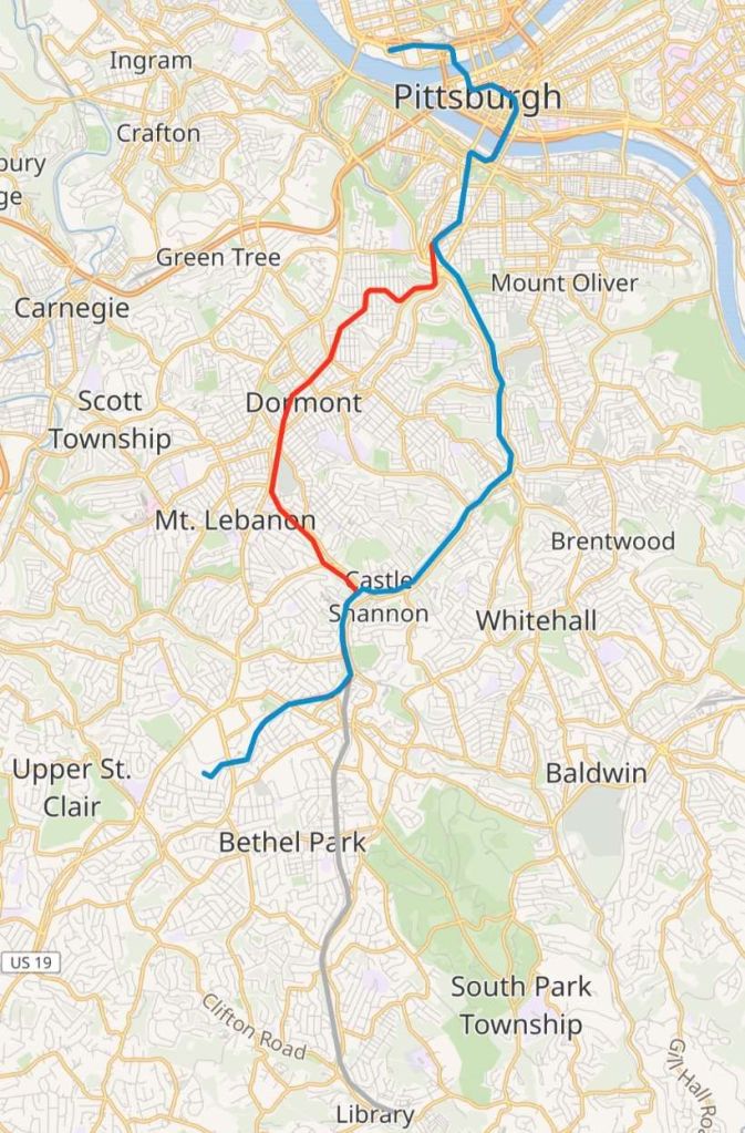
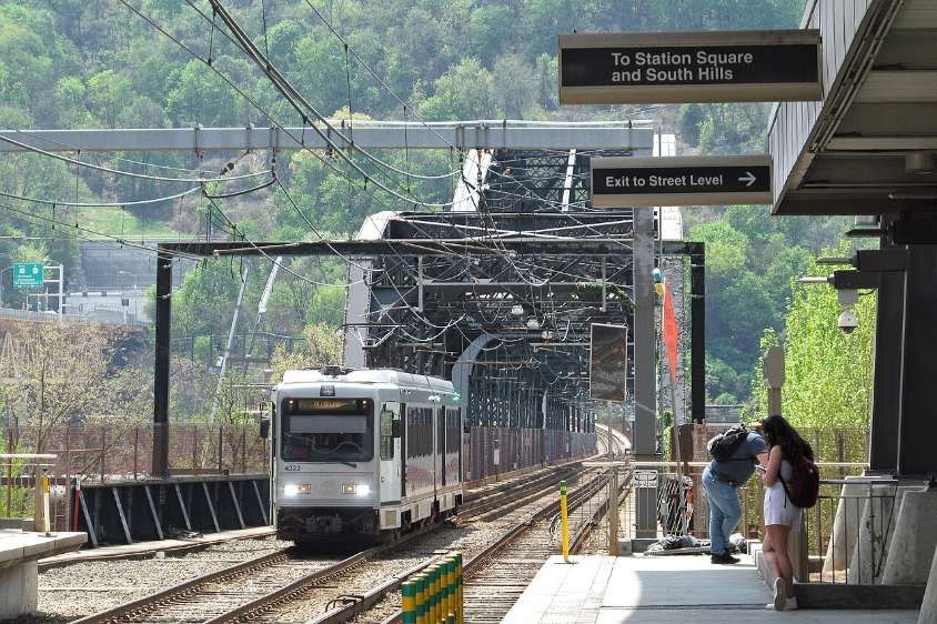
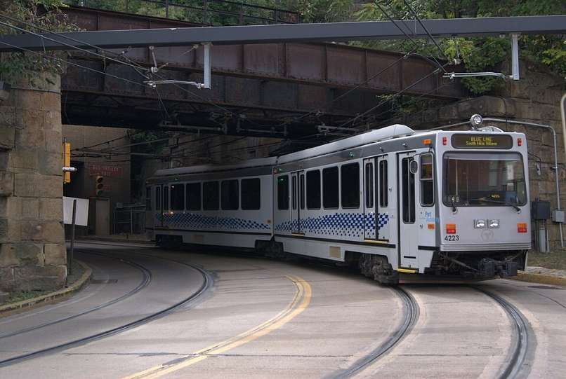
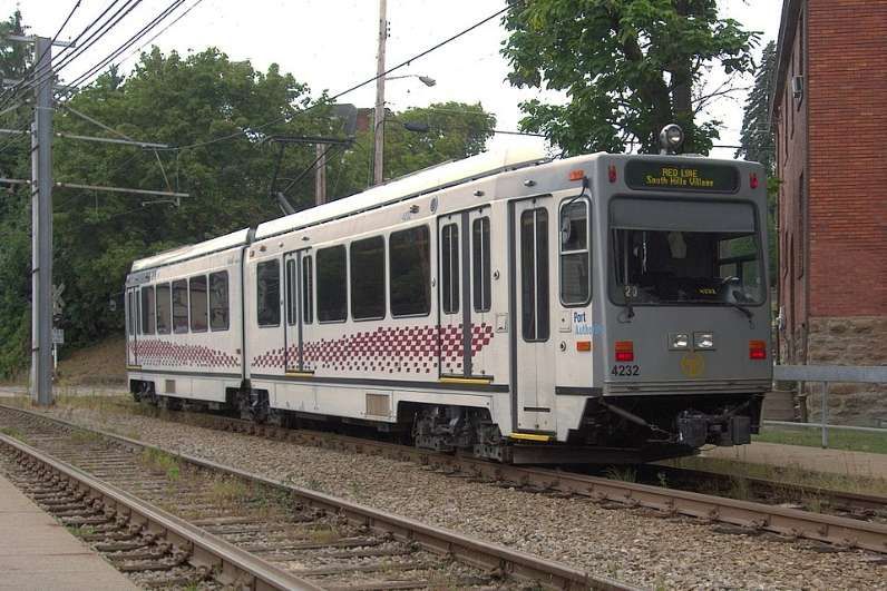
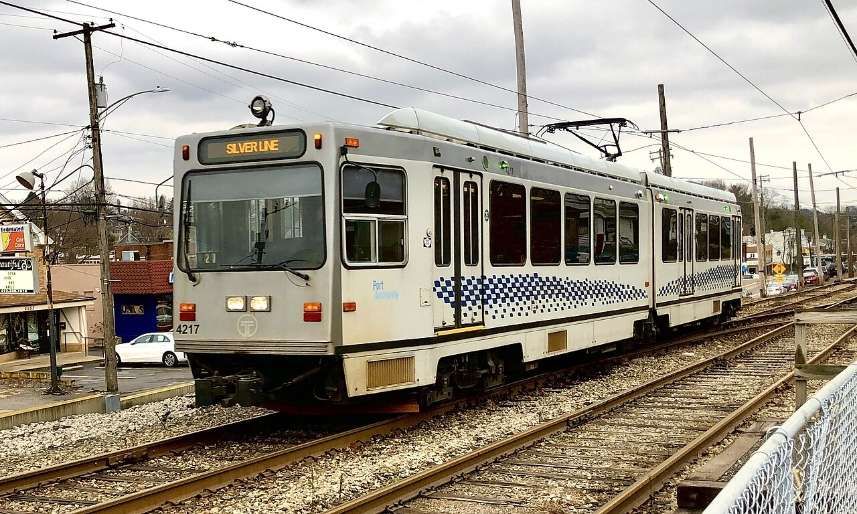
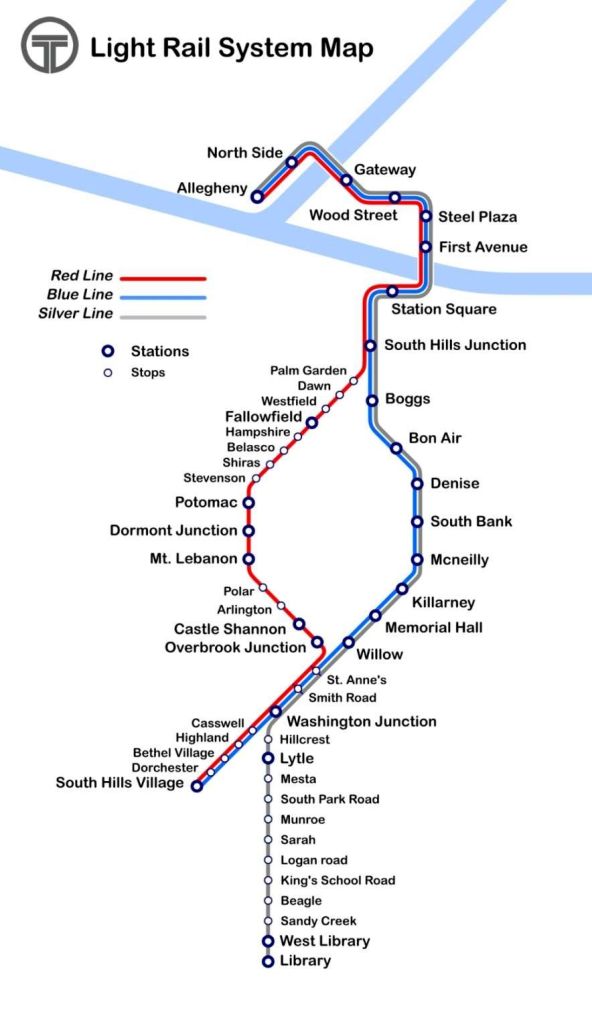
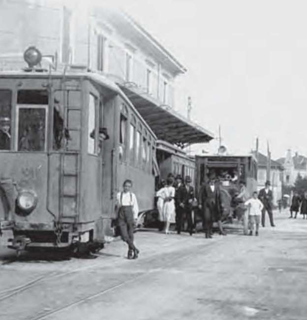
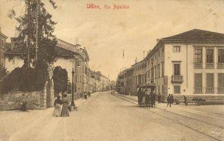
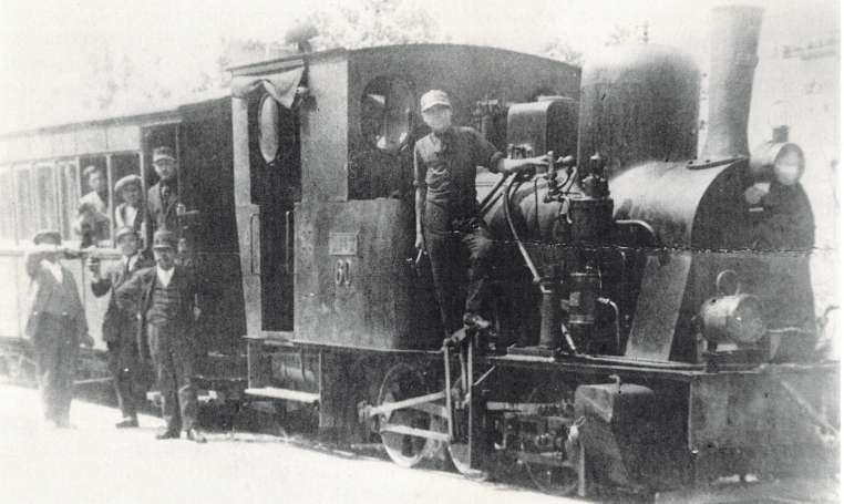
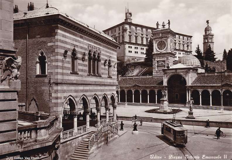
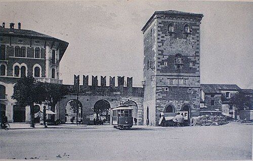
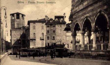
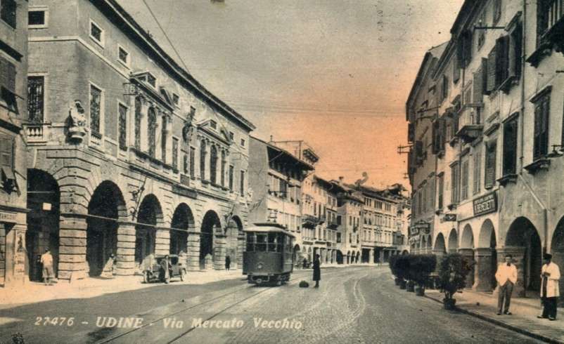
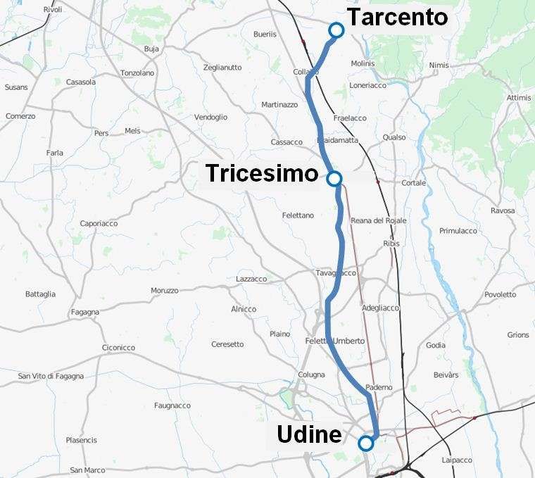
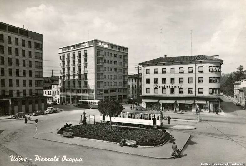
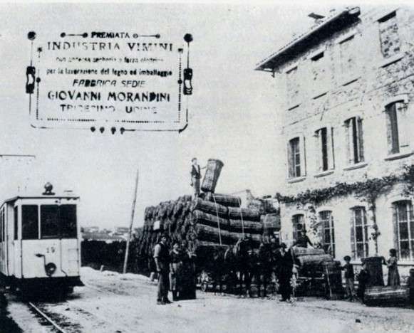
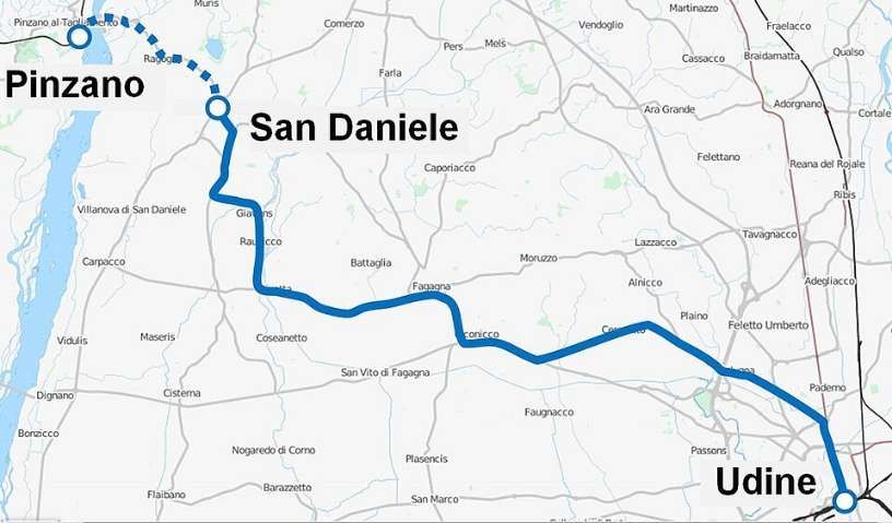
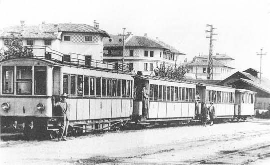
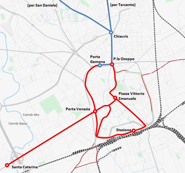
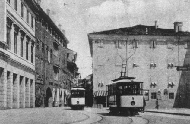
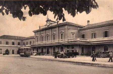
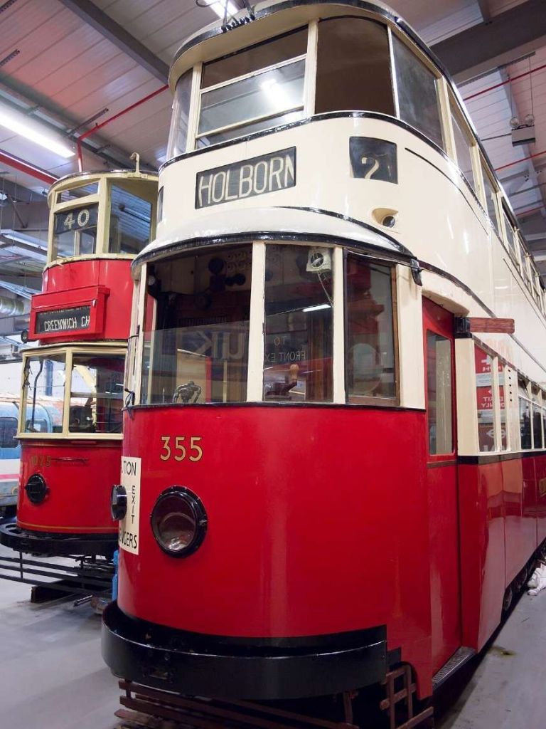
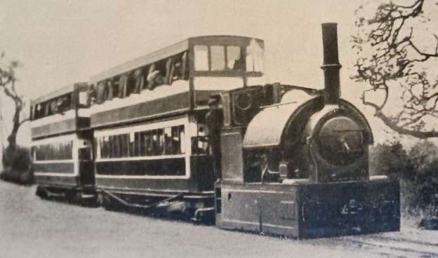
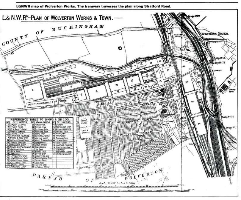
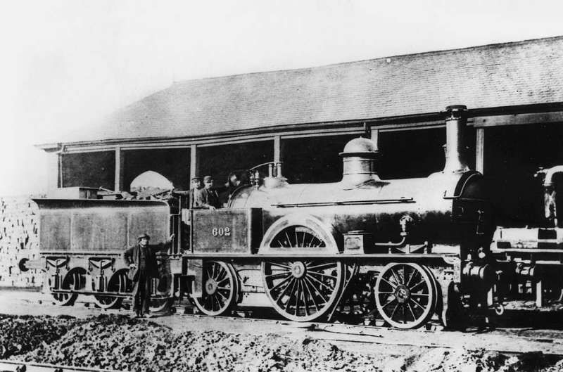
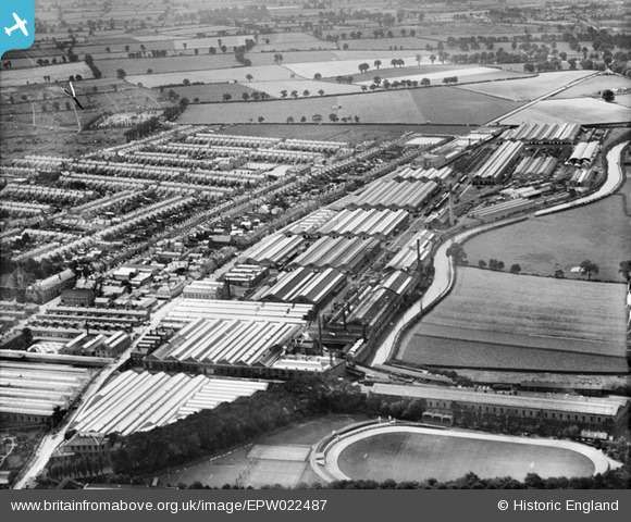
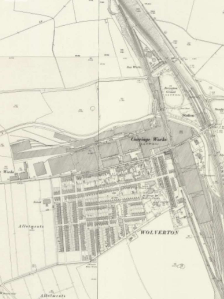
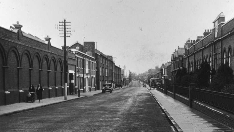

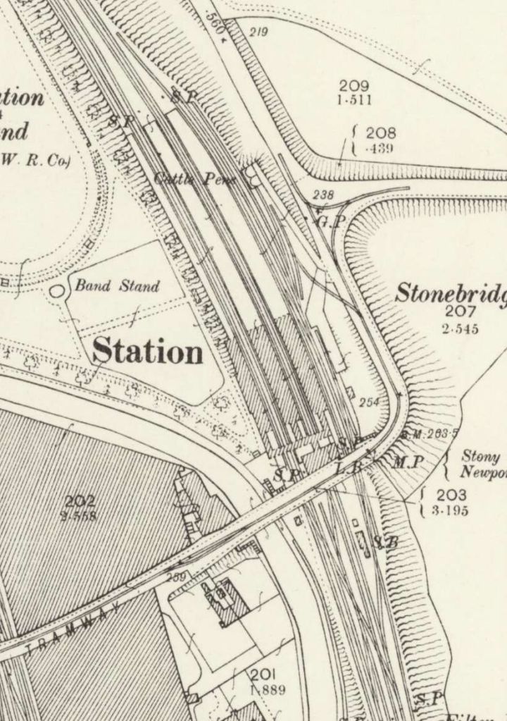
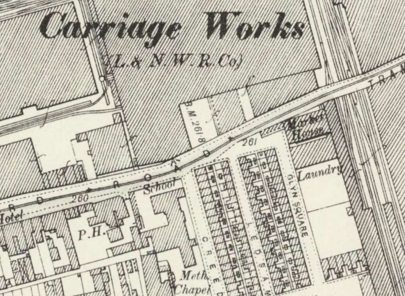
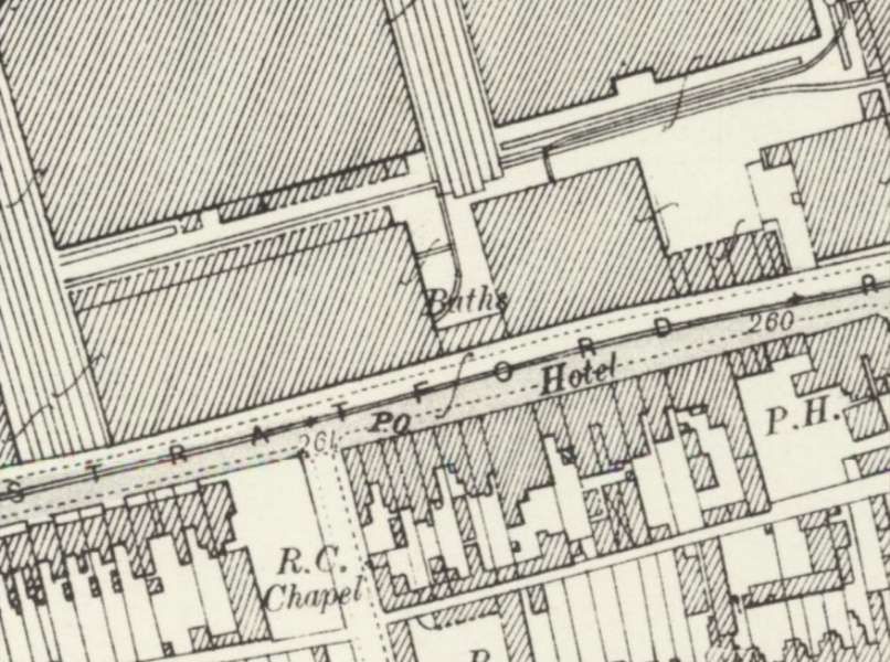
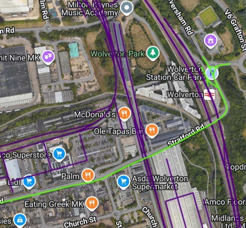
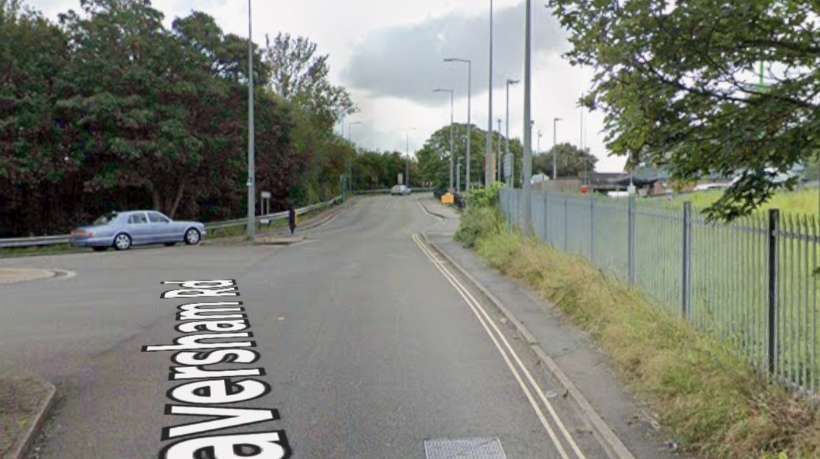
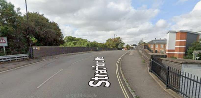
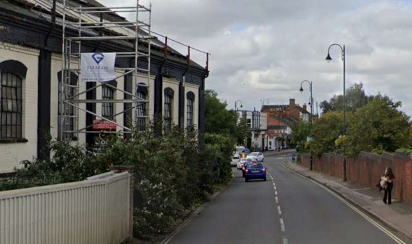
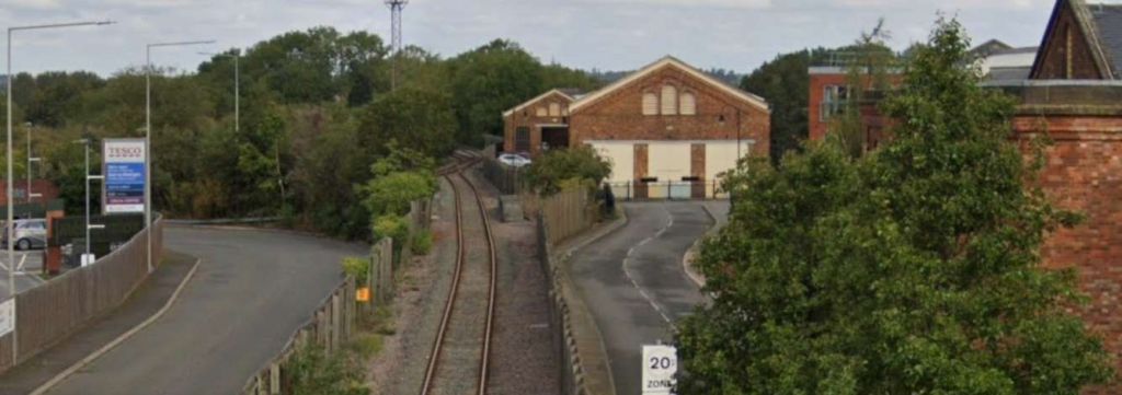
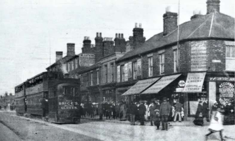
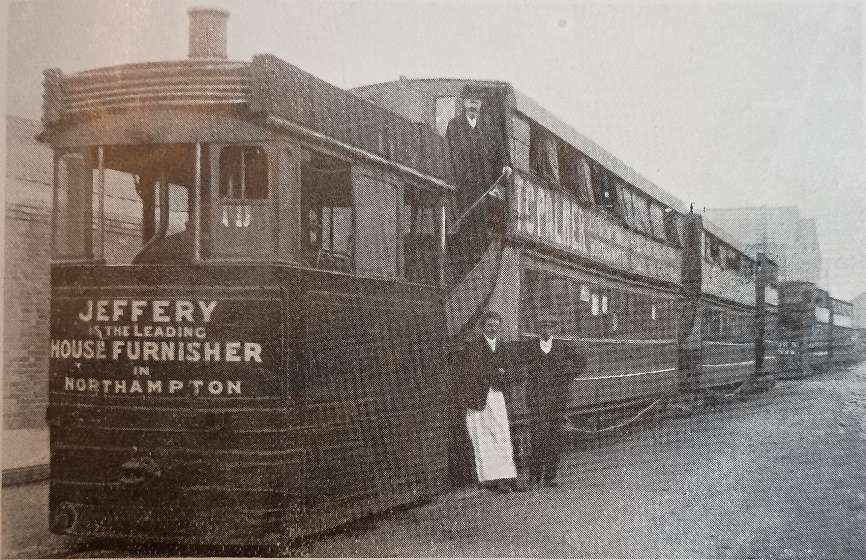
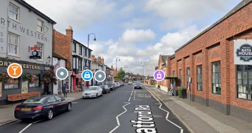
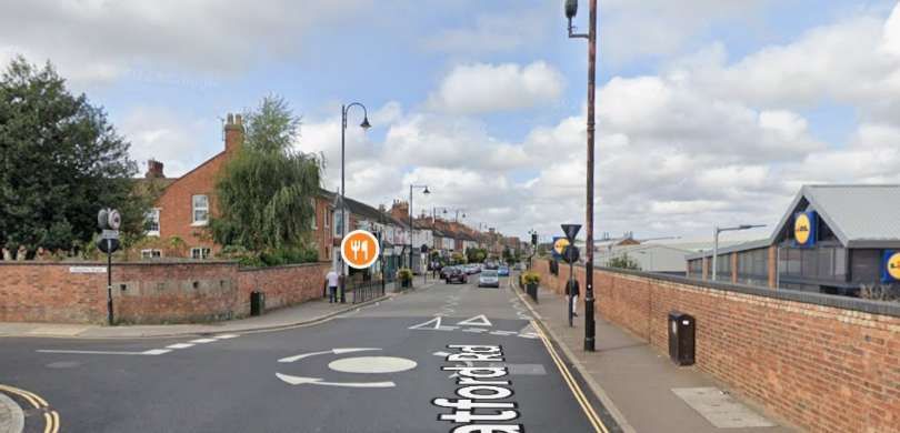
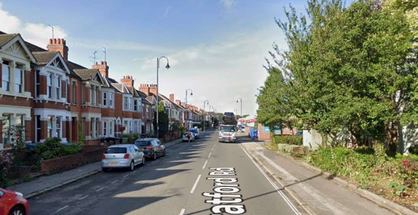
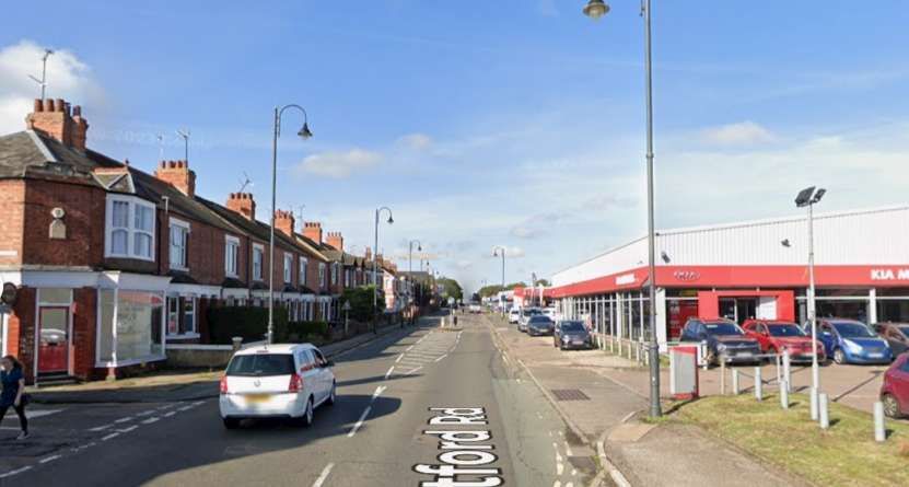
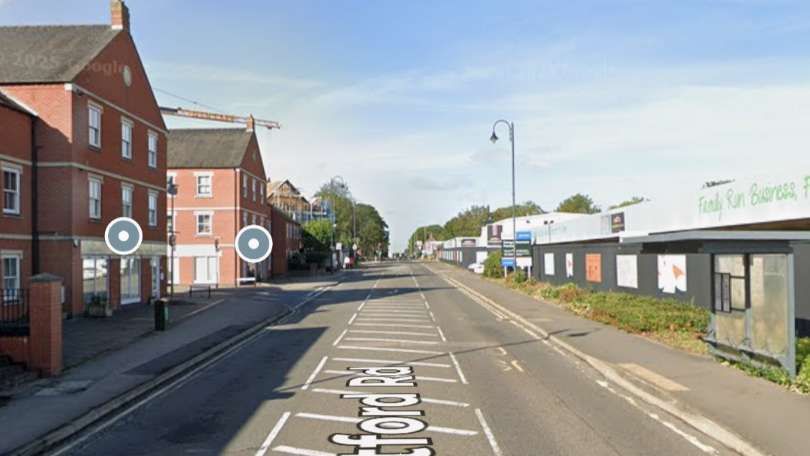
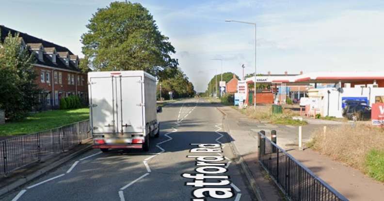
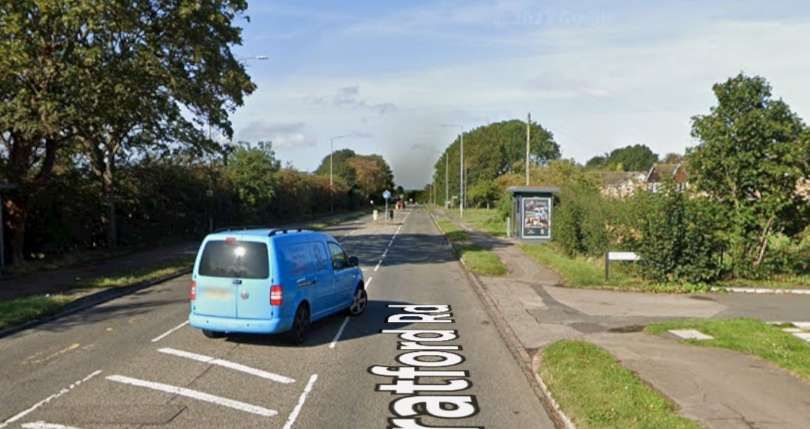
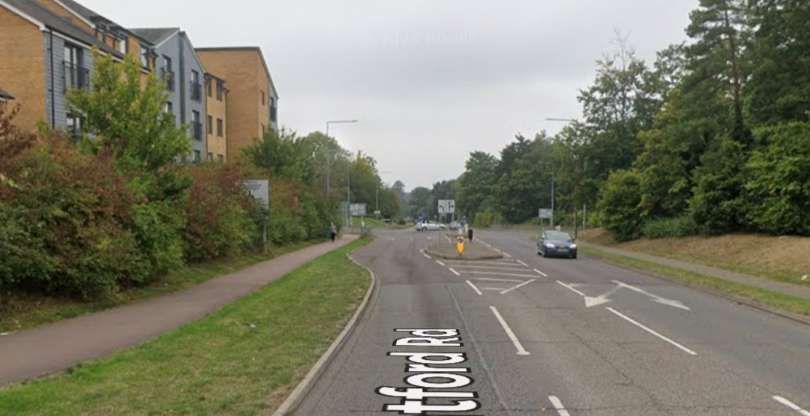
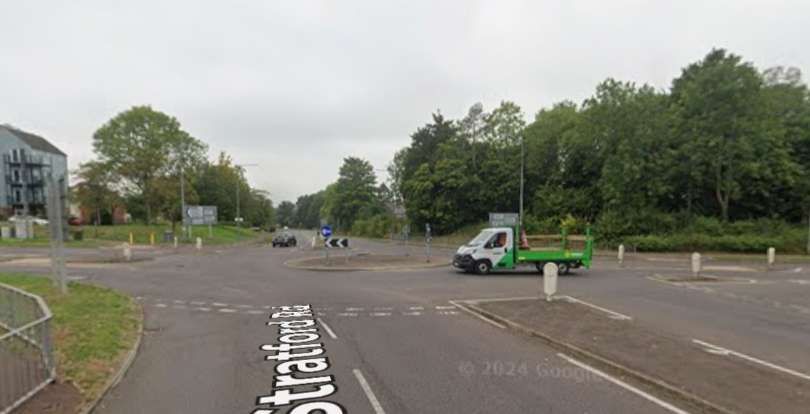
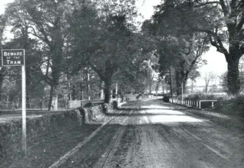
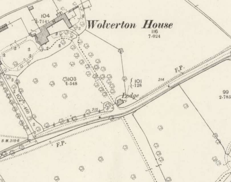
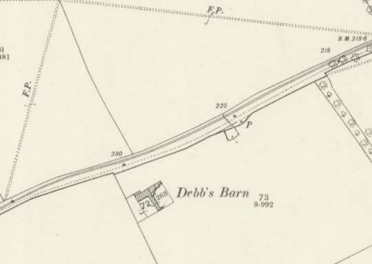
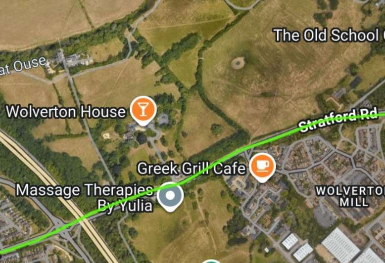
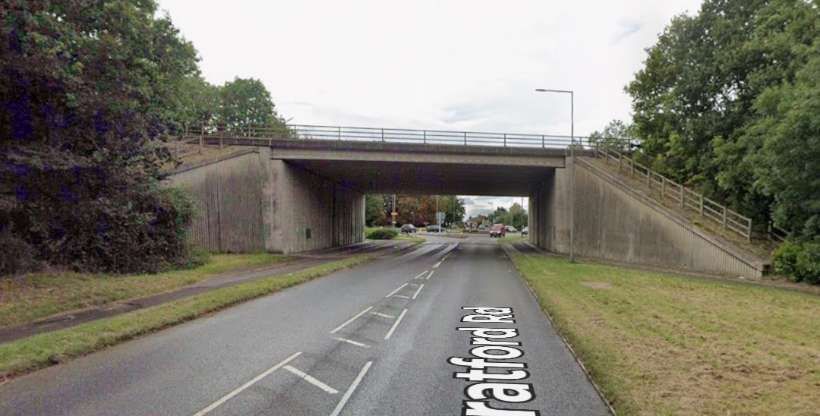
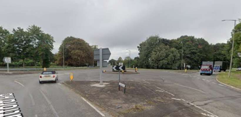


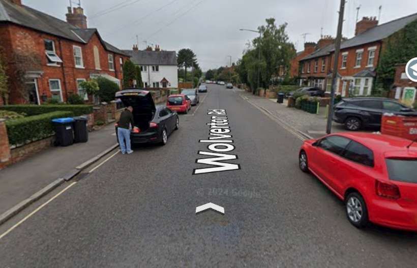
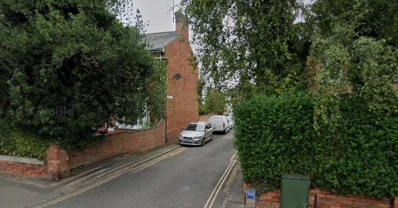
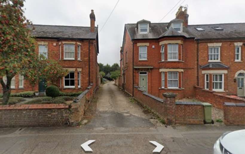
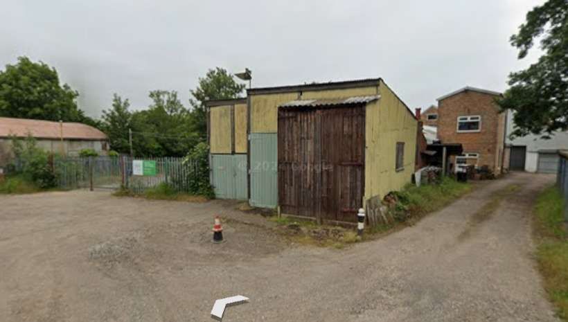
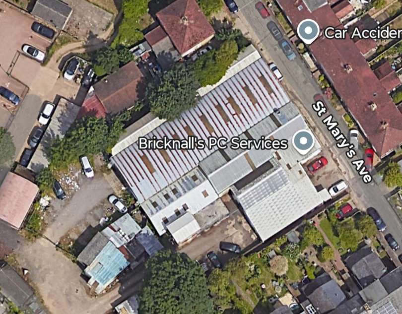
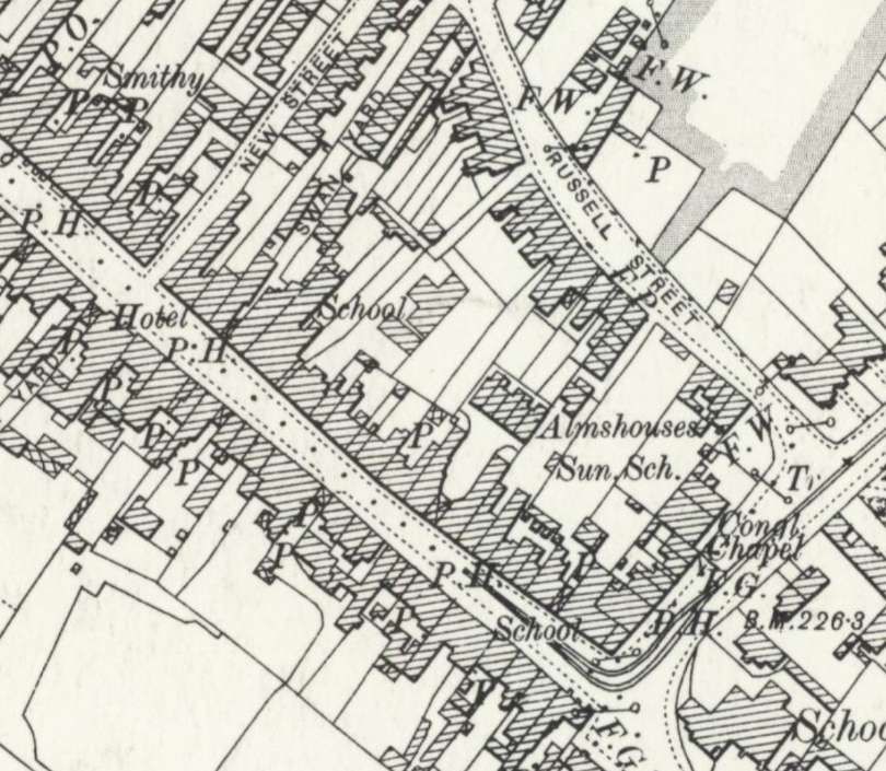
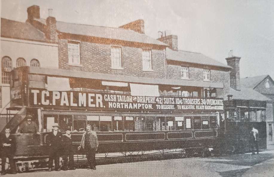
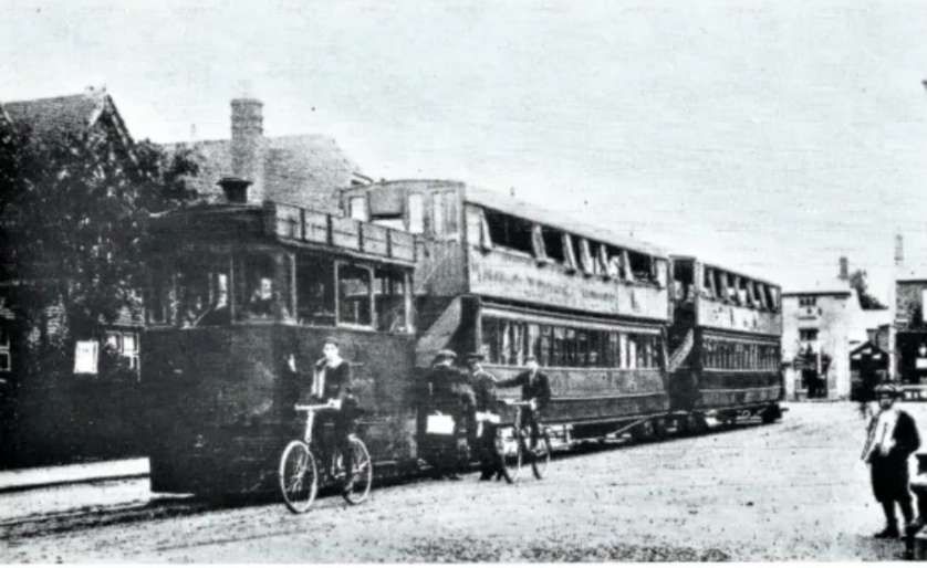
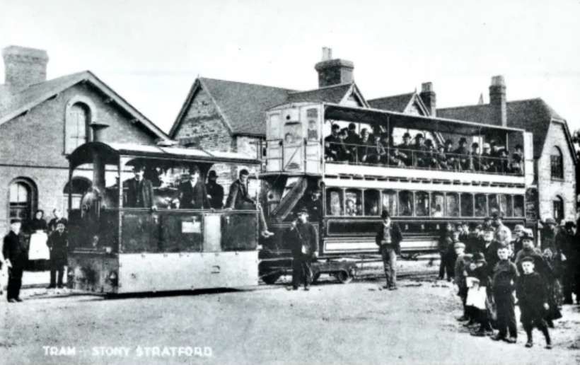
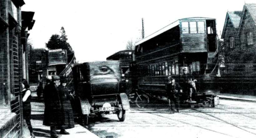
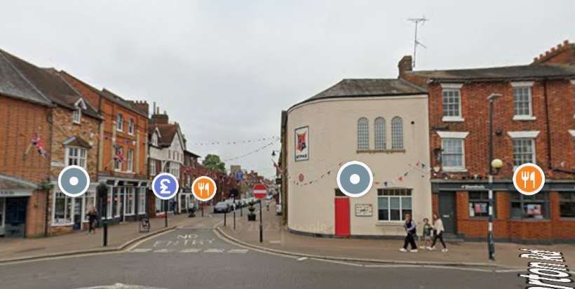
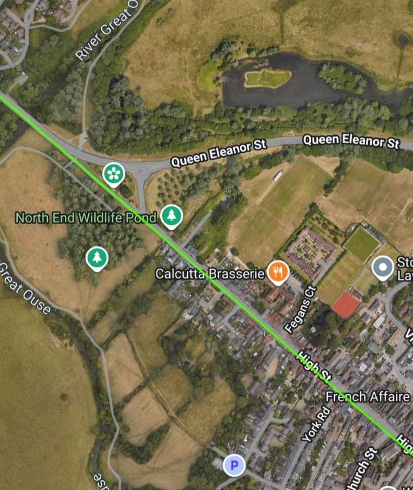
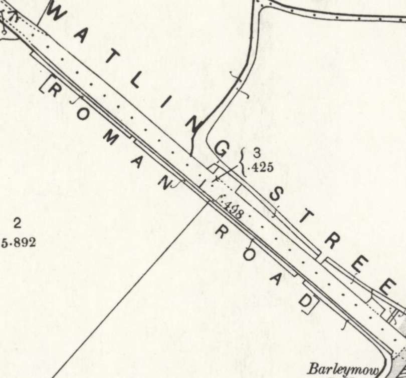
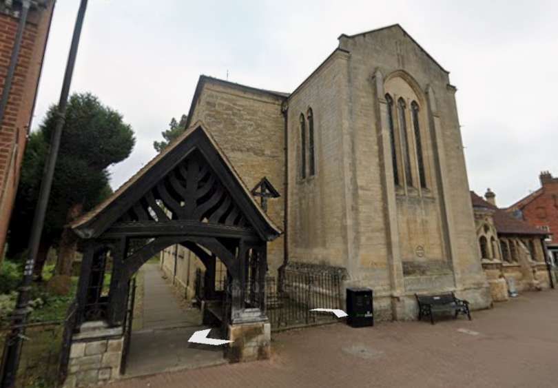
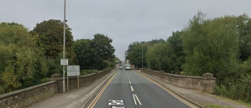
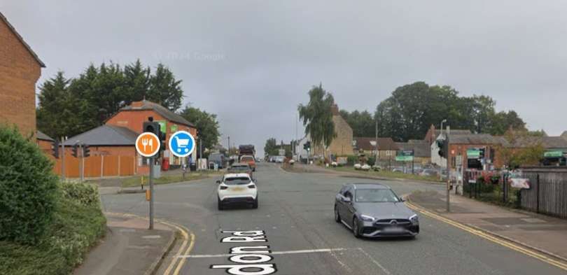
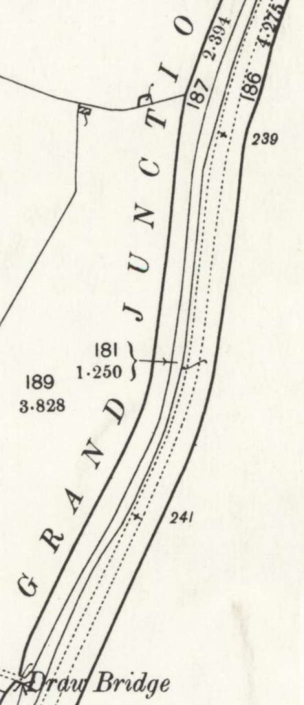
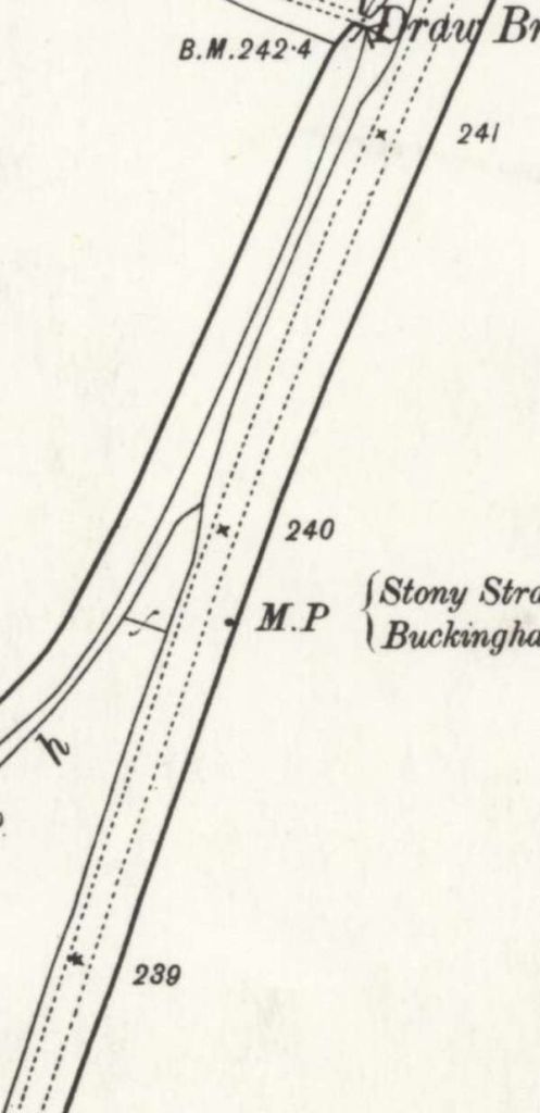
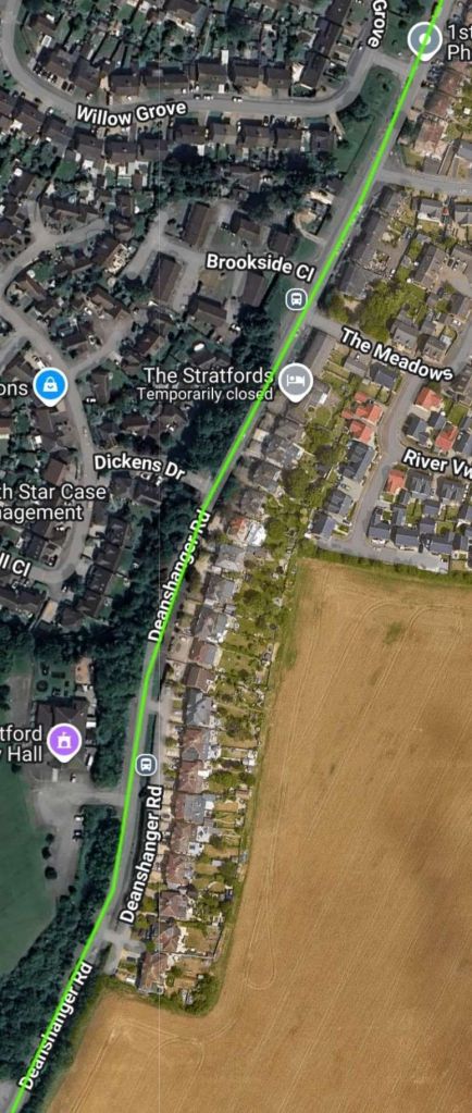
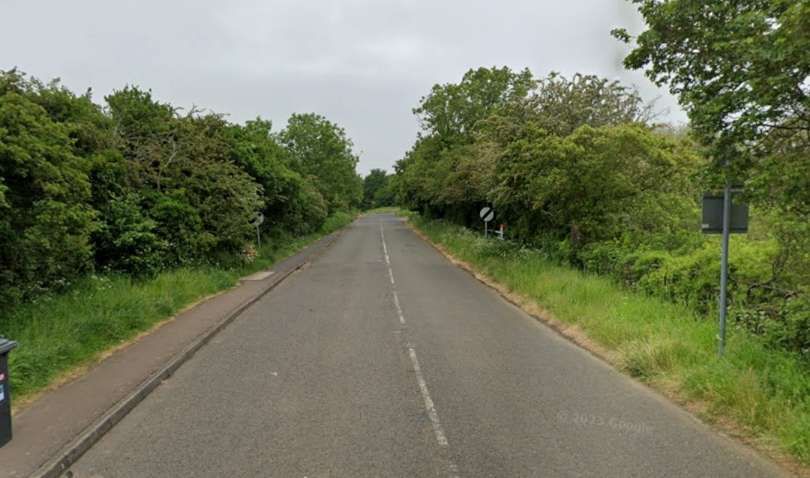
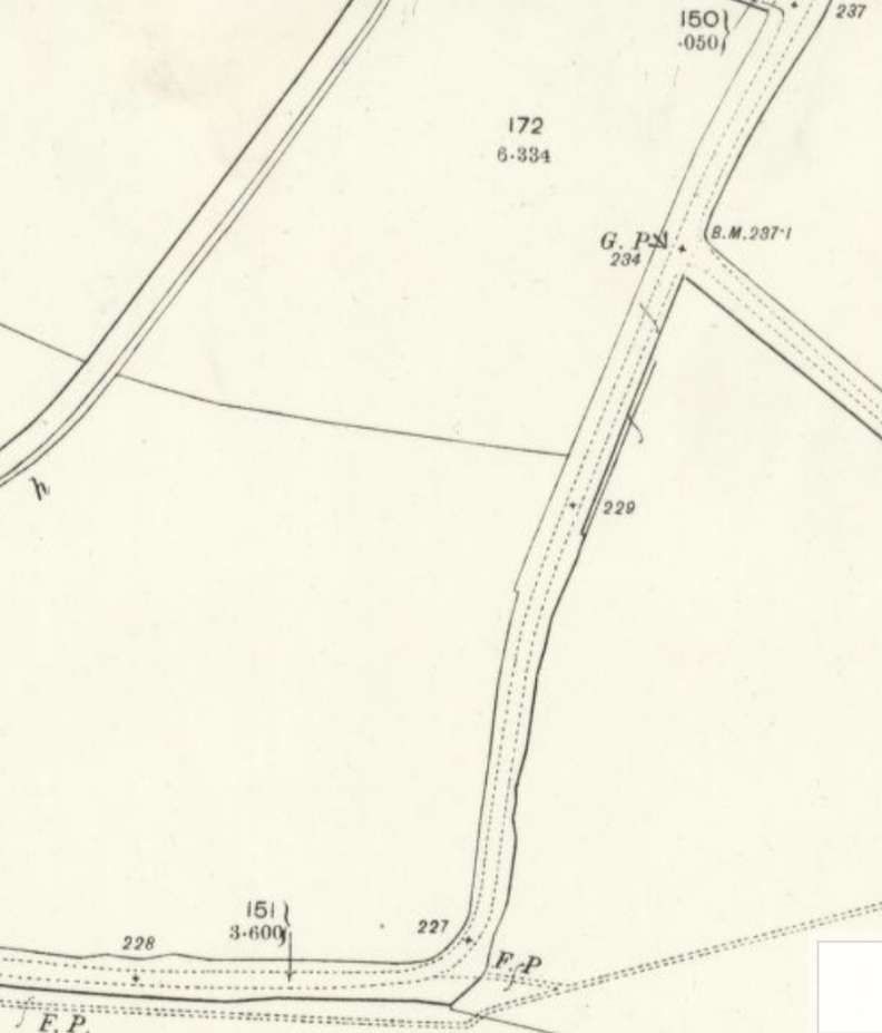
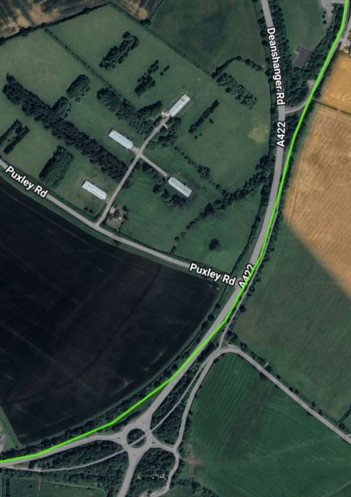
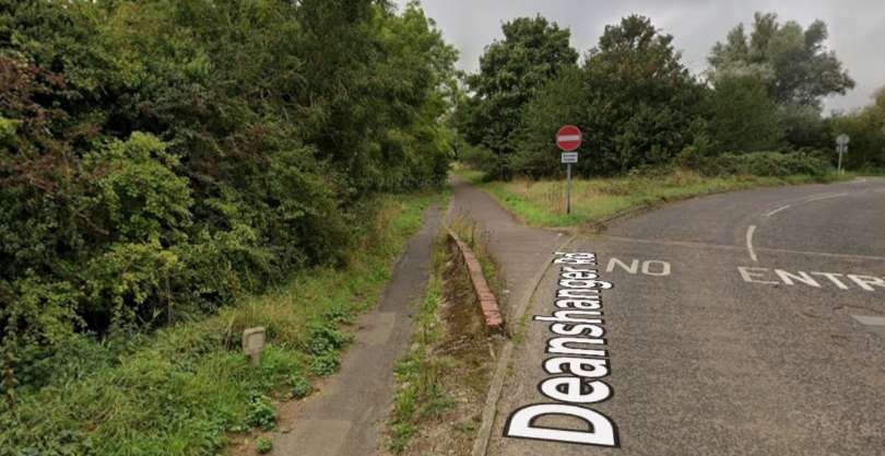

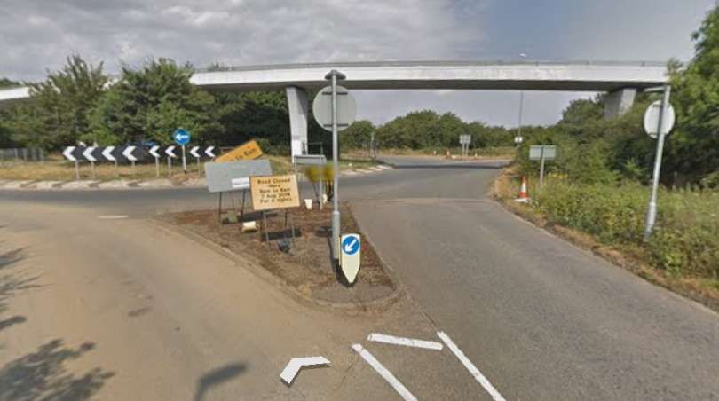
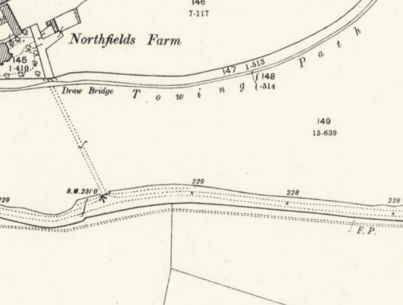
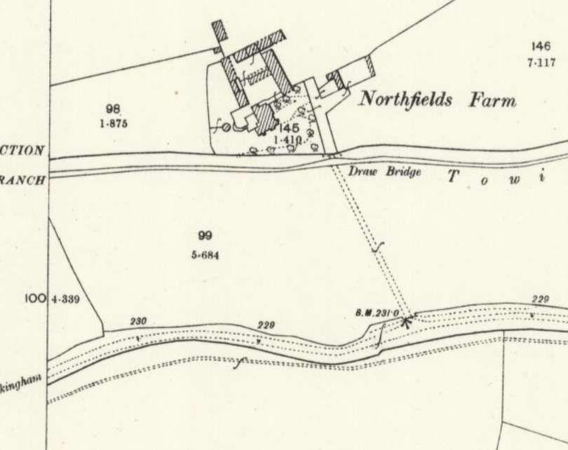
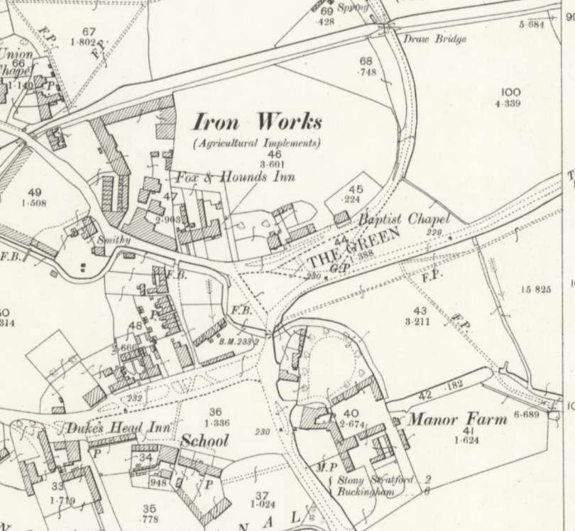
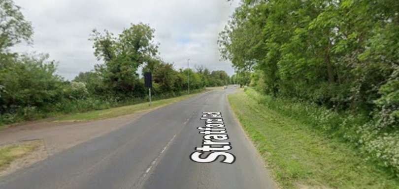
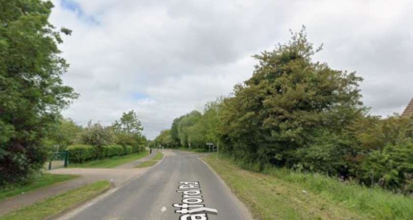
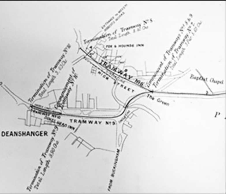
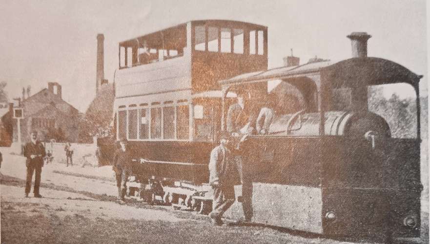
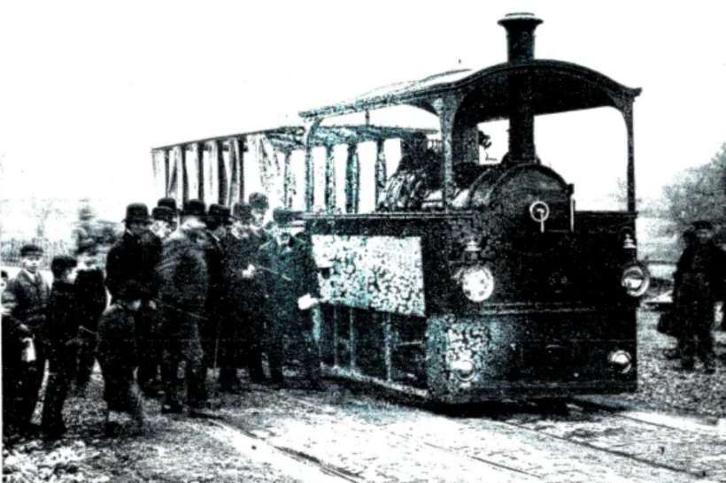
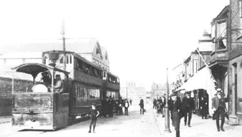
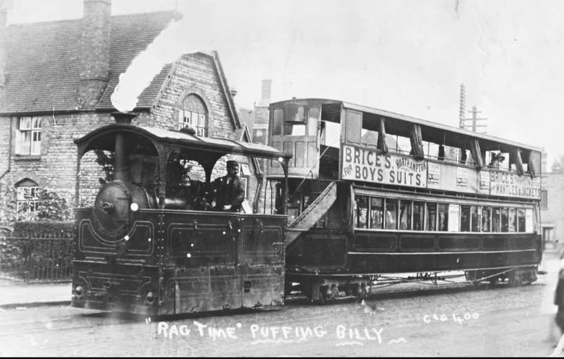
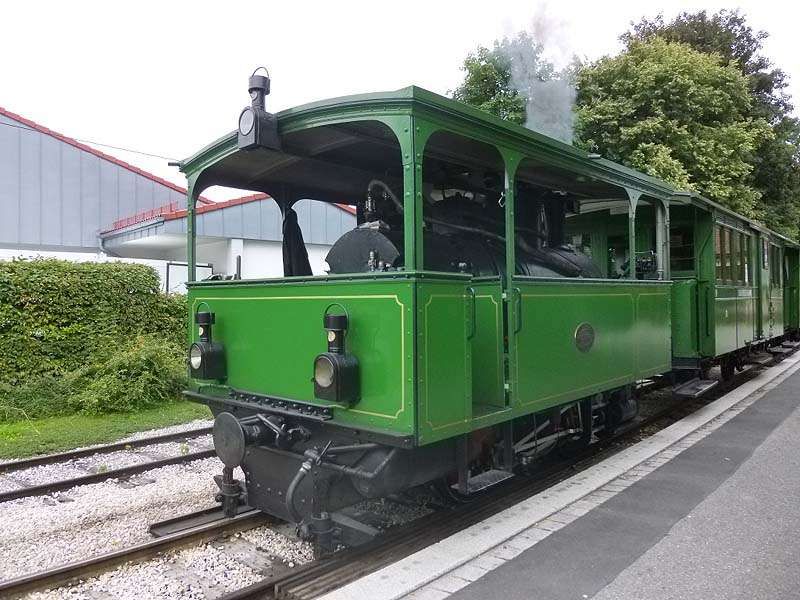
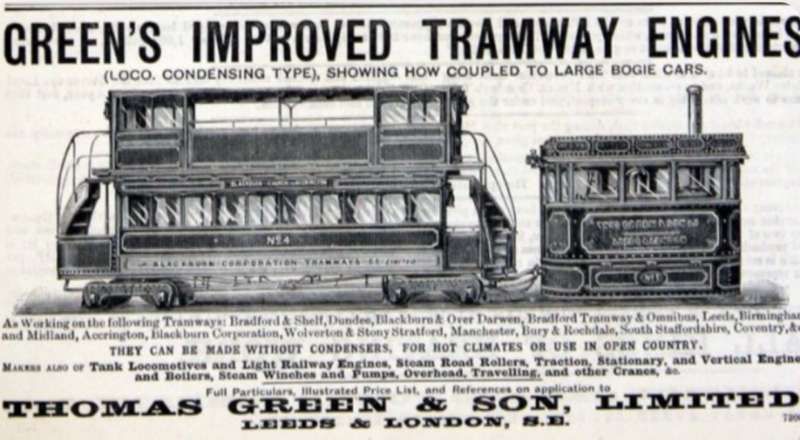
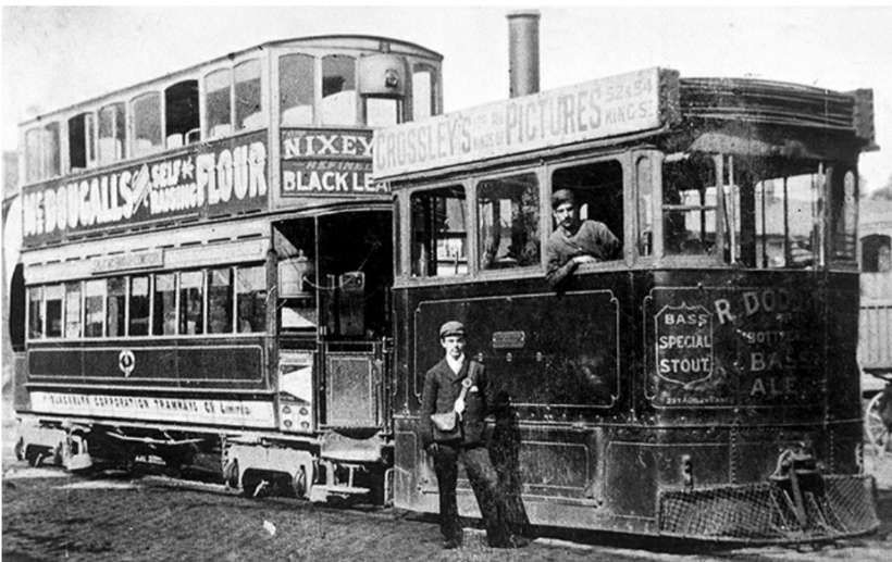
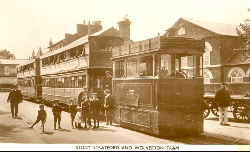
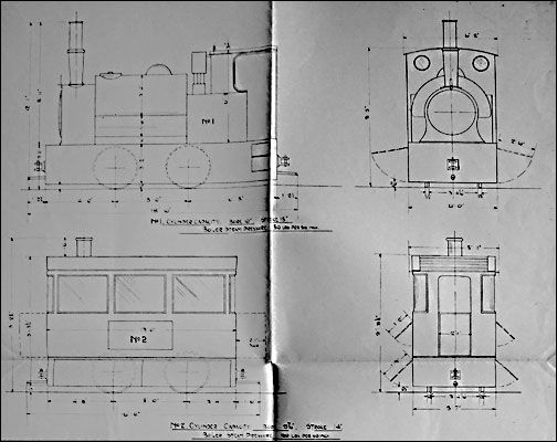
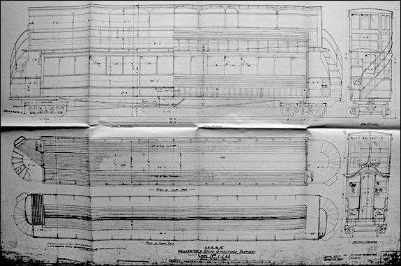
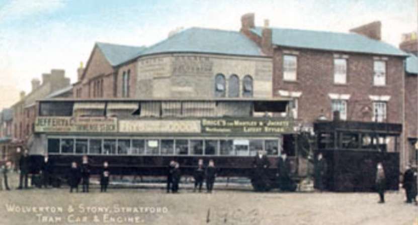
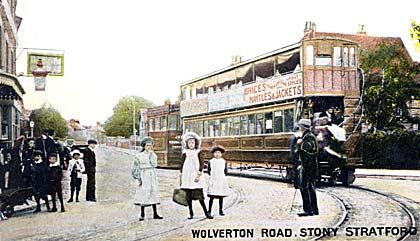
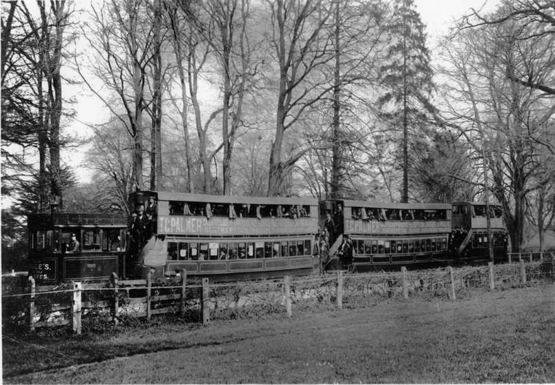


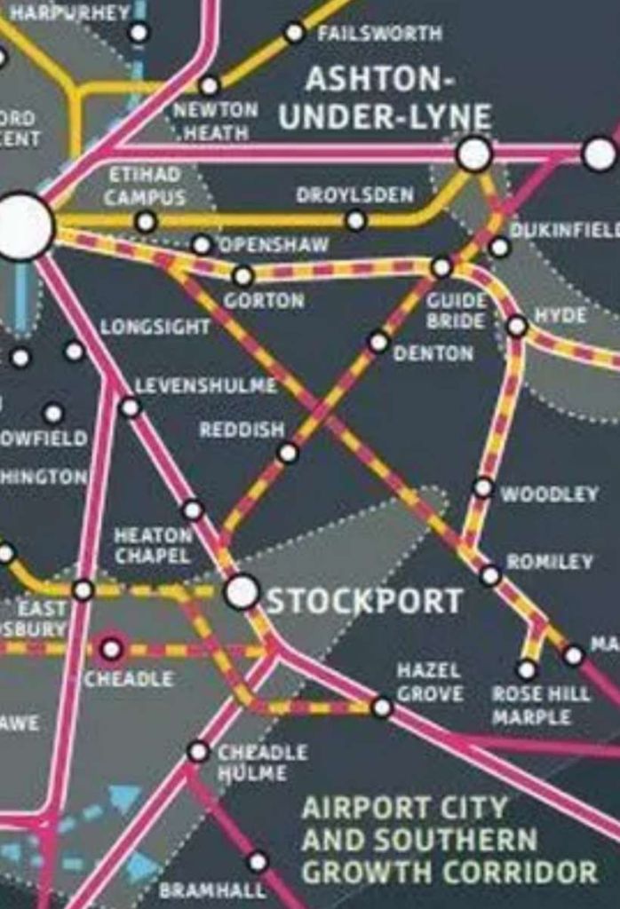
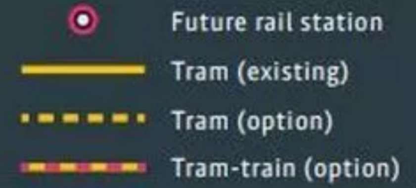
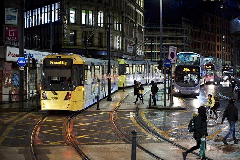
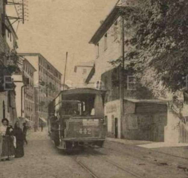
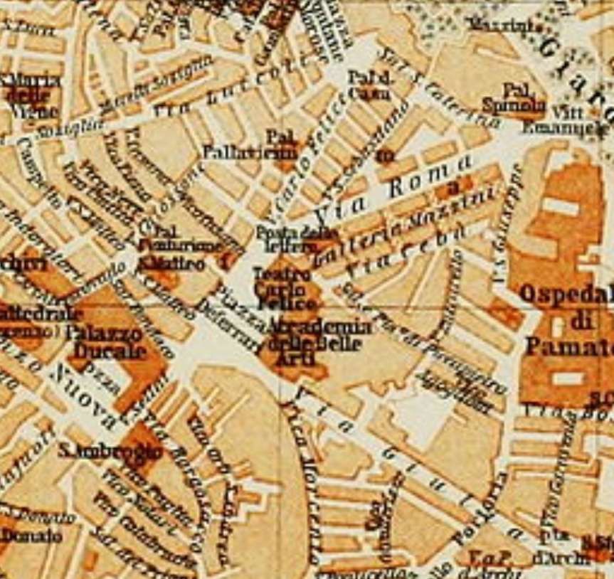
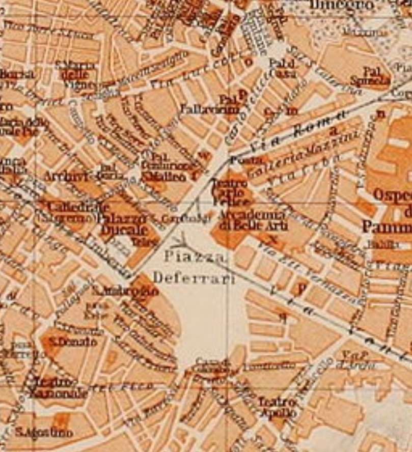


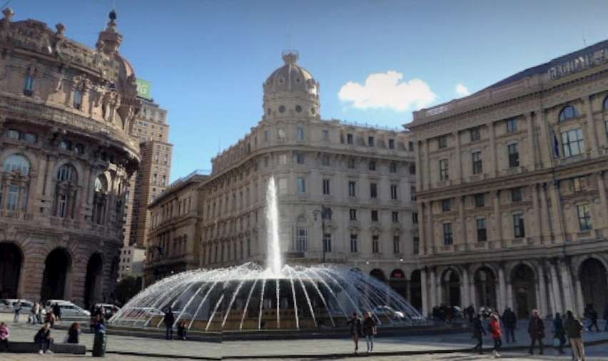
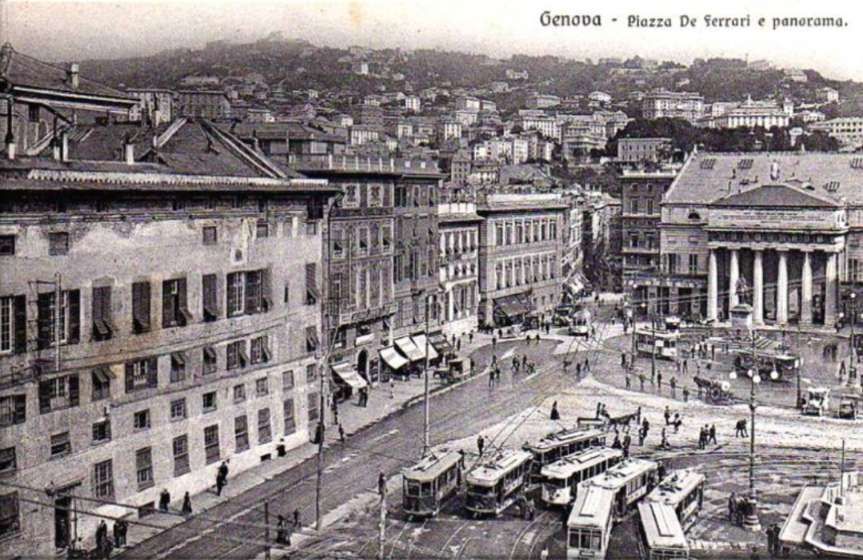
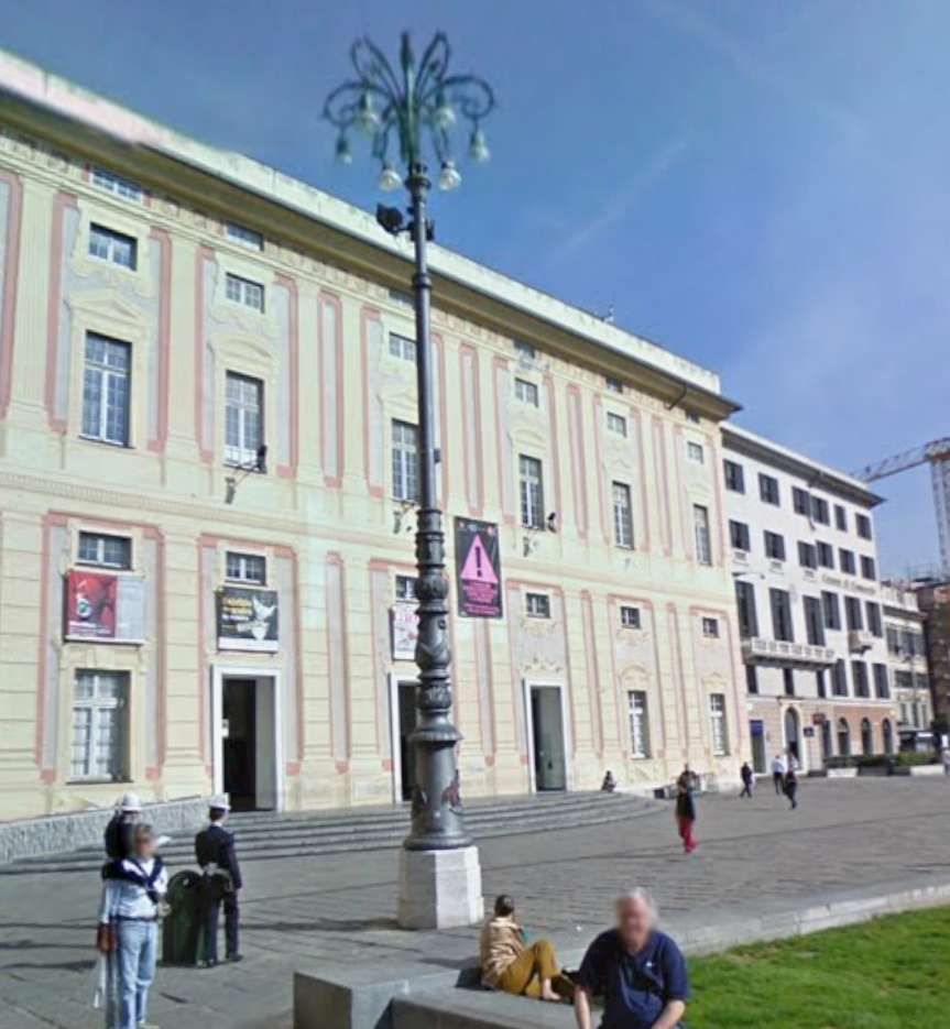
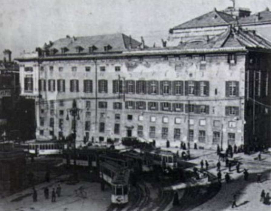

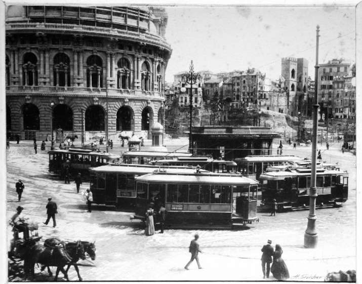


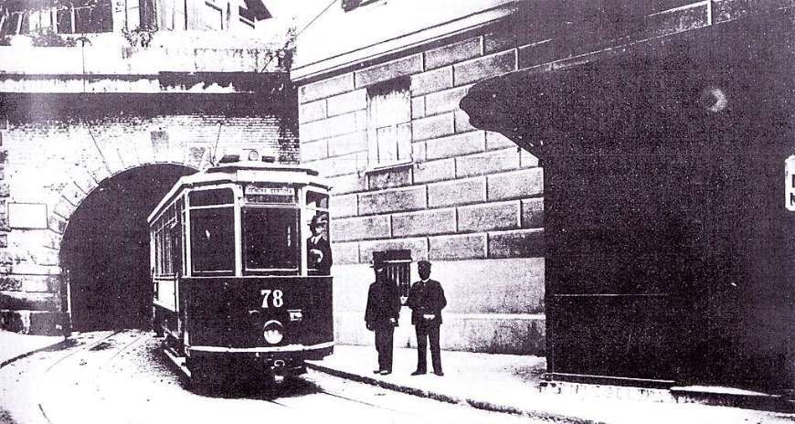
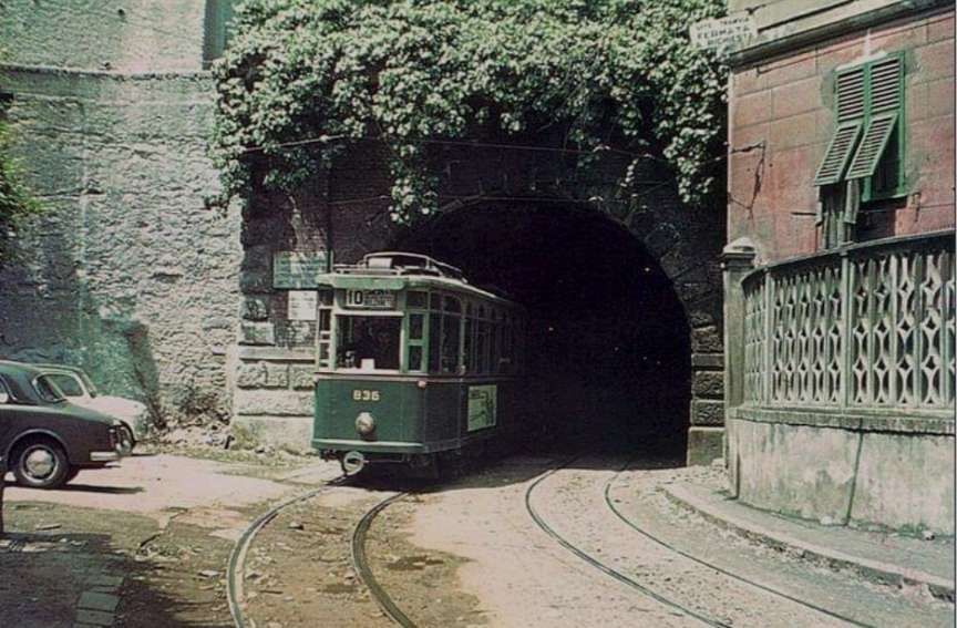
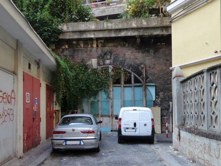
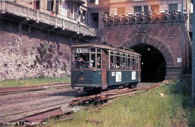
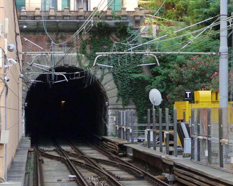
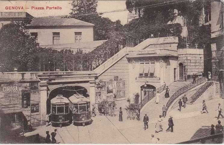
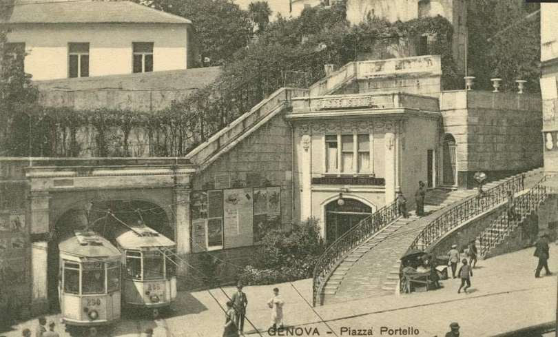
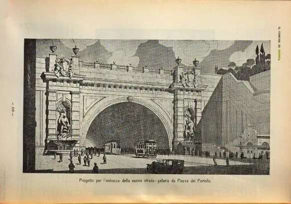
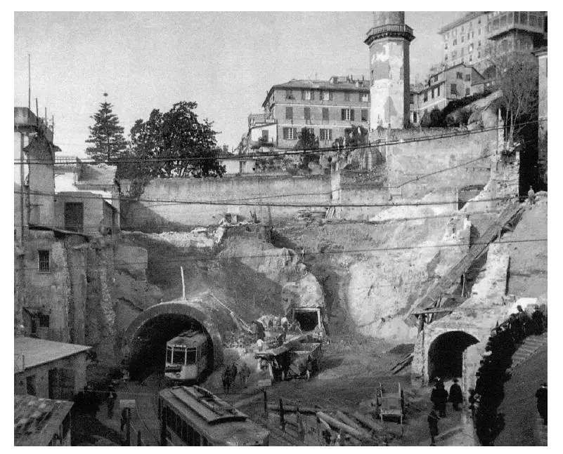
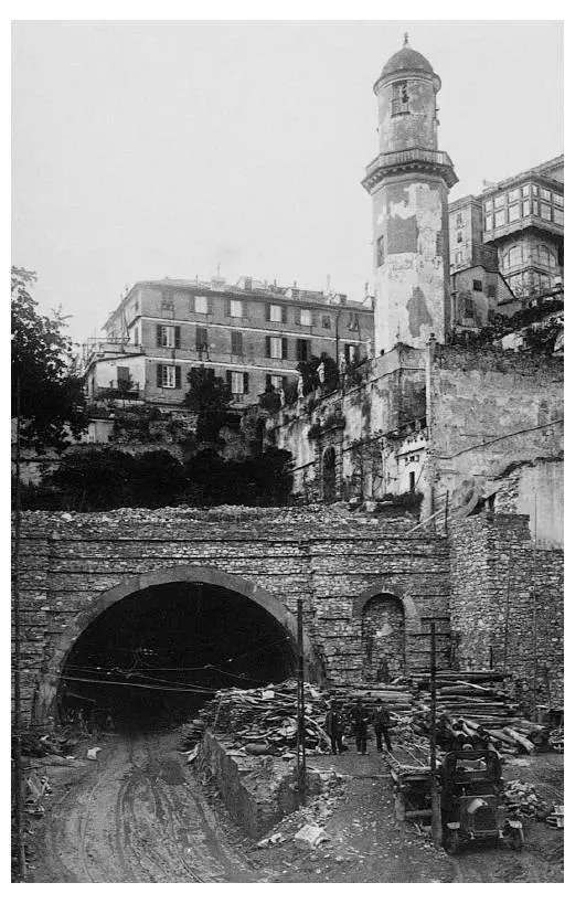
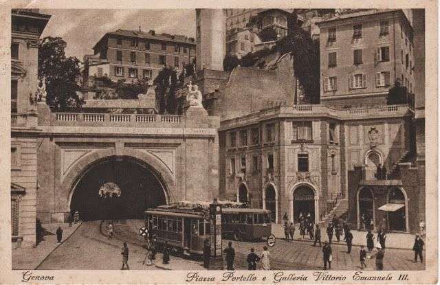
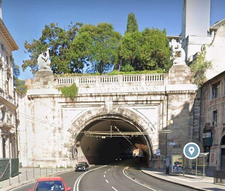
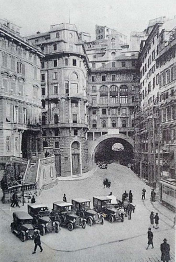
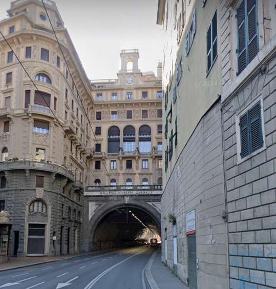
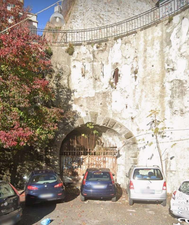
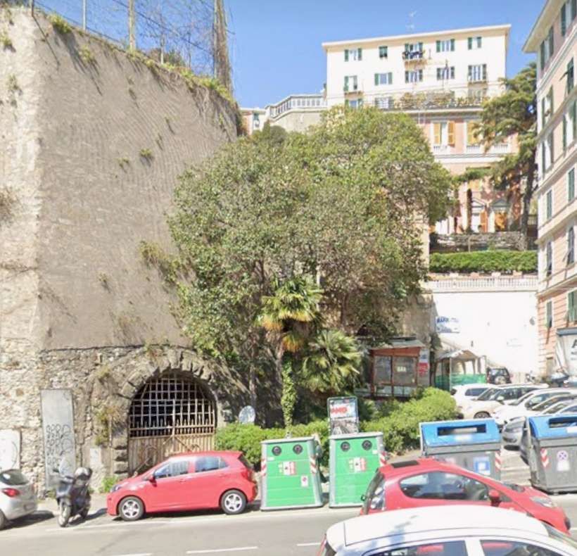
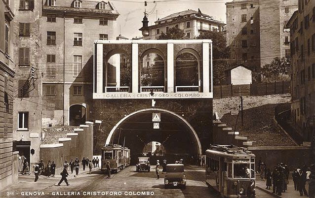


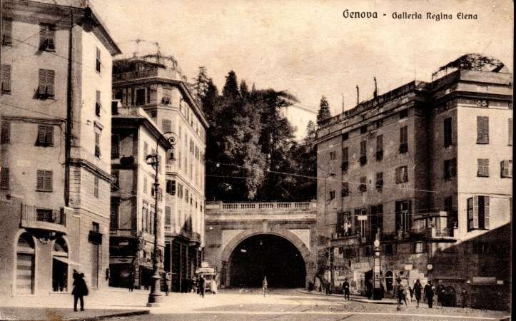
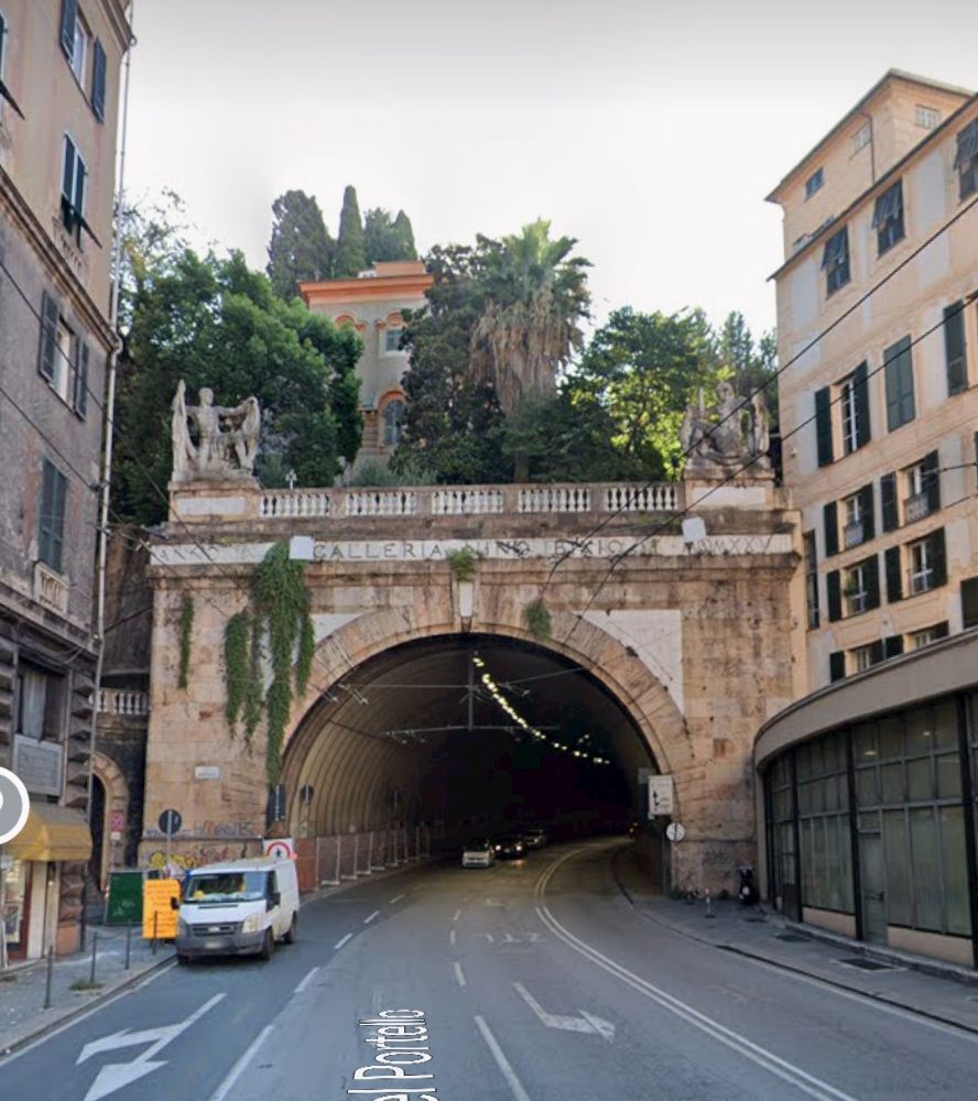
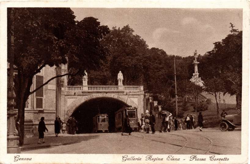
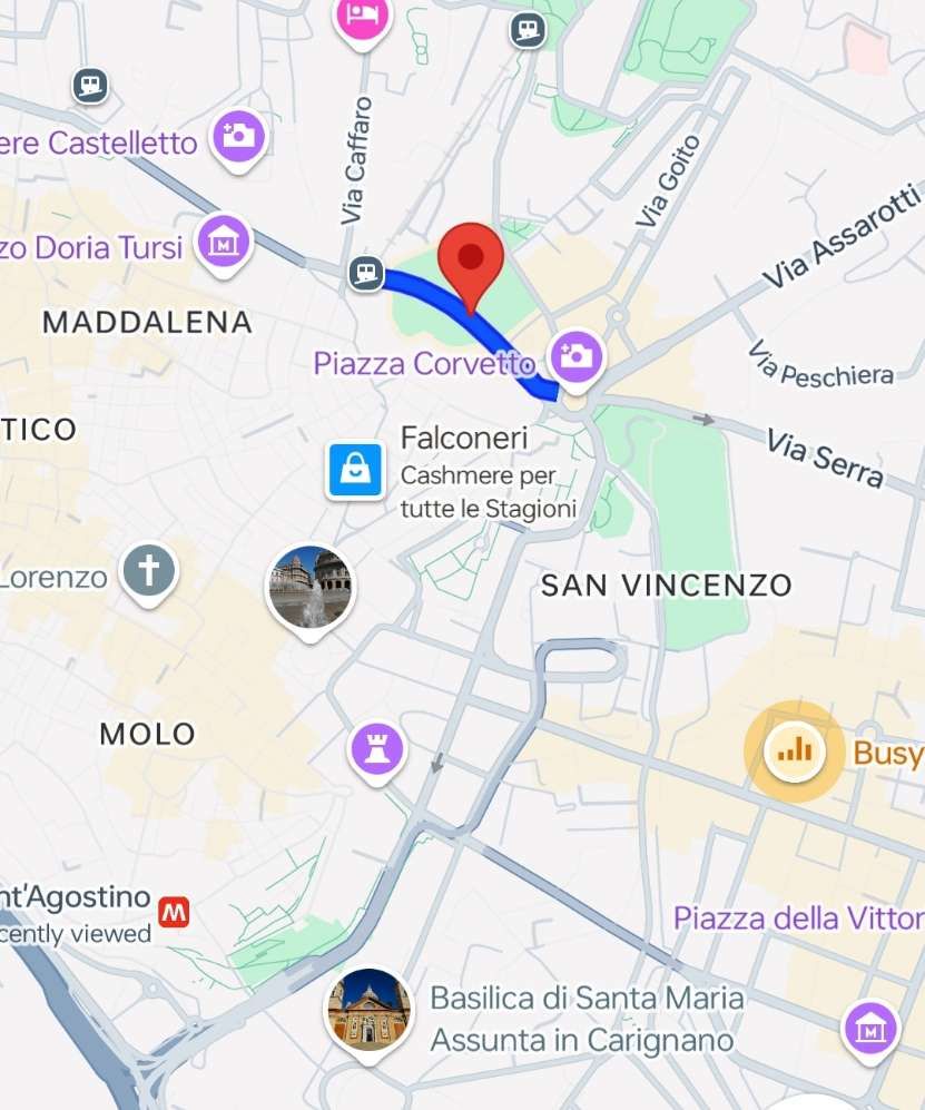
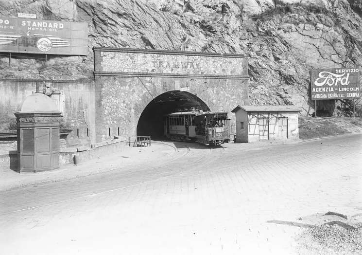
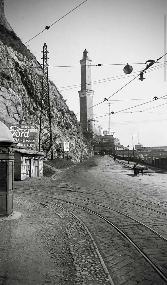
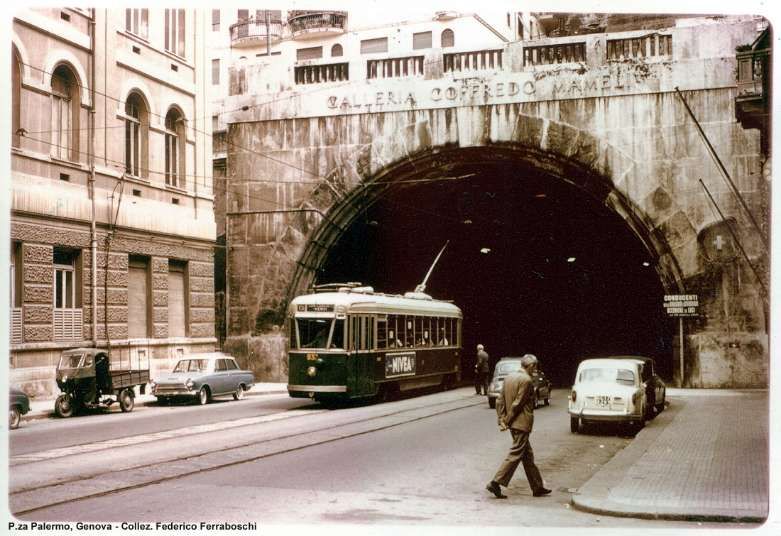
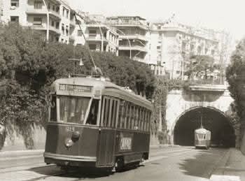
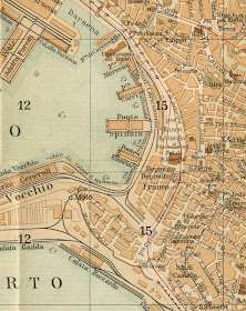

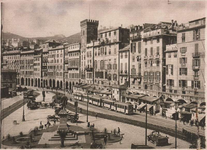
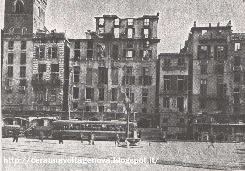

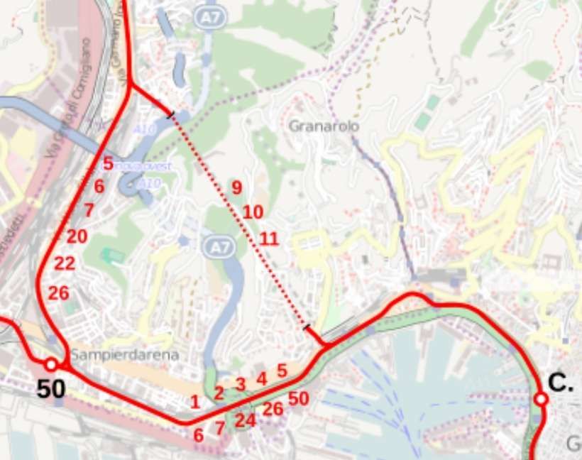

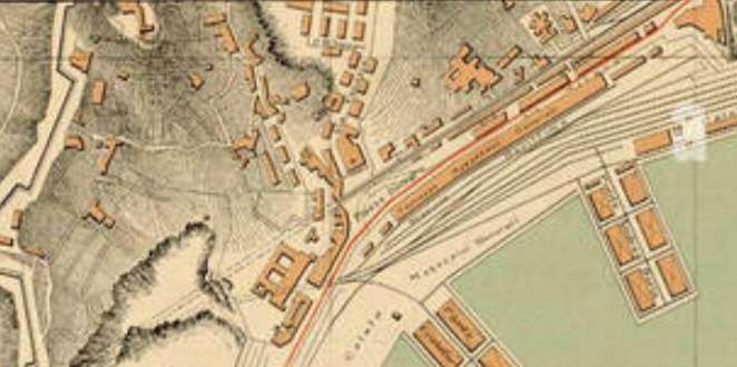
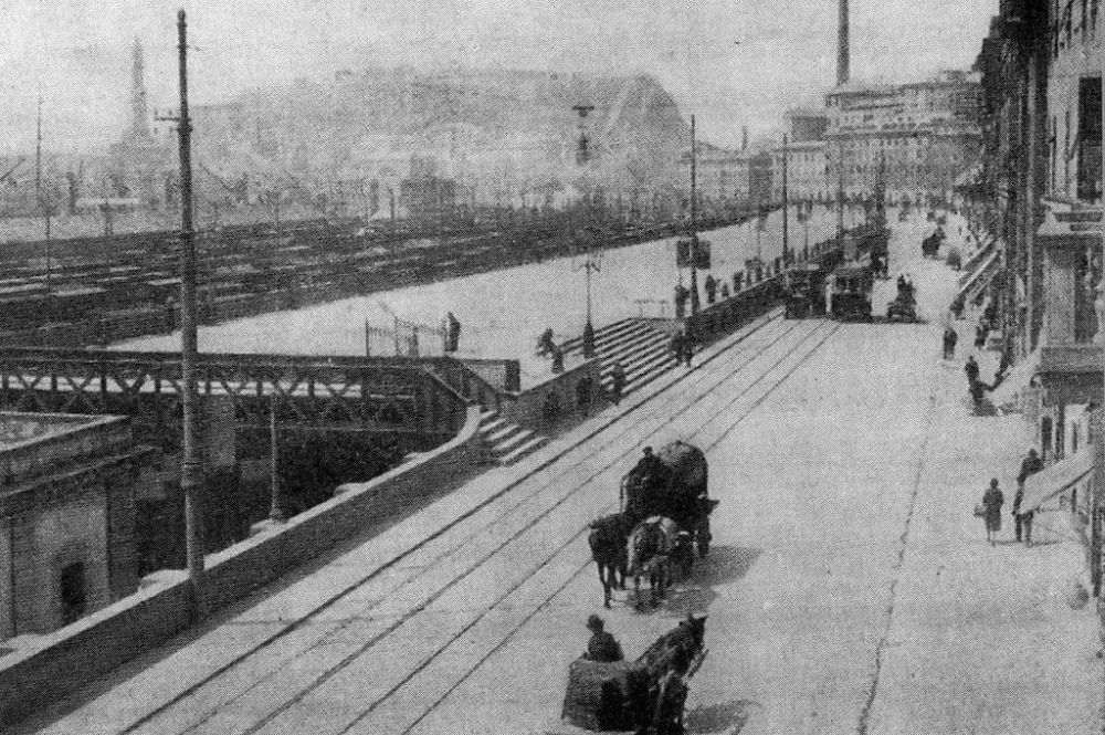
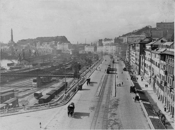
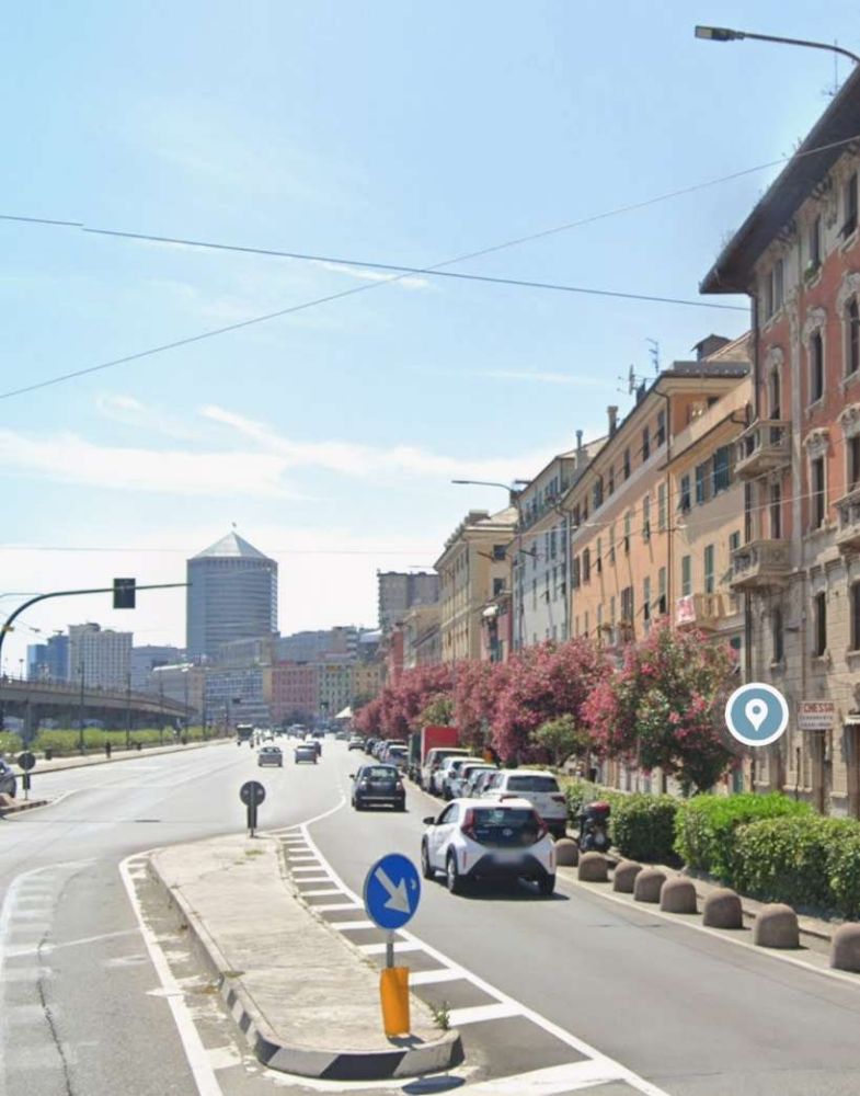
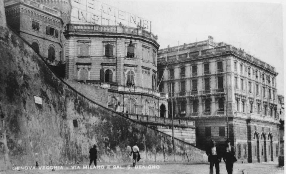
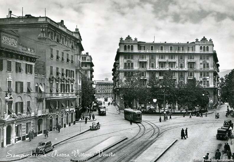
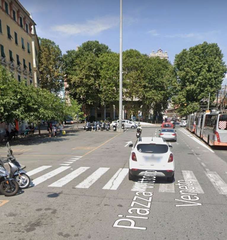
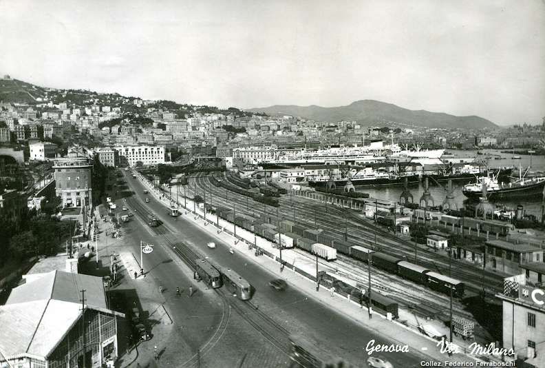
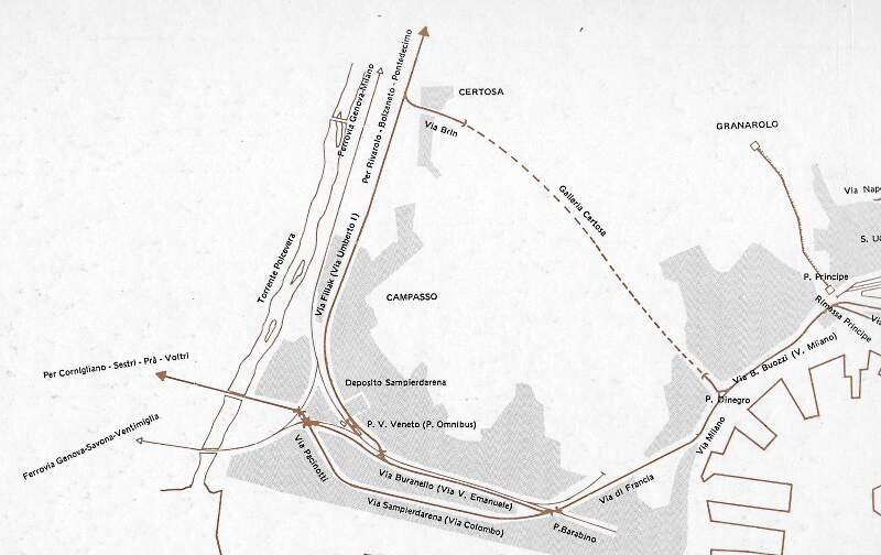
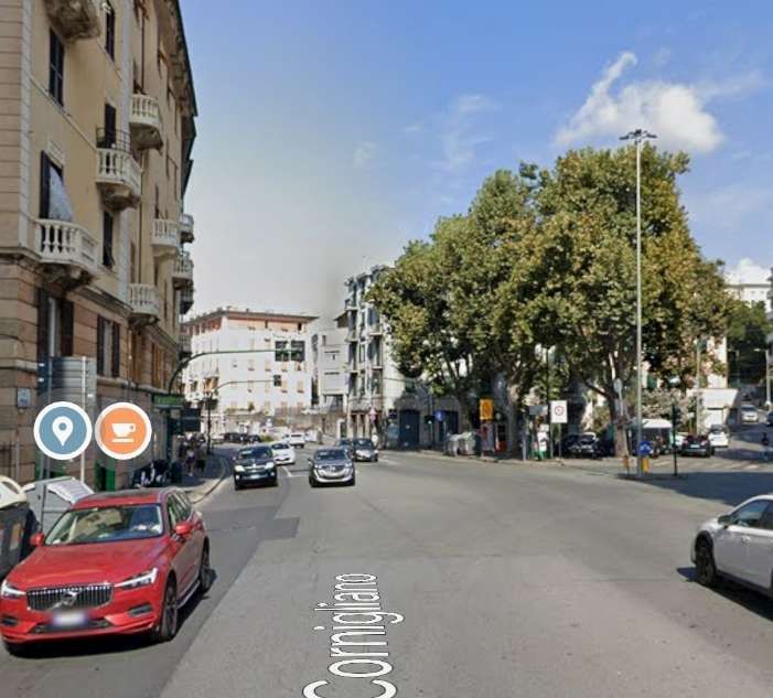

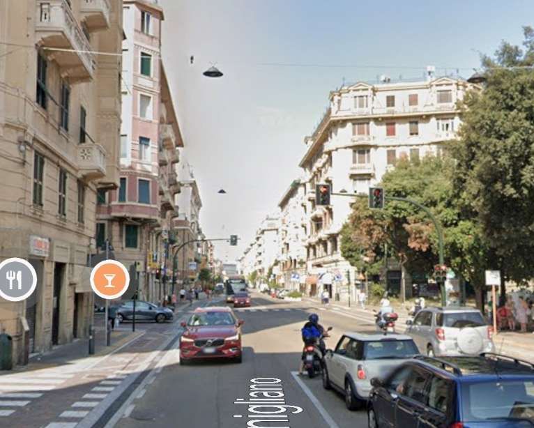
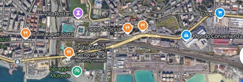
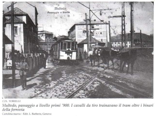
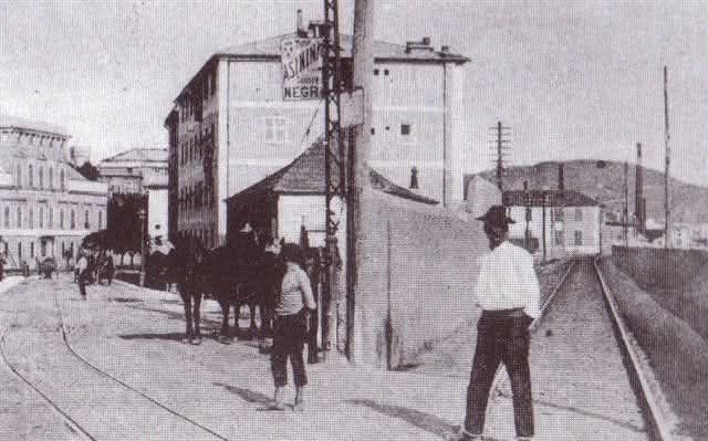
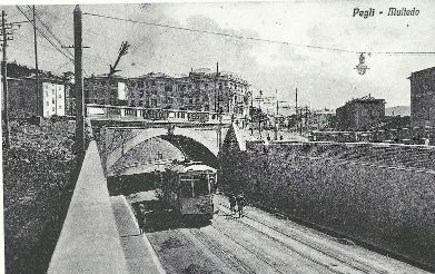

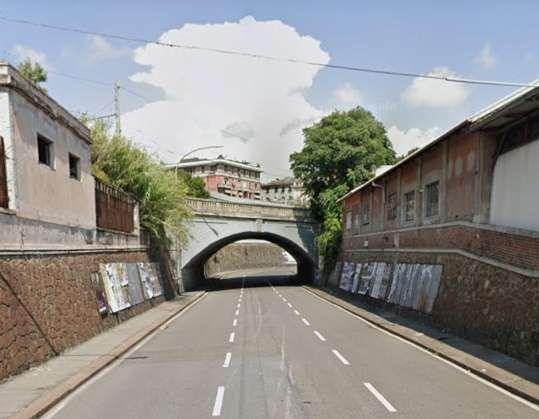
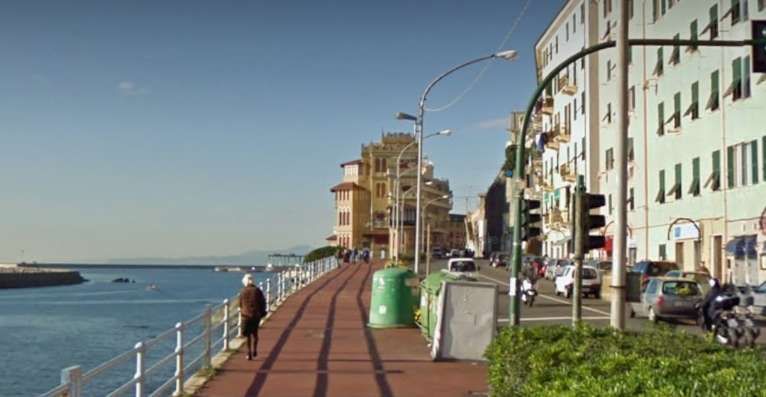
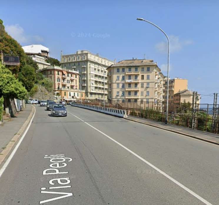
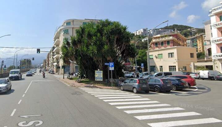
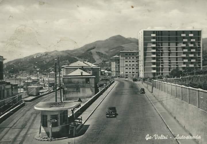

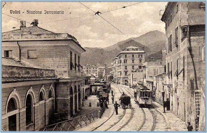
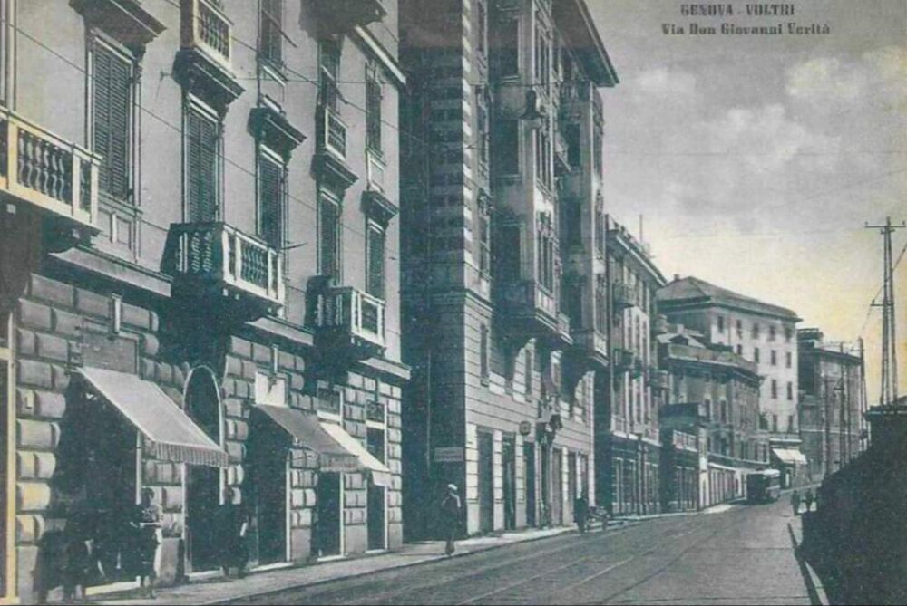
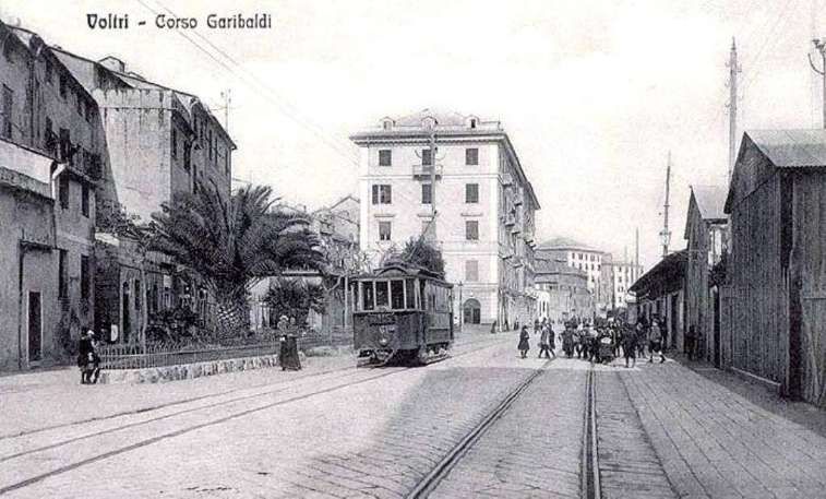
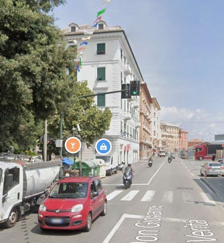

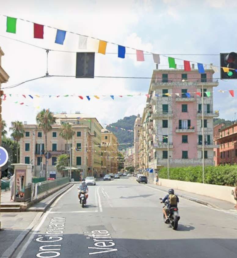
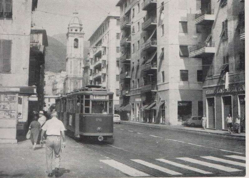
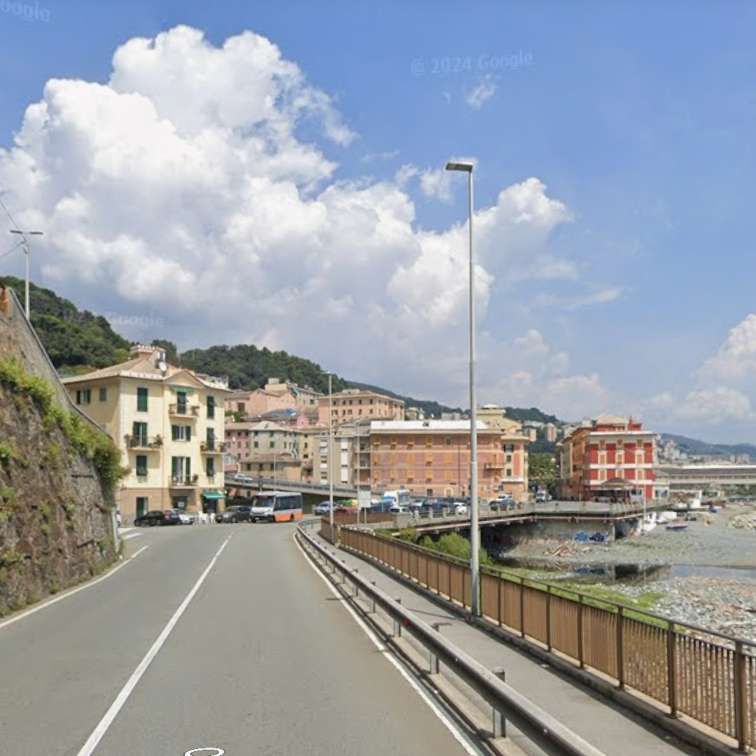
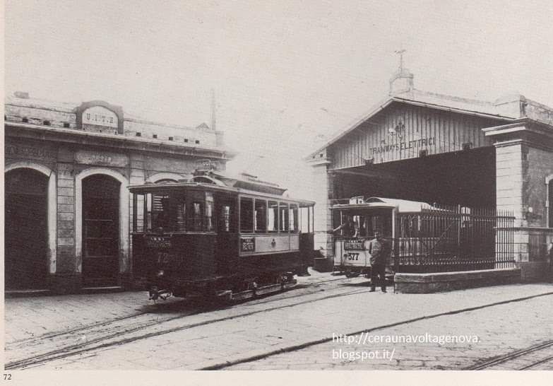
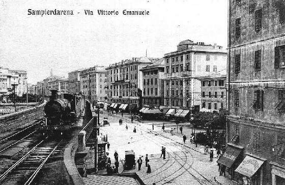
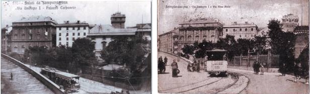
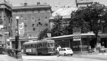
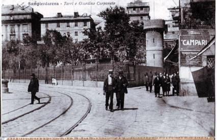
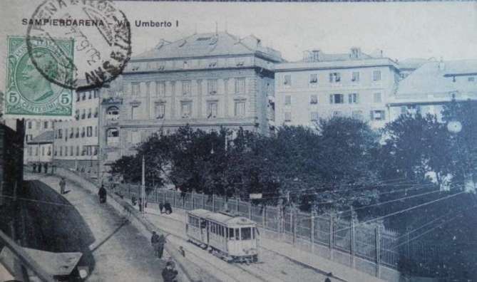
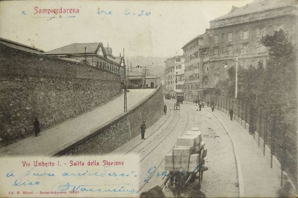
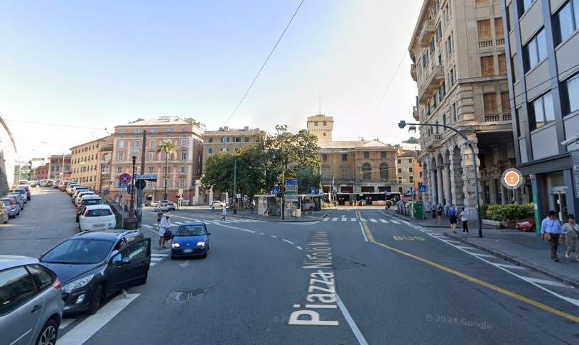
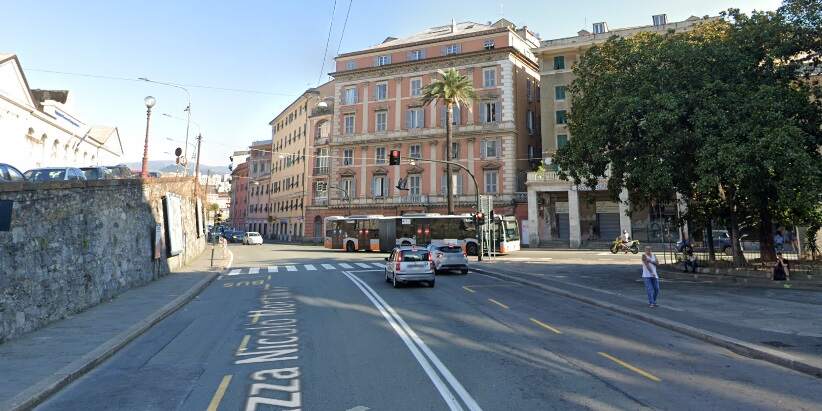
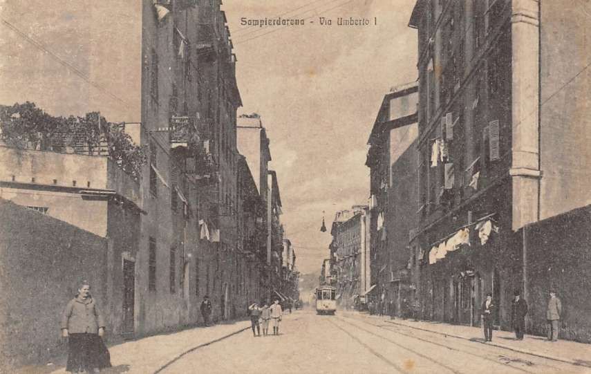
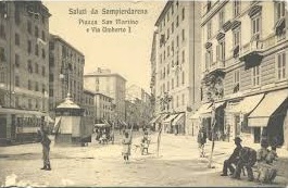
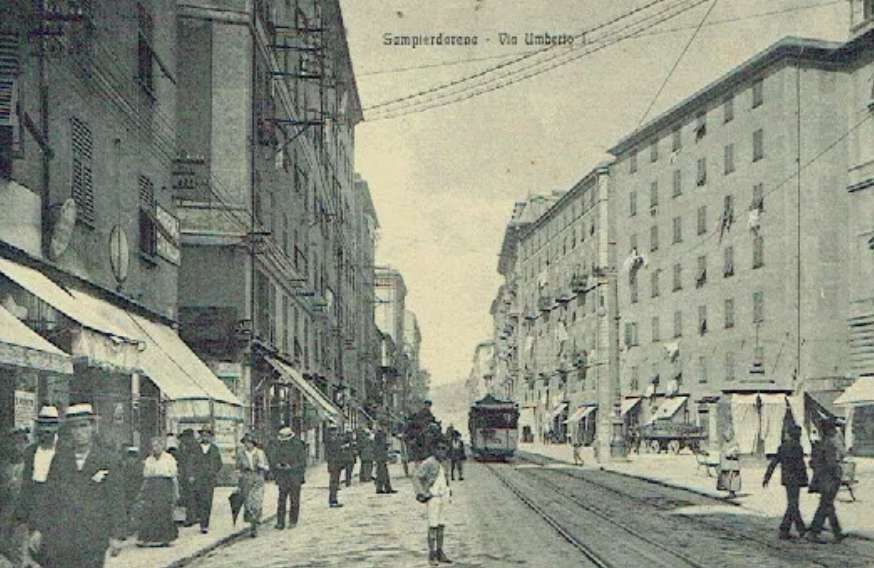
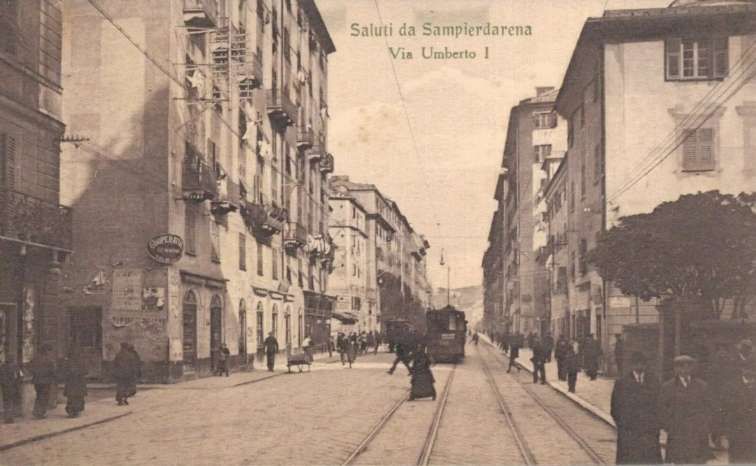
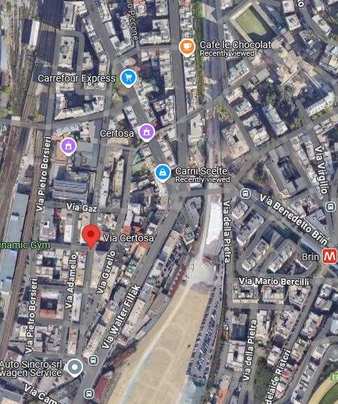
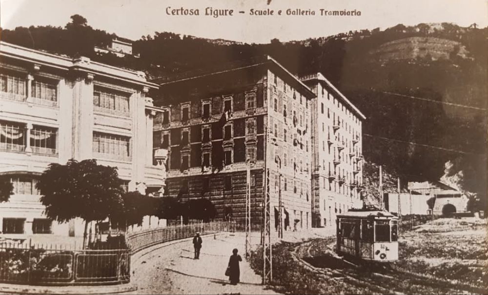
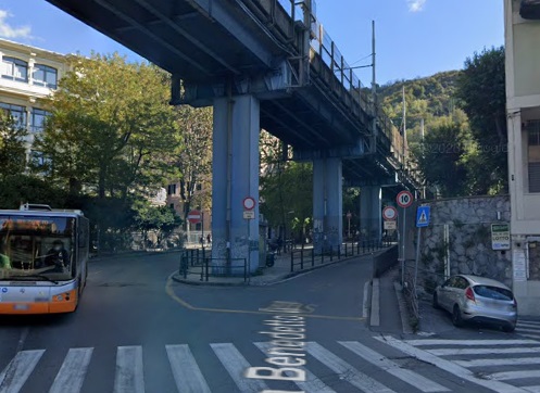
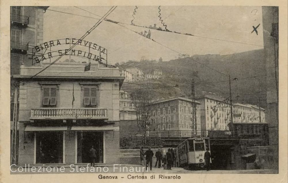
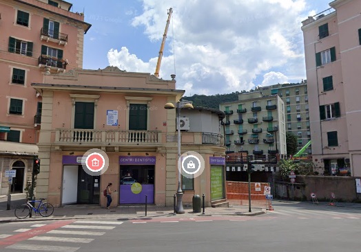
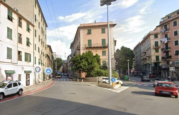
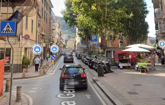
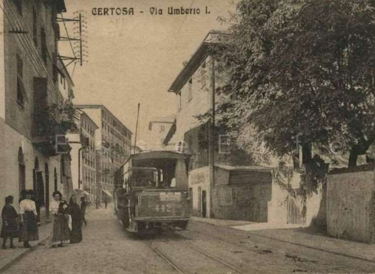
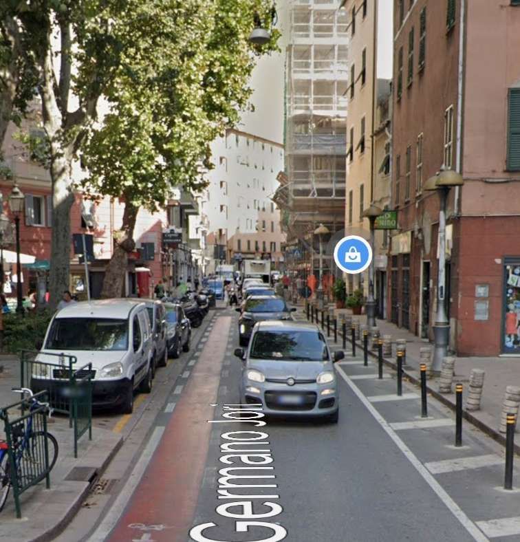
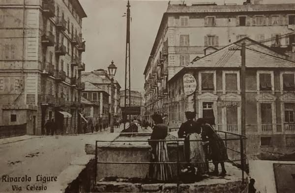
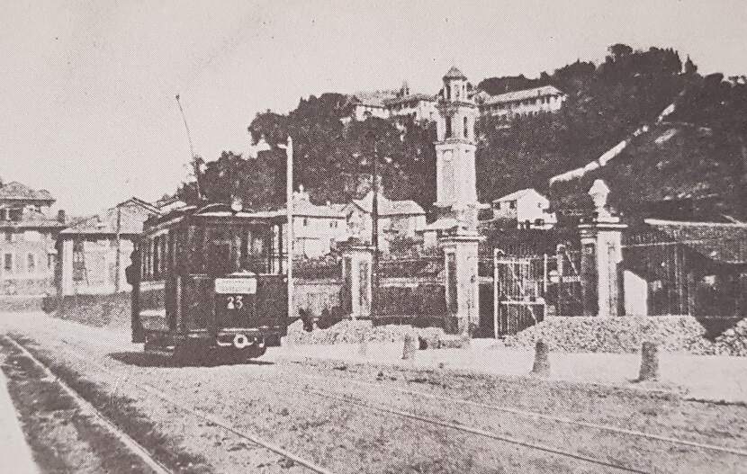
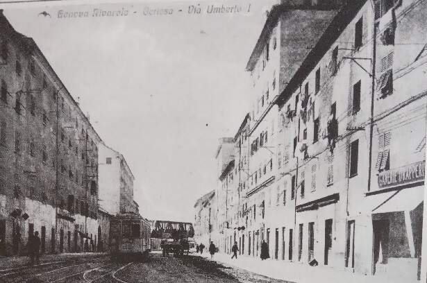
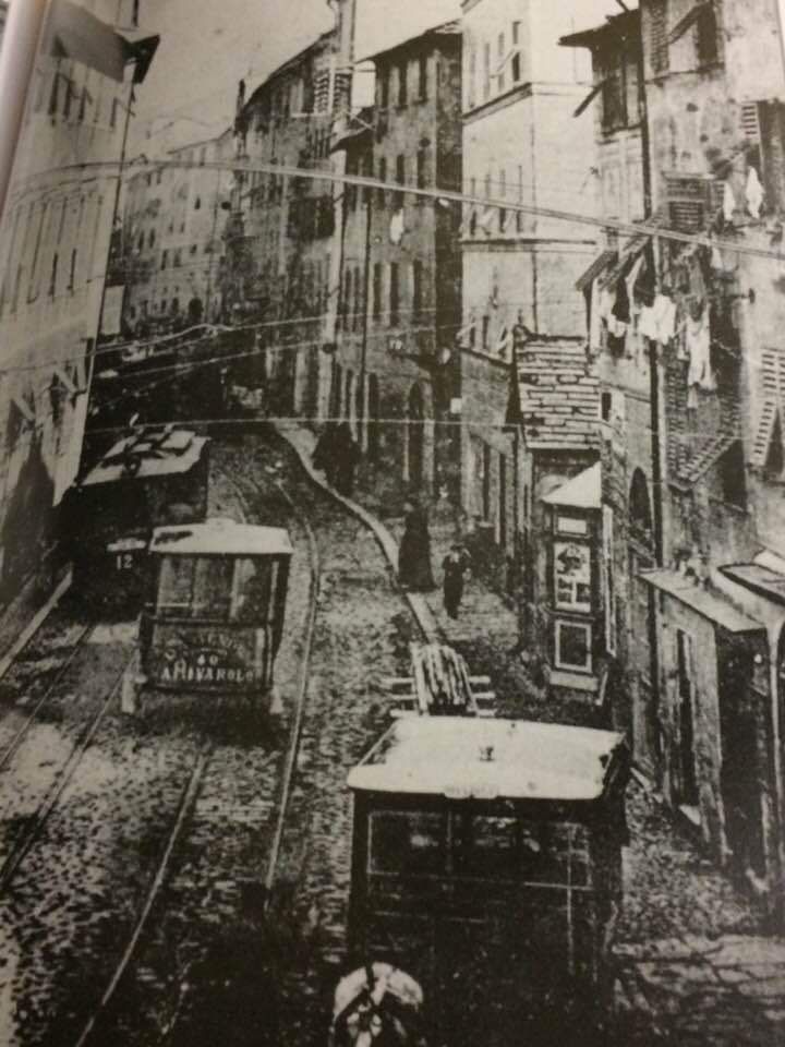
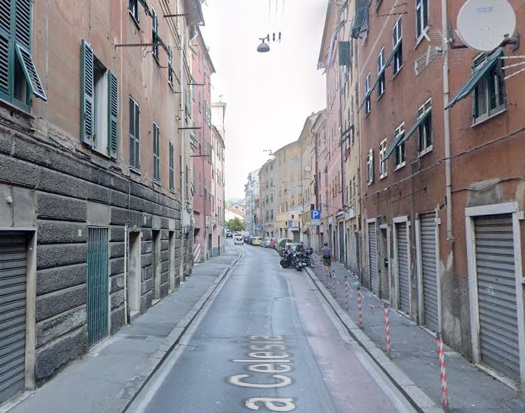
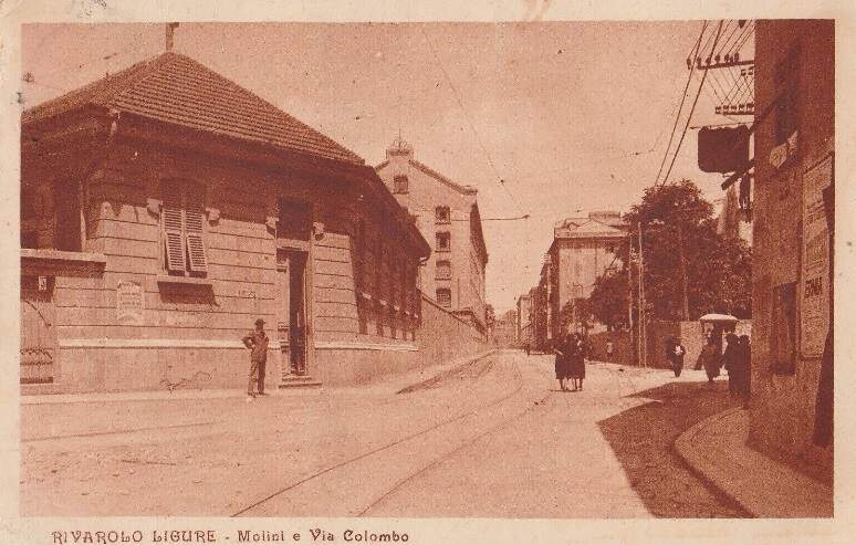
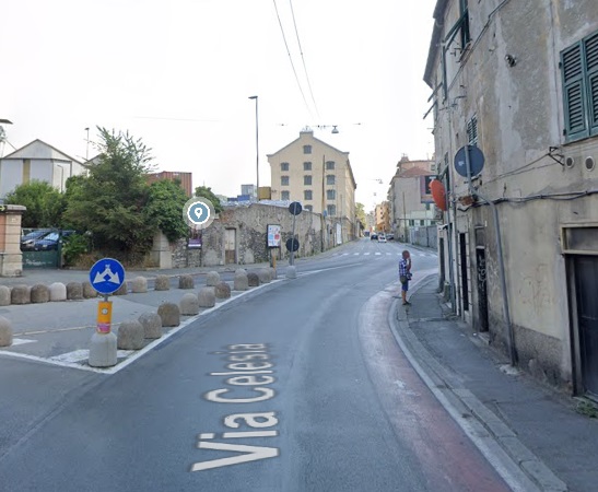
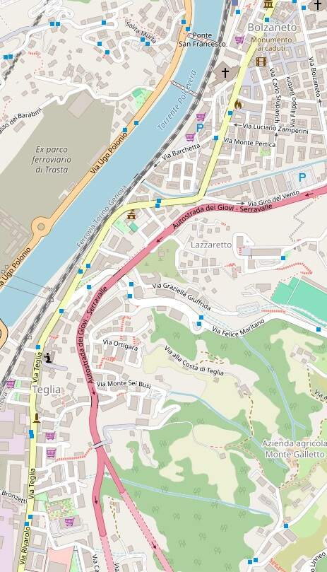
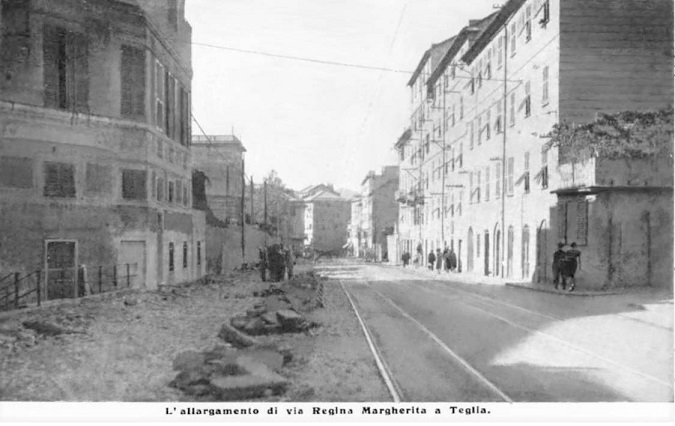
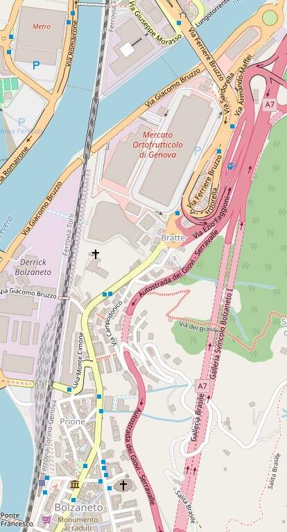
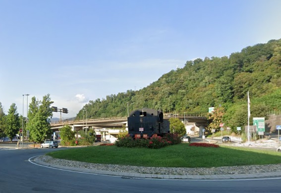
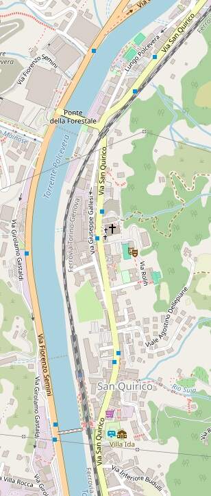
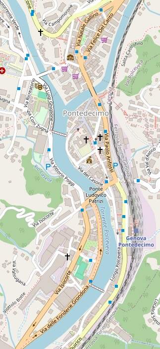
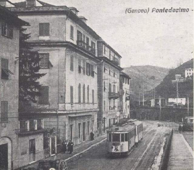
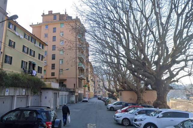
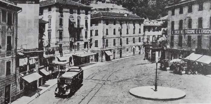
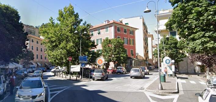
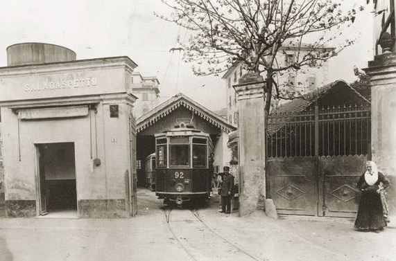

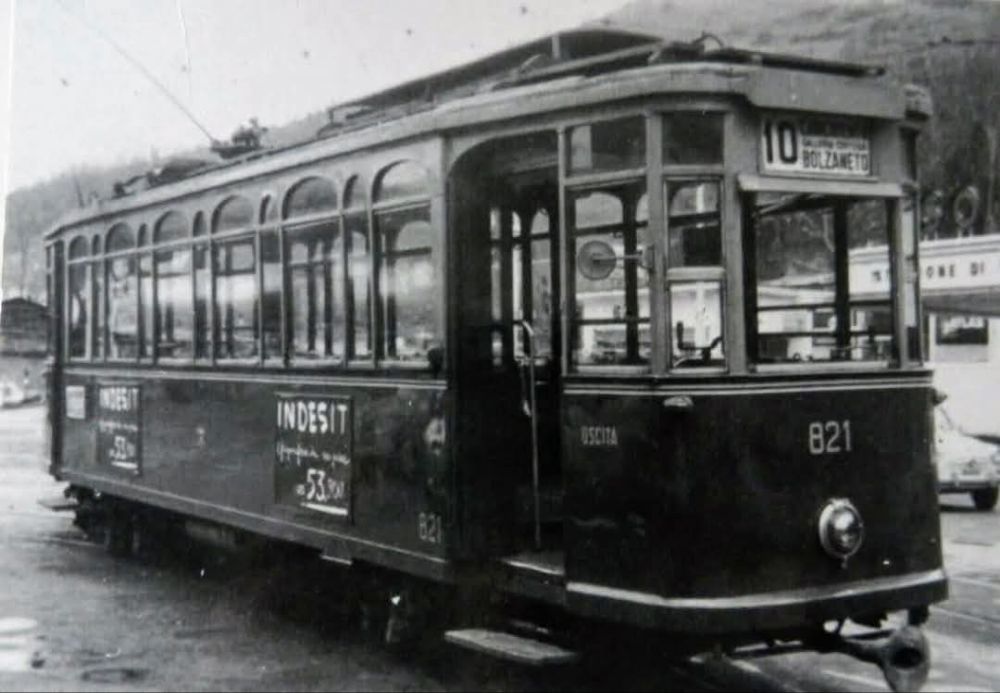
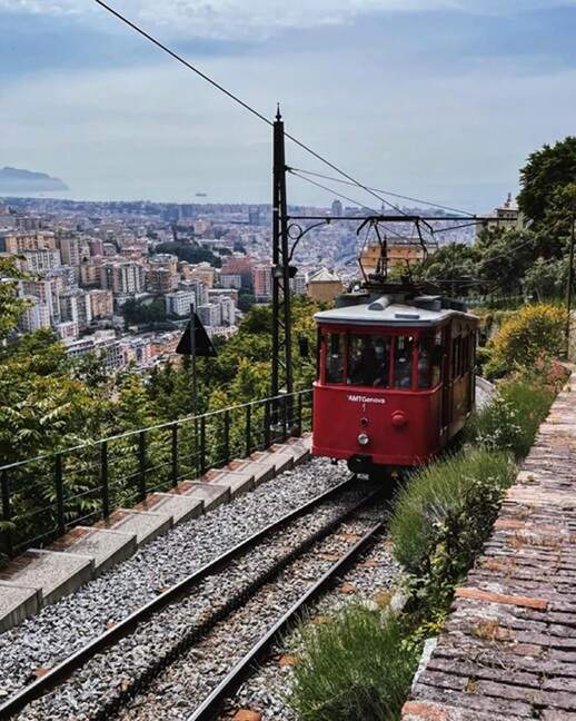
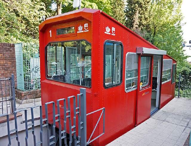
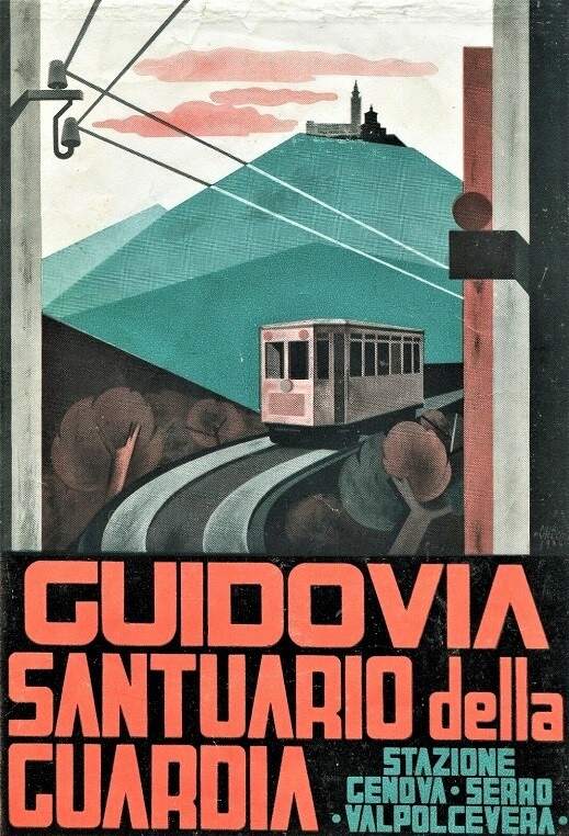
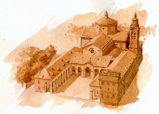
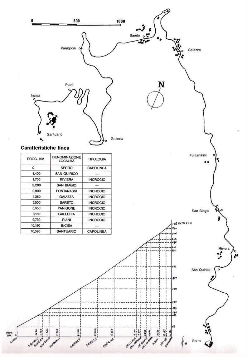
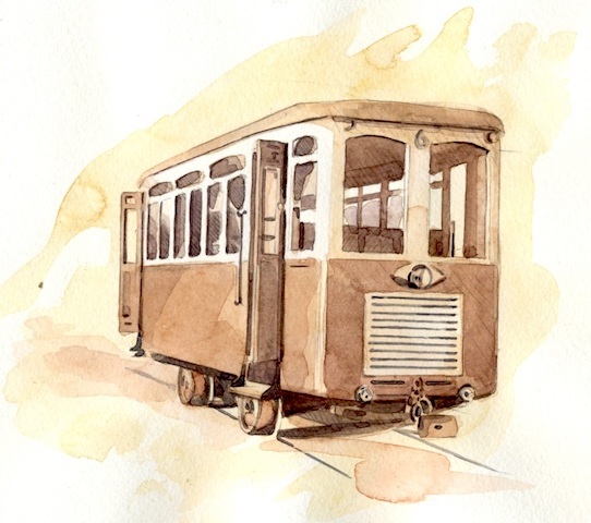
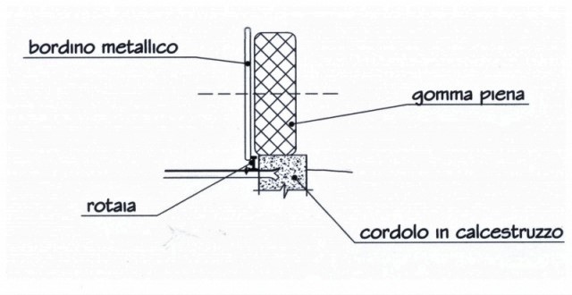
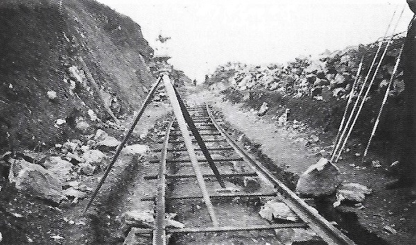
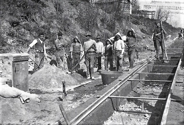
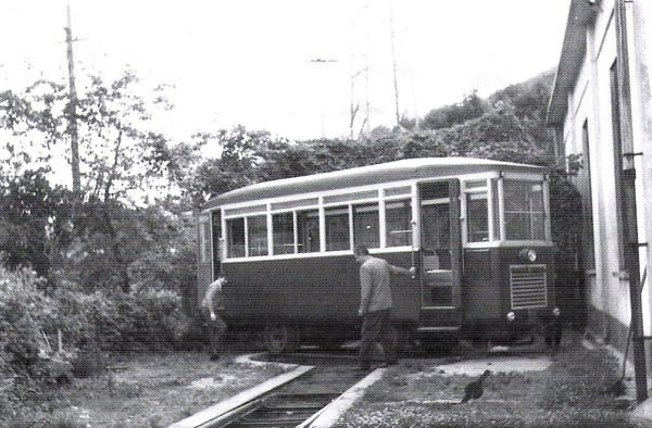
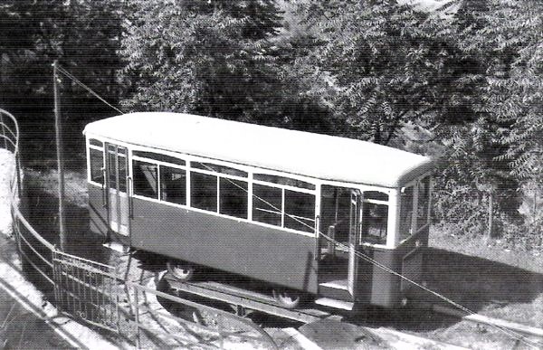
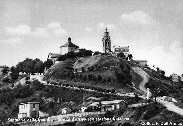
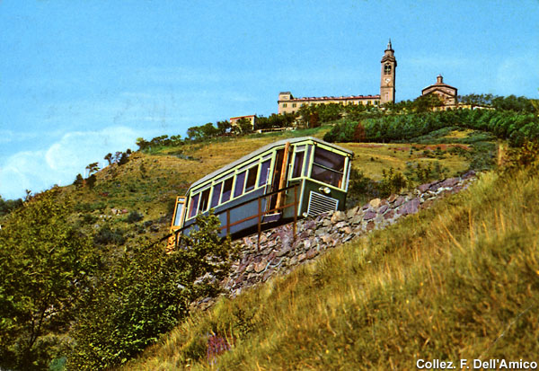
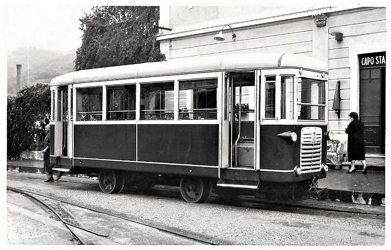
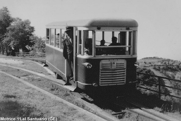
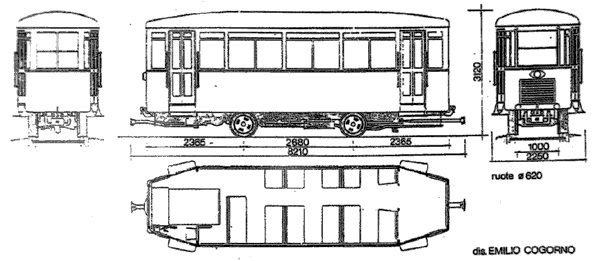
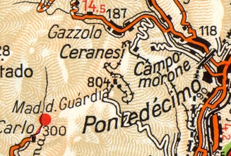
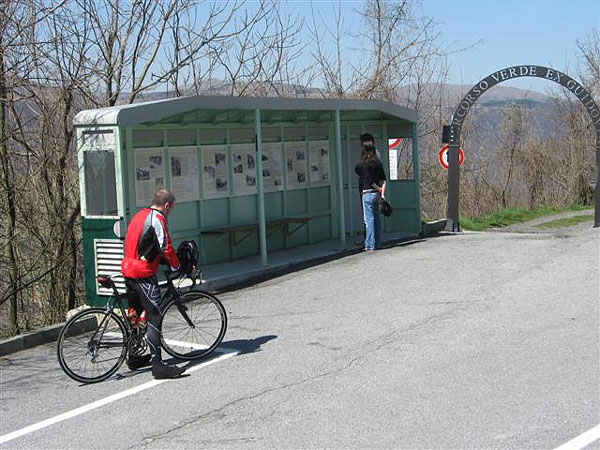

#/media/File%3AT_Lightrail_an_der_Station_Square_03.jpg)
?wprov=rarw1#/media/File%3ARed_Line_Car%2C_Beechview%2C_2015-09-10%2C_02.jpg)
?wprov=rarw1#/media/File%3ASilver_Line_(cropped).jpg)
_-_Flickr_-_James_E._Petts.jpg)