Tag Archives: LRT

The Modern Tramway – July 1951 – Pittsburgh: An American Tramway Stronghold

The Modern Tramway of July 1951 included an article by A. A. Jackson about the tramways of Pittsburgh. [1]

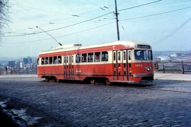
The featured image for this article is a vintage Presidents’ Conference Committee (P.C.C.) tramcar- No. 1604. It is from the 1600 series of P.C.C. cars, operated by Pittsburgh Railways and is pictured on Line 49 bound for Beltzhoover. This photograph was taken during the 1970s, © Voogd075 and licenced for reuse under a Creative Commons licence (CC BY-SA 3.0). [2]

Pittsburgh is situated at the point where the Allegheny and Monongahela rivers converge to become the  River Ohio, historically it is the most important Iron and Steel Centre in the United States.

Jackson wrote:

“It is also one of the greatest American Tramway strongholds. The present population of the city is just under 674,000 and the surrounding industrial area is densely peopled.

Public transport began in 1859, when the first horse cars ran, and up till 1902 there were a large number of competing tramway companies. In that year, these companies were brought together under the Pittsburgh Railways Company, which is still the operator today [(late ,1950)]. There are now 1,187 trams, 666 of them being P.C.C. cars. There are over 542 miles of 5ft. 2 in. gauge track. This network of 79 routes sprawls over the whole urban and suburban area, serving more than 50 communities from Sewickley in the west to Trafford and Pitcairn in the east and from Aspinwall and Etna in the north to Washington and Charleroi in the south. These latter two places are about 28 and 20 miles respectively from the centre of the city and the tramway routes serving them are of interurban character. The Charleroi line actually runs beyond that town to a point further south in the borough of Roscoe. It has a branch to Donora and California. Half-hourly service is provided on these two interurban lines.

“Many of the suburban routes have private right-of-way and reserved track.” [1: p160]
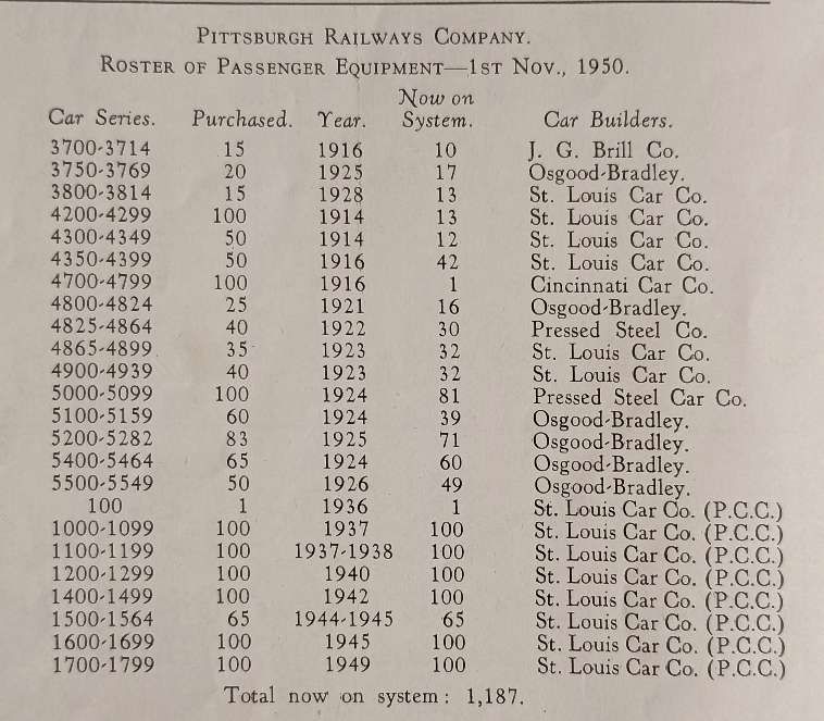
The tram fleet owned by the Pittsburgh Railway Company. [1: p160]
South Hills Junction, with P.C.C. car on service 37, © Public Domain. [1: p162]

“All tram services are designated by numbers (1 to 99, with gaps) and by names which usually indicate the district served or the principal street the route traverses, All-night cars operate in most districts between 1 a.m. and 5 a.m. “Car Stop” discs are attached to the overhead wire and at heavy loading points where more than one car loads at the same time, special signs are placed on the overhead wires reading: ‘First Car’, ‘Second Car’ and, in some cases, ‘Third Car’.

“The first P.C.C. car arrived on 26th July, 1936, and the remainder were delivered (all from the St. Louis Car Co.) as follows: 1937 (175 cars), 1938 (25 cars), 1940 (100 cars), 1942 (100 cars), 1944 (50 cars), 1945 (115 cars), 1948 (100 cars). Included in the 1945 batch was No. 1600, the first standard 1945 model all-electric, standee-window P.C.C. car to be produced. It was included as a sample model by agreement. (All subsequent P.C.C. cars ordered after 1945 were standardized to that design (with ceiling fans and monitor roof optional) replacing the electric-air operated, non-standee window P.C.C. design originating in 1935).” [1: p162]
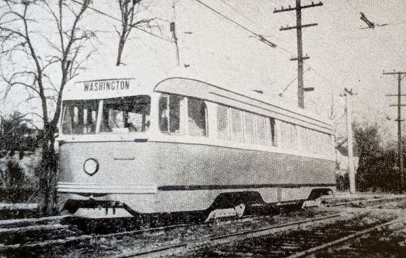
Interurban P.C.C. car No. 1613 at Cannonsburg, © Public Domain. [1: p162]

“Thirty-seven of the P.C.C. cars have been modified for interurban operation on the Washington and Charleroi lines. These modifications include replacing Clark B-2 trucks with St. Louis B-3 trucks, replacing H-B. lifeguard fenders with ‘cow-catchers’, provision of sirens, cash registers and an emergency tool kit over the windows ahead of the centre doors. The cars are also equipped with baggage racks. Some of the interurban P.C.C. cars are also equipped with radio telephones. Pittsburgh is the only system using single-ended, single-unit P.C.C. cars in long distance interurban service and the only system to use all-electric cars on this type of service. All Pittsburgh’s P.C.C. cars are one-man operated, with front entrance (P.A.Y.E.) and centre exit.” [1: p162-163]
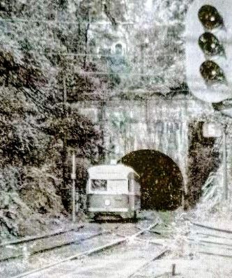
Tram No. 1614, emerging from the tunnel at South Hills Junction, running outbound from Pittsburgh to Washington Pa.) on the inter-urban route. This junction carries 6 city and 2 inter-urban services, all operated by PCC. cars. [1: p163]
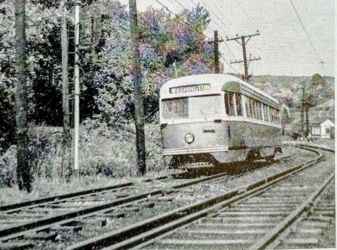
Tram No. 1647 outbound from Washington Junction to Washington (Pa.). This tramcar is one of 12 specially equipped for inter-urban service with type B3 trucks, siren, emergency tool kit and cash register. [1: p163]

At its height, the Pittsburgh Railways Company operated 666 P.C.C. streetcars, the third-largest fleet in North America, after Toronto (745) and Chicago (683). The network comprised 68 streetcar routes, of which three remain in operation in partially modernized form as part of the Pittsburgh Light Rail system. [3]

Financially, the Pittsburgh Railway Company struggled. Its lease and operate business model proved hard to support and the company declared bankruptcy twice, first in 1918 lasting for 6 years and then again in 1938, this time lasting until 1st January 1951. Company costs rose in the early twentieth century. PRC faced constant pressure from the city to improve equipment and services and workers would walk out when a pay raise was rejected.

When A.A. Jackson was writing about the network for The Modern Tramway, the company was still in bankruptcy.

On 26th July 1936, the PRC took delivery of P.C.C. streetcar No. 100 from the St. Louis Car Company. It was placed in revenue service in August 1936, the first revenue earning PCC in the world. The company went on to purchase a very large number of these vehicles in batches of 100 on most occasions. Jackson’s table giving details of the PRC fleet (above) shows that after purchasing car No. 100 in 1936: cars 1000-1099 were purchased/leased in 1937; cars 1100- 1199 were purchased/leased in 1937/1938; cars 1200-1299 were bought/leased in 1940; cars 1400-1499 arrived in 1942; cars 1500-1564 were purchased/leased in 1944/1945; cars 1600-1699 arrived in 1945; cars 1700-1799 arrived in 1949. During much of this time the PRC was bankrupt.

Despite the size of the network, it was not able to withstand the winds of change and large scale abandonments of lines began in the late 1950s, usually associated with highway or bridge work. [3]

As examples:

  • highway improvements in the Duquesne-McKeesport area resulted in the replacement of tram services with buses on 21st September 1958;
  • The replacement of the Point Bridge with the Fort Pitt Bridge precipitated the abandonment of many routes to the West End, all on 21st June 1959. In the end, the company had to abandon 27 miles (43 km) of street track in situ and was awarded $300,000 as compensation.

These events “marked the beginning of significant abandonments: 90 percent of the network was dismantled over the next decade.” [3]

A network that seemed to A.A. Jackson to have a bright future was by 1970 a pale shadow of the network in the early 1950s.

Similar things were happening in respect of the PRC Interurban network:

  • The Charleroi interurban line was cut back to the Allegheny County border at Library (Simmons loop) in June 1953. It continued to operate until the 1980s as 35 Shannon-Library and became the southern portion of 47L Library via Overbrook when Light Rail Vehicles (LRVs) replaced [trams]. The [tram] loop was removed in 2004. In 2010 this line became the Blue Line – Library, and in 2020 was renamed the Silver Line – Library.” [3]
  • The Washington line was cut back to the county boundary at Drake in August 1953 and eventually became the 36 Shannon-Drake. This in turn became the southern portion of 42 South Hills Village (excluding the new link from Dorchester to South Hills Village, which was built in 1984). The final portion of the interurban from Dorchester to Drake was renamed 47 Drake, finally closing in 1999 and bringing to an end P.C.C. Streetcar operation in Pittsburgh.” [3]
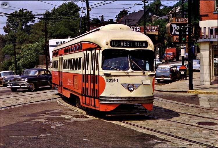
P.C.C. No. 1791, route 10 West View. [4]

Pittsburgh Light Rail

The Pittsburgh Light Rail is the successor to the original Pittsburgh Railway Company. Some residual parts of the old network are in use as part of the Pittsburgh Light Rail system.

The Pittsburgh Light Rail (commonly known as The T or the Trolley) is a 26.2-mile (42.2 km) light rail system in Pittsburgh, Pennsylvania, serving the city and surrounding suburbs. The system operates as a deep-level subway in Downtown Pittsburgh, but runs mostly at-grade in suburban areas south of the city. It is largely linear in a north–south direction, with one terminus near the central business district and two termini in the South Hills. The system is owned and operated by Pittsburgh Regional Transit.” [5]
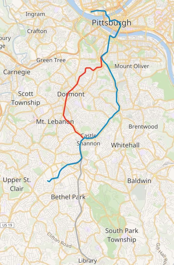
The Pittsburgh Light Rail network is made up of three lines – the Blue Line, the Red Line and the Silver Line. This map shows the three lines superimposed on an OpenStreetMap base layer. [6]

The system is one of the surviving first-generation streetcar systems in North America, with portions of the network dating to 1903, when they were operated by the Pittsburgh Railways Company. It is one of three light rail systems in the United States that continues to use the broad 5 ft 2 1⁄2 in (1,588 mm) Pennsylvania trolley gauge rather than the 4 ft 8 1⁄2 in (1,435 mm) standard gauge. In 2025, the system had a ridership of 3,104,400.” [5]

On 1st March 1964, the PRC system “was acquired by the newly established Port Authority of Allegheny County (PAT), which also assumed operations of more than 30 other transit companies in the region, including bus operators and the incline lines. The state hoped the consolidation would help stabilize the system as the private companies all had separate fare structures, labour agreements, and, in some cases, overlapping routes, while ridership had declined in the preceding years.” [5]

PAT undertook a program of consolidation and modernisation. MOT tram routes were converted to bus operation which it believed reflected lower operating and maintenance costs and reduced capital requirements. “By the early 1970s, only a small number of trams routes remained, primarily those using the Mount Washington Transit Tunnel to reach the South Hills, retained in part because they operated on private rights-of-way separate from street traffic.” [5]

PAT also planned to introduce guided busways. The programme was given the name ‘Skybus’. However investment was curtailed in the late 1970s because of public opposition.

Stage I

Planning shifted toward reconstructing the remaining tram lines as a modern light rail system, resulting in a ‘Stage I’ plan, the first phase of a broader program to develop a new light rail network. “The project included reconstruction of the Beechview line, construction of a short branch to South Hills Village, and a 1.1-mile (1.8 km) subway through downtown. Reconstruction of the existing line included double-tracking formerly single-track segments, replacing jointed rail with continuous welded rail, and upgrading the overhead power system to modern catenary.” [5]
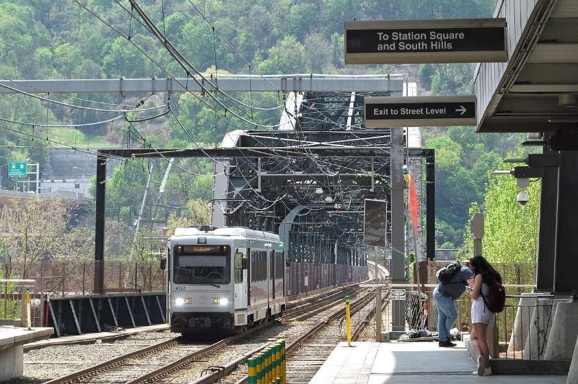
A Blue Line train crosses the Panhandle Bridge and approaches First Avenue station in April 2023, © Cbaile19 and licenced for reuse under a Creative Commons licence (CC0). [8]

“Only the busiest stops were rebuilt with high-level platforms, while lower-ridership stops retained low-level, street-level boarding. Because this work preceded the Americans with Disabilities Act of 1990, full systemwide accessibility was not required. The design also allowed continued operation of P.C.C. cars on unmodified portions of the network, with some shared stations providing both high- and low-level boarding.” [5]

Construction started at the end of 1980. The first modern light rail cars began operating on 15th April 1984. A full service across the subway, the rebuilt Beechview line, and the South Hills Village branch was operating by July 1985. [5]

Funding for upgrades to the segment of the line between Castle Shannon and South Hills Junction was approved in May 1985, including $20 million in federal grants. The entire Stage I project was declared complete on 22nd May 1987, at a total cost of $522 million, which included the purchase of 55 light rail vehicles. [5]
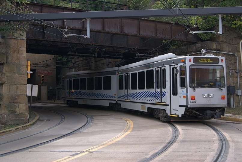
Southbound Blue Line train departs Station Square, heading into the Mount Washington Transit Tunnel. The Blue Line operates between Pittsburgh’s North Shore and South Hills Village via Downtown and the neighborhoods of Knoxville and Overbrook, as well as Castle Shannon and Bethel Park. The line operates over the Overbrook line and the South Hills Village line, © kaffeeeinstein and licenced for reuse under a Creative Commons licence (CC BY-SA 2.0). [9]

Stage II – The Overbrook Line

“The line from South Hills Junction to Castle Shannon via Overbrook (now called the Overbrook Line, part of the Blue and Silver lines) was first constructed by the Pittsburgh and Castle Shannon Railroad (P&CSRR) between 1872 and 1874. In 1905, Pittsburgh Railways leased the route, and between 1909 and 1910, converted it to dual gauge, retaining the existing narrow gauge for the coal-hauling trains and adding the broad 5 ft 2 1⁄2 in (1,588 mm) Pennsylvania tram gauge for passenger service using trams (streetcars). While the line was electrified with overhead power, the coal trains continued to use existing steam locomotives.” [5]

The Beechview line was rebuilt during the 1980s, but the Overbrook line remained largely unchanged and continued to be operated using P.C.C. cars. “The reconstruction of this line would be part of the Stage II project, to be performed at a future date pending additional funding. However, the condition of the track and infrastructure of the Overbrook line continued to deteriorate and in 1993, Pittsburgh Regional Transit determined the line to be unsuitable for safe operation in its current state and suspended service on the line. The line remained dormant until 1999, when the PRT broke ground on the Overbrook Line reconstruction project.” [5]

The rebuilt Overbrook line was essentially an entirely new line built along the original line’s right of way. As had been done with the Beechview line prior, the rebuilt line was completely double-tracked with continuously welded rail, pandrol clip fixation, upgraded catenary and signaling, and other improvements. The rebuilt line included eight accessible stations with high-level platforms; unlike the Beechview line, no street-level stops were retained. The Overbrook line reopened in June 2004, at a total cost of $386 million, including the cost of purchasing 28 LRVs. Coinciding with the opening, Pittsburgh Regional Transit purchased 28 additional light rail cars to support the line and increase overall system capacity. At this time, the 55 existing cars were completely rehabilitated as well. In addition, as part of the Stage II project, upgrades to the traction power network, Operations Control Centre, and signals and communications had been implemented.” [5]
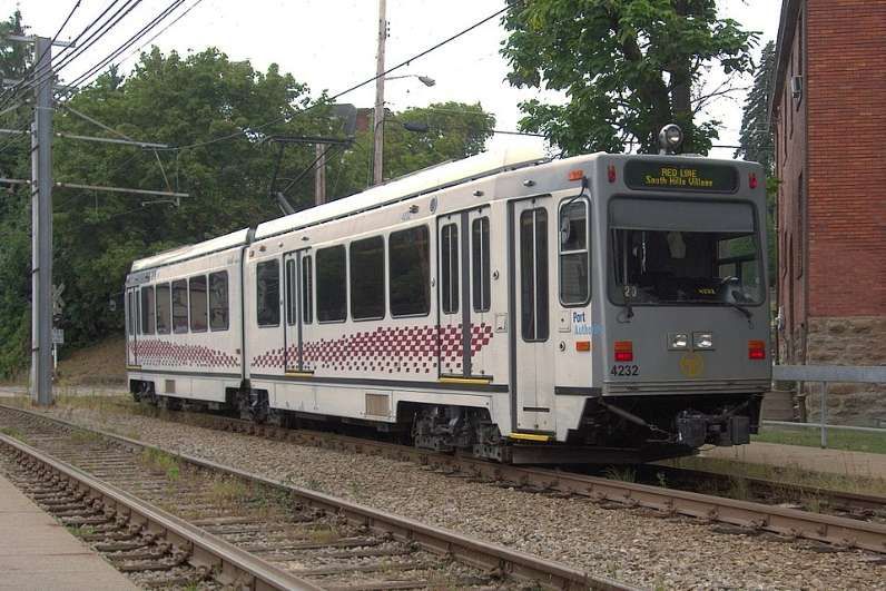
Southbound Red Line train at Westfield, September 2015. The Red Line runs between South Hills Village and Downtown Pittsburgh via the Beechview neighbourhood, © Cbaile19 and licenced for reuse under a Creative Commons licence (CC0). [10]
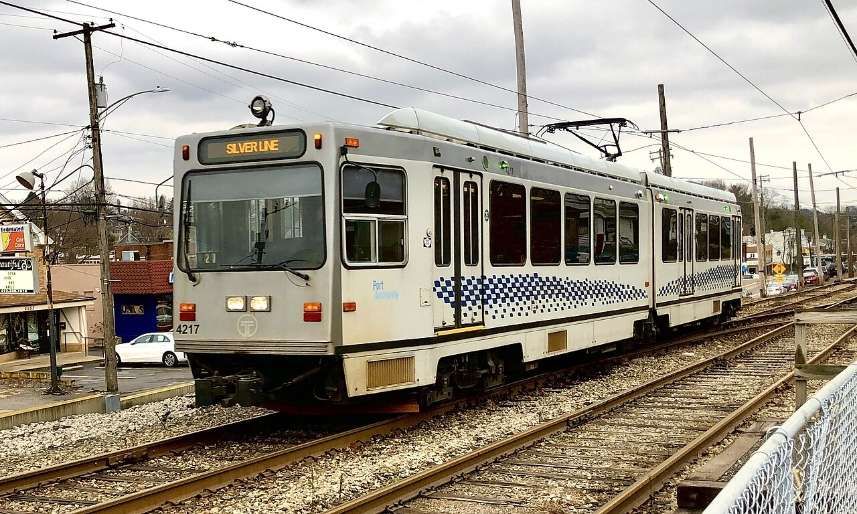
Northbound Silver Line train near Mesta, December 2020. The Silver Line operates between Pittsburgh’s North Shore and Library via Downtown and the neighborhoods of Knoxville and Overbrook, as well as Castle Shannon and Bethel Park, © Sebileis2017 and licenced for reuse under a Creative Commons licence (CC BY-SA 4.0). [11]

North Shore Connector

In January 1999, Pittsburgh Regional Transit began planning for the construction of a light rail line to connect Pittsburgh’s Downtown and North Shore. Federal funding was approved for the extension on 6th February 2004.

The main project involved twin-bore tunnels below the Allegheny River to connect a refurbished Gateway Station, which was the former Downtown terminus, to North Side station, located just west of PNC Park, and Allegheny station, located just north of Heinz Field. The completed project opened to the public on 25th March 2012. The final cost was $523.4 million. [5]
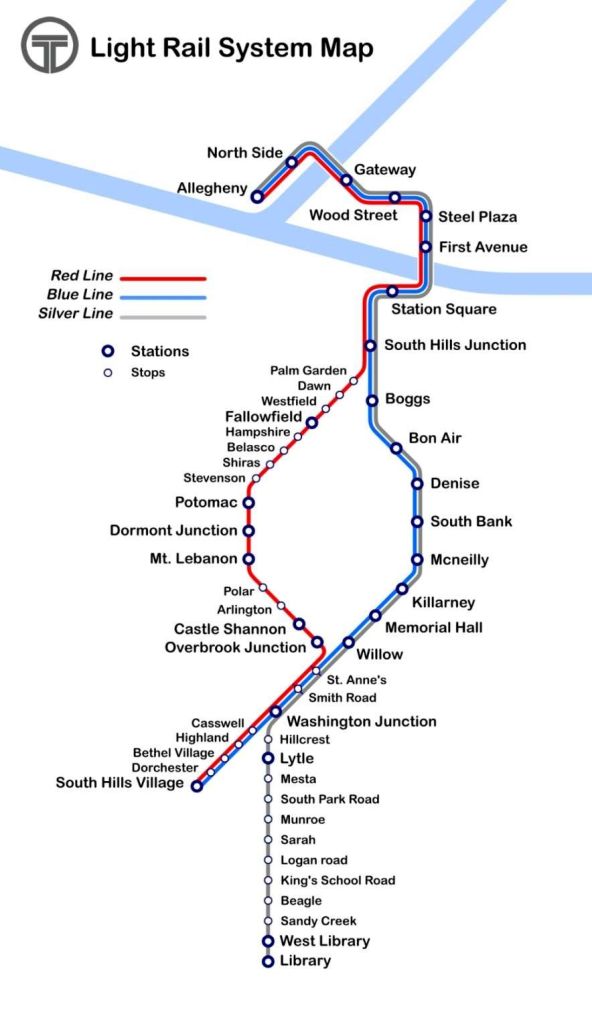
Route map of the three lines on the Pittsburgh light rail system, © Haha169 and licenced for reuse under a Creative Commons licence (CC BY-SA 4.0). [7]

2024–2028 Rail Replacement Projects

From 2024 to 2028, PRT is undertaking a system-wide program of track rehabilitation across the network. The work includes phased closures, single-tracking, and temporary service reroutes. … In 2024, sections of the Red Line were closed for track replacement, resulting in single-tracking operations, shuttle bus substitutions, and a temporary Red Line Short service between Dormont Junction and Overbrook Junction. During part of this period, Red Line trains were also rerouted over the Blue Line alignment.” [5]

That programme continues in 2026.

Future light-rail and rapid-transit extensions are mapped out in the 25-year ‘NEXTransit‘ plan. [12]

Rolling Stock

The majority of Light Rail Vehicles (LRVs) in use on the network are Siemens SD-400 units, introduced to the network between 1985 and 1987. These units were rebuilt by CAF (Construcciones y Auxiliar de Ferrocarriles) in 2005‍–‍2006 and are currently numbered from 4101‍–‍4155. (Seven units salvaged for parts, then scrapped.) CAF also supplied 28 of their own design of LRV between 2003 & 2004. [5]

References

  1. A. A. Jackson; An American Tramway Stronghold; in The Modern Tramway, Volume 14, No. 163, July 1951, p160 & p162-163.
  2. https://commons.wikimedia.org/wiki/File:PCC_uit_de_1600_serie_op_lijn_49_BELTZHOOVER.jpg, accessed on 18th May 2026.
  3. https://en.wikipedia.org/wiki/Pittsburgh_Railways, accessed on 18th May 2026.
  4. https://en.wikipedia.org/wiki/Pittsburgh_Railways#/media/File%3APCC_uit_de_1700_serie_op_lijn_10_WEST_VIEW.jpg, accessed on 18th May 2026
  5. https://en.wikipedia.org/wiki/Pittsburgh_Light_Rail, accessed on 18th May 2026.
  6. https://en.wikipedia.org/wiki/Pittsburgh_Light_Rail#/map/0, accessed on 18th May 2026.
  7. https://en.wikipedia.org/wiki/Pittsburgh_Light_Rail#/media/File%3APittsburgh_T_System_map.png, accessed on 18th May 2026.
  8. https://en.wikipedia.org/wiki/Pittsburgh_Light_Rail#/media/File%3APanhandle_Bridge_from_First_Avenue_Station%2C_2023-04-21.jpg, accessed on 18th May 2026.
  9. https://en.wikipedia.org/wiki/Blue_Line_(Pittsburgh)#/media/File%3AT_Lightrail_an_der_Station_Square_03.jpg, accessed on 18th May 2026.
  10. https://en.wikipedia.org/wiki/Red_Line_(Pittsburgh)?wprov=rarw1#/media/File%3ARed_Line_Car%2C_Beechview%2C_2015-09-10%2C_02.jpg, accessed on 18th May 2026.
  11. https://en.wikipedia.org/wiki/Silver_Line_(Pittsburgh)?wprov=rarw1#/media/File%3ASilver_Line_(cropped).jpg, accessed on 18th May 2026.
  12. https://nextransit.network, accessed on 18th May 2026.
Modern Tramway – January 1951 – The Brisbane City Tramways

I have a few older copies of Modern Tramway which I had not yet read. The first of these is the January 1951 issue, this is a third reflection from that copy of the Journal.

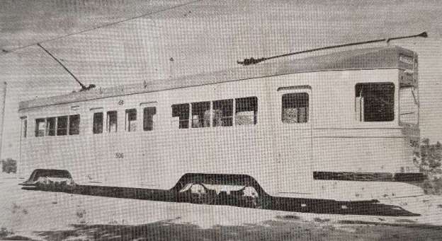
The featured image for this article is Brisbane City Transport No. 506: a high-speed, resilient-wheeled car, one of a new [1950] batch of 50, with full-length sliding doors, leather-covered foam-rubber seats and a panelled body. This car had a multi-notch controller driving 4 x 40 hp motors; there are 64 seats and the overload capacity is 110, © Public Domain. [1: p1]

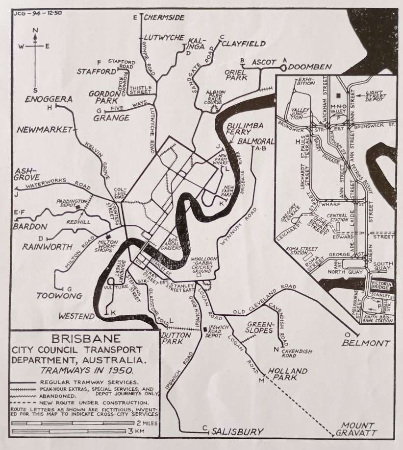
The Brisbane City Council Transport Department Tram Network in 1950. [1: p17]

“Brisbane, the capital of Queensland, Australia, was first settled in 1824. From that date it grew steadily, expanding round the broad winding Brisbane river to become the great city and seaport it is today. Horse trams were introduced by the Metropolitan Tramway and Investment Company in August 1885, and these gave way to electric cars in 1897 and 1898. At the same time, the Brisbane Tramway Company was formed to take over operation of the electric lines and this company built many extensions to the system to match the needs of the fast-growing city. In 1923 the tramways passed into the hands of the Brisbane Tramways Trust, a government board representing Brisbane ratepayers; this Trust was only a temporary body, and when the Greater Brisbane City Council was formed in 1925, the tramways and all city transport became the concern of the Brisbane City Council Transport Department.

“When the public authority took over in 1923, the fleet consisted of 195 cars: today [1950] the Department operates 420 tramcars and 154 single-deck diesel buses. The old B.T.C. cars, many of which are still running, are of great variety and include 4-wheel and bogie “toast racks” and 4-wheel and 8-wheel end-loading saloons, known as ‘Dreadnoughts’. These cars appear only during peak hours and they present an odd appearance against the modern streamliners. … The first new tramcar design developed by the B.C.C. was the ‘drop-centre’ type of which 204 were built, numbered from 196 to 399. These cars have a plate frame, reversed maximum-traction trucks, open centre compartment with eight transverse benches and two closed end compartments. They seat 64, have a maximum capacity of 110, and are 45ft. 6in. long.

“In 1938, a second new type was evolved, later to become known as the ‘400’ or ‘Streamliner’ class. Of these cars, 108 have been built to date [1950], the prototype, No. 400, differing slightly in appearance from its successors. These fine cars are 49ft. in length, seat 64 with a total capacity of 110, and are very fast. The post war version, numbered 473-508 is an improved type with sliding doors: 483-508 have Dunlopillo seating and panelled bodywork; 497, 498, 499, 505, 506, 507 and 509 are fitted with resilient wheels and a multi-notch controller. Other noise-reducing features not yet introduced include rubber inserts in the trolley head. A further 50 of the improved “400” class are yet to be built. Other features of these cars are:

– Integral construction, the whole of the frame and panels being of steel with no separate under-frame.

– Interior lined with varnished natural timber, ceiling of white-enamelled masonite.

– Sashless windows operated by Young full-drop window balancers.

– Motorman’s windows of armour-plated glass and fitted with air-operated windscreen wiper.

– Bogie trucks equipped with GE 247A motors of 40 h.p. each and air brakes.

– Double helical driving gears.

– Air compressors and trolley base mounted on special rubber fittings to reduce noise and vibration.

“The B.C.C. livery is silver with blue lettering.

“The general condition of the track is good, all new track being laid in solid concrete to the top of the rails. On straight track 82 lb. railway rail is used without guard rails, the groove being formed in the concrete. Curves are laid with British Standard 6C tramway rail. There are reserved and private-right-of-way sections on the Chermside, Salisbury, Belmont, Rainworth and Ascot routes. The Chermside extension, opened in 1947, is a model layout with rails laid in concrete and flower beds on either side of the tram track separating it from the motor road: the poles supporting the overhead are at the side of the road.

“Since the war ended in 1945, extensions of three lines have been opened: to Belmont (31st July 1948), to Chermside and to Enoggera (13th August 1949). An extension from Holland Park to Mount Gravatt (1 3/4 miles) is at present under construction and two more extensions are provided for during the current financial year. The Holland Park line now under construction is a street line, and will serve a new housing area. The new lines completed since the war, together with the Mount Gravatt extension, total about six route miles. On 30th June 1949, the total route mileage was 65 miles 60 chains (track mileage 119 miles 75 chains). Of particular interest is the new Ann Street diversion. Formerly all routes [that] passed through the city centre (with one exception) converged at an awkward bottleneck in Petrie Bight. As had been long feared, an accident occurred at this point during a Saturday midday peak with resultant dislocation of traffic. To avoid any recurrence, the Tramway Department constructed a line in Ann Street (about 1/8 mile) from Wharf Street to Petrie Bight in 1946. Of single track with double track junctions, the new line, used only for emergencies, is of standard concrete construction with double overhead wire. It is planned to place tram tracks underground at the inter-section of Ann and and Queen Streets as a first move in a more extensive future city centre subway plan to relieve surface traffic and speed up street transport. When this plan takes shape, Brisbane will be the first Australian city to have tramway subways (the Wynward line in Sydney was built by the Railway Department and is only on loan to the tramways until the underground railway proper is constructed).

“On weekdays the fares start at 2d. for one section and an additional penny for each section, but there are zone fares to and from the city at a reduced rate, and on some routes these work out at about a penny a mile. On Saturdays and Sundays after 6.30 p.m. the fares are increased by a penny with the exception of the first section which remains at 2d. From Monday to Friday concession tickets sold in books of eight for a shilling may be used at the rate of one ticket for each section and are much in demand. On Sundays excursion tickets are sold at 1s. 6d. for adults and 3d. for children; they allow the holder to travel anywhere on the system between 8 a.m. and 2 p.m. or between 2 p.m. and 10 p.m.

“The only tramway that has been abandoned in Brisbane is the short length between the Botanical Gardens and Queen Street and from Queen Street to Gregory Terrace, all in the city centre and operated as two short shuttle services until 1948. This route from the the Gardens to Gregory Terrace will form part of Brisbane’s first trolleybus route (the remainder of the route along Coronation Drive to the University at St. Lucia has never been a tram line) and bodies are now being constructed on 30 Sunbeam trolleybus chassis; it is anticipated that these 44-seater all-steel trolleybuses will be in operation before the end of 1950.

“LIST OF SERVICES, 1950.

– Ascot (Oriel Park and Doomben) – Balmoral.
– Clayfield – Salisbury.
– Kalinga – Rainworth.
– Grange – Toowong.
– Chermside/Stafford – Bardon.
– Bulimba Ferry – Ashgrove.

– St. Paul’s Terrace – Enoggera.
– West End – New Farm Park.
– Dutton Park – New Farm Wharf.
– Belmont/Cavendish Road/Holland Park – Wharf Street or Valley Junction.

– Valley Junction – South Brisbane Station.

(Special and short workings are not included in the above list.)” [1: p15-16]

In practice, “Brisbane’s historic tramway network operated from 1885 to 1969, serving as a vital transport link before being replaced by buses. Known for its iconic, largely open-design ‘toastrack’ trams, the network reached a peak of 109 km in 1954, connecting suburbs like Paddington, Ascot, and Toowong. The system officially closed on 13th April 1969.” [2] The horse-car era lasted from 1885-1899, the electric-car era from 1899 to 1969.

Trams “ran on standard gauge track. The electric system was originally energised to 500 volts, and subsequently increased to 600 volts. All tramcars built in Brisbane up to 1938 had an open design. This proved so popular, especially on hot summer nights, that the trams were used as fundraisers and often chartered right up until the last service by social groups.” [2]

Brisbane was the last capital city in Australia “to close its tram network. Despite the decision to shut down the network, Brisbane’s trams were held with great affection by locals, and one commentator described their removal [as] ‘one of the most appalling urban planning mistakes in the city’s history’. [3] There have been ongoing proposals since the early 1990s to reinstate a functional tram network.” [2]

In the 21st century, Brisbane has its own ‘Metro’ but it is not a tramway network. “Since the 1990s, busways were considered as one of the options when the Queensland Government developed the 25 year Integrated Regional Transport Plan. It was recommended that a 75 km (47 mi) network of busway corridors to complement the existing Queensland Rail City network,” [4][5] should be built.

The first section of busway, opened in September 2000, with the rest of the South East Busway opening in April 2001 at a final cost of over $600 million. [6] Planning and construction of the Northern and Eastern Busways began soon after the success of the first section, increasing bus commuter statistics. As of 2025, the city had three busways, spanning 29 kilometres, including 28 stations and 20 tunnels. [4][7]

As of 2007, 294 buses per hour (one way) – 1 bus every 12 seconds – passed through the busway network’s busiest point (a section of the South East Busway north of Woolloongabba station). Further, capacity issues occurred at other locations in the city. [4]

In order to meet the capacity bottlenecks of the busway system, various solutions [were] proposed, including conversion to light rail, the BaT tunnel, a second Victoria Bridge, bus route changes, and later, Brisbane Metro.” [4][8]

The initial proposals for a rubber-tyred metro of 2016 were adapted to meet specific concerns. Bi-articulated buses were chosen. The buses would operate on two routes. The business case released in November 2017 costed the project at AUS$944 million. By April 2018, the federal government had agreed to contribute AUS$300 million.

In November 2019, BCC announced  that a consortium of Hess, Volgren and ABB had been awarded a contract for 60 buses. The buses were to be fully electric via overhead wireless charging that will charge at the end of each route for less than six minutes. [4][9]

A pilot bus was built and tested in Europe in 2021, arriving in Brisbane for testing in early 2022. Following successful testing, an order was placed for the remaining 59, with close to 1000 modifications based of the original pilot vehicle. [10] The 60 vehicles cost AUS$190 million, an increase of $100 million compared to more traditionally powered vehicles, with deliveries beginning in late 2023. As of 2026, the full 60 ordered are still being delivered.” [4][11]

The system consists of two routes over 21 km (13 mi) of busways. The routes serve Brisbane CBD every five minutes during peak times, extending as far as Eight Mile Plains, the Royal Brisbane and Women’s Hospital and the University of Queensland respectively. Route M2 began service on 28th January 2025. Route M1 began service on 20th June 2025.” [4]

A route map for the Metro can be found here. [12] Route M1 connects with the South East Busway services. Route M2 connects with the Northern Busway services. [12]

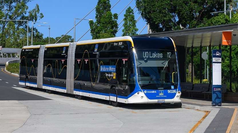
A route M2 bus at UQ Lakes station, © your_local_bus_photographer and licenced for reuse under a Creative Commons licence (CC BY-SA 4.0). [13]

References

  1. The Brisbane City Tramways; in Modern Tramway Volume 14 No. 157; The Light Railway Transport League, London, January 1951, p1 & 15-17.
  2. https://en.wikipedia.org/wiki/Trams_in_Brisbane, accessed on 11th May 2026.
  3. Michael Madigan; 50 years after Brisbane’s trams were scrapped, it’s not too late to fix this epic planning fail; via (https://www.couriermail.com.au/news/insight/50-years-after-brisbanes-trams-were-scrapped-its-not-too-late-to-fix-this-this-epic-planning-fail/news-story/98ef3d140cb1e2c8c2b5d28829c42ffe);  The Courier-Mail, 13th April 2019, access not permitted without a subscription, 11th May 2026.
  4. https://en.wikipedia.org/wiki/Brisbane_Metro, accessed on 11th May 2026.
  5. Integrated Regional Transport Plan (Part 1); Queensland Government, Department of Transport and Main Roads; via: https://web.archive.org/web/20110316094603/http://tmr.qld.gov.au/~/media/1008ff20-a4b7-4a18-89df-10c19d3348d6/pdf_irtp_part01.pdf, accessed on 11th May 2026.
  6. https://web.archive.org/web/20110527083538/http://www.thgq.com.au/projects_south_east_transit.php, accessed on 11th May 2026.
  7. Melbourne buses: How do other cities compare?; ABC News, Australia, 16th February 2017; via: https://www.abc.net.au/news/2017-02-16/melbourne-buses-how-do-other-cities-do-bus-transit/8276628, accessed on 11th May 2026.
  8. Project History: Brisbane Metro; Brisbane City Council; via: https://caportal.com.au/bcc/brisbane-metro/history?utm_source=copilot.com, accessed on 11th May 2026.
  9. Bevin Liu; The big EV bus revolution: Brisbane City’s new metro unwrapped and the partnerships we need to have; The Fifth Estate, 15th October 2024; via: https://thefifthestate.com.au/urbanism/infrastructure/the-big-ev-bus-revolution-brisbane-citys-new-metro-unwrapped-and-the-partnerships-we-need-to-have, accessed on 11th May 2026.
  10. Brisbane (AUS): Large order for Hess; Urban Transport Magazine, 10th August 2022; via: https://www.urban-transport-magazine.com/en/brisbane-aus-large-order-for-hess, accessed on 11th May 2026.
  11. Brisbane Metro vehicle; via: https://metro.brisbane.qld.gov.au, accessed on 11th May 2026.
  12. https://en.wikipedia.org/wiki/Template:Brisbane_Metro, accessed on 11th May 2026.
  13. https://en.wikipedia.org/wiki/Brisbane_Metro#/media/File%3AXB_83_PU_HESS_lighTram25_(55053370230)_-_cropped.jpg, accessed on 11th May 2026.

Genova’s (Genoa’s) Metro

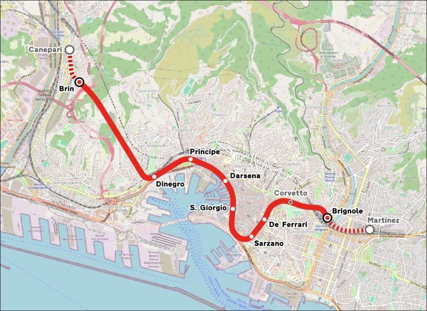
The Metropolitana di Genova is, in 2024, a single-line, double-track light rapid transit system that connects the centre of Genova, Italy with the suburb of Rivarolo Ligure, to the north-west of the city centre. It runs through to Brignole Railway Station in the East of the city. In 2024, the service is managed by Azienda Mobilità e Trasporti (AMT), which provides public transport for the city of Genoa. [1]

Genoa’s single Metro line, © Arbalete and authorised for reuse under a Creative Commons Licence (CC BY-SA 2.0). [1]

The Metro is a 7.1 kilometres (4.4 mi) long 1,435 mm (4 ft 8 1⁄2 in) (standard gauge) double-track line and is electrified with overhead lines at 750 volts DC. It has a direct connection with Trenitalia’s mainline railway station, Principe. [1]

The origins of a subway in Genoa date back to the beginning of the twentieth century; in 1907 Carlo Pfalz, who had already designed the Zecca-Righi Funicular, [2] was the first to explore the construction of an underground railway with electric traction. Several projects, including that of the engineer Angelo Massardo and those of Renzo Picasso (1911 and 1930), were proposed without being realized. Instead, a tram system at surface level was built which ultimately was abandoned in 1966. An attempt to introduce an alternative means of transport was made on the occasion of the International Exhibition of Marine and Maritime Hygiene of 1914: it was a ‘Telfer’, an elevated monorail that connected the Port (Giano Pier area) to the exhibition area in Piazza di Francia, in front of the Brignole station. The infrastructure was then abandoned and finally demolished in 1918. [1]

An article about the Telfer can be found here. [3]

The underground ‘Metro’ was built in a series of phases. “The first section, opened on 13th June 1990 in time for the 1990 FIFA World Cup, was 2.5 kilometres (1.6 miles) [6] between the stations of Brin and Dinegro. [7] The line was extended to Principe in 1992, [6] to San Giorgio-Caricamento in 2003, [6] to De Ferrari (the underground station at Piazza De Ferrari) in 2005, [6] and to Brignole in 2012.” [8]

Since 2024, citizens of Genoa have been able to use the subway free of charge without any time restrictions.[9]

Stations

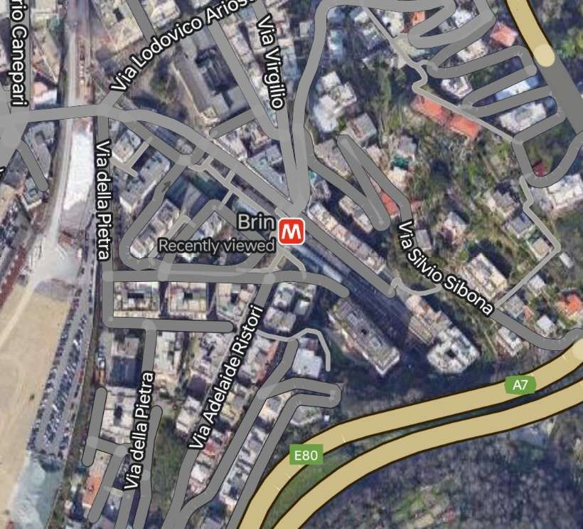
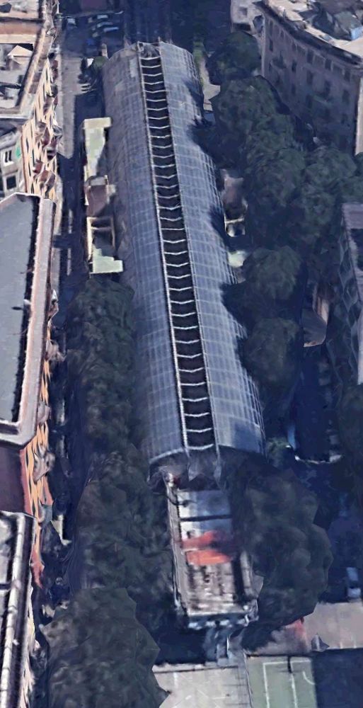
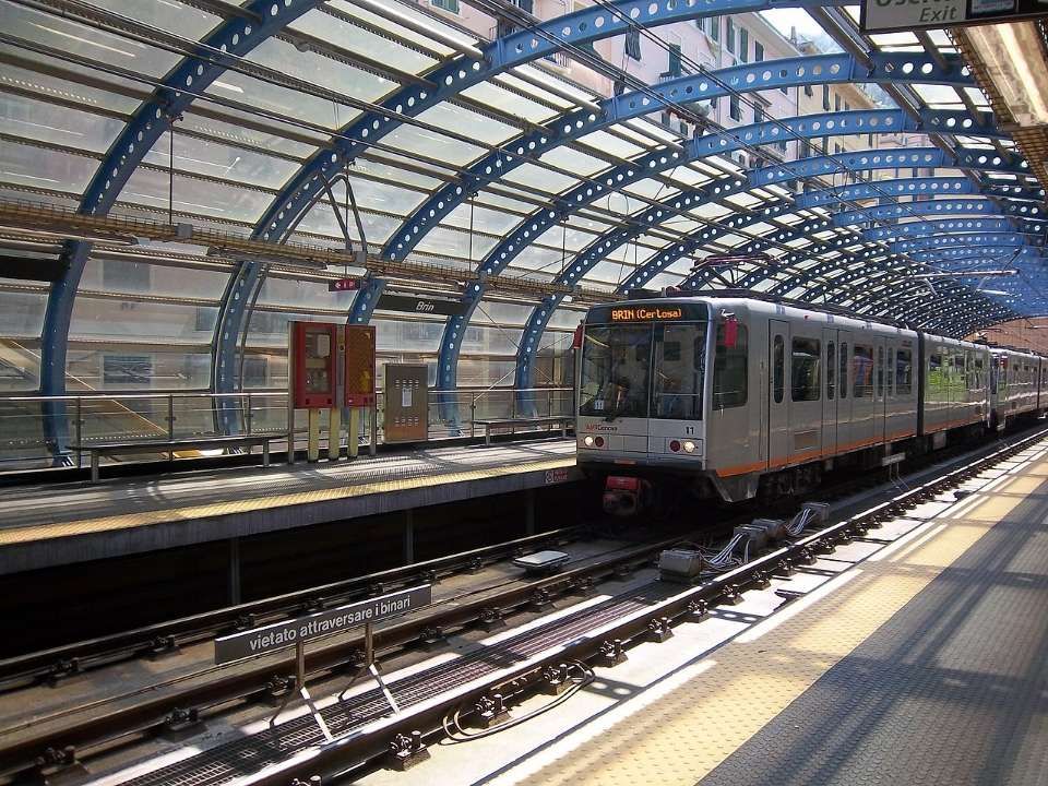
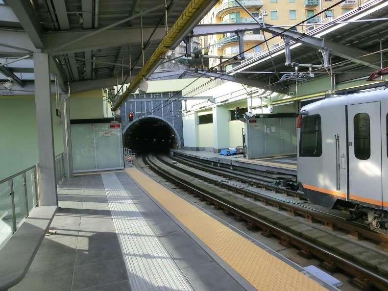
Brin Station – is currently (2024) the Northwest terminus of the line. It is situated along Via Benedetto Brin in the neighbourhood of Certosa in Rivarolo Ligure, a suburban area in the north-western outskirts of Genoa, Italy. The station, currently the terminus of the line, is located just west of the tunnel mouth on the line from Dinegro station. [10] It is built on a viaduct, which allows for the line to be extended to the north.

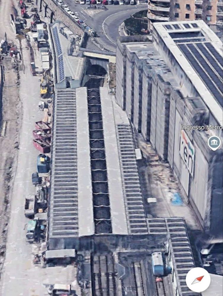
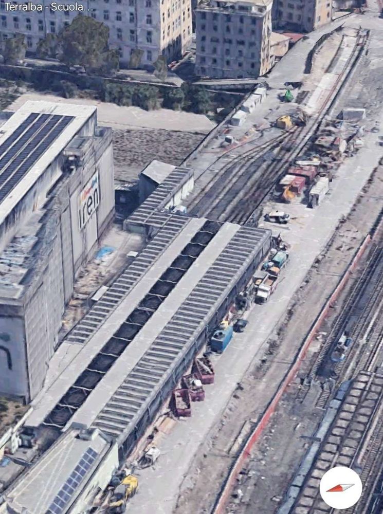
Brin Station sits just below the A7 Autostrada in the Northwest suburbs of Genova. [Google Maps, November 2024]
Brin Station seen from the Northwest. The tunnel is beyond the station in this view. The extension, when built, will run towards and beneath the camera. [Google Earth 3D, November 2024]
Brin Station sits above ground adjacent to the end of the tunnel, © Ewkaa and licenced for reuse under a Creative Commons Licence (CC BY-SA 3.0). [10]

The station was designed by architect Renzo Piano, the station’s official opening took place on 13th June 1990. [10]

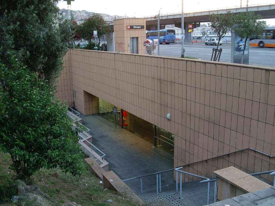
Dinegro Station is located under Via Milano, adjoining the Piazza Dinegro from which it derives its name, in the Fassolo area of Genova. It is just East of the business district of San Benigno and close to the ferry terminal.

The exterior of Dinegro Station, © Alessio Sbarbaro and licenced for reuse under a Creative Commons Licence (CC BY 3.0). [11]
Dinegro Station, © Falk2 and licenced for reuse under a Creative Commons Licence (CC BY-SA 4.0). [12]

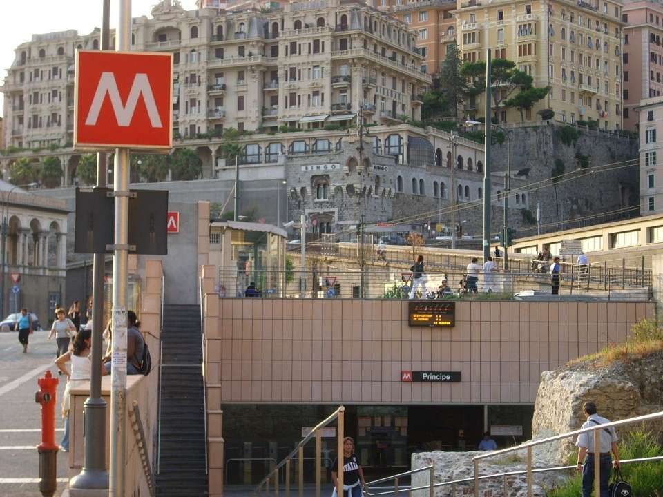
Principe Metro Station – its main entrance sits just outside the main railway station in Genova – Principe.

Principe Metro Station, © Yoggysot and authorised for reuse under a GNU Free Documentation License (CC BY 3.0). [13]
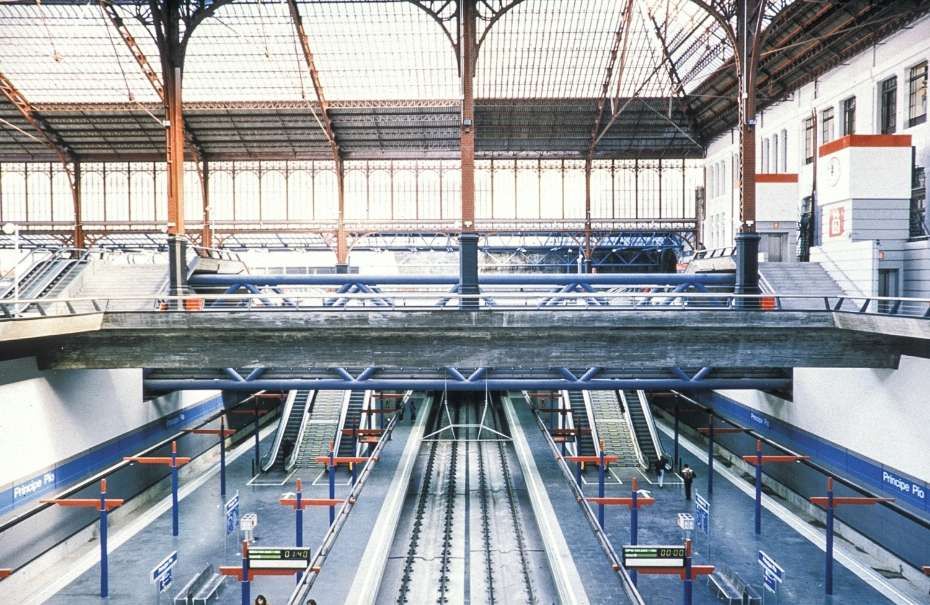
The interior of Principe Metro Station in 1994. [14]

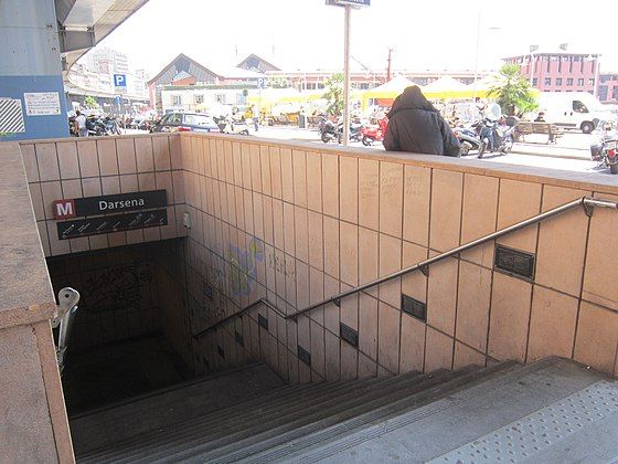
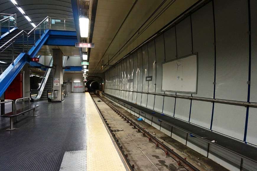
Darsena Metro Station is located on Via Antonio Gramsci close to Piazza della Darsena. ‘Darsena’ translates to ‘dock’ in English. The station serves the old port area of the city. [15]

The entrance to Darsena Station, © Ripetto and licenced for reuse under a Creative Commons Licence (CC BY-SA 3.0). [16]
The interior of Darsena Station, © Tiia Monto and licenced for reuse under a Creative Commons Licence (CC BY-SA 3.0). [15]

San Georgio Station is located under Piazza della Raibetta beside the Palazzo San Giorgio, after which it is named. It is in the Old Harbour area near the Aquarium of Genoa. It was opened together with Darsena Station on 25th July 2003 and saw its first trains on 7th August 2003. [17]

The tracks of the San Giorgio station run beneath the Piazza Caricamento underpass and its underground architecture is similar to the model adopted for the Principe and Darsena stops, that is, with the tracks on the sides of the single central platform. During 2006, some electronic display boards were installed to inform users of the arrival times of trains. [17]

The view from the stairs leading to the street-level entrance to San Giorgio Metro Station, © Alessio Sbarbaro and authorised for reuse under a Creative Commons Licence (CC BY-SA 3.0). [18]
The view along the platform at San Giorgio Metro Station, © Umberto and authorised for reuse under a Creative Commons Licence (CC BY-SA 2.0). [18]

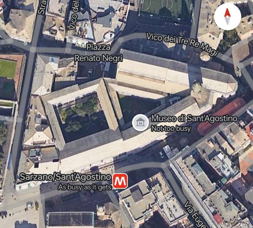
Sarzano/Sant’Agostino Station is located in the historical centre of Genoa. The main entrance is in the Piazza di Sarzano near the Church of St. Augustine, now deconsecrated and turned into a museum, with a second entrance on the Mura della Marina, the old seawall. It opened on 3rd April 2006. [19]

Sarzano/Sant’Agostino metro Station is immediately adjacent to the Museo di Sant’Agostino. [Google Maps, November 2024]
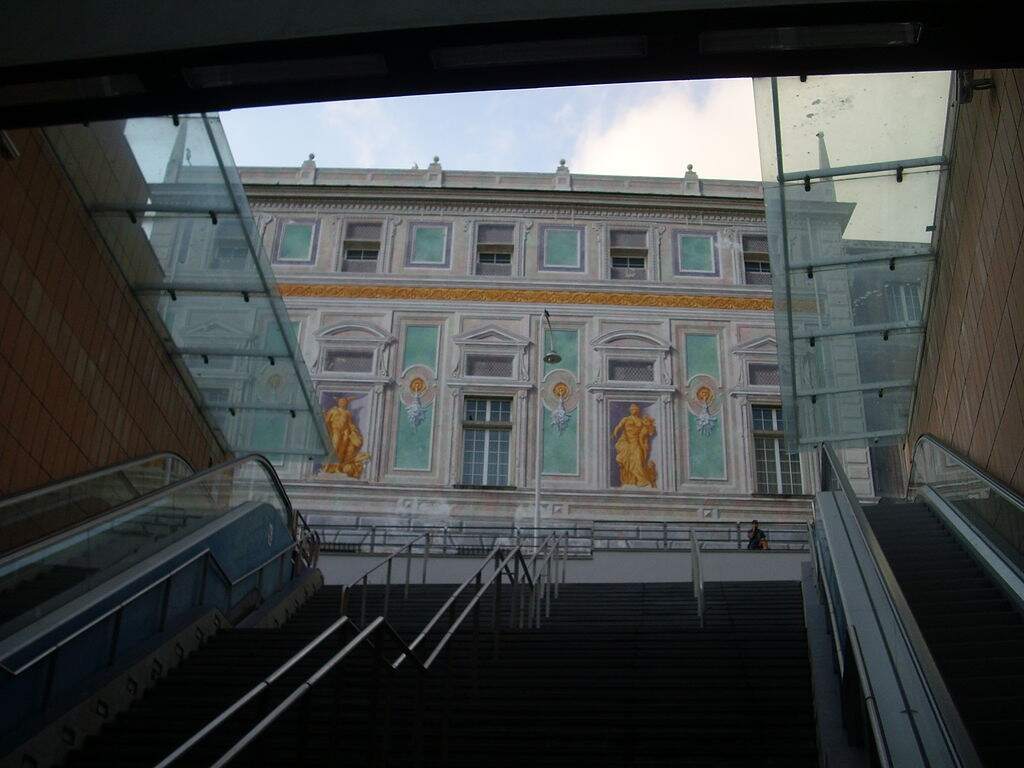
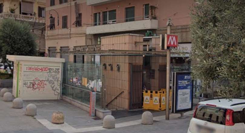
The Station entrance adjacent to the Museum. [Google Streetview, July 2022]
The access stairs to Sarzano Metro Station adjacent to the Museum, © Alessio Sbarbaro and authorised for reuse under a Creative Commons Licence (CC BY-SA 3.0). [19]
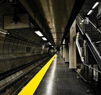
Platform level at Sarzano Metro Station, [20]

De Ferrari Station is close to Teatro Carlo Felice, Galleria Mazzini, the Doge’s Palace, and Via XX Settembre. It opened on 4th February 2005. It was originally designed, like others, by Renzo Piano with finishing touches by Renzo Truffelli. This used to be the last station on the line until the easterly extension towards Genova Brignole Railway Station opened in 2012. [21][22]

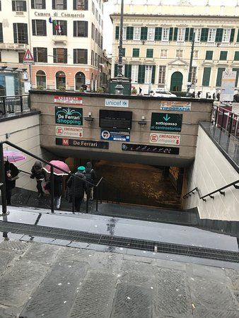
The entrance to de Ferrari Station. [23]
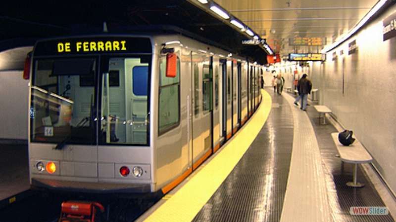
Platform level at de Ferrari Station. [€23]

Corvetto Station – In March 2024 3Ti Projeto announced that the design of Corvetto Station had been approved by the municipality. Work is expected to cost around 38.3 million Euros and be completed late in 2024 or early in 2025. [24][25][26]

These two images show the 3Ti Projeto design for Corvetto Station. [24]

Brignole Station – sits close to the main line Brignole Station to the West of the city centre. It opened in 2012. [27]

Brignole Metro Station, © Eugenio Merzagora and shared by him on the Structurae Website on 30th March 2016, used with kind permission of the copyright holder. [28]
Brignole Metro Station, looking Southeast towards the extension, © Eugenio Merzagora and shared by him on the Structurae Website on 30th March 2016, used with kind permission of the copyright holder. [28]
Brignole Metro Station, looking Northwest into the tunnel mouth, © Eugenio Merzagora and shared by him on the Structurae Website on 30th March 2016, used with kind permission of the copyright holder. [28]
Brignole Metro Station seen from the Southeast. [Google Earth 3D, November 2024]
Brignole Metro Station seen from the West. [Google Earth 3D, November 2024]

Rolling Stock

Wikipedia tells us that Genova is just (in 2024) bringing a fourth generation of trams into service. The three previous generations each served the city well.

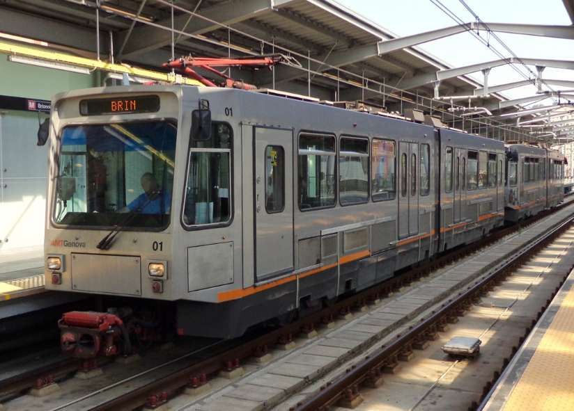
First Generation Rolling Stock – consisted of 6 sets of articulated cars, built by Ansaldo, and introduced in 1990. They were derived from the Zurich Tram 2000 tram used in Switzerland, but altered for standard gauge running. Each vehicle had two sections with one central articulation. They were supported on three bogies The two outer bogies were motorised. The vehicles were bidirectional and had four sets of doors on each side. They had blue seats in a transverse arrangement. The train were numbered 01 to 06. [1][29]

First Generation tram/train at Brignole Metro Station in 2013, © Arbalete and licenced for reuse under a Creative Commons Licence (CC BY-SA 3.0). [1]

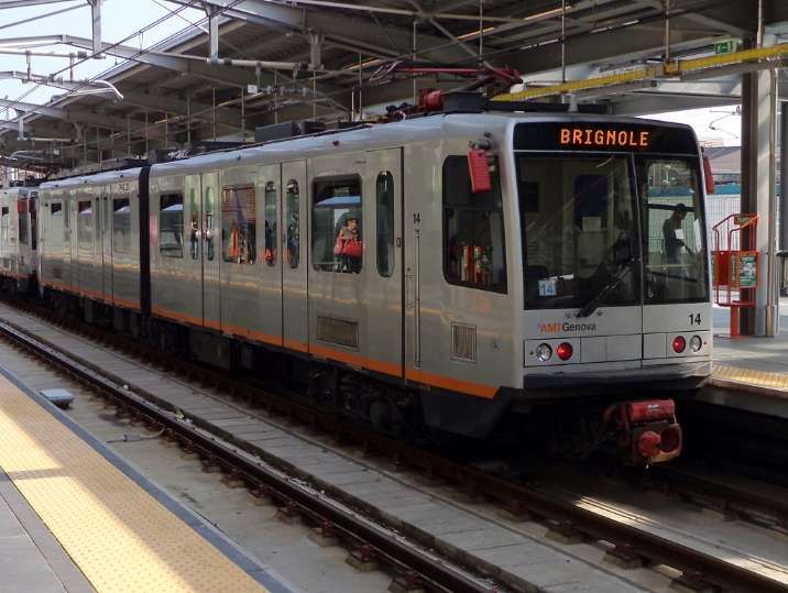
Second Generation Rolling Stock – was made up of a group of 12 trains. Numbered 12 to 24. Like the first generation, each train was made up of two sections resting on three bogies, with the outer two motorised. The trains were bidirectional with six doors on each side, and the seats were arranged longitudinally. The trains were built by Ansaldo and introduced in 1992. [1][30]

Second Generation tram/train at Brignole Metro Station in 2013, © Arbalete and licenced for reuse under a Creative Commons Licence (CC BY-SA 3.0). [1]

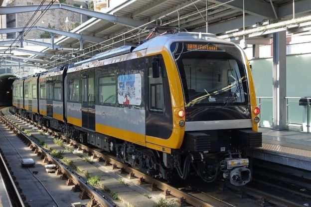
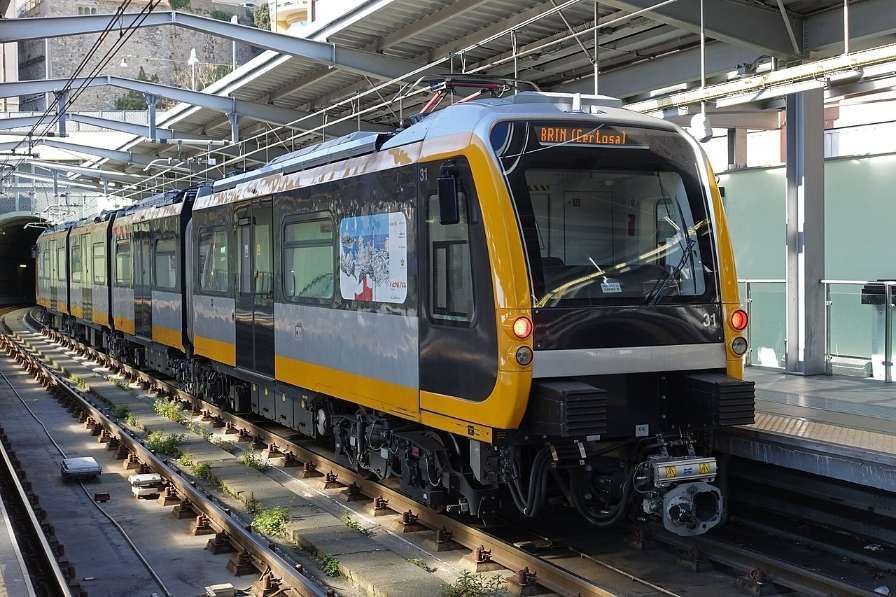
Third Generation Rolling Stock – these trams/trains significantly differ to the previous two. They were delivered by Hitachi Rail Italy in 2016. There are 7 trains numbered 31 to 37. The trains are longer than previous generations at 39 metres and four articulated sections with five bogies. Of the five bogies, the central three are motorised. There are a total of four doors per side of the bidirectional sets. [1][31]

Third Generation tram/train at Brignole Metro Station in 2019, © Bmazerolles and licenced for reuse under a Creative Commons Licence (CC BY-SA 4.0). [1]

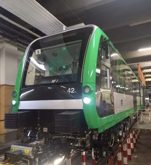
Fourth Generation Rolling Stock – In anticipation of the planned extensions (see below) and considering the now thirty-year service of the first generation trains, in 2020 the Municipality obtained a loan of 70 million Euros to purchase 14 new generation trains. [32] In 2021, Hitachi Rail signed the contract to supply the new trains on a rolling programme, monthly by month, to coincide with the inauguration of the Brin-Canepari and Brignole-Martinez routes. [33]

In June 2024, Sustainable Bus E-magazine reported that the first of these new units had arrived in Genoa. [26]

New tram/train No. 42. [26]

The new units will be numbered 41 to 54. “Each of the 14 new vehicles is made up of four half-cars, resting on five bogies, for a total length of 39 metres, will be able to accommodate up to 290 passengers, will be bidirectional, and will also run in double formation for a total length of 78 metres and a capacity of 580 passengers.” [26]

In order to ensure greater operating flexibility, these trains will also be able to operate in double traction with the 7 third-generation vehicles, the 31-37 series delivered in 2016, currently in service.” [26]

The new units entry into service will “allow the scrapping of the 6 first-generation trains, series 01-06, … the average age of the fleet will thus be lowered from 18.5 years to 9.8 years. The 10-series trains (11-22 series) built between 1991 and 1995 will be kept in operation.” [26] The fleet will therefore consist of the 21 trains of the 30, 40 and 10 series trains.

Extensions to the Network

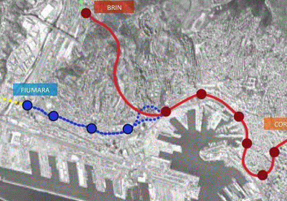
In 2022, the Railway Gazette reported that Genova municipality had approved plans for a 3 km western branch of the metro with four stations, linking Fiumara with the city centre. [4]

The western extension of Genoa’s Metro is shown in blue. [4]

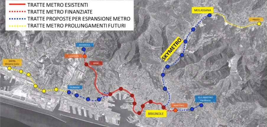
In September 2024, the city secured 74.5 million Euros to significantly expand the Metro network as shown on the map below. [5]

The planned Metro network for Genoa (Genova) as reported in September 2024. [5]

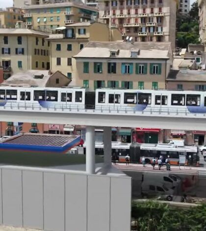
As can be seen in the map above these significant additions to the network include a length up the Val Bisagno of elevated railway (SkyMetro).

The planned SkyMetro, running up the valley of the River Bisagno. [34]

The planned investment is over 400 million Euros at 2022 prices. Genoa will receive 418.9 million Euros to finance the SkyMetro of Val Bisagno, the extension of the metro from Brin to Via Canepari and work associated with the Rio Maltempo. The majority of the new money (398.8 million Euros) is intended for the construction of the SkyMetro.

During rush hour, the new line will be able to transport eighty percent of the valley’s users, resulting in a significant reduction in the production of exhaust fumes from private cars. It will be seven kilometers long and will have a neutral energy balance thanks to the photovoltaic system mounted on the roof, which will make the SkyMetro partially sustainable. The project will reach as far as Molassana but the city has every intention to take the scheme further, as far as Prato. [34]

References

  1. https://en.m.wikipedia.org/wiki/Genoa_Metro, accessed on 9th November 2024.
  2. https://rogerfarnworth.com/2024/11/13/genoa-funicular-railways
  3. https://rogerfarnworth.com/2024/11/14/genoa-a-telfer
  4. https://www.railwaygazette.com/metros/genova-metro-expansion/62437.article, accessed on 25th November 2024.
  5. https://italy.cleancitiescampaign.org/pums-updates/genova-27-9-2024-ok-del-governo-al-a-745-milioni-di-euro-per-prolungamento-metro, accessed on 25th November 2024.
  6. HOME – Rete e orari – Metropolitana; http://www.amt.genova.it/orari/metropolitana.asp;  Azienda Mobilità e Trasporti S.p.A. (AMT),  2013, accessed on 25th November 2024.
  7. Modern Tramway and Light Rail Transit, October 1990, p354. Ian Allan Ltd./Light Rail Transit Association.
  8. Tramways & Urban Transit, April 2005, p149. Ian Allan Ltd./Light Rail Transit Association.
  9. Metropolitana; Azienda Mobilita’e Trasporti; https://www.amt.genova.it/amt/trasporto-multimodale/metropolitana, accessed on 25th November 2024.
  10. https://en.m.wikipedia.org/wiki/Brin_(Genoa_Metro), accessed on 25th November 2024.
  11. https://en.m.wikipedia.org/wiki/Dinegro_(Genoa_Metro), accessed on 25th November 2024.
  12. https://commons.m.wikimedia.org/wiki/Category:Dinegro_station_(Genoa_metro)#/media/File%3AL04_163_Hp_Dinegro%2C_ET_37.jpg, accessed on 25th November 2024.
  13. https://en.m.wikipedia.org/wiki/Principe_(Genoa_Metro), accessed on 25th November 2024.
  14. https://www.cfcsl.com/en/portfolio/principe-pio-madrid-transport-station-spain-1994, accessed on 25th November 2024.
  15. https://en.m.wikipedia.org/wiki/Darsena_(Genoa_Metro), accessed on 25th November 2024.
  16. https://fr.m.wikipedia.org/wiki/Darsena_(m%C3%A9tro_de_G%C3%AAnes), accessed on 25th November 2024.
  17. https://web.archive.org/web/20120120225605/http://www.metrogenova.com/sangiorgio.html, accessed on 26th November 2024.
  18. https://en.wikipedia.org/wiki/San_Giorgio_(Genoa_Metro), accessed on 26th November 2024.
  19. https://en.m.wikipedia.org/wiki/Sarzano/Sant’Agostino_(Genoa_Metro), accessed on 26th November 2024.
  20. http://www.metrogenova.com/sarzano.asp, accessed on 26th November 2024.
  21. https://en.m.wikipedia.org/wiki/De_Ferrari_(Genoa_Metro), accessed on 26th November 2024.
  22. https://web.archive.org/web/20120120003444/http://www.metrogenova.com/deferrari.html, accessed on 26th November 2024.
  23. https://www.tripadvisor.co.uk/LocationPhotoDirectLink-g187823-d8854114-i375721192-Genoa_Metro-Genoa_Italian_Riviera_Liguria.html, accessed on 26th November 2024.
  24. https://www.3tiprogetti.it/corvetto-underground-station-in-genoa, accessed on 26th November 2024.
  25. https://manelligroup.com/en/projects/corvetto-station-completion-works, accessed on 26th November 2024.
  26. https://www.sustainable-bus.com/trolleybus-tramway/discovering-genoas-new-subway-trains, accessed on 26th November 2024.
  27. https://en.m.wikipedia.org/wiki/Brignole_(Genoa_Metro), accessed on 26th November 2024.
  28. https://structurae.net/en/media/254830-brignole-metro-station, accessed on 26th November 2024.
  29. http://www.metrogenova.com/treniI.asp, accessed on 26th November 2024.
  30. http://www.metrogenova.com/treniII.asp, accessed on 26th November 2024.
  31. http://www.metrogenova.com/treniIII.asp, accessed on 26th November 2024.
  32. Veronica Pallotta; Metropolitane: Genova, Comune e Ferrovie siglano accordo per il prolungamento verso Canepari; in Ferrovie.Info (in Italian), 30th December  2020, accessed on 24th February 2022.
  33. Editorial; 14 nuovi treni per la metro di Genova a partire dal 2024. Li fornirà Hitachi Rail; in Liguria Business Journal (in Italian); https://liguria.bizjournal.it/2022/02/08/amt-dal-2024-hitachi-rail-fornira-14-nuovi-treni-per-la-metropolitana-di-genova, accessed on 26 November 2024.
  34. https://www.goamagazine.it/sky-tram-valbisagno-prolungamento-metro-brin-canepari-e-adeguamento-rio-maltempo-ecco-le-opere-del-mims, accessed on 26th November 2024.