
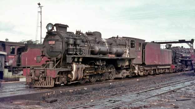
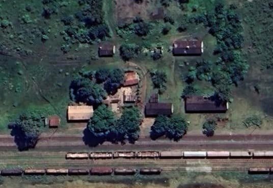
The featured image for this article is a photograph of East African Railways (EAR) Class 30 steam locomotive No. 3019 ‘Nyamwezi’ at Tabora depot on the Central Line, Tanzania in 1968. Class 30 locomotives were oil-burning 2-8-4 steam locomotives. Built in the 1950s by the North British Locomotive Company in Glasgow, the 26 engines in the Class were named after indigenous tribes across Kenya, Uganda, and Tanganyika (now Tanzania). They were known as the ‘Tribal Class’ of locomotives, (c) Basil Roberts and licensed for reuse under a Creative Commons licence (CC BY-SA 4.0). [44]
The line from Dar-es-Salaam to Kigoma. was known during the German Protectorate as the Mittelland Bahn. “In the March of 1895 the Colonial Department of the German Foreign Office, the Deutsch Ost Afrikanische Gesellschaft and the Deutsche Bank formed a committee to consider plans for a central railway from the coast to Lakes Tanganyika and Victoria. In the June of 1896 the committee submitted a report to the Chancellor, which recommended the immediate construction of a 75-cm-gauge railway from Dar-es-Salaam and Bagamoyo to Morogoro, as the first section of a line to the Lakes. The committee suggested that the construction be entrusted to a reliable firm and that the Reich should offer such aid and subsidies as would induce German high finance to support the development of German East Africa. The report stated that the country which the railway would open up offered ‘all the foundations for marvellous … economic development’.” [1: p84]
So, initial plans were for a 750mm-gauge railway heading inland from Dar-es-Salaam. “In 1894 and 1896 an army engineer, von Schlobach, had found a good crossing of the Ruvu at Mafisi and studied alternative routes from there to Morogoro and Kisaki-north and south of the Uluguru Mountains and the possibilities of navigation on the lower Ruvu. Von Schlobach’s report referred to the Mackinnon Road which had been started in 1876 by Sir William Mackinnon and Sir Thomas Fowell Buxton and ran seventy miles west from Dar-es-Salaam. At the same time as von Schlobach’s survey, a reconnaissance was undertaken of the second section of the railway from Morogoro to Tabora.” [1: p84]
“By the September of 1896, the formation of a company to undertake the building of the railway was almost completed when events took a sudden and unfavourable turn. Herr Kayser, the director of the Colonial Department of the Foreign Office, who had been a strong supporter of the building of the Central Line, suddenly retired. His successor thought differently and urged that the Usambara Bahn be built first. The troubles, financial and otherwise, which beset that railway caused the Central Line project to be pigeon-holed for three years. In the October of 1899, the Kolonial Rath (Colonial Council) resolved that the Central Line be built and urged that an adequate sum for its survey be included in the Budget for 1900. In November 1901, this resolution was confirmed. The Kolonial Rath advocated ‘a railway policy fully conscious of its aim to counter the competition of neighbouring colonies’, and the enactment by the Reichstag of the necessary legislation to enable an early start on the building of the railway.” [1: p84-85]
Hill continues:
“In 1903 the Deutsche Bank formed a syndicate which financed another survey of the alignment between Dar es Salaam and Morogoro. In 1904 the Kolonialwirtschaftliche Komite a group representative of agricultural, commercial and industrial interests in the German colonies – submitted to the Reichstag a memorandum on the importance of building the Central line as a fillip to the increased production of cotton. The argument was won and the Reichstag passed the legislation enabling the building of the railway. On 29th June 1904, the Ost Afrikanische Eisenbahn Gesellschaft was founded in Berlin with a capital of 21 million marks. On the following day the Imperial Government granted the Company the rights of a corporation and a concession to build and run a metre-gauge railway from Dar-es-Salaam to Morogoro. The Reich guaranteed the payment of 3 per cent. interest on the Company’s capital. The concession also entitled the Company to select from a zone, 100 kilometres wide on either side of the railway, 20 square kilometres of land for each kilometre of the railway, and to a free grant of the land selected. The Company also received sole prospecting and mining rights over an area of 1,150 square kilometres, in not more than three blocks, within the 200-kilometre zone. A subsidiary company, the Ost Afrikanische Land Gesellschaft, was formed to administer the Railway Company’s land. Until 1912, the Land Gesellschaft was also concerned with a company which sought to attract tourists by building hotels at Dar-es-Salaam, Tabora and Kigoma; and from 1907 onwards, the railway’s workshops in Dar es Salaam supplied the town with electric light and power.
The Railway Company gave the contract for the construction of the first section of the line to Phillip Holzmann & Co., of Frankfurt-am-Main, a firm of international repute which had recently built the first section of the Baghdad Railway in Asia Minor. Many of the staff of Holzmann & Co. and several of the sub-contractors who had worked in Asia Minor were transferred to German East Africa. Construction started on 9th February 1905, and serious difficulties were soon encountered during the rainy season. The ranges of hills, inland from the coast, composed of clays and marly sandstones, proved to be treacherous, and the crossing of the plain on either side of the Ruvu, which flooded every rainy season, required a greater number of girder bridges on deep foundations than had been expected. There was also a shortage of labour, caused by the outbreak of the Maji-Maji rebellion. Arrangements were made to import indentured Chinese labour, but the difficulty was more sensibly overcome by recruiting large numbers of African labourers, mainly Wanyamwezi. By the standards of the day they were well paid and well fed, their rations including a generous measure of Bombay rice. The Wanyamwezi, cheerful and sturdy, were the mainstay of the labour force and their output of work was a major factor in the progress of the line. At first the rate of construction was by no means spectacular, for the 80 kilometres to Ruvu were built at a mean annual progress of 32 kilometres – at least a great improvement on the Tanga line. Thereafter the advance was far more rapid. Morogoro station was opened to traffic on 16th December 1907, nearly seven months sooner than the date stipulated by the contract. The 200 kilometres of the railway from Dar-es-Salaam to Morogoro were built at the rate of 67 kilometres a year.” [1: p85-86]
There was, in 1905 and 1906, a large rebelliion against German rule . The Maji-Maji rebellion broke out in the Matumbi Hills, near Kilwa in July 1905 and spread throughout the southern part of German East Africa. A hut-tax had been imposed in 1897 with the primary aim of forcing natives to work for planters so as to raise the money to pay the tax. The Reichstag seems to have accepted that the primary cause of the revolt was a reckless increase in the hut-tax and the enforced labour of those who failed to pay it. This was exacerbated by the poor treatment of workers on the plantations and often the ruthless cruelty of the planters. Hill highlights a number of features of the rebellion:
“First was the alliance between several tribes who had not previously been known to co-operate on any basis. Whereas the Germans had always recognised the risk of revolt by a single tribe and were prepared for it, they regarded a concerted conspiracy by several tribes as too improbable to be seriously considered.
“Secondly, the tribes which took part in the rebellion had previously been regarded as peaceable and as most unlikely to cause trouble. It was fortunate that the more war-like tribes – mindful maybe of the experience of the Chagga, the Wagogo and the Wahehe kept aloof from the rebellion.
“Thirdly, the preparations for the rebellion, started more than a year before the out-break at Kilwa, were conducted with such secrecy that no German administrator, soldier, missionary or planter heard a whisper of what was brewing and the Government was taken completely by surprise. The first conspirators were the chiefs and medicine men of two of the smaller tribes, who drew their relations, blood-brothers and fellow clansmen into the conspiracy, and the meetings at which their plans were discussed were held under oath of secrecy.
“The fourth, and the most remarkable feature, gave the revolt the name of the Maji-Maji rebellion. [‘Maji’ is the Swahili word for water] Throughout the disaffected area the natives were convinced that anyone armed with a certain medicine became invulnerable to bullets because the medicine turned them to water. This belief created the dangerous delusion that the Germans could easily be defeated, as the fire power of their weapons would be of no avail. It is not clear whether the story was invented by the original conspirators to spur the tribes into rebellion or whether they themselves were misled by the medicine’s fame.
In any case, the natives were convinced that in the Rufin river there lived a great medicine man in the form of a water monster, and that he dispensed medicine which gave protection against famine, disease and every sort of evil. The original medicine was a mixture of ground maize, sorghum seed and water. Some drank it, some sprinkled it on their bodies, others carried it about in a small tube of bamboo. Before the outbreak at Kilwa the fame of the medicine was widespread and thousands of natives walked far to obtain it from medicine men. The Germans were well aware of this, but it was done so openly that they never suspected that the natives regarded the medicine as more than a protection against the calamities of African life. They never guessed that the natives were also convinced that rifles fired against those protected by the medicine would only spout water, or that the bullets, if fired, would trickle like water from their bodies. The medicine was regarded as far superior to German arms and it was also believed to make women invisible so that they could avoid capture.
“With cries of ‘Maji-Maji’ or ‘Hongo, hongo’ (medicine man), the rebels flung themselves on the German troops. Those whose courage failed were sprinkled with the medicine which soon restored it. In the extreme south-west the natives were also told that if they looked back the medicine would lose its power. How belief in the medicine survived the many and drastic proofs that it was useless against the Germans’ bullets is a mystery. The natives were completely under the influence of the medicine men who, during the early months of the rebellion, concocted one new medicine after another and also asserted that those who seemed to be dead were merely sleeping and would soon arise again with greater strength and courage. … Apart from the underlying causes there is some similarity between the Maji-Maji rebellion and the Mau Mau revolt which broke out in Kenya in 1952. … [However,] by the spring of 1906 the Germans had suppressed the revolt in most of the affected area, but around Songea the task of liquidating the last of the rebel gangs was not com-pleted until the January of 1907. Realising that the extermination of the gangs did little to damp the fire of revolt among the tribesmen, the Germans adopted a ruthless policy designed to make the people realise the consequences of rebellion. They employed a form of total warfare which devastated a vast area of the country. Villages and crops were burnt in order to create widespread famine which became the most potent weapon of the Germans’ armoury. The loss of life in battle, and by the hangman’s rope and bullet in executions, was severe, but it was small in comparison with the death roll caused by famine. It was estimated that about 120,000 natives died as a result of the Maji-Maji rebellion. For many years afterwards an empty and devastated countryside bore witness to the German way of suppressing a revolt in Africa. At least it was effective in subduing the population, for after 1907 there was rarely need for German troops to provide aid in support of the civil power.” [1: p91-93]
Wikipedia tells us that the “Estimates of the numbers who died in the Maji-Maji rebellion vary between 75,000 and 300,000, overwhelmingly from famine. [3: p495] The end of the war was followed by a period of famine, known as the Great Hunger (ukame), caused in large part by the scorched-earth policies used by governor Gustav Adolf von Götzen to suppress the rebellion. These tactics have been described by scholars as genocidal. [4: p310][5: p243] The name may have been the origin of the term for the ‘Mau Mau rebellion’ in Kenya five decades later.” [2]
Returning to the construction of the Mittelbahn, Hill comments that the building of railways through undeveloped country almost invariably provokes controversy and the Central line was no exception:
“Between Dar es Salaam and Morogoro the railway followed a route well to the north of that originally proposed and it was argued that the change was made solely to suit the convenience of construction and without regard to the prospect of development in the country through which the railway passed. There was also criticism of the alignment between Dar es Salaam and Morogoro and of the standard of construction. This criticism was largely justified by [events], for in 1912 extensive realignments on this section were financed by savings from the estimated cost of the line between Tabora and Kigoma. The original light rails – 40-32 lb[/yard] – were then replaced by rails weighing 43-141 lb[/yard], but the job was not finished by the outbreak of the First World War. A section of the track between Dar es Salaam and Morogoro was re-laid with a heavier rail weighing 56-14 lb[/yard].” [1: p86]
Hill illustrates the tendancy to criticise by quoting and article from the Koelnische Volkszeitung of 13th March, 1907:
“This line has been for a long time the stepchild of railway planning in Africa. Obstacles of many kinds have been placed in its way. The construction of this line was justified at the time by declaring that it would open up a part of the colony where existed large acreages of fertile land, cultivated by natives who lived in numerous prosperous villages. Those who sponsored the building of the line stated that it would not cross wild or unpopulated areas, but districts which were already showing an exceptional degree of development. Colonel Gerding, the traveller, described this country, its fertility and the villages in the most glowing colours. Shortly before the Reichstag granted the required funds, in the spring of 1904, it became known, purely by chance, that the Colonial Administration had allowed the Construction Company to follow an entirely different route from the one which had originally been adopted. Concerning the suitability of this new route no information was available and the situation gave rise to certain suspicions. Later the Administration admitted the facts and reassured the Reichstag by the statement that the change of route would in a similar degree permit the exploitation of an area equally fertile and advanced as the one recommended by Colonel Gerding. This explanation, however, was not universally accepted. In fact, some people were of the opinion that the Construction Company would make an additional profit of two or three million marks, as the new alignment would be considerably shorter. On the other hand, they said, the railway could not possibly be of the maximum usefulness, as almost half of the planned alignment would traverse the wholly infertile Makassa steppe.
“Our correspondent, who travelled extensively in the area, confirms the above opinion. He also mentions various misgivings which he had when observing the actual construction work. He writes:
“‘When I travelled from Morogoro to Dar es Salaam in 1906 I had ample opportunity to study the construction work in progress. I was surprised to learn that the northern alignment, which traverses a totally unsuitable and desert-like area, had been given preference over the originally planned southern alignment which would have served fertile and well-populated country. For example: between Morogoro, Km. 224. and Pugu, Km. 22, I found fresh water in three places only-Ngerengere, Ruvu and Pugu. Apart from these localities the line will run through uncultivable and waterless desert. During the rainy season the steppe becomes waterlogged, the waterline reaching the crest of the embankment. Marching through the region of the southern alignment I came across fresh water every 15 or 20 kilometres. All that country was under cultivation. It is quite correct to say that the adopted alignment will be shorter than the original one, but this will be the only advantage resulting from the change.
“I noticed that the Europeans employed by the Construction Company, mainly Greeks, appeared to be without any previous experience of railway construction. The execution of the work suffers accordingly. To give an example: trees, which were an obstacle to the progress of the construction, were felled in a most amateurish fashion and, or so it seemed, easiest to the natives. Many of the trees had been amputated by their crowns; trunks and roots had not been dealt with and were left standing on the embankment. These trees will, of course, go on growing and prove a danger to the earthworks. Also a great deal of dead timber was still lying on the embankment and has only superficially been covered with earth. Due to the heavy rains this will, without a doubt, lead after a while to a breaking away and a sinking in of the earthworks. In my opinion the actual embankment has been constructed at far too steep an angle, and in any case it consists mainly of dry and loose mud which will be washed away. The culverts are not at all adequate; they will soon be blocked and consequently endanger the earthworks. The tunnel constructed at Km. 27 has collapsed three times already and cost several lives. At Km. 18, I noticed that the walls of a 15-metre-high bridge consisted of unmortared stonework not built to resist the pressure of the surrounding ground. In fact this bridge threatened to collapse at several points. Coral rock, which was used as ballast, from Km. 1 to Km. 22, is totally unsuitable for this purpose, as it pulverises rapidly. Suitable ballast could have been transported from the interior but this was not done. The site of the projected station at Morogoro has still not been fixed, which makes it difficult to allocate land to private buyers’.
“So much for our correspondent’s report. He is by no means hostile to colonial railway projects and he has a great deal of experience of local conditions. We hope that Herr Demburg, the Secretary for the Colonies, will soon go out to East Africa, as it is understood he will do, so that he can gain first-hand experience of conditions there, We would give expression to our hope that he will also study there matters connected with the railway project.” [1: p86-88]
Hill assesses the comments made by the unnamed correspondent above, as overstated. Although he accepts that the tunnel (actually from Km. 25.5 – 25.6) had caused a great deal of trouble. He goes on to say that:
“In 1906, the Secretary for the Colonies wrote to the Governor and asked for a full report. As no tunnel of such a length had previously been built in the German colonies, the Secretary thought that full use should be made of the experience gained. Plans and drawings of the tunnel were sent to Berlin. It is difficult to believe that the earthworks were quite as bad as the correspondent alleged, although the Greek sub-contractors on the line were constantly criticised in the Press and by their few German competitors. In 1906, the Railway Company requested the Governor to instruct the District Commissioner at Bagamoyo to arrest and remove a Greek contractor who was said to be at large in the Ngerengere area. He and a partner had contracted to build the earthworks from Km. 140 to Km. 150, but they proved incapable of doing the job satisfactorily. In consequence the contract was cancelled. One of the partners accepted the decision, but the other refused to leave the site and stirred up the native labourers to the extent that several knife fights had occurred. The Railway stated that so far only natives had been involved, but it was feared that worse would happen if the contractor were not removed. Whatever were their failings, there is no doubt that the Greek sub-contractors got on well with the natives and that they were largely responsible for maintaining the large labour force employed on construction which, at peak periods, varied between 15,000 and 20,000 men. The Press and the few German sub-contractors were prejudiced against the Greeks, but the impartial judgement must be that without them the Central Line could not have been so quickly or so cheaply built.” [1: p88]
Hill also points out that the German authorities found dealing with an indigenous labour force complicated after the Maji-Maji rebellion. He provides, as an example, an official report of October 1907 which deals with the suitability of various tribes for employment:
“The Wasagara, who live in the country between Morogoro and Kidete, are inter-bred with immigrants from the coast, and they should on the whole be willing to take on railway employment, but the number of suitable workers from this tribe will never be great.
“The Wagogo in habit the country between Kidete and Kilimatinde. They were thought to be cunning and thieving rascals, but the experience of the writer of this report, when he travelled unarmed and alone through their country, was that they were a peaceable and well-mannered people. The men are tall and strongly built and still wear only skins. Treated well, they should make very good workers.
“The Wanyamwesi and the Wasukuma had taken a liking to construction work and if treated decently these tribes will provide a good source of labour supply.” [1: p88-89]
Hill then indicates that the report goes on to point out that the Government had the duty to introduce an extensive programme of protection for workmen and to ensure that natives were treated in accordance with it. The main points of such an enlightened programme should be:
“Labour should only be signed on by reliable recruiting agents licensed by the Government.
“Labour should be formed into fairly large gangs, led by a picked and intelligent African.
“In order to ensure compliance with labour regulations, both employers and workmen should appear in person before a District Commissioner when being signed on and discharged. Written records should be kept of the terms of contracts. If a native wishes to prolong the period of his contract he should appear before a District Commissioner to whom he should make known his intention. District Commissioners should approve all contracts and regulations concerning wages.
“Doctors, medical orderlies and hospitals should be available to deal with sick workmen. There should be a scheme of workmen’s compensation. In camps, good food and drinking water should be available, as natives prefer a full belly at the end of a working day to a higher wage at the end of a contract.
“If workmen were properly protected and handled, District Commissioners could encourage their people to sign on as workers with an easy conscience and in the knowledge that their districts would not be depopulated. They would be able, in good faith, to tell their people, through the headmen, that it was in the interests of all to build a railway and that the natives themselves would benefit.” [1: p89]
Hill notes also that the report was clear that no force should be employed when recruiting indigenous labour. However he also notes a strongly paternalistic attitude towards the local population:
Natives “should be treated carefully and like children. [They] are not yet great friends of work. They should be told that even in Germany people have to shoulder a certain burden when a new railway is constructed, i.e. their land may be confiscated. The African contribution should be to offer their muscles to help construct the permanent way which is mainly built for their benefit, while the taxpayer at home will have to carry for many years to come the far heavier burden of paying for its construction in hard cash.” [1: p89-90]
Whilst the comments immediately above are somewhat disingenuous and perhaps misleading, there had seemingly been a significant change in attitudes after the Maji-Maji rebellion. Reforms had been introduced and German administrators were becoming more conscious of the need/duty to concern themselves with the rights and interests of native people. Action was taken against Colonial officers that failed to understand the necessity of change.
After the rebellion, the colonial leadership was changed to reflect a more enlightened even if still paternalistic attitude to the governance of the protectorate. The control of the colonial administration in Berlin was moved from the Imperial Chancellor and handed to a new Colonial Office which was placed in the hands of a Dr Dernberg, a banker and economist who immediate after his appointment, travelled to Africa and, to broaden his experience travelled on the Uganda Railway from Mombasa to Kisumu. On arriving in German East Africa, he announced his intention to extend the Mittelland Bahn from Morogoro to Lake Tanganyika. His plans were approved by the Reichstag on 18th May 1908. on 12th July 1908 an agreement was signed between the Railway Company and the Colonial Government. The Company retained all its concessions and was awarded a loan of 80 million marks which was the estimated cost of the extension of the line to Lake Tanganyika.
Hill tells us that:
“As security, the Dar-es-Salaam – Morogoro section of the railway was mortgaged to the Colonial Government. As each section of the extension was completed it was also mortgaged, and 95 per cent. of the Company’s original sharecapital was purchased by the Colonial Government. In consequence the Mittelland Bahn virtually became a state railway operated by the Ost Afrikanische Eisenbah Gesellschaft as a public utility company. This point became of great importance in the settlement, arising from the Treaty of Versailles, after the First World War.
“Dr. Dernburg’s financial plan ensured that funds for the construction of the railway were available when required, and so the delays which had held up the progress of the Tanga line were avoided. The definite decision that the railway be extended to Lake more satisfactory manner than previously, and contractors were assured of work for several years ahead, all of which led to a radical improvement of the rate of progress and of the standards of alignment and construction. From Morogoro to Kigoma heavier rails – 56.12 lb. per linear yard – and sleepers of excellent design were used.
“The Railway Company, in anticipation of the agreement, had arranged for the survey beyond Morogoro in 1906 and 1907. Between Morogoro and Tabora the railway closely followed the old Arab slave route. The only diversion of any importance was the climb up the double step of the “Rift Wall” at Saranda on the ruling grade of one in fifty. The Railway Company also anticipated the signing of the contract for the building of the line, for whereas construction started from Morogoro on 16th June 1908, the contract was not signed until the following month. On 8th July, the Railway Company complained to the Governor that they had received no news of the signing of the contract and that a Railway Commissioner had not been appointed although the Governor had suggested Herr Allmaras. The Company pointed out that unless these matters were quickly settled the construction of the line would be delayed and 2,000 labourers would be idle. The response was a cable from the Colonial Office stating that the contract had been signed in Berlin and authorising the Governor to appoint a Commissioner to represent the interests of both the Government and the Railway Company. On 13th July 1908, the Company agreed to the Governor’s nomination of Allmaras, and he was appointed Eisenbahn Kommissar, a title later changed to Eisenbahn Referent. Railhead was at Tabora on 24th February 1912, and the station was opened to public traffic on 1st July 1912, more than two years ahead of contract time.
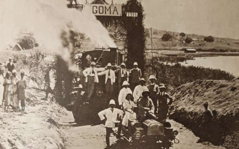
“On 12th December 1911, the Reichstag had formally approved the extension from Tabora to Lake Tanganyika. There was considerable doubt about the most suitable terminus on the Lake and alternative surveys aimed for Kigoma, Karema and Bismarckburg, at the southern end of Lake Tanganyika. After the surveyors had found a comparatively cheap and technically admirable way of descent from the central plateau to the Luiche delta, it was obvious that Kigoma, with its well-protected harbour, was the right choice. The Mittelland Bahn reached Kigoma on 1st February 1914, fourteen months ahead of contract time. The rate of progress was greatly aided by the introduction of a mechanical method of plate-laying. Over the 1,048 kilometres from Morogoro to Kigoma, the mean annual progress was 190 kilometres, while the section from Tabora to Kigoma was built at the rate of 266 kilometres a year. The port installations were not finished by the outbreak of the First World War, but they were sufficiently advanced to permit the use of Kigoma as a naval base. By an agreement with the Colonial Government dated 1st April 1913, the Railway Company became responsible for operating the Dar-es-Salaam dockyard, the fleet of coastal steamers and the marine services on Lakes Tanganyika and Nyasa. One of the two steamers ordered by the Railway Company, the Graf von Goetzen was commissioned in time to play a small part in naval operations on Lake Tanganyika. This ship of 1,575 tons was originally built in sections in Germany and assembled at Kigoma. She had an adventurous youth, which ended by scuttling off the mouth of the Malagarasi river. At the end of the war the Belgians salvaged the Graf von Goetzen and towed her back to Kigoma. There she sank at her moorings and lay at the bottom of the lake until she was again salvaged by British engineers. Re-named Liemba the original name of Lake Tanganyika-she was re-conditioned at a cost of £30,000 and [then] played a notable part in the traffic across and around the Lake.” [1: p93-95]
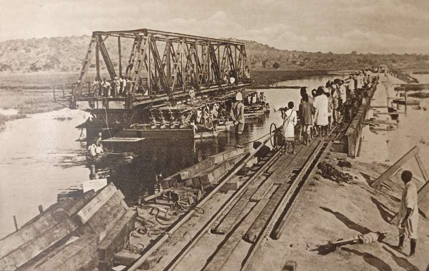
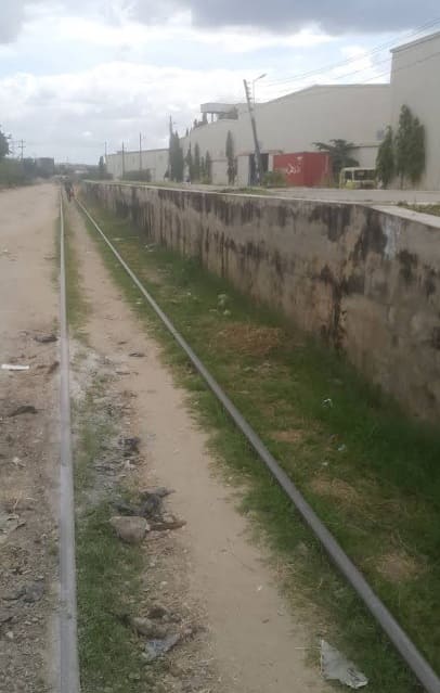
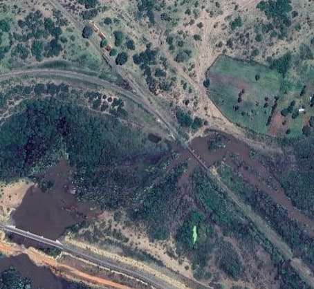
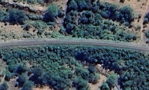
Hill notes that construction of the Mittelland Bahn provided nowhere near the same difficulty as was faced by the engineers working on the Uganda Railway. For much of its length, it crossed relatively flat land, generally at around 4,000ft above sea level. Difficulties were encountered crossing the plain either side of the River Ruvu, crossing the Mkata plain, and the Nyahua and Malagarasi rivers. These were all drainage arteries, flooded during the rains, and the heavy black clays made matters more awkward. The building of the bridge over the River Malagarasi was the most notable engineering feat. The 50-metrecentral truss-girder was assembled on pontoons at low water and floated into position on rising flood waters.
The key problems which were encountered by, or which beset, the Mittelland Bahn were very similar to those encountered by the engineers building and running the Uganda Railway, these included:
- Sparsity of population over much of the route: “two thirds of Tanganyika [then German East Africa and now Tanzania] is entirely uninhabited and … two-thirds of the population is concentrated on one tenth of its surface. Along the way of the Central Line there is a fairly high density of population around Dar es Salaam, south of Morogoro and around Dodoma. There is a comparatively small pocket of population at Tabora, and another concentration of people around Kigoma, mainly to the north-east. From Manyoni to Tabora and thence to within a few miles of Kigoma the population is very small and widely scattered. In those circumstances, the maintenance of an adequate labour force was a constant cause of anxiety. It was exceedingly difficult to keep the labour force supplied with food and water and to avoid heavy wastage from sickness in a countryside where tsetse-fly and mosquitoes were dangerous and unrelenting enemies.” [1: p96]
- Water was also a problem: There was “either ‘water, water everywhere or not a drop to drink’ or to use, as flood and drought chased each other down the seasons of the year. In the dry lands between Dodoma and Kigoma the transport of food and water to the construction camps was largely undertaken by Sikh and Punjabi contractors, who bought large numbers of native donkeys from Unyaturu, Usandawe and Masailand and, despite the menace of tsetse-fly, made good use of them as pack animals. It was not just a matter of supplying the gangs with drinking-water. In order to maintain a reasonable rate of progress it was essential that bridges and culverts be built well ahead of the plate-layers. That meant the transport of many thousands of tons of cement and water for the masonry.” [1: p96]
Hill tells us that:
“The total cost of the Mittelland Bahn was approximately 111 million marks, involving an interest burden of 4.4 million marks/year at the rate of 4% guaranteed by the Reich. The balance sheets of the Railway Company showed a surplus of revenue over expenditure, exclusive of interest charges, which increased from 94,000 marks in 1908 to 1,778,000 marks in 1913. This surplus was decreased by payments to a Renewals Fund, which rose from nothing in 1908 to 816,000 marks in 1913. During the three years 1911, 1912 and 1913, nearly half of the railway’s revenue was derived from the carriage of construction material, so the prospect of the Mittelland Bahn paying its way after railhead had reached Kigoma was remote. The Railway Company was never able to make more than a small contribution to the interest charges of 4.4 million marks a year which had to be met by the Colonial Government with the aid of the Reich’s guarantee. Early in 1914, the rolling-stock of the Mittelland Bahn consisted of 63 engines, 44 of which were tank engines, 30 passenger coaches, 319 goods wagons, 29 water-trucks, 4 cranes, 39 derricks and 98 trollies. The station accommodation was of a very high standard, Undoubtedly the Mittelland Bahn contributed to the development of the country, but in German times the economic advantage derived from it was considerably less than from the Nordbahn.” [1: p96]
Hill goes on to report on a febrile atmosphere which affected the German authorities as they looked further to the West. The planned Cape to Cairo line and the growing number of British immigrants to the country to the West of Lake Tangayika led to fears that major work would be undertaken by the British to connect much of the area beyond the Lake to the Kisumu to Mombasa line. Concerns were expressed by the German Consul that without further significant rail investment between Lake Tanganyika and Lake Kivu it would be unlikely that the British would be dissuaded from taking the Cape to Cairo line through the areas of Belgian influence and particularly through Stanleyville (modern Kisangani).
The German Consul’s assessment was quoted by Hill:
“”There remains the problem of a link with the Cape to Cairo route. As far as the goods traffic on the Mittelland Bahn is concerned, one has to consider the present economic situation in the area to the north-west of Lake Tanganyika and to the west and north-west of Lake Kivu. A projected extension from Tabora to Ujiji would greatly benefit from any economic development in that area, especially if supported by a feeder line Usumbura to Ishangi and a steamer connection, Ishangi-Kissenji-Bobandana. It is impossible to connect Lake Tanganyika and Lake Kivu by steamer traffic via the River Russusi but only by railway. Such a railway would probably persuade the British to build a link with their own north-south system. Germany has a great interest in such a link, and to ensure that the Cape to Cairo route shall not go through Stanleyville or anywhere else in Belgian territory. If the Cape to Cairo route were eventually to cross Belgian territory, this would only strengthen the British influence in Katanga and the Province Orientale. The construction of a railway from Usumbura to Ishangi and steamer traffic on Lakes Kivu and Tanganyika could make Germany master of the central part of the Cape to Cairo route and also capture for Germany the traffic from the eastern parts of Province Orientale to the south of the Equator. Traffic would go via Ujiji and Dar es Salaam in preference to the more expensive route via Cairo. Germany will, however, be unable to prevent part of the traffic in the Walikali area from making use of the Lake Victoria – Mt. Sabino line and thence to the Mombasa line. By constructing the Usumbura – Ishangi line Germany would be able to capture whatever remains of this traffic. This would also prevent Britain from constructing an extension of their railway from Mt. Sabino via Lake Kivu to Lake Tanganyika.
“For Germany the most favourable solution of these problems would be to divert the British altogether from Lake Kivu and persuade them to use for their Cape to Cairo route the connection via Ujiji and Tabora and a railway to be constructed by Germany from Tabora to Mwanza. However, there appears to be little hope for this solution any longer.” [1: p98-99]
Apparently the Belgian authorities were also alarmed by the increasing number of British settlers in the Katanga region. They were seeking to encourage settlement by Belgian subjects and were hoping to link Katanga with central Congo by rail so as to ensure the transport of minerals to Antwerp on traffic routes solely under Belgian control. They appeared to have accepted that a mistake had been made when they favoured the construction of a rail link between Katanga and Rhodesia.
The German authorities were clearly not willing to be content with the building of the Mittelland Bahn. “The influx of capital had given a false sense of prosperity and imports had risen from £559,403 in 1903 to £1,697,085 in 1909. They continued to rise, and reached £2,515,000 in 1912. A large part of the imports was directly or indirectly concerned with the construction of the railway. There had also been a remarkable increase of exports, which rose from £214,802 in 1900 to £655,904 in 1909 and to £1,570,000 in 1912, but most of them came from around Tanga and along the coastal belt and did not provide a commensurate increase of revenue to the railways.” [1: 99-100]
Hill continues:
“On Rufita Hill at Tabora was the headquarters of a large and efficient organisation for the building of railways. There was a strong feeling that the services of these should not be lost to German East Africa. The tendency to over-estimate the economic potentialities of the country and the urge to develop ‘dormant wealth’ were stronger than ever. There seemed to no difficulty in obtaining the necessary capital from Germany, and so the only question was not whether to build railways but where to build them.
“The north-west corner of Deutsch Ost Afrika, the mountain lands of Ruanda and Urundi, was the most attractive prospect for a railway. There lived nearly half the population of German East Africa in country barely touched by the German economy. In the three Residencies of Ruanda, Urundi and Bukoba, the people were ruled by their chiefs or Sultans, under the light supervision of the German Residents, and they paid virtually no taxes. A line from Tabora to the eastern border of Ruanda-Urundi would be about 500 kilometres long and two-thirds of it would cross easy country. Once the elbow of the Kagera river was reached, there was the great attraction of several hundred kilometres of navigable waterway. Towards the end of 1912, the Governor, Dr. von Schnee, who had just succeeded von Rechenburg, set off with Allmaras, the Railway Commissioner, to examine the prospect for himself. He was followed by a reconnaissance party of surveyors and engineers. During the dry season of 1913, a party of sixteen engineers employed by the contractors prepared detailed plans and estimates. These were submitted to the Colonial Office early in 1914, together with a memorandum which pointed out that the taxes which could be collected from the natives of Ruanda and Urundi would provide an adequate and legitimate financial return on the capital investment. The memorandum also noted that technical and economic reasons, including the avoidance of competition with the Uganda Railway, made it desirable to reach Ruanda direct by railway rather than by crossing the Lake from Mwanza. The scheme was quickly approved and 17 million marks were provided by the 1914 budget. Construction from Tabora started forthwith and the work proceeded after the outbreak of war and during 1915. The earthworks and bridges of the first 120 kilometres were completed and 40 kilometres of rails, which arrived in the last ship to reach Dar-es-Salaam, were laid. In 1917, the Belgians removed 29 kilometres of these rails to continue their Katanga railway to the Lualaba. The sleepers were stacked at Tabora. There remained a short branch of 11 kilometres into a fuel area north of Tabora.” [1: p100]
Later in his book, Hill notes some population figures:
“In the March of 1913, the native population of German East Africa was estimated as 7,641,800, of which 3-5 millions lived in Ruanda-Urundi. The white population was 5,336, of which 4,107 were of German nationality and 90 were British – the British investment in German East Africa was about £1.5 millions. In 1912, the white population also included 268 so-called ‘Colonial English’, mainly from South Africa. The Asian population was nearly 15,000. In 1914, the white population included some 3.500 adult males. Of these about 450 were Government officials, 260 were officers and NCOs of the Defence Force, 450 were missionaries, 300 were engineers and 809 were planters. [1: p109]
Returning to Hill’s account of the railways in German East Africa, Hill says:
“Towards the end of 1913, the proposal to continue the Tanga line to Lake Victoria was finally abandoned. In 1912, the Director of the Railway Company had written: “It seems advisable to leave to the Uganda Railway the further development of the German regions along Lake Victoria. …. More important and mainly for strategic reasons would be the construction of a railway to Lake Nyasa.” In the following year, the Governor wrote: “The valuable districts along Lake Victoria are already opened by the Uganda Railwa. … Vast areas of the Protectorate are still awaiting development. For this reason the good British communications on the Lake must be utilised and rail-ways should be built in other directions.” When war came, the situation changed, and in 1915 German engineers surveyed a line from Isaka, on the route of the Ruanda Railway, to Mwanza.” [1: p100-101]
Hill also notes that, “In 1915, there was a reconnaissance survey for a railway joining the Mittelland Bahn with the Nordbahn. The routes examined lay between Mikese and Kilosa on the Central Line and between Korogwe and Mombo on the Northern Line.” [1: p101]
After many reversals in the first two years of war a British offensive commenced in March 1916 under the leadership of Lieut-General J. C. Smuts. The campaign was reported by Hill as being successful but only “at a terrible cost in human life and suffering.” [1: p146]
The Mittelland Bahn was an essential supply line for German forces resisting a British advance from the North and rather then engaging in direct fighting the German command engaged in a series of strategic manoeuvres which were effectively a manage retreat. Destruction of important structures on the Northern line meant British endeavours had to focus on rebuilding damaged infrastructure which slowed any advance. This is not the place for a retelling of the story of the war. Hill devotes many pages to this and refers readers to other works such as the second volume of The History of the Royal Army Service Corps. [1: p157][7]
By the end of 1916, Hill reports:
“The railways, the ports and the principal settled areas of German East Africa had been occupied. Nearly two-thirds of the country was in Allied hands. Nevertheless, Lieut.-General Smuts had not gained any decisive military success against von Lettow-Vorbeck. The summary of the campaign-in The Official History of the Great War, ‘Military Operations, East Africa,’ expresses these views:
“Faced by a wary and able opponent, he [Lieut.-General Smuts] had judged shrewdly and planned skilfully. But in effect his operations, while they had finally wrested from German possession a vast tract of territory, had amounted virtually to a succession of turning movements, resolutely carried through in the face of constant hardship and privation, effectively manœuvring the Germans into continual retreat at little cost in British battle casualties, but falling short, despite all efforts, of the ultimate aim of defeating the enemy.
“Throughout, the Commander-in-Chief had been hampered by the continuously increasing difficulties involved in moving and maintaining his troops on a scale un-precedented, in point of time, numbers and distance, in any previous military operation conducted in similar conditions of climate and terrain.” [1: p164]
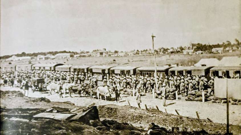
The British reached the Mittelland Bahn in July 1916 and discovered that although bridges and rolling stock had been destroyed by the retreating German forces, the permanent way was largely intact. We have noted elsewhere the way in which the narrow-gauge trolley line from Mombo to Handeni was very successfully made operational by using converted road vehicles. [8]
“The South African Pioneers and Motor Transport Companies resorted to a [similar] device. … As the first step towards opening the line, the bridges were only repaired sufficiently to carry motor vehicles. Napier lorries, weighing five to six tons loaded, were used as tractors to pull trailers and open trucks, carrying ten tons of supplies. The 2nd Division was thus able to use the railway almost at once and the rail tractors made it possible to supply the division along the 120 miles of line between Dodoma and Kilosa. It was not for several months that the bridges were restored to a fit state to carry heavy steam locomotives.
With the arrival of the main force at Morogoro and the capture of Dar es Salaam, the same device was used to get the railway going between the two places. The Motor Transport workshops at Mombo and Nairobi converted lorries into rail tractors as fast as possible and eventually 35 of them were shipped to Dar es Salaam from Tanga and Mombasa. The four railway units of Sappers and Miners – the 25th, 26th, 27th and 28th Companies, which formed the Railway Battalion, commanded by Lieut.-Colonel C. W. Wilkinson of the Royal Engineers – tackled the repair of the bridges and the permanent way. The report of the Director of Railways, Sir William Johns, stated:
“On the establishment of through communications for tractors between the Army and the base at Dar es Salaam, the second step was to strengthen the repairs up to heavy engine standard. This duplication and even triplication of repair work delayed the advent of the locomotive to some extent, but the proper feeding of the Army was the first consideration and the rail tractors were successful in dealing with that. In spite of the delays at the port, the first engine and train reached Ruvu on October 4th. Simultaneously the first tractors reached Dar es Salaam from the west and supplies began to go forward from the base. After a few days, the tractors began working from Ruvu westwards, locomotives filling the dump from Dar es Salaam. On the 21st [October], the locomotives began forming a dump some 30 miles beyond Ruvu. On the 27th the Ngerengere river was crossed and a new dump formed on the west bank…. The section of line from Ngerengere to Morogoro (53 miles) was an exceptionally heavy one, with numerous deep nullah crossed by high bridges, all of which had been seriously damaged by the enemy. It was not, therefore, till the 24th of the following month (November) that the train reached Morogoro. Meanwhile the tractors had done their work and the Army was being well fed. The gradual advance of the locomotive had enabled military operations to be resumed in the Dodoma area, tractors released from the lower section being available for transport of supplies farther westward.”
“On the general subject of railway construction in the field, Sir William Johns pointed out the great advantage of the metre gauge standard in East Africa. It was capable of carrying its own constructional material simultaneously with supplies for a large army. ‘The experience of the campaign,’ he wrote, ‘showed that in easy country – and much of the alignment is easy – a metre-gauge line can be laid at the rate of a mile a day and feed an army of 30,000 men.'” [1: p167-168]
Hill concludes his chapter on the war with these comments:
“The magnificent achievement of the technical troops employed on the repair of the Central line is best illustrated by the fact that in little more than three months they restored over 300 miles of vital railway to a state capable of carrying the supplies of Lieut.-General Smuts’ forces advancing south of the line.” [1: p169]
As a result of the Treaty of Peace with Germany, signed on 28th June 1919, Germany renounced all her rights over German East Africa. The Allied powers agreed a mandate which permitted the British to administer the territory which was named the ‘Tanganyika Territory’. Only the small territory of Ruanda-Urundi was placed under Belgian administration.
Hill explains that:
“When the civil administration assumed responsibility for the Tanganyika Railways on 1st April 1919, an immense task of repair and reorganisation had to be tackled and the prospect of the railway system paying its way was dubious and remote. The Northern line (351.7 kms.), henceforth known as the Tanga Railway, had been severely damaged by the Germans. All ten of the major bridges, with aggregate spans of 260 metres, and 23 minor bridges, with aggregate spans of 160 metres, were blown up: most of the water tanks and pumps were destroyed; 30 miles of track were picked up and thrown into the bush, and 60 sets of points and crossings were damaged.
“The Voi-Kahe line (149 kms.) lay mainly within Kenya. It was essentially a military railway built for purposes very different from the working of open-line traffic on a commercial basis.
“On the Central line (1,244 kms.) most of the damage was between Dar es Salaam and Dodoma. The retreating Germans blew up 92 major bridges with aggregate spans of 2,200 metres and 14 minor bridges; more than 100 sets of points and crossings were destroyed, and most of the watering stations were damaged. As already related, temporary repairs were soon effected. The Tanga line was opened for through traffic in the August of 1916 and the Central line was again being worked in the February of 1917. … Nevertheless, the physical damage done to the lines was by no means made good while they were under military control. All efforts were naturally concentrated on military objects and the railway service was regulated accordingly. The maintenance of the permanent way and of buildings was only undertaken in so far as it was necessary. The civil administration, therefore, had to repair the deterioration and destruction of the war, … sort out the consequent confusion and … build up an organisation suitable for peace conditions. The task was not aided by the failure to appoint a substantive General Manager until late in 1920, … nor by the fact that the section of the Central Railway from Tabora to Kigoma was not handed over by the Belgians until the April of 1921. …
“During the last two phases of the East African campaign three lines were built to carry supplies to the forces. From the Central line a branch, 25 kilometres long, was built from Dodoma towards the Great Ruaha, but the rails were soon picked up as they were needed elsewhere. A short tramline in-land from Kilwa was also soon picked up. The Lindi line originally ran from Mingoyo to Mtua. It was later extended for about 44 miles down the creek towards Lindi and then from Mtua through Ndanda to Masasi, giving a total length of about 90 miles. The rails varied in weight from 12 lb. to 20 lb. to the lineal yard, and the steepest grade was 1 in so up from the coast and 1 in 33 down to the coast.” [1; p179-180]
Our focus here is on the Central line. Repairs commenced on the line in 1919. Permanent repairs to the line were completed by the end of 1922, with the exception of a few structures. A great deal of bush clearance had to be undertaken. Repairs to station buildings and staff quarters were required but funding constraints meant that only the most urgent repairs were undertaken.
Towards the end of April 1919, a very serious flood “occurred west of Kidete station on the Central Railway. Nearly four kilometres of the line were under water and for six weeks not a single vehicle was able to travel over this section of the line. That capricious old lady, Mother Africa, then went from one extreme to another, from flood to drought. Another factor which adversely affected traffic on the Central line during 1919 was a famine which afflicted a large part of central Tanganyika. The removal of foodstuffs from the famine-stricken area, which stretched for about 340 kilometres along the railway, was prohibited for the greater part of the year. The loss of down traffic was largely compensated for by the up traffic of foodstuffs dispatched from Dar es Salaam for the relief of the famine. These factors made it very difficult for the Railway Administration to estimate the probable traffic in a more normal year. An official report stated:
“Traffic on the Central line is confined to a few stations, the majority not even paying the wages of the staff, and the country for the most part appearing unproductive. As many stations as possible have been closed and only those kept open which are necessary to avoid excessive runs and to provide crossing places. There are 36 stations open and 18 closed.” [1: p181-182]
Rolling stock on the Central Line
Hill tells us that:
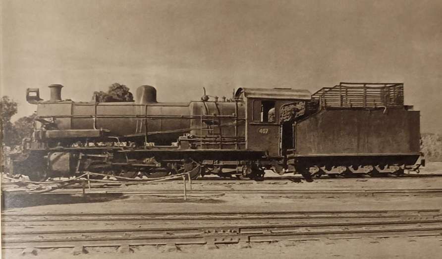
“On the Central line the Tanganyika Railways inherited from the Germans, 20 German goods engines (2-8-0 type) of which six were derelict; 22 German tank engines (2-8-0 type) of which six were derelict; two German tank engines (0-8-2 type); seven German Mallet engines (0-4-4-0 type), of which two were derelict and five were laid up, and six German shunting tank engines (0-4-0 type). In addition there were nine engines of British manufacture which had been brought over from India during the war. Four of them were G-class (Indian) ABR engines (4-8-0 type); one was an F-class (Indian) (0-6-0 type) and four were G-class (Indian) Nizam engines (4-8-0 type). In 1922 the four G-class ABR engines and the F-class engine were packed for return to India. The German goods engines, with bogie tenders, were capable of pulling a maximum load of 16 four-wheeled vehicles over all sections of the line. The German tank engines had less tractive effort and less boiler capacity, and they were only suitable for use on the plateau to the east and west of Tabora. It was estimated that the locomotive stock was sufficient to work one train each way per day between Dar es Salaam and Tabora. By the end of 1921 one passenger train and one goods train ran once a week in each direction between Dar es Salaam and Kigoma, and a mixed train ran once a week in each direction between Dar es Salaam and Tabora. In addition a water train ran once a week along the length of the line. It was also estimated, with unwarranted optimism, that the German goods engines would last for another twelve years, the tank engines for ten years, and that new engines would not be required until and unless the traffic increased to more than a train a day between Dar es Salaam and Tabora, in addition to fuel and construction trains.” [1: p182]
Hill tells us that a significant amount of money was spent on reconditioning the German engines. None were satisfactory and all were scrapped as soon as money was available to buy new British engines.
Other rolling stock was also in poor condition across the three maintenance depots in Tanganyika, 30 wagons had to be completely rebuilt, 400 underwent heavy repairs and 190 light repairs.
Hill says that the German passenger stock was not divided into compartments. The seating was sometimes arranged with a centre gangway and sometimes with a side corridor. Lighting was generally by acetylene or oil-burning lamps. These coaches were renovated, divided into compartments and fitted with electric lighting.
In 1923, the first 38 miles of the Central Line out from Dar-es-Salaam were re-laid with 55-lb British standard track. Also in 1923, six new 4-8-0 tender superheated DL Class locomotives were imported and set to work on the Central Line along with 21 bogie wagons of 25 tons. The workshops were completing new brake vans and passenger coaches.
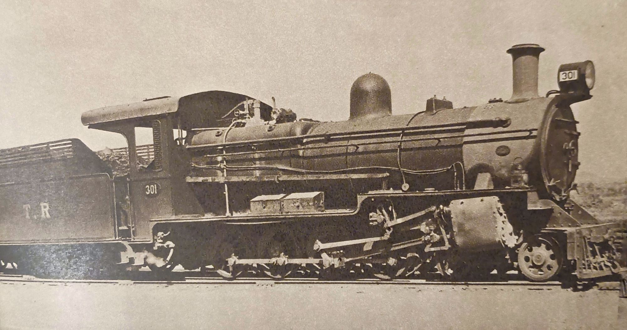
In 1926, eleven new Mikado engines (2-8-2) were imported from the UK. Two shunting engines were imported in 1927 and seven more in 1929.
Much of the history of the Central Line during the British mandate, until the start of World War II, is covered here. [11] Another article covers the years of World War II and its aftermath, this can be found here. [12]
The Mittelland Bahn (The Central Railway) from Dar-es-Salaam to Mikese
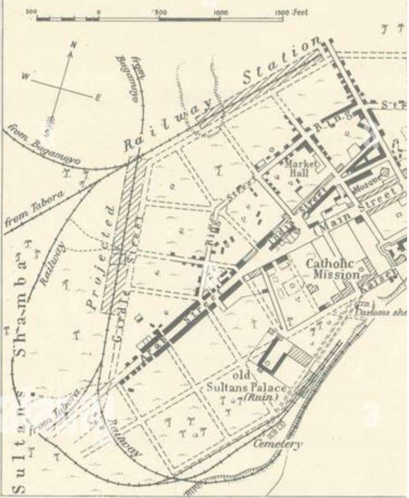
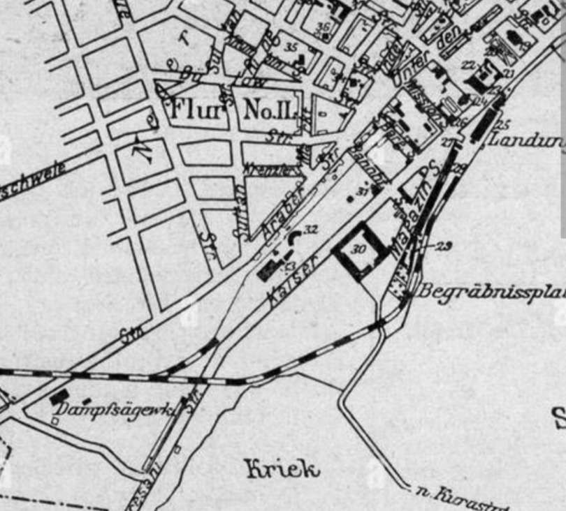
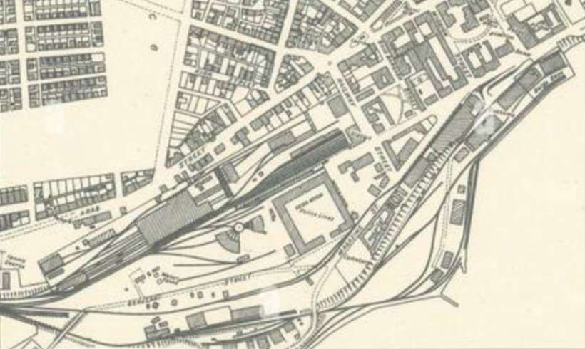
Very early proposals for a railway running out of Dar-es-Salaam can be seen on the plan immediately below. The year is 1891, some considerable time before the substantive MGR was built.
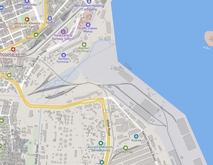
In the 21st century, the metre-gauge railway (MGR) terminus in Dar-es-Salaam is at the Kamata Karaikoo Station, located in the Gerezani area of the Ilala Municipal Council. This temporary MGR station sits about 1.2 kilometres short of the original, closed Central Railway Station. It is one of three different terminus stations in Dar-es-Salaam.
The other two stations are:
- The modern Standard-Gauge Railway Terminus which sits adjacent to the old Metre-Gauge Railway Terminus – Central Railway Station.
- The Tazara Railway Terminus in Dar-es-Salaam is located in the Vingunguti area of the Ilala Municipal Council, along Julius Nyerere Road near the Mfugale Flyover and the TAZARA Authority Houses.
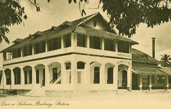
The original MGR Central Station was a substantial building which opened in 1906.
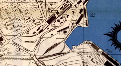
A somewhat broader and later view of the docks area of Dar-es-Salaam showing both Malindi Wharf and Main Quay as well as Central Railway Station, This extract comes form a map published by the Tourism Division of the Ministry of Natural Resources and Tourism Dar es Salaam © Public Domain. [18]
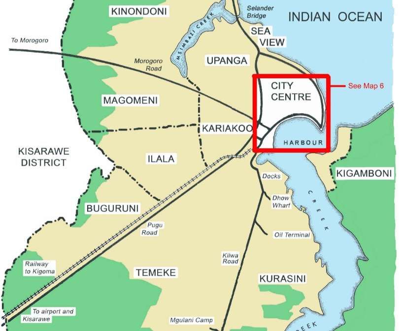
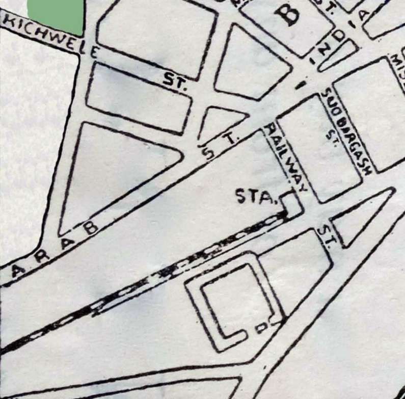
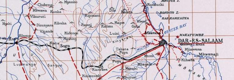
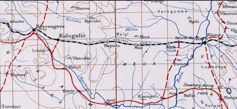
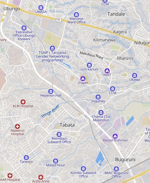
We will follow the line in some detail below, but before we do so, here are two extracts from a map compiled, drawn, and printed by the E. A. Survey Group of the British Army in February 1942 which show the Central line heading West from Dar-es-Salaam through Ruvu to a little to the West of Ngerengere. These two map extracts will be used as a reference against which the remainder of this article can be checked.
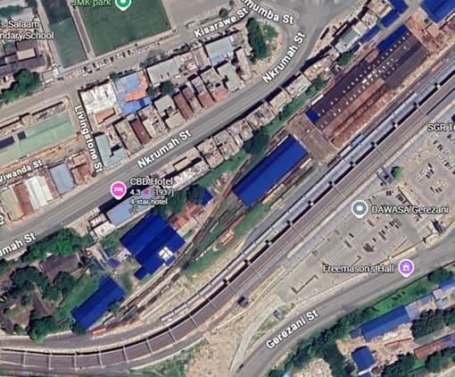
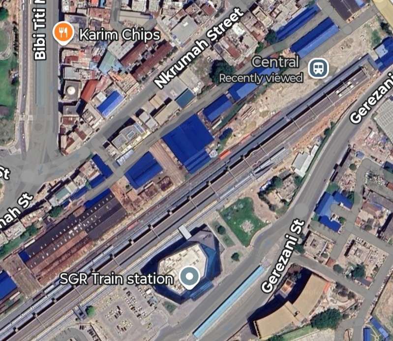
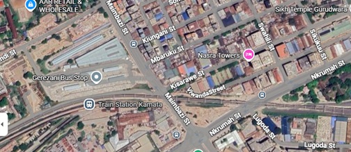
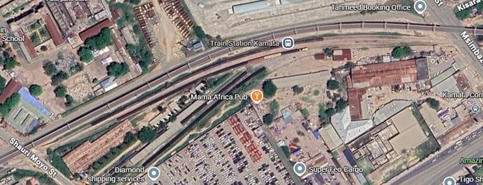
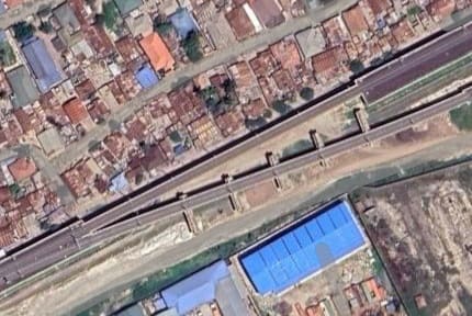
Leaving the City Centre, the MGR (and now also the SGR) crossed what are now Nkrumah Street and Msimbazi Street and then entered Kamata Railway Station as shown on the Google Maps extract below: …
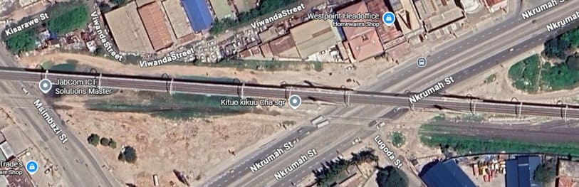
This next image shows the road-crossing at Msimbazi Street. The SGR is at the top of the image, the MGR road-level crossing has the two lines referred to above. The line from the port runs across the bottom of the image. That from the workshops, to the North of the line serving the port. [Google Maps, June 2026]
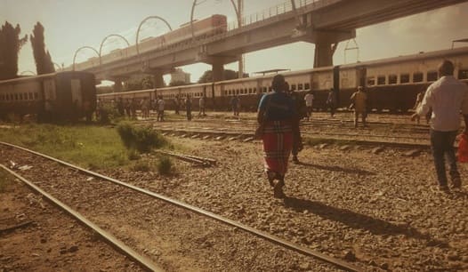
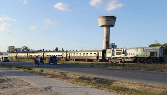
Looking East at Kamata Railway Station. Commuter coaches sit on one of the two lines through in the station, (c) Isaya Thomasi, 2020. [Google Maps, June 2026]
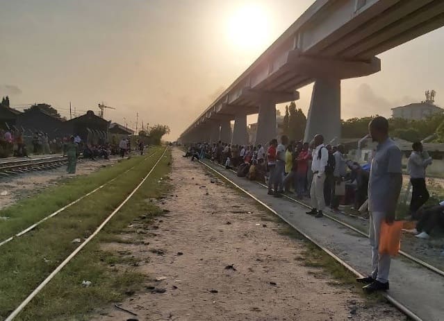
Looking West at Kamata Railway Station with commuters waiting in the evening sun for their train home, (c) Herbert Moshi (2020). [Google Maps, June 2026]
Another evening photograph, this was taken in January 2025. It shows a train on the SGR, a commuter train on the MGR and some stock set aside in a metre-gauge siding, (c) Assistmaster26. [Google Streetview, June 2026]
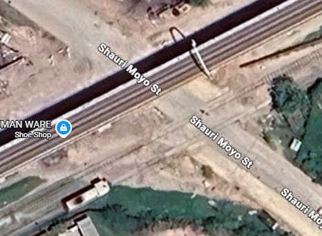
The Shauri Moyo Street Level-Crossing. [Google Maps, June 2026]
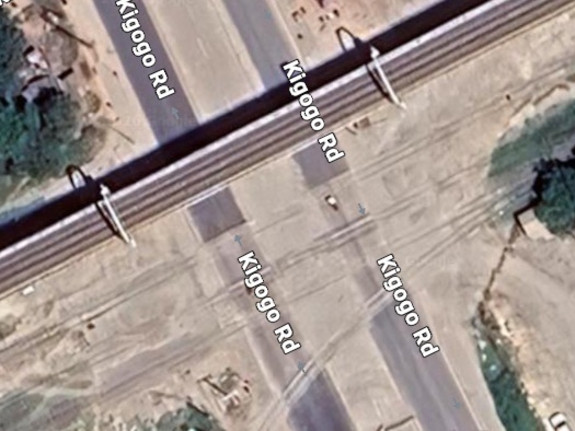
The Kigogo Road Level-Crossing. [Google Maps, June 2026]
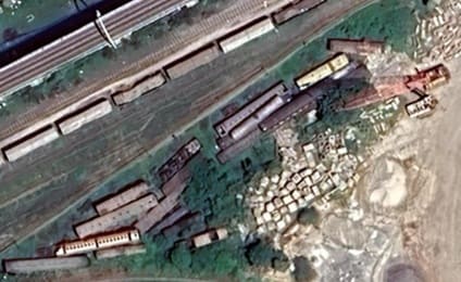
Abandoned rolling stock adjacent to the MGR at Kamata. [Google Maps, June 2026]
For more about the railways in Dar-es-Salaam please click here. [46]
The high-level SGR and the MGR run immediately adjacent to each other on their way out of Dar-es-Salaam. The MGR runs through Bungoni Railway station. …
Just to the West of Bungoni Railway Station the SGR port branch bridges the MGR and joins the line from the SGR Central Railway Station. [Google Maps, June 2026]
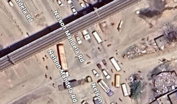
The Nelson Mandela Road MGR Level-Crossing in Bungoni. [Google Maps, June 2026]
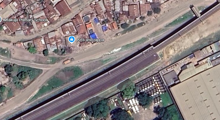
Immediately to the West of Nelson Mandela Road is Buguruni Railway Station, (c) Kaiza Bananga (2018). [Google Maps, June 2026]
To the West of Buguruni Railway Station, the MGR passes under the high-level SGR. The is a branch line heading North away from the MGR main line at that point.
The next few images take us on a diversion along the commuter line in the above satellite image. …
The three stations on this short branch are: Relini, Mabibo and Ubungo Maziwa which are shown below: …
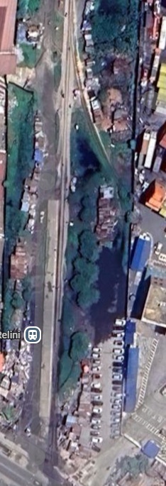
Relini Railway Station – Note the trailing stub siding which serves the adjacent container terminal including Africa Global Logistics Tanzania’s base. [Google Maps, June 2026]

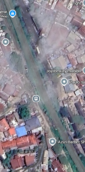
Mabibo Railway Station. [Google Maps, June 2026]

Two photographs of Ubongo Maziwa Railway Station, (c) Hussein Iddy (2021). [Google Maps, June 2026]
We return now to the MGR Central line heading West away from Buguruni Railway Station.
The main access road into Vingunguti from Julius K Nyerere Road bridges bothe the MGR and the SGR. [Google Maps, June 2026]
Beyond the flyover, the SGR and MGR continue in parallel on a West-Southwest bearing towards Karakata Railway Station.
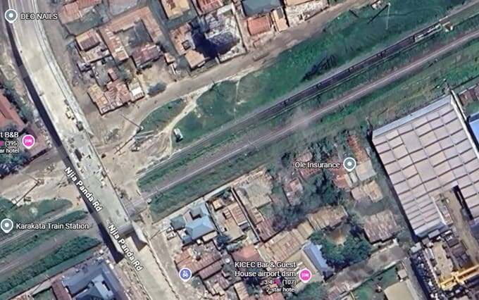
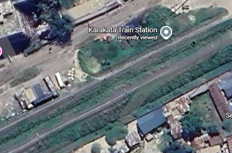
Karakata Railway Station is the Airport Station on the MGR The Airport sits to the South of Julius K. Nyerere Road which itself is just off this satellite image to the South. [Google Maps, June 2026]
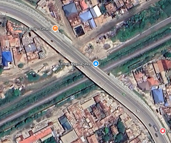
Another flyover carries a road over the two railways in Kipwa. [Google maps, June 2026]
Through Ukonga, the SGR continues to run in a West-Southwest direction without deviation. The MGR, however deviates to the North for a short distance following the contours of the ground.
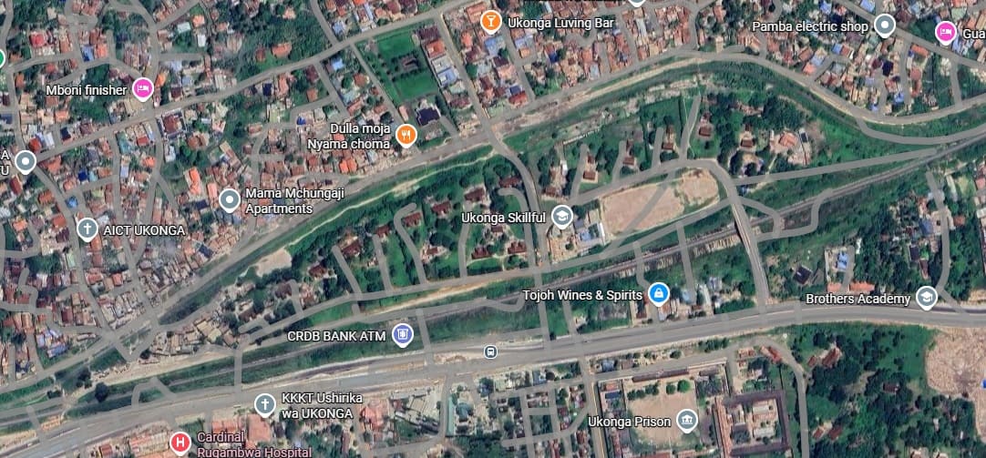
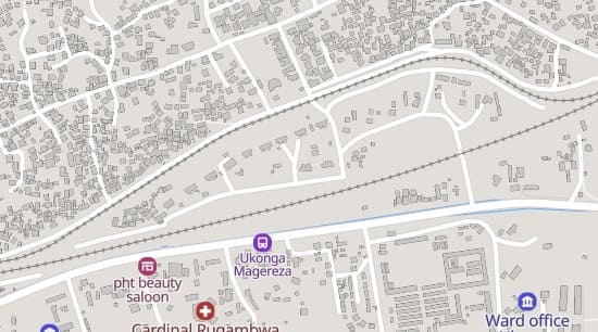
This extract from the MapCarta mapping highlights the deviation to the North by the MGR that is shown on the satellite image above. It is only for a short distance following the contours of the ground. The SGR goes into cutting along this length. [20]
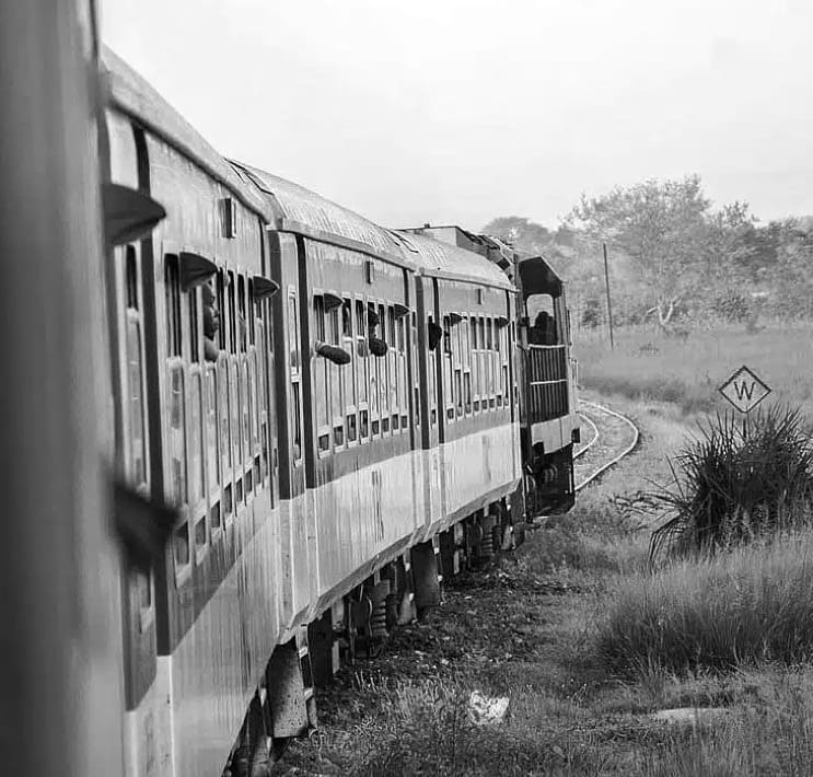
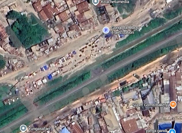
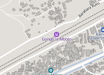
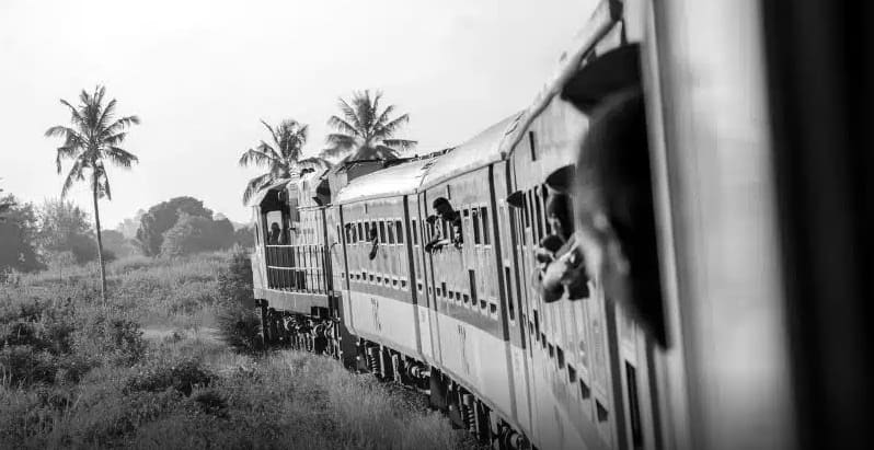
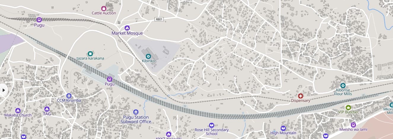
Gongo la Mboto Railway Station is little more than a halt. The MGR is still on the North side of the SGR. [20][Google Maps, June 2026]
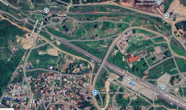
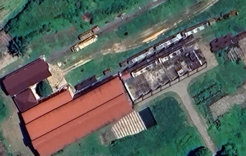
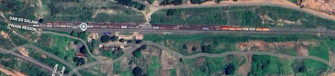
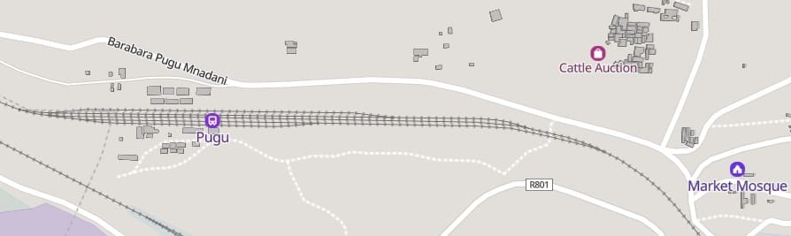
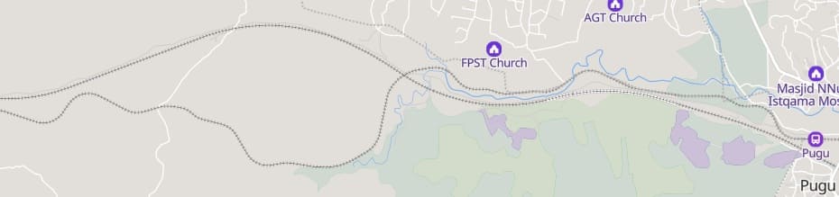
A short distance further to the Southwest the SGR enters Pugu Railway Station. There is a significant length of line with multiple tracks approaching Pugu Station and for a short distance beyond. The MGR follows a more sinuous route tracking the contours into a much smaller MGR Pugu Railway Station.
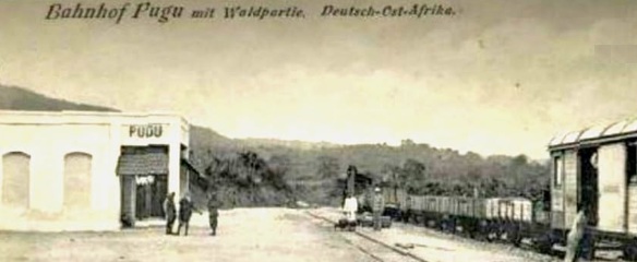
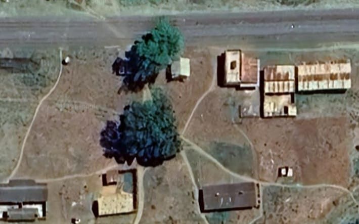
Pugu Metre-Gauge Railway Station in 1910. This image was shared by Jack Mutahanamilwa on the Tumetoka Mbali (Tukumbuke Facebook Group on 23rd July 2024. [25]
Just to the West of Pugu MGR station the metre-gauge line turns North and crosses a murram road. [Google Maps, June 2026]
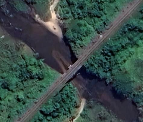
The MGR crosses the Msimbazi River on a steel two-span bridge. A substantial structure is necessitated by high flows during rainy seasons. [Google Maps, June 2026]
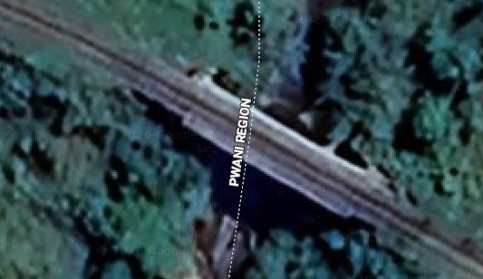
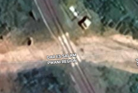
Further West the MGR crosses from the Dar-es-Salaam Region to the Pwani region, crossing a bridge over one of the tributaries of the Msimbazi River. [Google Maps, June 2026]
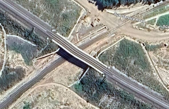
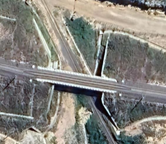
A short distance further West the MGR crosses the SGR service road at level and passes under the SGR. The substantial bridge seems to allow either for and additional metre-gauge line, or for possible flash flooding. [Google Maps, June 2026]
After passing under the SGR, the MGR heads away to the South following the valley of the Msimbazi River, and so for a while follows a significantly different path to the SGR.
In the Kisarawe area and still following the Msimbazi River, the line is crossed by a relatively minor road which heads North to pass under the SGR. [Google Maps, June 2026]
Still traveling West following the Msimbazi River which is now much decreased in volume, the MGR passes under the SGR again. [Google Maps, June 2026]
Now in the Kiluvya area and North of the SGR, the MGR crosses another murram road. [Google Maps, June 2026]
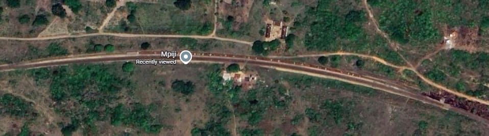
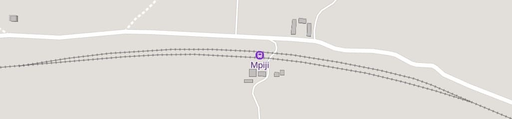
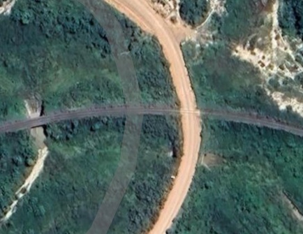
A series of culverts/bridges are provided along the length of both the MGR and SGR to allow for flash flooding in wet seasons. This pair are a little beyond Mpiji where the two lines are much closer together again. [Google Maps, June 2026]
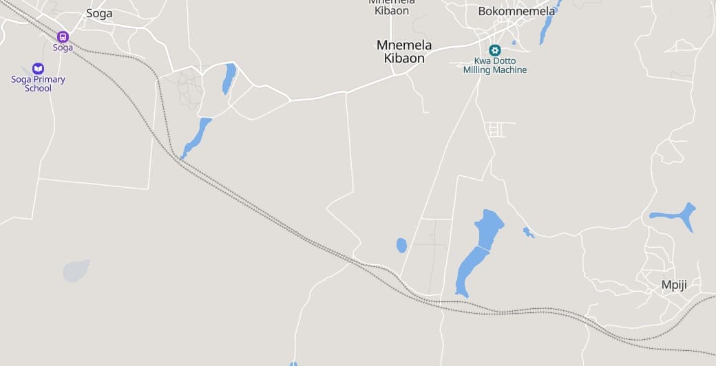
More flood relief culverts/bridges on the MGR and SGR. These last two satellite images and the passing loop at Mpiji age in the vicinity of Bokomnemela. This location is just to the South of a semipermanent lake which overtops in the wet season. [Google Maps, June 2026]
Still in Bokomnemela but further West, another pair of culverts The MGR still runs to the North of the SGR along this section of the route. [Google Maps, June 2026]
Now in the Soga area, another flood relief channel is crossed by a culvert (MGR) and a more substantial structure (SGR). Again, these structures are just to the South of a lake which will overtop in the wet season.[Google Maps, Juna 2026]
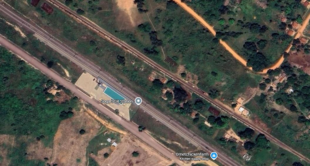
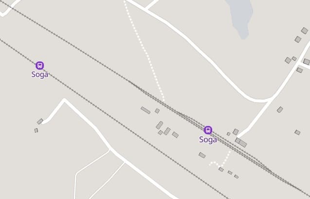
The same location as it appears on the MapCarta mapping. [26]
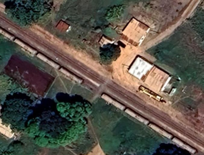
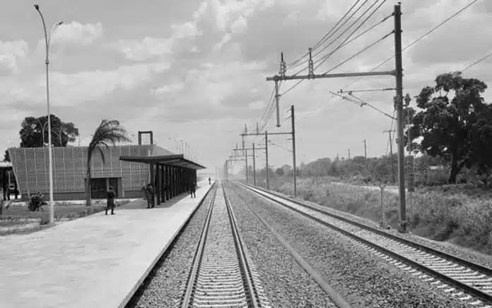
The MGR station buildings at Soga.[Google Maps, June 2026]
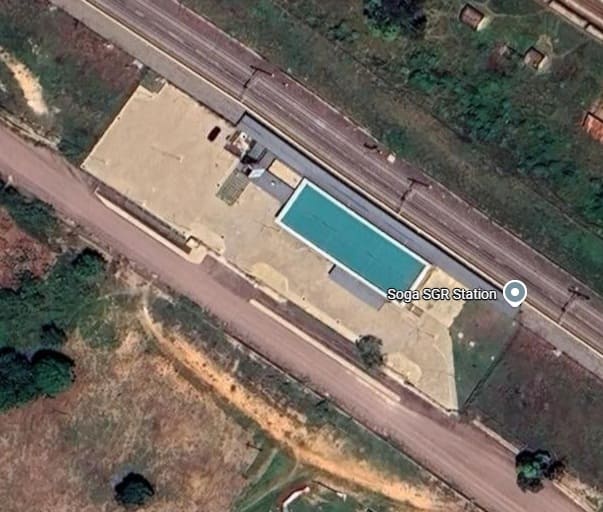
The SGR station building at Soga. [Google Maps, June 2026]
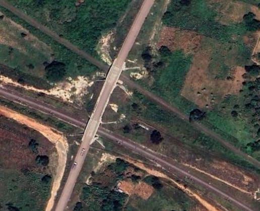
To the West of Soga a bridge has been built over both lines between two murram roads. [Google Maps, June 2026]
Further to the West, a murram road crosses the MGR but not the SGR. [Google Maps, June 2026]
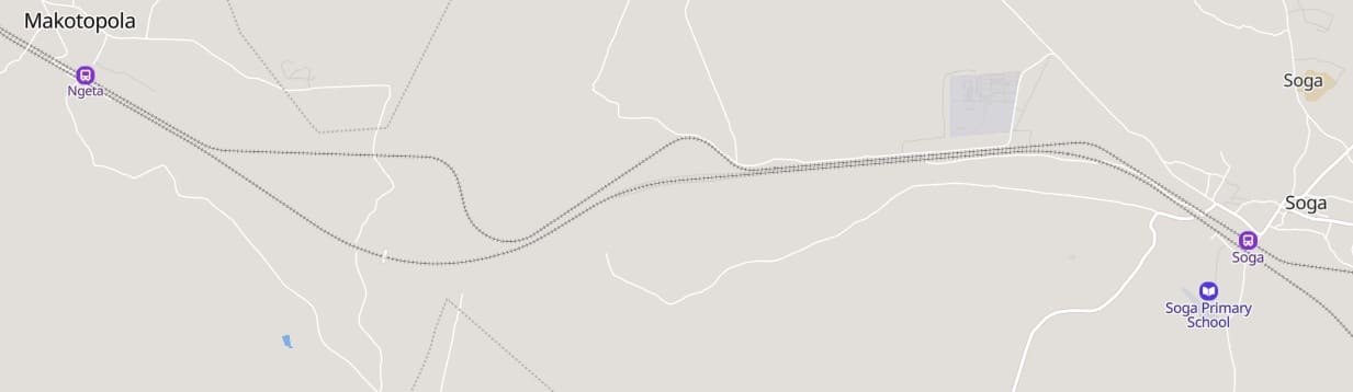
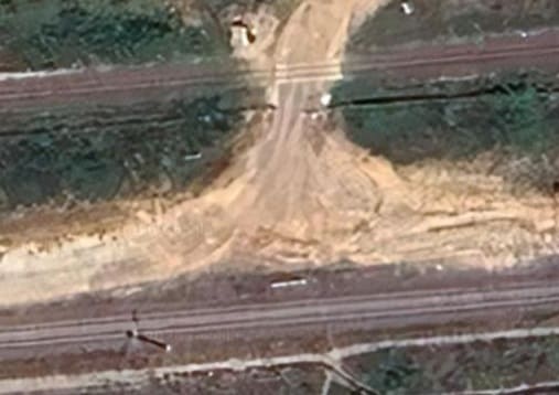
Approximately halfway between Soga and Ngeta, a dry riverbed is crossed by both lines. A relatively small culvert carries the MGR, a larger structure carries the SGR. [Google Maps, June 2026]
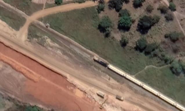
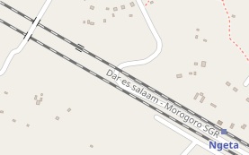
This extract from Google’s satellite imagery shows the murram road at the top-left of the satellite image above. It appears here and in the wider image above that a train has just passed through Ngeta Railway Station on the MGR heading West. [Google Maps, June 2026]
MapCarta shows another road a short distance further Northwest which crosses both railways. [26]
OpenStreetMap shows two separate bridges over the lines at the same location. [28]
Bing’s older satellite imagery only shows the line of the SGR marked but not built. It too shows a road crossing the two lines as above. All these extracts suggest that the road carried over the two lines by bridges built as part of the construction work on the SGR is a new road alignment, rather than a pre-exiting road. [29]
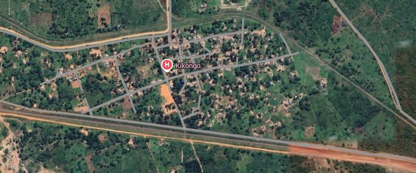
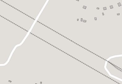
This MapCarta extract shows the two lines (MGR and SGR) more clearly and it is easy to see the branch line head North. Neither line appears to have a station at Kikongo. [26]
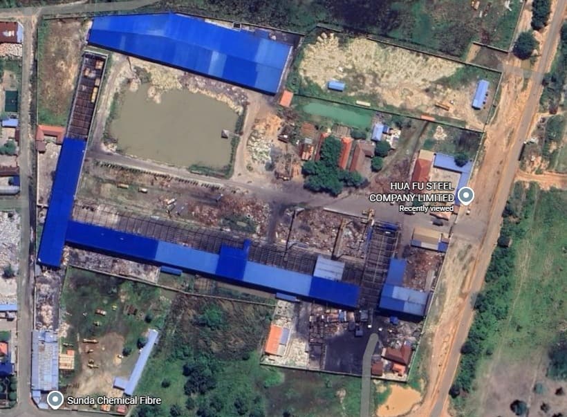
The branch line noted above extends only about 3.5 km North of the MGR main line, to Hua Fu Steel Company Ltd. [30]
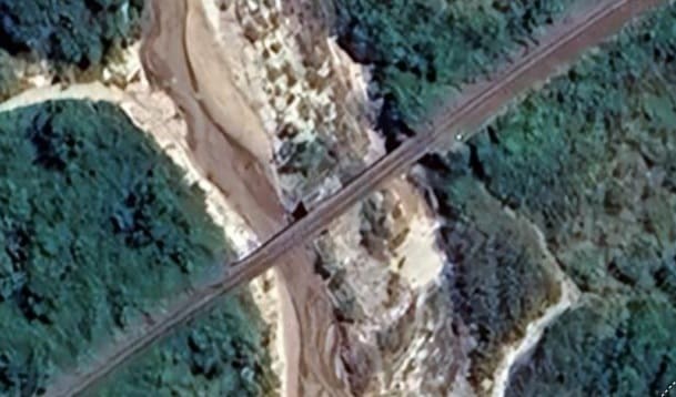
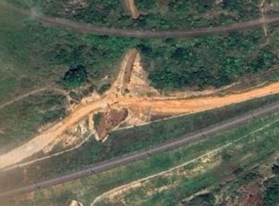
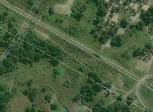
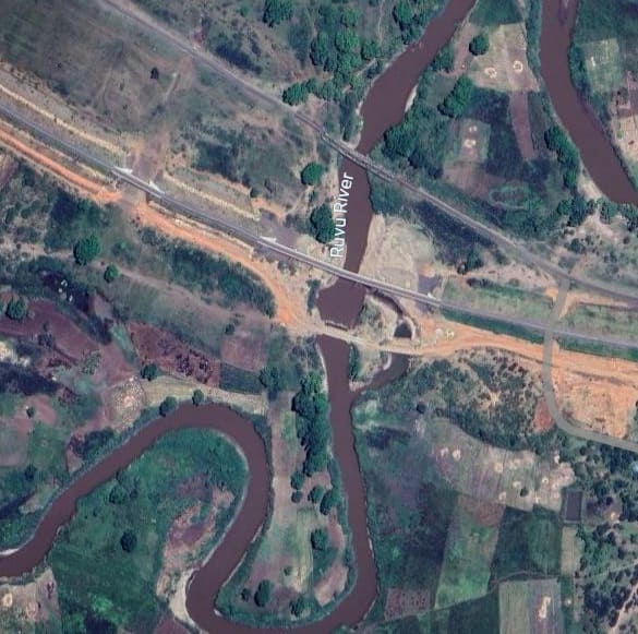
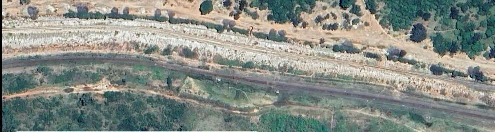
Continuing West from Kikongo both the MGR and the SGR reach Ruvu in a relatively short distance, the MGR following a more circumspect route to keep gradients within tolerable limits. Both lines cross a tributary of the Ruvu River.
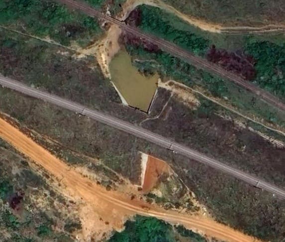
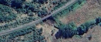
This two span girder bridge carries the MGR over the tributary. Southwest of the bridge it appears that the MGR runs on a causeway/embankment with relatively marshy land on either side and with a number of culverts to provide relief in the wet season. [Google Maps, June 2026]
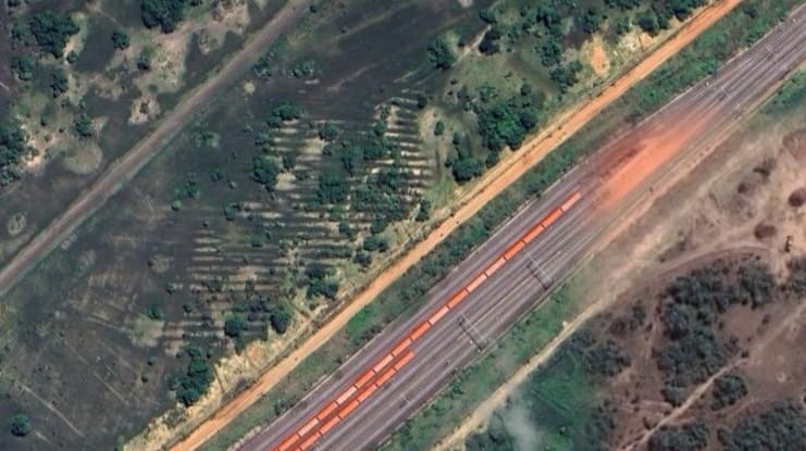
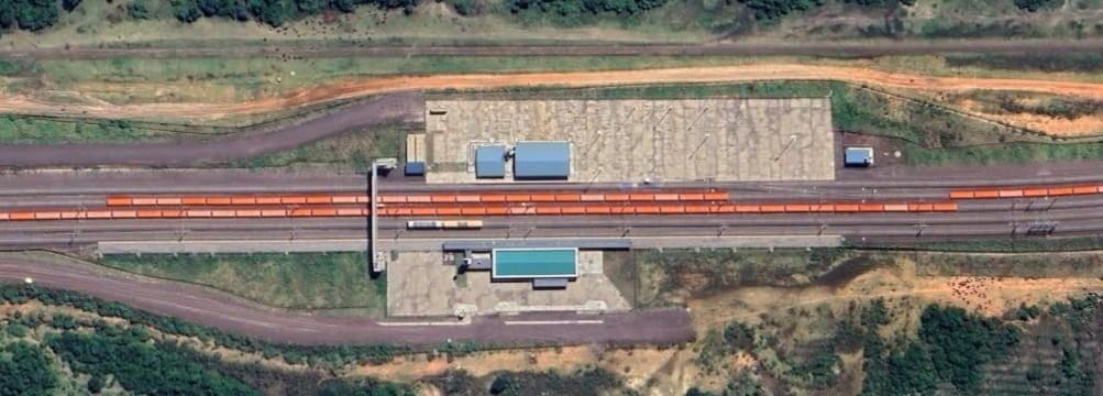
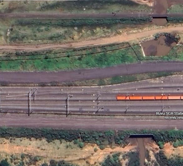
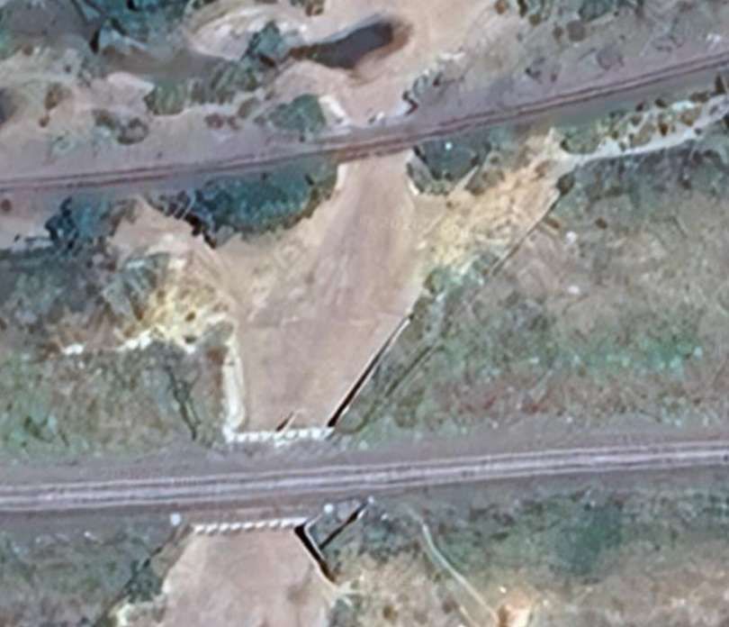
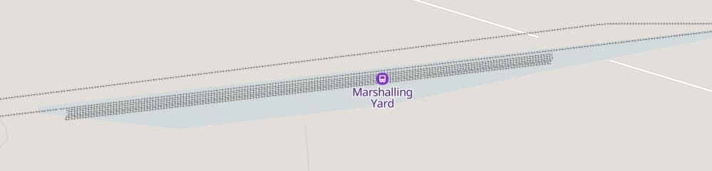
On the approach to Ruvu, the MGR and SGR return to running relatively close to each other. In this satellite image, the MGR runs across the top-left corner, The SGR runs from top-right to middle bottom. It has a significant number of long sidings parallel to the runnign lines at this location. [Google Maps, June 2026]
If you were to wander back along the SGR from Ruvu Station to the limits of the station site where lines begin to diverge heading West. This would be the view you would see, (c) Patrick joseph (January 2026). [Google Maps, June 2026]
To the West of the station platforms of the SGR Station a significant culvert permits wet season water flow from the North. At the top-right of this image, the much smaller aperture structure supporting the MGR can be seen. [Google Maps, June 2026]
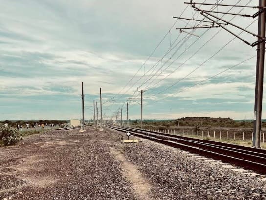
If you were to wander forward towards the town of Ruvu, along the SGR line beyond the platform limits, at the point where the various tracks come together, this is the view you would see, (c) Patrick joseph (January 2026). [Google Maps, June 2026]
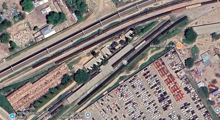
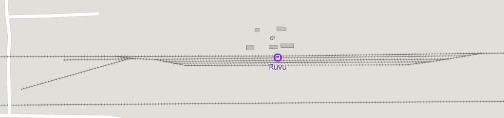
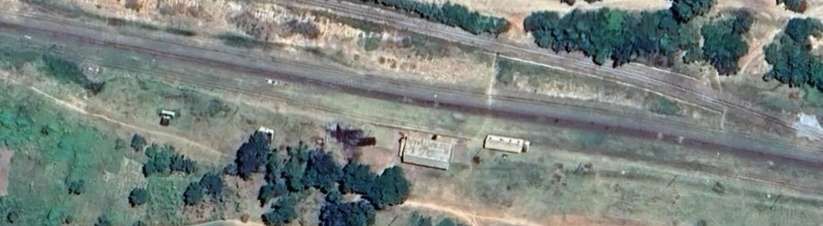
A short distance to the West of the SGR station, trains on the MGR enter the Ruvu MGR Station limits and a series of loops alongside the main line allow for passing traffic and for storage of goods vehicles.
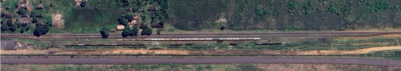
A closer aerial view of the old station buildings at Ruvu MGR Railway Station. [Google Maps, June 2026]
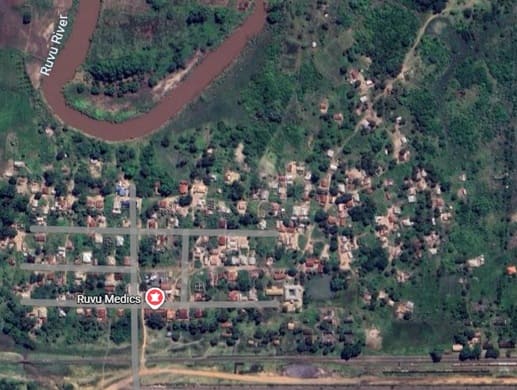
This satellite image shows the proximity of the town of Ruvu to its MGR station. [Google Maps, June 2026]
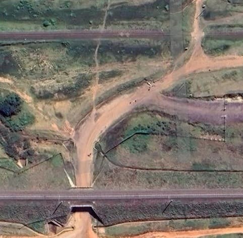
The access road into Ruvu from the South is bridged by the SGR and forms a level-crossing with the MGR. [Google Maps, June 2026]
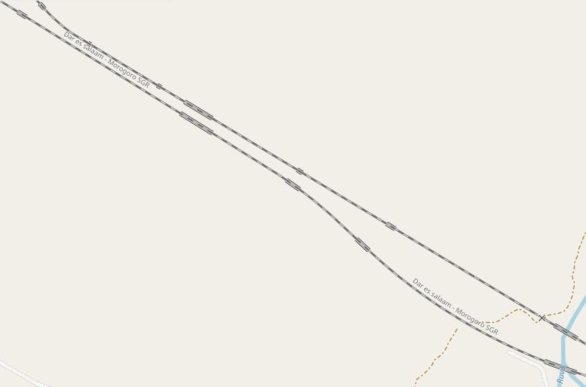
This extract from OpenStreetMap shows the length of the MGR running through the junction with the link to the North. [32]
Approximately the same area in the wet season! Again illustrating the need for so may structures in the flood plain of the river! This extract from the satellite imagery provided by Google shows one of the SGR‘s significant structures, bottom-right. [Google Maps, April 2026]
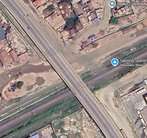
The metre-gauge branch railway between Ruvu and the Tanga line in the North of Tanzania is covered in a separate article in this series. It can be found here. [33]
As this satellite image indicates, the junction between the Central Line and the later-built link line was once a triangular junction which allowed for train movements in all directions. [Google Maps, June 2026]
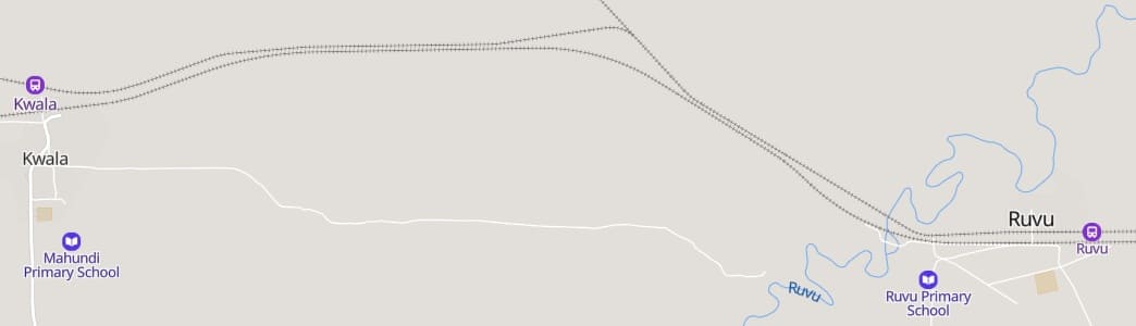
Further West the MGR reaches Kwala Railway Station. …
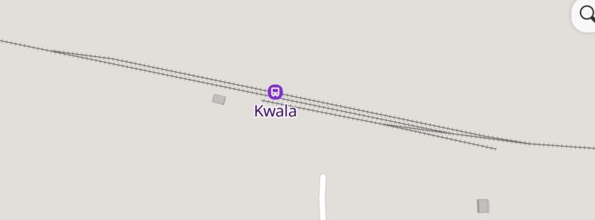
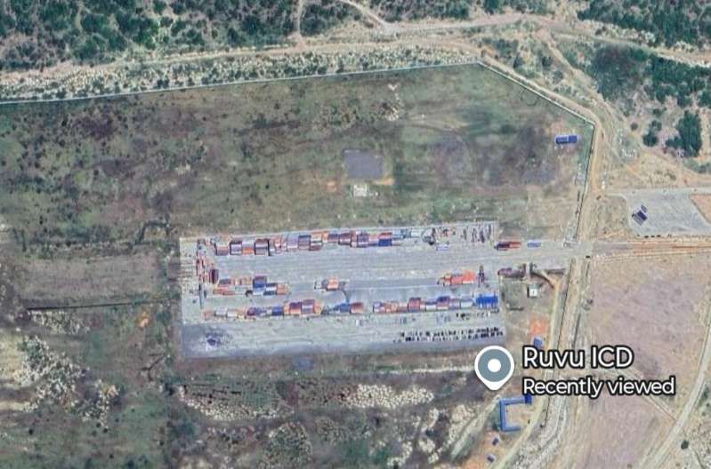
But the location bears closer inspection in the light of the development of the Ruvu ICD to the West of Kwala. MapCarta fails to pick up the existence of a branch line which leaves the MGR to the East of the Kwala Railway Station, and, as the image immediately below shows, gradually diverges from the MGR.
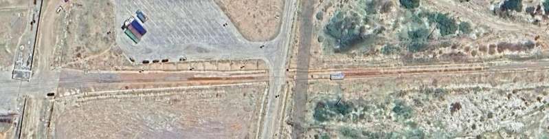
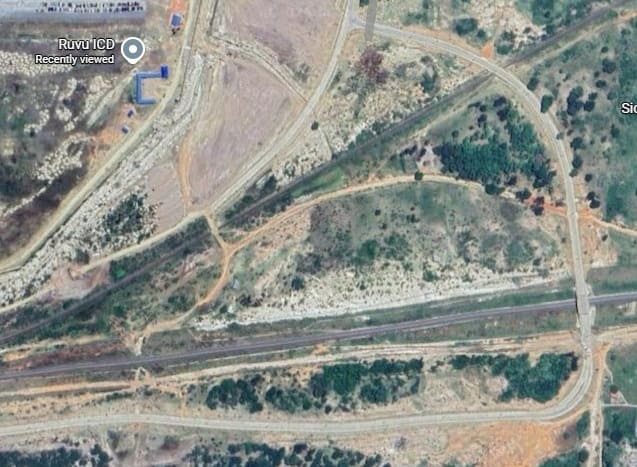
West of Kwala, both the MGR and the SGR approach the Southwest corner of Ruvu ICD (Ruvu Inland Container Depot). A tarmac road crosses both lines. It bridges the SGR and crosses the MGR at level. [Google Maps, June 2026]
The Ruvu ICD is a major 500-hectare dry port project located approximately 60 km from the Dar es Salaam port. Developed in partnership with SUMA JKT and the Tanzania Ports Authority (TPA), it is designed to relieve congestion at Dar es Salaam. It acts as a specialized holding and processing area for shipping containers, easing the operational burden on coastal port facilities. [34][35][36]
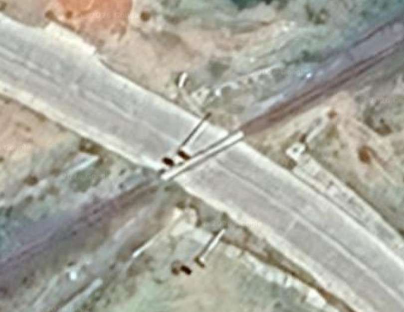
The tarmac access road crosses the MGR at a level crossing. [Google Maps, June 2023]
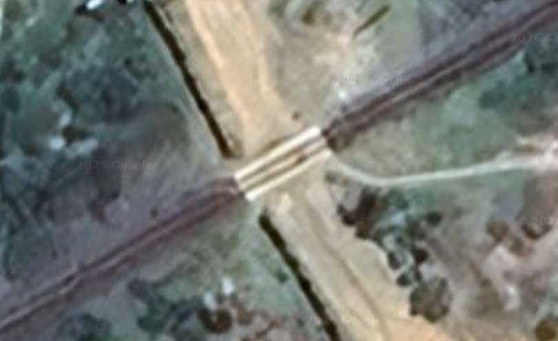
A murram road crosses the MGR to the Southeast of the Ruvu ICD. [Google Maps, June 2026]
This is another dry water channel which is some distance to the West of the Ruvu ICD. The relatively small bridge structure carrying the MGR is dwarfed by the civil engineering for the culvert under the SGR. [Google Maps, June 2026]
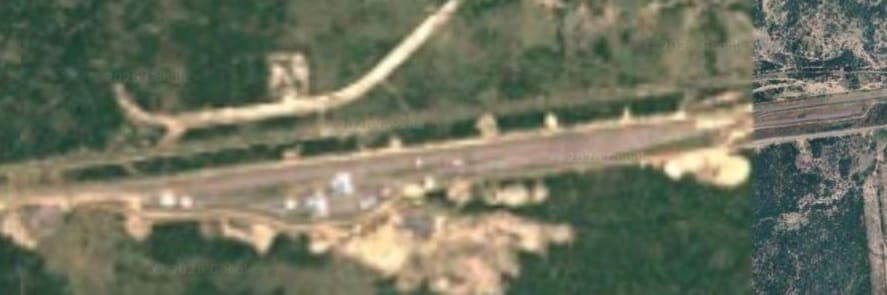
To the West of the marshalling yard there is a significant length of the MGR before the next stations at Kidugalo, Ngerengere, and then at Mikese. Both the SGR and the MGR appear on the extract from MapCarta below.
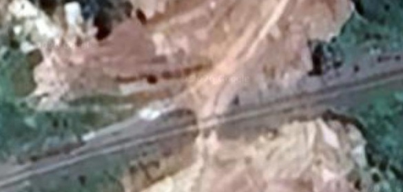
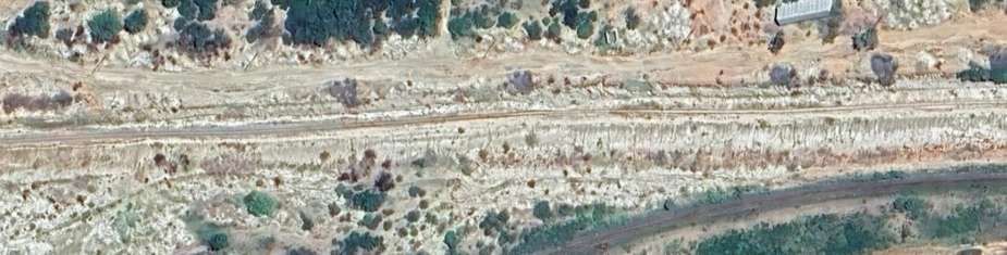
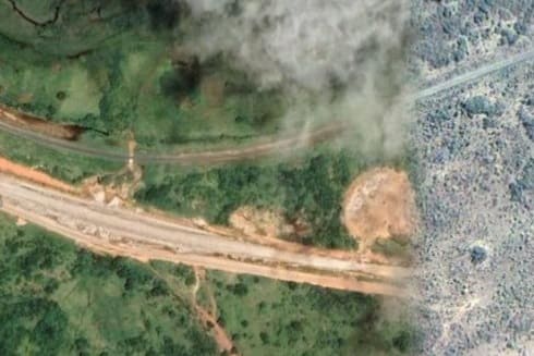
The grainy image showing the marshalling yard is typical of what Google Maps offers over the next kilometre or so. Further West Google’s satellite imagery has not been refreshed since the SGR construction commenced. Over the next few kilometres, the satellite images only show the much older MGR Central Line. The detail is less distinct than seen on the satellite images above.
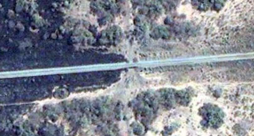
Typically the line follows the contours across relatively open ground and its route is punctured by a series of culverts designed to manage water flows in the wet season. This image shows one of these. [Google Maps, June 2026]
This changes once again as the line closes in on the village of Magindu.
The point at which the satellite imagery improves and is more up-to-date. in these next satellite images the SGR appears to still be under construction, so a new satellite pass will be needed to bring details of the line(s) fully up-to-date. [Google Maps, June 2026]
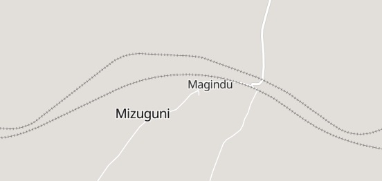
Both the MGR and the SGR curve to the North to avoid the centre of the village of Magindu. [38]
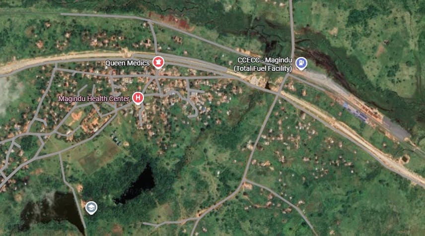
The village of Magindu and the SGR and MGR. [Google Maps, June 2o26]
A few kilometres West of Magindu, the two lines leave Pwani Region and enter Morogoro Region. The lines pass through Kidugalo. The station at Kidugalo sits on the Northeastern edge of a Sisal plantation.
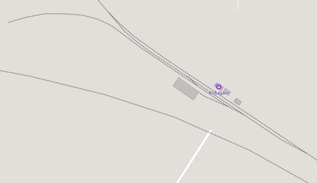
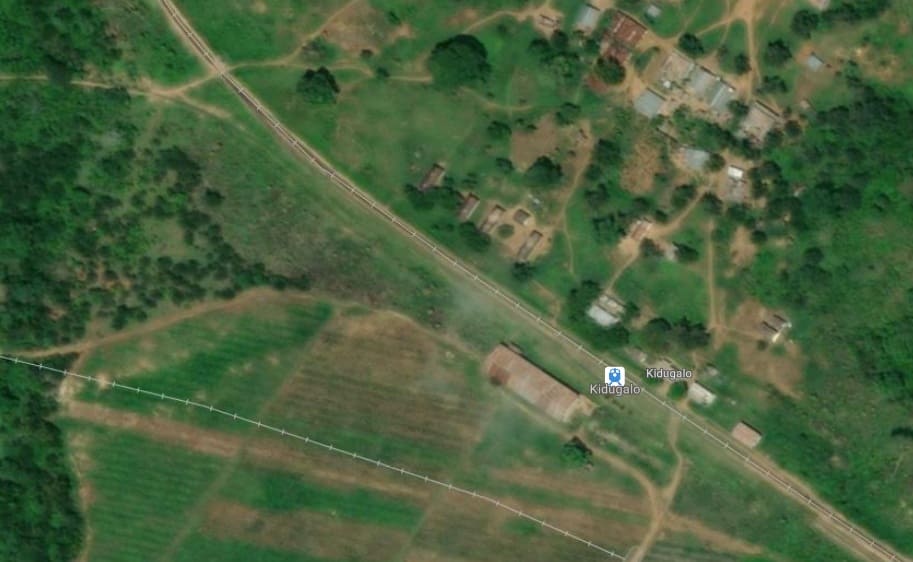
The Sisal Plantation was served by its own narrow-gauge lines. It was built and operated by the Karimjee Jivanjee family, it utilized small locomotives to transport raw sisal from the fields to estate decortication factories. The estate was bought by the family in June 1920. It was a plantation of both Sisal and Rubber of 292 hectares in size which was purchased for £6,250 sterling. [41]
“By 1924, the firm had acquired six sisal estates and eventually became the third largest sisal producer in the world. The extensive nature of Karimjee Jivanjee Estates’ plantation work can be gauged from the fact that it employed a large army of labourers, numbering between 12,000 and 15,000. It also employed forty European managers, assistants, and engineers comprising English, Germans, Greeks, Italian, Dutch, Swiss, Indian, and Sri Lankan internationals.” [41] Along with the expected industrial buildings, the family provided a hospital with a European nurse in charge. [41]
The narrow gauge lines on the estate were probably of 2ft-gauge. Like many narrow-gauge sisal lines established during the colonial era, use of the Kidugalo railway declined in the latter half of the 20th century. The introduction of synthetic fibres caused the global sisal market to crash, forcing estates to cut costs, neglect track maintenance, and eventually transition their transport needs entirely to road vehicles.
There is little detail available on line about this specific plantation and its railway. However, careful inspection of Google satellite imagery shows that many of the roads on the plantation follow the alignment of the historic railway.
More information about narrow gauge line used on plantations in Tanzania can be found here [43] and here. [42]
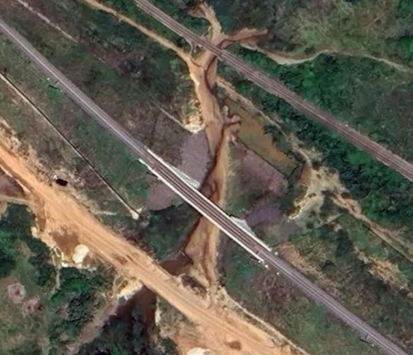
Returning to the MGR main line to the West of Kidugalo, the MGR and the SGR run across the North edge of the Sisal plantation before the SGR crosses the Ngerengere River, with the MGR remaining on the North bank of the river and running across the North side of the town of Ngerengere.
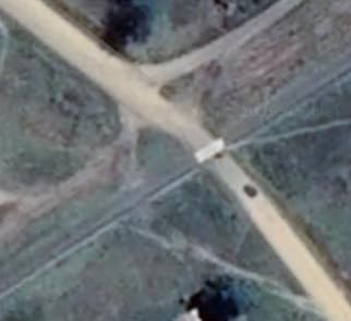
The main road North out of Ngerengere crosses the MGR at a level-crossing, just to the East of the Ngerengere River. [Google Maps, June 2026]
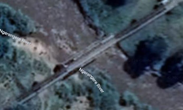
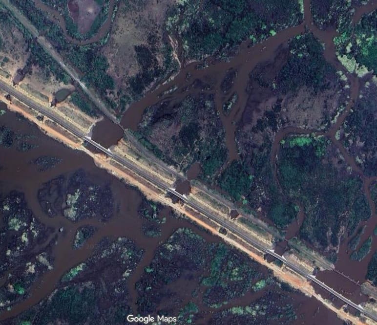
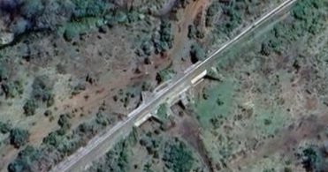
The Ngerengere River bridge on the MGR is a truss girder bridge. [Google Maps, June 2026]
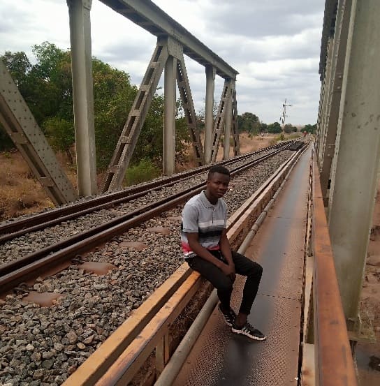
The Ngerengere River bridge on the MGR, (c) Joseph Gibson (October 2021). [Google Maps, June 2026]
Another road-crossing on the MGR, this time to the West of the river and on the Northwest side of the town. [Google Maps, June 2026]
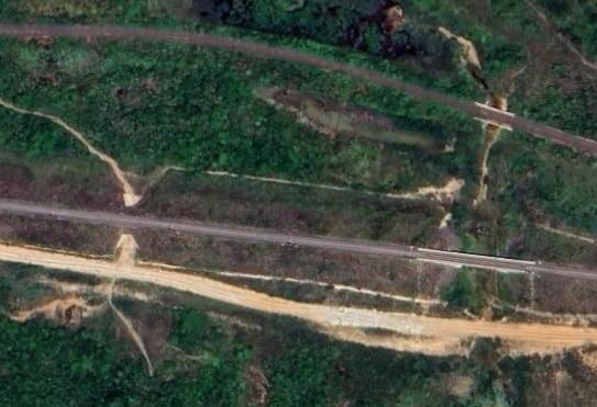
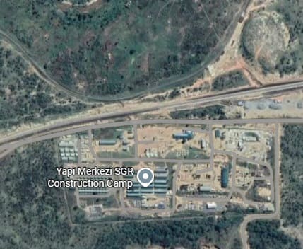
To the West of Ngerengere, the two railways come very close together for a short distance. One of the SGR construction camps was placed at this location.
The Ngererngere River or a tributary of it continues to flow along side the MGR over some distance, on the North side of the line until the MGR bridges it again.
Another MGR bridge over the river. [Google Maps, June 2026]
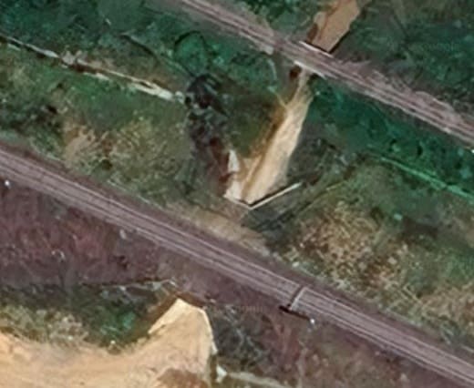
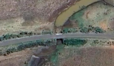
Further West, the next crossing of a river sees the MGR cross a tributary by means of the culvert. [Google Maps, June 2026]
Still the same river, and another bridge carrying the MGR. Throughout this last sequence of bridges the SGR line has remained on the South side of the river. [Google Maps, June 2026]
Another more modern structure. [Google Maps, June 2026]
Another culvert over a stream bed which clearly allows for west season water flows. [Google Maps, June 2026]
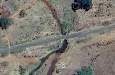
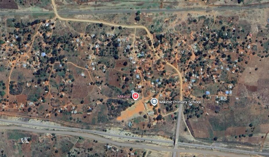
A further culvert on the MGR’s approach to Mikese Railway Station. [Google Maps, June 2026]
References
- M.F. Hill; Permanent Way Volume II: The Story of the Tanganyika Railways; East African Railways and Habours, Nairobi, Kenya; Watson & Viney, Aylesbury & Slough, 1957.
- https://en.wikipedia.org/wiki/Maji_Maji_Rebellion, accessed on 1st May 2026.
- John Iliffe; The Organization of the Maji Maji Rebellion; in The Journal of African History, Volume 8 No. 3, 1967, p495–512.
- Dominik J. Schaller; From Conquest to Genocide; in A. Dirk Moses (ed.); From Conquest to Genocide: Colonial Rule in German Southwest Africa and German East Africa. Empire, Colony, Genocide: Conquest, Occupation, and Subaltern Resistance in World History. War and Genocide. Volume 12 (1st ed.); Berghahn Books, New York City, 2010, p310. …. “It is doubtlessly appropriate—probably even important—to understand the German suppression of the Maji-Maji Revolt as genocidal.”
- Klaus Bachmann & Gerhard Kemp, Gerhard; Was Quashing the Maji-Maji Uprising Genocide? An Evaluation of Germany’s Conduct through the Lens of International Criminal Law; in Holocaust and Genocide Studies Volume 35 No. 2, July 2021, p243. …… “If the German command’s strategy was to destroy entire settlements (crops, harvests, and food), kill civilians along with combatants, coerce the surrender of entire groups through deliberate starvation, and to intentionally deprive ethnic groups of the leadership that was crucial to their survival — then Germany’s conduct in East Africa deserves the label of genocide.”
- Stanleyville is the former name of Kisangani, the capital of Tshopo Province in the Democratic Republic of the Congo (DRC). Established as a trading post in 1883 and named after Sir Henry Morton Stanley, it remains the largest city in the tropical Congo Basin woodlands.
- John Fortescue; The Royal Army Service Corps. A History of Transport and Supply in the British Army. Volumes I and II; University Press, Cambridge, 1930-1931.
- https://rogerfarnworth.com/2026/03/16/600-mm-narrow-gauge-lines-used-during-world-war-1-in-east-africa.
- https://en.wikipedia.org/wiki/TR_DL_class, accessed on 30th April 2026.
- https://en.wikipedia.org/wiki/TR_MK_class, accessed on 30th April 2026.
- https://rogerfarnworth.com/2026/05/01/railways-of-tanzania-part-6-the-british-mandate-and-the-trust-the-years-of-british-rule-including-world-war-ii.
- https://rogerfarnworth.com/
- https://www.alamy.com/dar-es-salaam-town-city-plan-1891-1941-tanzania-lands-mines-dept-1948-map-image710070612.html, accessed on 31st May 2026
- https://www.stamps-auction.com/tanzania-dar-es-salaam-railway-station-dar-es-salaam-train-station-old-postcard-for-sale-222879, accessed on 31st May 2026.
- https://mindtrip.ai/attraction/dar-es-salaam-region/dar-es-salaam-central-railway-station/at-QWcAYZQQ, accessed on 31st May 2026.
- https://www.alamy.com/stock-photo/map-of-africa-in-1910.html?blackwhite=1&sortBy=relevant, accessed on 31st May 2026.
- https://onlinelibrary.wiley.com/doi/full/10.1111/anti.13070?.com=, accessed on 31st May 2026.
- https://www.etsy.com/uk/listing/730651778/vintage-dar-es-salaam-map-print-tanzania, accessed on 1st June 2026.
- https://www.britishempire.co.uk/images2/daressalaam1957map.jpg, accessed on 1st June 2026
- https://mapcarta.com/Dar_es_Salaam/Map, accessed on 1st June 2026.
- https://www.britishempire.co.uk/images2/daressalaamdistrict1957map.jpg, accessed on 1st June 2026.
- https://www.britishempire.co.uk/images2/daressalaam1958map.jpg, accessed on 1st June 2026.
- https://mapcarta.com/W369665900/Map, accessed on 1st June 2026.
- https://businessinsider.co.tz/trc-moves-into-rail-manufacturing-with-local-assembly-of-mgr-locomotives, accessed on 2nd June 2026.
- https://www.facebook.com/groups/252802114833172/posts/7900124040100903, accessed on 2nd June 2026.
- https://mapcarta.com/12646958/Map, accessed on 2nd June 2026.
- https://unitedrepublicoftanzania.com/economy-of-tanzania/infrastructure-in-tanzania/railway-in-tanzania/the-central-line-tanzanias-oldest-and-most-vital-railway-network, accessed on 3rd June 2026.
- https://download.geofabrik.de/africa/tanzania.html, accessed on 3rd June 2026.
- https://www.bing.com/maps/search?style=h&q=ngeta+tanzania&cp=-6.821991%7E38.768121&lvl=18, accessed on 3rd June 2026.
- Hua Fu Steel Company Limited, is an importer and exporter of steel. Between Mar 2025 and Feb 2026, the company recorded an import turnover of $4.09M and export turnover of $517.89K. During that period, the company sourced 93 import shipments and supplied 21 export shipments. Imports were primarily sourced from China and Zambia, while exports were distributed to Mozambique. https://www.marketinsidedata.com/en/company/hua-fu-steel/2cab40ef326069fc9f97572ca0222c47, accessed on 3rd June 2026.
- https://mapcarta.com/12646426/Map, accessed on 3rd June 2026.
- https://www.openstreetmap.org/#map=14/-6.79294/38.64226, accessed on 29th April 2026.
- https://rogerfarnworth.com/2026/04/29/railways-of-tanzania-part-5-tanga-to-ruvu-and-thence-to-dar-es-salaam
- https://commons.wmu.se/cgi/viewcontent.cgi?article=1315&context=all_dissertations, accessed on 3rd June 2026.
- https://documents1.worldbank.org/curated/en/927461561663095167/txt/Main-Report.txt, accessed on 3rd June 2026.
- https://www.mwananchi.co.tz/mw/habari/kitaifa/suma-jkt-kujenga-bandari-kavu-ruvu-2837864, accessed on 3rd June 2026.
- https://mapcarta.com/N9176099982, accessed on 4th June 2026.
- https://mapcarta.com/W1049384876/Map, accessed on 4th June 2026
- https://mapcarta.com/N9176091279/Map, accessed on 4th June 2026.
- https://www.bing.com/maps/search?style=h&cp=-6.793287%7E38.206175&lvl=18.1, accessed on 4th June 2026.
- https://repub.eur.nl/pub/99360/03a-Oonk-Karimjee-Jivanjee-A-case-for-a-diasporic-family-firm.pdf, accessed on 4th June 2026.
- https://rogerfarnworth.com/2026/03/16/600-mm-narrow-gauge-lines-used-during-world-war-1-in-east-africa
- https://rogerfarnworth.com/2026/03/04/narrow-gauge-industrial-lines-in-tanganyika-tanzania
- https://commons.wikimedia.org/wiki/File:Basil_Roberts_(680727_EAR).jpg, accessed on 4th June 2026.
- https://mapcarta.com/12653464, accessed on 4th June 2026.
- https://trainstobeyond.com/railways-in-dar, accessed on 30th July 2026.

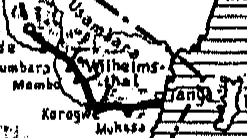
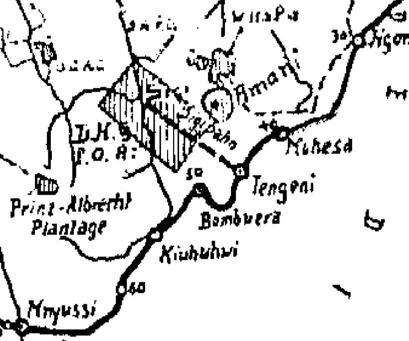
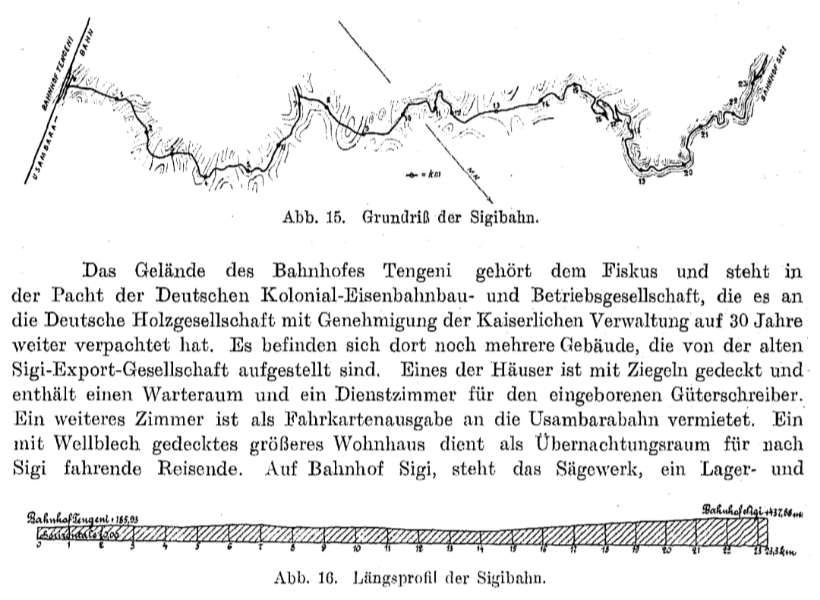
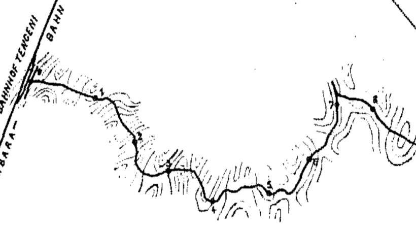
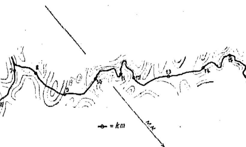
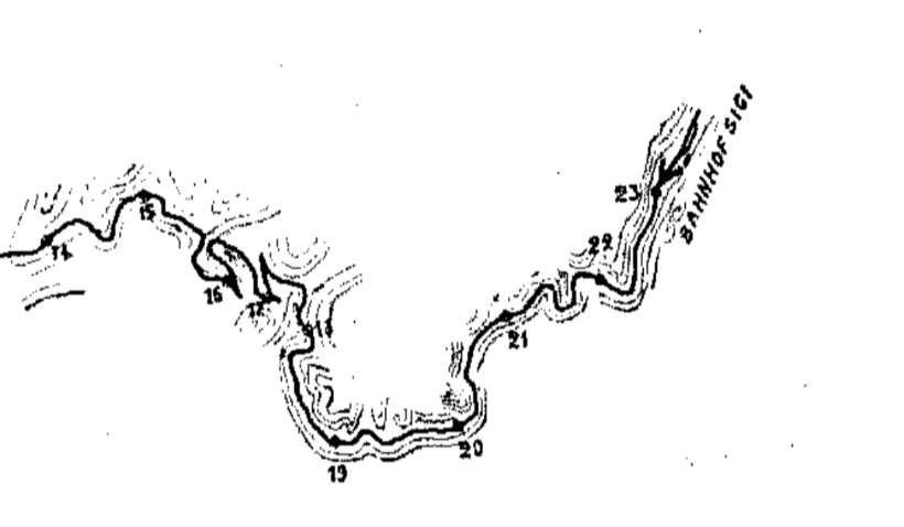
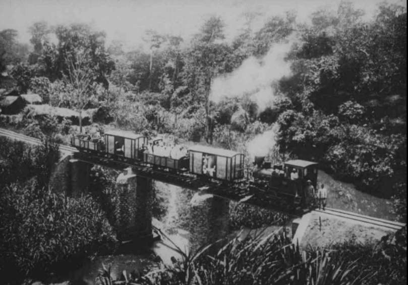
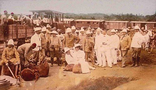
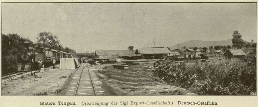
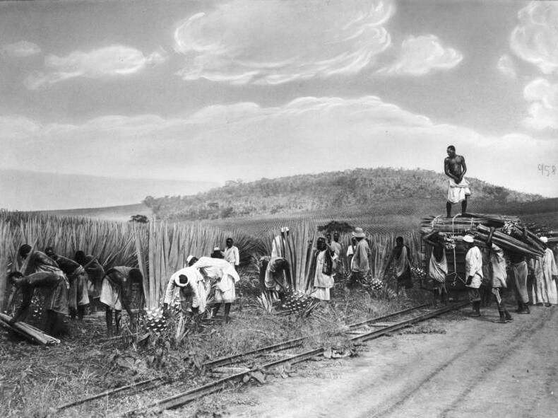
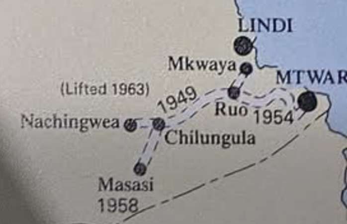
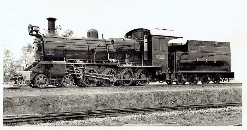
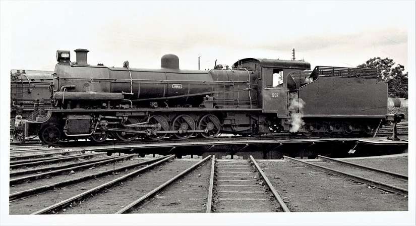
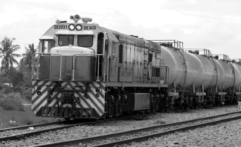
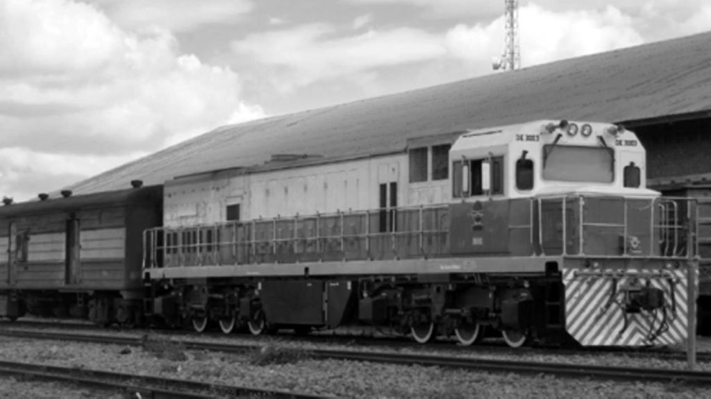
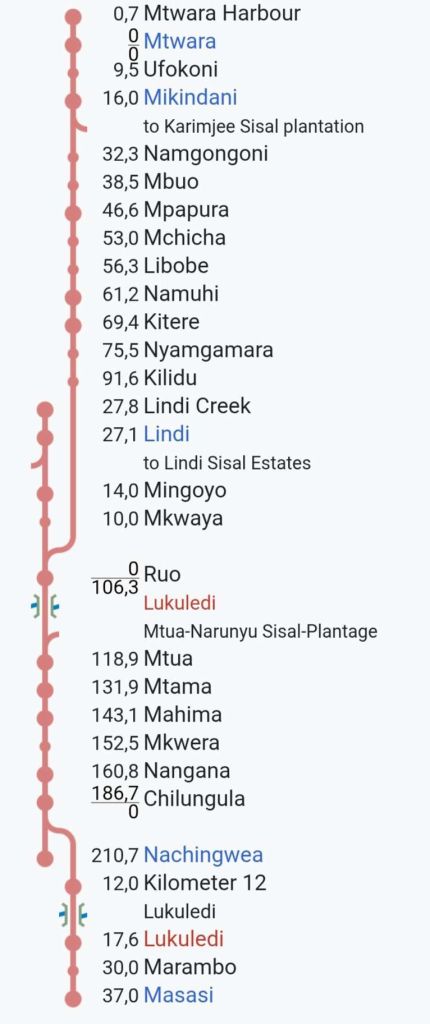
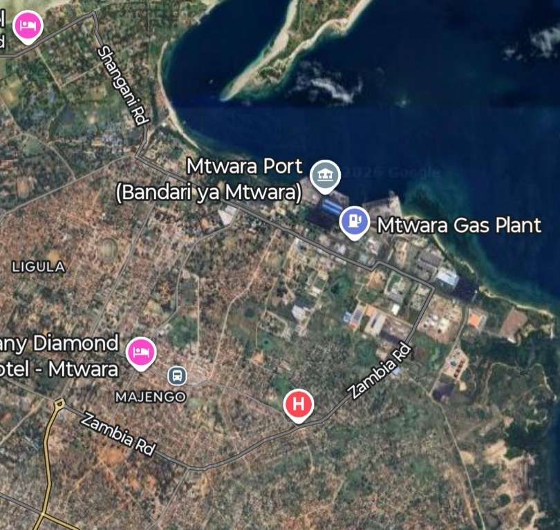
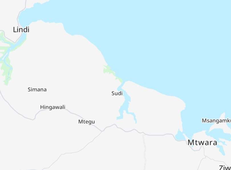
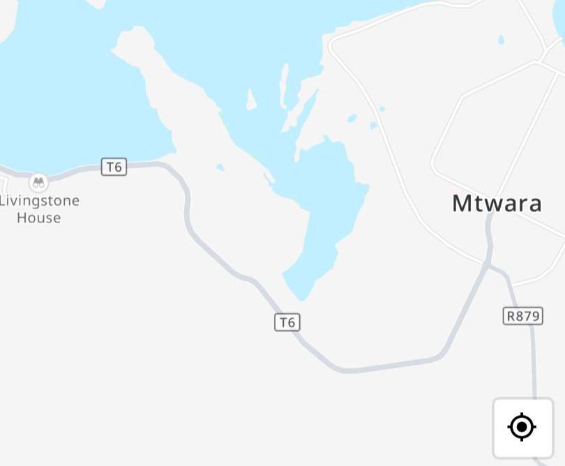
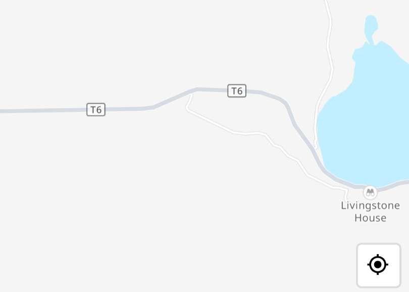
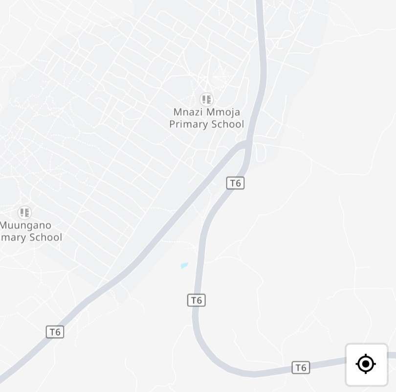
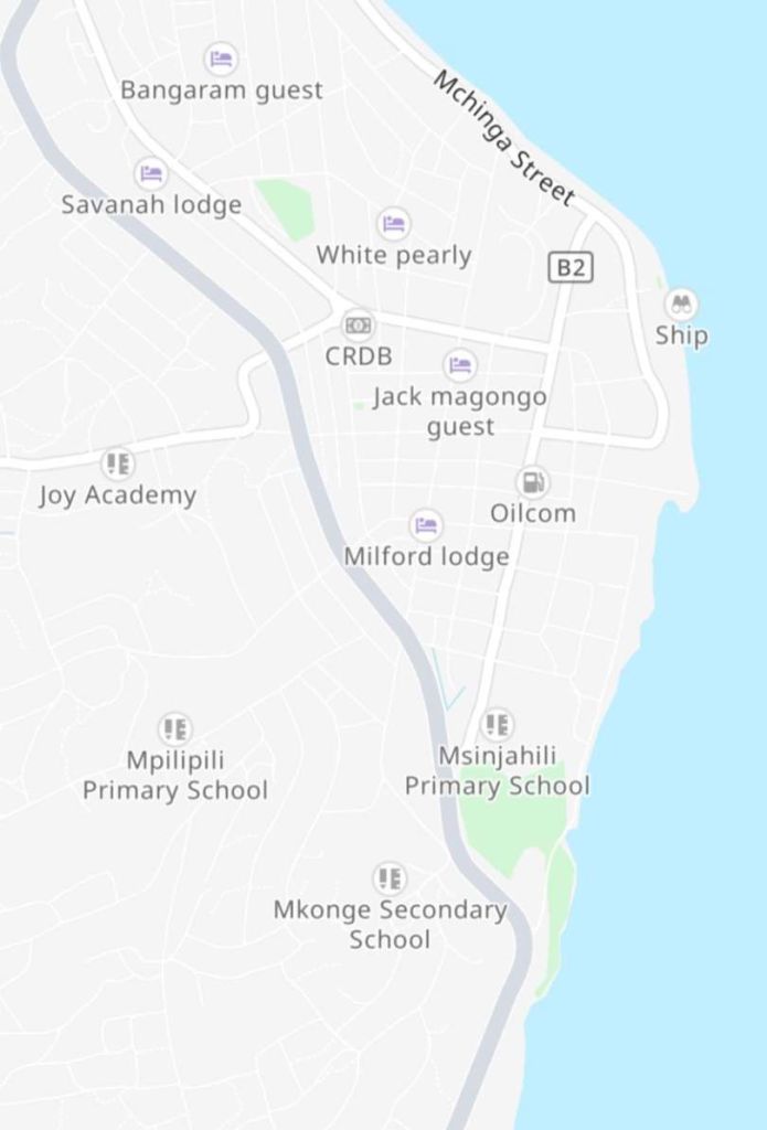
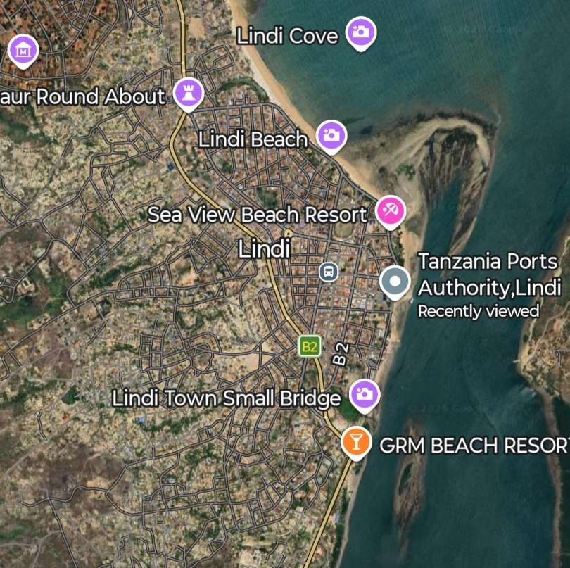
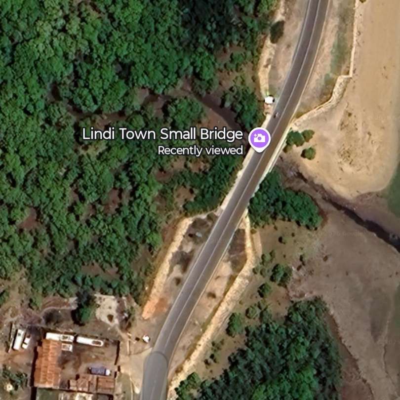
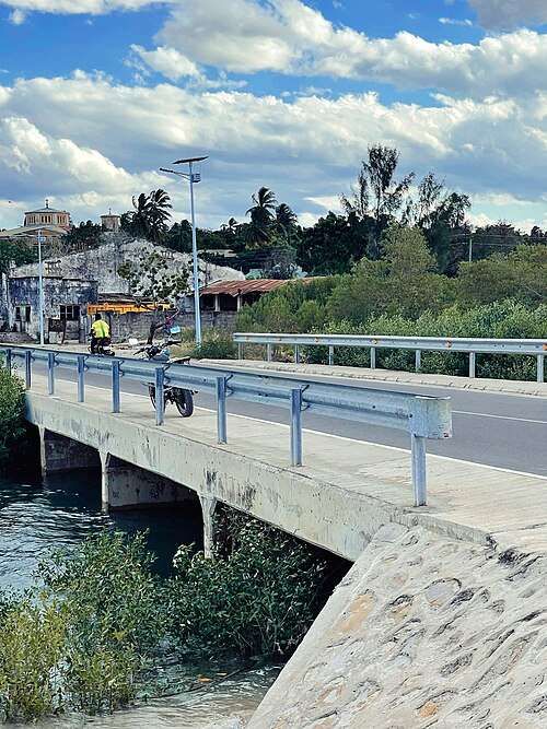
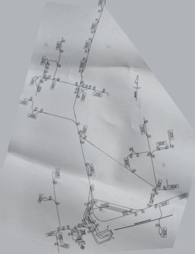
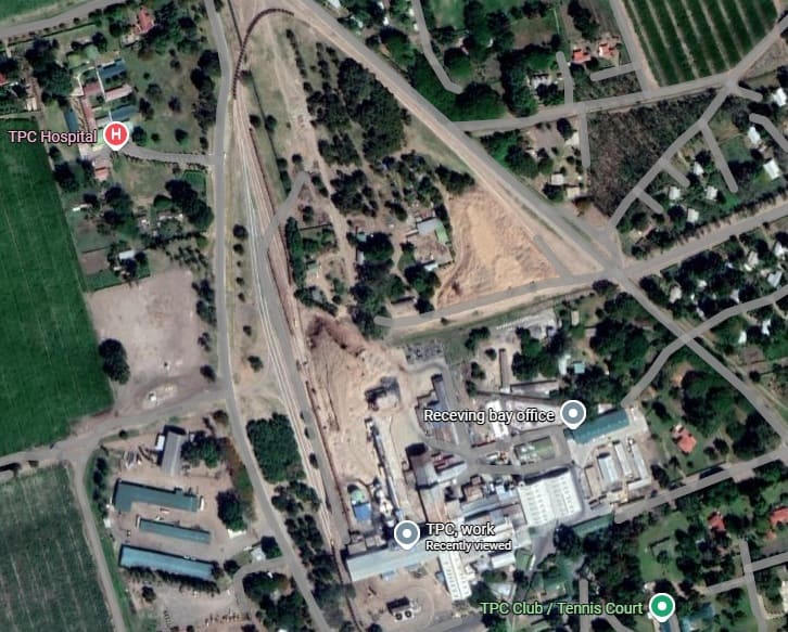
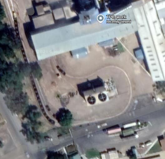
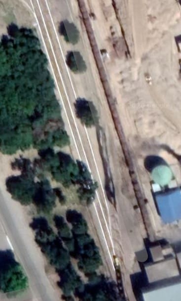
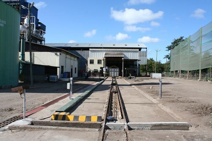
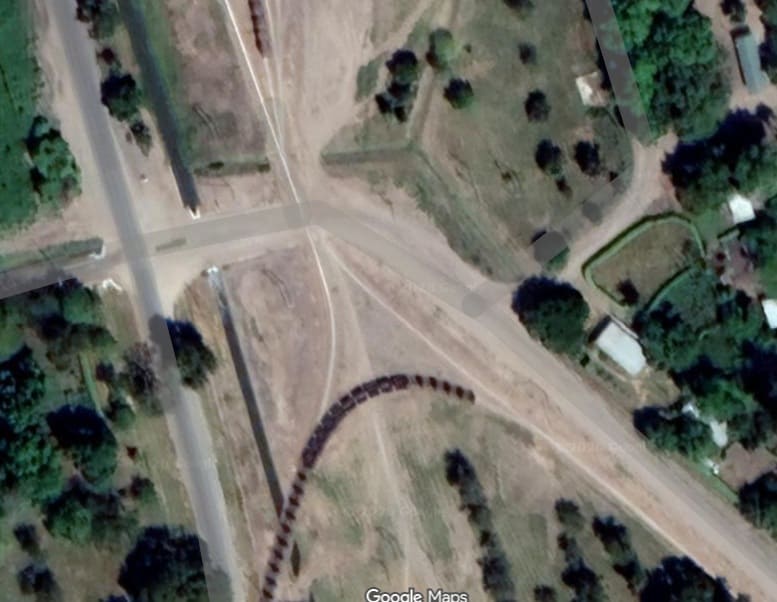
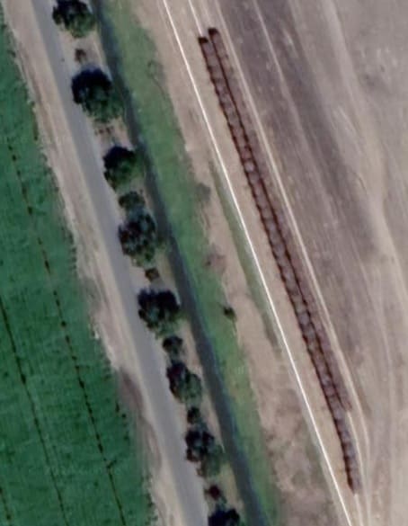
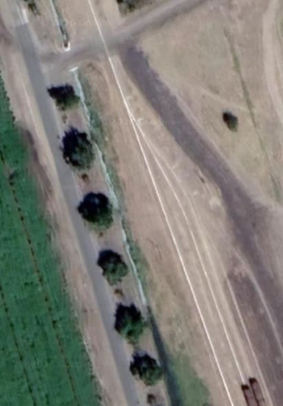
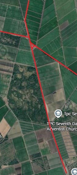
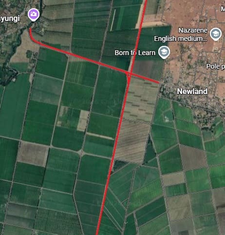
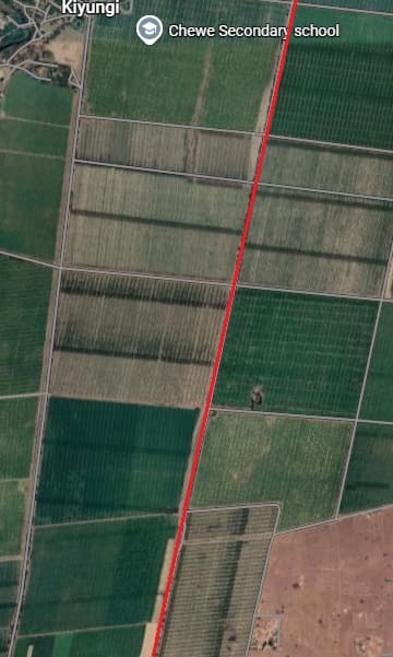
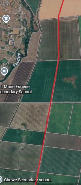
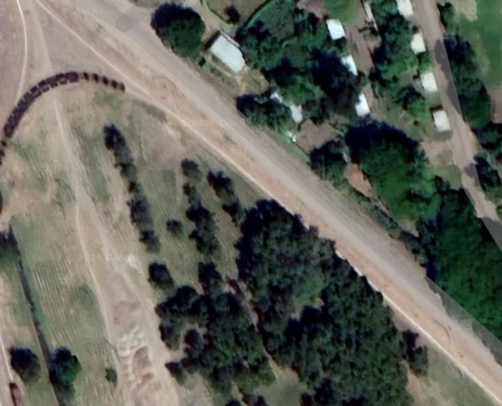
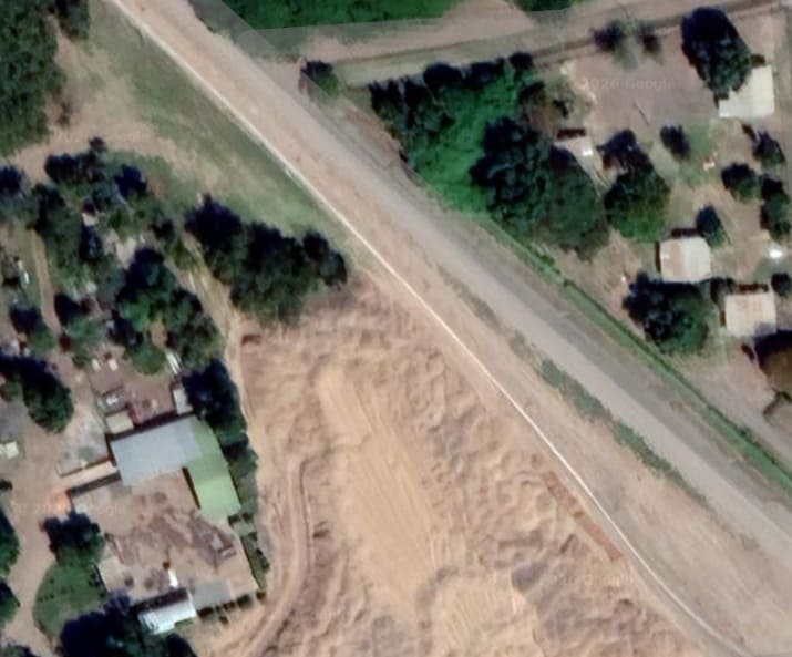
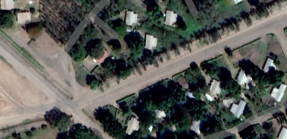
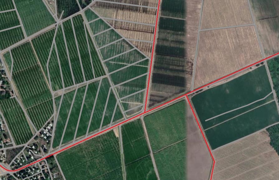
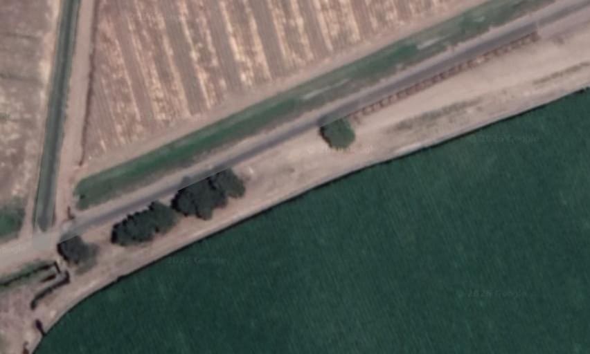
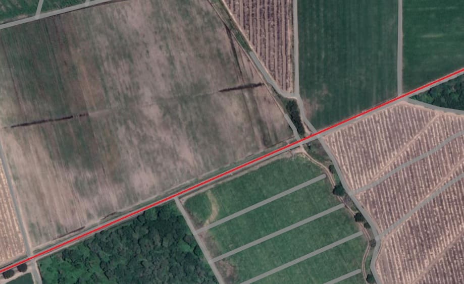
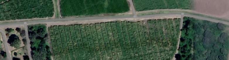
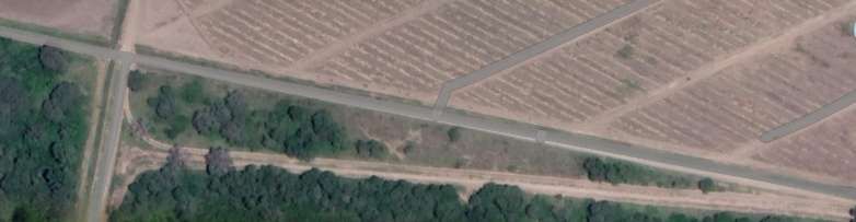
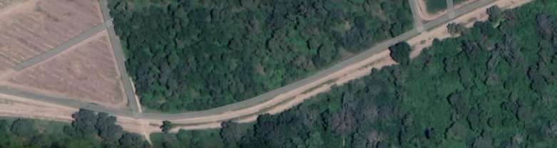

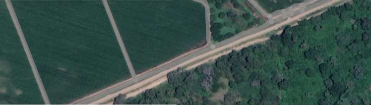
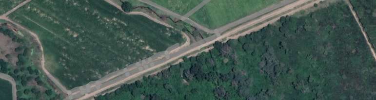
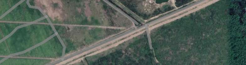
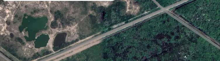
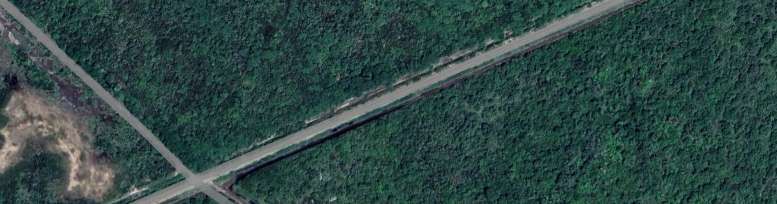
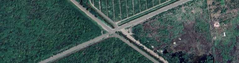
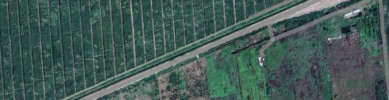
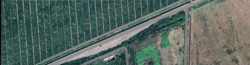
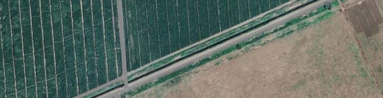
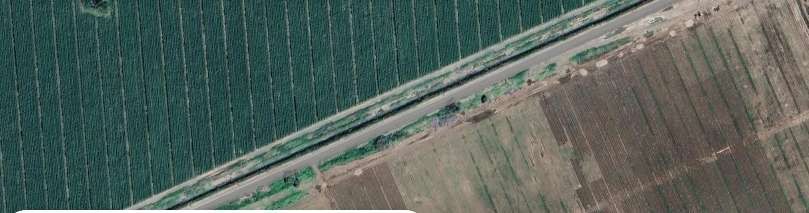
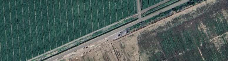
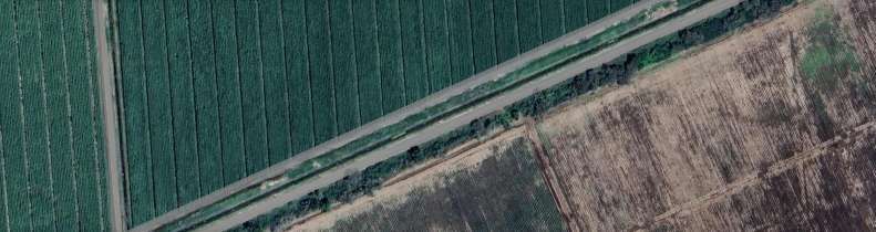
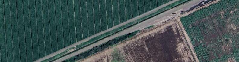
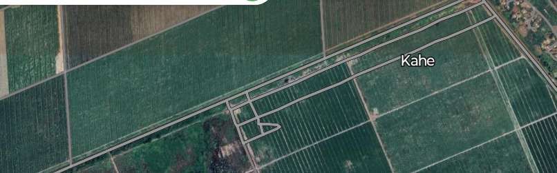
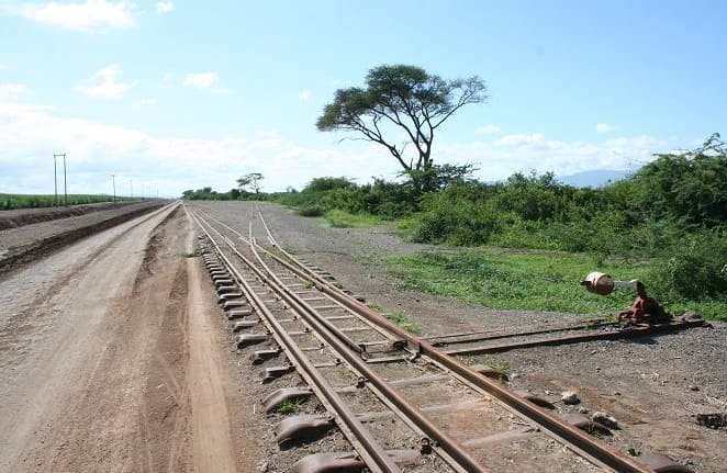
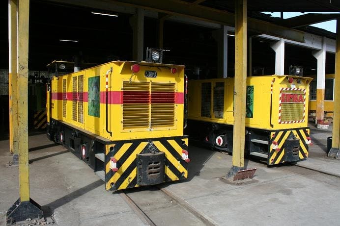
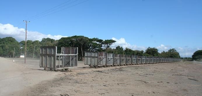

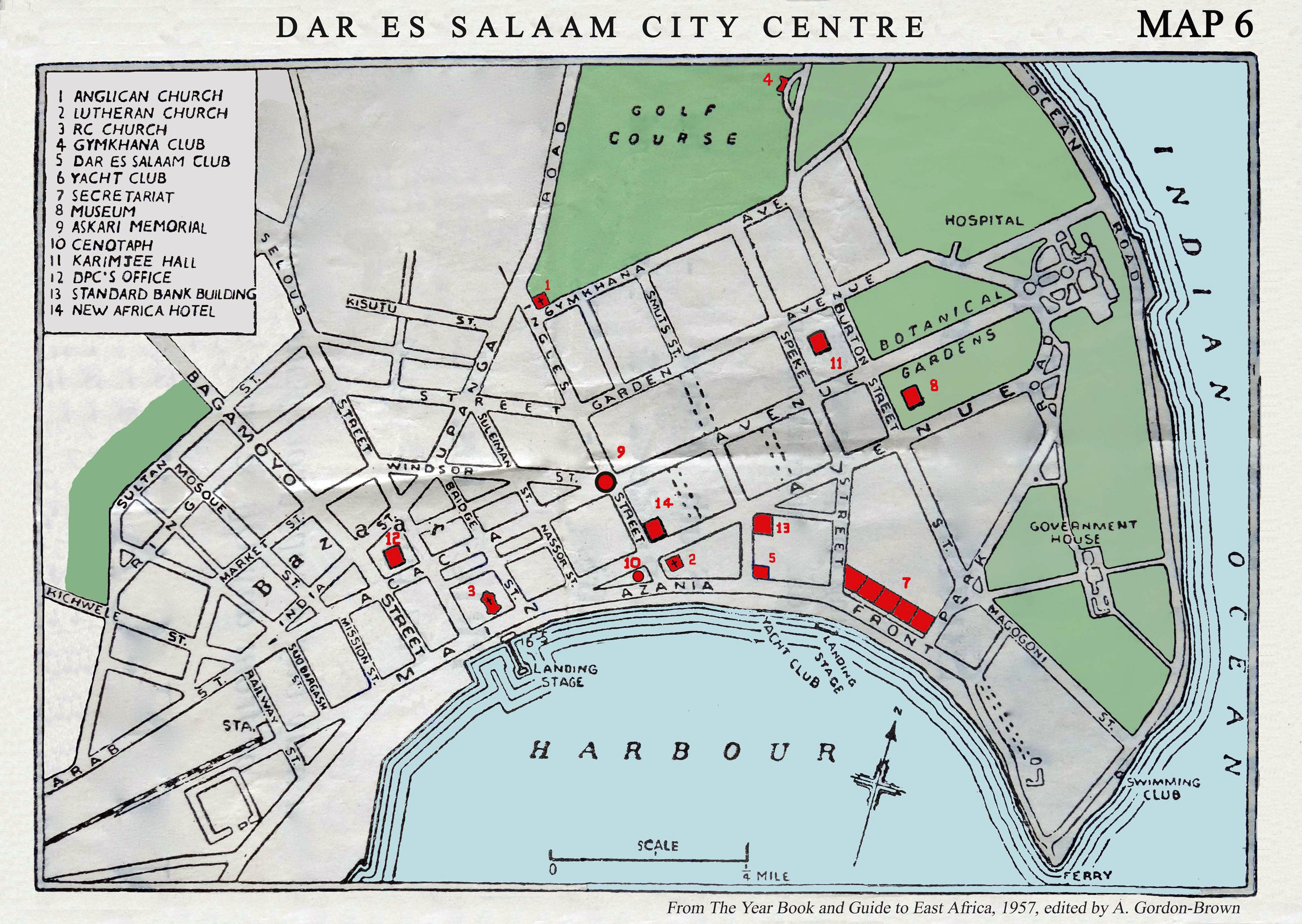
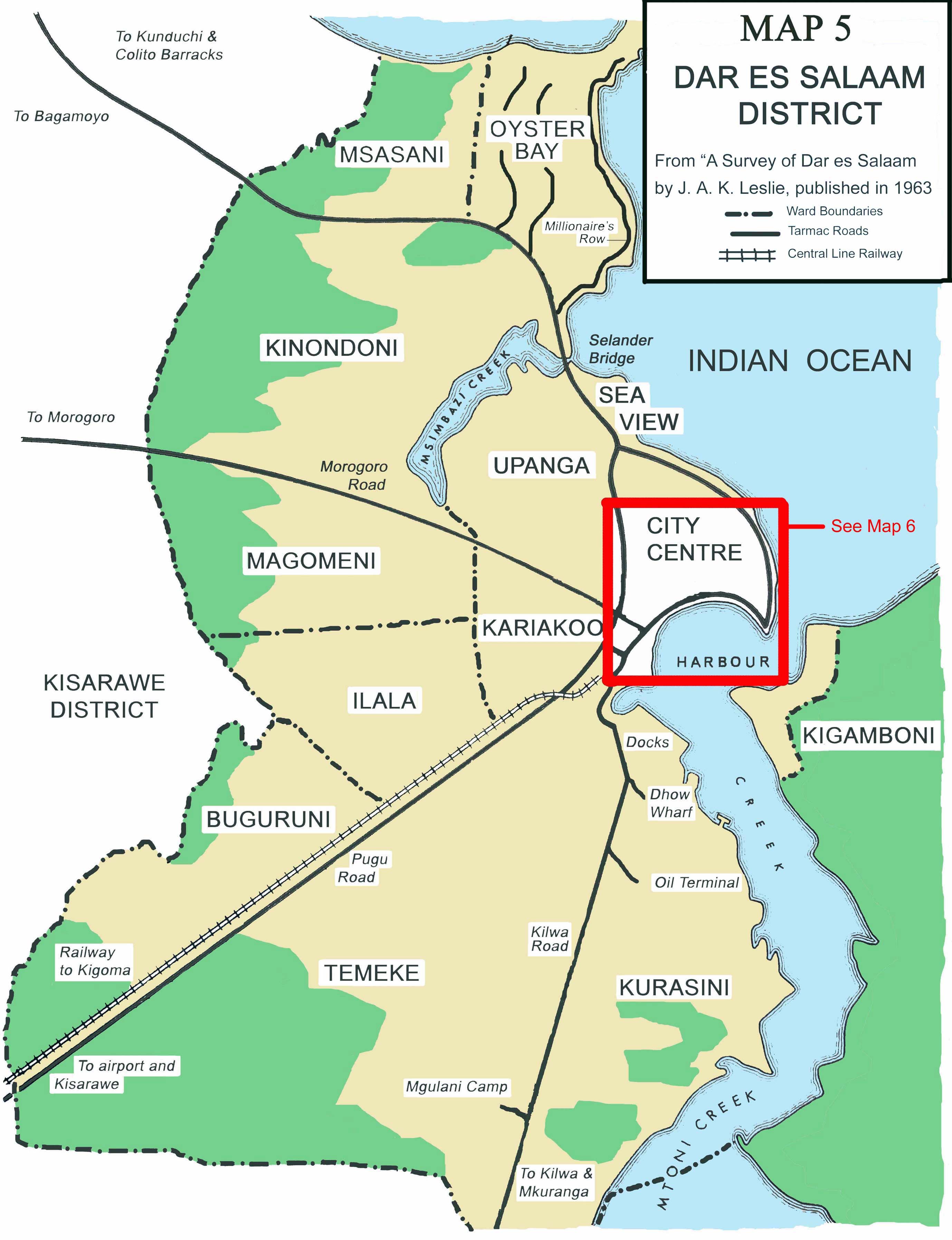
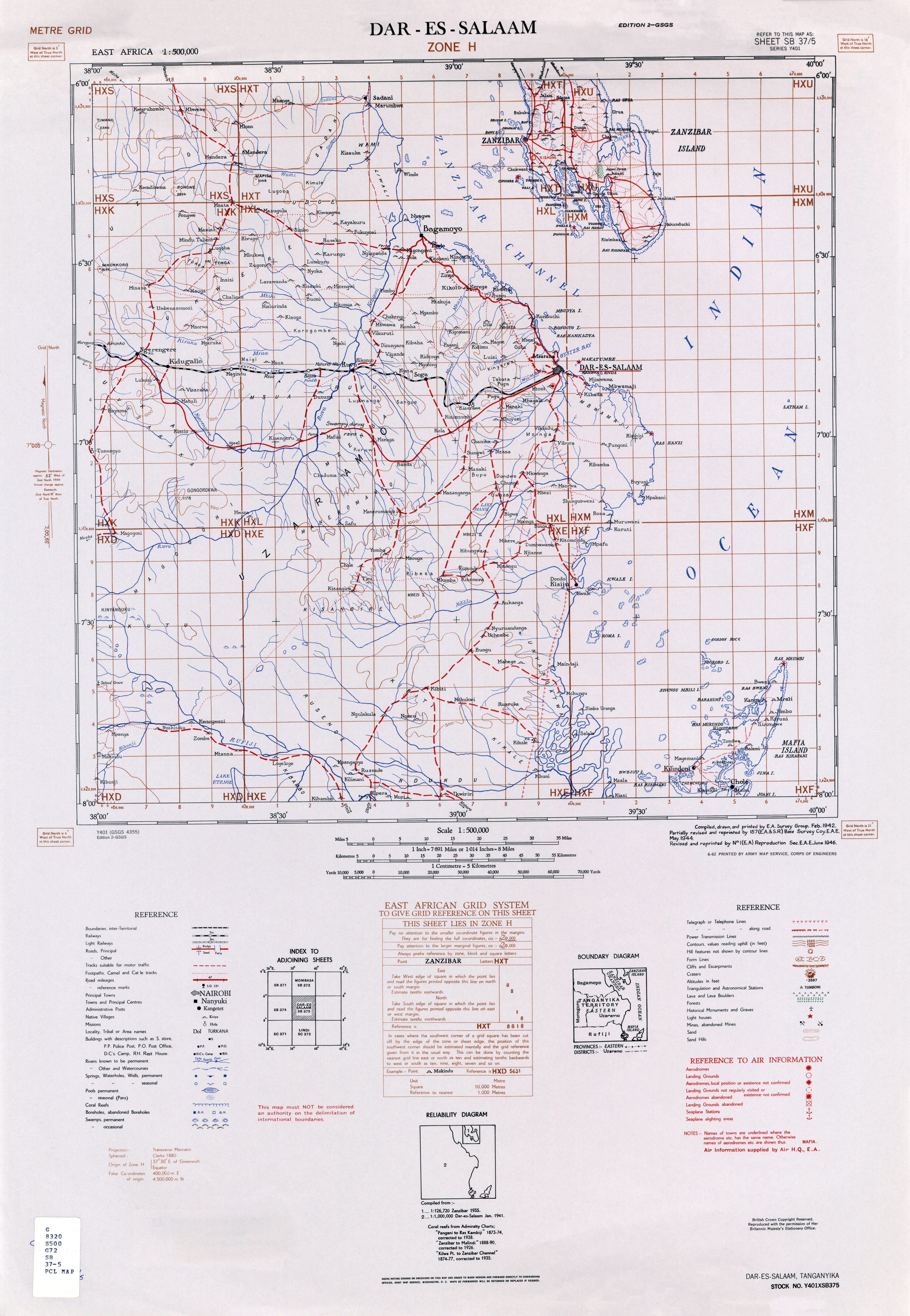
.jpg)