The featured image for this article shows a train on the Kihuhui Bridge on the Sigi Railway in Tanganyika.[3]
Tanganyika (now part of Tanzania) possessed a dense network of industrial narrow-gauge railways, primarily developed during the German colonial era (German East Africa) in the late 19th and early 20th centuries to support plantation agriculture and forestry. While the main lines (Central Line and Usambara Railway) were built to 1,000 mm (metre) gauge, industrial, plantation, and forestry lines often used 600 mm (1 ft 11 5⁄8 in) or 750 mm (2 ft 5 1⁄2 in) gauge. [1]
Following World War I, the British administration deemed many of the 600 mm “light railways” to be economically inefficient compared to the, at the time, more efficient 1,000 mm metre-gauge lines, leading to a shift away from developing these smaller lines. [1]
Early Industrial Narrow Gauge lines included:
1. The Sigi Railway
The Sigi Railway (Sigi-Bahn) was a 23.5 km long, 750 mm gauge line opened in 1911 to transport timber from forests in the Usambara Mountains to the Tanga or Usambara Railway. It featured significant engineering challenges, including four switchbacks to handle steep terrain. [2]
Tanga and the Usambara Hills showing the metre-gauge line. [7: p2]A closer view with a North point just to the West of North. The metre-gauge line runs diagonally across the map extract. The Sigi-bahn is represented by the dashed line leading to the centre of the hatched area. [7: p3]A sketch map of the full length of the Sigi-bahn with Tengeni to the left and Sigi to the right. Beneath the German text in this extract, the gradient profile of the line is shown. [7: p15]These three images divide the length of the Sigi-bahn shown above into three. [7: p15]A train on the Kihuhui Bridge on the Sigi Railway in Tanganyika. [3]
The line ran from Tengeni station (185.9 m above sea level) near Muhesa (now Muheza), located on the Usambara railway, to Sigi (438 m above sea level) in the heavily forested eastern Usambara Mountains, which, until the railway’s construction, were rugged and difficult terrain. The area could only be reached by caravans via forest and mountain trails. This severely limited the transport of goods and merchandise. [3]
A travel group at Tengeni railway station in the Usambara Mountains, with trains of the Sigi Railway and the Usambara Railway in the background. [3]
Tengeni Railway Station. [10]
The Sigi Railway Management Concession of 29th April 1910, was a necessary precondition to the exploitation of the forestry concession held by the Deutsche-Holz-Gesellschaft fuer Ostafrika. The 23.5 km. railway’s operation was bound to the sawmills that provided the bulk of the traffic. [2]
Work began in 1904. The Sigi Export Company, during its ownership, constructed 17.6 km of track. Due to financial difficulties, work had to be interrupted repeatedly. After the German Timber Company for East Africa took over the logging rights to 12,000 hectares, the sawmill, and the railway, it completed the latter. The railway went into full operation on 1st September 1910. [3][4: p96]
The line had gradients of up to 40%, minimum radii of 40 m, and, as already noted, four switchbacks. It climbed 252 metres to the Sigi terminus. [4: p96] The switchbacks enabled a relatively uniform gradient to be achieved. The section of track near Sigi was particularly interesting. Here, the railway described almost complete circles to wind its way up the mountain slopes and featured three of its four switchbacks in a length of less than one kilometre. Where possible, engineering structures were avoided. Nevertheless, numerous smaller bridges had to be built over mountain streams, blasting operations carried out, and dams constructed, particularly along the upper section. The construction of a large steel girder bridge over the Kihuhui River gorge was unavoidable; this bridge had two masonry piers between its abutments. [3]
Between Tengeni and Fanussi, rails weighing only 10 kg/m and measuring 7 metres in length were used. The lower section of the line was ballasted only where absolutely necessary for structural or operational reasons, such as on the curves. In contrast, the upper section was fully ballasted and fitted with rails weighing 15 kg/m. Ballasting the entire line was planned but was not completed before the First World War. The rails rested on iron sleepers with shims. The sleeper design on the lower section was chosen to allow for the replacement of the existing rails with the new, heavier rail profile. The flat fishplates used in the first construction phase were reinforced by the addition of angle fishplates. [3]
The line originated at Tengeni station, 44km from Tanga on the Usambara Railway. The Tengeni station grounds belonged to the state and were leased to the German Colonial Railway Construction and Operating Company. With government approval, this company subleased the land for 30 years, first to the Sigi Export Company Ltd. and later to the German Timber Company for East Africa. The site included several buildings constructed by the Sigi Export Company, the railway’s administration building, a warehouse and goods shed, the engine shed, a carriage shed, and a water tower for supplying locomotives. There were also three houses for European employees, one of whom was a locomotive driver. The sawmill was located directly next to the station. The station building had a tiled roof. It contained a waiting room, an office for the local freight clerk, and a room rented by the Usambara Railway as a ticket office . A larger residential building with a corrugated iron roof served as overnight accommodation for travelers.
Apart from the two termini, there were no train stations or stops. Trains would stop on the open track if necessary. The entire route was equipped with a telephone line for train safety. [3]
In the German era, the operation of the Sigi-bahn was the responsibility of the German Colonial Railway Construction and Operating Company (DKEBBG), which had also been operating the Usambara Railway since 1905. The DKEBBG was a subsidiary of Lenz & Co. in Berlin, which built and operated numerous narrow-gauge railways of various track gauges throughout the German Empire. [5]
The choice of a narrower gauge compared to the Usambara Railway meant that all goods had to be transshipped at the connecting station of Tengeni for onward transport. [4: p96] In addition to freight traffic, there was also public passenger traffic, as roads were scarce in the area around Sigi and Amani. Thus, from the beginning, the terminus at Sigi also served the Imperial Biological-Agricultural Institute in Amani. [4: p96]
Given the route, the average travel speed was only about 10 km/h, so a train needed 2 hours and 20 minutes for the entire journey. Trains were usually mixed passenger/goods services , with connections in Tengeni to and from trains on the Usambara Railway. Pure freight trains were also used when needed. The scheduled trains also carried mail and parcels to and from Sigi. Due to their more pleasant climate compared to the lowlands and coastal region, the Usambara Mountains were a popular destination for Europeans living in the colony. Their abundance of game also made them a popular destination for hunters. Therefore, the DKEBBG even offered special trains for tour groups from Tanga to Tengeni with a connection to Sigi. The DKEBBG advertised the journeys on the Sigi Railway:
“A special trip to Tengeni for the purpose of touring the Sigi Railway and visiting the Agricultural Institute in Amani would cost 100 Rp. On the Sigi Railway, scheduled trains should be used at the regular fares. (One way 3.50 Rp.). … A trip on the Sigi Railway, with its magnificent views of wild gorges, lush valleys, and dense primeval forests, is one of the most beautiful excursions in German East Africa.” [6]
In passenger transport there was a so-called “European class” (1st class, fare 15 Heller per tariff kilometre = 3.50 Rupees/total distance) and a so-called “native class” (3rd class, fare 2.5 Heller per tariff kilometer = 0.60 Rupees/total distance). With the full commissioning of the line, great expectations were placed on its role in opening up the entire East Usambara region. [7]
The sawmill at the top of the Sigibahn was located directly on the Sigi River, by whose water power it operated. The Sigi River was dammed by a 36 m long dam. The water was channelled via a 150 m long water channel to a water wheel with a double ratio, which drove the various sawing machines. Bringing the wood from the storage area to the saws is done by a trolley. [7: p16]
The up and downs of the Sigi railway after World War I were due to differing opinions with regard to the economics of the line. Operational experience in the 1920s ultimately served to convince the Government of Tanganyika that there could be no place in the Territory’s pattern of communications for the operations of light railways. [2]
Locomotives in Older Literature
According to the few available sources, the Sigi Railway had two wood-fired tank locomotives of different power levels at its disposal for operating the line . The existence of at least one six-coupled locomotive is confirmed by the photograph of a train on the Kihuhui Bridge which is included in this article. [3]
Details regarding the locomotives vary depending on the source.
The locomotives were reportedly built by Orenstein & Koppel in 1904. [5: p6][8: p26] According to another source, the locomotives were built in 1910. [9] The more powerful of the two locomotives had an output of 50 hp, weighed 10.7 ton, had a driving wheel diameter of 580 mm, and a wheelbase of only 1,400 mm. The less powerful locomotive was said to have produced only 40 hp, with otherwise similar dimensions. The 40 hp locomotive could only haul a load of 13–14 t on the inclines. This meant that it was not even capable of pulling the regular, relatively light trains on the line alone, without the assistance of the second locomotive. [3]
According to a third source, the locomotive fleet consisted of one 45 hp and one 60 hp triple-coupled tender locomotive. [3][7: p15]
Locomotives in More Recent Evidence
The more powerful of the two locomotives, however, was clearly a Mallet locomotive of the B’Bn4vt type. A photograph in the collection of the colonial image archive of the University of Frankfurt/Main confirms the error in older literature. The locomotive pictured, with its Kobel chimney and the tender box for timber “attached” to the cab, is unequivocally a Mallet locomotive and not a six-coupled locomotive with a rigid chassis. The photograph is captioned ‘Train of the Sigibahn’. [3]
Between 1902 and 1912, the Orenstein & Koppel company built a large number of Mallets for plantation and narrow-gauge railways worldwide. At least visually, the Sigibahn locomotive is very similar to locomotive number 13 of the Frankfurt Feldbahn Museum (Orenstein & Koppel , B’Bn4vt, 1909/3902, 30 hp, 600 mm gauge, ex. locomotive 4 of the Gending/Java sugar factory, 600 mm gauge) and to the locomotive of the Statfold Barn Railway /England (Orenstein & Koppel, B’Bn4vt, 1905/1473, 60 hp, 762 mm gauge, ex. locomotive 5 of the Pakis Baru/Java sugar factory, 750 mm gauge). [3]
A Mallet locomotive was better suited to the railway’s needs than a six-coupled engine, as it could be fitted with a significantly larger boiler and four cylinders instead of two for increased power. The articulated design of the running gear resulted in good running characteristics, even on the tight curves of the track. [3]
Questions regarding the Sigibahn locomotives remain unanswered. However, it is established that the locomotives bore the operating numbers No. 1 and No. 2. The original bronze number plate of locomotive No. 2, bearing the inscription “Deutsche Holzgesellschaft für Ostafrika No. 2” (German Timber Company for East Africa No. 2) , has been preserved, is part of the collection of the German Historical Museum in Berlin, and is displayed there in the permanent exhibition. [3]
The rolling stock was modest. It consisted of only two-axle, semi-open passenger cars [5: p6-7] , two covered and two open two-axle goods wagons, six four-axle stake wagons for timber transport, two firewood wagons, and three track maintenance cars. When there was a large influx of passengers, they were occasionally transported in the two-axle open and covered freight cars. [3]
Despite the steep gradients, all the Sigi-bahn carriages were equipped only with hand brakes. This necessitated the presence of brakemen on the trains . The manufacturers of the carriages and wagons are not known. [3]
And Finally ….
In searching for more information about the Sigi-bahn I have discovered a forum link to a walk along the length of the Sigi-bahn which can be found here. [11]
.
2. Sisal Plantation Railways
Numerous privately owned, 600 mm gauge light railways operated throughout the coastal and Tanga regions, linking sisal estates to factories and main-line stations.
Sisal plantation railways were a crucial component of the German colonial agricultural economy in the late 19th and early 20th centuries. These networks, often referred to as ‘light railways’, were used to transport harvested sisal leaves from the fields to processing factories and eventually to the Tanga port for export.
Sisal cultivation and associated small-gauge rail systems were introduced in the 1890s, with a significant boost in the very early 20th century. The plantation lines typically branched off from the main Usambara Railway.
The Tanga sisal plantations contributed to over 60% of the country’s GDP at their peak. The history of these railways is deeply linked to the development of the Tanga port and the early industrialization of the region.
An illustration of one of these lines in use in the 1960s can be seen here. [12]
“Sisal production in the country peaked in 1964 with around 250,000 tonnes in production from regions from all over the country such as Tanga, Morogoro, Arusha, Mwanza and Shinyanga. In 1967 following the Arusha Declaration most of the sisal estates were nationalized by the government. This began the downfall of the sisal industry as bureaucracy, over-centralization and lack of experience caused the production to fall rapidly. Furthermore, with the increasing popularity of Synthetic Nylon fibers, drove the world price for sisal down resulting in the foreclosure of many sisal factories. By the end of Ujamaa and President Nyerere’s rule, sisal production had fallen from 235,000 tonnes in 1964 to 32,000 in 1985, less than 15% of the country’s peak.” [14]
Remnants of the 600mm-gauge lines appear in different places in the sisal fields of Tanzania. Two examples can be found on these links – here [13] and here. [15]
.
3. Later Industrial Lines
Later Industrial Narrow Gauge Lines included:
A. The Southern Province Railway
The Southern Province Railway was a short-lived, metre-gauge railway constructed by the Overseas Food Corporation to support the “Groundnut Scheme.” It ran for 212 km from the port of Mtwara to Nachingwea, and including various branch lines was a network of about 275 km of railway, all told. It was abandoned in 1963.
An extract from a photograph of a map of Tanzania’s railways taken by Kiplimo Koech. This photograph was shared by Kiplimo Koech on Facebook on 12th February 2026. [23]
When the British Government “decided to press on with the Groundnuts Scheme in the Southern Province, the railways were faced with the problem of transport to and from the areas of cultivation which were then only vaguely defined. As soon as more was known about the approximate location of the areas to be cultivated around Nachingwea, and the estimated tonnages to be moved between there and the coast, the railways undertook a study of the best way of meeting the requirements at the lowest transport cost. There were three possible sites for port works – Lindi creek, Mikindani and the Mtwara creek which forms part of the port of Mikindani. Reasonably reliable information was available about the route along the Lukuledi valley between the areas to be cultivated and Lindi creek, but very little was known of the topography and soil conditions over about so miles at the coastal end of the most likely route to Mikindani and Mtwara. No sort of survey was practicable at the time, as all routes were impassable due to the rains. Such information as was available indicated that this section would not be easy to build. The limitations of Lindi as a port were fully recognised, but the Administration of the Railways recommended the use of Lindi in the early years of the scheme, leaving the route to Mikindani and Mtwara and the possible sites for port works to be surveyed later when more precise information would be available regarding costs and tonnages to be carried. However, the Ministry of Food decided to send out im-mediately its own mission to consider the site of the port works. The mission, which arrived in the February of 1947, consisted solely of specialists in port operation and construction. They recommended that the port works be in Mtwara creek on the grounds that it offered the best harbour facilities. Little or no account was taken of the extra cost of railway construction, the possible difficulties of the route and the extra time which would be needed for construction. The Ministry of Food, which was solely responsible for financing the new port and railways, accepted the advice of the mission.” [22: p268-269]
“The Railways’ Administration had meantime accepted responsibility for the survey and construction of the railway on behalf of the Managing Agents. In view of the importance attached to the Groundnuts Scheme, the Administration decided that the quickest way of providing a route of adequate capacity from the sea was to proceed from Mkwaya at the head of Lindi creek through Ruo – 20 kilometres from Mkwaya – to Nachingwea. The survey began in May, and the first contracts for earthworks were placed before the end of the year. The survey of the line from Mtwara to Ruo was entrusted to Messrs. Paulings, who were later awarded the contract for the construction. The Mkwaya-Ruo-Nachingwea route was opened to traffic on 25th October 1949. Due to physical difficulties, work on the Mtwara-Ruo section proceeded slowly, and due to financial difficulties Messrs. Paulings were released from the contract in the September of 1950. The Mtwara-Ruo section was finally opened on 17th January 1954.” [22: p269]
“In 1947, the goods stock on the Central and Tanga lines was in a normal state of repair and overhauls were up to schedule. Like all other railways, the Tanganyika Railways suffered at the time from a shortage of tyres, springs, couplers and brake spares, but the percentage of wagons withdrawn from service due to this shortage was not abnormal. As soon as a preliminary estimate of the tonnage to be moved in connection with the Groundnuts Scheme was available, it was clear that the factor restricting the Railways’ capacity would be the supply of wagons. Orders were placed immediately in the United Kingdom but, in spite of the priorities obtained, deliveries could not be expected for two to three years. A world-wide search was made for metre-gauge stock to meet the demand during the intervening period – and to some extent as part of the permanent equipment. As a result wagons belonging to the War Office were found at Shaiba, near Basra, and at El Shatt, near Suez. A technical officer was sent to select suitable wagons, and those chosen were shipped as soon as possible. Because of exposure to the weather and pilfering they needed a fair amount of rehabilitation. By concentrating the resources of the Dar es Salaam workshops on the shipments as they arrived, the wagons were quickly put into service. In all, 430 four-wheeled wagons were obtained from Shaiba and El Shatt towards the end of 1947 and early in 1948. Later the purchase of these wagons was criticised as an unnecessarily expensive and unsatisfactory way of meeting a very urgent need. An effective answer is that 414 of the wagons were still giving good service in 1957.” [22: p269-270]
“Moreover, these wagons arrived in Dar es Salaam at a most opportune moment. They enabled the ordinary traffic offered, the extraordinary traffic of the Groundnuts Scheme and construction materials to be carried during the very difficult time until the new wagons on order arrived in 1949 and 1950. The strain imposed on the capacity of the port and the Central line was exacerbated by the fact that the import of materials and equipment for the Groundnuts Scheme far exceeded the original estimates.” [22: p270]
As it turned out, the Southern Province Railway was an overambitious scheme. Construction took place between 1948 and 1954 to facilitate the export of groundnuts under the British Overseas Food Corporation’s ambitious post-World War II agricultural initiative. The scheme was intended to produce up to 600,000 tons of peanuts annually on cleared bushland to address food shortages and generate revenue, the project exemplified colonial-era top-down development but collapsed amid unsuitable clay-heavy soils, erratic rainfall, mechanical breakdowns, and overestimation of yields, resulting in total losses of £36 million by 1951. Despite the scheme’s abandonment, the single-track railway—built with 60-lb rails on untreated wooden sleepers—was completed and opened for limited traffic in January 1954, initially subsidized through joint guarantees by the Overseas Food Corporation and the Tanganyika government against predictable operating deficits. Its brief operation underscored the perils of ignoring local ecological realities in favour of imported heavy machinery and rapid mechanized clearing, leaving behind underutilized infrastructure that highlighted systemic flaws in mid-20th century imperial planning rather than delivering sustained economic benefits. [16]
The failure of the Groundnuts Scheme should probably have resulted in a decision to abandon the construction of the railway, but the thinking at the time was that the line would promote significant growth in southern Tanganyika. After completion of the line and its branches it was placed under the same management as all the other metre-gauge lines in East Africa, with the East African Railways (EAR). [16]
Rather than being designed with longevity in mind. The network, focused on freight haulage with minimal passenger elements. It spanned key agricultural zones but was engineered for temporary use (for instance, using untreated timber for sleepers rather than steel), reflecting the scheme’s optimistic projections for short-term financial gain, rather than long-term viability! [16]
Initially the railway was steam-powered (series RV/21and NZ/22) but under EAR diesel-power was introduced (series 80 and 81).
It is at least possible that the prior existence of the Lindi tramway which at one time extended from Lindi to Masasi (in the latter year of WW1 and in the aftermath of the conflict) influenced, even if only subconsciously, the choice of this route and the inland areas it served for the groundnut project it was intended to serve. More information about this earlier trolley line which was powered by Ford tractors can be found elsewhere in this series of articles about the railways of Tanganyika/Tanzania.
The Route of the Southern Province Railway
This schematic route plan is provided by Wikipedia. It shows the main line from Mtwara Harbour to Nachingwea and notes two link lines to the Sisal Plantations at Muta-Narunyu and Karimjee. Two branch lines, one to Masasi, the other to Lindi Creek are also shown. The second of which also provided a link to Lindi Sisal Plantation. [17]
Two bridges over the River Lukuledi are also shown.
Mtwara Port was deepened by the British in 1948-1954. It was functional but underutilized for many years due to poor transport infrastructure. However, in 2010-2011 the increased activity in oil and natural gas exploration caused a surge in activity. It has recently seen major upgrades. The port has a special economic zone attached to it and In December 2015 Alistair Freeports Limited injected $700,000 to upgrade the Export processing zone around the port area. [18]
Mtwara City, Port and Gas Plant. [Google Maps, February 2026]
As we noted earlier, the Port at Mtwara was built towards the end of the construction period as an extension to the original length of line which ran to a port at Lindi. The extension to Mtwara came off the line to Lindi about 27 km from Lindi and ran for about 106 km serving Mikindani and Mtwara.
There is little that I have been able to find online which can be used to confirm the route of the railway. Some assumptions on the alignment of the railway can be made, whether they are warranted or not I cannot tell.
Should further information come to light the remaining paragraphs and images about this line will need to be revised. I can see two possibilities for the route of the old line:
1. The first possibility depends on an assumption that the railway will have been built with an access road alongside it. That access road is likely to have survived and become part of the lasting road network of the Southern Province of Tanzania.
Determining, conclusively, the route of the line would have been helped by the availability of Google Streetview images in the Southern Province of Tanzania. However Google Streetview imagery in Tanzania is primarily focused on key tourist locations and specific, curated, or partnered locations rather than comprehensive nationwide road mapping. Major coverage areas include Gombe National Park, parts of Zanzibar, and the Ngorongoro Crater rim.
The next three images show a possible route of the line between Mtwara and Nachingwea the grey lines are roads T6 running West from Mtwara, the T7 in the East serving Lindi, the T6 from Mingoyo to Nangana and the Nachingwea Road, West of Nangana.
In the West there was a branch line serving Lukuledi and Masasi, the route of which is much less clear.
These three map extracts come from Kartaview. They show the full length of the presumed route of the line from Mtwara to Nachingwea. The branch line to Lindi is also shown. The branch line to Masasi ran through Lukuledi, but its likely route is less easy to establish. [24]
My presumptions about the possible route of the line are called into question by the schematic route plan above which places the junction between the line serving Lindi at a place called Ruo. We will come back to this below.
In the East, close to Mtwara Port the alignment of the railway is very difficult to determine as it has probably been built over.
It is probable that the line from Mtwara Port followed the line of the T6 Northwest along the coast before turning inland adjacent to or on the line of the T6 which runs in a straight line South-southwest as far as its junction with Tanu Avenue. Here the road runs through reverse curves before continuing South-southwest. [24]As we have already noted, a most likely alignment for the old railway follows the T6 as it travels West, through Mikindani and on towards a junction at Mingoyo. [24]
Assuming that my assumptions are correct, at Mingoyo the line from Mtwara appears to have met the line to/from Lindi. It appears that trains to Lindi would have progressed without reversing. Trains to Nachingwea would have required the locomotive to run-round its train.
The remainder of the route West to Nachingwea would follow the line suggested, along the T6 and the Nachingwea Road.
2. Given the complications associated with a junction at Mingoyo and the fact that the Wikipedia schematic route diagram indicates that the junction between the Lindi line and the Mtwara line was 14 km further South at Ruo, it is possible that the line from Lindi followed the T7 to Mingoyo and the the T6 to Mkwaya. However, following this route takes the line in the wrong direction to access a junction at Ruo which is some distance away to the Southwest. No bridge is shown over the Lukuledi river on the Lindi branch on the schematic route plan above. However, neither is a bridge shown on the line to/from Mtwara.
If, Ruo was the location of the junction at least one bridge over the Lukuledi would have been necessary, most probably on the line from Lindi.
As is painfully obvious from the paragraphs above, without significantly more information we can only speculate on the actual route of the old line.
.
B. Port of Bujumbura Railway
The Port of Bujumbura Railway whilst now within the neighbouring territory of Burundi, a 600 mm gauge industrial railway ran from 1947 to 1982 within the port area, servicing Lake Tanganyika traffic. Its operator was Office Congolais des Chemins des fer des Grands Lacs (CFL). [26] At the time of its construction, Bujumbura was known as Usumbura. [27].
.
C. Narrow Gauge Railways near Moshi
To the South of Moshi in the North of Tanzania, at Arusha Chini you will find the Sugar Cane Factory of TPC Ltd.
TPC Ltd (Tanganyika Planting Company) is a major sugar producer in Tanzania, established in 1930 and based in Moshi in the Kilimanjaro region. It operates a large integrated sugar estate and is considered a key player in East Africa’s sugar industry, representing about one-third of all sugar produced in Tanzania.
TPC achieved a record production of 116,691 tonnes of sugar during the 2022/23 season. The mill crushes over 1.1 million tonnes of sugarcane annually. [28]
During the harvesting season, this is a very busy network. Milling takes place from the end of June to the end of March, when trains operate 24 hours/day. All cane is brought to the factory by rail. [30]
Sugar production increased from 36,000 tonnes annually in 2000 to 116,700 tonnes in 2023, thanks to significant investments in field and infrastructure upgrades. TPC employs 1,900 permanent and 1,000 seasonal workers, contributing to local employment and community development. [29]
TPC is the only place in East Africa, other than the Gezira Light Railway of Sudan, where narrow gauge locomotives are in use in the 21st century. Two visits are recorded on the internationalsteam.co.uk website (by Thomas Kautzor in 2011, and Geoff Warren in 2013). [30]
The adjacent satellite image shows the location of the TPC Works in relation to Moshi and Kahe. [Google Maps, April 2026]
The green areas directly South of Moshi and around the TPC Works are irrigated areas given over to sugar cane cultivation.
This is a low resolution copy of a drawing photographed by Thomas Kautzor in 2012. It gives an idea of the network of railway associated with the TPC Works.
I have rotated the image so that the North point is close to vertical. Apologies to Thomas for the quality of this reproduction and thanks to him for allowing the reproduction of the image.
A better version of this image can be found on the internationalsteam.co.uk website page. [30] My thanks also to Thomas for allowing me to include a few photographs taken by him further down this article.
This image is again a satellite image but focussed this time more narrowly on the TPC Works. Careful inspection of this image will show some narrow gauge lines with trains travelling on them. For instance there is an almost complete circle of narrow-gauge rails centre-bottom of the image. That line can be seen running North up the West side of the factory and curving round at the top of the image to run down the Northeast side of the plant. The network of lines serving the factory is extensive and the next few satellite images will hopefully give a really good idea of the extent of the system. [Google Maps, April 2026]This extract covers a small area at the centre-bottom of the last satellite image. A line can be seen leaving the South side of the Works building, running in a tight loop to head North alongside the works. A train of empty wagons can be seen heading North. [Google Maps, April 2026]
To the North, the train of empties is just about entering a series of long marshalling sidings. To the right of the locomotive and entering the works moving South is a line of loaded wagons. [Google Maps, April 2026]
On the right side of the next image below the marshalling sidings run bottom-right up to the top of the image. The line on which the full wagons sit runs parallel to the marshalling sidings. At the very toptowards the right of the image another locomotive can be seen. It seems to have brought train of loaded wagons to the work s and now appears to be running round its train, preparing to push the wagons South towards the loaded wagons on the right of the image.
This photograph shows the line used by loaded sugar cane wagons to approach the unloading bay, (c) Thomas Kautzor and used here with his kind permission. [30]Having noted the line on the right of this image it is also important to note that a triangular junction leads to a line which heads West. There are clearly two sidings to the South of that line which serve the building just to the left of centre at the bottom of the image. It is not easy to see here, but a line also continues West, leaving the image on the South side of the fields of Sugar Cane. While another line leaves it to run South at the lefthand edge of the image. Inspection of the fields to the West and South of this image shows faint indications of these tracks. [Google Maps, April 2026]
Continuing North along the marshalling sidings, the locomotive noted above can be seen at the bottom of the adjacent image. Another train of loaded wagons can be seen to the left of the trees at the right side of the image.
The various lines can be seen converging as they run to the North. [Google Maps, April 2026]
This image shows the next section of the line running North. The loaded train of wagons can be seen bottom-right.
A train of empty wagons appears to be running away from the works. [Google Maps, April 2026]
The image below shows that the train of empties is standing awaiting a locomotive to take it on its journey. Meanwhile another train of loaded wagons can be seen at the top edge of the image, to the North of the triangular rail junction. The line running down the Northeast side of the works can be seen leaving the image below in the bottom-right corner. [Google Maps, April 2026]
Please see the notes above. [Google Maps, April 2026]
Further to the North we can see that there are in fact two trains of loaded wagons sit waiting, in more marshalling sidings, to be taken forward to the factory.
Once the siding converge, a single line heads North away from the Works. [Google Maps, April 2026]
This image shows that line continuing to the North. [Google Maps, April 2026]
This extract from Google’s satellite imagery shows a much larger area than the extracts above. The red line running North from the bottom-right of the image shows the railway heading North away from the Works to serve the Northern end of the estate. The scope of the system is beginning to become more obvious as the network seeks to serve the full extent of the estate. [Google Maps, April 2026]
The lines further North. Some sidings appear to exist just to the North of the crossing near Born to Learn. [Google Maps, April 2026]
The line continues North. [Google Maps, April 2026]
The line runs North towards the southern suburbs of Moshi but terminates on Estate land.
A final length of the northern arm of the estate railway. [Google Maps, April 2026]
We return now to the triangular junction at the North end of the site of the Works.
These extracts from Google’s satellite imagery give a sense of the breadth of the network but do not fully cover every line to its fullest extent. A drawing of the network can be found on Thomas Kautzor’s article on internationalsteam.co.uk. [30]
The triangular junction at the North end of the Works is on the left in this satellite image. The line running down the Northeast side of the Works site leaves the junction and heads Southeast, leaving this image at the bottom-right. [Google Maps, April 2026]The line continues Southeast before turning away from the Works. [Google Maps, April 2026]The line turns to run Est-northeast along side this road. [Google Maps, April 2026]This image covers a much larger area, the line can be seen curving around as on the last satellite image, in the bottom-left corner of this image. [Google Maps, April 2026]Just to the East of the junctions shown on the last satellite image another rake of loaded wagons can be seen. If a loco is in charge of the train it will be hidden under the tree at the western end of the rake of wagons. [Google Maps, April 2026]The line continues East-northeast to a point just beyond this next extract from the satellite imagery. It possible then turns North for a few hundred metres. [Google Maps, A[pril 2026]
The Sugar Mill has been operated by TPC Ltd since the turn of the millennium. At that time the rail network was in a poor condition. The Company have been gradually improving the network. In 2011, Thomas Kautzor says that there were 65 km of 2ft-gauge track with the intention of a final network of 80km. Kautzor explains the operation: “Empty cane wagons are taken from sidings into the fields for loading on piggy-back trailers pulled by tractors, two wagons per trailer. Trains are made up of 45 wagons and weigh 250 tons full. At the factory, a modern 1-track unloading facility recently replaced the former two tipplers. With the major problem being theft, metal sleepers are being replaced by concrete sleepers and the original rail by heavier 9 metre used rails obtained from TRL, which are then welded into 36 metre sections.” [30]
Kautzor also points out that “A now-disused 14 km metre-gauge branch used to link the factory to the main network at Kahe Junction … on the Tanga – Moshi line,” [30]
The route of the line is no longer shown on digital mapping but it seems as though a road now follows much of its route.
This next series of satellite images follow the line of the metre-gauge branch from the Works to Kahe junction. …
The terminus of the line was just to the Southeast of the main Works building which appears at the left of this image. [Google Maps, April 2026]The line headed East. [Google Maps, April 2026]For a short distance it ran just to the South of East. [Google Maps, April 2026]Before turning to the Northeast. [Google Maps, April 2026]
The line remains on the same bearing until it reached the main line as the next 17 images show. [Google Maps, April 2026]
A slightly smaller scale shows the next length of the old branch line. [Google Maps, April 2026]The same smaller scale shows the next length of the old branch line. [Google Maps, April 2026]Back to the larger scale for the junction with the main line to the Southeast of Kahe Railway Station. [Google Maps, April 2026]
Kautzor notes that a third rail was laid along 12 km of the metre-gauge branch to allow the 2ft-gauge sugar cane trains access to the route. He also notes, and has photographed, three-rail points along this length of the line. [30]
A third rail has been added to what is now the redundant metre-gauge branch to the Works from Kahe. The extra rail allows the route to be used by the 2ft-gauge internal railways, (c) Thomas Kautzor and included here with his kind permission. [30]
Locomotives and Rolling Stock
Kautzor says that when the present owners took over the estate, “they found six four-wheel Motor Rail/Simplex T series diesels, built in the mid-1970s and rebuilt by Alan Keef in the mid-1990s (new 6 cylinder Perkins engines, ITL transmissions and AK “K” range axle-mounted drive boxes). The three that were in best condition (N°s. 3, 5 and 6) were rebuilt and are now used for shunting and works trains. A former Alan Keef Ltd. demonstrator (class K.100, Works N°. 48, 10-ton) was also sold to TPC in the mid-1990s, but no trace of it could be found.” [30] Photographs of these older locomotives can be found on the industrialsteam.co.uk website. [30]
“For cane trains TPC uses three modern Schöma CFL180DCLs (5895/2004, 6036/2006 and 6376/2009, 16 tonnes, 180 h.p.), which are named after animals: NYATI (Buffalo), SIMBA (Lion) and TEMBO (Elephant). The locomotives are serviced in a modern four-track workshops, just opposite the wagons workshops. There are presently 154 modern cane wagons, which are built in Kenya.” [30]
One of three modern Schöma CFL180DCLs (Works No. 6376 of 2009, 16 tonnes, 180 h.p.). This is named TEMBO (Elephant). (c) Thomas Kautzor and used with his kind permission. [30][32]Two slightly older modern Schöma CFL180DCLs (Works No. 5895 of 2004, named NYATI (Buffalo) and Works No. 6036, built in 2006, named SIMBA (Lion)) Both are16 tonnes, in weight and 180 h.p., (c) Thomas Kautzor and included here with his kind permission. Larger resolution images can be found on the internationalsteam.co.uk website [30][32]Typical modern sugar cane wagons in use on the estate, (c) Thomas Kautzor and used with his kind permission. [30]
In November 2025, TPC Limited unveiled a major investment of $52 million (Tanzanian Sh130 billion) aimed at transforming Tanzania’s sugar industry by upgrading the sugarcane value chain and expanding into ethanol and technical alcohol production. The project marks a shift from selling raw molasses to processing it into multiple products that will create jobs, increase government revenue, and strengthen the economy through industrial output, alternative energy, and locally sourced raw materials. [31]
In November 2025, construction of the new facility was 30 per cent complete, with 70 per cent of the required materials already delivered. The project was expected to be completed by December 2026. After commissioning, TPC will produce 16.3 million litres of Extra Neutral Alcohol (ethanol) each year, positioning it among the country’s largest distilleries. The company will also manufacture 400,000 litres of technical alcohol annually for use in energy-saving cooking stoves, helping reduce reliance on firewood and charcoal. The plant will generate 8,000 tonnes of potassium fertiliser from molasses by-products, suitable for chemical-free farming, along with 400,000 litres of carbon dioxide for industrial applications, particularly in beverage factories. [31]
The project also features a new power plant capable of producing six megawatts of electricity, increasing TPC’s supply to TANESCO from the current 2–3 MW to 7 MW. … Its foundation stone will be laid by the Kilimanjaro Regional Commissioner, marking 25 years of cooperation between the Tanzanian government and Sukari Investment Limited under a public-private partnership.
It is worth noting that, “Since 2000, when the government sold 75 per cent of its TPC shares to Sukari Investment, sugar production has increased from 36,000 tonnes to 120,000 tonnes a year. Government revenue from the company has risen from Sh2 billion to Sh97 billion, while sugarcane yield has improved—from 66 tonnes per hectare to 150 tonnes—making TPC one of Africa’s most productive plantations and among the top three globally.” [31]
Franz Baltzer; The Colonial Railways with Special Consideration of Africa; Berlin 1916. Reprint, Leipzig 2008.
Helmut Schroeter; The Railways of the Former German Protectorates of Africa and Their Vehicles = The Vehicles of the German Railways, Volume 7; Frankfurt 1961.
German Colonial Railway Construction and Operating Company (ed.): German East Africa – from the coast to Kilimanjaro with the Usambara Railway; Heinicke, Berlin, 1914.
Hans Wettich; The development of Usambara under the influence of the East African Northern Railway and its private branch lines, with special consideration of the Mkumbara-Neu-Hornow cable car; Simion, Berlin 1911. Reprint from: Proceedings of the Association for the Promotion of Industry 90 (1911), Issue 6; via https://publikationen.ub.uni-frankfurt.de/frontdoor/index/index/docId/11924, accessed on 24th February 2026.
Helmut Schroeter and Roel Ramaer; The railways in the former German protectorates then and now; Krefeld, 1993.
Roel Ramaer; Gari la Moshi – Steam Locomotives of the East African Railways; Malmo 2009.
M.F. Hill; Permanent Way – Volume II – The Story of Tanganyika Railways; East African Railways and Habours, Nairobi, Kenya; Watson & Viney, Aylesbury & Slough, 1957, p268-272.
Schoma is a German firm which produces robust locomotives for use in a variety of different contexts. They say of themselves that they manufacture the most robust and durable diesel, hybrid or battery-powered locomotives in the world and are experts for extreme conditions and the most difficult project requirements. … Under the English Channel or through the Alps, in the Underground of London, Athens, New York or Singapore and from America to Australia – Schoma locomotives operate on plantations, in peat bogs and tunnels all over the world. Their website provides full details of their range of locomotives. They also tefurbish their own locomotives for the secondhand market: https://www.schoema.de/en/locomotives, accessed on 18th April 2026.
The Railway Magazine of April 1959 carried an article by Anthony A. Vickers about a short branch in Worcester of about 29 chains in length. [1] 29 chains is 638 yards (583.4 metres). The line served Worcester’s Vinegar Works.
After a time operating at their Vinegar Works in Lowesmoor, Worcester, Hill, Evans & Co. decided that a connection to the national railway network was required via the nearby joint Worcester Shrub Hill railway station which at the time served both the Oxford, Worcester and Wolverhampton Railway and the Midland Railway.
“The resultant Worcester Railways Act 1870 allowed Hill, Evans and Co to extend the existing branchline that had served the Worcester Engine Works, from where it crossed the Virgin’s Tavern Road (later Rainbow Hill Road and now Tolladine Road) by a further 632 yards (578 m) to terminate in … the vinegar works. This route required a level crossing at Shrub Hill Road, a bridge over the Worcester and Birmingham Canal, and a second level crossing at Pheasant Street.[3] The Act also permitted a second siding to be constructed that was wholly within the parish of St.Martin, which enabled the branchline to connect to both the local flour mill, and the Vulcan Works of engineers McKenzie & Holland.” [6]
“One of the provisions of the Act, was that signals must be provided at the public crossings to warn the public when trains required to cross. The speed of the latter was also to be limited to 4 m.p.h.” [1: p238]
A.A. Vickers notes that a few years prior to his article, “a Land-Rover was in collision with a train on Shrub Hill Road level crossing. It is understood that legal opinion of the question of liability was sought, and was to the effect that the semaphore signals fulfilled the obligations of the railway to give adequate warning of the approach of a train, and that the attendance of a shunter with red flags was unnecessary. Be that as it may, road traffic pa[id]no heed to the semaphores, being mostly unaware of their significance.” [1: p238]
“The branch was completed in 1872 and was known as the Vinegar Works branch or the Lowesmoor Tramway. As an engineering company, McKenzie & Holland supplied the required shunting locomotive. From 1903, engineering company Heenan & Froude also built a works in Worcester, which was served by an additional extension. After the closure of the flour mill in 1915, post-World War I that part of the branchline was lifted, and the flour mill and original part of the Vulcan Works redeveloped in the mid-1920s as a bus depot. In 1936, Heenan & Froude took over McKenzie & Holland, and hence responsibility for the supply of the private shunting locomotive.” [6]
Post World War II, the Great Western Railway and then British Railways took over supply of the shunting locomotive to the branchline. Supplies to the vinegar works switched to road transport in 1958. The last train on the branchline ran on 5th June 1964, hauled by GWR Pannier Tank engine 0-6-0PT No.1639. The branchline was taken up in the late 1970s.
Although the line was short it had a number of interesting features!
The line crossed the south loop of the junction, and then by a bridge over what A.A. Vickers tells us was, at the end of the 1950s, Rainbow Hill Road (now Tolladine Road). The line then ran through Shrub Hill Engineering Work, curving gradually round towards the Southwest.
Vickers tells us that, “As the time for the daily (weekdays except Saturdays) trip approache[d], a shunter walk[ed] down from Shrub Hill Station, unfasten[ed] the padlocks, and open[ed] the gates at each side of the crossing over Shrub Hill. These protect[ed] the railway track when closed, but [did] not project onto the roadway when opened. When the engine with its train dr[ew] up to a signal protecting a catch point about fifty yards away from the road, the shunter pull[ed] on the road semaphores, which [were] of standard main-line pattern and operated from their posts, and, at a small ground frame beside the track. While the train close[d] the catch point and pull[ed] off the signal protecting it [and ran] slowly down the incline towards the road the shunter flag[ged] the traffic along Shrub Hill to a stand still, and when he ha[d] achieved this he signal[led] to the train to cross. Then, after allowing the road traffic to proceed, the shunter return[ed] the signals to their original position. He then walk[ed] down the track, across a bascule lift bridge, and over a canal bridge, on which the train ha[d] stopped.” [1: p236]
Vickers continues: “The bascule bridge [was] at a factory gate. and the headroom below it [was] about 6 ft. 6 in. [By 1959], only private cars and foot and cycle traffic [used] this entrance. The bridge was last operated many years [before], and one of the basic movements at its fulcrum [had, in 1955,] been immobilised by a concrete wedge which [bore] the date 6th February 1955. The span [was] partly counterweighted, but required a chain and capstan haulage to raise it. The fulcrum contained a complicated arrangement to allow sufficient free space for movement at rail level to occur. First a padlock was unfastened to free a pivoted sleeper which blocked rotation of the fulcrum of a small 18 in. length of rail which was in effect a subsidiary bascule section. When this was raised there was thus an 18 in. gap which allowed the fulcrum of the main span to roll back as the span was raised. The free end of the subsidiary and main span was in each case allowed to slide into an open fish-plate end, the bottom bulge of the rail section having been cut away flush at the end of the span for this purpose. At the main span end the junction [was] fixed by insertion of the fish-bolts.” [1: p236-237]
Adjacent to the railway bridge over the canal there was a road bridge carrying Cromwell Street which by 1959 was unsafe for vehicular use. The red line denotes the route of the branch. The road bridge was replaced by a footbridge. [5]
The view North from George Street, Worcester along the Birmingham & Worcester Canal. The bridge furthest from the camera is the footbridge that replaced Cromwell Road Bridge. The railway bridge beyond it was removed some time ago. [Google Streetview, July 2025]
The level-crossing to the immediate West of the canal only crossed a road of very minor importance (Padmore Street), leading only to a private car park and yard.
The corner of Padmore Street and Cromwell Street in 2025. The blue line shows what was once a through road over the canal. Work was being undertaken on the pedestrian bridge over the canal in July 2025. The red line on the image is the line of the old railway. The building at the left was the Midland Red Bus Depot on Padmore Street. In the 21st century it is the depot for First Bus. [Google Streetview, July 2025]
“While the shunter [was] opening the crossing gate, the engine [was] uncoupled from the train. To allow for this the train, which usually consist[ed] of about eight wagons, [was] marshalled with a brake van at each end. The brakes of the leading van [were] applied and the engine [ran] forwards onto a short spur, on which [was] the remainder of a trailing point which once gave access to a factory on the site [which is 1959 was] occupied by the Midland Red Omnibus Company’s depot. The point leading to this spur [was] sprung to act as a catch point protecting the third level crossing, at Pheasant Street, which is the lowest point on the line.” [1: p237]
The Midland Red Depot was once the site of City Flour Mills. The site was later redeveloped and used by McKenzie, Clunes & Holland, renamed McKenzie & Holland from 1875, then McKenzie & Holland Limited from 1901, for the manufacturing of railway signalling equipment. Worcester operations of that company closed in 1921. A number of railway branch-lines were used to access the site. The site was acquired in 1927 by the Birmingham and Midland Motor Omnibus Company Limited (BMMO—Midland “Red” Motor Services) in preparation for the expansion required to operate the new Worcester City local bus area network due to start the following year. The purchase included an eight-bay, steel-framed corrugated-iron factory sited between the canal and Padmore Street which was converted for use as a bus depot, and part of former railway sidings from the Vinegar Works branch line to be used for outdoor parking. Work to convert the building included removing the wall that faced onto Padmore Street and replacing it with a series of sliding doors to allow vehicle access. ‘MIDLAND “RED” MOTOR SERVICES.’ was painted in large letters above the doors. The new depot opened on 1st June 1928. The garage was extended in 1930 with the addition of two extra bays built over the former railway sidings at the south end of the main building. The new bays were notably wider and, unlike the original building, could accommodate full-height enclosed double-deck buses. [11]
Pheasant Street had a gated crossing, while the locomotive and its short train were negotiating the crossing on Padmore Street, “a shunter from Hill, Evans & Company, for the benefit of whose vinegar factory the whole operation[was] carried out, … unfastened the padlocks and opened the gates at Pheasant Street level crossing.” [1: p237]
At the Pheasant Street level-crossing, the signals were on one post. small somersault arms control road traffic, with central spectacles, and coupled together directly so that one inclines in the wrong direction when ‘off’. They are provided with a central lamp. “When both shunters [were] satisfied that road traffic at the second and third crossings [was] responding to their flags, the guard in the leading brake van release[d] his brakes and allow[ed] the train to run forward down the slope. … The approach to Pheasant Street [was] quite blind, and the train appear[ed] through the gap in the high walls at the side of the road without audible warning at some 20 m.p.h., and [was] gone as quickly through the gap on the other side of the road. The engine follow[ed] at its leisure, to do any necessary shunting before pulling a train back up to Shrub Hill.” [1: p238]
“Hill, Evans & Co was founded in the centre of Worcester in 1830 by two chemists, William Hill and Edward Evans. The pair started producing vinegar, but later the company also produced: wines from raisin, gooseberry, orange, cherry, cowslip, elderberry; ginger beer; fortified wines including port and sherry; as well as Robert Waters branded original quinine which was drunk to combat malaria.” [6]
“As the company quickly expanded, they purchased a 6 acres (2.4 ha) site at Lowesmoor. In 1850 the company built the Great Filling Hall, containing the world’s largest vat, which at 12 metres (39 ft) high could hold 521,287 litres (114,667 imp gal; 137,709 US gal) of liquid. For a century this made the works the biggest vinegar works in the world, capable of producing 9,000,000 litres … of malt vinegar every year.” [6]
“Movement of wagons within the factory [was] carried out by a small road tractor equipped with a cast-iron buffer beam and a hook for towing with the aid of a rope. For this reason the rails in the factory [were] mostly laid in tramway fashion, flush with the surface.” [1: p238]
One of the provisions of the Worcester Railways Act of 1870, under which the line was built, was that signals must be provided at the public crossings to warn the public when trains required to cross the speed of the latter was also to be limited to 4 m.p.h. A few years ago a Land-Rover was in collision with a train on Shrub Hill Road level crossing. It is understood that legal opinion of the question of liability was sought, and was to the effect that the semaphore signals fulfilled the obligations of the railway to give adequate warning of the approach of a train, and that the attend-ance of a shunter with red flags was unnecessary. Be that as it may, road traffic pays no heed to the semaphores, being mostly unaware of their significance.
References
A.A. Vickers; An Unusual Branch at Worcester; in The Railway Magazine, April 1959; London, 1958, p236-238.
This was an industrial railway in the valley of the Bisagno River (Torrent). The Binario Industriale della Val Bisagno, also known as La Ferrovia delle Gavette, was in use from 1926 until 1965. It was a standard-gauge line and was 4.7km in length.
A translation from the Italian Wikipedia site: “The area of the lower Bisagno valley was developed at the end of the nineteenth century thanks to marble works at the monumental cemetery of Staglieno and a flourishing of agriculture; the area of Marassi experienced a strong expansion at the beginning of the 20th century with:
the construction of the general fruit and vegetable market in Corso Sardegna;
the municipal stadium;
the workshops for the production of city gas with the gasometer built in the “Gavette” area of the Municipal Gas and Water Company (AMGA) located near Ponte Carrega;
the new municipal slaughterhouses in the Cà de Pitta area located in Piazzale Bligny.” [7][8]
Contracted out in 1925, the railway was built at an initial cost of about 2 million lire and served the new commercial and industrial settlements that had sprung up in the valley. [7][9]
This low definition image shows the route of the railway up the Valley of the Bisagno. It comes from a public participation brochure: ‘Trasporto Pubblico Locale in Valbisagno: un percorso di partecipazione’. [10]A schematic drawing of the route of the railway which shows the main connections to the line. [7 – translated from Italian]
“The line, single-track and not electrified, was mainly equipped with normal 36 kg/metre Vignoles rails placed on ballast, with the exception of the sections shared with road traffic, notably in Piazza Giusti and Corso Sardegna, where there were counter-rails.” [7][9]
“The track branched off from the Terralba freight yard, near Piazza Giusti, entered the Corso Sardegna, along which the general fruit and vegetable markets were located, then turned left entering Via Cagliari, reached Piazza Carloforte and continued along Via del Piano, running alongside the municipal stadium and prisons.” [8 – translated from Italian]
The Italian Wikipedia article adds a little to the information in the last paragraph. … On the Corsa Sardegna, the line was doubled to allow wagons to be left alongside the market area for loading and unloading. “After passing the market, the track crossed the road diagonally towards the Bisagno, … passing through a specially built archway in the building that, in the 21st century, houses the sports facility on Via Cagliari, through which it emerged at Corso Galliera. … Once in Piazza Carloforte, the track continued along Via del Piano, which was constructed at the same time as the railway, running alongside the municipal stadium and the prison , where trains carrying prison carriages sometimes stopped.” [7][9] The places mentioned in this paragraph appear in the images below.
“The line continued up the left bank of the Bisagno, connecting to a number of factories. 3.7 km from its southern terminus a branch to the right which immediately curved round to cross [what became] the main line, Via del Piano and River Bisagno on a reinforced concrete bridge (Ponte G. Veronelli – which stood until destroyed during the flood of 1993); after crossing the river the line entered directly into the Gas Works, crossing, at ground level, the UITE (Unione Italiana Tramvie Elettriche) tramway Line No. 12, Genoa – Prato.” [8 – translated from Italian]
Italian Wikipedia tells us that the factories mentioned above which sat between the prison and the branch to the gasworks were: a plant for the repair of railway tanks and the NU “Volpara” plant for the incineration of urban waste. [7][9]
‘Trasporto Pubblico Locale in Valbisagno: un percorso di partecipazione’ [10] included the Volpara, Gavette and Guglielmetti Workshops and municipal waste treatment facilities, in its list of concerns which benefitted from the new railway. [10]
The next series of images cover the length of the line referred to in the paragraph above.
The line continued North from the prison, on the left (East) bank of the River Bisagno. On the West side of Piazzale Marassi and then Via Rino Mandoli. [Google Maps, November 2024]Looking North on Via Rino Mandoli. [Google Streetview, August 2024]The bridge over the next length of the Bisagno connecting Via Rino Mandoli to the right bank of the river is a footbridge Ponte Staglieno. [Google Maps, November 2024]Via Rino Mandoli in the 1960s, with the railway and the river to the left. This image was shared on the C’era una volta Genova Facebook Group by Luigi Carlo Piccardo on 25th April 2018. [26]The bridge in this view looking North on Via Rino Mandoli is Ponte Staglieno. [Google Streetview, August 2024]The line continued North along the left bank of the river. [Google Maps, August 2024]The bridge in this view looking North on Lungobisagno Istria is Ponte Federico Campanella. [Google Streetview, August 2024]This next length of the River Bisagno is now culverted but was not in the days when the old railway was in use. [Google Maps, November 2024]Upstream of the culvert, the river runs East-West for a short distance. Just visible at the top of this extract from Google Maps is the Southwest corner of the cemetery. [Google Maps, August 2024]The Lungobisagno Istria passes under the gyratory at this location. The railway once ran along the line of the top of the retaining wall to the left of the underpass. [Google Streetview, August 2024]The River Bisagno looking West from alongside Luongobisagno Istria in the early 1960s. Lungobisagne Istria again, also facing West in Staglieno and taken circa. late 1960s. The old railway was still in place at that time. The image below locates this view in the 21st century. [22]A similar location in the 21st century, at the Northeast end of the underpass. Some of the buildings on the far side of the river are recognisable in both images. [Google Streetview, August 2024]Turning through 180° we again see road, river and railway curving round to the East. This is the same curve in the river bank as appears in images above. The view from the mid-20th century this time extends beyond the cemetery which appears in the images below as far as the church tower on the hill on the far side of the river. Careful inspection of the two Google Streetview images below will identify the same church on the horizon in each photograph- Chiesa di San Bartolomeo Apostolo di Staglieno which sat above and to the Northeast of the cemetery. This image was shared on the C’era una volta Genova Facebook Group by Alessandro Platone on 30th May 2019. [24]The old railway continued on the left bank of the River Bisagno at the side of Lungobisagno Istria with the cemetery on the right bank. [Google Maps, November 2024]Two views of the cemetery from Lungobisagno Istria the old railway would have been in the foreground close to the parapet wall probably where the vehicles are parked. [Google Streetview, August 2024]Jung R42C 0-6-0 Diesel Locomotive No. 2 pulling a convoy from Terralba towards Gavette in 1961. The Staglieno cemetery is in the background. [14]The old railway continued on the left bank of the river. [Google Maps, November 2024]In the 21st century, the River Bisagno is bridged by the E80 Autostrada on a high concrete viaduct. It was in this area that the branch swung away from the river bank to the East(through the wooded area, bottom-right) before turning to cross the railway line on the river wall and bridge the river on the diagonal. [Google Maps, November 2024]The E80 above the River valley. [Google Streetview, August 2024]Looking upstream along the River Bisagno towards the gasworks. The line of the railway which continues North on the left bank of the river can easily be seen. The line which arced round to cross the River to the gasworks is not visible. This image was shared on the C’era una volta Genova Facebook Group by Georgia Mellini on 15th March 2021. [28]
Italian Wikipedia also gives a description of the branch line to the gasworks: which curved in a wide arc before crossing the Via del Piano. It then “crossed the Bisagno engaging the G. Veronelli bridge, with 9 spans and 8 piers, built in reinforced concrete by the Società Italiana Chini.” [7][9]
The remaining length of the line (approximately 1 km) ran along the left bank of the river to slaughterhouses near the Falck steelworks in Cà de Pitta. [7][8][9][10] There was also a shorter-lived branch which served a cement works to the East of the river.
The head of the line! The branch serving the cement works is shown in green. [31]
The line on the left bank of the Bisagno served the Falck Steelworks (adjacent to the SS45 in the top-left of this image), and a cement works (which was located in the industrial area North of the wooded area to the bottom-right of the image. [Google Maps, November 2024 – but note that the steelworks is under redevelopment at the end of 2024]The gasworks site is off to the left of this image which looks North along the left bank of the River Bisagno. The railway ran close to the dwarf wall which acts as the parapet to the wall at the river’s edge. [Google Streetview, August 2024]Further North, the railway ran under the location of the parked vehicles at the river’s edge. [Google Streetview, August 2024]The Falck Steelworks site in 2020, seen from the right bank of the Bisagno. [Google Streetview, September 2020]
The picture of the site of the steelworks brings us to the end of our journey along this industrial railway.
It was commented at the time of the construction of the line that through “the use of this rapid and economical means of transport, the potential of the gasworks can be significantly increased, at the same time reducing the costs for the transport of coal and by-products of the works themselves by approximately 1 million lire per year. … There will also be indirect advantages since the roads along the right bank of the Bisagno, currently congested by the transit of vehicles of all kinds, with great and evident danger to public safety, will be partially cleared and consequently the maintenance costs of said roads will also be reduced. The implementation of the industrial track will also contribute profitably to transforming a large area of land, still inaccessible a few years ago, and give it a new and fruitful industrial impulse. … Not to mention that the operating, maintenance, depreciation, etc. costs will weigh on the budget of the Municipality to a minimal extent since private companies will also contribute to the maintenance costs of the railway.” [10: p18 – quoting the Genoa Magazine of 1926 – translated from Italian]
“The management of the railway line was entrusted to the Municipality through its Municipal Gas and Water Company (AMGA), which had three Breda-built steam engines and, subsequently, also a three-axle Jung R42C diesel locomotive, while the wagons were owned by the FS (Ferrovie Della Stato) which made them available to the Municipality.” [8 – translated from Italian]
Two of the three Breda-built steam locomotives owned by AMGA which worked the line. Here they are in charge of a train of fruit and veg wagons outside the market on Corso Sardegna. [7]
AMGA certainly owned two diesel locomotives which are shown below.
“Any train travelling along the line was escorted by a shunter (an operative on the ground), equipped with a red flag, and, normally, also by a traffic policeman on a cyclist or motorcyclist who had the task of stopping the traffic. Particularly spectacular were the long trains of coal wagons destined for the Officine Gas delle Gavette for the production of town (city) gas.” [8 – translated from Italian]
Italian Wikipedia tells us that “the line was decommissioned in 1965 as a result of the use of methane gas instead of town gas, thus ceasing its need for it by AMGA, now the sole user of the plant after road transport had replaced rail transport to the slaughterhouses and the market.” [7][10]
Significant elements of thisarticle depend on an article by David Bradshaw & Stanley C. Jenkins; Rails around Oakengates; in Steam Days, March 2013. [1] Their work is used here with the kind permission of David Bradshaw who is a native of Oakengates. In addition, I have gathered together everything that I have found which relates directly to the railways which passed through Oakengates. In March 2024, I gave a talk to the Oakengates History Group which was culled from what is included in this article.
The monochrome photographs included in this article were taken by a number of different photographers. Where possible, permission has been sought to include those photographs in this article. Particularly, there are a significant number of photographs taken by A.J.B. Dodd which appear here. These were first found on various Facebook Groups. A number were also supplied direct by Mike Dodd, A.J.B. Dodd’s son, who curates the photographs taken by his father. Particular thanks are expressed to Mike Dodd for entering into email correspondence about all of these photographs and for his generous permission to use them in this article. [174]
This article can be read here on this blog or can be downloaded as a .pdf file.
East Shropshire is well known as the ‘cradle of the Industrial Revolution’ with iron works, coal mines and furnaces all well established by 1760. Oakengates is a small town situated in the former Shropshire industrial area, and is roughly midway between Shrewsbury and Wolverhampton, which has now been subsumed into the new town of Telford. Prior to absorption into Telford, the town had a population of around 11,500, which made it the third largest settlement in the county after Shrewsbury and Wellington.
This extract from the Railway Clearing House Maps shows the immediate area around Oakengates prior to the Grouping in the 1920s. The red railways and London & Northwestern railways, the yellow are those controlled at that time by the Great Western Railway. Those dashed yellow and red are those which were in joint ownership. The Lilleshall Company network is not shown. This might help to understand the area covered by this article. We include the GWR mainline between Hollinswood Goods and Wellington, the Coalport Branch from Hadley to Malinslee, and the private railways of the Lilleshall Company. [1: p165]This extract from a drawing held on the Miners Way website may help in our understanding of the area covered. The Mineral Line used 200 mainline and 250 internal wagons. The company also bought some industrial locomotives from Barclay and Peckett. Through the years 22 locomotives were used on the line, 6 of these were built by The Lilleshall Company itself. The company also built a further 34 locomotives for their customers. [131]A little over three miles east of Wellington, and about 158½ miles from London (Paddington) via Oxford, former Great Western Railway ‘2800’ class 2-8-0 No 2897 climbs through Oakengates (West) station on a southbound (Up) freight, the gradient being 1 in 220 through the station, and this continues through the town’s nearby eponymous tunnel and nearly as far as Hollinswood sidings. The station here was opened in 1849 by the Shrewsbury & Birmingham Railway to serve Shropshire’s third largest town, a community that grew with the industrial revolution, the raw materials for the ironmasters of the late 18th century all being close at hand, and thus modern transportation was embraced at the earliest opportunity, significantly canals and then railways. A.J.B. Dodd/Colour-Rail.com [1: p165]
The transport of goods in the Oakengates area had been revolutionised by the construction of the Shropshire Canal, which was authorised in June 1788 and was completed throughout its 7.75 mile length by 1794. It ran virtually due south through Oakengates and connected with the earlier Donnington Wood, Ketley, and Wombridge canals to provide a link to and from the navigable River Severn, albeit 453ft of height had to be gained to achieve this.
The Shropshire Canal’s primary objective was the conveyance of coal, iron and lime from the Oakengates area to the River Severn at Coalport, and there was also a 2.75 mile canal branch that diverged south of Stirchley tunnel to serve Horsehay, and Coalbrookdale. This short, but quite busy extension to the local waterway system incorporated three tunnels, and there were four inclined planes (rather than flights of closely spaced locks), these being sited at Trench, Wrockwardine Wood, The Windmill and The Hay. There was a fifth inclined plane at Ketley, but this closed in 1816 when the ironworks to which it was connected was closed.
The GWR Shrewsbury to Birmingham Main Line
The Great Western Railway (GWR) took over the Shrewsbury & Birmingham Railway (S&BR) in 1854.
Apart from industrial tramways this was the first public railway to impinge on the Oakengates area. It was promoted during the ‘Railway Mania’ years of the mid-1840s as a line between Birmingham, Wolverhampton and Shrewsbury. The project was supported by the London & Birmingham Railway, which viewed the S&BR scheme as the first section of a much longer line to Liverpool and the north, in opposition to its bitter rival, the Grand Junction Railway (GJR).
The Shrewsbury & Birmingham scheme was rejected by Parliament in 1844, while in 1845 a substantially similar Bill failed to pass Standing Orders. Undeterred by these initial setbacks, the Shrewsbury promoters submitted a third Bill in November 1845, seeking Parliamentary consent for the making and maintenance of a railway commencing ‘at or near the Shrewsbury Canal Wharf, in the Parish of St. Mary, in the Borough of Shrewsbury, in the County of Salop, and terminating by a junction with the London & Birmingham Railway, near the Passenger Station of the said last-mentioned railway, in the township of Duddeston-cum-Nechells, in the Parish of Aston-juxta-Birmingham, in the County of Warwick’.
Meanwhile, the Grand Junction Railway had submitted an alternative scheme, known as ‘the Shrewsbury, Wolverhampton & South Staffordshire Junction Railway’, which would have followed more or less the same route as the Shrewsbury & Birmingham line. However, at that juncture, the London & Birmingham Railway agreed to join forces with the Grand Junction and the Manchester & Birmingham railways to form a new organisation known as ‘The London & North Western Railway’. This sudden and unexpected development had obvious ramifications for the Shrewsbury & Birmingham scheme, which was, in consequence, cut down to 29½ miles of line between Shrewsbury and Wolverhampton, access to Birmingham being obtained via the projected Stour Valley line.
The London & North Western Railway (LNWR) was formed by Act of Parliament on 16th July 1846 and, a little over two weeks later, on 3rd August 1849, the ‘Act for Making a Railway from Shrewsbury to Wolverhampton … to be called the Shrewsbury and Birmingham Railway’ received the Royal Assent. The resulting Act stipulated ten miles of line between Shrewsbury and Wellington would be shared with the Shropshire Union Railways & Canal Company, while the Shrewsbury & Birmingham Railway was granted running powers and a quarter share in the Stour Valley line. The S&BR was also permitted to construct a branch from Shifnal to the ironworks at Dawley.
The land required for the S&BR line between Shrewsbury and Wellington had been purchased by 19th September 1846, and the work of construction was soon underway, the Engineer being William Baker (1817-78). In engineering terms, there were few major obstacles, other than the two bridges across the River Severn and a 471-yard long tunnel at Oakengates.
The line running between Shrewsbury and Wellington was examined by the Board of Trade Inspector on 2nd May 1849, and he reported that ‘the railway is so far advanced that it can be used with safety by the public, but the stations will require a few days to complete’. Eastwards, a further four miles of line between Wellington and Oakengates required a second inspection, after delays in completing an overbridge at Wellington, but when this short section had been approved by the Board of Trade, the first portion of the S&BR line was opened on 1st June 1849, when trains began running between Shrewsbury, Wellington and Oakengates.
The initial timetable provided four trains each way, with Up services from Shrewsbury at 6.45am, 9.35am, 4.15pm and 6.45pm, and corresponding Down workings starting from Oakengates at 8.45am, 2.15pm, 5.15pm and 8.15pm. The first Up and last Down trains were first class only, whereas the remainder conveyed all classes. The Sunday service comprised just two trains each way.
Construction of the eastern section of line was delayed due to some difficulties involving Oakengates tunnel, while the work of the navvies had also been impeded by the abysmally wet summer of 1848. However, the railway was finally opened throughout on Monday, 12th November 1849, with the inaugural train of fifty carriages hauled by two locomotives, Wrekin and Salopian. Passengers wishing to reach Birmingham had to travel via Wednesfield Heath station and the former Grand Junction line as the Stour Valley route from Wolverhampton’s High Level station was as yet incomplete. The frequency of the service was increased to nine trains each way daily, but any access to the Stour Valley line was not granted until 4th February 1854.
The LNWR – a giant among railway companies and a huge undertaking by mid-Victorian standards – was able to exert unyielding commercial pressure on the Shrewsbury & Birmingham Railway and its ally, the Shrewsbury & Chester Railway with a view to eventual takeover. For example, although the Stour Valley line was opened on 1st July 1852, connections with Shrewsbury & Birmingham trains at Wolverhampton were arranged to be as inconvenient as possible, and the ‘North Western’ company refused to accept through bookings to and from the S&BR. However, the LNWR failed completely in its attempt to intimidate the Shrewsbury companies, and in 1854 the Shrewsbury & Birmingham and the Shrewsbury & Chester railways opted instead for an outright amalgamation with the Great Western Railway. Thus, on 1st September 1854, the line from Wolverhampton to Shrewsbury and thence to Chester became an integral part of the GWR system – albeit with a jointly owned section of line between Wellington and Shrewsbury.
In later years, the line through Oakengates became part of a much longer route extending from London (Paddington) to Birmingham (Snow Hill), Shrewsbury, Chester, and ultimately Birkenhead (Woodside) – the latter point becoming the northernmost extremity of the GWR main line passenger network.
In 1910, local services outlined in the April Bradshaw show fourteen trains to Wellington (and some beyond) stopping at Oakengates with nine in the opposite (Wolverhampton) direction. The Sunday services, as would be expected, were much more sparce, with three trains in the Wolverhampton direction and four to Wellington.
The British Railways (Western Region) timetable for Summer 1953 provides a post-Nationalisation but pre-dieselisation picture, with a frequent weekday (Monday to Saturday) service to both Wellington (Northbound/Down) and Wolverhampton (Southbound/Up), with some of these trains originating from Shrewsbury and Birmingham respectively, and two trains each way continuing on to London (Paddington) or working through to Chester (General). It is worth noting that between 18th June 1951 and 10th June 1956 the former GWR station in Oakengates was known as Oakengates (West), to differentiate it from Oakengates (Market Street) station on the former LNWR/LMS Coalport branch, and this is how it appears in timetables of the period.
At this time, the first Down train called at Oakengates (West) at 7.00am en route to Chester, although generally trains calling in this direction terminated at Wellington. Later trains called at 7.35am, 7.52am (ex-Birmingham, Snow Hill), 8.35am, 10.00am (Snow Hill to Chester), 12.01pm, 1.07pm, 1.54pm (ex-Snow Hill), 2.50pm, 3.57pm, 5.19pm, 6.10pm (to Shrewsbury), 7.11pm (Snow Hill to Shrewsbury), 9.04pm (to Shrewsbury), 10.25pm and 11.40pm.
The pattern of services for Up trains was broadly similar, with passenger trains generally terminating at Wolverhampton (Low Level). Calls at Oakengates (West) were at 6.50am and 7.13am (both to Snow Hill), then 7.52am (the 7.30am Shrewsbury-Paddington service), 8.38am, 9.31am, 10.16am, and 11.51am. Afternoon calls were at 1.39pm, 3.03pm, 3.58pm, 5.45pm (to Snow Hill), 7.15pm, 8.48pm and 10.47pm (the 10.15pm Shrewsbury to Paddington service that terminated in London at 5.05am on the following morning).
In early British Railways’ days, former GWR Churchward Mogul No 5381 heads a southbound passenger train past Hollinswood sidings, the massive yards established a little way from the southern portal of Oakengates tunnel to exchange traffic with the Lilleshall system. The distant chimneys and slag heaps are those of the Priorslee Furnaces, one of the principal Lilleshall Company establishments – and David Bradshaw says, these slag heaps proved to be great terrain for playing Cowboys & Indians in the early to mid-1950s. As an aside, the Wolverhampton-bound passenger train is effectively passing through the site of what is now Telford Central station, the impressive but arguably ugly industrial scene that I recall now landscaped to provide a modern road system serving the 1980s-built station and industrial estates, the area also being bridges by the M54. A.J.B. Dodd/Colour-Rail.com. [1: p167]
The summer of 1957 brought about the dieselisation of the stopping services at Oakengates as part of a Wellington to Lapworth service, Lapworth being the end of the four-track section of the former GWR main line south from Birmingham (Snow Hill), so it was a convenient terminating point. At the same time, Birmingham (Moor Street) to Leamington Spa services also went over to diesel-multiple-units. However, the dieselisation was not total, as some peak hour stopping services were still regularly steam-hauled through Oakengates, and it was status quo, unchallenged steam power, on stopping services between Wellington and Shrewsbury.
Between Wellington and Wolverhampton, however, steam locomotives were almost exclusively on goods and parcels duties as ‘Western’, ‘Warship’ and ‘Hymek’ diesel- hydraulics had taken over most of the expresses, and these thundered through Oakengates station. A particularly interesting working was the Bournemouth (West) to Birkenhead (Woodside) Inter-Regional duty and its corresponding Birkenhead to Bournemouth service, with Southern Region green-liveried coaches in use either on the northbound or southbound leg.
The BR (Western Region) public timetable for 12th September 1960 to 11th June 1961 lists the duty as ‘Week Days Only’, with the one train leaving Birkenhead at 9.20am, while that from Bournemouth departed at 9.30am, hence the need for two rakes, the two trains passing each other near Fenny Compton; Wellington was an 11.40am call on the Up duty, and 3.20pm on the Down service. However, the summer 1962 timetable saw the service cut-back to Wolverhampton (Low Level) on Mondays to Fridays, leaving the through service between Bournemouth and Birkenhead as a Saturdays- only option.
For many years the local services between Wolverhampton (Low Level) and Wellington were in the hands of Tyseley or Wellington-allocated Class ‘5101’ 2-6-2Ts on suburban stock, as illustrated by No. 4130 arriving from Wolverhampton at journey’s end. For the most part, passengers from Oakengates wishing to travel beyond Wellington would have to change trains here, and interestingly the local services between Wellington and Shrewsbury were actually Stafford line trains that worked through. However, these would never be dieselised. Instead the remaining intermediate stations between Stafford and Wellington, and onwards to Shrewsbury, would cease to be served from 7th September 1964. A.J.B. Dodd/Colour-Rail.com [1: p167]
The shake-up in Inter-Regional duties that was instigated with the introduction of the winter 1962/63 timetable, which significantly diverted the traditional Somerset & Dorset routed trains via Oxford, also brought about the end of the Bournemouth to Birkenhead duty, so Saturday, 9th September 1962 was the last day it ran. Interestingly, as part of the ongoing West Coast main line electrification, the Up and Down ‘Pines Express’ was also diverted away from Birmingham (New Street), so it now served Snow Hill, Wolverhampton (Low Level), and Wellington, then diverged to travel via Market Drayton to Crewe and Manchester. From an Oakengates perspective, this brought an English Electric ‘Type 4’ diesel through the station – the timetable ‘path’ for this train south of Wellington was that once used by the Birkenhead service.
At this stage, duties generally continued to operate to traditional timings, and a glance at the 1963 timetable provides an example. In the Down direction these were the 12.15am, 8.20am, 9.10am, 11.10am – ‘Cambrian Coast Express’, 12.10pm, 1.10pm, 2.10pm, 4.10pm, 6.10pm and 7.10pm from Paddington. The return journeys were at 6.30am, 7.40am, 8.55am, 11.40am, 2.45pm, 4.30pm and 8.55pm from Birkenhead, 2.30pm from Chester, and the 7.10am, 7.30am and 5.10pm from Shrewsbury.
There was a regional boundary change from 9th September 1963, with the Western Region retreating to Bromsgrove, but even with the new London Midland Region broom there were not yet enough diesels, locomotives or multiple-units, to exclude steam locomotive use on peak hour passenger duties, even into 1964. David Bradshaw remembers this well as in the 1963/64 period his girlfriend Margaret (now his wife), frequently caught the 5.10pm local service to Oakengates from the bay platform at Shrewsbury; it was generally hauled by a Shrewsbury-allocated ‘County’ or ‘Hall’, and the guard would always ensure that she caught it, often holding the train beyond its departure time. If she missed this, the next train was a Shrewsbury to Stafford service, with a change to a diesel-multiple-unit at Wellington.
Stafford Junction, just to the east of Wellington station, was the meeting point of the Shrewsbury & Birmingham Railway and Shropshire Union Railway & Canal Co, this opening on 1st June 1849, which was a pivotal day as inaugural S&BR services began between Shrewsbury and Oakengates and likewise the LNWR-operated Shrewsbury to Stafford services started, the latter diverging here; the junction was ‘Joint’ property, as was the line West from here to Shrewsbury. This view is looking east on 9th August 1932, the Stafford line branching left, while the line straight ahead is for Oakengates, although the next nearest railway infrastructure of note is Ketley Junction, just 52 chains away, where trains from Wellington for Much Wenlock diverged as they travelled ’round The Wrekin’. Mowat Collection.
The Shropshire Union Railways & Canal Co.
The Shropshire Union Railways & Canal Co. was created in 1846 as an amalgam of a number of canal and railway schemes. Railways were, at that time, starting to pose a serious threat to the local canal companies, and it was for this reason that the Shropshire Union company was formed, the idea being that a combined railway and waterway undertaking would be able to hold its own in competition with purely railway-orientated companies such as the London & North Western Railway.
The Shropshire Union worked a number of existing waterways, including the Ellesmere & Chester Canal (which had already absorbed the Birmingham & Liverpool Junction company), and it also obtained powers for a network of connecting railway lines, one of which would have run from Nantwich to Wolverhampton, while others would extend from Crewe to Newton and from Stafford to Shrewsbury. In total, it was envisaged that the Shropshire Union would encompass no less than 155 miles of railway, much of this system being converted from the Shropshire Union’s existing canals.
Having secured Parliamentary consent for their ambitious scheme, the Shropshire Union supporters looked forward to a prosperer future. However, their plans were perhaps far too ambitious, and the Shropshire Union company inevitably attracted the attention of rival railway companies, notably the rapidly expanding LNWR. In 1847, the Shropshire Union Railways & Canal Company was leased in perpetuity to the LNWR, and by this means the original Shropshire Union plans were effectively thwarted. The Nantwich to Wolverhampton and Crewe to Newton lines were abandoned, although, happily, the main canal routes remained in operation under London & North Western auspices.
It was also agreed that the proposed railway from Stafford to Shrewsbury would be constructed, with the proviso that the western section between Wellington and Shrewsbury would be vested jointly in the Shrewsbury & Birmingham and Shropshire Union companies. As we have seen, the line from Shrewsbury to Wellington was opened on 1st June 1849, and the connecting line between Stafford and Wellington was also opened on the same day, this eastern section being worked as a purely LNWR branch, whereas the Wellington to Shrewsbury line was jointly-owned with the S&BR. Trains worked on a Stafford to Shrewsbury axis, calling at Gnosall (64 miles), Newport (11½ miles), Hadley (17½ miles), Wellington (18¾ miles), and then intermediate stations to Shrewsbury (29¼ miles).
The LNWR Coalport Branch
Along with discussion of all the other railways in and around Oakengates (including the Lilleshall Co. private railways), David Bradshaw and Stanley C. Jenkins looked at the Wellington to Coalport Branch.
These paragraphs come first from the parts of the Steam Days article which relate to the Wellington to Coalport Branch, [1: p168-170, 175, 176-177] but are supplemented by my own research into the route of the line.
Wikipedia provides this schematic map of the Coalport Branch which highlights the key stations and sidings. [37]
The Great Western Railway had taken over the Shrewsbury & Birmingham Railway (S&BR) in 1854, and this may have prompted the LNWR to consider a scheme for converting the Shropshire Canal into a railway. This busy waterway was experiencing severe problems in terms of subsidence and water supply, and there was a major flooding incident in July 1855 when Snedshill tunnel collapsed. It was thought that the cost of repairs would probably exceed £30,000 and, faced with this heavy expenditure, the London & North Western Railway (LNWR) decided that the money would be better spent on the construction of a replacement railway from Hadley, near Wellington, to Coalport, which would utilise, as much as possible, parts of the troublesome canal.
It was then estimated that the proposed Coalport branch line would cost about £80,000, including £62,500 for the purchase of the waterway. Accordingly, in November 1856, notice was given that an application would be made to Parliament in the ensuing session for leave to bring in a Bill for the purchase and sale of the Shropshire Canal and the ‘Conversion of Portions thereof to Railway Purposes, and Construction of a Railway in connection therewith’.
The proposed line was described as a railway, with all proper stations, works, and conveniences connected therewith, commencing by a junction with the Shrewsbury and Stafford Railway of the Shropshire Union Company in the township of Hadley and parish of Wellington, in the county of Salop. at a point about two hundred yards westward of the mile post on the said railway denoting twelve miles from Shrewsbury’, and it terminated in the parish of Sutton Maddock, in the county of Salop, at a point ten chains or thereabouts to the east of the terminus of the Shropshire Canal at Coalport’.
The railway would pass through various specified parishes, townships, or other places, including Wellington, Hadley, Donnington Wood, Wrockwardine, Wombridge, Oakengates, Stirchley, Malins Lee, Dawley, Snedshill, Madeley, and Coalport, ‘occupying in the course thereof portions of the site of the Shropshire Canal’. Having passed through all stages of the complex Parliamentary process, the actual ‘Act for Authorising the Conversion of parts of the Shropshire Canal to Purposes of a Railway’ received the Royal Assent on 27th July 1857.
The canal was closed between Wrockwardine Wood and the bottom of the Windmill Hill inclined plane on 1st June 1858, although isolated sections of the waterway remained in use for many years thereafter. The work of conversion was soon underway, and on Thursday, 30th May 1861 The Birmingham Daily Post announced that the Coalport and Hadley line of railway would be opened on ‘Monday next’, implying that the first trains would run on 3rd May. In the event, this prediction was slightly optimistic, and on 12th June the same newspaper reported that, ‘in accordance with the arrangements arrested’. previously announced’, the Coalport branch had been opened for passenger traffic on Monday, 10th June 1861.
As usual in those days, Opening Day was treated as a public holiday, and a large number of spectators had assembled at Coalport station to witness this historic event. ‘At the appointed time, the first engine, and train of first, second and third class carriages, moved off from the station, having a respectable number of passengers’.
The newly opened railway commenced at Hadley Junction, on the Stafford to Wellington line, and it climbed south-eastwards on a ruling gradient of 1 in 50 towards Oakengates (3.25 miles from Wellington), which thereby acquired its second station. Beyond, the route continued southwards, with intermediate stations at Dawley (6 miles) and Madeley Market (7½ miles), to its terminus at Coalport, some 9½ miles from Wellington. The final two miles of line included a continuous 1 in 40 descent towards the River Severn. An additional station was opened to serve Malins Lee, between Oakengates and Dawley, on 7th July 1862.
Wellington Railway Station to Hadley Railway Station
Wellington Railway Station was the junction station for the Coalport Branch passenger services. The bay platform on the South side of the Wellington Station site was shared with the GWR Coalbrookdale line (Wellington & Severn Junction Railway). The station and the line to its East are covered in the link below:
Coalport East trains left the Shrewsbury to Birmingham line and for a short distance, to Hadley Junction, travelled along the line from Wellington to Stafford. After passing through Hadley Railway Station trains took to the Branch which curved away to the South of the main line.
Hadley Railway Station to Wombridge (Goods)
Experience shows that it is very difficult to plot a line on the ground when significant development has taken place. For the first section of this line the redevelopment from the 1960s into the 21st century has been very significant. In this article I have relied on modern satellite images provided by railmaponline.com. [4] As usual, historic mapping comes from the NLS (National Library of Scotland).
Hadley Railway Station appears on the left of this extract from the 25″ Ordnance Survey of 1901, published in 1902. The trackwork associated with the junction and with Castle Car Works can be seen at the top right of the extract. [12]The same area in the 21st century as shown on the ESRI satellite imagery provided by the NLS. [12]An enlarged extract from the 25″ Ordnance Survey which shows the area immediately around Hadley Station. [14]The same area on the modern satellite imagery of Google Maps. [15]Caren Craft shared the photograph of modern Hadley taking shape on the Hadley History Facebook Group on 26th June 2022. The photo was carried by the Shropshire Star on 15th August 2011. Both of the two railway bridges can be seen on the left of the image carrying the new single track railway line. [13]
Hadley Railway Station served the former Stafford to Shrewsbury Line and was the start of the branch to Coalport. The station was opened in 1849 and closed in 1964. The line through Hadley was closed from 1964, with the last remaining stretches of track being taken up in 1991. In the late 2000s a stretch of track was re-laid to the Telford International Railfreight Park for freight purposes only. [16]
Telford International Railfreight Park (known as TIRFP) is rail freight depot and construction development site located in Donnington to the north of Telford, on the former route of the Stafford to Shrewsbury Line. The terminal was opened in 2009. [17]
Wombridge Priory was a small Augustinian monastery established in the early 12th century, it was supported by a network of minor nobility and was never a large community. Despite generally good financial management, it fell within the scope of the Suppression of Religious Houses Act 1535 and was dissolved in the following year. [82]
The priory was dedicated to St Leonard. St Leonard was particularly popular in the 12th century following the release of Bohemond I of Antioch, a captured crusader – a circumstance which he seems to have attributed to the saint’s intercession. White Ladies Priory, another Shropshire Augustinian house, was also dedicated to St Leonard, as was the parish church at Bridgnorth, [82] and at a later date, Malinslee Parish Church. Remains of the priory buildings remained visible until the 19th century but are now hidden beneath the churchyard and other development. They were excavated in the 1930s and again in 2011 and 2012. [82]
The church was designated to St. Mary and St. Leonard and was built in 1869 by George Bidlake. It is the fourth church on the site of the Priory.
An aerial view of Wombridge Church with some of the remains of the Priory evident. This photograph was shared on the Telford – The Ultimate Guide Facebook Group by Steve Bowers on 27th February 2023. [47]
The bridge which carried the Coalport Branch over what was once Wombridge Road was demolished to make way for the A442 Queensway.
This photograph was taken during the demolition of the bridge. It is the only photo I have been able to find of the old railway bridge. It appears to have been taken from the South. Headroom would have been quite limited. The photograph was shared by Paul Wheeler on the Telford Memories Facebook Group on 23rd November 2017. [48]
We continue on our journey along the old Coalport Branch with a ground-level shot along the A442 showing the line of the old railway.
Looking Southeast along the A442, Queensway from the Northwest-bound off slip road. The A442 was built over the line of the Coalport branch which was curving along the length ahead towards the Southeast. [Google Streeetview, June 2022]The 25″ Ordnance Survey from the turn of the 20th century again. The important feature on this length of the Coalport Branch was the bridge which carried Stafford Road over the line. [49]Once again, this satellite image covers approximately the same area as that covered by the OS map extract above. The purple line is the route of the Coalport Branch as recorded on railmaponline.com. [33]An image from the Southbound carriageway of the A442 from a position at the top-left of the satellite image above. [Google Streetview, June 2022]From the same Southbound carriageway, the bridge which carries Stafford road over the A442 is visible in the distance. The Coalport Branch followed a tighter curve than the modern road, passing under Stafford Road to the South of the modern bridge over the A442. [Google Streetview, June 2022]A Brown’s Sentinel bus crosses the Stafford Road bridge in Oakengates in March 1963. For much of his married life, Ron Dean was in the driving seat. And his wife Greta was his conductor. The camera is pointing towards the South. [50]Stafford Road Bridge again, sometime in the 1960s before the A442, Queensway dual carriageway was built. This was probably taken at the time that a footbridge was being installed alongside the road bridge. The photo is taken facing South along the Brach line. It was shared on the Telford memories Facebook Group by Bear Yeomans on 7th February 2016. [51]Looking North from Stafford Road Bridge along the Coalport Branch towards Hadley Junction. This image was shared on the Oakengates History Facebook Group by Gwyn Thunderwing Hartley on 23rd May 2020. [52]Looking North under Stafford Road Bridge along the Coalport Branch. This image was shared on the Oakengates History Facebook Group by Gwyn Thunderwing Hartley on 30th July 2018. [53]This aerial photo of Oakengates was taken in November 1970. Just to the right of the top-centre of the image, Stafford Road bridge can be seen with the footbridge alongside it. The A442 is not evident, but the Coalport Branch cutting can be followed from the road bridge to the right. This image was shared on the Telford Memories Facebook Group by Marcus Keane on 22nd March 2022. [54]An enlarged extract from the picture immediately above showing Stafford Road bridge in the top-left. [54]This next length of the line takes us through Oakengates Market Street Railway Station and Goods yard. The 25″ Ordnance Survey of 1901, published in 1902 shows the station and goods yard to full advantage. [55]The railmaponline.com satellite image of the same area as in the map extract above. This begins to show how congested the area around Oakengates was with a variety of railway lines and sidings. [33]
The OS image above shows the length of the Coalport branch as it passes through Oakengates (Market) station and goods yard. We will return to look at the station later. Two images looking North through the station will suffice at this juncture.
Aview looking North from the boundary fence, through Oakemgates (Market) Station. The line was much less busy on this occasion. The image was shared on the Telford Memories Facebook Group by Paul Wheeler on 16th August 2017. An equivalent modern view from Canongate is not feasible because the industrial site is now screened by trees. [3]Looking North through the area that was Oakengates Market Street Station Goods yard from the Eastern end of Commercial Way. The purple line shows the approximate route of the Coalport Branch. The white building at the centre of this image is the old goods shed now put to a different use! [Google Streetview, June 2022]Looking Southeast from the same location. The mainline of the Coalport Branch would have run along the treeline behind the industrial units. [Google Streetview, June 2022]The view from the Southeast on Canongate. The purple line shows the approximate location of the Coalport Branch which passed under the road by means of a bridge. [Google Streetview, June 2022]Canongate Railway Bridge was a brick-arched structure. It is seen here infilled to support the road above. This image was posted by BruceS on Waymarking.com on 2nd June 2015. [60]Looking North under Canongate Bridge towards Oakengates Market Street Station. This picture was shared on the Oakengates History Facebook Group by Gwyn Thunderwing Hartley on 12th October 2017. [61]An aerial image looking North along the line of the Coalport Branch in 1948. Canongate bridge is in the centre of the image, the Station is towards the top of the image beyond the goods yard, (c) Historic England, Britain from Above (EAW013748). [62]An extract from the above image which shows Canongate, the Goods Yard and the Station in greater detail, (c) Historic England, Britain from Above (EAW013748). [62]The next length of the Coalport Branch took it passed Snedshill Iron Works and into a tight corridor which included the GWR Shrewsbury to Birmingham railway Line, the Coalport Branch and a Mineral Railway. This area is again shown on the 25″ Ordnance Survey of 1901, published in 1902. [63]Railmaponline.com’s satellite imagery shows the same area as in the OS map above as it appears in the 21st century. All the lines mentioned above are included in the overlay to the satellite imagery. [33]Another extract from the aerial image of 1948 which showed Canongate Bridge, this shows the area to the South of Canongate. Snedshill Iron Works are on the right of the image. In the centre of the image are John Maddock and Co.’s works for whom the aerial photographs were taken. Those works do not feature on either the 1901 Ordnance Survey or the modern satellite imagery. [62]Looking North from the A5 bridge over the Coalport branch. Snedshill Ironworks are on the right of the image. The bridge at the centre of the image is the same one that appears at the bottom of the aerial image immediately above. This photograph was shared on the Telford Memories Facebook Group by Paul Wheeler on 18th March 2018. [64]Almost extactly the same location, also looking North, the connection was one of the busier connections from the Coalport line. As we have noted, our vantage point is the Holyhead Road overbridge, the old A5 trunk road. This view shows the Coalport branch in the cutting on the left, while the lines on the right connect to the former Snedshill Iron Works; a Hawksworth ‘9400’ pannier tank is seen shunting the siding in the mid-1950s. This was initially one of the connections to the Lilleshall network but in about 1938 the Lilleshall Company sold the Snedshill Iron Works to John Maddock’s & Son, an Oakenshaw-based engineering firm that was outgrowing its premises near the GWR station. Subsequent development saw the distant building become one of the most modem casting foundries in Europe, and post-war, pipe fittings became the principal activity. (c) A.J.B. Dodd [1: p170]Looking Northwest along Reynolds Drive, Oakengates. The Coalport Branch was in cutting at this location. The purple line gives an idea of its Route. Its route crosses Hawkshaw Close a 100 yards or so to the left, as shown below. [Google Streetview, June 2022]Looking South along Hawkshaw Close, Oakengates with the line of the Coalport Branch shown. As noted above the line was in relatively deep cutting at this location. Google Streetview, June 2022]Looking North from Newlands Road, Oakengates, towards Oakengates Market Street Station. At this point on the line we are a little to the North of the accommodation bridge shown on the 1948 aerial image above. The approximate route of the line is again shown by the purple line. The line was, however, in deep cutting at this location. [Google Streetview, June 2022]Looking South from Newlands Road, Oakengates, along the line of the Coalport Branch which was in deep cutting at this location. The road to the right of this image is Station Road which once ran immediately alongside the old railway line a little further to the South.[Google Streetview, June 2022]Looking North along Station Road across the line of the old railway. Station Road was diverted when the new roundabout (immediately behind the camers) was constructed. The next two monochrome images focus on this location as it was in 1948. [Google Streetview, June 2022]The same length of line, but this time as shown in an aerial image from the Northwest, also taken in 1948. The image features John Maddock’s works with Snedshill Iron Works beyond, (c) Historic England, Britain from Above (EAW013752). [65]A closer view of the top-right of the above image with the Coalport branch heading away to the South. This area saw significant alterations in the later years of the 20th century. The significant bridge carries what is designated the B5061 in the 21st century, but was the A5 Trunk Road. The works immediately beyond the bridge and alongside the A5 are the Lilleshall Company’s Snedshill Brickworks, (c) Historic England, Britain from Above (EAW013752). [65]The 1″ OS Map of 1898, published 1899, shows the location of the bridge. The immediate area is now under the Greyhound Roundabout which sits alongside the A442. [66]Looking Southeast along the A5 towards the Lilleshall works at Priorslee. The dominant building with the curved roof on the left of this image is the Lilleshall Company’s Snedshill Brickworks. The Coalport Branch passed under the bridge at the centre of the image. This phot was shared on the Telford Memories Facebook Group on 23rd February 2014 by Vince Allen. [67]Looking down into the cutting of the Coalport Branch from the East in 1973. The road running across the image is the A5. The arch bridge is the Greyhound Bridge which is eventually replaced by the Greyhound Roundabout. The picture was shared on the Oakengates History Facebook Group by Gwyn Thunderwing Hartley on 14th May 2019. [68]A local collapse of parapet walling alongside the bridge occurred in 1966. The bridge is off to the left of the photograph, the running line of the Coalport Branch just below the image. This press cutting was shared on the Telford Memories Facebook Group by Paul Johnson on 1st March 2014. [69]In this postcard aerial view of Snedshill Brickworks from the West, the Mineral Railway adjacent to the Coalport Branch is visible, crossing the A5 at the bottom edge of the image. The Coalport Branch is just off the bottom of the picture. [70]Snedshill Brickworks again, this time in the 1950s and viewed from the East. The A5 runs away to the right of the image. The cutting of the Coalport Branch runs across from middle-right to middle-left. The A5 bridge over the line is hidden by the Works buildings. This picture was shared on the Telford Memories Facebook Group by Marcus Keane on 26th March 2014. [71]From a similar angle to the last picture but taken from the Lilleshall Brickworks buildings in 1974, this image was carried by the Shropshire Star at the time. The A5 runs diagonally across the shot with the dwarf wall above the arched Greyhound Bridge visible to its right. The cutting of the Coalport Branch runs left to right across the centre of the image. The picture was shared on the Oakengates History Facebook Group on 22nd October 2020 by Gwyn Thunderwing Hartley. [72]
This photo does not have the best of definition, but it is worth including as it shows the view South across the Brickworks before redevelopment work in the area. The Shrewsbury to Birmingham line curves away to the East. The A5 bridge over the Coalport Branch is visible at the bottom of the image. [33]
From this point South the A442 now occupies the space which once was used by the Coalport Branch. The Northbound slip road from the A442 can be seen following the line of the old railway on the Railmaponlin.com satellite image below.
The 25″ Ordance Survey of 1901, published 1902, shows the Coalport Branch passing over the GWR Shrewsbury to Birmingham main line. The GWR line passed under the area in a deep tunnel with the Coalport Branch above it also in a relative deep cutting. The two lines ran approximately parallel for a short distance. [74]Railmaponline.com shows the same area with the local lines overlaid on the satellite imagery from Google Maps. [33]The view North, back towards Oakengates from the northbound slip road of the A442. [Google Streetview, June 2022]The view South from the same location showing the approximate route of the Coalport Branch. [Google Streetview, June 2022]A little further South along the A442 with the approximate line of the Coalport Branch marked once again. [Google Streetview, June 2022]Further South again, this time the camera is on the southbound carriageway. The Coalport Branch ran approximately along the modern treeline. Beyond the horizon the A442 curves back over the formation of the old line. [Google Streetview, June 2022]Further South again the A442 crosses the line of the Coalport Branch. The next Railmaponline.com satellite image shows that the footbridge in this view is very close to the point where the A442 leaves the formation of the Coalport branch. [Google Streetview, June 2022]This next extract from the 25″ Ordnance Survey of 1902 shows the Shrewsbury to Birmingham line to the East of the Coalport branch and running parallel to it. Both pass under the road leading Northeast out of Hollinswood. The Coalport branch remains in cutting along much of its length on this map extract. [75]The same area on the satellite imagery provided by Railmaponline.com. The purple line shows the route of the Coalport Branch which, from close to the top-left of the image ran along a route immediately adjacent to the modern A442. Hollinswood Road has been replaced by a footbridge over the A442 and the Shrewsbury to Birmingham main line. It is further cut to the Southwest by the M54 and its junction arrangement, just off this image to the bottom-left. [33]Looking North towards Oakengates from the cycle track on the West side of the A442. The approximate route of the Coalport Brnach is indicated by the purple line. [My photograph, 13th March 2023]Looking Southeast from the cycleway alongside the A442. [My photograph, 13th March 2023]Another view looking North, but this time taken from the Footbridge/Cycleway bridge over the A442. [My photograph, 13th March 2023]Looking South from the same bridge with the route of the old railway indicated by the purple line. The bridge ahead carries the M54 over the A442. [My photograph, 13th March 2023]Looking South again, this time from the cycleway/footpath which runs under the M54 bridge over the A442. [My photograph, 13th March 2023]This is now the view South towards the Telford Station footbridge. My photograph, 13th March 2023]A few steps ahead and turning a half-circle, this is the view looking North under the M54 Bridge with the old railway route marked by the same purple line. [My photograph, 13th March 2023]The view South once more showing the line of the old railway. [My photograph, 13th March 2023]Looking North-northwest on Rampart Way under the footbridge leading to Telford Railway Station. The approximate line of the Coalport Branch is shown by the purple line. The M54 runs parallel to and beyond the purple line [Google Streetview, June 2022]Looking to the Southwest under the Station Footbridge with the line of the Old Coalport Branch shown in purple. [Google Streetview, June 2022]Old Dark Lane Colliery and Brickworks appear at the top of the next extract from the 25″ Ordnance Survey of 1901, published in 1902. Dark Lane Village is at the bottom of the image. Dark Lane village was lost as part of the development of Telford. The Branch has turned away from the Shrewsbury to Birmingham line towards the South. [76]The same area on the satellite imagery provided by Railmaponline.com. The route of the old line cuts across the West side of the A442 interchange and then South through housing and across Dale Acre Way. [33]Looking South across Hollinswood Interchange along the line of the Coalport Branch. [Google Streetview, June 2022]Looking East along the northern arm of Dunsheath. The line of the old railway crosses the housing development immediately this side of the black car and the van (approximately)! [Google Streetview, June 2022]Looking East along the southern arm of Dunsheath. The line of the old railway crosses the housing development as shown by the purple line. [Google Streetview, June 2022]
Old Darklane Colliery and Brickworks
The Colliery was opened in 1855 and closed finally in 1885. The owners were: Beriah Botfield (1855-1860]; Leighton and Grenfell (1869-1870); and Haybridge Iron Co. Ltd (1875-1885). [77]
Dark Lane Village
Dark Lane Village was lost in its entirety to the redevelopment which produced Telford. Dark Lane Row and the Methodist Chapel appear at the bottom of the OS map extract above. The remainder of the village features at the top of the OS Map extract below. Malins Lee Station was on the South side of the village. Little Dark Lane Colliery to the West. There were three long rows of cottages which were known locally as: Long Row (about 550ft long and containing 20 houses); Bottom Row (a little over 500ft long and containing 25 houses); and Short Row (nine houses built by the Botfield family in around 1825). A full description of the village and pictures of the buildings can be found on the Dawleyhistory.com website. [78]
The last extract on the Coalport Branch from the 1901 25″ Ordnance Survey shows Dark Lane village and Malins Lee Railway Station. [79]The same area on the satellite imagery provided by Railmaponline.com. After crossing Dale Acre Way, the route of the old line heads South-southwest across open ground and then over land used for housing development. [33]Looking West on Dale Acre Way. the approximate location of the old railway is shown by the purple line. [Google Streetview, June 2022]The view West in the 1960s along Dark Lane the GWR mineral railway was hidden in the dip. The road then rose relatively steeply to cross over the Coalport Branch. The bridge can be seen middle-left of this image. [80]This Streetview image is taken from approximately the same location as the picture immediately above. [Google Streetview, June 2022]This bucolic colour image shows the road featured in the image above but this time from a location adjacent to Bottoms Row, Dark Lane. The bridge over the Coalport Branch can be seen again on the horizon. This photo was shared on the Telford memories Facebook Group by Marcus Keane on 28th February 2023. It was colourised by Simon Alun Hark. [81]This image is taken from the same geographical location as the one immediately above, facing in the same direction. The light blue line indicates the alignment of the old Dark Lane. [Google Streetview, June 2022]This postcard view shows Bottom Row with the Methodist Chapel beyond. The bridge on the right of the image carried Dark Lane over the Coalport Branch. Malins Lee Station was beyond the bridge to the right of the image. A matching modern image is not practical as the camera location is now in the midst of a copse of trees close to the boundary of the exhibition centre car park. [82]
‘The Miner’s Walk‘ website provides more information about the area around Dark Lane village. [83] It includes a hand-drawn overlay of modern roads over the Ordnance Survey of the 1880s.
The hand drawn overlay showing modern roads as they relate to Dark Lane village and Malins Lee Railway Station. [83]Malins Lee Station as in appeared in 1932.The photograph seems to have been taken facing South from the bridge which carried Dark Lane over the line. The passenger facilities at the station seem to be a little different to others on the Coalport Branch. The station was closed for two years during WW1 as an economy measure and finally closed in 1952 with the line remaining open for goods traffic for more than a decade. Just to the South of the station was a single siding which served immediately local industries. This picture was shared by Lin Keska on the Telford Memories Facebook Group on 15th August 2018. [84]Marcus Keane shared this composite image on the Telford Memories Facebook Group on 20th July 2014 which shows the location of Malins Lee Station in relation to the modern blocks of flats in Hollinswood. [85]Malins Lee Station once again. This photo seems to have been taken from the filed opposite the station. The tall chimney behind the station was probably that of Dark Lane Foundry. This photograph was shared by Marcus Keane on the Telford memories Facebook Group on 24th January 2018, (c) Ray Farlow, circa 1907. [86]Malins Lee Station passenger facilities. The photograph was shared on Telford Memories Facebook Group by Marcus Keane on 20th September 2017. [87]Malins Lee Station had been closed to passengers for 12 years when this photograph was taken of a goods service on the Coalport Branch. The picture was shared on the Telford memories Facebook Group by Lin Keska on 15th August 2018. [88]
The Coalport branch line was, from its inception, geared towards freight traffic rather than passengers, and there were numerous private sidings linked to nearby factories within the Oakengates Urban District. One of these sidings, known as Wombridge Goods, served Wombridge Iron Works, which had a connection with a surviving section of the Shropshire Canal. There was also Wombridge ballast siding and Wombridge Old Quarry siding, while other sidings served the iron foundry of John Maddocks & Son, and also the Lilleshall Company’s steel works at Snedshill.
Successive editions of The Railway Clearing House Handbook of Stations reveal further private sidings on the Coalport branch, including, in 1938, the Exley & Son siding and the Nuway Manufacturing Co siding at Coalport, and at Madeley Market there was the Messrs Legge & Sons’ siding and the Madeley Wood Cold Blast Slag Co siding.
The original train service consisted of three passenger trains in each direction between Wellington and Coalport, with a similar number of goods workings. This modest service persisted for many years, although an additional Thursdays-only train was subsequently provided in response to the increased demand on Wellington market days. In 1888 the branch was served by four passenger trains each way, together with five Up and three Down goods workings. By the summer of 1922 there were five Up and five Down passenger trains, with an additional short-distance service from Wellington to Oakengates and return on Saturdays-only.
In the final years of passenger operation, the timetable comprised five trains each way. In July 1947, for example, there were Up services from Coalport at 6.22am, 8.50am, 11.57am, 4.40pm and 7.40pm, with corresponding Down workings from Wellington at 8.04am, 10.02am, 1.40pm, 6.30pm and 9.15pm; a slightly different service pertained on Thursdays and Saturdays. The final branch passenger service in 1952. consisted of four Up and four Down trains, increasing to five each way on Thursdays and six on Saturdays.
The Oakengates (West) Route
This excellent aerial image looking North shows Oakengates (West) Station on the left and Oakengates (Market) Station top-right. The image was shared by Darren Minshall on the Telford Memories Facebook Group on 26th February 2021. it allows to see just how close the two lines were South of the centre of Oakengates. [41]
In order to explain the layout of the railway system in and around Oakengates, it would be useful to visualise the route taken by the present-day trains on the Shrewsbury & Birmingham main line as they proceed north-westwards from Wolverhampton, via Bilbrook, Codsall, Albrighton, Cosford, and Shifnal. Beyond Shifnal, Madeley Junction – 156 miles 21 chains from Paddington via Oxford and Birmingham (Snow Hill) – is where the former Madeley branch diverges south for Lightmoor and continues as the Ketley branch to Coalbrookdale, this route was still used early in the 21st century to serve the Ironbridge power station. From Madeley Junction the main line turns on to a north-north-easterly heading, soon passing the once extensive sidings at Hollinswood (157 miles 25 chains). Here the Lilleshall system was accessed from the Great Western network on the Up side, while a little known line ran from Hollinswood Down sidings to Stirchley to serve a concentration of local industry. The 1¼ mile line was opened by the Great Western in 1908 and it closed in 1959 – in later days there were three workings a week.
This extract from the 25″ Ordnance Survey of 1901, published in 1902,shows Hollinswood Junction on the GWR/BR mainline between Shrewsbury and Wolverhampton. [91]This extract from the NLS provided ETSI satellite imagery shows the same are in the 21st century. The only thing which remains from 1901 is the double track mainline railway! The platforms of Telford Central Railway Station can be made out in the top-left corner of this image. [91]A view looking Southeast from Hollinswood Signal Box as Collett ‘Hall’ class 4-6-0 No. 5912 Queen’s Hall heads a Down passenger train towards Oakengates tunnel, its next likely stop being Wellington. Using GWR terminology, the line on the far right is the Stirchley branch, but it was also known as the Old Park branch or Botfields siding. Opened in 1908, despite its length of little more than a mile, over the years it served Grange Colliery, Wrekin Chemical Works, Old Park Iron Works, and Haybridge Colliery, among other locations, but officially the end of the line upon its 2nd February 1959 decommissioning was a Tarmac siding in Stirchley; sadly there is no date recorded for this view, so the link to Stirchley may already be out of use, the long term allocation of the passing ‘Hall’ to Tyseley shed giving no tangible clues. Of note is the massive water tank at the cutting to the east end of the sidings, an Up-facing freight is in the Down goods loop, and the LMS-pattern brake van on the far left is in the sidings from the former Lilleshall Company’s Priorslee site. A.J.B. Dodd/Colour-Rail.com [1: p171]Almost exactly the same view on Easter Monday 1948. This image was shared by Marcus Keane on the Telford Memories Facebook Group on 19th April 2020. [123]A view looking Northwest across Hollinswood sidings. David Bradshaw says that he used to play Cowboys and Indians on the steelworks slag heaps here. The locomotive is a Great Western Churchward 2-6-0 – mixed traffic (passenger and freight) built Swindon Works 14/6/1920 withdrawn from service 1/9/1959 having covered 1,266,196 miles – still with original design cylinders. This image was shared by David Bradshaw on the Oakengates History Group Facebook Group on 4th December 2016. [100] This image is also included in David Bradshaw and Stanley Jenkins article. In that article these notes are alongside the image: “In early British Railways’ days, former GWR Churchward Mogul No 5381 heads a southbound passenger train past Hollinswood sidings, the massive yards established a little way from the southern portal of Oakengates tunnel to exchange traffic with the Lilleshall system. The distant chimneys and slag heaps are those of the Priorslee Furnaces, one of the principal Lilleshall Company establishments – and David Bradshaw says, these slag heaps proved to be great terrain for playing Cowboys & Indians in the early to mid-1950s. As an aside, the Wolverhampton-bound passenger train is effectively passing through the site of what is now Telford Central station, the impressive but arguably ugly industrial scene that I recall now landscaped to provide a modern road system serving the 1980s-built station and industrial estates, the area also being bridges by the M54. A.J.B. Dodd.” [1: p167]Loco. No. 48516 heading through Hollinswood Junction with its train of coal wagons in 1965. This image was shared on the Telford Memories Facebook Group by Lin Keska on 4th April 2018. [114]This image was also shared on the Telford Memories Facebook Group by Lin Keska on 4th April 2018. [114]: The signal box diagram for Hollinswood shows the box sited at the end of the Stirchley branch, on the Down side of the main line with the signalman facing north as he works the frame, overlooking five through lines as well as other additional through sidings. This diagram is to an extent the tip of the iceberg, as it only shows equipment – signals, ground signals, points and related locking equipment – that is worked from the box itself, so clearly any hand-worked points at the extremities of the yards are not shown, so this explains the mysterious lines petering out from the Up yard into the Lilleshall network, which was of course the lifeblood of this location. Signalling Record Society. [1: p171]In this image Hollinswood sits beside the mainline as construction work for the new road interchange continues around it. This image was shared by Steve Bowers on the Oakengates History Group Facebook Group on 3rd July 2021. [113]
In modern times, a new station, Telford Central (157 miles 40 chains) has appeared between the site of the yards at Hollinswood and the 471-yard long Oakengates tunnel.
The modern M54 crosses the railway to the Northwest of Telford Central Station and the railway then is in steep cutting before plunging into Oakengates Tunnel.
This tunnel is the longest on the Shrewsbury to Wolverhampton line, as well as being the longest of three railway tunnels presently in use in Shropshire. The tunnel passed beneath the summit level of the Shropshire Canal, and it was the scene of a disaster in 1855, when a breach from the canal occurred. The entire summit level emptied into the tunnel, causing flooding in the town, although there were no reports of personal injuries. It is interesting to note that the S&BR Directors decided that the tunnel should be made wide enough to accommodate two broad gauge lines, although in actual fact the Shrewsbury & Birmingham Railway was constructed and opened as a standard gauge route.
Emerging into daylight once again, trains pass through a deep cutting before coming to rest in the still-extant station at Oakengates (158 miles 32 chains), which was of course known as Oakengates (West) for a while, its reversion to ‘Oakengates’ coming after the passenger closure of the Coalport line.
Up and Down platforms are provided at Oakengates, the main station building (now a dental practice) being on the Up (southbound) side. The Down platform was formerly equipped with a subsidiary waiting room, but just simple waiting shelters are now provided on both platforms at this unstaffed stopping place. The platforms are linked by a standard Great Western lattice girder footbridge, while a public footpath is carried across the line on a plate girder footbridge at the Hollinswood end of the station.
The main station building was designed by Edward Banks, one of Wolverhampton’s leading architects, who had been appointed to design and oversee the erection of the S&BR’s buildings. It was a typical Banks’ design, of red brick construction, in the Italianate style, with an open-fronted loggia for the benefit of waiting passengers. The latter has now been removed, but the main, two-storey hip-roofed building still remains intact.
An early photograph of the North end of the platforms at Oakengates Railway Station illustrating the proximity of the goods shed to the platforms. This image was shared on the Oakengates History Group Facebook Group by Gwyn Thunderwing Hartley on 29th February 2020. [99]This slightly wider view of the North end of Oakengate Station was shared by Gwyn Thunderwing Hartley on the Oakengate History Group Facebook Group on 23rd September 2023. [103]An early photograph of Oakengates Railway Station and footbridge. This image was shared on the Oakengates History Group Facebook Group by Gwyn Thunderwing Hartley on 29th February 2020. [99]
Prior to rationalisation, the station had been equipped with sidings on both sides of the running lines, the main goods yard, with half-a-dozen sidings, being to the north of the platforms on the Up side; one of these sidings crossed over Lion Street and ended a short distance from the LNWR ‘timber siding’. Two additional sidings were also available on the opposite side, and one of these served the cattle loading dock, where on dry days the local trainspotting fraternity would gather. The 1938 Handbook of Stations reveals that Oakengates was able to handle a full range of goods traffic, including coal, livestock, vehicles, horse boxes and general merchandise. There was a large, brick-built goods shed, and a six-ton yard crane. The station was signalled from a gable-roofed signal cabin that was sited near the entrance to the goods yard, on the Up side of the running lines.
While the image above clearly shows the relationship between the station building and the goods shed, this is a much better view of the main station building as it was in 1967. The image was shared on the Telford Memories Facebook Group by Nick Nandan on 14th April 2014. [5]A more distant view of the main station building as it was in April 1968. The image was shared on the Telford Memories Facebook Group by Marcus Keane on 20th February 2016. [11]The Station Building in the mid-1980s. This image was shared by Jeff Williams on the Telford Memories Facebook Group on 15th July 2014. [9]The Goodsyard adjacent to the passenger station building at Oakengates became the site of a Cement Silo belonging to Tunnel Cement. The passenger station building can be glimpsed behind the first coach on the train. The plant was at one time rail-served but this is no longer the case by the time this photograph was taken. The locomotive is a Class 47 diesel, I believe. This 1980s image was shared on the Oakengates History Group Facebook Group on 11th September 2016 by Stephen Tripp. [104]An earlier image of the same plant. This view was shared by Marcus Keane on the Telford Memories Facebook Group on 24th November 2017. [105]This photograph was taken by Richard Foxcroft and comes from his website about Telford’s railways. These are his comments: “There used to be extensive sidings (and a coal yard?) here, but now it is an unmanned station at which only the most-stopping trains call. The former station building has become a dental surgery. The fine bridge at the bottom or Market Street, Oakengates is an original Shrewsbury & Birmingham Railway bridge which bears a cast iron plate ‘Lilleshall Company Fect. 1848’. The goods yard in Oakengates had two sidings for Castle Cement until very recent years I can’t remember when they were closed but certainly they were still there when the ‘Donnington Farewell’ ran on 6.7.91.” [112]
Restarting from Oakengates (West) station, Bennetts or Padmores siding was sited on the Down side, and beyond Wombridge level crossing (159 miles 5 chains) was New Hadley Halt (159 miles 43 chains). This basic stopping place was opened on 3 November 1934.
Oakengates Railway Station as it appeared on the 25″ Ordnance Survey of 1901. At this time there was a significant goods yard which appears to have been kept relatively busy. In the top-left of this map extract the bridge over Bridge Street is visible. [106]In the 21st century the station platforms and the passenger station building remain. Substantial development has occurred around the vicinity of the station and the goods yard is long-gone. This is another extract from the ESRI satellite imagery provided by the NLS. [106]Looking through the Railway Bridge up Market Street, Oakengates, circa 1967. The Coffee Palace building to the left was demolished by Telford Development Corporation in 1975, This image was shared on the Oakengates History Group Facebook Group by Gwyn Thunderwing Hartley on 18th September 2020. [107]A, J.W Jones, of St Georges Bus at Bridge St. Oakengates in 1963. In view are the Coalport Tavern & Woods Grocery (now the Bridge Street Dentists) as well as the bridge carrying the GWR/BR mainline. (c) Roy Marshall. This image was shared on the Oakengates History Group Facebook Group by Gwyn Thunderwing Hartley on 31st March 2023. [110]Oakengates Railway bridge seen from the West with Market Street beyond. [Google Streetview, Jun 2022]This colourised postcard view shows the railway bridge from the opposite direction. This image was shared on the Oakengates History Group Facebook Group by David Lowe on 8th February 2014. [111]Oakengates Railway Bridge seen from the East. Market Street is behind the camera. [Google Streetview, May 2019]
Just a little further to the West the railway crossed/crosses Hadley Road.
the 1901 25″ Ordnance Survey shows the railway passing over Hadley Road. [115]The Railway Bridge over Hadley Road seen from the Southeast in June 2022. [Google Streetview, June 2022]
Proceeding in a westerly direction towards Wellington, there was a halt at New Hadley from 1934. Richard Foxcroft had a friend who remembered trains stopping at Hadley Halt as late as 1978-80, and Dave Cromarty was on the last train to stop there on 13th May, 1985 – despite which nothing remains of it. [112]
The southbound platform of New Hadley Halt, a basic timber-built structure on the western side of Oakengates. This mid-1960s scene shows the running-in board near the Up platform shelter, and the facilities on the Down platform were equally basic, a foot crossing at the Ketley Junction end of the halt being provided to cross the line. Opened in 1934, this stopping pace would go on to serve the people of Hadley for over fifty years. Tony Harden Collection. [200]
Beyond here, Ketley Junction (160 miles 22 chains) was where the Ketley branch trailed in on the Down side this was a through route that at its south end joined the Madeley branch at Lightmoor, its passenger duties generally starting at Wellington and working through Coalbrookdale and Buildwas to reach Much Wenlock.
Concluding our run along the Great Western Railway’s main line, Stafford Junction (160 miles 75 chains) was the meeting point of the LNWR/LMS-owned Shropshire Union line from Stafford, and Wellington station was sited 161 miles 27 chains from Paddington.
The Coalport line diverged from the Wellington to Stafford route at Hadley Junction, and ran south-eastwards via Wombridge goods station, at which point various private sidings branched out to serve Hadley Lodge Brickworks and other industrial concerns. We have followed the route through Oakengates already but we have not looked directly at the station. It seems right to preserve the structure of David Bradshaw & Stanley C. Jenkins’ article, and so we look at Oakengates (Market Street) Station here.
Oakengates, the largest station on the Coalport branch, was a short distance further on. The former LNWR and LMS station was renamed Oakengates (Market Street) on 18th June 1951, to prevent confusion with the nearby GWR station, which was thereafter known as Oakengates (West). The town’s Coalport line station was orientated on an approximate north-to-south alignment, and its layout included Up and Down platforms for passenger traffic, with a level crossing immediately to the north of the platform ramps.
The crossing adjacent to Oakengates (Market Street) Station on Station Hill. This image was shared on the Telford Memories Facebook Group by Paul Wheeler on 8th March 2018. [2]Looking South in 1963 across the level-crossing, the small signal cabin is on the left, the passenger facilities to the right and, it seems, a full goods yard beyond. Thus image was shared by Gwyn Thunderwing Hartley on the Oakengates History Group Facebook Group on 12th August 2020. [108]Taken from a point a little further up Station Hill, the station building can be seen with the enclosed loggia between the two single-storey flat-roofed brick-built rooms. The single-storey building, contained the booking office and waiting room facilities. The single-storey portion faced on to the platform, and it featured the two rectangular bays and a central loggia, which was fully enclosed by a wood and glass screen to form a covered waiting area. This image was shared on the Telford Memories Facebook Group by Paul Wheeler on 16th August 2017. [3]A view from almost exactly the same location in 2022. The police station site is on the left of the image, the modern railings in the same location as on the image above. The A442, Queensway, overbridge now dominates the scene. [Google Streetview, June 2022]
The main station building was on the Up (northbound) platform, while the diminutive signal box was situated on the Down platform, in convenient proximity to the level crossing. The cabin was a standard LNWR gable-roofed box, albeit of the smallest size.
Greetings from Oakengates. A commercial postcard, franked in October 1905, shows the station forecourt area of the LNWR station in Oakengates. The view is looking east up Station Hill, and the Methodist Chapel on the right was where David Bradshaw and his sister went to Sunday School in the late 1940s and early 1950s. Halfway up the hill, the Lilleshall Company main line crossed at road level and the disused canal passed under the road. The crossing featuring in the pictures above is on the left side of this image. David Bradshaw Collection. [1: p175]
This photograph is taken from a point just off the left of the above image and also looks East up Station Hill across the railway line, which was by the time the picture was taken, closed. The image was shared on the Telford memories Facebook Group by Marcus Keane on 13th November 2016. [56]
The main station building, which was similar to that at Coalport, was a typical LNWR design, incorporating a one-and-a-half-storey Stationmaster’s house at the rear, and an attached single-storey building, which contained the booking office and waiting room facilities. The single-storey portion faced on to the platform, and it featured two rectangular bays and a central loggia, which was fully enclosed by a wood and glass screen to form a covered waiting area. The residential block sported a steeply pitched slate-covered roof, whereas the booking office portion had a flat roof. The building was of local brick construction, with tall chimneys and slightly arched window apertures. This distinctive structure was erected, as were all the others on the line, by local builder Christopher Bugaley of Madeley. There was a detached gentlemens’ convenience on the Up platform, while facilities for waiting travellers on the Down platform comprised a small waiting room.
Looking West into Oakengates after the removal of the passenger facilities at Oakengates Market Street Station. Rails remain in the road. It is possible that this photograph was taken in the late 1950s or the very early 1960s. It was shared on the Oakengates History Facebook Group by Gwyn Thunderwing Hartley on 10th March 2017. [57]This little tableau of three images (one above and two below) were shared on the Oakengates History Facebook Group on 16th July 2019 by Gwyn Thunderwing Hartley. Two of the pictures show the work going on to deal with a derailment of a Pannier Tank. The photographs of the derailment were sent to the Group by John Wood (c) A.J.B. Dodd Dodd. Gwyn Thunderwing Hartley writes: A “derailment at Oakengates Crossing sometime before 1958. This is the LNWR LMS Rail line Market Street/Station Hill. Pic 3 shows where the then disused Line cuts across the Station Hill Road (the line ran between the Building and the Bus Stop traveling in the direction of Wellington), the building is the old Whitefoots Showroom, this was formerly a Pub, the building you can see the back of in the derailment pic is this same as in Pic 3. Much of this info is from John Wood.” The first picture shows the level crossing gates in the background and was taken looking Southeast with the Goods Yard and erstwhile Station Buildings beyond the Crossing gates to the South. The first of the two pictures below is taken looking North from the crossing gates. [58]Looking South from the level-crossing at the bottom of Station Hill and the top of Market Street. Oakengates (Market) Railway Station buildings were off the image on the right. The station platform edge can be seen through the crossing gates. The line curves round passed the Goods Yard, under Canongate Bridge and on towards the A5 at Greyhound Bridge. The photo was shared by Gwyn Thunderwing Hartley on the Oakengates History Facebook Group on 9th November 2019. [59]
Two dead-end goods sidings at Oakengates were provided on the Down side, while the Up side sported a sizeable goods yard and a substantial goods shed. There was also a timber yard siding and an additional goods shed that was used by Millington’s, a local company. The 1927 Ordnance Survey map suggests that the timber siding ran to within a few yards of the local (Oakengates & District) Co-operative Society Depot, and it was hardly a stone’s throw from a connection from the GWR station. For a time David Bradshaw attended the Sunday School at the Methodist Chapel halfway up Station Hill and was a regular at the classic Grosvenor Cinema, which was close to Market Street station. Halfway up Station Hill, the old canal and Lilleshall Company lines ran under and across the road respectively.
This photograph was taken in 1982 and shows the old goods facilities at Oakengates (Market) Railway Station. The view is taken looking North. By 1982, these buildings were in use by G.H.Ellam. This picture was shared by Gwyn Thunderwing Hartley on the Oakengates History Facebook Group on 18th May 2019. [109]
Motive Power on the Great Western Route
The Shrewsbury & Birmingham line was classified as a ‘Red’ route under the GWR system of locomotive weight restrictions and, as such, it was worked by a wide range of locomotive classes, including ‘Castle’, ‘Star’, Hall’, ‘Grange’, and ‘County’ class 4-6-0s. The impressive ‘4700’ class 2-8-0s were employed on overnight freights, while the ‘Kings’ made occasional appearances in the late 1950s on the ‘Cambrian Coast Express’. One London-bound express stopped at Oakengates, but passenger traffic was generally covered by Wellington to Wolverhampton local services.
In the 1950s, regular engines seen included the surviving ‘Star’ class 4-6-0s based at Wolverhampton or Shrewsbury, and Chester- allocated ‘Saints’. Wolverhampton was also home to the unique ‘Star/Castle’ conversion, No 4000 North Star, together with No 4079 Pendennis Castle and No 4061 Glastonbury Abbey – one of only three surviving ‘Stars’ at the time. Shrewsbury shed had Nos 5050 Earl of Saint Germans, 5073 Blenheim, and 5097 Sarum Castle. The ‘Stars’ were replaced at Wolverhampton, and later at Shrewsbury and Chester, by the Hawksworth ‘Counties’; the following ‘Counties’ were noted on the main line through Oakengates between 1953 and 1962 Nos 1000/03/08, 1013/16/17, and 1022/24/25/26. Shrewsbury shed obtained very good work from them, particularly in their modified form.
The prestige train on the route was the daily ‘Cambrian Coast Express’, and this train invariably had a recently overhauled Old Oak Common ‘Castle’ for its arduous out-and-home run – it was widely considered to be one of the London shed’s hardest footplate duties. Notable performers on this job were three veterans Nos 4090 Dorchester Castle, 5084 Reading Abbey and 7013 Bristol Castle – all built between 1922 and 1924 and recently rebuilt with double-chimneys and four-row superheaters, but standard ‘Castles’ such as No 5082 Gladiator were also employed. On Summer Saturdays, the ‘Cambrian Coast Express’ changed engines at Wolverhampton rather than at Shrewsbury, producing a mixture of ‘Manors’, ’43XX’ Moguls, ‘2251’ 0-6-0s, and ‘Dukedogs’ – very often double-headed. There was also the weekdays-only Bournemouth (West)-Birkenhead (Woodside) train with its alternate rakes of BR maroon or Southern Region green-liveried coaches, these duties being hauled by Oxford-allocated ‘Castles’ and ‘Modified Halls’, or by Chester ‘Counties’.
In 1958 Chester passed into London Midland Region control, and the Jubilee’ class 4-6-0s, including No 45632 Tonga, began appearing on express turns, in place of the ‘Castles’ and ‘Counties’. There were also irregular visits from engines that were running-in after overhaul at Wolverhampton Works. One of the two surviving ‘Bulldogs’, No 3454 Seagull in fact was noted on a Wolverhampton-bound freight shortly before its withdrawal in November 1951, while the BR Standard ‘Clan’ Pacific No 72006 Clan Mackenzie turned up one Sunday with a troop train.
Local passenger workings were generally handled by Wellington or Tyseley-allocated ‘5101’ class 2-6-2Ts until the appearance of diesel-multiple-units in 1957, although even then there was still some passenger work for the local tank engine fleet to cover. During 1958 BR Standard Class ‘3MT’ 2-6-2Ts first arrived at Wellington shed, and Nos 82004, 82006 and 82009 all saw service locally, although they were gone by February 1960. On rare occasions pannier tanks also saw use on these trains. Pannier tank No 7754, now preserved at Llangollen, was allocated to Wellington shed, and it was noted shunting in the yard at Oakengates.
There was always a significant amount of through freight traffic, and in this capacity a variety of locomotives appeared, including Grange’ and ‘Castle’ 4-6-0s, and Churchward 43XX class 2-6-0s, such as Nos 6346, 7313 and 9302. On a less regular basis, ‘Aberdare’ class 2-6-0s were sometimes recorded on freight duties, with occasional sightings of 56XX class 0-6-2Ts. Stanier ‘Black Five’ 4-6-0s became regular performers during the 1940s, together with the ROD Robinson-designed 04′ class (30XX) 2-8-0s, ’28XX’ class 2-8-0s and War Department ‘Austerity’ 2-8-0s, while in the late 1950s and early 1960s freight traffic was increasingly being handled by newly-built BR Standard ‘9F’ class 2-10-0s, and Stanier ‘8F’ class 2-8-0s.
Perhaps the most interesting heavy freight locomotives seen on the Wolverhampton to Shrewsbury route during the 1940s were the massive ’72XX’ class 2-8-2Ts, which had been introduced in 1934 as ‘stretched’ versions of the ’42XX’ class 2-8-0Ts. They were in many ways tank engine versions of the ’28XX’ class 2-8-0s, and they were used on similar heavy-duty freight work. Nos 7226 and 7227 were both stationed at Wolverhampton’s Oxley shed in 1938, but they were used on the S&BR line in much greater numbers after 1947, by which time Oxley’s allocation comprised Nos 7207, 7222, 7226, 7227, 7230, 7236, 7238, 7240, 7243 and 7248. Thereafter, these heavy freight tanks became familiar sights, their usual duties being the haulage of through goods workings to and from Wolverhampton. On occasions, the 2-8-2Ts were pressed into service on passenger workings. For example on 4th July 1947 No 7226 was noted at Wellington at the head of a local passenger train, following the failure of the diagrammed locomotive.
In earlier years, the GWR had employed large numbers of six-coupled saddle tanks for local freight and shunting work, the ‘1501’ class 0-6-0STs being produced in large numbers for use in the company’s Northern Division. These engines were associated with the Oakengates area for many years, together with the visually-similar ‘645’ and ‘655’ classes; in later years they were rebuilt with Belpaire boilers, and this led to the introduction of the pannier tanks to avoid the difficulty of fitting saddle tanks over the raised firebox casings.
The rebuilt 0-6-OPTs formed, in effect, a single class of large panniers, and numerous examples were allocated to Wellington shed at various times. Some typical examples during the 1930s include Nos 1527, 1536, 1554, 1706, 1748, 1758, 1787 and 1808, the last survivors being former ‘655’ class engine No 1748, and ‘1854’ series 0-6-0PT No 1706, both of which were still at Wellington in 1946. Another pannier tank class seen in and around Oakengates was the ’27XX’ series, which dated back to 1896, while there were also a number of ‘850’ class and ‘2021’ class small panniers for local shunting work.
The ubiquitous Great Western Collett ’57XX’ class 0-6-0PTs were introduced in 1929 as replacements for the earlier ‘1501’ and ’27XX’ classes. Several of the ’57XX’ class 0-6-0PTs were stationed at Wellington for local goods work, and No’s 3752, 3744, 3749, 3755, 5758, 7754, 9624, 9630 and 9639 all appeared on the S&BR line at different times.
Motive Power on the Coalport Branch
The Coalport branch was, typically, worked by Webb ‘Coal Tank’ 0-6-2Ts, together with Webb 2-4-2Ts and ‘Cauliflower’ 0-6-0s.
In earlier years the route had also been worked by LNWR 0-6-0 saddle tanks such as No 3093, which was recorded on the line in 1895. The London & North Western Railway ‘Coal Tanks’, which included the still-extant No 58926 (seen on the Coalport line as late as 21st October 1950), enjoyed a long association with the route, but at the end of the LMS era these veteran locomotives were replaced by Shrewsbury-allocated Fowler class ‘3MT’ 2-6-2Ts, such as Nos 40005, 40008, 40048 and 40058. The goods trains, meanwhile, were worked by a range of ex-LMS locomotive types, including Fowler Class ‘3F’ 0-6-0s, ‘4F’ 0-6-0s, and also the occasional ex-LNWR ‘Super D’ 0-8-0.
The passenger services, known locally as the ‘Coalport Dodger’ were poorly supported – except on market days in Oakengates and Wellington, and for the locally renowned Oakengates Wakes (Pat Collins Fair) – hence their early demise, particularly as the rival ex-GWR route to Wellington was more convenient. World War II staved-off closure for a few years, but in the early months of 1952 it was announced that passenger services would be withdrawn with effect from 2nd June 1952, and as this was a Monday the last trains ran on Saturday, 31st May. Fowler Class ‘3MT’ 2-6-2T No 40058 worked the final trains, its smokebox adorned with black flags, a wreath and the chalked letters ‘RIP’.
Motive power on the line after the cessation of passenger services was often provided by Hawksworth ’94XX’ class 0-6-0PTs, such as Nos 9470 and 9472 (complete with broken front numberplate), or less frequently, by ’57XX’ class 0-6-0PTs. There was an incident when a ’57XX’ was derailed on the catch points just outside Oakengates station, although details are elusive. Wellington shed’s sole ‘1600’ class 0-6-0PT, No 1663, shunted the GKN Sankey sidings near the junction of the Stafford and Coalport lines and it is believed to have ventured up the branch on occasion.
A goods working which appeared at Oakengates after mid-day invariably featured an LMS Burton-based Class ‘3F’ or ‘4F’ 0-6-0, although on one unforgettable occasion, on 14th August 1957, Bath (Green Park)-allocated Stanier ‘Black Five’ class 4-6-0 No 44917, in ex-Works condition, turned up on this humble working. This train had apparently started life as a light-engine working that had left Shrewsbury (Coleham) at 5.10am and, on then reaching Shrewsbury (Abbey Foregate) at 5.35am, it picked up a goods working and eventually arrived at Priors Lee sidings, just outside Oakengates, at 2.20pm.
In the period from July to the end of October 1957, the following locomotives appeared on what local trainspotters called ‘the mid-day goods’ (although it actually arrived in the early afternoon) – Class ‘3F’ 0-6-0s Nos 43709 and 43809, Class ‘4F’ 0-6-0s Nos 43948, 43976, 43986, 44124 and 44434, and of course ‘Black Five’ No 44917.
It is interesting to note that excursion trains continued to run from Coalport after the withdrawal of the regular passenger services. On one occasion, around 1956, there were two excursions to the North Wales Coast on the same day, both of which were hauled by Class ‘5MT’ 4-6-0s. Only one of these workings stopped to pick-up at Oakengates, as the other ran straight through Oakengates station – it must have been one of the few examples of a ‘non-stop’ passenger working in the life of the line? On 23rd April 1955 the Locomotive Club of Great Britain joined forces with the Manchester Locomotive Society to run a ‘Shropshire Rail Tour’, which left Shrewsbury at 2.30pm behind ‘Dean Goods’ 0-6-0 No 2516 on a tour of local branch lines, which included the Minsterley and Coalport routes, the fare for this interesting excursion being 15s 6d.
A year or two later, on 2nd September 1959, the Stephenson Locomotive Society arranged a further tour of West Midland branch lines, including the Womborne, Minsterley and Coalport routes, a Swindon three-car Cross Country diesel-multiple-unit being provided instead of a steam-hauled train, ostensibly to ‘improve timings’.
Another of David Bradshaw’s abiding memories is of an excursion, believed to have been arranged by the late Cyril Poole, a teacher from Madeley Modern School, which departed behind a Hughes/Fowler ‘Crab’ class 2-6-0 and returned in a tropical storm behind a ‘Super D’ 0-8-0, running tender-first. The train was made up to ten coaches and it took at least twenty minutes to surmount the 1 in 50 bank into Oakengates. Steaming was not an issue, but there were adhesion difficulties as the engine slithered and slipped up the bank – the noise level was something never to be forgotten!
The Lilleshall Company in Oakengates
The Lilleshall Company had a major presence in the Oakengates area, owning a significant number of brickworks, iron works, steel works, coke ovens, general engineering works, a concrete works, asphalt works, a coal distillation plant and at least twelve mines, which produced a mixture of coal, ironstone and fireclay. All but one of these locations appears to have been rail-connected, in some cases via tramways, and in others by a standard gauge railway system that connected with the LNWR/LMS system at Donnington exchange sidings (on the Wellington to Stafford line), at Oakengates on the Coalport branch, and at Hollinswood exchange sidings on the Great Western system. [1]
The Mineral Line used 200 mainline and 250 internal wagons. The company also bought some industrial locomotives from Barclay and Peckett. Through the years 22 locomotives were used on the line, 6 of these were built by The Lilleshall Company itself. The company also built a further 34 locomotives for their customers. [131]
Wikipedia tells us that the Lilleshall Company’s “origins date back to 1764 when Earl Gower formed a company to construct the Donnington Wood Canal on his estate. In 1802 the Lilleshall Company was founded by the Marquess of Stafford in partnership with four local capitalists. … In 1862 the company exhibited a 2-2-2 express passenger locomotive at the 1862 International Exhibition in London. In 1880 it became a Public company. In 1951 the Lilleshall Iron and Steel Co was nationalised under the Iron and Steel Act but then sold back to Lilleshall Co. under the provisions of the Iron and Steel Act 1953. The Lilleshall Company Railways closed in 1959. In 1961, the company were described as ‘structural and mechanical engineers, manufacturers of rolled steel products, glazed bricks, sanitaryware, Spectra-Glaze and concrete products’, with 750 employees. … The company began to decline during the 1960s. Many of its artefacts and archives are preserved by the Ironbridge Gorge Museum Trust.” [128]
Roger Brian, commenting on the Company’s railways, writes:
“I recall the Lilleshall railway which I explored in 1955-56. My uncle was at the time working for the company and rented a company house at Cappoquin Wrockwardine Wood. This was a very convenient base for exploration, as the railway ran past the garden gate and the engine shed was just opposite. I thinkI followed the entire railway to all its various branches. According to my cousin, who visited in recent years, the house is still there but a look at the latest OS Map suggests that the area has changed greatly.
Northwards, the line led to the junctions for Grange colliery and Granville colliery. At the Granville junction there was an engine shed for the NCB locos. I cannot say now whether this was of recent construction but it seems strange that there should be two old-established sheds so close together. I suspect this one was provided by the NCB on nationalisation. I would imagine that the coal required by the Lilleshall Company’s furnaces would have passed directly to them from Granville and Grange until then, but at the time I knew the line the practice was to bring the coal for the furnaces up to the loop that was clearly newly constructed about halfway between the NCB Engine shed and Cappoquin. The wagons would be left there for the Lilleshall Company’s engines to pick up.
Also in the area of the loop was a spur southwards to the Hoffman kiln which was still in existence at that time, but derelict. I think that the track had been lifted. Grange had also closed by that time and was rather derelict, but I cannot now recall whether the track was still in place. I think it had been removed. There were futher spurs to the north from the engine shed and these were used for NCB wagon storage though there were some dead Lilleshall ones there as well.
At that time Granville was still in operation, and the loaded wagons were brought down from there to the shed. Here a reversal took place and the wagons were then taken a line which ran northwards for about half a mile to where there had been another colliery long gone (?Waxhill Barracks?) Here there was another reversing station and from there the line descended to the Wellington-Stafford line at Donnington. This was the main outlet for the colliery.
The Lilleshall Company’s sheds were adjacent to their fabrication plant (St Georges?)and there were numerous overgrown sidings filled with abandoned wagons of the company. I recall a Peckett saddle tank in use and there was a large side tank as well, I think by Barclay, which I rode on.
There were further sidings about a mile further up the line beyond a level crossing and these were similarly occupied. It was possible from here to see the former LNWR line to Coalport. Beyond a further crossing (A5) was the company’s main site at Priorslee. Just beyond the crossing on the north side engines had been dumped, including Constance which the company had built themselves, and a sister engine of similar design.
The Priorslee operation was a pickle.I believe that at one time it had been integrated butsome of the processes had been discontinued. What was left were the blast furnaces producing pig iron in mediaeval conditions. I am not sure what happened to the pigs but the company did not then use them.
Adjacent to the blast furnaces were reheating furnaces for steel blooms produced elsewhere. Once heated these were transferred to the rolling mill and rolled to size suitable for use in the manufacture of prefabricated industrial buildings. These were then taken back to the fabrication plant, mostly by rail, but I suspect road was also used as well for the longer pieces.
Beyond the furnaces and the rolling mill was a small mountain of blast furnace slag with abandoned ladles – the whole area was extremely hazarous to walk on. Beyond that were further sidings, one of which led down to the GWR line.
The railway sytem continued to further collieries. I think that they were the Stafford and the Lawn. There were lots of overgrown sidings and abandoned wagons, and the whole of that part of the system was no longer in use. A further spur crossed the what was then the A464 again and continued to Woodhouse Colliery. This had been abandoned, but some of the buildings were still there.
I believe the railway system was run by a chap called Hughes but I never met him. I believe that it closed in 1959.
Sadly, summer 1956 was my last visit as my uncle left the company. This was probably just as well. My cousin told me recently that his father said that the directors were drunk most of the time, but I cannot vouch for this. So, a company and operations that had seen better days, but for me a new experience and a treasured memory.” [129]
The Lilleshall ‘main line’ ran south from Donnington through to Oakengates, where the links to the two main line railways were accessed from exchange sidings that acted as a hub for the nearby steel works at Snedshill, and for the facilities at Priors Lee (on the north side of the Hollinswood yards of the GWR/BR). Hollinswood exchange sidings was at the southern point of the same system, it being where the Lilleshall trains were handed over to GWR/BR locomotives – outgoing traffic from the system was in the form of pig-iron, bricks, concrete products and tiles, as well as coal.
Incoming traffic destined for the Priors Lee furnaces constituted coke and limestone, the latter being brought in from the Lilleshall Company’s quarries at Presthope on the Wellington to Craven Arms line.
Trains from Presthope for Hollinswood and the Lilleshall system appear to have followed different routes on occasion, with some travelling via Madeley Junction and some diverging at Lightmoor Junction for Ketley Junction (Wellington); Lightmoor was where the lines to Madeley Junction and Wellington diverged. Incidentally, Madeley’s GWR station opened on 2nd May 1859 as Madeley Court, and it was the only intermediate station between Lightmoor and Madeley Junction. Renamed Madeley (Salop) in June 1897, it was closed to passengers from 22nd March 1915, but briefly reopened to passengers from 13th July 1925 until 21st September 1915 – so the Madeley branch was virtually freight-only from 1915, and it was still part of the Network Rail system in the early 21st century. In addition, Lilleshall Co.-bound iron ore for smelting was brought in by rail. Iron ore arrived from Spain and Sierra Leone, with low grade domestic ironstone brought in from the Banbury area.
On careful inspection it can be seen that this 1953 Ordnance Survey map shows the Lilleshall system as a through route, albeit the line north from Granville to Donnington was by this time under NCB ownership. Dealing with public railways first, the ex-GWR main line passes from Wellington, through Oakengates and its tunnel, then Hollinswood, as it makes for Madeley Junction (bottom right) and Wolverhampton. The line heading north-east from the edge of Wellington is the former LMS route to Stafford, and off this is the by then freight-only Coalport branch, while north of Hadley Junction and Trench is Donnington exchange sidings, the northern outpost of the ex-Lilleshall system. The mineral line is in the shape of a reversed ‘S’, with Hollinswood’s BR connection to the south, Snedshill and The Nabb south of the curves near Wrockwardine Wood, and then there is a trailing spur south to the locomotive shed and engineering works. Thereafter, it is NCB territory, so after 1958 the coal traffic headed north for a convoluted journey via Donnington, Wellington (reverse), and Madeley Junction (reverse) to reach Ironbridge power station. Crown copyright. [1: p178]
Coal from the Lilleshall pits was despatched via Hollinswood to the Ironbridge power. station, which opened in 1932, and this traffic flow continued through to 1958, when the Lilleshall railway system was cut back. Coal was still being mined in the area under National Coal Board auspices, so with the former through route unavailable, the trains for Ironbridge power station were thereafter taken from Granville Colliery, by now combined with the Grange Colliery workings, to Donnington exchange sidings. From there they were hauled to Wellington, where a run-round and reversal was undertaken at the station. Unfortunately, the most direct route via Ketley to Ironbridge was not suitable for such heavy trains. Ketley Junction to Ketley would be taken out of use anyway in July 1962, so the route for the loaded coal trains was then from Wellington, through Oakengates station to reach Madeley Junction, where another reversal was necessary to access the line to the power station.
The dotted lines on this sketch map are private railways. The Lilleshall Company’s main line ran from The Humber Arm via Donnington Sidings (which are off the top of this map) via Granville and Grange Collieries in the top-right of the sketch map via Old Lodge Ironworks and Priorslee Furnaces down to Hollinswood. This sketch map was included on the Miner’s Walk website which provides information about the local area. [131]Bob Yate provides a sketch of the whole of the Lilleshall Company’s network of railways. This extract from the sketch map shows themost northerly length of their railways The locations shown are those from Tate’s sketch map and its key. Those on this extract are: 8. The Humber Arm Railway; 9. Lubstree Wharf; 10. The Donnington (LNWR) exchange sidings and the Midland Ironworks. [142: p38]
The most northerly point on the Lilleshall Company’s Railways/Tramways was the Wharf at the southern end of the Humber Arm. The 25″ Ordnance Survey map extract below shows the original tramway sidings at the transfer wharf. The Humber Arm was a short branch canal from the Shropshire Union Canal Newport Branch.
An extract from the 25″ Ordnance Survey of 1882 which shows the southern end of the Humber Arm and the tramway terminus along side the Canal. [132]
South of what is in the 21st century a Ministry of Defence site, the old tramway/railway encountered the LNWR route to Newport and beyond. Passing under the LNWR main line, the route of the Lilleshall Company’s tramway and the later standard gauge line diverged as shown on the map extract below.
This extract from the 1882 25″ Ordnance Survey shows the point at which the LNWR bridged the Lilleshall Company’s tramway/railway. It also shows the old tramway route continuing to the South-southeast and the laterstandard-gauge mineral railway curving round to the Northeast to run parallel to the LNWR main line.[133]This final RailMapOnline satellite image shows the features noted on map extract above and shows the dramatic changes which have occurred in the immediate vicinity of the old tramway. The tramway route is not followed by RailMapOnline South-southeast of Wellington Road. [134]
The tramway ran Southwest from this location finding its own way to Old Lodge Furnaces. The standard-gauge line turned to run parallel to the LNWR main line for a short distance before entering Donnington Wharf/Sidings.
The mineral railway curve round to run parallel to the LNWR mainline. [133]At a smaller scale here but still the 25″ Ordnance Survey of 1882, this map extract shows the length of the mineral railway as it curves away from the LNWR mainline. There were some exchange sidings at this location and lines which accessed a Timber Yard and the Midland Ironworks site, both on the East side of the LNWR mainline. This short length of the line appears at the Southeast corner of the relevant OS map sheet. [132]This RailMapOnline satellite image shows that the route of the old mineral railway ties in with the modern field boundary. [134]On the curve on Donnington Sidings looking East. This is the same train as shown on the next picture. This image was shared by Carole Anne Huselbee on the Telford Memories Facebook Group on 14th September 2014. [135]Donnington Sidings looking Northwest. A rake of empties setting off for Granville Colliery. Wellington Road Crossing is a short distance ahead of the locomotive. This photograph was shared by Carole Anne Huselbee on the Telford Memories Facebook Group on 5th October 2014. [136]Wellington Road Crossing. This picture was shared by Carole Anne Huselbee on the Telford Memories Facebook Group on 5th October 2014. [137]This next extract from the 25″Ordnance Survey of 1882 shows the mineral railway heading Southeast and crossing, first, what is now Wellington Road, and then running parallel to the modern Donnington Wood Way and crossing. [133]The route of the old mineral railway runs parallel to Donnington Wood Way, approximately on the line of the footpath shown on this Google Maps extract. The red flag marker highlights its route. The diversion of Wellington Road away to the North of the old level-crossing can be seen in the top-left of this image. [Google Maps, July 2023]
The old mineral railway route runs alongside the modern Donnington Wood Way. The red flag on the extract from Google Maps above marks the line of the modern footpath which follows the centre-line of the Lilleshall Company’s railway.
To the South of Waxhill Barracks Colliery the line passed the site of Barn Colliery before arriving at Old Lodge Furnaces.
Barn Colliery as shown on the 25″ Ordnance Survey of 1881/1882. [140]
Once the ‘by-pass’ line had been installed trains were able to run direct from Donnington to the Lodge Bank Sidings as shown below.
By 1970, this was the layout of the lines between the mainline at Donnington and the Colliery. This hand-drawn image appears in Bob Yate’s book. [142: p119]Granville Colliery’s Diesel Loco (NCB No. 2D?) en-route between Donnington Wharf/Sidings and Old Lodge and Granville Colliery in NCB days with a train of empty hopper wagons. This photo was shared on the Telford Memories Facebook Group by Carole Anne Huselbee on on 15th September 2014. [146]In earler NCB days, an 0-6-0ST locomotive pulls is train of hopper wagons up the more direct route from Coal Wharf (Donnington) to Granville Pit (not going via the location of Muxton Bridge Pit) .This image was shared on the Granville Colliery Facebook Group on 10th March 2020 by John Wood. [141]
Old Lodge Furnaces
These two extracts from the 1881/1882 25″ Ordnance Survey are, together, a plan of the Old Lodge Furnaces. Together, they give an excellent view of the area around the furnaces. In the lower of the two extracts the line running off the extract to the East heads towards Granville Colliery. The line running off the extract to the South runs to Dawes Bower and Grange Colliery. Of the lines exiting the extract to the West, one, running Northwest (at the top corner of the lower image) is the old tramway link to Lubstree Wharf. There are also two lines leaving the bottom-left corner of the lower image, the lower line runs towards collieries/shafts local to the furnaces and is probably a tramway at a higher level than the upper of the two lines which is in cutting and is the connection from Old Lodge Furnaces into the wider Mineral Railway network belonging to the Lilleshall Company to the South and West of this location. [143]Lodge Furnaces Donnington/Lilleshall Company 1882. The image was shared by Jeff Williams on the Telford Memories Facebook Group on 8th May 2017. [116]Lodge Furnaces Donnington/Lilleshall Company. The image was shared by Marcus Keane on the Telford Memories Facebook Group on 16th June 2022. Marcus Keane comments: “The Lodge Arm was built in 1822 to serve two Iron Smelters build by the mighty Lilleshall Company to supplement its works at Donnington Wood. This site was expanded in 1846 and again in 1859 till finally five furnaces were operating on the site, all fed by coal brought in on small tub boats. Of course, the site is on the original level of the canal, but we did have the last laugh. The furnaces were blown out in 1888 but the display board shows a cheerful picture of traditional canal boats “put, put, putting” in and out of the basin. This is wrong on so many levels: It was a tub boat canal so no full length boats could pass through the inclined planes, the locks and bridges were limited to 6ft 7inches which is narrower than normal craft and crucially, the furnaces closed at least 30 years before the first spluttering Bollinders were employed in commercial carrying. But not withstanding all that, its a nice scene and a watery oasis in a sea of industrial decay.” [126]A view of Old Lodge Furnaces from the East. (This image was first produced in the ‘London Trade Exchange’ of 2nd January 1875. Some of the tramways are visible, as are the coke ovens in the distance, and the engine house on the right, although the engraver has omitted the chimney beside the engine house.) [142: p11]
The Friends of Granville Country Park’s website provides a general introduction to the history of the Old Lodge Furnaces: … [144]
“In 1824 the [Lilleshall] Company brought into blast two new furnaces near the site of the Old Lodge. They were named the Old Lodge furnaces because of their proximity to the site of an old hunting lodge which was demolished in 1820. In March 1825 the Lilleshall Company paid the Coalbrookdale Company £2392 for (presumably) a Blast Engine. George Roden, a stonemason from the Nabb, was paid £425 in 1825 and £777 and 5 shillings in 1826 for erecting loading ramps and the retaining walls. In 1830 the Donnington Wood and the Old Lodge ironworks together produced 15,110 tons. A third furnace was added in 1846 and two more in 1859.
New blast beam engines, manufactured by the Lilleshall Company, were installed in 1862 and the height of the furnaces was increased from 50 to 71 feet at about the same time. Limestone came, via the canal, from the Lilleshall quarries and the coal (coke) and iron stone from the local pits via an extensive system of tramways, some of which, were later converted to standard gauge railways. The 1882 map show this series of transport plateways to transport the materials to the top of the furnace, and remove pig iron the furnace bottom.
The Old Lodge Furnaces produced cold-blast pig iron of the finest quality, but eventually it could not compete with cheaper iron made elsewhere and in 1888 the last of the Old Lodge furnaces was blown out 1888. The furnaces were demolished in 1905 by Thomas Molineaux Jnr, including a tall chimney 140 feet high by 13 feet diameter, known locally as “The Lodge Stack”. In 1956 the stone was reused for St Mathew’s Church. Thereafter the company concentrated all its iron and steel making at Priorslee.
All that remains of the furnace after extensive dismantling and site restoration involving raising of the ground levels, are parts of the brickwork of the first three furnaces. … The high walls behind the furnaces are the remains of the furnace loading ramps. On the right of the ramp walls hidden in the trees is a retaining wall in front which was the blowing house. Behind the loading ramps were calcining kilns which were added in 1870 to improve the quality of the iron ore” [144]
Dr. Mike Nevill in a relatively recent article entitled ‘Seasonal Archaeology: the Old Lodge Ironworks in the Snow‘ [145] highlights the remains of the Old Lodge Furnaces. They are a superb example of the way in which old industrial sites can become considerably more visible when the leaves are not on the trees. He writes:
“The large stone and brick ruins, in place 10m high, were the remains of the Old Lodge Furnaces on the north-eastern outskirts of modern Telford in Shropshire. These furnaces were built by the Lilleshall Company in 1825-8 and form part of a wider 18th and 19th century industrial landscape encompassing two collieries and accessed via a late 18th century canal. The complex now sits within Granville Country Park and is managed by the Shropshire Wildlife Trust. The park itself was designed as one of the green open spaces for the new town of Telford in the mid- to late 20th century. Now, this industrial landscape has reverted to semi-natural woodland and parkland, the industrial archaeology of the area appearing suddenly out of the overgrowth.” [145]
Nevill wrote this article on 19th December 2022. He goes on to say:
“In the 21st century, the circular brick bases of three of the five furnaces run in front of the high stone walls, this stone terracing, which formed the furnace loading ramps, framing these features. Standing within the ruins of a once hot and noisy furnace complex on one of the coldest mornings of the year had a certain irony. Instead of the sound of men working the furnaces and tapping the pig iron, sweating in the heat, there was only the chirp of robins defending their woodland territory and the crunch of frozen snow under foot.” [145]
These next few photos focus on the area that used to be occupied by Old Lodge Furnaces and which in the mid-20th century provided a marshalling yard for Granville Colliery.
In NCB days, Granville Colliery’s Diesel Loco (NCB No. 2D?) manoeuvring a rake of empty coal hopper wagons in the sidings to the West of the colliery, in the area which Old Lodge Furnaces used to occupy. This photo was shared on the Telford Memories Facebook Group by Carole Anne Huselbee on 5th October 2014. [147]This view from a location on the spoil heap to the South of the last image shows the later engine shed, built by the NCB, and two locomotives in steam marshalling wagons. The wagons closest to the camera appear to be empties which will probably be pushed towards the colliery screens which are a distance off to the right of this image. The photograph was shared on the Telford Memories Facebook Group by Paul Wheeler on 25th May 2018. [148]A view of the NCB-built engine shed built on the site of an earlier Lilleshall Company engine shed. After the NCB took over the collieries owned by the Company, Granville Colliery supplied coal to Buildwas Power Station and the coal trains were worked by a range of locos down the 1.5 miles to Donnington. Granville Colliery had a decent sized shed and in later years used Austerity 0-6-0 tanks but in Lilleshall Company days the bigger engines were the ex-TVR and Barry railway engines. This image and the accompanying text were shared by Marcus Keane on the Telford Memories Facebook Group on 15th September 2015. [119]Granville Colliery’s No 3 Holly Bank, Hunslet Engine Co Ltd 0-6-0ST Works No. 1451 of 1924, is at the head of a train of hopper wagons at the colliery on 14th October 1966. The wagons on the left are part of the, by now, National Coal Board-owned internal system, the former Lilleshall Co Ltd-owned collieries becoming national assets upon the creation of the NCB on New Year’s Day 1947. The engine shed seen above is just off the right of the photograph. This is probably not the best location to park a Vauxhall Victor ‘F’ series for its longevity, especially as they were somewhat vulnerable to the elements! W. Potter/Kidderminster Railway Museum. [1: p178]
Granville Colliery was close to, and to the East of the site of Old Lodge Furnaces. The extract from the 25″ Ordnance Survey of 1881/1882 below shows both the colliery site and the short line which served it.
This extract from the 25″ Ordnance Survey of 1881/1882 shows the full length of the Mineral Railway branch from the East side of the map extracts above (which show Old Lodge Furnaces). It is worth noting the loop which allowed locomotives to run round their trains just to the West of the Colliery site. [143]
Bob Yate tells us that the sinking of the main shaft at Granville Colliery started in 1860, to a depth of 409 yards. By 1950, this had reached 444 yards. It was linked to Grange Colliery underground in 1952 and finally closed in 1979. He continues: “The most prolific of the collieries, [Granville Colliery] supplied the LNWR, GWR and Cambrian Railways with locomotive coal, and latterly also to Ironbridge ‘B’ Power Station. In 1896, there were 177 underground and 67 surface workers. Later the pit had a fairly consistent workforce of around 300 men, but after the closure of the nearby Kemberton colliery in 1967, this grew to 900 men, but shrank again to around 600 in the early 1970s. Meanwhile, the annual output had grown from around 300-350,000 tons to 600,000 tons in the late 1960s.” [142: p16]
The Lilleshall Company Main Line South and West of Granville and Grange Collieries
The sketch map below is repeated to show the remainder of the Lilleshall Company network.
Continuing on from Granville Colliery, the network served Grange Colliery, Donnington Brick & Tile Works, New Yard Works, Snedshill Ironworks, Snedshill Brick & Tile Works, Priorslee Furnaces/Ironworks, Lawn Colliery, Dark Lane Colliery, Woodhouse Colliery, Stafford Colliery and Hollinswood Sidings. [131]This and the next extract from the 25″ Ordnance Survey of 1901 show the approach to and the area of Grange Colliery. This shows what appear to be the screens, or at least a loading point where output from Grange Colliery was loaded into Lilleshall Company wagons. The disconnect between the main network and the local lines can be seen at Dawes Bower. [151]Grange Colliery as it appears on the 25″ Ordnance Survey of 1901, published in 1902. The railway lines shown in the immediate area of the shafts and slag heaps were internal lines unconnected to the wider Lilleshall Company network. [150]The same area as shown on the OS map extract above. This image comes from the RailMapOnline.com website. What appears to be a caravan park on the site of the old colliery is Telford Naturist Club. The buildings to the top-right of the image are the Cottage Boarding Kennels and Cattery. [134]This extract from the 25″ Ordnance Survey of 1901 shows the point where the branch-line to Grange Colliery met the main Lilleshall line. The line from Grange Colliery enters bottom-right. At the top-right of this extract two sets of lines are shown. The upper lines run towards Donnington sidings, the lower lines connect to Granville Colliery. The lines leaving the top of the extract are local lines serving the area immediately around what were Old Lodge Furnaces. The line leaving the west (left) edge of the extract is the Lilleshall Company mainline to Priorslee and Hollinswood. As can be seen at the centre of the extract, a loco brining wagons from Grange Colliery would need to cross the mainline before reversing its wagons onto the mainline and, depending on its destination, then head for Donnington or Hollinswood. The sidings shown on this extract were also used for storing wagons before onward transit to their ultimate destination. [152]Again, a similar area to that shown on the OS map extract above. The purple lines are those provided by RailMapOnline.com. The Lilleshall Company Mainline curves from the top-right of this image to exit below the mid-point on the left side. [132]The next significant feature on the Lilleshall Company’s network was a triangular junction providing bi-directional access to Donnington Wood Brick & Tile Works [153]Again, a very similar area to that covered by the 25″ OS Map above. One arm of the triangular junction service Donnington Wood Brickworks can be seen on this image as providing the access route for vehicles to the old brickworks site. Redhill Way is the A4640 and it warrants a grade separated junction with the local roads. [132]Donnington Wood Brick & Tile Works were conveniently sited next to reserves of Clay. The Works had their own internal railway with a Self-acting Inclined Plane. [154]Donnington Wood Brick & Tile Works seen from the air, from the Northeast. This image was shared on the Telford Memories Facebook Group by Marcus Keane on 27th March 2019. [155]
The Lilleshall Company main line continued across Moss Road/Gower Street on a simply-supported girder bridge and then on past New Yard Engineering Works.
New Yard Engineering Works was situated on the West side of Gower Street.
The Lilleshall Company, New Yard, Engine Sheds, Gower Street, St Georges. … Urban Terrace can be seen in background. The line to the right of the image runs round behind the engine shed and workshop to serve the Works. This picture was taken by Frank Meeson and shared on the Oakengates History Group including surrounding areas Facebook Group on 15th June 2021 by Gwyn Thunderwing Hartley. [158]New Yard Engineering Works. Gower Street runs North-South on the right of the map extract New Works buildings faced East onto the road. The locomotive shed can be seen to the top-left of the image. The worskshops which stood alongside it were not built by the time of this Ordnance Survey (1901). The line to the left of the Engine Shed connected to the Lilleshall Company main line a little to the North of the map extract. [159]A postcard image of New Yard Engineering Works, this time the camera is to the Southeast of the Works and as a result shows, at the top-right, the Engine Shed and Workshop. Gower Street runs from the bottom edge of the image towards the centre-right. This image was shared on the Oakengates History Group Facebook Group by Gwyn Thunderwing Hartley on 17th February 2019. [160]The Lilleshall Company mainline curves to the South through the area known as ‘The Nabb’. Two bridges are shown. The one just visible top-right is the ‘Tin Bridge. Prior to the construction of the standard gauge mineral railway a horse-drawn tramway ran North-South through this location, running down the side of the terraced housing adjacent to the bridge. The second bridge appears bottom-left. It was a more substantial structure. [162]
This image covers the same area as the map extract and comes from railmaponline.com’s satellite imagery. Two bridges appear on the 25″ OS map extract above. That visible top-right on the map extract was adjacent to the set of terraced houses which appear at the top-tight of this image. Prior to the construction of the standard gauge mineral railway a horse-drawn tramway ran North-South through this location, it is flagged on this image and given the local name ‘pig-rails’. The location of the second bridge is centre-left on this image. [132]
The second bridge at the Nabb was just a couple of hundred metres to the Southwest.
This is the second of the two bridges which crossed the Lilleshall Main Line in ‘The Nabb’.The picture looks to the Southwest and comes from the Howard Williams Collection and was shared on the Oakengates History Group including surrounding areas Facebook Group on 27th February 2014 by Frank Meeson. The girder visible in the pictures above would have been the parapet girder on the far face of the bridge. [165]One of the bridge girders remains in the ground at this location. The mineral railway used to pass in cutting from left to right under the bridge. [My photograph, 4th January 2024]This close view of the information board at the site of the old bridge marks its location with a yellow triangle. The green area running Northeast, and marked with the number ‘3’, is the cutting of the old mineral railway. To the South of the yellow triangle, the route of old line ran behind the houses now on the East side of Willows Road. [My photograph, 11th December 2023]
The next significant feature on the Lilleshall Company main line was the level-crossing at Station Hill. While the railway crossed Station Hill on the level the earlier adjacent canal passed under the road. By the time of the 1901 Ordnance Survey that underbridge had been filled in.
The Lilleshall Company operated a number of steam engines which it picked up from various sources and some of which it built itself. The remainder of this article is no more than a glimpse of these locomotives on the Lilleshall Company’s network. The authoritative treatment of the motive power on the Lilleshall Company network is the book by Bob Yate, “The Railways and Locos of the Lilleshall Company.” [142]
Yate tells us that, because the Lilleshall Company’s network was extensive, it needed a considerable number of locomotives to operate it. He continues: “Much of the traffic was heavy, so it comes as no surprise to find that the company turned to acquiring former main line company locomotives for some of their more arduous duties. The total number of locomotives rose from four during the mid-1850s to eight by 1870, down to five by 1875, then six by 1886, increasing to nine in 1900 until 1920 when there were eleven. By the 1930s the number was back down to nine.” [142: p67] After WW2, numbers were reduced to five, and once closure was approaching all five were scrapped and two other locomotives were purchased.
It is interesting to note that the Lilleshall Company was itself a manufacturer of locomotives, and at least five of these were used within the home fleet. The company even designed and built a 2-2-2 express passenger locomotive in 1867 and exhibited it at the Paris Exhibition. It had 6ft 11in driving wheels and the locomotive was similar in appearance to James Stirling’s Great Northern Railway Single. Sadly, no buyer was found, and so it was rebuilt as an 0-6-0ST in 1873 and sold to Cannock & Rugeley Collieries, Rawnsley; it was finally withdrawn in 1962, after a life of 89 years!
The most modern Lilleshall-built engine used in the home fleet seems to have been No 2, an inside cylinder 0-6-0ST that is thought to have served between 1886 and around 1948. Over the years, 22 locomotives are known to have been used by the company, and at least four locomotives were active on the growing system by 1860. The fleet was made up of nine 0-4-0 tank engines, side and saddle tanks, one 0-4-4T, nine 0-6-0 side and saddle tanks, one 0-6-0PT, and three 0-6-2Ts. The makers represented included Andrew Barclay, Sons & Co Ltd, Manning, Wardle & Co Ltd, Neilson & Co Ltd, Peckett & Sons Ltd, Robert Stephenson & Co Ltd, and Hudswell, Clarke & Co Ltd.
There were, in addition, four ex-Great Western Railway engines that had been purchased over a number of years. No 1 – acquired by the Lilleshall Company in 1932 – was GWR No 581, a former Taff Vale Railway ‘O’ class 0-6-2T; No 3 – acquired in 1932 was GWR No 589, an ex-Taff Vale Railway ‘U’ class 0-6-2T; No 5 – acquired in July 1934 – was GWR No 251, an ex-Barry Railway ‘B1’ class 0-6-2T; and No 12 – acquired in 1949 – was Dean 0-6-0PT No 2794; it still carried its GWR number plate, and it was (by some way) the last survivor of its class. The main running shed was at the New Yard Works in Oakengates, where many of these locomotives were cut-up after withdrawal.
The line was closed in 1958, with the final rail tour taking place on 26th September, just before the end of the system. Had the line remained open for a few more years, the opportunity to preserve at least some of the more interesting engines would have presented itself. The final closure of the, by then truncated, Coalport Branch took place less than six years later, in July 1964, and much of this industrial infrastructure has since been swept away.
Modern Times
Today, the railway through Oakengates is a double-track main line without a single set of points. The 1960s ‘new town of Telford was finally provided with a station of its own upon the opening of Telford (Central) station on 12th May 1986, New Handle Halt being closed at the same time. Boasting ‘parkway’ facilities, passenger numbers at the modern station were 991,000 during 2010/2011, while ‘ Oakengates for Telford’, just 71 chains away on the other side of Oakengates tunnel was recorded as serving just 41,152 passengers in the same period. In 2013, services on the route were provided by London Midland and Arriva Trains Wales, although the latter company’s trains do not call at the unstaffed Oakengates station.
References
D. Bradshaw and S.C. Jenkins; Rails around Oakengates; in Steam Days No. 283, March 2013, p165-179.
B & R Video Productions produce a series of DVDs which have primarily been created by converting cine-film. One part of their library is the Jim Clemens Collection. These stills from the video are shared here with permission from Michael Clemens who holds the copyright on his father’s work. Michael is an author in his own right and maintains a website: https://www.michaelclemensrailways.co.uk. On that website there are details of all of the books he has published together with quite a bit of downloadable material including working timetables. His most relevant publication to this current article is: Michael Clemens; The Last Years of Steam in Shropshire and the Severn Valley; Fonthill Media Ltd, Stroud, Gloucestershire, 2017. That book contains two photographs which are similar to images shown above (p67).
Many of the photographs taken by A.J.B. Dodd which appear in this article were first found on various Facebook Groups. A number of others were supplied direct by Mike Dodd, A.J.B. Dodd’s son who curates the photographs taken by his father. Particular thanks are expressed to Mike Dodd for entering into email correspondence about all of these photographs and for his generous permission to use them in this article.
The dotted lines on this sketch map are private railways. The Lilleshall Company’s main line runs from Granville and Grange Collieries in the top-right of the sketch map via Old Lodge Ironworks and Priorslee Furnaces down to Hollinswood. This sketch map was included on the Miner’s Walk website which provides information about the local area. [4]
The monochrome photographs included in this article were taken by a number of different photographers. Where possible permission has been sought to include those photographs in this article. Particularly, there are a significant number of photographs taken by A.J.B. Dodd which appear here which were first found on various Facebook Groups. A number were supplied direct by Mike Dodd, A.J.B. Dodd’s son, who curates the photographs taken by his father. Particular thanks are expressed to Mike Dodd for entering into email correspondence about all of these photographs and for his generous permission to use them in this article. [72]
The remaining maps in this article follow the Lilleshall Company’s mainline as far as Hollinswood Sidings. Those sidings sat alongside the GWR mainline from Shrewsbury to Wolverhampton and Birmingham.
Another extract from the 1901 25″ Ordnance Survey. South of the A5 the Snedshill Ironworks sidings merge with the Coalport Branch although they do so after a line leaves heading away to the Southeast, passing to the East of the tunnel portal at the bottom of the map extract.. The Coalport Branch runs to the West of the tunnel portal of the GWR/BR mainline between Shrewsbury and Wolverhampton. The Lilleshall Company mainline curves round to run parallel to the spur closest to the tunnel portal. [21]The main line of the Lilleshall System continued in a South-southeast direction, curving gradually round towards the Southeast. [25]
Photographs taken while looking at the older tramway which predated the standard gauge network can be found in the later part of my article about the old tramway from Sutton Wharf to Oakengates. Those pictures illustrate the approximate route of the standard gauge line as well as the older tramway. To access that article, please click here (https://wordpress.com/post/rogerfarnworth.com/32520). That article also shows modern photographs of the area Southeast of this location on the Lilleshall Company’s network, including the area of Priorslee Furnaces and Hollingswood Sidings as it appears in the 21st century.
This extract is a little further to the Southeast. The Coalport Branch is on the left. The GWR mainline is in cutting running from the top-left of the image to the bottom-centre. The spur from the Snedshill Sidings meets the Lilleshall Company’s mainline just right of the centre point of the image. The line curving back towards the GWR mainline but terminating just above the bottom edge of the image, was originally a tramroad through Hollinswood to Malinslee. Links to articles about the tramroads in this area can be found below.[22]A similar area as covered by the 1901 25″ Ordnance Survey extract above. This extract from the Railmaponline.com satellite imagery shows the modern A442 following the route of the LNWR Coalport Branch with the GWR mainline to the East of it. The complex arrangement of the Lilleshall Company’s railways shows that we are close to what was Priorslee Furnaces. As noted above, the line which curves away to the South from the Company’s railways is a former tramroad which fed into a network of tramroads in the Hollinswood and Malinslee area of what is now Telford. Those tramroads are covered in the linked articles immediately below. [25]Priorslee Furnaces as shown on the 1882 25″ Ordnance Survey. [51]A very similar area to that shown in the extract above, this map extract comes from the 1901 25″ Ordnance Survey. There have been some significant changes to the buildings on the site in the period from 1882 to 1901. Alterations to the railway sidings on the site either accommodate the new structures or are relatively minor in nature. [52]This railmaponline satellite image covers much the same area as the two OS Map extracts above. The sidings shown on this image are indicative rather than definitive but do give a good idea of the area covered by Priorslee Furnaces. The road which runs down through the image is a diverted version of Hollinswood Road which then becomes a footpath. It crosses the GWR Mainline using a bridge which was built at the time the railway was constructed, and then a modern footbridge over the A442. [25]
Much of the area to the Southeast of Oakengates, including Priorslee is also covered in this article:
The tramroads in the Hollinswood/Malinslee area are covered in earlier articles about the Malinslee area (below) and are illustrated in the hand-drawn map from Savage and Smith’s research which appears below:
The Lilleshall Company operated a number of steam engines which it picked up from various sources and some of which it built itself. The remainder of this article is no more than a glimpse of these locomotives on the Lilleshall Company’s network. The authoritative treatment of the motive power on the Lilleshall Company network is the book by Bob Yate, “The Railways and Locos of the Lilleshall Company.” [59]
Yate tells us that, because the Lilleshall Company’s network was extensive, it needed a considerable number of locomotives to operate it. He continues: “Much of the traffic was heavy, so it comes as no surprise to find that the company turned to acquiring former main line company locomotives for some of their more arduous duties. The total number of locomotives rose from four during the mid-1850s to eight by 1870, down to five by 1875, then six by 1886, increasing to nine in 1900 until 1920 when there were eleven. By the 1930s the number was back down to nine.” [59: p67] After WW2, numbers were reduced to five, and once closure was approaching all five were scrapped and two other locomotives were purchased.
R.F. Savage & L.D.W. Smith; The Waggon-ways and Plateways of East Shropshire; Birmingham School of Architecture, 1965. Original document is held by the Archive Office of the Ironbridge Gorge Museum Trust.
Many of the photographs taken by A.J.B. Dodd which appear in this article were first found on various Facebook Groups. A number were supplied direct by Mike Dodd, A.J.B. Dodd’s son who curates the photographs taken by his father. Particular thanks are expressed to Mike Dodd for entering into email correspondence about all of these photographs and for his generous permission to use them in this article.
In the previous article in this series, we looked at the Humber Arm, the tramway which ran from Lubstree Wharf on the Arm to Old Lodge Furnaces and the later mineral railway which operated from 1870 which ran from Lubstree Wharf via the Midland Ironworks (Walkers) to Muxton Bridge Colliery. That article can be found on this link:
Bob Yate has written an excellent book about the railways and locomotives of the Lilleshall Company. [2] In that book, he provides a sketch map of the Lilleshall Company’s private railways, an extract from that sketch map is shown below. We covered the most northerly elements of these railways in the article above.
This article focuses on the immediate area of Old Lodge Furnaces and the later Granville Colliery. It shows a length of the Donnington Wood Canal alongside the tramways and mineral railways in the area. Other articles will follow the Lilleshall Company’s railway network further to the South.
Bob Yate provides a sketch of the whole of the Lilleshall Company’s network of railways. This extract from the sketch map shows the length of their railways covered in this and the previous article. The locations shown are those from Yate’s sketch map and its key. Those on this extract are: 3. Old Lodge Furnaces; 8. The Humber Arm Railway; 9. Lubstree Wharf; 10. The Donnington (LNWR) exchange sidings and the Midland Ironworks; 13. Lodge Trip; 19. Granville Colliery; 20. Barn Pits Colliery; 21. Waxhill Barracks Colliery; 22. Muxton Bridge Colliery; 23. Freehold Colliery; and 24. Shepherd Slag Crushing Plant. Yaye does not record Meadow Colliery which was close to the Donnington Wood Canal to the Southwest of Muxton Bridge Colliery and apparently tramway served until its closure. [2: p38]
First a general history of the Lilleshall Company before we then look at the two main industrial sites:
The Lilleshall Company
The Levenson-Gower family made their fortune serving the wool trade in Wolverhampton in the 15th and 16th centuries and purchased the Lilleshall estates from Henry VIII in 1539. These estates were once owned by Lilleshall Abbey. Yate tells us that:
“The 1st Baron Gower (1675-1709) and his son, the 1st Earl Gower (1694-1754), enlarged their properties through acquisition and marriage. Granville Leveson-Gower, the 2nd Earl Gower (1721-1803), continued this tradition in 1748 by marrying Lady Louisa Egerton, the daughter of the Duke of Bridgwater.
The 2nd Earl Gower was an astute businessman, always looking to make the best use of his considerable properties. Looking at the various new industries prospering nearby, it was a logical step to join these and to similarly profit by them. However, lacking the necessary technical knowledge and industrial experience, he wisely formed a partnership on 8th September 1764 with two brothers, John Gilbert and Thomas Gilbert, to develop the minerals on the Earl’s estate. John Gilbert had initially been apprenticed to Matthew Boulton before joining his father’s metalworking firm in Birmingham. However, he moved on to become agent to the Duke of Bridgwater and thus gained valuable knowledge of canal construction and operation. His brother Thomas had been educated more formally and qualified as a barrister. This partnership, trading as Earl Gower and Company … [and later] as Marquis of Stafford and Company, until 1802. During this 38 year period, the coal, iron and limestone deposits were developed, and canals built. … One of the earliest examples was the Donnington Wood Canal. …” [2: p7]
Yate goes on to relate how the 2nd Earl Gower passed the mantle to his eldest son who, eventually, became the Duke of Sutherland by marriage. Although it was actually his second son who became active in the business. He dissolved the original partnership and on 24th June 1802 formed the Lilleshall Company. A series of new partners joined the Company bringing with them their capital in the form of existing local mines and ironworks at Snedshill, Wrokwardine Wood and Donnington Wood. A further expansion in 1807 brought further Snedshill businesses into the Company and it soon became necessary to broaden the Company’s land rights to permit further mining and manufacturing work.
Yate continues to relate how the chairmanship of the Company passed down from the second son, (incidentally called Granville Leveson-Gower after his father) who became the 1st Earl Granville in 1833, to his son of the same name who became the 2nd Earl Granville in 1846 and to the 3rd Earl Granville in 1891. Yate gives some details of the various establishments associated with the Lilleshall Company: [2: p11-18]
Wrokwardine Wood Brickworks and Donnington Wood Brickworks: two early brickworks which were probably both out of use by 1850s when a new Donnington Wood Brickworks was opened.
Snedshill Brickworks: it is not clear when this opened but it certainly was active by 1850. It was the last of the Lilleshall brickworks to continue in production, closing in 1977.
Donnington Wood Brickworks: the new works opened in 1850 and closed in 1971.
Wrokwardine Wood Furnaces: Active from 1801 to 1824.
Donnington Wood Furnaces: three blast furnaces, two dated from 1783 and one from 1802. Two were blown out in 1843 and one in 1859.
Lodge Bank Coke Ovens: were opened at the Lodge Furnaces site in 1842 with 42 beehive ovens. 10 ovens were added in 1901. Coal came from Freehold, Muxton Bridge, Meadow and Cockshutts mines. Screening and washing was undertaken at the coke ovens site. The Coke ovens survived the closure of the Old Lodge Furnaces, closing themselves in 1908, although screening and washing of coal continued until 1910.
Old Yard (Donnington Wood): a general engineering works that built boats for canals. It closed in 1861.
Sndeshill Furnaces, Priorslee Furnaces, Priorslee Steelworks, New Yard Engineering Work (Phoenix Foundry) Snedshill Concrete Works, Priorslee Distillation Plant, and Priorslee Asphalt Plant are covered later in this series of articles.
Yate also covers the collieries that we have already encountered in this and the previous article: [2: p15-18]
Waxhill Barracks Colliery: Sinking of the shaft was begun in 1818 and eventually exceeded a depth of 300 yards, but the pit did not open until 1828, and was named after the nearby company housing scheme. In 1896, there were 40 underground and 25 surface workers. The pit closed in 1900, although pumping continued until 1930. [2: p16]
Freehold Colliery: Opened around 1840, there were two 7.5ft diameter shafts initially of 147 yards depth, that eventually reached 245 yards. In 1896 there were 29 underground and 11 surface workers. However, by 1905 this had increased to a total of 205 men, which by 1927 had further increased to 314 at which it remained steady until closure in 1928. [2: p16]
Meadow Colliery: Opened prior to 1840, the horse tramway system connected this pit to the Lodge Furnaces and to the Donnington Wood Canal. It was closed in 1894. [2: p16]
Muxton Bridge Colliery: The exact date of opening is not known, but it was in operation by 1837 and closed in 1912. In 1896, there were 68 underground and 30 surface workers. The remains of the former engine house (built in 1844), which once contained a horizontal steam winding engine, are extant in the Granville Country Park which now covers this site. [2: p16]
Granville Colliery: see the notes later in this article.
Other collieries covered by Yate will be addressed when they are encountered as we continue to follow the Lilleshall Company’s tramways and railways in later articles in this series.
A comprehensive account of the rise and consolidation of the Lilleshall Company was written by W.K.V Gale & C.R. Nicholls in 1979. [7]
Old Lodge Furnaces and their vicinity
An artist’s impression of what the Old Lodge Furnaces site would have looked like in its heyday. The view is from the Northeast. The canal arm which served the furnaces can be seen entering the sketch from the bottom-right (the North). The image is a little misleading as it shows narrow-boats on the canal when in fact tub-boats would have been used. The tub-boats would have been drawn by horses. The rails shown as a schematic representation of the rails on the site throughout its history and show an engine shed on the North end of the fun of furnaces. [My photograph, 27th July 2023]This map extract is taken from the 25″ Ordnance Survey of 1881/1882. The canal arm enters from the top of the extract and railways/tramways are shown in preponderance, with the furnaces themselves in a row running North-South just above the centre of the extract. The line leaving the extract on the left ran towards Lubstree Wharf. [1]This extract from RailMapOnline.com’s satellite imagery shows the area of the furnaces in the 21st century, a little more of the area immediately to the North than appears on the OS map extract above and less on the East-West axis. The turquoise lines are symbolic representations of the tramway network which preceded the mineral railway which is represented by the purple lines. The two tramway routes leading North out of this and the map extract served, from the left: Meadow Colliery (which appears in the first map extract below); Barn Colliery; Waxhill Barracks and Barracks Colliery; and Muxton Bridge Colliery. (That line, from Muxton Bridge Colliery to the site of Old Lodge Furnaces is illustrated on the map extracts which follow the one covering Meadow Colliery). [3]This extract from the 1881/1882 25″ Ordnance Survey shows Meadow Colliery on the North side of the Donnington Wood Arm of the Shropshire Canal. The tramway from Old Furnaces was still in use at the time of the survey and bridged the canal as shown. It appears that by the time of this Ordnance Survey the canal arm running South from the Donnington Wood Arm of the canal is separated off from the main canal and no longer in use. [4]A similar area to that shown on the map extract above, the line of the Donnington Wood Canal and that of the tramway are still visible in the landscape. [10]Muxton Bridge Colliery and sidings with the Donnington Wood Canal shown passing under Muxton Bridge. The colliery sidings functioned as a revering point for traffic to and from Lubstree Wharf and the exchange sidings near to the Midland Ironworks. [4]Modern satellite imagery shows roughly the same area as in the OS map extract immediately above. The site of Muxtonbridge Colliery is now a reasonably dense deciduous woodland. The trees extend across the line of the old canal. The curve of the Southeastern edge of the woodland approximates to the Southeast side of the old canal. [11]This extract covers the length of the two mineral railway lines to the Southwest of Muxton Bridge Colliery. The canal is seen running immediately adjacent to the East of the railways. [4]A similar area, once agian, to the OS Map extract directly above, the routes of the Canal and railway lines are now covered by deciduous trees. [12]Waxhill Barracks Colliery and Methodist Chapel with the Donnington Wood Canal Arm and the Mineral Railway running in between. The Mineral Railway from Lubstree Wharf curves in and out of the top of this extract. The Mineral Railway/tramway running North from Old Lodge Furnaces crossed the canal at the location shown at the top of this extract. [4]In the 2st century, the area covered by the map extract above is, again, heavily wooded. The alignment of each of the two railway lines is relatively easy to place. Curving away at the top of this extract from the ESRI satellite imagery provided by the National Library of Scotland the line heading for the exchange sidings at Donnington ran just inside the treeline adjacent to the modern housing estate. The line running South towards the location of the Old Lodge Furnaces is also under tree-cover but at the right side of this image. The line of the canal is much more difficult to envisage on the modern landscape. [13]Waxhill Barracks with Donnington Wood Canal Arm immediately alongside and the Mineral Railway of 1870 running to its East. [4]Again, a similar area to that covered by the map extract above. the line of the old canal runs between ‘A’ and ‘B’ along what appears to be a slight break in the tree cover. The Mineral Railway runs through the trees to the right of the satellite image between ‘C’ and ‘D’. [14]Barn Colliery as shown on the 25″ Ordnance Survey of 1881/1882. [4]A similar area to that covered by the map extract above, extending a little further to the West so that the line of the old canal can be shown easily (between ‘B’ and ‘E’). The railway and the sidings associated with Barn Colliery were between ‘D’ and ‘F’. Interestingly, the incline up onto Barn Colliery spoil heap is still clearly identified to the East of the Mineral Railway line. [15]These two extracts from the 1881/1882 25″ Ordnance Survey are, together, an enlargement of the plan of the Old Lodge Furnaces towards the top of this article. Together, they give an enhanced view of the mapping of the area around the furnaces. In the lower of the two extracts the line running off the extract to the East heads towards Granville Colliery. The line running off the extract to the South runs to Dawes Bower and Grange Colliery. Of the lines exiting the extract to the West, one, running Northwest (at the top corner of the lower image) is the old tramway link to Lubstree Wharf. There are also two lines leaving the bottom-left corner of the lower image, the lower line runs towards collieries/shafts local to the furnaces and is probably a tramway at a higher level than the upper of the two lines which is in cutting and is the connection from Old Lodge Furnaces into the wider Mineral Railway network belonging to the Lilleshall Company. [1] A view of Old Lodge Furnaces from the East. [4] (This image was first produced in the ‘London Trade Exchange’ of 2nd January 1875. Some of the tramways are visible, as are the coke ovens in the distance, and the engine house on the right, although the engraver has omitted the chimney beside the engine house.) [2: p11]
The Friends of Granville Country Park’s website provides a general introduction to the history of the Old Lodge Furnaces: … [6]
In 1824 the [Lilleshall] Company brought into blast two new furnaces near the site of the Old Lodge. They were named the Old Lodge furnaces because of their proximity to the site of an old hunting lodge which was demolished in 1820. In March 1825 the Lilleshall Company paid the Coalbrookdale Company £2392 for (presumably) a Blast Engine. George Roden, a stonemason from the Nabb, was paid £425 in 1825 and £777 and 5 shillings in 1826 for erecting loading ramps and the retaining walls. In 1830 the Donnington Wood and the Old Lodge ironworks together produced 15,110 tons. A third furnace was added in 1846 and two more in 1859.
New blast beam engines, manufactured by the Lilleshall Company, were installed in 1862 and the height of the furnaces was increased from 50 to 71 feet at about the same time. Limestone came, via the canal, from the Lilleshall quarries and the coal (coke) and iron stone from the local pits via an extensive system of tramways, some of which, were later converted to standard gauge railways. The 1882 map show this series of transport plateways to transport the materials to the top of the furnace, and remove pig iron the furnace bottom.
The Old Lodge Furnaces produced cold-blast pig iron of the finest quality, but eventually it could not compete with cheaper iron made elsewhere and in 1888 the last of the Old Lodge furnaces was blown out 1888. The furnaces were demolished in 1905 by Thomas Molineaux Jnr, including a tall chimney 140 feet high by 13 feet diameter, known locally as “The Lodge Stack”. In 1956 the stone was reused for St Mathew’s Church. Thereafter the company concentrated all its iron and steel making at Priorslee. [6]
As we have already noted, the Lilleshall Company was formed in 1802. [7: p21] The world was catching up with the Company by the 1960s and 1970s. The Company’s railways were closed in 1959 and the Company itself was showing some signs of strain in the 1960s. [8] However, in 1979, it still seemed, to those involved with the Company, to be ‘soundly based’, “aware and proud of its distinguished past; … living and prospering in the present; … planning with confidence for the future.” [7: p118]
The closure of the Lilleshall Company in Shropshire occurred in the 1980s. The company still exists at a much smaller scale today in Newbury, manufacturing plastic building components. [9]
The Friends of Granville Country Park continue: “All that remains of the furnace after extensive dismantling and site restoration involving raising of the ground levels are parts of the brickwork of the first three furnaces. … The high walls behind the furnaces are the remains of the furnace loading ramps. On the right of the ramp walls hidden in the trees is a retaining wall in front which was the blowing house. Behind the loading ramps were calcining kilns which were added in 1870 to improve the quality of the iron ore.” [6]
Dr. Mike Nevill now works with the Ironbridge Gorge Museum Trust, he also writes a blog about Industrial Archaeology. One of his relatively recent articles is entitled ‘Seasonal Archaeology: the Old Lodge Ironworks in the Snow‘ [16] and, in it, he highlights the remains of the Old Lodge Furnaces. They are a superb example of the way in which old industrial sites can become considerably more visible when the leaves are not on the trees. He writes:
“The large stone and brick ruins, in place 10m high, were the remains of the Old Lodge Furnaces on the north-eastern outskirts of modern Telford in Shropshire. These furnaces were built by the Lilleshall Company in 1825-8 and form part of a wider 18th and 19th century industrial landscape encompassing two collieries and accessed via a late 18th century canal. The complex now sits within Granville Country Park and is managed by the Shropshire Wildlife Trust. The park itself was designed as one of the green open spaces for the new town of Telford in the mid- to late 20th century. Now, this industrial landscape has reverted to semi-natural woodland and parkland, the industrial archaeology of the area appearing suddenly out of the overgrowth.” [16]
Nevill wrote this article on 19th December 2022. He goes on to say:
“In the 21st century, the circular brick bases of three of the five furnaces run in front of the high stone walls, this stone terracing, which formed the furnace loading ramps, framing these features. Standing within the ruins of a once hot and noisy furnace complex on one of the coldest mornings of the year had a certain irony. Instead of the sound of men working the furnaces and tapping the pig iron, sweating in the heat, there was only the chirp of robins defending their woodland territory and the crunch of frozen snow under foot.” [16]
Yate tells us that the sinking of the main shaft started in 1860, to a depth of 409 yards. By 1950, this had reached 444 yards. It was linked to Grange Colliery underground in 1952 and finally closed in 1979. He continues: “The most prolific of the collieries, [Granville Colliery] supplied the LNWR, GWR and Cambrian Railways with locomotive coal, and latterly also to Ironbridge ‘B’ Power Station. In 1896, there were 177 underground and 67 surface workers. Later the pit had a fairly consistent workforce of around 300 men, but after the closure of the nearby Kemberton colliery in 1967, this grew to 900 men, but shrank again to around 600 in the early 1970s. Meanwhile, the annual output had grown from around 300-350,000 tons to 600,000 tons in the late 1960s.” [2: p16]
This extract from the 25″ Ordnance Survey of 1881/1882 shows the full length of the Mineral Railway branch from the East side of the map extracts above which show Old Lodge Furnaces. It is worth noting the loop which allowed locomotives to run round their trains just to the West of the Colliery site. [1]An extract from the ERSI satellite imagery provided by the National Library of Scotland. The two lanes which appear on the map extract above can easily be seen on this satellite image. The line of the old Mineral Railway is also easy to make out. Nothing remains of the old colliery building. [17]This much enlarged extract shows the immediate vicinity of the Granville Colliery in 1881/1882. [1]A similar extract from the 25″ Ordnance Survey of 1901/1902. In 20 years some changes have occurred. The more southerly of the two colliery buildings has been enlarged and the new tramway/tramroad has been provided onto the spoil heap North of the standard-gauge mineral railway terminus, [18]This map extract comes from the 1925/1927 edition of the 25″ Ordnance Survey. [19]The Colliery site on the 1:10,000 Ordnance Survey published in 1954. [20]The colliery site on the 1:10,000 Ordnance Survey published in 1967. [21]This extract from the same Ordnance Survey sheet of 1967 shows the wider area close to Granville Colliery and the rationalisation which had by then taken place. The line North off this extract heads for the site of Muxtonbridge Colliery where trains to the Donnington Sidings would reverse. The line leaving the extract to the West runs on to the rest of the Lilleshall Company’s network. [21]By 1970, this was the layout of the lines between the mainline at Donnington and the Colliery. This hand-drawn image appears in Bob Yate’s book. [2: p119]
Having looked at maps showing the Granville Colliery site at different points in its history, some photographs will help us better to envisage the site.
The colliery had its own narrow-gauge railway/tramway system under ground and close to the main shafts. Some pictures of this system. The first four are above ground.
Under the head gear at Granville Colliery. Coal was lifted up the shaft and run off to left to what appears to be a tippler. Form there the coal went down to the screens. This image was shared on the Granville Colliery Facebook Group on 1st March 2014 by Marcus Keane. [37]The same lines seen form the opposite direction and from above. This image was shared on the Granville Colliery Facebook Group on 1st March 2014 by Marcus Keane. [38]The Tippleris featured in this image which was shared by John Wood on the Granville Colliery Facebook Group on 30th January 2015. [41]Two of the tubs/wagons used underground are seen in this image which was shared by John Wood on the Granville Colliery Facebook Group on 30th January 2015. [40]
Underground, there was an extensive network of lines which were initially served by horse power but which were later to see a number of dedicated locomotives in use.
Cliff Hewitt shared this image on the Granville Colliery Facebook Page on 11th September 2015. He comments: “Old loco road, loco on the full run, looking inbye.” [45]The underground workshop/garage at Granville Colliery in 1958. Granville had three English Electric battery locos and the garage had battery charging benches on either side of the rails. This image was shared by Cliff Hewitt on 22nd November 2015 on the Granville Colliery Facebook Group. [46]Granville Colliery had English Electric battery locos, picture is of the loco garage with the 3.3kv battery chargers to the left of frame switchgear to the right & a loco in the background ready for a battery change. This image was shared by Cliff Hewitt as a comment under a post by Ray Pascal, dated 18th November 2015, on the Granville Colliery Facebook Group. [47]A loco battery changeout. This image was shared on the Granville Colliery Facebook Group on 18th November 2015 by Cliff Hewitt. [48]
The next article in this series will continue West from the area of Granville Colliery, taking in Grange Colliery and the area around Oakengates.
B & R Video Productions produce a series of DVDs which have primarily been created by converting cine-film. One part of their library is the Jim Clemens Collection. These stills from the video are shared here with permission from Michael Clemens who holds the copyright on his father’s work. Michael is an author in his own right and maintains a website: https://www.michaelclemensrailways.co.uk. On that website there are details of all of the books he as published together with quite a bit of downloadable material including working timetables. His most relevant publication to this current article is: Michael Clemens; The Last Years of Steam in Shropshire and the Severn Valley; Fonthill Media Ltd, Stroud, Gloucestershire, 2017. That book contains two photographs which are similar to two of the images shown above (p67).
A short history of the line is followed by some information about the locomotives used on the line. This first article then focusses primarily on the horse-powered tramroad which preceded the later Penrhyn Quarry Railway.
Penrhyn is the Welsh word for ‘promontory’.
“The history of Port Penrhyn can be traced back as early as 1713 when it was recorded that 14 shipments totalling 415,000 slates had been sent to Dublin. In 1720, another 8 shipments totalling 155,000 slates were sent to Dublin, two to Drogheda (20,000) and one to Belfast (35,000). Two years later, a shipment of 80,000 slates were sent to Dunkirk. After these few shipments only coastal traffic left from Aber-Cegin (Port Penrhyn) until Richard Pennant took over the ownership of Penrhyn Estates and appointed Benjamin Wyatt in 1786 as agent.” [23]
Porth Penrhyn in the mid- to late- 19th century. [23]
The Penrhyn Railway opened as a tramroad in 1801 which ran from quarries a few miles inland from Bangor in North Wales to the coast at Port Penrhyn. The gauge of the tramroad was 2ft 0.5in. It was constructed by Lord Penrhyn at a cost of around £175,000. [1][2] The alignment was as shown on the map immediately below.
The Penrhyn Railway 1801 to 1878: rendered with Maperitive, text and integration: Pechristener Wales in United Kingdom.svg: TUBS United Kingdom location map.svg: NordNordWest • CC BY 3.0. [1]
It was thought that there was an earlier line which ran between Port Penrhyn and Llandegai. That tramway, if it existed, was constructed in 1798. Its route paralleled that of the northern end of Lord Penrhyn’s tramroad. One theory is that this earlier tramway was operational until 1831. [1] There appear to have been two inclines on the Llandegai Tramway, one close to the port and the other directly adjacent to Llandegai Penlan Mill at Llandegai at the Southern end of that line. Both are shown on the image below.
The Llandegai Tramway: rendered with Maperitive, text and integration: Pechristener Wales in United Kingdom.svg: TUBS United Kingdom location map.svg: NordNordWest • CC BY 3.0. [1]
Research in 2021 suggests that the earlier tramway did not exist. [2]. If it did, it is likely that it was subsumed into the tramroad built by Lord Penrhyn. There is also research, undertaken in 2019, which suggests that a tramway was probably constructed in 1798 in connection with the Penrhyn Mills on the lower Ogwen. [35] My thanks to David Elis-Williams for providing a link to this research by Barrie Lill.
Lill comments that the Penrhyn Mills at Llandegai had a part in the development of the tramway/tramroad which eventually served the Penhryn Quarry: “The mill had what David Gwyn believes to be part of the first iron-railed overland edge railway of any length in the world, and the first iron edge railway built for the mass movement of stone. However, whereas James Boyd conjectures that originally the Penlan railway only extended from Port Penrhyn to the mill at Llandegai, pre-dated the Penrhyn Quarry Railway by three years, and was only later extended to the Quarry, [36] Gwyn does not agree. Instead he believes that the Penlan line merely was an off-shoot from the Quarry Railway. [37] At present there is no available evidence to confirm either theory, although there is a belief that prior to publishing his book on the Penrhyn Quarry Railways, Boyd had obtained supporting documents which no longer are publicly available. Irrespective of the above it seems unlikely that the mill would have opened without an adequate transportation system such as some simple form of tramway being in place, and in this scenario it is likely that the problems encountered with the working of this system are what prompted Wyatt to adapt the system and introduce the iron-railed edge railway to which David Gwyn refers.” [35]
Lord Penrhyn was persuaded by William Jessop to build the tramroad. “Jessop and his partner Benjamin Outram were then constructing the Little Eaton Gangway in Derbyshire. Samuel Wyatt was also involved in the construction of the gangway, and his brother Benjamin was the Penrhyn estate manager.” [1][2]
“Benjamin Wyatt was put in charge of building the tramway. Construction started on 2 September 1800, with the first slate train travelling on 25 June 1801. … The track used oval rails designed by Benjamin Wyatt, and their quoted gauge of 2 ft 1⁄2 in (622 mm) was measured between the centres of the rails. The railroad was operated by horse power along with gravity and three balanced inclines – “Port” (sometimes called “Marchogion”), “Dinas” north east of Tregarth and “Cilgeraint” a short distance north of Coed-y-Parc workshops in Bethesda. The longest was 220 yards (200 m).” [1]
Before the tramroad was constructed, slate was transported to the port by horses along mountain paths. After the tramroad was brought into service the local costs of transport fell from 4 shillings/ton to 1 shilling/ton. [1][4: p42-43]
In 1832, “Wyatt’s oval rails were replaced with more conventional … rails. The gauge of this new track was 1ft 10.3⁄4in (578 mm), measured between the inner edges of the rails – the conventional way of measuring track gauge.” [1][3]
In 1876 the tramroad was “rebuilt on a new course with steel rails laid on wooden sleepers. Steam locomotives were introduced, supplied by De Winton & Co. Engineers of Caernarvon.” [5]
Thomas Middlemass tells us that De Winton supplied ten locomotives to the line. “Seven were to be used at the quarries, three were to work the ‘main line’ to the coast, and all* were vertical-boilered 0-4-0 tanks.” [6: p16] They had two cylinders secured below the running plate with direct drive to one axle. The total weight varied between 4 and 5 tons. [7]
* … It appears that Middlemass has overlooked the fact that 3 of the 10 locomotives were fitted with horizontal boilers and were 0-4-0ST locos. They were named ‘Edward Sholto’, ‘Hilda’ and ‘Violet’, and were supplied in 1876, 1878 and 1879 respectively. [34]
Between 1882 and 1909 the Hunslet Engine Company of Leeds supplied sixteen four-wheeled locomotives for use in the quarry and on the line to Port Penrhyn.” [5]
One surviving Penrhyn locomotive is 0-4-0 vertical-boiler tank engine “George Henry,” which was built in 1877 and still looks good 140 years later at the Narrow Gauge Railway Museum in Tywyn, Wales.
The new route to suit steam-power obviated the need for the inclined planes, maintaining the easiest possible gradients. “Between coast and quarry it rose 550 feet, and, allowing for a stretch of 1/4 mile at 1 in 37 and 3 miles at 1 in 40, the average gradient emerged as 1 in 91. Flat bottomed rails were laid at first, but these were replaced in 1894 by the 50 lb bullhead variety.” [6: p15-16]
The new route of the Penrhyn Railway which opened in 1879: rendered with Maperitive, text and integration: Pechristener Wales in United Kingdom.svg: TUBS United Kingdom location map.svg: NordNordWest • CC BY 3.0. [1]
“The first locomotives used on the new railway were three De Winton’s. … Although successful, these locomotives were not powerful enough for the substantial traffic that passed down the line.” [1]
In 1882 the railway ordered ‘Charles’, a large 0-4-0ST from Hunslet. Charles proved very successful and was followed by ‘Blanche’ and ‘Linda’ in 1893 to the same basic design. These locomotives were the mainstay of the railway for the rest of its life.
In 1882 Penrhyn switched to more conventional locomotion, ordering “‘Charles’, a large 0-4-0ST from Hunslet. Charles proved very successful and was followed by ‘Blanche’ and ‘Linda’ in 1893 to the same basic design. These locomotives were the mainstay of the railway for the rest of its life.” [1]
“Between then and 1909 a positive spate of tank locos flowed, new, from Hunslet Engine Co. All were 0-4-0 saddle tanks, with weight and power variations introduced to meet specific Penrhyn requirements. Three were designed to work the ‘main line’, three were employed shunting at Port Penrhyn. Four of the smallest were confined to quarry work, and these were supplemented a few years later when six larger tanks arrived. As it happened, the latter were the last new purchases by Penrhyn.” [6: p16]
Among the Hunslet locomotives were the Penrhyn Port Class of three locomotives “built for the Penrhyn Quarry Railway (PQR). These locomotives were built by the Hunslet Engine Company between 1883 and 1885 and supplied specifically to work at Port Penrhyn near Bangor, North Wales. They were a variant of the standard Dinorwic Alice Class design.” [8]
“The Penrhyn Main Line class was a class of three narrow gauge steam locomotives built for the Penrhyn Quarry Railway (PQR). These locomotives were built by the Hunslet Engine Company between 1882 and 1893 and supplied specifically to work the railway that connected the Penrhyn Quarry near Bethesda in north Wales to Port Penrhyn on the Menai Strait.” [9]
“All three locomotives were preserved after the closure of the PQR. Charles was donated to the Penrhyn Castle Railway Museum. Linda was loaned to the nearby Ffestiniog Railway in July 1962. For the 1963 season the locomotive was re-gauged to the Ffestiniog’s 1 ft 11.5 in (597 mm) and purchased, along with Blanche at the end of the year. Both have since received extensive modifications including tenders, pony trucks and superheating.” [9]
The post-First World War years brought such economic instability that second-hand locos were not hard to find. Penrhyn bought 15 such from 1922 onwards. [5]
In 1923, three ex-US Army Baldwin 2-6-2Ts were also imported for ‘main line’ use, but, as happened elsewhere in Britain, they were never popular, and their working life was short.
The railway was private, providing no public service for either goods or passengers. Quarrymen’s trains were run, paid for by the quarrymen themselves.” [5]
“Today Porth Penrhyn in Bangor still serves the Penrhyn Quarry at Bethesda. Although today slate production and exports are not at 19th century levels it continues to be a key part of the business of slate. Exports of crushed slate (aggregate) by Penrhyn Quarry, through Porth Penrhyn currently to Rotterdam, or ports along the south coast of England, have grown to become a significant proportion of Welsh Slate sales in addition to several containers of roofing slates being shipped every month to Australia alone (taking approximately 45 days).” [23]
“Welsh slate is now covering the roofs of buildings as prestigious as the New South Wales Supreme Court and historic as Unwin’s Stores, both in Sydney Australia, as well as the Arts Centre in earthquake-hit Christchurch, New Zealand 2012. Europe also is a prime destination for Welsh slate with shipments of slate and decorative aggregate within Europe continuing to grow and evolve in particular.” [23]
All rail connections to the quarry disappeared in the mid-20th century under competition from road transport
The Post-1879 Route of the Railway
We start at the North end of the old railway at Porth Penrhyn. Porth Penrhyn) is a harbour located just east of Bangor in north Wales at the confluence of the River Cegin with the Menai Strait.
We follow the route on the Ordnance Survey 6″ Maps from around the turn of the 20th century as supplied by the National Library of Scotland (NLS). [10]
Before the future A5 was developed as a turnpike in 1820, the tramroad ran within the width of the old highway from this point for a few hundred yards. When the turnpike was created, the road level was lifted and the tramroad crossed beneath the renewed highway and ran along the Southwestern side. The sketch below shows this.
The old tramroad which was operational until 1879 was diverted to accommodate the construction of the turnpike. We start following the route of that old Tramroad. This sketch is based on a drawing in James Boyd’s book. [36: p11] He refers to the diversion in the text of the book as well.[36:p22]In this extract from the 6″ Ordnance Survey from around the turn of the 20th century, the short standard-gauge branch meets the mainline. The route of the old tramroad has now crossed the A5. The Penrhyn Quarry Railway only appears fleetingly in the top left corner if the map extract. [24]The same area as shown in the 6″ OS map above, as recorded on the ESRI satellite imagery provided by the NLS. The colour coding remains the same as in previous satellite images. [24]
A. The old tramroad
Beyond this point, we first follow the line of the old Tramroad to Penrhyn Quarries. …..
This next extract from the 6″ Ordnance Survey shows the route of the old tramway flanked by walls and passing in front of the Grand Lodge of Penrhyn Castle at Llandegai. [25]The same area now shown on the ESRI satellite imagery provided by the NLS. The lodge can be made out just to the Northeast of the red line which shows the approximate route of the old tramway crossing the roundabout on the A5 at Llandegai. [25]The approximate route of the old tramway is marked on this picture, as before, with a red line. The photograph is taken from the roundabout on the A5 at the entrance to Llandegai Industrial Estate which is in the top left of the satellite image above. The line ran just a few metres to the Southwest of what is now the A5. [Google Streetview]The approximate line of the old tramway runs across the next roundabout on the A5 before curving round to the South. [Google Streetview]Looking along the line of the old Tramroad from the modern roundabout, with the A5 heading South on the right. [Google Streetview]This is a repeat of the sketch shown earlier which is based on a drawing from James Boyd’s book. [36: p11] After being diverted from its original route, the tramroad ran on the Southern side of the highway before turning away to the South. The Smithy shown in the sketch appears on the 6″ map extract below. Just to the North of the Smithy there was a branch from the old tramroad which served the bottom of the Llandegai Incline which connected the Upper Penrhyn Mill to the tramroad. There were two level crossings at this location, one of which became an over ridge when the turnpike was built in 1820.The route of the old tramway continues on this next extract from the 6″ Ordnance Survey. At the top of the extract it is just to the left (West) of the Smithy. It crosses the standard-gauge line which is in tunnel at this point the Llandegai Tunnel). Further the south the formation, at the time of the survey was being used as an accommodation road to access ‘Bryn’ and then even further South, it was being used as a footpath. [26]This is an extract from ‘RailMapOnline’ which shows the route of the old railway plotted on modern satellite imagery. The purple line close to the top of the image is the line of the Llandegai Tunnel on the standard-gauge mainline. [27]Just to the South of the underground route of the standard-gauge mainline (Llandegai Tunnel), the old tramroad alignment crosses the access road to the A5 and runs South along the accommodation road visible to the left of the road in this image. [Google Streetview]The old tramroad route followed this lane South. [Google Streetview]At the end of the lane, a footpath can be seen running South. The hedge ahead in this image partially blocks the route but allows pedestrian access. [Google Streetview]The route of the old tramroad and the later footpath remain on the same alignment as far as the top corner of the woods shown in this map extract. From that point southwards the Tramroad route crossed the fields in a Southeasterly direction. [28]The same area as shown on the 6″ Ordnance Survey extract above. The North Wales Expressway is the notable modern addition to the image [27]The obvious features on this next extract from the 6″ Ordnance Survey which mark the line of the tramroad are the walls to the rear (West) of the cottages at Tyddyn-Iolyn. South of these properties the tramroad ran alongside the road for a very short distance. After which it curved away to the Southwest before curving back towards the Southeast to a point to the South of Llan-isaf Cottage. [29]The route described in the notes to the 6″ map extract immediately above are illustrated on this satellite image. [27]Facing South along the lane to the South of Tyddyn-Iolyn, showing the approximate line of the old tramroad in red. [Google Streetview]Looking back to the North along the lane to Tyddyn-Iolyn showing the point at which the old tramroad crossed the line of the lane. To the East of this point the Tramroad turned to the South and then to the West. [Google Streetview]The walled route of the Tramroad can still easily be picked out on the 6″ Ordnance Survey. After a short distance travelling in an West to East direction and before reaching the banks of the Afon Ogwen at a point to the North of Tyddyn-Dicwn it turned once again towards the South. [30]On the modern satellite imagery from RailMapOnline, the tramroad route appears to be within the width of the modern A5. There are signs that the actual formation of the old tramroad runs through the woodland to the South of the A5. Boyd shows this diversion on his map of the route. [36: p11] Its route can be picked out some metres to the South of the A5 but then rather than following a curving hedge line to the North and the East of Tyddyn-Dicwn at the bottom right of this satellite image. It continued towards the road junction, crossing the Southbound road just to the South of the junction. [27]The probable route of the old tramroad at the point where it crossed the road South towards Tregarth. From this point it travelled South between the road and the Afon Ogwen for a few hundred yards. [Google Streetview]The route of the old tramroad can again be picked out easily on the West Bank of the Ogwen passing an old quarry and then running immediately adjacent to Pen-isa’r-allt and on to meet Lon Ddinas. [31]RailMapOnline shows the tramroad crossing fields to the South of Lon Ddinas to join the route of the later Penrhyn Quarry Railway. This extract shows that route. Looking at the gradients involved and the 6″Ordnance Survey, it seems possible that this was the case only if an incline was used. There is no evidence of this on the ground. It seems more likely that Lon Ddinas runs along the line of the old Tramroad and may well, in times past have shared the same formation. The gradient along Lon Ddinas would have been much more suitable. However, records indicate that there was an incline at this location – known as the Ddinas Incline. [27]The lane which can easily be confused with the route of the old tramway is clearer on the 6″ Ordnance Survey. However, the Ddinas Incline followed the present field boundaries from close to Ddinas Farm up the relatively steep escarpment to meet the later Penrhyn Quarry Railway route. [32]
“The Ddinas Incline was one of three gravity-worked inclines on the original line of the Penrhyn Railway, built 1800-1801 to transport slate from the Penrhyn quarries to Port Penrhyn. … About half-way up the incline was an overbridge carrying a minor road, now widened and straightened at this point. To the north a cutting can still be seen, but the lower part of the incline has been destroyed by construction of a sewage works. To the south the line is visible as a terrace in the field. A ruined wall constructed of large roughly squared stone blocks near the top of the incline may be a surviving fragment of the winding house.” [33] W J Crompton, RCAHMW, 5 November 2009.
From this point on, the old Tramroad and Penrhyn Quarry Railway followed approximately the same route. The second article about these lines will follow the Penrhyn Quarry Railway to this point at Tregarth.
Dan Quine; The development of Port Penrhyn, Part One: 1760-1879; Archive. No. 110. Lightmoor Press, June 2021.
James I.C. Boyd; Narrow Gauge Railways in North Caernarvonshire, Volume 2 The Penrhyn Quarry Railways; The Oakwood Press, Usk, 1985. (The British Narrow Gauge Railway No. 5.)
Susan Turner; The Padarn and Penrhyn Railways; David & Charles; Newton Abbot, 1975.
This post is a short addendum to my post about the pre-railway age and the tramways of Pembrokeshire. In that post there was a section about the Porthgain to Abereiddi Tramway. In writing about that tramway, I failed to include details of the 3ft-gauge clifftop tramway which linked the slate quarry at Pen Clegyr Point with Porthgain.
I also failed to note the detail of the tramway tunnel between St. Bride’s Quarry and Porthgain Harbour. The original post can be found here:
Much of this current post about the Clifftop Tramway is summarised from a book by R.C. Jermy – “The Railways of Porthgain and Abereiddi,” which is an excellent study of the location. [2]
The 1906 6″ OS Map shows the clifftop tramway. [1]By the time the 1906 survey was undertaken the tramway tunnel and St. Bride’s Quarry were abandoned and the tramway rails through the tunnel had been lifted. The two short branches of the clifftop tramway can be seen to good effect on this map extract. [1]
By 1906, lines which linked St. Bride’s Quarry with the harbour via two inclines had been removed. The later tramway tunnel was also redundant and the tramway rails had been lifted. “Traces of the earthworks and inclines, including the lines to the spoil tips, are the only remains on the 1906 map. There remained on the clifftop just the lines of the horse-drawn tramway fetching stone from the quarries at Pen Clegyr Point. From loading sidings in the quarry the line entered a shallow cutting passing a small smithy on the right, after which maps indicate a short passing loop. The line then climbed upwards towards the summit close to Pentop Gate at which point it curved right, passing the weighing machine which measured the wagon weights. The line then forked into two, one track leading to each of the stone crushers located above the storage hoppers. Small passing loops were located on each of these tracks.” [2: p17]
There is, for me, an interesting connection between this area and the Forest of Dean. In 1900, the Forest of Dean Stone Firms were registered in Bristol.”This concern took over the harbour and mining interest at Porthgain but after November 1909, and until it was finally wound up in 1922, its interests were managed by United Stone Firms, another Bristol-registered Company. This firm raised a mortgage of £200,000 on the Dean Forest and Porthgain interests in 1910 and indeed this was the time when the crushed stone demand was reaching its peak. Sailing ships and powered vessels called regularly, the quarry and harbour railway systems were well developed and the Company ran its own fleet of steam coasters, each of about 350 tons.” [2: p10]
However, by 1913, despite the success of its Porthgain operations the parent company passed into the hands of the receiver. It remained so until 1926 “when it was reorganised and taken out of receivership by Walter Bryant of Coleford, Gloucestershire, who formed United Stone Forms (1926) Limited.” [2: p10]
However,by July 1931, that company became insolvent and was closed by 31st August 1931.
The 1948 revision of the 6″ Ordnance Survey was published in 1953. As far as the map extract is concerned all remnants of the clifftop railway have disappeared. This seems to be an over simplification of the situation as a number of remnants were still present even if not recorded. [5] The line of the track can still be traced as a levelled strip on the clifftop, adjacent to the path to Porthgain harbour. [4] R. C. Jermy includes a number of photographs, taken in 1951 by H. Townley, which show the engine shed (with ‘Newport’ gently rotting away on one of the roads) and the remains of two traction engines, ‘Daisy’ and ‘Dinah’. Dinah was sited at Pen Clegyr and was used as a winding engine. Daisy sat on the clifftop. [2: centre-pages]
Jermy notes that “by 1908 the demand for roadstone had increased and the Forest of Dean Stone Firms made the decision to invest in a steam locomotive for operating the clifftop system. … It was realised that with the arrival of a heavy locomotive complete relaying with heavier track would become a necessity. Accordingly 200 sleepers were ordered … and … between 20th and 22nd January, 1909 the tramway was [re-laid] with heavy rails and sleepers from Pentop Gate by the water tank to the winding engine house at the top of the incline leading from the lowest quarry levels. A new engine shed was constructed, the roof over the single road being completed just six days after the arrival of the first locomotive! An inspection pit was located between the rails in the shed. Later, in November 1909 a ten ton weighbridge was installed in a brick building close to the water tower.” [2: p18]
Later, two further locomotives arrived at Porthgain necessitating the addition of a second road to the engine shed.
Records appear to show that one of these locomotives, Singapore, was too heavy for the tramway rails in place when they arrived and as a result in some expenditure was necessary to upgrade the tramway. In fact, the prevailing weather conditions and the weight of the locomotives seem to have resulted in a significant regular maintenance programme being implemented.
Jermy shows two plans of the railway – the first shows it much as on the 1906 6″ Ordnance Survey. He dates his sketch plan to 1905. [2: p20]. The second is the result of a survey of the line by Jermy in the 1980s which seems to show the small network at its fullest extent in around 1925. [2: p21] This sketch plan shows the engine shed in its position on the Northeast side of the St. Bride’s Quarry, three roads serving the crushers and hoppers, a small Yard on the North side of St. Bride’s Quarry, a weighbridge and water tank to the Northwest of the Yard, a long straight length of line with two tracks, one known as ‘The Cutting’, the other as ‘Jerusalem Road’. These two line led to the Upper Level of Pen Clegyr Quarry and, via a cable-worked incline to the lower level of the quarry. [2: p21]
Locomotives
The first locomotive was named ‘Portgain‘. It was built in 1909 by Andrew Barclay in Kilmarnock. It was Works No. 1185. … No. 1185 was an 0-6-0T with 7″ x 13″ outside cylinders, 2ft 2½in wheels 3ft gauge. … Despatch Date: 26th July 1909. [2: p23][3] This locomotive was out of use by 1929 and was scrapped on site shortly after 1931. [4]
The second, ‘Charger‘ was built in 1891 by W.J. Bagnall in Stafford and had the Works No. 1381. It had a copper firebox, brass tubes and two 5½in x 10in outside cylinders. It passed through a number of ownerships before, in September 1912, it was moved to Porthgain. [2: p29-30] This locomotive was scrapped shortly after 1931. [4]
The third, ‘Singapore‘, was a 0-4-2 saddle tank built at the Kerr-Stuart works in Stoke-on-Trent and had Works No. 659. It had 9½in x 15in outside cylinders. It was built in 1899. It was first bought by the contractor G. Pauling and Co. It was shipped to Ireland and was used on the Burtonport Extension contract which Pauling’s were undertaking for the Londonderry and Lough Swilly Railway. Sold in 1903, it went to Scotland and remained there until 1912 when it was transferred to Porthgain. [2: p31-33] This locomotive was out of use by 1929 and was scrapped on site shortly after 1931. [4]
The fourth locomotive was ‘Newport‘, a 0-4-0T loco. It was built by Hudswell, Clarke and Company of Leeds. It was originally built as a 2ft 10in gauge loco with Works No. 311 in 1889. In 1900 it was owned by Kellett & Sons who worked on the Hagley to Frankley section of the Elan Valley Aqueduct. It went through a number of ownerships after this before entering service at Porthgain in May 1929 after an overhaul. [2: p33-36] This locomotive remained in the Porthgain Railway Locomotive Shed after closure until scrapped in 1953. [4]
The featured image above shows the Locomotive Bulldog which was used on the length of the line between the Inclined Plane and Reynalton Colliery.
This is a follow-up to the first article about the Saundersfoot Railway. The first article covered the history of the Railway and then went on to look at the route of the line from Saundersfoot Harbour via Wiseman’s Bridge to Stepaside. That is the arm of the Railway shown on the right-hand side of the image below.
The first article can be found by following this link:
These articles are part of a series looking at the railways of Pembrokeshire. Full details of that series can be found in the first article about the Saundersfoot Railway.
This map of the Saundersfoot Railway was shared on the Tenby and Saundersfoot Through Time Facebook Group by Mark Davies on 26th November 2015. [148]
This article follows the line running West from Saundersfoot Harbour under Saundersfoot Railway Station to Reynalton at the left side of the map above.
Saudersfoot Harbour to Reynalton Via Saundersfoot Tunnel (Kingsmoor Tunnel)
We start this journey with some of the pictures from the first article of Saundersfoot Harbour. We begin with two very early views of the harbour and its tramroad.
This picture showing coal being loaded onto a vessel at Saundersfoot Harbour was shared on the Saundersfoot & District Historical Society’s Facebook Group on 25th May 2020 by Gillian Hibberd.[141]
This picture showing Saundersfoot Harbour was shared on the Saundersfoot & District Historical Society’s Facebook Group by Gillian Hibberd on 24th May 2020. Note the railway tracks leading onto the North Harbour Wall. [225]A 1936 image of Saundersfoot Harbour looking Southeast from the North wall with the railway in the foreground. This image was shared by Gary Davies on 15th September 2019 on the Tenby and Saundersfoot Through Time Facebook Group. Gary Davies writes that there appears to only be “one coal wharf operating to fill the hold of this steamer the industrial era of the Harbour is coming to an end. As Bonvilles Court Colliery had closed in 1929 and the screens there were washing coal from Broom and Kilgetty Collieries. It wasn’t to long before the coal was sent out on the mainline branch of the GWR via the siding at Bonvilles Court Colliery. This would have been one of the last few coal steamers to come into the Harbour to load coal as by 1939/40 the export of coal from the Harbour had ceased.” [159]This image shows Rosalind heading away from the South quay at Saundersfoot Harbour. She is heading for Railway Street (The Strand) with the Miner’s Express. If she were to be travelling on Milford Street she would be turning left just behind where we are standing. [187]1906 6″ Ordnance Survey [199]Modern satellite imagery of the same area with the railway alignment shown as a red line. [199]Looking West along Milford Street, Saundersfoot in the 21st century. [Google Streetview, March 2022]Looking West along Milford Street, Saundersfoot in the 21st century. The railway ran approximately on the red line, heading off Milford Street (which turns to the right) down what is now called Brookland Place. [Google Streetview, March 2022]Looking back East along Milford Street from Brooklands Place. The railway ran approximately on the red line. [Google Streetview, August 2021]Looking West along Brookland Place. The road has been laid over the line of the old railway. [Google Streetview, August 2021]The view West from the end of Brookland Place looking along what is in the 21st century known as ‘The Incline’. The footpath follows the line of the old railway. [Google Streetview, August 2021]Looking back East along ‘The Incline’ towards Saudersfoot Harbour. [Google Earth, August 2021]Looking West along ‘The Incline’. The footpath continues to follow the line of the Saundersfoot Railway. [Google Streetview, August 2021]The route of the old railway crosses Westfield Road. [Google Streetview, August 2021]This enlarged view of the 6″ OS Map of 1906 shows the area around the bottom of the Inclined Plane. [199]The key buildings on the map above are highlighted on this NLS supplied satellite image of the same area. All of the buildings have been adapted for modern living. One, Incline Villa, is identified as a holiday let in the 21st century. [199]Incline Villa as advertised as a holiday let. The two storey element of the building has been expanded by the single storey extension. [205]The photograph was taken at approximately the point where the railway crossed what is now Westfield Road. It was shared on the Tenby and Saundersfoot Through Time Facebook Group by Mark Davies on 26th November 2015. [151]Beyond Westfield Road the footpath follows the line of the old railway. [Google Streetview, August 2021]Looking back towards Saundersfoot Harbour towards the line of the old railway from the East end of Incline Way. This footpath links to the line of the old railway. [Google Streetview, March 2022]The east end of Incline Way almost meets the line of the old railway which is shown in red and which continues to be a footpath in 21st century. At this point the incline is carrying the railway up onto the escarpment behind Saunderfoot. [199]Two pictures taken at different points along the Incline in November 2021 by Jonathan Kedward and shared by him on the Ancient Monuments UK’s website. [204]
This small extract from the 1906 6″ Ordnance Survey shows the same are as appears in the satellite imagery immediately above. As can be seen, very close to this location the three rails of the incline separated into four to allow wagons to pass. [199]
This extract from the 6″ Ordnance Survey shows the full length of the Incline. As can be seen there was a passing loop at half-height, referred to above, and a passing loop at the head of the incline. The building at the head of the incline shown below does not appear on the 1906 Survey, but does appear on the 1887 Map. [199]
The 1887 6″ Ordnance Survey shows the building at the head of the incline and a second loop closer to the highway which does not appear on the 1906 Survey. The existence of remains of the winding house in 2021 (see below) suggests that the building was missed off the 1906 survey. [201]
The photograph was shared on the Tenby and Saundersfoot Through Time Facebook Group by Mark Davies on 26th November 2015. It shows the passing loop at the head of the Incline. The photograph was taken facing Southeast towards Saundersfoot Harbour. [151]The remains of the winding house in November 2021. This photograph was taken by Jonathan Kedward and shared by him on the Ancient Monuments UK website. [204]The excellent information board at the Winding House pictured above. [206]The photograph was shared on the Tenby and Saundersfoot Through Time Facebook Group by Mark Davies on 26th November 2015. It shows the top of the Incline, facing Southeast, after closure and was probably taken from the location of the winding house shown in the picture above. [151]
Coflein records the Inclined Plane as follows: “The main line of the Saundersfoot Railway … opened in 1832 between Saundersfoot Harbour … and Thomas Chapel. It was built to a gauge of 4ft 0 3/8in and originally worked by horses. A self-acting incline, some 300m long and on a gradient of 1 in 5, lay about 800m west of the harbour. At the foot was a siding and hut whilst at the summit was a winding house. The track on the incline was double with a shared inner rail, widening to a loop midway allowing wagons to pass.” [203]
The incline was 363 metres long. Ancient Monuments UK’s website records the site as follows: “The monument consists of the remains of a complete tramroad incline formation from an important horse-drawn tramroad built in 1832, including a former counterbalance drum housing and marshalling areas at top and bottom. The monument is of national importance for its potential to enhance our knowledge of 18th and 19th century industrial and transportation practices. It retains significant archaeological potential, with a strong probability of the presence of associated archaeological features and deposits. The structure itself may be expected to contain archaeological information concerning chronology and building techniques. A drumhouse may be part of a larger cluster of monuments and their importance can further enhanced by their group value.” [204]
Looking back Southeast towards the Incline from ‘The Fan Road’, the modern road which follows the line of the old railway. Valley Road enters from the right in this image. [Google Streetview, March 2022]Looking Northwest, The Fan Road follows the line of the Saundersfoot Railway. [Google Streetview, March 2022]The Saundersfoot Railway’s branch into the Bonville’s Court Colliery. [Google Streetview, August 2018][201]The 1906 Ordnance Survey shows the branch-line from the Great Western Railway which was installed around the turn of the 20th century after a long campaign by Boneville’s Court Colliery’s owner. It finally superseded the Saundersfoot Railway and its access to the mainline at Saundersfoot Railway Station, see below. [202]The modern satellite image has the key features mark in red and ochre. [202]The Locomotive Bulldog sits taking water close to the entrance to the colliery. This image was shared by Gary Davies on the Saundersfoot and District Historical Society Facebook Group on 10th November 2018. [180]Bonvilles Court Colliery, which was active between 1842 and 1930; it was served first by the Saundersfoot Railway (and then from 1896 by a branch from the Pembroke & Tenby Railway (GWR). Following closure, part of the site was converted into a screening plant and storage yard. This picture was shared on the Tenby and Saundersfoot Through Time Facebook Group by Kenneth Townsend on 12th July 2019. [156]Two more photographs of the Colliery. [209][208]The photograph was shared on the Tenby and Saundersfoot Through Time Facebook Group by Mark Davies on 26th November 2015. [151]Looking North-northwest along The Fan Road, beyond Bonville’s Court Colliery, which follows the line of the old railway. [Google Streetview, March 2022]The 1906 6″ Survey shows the Saunders foot Railway snaking across the fields towards Saundersfoot Station. [200]Modern satellite imagery confirms that The Fan Road follows the alignment of the old railway to reach the B4316. The trees on the North side of the B-road hide the alignment of the old railway as it approached Saundersfoot Station along an alignment separate from but parallel to the B4316. [200]Saundersfoot Railway Station as shown on the 1906 6″ Ordnance Survey provided by the NLS. Both the transshipment siding and the line down to the tunnel have been added as red-lines. [210]The same area on the modern ESRI satellite imagery provided by the NLS. The area of the siding as theaccess to the tunnel are shown heavily wooded. In around 2018 the undergrowth was cutback to reveal the man-made embankment and rail routes. Please see the photograph below. [210]The same location on the 1887 6″ Ordnance Survey. By this time, the tunnel already appears dis-used. However, at a later date, 1915 or so, the line was opened up again and the locomotive Bulldog was purchased to supply the colliery at Reynalton. Sadly that period of operation is not picked up by the Ordnance Survey as the next revision took place in 1948 after closure of the line. [211]from the site of Saundersfoot Railway Station in 2018, this view shows the alignment of the Saundersfoot Railway. The B4316 is on the right of the image. This photograph was shared on the Tenby and Saundersfoot Through Time Facebook Group by Gary Davies on 15th April 2018. He commented at the time: “Now the trees have been cut its … possible to see the route of the Saundersfoot railway. On the left side is the route to the Kingsmoor tunnel and on the right is the embankment siding for discharging coal from the Saundersfoot railway onto coal wagons of the Main Pembroke Dock to Whitland Railway via the exchange siding which came in behind Saundersfoot Station.” [164]Saudersfoot Railway Station. This picture was shared on the Tenby and Saundersfoot Through Time Facebook Group by John Stoot on 16th December 2017. [162]Saundersfoot Railway Station in 1914. This photograph was shared on the Tenby and Saundersfoot Through Time Facebook Group by Penny Brace on 13th February 2020. [163]Saundersfoot Railway Station. This photograph was share by Sarah Whiddett on the Saundersfoot & District Historical Society’s Facebook Group on 3rd March 2020. [207]Saundersfoot Station Bridge. Mark Davies shared this image on the Tenby and Saundersfoot Through Time Facebook Group on 26th November 2015. [165]
The tunnel under Saundersfoot Railway Station was constricted in size and as a result dictated the size of any locomotive which could be used. Bulldog was purchased in 1915. Full details of the loco can be found on the first post about the Saundersfoot Railway. There is a picture of it above at the entrance to Bonville’s Court Colliery. [213]
Coflein records the tunnel as follows: “The main line of the Saundersfoot Railway opened in 1832 between Saundersfoot Harbour and Thomas Chapel. It was built to a gauge of 4ft 0 3/8in and originally worked by horses. King’s Moor Tunnel carried the line under rising ground below the hamlet of Hill and the site of the 1866 Saundersfoot Station on the Whitland extension of the former Pembroke & Tenby Railway. The tunnel is 450m long, 2.44m wide and approximately 2.6m high with a semi-circular arch.” [214] The route of the tunnel appears most clearly on the 1948 revision of the 6″ Ordnance Survey. …
28dayslater comments that the tunnel “is very wet and very muddy in places due to the years of neglect and non-use but is a very important part of Welsh industrial history.” [167]
To the North of the tunnel the line was in cutting for 200metres or so. It then traversed open country until passing on an embankment and bridge over New Road (it’s present name).
The 6″ 1906 Ordnance Survey shows the line continuing in a generally northwesterly direction [215]A thind red line shows the route of the old railway on this ESRI satellite image. Modern roads seem to make the most impact on the landscape although there is a caravan site sitting over the line of the railway in the bottom right quadrant of the satellite image (Kingsmoor Caravan Site). [215]Looking East along the A477 at the approximate location where the old railway route crosses the main road. It appears that it enters the caravan site (on the left) just at the Eastern edge of the entrance road. [Google Streetview, March 2022]As we have just noted, it appears that the route of the old railway enters the caravan site just at the Eastern edge of the entrance road and then runs roughly parallel to the road through the site but perhaps 50 to 100 metres to the Northeast. [Google Streetview, March 2022][215]The point at which the Saundersfoot railway crossed New Road, Begelly. Note the relatively large bungalow with its wall running parallel to the old railway. It would seem that the property boundary followed the line of the embankment![215]The location of the old railway in relation to New Road can be fixed by the bungalow shown to the left of this image, of which part seems to straddle the route of the old railway. [Google Streetview, March 2022]Begelly Railway Bridge over what is now New Road. This picture looks through the bridge to the West. The photograph was share on the Tenby and Saundersfoot Through Time Facebook Group by Ron Powell on 24th January 2017. [166]North of New Road a public footpath follows the old railway line as far as the West end of Parsonage Lane. [Google Streetview, March 2022]The route of the Miner’s Walk Path is shown here in mauve. It follows the old railway which is now a bridleway. [218]The path as it approaches Parsonage Lane, (c0 Two Dogs and an Awning. [217]The view West from the end of Parsonage Lane. The gated track is met by the old railway route coming in from the left and the track then follows the Saundersfoot Railway formation. [Google Streetview, March 2022]Bulldog at the head of a train of wagons North of Kingsmoor Tunnel. This picture was shared by Gavin Thomas on the Saundersfoot & District Historical Society Facebook Group on 17th October 2018. I am not sure of the location of this photograph but it is possible that is in the length that we are currently looking at. If so, Parsonage Lane runs just to the left and the buildings visible beyond the train are at Parsonage Green. [140]This extract from the 6″ OS Map published in 1889 is of what I consider to be the likely location of the photograph above. The rectangle shows the suggested location, with the train facing East towards the bridge at what is now called New Road. If I am right, the original building in the photograph no longer exists, it has been replaced by a bungalow. [219]
The line continued across the fields before it approached Thomas Chapel. We do know that there was a short branch to Broom Colliery. Its existence is recorded by Coflein: “An earthwork linear feature, probably a relict tramway, runs for c.400m NE-SW from SN11220814, at Broom Pit, … to SN10900788, where it effects an apparent junction with the Saundersfoot Railway . … It is not depicted as a railway on Ordnance Survey County series 25inch mapping of 1889 as it was disused by this time. … Broom Colliery was re-constructed and re-opened in 1933 and improvements included a 600-yard electrically-hauled narrow-gauge tramway to carry coal to the Saunderfoot Railway.” [228]
That statement from Coflein is supported on their website by an Ordnance Survey extract which is reproduced here and annotated with the key features. [228]
Thomas Chapel on the 62 Ordnance Survey of 1906. The Saundersfoot Railway can be seen approaching from the South. [220]Approximately the same are as on the map extract above. The red line on the satellite image shows the route of the old railway. [220]
The lane serving Honeywood Cottage and other deellings runs across the top-half of the map and satellite image above. Just left of, and above the centre of, the image it is crossed by the old railway. The location is marked with a red arrow. It is of interest because there appears to be a remnant of the Saudersfoot Railway just at this point. I am not entirely sure that this is the case. However, if it is then is fixes the route of the line beyond here to Reynalton. I’d be interested to know whether anyone can provide details of what it ia that appears in the photograph below.
The location of the Reynalton Cooliery and the New Reynalton Colliery as indicated by Coflein. [221]
Urbex tells us that the railway “was extended for about one and a half miles beyond Thomas Chapel to serve a new colliery at Reynalton. To avoid heavy expenditure on earthworks and bridges, the line followed a somewhat circuitous course through open country. The existing railway from Thomas Chapel to Saundersfoot was relaid.” Horse traction was finally abandoned, and all traffic between Reynalton and the head of the incline was worked by 0-4-0ST Bulldog. Bulldog was slightly larger than than Rosalind which worked the line between Stepaside and the harbour. “It had 9inch by 15inch outside cylinders, 2feet 6inch wheels, and weighed 12 and a half tons in working order. To enable it to pass through the tunnel under the Great Western Railway to Saundersfoot, the maximum height and width had to be restricted to six feet nine inches respectively.” [227]
Coflein comments that the colliery site at Reynalton was a former anthracite drift mine. “Reynalton Colliery was opened by 1906. It was rebuilt in 1914 under the New Reynolton Anthracite Colliery Co., and served by an extension of the Saundersfoot Railway. … The mine closed in 1921 and the site was cleared, the only survivors being a brick-built winding house, six houses in the village and some railway embankment. There are various shafts and pits shown on the 1948 OS 6inch map. A cinder and slag heap near the church was removed during the Second World War to assist with the construction of Templeton airfield, … 2km to the north. [217]
Reynalton Bridge Abutments. This photograph was taken and shared by Dewi H. Davies on 7th October 2015 (c) People’s Collection Wales and used here under the Creative Archive Licence. [222]View from the SouthView form the North[223]We know that the Reynalton extension was constructed with frugality in mind, that it sought to follow the contours as much as possible and avoided building embankments, cuttings or structures as much as possible. With these factors in mind the red line shown on this satellite image is an estimation of the likely route which roughly follows the contours of the land and picks up on features that exit in the 21st century. A solid red line has been used where I have reasonable confidence over the alignment of the railway, the red-dotted line where I have a greater uncertainty but feel that showing the probable line is warranted.
We have already identified the two bridge abutments alongside the road South of Reynalton and it is possible (see below) to pick out the line of the railway either side of that for a couple of hundred yards at most. Closer to the line to Thomas Chapel there is a linear section of woodland which is in the shape of an upturned ‘U’ which closely follows the contours of the land. Between these two lengths the presumed route does approximately follow the contours and existing features, specifically, a lane to the East of the modern tarmacked road running North-South at the centre of the picture and an obvious lane running to the West of that road which does not appear on any of the revisions of the OS mapping carried by the NLS.
This leaves us with a question about the line’s approach to Reynalton colliery. The blue flag on the Coflein map above locates the colliery with reasonable accuracy. That position is shown again below and is marked on this satellite image as an ochre-coloured circle. At the moment the line approaching the colliery is shown in ochre as well and dashed because I have little certainty over its exact line. I hope to be able to clarify this further as time goes by. [223]Coflein provides two aerial photographs looking from the North across Reynalton to the most visible remains of the Saundersfoot Railway extension to Reynalton Colliery. The remains can be picked out towards the top of this image. A tree-lined curve runs from the West to two bridge abutments and the line can then be seen as a straight line running East through the first two fields East of the highway. The photograph was taken taken on 11 January 2006 by Toby Driver. [224]The location of Reynalton Colliery. An enlarged version of the map as shown by Coflein. [221]
This last satellite image taken from Google Earth shows that my presumptions about the line of the railway close to the colliery may be right. The field which is centre-right on this image has an area of curved land which appears to have retained water differently to the rest of the field and which is as a result greener. [Google Maps, September 2022]
Writing about the Reynalton extension to the Saundersfoot Railway, Coflein says: “The main line was extended to serve Reynalton Colliery … in 1915. The colliery closed in 1921 and the extension was abandoned, the whole Saundersfoot Railway closing finally in 1939.” [226] Some detailed reasoning for my proposed alignment for the extension is given in the comments under the satellite image above. I am hoping that at some time I may be able to find further information on the alignments that I have shown and would be very happy for someone to correct my assumptions.
Making the assumption that I have the correct alignment a few more photos on the line of the old railway can be offered. …
A telephoto image looking along the line of the railway to the East from the lane at the centre of the satellite image above. [Google Streetview, August 2021]A wider view of the probable line of the old railway taken from the same lane, looking East. [Google Streetview, August 2021]This time looking ahead along the probable line of the Saundersfoot Railway Extension. [Google Streetview]
It goes without saying that if anyone has photographs from along the routes shown, and is prepared to share them, I would be delighted to include them properly referenced in this article.
One final note: OpenRailwayMap [235] is usually an excellent source for following rail lines throughout the UK and abroad. Sadly the only length of the Saundersfoot Railway covered is a short length either side of Saundersfoot Railway Station. That length include the tunnel under that station. [235]
A holiday in West Wales in the early Autumn of 2022 led to a little research on the railways in the area.
This is the third article about Pembrokeshire’s Railways. The first focussed on the pre-railway age, the second focussed on the mainline railways of the county. The links to these two posts are provided below. This article looks specifically at some of the industrial railways in Pembrokeshire, particularly those in the vicinity of Milford Haven.
The Saundersfoot Railway (covered in a later article)
The Milford Haven Docks Railways
The Milford & St. Bride’s Bay Light Railway and proposals for expansion of the Docks at Milford Haven
The Royal Navy Armaments Depot at Newton Noyes (RNMD Milford Haven)
The Royal Navy Armaments Depot at Trecwn (RNAD Trecwn) (covered in a later article)
Milford Haven Oil Refineries
The Freystrop Colliery Railway.
The Hook Colliery Railway.
1. Milford Haven Docks Railways
In 1790 an Act of Parliament granted William Hamilton permission to: ‘make and provide Quays, Docks, Piers and other erections and establish a Market with proper Roads and Avenues’. Several plans were proposed for the construction of quays, piers and all weather docks in the first half of the 19th century, but nothing was done. In an attempt of kick start the town to life the Milford Improvement Bill of 1857 led to the construction of a pier and two wooden bridges: Black Bridge and Hakin Bridge, both now replaced by modern structures. [51]
Once construction of the Milford Junction Railway was completed in 1863, further work became essential to the docks. This was completed in the early 1870s and more railway track was laid towards the docks complex in 1875. A spur to Newton Noyes, known as the ‘Estate Line’, was completed in 1882. It connected with a cast-iron pier, which was reached via a lifting bridge at Castle Pill; the junction with the Milford line was opposite the station. [53]
The docks were finally opened in 1888, with dry-dock facilities in Castle Pill. The docks were intended for the transatlantic passenger trade, but were only very sparsely used for this purpose. [51]
The port development highlighted Milford station’s less than favorable location, although equidistant between the two major populations of Milford and Hakin, it was at a distance from the quayside and with no discernible pedestrian access. To rectify the issue, the short-lived Hakin Dock Station was constructed in 1889. [52][53]
Hakin Dock Station was ideally placed to be the alighting point for passengers embarking to North America. Wing Commander Ken McKay notes particularly the Gaspesia. [36] Hakin Station also welcomed passengers disembarking from New York, the inaugural voyage being the City of Rome in 1889. [54]
Train waiting to depart Hakin Dock Station with passengers arrived from New York on the City of Rome, 1889. Public Domain. [54]
Ultimately, Hakin Dock Railway Station’s proximity to Milford Haven railway station, and the fact that transatlantic trade did not develop at the port, meant that the station was quickly dismantled and absorbed into the Milford Haven Docks complex. [53] The track was later used for freight traffic servicing the fishing industry. [52]
As the 20th century dawned, Milford Haven Docks became a significant fishing port and maintained this role throughout the first half of the 20th century. Sharp decline in the fishing industry occurred in the 1950s. [51]
Hakin Dock in 1907 with HMS Aurora berthed alongside the quay. Public Domain. [53]This photograph was taken in 1911 from a similar location, photographer unknown sourced from martinshaven.com. [78]A view across Hakin Wharf in the 1950s, photographer unknown sourced from martinshaven.com. [78]
The railway lines and facilities at Milford Haven are shown in a series of map extracts below. …
The images on the link are all protected by copyright and so cannot be reproduced. They show the following Milford Haven locomotives:
AJAX (2 photographs) – Fletcher NER Class 124 LNER Class J76 0-6-0T – built 1882 by Darlington Works as NER No.598 – 1926 sold to MDC and named AJAX – 1944 scrapped – seen at Milford Haven, 04/39.
NEPTUNE – Fletcher NER Class 964 0-6-0T – built 1875 by Robert Stephenson & Co. as NER No.973 – 1914 sold to Milford Dock Co. as NEPTUNE – seen at Milford Haven, 07/38.
A number of Peckett locomotives were based at Milford Haven. [76]:
PARIS – 0-4-0ST Peckett Locomotive, built June 1938 under works number 1949 was sent to Milford Docks Company. [77]
Swansea Harbours’ 0-4-0ST Peckett No. 929 was loaned to Milford Haven Dock Co. It was recorded as present at the GWR engine shed to the North of the railway Station on 5th April 1947. [79]
Other locomotives are referred to in the sections below which relate to specific branch-lines.
2. The Milford & St. Bride’s Bay Light Railway and proposals for expansion of the Docks at Milford Haven
This railway was a proposed industrial line which would have brought coal from the St. Bride’s Bay area to Milford Haven Docks. Correspondence dated between 1911 and 1926 can be found in the Milford Docks Company Records and Correspondence which were deposited in the Pembrokeshire Records Office and are held by Pembrokeshire Archives and Local Studies. [84]
As early as 1865 proposals had been put forward for a link between pits on St. Bride’s Bay and the port of Milford Haven. The possibility was raised again in 1911 when colliery owners put forward a plan for a pontoon in the middle of Nolton Haven with an aerial ropeway carrying the coal to the pontoon for onward distribution by ships. [1: p141][85]
The Port Authority at Milford Haven saw the potential competition as a problem and put forward a railway of 11 miles in length and some significant improvements to the port facilities at Milford Haven. Connop-Price provides plans of the the proposed railway and the enlargement of the Docks. [1: p139-141][86]
Apparently, the Order for the Light Railway was obtained in 1916. Attention during the war years, was focussed on the operation of the existing docks. After the War ongoing objections from local landowners seem to have prevented further work on the proposal. [1: p141][87]
3. The Royal Navy Armaments Depot at Newton Noyes (RNMD Milford Haven)
RNMD Milford Haven is a decommissioned Royal Naval Armaments Depot located on the North shore of Milford Haven between Milford Haven and Llanstadwel in the County of Pembrokeshire, Wales. The area is known as Newton Noyes. [88]
The Newton Noyes area was previously occupied as a ship breakers yard. Known locally as Wards Yard, it was connected to the mainline railway via a spur from Milford Haven which crossed Castle Pill via a swing bridge. A cast iron pier was built in 1872 with the intention of encouraging transatlantic traffic to unload, allowed a rail / marine interchange.[88][36]
With developing tensions in Europe in the 1930s, the Admiralty began preparations for possible conflict. In 1934, Thomas Ward’s ship breaking yard was purchased. Construction work began the following year and by the outbreak of war in 1939 the Depot was ready for action.[88]
Wikipedia tells us that, “The site consisted of an extensive storage facility of six armament sheds, comprising tunnels built into the neighbouring valley. A reservoir was constructed on higher ground to the north in case of explosion or fire. All of the tunnels were connected by rail, which also extended to the pier. Housing for the naval officers was located near the former mansion of Castle Hall. At the height of World War II, it employed 1,000 people, and thereafter hundreds of people from the local area. By the 1970s its future was identified as being at risk.” [88][89]
“The tunnels that ran beneath the site were about 100 meters (328 feet) long and provided access to the underground storage. The mines were stored on a raised platform at the height of a railroad car. There was also an overhead crane with a lifting capacity of 10 tons that was used to load and unload the mines.” [92]
The site was closed in the 1980s. It was subsequently purchased by Gulf Oil, then considered as a potential large scale development site for a retail and residential complex. It was sold again in 2015 and then again in 2017. The most recent purchase was by the Port of Milford Haven. [88]
Some excellent pictures inside the depot and underground can be found on Flickr, taken by Newage, (Flickr @newage2). The following pictures are used by kind permission. [96]
There were a series of tunnels stretching back into the land behind the shore, each one secured against accidental ingress. In the 21st century the metal doors are not all secure and the site itself has been fenced off but not before a number of different people were able to make a photographic and video record of the site.
Two pictures of the tunnel entrances, (c) Newage on Flickr (Flickr @newage2) [96]The tunnels curved back into the hill side. The narrow-gauge tracks can clearly be seen in the tunnels (c) Newage on Flickr (Flickr @newage2)The tunnels were around 100ft in length, (c) Newage on Flickr (Flickr @newage2)Each tunnel led to an arched vault with a platform level to match the height of the wagon floors. In this image the narrow-gauge tracks can be seen at a lower level on the right-side of the picture, (c) Newage on Flickr (Flickr @newage2)Turning round this image shows the end wall of the vault and the travelling crane which was installed in each vault to aid in movement of armaments stored there, (c) Newage on Flickr (Flickr @newage2)A close-up photograph of the travelling crane/telpher in one of the vaults, (c) Newage on Flickr (Flickr @newage2)
Coflein’s Maritime Officer (RCAHMW) described the site in May 2012. The previous use as a shipyard is recognised and their webpage continues: “The depot utilised the site of the Newton Noyes farmstead (NPRN 4176748) and the former Oil and Manure Works (NPRN 416749). It was served by the railway line and steamer pier built in 1872. Incoming deactivated mines were transferred from the standard gauge railway to a narrow gauge system linking the massive armament sheds and the six underground magazines (see NPRNs 270769-771). Each of these magazines was sealed off by ventilated blast door and thick concrete walls. The tunnels providing access to the underground magazine are some 100m in length which opens into a large storage bay with a raised platform to allow mines to be stored at the height of the railway wagon. An overhead 10 ton crane faciliated loading and unloading. A large reservoir (NPRN 416750) was constructed by damming the stream to provide a water supply in case of fire. During World War II, the depot was used to arm minefields in the Western Approaches. After 1943, when the U-boat threat diminished, the depot’s role change from activating mines to preparing them for shipping to the North Africa for use by the Mediterranean Fleet.” [93]
After decommissioning, the above-ground facilities which remained were recorded in a baseline aerial reconnaissance survey for the CHERISH Project. (Crown: CHERISH PROJECT 2017). Produced with EU funds through the Ireland Wales Co-operation Programme 2014-2020. All material made freely available through the Open Government Licence. [93]
Royal Naval armaments depot. Baseline aerial reconnaissance survey for the CHERISH Project. (Crown: CHERISH PROJECT 2017). Produced with EU funds through the Ireland Wales Co-operation Programme 2014-2020. All material made freely available through the Open Government Licence. [93]
28dayslater.co.uk paid a visit to the site in 2011 when access was relatively easy. Their site provides photographs of these buildings from ground-level and some internal photographs. [94]
The first of a series of photographs published by 54Strat on 28DaysLater.co.uk. The full series of photographs can be accessed here. [94]
A video of the site can be seen below. … [95]
4. Milford Haven Oil Refineries
Milford Haven Refinery(Robeston) began operating in 1973 under Amoco’s ownership, but in its final days it was owned by Murco Petroleum. It was on a 1200 acre site close to Milford Haven. [97]
The closure of the refinery was announced in November 2014. The site was sold to Puma Energy in 2015 for use as a petroleum storage and distribution terminal. [97] The branch-line which served the refinery remains open as of 2022. Regular movements along the branch continue.
The branch-line from Herbrandston Junction to the refinery at Robeston. [103]Herbranston Junction with the line to Robeston Refinery heading off the image to the West. [Google Earth]Two bridges – an accommodation bridge to the right of this satellite image and Lower Thornton Road Bridge at the centre of the image. [Google Maps]Lower Thornton Rail-over-Road bridge from the North in September 2021. [Google Streetview]Lower Thornton Rail-over-Road bridge from the South in September 2021. [Google Streetview]Two more bridges – another accommodation bridge to the right and Upper Thornton Bridge close to centre of this satellite image. [Google Maps]Looking East along the branch-line from Upper Thornton Bridge [Google Streetview, September 2021]Looking West along the branch-line from Upper Thornton Bridge [Google Streetview, September 2021]The Junction between the Robeston Line and that which used to serve the Esso Refinery to the South. [Google Maps]The rail-over-road bridge shown on the Google satellite image above, from the South [Google Streetview, October 2021]The rail-over-road bridge shown on the Google satellite image above, from the North [Google Streetview, October 2021]The sidings at the Western end of the branch-line appear at the centre of this satellite image. [Google Maps, October 2021]The sidings at the Robeston Refinery site. Some of the tank wagons still bear the Murco logo. [Google Streetview, October 2021]
The Gulf Refinery, Waterston was opened in August 1968 by Queen Elizabeth II. The plant, constructed at a cost of approximately £35 million, produced a range of petroleum products and occupied an area of 300 acres (121.4 ha).[2] Up to 119,000 barrels (18,900 m3) of oil could be processed a day at the facility. [98]
Gulf Oil’s crude oil was principally obtained from Nigeria and Kuwait through joint ventures with BP. Crude was shipped to Bantry Bay in Ireland in 312,000 DWT (deadweight ton) ships. From there it was shipped in 100,000 DWT ships to Gulf’s refineries in Milford Haven, Denmark and Rotterdam. The Milford Haven refinery was integrated with a petro-chemical plant, using oil products from the refinery as feed-stock for the chemical plant. It employed about 280 people. About 23% of the refinery output was exported by train via a rail link to the national rail network. About 75% was exported by ship. [98]
The line ran roughly North-South from to the refinery which was sited to the East of Milford Haven just a short distance beyond the RNMD Milford Haven site referred to above.
The Gulf Oil Refinery close to Milford Haven. This small extract from the Ordnance Survey Landranger map shows the site and particularly the rail link entering the site from the North.
The line ran roughly North-South from to the refinery which was sited to the East of Milford Haven just a short distance beyond the RNMD Milford Haven site referred to above. The pier and rail connection to that site at Newton Noyes can be seen on the left of the image above.
The video below comprehensively covers the design and construction of the 4 km long branch serving the oil refinery. [99] The refinery closed, eventually, in 1997.
The construction of the Gulf Refinery Branch in 1967/1968. [99]
The route of the old branch leaves the national network to the West of the A477 as can be seen on the satellite image below.
The Gulf Refinery Branch left the national network to the West of the A447. [Google Maps]Curving to the South, it passed under Neyland Road (A477) to the East of the junction between the A477 and the A4076. [Google Maps]The view North along the route of the closed branch-line from the bridge at Neyland Road. The cutting is becoming overgrown but its route can still be made out. [Google Streetview, March 2022]The view South from the road bridge. Again, the cutting can be made out relatively easily, although the parapet height is increased on this side of the bridge. [Google Streetview, March 2022]The route of the line turns back towards the East before again turning Southwards and approaching Waterston and the Refinery site. [Google Maps]The view North from Main Road, Waterston (B4325), the old line is in cutting. [Google Streetview, March 2022]Looking South from the same bridge, the route of the line is marked by the parallel lines of trees heading into the distance. [Google Streetview, March 2022]The fan of sidings at the southern end of the branch still appear on the satellite imagery of the 2020s. [Google Maps]A view into the old refinery site in August 2010. The photographer comments: “The former Gulf oil refinery at Waterston closed in 1997 and the site is now used for oil storage and the import of liquid natural gas (LNG). The railway that served the plant is evidently no longer in use.” (c) Stephen McKay, authorised for use under a Creative Commons Licence (CC BY-SA 2.0), [104]
The Esso Refinery was opened in 1960 by the Duke of Edinburgh. Construction cost £18 million and the refinery had the initial capacity to process 4.5 million tons of crude oil a year. As originally conceived the refinery worked in conjunction with Esso’s older, larger refinery at Fawley on Southampton water. Milford Haven refinery supplied the west coast and Fawley the rest of the country. Milford Haven also supplemented Fawley’s fuel oil deliveries to the London area. The refinery shipped semi-refined heavy gas oil to Fawley for further refining. There were also shipments to Ireland and northern Europe. Most of the refinery’s crude came from the Persian Gulf shipped in tankers such as the Esso Scotia of 249,952 deadweight tons. [101]
Wikipedia tells us that most of the product from the refinery, about 95%, was sent out by ship. However, the refinery was connected to the national rail network. Trains carrying liquefied gas were sent to the Midlands and Scotland. The refinery closed down in March 1983. [101]
This extract from streetmap.co.uk shows the line of the railway access to the old refinery as a dotted line extending from the remaining branch-line to Robeston Refinery. [103]
The rail link ran from the national network at Herbrandston Junction via the refinery at Robeston to the Esso Refinery. The picture below, at first sight (and in the light of the notes reproduced beneath the image), suggests that it is a picture of that link, but actually shows sidings at Milford Haven Station. The line to the Esso Oil Refinery was build much later than 1910!
Postcard titled “Glam. R.E.(T) en route for South Hook Fort 23/07/10”. Shows the Glamorganshire Royal Engineers marching from Milford Haven railway station en route for South Hook Fort, 23 July 1910. Line of private owner railway wagons including “J.W.Paton” in the background. The Esso Oil Refinery later occupied the site. Unused. [102]The junction with the Robeston Branch is just off the top-right of this satellite image. The route of the branch to the Esso refinery appears as a light sand coloured line through the scenery to the East of the road which follows the East boundary of the Robeston plant and sidings. [Google Maps, October 2021]Looking North along the branch-line from the track shown close to the bottom of the satellite image above. The view South was obscured by bushes across the line.[Google Streetview, April 2011]This next satellite image shows the line entering at the top-right before passing under Dale Road and curving to the West and to the South, leaving the image at the bottom-left. [Google Maps]The line ran in cutting and then under Dale Road. This view looks back to the North from Dale Road bridge. [Google Streetview, November 2021]Looking South from the same location. The bridge visible beyond the parapet of Dale Road bridge appears to be a pipe-bridge. [Google Streetview, November 2021]The final length of the old branch line is shown on this satellite image as it approaches the site of the refinery. [Google Maps]
The Pembroke Refinery is to be found at Rhoscrowther in the community of Hundleton on the South side of the Milford Haven opposite the town of Milford Haven. It first came on stream in 1964 and was Regent/Texaco’s only British refinery. The refinery occupies a prominent position on the south bank of the Milford Haven Waterway and can be seen for many miles. Around a quarter of the site is within the Pembrokeshire Coast National Park which was created in 1952. [100]
The refinery came on stream in 1964. It was initially owned by the Regent Oil Company, a large domestic marketer of Trinidad-produced oils. Regent was fully acquired by Texaco in 1956 (although the brand name was only phased out in the UK in favour of Texaco in the late 1960s). When it first came on-stream, most of the crude oil for the refinery came from the Middle East with some from Libya, Venezuela and Trinidad. Products were shipped to all parts of Britain 96 per cent going by ship as there was no rail link to the national rail network. [100] Valero, who currently own the site say: “The refinery receives all of its feedstocks and delivers some of its products by ship and barge via deepwater docking facilities along the Milford Haven Waterway, with its remaining products being delivered through our Mainline pipeline system and by trucks.” [105]
Pembroke refinery also supplied fuel oil to the nearby oil-fired 2,000 MW Pembroke power station (commissioned in 1968). Chevron acquired Texaco in 2000. Valero Energy Corporation bought the refinery from Chevron in 2011. [100]
5. The Freystrop Colliery Railway
The Freystrop Colliery Company was formed in July 1900 to take over and redevelop the site of the former Cardmakers’ Pool at Freystrop. [1: p134, 136][107]
On 10th July 1901, the Haverfordwest and Milford Haven Telegraph and General Weekly Reporter for the Counties of Pembroke Cardigan Carmarthen Glamorgan and the Rest of South Wales reported That works at Freystrop Colliery were in an advanced state and that prospects for the coal industry were promising. At the beginning of their article they wrote:
“The works at the newly-opened colliery at Freystrop are now in a very satisfactory state of progress. The company have laid down the latest machinery and have spared neither trouble nor expense in providing the best possible plant available. The main shaft, which has been sunk in the centre of their taking (extending from the Freystrop road to the railway line at Johnston) has now been brought down to a depth of over 50 yards. For 35 yards of this distance an excellent brick lining, with occasional patches of concrete where extra strengthening was required, has been laid on the sides, but, as the rock has now been reached, there is no necessity for continuing it further.” [106]
At that time, the Company still had a great deal of work to do before all the preliminaries were finished. The prospects were seen as very promising, and, as around £100 was already being expended on weekly wages, locally hopes were high for a great future. [106]
The reconstruction of the mine took time, “but it became obvious that the anticipated output would make the previous practice of carting coal and culm either to the quays on the river or to Johnston station quite impractical. As the colliery was only one and a half miles east of Johnston, the natural solution was the construction of a rail link.” [1: p136]
Much of the land between the colliery and the railway station was a marsh. Nevertheless the Pembroke Herald reported in the Autumn of 1901 that work would begin on the branch-line. [108]
Connop-Price tells us that the construction of the railway and ancillary works took the best part of two years. He tells us that the Pembrokeshire Herald reported that, ” now it is possible for the wagons belonging to the company to be filled under the huge screen, five at a time, with different qualities of coal.” At the time of this report the company output was around 400 tons of coal and culm per week and expected to rise significantly. [1: p136][109]
Connop-Price notes that directors of the Milford Docks Company were on the board of this venture and that as a result the connection to the mainline was laid facing south to Milford Haven. The venture encountered geological problems and output was intermittent. Eventually it was decided to abandon the enterprise and the branch-line was closed officially in 1911. Connop-Price goes on to state that, “In its brief career it had been worked at different times by two tank locomotives. The first cannot be identified now., but the second was an 0-4-0 saddle tank built in 1905 by Andrew Barclay and Co. of Kilmarnock. [110] The locomotive shed was situated about 300 yards from the junction at Johnston, facing towards Freystrop.” [1: p136]
The Freystrop Colliery Line as shown on the 6″ Ordnance Survey of 1906 and which was published in 1908. Enlarged extracts at Johnston Station and at the Colliery are shown below. [110]St. Johnston StationFreystrop CollieryThe thin red line shows the approximate route of the branch line leaving Johnston Railway Station as it appears on modern satellite imagery. [111]
Coflein describes the site of Johnston station as, “formerly Milford Road Station on the South Wales Railway, now merely site of a halt, with all buildings demolished.” Their site carries two photographs of the original station, these are shown below. [113]
Johnston Railway Station before its demolition and the singling of the line through the station. [113]Johnston Railway Station looking North from the South end of the platform. This picture was taken in 2018, (c) Stehen McKay and made available under a Creative Commons Licence (CC BY-SA 2.0). [112]The modern satellite image at the location of Freystrop Colliery has the approximate line of the railway and the colliery and screens locations highlighted. [111]Looking West at the point which the old branch line crossed Vine Road (A4076). [Google Streetview, March 2022]Looking East at the point which the old branch line crossed Vine Road (A4076). [Google Streetview, March 2022]
6. The Hook Colliery Railway
The National Library of Wales holds the papers associated with Hook colliery. They tell us that “Hook Colliery, Llangwm, Pembrokshire, was opened in 1850, and operated until 1947. An attempt was made in the 1950s to re-open it as a private mine by Hook Colliery Co., under T. W. Harcourt Roberts., geologist and mining engineer, and General Manager and Managing Director of Hook Colliery, Pembrokeshire.” [115]
This photograph was shared by Mark Lewis on the Pembrokeshire – I LOVE IT! Facebook Group on 30th May 2018. It shows Hook Colliery but is not dated. [119]This photograph was shared by Stephen Hughes on the Pembrokeshire – I LOVE IT! Facebook Group on 31st May 2018. It shows Hook Colliery again but is dated 1912-1928. [120]
At its peak, over 40,000 tons of anthracite was mined at Hook colliery each year and employment provided for well over 100. Until the rail link was built in the early 1900’s to link the village with the main line at Johnston the vast majority of coal left by sea from Hook Quay. [114]
Connop-Price tells us that the “Margaret Pit was sunk at Hook in 1910, and initially coal was moved to Hook quay in small trams over the narrow-gauge railway built in 1888 to serve the older West Park colliery. This was an endless rope-worked tramway, driven by a stationary engine at the colliery. The side-tipping trams … were not grouped together as a train, but spaced out about thirty yards apart along the line. This space was needed to give time for the loaded trams to be knocked off when they reached the incline, and the empties hooked on. .. At the quay the coal had to be transferred to barges which were then worked down to Llangwm Pool for loading onto sea-going vessels. Later the river was dredged in the vicinity of Hook quay to allow small coasters to come alongside for loading, but this system of transport was still slow and labour-intensive, and a handicap to the colliery.” [1: p136]
This photograph was shared by Mark Lewis on the Pembrokeshire – I LOVE IT! Facebook Group on 30th May 2018. It shows one of the trams used by Hook Colliery in the years before the railway was constructed. [118]Hook Colliery again, this time one of the trams is visible on the right side of the image. This photograph was shared by Stephen Hughes on the Pembrokeshire – I LOVE IT! Facebook Group on 25th May 2017. [120]
The Colliery Company owned several sea-going vessels most of which traded to the French and London markets. The coal was in great demand for smelting and also heating the sophisticated homes of the capital city. It has been recorded that Queen Victoria had a distinct preference for the practically smokeless Hook anthracite and it was used extensively in the Royal palaces. [114]
Some detail of the operations of the various sea-going ships owned and used by the colliery can be found here. [114]
The Pembrokeshire Virtual Museum entry for Hook Colliery tells us that, “Hook Colliery Railway operated as a standard gauge mineral line and ran from Johnston station on the G.W.R. to Hook Colliery some 4 miles away. During the late 1920s the Pembrokeshire coal industry appeared to be on the verge of collapse with only the collieries at Hook and Bonvilles Court (closed in 1930) still in operation. It was clear that if Hook Colliery was to survive then new investment was necessary especially in moving coal to its markets. … It was decided in 1929 to build a railway line to move the coal instead.” [116]
Despite the need for a railway being recognised as early as 1919, nothing, however, was done until 1929 when the decision was taken to construct a railway. [1: p136/137] “The railway was built in 1930 and was completed by November of that year. It ran for part of its length along the route of a disused railway line to Freystrop Colliery (please see the section on this line above), which saved considerable engineering work.” [116]
Connop-Price tells us that the cost of the work was around £40,000, and “this time the junction at Johnston was laid facing North to allow direct running towards Haverfordwest and Carmarthen. … Pembrokeshire Council raised an objection to the level crossing over the main road near Johnston (one of five such crossings on the line0 but eventually the problem was resolved. A siding for the use of the nearby Johnston brickworks was also provided. a permanent connection with the GWR mainline was made on 13th November 1930, and the railway opened to traffic.” [1: p137]
Hook Colliery Railway sometime in the 1930s or 1940s. This photograph was shared by Stephen Hughes on the Pembrokeshire – I LOVE IT! Facebook Group on 31st May 2018. [121]
“Once completed the railway enabled easy export of coal and production then rose until it peaked in 1934 when 40,000 tons were produced, the largest ever annual total from a Pembrokeshire colliery and some 35,000 tons were moved by the railway. From that point on, however, output declined and in 1945 only 20,000 tons were produced. The colliery and its railway were nationalised in January 1947 (Hook was the only Pembrokeshire colliery to be nationalised) but the pit flooded in that year and it was considered uneconomic to put it back into operation. In early 1948, the railway closed after moving the last of the stored coal.” [116]
“The railway operated two of its own 0-6-0 saddle tank locomotives, neither of which appear to have carried names. It also had its own private owner wagons which moved the coal on the railway and then via the G.W.R. to its markets. At Johnston station exchange sidings were built from where Hook wagons would be collected and deposited by G.W.R. freight trains.” [116]
Connop-Price mentions the two locomotives: “The contractors’ locomotive, D.M.D.Ltd No.10, an 0-6-0 saddle tank built by Peckett of Bristol, was retained, but another engine said to have been at Hook, an 0-4-0 saddle tank built by Hawthorne Leslie, was transferred to Davies, Middleton and Davies at Caerphilly.” [1: p137]
Later, by 1934, “the colliery railway had acquired an engine from the Mersey Docks and Harbour Board, an 0-6-0 saddle tank built by Avonside of Bristol in 1910.” [1: p137/138]
The company owned a modest number of open wagons.
This photograph was shared by Mark Lewis on the Pembrokeshire – I LOVE IT! Facebook Group on 30th May 2018. It shows one of the fleet of wagons owned by Hook Colliery. [117]The first length of the new branch to Hook Colliery, as shown on the 6″ Ordnance Survey of1948, published 1953. Note the North facing junction with the GWR mainline. The remnants of the old branch are still visible curving to the south to the railway station. [124]The north facing connection to the mainline is illustrated in this modern satellite image. The newer alignment rejoins the older alignment to the West of Vine Road. The newer line followed the earthworks of the older line as far as the Freystrop Colliery location where the old line terminated. The route can be seen under the section about Freystrop Colliery Railway above and then picked up again in the satellite image below. [126]Two level crossings feature in this next length of the line. Freystrop Colliery was in the woodland North of the line on the left-side of this image. The line curved sinuously through the landscape crossing first a lane which ran North/South between Targate Road and Cardmakers’ Pool Colliery then Targate Road itself (at the bottom-right of this image). [127]The location of the Targate Road level crossing the red line shows the approximate line of the old railway which ran in front of what is now a white-painted wall on the left across into the bushes and undergrowth on the right, just behind the first car travellign towards the photographer. [Google Streetview, March 2022]The of the branch South of Freystrop village and running through to the western edge of the Hook Colliery site, as shown on the 6″ Ordnance Survey of1948, published 1953. [124]The left-hand half of the area shown on the map above shows the line crossing to the North of Puddleduck Bridge. [128]Looking West towards Johnston. The old railway followed the dirt track before crossing Troopers Inn/ Freystrop Cross at level. [Google Streetview, July 2021]From the same location looking East towards the Colliery. The old line followed the line of the dirt track after crossing the road. [Google Streetview, July 2021]The terminus of the branch at the Hook Colliery site, as shown on the 6″ Ordnance Survey of 1948, published 1953. [125]The approximate lines of the standard gauge railway and the tramroads at the Hook Colliery Site. [129]Hook Colliery again, this time showing the terminus of the standard-gauge branch-line. This photograph was shared by Stephen Hughes on the Pembrokeshire – I LOVE IT! Facebook Group on 25th May 2017. [123]
76. “I confess that, since the age of four, I have had a passion for steam locomotives, especially those of the former GWR. It all started when my mother took me to see one of the Milford Docks Company Peckett locomotives, which would have been driven by the late Mr Billy Pugsley. I was lifted onto the footplate and given a ride, and I was hooked!” … words from Gordon Vyne Adams quoted by Jack Riley; That reminds me of… railways, locomotives and their crews; in the Western Telegraph, 19th September 2021.


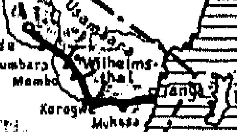
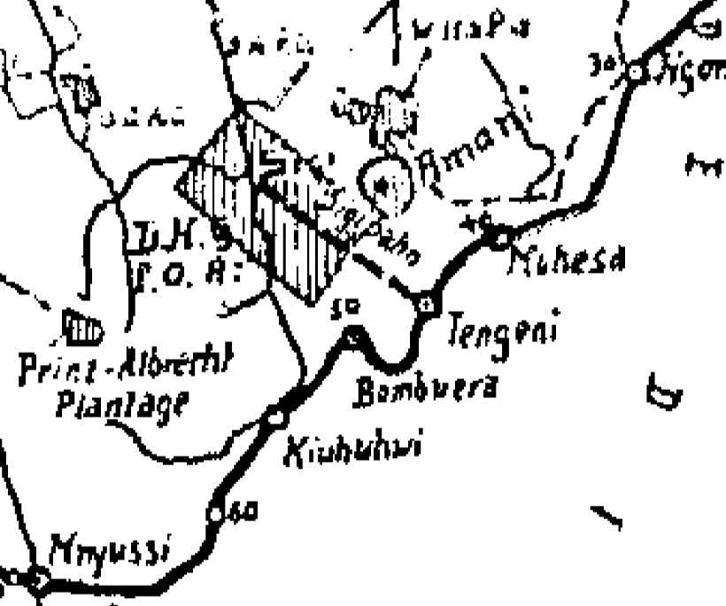
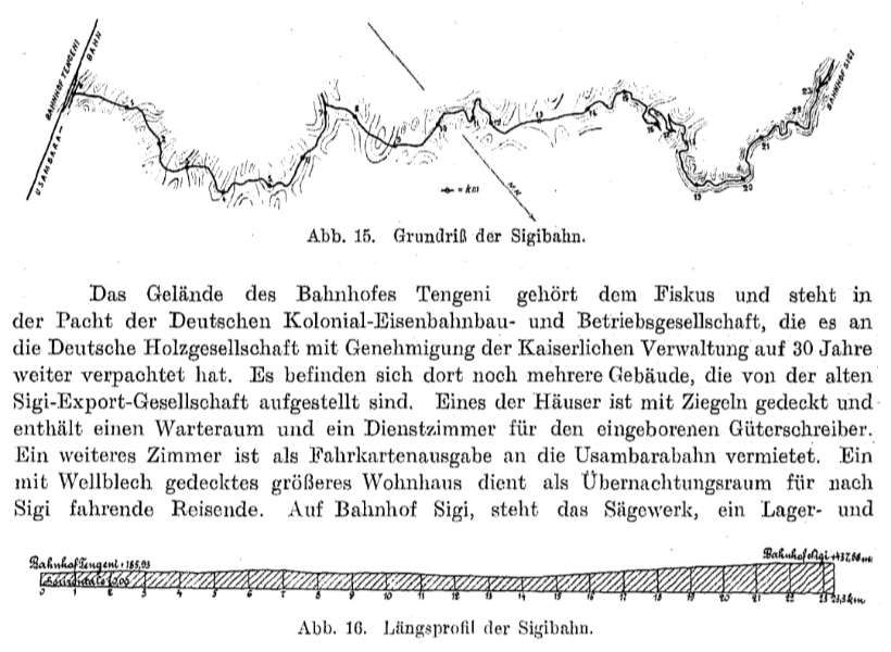
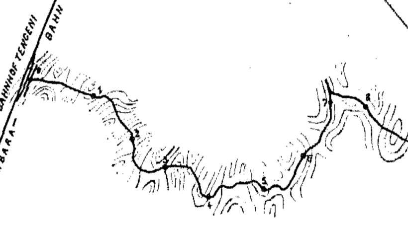
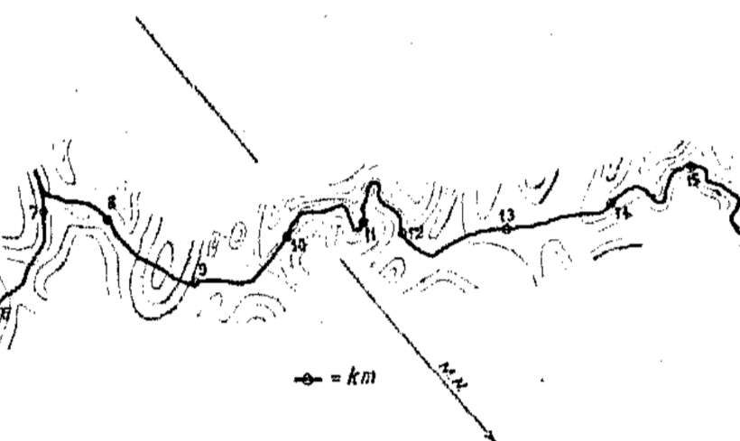
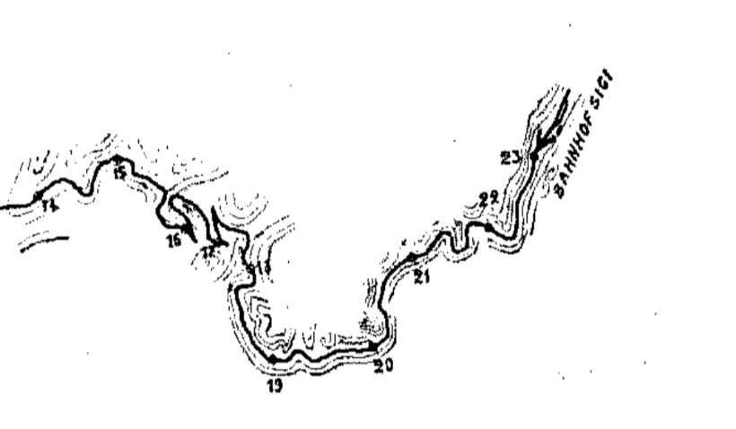
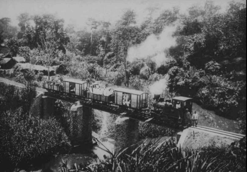
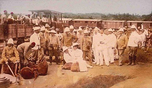
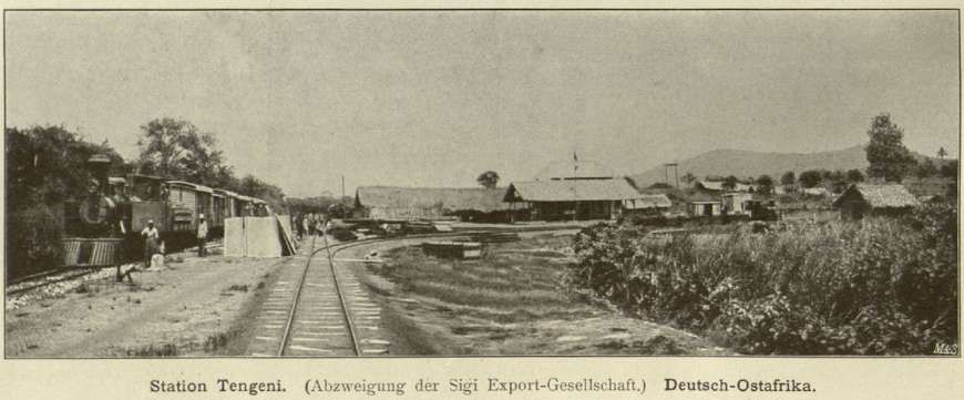
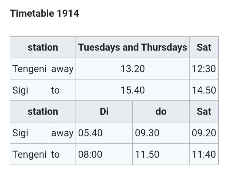
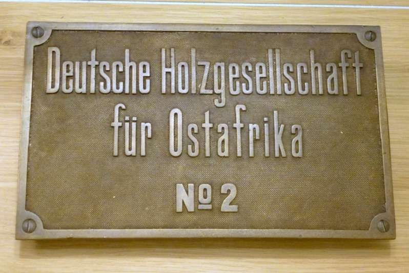
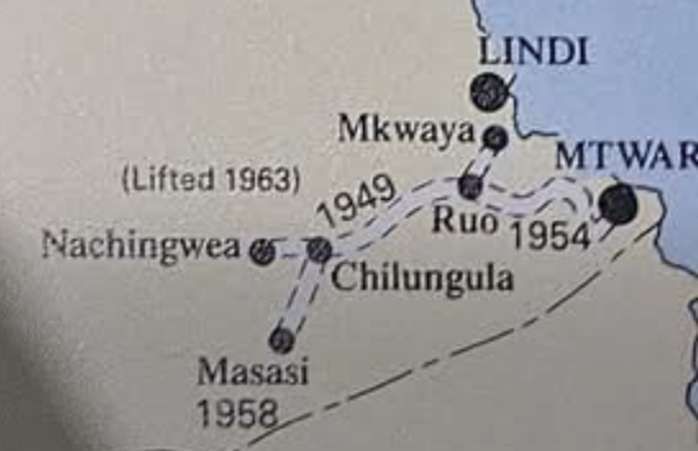
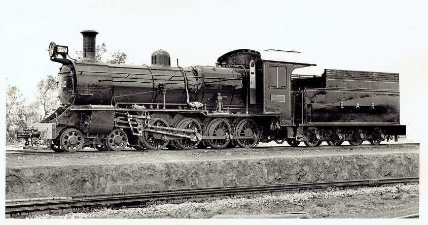
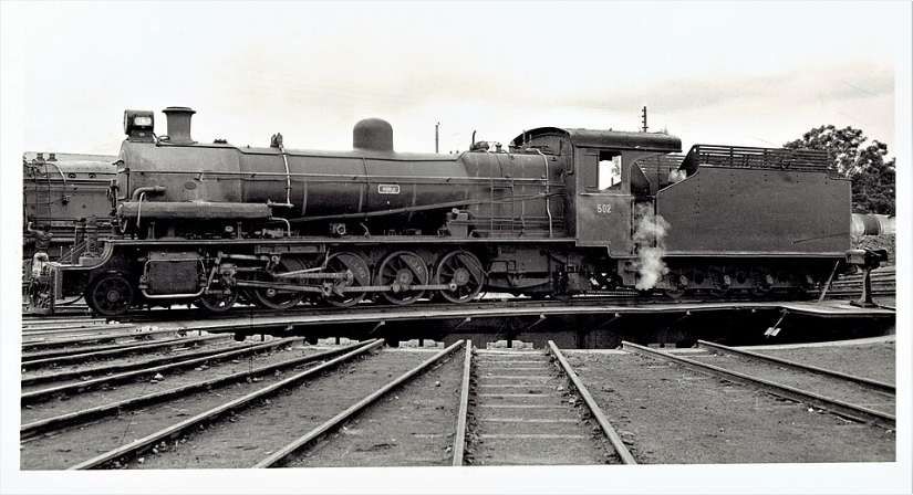
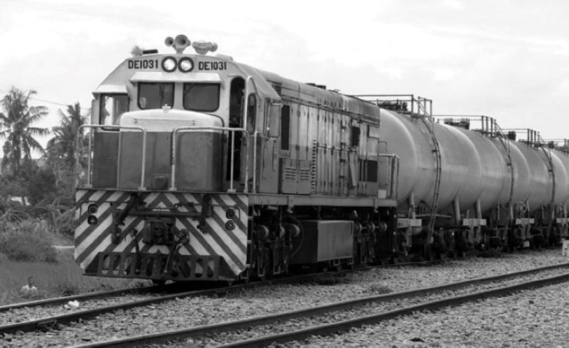
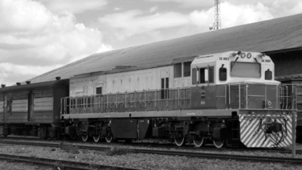
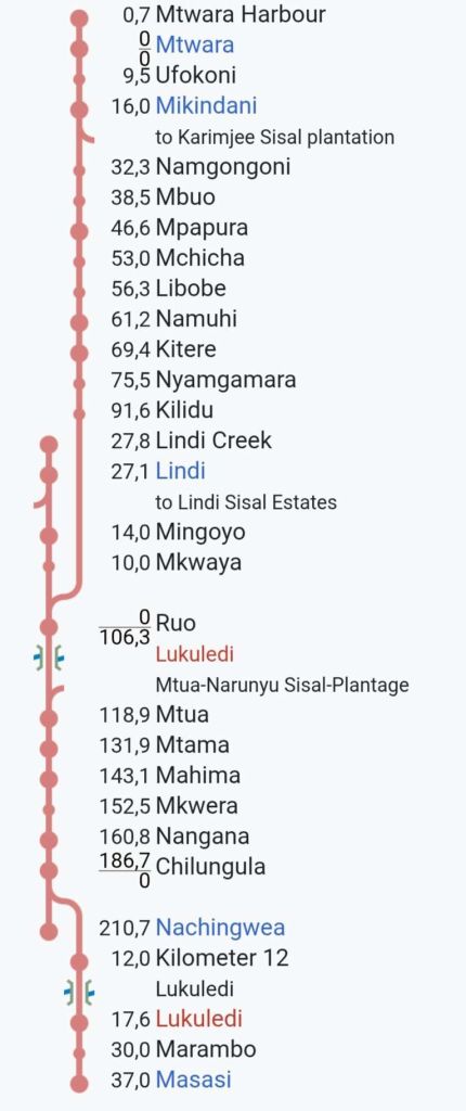
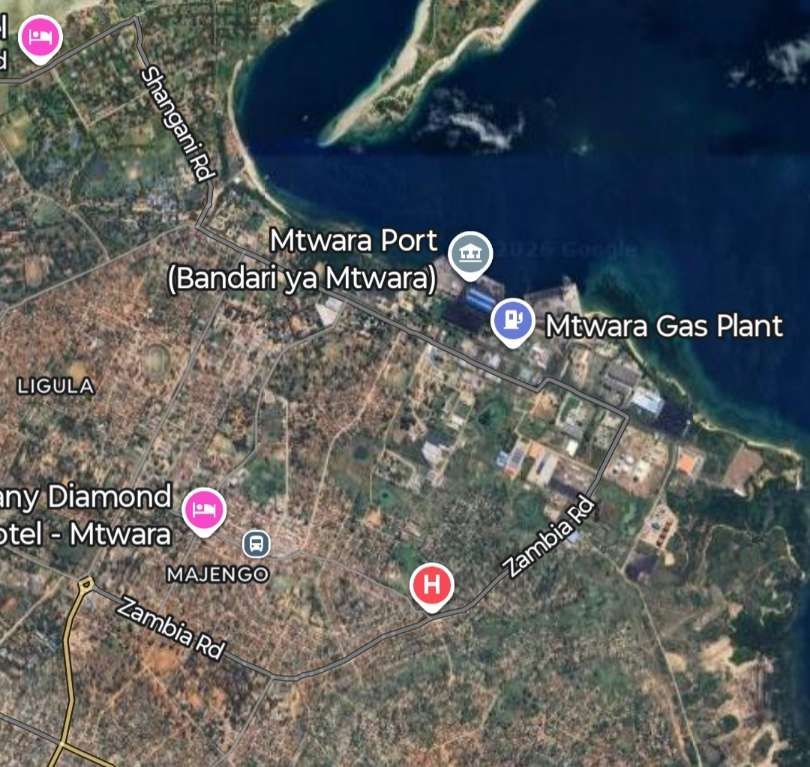
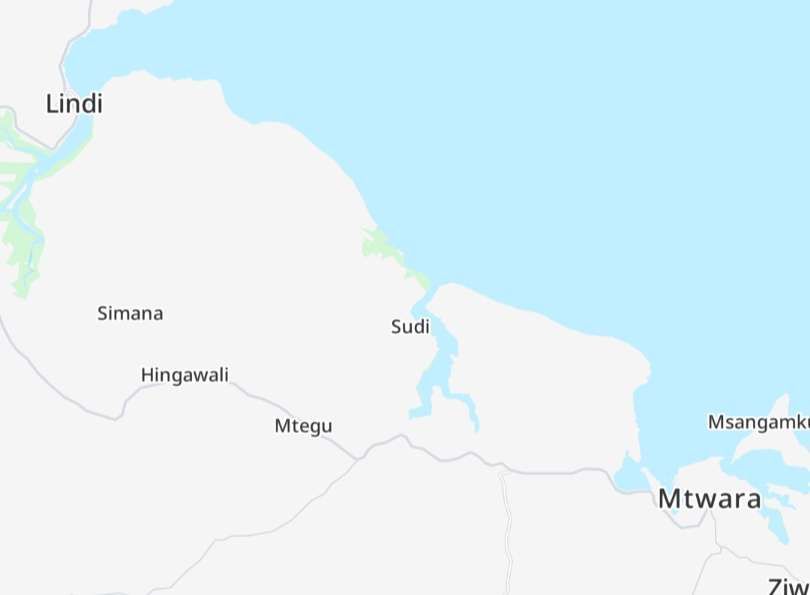
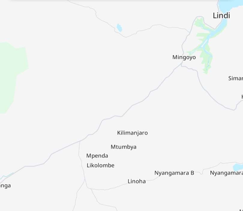
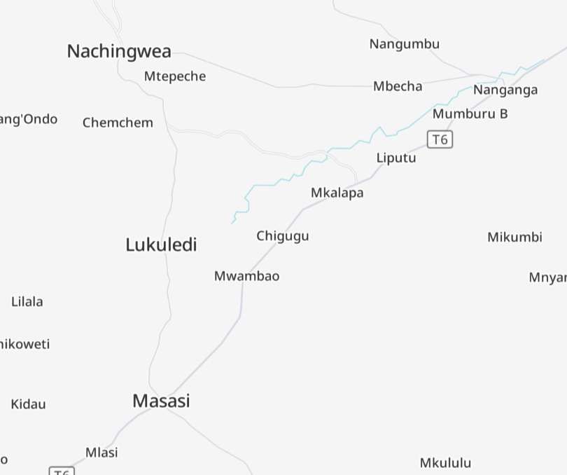

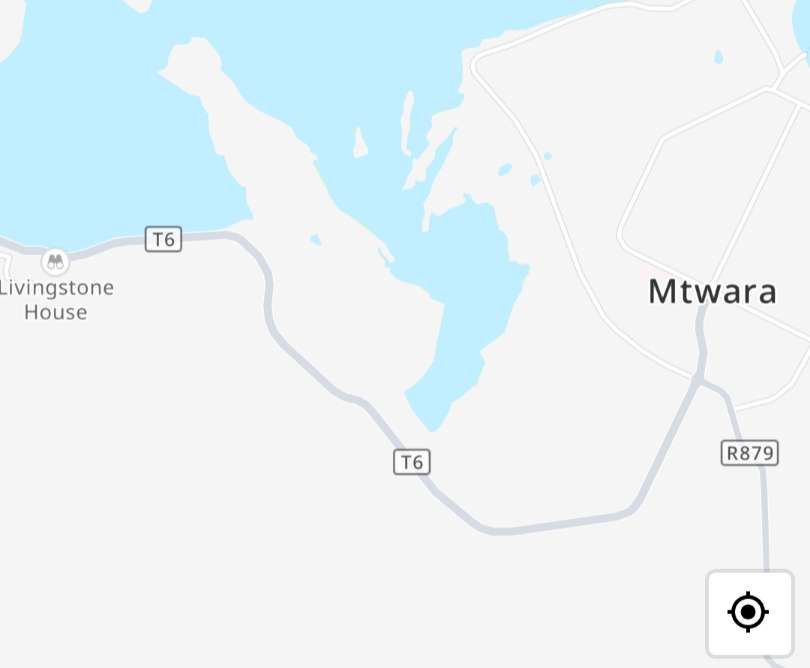
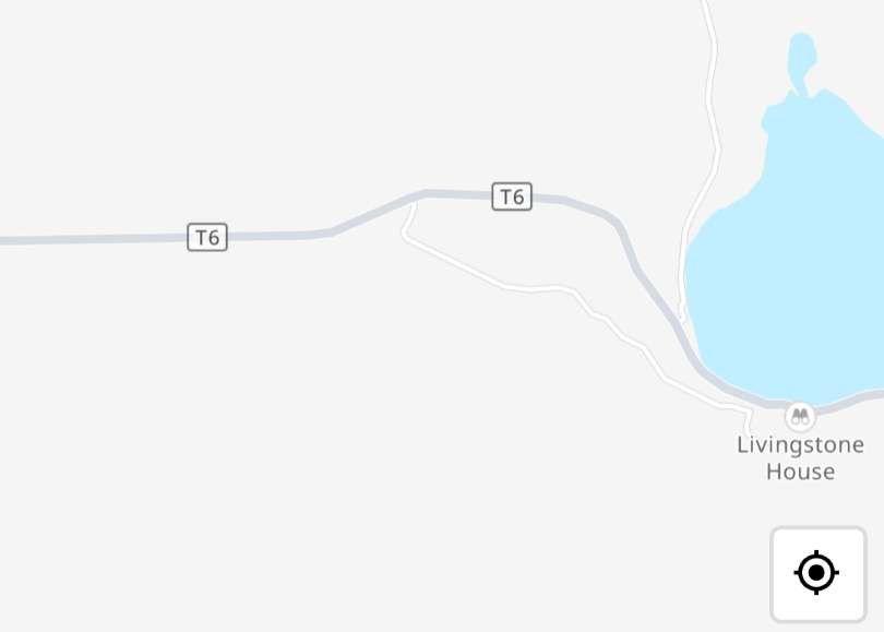
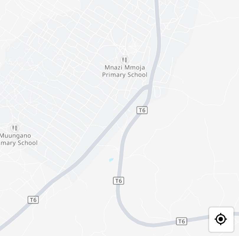
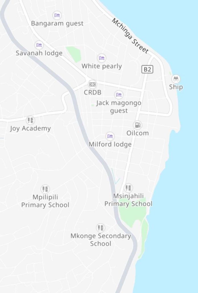
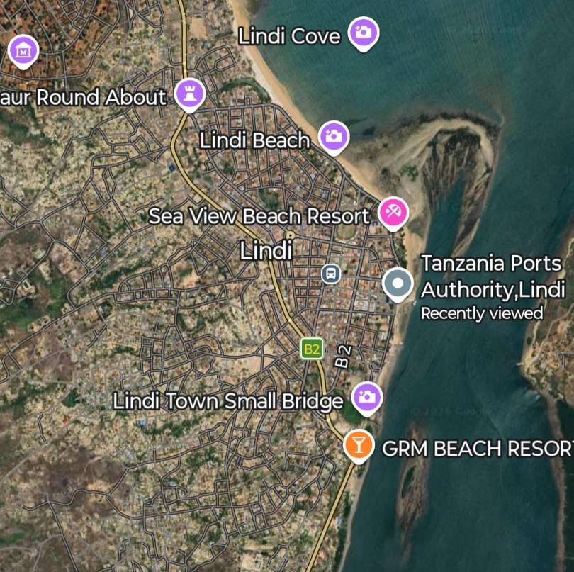
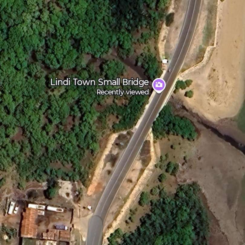
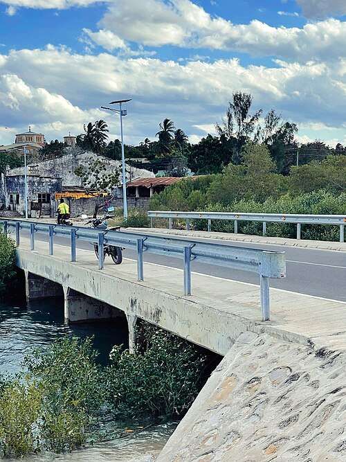
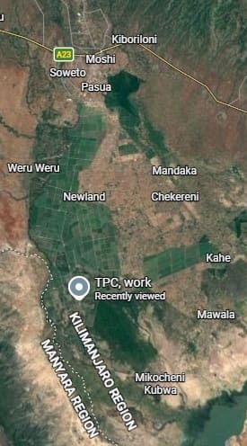
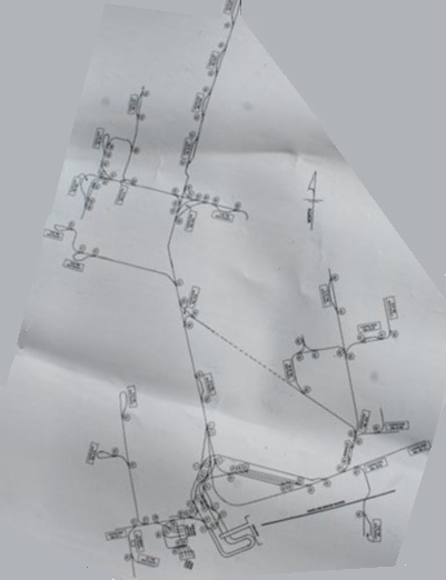
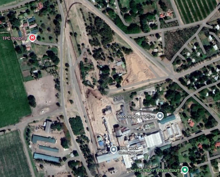
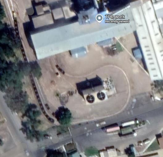
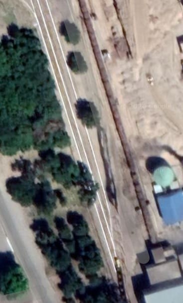
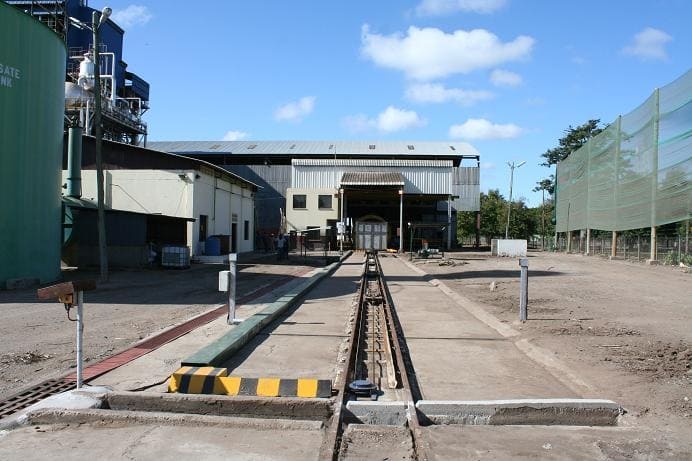
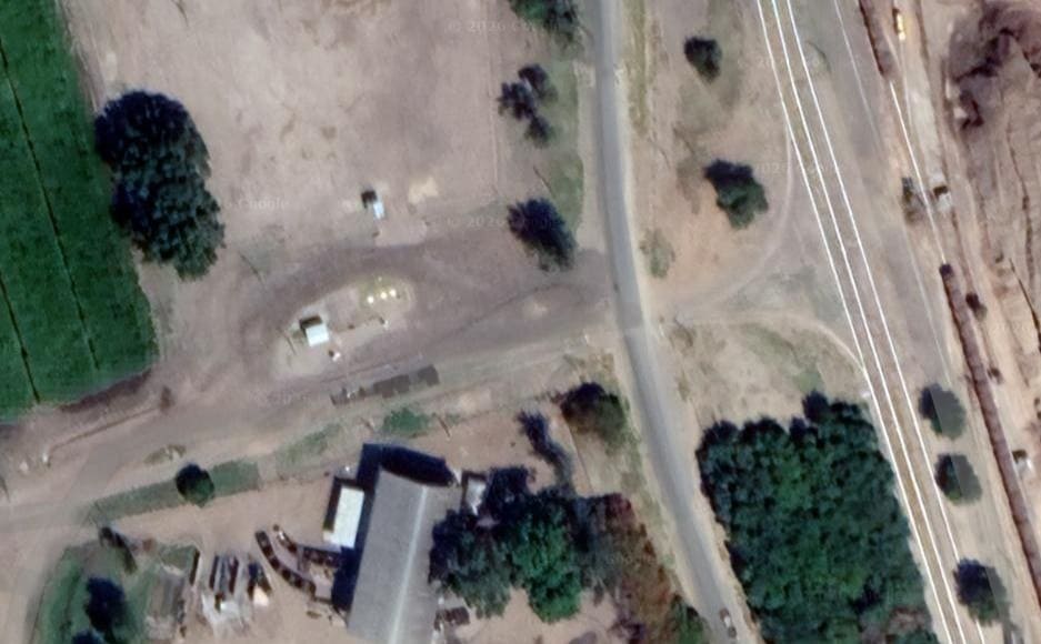
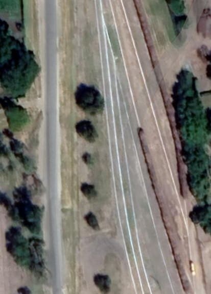
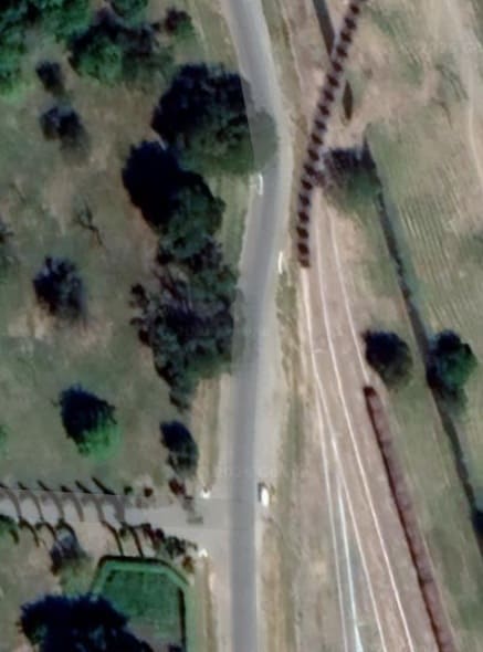
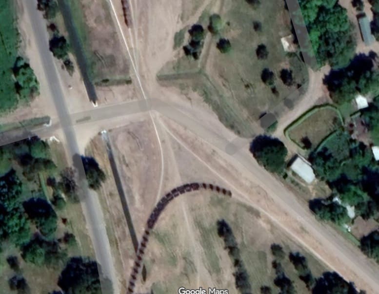
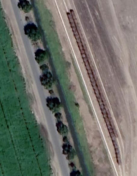
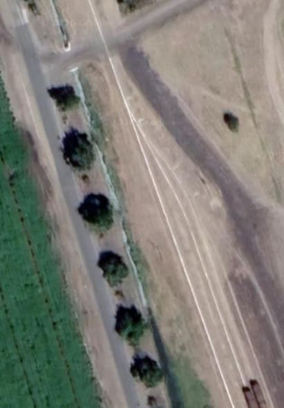
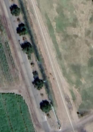
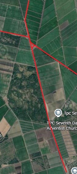
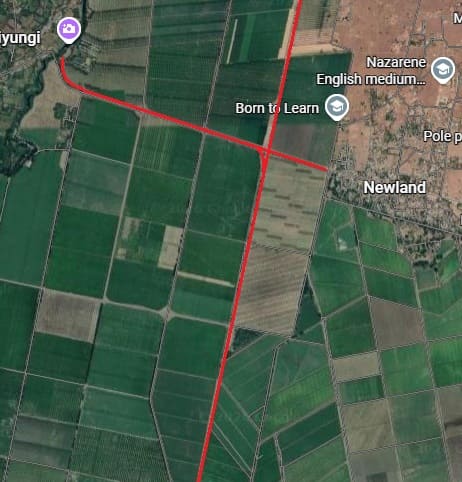
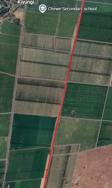
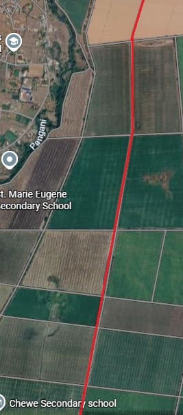
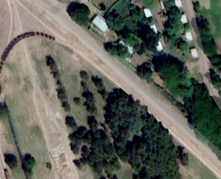
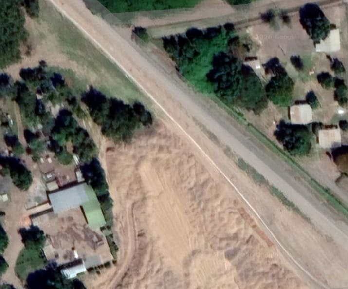
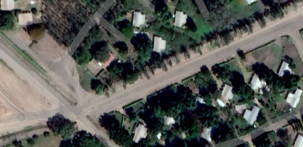
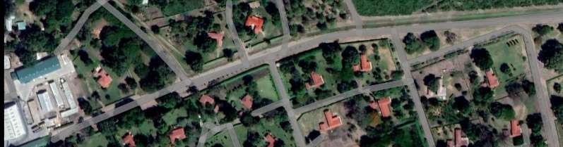
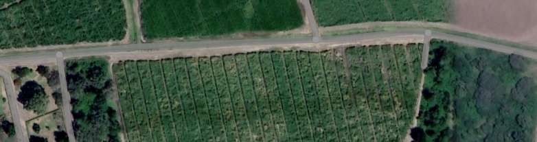
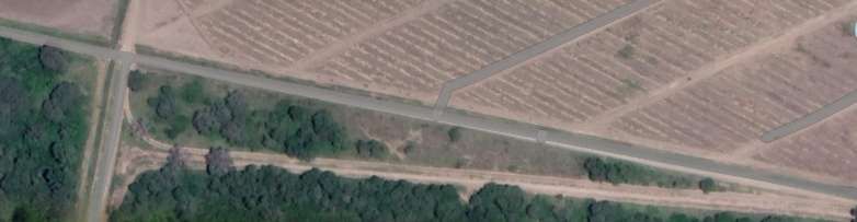
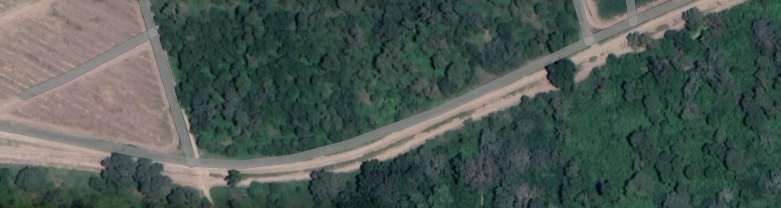
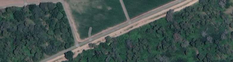
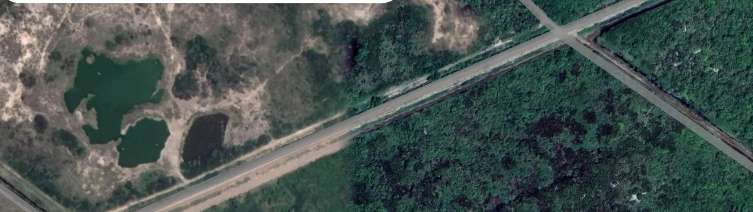
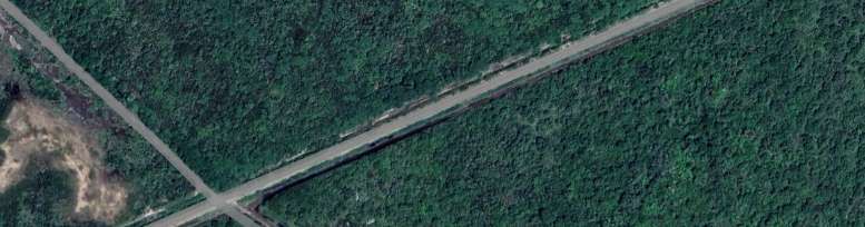
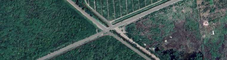
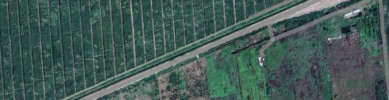
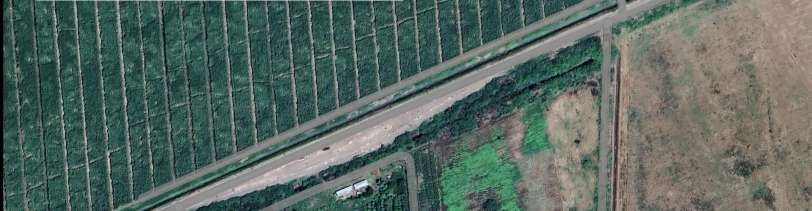
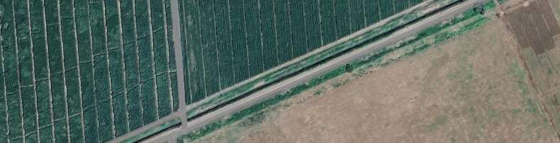
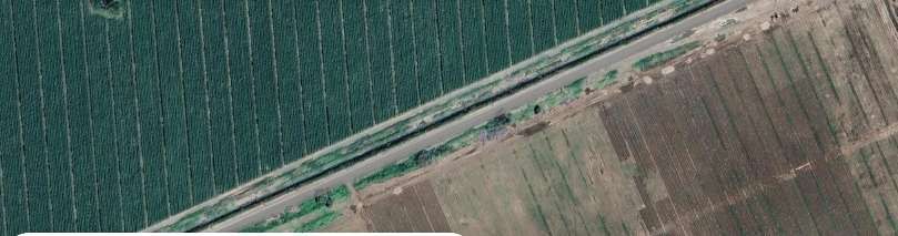
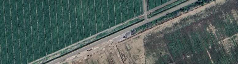
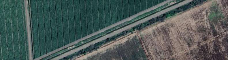
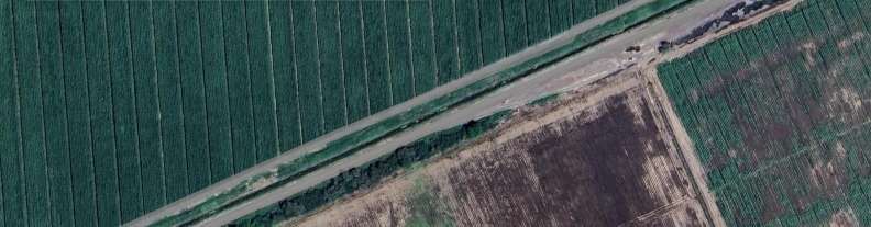
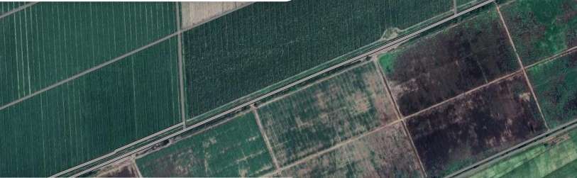
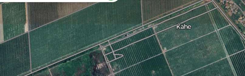
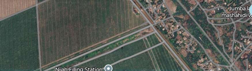
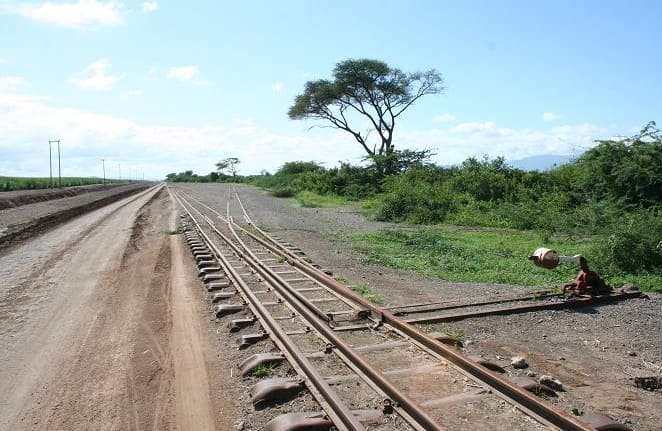
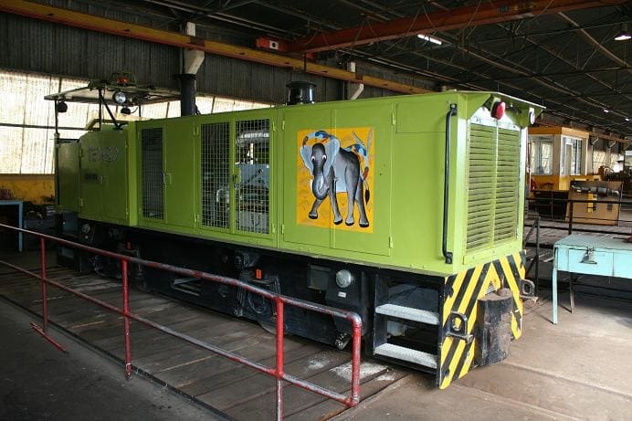
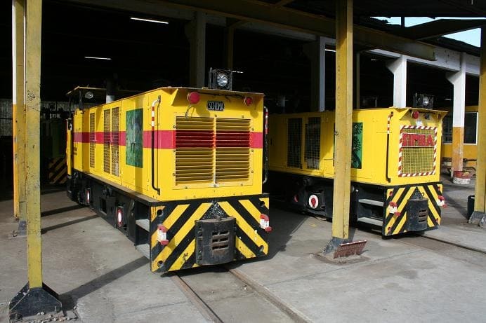
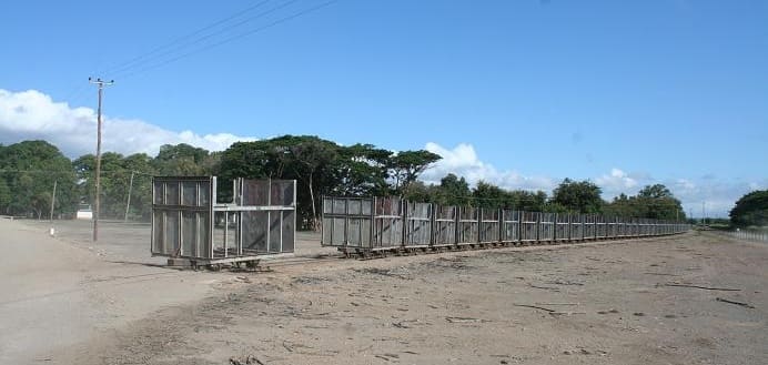
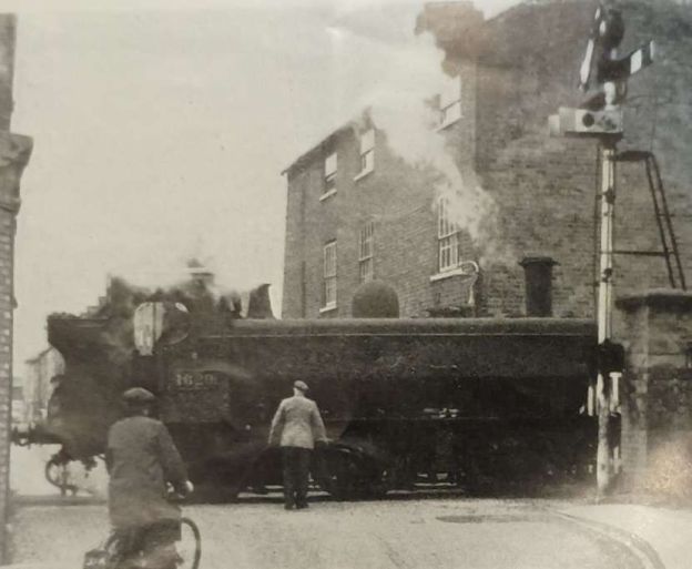
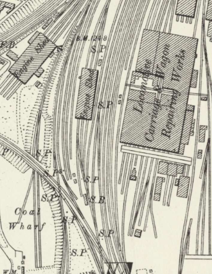
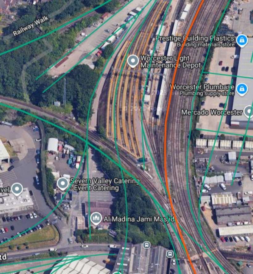
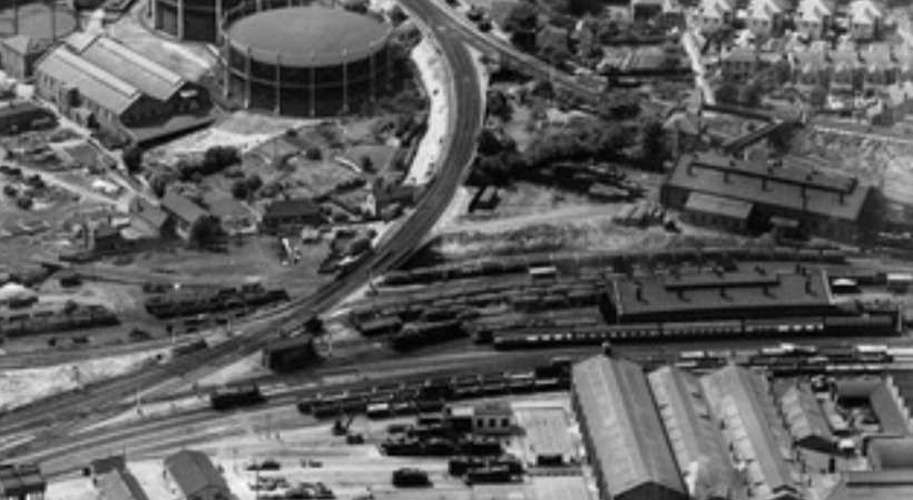
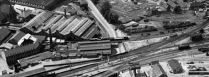
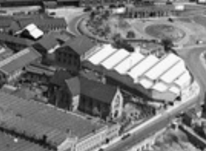
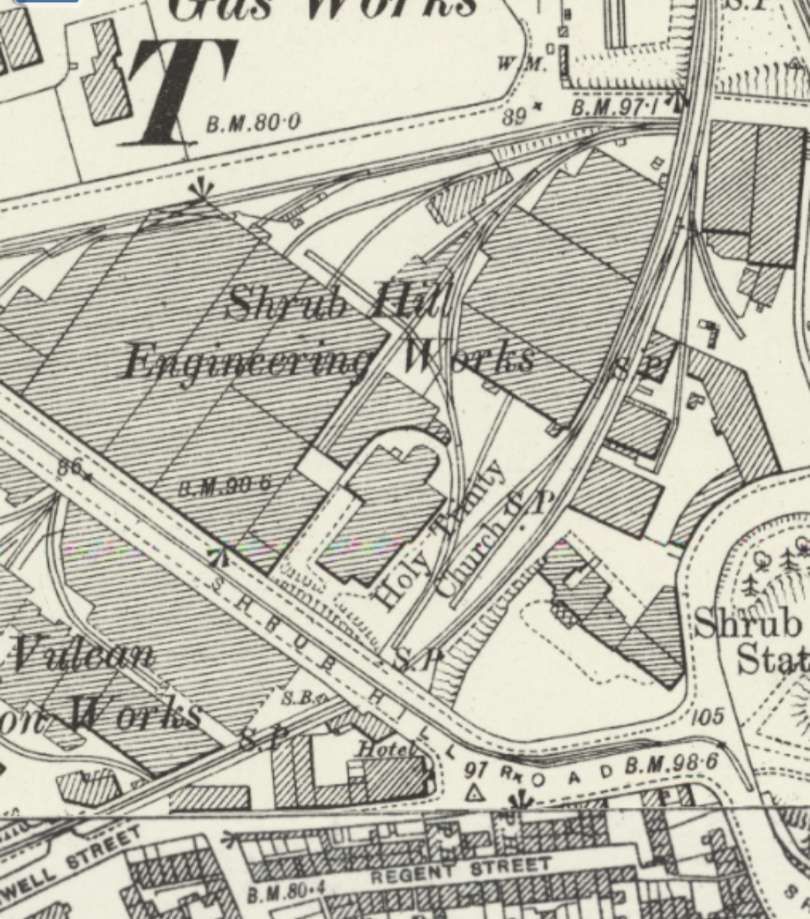
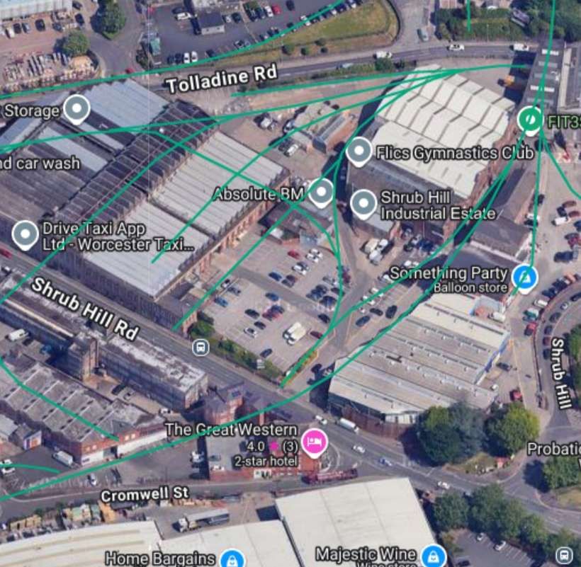
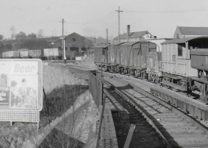
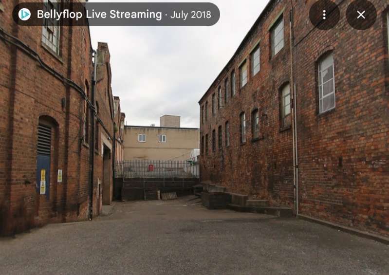
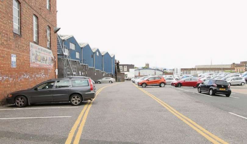
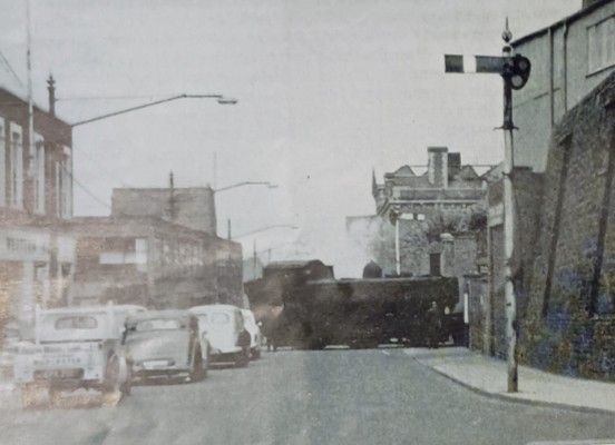
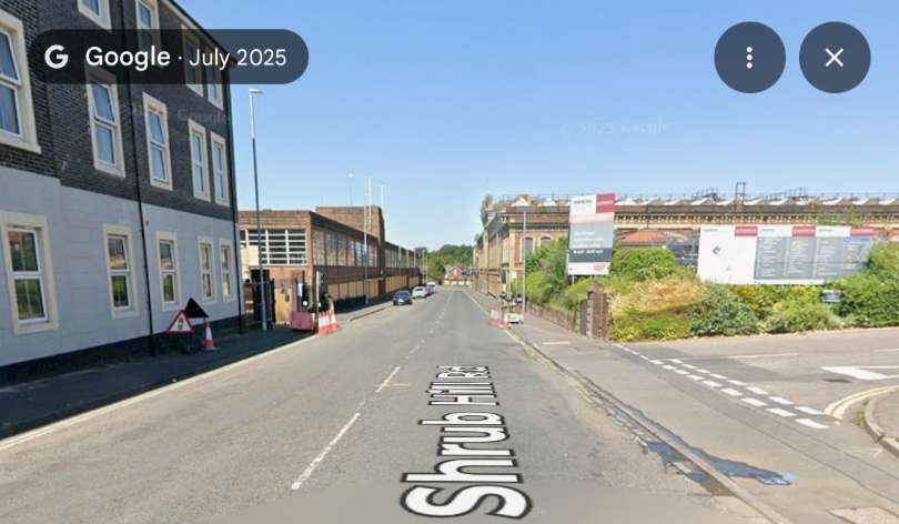
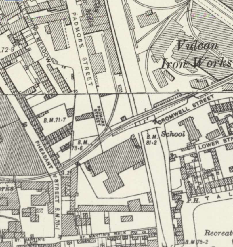
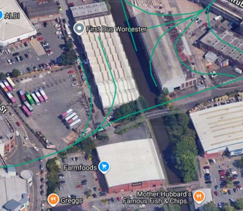
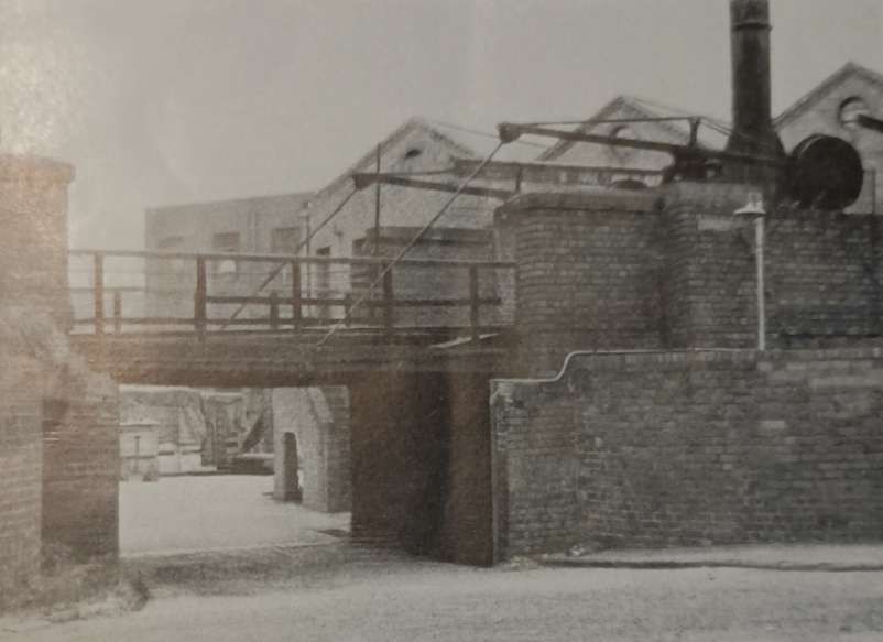
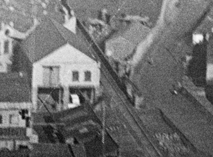
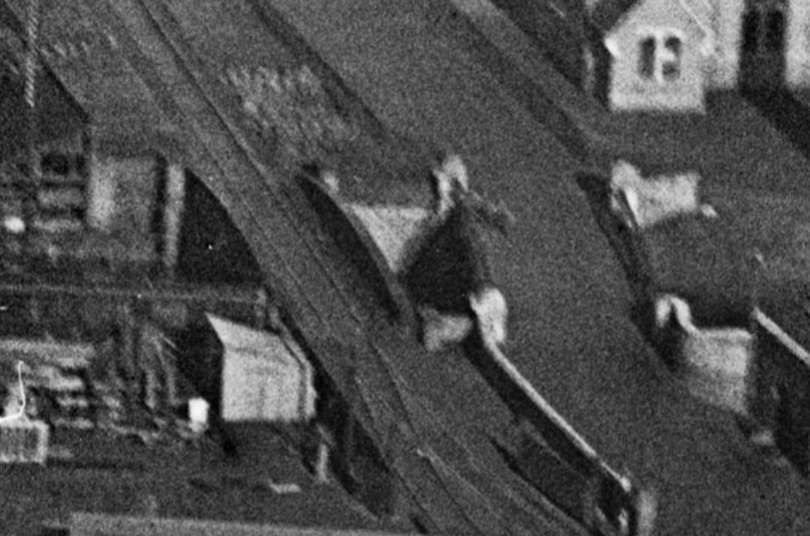
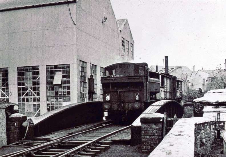
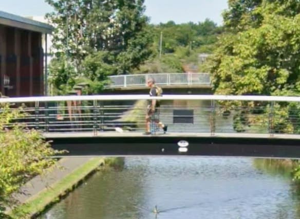
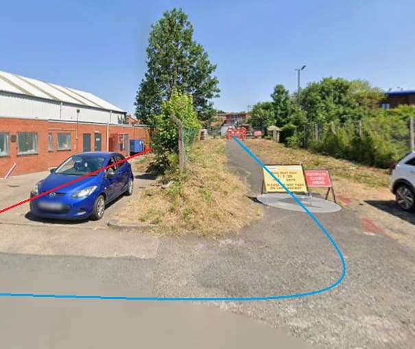
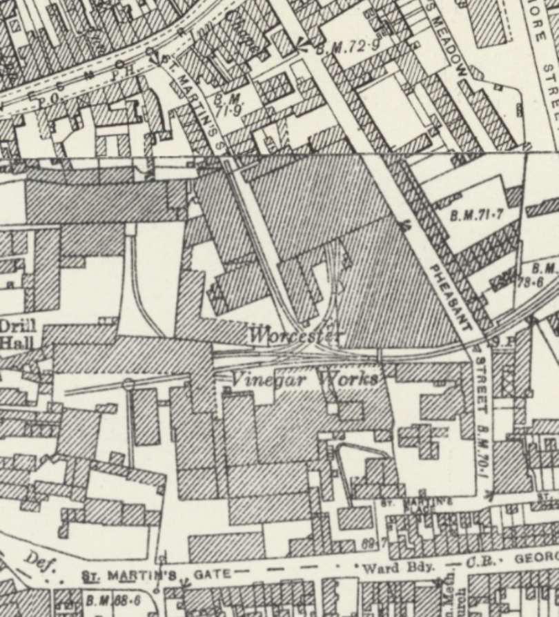
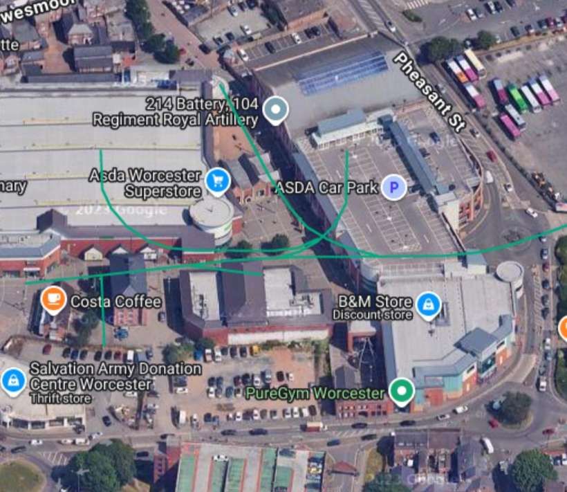
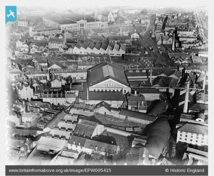

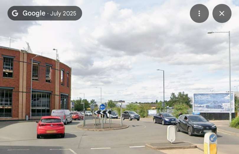
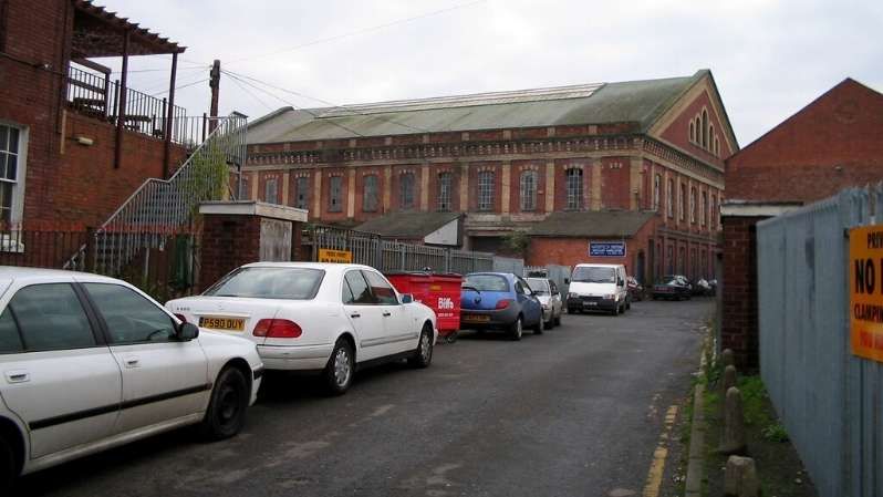
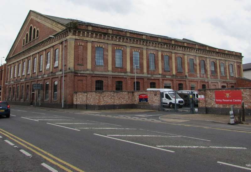
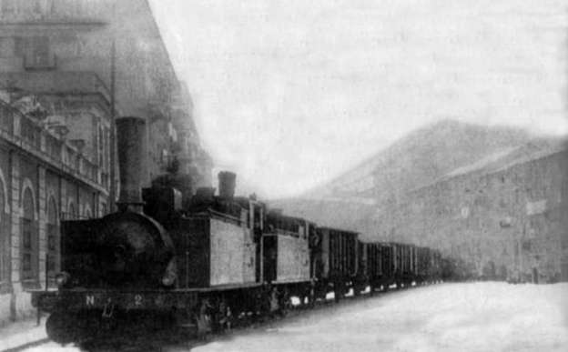
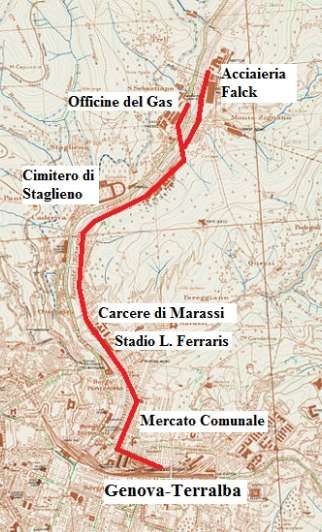
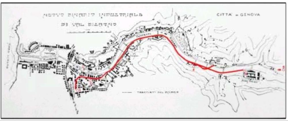
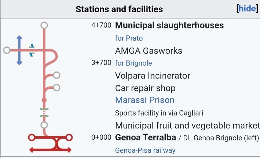
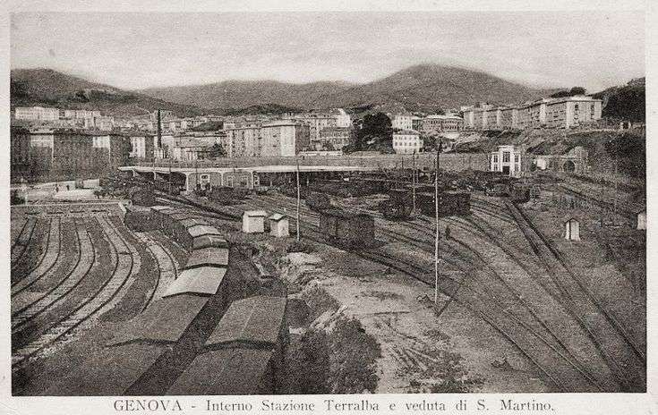
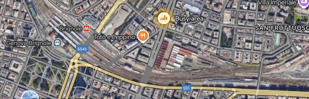
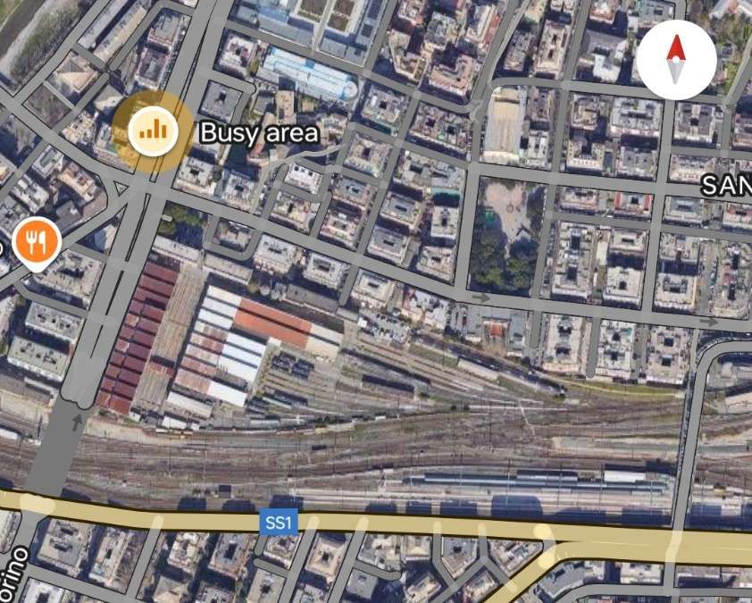
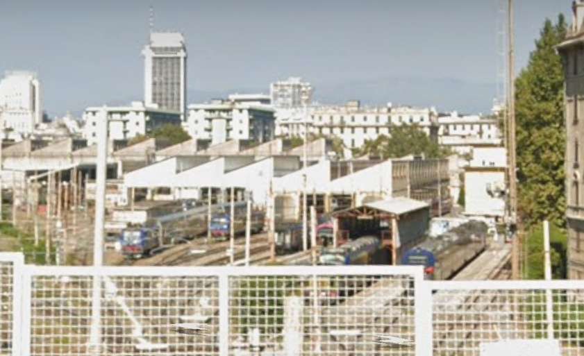
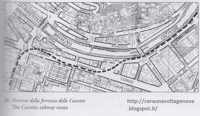
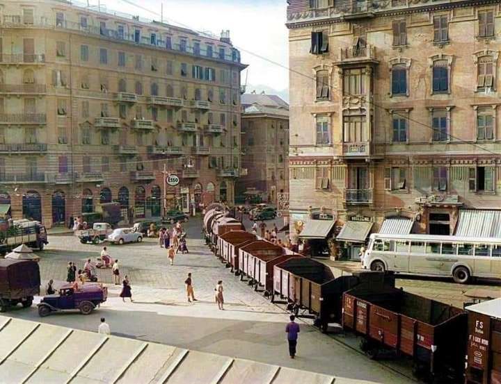
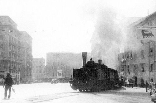

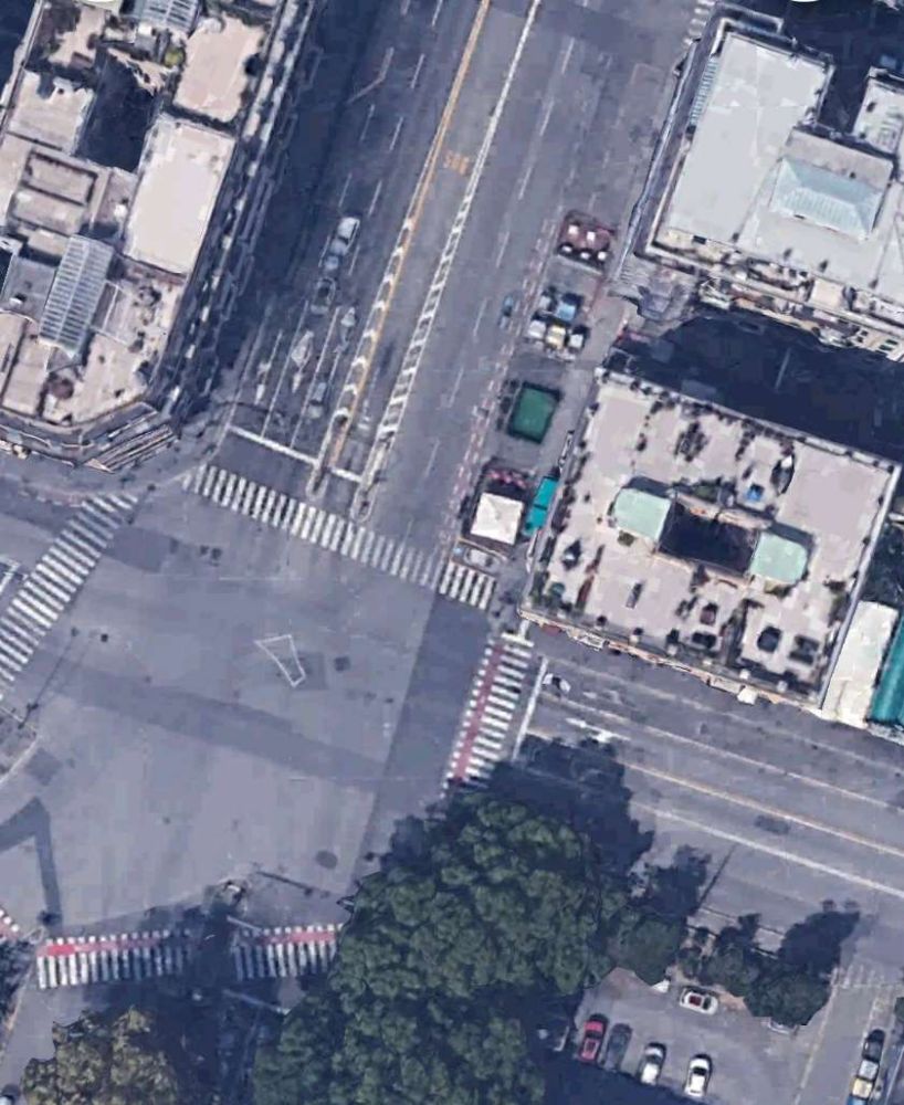
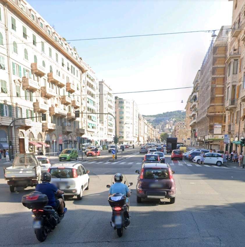
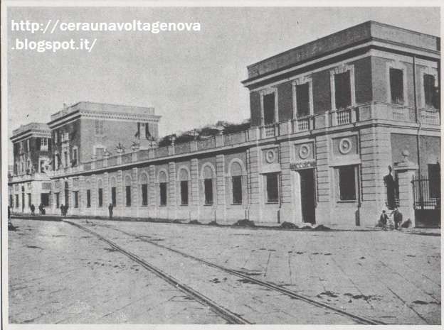
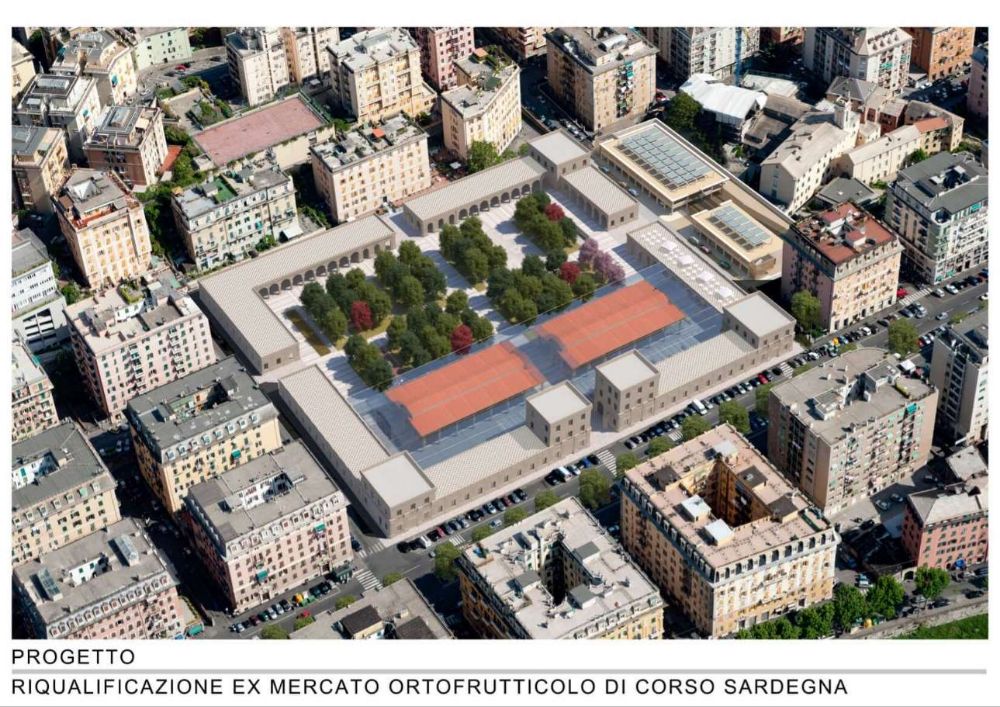
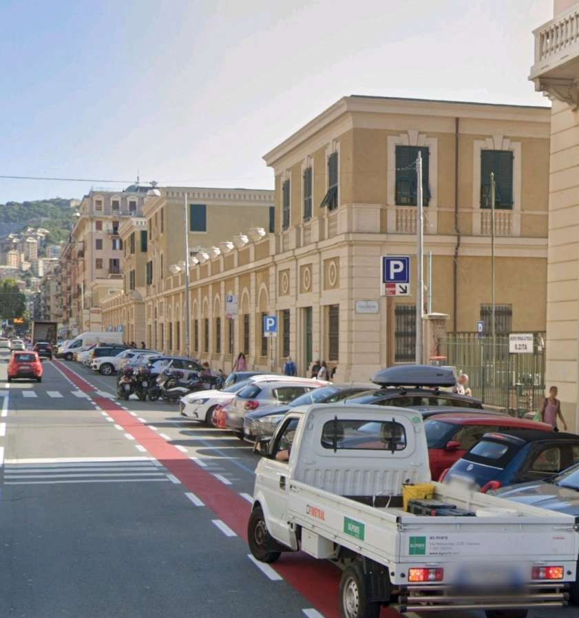
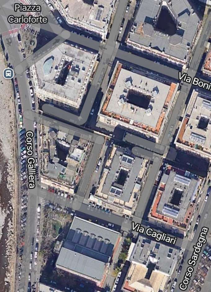
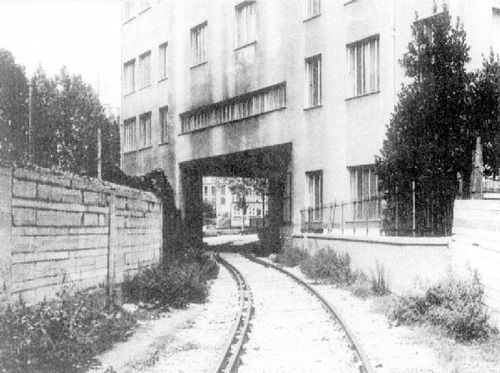
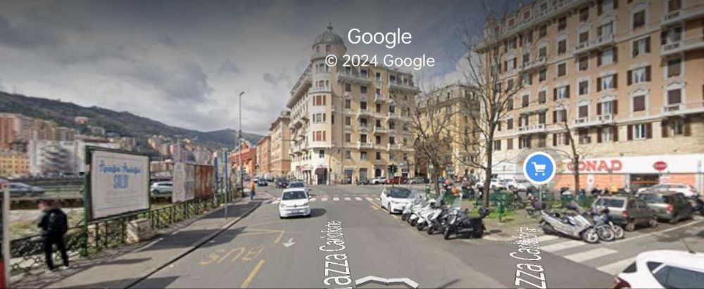
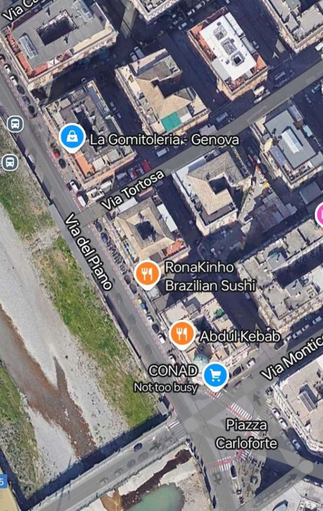
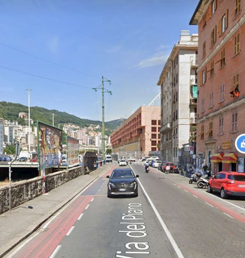
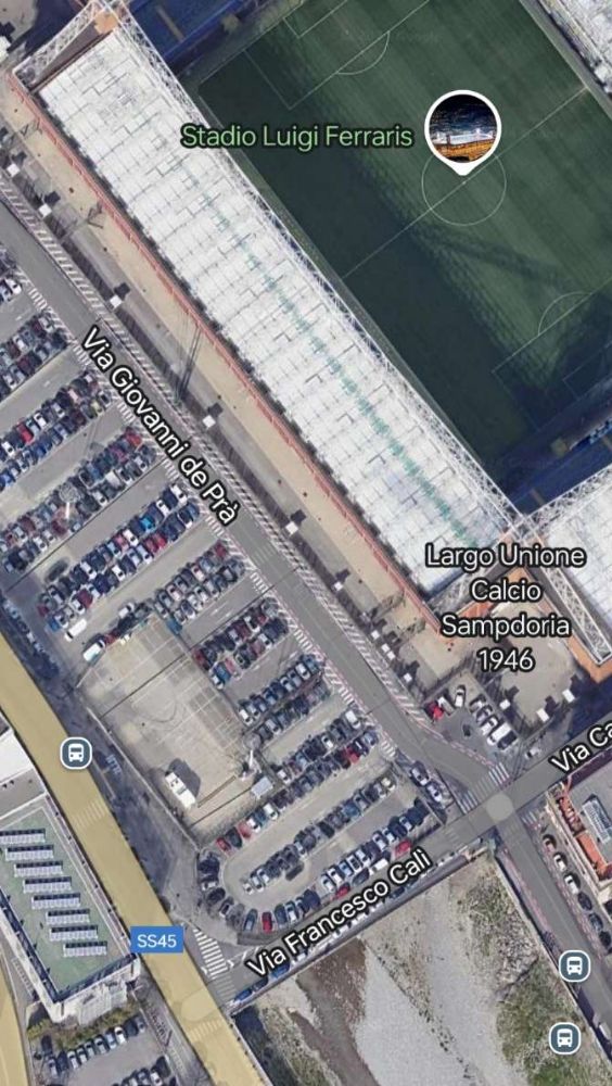
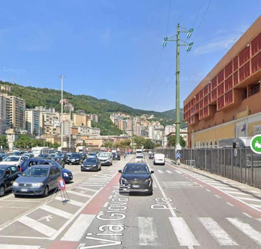
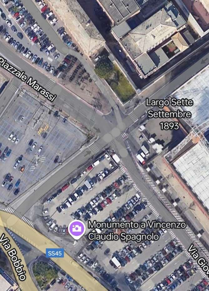

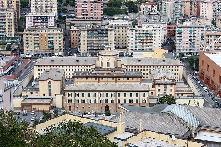
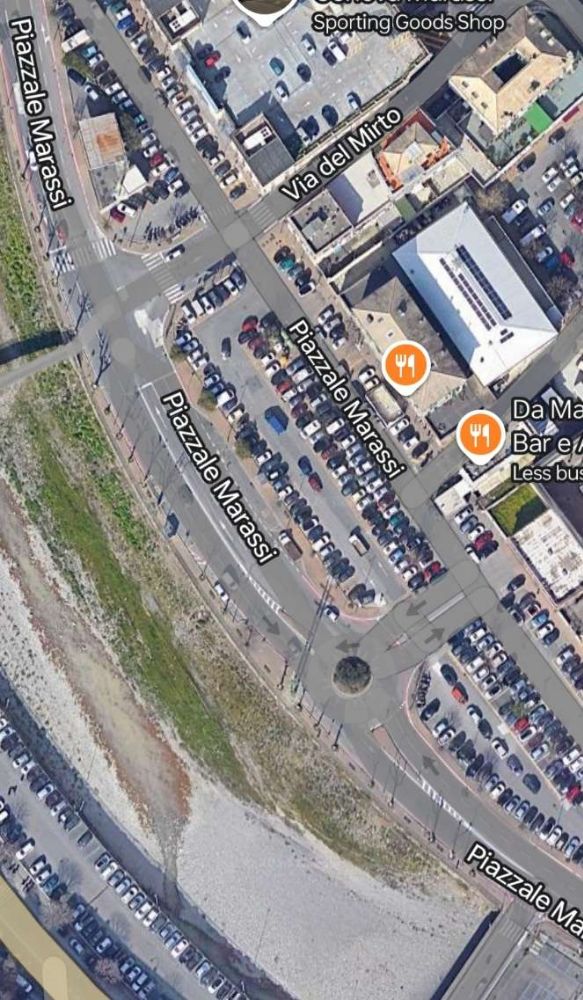
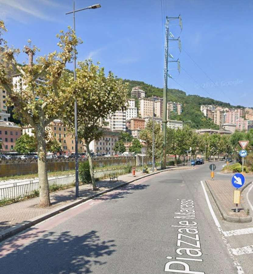
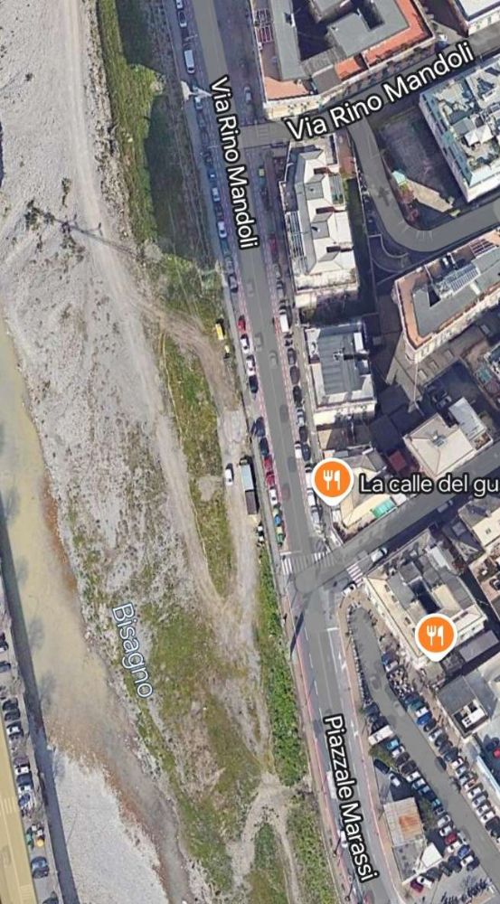
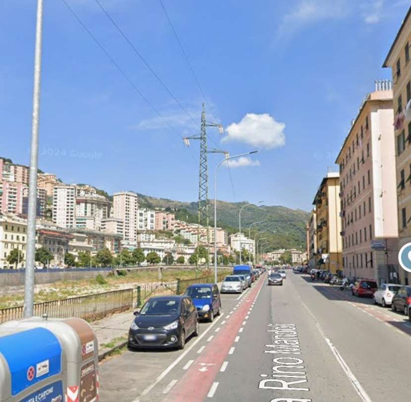
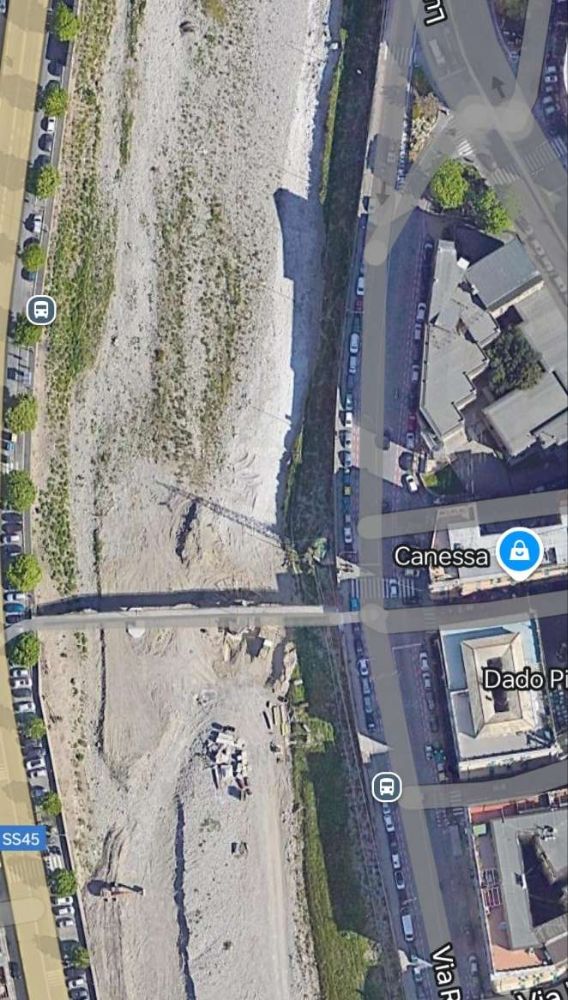
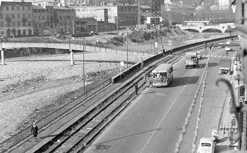
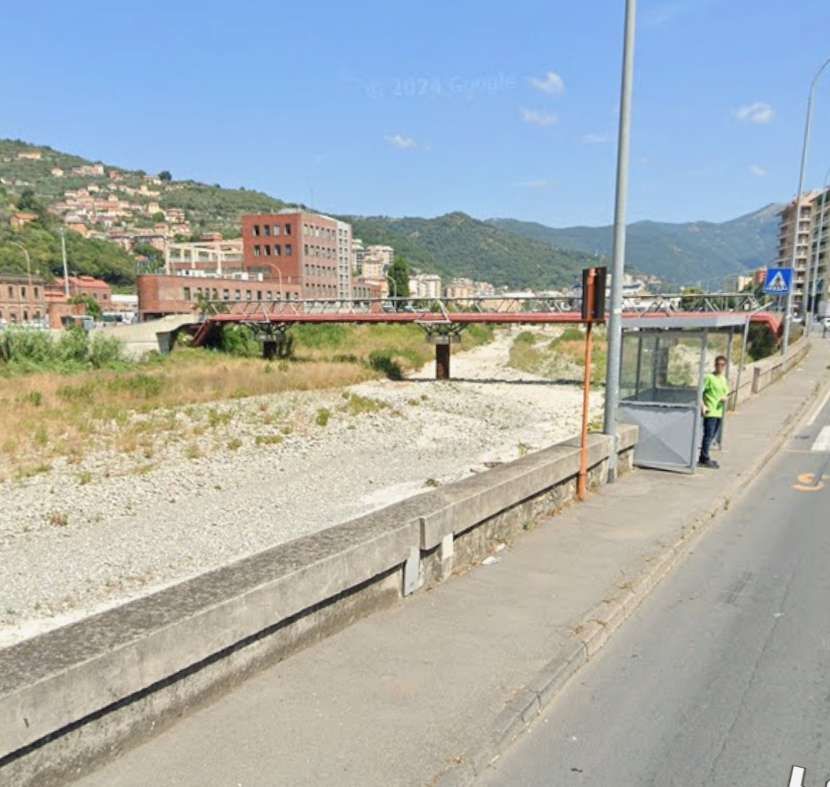
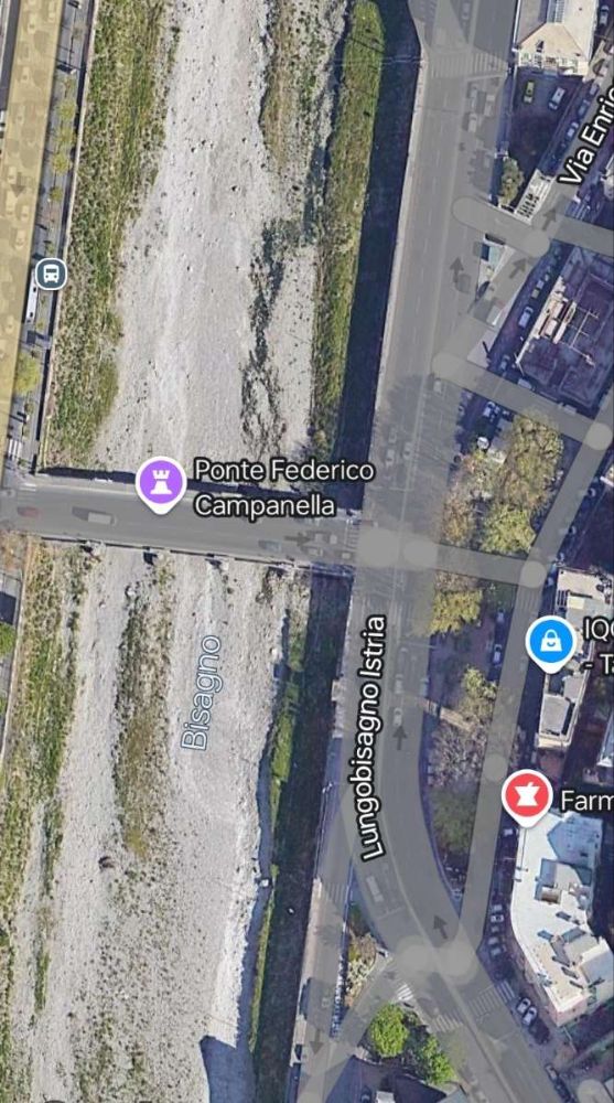
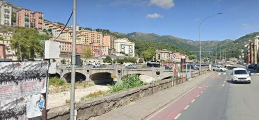
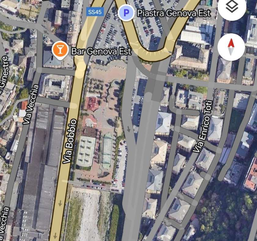
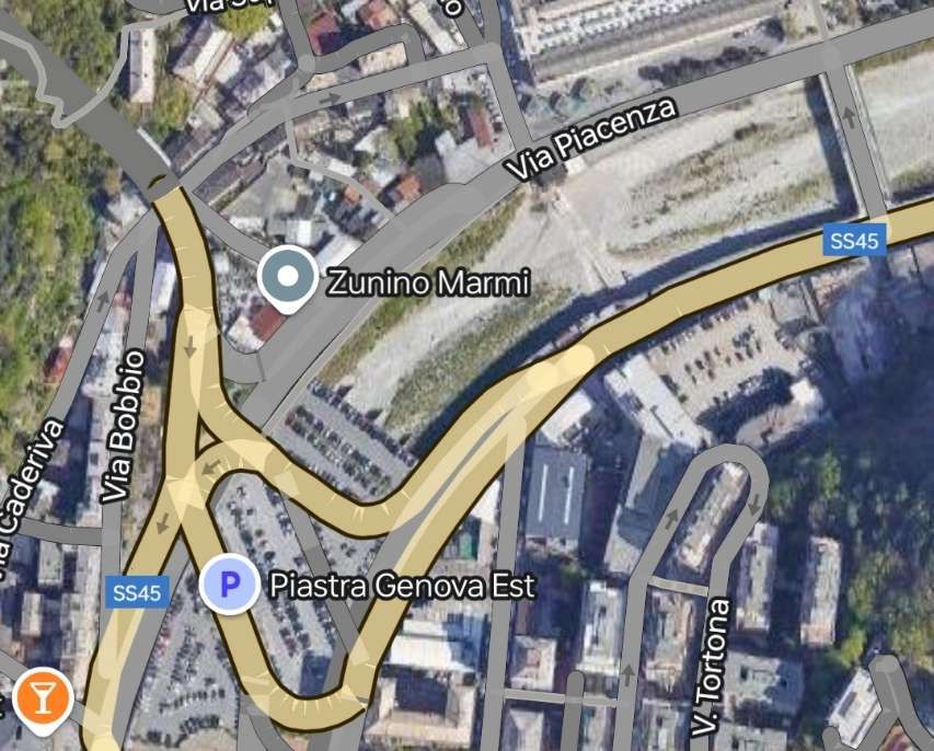
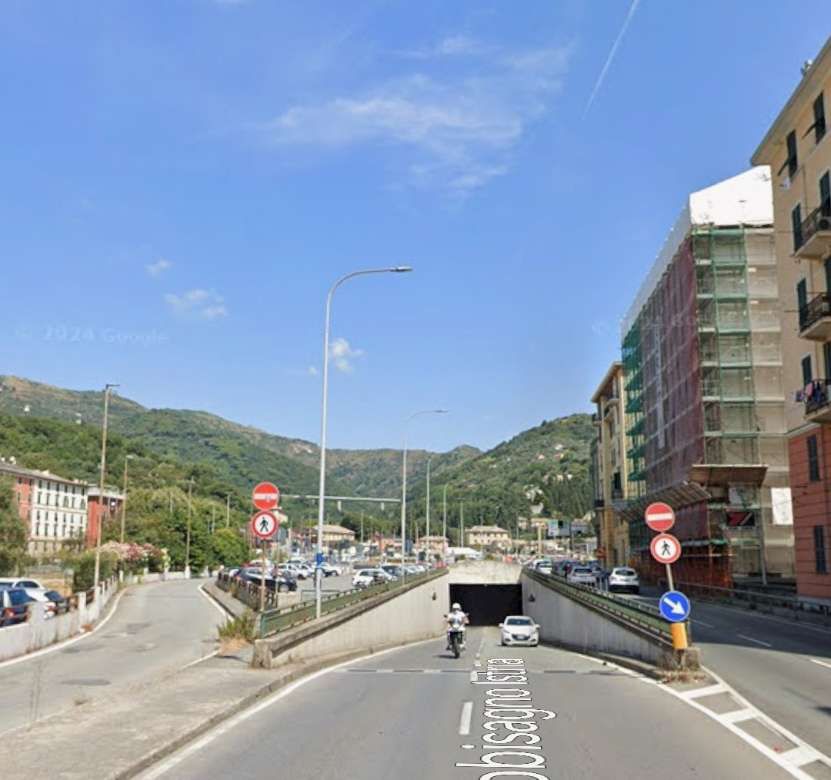
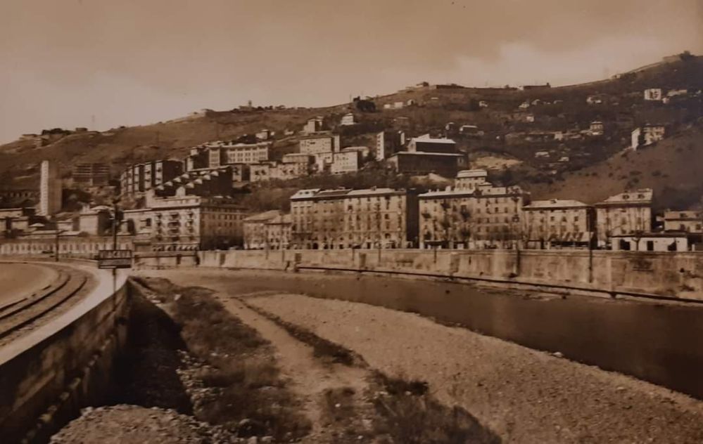
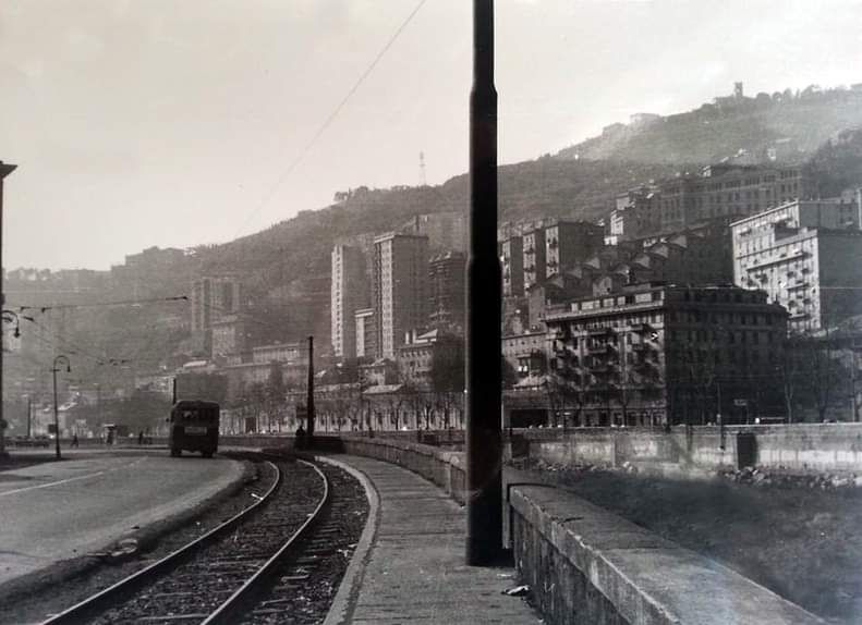
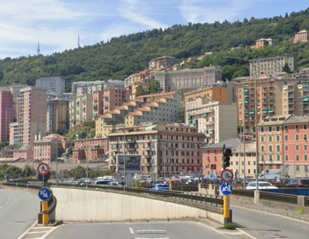
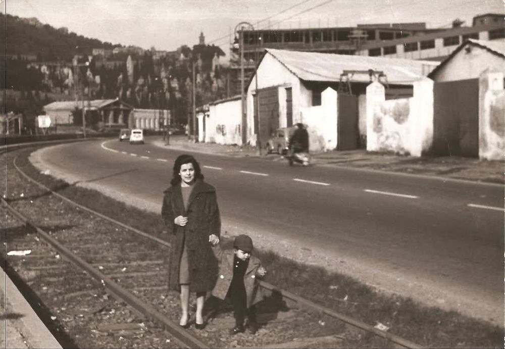
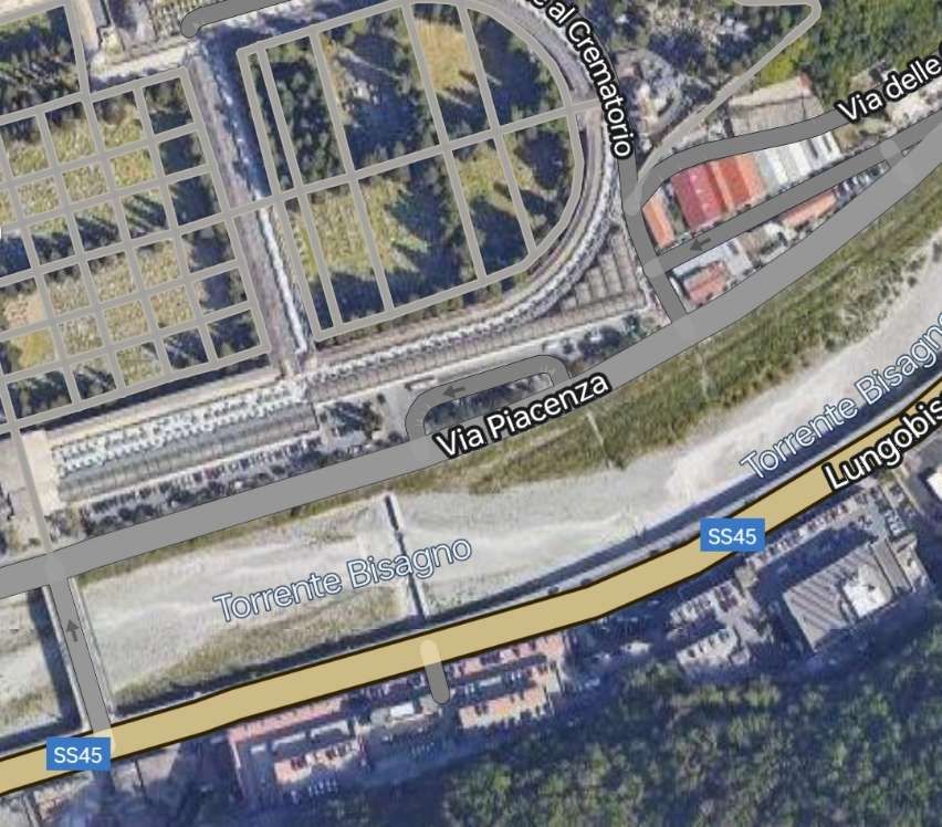
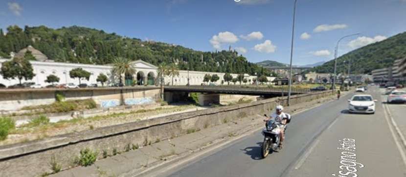
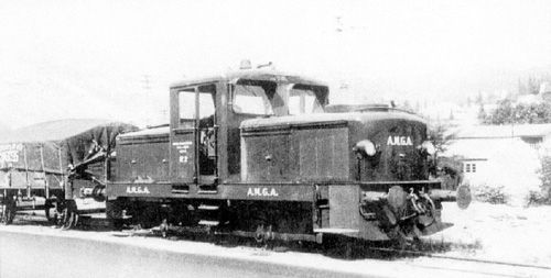

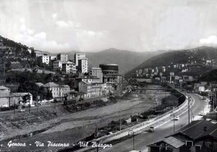
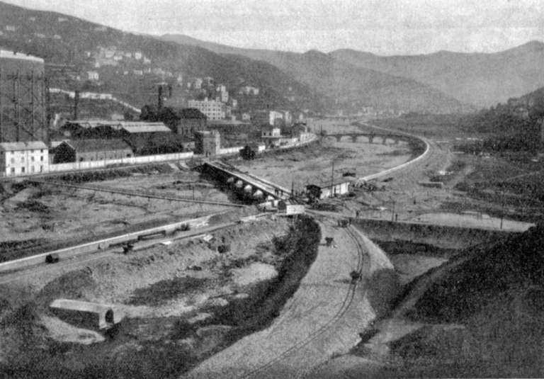
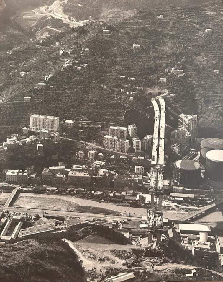
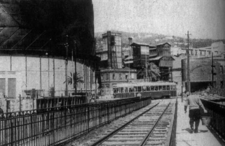
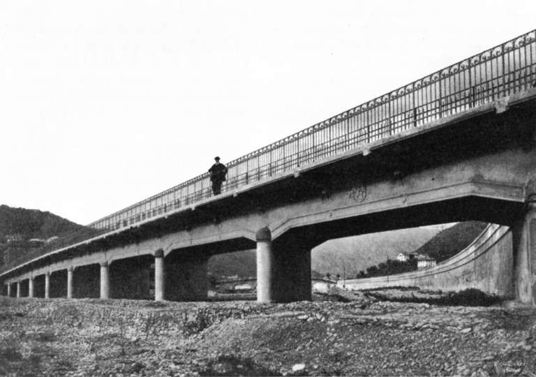
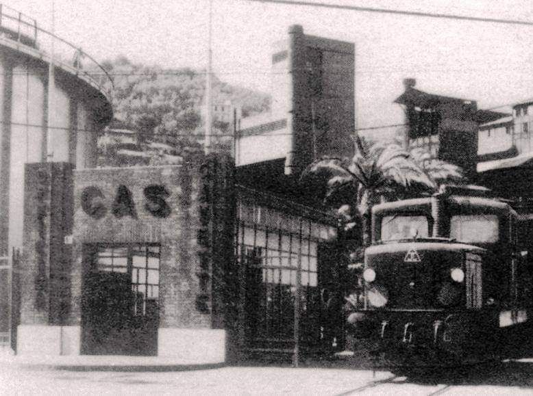

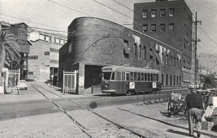

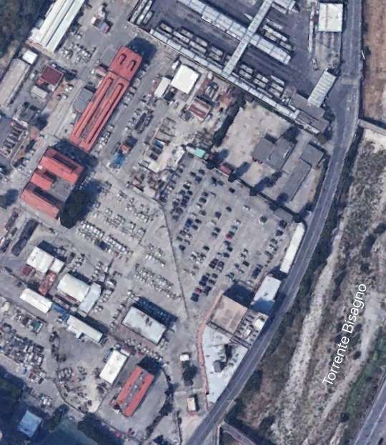
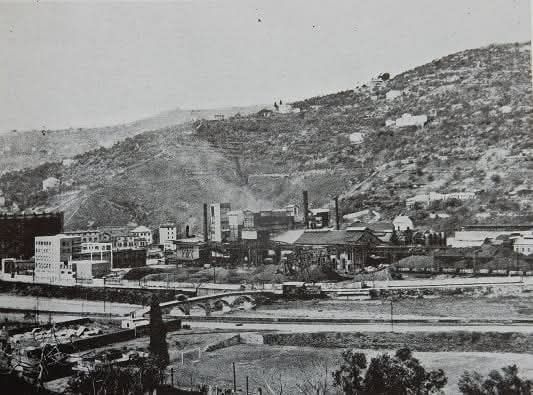
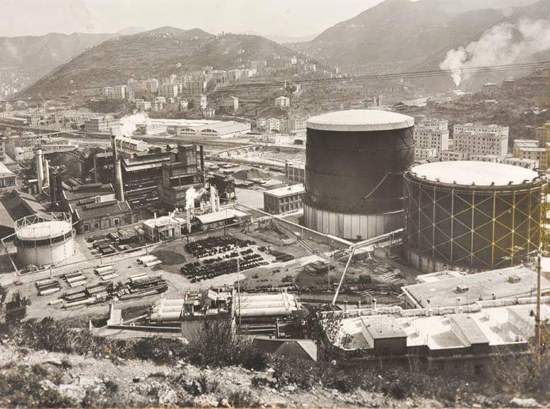
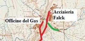
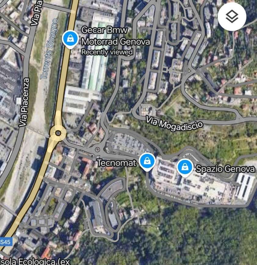
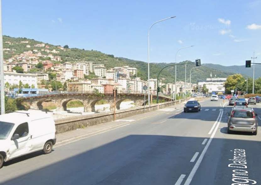
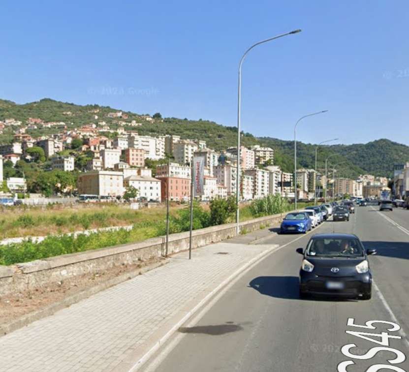
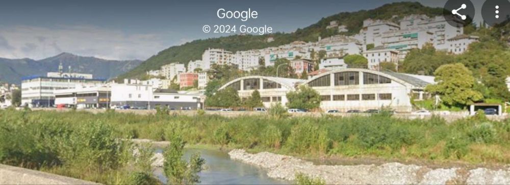
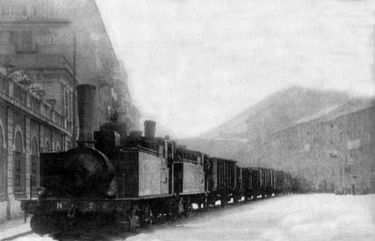
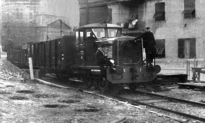
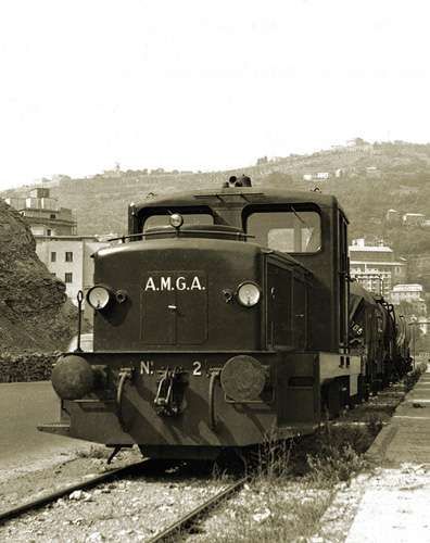
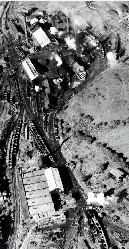


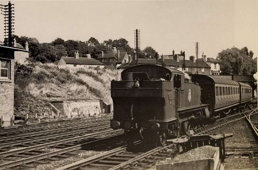
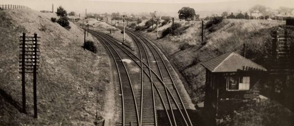


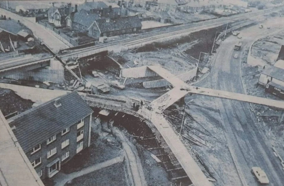
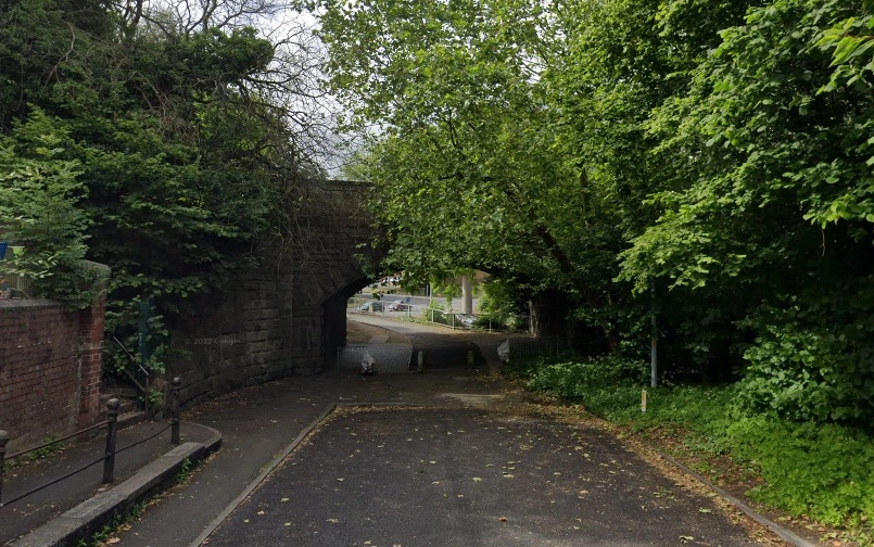

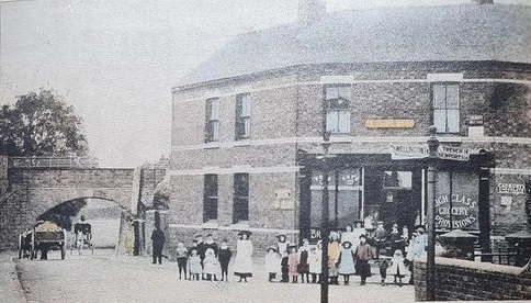

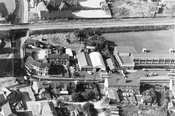
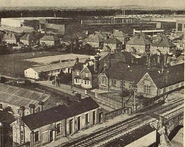

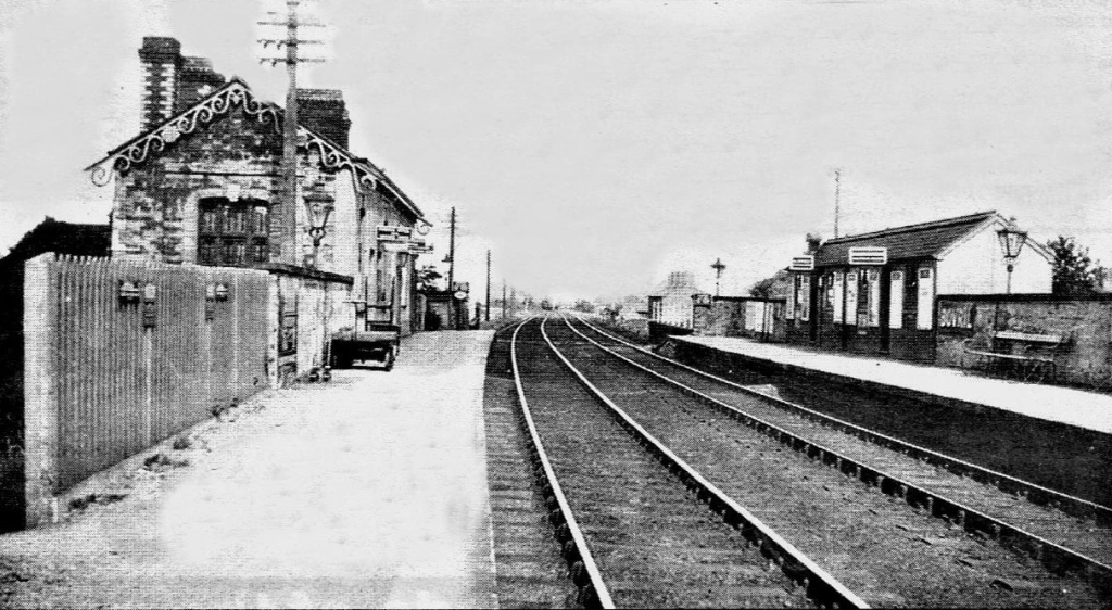
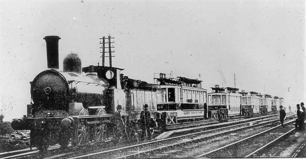


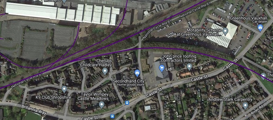
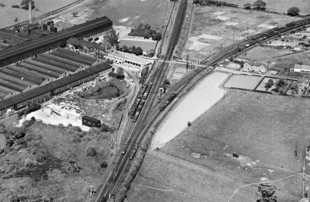
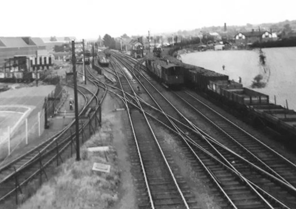
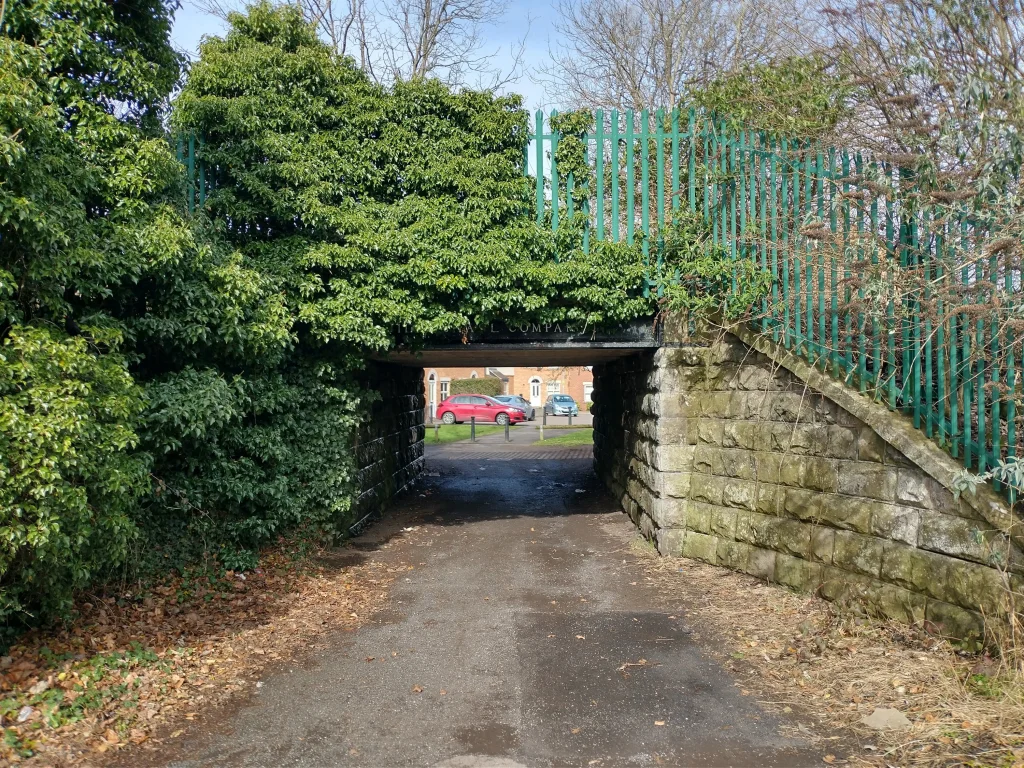

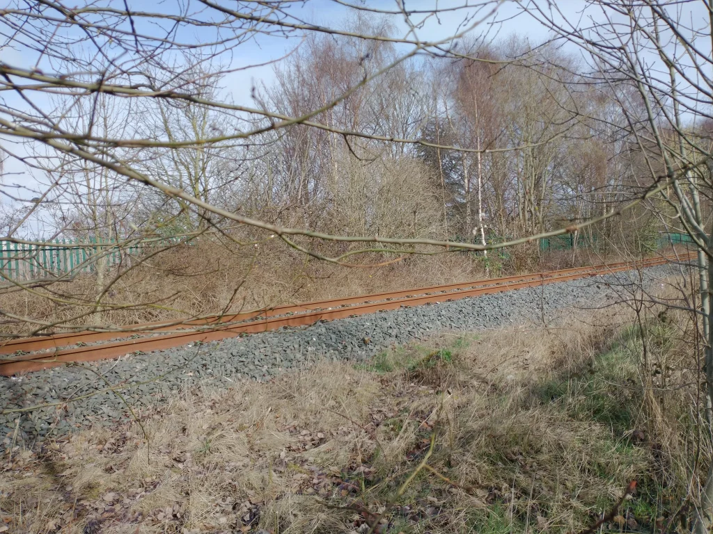
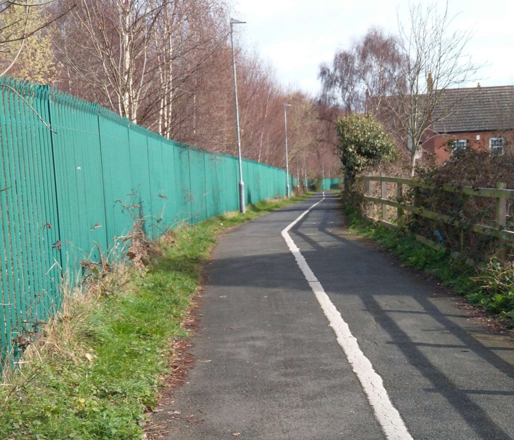
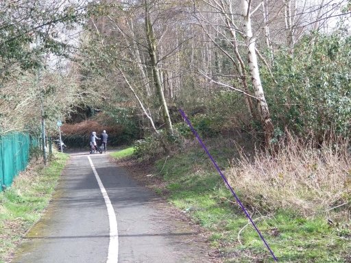
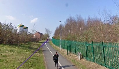
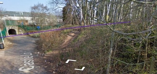
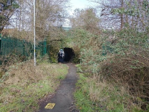

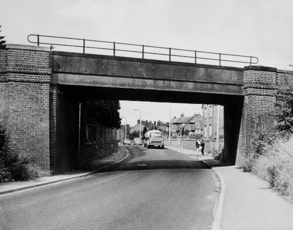
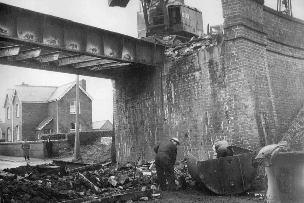
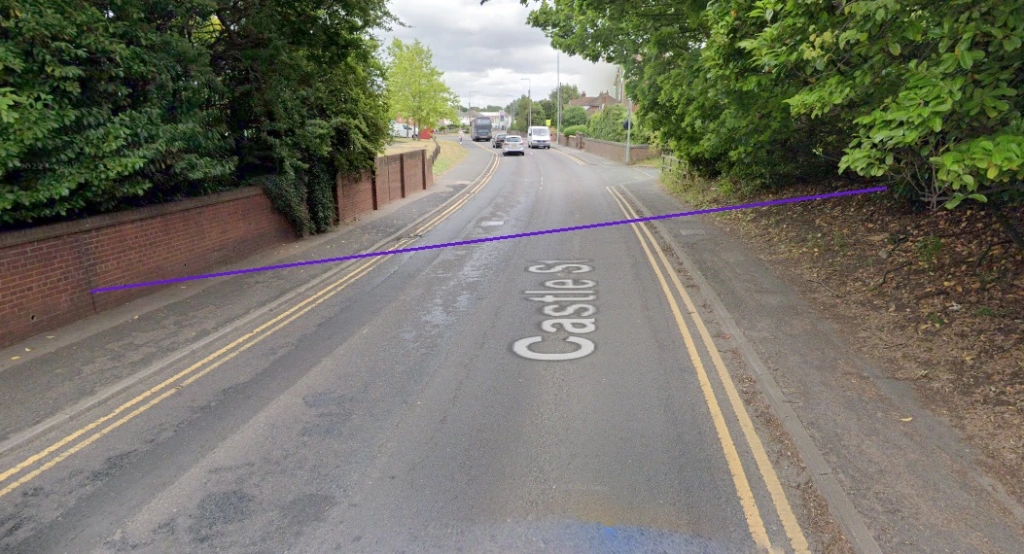
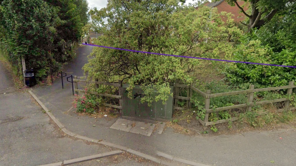
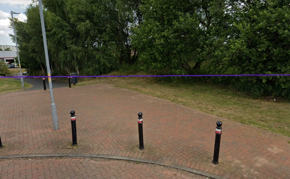
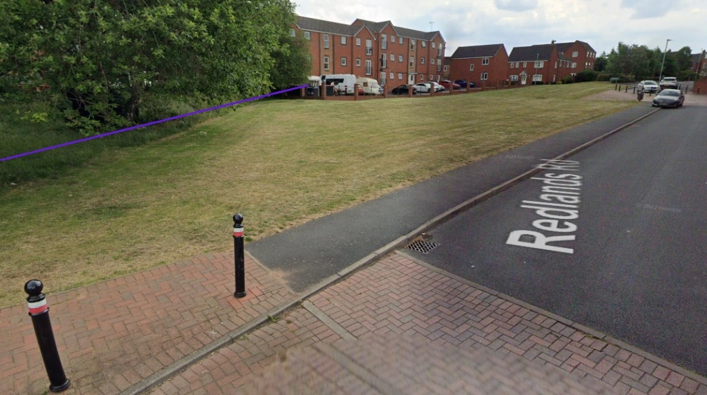


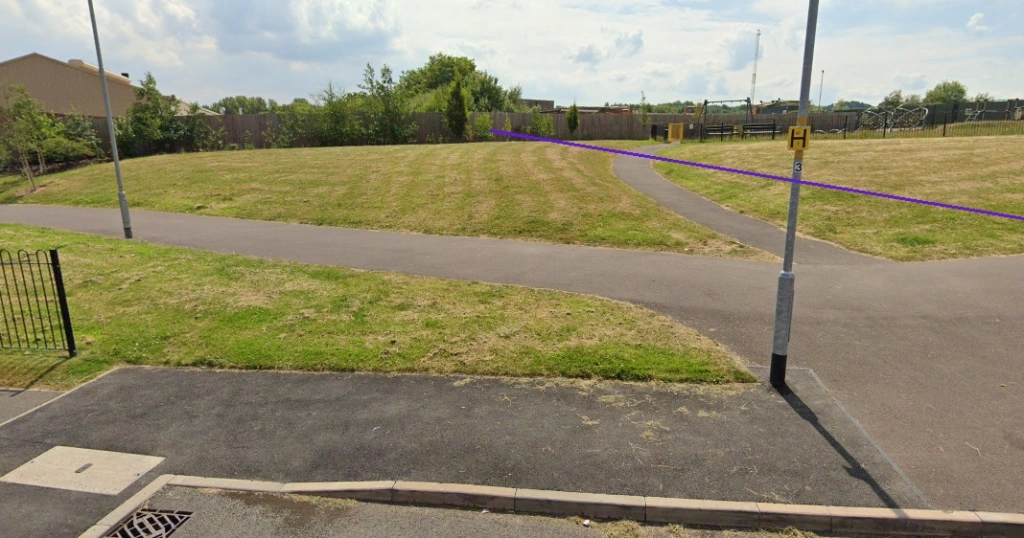
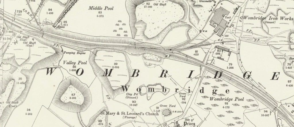
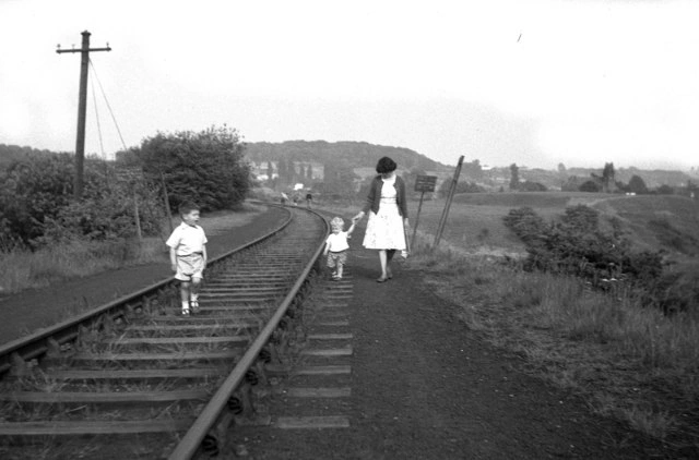

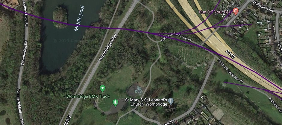
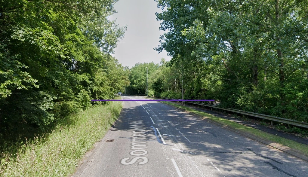
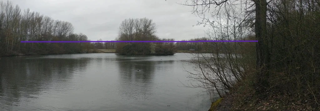
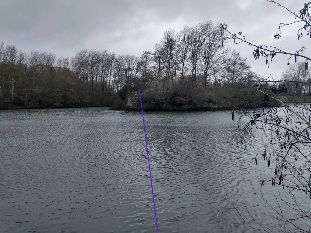


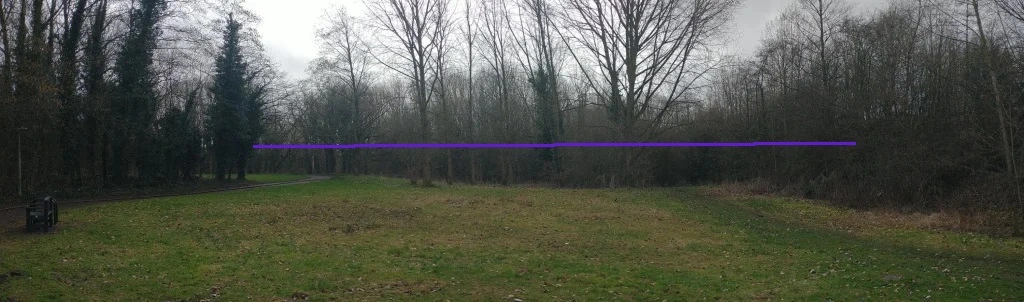
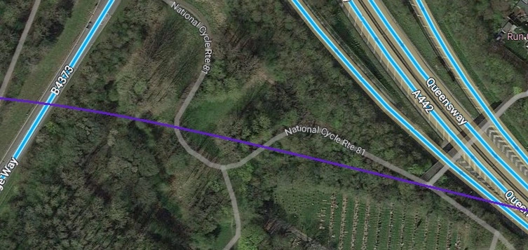
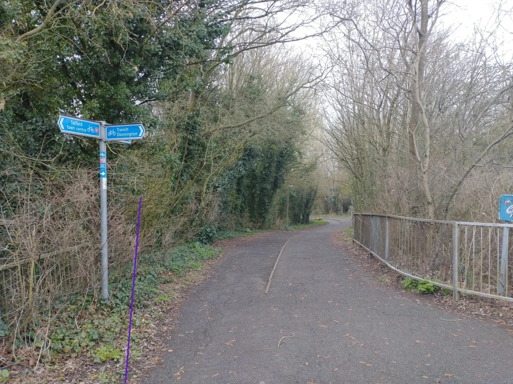
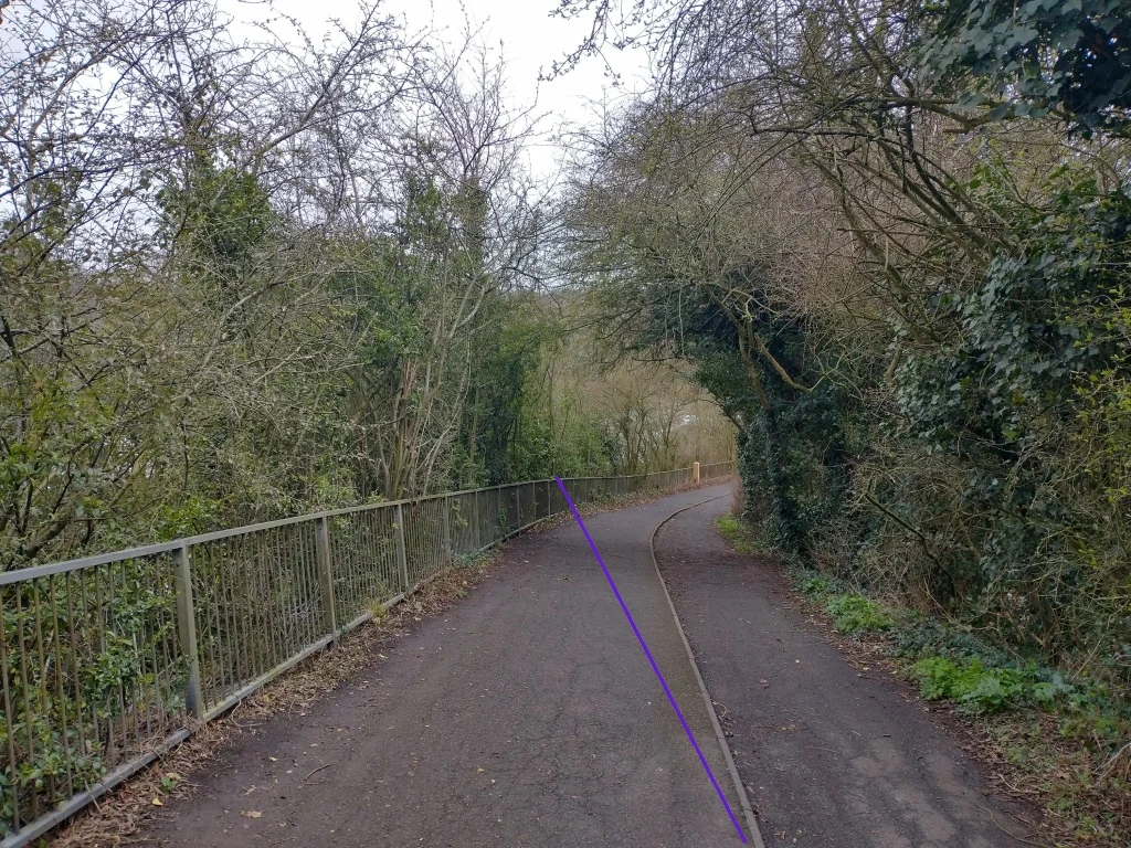
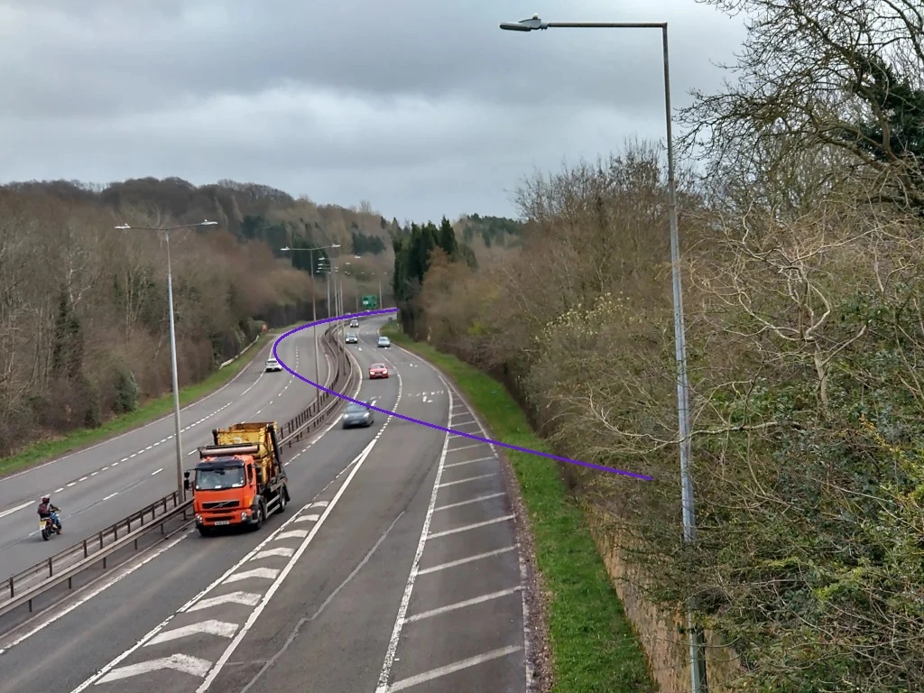
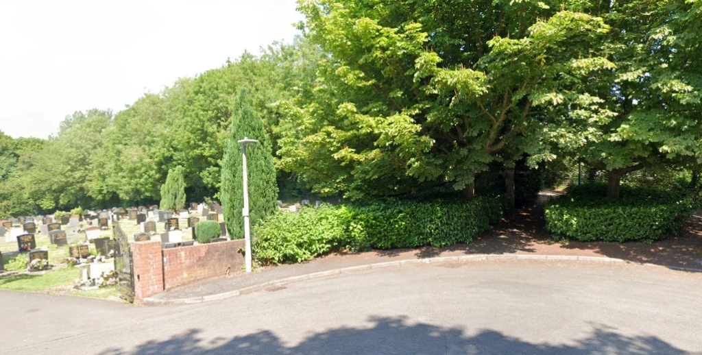


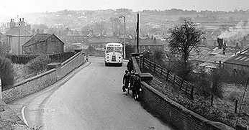
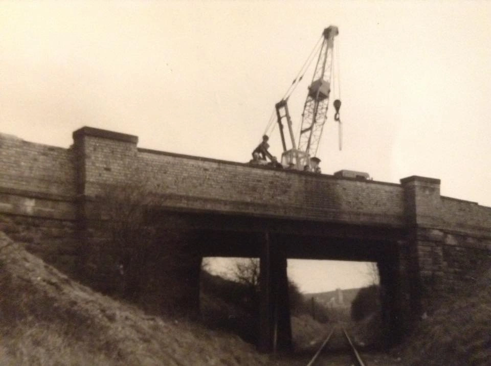
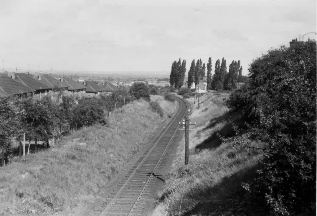

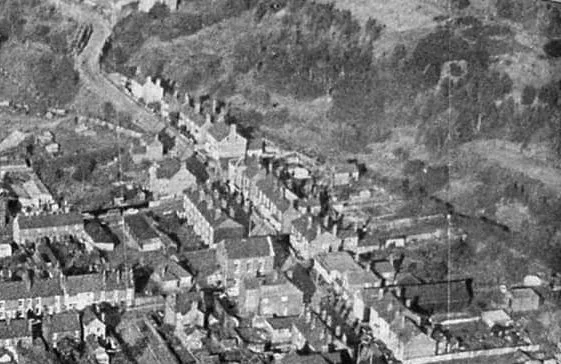
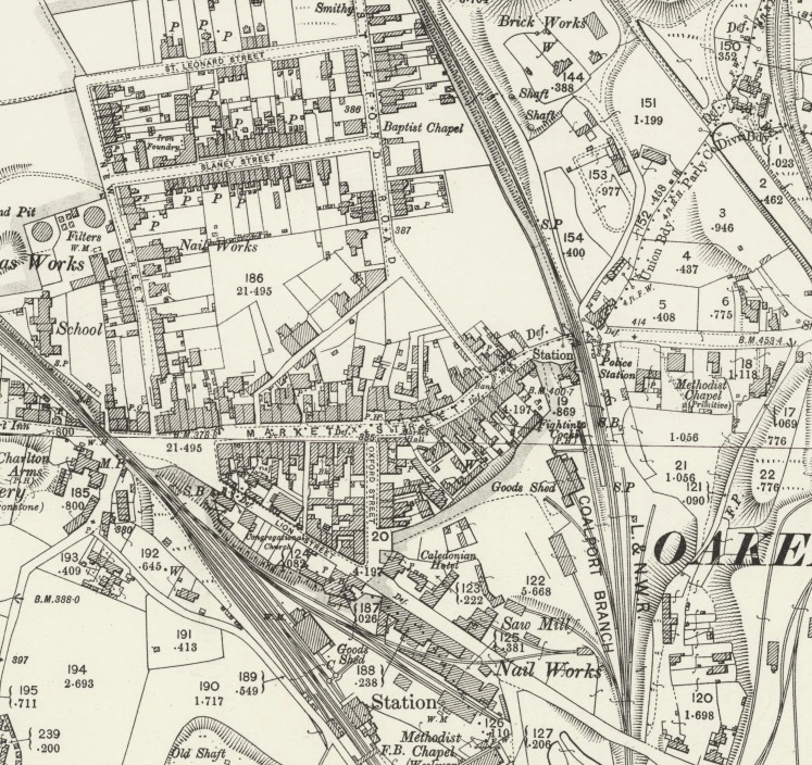
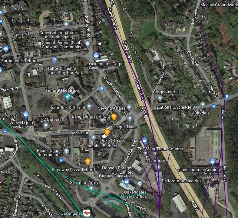
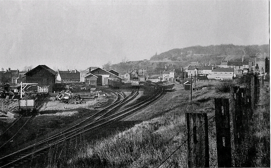
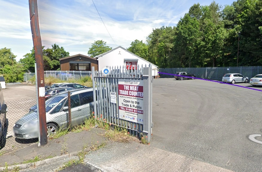


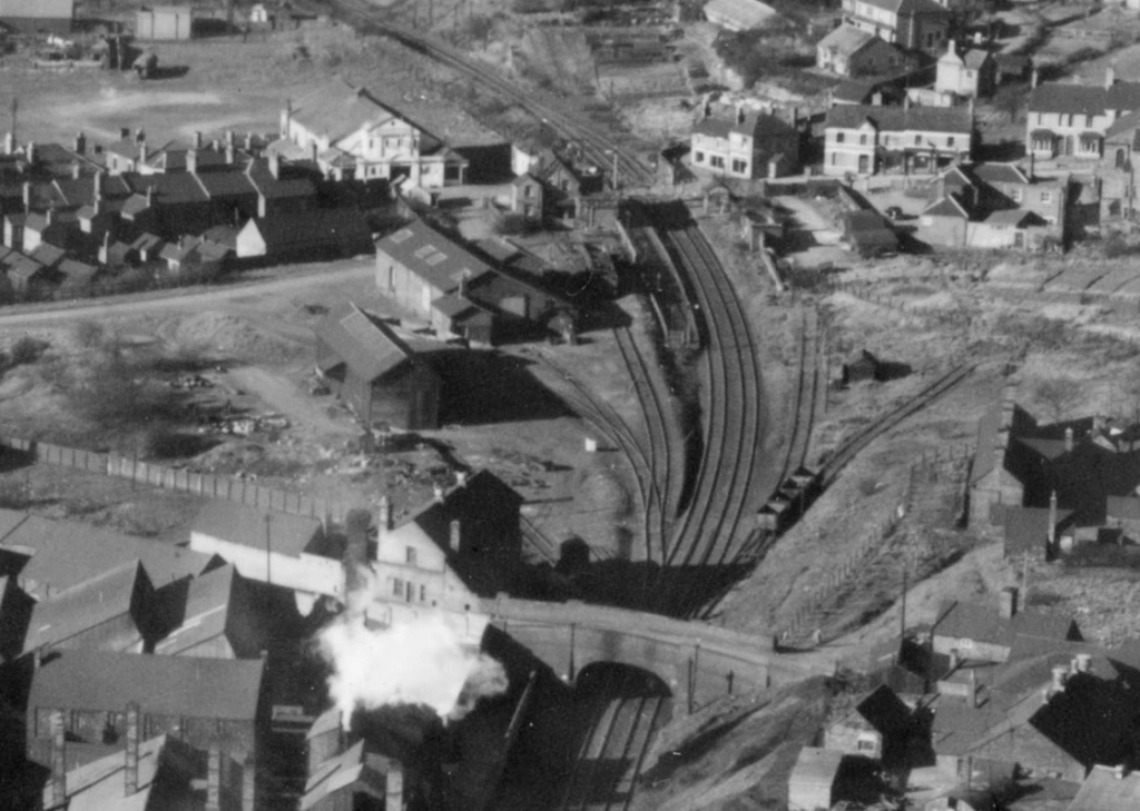
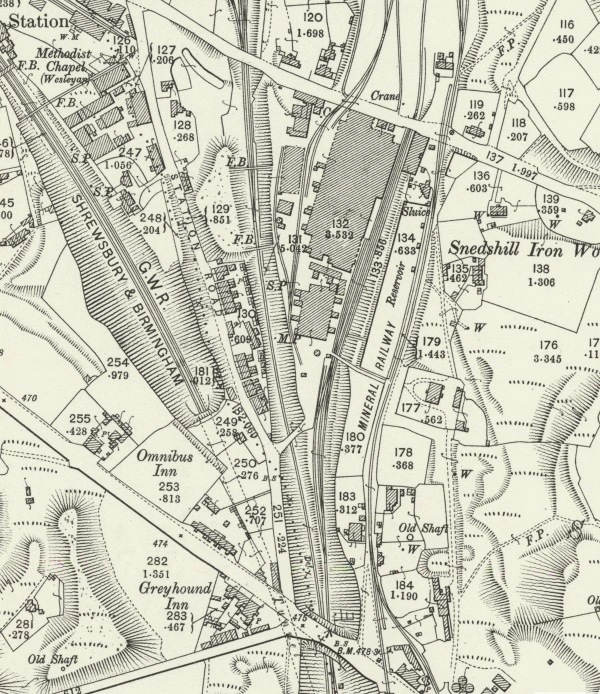

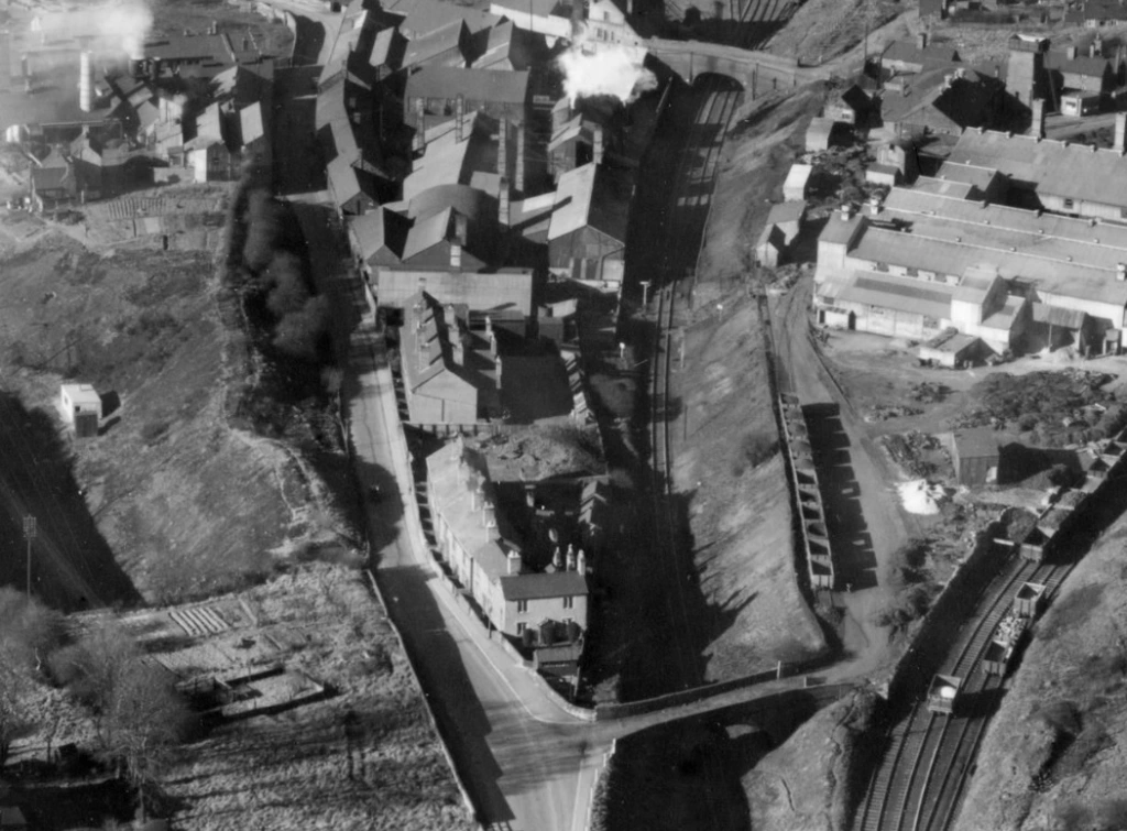
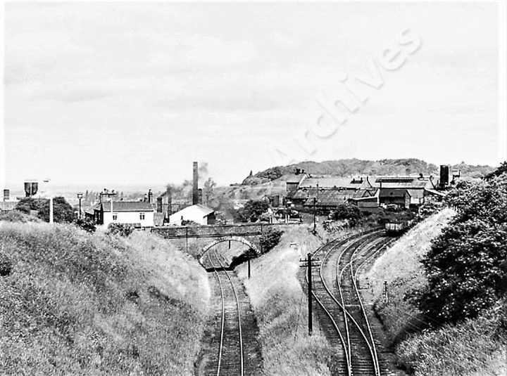

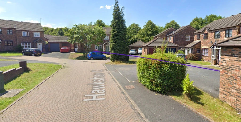
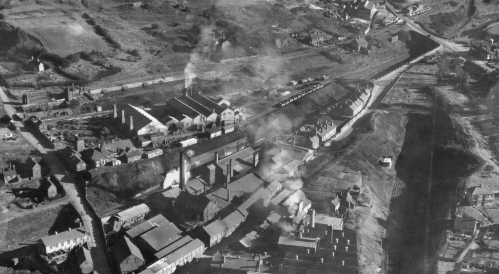
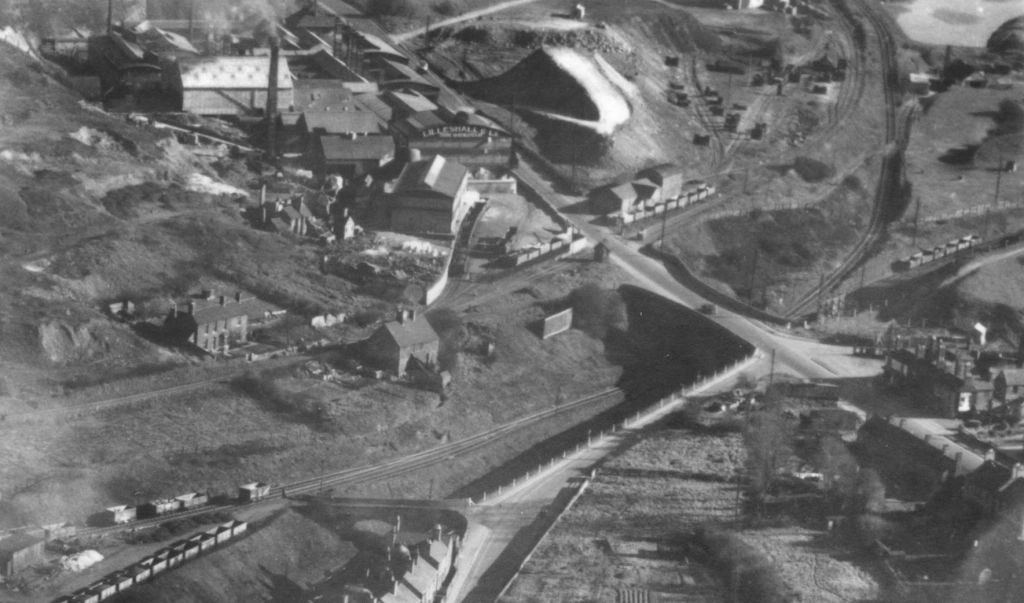


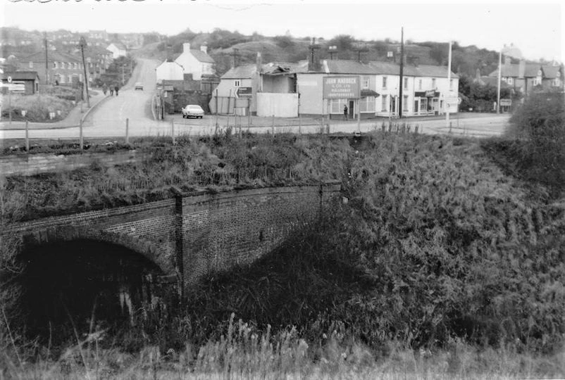


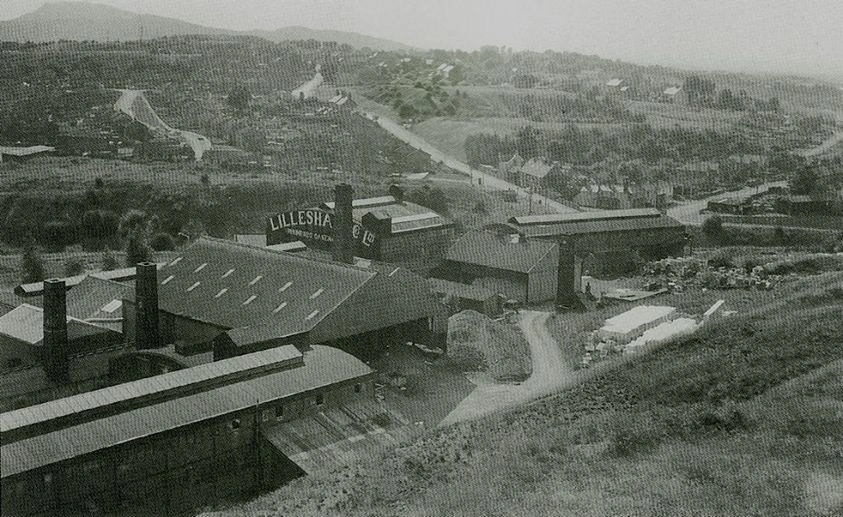


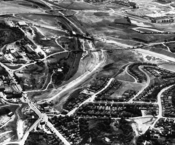


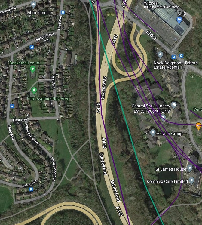
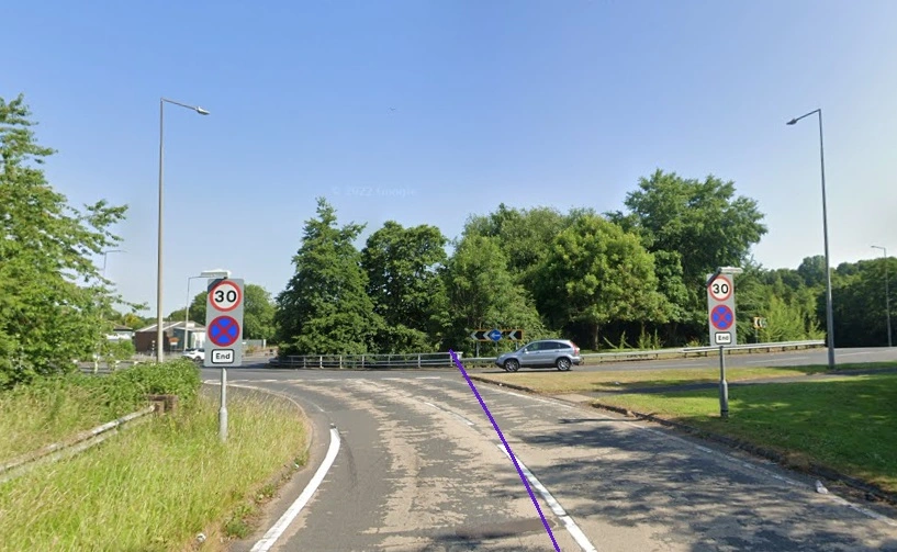
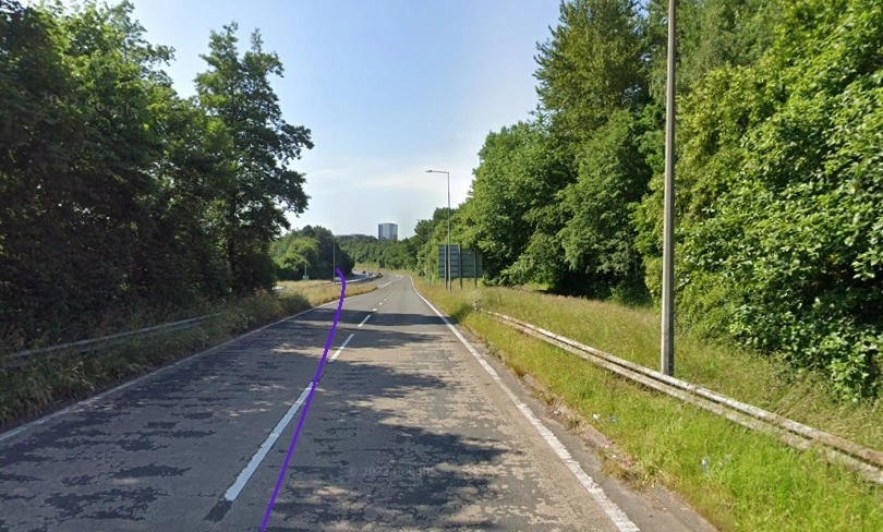
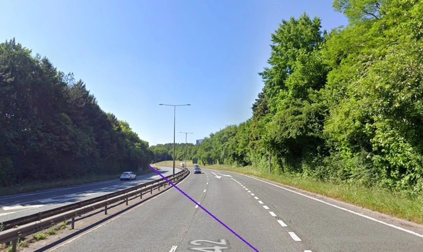
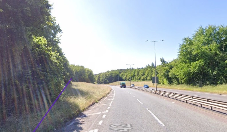
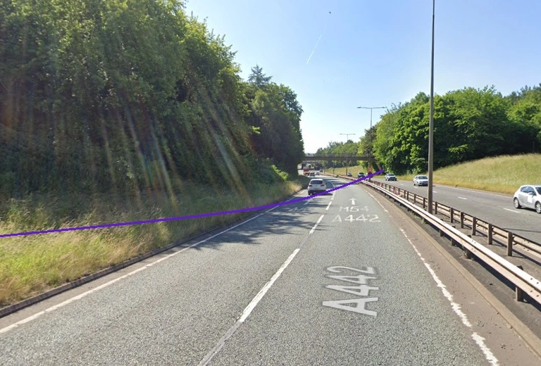
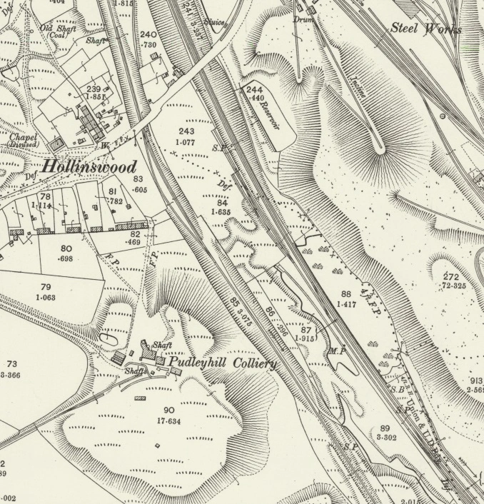

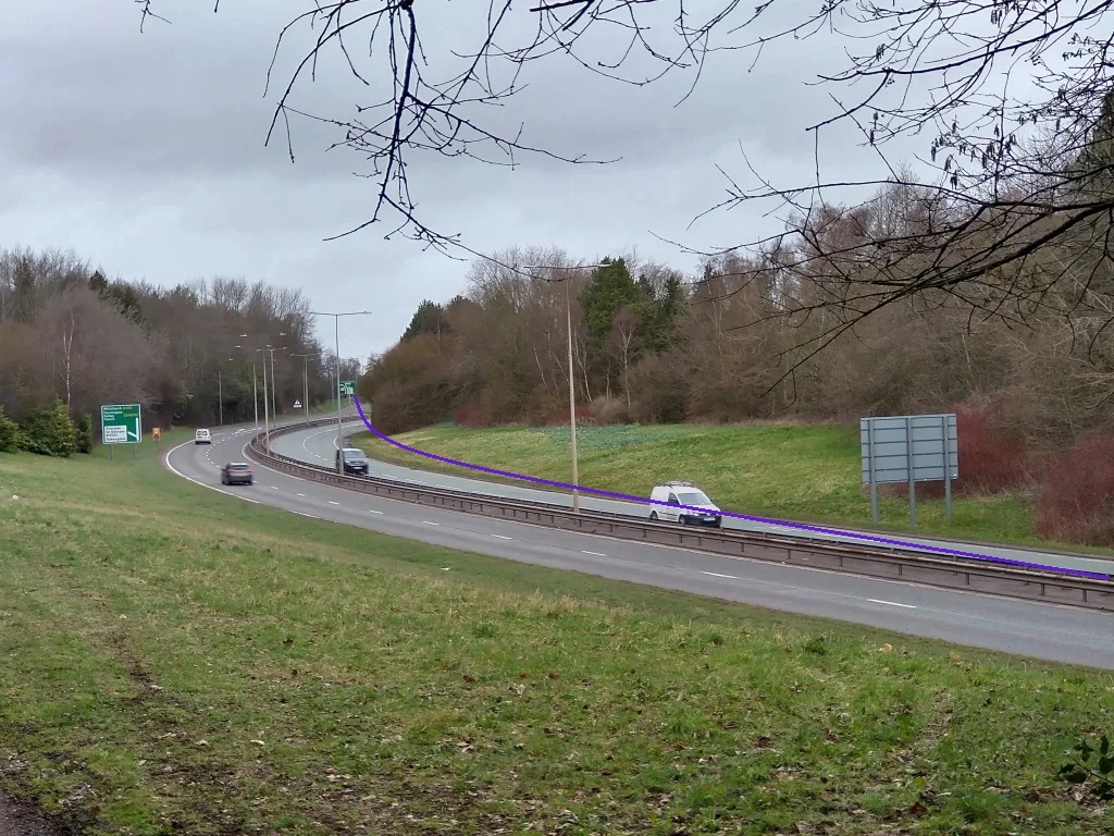
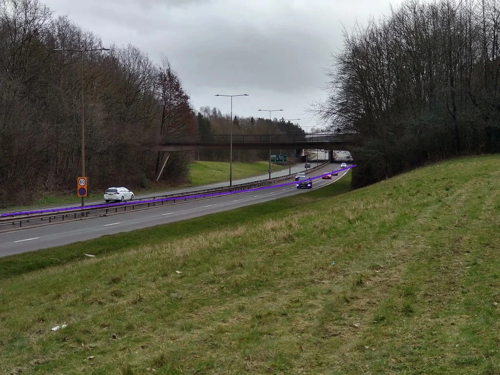
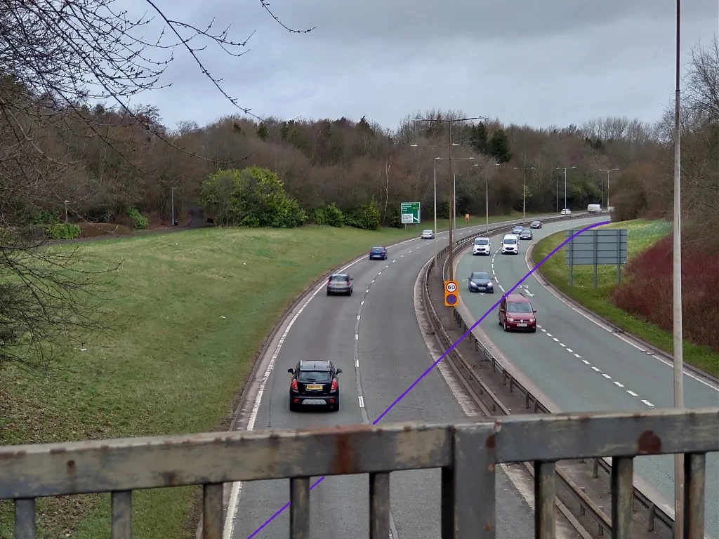

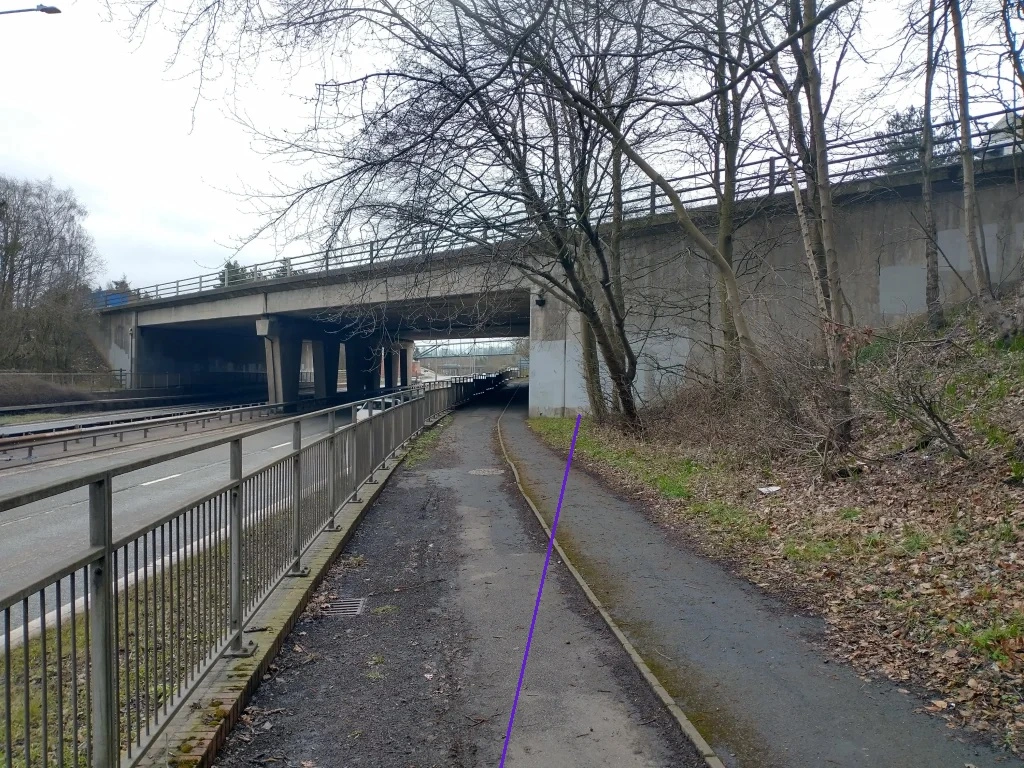

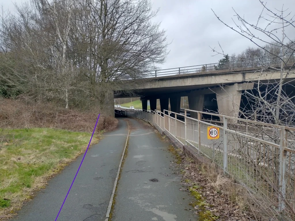
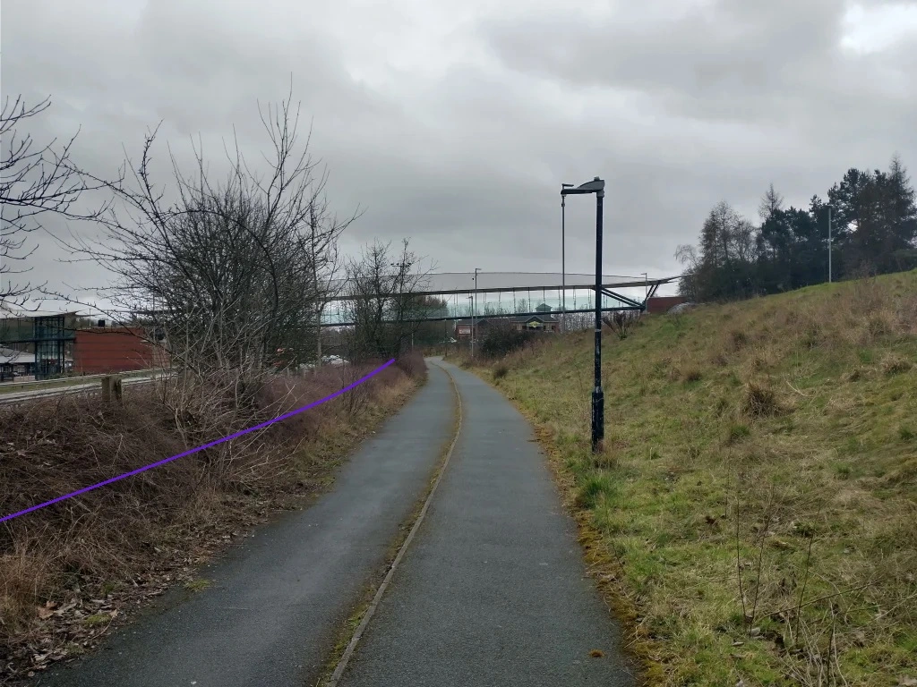

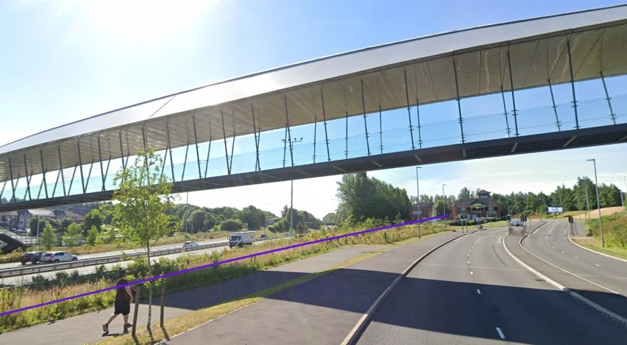

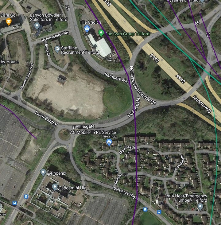
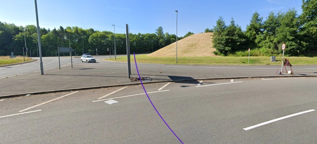
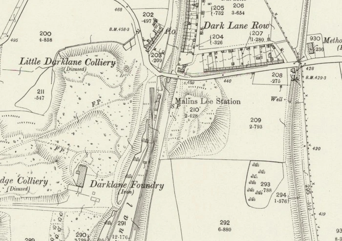
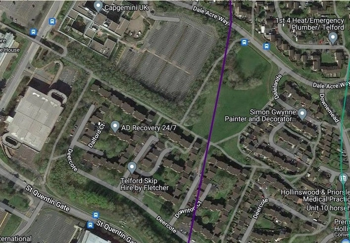
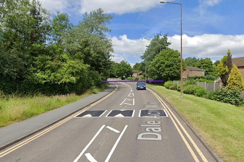
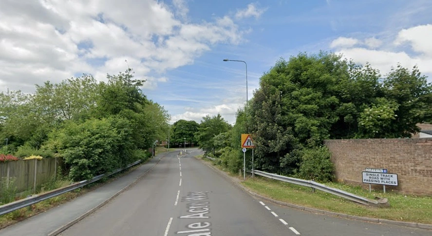

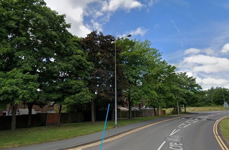


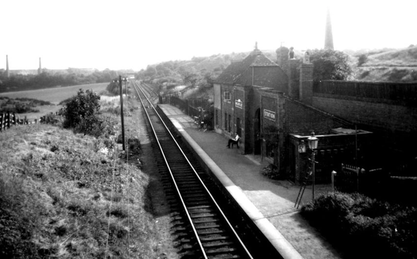

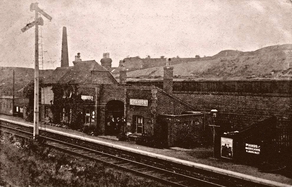
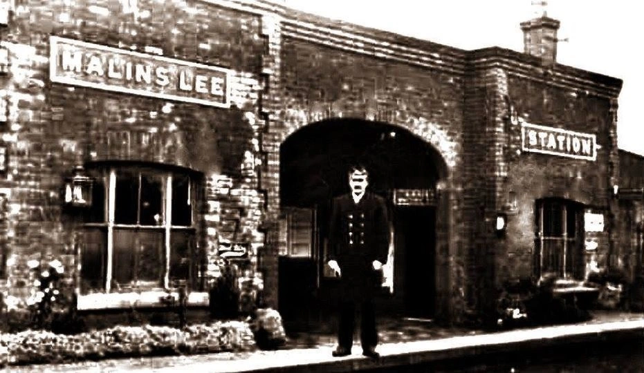


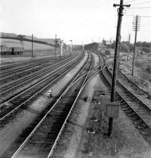
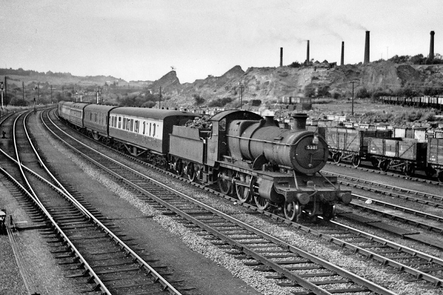
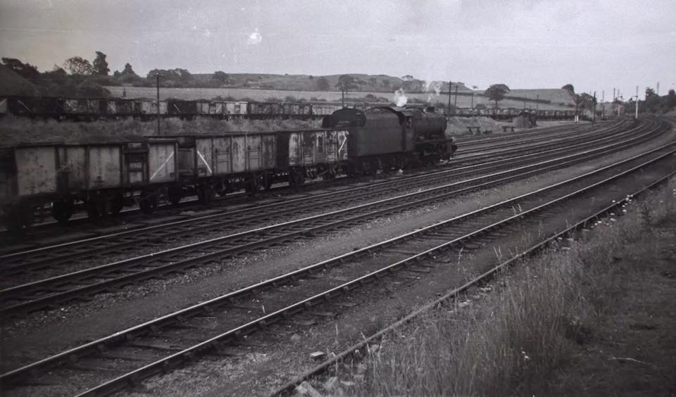
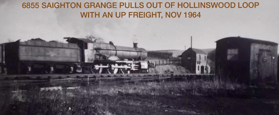
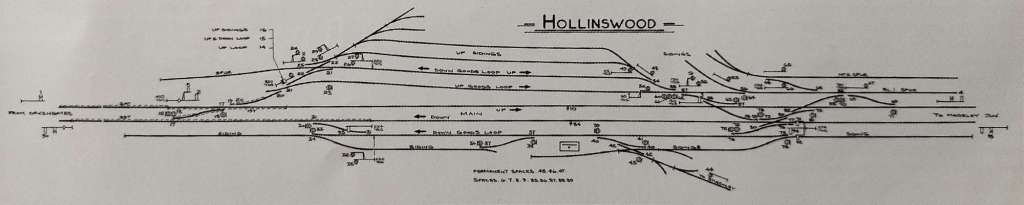


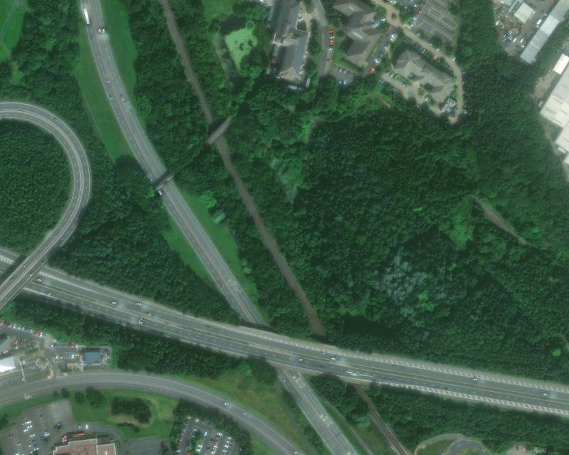
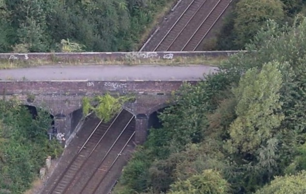
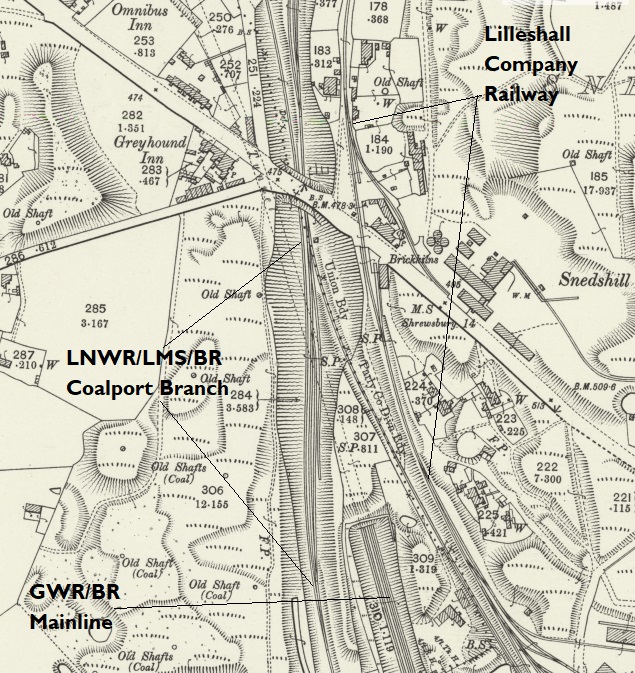

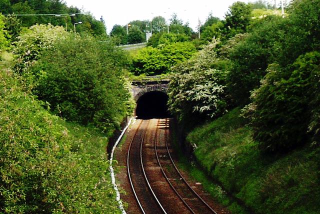
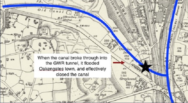
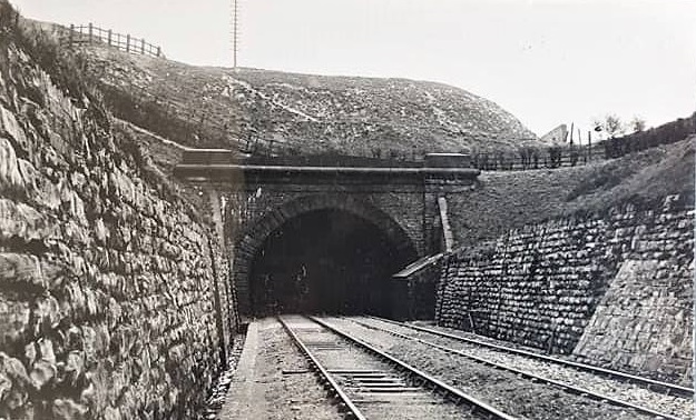
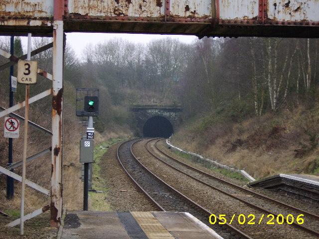
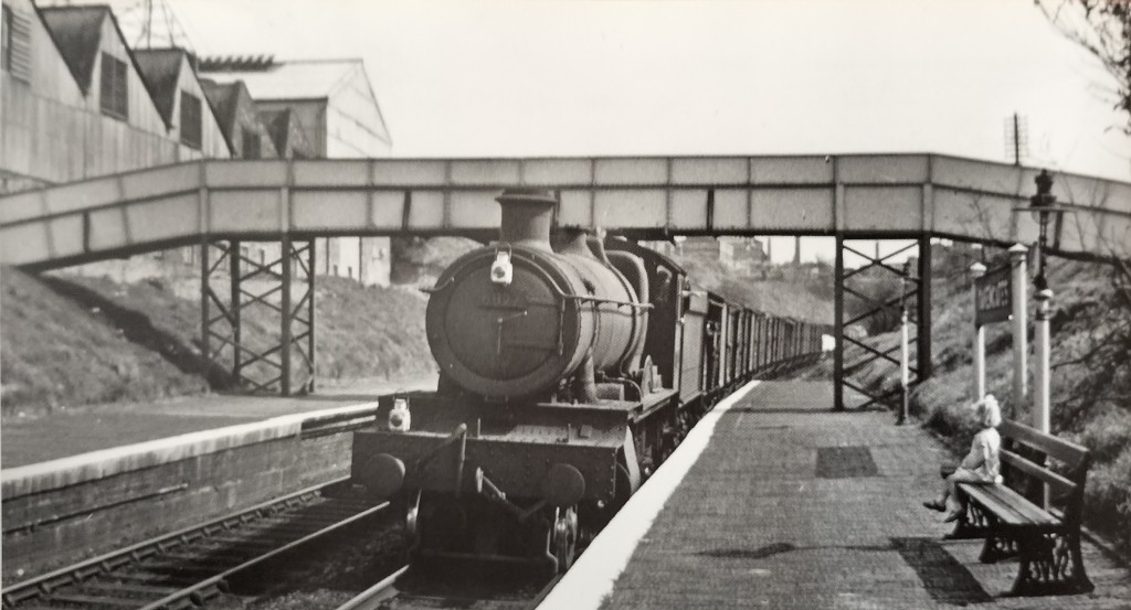

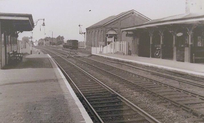
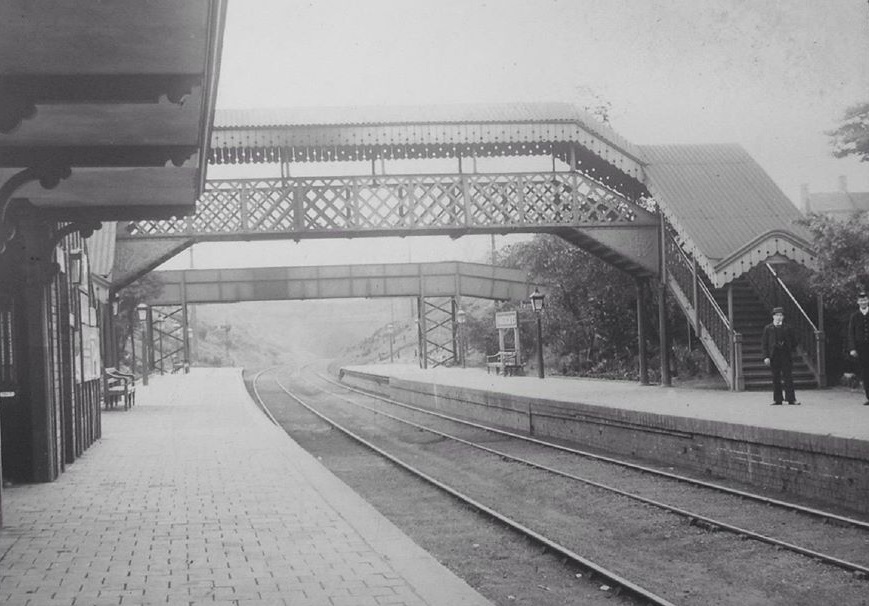
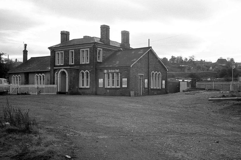
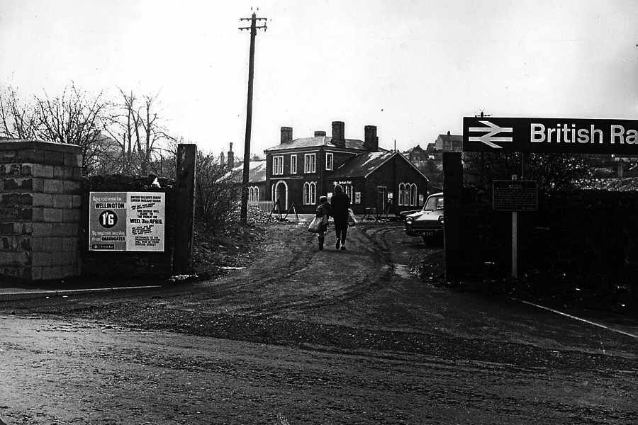
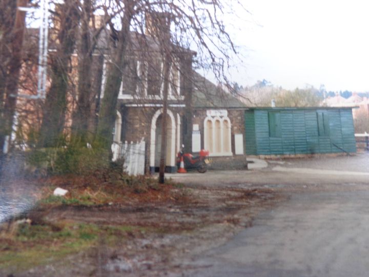

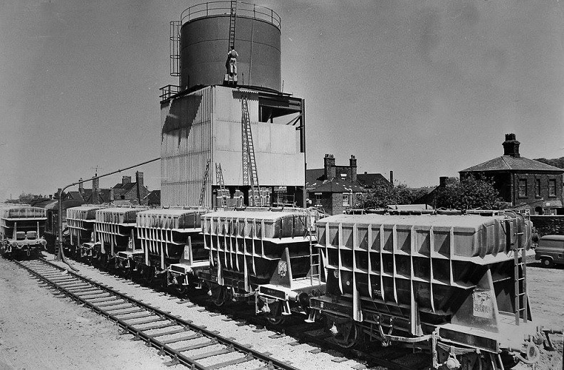
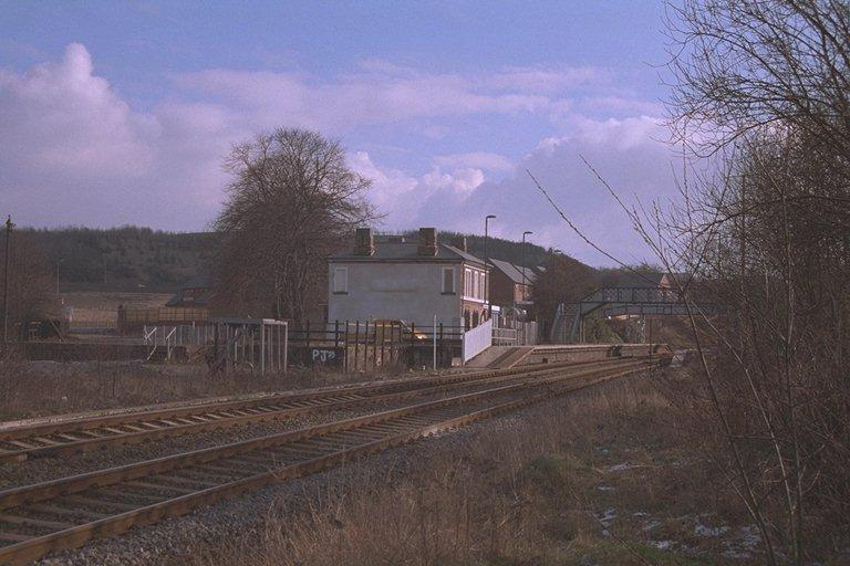
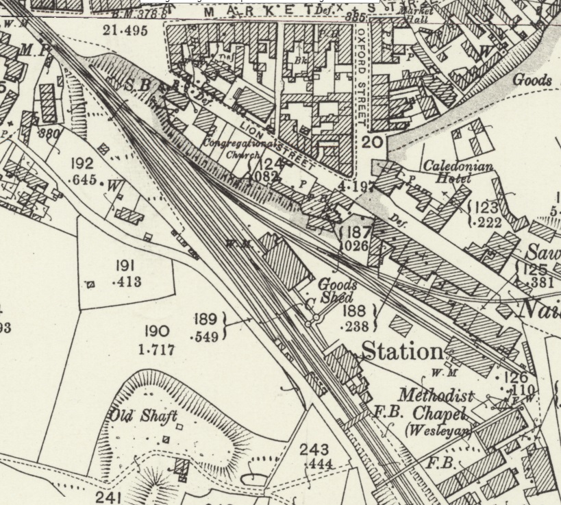


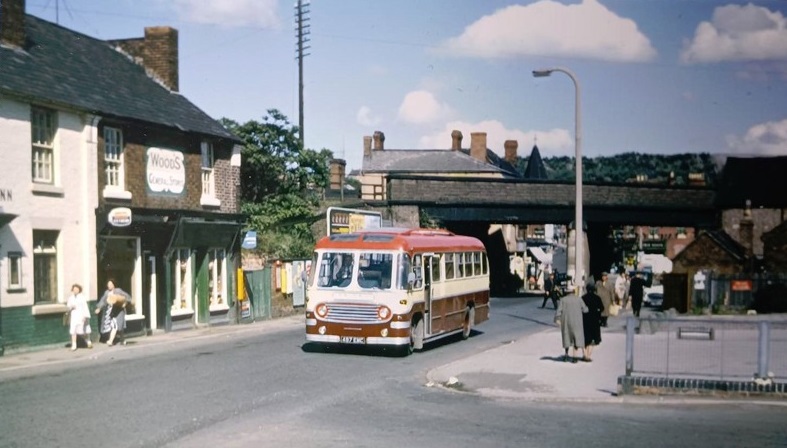
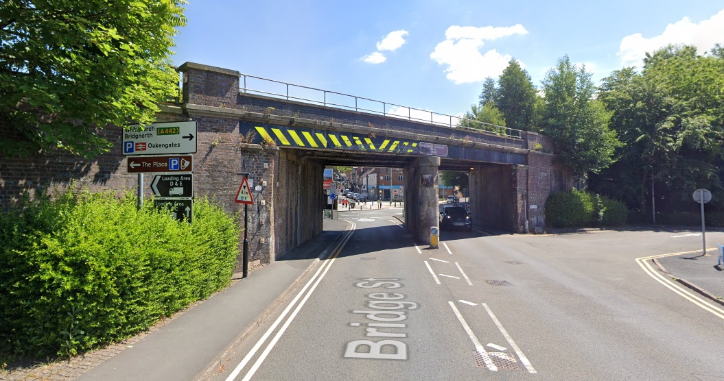
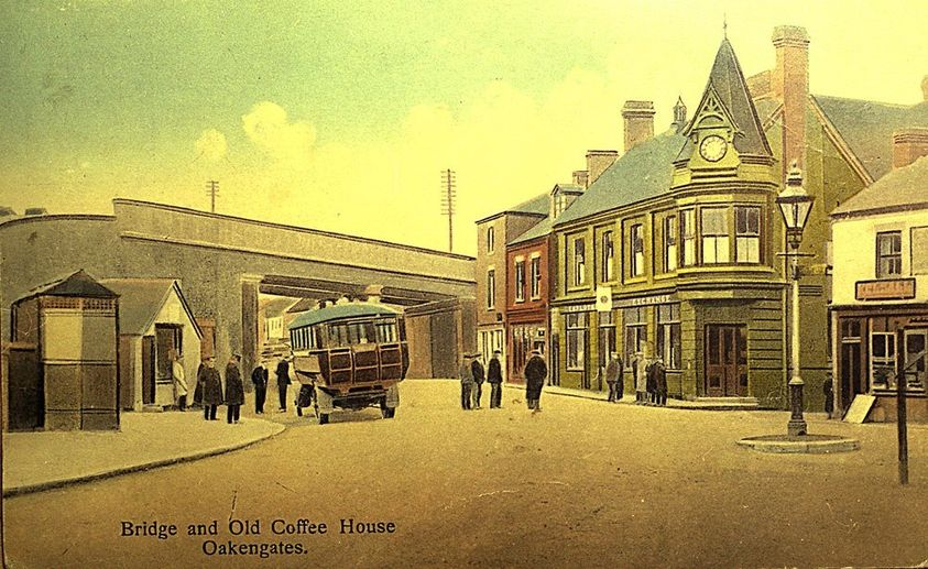

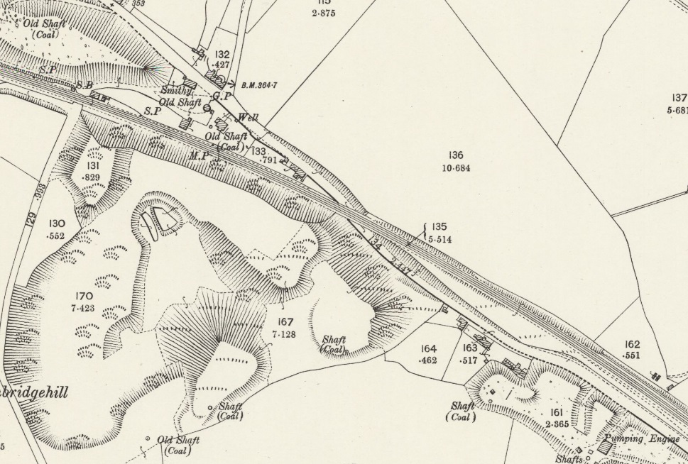

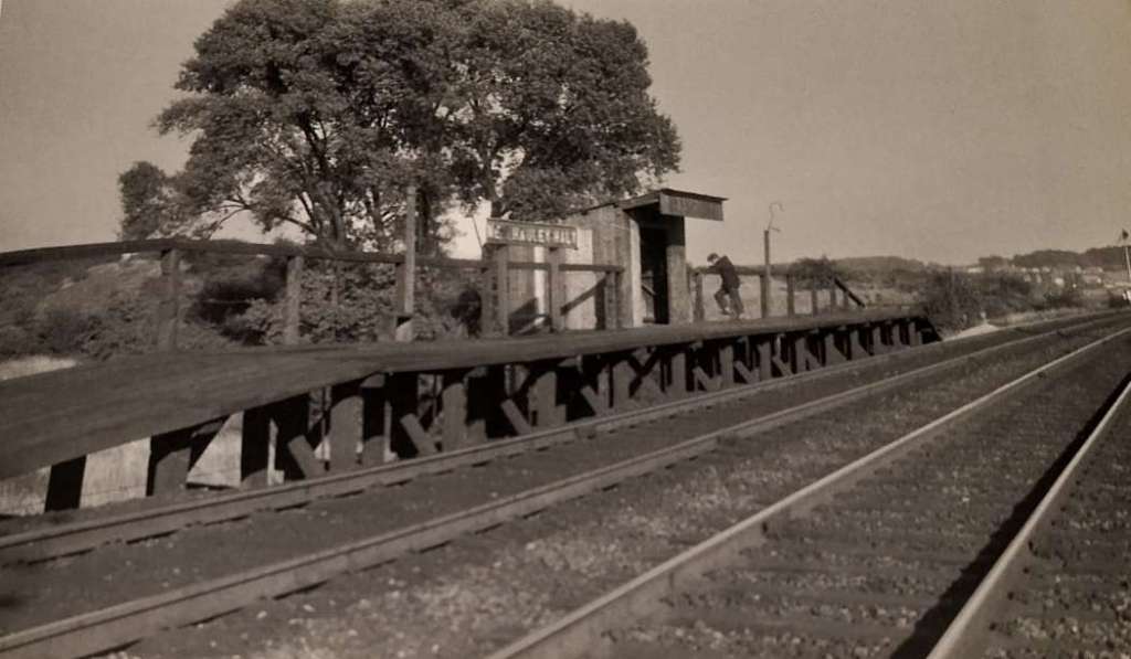


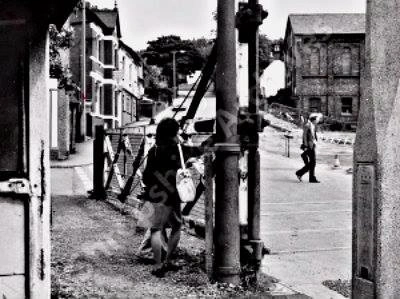
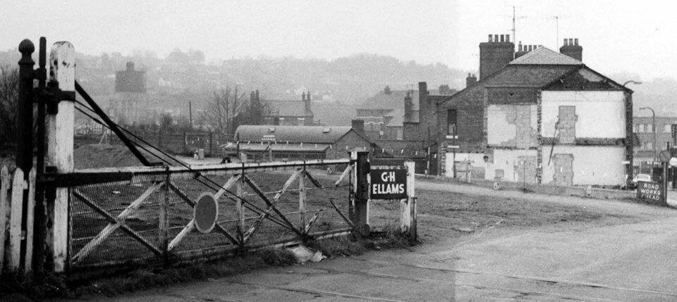

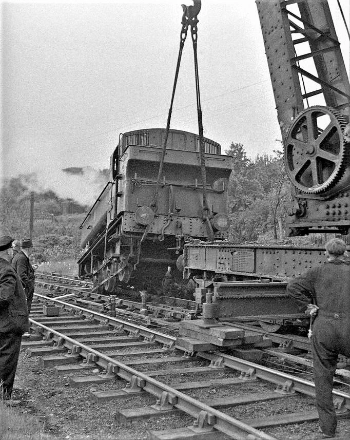

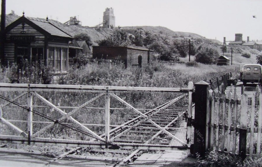
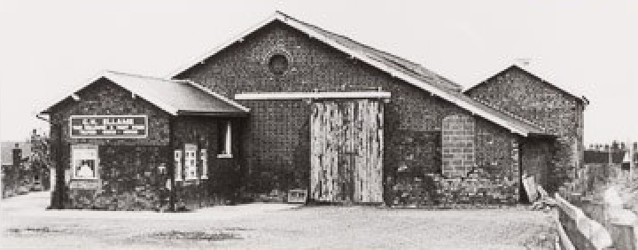
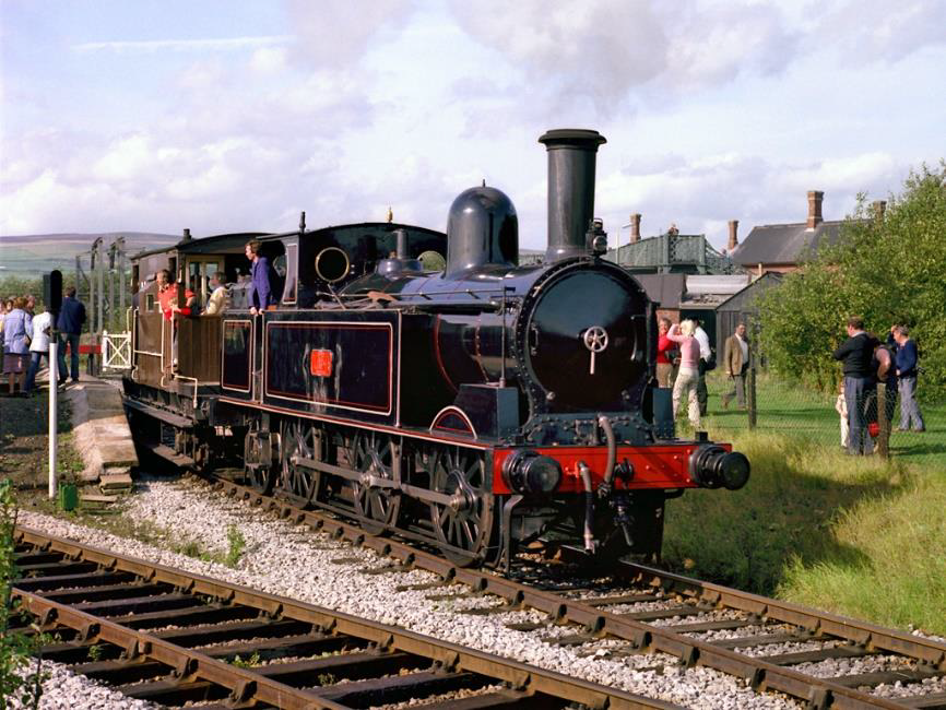
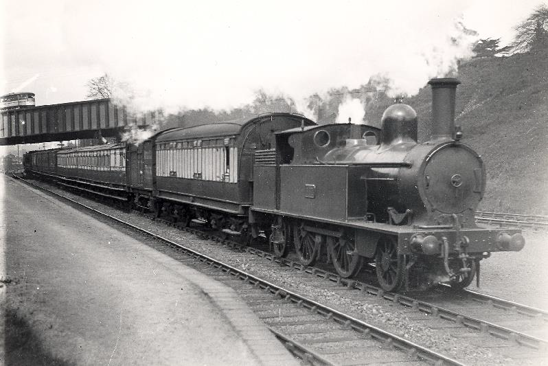


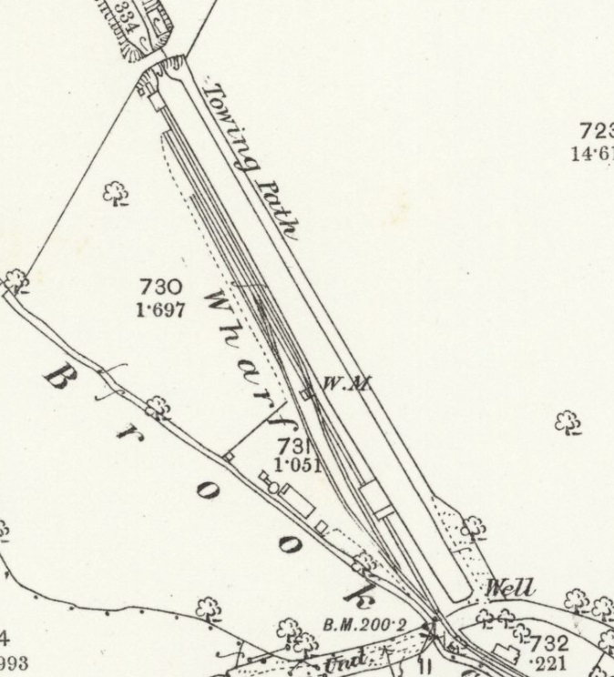
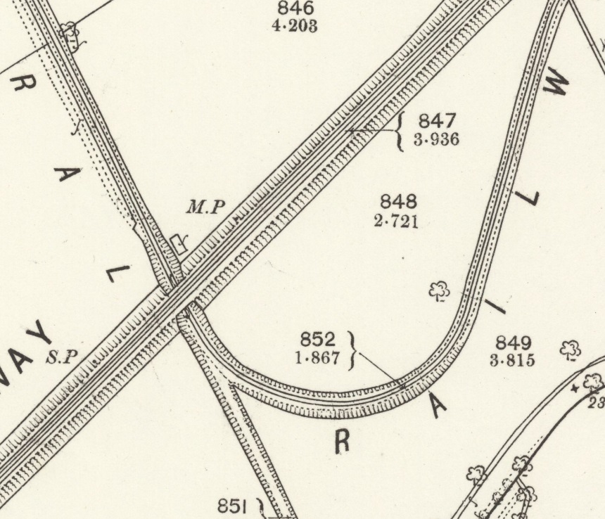
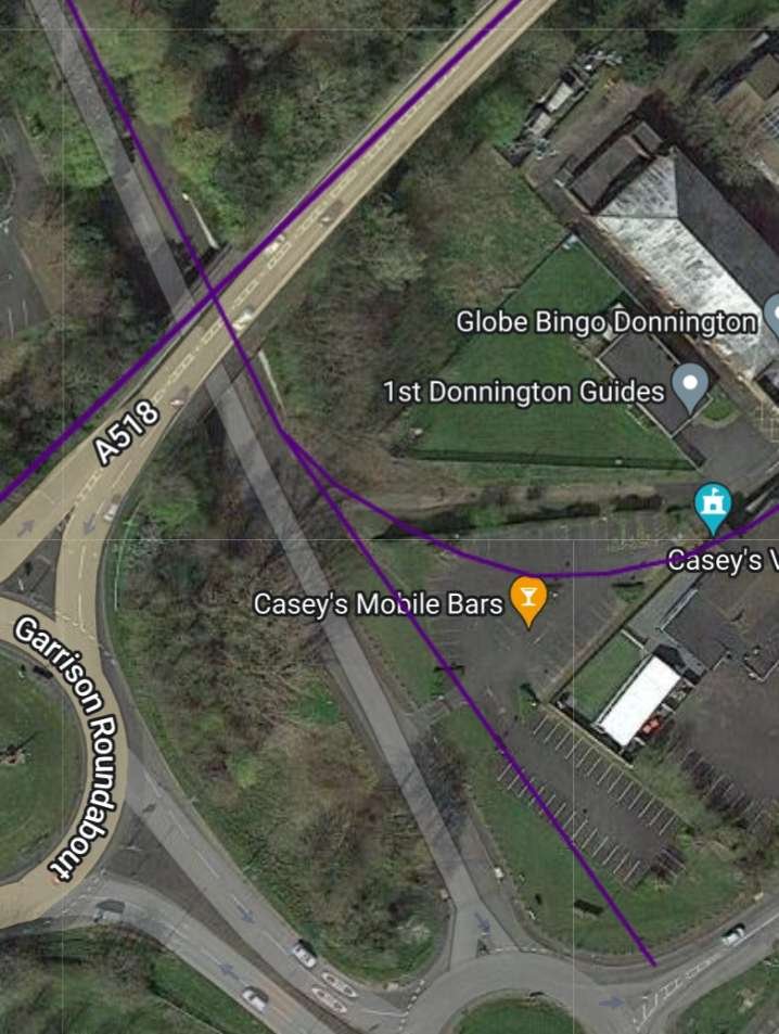
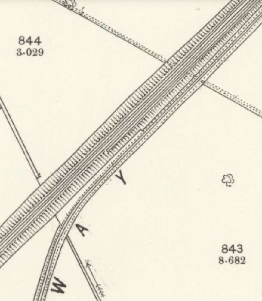


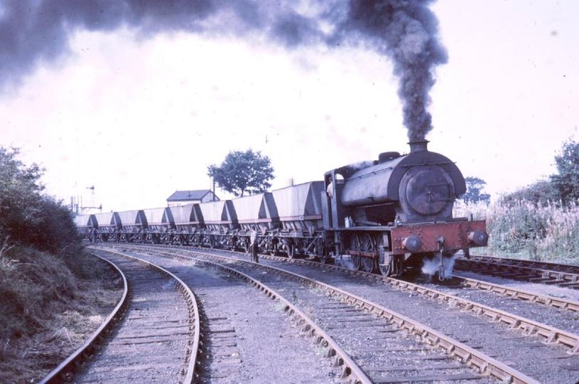
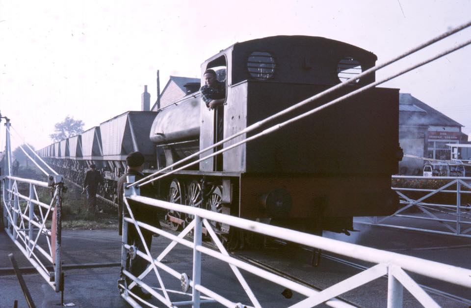
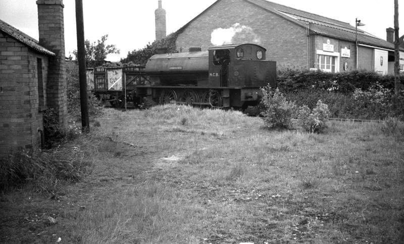


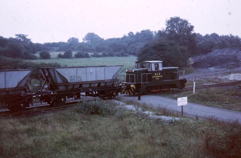

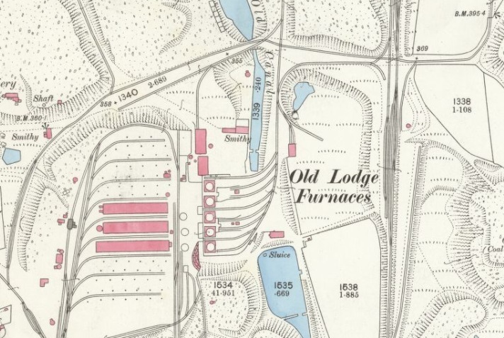

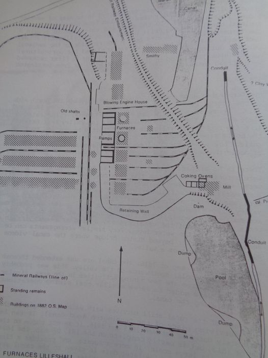
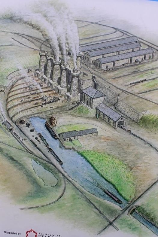
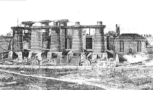
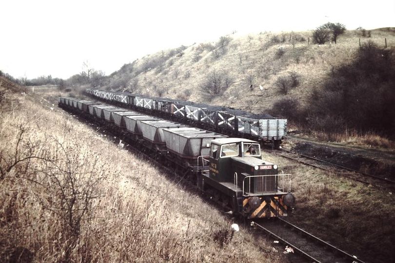
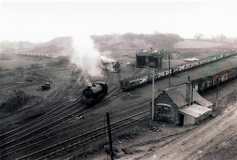

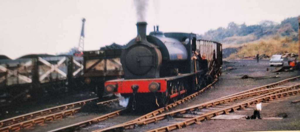
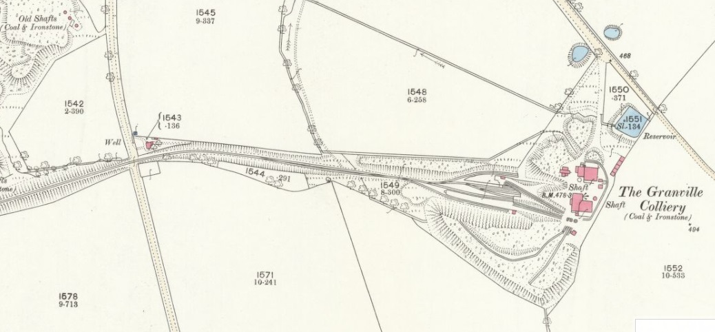
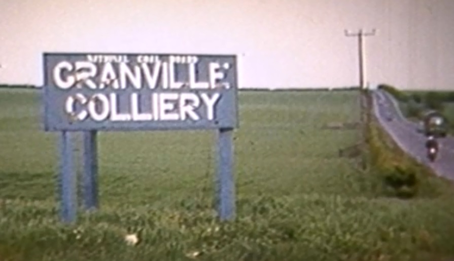
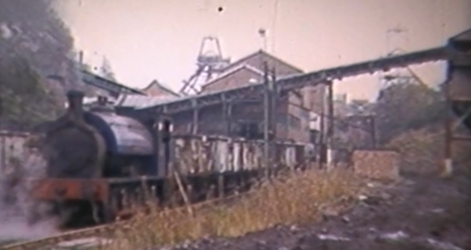
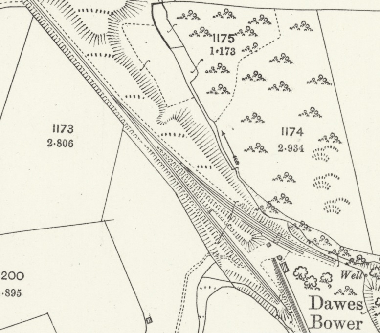
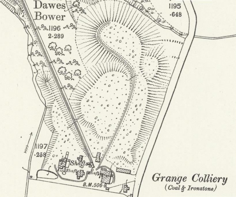


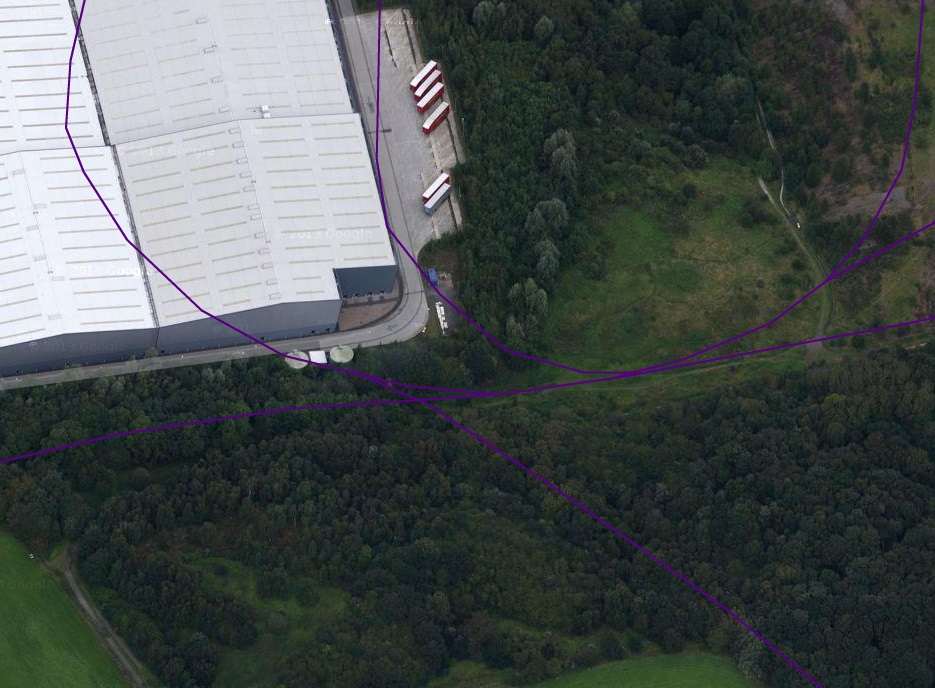


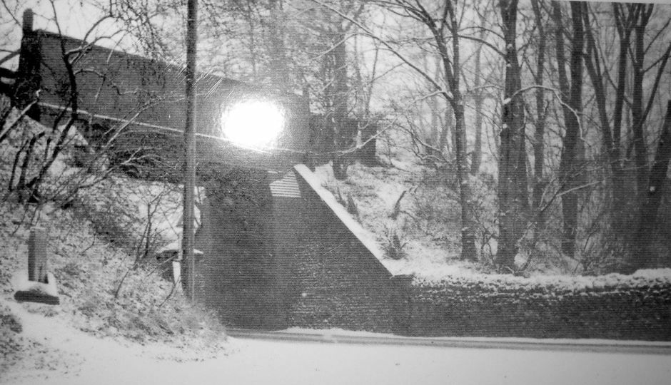
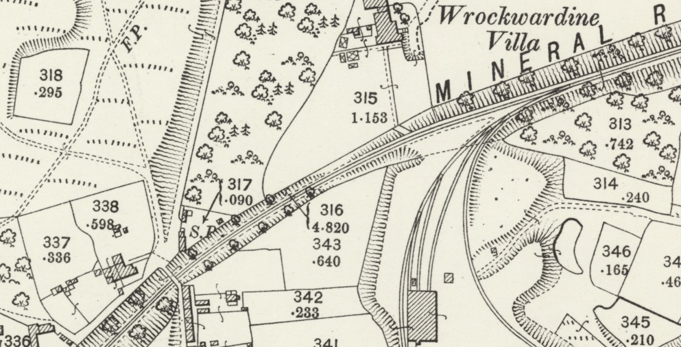
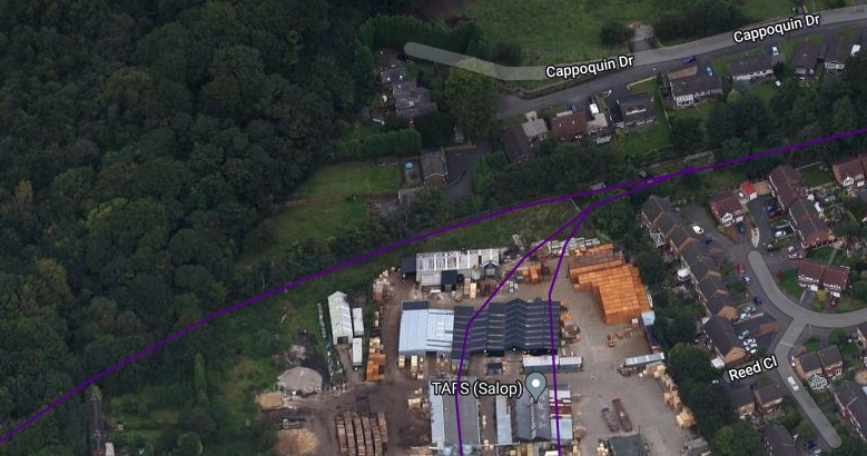
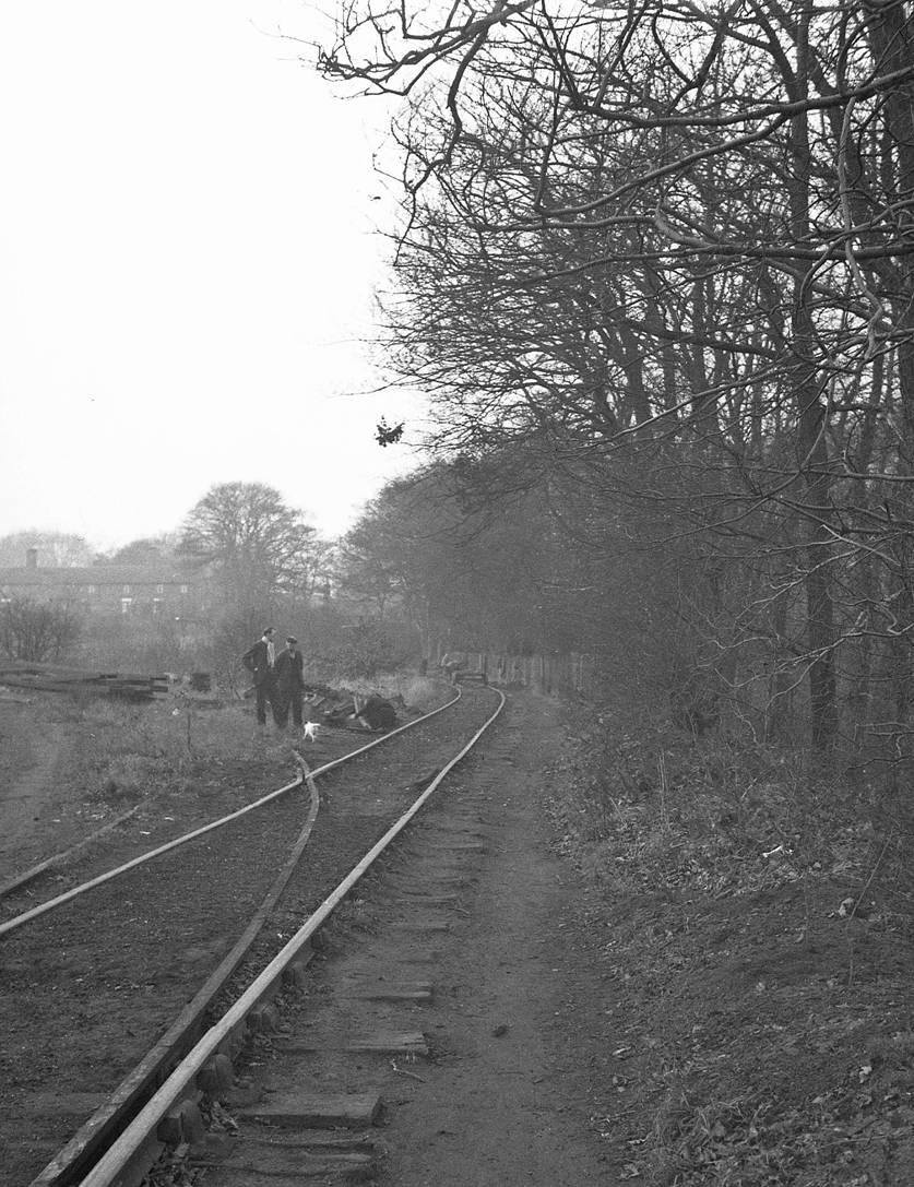

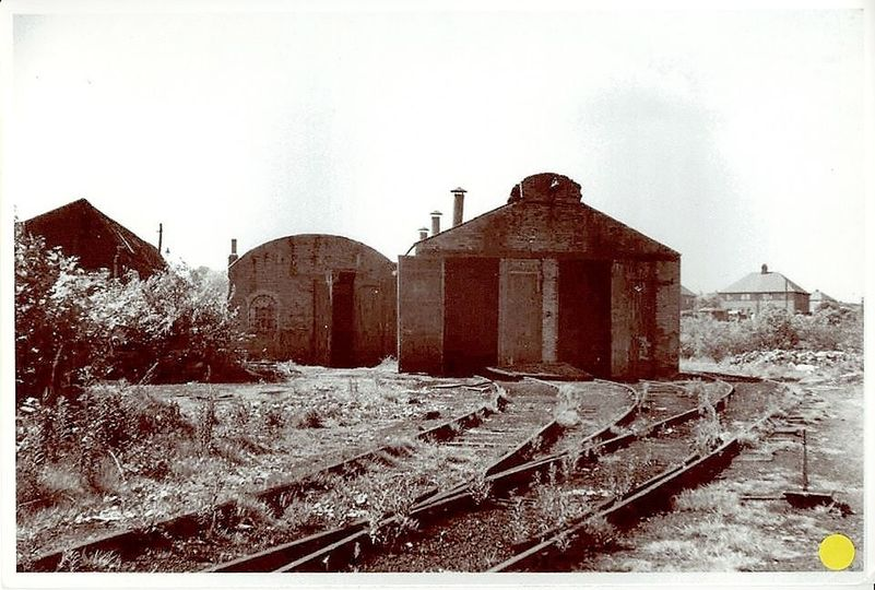
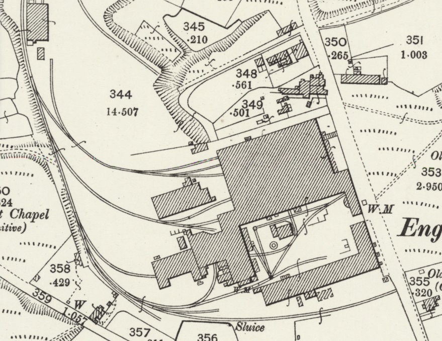
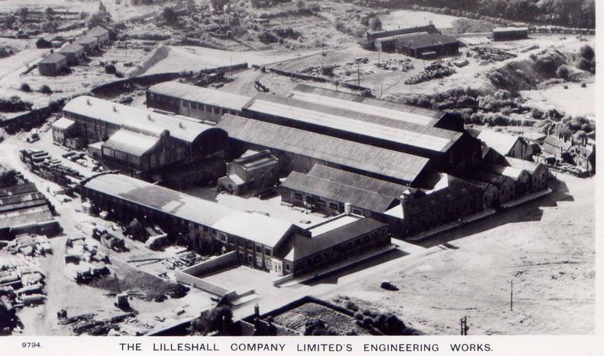

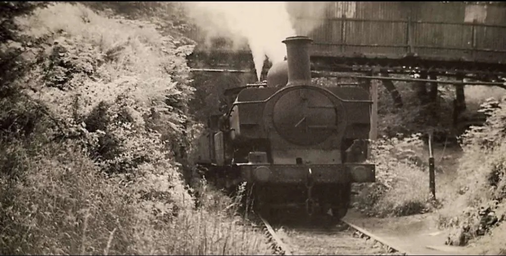
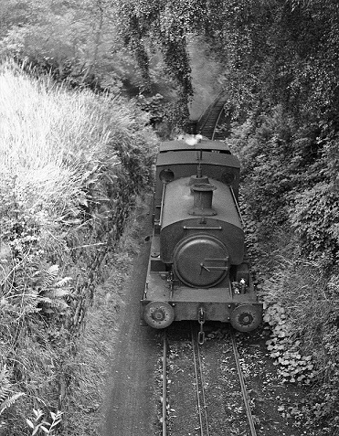
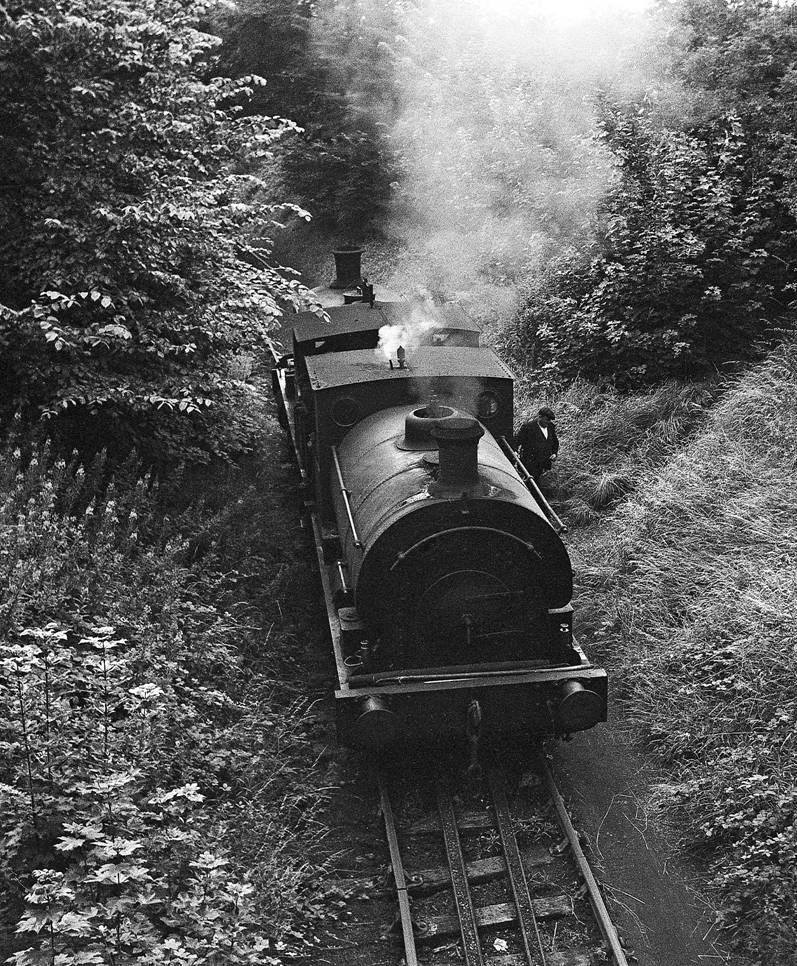
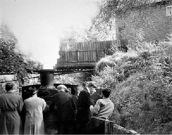

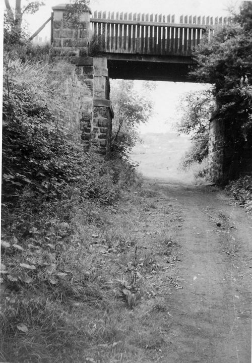

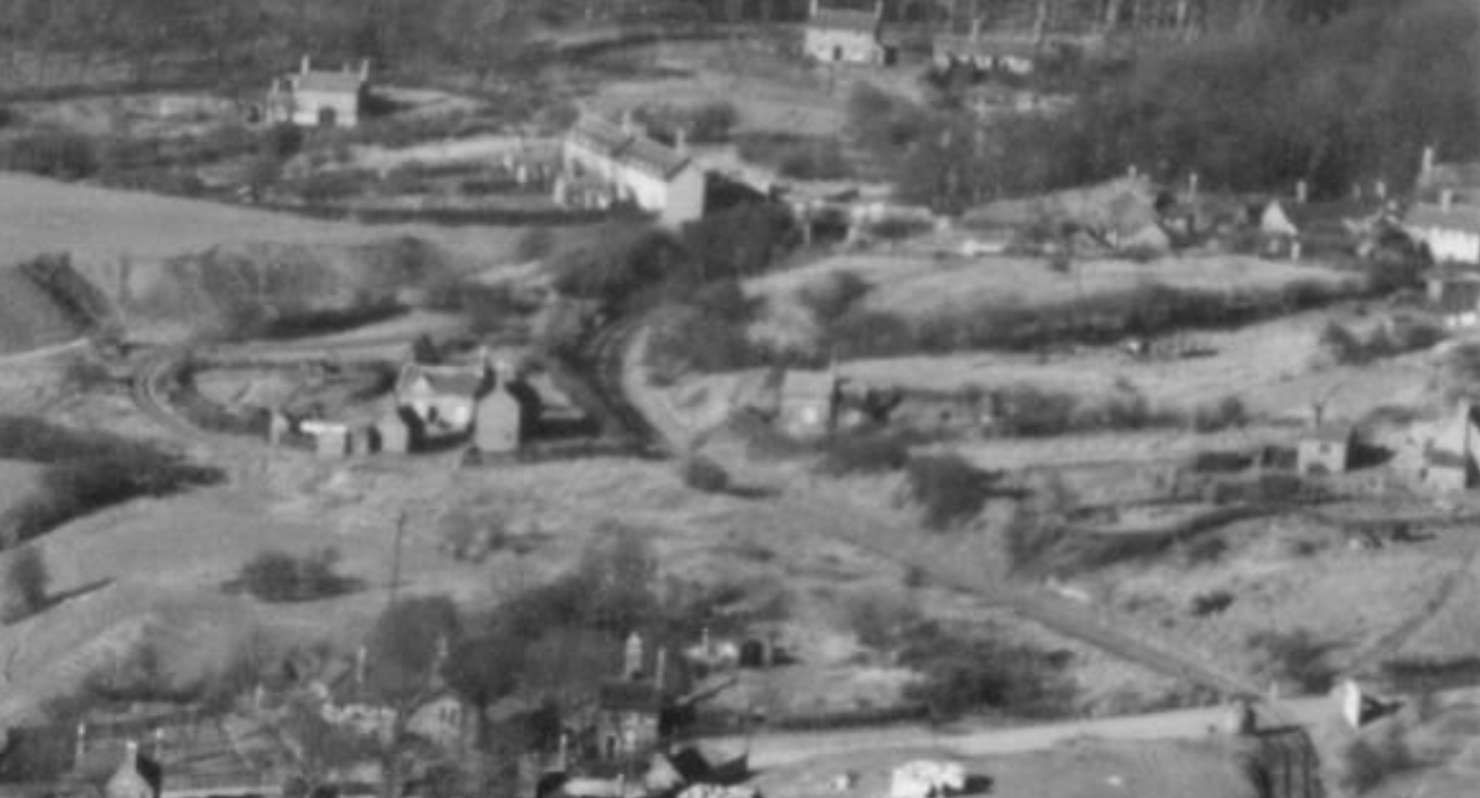


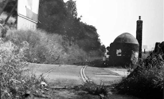
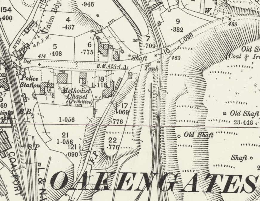
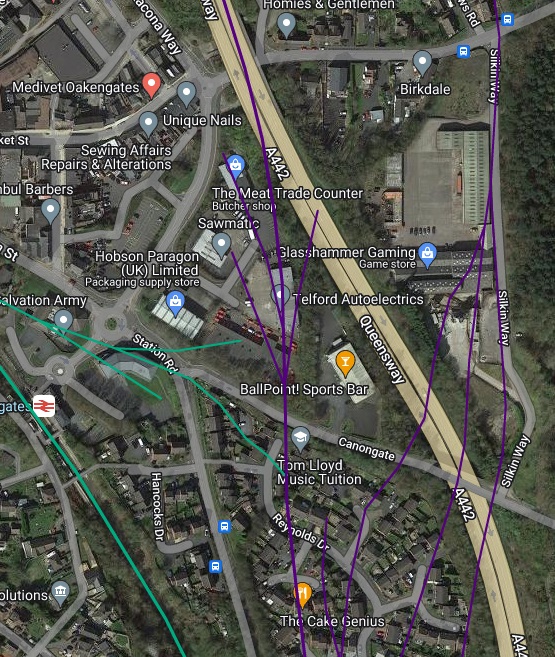

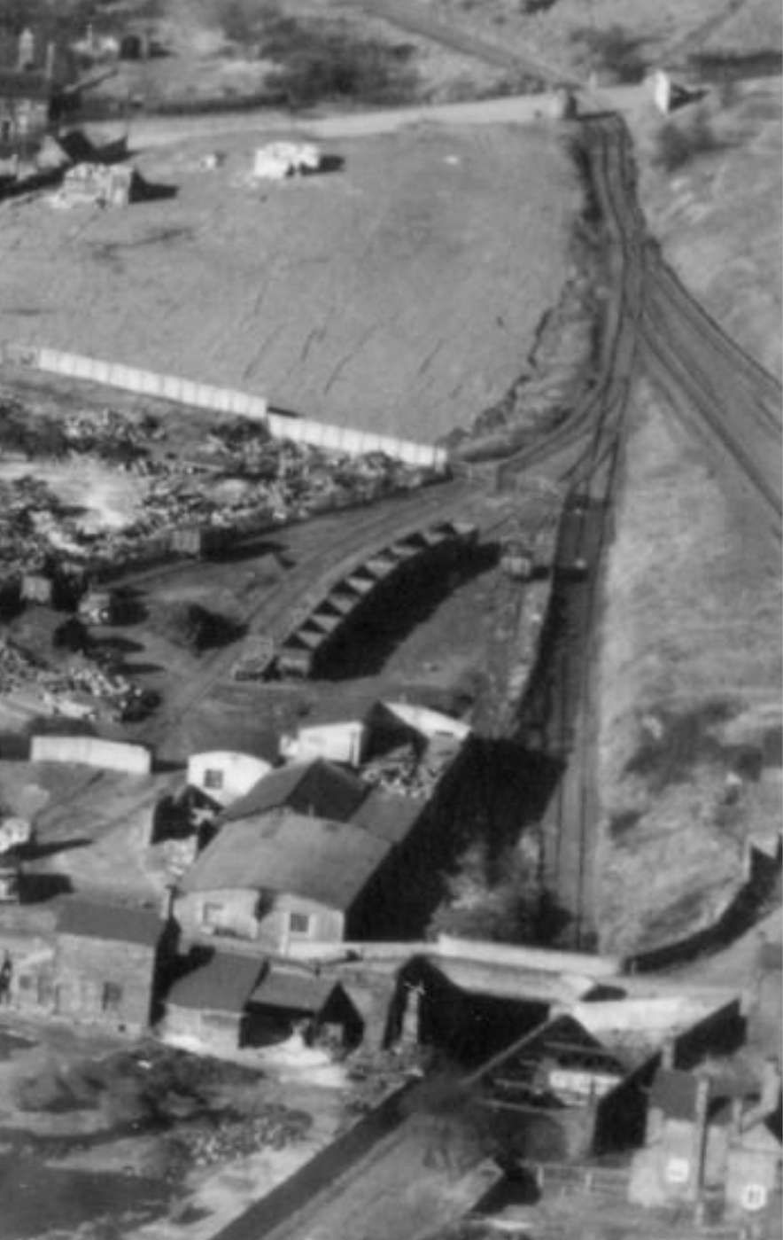
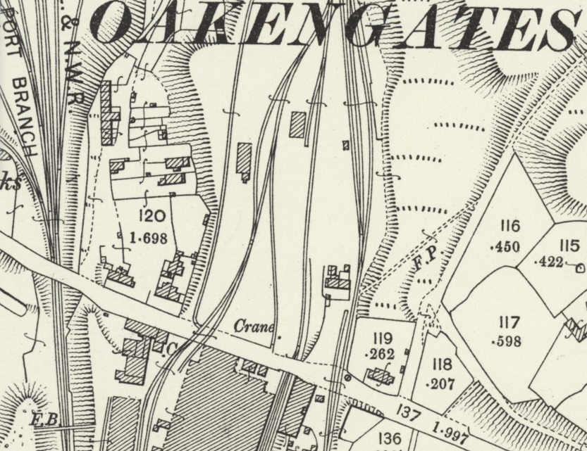
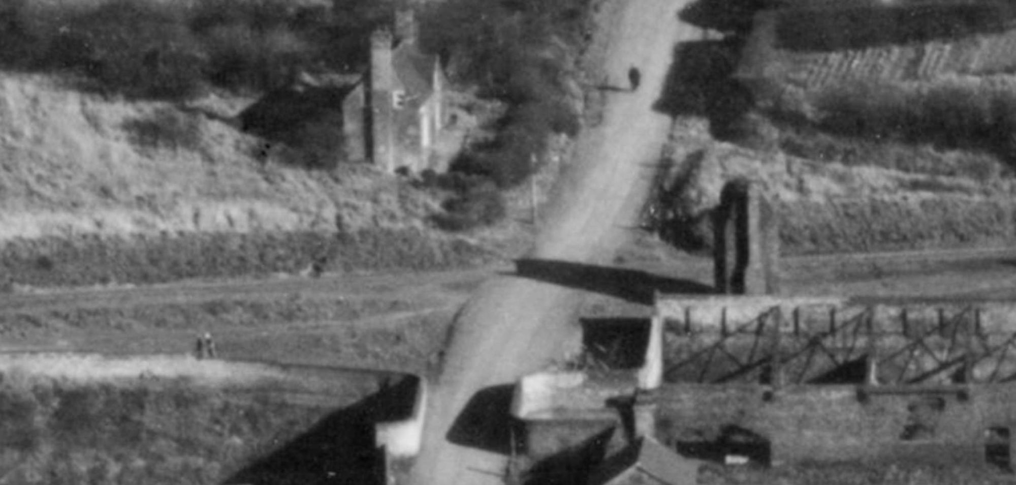

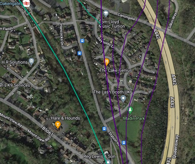

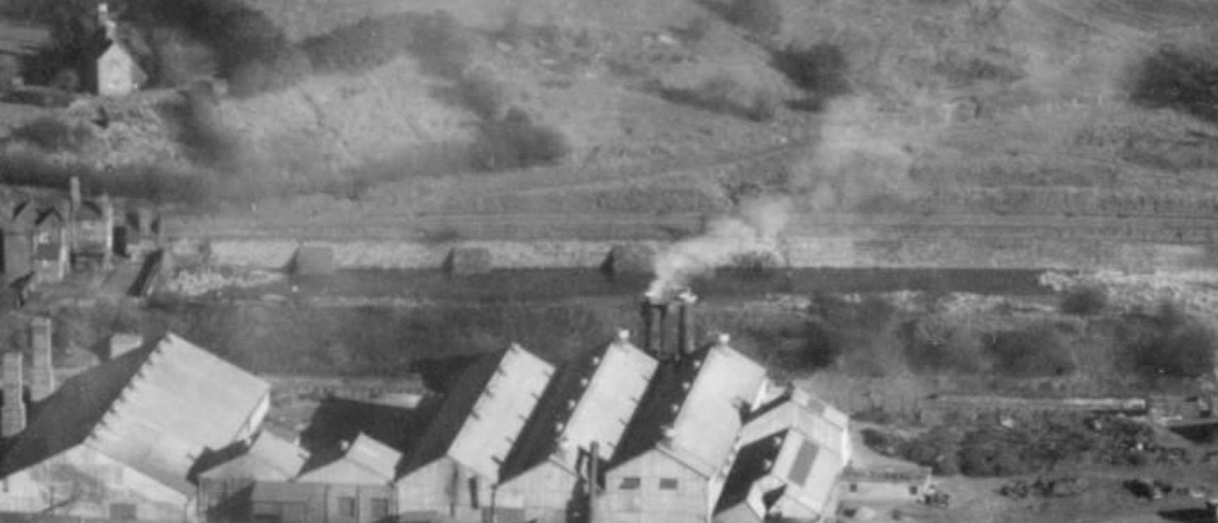


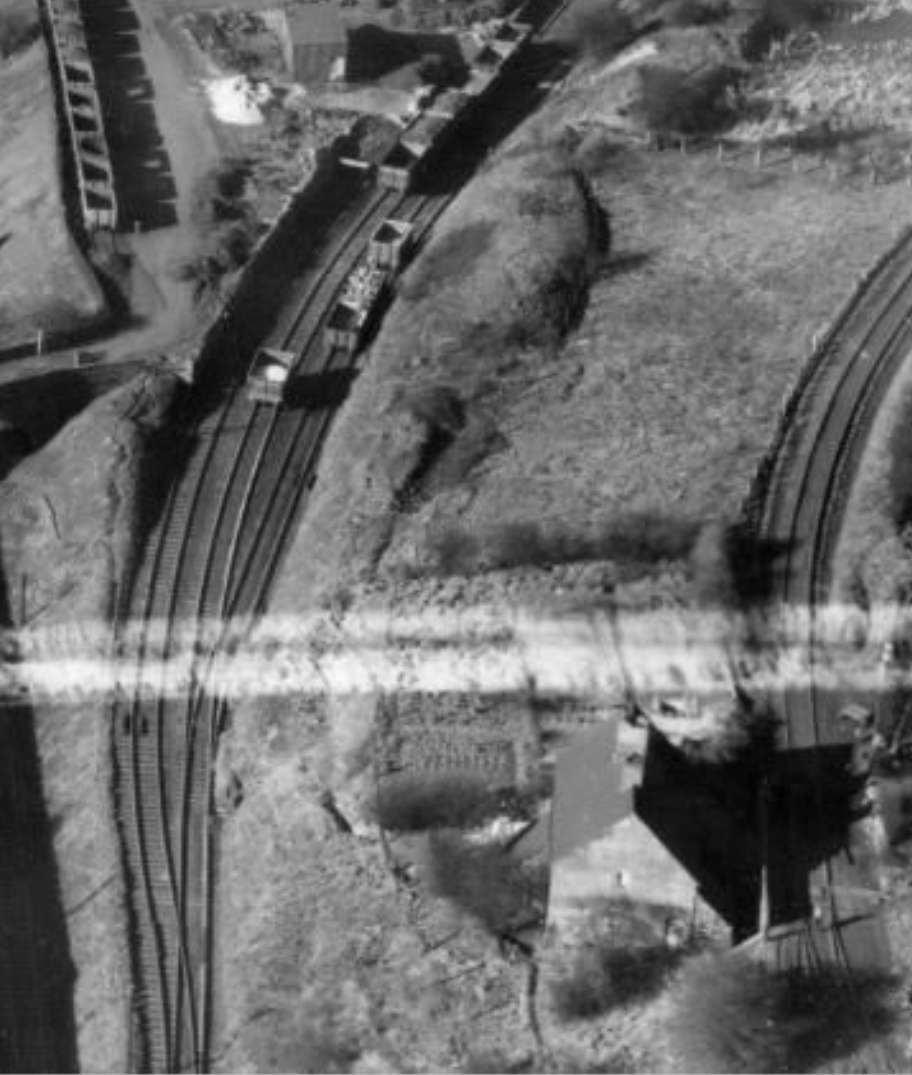

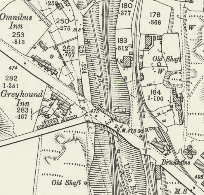
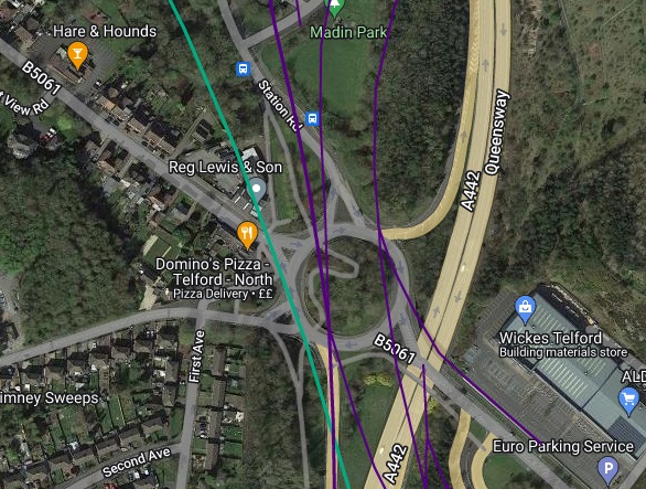

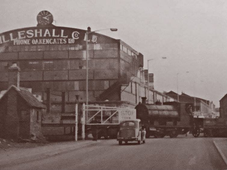
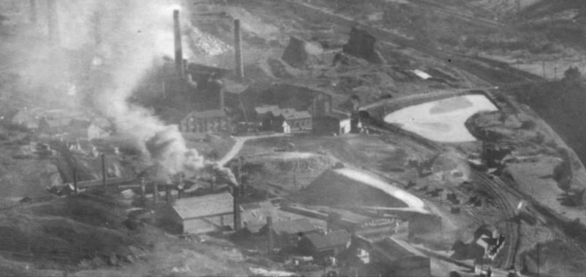


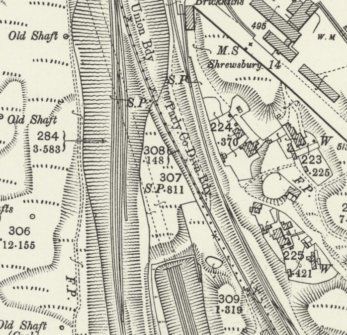

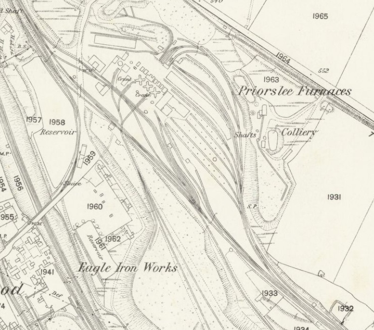


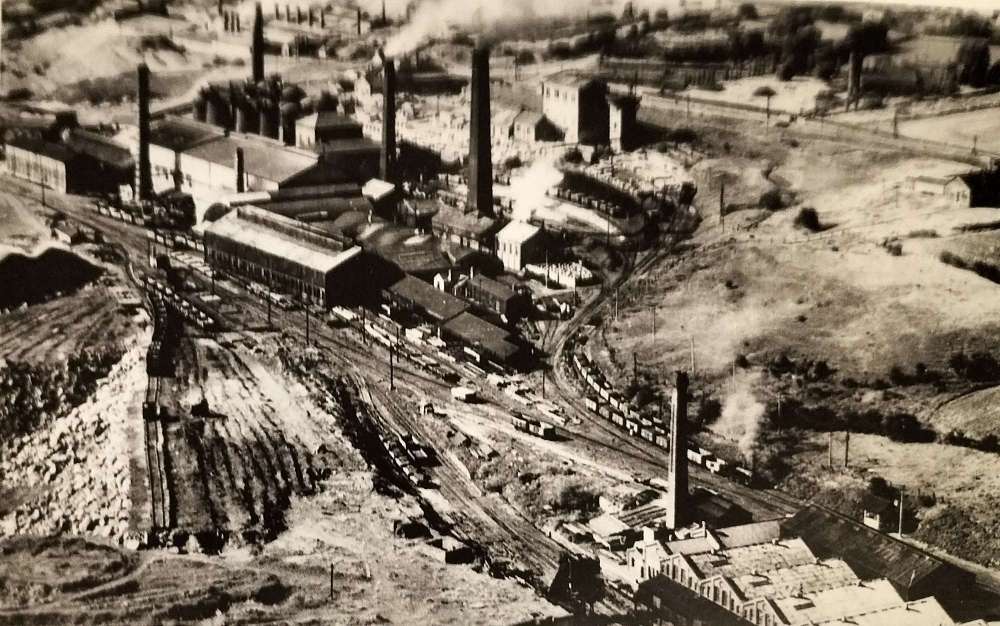

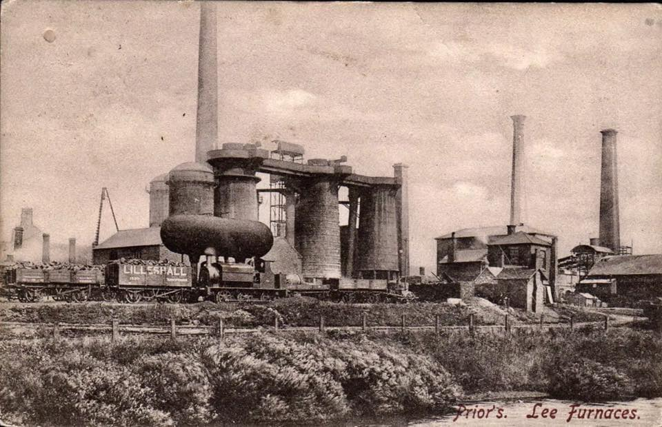
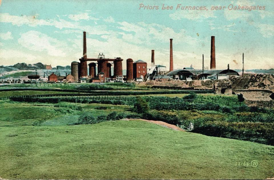
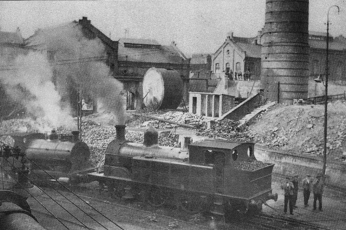
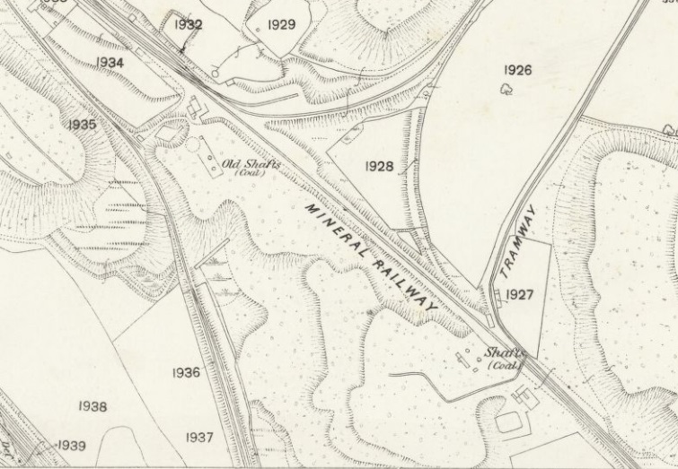
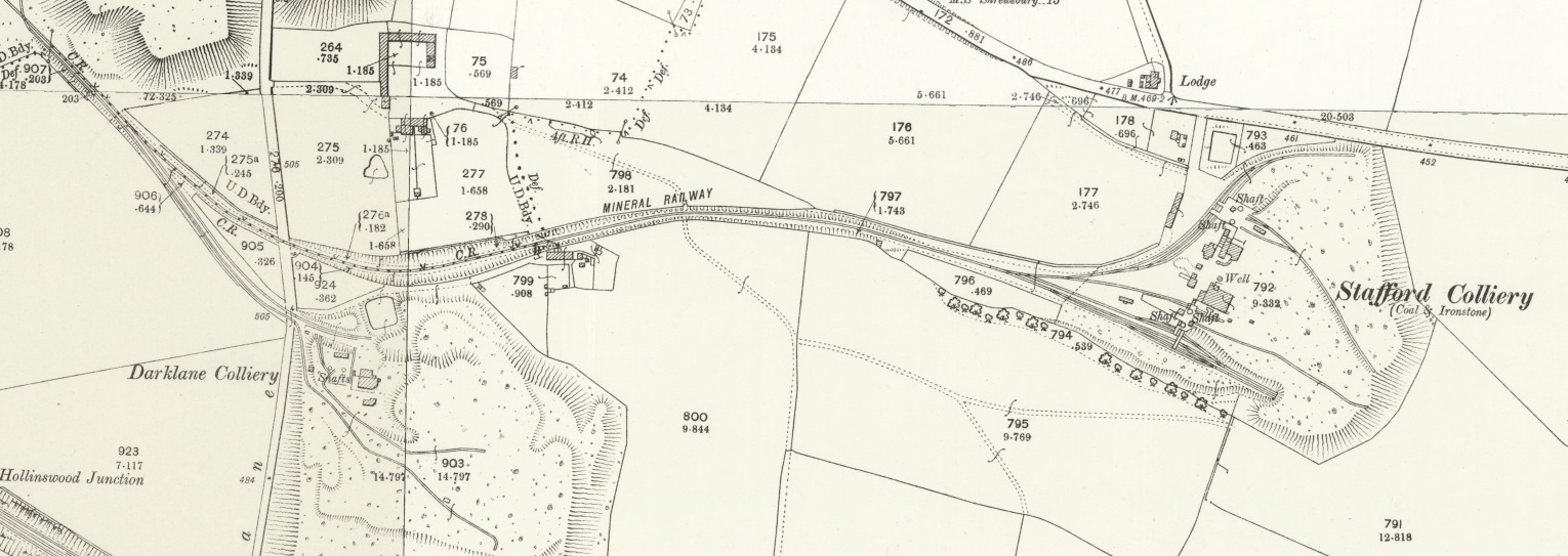


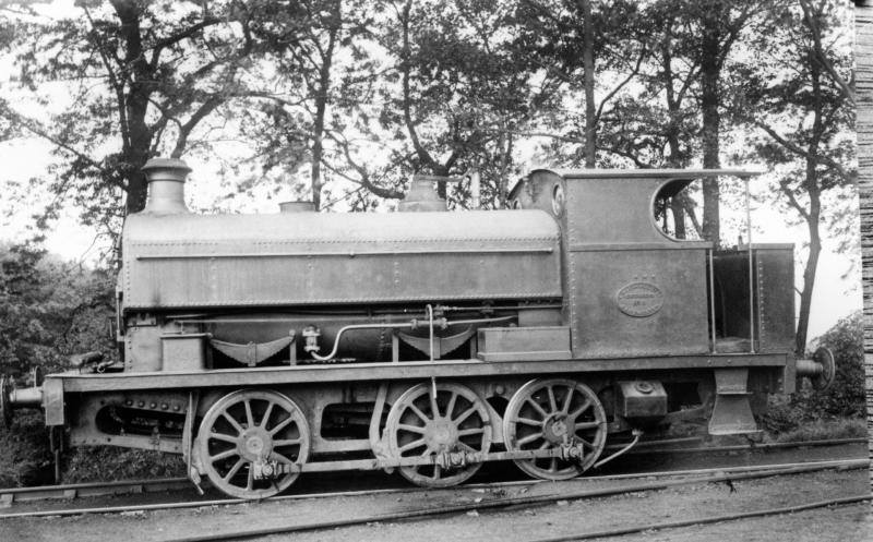
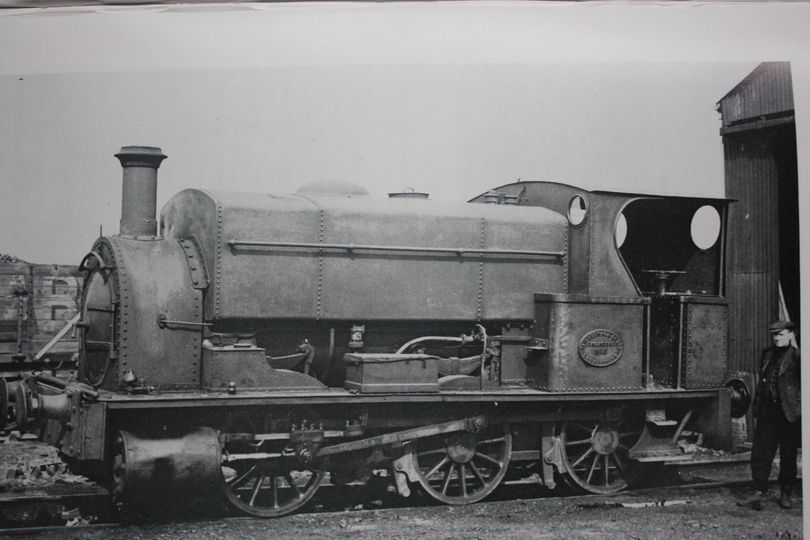

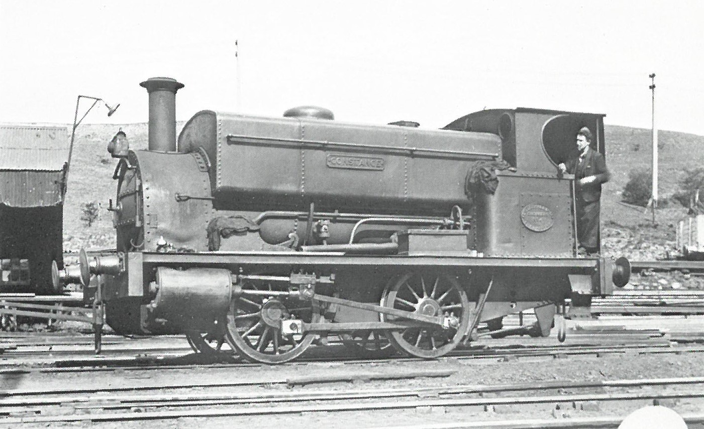
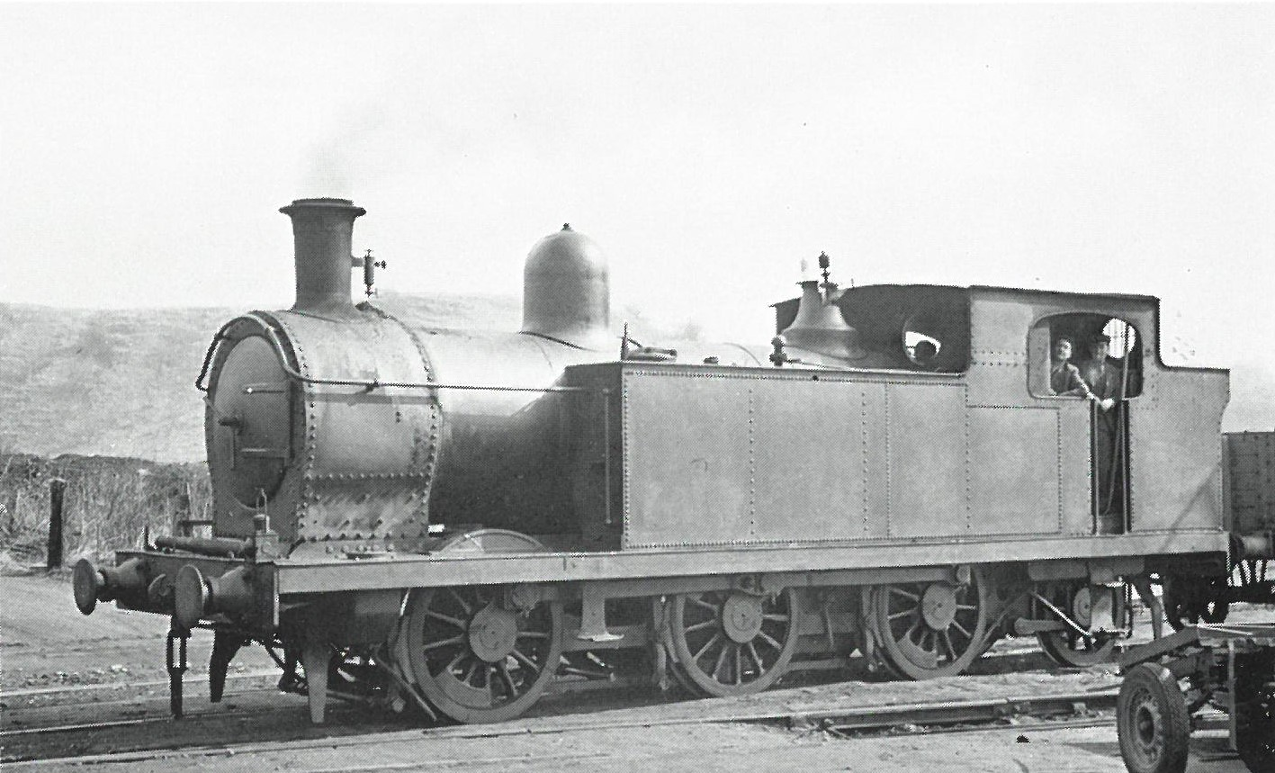

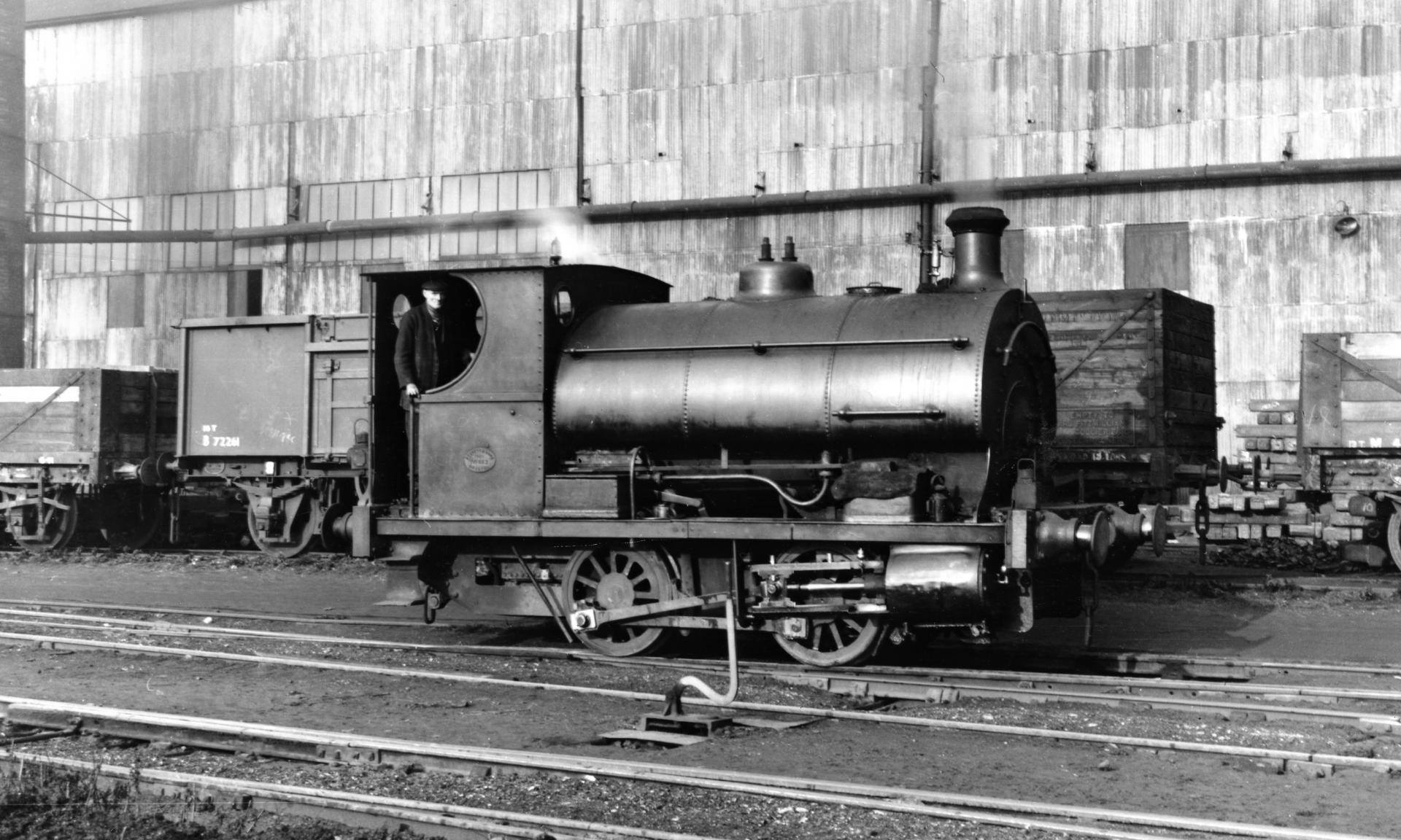
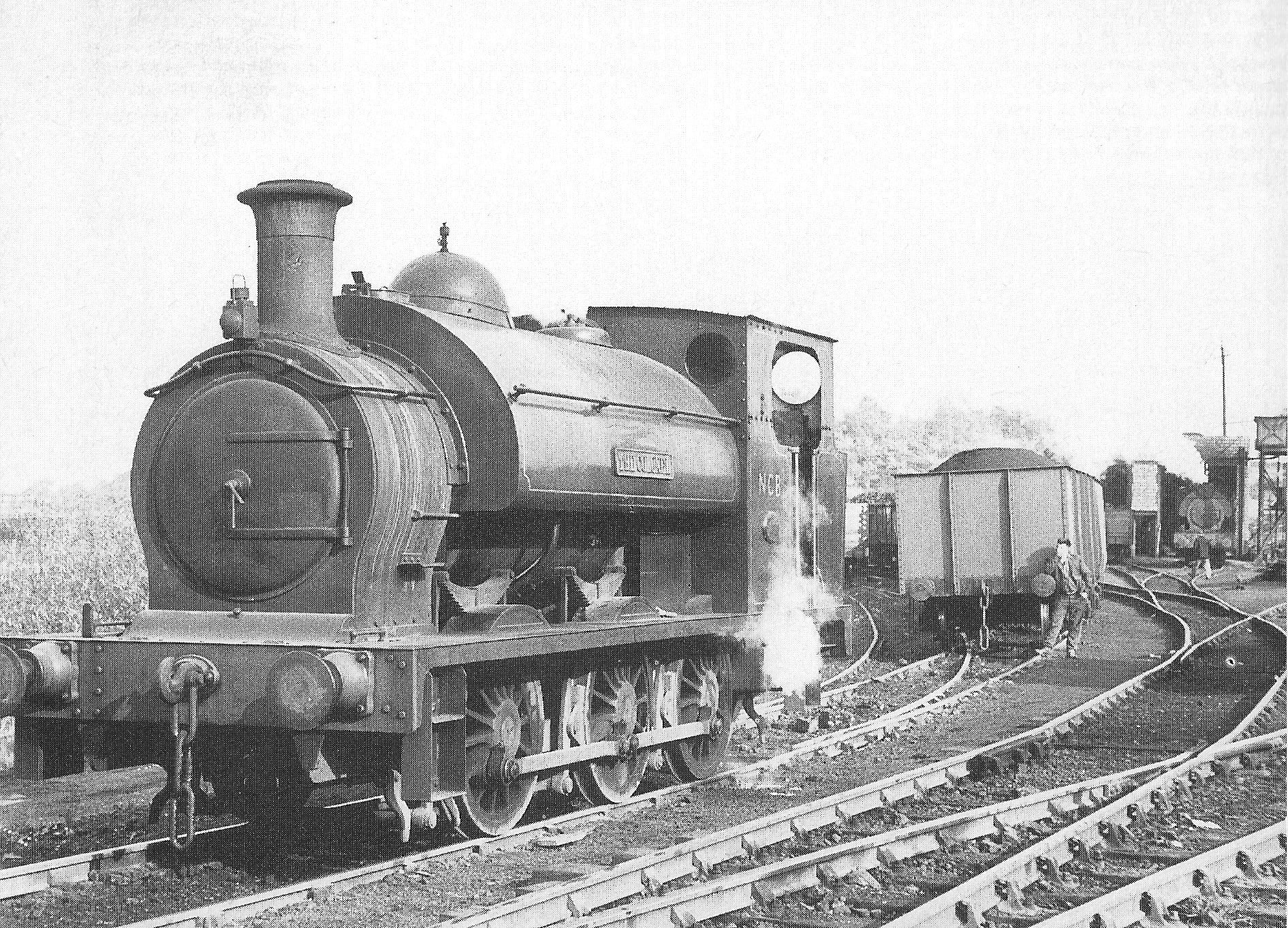
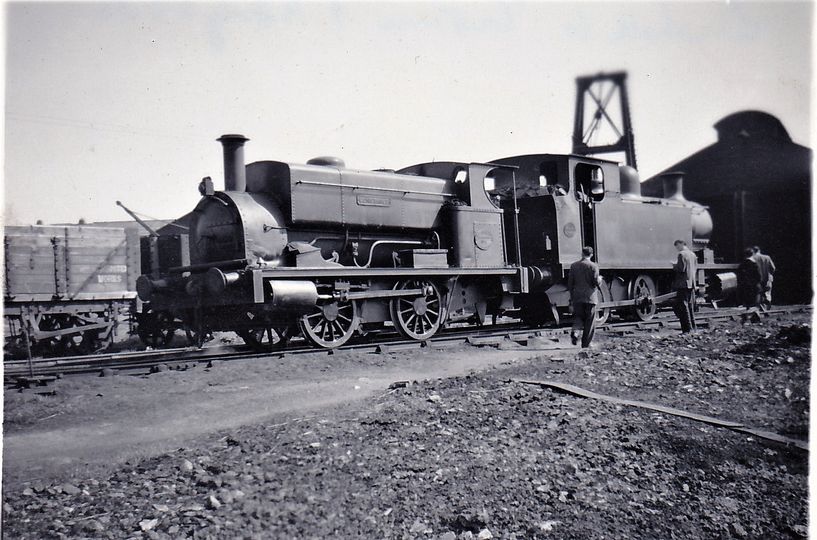

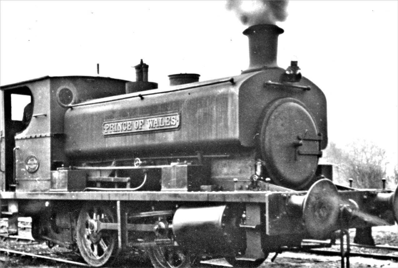


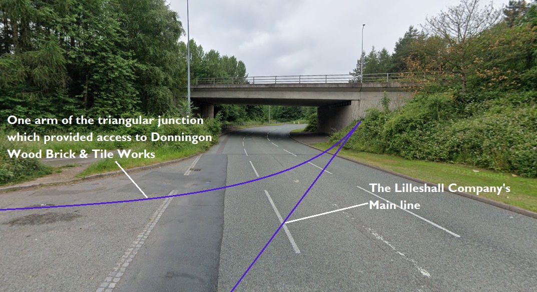
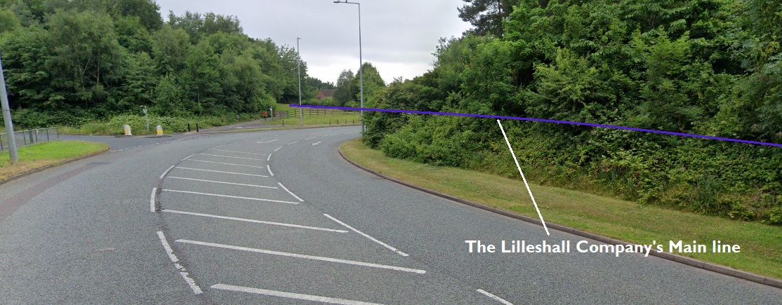
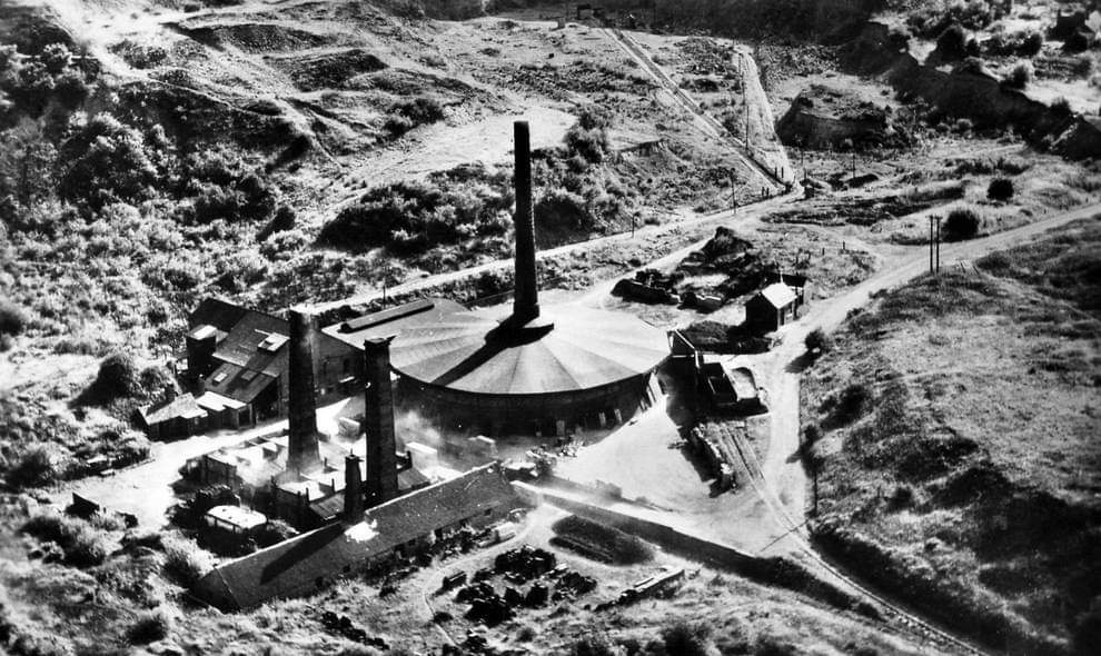


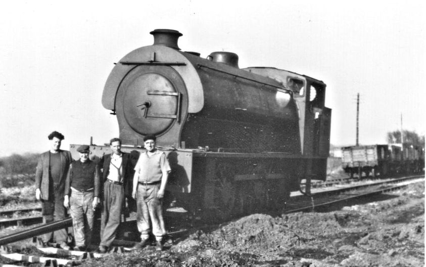

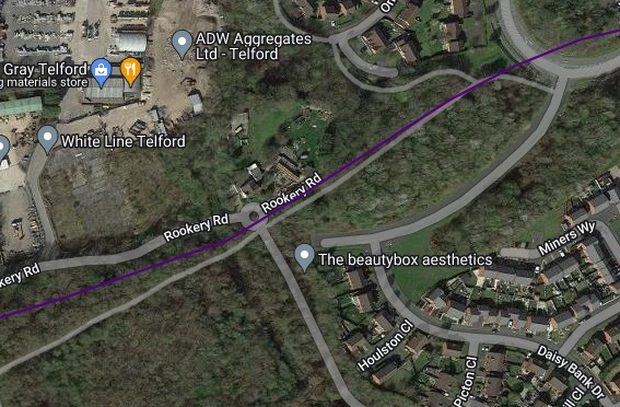
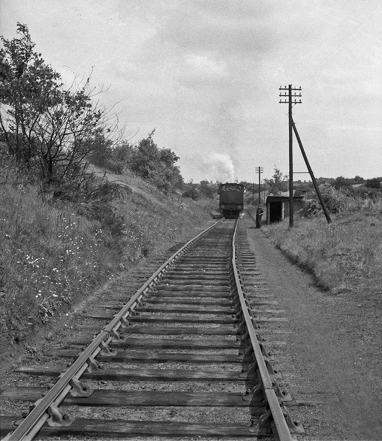

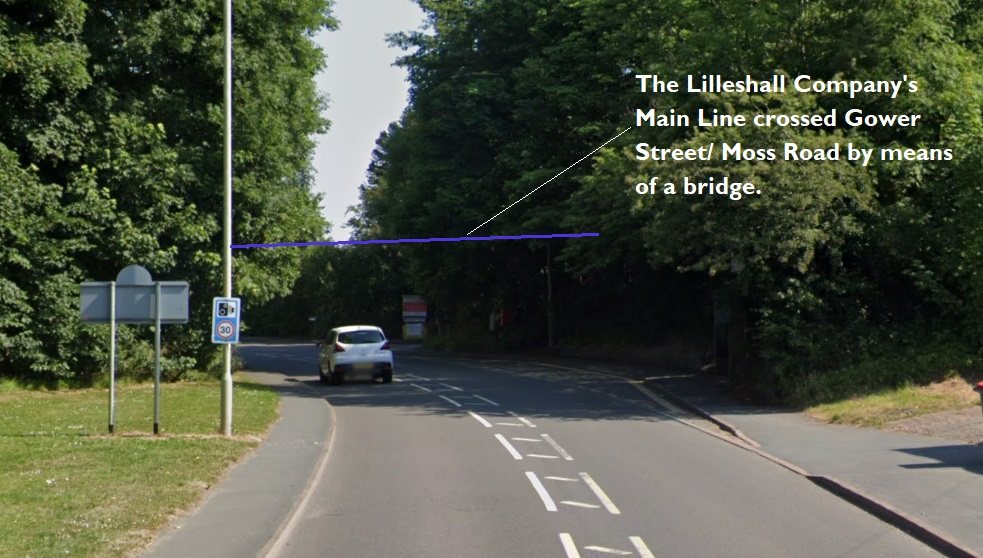
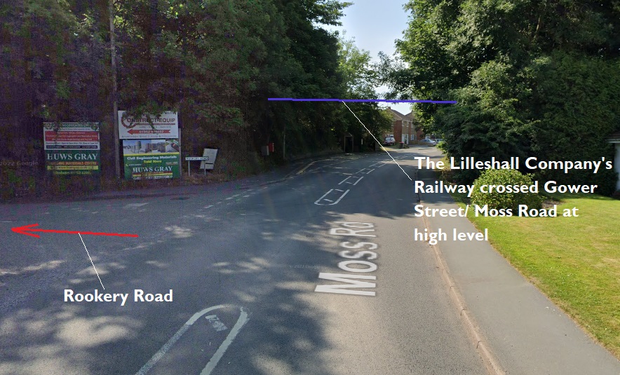


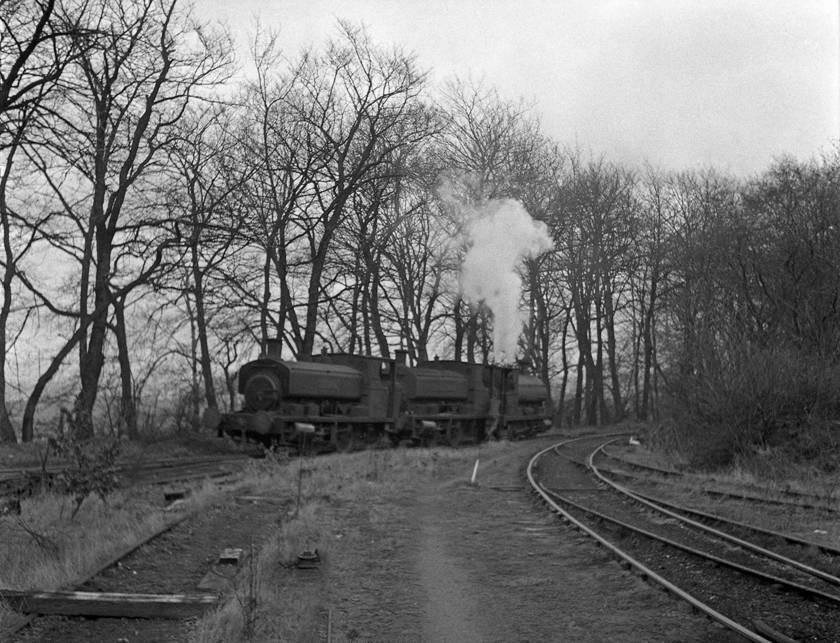

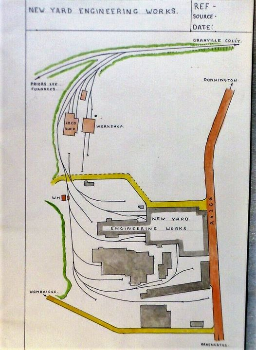


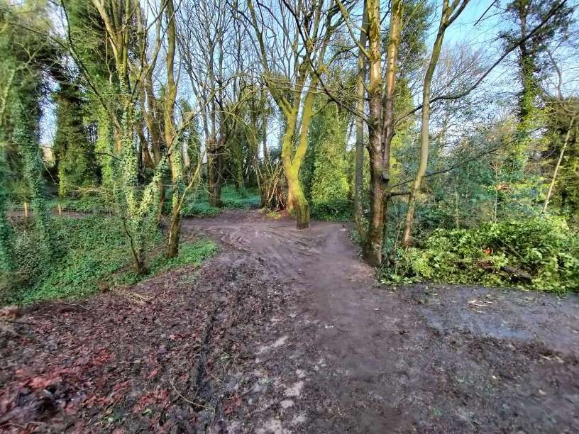
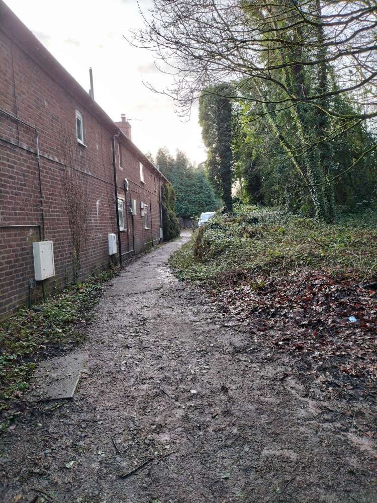
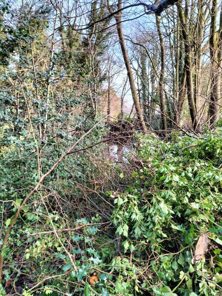


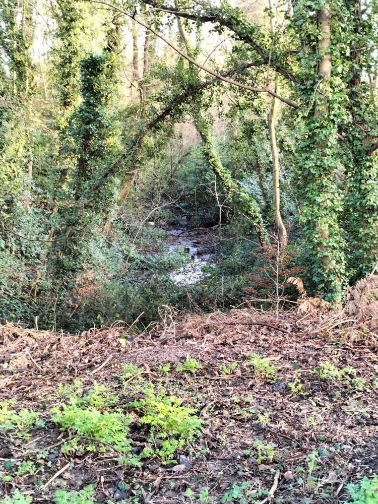
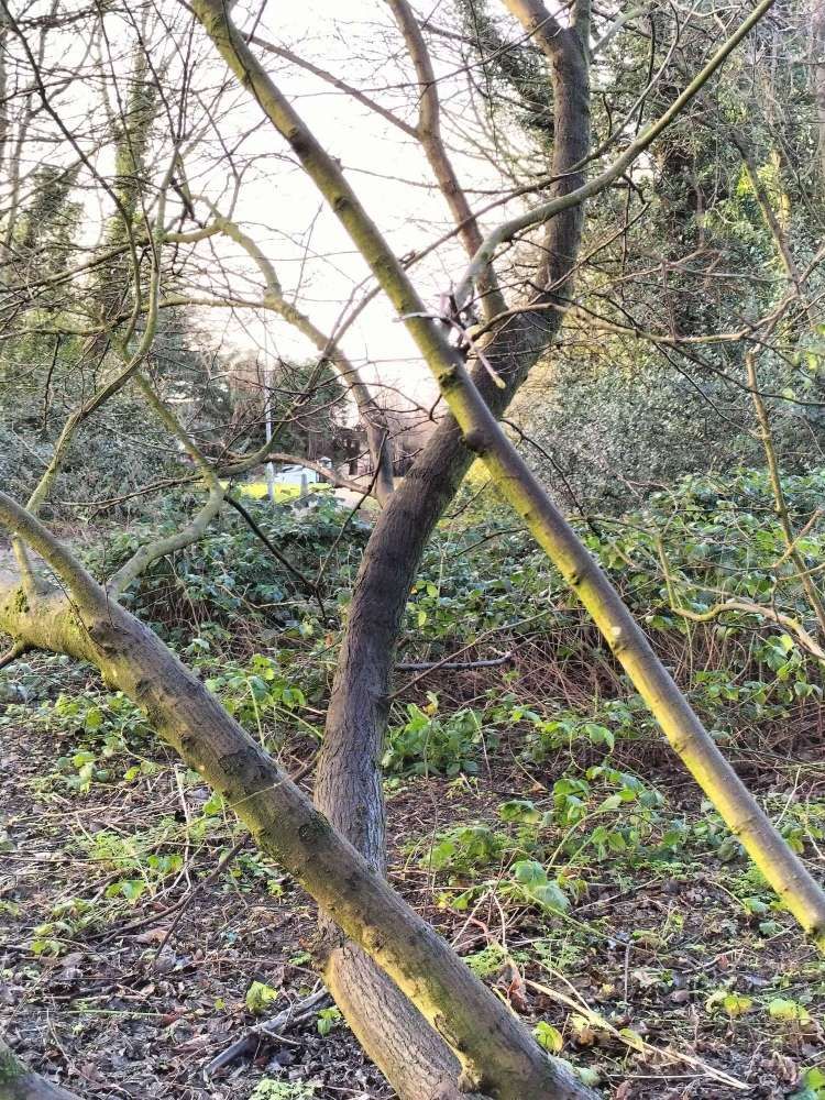

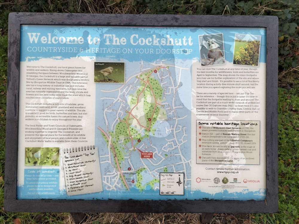
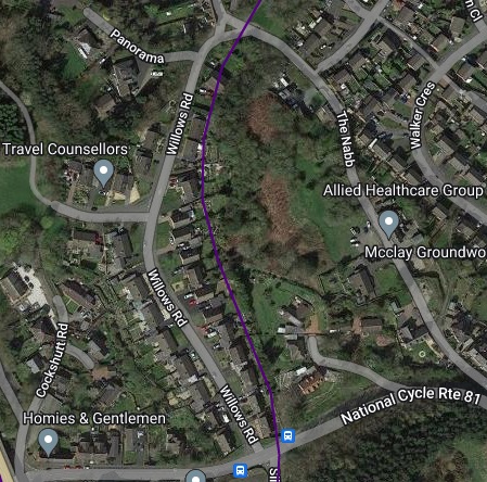


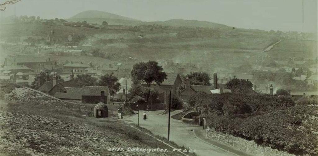


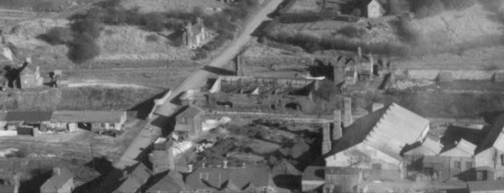


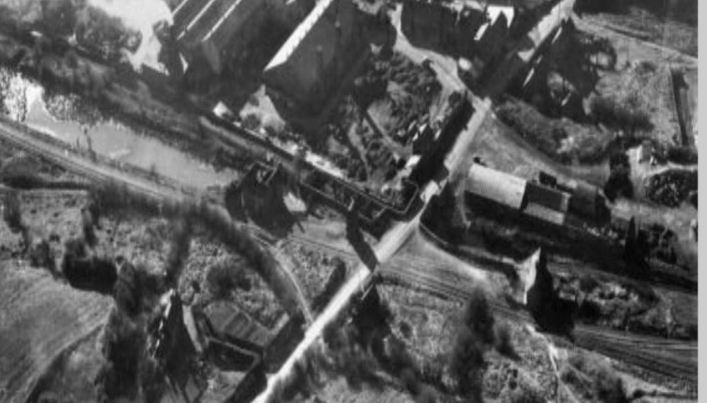

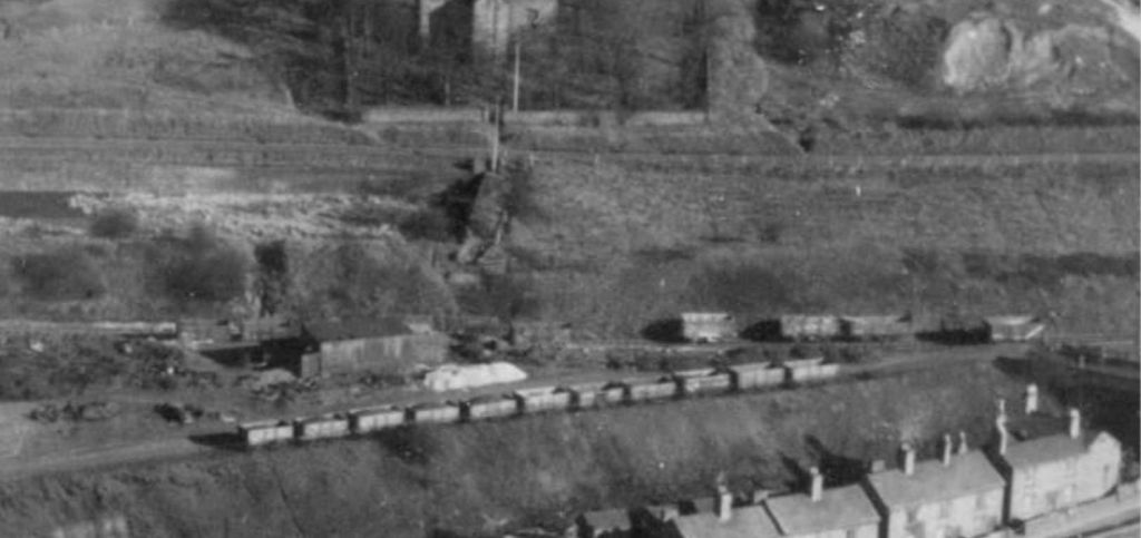
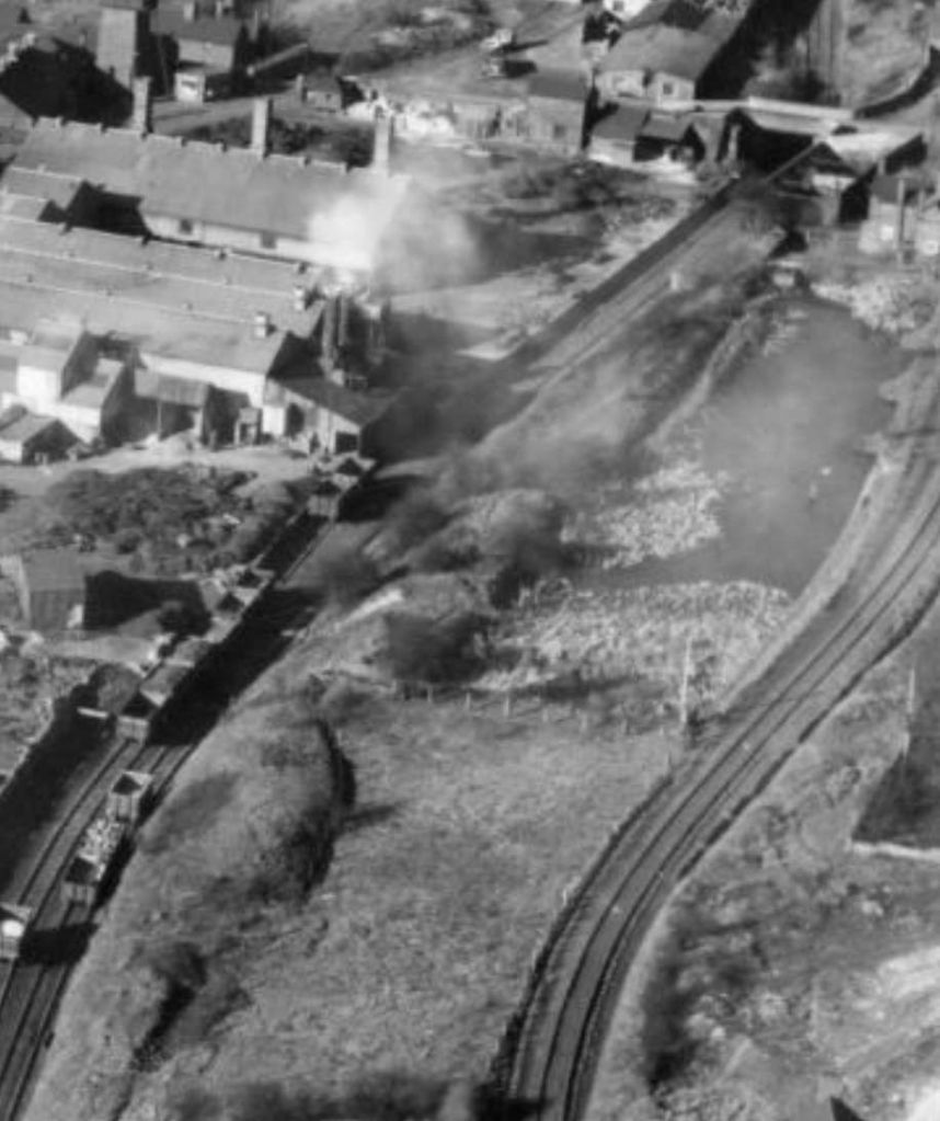


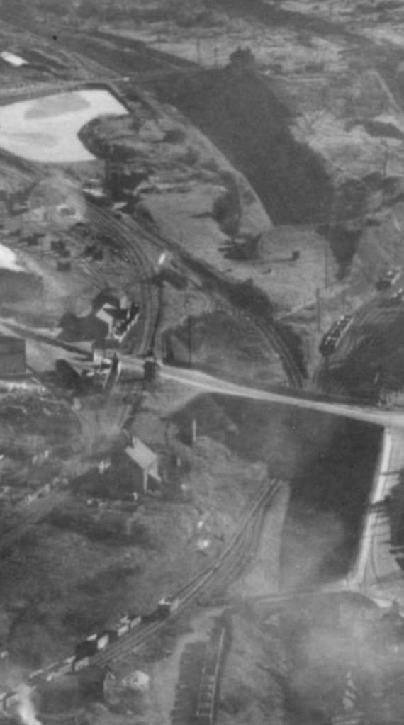
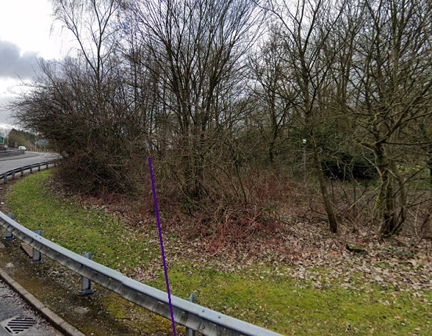


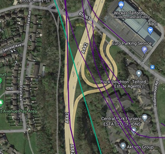
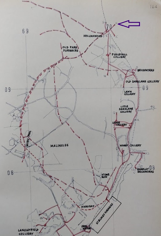

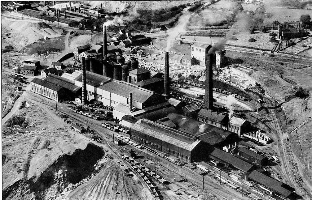
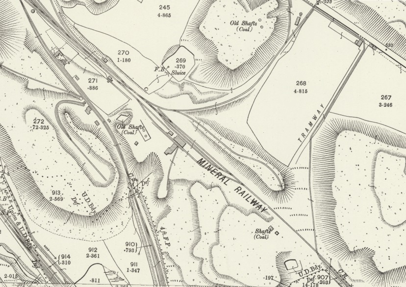

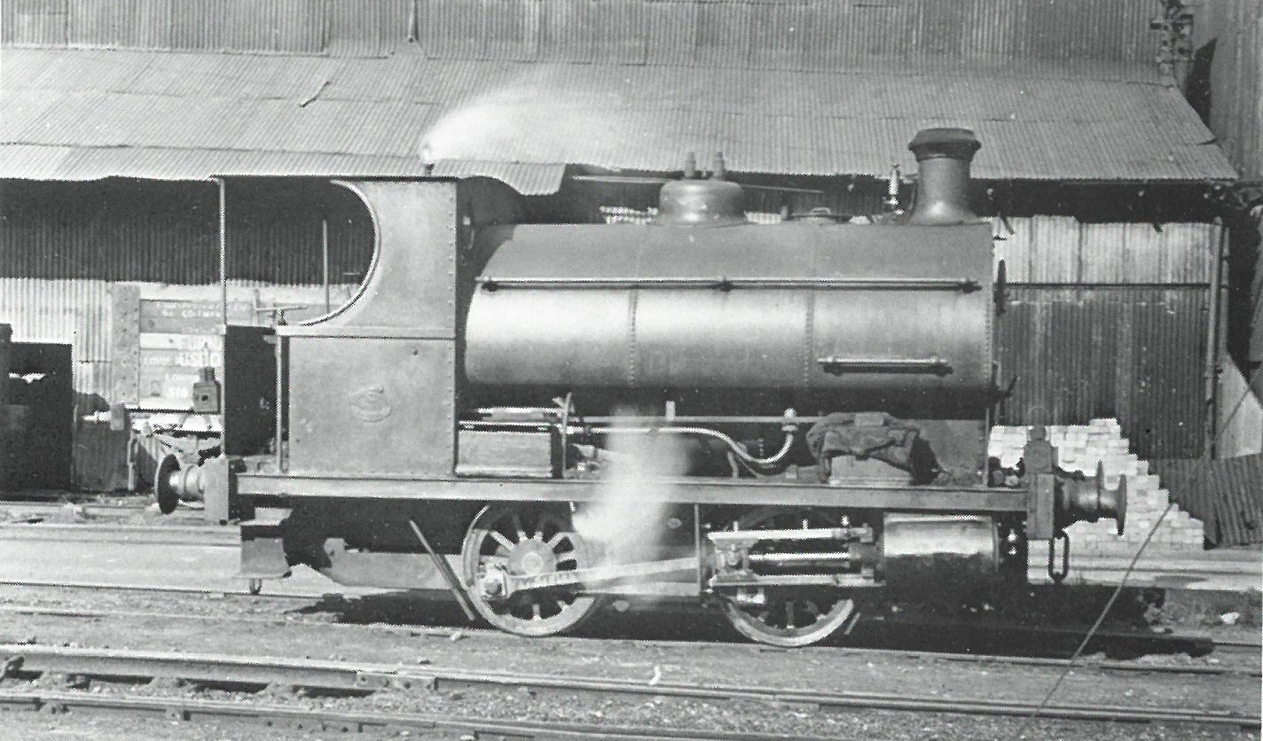

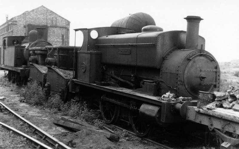
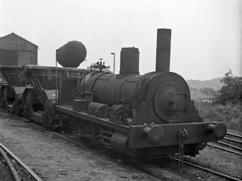
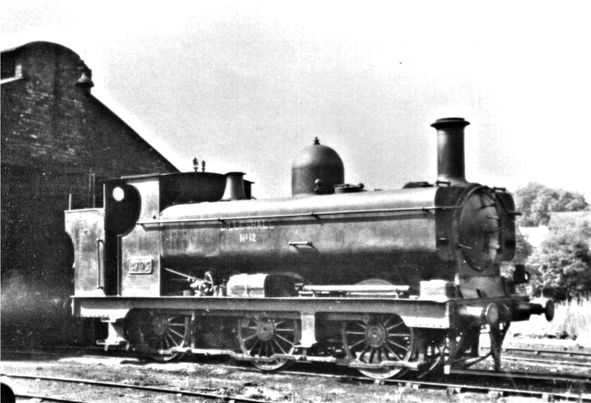
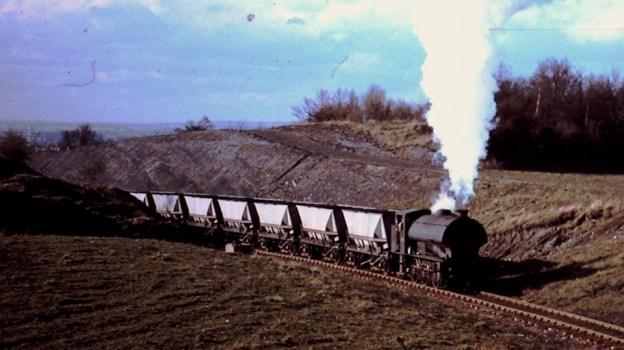
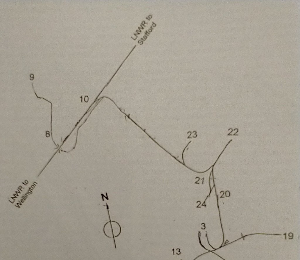
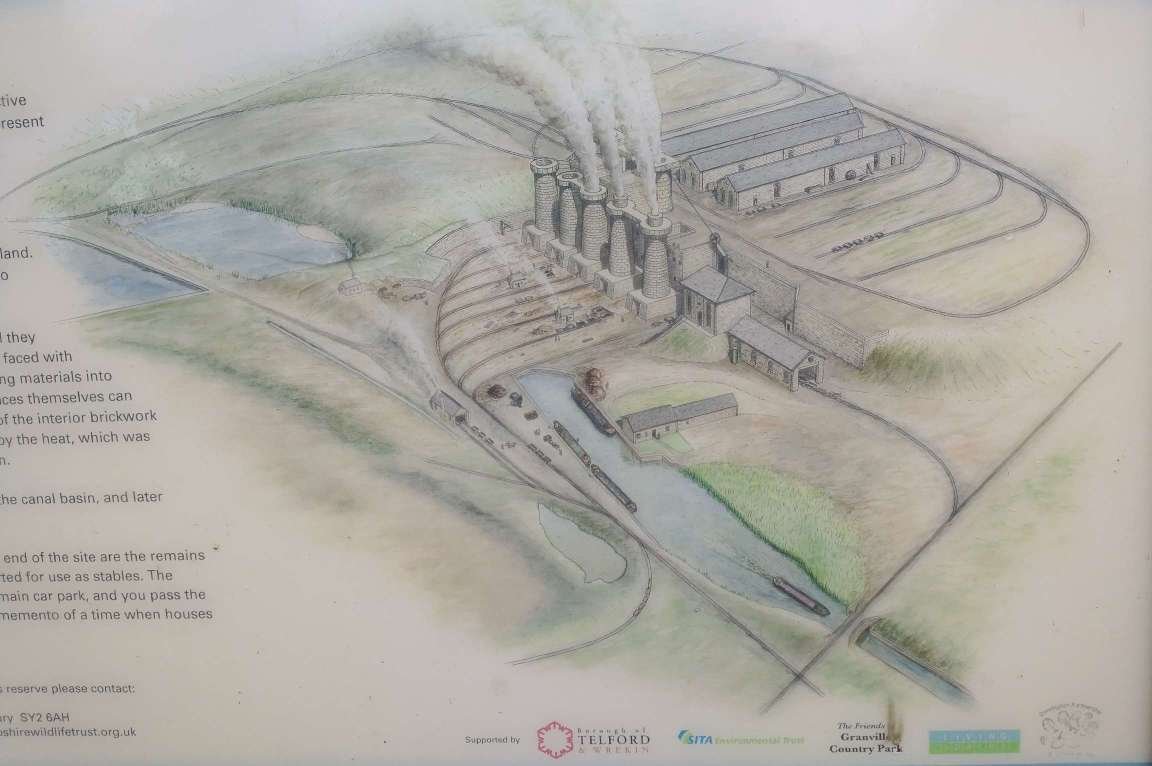

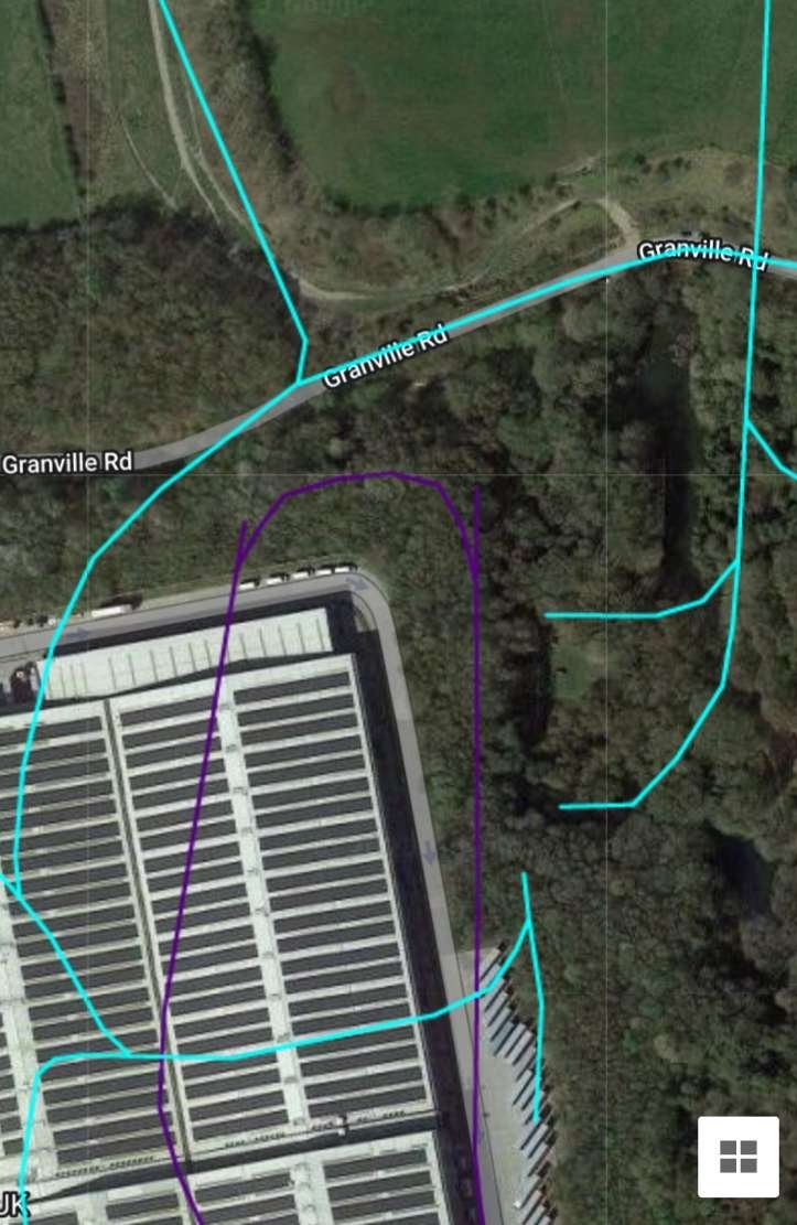
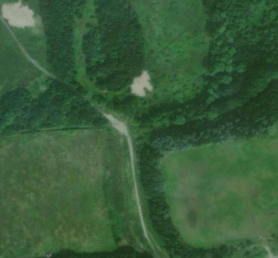
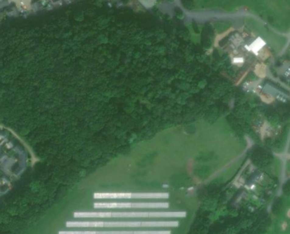

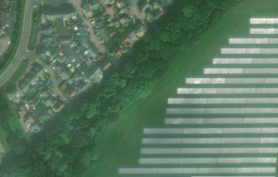
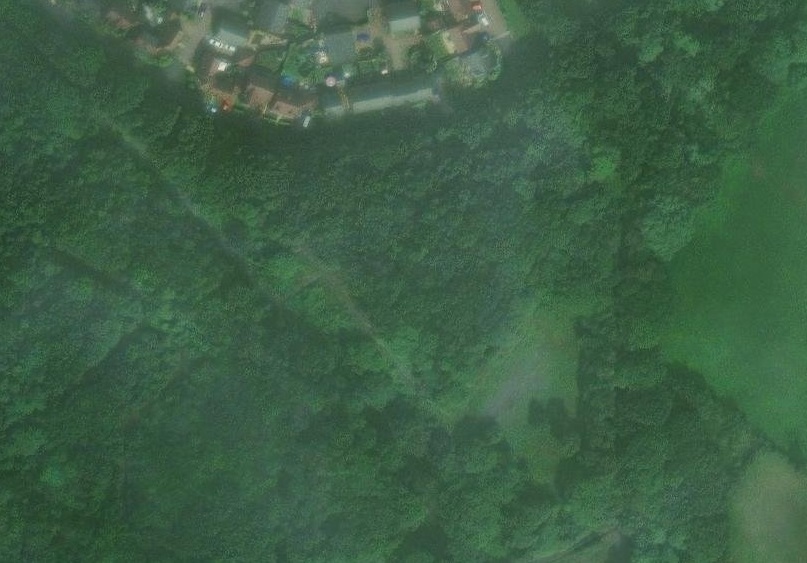
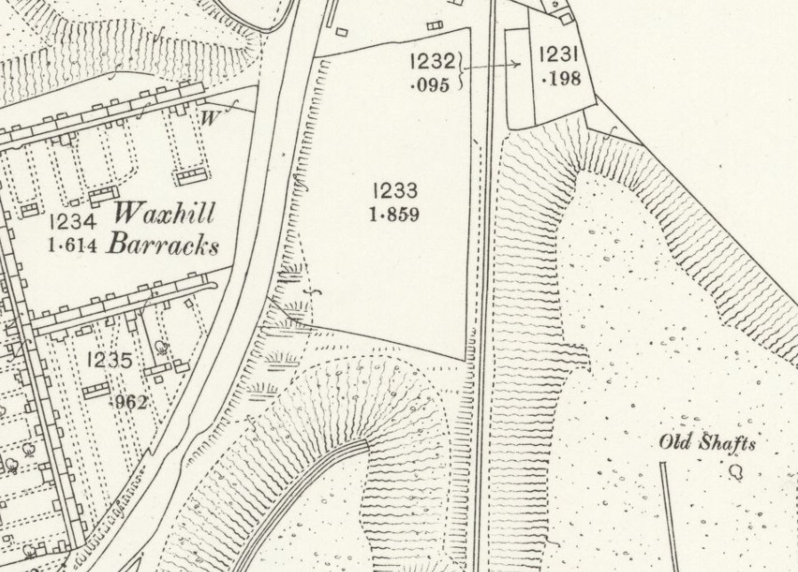


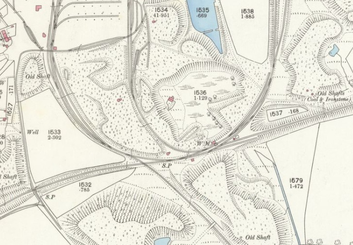


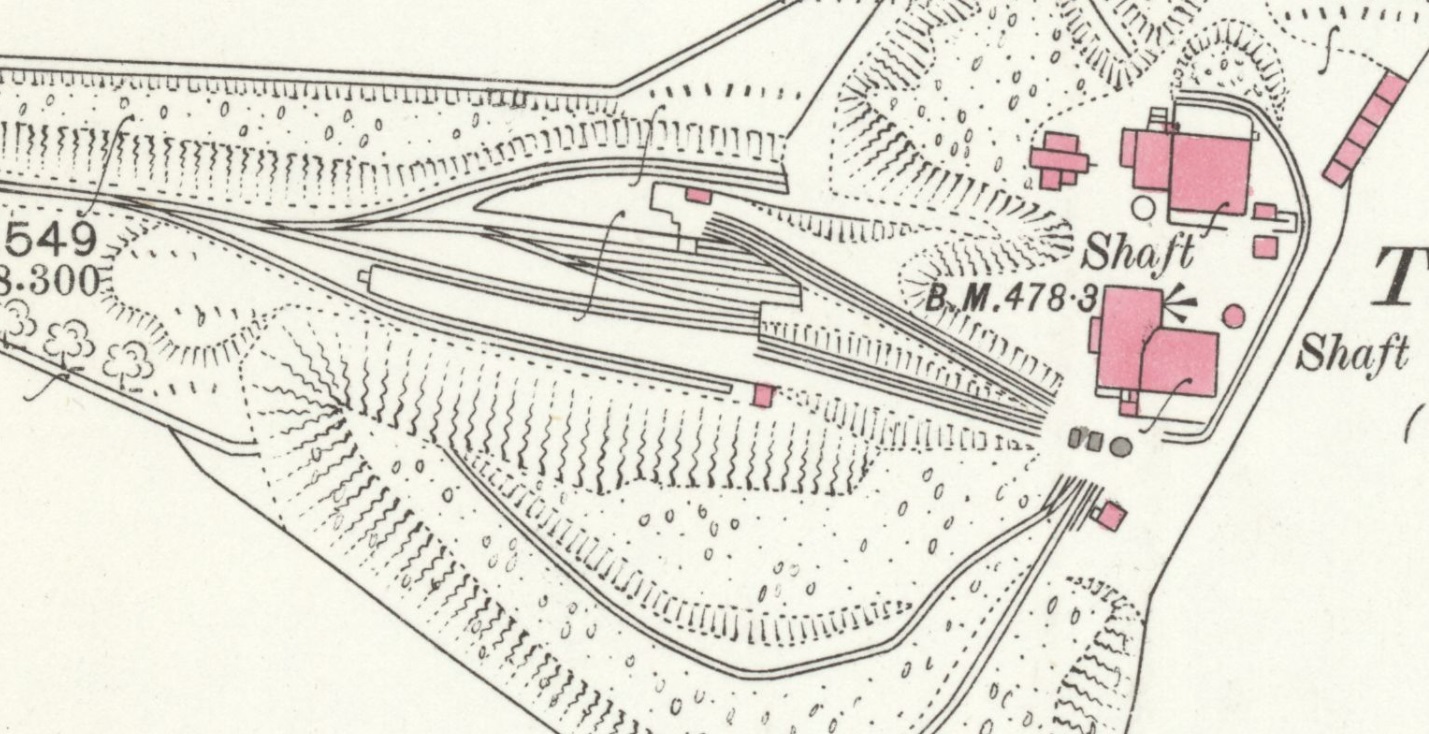
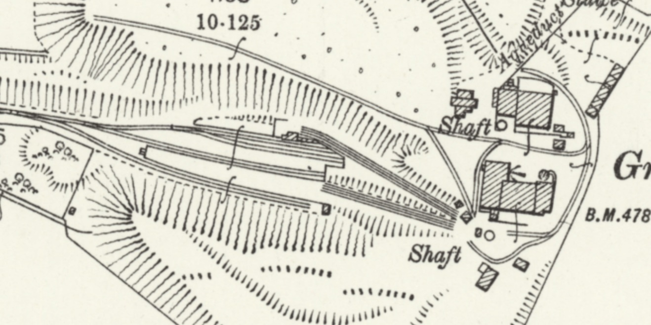
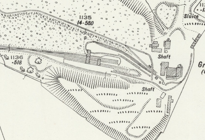
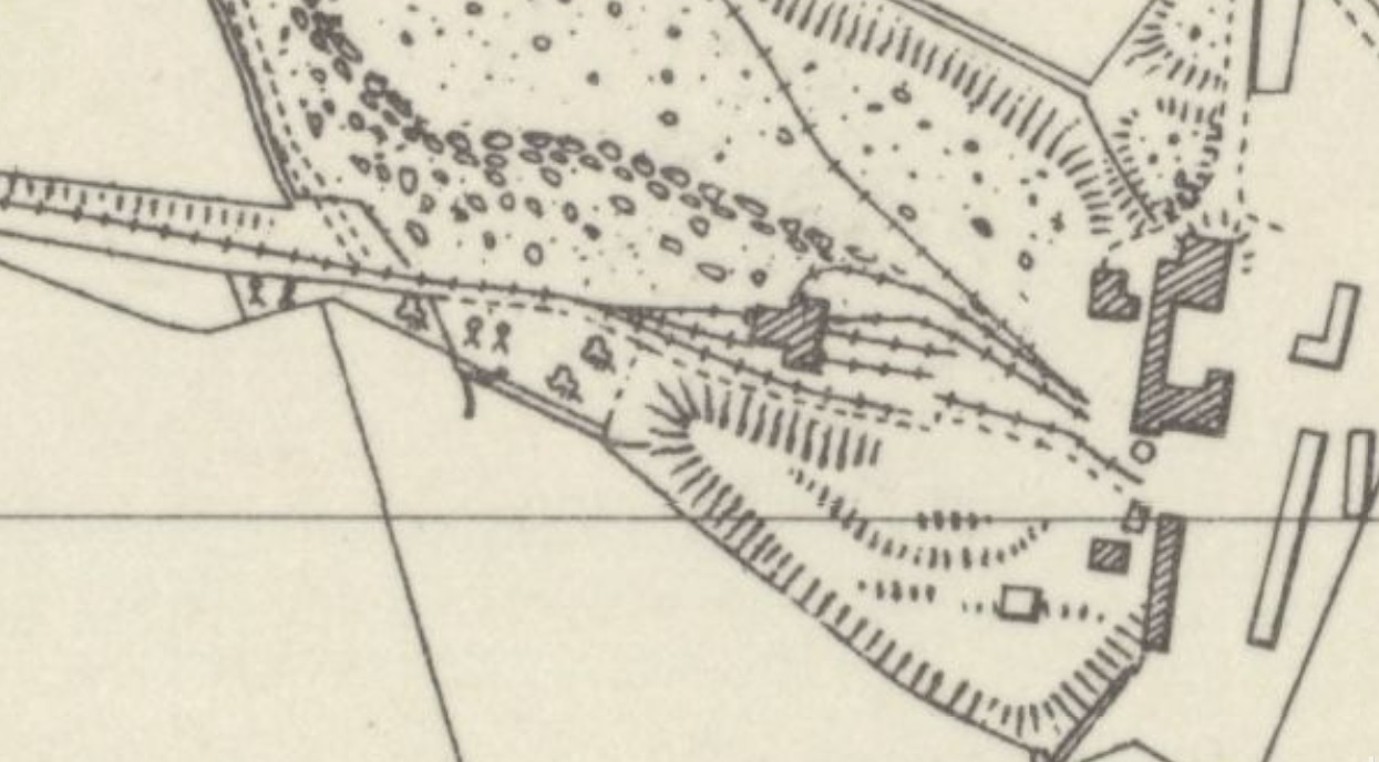
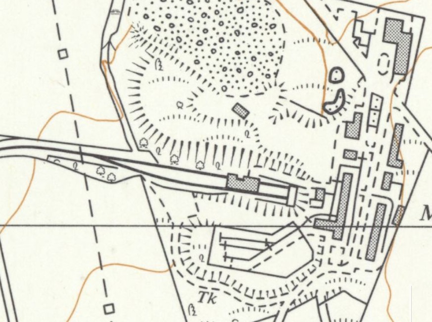


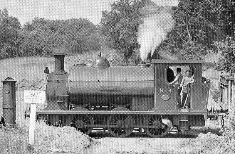
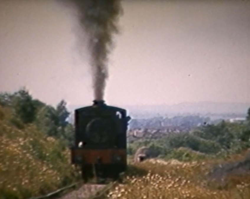

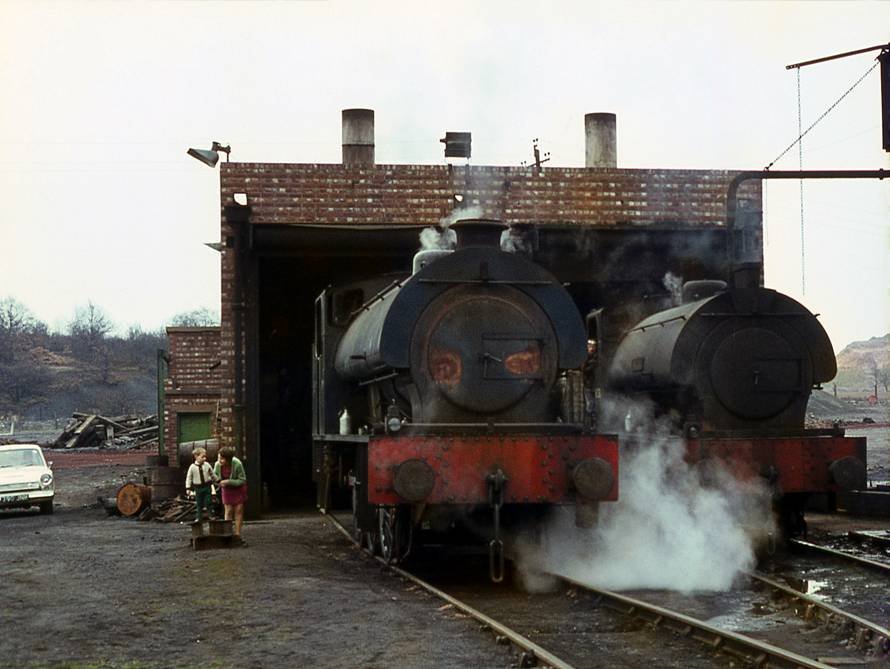

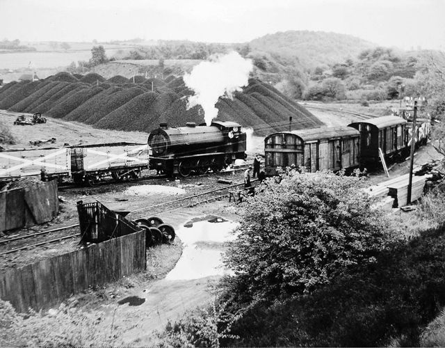
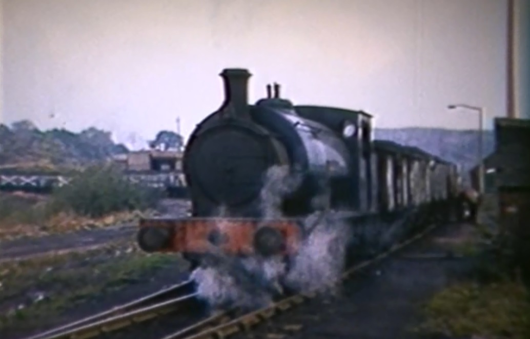

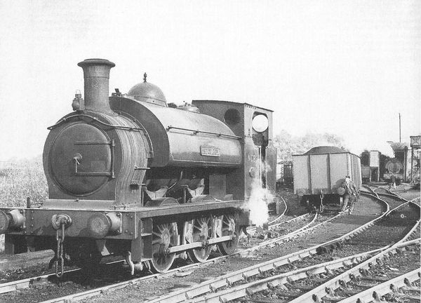

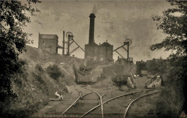
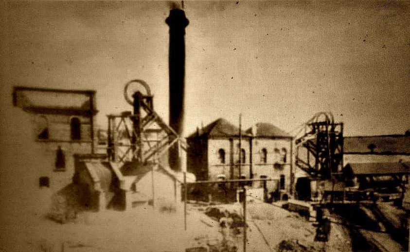
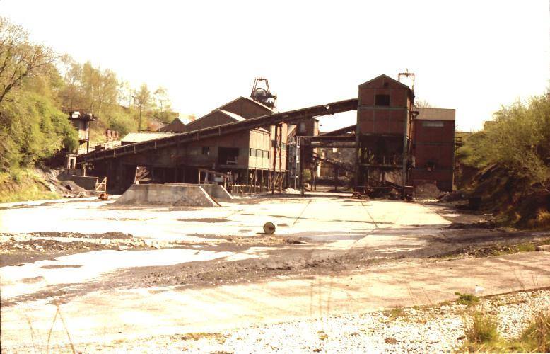
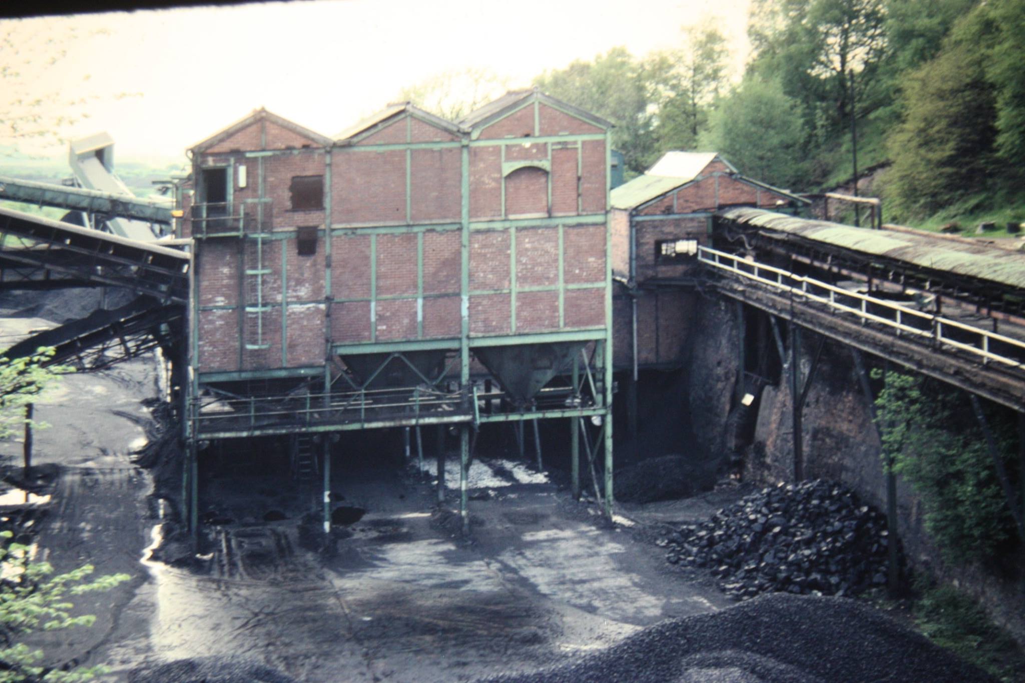
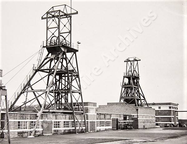


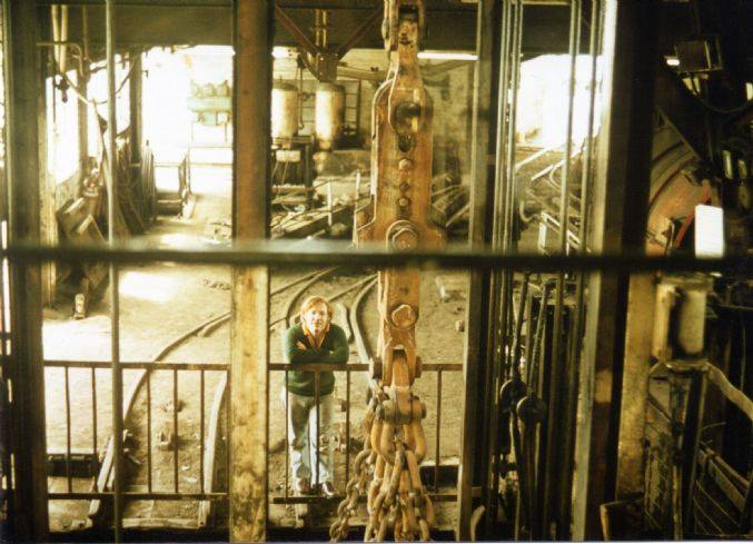

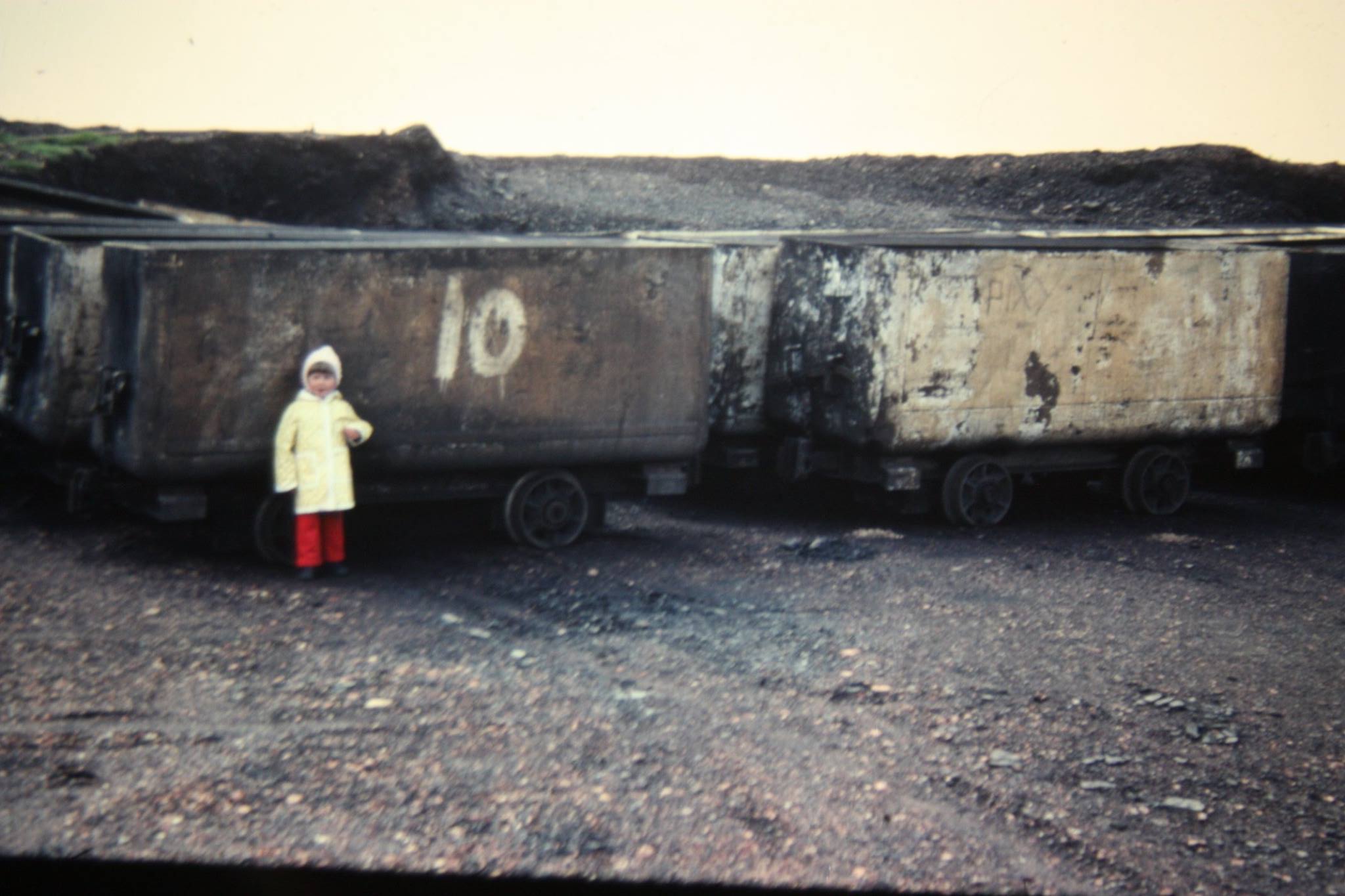
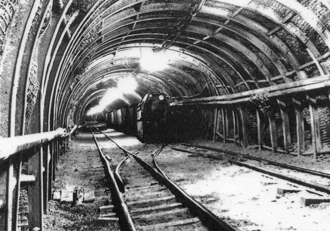
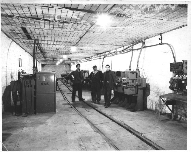
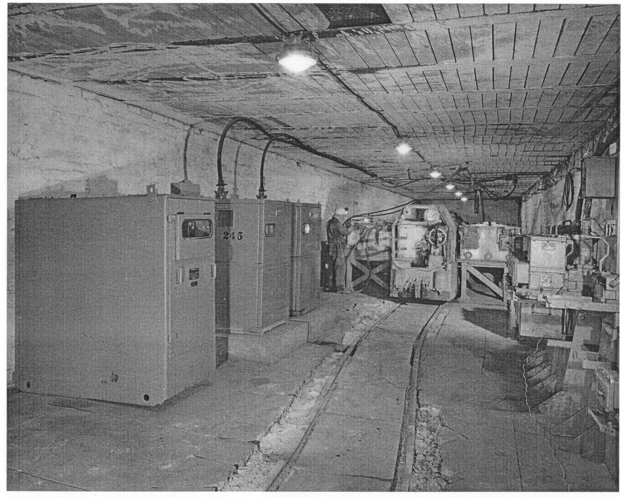


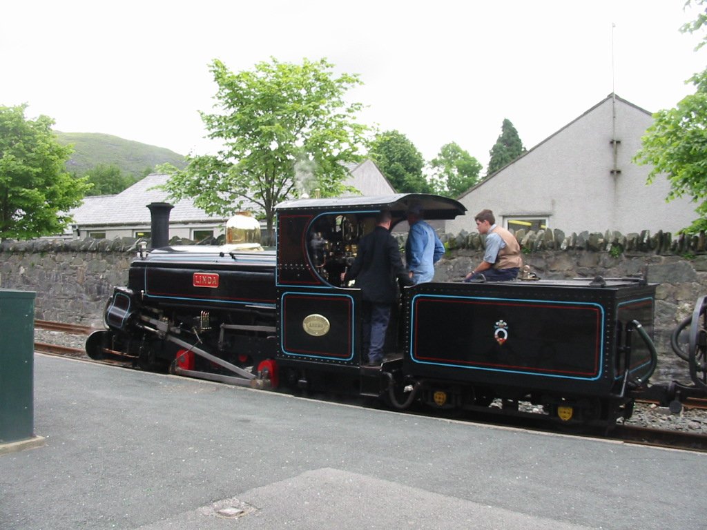
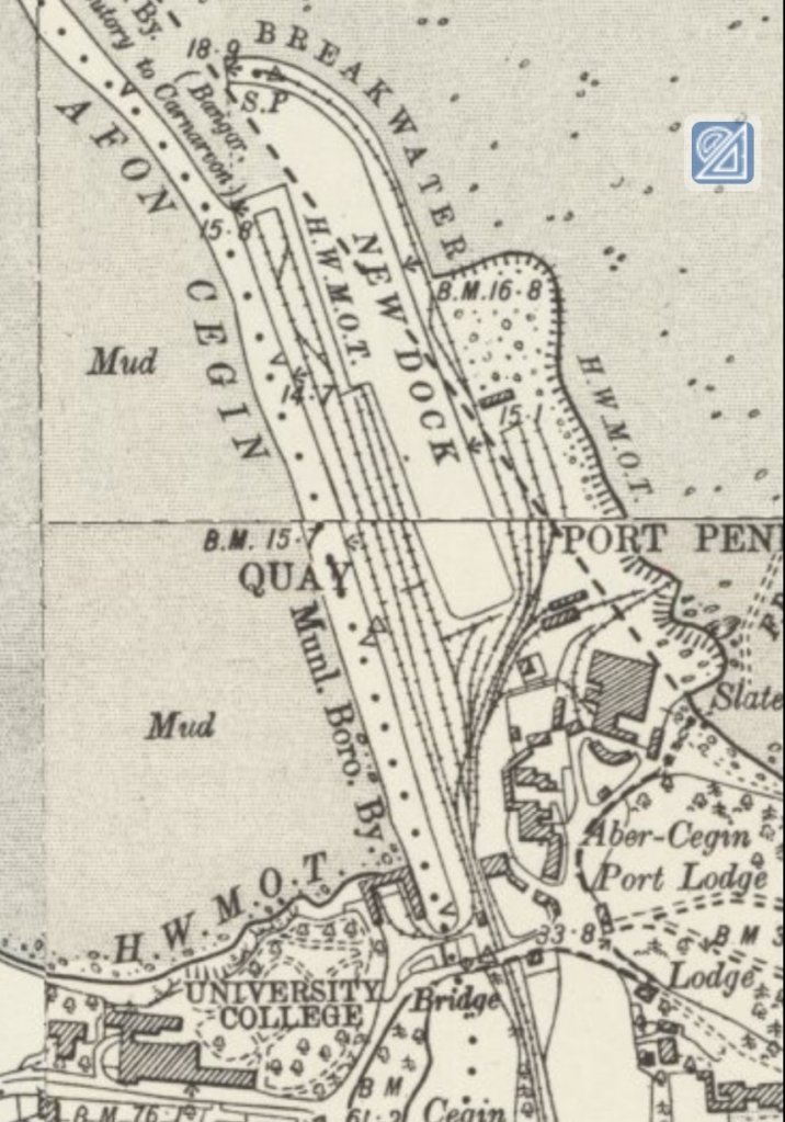


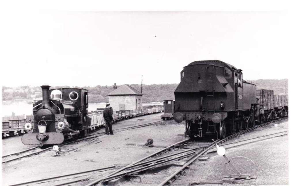
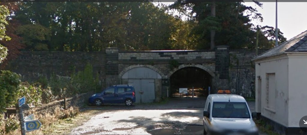
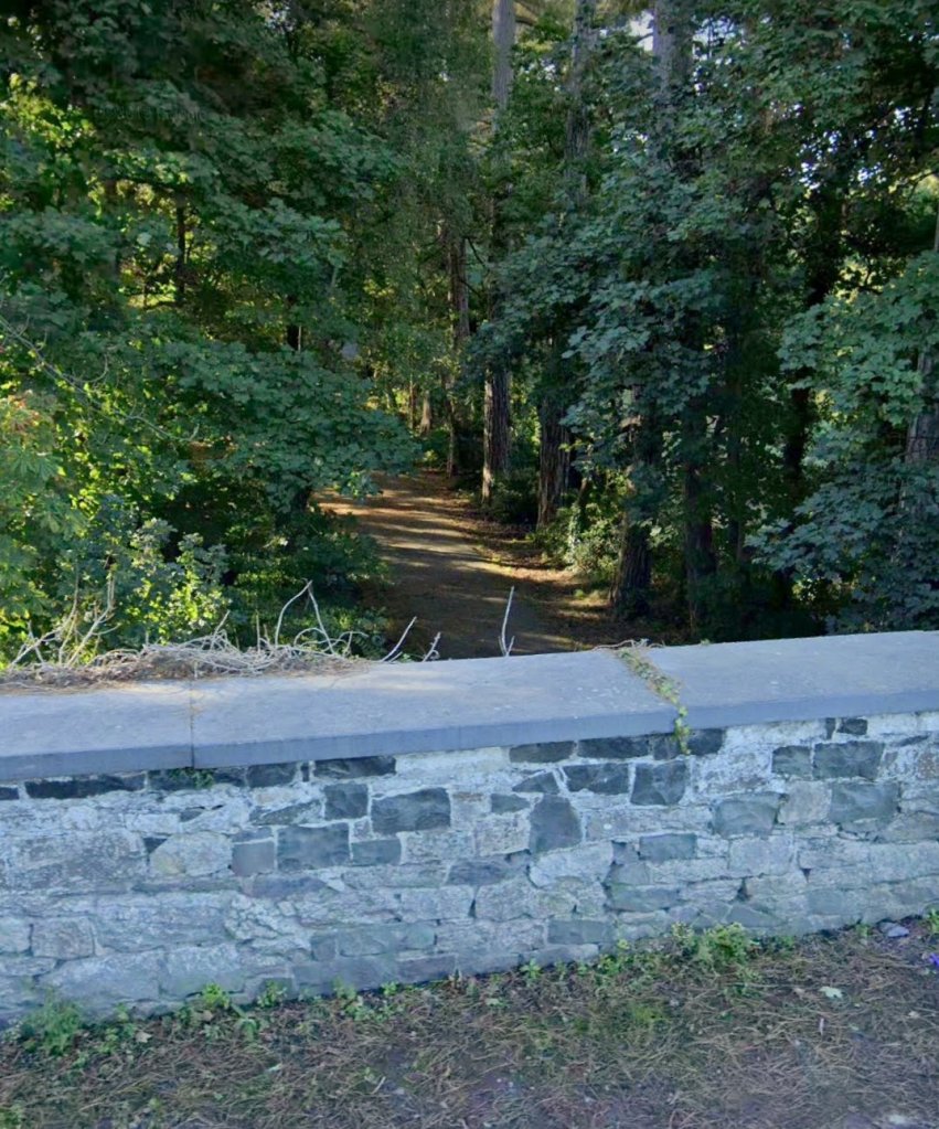


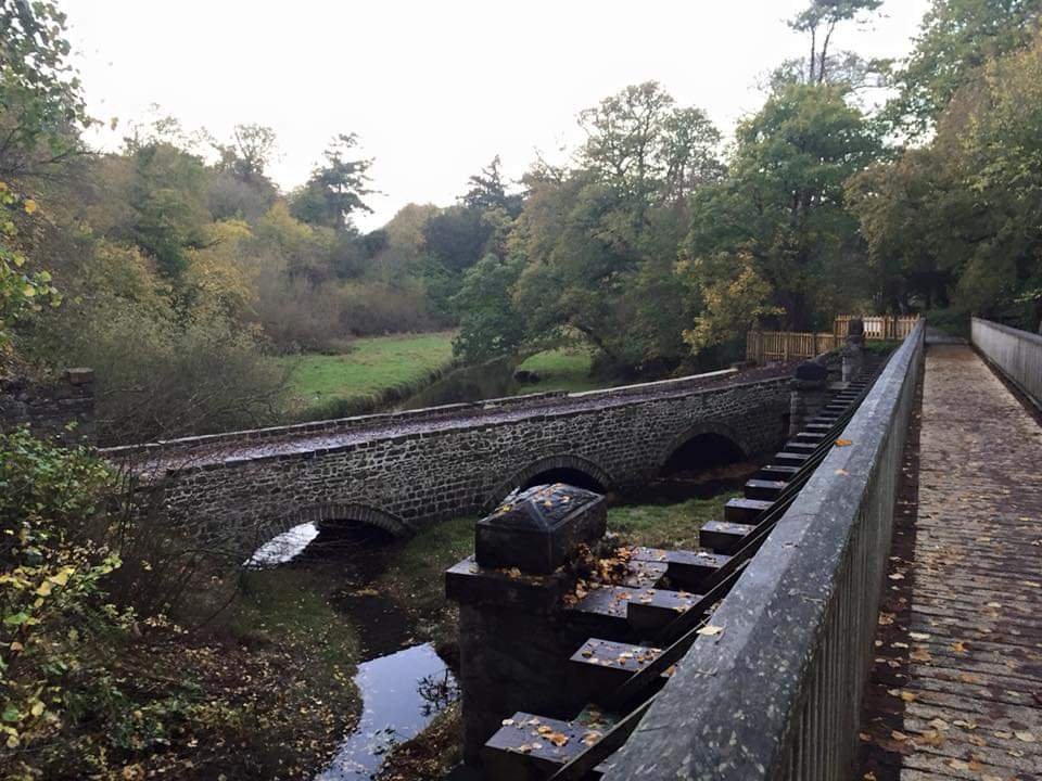
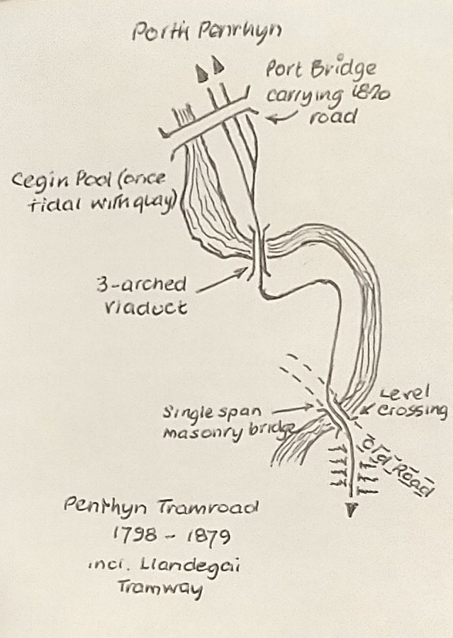
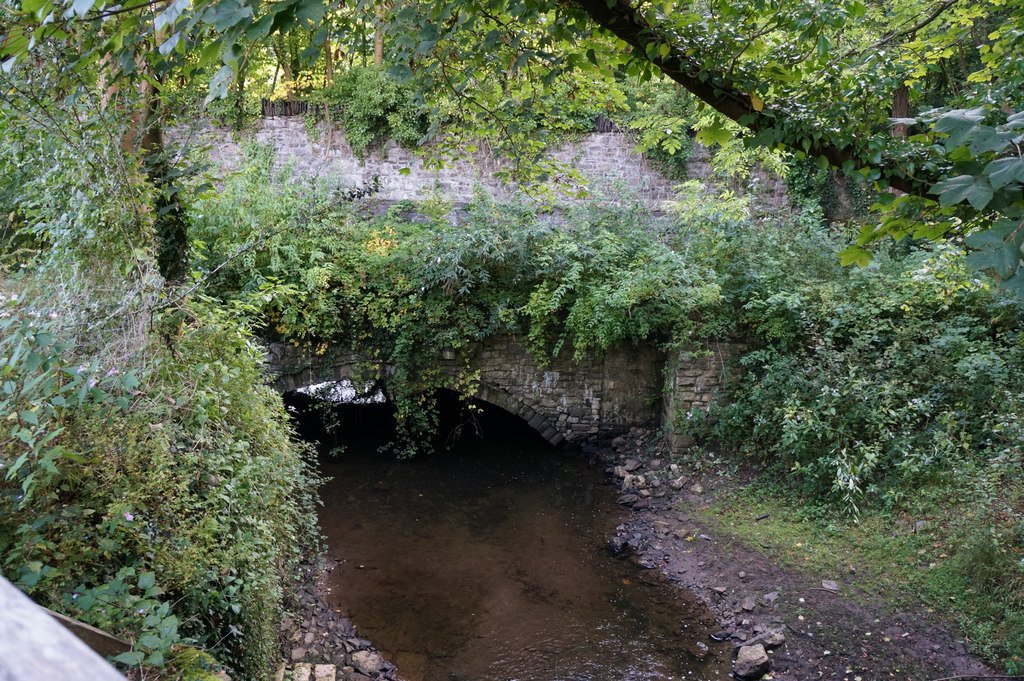

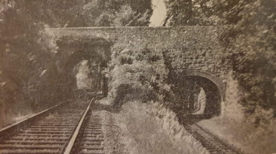
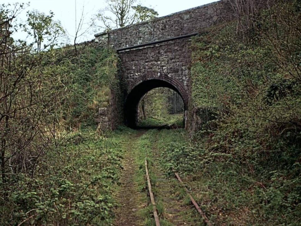
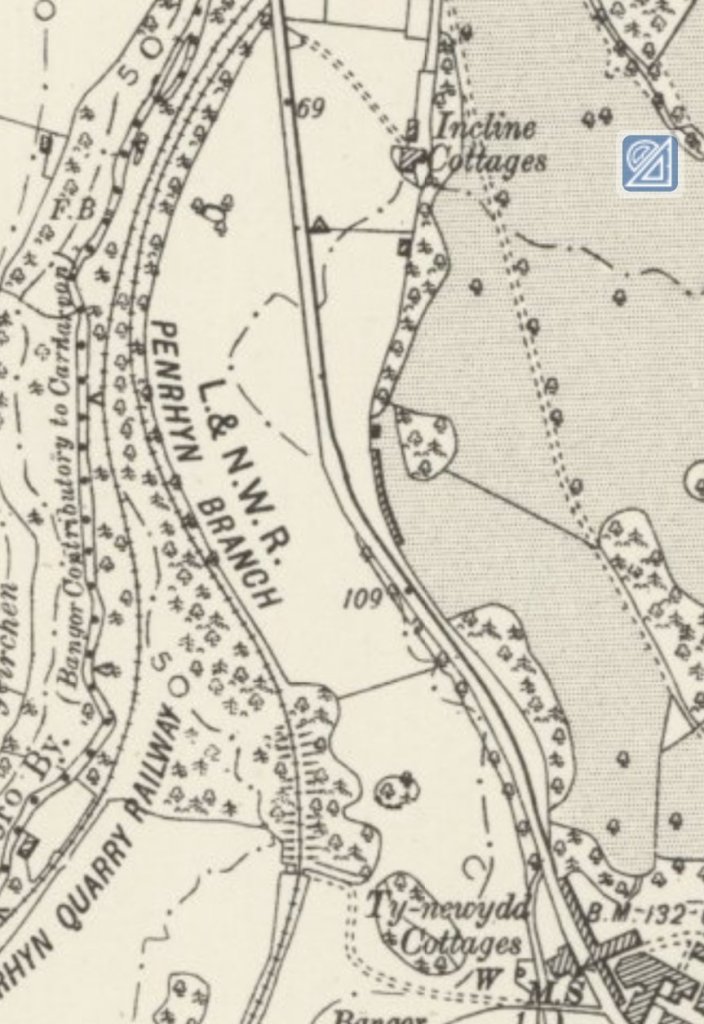

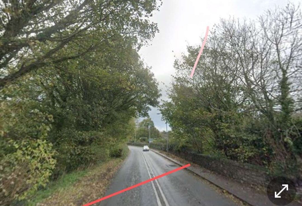
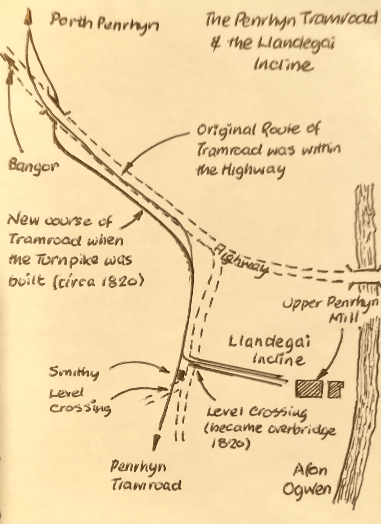
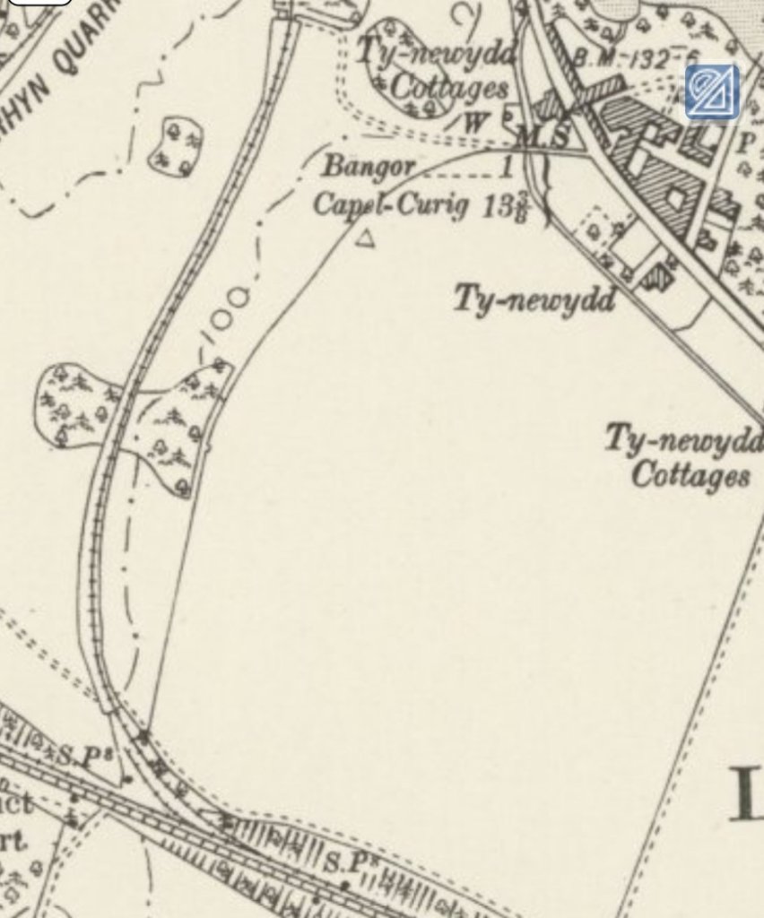
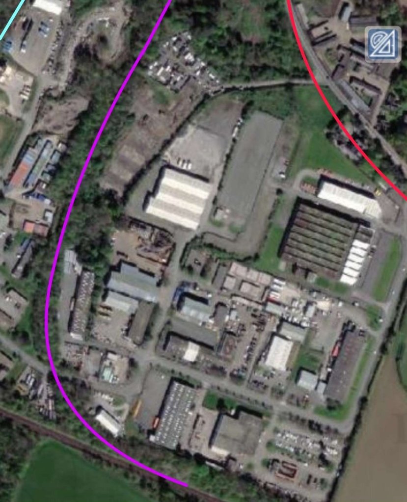

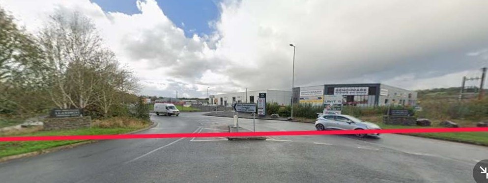
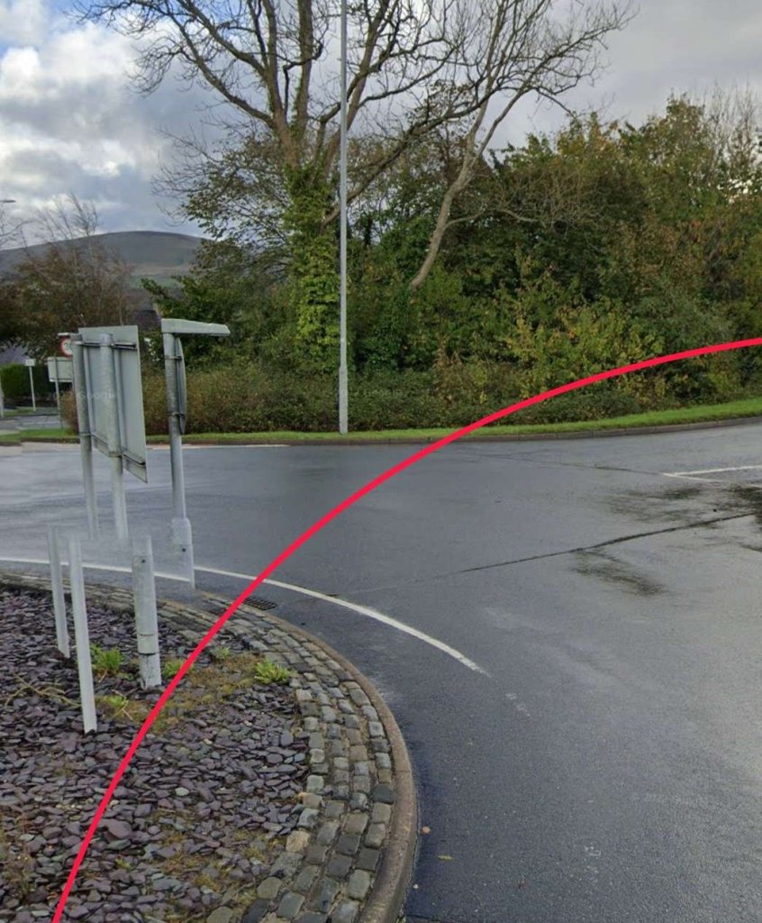

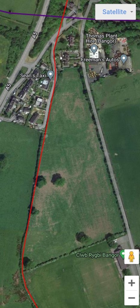


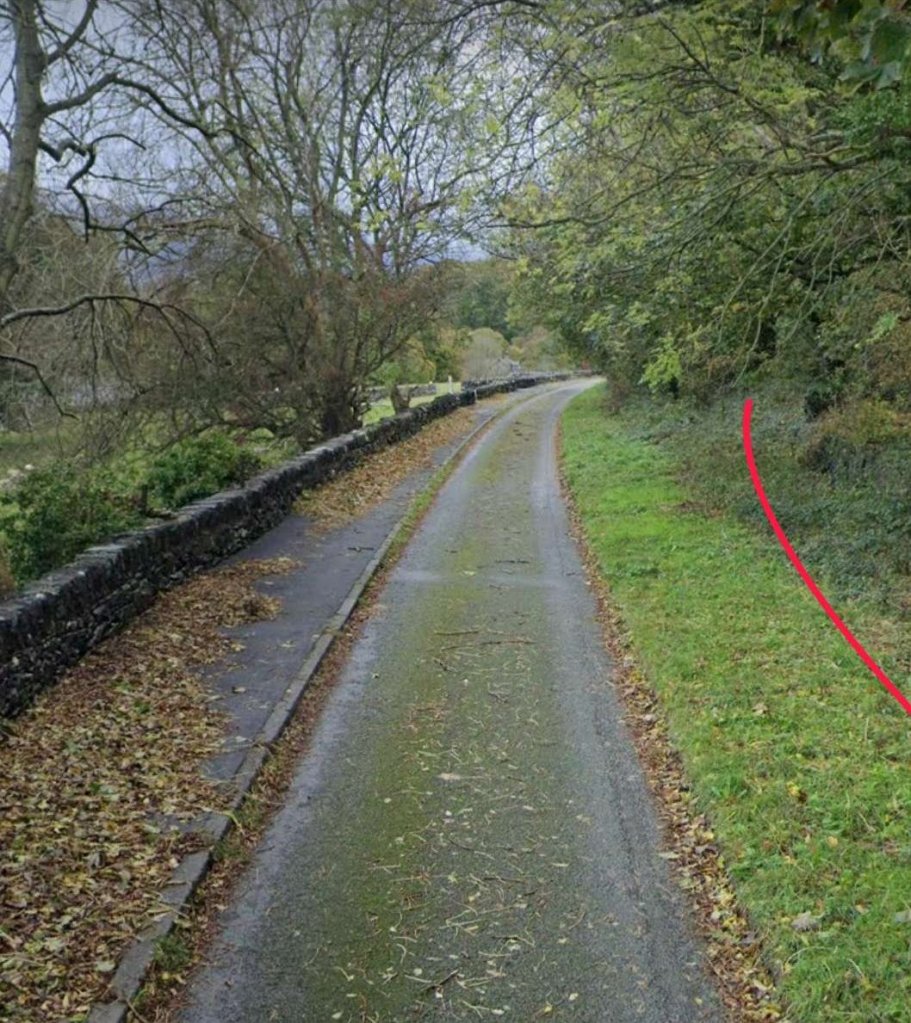

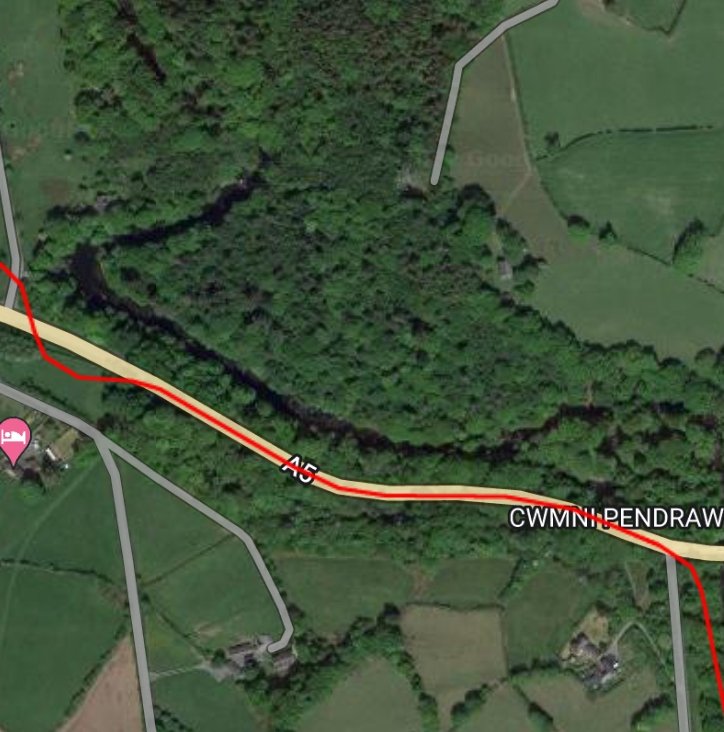
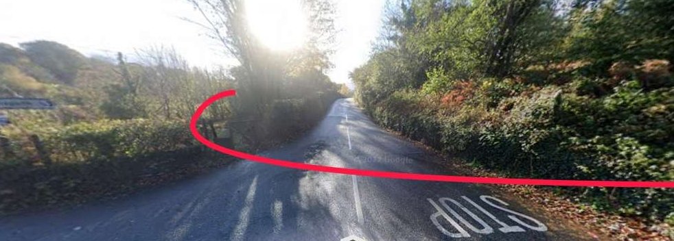
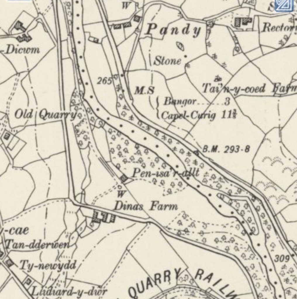
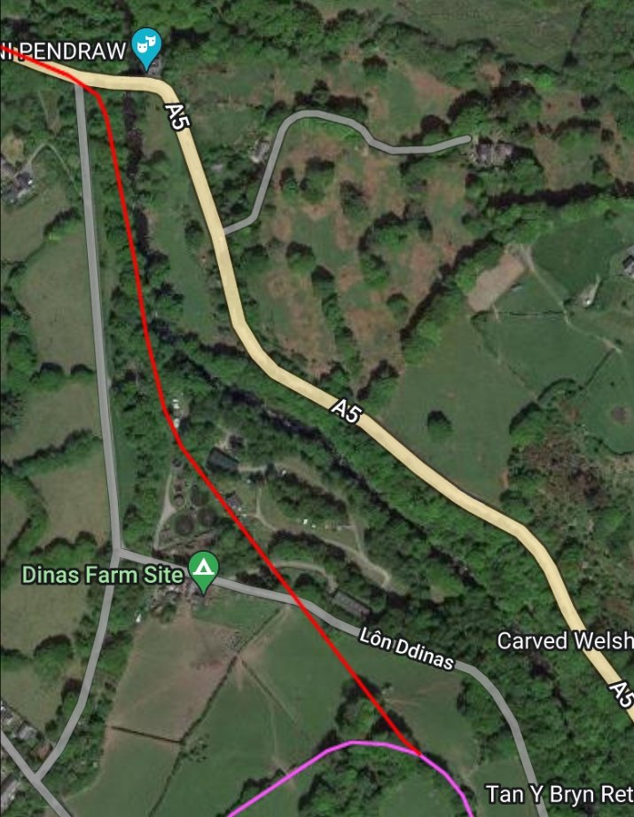


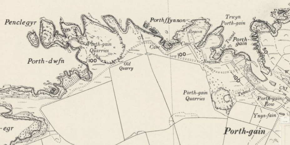
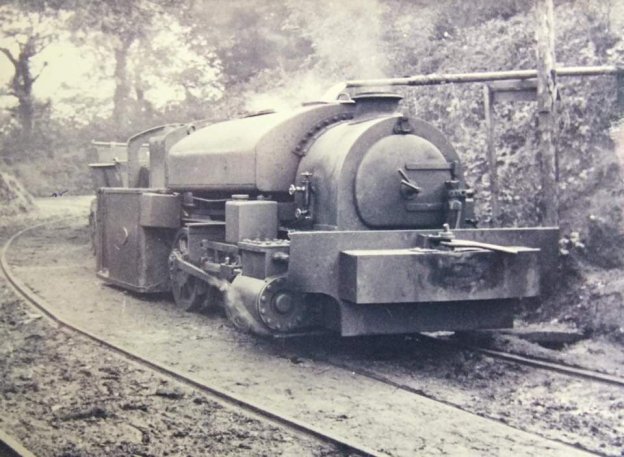


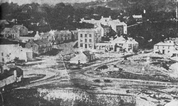
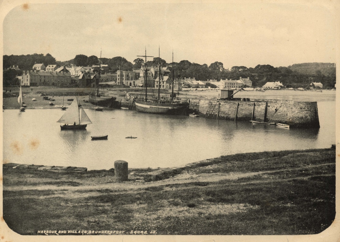

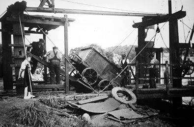
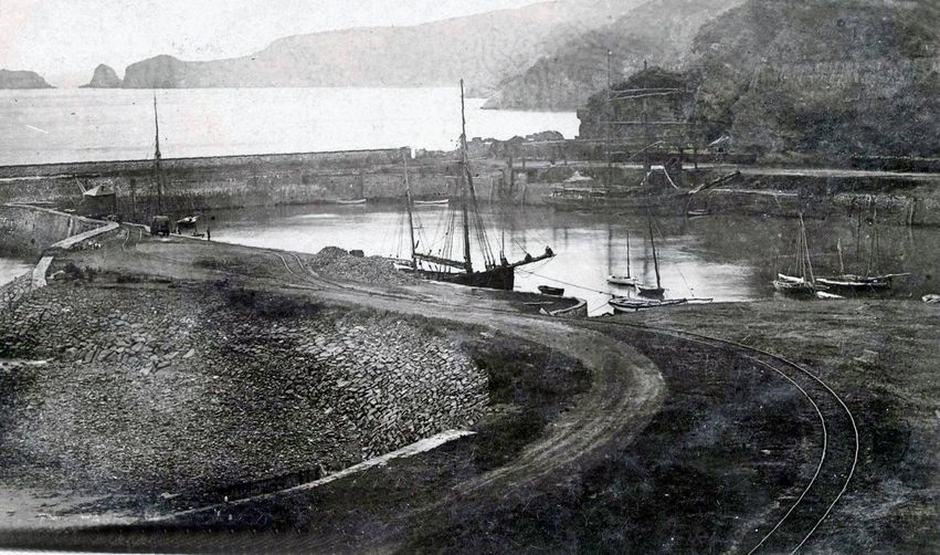

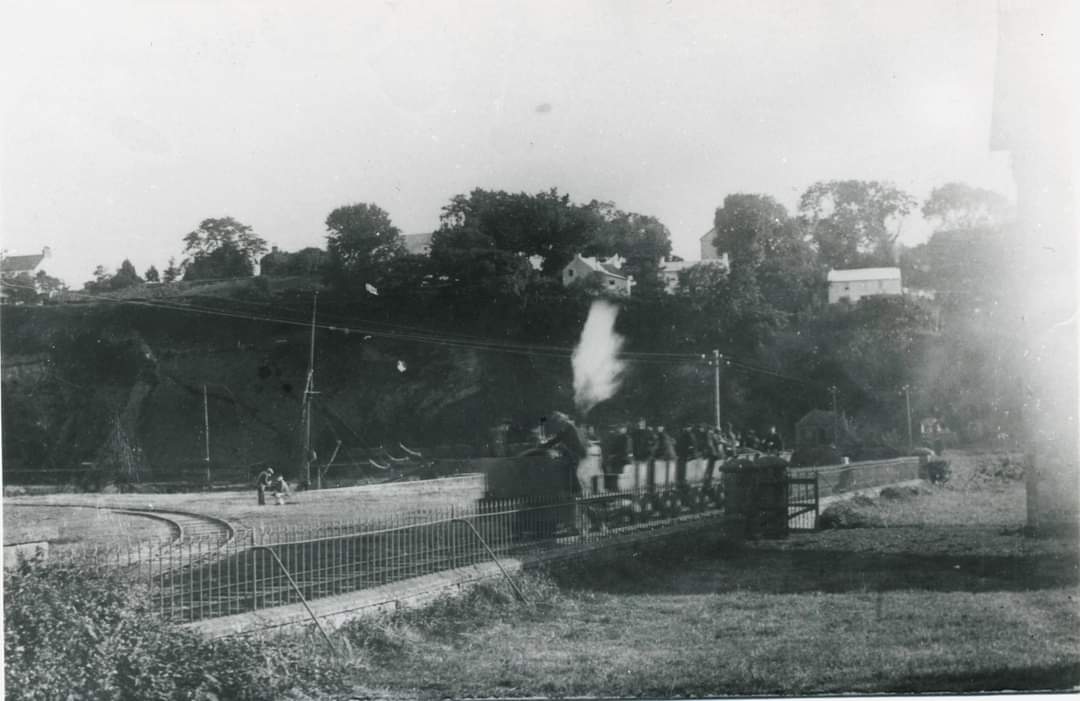

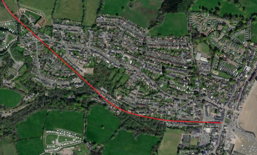


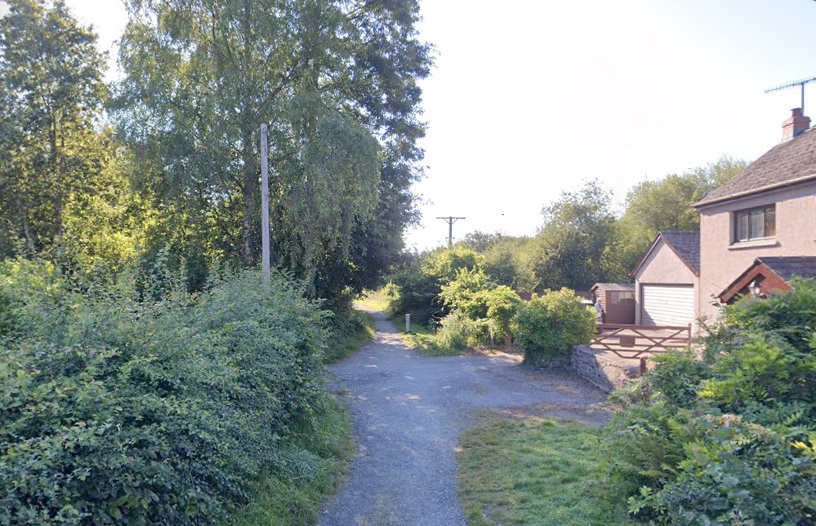
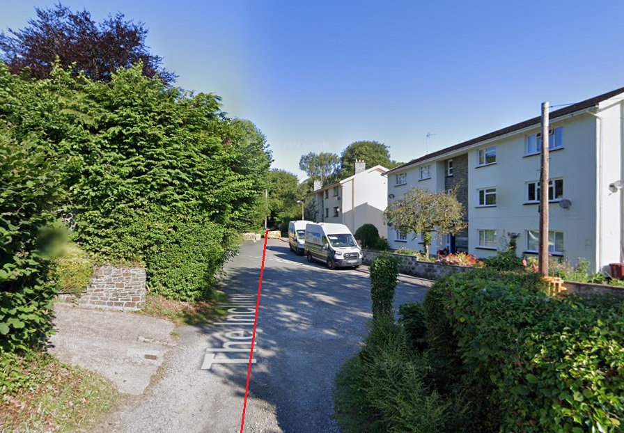

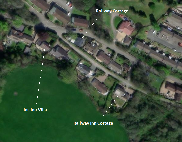

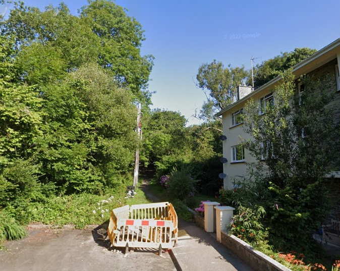


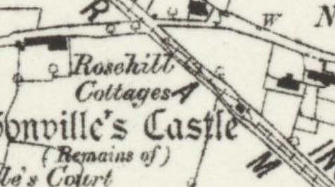
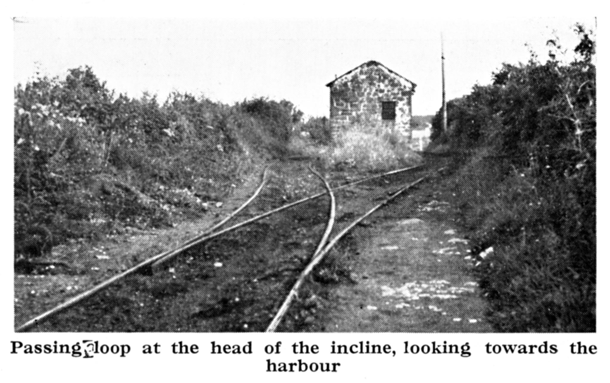
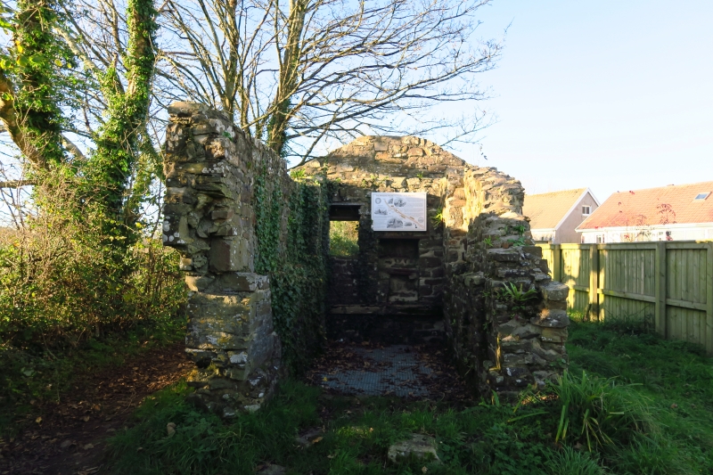
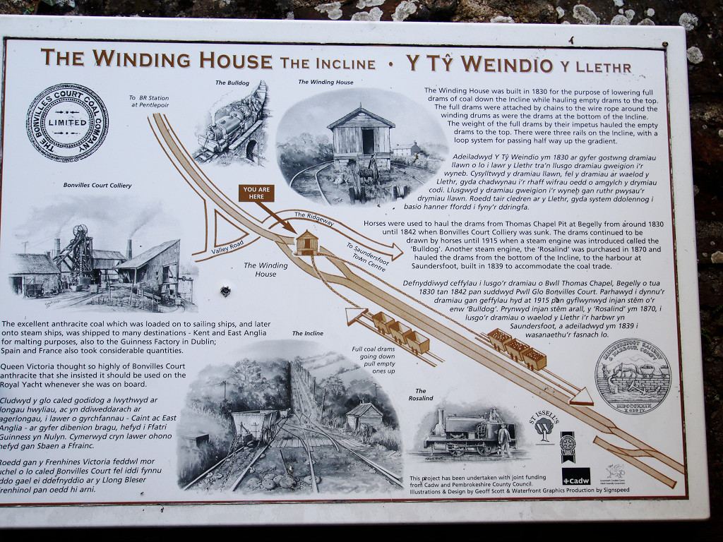

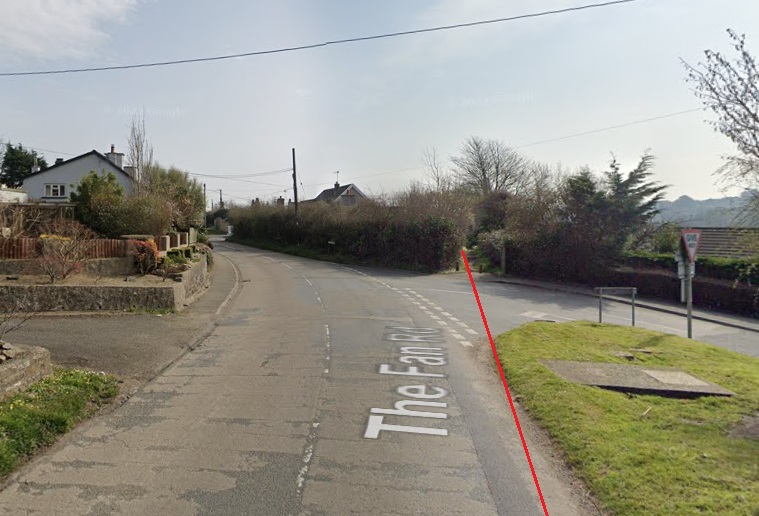

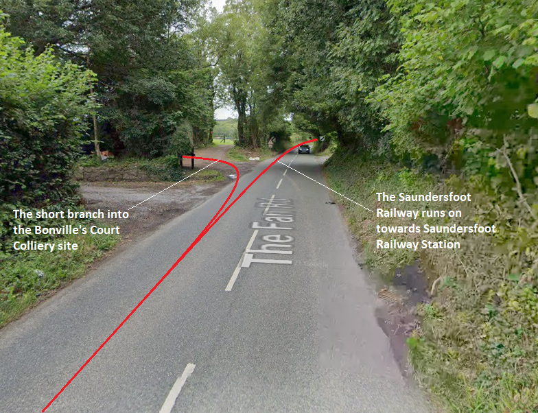

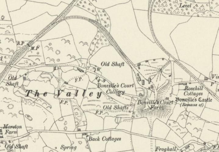
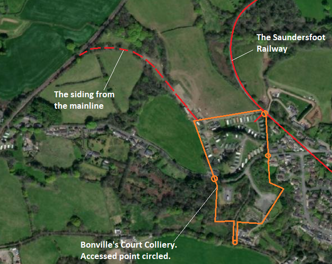
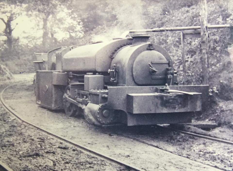

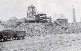

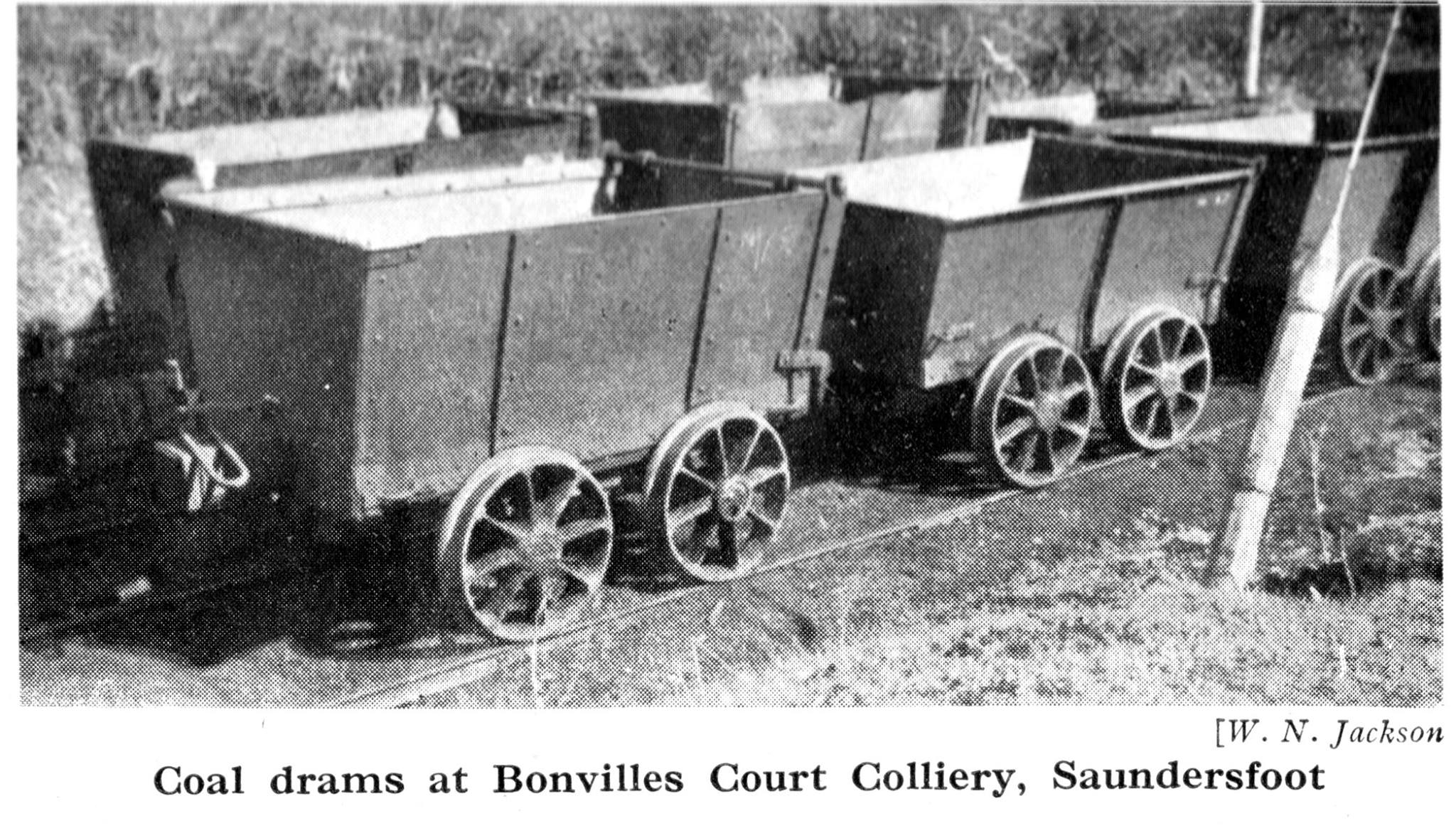


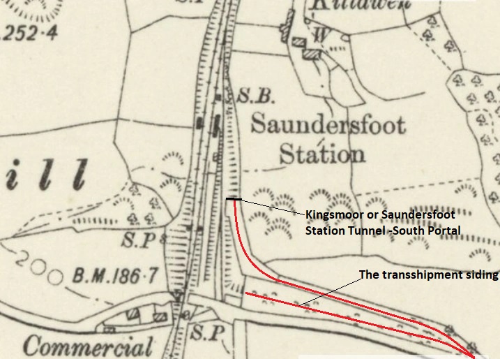


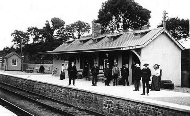
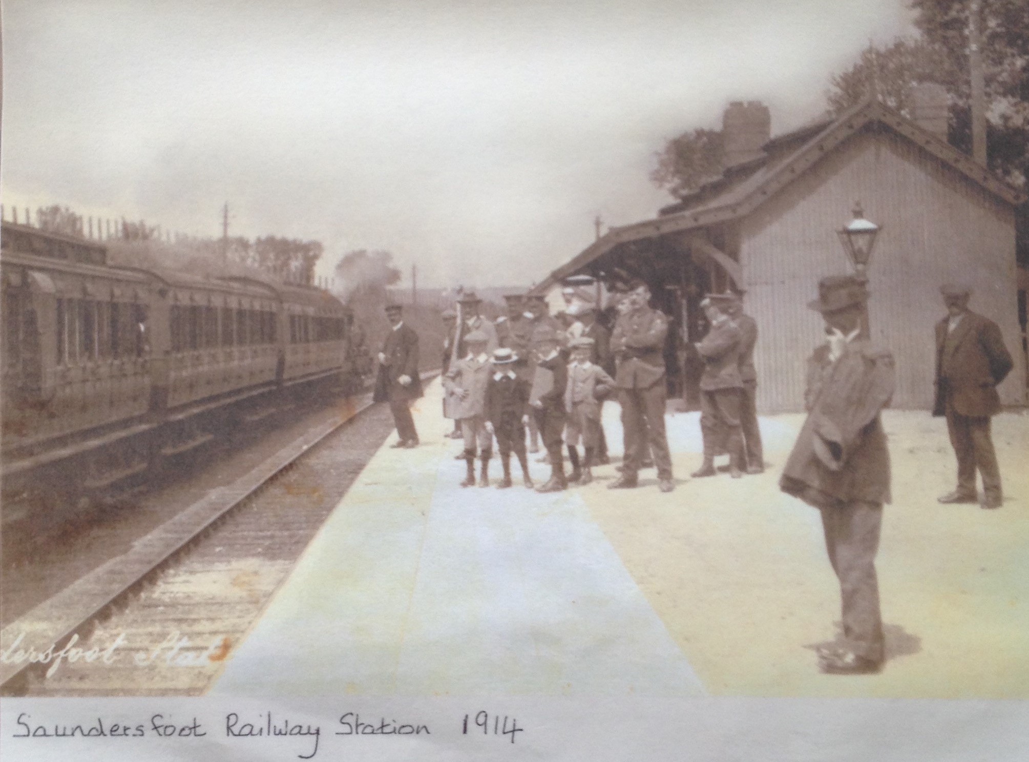
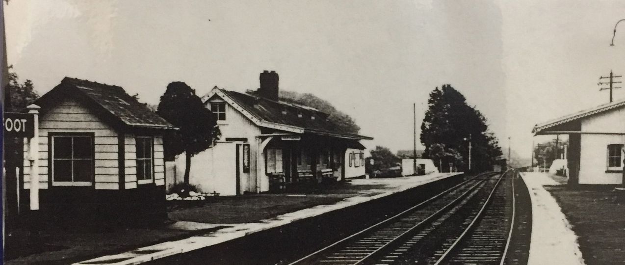
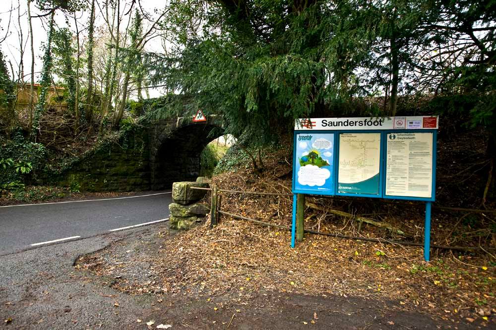
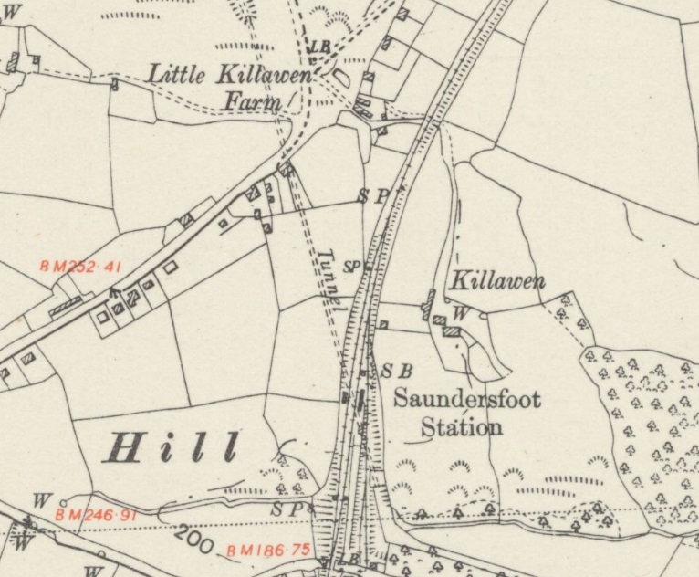


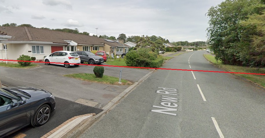

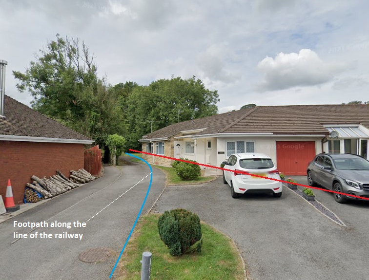
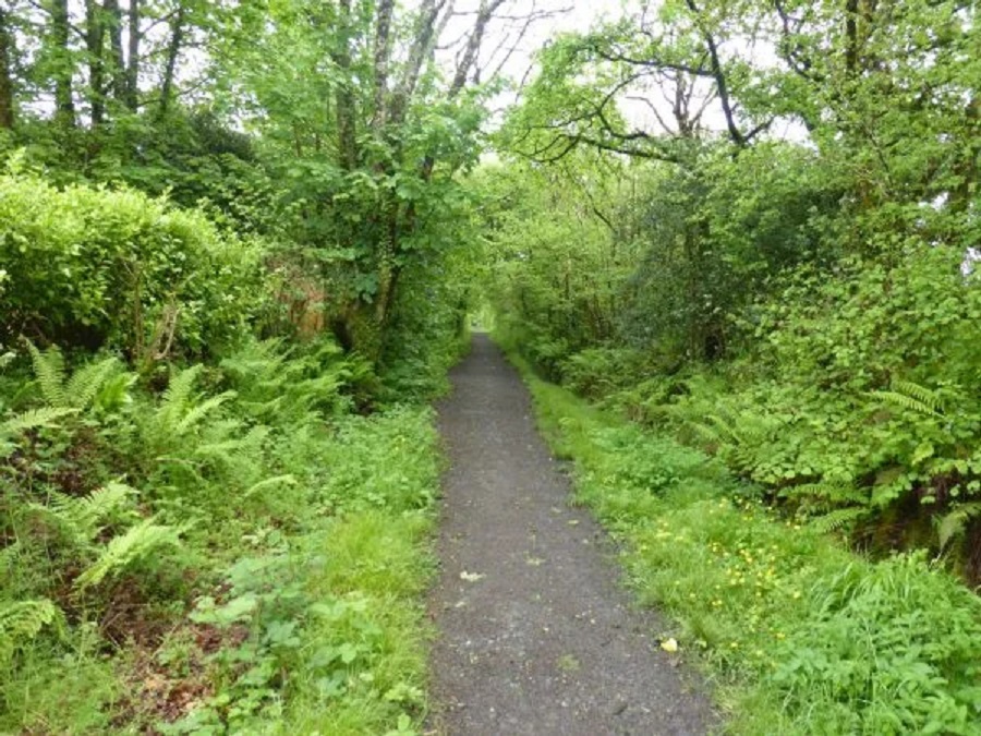
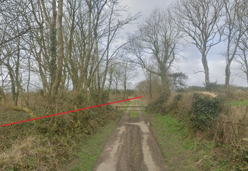
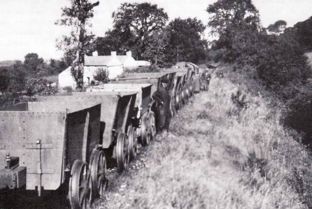
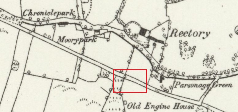


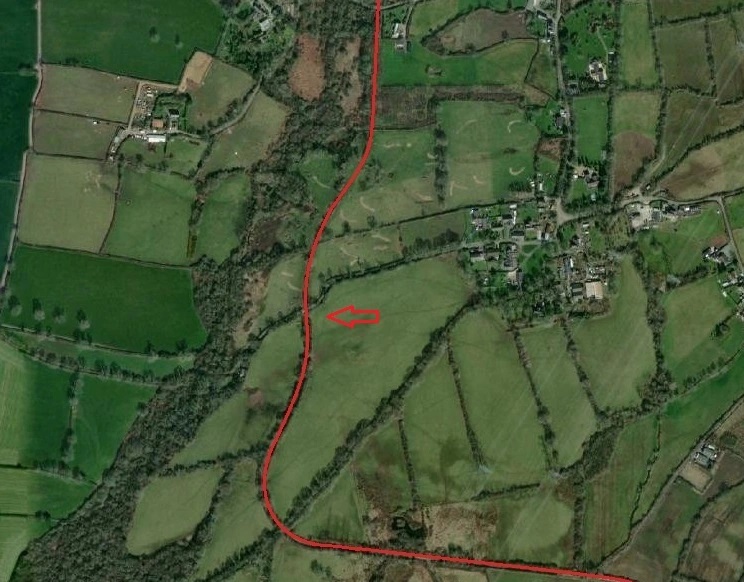


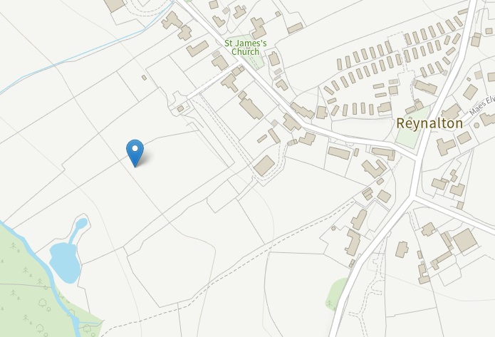
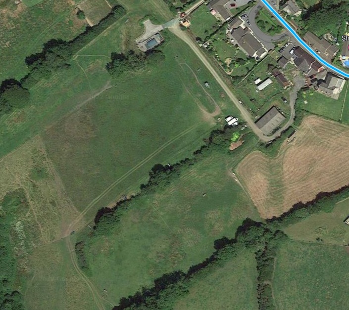
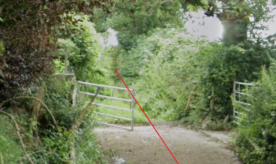


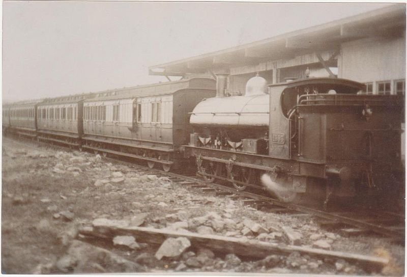
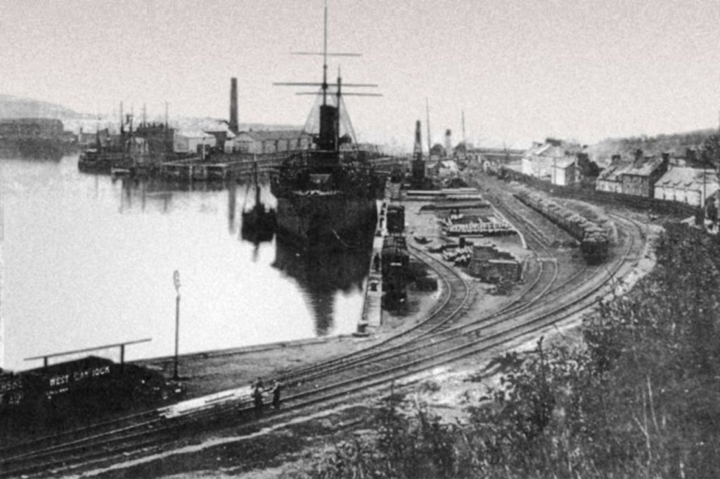
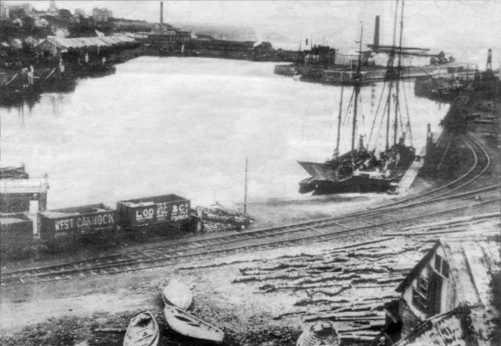

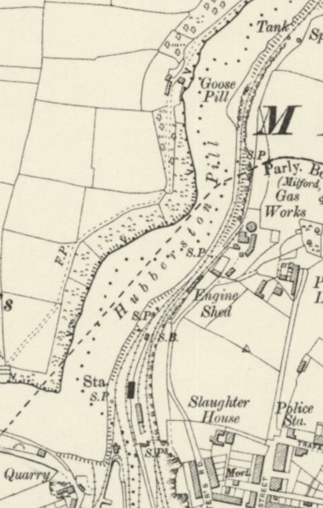
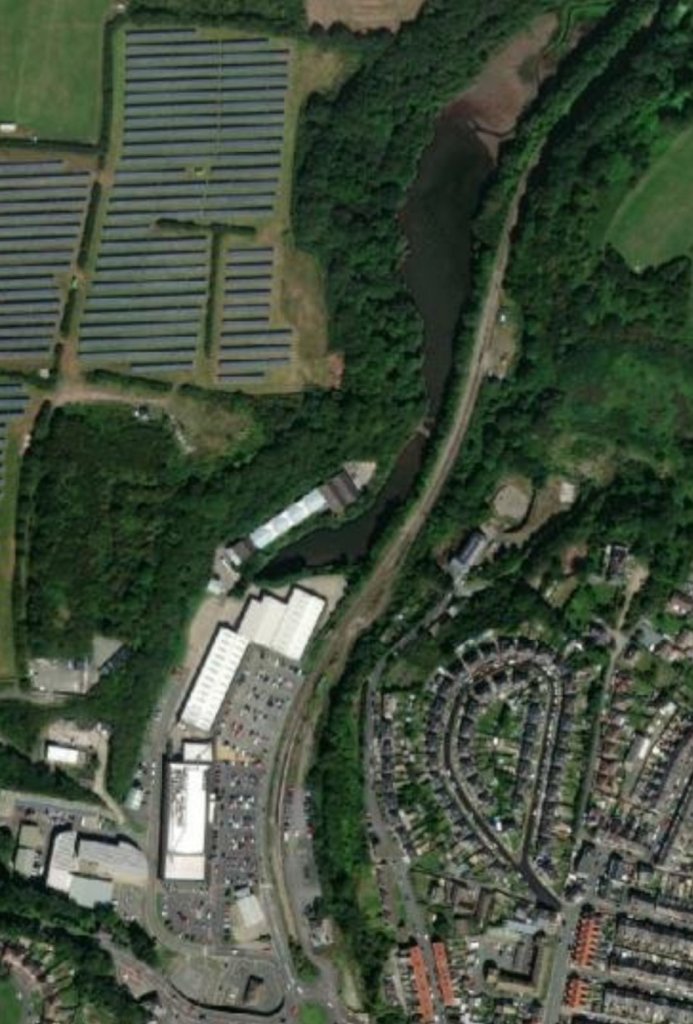

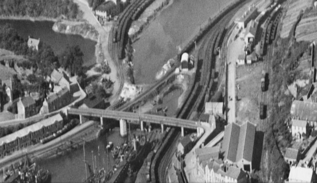
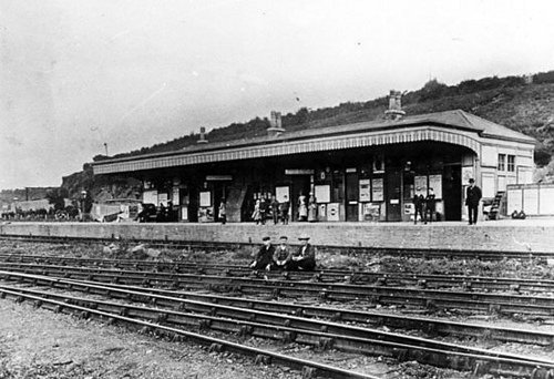
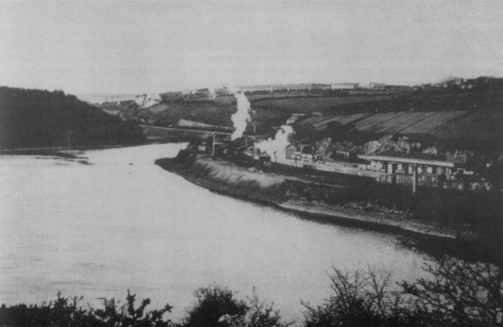
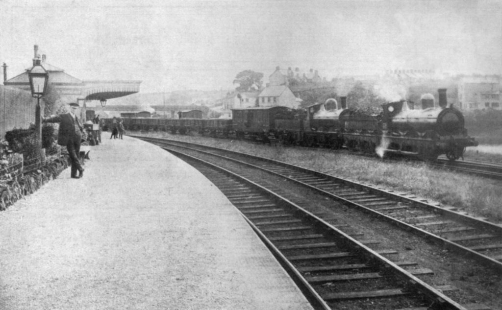


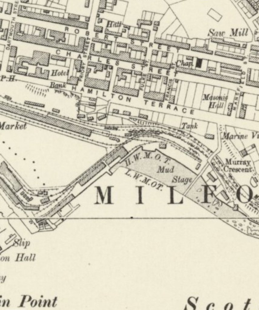


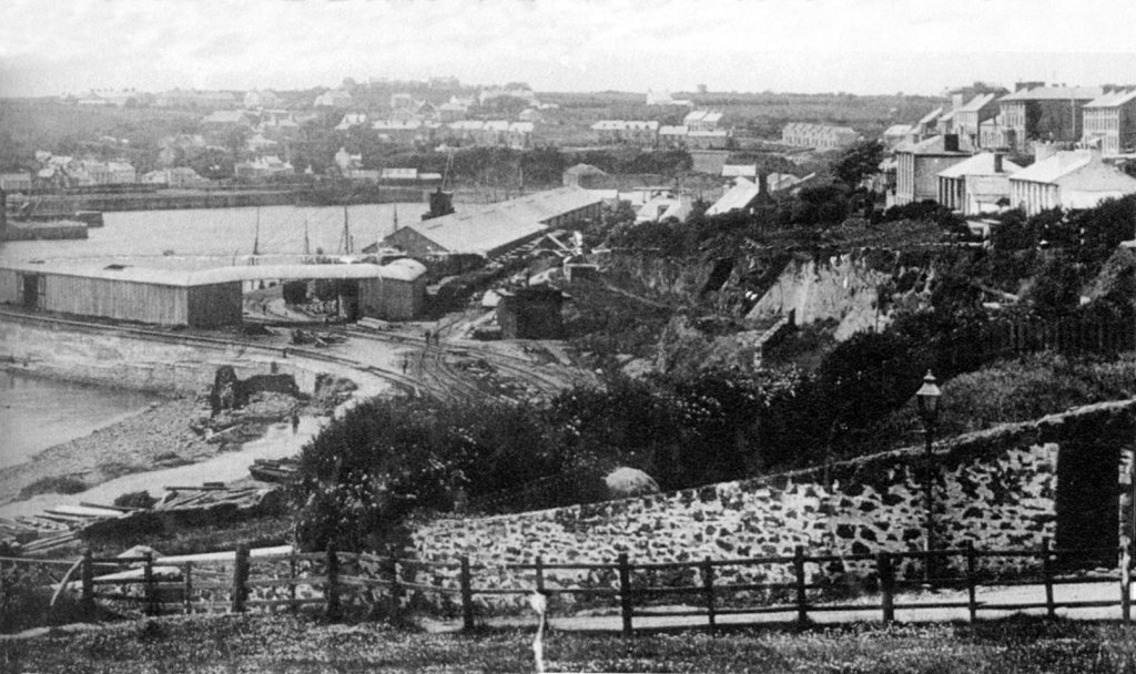


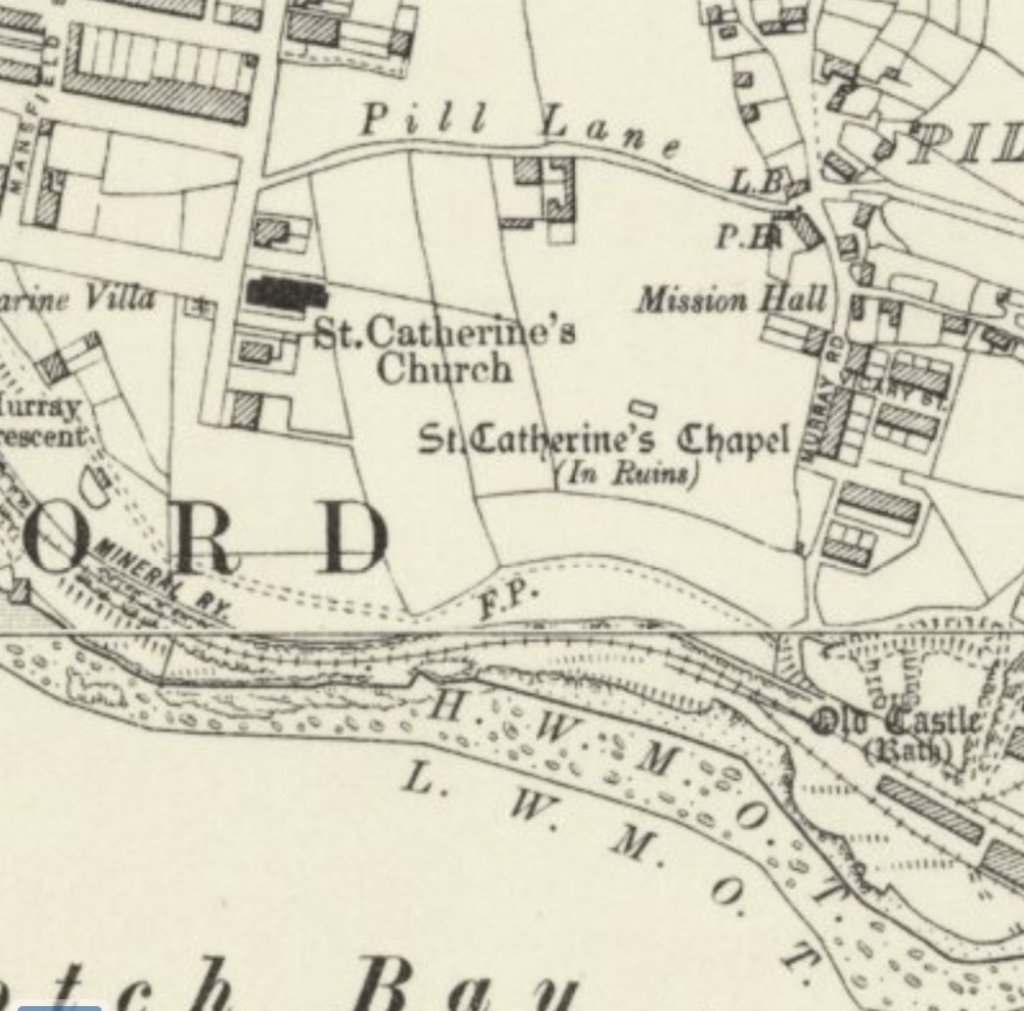

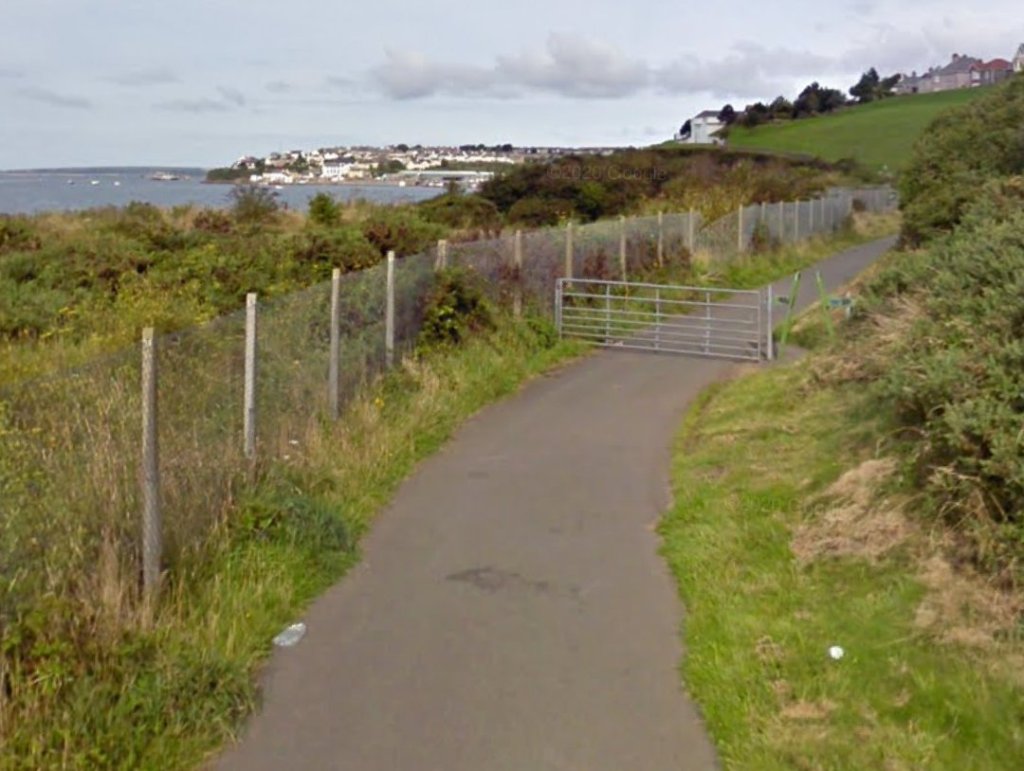
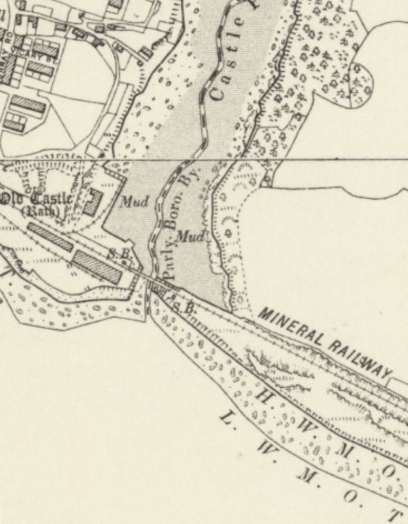
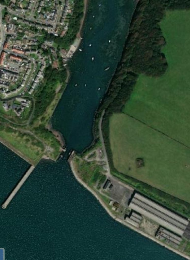

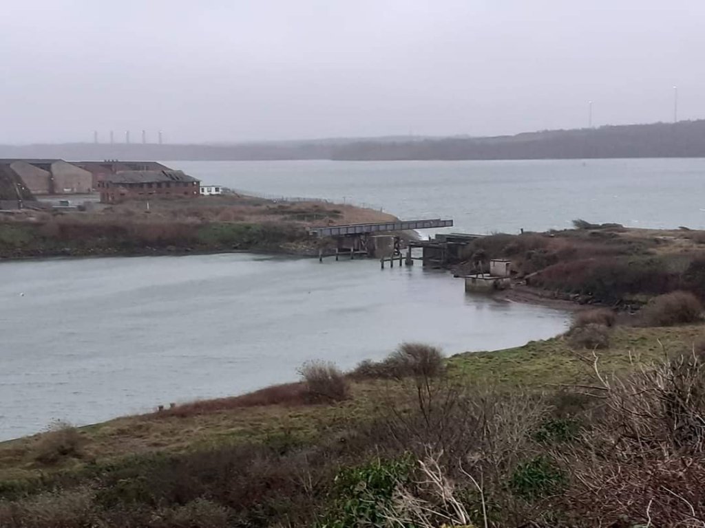

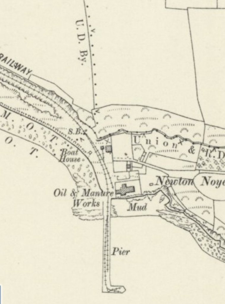
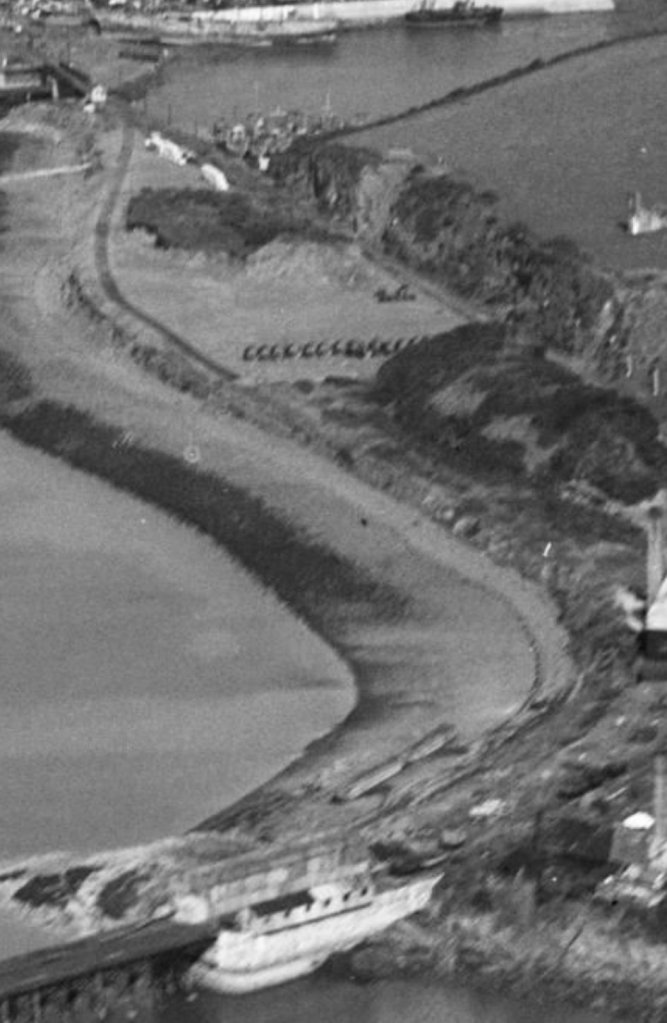

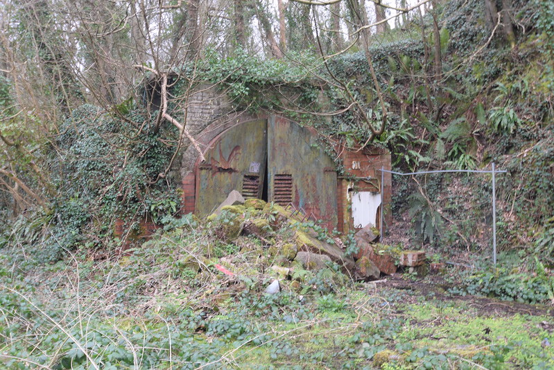
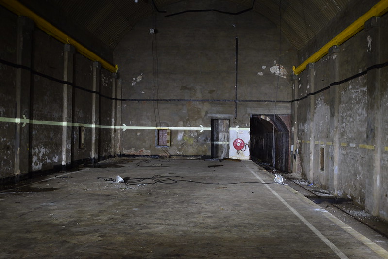
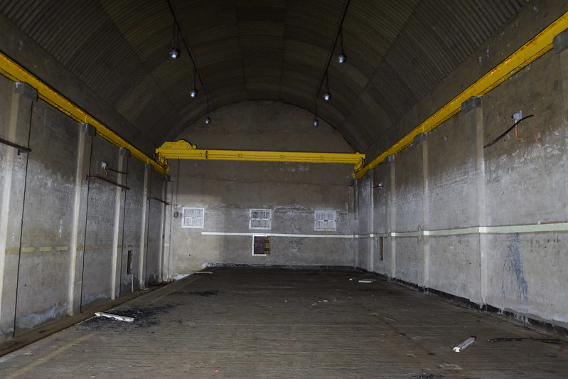
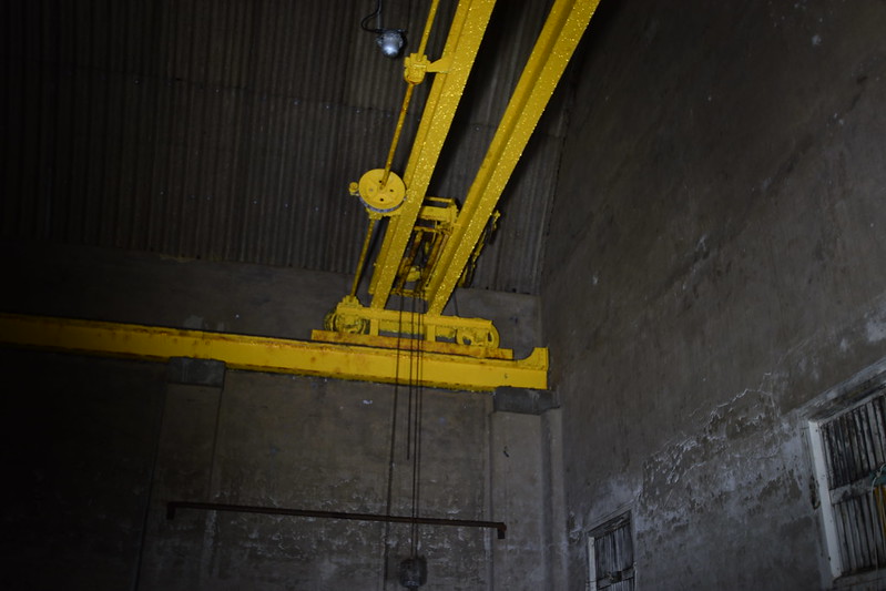

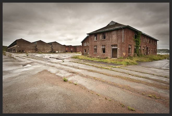
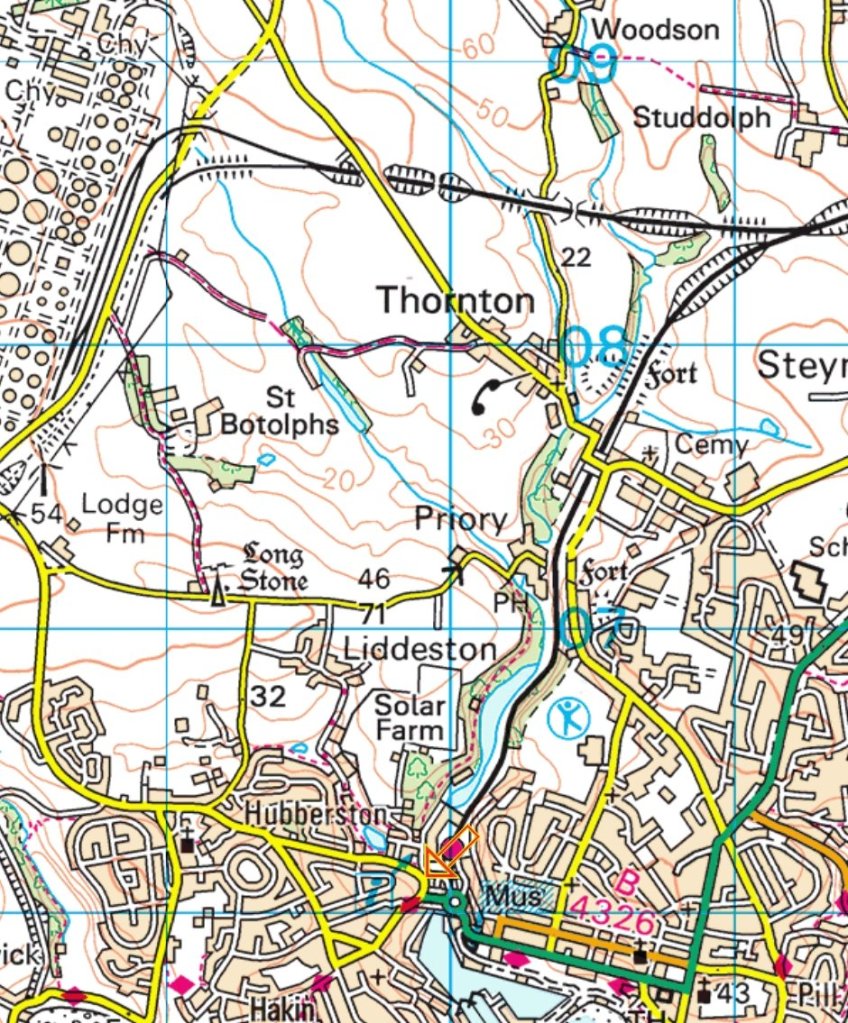

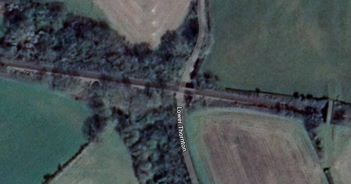


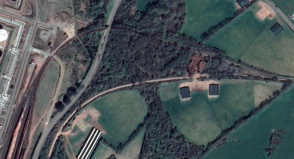
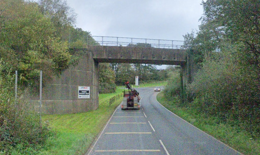

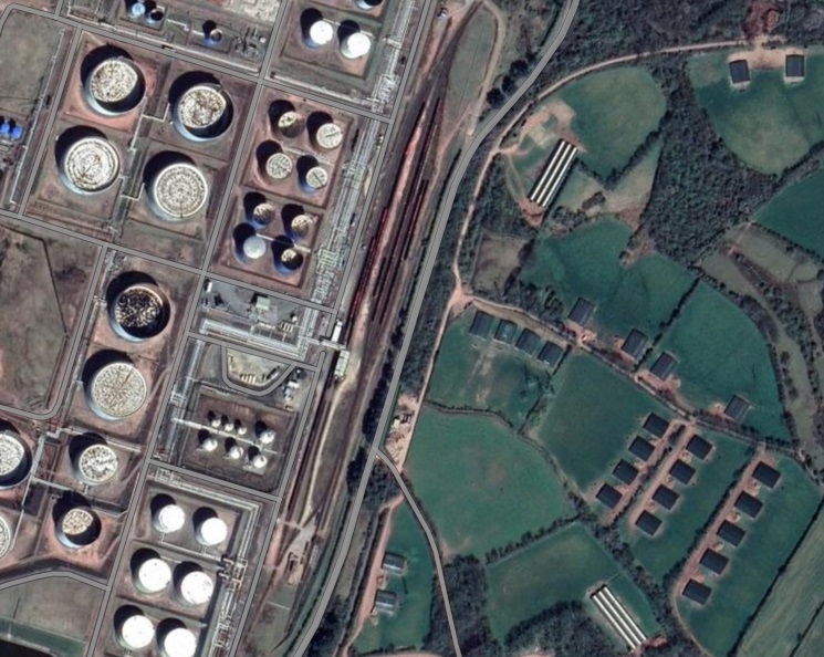


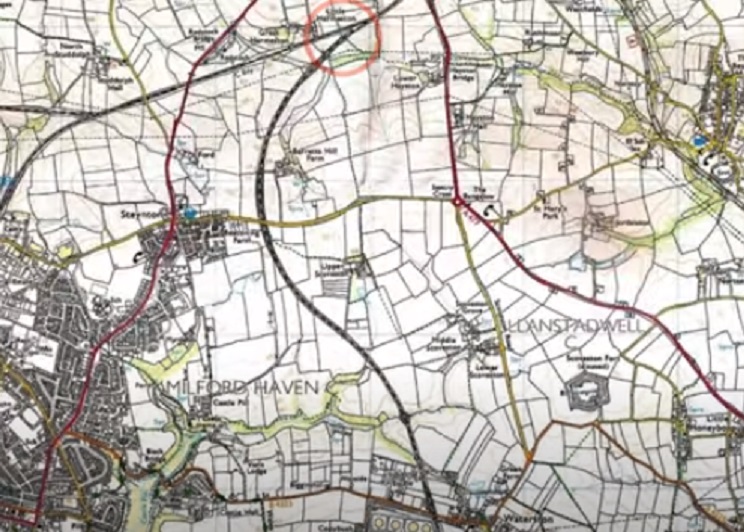


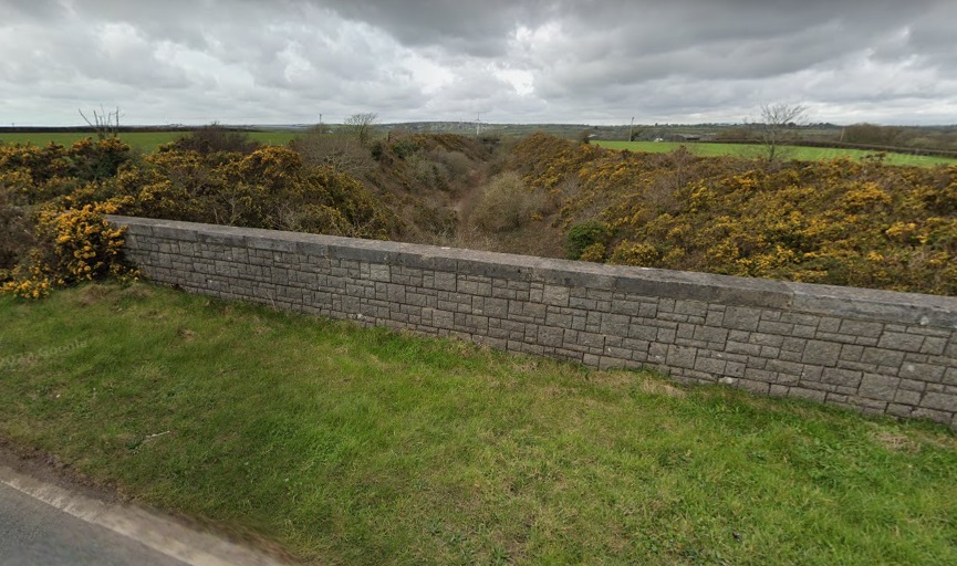
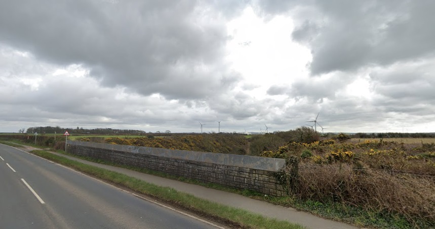
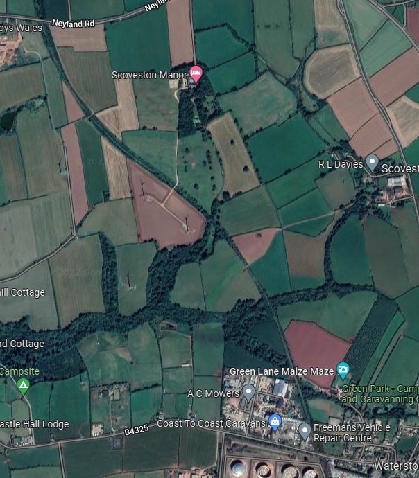
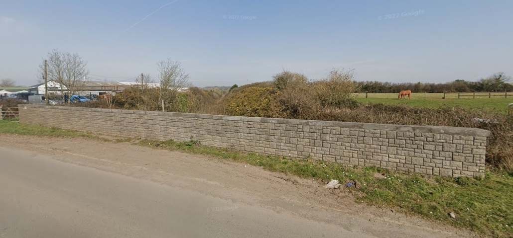
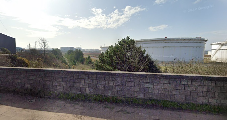


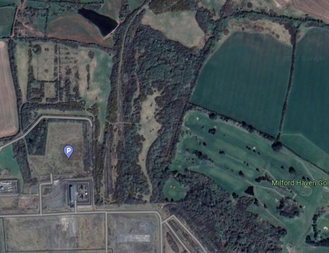
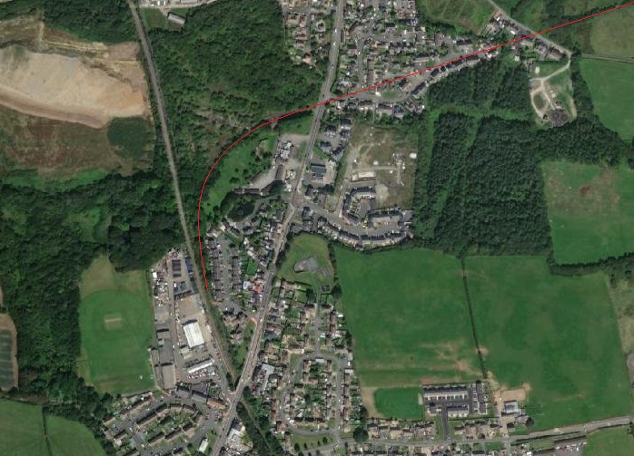
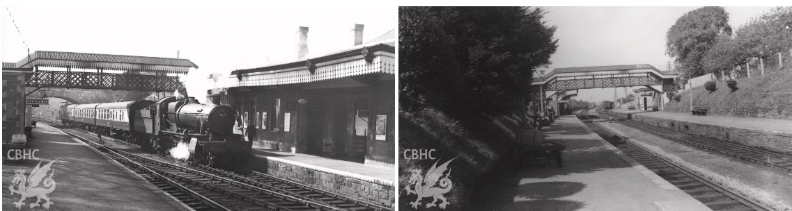
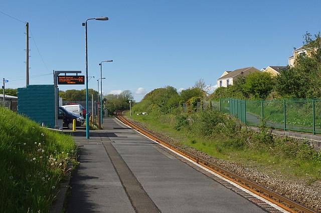
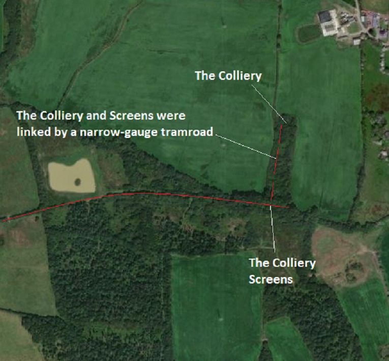
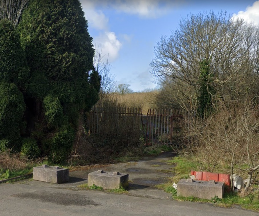

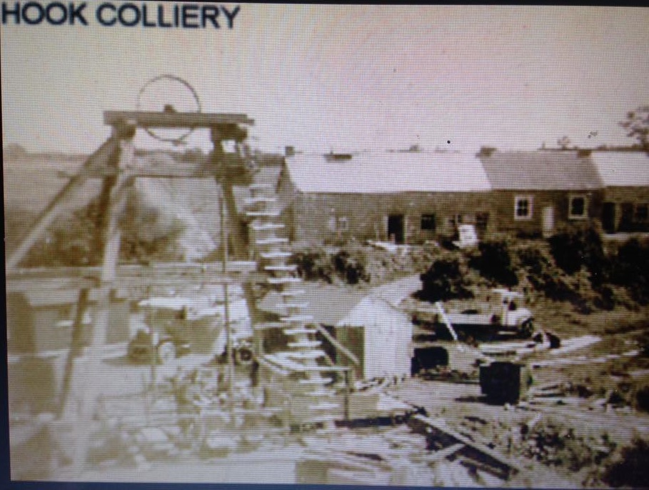
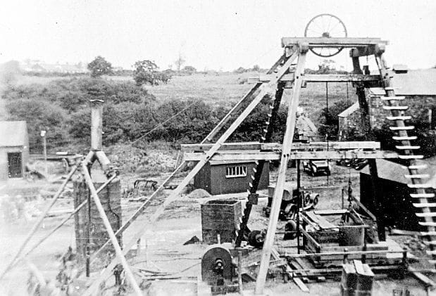

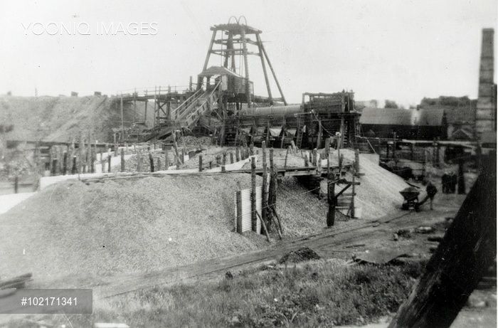
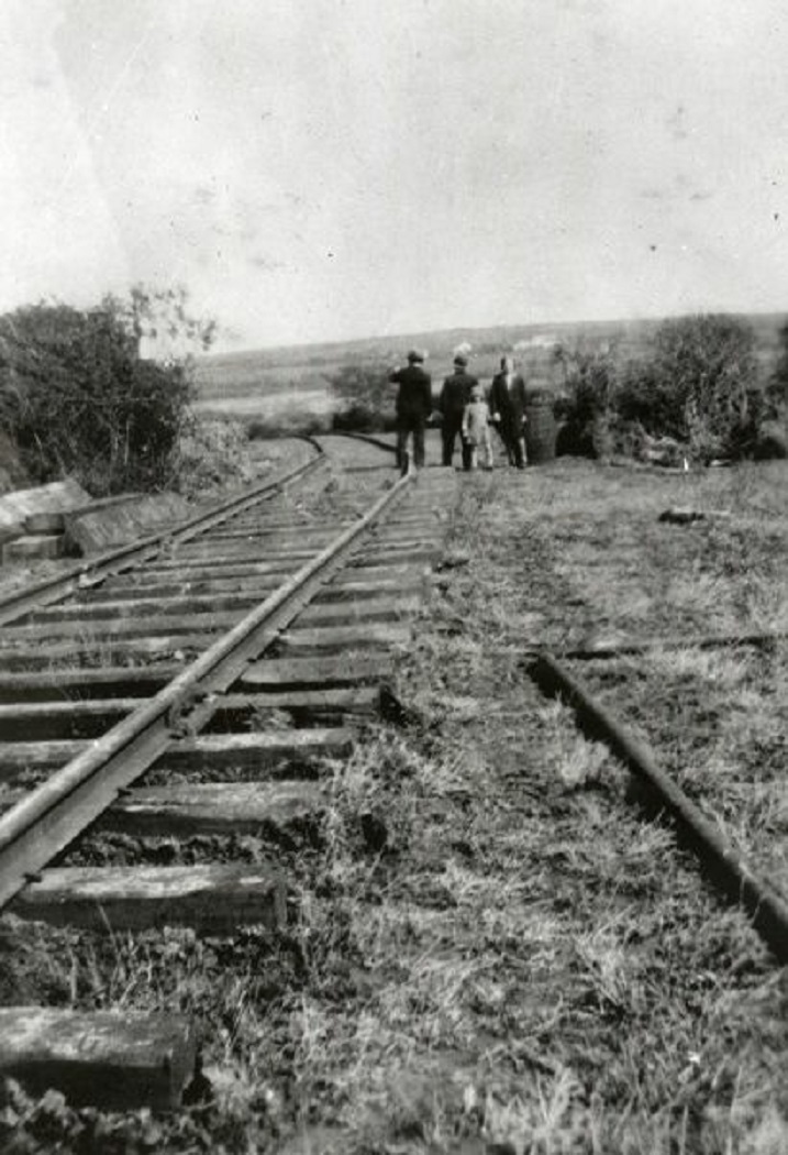
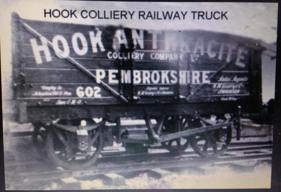


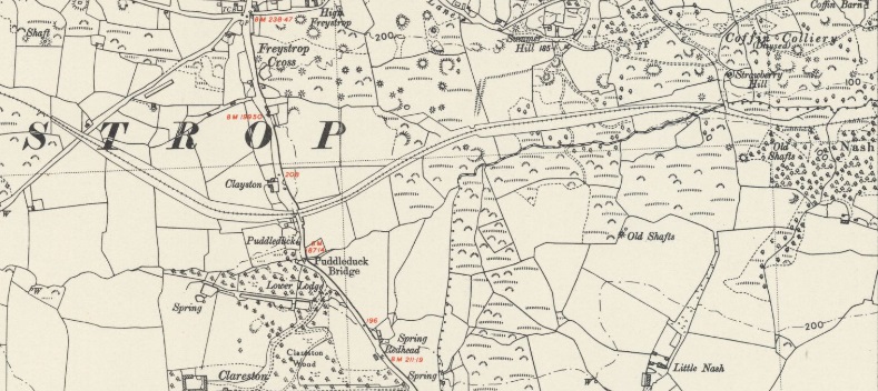
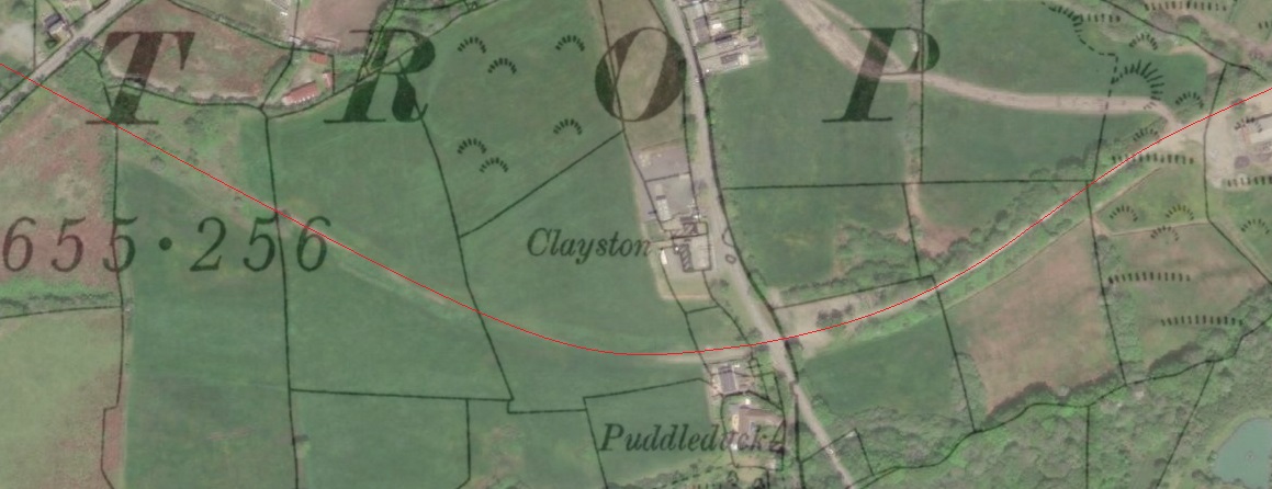

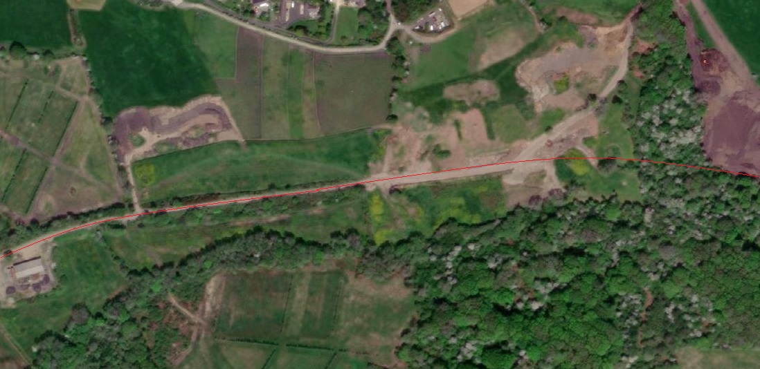
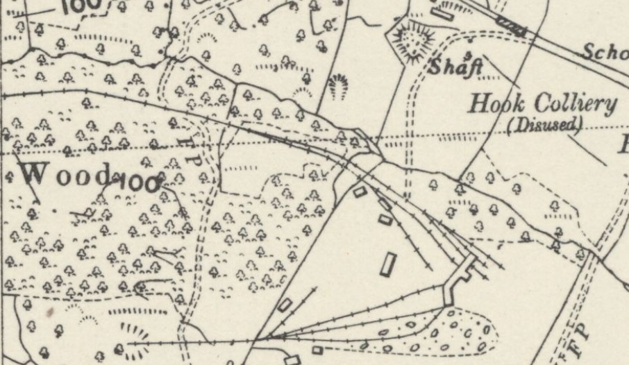
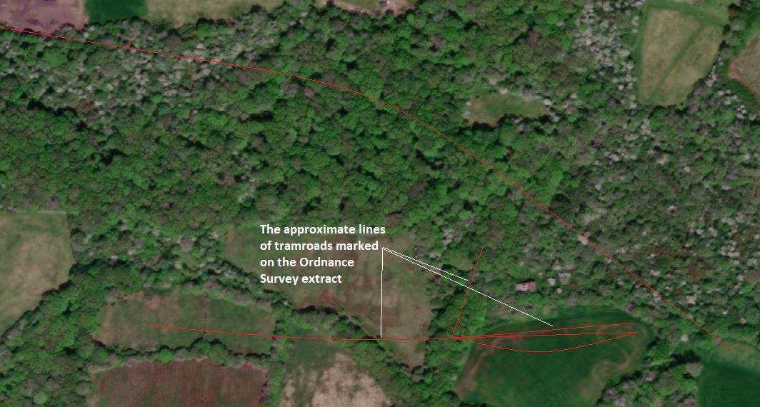


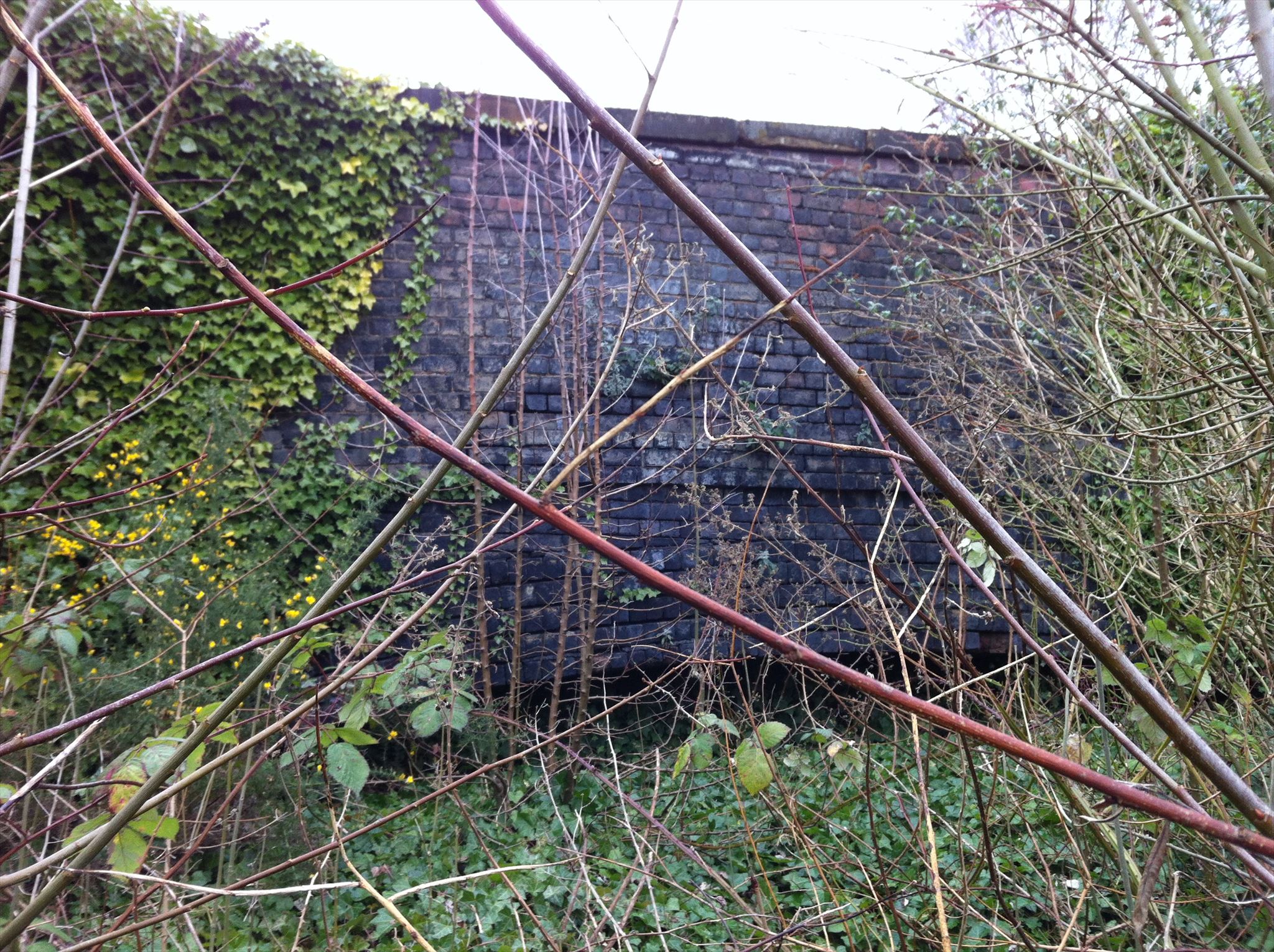
.jpg)