
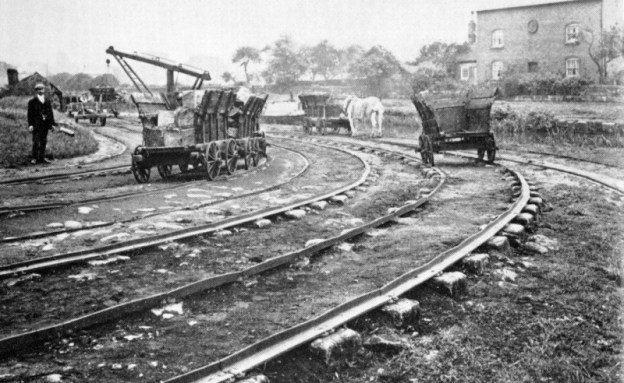
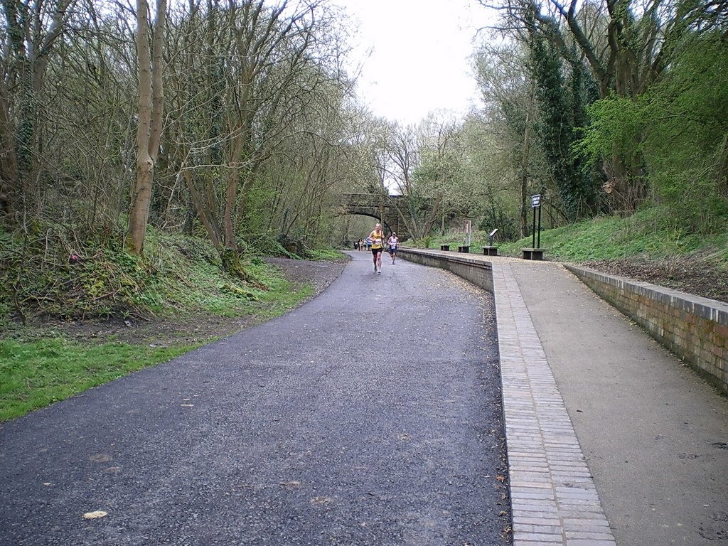
The featured image shows a typical Tramroad, it is not from the Telford area but from the Little Eaton Plateway in Derbyshire. The rails and waggons will be very much like those in use on the tramroads in and around Malinslee.
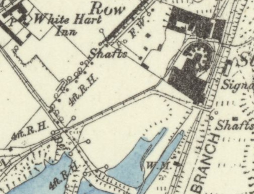
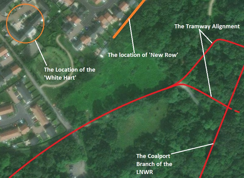
Just South of our home in Malinslee are the Hinkshay and Strichley areas. I have already posted about a walk from our home down the line of the erstwhile tramway which served Little Eyton Colliery which was not more than a couple of hundred yards from St. Leonard’s Church, Malinslee. That tramway crossed the Hinkshay Road close to the location of what was the White Hart Inn. There was a significant network of tramways in that immediate area.
Those linking directly to the tramway from Little Eyton Colliery to the Coalport Branch of the Shropshire Canal and later to the Coalport Branch of the LNWR were covered in that previous post:
https://rogerfarnworth.com/2022/06/15/ancient-tramroads-near-telford-part-4-malinslee-part-1 [1]
The rails in this vicinity were know locally as Jerry Rails, probably because the White Hart was known locally as the ‘Jerry’. In the 1861 census the White Hart was called the ‘Tom and Jerry’


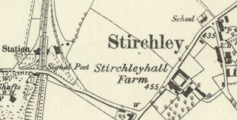
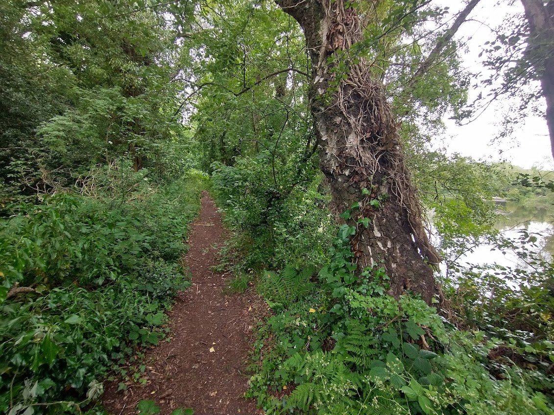
This article follows a tramway route which ran from the Dawley and Stirchley Railway Station on the LNWR Coalport Branch around the Hinkshay Pools across the back of the White Hart Inn (behind the row of cottages in the above picture) and then into the Stirchley Ironworks site.
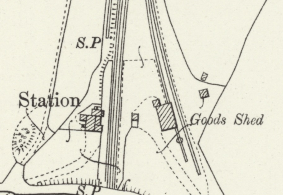
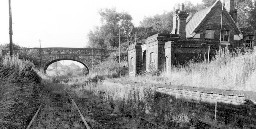
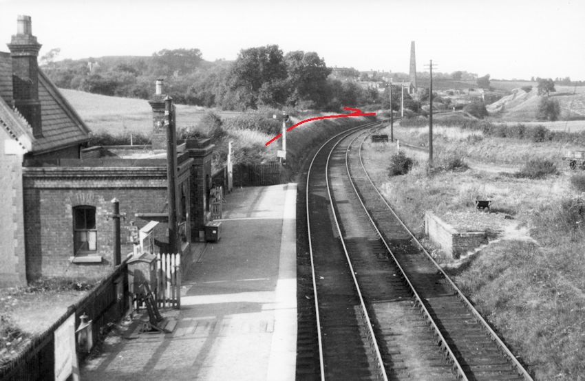
Dawley and Stirchley Railway Station
Dawley and Stirchley railway station was opened in 1861 and closed to passengers in 1952. [3] When it was opened, it was given the name ‘Stirchley’. The station was renamed Dawley & Stirchley in 1923, although closed to passengers as early as 1952 the line was not closed to freight until 1964. Although the goods service which originally served Coalport was restricted to only travelling to Dawley and Stirchley Station in 1960.[4][5]
The London and North Western Railway Society comments on the standard-gauge Coalport Branch as follows: “The first half of the route was originally part of the Shropshire Canal which the LNWR bought in 1857 and filled in, the line opening four years later. The passenger service, referred to locally as the Dawley Dodger, consisted of four trains on weekdays, the journey taking 30 minutes. It was withdrawn in 1952 but a string of private sidings between Wellington and Stirchley helped to keep that section open a further twelve years.” [5]
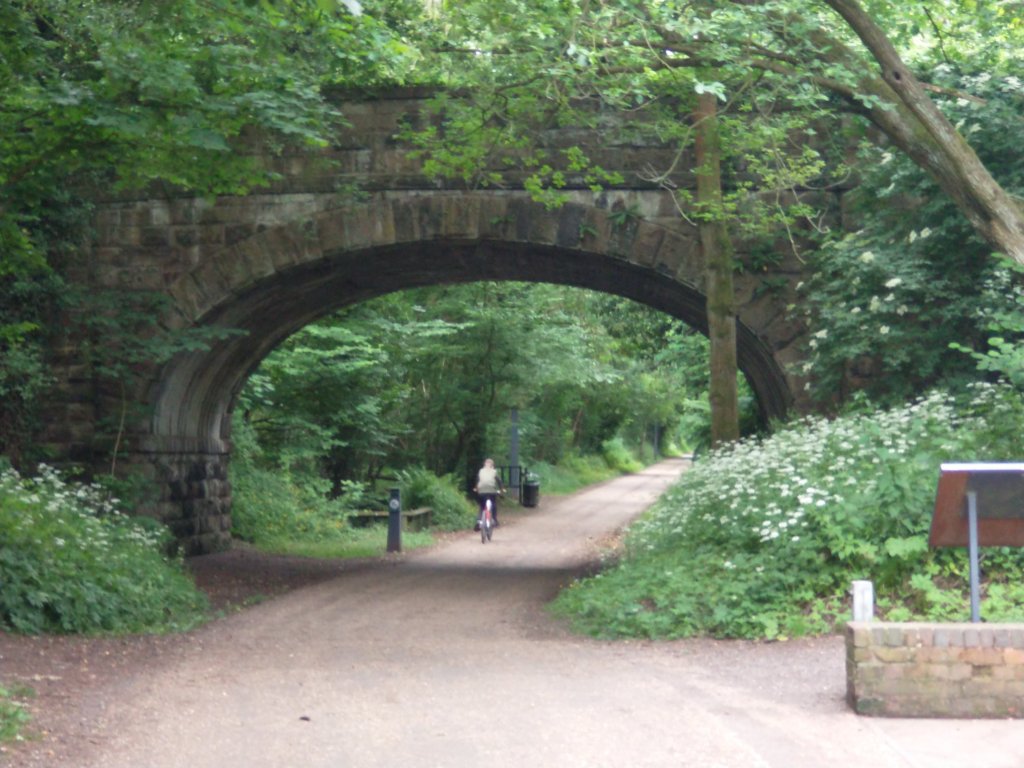
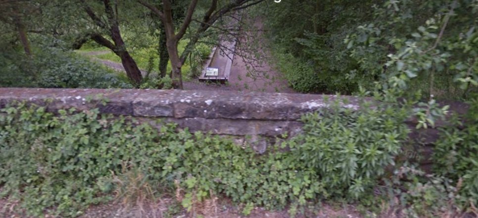
Through Telford Town Park and on through Dawley and Stirchley Station, the old railway line is now part of The Silkin Way. [6][7]

The Tramway
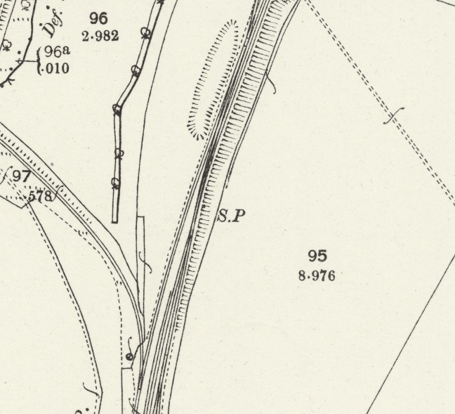
In the first half of the 19th century, before the LNWR branch line was built the tramway had a wharf on the Western bank of the Coalport Branch of the Shropshire Canal which was sited a little to the Northwest of the location of the point at the bottom of the map extract above. When the Coalport Branch of the LNWR was built the tramway was extended a little to run alongside the standard-gauge railway.

From, what was, the canal wharf, the tramway turned away West of the Canal to skirt the western flanks of the Hinkshay (Stirchley) ponds.


David Clarke, in his survey of the railways of the Telford area says that the GWR’s Stirchley Branch was “a freight only line of 1.5 miles (2.4km) and was formally known as the Old Park branch. The branch had no signal box and was operated by one engine in steam, with the train crew holding a token to give them possession of the line. The line … served Randlay Brickworks and the large complex that was Old Park Ironworks as well as Grange Colliery. The branch was initially worked by the Haybridge Iron Company. On the Ordnance Survey plan for 1902 it is described as a mineral line, and by then Grange Colliery was closed and disused. From 1908, the Great Western Railway took over the maintenance and workings of the branch.” [58: p37] “The branch closed on 2nd February 1959, prompted by bricks no longer being sent out by rail from Randlay Brickworks. The sidings specifically for the Stirchley branch had been removed by November 1962.” [58: p38]


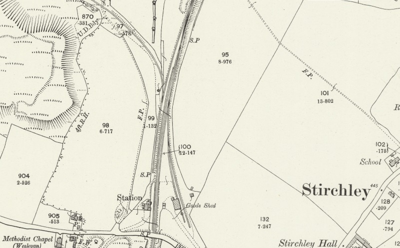
Immediately to the Northwest of the Pools was and Ironworks, shown on the map extracts above. It was already disused in the 1880s and does not feature on the 1901/02 OS map of the area. A relatively complex trackwork layout was still present in the 1880s, by 1901/02 just a single line curves round to the North east and runs along the Northern side of the Pools.
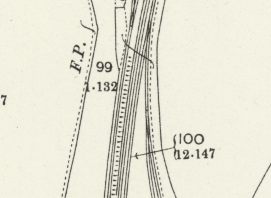
The next map below shows the continuation of the tramway as it crosses the tramway route covered in my earlier post [1] and then heads towards Stirchley Ironworks.


Before we look in detail at the Stirchley Ironworks site and the area immediately around it – some background information will probably be helpful. …
Telford Town Park’s website provides a preliminary introduction to the area as part of its walking trails:
- Stirchley Forge and Rolling Mills – The Hinkshay Works, Stirchley Forge and Rolling Mills are all Archaeological remains of buildings that can be found in the park today. They were all sold off to the Haybridge Iron Co. In 1873. The works were rebuilt in 1876 and a nail factory was established on the site in 1874/5 until 1885. The forge and rolling mill continued in use until it closure in approximately 1900.
- Stirchley Chimney and Furnaces: The Iron Works were established in 1790 by Thomas Botfield, originally with two blast furnaces, a forge and a mill. The Chimney was constructed of Randlay brick and is approximately 209 feet high and is still standing. This is a permanent reminder of the industry that used to occupy the Town Park. There is a small opening on the western side of the Chimney and it was connected to the furnaces by a tunnel. The ironworks were blown out in 1885, however the forge and rolling mill continued in use until its closure in 1900.” [19]
- “Shropshire Canal: The Silkin Way, running north to south through the centre of the park, was formerly the Shropshire Canal and the Wellington and Coalport railway. In 1788/9 the Coalport branch of the Shropshire Canal was built along the western edge of Stirchley, through the centre of the Park. It was designed to link the key industrial centres of the area with the River Severn.” [19]
Stirchley was an agricultural community until the beginning of the 19th century when coal and ironstone mining, iron founding, and brick making were started close to the Coalport Branch of the Shropshire Canal. for much of what follows, I have replied on the comprehensive notes provided by British History Online which in turn took the notes from ‘A History of the County of Shropshire: Volume 11, Telford. Originally published by Victoria County History, London, 1985.’ [20]
“Industry came to Stirchley as a result of a partnership between I. H. Browne, owner of most of the parish, and the Botfield family, the Dawley ironmasters who had established collieries and ironworks on Browne’s Old Park estate in Dawley in the late 18th century.” [20]
Between 1811 and around 1843, “they established collieries, ironworks, and a brickworks on their Stirchley royalties. … In 1856, … the land, mineral rights, and plant were leased to the Old Park Iron Co., [21] which continued the industrial operations in Stirchley until it was wound up in 1871. [22] By 1900 mining and ironworking had ceased. A chemical works, occupying one of the former ironworks, flourished until 1932 and brick making and the crushing of furnace slag for road metal continued until the 1960s.” [20]
British History Online tells us that by 1822, Coal was being mined at four collieries, [23] “and by 1840 [24] there were five collieries in the parish [of Stirchley]: Randlay pits, sunk in 1820; [25] Cuxey’s Wood pits, sunk 1834-5; [26] Forge pits, sunk 1825-6; [27] Grange colliery, probably opened by 1833; [28] and the original shaft at Stirchley pits. The extent of seams that could be worked was restricted by the Limestone fault, east of which the coal lay deeper. … After the Old Park Iron Co. was wound up in 1871 the mines were leased to the Wellington Iron & Coal Co. Ltd. in 1874 [29] but by 1879 had reverted to the landowners, the Cheney family. [30] By 1881 all the pits except Grange colliery had been closed. [31] Despite the lease of mineral rights to Alfred Seymour Jones of Wrexham in 1893, Grange colliery was closed in 1894.” [32][20]
British History Online notes that Ironworking “was started in the parish c. 1826 by the Botfield brothers. Blast furnaces were built at the south end of Randlay reservoir (or Randay pool) [33] and a forge and rolling mill were opened probably c. 1828, west of the Shropshire Canal on land purchased from Lord Darlington in 1826. [34] The blast furnaces were leased with the mining royalties to the Old Park Iron Co. after Botfield’s lease expired in 1856. [35] After the company was wound up in 1871 the furnaces were leased in 1874 to the Wellington Iron & Coal Co., which failed in 1877. [36] The furnaces passed back to the owner of the site, Edward Cheney, who kept them in blast for a few years, but they were shut down by 1885. [37] The forge and rolling mills, which were Botfield’s freehold property, were sold by Beriah Botfield’s trustees in 1873 to the Haybridge Iron Co., [38] which rebuilt the works in 1876 and established a nail factory on the site in 1874 or 1875. [39] The nail factory was sold to John Maddock in 1876; he moved his operations to Oakengates two years later but nails continued to be made at Stirchley for a few years under different proprietors. [40][41][42] The factory had closed by 1885 [43] but the adjacent forge and rolling mills continued to be operated by the Haybridge Co., the rolling mill closing finally c. 1900.” [44][20]
Brick working and Clay working ran in parallel with the mining of Coal and Iron ore as those mineral deposits were found primarily in boulder clay and marls. “The Botfields were manufacturing bricks in Stirchley in 1808-9, [45] … Randlay brickworks … which continued to manufacture bricks until 1964 or later, had been established by the Botfields by 1838. [46] … Clay was obtained on site from an extensive pit, which was enlarged after the purchase of more land in 1905 and used until 1969. [47] In 1964 the brickworks employed 91 [48] (fn. 79) and the three kilns produced c. 300,000 bricks a week.” [49][20]
In 1886, Thomas Groom leased the site of the former furnaces and “transferred his Wrekin Chemical Works to Stirchley … The chemical works extracted wood naphtha and tar from timber supplied by the Grooms’ yard at Wellington and converted the residue into charcoal. Acetate of lime and sulphur were also manufactured. Groom’s successor, George Wilkinson, bought the site in 1904 and the works closed in 1932.” [50][51][52][20]
The arisings from the former furnaces were deposited in slag heaps and were “exploited as a source of aggregate for road building and concrete manufacture from the 1890s. The mounds south-west of the Wrekin Chemical Works were leased in 1893, and purchased in 1907, by H. C. Johnson, a Wrexham quarry owner, who had built a slag crusher on the site by 1901. [53] The industry expanded during the 1920s when most of the slag mounds in the parish were acquired by Tarslag (1923) Ltd. and the Bilston Slag Co. (1924) Ltd.” [54]
The British History Online notes continue: “By 1925 there were four slag-crushing plants in the parish, [55] the largest being Tarslag’s works, employing up to c. 130 men, which both crushed the slag and coated it with tar and bitumen. Tarmac Ltd., which succeeded the Bilston company, also manufactured ‘Vinculum’ concrete walling blocks at Stirchley from c. 1925 to c. 1935, and Tarslag operated a short-lived concrete plant there as well. Impurities and the variable quality of the slag led to the closure of the works. [56] By the Second World War most of the slag mounds had been exhausted and Tarslag’s crushing and coating plant closed in 1941. Tarmac continued to remove slag from Stirchley for processing elsewhere until c. 1964.” [57]
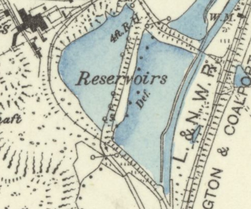
That is more than enough general industrial history for our present purposes. It illustrates the diversity of activity in the immediate area between Hinkshay Pools and Randlay Pool which is just a little further to the Northeast. The plan below illustrates, schematically, the industry in the immediate area.

The history of the tramways and railways is relatively complicated. Tramways, predated the standard-gauge railway but in this area, rather then just becoming feeders to the railway network, a number were converted into standard-gauge Mineral Railways which could remain in private hands or, as in the case of the tramway/railway route to the West of the Coalport Branch and running to the West of Randlay Pool, they were taken over by the larger rail companies and in some cases, therefore became a part of British Rail!
The Coalport Branch was an LNWR branch line and then became a part of the LMS. The Mineral Railway was taken over by the GWR and worked in direct competition with the LNWR line.
David Clarke, in his survey of the railways of the Telford area says that the GWR’s Stirchley Branch was “a freight only line of 1.5 miles (2.4km) and was formally known as the Old Park branch. The branch had no signal box and was operated by one engine in steam, with the train crew holding a token to give them possession of the line. The line … served Randlay Brickworks and the large complex that was Old Park Ironworks as well as Grange Colliery. The branch was initially worked by the Haybridge Iron Company. On the Ordnance Survey plan for 1902 it is described as a mineral line, and by then Grange Colliery was closed and disused. From 1908, the Great Western Railway took over the maintenance and workings of the branch.” [58: p37] “The branch closed on 2nd February 1959, prompted by bricks no longer being sent out by rail from Randlay Brickworks. The sidings specifically for the Stirchley branch had been removed by November 1962.” [58: p38]
Stirchley Ironworks


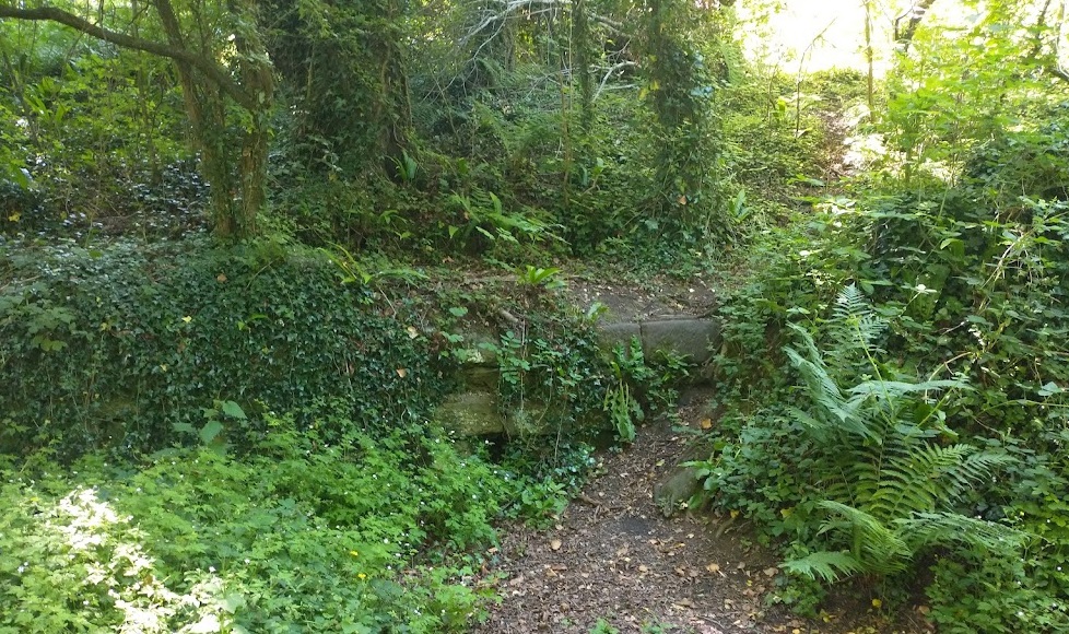
The Exploring Telford website contains a lot of speculation about what this tunnel was originally used for. [59] The undergrowth has had plenty time to establish itself by the time the next two pictures were taken in 2022.

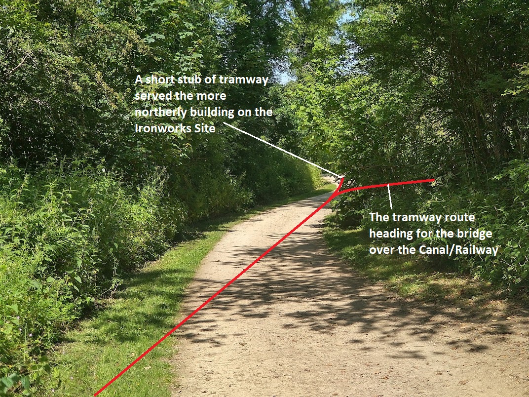
Returnign to the tramway that we are following, it branches in two as it enters the immediate site of Stirchley Ironworks. This can clearly be picked out on the 1881/82 6″ OS Map extract above. There is a stub branch running East from the junction which approaches a cast iron bridge which would have spanned both the old Canal and the later railway. On the 1881/82 map, the tramway stops short of the bridge.

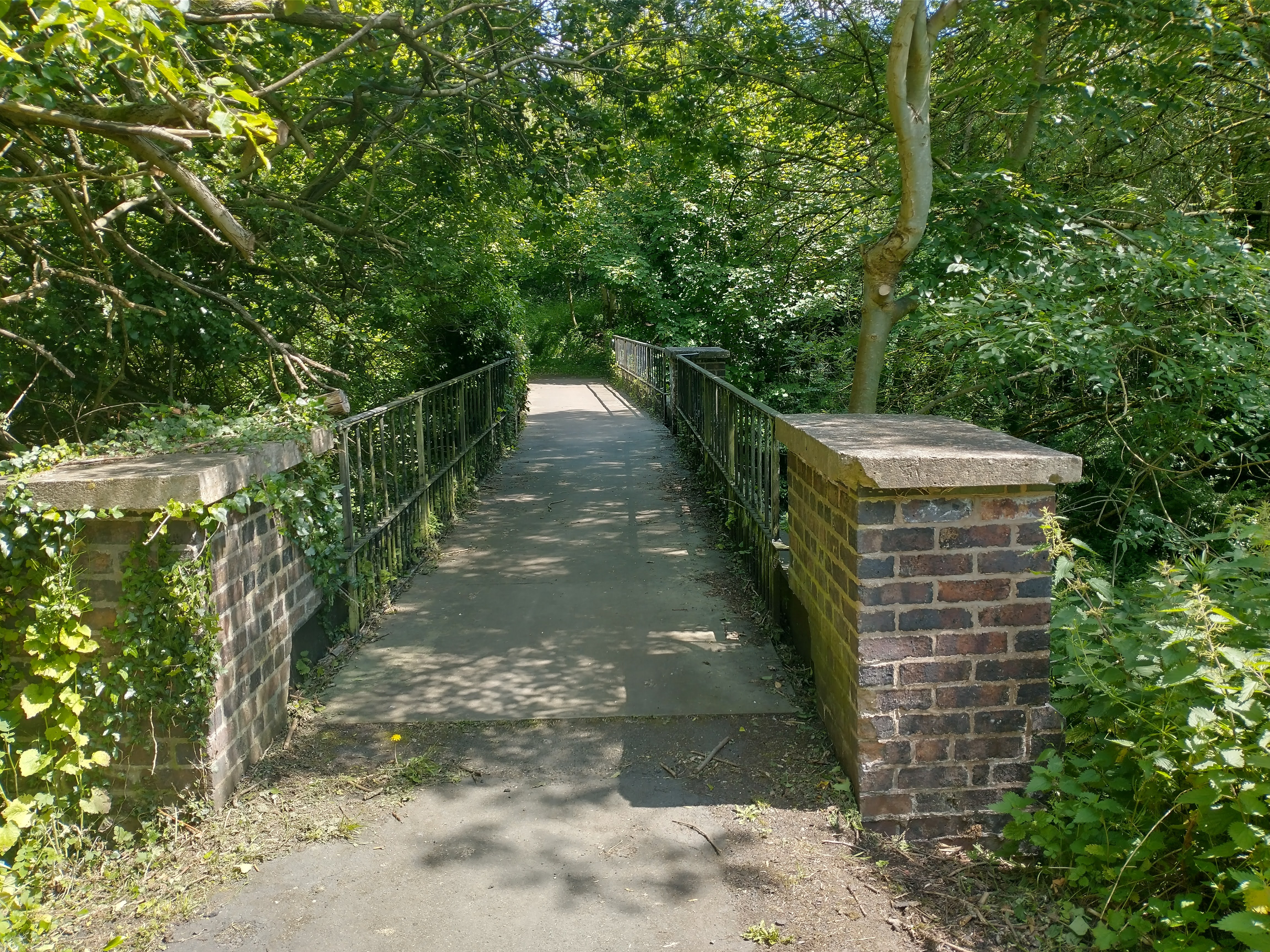


The Northern arm of the tramway passed between the two main buildings on the site before crossing the Canal/railway on another bridge (which has not survived into the 21st century) as shown below. …


Using the maps and satellite images provided by the National Library of Scotlad it is possible to identify the location of the old bridge over the Canal/Railway but all that can be seen from the Silkin Way is thick undergrowth. I was unable to find any remnants of the old structure.
On the East side of the Canal/Railway the tramway line drifted round to the Northeast before entering what was the site of Old Park Ironworks. By 1881/2 there was a significant network of rails on the Old Park Ironworks Site. …

At this time, the site of the Old Park Ironworks was still active as an Ironworks. But by the time of the next survey, after the turn of the century, it had closed. At the time of that next survey the site was a chemical works. The network of tramways had been significantly rationalised as can be seen below.


In Parts 3 and 4 of our look at the tramways around Malinslee, we will look, in more detail, at the tramways North of Stirchley. There is still a lot to look at both to the West and towards Oakengates.
References
- https://rogerfarnworth.com/2022/06/15/ancient-tramroads-near-telford-part-4-malinslee-part-1
- http://dawleyhistory.com/Pubs/White_Hart_Hinkshay/White_Hart.html, accessed on 18th June 2022.
- https://en.wikipedia.org/wiki/Dawley_and_Stirchley_railway_station, accessed on 18th June 2022.
- http://www.dawleyheritage.co.uk/cd-content/themes/dawley_heritage/gui/Dawley-Leaflet.pdf, accessed on 18th June 2022.
- http://www.lnwrs.org.uk/BygoneLines/Coalport.php, accessed on 18th June 2022.
- https://www.telford.gov.uk/info/20465/walking/5220/silkin_way_walking_route, accessed on 18th June 2022.
- https://www.telford.gov.uk/downloads/file/3060/silkin_way_-_walking_and_cycling_route, accessed on 18th June 2022.
- https://maps.nls.uk/view/101594470, accessed on 15th June 2022.
- https://maps.nls.uk/geo/explore/#zoom=18&lat=52.65765&lon=-2.45133&layers=168&b=1, accessed on 18th June 2022.
- http://www.dawleyhistory.com/Postcards/Dawley%20and%20Stirchley%20Station/Dawley%20and%20Stirchley%20Station%20.html, accessed on 18th June 2022.
- https://www.geograph.org.uk/photo/3933743, accessed on 18th June 2022.
- http://www.dawleyhistory.com/Postcards/Dawley%20and%20Stirchley%20Station/Dawley%20and%20Stirchley%20Station%20.html, accessed on 18th June 2022.
- https://maps.nls.uk/geo/explore/#zoom=18&lat=52.65952&lon=-2.45156&layers=168&b=1, accessed on 18th June 2022.
- https://www.british-history.ac.uk/vch/salop/vol11/pp185-189, accessed on 18th June 2022.
- Bob Yate; The Shropshire Union Railway: Stafford to Shrewsbury including the Coalport Branch; Oakwood Press, Usk, 2003.
- https://maps.nls.uk/geo/explore/#zoom=18&lat=52.66038&lon=-2.45267&layers=168&b=1, accessed on 19th June 2022.
- https://maps.nls.uk/geo/explore/#zoom=18&lat=52.66225&lon=-2.45188&layers=168&b=1, accessed on 19th June 2022.
- http://www.dawleyheritage.co.uk/hinkshayvillage/755/the-jerry-public-house, accessed on 19th June 2022.
- https://www.telfordtownpark.co.uk/info/34/walking_trails, accessed on 21st June 2022.
- https://www.british-history.ac.uk/vch/salop/vol11/pp189-192, A History of the County of Shropshire: Volume 11, Telford. Originally published by Victoria County History, London, 1985; accessed on 21st June 2022.
- Shropshire records office (S.R.O.) 14/3/8; https://www.british-history.ac.uk/vch/salop/vol11/pp189-192, accessed on 21st June 2022.
- S.R.O. 1265/280; https://www.british-history.ac.uk/vch/salop/vol11/pp189-192, accessed on 21st June 2022.
- The Botfields’ mines were assessed for the par. rate at £134 6s. 8d., at £33 6s. 8d. for each pit: S.R.O. 1345/60; https://www.british-history.ac.uk/vch/salop/vol11/pp189-192, accessed on 21st June 2022.
- S.R.O. 1816/26; https://www.british-history.ac.uk/vch/salop/vol11/pp189-192, accessed on 21st June 2022.
- At O.S. Nat. Grid SJ 705 081: inf. from Dr. Brown; https://www.british-history.ac.uk/vch/salop/vol11/pp189-192, accessed on 21st June 2022.
- At SJ 701 077: W. Howard Williams, ‘Dawley New Town Hist. Survey: Industries’ (TS. 1964), addns. and corr. (1965), p. 6 (copy in S.P.L., accession 5202); https://www.british-history.ac.uk/vch/salop/vol11/pp189-192, accessed on 21st June 2022.
- At SJ 696 071: S.R.O. 1011, box 425, R. Garbitt to E. Bloxam, 20 Dec. 1861; https://www.british-history.ac.uk/vch/salop/vol11/pp189-192, accessed on 21st June 2022.
- At SJ 701 071: O.S. Map 1″, sheet 61 NE. (1833 edn.); https://www.british-history.ac.uk/vch/salop/vol11/pp189-192, accessed on 21st June 2022.
- S.R.O. 1265/285; https://www.british-history.ac.uk/vch/salop/vol11/pp189-192, accessed on 21st June 2022.
- P.O. Dir. Salop. (1879), 417; Kelly’s Dir. Salop. (1885), 963; https://www.british-history.ac.uk/vch/salop/vol11/pp189-192, accessed on 21st June 2022.
- O.S. Map 6″, Salop. XLIII. NE. (1889 edn.); https://www.british-history.ac.uk/vch/salop/vol11/pp189-192, accessed on 21st June 2022.
- S.R.O. 1265/269; 1345/62; https://www.british-history.ac.uk/vch/salop/vol11/pp189-192, accessed on 21st June 2022.
- At O.S. Nat. Grid SJ 700 074: Trinder, Ind. Rev. Salop. 241; O.S. Map 1″, sheet 61 NE. (1833 edn.). Called ‘Old Park Iron Works’ on O.S. Map 6″, Salop. XLIII. NE. (1889 edn.); https://www.british-history.ac.uk/vch/salop/vol11/pp189-192, accessed on 21st June 2022.
- At SJ 696 072: S.R.O. 1265/261; O.S. Map 1″, sheet 61 NE. (1833 edn.); S.R.O. 1011, box 425, W. Botfield to E. Browne, 14 Aug. 1827. Chain making at Old Park (above, Dawley, Econ. Hist.) is wrongly located in V.C.H. Salop. i. 479 at Stirchley furnaces; https://www.british-history.ac.uk/vch/salop/vol11/pp189-192, accessed on 21st June 2022.
- S.R.O. 14/3/8; 1265/279; https://www.british-history.ac.uk/vch/salop/vol11/pp189-192, accessed on 21st June 2022
- S.R.O. 1265/285, 287; https://www.british-history.ac.uk/vch/salop/vol11/pp189-192, accessed on 21st June 2022
- P.O. Dir. Salop. (1879), 417; cf. Kelly’s Dir. Salop. (1885), 963; https://www.british-history.ac.uk/vch/salop/vol11/pp189-192, accessed on 21st June 2022.
- S.R.O. 1265/261;https://www.british-history.ac.uk/vch/salop/vol11/pp189-192, accessed on 21st June 2022.
- Ibid. /263; Salopian and W. Midland Monthly Illustr. Jnl. Apr. 1875; Nov. 1876 (copies in S.P.L.); https://www.british-history.ac.uk/vch/salop/vol11/pp189-192, accessed on 21st June 2022.
- S.R.O. 1265/264; https://www.british-history.ac.uk/vch/salop/vol11/pp189-192, accessed on 21st June 2022.
- S.R.O. 1404/1; https://www.british-history.ac.uk/vch/salop/vol11/pp189-192, accessed on 21st June 2022.
- P.O. Dir. Salop. (1879), 417; https://www.british-history.ac.uk/vch/salop/vol11/pp189-192, accessed on 21st June 2022.
- S.R.O. 1345/62; https://www.british-history.ac.uk/vch/salop/vol11/pp189-192, accessed on 21st June 2022.
- S.R.O. 1404/1; Williams, ‘Dawley Hist. Survey: Inds.’ addns. and corr. (1965), p. 5; https://www.british-history.ac.uk/vch/salop/vol11/pp189-192, accessed on 21st June 2022.
- Manchester University Library, Botfield papers, cash acct. bk. 1804-10 (https://archiveshub.jisc.ac.uk/search/archives/0d54e8ed-1fe5-3d1e-85fb-7a61bf1efb7e); https://www.british-history.ac.uk/vch/salop/vol11/pp189-192, accessed on 21st June 2022.
- At O.S. Nat. Grid SJ 703 080: ibid. /6a; Williams, ‘Dawley Hist. Survey: Inds.’ p. 10; https://www.british-history.ac.uk/vch/salop/vol11/pp189-192, accessed on 21st June 2022.
- Telford Development Corporation, (T.D.C.), Randlay brickworks deeds; and O.S. Map 6″, Salop. XLIII. NE. (1889, 1903, and 1929 edns.); inf. from Dr. Brown; https://www.british-history.ac.uk/vch/salop/vol11/pp189-192, accessed on 21st June 2022.
- J. H. D. Madin & Partners, Dawley New Town Rep. No. 2: Interim Proposals (Sept. 1964), map 14 and cap. 6, sect. 1, app.; https://www.british-history.ac.uk/vch/salop/vol11/pp189-192, accessed on 21st June 2022.
- Dawley Observer, 4 Feb. 1966; https://www.british-history.ac.uk/vch/salop/vol11/pp189-192, accessed on 21st June 2022.
- S.R.O. 1404/1; V.C.H. Salop. i. 479 n.; https://www.british-history.ac.uk/vch/salop/vol11/pp189-192, accessed on 21st June 2022.
- Williams, ‘Dawley Hist. Survey: Inds.’ addns. and corr. (1965), p. 4; cf. S.R.O. 1268/3, sale partic. of 1904; https://www.british-history.ac.uk/vch/salop/vol11/pp189-192, accessed on 21st June 2022.
- Williams, ‘Dawley Hist. Survey: Inds.’ p. 39; https://www.british-history.ac.uk/vch/salop/vol11/pp189-192, accessed on 21st June 2022.
- S.R.O. 1268/3, sale partic. of 1904; O.S. Map 6″, Salop. XLIII. NE. (1903 edn.); T.D.C., Stirchley deeds (Tarmac property); https://www.british-history.ac.uk/vch/salop/vol11/pp189-192, accessed on 21st June 2022.
- T.D.C., Stirchley deeds (Tarmac property); J. B. F. Earle, A Century of Road Materials (1971), 19; https://www.british-history.ac.uk/vch/salop/vol11/pp189-192, accessed on 21st June 2022.
- O.S. Map 6″, Salop. XLIII. NE. (1929 edn.); https://www.british-history.ac.uk/vch/salop/vol11/pp189-192, accessed on 21st June 2022.
- Inf. from Mr. S. J. Insull, Dudley; https://www.british-history.ac.uk/vch/salop/vol11/pp189-192, accessed on 21st June 2022.
- Williams, ‘Dawley Hist. Survey: Inds.’ p. 43; inf. from Mr. Insull, and from Mr. C. C. Wallis, Tarmac Roadstone Holdings Ltd.; https://www.british-history.ac.uk/vch/salop/vol11/pp189-192, accessed on 21st June 2022.
- David Clarke; Railways of Telford; Crowood Press, Marlborough, Wiltshire, 2016.
- http://www.telford.org.uk/general/hinkshay.html, accessed on 21st June 2022.https://www.28dayslater.co.uk/threads/28-04-07-hinksay-tunnel-telford.12775, accessed on 22nd June 2022.
- R.F. Savage & L.D.W. Smith; The Waggon-ways and Plateways of East Shropshire; Birmingham School of Architecture, 1965. Original document is held by the Archive Office of the Ironbridge Gorge Museum Trust.
- https://maps.nls.uk/view/101594467, accessed on 24th June 2022.
- https://maps.nls.uk/view/101594464, accessed on 24th June 2022.

Pingback: Ancient Tramroads near Telford – Part 8 – Malinslee Part 4 – the East side of Malinslee in the vicinity of the later Coalport (LNWR) and Stirchley (GWR) Branches | Roger Farnworth