
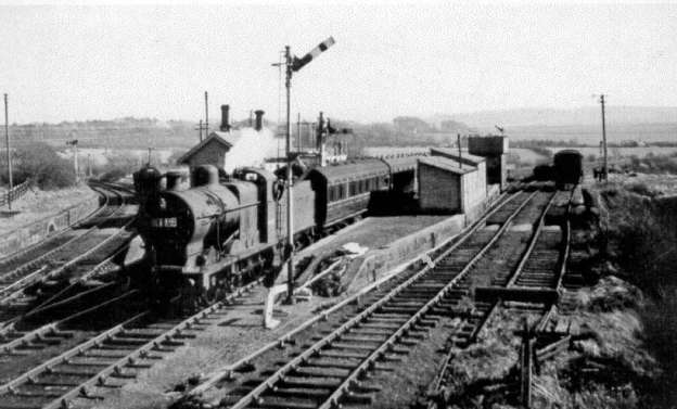
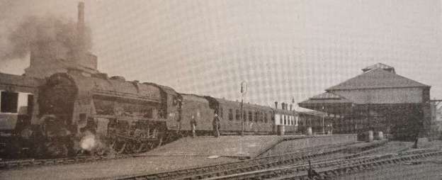
The featured image for this article is a photograph taken by Walter Dendy of a football excursion returning from Egremont to Carlisle passing through Distington Railway Station behind ex-LMS Class ‘4F’ Locomotive No. 44461 in 1951. The line to the left is to Rowrah and Kelton Fell line, © W. Dendy and licenced for reuse under a Creative Commons licence (CC BY-SA 2.0). [6]
This is the second in a series of articles about the railways of West Cumberland. The first can be found here. [3]
This article is based around the potted history of West Cumberland’s railways written by C. A. Knight and included in his article in The Railway Magazine of November 1954. [1]
Knight explains that the growing importance of Carlisle as a railway centre, sitting as it did on the natural route between England and Scotland and already the terminus of existing and proposed railways meant that it was:
“the obvious route for the improvement of communications between West Cumberland and the rest of the country, in comparison with the alternative route to the south involving the crossing of several estuaries. The Maryport & Carlisle Railway was incorporated in 1837, and was constructed in stages between 1840 and 1845, to provide communication between the points named and also to develop the coalfield between Maryport and Aspatria by facilitating the shipment of coal through Maryport Docks and the transport of coal to other parts of the country through Carlisle. The company enjoyed prosperity from the beginning, and was one of the few early railways to retain its individuality until the Railways Act of 1921. The original single-platform station at Maryport is still in use as part of the [coastal] through route from Carlisle to Carnforth.” [1: p757]
“The extension of railway communication to Workington and Whitehaven was the logical development to connect these two towns with Carlisle. This railway, known as the Whitehaven Junction, and incorporated in 1844, was the result of the enterprise of the second Earl of Lonsdale. It cut across several existing tramways from collieries to the sea, and the rights of passage were protected under the Act of Incorporation. Leaving Maryport in a southerly direction, the line traversed the level sea-shore to cross the River Derwent at Workington, crossing a colliery tramway on the level immediately after leaving Maryport. The mining village of Flimby was the only intermediate station between Maryport and Workington, the station at Siddick Junction was not built until the construction of the Cleator & Workington Junction Railway.” [1: p757 & p759]“From Workington to Whitehaven, the line, although continuing level, followed the natural line of the coast, involving heavy engineering work in maintaining a formation at the foot of the high ground which runs to the sea. The terminus at Whitehaven was at Bransty, at the north end of the town, and the original station [was, at the time of Knight’s article, used] for carriage cleaning, with the exception of one platform, which [had] been extended to form one side of what is in effect an island platform, and [was] still used for trains to and from the North starting or terminating at Whitehaven.” [1: p759]
“Crossing the line immediately north of Bransty Station, from William Pit on the east to Whitehaven Harbour on the west side, is the sole surviving, [in 1954,] colliery tramway, which [was] still in daily use. In 1848, the railway was extended along the west side of Bransty Station to serve Whitehaven Harbour, and in 1858, a branch was constructed from a junction immediately north of Workington Station to serve Workington Harbour, now known as Merchants’ Quay. Maryport Docks were originally connected to the Maryport & Carlisle Railway, but the Whitehaven Junction constructed its own line to the docks in 1865, thus giving access from the south, and, following an era of amalgamation by the large railway companies, the whole line was absorbed by the London & North Western Railway in 1866.” [1: p759]
“By 1845, the only important place in West Cumberland without railway communication was Cockermouth, a pleasant town serving an agricultural community. The opening of the Cockermouth & Workington Railway in 1847 extended the network of railways which was taking shape. Leaving the Whitehaven Junction Railway [to the] North of the bridge over the River Derwent, this line followed the natural route eastwards along the valley, with many crossings of the winding river. but no other substantial engineering work. The line opened up the coalfield in the Camerton area, and used Workington Station jointly with the Whitehaven Junction. The terminus at Cockermouth was at the east end of the town and [was, in 1954,] the site of the goods station. The extension of the railway in an easterly direction was delayed by reason of the difficult country beyond Cockermouth, but the importance of the line was increased in 1861 by the construction of the Cockermouth, Keswick & Penrith Railway, when it became part of the direct route between the Durham coalfield and West Cumberland.” [1: p759]
“In 1863, the Cockermouth & Workington Railway was extended to the new Workington dock system on the North side of the River Derwent by means of a level crossing at Derwent Junction over the Whitehaven Junction line, and connection was also given by a private line running on the east side of the Whitehaven Junction, from St. Helens Colliery, Siddick, to Workington Dock. The railway was the first in West Cumberland to come into the hands of the London & North Western Railway, in 1866, and with the absorption of the Whitehaven Junction in the following year, the LNWR controlled the whole of the existing West Cumberland lines, although they were isolated from the rest of [their] system and reached by running powers.” [1: p759]
“The extension of railway facilities in a southerly direction from Whitehaven was again largely the result of the enterprise of the second Earl of Lonsdale, who held large interests in a number of collieries in Whitehaven and district, and was anxious to open up communication with other parts of the country. The Whitehaven & Furness Junction Railway. incorporated in 1845, originally was proposed to run from a terminus at Preston Street, Whitehaven, [the goods station in 1954] to a junction with the Furness Railway near Askam, but the scheme was modified in favour of a junction at Broughton, some six miles north of Askam. The railway was completed to Broughton in 1850, but for some years was in financial difficulties. It ran through sparsely populated agricultural country, and the remunerative iron ore traffic from the Cleator and Frizington district, which became such an important factor in the future prosperity of the line, was still undeveloped. In 1852, the single-line tunnel between Corkickle and Bransty Stations, Whitehaven, was opened, and Bransty Station was extended to cope with the influx of traffic from the south. There already existed a physical link between the Whitehaven & Furness Junction and the Whitehaven Junction by a line from Preston Street terminus along the streets of the town to Whitehaven Harbour, thence by the Harbour Commissioners’ lines to the junction with the Whitehaven Junction at Bransty, but this was never used for through traffic.” [1: p759-760]“With the completion of the encirclement of West Cumberland by coast lines, the possibility of developing the rich iron ore deposits a short distance to the east of Whitehaven, particularly at Egremont and Cleator Moor, came under review. These deposits had been known for many years, but transport difficulties and inadequate mining facilities had restricted their output to the small quantity of ore which could be carted to Whitehaven for shipment. In 1857, the Whitehaven, Cleator & Egremont Railway was opened from Mirehouse Junction, a mile south of Corkickle, on the Whitehaven & Furness Junction Railway, to Moor Row, and thence … to Frizington to the north-east, and Egremont to the south. The result was an immediate improvement in the fortunes of the Whitehaven & Furness Junction Railway, which hauled the traffic from Mirehouse Junction, although it is probable that much of the traffic was short-hauled to Whitehaven Harbour for shipment, thus repeating the history of the coal industry by retaining the same port of shipment but extending the area of operations. The Whitehaven, Cleator & Egremont Railway surmounted the high-lying country by a series of easy curves to Moor Row on a final gradient of 1 in 52.” [1: p760]
“The continued prosperity of the iron ore industry made possible the extension in 1864 of the Whitehaven, Cleator & Egremont Railway from Frizington to Lamplugh. This is even more difficult country, and the improvement in the tractive effort of locomotives would no doubt have had some influence in endeavouring to overcome the gradients from Frizington, where the rise steepens to 1 in 44. Fortunately, the main flow of traffic was downhill, but with the locomotives available there must have been some struggles up the winding approach to Yeathouse, through a wooded cutting. The circle was completed in 1866 by an extension from Lamplugh to Marron Junction, between Brigham and Workington, where the Whitehaven, Cleator & Egremont Railway joined the Cockermouth & Workington Railway, which had been taken over by the L.N.W.R. in the previous year.” [1: p760]
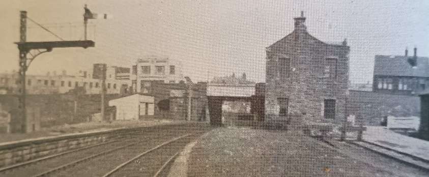
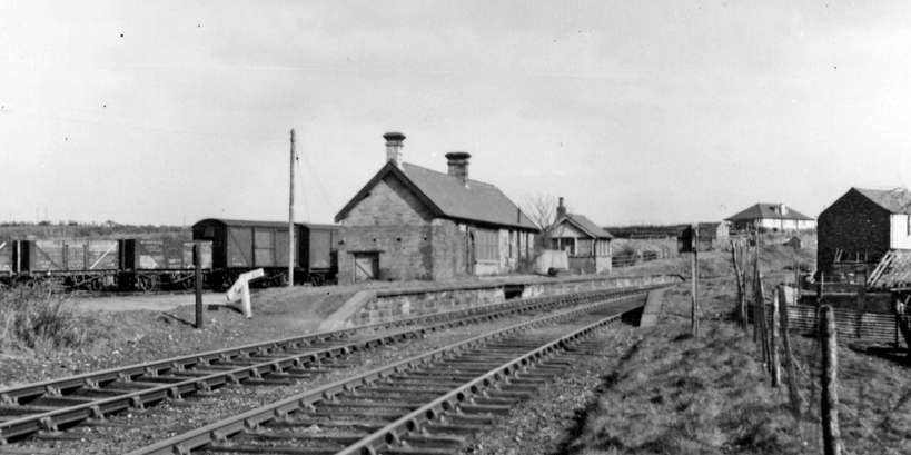
“Development of the iron ore deposits in the Beckermet area, south of Egremont, followed the extension of the line from Egremont to Sellafield in 1869, to form a junction with the Furness Railway. That company was still anxious to carry a greater share of the remunerative iron ore traffic over its own lines, and strongly opposed this extension because it had previously sought powers to extend its own line to Egremont. This last major extension of the Whitehaven, Cleator & Egremont Railway was a fortunate one, as the mines at Ullcoats and Beckermet have been very productive, and now remain as the only iron ore mines still in operation in the area. Its success emboldened the company to seek a further extension from Ullock, between Rowrah and Marron Junction, to Distington, subsequently extended to form a junction with the L.N.W.R. at Parton. The development of the iron ore field in the Lamplugh area had been disappointing, no doubt partly as the result of the circuitous haul to the furnaces, and the new route reduced the distance considerably. A small colliery was opened at Wythmoor, West of Ullock Junction, but the only intermediate station between Ullock Junction and Parton was Distington, where an ironworks was established.” [1: p760]
The Whitehaven, Cleator & Egremont Railway was confident in its own success, rebuffing takeover approaches from the LNWR until the arrival of the Cleator & Workington Junction Railway in 1876.
Knight continues:
“For some time there had been growing concern in the area in view of the virtual monopoly of transport for the heavy industries which was in the hands of the London & North Western and the Whitehaven, Cleator & Egremont Railways. Both served different parts of the district, so that no effective competition between them was possible, and an increase in rates in 1873 brought forward several proposals for competitive lines, notably one from Cleator Moor to Workington. These developments were received with composure by the existing companies, as all the apparently obvious routes were already occupied. There is little doubt that the strongly individualistic traders in the area did not relish the remote control exercised from Euston, and much preferred to deal with locally controlled railways, whose directorate was often identical with their own, possibly to some extent to their mutual advantage.” [1: p761]
“The prospect of a competitive route caused considerable alarm to the directors of the Whitehaven, Cleator & Egremont Railway and in the following year amalgamation with the LNWR was accepted. The Furness Railway, still unable to get a substantial foothold in the area, objected strongly, and in 1878 both sides were more or less satisfied by joint acquisition of the Whitehaven, Cleator & Egremont by the Furness and the London & North Western Railways.” [1: p761]
The Cleator & Workington Junction Railway was essentially built to provide competition to effective monopoly companies in the area.
Knight continues:
“With the exception of two collieries, at Walkmill, between Cleator Moor and Moresby Parks, and later at Oatlands, between Rowrah and Distington the line did not open up any new industrial territory, and was almost entirely, and for obvious reasons, financed from local business sources.
“Construction commenced immediately and the line ran from a junction with the deviated Whitehaven, Cleator & Egremont Railway at Cleator Moor, to a junction with the LNWR at Siddick, north of Workington. It is probable that the promoters would have liked to avoid the LNWR altogether, and make a junction with the Maryport & Carlisle Railway, but even they were daunted by the formidable country to be traversed north of the Derwent valley. As this railway was the last in the field, it was left with little choice in the matter of route, with the result that it was constructed through scarcely populated country involving 11½ miles of line almost entirely on a gradient of 1 in 70. Its purpose was to provide a competitive route from the many small furnaces which were in existence at that time, but the difficult country through which it ran necessitated the main line running past even these, and the works were served by small branches. The headquarters and principal station at Workington were centrally situated, but long-distance passengers were more adequately catered for by the LNWR, which had a more direct route north and south, and the passenger business was principally local.” [1: p761-762]
Immediately north of Workington Central, a short connection was made from Cloffocks Junction across the River Derwent to the LNWR at Workington Bridge, on the Cockermouth and Workington line, and a little further north, at Dock Junction, a branch diverged in westerly direction, crossing the LNWR and describing an almost complete circle to reach Workington Docks and the Oldside Works.
Knight continues:
“Pursuing its aggressive policy, the Cleator & Workington Junction Railway next turned attention to the limestone so necessary in the production of iron, of which large deposits existed at Rowrah, the summit of the Whitehaven, Cleator & Egremont Railway between Moor Row and Marron Junction. The construction of the Oatlands branch in 1877 gave a much more direct route to Workington, and it was built from a junction at a point just south of Distington, to Rowrah, a distance of some 6½ miles.
“The branch diverges to the west of the main line, but immediately crosses it by an overbridge, and commences to climb in a southerly direction on a gradient of 1 in 44 for two miles. At Oatlands there was a station and the small colliery previously referred to, and the gradient continues for another mile at 1 in 52, when the first summit is reached. A mile and a half falling at 1 in 60 follows, succeeded by another climb just short of a mile at 1 in 46 to reach Arlecdon, the last station on the branch. A little further on the line crosses the Whitehaven, Cleator & Egremont Railway by an overbridge, and turns northwards parallel with it, thus effectively cutting off that line from the quarries at Rowrah Hall and Rowrah Head, and finally making an end-on junction with the little-known Rowrah & Kelton Fell Railway, a private undertaking owned by quarry interests, and serving iron ore mines and limestone quarries to the east of Rowrah.” [1: p763]

Knight continues:
“The enterprising spirit of the Cleator & Workington Junction still chafed at the necessity for handing over traffic to the LNWR at the north end of the line, and in 1883, the company reverted to the original proposal to give traffic direct to the Maryport & Carlisle. Proposals were put forward for a line from Workington to Brayton, to exchange traffic at that point with the Solway Junction Railway. This proposal was later modified, no doubt as a result of opposition by the other railway companies, and construction of a line was commenced from Calva Junction, between Workington and Siddick Junction, to a junction with the Maryport & Carlisle at Linefoot, on the branch between Bullgill and Brigham. This had the same effect, except that the Cleator & Workington Junction haulage was slightly shorter, and a small proportion was left to the Maryport & Carlisle.
“The route also was influenced by the prospect of developing the southern fringe of the Maryport – Aspatria coalfield, and collieries were served at Camerton and Buckhill, between Seaton and Great Broughton, and at Alice Pit, near Linefoot Junction. Intermediate stations were at Seaton, now practically a suburb of Workington, and Great Broughton, and the line ran almost parallel with but northward of the LNWR from Workington to Brigham, but at a much higher level. Once again, the Cleator & Workington Junction was faced with the occupation of the obvious route, and heavy gradients and sharp curvature were involved in crossing the area north-east of Workington.” [1: p763-764]
Knight goes on to describe the decline of the local rail network:
“The heyday of the West Cumberland railways was the latter part of the nineteenth century, when the iron ore mines and the small iron works supplied by them were literally in ‘full blast’. In spite of temporary trade recessions from time to time, this situation continued with little diminution during the first two decades of the 1900s. Practically all the lines had passenger services, and even those which had no advertised timetable had workmen’s trains to serve the various works. The services on the interior lines certainly look sparse compared with the present bus timetable, but conditions were vastly different in those days. With the exception of workmen’s travel, which was regular, and the extent of which was known in advance, there was little demand for casual or pleasure travel, and the agricultural workers and the iron-ore miners in the pits, remote from the civilisation of the coast towns, preferred to rely on local relaxation.
“It is not surprising, therefore, that the lines which were built followed the pattern of small railways in other parts of the country. Commencing as a series of local lines to give facilities for the conveyance of traffic to ports for shipment, most of them ultimately became part of larger systems, and lost their highly individual existence. Passengers were usually a secondary consideration, and the lines followed the coastwise routes and the few intersecting river valleys to obtain the easiest formation compatible with the development of the natural resources of the area, sometimes apparently without much regard to the situation of the villages on the route, with the result that some of the stations were a considerable distance from the communities which they served, and this became obvious with the development of passenger road services.“At the time when the railways were built, the iron industry was spread over a large number of small furnaces, most of which had been sited with a view to the proximity of local ore, but the increased use of imported ore, and improved methods of production in large furnaces, led to the gradual absorption of the small furnaces through their inability to compete, resulting in their closing down and eventual demolition. The industry is now, [in 1954,] centralised at Workington, which is largely supplied with imported ore. The importance of these interior lines has, therefore, largely decreased, and many of the areas served by them became distressed because no alternative employment was available to those whose work had come to an abrupt conclusion.
“The amalgamation of the railways in West Cumberland following the passage of the Railways Act of 1921 was the cause of far-reaching changes. Local management disappeared, and while some local tradition went with it, the railways were enabled to operate as a whole, rather than for the benefit of the constituent companies. Amalgamation, with the consequent cessation of inter-company competition, meant, however, [a new] monopoly against which local industrialists previously fought so strongly, and the prospect of which was, to a large extent, the justification for the construction of the Cleator & Workington Junction, and there is little doubt that the outlook was viewed with somewhat mixed feelings.” [1: p764-765]
Knight continues:
“The gradual centralisation of the iron industry was economically sound, but its disadvantages were accentuated by the trade depression of the early 1930s. The smaller furnaces which had survived were closed one by one, and the inhabitants of the locality found their livelihood completely gone, and were without any prospect of employment. Places like Frizington and Egremont, almost entirely dependent upon the iron industry, were particularly hard hit.
“The interior railway lines, immediately affected by any recession in the iron ore industry, became redundant, and the small amount of passenger traffic was quite inadequate to keep them remuneratively employed, with the result that passenger services were withdrawn from all except the coast line north and south and the branch from Workington to Cockermouth. The last-named was retained to serve Cockermouth and Keswick, and to connect these two towns with the main line at Penrith. The steeply-graded Rowrah-Distington branch of the Cleator & Workington Junction was completely removed, as the colliery at Oatlands had been closed, and it was found possible to make a connection between the limestone quarry at Rowrah Hall and the Whitehaven, Cleator & Egremont Joint line, with a consequent increase in the train loading because of the easier gradients. The same connection allowed part of the Cleator & Workington Junction branch from Harrington Junction to Derwent Works, Workington, to be removed, as the heavy limestone traffic was worked through the LNWR connection.
“Apart from the closing of some of the smaller stations for passenger traffic, the situation since the withdrawal of the passenger services on the interior lines has ,[in 1954] remained unchanged, except for the institution of workmen’s services on the Moor Row – Egremont – Sellafield line. The area is now served by the Cumberland Motor Services buses, which provide for local traffic. Great changes have taken place, however, in the economic position of the district. After the depression of the 1930s, strenuous efforts were made to attract light industries, and the success may be measured by the number of firms which have commenced business in many kinds of industry.
“Generally, it may be taken that coal was the driving force, in both an economic and a literal sense, behind the railways of West Cumberland, and although this industry retains an economic importance, the use of coal for locomotives is diminishing. It is, therefore, appropriate that the first use to be made of main-line diesel units in the north-west should be in West Cumberland, where lightweight diesels are to operate between Carlisle, Workington and Penrith. In many ways the district is a microcosm of railway developments in other parts of the country, present or future, for it was first served by small independent local lines, afterwards amalgamated into a larger system, and finally became part of an area suitable for the operation of diesel units, with their facilities for rapid acceleration and quick turn-round at terminals.” [1: p765]
A mix of legacy, pre-grouping, LMS, and early BR standard locomotives worked the region in the 1950s:
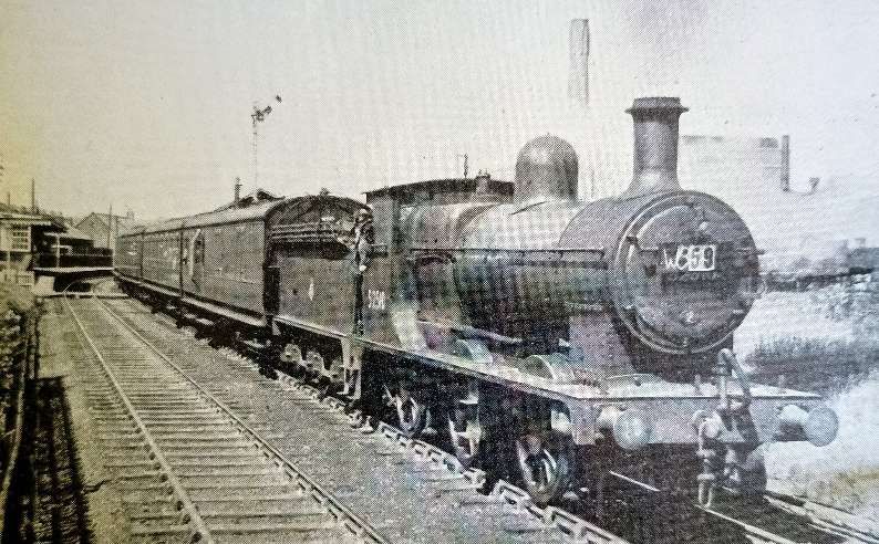
- Mixed Traffic & Freight Locomotives: LMS Stanier Class 5 ‘Black 5’ 4-6-0s were the undisputed backbone of both passenger excursions and heavy freight along the Cumbrian Coast. LMS ‘Jubilee’ Class 4-6-0s handled principal passenger and express services. WD ‘Austerity’ 2-8-0s & 2-10-0s were deployed for the transport of coal and iron ore from local pits. LMS Ivatt Class 4 2-6-0s & Class 2 2-6-0s were regularly used for lighter passenger duties and banking on steep gradients. [8]
- Mineral & Branch Line Engines: LMS Fowler 3F ‘Jinty’ 0-6-0Ts were used for shunting and short-haul mineral trains in the heavy industrial zones of Workington and Whitehaven. LNWR Super D’ Class 0-8-0s were a frequent sight on slow-moving freight trains in the early BR era. [8]
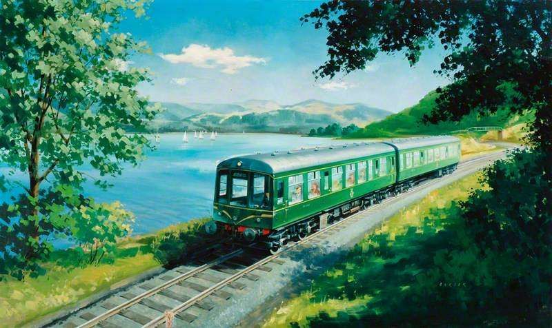
- Early BR Region Innovations: BR Standard Class 3 2-6-2Ts were introduced in the early 1950s as modern mixed-traffic branch line tanks. They were utilized across the region’s secondary and cross-country routes. [8] Derby Lightweight DMUs were introduced in the mid-1950s to reduce operating costs and increase passenger numbers on quiet branch lines. [7]
The development of British Rail’s Derby Lightweight diesel multiple units (DMUs) were a significant milestone in UK railway history. They were introduced to West Cumberland in late 1954 as part of the London Midland Region’s modernization scheme. They were the first diesel multiple units built en-masse for British Railways. “Thirteen power trailer sets were built specifically for the West Cumberland area … to operate on three lines: Carlisle to Silloth; … the Carlisle – Maryport – Workington – Whitehaven line; … and the Workington, Cockermouth, Keswick & Penrith line. All would be delivered to Carlisle Upperby depot, some would move to Workington. They would be joined by more sets moved from other LMR schemes. By the time of their replacement by Class 108s in 1969 around 75% of all LMR Derby Lightweight (79xxx series) power cars would have spent time allocated to Carlisle, some of the original routes had closed and their use would spread to other routes from the city.” [7]
Further details of the history of the Derby lightweight DMUs in West Cumberland can be found here. [7]
The sleek, wide-windowed design was highly popular with tourists, and the introduction of these DMUs led to an 80% growth in passenger ticket receipts on some Cumbrian routes. [9]
Future posts in this series will look at the individual lines that are highlighted in the first article which can be found here. [3]
References
- C. A. Knight; Railways of West Cumberland; in The Railway Magazine, November 1954; Tothill Press, London, 1954, p757-765.
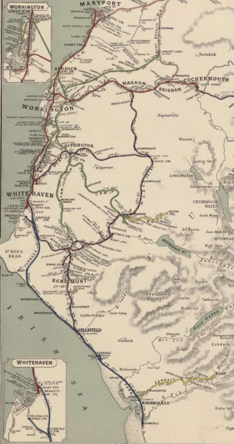
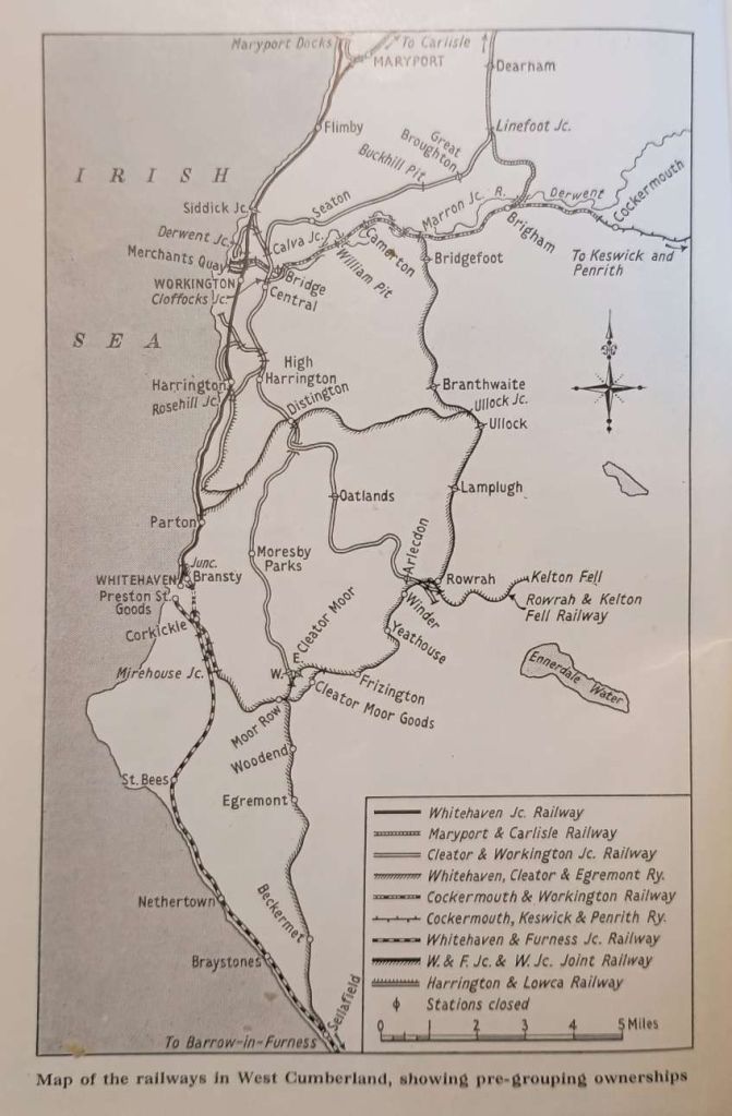
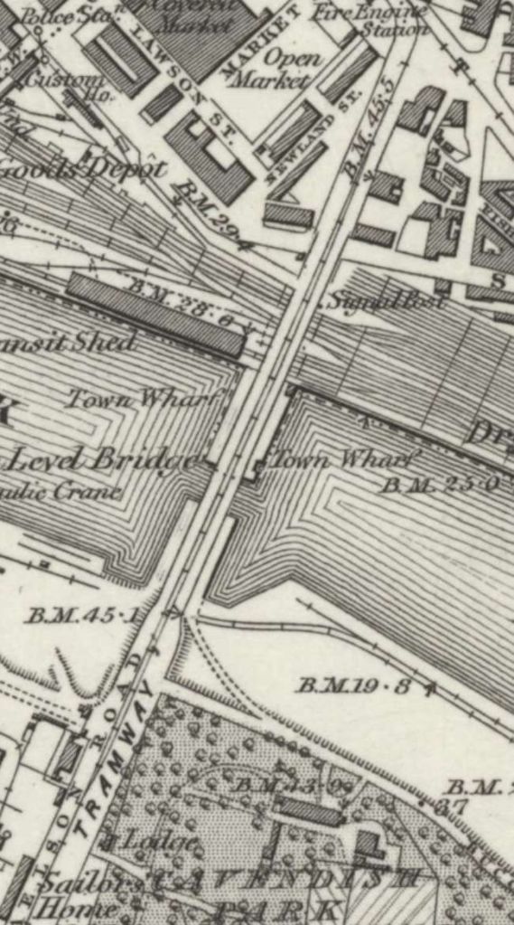
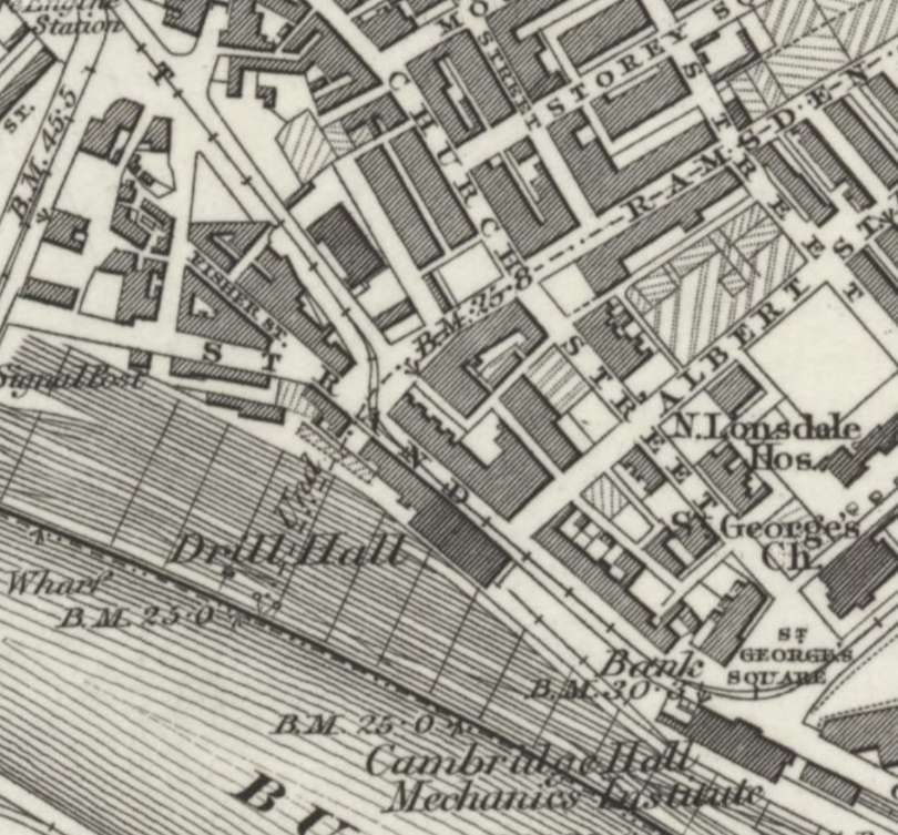
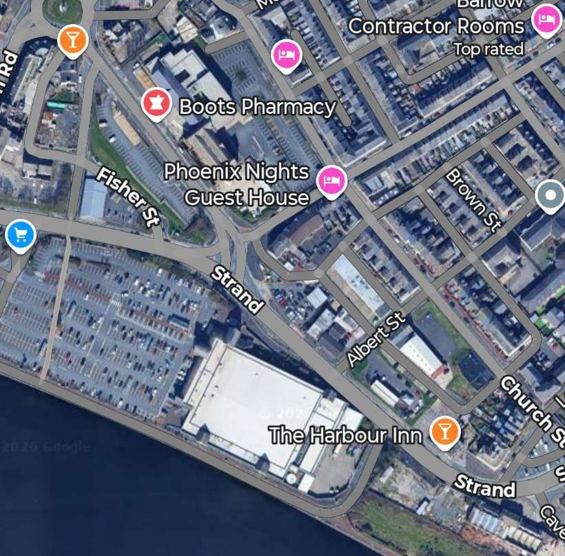
- The Railway Clearing House, London, 1921; via, https://maps.nls.uk/view/245959305, accessed on 3rd April 2026.
- https://rogerfarnworth.com/2026/05/02/the-railways-of-west-cumberland-part-1-an-introduction
- https://en.wikipedia.org/wiki/Moor_Row, accessed on 29th May 2026.
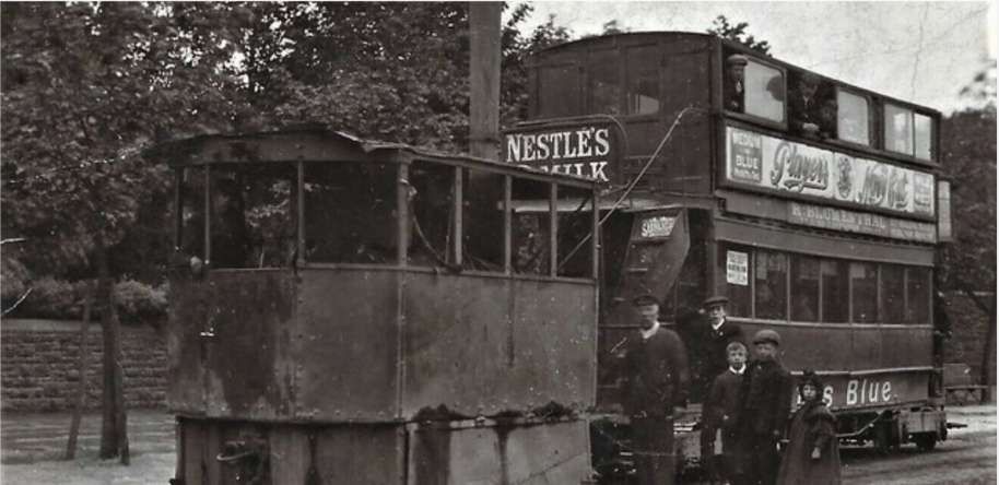
- https://www.facebook.com/share/p/1D6osFET4V, accessed on 29th May 2026.
- https://www.geograph.org.uk/photo/5325623, accessed on 30th May 2026.
- https://www.railcar.co.uk/type/derby-lightweight/west-cumberland-operations, 31st May 2026.
- https://www.photosfromthefifties.co.uk/wp-content/uploads/2023/07/CUM-July-2023.pdf, accessed on 31st May 2026.
- https://artuk.org/discover/artworks/a-diesel-train-on-the-shore-of-bassenthwaite-lake-near-keswick-cumberland-9439, accessed on 31st May 2026.


