Tag Archives: Ireland Railways

The Story of Irish Narrow Gauge. … Its Growth and Decay …

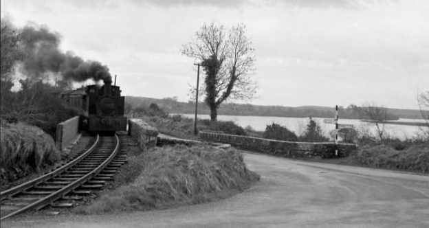
The featured image for this article was taken on the Cavan and Leitrim Railway’s Ballinamore to Arigna branch by James P. O’Dea. on 14th March 1959. This photograph is National Library of Ireland ref.: ODEA 11/30 (www.nli.ie) and is avaiable as (c) Public Domain. [44]

1st February 1961 was a significant date in the history of Irish Railways. It marked the closure of the West Clare Railway, the last survivor of the narrow-gauge lines.
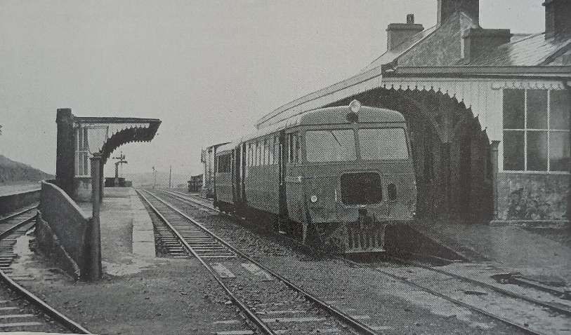
The afternoon train from Ennis to Kilrush is made up of diesel Railcar No. 3388 and a trailer and van. Here it sits at Milton Malbay, on the West Clare section of Coras Impair Eireann on 27th July 1960. Closure of the West Clare section occurred on 1st February 1961, © E. M. Patterson. [1: facing page iv]

The Railway Magazine of February 1961 noted that, “The construction of many of these railways was facilitated by special legislation, designed to relieve the depressed state of large areas of that country some eighty years ago. Although several schemes failed to mature, more than 500 miles of 3 ft-gauge line were built, and over 30 miles of 5 ft. 3 in. gauge were narrowed. To this total must be added the nine miles of so-called “monorail,” on the Lartigue system, from Listowel to Ballybunion. The decline of the narrow gauge began with the advent of motorbus services in rural areas, and its extinction [was] now complete.” [1: p74]
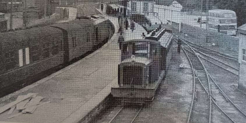
Trains of two gauges at Ennis Railway Station on 22nd September 1960. On the right, diesel mechanical locomotive No. F502 waits to depart for West Clare from the bay platform, while across the platform, a CIE main line train heading to Limerick arrives in the station, © R. N. Joanes and licensed for reuse under a Creative Commons Licence (CC BY-SA 2.0). [2: p75]

The first part of an article on this considerable proportion of the railway mileage of Ireland appeared in the February 1961 issue of The Railway Magazine. [2: p75-83]
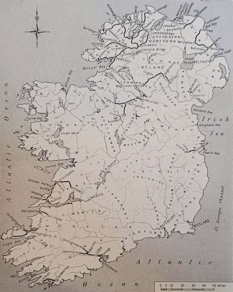
This map shows the relative positions of the Irish Narrow Gauge lines. [2: p76]

Patterson says that, “In the Irish railway framework, the narrow-gauge lines formed an integral part. In no sense freaks, they used a gauge of 3 ft. 0 in. which, though it lacked the Parliamentary blessing of the standard Irish 5 ft. 3 in. gauge, was entitled by usage and by total mileage to be regarded as a secondary standard. Only 9.5 miles of Lartigue monorail in County Kerry was an exception to the rule, and its short existence of 36 years likewise singled it out from the others. The 18 other narrow-gauge systems worked away in self-contained independence, with rolling stock that was nearly as commodious as on the standard gauge.” [2: p77]
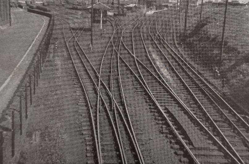
Mixed 5ft 3in gauge and 3ft gauge tracks at Larne Harbour in 1948, © R. E. Tustin. [2: p77]

Patterson continues: “Fittingly enough, the cradle of the Irish narrow gauge was rocked by the mining industry. In the peat-shrouded plateau of County Antrim, the basalt rocks north-east of Ballymena had been shown by geological survey to contain extensive beds of iron ore, and associated with them, accumulations of bauxite. The latter, mined for its aluminium content, was of no interest in the 1870s but iron ore that could be trucked out on to the hillsides was of immediate use to the cross-channel ironmasters. Roads in Antrim were primitive then, and in many of the glens the slipe or slide cart was more often to be seen than wheeled vehicles. Then the boom in iron-ore mining began, and in 1873 the first 3 ft gauge line was made down Glenariff to the sea, linking mines high on the terraced east face of the glen with a pier at the White Arch. It was no fault of the railway that the mines never paid; locally poor-grade ore, and high royalties to the landowner smothered the line, but though it never carried passengers, it was the pioneer.” [2: p77-78]

Apparently, “The first 3 ft gauge railway in Ireland to be authorised by Parliament followed close behind the Glenariff line, as the Ballymena, Cushendall & Red Bay Railway, (BC&RBR). opened in 1875. It ran alongside the 5 ft. 3 in.gauge Belfast & Northern Counties [Railway](B&NCR) main line at Ballymena and was to have conveyed ore to a pier at Red Bay. The descent from the uplands to the coast would have entailed a drop of 1,000 ft. in 5 miles. Probably because of the severe grade this part was never built and the line terminated near its summit level, the station being fittingly named Retreat and situated on moorland honeycombed with iron ore workings. Down at Ballymena, the broad gauge took the ore away for some years, until the Ballymena & Larne came in from Larne Harbour in 1878, and joined the BC&RBR in 1880. The broad gauge B&NCR took the pair of them over in 1884 and 1889.” [2: p78]

“Once the fashion was started by these three narrow-gauge lines in Antrim, similar systems progressed apace. 1877, the Ballycastle Railway Company obtained its Act and made a line from the B&NCR. at Ballymoney to what was then a small fishing port on the rocky northern coast of County Antrim. The line skirted the great flat of the Garry Bog and, after a gentle ascent towards the rounded hills, it started down the Tow Valley to the sea. It never had any prospect of mineral traffic, for it crossed country devoid of ore deposits, but the promoters’ hopes of its developing Ballycastle as a tourist resort were reasonably well fulfilled. With its opening in 1880, the start of a rapid expansion of narrow-gauge mileage had begun.” [2: p78]

Patterson continues,  “The decade 1880-90 witnessed the number of Irish narrow-gauge systems increase from three to 16. This growth was the result both of private enterprise and of state assistance under the Tramways & Public Companies (Ireland) Act of 25th August 1883. Private enterprise put six systems in motion, both steam and electrically hauled.” [2: p78] There were four of the former:

  • The West Donegal Railway – which became part of a much larger network.
  • The Portstewart Tramway, in Co. Derry.
  • The Castlederg & Victoria Bridge Railway, in Co. Tyrone.
  • The Dublin & Lucan Railway, west of the capital.

The two electric lines were:

  • The Giant’s Causeway & Portrush Tramway, in Co. Antrim.
  • The Bessbrook & Newry Tramway , in Co. Armagh.

Unique in design, and steam hauled, was the Listowel & Ballybunion, already mentioned as Britain and Ireland’s sole Lartigue monorail. More about the Lartigue can be discovered here. [3]
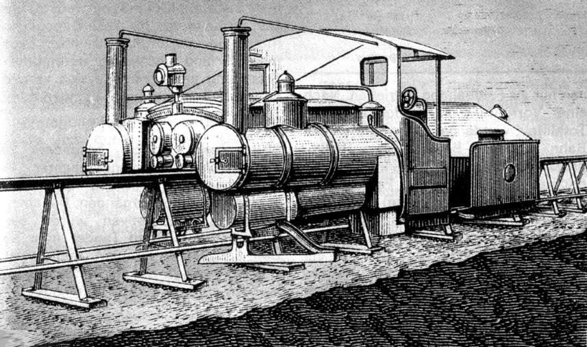
A sketch of the Lartigue locomotive, © Public Domain. [16]
The passing loop at Lisselton, © Public Domain. [16]

The 1883 Tramways Act resulted in six further lines:

  • The Cavan & Leitrim Railway – there is a series of articles on this blog about the lines operated by this company – these can be found here, [4] here, [5] here, [6] here, [7] here, [8] here, [9] here, [10] here, [11] here, [12] and here. [13]
  • The Clogher Valley Railway.
  • The Cork & Muskerry Light Railway.
  • The Schull & Skibbereen Railway.
  • The Tralee & Dingle Light Railway – an introductory article about two books about the line can be found here. [17]
  • The West Clare Railway – a series of articles on this blog about the lines operated by this company – can be found here, [18] here, [19] here, [20] here, [21] here, [22] here, [23] here, [24] and here. [25]

The Act also permitted the West Donegal to complete its line from the unsatisfactory original terminus at Druminnin to Donegal Town. But, the West Donegal struggled financially and in 1892 it amalgamated with the adjacent 5ft 3in gauge Finn Valley Railway (FVR). The merger created the County Donegal Railway Company and within a year or so, the FVR was converted to 3ft gauge.

Similarly the Londonderry & Lough Swilly Railway (L&LSR) was a 5ft 3in gauge railway which also worked a privately sponsored 3ft gauge line – the Letterkenny Railway opened in 1883. By 1885, the decision had been taken to convert the L&LSR to 3ft gauge.

Later expansion came about more slowly. “Sir John Allport’s Royal Commission of 1886 recommended the development of the Irish railways by the furtherance of light railways. The 1889 Light Railways (Ireland) Act was the outcome, and it authorised further state assistance. As a result, the Donegal Railway benefited by the addition of the Donegal-Killybegs and Stranorlar-Glenties sections, totalling 43.5 miles and opened in 1893 and 1894 respectively.” [2: p81]

The 6.5 mile Cork, Blackrock & Passage Railway (CB&PR) replaced its broad-gauge track by 3ft-gauge in October 1900. Under severe competition from the Cork Electric Tramway, the CB&PR extended its lines 9.5 miles, in stages, to Crosshaven (August 1902 to June 1904).

Remaining expansion centred predominantly in County Donegal. A 14.5 line from Strabane down the East side of the valley of the River Foyle gave access to the city and port of Derry. It opened in 1900.

A 15.5 mile branch from Donegal town to Ballyshannon was opened in 1905. In 1906 the Donegal was “bought out by the combined efforts of the GNR(I) and the Midland Railway (Northern Counties Committee) and was thereafter administered by a joint committee,” [2: p81] (the CDRJC).

The 19.5 mile line of the Strabane & Letterkenny Railway Company linked the two towns in 1909. It allowed some freight traffic to be transferred between the two narrow gauge systems in County Donegal.

More about the railways of County Donegal can be found in a series of other articles on this blog. These can be found here, [26] here, [27] here, [28] here, [29] here, [30] here, [31] here, [32] here, [33] here, [34] here, [35] here, [36] here [37] here, [38] here, [39] here, [40] here, [42] here, [43] and here. [44]

Patterson tells us that, “With the opening of the Strabane & Letterkenny line, the construction of passenger-carrying narrow-gauge lines in Ireland was complete, though the fact that the public had not lost interest was evidenced from time to time when local bodies advocated the extension of existing lines.” [2: p82-83] He cited as an example, the deaf ear turned by the CDRJC to local entreaties to extend the Glenties line to Ardara.

One final extension was to be built. 3 miles from the Cavan & Leitrim’s railhead at Arigna (just inside County Roscommon) adits were driven into coal deposits and, as the operation grew, a 4.5 mile extension from Arigna to Dereenavoggy and Aughabehy was opened in June 1920. That extension was, 10 years later cut back to a length of only 1.5 miles. For more about the extension please look here. [4]

During WW1, the British government took control of all Irish railways (December 1916 to August 1921). During those years wages rose by 250%! Fares were raised, doubling in stages. Patterson tells us that, “The slim profits of pre-war days vanished and a combination of higher rail fares, and higher rail freight charges, drove potential customers on to the roads. There, the expanding motor industry was ready to provide vehicles for both public and private transport. The position was the same in Great Britain, but in Ireland the rate of change was restrained by the lack of suitable roads to carry the new traffic.” [2: p83]

Patterson continues: “In the remoter parts of Ireland, where the narrow-gauge lines were situated, and where they had been built by reason of the physical and economic geography, road improvements came slowly. Surfaces in the 1930s were shockingly bad by present day standards, but in spite of the limited amount of money that the county councils had to spend, change was working.” [2: p83]

Politics also intervened: rebellion against British rule broke out in 1916. “By mid-1920, some engine crews were refusing to work trains which carried British troops or munitions and, in the December, this had virtually paralysed rail services in County Donegal and in other parts of the west. The formation of the 26-county Free State in December, 1921, did not end the unrest, for almost two years of civil war followed, during which there was wide-spread damage to rail systems, and train services ceased in Kerry and Cork.” [2: p83]

The new international border which was formed in 1921 and the accompanying customs tariffs adversely affected traffic and trade to the West of Derry.

Patterson continues: “The two companies faced the new situation quite differently. Henry Forbes, managing for the CDRJC, introduced petrol and then diesel railcars, and thereby obtained striking economies in operating costs. By stopping his trains almost anywhere to pick up passengers in the sparsely-peopled country, he gained an unequalled degree of public support. On the Londonderry & Lough Swilly, H. Hunt, and later James Whyte, decided that the future was on the roads and an expanding fleet of omnibuses and lorries began to trade over the north of the county. The contrasted policies were undoubtedly linked with the different ownerships. Behind the CDRJC., the LMS and the GNR (I) were essentially railway minded. The locally owned L&LSR was less traditional and more-over was working a line with stations often miles from the villages.” [2: p96]

After WW1, closures of Ireland’s narrow gauge railways began.

Patterson tells us that, “Three concerns came to an end in the decade between 1920 and 1930. First to go was the monorail between Listowel and Ballybunion. The company had been bankrupt since 1897, damage had been suffered during the ‘Troubles’, and the line had not been included in the Great Southern Railways merger. The concern lacked a profitable future and it was closed in mid-October 1924. … The Dublin & Lucan, altered from 3 ft. to 3 ft. 6 in. gauge in 1896 and electrified about ten years later, went down under bus competition at the end of 1924. It was resurrected by the Dublin United Tramways three years later, but it ceased to be narrow gauge and became linked to the city’s 5 ft. 3 in.-gauge tram system. It lasted thus until 1940.” [14: p169]

Patterson continues: “The Portstewart Tramway Company had only managed to remain solvent from 1882 until 1897. Ownership then went to the Belfast & Northern Counties Railway, passing to the Midland Railway (Northern Counties Committee) in 1903 and the LMS (NCC) in 1923. It functioned merely as a link between the seaside town and the railway station, and it was easily and economically replaced by substitute road services in January 1926.

“Some fifteen miles east of Portstewart, ill fortune had overtaken the Ballycastle Railway Company by 1924, and it closed the line down on 4th April. After some uncertainty, and a summer without trains, the line was taken over by the LMS (NCC) and was reopened in August 1924. Under the new regime, coordination with the neighbouring narrow-gauge lines at Ballymena became possible and some exchange of locomotive and coaching stock resulted. … During the 1930s the old Ballymena, Cushendall & Red Bay section of the NCC ground to a stop. The iron-ore traffic which had started it was finished, as it had become cheaper to import a higher-quality ore from overseas. Passenger traffic ended in October 1930. The line from Rathkenny to Retreat was closed completely in 1937, and the Ballymena to Rathkenny portion three years later.” [14: p169-170]

The formation of the Great Southern Railways incorporated two narrow-gauge lines which served Cork city. “Neither of them went far enough to serve a wide community and they were particularly subject to pressure from road services. The only double-track Irish narrow-gauge section, that from Cork to Blackrock, was singled in 1927 and the system was shut down in two stages during 1933. Two years later it was followed into the shadows by the Cork & Muskerry section, a line remarkable in that it survived the competing electric tramway by three years. … In Tyrone, the Castlederg & Victoria Bridge line had been fortunate in making contact with the Great Northern’s Omagh-Londonderry line. Its roadside position made it a target for its successors, and the end was defined by the 1933 railway strike, for the company never resumed operations after it.” [14: p170]
A short mixed train on the Clogher Valley Railway (CVR). The locomotive is CVR No. 6 ‘Erne’, an 0-4-2T built in 1887 by Sharp Stewart & Co., (Works No. 337). It was withdrawn in 1942, © Public Domain. [15]

Patterson tells us that, “The end of the Clogher Valley Railway had been in sight for twenty years before it closed. A 1927 Government enquiry, instituted because of the burden which the CVR was placing on the rates, resulted in the line being placed under a committee of management. The presence of Henry Forbes from the CDRJC produced a temporary rejuvenation, but with the formation of the Northern Ireland Road Transport Board in 1935 bus and lorry competition increased. The end was in sight and the Government ordered the closure at the end of December, 1941.” [14: p170]

On the Ballymena & Larne section of the NCC, passenger services, which included the express boat trains, had been throttled by the strike of 1933. In 1942 working ended on the Ballyboley Junction-Ballymena section and two years later the Ballyclare to Doagh section was lifted. An infrequent service of goods trains continued to operate between Larne and the Ballyclare Paper Mill until July 1950. [14: p170]

This trend of closure continued: the CDRJC lost the Glenties Branch in 1949. The Strabane to Letterkenny line closed at the end of 1954 with the rest of the network gone by 1959. Under the CIE, the Tralee & Dingle and the Cavan & Leitrim were allowed to deteriorate. The Tralee & Dingle had a period when it saw only one good train a month (in connection with Dingle Cattle Fair), but that finally ceased in June 1953. Coal trains from Arigna kept the C&LR branch active until 1959. In the last years of the C&LR, its depot at Ballinamore became a gathering place for narrow-gauge locomotives and rolling stock.

1960 saw a demolition train stripping the rails from the Barnesmore Gap in the heat of summer. The West Clare was struggling on. Patterson goes on to relate, succinctly, the history of the West Clare section which eventually fell as result of the May 1957, 259-page report from a committee of inquiry which stressed the population movement away from rural areas. The report suggested that all Ireland needed “was the main-line skeleton radiating from Dublin, and a cross-country line from Limerick to Rosslare. Clearly, the branches on the 5 ft. 3 in. gauge and what was left of the narrow gauge were redundant.” [14: p175]

In November 1960, “it became known that C.I.E. proposed to close in early 1961, among other minor lines, the West Clare. The announcement was greeted with regret rather than with surprise, for all things considered, it was a little remarkable that the West Clare survived as long as it did. With it [went] the Irish narrow gauge, evolving during nearly ninety years from the little mineral line in Glenariff to a total of around 570 miles of track and then degenerating step by step as social changes and mechanical developments created new conditions which had no use for it.” [14: p175]

References

  1. The Editorial, in The Railway Magazine, Volume 107, No. 718, February 1961.
  2. E. M. Patterson; The Narrow Gauge in Ireland: Its Growth and Decay – 1; in The Railway Magazine, Volume 107, No. 718, February 1961, p75-83 & p96.
  3. https://rogerfarnworth.com/2018/12/31/the-listowel-and-ballybunion-railway.
  4. https://rogerfarnworth.com/2019/04/26/the-cavan-leitrim-railway-arigna-valley-railway/
  5. https://rogerfarnworth.com/2019/05/09/the-cavan-and-leitrim-railway-a-short-history-and-a-look-at-dromod-station/
  6. https://rogerfarnworth.com/2019/05/19/the-cavan-and-leitrim-railway-dromod-to-mohill/
  7. https://rogerfarnworth.com/2019/05/24/the-cavan-and-leitrim-railway-mohill-to-ballinamore/
  8. https://rogerfarnworth.com/2019/05/29/the-cavan-and-leitrim-railway-ballinamore-to-ballyconnell/
  9. https://rogerfarnworth.com/2019/06/07/the-cavan-and-leitrim-railway-ballyconnell-to-belturbet/
  10. https://rogerfarnworth.com/2019/06/15/the-cavan-and-leitrim-railway-the-arigna-tramway/
  11. https://rogerfarnworth.com/2019/07/01/the-cavan-and-leitrim-railway-a-miscellany/
  12. https://rogerfarnworth.com/2023/04/28/the-cavan-and-leitrim-cl-railway-again-belturbet-railway-station/
  13. https://rogerfarnworth.com/2024/12/27/the-cavan-and-leitrim-railway-at-dromod-again/
  14. E. M. Patterson; The Narrow Gauge in Ireland: Its Growth and Decay – 2; in The Railway Magazine, Volume 107, No. 719, February 1961, p169-175.
  15. https://picryl.com/media/clogher-valley-railway-1093b4, accessed on 17th October 2026.
  16. https://en.wikipedia.org/wiki/Lartigue_Monorail, accessed on 17th October 2026.
  17. https://rogerfarnworth.com/2023/07/09/the-tralee-dingle-railway.
  18. https://rogerfarnworth.com/2019/04/08/the-west-clare-railway-part-1-ennis-to-corofin/
  19. https://rogerfarnworth.com/2019/04/15/the-west-clare-railway-part-2-corofin-to-lahinch/
  20. https://rogerfarnworth.com/2019/04/20/the-west-clare-railway-part-3-lahinch-to-miltown-malbay/
  21. https://rogerfarnworth.com/2019/04/30/the-west-clare-railway-part-4-miltown-malbay-to-quilty/
  22. https://rogerfarnworth.com/2019/05/05/the-west-clare-railway-part-5-quilty-to-moyasta/
  23. https://rogerfarnworth.com/2019/05/09/the-west-clare-railway-part-6-moyasta-to-kilkee/
  24. https://rogerfarnworth.com/2019/07/07/the-west-clare-railway-part-7-moyasta-to-kilrush-and-cappagh-pier/
  25. https://rogerfarnworth.com/2019/07/16/the-west-clare-railway-part-8-a-miscellany/
  26. https://rogerfarnworth.com/2024/05/16/the-lough-swilly-railway-continued-letterkenny-to-derry-part-1/
  27. https://rogerfarnworth.com/2024/05/27/the-lough-swilly-railway-continued-letterkenny-to-derry-part-2/
  28. https://rogerfarnworth.com/2026/10/22/the-lough-swilly-railway-continued-letterkenny-to-derry-part-3/
  29. https://rogerfarnworth.com/2024/09/14/the-llsr-once-again-a-perspective-from-the-19th-century-the-railway-magazine-november-1899/
  30. https://rogerfarnworth.com/2020/05/27/co-donegal-railways-ireland-part-1-the-glenties-branch-stranorlar-to-ballinamore/
  31. https://rogerfarnworth.com/2020/06/22/co-donegal-railways-ireland-part-2-the-glenties-branch-ballinamore-to-glenties/
  32. https://rogerfarnworth.com/2020/06/12/co-donegal-railways-ireland-part-3-petrol-railmotors/
  33. https://rogerfarnworth.com/2020/07/27/co-donegal-railways-ireland-part-4-strabane-to-letterkenny-part-a-strabane-to-raphoe/
  34. https://rogerfarnworth.com/2020/10/05/co-donegal-railways-ireland-part-5-strabane-to-letterkenny-part-b-raphoe-to-convoy/
  35. https://rogerfarnworth.com/2020/10/29/co-donegal-railways-ireland-part-6-strabane-to-letterkenny-part-c-convoy-to-letterkenny/
  36. https://rogerfarnworth.com/2023/04/26/teelin-bay-teelin-pier-and-co-donegal-railways/
  37. https://rogerfarnworth.com/2023/04/30/the-donegal-railway-heritage-centre/
  38. https://rogerfarnworth.com/2023/06/26/the-donegal-railway-heritage-trail/
  39. https://rogerfarnworth.com/2023/09/10/derry-history-the-harbour-tramways-railways/
  40. https://rogerfarnworth.com/2023/04/28/the-burtonport-extension-of-the-londonderry-lough-swilly-railway-part-1/
  41. https://rogerfarnworth.com/2023/05/05/the-burtonport-extension-of-the-londonderry-lough-swilly-railway-part-2/
  42. https://rogerfarnworth.com/2024/04/30/the-burtonport-extension-of-the-londonderry-amp-lough-swilly-railway-part-3/
  43. https://rogerfarnworth.com/2023/07/13/the-burtonport-extension-of-the-llsr-londonderry-and-lough-swilly-railway-part-4-barnes-gap-to-letterkenny/
  44. https://picryl.com/media/i-see-the-train-a-coming-a-coming-down-the-line-17256090891-393fc9, accessed on 22nd October 2026.
The Lough Swilly Railway continued – Letterkenny to Derry – Part 3. …

Tooban Junction Station to Derry

The Letterkenny to Newtowncunningham length of the line can be found on this link:

The Newtowncunningham to Tooban Junction section of the old railway can be read on this link:

https://rogerfarnworth.com/2024/05/16/the-lough-swilly-railway-continued-letterkenny-to-derry-part-1/

The length from Newtowncunningham to Tooban Junction is on this link:

https://rogerfarnworth.com/2024/05/27/the-lough-swilly-railway-continued-letterkenny-to-derry-part-2/

We start this length of the journey to Derry at Tooban Junction.

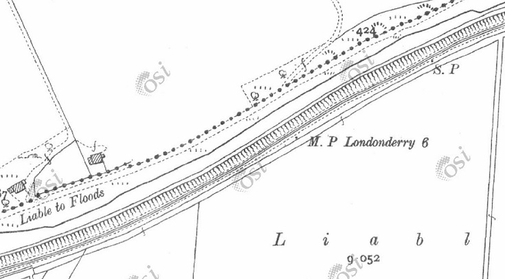
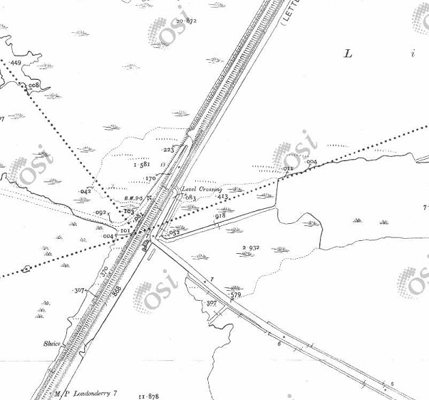
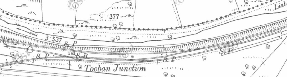
Tooban Junction Station as shown on the 25″ OSi survey. [1]
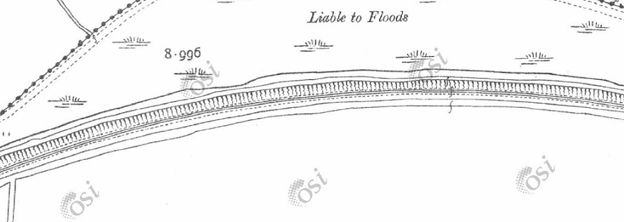
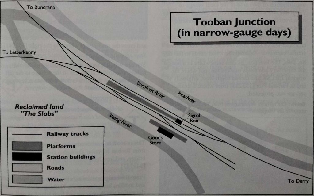
Tooban Junction Station as shown in Dave Bell & Steve Flanders book: The Londonderry & Lough Swilly Railway: A Visitor’s Guide. In that book, two diagrams appear, the first showing the station during mixed-gauge days, the second showing the station once the broad-gauge had been replaced. [13: p17]

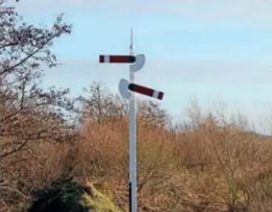
We finished the last article with a glimpse of the reconstructed signal post at Tooban Junction Station. Another photo of the rebuilt signal post is produced below. …

The Heritage Railway Journal carried an article about the reconstructed signal on 6th June 2023. [3]

Seventy years after the last L&LSR trains departed from Tooban Junction, “where the line from Derry split for Buncrana and Letterkenny, a signal has again appeared at the historic site. Buncrana sculptor John McCarron has recreated the junction’s characteristic starter signal as part of the Ghosts of Tooban Junction project, which aims to ensure that the once important junction is not forgotten. The station’s island platform carried an unusual arrangement of starter signal arms pointing in opposite directions on the same post at its Buncrana and Letterkenny end. Now, John has erected a steel-built replica at the remote junction site to mark the 70th anniversary of the closure of the L&LSR in August 1953 and to leave a permanent memorial to the railway’s heritage. … The [West Innishowen] Heritage Society and the Inch Wildfowl Trail, said: ‘If you look at a picture of Tooban Junction station when trains were running, the first thing you notice is the signal. That’s why [we]chose to make a replica, and worked it to the original dimensions. The only thing we couldn’t do is fit spectacle glasses or lights because of safety and environmental impact assessments that highlighted the danger to birds.'” [3]

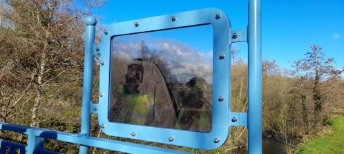
In the summer of 2023 this permanent fixture was added to the footbridge at what was the West end of the Tooban Junction Station site. Earlier the signal post shown above was installed. [4]

The sign was installed as part of a project centred on the Inch Levels and sits at the eastern extremity of the nature reserve. The Trail Gazers project is one of 8 such projects in various locations in Europe. [5]

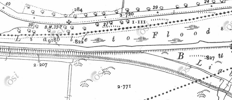
Setting off from Tooban Junction, trains followed a main drain from the reclaimed area curving sinuously across relatively level terrain to reach Burnfoot Station, little over a kilometre to the East.

The first length of the line to the East of Tooban Station. [1]
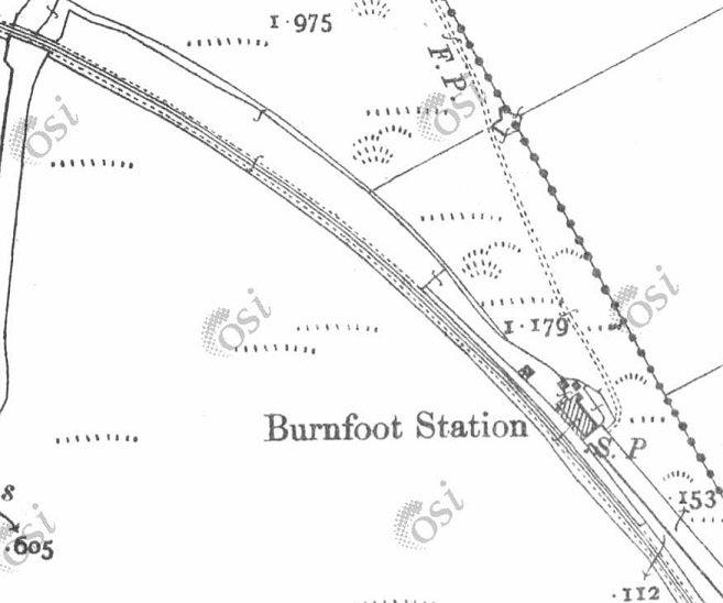
After little more than a kilometre, the line curved into Burnfoot Station. As the 25″ OSi survey shows, this was effectively a halt serving passengers. No goods facilities were provided. [1]
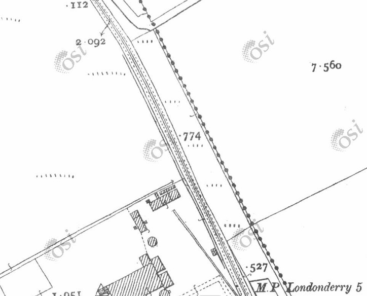
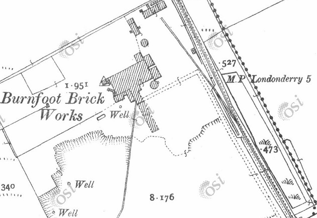
A little to the South of Burnfoot Station sidings were provided at around the 5 Km point which served Burnfoot Brickworks. [1]
The single siding with head-shunt is seen to better effect on this next extract from the 25″ OSi survey. [1]
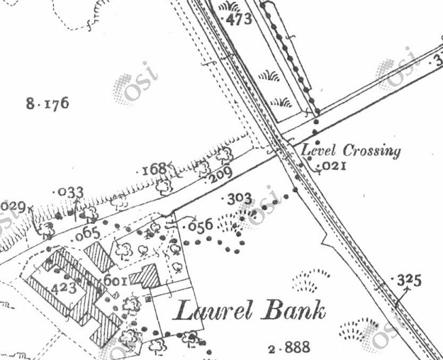
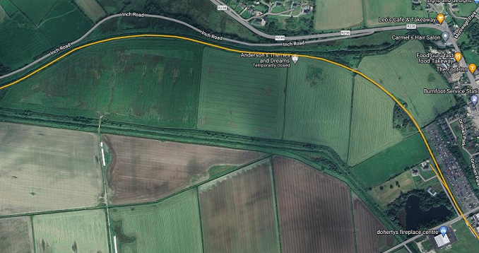
This next extract shows the next point of interest along the line – a level-crossing across what is now the R259. As can be seen on the railmaponline.com extract below, Laurel Bank is now the site of Doherty’s Fireplace Centre. [1]
This extract from railmaponline.com’s satellite imagery covers the same length of the L&LSR as the extracts from the OSi 25″ survey above. [2]
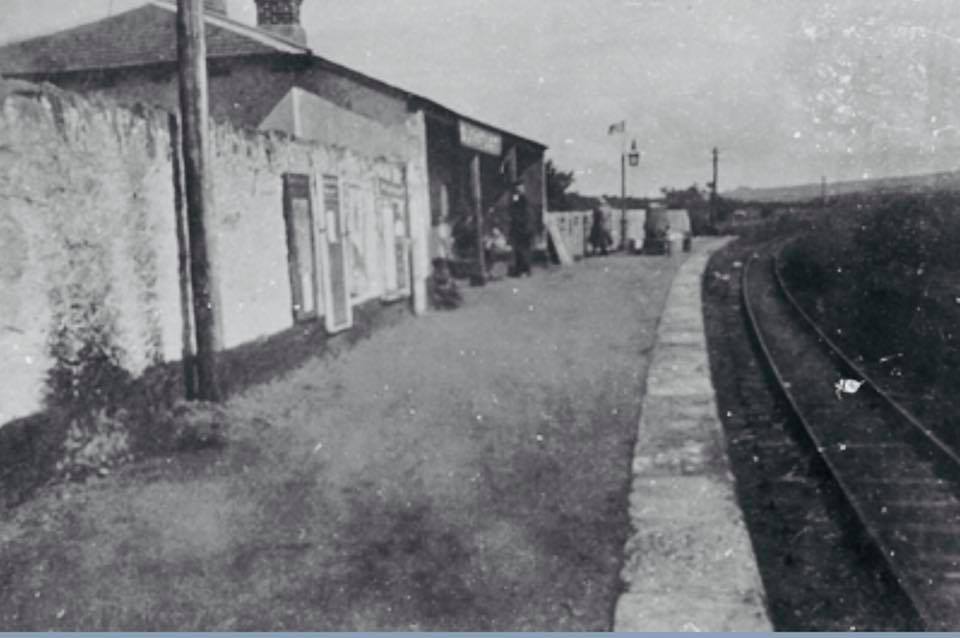
Looking Southeast through Burnfoot Railway Station in the 1920s. This image was shared by the West Inishowen History & Heritage Society on their Facebook Page on 6th August 2018. [6]
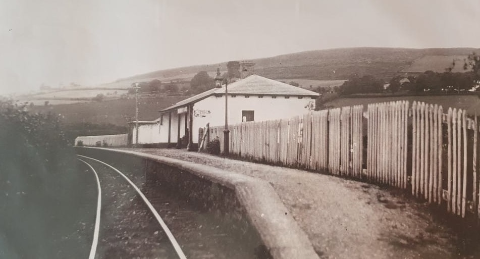
Looking Northwest through Burnfoot Railway Station. This image was shared by the Fahan Inch & Burt Parish on their Facebook Page on 16th July 2020, (c) J. Henderson. [6]
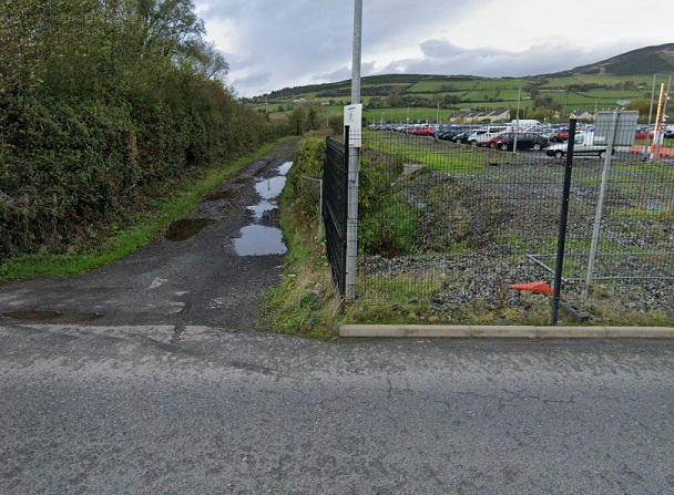
Looking North from the R259 road along the line of the L&LSR. [Google Streetview, November 2022]
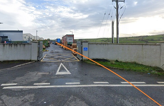
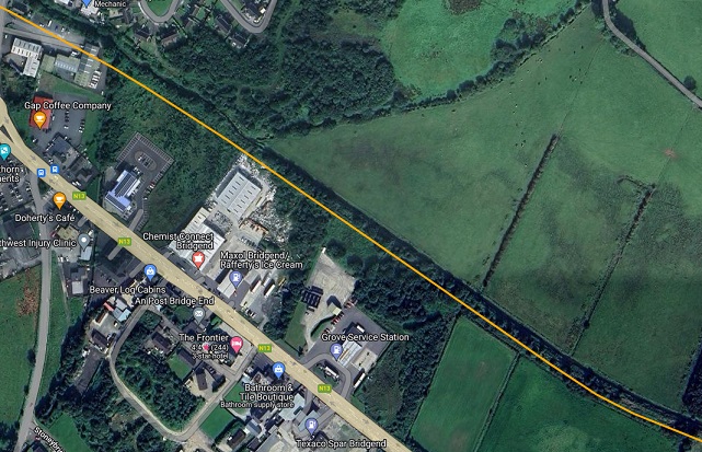
Looking South from the R259 road along the line of the L&LSR. It ran close to the West boundary of the Vertiv site. Its approximate line is marked by the orange line. [Google Streetview, November 2022]
[1]
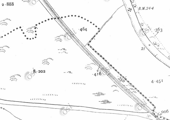
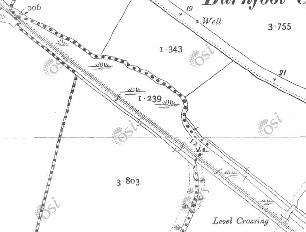
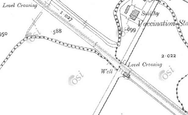
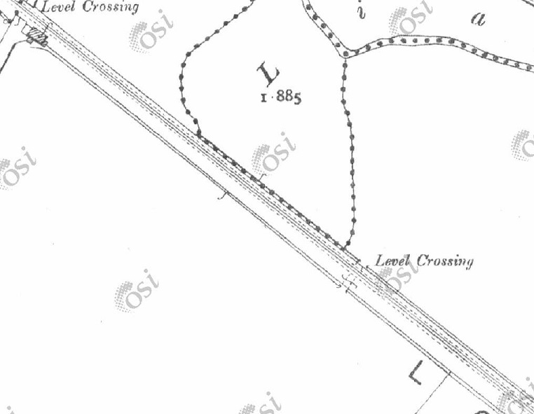
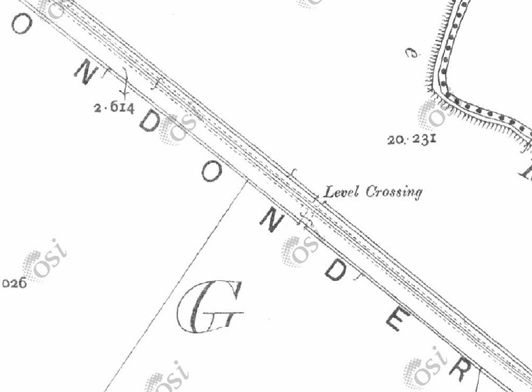
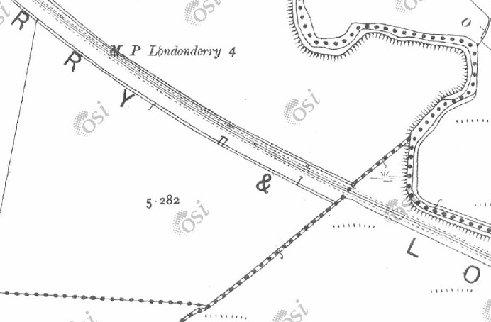
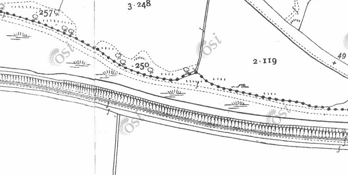
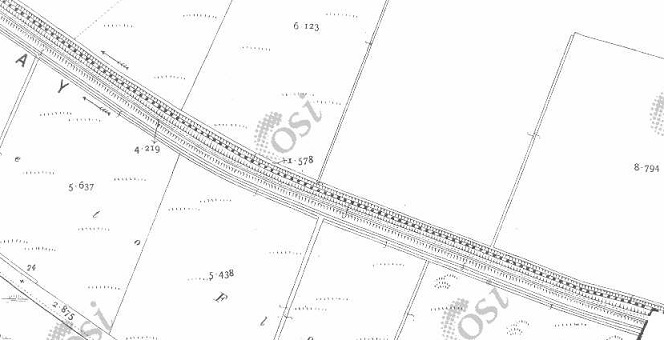
Three extracts from the 25″ OSi survey cover show the L&LSR running Southeast towards Derry. [1]
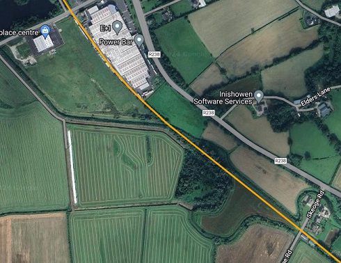
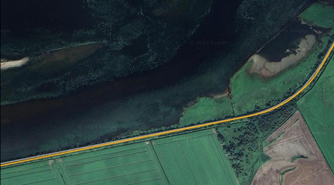
This railmaponline.com satellite image covers the same length of line as the three OSi 25″ extracts above. [1]
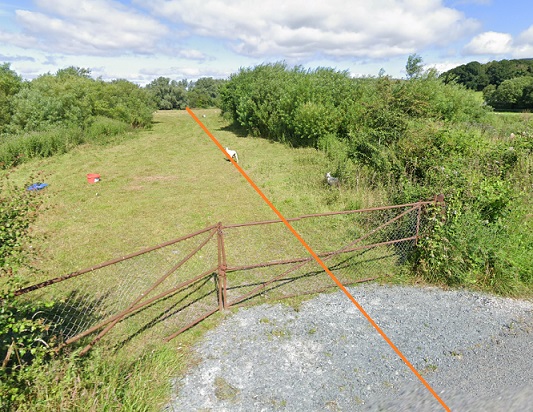
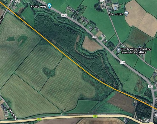
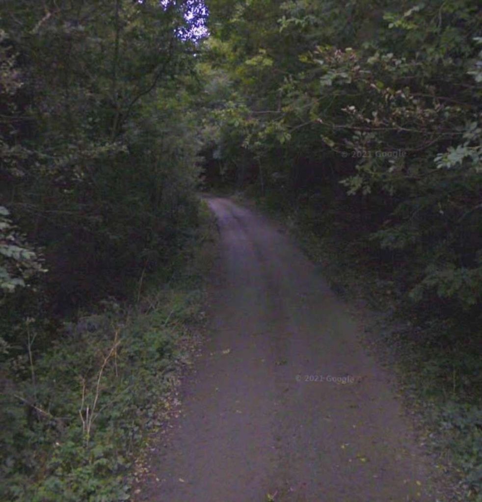
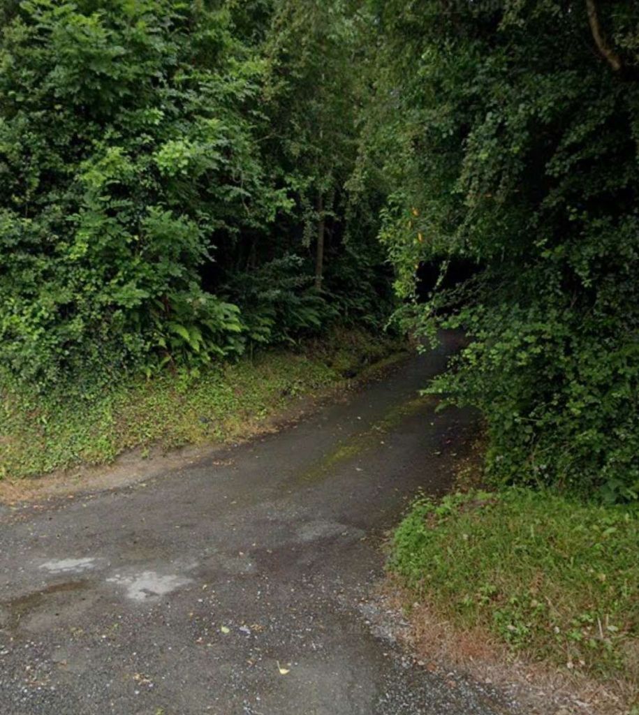
Looking Northwest from Skeoge Road (bottom-left of the railmaponline.com image above. The orange line marks the approximate line of the L&LSR. [Google Streetview, July 2021]
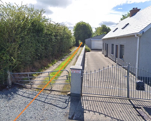
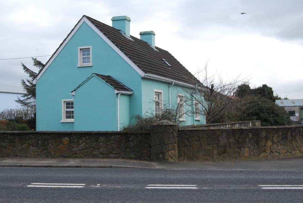
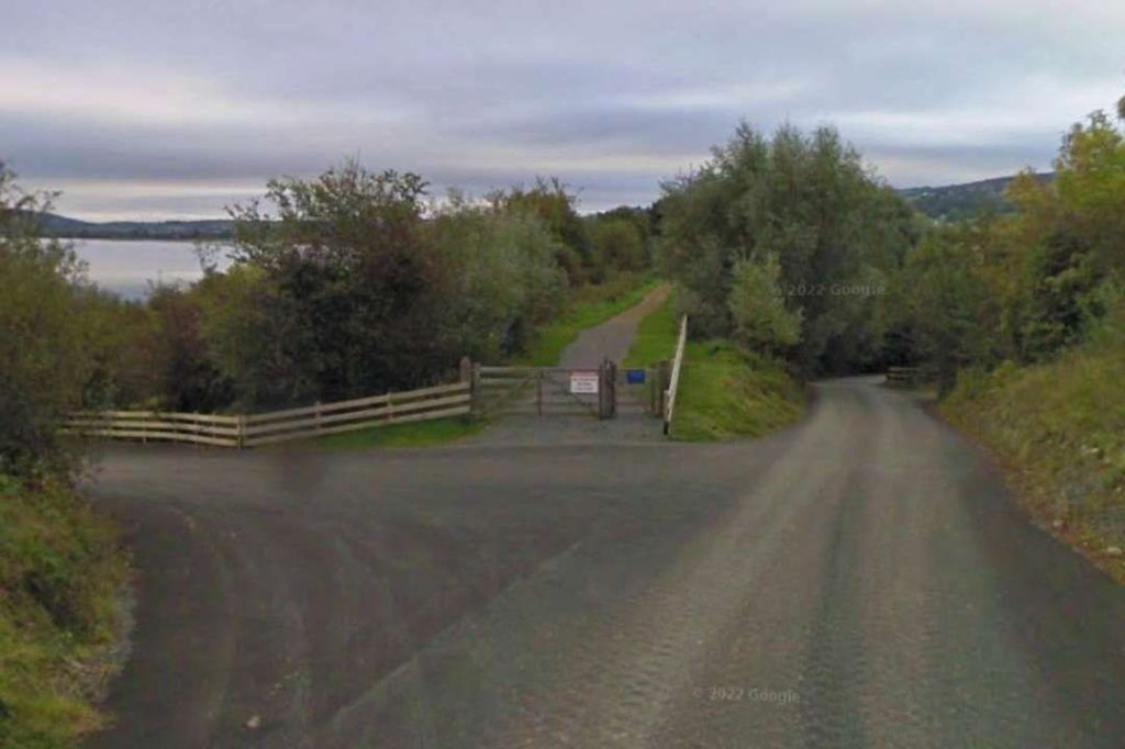
Looking Southeast from Skeoge Road (bottom-left of the railmaponline.com image above. The orange line marks the centre-line of the L&LSR. There was a crossing-keeper’s cottage at this location. It appears from this image to be in private hands and to have been enlarged significantly. [Google Streetview, July 2021]

The next four map extracts cover the length of the old railway from Skeoge Road to the R 238 at Bridge End Station. …

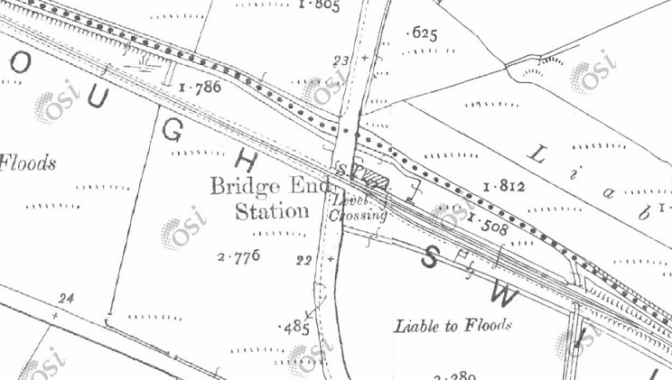
Four more extracts from the 25″ OSi survey take the line as far as Bridge End Station. [1]
Railmaponline.com shows the same length of the L&LSR as covered by the four map extracts above.  The level crossing at the top-left took the line over Skeoge Road. That at the bottom-right crossed the road now known as the R238. [2]
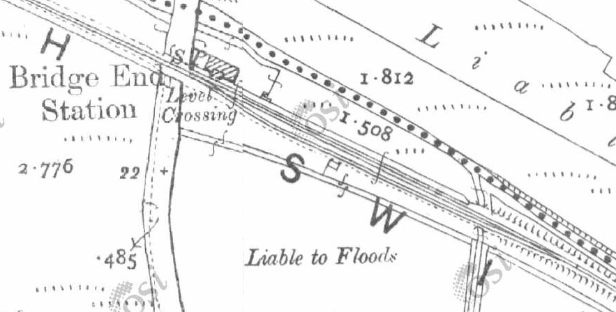
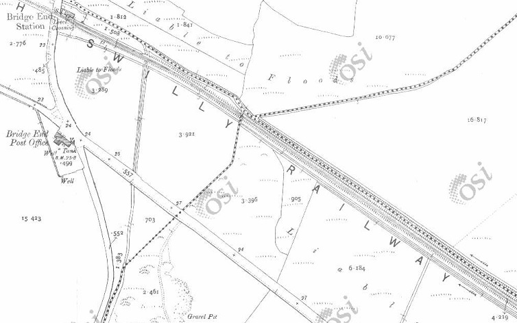
An enlarged extract from the 25″ OSi survey focussing on Bridge End Station. The Station House sat between the river and the railway to the East of the main road. [1]
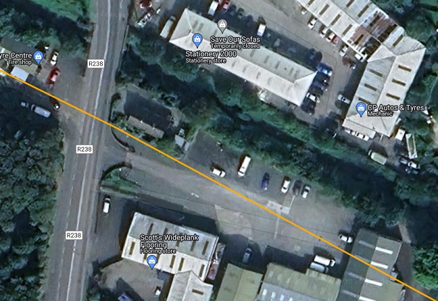
The same location shown on an enlarged extract from railmaponline.com’s satellite imagery. In the 21st century, the Station House still stands. It has been refurbished/remodelled and is in private hands. [2]
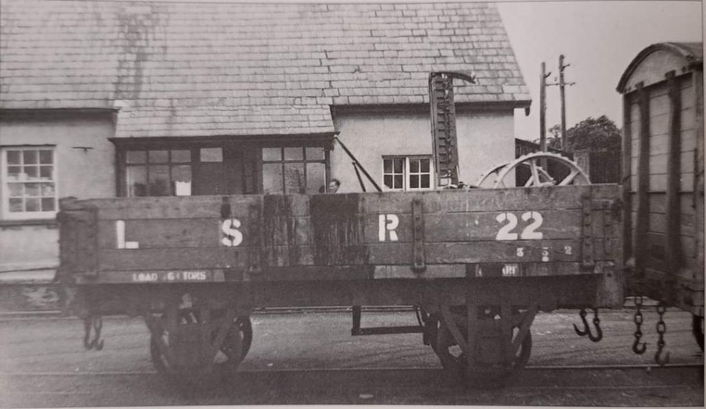
This photo, showing LSR Open Wagon 22 at Bridge Ens Station with an item of machinery as its load  was taken in July 1952 © Desmond Coakham. The loggia evident at the centre of the station building in this image was removed at a later date when the building was refurbished. The image was shared by Conor Harkin on the Londonderry and Lough Swilly Railway Facebook Group on 2nd May 2023. [10]
Bridge End Station in 1950. This image was shared on the Londonderry and Lough Swilly Railway Facebook Group by Olivia Norris on 11th September 2023. [11]
Looking West through Bridge End Station site towards the R238 in 1989. This photo was shared on the Londonderry & Lough Swilly Railway Facebook Group by Danny Doherty on 15th June 2021. [8]
Looking East from a point perhaps 20 metres into the Station site from the R238 in 1989. This photo was shared on the Londonderry & Lough Swilly Railway Facebook Group by Danny Doherty on 15th June 2021. [8]
Looking North East from the South side of the main running line in 1989. This photo was shared on the Londonderry & Lough Swilly Railway Facebook Group by Danny Doherty on 15th June 2021. [8]
The refurbished Station House at Bridge End Station seen from the West side of the R238 in 2008. This photo was shared on the Londonderry & Lough Swilly Railway Facebook Group by Chris Stewart on 19th November 2020 [9]Th

Next two map extracts take us to the border. …

The L&LSR immediately to the Southeast of Bridge End Station. [1]
The international boundary appears at the bottom-right of this image. [1]
This extract from railmaponline.com’s satellite imagery covers the same length of the L&LSR as the two extracts from the OSi 25″ Survey above. [2]
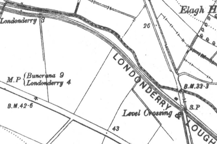
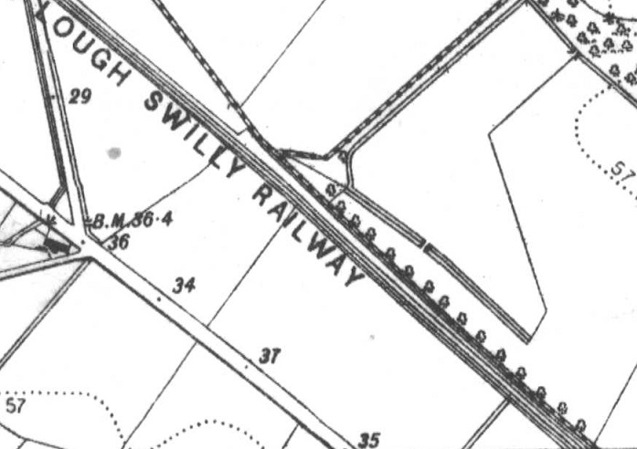
This extract from the OSNI Historical Third Edition (1900-1907) (Sheet 14a) covers the length of the old railway and far as the level-crossing at Elagh Road. [12]
[2]
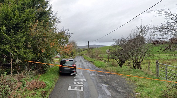
The site of the level-crossing at Elagh Road seen from the South. [Google Streetview, November 2022]
OSNI Historical Third Edition (1900-1907) Sheet 14a. [12]
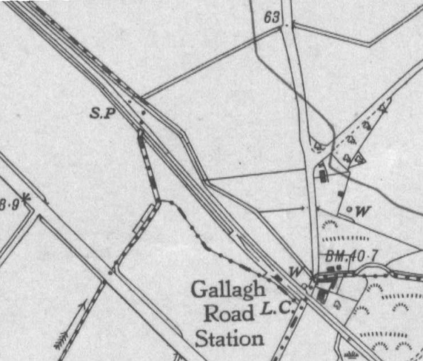
OSNI Historical Fifth Edition (1919-1963) Sheet 14. [12]
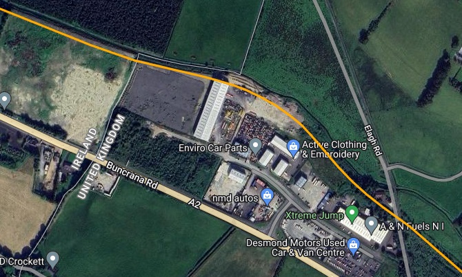
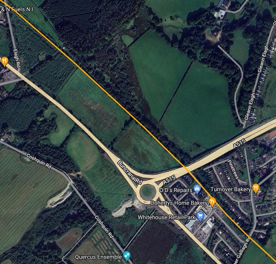
Approximately the same length of the line as covered on the two map extracts above. Elagh Road is top-left on the extract from railmaponline.com’s satellite imagery. The location of Gallagh Road Station is bottom-right. [2]
Looking Northwest from the A515 along the line of the L&LSR. The drainage channel/stream whih passes under the modern road adjacent to the line of the old railway fixes it line and location. [Google Streetview, October 2022]
Looking Southeast from the A515 along the line of the L&LSR. [Google Streetview, October 2022]
Looking Northwest from Upper Galliagh Road along the line of the L&LSR. [Google Streetview, October 2022]
Looking Southeast from Upper Galliagh Road along the line of the old railway. [Google Streetview, October 2022]
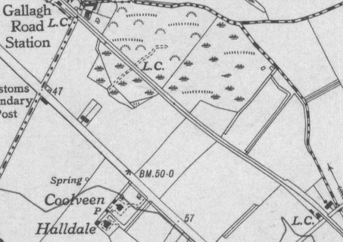
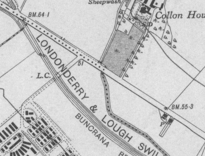
OSNI Historical Fifth Edition (1919-1963) Sheet 14. [12]
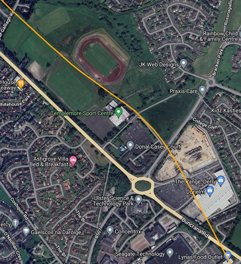
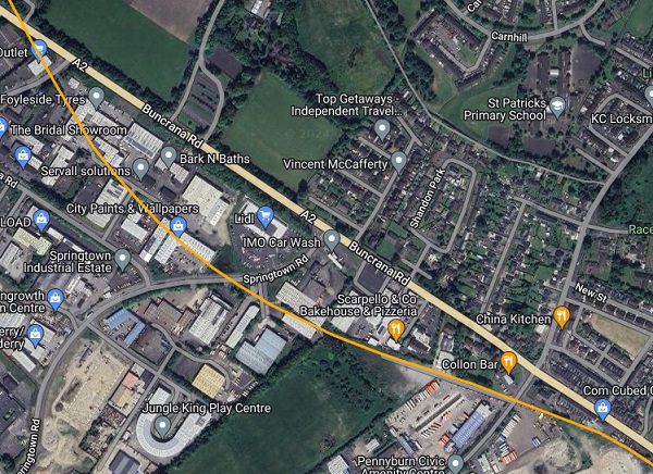
This extract from railmaponline.com’s satellite imagery covers the same length of the L&LS as the two map extracts above. Gallagh Road can be seen at the top-left corner of this image and the location of the crossing over Buncrana Road is at the bottom-right. [2]
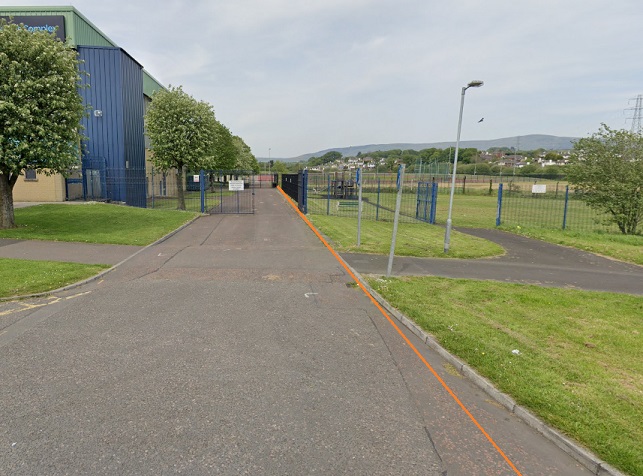
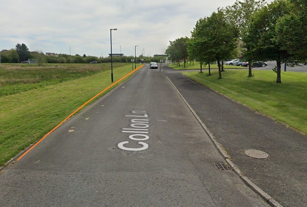
Looking Northwest from Collon Lane . The large building on the left is Templemore Sports Centre. [Google Streetview, May 2019]
Looking Southeast along Collon Lane. The approximate line of the old railway is marked by the orange line. {Google Streetview, May 2019]
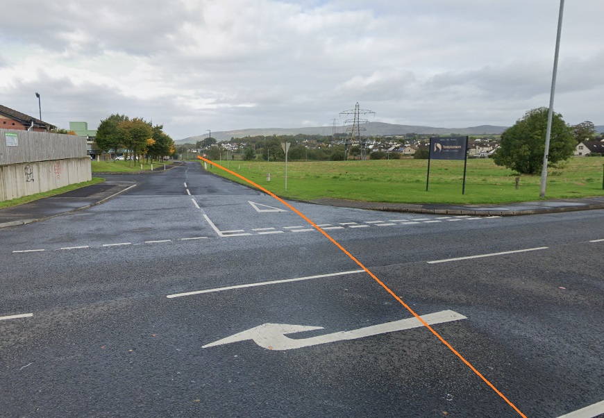
Looking Northwest along the line of the old railway from Templemore Road. [Google Streetview, October 2022]
Looking Southeast along the line of the L&LSR from Templemore Road. [Google Streetview, October 2022]
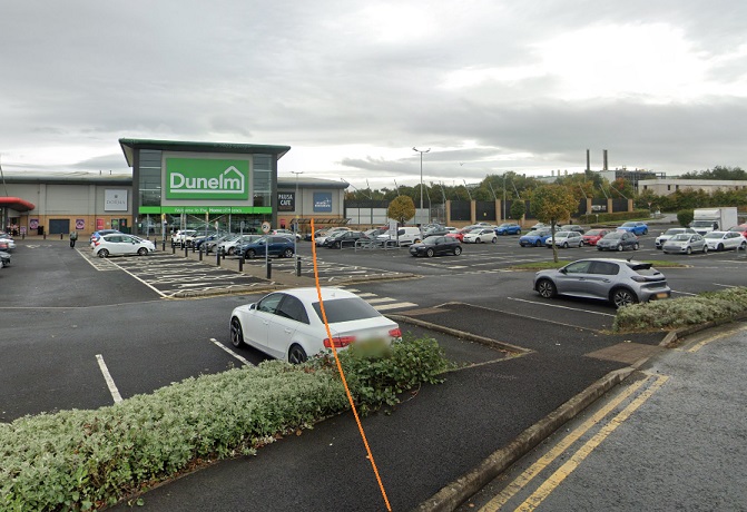
Looking Southeast from within the modern shopping Complex with the approximate line of the L&LSR marked in orange. [Google Streetview, October 2022]
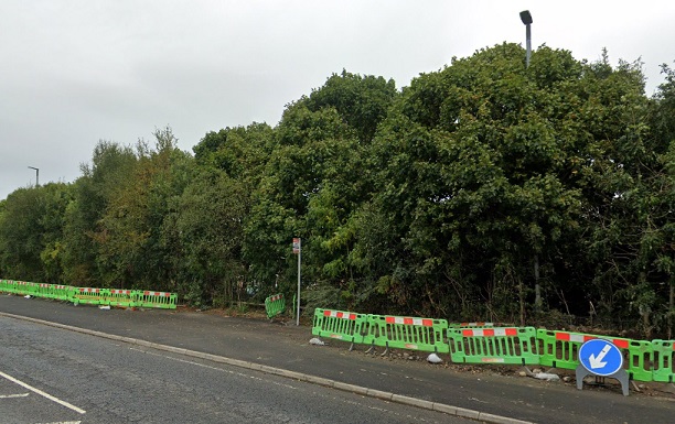
Looking back, Northwest, along the line of the old railway. The modern bus-stop on Buncrana Road sits pretty much on the line of the L&LSR. [Google Streetview, October 2022]
Looking Southeast, along the line of the old railway. The trees sit over the formation of the L&LSR. [Google Streetview, October 2022]
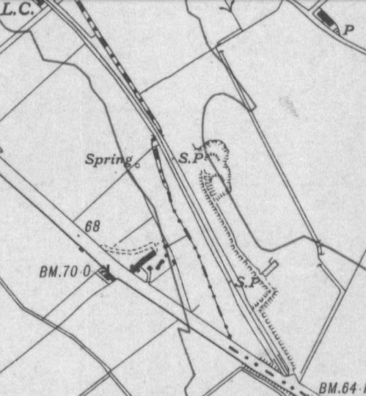
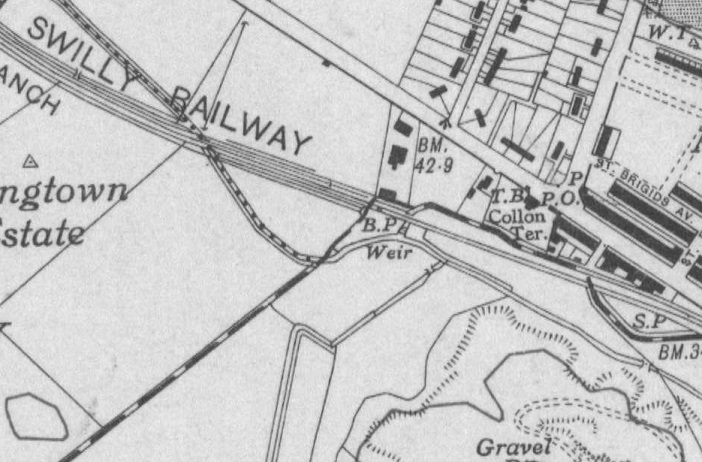
OSNI Historical Fifth Edition (1919-1963) Sheet 14. [12]
Another extract from the satellite imagery from railmaponline.com, this covers the same length of the line as shown on the two map extracts above. [2]
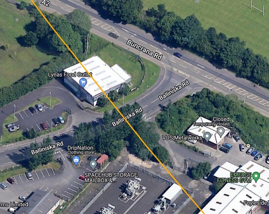
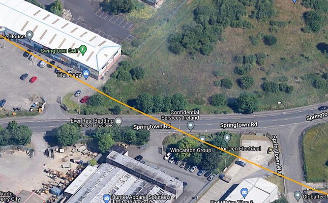
An enlarged extract from railmaponline.com’s satellite imagery showing the route of the old line as it crosses the industrial area to the South of Buncrana Road. [2]
Further Southeast, the route of the old railway crossed Springtown Road. [2]
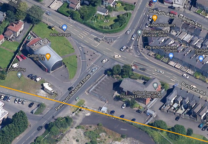
And then the main access road to the Pennyburn Industrial Estate. [2]
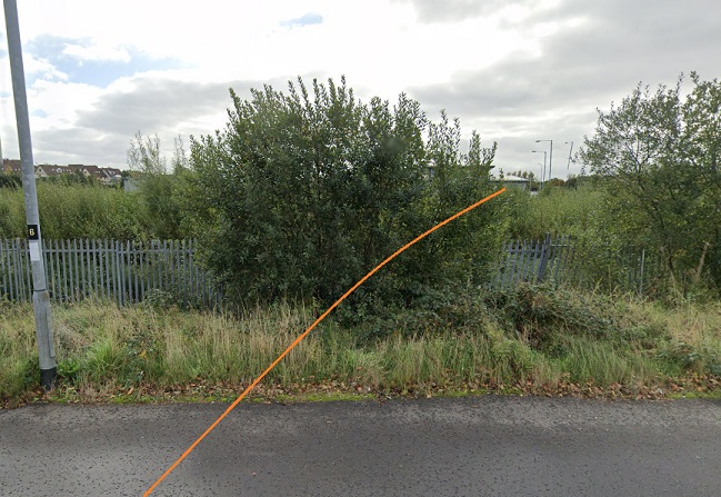
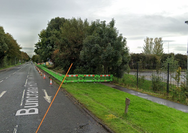
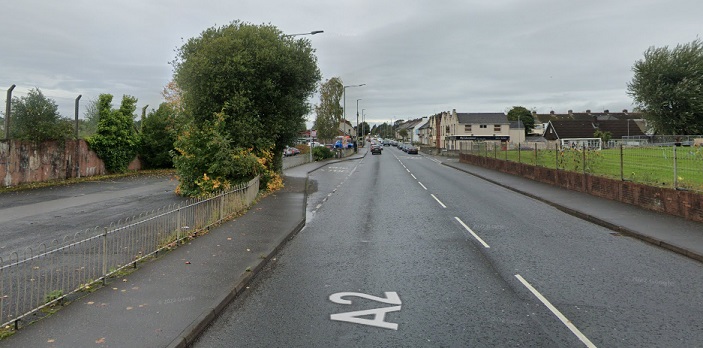
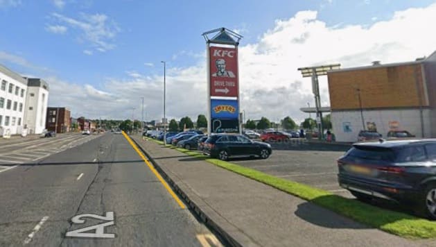
A little further to the Southeast the A2 (Buncrana Road) and the old line converged. The fence line on the left in this view looking Northwest is on the approximate line of the L&LSR. [Google Streetview, October 2022]
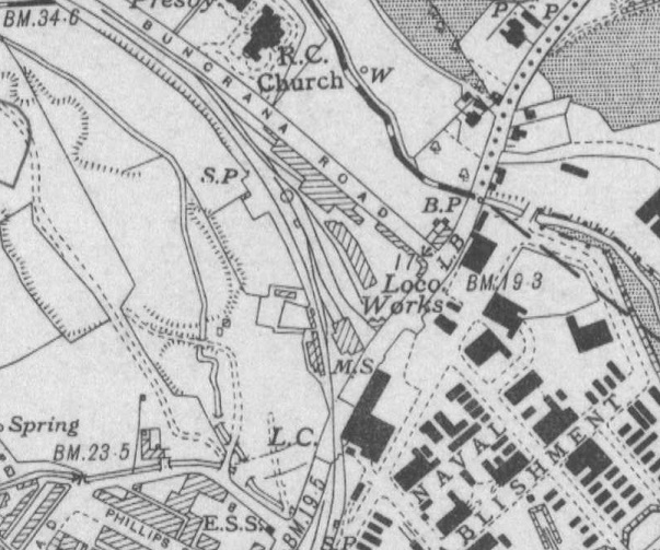
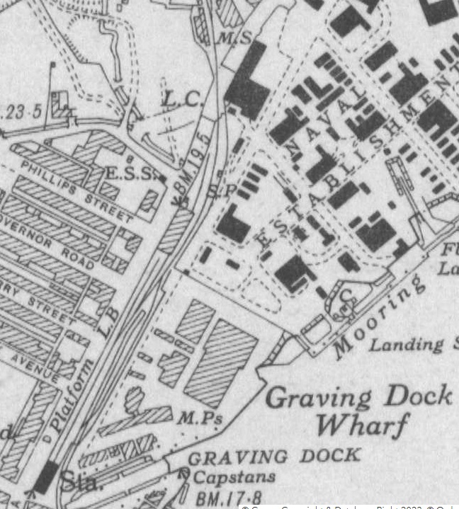
OSNI Historical Fifth Edition (1919-1963) Sheet 14. [12]
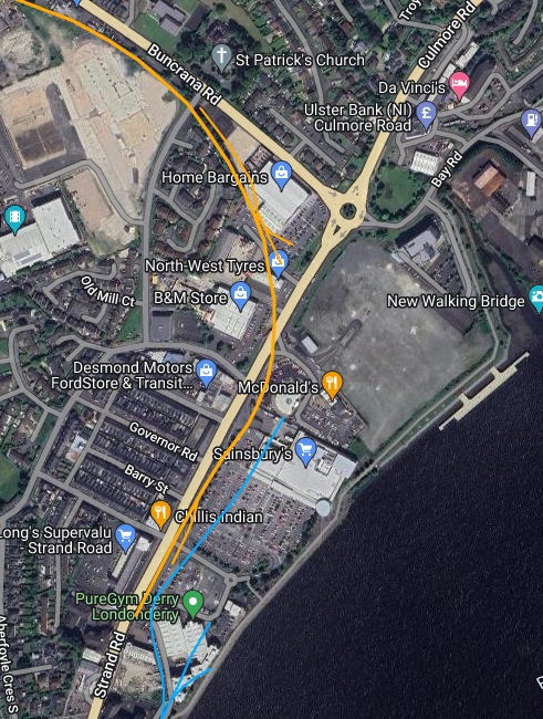
Close to the top of this extract from railmaponline.com’s satellite imagery that route of the old railway crosses Pennyburn Pass which approximately marks the extent of what became the main works depot of the L&LSR in Derry. It then curved round to the South crossing Strand Road before running into the L&LSR terminus. [2]
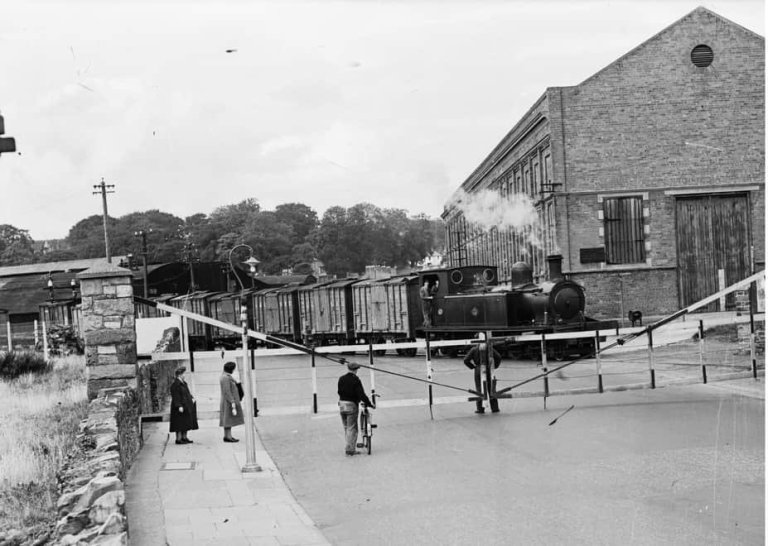
Looking Northwest along Strand Road, this is the L&LSR level-crossing. This photograph shows the final train on the L&LSR, entering Graving Dock Station from the North, crossing Strand Road. The Crossing Gates emphasise the width of the road and the shallow angle of the crossing. [14]
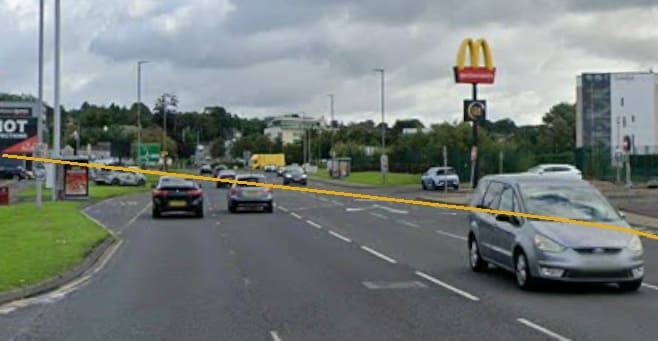
Approximately the same view in the 21st century. [Google Streetview, August 2025]
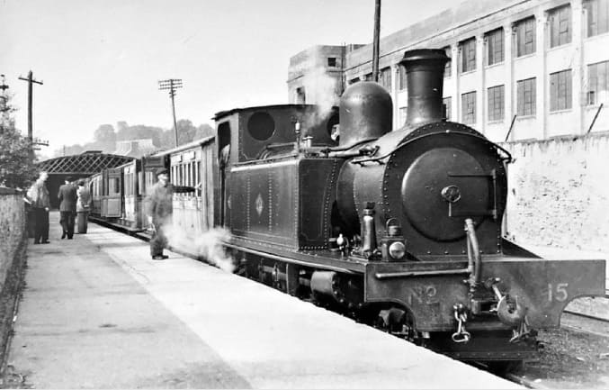
Looking Southwest towards the end of the line this image shows a L&LSR train at the old station in Strand Road. On the right, opposite the station is the Wilkerson factory of 1921, Sainsburys sits to the left of this image in the 21st century. Joseph Keys shared this image on the Derry of the Past Facebook Group on 6th December 2018. [15]
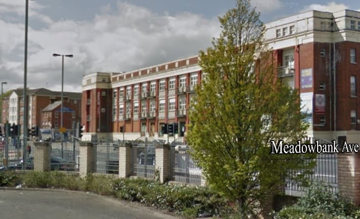
Approximately the same view in the 21st century – taken from the Sainsbury’s car park. [Google Streetview, April 2012]
The mustard coloured line superimposed on this northeast-facing streetview image shows the approximate location of the old L& LSR terminus. [August 2025]

References

  1. https://osi.maps.arcgis.com/apps/webappviewer/index.html?id=bc56a1cf08844a2aa2609aa92e89497e&extent=683726.0615%2C658718.4679%2C685361.1897%2C660108.8561%2C2157, accessed on 28th May 2024.
  2. https://railmaponline.com/UKIEMap.php, accessed on 28th May 2024.
  3. https://pressreader.com/article/282342569226359, accessed on 28th May 2024.
  4. https://www.donegalcoco.ie/yourcouncil/communications%20office/pressreleases2023/march/trail%20gazers%20the%20legacy/, accessed on 28th May 2024.
  5. https://www.trailgazers.eu/pages/trails, accessed on 28th May 2024.
  6. https://www.facebook.com/plugins/post.php?href=https%3A%2F%2Fwww.facebook.com%2Fwestinishowenhistory%2Fposts%2Fpfbid02qxPZd6QxEFHgJ3YJK7jbBxEUgYB2fXdjvRLEwiZvkDaoemL3JyaFZjxjpBZffTNjl&show_text=true&width=500&is_preview=true” width=”500″ height=”443″ style=”border:none;overflow:hidden” scrolling=”no” frameborder=”0″ allowfullscreen=”true” allow=”autoplay; clipboard-write; encrypted-media; picture-in-picture; web-share, accessed on 28th May 2024.
  7. https://www.facebook.com/plugins/post.php?href=https%3A%2F%2Fwww.facebook.com%2Ffahaninchburt%2Fposts%2Fpfbid0cJWSNmjJ43QuDSXtHd9RJQUGtpMNpRTkhuhp1WUpk6W11C8o9oySRZuGAP11xT25l&show_text=true&width=500&is_preview=true” width=”500″ height=”456″ style=”border:none;overflow:hidden” scrolling=”no” frameborder=”0″ allowfullscreen=”true” allow=”autoplay; clipboard-write; encrypted-media; picture-in-picture; web-share, accessed on 28th May 2024.
  8. https://www.facebook.com/share/p/Ctrxv7R3rh3pgozn, accessed on 29th May 2024.
  9. https://www.facebook.com/share/p/31CXxKBJ6vK1aU6e, accessed on 29th May 2024.
  10. https://www.facebook.com/share/p/yJbkw5KwnBR5MbkX, accessed on 29th May 2024.
  11. https://www.facebook.com/share/p/vCBZVJGaneJyocCm, accessed on 29th May 2024.
  12. https://apps.spatialni.gov.uk/PRONIApplication/, accessed on 30th May 2024.
  13. Dave Bell & Steve Flanders; The Londonderry & Lough Swilly Railway: A Visitor’s Guide; County Donegal Railway Restoration Society.
  14. https://www.derryjournal.com/lifestyle/travel/remembering-the-swilly-train-3330773, accessed on 10th September 2023.
  15. https://www.facebook.com/photo?fbid=2219634191421293&set=a.1269087959809259, accessed on 22nd October 2026.
The Lough Swilly Railway continued. … Letterkenny to Derry – Part 2

This is the second post in a series about the L&LSR line from Letterkenny to Derry, the first can be found on this link:

The Lough Swilly Railway continued. … Letterkenny to Derry – Part 1

The last article left us at Newtowncunningham Railway Station. We continue from that location in this article.

Newtoncunningham to Tooban Junction Station

Newtowncunningham Railway Station as shown on the OSi 25″ survey. [3]
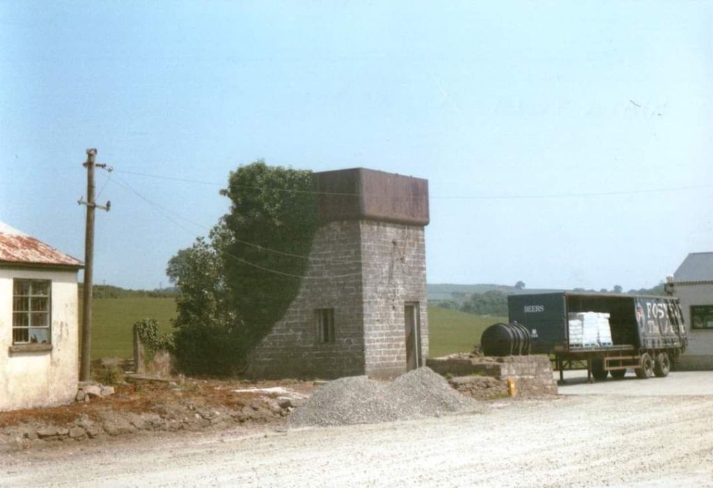
Newtowncunningham Railway Station as shown on railmaponline.com’s satellite imagery. Comparison with the map extract above shows that the bridge at the northern end of the station site has been removed and the road realigned, and the Goods Shed has been removed. Not seen easily on this satellite image is the Water Tower which remains in place. [2]
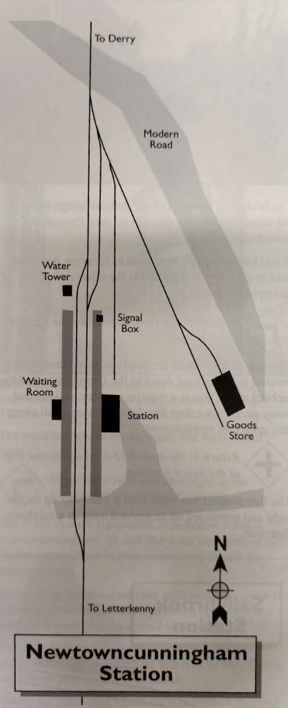
A plan of Newtowncunningham Railway Station provided by Dave Bell and Steve Flanders in their book: The Londonderry and Lough Swilly Railway: A Visitor’s Guide, and used by kind permission of Steve Flanders and the Donegal Railway Heritage Museum. [4: p39]
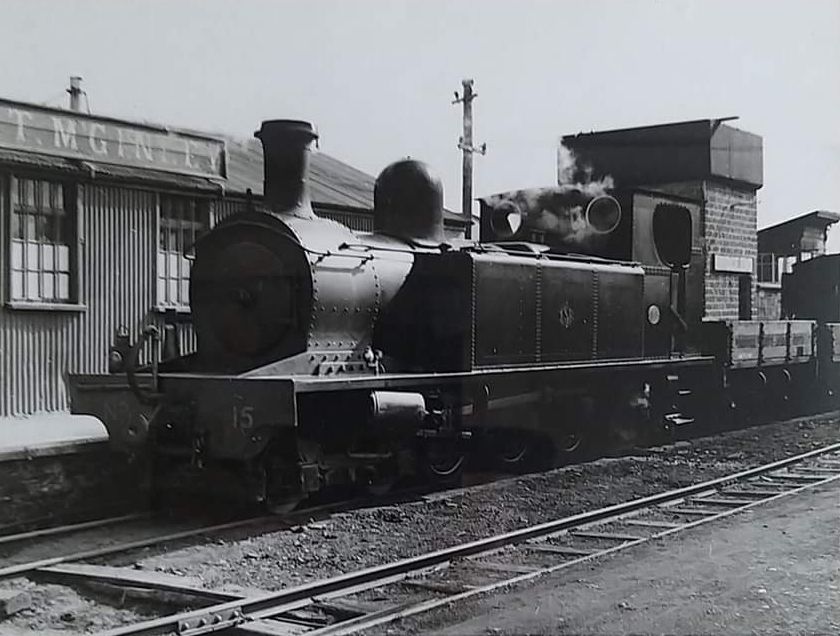
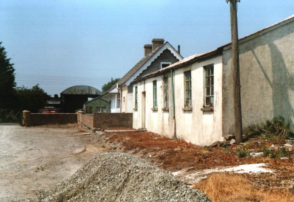
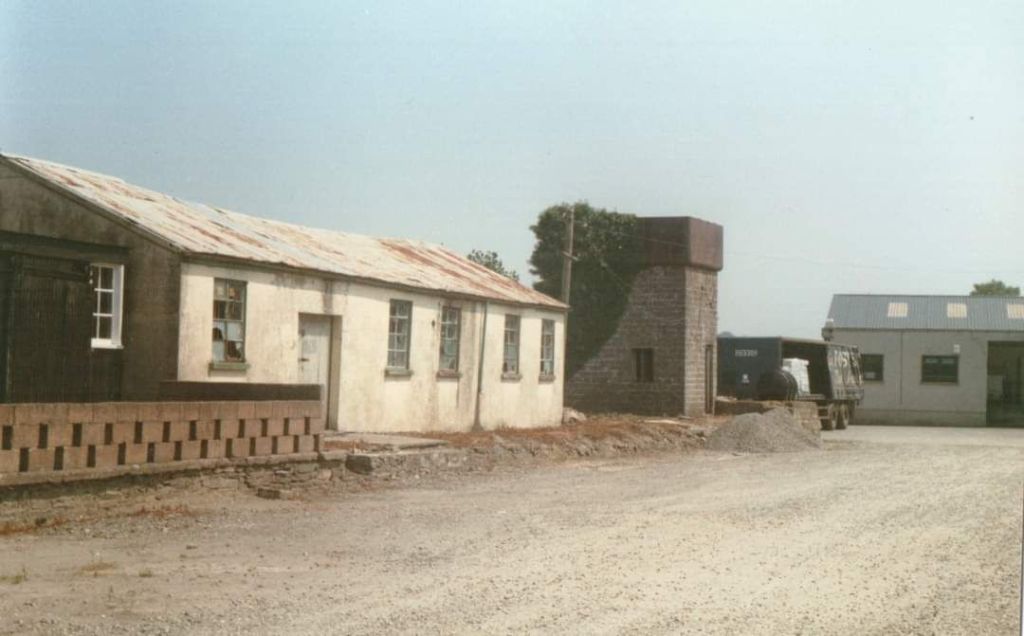
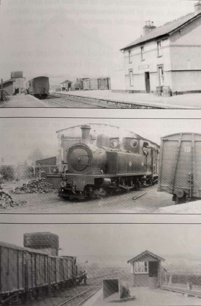
A series of three photographs taken at Newtowncunningham Railway Station provided by Dave Bell and Steve Flanders in their book: The Londonderry and Lough Swilly Railway: A Visitor’s Guide, and used by kind permission of Steve Flanders and the Donegal Railway Heritage Museum. The first shows the Station in 1953 and looks towards Derry, © H.C. Casserley. The second shows Locomotive No. 15 shunting the yard, © R.M. Casserley. The third, looks towards Derry and shows the water tower and signal box, H.C. Casserley. [4: p39]
Newtowncunningham Railway Station in 1937, looking towards Letterkenny, © H.C. Casserley, provided by Dave Bell and Steve Flanders in their book: The Londonderry and Lough Swilly Railway: A Visitor’s Guide, and used by kind permission of Steve Flanders and the Donegal Railway Heritage Museum. [4: p38]
The Station Approach, now in private hands, at Newtowncunningham Railway Station in the 1980s, provided by Dave Bell and Steve Flanders in their book: The Londonderry and Lough Swilly Railway: A Visitor’s Guide, and used by kind permission of Steve Flanders and the Donegal Railway Heritage Museum. [4: p38]
This image was shared on the Londonderry & Lough Swilly Railway Facebook Group by Willie Rodgers on 19th November 2021. [5]
Newtoncunnigham Railway Station House as seen from the highway. The building is now in private hands. [My photograph, 9th May 2024]
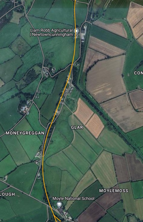
The road outside Moyle National School in the 21st century. Much of the embankment in the immediate vicinity of the road has been removed, the old bridge has gone and the road has been realigned. [Google Streetview, July 2021]

This next series of five extracts from the 25″ OSI survey show the Lough Swilly Railway heading North away from Newtowncunningham Railway Station.

The series of five map extracts above show the Lough Swilly Railway to the North of Newtoncunningham and parallel to Back Shore  Road. [3]
This extract from railmaponline.com’s satellite imagery shows the railway heading North from Newtowncunningham Station, alongside Back Shore Road, and covers the same length of the line as shown in the five map extracts above. [2]
A track can be seen on the satellite image above crossing the line of the old railway as it curved round toward Moneygreggan. This photograph shows that lane. The photograph is taken from Back Shore Road running parallel to the line of the railway at this point. The track at this point was probably provided after the closure of the railway. It gives access to what was the old line of the road prior to the construction of the railway. With the construction of the railway the road was diverted to cross the railway further to the North. [Google Streetview, July 2021]
This enlarged extract from the OSi 25″ survey shows the changes made at the location of the photograph immediately above. [3]
This extract from the railmaponline.com satellite imagery shows the same location as the map extract immediately above. [2]

The next three images show the bridge in Moneygreggan which carried Back Shore Road over the line just to the North of the location above.

The road bridge constructed to carry Back Shore Road over the Lough Swilly Railway north of Newtoncunningham. [My photograph, 9th May 2024]
The view South across the bridge parapet in the direction of  Newtown Cunningham Station. [My photograph, 9th May 2024]
The view North across the parapet of the same bridge. [My photograph, 9th May 2024]
The next location worth noting along the line is a bridge over another minor road which headed West from Back Shore Road [3]
The same location, this time on the satellite imagery from railmaponline.com. [2]
The lane and the embankment are shrouded by trees. The line crossed the lane very close to its junction with Back Shore Road. [Google Streetview, July 2021]
The next crossing of the line was for what was once a through route of sorts but which now is really no more than a farm access track. On the OSi 26″ survey this appears to have crossed the old railway by means of an over bridge. [3]
Railmaponline.com’s satellite imagery shows the rail route in the 21st century shrouded in trees. [2]
This image looks West along the access road in 2011. Hidden in the trees over the line of the Lough Swilly Railway there are some masonry remains which might be parapet walls for a bridge. Either side of the track the undergrowth and tree cover is dense.[Google Streetview, August 2011]

A series of three further extracts from the 25″ OSi survey show the next length of the Lough Swilly Railway as it turned to the East.

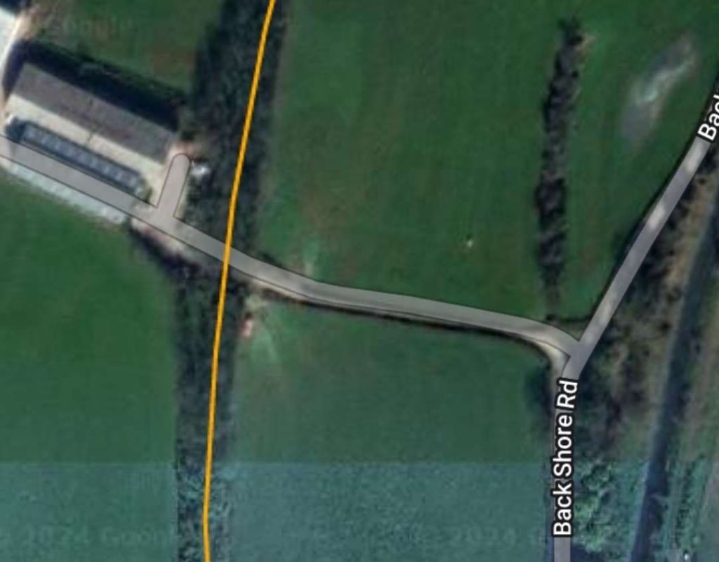
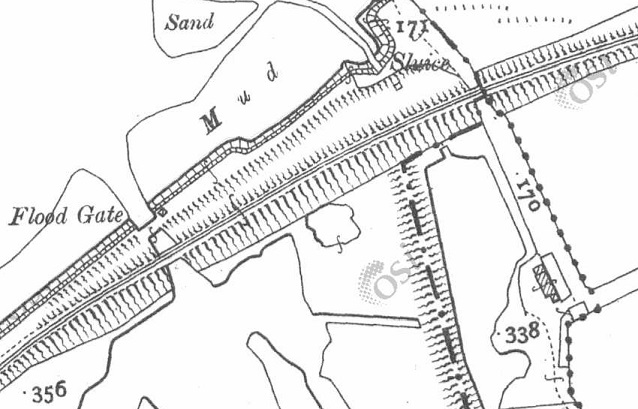
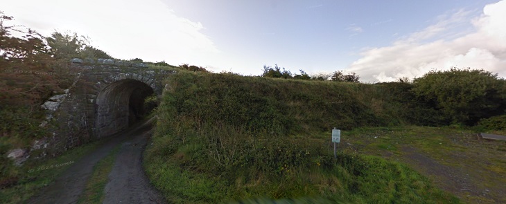
This section of the line ran North from the access road noted above. Back Shore Road crosses the old railway at a level-crossing at the top of this map extract. The stream that has followed the road North emptied into the Lough by means of a stone arch under the of railway. A photograph taken by Willie Rodgers of the stone-arched bridge carrying the old railway over the stream can be seen below. [3]
Then curving round to the Northeast, the line crossed a long embankment over part of Lough Swilly. Open water was to the Northwest of the line, a lagoon and saltmarsh prone to flooding was to the Southeast of the line. [3]
This extract from the 25″ OSi survey shows the line leaving the  embankment and curing further round to the East. [3]
The same length of the Lough Swilly Railway as shown in the three map extracts immediately above, as it appears on railmaponline.com’s satellite imagery. What was saltmarsh to the Southeast of the line has been reclaimed and is now in use as arable land. [2]
Looking Southwest along the line of the embankment in the 21st century. Back Shore Road ends today in a small unmetalled carpark and a gate into the farmland visible to the top-right of this photograph. [My photograph, 9th May 2024]
The small unmetalled carpark at the end of Back Shore Road. The route of the old railway is marked by the orange line heading out onto the embankment. [Google Streetview, July 2021]
The stone-arched bridge at the Southwest end of the embankment which carries the route of the L&LSR over the drainage stream which empties into the Lough at this point. This image was shared on the Londonderry & Lough Swilly Railway Facebook Group by Willie Rodgers on 19th November 2021. [5]
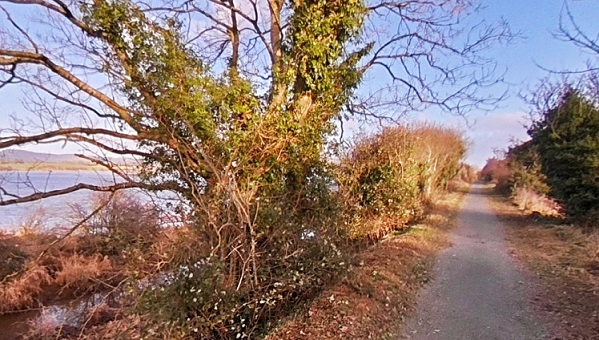
Looking Northeast along the line of the Lough Swilly Railway from a point 100 metres out along the embankment form the carpark noted above. [My photograph, 9th May 2024]

An aerial image taken by Michael Roulston in February 2021 looking Southwest along the embankment and showing the curve of the old line on its Southwestern approach can be seen by following this link: https://maps.app.goo.gl/vEEn4ViuBhW5QiTD6

A photograph taken by David Hughes in July 2020 from a point about halfway along the embankment can be found on this link: https://maps.app.goo.gl/zb85mGUaBZRqafHa6

A similar photograph taken by David Hughes on the same day shows the view along the embankment from the location of the sluice gates. The railway began to curve away from the line of the embankment at this point. The photograph can be found on this link: https://maps.app.goo.gl/o6TbpWy19muqJypu8

This enlarged extract from the 25″ OSI shows the old railway curving away from the straight line of the embankment. [3]
The railway curved away from the straight line of the embankment. [Google Maps, May 2024]
This view looks South from just to the North of the Northeast end of the embankment. The L&LSR can be seen curving away to the East and crossing the access road to the location of the photographer via a stone-arched bridge. [Google Streetview, September 2010]
A better image of the bridge seen above, also taken from the North. This image was shared on the Londonderry & Lough Swilly Railway Facebook Group by Willie Rodgers on 19th November 2021. [5]
The same bridge, seen this time from the South. This image was shared on the Londonderry & Lough Swilly Railway Facebook Group by Willie Rodgers on 19th November 2021. [5]
The same structure seen from further to the South along the lane. The tree line to the right of the bridge marks the line of the Lough Swilly Railway. [Google Streetview, September 2010]
The next significant location was a little further to the East where another minor road crossed the lien fo teh railway on a bridge. This enlarged extract from the 25″ OSi survey shows the location. [3]
This enlaregd extract from the railmaponline.com satellite imagery shows the same location in the 21st century. [2]
This view from the South shows the bridge parapets in place in the 21st century. The L&LSR cutting has been infilled and returned to arable use. [Google Streetview, July 2021]

The next three extracts from the 25″ OSI survey show the line turning first to the Northeast and after a short distance reaching Carrowen Railway Station.

These three extracts from the 25″ OSI surveytake us as far as Carrowen Station. [3]
This extract from railmaponline.com’s satellite imagery covers the same length of line as appears in the three map extracts immediately above. [2]
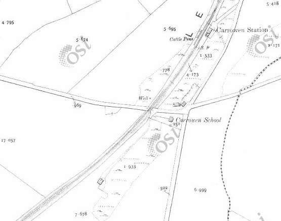
When the L&LSR was in use it was bridged by a minor road which linked roads to the North and South of the line and provided access to the complex of buildings shown on this enlarged extract from the 25″OSi survey. [3]
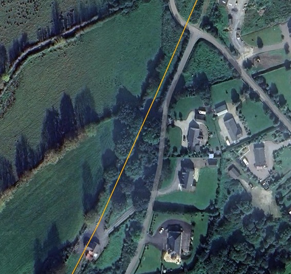
A wider view of the same location in the 21st century as provided by railmaponline.com’s satellite imagery. Both the road and the old railway have been ploughed back into the landscape. [2]
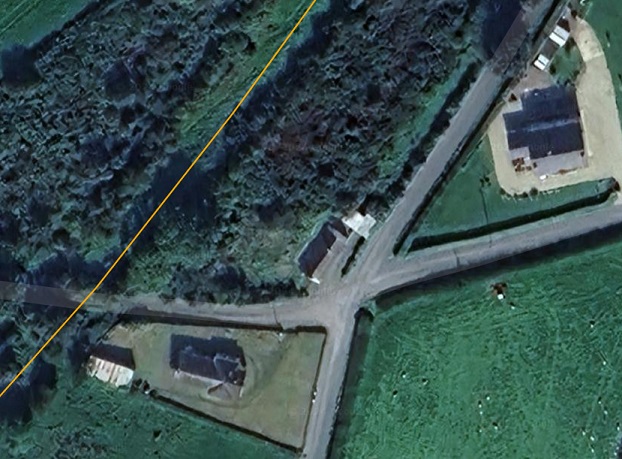
Approaching Carrowen Railway Station, the line was carried over a road close to Carrowen School. [3]
Railmaponline.com’s satellite imagery shows the same area as covered by the map extract above. [2]
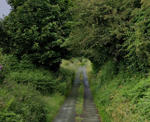
Trees appear to form an arch over the narrow road at the point where the L&LSR was carried by a bridge across the road close to the site of what was Carrowen School. [Google Streetview, July 2021]
An enlarged view of Carrowen Railway Station as shown on the 25″ OSi survey. [3]
The Station site as shown on an enlarged extract from railmaponline’s satellite imagery. The old station househas been extended out across the line of the railway. [2]
Carrowen Station Hose and platform viewed from the West. The building was not of the same design of other larger station houses that we have encountered in our journey along the line of the L&LSR. This photograph was shared on the Londonderry & Lough Swilly Railway Facebook Group by Conor Harkin on 27th April 2022 courtesy of Fahan Inch & Burt Parish. [6]
The modern private dwelling on the site of Carrowen Station House includes the original station house It is seen here viewed from the village road to the East of the L&LSR. The photograph looks along the old station approach. The extension to the right of the building sits over the formation of the old railway. [Google Streetview, July 2021]
This next extract from the 25″ OSi survey shows the old railway heading North-northeast away from Carrowen Railway Station and bridging a local road. [3]
The same length of the line as it appears on modern satellite imagery. The rail-over-road bridge was sited at the top-right of the image. The bridge has gone a a minor realignment of the road carriageway has taken place. [2]
Looking Northwest through the location of the bridge. The bridge and the line’s embankments have been removed. The orange line indicates the approximate line of the L&LSR. [Google Streetview, July 2021]
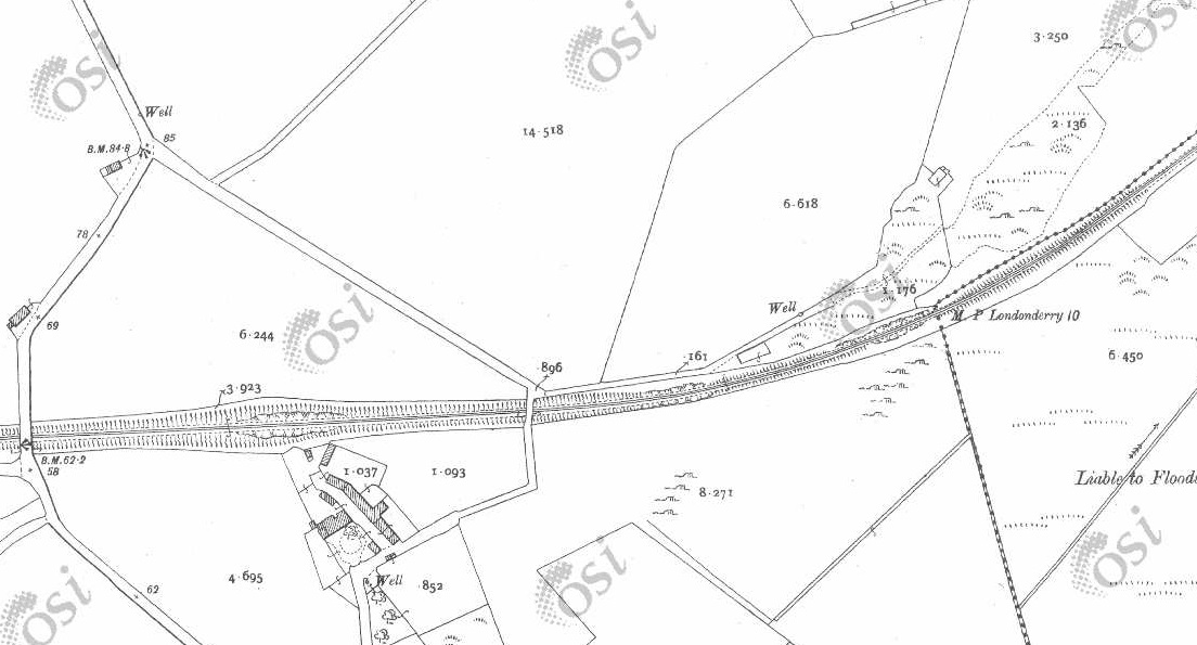
Continuing North-northeast, the L&LSR ran through two level crossing close to Drumgowan. [3]
the location of each of the crossings can easily be picked out on the modern satellite imagery of railmaponline.com. [2]
This photograph taken from the closest metalled road shows the first crossing encountered. It was about 50 t0 100 metres down the lane at the centre of the image. The approximate line of the L&LSR is shown as an orange line beyond the trees. [Google Streetview, July 2021]
From a very similar location to the last photograph but this time looking North-northeast. The line of the L&LSR crossed the field to the right of the photograph and ran through the trees which appear left of centre towards the top on the image. The track on the left of the image meets the line o0f the old railway at the first of the trees and then runs along what would have been the formation of the old railway to the coast of Lough Swilly, this can be seen on the next satellite image below. [Google Streetview, July 2021]

The next three extracts from the 25″ OSi survey show the L&LSR curving round to the East to run along the side of Lough Swilly. The earthworks of the earlier line from Derry to Farland Point can be seen to the North of the line.

The station at Farland Point opened on 12th December 1864 when the Londonderry and Lough Swilly Railway built its line from Londonderry Middle Quay railway station to a terminus at Farland Point. The L&LSR owned ferries which operated from Farland Pier. [7]

The L&LSR curved round to the East to run along the side of the Lough. Close to the flood gates earthworks from an abandoned line serving Garland pier would have been visible from trains running between Letterkenny and Derry. [3]

.

The original L&LSR line terminated at Farland Point. When the line was extended through Letterkenny and beyond the short stub to Farland Point was removed leaving only the earthworks. [3]
The line continued East alongside the sound on the South side of Inch Island which has been cut by an embankment causeway. [3]
This extract from railmaponline.com’s satellite imagery shows the same length of the L&LSR as covered by the three map extracts above. The embankment visible in the map extracts above still exists in the 21st century. Farland Pier is to the West of the embankment. [2]
Looking East along what was the line of the old railway round the curve shown on the left of the railmaponloine.com image above. [Google Streetview, September 2009]
Looking back Southwest along the curve of the old railway shown on the left of the railmaponline.com image above. [Google Streetview, September 2009]
Looking East along the line of the L&LSR which ran along the embankment beyond the gate ahead. [Google Streetview, September 2009]
Looking back through the gate from the line of the old railway towards Drumgowan (c) Roy Smyth. [Google Streetview, January 2023]
The remains of Farland Pier as they appear on Google Maps. [Google Maps, 23rd May 2024]
Looking West towards Farland Pier with Inch Castle beyond., © Oliver Dixon and shared on Geograph by him on 12th July 2013. This image is licenced for reuse under a creative commons licence (CC BY-SA 2.0). [8]

John McCarton comments on the Londonderry & Lough Swilly Railway Facebook Group: “The Londonderry and Lough Swilly Railway Company opened a railway service from Derry to Farland Point (Inch Level Wildlife Reserve today) in December 1861. From Farland Point, a paddle steamer service took train passengers across Lough Swilly, to Ramelton or Letterkenny. Paddle steamers were chartered in from existing Lough Foyle and Clyde companies to inaugurate this new service. In September 1864, the line was extended from Tooban Junction to Buncrana, with a spur to Fahan, extending Into sidings at the pier for the transportation of goods and passengers to and from the paddle steamers. The ferry service moved to Fahan in 1866, which then became the hub for the L&LSR’s passenger and freight services, to Ramelton, Rathmullan and Portsalon.” [8]

These two extracts from the OSi 25″ survey show the L&LSR running along the South side of what became Inch Wildfowl Reserve. [3]
This railmaponline.com satellite image covers the same length of the old railway as the two map extracts immediately above. [2]
Looking East along the line of the old railway about 200 metres further along the embankment, (c) Roy Smyth. [Google Streetview, January 2023]
Looking East-northeast along the line of the old railway as it curves with the embankment towards the Northeast, (c) Roy Smyth. [Google Streetview, January 2023]
Looking Northeast at a point close to the right side of the railmaponline.com satellite image above, (c) Roy Smyth. [Google Streetview, January 2023]

The next few map extracts follow the old railway heading Northeast towards Tooban Junction Station. …

These three extracts form the OSi 25″ survey show the remaining length of the embankments alongside Lough Swilly as the line heads Northeast towards Tooban Junction. After turning to the Northeast the line can be seen running on a secondary embankment to the East of that facing the sea. [3]
This extract from the railmaponline.com satellite imagery shows the length of the L&LSR covered by the three map extracts above. [2]
Looking back to the Southwest along the L&LSR formation from the Inch Wildfowl Reserve car park. The railway ran along a low embankment to the East of the main embankment and to the East of the modern walkway. [Google Streetview, September 2010]
Looking Northeast along the L&LSR formation from the Inch Wildfowl Reserve car park. The line ran, approximately, along the tree line close to the centre of this photograph. [Google Streetview, September 2010]
Looking Northeast along the L&LSR formation again. (The line ran to the right of the path ahead.)
As is evident in these last few images, the old railway was protected from the worst of the weather over Lough Swilly by a high embankment. We are closing in on the curve taking the line into Tooban Junction Station, (c) Roy Smyth. [Google Streetview, January 2023]

Inch Wildfowl Reserve

The story of the Wildfowl Reserve is told on its website: [9]

“Inch Lough is a brackish lagoon cut out from Lough Swilly by embankments, and penned between Inch Island and extensive flat agricultural polders (slobs) on the mainland of County Donegal by a third long embankment.

Historically there was a large area of Lough Swilly between Inch Island and Burt, which lies at the foot of Grianan Mountain (the site of the famous Iron Age hillfort, Grianán of Aileach).  In 1836 it was proposed to claim this shallow expanse of tidal estuarine mud from the lough.  Work started around 1840 and was complete by 1859.

The first stage was the construction of the Tready Embankment across the centre of the area, from Tooban Junction near Burfoot in the east, to Farland Point in the west.  It would also serve as the route of the Londonderry and Lough Swilly Railway – a narrow-gauge line connecting Carndonagh and Derry in the north-east, with Letterkenny and Burtonport in the far west.  The line operated between 1863 and 1953.

North of Tooban was a point where the mainland was close to Inch Island, and where a causeway, the Inch Embankment, was built to link the island to the mainland.

The third stage was to construct a parallel embankment in the west, between Farland Point and the island, the Farland Embankment, or as it is now generally called, the Farland Bank.

So between these three embankments and Inch Island there was a section of water cut off from Lough Swilly, and also from the mud flats to be drained. This area would be kept as a holding tank, to receive the waters drained from the south and keep out the tidal extremes of Lough Swilly.  Thus Inch Lough was created, and over the years has become steadily less salty.

South of the Tready Embankment, between it and Grianan Mountain, all that area of Lough Swilly now isolated from the tidal waters could be drained through a complicated system of large and small drains, to create agricultural land.  This huge expanse of flat polderland is locally known as The Slobs, or more formally as Inch Level.  The drainage was not initially very successful.  Until the late 1950s the patchwork of small fields were very marshy, and included some areas of unambiguous marshland.

At that time, industrialist Daniel McDonald, started to buy up the small properties and by 1961 had amalgamated all into Grianán Estate, the largest arable farm in Ireland at around 1200ha.  The fields could then be enlarged and the drainage system re-vitalised.

There have been a few changes of hands since then.  Most notably, a consortium of businessmen bought the estate in 1980 and announced plans to drain the northern half of the lake.  A local campaign was immediately launched to resist this – mainly defending Inch Island’s status as an island, but concerned also about the threat to wildlife from the loss of half of the lake.  The consortium claimed that the scheme proved to be technically unviable, and whether or not that was the real reason, or they were overwhelmed by the strength of the opposition, they abandoned the scheme and sold up in 1989.

An Grianan Farm is now in the hands of Donegal Creameries plc., and managed as an organic dairy farm.  Parts of it are leased to local farmers.  In 2002 the National Parks and Wildlife Service took on a thirty year lease of Inch lough and its surrounding wet grasslands.  Since then, NPWS along with various stakeholders have developed the site, with ongoing work in conservation management, community involvement, and development of visitor infrastructure.  The aim now is to sustainably develop Inch Wildfowl Reserve for the future, integrating conservation with community and farming, whilst allowing limited access for the public.” [9]

This extract from the 25″ OSi survey covers the next length of the line. Included in this extract is Tooban Junction and its station and the start of the branch to Cardonagh. [3]
An enlarged extract focussing on Tooban Junction. The L&LSR line to Derry is the more northerly of the two line leaving the right of this image. The other line is a long storage line or headshunt. [3]
This extract from the railmaponline.com satellite imagery covers the same length of the L&LSR as shown in the map extracts immediately above. It centres on the location of Tooban Junction Station. [2]
Facing Northeast along the L&LSR formation again. This time on the curve round to the location of Tooban Junction Station, (c) Roy Smyth. [Google Streetview, January 2023]
Facing East along the line of the old L&LSR through the location of Tooban Junction Station from the modern footbridge over the drainage channel. Note the signal post with two arms which stands on the station site, This is a reconstruction by Buncrana sculptor John McCarron as part of the Ghosts of Tooban Junction project, (c) Roy Smyth. [Google Streetview, January 2023]
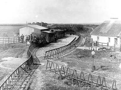
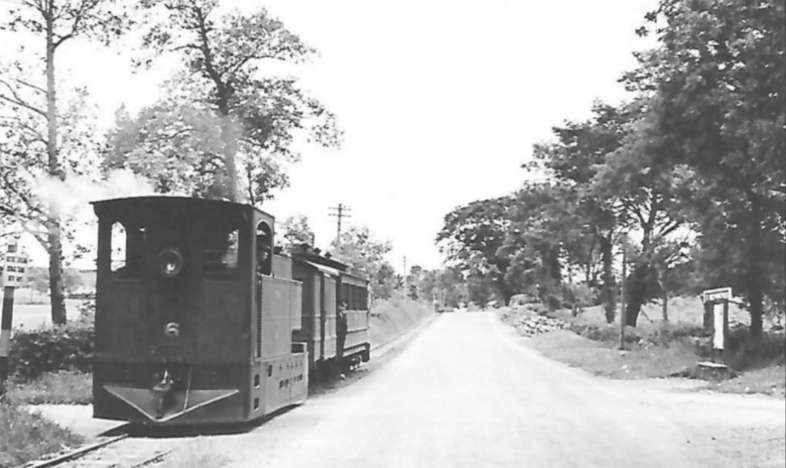
Tooban Junction Station seen from the West. This image was shared by Donegal Railway Heritage Museum in their Facebook Page on 6th February 2020, (c) Edward Patterson
Looking West at Tooban Junction on 20th April 1953. The line to Letterkenny is to the left of the water tower, that to Cardonagh is to the right. This photograph was shared on the Fahan Inch & Burt Parish Facebook Group on 6th September 2015. [16]

The ‘Disused Stations’ website has a series of pages focussing on Tooban Junction Station. [10][11][12][13] These pages include a history of the station and a number of photographs of the station from various sources. Click here to visit the first of these pages.

Ernie’s Archive includes a number of photos of the station. [14] Click here to access these images.

Wikipedia notes that “the station opened on 9th September 1864 when the Londonderry and Lough Swilly Railway built their line from Londonderry Middle Quay to Farland Point. It closed for passengers on 23th October 1935. Freight services continued until 10th August 1953.” [17]

We take a break at Tooban Station and await the next train!

References

  1. https://en.m.wikipedia.org/wiki/Londonderry_and_Lough_Swilly_Railway, accessed on 30th April 2024.
  2. https://railmaponline.com/UKIEMap.php, accessed on 1st May 2024.
  3. https://osi.maps.arcgis.com/apps/webappviewer/index.html?id=bc56a1cf08844a2aa2609aa92e89497e, accessed on 5th May 2024.
  4. Dave Bell and Steve Flanders; The Londonderry and Lough Swilly Railway: A Visitor’s Guide; County Donegal Railway Restoration Society.
  5. https://www.facebook.com/groups/788818974978955, accessed on 18th May 2024.
  6. https://www.facebook.com/photo?fbid=1713862078953969&set=gm.1295963820931132&idorvanity=788818974978955, accessed on 22nd May 2024.
  7. https://en.m.wikipedia.org/wiki/Farland_Point_railway_station, accessed on 23rd May 2024.
  8. https://www.facebook.com/share/p/Piq7PPiWx22ujqFV/, accessed on 23rd May 2024.
  9. https://www.inchwildfowlreserve.ie/history, accessed on 23rd May 2024.
  10. http://disused-stations.org.uk/t/tooban_junction/index1.shtml, accessed on 27th May 2024.
  11. http://disused-stations.org.uk/t/tooban_junction/index.shtml, accessed on 27th May 2024.
  12. http://www.disused-stations.org.uk/t/tooban_junction/index2.shtml, accessed on 27th May 2024.
  13. http://www.disused-stations.org.uk/t/tooban_junction/index3.shtml, accessed on 27th May 2024.
  14. https://www.flickr.com/search/?text=tooban+junction, accessed on 27th May 2024.
  15. https://www.facebook.com/photo/?fbid=2645067492196142&set=a.1224552917580947, accessed on 27th May 2024.
  16. https://www.facebook.com/fahaninchburt/photos/a.648557531950952/648562385283800/?type=3, accessed on 27th May 2024.
  17. https://en.wikipedia.org/wiki/Tooban_Junction_railway_station, accessed on 27th May 2024. However, note comments made in response to this article by Martin Baumann: “The Derry to Buncrana line saw passenger services on bank holidays after regular services had ceased. The last day this happened was 6th September 1948. … Freight traffic ceased on 8th August 1953, not the 10th but it was possible to travel on freight services as the Swilly had no Goods Brake Vans so a Passenger Brake with some seats was always in the formation.”