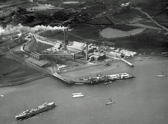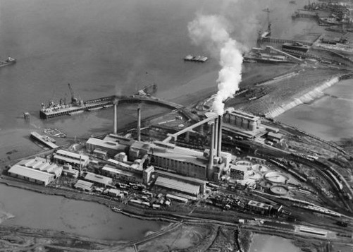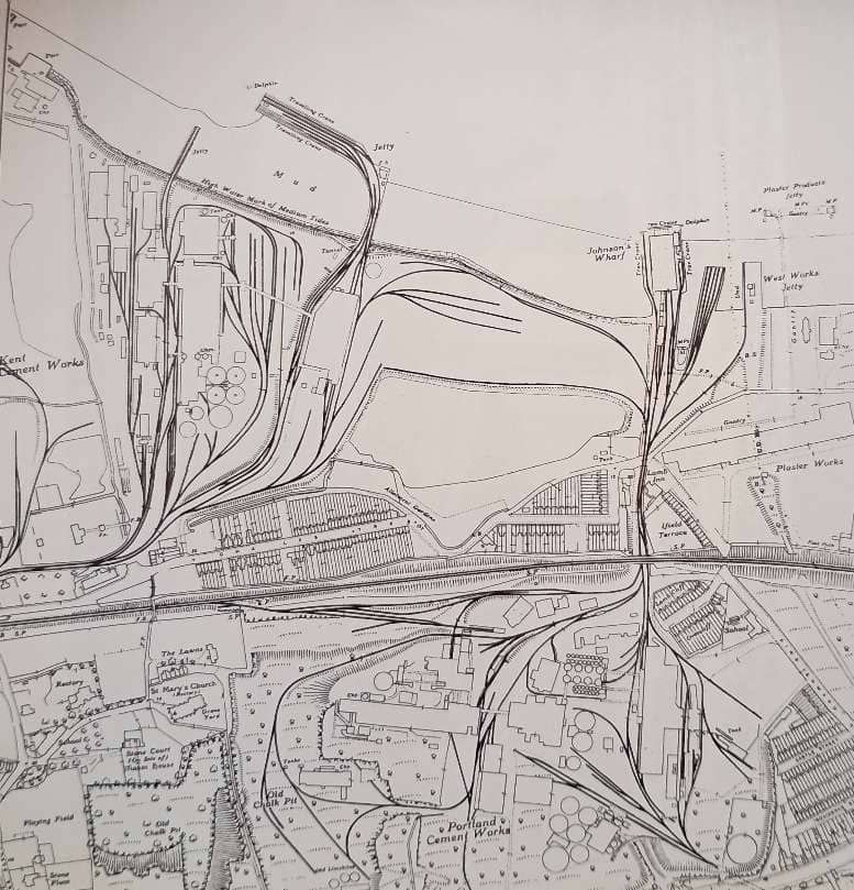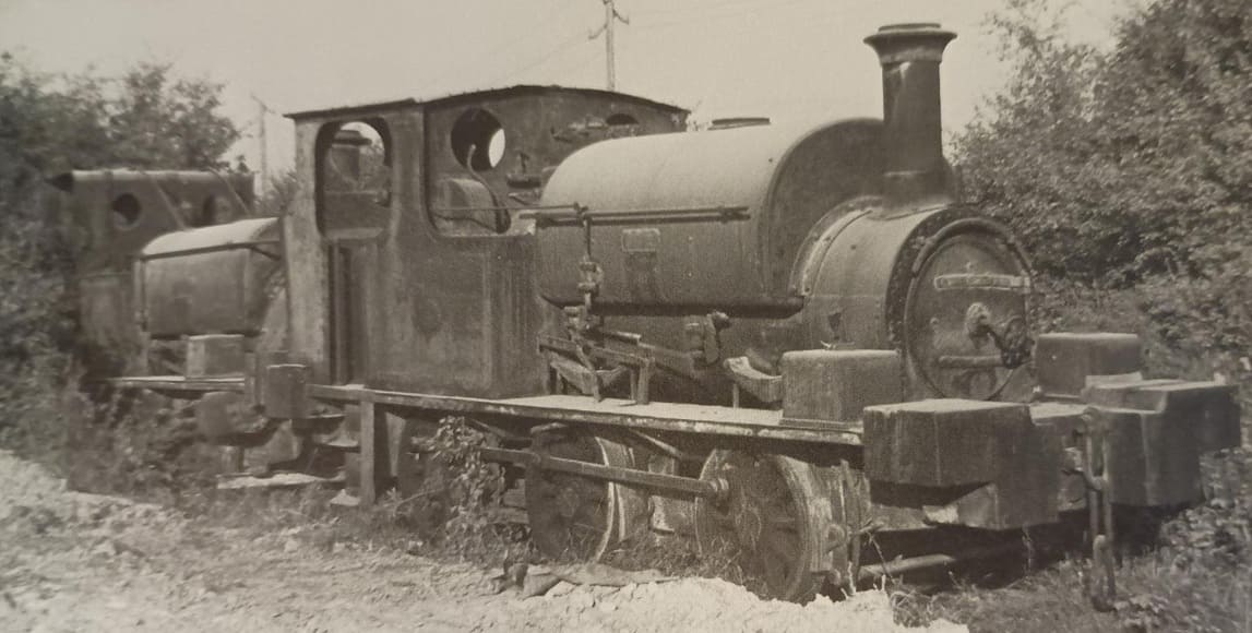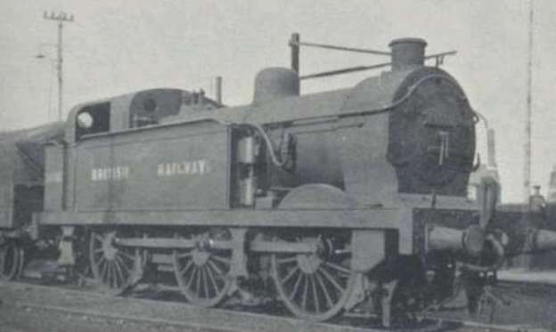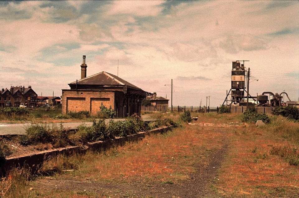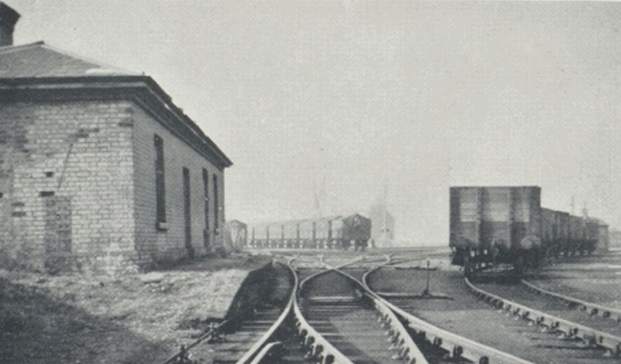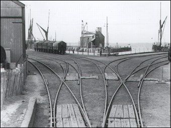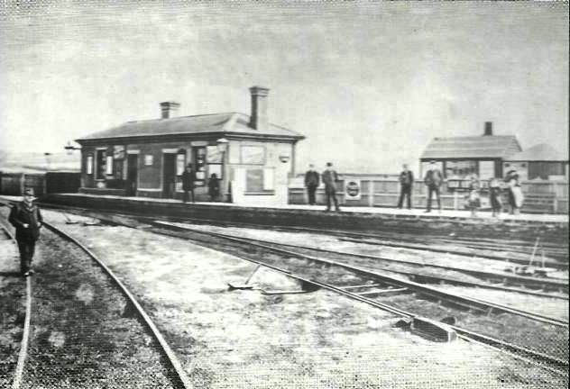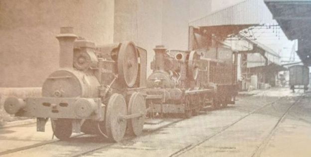
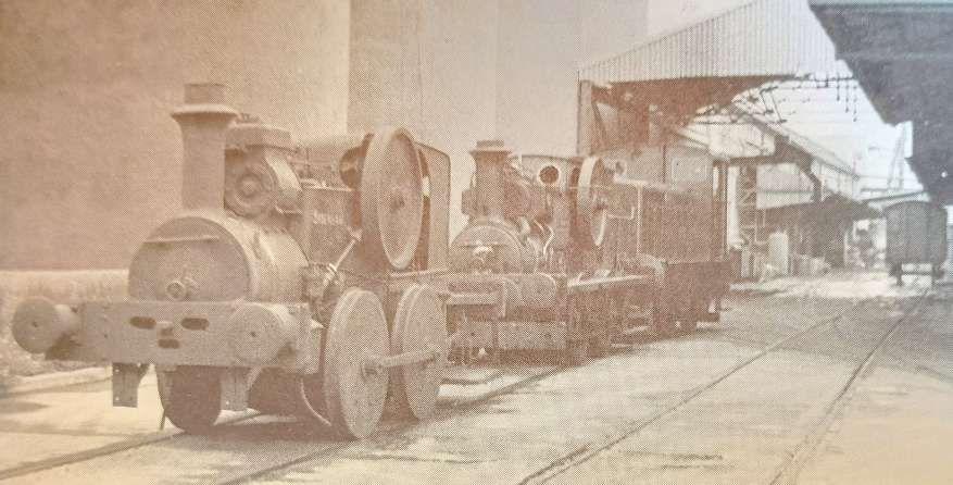
The featured image for this article shows locomotives sitting on standard-gauge metals at the BOCM Works at Belvedere. The two 0-4-0WTG Aveling & Porter locomotives are ‘Sydenham’, built in 1895, Works No. 3567, and ‘Sir Vincent’, built in 1917, Works No. 1917. Behind them is ‘Crabtree’, an 0-4-0 Ruston & Hornsby diesel locomotive. (Hugh Davies) © Public Domain. [4: photo No. 94]
A quick look at the Ordnance Survey maps of the North coast of Kent from the first half of the 20th century will show a veritable cat’s cradle of standard-gauge and narrow-gauge industrial railways. A similar survey of the Medway valley at the same period in the 20th century will show just how many individual Cement Works and other industries once existed there too. This article inevitably will not provide a comprehensive look at all industrial railways in the area.
The Oakwood Press produced two editions (1973, 1990) of a survey of these cement works. The second edition was an enlarged version of the first edition. Page references are to page numbers in the second edition.
The authors divide the various Cement works into three different geographical areas:
- The Thames Estuary (working West to East)
- The Medway Estuary
- The Lower Medway
Part 1 – The Thames Estuary
This article looks at a number of the industrial sites on the southern banks of the River Thames Estuary. Industry along the River Medway will be covered in a future article or articles, as will industries in and around Chatham and to the East of Cliffe, Higham and Chatham.
It must also be noted that the details included in this article are much expanded on and probably also corrected in Robin Waywell’s book, ‘Industrial Railways and Locomotives of Kent‘ which came into my possession after this article had been completed. [61]
Before looking at the works described by Stoyel & Kidner and others, it is worth at least a glance at Erith situated further West along the River Thames. …
J. Parish & Co. Ltd
J. Parish & Co. was a historical industrial firm based in Erith, Kent, best known for operating the local Erith Loam Quarries and Ballast Wharf on Fraser Road. Established in the early 19th century (around 1805), the company supplied specialized moulding sands, silica sands, and high-quality natural loams to the British foundry and metal-casting industries.
It ran deep loam and sand pits off Fraser Road in Erith, utilizing industrial (4ft 0in) narrow-gauge locomotives to move ballast and sand. Its products (often marketed as the “Erith Range of Sands”) were widely utilized across UK metal foundries for core-making and casting. [8][9]
Hatherill & Hatherill tell us that, “Around 1800 sailing ships brought coal to London from the north east of England and, in 1805, John Parish started supplying ballast to the returning ships. The sand they supplied was quickly recognised in the north east as a rich loamy sand which was very suitable for foundry work. At first it was loaded from a wharf opposite the site of the first railway station, which was opened in 1849 but, in 1842, a new wharf was built which could, in later years, deal with ships of up to 650 tons.” [10: p11]
Horses handled the traffic at the start as the first locomotive, No. 1, did not arrive until 1864, built by Gilles, Wilson & Co., Works No. 185. It was an 0-4-0T with 6 inch cylinders. [10: p11]
Records show two further locomotives in use by Parish. These were: No. 2, an 0-4-0ST, built in 1881 by R. & W. Hawthorn, Works No. 1864 with 10″ cylinders; and No IV, another 0-4-0ST built in 1903 by Hawthorn, Leslie & Co., Works No.2565, with 12″ cylinders. These two locomotives served the quarries for decades, although only No. IV survived until the advent of road-motor vehicle haulage at the Works in 1957. [4, photo No. 75][10: p11]
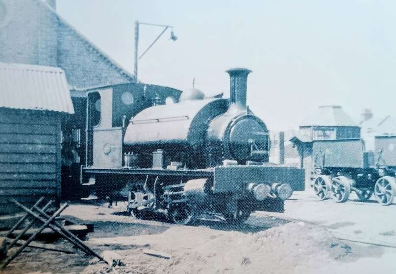
Parish No. 3 was utilised for a steam excavator built by Grafton of Bedford which was used to remove the overburden from the underlying loam. [10: p11]
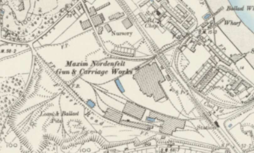
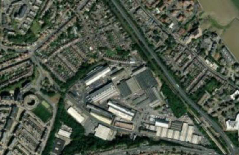
West Street level-crossing allowed both Parish’s narrow-gauge line and Frazer & Chalmers’ standard-gauge line to access the wharves on the river bank.
Hatherill & Hatherill tell us that, “the crossing was also across the Erith Council Tramway system which ran along the road. There was a level crossing with four gates and a crossing cabin from which the gates were worked. When a train came down from the quarries a ship’s bell on the corner of the cabin was rung and the gates were wound across the road. When, in 1957, the railway was replaced by a fleet of lorries, Parish’s continued to use their level crossing. When the gates were closed across the road lorries went past along the route of the railway. As they were travelling along a private right of way they did not need to be licensed!” [10: p13]
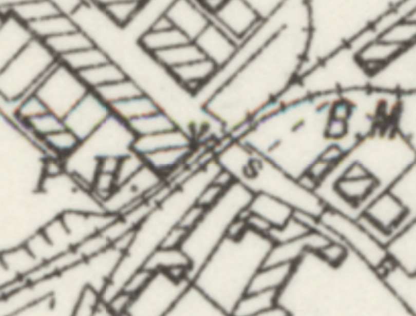
West Street Level-crossing as shown on the early 29th century 6″ Ordnance Survey mapping provided by the NLS. The council’s tramway does not appear on this extract. [11]
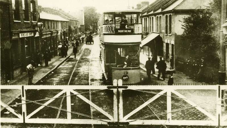
Over the 20th century, as industrial quarrying scaled down and local demands shifted, parts of their former quarry properties and surrounding land transitioned into residential and factory developments.
Stone Court Chalk, Land & Pier Co. Ltd
The Stone Court Chalk, Land & Pier Co. Ltd. was a 19th- and 20th-century mineral extraction and industrial company based in Stone, Kent, operating roughly from 1885 until the mid-20th century. It supplied raw Upper Chalk (Seaford Chalk Formation) to nearby cement plants, including works at Greenhithe, Albion, and the Kent Cement Works. These cement works are covered in detail below.
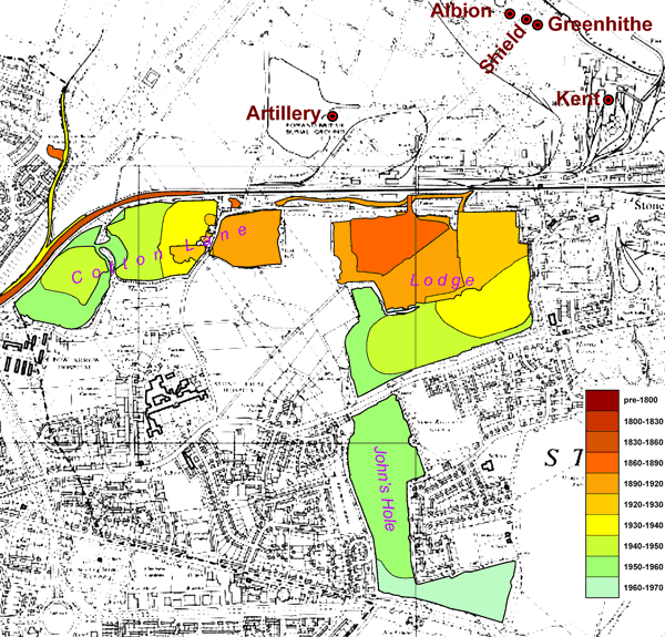
Dylan Moore tells us that “A chalk pit was already in existence at Stone Court Lodge in 1827. The Stone Court estate began shipping chalk from their wharf in 1864. In 1873, the Stone Court Chalk Quarries Company extended the wharf to deep water, and commenced shipping ballast, while looking for cement companies that might use their chalk. In 1879 the Williams Fry and Co. Ltd Albion plant was set up to the west of the wharf, and in 1880, Wilders & Cary’s Shield plant was set up to the east. In 1885 the company was re-launched as the Stone Court Land & Pier Co. Ltd. The Gillingham Portland Cement Co. Ltd set up the Greenhithe plant to the east of Shield in 1889, and in 1890 Rosher & East set up the Artillery plant inland between the quarries and the wharf. By this time, supply to the cement plants was the bulk of its trade, and chalk ceased to be shipped after 1894.” [44]
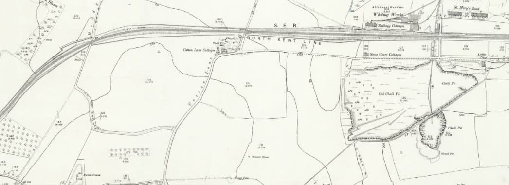
Dylan Moore provides maps of the various Chalk Pits in North Kent and the Stone Court Land & Pier Co. Ltd map shows two main quarry complexes: [44]
- Lodge Quarry south of Elizabeth Street, including Johnson’s Hole – these workings were abandoned completely by 1964; and
- A set of pits to the west on either side of Cotton Lane and to the South of the North Kent railway line – these pits were worked out by 1956.
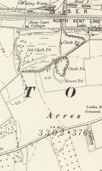
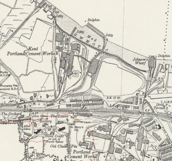
These two map extracts show the areas eventually exploited by the Stone Court Chalk, Land & Pier Co. Ltd. Both show the area to the South of the North Kent main line.
The first extract is from the 6″ Ordnance Survey of 1895, Lodge Quarry was being expoited at this date. It’s workings would eventually extend South of London Road into what became known as Johnson’s Hole. [45]
Dylan Moore’s map showing the extent of the two quarry areas can be found here. [47]
British Industrial Callender’s Cables Ltd (BICC Ltd).
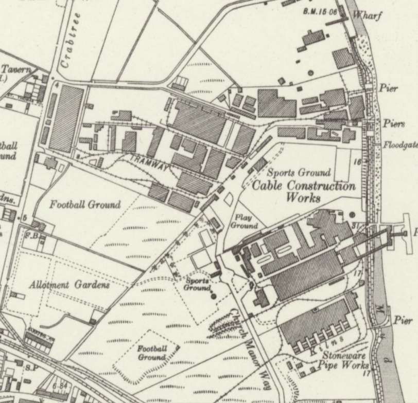
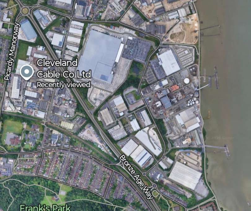
BICC Ltd. used a 3ft 6in gauge railway at their cable works at Belvedere, near Erith. The steam locomotives were converted to run on oil fuel.The line was in use by 1900 when the first locomotive arrived. The railway’s purpose was “was to bring pig lead and other materials from their wharf on the River Thames at Belvedere into the works and to move drums of finished cable around the works and yard. From the wharf, cable was exported all over the world.
BICC purchased three new Bagnall 0-4-0ST locomotives: [4: photos No. 91, 92 & 93]
Mighty Atom – built in 1900 by Bagnall, Works No. 1630, had 6″ cylinders
Woto – built in 1924 by Bagnall, Works No. 2133, had 7″ cylinders. Photos 91 and 92 show this locomotive.
Sir Tom – built in 1925 by Bagnall, Works No. 2135, also had 7″ cylinders. Photo No. 93 shows this locomotive which cost £1127 when new.
After the purchase of ‘Mighty Atom’ a second-hand Hunslet 0-4-0ST was purchased and a new 0-4-0ST from the Yorkshire Engine Co. before the last two Bagnalls were bought. [10: p13]
“Both Woto and Sir Tom worked until 1968 when the railway closed, having outlasted by several years … two Ruston diesels! The former were acquired for preservation and are now [1984] stored in Romford.” [4: photo No. 93]
The two Rushton & Hornsby diesel locomotives had been purchased in 1934. [10: p13]
British Oil & Cake Mills (BOCM) Ltd
Was sited close to the BICC Works and had its own standard-gauge rail network which employed a number of steam and diesel locomotives over time.
Crabtree Trust Sidings
The Crabtree Trust exchange sidings were alongside the North Kent Line between Belvedere and Erith. They were on the down side of the line near the former Crabtree Crossing signal box. They once fed a network of industrial lines serving riverside factories and works along what is now Crabtree Manorway These industrial concerns included the BICC Cable Works, the BOCM site, Hercules Powder Co., Doulton’s Pipe Works and British Gypsum’s Works. By the 1980s, the entire complex was disused, overgrown, and eventually cleared.
These sidings consisted of three parallel reception sidings operated on behalf of local industry by BOCM. The locomotives shown on the image above would have been found at work in the sidings. [10: p18]
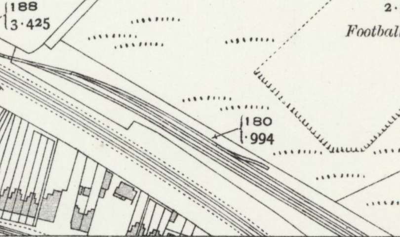
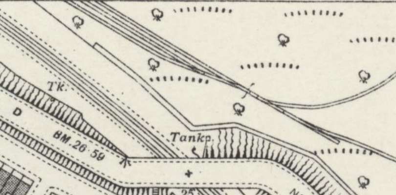
Further details about this location can be found here. [17]
British Gypsum (Erith Works)
British Plaster Board Ltd. originally opened the waterfront works at Church Manorway, Erith in 1934 to process imported gypsum. Rebranded as British Gypsum in 1964, the historic manufacturing site eventually transitioned into the Saint-Gobain Build Better Academy, operating as its longest-serving training facility for plaster and drywall systems since 1966.
A number of 0-4-0 diesel locomotives were employed at this location at different times, including:
Crabtree – built in 1953 by Ruston & Hornsby, Works No. 338416 (Class 88Ds). [18]
Princess Margaret – built in 1948 by Barclay, Works No. 376. [18][4: photo No. 58]
Possibly also:
Taurus – built in 1951 by Fowler (VF D139, DC 2273)
Prium – built in 1955 by Fowler (VF D293, DC 2566)
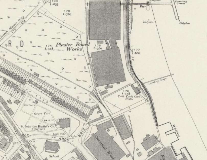
Dartford Cement Works Ltd. [1: p11]
A short line ran from a wharf on Dartford Creek to a small works which opened in around 1891 and South to a pit close to the North Kent main line. Stoyel & Kidner indicate that the line was horse-worked and closed in 1911.
Artillery & Albion Cement Co. Ltd. [1: p11]
This was a 19th/early-20th century cement manufacturer located at Stone Court (Stone Marshes). Its operations combined chalk quarried by the Stone Court company and Medway clay, shipping goods via Stone Court pier before eventually being absorbed into a larger cartel operation. Stoyel & Kidner tell us that both Artillery & Albion were adjacent works which were absorbed into the British Portland Cement Manufacturers (BPCM) in 1910 but probably closed by 1913.
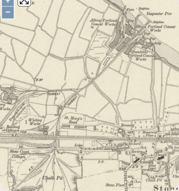
Three 0-4-0ST locomotives were associated with Artillery and Albion Works:
Stonecourt – had outside cylinders and was sold in about 1915. Nothing else is known about this locomotive.
Artillery – built in 1896 by Falcon, Works No. 240. It had outside cylinders and was transferred by APCM to Hilton Works at Halling when the works at Stone closed.
Albion – built in 1901 by Peckett, Works No. 915. It also had outside cylinders and was also transferred by APCM to Hilton Works at Halling when the works at Stone closed.
Shield Works, Greenhithe Works. [1: p11]
The Shield Works were only a short distance to the East of the Albion Works. Greenhithe Works were a little further East.
Associated Portland Cement Manufacturers (APCM), took control of Shield Works in 1900. Greenhithe Works was acquired by J.B. White in 1893.
Stone Court Chalk Land & Pier Co. Ltd. [1: p11]
Although not a cement producer, this company was later taken over by APCM. In 1885, this company took over a pier and tramway on Stone March close to the works covered above. Stoyel & Kidner tell us that “All [those works] were served by a railway of standard gauge, which also ran south, under the SER and Cotton Lane, to a chalk pit. Just north of the tunnel under the SER there was a whiting works. In 1908, the branch line to the Artillery Works was extended to an exchange siding with the SER North Kent Line When the Kent Works was built to the east, a cutting was made parallel to the SER and south of it, with a connection to the Stone Court line just north of Cotton Lane tunnel, so that material could be worked from the pit to the new works. At about the same time, a further cutting was made south of the SER to enable Stone Court trains to run to new pits to the west. Since this line had to tunnel under Cotton Lane twice and also under Moody’s Lane, at great depth, there were in effect three pits in line. Some chalk from here went to Kent Works; however the layout at Cotton Lane tunnel was such that these trains had to run into the whiting works, reverse into the pit, and then reverse out again to hand the train over to a Kent Works engine. Some time before the last War this was altered so that trains could run straight through. However, a company called the Atlas Stone Company had established itself by 1928 at the bottom of the original pit, being served by Stone Court trains with materials. In 1935, Stone Court Ballast Co. was working gravel pits near the river shore, using high-sided wagons, unlike the small chalk tippers. Much of this went to Atlas Stone, and in the latter years when a square crossing had been laid at Cotton Lane tunnel, this meant that trains from the gravel pits to Atlas Stone crossed the path of chalk trains from the pits to Kent Works, and it is said that ‘traffic lights’ were installed to control the crossing.” [1: p12]
The Company had ten locomotives all of which had outside cylinders, Stoyel & Kidner list them as:
Adamant – an 0-4-0ST built in 1877 by Manning Wardle, Works No. 649, 8″ x 14″ cylinders and 2′ 8″ wheels.
Bulldog – an 0-4-0ST built in 1860 by Manning Wardle, Works No. 13, 8″ x 14″ cylinders and ???? wheels.
Sundridge – an 0-4-0ST built in ???? by Hughes, Works No. ????, 11″ x ??” cylinders and ???? wheels.
James Godwin – an 0-4-0ST built in 1870 by Shanks, Works No. ????, 10″ x 20″ cylinders and 3′ 1″ wheels.
Quarrier – an 0-4-0ST built in 1891 by Falcon, Works No. 203, 11″ x 18″ cylinders and 3′ 0″ wheels.
Longreach – an 0-4-0ST built in 1896 by Falcon, Works No. 236, 11″ x 18″ cylinders and 3′ 0″ wheels.
Flintfield – an 0-4-0ST built in 1898 by Brush, Works No. 277, 12″ x 20″ cylinders and 3′ 0″ wheels.
W.H. Liversidge – an 0-4-0ST built in 1899 by Brush, Works No. 286, 11″ x 18″ cylinders and 3′ 0″ wheels.
Lion – an 0-4-0ST built in 1891 by Falcon, Works No. 205, 11″ x 18″ cylinders and 3′ 0″ wheels.
Iota – an 0-4-0T built in 1892 by Falcon, Works No. 211, 11″ x 18″ cylinders and 3′ 0″ wheels.
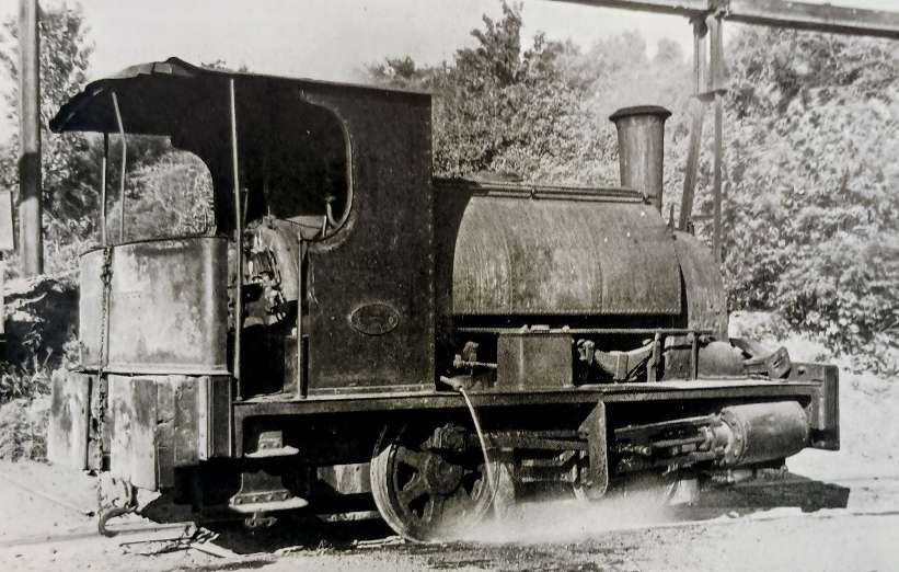
Stoyel & Kidner tell us that, “Sundridge, Quarrier, Longreach, Flintfield and W.H. Liver sidge were supplied new. There is some suggestion that Sundridge was a vertical-boilered locomotive which was scrapped just before the turn of the century, but no confirmation has been found for this. Adamant had previously belonged to the Britannia London Portland Cement Co. at Seacombe, Birkenhead. James Godwin was originally built for the Southampton Dock Co. but came to Stone from the London & St Katherine Dock Co. (their No. 16) some time before 1896. Bulldog and Lion came from the APCM’s Tolhurst Works at Northfleet and lota from their Gibb’s Works at West Thurrock in about 1925. lota was a side-tank with dropped footplate and low vertical clearance.” [1: p14]
“Locomotive Adamant was said to have been scrapped in 1918 and Bulldog at an unknown date. Quarrier, Longreach and W.H. Liversidge were scrapped in 1949 after the railway had been abandoned. Flintfield was lent to the APCM Works at Stone in 1947-1948 and was then sold to the Atlas Stone Co. Ltd for use on their adjoining premises. There is some suggestion that James Godwin was sold to a firm at Portland. Lion was transferred in 1946 to the APCM’s Swanscombe Works and was sold in 1948 to the Atlas Stone Co. Ltd. Iota was loaned to Alpha Cement Ltd, West Thurrock, from 1945 until 1946 when it was sold to the BPCM Works at Penarth, in South Wales.” [1: p14]
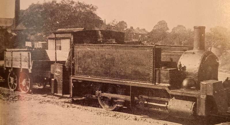
The company’s chalk operations ceased in 1949, its engines were either scrapped or sold to Atlas stone to serve gravel traffic. The company remained in existence until 1974 when its assets were transferred to APCM.
APCM Ltd Kent Works, Stone, Dartford. [1: p 14]
These works are covered in a separate article which can be found here. [2]
I.C. Johnson & Co. Ltd., Greenhithe. [1: p26-36]
Please see the article dedicated to this Works which can be found here. [5]
John Tilden & Co., Greenhithe. [1: p36]
A short-lived firm which operated in the 1860s out of Lamb Wharf Chalk Works at Greenhithe. When constructed, the enlarged Johnson’s Wharf covered the area of the old Lamb Wharf.
Stoyel & Kidner say that two locomotives were known to have operated at these Works. Both were Aveling & Porter locomotives, supplied new, chain-driven and recorded at work in November 1865:
Works No. 48, built in 1862, one cylinder (probably 8.5″ x 10″)
Works No. 132, built in 1864, one cylinder (9.25″ x 12″)
Globe Portland Cement & Whiting Co. Ltd., Swanscombe. [1: p37]
C. G. Down tells us that a William Tingley sublet some land to John Cubit Gostling who formed the Globe Portland Cement & Whiting Co. Ltd. Gostling was also owner of a Thames-side Cement Works. Later, in 1895, the works was purchased by John Bazely White & Bros. Ltd., owners of the Swanscombe Works on the Thames. Due to the recession in the industry though, the works was not used much subsequently, and was bought by APCM on 24th August 1900. [6]
Stoyel & Kidner’s research tells a different story. They say that in 1899 the company became the New Globe Cement Chalk & Whiting Co. and then moved to a different site further East. It then became part of BPCM. [1: p37]
It seems as though there is some uncertainty over what happened beyond those dates. It appears to be clear that the site of the Works was closed by the 1920s with the wharf being used for oil storage.
Stoyel & Kidner record five locomotives being used at the site: [1: p37]
Globe (?) – 0-4-0WTG built by Aveling & Paorter
Globe No. 2 – 0-4-0T built in 1897 by Kerr Stuart, Works No. 124.
Globe No. 3 – 0-4-0ST built in 1901 by Peckett, Works No. 925.
Globe No. 4 – 0-4-0ST built in 1902 by Peckett, Works No. 967.
New Globe – 0-4-0ST built in 1901 by Peckett, Works No. 889.
The Aveling & Porter locomotive came second-hand, the others were purchased new. It is unclear what happened to the Aveling & Porter. Globe No. 2 may have seen service in France from 1916. Globe and Globe No. 2 may have been transferred to the APCM Works at Grays, Essex. [1: p37]
Though the Works closed in the 1920s, three of the locomotives were seen standing derelict at the site in 1929. Subsequently they were transferred to other Works: Globe No. 3 to BPCM, Greenhithe; Globe No. 4 to APCM, Northfleet (becoming No.5); and New Globe to BPCM, Greenhithe. [1: p37]
J.B. White & Bros Ltd., Swanscombe. [1: p38-49]
These works are covered in a separate article which can be found here. [7]
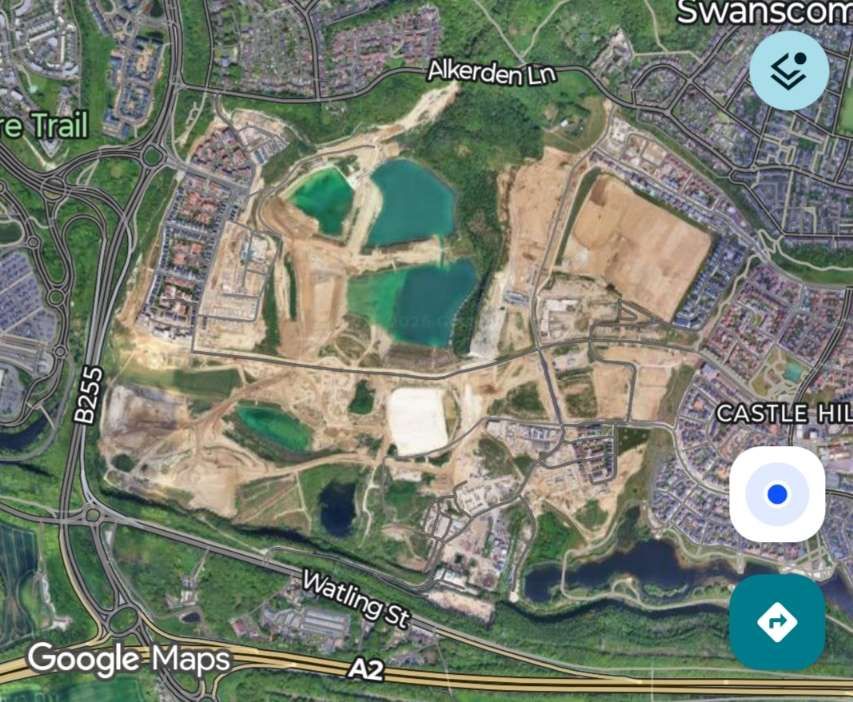
APCM Ltd, Alkerden Clay Pits, Swanscombe. [1: p49]
Operated by the Associated Portland Cement Manufacturers (APCM) Ltd, the Alkerden Clay Pits in Swanscombe, Kent, opened in 1909 to supply London clay for local cement works like Bevans and Kent. The clay was slurried on-site and pumped to main washmills. The Clay Pits closed in 1943.
A 2ft 8.5in narrow-gauge line served the Clay Pits. The railway gauge may have been dictated by the availability of locomotives, rolling stock and track panels from the Northfleet Works of Knight, Bevan & Sturge which operated on the same gauge. But, the Northfleet Works were not converted to standard-gauge until around 1926.
The pits sat between Watling Street and Alkerden Manor Farm near Swanscombe Wood. But were not deep level excavations, rather they spread over a relatively large area which led to the narrow-gauge rail network wandering over quite a large area and to the need to carry the railway over the line of the A2 on a long girder viaduct.
Stoyel & Kidner indicate that eight locomotives were used on this network of lines: [1: p51]
Swift – 0-4-0TV, built by Knight, Bevan & Sturge (?)
Rapid – 0-4-0TV, built by Knight Bevan & Sturge (?)
Alert – 0-4-0TV, built by Knight Bevan & Sturge (?)
Clinker – 0-4-0ST, built in 1917 by Bagnall, Works No. 2068, outside cylinders (8″ x 12″) with 2′ 0.5″ wheels.
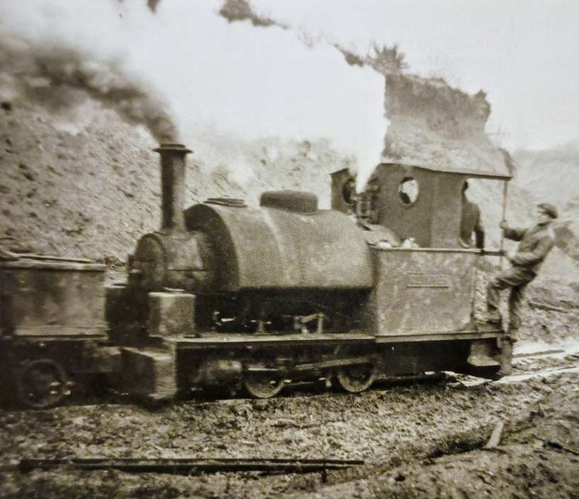
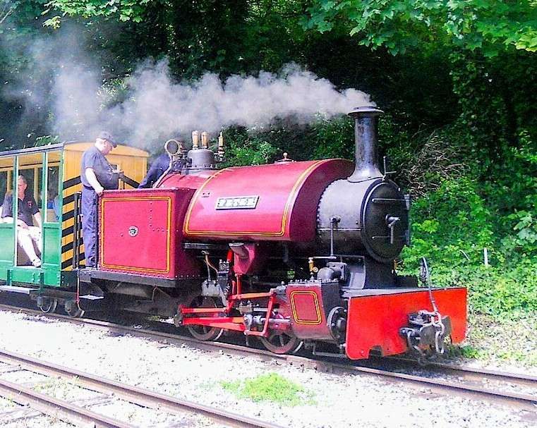
Meteor – 0-4-0ST, built in 1893 by Black Hawthorn, Works No. 1085, outside cylinders (8.5″ x 16″) with 2′ 6″ wheels.
Planet – 0-4-0ST, built in 1902 by Hudswell Clarke, Works No. 631, outside cylinders (8.5″ x 16″) with 2′ 6″ wheels.
Comet – 0-4-0ST, built in 1921 by Hawthorn Leslie, Works No. 3506, outside cylinders (8.5″ x 16″) with 2′ 6″ wheels.
Rocket – 0-4-0ST, built in 1930 by Hawthorn Leslie, Works No. 3788, outside cylinders (8.5″ x 16″) with 2′ 6″ wheels.
Stoyel & Kidner tells us, “Very little is known about the three vertical boiler locomotives, all of which had been scrapped by 1931. … The Bagnall was obtained from C.J. Wills, Grimsby probably in 1921 when it was converted from 2ft 6 in. gauge. … Meteor, Planet and Comet were transferred in 1928 from Bevan’s Works, Northfleet. Planet was ordered from Chapman & Furneaux and carried their works plates (No. 1215, 1902) but this was the period when the firm was in difficulties, leading to its acquisition by Hawthorn, Leslie & Co. Ltd, and evidently the order was sub-contracted to Hudswell Clarke & Co. Ltd. Rocket was delivered new to the Alkerden pits. Clinker had gone by March 1943 and the remaining four, which were basically of the same design, were scrapped during 1943. The railway was superseded at about that time. Whites obtained clay from Cliffe from 1937.” [1: 51]
Onward Cement Co. Ltd., Northfleet. Tower Cement Co. Ltd., Northfleet. Maceroy & Holt (Britannia Works). [1: p51]
These three concerns clustered together on the Northwest side of Robin’s Creek.
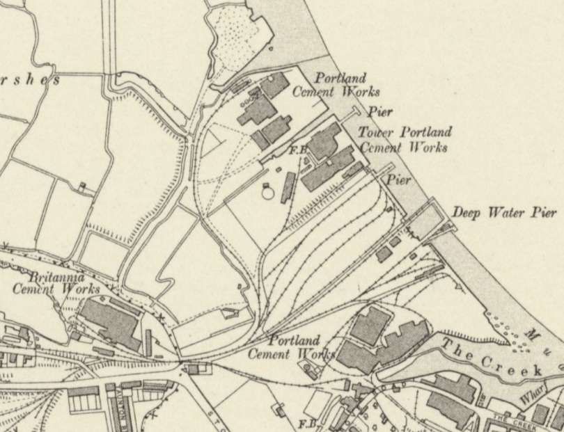
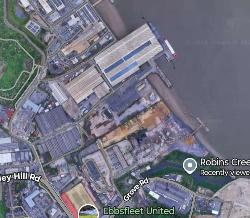
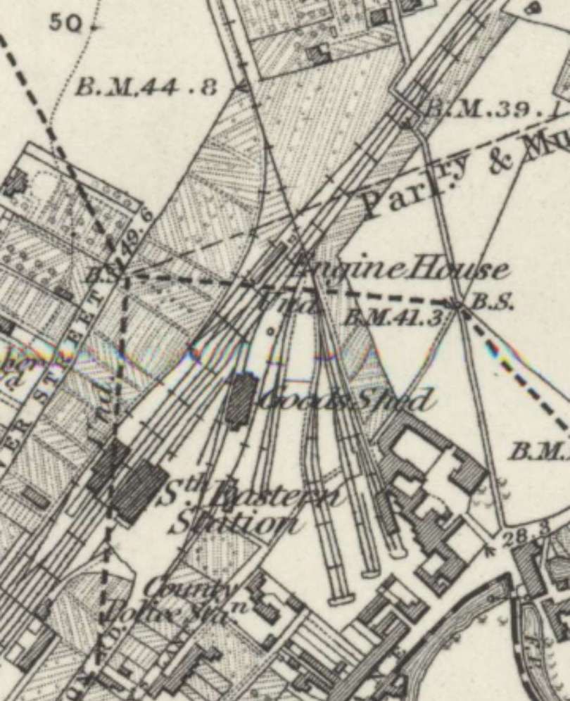
Stoyel & Kidner say that all the Works were originally supplied with chalk from pits close to the Works but when that option was exhausted land across London Road was exploited. Northfleet Coal & Ballast Co. Ltd. held the wharf on the Thames and handled the transport for all of the companies. The first of those pits were only just the other side of London Road, in fact, just off the bottom corner of the map extract above. [1: p51]

On the right side of this extract an engine house sits next to a tramway that served other concerns to the East.
Stoyel & Kidner note that the 1 in 40 gradient between the Works and Chalk Pits and the railway station sidings required double-heading for trains as short as 4 or 5 wagons. [1: p52]
The Northfleet quarries were worked out by 1920 and sold in 1921. [1: p52]
Stoyel & Kidner express surprise at the size of the locomotive fleet that served this series of concerns. They mention that there were two or three different owning companies, but provide a single list of the locomotives used:
Peveril – possibly built in the 1840s at the Edge Hill works of the Grand Junction Railway – purchased second-hand from E. W. Goodenough, Northfleet. Scrapped circa. 1900. [1: p53,54]
Fly – an 0-4-0ST probably built in 1864 by Manning Wardle, Works No. 111 – it had outside cylinders. If correct, this locomotive was sent on test to Ryde Pier Tramway on the Isle of Wight in 1864. Appears to have disappeared in 1919! [1: p53,54]
Fox – an 0-4-0ST built in 1871 by Henry Hughes and purchased new – it had outside cylinders (11″ x 18″), the wheel size is not given. Scrapped in 1930. [1: p53,54]
Loughborough – an 0-4-0ST built in ???? by Henry Hughes and purchased new – it had outside cylinders (9″ x 15″), the wheel size is not given. Transferred to West Thurrock circa. 1913. [1: p53,54]
Northfleet – an 0-4-0ST built in ???? by Henry Hughes and purchased new – it had outside cylinders (11″ x 18″), the wheel size is not given. Transferred to West Thurrock circa. 1902/1903.
Kilmarnock – an 0-4-0ST built in 1886 by Barclay, Works No. 282 and purchased new – it had outside cylinders (11″ x 18″) and 3′ 3″ wheels. Transferred to West Thurrock circa. 1913.
Swanscombe – an 0-4-0ST built in 1891 by Barclay, Works No. 699 and purchased new – it had outside cylinders (11″ x 18″) and 3′ 5″ wheels. Transferred to West Thurrock circa. 1913 (later entered preservation at Quainton Road).
W. H. Davies – an 0-4-0ST built in 1899 by Brush, Works No. 282 and purchased new – it had outside cylinders (??” x ??”) the wheel size is not given. Scrapped in 1957.
Torpedo – an 0-4-0ST built in 1886 by Peckett, Works No. 449, purchased second-hand in 1920 from A. R. Adams, Newport, Monmouthshire – it had outside cylinders (10″ x 14″) and 2′ 6″ wheels. This locomotive was previously used in the construction of GWR Wootton Bassett to Patchway line. Scrapped in 1930.
Denis – an 0-6-0ST built in 1902 by Manning Wardle, Works No. 1561, was purchased second-hand from G. Shellabear, Park Royal – it had inside cylinders (12″ x 17″) and 3′ 0″ wheels. It had been used by D. Shanks (contractor) with whom it carried the name of Coronation. Scrapped circa. 1945.
Dolphin – another 0-6-0ST built in 1879 by Manning Wardle, Works No. 725, was purchased in 1925 from the Southern Railway at Folkestone Harbour (No. A752), previously it had been rebuilt at the SE&CR’s Ashford Works in 1911 – it had inside cylinders (12″ x 17″) and 3′ 0″ wheels. Scrapped circa. 1945.
Bradley – an 0-4-0ST built in 1950 by Peckett, Works No. 1938 and purchased new – it had outside cylinders (12″ x 20″) and 3′ 0.5″ wheels. Scrapped circa. 1945.
Victory – an 0-4-0ST built in ???? by Dick & Stevenson Works No. ???, was another second-hand locomotive which came on loan from the Ministry of Supply in 1942 (their No. P234) it had outside cylinders (14″ x ??”) and the wheel size is not given. Prior to coming to Northfleet, it served at MoD Kinnerley. It only remained in Kent until 1943 before moving on to an unknown destination in Yorkshire. [1: p53,54]
Northfleet – another 0-4-0ST built in 1946 by Peckett, Works No. 2080 and purchased new – it had outside cylinders (12″ x 20″) and 3′ 0.5″ wheels. Scrapped in 1967.
The New Northfleet Cement Works
This new Works was not constructed until the end of the 1960s and became operational in the 1970s. It was predominantly built on brownfield land which included the sites of: Bevan’s Cement Works (Northfleet); the Crown Portland Cement Plant; and the London Portland Cement Plant.
This plant and the associated sidings is covered in another article about which can be found here. [33]
Knight, Bevan & Sturge Ltd., Northfleet. [1: p54-62]
These Works are covered in a separate article which can be found here. [34]
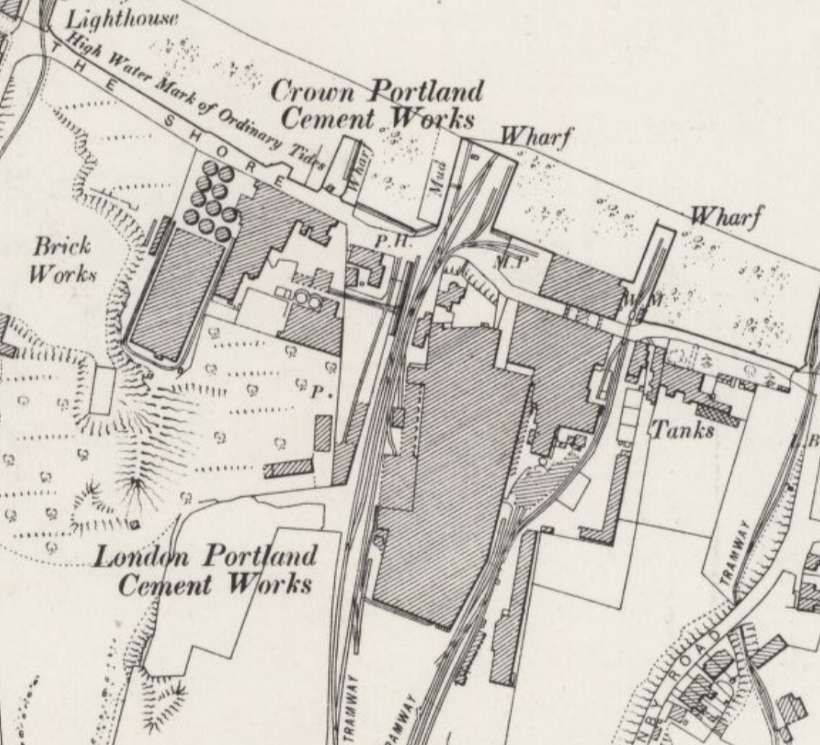
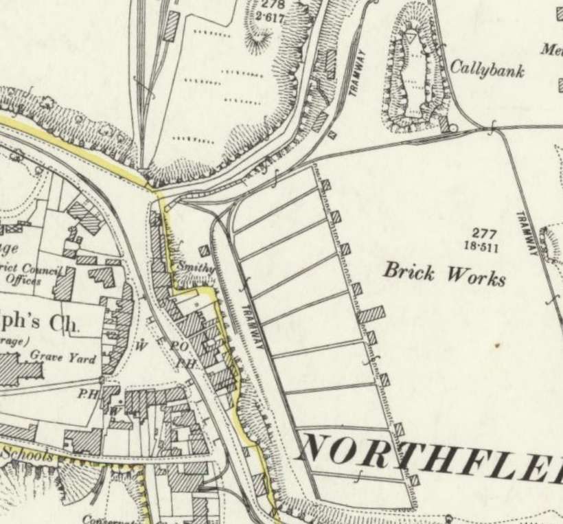
London Portland Cement Co. Ltd., Northfleet [1: p62] and Crown Portland Cement Co. Ltd., Northfleet. [1: p62]
London Portland Cement Works were opened in 1868 just to the East of the Bevan Cement Works. There was a short tramway to pits north of the High Street. In 1900 these Works became part of APCM but were closed in 1908.his was one of the constituents of the APCM on the formation of the latter in 1900, but it soon became redundant and was closed in 1908, by which time the tramway had been extended through a tunnel under Granby Road to pits and a brickworks at Calleybank. Stoyel & Kidner state that “Latterly the system seems to have been integrated with that of the Crown Portland Cement Works lying just north-west. When the line serving Bevan’s Works was opened in 1929 to the exchange sidings on the ex-LC&DR near Rosherville, it used part of this old line including the tunnel under Granby Road, as well as part of the route of another earlier tramway which ran from a point just north of the crossing of the LC&D over the SER, via a whiting works and a white lead works, to Red Lion Wharf.” [1: p62]
More details of these Works can be found here [37] and here. [38]
Stoyel & Kidner note two standard gauge locomotives that they are sure were employed in conveying chalk to the works:
Locomotives
Vulcan built by Falcon in 1884, no more is known about this locomotive.
Unnamed – An 0-4-0ST built in 1877 by Manning Wardle, Works No. 651. It had outside cylinders (9″ x 14″) and 2′ 9″ wheels.
Of these two locomotives Stoyel & Kidner say that, “It is probable that Vulcan was supplied new but the Manning Wardle had originally seen service with the contractor William Moss in constructing the line between Peterborough and Seaton for the Midland Railway, at which time it carried the name Stafford. Its ultimate fate is unknown, but the boiler of Vulcan exploded in 1895 and it is likely that it was then scrapped.” [1: p62]
Red Lion Chalk & Whiting Co. Ltd., Northfleet. [1: p63] and Tolhurst & Sons Ltd., Gravesend. [1: p63]
Dylan Moore tells us that the Red Lion Wharf “was named after the local pub long before the Tolhursts arrived. Tolhurst’s initial business, from 1891, was export of chalk, and cement manufacture did not begin before 1896. There were initially 14 chamber kilns (output 406 tons/week) expanded to 19 around 1901 and to 38 (output 1100 tons/week) in 1907. In 1909, … After 1911 the plant was amalgamated with the Imperial plant. The rating in 1920 was 1000 tons/week. The remaining plant was described in the APCM 1924 schedule. There was no rail link, and all product was despatched by barge. After closure, the site remained derelict for many years before absorption into the Northfleet power station, now also cleared.” [39]
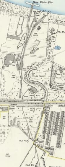
This indistinct extract from the 25″ 1895 Ordnance Survey, published in 1897, shows the Red Lion Wharf, the British White Lead Works, the Red Lion Chalk & Whiting Co. Ltd., and the associated chalk pits. The tunnel under London Road is just below the centre of the image. [36]
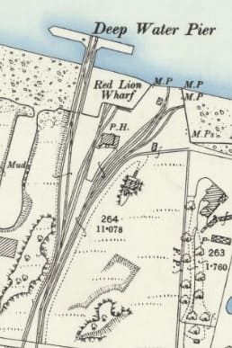
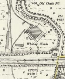
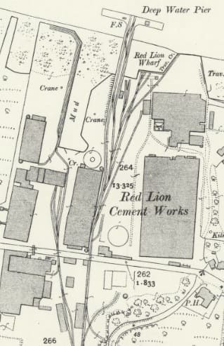
The Red Lion Cement Works in 1907 – 25″ Ordnance Survey of 1907, published in 1909. The Imperial Cement Works are on the left. [41]
Details of the locomotives used on the internal industrial railway serving this and the Imperial Works can be found under the Imperial Cement Works below.
Stoyel & Kidner tell us that, a tramway was laid in “about 1860 from Red Lion Wharf, Northfleet, to some limekilns near London Road, east of Woodfield Lodge: by 1870 a tunnel had been built under London Road and the tramway was exploiting the chalk land between there and Old London Road.” [1: p63]
Early ownership of the tramway is uncertain, but “in 1896 Tolhurst & Sons Ltd registered the Red Lion Chalk & Whiting Co. Ltd to take over his line, engines, works, etc. The railway was pushed further south-east and linked to the London Chatham & Dover Railway at Perry Street Siding. In 1898 land was sold for the erection of the Imperial Cement Co. Ltd mills, which by agreement had to take its chalk from Tolhurst. This was built partly on land formerly owned by a white lead works. All these works were serviced by Tolhurst’s standard gauge railway. The Red Lion Works was taken over by APCM in 1908 and closed in 1919; however part of the railway was used a few years later for a new entry to Bevans Works. The Imperial Works joined APCM in 1900 and closed in 1908, leading to litigation over the chalk agreement with Tolhurst which did not expire until 1948, ” [1: p63]
Imperial Cement Works
Stoyel & Kidner inform us that Tolhurst sold land “for the erection of the Imperial Cement Co. Ltd mills, which by agreement had to take its chalk from Tolhurst. This was built partly on land formerly owned by a white lead works. All these works were serviced by Tolhurst’s standard gauge railway.” [1: p63] It is clear that the Imperial Works were beholden to Tolhurst for their supply of chalk which Tolhurst’s rail network and locomotive provided first to the Imperial Cement Works and later to APCM/BPCM.
Dylan Moore tells us that there “were initially nine chamber kilns, output 205 t/week. A further 25 kilns were installed in the period 1899-1907 in 4 sets: two sets of 5 each of capacity 150 tons/week, 9 (260 tons/week) and 6 (175 tons/week), giving a final capacity of 940 tons/week. There was no rail link, and all product was despatched by barge. The plant’s operations were amalgamated with those of Red Lion from 1912, and re-assigned to APCM. The plant was described in detail in the APCM 1924 schedule. The kilns were demolished in 1923, and the site remained derelict for many years before absorption into the Northfleet power station, now also cleared.” [40]
Locomotives used across the Red Lion, Tolhurst and Imperial sites
Bulldog – an 0-4-0ST built in 1860 by Manning Wardle, Works No. 13. It had outside cylinders (8″ x 14″). Its wheel size is not quoted. By 1871 this locomotive was in the ownership of j. Durden of Northfleet. It went to Stone Court Chalk, Land & Pier Co. Ltd.
Wolf – an 0-4-0ST built in 1890 by Falcon, Works No. 120. It had outside cylinders (??” x ??”). No wheel size is quoted, was transferred to Swanscombe Works.
Lion – another 0-4-0ST built in 1891 by Falcon, Works No. 205. It had outside cylinders (11″ x 18″) and 3′ 0″ wheels. It went to Stone Court Chalk, Land & Pier Co. Ltd.
Leopard – another 0-4-0ST built in 1896 by Falcon, Works No. 239. It had outside cylinders (11″ x 18″) and 3′ 0″ wheels. It was transferred to Crown & Quarry Works, Frindsbury.
Elephant – an 0-4-0ST Brush (Flacon/Henry Hughes), Works No. 287, built in 1899, it had outside cylinders (10′ x 18″) and 3′ 0″ wheels. After service at Tolhurst Works the locomotive was transferred to Kent Cement Works, Stone.
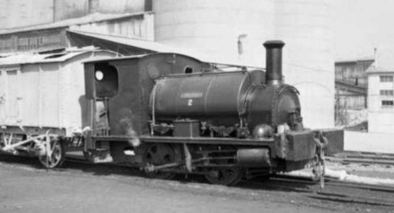
Tolhurst & Sons Ltd., Gravesend
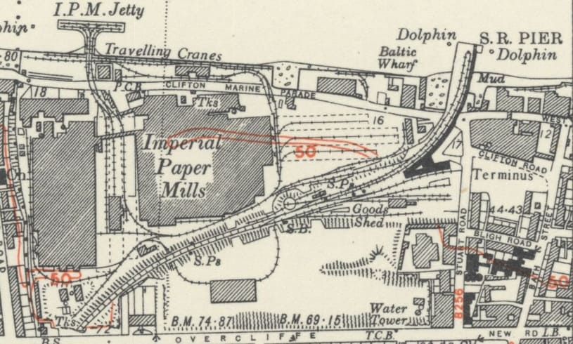
Stoyel & Kidner also tells us that Tolhurst “had an extensive railway serving its Gravesend works, of 3ft 6 in. gauge, laid down in the 1860s or before; it ran from a wharf between Rosherville Pier and Clifton Marine almost as far as what was later West Street. There were three kilns at various points on the system. It was not extended very much, but when the LCDR arrived in 1886 it had to build four bridges near West Street station over branches of the tramway. The site of the works and quarries was later used by the Imperial Paper Mills. One locomotive was said to have been named Diamond and to have been sold to the Imperial Paper Mills in 1948.” [1: p63]
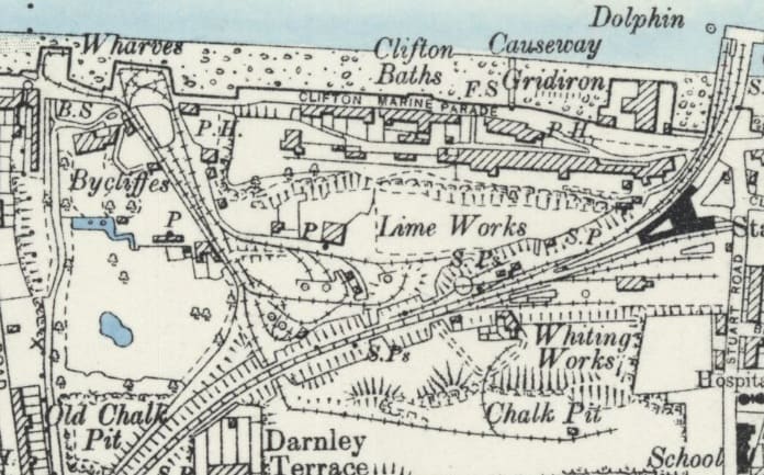
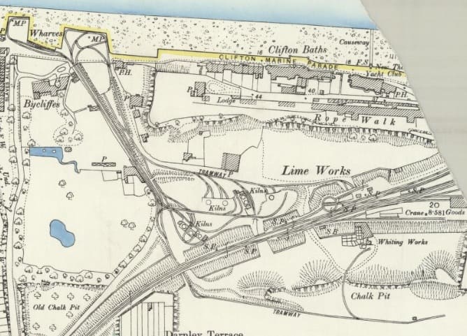
This site later became home to the Imperial Paper Mills in 1911. The Imperial Paper Mills are covered further below.
Empire Paper Mills, Greenhithe
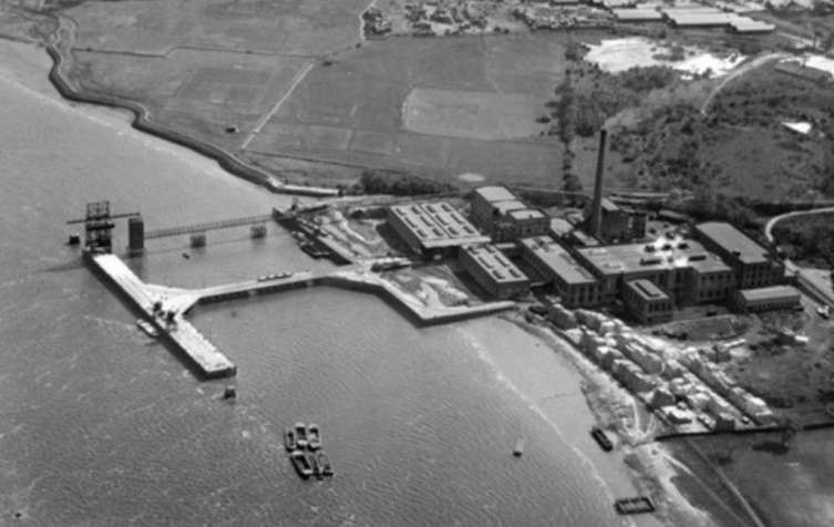
The Empire Paper Mills, Greenhithe seem from the air in 1927. The plant was established in the early 20th century alongside the River Thames. It operated for decades before closing in 1992, © Historic England (Britain From Above). [20]
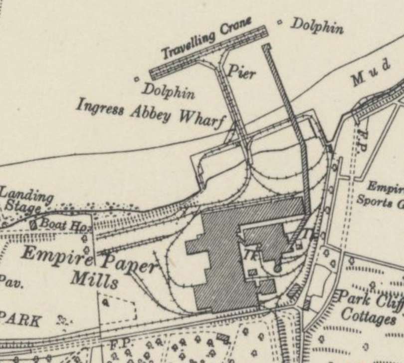
The Empire Paper Mills were owned by the Associated Press (later part of the Reed Paper Group network) as Empire Paper Mills Ltd in 1922. The main line connection to the works was severed in 1965 but the internal network operated until 1990. [23] The plant was sold to Norske Skog in 1991 before its final closure in 1922.
Details of this site can be found here. [25]
David Glasspool tells us that “From the outset the paper mill possessed a 24-inch gauge electrically-powered endless cable railway. This was double-track, linked the main jetty with the mill’s paper store, and upon it ran a fleet of wagons with removable tops. The latter allowed the tops of the wagons to be lowered into the holds of docked ships, filled with materials, and then hoisted back onto the chassis for onward travel within the mill. A series of sidings spurred off this network so static wagons could take refuge and not block the main tracks between the jetty and store. … A second railway network, again comprising a narrow gauge double-track line, ran from the jetty to the mill. This was elevated upon a steel structure and was dedicated to the transportation of coal from ships to the mill’s boiler house. It used a rake of wagons on an electrically-driven cable system, which took coal from a 100-foot-high unloading tower on the jetty and subsequently dumped this into hoppers. ” [25] Both these small networks ceased operating in the 1920s.
The standard-gauge network on the site hosted a number of different locomotives and rolling stock over time. There were three different standard-gauge locomotive ‘eras’ at the works. The line connecting to the paper store was constructed in the late 1920s. It was the last new length added to a network that was fist used in 1906/1907.
Glasspool tells us that in addition to a series of standard-gauge locomotives, “six rail-mounted steam cranes which ran on the standard gauge tracks … were used on the main jetty to unload materials from ships and could also be found handling goods within the main mill complex.
The three different standard-gauge ‘eras’ were:
A. The fireless era 1906-1971
No. 1 – an 0-4-0F (fireless) locomotive built in 1907(listed as 1906 in some sources) by Orenstein & Koppel, Works No. 2499 me this was one of the first O&K fireless engines imported into Britain. In Reed ownership the locomotive carried the fleet number S/10.
No.2 – also an 0-4-0F locomotive, built in 1917 by Andrew Barclay Sons & Co., Works No. 1561. This locomotive was purchased second-hand from the Royal Ordnance Factories. In Reed ownership the locomotive carried the fleet number S/11.
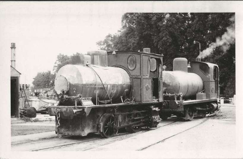
Andrew Barclay No. 1471 – another 0-4-0F locomotive, originally built in 1916 for Vickers Ltd to work at the National Filling Factory at Morecambe. It was one of three such locomotives supplied by Andrew Barclay to Vickers to work at Morecambe – Works Nos 1471-3 of which 1472 and 1473 have been preserved. 1471 appears to have operated at the Empire Paper Mills later in its life. [26]
B. Transitional Steam
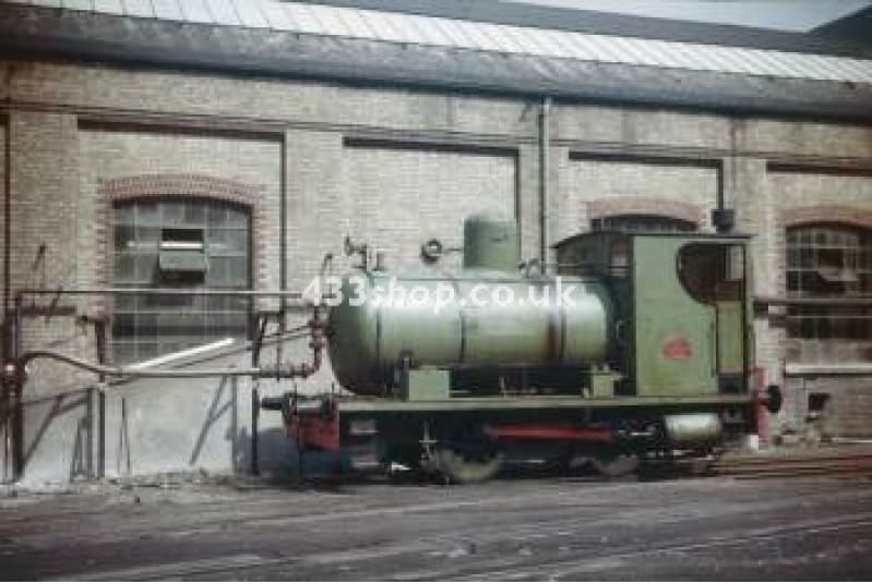
Nelson – an 0-4-0ST built by Peckett in 1935, Works No. 1880. [4: photo No. 104]. This locomotive was purchased from Aylesford Paper Mill in 1967. Its tenure at Empire Paper Mills was brief. It was scrapped in 1969.
A photograph of this locomotive at Empire Paper Mills can also be seen here. [28]
C. Dieselisation 1968-1971
Diesel traction started to creep onto the scene at Empire Paper Mills in 1968:
No.3 – was a conversion of an Andrew Barclay 0-4-0ST locomotive, Works No. 2167 which was built in 1946. The conversion was undertaken in 1963 and the locomotive arrived at Empire Paper Mills in 1968. It was found to be unreliable and was scrapped in 1971. [29]
Purchase of three further diesel locomotives was to follow:
Paxman – an 0-4-0 diesel-electric built in 1958 by Ruston & Hornsby, ‘200DE’ Class, Works No. 412718 was purchased from a Darwen paper mill in Lancashire in March 1970. The loco was subsequently acquired by the North Downs Steam Railway at Dartford in September 1990, but it has since been scrapped. [23]
Airman – also an 0-4-0 diesel-electric built in 1958 by Ruston & Hornsby, ‘200DE’ Class, Works No. 412716 was purchased from New Northfleet Paper Mills when that works closed in 1971. [29] Although these details are worth further checking as this locomotive appears not to have been based at the New Northfleet Paper Mills. [32]
Batman – another 0-4-0 diesel-electric built in 1958 by Ruston & Hornsby, ‘200DE’ Class, Works No. 412717 was purchased from New Northfleet Paper Mills when that works closed in 1971. [29] David Glasspool suggests that this locomotive was, in fact, a ‘Class 88DS’. [32]
These three Rustons continued to work the yard well into the 1970s after the fireless fleet went. The connection to the North Kent Line was lifted around 1958 and the internal system finally closed with the mill in 1992. [29]
New Northfleet Paper Mills (Bowater’s Thames Mills)
Details of these Mills can be found here. [31]
The standard-gauge railway network at the Northfleet/Thames paper mills utilized fireless 0-4-0 steam locomotives and later diesel shunters to prevent fire hazards from sparks near flammable paper products. The most prominent locomotive associated with the site is an Andrew Barclay 0-4-0F fireless engine built in 1925.
David Glasspool tells us that “A pre-war boom in newspaper circulation saw [W. V. Bowater & Sons] purchase, in May 1914, the site of a redundant dockyard, where it proposed establishing its first paper mill for the production of newsprint. The site was previously known as “Northfleet Dockyard”, this having originally been commissioned in 1788 by one Thomas Pitcher. … The outbreak of war in July 1914 stalled Bowater’s plans for a mill at Northfleet and construction work did not commence until 1924. As part of the scheme, a new company by the name of “Bowater’s Paper Mills Limited” was formed in the previous year. ” [31]
Glasspool continues: “the extensive railway system commissioned at Thames Mills, Northfleet, … was linked to the Southern Railway’s branch line to Gravesend West Street by a ¾-mile-long single track, a junction being formed at Rosherville Sidings. The connection with Thames Mills reused a tunnel through the chalk ridge underneath London Road, originally bored for the railway network of the defunct Red Lion Cement Works. In addition to Thames Mills, the single track also linked the Gravesend West Street branch with the London Portland Cement Works. The latter had been commissioned in 1868 under the name “Messrs. J. C. Gostling & Co”, becoming the “London Portland Cement Company” in 1876 after a takeover. The works were situated on a large site just west of Thames Mills, the two being separated by allotment gardens.” [31]
Fireless locomotives were used here as in the other papermills on the Thames estuary.
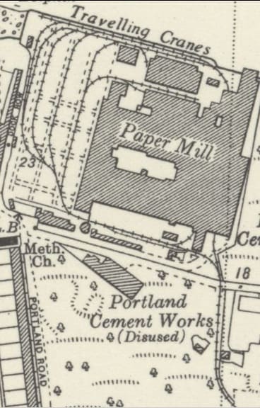
New Northfleet Paper Mills in 1946 as it appears on the 6″ Ordnance Survey of 1946, published in 1951. The line leaving the map extract in the bottom-right corner linked the site to the Gravesend Branch to the West of Rosherville Halt at Rosherville Sidings. [30]
As already noted, the mills were built on the site of Northfleet Dockyard which covered an area of 18 acres and ran along the southern edge of the Thames for 960-feet. The first ship launched from here in 1789 and the site grew to incorporate seven shipbuilding slips and a dry dock. The dockyard ceased operations in 1860. The shell of the dockyard, complete with building slips, was still in existence at the time of Bowater’s purchase in 1914. [31]
No. 1 – was Andrew Barclay No. 1876, it was the first locomotive to work on the site. It was an 0-4-0F locomotive built in 1925, arriving at the Works in September 1925. With a hiatus for WW2, when newsprint production ceased in favour of the manufacture of munitions, supplies of pulpwood from Canada and Scandinavia, were unloaded from ships onto the deep water jetty on the Thames. From there, the raw material was conveyed to the mills via the internal railway system. [32]
No. 2 – was also an Andrew Barclay locomotive, Works No. 1962, built in 1928. It too was an 0-4-0F locomotive.
In 1957 as part of significant expansion plans, two newly-built diesel locomotives arrived at Northfleet, both having been manufactured by ‘Ruston & Hornsby’ : Class 165DE; Works No. 416209; and Class 88DS; Works No. 412427. These became, respectively, No. 3 and No. 4. [32]
The Imperial Paper Mills, Gravesend
Details of the site can be found here. [22]
Because of a concern about fire risks, the Imperial Paper Mills ordered two fireless locomotives from German company “Orenstein & Koppel”, the first (Works No. 4708) arriving in time for the mills’ opening in 1911, the second (Works No. 5900) coming in the following year. David Glasspool says that, “These were distinctive locomotives, not only for the fact that they possessed a reservoir and not a boiler, but also given that their pistons were rear-mounted underneath the cab. The latter gave the impression that the chassis had been constructed back-to-front. Orenstein & Koppel had earlier produced a fireless locomotive in 1906 for the Empire Paper Mills, Greenhithe, situated 2¾-miles to the west.” [22]
David Glasspool continues: “The first British manufacturer of fireless locomotives was Andrew Barclay Sons & Company, Ltd of Kilmarnock, Scotland, which started producing these engines in 1912. The company built several of these locomotives during World War I when, of course, it was no longer possible to source them from Germany. The Imperial Paper Mills initially ordered two of these from Andrew Barclay, the first (Works No. 1471) arriving in Gravesend in 1916 and the second (Works No. 1496) being delivered in 1917. These engines possessed cylinders of 15-inch diameter, had an 18-inch stroke, and their reservoirs were charged with steam to a pressure of 160lbs per square inch from a static boiler of 165lbs per square inch pressure. The arrangement was of the 0-4-0 type, the wheels being 3-feet in diameter and the wheelbase extending to 6-foot 6-inches.” [22]
NB: Other authorities suggest that No. 1471 was not supplied to Imperial Paper Mills but rather came directly to the Empire Paper Mills after service in Morecambe. Some notes are provided in the section relating to the Empire Paper Mills above.
A final fireless locomotive purchased for the Imperial Paper Mills was Imperial No. 1, an 0-4-0F built in 1956 by Andrew Barclay, Works No 2373. It cost £6,790.
Francis & Co. Ltd., Cliffe. [1: p64]
Francis & Co. Ltd., was a 19th- and early 20th-century cement manufacturing firm that operated works and quarries in Cliffe (Cliffe-at-Hoo), Kent. The company operated their original Nine Elms plant near Vauxhall Bridge in central London until it was taken over by the South Western Railway in 1867, when the plant at Cliffe was established. The company also took land at Cliffe Creek and Cliffe Quarry. Dylan Moore tells us that production of cement continued through to the APCM takeover of the company in 1900. “Cement manufacture formally ceased with the … takeover. … The plant continued making whiting, and remained the despatch point for cement. Cement activities ceased in 1921, but whiting manufacture continued into the 1930s. The plant had no landward communications except for the quarry tramway, and all transport was by barge. The wharf continued in use until the 1960s in connection with the supply of clay from the marshes to the Thames plants.” [48]

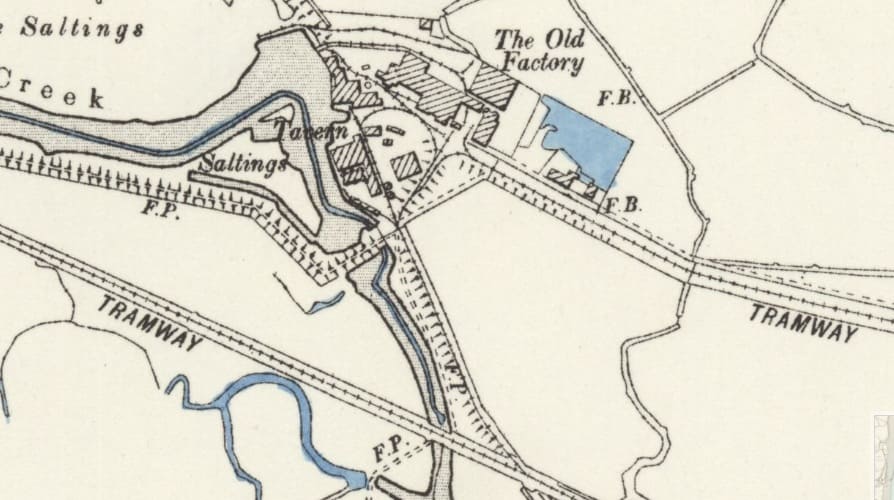
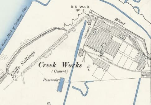
The Cement Works fall immediately adjacent to the edge on the 25″ Ordnance Survey (Essex) of 1895, published 1897. The Kent sheet of that date is unavailable on the NLS website. … Until 1900, the Works was producing Cement. After the turn of the century the Works functioned as a Whiting works. [50]
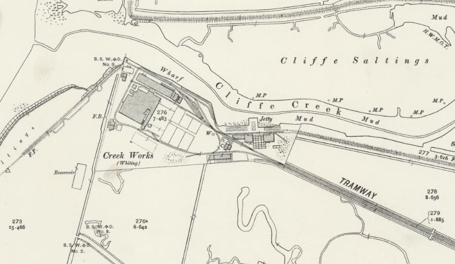
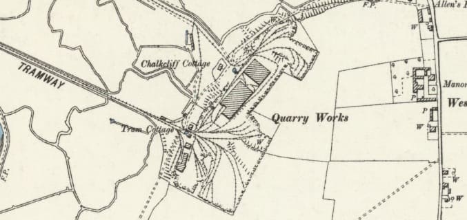
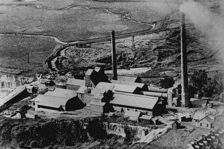
Initially the quarry and works were served by a canal which was replaced circa. 1871 by a 3ft 8.5in railway. Initially trains were steam-hauled. [55] there was no rail link to the wider rail network in Kent, all the product from the Works and Quarry was despatched by river barge. The Works were acquired by APCM in 1900 and closed in 1920.
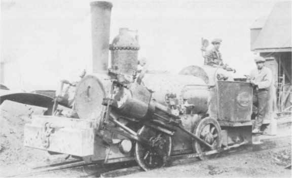
Motive power was predominantly provided by Aveling & Porter engines. Although the first locomotive used on site was an 0-4-0TV (vertical boiler) built in 1867 by Chaplin, Works No. 985. This locomotive was supplied through the agency of Wilmshurst & Co., London but was stated as being of 3ft 7.5in. Minor regauging was probably necessary! [1: p64]
Six Aveling & Porter locomotives were used during the life of the Works. Stoyel & Kidner list these as: [1: p64]
- an 0-4-0WTG Aveling & Porter built in 1873, Works No. 915, one cylinder (8″ x 10″) geared steam locomotive with 3′ 0″ wheels. Believed scrapped on site.
- a 2-2-0WTG Aveling & Porter built in 1880, Works No. 1594, one cylinder (8″ x 12″) geared locomotive with 5′ 0″ wheels. Believed scrapped on site.
- an 0-4-0WTG Aveling & Porter built in 1887, Works No. 2229, two cylinders (5.5″ x 10″) geared locomotive with 3’0″ wheels. This locomotive was not completely new. It arrived on site in 1890. Stoyel & Kidner say that It “had an interesting background. It had been designed and built for work on the Brighton Tramways, but was found unsuitable and was returned to the makers, who rebuilt it in more conventional form. It retained its two high pressure cylinders, however, and in this respect was probably unique amongst Aveling & Porter’s railway locomotives.” [1: p66] Believed scrapped on site.
- a 2-2-0WTG Aveling & Porter built in 1880, Works No. 2428, one cylinder (8″ x 12″) geared locomotive with 5′ 0″ wheels. This locomotive was still on site in 1938, standing abandoned in the shed and may have been used for target practice for anti-tank weapons.
- No. 3, an 0-4-0WTG Aveling & Porter built in 1899, Works No. 4360 compound cylinder (8.875″ x 14.125″ x 14″) geared locomotive with 4′ 0″ wheels. This locomotive was sent to Albert Batchelor Ltd. at Halling.
- an 0-4-0WTG Aveling & Porter built in 1900, Works No. 4537, compound cylinder (8.875″ x 14.125″ x 14″) geared locomotive with 3′ 6″ wheels. This locomotive was sent to the BPCM Works at Greenhithe.
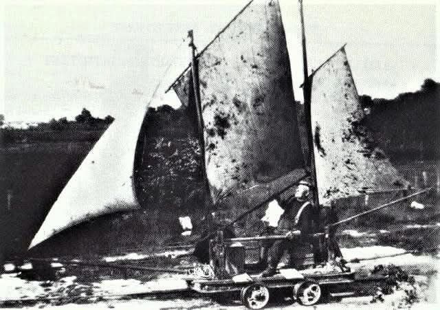
And after closure, one of the wagons was adapted by William Herbert Slater circa. 1935. He fitted sails to create a sail-powered mail/supply trolley (“Land Ship”) used for the marshes.
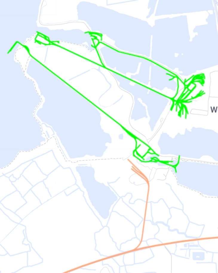
This extract from the mapping provided by railmaponline.com shows all of the lines in the immediate area of the Cliffe works and quarry. The railways associated with Francis & Co. Ltd’s operations (above) are the most northerly group of green lines. These were 3ft 8.5in-gauge lines. The later narrow-gauge railways of the Alpha/Thames Works are also shown green. Brown is used to designate the later standard-gauge branch line. [57]
Alpha Cement Co. Ltd., Cliffe. [1: p65]
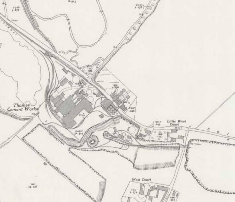
Dylan Moore writes that “Alpha called [this plant] Thames Works, but confusingly also referred to it as Rochester Works. In common with all the other Alpha plants, after 1934 it was called Alpha Works by the locals. The company was launched by builders’ merchants Broad and Co., as with British Standard, to escape the dictatorship of the Blue Circle monopoly. Although undoubtedly a very shaky operation, it escaped takeover by Red Triangle, but was bought by Alpha, who, as at other plants, installed calcinators which were subsequently removed by Blue Circle. There was for most of the plant’s history no rail link, and the plant relied largely on river transport. The plant was originally connected to a wharf on Higham Creek at Cliffe Fort, initially by a 1.59 km ropeway used to send out cement and bring in coal. In 1935 this was replaced by a 2 ft gauge tramway leading to a new deep water wharf adjacent to Cliffe Fort. A substantial part of the plant’s output was shipped to Scotland. A short branch rail line was extended to the plant in 1961, with six bulk loading silos, and trains to Uddingston, near Glasgow, began.” [54]
Stoyel & Kidner tell us that the Works was built in 1912 and acquired by the Alpha Group in 1934. At that time an original ropeway was replaced by a narrow-gauge railway which ran Northwest from the Works to the Jetty. The plant and jetty were isolated from the rail network in Kent until circa. 1960 when a line was installed which connected with the Grain branch near Lower Higham. [1: p65-66]
Locomotives
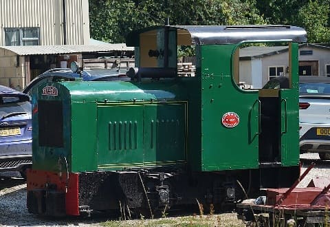
Peldon -The works utilized internal narrow-gauge equipment, including a John Fowler 40 hp ‘Resilient’ class diesel locomotive named Peldon (Works No. 21295 of 1936), which was later preserved at the Amberley Museum. It is powered by a 40hp Fowler Sanders 4 cylinder engine, No. M443, B series. Peldon is now the only working example of a 2ft gauge, Fowler Resilient 4w industrial diesel locomotive. It was built by John Fowler & Co (Leeds) Ltd for the Essex Water Authority for use during the construction of the Abberton Reservoir near Colchester, Essex.
After the Water Authority had no further use for it, the loco was sold, with “Layer”, to the Alpha Cement Company, at Cliffe at Hoo, Kent. It was acquired for preservation by the Brockham Museum Trust, and transferred to Amberley with the Brockham collection in 1982. The locomotive was acquired in a rundown, derelict state, and was restored by volunteers at Amberley, finally re-entering service in 1987. [59]
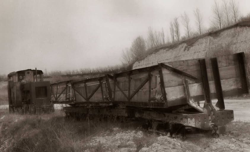
Layer (Works No. 21294) – Built in 1936, by Fowlers, this sister locomotive also moved from Abberton to Cliffe. It survived and is preserved at the Leeds Industrial Museum at Armley Mills. [59]
A Third Fowler Locomotive (Works No. 21296): The third Fowler unit of the same batch worked at Cliffe alongside its sisters but did not survive into preservation.
Ruston & Hornsby Fleet – The core backbone of day-to-day operations at Cliffe was a standardized fleet of 4-wheel diesel Ruston & Hornsby 44/48 HP Locomotives: A fleet of these standard class heavy-duty narrow-gauge diesels was purchased new by Alpha Cement to manage the continuous rotation of chalk and clay tipper wagons.
Ruston & Hornsby (Works No. 186310) – A 1938-built 4-wheel 2ft-narrow-gauge diesel was recorded as part of the working plant equipment at Cliffe Cement Works.
References
- B. D. Stoyel & R. W. Kinder; The Cement Railways of Kent; Oakwood Press, Headington, Oxford, 1973, 1990.
- https://rogerfarnworth.com/2026/08/17/kent-cement-works-stone-dartford-kent
- https://maps.nls.uk/view/101428083, accessed on 19th August 2026.
- Andrew Neale; Industrial Railways of the South-East; Middleton Press, Midhurst, West Sussex, 1984.
- https://rogerfarnworth.com/2026/08/20/i-c-johnson-co-ltd-greenhithe
- https://shop.irsociety.co.uk/Archives/16/Frindsbury.htm, accessed on 20th August 2026.
- https://rogerfarnworth.com/2026/08/15/swanscombe-cement-works-kent
- https://en.wikipedia.org/wiki/British_quarrying_and_mining_narrow-gauge_railways, accessed on 21st August 2026.
- https://www.industrial-loco.org.uk/LibraryAccessionNo.pdf, accessed on 21st August 2026.
- A. & G. Hatherill; Narrow Gauge & Industrial Album; RCL Publications, Gaendolbenmaen, Gwynedd, 2004.
- https://maps.nls.uk/geo/explore/#zoom=15.3&lat=51.48515&lon=0.17001&layers=6&b=ESRIWorld&o=100, accessed on 21st August 2026.
- https://maps.nls.uk/geo/explore/#zoom=15.3&lat=51.48515&lon=0.17001&layers=6&b=ESRIWorld&o=0, accessed on 21st August 2026.
- http://trolleybus.net/subhtml/wse.htm, accessed on 21st August 2026.
- https://maps.nls.uk/view/101427870, accessed on 21st August 2026.
- https://maps.nls.uk/view/103675619, accessed on 21st August 2026.
- https://maps.nls.uk/view/103675628, accessed on 21st August 2026.
- https://kentrail.uk/crabtree_crossing.htm, accessed on 21st August 2026.
- https://www.flickr.com/photos/12a_kingmoor_klickr/5817794218, accessed on 21st August 2026.
- https://en.wikipedia.org/wiki/Amberley_Museum_Railway, accessed on 21st August 2026.
- https://www.britainfromabove.org.uk/image/epw017657, accessed on 22nd August 2026.
- https://maps.nls.uk/view/101428077, accessed on 22nd August 2026.
- https://kentrail.uk/imperial_paper_mills.htm, accessed on 22nd August 2026.
- https://www.flickr.com/photos/12a_kingmoor_klickr/6675477813, accessed on 22nd August 2026.
- https://picryl.com/media/empire-paper-mills-fireless-oandk-and-barclay-0-4-0f-locomotive-13d196, accessed on 22nd August 2026
- https://kentrail.uk/empire_paper_mills.htm, accessed on 22nd August 2026.
- https://preservedbritishsteamlocomotives.com/andrew-barclay-works-no-1473-sir-charles-0-4-0f, accessed on 22nd August 2026.
- https://433shop.co.uk/index.php?route=product/product&product_id=4303, accessed on 22nd August 2026.
- https://archive.rcts.org.uk/product/fai3472, accessed on 22nd August 2026.
- https://kentrail.uk/empire_paper_mills_2.htm, accessed on 22nd August 2026.
- https://maps.nls.uk/view/101428119, accessed on 22nd August 2026.
- https://kentrail.uk/bowaters_northfleet.htm, accessed on 22nd August 2026.
- https://kentrail.uk/bowaters_northfleet_2.htm, accessed on 22nd August 2026.
- https://rogerfarnworth.com/2026/08/25/the-new-northfleet-cement-works
- https://rogerfarnworth.com/2026/08/24/bevans-cement-works-northfleet-kent
- https://maps.nls.uk/view/104191142, accessed on 25th August 2026.
- https://maps.nls.uk/view/103676174, accessed on 25th August 2026.
- https://www.cementkilns.co.uk/cement_kiln_london_portland.html, accessed on 25th August 2026.
- https://www.cementkilns.co.uk/cement_kiln_crown_northfleet.html, accessed on 25th August 2026.
- https://www.cementkilns.co.uk/cement_kiln_red_lion.html, accessed on 25th August 2026.
- https://www.cementkilns.co.uk/cement_kiln_imperial.html, accessed on 25th August 2026.
- https://maps.nls.uk/view/103676171, accessed on 25th August 2026.
- https://maps.nls.uk/view/101428131, accessed on 25th August 2026.
- https://maps.nls.uk/view/103676174, accessed on 25th August 2026.
- https://www.cementkilns.co.uk/cemkilndoc036.html, accessed on 25th August 2026.
- https://maps.nls.uk/view/101428086, accessed on 25th August 2026.
- https://maps.nls.uk/view/103675988, accessed on 25th August 2026.
- https://www.cementkilns.co.uk/images/quarry_sc.gif, accessed on 25th August 2026.
- https://www.cementkilns.co.uk/cement_kiln_nine_elms.html, accessed on 25th August 2026.
- https://maps.nls.uk/view/103675703, accessed on 25th August 2026.
- https://maps.nls.uk/view/104191118, accessed on 25th August 2026.
- https://maps.nls.uk/view/101456147, accessed on 25th August 2026.
- https://maps.nls.uk/view/101428185, accessed on 25th August 2026.
- https://apps.medway.gov.uk/apps/medwayimages/details.asp?docid=1122958&searchtype=all&pg=1&pga=1&search=Cliffe%20Works, accessed on 25th August 2026.
- https://www.cementkilns.co.uk/cement_kiln_cliffe.html, accessed on 25th August 2026.
- https://en.wikipedia.org/wiki/British_quarrying_and_mining_narrow-gauge_railways, accessed on 25th August 2026.
- http://www.copsewood.org/ng_rly/sailbogie/sailbogie.htm, accessed on 25th August 2026.
- https://railmaponline.com/uk-and-irish-railways, accessed on 25th August 2026.
- https://maps.nls.uk/view/103676297, accessed on 26th August 2026.
- https://commons.wikimedia.org/wiki/File:Peldon_-_John_Fowler_Resilient_Class_No._21295-1936_17th_August_2025.jpg, accessed on 26th August 2026.
- https://www.facebook.com/photo.php?fbid=10153066015379543&set=o.195202080644472&type=3, accessed on 26th August 2026.
- Robin Waywell; Industrial Railways and Locomotives of Kent; Industrial Railway Society, 2016.