The Metropolitana di Genova is, in 2024, a single-line, double-track light rapid transit system that connects the centre of Genova, Italy with the suburb of Rivarolo Ligure, to the north-west of the city centre. It runs through to Brignole Railway Station in the East of the city. In 2024, the service is managed by Azienda Mobilità e Trasporti (AMT), which provides public transport for the city of Genoa. [1]
The Metro is a 7.1 kilometres (4.4 mi) long 1,435 mm (4 ft 8 1⁄2 in) (standard gauge) double-track line and is electrified with overhead lines at 750 volts DC. It has a direct connection with Trenitalia’s mainline railway station, Principe. [1]
The origins of a subway in Genoa date back to the beginning of the twentieth century; in 1907 Carlo Pfalz, who had already designed the Zecca-Righi Funicular, [2] was the first to explore the construction of an underground railway with electric traction. Several projects, including that of the engineer Angelo Massardo and those of Renzo Picasso (1911 and 1930), were proposed without being realized. Instead, a tram system at surface level was built which ultimately was abandoned in 1966. An attempt to introduce an alternative means of transport was made on the occasion of the International Exhibition of Marine and Maritime Hygiene of 1914: it was a ‘Telfer’, an elevated monorail that connected the Port (Giano Pier area) to the exhibition area in Piazza di Francia, in front of the Brignole station. The infrastructure was then abandoned and finally demolished in 1918. [1]
An article about the Telfer can be found here. [3]
The underground ‘Metro’ was built in a series of phases. “The first section, opened on 13th June 1990 in time for the 1990 FIFA World Cup, was 2.5 kilometres (1.6 miles) [6] between the stations of Brin and Dinegro. [7] The line was extended to Principe in 1992, [6] to San Giorgio-Caricamento in 2003, [6] to De Ferrari (the underground station at Piazza De Ferrari) in 2005, [6] and to Brignole in 2012.” [8]
Since 2024, citizens of Genoa have been able to use the subway free of charge without any time restrictions.[9]
Stations
Brin Station – is currently (2024) the Northwest terminus of the line. It is situated along Via Benedetto Brin in the neighbourhood of Certosa in Rivarolo Ligure, a suburban area in the north-western outskirts of Genoa, Italy. The station, currently the terminus of the line, is located just west of the tunnel mouth on the line from Dinegro station. [10] It is built on a viaduct, which allows for the line to be extended to the north.
The station was designed by architect Renzo Piano, the station’s official opening took place on 13th June 1990. [10]
Dinegro Station is located under Via Milano, adjoining the Piazza Dinegro from which it derives its name, in the Fassolo area of Genova. It is just East of the business district of San Benigno and close to the ferry terminal.
Darsena Metro Station is located on Via Antonio Gramsci close to Piazza della Darsena. ‘Darsena’ translates to ‘dock’ in English. The station serves the old port area of the city. [15]
San Georgio Station is located under Piazza della Raibetta beside the Palazzo San Giorgio, after which it is named. It is in the Old Harbour area near the Aquarium of Genoa. It was opened together with Darsena Station on 25th July 2003 and saw its first trains on 7th August 2003. [17]
The tracks of the San Giorgio station run beneath the Piazza Caricamento underpass and its underground architecture is similar to the model adopted for the Principe and Darsena stops, that is, with the tracks on the sides of the single central platform. During 2006, some electronic display boards were installed to inform users of the arrival times of trains. [17]
Sarzano/Sant’Agostino Station is located in the historical centre of Genoa. The main entrance is in the Piazza di Sarzano near the Church of St. Augustine, now deconsecrated and turned into a museum, with a second entrance on the Mura della Marina, the old seawall. It opened on 3rd April 2006. [19]
De Ferrari Station is close to Teatro Carlo Felice, Galleria Mazzini, the Doge’s Palace, and Via XX Settembre. It opened on 4th February 2005. It was originally designed, like others, by Renzo Piano with finishing touches by Renzo Truffelli. This used to be the last station on the line until the easterly extension towards Genova Brignole Railway Station opened in 2012. [21][22]
The entrance to de Ferrari Station. [23]Platform level at de Ferrari Station. [€23]
Corvetto Station – In March 2024 3Ti Projeto announced that the design of Corvetto Station had been approved by the municipality. Work is expected to cost around 38.3 million Euros and be completed late in 2024 or early in 2025. [24][25][26]
These two images show the 3Ti Projeto design for Corvetto Station. [24]
Brignole Station – sits close to the main line Brignole Station to the West of the city centre. It opened in 2012. [27]
Wikipedia tells us that Genova is just (in 2024) bringing a fourth generation of trams into service. The three previous generations each served the city well.
First Generation Rolling Stock – consisted of 6 sets of articulated cars, built by Ansaldo, and introduced in 1990. They were derived from the Zurich Tram 2000 tram used in Switzerland, but altered for standard gauge running. Each vehicle had two sections with one central articulation. They were supported on three bogies The two outer bogies were motorised. The vehicles were bidirectional and had four sets of doors on each side. They had blue seats in a transverse arrangement. The train were numbered 01 to 06. [1][29]
Second Generation Rolling Stock – was made up of a group of 12 trains. Numbered 12 to 24. Like the first generation, each train was made up of two sections resting on three bogies, with the outer two motorised. The trains were bidirectional with six doors on each side, and the seats were arranged longitudinally. The trains were built by Ansaldo and introduced in 1992. [1][30]
Third Generation Rolling Stock – these trams/trains significantly differ to the previous two. They were delivered by Hitachi Rail Italy in 2016. There are 7 trains numbered 31 to 37. The trains are longer than previous generations at 39 metres and four articulated sections with five bogies. Of the five bogies, the central three are motorised. There are a total of four doors per side of the bidirectional sets. [1][31]
Fourth Generation Rolling Stock – In anticipation of the planned extensions (see below) and considering the now thirty-year service of the first generation trains, in 2020 the Municipality obtained a loan of 70 million Euros to purchase 14 new generation trains. [32] In 2021, Hitachi Rail signed the contract to supply the new trains on a rolling programme, monthly by month, to coincide with the inauguration of the Brin-Canepari and Brignole-Martinez routes. [33]
In June 2024, Sustainable Bus E-magazine reported that the first of these new units had arrived in Genoa. [26]
New tram/train No. 42. [26]
The new units will be numbered 41 to 54. “Each of the 14 new vehicles is made up of four half-cars, resting on five bogies, for a total length of 39 metres, will be able to accommodate up to 290 passengers, will be bidirectional, and will also run in double formation for a total length of 78 metres and a capacity of 580 passengers.” [26]
“In order to ensure greater operating flexibility, these trains will also be able to operate in double traction with the 7 third-generation vehicles, the 31-37 series delivered in 2016, currently in service.” [26]
The new units entry into service will “allow the scrapping of the 6 first-generation trains, series 01-06, … the average age of the fleet will thus be lowered from 18.5 years to 9.8 years. The 10-series trains (11-22 series) built between 1991 and 1995 will be kept in operation.” [26] The fleet will therefore consist of the 21 trains of the 30, 40 and 10 series trains.
Extensions to the Network
In 2022, the Railway Gazette reported that Genova municipality had approved plans for a 3 km western branch of the metro with four stations, linking Fiumara with the city centre. [4]
The western extension of Genoa’s Metro is shown in blue. [4]
In September 2024, the city secured 74.5 million Euros to significantly expand the Metro network as shown on the map below. [5]
The planned Metro network for Genoa (Genova) as reported in September 2024. [5]
As can be seen in the map above these significant additions to the network include a length up the Val Bisagno of elevated railway (SkyMetro).
The planned SkyMetro, running up the valley of the River Bisagno. [34]
The planned investment is over 400 million Euros at 2022 prices. Genoa will receive 418.9 million Euros to finance the SkyMetro of Val Bisagno, the extension of the metro from Brin to Via Canepari and work associated with the Rio Maltempo. The majority of the new money (398.8 million Euros) is intended for the construction of the SkyMetro.
During rush hour, the new line will be able to transport eighty percent of the valley’s users, resulting in a significant reduction in the production of exhaust fumes from private cars. It will be seven kilometers long and will have a neutral energy balance thanks to the photovoltaic system mounted on the roof, which will make the SkyMetro partially sustainable. The project will reach as far as Molassana but the city has every intention to take the scheme further, as far as Prato. [34]
Veronica Pallotta; Metropolitane: Genova, Comune e Ferrovie siglano accordo per il prolungamento verso Canepari; in Ferrovie.Info (in Italian), 30th December 2020, accessed on 24th February 2022.
Nice is a picturesque city nestled in the French Riviera. It is renowned for its stunning landscapes, vibrant culture, and rich history. In recent years, one of the most remarkable transformations in the city’s infrastructure has been the development and expansion of its modern tram network.
In November 2017, I wrote two short articles about the History of Trams in and around Nice and the development of modern trams in Nice.
After those two articles about the modern trams, further articles have explored the old first generation electric tramway network in and around Nice, extending to Cannes to the West, Menton to the East and into the hinterland North of the coast. All of these can be found on this blog under the Railways and Tramways tab, and then under ‘French Railways and Tramways’ … ‘Railways and Tramways Around Nice’. Indeed at the time of writing that series of articles continues to develop. The most recent articles have focussed on the coastal tramways between Cannes and Menton.
In November 2023, it seems to be a good time to review progress on the growing tram network in and around Nice, particularly since we would be staying in the area for 10 days.
The modern tram network in Nice has undergone significant development and expansion over the past few decades. The initial line, Line 1, was inaugurated in 2007 as part of a city-wide urban revitalization project. Since then, the network has expanded to include two more lines: Line 2, which opened in 2019, and Line 3, scheduled to be operational in the near future.
I asked ChatGPT to give me a short introduction to the modern tram network, this is what that AI software came up with:
“The introduction of a modern tram network has had a profound formal impact on the cityscape of Nice. The sleek, contemporary design of the trams, characterized by clean lines and a bold colour scheme, seamlessly integrate with the city’s existing architecture. The tram tracks, which run through the heart of Nice, have been ingeniously incorporated into the urban fabric, enhancing the overall aesthetic appeal of the city. The tram stops, with their modern structures and vibrant lighting, serve as architectural landmarks, contributing to the city’s cosmopolitan image.
The modern tram network in Nice plays a vital role in ensuring efficient and accessible transportation for both residents and tourists. Trams in Nice are known for their punctuality, frequency, and reliability, allowing passengers to reach their destinations quickly and comfortably. With dedicated lanes and priority at traffic signals, trams efficiently navigate through the city, avoiding congestion and minimizing travel times. Furthermore, the accessibility of trams is commendable, with low floors, ample space for wheelchair users, and clearly marked priority seating, ensuring that everyone can travel with ease.
The modern tram network in Nice also brings substantial environmental benefits to the city. By encouraging the use of public transportation over private vehicles, the tram system helps reduce air pollution and carbon emissions. Additionally, the trams in Nice are electrically powered, relying on clean energy sources, which further contribute to a more sustainable and eco-friendly transportation system. This commitment to environmental stewardship aligns with the city’s dedication to creating a greener future.
Beyond its formal and functional impact, the modern tram network in Nice fosters social cohesion and urban integration. The trams serve as communal spaces, bringing together people from different walks of life into a shared mode of transportation. This enhances the sense of community and interaction among residents and visitors, contributing to a vibrant and inclusive urban environment. Moreover, the tram system connects various neighborhoods, enabling better access to education, employment opportunities, and cultural amenities, further promoting social and economic development.
The modern tram network in Nice has transformed the city, both in its physical appearance and its provision of efficient and sustainable transportation. With its formal integration, efficiency, accessibility, environmental advantages, and social cohesion, the tram system has become an invaluable asset for the city and its residents. As Nice continues to evolve, the tram network will undoubtedly play a crucial role in shaping the city’s future, ensuring that it remains a model of modernity and progress.”
…….. Chat GPT
A fine, and glowing, introduction to the tramway network but which says no more than any city might want to say as an introduction to the use of trams in its urban environment. Hopefully we can add considerably more specific detail relating to Nice’s tramway network.
First a reminder of the history of trams and tramways in Nice:
“The first tramway in Nice opened in 1879, was electrified in 1900, and was followed by a departmental network in 1906. The entire network was electrified in 1910. In the 1920s, the network had 11 lines, some of which were partially used for goods transport. However, the tram was criticised and was replaced by buses on some lines beginning in 1927. The last tramway in Nice ceased service on 10 January 1953. ” [1]
The Developing Network
TheTramway de Nice is a 27.5-kilometre (17.1 mile), tramway in Nice. It is operated by the Société Nouvelle des Transports de l’Agglomération Niçoise, which is a division of Transdev. [2] The network operates under the name ‘Lignes d’Azur‘. [1]
The first line opened on 24th November 2007 and replaced bus lines 1, 2, 5 and 18. From the start, the system had 20 No. Alstom Citadis trams in service, providing a tram every seven minutes. Wikipedia states that “since its inception, the number of passengers has increased from 70,000 per day in 2008 to 90,000 per day in 2011. The frequency has gradually increased to a tram every four minutes in 2011.” [1]
The success of the trams resulted in the city authorities deciding to create additional lines. “The West-East T2 Line serves the Nice Côte d’Azur Airport to the West through the construction of a multimodal centre and the Port of Nice to the East. This line runs through a tunnel in the centre of Nice. A future extension of the West–East line, North along the Var valley, is proposed. Another extension, running further West from the airport, across the River Var, is also proposed. [3] In addition, the Nice authorities decided to extend Line 1 to the Pasteur neighbourhood.” [1]
The extension along the Var valley mentioned in the Wikipedia article is now, in 2023, operational as Ligne 3.
The Modern Tramway in Nice: Ligne 1 is shown in red; Ligne 2 in dark blue; and Ligne 3 in cyan. This is the network as it existed in November 2023 at the time of our visit. [3]
A further line, Ligne 4, is now under development with public consultation having taking place in October 2021 and archaeological investigation in St. Laurent-du-Var and Cagnes-sur-Mer undertaken between April and July 2023. [6]
The public inquiry for Ligne 4 was held in June and July 2023. [7] The proposed route is shown below. [8]
The Public Inquiry decided in favour of the creation of Ligne 4, with two reservations and one recommendation:
Reservation 1:
Boulevard Marechal Jean must be reconsidered, not as the route of the proposed line but in order to mitigate present congestion. Specifically, the authorities must: create shaded spaces; separate and reduce circulatory flows as much as possible for reasons of calm and safety; increase and promote as much space as possible reserved for pedestrians; use permeable surfacing; take advantage of the arrival of the tram to make Boulevard Marechal Juin attractive in order to revitalize businesses, professions and other activities. “The Commission, without calling into question the choice of route, requests that a new development proposal for Boulevard Maréchal Juin be submitted to public consultation at the most appropriate time.” [9]
Reservation 2:
Related to access provisions to one specific location, a clinic. The Commission required that, in addition to a ramp currently proposed, a suitable mechanised/motorised means of access from the tram stop to the clinic should be provided. [9]
Recommendation:
The current proposals only allow for one parking space for a funeral hearse for the Sainte Famille church in Cagnes-sur-Mer. The commission saw no reason why 4 such spaces could not be provided to give adequate provision for religious services without blocking the tramway. The commission also asked that the authorities give consideration to greater investment in the planned local park-and-ride provision to allow “the construction of underground parking lots, thus creating a landscaped public garden with an interesting perspective.” [9]
In the light of, often, protracted planning procedures in the UK, it is worth noting that the Inquiry finished towards the end of July and that the full report and summary report were published and available to the public by 7th September 2023, around 5 weeks after the closure of the Inquiry!
Looking further forward a fifth line is being considered. Ligne 5 will run from Drap to the eastern centre of the city of Nice.
A Focus on Ligne 1 …
On 27th May 2008, Railway Technology reported on the development of the first line which had opened in November 2007.
A map of Ligne 1. [24]
“The system’s distinguishing technical feature is the use of batteries aboard the trams to avoid the necessity of erecting overhead line equipment (OHLE) on two sections of the route. This was felt necessary to protect the character of the distinctive Italianate architecture and also because of restrictions such structures would put in the way of Nice’s carnival processions, both relevant to the area’s substantial tourism industry.” [4]
Apparently, the relatively short distances involved lent substance to the belief that battery operation was was more appropriate than the alternative Alstom OHLE-free system, APS. That alternative system has been used in Bordeaux and was due to be installed on “systems in Angers, Reims, Orléans and the Al Safooh tramway in Dubai, the more elaborate Alimentation Par le Sol/APS (ground-supply) format requires specialised equipment aboard the vehicles and also in the permanent way.” [4]
There are sections of grassed tracks throughout the system and Nice took the opportunity to undertake significant reworking of space, excluding general traffic from specific areas which then became tram/pedestrian only areas. That possibility has also been embraced in the ongoing development of the different lines which make up the system in 2023.
“The European Investment Bank made a €150m loan for the project which had a total cost of approximately €560m, of which just over 70% related to creating the tramway. Areas of expenditure indicative of the demands of the setting included storm water drainage works (€25m), rebuilding of Place Massena (€13m), public lighting (€4m) and tree planting (€1m).” [4]
At the time Railway Technology produced their article, they could write that, “The 8.7km double-track 1,435mm gauge line, with two brief sections where tracks diverge through narrow streets, forms a ‘U’ configuration, the two arms largely serving demand in residential areas and institutions. The base is near the southern end of the main thoroughfare Avenue Jean Médecin and the two open spaces near the Old Town, Place Masséna and Place Garibaldi, respectively 440m and 470m sections without OHLE. These ‘gaps’ are joined by a 320m section with OHLE between Opéra-Vieille-Ville and Cathédrale-Vieille-Ville stops where trams run conventionally.” [4]
Ligne 1, has only seen minor changes since it was first opened. Its western terminus is at Las Planas, and it is there that the line has its depot. “Built on sloping ground, the complex makes use of the restricted site by a line spiralling over the entry tracks beyond the Las Planas stop to give access to the depot proper and a short test track. Located close to the A8 autoroute, Las Planas also incorporates a park-and-ride facility.”
Its Eastern terminus was for some time at Pont Michel but an extension to Pasteur was completed in 2013.
Ligne 1 was initially supposed to transport 65,000 passengers/day. But it was quickly adopted by the people of Nice. Today, Ligne 1 can transport nearly 100,000 passengers/day and supports the ongoing development and attractiveness of the neighbourhoods it passes through. “Around 126,500 residents and more than 42,000 jobs, or 37% of Nice’s population and nearly a third of the city’s jobs, are less than 400 metres from the line. With 22 stations and a frequency of one tram every 4 minutes, Ligne 1 allows residents of the city to reduce their travel time.” [5]
At its opening, Ligne 1 was operated by a fleet of 20 No. 20 Alstom Citadis type 302 trams. “The fully air-conditioned, 100% low-floor, modular five-unit double-ended trams could be extended in response to the high take-up of the service. Roof-mounted Ni-MH (nickel-metal hydride) traction batteries with an operational life of at least five years were supplied by Saft under a €2m contract, giving trams a range of up to 1km at a maximum speed of 30km/h with air-conditioning in operation, the switching of power being either from the overhead line or the batteries is activated by the driver, with the pantograph fully lowered when running without OHLE.” [4]
“Each tram’s driver console features visual and audio indications of the need to operate the power changeover sequence. The batteries recharge from the overhead supply while in conventional operation. There is no additional external infrastructure needed to operate the trams under battery power over the OHLE-free track.” [4]
The approximate Ligne 1 end-to-end journey time is 30min. “The control centre is at the depot, linked with trams and to the extensive network of video monitoring of the system. Benefiting from road traffic exclusions and priority at crossings, in this totally urban setting, trams can attain an average 18km/h, as opposed to 11km/h for buses.” [4]
The approximate Ligne 1 end-to-end journey time is 30min. “The control centre is at the depot, linked with trams and to the extensive network of video monitoring of the system. Benefiting from road traffic exclusions and priority at crossings, in this totally urban setting, trams can attain an average 18km/h, as opposed to 11km/h for buses.” [4]
A Focus on Ligne 2 …
Ligne 2 connects the Airport with Nice’s Port Lympia, traversing central Nice. It connects with Ligne 1 at Avenue Jean Medecin and at Place Garibaldi.
A plan of Ligne 2, Nice. [25]
Following the success of tram Ligne 1, the mayor of Nice, Jacques Peyrat, decided to create a new line crossing Nice from east to west. This line would make it possible to serve the entire western district of the city which represents around 200,000 people, to transport more passengers (around 105,000) than with buses (around 70,000) as well as to reduce road traffic.
Between 2007 and 2008 a dedicated bus route to the Airport was provided, but the election of Christian Estrosi as Mayor in March 2008 put an end to that project. [18]
On 25th June 2008, “Christian Estrosi announced that Ligne 2 would be built on the Promenade des Anglais, which would have made it possible to reduce costs and build the line more quickly as there would have been little or no traffic preparatory work to be done. The trams would have to be powered from the ground in order to prevent an overhead line damaging the view.” [18]
“The controversial project along the Promenade was finally abandoned when on 9th October 2009, the mayor of Nice announced that Ligne 2 of the tramway would be built through the city, abandoning the route along Promenade des Anglais. The revised project meant that Ligne 2 would be 8.6 km long, including 3.6 km in tunnel. on the surface, the line would serve Nice-Côte d’Azur airport, the planned Saint-Augustin multimodal station (connection with the SNCF, the future TGV and the future tram Ligne 3) then would pass through Avenue René-Cassin, Avenue de la Californie and Rue de France. From the intersection with Boulevard François Grosso, the route would run underground with the stations Alsace-Lorraine, Musiciens, Place Wilson (near the future new town hall of Nice), Garibaldi, Île de Beauté (Port of Nice ) and Place Arson. The route would then return to the surface as far as a terminus at Nice-Riquier SNCF station.” [18]
The intention was for the work to be completed in 2016:
2013: construction of the tunnel in the city centre.
2016: commissioning of line 2 from Saint-Augustin to the port.
The Public Inquiry took place in December 2011 and January 2012 and some changes were made to the scheme as a result. These included:
The Eastern terminus being placed on the Cassini Quay at the Port.
A new stop being included at Sainte Helene.
Compensation being made available to traders affected by construction work.
In 2013, the line was divided into two sections. The first part between CADAM, Magnan and the Airport was given a target completion date of 2017, the remainder was scheduled for completion by 2019. [18]
As the scheme developed the programme had to be amended. In June 2018, the length of the line between Magnan and CADAM was opened; in December 20th18, the length between Grand Arenas and the Airport terminal was completed; in June 2019 the length between Magnan and Avenue Jean Medecin was commissioned; and the final length to Port Lympia opened in December 2019. [18]
The cost of the work was estimated at 770.7 million euros, including 758.7 million euros for the work defined in 2009 and 12 million euros to cover modifications made by the public inquiry. This was financed by: the State (52.8 million); the general council of Alpes-Maritimes (50 million); the regional council of Provence-Alpes-Côte d’Azur (26 million); the European Regional Development Fund (3 million); and the airport company (between 10.2 and 12.6 million); the city of Nice (50 million); the General Investment Commission (4.69 million for rolling stock purchase); a loan from the European Investment Bank (250 million); and a loan from the city’s deposit and consignment fund (250 million). [18]
A New Depot
A new depot was built for Ligne 2 alongside the Ligne 1 depot at Henri Sappia.
A schematic plan of the new depot. The storage lanes are to the left of the diagram, numbered ‘2’ in the legend. [18]
The Henri Sappia depot is too small to accommodate all the trains from Ligne 1 and Ligne 2 simultaneously, a new depot has been built next to it. It is also the operational centre for the line. It is located between the A8 motorway and the Nikaia Palace with a total area of approximately 40,000 s². It is large enough to accommodate the 44 m trams of Ligne 2 as well as Ligne 3 and the future Ligne 4, around sixty. It is made up of a maintenance workshop, a storage centre of 2,860 m², a centralized control station of 130 s² and parking for two hundred and fifty vehicles. [18]
Alstom Citadis X05 trams are in use on Ligne 2. Unlike Ligne 1, the new tramway does not feature overhead contact lines on the entire surface section of the route. This option was requested by the Nice Côte d’Azur Metropole to integrate the new tramway line into the urban landscape while preserving the city’s architecture. Instead, the line has been installed with intermittent charging in stations. [20]
Alstom supplied its latest ground-based static charging technology, SRS, which allows a tram to charge safely and automatically in under 20 seconds while stopped at a tram stop. The trams are equipped with an on-board energy storage device, Citadis Ecopack. Equipped with this technology, trams can charge up at each station as passengers get on and off, without extra stopping time and without driver intervention. [20]
Citadis X05 trams incorporate new technologies designed for lower energy consumption. The vehicles incorporate a 100% low-floor design. They have balcony-style windows, multi-purpose areas, LED lighting, CCTV cameras, emergency intercoms, electrical braking, permanent magnet motors and sensor-based air-conditioning. [21]
Heating, ventilation, and air conditioning (HVAC) systems installed in the trams contain separate controls for passengers and driver zones. Each bogie offers a 750mm-wide central aisle. The entrance height of the intermediate front doors is 326mm and 342mm. The trams’ crash absorption resistance complies with the EN15227 standards. [21]
Each motorised bogie of the vehicle is fitted with two air-cooled permanent magnet traction motors. They provide a maximum acceleration of 1.3m/s² and permit deceleration of 1.2m/s², while the compression load is 400kN. [21]
The contract with Alstom was worth €91m and covered the delivery of 19 Citadis X05 trams and all necessary land-based static charging points. The contract also includes options for up to 18 further trams and associated energy charging systems and maintenance services. [21]
A Focus on Ligne 3 …
Ligne 3 connects the Airport with Saint Isidore, stopping at Allianz, Nice’s sports stadium. It connects with Ligne 2 at the airport, Grand Arenas, Paul Montel and Digue des Francais.
A route plan of Ligne 3 which runs North-South along the valley of the River Var. [26]
Ligne 3 is 7km long in total, stretching from Terminal 2 at Nice Airport to the heart of the Saint-Isidore district, North along the valley of the River Var. It has 11 stations in total including 5 stations in common with the West-East line. Trams travel at an average speed of 22km/hr. 12,000 passengers per day is the average usage. Trams run at a Frequency of 10 minutes and 6 trams are dedicated to the line. Additional trams are operated on march days or events and on these days a frequency of 3 minutes is sustained. It is predicted that by 2026 25,000 jobs, 11,400 inhabitants and 5,400 new homes will be served by the line. [27]
In 2017, the route Ligne 3 was finalised by the authorities. The work had an estimated cost of 56.3 million euros excluding taxes, partly subsidized by the State (3.5 million), the region (8 million), the department ( 4 million) and the city (15 million). Construction work began on 19th March 2018 and the line opened in full on 13th November 2019. [28]
At the end of 2019, 6 additional tram sets were put into service to allow the operation of Ligne 3. These were identical to the trams in use on Ligne 2 and are powered in the same way as the Ligne 2 trams, operating without overhead contact lines.
The Charles Ginésy maintenance centre was established as part of the construction work. It is located at the Charles Ehrmann sports park and now is common to both Ligne 2 and Ligne 3, It has been designed to accommodate and maintain the whole fleet of trams on the two lines. [27]
New park-and-ride facilities accommodate 630 vehicles.
A Focus on Ligne 4 …
The city of Nice believes that the ongoing development of the tram network brings significant benefits which are focussed in 3 main areas: [10]
Mobility: facilitating travel thanks to the tramway and cycle paths, creating new park and ride facilities, increasing intermodality, ensuring a quality, regular service to the sectors crossed,
Quality of life : a reclassified living environment, less pollution and less noise, less car traffic, a more beautiful and peaceful city, more modern and green,
Economic development: a more attractive city that encourages activity, a mobility offer superior to current trips to shops and businesses, a saving on travel costs, job creation during the construction phase.
Ligne 4 “will connect the three most important municipalities in the Metropolis in terms of population and jobs: Nice, Saint-Laurent-du-Var and Cagnes-sur-Mer. It will serve 18 stations, including 14 new ones, over a length of 7.1 km of track created, supplemented by 4 new park-and-ride facilities comprising 1,200 spaces (Saint-Laurent-du-Var station, Val Fleuri, Hippodrome, Parc des sports of Cagnes-sur-Mer). Thus, 40,000 passengers will be transported every day, calming traffic and avoiding 4,500 tonnes of greenhouse gas emissions per year from 2028.” [7]
A bird’s eye view of the proposed Ligne 4 with the Line 2 route to the Airport on the left. [12]Before and After aerial images associated with the planned construction of Ligne 4, showing the area outside the boundary of Nice Airport. [12]
This line will be accompanied by the planting of 1,160 trees and the preservation of 365 trees along the route and 30,000 m² of green tramway.
The route will run from the CADAM (administrative center) in St. Laurent-du-Var to the Cagnes-sur-Mer Sports Park.
St. Laurent-du-Var as it will probably look from the air after completion of Ligne 4. [13]
A Focus on Ligne 5 …
“As part of the creation of this new transport axis, it is planned, in addition to the creation of 7.6 km of additional tramway on predominantly grassed trackway tram platform,, to give more space to pedestrians and bicycles. Thus, a continuous cycle route will be created between Drap and the eastern centre of Nice. More generous pedestrian spaces will be created along this axis to rebalance the city for the benefit of local residents.” [10]
Like the other lines, the entire route will be accessible to all. Developments will be made on and around the stations to guarantee all people benefit from its presence. In the light of this additional and improved pedestrian crossing points over the River Paillon will be created specifically at two locations where tram stations will sit on significantly widened bridges: Pont Jumeaux and Pont Anatole France, which are not very accessible to pedestrians today. The objective is to encourage pedestrian crossing of the Paillon by giving more dedicated space.
“Pont Anatole France station is a good example of this desire to connect the two banks. This station will be located on the bridge and will therefore be easily accessible from both banks via generous spaces for pedestrians.” [10]
The proposed route of Ligne 5. It extends from the station of the future Palais des Arts et de la Culture (now the Palais des Expositions) in Nice to Drap Town Hall. 7.6 km in all The proposed route will need to be refined and confirmed, in particular by collecting public opinion. The positioning of the tram stops may change. A series of superb visuals were produced during early development work and these can be found here. [11]
Ligne 5 could have been envisaged as an extension to Ligne 1, indeed it was seen as an extension in very early considerations for a tram network in Nice. However, Ligne 1 is acting a full capacity and would require significant alteration to accommodate the additional traffic produced by an extension to Drap.
In the light of this Ligne 5 is intended to be independent of Ligne 1 with its own terminus at the Palais des Expositions. By deviating from the route of Ligne 1, Ligne 5 includes “new neighbourhoods and both banks of the Paillon.” [10] It will, however, be “interconnected with Ligne 1 at Pont-Michel, so that Ligne 5 trams can reach the maintenance centre in Nice-Nord.” [10]
An artist’s impression of Ligne 5 at Pont St. Michel. [19]A ‘possible’ Bird’s eye view of Ligne 1 and Ligne 5 at Place de l’Armee du Rhin after completion of Ligne 5. [11]An artists impression of Ligne 5 on Boulevard Vérany and the banks of the River Paillon. [11]Two trams are shown in this artist’s impression of the Pont Jumeaux crossing of the River Paillon with its adjacent tram stop. [11]Another aerial view, this time showing a tram on the proposed route along Boulevard de l’Ariane and the banks of the River Paillon looking towards the hills. [11]La Trinité – A tram crossing the River Paillon on Pont Anatole France through the proposed tram stop. [11]Another bird’s eye view of the proposed tramway at La Trinité, the River Paillon and Pont Anatole France with a tram turning to run alongside the river. [11]Les Chênes Verts tram stop in Drap and La Trinité. [11]The approach to the Drap will bring trams across the River Paillon immediately adjacent to the terminus. [11]
Public Consultation took place between January and March 2022 and as a result some refinements were made to proposals. Currently (November 2023) the project includes for:
– 7.6 km of tramway
– 16 stations
– 25 minutes between the two terminals
– 1 tram every 8 minutes
– 50,000 inhabitants and 28,000 jobs served
– 16,000 fewer cars every day in the Paillon valley
– 2000 tonnes of CO² avoided per year.
The calendar for the development and implementation of the project is:
2024: public inquiries (environmental, water law, public utility, land, etc.)
2026: Construction of the length through Pont-Michel to Pont Garigliano
2028: Construction of the remaining length to Drap. [11]
The public consultation resulted in a near unanimous approval of the project. 98% of the opinions expressed by the public were favourable. And 100% of elected representatives supported the scheme. [16]
“This project is eagerly awaited by residents and we know how to recognize when a consultation is going well,” said the leader of the environmentalists, Juliette Chesnel-Le Roux. [16]
“The Nice Côte d’Azur Metropolis has obtained European funding of 823,924 euros to finance all the studies carried out for the tram project linking the Ariane district to the city center of Nice and La Trinité. This funding comes from the European Regional Development Fund (ERDF) which aims to strengthen economic, social and territorial cohesion within the European Union as part of the Integrated Territorial Investment of the Nice Côte d’Azur Metropolis.” [17]
And further into the Future? … Towards Monaco? …
It is possible that Ligne 2 may be extended. Some consideration is being given to an extension to Ligne 2 of the tramway, beyond the current eastern terminus of the Lympia port, towards the principality of Monaco. “It would provide a second rail line between the metropolis of Nice Côte d’Azur and Monaco, and be an alternative to the TER PACA network.” [20]
This post covers the line from the Port of Monaco and Monte-Carlo to its terminus in Menton. A short article about this length of tramway was included in the French-language ‘Tram Magazine‘ of 1980 [7], and it is covered by José Banaudo in his book ‘Nice au fil du Tram, Volume 2‘ [1]
Earlier articles in this series can be found by following these links:
A project for a steam tramway linking the principality of Monaco to Menton via the Basse Corniche dates back to 1892 but seems that it may have encountered opposition from the various communes along the route. It is possible that this opposition centred on the use of steam as the power-source chosen. [7]
However, the Monaco Tribune suggests that it was clear that the capacity of steam engines to pull adequate loads on the gradients needed to serve the principality was always in doubt. The Triune comments: “At the start of the 1890s, there was a project for a Nice-Menton tramway line which would run through Monte Carlo. Following the example of French towns that were opening up tramway networks, horse-drawn at first, then with mechanical traction and finally electric-powered, the Principality eventually accepted the necessity of a line crossing Monaco, from Le Rocher to Saint-Roman, passing through Monte-Carlo and serving the Casino. The Principality’s topography was an issue: horse-drawn and steam trams were not an option. Electric trams had to be developed.” [6]
The Monaco tramways had three lines:
Place d’Armes – Saint Roman, opened on 14 May 1898.
Gare de Monaco – Place du Gouvernement, opened on 11 March 1899.
In 1897, the TNL (Tramways de Nice et du Littoral) obtained the concession for a metre-gauge coastal line between Cagnes, Nice, Monaco and Menton.
The main difficulty encountered in establishing this route was crossing the principality of Monaco, where in 1898 a local company opened an urban tramway powered by underground electric cables. [7]
While waiting for the establishment of an agreement to allow the passage of their trams through the principality, the TNL transported part of their fleet of by rail to Menton and opened a section of tramway from Garavan to Cap-Martin on 20th December 1902. One year later, this isolated section was linked to the rest of the network with the commissioning of the complete section from Monaco to Menton on 28th December 1903. [7]
In 1910, the TNL bought out the Monaco Tramways concession but continued to operate a split operation with connections in the principality between the Nice and Menton lines. During the Great War, the TNL’s tramway experienced heavy passenger and goods traffic, with the PLM line being reserved primarily for strategic transport. [7]
After the war, the Monaco to Menton line was designated Ligne No. 43 in the TNL’s new operating plan. But very quickly, road competition and the narrowness of the Basse Corniche roadway made sharing the road with lorries, vans and cars almost impossible. [7]
On 26th January 1931, the Nice to Monaco line was closed, followed a few months later by the departmental connection Menton (Villa Caserta) – Sospel. As during its first years of operation, the Menton tramway found itself isolated from the rest of the network and continued for a few months with reduced service to Monaco Garavan and Menton Villa Caserta, with the equipment based at the small Carnolès depot. This reprieve was only short-lived, because these lines were in turn closed in January 1932. [7]
This extract from the 1914 plan of Monaco shows the tramway running along the Condamine on the West side of the port before heading up the Avenue de Monte-Carlo. For a time there was a junction at the top of the gradient with trams for Menton turning North. [2]Tram outside Monte Carlo International Sporting Club. The position of the pole shows that this tram is heading down hill to the Port. [9]A similar view in 2011 looking down Avenue d’Ostende towards the Port. [Google Streetview, March 2011]A later image showing a tram just a little further up l’Avenue de Monte-Carlo (now Avenue d’Ostende), but on the other tramline heading up hill towards the Casino. [11]Tram outside Le Restaurant de Paris, Monte-Carlo. [10]The tram tracks outside Restaurant/Cafe de Paris. Apparently these tracks were only in use for a very short time around 1902/1903. This picture was shared by Jean-Paul Bascoul on the Monaco4Ever Facebook Group on 19th July 2023. (Collection privée J-Paul Bascoul). [12]Trams heading for Menton turned Northwest on Rue des Lilas (now Avenue Princesse Alice). For a short while in the very early 20th century a short branch continued up towards the Casino. Trams for Menton turned right at the top of Rue des Lilas onto Avenue de la Costa. [2]This extract from Google Maps shows the route of the tramway as the primrose yellow line snaking from the bottom to the top of the image. A little confusing because the North point of the 1914 map extract above is not the same as Google Maps. The tram route enters at the bottom of this extract along Avenue d’Ostende. It then turns through more than 90° to run along Avenue Princesse Alice, executing a reverse curve along the way and then turning onto Avenue de la Costa. [Google Maps, November 2023]These trams sit at the junction of the line to Menton (turning away to the left) and that to the Casino. They sit directly in front of the old Office de Poste et Telegraph. This image was shared on the Monaco4Ever Facebook Group by Jean-Paul Bascoul on 7th July 2017. (Collection privée J-Paul Bascoul). [21]The same location as appears in the colourised postcard view immediately above. This is the point at which the tramway turned Northwards from Avenue de Monte-Carlo onto what was Rue des Lilas (now Avenue Princesse Alice). Access to the Casino is along the road to the right which for a time carried a branch tramway serving Monte-Carlo Casino. [Google Streetview March 2011]The trams for Menton followed Rue des Lilas (now Avenue Princesse Alice). This image looks Northwest from the Southern end of the Avenue in 2021, [Google Streetview, July 2021]At the North end of Rue des Lilas (now Avenue Princesse Alice), trams turned right onto Avenue de la Costa. [Google Streetview, July 2021]Looking Northeast along Avenue de la Costa in 2021, towards Boulevard des Moulins. [Google Streetview, July 2021]Avenue de la Costa, after a short distance, led straight onto Boulevard des Moulins. It was only a short walk from this point to access the funicular railway to La Turbie. The terminus can be seen at the top of this map extract. [2]The primrose yellow line again indicates the line of the old tramway heading Northeast along Avenue de la Costa and then Boulvard des Moulins. [Google Maps, November 2023]Looking Northeast from the bottom of Boulevard des Moulins in 2021. The Office de Tourism can be seen on the right of this image. [Google Streetview, July 2021]Boulevard des Moulins continued in northeasterly direction towards Menton. Again, please don’t be fooled by the orientation of the North point on this 1914 map. [2]A tram on Boulevard des Moulins heading Northeast. This image was included in a Monaco Tribune article about Monaco’s trams (Collection privée J-Paul Bascoul). It also appears in José Banaudo’s book where he notes the change to a single track line from a double-track length which ran from Avenue des Beaux-Arts to the edge of the St. Roman dustrict of the principality. He describes the dual length of track elsewhere as running from Credit Lyonnaise to Hotel du Littoral. Banaudo tells us that the tram in this image is TNL No. 27, a Thompson-built tram providing a Monte-Carlo to Menton service. [6][1: p57]This postcard view of a tram on Boulevard des Moulins also appears in José Banaudo’s book. He notes that this tram is providing an urban service in Monaco and travelling Northeast on Boulevard des Moulins. [1:p57]So much has changed. Much of Boulevard des Moulins would be unrecognisable to those who knew it in the early 20th century. This is a similar view looking Northeast along Boulevard des Moulins. It is possible that the tree, visible in each of the monochrome images above, is that which appears in this image. The building immediately beyond the tree, where the street curves away to the left seems to be common to all three images. [Google Streetview, July 2021]
Boulevard des Moulins led directly onto Boulevard d’Italie. Banaudo tells us that “the line became single track in the Boulevard d’Italie, where two sidings allowed the cars of the coastal line to pass those providing the urban service. The latter’s terminus was established in the St. Roman district where the three-track TM depot-workshop was also located, just before the border between the principality of Monaco and the French commune of Roquebrune.” [1: p56]
This extract from a map shared in an earlier article shows the tramway heading on from Avenue des Moulins along Boulevard d’Italie into St. Roman. The article from which this image was taken was shared on the Monaco4Ever Facebook Group by Jean-Paul Bascoul on 17th May 2015. [24]A tram on Avenue d’Italie in St. Roman. [27]
After leaving the principality, Banaudo tells us that the road and the tramway ran through picturesque even grandiose scenery as they run through “Cabbé cove, bounded to the east by the tip of Cape Martin. Since leaving the principality, five passing loops and sections of double track of varying lengths followed one another on this route where the Basse, Moyenne and Grande Corniche come together below the picturesque medieval village of Roquebrune.” [1: p56]
Boulevard des Moulins finishes just at the bottom-left of this Google Maps satellite image. Avenue d’Italie runs diagonally from the bottom-left of the image to the top-right. The road is marked by the primrose yellow line. This was the route of the TNL tramway.close to the top right of the image the Avenue d’Italie gives way to the Avenue de France at the gyratory. [Google Maps, November 2023]The primrose yellow line closest to the sea in this satellite image marks the route of the old tramway (now the D6098). Avenue de France gives way to Avenue Jean-Jaures towards the top right of the image. [Google Maps, November 2023]The route of the old tramway continues along the present D6098 (Avenue Jean-Jaures) until it joins the D6007 (Avenue de la Cote d’Azur) and then curves around the valley at Cabbe. [Google Maps, November 2023]The route of the old tramway continues along the Avenue Cote d’Azur (A6007). [Google Maps, November 2023]
Shortly after the location where the Basse, Moyenne and Grand Corniches meet, the “national road 7 describes a series of tight turns on a steep slope to cut across the base of Cap-Martin. In order to follow a more favorable route, the tramway penetrated quite far into the pine forest of the cape for approximately 1600 m on an independent platform. Here it served housing estates, vast properties and villas, some of which were not yet connected to motorable roads.” [1: p57]
A tram runs along the highway, some distance above sea-level, having passed through the district of St. Roman. [23]The tramway through Roquebrune and Cap-Martin was remote from the highway for about 1.6km. On careful inspection its route can be seen on this map. The pictures below show the length of tramway described by José Banaudo, which ran on its own formation for some distance. [17]A Thomson TNL tram passes in front of the Roquebrune post office, in the Cabbé district. The tram is heading for Monaco. I have struggled to locate this image in relation to modern maps of the area. [7]
Banaudo continues to describe the route followed by the tramway. He says that the old tramway ran out onto the Cap-Martin peninsula where it “described a long hairpin loop at the bottom of which was a 108 m tunnel, in a curve with a radius of 35 m and a slope of 70 mm/m. From the Cap-Martin stop, located at the exit of the tunnel, the single track was subsequently doubled to facilitate crossings in this hilly sector. The descent on the eastern slope of the cape then offered a vast panorama of the town of Menton and the Ligurian Riviera. Since entering [Cap-Martin], the line had lost around sixty metres in altitude when it reached the seashore at the Victoria Hotel, not far from which the Cap-Martin depot was located.” [1: p57]
Close to Roquebrune, trams left the main road to follow a dedicated formation. The highway had a series of tight curves and significant gradients which were not suitable for trams. From this point, the trams travelled out onto Cap-Martin while gradually descending almost to sea-level. [16]Approximately the same location as that shown in the photograph above, as it appears in the 21st century. [Google Streetview, October 2022]Looking Southeast, the old mainroad followed the route on the left trams ran on a separate route which has been transformed to Avenue Paul Doumer, which appears on the right side of this photograph. [Google Streetview, October 2022]
Today, Avenue Paul Doumer (D52) follows the route of the old tramway fairly faithfully as it heads out onto Cap-Martin. Avenue Paul Doumer gives way to Avenue Sylvio de Monleon which follows the old tramway to and through the location of the tramway tunnel which has been supplanted by a road tunnel on the same alignment.
Avenue Paul.Doumer (D52) shown in grey follows the route of the old tramway. [Google Maps, November 2023]The tram in this photograph is heading towards Roquebrune and then Menton. The single-track line is on its own formation, separated from the road both horizontally and vertically. [15]Looking Southeast on Avenue Paul Doumer. The main road is marked by the green railings at a higher level. This is approximately the same location as that shown in the postcard view immediately above. [Google Streetview, March 2023]The D52 continues to follow the old tramway route, although it takes the new name of Avenue Sylvio de Monleon on the right third of this extract from Google Maps. [Google Maps, November 2023]The old tramway turned through a tight hairpin bend , the first part of which was in tunnel. [Google Maps, November 2023]The road tunnel that replaced the narrower tramway tunnel. [Google Streetview, March 2023]A tram leaves the tunnel on Cap-Martin and approaches the tram stop. The pedestrian access to the tram stop appears to the left of the tram in this image. [14]From a slightly different angle, the modern tunnel portal close to the old tram stop is visible in this image. The image shows that the steps which provided access to the tram stop are mirrored by similar steps in the 21st century. [Google Streetview, March 2023]The tram stop on Cap-Martin. The tram is heading for Monaco. [16]This image shows the same location today. [Google Streetview, March 2023]A tram running downhill towards the Plage de Carnoles. [26]A similar location in the 21st century, looking down Avenue Sylvio de Monleon towards the Plage de Carnoles. [Google Streetview, April 2023]Banaudo mentioned Hotel Victoria in his description of the tram route. In the 21st century it remains at the same location as in the early 20th century. It features at the bottom of this extract from Google Maps. South of the Hotel Victoria a block of flats can be seen adjacent to the tight curve on the D52. Those flats sit on the site of an old chapel – Chapelle du Cap-Martin. [Google Maps, November 2023]The ruins of the Chapelle du Cap-Martin with dual tram tracks running close to its doors. [22]A early postcard view showing a TNL tram running past the Chapel towards Menton. [34]The same location in 2023. [Google Streetview, April 2023]This extract from the map seen earlier in this article shows the tram route entering bottom-centre, close to what would have been the Chapelle du Cap-Martin, and running for just a short distance along Promenade du Midi before turning inland to pass under the PLM mainline. [17]An early postcard view of La Plage de Carnoles, looking East from Cap-Martin. Tram tracks are clearly visible on the beach and a tram appears to be heading for Menton. [45]Looking Southwest in 1910 towards Cap-Martin from La Plage de Carnoles. Banaudo notes that at the time it was built, the tramway sat on the beach. [25]A similar view in the 21st century. [Google Streetview, April 2023]This image shows a tram running along the edge of the beach in Carnoles. Just to the right of this image trams turned away from the beach. [7]
After running past the Chapelle du Cap-Martin trams ran alongside the beach for a short distance. The route they took has since become the Promenade du Midi. They turned inland at what is now Avenue Francois de Monleon and ran under the PLM mainline before turning to the right along Avenue Julia, a road which appears to no longer exist, and following the curve of that road as far as its junction with what is now the D6007. The length before that junction was along what is now Avenue du Marechal Foch.
This old post card image shows a tram on Avenue François de Monleon. It was shared on the Menton du Passé au Present Facebook Page on 3rd December 2017. [35] Avenue François de Monleon in the 21st century at a similar location to the monochrome image above. [Google Streetview, November 2023]Trams ran Northwest along Avenue François de Monleon passing under the PLM mainline through the bridge shown here. [Google Streetview, April 2023]Running Northeast the tramway met the N7 (now the D6007) and then turned right along it towards the PLM mainline and the beach along what is now Avenue Aristide Briand. [17]The primrose yellow D6007 shows the route of the old tramway. [Google Maps, November 2023]This monochrome image shows a tram on Avenue Julia (now Avenue du Marechal Foch) adjacent to St. Joseph’s Catholic Church in Carnoles. The road on the right of the image is Route National 7 (RN7). [19]This modern image shows approximately the same location in the 21st century. Google Streetview, October 2022]Turning through about 120°, this view looks down Avenue Aristide Briand towards the railway bridge which is shown below. The tram tracks are clearly visible in the road surface. This old postcard image was shared on the Menton du Passé au Present Facebook Page on 9th August 2017. [18]Trams once ran along what is now Avenue Aristide Briand (D6007) and passed through this railway bridge before running Northeast closer to the sea. [Google Streetview, October 2022]Pont de l’Union sat at the boundary between Carnoles and Menton. This image is an early 20th century postcard view of Pont de l’Union. It looks East. The overbridge carrying the PLM line is directly ahead at the extreme left of this image. It is not possible to show a modern version of this image as the photograph is taken from a point inside one of the more modern buildings on Avenue Aristide Briand. [7]The view East-northeast east along Avenue Aristide Briand which is the route being travelled by the tram in the monochrome image above. [Google Streetview, October 2022]
The TNL had a depot at Carnolès-plage from 1902 to 1932. [20] Banaudo notes that the tramway passed twice under the PLM Nice to Ventimiglia line. After “the second underbridge, the Union bridge over the Gorbio valley demarcated the territories of the communes of Roquebrune and Menton.” [1: p57]
Banaudo keeps his comments on the remainder of the old tramway route succinct. On entering the commune if Menton, he says, “the tram followed the Avenue de la Madone (today Général De Gaulle), the Borrigo Bridge, the Avenue Carnot, the Biovès garden which covers the Careï torrent then the Avenue Felix Faure. Place St. Roch, where the Sospel line branched off, marked the entry into the old town of Menton. Here, the single track made its way through the very narrow Rue St. Michel then entered the port where it followed the Quai Bonaparte. The tramway entered Garavan beach then ended its course near the Hanbury fountain, a few hundred metres from the Italian border at that time.” [1: p57]
We will try to unpack Banaudo’s description with images that show the route through Menton. Trams entered Menton on the RN7 (now D6007). Until the mid-20th century people were expected to leave the tram at the boundary between Roquebrune Cap-Martin and Menton to declare the goods they were carrying. The Octroi, shown below, was the ‘custom point’.
Everyone crossing into Menton was expected to declare taxable goods at the ‘border’ of the commune. [7]The location of le Pont de Borrigo at the point where Avenue Cernuschi met the RN7 (D6007). [Google Maps, November 2023]Le Pont de Burrigo close to the beach on the road into Menton. The road over the bridge carried the tramway. [49]A view West back across the location of Pont de Burrigo. [Google Streetview, October 2022]The tram has stopped on Avenue Carnot next to Le Kiosque de Musique (Bandstand) in the gardens alongside the Promenade de Midi. [7]Looking East along Avenue de Carnot, approaching the centre of Menton. This was the route taken by the tram. [Google Streetview, April 2023]
Trams continued along Avenue Carnot past l’Eglise Anglais and onto Avenue Felix Faure.
Avenue Carnot runs past St. John’s Church in Menton (the Anglican Church). Tram tracks can be seen on the road surface in this image which was shared on the Comte de Nice et son Histoire Facebook Group by Pierre Richert on 8th January 2018. [37]L’Avenue Carnot and St. John’s Anglican Church in 2023. [Google Streetview, March 2023]St. John’s Church is shown on this extract from Google Maps with Avenue de Carnot on its South side. The D6007 turns right and then left to run along the Promenade. The old tramway ran straight ahead onto Avenue Felix Faure. [Google Maps, November 2013]St. John’s Church can be seen in the bottom-left of this image. Avenue Felix Faure runs Northeast from St. John’s Church. It is the grey line, one block back from the Promenade. [Google Maps, November 2023]Avenue Felix Faure, Menton, in the early 20th century, looking towards the old town. Tram tracks are visible in the road surface. [38]Avenue Felix Faure in the early 20th century. This is a view from a very similar location as the image above, this time a tram can be seen heading out of the old town towards Monaco. [40]The same location that appears in the two monochrome images above, as it appears in the 21st century. [Google Streetview, April 2023]One street corner along Avenue Felix Faure, looking Northeast. The only thing in common with the present is the Hotel des Colonies building, which you can see on the left of image. [51]Approximately the same view in the 21st century. [Google Streetview March 2023]Avenue Felix Faure, looking Southwest from a point close to Place St. Roch. [50]A similar view in the 21st century, looking Southwest. [Google Streetview April 2023]This old postcard image shows Avenue Felix Faure entering Place St. Roch. It looks Southwest from Place St. Roch. Overhead tramway cables can be seen running in two directions, ahead into Avenue Felix Faure and right into Rue Partouneaux. The tram tracks leading into Avenue Felix Faure can be seen to the left of the photograph. Note the publisher shelter close to the centre of the image. [53] A similar view to the one immediately above. A statue now sits in front of the building. [52]A similar modern view looking across Place St. Roch towards the Southwest and Avenue Felix Faure. [Google Streetview, March 2023]
Rue Partouneaux on the North side of Place St. Roch was followed by trams for Sospel which set off from or terminated at the mouth of Rue St. Michel at Place St. Roch. This route is covered elsewhere in this series about trams in and around Nice:
Three articles written at different times, in chronological order are as below:
Avenue Felix-Faure in Menton, seen from Place St. Roch, looking Northeast. On the left we can see the waiting kiosk of the TNL tram urban lines. There is a tram waiting at the stop but rather than following the main route between Monaco and Menton it will leave along Rue Partouneaux to the Careï valley. It will possibly stop at the Villa Caserta terminus, or it will continue towards Monti, Castllon, the valley of Bévéra and the Sospel terminus. This image was shared by Jean-Paul Bascul on the Monaco4Ever Facebook Group on 28th September 2023 (Collection privée J-Paul Bascoul). [5]A similar view, looking Northeast in the 21st century from Place St. Roch. [Google Streetview, April 2023]Looking East from Place St. Roch along the most easterly length of Avenue Felix Faure, we see a tram heading West, although it is not clear whether it will head for Monaco or bear round in front of the camera onto Rue Partouneaux to the Carei Valley. [7]An early 20th century postcard image of Rue St. Michel/Avenue Felix Faure, looking East, Tram tracks are visible in the road surface. [29]The same location in the 21st century. [Google Streetview, April 2008]An early postcard view of Rue St. Michel, looking West. [39]Rue St. Michel in 2008 looking West at approximately the same location as in the postcard image above. [Google Streetview, December 2008]Rue St. Michel in 2008 looking East. [Google Streetview, December 2008]A powered car and trailer stopped at Place aux Herbes in the 1920s. This image was shared on the Monaco4Ever Facebook Group on 23rd March 2022 by Jean-Paul Bascoul. (Collection privée J-Paul Bascoul). [3]The same location in the 21st century. [Google Streetview, 2021]Rue St. Michel looking West in the early 20th century. The tramway track is easily seen in the cobbled road surface, the overhead cables in the sky! [46]The same location, close to the eastern end of Rue St. Michel in the 21st century. [Google Streetview, 2008]A further extract from Google Maps. The tramway ran along Rue St. Michel which enters this image just beneath the Carrefour City blue flag to the bottom-left of the image and runs in an approximately straight line East-northeast to meet the present D6007 (Quai Bonaparte). Here trams turned North along the D6007 before heading East towards Garavan. [Google Maps, November 2023]
Trams left the East end of Rue St. Michel and crossed Place du Cap before running out onto Quai Bonaparte.
An early 20th century postcard image of Place du Cap, Menton. Overhead wires for the trams cross the image and, to the right side of the image a tram can be seen turning into Place du Cap from Quai Bonaparte. [32]This image was shared by Jean Claude Volpi on the Entraide Menton Monaco Roquebrune Cap Martin et sa région Facebook Group on 17th September 2021. It shows the tramway leaving Place du Cap. It refers to the Quai as ‘Quai de Monleon’. [48]The old postcard image refers to the Quai as ‘Quai Boneparte. The camera is situated a little further to the North than the camera in the image above. [31]A short distance to the North again, this old postcard image is annotated ‘Le Boulevard de Garavan’. Literally only a couple of hundred metres along the shore from the last postcard image. This colourised image comes from the early 20th century. [30]The modern D6007 now follows the Quai Bonaparte/Quai de Monleon. A constant feature is the large building at the centre of this image which seems to have a central gable. In the 21st century this is the Menton campus of Sciences Po Paris. [Google Streetview, April 2023]This last extract from Google Maps shows the remaining length of the old tramway. The line followed the Promenade de Garavan and is shown in primrose yellow. It was on the seaward side of the RN7 (D6007). The terminus was close to the grey flag at the right side of this image. It was adjacent to La Fontaine de la Frontiere. [Google Maps November 2020]A tram heads towards Menton old town along Boulevard de Garavan. [7]The view from a very similar location in the 21st century. [Google Streetview, March 2023]A tram stopped on La Promenade de Garavan. Menton’s old town can be seen in the distance. [26]A similar view from Porte de France in 2023. [Google Streetview, April 2023]The terminus of the line is some distance ahead in this view. The tram is heading towards the terminus of the line. [26]This image was shared on the Monaco4Ever Facebook Group on 23rd March 2022 by Jean-Paul Bascoul. Looking East, it shows a tram at the extreme Eastern end of the TNL network, about to set off for Nice. [4]As can be seen close to the centre of this view looking East, the Fontaine de la Frontiere still stands in its historical location, although the Italian border has moved further East! [Google Streetview, March 2023]
The terminus of the TNL network was on La Promenade de Garavan, immediately West of the Fontaine de la Frontiere which itself was very close to the then Italian border.
The tram terminus was just to the West of the Fontaine de la Frontiere in almost exactly the same location as the earlier horse-drawn tram in this old postcard image. [47]The Fontaine de la Frontiere in 2023. At one time the border with Italy was a little to the East of the fountain. [Google Streeview, November 2022]
Images in this article credited to Jean-Paul Bascoul can be found on his blog: Monaco 4Ever.blogspot.com.
References
José Banaudo; Nice au fil du Tram, Volume 2: Les Hommes, Les Techniques; Les Editions de Cabri, Breil-sur-Roya, France, 2005.
There were two branch lines worth noting between Nice and Monte Carlo: one from Pont-St. Jean to St. Jean-Cap Ferrat; one from Monaco-Gare to Monaco-Ville.
The tram route from Nice to Monte-Carlo is covered in an article which can be found by following this link:
This branch line was just under 2 km in length and ran between Pont-St. Jean at 27 m above sea-level to a terminus in St. Jean-Cap Ferrat at 3 m above sea-level.
Construction of the line started in June 1906 and it was open to traffic by 7th December 1907.
Along with the rest of the network it received a line number on 1st January 1923 – No. 22. It remained in service as a tramway until 9th March 1931, when it was replaced by a bus service. Rails were lifted by 20th June 1933.
A postcard photograph of Pont St. Jean with a tram approaching from the terminus on St. Jean Cap Ferrat, the photograph was shared on the Comte de Nice et son Histoire Facebook Group by Laurent Mannu on 20th April 2022. Travelling the opposite direction a tram would almost immediately stop at l’Octroi. [6]A very similar view in 2023. [Google Streetview, March 2023]
The line was single-track throughout with two intermediate passing places. It left the mainline between Nice and Monte-Carlo at Pont-St. Jean which sat at the point where the communes of Villefranche and Beaulieu shared a common border and at the point where the PLM line between Nice and Ventimille was bridged to provide access to the coastline. This was also close to the Octroi de St. Jean which, as we have noted elsewhere, was a building which housed municipal tax collectors and allowed them to control and tax goods transported by travellers.
After crossing the railway line trams headed down Avenue Denis Semaria (M25) out onto the peninsula. The ‘new’ road, M125, can be seen heading West alongside the railway line. [Google Maps, November 2023]
The peninsula was an attractive area to build a home and the Tramway found its way through villas and gardens set among pine trees.
The M25 had to be rebuilt in to the West of and in parallel to its original route which was too narrow to accommodate both trams and other traffic.
The Gardens of Ephrussi de Rothschild sat above the tramroad to the East and Villa Andreae Nice to the West was to the right. [Google Streetview, April 2023]
After a passing-loop close to the chapel of St. François in the middle of the peninsula, the line descended eastwards to reach its terminus located at the port of St. Jean-Cap-Ferrat.
The tram route, as shown on a map of the area around Nice in 1914. [10]The tramway continued along Avenue Denis Semaria close to Jardinerie du Cap-Ferrat Marcarelli. [Google Maps, November 2023] The route continued to follow Avenue Denis Semaria and began to head down towards [Google Streetview, October 2022]The tramway turned away from one arm of Avenue Denis Semaria to head down to the Port along another arm of the same named road and following the route number M25. [Google Streetview, October 2022]The tramway continued round the curve on Avenue Denis Semaria. [Google Streetview, April 2023]Avenue Denis Semaria runs first due East and then turns round to the South as it approaches the Port and the location of the tramway terminus. [Google Maps, November 2023]Now heading due East on Avenue Denis Semaria (M25) and approaching the East coast of the peninsula. [Google Streetview, April 2023]A tram en-route from Pont-St. Jean down to the Port curving down along Avenue Denis Semaria not far from the Port. This image was shared on the Monaco4Ever Facebook Group on 1st September 2014 by Jean-Paul Bascoul. (Collection privée J-Paul Bascoul). [11]A very similar view in 2023. [Google Streetview, April 2023]Turning through 180°, this is the view along Avenue Denis Semaria towards the Port. [Google Streetview, April 2023]The bus terminus at Port-St. Jean. The tram terminus was a few hundred metres South , behind the camera. [Google Streetview, April 2023]The tram terminus was established at the port of St. Jean-Cap-Ferrat, Place du Centenaire, near the statue of the Fisherman, the work of Claude Vignon-Rouvier, wife of the politician Maurice Rouvier. Around 1910. The tram in the picture is made up of a powered car and a trailer. [4]A later view without a tram present. The buildings on the left have seen some significant work undertaken. The first is now a three-storey building and both that and the adjacent property have been extended towards the street. This image was shared on the Comte de Nice et son Histoire Facebook Group on 28th February 2022 by Alain Nissim. [5]A similar view in 2023 looking through the location of the tramway terminus to the North. [Google Streetview, April 2023]The cafe at the terminus of the tramway. The image was shared on the Comte de Nice et son Histoire Facebook Group by Alain Nissim on 18th February 2022. [9]A postcard view of Saint-Jean-Cap-Ferrat – Place du Centenaire – Tram Stop – Publisher: Giletta N°830. The photograph was taken sometime around 1920 and shows a powered car running round its trailer ready for the journey back to Pont-St. Jean. [4]A similar view in 2023 looking through the location of the tramway terminus to the South. [Google Streetview, April 2023]The Namuoma Restaurant at St. Jean-Cap Ferrat, with the tramway tracks visible to the bottom right of the photograph. This image was shared on the Comte de Nice et son Histoire Facebook Group by Alain Nissim on 16th August 2023. [7]Another view of the terminus. This image was shared on the Comte de Nice et son Histoire Facebook Group by Alain Nissim on 5th July 2021. [8]A similar view in 2023 looking through the location of the tramway terminus to the South. [Google Streetview, April 2023]
Monaco-Gare – Monaco-Ville
This line was marginally over 1 km in length. It low point was at Place d’Armes, just 19 metres above sea-level, its high point was at 59metres above sea-level at Place de la Visitation. It was single track over its entire length with no passing places . It also did not have passing loops at its two termini as it only used powered cars with no trailers.
Banaudo tells us that, “Starting from the PLM station square, it went down Avenue de la Gare for 101 m to Place d’Armes. This node in the Monegasque network formed a connection point with the TNL line towards Nice and the TM line towards Monte Carlo and St. Roman. Crossing this, the single track climbed by a long ramp of 77 mm/m the Avenue de la Porte-Neuve to the end of the Rocher dominating Fort Antoine, then a sharp bend brought the line back into the Avenue des Pins. The terminus sat at the entrance to the old town of Monaco, on the Place de la Visitation where the government palace stands.” [1: p54]
A plan of the different tram and train lines in Monaco and Monte-Carlo in the early 20th century. The article from which this image was taken was shared on the Monaco4Ever Facebook Group by Jean-Paul Bascoul on 17th May 2015. The line between the station and the Place de la Visitation runs left to right at the bottom of the map. [15]This map shows This branch line tramway ran from Monaco-Gare at the Northwest corner of this map extract through Place d’Armes and then along Avenue de la Porte Neuve before swinging sharply round to the West along Avenue des Pins, to terminate in Place de la Visitation. [16]Monaco Railway Station in the early 20th century. [19]Looking Northwest along Avenue Prince Pierre towards the location of Monaco Railway Station. [Google Streetview, July 2021]Looking along Avenue Prince Pierre into Place d’Armes. [Google Streetview, July 2022]The junction of Avenue de la Gare with Place d’Armes looking towards the railway station. This image was shared by Jean-Paul Bascoul on the Monaco4Ever Facebook Group on 23rd June 2017. (Collection privée J-Paul Bascoul). [13]A tram on Place d’Armes in the 1920s. This image was shared by Jean-Paul Bascoul on the Monaco4Ever Facebook Group on 20th June 2020. (Collection privée J-Paul Bascoul). [14]La Place d’Armes looking towards Monaco Railway Station which sits at the far end of Avenue de la Gare (now Avenue Prince Pierre). [12]A colourised postcard view of the junction between Avenue de la Gare (now Avenue Prince Pierre) and Place d’Armes. [17]Place d’Armes sat below the Palace of Monaco. It was the point at which trams from the railway station crossed the Nice to Monte-Carlo line and then headed up onto the rock. [16]The tramway up onto the Rock followed Avenue de la Porte Neuve. The tramway to the casino (and on to Menton) followed the parallel Avenue du Port. [Google Streetview, 2011]The tramway to the Casino and then on to Menton ran up the West side of the port. The tramway up onto the Rock via the Avenue de la Porte Neuve. [16]The tramway turned from the Avenue de la Porte Neuve into the Avenue des Pins and heads to its terminus at Place de la Visitation. [16]The tight curve of Avenue Saint-Martin leads round towards Avenue des Pins. [Google Streetview, 2011]The tramway followed Avenue des Pins heading off to the right leading towards Place de la Visitation. [Google Streetview, 2011]Place de la Visitation at the top of Avenue des Pins was the terminus of the tramway. [Google Streetview, 2011]
Images in this article accredited to Jean-Paul Bascoul come from his blog – Monaco4ever.blogspot.com.
References
José Banaudo; Nice au fil du Tram, Volume 2: Les Hommes, Les Techniques; Les Editions de Cabri, Breil-sur-Roya, France, 2005.
Jose Banaudo writes,”As an extension of the Cannes Tramway route which linked Mandelieu, Cannes and Antibes, the TNL coastal line extended from Cap-d’Antibes to the Menton district of Garavan via Cagnes, Nice, Villefranche, Beaulieu , Monaco, Cap-Martin and Menton. These juxtaposed sections formed a continuous axis of 76 km of interurban tramway which served almost the entire coastline of the Alpes-Maritimes, from the Emite of the Var department to the Italian border.” [1: p35]
Jose Banaudo published a two volume set of books about the historic trams of Nice, “Nice au fil du Tram.” Articles based around the first of these two volumes can be found on this blog.
This is the third in a series looking at the second volume. The first two can be found on these links:
Of a total length of nearly 26.5 kilometres, the first 7.8 kilometres of this route (as far as St. Laurent-du-Var) were over the rails of Nice’s urban tram network. Cagnes was a further 4.8 kilometres along the coast and the length of the tracks between Cagnes and Cap-d’Antibes was 13.75 kilometres. The maximum gradient on the line was 49mm/metre with 2.22 kilometres on the level and 24.75 kilometres on a gradient, however shallow. The highest point on the route was on the length approaching Cap-d’Antibes.
Nice to Cagnes and Antibes services departed from Place Masséna, following Rue Masséna and Rue de France towards St. Augustin on the main East-West urban line. The double-track lines ended “beyond the stop serving the station called Le Var by the PLM then Nice-St.Augustin by SNCE Shortly after, a branch operated on race days served the Hippodrome … located on the left bank of the Var at the location occupied today by the postal sorting centre and the airport parking lot. The River Var was crossed on the bridge which carried both national road 7 and the PLM bridge, Marseille – Nice line.” [1: p35]
The TNL tracks were in the shoulder of the RN7 over the bridge across the River Var. This image was shared on the Comte de Nice et son Histoire Facebook Group by Jean-Paul Bascoul on 18th December 2020. [4]St. Laurent-du-Var Railway Station. The tracks of the TNL can be seen in the foreground. This image was shared on the Comte de Nice et son Histoire Facebook Group by Alain Nissim on 10th July 2021. [5]The same location in the 1960s. The railway station building has been replaced and the level crossing now serves a more significant road. This image was shared on the Comte de Nice et son Histoire Facebook Group by Mike LeFotographe on 17th October 2022. [6]St. Laurent-du-Var Railway Station in 2023. A footbridge has replaces the level-crossing but the station building is much the same as it was in the mid-20th century. [Google Streetview, April 2023]Another view of St. Laurent-du-Var, this time from the West. The PLM lines through the station are on the left. The tracks of the TNL lines can be seen within the road surface on the right. This image was shared by Alain Nissim on the Comte de Nice et son Histoire Facebook Group on 10th July 2021. [5]The picture above had a PLM train at St. Laurent-du-Var station, this shows a TNL tram on the RN7. [7]A similar view to that shown in the two monochrome images above. [Google Streetview, August 2022]
Trams stopped at the level crossing of the St. Laurent-du-Var station, at the point where the road leading to the centre of the town diverged from the RN7. “Beyond that, the track remained on the RN7 through the hamlet of Cros and then passed over the PLM line in the La Bégude district. The old town of Cagnes and its castle, built on a hill overlooking the modern districts, was seen while the River Cagne was crossed on an ancient donkey bridge. Beyond this structure, a station served the centre of the locality where a two-track shed served as a depot.” [1: p36]
Further west, the bridge over the River Malvan was followed by the PLM Cagnes Gare. This was the point at which lines of the TAM network to Venice and Grasse met with the TNL lines. Those two lines were opened in December 1911 but not connected to the TNL line until October 1917.
A TNL tram leaves Cagnes-sur-Mer heading for Nice. Haut de Cagnes is in the background. [8]Avenue des Freres-Roustan early in the 20th century, looking North. [8]The same view/location I think, in 2023. [Google Streetview, March 2023]Avenue-de-la-Gare in the early 20th century. So little of this scene remains. [8]Place-de-la-Gare in the early 20th century, again little of this scene remains. [8]A typical view looking South on Avenue-de-la-Gare in 2023. The motorway runs between the road and the railway station, much of the west side of the street has been redeveloped as well. [Google Streetview, April 2023]The South end of l’Avenue de la Gare. The TNL tram rails can be seen in the road surface. It is difficult to confirm this location in the 21st century. [8]
These different tram lines working in close proximity on the same site required special precautions, so as to avoid any accidental contact between the incompatible overhead lines of the two companies (550 V DC for the TNL and 6600 V single-phase AC for the TAM).
After leaving Cagnes, TNL trams ran past the location of an Alpine hunters camp. This image was shared on the Comte de Nice et son Histoire Facebook Group by Alain Nissim on 6th February 2023. [9]
Leaving Cagnes through the St. Véran district, the TNL line ran on the shoulder of the NR7. It ran past the location of an Alpine hunters camp and then crossed the River Loup on a metal bridge. Sadly, I have not been able to find old views of the bridge over the Loup.
Le pont routier de la Loup looking Northeast towards Nice. Trams ran along the shoulder of the highway over the bridge. The Pont du Loup had 3 metal spans (of 14m, 17m and 14m). [Google Streetview, April 2023]
The line ran between the Vaugrenier pine forest and the PLM line, close to the sea and adjacent to the RN7. Jose Banaudo says that there were two stops with sidings (presumably passing loops) before the tramway crossed the River Brague on a shared bridge with the RN7. The Pont de la Brague, constructed close to the start of the 20th century, had three substantial arches. The spandrels of the centre-span had arched voids which relieved weight on the arch and allowed additional capacity for times when the river was in flood.
The city of Antibes then came into view. First, trams passed Fort Carré, and then entered Antibes across a narrow road bridge over the PLM railway. The Pont d’Antibes had one metal span of 11m. Just beyond the bridge there was a short (118m) connection to ‘la gare PLM d’Antibes’ where there was a passing loop and shed.
There was a shuttle service between the Cap d’Antibes and the PLM station.
A tram sits at the terminus of the short branch on Avenue de la Gare (today Robert-Soleau) in Antibes, ready to provide a shuttle to Cap-d’Antibes. The station building is visible beyond the tram. [1: p37]
The tram in the picture above sits at the terminus of the short (0.3km) line from the railway station in Antibes which connected to the line from Nice.
After just over 0.2 km the line reached the southern end of Place Jean-Macé (then Place de la Victoire and today Général De Gaulle) where the TNL rails intersected with the tramway from Cannes (CTC) which had its terminus in Place Guynemer. Banaudo comments: “Originally, the tracks of the two companies only crossed, but a connection was established between them during the First World War to allow the circulation of direct freight trains between Nice and Cannes. Depending on the direction of traffic, the tram stopped on one side or the other of this intersection, near which a waiting room was set up on the ground floor of a building.” [1: p36]
The Antibes terminus of the tram route to/from Cannes in Place Guynemer.. [14]
From what is now Place General de Gaulle, trams ran along the Boulevard du Cap (today Albert Premier).
Trams ran in the road close to the beach at La Salis and then followed the Boulevard du Cap as it began to rise between villas and gardens which it served by a series of fixed and optional stops. Two passing loops were provided, one of which was at Chemin des Contrebandiers.
Looking Southwest along Boulevard de la Garoupe, the route of the TNL towards the terminus. Chemins des Contrabandieres is on the left. [Google Streetview, April 2023]
The Cap-d’Antibes terminus was established towards the south-west end of the peninsula, between the Grand Hôtel du Cap and the Graillon Tower.
This brings us to the westerly limit of the TNL. The CTC tramway to Cannes is a matter for another time.
To bring the trams to the Cap d’Antibes was a costly exercise. It was a steep, wooded promontory. It was also necessary to undertake costly work to widen existing roads. A generous loan on good repayment terms was agreed by the local authority.
The work included in the contract was the widening of local roads from 6.15m to 8m and the laying of the tram tracks.
Originally trams from Nice covered the full length of the line through Antibes and out onto the Cap d’Antibes. In the post-war years, the Nice and Cap-d’Antibes services were separated, the former running to Place Jean-Macé and the latter leaving from the PLM Station. [1: p38]
References
Jose Banaudo; Nice au fil du Tram, Volume No. 2: Les Hommes, Les Techniques; Les Editions de Cabri, Breil-sur-Roya, France, 2005. This is a French language text.
In the early 1950s, Price tells us, “A considerable stir was caused in railway circles by the news that the Russian and Czech railways had introduced a service of through sleeping-cars between Prague and Moscow, overcoming the break of gauge at the Russian frontier. It appeared that the cars could be lifted on jacks, complete with their passengers, while the standard-gauge bogies were run out and replaced by others of the wider Russian gauge. This method was later extended to other routes, and the accompanying photograph, taken in 1957, shows the cars of the Moscow-Berlin Express raised up on electric jacks in the gauge-conversion yard at Brest-Litovsk, on the frontier of Russia and Poland. … Unknown to the Ministry of Communications of the U.S.S.R., something very similar has been going on quite unobtrusively here in these islands, not just in the last decade, but ever since 1933. The place is Laxey, Isle of Man, and the cause is the six-inch difference in gauge between the Manx Electric Railway’s Douglas-Ramsey line and the Snaefell Mountain Railway. The coastal tramway was constructed to the usual Manx gauge of 3 ft. 0 in., but on the Snaefell line this would not have left sufficient room for the centre rail and the gripper wheels and brake-gear, with the result that the mountain line uses a gauge of 3 ft. 6 in. instead.” [1: p19]
Both the MER and the Snaefell lines “have always been under a common management, and in past years, repainting of Snaefell cars was carried out at the mountain line’s car shed by staff who travelled up each day from Derby Castle. Since Snaefell car shed at Laxey is narrow and rather dark, the work was mostly done out of doors, the car being run in and out of the shed each time it rained. After the 1933 fire at the other Laxey car shed had created a float of spare plate-frame bogies, the management decided to use a pair of these to bring Snaefell cars due for overhaul down to the principal Manx Electric workshops at Derby Castle, Douglas. Controller overhauls and motor repairs were already carried out at Douglas, and since 1933 work at Laxey has therefore been confined to routine maintenance, running repairs and truck overhauls.” [1: p19]
The result of this decision was that every now and again (once or twice a year) a Snaefell car had to be lifted off its 3 ft. 6 in. gauge trucks and mounted on 3 ft. gauge bogies to be towed down to Douglas, returning by the same means when its overhaul was completed. This operation was rarely seen by visitors to the Isle of Man as it took place out-of-season.
“The Snaefell 1963 operating season ended on Friday 13th September, and the moving operation started soon after eight o’clock next morning, when Snaefell car No. 4 was brought down from the car shed and run on to the dual-gauge siding. With it came a set of traversing-jacks, various tools, and the necessary wooden packing, kept in the Snaefell car-shed for this twice-yearly operation and any other less foreseeable. eventualities. Four … men then set to work … following a sequence which, like many other Manx Electric operations, is handed down from one generation to the next without ever having found its way into print.” [1: p22]
J.H. Price continues:
“First, the brake-gear and bogie-chains are disconnected, and the bow-collectors roped to the trolley-wire so that the pins can safely be removed, after which the collectors are untied again and lowered to the ground. Once this is done, no part of the car’s circuit can become ‘live’, and next the motor and field connections are broken at their terminals in the junction-boxes, which are housed under the seats and above the motor positions. The body is now merely resting on its two bogies, with no connection between them.
The next stage is to lift the car and exchange the 3 ft. 6 in. gauge bogies for others of 3 ft. 0 in. gauge. In the case of the Russian sleeping-cars mentioned earlier, the two gauges are concentric and the car. bodies need only a straight lift and lowering, but Laxey siding has three rails (not four), and the car body therefore has to be traversed laterally by three inches from the centre-line of the 3 ft. 6 in. gauge to the centre-line of the 3 ft. 0 in. To do this, the staff use a pair of special traversing-jacks with a screw-thread in the base that enables the load to be moved sideways; similar jacks are used by the Royal Engineers to re-rail locomotives, and were also used by them to place Newcastle tram No. 102 on rails at Beaulieu in March, 1959.
Considerations of safety make it preferable to keep one end of the car resting on a chocked bogie, so the Manx Electric use only one pair of jacks, tackling first one end of the car and then the other. First the Snaefell end of the car is lifted, and the 3 ft. 6 in. gauge bogie is pushed out; in this case, it was then towed up to the car shed by Snaefell car No. 1. Meanwhile, two men fetch a 3 ft-gauge plate-frame trailer bogie from Laxey Car Shed and push it by hand along the northbound running line to Laxey station, where it is shunted on to the three-rail siding and run in under the Snae- fell car. The body is then lowered to the horizontal, traversed to suit the centre of the 3 ft. gauge bogie, and landed on the bogie baseplate. A king-pin is then inserted, the loose retaining-chains are secured, and the jacks taken out and re- erected at the other end of the car.
Now comes the turn of the Laxey end (the two ends of the mountain cars are referred to as Laxey end and Snaefell end, not as No. 1 and No. 2, or uphill and down). The car body is raised again on the jacks, and the other Snaefell bogie pushed to the end of the siding. A second plate-frame trailer bogie is then brought up to a nearby position on the northbound Douglas-Ramsey road, derailed with pinch-bars, and manhandled across the tarmac on to the three-rail siding. Once re-railed, the bogie is then run in under the car end, which is lowered, traversed and secured in the same way as before. The Snaefell car is now ready for its trip to Douglas, and as soon as it has been towed away, another Snaefell car collects the remaining 3 ft. 6 in. gauge bogie and takes it up to the Snaefell car-shed, together with the ladder, tools, packing and jacks. [1: p22]
At the suggestion of ‘Modern Tramway’ a member of staff of the MER agreed to make a photographic record of the whole process. The images were then reproduced in ‘Modern Tramway’. The sequence of images appears below, starting with the Snaefell car No.4 being run into the three-rail siding.
Photograph 1: Snaefell No. 4 “is run on to the three-rail siding at Laxey Station; linesmen tie each bow collector to the trolley wire to take the strain off the mountings, then remove the pins from the spring bases, untie the bow and lower it to the ground.” [1: p20]
Photograph 2: “The car body is disconnected from the trucks (electrically and mechanically) and raised on jacks, and the first 3 ft. 6 in. gauge motor bogie pushed out and towed by another car to the Snaefell depot.” [1: p20]
Photograph 3: “A 3 ft. gauge plateframe trailer bogie is brought up by hand from Laxey Car Shed, ready to be placed beneath the mountain end of No. 4.” [1: p20]
Photograph 4: “The trailer bogie is run in under the car, and the body lowered and traversed sideways on to the bogie centre-plate, then secured by a king-pin and side chains.” [1: p20]
Photograph 5: The traversing jacks are re-erected at the other end of the car, the body lifted off the second motor bogie which is then pushed on to the end of the three-rail siding.
Photograph 6: A second plate-frame trailer bogie brought up on to the running line, derailed with crow-bars, and pushed across the tarmac to the three-rail siding.
Photograph 7: The bogie is run in under the Laxey end of No. 4, and the body lowered, tra- versed and secured. The conversion from 3 ft. 6 in. gauge to 3 ft. gauge is now complete.
Photograph 8: MER. saloon No. 22 enters the transfer siding by the rarely-used 3 ft. gauge crossover and is coupled by bar and chain to Snaefell No.4, ready for the trip to Douglas.
With this work taking place on a Friday, Snaefell car No. 4 was taken to Laxey car shed and then moved on Monday 16th September to Douglas.
Snaefell Car No. 4 was built in 1895 as the fourth of a batch of 6 cars and arrived at Laxey in the spring of 1895. MER’s website tells us that, “Power for the Car was by Bow Collectors with Mather and Platt electrical equipment, trucks and controllers, and Braking using the Fell Rail system. As new, the cars were delivered without glazed windows and clerestories. Both were fitted in Spring 1896 (following complaints of wind, as the original canvas roller blinds did not offer much protection).” [2]
“Car No.4 was one of two Snaefell Cars (Car No.2 the other) to carry the Nationalised Green livery, applied from 1958. No.4 became the last car/trailer in the MER/SMR fleets to carry the scheme, it being moved to Derby Castle Car Sheds for repaint and overhaul during September 1963.” [2]
Car No. 4’s last trip on the MER for overhaul was during Winter 1993, moving back by Spring 1995. After this all maintenance on Car No. 4 was undertaken at Laxey. Laxey was significantly remodelled in 2014. The dual-gauge siding is no longer used and in the remodelling a token 3-raol length was included for effect.
References
J.H. Price; The Secret of Laxey Siding; in the Modern Tramway and Light Railway Review, Volume 27, No. 313; Light Railway Transport League and Ian Allan, Hampton Court Surrey, January 1964, p19-23.
Modern Tramway Journal included a short article in October 1963 about developments in 1899 on the Isle of Man, and particularly about the use of ‘Bonner Wagons’ by the Isle of Man Tramways and Electric Power Company Limited. [1]
An item about ‘Bonner Wagons’ in the “American technical Press attracted the attention of Mr. Alexander Bruce, Chairman of the Isle of Man Tramways and Electric Power Company Limited, the predecessors of the Manx Electric Railway. Mr. Bruce was engaged in promoting and constructing a 10-mile extension of the coastal tramway from Laxey to Ramsey, and this line was intended to enter Ramsey along the seafront and possibly terminate at the pier, where freight could have been transhipped direct to and from cargo steamers without the expensive carriage necessary at Douglas. The new line also involved a rail-side steam power station at Ballaglass remote from road access. But the Ramsey Town Commissioners would not allow the sea-front route, and Mr. Bruce was forced to adopt instead the inland route and terminus which we know today. This line was opened to Ballure on 5th August, 1898, and into Ramsey on 24th July, 1899.” [1: p350-351]
Included in the tramway promotion was a granite quarry at the Dhoon, “purchased in 1895 and staffed partly by skilled Scottish sett-makers brought over from Dalbeattie, the centre of the Scottish granite industry. Setts from Dhoon Quarry were used for paving the Upper Douglas Cable Tramway, and setts and roadstone were produced both for the island’s roads and for export to the mainland. The export trade would provide an excellently balanced freight traffic on the electric line, the rail wagons taking the setts to Ramsey harbour and returning laden with coal for the power station at Ballaglass.” [1: p351]
After the Town Commissioners had prevented the extension of the tramway to Ramsey harbour, Mr. Bruce ordered several 3 ft. gauge ‘Bonner Wagons’ from the USA, which would “travel over the tramway to the outskirts of Ramsey, and could then be transferred to road by a removable ramp at one of the several level crossings. These wagons also came in very handy to counter a demand from the Ramsey Commissioners early in 1899 for 5 per cent of the gross receipts earned on the portion of the line in their area; Mr. Bruce threatened to turn the cars back at the town limits, and pointed out that by using the Bonner Wagons in the town the Company could carry on their freight traffic as they pleased. The Ramsey Commissioners soon gave way, and in return were treated on 9th June, 1899, to a special trip from Ballure to Snaefell Summit and back.” [1: p351-352]
Increasingly after the Second World War, the practice of hauling laden road trailers and semi-trailers on flat rail carsdeveloped in North America. “In this way, the railways of North America are attracting to that share of the long-distance freight that would normally move by road, quoting long-haul charges sufficiently low to represent to the haulier a clear saving over sending the load by road throughout, with its own tractive unit and crew.” [1: p350]
In the early years of railway travel “private carriages (with or without their occupants) were often conveyed on railway-wagons in the early years of railways, and in the days when motor-cars were less reliable than they are now they would quite often cover long distances in motor car vans attached to the train in which their owner travelled a forecast of today’s car-carrier trains. This method was also used for freight vehicles such as the pantechnicons of furniture-removal firms and (of course) by the circus, but the more usual method was for freight consignment to be bulked in railway wagons or vans, the railway company providing carriage services in the towns served, with transhipment in its own terminal warehouses.” [1: p350]
In competition with the mainline railways there were interurban services which predominantly carried passenger traffic but additionally sought freight traffic if it could be handled efficiently. Often such movement attracted significant transshipment costs. “In an effort to reduce these handling costs and quote competitive rates for collection-and-delivery traffic, a few American interurbans adopted a device known (after its inventor) as the Bonner Railwagon. The Bonner Wagon was in fact two separate vehicles which could be combined in one for the rail journey. The main portion was a substantial spring-axle high-sided cart of about four tons capacity, mounted on four spoked road wheels and designed to be drawn by horses when running on the streets; the second, smaller portion was a small axle-carrying truck on four flanged solid disc type wheels, on which the cart would ride for the rail journey, and which supported the cart’s axles at a height sufficient to bring the road wheels well clear of the tracks and pointwork.” [1: p350]
The first demonstration of the Bonner Railwagon system using horse-drawn wagons in Toledo in 1898. [4]
The mechanism was similar to the practice espoused by some European narrow-gauge railways where standard-gauge wagons could be carried over narrow-gauge lines. A typical example would be the practice as used on the Brünig Railway in Switzerland or on the Hartsfeldbahn in Bavaria which made use of Rollbocken in the mid-20th century.
The Rollbocke was an invention by Director Langbein of the Saronno branch of Maschinenfabrik Esslingen, which supplied many European narrow-gauge railways with it. The Härtsfeldbahn had up to 28 units, but then in connection with the expansion of the Rollbocke traffic to the Aalen-Ebnat section in 1950, 16 rental vehicles from the WEG-Bahn Amstetten-Laichingen were added. In 1960 another 16 units followed from the DB route Nagold-Altensteig. [2]
A typical Rollbocke (or dollie). [2]A standard-gauge freight wagon on ‘dollies’ (rollbocken) at the ramp in Neresheim, around 1970. (Photo: Kurt Seidel Collection)[2]
The use of these Rollbocken was somewhat different in nature to the use of Bonner wagons as separate units were used for each axle of a larger-gauge wagon. Pits were provided to allow the Rollbocken to pass under the larger-gauge wagons.
Rollbock pit in Gbf Aalen in 1967. (Photo: Winkler / Härtsfeld Museumsbahn archive). [2]
The transfer of a Bonner Wagon between road and rail was done by means of a ramp at each side of the rails. In the USA, “the interurban car would shunt the wagon towards this ramp, the sides of which would offer support to the road wheels and as the move proceeded would cause the road wagon to rise clear of the rail vehicle; the latter would then be drawn out from underneath, after releasing appropriate locking devices, leaving the road wagon to be hauled by horses to its destination in the town.” [1: p350]
The transfer taking place in North America. Typically, Bonner wagons had wide-spaced wheels and no cross axles, and were parked astride the railway tracks on small ramps. A specially designed rail car was then run underneath them. Pneumatic jacks lifted the trailer wheels off the ramps slightly and clamped them securely in place. The transfer from road to rail could be accomplished in as little as four minutes. The system promised great efficiency and cost savings as high as 50% by eliminating the re-handling of freight between trucks and rail cars. Nor would cars have to sit idle waiting to be loaded or unloaded. [3]
Although the use of Bonner Wagons “was not widespread, even in America, the method sur- vived long enough to be used in the late 1920s in conjunction with motor tractors by the Lake Shore Electric Railway, with transfer ramps in the outskirts of Cleveland and Toledo at either end of an 85-mile main-line run. Bonner Wagons could be run in trains of any reasonable length, bar couplings being provided between the projecting ends of the rail units.” [1: p350]
An advert in North America from the Electric Railways Freight Company who were freight agents for the Lake Shore Electric Railway Company (1931). [3]
Returning to the Isle of Man, “when the line to Ramsey was fully operative, the Bonner Wagons settled down to a regular routine; granite setts from the Dhoon to Ramsey harbour, coal to Balla- glass power station, empty to Dhoon, and so on. The loading ramp was a removable installation, apparently used at Queens Drive crossing and not at the Ramsey Palace terminus, though even out at Queens Drive local residents often complained of the nocturnal noises caused by the shunting and transfers. It seems from this that the ramp could only be installed and used after the last passenger car had gone past at night, to be removed again before the first car in the morning. … Another ramp was installed at Derby Castle (Douglas) to perform the same rites as at Ramsey for journeys to and from Douglas harbour, and also for general freight traffic in the town.” [1: p352]
Transferring a Bonner Wagon from rail to road on the ‘Bonner siding’ at Derby Castle, Douglas, showing the ramps which supported the road wheels while the rail carrier was being moved. [1: p351]A train of Bonner wagons hauled by a Manx Electric cross-bench car of the 14-18 series, at Laxey Station in 1899. The building on the right was later lost to fire. [1: p351]
So far as we know, the three Bonner Wagons on the Manx Electric Railway, survived for about 20 years. They were probably the only example of ‘Piggy-back’ vehicles on any British tramway or electric railway. Pearson & Price commented in 1963 that, at that time, the Bonner Wagon name “live[d] on … in an unexpected way, for the Derby Castle layout include[d] one siding that [ran] all alone behind the car shed nearest to the sea-front, and … that piece of track [was] known to the staff as the ‘Bonner siding’. The Dhoon granite quarry finally closed down in 1961, having belonged to the Highways Board for many years.” [1: p352]
References
F.K. Pearson & J.H. Price; ‘Piggy-Back’ in 1899; in Modern Tramway and Light Railway Review, Volume 26 No. 2, Light Railway Transport League and Ian Allan, Hampton Court, Surrey, October 1963, p350-352.
The July 1962 issue of ‘Modern Tramway’ included a short article about the Carstairs House Tramway, written by Christopher T. Harvie. [1]
Wikipedia states that the Carstairs House Tramway operated between Carstairs railway station and Carstairs House between 1888 and 1895. [2] Railscot has slightly different information. It indicates that the tramway opened in 1889 as an electric tramway but reverted to being horse-powered by 1896. It continued operating in this way until 1925. [3]
Carstairs Junction Station as it appears on the 6″ Ordnance Survey of 1896/1898. The tramway can be seen on the left of the map extract running from close to the Hotel. [4]The full length of the tramway appears on this smaller scale extract from the OS mapping. Carstairs House appears bottom-left. [5]
The two RailMapOnline extract below show the full length of the line superimposed on Google Maps satellite imagery. [7]
The route of the tramway is shown by the pink line on these extracts. [7]Looking Southwest along St. Charles Avenue in Carstairs. The drive to Monteith House is directly ahead. The tramway route ran under the modern properties on the right. [Google Streetview, October 2010]
Carstairs House is now known as Monteith House. It overlooks the River Clyde and sits “about one mile from the main Glasgow-London line of the Caledonian Railway at Carstairs West Station, and in 1886 the owner decided to build a tramway from the railway station to carry passengers to the house, agricultural implements and supplies to the Home Farm, and the great amount of coal then needed for heating the mansion. Accordingly plans were made for a line of 2 ft. 6 in. gauge, electrified at 250 volts, the current being generated by a turbine driven by a waterfall on the Clyde. … The positive and negative conductors were wires running alongside the tracks, supported by insulated posts about a foot high. On the car there was a double shoe to pick up current.” [1: p226]
At Carstairs House there were a few short branches serving a carriage shed and stores/outhouses. Between the House and the railway station was Carstairs Mains Home Farm where there were two further branch lines, one into the yard and the other to a sawmill. The sawmill provided the Caledonian Railway “with a considerable traffic in timber, the area being well forested. Leaving the Farm, the line cut across wooded country to rejoin the road and run alongside it to the main gates of the Estate where, at a lodge immediately opposite the railway, the terminal for passengers was situated. Shortly before it reached the lodge a branch diverged to the left, to run to a transfer siding with the Caledonian Railway.” [1: p226]
This extract from the 25″ Ordnance Survey of 1896/1897 shows the terminus of the line at the roadside opposite the Caledonian Railway station and the siding which ran Northwest alongside the Caledonian Railway to a transfer platform. [6]
There were three electric cars used for passenger services, “the first was a saloon four-wheeler built at the House in 1886. The other two were probably obtained second-hand from the electric railway demonstrated at the 1886 Edinburgh Exhibition and may have been built by the North Metropolitan Tramway Company of London.” [1: p227]
The small six-seat 2ft 6in gauge tram constructed locally for the Carstairs House tramway can be seen below. Different sources give different information about the year in which electric operation ceased. Most probably electric operation ceased in 1905 but the tramway itself survived for a further 30 years in order to ship coal and other freight from Carstairs station to the house and to export sawmill products from the estate, through the use of horse-drawn wagons. The tram, which was powered through electricity generated by a hydro-electric plant, drew its current from raised conductor rails, as clearly visible in the photograph below.
One of the Carstairs electric trams in action on the Tramway. The conductor rails can clearly be seen in this photograph. This image was shared on the I Belong to Carstairs Facebook Group on 21st July 2020 by Mark Allison. [8]
A further image showing one of these trams can be found in a book by Peter Waller, Lost Tramways of Scotland: Scotland West. [9]
In 1905, apparently, the owner was electrocuted by falling on the live electrical contacts. The result was that the electrical equipment was removed, the electric cars were placed in storage in their dedicated shed. They remained there until the final closure of the line.
Harvie tells us that:
“After the removal of the electrical equipment, horses took over the working of the line and its history continued uneventfully until the first world war, when it saw a period of intense activity as a transporter of spagnum moss, or bog-cotton, which was used as a substitute for American cotton during the period of unrestricted submarine warfare.
The line continued in use until around 1935, when the Montieth family left Carstairs House. Apparently the electric cars were then scrapped, after over thirty years of disuse. As the coming of the motor-car had ended its passenger services the agricultural tractor and motor-lorry meant the end of its usefulness as a freight carrier.
Shortly after the opening of the line there was put forward a plan for the construction of a network of local electric railways to serve the towns of Motherwell, Hamilton and Wishaw, after the same pattern as the Carstairs House Tramway, with power generated by the Falls of Clyde, near Lanark. Although this scheme remained a proposal, both parts of it were later carried out independently, a conventional electric tramway of 4 ft. 7 in. gauge being built to link these towns with Glasgow in 1903 and a generating station being built on the Falls of Clyde by the Clyde Valley Power Company.” [1: p227]
Christopher T. Harvie; The Carstairs House Tramway; in Modern Tramway and Light Railway Review, Volume 25 No. 295, Light Railway Transport League and Ian Allan Hampton Court, Surrey, p226-227.
Modern Tramway and Light Railway Review, June 1962 carried an article based on notes by H.J. Bertschmann, G.A. Meier and M. Frei about then new articulated trams in these two Swiss cities. [1]
Both the Basler Verkehrs-Betriebe and the Verkehrsbetriebe der Stadt Zürich had taken delivery, in the months prior to the article being written, of the first prototypes of a new design of articulated tramcar. The design was a new departure, a double-articulated tram on three trucks. Earlier models of articulated cars had two sections on two or three trucks, or three sections on two or four trucks, but never before three sections on three trucks.
“Wages costs represent a very high pro- portion of the total costs in the operation of public transport, and in both Basel and Zürich reach[ed] 80 per cent of the total expenditure. Economy in staff [was] therefore the only way in which undertakings [could] remain solvent, and the rapid increase in traffic oblige[d] transport undertakings to use high-capacity vehicles in order to minimise utilisation of the road surface. The development of bogie cars was the first step in this direction, and the delivery of the first articulated cars carries this a stage further.” [1: p19]
The very different technical requirements of the Swiss urban transport undertakings had often hindered the development of a Swiss standard tramcar, one of the difficulties was caused by differences in the topography of the towns.
“This … led to a unified effort by the Basel and Zürich undertakings, the two largest tram- ways in Switzerland, to design an articulated car whose basic design was suitable for both undertakings. Whilst a classical (by German standards) two-section single-articulated six-axle car was built for Zürich by SWS (Schlieren), the co-operation between the two systems to find the most advantageous design resulted in an order for three articulated cars, two for the BVB (Basel) and one for the VBZ (Zurich), being placed with SIG (Neuhausen). SIG conceived a new style of construction, departing from the customary articulation over the central bogie (known as a Jacobs bogie) in favour of a short middle section on a two-axle non-rigid truck with an articulation at each end.
There [we]re so many common features in the design for both BVB and VBZ that practically the only differences [we]re in the number of motors and their electrical connections. Basel cars [had] four motors totalling 264 kW, whilst Zürich cars [had] six motors rated at a total of 396 kW. Motor bogie wheels ha[d] a diameter of 720 mm against the 660 mm of the Basel middle bogie wheels. Whilst the Basel cars [would] normally each haul a bogie trailer and the Zürich prototype car will also do this, the production batch of Zürich cars [would] run in multiple-unit pairs, and … (like Basel) have only two power trucks. Zürich has still to decide whether the two leading trucks will be motored, as distinct from the end trucks as at Basel. By confining the differences to these features (apart from minor differences in interior styling), the cars [could] achieve the maximum economy whilst ensuring the best use of the adhesion weight. By means of special mechanisms, it was possible to arrange the axle loadings so that the load on the driving axles was the same in both the four-motor and six-motor cars. Variations in the axle-load on the middle truck induce[d] horizontal forces in the upper part of the articulations; these induce[d] turning movements in the vertical plane, with consequent transfer of load between the outer and inner trucks. As a result of this design, the car [was] better able to start from rest on hills. [1: p19-21]
The advantages of the new design were:
The middle truck is not under the articulation mechanisms – so maintenance is much easier.
Rotation over each of the two mechanisms is half of that for one mechanism.
The body did not obstruct the drivers view of the exit doors which are in the middle section of the tram.
Double articulation permits wider front and end designs which allows doors to be built in the parallel sides of the tram.
A minimising of internal obstructions for passengers was achieved by the lesser amount of articulation required.
Trams travelled at a maximum speed of 60km/h and had a capacity of 42 seated and 123 standing. The empty car weighed 28.3 tonnes. The significant dimensions of the tramcars were:
Overall length between couplings: 20.45m
Length of body: 19.7m
Height of roof over rails: 3.385m
Width: 2.2m
Distances between king-pins: 7.0m
Overhangs: 2.85m
Wheelbase of motorised truck: 1.86m
Wheelbase of non-motorised truck: 1.7m
The article describes the trucks, braking systems and control systems as follows:
“The motor trucks are swing-link trucks with outside frames and torsion-bar springing. The springing of the torsion bar and the swing-links is combined into a single springing system, and this contributes considerably to noise reduction, in conjunction with the resilient wheels. The longitudinally-mounted motors are held by a three-point suspension to the truck frames, using rubber inserts.
The braking system: … The service brake is rheostatic, augmented with an air-operated disc-brake. A Charmilles brake handle is fitted under the controller wheel (a Volkswagen steering-wheel), … the air brake automatically supplements the electrical brake as the regenerative current dies out, and excessive braking through combined electric and air braking applications is eliminated. In an emergency, the braking effort can be supplemented with magnetic brakes. The parking brake is a hydro-mechanical hand brake. An Electro-pneumatic valve proportions the application of air to the trailer and (on the Basel cars) to the un-motored truck.
The control system has 22 running notches, of which the last three are field-weakening notches; there are 23 notches for rheostatic braking and a 24th emergency notch for magnetic braking in addition. The motors are connected in series pairs, each motor operating at half-voltage, and every effort has been made to keep the number of power cables crossing an articulation to a minimum.” [1: p190-191]
The Modern Tramway Journal also reported on a number of other features:
“The exit doors incorporate a device similar to that on the Stuttgart articulated cars. They are operated by the passengers through a push-button, and the opening of a light inner door by the passenger in order to gain access to the step holds the main doors open. The other function of the inner door is to prevent the entry of passengers at the exit doors. In Zürich, passengers would press the push-button to signal to the conductor to open the doors, whilst Basel had intended that passengers should open the doors themselves. However, as Basel experienced some confusion with this arrangement, they changed over to the Zürich system.
Particularly interesting features of the new cars include a “Hesomat” indicator blind, driven by an electric motor. The driver merely presses a “tens” button and a “second digit” button for the code number of the desired destination, and this is automatically set-up. Another innovation is the point-changing button enabling the driver to simulate a “power” signal whilst coasting past the detector. To prevent the current taken by auxiliaries causing a false “power” signal, a push-button in the centre of the controller wheel can cut off all auxiliary power as the detector is passed.
The Zürich undertaking needs new cars urgently and it is hoped that the number of articulated cars will ultimately rise to 200; they are intended to be the basic unit for the planned Tiefbahn (subway) services. The Basel plans are less ambitious for the present, but they hope to operate route 6 entirely by these cars at some date in the future. This route, from Allschwil to the German border at Riehen, is one of the fastest urban routes in Switzerland, and these cars should be particularly suitable.” [1:p191]
Ultimately, tram No. 1801 was a success as a prototype in Zurich. A series of these vehicles were purchased later in the 1960s and were called ‘Mirages’. [4] An online acquaintance tells me that a number of these trams were later sold to the city of Vinnytsia in Ukraine. Details can be found here, [6] and in the YouTube video below. [7]
Ukraine passes trams to Vinnytsia. [7]
Tram No. 601 and its partner were less of a success in Basel. As a result, the two trams ordered by Basel were not followed by a larger order. They remained the only Basel trams of their specific type. [5] Basel did purchase further articulated trams but from different a different source.
References
H.J. Bertschmann, G.A. Meier & M. Frei; New Articulated Tramcars for Basel and Zurich; in Modern Tramway, Light Railway Transport League and Ian Allan, Hampton Court, Surrey, June 2022, p187-191.
The ‘Modern Tramway’ reported in January & February 1963 on a relatively short lived experiment on Blackpool’s trams. The Marton route was an inland route through Blackpool which complemented the promenade route. It is route ‘C’ on the featured image above. [11]
The two articles were written by F.K. Pearson who suggested that his articles could perhaps have been entitled, ‘The Experiment That Didn’t Quite …‘ [1]
The Marton Route opened in 1901 but by 1938 it was approaching the end of it’s useful life, needing relaying and requiring a new fleet of 15 trams. A decision to undertake the work was deferred by Blackpool Town Council. War intervened and the existing trackwork was patched up to last a few more years.”By the time relaying could be considered again, technical progress had rendered the 1938 plan out of date, and the Marton route was chosen for one of Britain’s most interesting public transport experiments, the only attempt ever made to provide a tram service which by its sheer frequency, comfort and riding qualities could compete not just with the bus but with its future competitor, the private car.” [1: p14] Pearson’s article reports on that experiment, how near it came to success. and where it eventually failed.
Pearson continues:
“The story begins with the acquisition in 1945 by Crompton Parkinson Ltd. of a licence to manufacture in Britain certain equipment similar to that in the American PCC-car, the patents of which were held by the Transit Research Corporation in the USA. The experiments which followed were aimed at producing a vehicle which in silence, comfort, performance and soothness of riding would outshine any existing public service vehicle and rival that of the best private car. Blackpool already had modern trams, plenty of them, designed for the straight, open, track on the Promenade where even orthodox cars could give a smooth and quiet ride, but what was promised now was a tram with silent ‘glideaway’ performance even on grooved street track with frequent curves These route conditions, frequently met with in other towns, existed in Blackpool only on the Marton line, and Mr. Walter Luff the Transport Manager, made no secret of the fact that he hoped to persuade the Town Council to let him use the Marton route for a large-scale experiment that might have considerable repercussions on the future of tramways elsewhere in Britain; in short, to make it a show-piece.
The question of relaying the route was reopened as soon as the war ended, and the Town Council asked for comparative estimates for trams, buses and trolleybuses. Mr. Luff reported that to keep trams would cost £136,380 (£61,360 for new track £75,000 for 15 new cars), buses would cost £56,940 including road reinstatement and depot conversion, and trolleybuses would cost £87,360. He made no secret of his belief that the experiments then in progress would result in a vehicle superior to be existing tram, bus or trolleybus, and the Town Council, wishing to await the outcome of the trials, postponed a decision and asked that the track be patched up for a few more months.
The first objective of the new equipment was silent running on grooved street track. This was achieved by using resilient wheels with rubber sandwiches loaded in shear between the tyre and the wheel hub, which would absorb small-amplitude vibrations arising from irregularities in the track instead of transmitting them through the springing to the rest of the car, and in the process would achieve virtual silence. Furthermore, the resilient wheel allows slight lateral flexibility and reduced side friction between flange and rail, eliminating the usual scrub on curves and incidentally reducing flange wear to an extent which eliminated the need for re-turning the tyre profile between successive re-tyrings. These rubber-sandwich wheels could be unbolted and changed like those of a bus, necessitating a newly-designed inside-frame truck (type H.S. 44) produced by Maley & Taunton, Ltd., who also designed and supplied a “silent” air-compressor to eliminate another source of noise. The experimental trucks were placed under car No. 303, and on 26th April 1946, the B.B.C. took sound-recordings on street track on this and an older car, with the microphone only three feet from the wheels.
With the old-type car the noise was considerable but with No. 393 it was practically nil.
Another traditional source of tramcar noise is the straight spur-gear drive, and this was replaced in the new truck by a right-angle spiral bevel drive, completely silent in operation, and requiring the two motors to be placed fore-and-aft in the truck. In many towns this alone would have led to a remarkable reduction in noise level, but Blackpool also knows how to keep spur gears quiet, and one wonders whether a right-angle drive (less efficient mechanically) can be justified by noise reduction alone. However, these and similar gears had been developed to such a pitch of efficiency for motor vehicles by their manufacturers (David Brown, Ltd.) that their use in a tram presented little difficulty. The technical and metallurgical problems had long since been overcome, and the only question was that of expense.
The other main objective was complete smoothness of acceleration and braking with private-car performance, and for this experiments were carried out by Crompton Parkinson, Ltd., using Blackpool car No. 208 to which the experimental trucks were transferred from No. 303 later in 1946. All four axles were motored, giving a possible initial acceleration rate of 3.5 mph. per second, and a smooth rate of change was achieved by arranging the motors in permanent series-parallel pairs and feeding them through a resistance having 94 steps instead of the usual eight. This resistance, mounted on the roof for ease of ventilation, was built around a circular steel frame with contacts on a rotating arm, turned by a small pilot motor, and the master control was by a joystick control by which the driver could select the rate of acceleration or braking required. Acceleration was automatic, for if the lever were left in a constant position the traction motors would accelerate or decelerate at constant current, yet it could also be varied by moving the stick, which explains the trade-name “Vambac” (Variable Automatic Multi-notch Braking and Acceleration Control) used for this equipment. Although inspired by that of the American PCC-car, it differed in several important respects, notably in that it enabled the car to coast. A car with this equipment, operating at the limit of its potential, was expected to consume about 4.5 units per car per mile (about 2.5 times the Blackpool average), but provision was also made to give a lower performance comparable to that of older trams if the two had to provide a mixed service on the same route. This reduced performance later became the Blackpool standard.” [1: p14-15]
Two pages from Newnes Practical Mechanics which give details of the type H.S. 44 bogies produced by Crompton Parkinson Ltd. and Maley & Taunton, Ltd. [4]
It transpired that the complete car was ready to begin trials in December 1946, and the Town Council were very soon invited for a demonstration. The track was now in an awful condition requiring a relay or abandon decision.
“After considerable debate, the Transport Committee recommended that it be relaid, and the Town Council on 8th January, 1947, decided by the narrow margin of 25 votes to 21 to instruct the Borough Surveyor to proceed with the reconstruction of the track. Blackpool Town Council, then as now, included some shrewd business-men, and the fact that they were prepared to spend twice as much on keeping trams than would have been needed for buses is the most eloquent testimonial to car No. 208 and the impression which its revolutionary equipment and performance had made. For the first time, they realised, it was possible for a public service vehicle to offer a performance as good as the private car, and it was bound to be popular.
Work began straight away, using rail already in stock, followed by 600 tons of new rail and Edgar Allen pointwork to complete the job. Other traffic was diverted, with single-line working for the trams, and by the autumn of 1948 new Thermit-welded asphalt-paved track extended throughout the 3-mile route, save only for a short section held back until 1950 because of an anticipated new road layout. …
Meanwhile, the experiments with prototype car No. 208 continued, and by mid-1947 the car (specially equipped with fluorescent lighting) was ready for regular service, though frequently in demand for demonstration runs with visitors from other undertakings. The car was not used on Marton, for the Marton schedules were based on 78-seat instead of 48-seat cars, and for its first three years the new Marton track was traversed by the same cars that had worked the service since the mid-twenties, the gaunt, upright standard-type double-deckers, some of them with open balconies. These had no part in the Marton Experiment, and were due to disappear as soon as the heralded 15 new cars made their appearance.
At this point, compromises were made. Inflation meant that the planned new cars could no longer be obtained at anything like the estimated figure. Blackpool decided, for the sake of economy, to fit the new equipment to existing trams. Twelve surplus modern single-deckers were seen as suitable.
“These cars (10 to 21) had been built cheaply in 1939 for use during the holiday season only, with second-hand electrical equipment, wooden seats, no partition between driver and passengers, the minimum of interior lighting, waist-high sliding doors, and the upper half of the windows permanently open. … Scarcely had they entered service than war intervened and they were put in store, emerging in 1942 with full-length windows, doors and cabs for use on extra workings such as troop specials.
Late in 1947, the Corporation ordered 18 sets of H.S. 44 trucks and Vambac equipment, to enable them to equip sufficient cars to work the entire Marton service, including spares. Rigby Road Works set to work rebuilding the 10-21 series into a new silent-running fleet, soon to become known as the ‘Marton Vambacs’. … Internally, the cars were given soft fluorescent lights, comfortable seats upholstered in brown moquette, new floor-coverings, and tuneful bells. The first car, No. 21, appeared in December, 1949, and its lack of noise when running was quite uncanny, the only remaining sounds being the soft buzz of the “silent” compressor, the hissing of the motor brushes, the clicking of the accelerator contacts, and the sound of the trolley wheel. Even this latter was to have been eliminated in due course, for when the Marton overhead next needed renewal the round wire was to be replaced by grooved wire suitable for use with silent-running carbon skids, of the type used on trolleybuses.” [1: p17-18]
Pearson tells us that, “Conversion of the 12 cars, took just over two years, and during this period the “new” cars could be seen side by side with the older double-deckers. In the eyes of the tramway enthusiast, the “vintage” year of the Marton route was undoubtedly 1951, when about half the service was still in the hands of the venerable but never decrepit standard cars, and mingled with these like gazelles among heavier quadrupeds (a purist might say ‘octopeds’) were the first half dozen Marton Vambacs’.” [1: p18-19]
The map of Blackpool’s trams included in Pearson’s article. [2: p54-55]
In the second installment of the story, Pearson moves on from the Autumn of 1951 to the early months of 1952, when conversion of trams No.10-21 was complete. With No. 208, this meant that there were 13 tram cars serving the Marton route which had to be supplemented at times by older double-deckers. The Council’s resources were by this time dedicated to introducing Charles Roberts cars on the Promenade.
Two of the Marton Vambac trams in Blackpool South. The nearest Vambac Railcoach No. 208 was prototype test bed for the new type of controller & inside frame bogies. Behind is one of the twelve Marton Vambac’s, rebuilt from 1939-built sun saloons. This image was shared on the History of Blackpool Facebook Group on 6th February 2021 by Pete Dumville. [5]
From 1954, when the double-deckers had been withdrawn from service. The Marton route was worked by the 13 Vambac cars and, usually, three pre-war English Electric rail coaches.
It was unfortunate that rising crew costs began to become a significant issue for the Council.
“It may perhaps have been overlooked that the success of the PCC-cars on the street routes in the USA was nearly always coupled with one-man operation. … If passengers were satisfied with the new equipment, so we’re the platform staff.
The manufacturer’s claims were fully borne out, for the automatic acceleration and the provision of simple joystick and pedal control made the cars delightfully simple to drive, reducing fatigue to a minimum and eliminating some of the finer points of instructional training, since “notching up” no longer depended on the driver’s skill. However, it was rather curious to observe the use which different drivers made of the two braking systems, due, perhaps, to the admixture of pre-war and Vambac cars. The Vambac equipment provided a smooth and reliable brake effective down to a speed of less than two miles per hour, and was intended as the main service brake, the air brake being used only for the final stop, brake-shoe life being increased accordingly. This theory can be seen in everyday application on the Promenade, with the post-war cars, yet on the Marton Vambacs many drivers seemed to prefer the familiar air brake for service use, leaving what they termed the “stick brake” in reserve for emergencies. The smoothness of braking was thus dependent once again on the skill of the driver, and the smooth automatic deceleration purchased at such expense was wasted. Other drivers would use the Vambac brake to commence deceleration but would then change to air at a speed higher than intended by the designers for the final stop, and at least one journey made by the writer was marred by the Vambac deceleration being “interrupted” each time while the driver remembered to “put on the air.” One wonders why they were so fond of the air brake, but a possible reason lies in the fact that both terminal approaches were on slight gradients, where the air brake had in any case to be applied to hold the car on the grade, unlike the flat expanses of the Promenade.” [2: p51-52]
Another factor associated with the trial was that of maintenance of the tram cars.
“On the one hand, the provision of automatic acceleration and electric braking with minimum and controlled current peaks certainly eliminated the possibility of mishandling the electrical equipment, and must have reduced routine maintenance on the control gear, while the use of cardan shafts and totally-enclosed spiral bevel drives eliminated the troubles associated with the servicing of motor-suspension bearings and reduced the shopping periods. The service availability of the Vambac cars, judging from their daily appearances has been quite as high as that of the orthodox cars, and from this one can safely say that the new equipment must have been fully adequate in avoiding excessive servicing requirements. Moreover, while new and somewhat revolutionary equipment in any field has to cope with the burden of tradition on the part of older generation staff (human nature being what it is), this hurdle seems to have been surmounted with conspicuous success. On the other hand, obtaining spare parts must have been very awkward quite apart from the cost aspect for apart from Blackpool’s own 304-class cars no one else used the same equipment, despite all the hopes that were placed in it. In 1947 the potential British market for modern tramway equipment still included Leeds, Sheffield, Glasgow and Aberdeen, and anyone who had sampled the new equipment could be forgiven for seeing in it a germ of resurgence for tramways and a hope of further orders; but this was not to be. From this aspect, one begins to understand why the five extra sets of trucks and equipments were used as a source of spares rather than to equip further cars.” [2: p52, 54]
An interesting claim made for the new resilient-wheeled trucks was a saving in track costs. Although the track was abandoned before claims of a 30-year life could be tested, the track, “certainly stood up very well to 15 years’ life, and even at the end much of the track and paving was still of exhibition standard, Some of the sharper curves had been renewed, but this was only to be expected, for grooved rail generally lasts four times as long on straight track as on curves. On the sections with non-welded joints (usually) curves), there has been none of the usual deterioration of joints through hammer-blow … [found in] towns using heavy double-deck cars. The one unexpected phenomenon [was] the appearance of a few patches of corrugation.” [2: p54]
Pearson spent a short while alongside a corrugated stretch in Whitegate Drive, listening to sounds made by different types of car. He comments: “The passage of a Vambac car, even on the corrugations, was a process of exemplary quiet, but the occasional pre-war solid-wheeled car produced a roaring noise that told its own story.” [2: p54]
In his opinion, it was the “periodic traverse of the Marton tracks by these few pre-war solid-wheeled railcoaches (and by cars going to and from the Marton depot) that ha[d] given rise to the corrugations, and Whitegate. Drive residents who wrote to the papers in complaining terms can only have had these cars in mind. From the track aspect, it is therefore a pity that the original plan to equip 18 cars was not carried out, for the pre-war Blackpool cars, lacking track brakes, beget corrugations wherever they encounter solid foundations.” [2: p54-55]
A sequence of monochrome photos which were published as part of Pearson’s articles are shown below. The first four show something of the lifespan of the experiment. The following three show Marton Vambac trams at the various termini of the Marton Route.
“From the various engineering aspects – performance, silent running, case of control, routine maintenance, track wear, and availability – the Marton Experiment was therefore a success, even though it did not induce any other tramways to invest in similar equipment. The new equipment did all that the manufacturers claimed for it, and once the teething troubles were overcome ha[d] continued to function smoothly and efficiently for more than 10 years, with no further modifications of any importance. The Crompton Parkinson/Maley & Taunton Vambac/H.S.44 combination represented the ultimate development of street tramway practice in this country.” [2: p55]
Pearson considered that the VAMBAC trams had infinitely superior qualities both in riding and silence, so far as solid track was concerned. They were popular with the public – when abandonment was first proposed there was a significant outcry from customers who said that the VAMBAC trams were the finest transport service they had known. “Marton residents organised a massive petition to the Town Council for its retention, without any prompting from tramway-enthusiasts, in fact without their even knowing of it. The campaign was headed by Alderman J. S. Richardson, now the Mayor of Blackpool, and it is a sad coincidence that in his mayoral capacity Alderman Richardson himself had to preside at the closing on 28th October, 1962.” [2: p55]
It is Pearson’s view that the main reason for the failure of the experiment and the closure of the Marton tram route was the economic impossibility of two-man operation with only 48 seats per tram. While this was the main reason, there were at least three subsidiary factors: the cost of spare parts; the high energy cost of starting from rest; awkward relationships with other road users as visiting road users were no longer used to mixing with trams in their own communities.
He notes that crew costs in the 1960s accounted for an average of about 75% of a transport budget. Tram costs were higher than buses, the only way to offset that difference was to maximise the customer load-factor (this was effective on the Promenade) or to use tramway units of higher capacity than the largest available bus, so as to bring the cost per seat-mile down to a competitive figure. Had articulated cars been available that would have addressed the issue. “The 48-seat Marton Vambacs were below the minimum economic size … and throughout the experiment the route … had to be increasingly subsidised from the receipts of others. The Marton residents … enjoyed a superb service at considerably less than cost, and were naturally loth to lose it, but any suggestion of passing on the cost by raising the fares to a scale above that of the inland bus routes (as is done in summer on the Promenade) would clearly have been politically out of the question.” [2: p56]
Pearson’s own opinion, expressed in his article, is that the 12 year experiment proved that “revolutionary new concepts in tramway engineering [could] be applied to a normal street route as well as on the special field of the Blackpool Promenade, and Marton’s disappearance [was] a sad occasion for all who [saw] in the tramcar a still only partially-exploited form of transport. Looking back, it seems a repeat of a sadly familiar pattern; the engineering profession has delivered the goods, but the confused pattern of public transport in this country has never made full use of the potential made available by the engineers, electrical and mechanical, who gave practical expression to what [was], for most of us, still a composite dream.” [2: p56]
The Blackpool Trams website tells us that, “the first VAMBAC was withdrawn in 1960 as car 10 suffered accident damage and was scrapped soon after. The second VAMBAC withdrawn was 21 in 1961, which was withdrawn as a source of spare parts for the remaining trams, while 14 was also withdrawn for use as a driver training car. The writing was on the wall for the Marton Route, which had been isolated and lost it’s summer services to South Pier following the closure of the Lytham Road route in 1961, however, the remaining VAMBACS remained in use until October 1962 when the Marton route closed, with 11, 13, 15, 17 and 18 operating on the last day. The VAMBACS remained in Marton Depot and were joined by other surplus trams for scrapping in 1963. … One VAMBAC did manage to survive however, VAMBAC 11 was requested for a tour of the remaining parts of the tramway early in 1963 and was extracted from Marton Depot and made it’s way to Rigby Road. Following the tour, 11 was eventually preserved and found its way into preservation and is now at the East Anglia transport museum, where it still sees regular use today.” [3]
One of the Martin Vambacs in service in Blackpool in the late 1950s or early 1960s. This image was shared on the History of Blackpool Facebook Group on 7th April 2017 by Tony Latham. [6]Another Marton Vambac outside Abingdon Street Market. This photograph was shared on the History of Blackpool Facebook Group on 18th May 2023 by Jess Tulloch. [8]The interior of Marton Vambac No. 11 in its preserved condition at the East Anglia Transport Museum near Lowestoft. This image was shared on the History of Blackpool Facebook Group on 23rd February 2023 by Col Macloud. [7]A composite image of Marton Vambac No. 11 as used by ‘Videoscene’ in their range of transfers applied to mugs. [9]Marton Vambac No. 11 at its present home – the East Anglia Transport Museum. [10]
References
F.K. Pearson; The Marston Experiment; in Modern Tramway, Volume 26 No.301; Light Railway Transport League & Ian Allan, Hampton Court, Surrey, January 1963, p14-19.
F.K. Pearson; The Marston Experiment …. ; in Modern Tramway, Volume 26 No.302; Light Railway Transport League & Ian Allan, Hampton Court, Surrey, February 1963, p51-56.


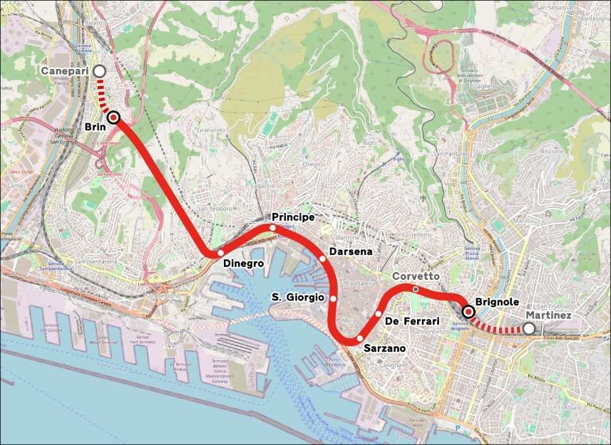
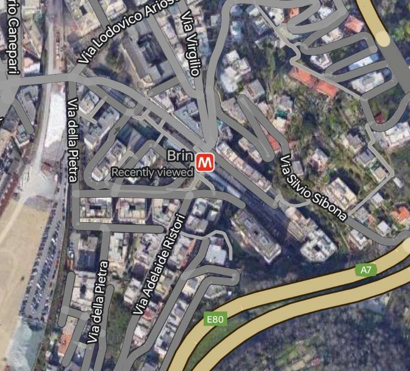
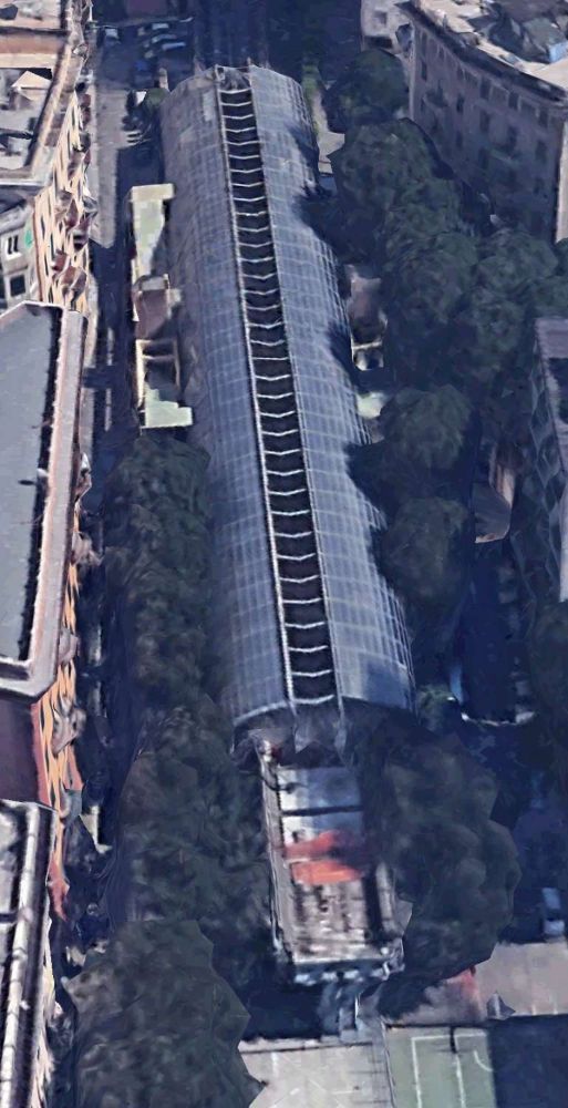
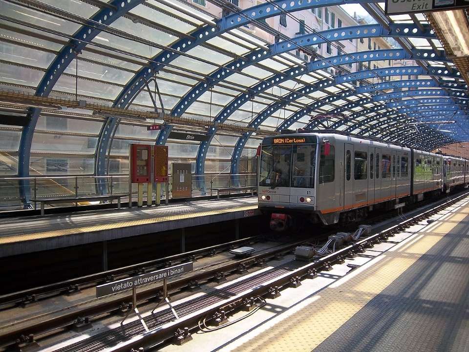
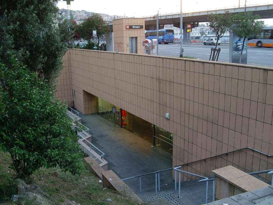

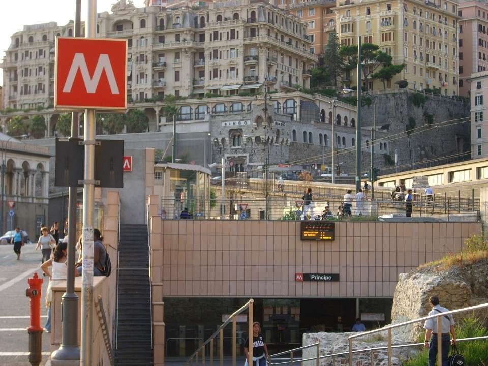
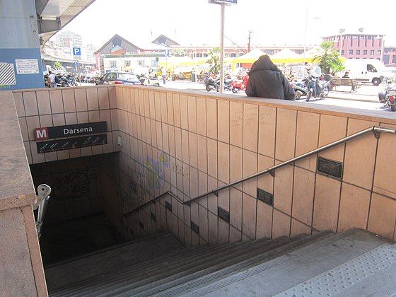
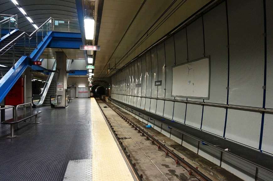
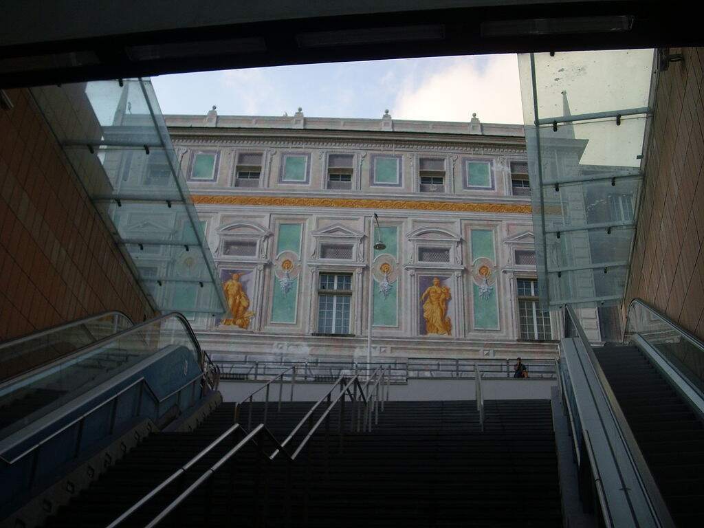
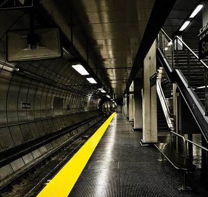
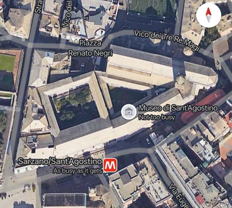
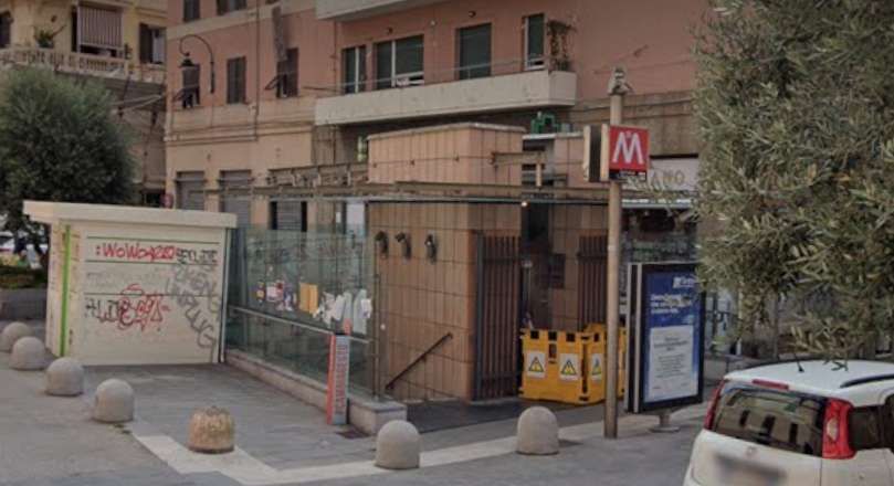

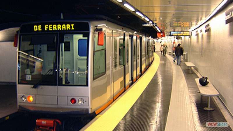
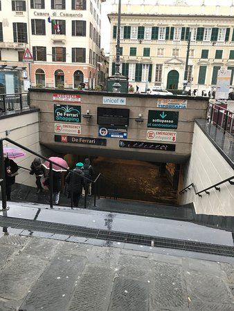
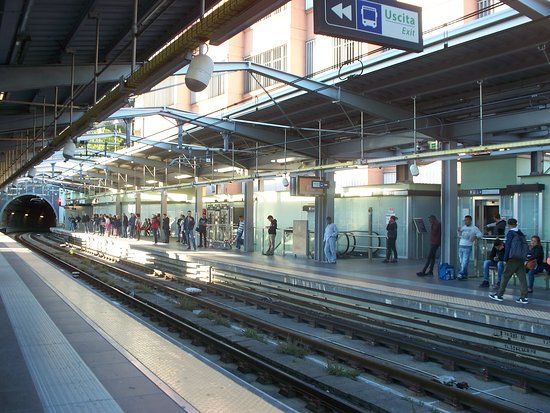
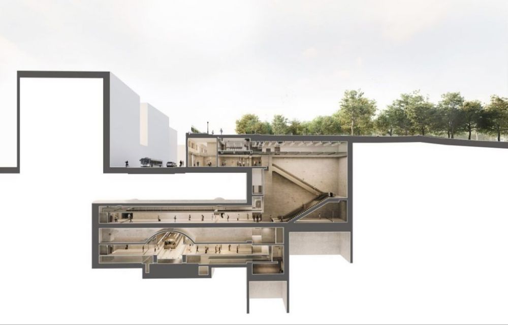
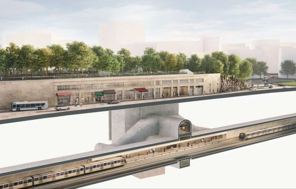
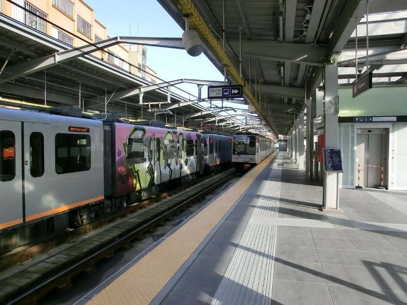
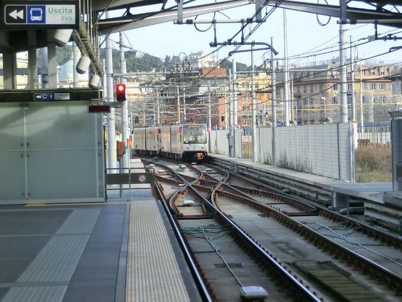
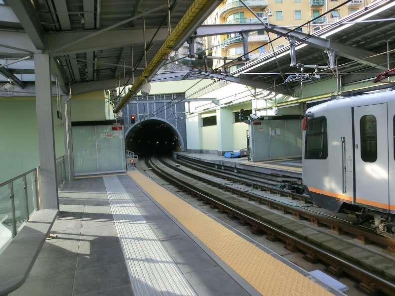
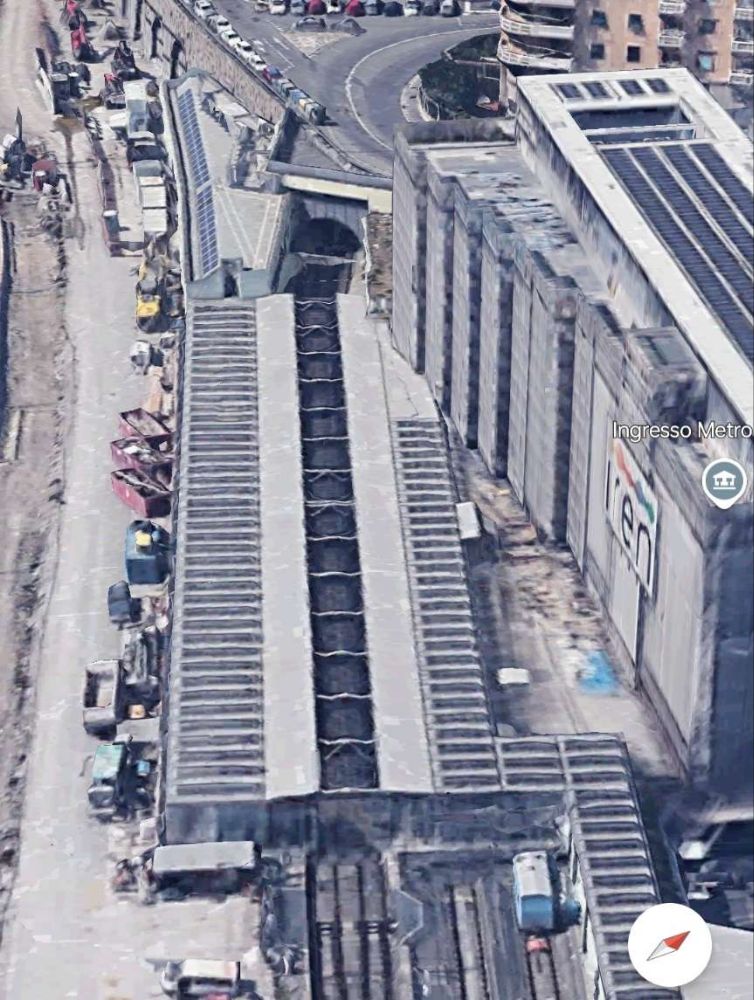
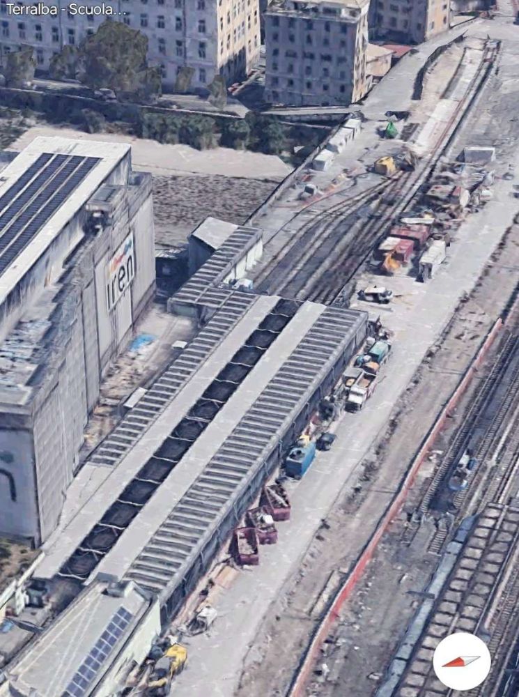
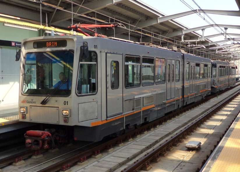
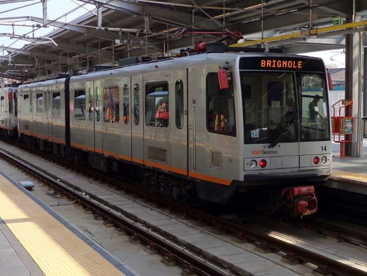
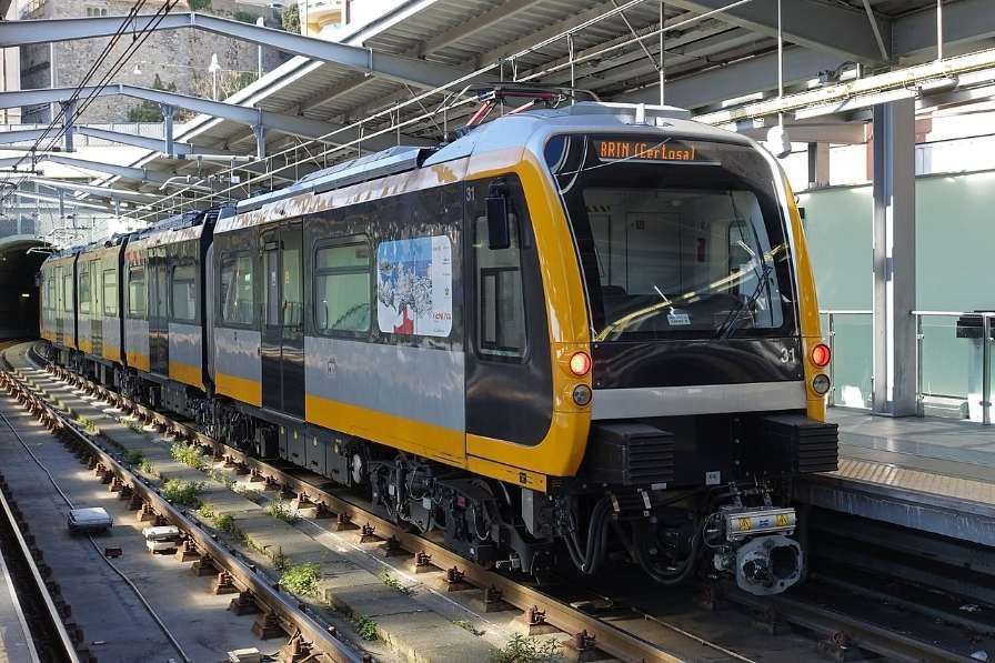
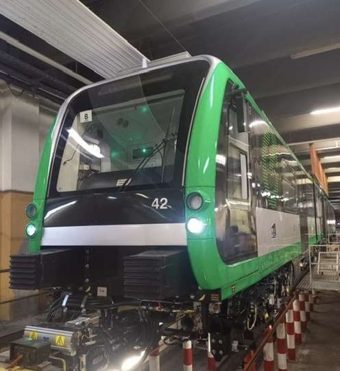
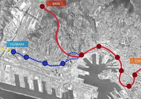
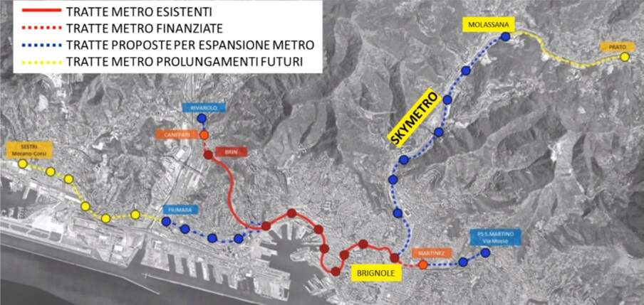
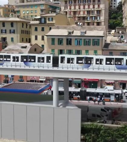
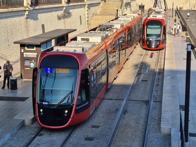
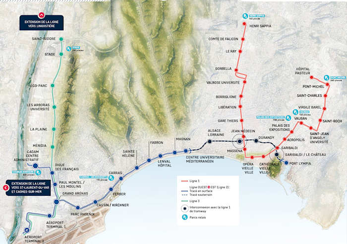
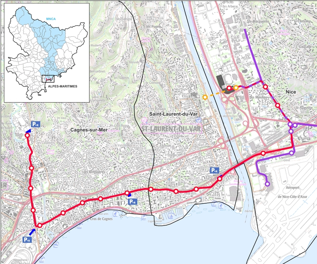
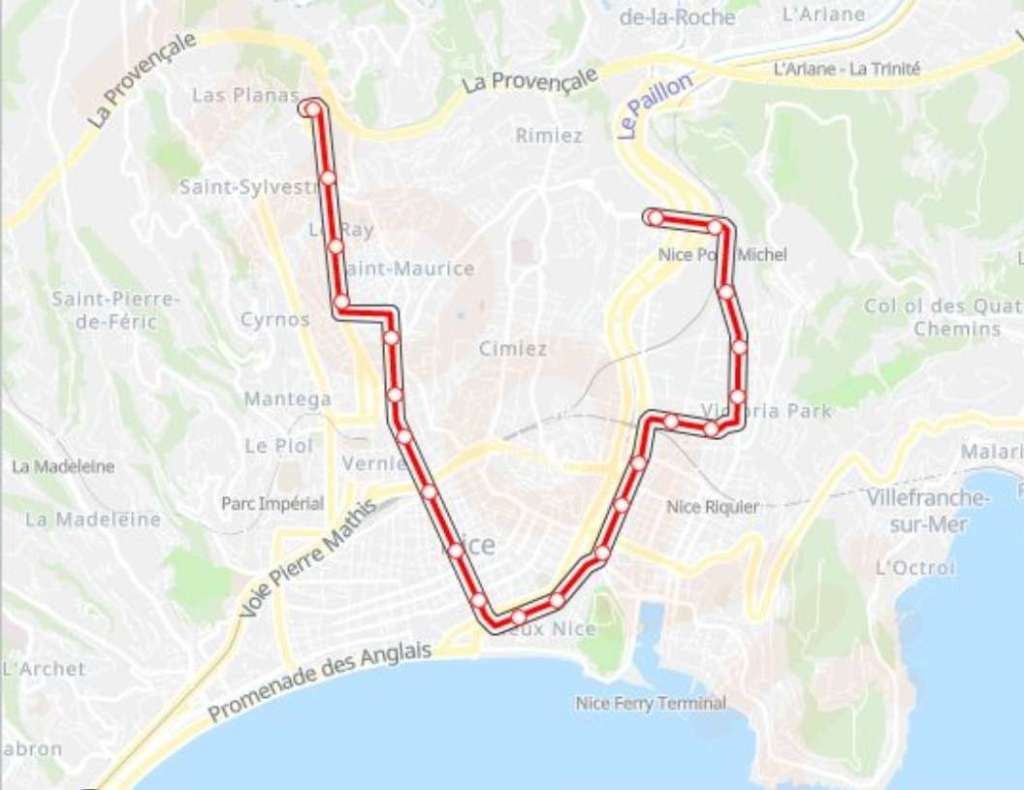
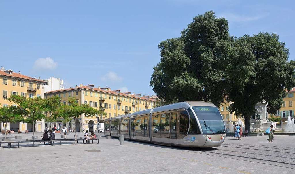
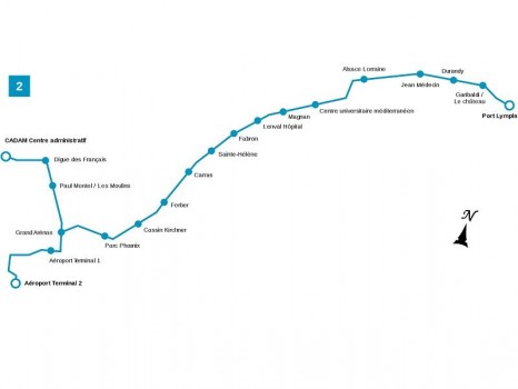
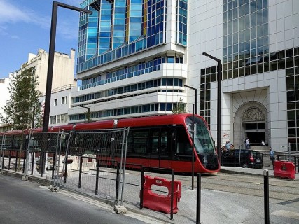
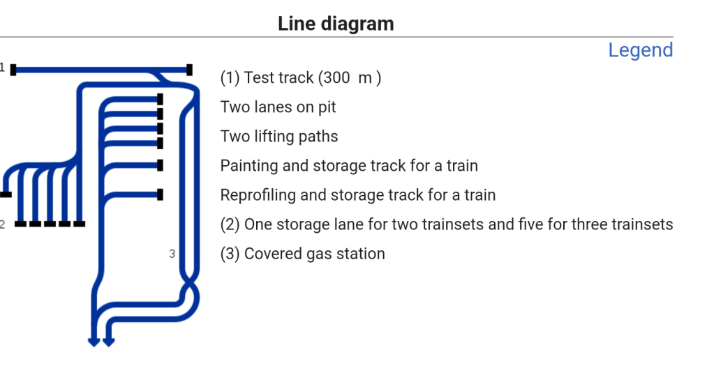
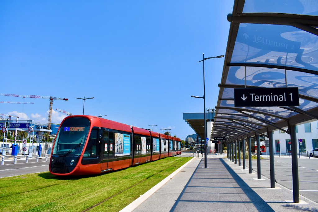
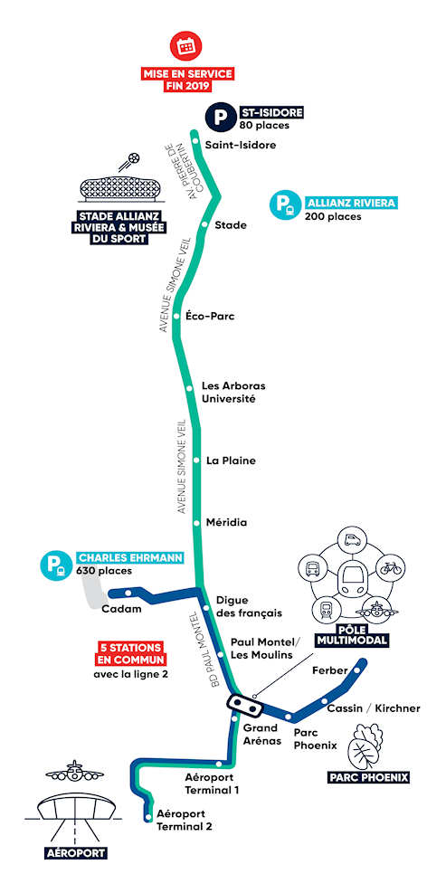
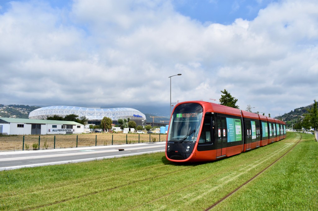
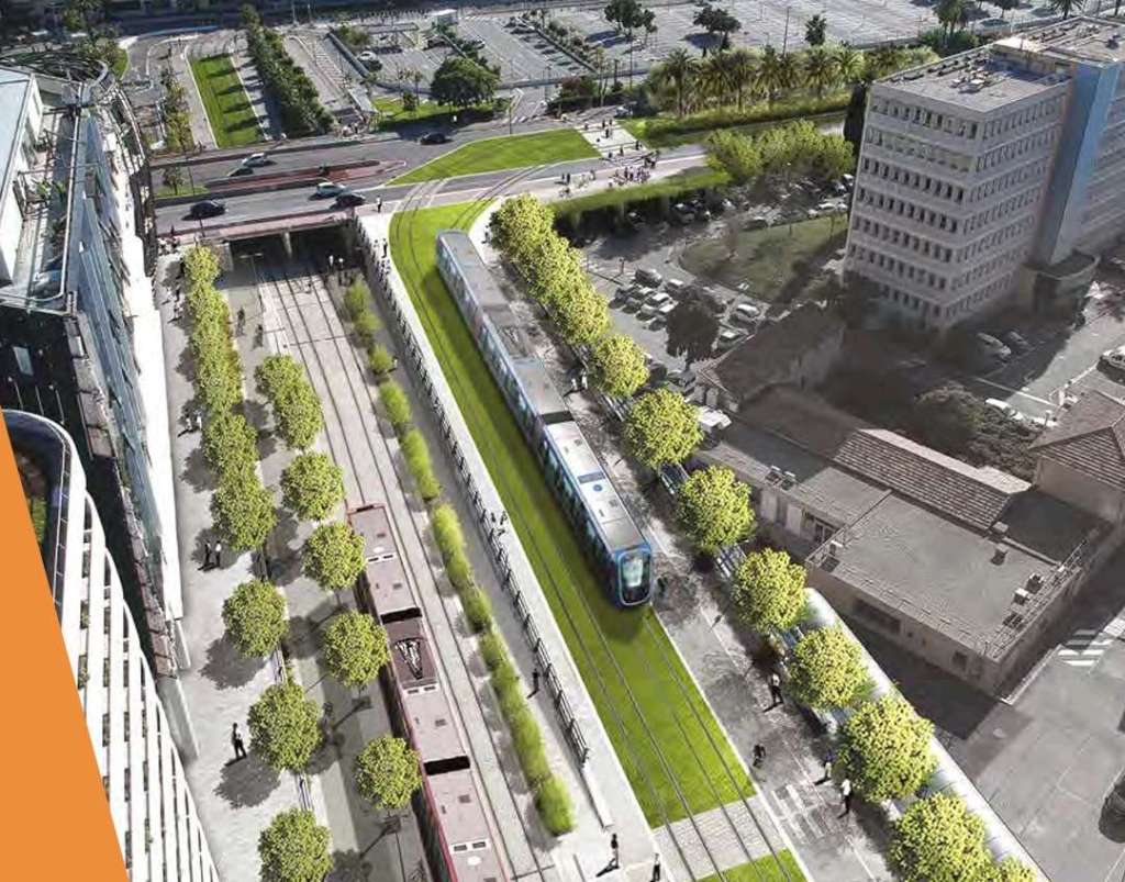
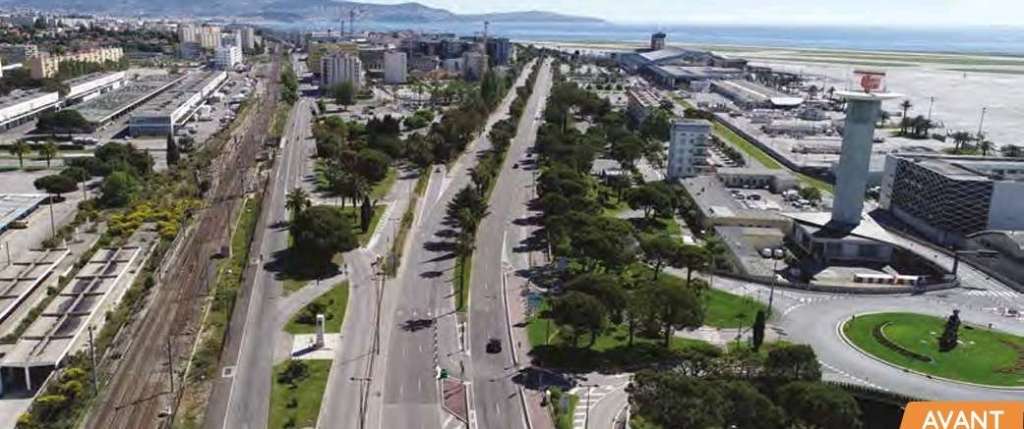
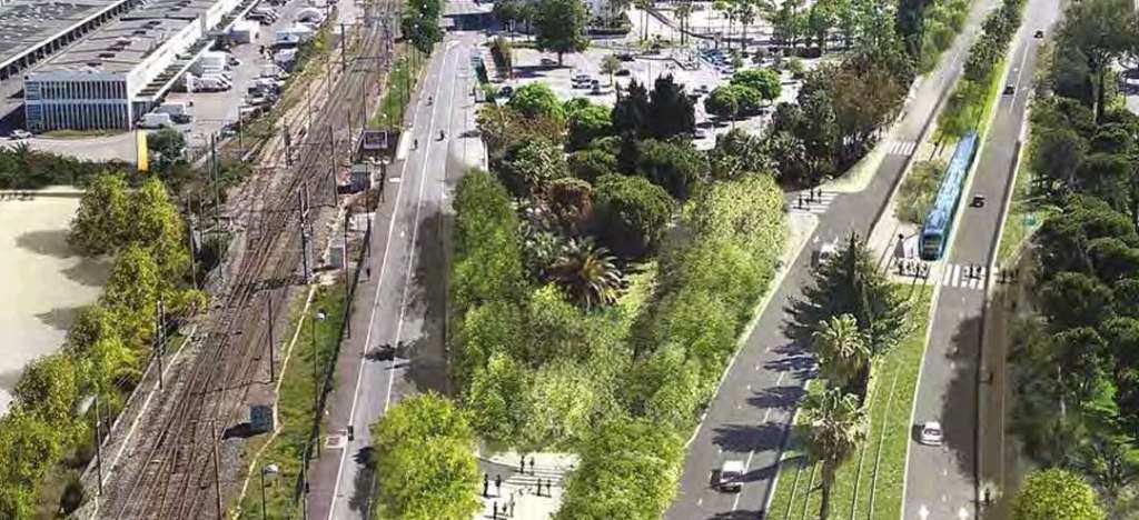

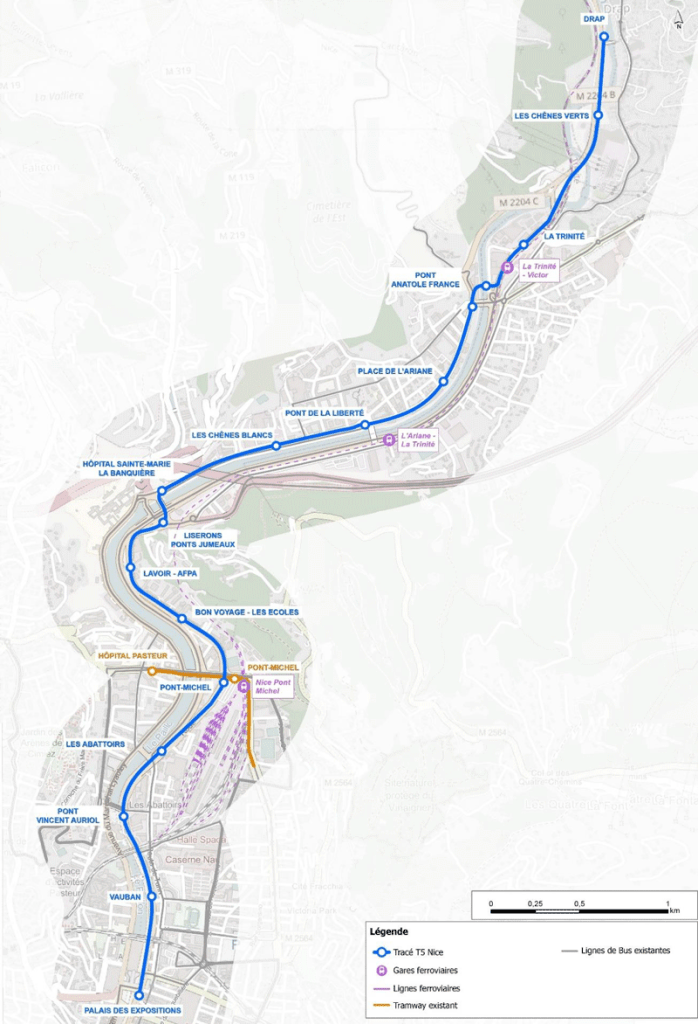

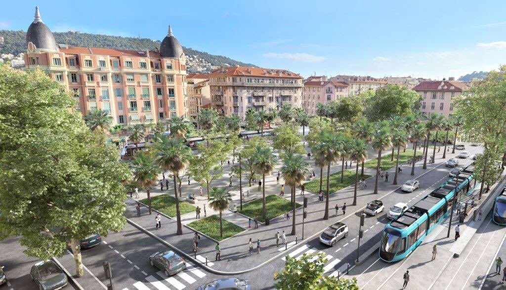
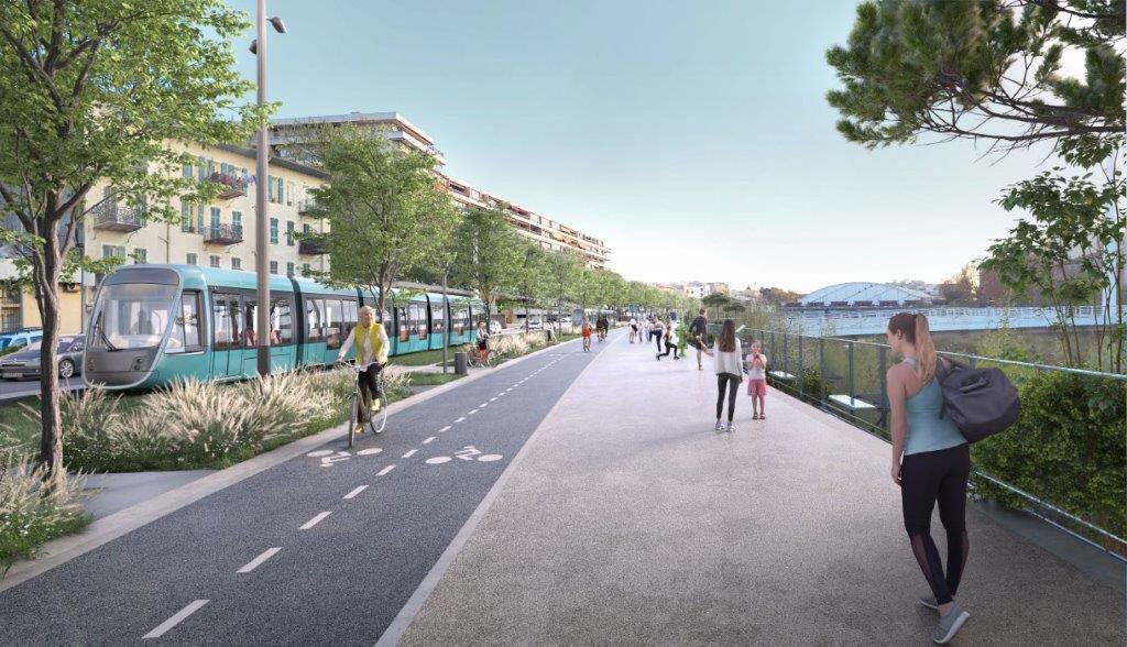
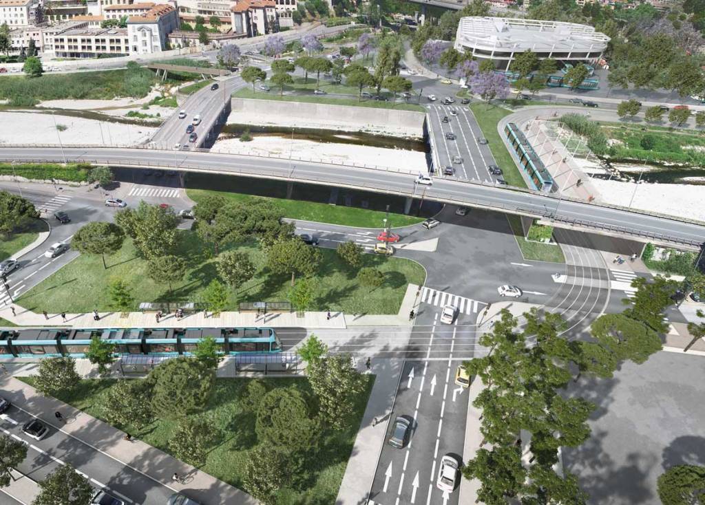
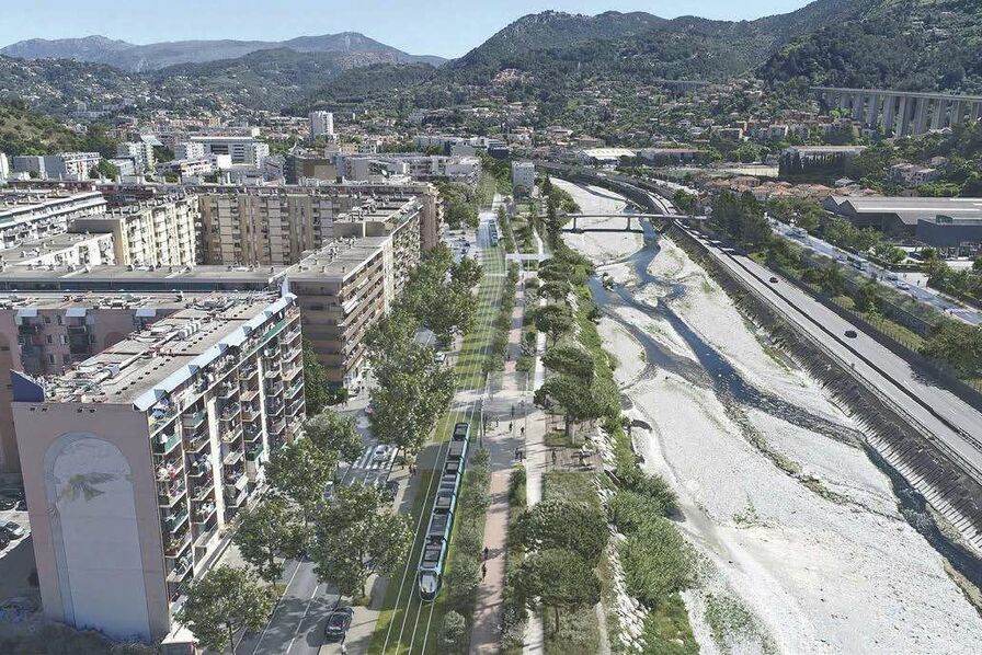
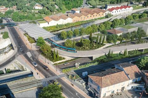
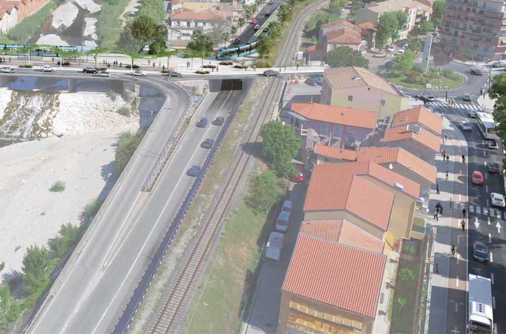
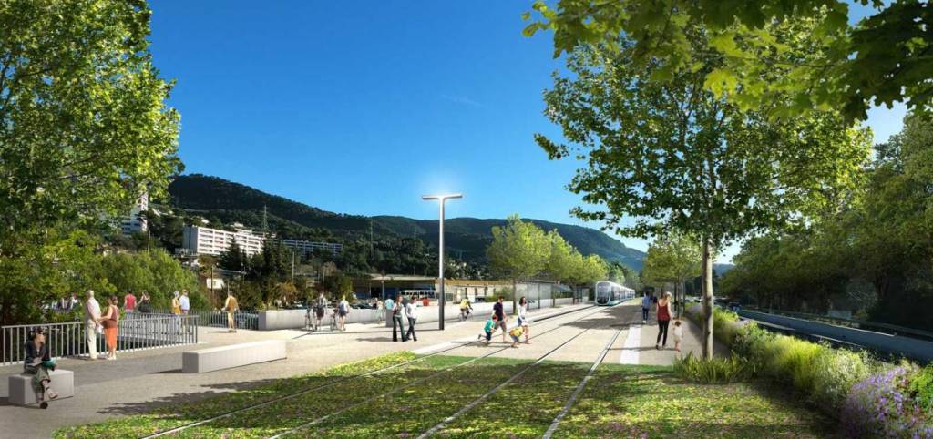
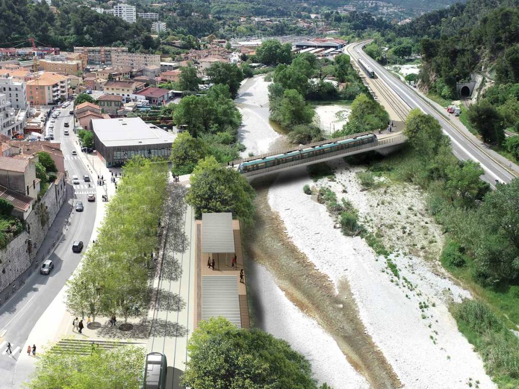
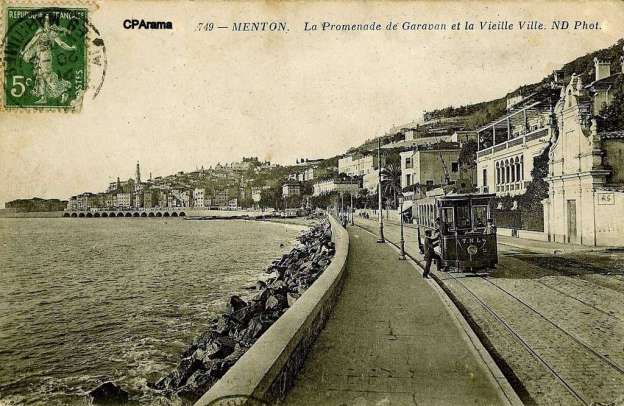
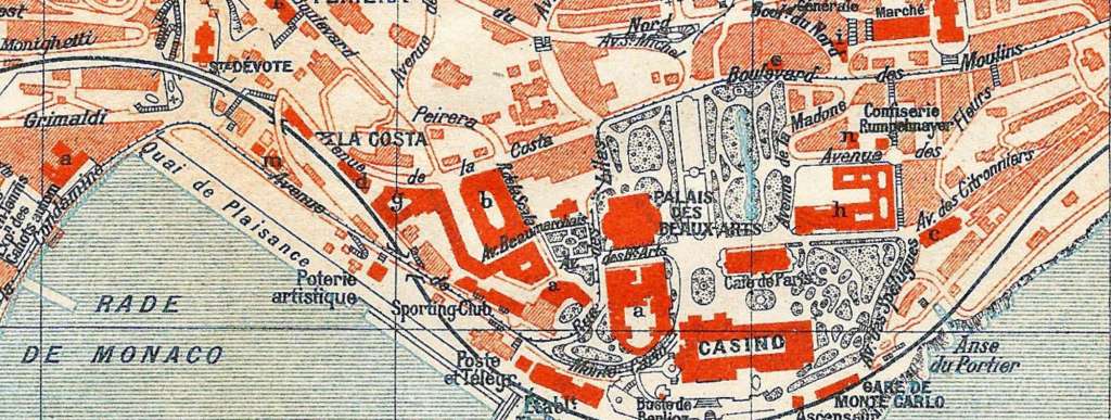
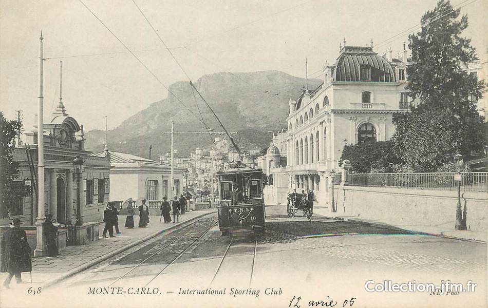
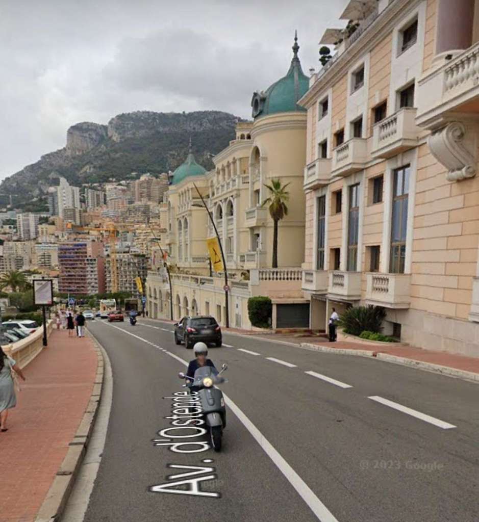
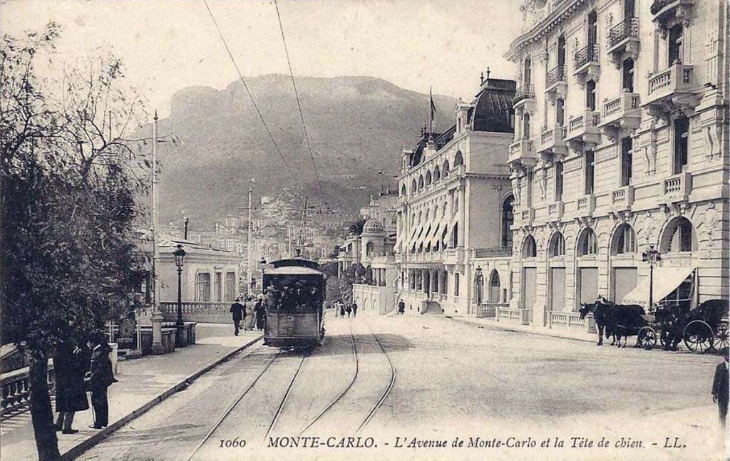
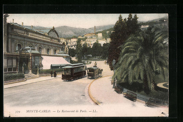

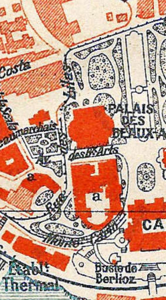
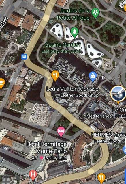
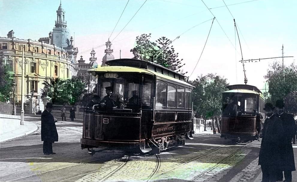
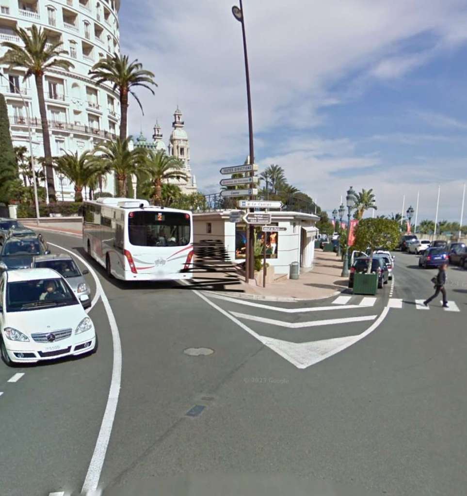
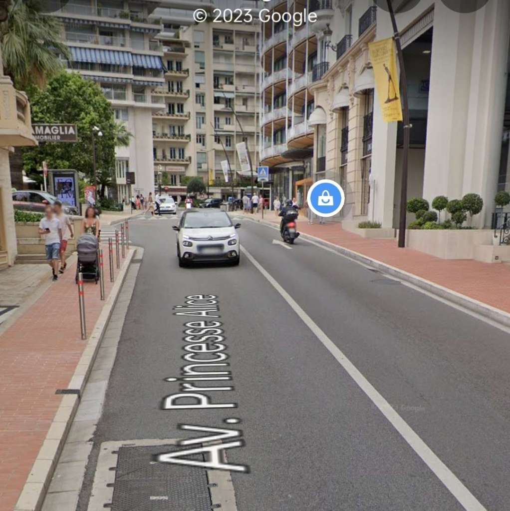
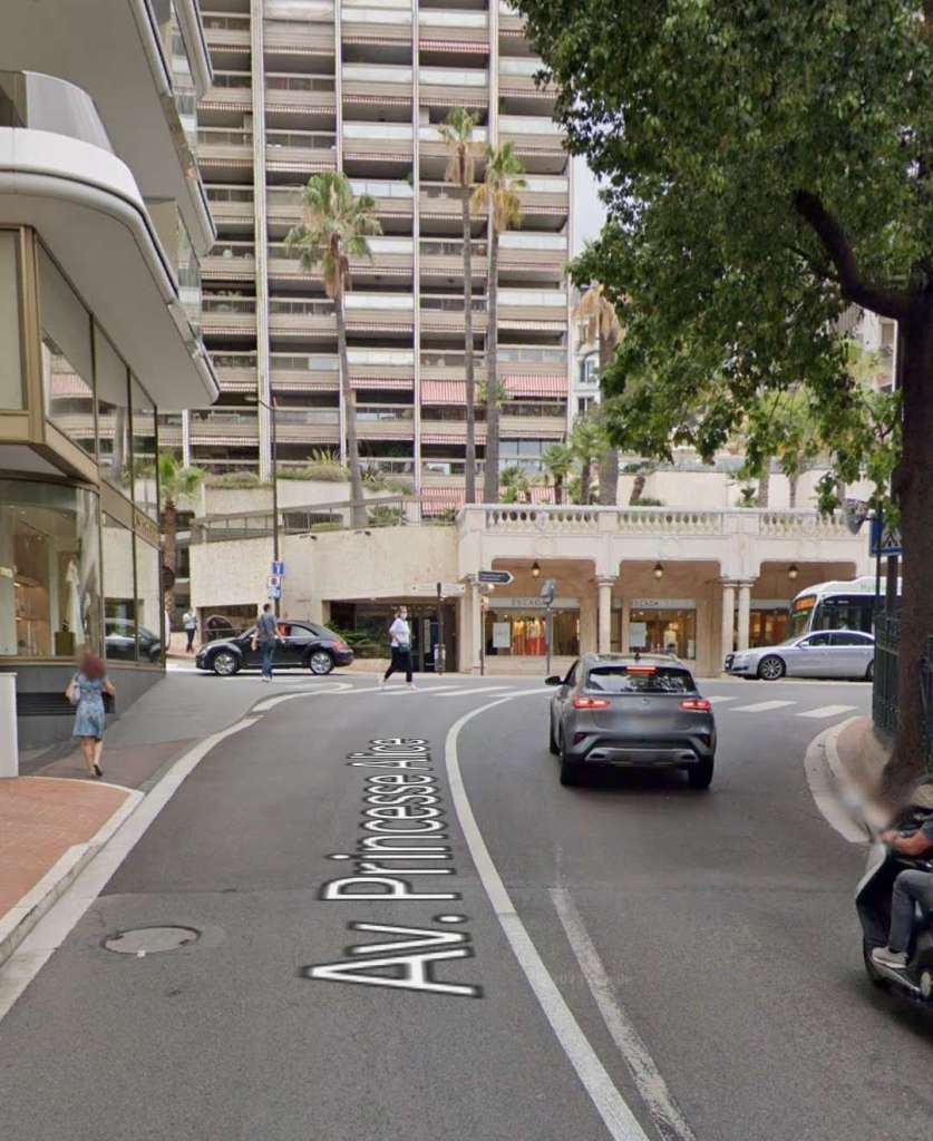
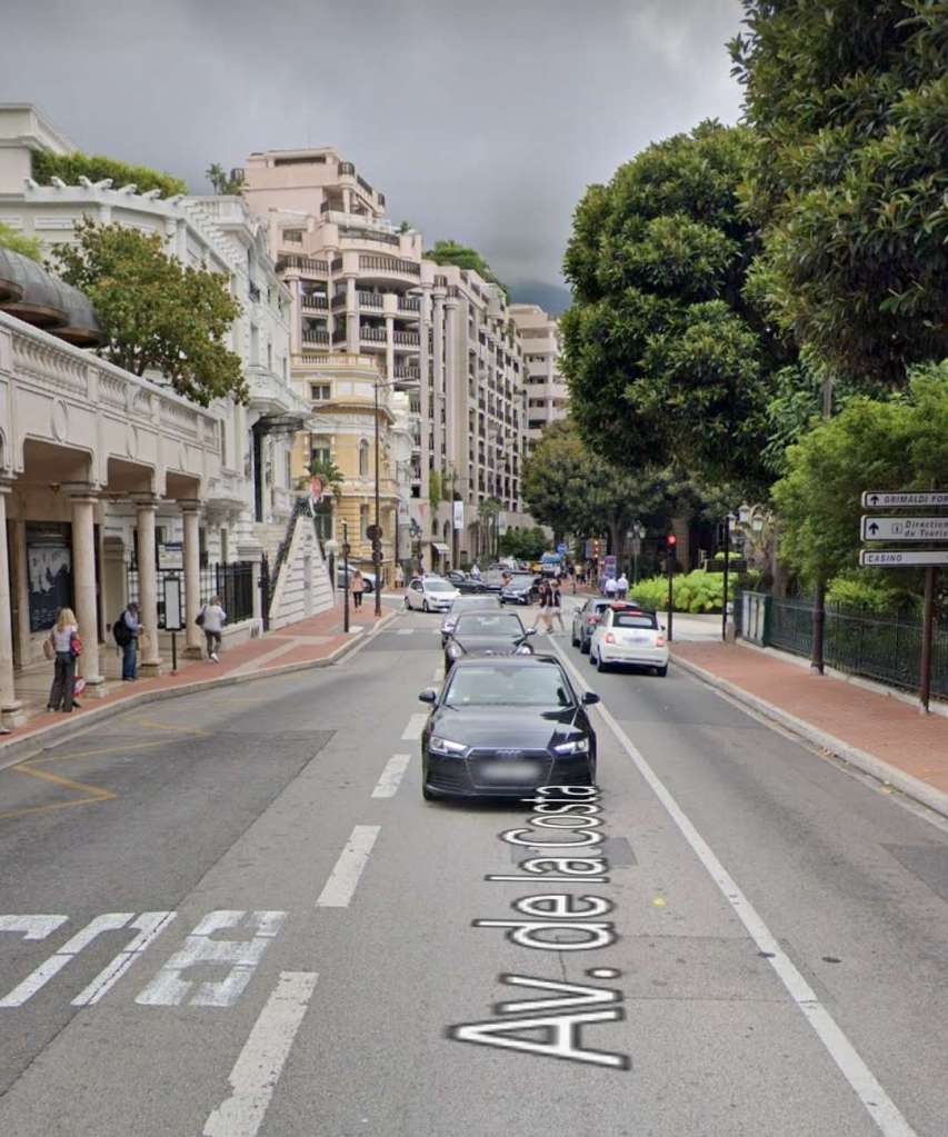
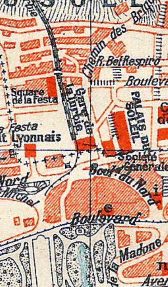
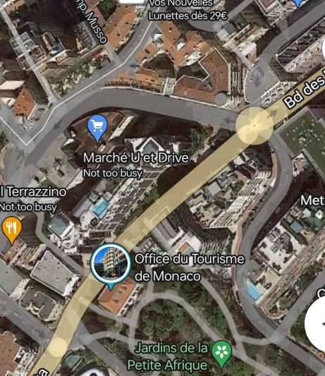
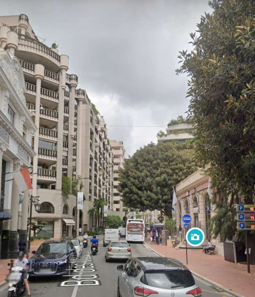
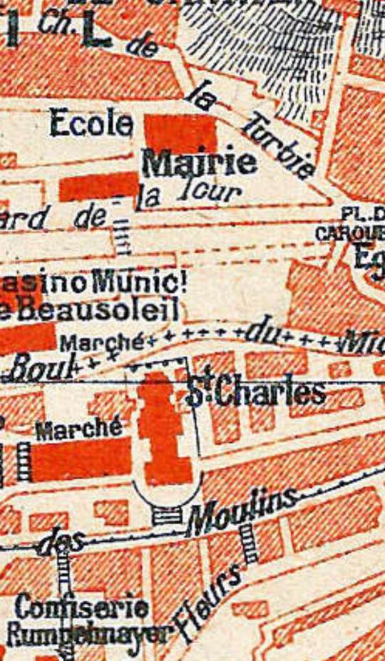
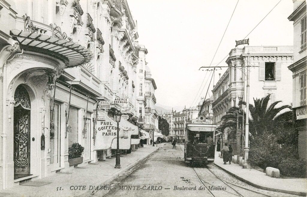
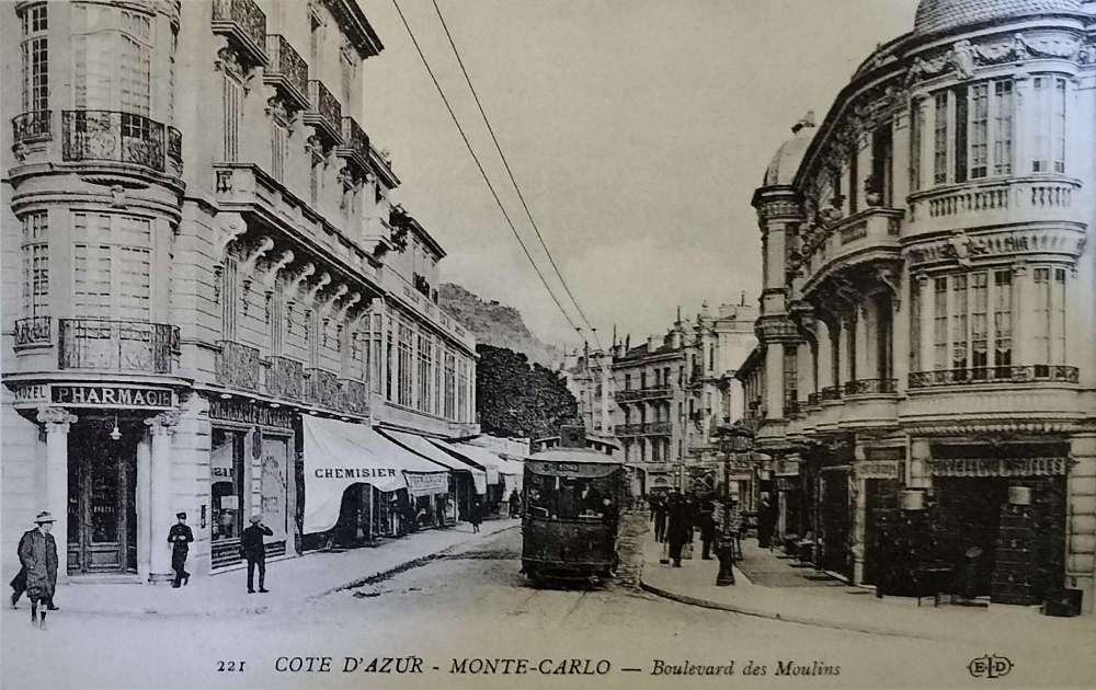
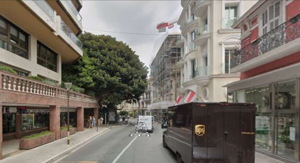
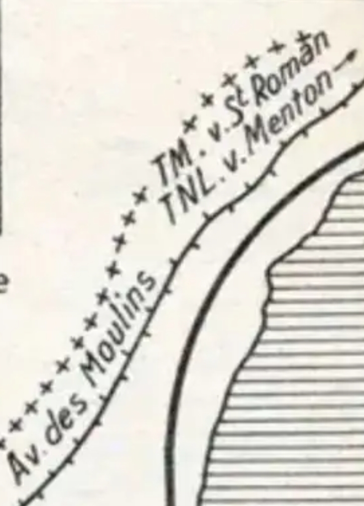
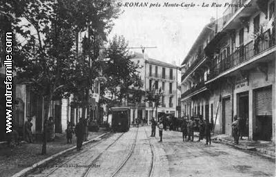
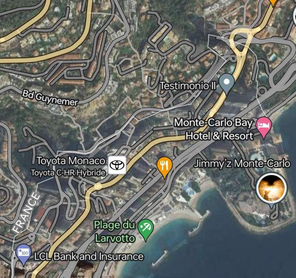

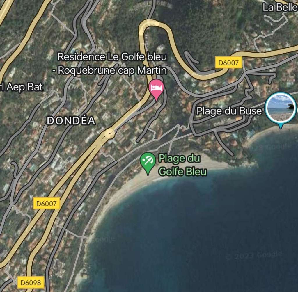
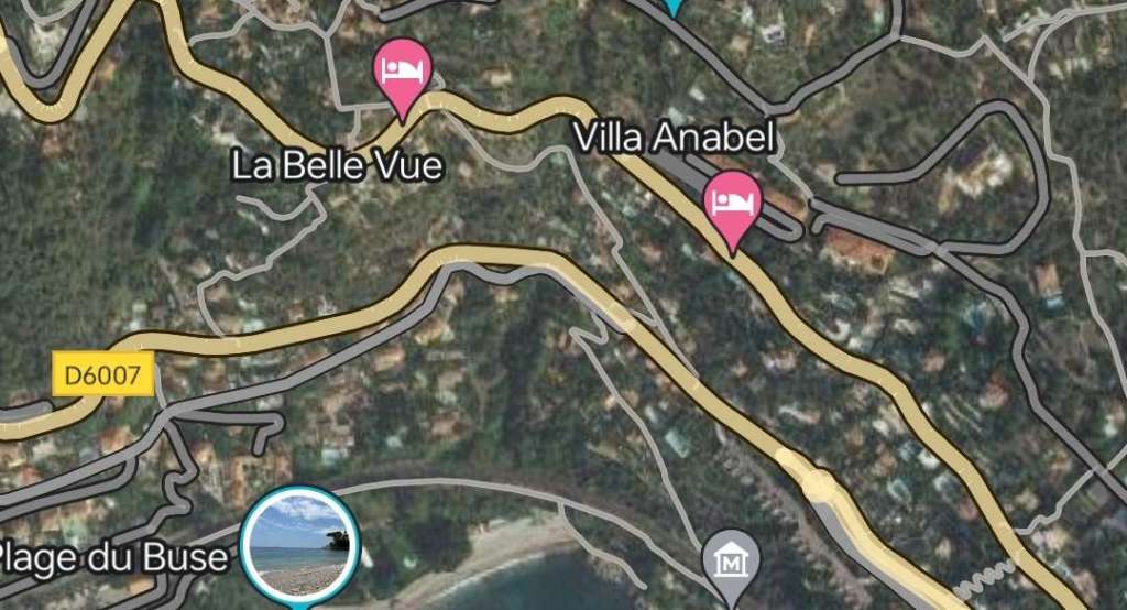
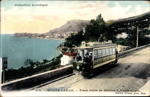
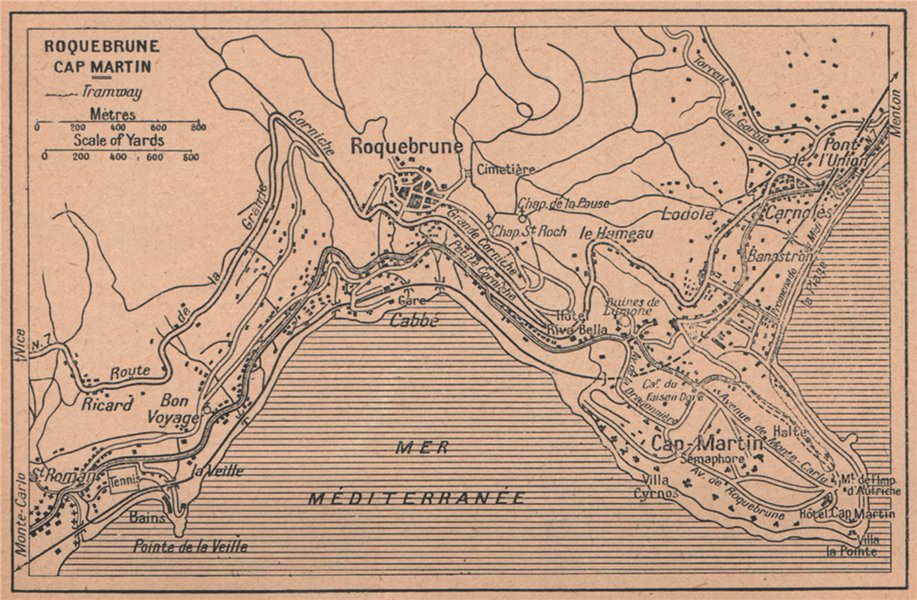
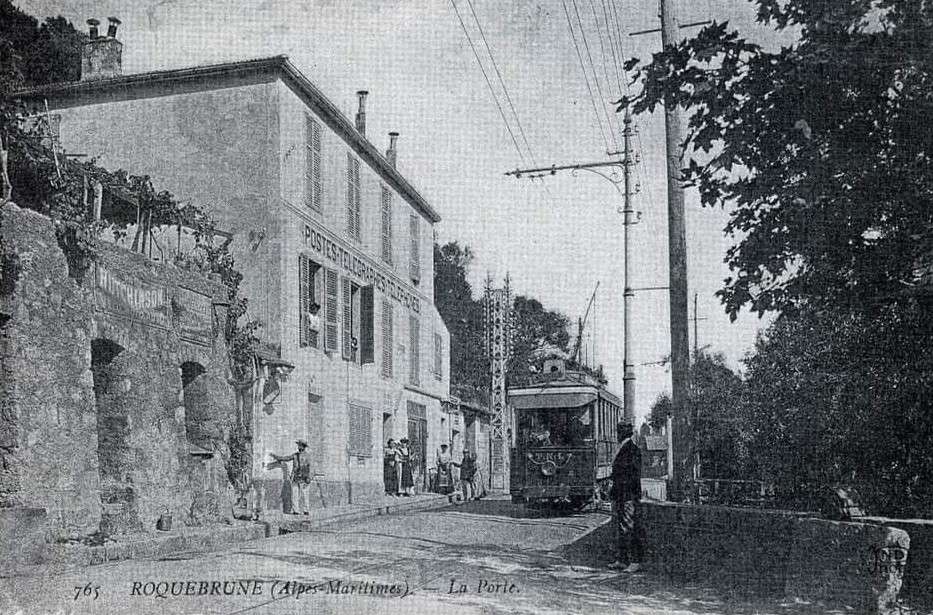
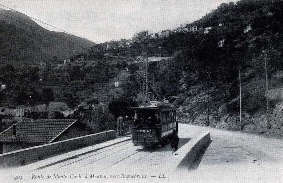
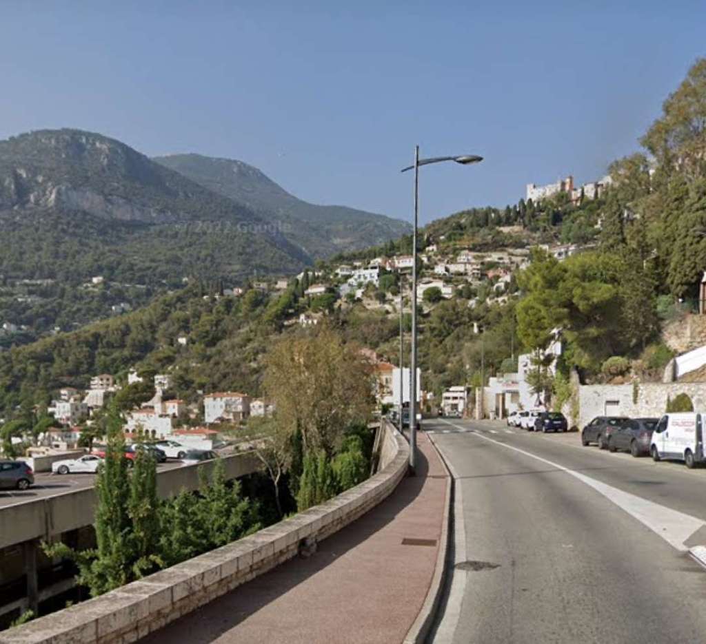
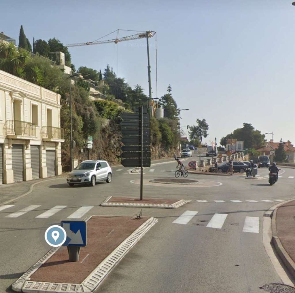
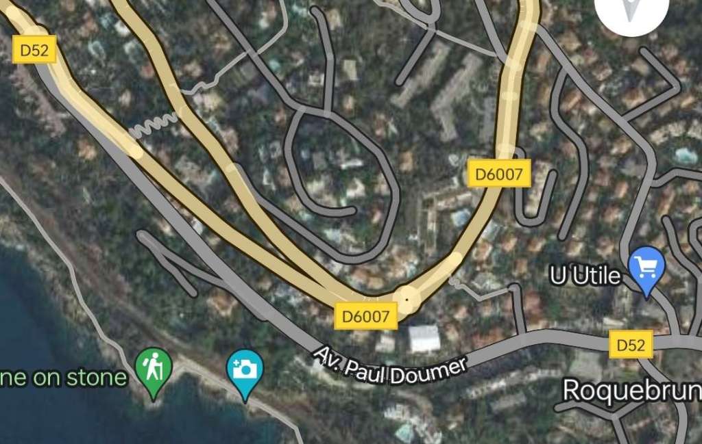
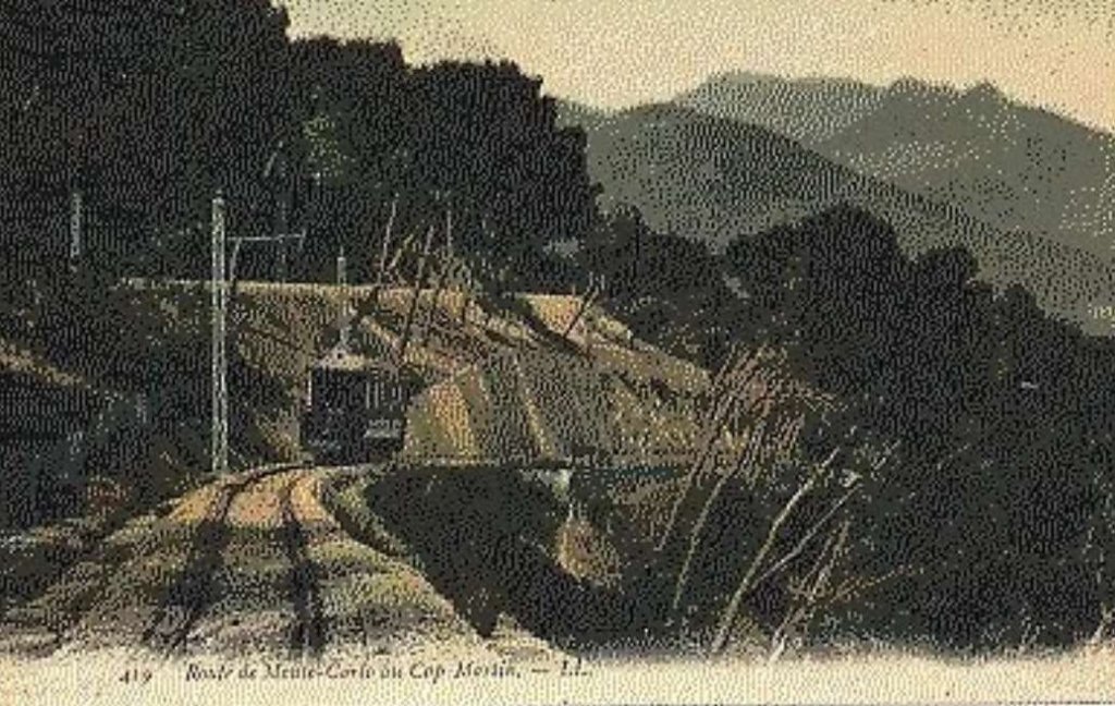
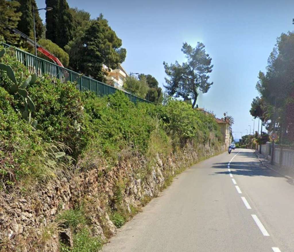
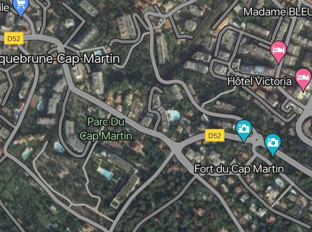
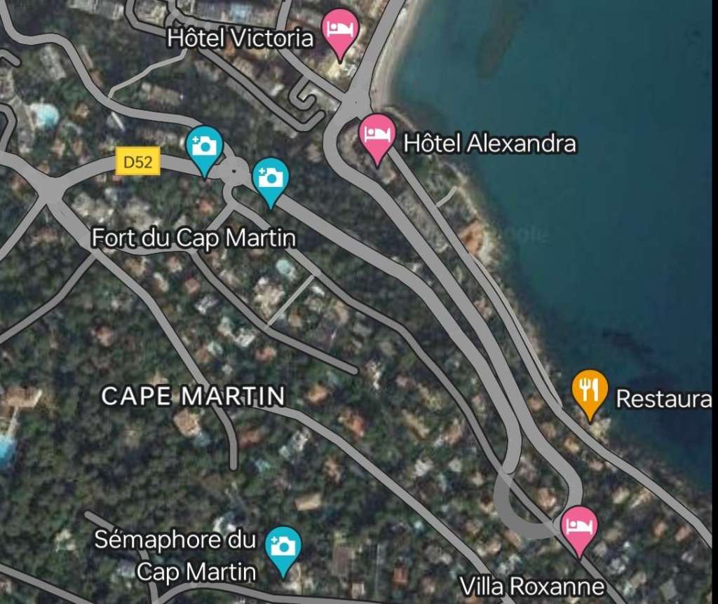
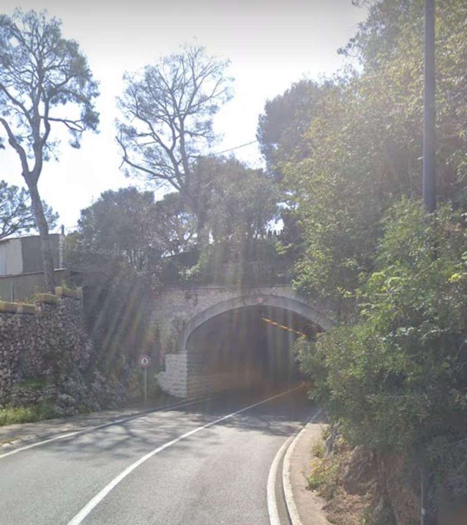
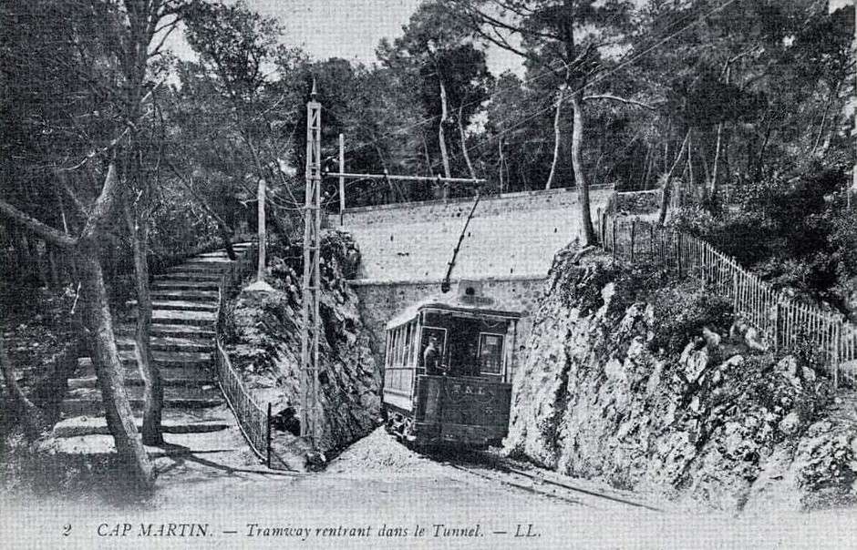
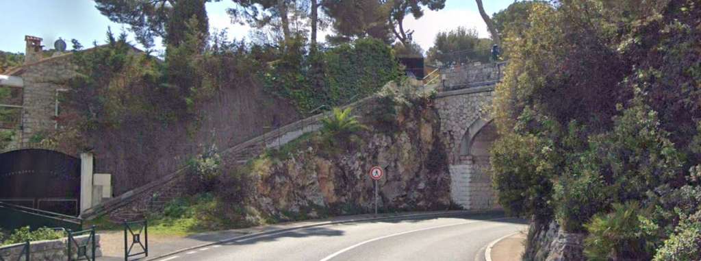
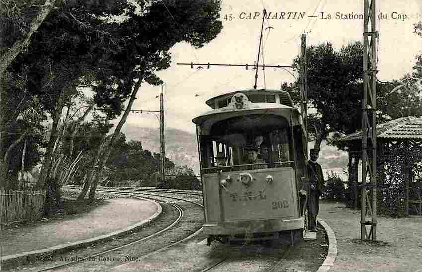
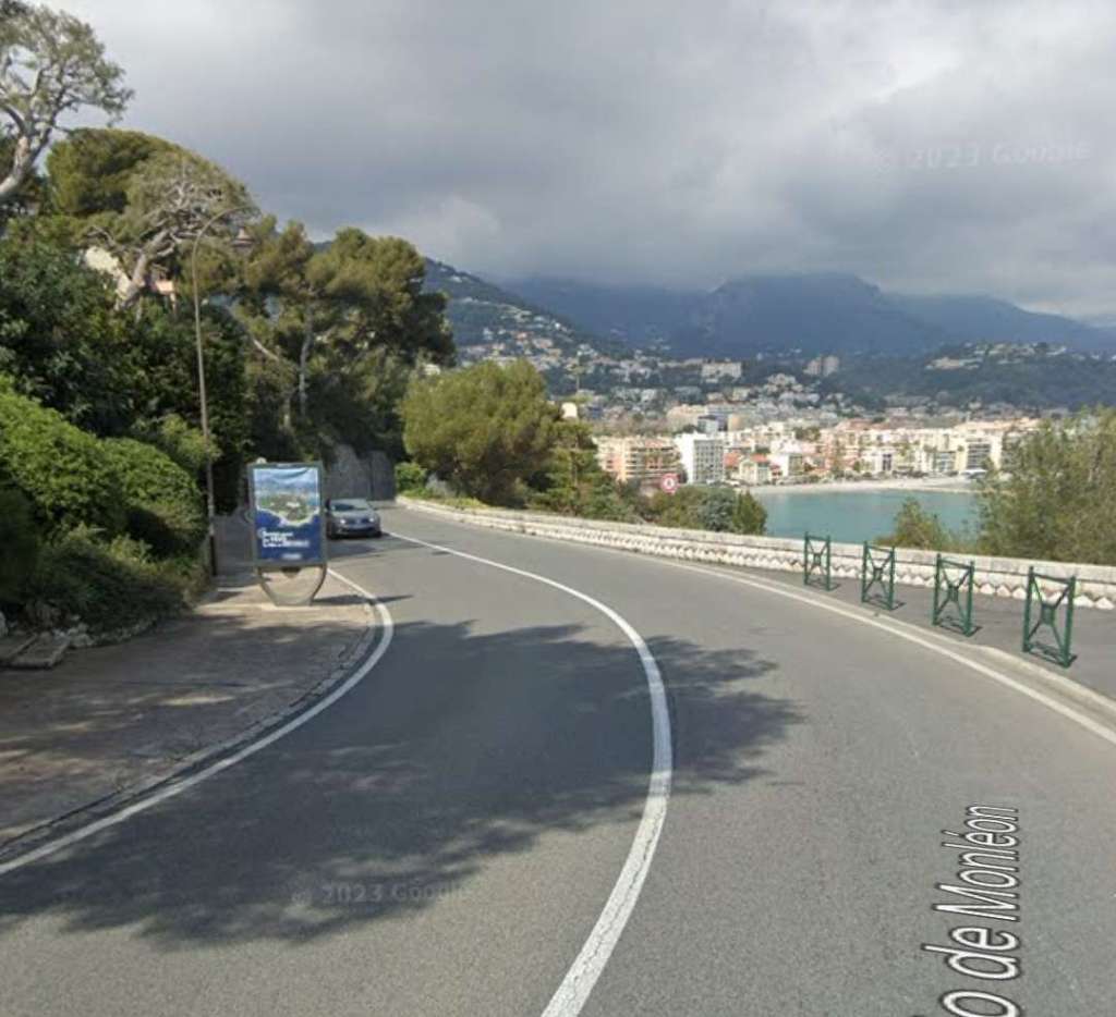
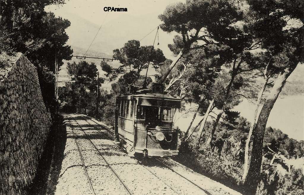
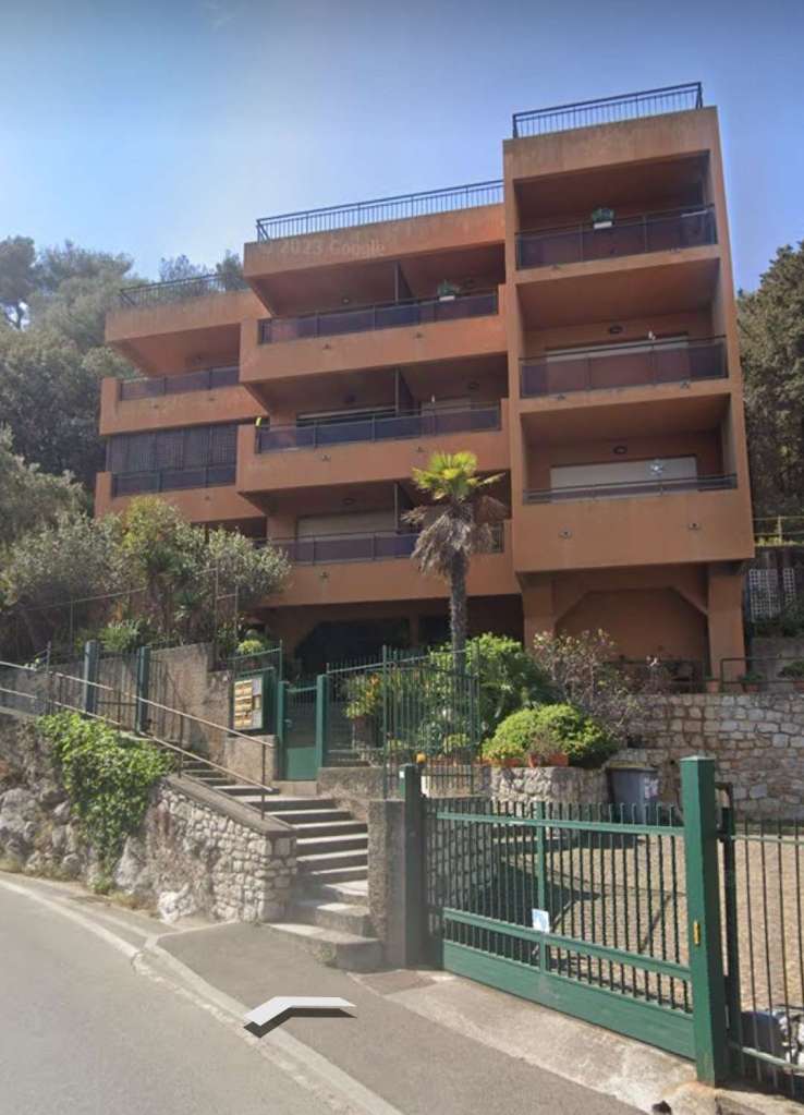
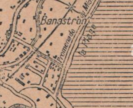
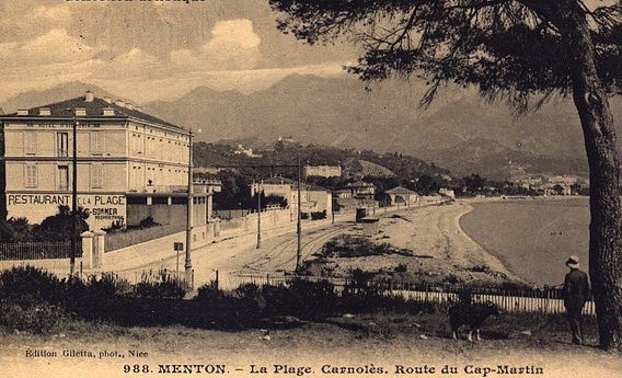
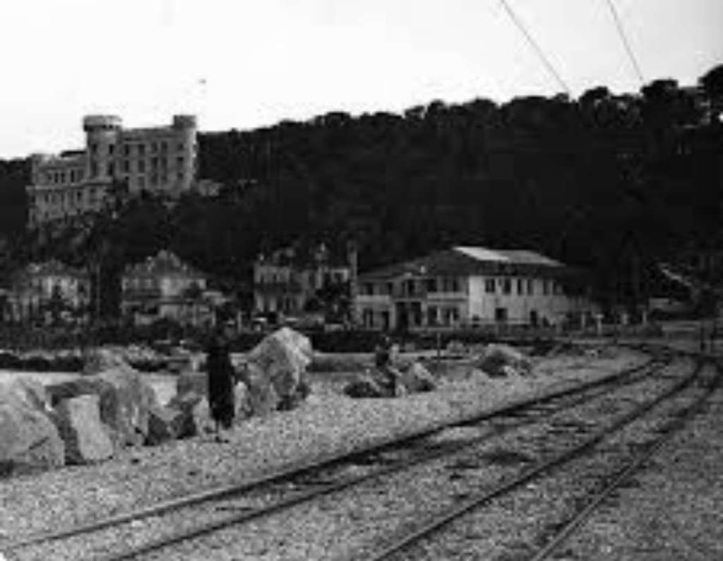
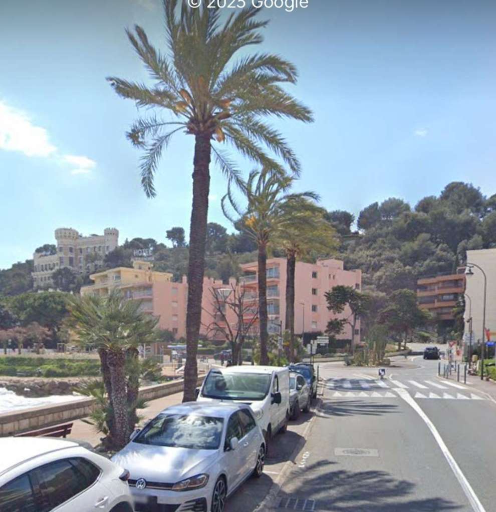
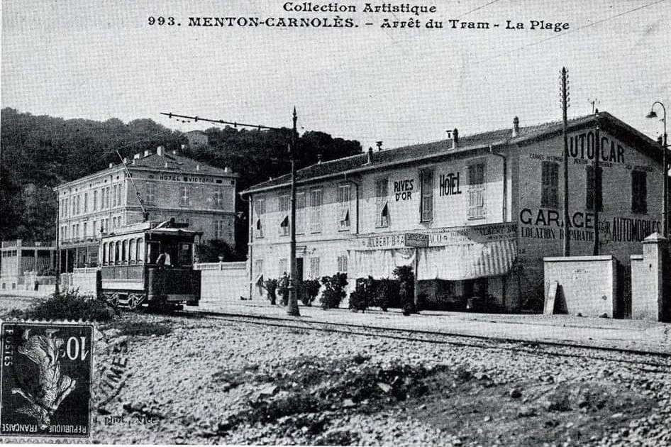
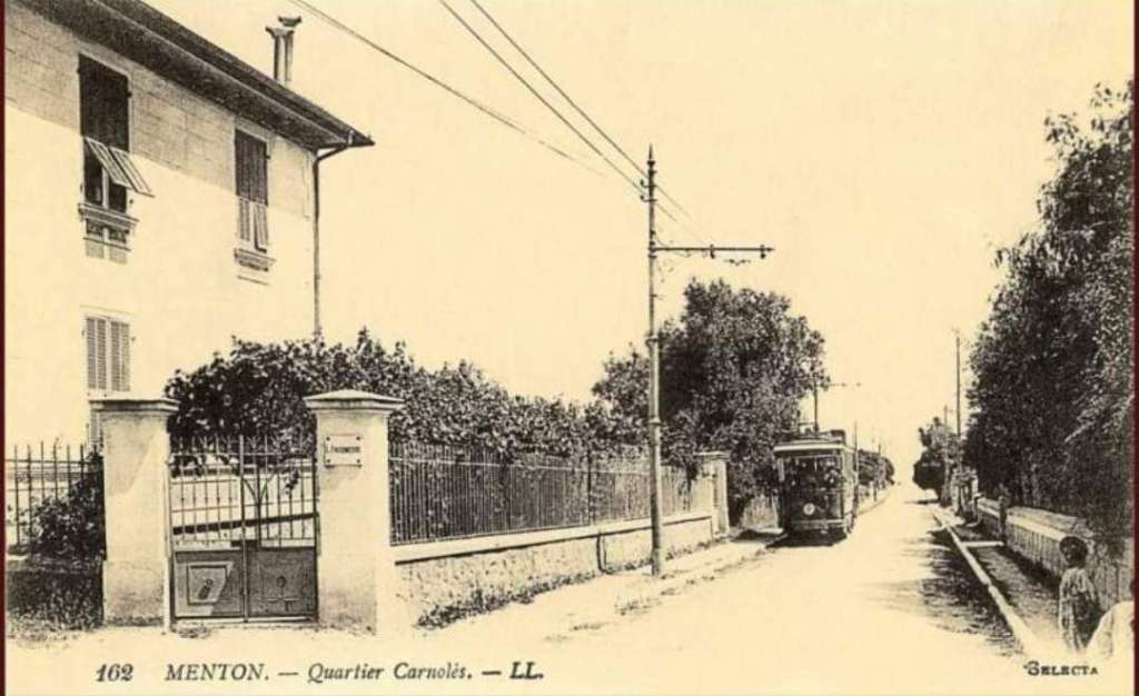
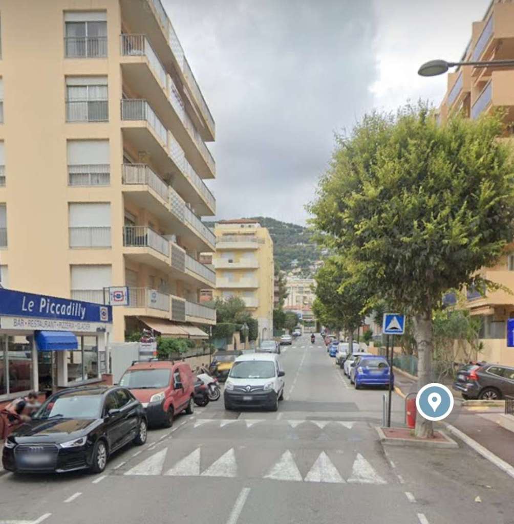
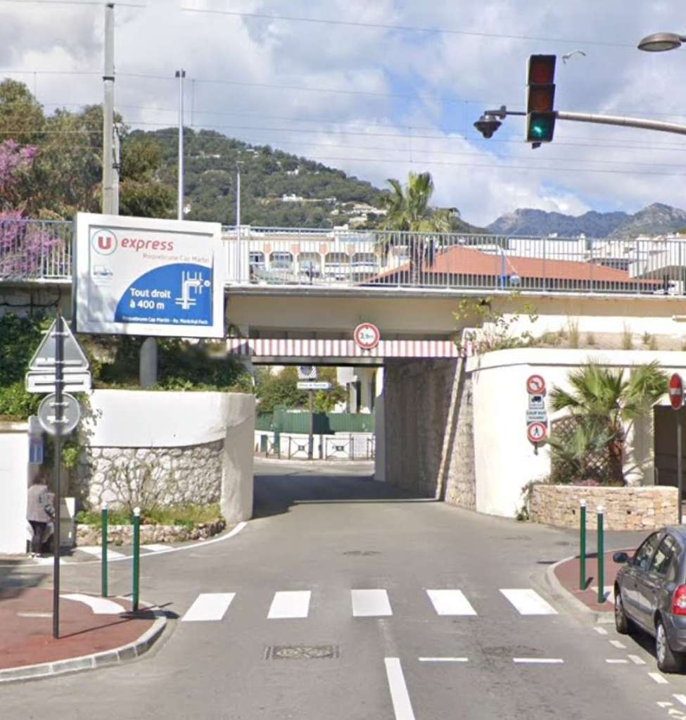
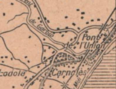
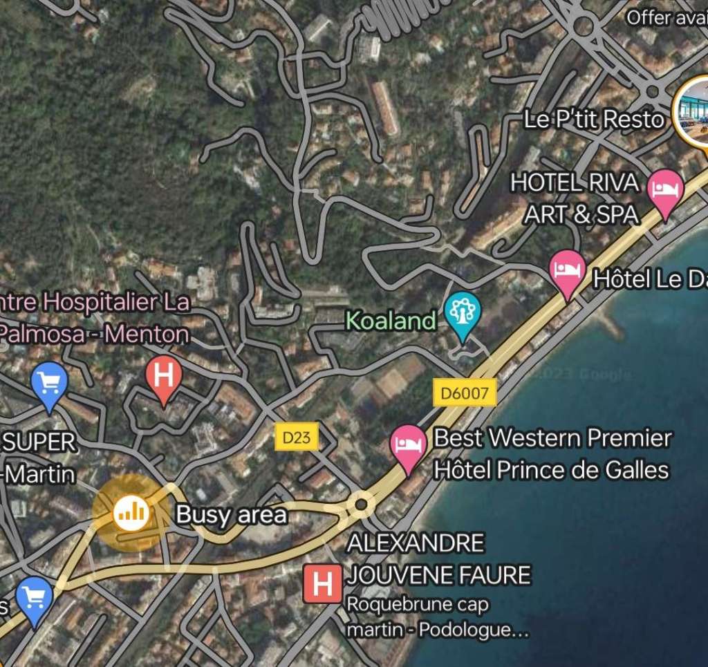
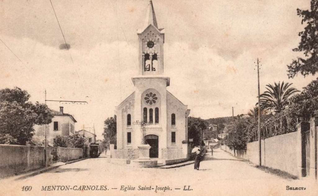
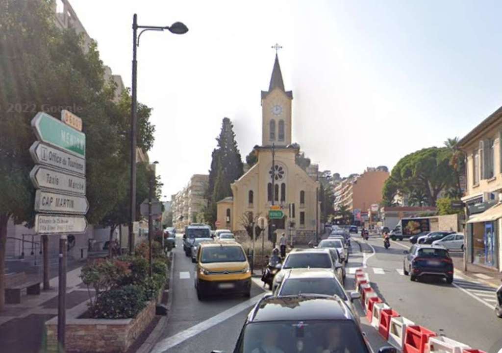
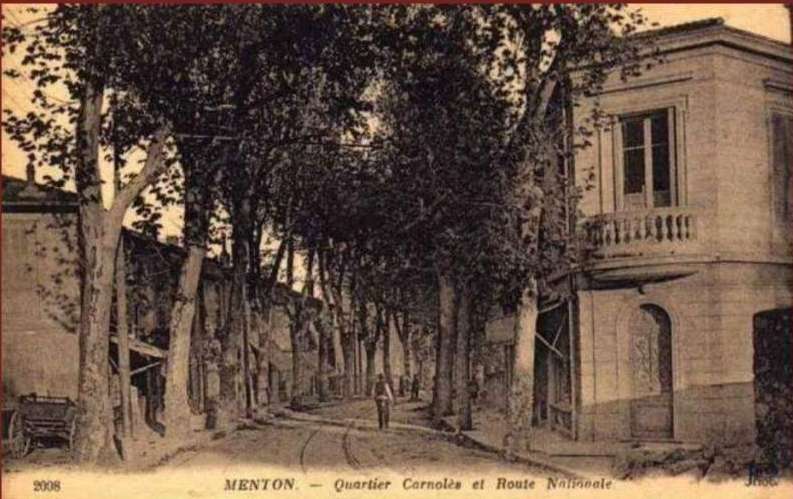
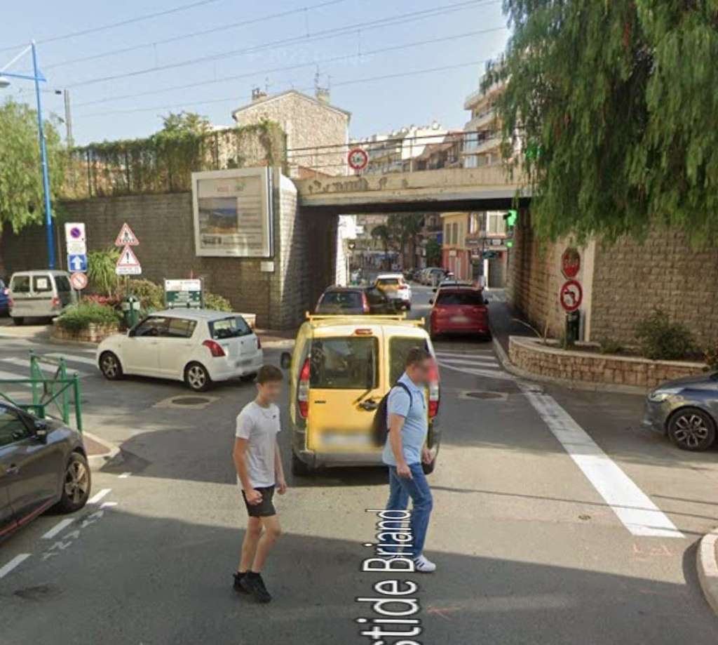
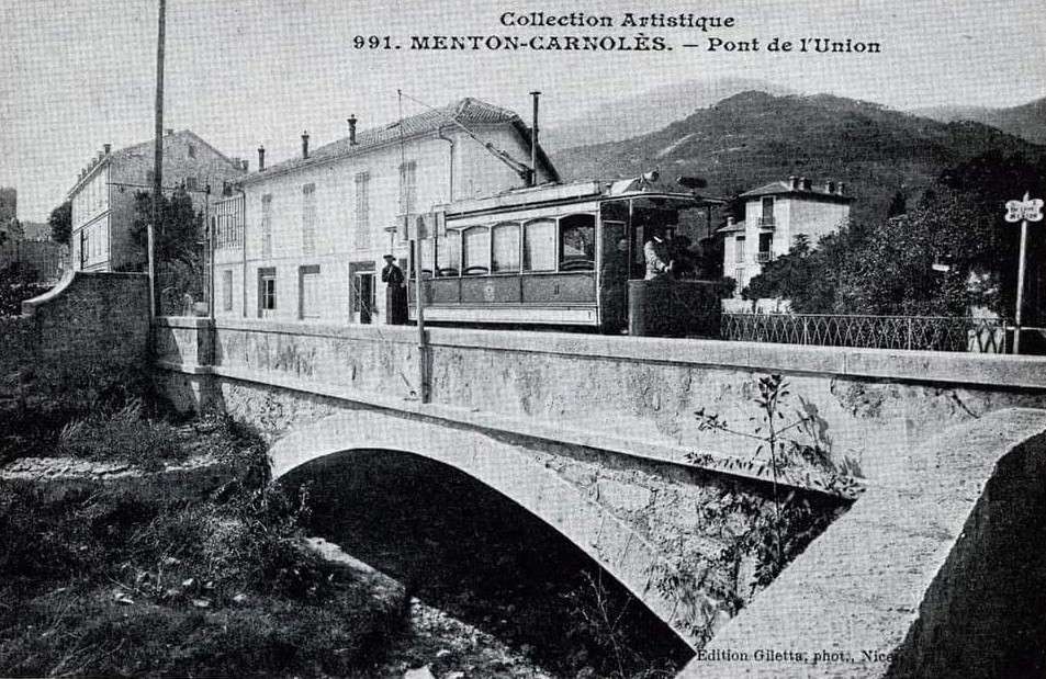
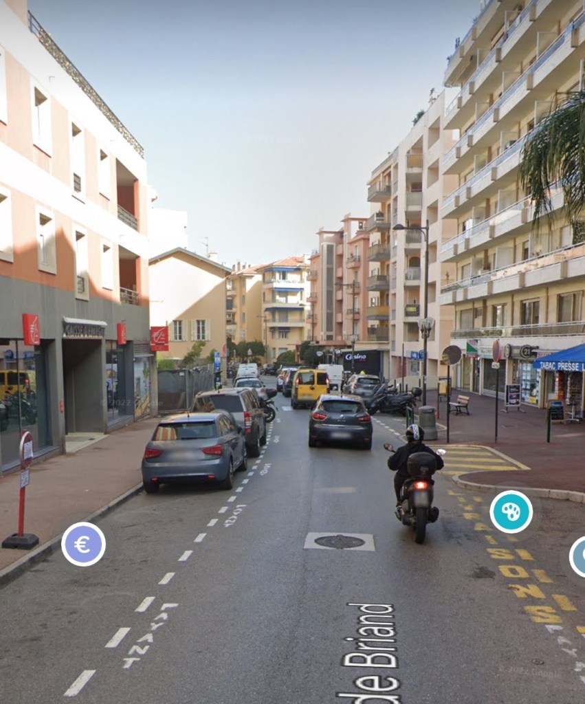
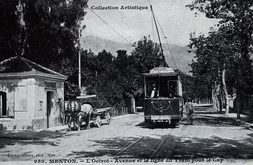
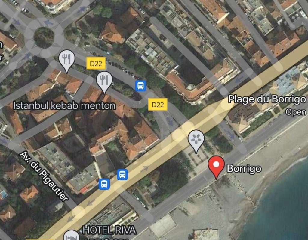
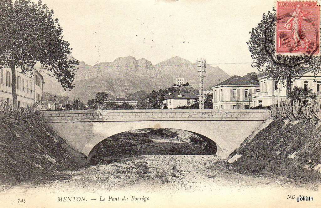
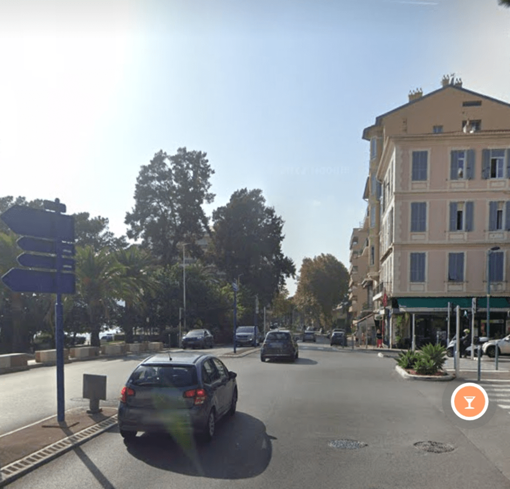
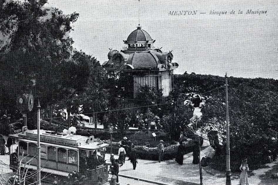
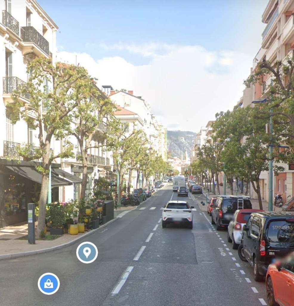
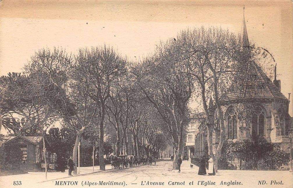
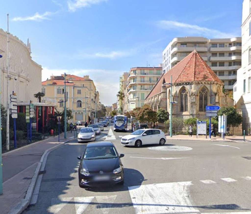
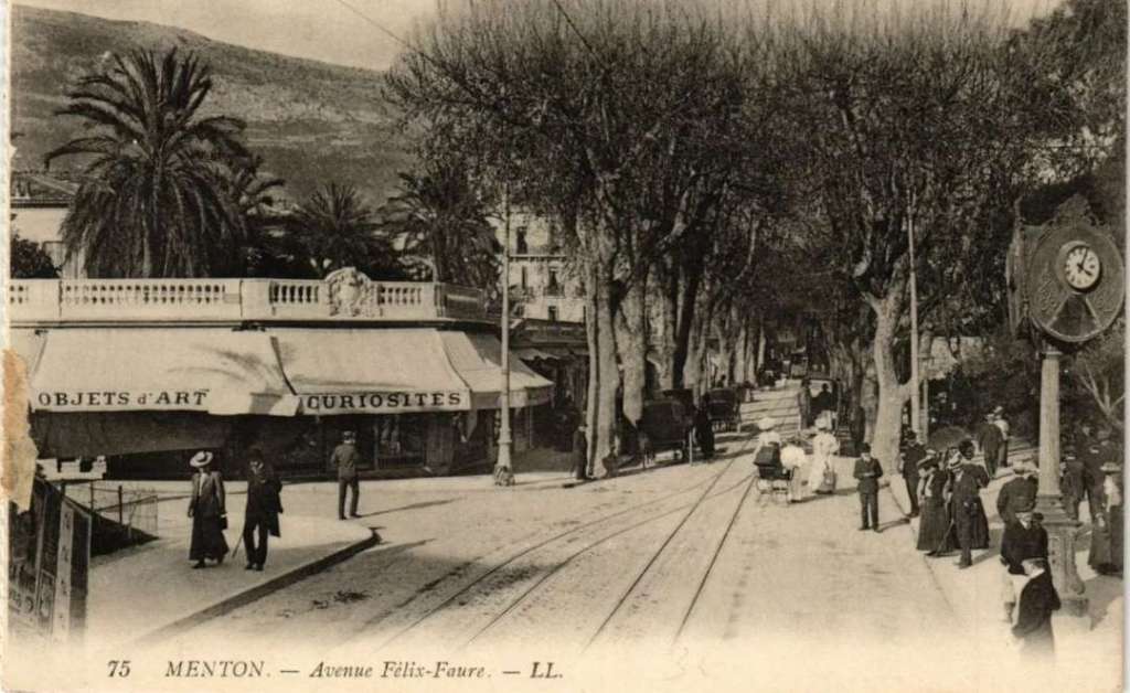
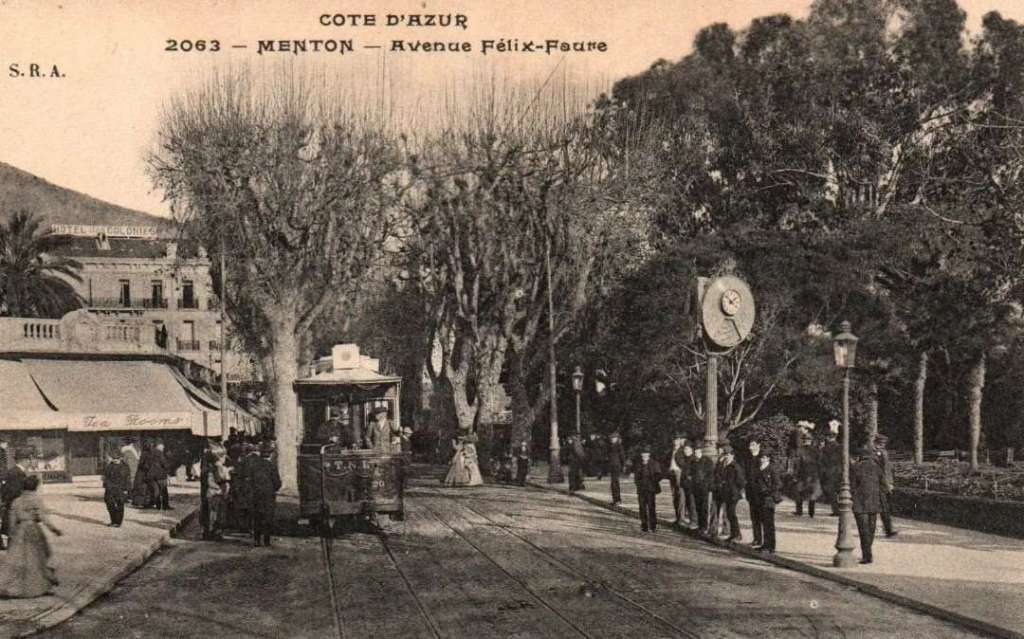
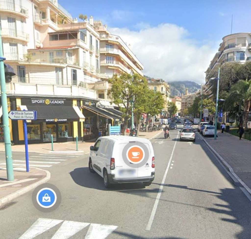
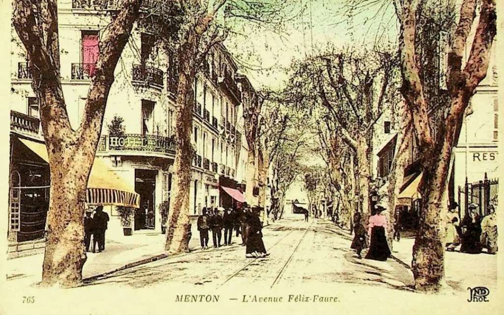
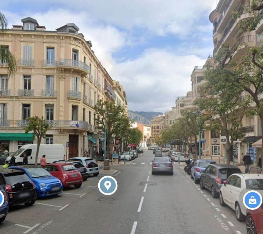
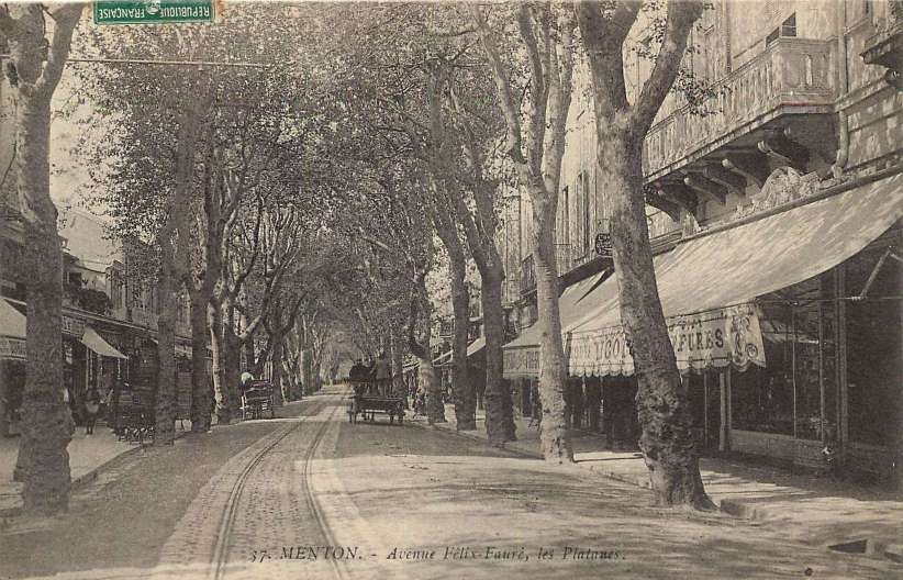
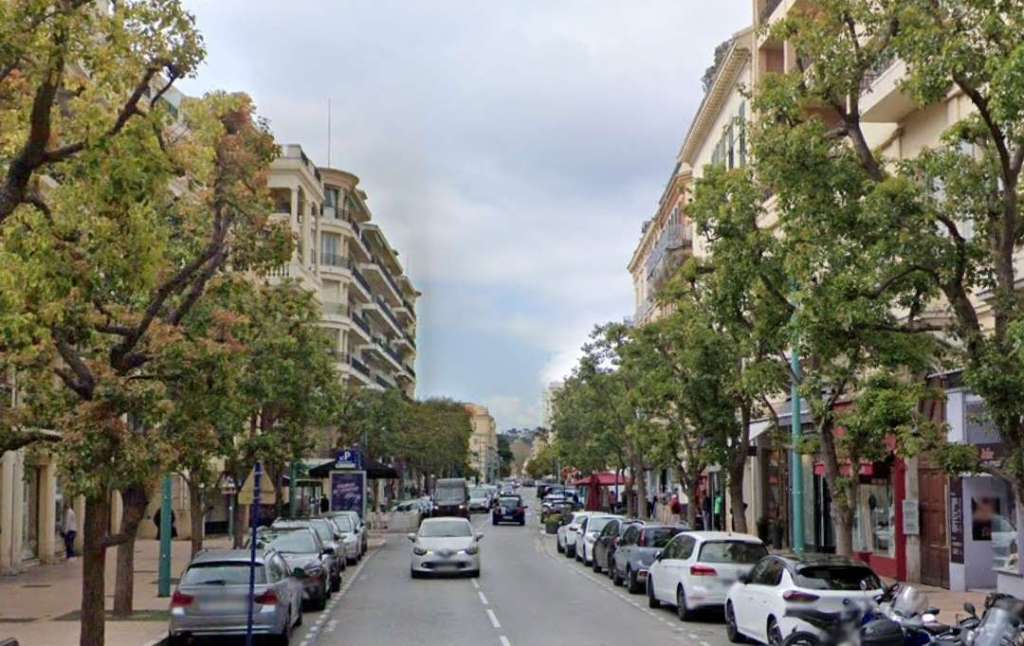
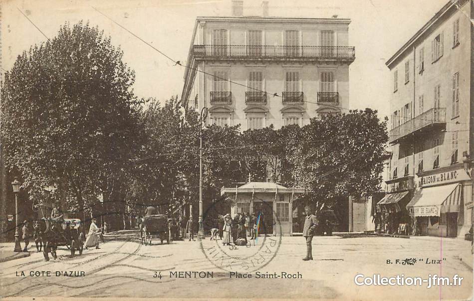
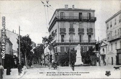
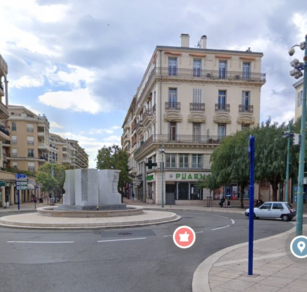
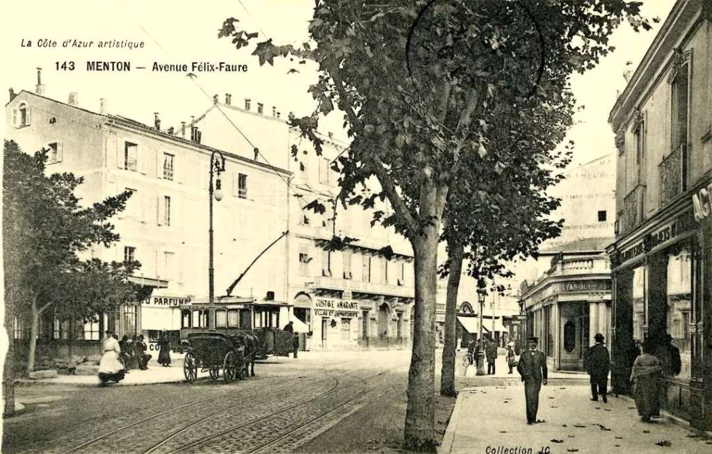
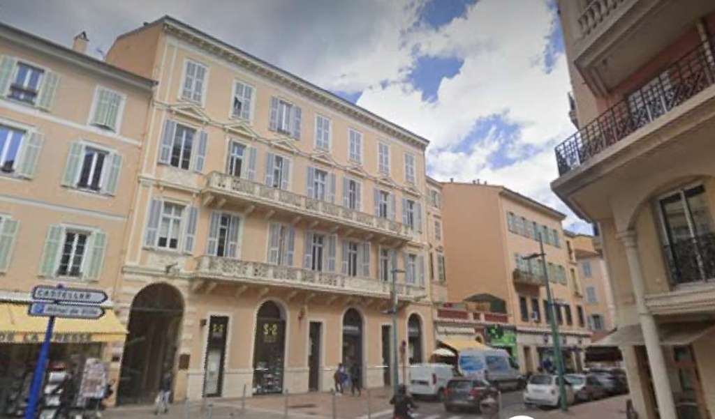
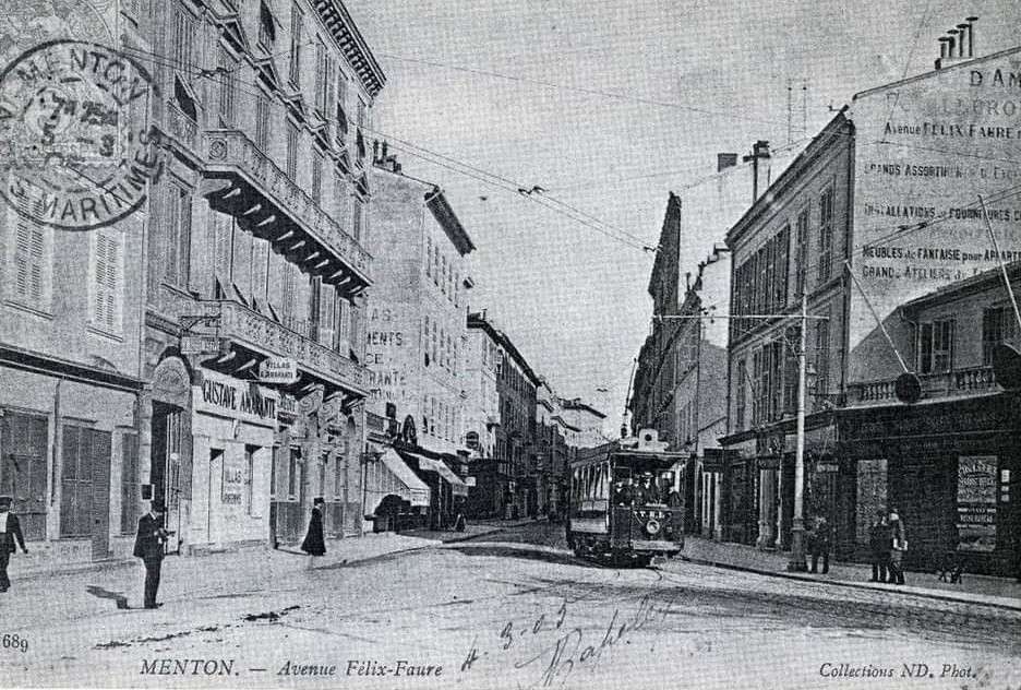
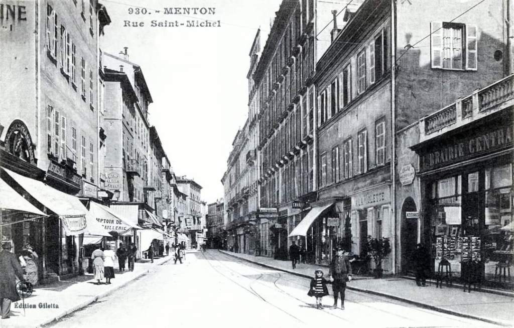
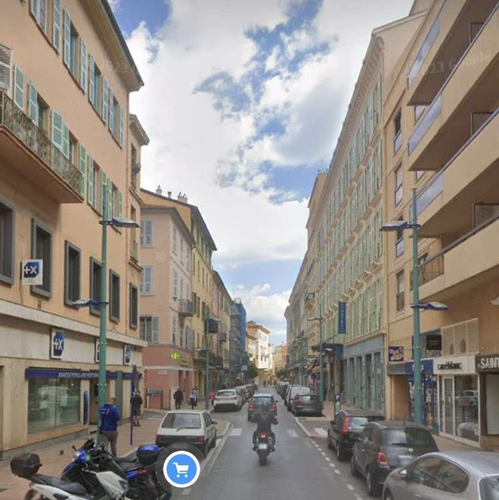
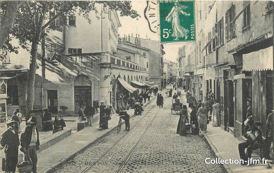
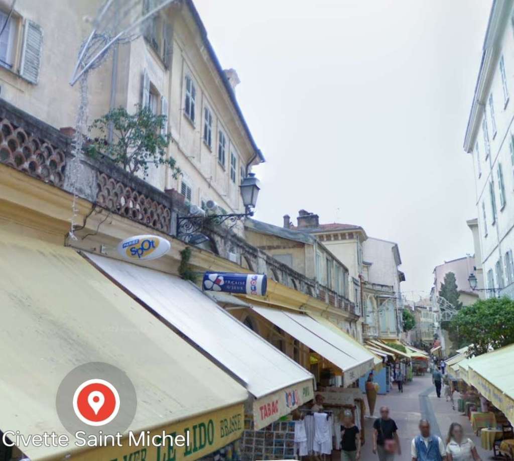
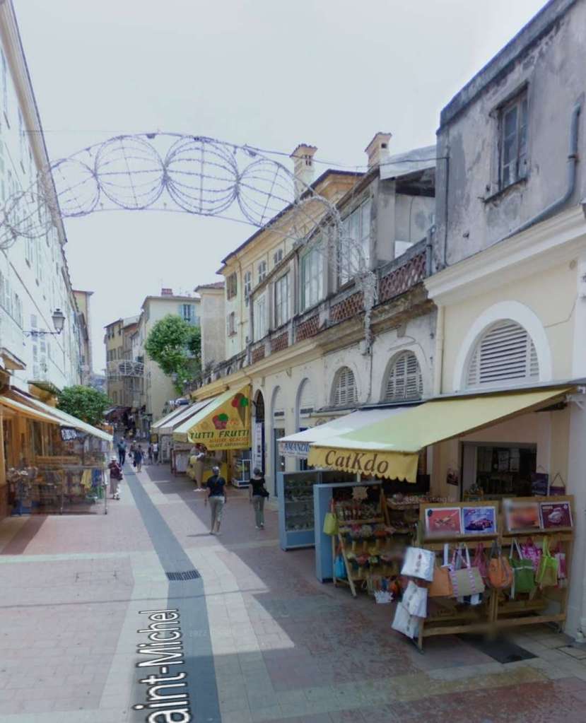
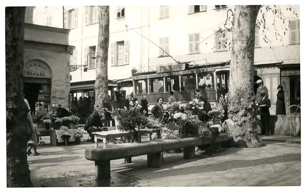
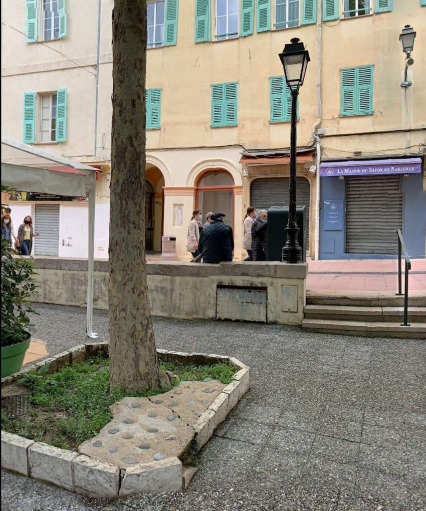
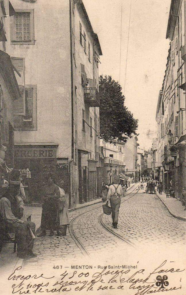
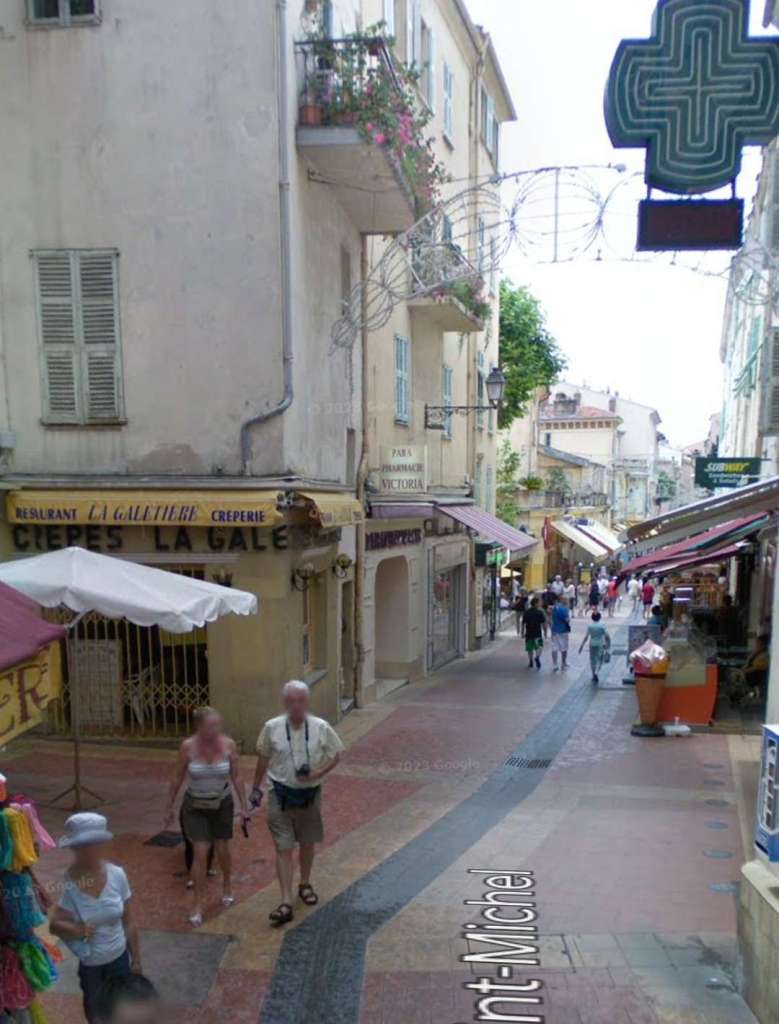
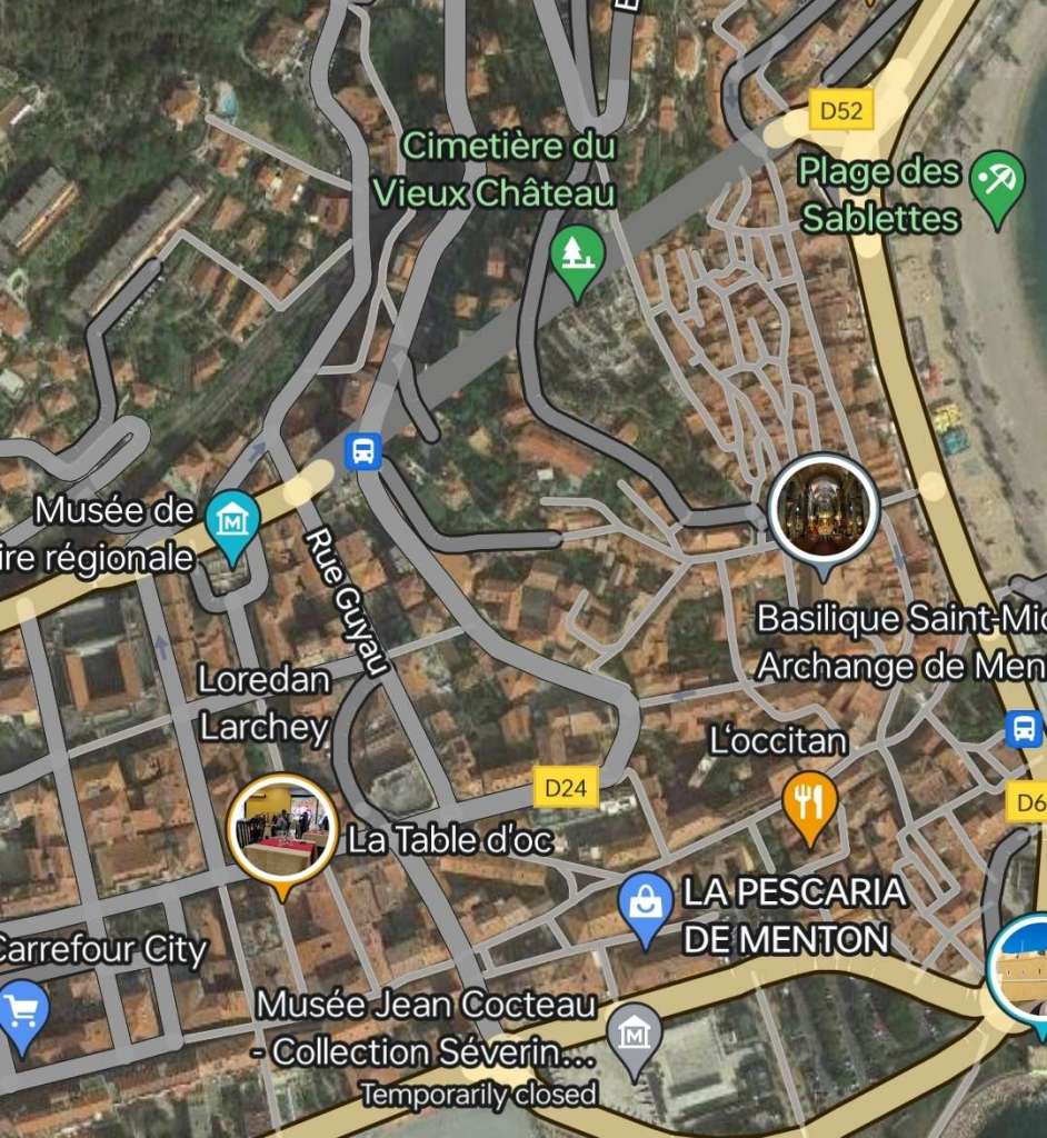
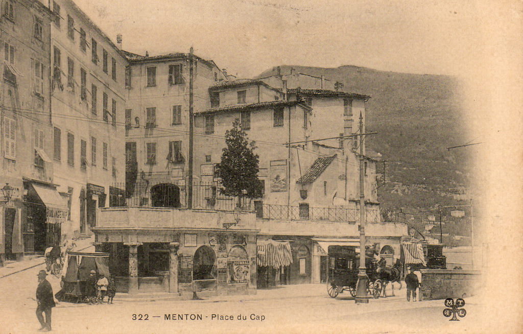
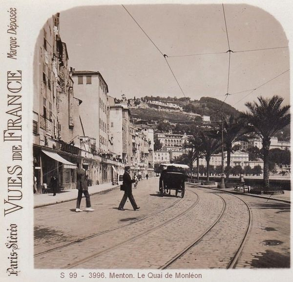
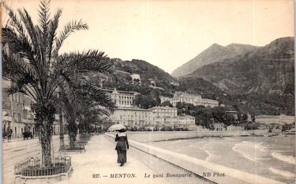
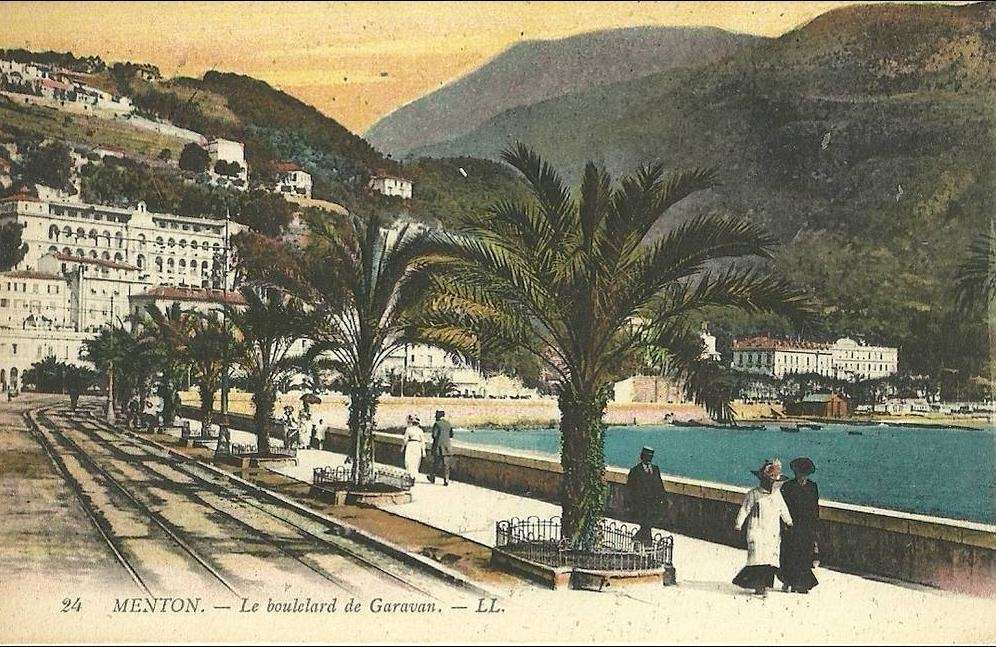

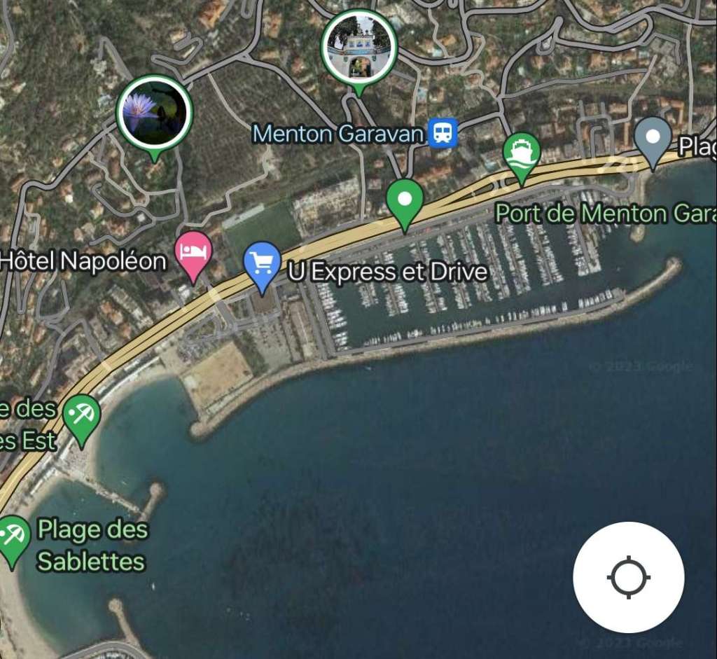
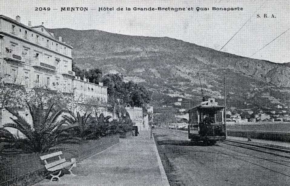
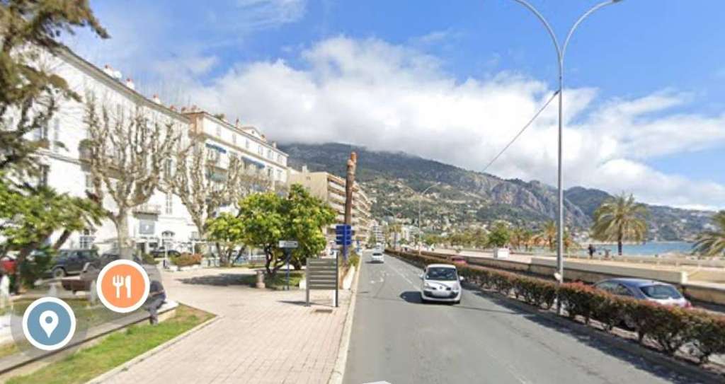
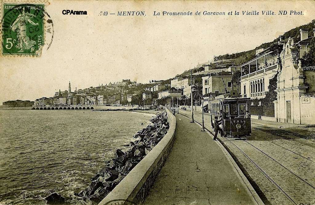
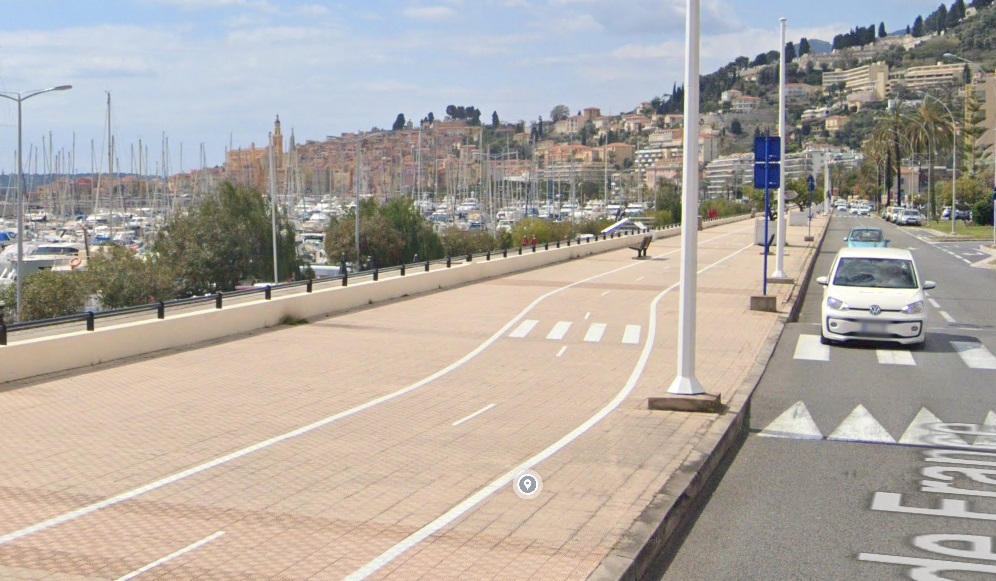
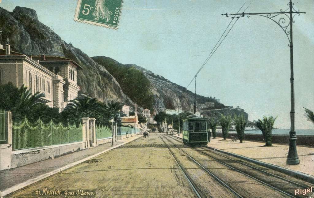
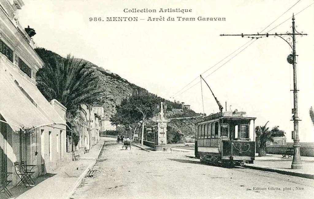
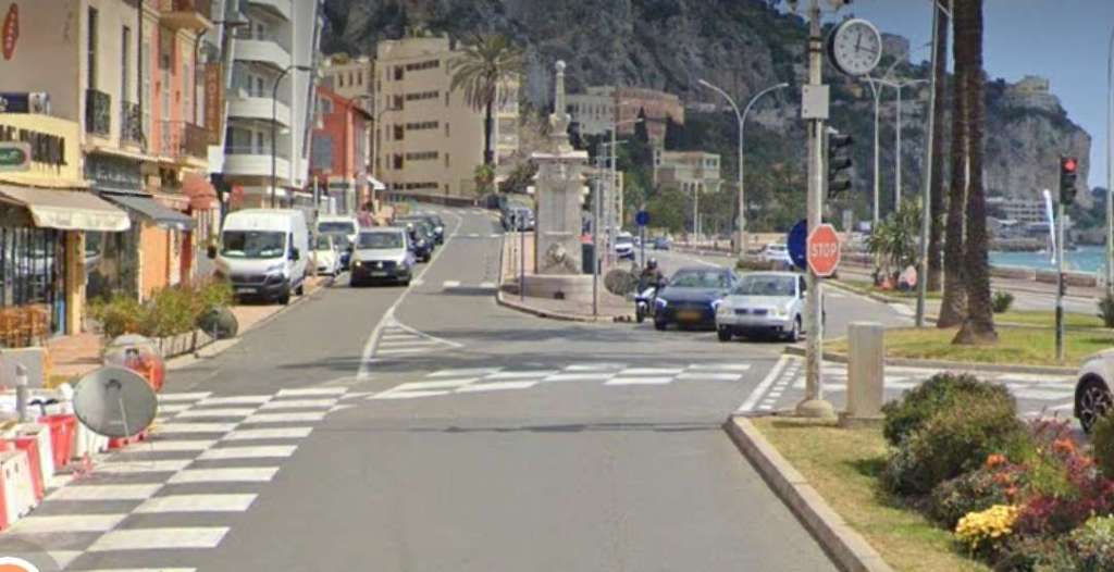
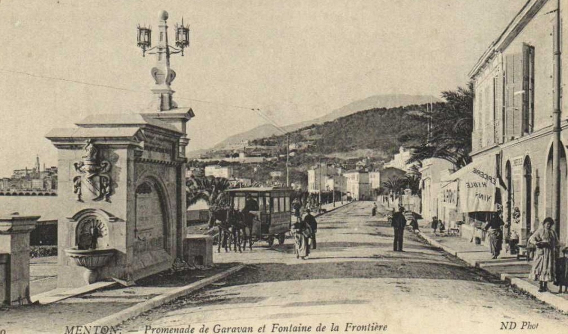
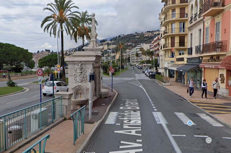
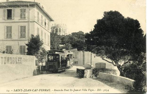
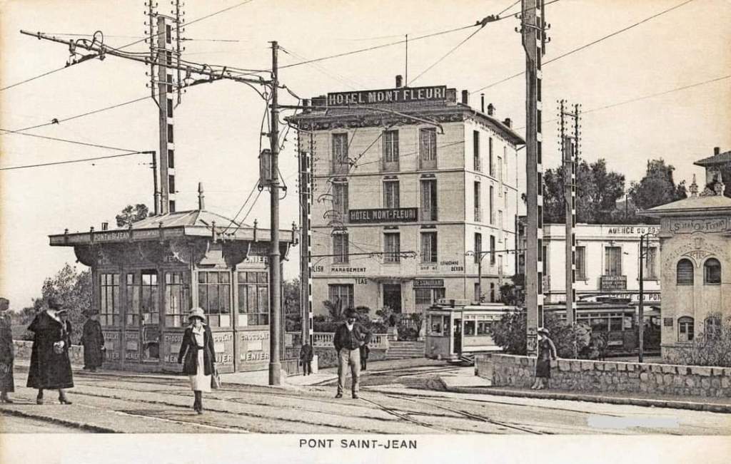
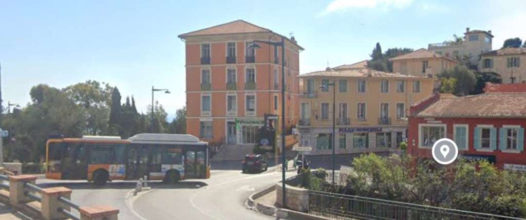
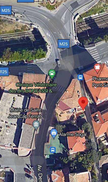
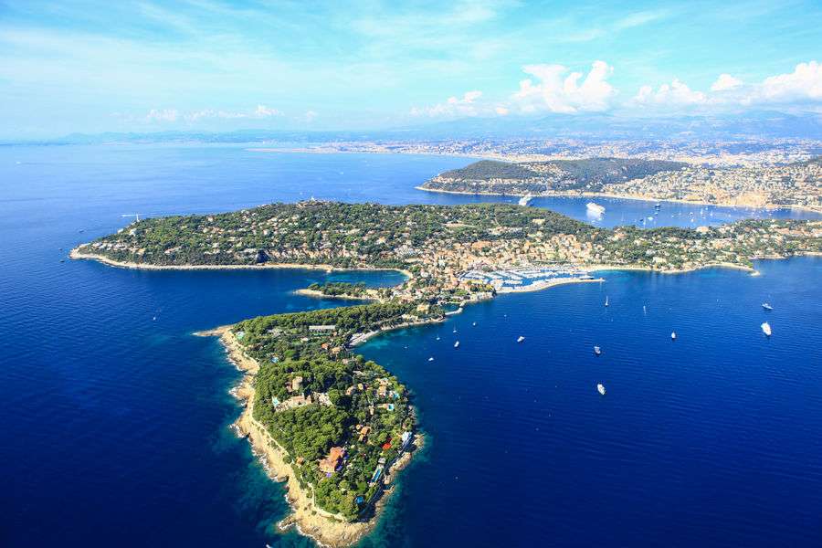
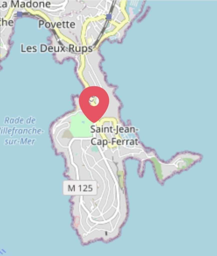
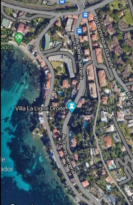
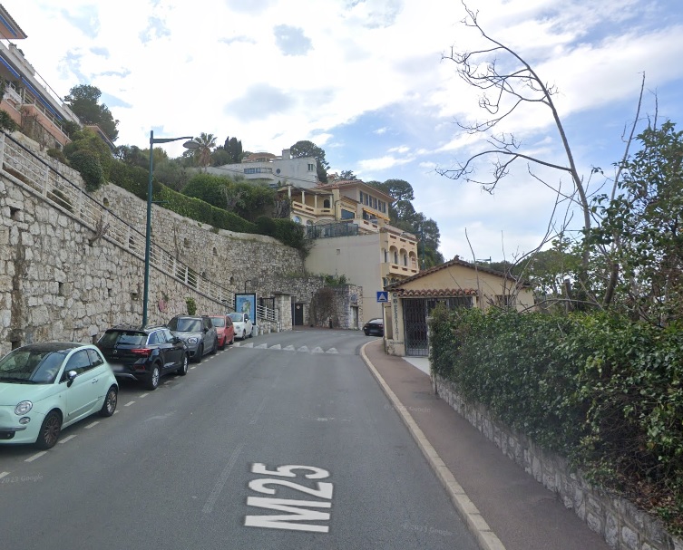
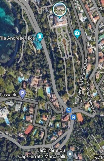
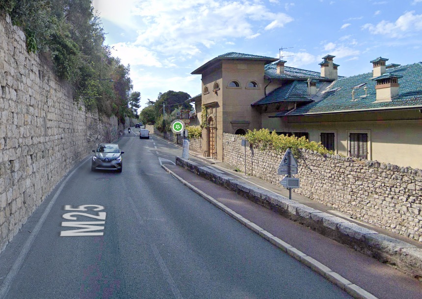
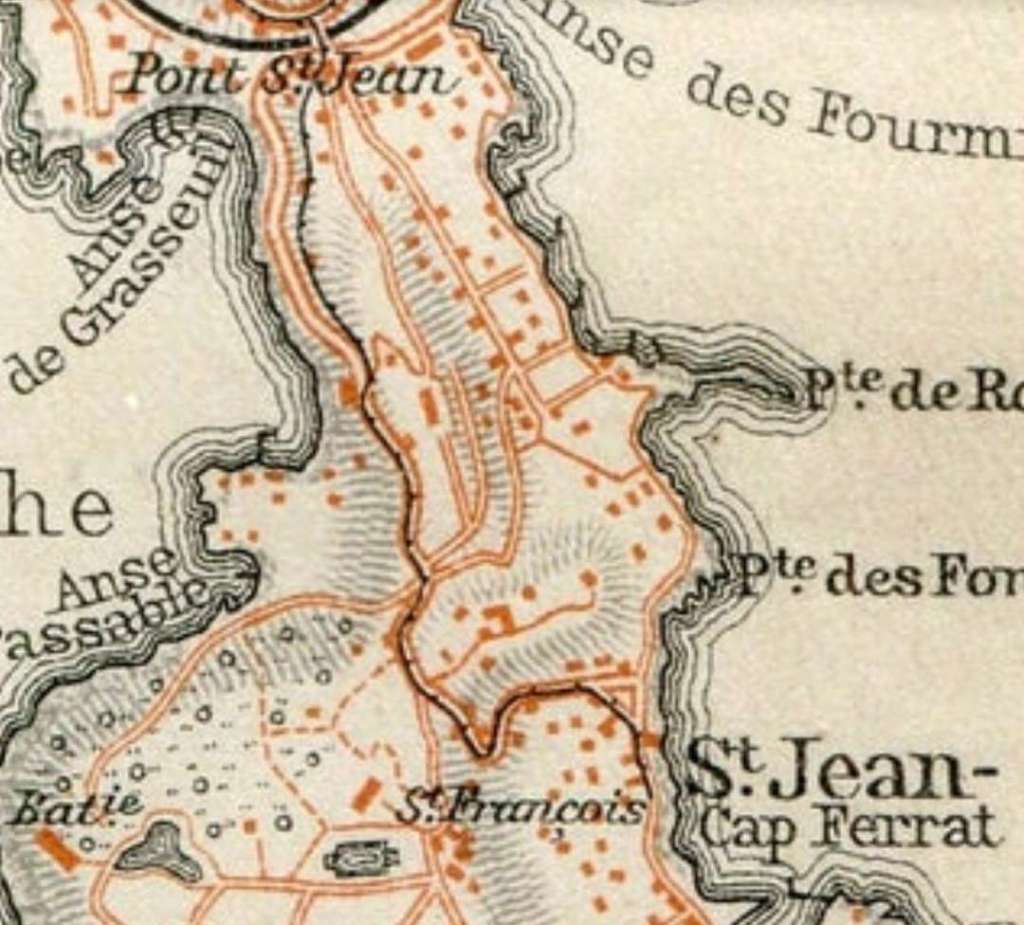
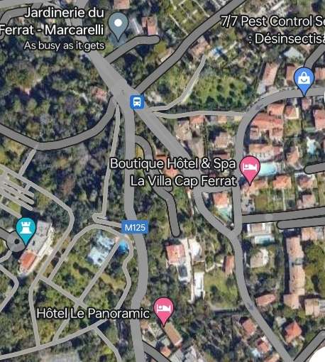
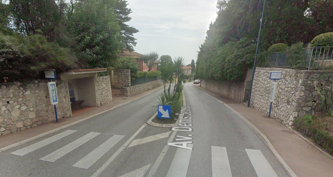
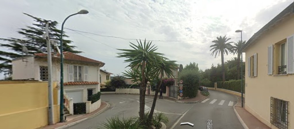
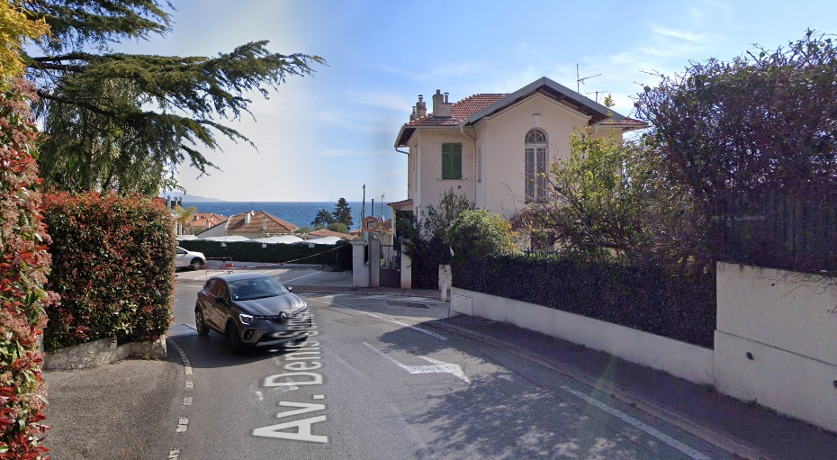
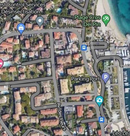
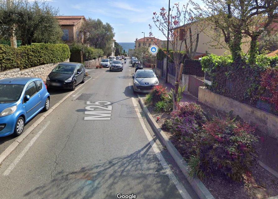

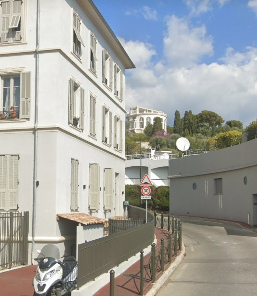
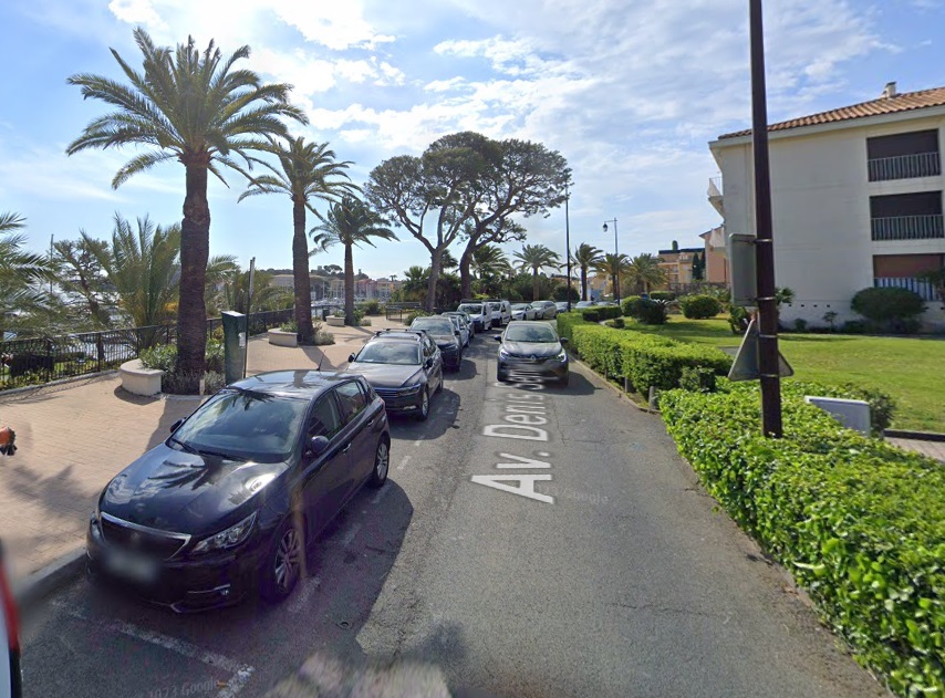
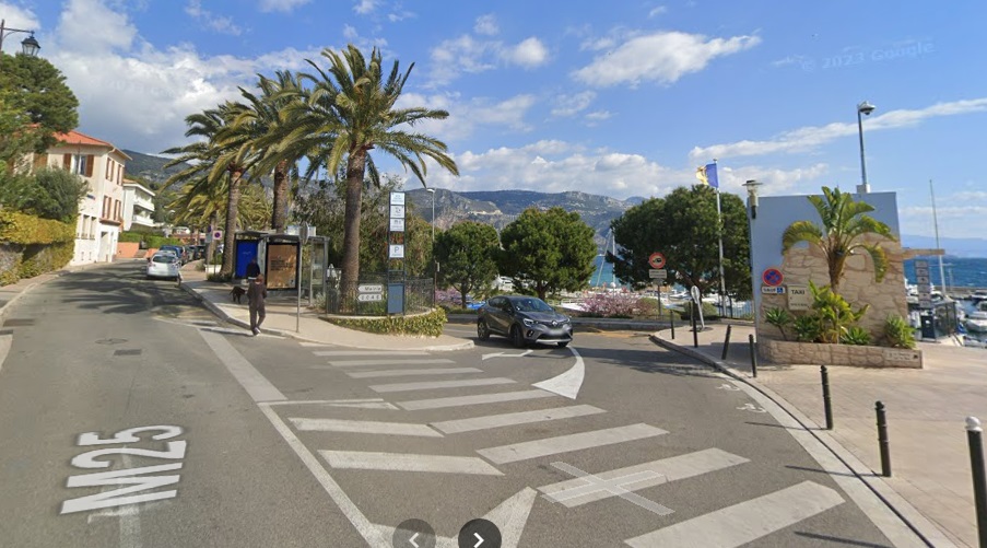

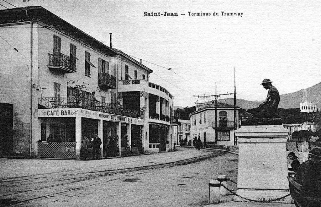

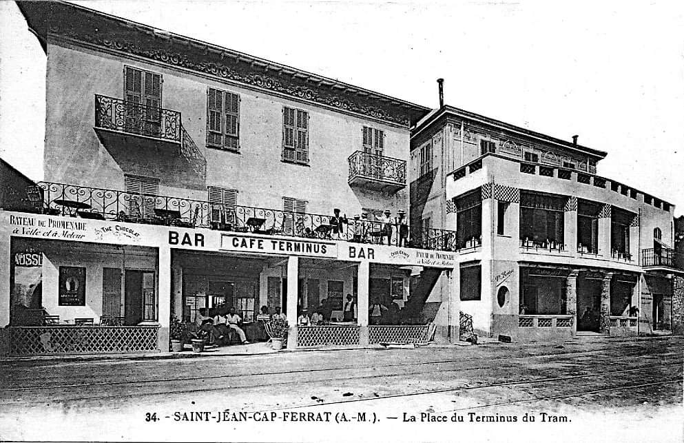
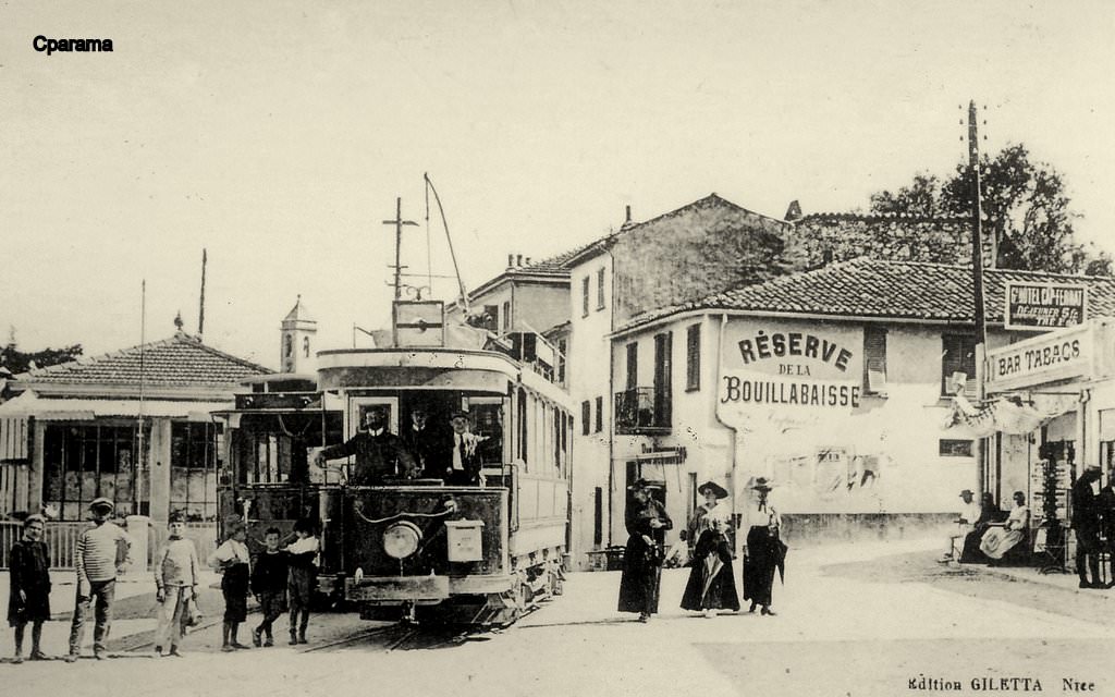
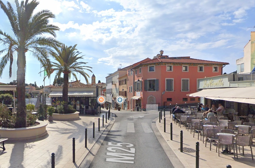
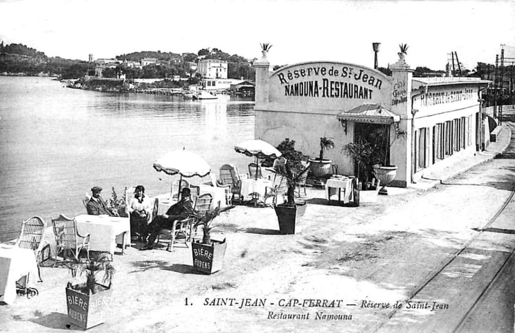
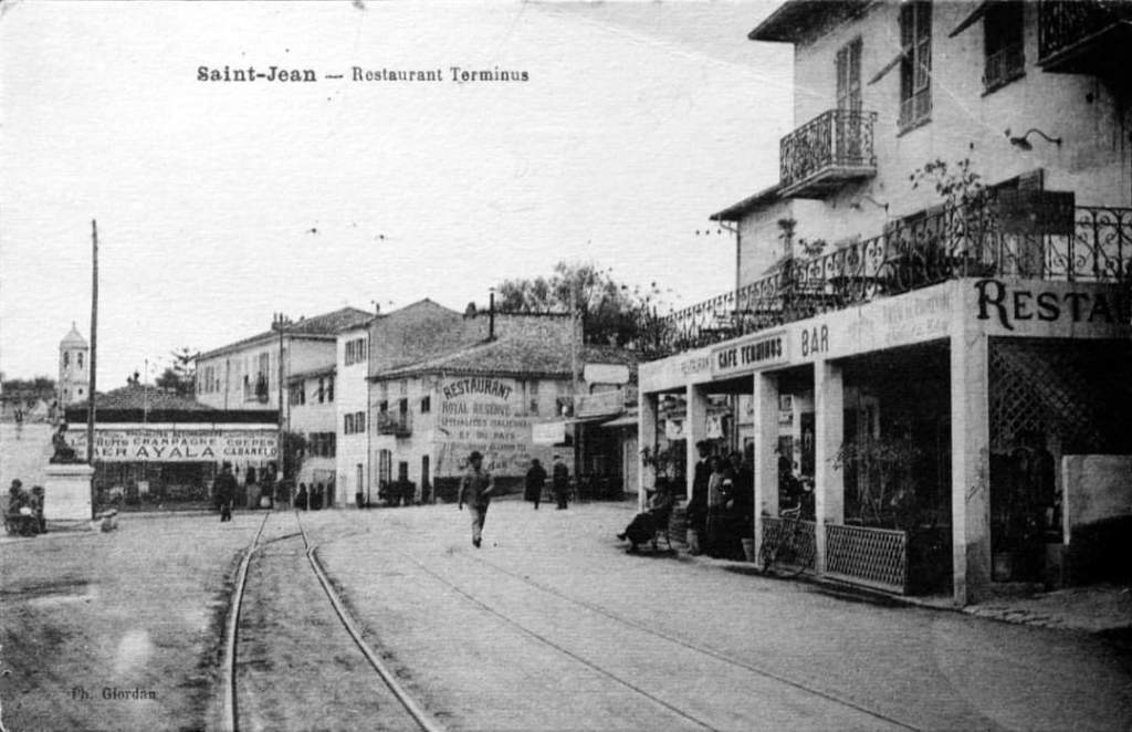
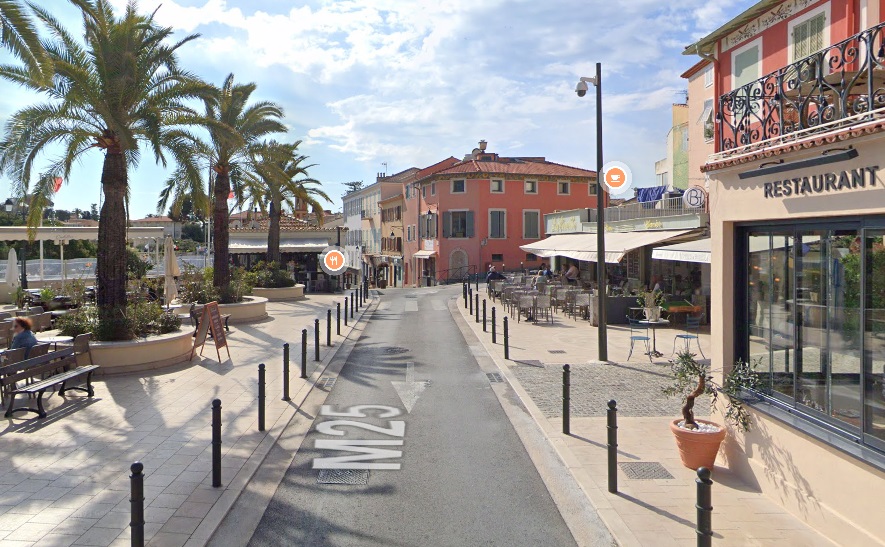
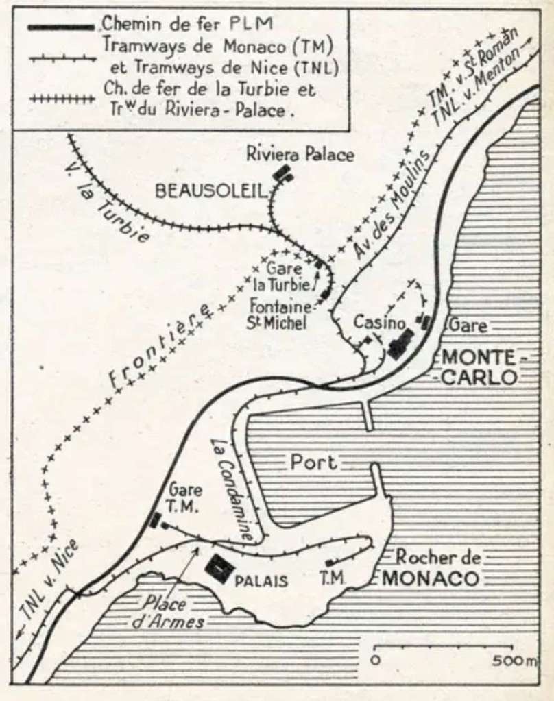
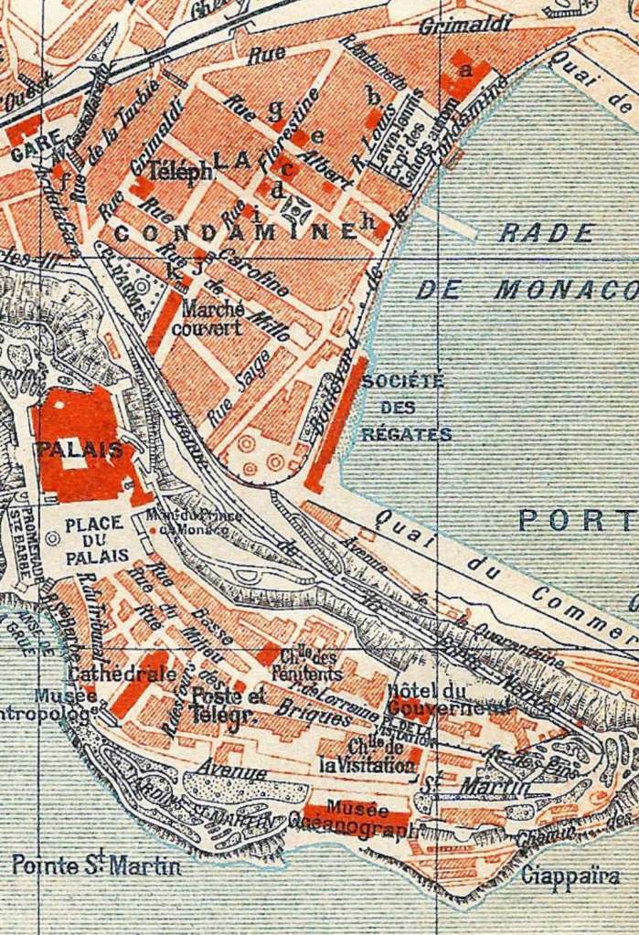
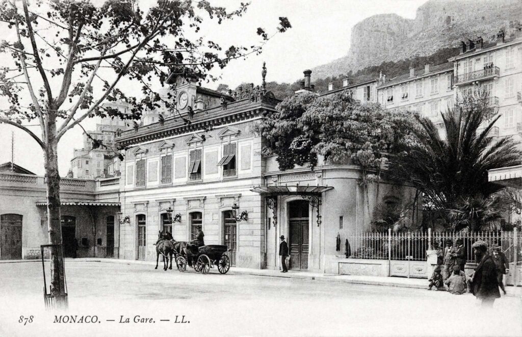

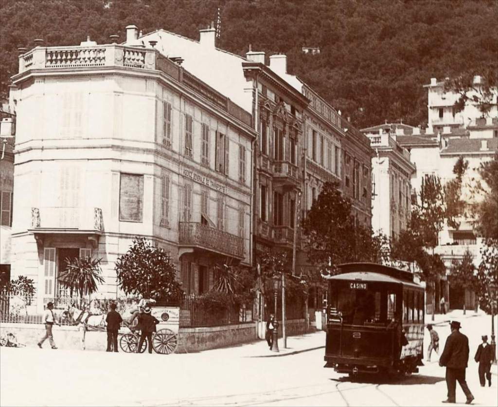
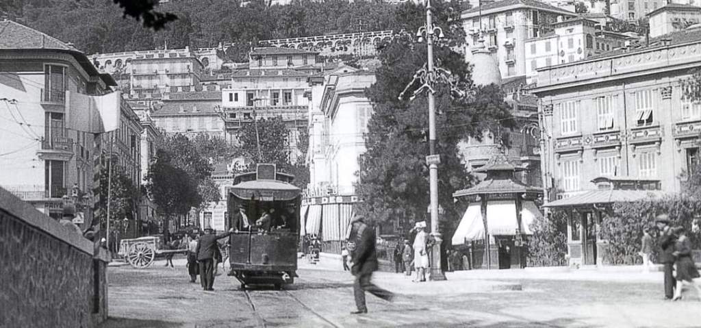
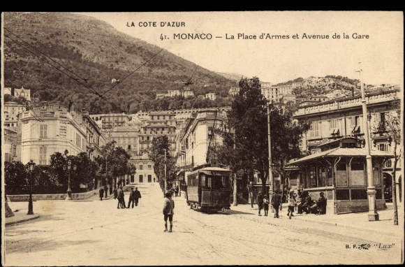
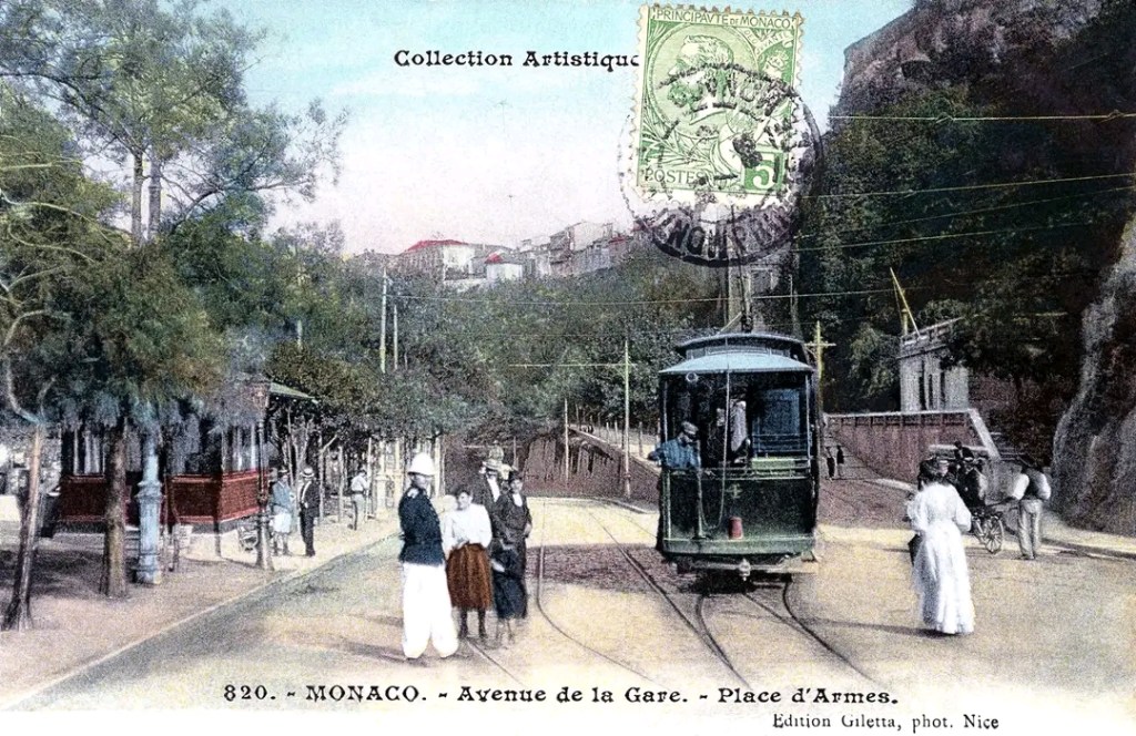
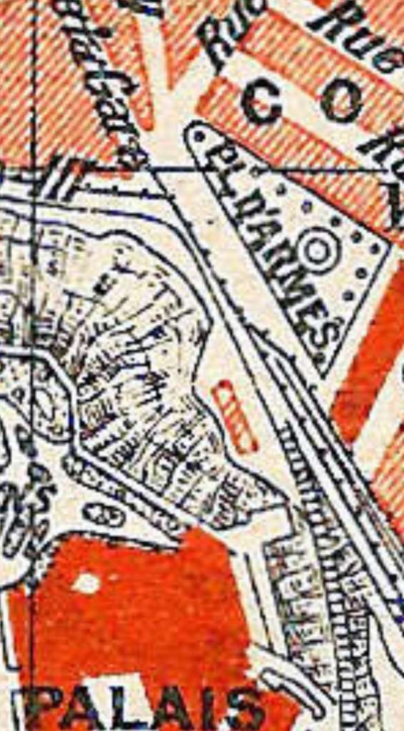
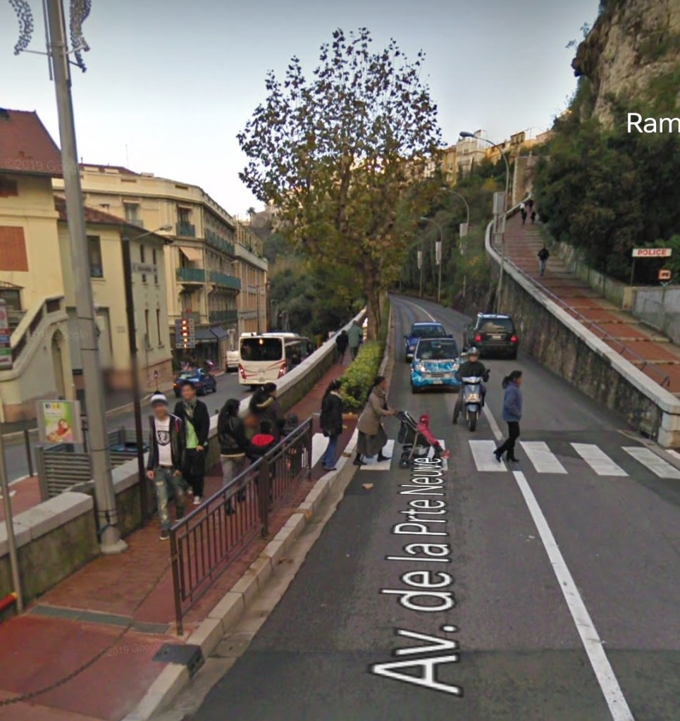
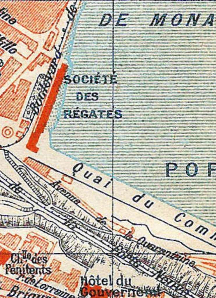
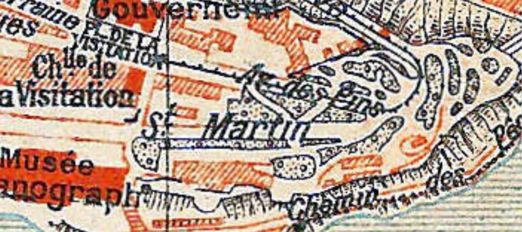
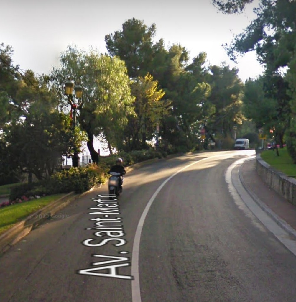
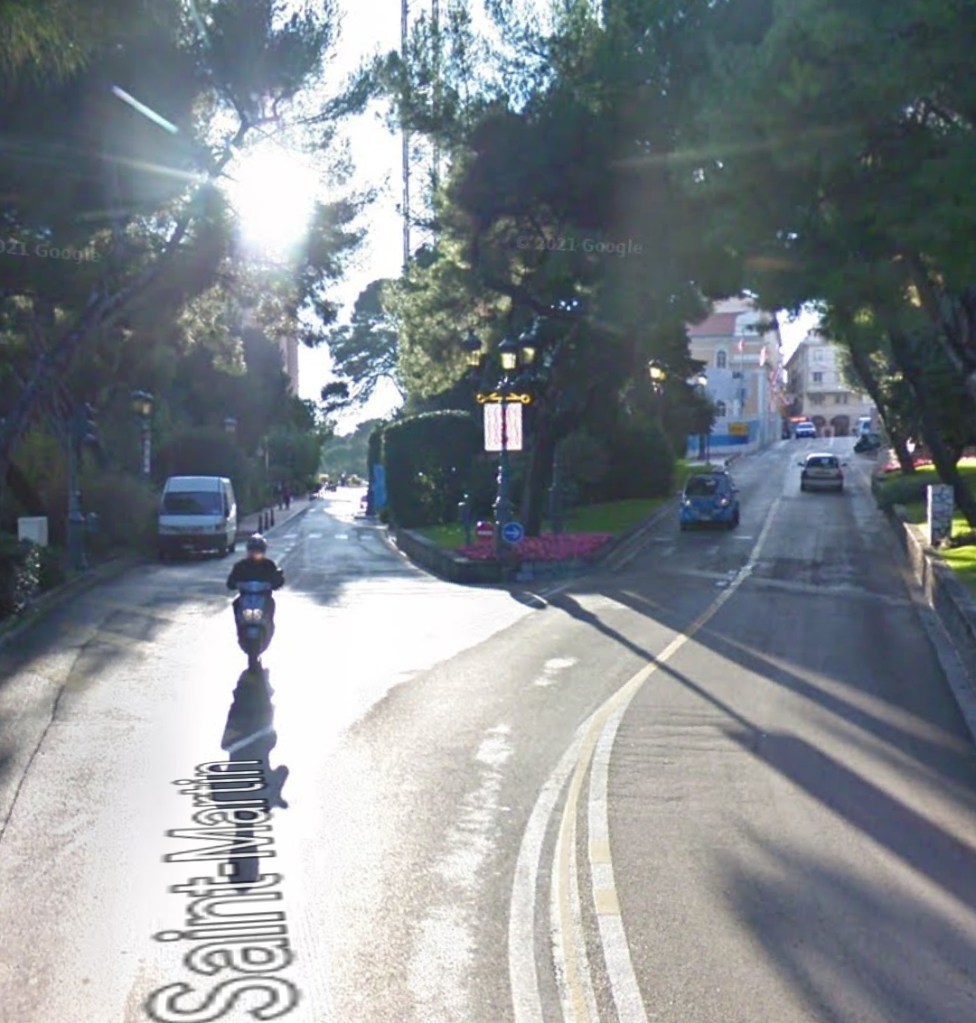
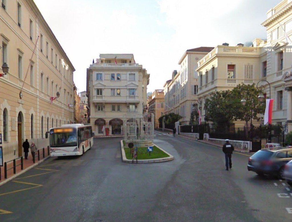
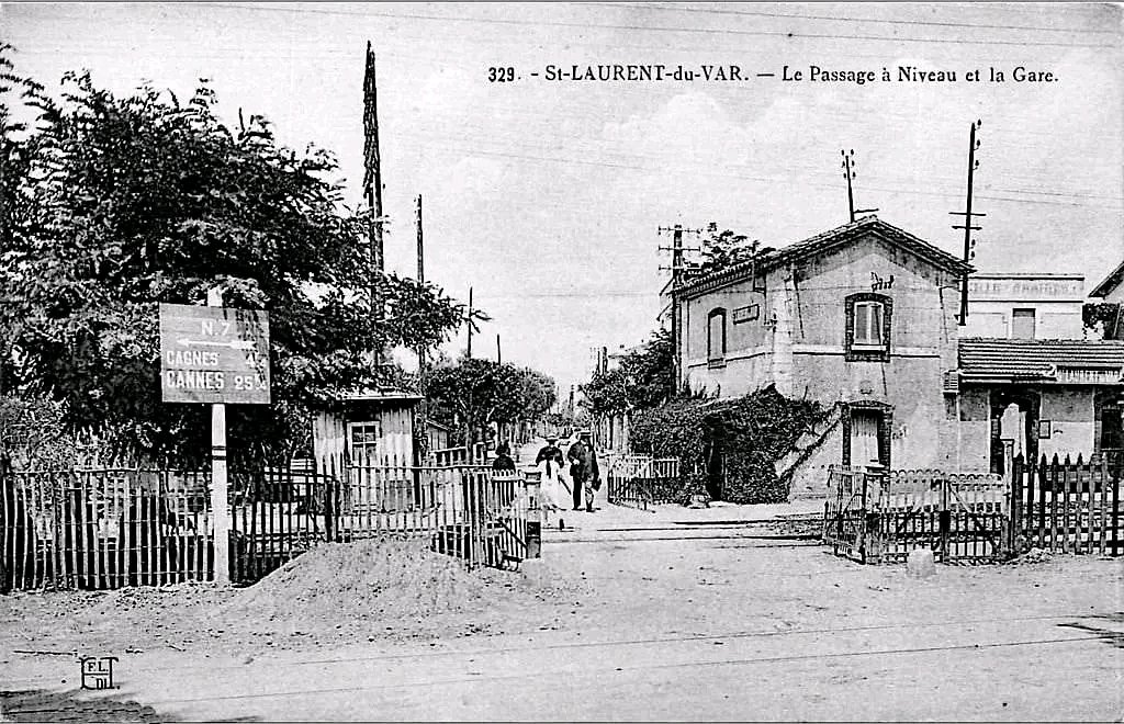
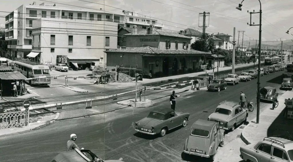
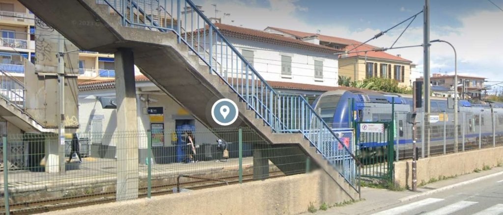
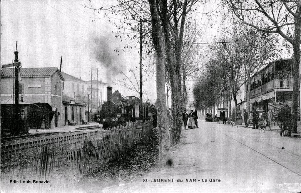
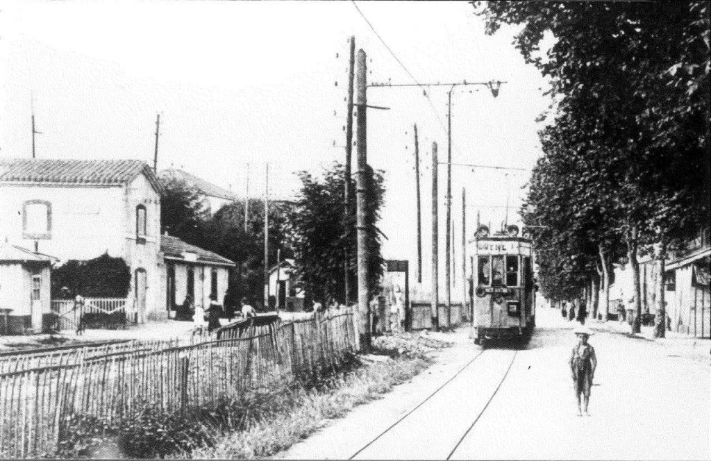
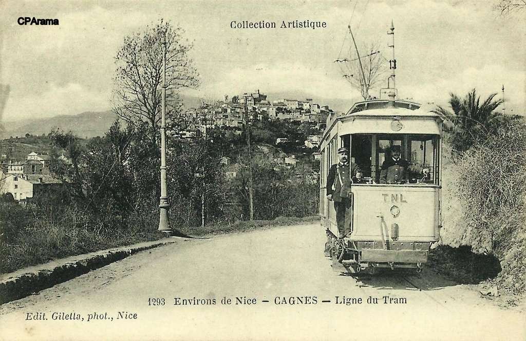
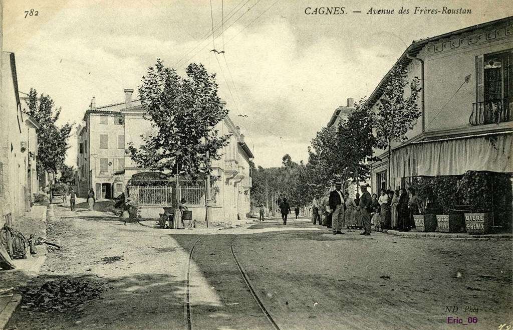
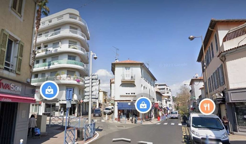
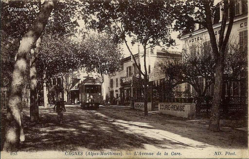
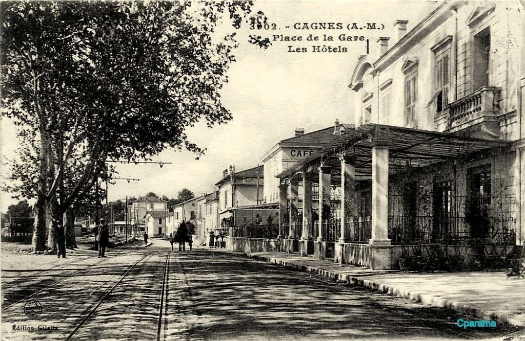
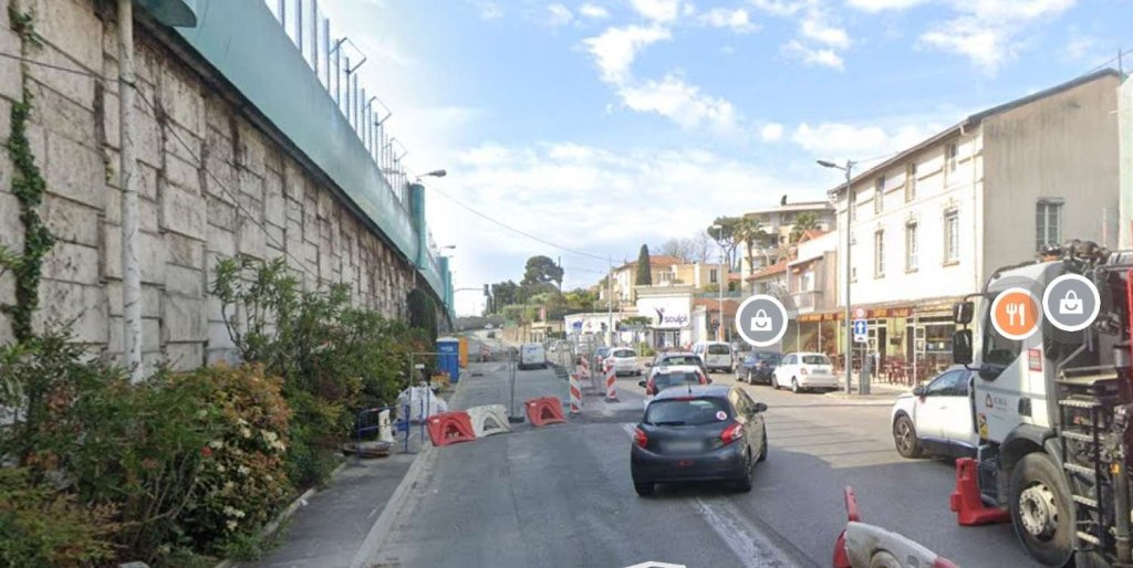
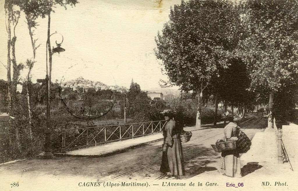
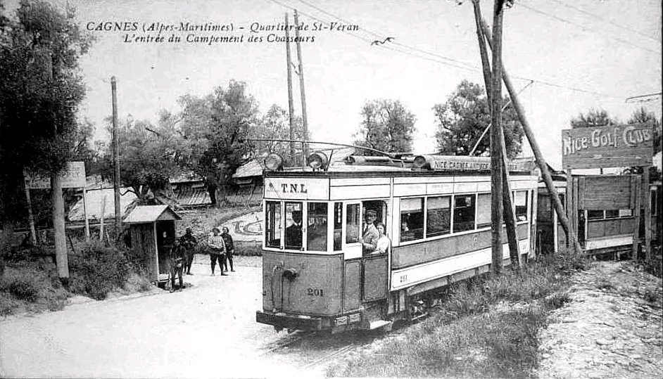
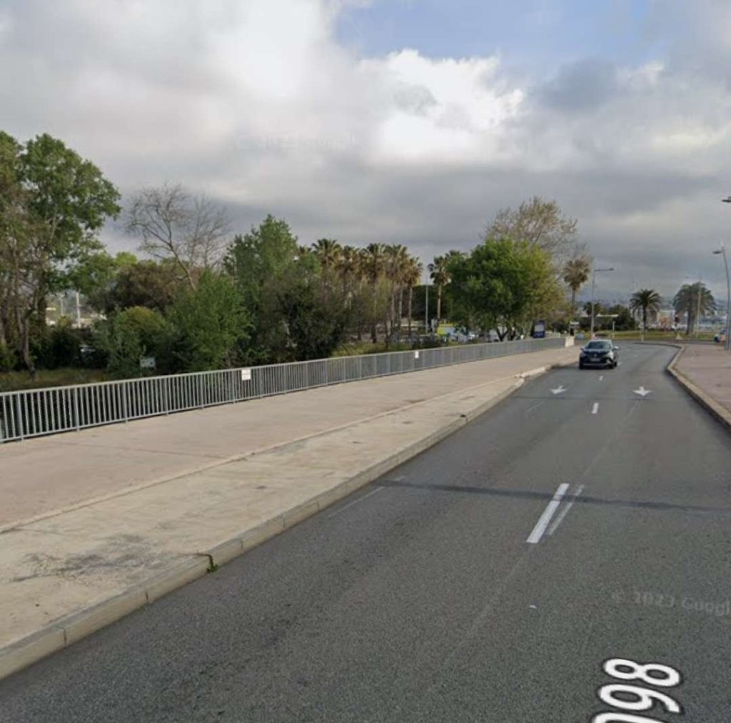
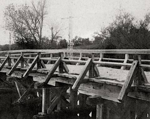
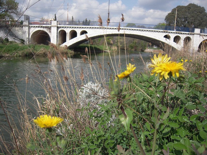
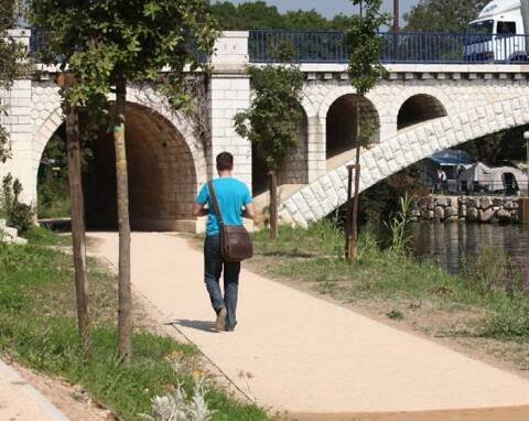
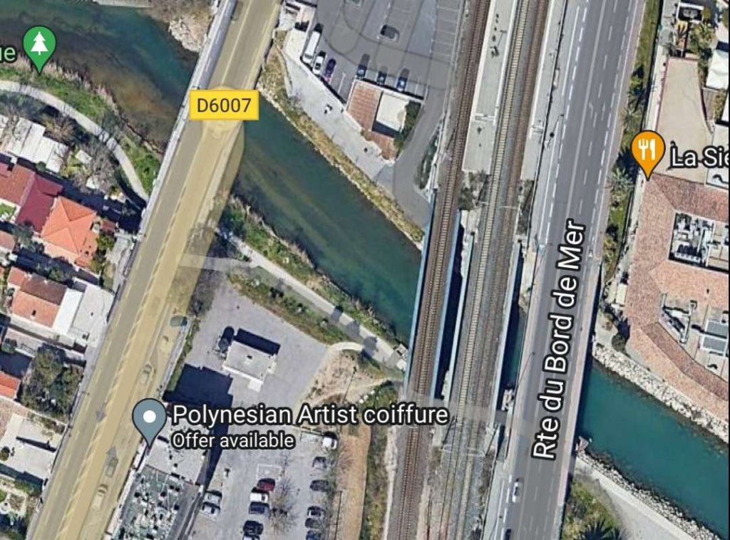
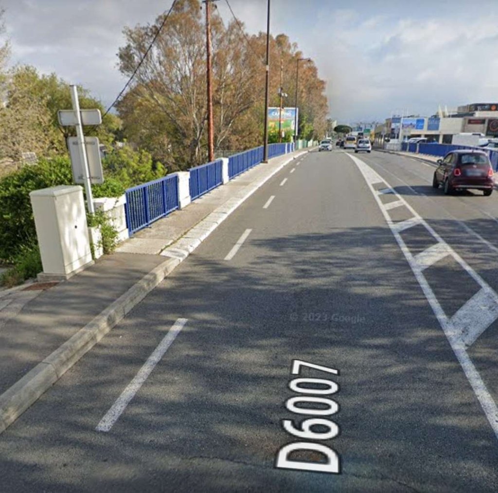
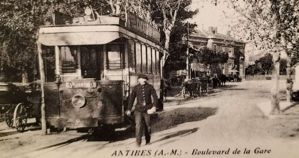
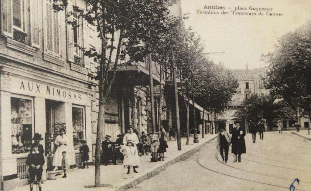
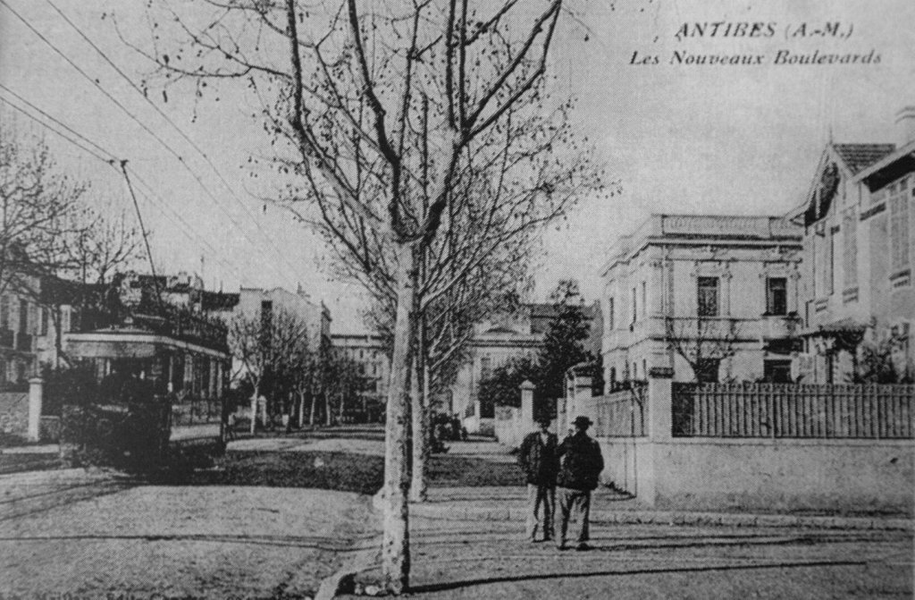
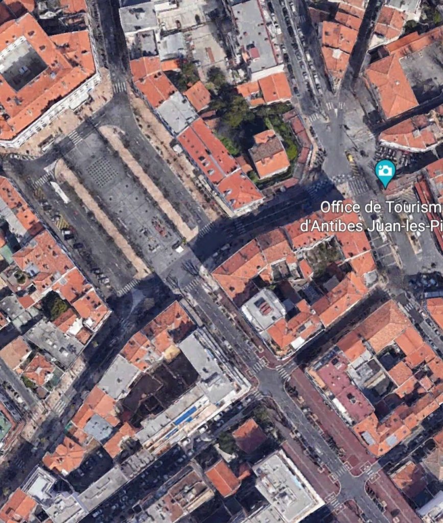
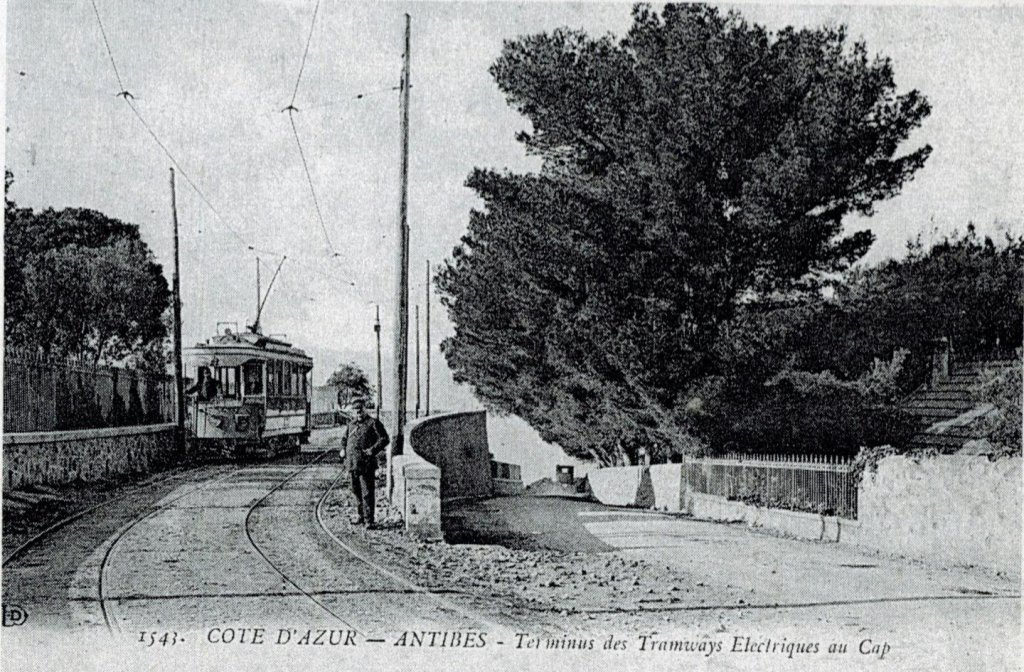
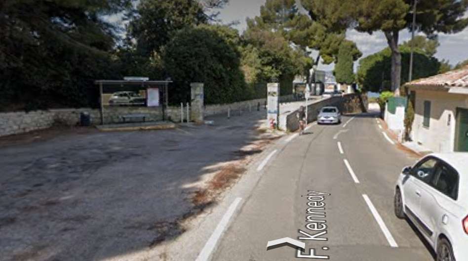
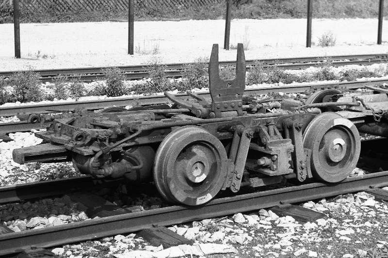
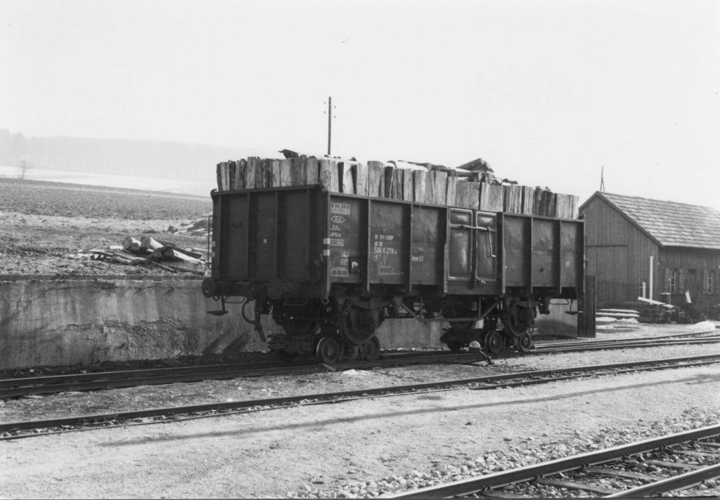
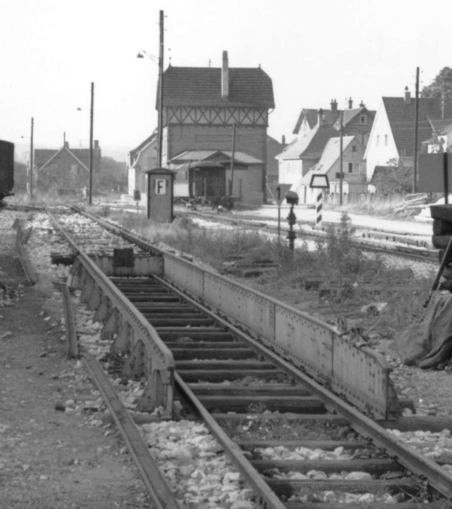
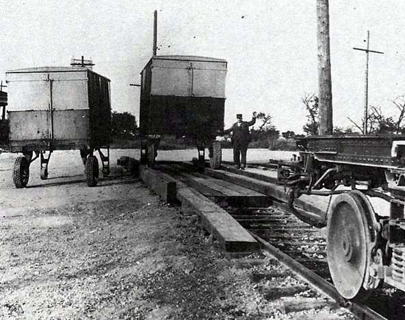
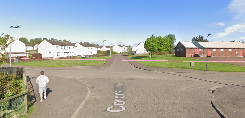
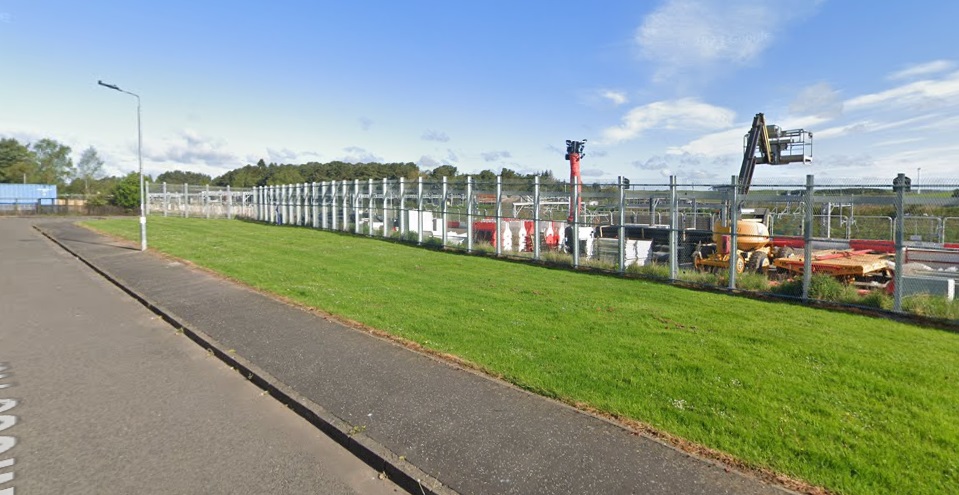
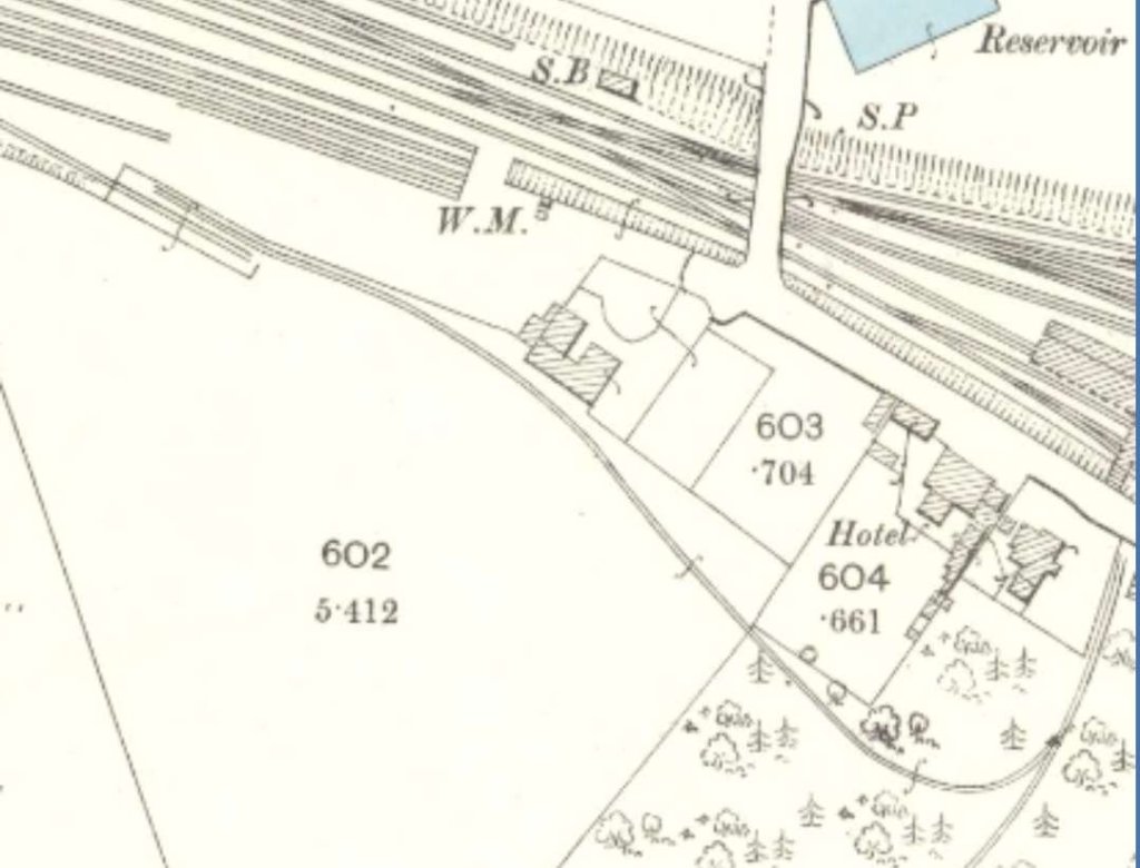
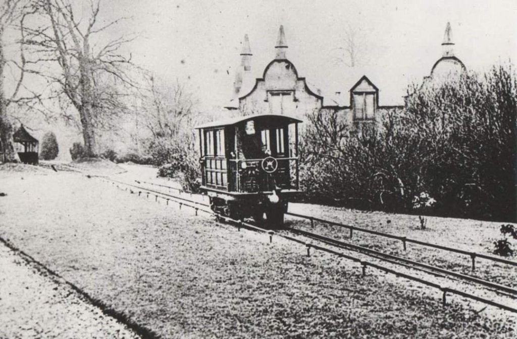
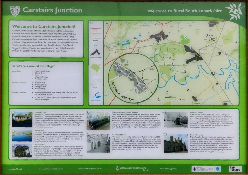
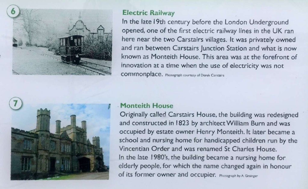
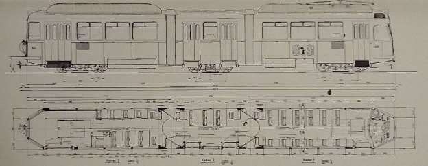
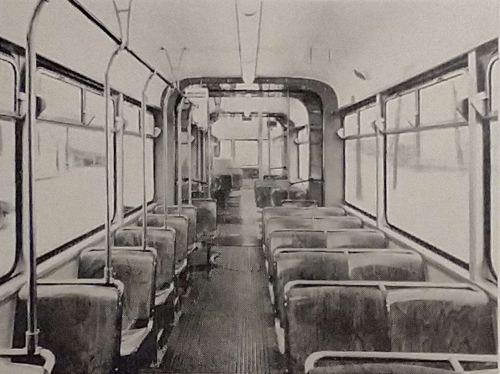
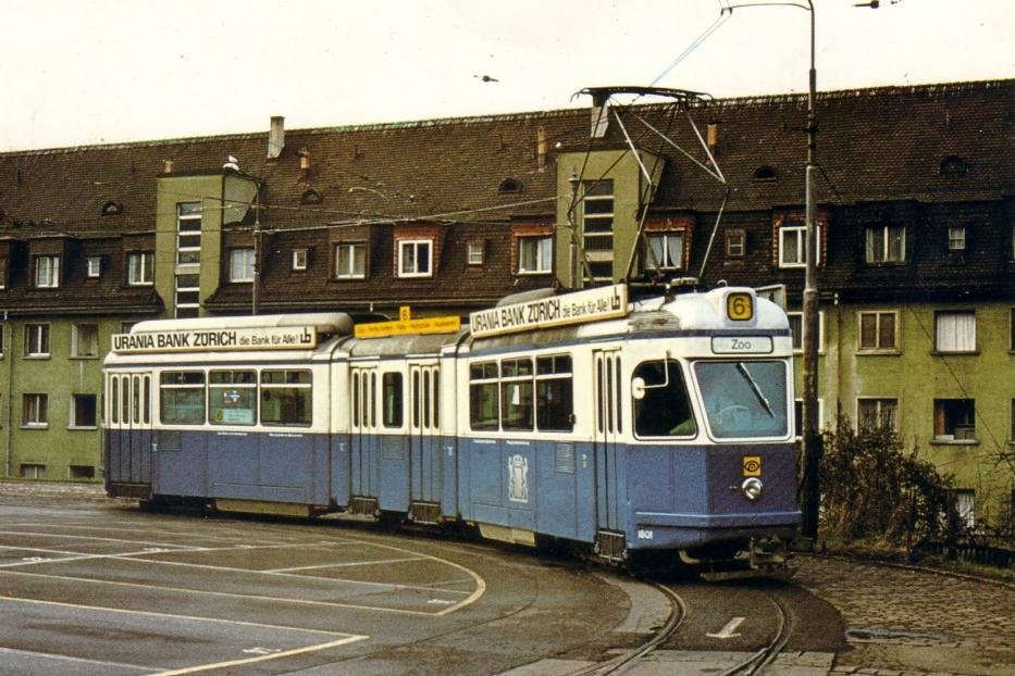
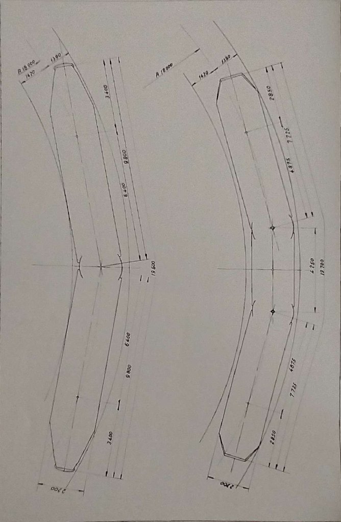
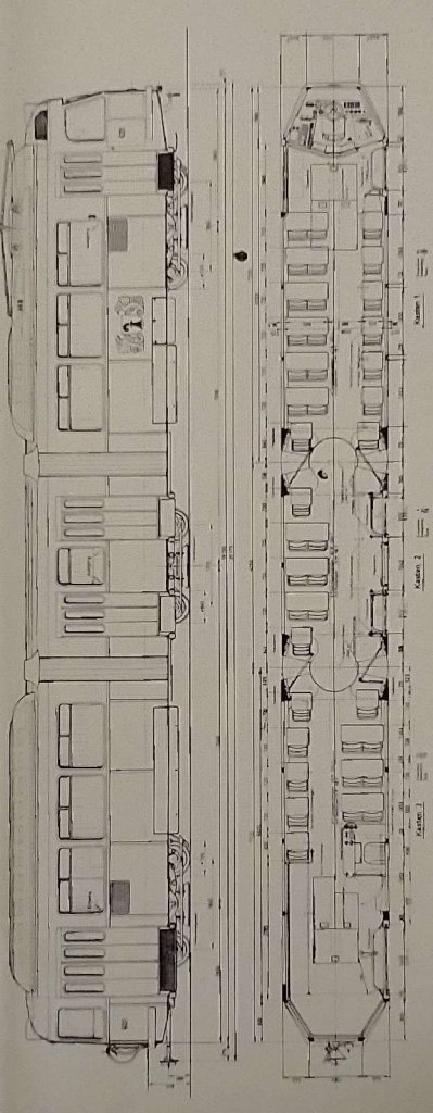
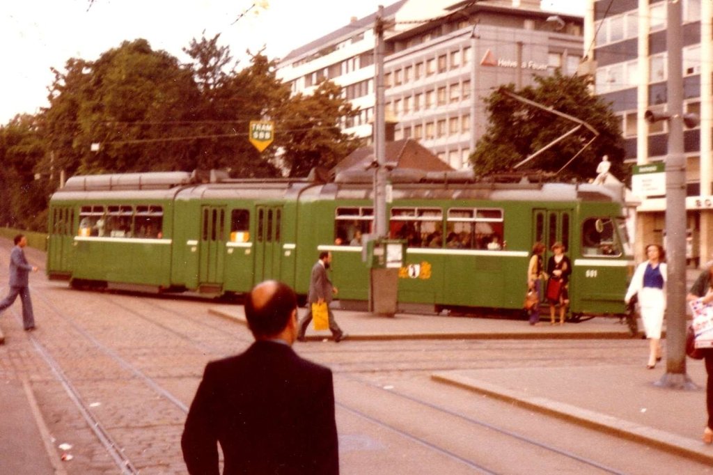
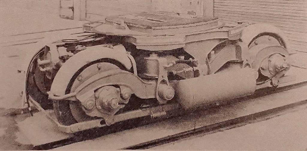
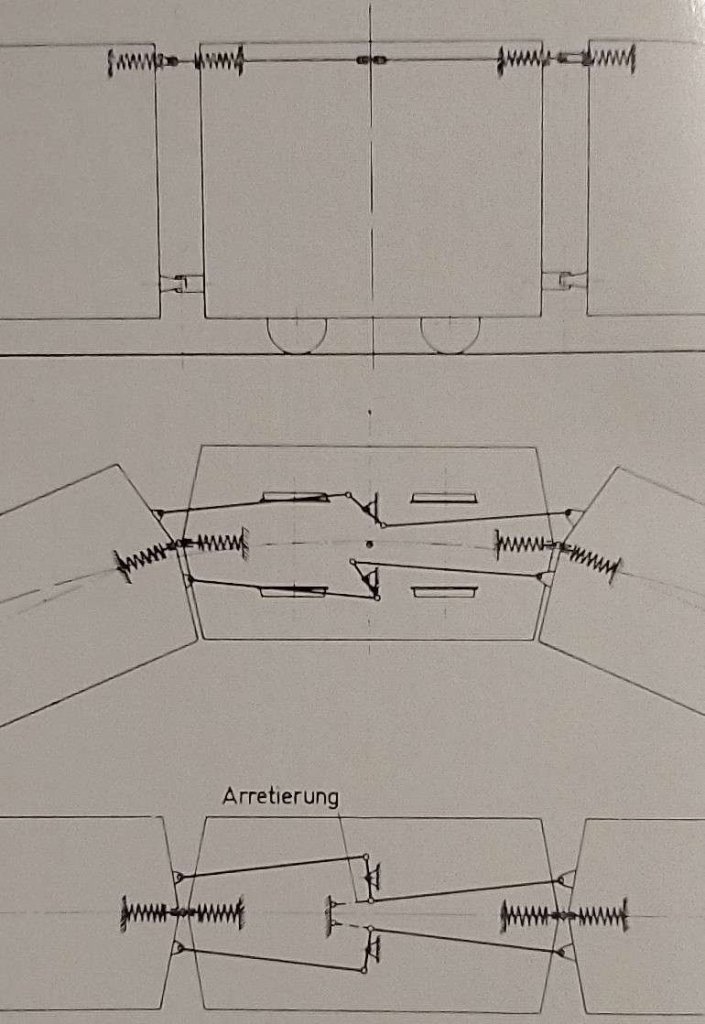
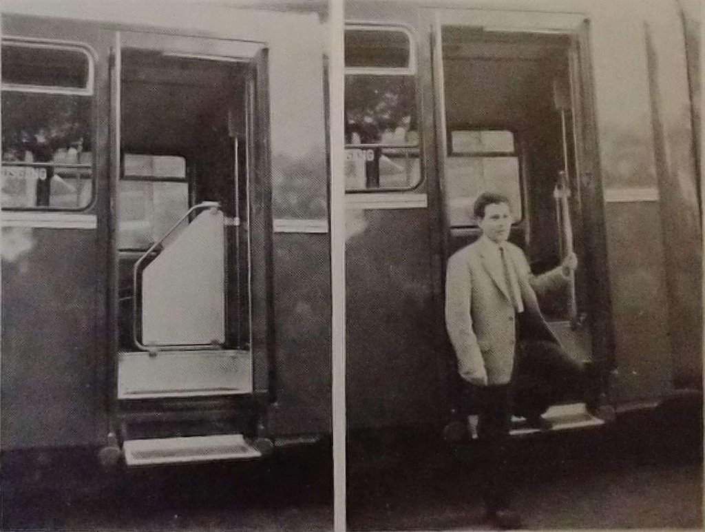
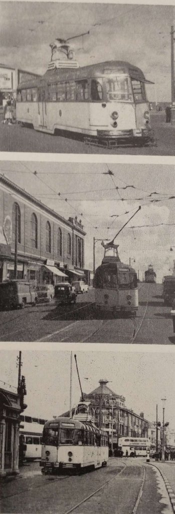
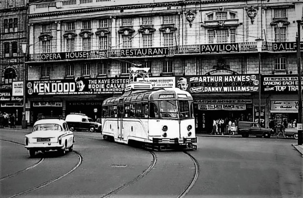
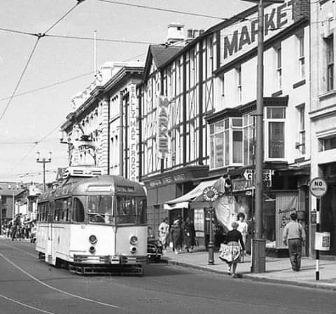
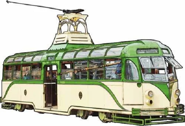
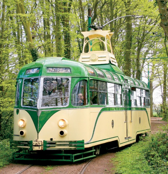

#/media/File%3AL04_163_Hp_Dinegro%2C_ET_37.jpg)
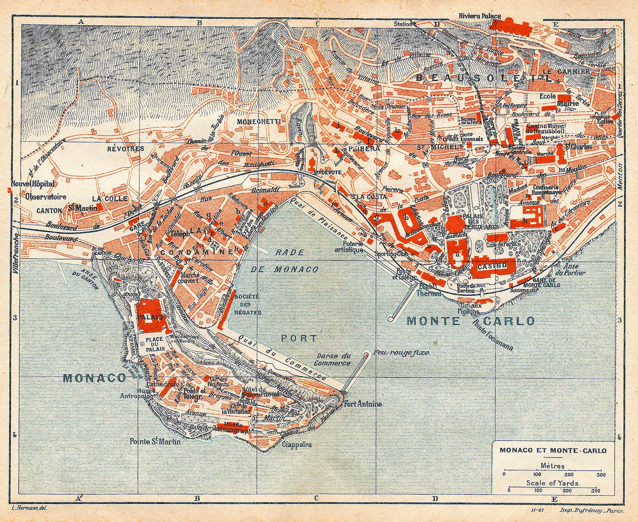