
Jose Banaudo published a two volume set of books about the historic trams of Nice, “Nice au fil du Tram.” Articles based around the first of these two volumes can be found on the following links:
https://rogerfarnworth.com/2020/08/12/the-tnl-tram-network-chemins-de-fer-de-provence-87/
This new post is the first of a series of articles based on the second volume. [1] The books were published as French language texts, quotations directly from the books have been translated with the assistance of ‘Google Lens’ and ‘Google Translate’.
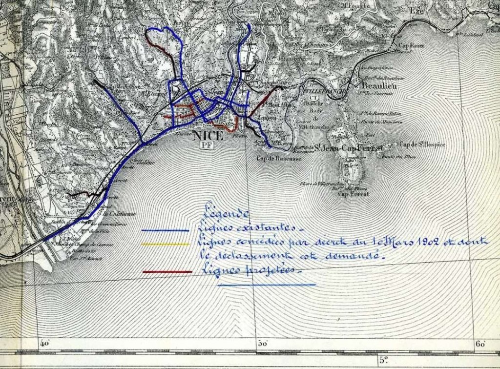
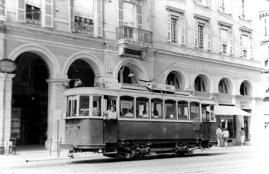
Jose Banaudo tells us that, after a time served only by horse-powered trams, Nice granted concessions to the Tramways de Nice et du Littoral (TNL). Those concessions were granted, line by line, by the city of Nice, by the State, by the Principality of Monaco, by the Port of Nice and by the Departmente des Alpes-Maritimes on the understanding that electrically powered trams would be used. The individually granted concessions meant that the TNL had to work hard to ensure that the differences between these concessions did not significantly affect the service it provided to the public. In fact, it achieved “a remarkable technical unification of its operations.” [1: p6]
Rather than looking at the detail of the statutes, Jose Banaudo has grouped his work into three main categories: the urban lines of Nice; those of the coast (including the urban networks of Monaco and Menton); and those of the hinterland.
The urban network in Nice was built in just a short time between 1900 and 1902. “Subsequently, the mileage was increased in 1903 by the Parc-Impérial line, in 1907 by the extension of the Gendarmerie to St. Pons line, then in 1908 by the line to La Madeleine and the extension from St. Pons to St. André.” [1: p6] Banaudo tells us that, “Other lines planned for the residential areas of the city centre and on the edge of the Old Town were not built, following disagreements with the municipality.” [1: p6]
In the first chapter of his book, [1] Jose Banaudo covers the nine original urban lines, and the modifications made to that network. This article covers four of those lines.
He notes that until the end of 1922, the lines were designated by a number which did not appear on the vehicles. On 1st January 1923 visible numbering was introduced which was then altered on 8th October 1934. This later renumbering took account of the removal of the north-south axis route and most of the interurban lines ….
For each of the lines covered below, Banaudo provides a route map. The route maps used comes from a series produced in 1934.
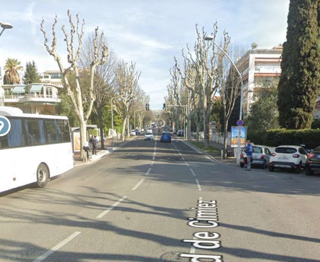
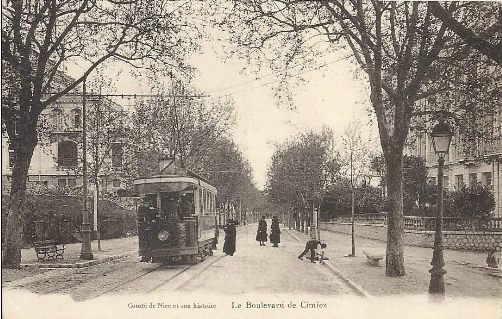
La Ligne de Cimiez
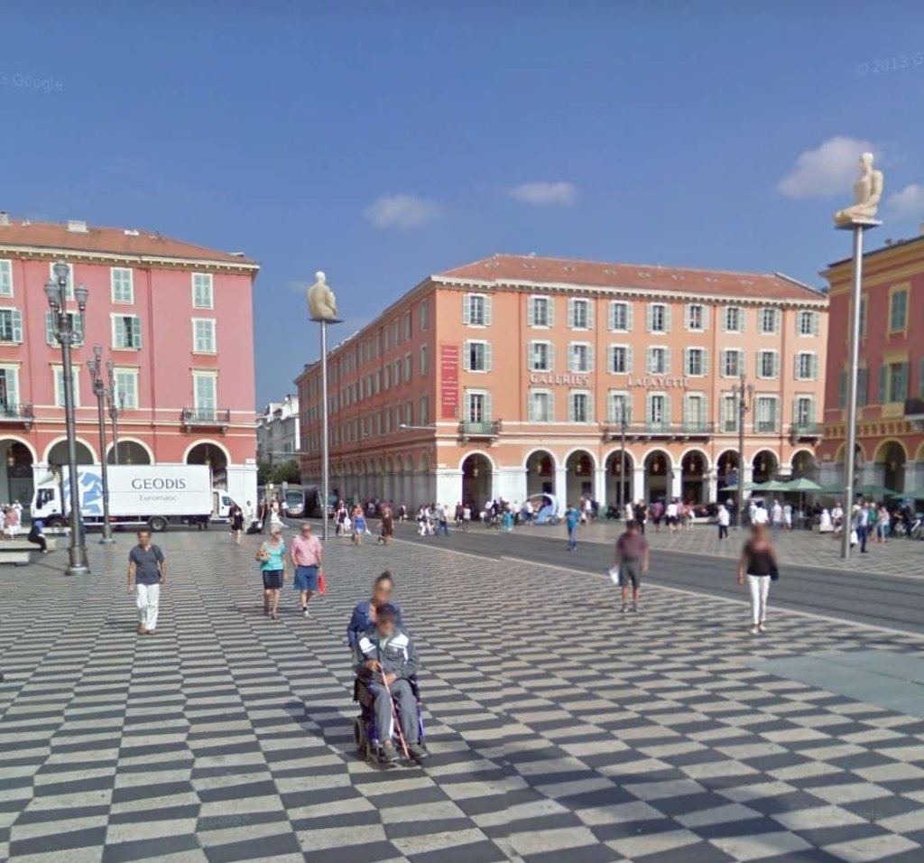
The first tramway on this route was a 600mm track gauge tramway created in 1895. The new tramway was double track for most of its route, it began at the corner of Rue de l’Hôtel-des-Postes and Avenue de la Gare, where it connected with the tracks going up the avenue from Place Masséna.
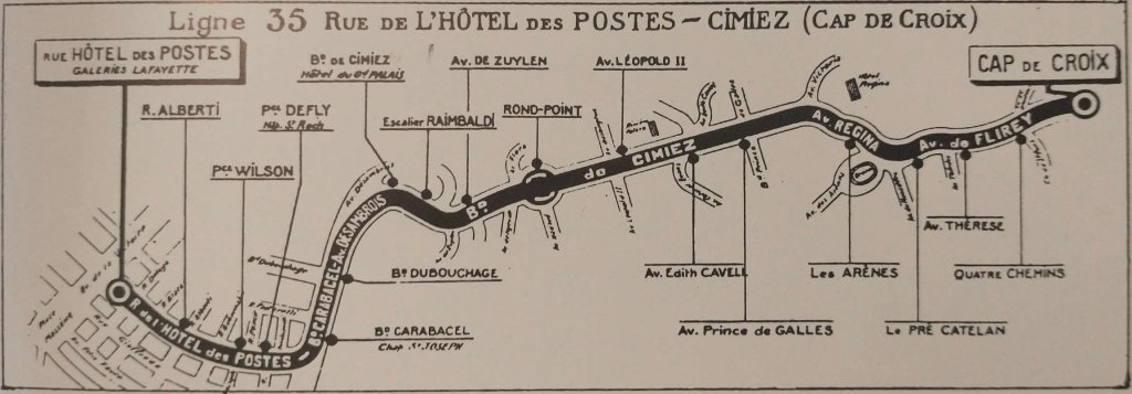

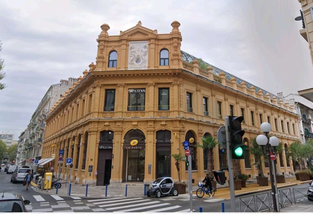
After passing Place de la Liberté (now Wilson) in front of the main post office (built in 1888 and which gave its name to the street), it reached the crossroads at Rue Tonduti-de-L’Escarène where it was crossed at right angles by the route between Nice’s Port and the Railway Station. (That route was used both for passengers and for goods.
The line crossed Place Defly (today Marshall) where it passed in front of the main entrance of the l’hopital St. Roch. It then passed the end of the Rue de l’Hôtel-des-Postes (initially named Scaliéro at that point) close to the southern slopes of the hill of Cimiez. Here the tramway veered left onto Boulevard Carabacel, while on the right a short walk of 140 m made it possible to reach the depot of Ste. Agathe via the Barla bridge.
Around here were elite villas and a few luxurious hotels, such as the Hermitage and the Grand-Palais, which had their own private funicular. At the end of Boulevard Carabacel, the Avenue Désambrois heralded the start of the Boulevard de Cimiez and its long climb to Les Arenes.
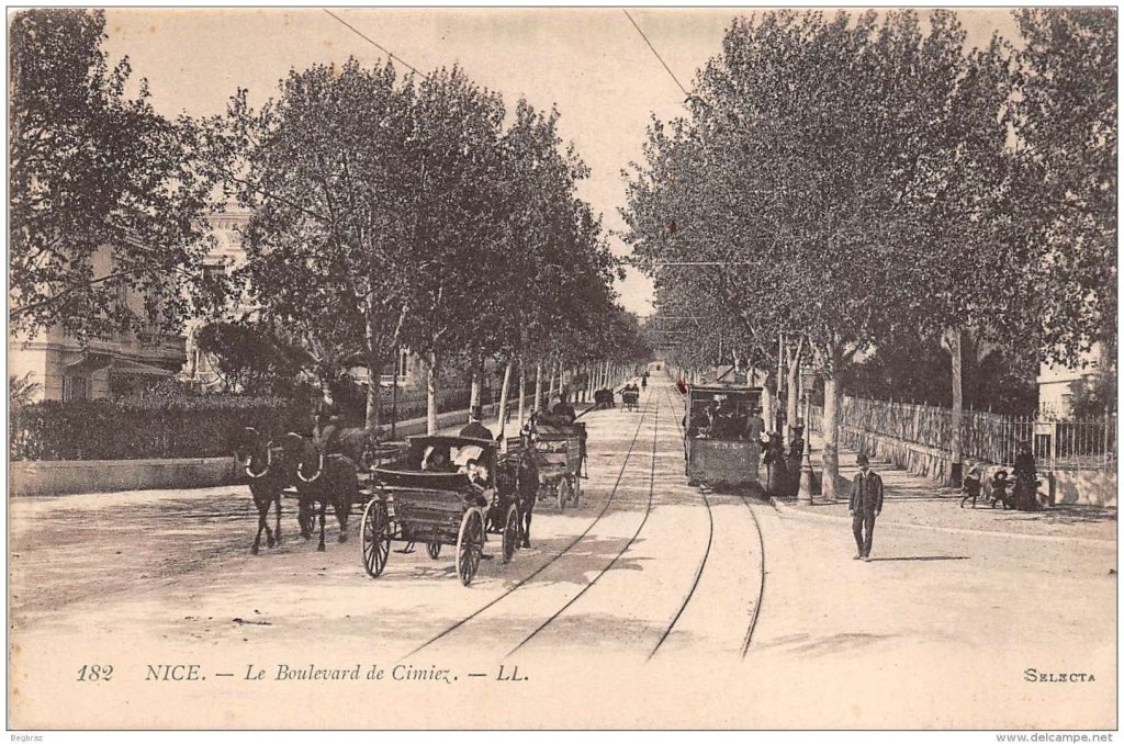
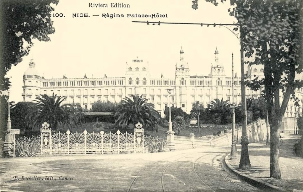
Le Boulevard de Cimiez climbed to a junction beneath the substantial Régina Hotel where the statue of Queen Victoria marks the frequent stays of the British sovereign in the Cimiez district in the latter years of the 19th century.
The older tramway turned to the left to pass in front of the hotel. The TNL route turned to the right with a brief steep climb to reach Les Arenes (the Arena) directly.
Les Arenes, the remains of the ancient Roman city of Cemenelum, was very popular with the people of Nice with its park of olive trees and the nearby Franciscan monastery. Many walkers used this tram service to access this area on Sundays and during the annual festivals of Des Mais and Des Cougourdons. Here, the line became single track to go up Avenue Cap-de-Croix (today Flirey). The only passing loop was near the Octroi-de-Brancolar on the Place des Quatre-Chemins (now Commandant-Gérôme), shortly before reaching the Cimiez terminus. This was located on a single track and steep slope in front of the entrance to the Zoological Gardens.
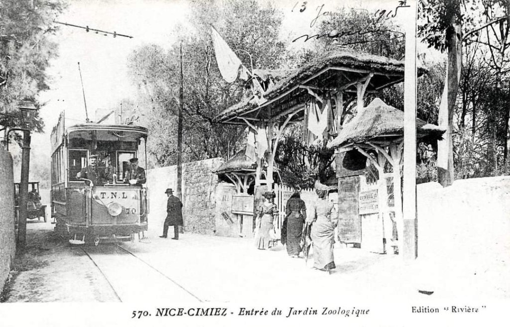
The Jardin Zoologique was founded in the last years of the 19th century and closed in 1906.
La Ligne de Carras, La California, St. Augustin et St. Laurent-du-Var
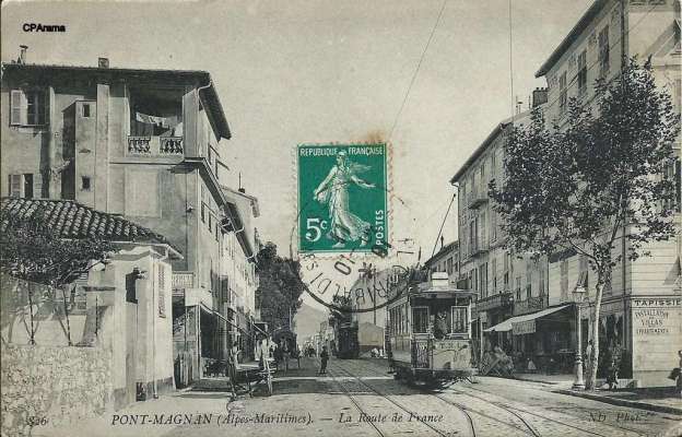
This line ran West from Place Massena to St. Laurent-du-Var, initially following an East-West route along Rue Masséna, Place Magenta, Rue de France and the Place de la Croix-de-Marbre.
That length of this route was shared with the interurban lines to Cagnes and Antibes, and with other urban routes: the one towards the Passage-à-Niveau branched off onto Boulevard Gambetta, while the line from La Madeleine branched off at Pont-Magnan.
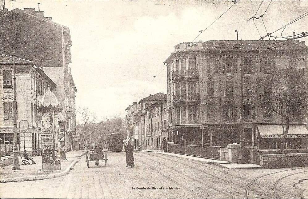
Beyond the bridge over the Magnan valley, the tramway followed the Avenue de la Californie to serve the Lenval children’s hospital; the suburb of Ste. Hélène and its church; continuing then to Carras where several services terminated.
The line then continued on through the district of La Californie, where the electricity substation provided power and where a short branch line, opened in 1910 to serve the airfield for the great air show in Nice.
Banaudo notes that the creation of a branch for an air show which lasted only two weeks aroused criticism. “The local press pointed out that in this same district, the TNL company had always refused to establish a line serving the Caucade cemetery, which would have been more useful for the people of Nice. Families going to the cemetery had to leave the tramway at Carras and walk up Avenue Ste. Marguerite. … This large cemetery in the west of Nice was first served by public transport by the Santa-Azur bus company which opened a bus-route in 1922, to which the TNL reacted, opening their own tram service in 1925.” [1: p9]
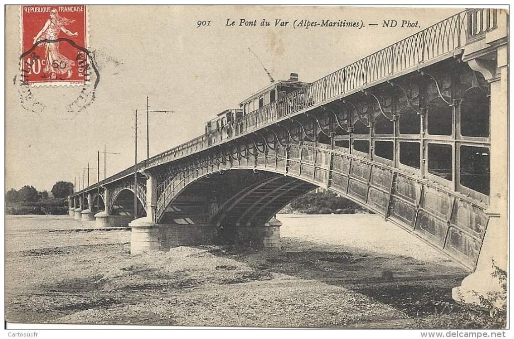
Trams then stopped near the St. Augustin bridge to serve the station called ‘Le Var’ (today ‘Nice-St. Augustin’). At this point the line became single-track and ran alongside the railway embankment to the left (East) bank of the river. A branch serving the Hippodrome du Var was opened in 1901. The branch was about 800 metres long and was used on horse racing days. The River Var was initially crossed on a 355 m long mixed rail/road bridge, carrying the PLM railway, the tramway and the highway. In 1923, a new railway bridge was built upstream of the original. On the right (West) bank, the tramcars providing urban services terminated at the level crossing of St. Laurent-du-Var, while those towards Cagnes and Antibes continued heading West.
La Ligne de St. Maurice et St. Sylvestre
Originally this line had its terminus at Place Masséna, although services on the route were quickly extended to the Port.
From the Port, trams followed Rue Cassini to Place Garibaldi where they turned left along Rue des Italiens towards Place Masséna.
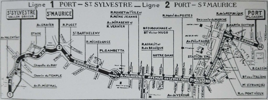
Banaudo notes that North of Place Masséna there was a connection to Rue de l’Hôtel des Postes and the line to Cimiez.
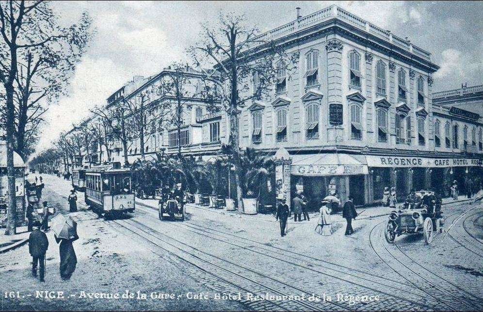
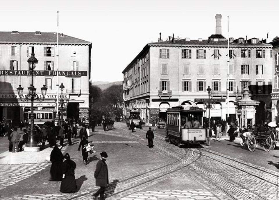
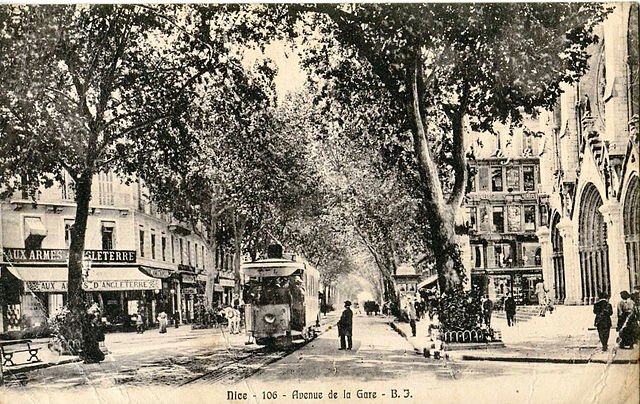
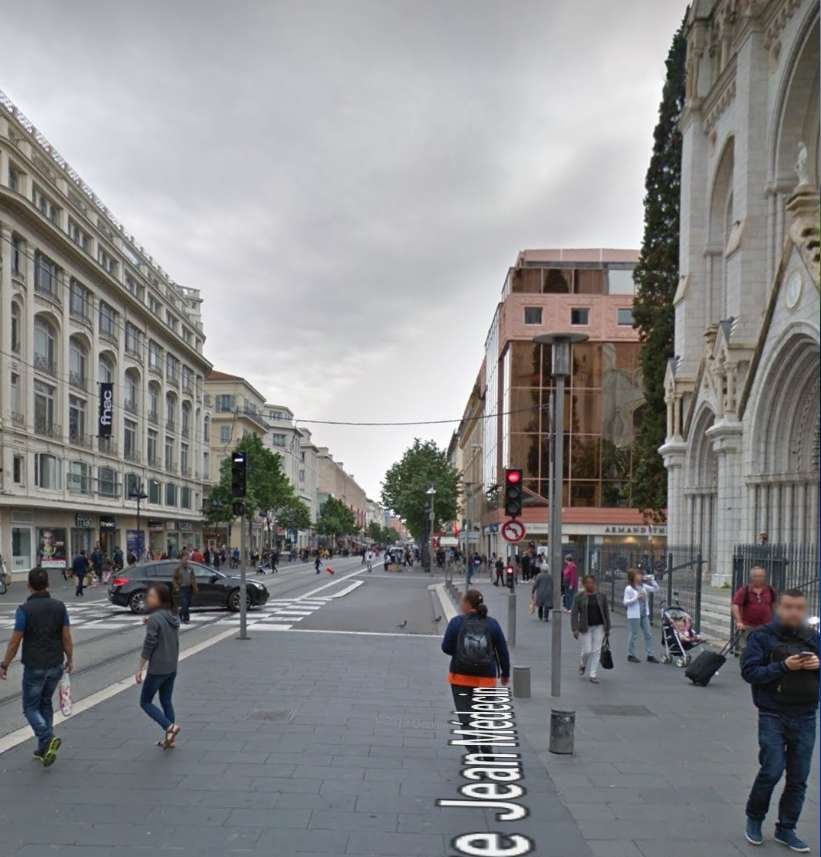
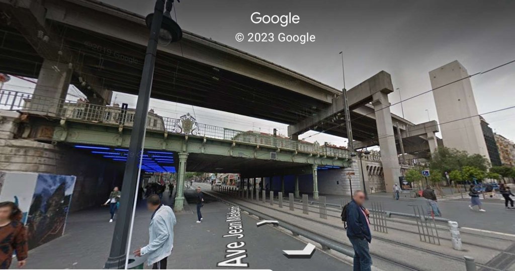
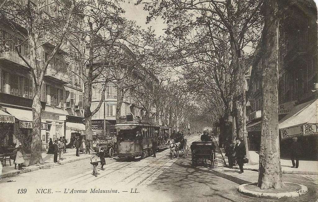
The line then followed Avenue de la Gare (later renamed Avenue de la Victoire then today Avenue Jean-Médecin). “On this route,” Banaudo says, “shaded by majestic plane trees was concentrated a great urban activity with the first big stores of the city, the banks, the hotels, the brasseries and cafes, of which some were frequented heavily by those on winter vacations.” [1: p12]
Banaudo continues: “After passing in front of the neo-Gothic style Notre-Dame church, inaugurated in 1868, the tramway crossed the tracks arriving from the Port by Rue Assalit which continued towards the PLM station by Avenue Thiers. It then passed under the bridge of the Nice-Ventimiglia line, beyond which the supply by aerial wire replaced the underground conduit which was used between Place Masséna and the railway station.” [1: p12]
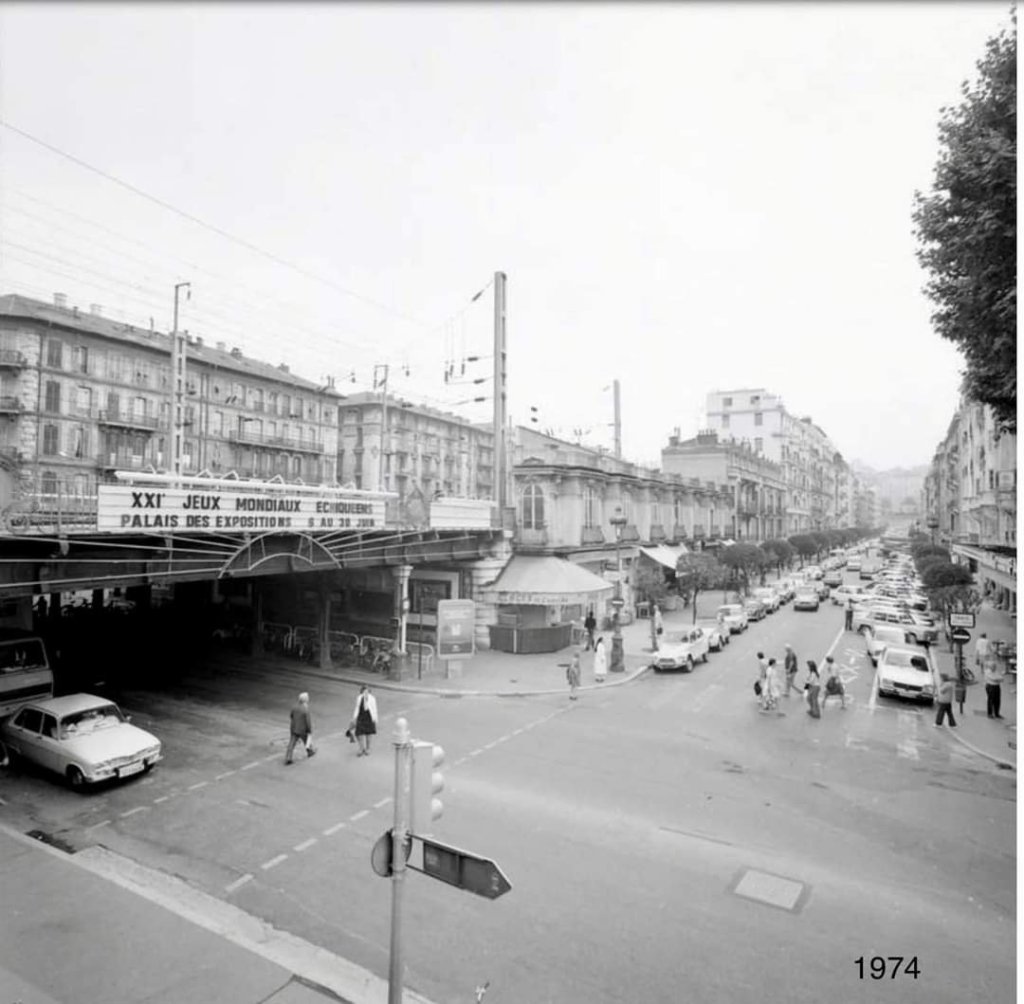
North of the railway lines, the route continued along Avenue Malaussena, through Place Béatrix (later Place Gambetta of the Liberation and today Place General De Gaulle) where stood the imposing facade of the Gare du Sud, terminus of the Chemins de Fer du Sud de la France lines which served Digne-les-Bains, Grasse, Draguignan and Meyrargues. Those lines can be followed in other posts on this blog. [11]
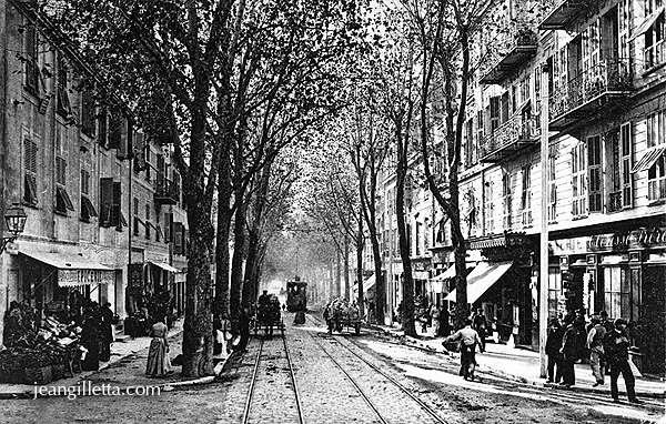
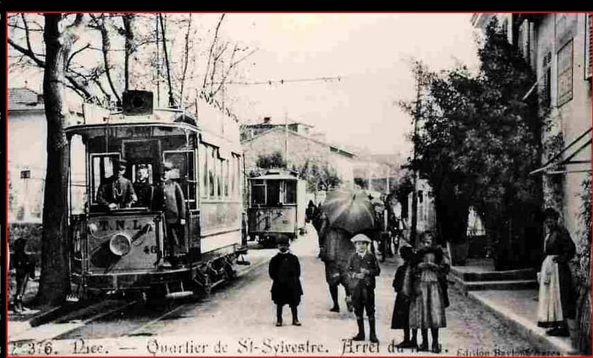
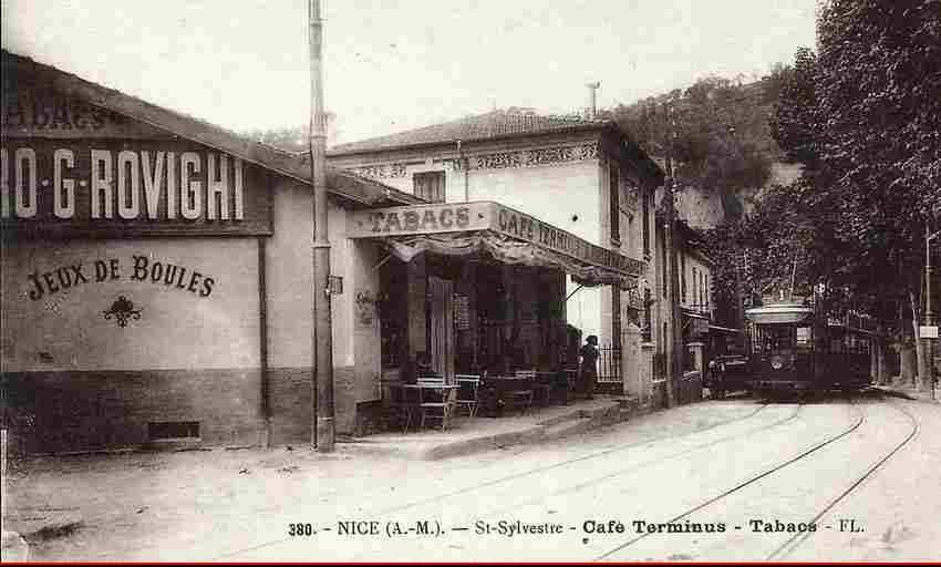
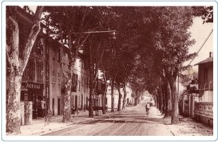
At Place Beatrix, the line towards the Passage-à-Niveau Gambetta turned away to the left along Boulevard Joseph-Garnier, while the route we are following “continued its route along Avenue Borriglione, a narrower street than those previously taken. Place de St. Maurice (today Place de Alexandre-Médecin) marked the end of the double track and served as a terminus for every other service on this route. Beyond this, the tram continued its route along Avenue du Ray through what were then still rural suburbs. There were four crossing loops along this length. The terminus was established on the Place de St. Sylvestre (today Place de General-Goiran), at the outlet of the Vallon-Obscur where inns, guinguettes and boules pitches were popular Sunday excursion destinations.” [1: p12]
La Ligne des Abattoirs et de la Trinite (Gare PLM – Abattoirs)
This line shared most of its route with other lines and when the restructuring occurred in 1934 the city centre section between Avenue Thiers and Place Garibaldi, was removed as the service was covered effectively by other lines.
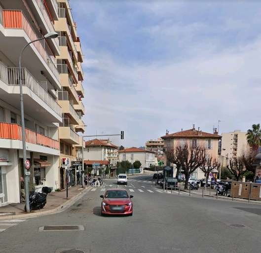
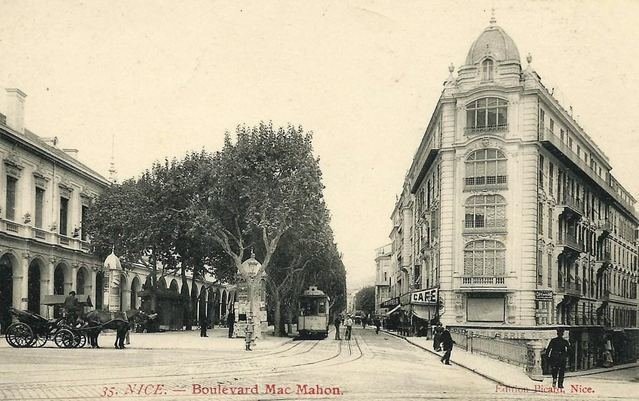
Originally, the line started in front of the PLM station in Nice-Ville, from where the tramway went along Avenue Thiers to turn South on Avenue de la Gare, which it followed to Place Masséna. At the southern end of Place Masséna, the double-track turned into the Boulevards Mac-Mahon and du Pont-Vieux (today Jean-Jaurès).
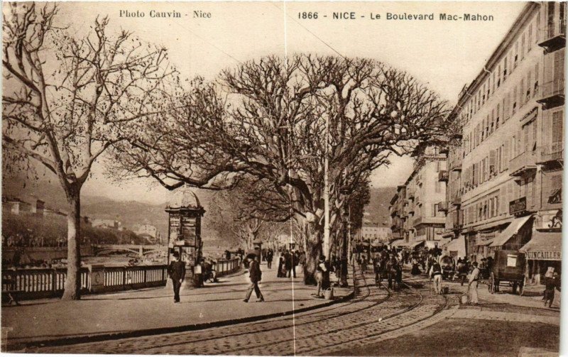
Passing along the left (East) bank of the River Paillon. Banaudo notes that the river was, “often reduced to a meager trickle of water flowing over stretches of pebbles where the ‘bugadiera’ (washerwomen) came to wash and spread their laundry on either side of the Pont-Vieux.” [1: p17]
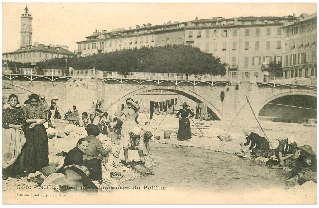
There was a fruit and vegetable market here in summer at the edge of the Old Town that the people of Nice affectionately nicknamed the ‘Babazouk’.
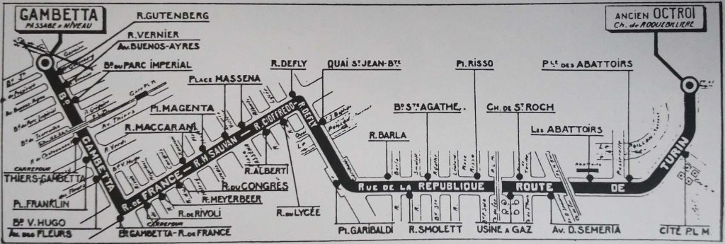
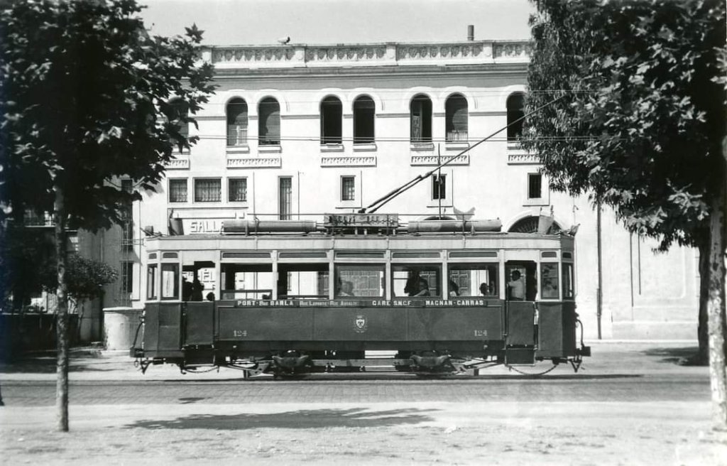
“When it reached Place Garibaldi, the … tramway crossed the Monte-Carlo and Port lines, before joining the Contes line, which had its terminus at a corner of the square. The double tracks ran up Rue de la République in its entirety, crossing at the intersection of Rue Barla the Gare PLM-Place Saluzzo line. Then at the intersection of Boulevard Ste. Agathe it passed the junction to the depot and the Riquier district. Arriving at Place Risso, it took the road to Turin and passed under the bridge of the PLM Nice-Ventimiglia line.” [1: p17]
The next section of the line passed Nice’s gas works and coking plant where a series of branches allowed for goods traffic to and from the works/plant and military military maintenance warehouses. There was also a branch into the St. Roch station.
After Place de La Brigue, the tramway passed under the bridge of the PLM Nice-Coni line and crossed an industrial district, with slaughterhouses and the cattle market on its left, and to the right, refrigerated warehouses and meat traders and the access to St. Roch station. A terminus for urban services was located a little beyond the footbridge of the Abattoirs, at the point where the Route de Turin joins the bank of the River Paillon.
The double track ended, and just beyond this point, the line included sidings at the Hauteur de la Cité PLM and at the Octroi de Turin, the urban terminus and a stabling point for freight trains waiting to enter the city. Banaudo, writing in 2005, comments that “the provisional terminus of the new Nice tramway will be established here, at the end of the ‘Pont Michel’ named after a former metallurgical workshop in the St. Roch district. This end of the Chemin de Roquebillière is now called Boulevard Pierre Sémard.” [1: p17]
The single track tramway was now laid in the shoulder if the road and provided connections to a marble merchant and to the military fodder yard, an establishment which gave its name to a tram stop with a passing loop. Here, “the valley narrowed between the heights of Mont Gros, surmounted by the dome of the Observatory on the left bank, and the hills of Cimiez and St. Pons on the right bank where the line to Levens ran.” [1: p17]
After passing “the Notre-Dame de Bon-Voyage chapel, where travelers in the past invoked divine protection before undertaking their journey towards the Col de Tende and Piedmont, the line passed under the … PLM Nice-Coni line and l’Evitement des Carrières where some other urban services terminated. Opposite the then rural district of L’Ariane, the tramway tracks crossed those of the railway which served the Gerland warehouse, and then the Vallon de l’Oli and Boccadore sidings.” [1: p17]
“At the entrance to the town of La Trinité-Victor, trams encountered the bridge over the Laghet valley, … then the branch to the Ariane flour mill which turned left to cross the PLM railway and the Paillon. The track rejoined the roadway in the centre of La Trinité-Victor, where the terminus was established.” [1: p17] Trams providing rural services continued beyond this point. The line actually continued on to Contes, Bendéjun and La Grave-de-Peille.
References
- Jose Banaudo; Nice au fil du Tram, Volume No. 2: Les Hommes, Les Techniques; Les Editions de Cabri, Breil-sur-Roya, France, 2005. This is a french language text.
- https://www.communes.com/cartes-postales-anciennes-nice, … content://media/external/downloads/1000019420, accessed on 19th August 2023.
- https://archives.nicecotedazur.org/dossier_pedagogique/la-revolution-des-transports-a-nice-le-tramway, accessed on 20th August 2023.
- https://www.delcampe.net/en_GB/collectables/postcards/france-nice/unclassified/nice-boulevard-de-cimiez-tramway-613224433.html, accessed on 20th August 2023.
- https://m.facebook.com/groups/ciccoli/permalink/2473601369552384, accessed on 20th August 2023.
- https://m.facebook.com/groups/ciccoli/permalink/3639384749640701, accessed on 20th August 2023.
- https://m.facebook.com/groups/ciccoli/permalink/2171905139722010, accessed on 21st August 2023.
- https://m.facebook.com/groups/ciccoli/permalink/3291175687794944, accessed on 21st August 2023.
- https://m.facebook.com/groups/ciccoli/permalink/3699253803653795, accessed on 21st August 2023.
- https://m.facebook.com/groups/ciccoli/permalink/2655694664676386, accessed on 21st August 2023.
- The lines to Digne-les-Bains and Meyrargues were metre-gauge secondary railway lines. The original terminus no longer serves the railways and is a cultural and food centre with a more modern, but much less impressive, terminus sited to the West.
- https://m.facebook.com/groups/ciccoli/permalink/1701108476801681, accessed on 22nd August 2023.
- https://fr.m.wikipedia.org/wiki/Fichier:BJ_106_-_NICE_-_Avenue_de_la_Gare.JPG, accessed on 22nd August 2023.
- https://m.facebook.com/groups/ciccoli/permalink/3728410140738161, accessed on 22nd August 2023.
- https://m.facebook.com/groups/ciccoli/permalink/3622716204640889, accessed on 22nd August 2023.
- https://www.geneanet.org/cartes-postales/view/5006406#0, accessed on 23rd August 2023.
- https://www.cparama.com/forum/viewtopic.php?f=177&t=30104, accessed on 23rd August 2023.
- http://jeangilletta.com/fr/produit/nice-avenue-borriglione-1900, accessed on 23rd August 2023.
- https://www.geneanet.org/cartes-postales/view/4074034#0, accessed on 24th August 2023.
- http://p9.storage.canalblog.com/94/63/1127995/103839634_o.jpg, accessed on 24th August 2023.
- https://cartorum.fr/carte-postale/206013/nice-nice-le-boulevard-mac-mahon-france, accessed on 25th August 2023.
- https://villedelatrinite.fr/la-commune/histoire,vaccessed on 25th August 2023.
- https://www.fortunapost.com/06-alpes-maritimes/2066-carte-postale-ancienne-06-nice-les-blanchisseuses-du-paillon-1903.html, accessed on 25th August 2023.
