Tag Archives: Swansea

The Swansea & Mumbles Railway

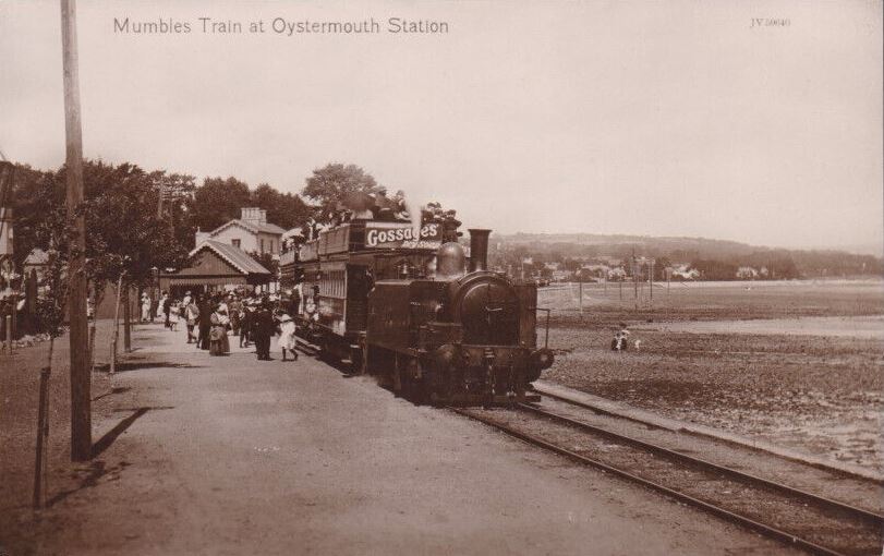
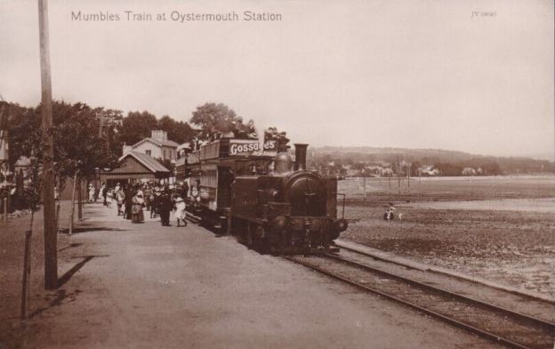
The featured image for this article was taken in the days prior to electrification of the railway. A steam-powered service sits at Oystermouth Station before heading on towards Mumbles Pier, © Public Domain. [37]

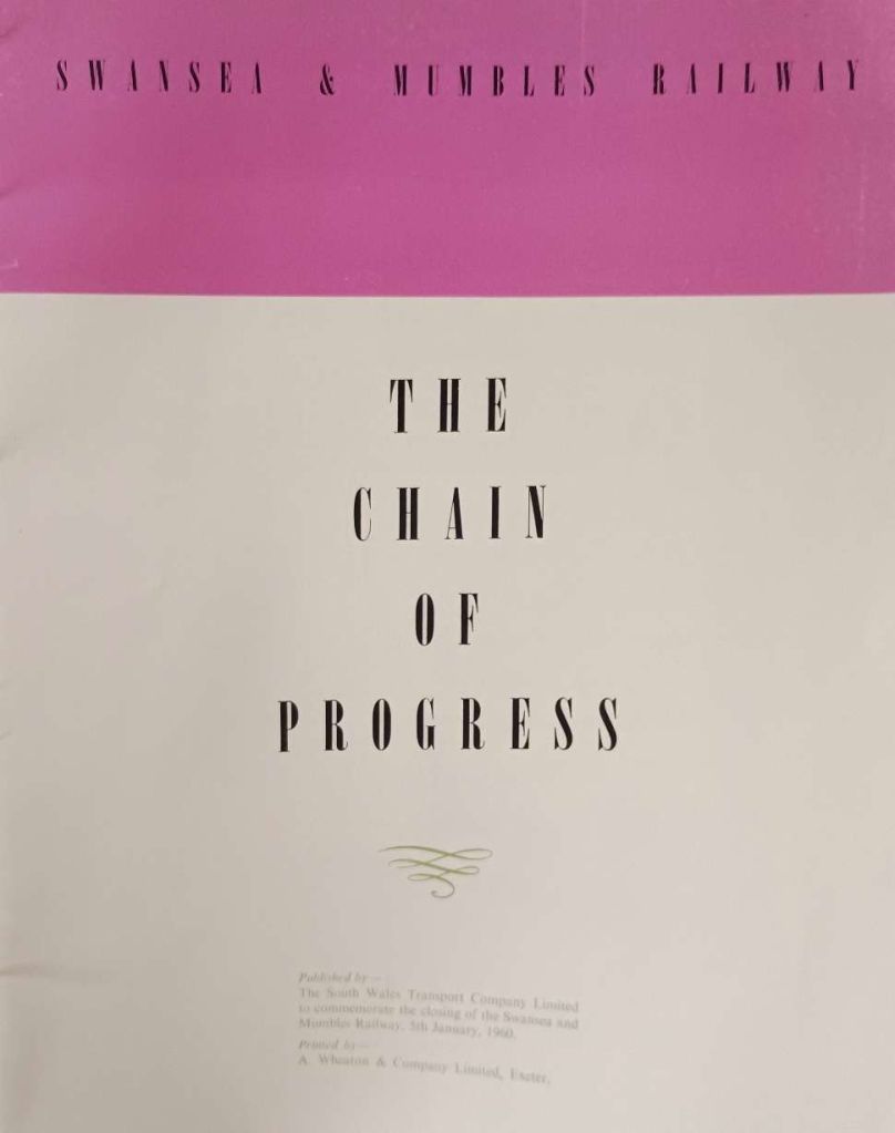
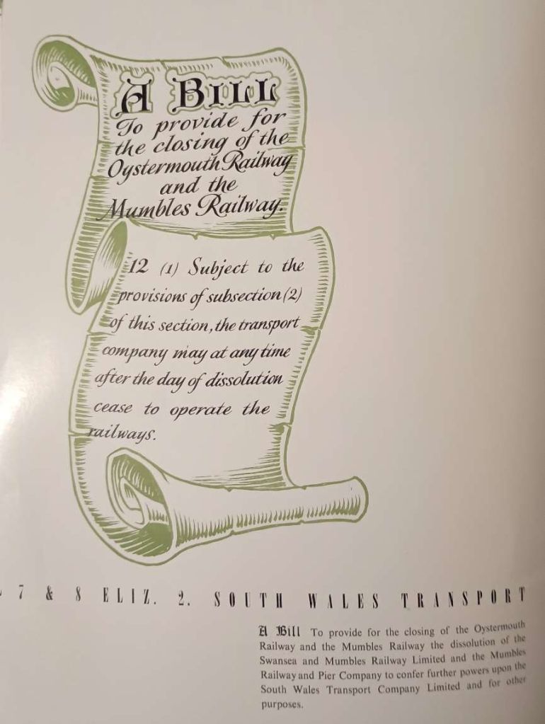
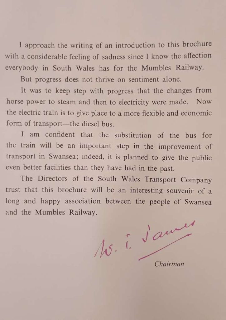
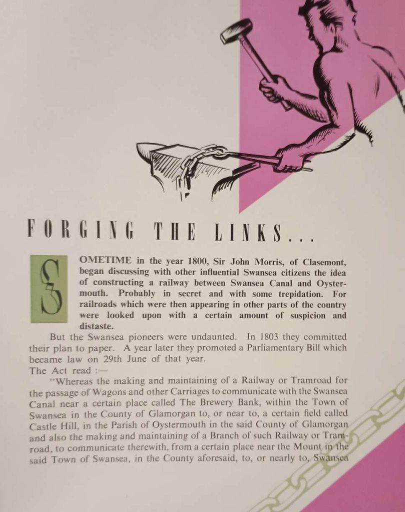
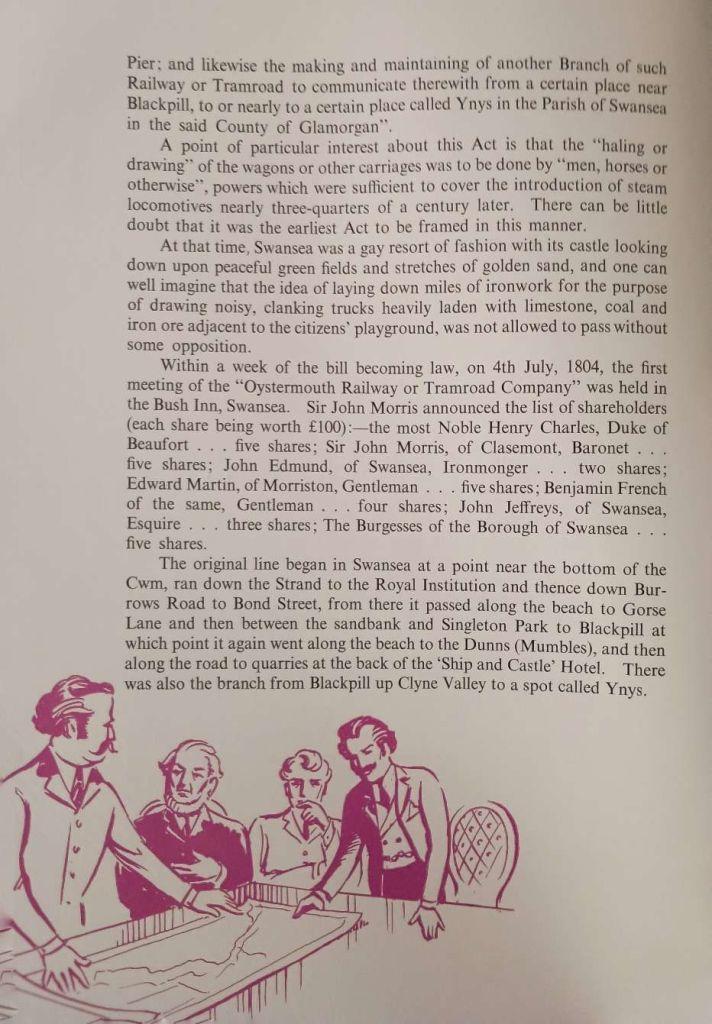
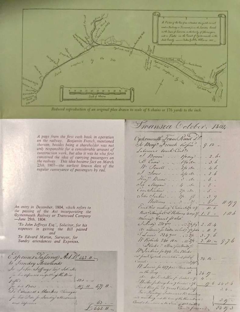
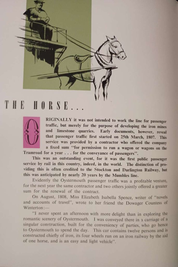
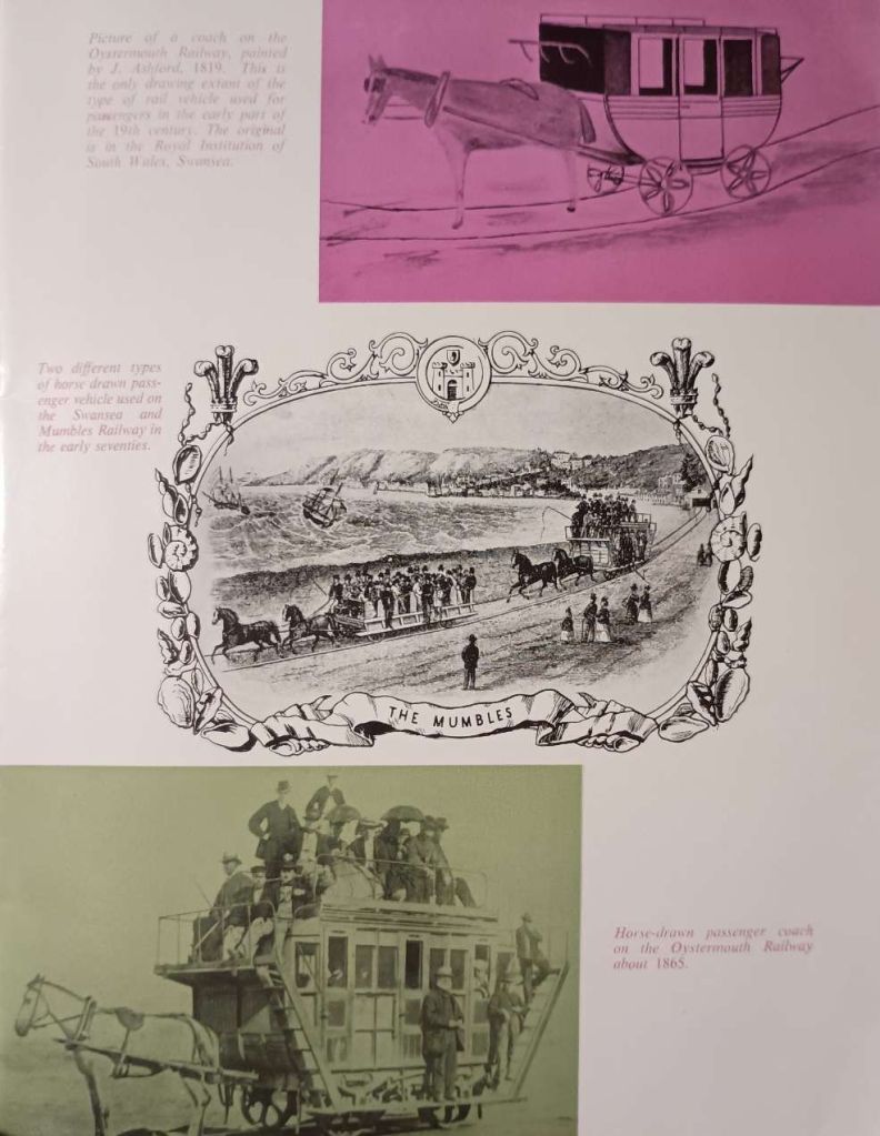
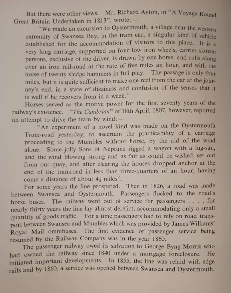
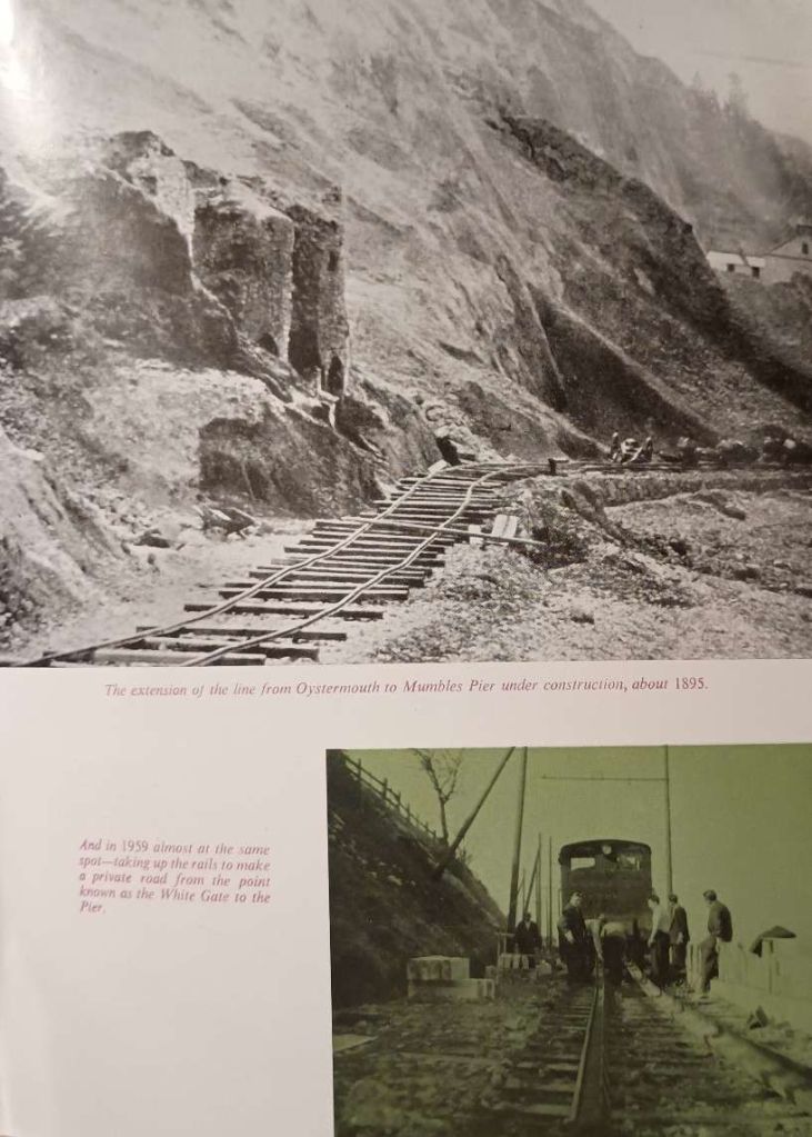
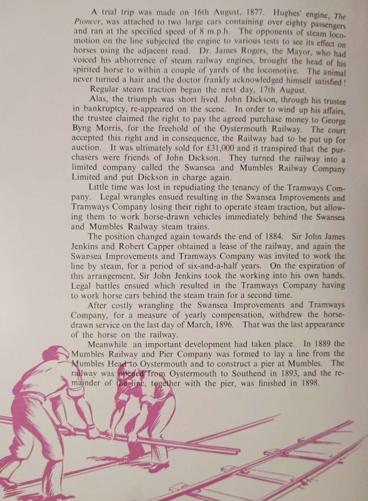
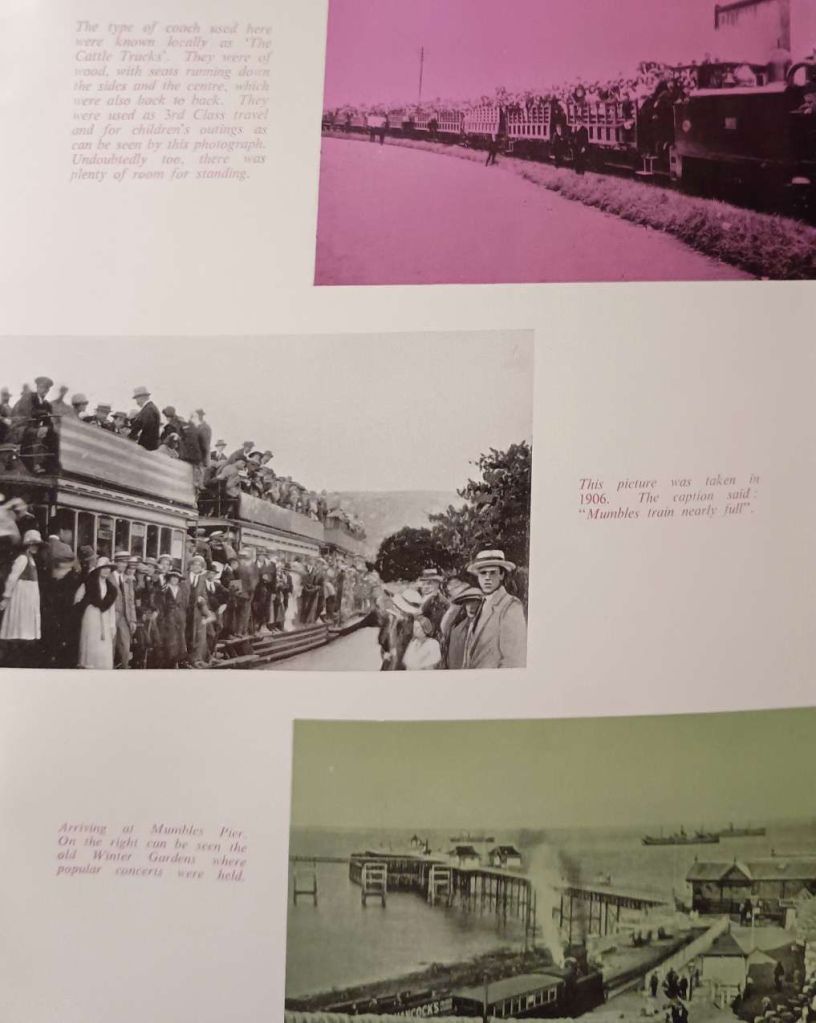
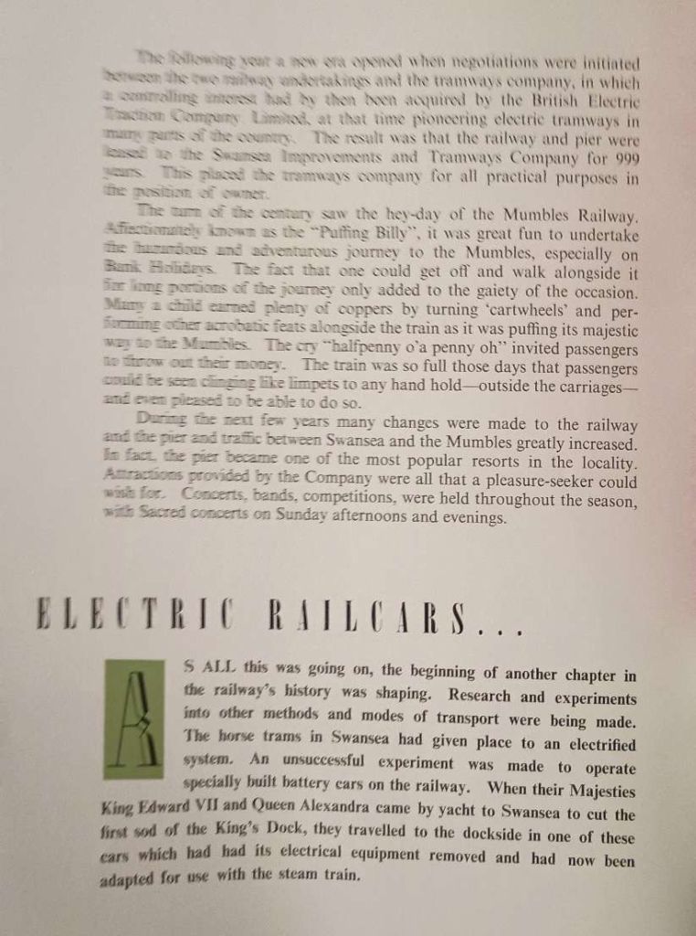
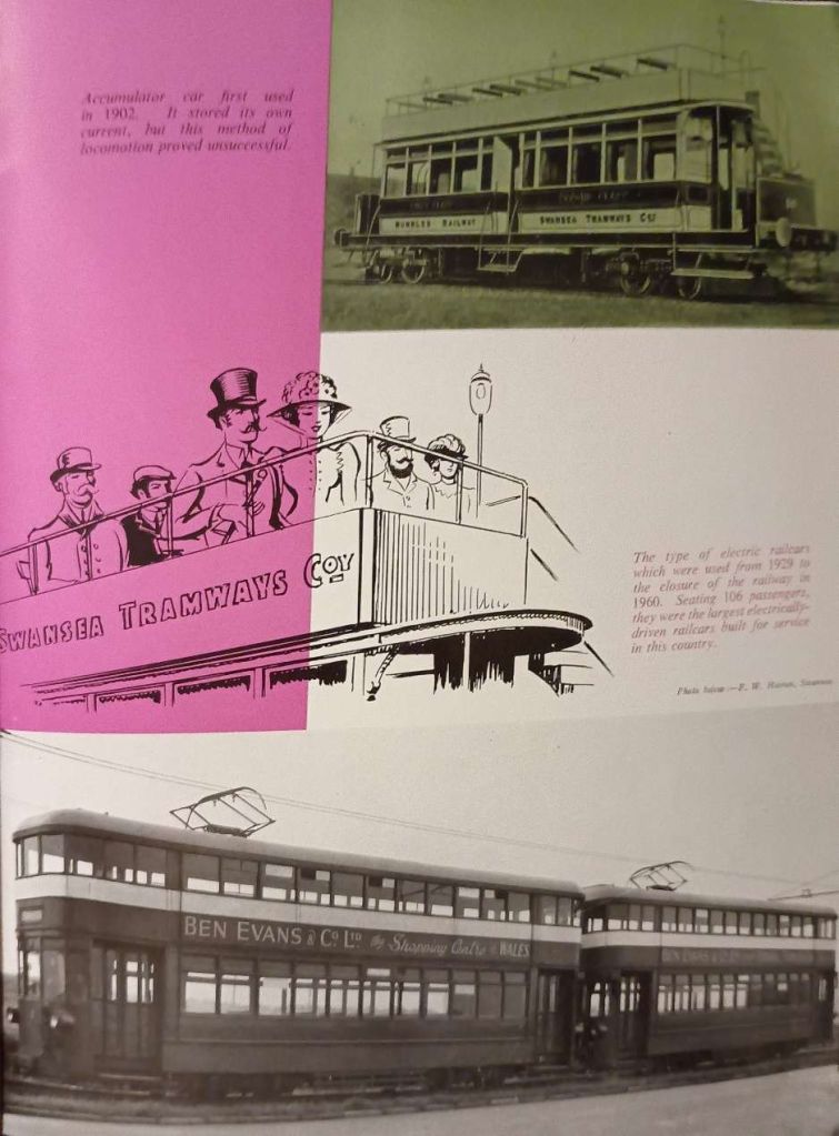
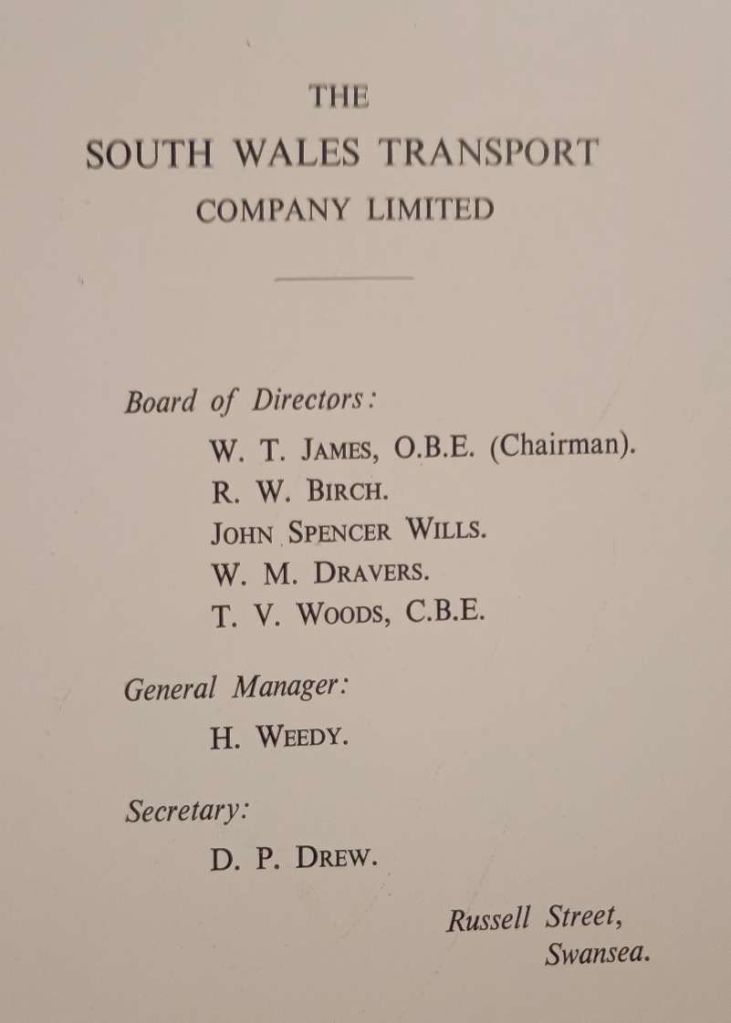
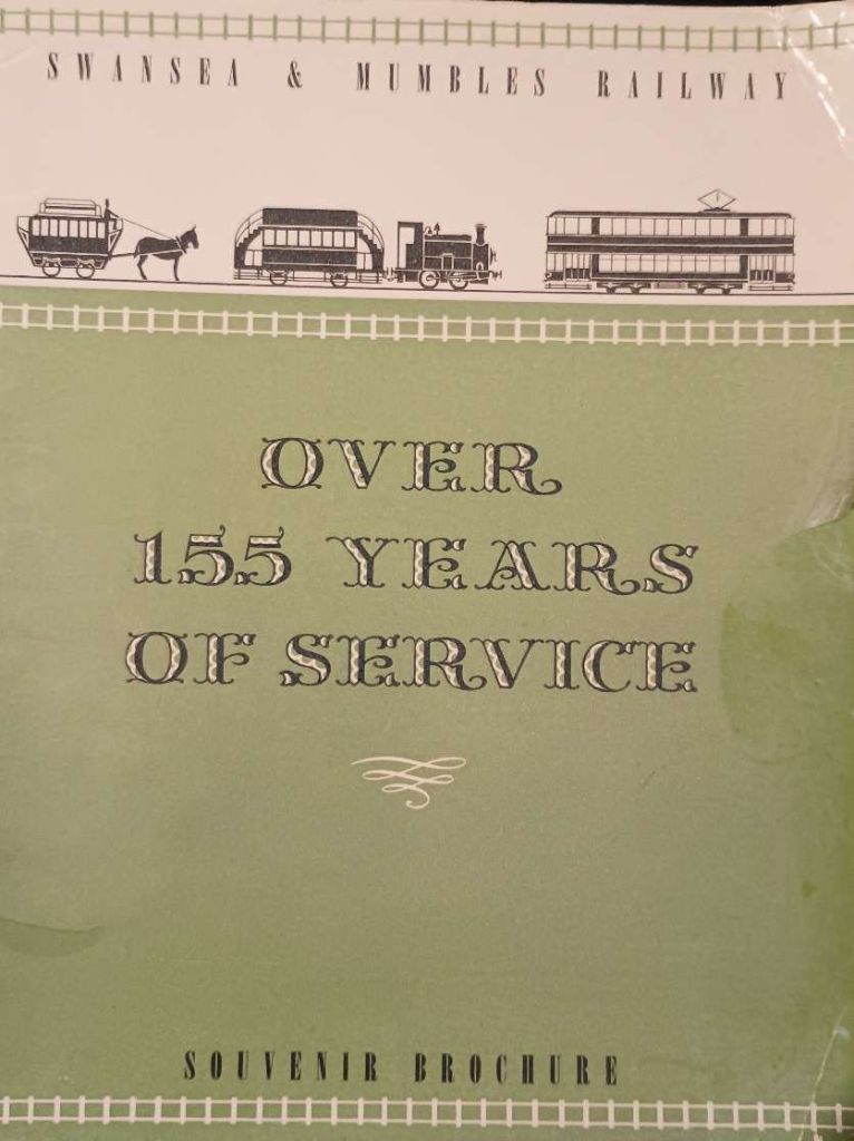
In mid-September 2026, I picked up a copy of the Souvenir Brochure for the closure of the Swansea and Mumbles Railway which occurred on 5th January 1960. Photographs of the pages of the brochure appear in the Appendix to this article.

Throughout the country, the internal combustion engine was beginning its ascendancy and many in national and local government together with those providing transport had been won over by the arguments which supported the rise of petrol and diesel-powered vehicles. Looking back from the 21st century, we can see that, while there was some value in the arguments put forward, the net effect has been significantly disadvantageous to the built environment and to our ability to get around. We also know now that Internal combustion engines have been heavily polluting and have contributed to the warming of our planet.

The closure of the Swansea & Mumbles Railway is just one example among so many, of decision-makers turning away from trams to buses amid the significant rise in car ownership. The reducing patronage of the line was partly caused by these transitions but it was also essentially a self-fulfilling prophecy. Expenditure on maintenance and renewals was perceived as unnecessary because of the lower demand for the service, this in turn resulted in a further lowering in patronage!

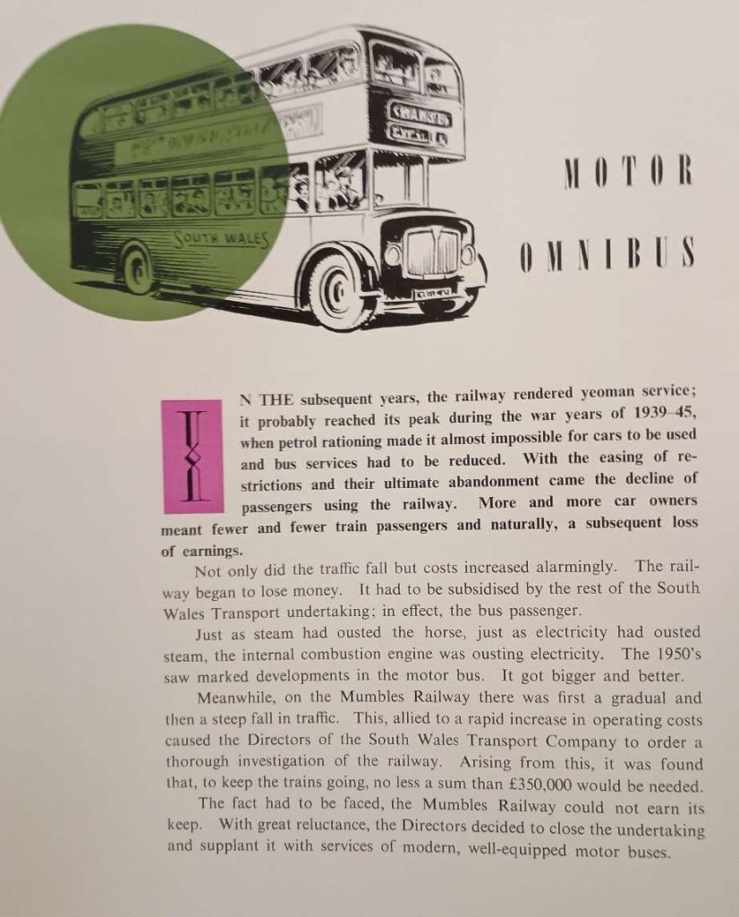
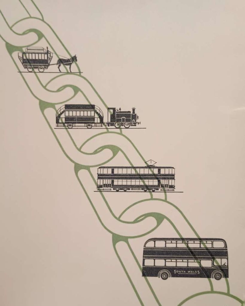
The brochure for the closure of the line talks of the way in which “More and more car owners meant fewer and fewer train passengers and naturally, a subsequent loss of earnings.” [1] It says that, “Not only did the traffic fall but costs increased alarmingly. The railway began to lose money. It had to be subsidised by the rest of the South Wales Transport undertaking; in effect, the bus passenger. Just as steam had ousted the horse, just as electricity had ousted steam, the internal combustion engine was ousting electricity. The 1950’s saw marked developments in the motor bus. It got bigger and better.” [1]

Perhaps inevitably the future horizon began to contract and all decisions were focussed on the here-and-now or the next few years. The result was lower investment and then a very significant cost for upgrading – £350,000. At the end of the 1950s that must have felt like a fortune. The decision was inevitable. The brochure tells us that “With great reluctance, the Directors [of the South Wales Transport Company] decided to close the undertaking and supplant it with services of modern, well-equipped motor buses.” [1]

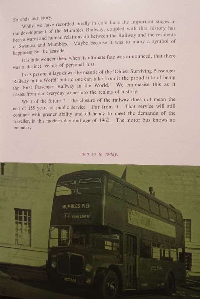
So ends the story! The brochure finishes with a eulogy and with paragraphs which extol the motor bus as ‘the future’ of public transport:

“Whilst we have recorded briefly in cold facts the important stages in the development of the Mumbles Railway, coupled with that history has been a warm and human relationship between the Railway and the residents of Swansea and Mumbles. Maybe because it was to many a symbol of happiness by the seaside.

“It is little wonder then, when its ultimate fate was announced, that there was a distinct feeling of personal loss.

“In its passing it lays down the mantle of the ‘Oldest Surviving Passenger Railway in the World’ but no one can take from it the proud title of being the ‘First Passenger Railway in the World. We emphasise this as it passes from our everyday scene into the realms of history.
What of the future? The closure of the railway does not mean the end of 155 years of public service. Far from it. That service will still continue with greater ability and efficiency to meet the demands of the traveller, in this modern day and age of 1960. The motor bus knows no boundary.” [1]

In the 21st century, First Cymru operates frequent regular bus services (such as routes 2A and 2B) connecting Swansea city centre directly to Oystermouth and Mumbles. The former railway route along the seafront now forms part of a popular walking and cycling track. Recent council updates to the Mumbles seafront have even embedded smart aluminium strips into the paving as a visual nod to the old Mumbles Railway tracks. Transport planners and local groups occasionally discuss light rail, tram-train, or wider Swansea Bay Metro concepts, but a dedicated rail link returning to Mumbles remains a long-term proposal rather than an active project.

As we look back from the 21st century, aware of the way things are now perceived, it is reasonable to speculate about ‘what might have been’ had significant investment been made on improvement of the tram network rather than it being set aside in favour of the ‘modern bus’!

A consultancy report – Greengauge21: Shaping Tomorrow’s Railways [2] – concluded that a “Swansea Bay Metro could use the same technology that is being developed for tram-style operation into Cardiff Bay to provide access to Swansea city centre from key valley towns such as Pontypridd and Aberdare. … Given where passenger railways started 214 years ago, someone is bound to ask whether the light rail into Swansea city centre could be extended to Mumbles. That is a challenge we leave for others to ponder.” [2]

The History of the Line

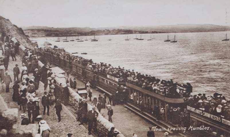
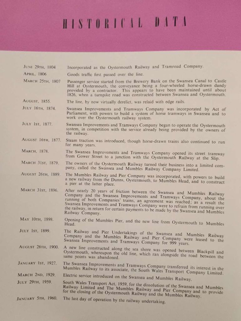
The Swansea and Mumbles Railway stakes a claim to be the world’s first passenger railway. [3] It was originally built under an Act of Parliament, the Oystermouth Railway or Tramroad Act 1804, to move limestone from the quarries of Mumbles to Swansea and to the markets beyond, it carried the world’s first fare-paying railway passengers under an agreement effective from 25th March 1807. It later moved from horse power to steam locomotion, and was finally converted to electric power, using the largest tram cars ever built for service in Britain. [3]

At the time of the railway’s closure, it was claimed to have been the world’s longest serving railway, although this distinction has to be qualified because other railways which were used solely for goods traffic (e.g. the Middleton Railway in Leeds, Yorkshire, dating from 1758) had been operating for longer. [4]

Wikipedia tells us that, “There was no road link between Swansea and Oystermouth at the beginning of the 19th century and the original purpose of the railway was to transport coal, iron ore and limestone. Construction seems to have been completed in 1806 and operations began without formal ceremony, using horse-drawn vehicles. As constructed, the line ran from the Brewery Bank adjacent to the Swansea Canal in Swansea, around the wide sweep of Swansea Bay to a terminus at Castle Hill (near the present-day Clements Quarry) in the tiny isolated fishing village of Oystermouth (known as Mumbles). There was also a branch from Blackpill which ran up the Clyne valley for nearly 1 mile (1.6 km) to Ynys Gate which was intended to promote the development of the valley’s coal reserves.” [4]

“In February 1807, approval was given to carry passengers along the line, when one of the original proprietors, Benjamin French, offered to pay the company the sum of twenty pounds in lieu of tolls for the right to do so for twelve months from the following quarter day, 25th March 1807. This is usually cited as the date when the first regular service carrying passengers between Swansea and Oystermouth began, thus giving the railway the claim of being the first passenger railway in the world. Passenger services operated from The Mount, the world’s first recorded railway station. [5: p333] The venture was … a success … The following year, French joined with two others in offering the increased sum of twenty five pounds to continue the arrangement for a further year, but the construction of a turnpike road parallel to the railway in the mid-1820s robbed it of much of its traffic and the passenger service (by that time in the hands of one Simon Llewelyn) ceased in 1826 or 1827, ironically just as events elsewhere in the United Kingdom (particularly in the north east of England) were paving the way for the development of railways as a truly national and international transport system for both goods and passengers.” [4]

“In its early days the line operated in the same manner as the contemporary canals and turnpike roads. Tolls and charges were laid down in the enabling act of Parliament and any trader could use the line on provision of a suitable waggon and after paying the appropriate toll to the owning Company. The railway was laid in the form of a plateway, with the rails being approximately 4 ft (1,219 mm) apart.” [6: p48]

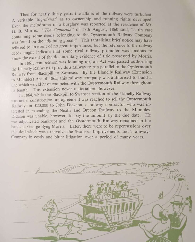
Wikipedia continues: “After cessation of the passenger service the line became derelict and the original company of proprietors virtually moribund. The Clyne valley branch was re-laid in 1841/2 and extended for a further 1 mile (1.6 km) (as a private line) to the Rhydydefaid colliery where George Byng Morris, the son of one of the original proprietors, had started to exploit the coal and iron reserves of the valley. From about 1855, George Byng Morris took the line in hand, re-laid it with edge rails, as a conventional railway, to the standard gauge of 4 ft 8 1⁄2 in (1,435 mm) and reintroduced a horse-drawn passenger service between Swansea and a terminus at The Dunns in Oystermouth.” [4]

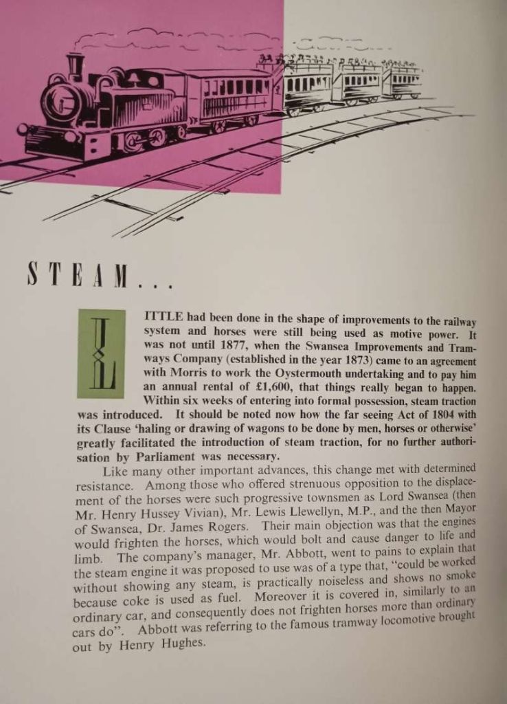
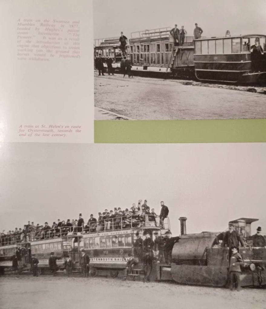
Trials were undertaken in 1877 using “one of Henry Hughes’ patent tramway locomotives, … ‘Pioneer’. These were successful and two further locomotives of the same type were obtained, although a dispute between the Swansea Improvements and Tramway Company (SI&T) (which owned the locomotives) and the line’s then owner, John Dickson (who had come into possession following the death of George Byng Morris) meant that horses continued to operate certain services until 1896.” [4]

More about Hughes’ locomotives can be found here, [7] here, [8] here [9] and here. [10]

At the end of the 19th century, “there was a junction between the Mumbles Railway and the Swansea town tramway system at the Slip, allowing SI&T cars to run through from Swansea town centre to Oystermouth. The nature of the dispute was such that the Swansea & Mumbles company demanded that the SI&T horse cars should follow their own steam-hauled services on the line. In 1889, a new company, the Mumbles Railway and Pier Company, was incorporated to extend the railway beyond Oystermouth to a new pier close to Mumbles Head. The first section, to Southend, was opened in 1893 and the remainder, including the pier, in 1898.” [4]

“The Clyne valley branch continued to be used for coal traffic from Rhydydefaid pit until its closure in 1885 after which the entire branch fell into disuse. In 1896 the promoters of the Gower Light Railway proposed incorporating it into their scheme but nothing came of it. The original branch to Ynys Gate (as authorised in 1804) was relaid in connection with the Clyne Valley slant (opened 1903) and used for coal traffic until the colliery closed in 1915. The extension of 1841/2 remained abandoned until 1920 when a narrow-gauge tramway was laid on its formation to carry coal from Ynys slant to Ynys Gate. This was used only until 1921 when the slant closed. There was then no further traffic on the branch, although the track remained in situ and was still usable as late as 1936 when it is recorded that a diesel locomotive made a trip up the branch as far as Ynys Gate.” [4]

“A somewhat motley collection of steam locomotives was used to maintain services between 1877 and 1929, beginning with the Hughes tramway locomotives mentioned above (which were actually owned by the SI&T and therefore not able to be used on the railway after 1878). Dickson had purchased two saddle tank locomotives of more conventional outline from the Falcon Engine & Car Works (successor to Hughes’s Locomotive and Tramway Engine Works), and two more from Manning Wardle & Co of Leeds in the early 1880s. A further locomotive (originally numbered 5, later 3) came from the Hunslet Engine Company of Leeds in 1885.” [4]
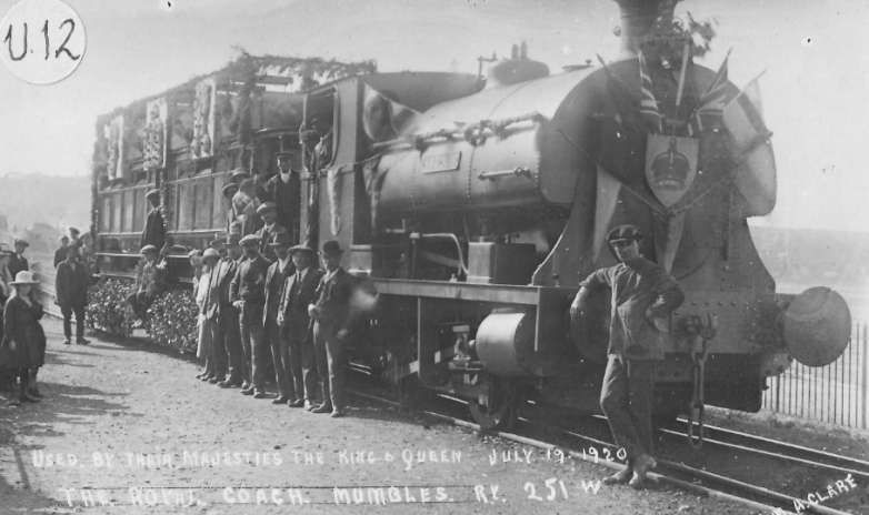
The Swansea and Mumbles Railway Royal Train decked out for a Royal visit to the line on 19th July 1920, © Blackpill LHS and licensed for reuse under a Creative Commons Attribution-NonCommercial-NoDerivs (CC-BY-NC-ND). [41]

“When the new Swansea and Mumbles Railway Company took over operations in 1890 it ordered two 0-4-0 saddle tank locomotives from Black, Hawthorn & Co of Gateshead. These were delivered in 1891 and numbered 1 and 2; they worked on the line until after the First World War. Two larger 0-6-0 side tank locomotives were obtained from the Hunslet Engine Company in 1898; numbered 4 and 5, they bore the brunt of the passenger service until well into the 1920s. The nominally independent Mumbles Railway and Pier Company ordered a 0-4-0 saddle tank from the Brush Electrical Engineering Co of Loughborough (successor to the Falcon Engine & Car Works) in 1906 and this carried plates reading “MR & P No. 3” to denote its ownership. Finally, a second-hand Avonside 0-6-0ST was obtained and named Swansea. All were tank locomotives of 0-4-0 or 0-6-0 wheel arrangement. Ownership was vested variously in the Swansea and Mumbles Railway Company or the Mumbles Railway and Pier Company (and sometimes transferred between the two for accounting purposes)[4] and as early as the 1890s there is evidence that the railway was having to hire in locomotives to supplement its own fleet. By the 1920s, locomotives were regularly being hired from a local dealer, Charles Williams of Morriston, and frequently appear in photographs of the railway.” [4]

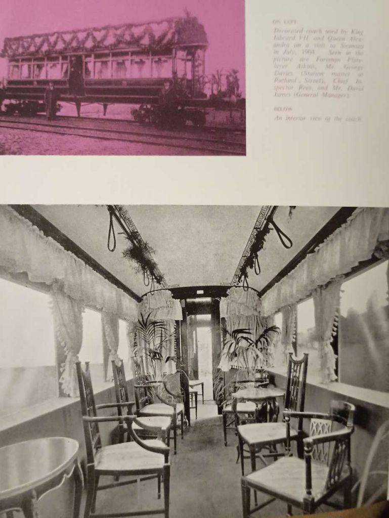
“The line celebrated its centenary in 1904, producing a special commemorative brochure for the occasion. Two years previously, a notable experiment had been carried out, namely the introduction of battery-powered ‘accumulator’ cars. These were not a success, but one of the cars was retained after the electrical equipment had been stripped out and used to convey parties of visiting dignitaries, including King Edward VII when he and his consort, Queen Alexandra, visited Swansea for the ceremonial cutting of the first sod of the King’s Dock in July 1904. The car was used again for the visit of King Edward’s successor, King George V, in 1920, when he officiated at the opening of the Queen’s Dock.”  [4]

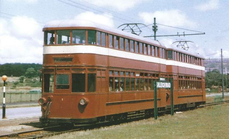
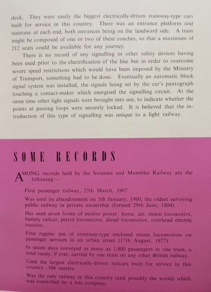
Electrification – “The line was electrified in 1928 at 650 V DC using overhead transmission – giving it the distinction of having used three forms of regular locomotive power over the years (i.e. horse, steam and electricity). Trials began on 6 July 1928 [5] and full electric services were introduced on 2 March 1929, using a fleet of eleven double-deck cars built by the Brush Electrical Engineering Co of Loughborough, in Leicestershire. These were the largest ever built for service in Britain and each could seat 106 passengers. [6] Furthermore, they were frequently operated in pairs, giving a total seating capacity of 212 per train.” [4]
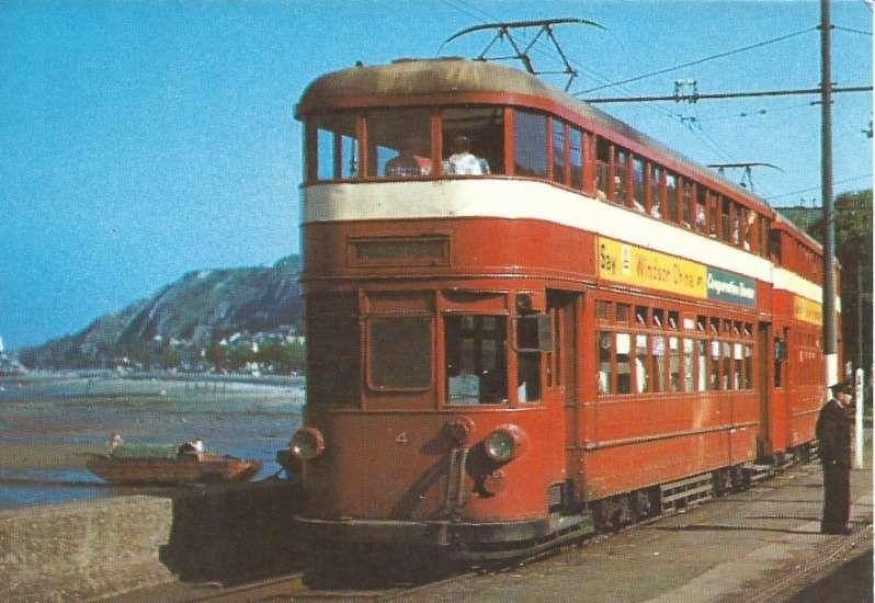
A two car tram train at Oystermouth Station, © Rev. R. W. A. Jones and licensed for reuse under a Creative Commons Attribution-NonCommercial-NoDerivs (CC-BY-NC-ND). [40]

“Two further cars were added later, bringing the fleet strength up to thirteen. A four-wheeled petrol-mechanical locomotive was acquired from Hardy Railmotors of Slough, then in Buckinghamshire, to handle the residual goods traffic on the railway, but this proved to be underpowered and was replaced after a few years by a diesel-mechanical locomotive from John Fowler & Co, of Leeds. The Hardy locomotive was retained for a few years and used for shunting the cars in the depot, which was on the site of the former carriage sheds, adjacent to the Rutland Street terminus, and for inspection of the overhead line equipment, but it had been dismantled by 1954, when parts were used in the construction of a replica horse-drawn car to celebrate the line’s 150th anniversary.” [4]

“In 1958, the South Wales Transport Company (the principal operator of motor bus services in the Swansea town area and predecessor of the modern-day First Cymru company) purchased the railway from the old owning companies (the Swansea and Mumbles Railway Limited, and the Mumbles Railway and Pier Company), having previously been the lessee in succession to the Swansea Improvements and Tramways Company since the 1930s, and the following year went to Parliament with an abandonment bill. Despite vociferous local opposition, the bill became law as the South Wales Transport Act 1959.” [4]

The South Wales Transport Company wasted no time in closing down the line! Their closure brochure/pamphlet is reproduce as Appendix 1 to this article.

There remains a debate about whether the line was a railway or a tramway. This is discussed in Appendix 2 to this article.

The Route
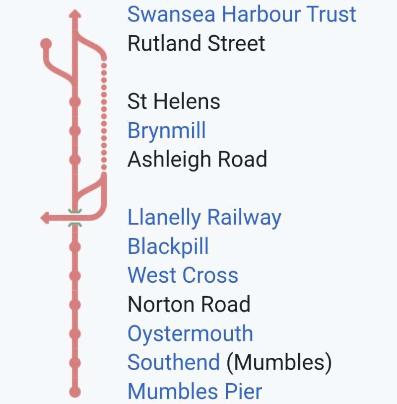
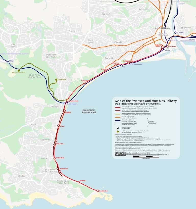
Wikipedia provides this linear route diagram, © Public Domain. [4]

“The railway had a multitude of stopping places over the years, but at the time of electrification in 1929 the officially recognised stations from Swansea to Mumbles (as published in Bradshaw)” [4] were:

  • Rutland Street
  • St Helen’s (frequently known as “The Slip”)
  • Brynmill
  • Ashleigh Road
  • Between Ashleigh Road and Blackpill stations the railway was crossed by the LM&SR Central Wales line from Swansea Victoria to Shrewsbury, at a point close to the LM&SR Mumbles Road station. There was a Mumbles Road name board under the bridge on the Mumbles Railway line, but if this was an official stopping place for Mumbles Railway cars it was not recognised as such by Bradshaw.
  • Blackpill
  • West Cross
  • Norton Road
  • Oystermouth
  • Southend
  • Mumbles Pier
The full length of the tramway from Swansea Harbour Trust to Mumbles Pier. [4]
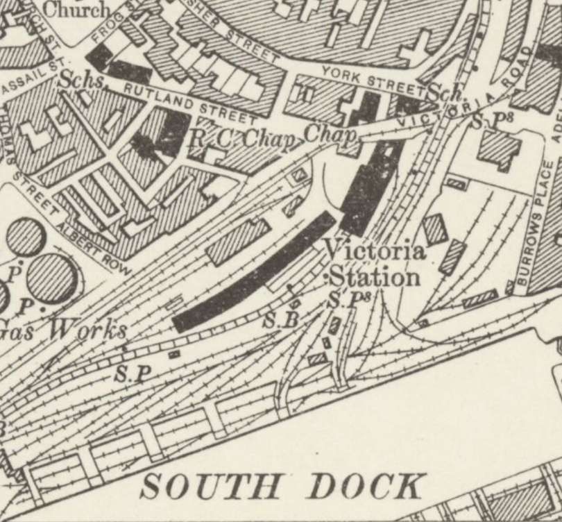
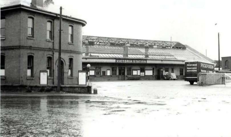
Trams started their journey along the Swansea & Mumbles Railway in Victoria Road, just outside the frontage of Victoria Railway Station. Trams then headed Southwest alongside the Gas Works along, what is now Oystermouth Road. [11]
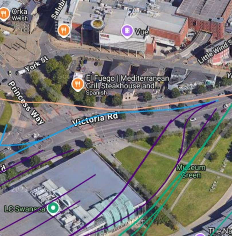
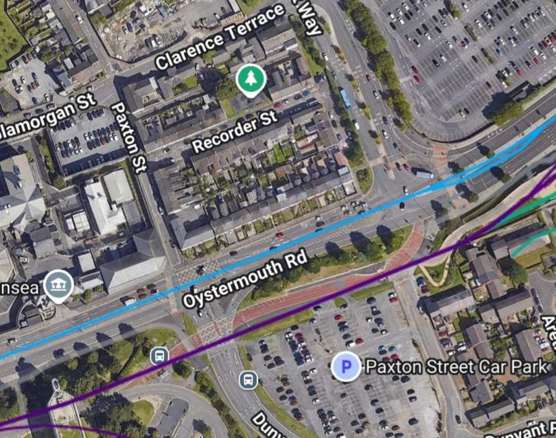
Approximately the same length of the tramway is shown here as a turquoise/light blue line running along Victoria Road. [17]
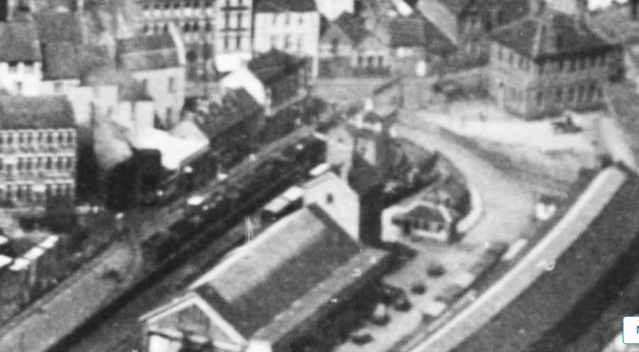
Looking North in the 1920s across the station approach at Victoria Railway Station. Victoria Road runs from behind the building at the top-right of this image towards the bottom-left corner of the image, © Heritage England. [15]
Swansea Victoria Railway Station, seen from Victoria Road, close to the eastern terminus of the Swansea & Mumbles Railway. This image was shared by Matthew Rowley on the Disused Stations Facebook Group on 4th June 2022. [13]

Swansea Victoria was “opened to passenger and goods traffic on 14th December 1867. Owned successively by the Llanelly Railway and Dock Company (1867 to 1871), the Swansea and Carmarthen Railways Company (1871 to 1873), the London and North Western Railway Company (L.N.W.R., 1873 to 1922), the London, Midland and Scottish Railway Company (L.M.S., 1923 to 1947) and British Railways (1948 to 1964), it was served by trains to and from Shrewsbury, Crewe, Liverpool, Manchester and York and formed the southern terminus of the Central Wales line, most of which is still operational as the Heart of Wales Line. Victoria closed in June 1964. … The site was subsequently cleared and used for Swansea Leisure Centre.” [12]

Production of gas at Swansea Gas Works dates back to 1841 when Swansea Gas Light Company began making gas by burning coal. The site ceased producing gas in 1922 and the facility was used for gas distribution until 1949 and then as a gas operations centre.
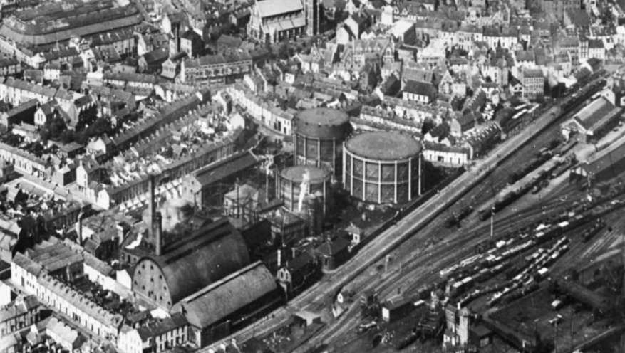
Langdon Road (later Oystermouth Road) on the Southeast side of Swansea Gas Works was the route followed by trams heading for Mumbles on the Swansea & Mumbles Railway, © Historic England. [15]

A few more pictures of the Gas Works site can be found here. [14]
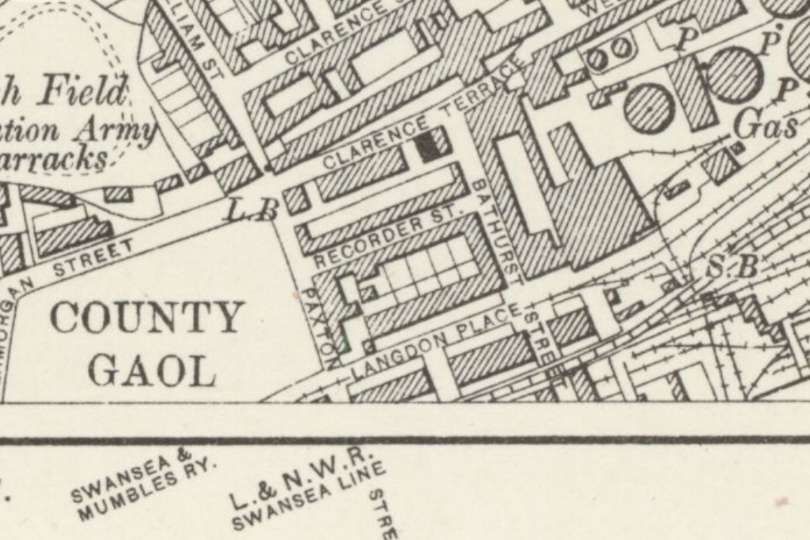
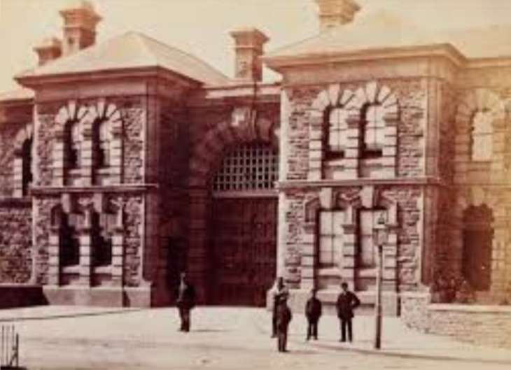
The tramway can be seen here running along Langdon Place (now Oystermouth Road) and to the South of the County Gaol. [13]
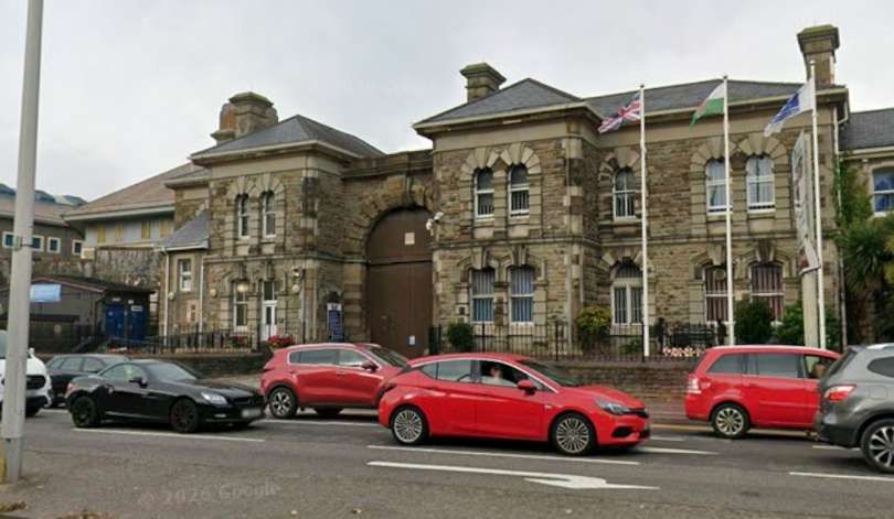
A similar length of the route against a 21st century backdrop. HMP Swansea is on the left of this image (the former Swansea Gaol). [17]
Swansea Gaol late in the 19th Century, seen from what was Langdon Place, © Public Domain. [16]
HMP Swansea in the 21st century. [Google Streetview, October 2025]
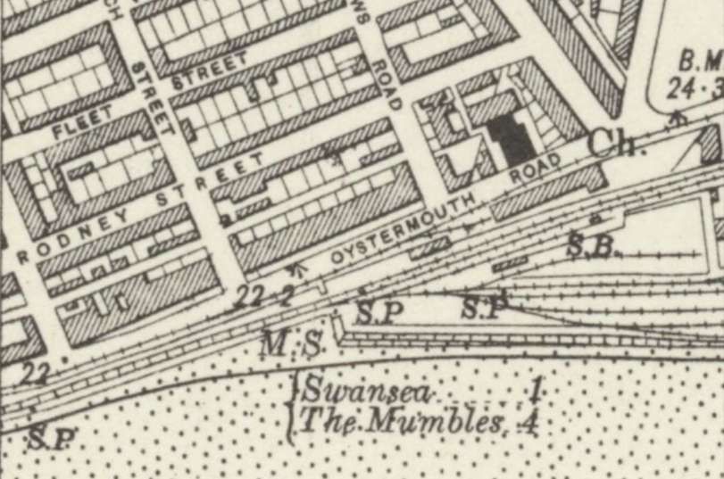
The next length of the line as it appears on the 6″ Ordnance Survey of 1913/1914, published in 1921. [18]
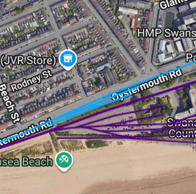
The same length of the route plotted on 21st century satellite imagery from railmaponline.com. [17]
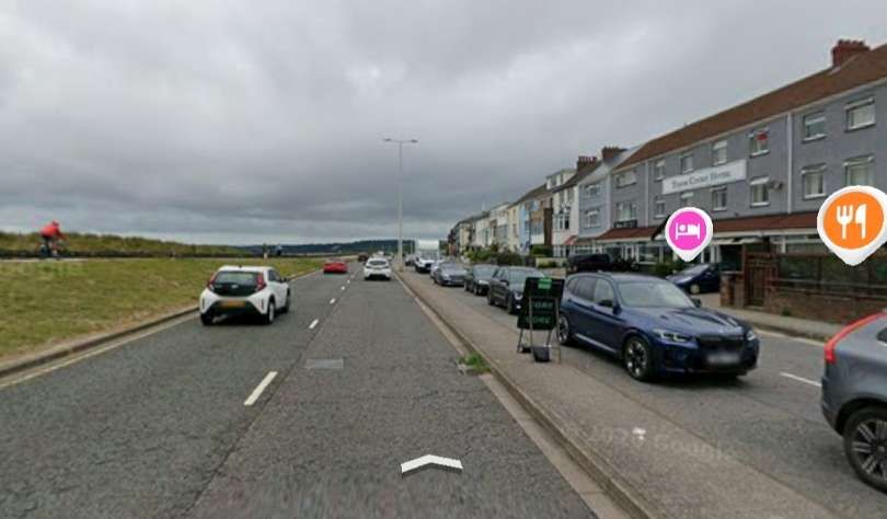
Looking West along Oystermouth Road in the 21st century. The tramway appears to have run along the line of the Westbound side of the road. Google Streetview, October 2025]
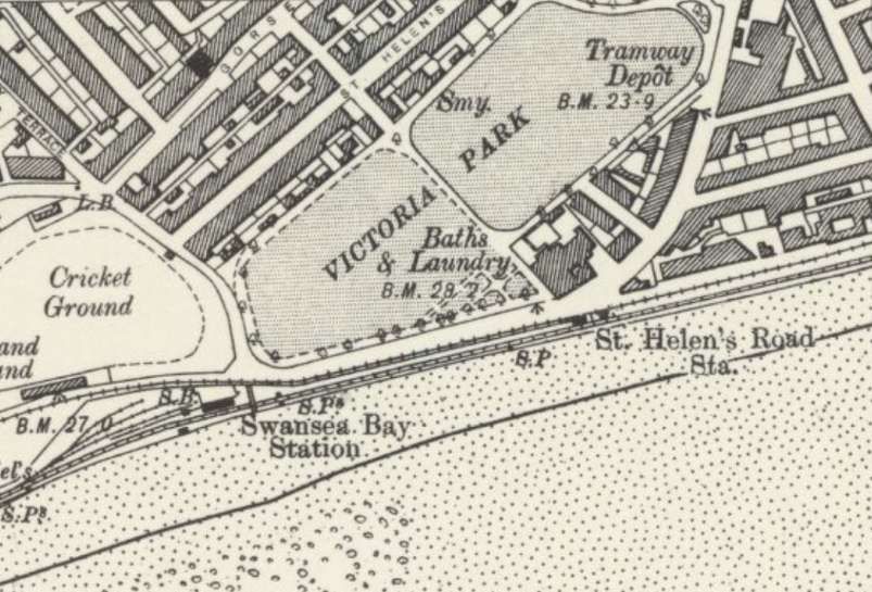
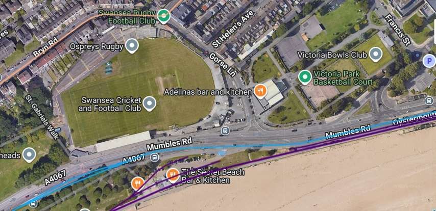
On this next length of the line, the old tramway passed through St. Helen’s Road Station. It had to swing away from the LNWR line which hugged the sea wall to allow room for that line’s Swansea Bay Station. At the same location the line passed the Cricket Ground to its right. This extract is taken from the 6″ Ordnance Survey of 1896/1897, published in 1900. [19]
A similar area showing the route of the line overlaid on modern satellite imagery. [17]
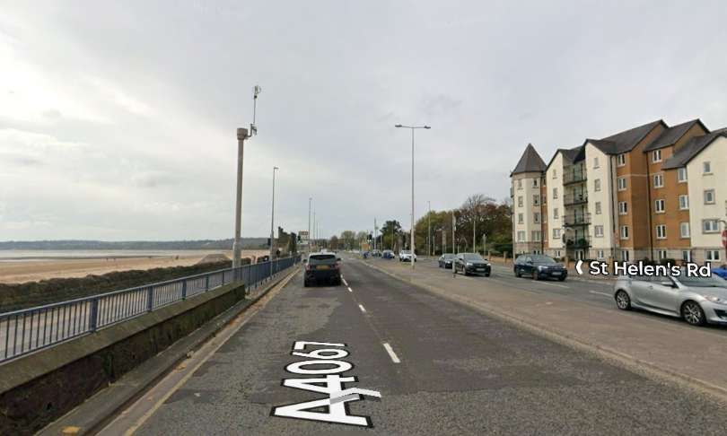
Looking West along Oystermouth Road as it approaches its junction with Guildhall Road South, the point where the A4067 becomes Mumbles Road. On the left, beyond the barriers, is the present promenade which sits on the line of the old LNWR line. [Google Streetview, October 2025]
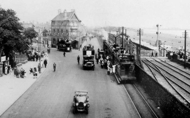
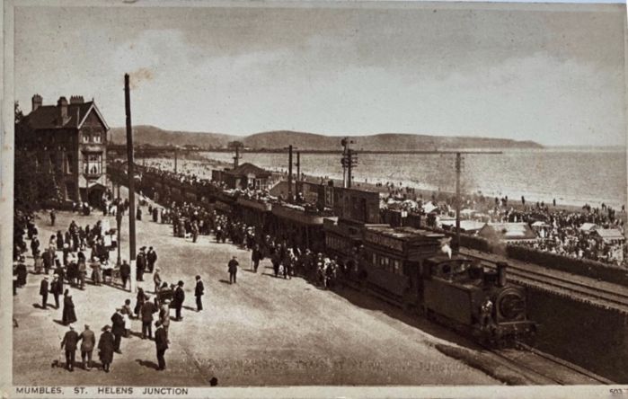
Looking East along Oystermouth Road from Mumbles Road with the Bay View Hotel in between Oystermouth Road and Guildhall Road South (the St. Helens Junction) the lines on the far right of the picture are the old LNWR line. The single track line alongside the road is the Swansea & Mumbles Railway, © Public Domain. [24]
Looking East from approximately the same location in the 21st century. [Google Streetview, October 2026]
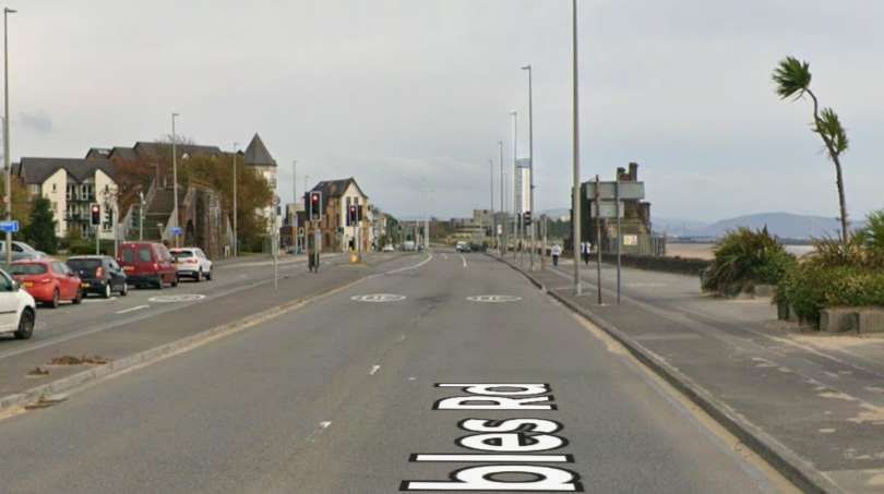
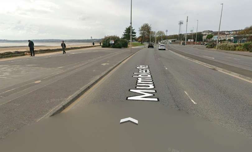
Looking West along Mumbles Road from approximately the same location as the Streetview image immediately above, close to the old LNWR Swansea Bay Railway Station. The modern promenade widens at this point to accommodate the Railway Station and its yard. [Google Streetview, October 2026]
Another view of St. Helens Junction from the East. The Bay View Hotel is on the left of the image, © Public Domain. [25]
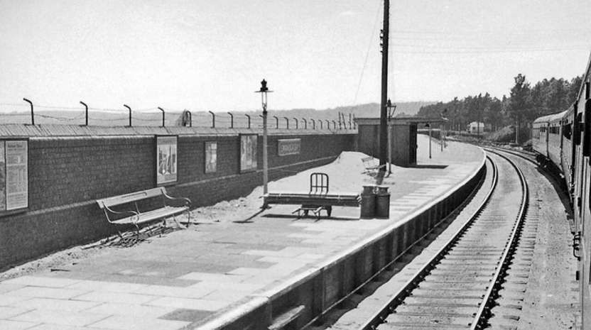
Looking Southwest along the Westbound platform at the LNWR Swansea Bay Railway Station, © Not known but authorised for reuse under a Creative Commons licence (CC BY-SA 2.0). [20]

Swansea Bay is a former railway station in Swansea next to Swansea Bay, in South Wales, opened to passenger and goods traffic on 14 December 1867. [21] Owned successively by the Llanelly Railway and Dock Company (1867 to 1871), the Swansea and Carmarthen Railways Company (1871 to 1873), the London and North Western Railway Company (LNWR, 1873 to 1922), the London, Midland and Scottish Railway Company (LMS, 1923 to 1947) and British Railways (1948 to 1964), it was served by trains to and from Shrewsbury, Crewe, Liverpool, Manchester and York and formed the southern terminus of the Central Wales line, most of which is still operational as the Heart of Wales Line. Swansea Bay closed in June 1964, having been listed in the Report on the Reshaping of British Railways (better known as the Beeching Report) the previous year. [22] The former station is near ‘The Slip’ opposite the Bay View Public House. It was adjacent to the Swansea and Mumbles Railway which was closed in 1960, and opposite the Western end of St Helen’s Road, which until the 1930s was the terminus of one of the Town tram lines. [20]
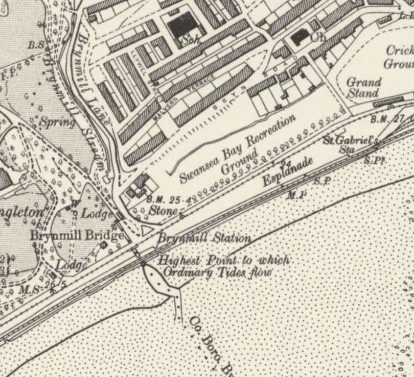
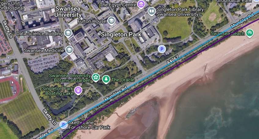
To the West of Swansea Bay Railway Station, the tramway followed the road between Singleton Park and the LNWR line which followed the sea wall. [19]
Again, a similar area showing the route of the line overlaid on modern satellite imagery. [17]

Singleton Park covers approximately 250 acres. An ornamental garden is located in the south, near the entrance to Swansea University, while a walled botanical garden is located in the park centre. On the south-western corner, past the hospital and the university, is a boating lake, as well as a miniature golf course. [23]

Wikipedia tells us that, “The park was originally part of the Vivian family estate. It was purchased by Swansea County Borough Council in 1919 for use as a public park. Park superintendent Daniel Bliss, who was trained at Kew Gardens, conceived of the Singleton Farm botanical gardens and Ornamental Gardens. He was the main driver behind the purchase of the estate. [23]

During the Second World War, the park hosted the Armaments Research Department a detachment of the Woolwich Arsenal under Sir Robert Robertson (1869-1949). While in 1944 over 1500 American soldiers were billeted for training on the beaches prior to landing on Omaha Beach, Normandy. … A Gorsedd stone circle was erected in 1925 for the Eisteddfod held in Singleton Park, Swansea, and was enlarged in 1964. [23]
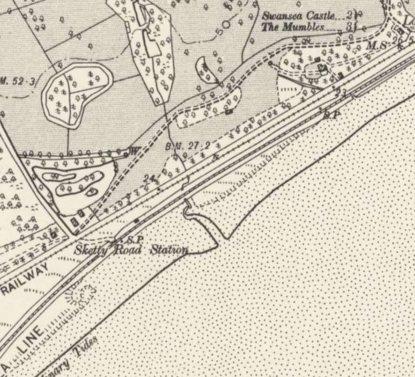
The Swansea and Mumbles Railway continued Southwest running on the Southeast side of Mumbles Road, with the LNWR line running close to the sea wall. The line’s Sketty Road Station appears on this map extract. [19]
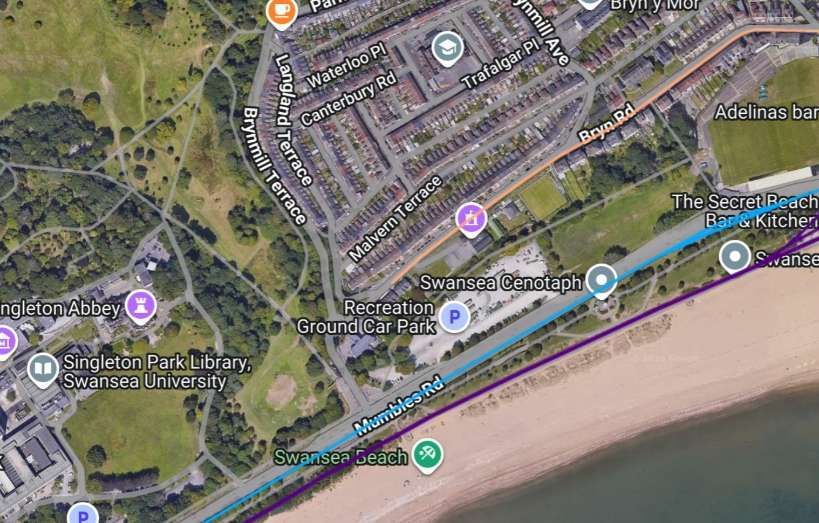
A similar length of the line as it appears on the railmaponline.com satellite imagery. [17]
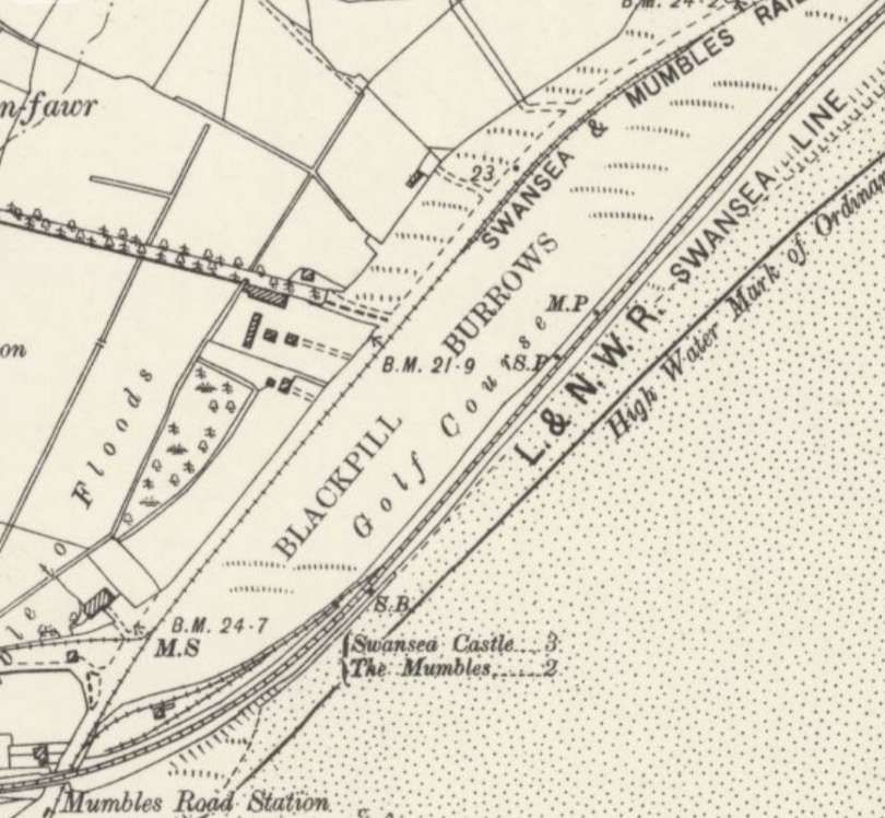
This next length of the Swansea & Mumbles Railway takes it as far as Mumbles Road Railway Station. [19]
The LNWR line crossed over the Swansea & Mumbles Railway by means of Blackpill Railway Bridge. The station and bridge are at the bottom left of this image and the map extract above. [17]
A coloured Postcard entitled ‘Swansea & Mumbles 1 & 9 Tramcar 1 seen at Asheligh Road in July 1959’, © J. B. Photocards Courtesy of George Waters Collection and licensed for reuse under a Creative Commons Attribution-NonCommercial-NoDerivs (CC-BY-NC-ND). [36]

A hundred metres or so short of the railway bridge a branch line left the main line of the Swansea & Mumbles Railway. This branch line was opened in the first decade of the 19th century and remained in use until as late as the Second World War. … The Clyne Valley Tramway is covered in a separate article which can be found here. [27]
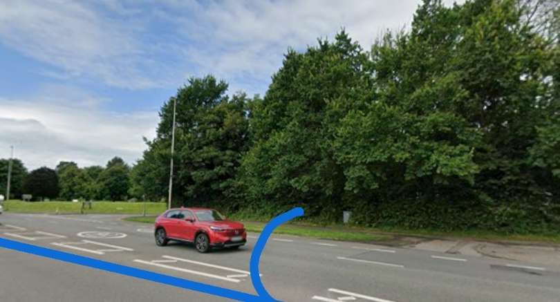
Looking West from Mumbles Road between Glyn Crescent (off to the right of the image) and Derwen Fawr Road (beyond and to the left of the car). The straight blue line is the main line of the Swansea & Mumbles Railway, the curved line approximates to the line of the Clyne Valley Tramway. [Google Streetview, July 2025]

At Mumbles Road Station, the LNWR line crossed over the Swansea & Mumbles Railway and the main coastal road via the Blackpill railway bridge. A Swansea & Mumbles Railway name board was also positioned just under the bridge. The LNWR station featured a goods yard, sidings, and a signal box.
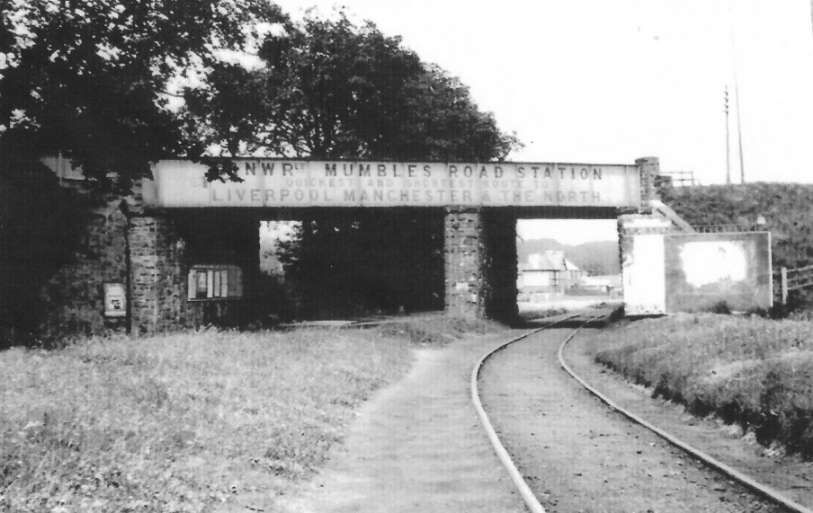
The Blackpill Railway Bridge seen from the South. The LNWR line crossed both the Swansea & Mumbles Railway and the Mumbles Road. Mumbles Road Station on the LNWR line is at high level off to the left of this image. [26]
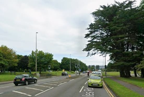
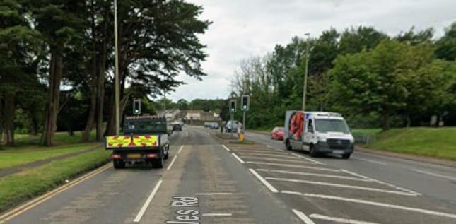
looking Southwest along Mumbles Road: Blackpill Bridge was approximately at the location of the pelican crossing. [Google Streetview, July 2025]
Looking Northeast along Mumbles Road to the location of Blackpill Bridge. [Google Streetview, July 2025]
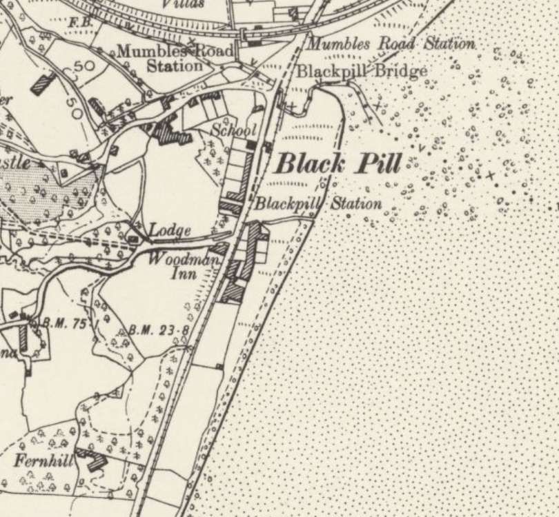
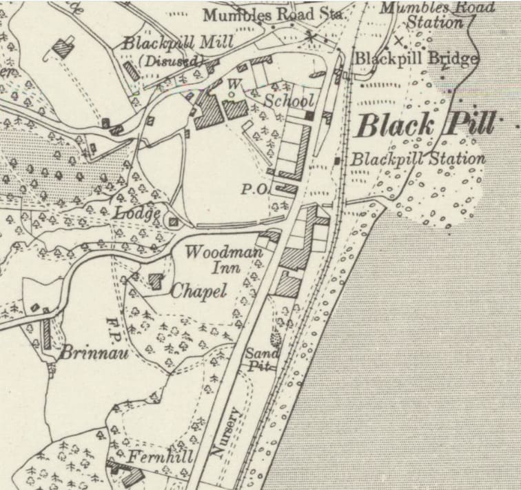
South of the junction with the Clyne Valley branch the main line of the Swansea & Mumbles Railway passed under Blackpill Bridge and in the hamlet of BlackPill there was a tramstop/station which can be seen on this map extract. Initially, South of the station/tramstop the line continued in the East-side shoulder of Mumbles Road. This arrangement changed in the early years of the 20th century. [19]
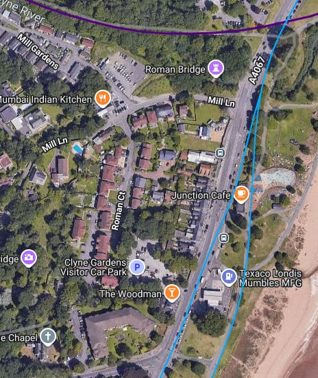
At the turn of the 20th century, the tramway had been diverted away from Mumbles Road to follow the coast wall. It appears on that alignment in this extract from the 6″ Ordnance Survey of 1913/1914, published in 1921. [28]

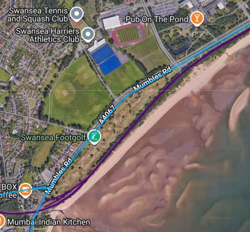
Railmaponline.com shows both alignments superimposed on modern satellite imagery. [17]
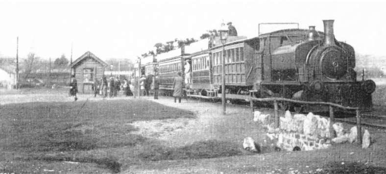
In around 1910, a steam locomotive is in charge of a Mumbles-bound train at Blackpill Station. The track is on the new alignment but the later station building has not been built © Blackpill LHS and licensed for reuse under a Creative Commons Attribution-NonCommercial-NoDerivs (CC-BY-NC-ND). [34]
Blackpill Bridge seen from the South with a Mumbles-bound tram heading towards Black Pill Station, © Blackpill LHS and licensed for reuse under a Creative Commons Attribution-NonCommercial-NoDerivs (CC-BY-NC-ND). [31]
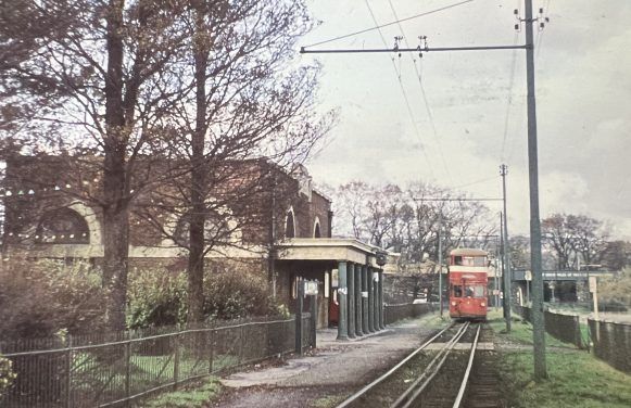
Looking North through Blackpill Station with a tram approaching the station. Blackpill Bridge can be seen in the background, © Blackpill LHS and licensed for reuse under a Creative Commons Attribution-NonCommercial-NoDerivs (CC-BY-NC-ND). [32]
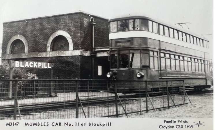
Blackpill Station and Car No. 11, heading for Mumbles Pier, © Blackpill LHS and licensed for reuse under a Creative Commons Attribution-NonCommercial-NoDerivs (CC-BY-NC-ND). [33]
Looking South towards what was the location of Blackpill Station. The blue line right of centre in this image is an approximation to the original line of the railway. Over to the left of the image, the blue line which runs behind the low hedge shows the revised alignment noted above. The electricity substation building which sat at the later Blakpill Station remains and can be seen to the left of the main road. [Google Streetview, July 2025]
The view from immediately South of Blackpill Station. The blue line shows the newer alignment of the railway. [Google Streetview, August 2016]

Further South, Railmaponline.com continues to show both alignments superimposed on modern satellite imagery. [17]
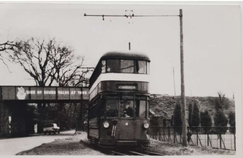
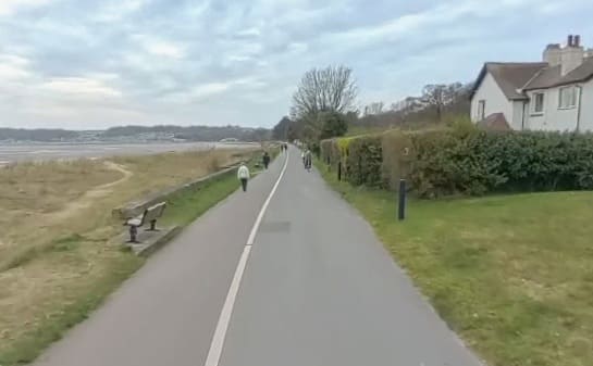
looking South just to the South of the junction with Mayals Road: the original alignment of the railway is marked by the blue line. [Google Streetview, July 2025]
The newer alignment of the railway was very close to the sea shore. This view looks South and was provided by the City and County Survey Team. [Google Streetview, April 2026]
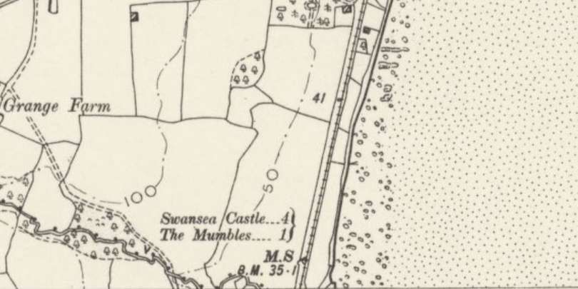
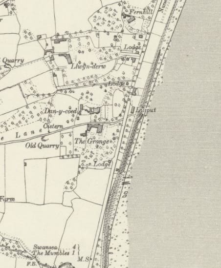
The original alignment. [19]
The original alignment again. This extract takes us to the bottom edge of the 6″ OS Sheet. [19]
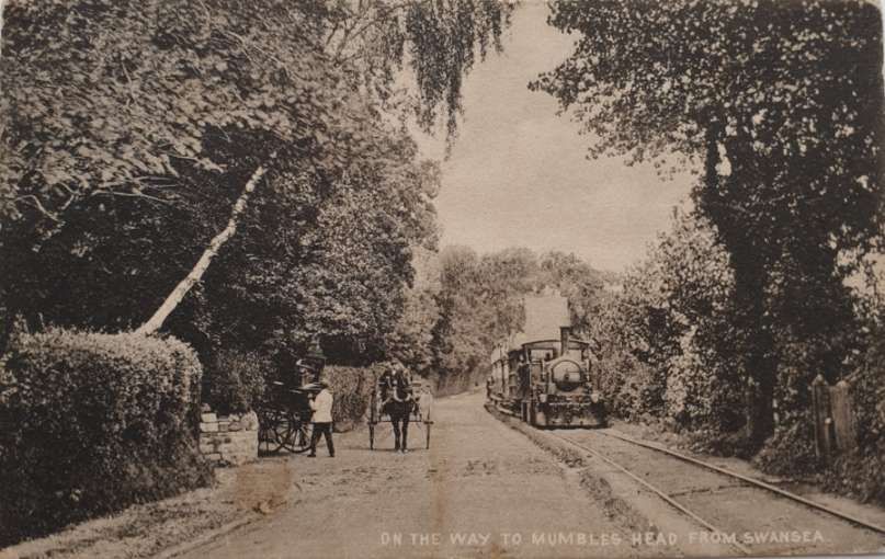
On the way to Mumbles Head from Swansea’.  Postcard, looking North, of early Mumbles Railway steam passenger train on track alongside Mumbles Road with horse drawn carriage. It was taken between Blackpill and West Cross, close to Liliput, before the realignment occurred at the turn of the 29th century, © Blackpill LHS and licensed for reuse under a Creative Commons  Attribution-NonCommercial-NoDerivs (CC-BY-NC-ND).

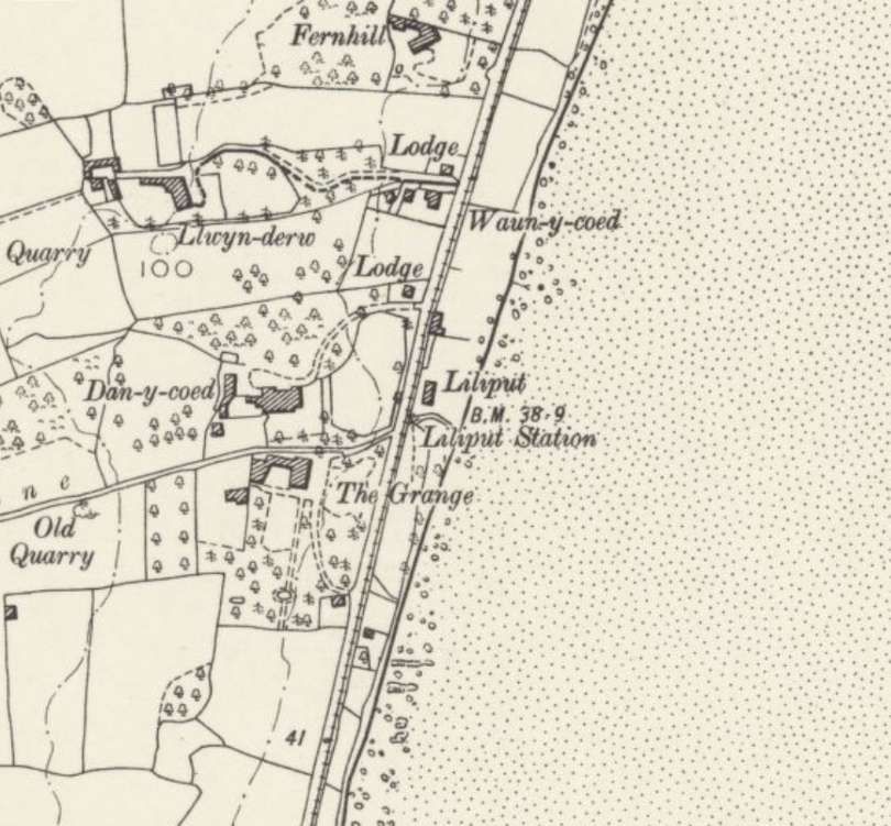
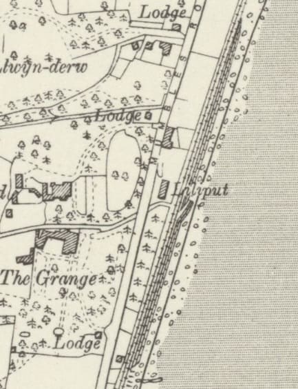
The later alignment with significant storage lines at Liliput. This length also takes us to the bottom edge of the OS Sheet. [28]
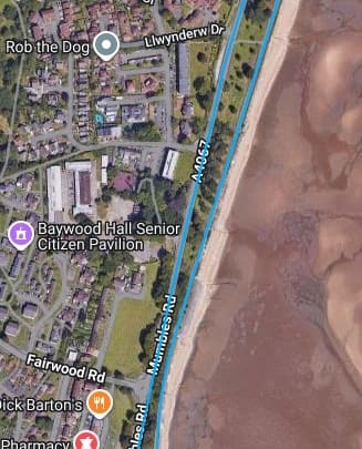
This extract from railmaponline.com shows the two routes continuing through Liliput. [17]
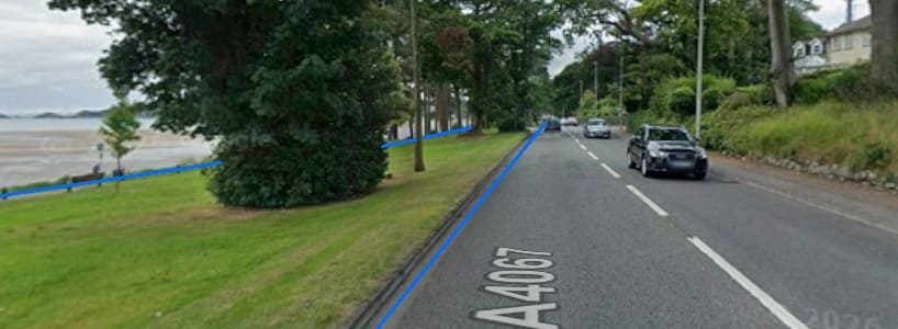
Looking South close to the location of Liliput Station. The original railway alignment was at the kerb line of Mumbles Road, the newer line was beside the sea. Both are marked by blue lines. [Google Streetview, July 2025]
Another South-facing view along the line of the newer route, this image is again provided by the City and County Survey Team. [Google Streetview, April 2026]

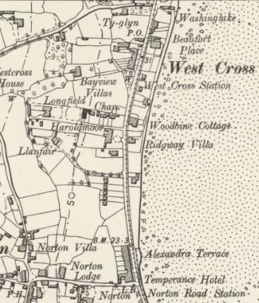
The original alignment as far as Norton Road Station. This is an extract from the 6″ Ordnance Survey of 1896/1897, published in 1900. [29]
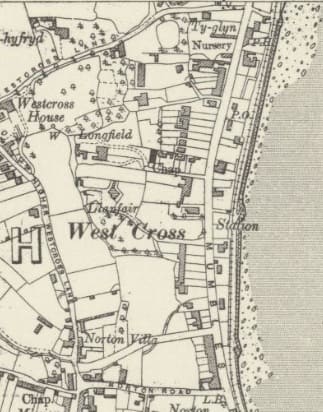
The two alignments meet again at the location of Norton Road Station. By the time of this survey, Norton Road Station appears not to be in use and a station has been provided to the North at West Cross. This extract comes from the 6″ Ordnance Survey of 1913, published in 1921.[30]
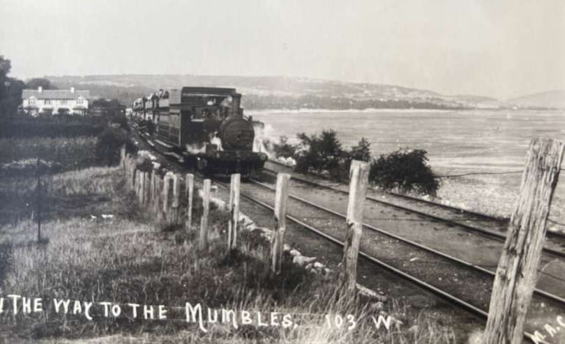
After the realignment of the tramway/railway and before electrification, a steam-powered service heads South towards Norton Road, © Blackpill LHS and licensed for reuse under a Creative Commons  Attribution-NonCommercial-NoDerivs (CC-BY-NC-ND).

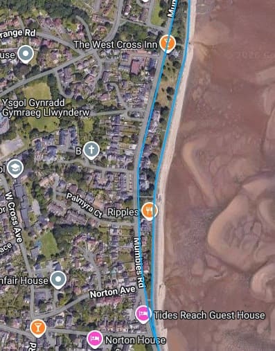
The railmaponline.com extract takes the two lines South as far as Norton Road, where they converge. [17]
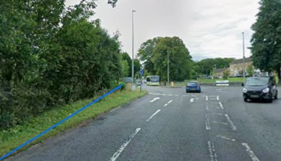
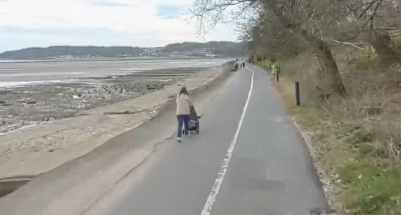
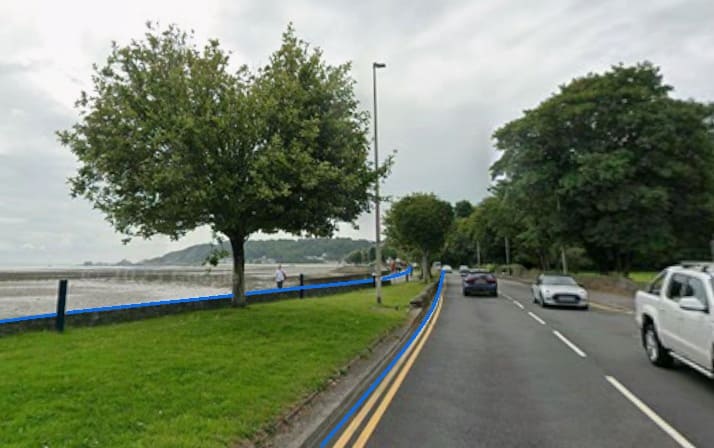
Another South-facing view at the Fairwood Road Roundabout with the approximate alignment of the original railway marked in blue. [Google Streetview, August 2025]
The newer alignment continues close to the sea shore. This image is again courtesy of the City and County Survey Team. [Google Streetview, April 2026]
At the location of what was Norton Road Station the two alignments, represented by the two blue lines, are much closer together. [Google Streetview, July 2025]
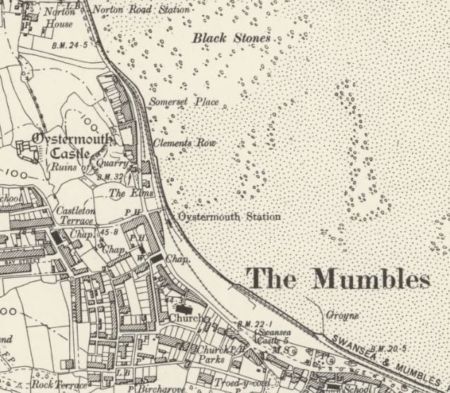
The original alignment from Norton Road Station, through Oystermouth Station and on towards Southend Station. [29]
This next extract from railmaponline.com covers the same length of the line as shown in the map extract above. [17]
Taken in the days prior to electrification of the railway, this photograph shows a steam-powered service sitting at Oystermouth Station before heading on towards Mumbles Pier, © Public Domain. [37]
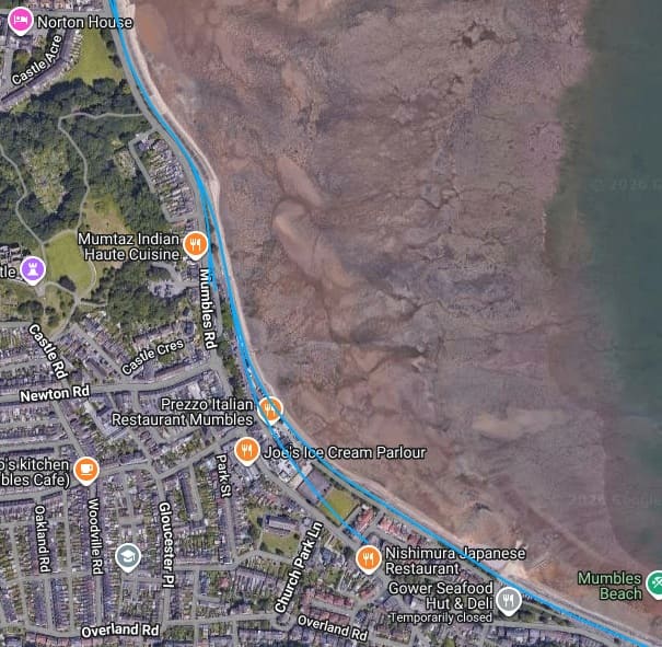
Looking Southeast towards Mumbles Pier at the location of Oystermouth Station. [Google Streetview, June 2022]
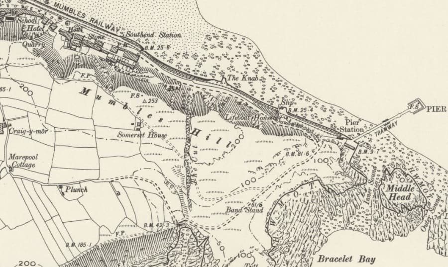
The final length of the line to Pier Station. [29]
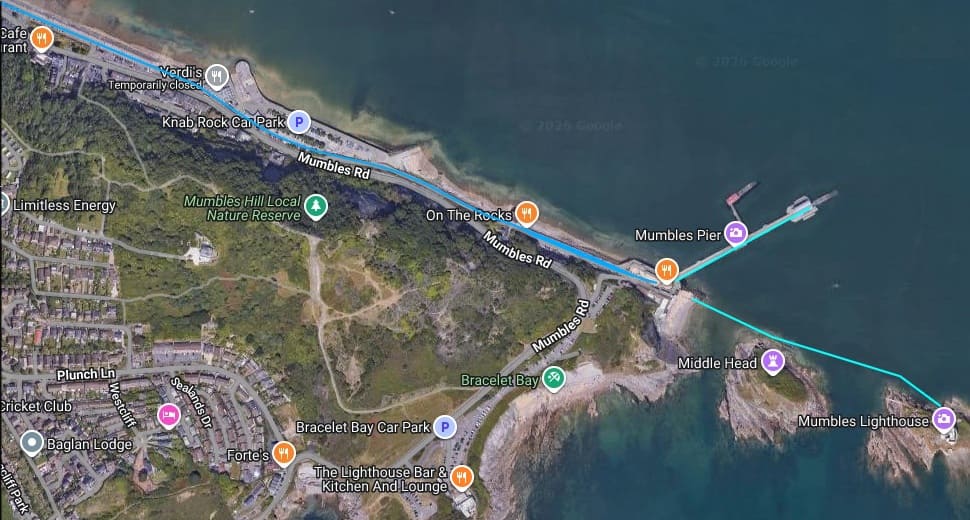
The last length of the tramway/railway took trains/electric trams to Mumbles Pier. Railmaponline.com shows us that there were two further short lengths of tramway, one of which served the Pier and the other, the Lighthouse. [17]
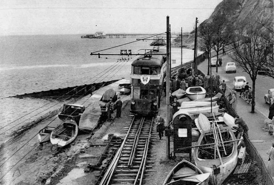
Looking towards the end of the line, this photograph shows the last service on the line in January 1960, © Illustrated London News Group. [39]
Looking back towards Swansea. The footbridge in this view was the photographer’s chosen location for the view immediately above. [39]
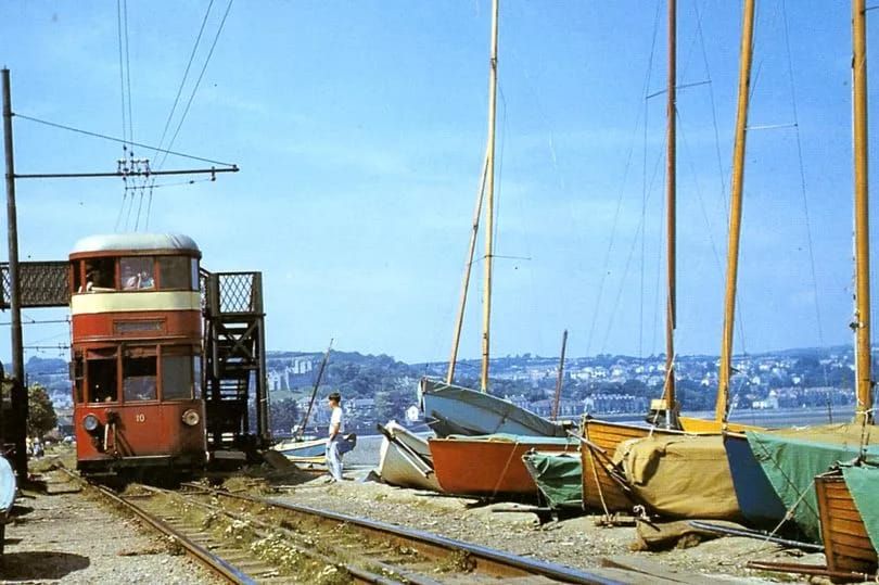
A busy train at the terminus of the line close to Mumbles Pier. [38]
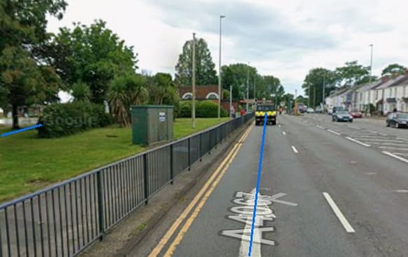
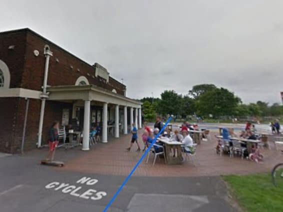
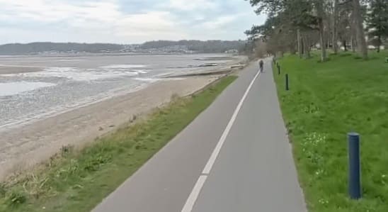
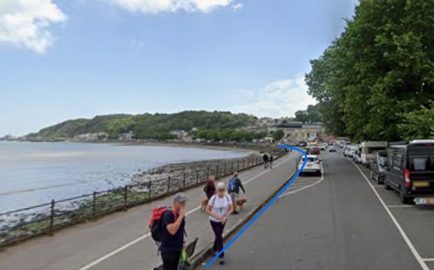
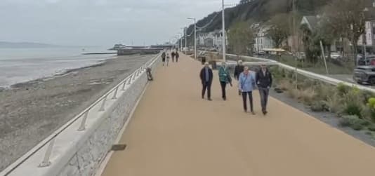
Courtesy of the City and County Survey Tam, this is the view along the promenade at Mumbles Beach. The railway ran where the promenade now sits. [Google Streetview, April 2026]
In the area of Knab Rock, the railway drifted inland over a short section. This image is courtesy of the City and County Survey Team. [Google Streetview, April 2026]
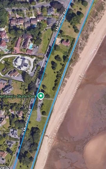
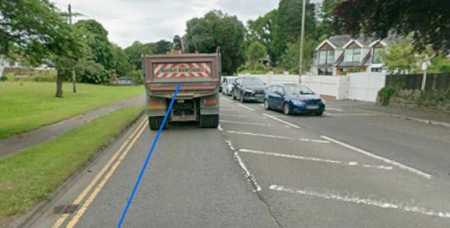
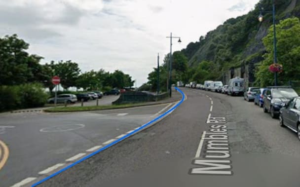
For a short distance the railway alignment follows the kerb line of Mumbles Road. [Google Streetview, July 2025]
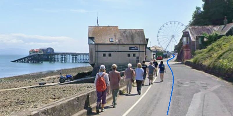
The alignment then bears left leaving Mumbles Road following what is now the access road to Mumbles Pier. [Google Streetview, July 2025]
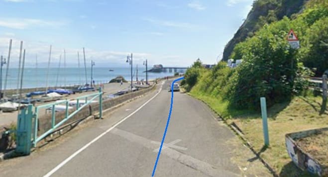
Mumbles Road has now climbed above the cliffs and the access road to the Pier runs close to sea level along what was the line of the old railway. [Google Streetview, July 2025]
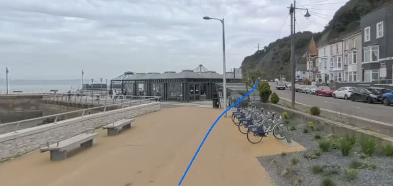
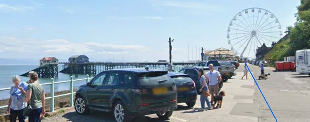
The line continued as far as the landward end of Mumbles Pier. [Google Streetview, July 2025]
Mumbles pier and former railway station in 2009, (c) Dr. D. Pepper and licensed for reuse under a Creative Commons Licence (CC BY-SA 2.0). [42]
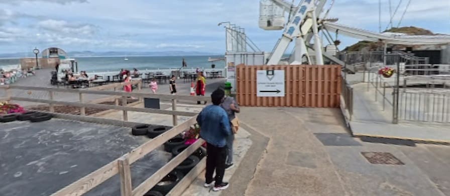
The end of the line: Mumbles Pier is on the left of this image and the lighthouse is beyond the Ferris wheel. Both the pier and the lighthouse at one time had their own short tramways, (c) Kelvin Hill. [Google Streetview, September 2026]

References

  1. The Swansea & Mumbles Railway: Over 155 Years of Service: Souvenir Brochure; The South Wales Transport Company Ltd, 5th January 1960. See the Appendix below.
  2. https://www.greengauge21.net/the-first-passenger-railway-in-the-world-and-whats-needed-next, accessed on 17th September 2026.
  3. https://www.bbc.co.uk/wales/southwest/sites/swansea/pages/mumbles_trainanniv.shtml, accessed on 17th September 2026.
  4. https://en.wikipedia.org/wiki/Swansea_and_Mumbles_Railway, accessed on 17th September 2026.
  5. Stephen Hughes; The Archaeology of an Early Railway System: The Brecon Forest Tramroads; Royal Commission on Ancient and Historical Monuments in Wales, 1990;; via https://books.google.com/books?id=C-pzUWrCU5sC&pg=PA333, accessed on 17th September 2026.
  6. Charles E. Lee; The Swansea & Mumbles Railway; Oakwood Press, Oxford, 1988.
  7. http://www.historywebsite.co.uk/articles/publictransport/steamtrams.htm, accessed on 5th October 2026.
  8. https://www.gracesguide.co.uk/Hughes%27s_Locomotive_and_Tramway_Engine_Works, accessed on 5th October 2026.
  9. https://www.gracesguide.co.uk/Henry_Hughes_and_Co, accessed on 5th October 2026.
  10. https://chasewaterstuff.wordpress.com/2010/04/06/industrial-steam-locomotive-manufacturers-2, accessed on 5th October 2026.
  11. https://maps.nls.uk/view/102183123, accessed on 11th October 2026.
  12. https://en.wikipedia.org/wiki/Swansea_Victoria_railway_station, accessed on 11th October 2026.
  13. https://www.facebook.com/share/p/1JPzG7TisX, accessed on 11th October 2026.
  14. https://ididitthisway.wordpress.com/gas-works-municipal-swansea-oystermouth, accessed on 11th October 2026.
  15. https://www.britainfromabove.org.uk/en/image/wpw006114, accessed on 11th October 2026.
  16. https://encrypted-tbn0.gstatic.com/images?q=tbn:ANd9GcSbBFvcmGbilYmudWxHABpEKI-TwROoo7eioF8XksC0Dw&s=10, accessed on 11th October 2026.
  17. https://railmaponline.com/uk-and-irish-railways, accessed on 11th October 2026.
  18. https://maps.nls.uk/view/102342505, accessed on 11th October 2026.
  19. https://maps.nls.uk/view/102183111, accessed on 11th October 2026.
  20. https://en.wikipedia.org/wiki/Swansea_Bay_railway_station, accessed on 18th October 2026.
  21. Contemporary report in The Cambrian newspaper.
  22. More traffic jams, but we’ve never been better connected; on This is South Wales. 11 December 2009; via https://www.walesonline.co.uk/all-about/swansea, accessed on 18th October 2026.
  23. https://en.wikipedia.org/wiki/Singleton_Park, accessed on 18th October 2026.
  24. https://wp.me/pPWIG-Tk, accessed on 18th October 2026.
  25. https://www.storyofmumbles.org.uk/catalogue_item/mumbles-railway-st-helens-junction-known-as-the-slip-swansea, accessed on 18th October 2026.
  26. https://www.storyofmumbles.org.uk/catalogue_item/swansea-to-pontarddulais-railway-the-railway-bridge-at-blackpill, accessed on 18th October 2026.
  27. https://rogerfarnworth.com/2026/10/20/the-clyne-valley-tramway-swansea
  28. https://maps.nls.uk/view-full/102342499, accessed on 21st October 2026.
  29. https://maps.nls.uk/view/102183393, accessed on 21st October 2026.
  30. https://maps.nls.uk/view/102342556, accessed on 21st October 2026.
  31. https://www.storyofmumbles.org.uk/catalogue_item/mumbles-train, accessed on 21st October 2026.
  32. https://www.storyofmumbles.org.uk/catalogue_item/mumbles-train-blackpill, accessed on 21st October 2026.
  33. https://www.storyofmumbles.org.uk/catalogue_item/mumbles-train-at-blackpill-station, accessed on 21st October 2026.
  34. https://www.storyofmumbles.org.uk/catalogue_item/mumbles-railway-steam-engine-and-carriages-at-blackpill-c1910, accessed on 21st October 2026.
  35. https://www.storyofmumbles.org.uk/catalogue_item/on-the-way-to-mumbles-head-2, accessed on 21st October 2026.
  36. https://www.storyofmumbles.org.uk/catalogue_item/swansea-and-mumbles-railway, accessed on 21st October 2026.
  37. https://en.wikipedia.org/wiki/Oystermouth_railway_station, accessed on 21st October 2026.
  38. https://www.storyofmumbles.org.uk/catalogue_item/image-of-swansea-bay-taken-from-the-mumbles-pier-featuring-the-mumbles-train, accessed on 22nd October 2026.
  39. https://www.swanseascoop.com/p/the-mumbles-railway-last-day, accessed on 22nd October 2026.
  40. https://www.storyofmumbles.org.uk/catalogue_item/two-car-mumbles-train-leaving-oystermouth, accessed on 22nd October 2026.
  41. https://www.storyofmumbles.org.uk/catalogue_item/mumbles-railway-used-by-their-majesties-the-king-and-queen-19th-july-1920, accessed on 22nd October 2026.
  42. https://www.geograph.org.uk/photo/1518332, accessed on 22nd October 2026.

Appendix 1

The Swansea & Mumbles Railway: Over 155 Years of Service: Souvenir Brochure
Appendix 2

Railway or Tramway?

“The railway is frequently referred to as a tramway, but the original name of the company of proprietors was the Oystermouth Railway or Tramroad Company, the word tramroad being used in its pre-railway context. The original right of way was unique and it was only after the construction of the turnpike road in the 1820s that the line assumed its roadside character. The introduction of steam locomotion in the 1870s was facilitated by a clause in the original act which authorised the “haling or drawing” of waggons by “men, horses, or otherwise” and owed nothing to the Tramways Act 1870 (33 & 34 Vict. c. 78).” [4]

“The passenger rolling stock used in steam days bore little resemblance to conventional railway carriages, employing open-top, “toast-rack” and “knifeboard” seating, and being built by companies more commonly associated with the construction of urban tramcars, such as G.F. Milnes & Co., Starbuck & Falcon, etc. After electrification the resemblance to an urban tramway became more marked with the introduction of the huge Brush-built electric cars and because of the style of operation (the signalling was used only to regulate entry to the passing loops and not to control the actual running of cars). The track was always laid with conventional railway-type rail and not grooved tram-rail and the railway also handled conventional goods wagons (exchanged with the London and North Western Railway (the London, Midland and Scottish Railway after January 1923) at Mumbles Road station and with the Great Western Railway at the Swansea terminus). In the early nineteenth century a tramway was a line for mineral wagons (trams), the term railway being used when edge rails replaced plates. The term tramway did not become almost exclusively associated with urban transport systems until after the passing of the Tramways Act 1870 (33 & 34 Vict. c. 78).” [4]
The Clyne Valley Tramway, Swansea

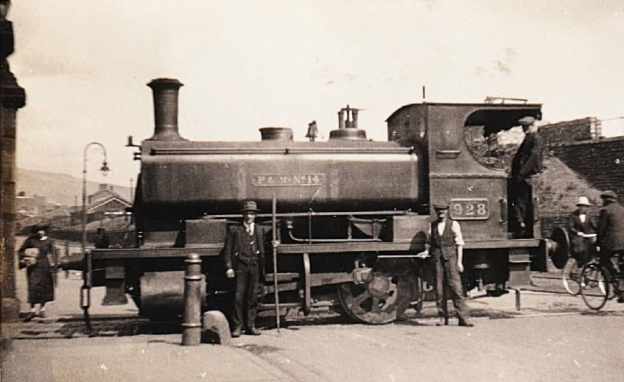
The featured image for this article shows a Powlesland and Mason locomotive (withdrawn 1927) crossing Oystermouth Road, Swansea just outside the gate pillars of the rail entrance to the gas works, probably in the early 1920s. This or similar locomotives would have transported Clyne Valley coal to the gas works. The image was shared on the Industrial Locomotive Enthusiasts Facebook Group by Dave Roberts on 20th August 2026. The photographer is not know, (c) Public Domain. [17]

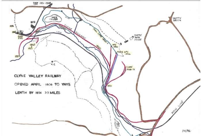
In the very early 19th century, The Clyne Valley Tramway was built (around 1804–1807) as a branch line extension of the Oystermouth Railway (Swansea & Mumbles Railway) to transport coal and timber out of the Clyne Valley.

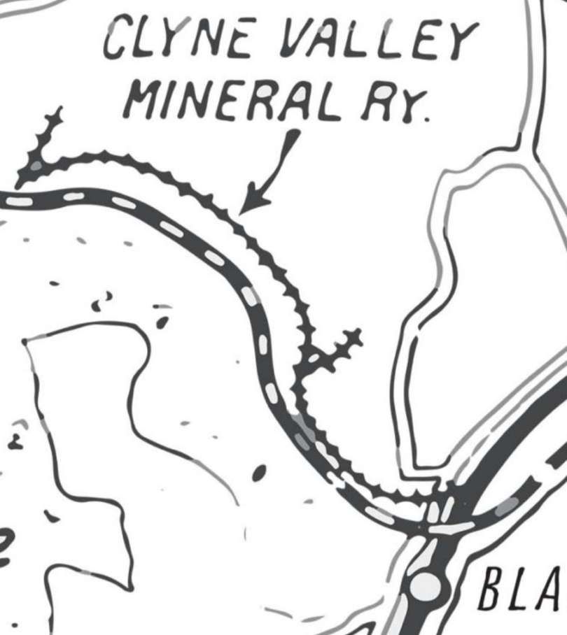
The Clyne Valley Mineral Railway. The solid black line is the main line of the Swansea & Mumbles Railway. The dotted line is the LNWR line from Swansea and up the Clyne Valley. [7]

Promoted initially by John Morris I and John Morris II, the tramroad/tramway connected local coal workings—such as early bell pits and the Rhydydefaid pit—down through the valley toward Swansea Bay and local docks.

During the 19th century, the tramway and its branches served a number of industrial sites, including later collieries like Clyne Wood Colliery (opened 1868), ironworks, chemical works, and the Clyne Valley Brickworks.

Industrial operations in the valley wound down by the early 20th century (with lines largely abandoned by the 1920s and tracks lifted around World War II).

“From about 1812 a number of large underground pits were excavated of which at least 5 are known. An arsenic and copper works was opened in 1837; acetic acid works in 1856; and brickworks in 1875. In 1865, the main line came through the valley and at least one colliery was directly connected to it. There was also a horse racing course, which was between Killay and Olchfa and operated between 1866 and 1927.” [1]

The Clyne branch parted from the line to Oystermouth  at Blackpill and “followed a course close to the river as far as a spot referred to in the Act as Ynys – in modern terms about 250 yards to the north of the pond beside the cycle track (NGR SS 61249 91599). The sinuous track that now runs on the level beside the east bank of the river follows the course of the railway. The total length of the branch was about 1,450 yards.” [6]

“The first mention of Clyne Valley coal being carried on the railway comes in March 1812 when the minutes of the railway company (now in the Richard Burton Archives in Swansea University) notes that ‘Mr Morris’ [i.e. John Morris II] had opened a colliery on the line of the tramroad. This colliery can perhaps be identified with the colliery to which the modern name Ynys has been given. In the last quarter of 1812 the first payment by Morris of tolls on ‘Coals from Ynis to sundry parts of Tramroad’ is recorded.  Similar payments were then made every quarter until September 1814. After that, there is no further record of tolls on Ynis coal until entries in the cash book cease early in 1816. This strongly suggests that the colliery was in production for two years only, 1812–14.” [6]

Later, John Morris II, now Sir John,  once again became involved with the line, he “became mortgagee in possession of the railway on 21st December 1819.  For a time the company continued to have the semblance of corporate existence but by 1847 George Byng Morris, the grandson of Sir John, had assumed the role of absolute proprietor.” [6]

The railway and tram tracks, the river, mill leets, canals, collieries, paths, roads and the racecourse in the Clyne Valley. This image is © Blackpill Local History Society and is made available for reuse under. Creative Commons Licence (CC-BY-NC-ND). [2]

The Clyne Valley Community Project tells us that after John Morris II ceased working in 1816 it appears that there was no coal working in the Clyne Valley until 1840. At that time when he transferred all his mineral interests to his second son, George Byng Morris. He re-laid the abandoned Clyne Valley branch line and built an extension to a new pit – his own Rhydydefaid pit. The line along the valley as far as Ynys remained as a legal part of the Swansea & Mumbles Railway (the Oystermouth Railway) but was apparently regarded by everyone as the property of the Morris family!  “The section north from Ynys to Rhydydefaid pit was a new construction that closely followed the course of the river and was truly the private property of George Byng Morris. The re-laid branch with Morris’s extension was complete by 1846 at the latest.” [6]

George Bingo Morris also owned a coal yard at Blackpill which was now conveniently connected to Rhydydefaid pit. The yard probably covered local land sales  but the bulk of the output from Rhydydefaid pit was carried to Swansea on the Swansea & Mumbles Railway and much of the output was used in the town’s gasworks on Oystermouth Road.

Morris extended his new tramway a short distance beyond Rhydydefaid pit. “At this period the coalfield around Dunvant and beyond was starting to be developed on a commercial scale and the new tramway was seen by several promoters as a possible means of getting their coal to Swansea for export or use in the town’s industries. The railway was never actually extended in this way, but when the Llanelly Railway was built in the 1860s a short tunnel, which still exists, was provided through their embankment, and the only reason for this tunnel can have been to accommodate a pre-existing right of way.” [6]

In 1854, the Swansea Coal and Iron Co was formed in London and it took over the running of the pit and the tramway. It arranged for the renewal of the whole Swansea & Mumbles Railway, having it converted from a plateway into an edge rail line to improve access to Swansea docks.

Morris undertook the re-laying of the original Swansea & Mumbles Railway, including the Clyne Valley branch as far as Ynys. “The Coal Company was responsible for the extension from Ynys to Rhydydefaid since this section was regarded as part of the colliery infrastructure.” [6]

Until 1865, the Clyne Valley line was the sole outlet for coal from Rhydydefaid. In 1865, when the Llanelly Railway opened their line through the valley, initially for goods traffic only, a siding to serve Rhydydefaid was put in, perhaps as part of the original construction but certainly by 1876. But, this did not supersede the Clyne Valley branch which remained in use.  “A further source of traffic was added in 1868 when Clyne Wood Colliery, across the river from Rhydydefaid, started to produce Clyne Wood was connected to the Clyne valley branch by means of a bridge across the river and for a year or two sent its coal out by that way.” [6]

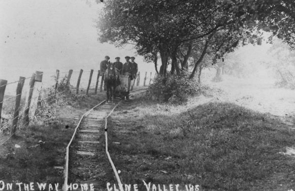
The Clyne Valley Tramway/Tramroad: A single horse pulls what appears to be a single wagon along a curved section of the tramway. It is clear that curves were formed by a series of short straight lengths of rail. This image is © Blackpill Local History Society and licensed for reuse under a Creative Commons Licence (CC-BY-NC-ND). [3]

The Clyne Valley Community Project tells us that by 1870, Philip Richard had control of Rhydydefaid Colliery and by 1878 he had introduced a steam locomotive that worked on both the branch and the mainline of the Swansea & Mumbles Railway. The pit was closed in around 1883 and the Clyne Valley Branch also fell into almost complete disuse. Only the occasional train operated by the Oystermouth Railway Company (the owners of the Swansea & Mumbles Railway) in connection with the local racecourse.

In 1891, Philip Richard opened a new pit, Commercial or Rhydydefaid No. 2, served by a newly built siding off the LNWR line which ran through the woods on a high embankment. Initially, the new pit was not viable but “Richard took a lease of coal under Llanerch and Olchfa which lay between Dunvant Road and Hendrefoilan Road and adjoined his existing taking. This gave him access to an area of more easily worked coal which made the colliery a viable proposition. He re-opened Commercial in 1899.” [6]

He also refurbished the Clyne Valley Branch of the Swansea & Mumbles Railway and began sending coal into Swansea via the Swansea & Mumbles Railway as part of “an agreement made in 1899 between the Swansea Improvements & Tramways Company, by this date owners of the [Swansea & Mumbles] Railway, and Sir Robert Armine Morris and Philip Richard.” [6]

In the early 20th century (1903), the Clyne Valley Slant Colliery was opened. “It was connected to the Clyne Valley branch by a new siding and this was its only railway connection: it had no link to the LNWR. The branch was re-laid in 1904 to the point at which the new siding had been put in, probably with heavier rails to cope with the volume of traffic expected from the new colliery. In 1906, an agreement was made with the Swansea Improvements & Tramways Co.  [(SI&T Co.)]… under which all the coal from the Clyne Valley colliery was to be hauled to Rutland Street by the Tramways Company.” [6]

The Clyne Valley Community Project tells us that a further period of disuse followed the closure of the Clyne Valley Colliery in 1915. “Then in 1919, James Pridmore opened his Ynys Slant close to the former Clyne Wood Colliery. He entered into negotiations with the SI&T Co in the hope that they would extend their branch from its terminus at Ynys to his new slant – in effect, hoping that they would relay the privately-owned extension. Understandably the company was not prepared to do this and Pridmore then laid his own narrow-gauge tramway along the trackbed of the extension to the limit of the SI&T Co line. The company then agreed to send a locomotive up the branch as far as Ynys (i.e. to the limit of their metals) to collect the coal so long as there was a load of at least 50 tons. Pridmore opened a second slant in 1920, the West Glamorgan Slant, close to the point at which the former Clyne Valley Colliery siding had joined the branch, but neither this nor the Ynys slant were successful and both were abandoned in 1921.” [6]

The Clyne Valley Community Project continues: “the last revenue-earning traffic on the branch was in 1921 but the track remained usable and as late as 1936 a diesel locomotive penetrated as far as Ynys Gate, the terminus of the SI&T Co. Presumably, this was simply an exploratory move or one intended to maintain the company’s rights. The track was lifted in part during World War II but some sections still remained into the 1950s.” [6]

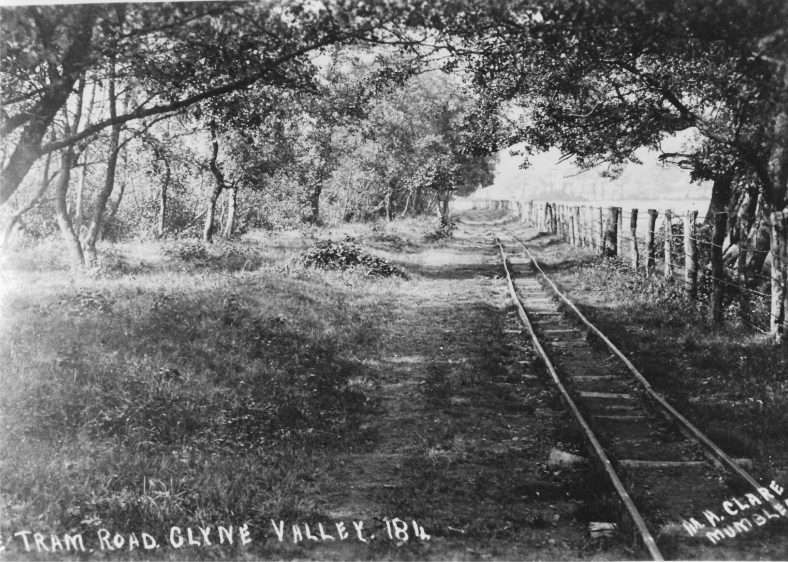
Another view of the Clyne Valley Tramway/Tramroad: the line was built of light-sectioned rail, © Blackpill Local History Society and licensed for reuse under a Creative Commons Licence (CC-BY-NC-ND). [4]
The Route of the Line

The line left the Swansea & Mumbles Railway close to Blackpill Bridge and Mumbles Road Railway Station (LNWR).

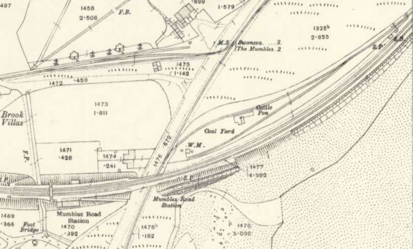
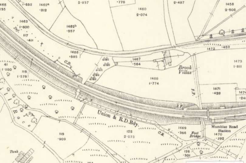
Mumbles Road Railway Station is at the bottom-left of this extract from the 25″ Ordnance Survey of 1913, published in 1918. Immediately to its East was Blackpill Bridge which carried the LNWR over Mumbles Road. East of the road was a Coal Yard which could be accessed from both the LNWR line and the Swansea & Mumbles Railway. To the North, the Clyne Valley Tramway had a couple of sidings adjacent to its main line. Don’t confuse the two drainage channels North of the Clyne Valley line for further sidings! [8]
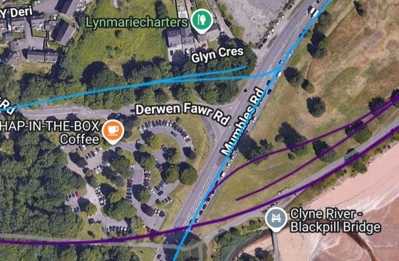
The same area in the 21st century. The blue line superimposed on the satellite imagery is the Swansea & Mumbles Railway and its Clyne Valley Branch. The purple line is the route of the LNWR line. This imagery is provided by railmaponline.com. [12]
Looking West from Mumbles Road between Glyn Crescent (off to the right of the image) and Derwen Fawr Road (beyond and to the left of the car). The straight blue line is the main line of the Swansea & Mumbles Railway, the curved line approximates to the line of the Clyne Valley Tramway. [Google Streetview, July 2025]
Mumbles Road Station is at the bottom-right of this next extract from the same OS survey. The LNWR line curves up towards the top,-left of this image as it heads into the Clyne Valley. The single-track Clyne Valley Tramway also curves towards the top-left of this image. [8]
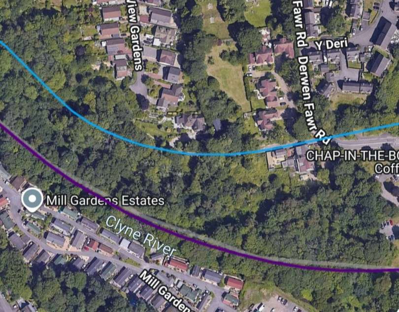
The same area in the 21st century. [12]
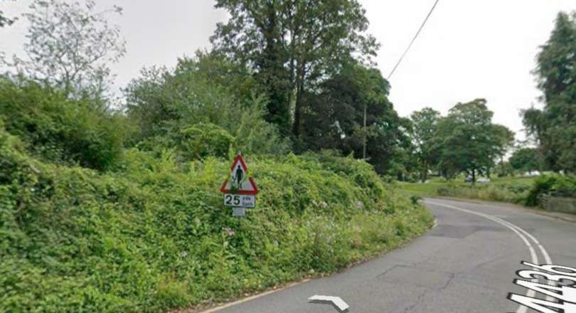
Looking back along the line of the old tramway from the location of its level crossing on Derwen Fawr Road. [Google Streetview, July 2025]
Looking ahead along the line of the old tramway from the same level crossing. [Google Streetview, July 2025]
Only one 25″ Ordnance Survey is available along the next length of the Clyne Valley Tramway. This extract from the 1877 survey, published in 1878, shows the railway and tramway following the Clyne Valley to the Northwest. The tramway seeks to follow the easiest gradients as it winds sinuously up the valley. The LNWR line was much better resourced and was able to afford significant earthworks which eased gradients and allowed a more direct line up the valley. [9]
Approximately the same area as shown on railmaponline.com. [12]

These next few Streetview Images are courtesy of the City & County Survey Team.

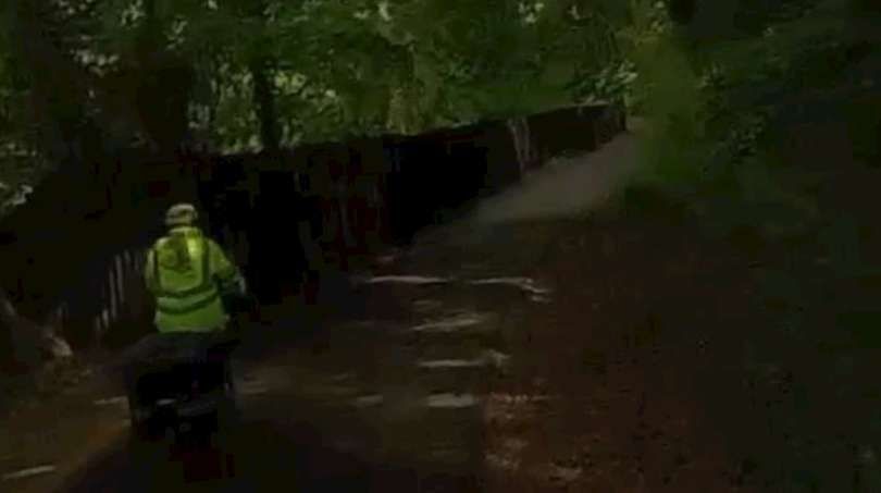
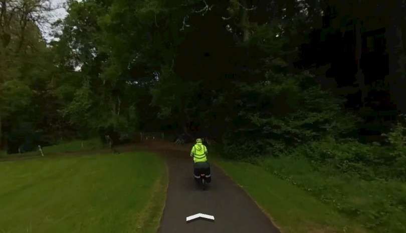
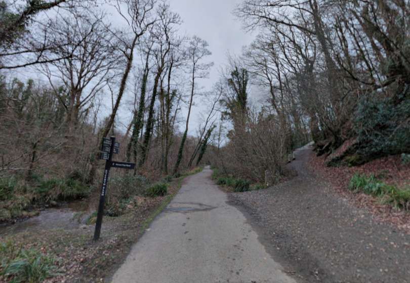
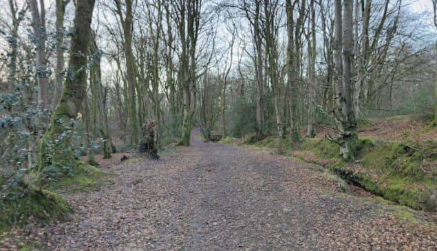
Just towards the bottom of the railmaponline.com satellite image above the old tramway route is joined by a cycleway. This photograph looks back Southeast along the line of the old tramway. [Google Streetview, August 2026]
Looking ahead along the route of the old tramway from the same location. The tree cover is dense and the lighting therefore is poor. [Google Streetview, August 2026]
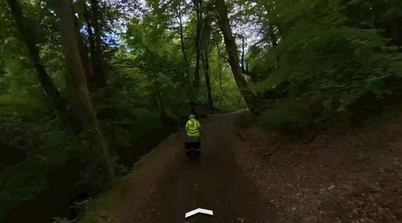
Continuing Northwest, late evening further along the old tramway route and looking Northwest at the location of the clearing shown a little above the centre of the railmaponline.com image above. [Google Streetview, August 2026]
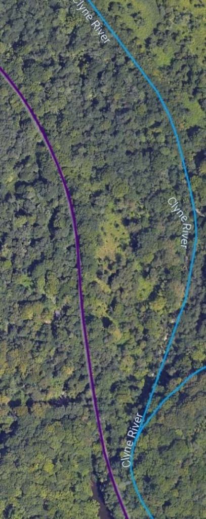
Further Northwest, this time at the point where the purple and blue lines are closest on the railmaponline.com satellite image above. [Google Streetview, August 2026]
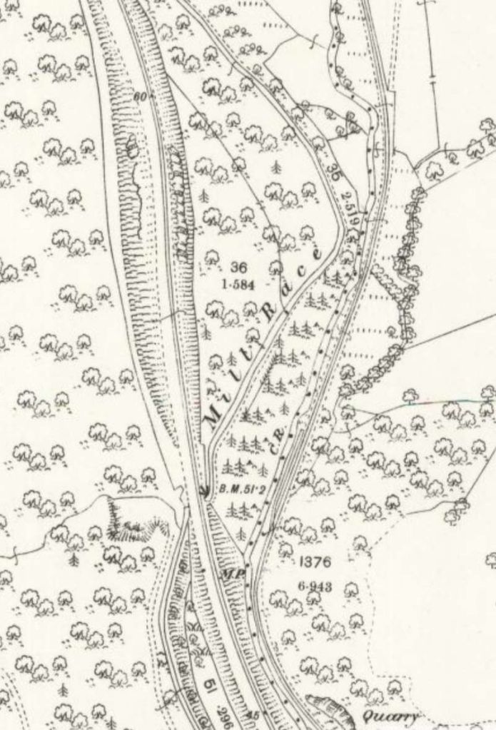
The two lines continue North up the valley of the Clyne. Note the Mill Race which separates the two railways. [9]

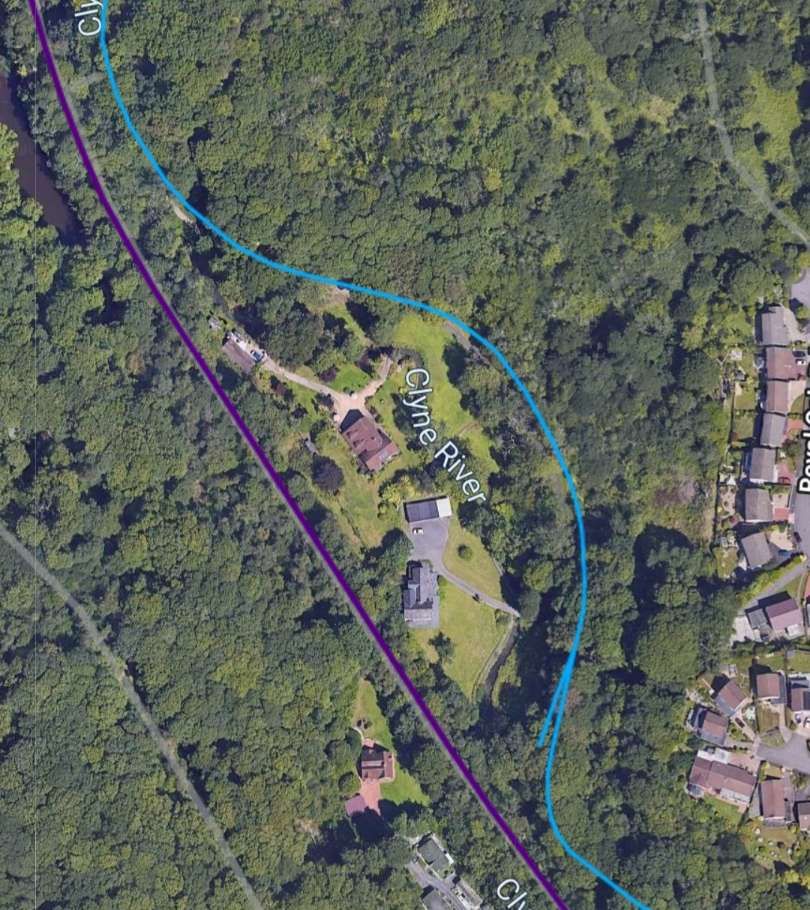
A similar area to that shown in the map extract above. Note the branch line that railmaponline.com shows heading to the East from the main branch line. This does not appear on the map extract as it was the line which served Ynys Colliery in the earlier 19th century. By the sate of the 1878 Ordnance Survey, the line had been abandoned and removed [12]

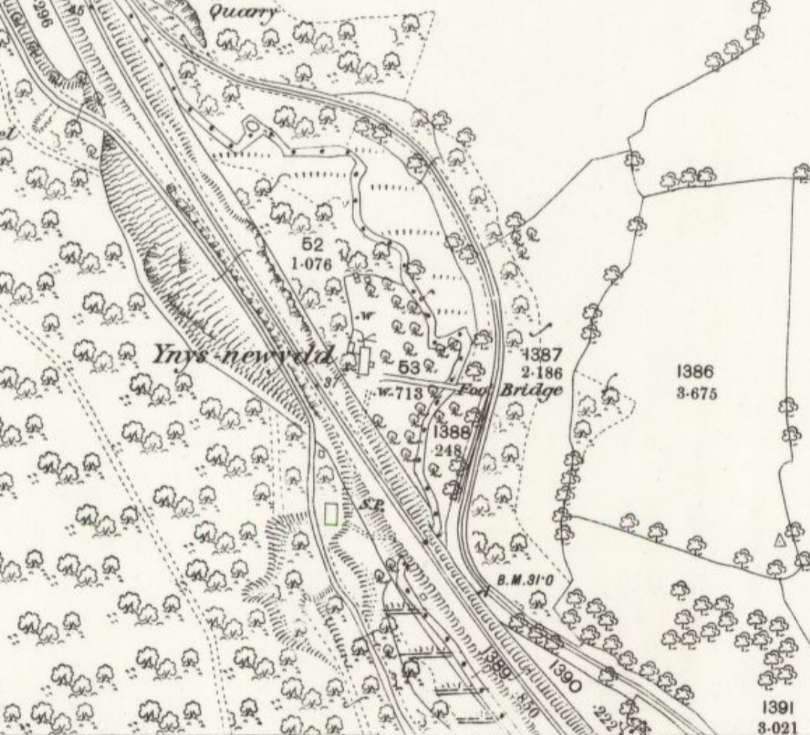
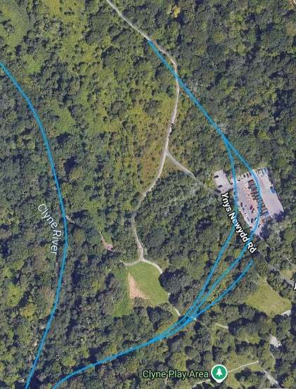
The branch served a colliery which is given the name Ynys in the early part of this article. The line shown in this image was the original line of the Clyne Valley Tramway. This length of tramway appears as a stub-end in the first map in this article and as a longer line in the second map near the top of this article. [12]
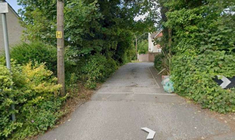
This photograph shows the location where the branch to Ynys Colliery left the Clyne Valley Tramway. The line to Ynys climbs away to the right, the main drag is directly ahead, © Ian Allen [Google Streetview, January 2022]
A pixelated and out of focus photograph gives a last glimpse ahead along the line of the Clyne Valley Tramway. The City & County Survey Team turned away to the right at this location. [Google Streetview, August 2026]
The two lines continue to follow the Clyne River valley with the Tramway on the East bank of the river. The LNWR line is higher up the West side of the valley. [9]
The same area in the 21st century. [12]
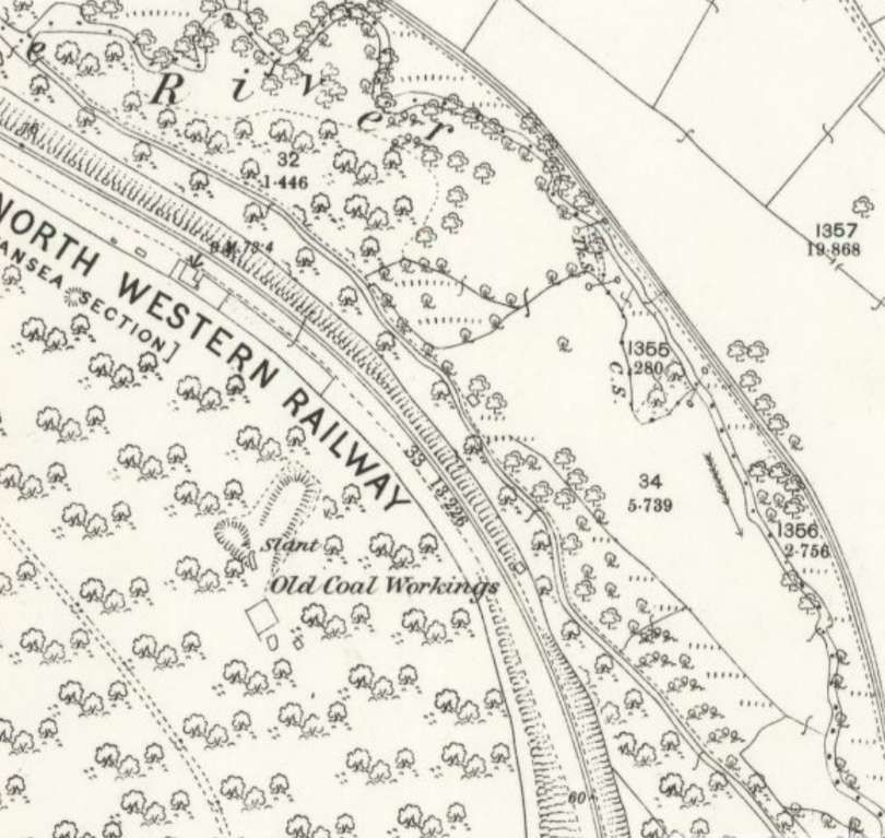
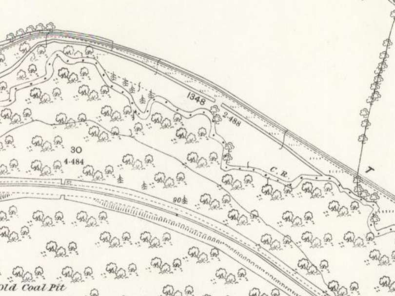
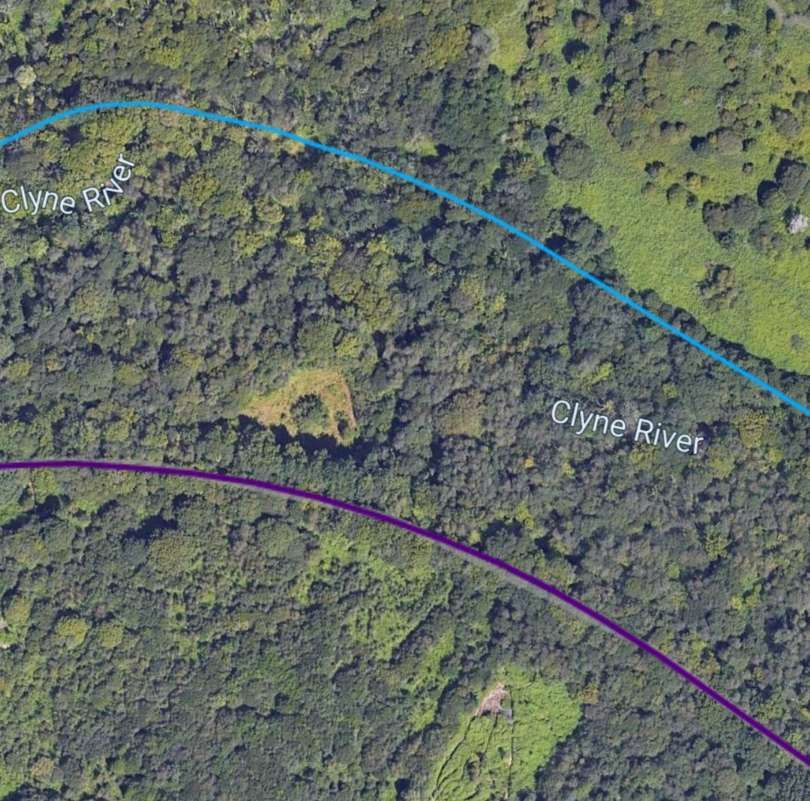
Both lines are now about equidistant from the meandering river course. [9]
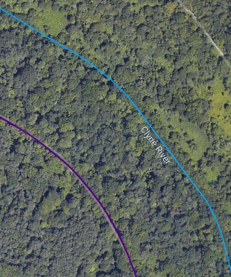
The same area in the 21st century. As these pictures show the Clyne Valley is heavily wooded. [12]
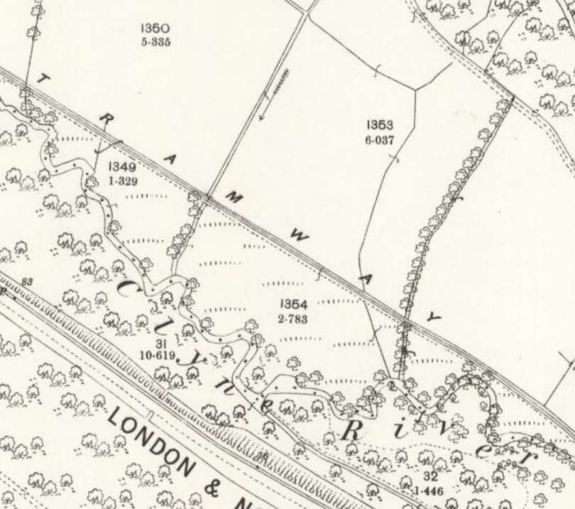
Approaching the terminus of the Clyne Valley Tramway it turns relatively sharply to the Southwest, following the East bank of the river fairly closely. [9]
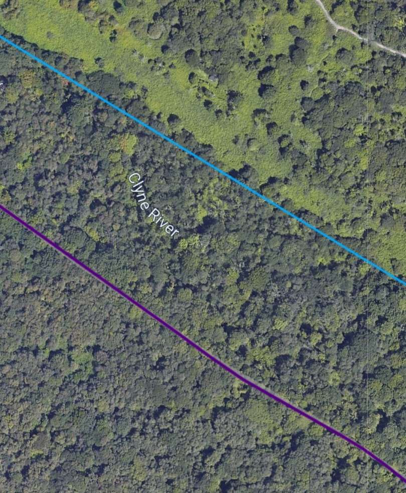
The same area in the 21st century. [12]
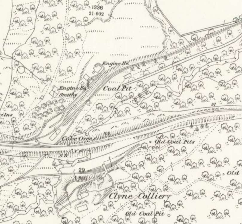
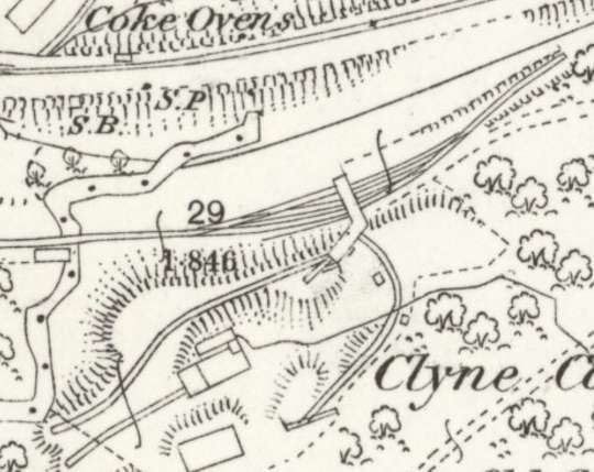
Clyne Colliery appears on this extract, fed by an extension to the Clyne Valley Tramway passing under the LNWR line and by means of a headshunt. [9]
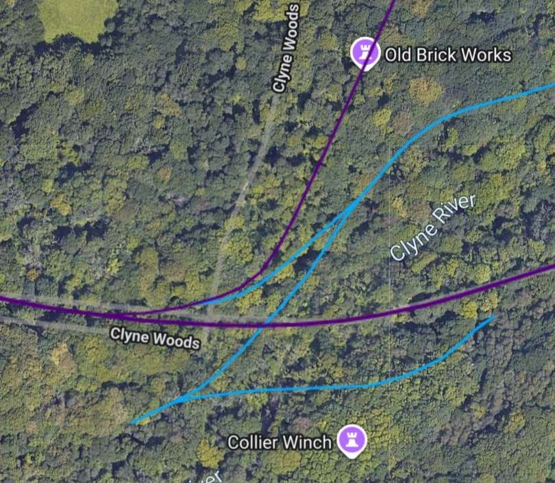
A wider area than that shown in the map extract above, shows the remainder of the Clyne Valley Tramway, the LNWR main line and the LNWR branch siding which served Rhydydefaid No. 2 Pit. Rhydydefaid No. 1 Pit sat to the North of the LNWR main line and to the East of the siding serving No. 2 Pit. [12]

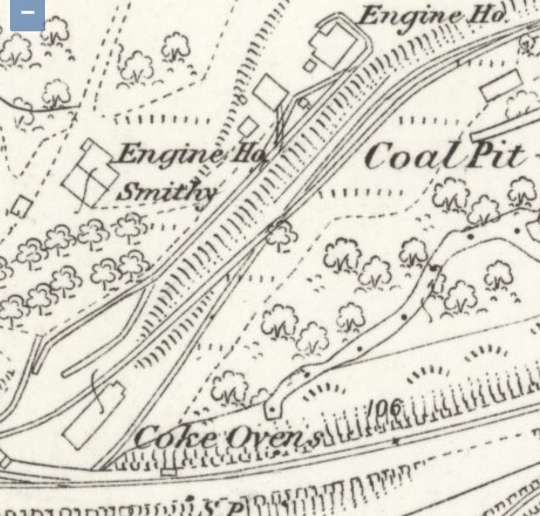
A closer view of the area to the Southeast of Killay that was the original terminus of the extension mentioned in the text of this article. Note the Coke Oven, two Engine Houses and the Smithy which remain from Rhydydefaid No. 1 Pit. [9]

The site of Clyne Colliery which was accessed under the LNWR line and then via a headshunt. [9]

The next couple of OS map extracts show the area Southeast of Killay at two later times in history – the turn of the 20th century and immediately before the first world war. …

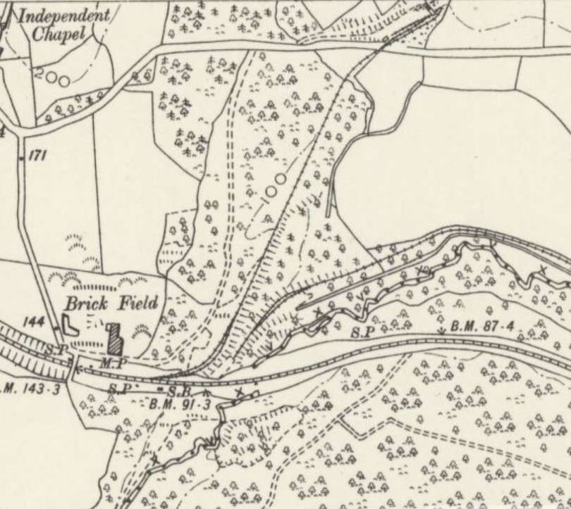
This extract from the 6″ Ordnance Survey of 1896/1897, published in 1900 shows the same area just before the turn of the 20th century. A long siding from the LNWR main line can be seen. Heading North-northeast to Rhydydefaid No. 2 Pit which was sited just on the next OS Sheet to the North. [10]
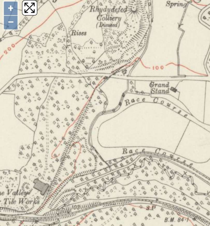
This extract from the 6″ Ordnance Survey of 1913/1914, published in 1920 is able to include the colliery (by then disused) because the OS sheet area had changed from the earlier 6″ survey. Note the racecourse on the right side of this image. [11]
Looking West along the forest path which runs between the Racecourse location and that of Rhydydefaid No. 1 Pit: (the camera is at a place to the West of the location of the Grand Stand which appears on the OS Map extract above), a hundred metres or so ahead is the point where the track was crossed by the LNWR siding serving Rhydydefaid No. 2 Pit (Commercial Colliery), (c) Ian Allen. [Google Maps, July 2022]

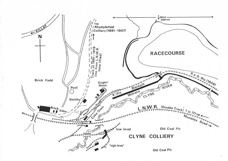
The next image is a line drawn map of the area South of Killay.

The area Southeast of Killay in the Clyne Valley: showing the brickworks, collieries, railway tracks, river, millrace, roads and the racecourse, the line to Rhydydefaid No. 2 Pit heads North from the brickworks adjacent to the LNWR line. No. 1 Pit was at the concentration of tramway lines to the North of the LNWR line, © Blackpill Local History Society and licensed for reuse under a Creative Commons Licence (CC-BY-NC-ND). [5]

Rhydydefaid No. 1 Pit

There is very little left of the buildings associated with this colliery which sat at, what was then, the end of the Clyne Valley Tramway. The colliery’s extensive waste tips are to the north of the pit on the south-east side of the railway embankment leading to the later Rhydydefaid No. 2 Pit (known too as Commercial Colliery). No. 1 Pit was sunk early in the 1840s and George Byng Morris started to work the coal and ironstone almost immediately through the Rhydydefed Coal Company and the Rhydydefed Iron Company which were created for this purpose. In order to serve these new workings, he re-laid the original 1804 Clyne valley branch of the Oystermouth Railway and extended it to Rhydydefaid pit in 1841-2, thus almost doubling its length. The history of teh colliery is covered in the general text above, it passed through a number of different hands and spent times in a state of disrepair prior to being refurbished by the next ‘owner’ or ‘leasholder’. Deatils are available on the Clyne Valley Community project website. [13]

That website tells us that, ” Evidence for the closure date of the Rhydydefaid pit is ambiguous. The colliery is listed in the report of the Inspector of Mines for 1882 and in Mining and Mineral Statistics for 1883. It is absent from Mining and Mineral Statistics in 1884 but re-appears in 1885 and 1886: in both years no manager is named which could be taken to indicate that it was inactive. The pit had definitely been abandoned by 1885 since all the plant and machinery was offered for sale in December of that year. The plant included a winding engine and a pumping engine, each with its own boiler; these would have been housed in the two engine houses which were marked on the 6in and 25in Ordnance Survey maps of 1876/7. There were also screens and tipping apparatus, cages, coke ovens (again as shown on the Ordnance Survey maps), a large number of trams, eight railway trucks, rails and a variety of miscellaneous equipment – altogether what one would have expected of a well equipped colliery. With a life of about forty years, its closure must have been due simply to the fact that all the coal that could be worked conveniently or economically had been extracted.” [13]

Within a few years coal was being exploited from Rhydydefaid No 2 Pit (Commercial Colliery).

Rhydydefaid No 2 Pit (Commercial Colliery)

This colliery was built to exploit coal from the area North of the No. 1 Pit. Rhydydefaid No 2 Slant, later known as Commercial Colliery, commenced working in 1891 or at the latest 1892; A railway connection to the new slant was put in from the existing siding off the London & North Western Railway which had been installed to serve Rhydydefaid No 1. The railway is shown on the 2nd edition of the Ordnance Survey 6 inch map (revised 1896) and it is safe to assume that it was in existence by the time the colliery opened. It remains a prominent feature within Clyne Woods.

Remnants of this colliery are described on another page on the Clyne Valley Community project website. [14]

After closure, an area to the West of the site seems to have been used as a clay pit with the embankment was used as a convenient track for transporting clay to the brickworks to the South of the site close to the LNWR main line.

Clyne Wood Colliery

Clyne Wood Colliery is marked on the OS mapping above as ‘Clyne Colliery’. Remnants remain but the principal site appears to have been used for clay extraction by the adjacent Briskworks.

The site and its history are described in detail in a page on the Clyne Valley Community project website. [15]

Work ceased at the pithead in 1870, although underlying minerals may have been extracted via the neighbouring Rhydydefaid pit. In June 1870, the entire plant and materials at the Clyne Wood pithead were offered for sale. “It would appear that the sale was unsuccessful and that the pithead equipment remained in situ for it is all shown in detail on the first edition of the 25 inch Ordnance Survey map (surveyed in 1877/8).” [15]

Underground working probably ceased in about 1883 at the same date as Rhydydefaid itself.

Steam Locomotives

In the 1899 Agreement: to facilitate the reopening of the valley’s coal reserves, an agreement was struck with the Swansea Improvements and Tramways Company (operators of the Swansea and Mumbles line) to convey coal from the Clyne Valley down to the main Swansea wharfs. Because the main line had fully transitioned to steam traction by this era, the regular fleet of Swansea and Mumbles Railway Steam Locomotives worked the branch line to haul the heavy coal trains down the valley. This fleet included a variety of saddle tanks from manufacturers like the Falcon Engine & Car Works, Manning Wardle, and the Hunslet Engine Company. [16]

Steam-hauled coal trains coming down the Clyne Valley branch would arrive at the junction near Blackpill. To transfer the coal to the wider rail network, the locomotives had to back-shunt west towards Oystermouth before running forward through points into the adjacent London and North Western Railway (LNWR) Mumbles Road station goods yard.

Locomotive operations on the branch continued through the peak years of the local coal industry until the local slant mine closed in 1921. The track itself actually remained intact for years afterward, with records showing a final diesel locomotive excursion traveling up the branch as far as Ynys Gate as late as 1936. [16]

References

  1. https://www.storyofmumbles.org.uk/subject/clyne-valley, accessed on 18th October 2026.
  2. https://www.storyofmumbles.org.uk/catalogue_item/clyne-valley-industry, accessed on 18th October 2026.
  3. https://www.storyofmumbles.org.uk/catalogue_item/clyne-valley-on-the-way-home, accessed on 18th October 2026.
  4. https://www.storyofmumbles.org.uk/catalogue_item/clyne-valley-tram-road, accessed on 18th October 2026.
  5. https://www.storyofmumbles.org.uk/catalogue_item/clyne-valley-the-killay-end, accessed on 19th October 2026.
  6. https://clynevalleycommunityproject.uk/history/clyne-valley-branch-railway-and-its-extension, accessed on 19th October 2026.
  7. https://wrrc.org.uk/s&mrrc.php, accessed on 19th October 2026.
  8. https://maps.nls.uk/view/135196921, accessed on 20th October 2026.
  9. https://maps.nls.uk/view/135196912, accessed on 20th October 2026.
  10. https://maps.nls.uk/view/102183111, accessed on 20th October 2026.
  11. https://maps.nls.uk/view/102342499, accessed on 20th October 2026.
  12. https://railmaponline.com/uk-and-irish-railways, accessed on 20th October 2026.
  13. https://clynevalleycommunityproject.uk/history/rhydydefaid-no-1-pit, accessed on 21st October 2026.
  14. https://clynevalleycommunityproject.uk/history/commercial-embankment, accessed on 21st October 2026.
  15. https://clynevalleycommunityproject.uk/history/clyne-wood-colliery, accessed on 21st October 2026.
  16. https://en.wikipedia.org/wiki/Swansea_and_Mumbles_Railway, accessed on 21st October 2026.
  17. https://www.facebook.com/photo/?fbid=4063548183937656&set=gm.27283315648009263&idorvanity=163976490369879, accessed on 21st October 2026.