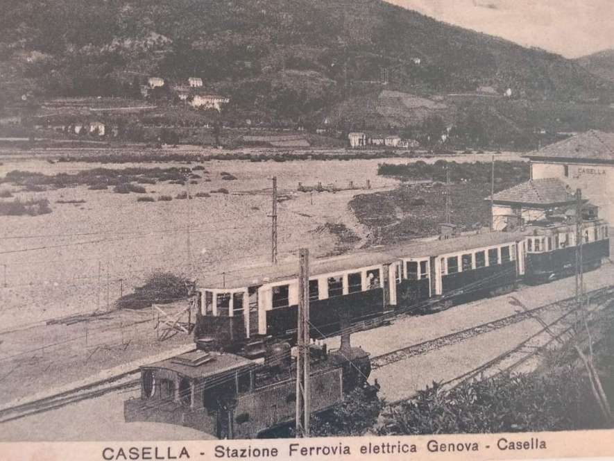
The Metropolitana di Genova is, in 2024, a single-line, double-track light rapid transit system that connects the centre of Genova, Italy with the suburb of Rivarolo Ligure, to the north-west of the city centre. It runs through to Brignole Railway Station in the East of the city. In 2024, the service is managed by Azienda Mobilità e Trasporti (AMT), which provides public transport for the city of Genoa. [1]
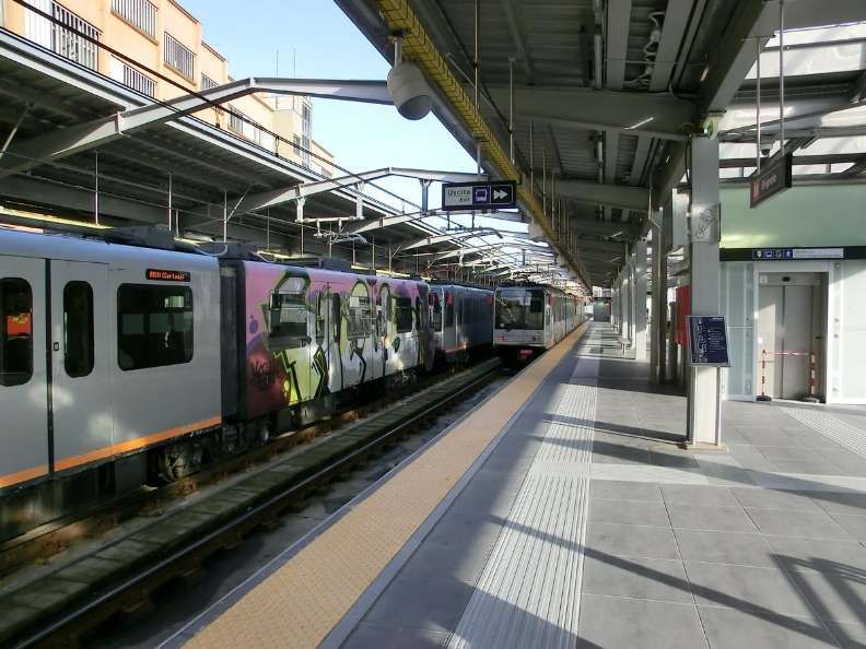
The Metro is a 7.1 kilometres (4.4 mi) long 1,435 mm (4 ft 8 1⁄2 in) (standard gauge) double-track line and is electrified with overhead lines at 750 volts DC. It has a direct connection with Trenitalia’s mainline railway station, Principe. [1]
The origins of a subway in Genoa date back to the beginning of the twentieth century; in 1907 Carlo Pfalz, who had already designed the Zecca-Righi Funicular, [2] was the first to explore the construction of an underground railway with electric traction. Several projects, including that of the engineer Angelo Massardo and those of Renzo Picasso (1911 and 1930), were proposed without being realized. Instead, a tram system at surface level was built which ultimately was abandoned in 1966. An attempt to introduce an alternative means of transport was made on the occasion of the International Exhibition of Marine and Maritime Hygiene of 1914: it was a ‘Telfer’, an elevated monorail that connected the Port (Giano Pier area) to the exhibition area in Piazza di Francia, in front of the Brignole station. The infrastructure was then abandoned and finally demolished in 1918. [1]
An article about the Telfer can be found here. [3]
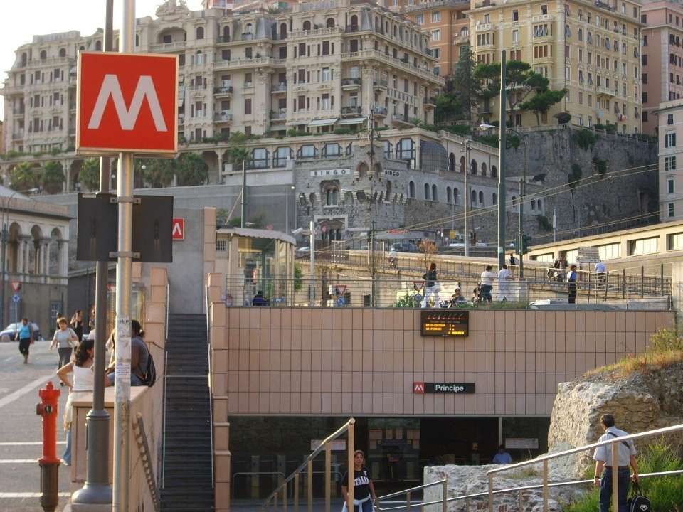
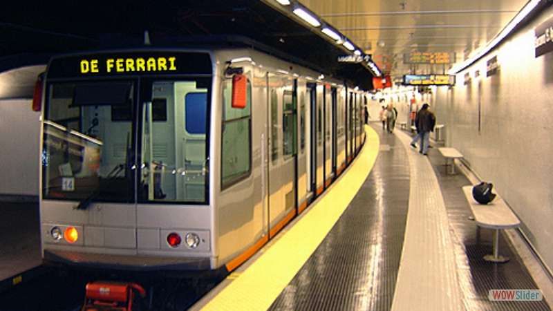
The underground ‘Metro’ was built in a series of phases. “The first section, opened on 13th June 1990 in time for the 1990 FIFA World Cup, was 2.5 kilometres (1.6 miles) [6] between the stations of Brin and Dinegro. [7] The line was extended to Principe in 1992, [6] to San Giorgio-Caricamento in 2003, [6] to De Ferrari (the underground station at Piazza De Ferrari) in 2005, [6] and to Brignole in 2012.” [8]
Since 2024, citizens of Genoa have been able to use the subway free of charge without any time restrictions.[9]
Stations
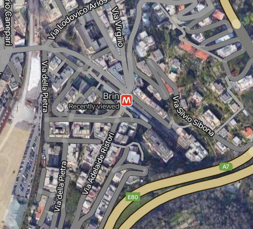
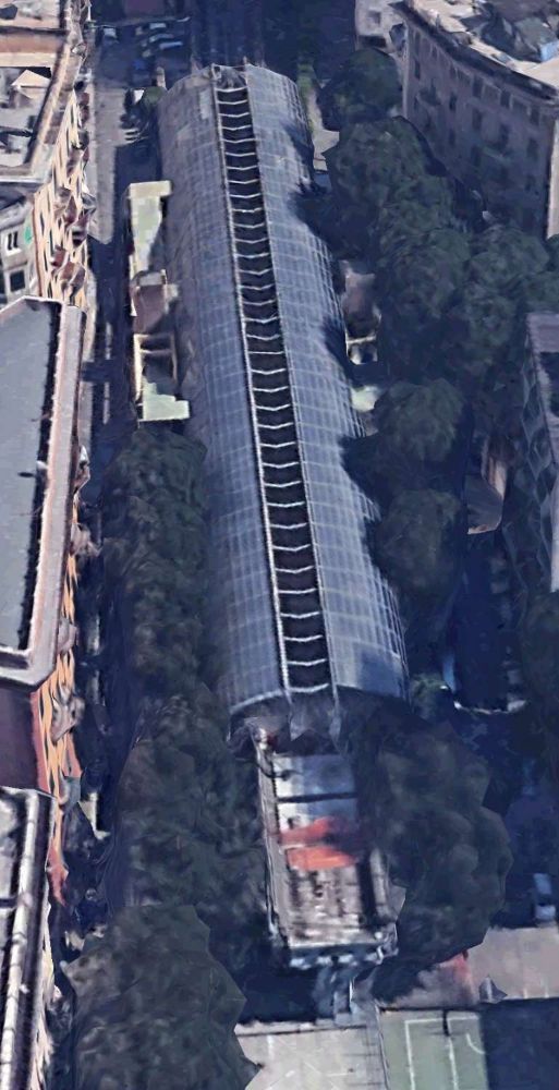
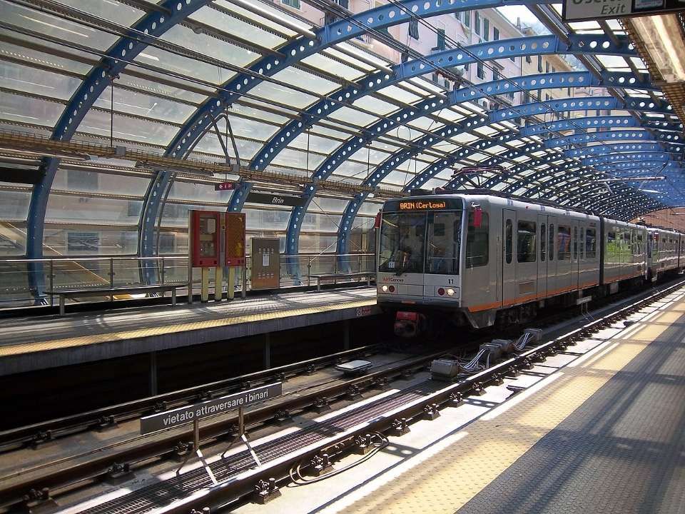
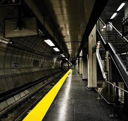
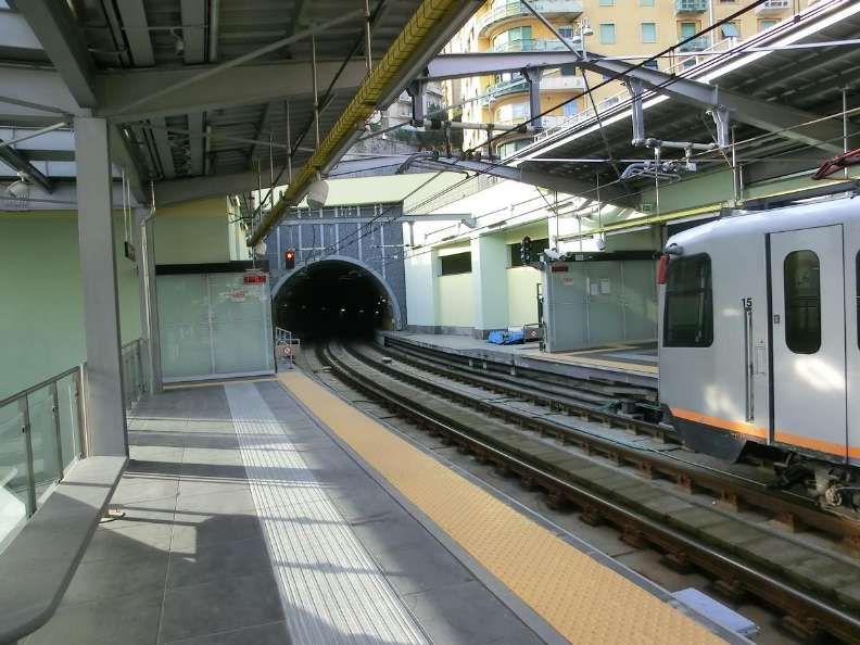
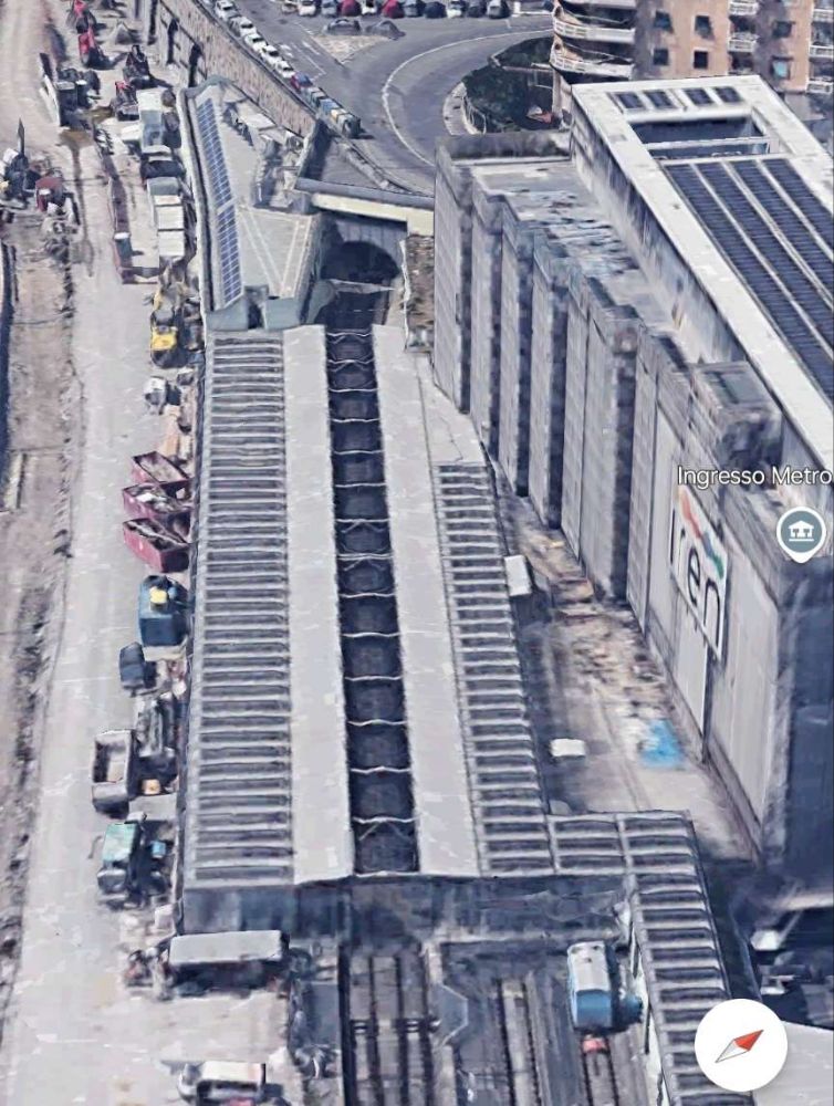
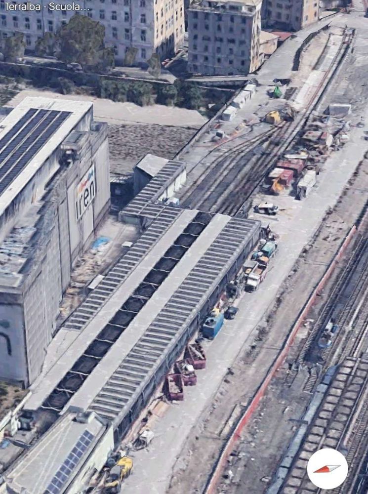
Brin Station – is currently (2024) the Northwest terminus of the line. It is situated along Via Benedetto Brin in the neighbourhood of Certosa in Rivarolo Ligure, a suburban area in the north-western outskirts of Genoa, Italy. The station, currently the terminus of the line, is located just west of the tunnel mouth on the line from Dinegro station. [10] It is built on a viaduct, which allows for the line to be extended to the north.
The station was designed by architect Renzo Piano, the station’s official opening took place on 13th June 1990. [10]
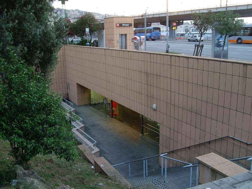
Dinegro Station is located under Via Milano, adjoining the Piazza Dinegro from which it derives its name, in the Fassolo area of Genova. It is just East of the business district of San Benigno and close to the ferry terminal.
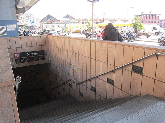
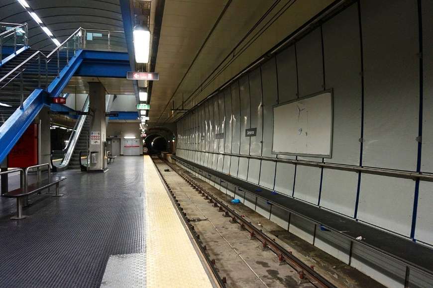
Darsena Metro Station is located on Via Antonio Gramsci close to Piazza della Darsena. ‘Darsena’ translates to ‘dock’ in English. The station serves the old port area of the city. [15]
San Georgio Station is located under Piazza della Raibetta beside the Palazzo San Giorgio, after which it is named. It is in the Old Harbour area near the Aquarium of Genoa. It was opened together with Darsena Station on 25th July 2003 and saw its first trains on 7th August 2003. [17]
The tracks of the San Giorgio station run beneath the Piazza Caricamento underpass and its underground architecture is similar to the model adopted for the Principe and Darsena stops, that is, with the tracks on the sides of the single central platform. During 2006, some electronic display boards were installed to inform users of the arrival times of trains. [17]
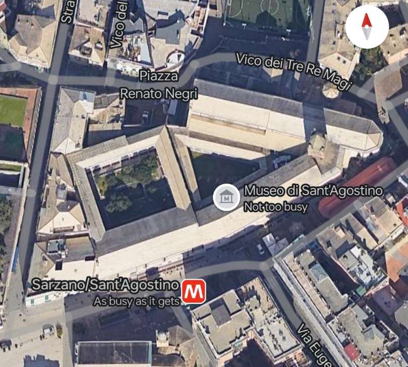
Sarzano/Sant’Agostino Station is located in the historical centre of Genoa. The main entrance is in the Piazza di Sarzano near the Church of St. Augustine, now deconsecrated and turned into a museum, with a second entrance on the Mura della Marina, the old seawall. It opened on 3rd April 2006. [19]
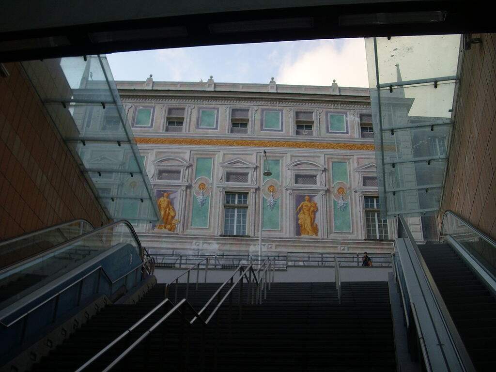
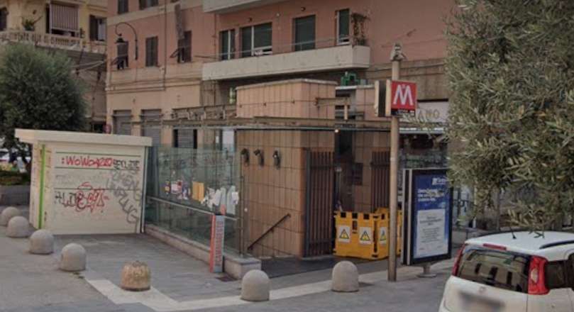
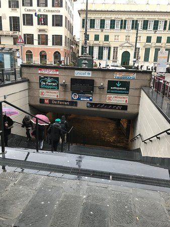
De Ferrari Station is close to Teatro Carlo Felice, Galleria Mazzini, the Doge’s Palace, and Via XX Settembre. It opened on 4th February 2005. It was originally designed, like others, by Renzo Piano with finishing touches by Renzo Truffelli. This used to be the last station on the line until the easterly extension towards Genova Brignole Railway Station opened in 2012. [21][22]
The entrance to de Ferrari Station. [23]Platform level at de Ferrari Station. [€23]
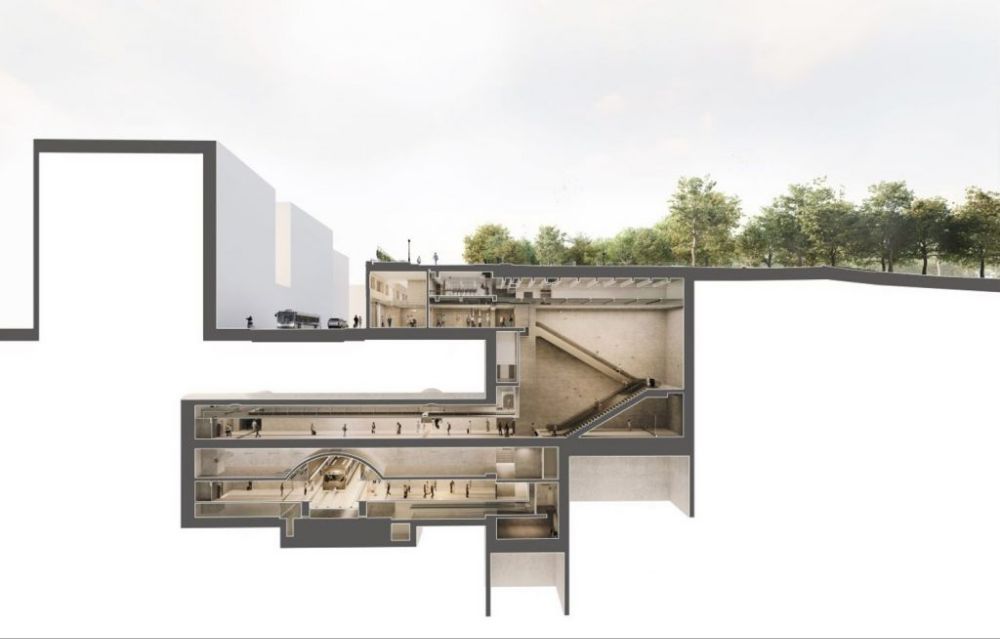
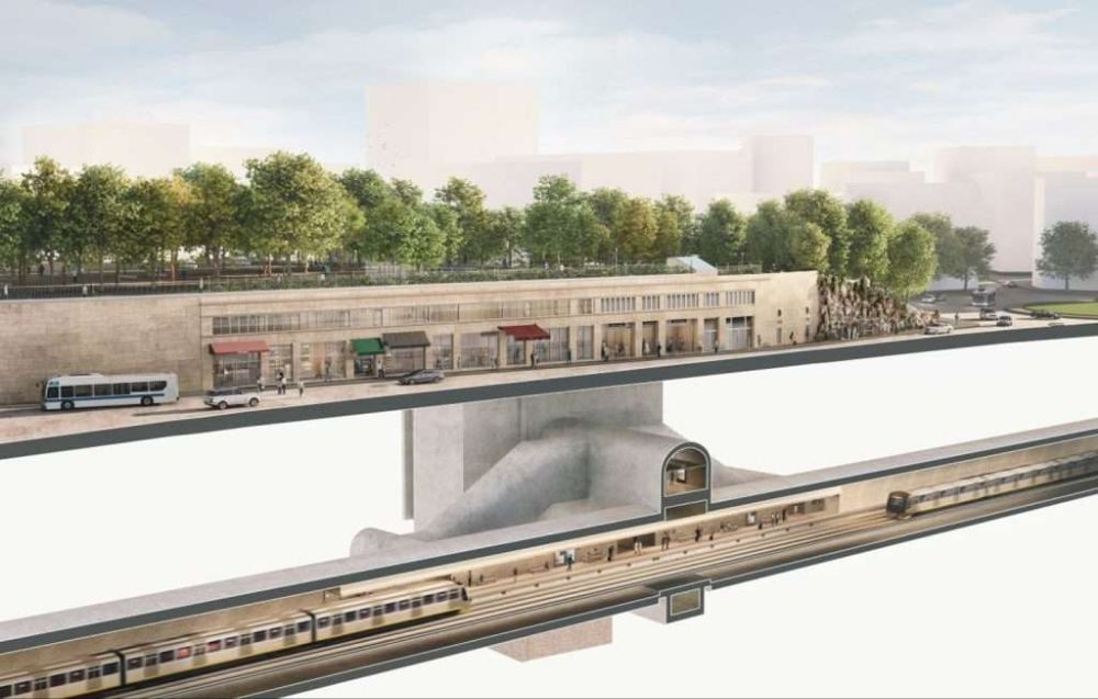
Corvetto Station – In March 2024 3Ti Projeto announced that the design of Corvetto Station had been approved by the municipality. Work is expected to cost around 38.3 million Euros and be completed late in 2024 or early in 2025. [24][25][26]
These two images show the 3Ti Projeto design for Corvetto Station. [24]
Brignole Station – sits close to the main line Brignole Station to the West of the city centre. It opened in 2012. [27]
Wikipedia tells us that Genova is just (in 2024) bringing a fourth generation of trams into service. The three previous generations each served the city well.
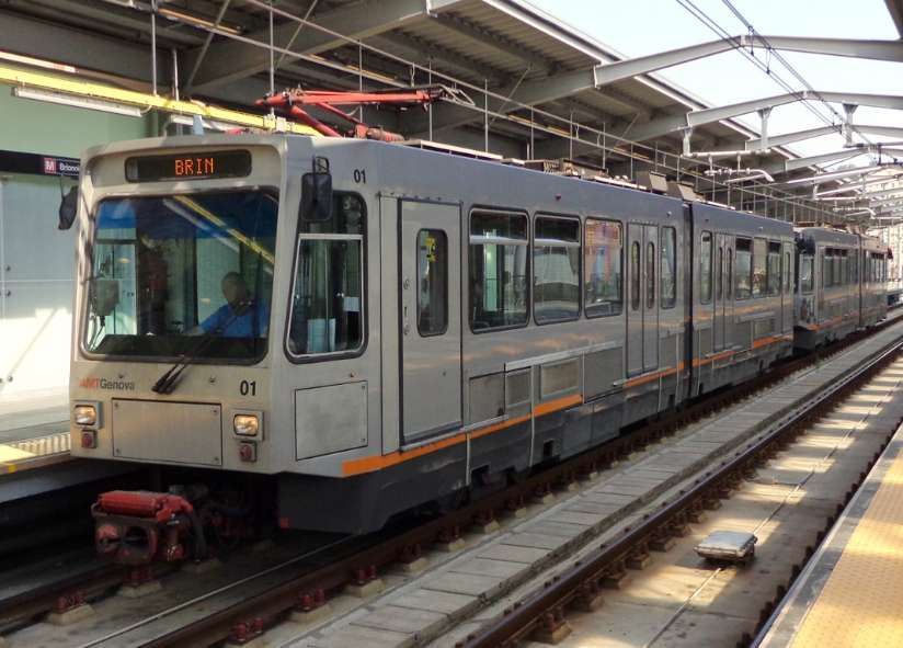
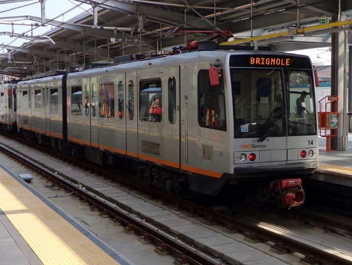
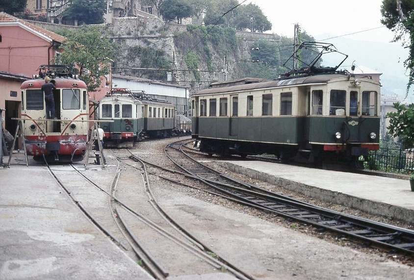
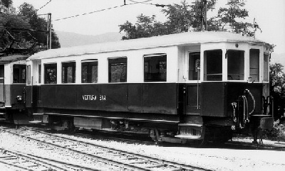
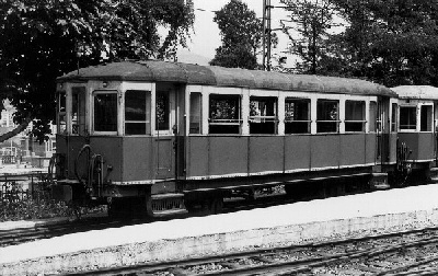
First Generation Rolling Stock – consisted of 6 sets of articulated cars, built by Ansaldo, and introduced in 1990. They were derived from the Zurich Tram 2000 tram used in Switzerland, but altered for standard gauge running. Each vehicle had two sections with one central articulation. They were supported on three bogies The two outer bogies were motorised. The vehicles were bidirectional and had four sets of doors on each side. They had blue seats in a transverse arrangement. The train were numbered 01 to 06. [1][29]
Second Generation Rolling Stock – was made up of a group of 12 trains. Numbered 12 to 24. Like the first generation, each train was made up of two sections resting on three bogies, with the outer two motorised. The trains were bidirectional with six doors on each side, and the seats were arranged longitudinally. The trains were built by Ansaldo and introduced in 1992. [1][30]
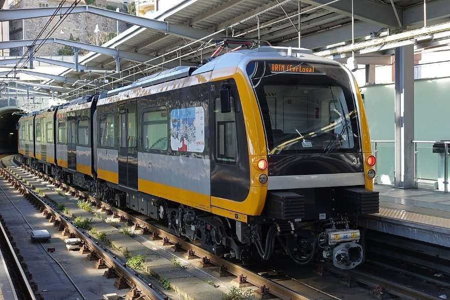
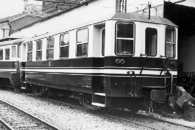
Third Generation Rolling Stock – these trams/trains significantly differ to the previous two. They were delivered by Hitachi Rail Italy in 2016. There are 7 trains numbered 31 to 37. The trains are longer than previous generations at 39 metres and four articulated sections with five bogies. Of the five bogies, the central three are motorised. There are a total of four doors per side of the bidirectional sets. [1][31]
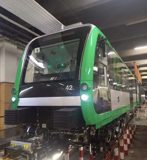
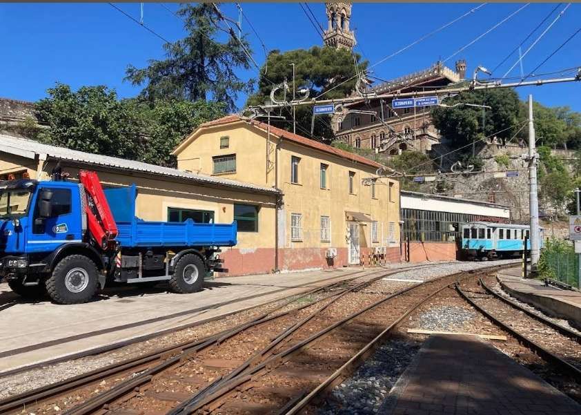
Fourth Generation Rolling Stock – In anticipation of the planned extensions (see below) and considering the now thirty-year service of the first generation trains, in 2020 the Municipality obtained a loan of 70 million Euros to purchase 14 new generation trains. [32] In 2021, Hitachi Rail signed the contract to supply the new trains on a rolling programme, monthly by month, to coincide with the inauguration of the Brin-Canepari and Brignole-Martinez routes. [33]
In June 2024, Sustainable Bus E-magazine reported that the first of these new units had arrived in Genoa. [26]
New tram/train No. 42. [26]
The new units will be numbered 41 to 54. “Each of the 14 new vehicles is made up of four half-cars, resting on five bogies, for a total length of 39 metres, will be able to accommodate up to 290 passengers, will be bidirectional, and will also run in double formation for a total length of 78 metres and a capacity of 580 passengers.” [26]
“In order to ensure greater operating flexibility, these trains will also be able to operate in double traction with the 7 third-generation vehicles, the 31-37 series delivered in 2016, currently in service.” [26]
The new units entry into service will “allow the scrapping of the 6 first-generation trains, series 01-06, … the average age of the fleet will thus be lowered from 18.5 years to 9.8 years. The 10-series trains (11-22 series) built between 1991 and 1995 will be kept in operation.” [26] The fleet will therefore consist of the 21 trains of the 30, 40 and 10 series trains.
Extensions to the Network
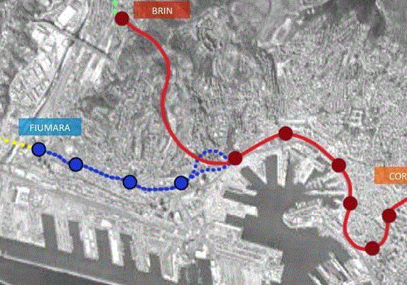
In 2022, the Railway Gazette reported that Genova municipality had approved plans for a 3 km western branch of the metro with four stations, linking Fiumara with the city centre. [4]
The western extension of Genoa’s Metro is shown in blue. [4]
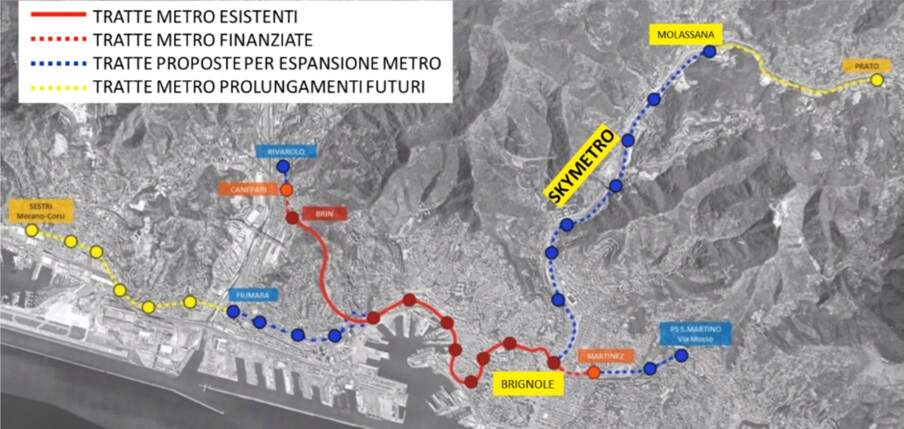
In September 2024, the city secured 74.5 million Euros to significantly expand the Metro network as shown on the map below. [5]
The planned Metro network for Genoa (Genova) as reported in September 2024. [5]
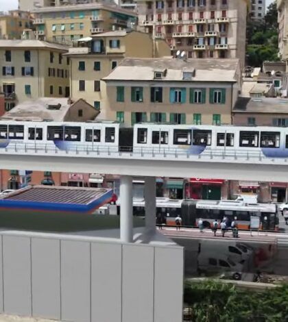
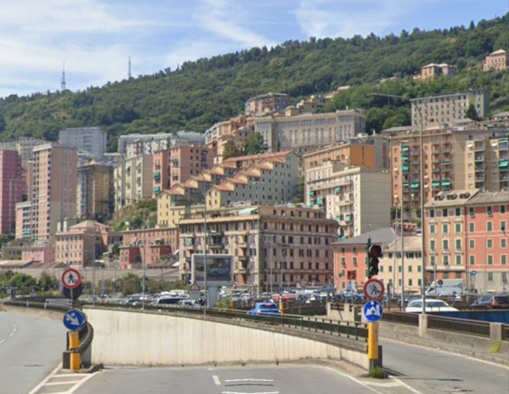
As can be seen in the map above these significant additions to the network include a length up the Val Bisagno of elevated railway (SkyMetro).
The planned SkyMetro, running up the valley of the River Bisagno. [34]
The planned investment is over 400 million Euros at 2022 prices. Genoa will receive 418.9 million Euros to finance the SkyMetro of Val Bisagno, the extension of the metro from Brin to Via Canepari and work associated with the Rio Maltempo. The majority of the new money (398.8 million Euros) is intended for the construction of the SkyMetro.
During rush hour, the new line will be able to transport eighty percent of the valley’s users, resulting in a significant reduction in the production of exhaust fumes from private cars. It will be seven kilometers long and will have a neutral energy balance thanks to the photovoltaic system mounted on the roof, which will make the SkyMetro partially sustainable. The project will reach as far as Molassana but the city has every intention to take the scheme further, as far as Prato. [34]
Veronica Pallotta; Metropolitane: Genova, Comune e Ferrovie siglano accordo per il prolungamento verso Canepari; in Ferrovie.Info (in Italian), 30th December 2020, accessed on 24th February 2022.
This article covers the northern half of the line and has a quick look at the motive power and rolling-stock used.
Another article covers the history of the Line and the southern half of its route. It can be found here. [18]
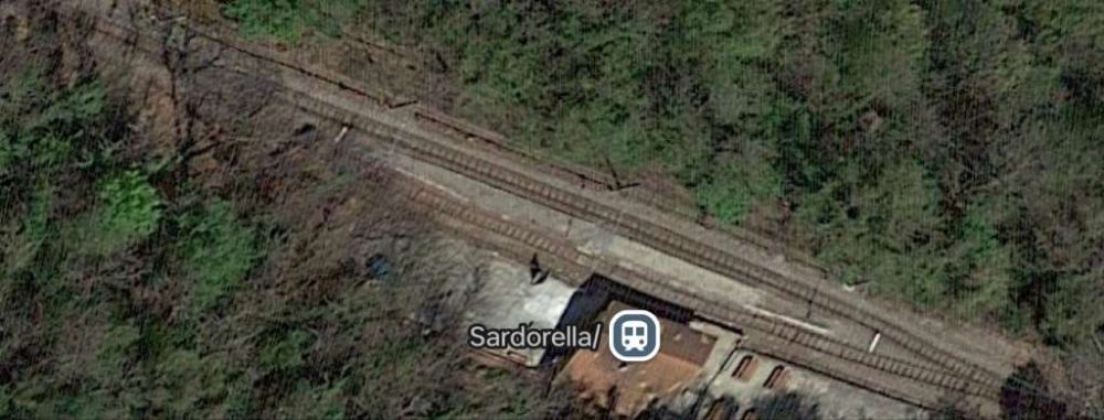
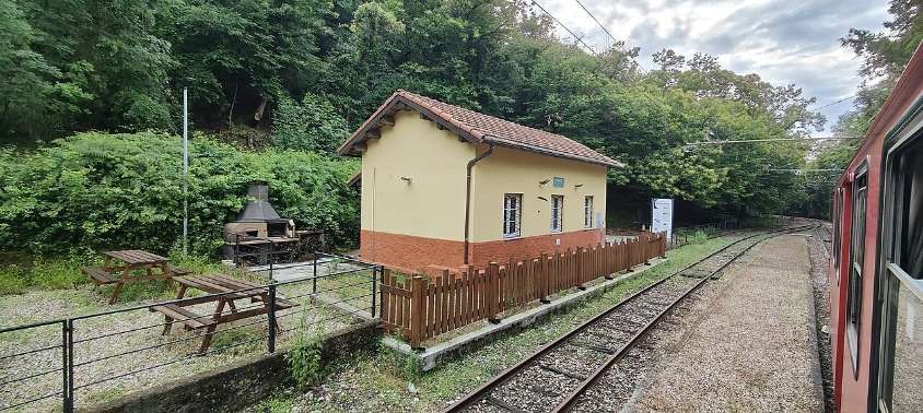
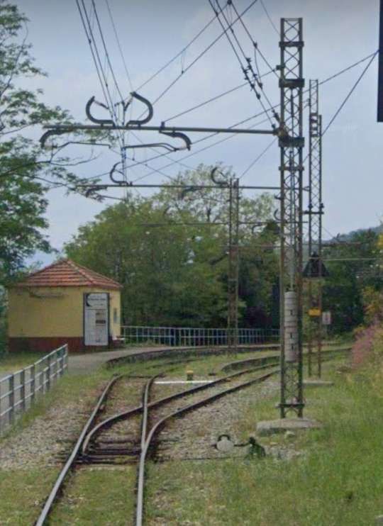
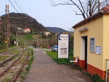
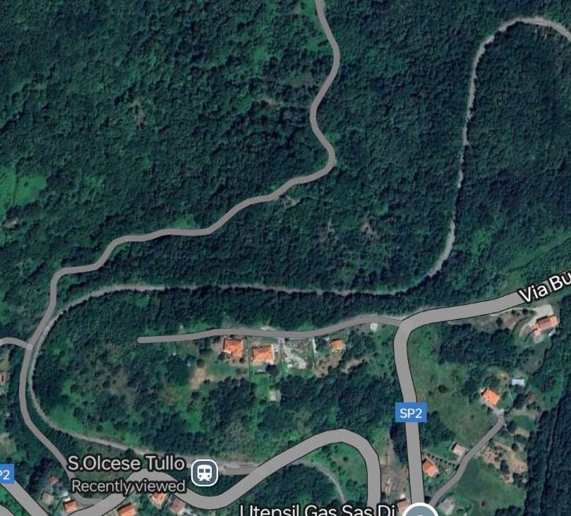
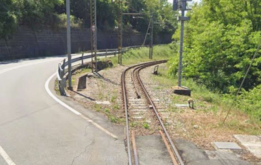
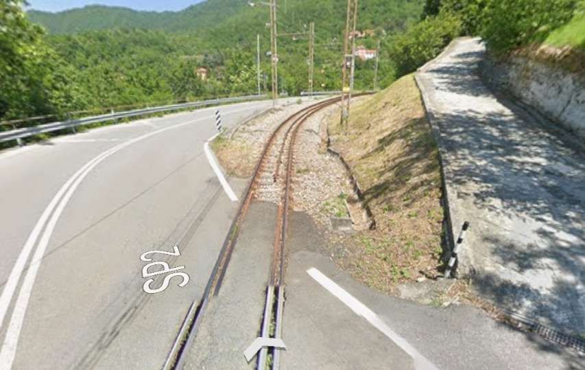
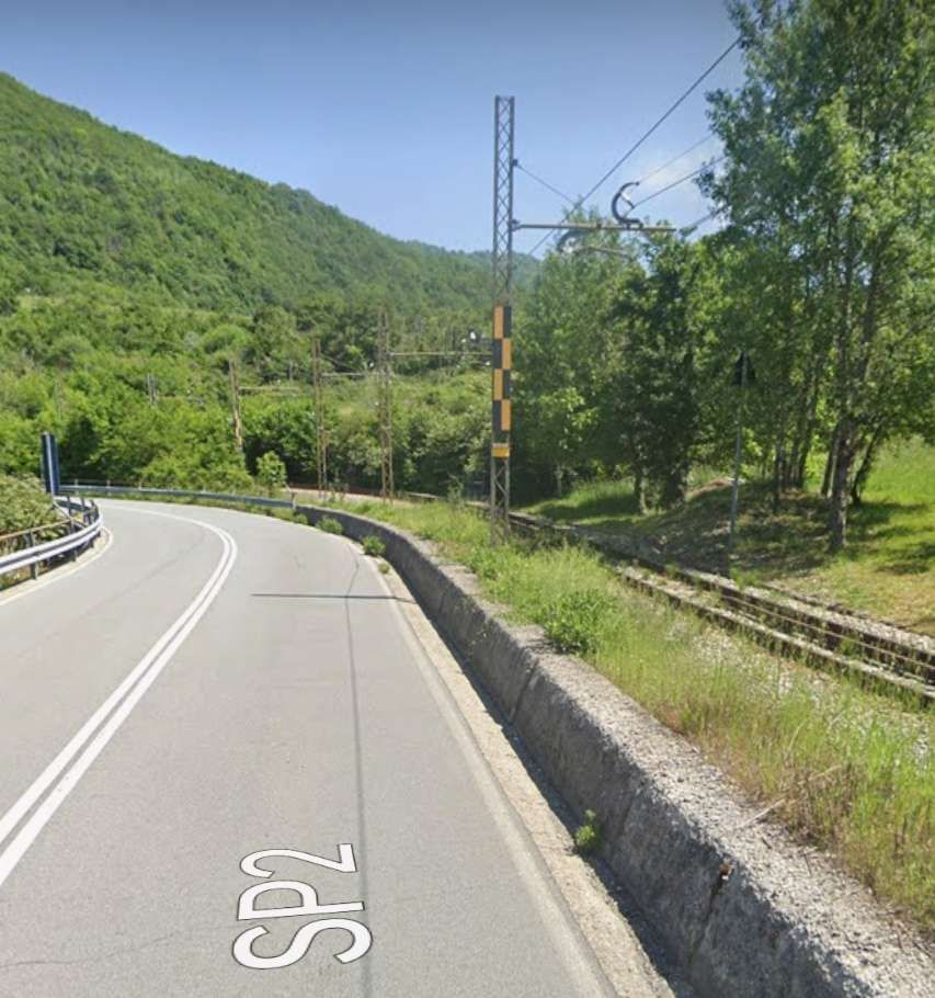
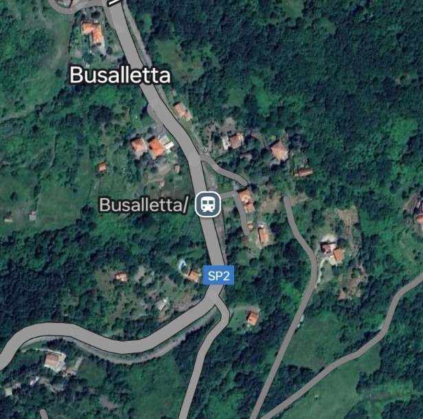
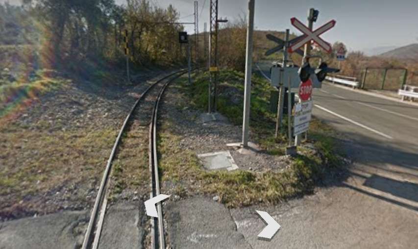
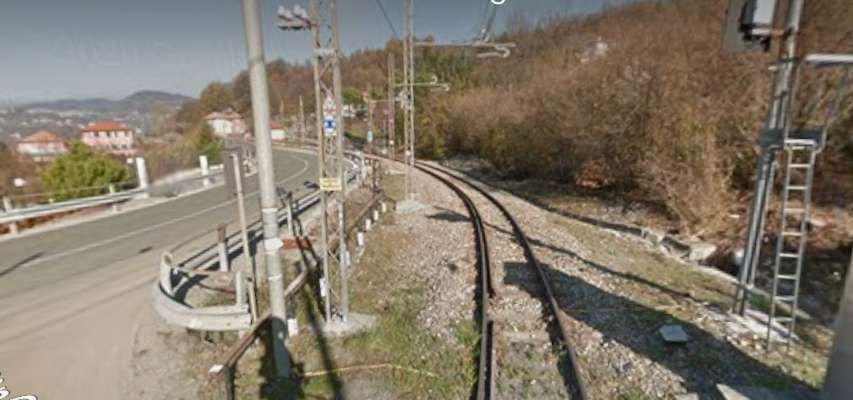
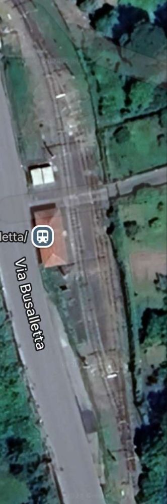
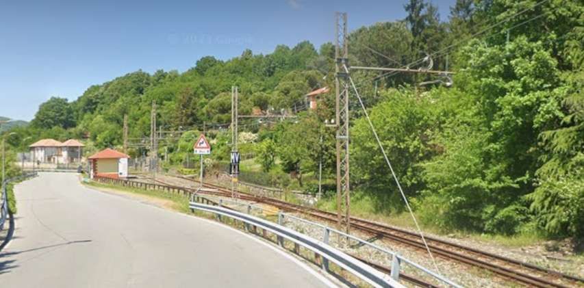
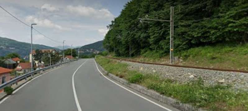
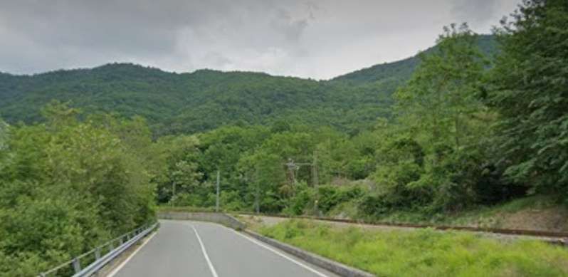
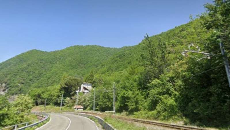
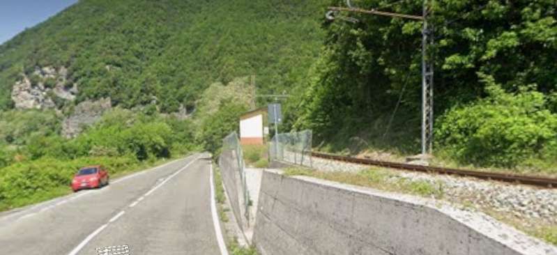
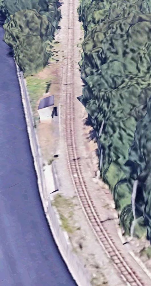
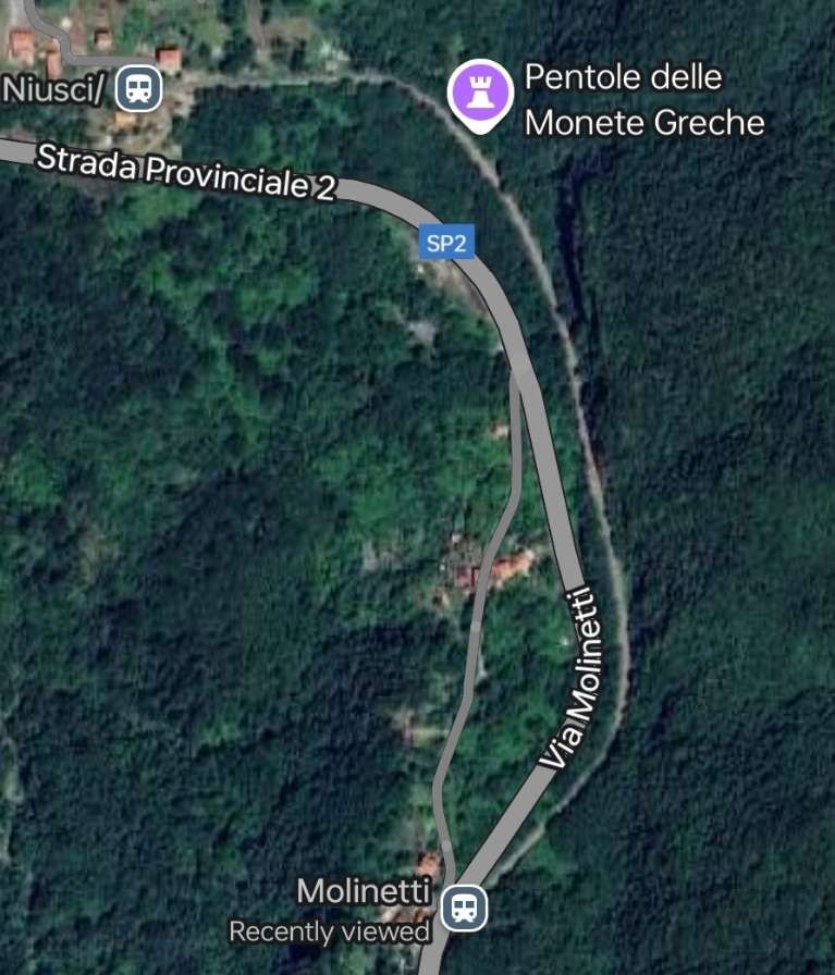
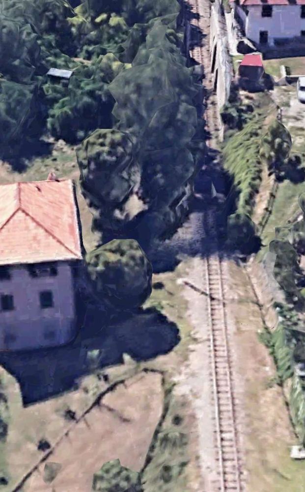
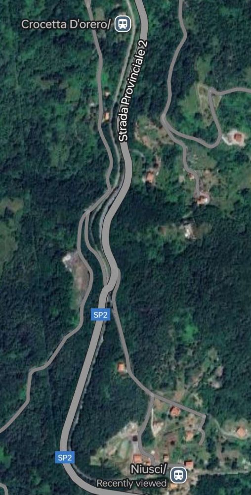
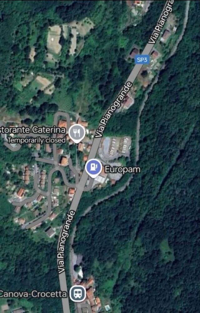
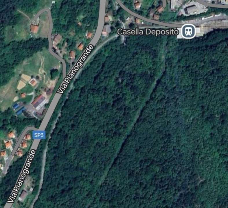
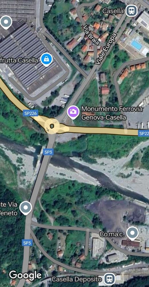
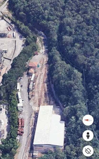
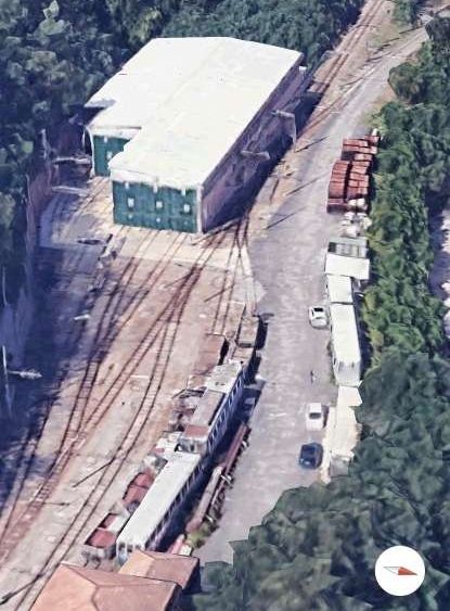
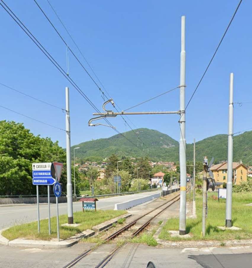
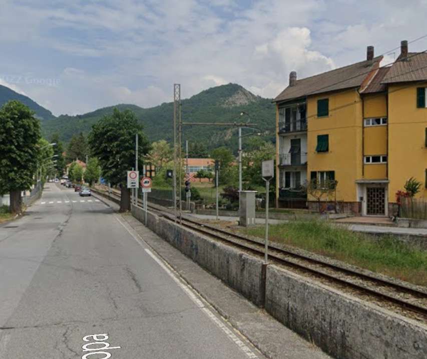
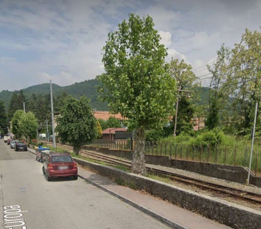
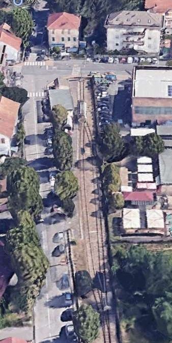
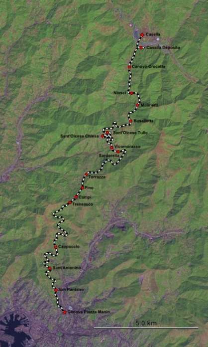
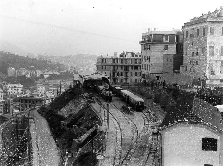
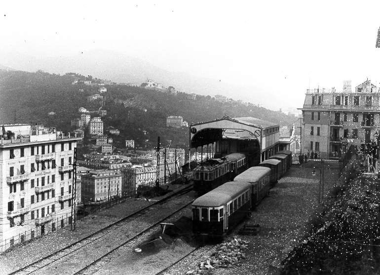
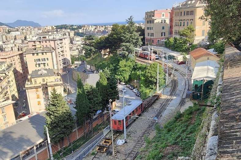
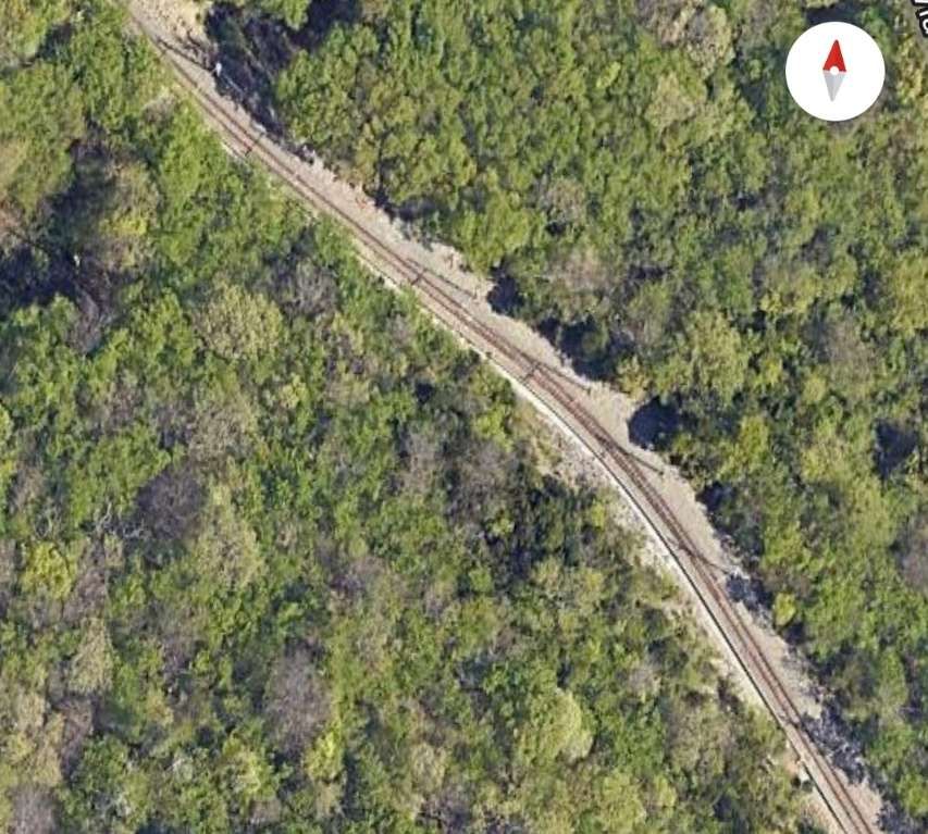
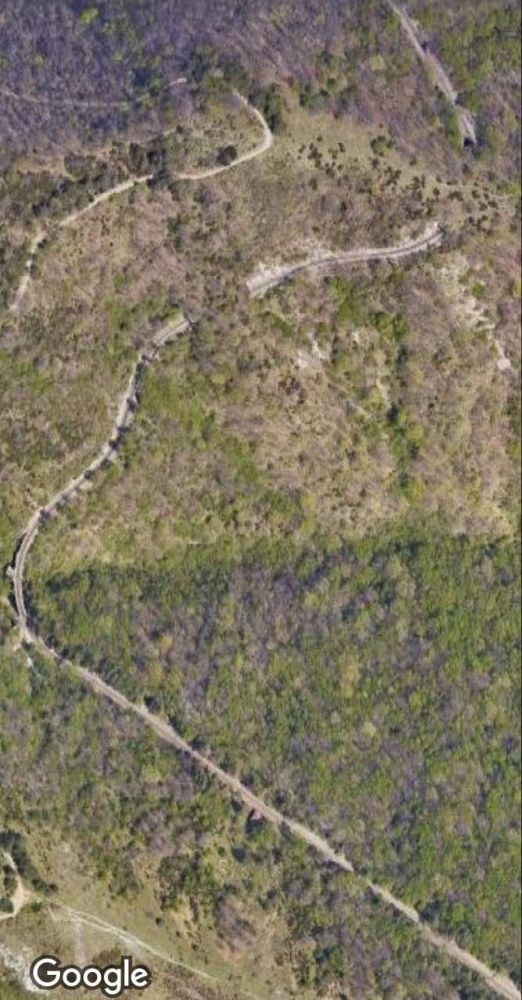
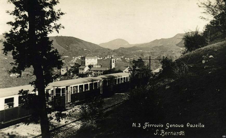
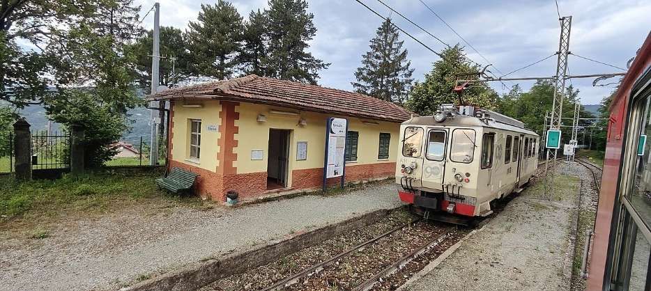
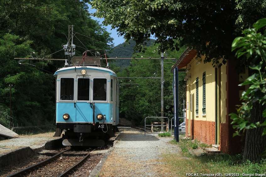
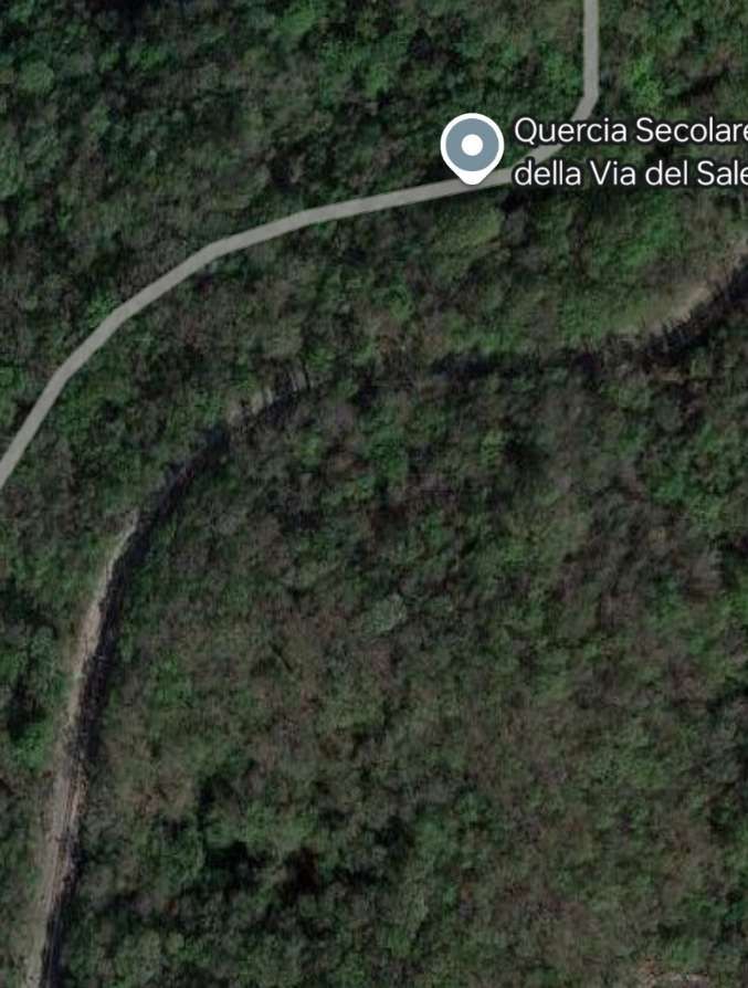
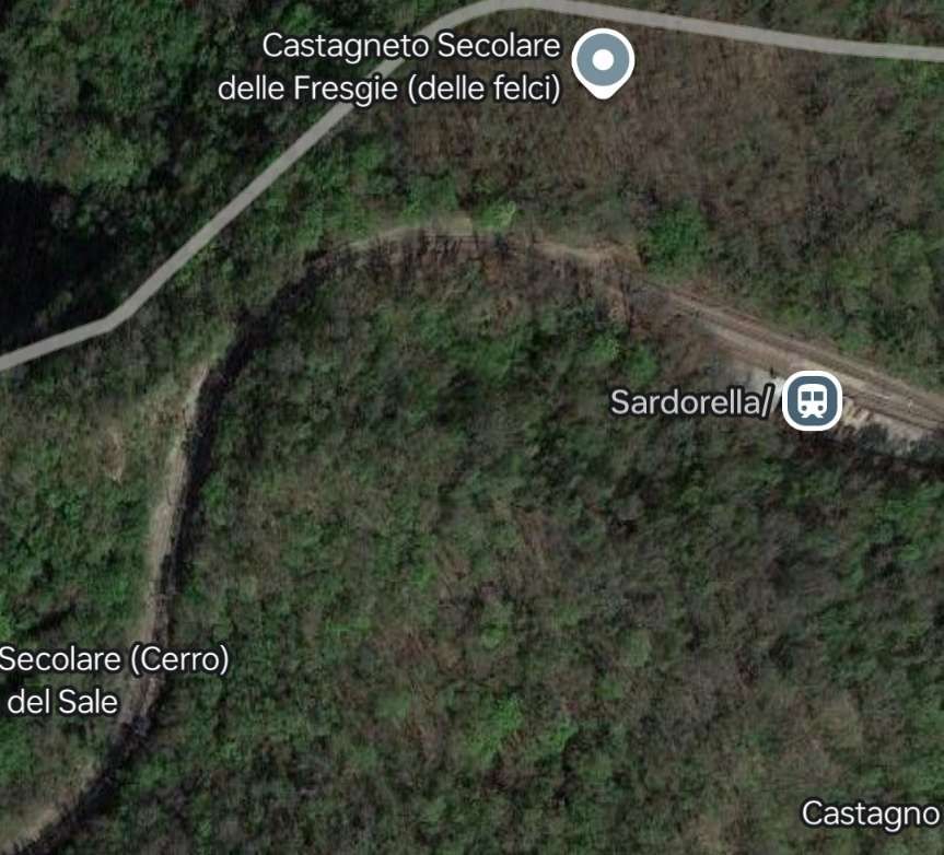
This article covers the length of the line from Sardorella to Casella. [1]A topographical map of the route. [1]Perhaps a little clearer than the topographical map. [2]
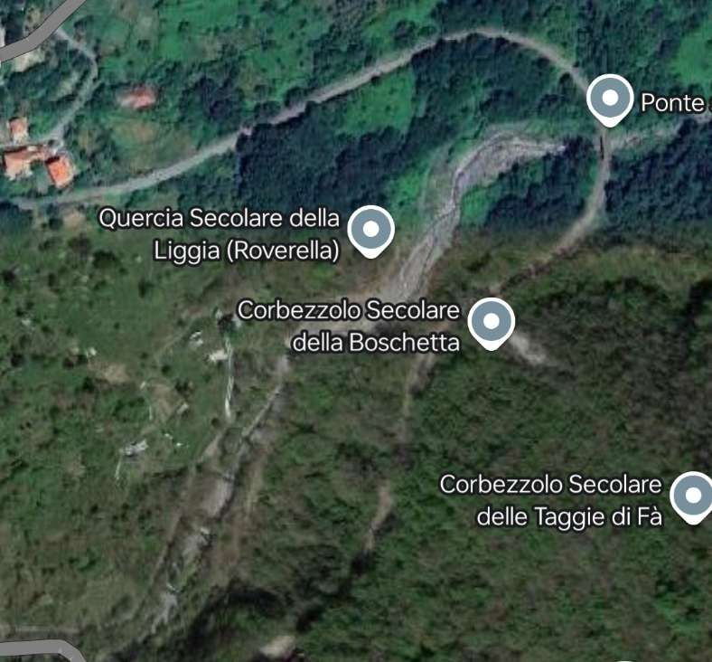
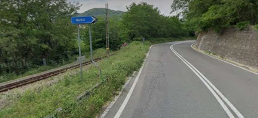
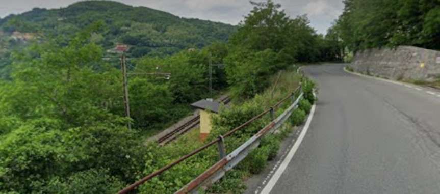
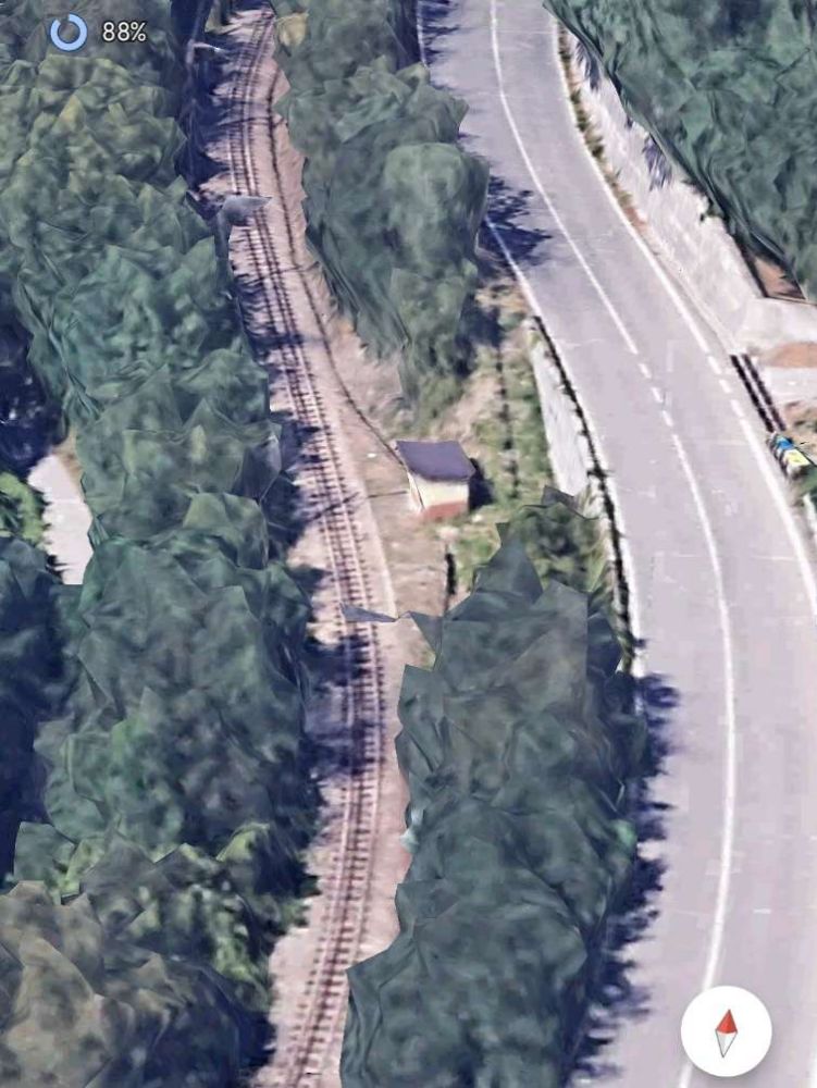
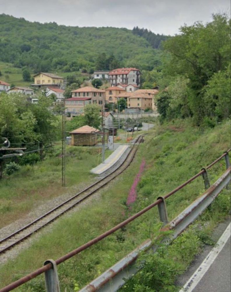
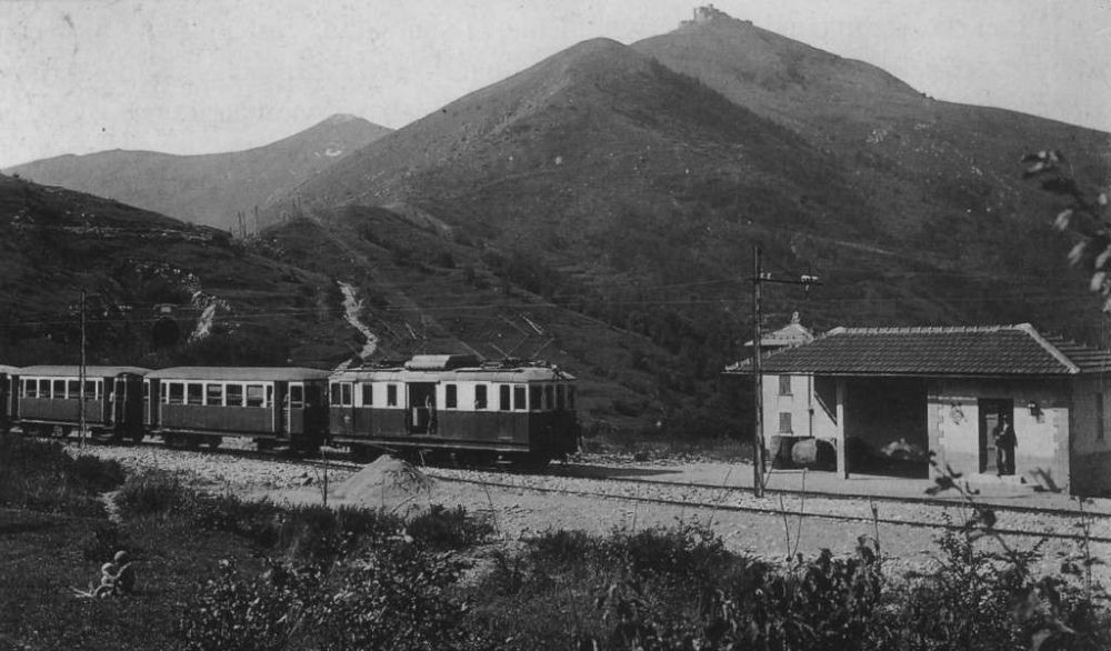
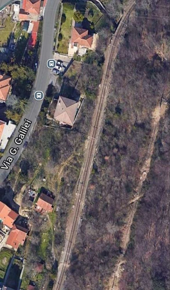
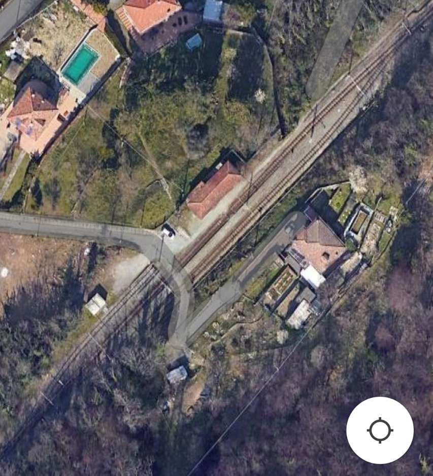
We restart our journey from Genoa to Casella at Sardorella Halt. …
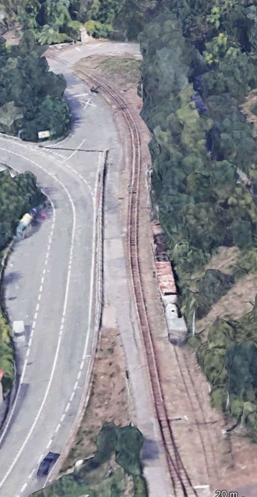
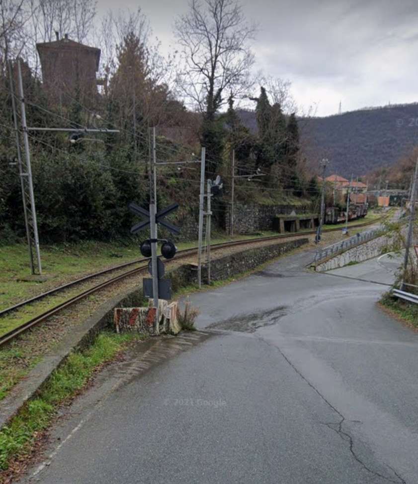
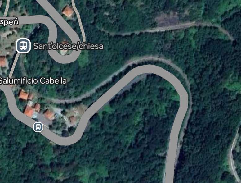
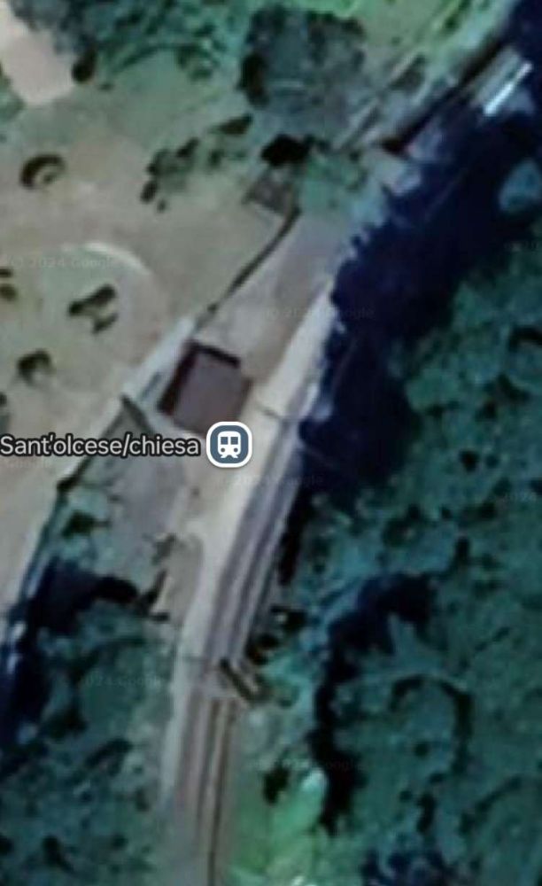
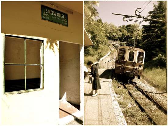
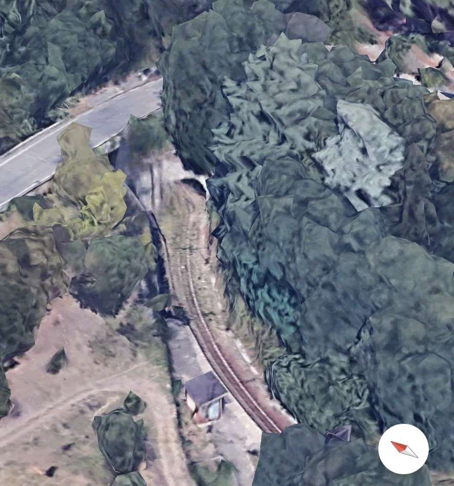
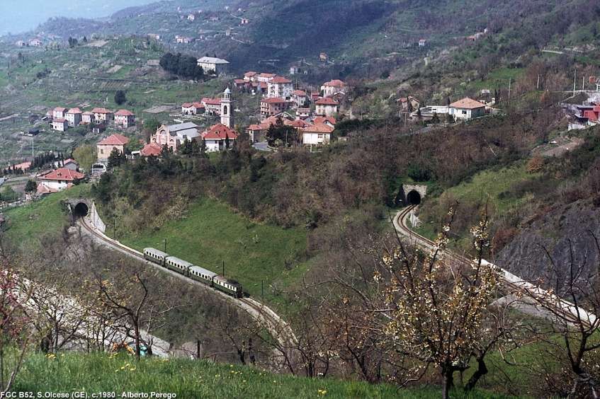
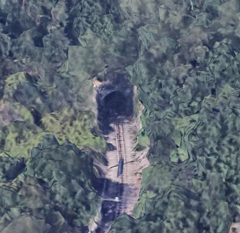
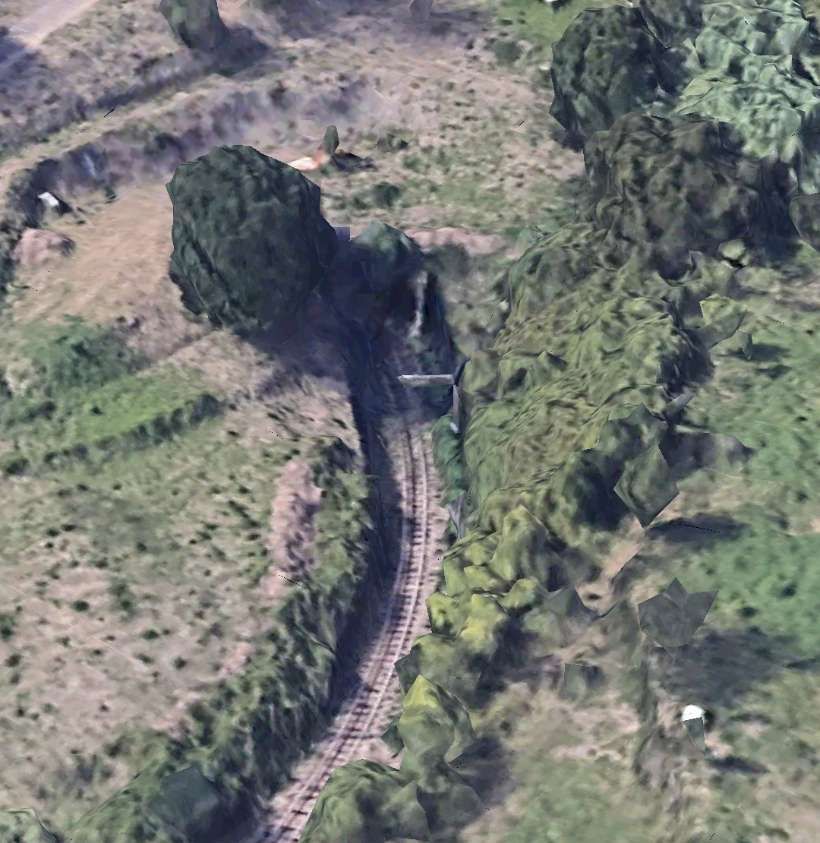
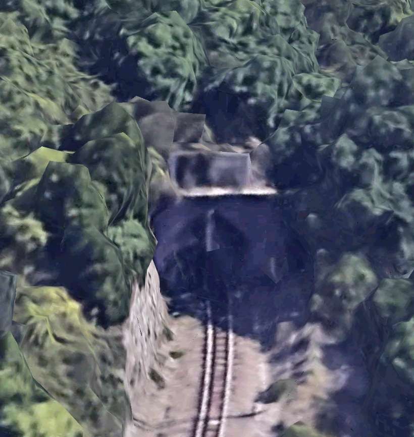
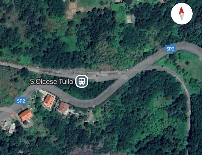
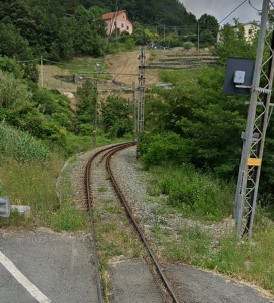
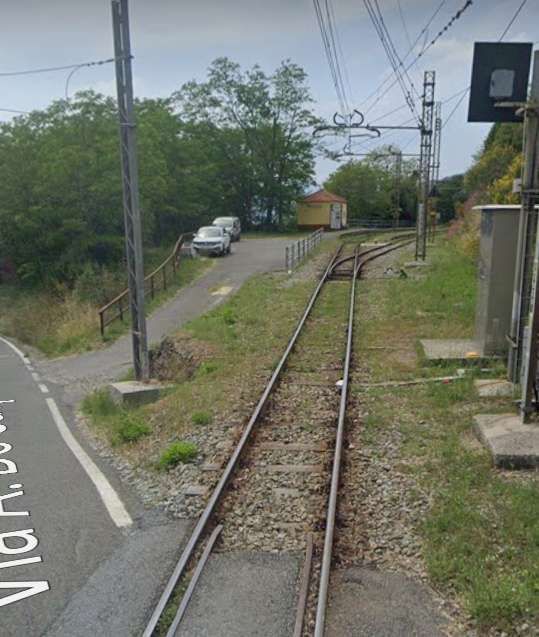
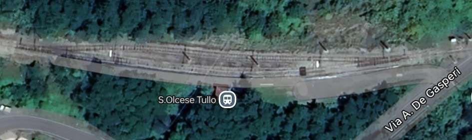
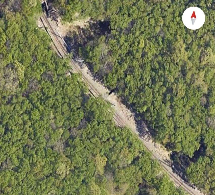
The railway is on three different levels on the hillside at Sant’Olcese. The first accommodates the Chiesa Halt, the tunnel above opens out onto the second level. The third level hosts the Tullo Halt.
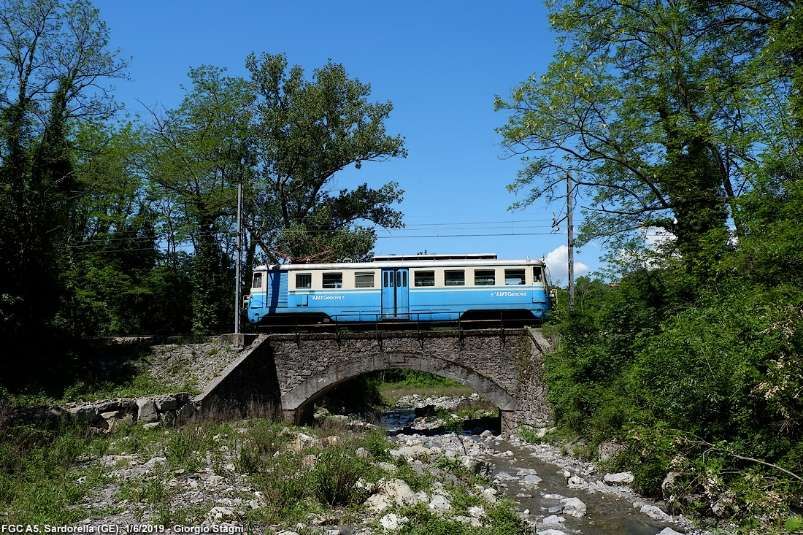
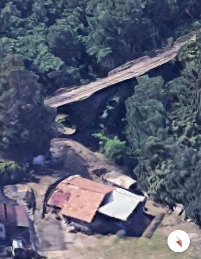
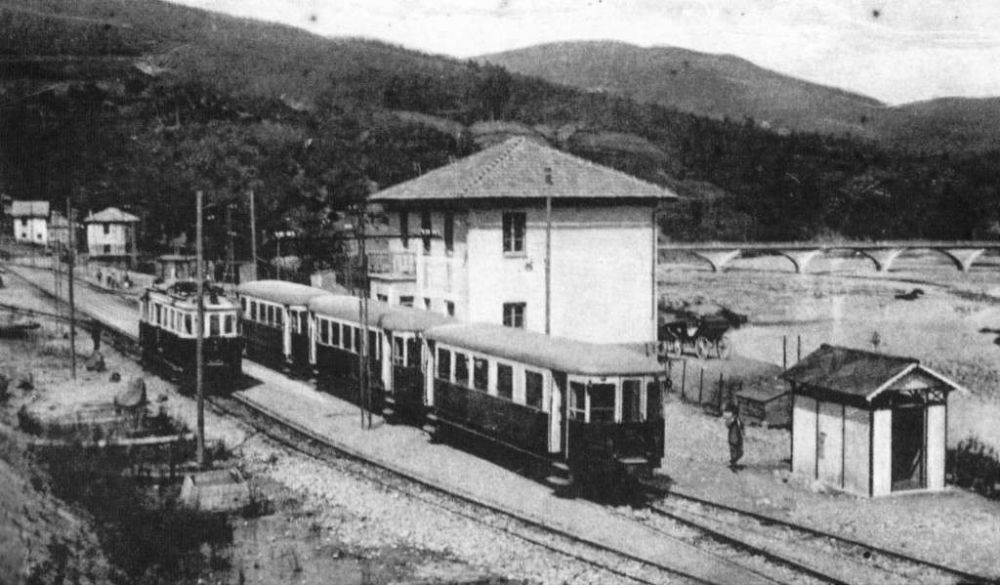
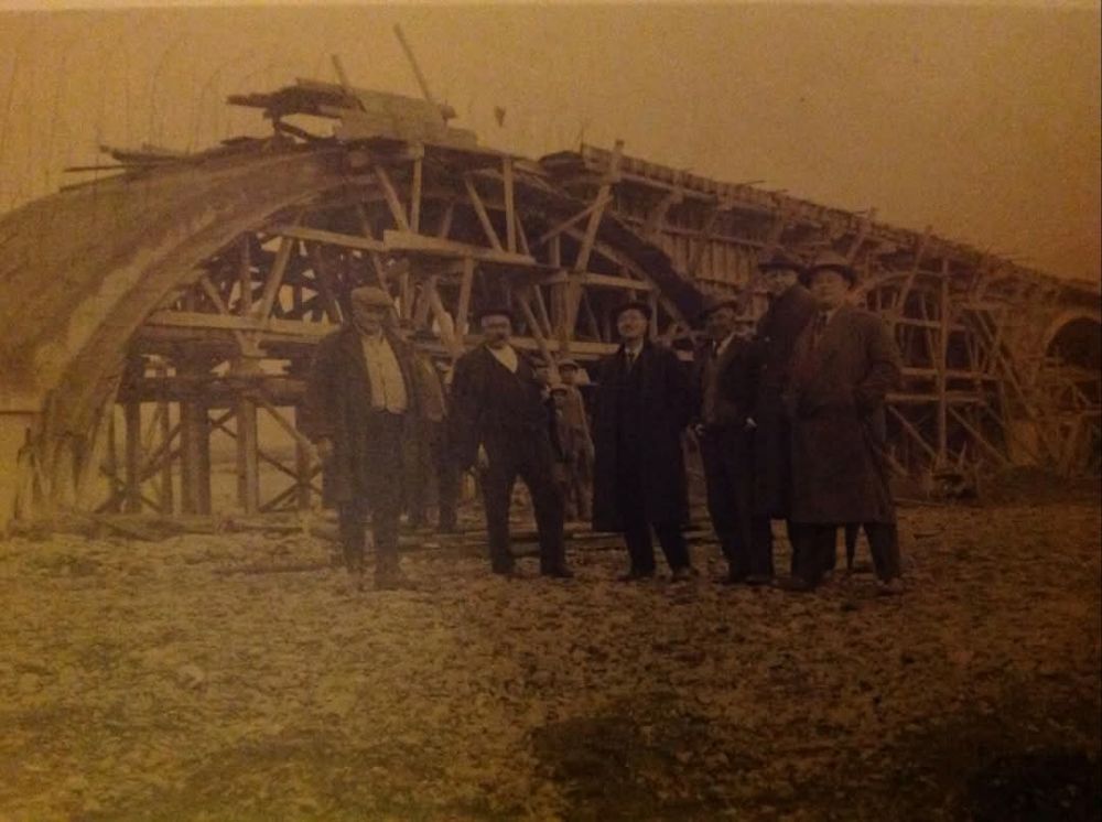
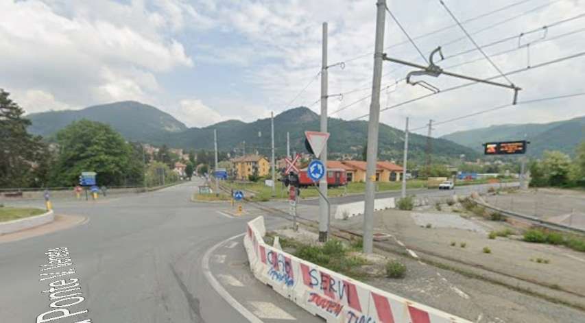
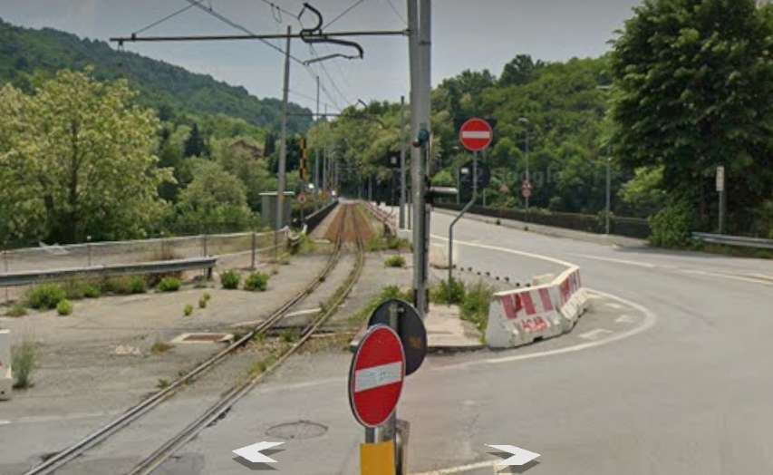
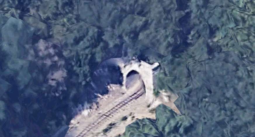
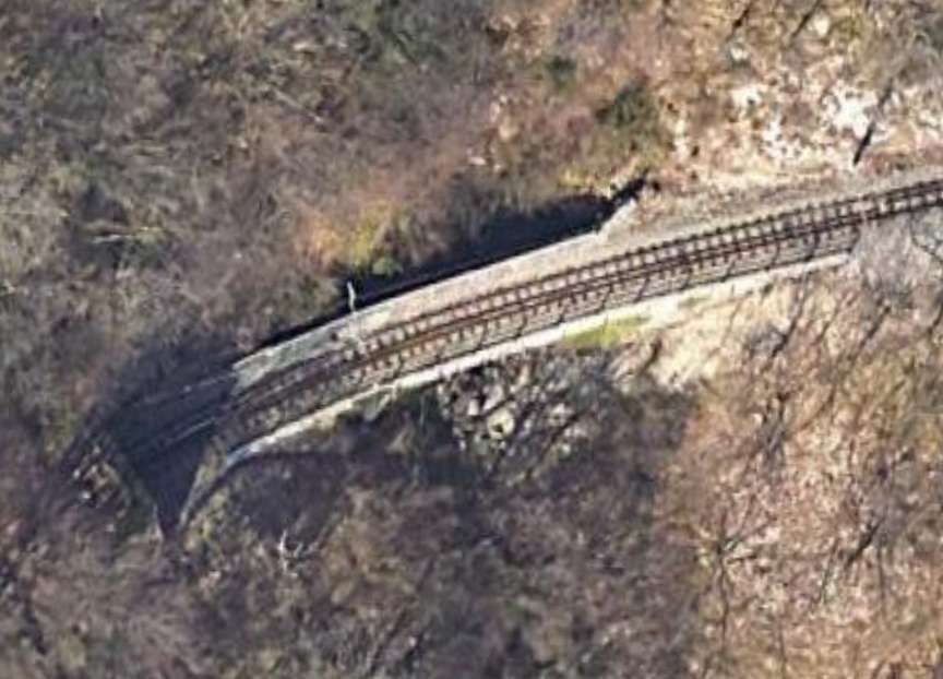
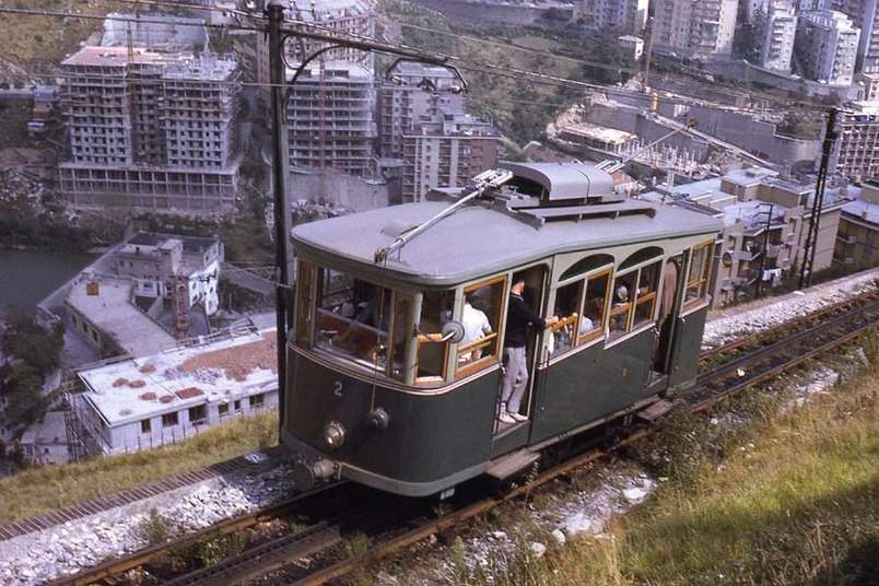
A photograph of a later elettromotrice travelling on this curve can be found here. [17] In the linked image, unit A12 is shown on the curve from Casella Deposito to the Vittorio Veneto bridge (over the River Scrivia). It was shared by Gian-Paolo Codebo on the Sei de Casella se… Facebook Group on 7th May 2020.
During Construction steam power was employed by the contractor and there are images around which show at least one excursion event that was steam hauled prior to the Line’s formal opening.
Two pictures can be found on the first article in this series, here. [18]
In that first article, we noted that the electric supply was originally 2400V DC. “The first electric locomotives were supplied by Breda, numbered 1 to 3. They were 360 horsepower Bo-Bo locomotives with an innovative Breda-Somarini energy recovery system, unique in Italy. In addition to the motive power, 4 third-class carriages (Nos. 50-53); 3 mixed first-third class carriages (Nos. 20-22) and 16 freight wagons of various types were delivered in 1926, well before the railway opened.” [1]
Unless noted otherwise, the paragraphs below are translated/paraphrased/amended from the Italian Wikipedia page about the Genoa (Genova) to Casella Railway. [21]
Locomotives
At the commencement of the service on the railway, the three locomotives mentioned above were supplied by Breda and numbered 1 to 3. [21]
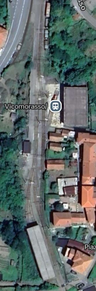
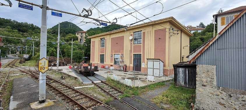
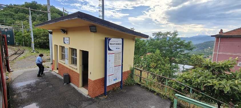
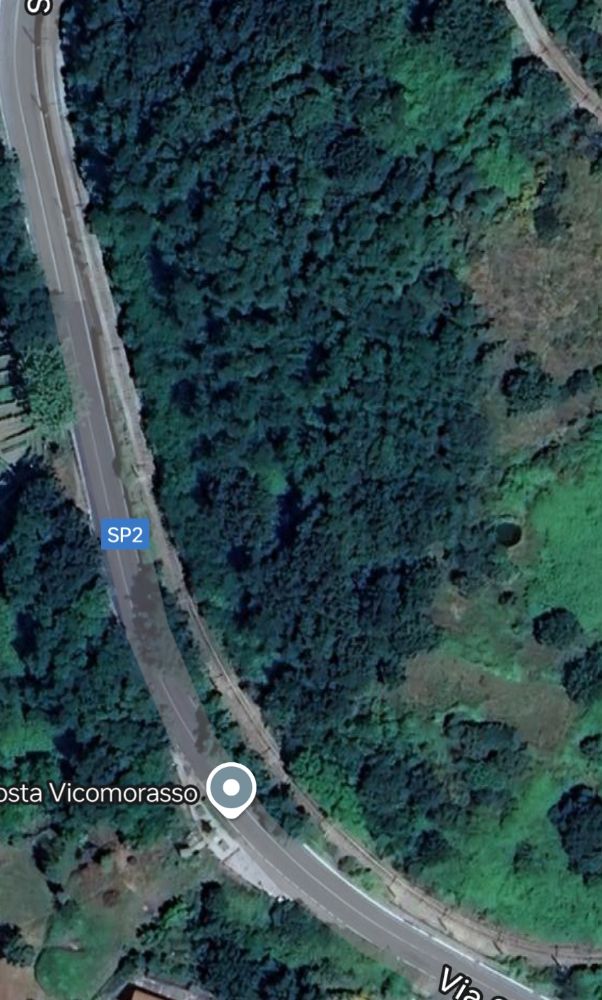
On 23rd August 1937, two of the locomotives were destroyed in an accident near Vicomorasso in which five people lost their lives. [22: p67]
This accident meant that replacement locomotives were required. Three electric locomotives were purchased from the Società Veneta. They had been built by MAN in 1913 for the Montebelluna – Asolo and Montebelluna – Valdobbiadene tramways in Veneto which closed in 1931. [21]
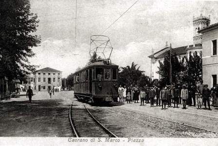
One of the locomotives mentioned in the paragraph above at Stazione di Caerano sometime between 1913 and 1931 in Montebelluna, at [23]
“These locomotives entered service in 1939, initially maintaining the original numbering (053, renumbered 055 in 1943, 054 and 056), after conversion of the original power supply system from 975 V DC to 2400 V DC.” [1]
Locomotive 28 and 29 were built in 1924 for the Adriatic-Appennino Railway. The electrical equipment was supplied by TIBB of Vado Ligure; the body and bogies were made by Carminati & Toselli of Milan. Originally, they were part of a 1922 order for 14 locomotives of 950 mm gauge for the Sangritana Railway. Two (Nos. 28 and 29) were sold to Ferrovia Genova Casella (FGC) – No. 28 in 1956 and No. 29 in 1960. [22: p98 & 184] Conversion was necessary as the locomotives required a gauge change and modification from freight/baggage locomotives to passenger locomotives.
The two locomotives entered service in 1962. No. 29 is currently the oldest electric locomotive still in operation in Italy and is used in composition with three carriages (C22-C103-C104) as a historic train used on charters. No. 28 was placed in storage in 1975 and finally decommissioned and dismantled in 1998. [21][22: p184]
Electtromortices A1, A2 and A3 were built in 1929 for the Ferrovia della Val di Fiemme (Ora – Predazzo), similarly by TIBB and Carminati & Toselli. These were transferred on the closure of the Ora – Predazzo line in 1963 to the Ferrovie Genoa Casella. [21][1]
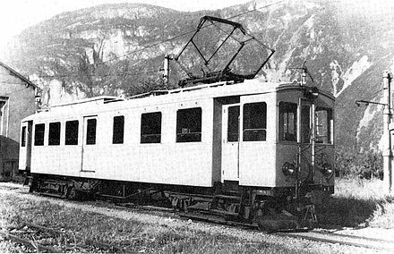
Elettromotrice A1 while employed by Ferrovia della Val di Fiemme (Ora – Predazzo) at Ora depot. [25]
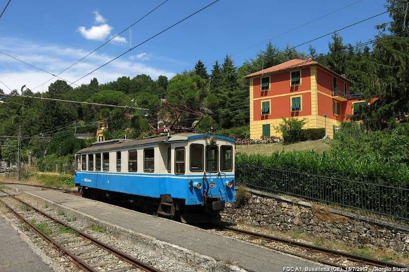
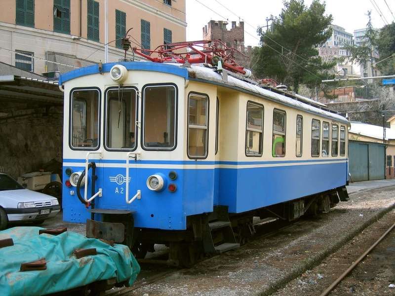
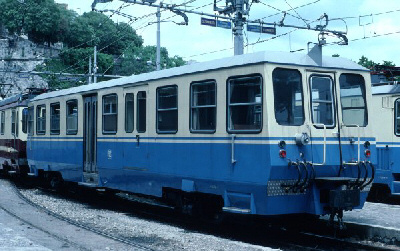
A1 was painted blue/cream in 2011 with AMT logos. It was used for ordinary trains until 2019 and in 2022 it was set aside awaiting significant maintenance. [21]
A2 was reconditioned and returned to its 1929 condition. It re-entered service in June 2018. In that December it was involved in an accident but emerged with little damage. In September 2019, further restoration work was completed and from February 2020 it was undertaking a regular historic train service, usually being timetabled for Saturday running. [21][26]
A3 was built by Gleismac/EAA, after having suffered serious damage in an accident at Sardorella in 1974. It returned to service in 1983. It remained in service until 1999. After it was withdrawn, it doesn’t 12 years in storage before ultimately being dismantled in 2011. [21]
Elettromotrices, A1, A2 and A3 were part of a batch of about thirty electric locomotives which were built by Carminati and Toselli of Milan. Twenty-three of these were very similar to each other. being produced between 1924 and 1940. Three of this batch of locos (A1-A3) were deployed on the Ora-Predazzo line and on its closure came to the FGC. [21]
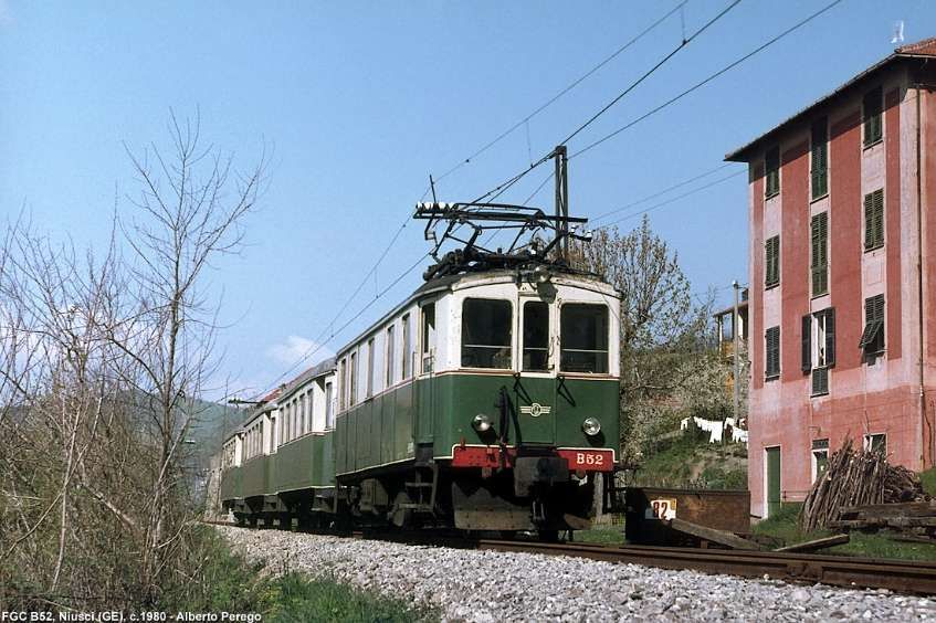
In addition, two 420 horsepower locomotives (max. speed 45 km/hr), B51 and B52 with Bo-Bo running gear were also transferred to the FGC in the early 1960s. [1]
Also from Val di Fiemme came six bogie-carriages, two longer coaches numbered C101 and C102 and four of shorter carriages, numbered from C103 to C106. [1]
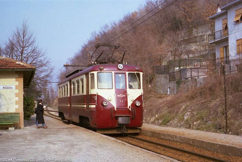
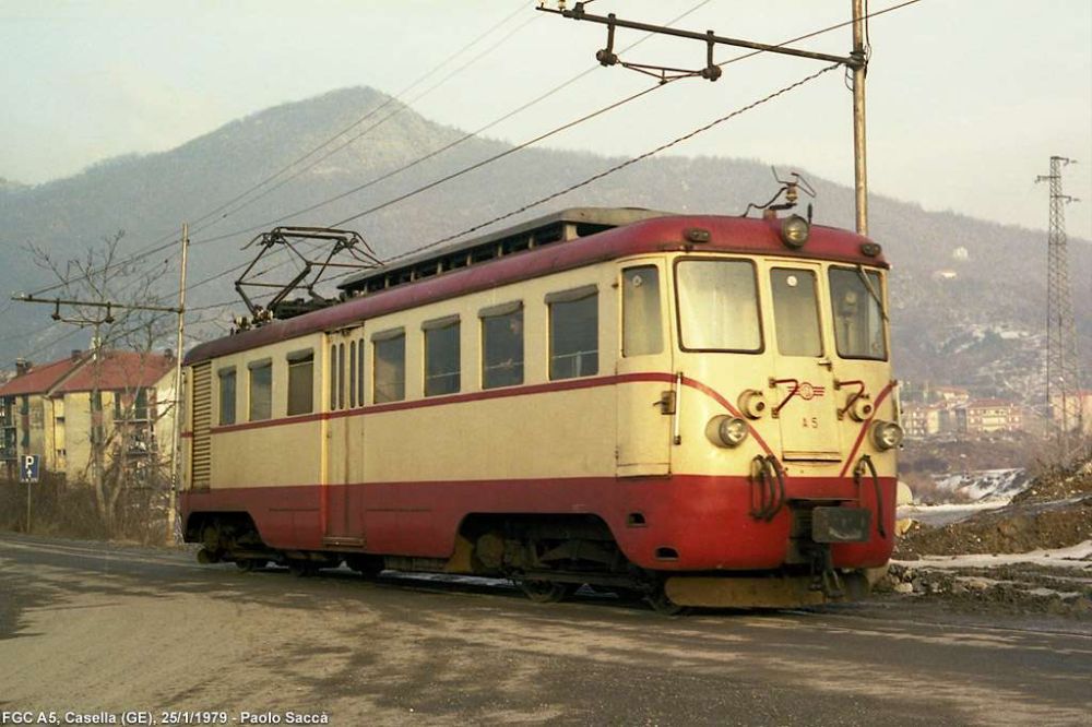
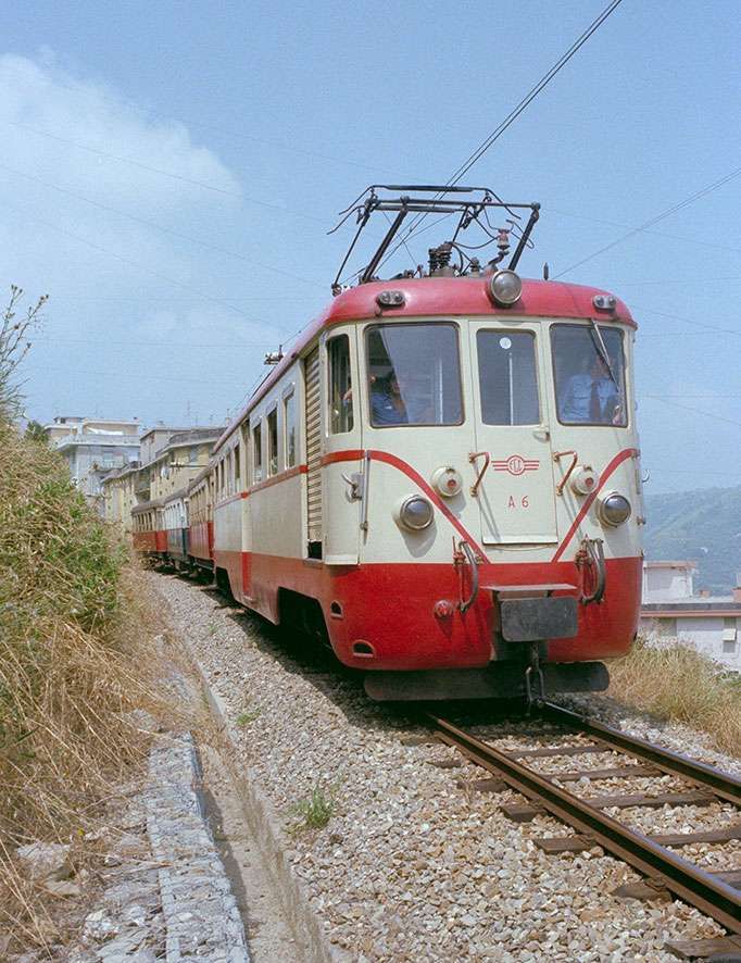
Elettromotrices A4-A7 were built in 1957 on the chassis and bogies of locos built by TIBB/Carminati & Toselli in 1926 for the Spoleto-Norcia railway. That reconstruction was undertaken by Casaralta-TIBB. It saw the application of new electrical equipment and the adoption of a new rounded body, typical of the mid-20th century. These elettromotrices transferred to Genoa in 1970 with the closure of Spoleto-Norcia line. They entered regular service, re-numbered A4-A7, between 1971 and 1973 after gauge-conversion from 950mm to metre-gauge. [21]
Units A6 and A7 were visually the same as units A4 and A5.
Elettromotrice A6 at work on the line before it was set aside. [10]
Units A4 and A7 were scrapped (in 2014 and 2016 respectively), while A5 was restored to running order in February 2010, with the installation of fully electronic speed measuring devices and a dead man’s device, the application of a cream/blue anti-graffiti film and new AMT logos. It was taken away for restoration in 2022, and finally A6 has been shelved for over 10 years awaiting restoration. [21][22: p191]
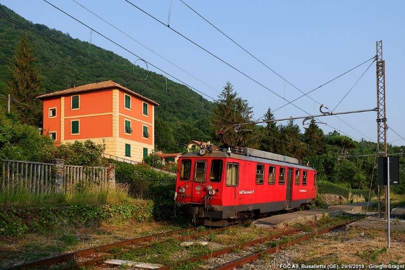
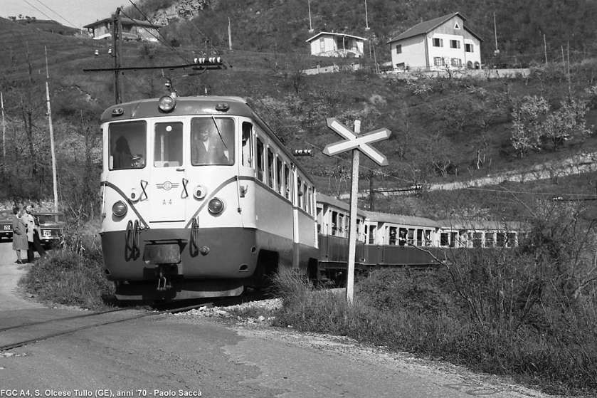
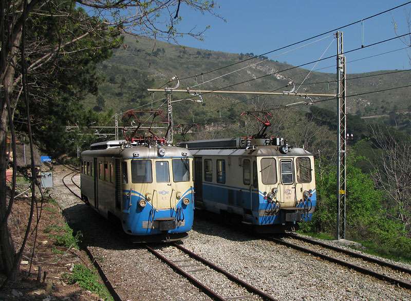
Electric locomotives A8-A10 were built in 1993 by Firema-Officine di Cittadella at the request of Ferrovia Genova-Casella, they have identical bodies to the decommissioned A3. However, A8 uses the TIBB bogies from B51, the A9 those from B52 and the A10 those from A3. This last unit also has a body slightly different from the others due to the lower window line. [21]
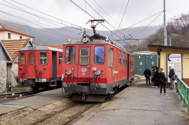
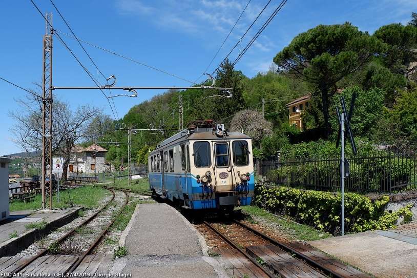
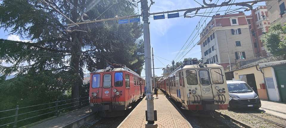
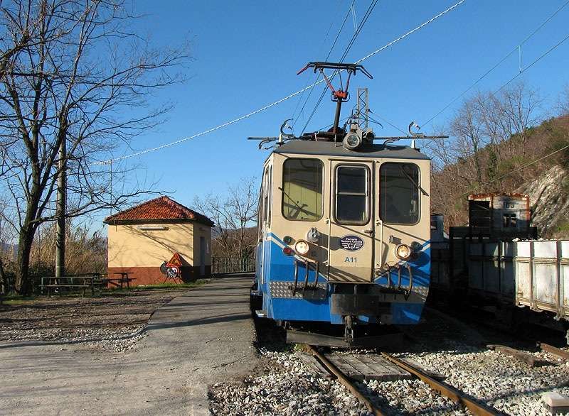
Elettromotrices A11-A12 were built in 1998 by FiReMa-Officine di Cittadella at the request of Ferrovia Genova-Casella. They have a body identical to the A10. A11 underwent a restyling in 2011 with the application of cream/blue anti-graffiti film and new AMT logos and is currently used in regular service. A12 is also back in service after an extraordinary overhaul of the bogies. [21][22: p198]
Locomotive D1 was built in 1964 on behalf of the German railways by the manufacturer Gmeinder & Co. by adapting the MaK V100 standard-gauge locomotive to metre gauge, it was numbered V52 902 (later 252 902) and used on the 28 km long Mosbach-Mudau metre-gauge line. When it’s service on that line came to an end (2nd June 1973), it was first converted to standard-gauge by Gmeinder and used by Sudwestdeutsche Eisenbahngesellschaft (SWEG) which put it to work on the Breisach-Endingen-Riegel line (numbered VL46-01). In 1986, it was sold to the Gleismac company which converted it to metre-gauge and then sold it to the FGC. It was used to haul construction and passenger trains during the renovation of the overhead line. It was then set aside at Casella Deposito for over 10 years until in 2008 it was sent to Monopoli where it was rebuilt by 2014 and it returned to service on the line in November 2015. [33][34]
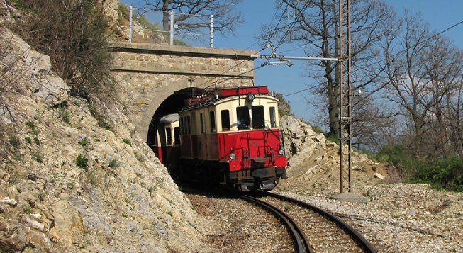
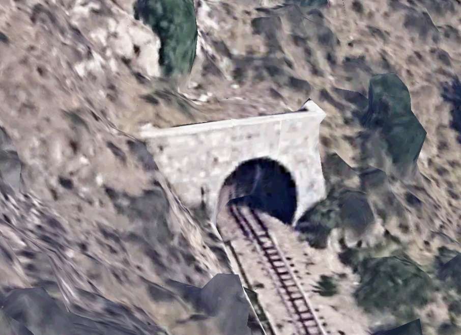
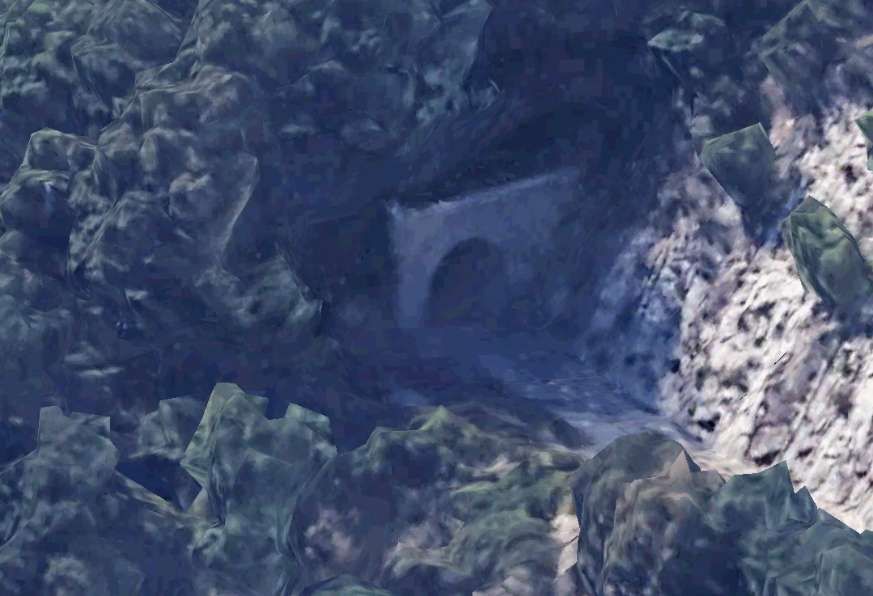
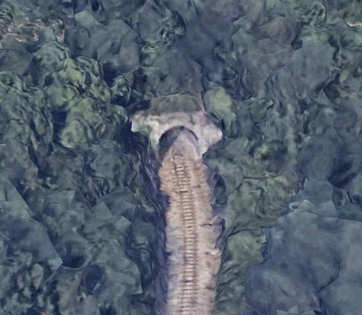
Locomotive D1 responsible for a single coach. [9]And here with two coaches. [9]And here, escaping from a tunnel portal. [19]
Other Rolling Stock
We have already picked up some snippets of information about coaching stock and wagons. …
When the line opened there were “4 third-class carriages (Nos. 50-53); 3 mixed first-third class (Nos. 20-22) and 16 freight wagons of various types (delivered in 1926, well before the railway opened).” [1]
We also noted that, along with the B51 and B52 locos “from Val di Fiemme came six bogie-carriages, two longer coaches numbered C101 and C102 and four of shorter carriages, numbered from C103 to C106.” [1]
The following information is gleaned from H Rohrer’s detailed website about Italian railways. That website can be found here. [35]
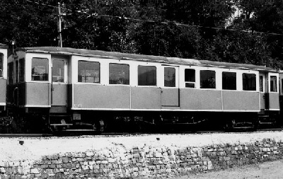
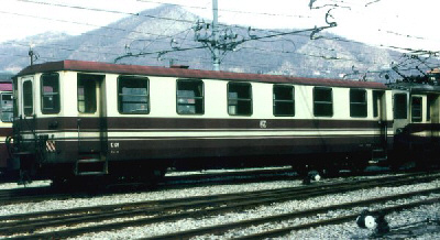
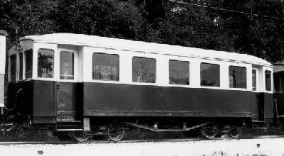
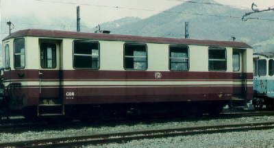
Coaches C20-C22 were built by Breda and supplied in 1926, of which C22 was renovated by FGC in 1960 and C21 was renovated by Gleismac in 1979-1980. An image of Coach 22 can be found here. [36]
Coaches C50-C53 were built by Breda and supplied in 1926. An image of Coach C50 can be found here. [37] An image of refurbished Coach C53 can be seen here. [38]
Coaches C101-C102 were long-wheelbase bogie coaches, built by Carminati Toselli and supplied in 1929. These were later renovated by Gleismac between 1980 and 1983. An image of Coach 101 in original condition can be found here. [39] The renovated Coach 101 can be seen here. [40]
Coaches C103-C106 were short-wheelbase bogie coaches built by Conti (?) and supplied in 1929 (?). Of these C105 and C106 were later renovated by Gleismac between 1980 and 1983. The original Coach 104 can be seen here. [41] A refurbished Coach C106 can be seen here. [42]
Coaches C60-C62 were built by Citadella Firema and supplied in 1996/1997. An example can be seen here. [43]
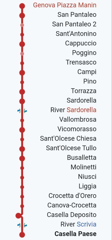
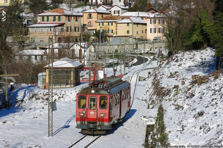
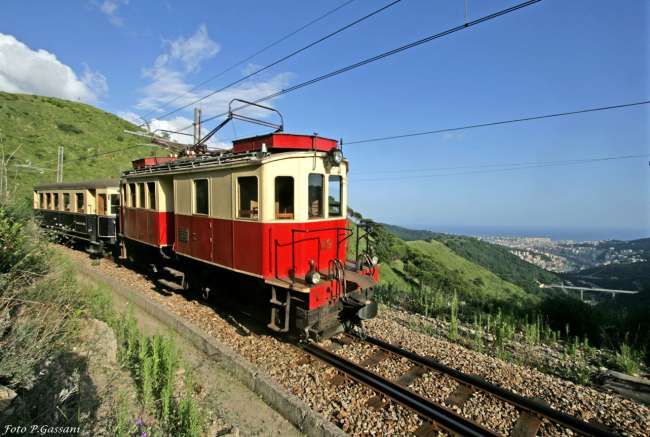
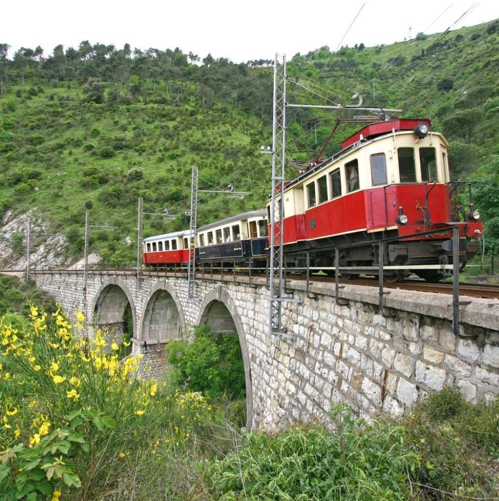
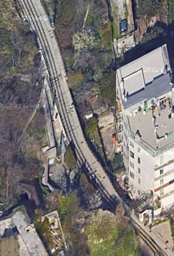
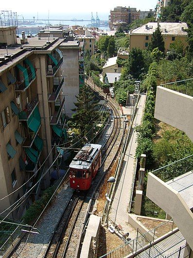
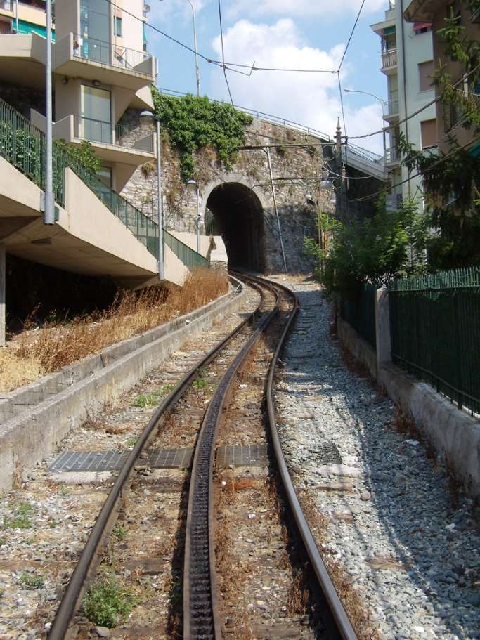
The Genova–Casella railway is a 24.3 km narrow gauge railway that connects Genoa to Casella, a village in the mountains inland from the city. [1] The stations on the line are shown in the graphic immediately below:
The Route of the Line. [1]
This article covers the history of the line and a journey along the southern half of the railway (Genoa to Sardorella). The second article covers the northern half of the railway and its rolling stock. That second article can be found here. [16]
When it is operating, “the line operates nine trains per day and it is used for both commuting and tourist purposes; it crosses three valleys and was opened in 1929. While it is owned by Liguria Region, it has been operated since 2010 by AMT Genova.” [1]
“At the end of the nineteenth century, a direct railway link between Genoa and Emilia Romagna was proposed, as an alternative to the Turin–Genoa railway. The railway had to start from the Port of Genoa and cross the Ligurian mountains to reach Piacenza railway station and Borgotaro. It was intended to be a fast, long-distance line primarily for goods.” [1]
“As a result, SAFEL (Società Anonima Ferrovie Elettrici Liguri) considered the construction of a local passenger line, complementary to the Genoa-Piacenza freight line. Its purpose was to connect the city centre to all the small municipalities and holiday resorts of the Ligurian hinterland … The first section of this network was the Genoa-Casella line.” [1]
“The original project was planned with a bifurcation to provide a branch towards Busalla and a line to Torriglia, which in a second phase would be extended to Piacenza.” [1]
These were just the first proposals from SAFEL. It considered a wide range of other schemes intended to follow on from their successful completion. A start was made when, in 1908, “SAFEL applied to the Ministry for a concession for the construction of the Genoa-Casella line. This concession was obtained on 17th June 1915. Like most of the local railways of the time, the line was almost entirely single-track and had a tortuous alignment (in order to follow the topography of the Ligurian mountains). Electrification was part of the original plans and the 950 mm track gauge was chosen to minimise infrastructure costs in accord with a directive from the Council of Public Works which recommended the adoption of an ‘Italian metric gauge’ (950 mm) for railways unlike the true metric gauge (1000 mm) adopted for tramways.” [1]
“To allow the construction of a connection at Manin with the Genoa tram network , the operating company presented a variation to the project, approved by the Higher Council of Public Works, which sanctioned the adoption of the 1000 mm gauge. This connection, however, although reported in the first design tables, was never built.” [12 – translated from Italian]
“The coming of the First World War imposed a long postponement to the construction of the railway line. It was not until 28th February 1921 that the final agreement between the Government and SAFEL was signed, which gave the permitted a start to construction work.” [1 – translated/adapted from Itailan] “On 26th June 1921 the first stone was laid. The construction of tunnels, bridges, and station buildings was entrusted to the ‘Consorzio Cooperative Liguri di Produzione e Lavoro tra Combattenti’, which gave work to thousands of former soldiers and workers who remained unemployed after the first world war. The construction was entirely financed with private funds.” [1]
“On 26th June 1921 the first stone was laid. The construction of tunnels, bridges, and station buildings was entrusted to the ‘Consorzio Cooperative Liguri di Produzione e Lavoro tra Combattenti’, which gave work to thousands of former soldiers and workers who remained unemployed after the first world war. The construction was entirely financed with private funds.” [1]
Construction work proved to be complex. The section from Genoa to Trensasco required steep gradients. To facilitate construction, “a 1.2 km-long cable car was installed in order to transport building materials from the Bisagno River valley. The cable car system lifted materials over a height of 450 m. Electric excavators and crushers (modern machinery at the time) were also adopted to produce the necessary sand and cement on site.” [1]
“In 1924 the S.E.N. (Società Elettrica Nazionale), a subsidiary of the Ernesto Breda industries, was awarded a contract for the laying of track, the construction of the overhead line, the construction of electrical substations, and for the supply of rolling stock.” [1]
“Meanwhile, resources were expended on pursuing a succession of extension projects, some of which were very unlikely. This resulted in ongoing financial instability and a slowing of the construction work already on site.” [1]
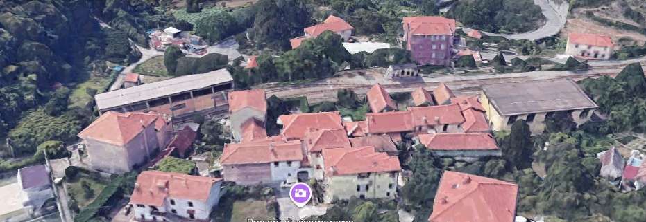
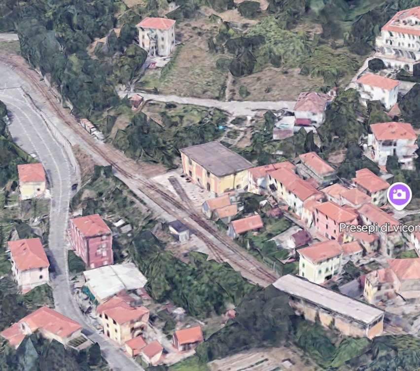
“The first tracks were laid in 1926 starting from Vicomorasso, with the help of a Mallet-type steam locomotive purchased by the Ferrovie dell’Appenno Centrale, but operations were interrupted due to lack of funds.” [1]
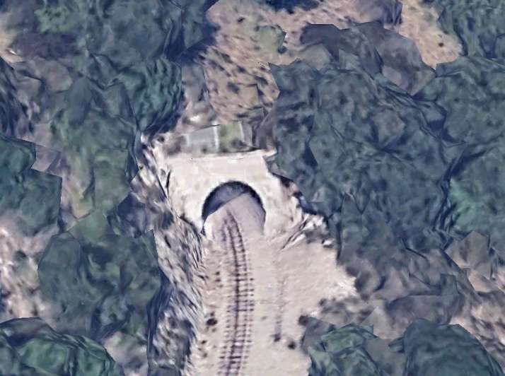
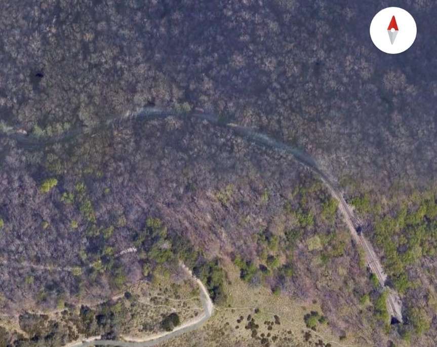
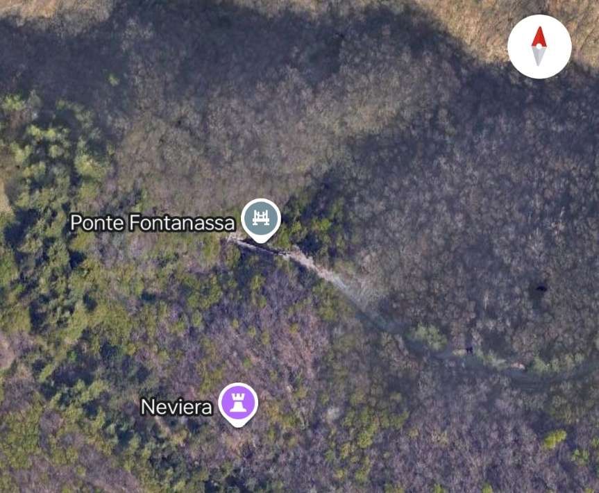
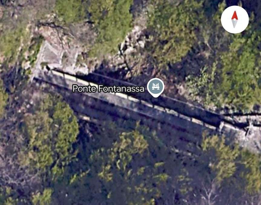
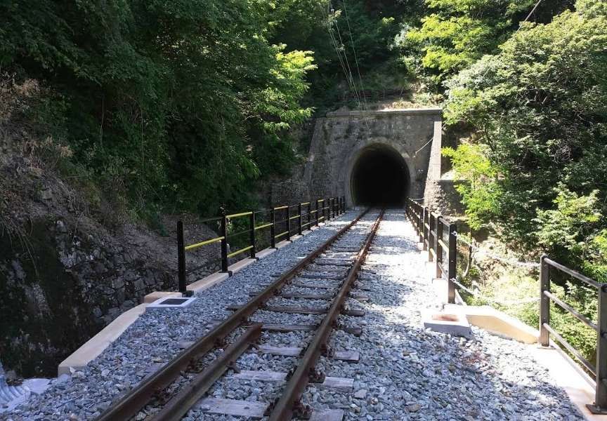
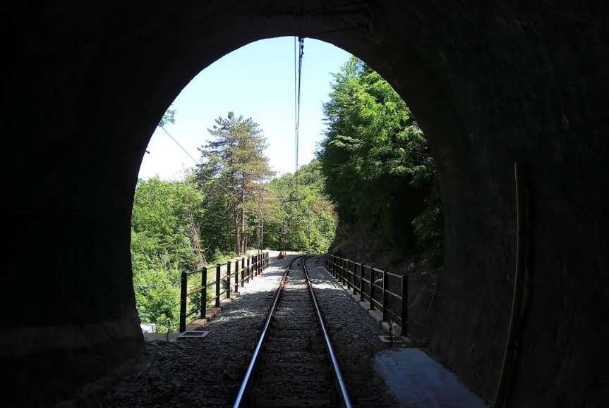
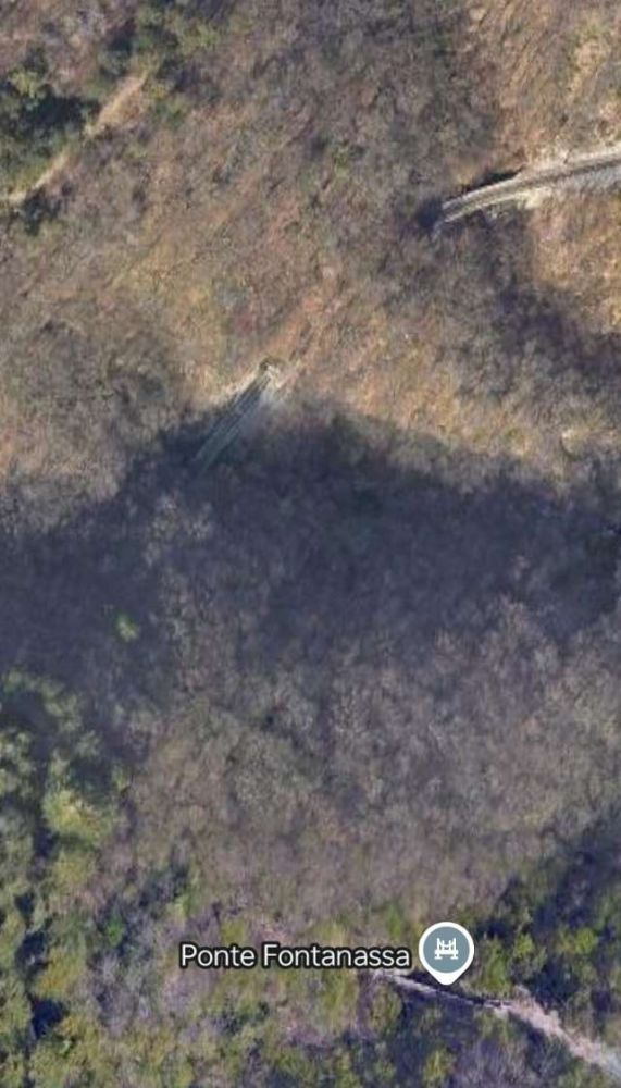
“Work resumed in 1927 thanks to a grant from the Municipality of Genoa and the National Bank. The Breda company was asked to complete the remaining civil engineering work in addition to the electrification of the line and the laying of the track (the bridge between the two Fontanassa tunnels, the Cicala and Puin viaducts).” [1]
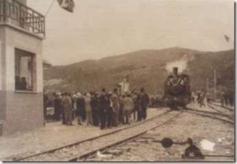
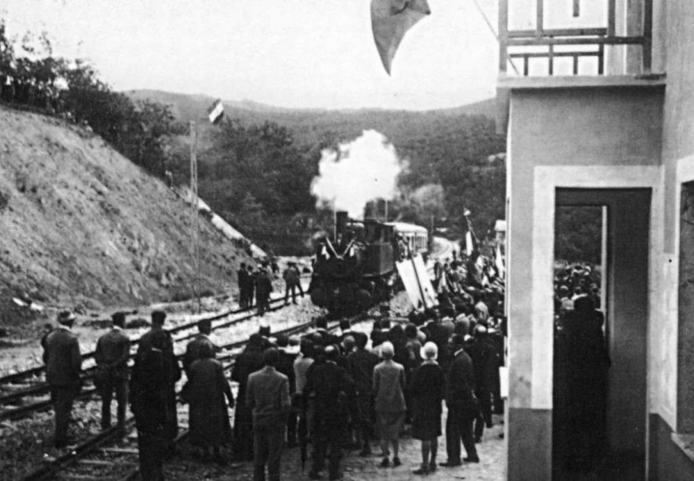
“On 7th June 1928, the steam locomotive used in the construction of the line made an inspection trip to Casella pulling a passenger car with the Podestà of Genoa, Sant’Olcese, Serra Riccò and Casella on board. It was welcomed by the citizens in celebration along the way. Only on 2nd October 1928 was the first electric train – reserved for two hundred members of the Italian Electrotechnical Association which in those days held its annual congress in Genoa – able to travel the entire line.” [1]
“On 1st September 1929 the official inauguration took place. … Due to the lack of external funding, the ambitious projects planned for a Ligurian railway network were never fulfilled – Casella became the terminus.”[1][2]
The electric supply was originally 2400V DC. “The first electric locomotives were supplied by Breda, numbered 1 to 3. They were 360 horsepower Bo-Bo locomotives with an innovative Breda-Somarini energy recovery system, unique in Italy. In addition to the motive power, 4 third-class carriages (Nos. 50-53); 3 mixed first-third class carriages (Nos. 20-22) and 16 freight wagons of various types were delivered in 1926, well before the railway opened.” [1]
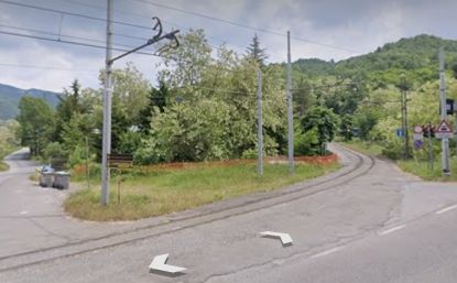
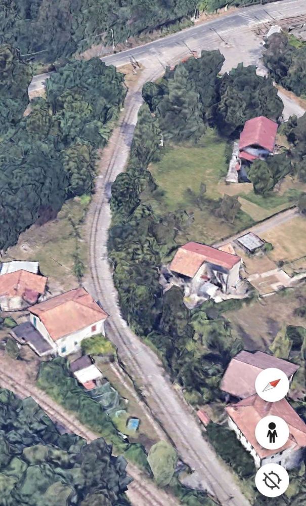
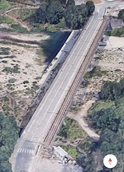
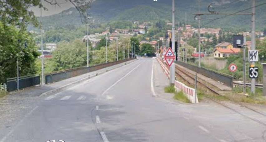
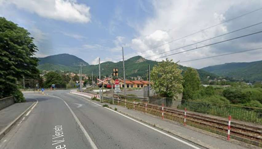
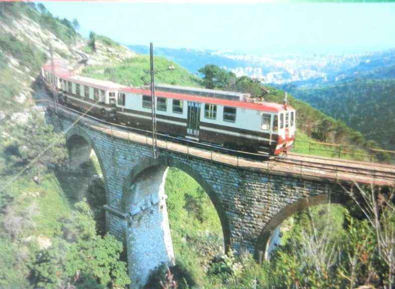
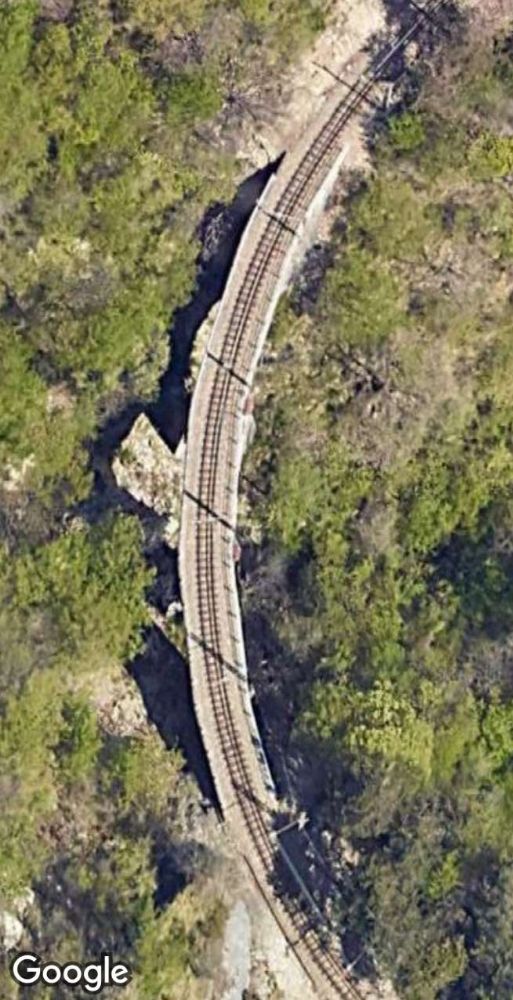
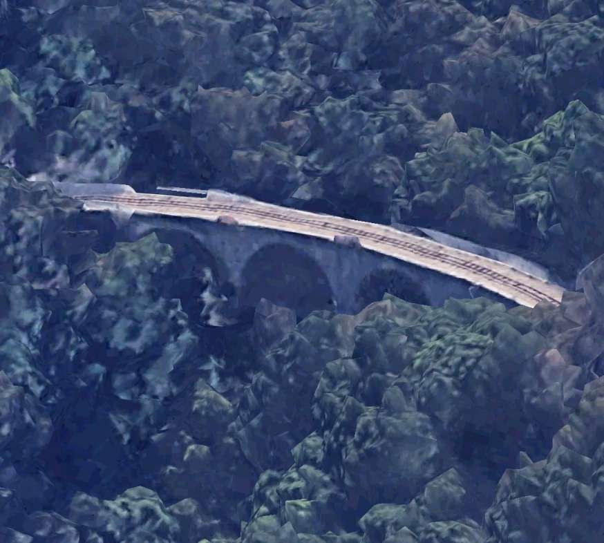
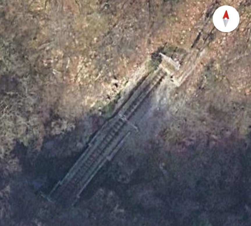
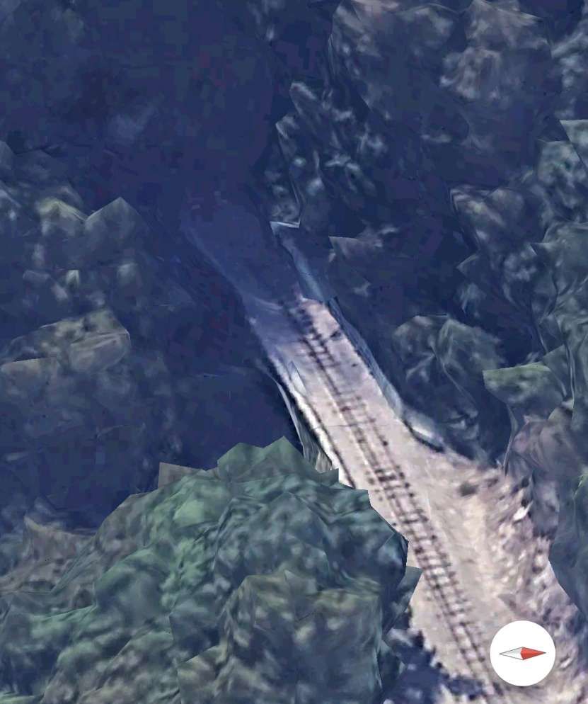
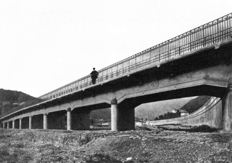
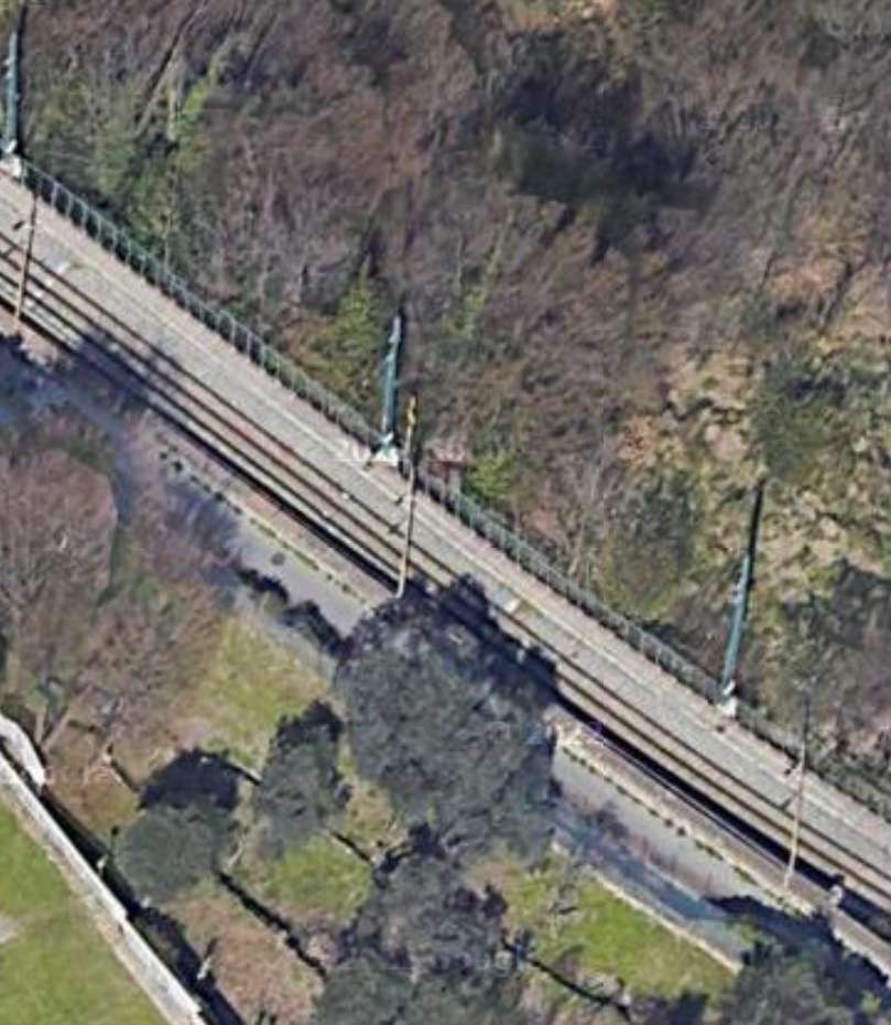
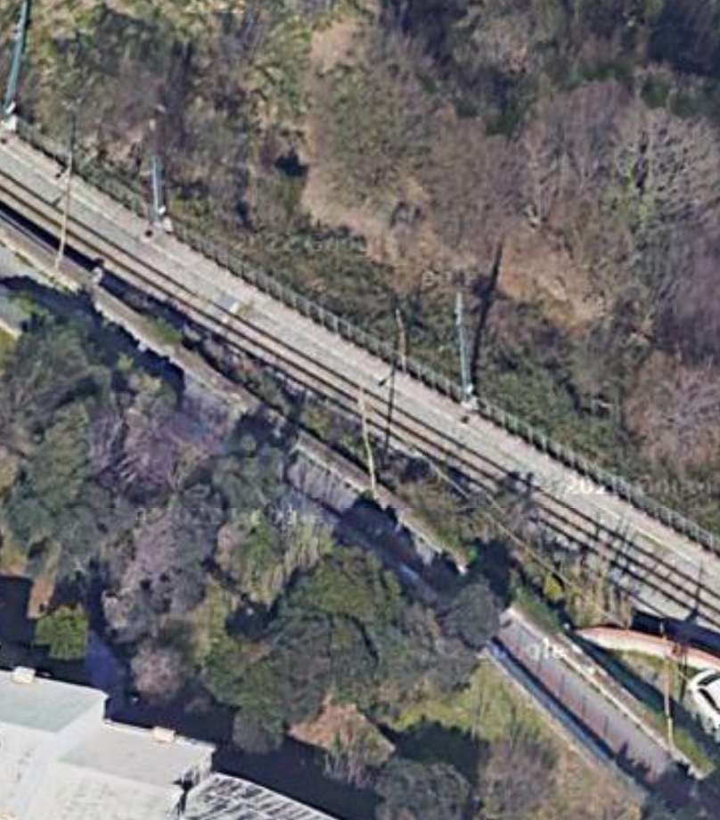
In 1930, “the Vittorio Veneto bridge over the River Scrivia [was constructed], but the railway was not immediately extended along the route.” [1][3]
“In 1933, even though the railway was operating at full capacity with a high numbers of passengers and freight, SAFEL was on the verge of bankruptcy. … The company had invested heavily in the extension projects without [paying] off outstanding debts with Breda and banca Nazionale del Lavoro, which had financed much of the construction of the line. … In 1934 SAFEL was declared bankrupt after a court trial, and the management of the railway was acquired by the Lazzi bus companies.” [1]
“On 23rd August 1937, two of the locomotives were destroyed in an accident near Vicomorasso. … Three [replacement A1-1A locos] were purchased, … built by MAN in 1913 for the Montebelluna – Asolo and Montebelluna – Valdobbiadene tramways [which] closed in 1931. … The machines entered service in 1939, … after conversion of the original power supply system from 975 V DC to 2400 V DC.” [1]
“During the Second World War the railway experienced its period of maximum use, since numerous families were evacuated to the area to the North of Genoa and the train operated both for passengers and for freight. … At the end of the conflict, both the infrastructure and the rolling stock were seriously damaged by intensive use and poor maintenance, so much so that use of the line was suspended and in 1949 it was placed under Government Commissioner Management.” [4: p16 – translated/adapted from Itailan]
“In 1953 the line was extended from the Casella depot to the town. … Since 1975, the railway has undergone complete … renovation, with the replacement of the rails, the electrical substation and the functional restructuring of the depots.” [4: p16 – translated/adapted from Itailan]
In 1956, a locomotive (No. 28) with a power of 355 kW with a maximum speed of 50 km/h was acquired from the Sangritana Railway; in 1960 another unit (No. 29) and spare parts were acquired. “The locomotives were part of a contract of fourteen four-axle locomotives built in 1924 with electrical equipment and bogies supplied by TIBB and case made by Carminati & Toselli. Originally narrow-gauge at 950 mm, they were converted to [metre-gauge].” [1]
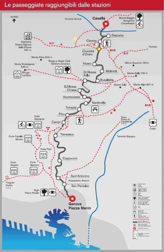
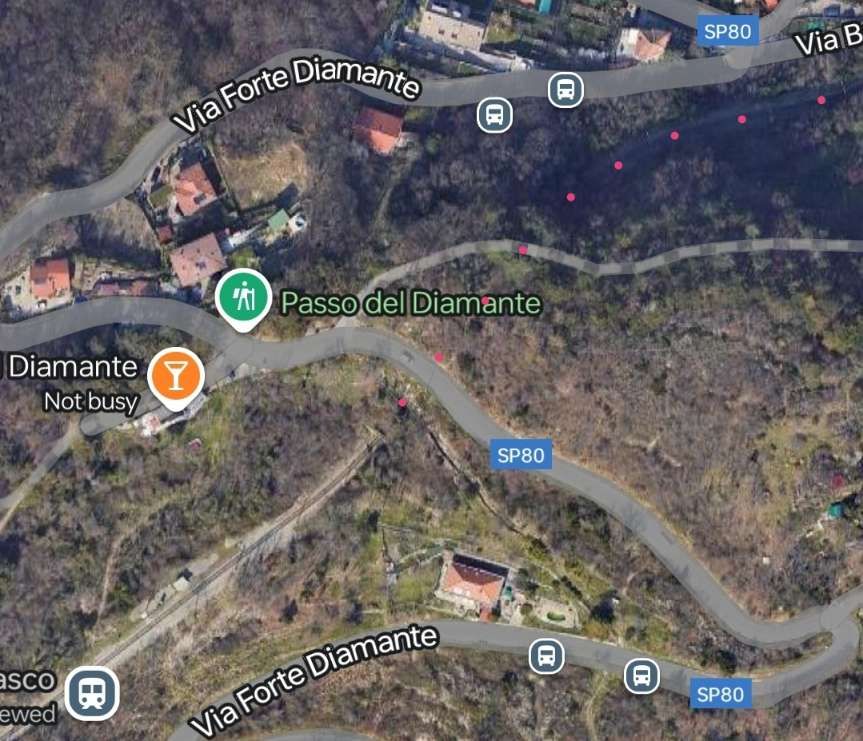
“The ‘Casella train’ remains one of the few secondary Italian railways still in use because not only does it serve a route for which there is no alternative road network, but it also is a tourist attraction (the route intersects numerous hiking trails, including those to the Forts of Genoa and a stretch of the Alta Via dei Monti Liguri) and has low operating costs.” [4: p16 – translated/adapted from Itailan]
In the four-year period 1997-2000, the line was entrusted to the Italian State Railways to achieve a technical-economic recovery, and from 1 January 2001 it became the property of the Liguria Region.][4: p16 – translated/adapted from Itailan]
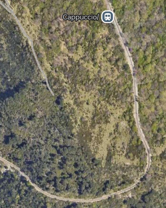
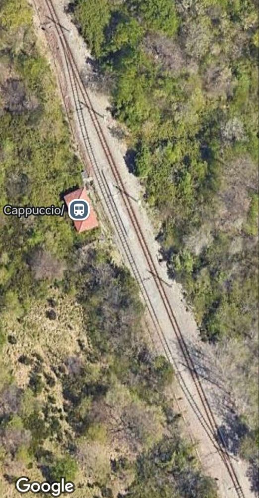
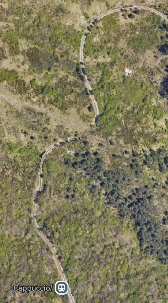
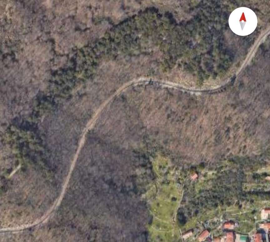
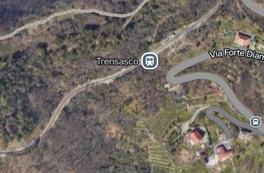
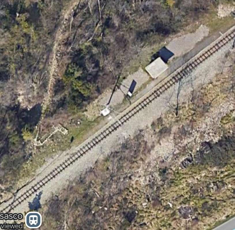
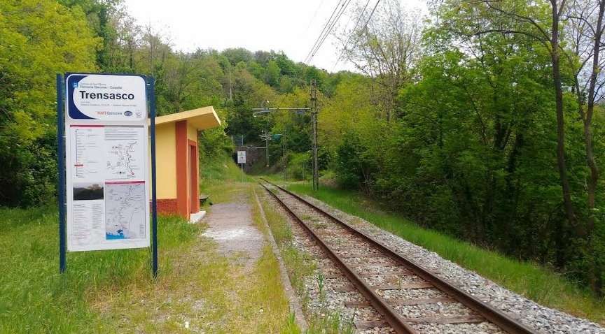
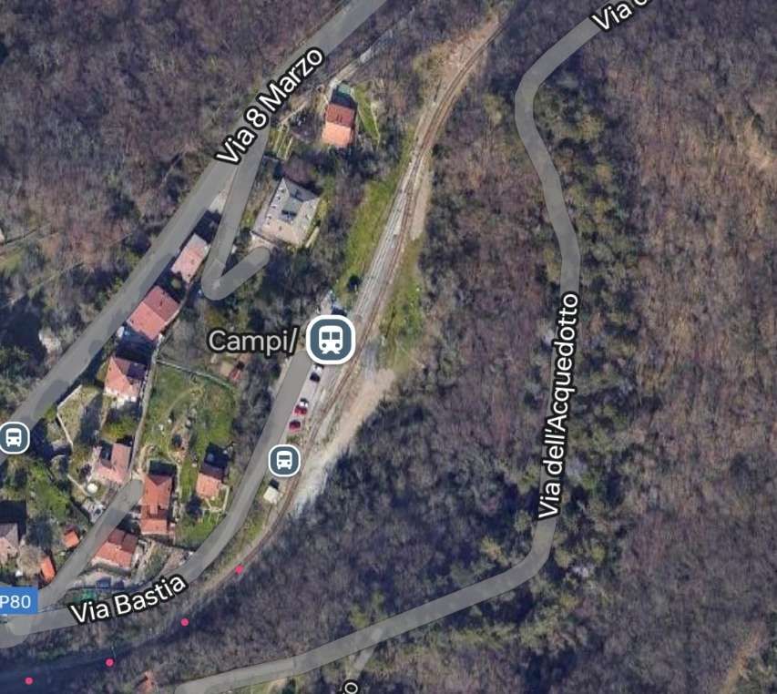
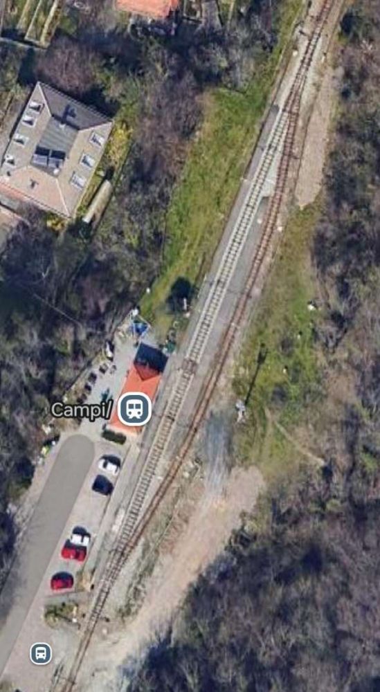
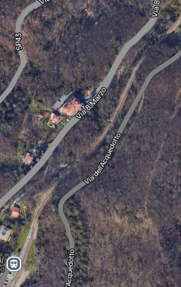
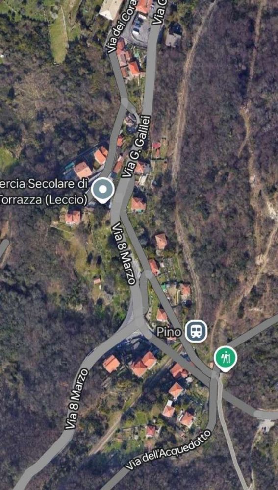
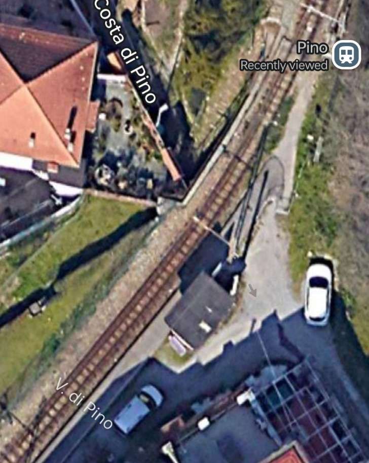
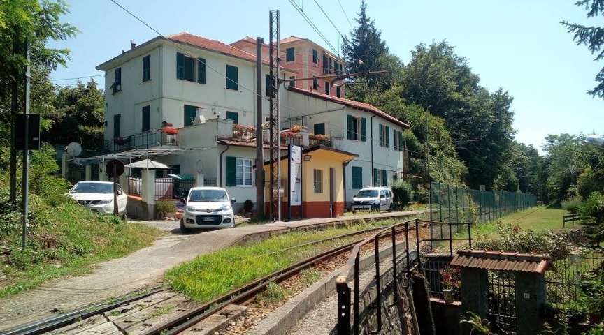
“Starting from the terminus at Manin, the route winds its way out of the city: running along a stretch of the Val Bisagno, it serves the localities of S. Pantaleo, Cappuccio, Campi, Pino Soprano, Torrazza, before passing through the Trensasco tunnel into Val Polcevera and reaching the terminus at Casella, in Valle Scrivia.” [4: p16 – translated/adapted from Itailan]
The Route
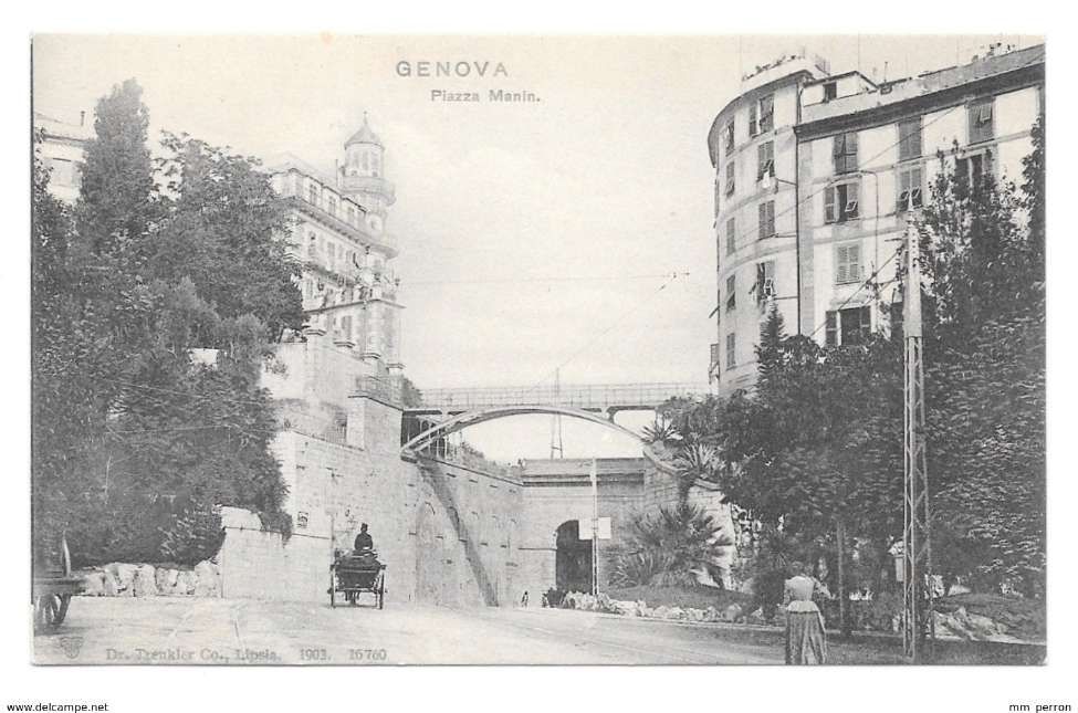
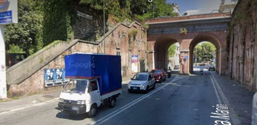
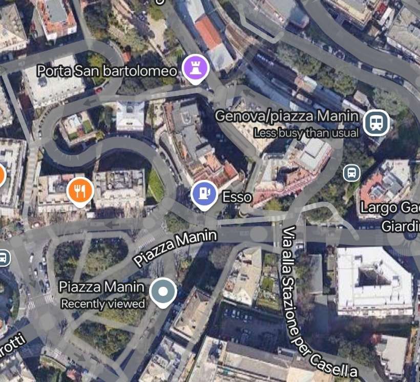
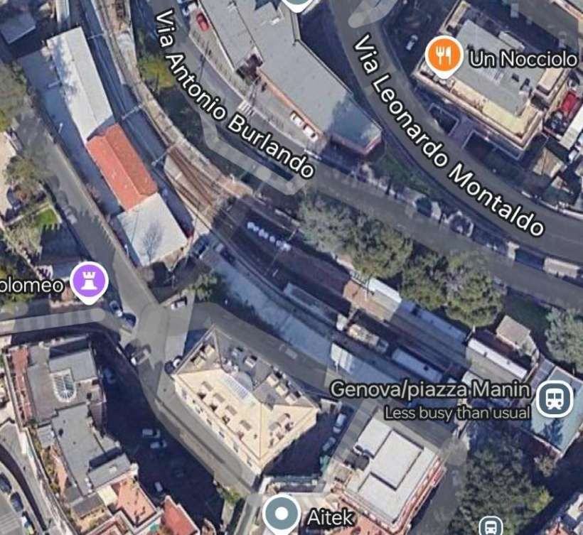
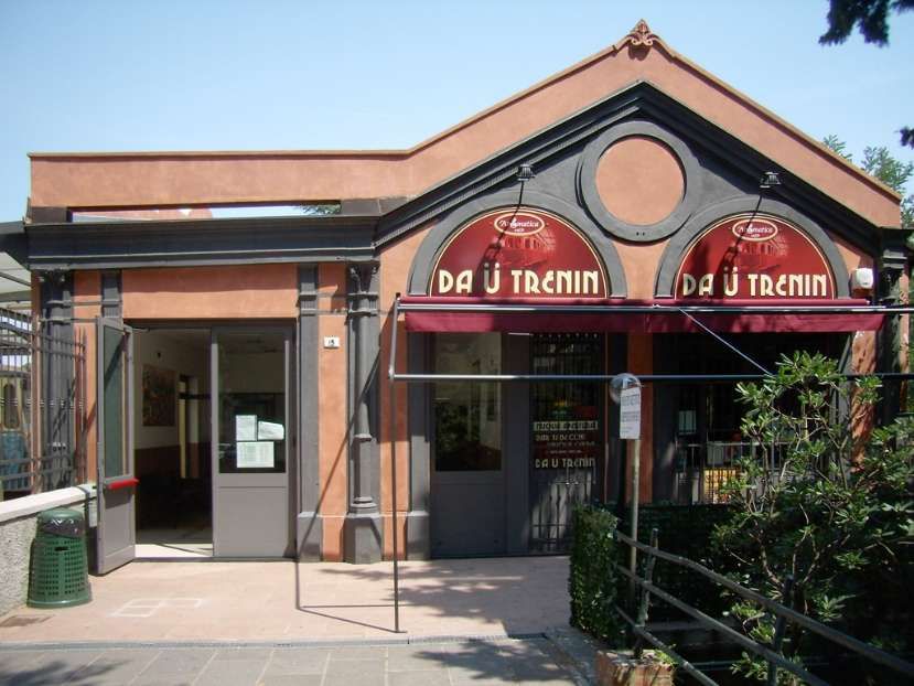
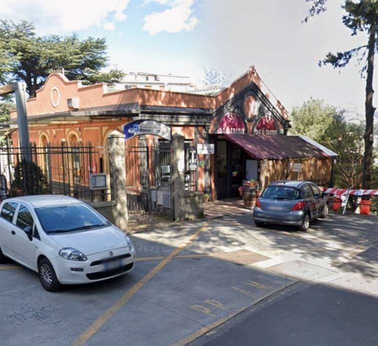
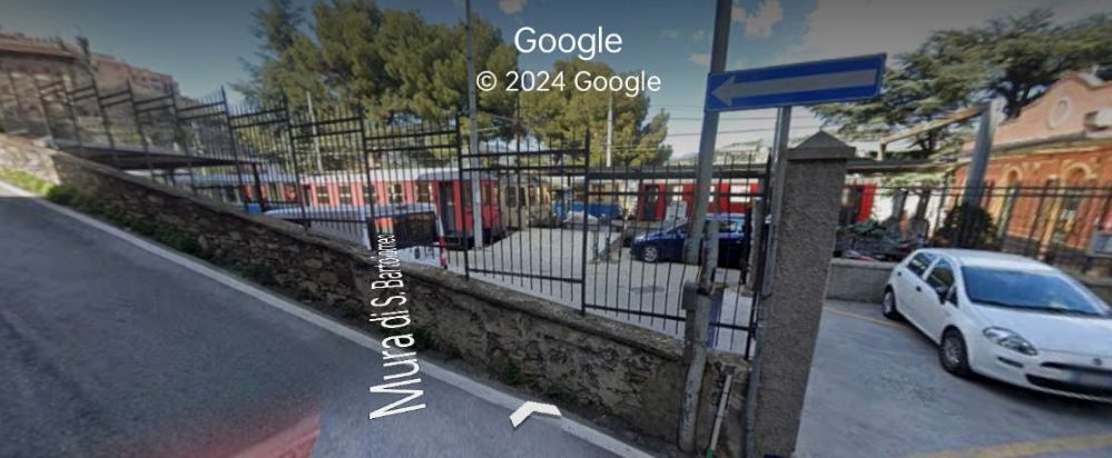
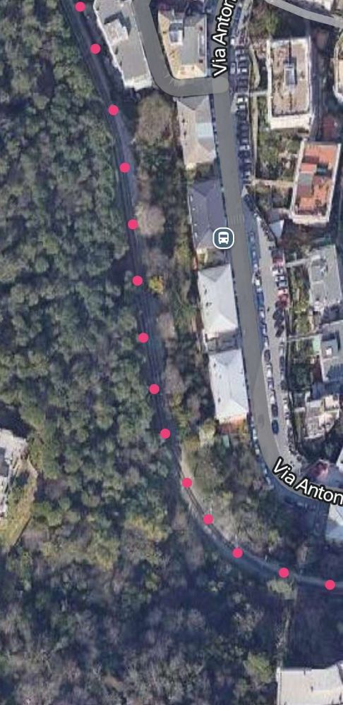
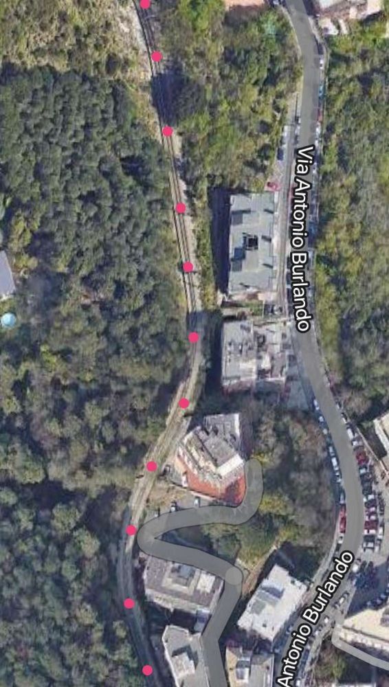
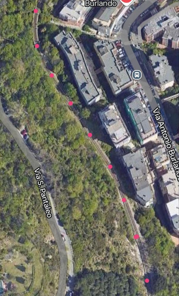
The terminus in Genoa is the Genova Manin railway station, located above the Piazza Manin and can be reached via a flight of steps or by bus No. 64.
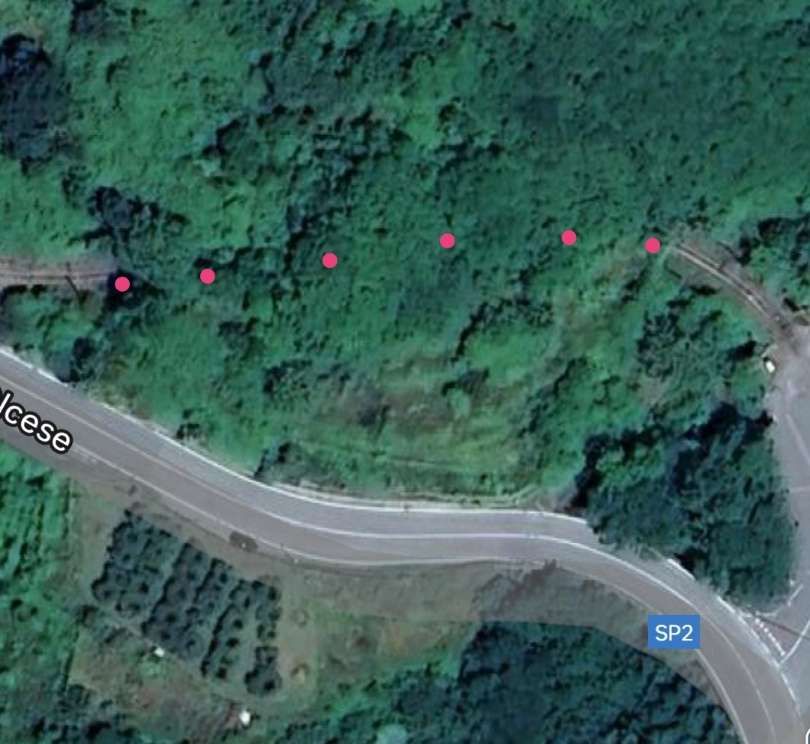
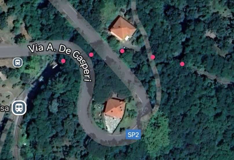
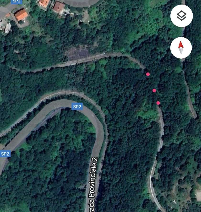
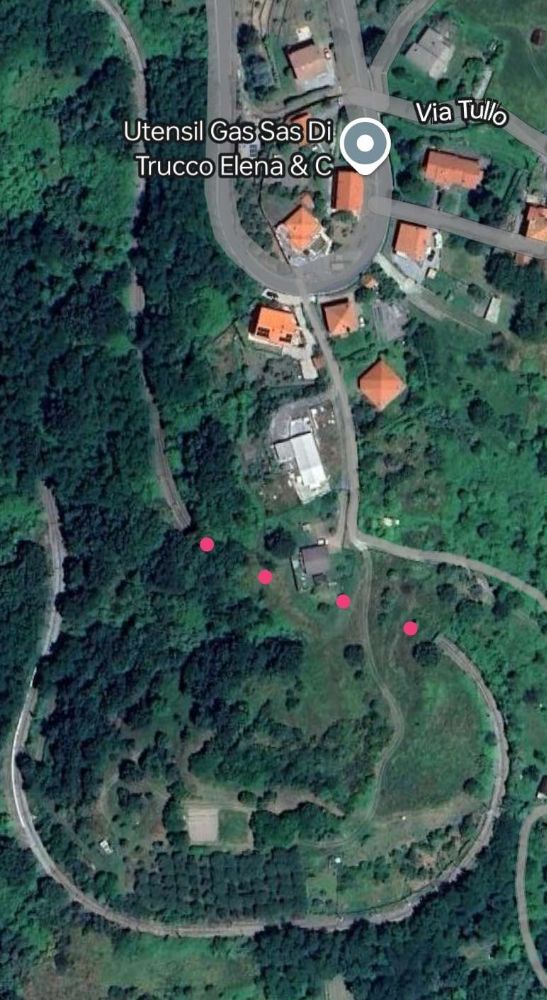
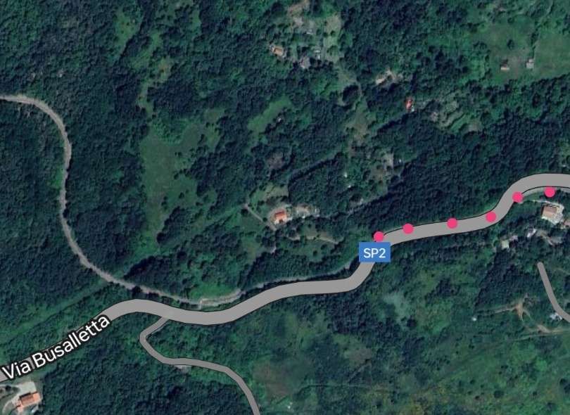
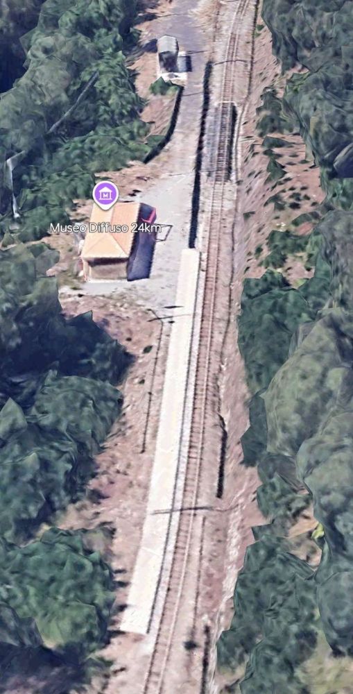
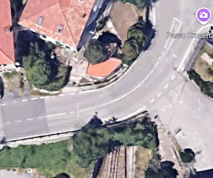
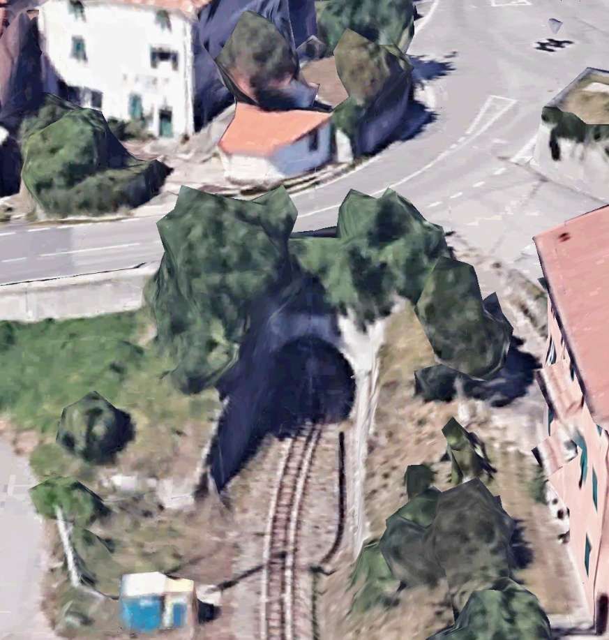
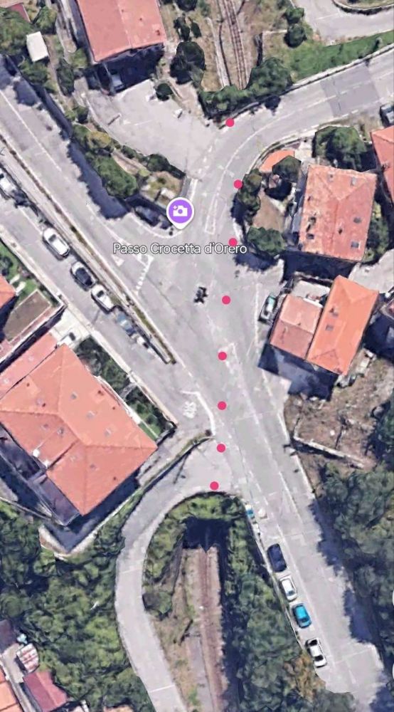
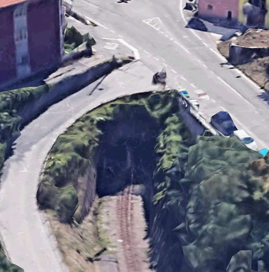
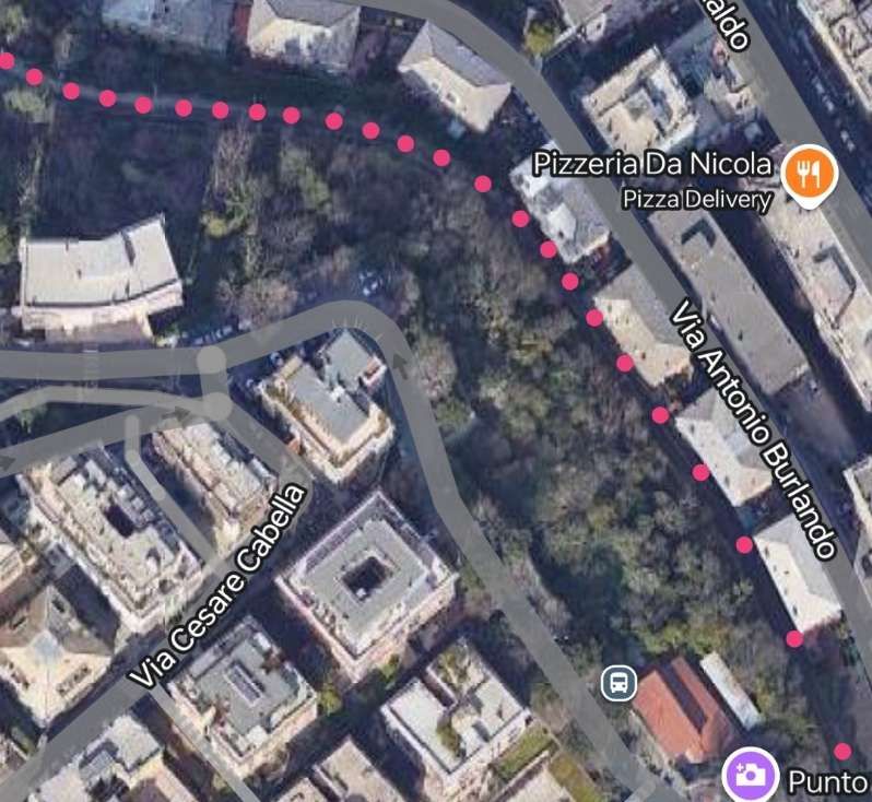
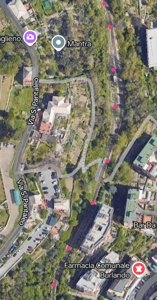
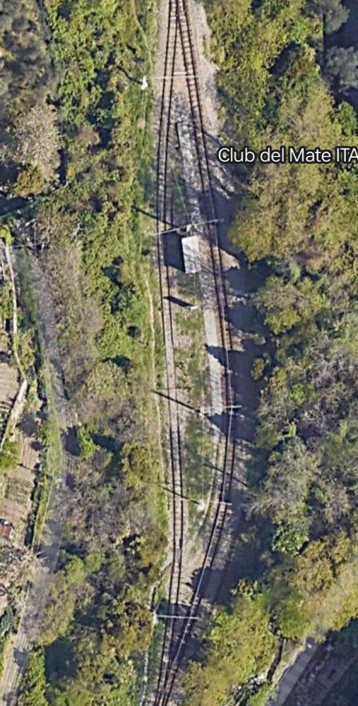
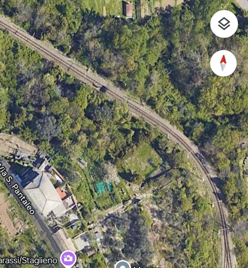
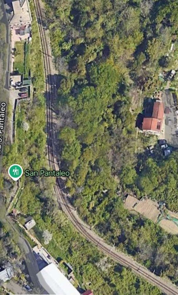
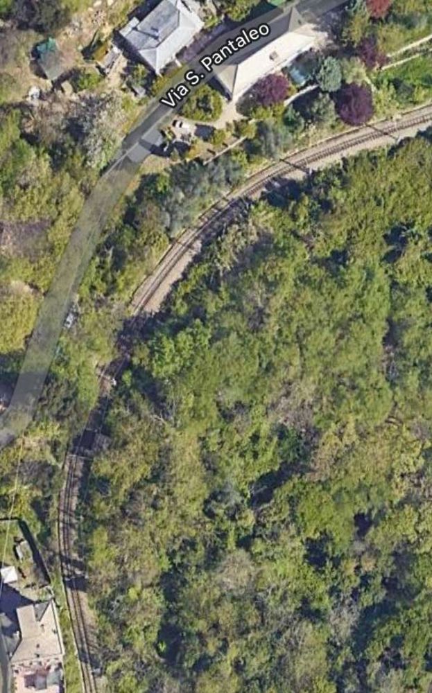
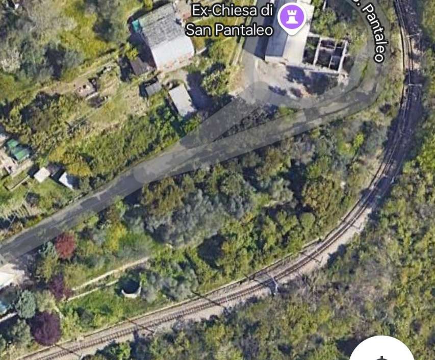
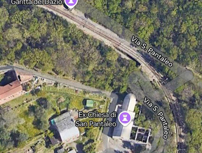
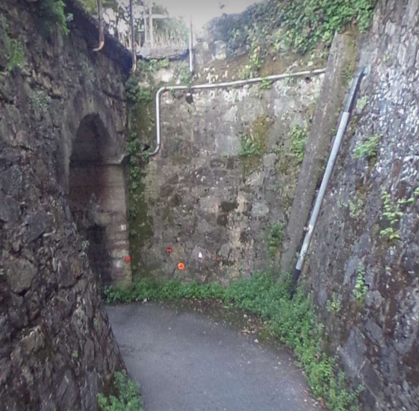
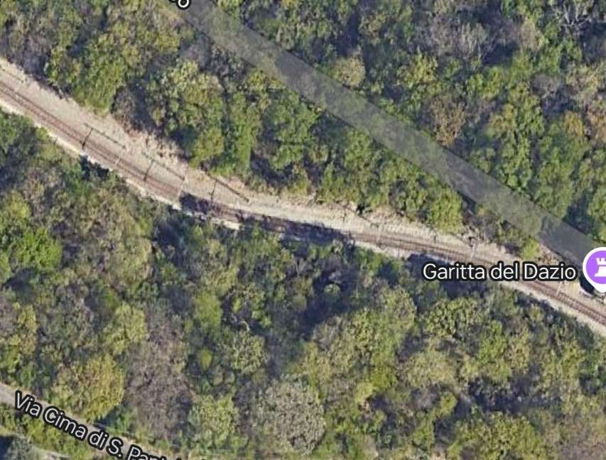
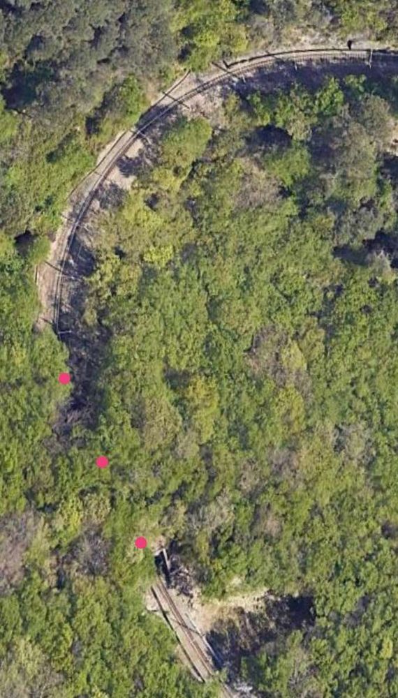
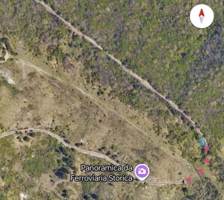
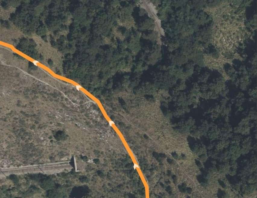
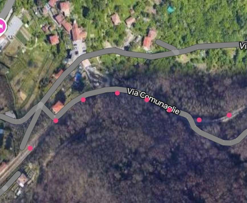
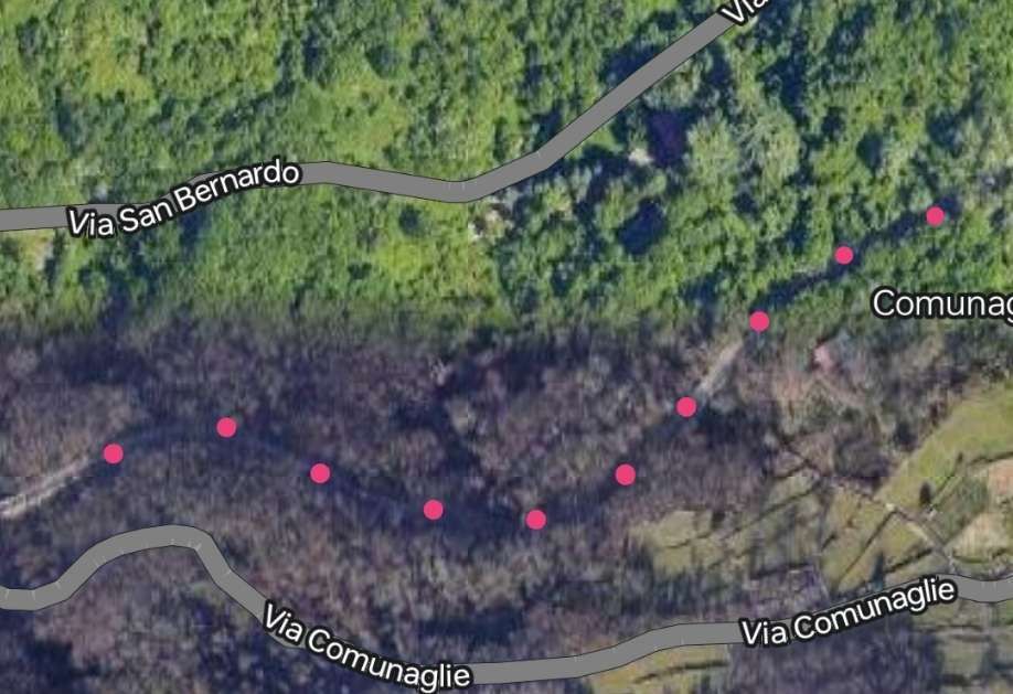
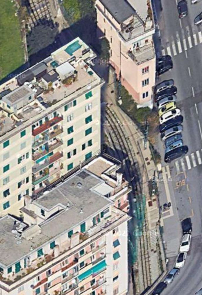
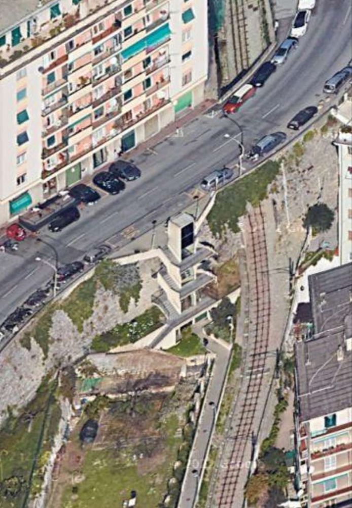
In subsequent satellite images, red dots will only be used where the route of the railway is less clear than it might be. The next 5 satellite images take us as far as the Ex-Chiesa San Pantaleo where the Via San Pantaleo passes under the railway.
Close to Ex-Chiesa di San Pantaleo the Via San Pantaleo passes under the railway. Google Maps, November 2024]The stone-arched underpass which takes Via San Pantaleo under the railway, Luca Spinelli (2018). [Google Maps, November 2024]
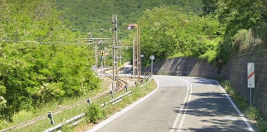
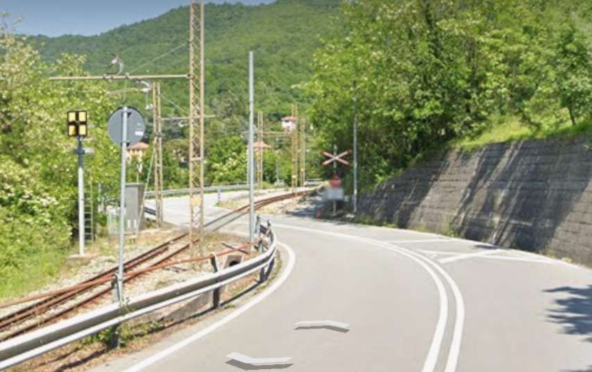
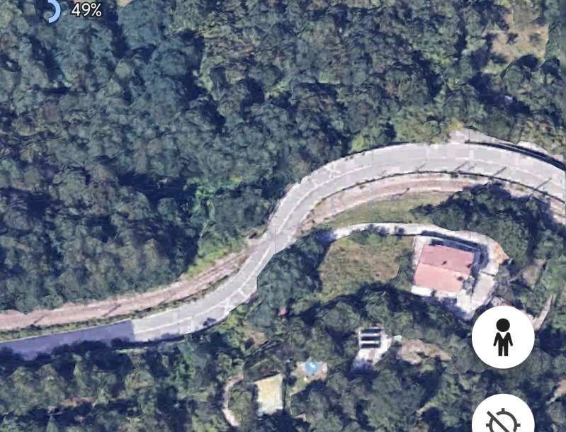
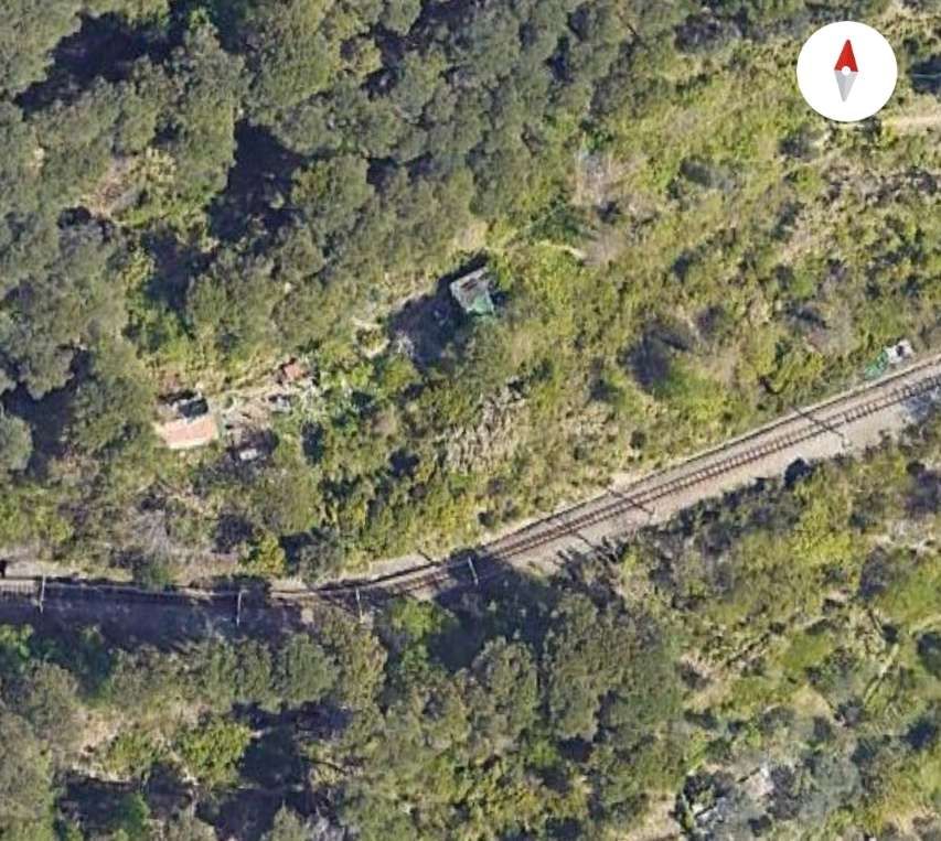
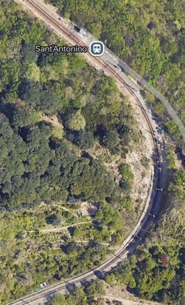
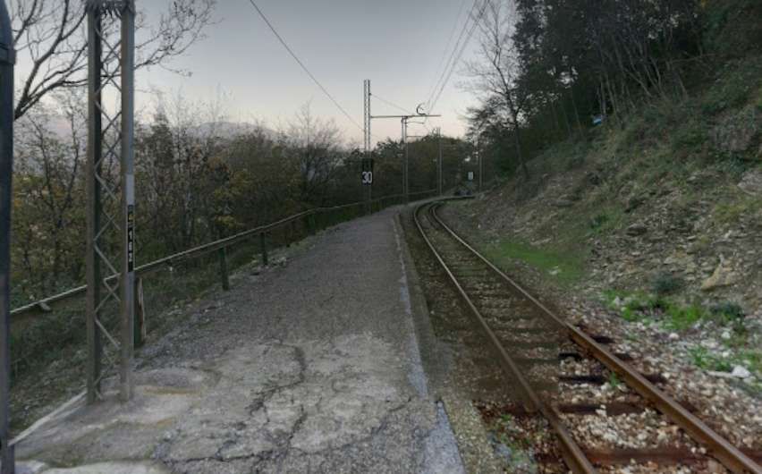
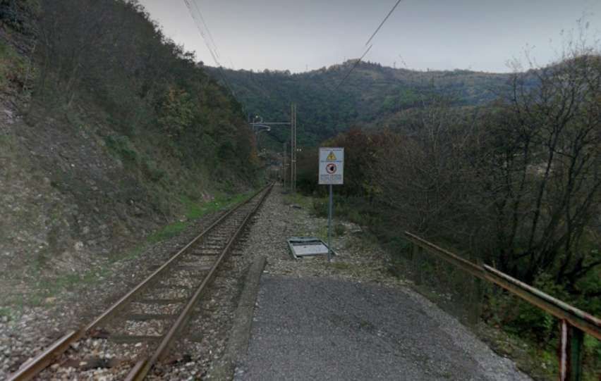
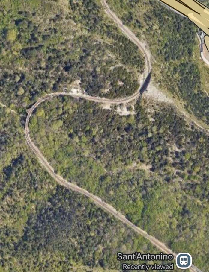
The next sequence of 7 satellite images takes us to the San Antonino Halt.
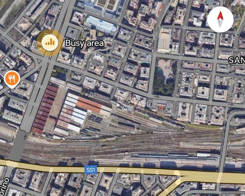
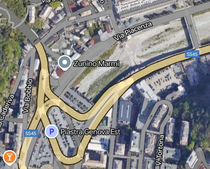
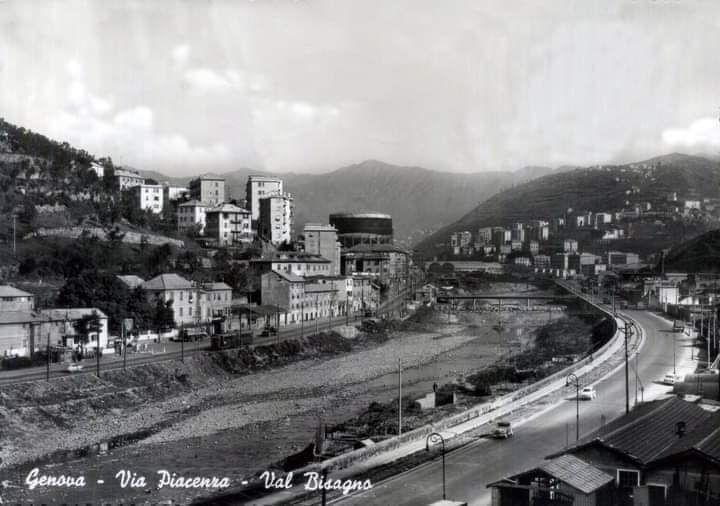
This was an industrial railway in the valley of the Bisagno River (Torrent). The Binario Industriale della Val Bisagno, also known as La Ferrovia delle Gavette, was in use from 1926 until 1965. It was a standard-gauge line and was 4.7km in length.
A translation from the Italian Wikipedia site: “The area of the lower Bisagno valley was developed at the end of the nineteenth century thanks to marble works at the monumental cemetery of Staglieno and a flourishing of agriculture; the area of Marassi experienced a strong expansion at the beginning of the 20th century with:
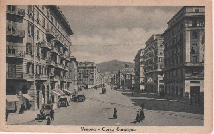
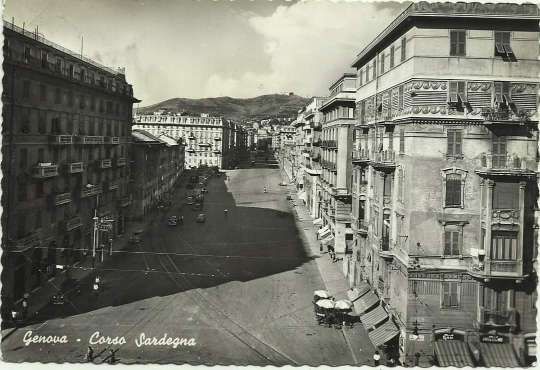
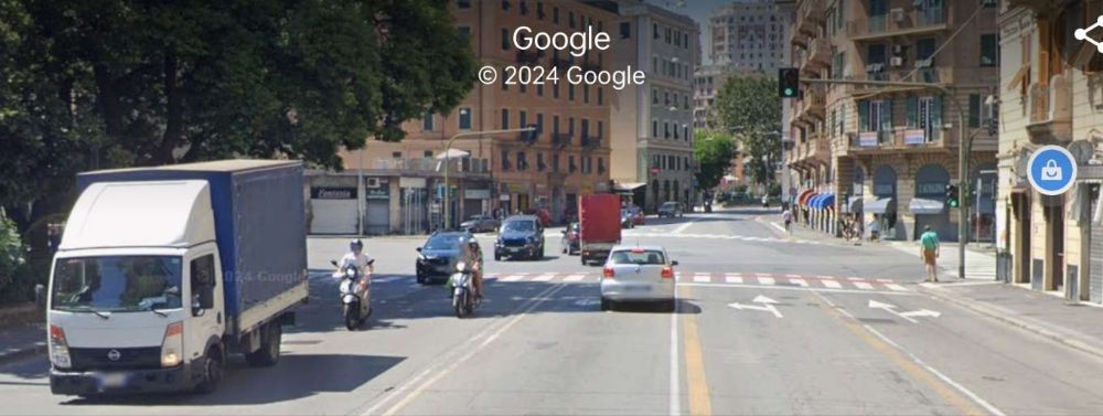
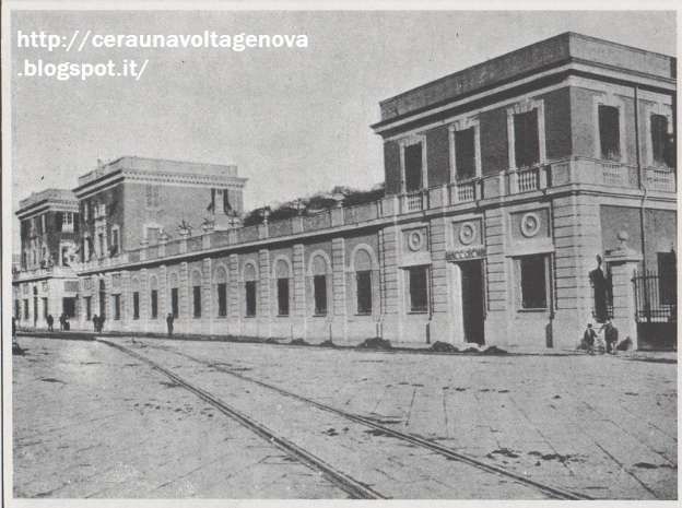
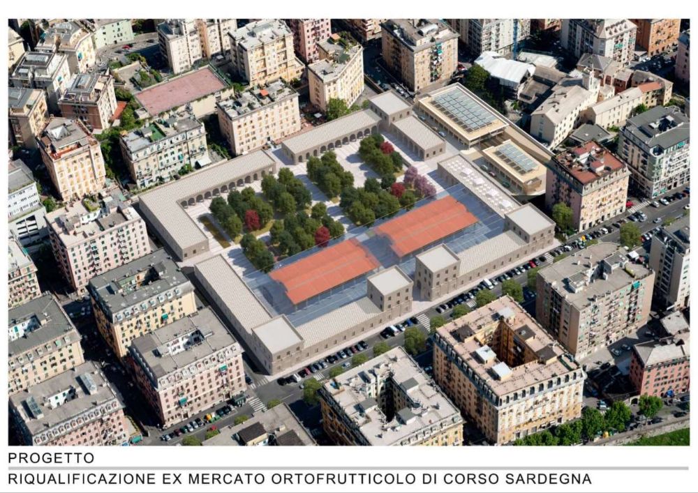
the construction of the general fruit and vegetable market in Corso Sardegna;
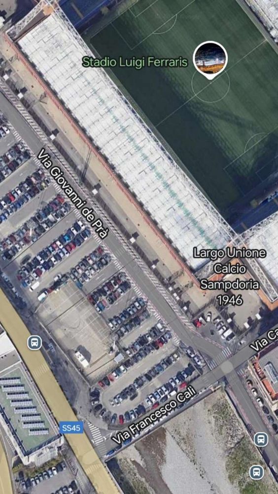
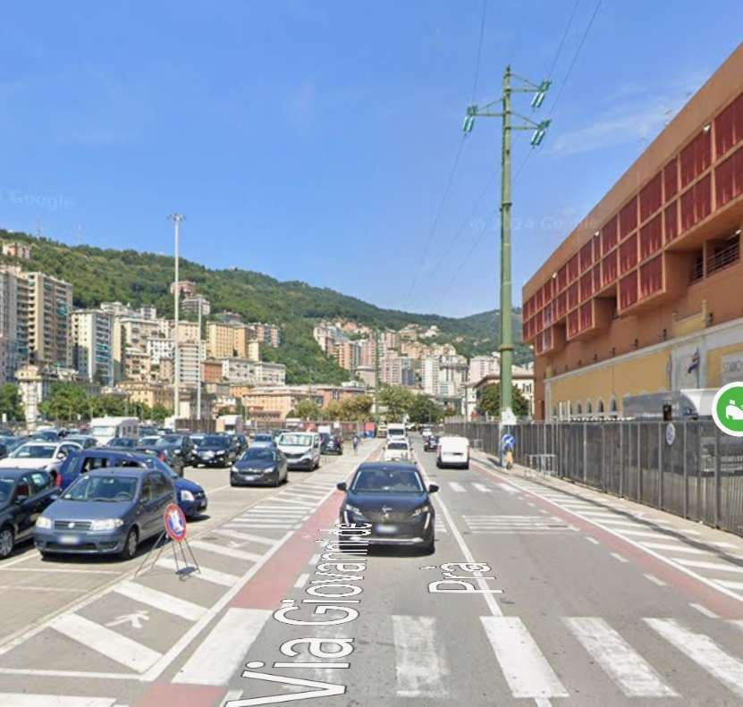
the municipal stadium;
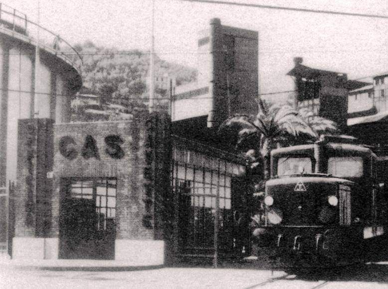
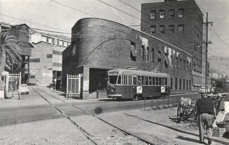
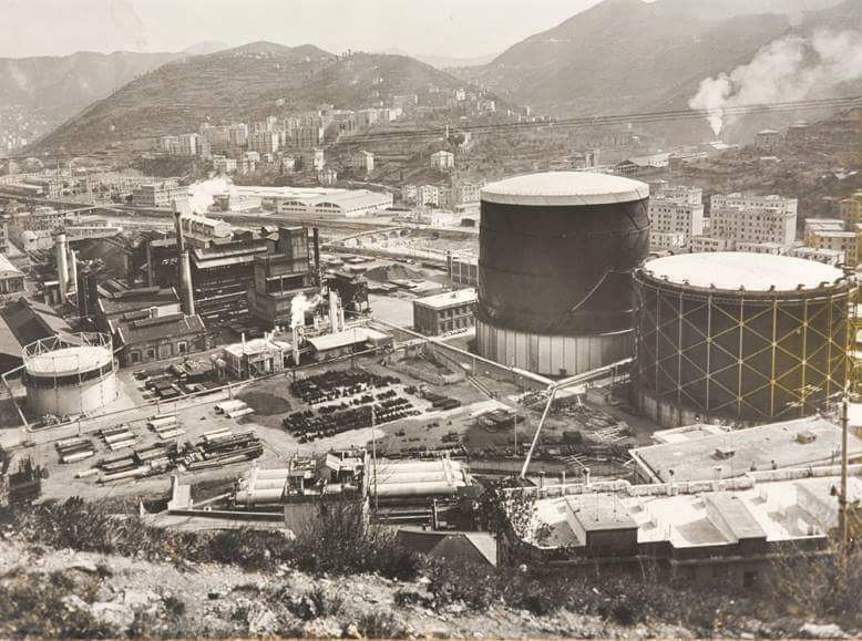
the workshops for the production of city gas with the gasometer built in the “Gavette” area of the Municipal Gas and Water Company (AMGA) located near Ponte Carrega;
the new municipal slaughterhouses in the Cà de Pitta area located in Piazzale Bligny.” [7][8]
Contracted out in 1925, the railway was built at an initial cost of about 2 million lire and served the new commercial and industrial settlements that had sprung up in the valley. [7][9]
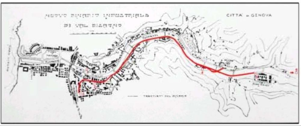
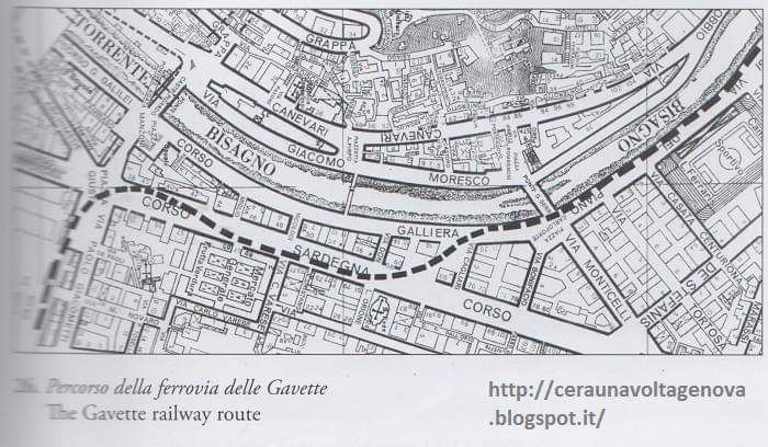
This low definition image shows the route of the railway up the Valley of the Bisagno. It comes from a public participation brochure: ‘Trasporto Pubblico Locale in Valbisagno: un percorso di partecipazione’. [10]A schematic drawing of the route of the railway which shows the main connections to the line. [7 – translated from Italian]
“The line, single-track and not electrified, was mainly equipped with normal 36 kg/metre Vignoles rails placed on ballast, with the exception of the sections shared with road traffic, notably in Piazza Giusti and Corso Sardegna, where there were counter-rails.” [7][9]
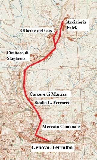
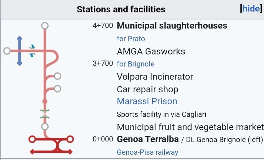
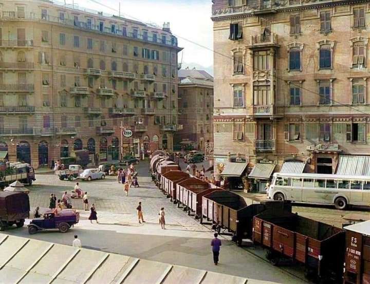
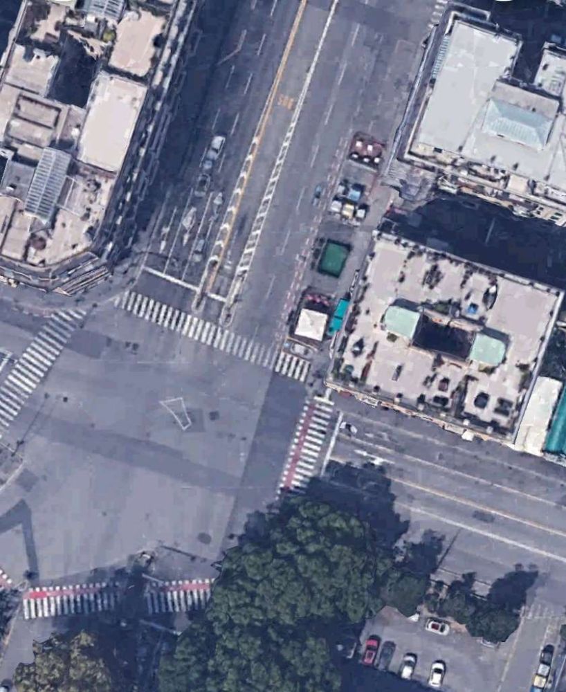
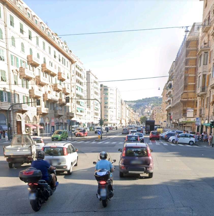
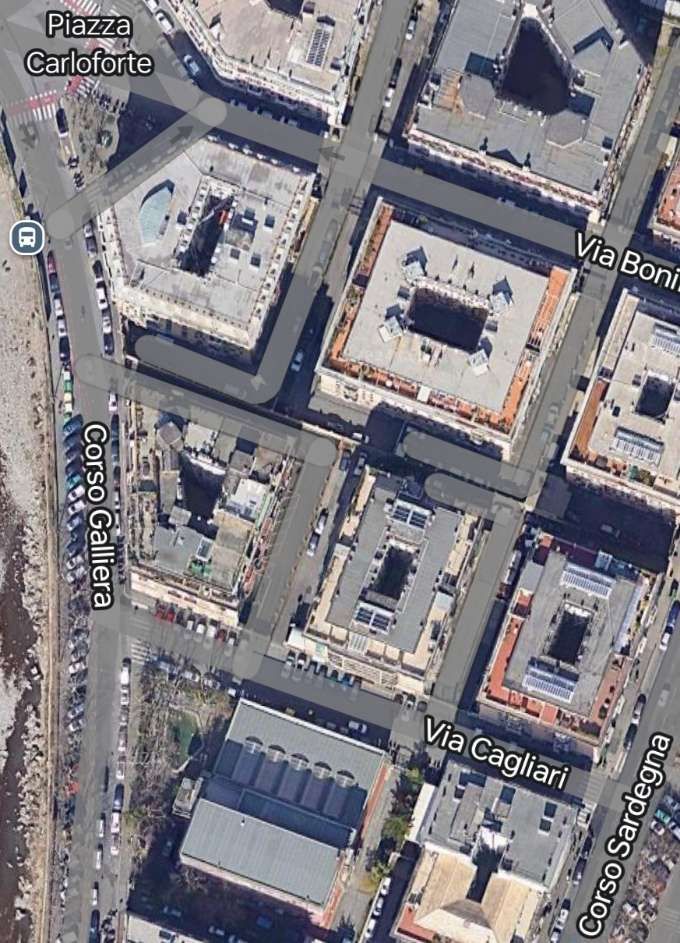
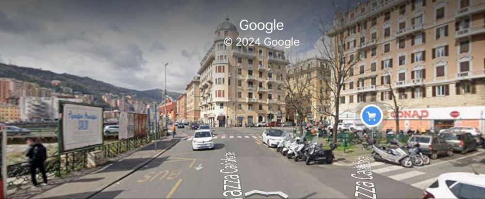
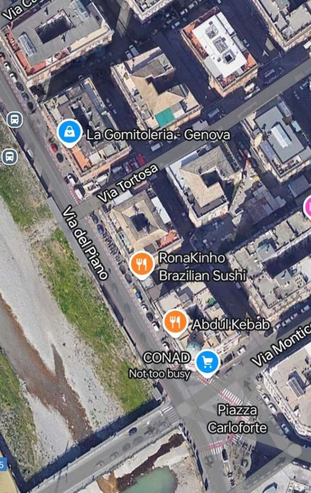
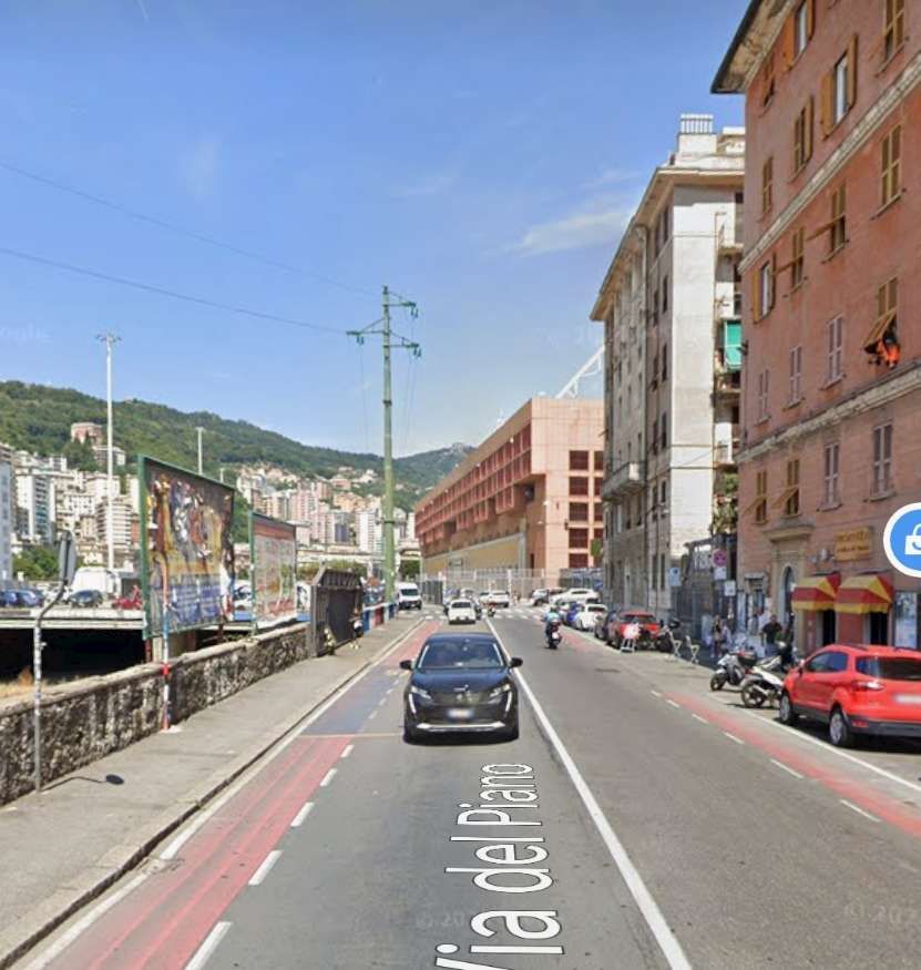
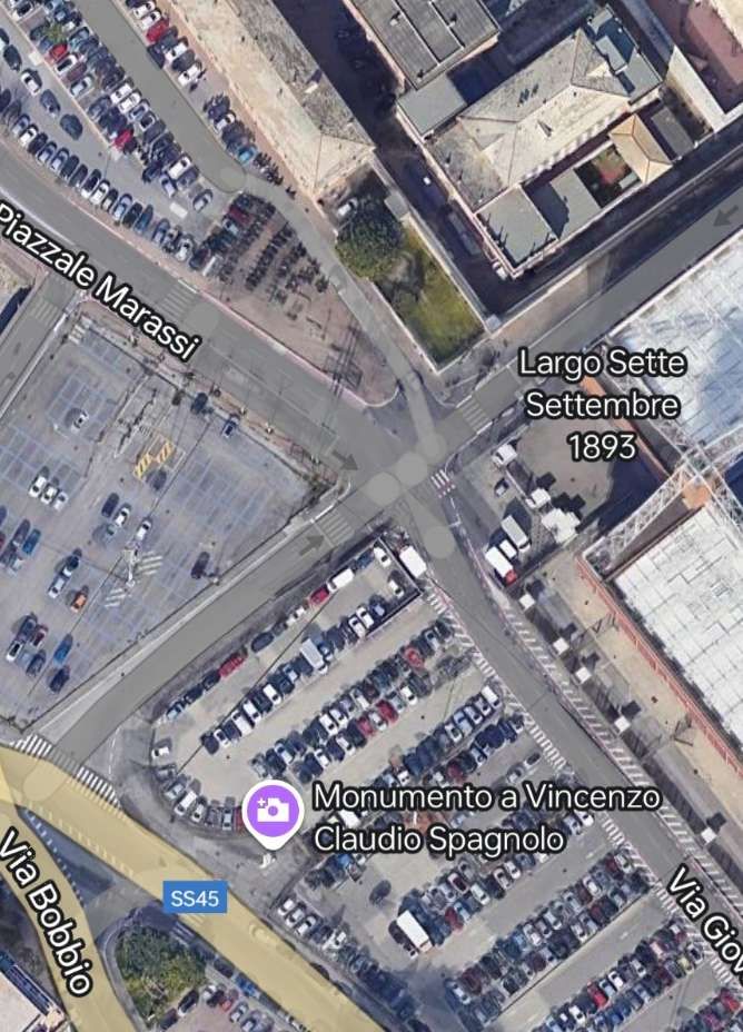
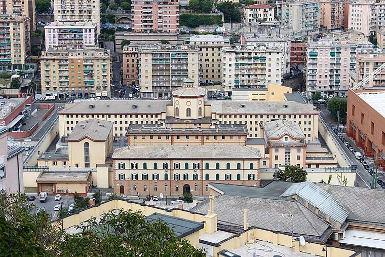
“The track branched off from the Terralba freight yard, near Piazza Giusti, entered the Corso Sardegna, along which the general fruit and vegetable markets were located, then turned left entering Via Cagliari, reached Piazza Carloforte and continued along Via del Piano, running alongside the municipal stadium and prisons.” [8 – translated from Italian]
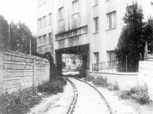
The Italian Wikipedia article adds a little to the information in the last paragraph. … On the Corsa Sardegna, the line was doubled to allow wagons to be left alongside the market area for loading and unloading. “After passing the market, the track crossed the road diagonally towards the Bisagno, … passing through a specially built archway in the building that, in the 21st century, houses the sports facility on Via Cagliari, through which it emerged at Corso Galliera. … Once in Piazza Carloforte, the track continued along Via del Piano, which was constructed at the same time as the railway, running alongside the municipal stadium and the prison , where trains carrying prison carriages sometimes stopped.” [7][9] The places mentioned in this paragraph appear in the images below.
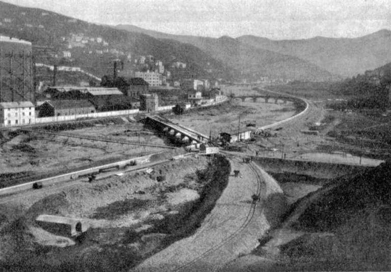
“The line continued up the left bank of the Bisagno, connecting to a number of factories. 3.7 km from its southern terminus a branch to the right which immediately curved round to cross [what became] the main line, Via del Piano and River Bisagno on a reinforced concrete bridge (Ponte G. Veronelli – which stood until destroyed during the flood of 1993); after crossing the river the line entered directly into the Gas Works, crossing, at ground level, the UITE (Unione Italiana Tramvie Elettriche) tramway Line No. 12, Genoa – Prato.” [8 – translated from Italian]
Italian Wikipedia tells us that the factories mentioned above which sat between the prison and the branch to the gasworks were: a plant for the repair of railway tanks and the NU “Volpara” plant for the incineration of urban waste. [7][9]
‘Trasporto Pubblico Locale in Valbisagno: un percorso di partecipazione’ [10] included the Volpara, Gavette and Guglielmetti Workshops and municipal waste treatment facilities, in its list of concerns which benefitted from the new railway. [10]
The next series of images cover the length of the line referred to in the paragraph above.
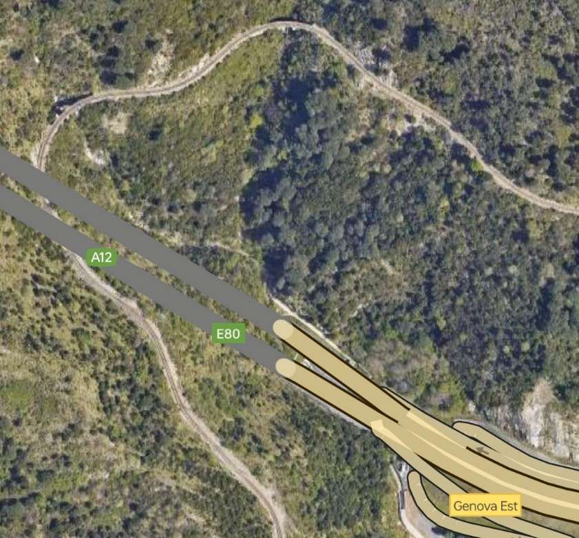
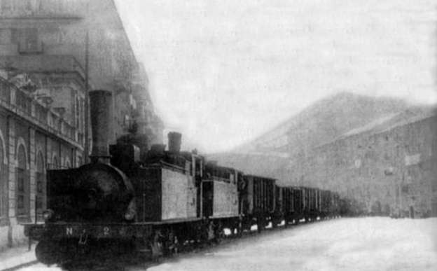
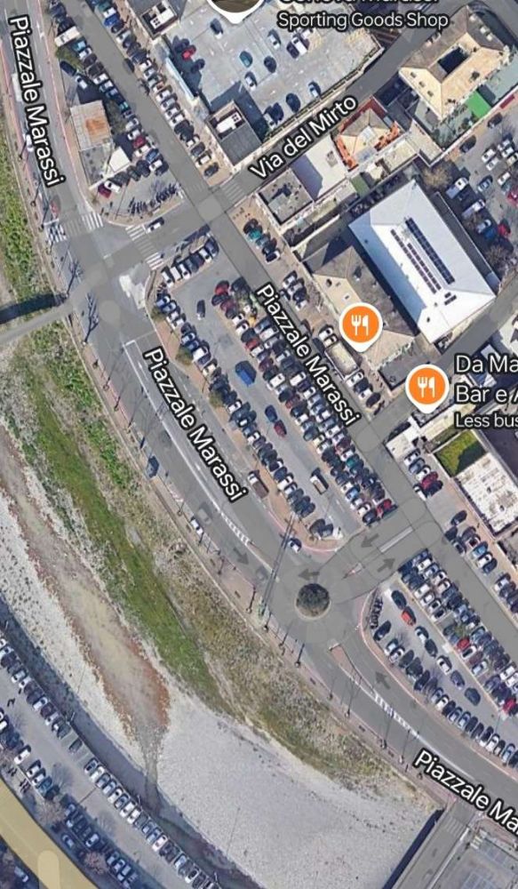
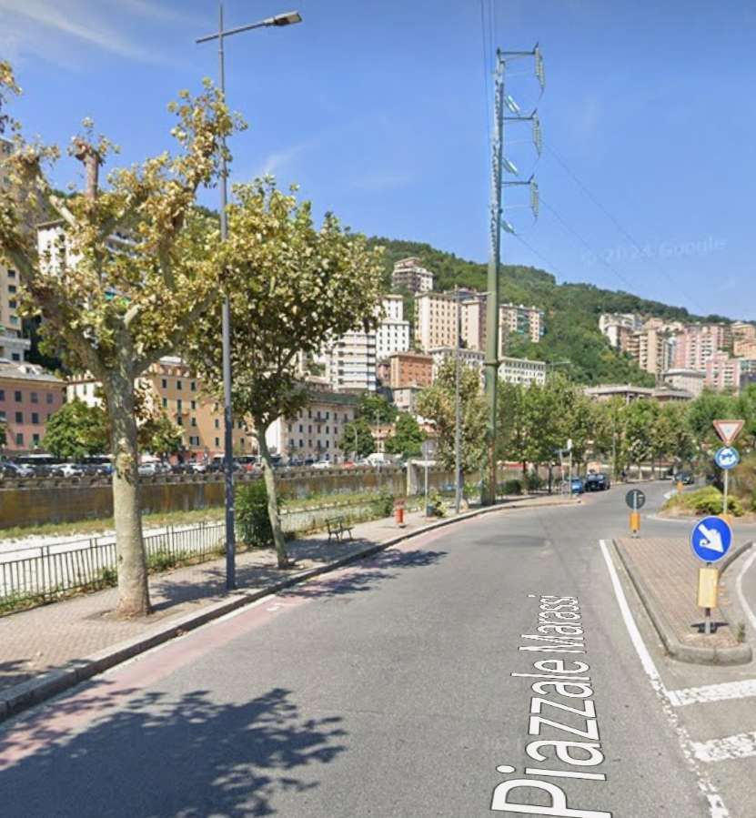
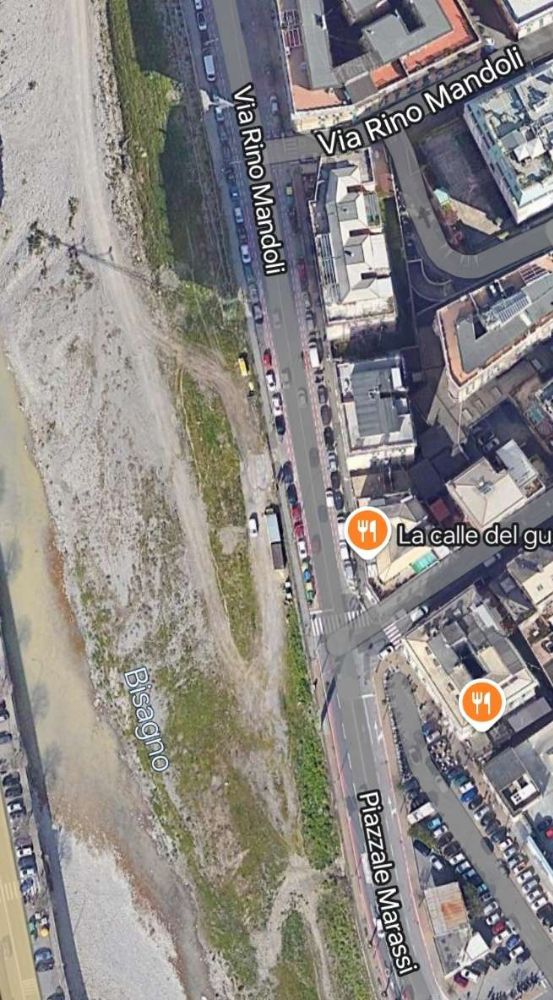
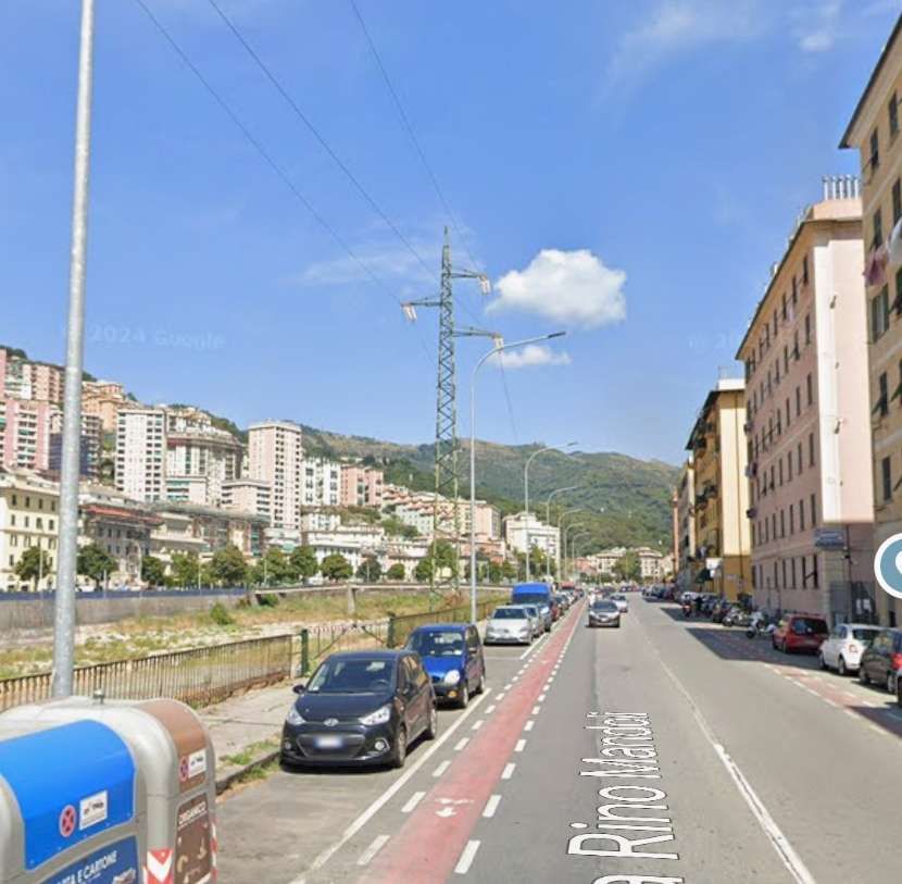
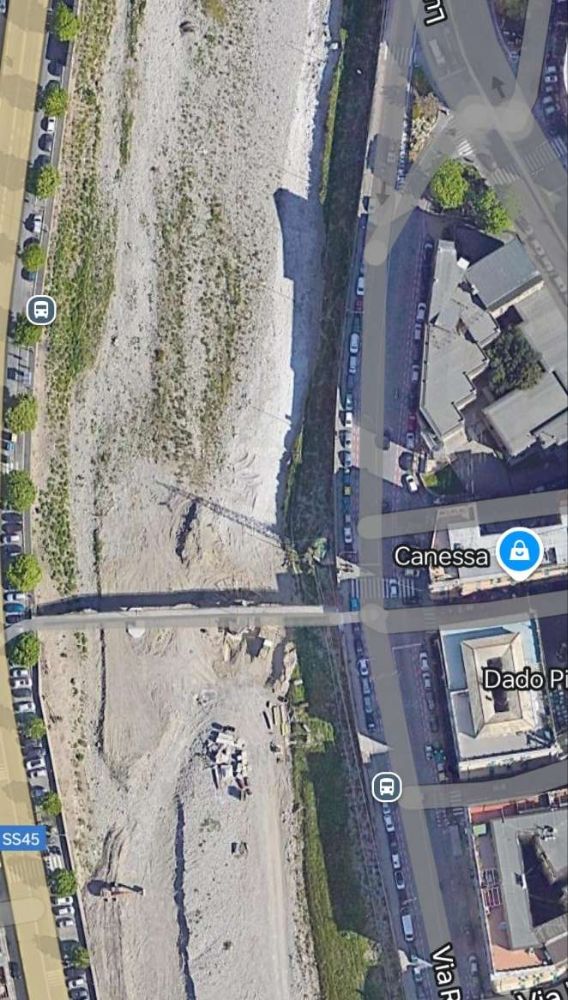
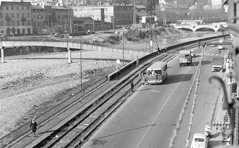
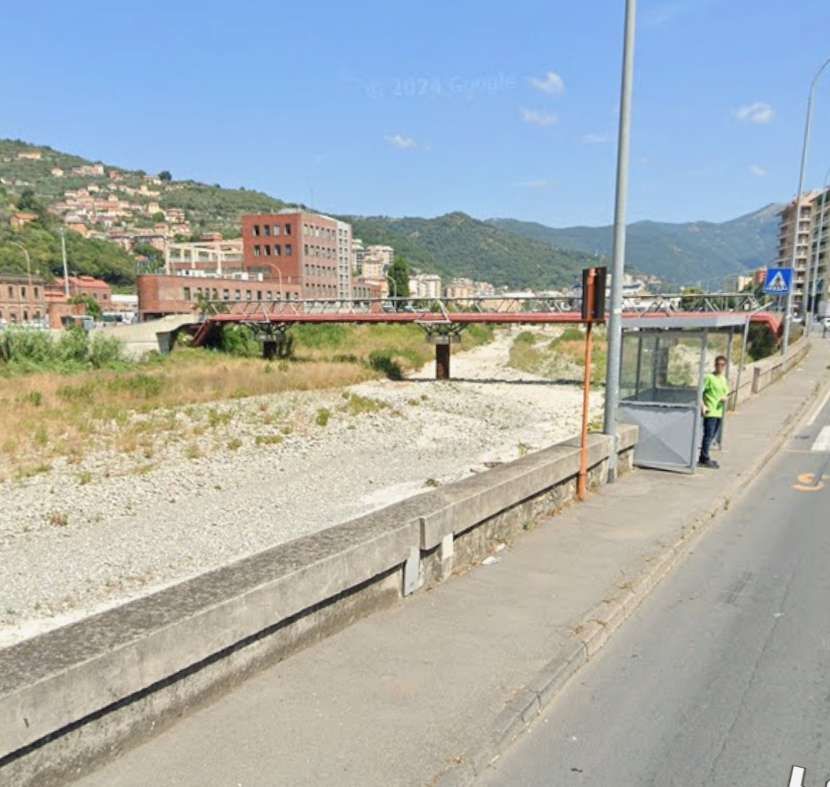
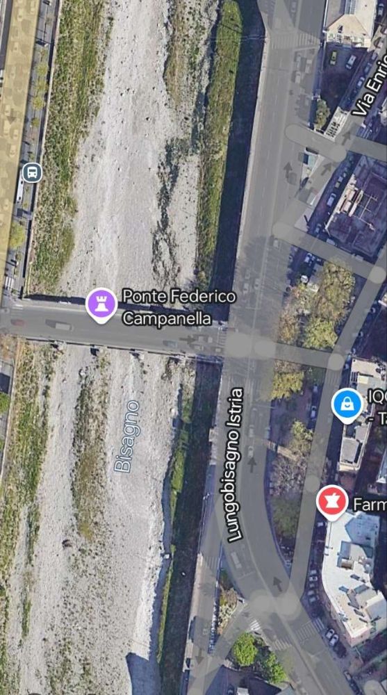
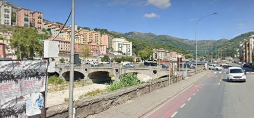
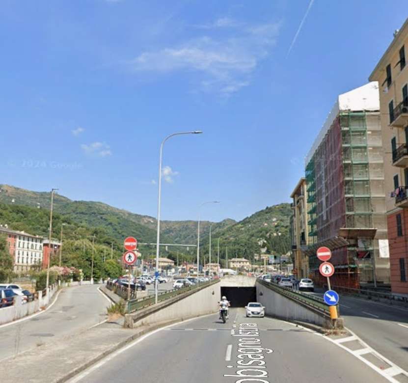
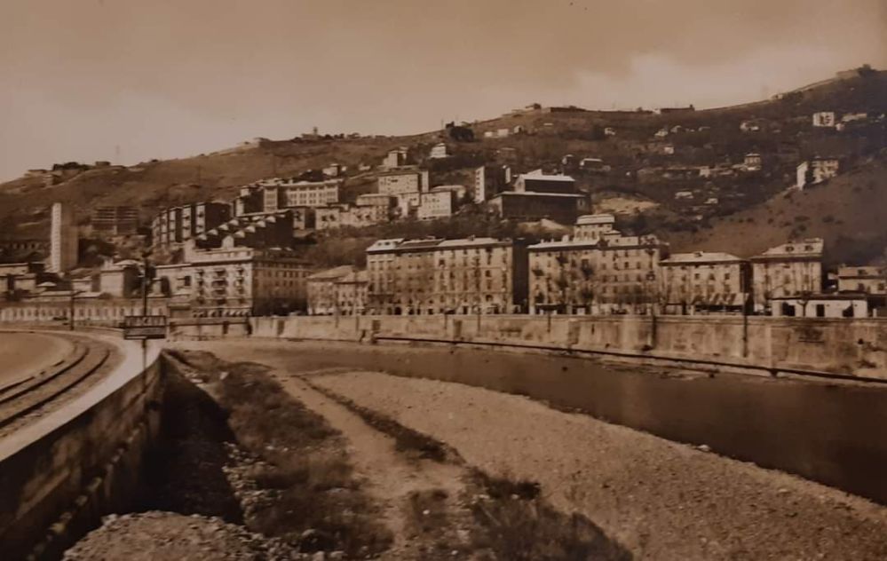
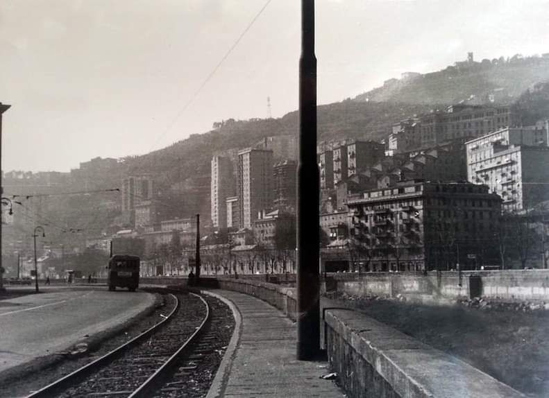
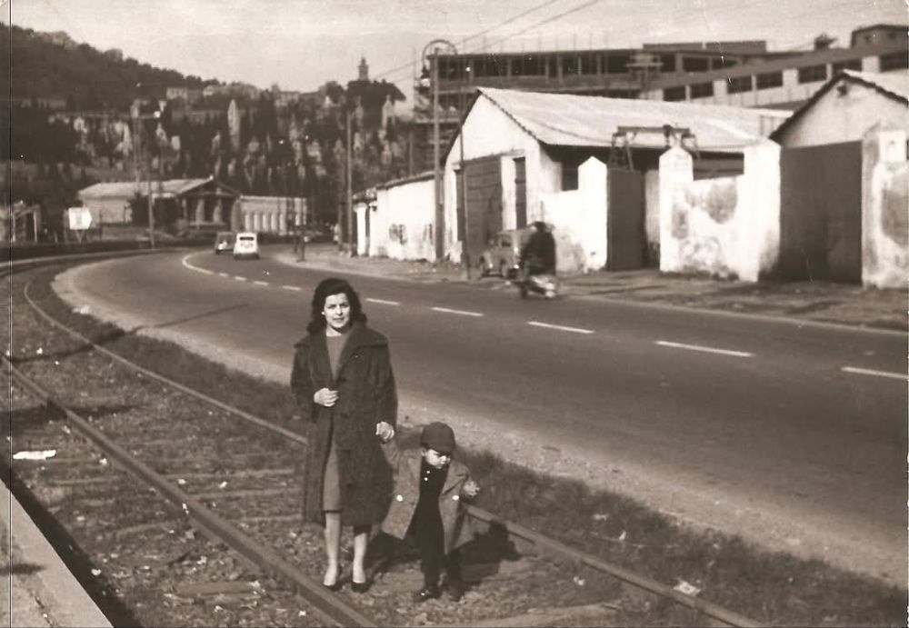
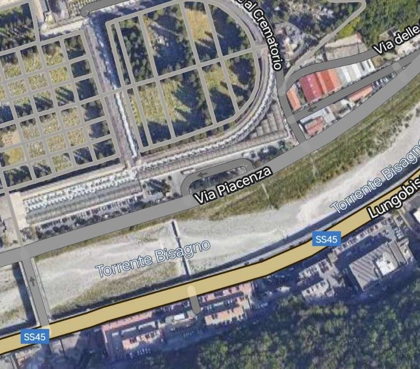
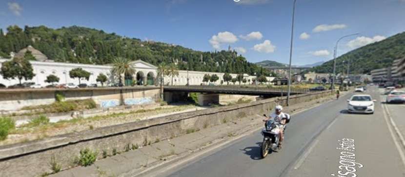
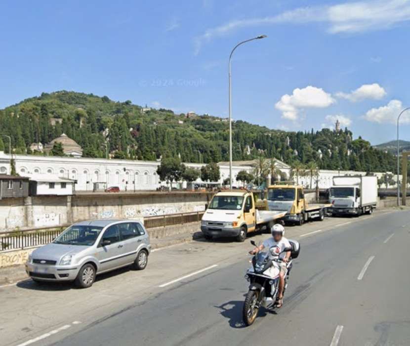
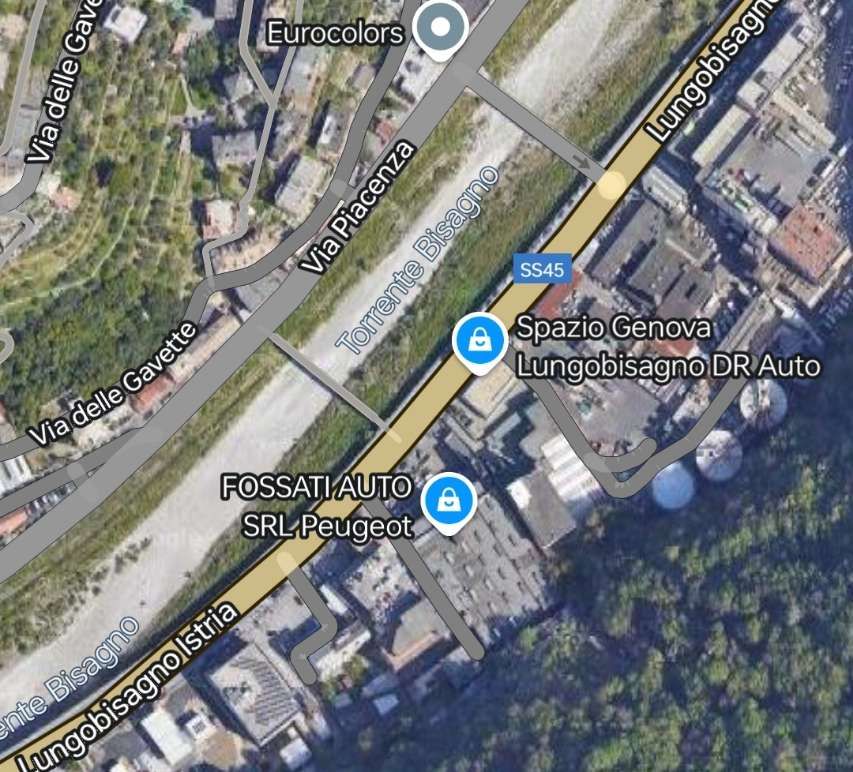
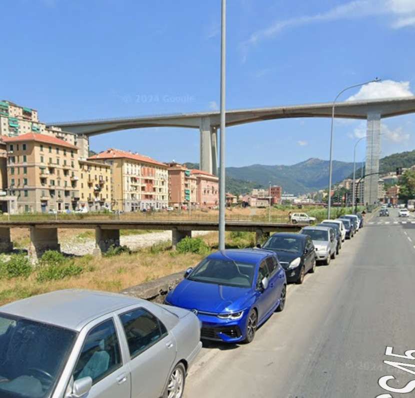
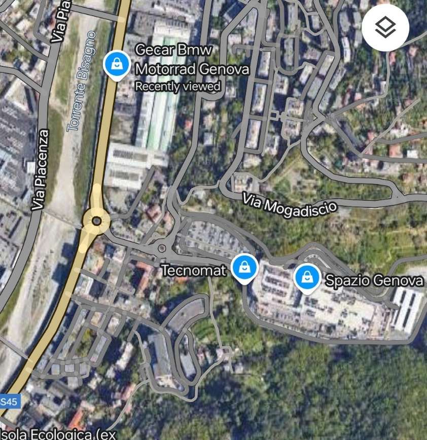
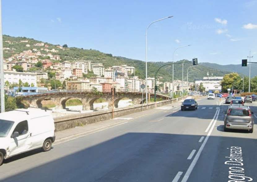
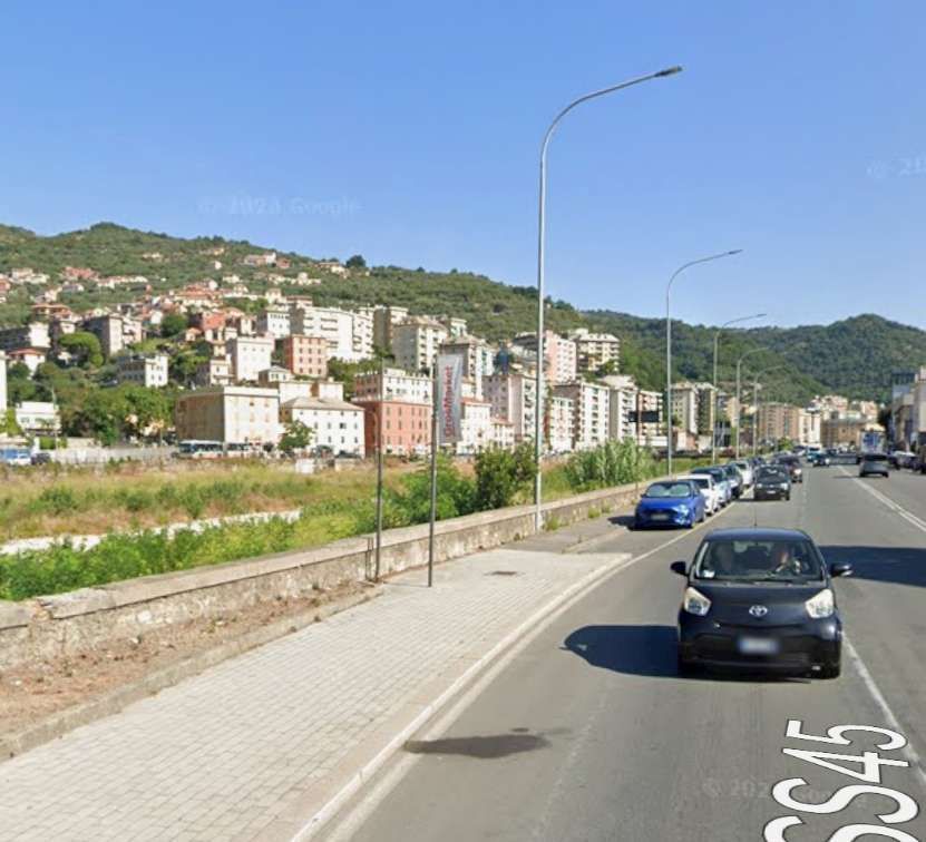
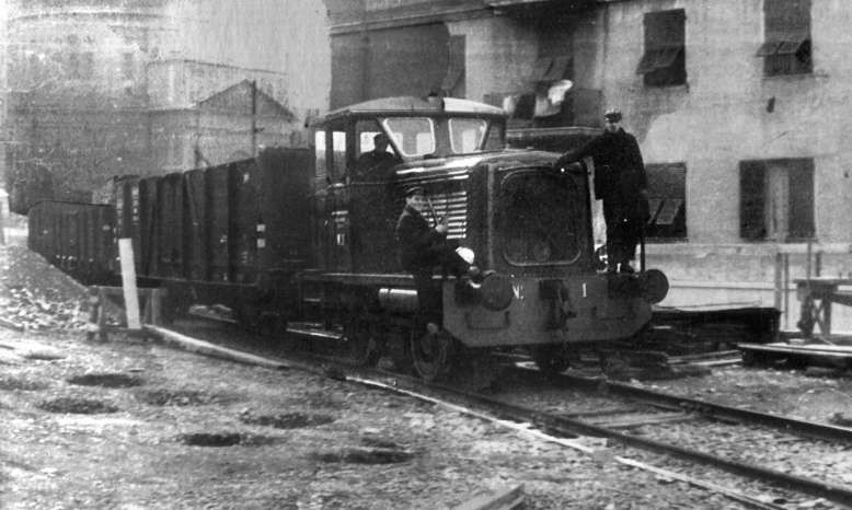
The line continued North from the prison, on the left (East) bank of the River Bisagno. On the West side of Piazzale Marassi and then Via Rino Mandoli. [Google Maps, November 2024]Looking North on Via Rino Mandoli. [Google Streetview, August 2024]The bridge over the next length of the Bisagno connecting Via Rino Mandoli to the right bank of the river is a footbridge Ponte Staglieno. [Google Maps, November 2024]Via Rino Mandoli in the 1960s, with the railway and the river to the left. This image was shared on the C’era una volta Genova Facebook Group by Luigi Carlo Piccardo on 25th April 2018. [26]The bridge in this view looking North on Via Rino Mandoli is Ponte Staglieno. [Google Streetview, August 2024]The line continued North along the left bank of the river. [Google Maps, August 2024]The bridge in this view looking North on Lungobisagno Istria is Ponte Federico Campanella. [Google Streetview, August 2024]This next length of the River Bisagno is now culverted but was not in the days when the old railway was in use. [Google Maps, November 2024]Upstream of the culvert, the river runs East-West for a short distance. Just visible at the top of this extract from Google Maps is the Southwest corner of the cemetery. [Google Maps, August 2024]The Lungobisagno Istria passes under the gyratory at this location. The railway once ran along the line of the top of the retaining wall to the left of the underpass. [Google Streetview, August 2024]The River Bisagno looking West from alongside Luongobisagno Istria in the early 1960s. Lungobisagne Istria again, also facing West in Staglieno and taken circa. late 1960s. The old railway was still in place at that time. The image below locates this view in the 21st century. [22]A similar location in the 21st century, at the Northeast end of the underpass. Some of the buildings on the far side of the river are recognisable in both images. [Google Streetview, August 2024]Turning through 180° we again see road, river and railway curving round to the East. This is the same curve in the river bank as appears in images above. The view from the mid-20th century this time extends beyond the cemetery which appears in the images below as far as the church tower on the hill on the far side of the river. Careful inspection of the two Google Streetview images below will identify the same church on the horizon in each photograph- Chiesa di San Bartolomeo Apostolo di Staglieno which sat above and to the Northeast of the cemetery. This image was shared on the C’era una volta Genova Facebook Group by Alessandro Platone on 30th May 2019. [24]The old railway continued on the left bank of the River Bisagno at the side of Lungobisagno Istria with the cemetery on the right bank. [Google Maps, November 2024]Two views of the cemetery from Lungobisagno Istria the old railway would have been in the foreground close to the parapet wall probably where the vehicles are parked. [Google Streetview, August 2024]Jung R42C 0-6-0 Diesel Locomotive No. 2 pulling a convoy from Terralba towards Gavette in 1961. The Staglieno cemetery is in the background. [14]The old railway continued on the left bank of the river. [Google Maps, November 2024]In the 21st century, the River Bisagno is bridged by the E80 Autostrada on a high concrete viaduct. It was in this area that the branch swung away from the river bank to the East(through the wooded area, bottom-right) before turning to cross the railway line on the river wall and bridge the river on the diagonal. [Google Maps, November 2024]The E80 above the River valley. [Google Streetview, August 2024]Looking upstream along the River Bisagno towards the gasworks. The line of the railway which continues North on the left bank of the river can easily be seen. The line which arced round to cross the River to the gasworks is not visible. This image was shared on the C’era una volta Genova Facebook Group by Georgia Mellini on 15th March 2021. [28]
Italian Wikipedia also gives a description of the branch line to the gasworks: which curved in a wide arc before crossing the Via del Piano. It then “crossed the Bisagno engaging the G. Veronelli bridge, with 9 spans and 8 piers, built in reinforced concrete by the Società Italiana Chini.” [7][9]
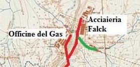
The remaining length of the line (approximately 1 km) ran along the left bank of the river to slaughterhouses near the Falck steelworks in Cà de Pitta. [7][8][9][10] There was also a shorter-lived branch which served a cement works to the East of the river.
The head of the line! The branch serving the cement works is shown in green. [31]
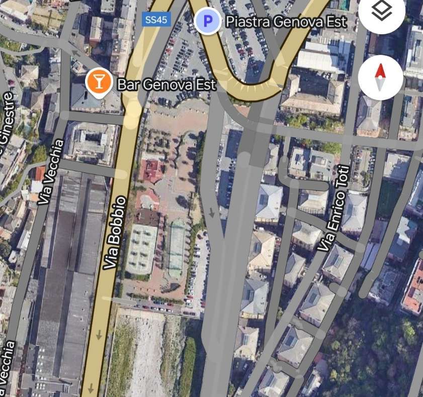
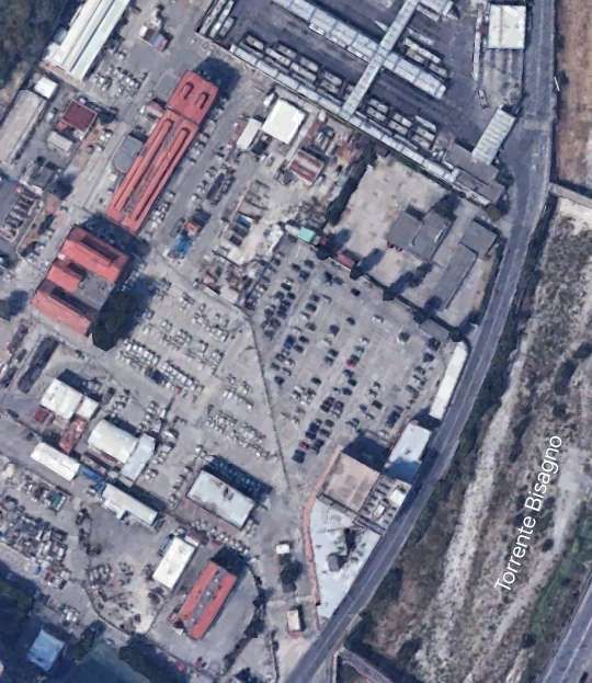
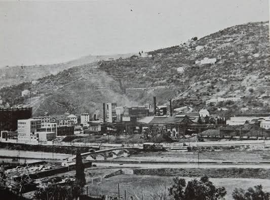
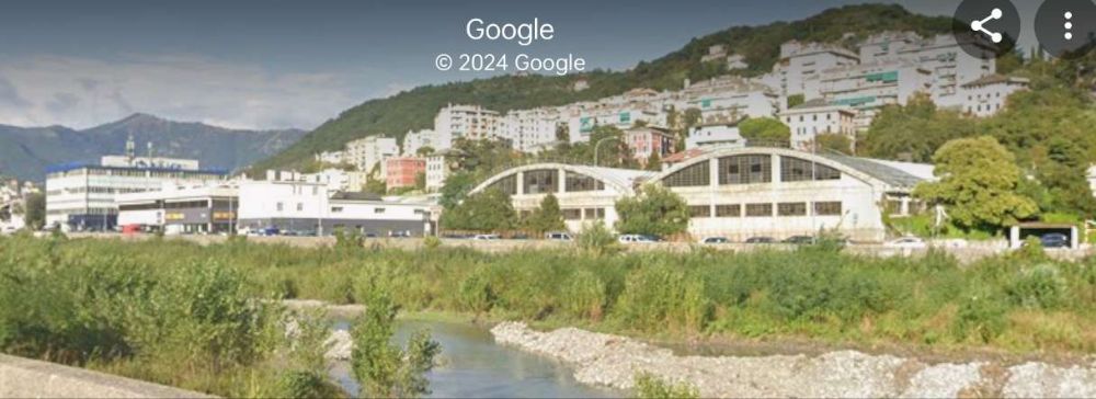
The line on the left bank of the Bisagno served the Falck Steelworks (adjacent to the SS45 in the top-left of this image), and a cement works (which was located in the industrial area North of the wooded area to the bottom-right of the image. [Google Maps, November 2024 – but note that the steelworks is under redevelopment at the end of 2024]The gasworks site is off to the left of this image which looks North along the left bank of the River Bisagno. The railway ran close to the dwarf wall which acts as the parapet to the wall at the river’s edge. [Google Streetview, August 2024]Further North, the railway ran under the location of the parked vehicles at the river’s edge. [Google Streetview, August 2024]The Falck Steelworks site in 2020, seen from the right bank of the Bisagno. [Google Streetview, September 2020]
The picture of the site of the steelworks brings us to the end of our journey along this industrial railway.
It was commented at the time of the construction of the line that through “the use of this rapid and economical means of transport, the potential of the gasworks can be significantly increased, at the same time reducing the costs for the transport of coal and by-products of the works themselves by approximately 1 million lire per year. … There will also be indirect advantages since the roads along the right bank of the Bisagno, currently congested by the transit of vehicles of all kinds, with great and evident danger to public safety, will be partially cleared and consequently the maintenance costs of said roads will also be reduced. The implementation of the industrial track will also contribute profitably to transforming a large area of land, still inaccessible a few years ago, and give it a new and fruitful industrial impulse. … Not to mention that the operating, maintenance, depreciation, etc. costs will weigh on the budget of the Municipality to a minimal extent since private companies will also contribute to the maintenance costs of the railway.” [10: p18 – quoting the Genoa Magazine of 1926 – translated from Italian]
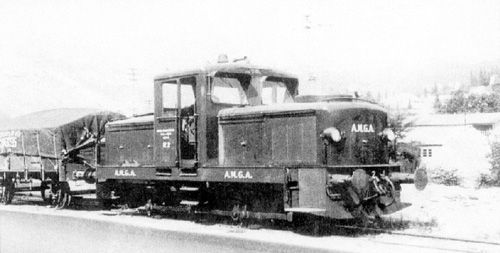
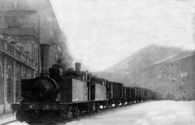
“The management of the railway line was entrusted to the Municipality through its Municipal Gas and Water Company (AMGA), which had three Breda-built steam engines and, subsequently, also a three-axle Jung R42C diesel locomotive, while the wagons were owned by the FS (Ferrovie Della Stato) which made them available to the Municipality.” [8 – translated from Italian]
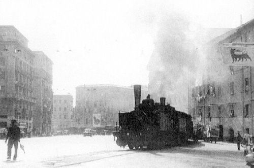
Two of the three Breda-built steam locomotives owned by AMGA which worked the line. Here they are in charge of a train of fruit and veg wagons outside the market on Corso Sardegna. [7]
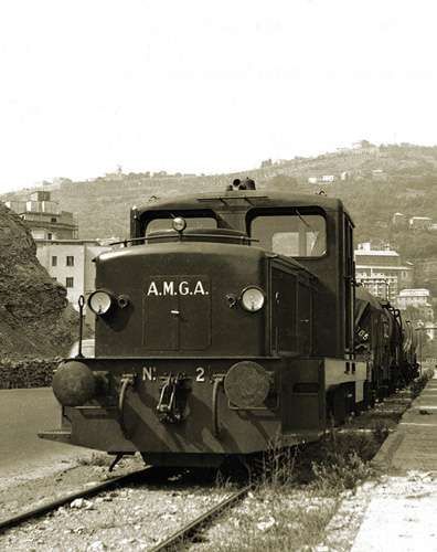
AMGA certainly owned two diesel locomotives which are shown below.
“Any train travelling along the line was escorted by a shunter (an operative on the ground), equipped with a red flag, and, normally, also by a traffic policeman on a cyclist or motorcyclist who had the task of stopping the traffic. Particularly spectacular were the long trains of coal wagons destined for the Officine Gas delle Gavette for the production of town (city) gas.” [8 – translated from Italian]
Italian Wikipedia tells us that “the line was decommissioned in 1965 as a result of the use of methane gas instead of town gas, thus ceasing its need for it by AMGA, now the sole user of the plant after road transport had replaced rail transport to the slaughterhouses and the market.” [7][10]
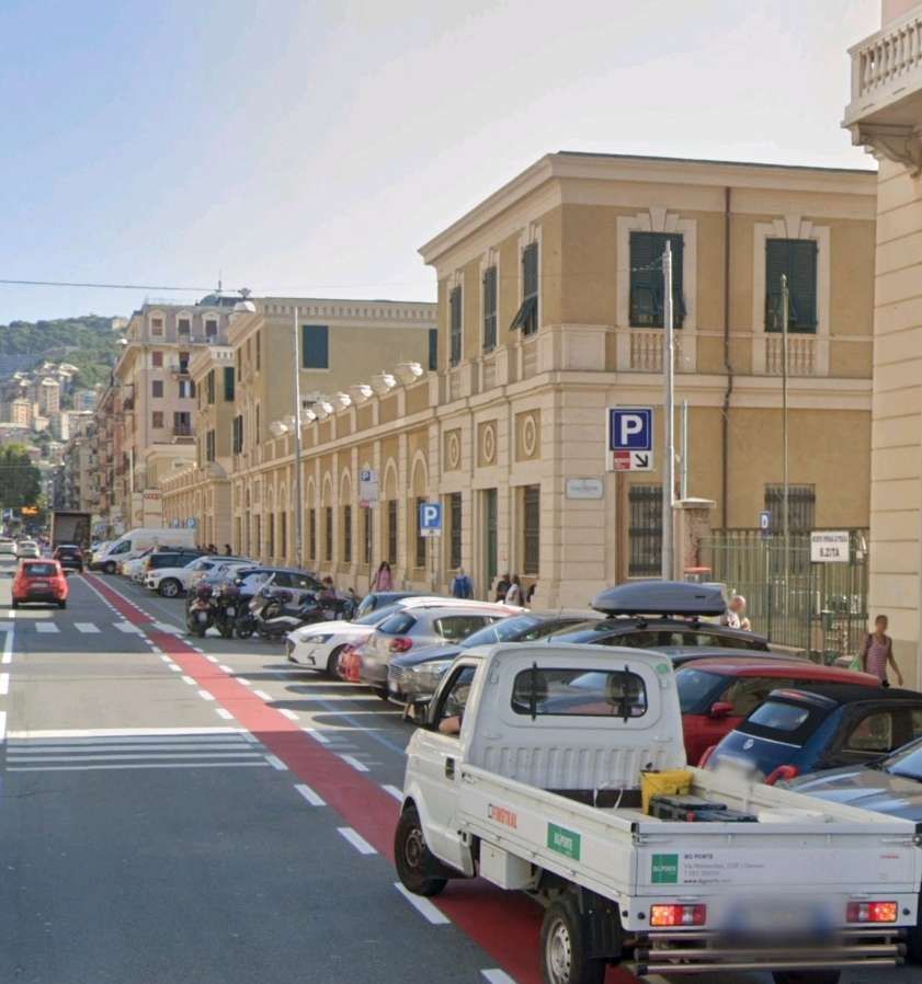
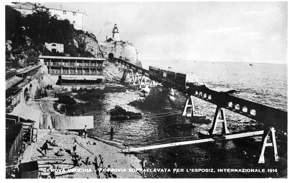
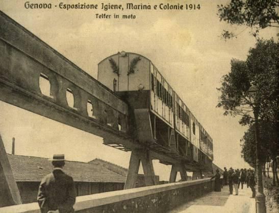
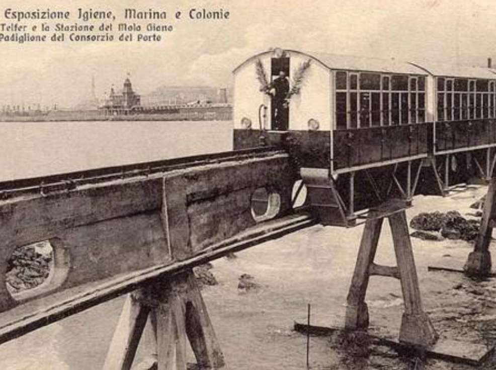
‘Telfer’ or ‘Telfere elettrico’, was a monorail railway line built in Genoa in 1914, the first of its kind built in Italy. The name was derived from the English term ‘telpher’. [1]
In this case, the ‘Telfer’ was a monorail. Examples of telphers in the UK include one at Manchester Victoria Railway Station which is described here. [6]
The term has more normally been used for the moving element of a beam crane used in warehouses or other industrial settings. [6]
Given the Telfer’s link to the English word ‘Telpher’ then strictly speaking ‘Telfer’ should be assumed to apply to the moving element of this short term transport solution in Genoa which could itself, perhaps, be considered to be a monorail.
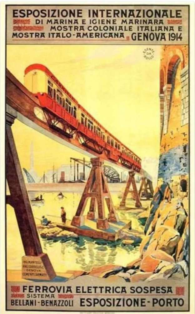
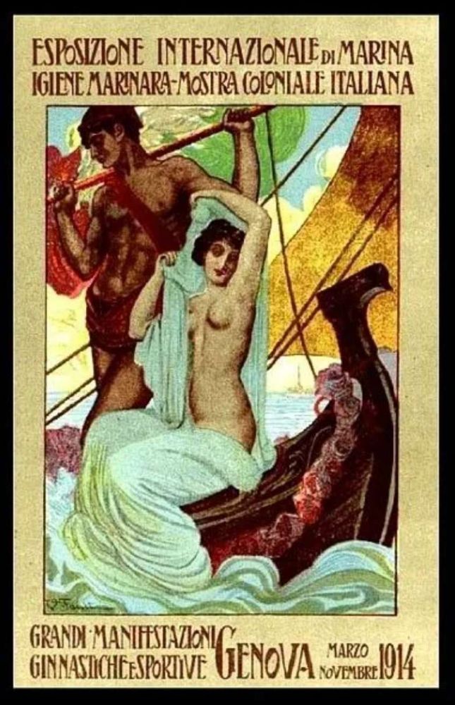
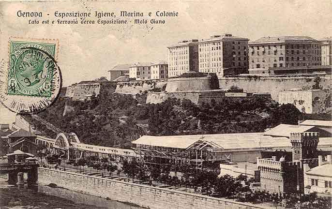
The Telfer was installed for the Italian Colonial International Exhibition of Marine and Marine Hygiene which opened in May 1914 and closed in November of the same year. [7]
In an historical period when European powers were involved in colonial expansion. The stated aim of the Exhibition was to show the developments in the sectors of hygiene and maritime trade, but ultimately it was an opportunity for Italy to celebrate its colonial conquests! [7]
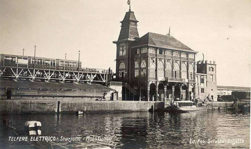
The Telfer connected Piazza di Francia (the south-eastern part of the current Piazza della Vittoria) to the Giano pier of the port, near the new Harbour Master’s Office. It was managed by UITE (Società Unione Italiana Tramways Elettrici).
The Telfer was originally intended for Milan, to connect Milan with the residential area of Milanino, approximately 8 km from the city. That project never came to fruition.
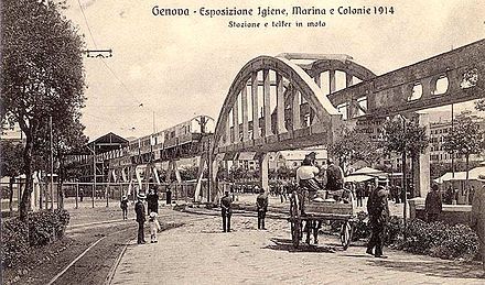
Instead, a shorter version was built in just 100 days for the Exhibition in Genoa. The Telfer entered service on 18th June 1914 and served throughout the time of the exhibition. It was later modified for the transport of goods, in particular coal, from the port to the factories located along the Bisagno. It continued to function throughout the period of the First World War but was dismantled in 1918.
Italian patents for the system were held by BBB (the Badoni Bellani Benazzoli Company of Milan). [4]
The Italian Wikipedia tells us that “the line was traversed by a single, symmetrical train, which ran on its own track formed by a beam raised from the ground, with a running rail at the top and two lateral ones for support and guidance. For the support piers, reinforced concrete was used. … The monorail beams were of an inverted T section, 85 cm wide at the base and 190 cm in height, over which Vignoles 36 kg/m rail was fixed on oak stringers. … Along the lower edges of the inverted T beams, two guides for the horizontal wheels were provided, made from L-shaped bars. … The items of rolling-stock sat astride the beam and were supported by hooded double-edged central wheels. They had lateral appendages extended downwards for the guide rollers.” [1]
“Seats were arranged in four longitudinal rows, two on each side, stacked in steps, with the backrests on the inside. Each ‘carriage’ had 38 seats and 12 standing places, or with the seats folded down a standing capacity of 80 passengers could be achieved. There were three access doors on each side. … The ‘locomotive’ had four 700 mm wheels, all powered, each connected to an AEG Thomson-Houston 40 hp 500 V engine regulated by controller as used for electric trams. The brake was compressed air with a double shoe for each wheel.” [1]
“As the driver’s position in the train was at the centre of the convoy (the locomotive was at the centre of the train), automatic safety devices were placed to stop the train at the station. The entire convoy when fully loaded carried about 350 people and weighed 80 tons. All the rolling stock was built by Carminati & Toselli of Milan.” [1]
The Route of the Telfer Monorail
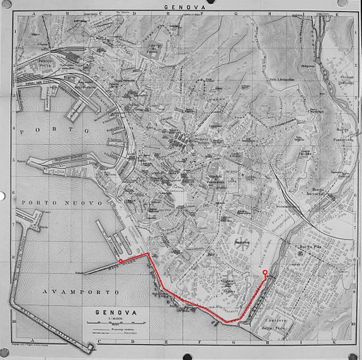
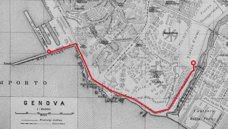
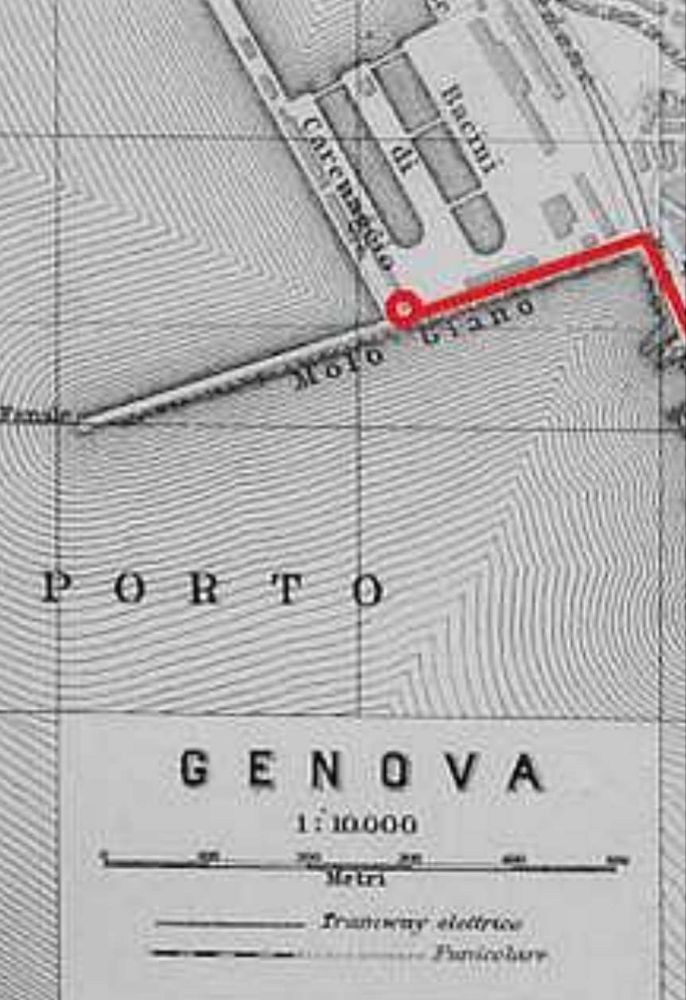
A map from around 1914 (shown in full above) shows the route of the line. Segments of the line follow together with appropriate supporting images.
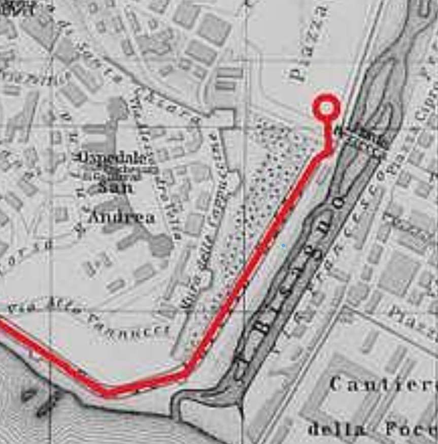
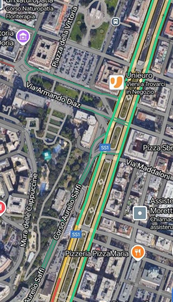
The Telfer’s Northeast terminus was in the southern corner of Piazza d’Armi above the River (Torrent) Bisagno, close to the Bezzecca Bridge which at the time was the first structure spanning the river North of its outfall into the Mediterranean. Piazza d’Armi became Piazza di Francia and later Piazza Della Vittoria.
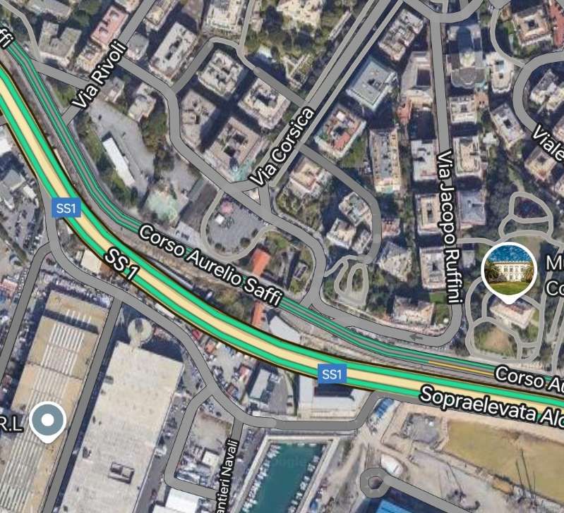
Piazza Della Vittoria with its triumphal arch is at the top of this extract from Google’s satellite imagery. [Google Maps, November 2024]
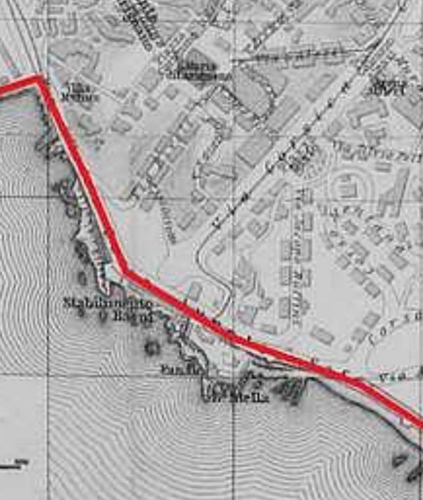
The route crossed the Corso Aurelio Saffi by means of a 26 metre span skew bowstring concrete arch bridge and ran straight down the West side of the river channel on the road known as Via del Feritore at that time. The line hugged the base of the high retaining wall and, in doing so, curved round to the West.
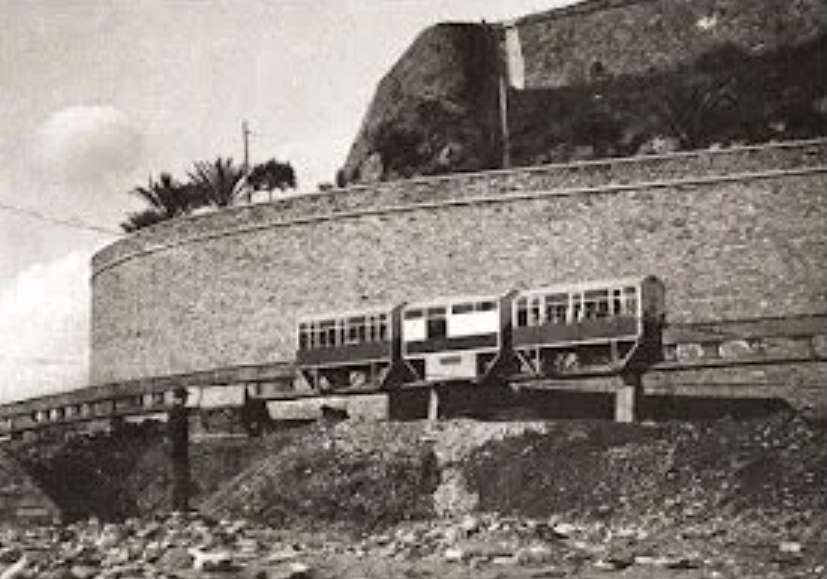
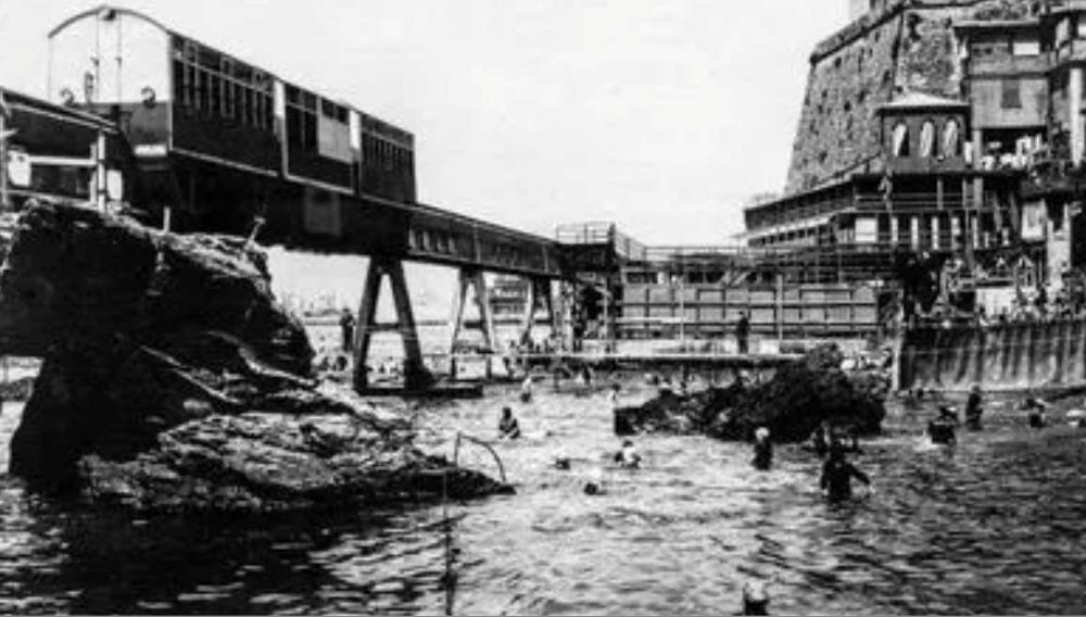
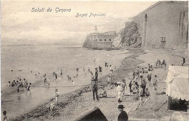
The Telfer passed through the Stella Batterie by means of widened windows. [1][3: p103]
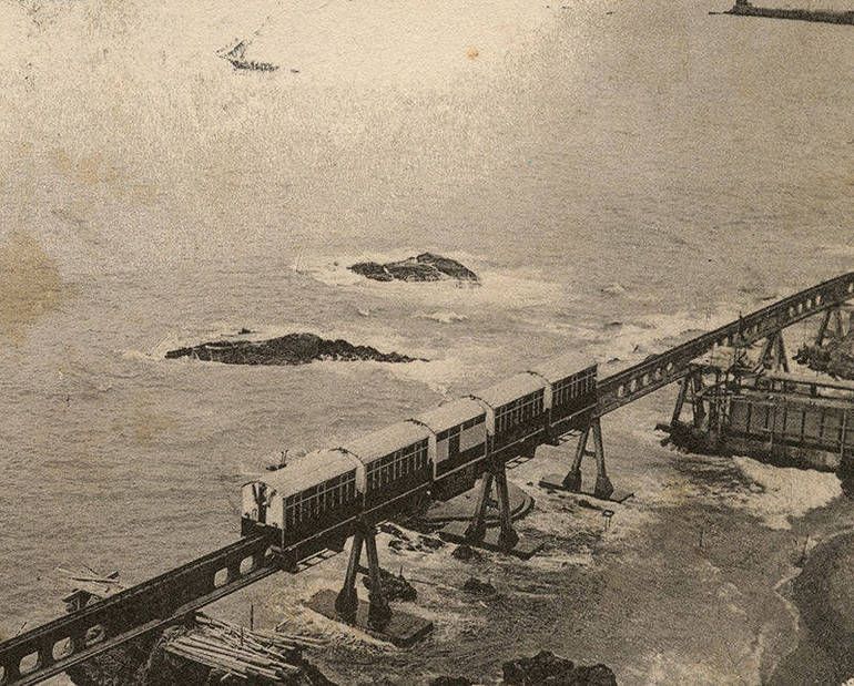
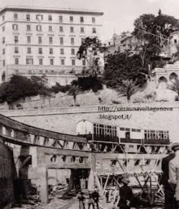
The line then ran straight to the landward end of Pier Giano, cutting across the stretch of water in front of the Cava baths like a viaduct. A curve as tight as 50 metre radius took the Telpher onto the pier and the line continued for some 370 metres. [1]
The entire route was just over 2.2 km in length, with an average height above ground of 4 m. Except for the short stretch on the Giano pier, which was made of wood, the route was fabricated in reinforced concrete and was supported on a total of 72 piers. A third of the piers sat directly in the sea. [1]
The route was travelled at a speed of 20-30 km/h and was completed in about seven minutes. [3] The train ran every half hour from 9:00 to 24:00, A single ticket cost 1.00 lire (about 3.70 euros today), a return ticket 1.50 lire (about 5.50 euros today), there were concessions for shareholders, military personnel, children and groups. [1][3: p99]
http://www.uwrbancenter.comune.genova.it/sites/default/files/quaderno_arch_2011_03_21.pdf, accessed on 16th November 2024, p17. …..”The first monorail in Europe: On 14th June 1914, the first monorail built in Europe was inaugurated in Genoa. It was built for the International Exhibition that occupied the area of the current Piazza della Vittoria and Via Diaze hosted numerous exhibitions set up inside pavilions designed largely by the architect Coppedè. The “Telfer elettrico” (or “suspended or aerial railway”) connected the “aerial” station, located inside the Exhibition, to the port, at Molo Giano, where the exhibition pavilion of the Consorzio Autonomo del Porto was located. The Telfer was 2227 m long and followed, approximately, the route of the current Viale Brigate Partigiane and part of the current Aldo Moro flyover: to cross the final part of Corso Aurelio Saffi a parabolic bridge with a span of 28 m was built, a true “work of art”. The Telfer consisted of a monorail suspended on wooden or concrete beams resting on triangular-shaped supports and an electric traction train that moved in both directions, placed astride the beam and composed of a central locomotive that drove two or four carriages. The carriages had a capacity of 46 seats or, alternatively, 80 standing places. The Telfer reached a maximum speed of between 20 and 30 km/h and took eight minutes to complete the entire journey. It was built in one hundred and fifty days of actual work and had seen the employment of more than six hundred workers. It could have been used, after the closing of the exhibition, for the transport of people or goods, but unfortunately the war events imposed the dismantling of the monorail and the partial reuse of the materials.”
Bibliography
Enrico Pieri, Il “Telfer” di Genova, in Strade Ferrate , n. 16, ottobre 1983, pp. 22-27.
Marco Marchisio, Il Telfer di Genova, in Tutto treno & storia, n. 14, novembre 2005, pp. 30-43.
Lorenzo Bortolin, TELFER, la monorotaia di Genova, in I Treni Oggi, n. 16, gennaio 1982, pp. 20–21.
Cornolò Ogliari, Si viaggia anche … così, Milano, Arcipelago edizioni, 2002, ISBN88-7695-228-4.
Stefano Percivale (da un progetto di), Genova com’era Genova com’è, Genova, Fratelli Frilli Editori, 2008.
Franco Rebagliati, Franco Dell’Amico, Giovanni Gallotti e Magno Di Murro, Il Telfer, in In tram da Savona a Vado 1912-1948, L. Editrice, 2012, pp. 68–71, ISBN 978-88-95955-73-5.
Massimo Minella, Il Telfer, una monorotaia sull’acqua, in 1914 – L’Esposizione Internazionale di Genova, De Ferrari, Genova, 2014, pp. 99–111. ISBN 978-88-6405-564-0.
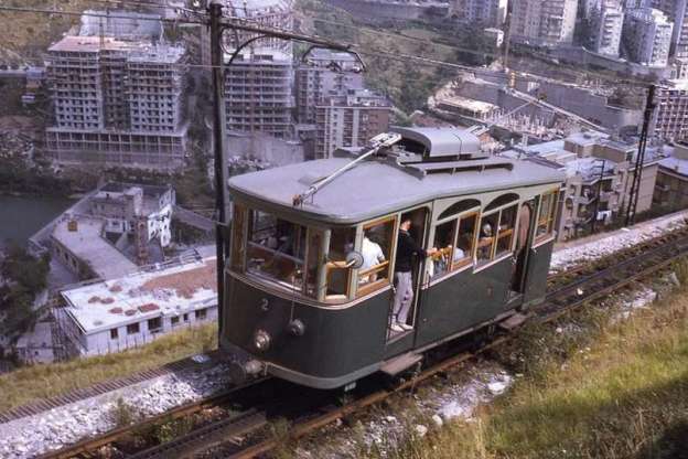
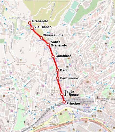
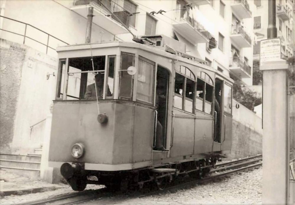
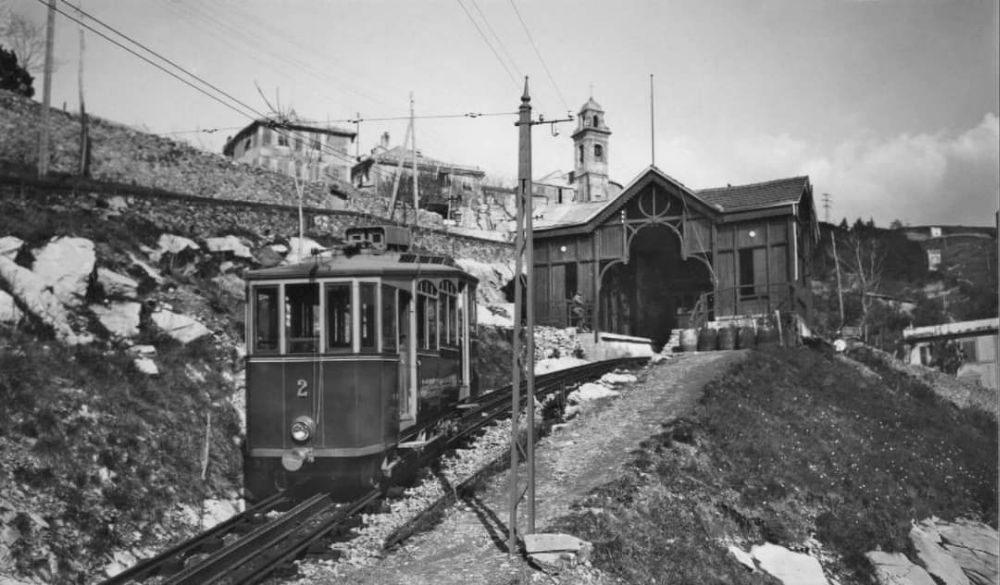
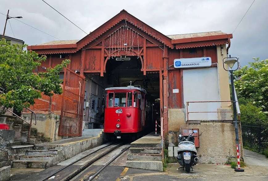
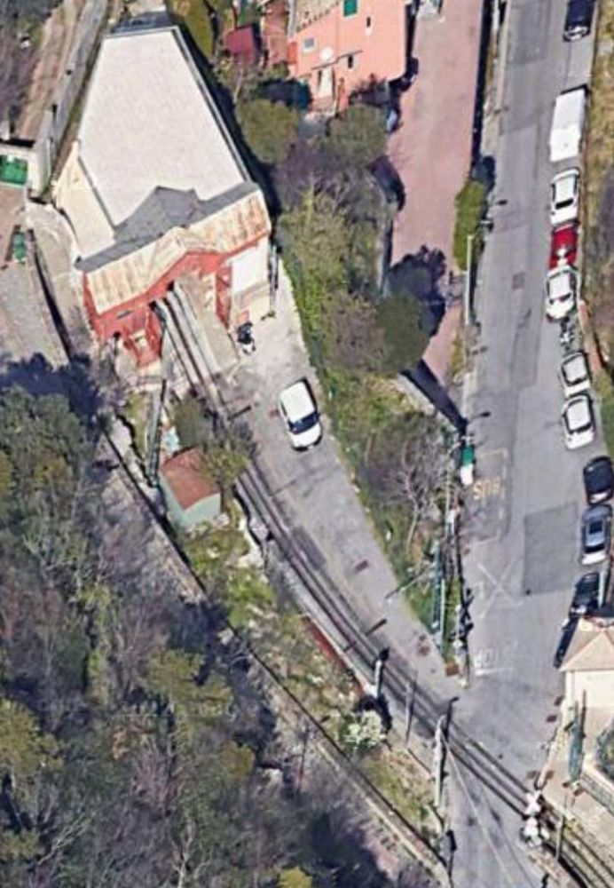
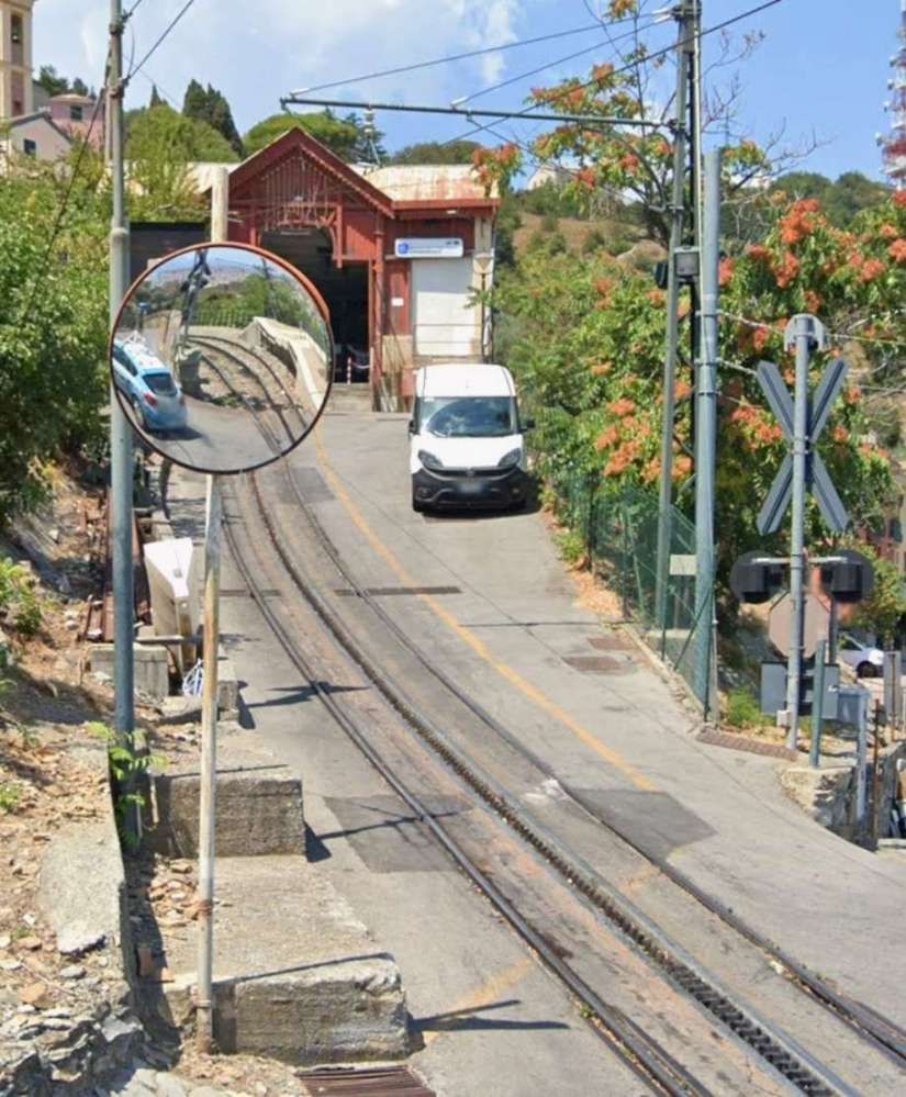
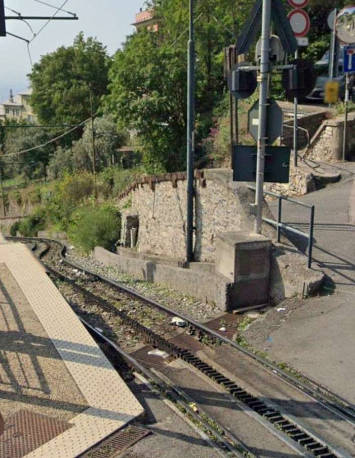
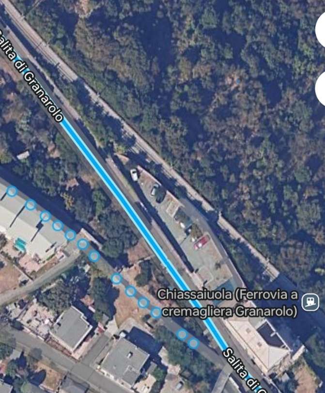
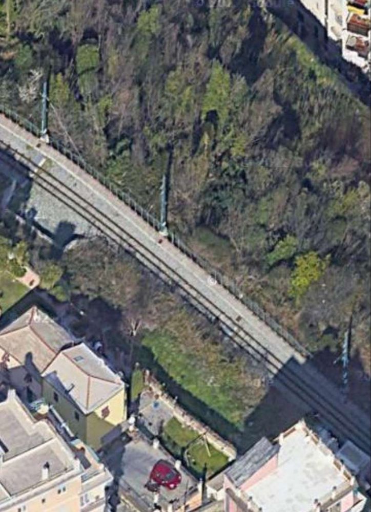
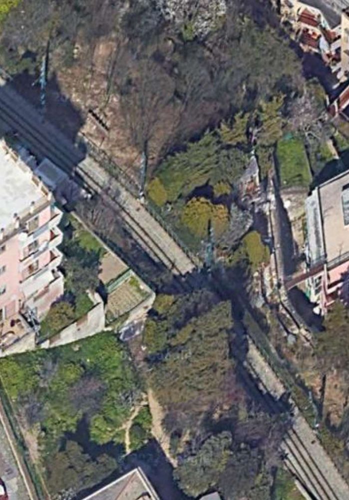
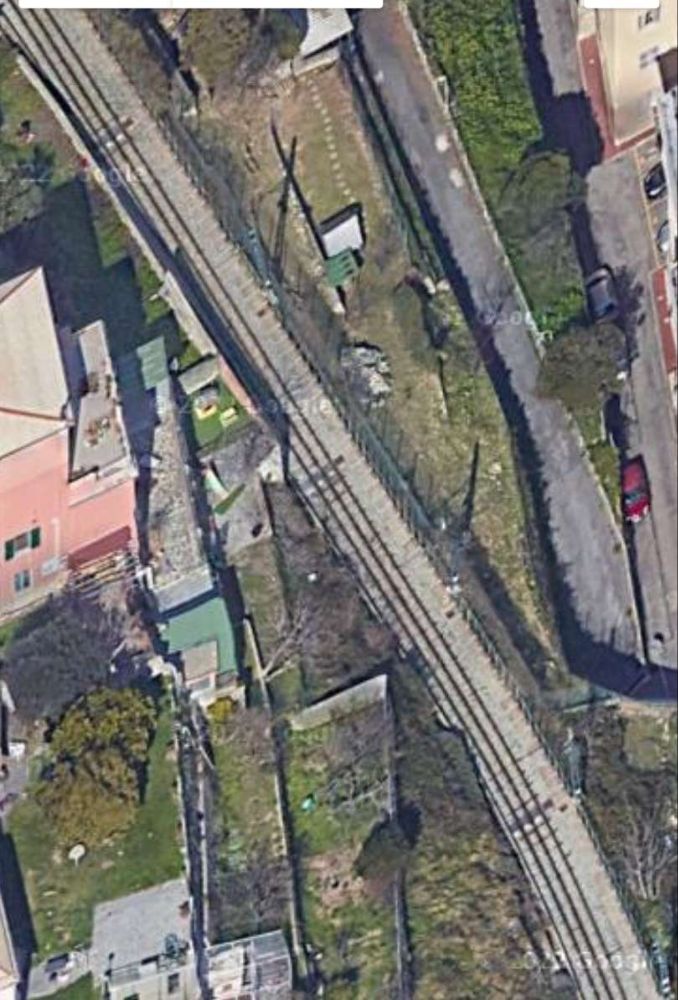
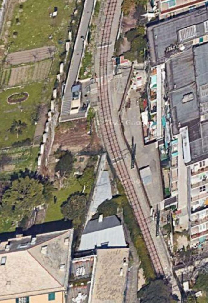
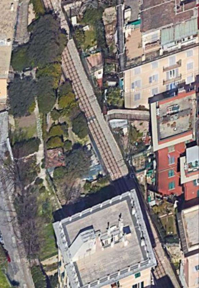
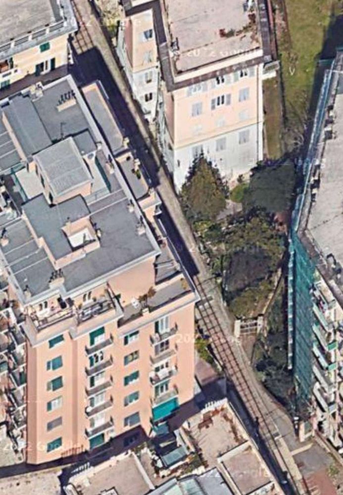
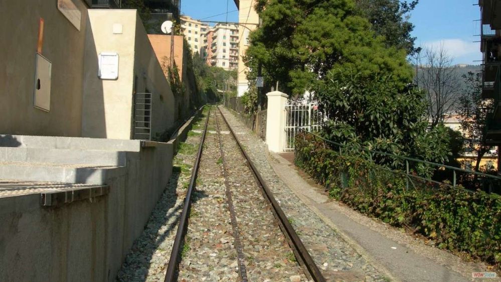
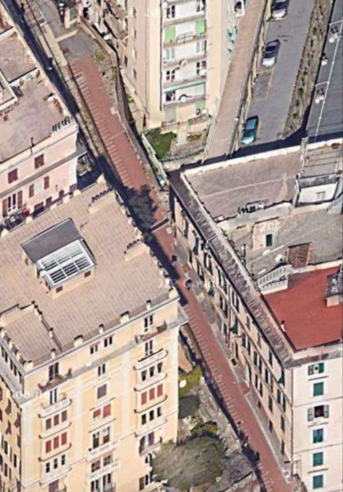
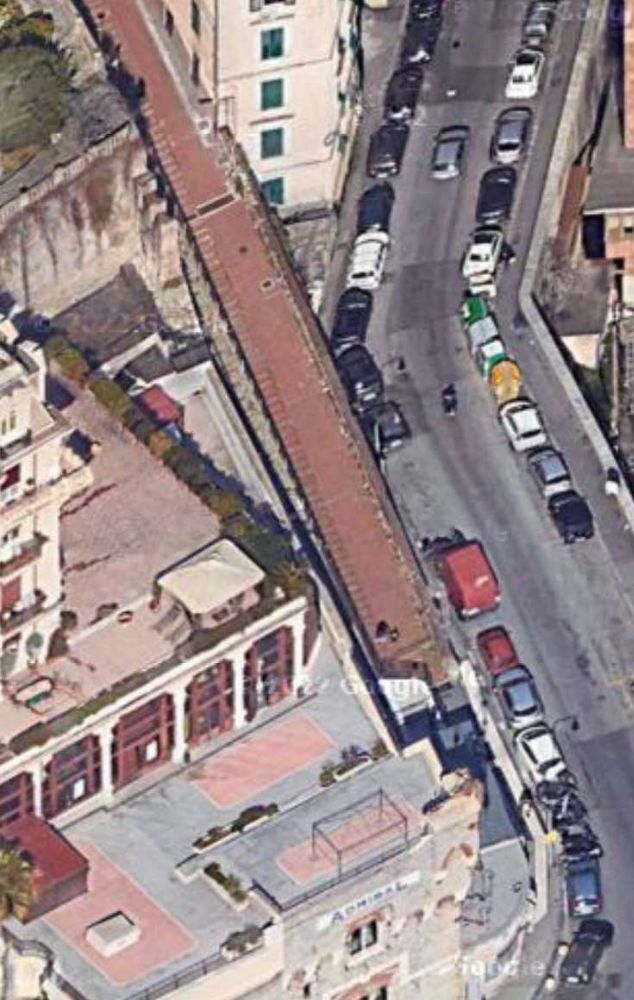
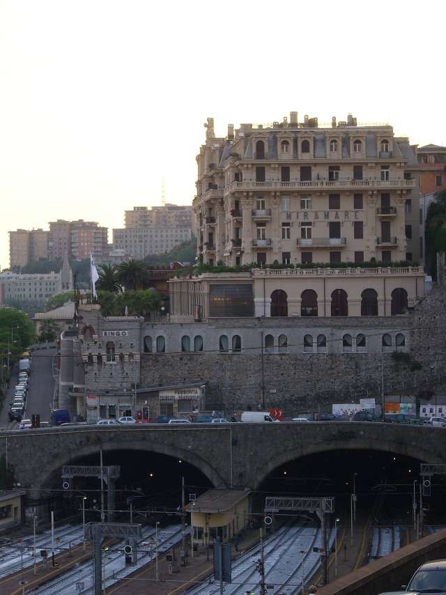
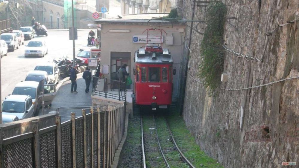
The Principe–Granarolo rack railway (Ferrovia Principe-Granarolo) is a rack railway that connects Via del Lagaccio, near the Genoa Piazza Principe railway station, to the Granarolo hills. The line is sometimes erroneously described as a funicular. The line is managed by AMT Genova, which manages the city’s public transport. [1]
Work on the Principe–Granarolo rack railway started in 1898, and operation commenced in 1901. The line’s unusual track gauge and passing loop arrangement, both common in funiculars but rare elsewhere, have suggested to some that the line may have started life as a funicular and been converted to rack operation; however the line’s owners have dismissed this theory. [1][2][3]
The line’s cars were totally rebuilt in 1929, with new body and mechanical equipment, and the line was rebuilt in 1976. [1][3]
In 2002, Car 2 was sent away for an overhaul, but the bankruptcy of the original contractor and the involvement of a replacement in an alleged bribery scandal meant that the overhaul was not completed and the car returned to the line until March 2019. The overhaul included the replacement of the car floor, lighting, safety systems, electric drive, air conditioning and a new driver’s seat. Between 2002 and 2019, service was provided by Car 1 operating alone. AMT now plans to use the rebuilt car to double the service frequency to every 15 minutes. [1][4]
In November 2024, AMT Genova were undertaking significant maintenance work and the line was closed. On 8th November, they explained that the rack railway was “temporarily down due to an electrical problem with the motor of the upstream traction axle. The restoration activities have already started. Updates on the resumption of service will follow. … During rack downtime, the G1 replacement bus is active.” [5]
Built to 1.2 metre-gauge, the rack railway is 1,130 metres (3,710 ft) in length, and rises 194 metres (636 ft) with a maximum gradient of 21.4%. It uses the Riggenbach rack system and is electrified at 550 V DC. The single central passing loop uses fixed points, and the two cars have double-flanged wheels on one side and unflanged wheels on the other side, thus ensuring that each car keeps to its own side in the loop. [1][2]
The line serves 9 stops, including the two terminals, and, until the closure in early November 2024 for maintenance work, it operated an irregular timetable, with cars departing each terminus between every 30 and 40 minutes. [6]
A Journey Down the Line
We start at the head of the line at Granarolo. The first photograph shows Car No. 1 resting at Granarolo before its next journey South.
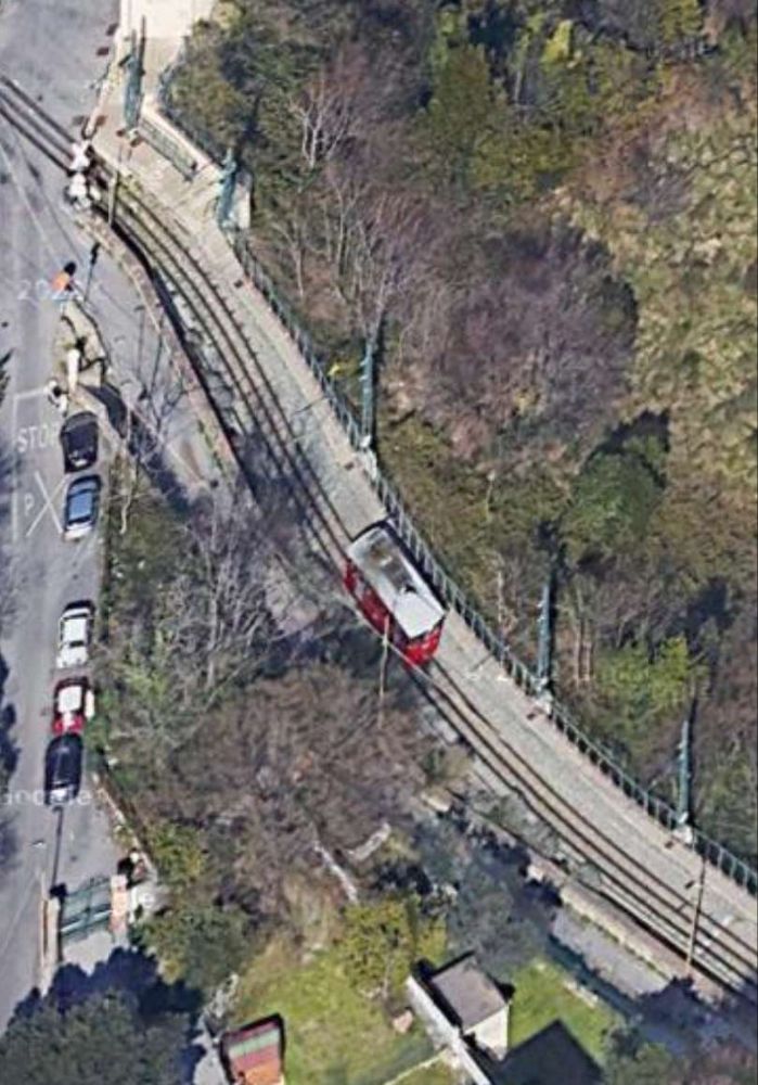
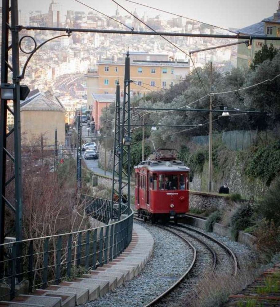
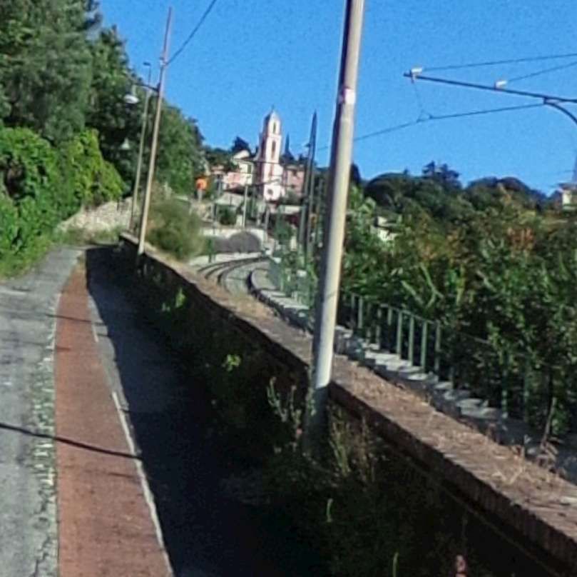
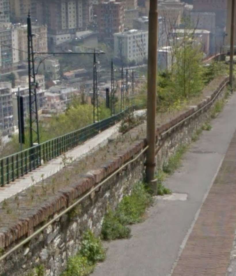
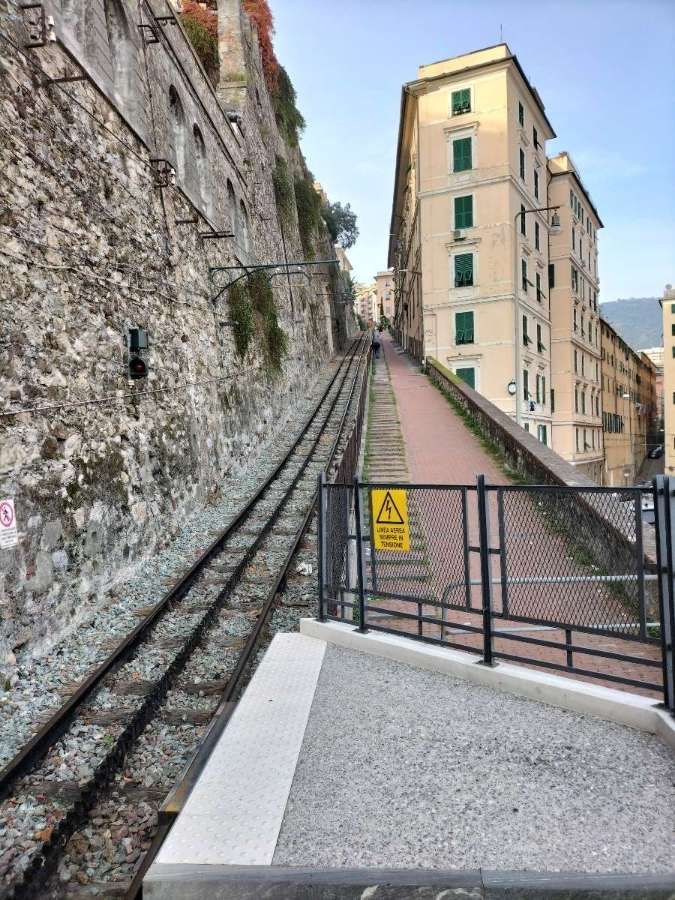
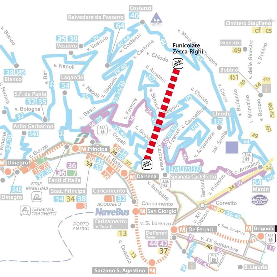
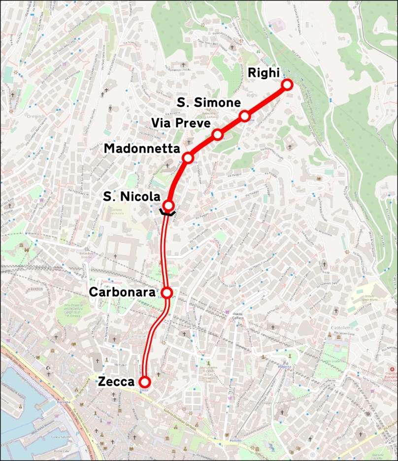
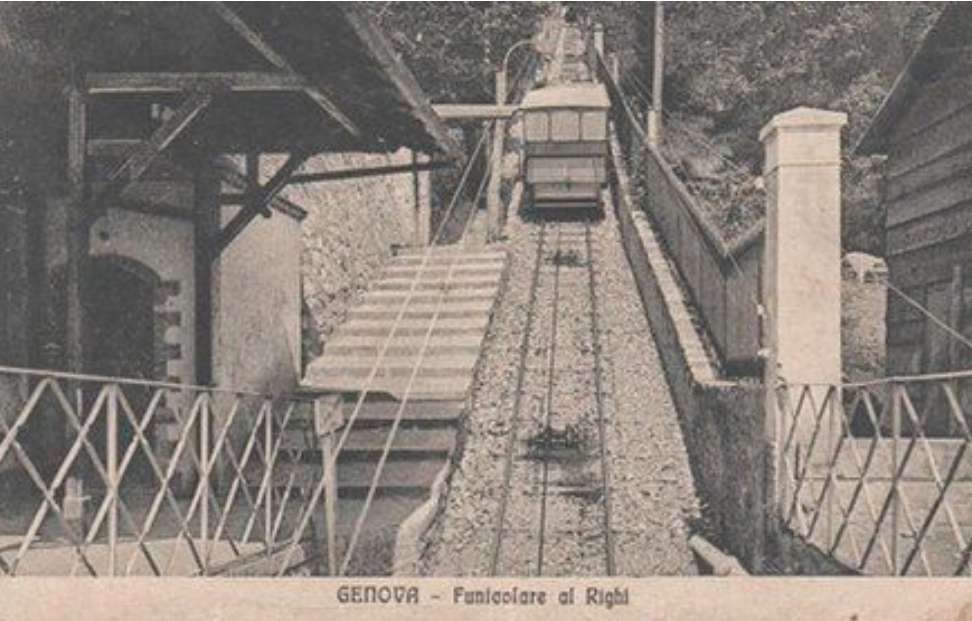
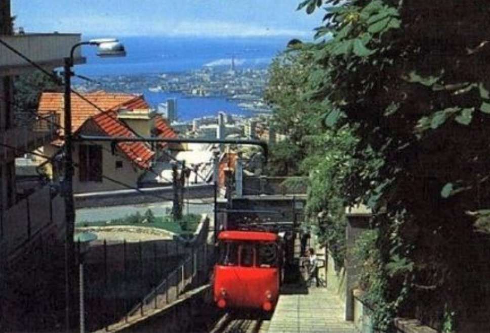
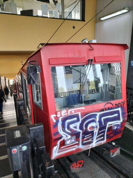
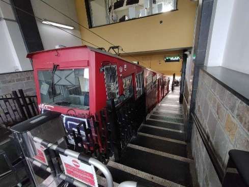
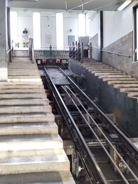
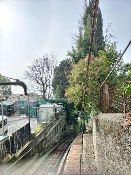
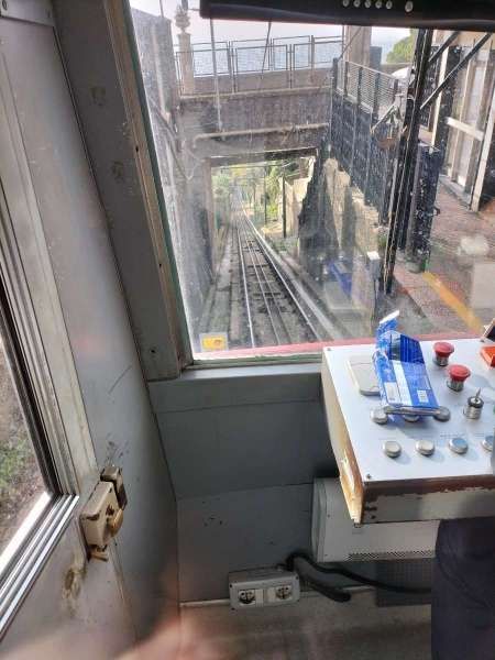
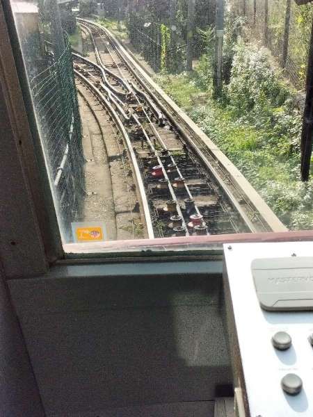
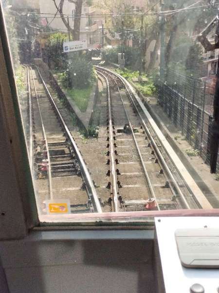
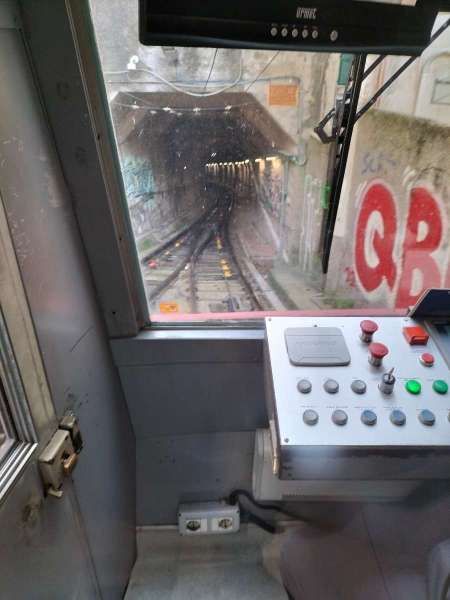
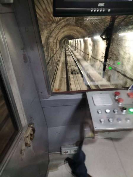
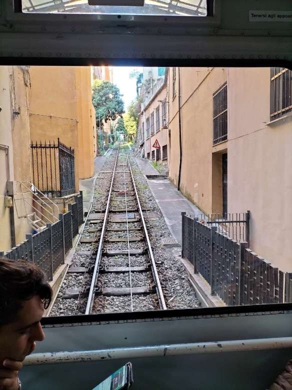
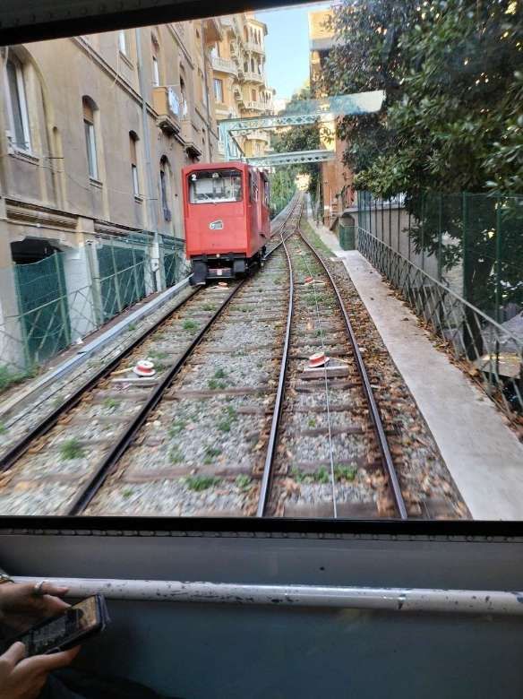
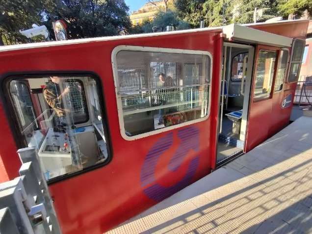
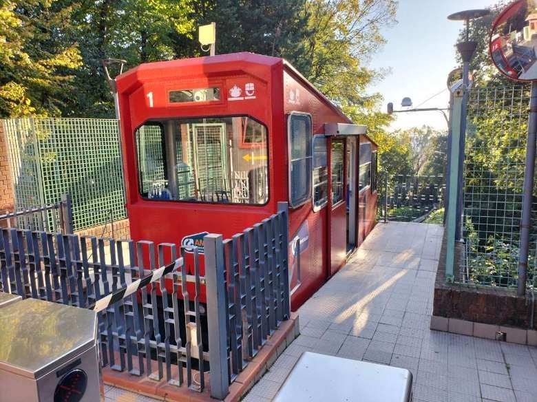
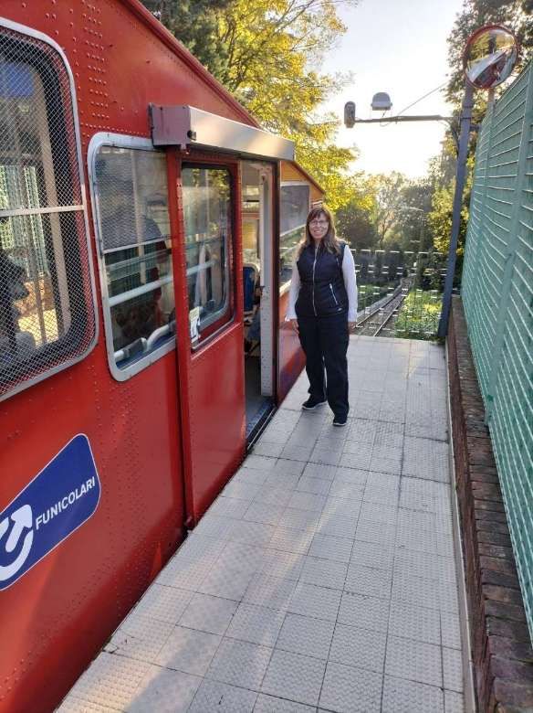
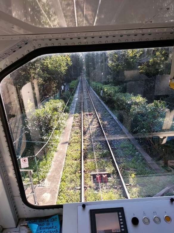
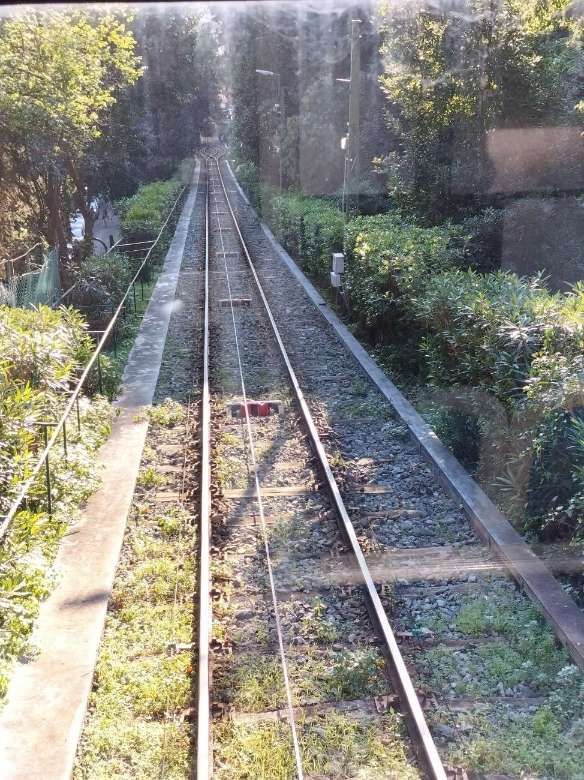
The Zecca–Righi funicular (Funicolare Zecca–Righi) connects Largo della Zecca, on the edge of the historic city centre, with several stations on the slopes of the hill called del Righi , in the Castellaccio area, on the slopes of Mount Peralto. [1][4]
The line consists of a single metre-gauge track with a single crossing point. It rises 279 metres over1,428 metres and has an average gradient of just over 19%. The 42mm traction cable moves at 6 metres/second which means that the route can be covered in 12 minutes. The two articulated cars have 33 seats with a total capacity of 150 people. The ballast cable in 24mm in diameter. [4][10]
In 1890 the city of Genoa was convinced by Franz Joseph Butcher and his son Teodoro (Swiss citizens) to invest in a funicular railway which ran North from Largo Zeccan in tunnel as far as the church of San Nicola and then in the open, Northeast to Castellaccio. On 25th August 1890 the city offered the concession for this project to the Buchers. [5: p53]
Bücher himself decided to give the line the name “Funicolare del Righi” borrowed from the Swiss rack railways of Mount Rigi (pronounced Righi in German), which Bucher had already built in his homeland, and whose tourist success inspired him to design the one in Genoa. [6] The hilly area near the final station in the Castellaccio area has since then been commonly called the Righi, or simply Righi. [4]
On 28th February 1891 the Società di Ferrovie Elettriche e Funicolari (SFEF) was established in Kerns , with a share capital of 1,500 Lire. On 29th October 1892 a preliminary project was drawn up by the engineers Luigi Mignacco and Carlo Pfaltz; the latter, an Austrian, had already worked on the Gotthard tunnel and the Giovi branch. By 1894, when the work was nearing completion, the company capital was taken over by AEG. [4][5: p55]
The northern half of the project, which was simpler to build, was inaugurated on 28th September 1895. The tunnelled section was completed in February 1897. (It seems, however, that a final completion certificate and testing was not formally provided until January 1912). [5: p57]
For some time the two sections effectively ran as independent systems sharing the San Nicola station where passengers had to transfer between cabins. AEG eventually brought these and other concerns together in the Unione Italiana Tranvie Elettriche (UITE) company in September 1901. [5: p62]
In 1906, the driving positions in the cars were enclosed to protect the operators from the elements. After the First World War and until the Second World War, the lower terminus was called Piazza Corridoni, in due course this became known as Largo della Zecca. [4][5: p69]
The 1920s saw the replacement of the cars and the improvement of the traction system which permitted the establishment of a new intermediate stop under Corso Carbonara, (opened on 1st January 1930). [4][5: p70-72]
In 1937, at the San Nicola crossing station, an original level crossing was replaced by a walkway that allowed people to step over the tracks and the cable. Between the wars both passenger and freight traffic increased significantly. During the Second World War, the bombings of 7th November 1942 caused heavy damage to the upper system, forcing its closure, while the tunnels of the lower one were converted into an air raid shelter. [4][5: p75]
After the Second World War the funicular was opened in two stages. The section above San Nicola in 1945, the remaining length in 1946. The San Simone stop was reactivated in July 1958 and the Madonnetta stop in September 1959. [4][5: p75]
After the War, the funicular was reopened in two phases. The length above San Nicola in 1945, the remainder in 1946. The stop at San Simone was reopened in July 1958 and that at Madonnetta in September 1959. [5: p78-79]
The Italian Wikipedia site tells us that the two parts of the system were not unified until the 1960s. The San Nicola Station became a crossing point rather than X double terminus. The Righi Station was moved 34 metres and built with viewing platforms above the terminus. The old wooden chalet with housed the terminus was dismantled. In addition to the total reconstruction of the route, the rolling stock was replaced. The Bell company of Lucerne completed the works in November 1964 but, due to a dispute with the ministerial commission that should have inspected the works, the funicular only entered service on 28th February 1966. [4][5: p81-89]
Changes in regulations meant that at the end of the 1980s, it was necessary to install an additional braking system; that and other work was undertaken between 1987 and 1990. The works involved the reconstruction of the track and the platforms of the stations, (lengthened to allow the use of new carriages that were longer than the previous ones), and of the mechanical parts as well as an increase in automation. The funicular returned to service in March 1990. [4][7][8]
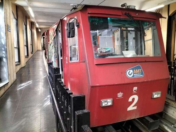
After 20 years of service, on 1st April 2010 the Zecca-Righi funicular closed again for a 20 year overhaul. It was closed untill 27th November 2010. During this closure, significant changes were made to the system, which was equipped with two new 458 kW engines. The carriages were repainted and their interiors were completely redone: real glass was fitted to the windows, the seats were no longer made of plastic but of fabric, the doors were no longer opened by compressed air but electrically. The ticket machines were removed from inside the carriages to be positioned at the various stations and a video surveillance system was installed both at the stations and inside the cabins. Numerous rollers along the tracks and the pulleys were changed. [4][5: p89-91][9]
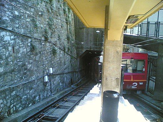
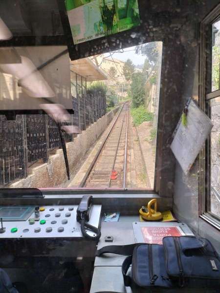
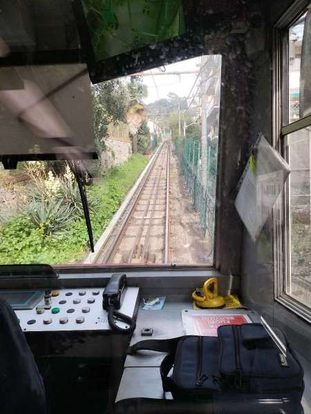
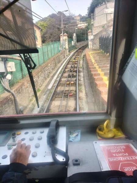
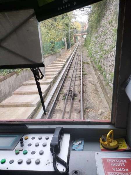
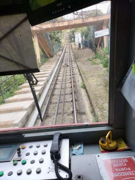
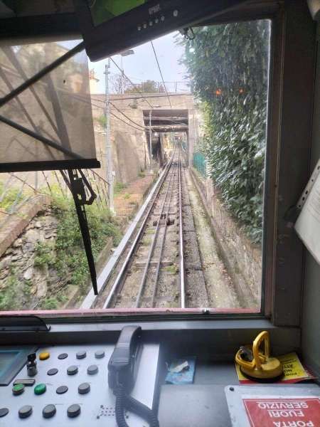
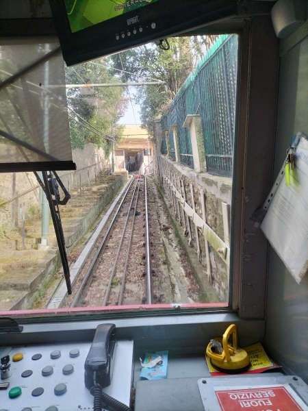
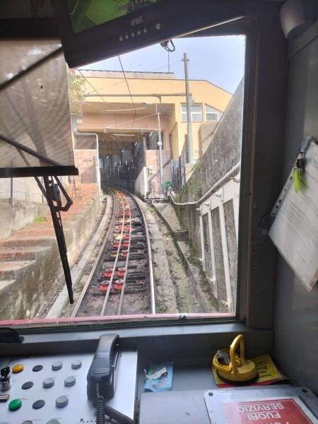
We travelled on this funicular on 12th November 2024. The photographs of this funicular in the galleries below were all taken by me on 12th November. Hopefully they give a reasonable impression of the journey up and back on the line.
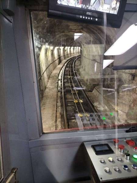
Car No. 2 at the bottom station.The view North into the tunnel from the funicular car prior to the start of the journey.Arriving at the crossing point at San Nicola. A central platform separates the two cars.Continuing North from San Nicola.At Madonnetta the line curves towards the Northeast.A walkway follows the tracks along the next length of the line.The footbridge over the line at Via PreveThe bridge over the line at San Simone.On the steep grade close to the summit station.Running into the summit station at RighiThe car in which we travelled up the line.A second view of the same car at the summit station.Within the summit station after the departure of the funicular car. Noted the cable wheels and cables.The view Southwest down the line from the access platform at the summit station.The driver’s control panel at the lower end of the car.The driver’s view down the line prior to departure.In transit towards San Simone.Closer to San Simone.San Simone Station.Nearing San Nicola.The central platform at San Nicola.Departure into the tunnel at San Nicola.The tunnel is lit throughout its length.The funicular car at rest after completing its journey down the line.
B. Sant’Anna Funicular
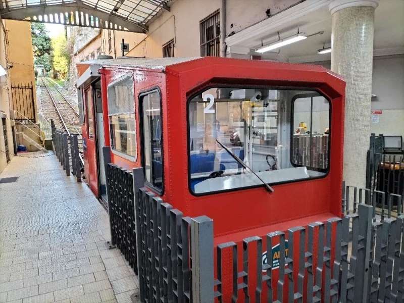
The Sant’Anna funicular (Funicolare Sant’Anna) connects Piazza Portello, on the edge of the historic city centre, to the Corso Magenta. [2]
The funicular was opened in 1891, and was initially water-driven, with water filling a ballast tank under the carriage at the top station, and emptying at the bottom. The line was converted to electric operation in 1980, and was again modernized in 1991 following a fire that destroyed the top station. [2]
From 1st December 2021 it has been free to use courtesy of the Municipality of Genoa and AMT.[2]
We travelled on the Sant’Anna Funicular in both directions on Monday 11th November 2024.
The view North up the Sant’Anna Funicular from inside the passenger car. [My photograph, 11th November 2024]The passing loop at the halfway point on the Funicular with the second car travelling down the line. [My photograph, 11th November 2024]A side elevation (wide-angle) of the funicular car at the top of the journey. [My photograph, 11th November 2024]The same car shown in a three-quarter view. [My photograph, 11th November 2024]Just prior to the return journey down the funicular to the old city. [My photograph, 11th November 2024]The view South down the Sant’Anna Funicular from inside the passenger car. [My photograph, 11th November 2024]This closer view shows the cable, guide rollers and the 1.2 metre-gauge track. [My photograph, 11th November 2024]The funicular car at the bottom terminus of the line. [My photograph, 11th November 2024]
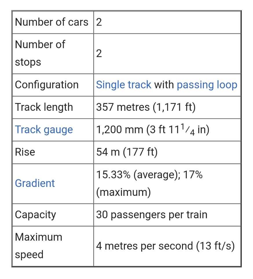
The line is currently (2024) managed by AMT Genova. These are its operational details:
These operational details are provided by AMT Genova. [2]
C. Quezzi Funicular
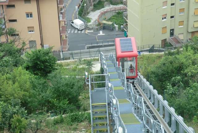
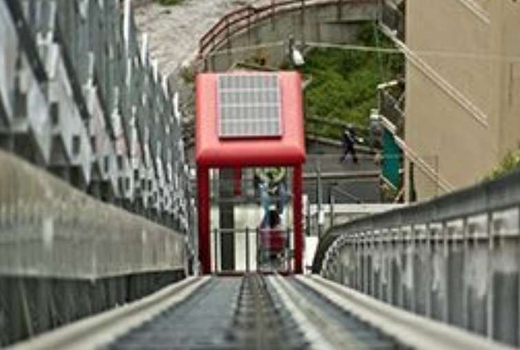
The Quezzi Funicular/Elevator (Ascensore inclinato di Quezzi) is a public inclined elevator with variable slope in the Quezzi quarter of Genoa which sits North of the heart of the city. It opened in May 2015 and connects the lower terminus at Via Pinetti to the terminus at Via Fontanarossa, with an intermediate stop at Portazza. [11]
We were unable to visit this funicular during our visit to Genoa in November 2024. There is some uncertainty in my mind as to whether it is actually a funicular.
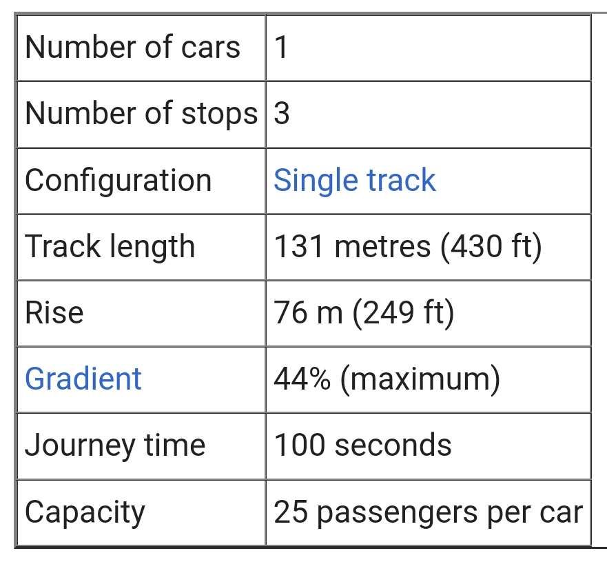
The elevator/funicular is managed by AMT Genova. It has a total length of 131 metres (430 ft), of which the lower 27 metres (89 ft) are in a tunnel, the middle 23 metres (75 ft) in a cutting, and the remainder on an elevated rail. The lower section has a gradient of 44%, transitioning to a gradient of 30% in the upper section. The single car is designed to tilt, in order to maintain the floor leveled, despite the change in gradient. [11][12][13]
These are the details of the line: [11][12][13]
The details of the line provided by Wikipedia. [11]The Ascensore inclinato di Quezzi. [14],
AMT Genova describes the system as an ‘elevator’ that consists of a single cabin that moves along two parallel steel beams that act as a runway; the cabin is tilting to adapt to the variable slope track while maintaining the horizontal position. … The runway is characterized by two different inclinations of 44.13º and 30.33º and by a connecting section. The use of different gradients is a national innovation for inclined elevators for public use. It limits the amount of excavation and causes less impact on the immediate environment. They believe that the system is truly sustainable as it:
is equipped with solar panels to power the cabin lighting and ventilation.
has low-energy LED cabin lighting.
has a high-performance cabin air conditioning system.
it runs on load-bearing wheels in Vulkosoft, a special high-tech material, resistant to abrasion and specifically designed to minimize noise emissions and the transmission of vibrations.
has three stations, each equipped with sound diffusion systems and variable message panels for public information.
incorporates pedactyl paths and tactile maps for the blind and visually impaired.
complies with current legislation on the removal of architectural barriers.
The three stations are: Pinetti, Portazza and Fontanarossa. 1 cabin is used which is accessible to disabled people. [14]


#/media/File%3AL04_163_Hp_Dinegro%2C_ET_37.jpg)
_a_Torrazza.jpg)
_P2060637.jpg)