This article has been long in gestation! Some of the images were found in later 2022 and early 2023 and permission to use them was sought at that time. Other work intervened and it is only now that the article has reached a stage where publication is right. My thanks to those who gave permission for the use of their images back in early 2023. Their names and copyright is noted in the images or in the test associated with each image. Thank you.
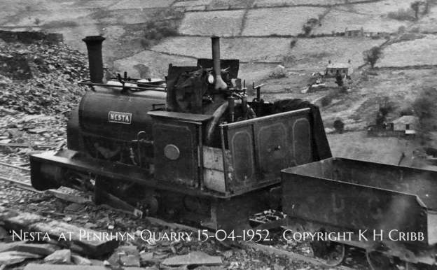
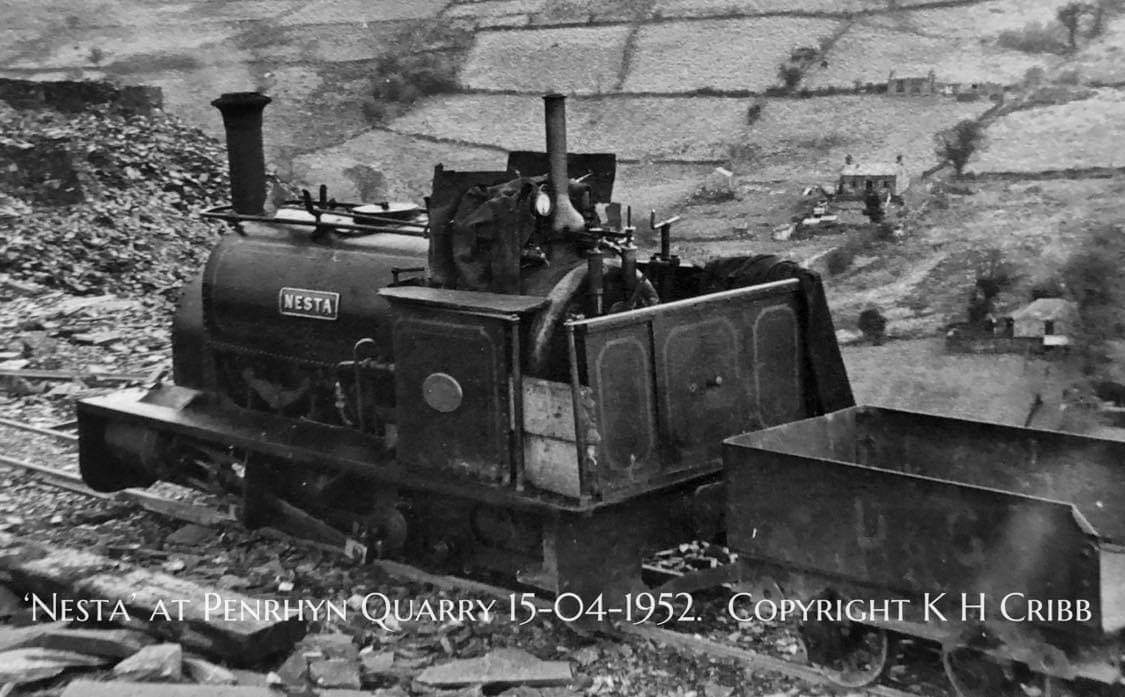
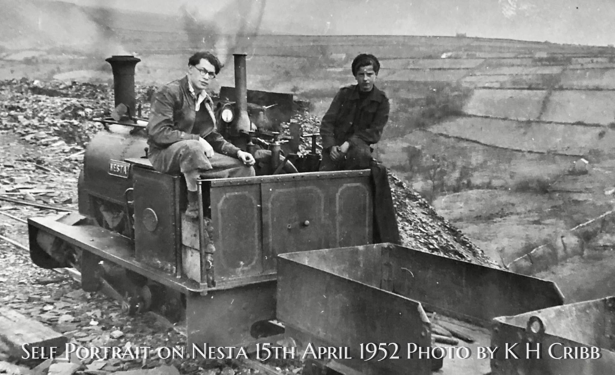
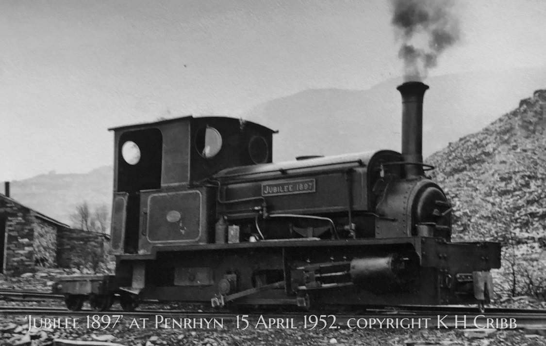
The featured image for this article shows ‘Nesta’ idling in Penrhyn Quarry on 15th April 1952, © Ken Cribb and used with the kind permission of his son Russ Cribb. [Supplied direct to me by Russ Cribb]
The images in the article are purely a sample of those available on line. Others can be found here, [32] and here, [35]
In a press release about its exhibition ‘Slate to Sea’ in 2018, the National Museum of Wales stated that, “In 1882 the Welsh slate trade produced 280,000 tons of slate. This rose to 485,000 tons by 1898. Worldwide slate exports from Welsh ports were enormous and included the West Indies (114 Tonnes) Argentina (404 Tonnes) Channel Islands (580 Tonnes) British South Arica (290 Tonnes) Belgium (431 Tonnes) Germany (41,000 Tonnes) Denmark (3,500 tonnes) and Australia (5,500 tonnes).” [22]
The busy ports serving the slate industry included:
- Porthmadog: “where initially, slate was carted from Blaenau Ffestiniog down to the quays along the Afon Dwyryd, then boated to Porthmadog for transfer to seagoing vessels. The rapidly expanding cities of England needed high quality roofing slate, which gave rise to railways to transport them to the new port by tramway from the quarries around Ffestiniog and district. The Ffestiniog Railway opened in 1836, followed by the Croesor Tramway in 1864 and the Gorseddau Tramway in 1856, and by 1873 over 116,000 tons (117,800 [tonnes]) were exported through Porthmadog in more than a thousand ships.” [22]
- Y Felinheli: which was – “transformed by slate quarrying when the Assheton Smiths – the owners of Dinorwic quarry and the Vaynol Estate – built the harbour to export slate transported to the quay by the Dinorwic Railway, a narrow gauge railway (now the Llanberis Lake Railway). They also decided to give Y Felinheli the alternative name of Port Dinorwic at that time.” [22]
- Caernarfon: “the slate quay at Caernarfon served the development of the Nantlle quarries when new wharves were constructed along the Seiont to cater for the growing output of slate, mostly to be transported to customers by ships. The arrival of the Nantlle Railway in 1826 boosted slate exports from Caernarfon. By 1840 the slate quay become the main focus of Caernarfon’s shipping activity.” [22]
- Porth Penrhyn: which served the Penrhyn Quarry at Bethesda. Exports are not at 19th century levels but they continue to be an important part of the business of slate. “Exports of crushed slate (aggregate) by Penrhyn Quarry, through Porth Penrhyn to Rotterdam, or ports along the south coast of England, have grown to become a significant proportion of Welsh Slate sales in addition to several containers of roofing slates being shipped every month to Australia alone (taking approximately 45 days).” [22]
“Welsh slate is now covering the roofs of buildings as prestigious as the New South Wales Supreme Court and historic as Unwin’s Stores, both in Sydney Australia, as well as the Arts Centre in earthquake-hit Christchurch, New Zealand 2012. Europe is also a prime destination for Welsh slate with shipments of slate and decorative aggregate within Europe continuing to grow and evolve in particular. In 2017 a total of seven shipments totalling almost 14000 tonnes of slate aggregate were made from Port Penrhyn.” [22]
This article focusses on the transport arrangements within Penrhyn Quarry. Two earlier articles cover the route down to Porth Penrhyn, first on a tramroad and then on a narrow-gauge railway:
https://rogerfarnworth.com/2022/12/29/the-penrhyn-railway-part-1
https://rogerfarnworth.com/2023/01/30/the-penrhyn-quarry-railway-part-2
Penrhyn Quarry utilized a gallery (ponc) system with over 20 to 40 terraces/levels and multiple internal and external inclines and water balances, rather than a single standardized list of named levels like Dinorwic. “About 3000 men worked here by the middle of the 19th century. Working the slate meant developing over 20 galleries or terraces, these climbing the slopes of Y Fronllwyd. Slate that was not good enough to be split and trimmed into roofing slate would be dumped, creating huge tips of waste. As the quarry developed, waterpower was used to raise wagons in innovative lifts (or “tanks” as they were called). As the quarry deepened, pumps were used to lift water from its lowest levels, this then flowing through a tunnel into the Ogwen river.” [31]
James Boyd comments that the Railroad/Tramroad (1801-1879) commenced “high up in the Quarry and over succeeding years its original route(s) through the workings was lost and replaced by others more convenient to the times. Nothing was allowed to prevent the good slate rock from being quarried and if the rail route was hampering the work, it disappeared. The Quarry grew to enormous proportions; up to 90% of material extracted was simply rubbish and was tipped wherever convenient; if this buried the Railroad, so be it. The immediate purpose of the Railroad was to carry quarried materials to Coed-y-Parc where after processing the re-loaded wagons would be assembled into trains for despatch down to the Port. Certain wagons contained materials for processing at Felin-Fawr Mill and when ready, wagons containing such products were introduced into the Railroad traffic at the north end of Coed-y-Parc. From the Quarry there were ultimately two routes northward to Coed-y-Parc; the original one of 1801 climbed southwest from Coed-y-Parc by incline to Ponc-y-Level (Right). (Ponc-y-Level (Right) Incline was built to carry the wagons even higher in 1823.) Thence, by a course running generally anti-clockwise, along Ponc Sling to where at its furthermost end, Sling reached the foot of Ponc-y-Level (Left) Incline. It was here the Railroad may be said to have begun: the 1829 Plan of the [route] simply shows “Quarry Machine” (ie. weighing machine) without surrounding detail.” [15: p43-44]
He continues with further detailed notes on the changing network of rails within the Quarry. The notes above give a flavour of the detail that Boyd was able to record after consulting the many documents available to him in the Quarry archives. [15: p43-44]
By contrast, the PQR was deemed to commence, not within the Quarry, but “at the foot of the Felin-Fawr incline … [which was] completed in August 1874 … It formed part of a first stage in improvements right along the Quarry-Port link, some five years before the old Railroad itself was discontinued. Oddly, the Ordnance Map printers working on the 1886-88 survey for the First Edition of the 25 inch/1 mile the produced the pre-1874 access route and, showing the track already at least eleven years out of date, provided posterity with a false record. From the Incline foot two tracks struck off northwards a differing levels to enable empty wagons to run on to the foot of the Incline by gravity. Beyond the foot the main line began, flanked by various parallel tracks; that to the extreme east being once a siding (post 1912) but having the 1933 Ponc Sling access route branching off it. … The yard ended at its northern edge in a single line passing under Coed-y-Parc road bridge, this being a level crossing with adjacent gatekeepers cottage until 1900.” [15: p53-54]
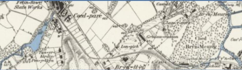
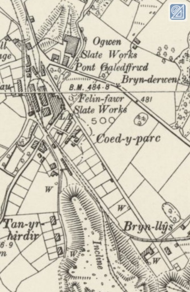
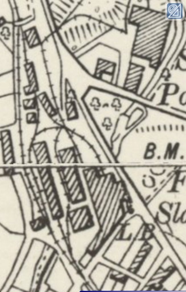
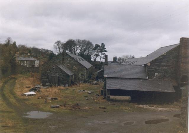
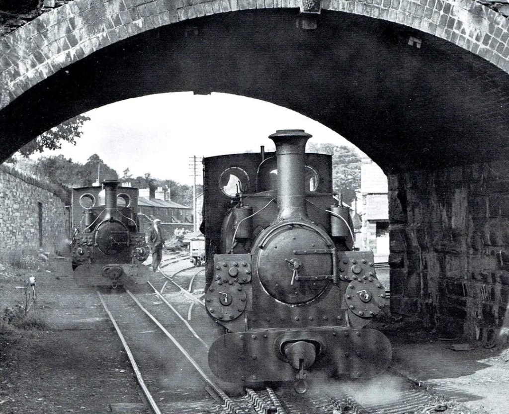
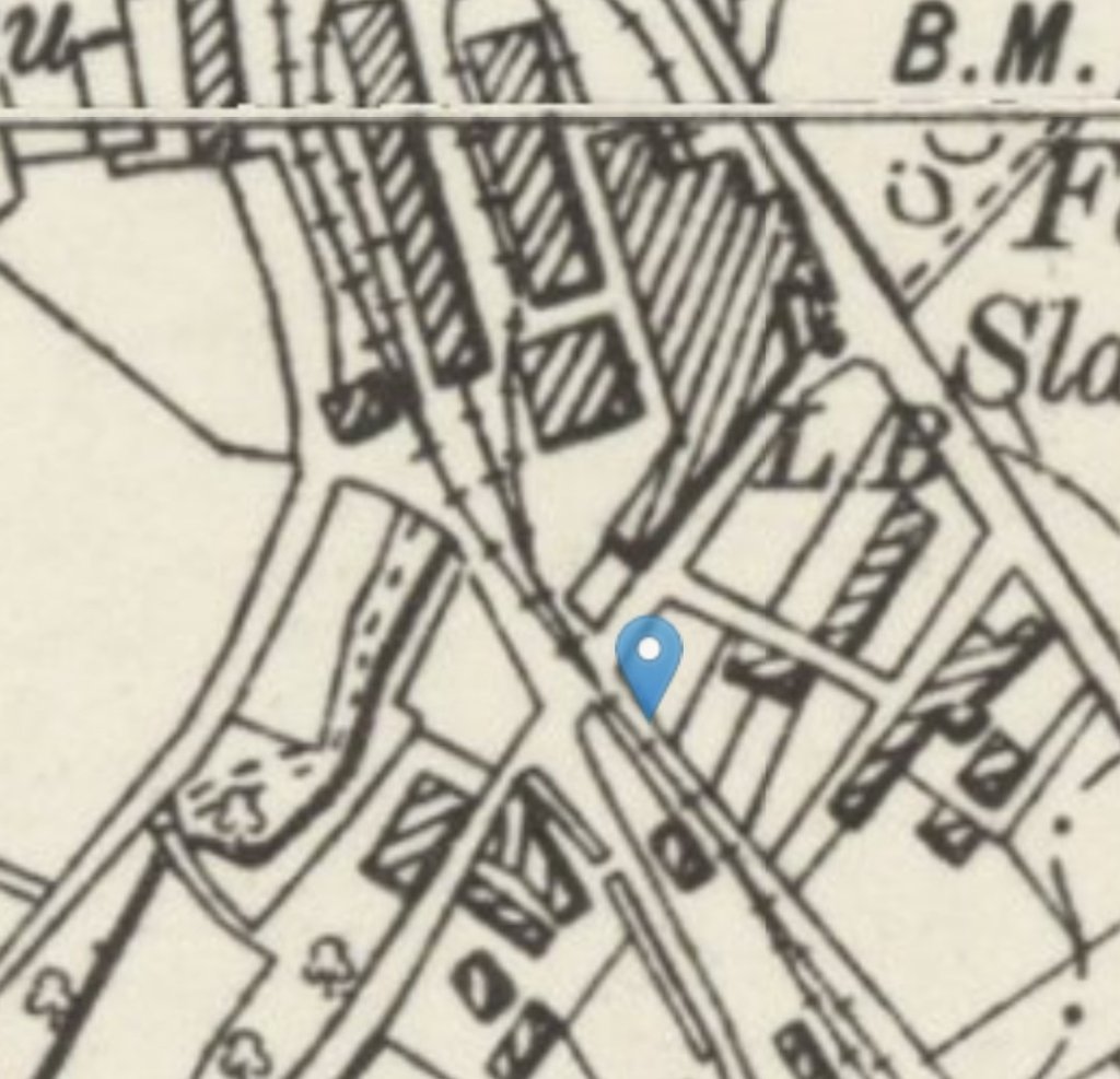
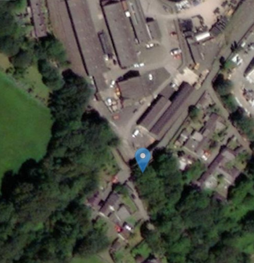
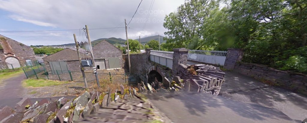
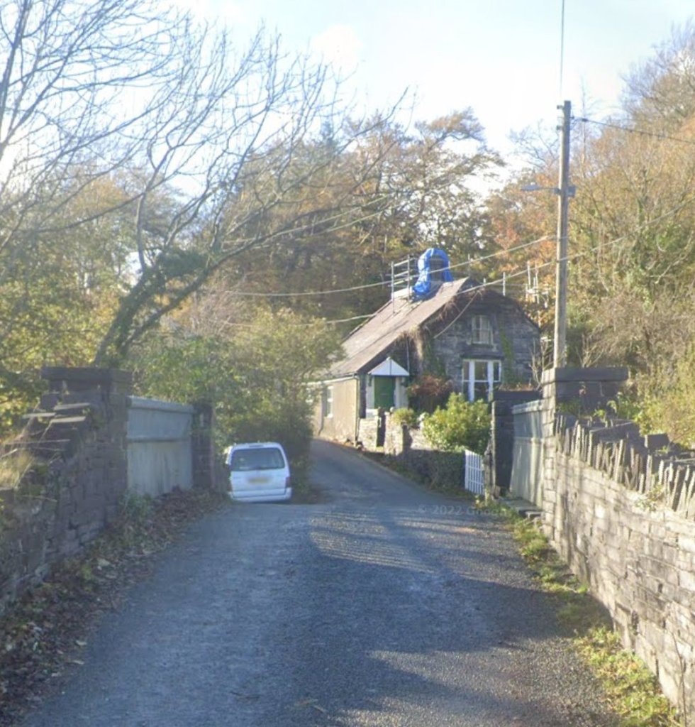
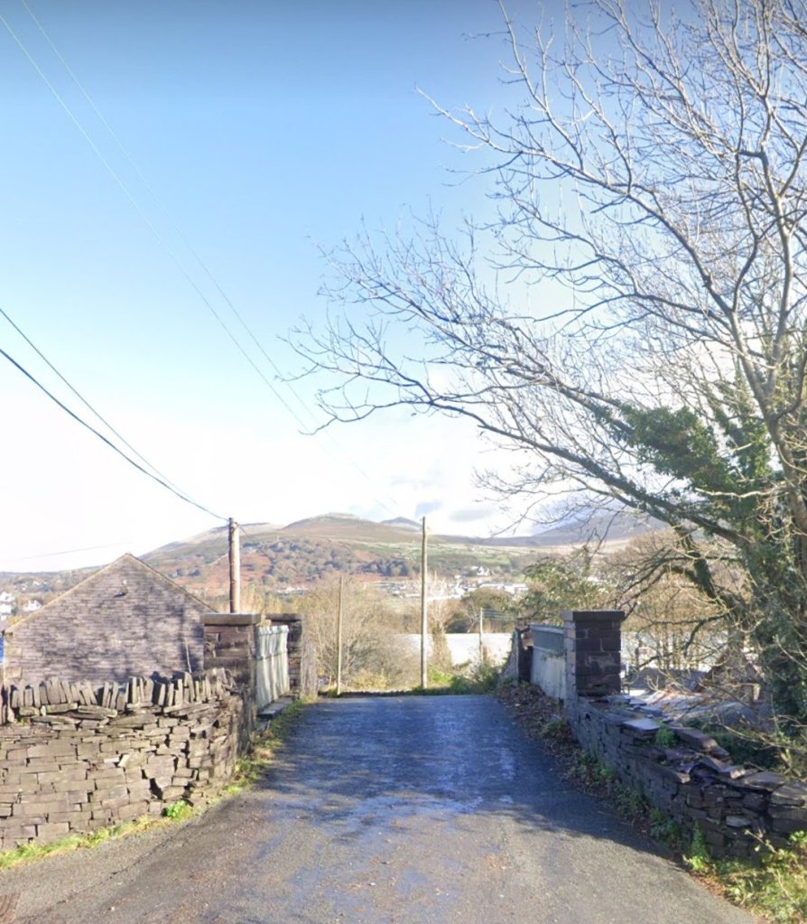
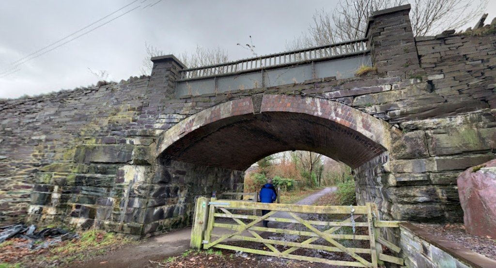
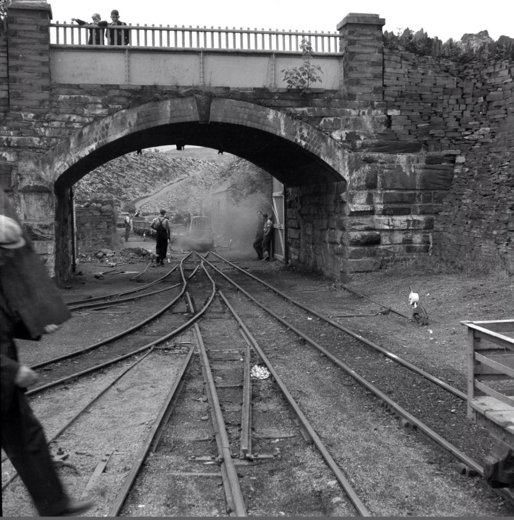
The British Listed Buildings Website records this Grade II listed structure as follows: A road bridge over former railway. “Single segmental arch of red brick (including to soffit) with stone keyblock and arch-ring; coursed slate slab spandrels and piers flanking cast-iron parapet topped by ornamental iron balustrade. Abutments of large coursed slabs with band courses and slab retaining and boundary walls to each side, formerly enclosing the entire yard of the Felin Fawr Slate Works.” [19]
“Originally the site of a manned level crossing dating from the opening of the Penrhyn Slate Quarry Steam Engine Railway in 1843, the present bridge was built in 1900 and originally equipped, as were other bridges on the line, with wooden security gates across the arch. This opening was subsequently infilled but was reopened during the 1990s as part of the creation of a footpath along the course of the former railway line.” [19]
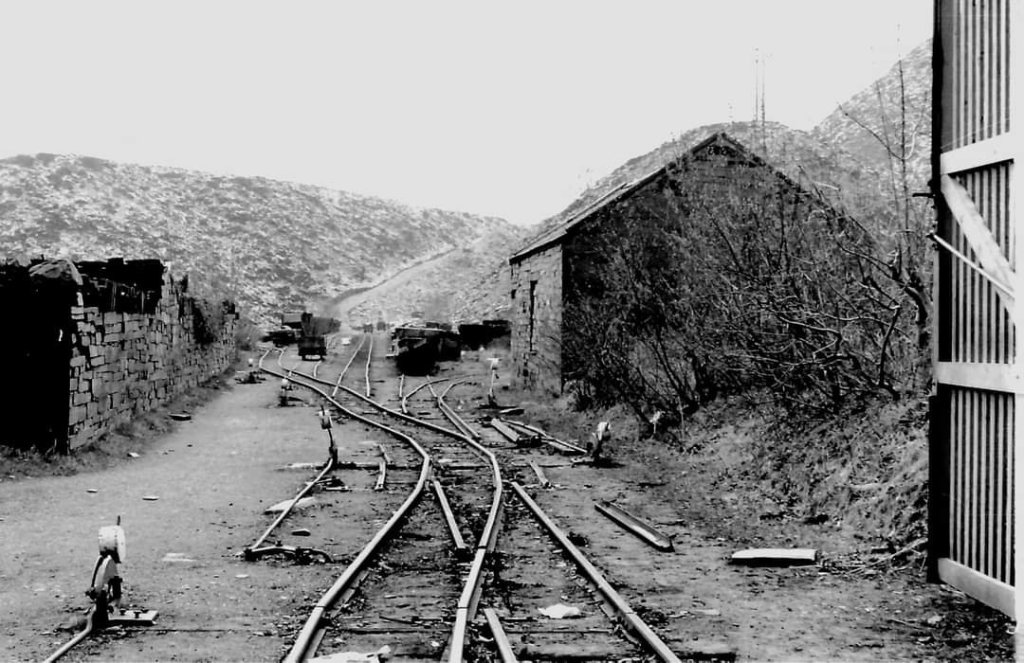
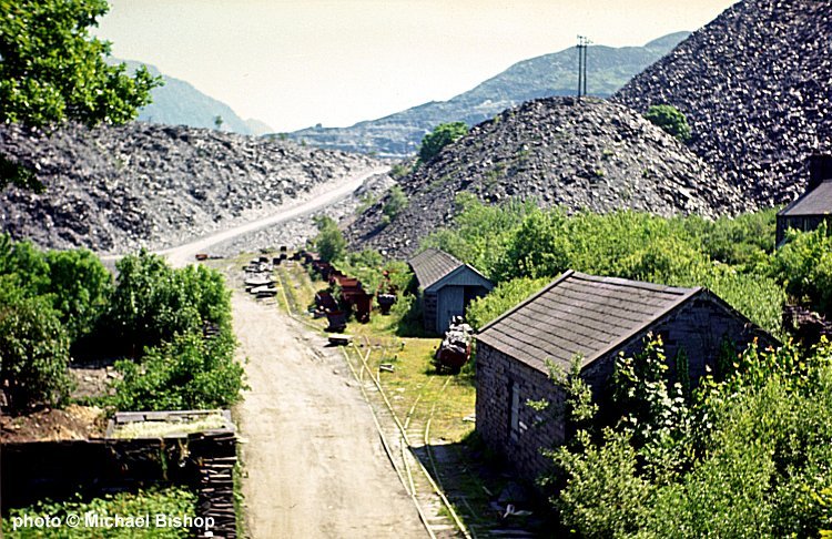
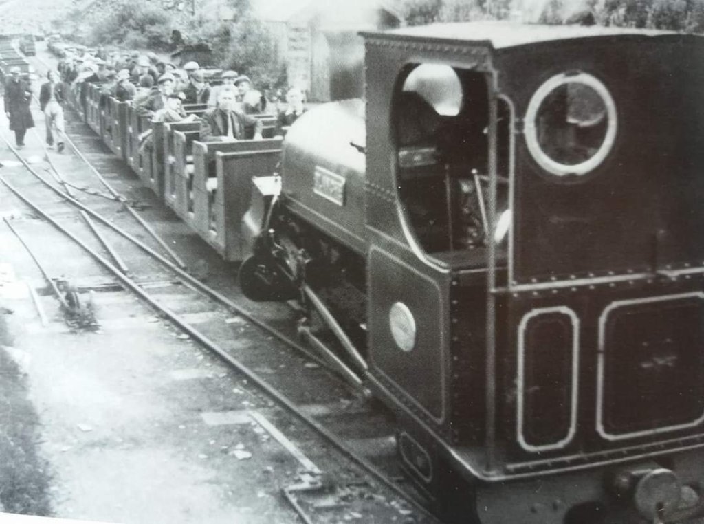
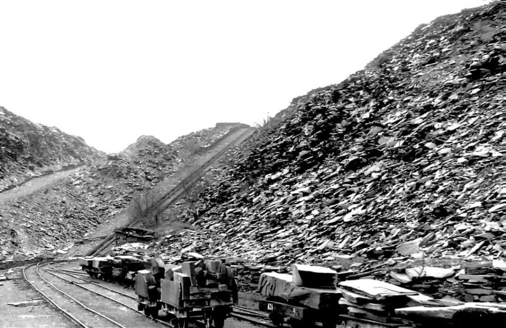
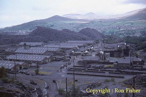
James Boyd suggests that it was always a good idea to turn to the North as you climbed the Felin-Fawr incline. … “Looking northward from halfway up the Felin-Fawr Incline, and viewing this scene below, it might be noted how the arms of the rubbish tips embraced the land on either side. To the left was the long single-line stone shed built in 1903 to house the Workmen’s Train carriages, but marked as ‘Engine Shed’ on the 1912 OS Maps. This definition may be a ‘hang-over’ from the time beginning in 1879 when two main line engines were kept at Felin-Fawr overnight; in earlier times the Workmen’s Train was kept in a shed below the Quarry (and possibly not transferred to this shed immediately it was built in 1903 – the precise date of this transfer is not known). It could be that the two main line engines were squeezed out and down to the Port shed when the Workmen’s Train increased to 13 vehicles, for that train had latterly grown too long for the shed, so the south end was taken down and the carriages poked out of it. Alongside was the 6th milepost. Beyond on the same side was (correctly) a small Engine Shed, which in due course acquired the nickname ‘The Baldwin Shed’, after the purchase of three ex-War Department locomotives from that American builder in 1924 had proved fruitless and they were stored inside. There was a water standpipe for main line engines on the wall outside. In much earlier days the building housed the little private saloon carriage which in later years was kept in the Port Engine Shed.” [15: p54]
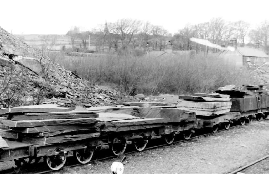
Boyd continues: “This yard was always full of stock, lines of slate wagons loaded and waiting the next run to the Port, with empties alongside making their way slowly to be hauled up by the endless chain incline at Felin-Fawr, with perhaps another row of Quarry Flats standing with huge lumps of slab on them, waiting to be run down into the Felin-Fawr Mill in the Coed-y-Parc complex. Other odd wagons found a home there month by month – there was not much spare accommodation elsewhere. Wagon loads of coal waiting to go up into Quarry Departments and the wooden-bodied ‘Fullersite’ wagons could be easily distinguished too. Away to the right might be discerned the course of the abandoned 1843 line … but, ere its grassgrown course had gone many yards, the foot of the waste tips buried it. Beyond and behind this there was a drop of some 20 ft with a supporting wall and, running along near its top the course of the 1933-built link line, a second generation (so to speak) of the 1843 access and intended to bring Sling Level into easy communication with Coed- y-Parc independently of the Felin-Fawr Incline… but doomed to operational failure on account of its sharp curves.” [15: p54]
Boyd continues: “In the distance (and across the middle of the scene), the abutments and road bridge at Coed-y-Parc marked the boundary of the area, the bridge itself with ornamental railings to the road and a pair of wooden gates beneath it; these were shut to prevent unlawful access to the workshop area at all but working hours. Beyond the bridge might be seen the huddled roofs of the mills and workshops and moving to the left, the row of houses bordering the line to the west, formerly the stables (Tai’r-stablau) for the Railroad but now converted into domestic dwellings. It was a rural setting for this early nineteenth century industrial centre, the wooded Ogwen valley stretching away behind the works until the hills beside it merged with those of Anglesey beyond the waters of the Menai. From no point on the Railway itself was such a view obtainable.” [15: p55]
Boyd’s final words about this particular area of the Quarry: “Coming down-incline into the yard, there was formerly an island platform between the running line where the daily Workmen’s Train terminated: during working days, its stock was shunted into the long shed out of the way. Almost under Coed-y-Parc road bridge the line was single for a few yards, only to branch out beyond and make its way, curving slightly to the right and following a tall wall on the left with other lines alongside.” [15: p55]
The Levels, Galleries and Inclines in the Quarry
The very nature of Penrhyn quarry means that much of the site went though a series of changes as new levels were opened up, waste slate was deposited. There are no definitive maps of the quarry galleries and levels beyond what can be seen on Ordnance Survey maps. Almost inevitably, the descriptions of levels, galleries and inclines below cannot be complete or comprehensive.
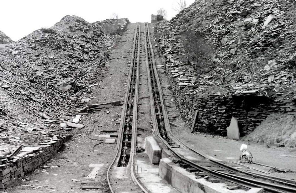
Penrhyn featured eight water-balance systems used to raise and lower wagons using tanks of water. The most documented water balance was named Sebastopol (built during the Crimean War), which also lent its name to a gallery/level. Each incline had its own drumhouse. Heritage documentation notes eight incline/drumhouse structures within the quarry. Heritage references for these structures are: 60035, 60036, 60055, 60075, 60076, 60090, 60094, and 60136. [37]
Photographs of typical Welsh slate inclines and of a preserved water-balance system at Penrhyn can be seen here. [33]
Levels and Galleries
Red Lion Level: The main working and dressing mill level where the core processing, sawing, splitting, and dressing took place (home to the 1912 electric dressing mills).
Sebastopol Level: Named after the Sebastopol water balance. [32]
Terraced Galleries: Over 20 distinct benched levels climbed the slopes of Y Fronllwyd, with deep sink operations developing later as the pit expanded.
Penrhyn grew into a vast pit featuring up to 29 working galleries (ponciau). A web of traditional rail inclines connected these massive terraces to the main processing sections. Examples include:
George Gallery: this name was used interchangeably with the Sebastopol Level, it was established in the mid-19th century as the quarry bit deeper into the valley floor. [32]
Inclines
Felin Fawr Incline: We have already encountered this incline which was the primary external incline linking the main quarry processing yard to the mainline railway.
Red Lion Incline: Ascended directly up from the lower yards to the Red Lion Level, which was the main working terrace housing the primary dressing mills and locomotive tracks.
Twlldyndwr to Red Lion Counterbalance Incline: A specific track network connecting the Twlldyndwr Gallery (the second major level where waste slate was historically tipped) down to the Red Lion level. [34]
Red Lion to Twlldyndwr Uphaulage Incline: Used for dragging materials up into the higher tiers. [34]
Vertical Water Balance Shaft Lifts
As the pit was dug deeper into the valley floor, standard sloping inclines became less practical. Penrhyn innovated vertical water balance shafts. This system used water weight filled at the top of a cage to pull heavy wagons up from the lower gallery sinks. Penrhyn operated eight water balance systems.
Sebastopol Water Balance: Constructed during the Crimean War, it sits above the main drainage tunnel adjacent to the Sebastopol Level (historically part of the George Gallery). The Sebastopol lift sat higher up the terrace face than the lower Princess May lift, serving as the middle-tier staging platform. It lifted slate up to the Red Lion Level. [36]
Princess May Water Balance: One of the lower survivors, positioned alongside the Princess May Gallery.
Lord Lift: Serviced the upper tier known as the Lord Gallery.
Lady Lift: Positioned directly beneath the Lord Gallery, servicing the Lady Gallery tier.
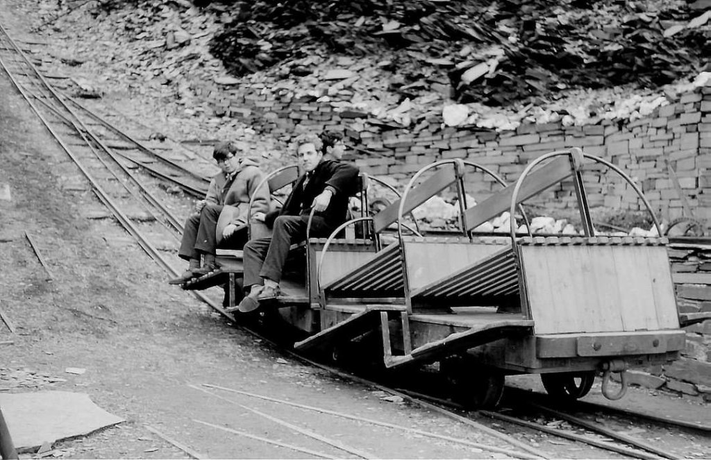
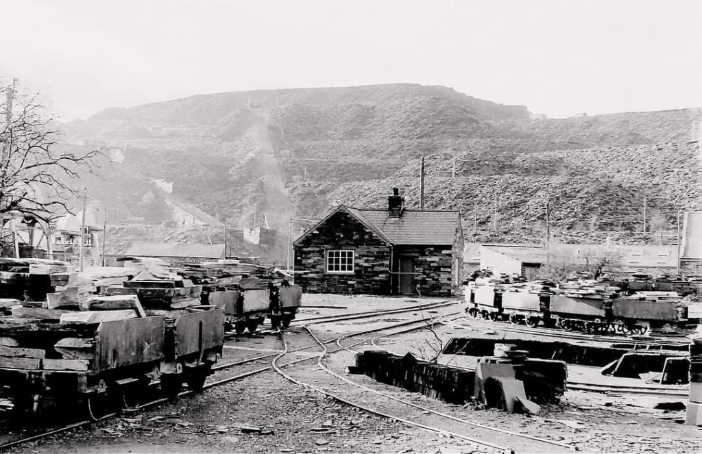
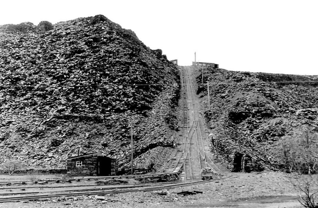
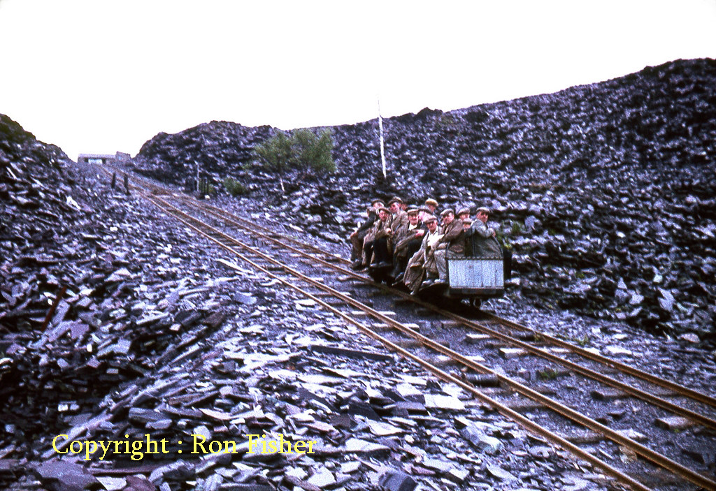
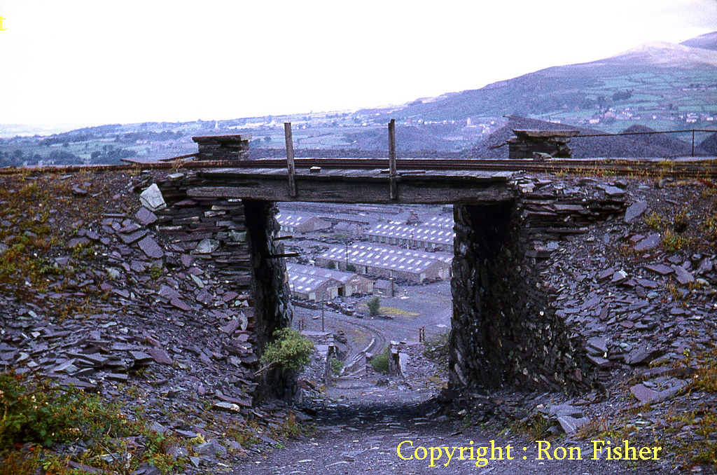
A view looking down the incline to the Red Lion Level can be seen here. [12]
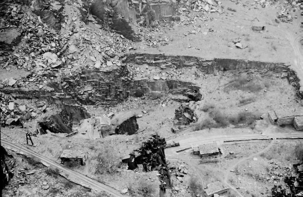
A close view of a quarry face in 1933, © Joan Bowen/Amgueddfa Cymru – National Museum Wales, can be found here. [12]
A general view of the galleries at Penrhyn Quarry, © Alwyn R. Owens/Amgueddfa Cymru – National Museum Wales, can be found here. [13]
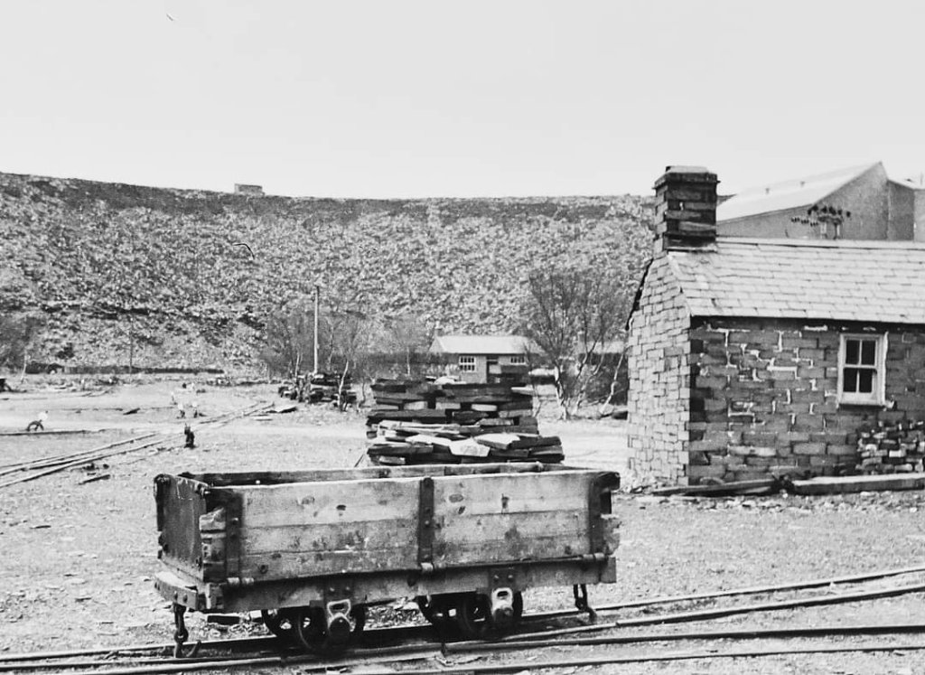
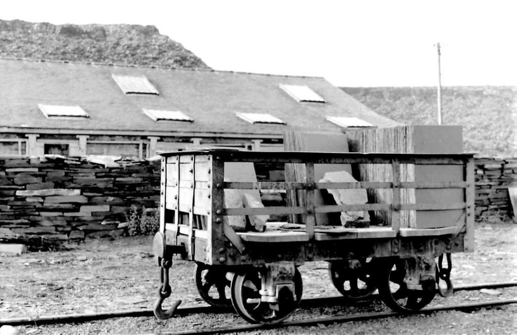
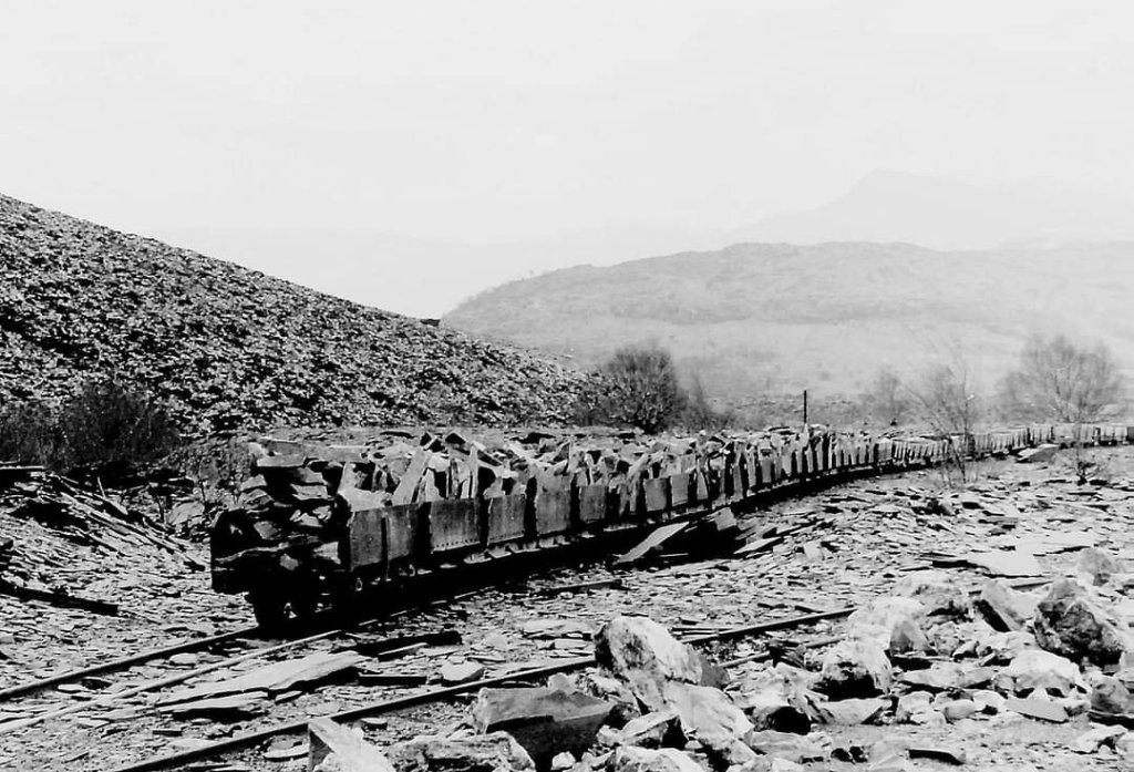
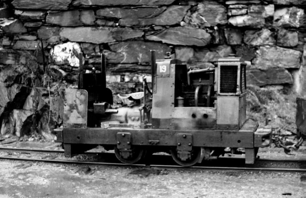
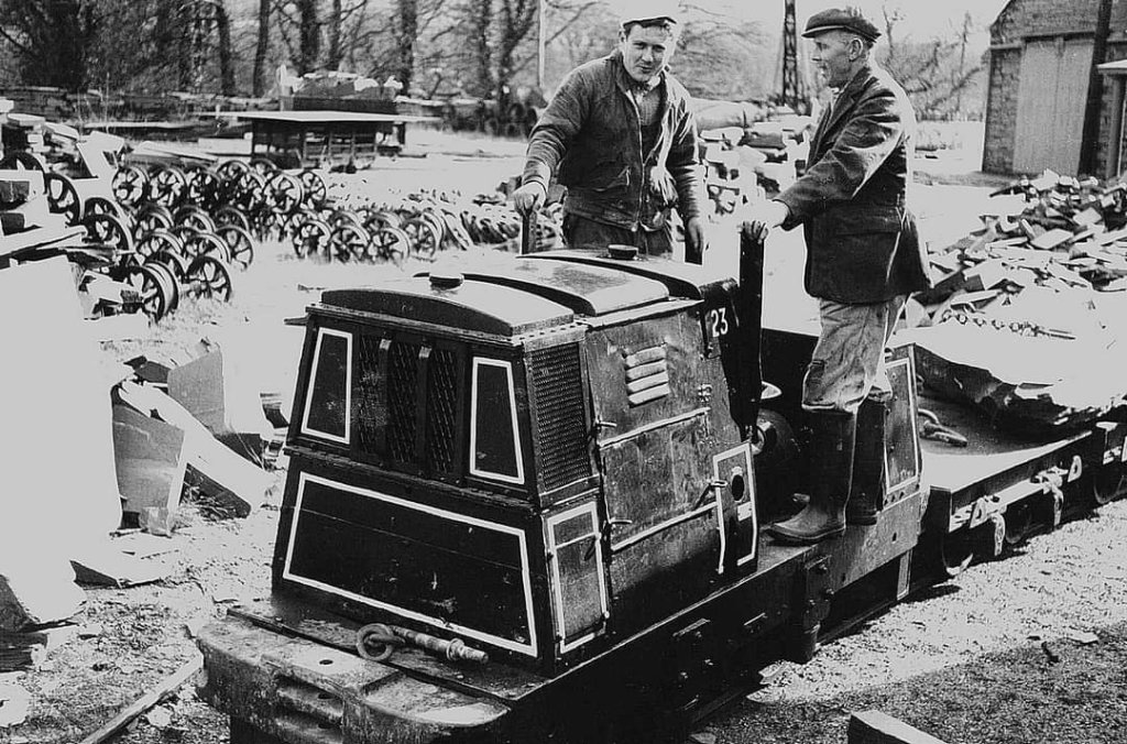
A series of photographs of the diesel fleet which worked at Penrhyn Quarry, © Copyright Michael Bishop can be seen here. [23]
Steam at Penrhyn Quarry
A series of photographs of steam locomotives which worked at Penrhyn Quarry follows below. This does not pretend to be a comprehensive list, rather it illustrates the range of different types of locomotive present on site. … Locomotives included:
De Winton Locomotives: Vertical- and horizontal-boilered 0-4-0 tank engines introduced around 1876 for early steam operations, such as George Henry (built 1877).
Penrhyn Main Line Class (Hunslet): Three iconic 0-4-0 saddle-tank locomotives built between 1882 and 1893: Charles, Linda, and Blanche. Charles was preserved at the Penrhyn Castle Railway Museum, while Linda and Blanche were later transferred to the Ffestiniog Railway.
Penrhyn Port Class (Hunslet): Compact 0-4-0ST engines built in 1883–1885 to handle dock operations at Port Penrhyn, including Gwynedd, Lilian, and Winifred, may have been occasional visitors to the quarry itself.
Other Engines: Hunslet-built Hugh Napier (1904), Kerr Stuart 0-4-2ST engines like Stanhope, and various Andrew Barclay (such as Cegin and Glyder) and Baldwin locomotives acquired over the decades.
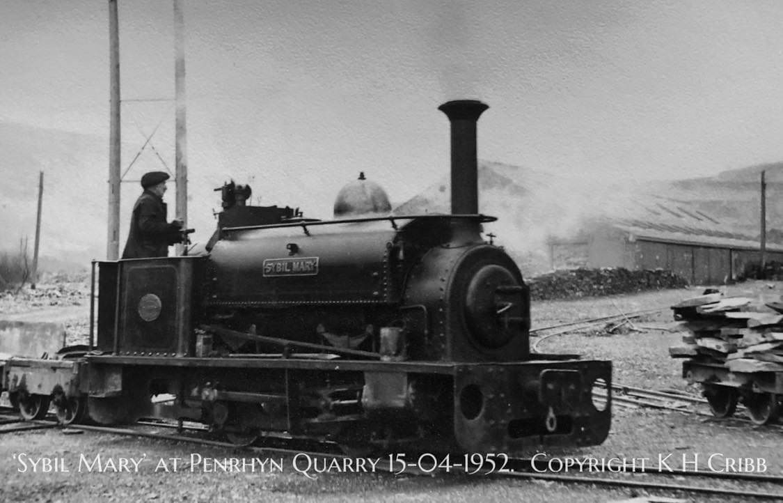
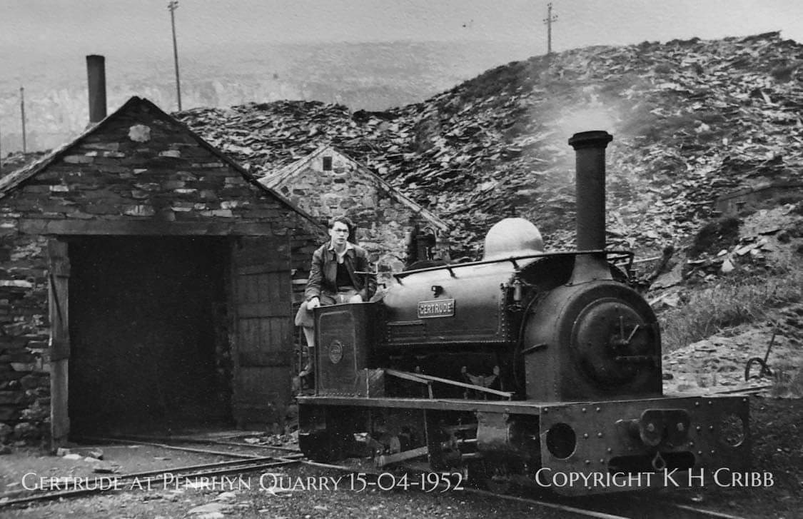
Among the locomotives which worked at the quarry were those pictured below.
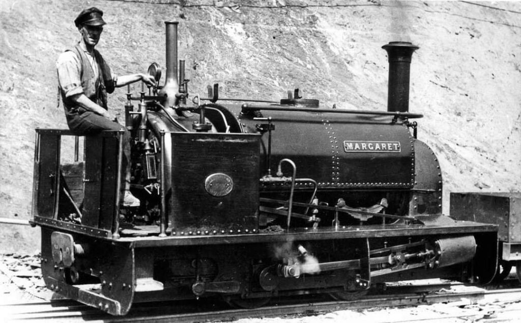
Margaret, was built by Hunslet in 1894 (Works No. 605). It was supplied to Penrhyn Quarry to work in the quarry galleries. The engine spent its working life in the quarries, until withdrawal from traffic in 1950. Margaret was once thought to be beyond restoration, due to the engines poor condition. The Vale of Rheidol Railway purchased her in 1999. Some restoration had been undertaken prior to this, though it was far short of completion. The locomotive was stripped back to the frames to establish what had already been done, and by 2004 was a rolling chassis. Progress slowed, as maintenance of the running fleet took priority. A new boiler was delivered in 2007. With the completion of the new workshop in 2014, Margaret’s completion moved up the agenda. In September 2015 Margaret was returned to steam for the first time in 65 years, and has the distinction of being the first locomotive to be completed in the new workshop at the Vale of Rheidol Railway where she continues to be based in 2023. [9]
Glyder: Made it’s first appearance at Beamish Museum’s “Old King Coal” event in June 2019 after restoration at that museum. it is an Andrew Barclay 0-4-0WT (Works No.1994) of 1931. This was the first time that the engine had worked in railway operation since 1965.
Terry Pinneger tells us that “Glyder was built for the Durham County Water Board for use at the extensive Burnhope Reservoir development in Weardale in the early 1930’s, where it was given the uninspiring name “Grey”. At the end of the contract in 1938 it was sold to Penrhyn Quarry in North Wales and renamed “Glyder” (after a range of peaks of the same name in Snowdonia). It spent most of it’s working life in Penrhyn Quarry and, when it was withdrawn in 1965, it was sold and exported to the USA along with several other redundant narrow gauge locomotives. Whilst there, it saw no use at all and remained in storage.” [4]
Glyder was one of a number of Penrhyn Locos that were taken to the USA and their story can be found on the Bala Lake Railway Website. [8]
Glyder returned to the UK in 2012 and was gifted, on long term loan, to Beamish Museum for restoration. Back in operation in the 21st century, the loco carries its Penrhyn Quarry livery.

Marchlyn was built by the Avonside Engine Company of Bristol, in 1933 (Works No. 2067), the loco was exported to the United States in 1965. Whilst there it was exhibited at the Winneepesaukah Amusement Park, Chattanooga and was given the name, ‘Choo Choo. It returned to the UK in 2011 and is now based at the Statfold Barn Railway where it has been fully restored.
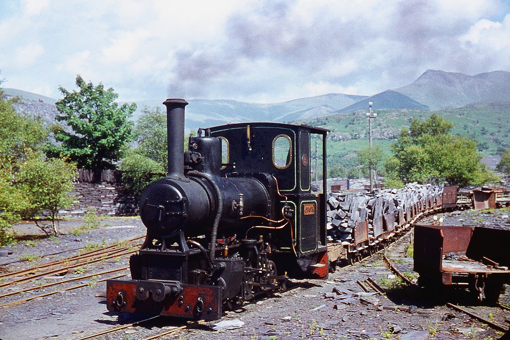
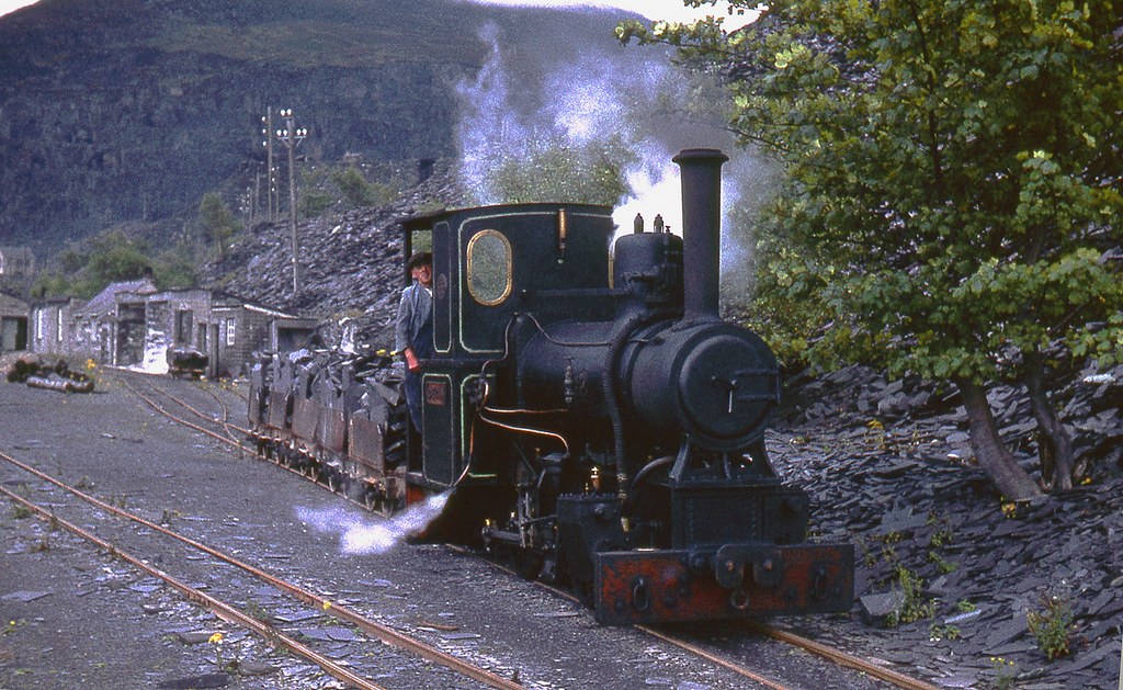
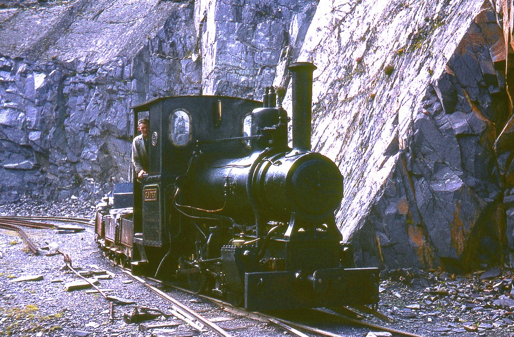
Cegin is an Andrew Barclay 0-4-0WT of 1931 (Works No. 1991) and is preserved at the Statfold Barn Railway. It is named after the Afon Cegin beside which the Penrhyn Quarry Railway wanders away from Porth Penrhyn. Cegin’s restoration was completed and it was steamed for the first time in 56 years in 2021 for a test run before its debut in traffic at the Statfold Barn Railway’s Enthusiast Weekend on the 12th & 13th of June 2021. [14]
A BBC film of the quarry and its locomotives can be found here. [21]
References
- https://www.facebook.com/groups/narrowgauge/permalink/1595498630462159, accessed on 3rd January 2023.
- https://maps.nls.uk/geo/explore/#zoom=17.7&lat=53.17627&lon=-4.07369&layers=6&b=1&marker=53.17551,-4.07347, accessed on 4th January 2023.
- https://www.facebook.com/groups/417502465072892/permalink/870006909822443, accessed on 4th January 2023.
- https://www.flickr.com/photos/23689245@N08/48182319057, accessed on 25th January 2023.
- https://www.facebook.com/groups/narrowgauge/permalink/5162529423759044, accessed on 4th January 2023.
- https://m.facebook.com/groups/narrowgauge/permalink/5170910869587566, accessed on 6th January 2023.
- https://m.facebook.com/groups/narrowgauge/permalink/5180454721966514, accessed on 6th January 2023.
- https://bala-lake-railway.co.uk/steam-locos/winifred, accessed on 25th January 2023.
- https://www.festipedia.org.uk/wiki/Margaret, accessed on 25th January 2023.
- https://www.facebook.com/groups/narrowgauge/permalink/8318932161452072, accessed on 7th January 2023.
- https://museum.wales/collections/online/object/7bd7fdf4-dd46-3efe-a734-afe9f4182f10/Penrhyn-slate-quarry-photograph/?field0=string&value0=Penrhyn%20quarry&field1=with_images&value1=1&index=2, accessed on 11th October 2026
- https://museum.wales/collections/online/object/85510146-8922-307f-9a9c-d7d88ee83d95/Penrhyn-slate-quarry-photograph, accessed on 7th January 2023.
- https://museum.wales/collections/online/object/8b9f1bbb-591f-31f0-acb3-6d09adcf9734/Penrhyn-slate-quarry-photograph, accessed on 7th January 2023.
- https://www.steamlocomotive.info/vlocomotive.cfm?Display=1602, accessed on 25th January 2023.
- J.I.C. Boyd; Narrow Gauge Railways in North Caernarvonshire, Vol.II, The Penrhyn Quarry Railways; The Oakwood Press, Usk, 1985.
- https://maps.nls.uk/view/101606301, accessed on 8th January 2023.
- https://maps.nls.uk/geo/explore/#zoom=16.1&lat=53.17639&lon=-4.07285&layers=6&b=1, accessed on 8th January 2023.
- https://maps.nls.uk/geo/explore/#zoom=17.5&lat=53.17696&lon=-4.07383&layers=6&b=1, accessed on 8th January 2023.
- https://britishlistedbuildings.co.uk/300004159-pont-coed-y-parc-llandygai#.Y7sboB7LfTg, accessed on 8th January 2023.
- https://www.pinterest.co.uk/pin/65654107043301528, accessed on 8th January 2023.
- https://www.facebook.com/share/v/1EsibytGdm, accessed on 6th October 2026
- https://museum.wales/news/1117/SLATE-TO-THE-SEA, accessed on 3rd January 2023.
- http://www.penmorfa.com/Slate/Penrhyn-1967-2.htm, accessed on 19th January 2023.
- https://flic.kr/p/9vXnYM, accessed on 22nd January 2023.
- https://flic.kr/p/9tnR8K, accessed on 22nd January 2023.
- https://flic.kr/p/2mX712N, accessed on 25th January 2023.
- https://flic.kr/p/9tfGon, accessed on 22nd January 2023.
- https://flic.kr/p/9w1pFf accessed on 22nd January 2023.
- https://flic.kr/p/9tfRXB, accessed on 24th January 2023.
- https://flic.kr/p/9w1p7E, accessed on 23rd January 2023.
- https://www.llechi.cymru/slateareas/ogwenvalley, accessed on 11th October 2026.
- http://www.penmorfa.com/Slate/GALLERY15.html, accessed on 11th October 2026.
- http://www.penmorfa.com/Slate/Inclines.htm, accessed on 11th October 2026.
- https://cadwpublic-api.azurewebsites.net/reports/sam/FullReport?lang=&id=4428, accessed on 11th October 2026
- https://www.facebook.com/groups/narrowgauge/posts/946635325348496, accessed on 11th October 2026.
- http://www.penmorfa.com/Slate/penrhyn.html, accessed on 11th October 2026.
- https://www.welshslate.com/download/clientfiles/files/2011_Penrhyn_ES_chp08_Heritage_FINAL.pdf, accessed on 11th October 2026.