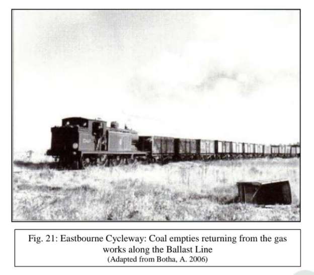
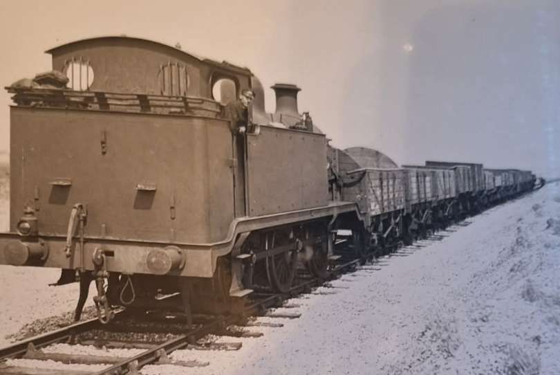
The featured image for this article shows a typical branch train heading towards Eastbourne. It comprises a number of mineral wagons running empty after delivering coal to the Eastbourne Gas Works, © Public Domain. [38]
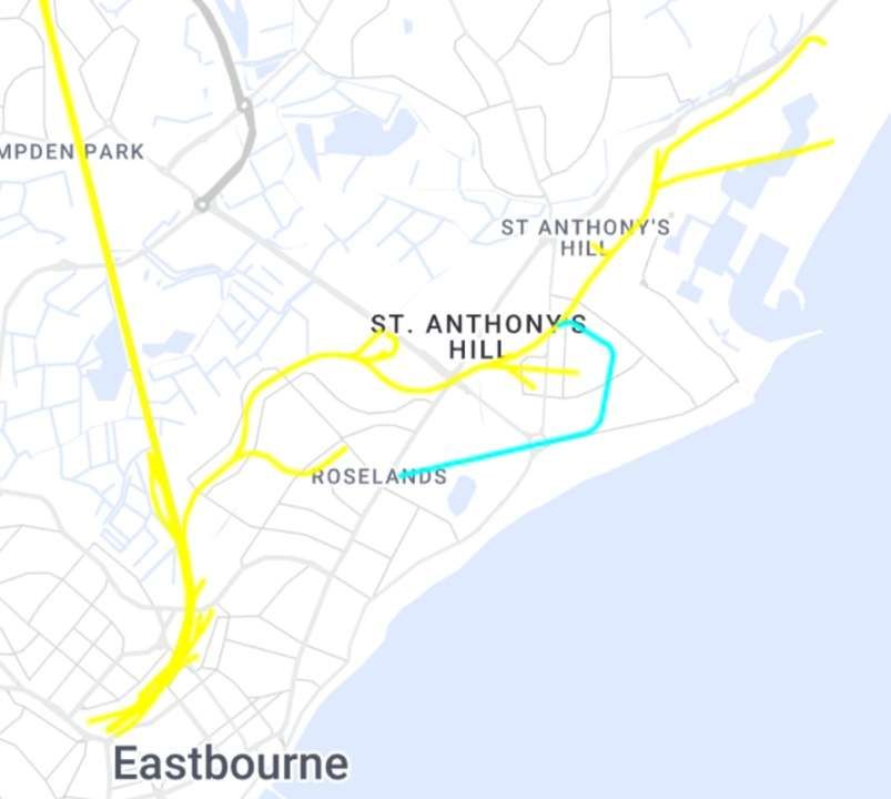
The Crumbles Branch (also known as the Ballast Line or Crumbles Railway) was a 3.5-mile standard-gauge industrial branch line constructed in 1862 that ran east from Eastbourne’s railway area out onto the remote shingle beach known as The Crumbles. [5][6][7][8]
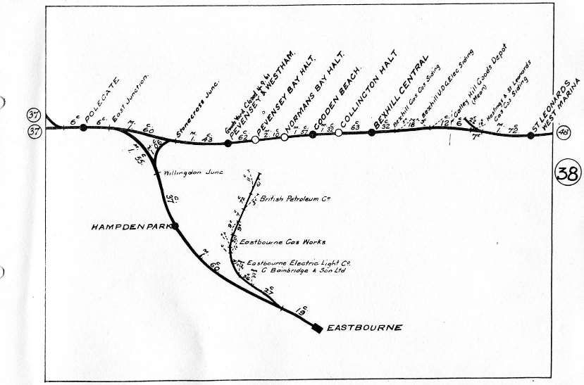
The shingle bank/beach was 3⁄4-mile-wide (1.2 km) – shingle collected here was used as ballast for railway lines across the LB&SCR and the wider UK network. [2: plate 27]
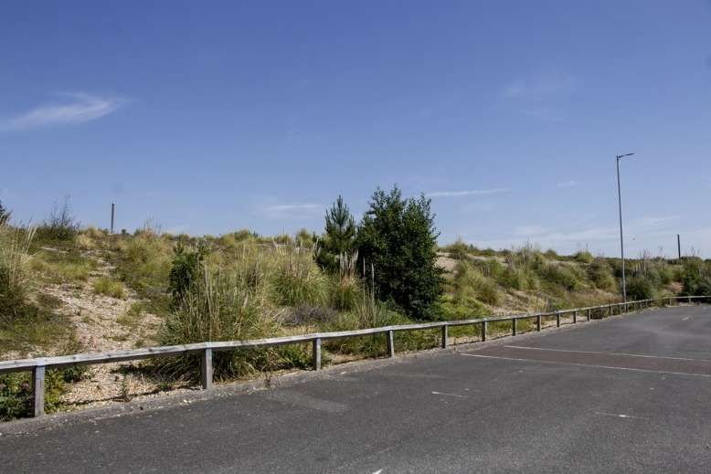
Andrew Diack tells us that, “This distinctive area of coastal deposition lying adjacent to the sea underlies modern Sovereign Park and Princes Park and continues towards Sea Houses, near Eastbourne Pier. The irregular surface of ridges and hollows once contained pools of water in places, and a “Cromble Pond” of irregular form is shown on early maps, including John Speed’s map of Sussex of 1611 and Robert Marden’s map of Sussex of 1693, while the Ordnance Survey map of 1813 also shows “Crumble Pond”. In 1845, the Crumbles were partitioned between Lord Burlington, later the 7th Duke of Devonshire, and the Gilbert family; both families had a long association with the town as major landowners, benefactors and developers. The Gilberts and the Cavendish family, who as the Dukes of Devonshire were, in fact, connected by marriage through the Compton family, who were also landowners in Eastbourne and whose estate was managed from their residence at Compton Place, previously Bourne Place. The partition of the Crumbles was said to have been beneficial toward the development of the Seaside suburb to the east of Eastbourne. The railway came to Eastbourne in 1849, and with the expansion of railways so grew the demand for railway ballast and the need for gravel quarries to supply the stone. In 1857-62 the London Brighton & South Coast Railway (LB&SCR) negotiated the purchase of not less than 48,000 cubic yards of shingle from the Duke of Devonshire at 1 penny per cubic yard, to be extracted from the Crumbles.” [6]
Andrew Diack writes: “Due to the buoyant demand for ballast, this was a period of expansion for the gravel pits that produced the product, but it was equally a time when the natural landscape of vegetated shingle ridges suffered greatly by being transformed into a scarred landscape where industrial machines created holes and gashes in the surface of the land. Over a period of a hundred years shingle was removed at the rate of around 250,000 tons per year for railway ballast and building material, and that resulted in the height of the land being reduced by 4 metres within 100 metres of the shore.” [6]
Additional branches were added to the line, including a siding built in 1870 for the Eastbourne Gas Company, which straddled the railway. The gasworks received coal via the rail connection and in return, produced coke, which was taken away. [2: plate 32][3]
“In 1926, a line was laid for the Eastbourne Corporation Electric Works, which transported coal and supplied fuel to the bus garage, as well as taking scrap metal from the refuse destructor works.” [2: plate 29][3][5]
In fact, “as Eastbourne expanded, the branch evolved into an industrial corridor. It served the town’s gasworks (delivering large volumes of coal), brickworks, timber yards, and destructor works.” [6]
Ballast trains ran until 1932, when the LB&SCR’s successor, the Southern Railway, switched to using granite.
Andrew Diack continues: “Although the gravel had a variety of uses, when railways changed to the use of granite chippings in 1930, the business went into terminal decline. (Broken granite chips interlock better than rounded pieces of flint, and they also provide good shock absorption and easier maintenance.) Shingle extraction gradually diminished, and by 1932, the railway was no longer used to transport shingle, though it continued to serve [some] other industrial sidings in addition to the gasworks.” [6]
“The branch ceased steam working in April 1960, after which diesel shunting locomotives took over [2: plate 28] until the line was closed in … 1967.” [2: plate 29][3][5]
Andrew Diack says that “The Crumbles railway continued to serve the gasworks until … 1967, but with gas production ceasing in June 1967, the track fell into disuse, and in the late 1980s it was removed at the time of the Eastbourne re-signalling project.” [6]
A short series of photographs follow below, all taken circa. 1962 by Dick Gilbert.
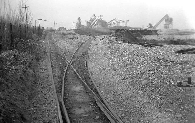
There is no trace of anything shown in these pictures in the 21st century (Dick Gilbert, around 1962), (CC BY 2.0). [4]
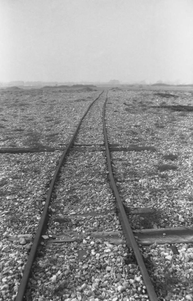
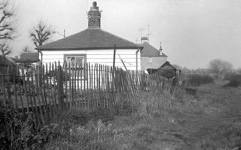
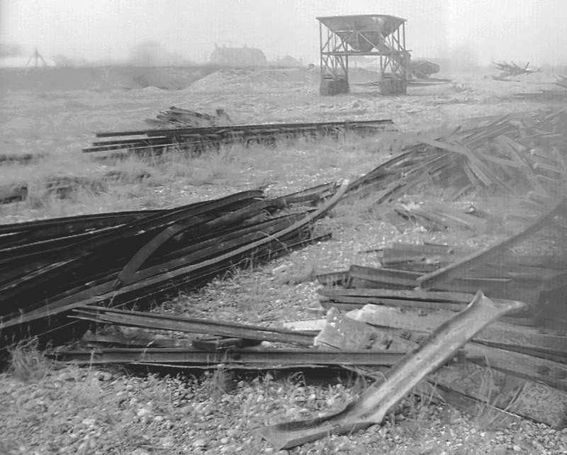
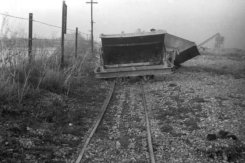
The remote shingle beach area of The Crumbles where the line terminated has since been redeveloped and is now home to Sovereign Harbour and retail developments.
An exploration of this line can be found here on YouTube. [7]
Following the Line
A separate line ran alongside the main line out beyond the location of the Engine House. …
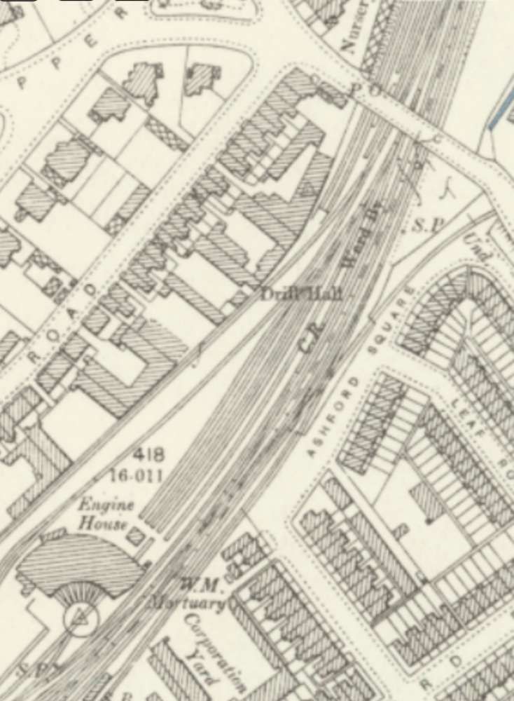
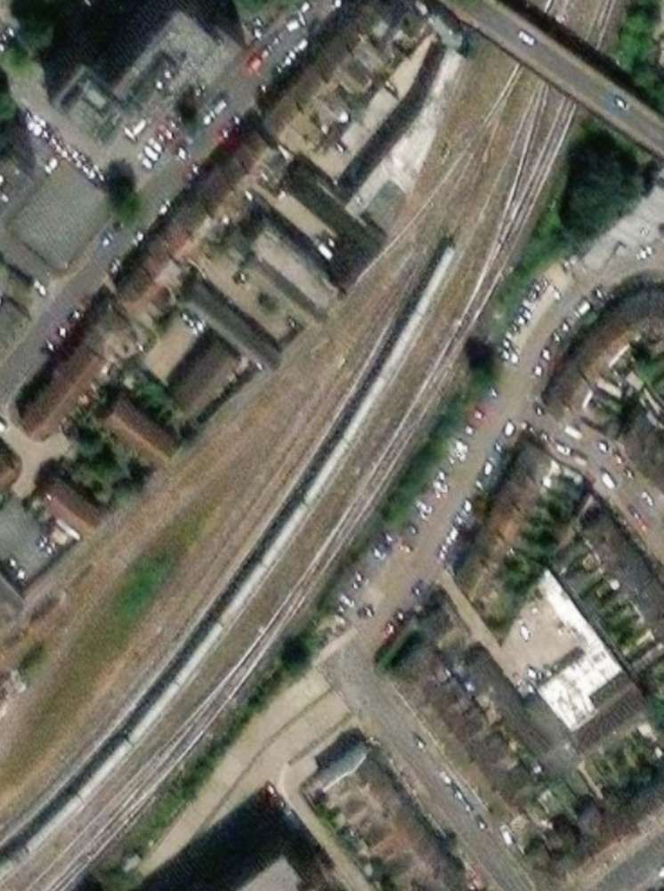
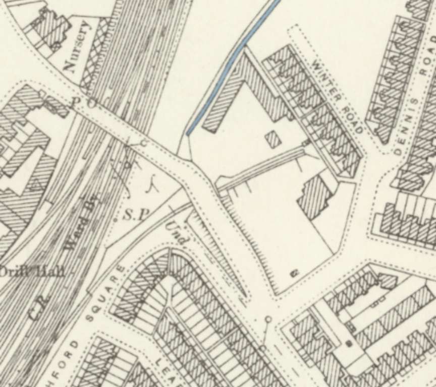
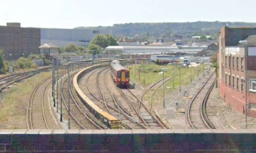
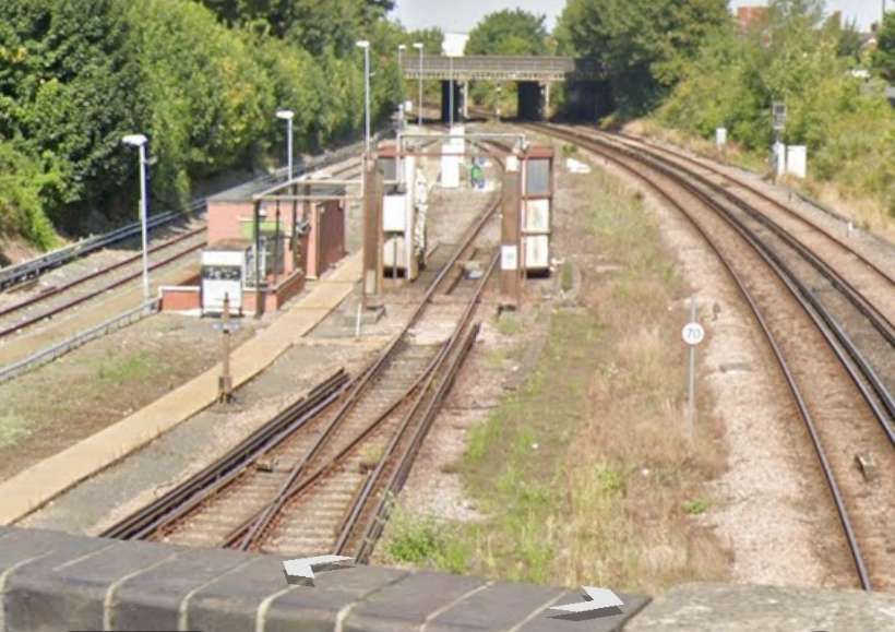
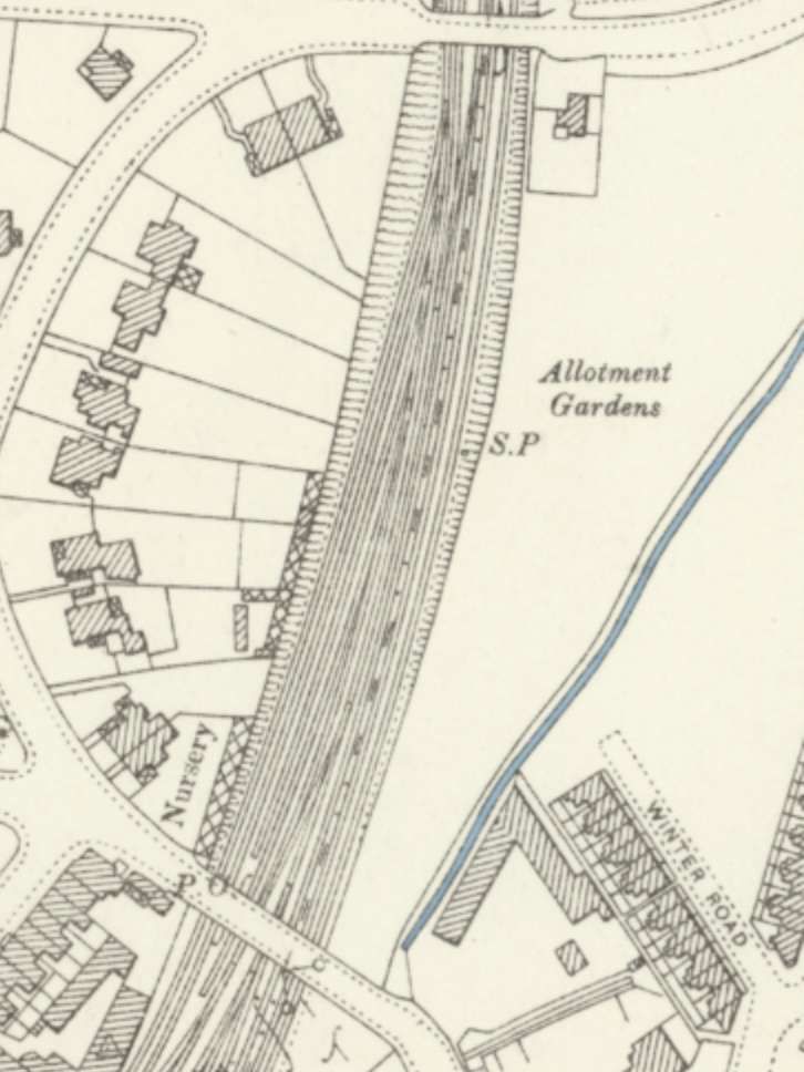
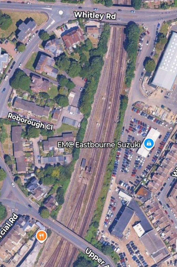
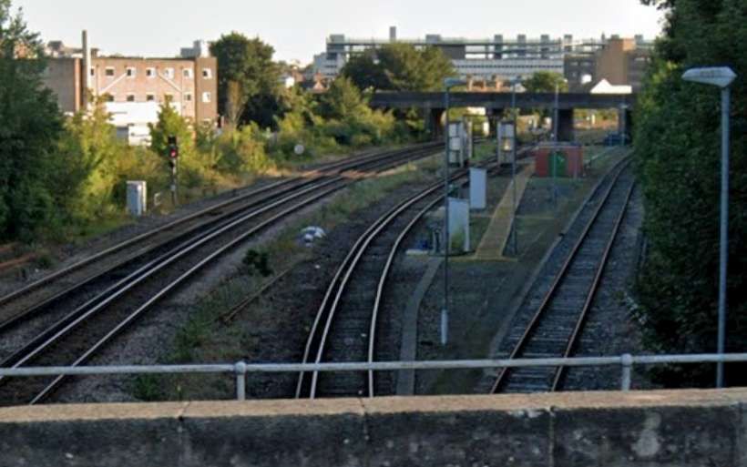
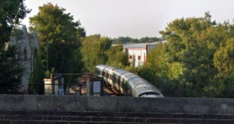
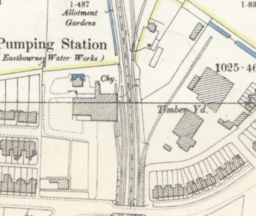
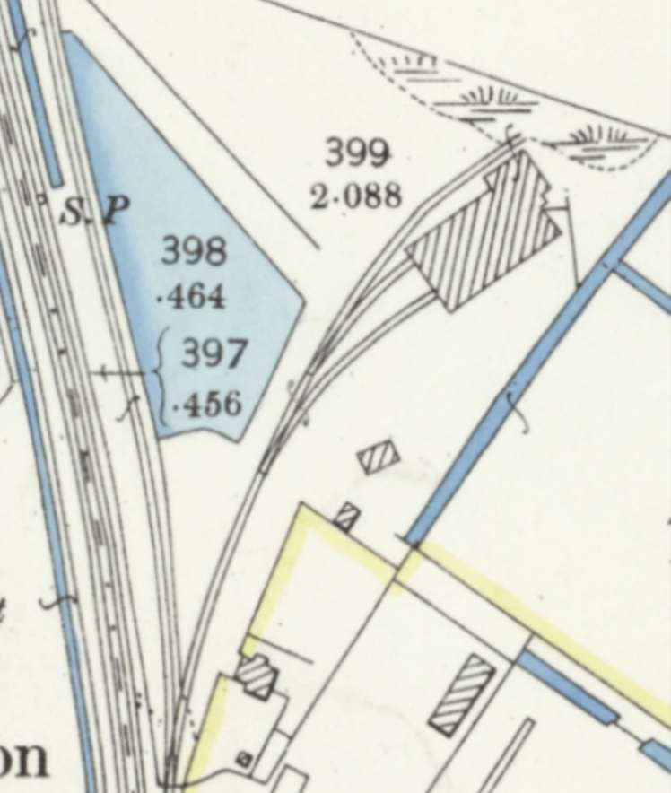
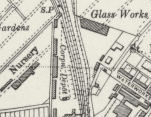
This small extract from the 6″ Ordnance Survey of 1938, published in 1947, shows a new building on the site, no rail connection, and the site is designated a Glass Works. Careful examination of the map extract shows that, although the sidings within the site and the building they served are now gone, the point on the Crumbles Branch remains. [12]
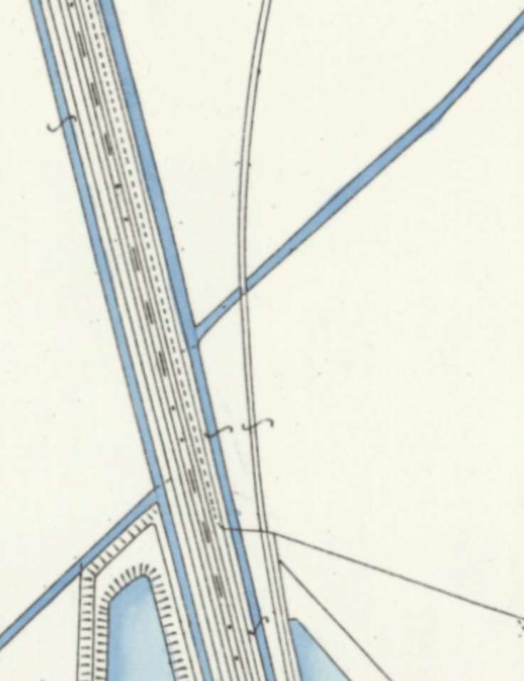
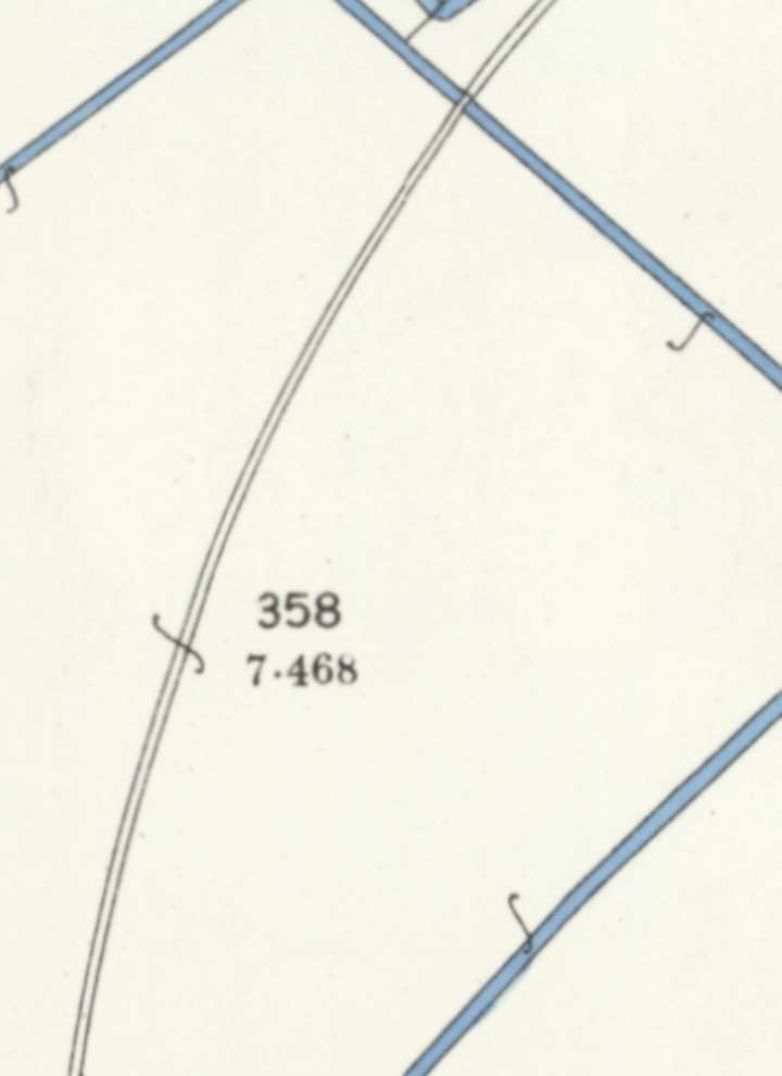
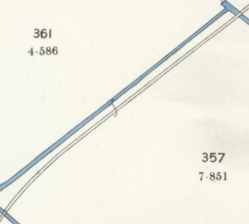
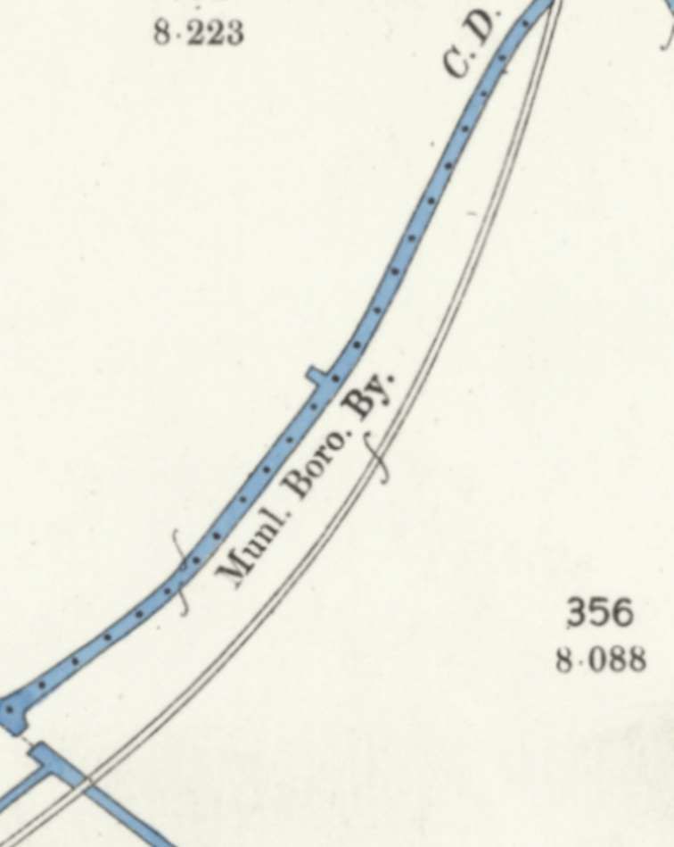
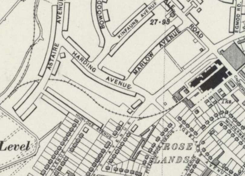
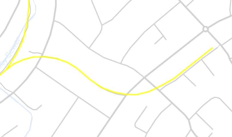
The branch serving the Destructor Works. [24]
A short aside is worthwhile here, to provide some information about the Destructor Works. …
The Eastbourne Destructor Works was a late 19th-century municipal waste incinerator and early energy-from-waste facility, producing electricity which was used locally in Eastbourne. Plants like this were built as towns grew and traditional waste disposal became difficult, the site burned household refuse in high-temperature furnaces to reduce volume, produce clinker, and generate steam for electricity. Coal was often required alongside the rubbish to keep the furnaces hot enough. [7][13][14]
By the 1950s and 1960s, shifting environmental standards, modern waste management approaches, led to the closure and demolition of the complex and the lifting of its rail link. [7][14]
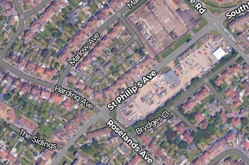
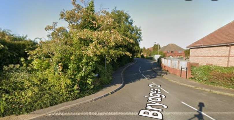
The wider industrial footprint stretched across the area of modern-day St Philips Avenue and Bridges Close. The refuse handling section stood roughly where the current recycling site is on St Philips Avenue, while the core furnace operations and rail sidings were nearby towards Bridges Close. Only the recycling centre remains as a hint to the past use of the industrial site. The rest of the land has been redeveloped into housing estates and roads.
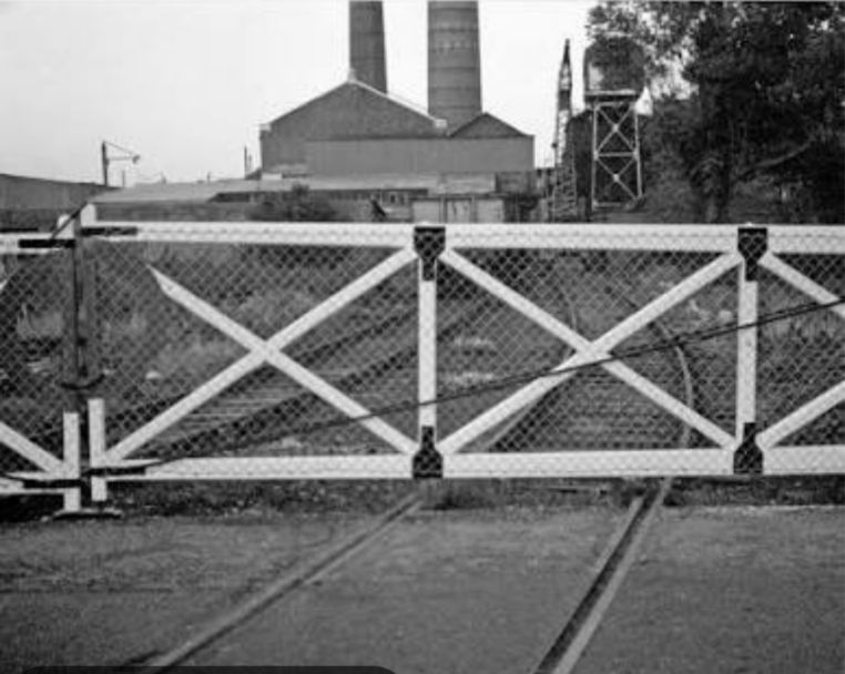
Simon Meader shared two photographs (photographer not known) which were taken before the nationalisation of the railways, both focus on the location of the level-crossing on St. Philip’s Avenue.
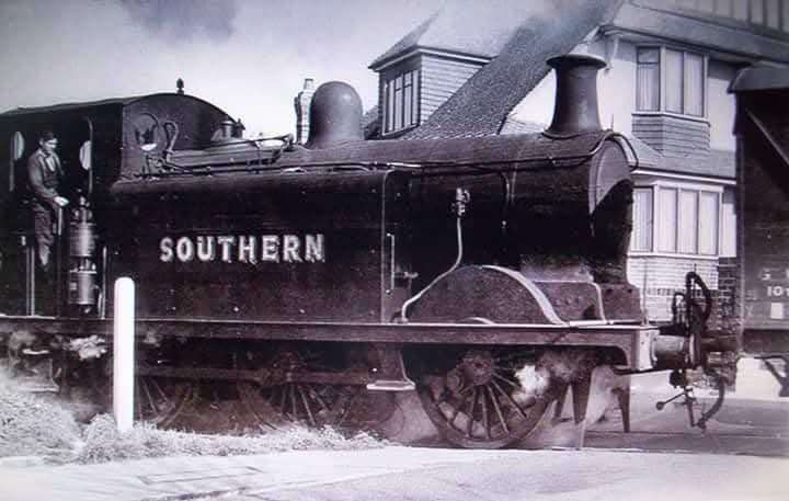
The level-crossing on St. Philip’s Avenue in the inter-war years of the 20th century. This image was shared on the Disused Railways of Sussex Facebook Group by Simon Meader in comments in 2024, © Public Domain. [15]
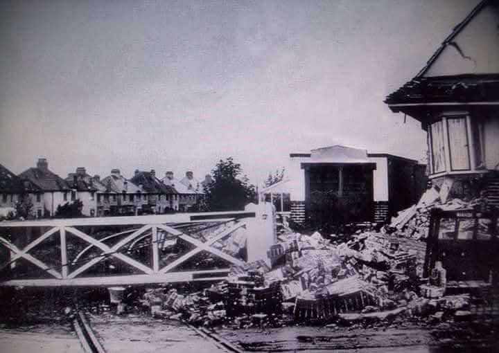
The level-crossing on St. Philip’s Avenue after bomb damage to the adjacent property in WW2. This image was shared on the Disused Railways of Sussex Facebook Group by Simon Meader in comments in 2024, © Public Domain. [15]
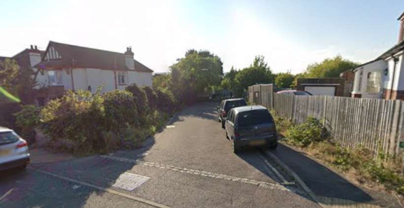
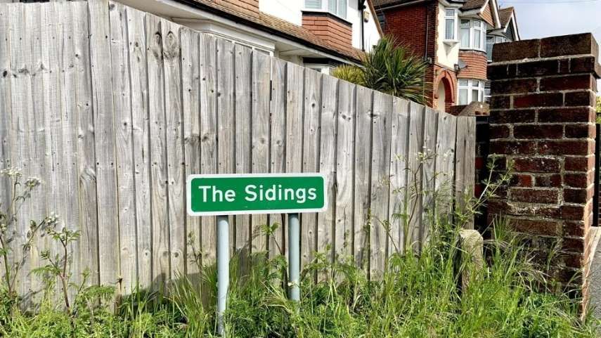
The Sidings runs West-southwest from St. Philip’s Avenue along the line of the old rail link.
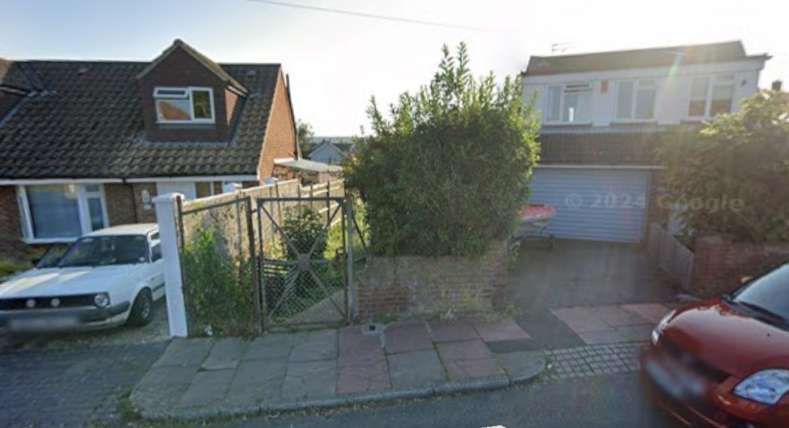
More about the Destructor Works can be seen on Matthew Cox’s video below:
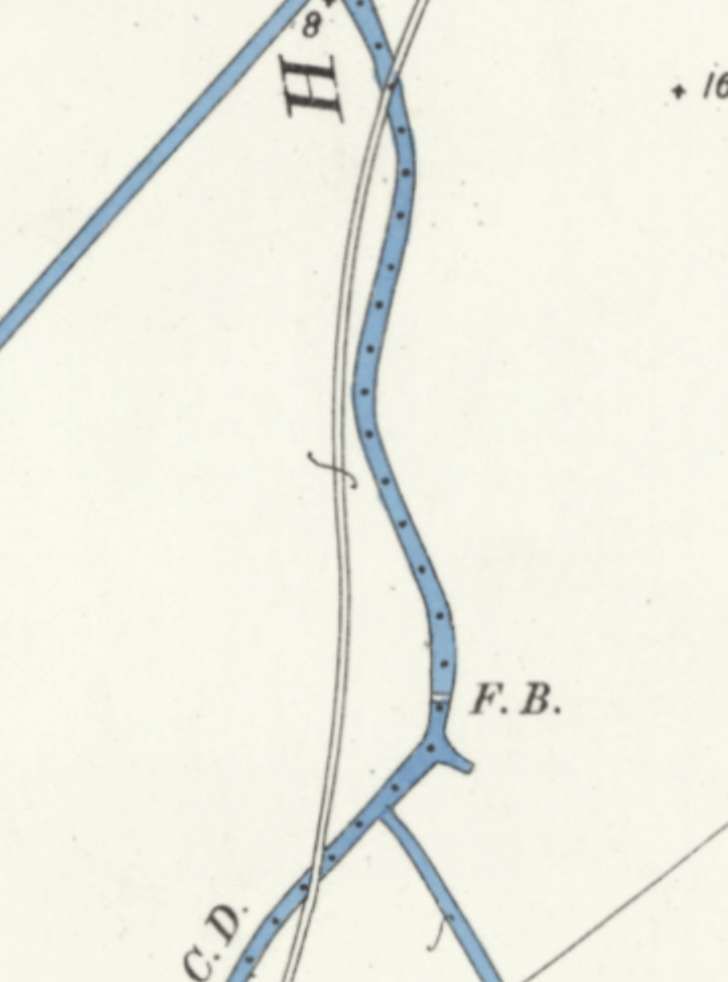
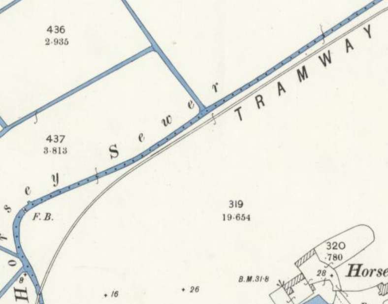
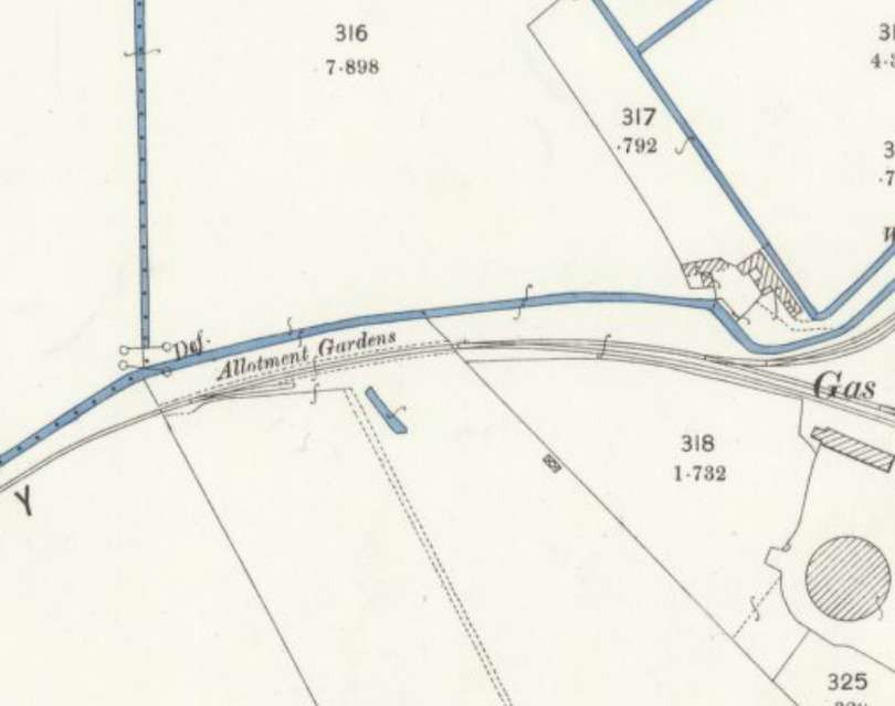
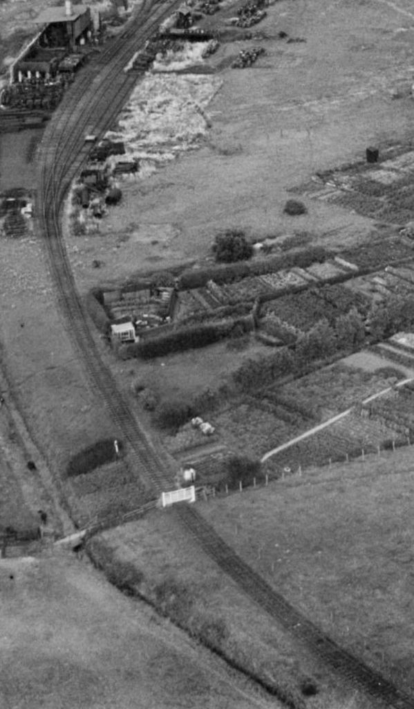
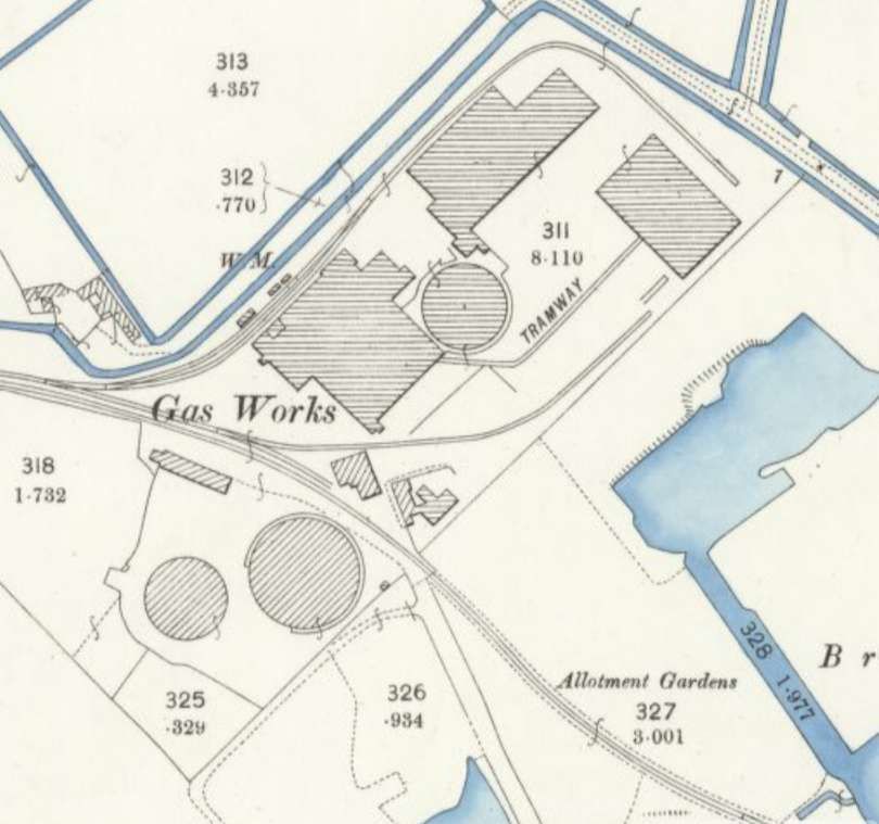
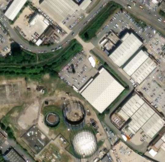
The same area in the 21st century, the locations of the two gasometers can still be seen alongside a later additional gasometer. [19]
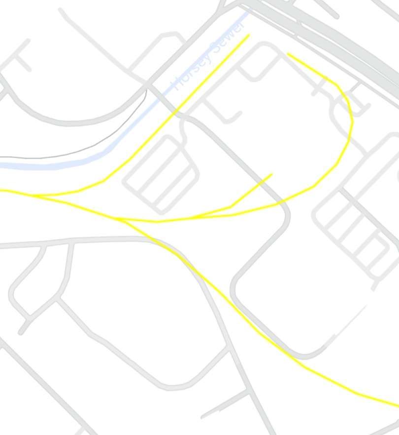
The lines serving the Gas Works. [24]
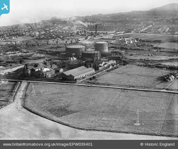
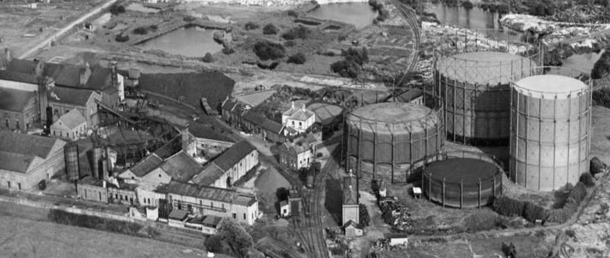
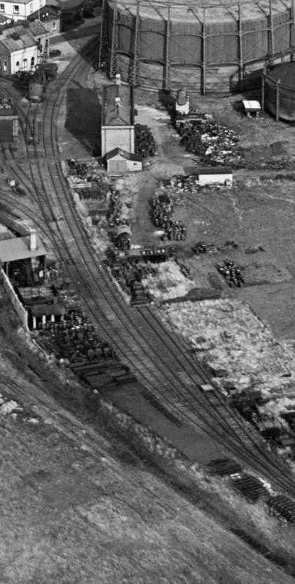
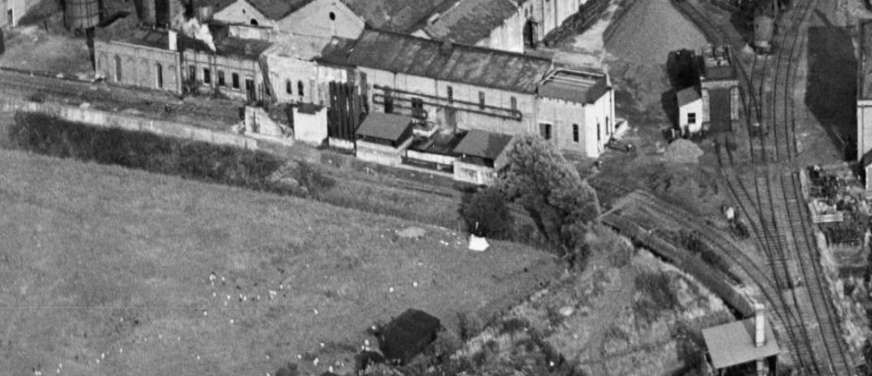
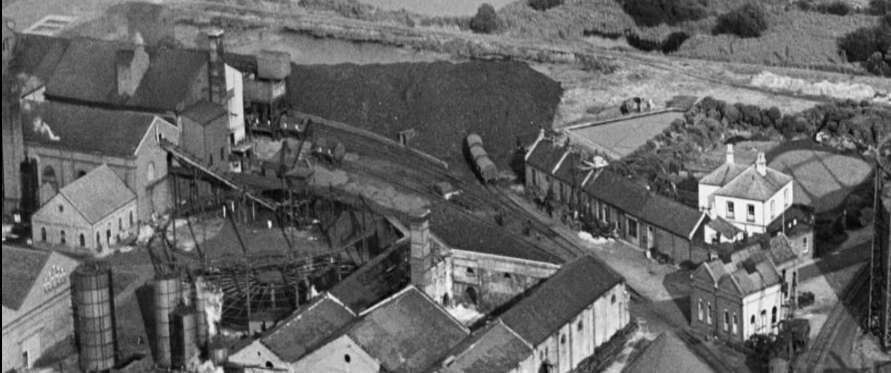
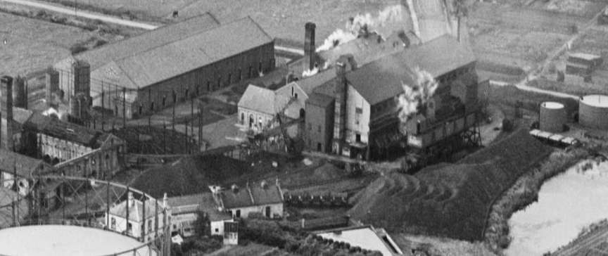
The National Archive record for the Works states: “The Eastbourne Gas Company was formed by Deed of Settlement in 1857. The original area of supply was the town and parish of Eastbourne and the parish of Willingdon. The company was dissolved and reincorporated by Act of Parliament in 1868. A new works was built in Willingdon and the original one closed.”
Over the next eighty or so years The area served by the plant grew. At each stage of development an Act of Parliament either extended the area of supply or permitted the company to purchase other gas companies and their areas of supply until nationalisation took place in 1949 when the undertaking became part of the Sussex Divison of South Eastern Gas Board.
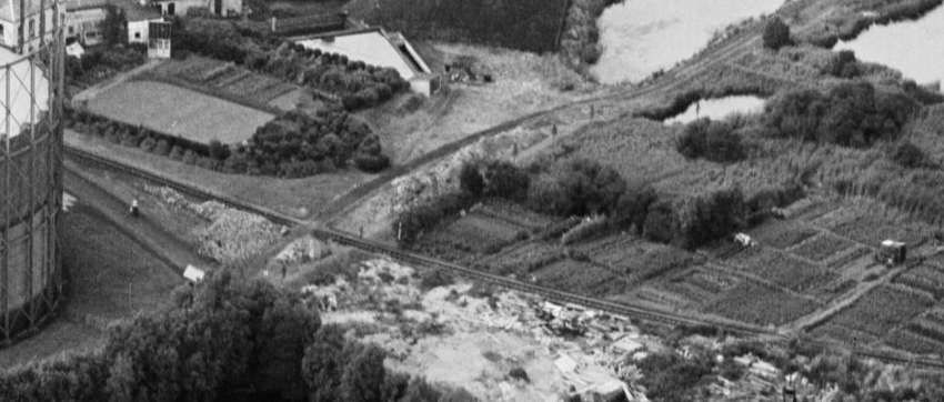
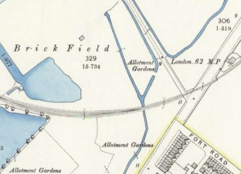
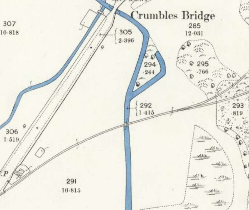
The early gravel extraction/ballast workings were to be found at this location and this was for a time the end of the branch as shown on the 6″ Ordnance Survey below: …
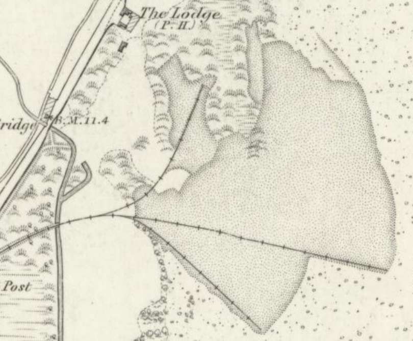
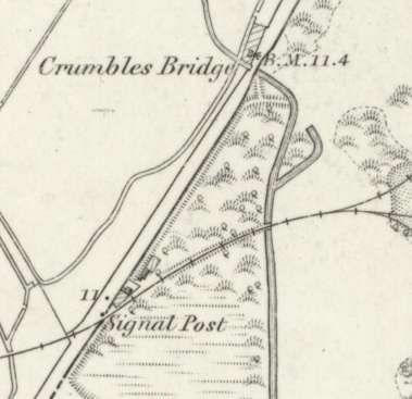
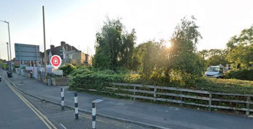
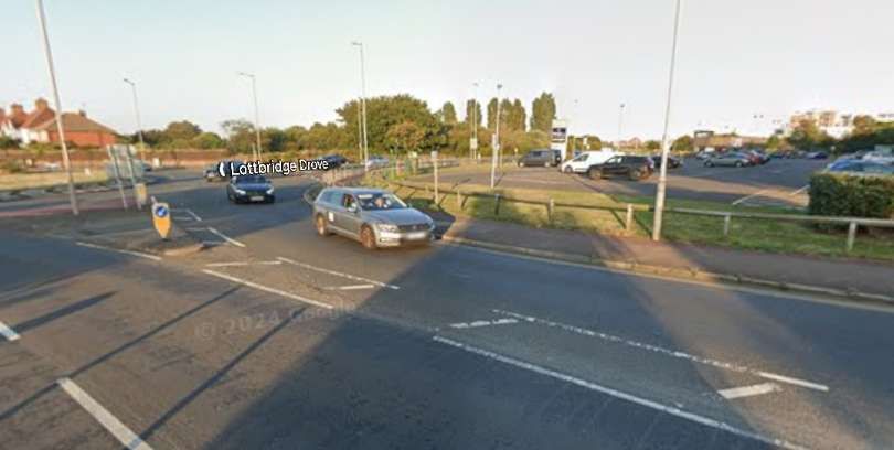
The level crossing and Crumbles Bridge. [25]
Crumbles Bridge was built between 1823 and 1827 to serve the local turnpike road network connecting Eastbourne and Hailsham. It crossed a low-lying drainage channel. The bridge was reconstructed in 1969 as the local road infrastructure changed. The surrounding shingle and marsh landscape has since been heavily redeveloped into residential areas and the Sovereign Harbour marina.
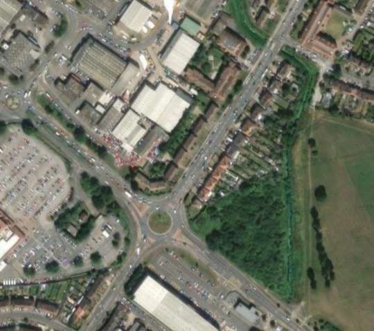
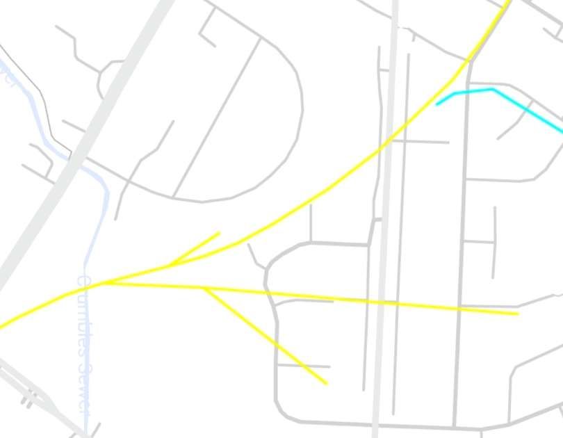
The same area as shown on the map extract immediately above. The location of the level crossing is just to the Southwest of the roundabout. The drainage channel continues to follow its original course with the more modern bridge sitting at the same location as the old Crumbles Bridge. [37]
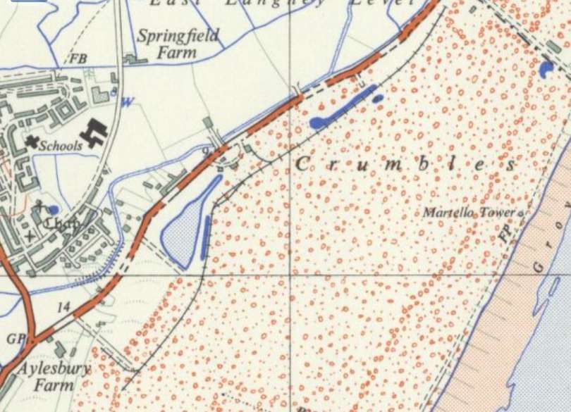
Hall & Co. 2ft-gauge tramway as it was in 1959, this extract is taken from the 1:25,000 Ordnance Survey. [32]
The Crumbles Branch line was extended beyond that shown on the 1875/76 6″ Ordnance Survey above, to access further gravel reserves to the Northeast.
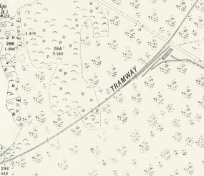
The military association with the Crumbles began in the early 19th century with the construction of defensive Martello Towers to ward off Napoleonic invasion. By the late 1800s and early 1900s, this desolate, wide-open shingle plain was deemed the perfect location for a military live-firing range.
The main range featured firing points stretching up to 600 yards. Marksmen and local cadet groups (such as the Eastbourne College Cadet Corps) would lie on the dirt to fire live ammunition from .303 Lee-Enfield rifles at large targets. The targets were managed by soldiers or cadets stationed “in the butts”—a protected, sunken trench directly beneath the targets. Their dangerous job was to pull the massive frames up and down via ropes, patch up the bullet holes, and signal the scores back to the firing line.
A red warning flag was flown whenever firing was live, and any stray bullets flew harmlessly out over the English Channel. The ranges remained active through both World Wars for troop training and continued operating well into the 1960s. The range finally closed in the late 1960s, and the area was later completely reshaped to build the Sovereign Harbour marina complex.
The electric tramway of the mid-20th century is covered in a separate article which can be found here. [30]
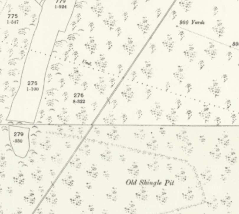
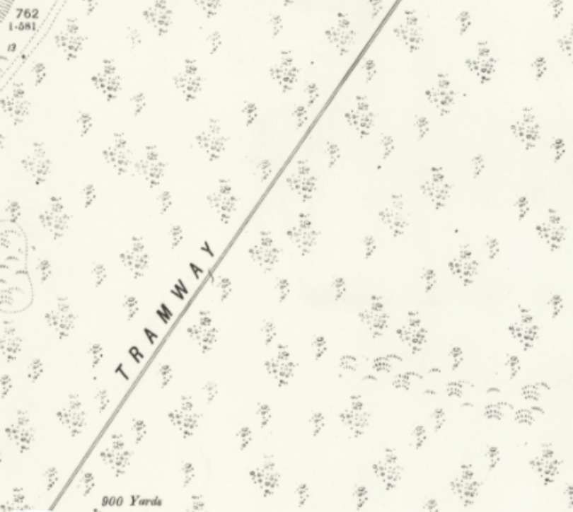
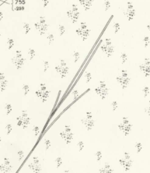
The end of the line in 1898/99. [27]
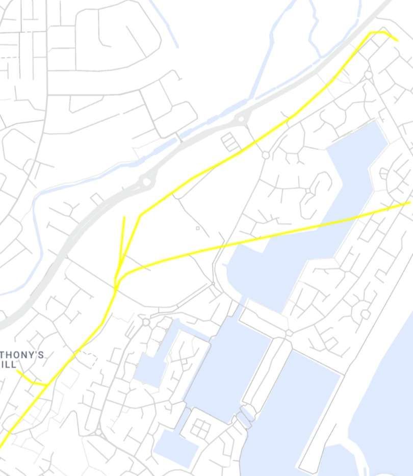
Railmaponline.com shows a somewhat greater extent of the various lines which served the shingle quarries/workings at this location. These extensions supported the workings until their closure in the 1930s. [24]
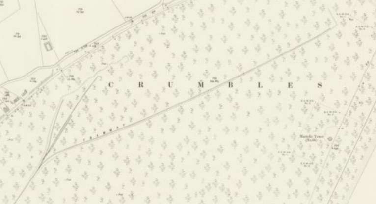
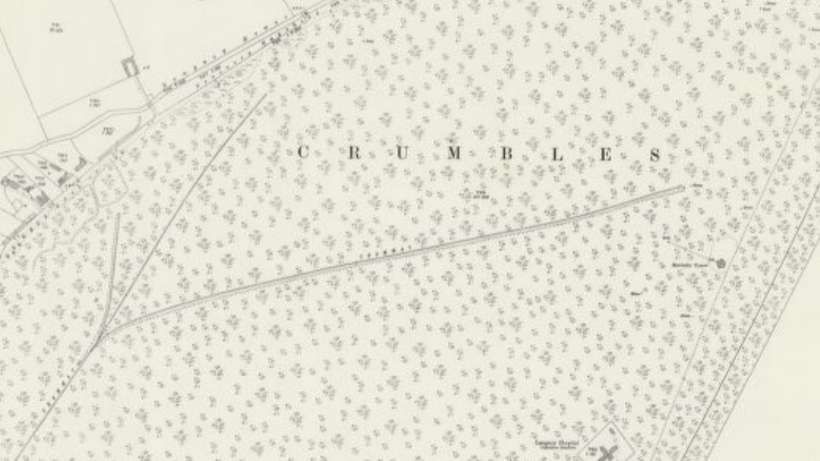
We have noted in the narrative above the 2ft-gauge Hall & Co. Tramway which was horse and cable-worked. [31][32][34] There were other transient tramways laid on the Crumbles, these were associated with the local brickworks. Just inland of the open shingle beach (approaching St. Anthony’s Hill and the Langney boundary), the 1898 OS maps catch the footprint of Eastbourne’s late-Victorian building boom. Local clay pits and brickfields (such as those that eventually became the South Eastern Brick and Terra Cotta Works) utilized small, lightweight clay tramways to transfer raw materials from excavation pits to the kilns. [33]
References
- Vic Mitchell & Keith Smith; Brighton to Eastbourne; Middleton Press, 1985.
- Vic Mitchell & Keith Smith; Eastbourne to Hastings; Middleton Press, 1986.
- https://en.wikipedia.org/wiki/East_Coastway_line, accessed on 29th August 2026.
- https://www.flickr.com/photos/harryclaggers/43482880200/in/photostream, accessed on 29th August 2026.
- https://uktransport.fandom.com/wiki/East_Coastway_Line, accessed on 29th August 2026.
- https://www.geograph.org.uk/photo/8115913, accessed on 29th August 2026.
- https://youtu.be/HSSFptGzpPc?is=TGSPLGusqjEehdRd, accessed on 29th August 2026.
- https://maps.nls.uk/geo/explore/#zoom=17.6&lat=50.77259&lon=0.28579&layers=168&b=ESRIWorld&o=100, accessed on 29th August 2026.
- https://maps.nls.uk/geo/explore/#zoom=17.6&lat=50.77259&lon=0.28579&layers=168&b=ESRIWorld&o=0, accessed on 29th August 2026.
- https://maps.nls.uk/view/103675453, accessed on 29th August 2026.
- https://maps.nls.uk/view/103675420, accessed on 28th August 2026.
- https://maps.nls.uk/view/101436231, accessed on 30th August 2026.
- https://www.bbc.co.uk/history/ww2peopleswar/stories/20/a3187820.shtml, accessed on 30th August 2026.
- https://youtu.be/9X0YFtsGYzM?is=yWKt8iiJQbE-rt-x, accessed on 30th August 2026.
- https://www.facebook.com/share/p/18ZS5t6UBz, accessed on 30th August 2026.
- https://www.britainfromabove.org.uk/en/image/epw039401, accessed on 30th August 2026.
- https://m.facebook.com/groups/sussexhistory/permalink/25602800352636948, accessed on 30th August 2026.
- https://www.heritageopendays.org.uk/submission-event/eastbourne-industry-and-commerce.html, accessed on 30th August 2026.
- https://maps.nls.uk/geo/explore/#zoom=17.0&lat=50.78783&lon=0.30057&layers=168&b=ESRIWorld&o=0, accessed on 30th August 2026.
- https://www.britainfromabove.org.uk/en/image/EPW039397, accessed on 31st August 2026.
- https://www.britainfromabove.org.uk/en/image/EPW039398, accessed on 31st August 2026.
- https://www.britainfromabove.org.uk/en/image/EPW039402, accessed on 31st August 2026.
- https://discovery.nationalarchives.gov.uk/details/r/e9fbbd39-8529-47dc-b58f-045c4d7fd34d, accessed on 31st August 2026.
- https://railmaponline.com, accessed on 31st August 2026.
- https://maps.nls.uk/view/102347779, accessed on 31st August 2026.
- https://maps.nls.uk/view/103675429, accessed on 31st August 2026.
- https://maps.nls.uk/view/103675393, accessed on 31st August 2026.
- https://maps.nls.uk/view/103675390, accessed on 31st August 2026.
- https://maps.nls.uk/view/103675387, accessed on 31st August 2026.
- The Hall & Co. Narrow-Gauge Tramway was, unlike the main LB&SCR railway branch that took deep shingle out for mainline railway ballast, a localized system dedicated to commercial shingle and gravel extraction. Track was moved dynamically over the years across the Crumbles to reach active digging pits. It was cable-worked and horse-drawn in its earliest iterations. It fed local concrete product works and smaller commercial loading docks rather than servicing the LB&SCR’s need for ballast. See also the OS Map @ reference [32]
- https://maps.nls.uk/view/95750294#zoom=4.6&lat=2718&lon=3174&layers=BT, accessed on 31st August 2026.
- https://plandocs.tandridge.gov.uk/my-requests/document-viewer?DocNo=25469297, accessed on 31st August 2026.
- https://deangoods.co.uk/eastsxng.html, accessed on 31st August 2026.
- https://www.facebook.com/share/p/1GfNXWhYgx, accessed on 31st August 2026.
- https://www.facebook.com/share/p/1GSkYoS75y, accessed on 31st August 2026.
- https://maps.nls.uk/geo/explore/#zoom=16.6&lat=50.78750&lon=0.30722&layers=168&b=ESRIWorld&o=0, accessed on 1st September 2026.
- This image is taken from a report written by C. Butler & C Russell; Desk-based Assessment for the Sovereign Harbour Cycle Network Phases 2 and 3, (Ringwood Road to St Anthony’s Hill Roundabout) Eastbourne, East Sussex (updated from the original Desk-based Assessment for Phase 2A); Chris Butler MIfA, Archaeological Services Ltd., 2012; via: https://archaeologydataservice.ac.uk/archiveDS/archiveDownload?t=arch-969-1/dissemination/pdf/chrisbut1-398965_1.pdf, accessed on 1st September 2026.
Appendices
Appendix 1
Chris Butler and Dr Caroline Russell
Desk-based Assessment for the Sovereign Harbour Cycle Network Phases 2 and 3, (Ringwood Road to St Anthony’s Hill Roundabout) Eastbourne, East Sussex (updated from the original Desk-based Assessment for Phase 2A)
Chris Butler MIfA, Archaeological Services Ltd – Project No. CBAS0176 – October 2012
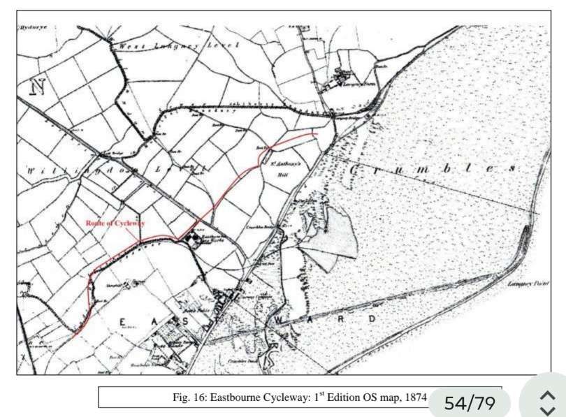
4.9.11 …The 1st Edition OS map of 1874 (Fig. 16) shows significant changes to have taken place to the landscape surrounding the Phase 2 cycleway route. Although the Horsey Sewer is shown within a field system that broadly reflects that seen on the early maps, a tramway now runs along its length. It crosses the sewer at three places, to run past the Eastbourne Gas Works and on to the Crumbles, with a single track branching off into the gasworks. To the immediate southeast is Horsey Farm, and then further southeast are ‘Rose Lands’ and a brickfields. [p15]
4.9.12 … The tramway served the beach gravel extraction on the Crumbles, and can be seen on the broader OS map to extend onto the beach before dividing into three separate branches; the gravel pits on the beach are recorded as MES7969-MES7971. In 1857-1862, the London Brighton and South East Railway negotiated with the Duke of Devonshire to purchase not less than 48,000 cubic yards of shingle from the Crumbles, at 1 penny per cubic yard. [48] They constructed a railway close to Eastbourne railway station, which ran through open countryside and along the Horsey Sewer, to turn south to cross the turnpike road (Seaside) near the junction with Lottbridge Drove. The railway was 6.4m wide and ran for 5.6km. It was known as the Ballast Line or the Crumbles Railway, and served the gasworks from 1870 onwards. In 1874, the Crumbles were also used for firing practice (firing ranges MES7961 and MES7962).
4.9.13 The Eastbourne Gas Company was formed in 1852, [49] and was incorporated by an Act of Parliament in 1868, [50] whilst the brickworks was in existence by 1866, and was operated by James Peerless, who leased the land from the Devonshire Estate in 1860. [51]
It continued to operate there until 1899. A smaller brickworks was located at Rose Lands, and was operated from 1860 to the 1880’s by the Eastbourne Brick Co. Ltd. [52]
4.9.14 In contrast, little change had taken place by 1875-1880 along the Phase 3 cycleway route (see Fig. 16 for the 1st Edition OS map). A footpath led through the short droveway, having come through the fields to the northwest. Further northeast along the Phase 3 route, two causeways, each in a different field, gave entry to the same field to the southeast. A drainage channel had been excavated beside the Crumble Sewer, to define a small rectangular plot, possibly a holding pen, directly outside the site boundary. At the north end of this new plot, a footbridge now provided access across the sewer and into the field to the northeast. From here, an adjacent causeway, rather than the previous central causeway, led southeast into the narrow field north of St. Anthony’s Hill. The only building nearby was ‘The Lodge’, a public house on the coast road, south of the hill.
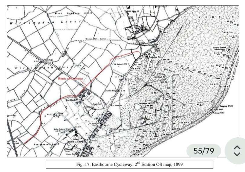
4.9.15 The gasworks had expanded eastwards by the 2nd Edition OS map of 1899 (Fig. 17); ESRO holds a plan of the land intended to be acquired for this expansion, which was drawn in 1879 by H.E. Jones, the Engineer for Eastbourne Gas. [53] The main brickworks had migrated northeast, with allotment gardens having been established along the northern edge of the earlier workings. Rose Lands was a nursery by this time, with a refuse destructor works and air compressing station located on its north side. [p16]
4.9.16 The tramway now had additional sidings serving the gasworks. It continued onto the Crumbles, where it ran to the east, while a branch turned southwest before returning westwards to Seaside on an existing earthwork (MES7968) shown on the 1st Edition OS map. Housing development had expanded northeast along the southeast side of Seaside. The tramway also later served the refuse destructor works and air compressing station, the brickworks and a timber yard.
4.9.17 The Phase 3 cycleway route remained unaltered between 1875-1880 and 1899 (see Fig. 17 for the 2nd Edition OS map). The footbridge had gone. The possible animal pen on St Anthony’s Hill now looks to have been defined by a fence line rather than by ditches, and a second larger such enclosure had been erected in the same former field, on the south side of the hill.
4.9.18 The Martello Towers (MES512 and MES513 / MES7994) on this stretch of coastline all disappeared in the late 19th or early 20th century. Tower 71 was demolished after having been used as target practice for the testing of the new rifled Armstrong Guns in 1860. [54]
Tower 72 had been washed away by the sea sometime prior to 1872, [55] as had West Langney Fort. Tower 70 had likewise been undermined by the sea and was abandoned in 1872 along with Tower 69. Tower 67 was demolished in 1922, whilst Tower 68 was knocked down in c.1925 to make way for residential development (however, see para. 4.9.28).
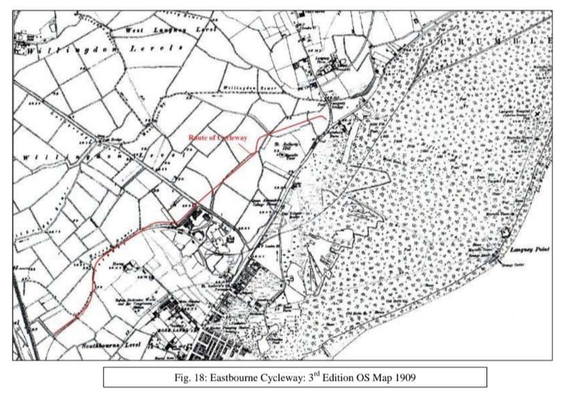
4.9.19 The 3rd Edition OS map of 1909 (Fig. 18) shows little change to the immediate area around the Phase 2 site, although there had been further housing development along Seaside. A long narrow plot of land was now fenced off along one side of a field, to form a passageway presumably for the movement of livestock between two fields, including the narrow field to the east in which the cycleway runs through. The Martello Tower on St. Anthony’s Hill (MES513 / MES7994) is marked on the map, along with its moat and footbridge; its absence from the 1st or 2nd Edition OS map is somewhat odd, although military installations were often omitted from OS maps for security purposes.
4.9.20 During the First World War, a temporary tented camp was set up at Horsey Bank, in the area of the junction of Churchdale Road and Astaire Avenue. [56] The allotment gardens shown on the 2nd and 3rd Edition OS maps (Figs. 17 and 18) were put to good use during these years, although it is recorded that the Eastbourne Gas Company refused a request to plough up land for allotments, but a compulsion order overturned this. [57] [p17]
4.9.21 From December 1911, Eastbourne Aviation Company Ltd had their manufacturing aerodrome (MES7491) at a site directly to the north of Lottbridge Drove. [58]
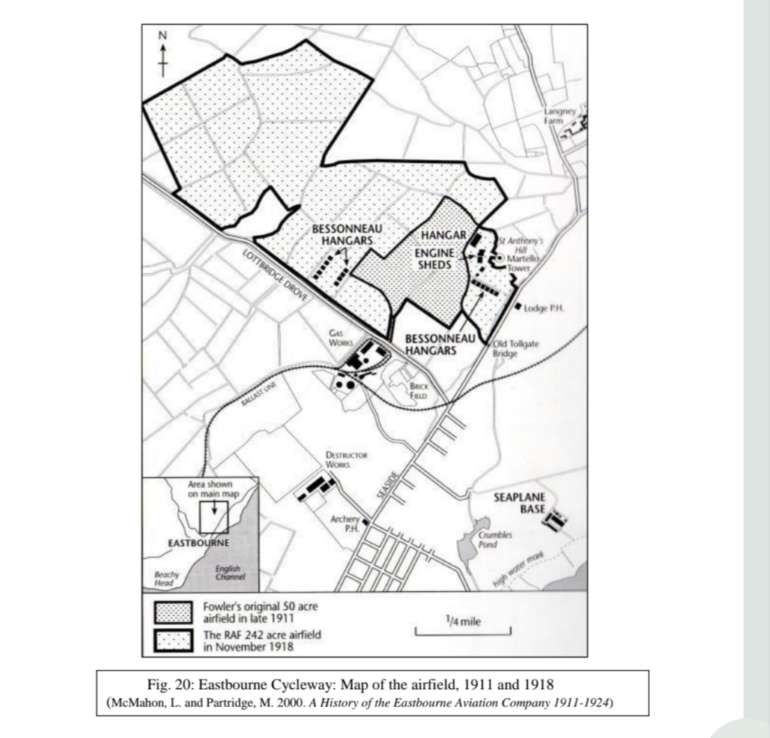
From about this time, this site also became the school aerodrome for the Eastbourne Aviation School and the Fowler Flying School. A map of the airfield [59] (Fig. 20) shows the middle stretch of the Phase 3 cycleway route to have been located within Fowler’s original 50 acre airfield.
4.9.22 In August 1914, the hangars and buildings of the aerodrome were taken over by the Royal Navy Air Service. [60] The aerodrome at St. Anthony’s was a RNAS flying school from April 1915 to April 1918, when it became a training depot station for the RAF until 1919. In November 1918, the RAF airfield comprised 242 acres, having predominantly expanded northwest across the Levels (Fig. 20). Almost the full route of the Phase 3 cycleway now stood within the airfield, except for the last stretch through the two fields at the northeast end. With the exception of one area, the buildings, which included a large hangar (MES7990) and the engine sheds, were built around the Martello Tower (MES513 / MES7994) and therefore outside the site boundary. The 15 Bessoneaux hangars were erected in three rows, with two rows having stood opposite each other to the northwest of what is now Birch Road, and the third row having stood along the south side of what is now Leeds Avenue, directly south of St. Anthony’s Hill. During the Phase 2A watching brief an identity disc was found. It is engraved R.N.A.S. / TURNER / ERNEST / EDWARD / A M / F364/ CCE. Ernest Edward Turner is recorded as having been born in 1894 in Bangalore, India, and entered the RNAS in 1914; [61] it is presumed that he served at St Anthony’s.
4.9.23 The aerodrome was licensed for civilian use again in April 1920 [62] and finally closed in 1925. The only remaining structure of the aerodrome is a guardroom (MES7991) from the RNAS phase of use, which is now a bungalow on Leeds Avenue. The large hangar (MES7990) stood extant nearby until the storm in 1987; its foundations are still visible today.
4.9.24 A site on the Crumbles, in the region of the present day Sovereign Centre, was used by the Eastbourne Aviation Company as a seaplane factory, and also for the refuelling and servicing of patrolling seaplanes. [63] The hangars on the Crumbles were converted to an aircraft factory, and during the war the Eastbourne Aviation Company built a total of 252 aircraft. [p18]
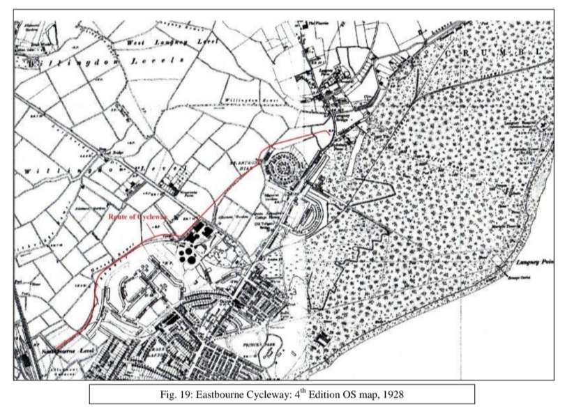
4.9.25 By the 4th Edition OS map of 1928 (Fig. 19), the tramway has developed to include a branch line to the refuse destructor works and air compressing station, and additional sidings at the gasworks. The return route of the tramway to Seaside from the Crumbles had been dismantled by this time. Some ‘tanks’ are shown adjacent to the Horsey Sewer, north of the gasworks and alongside a footbridge. Major housing development had taken place to the southeast of the Phase 2 cycleway route, along the northwest side of Seaside. Eastbourne Corporation had a licence to place a footbridge over the Horsey Sewer in 1926, [64] and had an agreement for works in the Horsey Sewer in 1937. [65]
4.9.26 The decline of the tramway began in 1920 when the ballast used on the railways changed to granite chippings and there was no further requirement for the shingle.
Shingle continued to be taken to the Duke of Devonshire’s depots at Eastbourne Station to be used for building purposes until 1931. [66] The shingle beds at the Crumbles were leased to Hall and Co. [67] who then began to use lorries to move the shingle, stopping rail movements completely in 1932. The tramway continued to serve the gasworks and other industrial sidings, taking thousands of tons of coal to the gasworks (Fig. 21). [68]
4.9.27 The land around the Phase 3 cycleway route looked little different in 1925-1930 from what it had done in 1910 (see Fig. 20 and the 4th Edition OS map of Fig. 19 for a comparison), revealing how easily the land had reverted to pasture after its use as an airfield. A number of buildings from the aerodrome still stood, including the engine sheds as well as the guardroom (MES7991) and large hangar (MES7990). A sluice is shown across the Crumble Sewer, south of the former hangar. A crossing across the sewer was now sited where the footbridge once was; it is the location of a bridge today, although it was not identified as such on this OS map. The crossing led into a small enclosure, once part of a larger enclosure, which linked up with the field to the east.
4.9.28 Residential housing had been built on the east side of St. Anthony’s Hill, and below it along Seaside. Both the inner and outer circular roads of The Circus and Rotunda Road had been laid out around the hill, although neither was specifically named as such at this time. The Circus was built around the in-filled moat of Tower 68, [69] whilst Rotunda Road may have traced the boundary of land first purchased by the government in 1795. The single building at the centre of the housing development, within The Circus, may incorporate the base of the Martello Tower (MES513 / MES7994) in its cellar. [70] Allotment gardens had been planted directly south of St. Anthony’s Hill and beside the Phase 3 cycleway route on Lottbridge Drove. [p19]
4.9.29 During the Second World War the coastline was put into a state of defence with anti-tank cubes, walls and ditches (e.g. MES7997), minefields (e.g. MES8007) andscaffolding located on the beach, and other defences such as pillboxes positioned to the rear (e.g. MES7999, MES8017 and MES8018). [71] Unexploded bombs fell in allotments near Lottbridge Drove on 14th September 1940, while the gasworks was attacked on the 19th October, setting alight the Number Three gasholder. [72] On 12th March 1941, eight bombs were dropped to the south of the Phase 2 site around Churchdale and Southbourne Roads, and on the following night bombs were dropped to the north of the gasworks. On the 26th August 1942, a German FW190 fighter-bomber was shot down and crashed into a ditch beside Lottbridge Drove. Further bombs were dropped on open ground near the gasworks as well as on the Crumbles on 6th June 1943. On considering its location in the Levels, further out of town, no bombs are known to have fallen in the area of the Phase 3 cycleway route. [73]
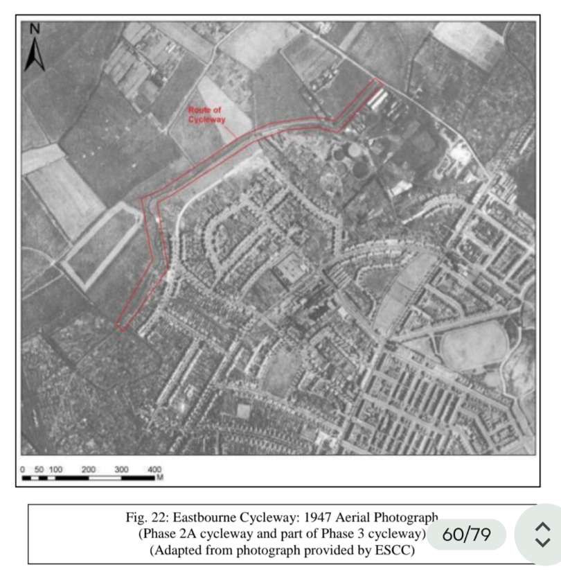
4.9.30 A 1947 aerial photograph (Fig. 22) shows residential development to have extended almost as far north as the Horsey Sewer. By the early 1960’s (modern OS maps are not reproduced), the housing developments had reached the southern edge of the sewer, and the tramway is still shown. In the locality of the Phase 3 cycleway route, further residential development had occurred on and around St. Anthony’s Hill, and hadexpanded out onto the Crumbles along Wallis Road and around the adjacent crescent.
Between 1947 and 1961, the Horsey Sewer was straightened to the north of the gasworks, cutting off the former droveway onto Lottbridge Drove. Three new causeways had been constructed along the course of the Phase 3 cycleway.
4.9.31 The tramway had gone by the time of the 1975 OS map, as it had finally closed in 1966. [74] The 1975 map also shows the commercial developments at the southeast end of Lottbridge Drove. One or two buildings appear to have stood at the northeast end of the Phase 3 cycleway route, facing onto the road north of the roundabout, which had been built by then; these buildings were demolished by 1992. The commercial developments had extended beyond the Horsey Sewer, along both sides of Lottbridge Drove by the 1981 OS map. This map also shows new housing developments along the north side of the Horsey Sewer. [p20]
Relevant References
48. Botha, A. 2006. The Crumbles Story. Eastbourne: ALB Books
49. Wright, J.C. 1902. Bygone Eastbourne. Spottiswood and Co. Ltd.
50. ESRO amsh/AMS5616/2/70
51. Beswick, M. 2001. Brickmaking in Sussex. Middleton Press.
52. Ibid.
53. ESRO QDP/448
54. http://sussexhistoryforum.co.uk/index.php?topic=1669.0;prev_next=next#new
55. http://www.martello-towers.co.uk/south-coast/towers
56. Elliston, R.A. 1999. Eastbourne’s Great War 1914-1918. Seaford: S.B. Publications.
57. Ibid.
58. CCI Gazetteer of Flying Sites
59. McMahon, L. And Partridge, M. 2000. A History of the Eastbourne Aviation Company 1911-1924. Eastbourne Local History Society.
60. CCI Gazetteer of Flying Sites
61. National Archives ADM 188/1175
62. Ibid.
63. McMahon, L. And Partridge, M. 2000. A History of the Eastbourne Aviation Company 1911-1924. Eastbourne Local History Society.
64. ESRO SRA7/15/33
65. ESRO SRA4/6/16
66. Botha, A. 2006. The Crumbles Story. Eastbourne: ALB Books.
67. http://www.cambrianmodels.co.uk/eastsxng.html (Gazetteer of Narrow Gauge Railways in East Sussex)
68. Botha, A. 2006. The Crumbles Story. Eastbourne: ALB Books.
69. Butler, C. 2007. East Sussex Under Attack. Stroud: Tempus Publishing.
70. Ibid.
71. Butler, C. 2007. East Sussex Under Attack. Stroud: Tempus Publishing.
72. Humphrey, G. 1998. Eastbourne at War. Seaford: S.B. Publications.
73. Ibid.
74. Botha, A. 2006. The Crumbles Story. Eastbourne: ALB Books.
Relevant Images (p50 – 56)