
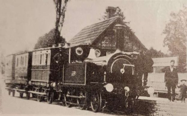
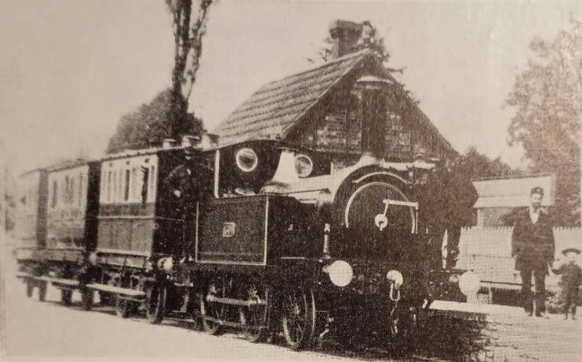
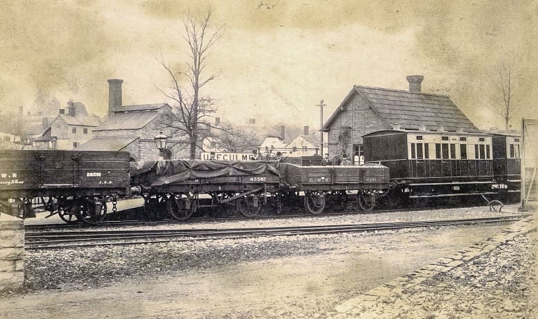
The featured image for this article is locomotive 2-4-0T No. 1300 on a short train of 4-wheeled carriages at Uffculme, circa 1882, © Public Domain. [1: p7]
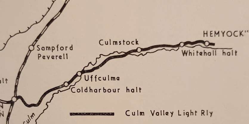
The Culm Valley Light Railway was a standard gauge branch railway that operated in the English county of Devon. It was just under 7 1⁄2 miles (12.1 km) from Tiverton Junction station on the Bristol to Exeter line, through the Culm valley to Hemyock via Uffculme and Culmstock. [2]
The line followed the River Culm through the Blackdown Hills. The main stations were at Uffculme and Culmstock, with later additions of Coldharbour Halt (1929) and Whitehall Halt (1933).
Some excellent photographs of this line can be found on the Cornwall Railway Society page ‘The Hemyock Branch‘. [40]
The Culm Valley project was one of the earliest successful applications to build a ‘light railway’ as defined in the Railways Regulation Act of 1868. This stipulated the limitation of loads to eight tons on an axle and of speed to 25 mph It was considered, however, that a maximum speed of 16 mph would be adequate for the nature of traffic the line would carry and it was hoped to build the line for a little under £30,000. The Act received the Royal Assent on 15th May 1873. The Culm Valley was the first major line engineered by Arthur Pain who went on to construct several other light railways, notably the Southwold and the Axminster & Lyme Regis. [3]
It was intended as a very low-cost scheme, but by the time it opened in 1876 it had cost more than twice the originally anticipated budget and taken five times the expected time to complete. Contract completion was originally expected by the end of 1873. However, construction actually began in 1874, and the line did not open until 29th May 1876 — a total build time of two and a half years. [2]
Once construction started in early 1874, a new completion date was set as December 1874. Labour was cheap and abundant and an added boost was given to the lines prospects by the decision of the [Bristol & Exeter Railway (B&ER)] to extend mixed gauge westward from Taunton, which would allow the transfer of rolling stock to and from the main line at Tiverton Junction.
However, by the end of 1874, “only 2 miles 2 chains had been completed which started a series of delays that increased the construction costs and put back the opening date. At this time the Bristol and Exeter Railway had entered into negotiations for union with the Great Western Railway; as a result, the GWR took over its former partner on 1st January 1876 and with it the responsibility of working the branch. The line eventually opened £20,000 over budget on 29th May 1876 with a train composed of Bristol and Exeter stock and hauled by a locomotive specially built for the branch in the Bristol and Exeter workshops at Bristol. There were intermediate stops at Uffculme and Culmstock.” [3]The
The B&ER had agreed to operate the branch for 50% of the total revenue income and the GWR took on that commitment. “The mixed gauge had reached Exeter in 1874 and the first regular working of a ‘narrow gauge’ goods train west of Taunton began in March 1876, just in time to give the Culm Valley through freight facilitates from the outset. Two standard gauge 0-6-0T locomotives were built for the Culm Valley Railway, they were operated on the line until 1881 when they were replaced by two 2-4-0T locomotives which came from the South Devon Railway.” [3]
Initially there was much local support for the line but the Great Western didn’t have the same enthusiasm for its partnership with the Culm Valley as its predecessor. As a result of the significant over expenditure during construction the line suffered a burden of significant interest payments. The 50% of revenue reserved for the company was insufficient and financial difficulties became so severe that the GWR had to take control of the line in April 1880, only a few short years after the line opened.
The line struggled financially for decades until United Dairies opened a creamery at Hemyock in 1916, which became the primary source of freight and kept the line alive.
“In 1922, there were four trains a day and those during the middle of the day were usually of mixed stock with two passenger coaches and five or six wagons.” [3]
Passenger services were lightly patronised throughout the history of the line. The GWR sought to increase those numbers by providing two additional stopping places on the line — Coldharbour (1929) and Whitehall (1933) Halts. No GWR railcars allocated to be used on the line. The GWR argued that no modern passenger vehicles or diesel rail cars could be used on the line because of the restrictions imposed by the curves on the line. [6]
Passenger services officially ended on 9th September 1963. General freight stopped in 1965, though milk trains for the Hemyock dairy continued. The line closed completely on 31st October 1975 after the closure of the dairy.
Locomotives
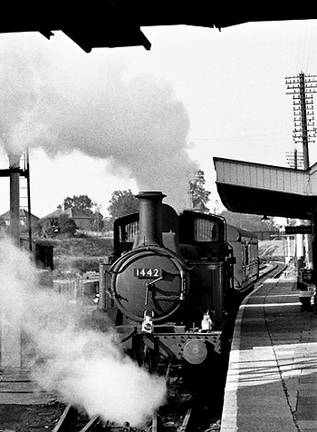
As we have already noted, when the line was built, two standard-gauge 0-6-0ST locomotives (Nos. 114 and 115, later GWR Nos. 1376 and 1377) were built specifically for the route and operated it starting in 1876. In 1881, the GWR replaced the original engines with two 2-4-0T tank engines (Nos. 1298 and 1300) that had originated as South Devon Railway machines. For much of its 20th century passenger life the line was operated by Charles Collett’s GWR 1400 Class 0-4-2T engines (such as No. 1442, nicknamed ‘Tivvy Bumper’, [4] and No. 1451). These light, agile engines were ideally suited for the line’s sharp curves, 15 mph speed limit, and push-pull autocoach operations. [5]
Small GWR Pannier Tanks (0-6-0PT 57xx Class) were at times used on the branch for shunting and occasional freight duties.
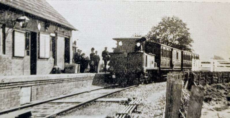
Crombleholme, Stuckey & Whetmath describe the era of steam power like this:
“One of the prime attractions of the CVLR has always been the variety and intrinsic charm of its locomotives and rolling stock. The first engines were two diminutive 0-6-0 side-tanks (Nos. 1376 and 1377 in the GWR list) which were specially built for the purpose at the Bristol works of the B&ER in 1874 and 1875 respectively. They had 12 x 18 inch inside cylinders and 3 ft. 6 in. coupled wheels, but, despite their short wheelbase, the sharp curves of the C.V. did not take kindly to the six-coupled wheels and by 1881 they were trans-ferred elsewhere; 1376 ended its days at Oswestry in 1934 and No. 1377 at Weymouth in 1927.
“The little B&ER 0-6-0s were followed by two ex-South Devon 2-4-0 tanks, domeless but with an imperious whistle. They were built at Newton Abbot for the broad gauge in 1878 with 4 ft. 11 in, coupled wheels, 3 ft. leading wheels and inside cylinders 11 x 17 in., but were reassembled for standard gauge work at Swindon in the year of their manufacture, and numbered 1298 and 1300. 1298 served the Culm Valley until 1926, and 1300 worked the branch for a further eight years until 1934. Their sister, 1299, was a crane engine and saw heavy service at Swindon for about fifty years. The Ince Forge Company made the boilers for these locomotives. No. 1298 was scrapped in 1928; 1300 was withdrawn in September 1934 and cut up in November 1936.
“Another locomotive with a chequered career which served on the CVLR was 2-4-0 No. 1384. Originally Watlington & Princes Risborough Railway No. 2, she was built by Sharp Stewart & Co. (Works No. 2578) in February 1876. Following the GWR take-over of the Watlington branch, 1384 was transferred to Cornwall for work on the construction of the Bodmin Road to Bodmin branch in 1886. No. 1384 next appears on loan to the Lambourn Valley Light Railway for its opening on 4th April 1898, where it remained until that Company’s own engines were delivered. In 1899, 1384 underwent a rebuild at Swindon, reappearing with a belpaire boiler and a fat polished brass dome on the back ring, and was soon despatched to yet another pioneer job in the Mendips on the Wrington Vale Light [Railway]. From thence she went to the Culm Valley and for the next ten years the single-road engine shed at Hemyock was her home. Swindon did not like 1384s eccentric, spindly appearance and non-standard specification, and she eventually passed to the ownership of the Weston, Clevedon & Portishead Light Railway, where she was christened “Hesperus” (a typical mythological fancy of Colonel Stephens), lived to an eventful old age, and finally succumbed to the scrapman’s torch in 1937.
“A later servant of the Culm Valley was “Lady Margaret”, No. 1308, also a 2-4-0T and also built originally for a minor railway, the Liskeard & Looe, in 1902. The manufacturer was Andrew Barclay Sons & Co. (Works No. 956) and the engine became GWR property when the GWR absorbed the Liskeard & Caradon and Liskeard & Looe Railways in 1909. In common with the mixed motive power acquired by Paddington from her satellites the “Lady Margaret” was employed on various odd jobs in England, and later on the Tanat Valley and Kerry branches in Wales. In May 1929, she was rebuilt at Swindon with a new top-feed boiler, and then allocated to Exeter for the Culm Valley duties, and although her stay was brief she left behind quite a considerable reputation as a capable and free-steaming little engine. “Lady Margaret” outlived the Great Western itself and was cut up at Oswestry by British Railways in 1948.
“Prior to “Lady Margaret” the ex-Cambrian Railway 2-4-0T No. 1192 sojourned on this pretty branch for a short time. In 1932, after “Lady Margaret” the 48xx (later 14xx) 0-4-2Ts designed by C. B. Collett made their debut on the branch on which they performed until the end of passenger services. Nos. 1449, 1451, 1468 and 1471 were among the regular work-horses. One of the non-motor fitted engines, No. 5812, was sent to the CVLR when first built in 1933 and remained for several years before gravitating eastwards to Taunton, where it was used on the Chard branch. These small 0-4-2Ts proved capable and gallant toilers when handling the heaviest of the CVLR’s sometimes heavy milk traffic. The maximum loading for the 14xx class was 140 tons down, 180 tons back.” [1: p16-18]
Following the withdrawal of passenger services in September 1963 and general freight in 1965, 204 hp diesel shunters took over the remaining goods traffic. These locomotives were BR Class 03 0-6-0 shunters D2133 and D2134 and Class 04 0-6-0 shunter D2280 (this locomotive was later used on the Weymouth Street Tramway). [7] During the final months of operation supplying the Hemyock dairy (which continued until 31st October 1975), heavier BR Class 22 and Class 25 diesel locomotives handled the milk tank trains before the line’s permanent closure.
Class 22s (North British Type 2) – These locomotives worked the daily afternoon trip from Exeter, bringing empty 3,000-gallon milk tankers up the valley to Hemyock and hauling the full tankers back to Exeter St Davids. From there, the tanks were forwarded to London bottling plants. [8]
BR Class 25 (Sulzer Type 2) – Following the complete withdrawal of the Class 22 fleet at the start of 1972, British Railways introduced the ubiquitous Class 25 diesel-electrics to handle the branch’s light duties. [9]
Rolling Stock
Crombleholme, Stuckey & Whetmath provide a single paragraph of notes about the rolling stock on the branch:
“The passenger rolling-stock used was four-wheeled until the 1930s. After the 1945 war the line became a home for a number of old clerestory-roofed coaches. In 1951, two ex-Barry Railway brake/third bogie coaches were adapted for service on the branch. At this time they were converted from electric to gas lighting as the slow speeds necessary prevent a dynamo from functioning adequately. These vehicles, W263W and W268W, were 58ft. 8in. x 9ft. 3 in. and weighed 26 tons. Five second class compartments were provided as well as the guard’s and luggage compartments. The Barry coaches were withdrawn and at least one scrapped during the Winter 1962/63, and replaced by two ex-L.N.E.R. four compartment brake/second coaches. These were W87245E and W87270E, measuring 52 ft 2 in. x 8 ft 11 in. over body (9 ft. 3 in. overall width).” [1: p18]
Crombleholme, Stuckey & Whetmath tell us that, “Passenger and goods traffic was initially handled in separate trains but by the early years of the twentieth century mixed trains became usual. Improved motive power then made possible faster times despite liberal allowances for shunting, and there were improvements in the much-criticised connections with the main line. The following special restrictions were in force: the axle loading must not exceed 13 tons 18 cwt.; ordinary 8-wheel passenger stock and all 6-wheel (except milk tanks) prohibited. Long timber must not be accepted for transit at Uffculme, Culmstock and Hemyock.” [1: p21]
Crombleholme, Stuckey & Whetmath continue: “New local industries provided additional sources of revenue, including Fox’s textile factory behind Coldharbour Halt and a red-brick slaughterhouse at Uffculme, outside which in the 1930s there was usually a row of refrigerated meat vans. When Hemyock shed was in use, the first train was ‘up’, but after the branch engines were allocated to Tiverton Junction, a sub-shed of Exeter, the first train of the day was in the ‘down’ direction, a freight with an empty coach. At Hemyock shed, the early turn fireman booked on in time to raise steam whilst the late-turn fireman was responsible for the disposal of the engine. As a result one mid-day train was operated by two drivers, the early turn fireman having booked off and the late turn man was not on duty.” [1: p21]
Hemyock Milk Depot and Creamery
“The milk depot and creamery at Hemyock was opened by the Culm Valley Dairy Company in 1886, and for many years the chief product was butter. In 1916, the Wilts United Dairies Ltd. acquired the premises and, after a short period during which cheese was manufactured, the major output until 1920 was condensed milk. In 1920, a spray drier was installed and [as of 1964] spray-dried skimmed milk and whole milk, and spray-dried ice cream [were] prepared at Hemyock, in addition to the bulk milk supply for the London market. Cream [was] made for despatch to Chard for use in butter-making. … Milk [was] collected from an area about 15 miles across, extending from the Blackdown Hills to the north, to the main road from IIminster to Exeter in the south. The volume of milk despatched daily [was] up to 30,000 gallons, depending on the time of the year and the extent to which it [was] being used in manufacturing processes. [As of 1964] the Wilts United Dairies [had] no … intention of changing from rail to road for transport, and they [were] assured that the rail service [would] continue for some time.” [1: p23]
Following the eventual shutdown of the dairy factory operations in 1975, the historic site fell into disuse. The station and creamery buildings, once the industrial heart of the Culm Valley, have largely been cleared or earmarked for local housing developments.
The Route of the Line
Crombleholme, Stuckey & Whetmath tell us that, “The Culm Valley has the distinction of being one of the slowest lines on British Railways; its mixed trains took up to 58 minutes for the [7.5 mile] journey, yet the Lilliputian majesty of their progress up and down the valley was recorded in the working timetable to the nearest half-minute. It started life as a rural and local jack-of-all trades, passengers for or from distant parts finding discouraging intervals at Tiverton Junction and Taunton.” [1: p10]
We start our journey along the line from the outer-face of the down island platform. Prior to the reordering of the station to allow better arrangements for through traffic in 1932, a run-round loop was provided. Before that “it was necessary for the engine to propel its into a gravity siding and retire up the branch whilst the stock ran back into the platform. [Prior to the reordering of the station], there was a separate frame on the platform for the branch line signalling but [after 1932] this [was] controlled from the main-line box.” [1: p10]
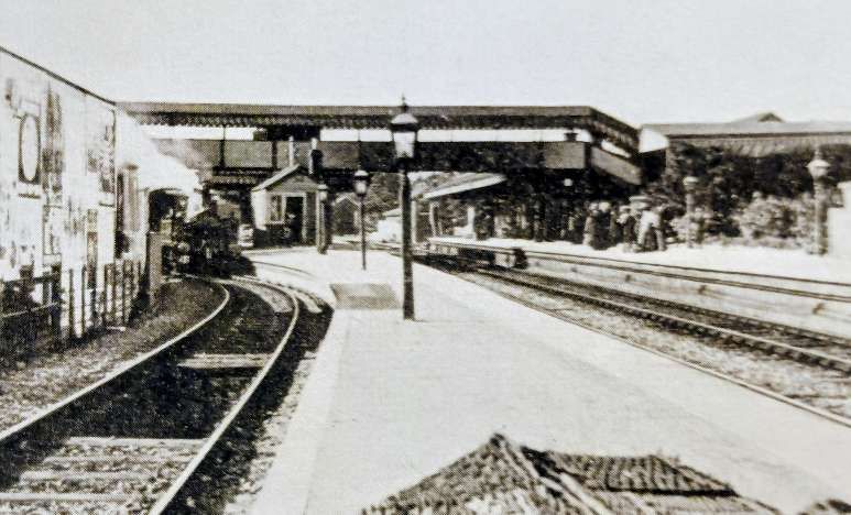
Tiverton Junction originally opened as Tiverton Road in 1844. It closed on 11th May 1986, and was replaced the next day by Tiverton Parkway Railway Station located about two miles away.
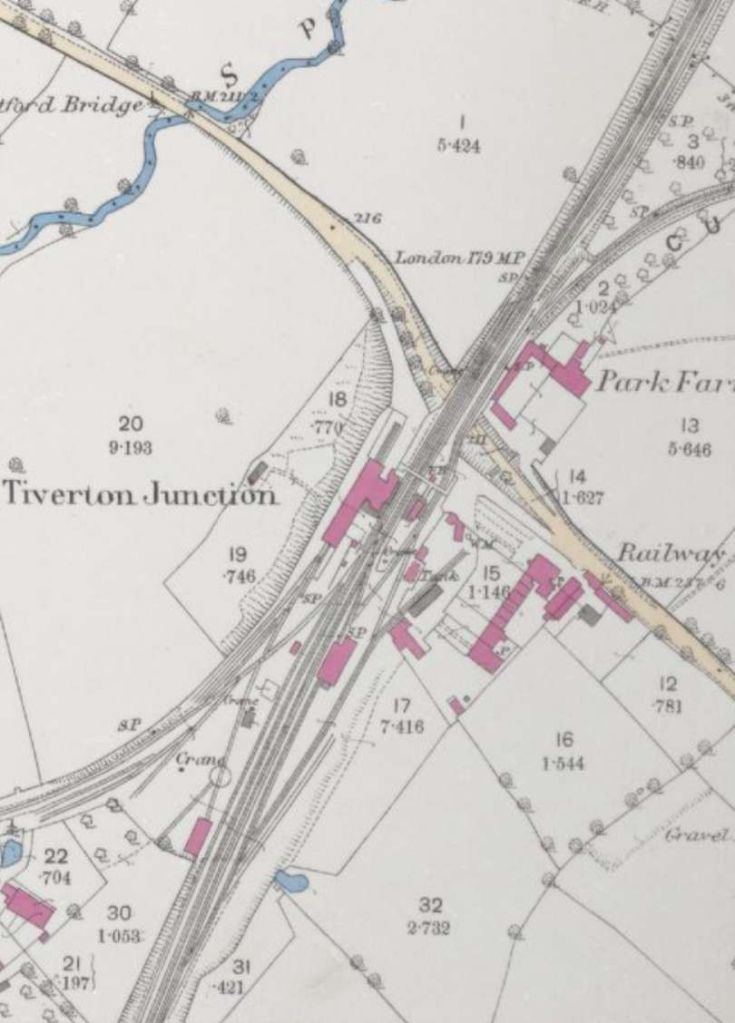
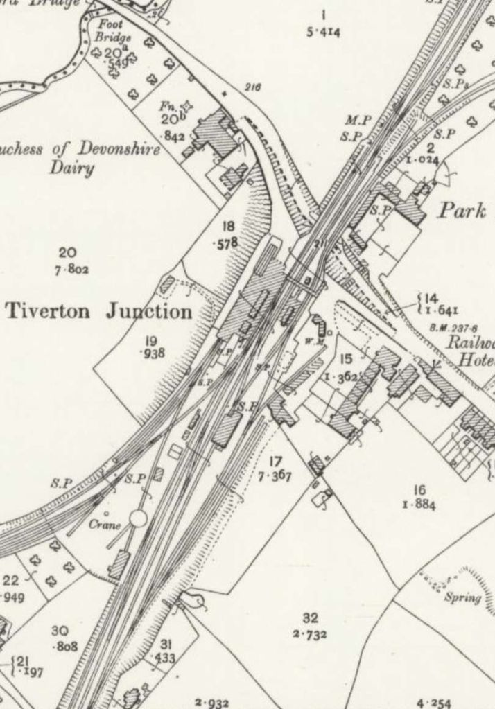
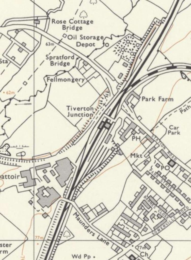
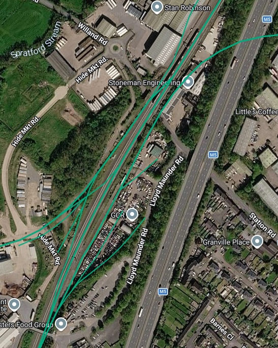
A modern satellite image of approximately the same area shown on the OS map extracts above. The railway still runs through the site of the railway station but the station has been replaced by Tiverton Parkway a couple of miles away along the line. the dominant modern feature in the immediate vicinity of the old station site is the M5 motorway!. [17]
David Glasspool tells us that, “In 1930, the GWR announced a series of major upgrades, network-wide, which included station rebuilds, engine shed renewals, and widening main lines. The company took advantage of a series of cheap loans offered by the government, which aimed to tackle unemployment. … five stations between Norton Fitzwarren and Exminster, viz., Weillington, Tiverton Junction, Cullompton, Stoke Canon, and Exminster, [were] to be improved and converted into 4-line stations and the 1¾ miles of line between Sampford Peverell and Tiverton Junction quadrupled. This [was] a continuation of the scheme of quadrupling of the seven miles of line between Cogload Junction and Norton Fitzwarren and the reconstruction of Taunton Station.” [13][14]
It seems from local newspaper reports of the time, reconstruction work at Tiverton Junction commenced in about January 1932:
- The Devon and Exeter Daily Gazette, Thursday 14th January 1932 reported on a, Big GWR Scheme: Transformation of Tiverton Junction Station Two Years’ Work – “The Great Western Railway Company are embarking on a big scheme at Tiverton Junction station, which will probably take two years to complete and during that time give employment to 200 men. When it is finished there will be a complete transformation at the station and its environments as they exist today. … The layout provides for new platforms and station buildings, new goods shed, cattle pens, and engine sheds, extension of the shunting yard, reconstruction of the bridge which carries the lines over the main road, and the straightening out and widening of the road. The main lines will be doubled, stopping trains taking the platform lines and expresses, the middle through lines. Accommodation for the public will be particularly extended on the up side. … Already gangs of men have removed thousands of tons of earth on the south east side, the whole of the gardens having been taken away and the soil tipped on the up side for the prospective line widening.” [13][15] It is worth noting that although this article suggests a 2-year time frame, work was effectively completed by the Autumn of 1932. [13]
- The Western Times, Friday, 30th September 1932 – reported that, “For some time past extensive alterations have been undertaken by the GWR to their station at Tiverton Junction, and on Sunday next, 2nd October, the last big item of work will be carried out. This will bring into use a new down platform and down platform line, 1,200 feet in length, and provide four lines through the station. The station has been completely rebuilt, new offices, and waiting rooms provided, a new signal box erected, as well as a large goods shed and locomotive shed. … The most hazardous task connected with the alterations was the building of a heavy bridge over the roadway to carry the four running lines, and this was successfully accomplished, despite the fact that full passenger and goods services were maintained. … With the completion of the work at Tiverton Junction the Company’s quadrupling scheme between Exeter and Taunton will be fully realised, and further facilities provided for the operation of passenger and goods train services.” [13][16]
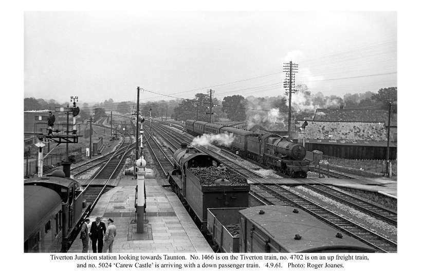
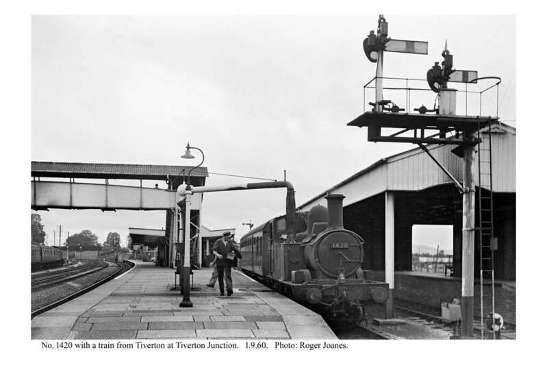
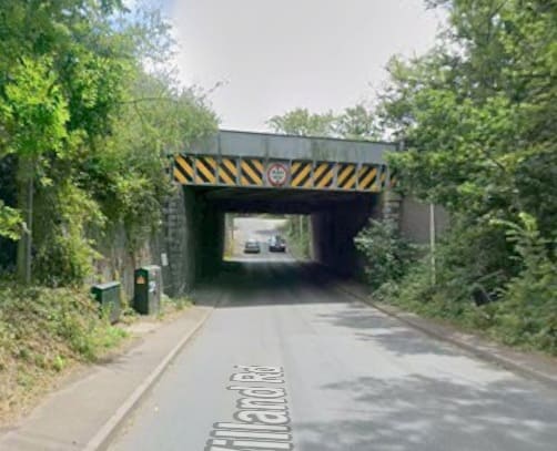
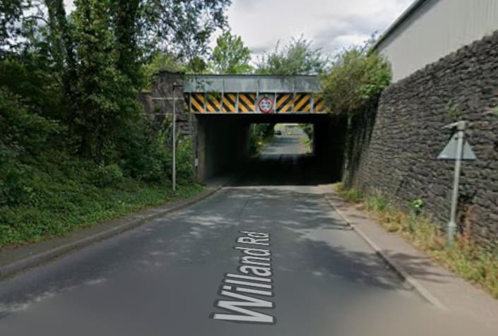
“At the end of the platform the branch curve[d] sharply eastwards and the train [was] immediately faced with a short, but steep climb on a gradient of 1 in 66. In the days of the early 2-4-0 tanks, trains frequently stalled on this section and had to run ignominiously back to the junction and make a fresh start. After 3 or 4 abortive attempts they needed to replenish their small water tanks before setting off once again.” [1: p10]
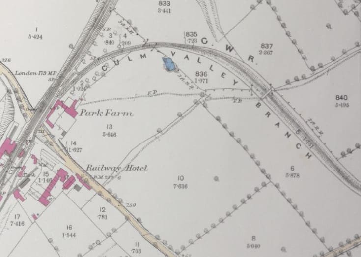
“At the summit [was] a stop board for all up trains. The line [ran] through a deep cutting [and] under a concrete occupation bridge of recent construction.” [1: p10] The concrete bridge sat at the East end of the curve out of the station.
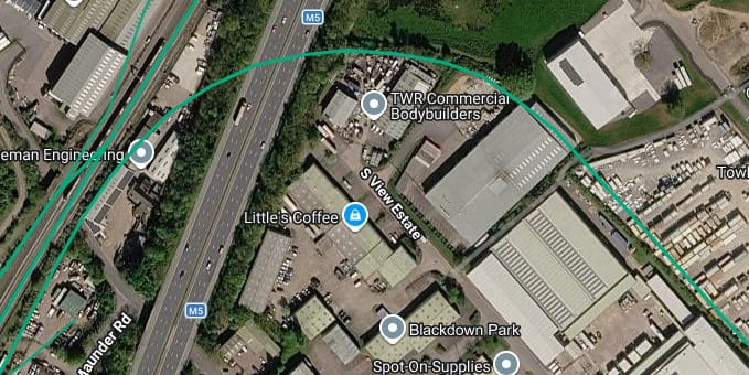
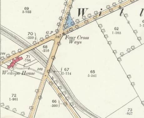
Just to the right of the map extract and satellite image above the line passed under two road bridges. It is shown here passing under what were the A38 and A373 roads. [18]
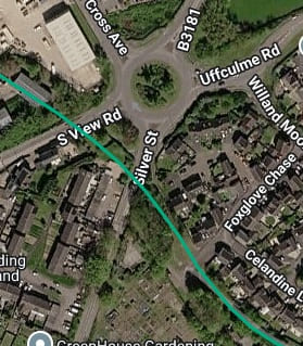
A similar area on modern satellite imagery. The two roads which bridged the old railway are shown on this image as South View Road and Silver Street. The modern alphanumeric designation of the two roads being B3440 and B3181 respectively. [17]
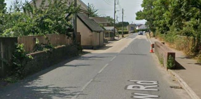
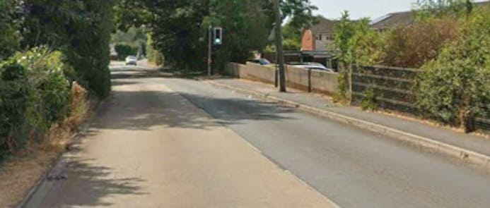
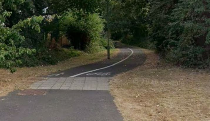
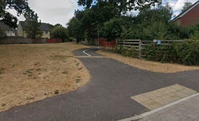
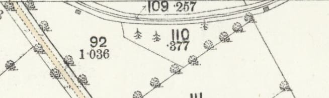
The railway then turned back towards the Northeast. The line crosses between one 25″ OS Map Sheet and the next to the South, before returning back across the map sheet boundary. [19]
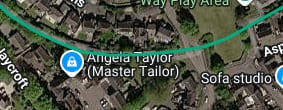
The same area in the 21st century. [17]
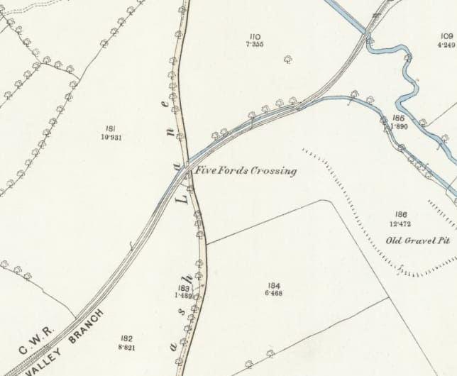
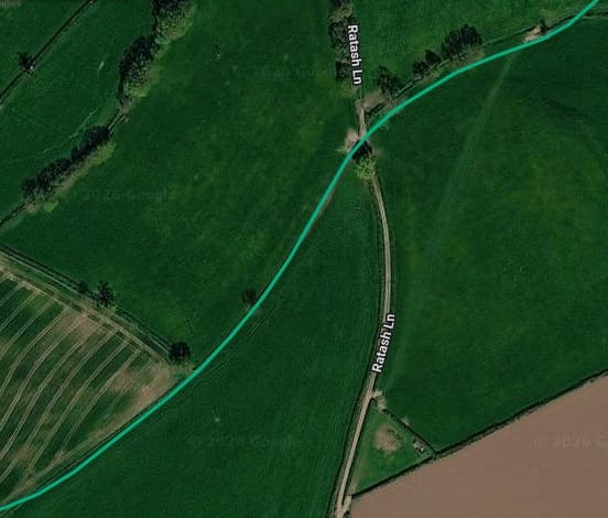
“The line now drops down into the Culm Valley and runs alongside the winding river. Soon, the first level crossing, with a farm lane is encountered.
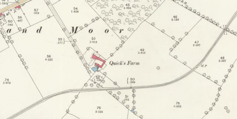
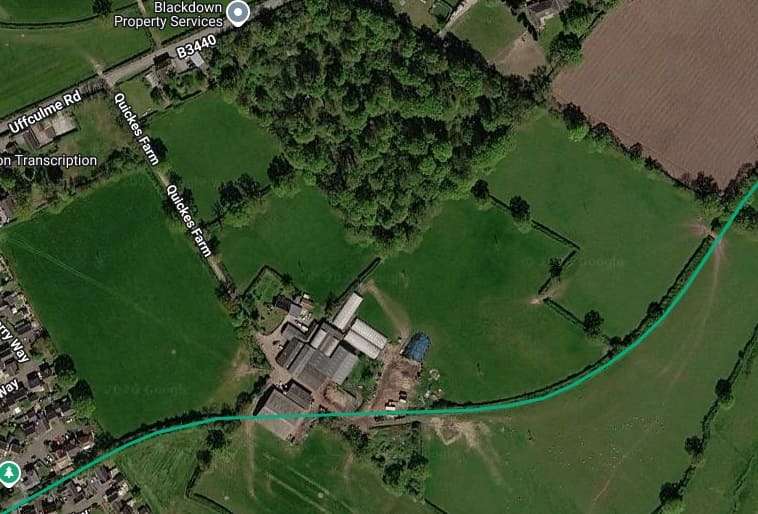
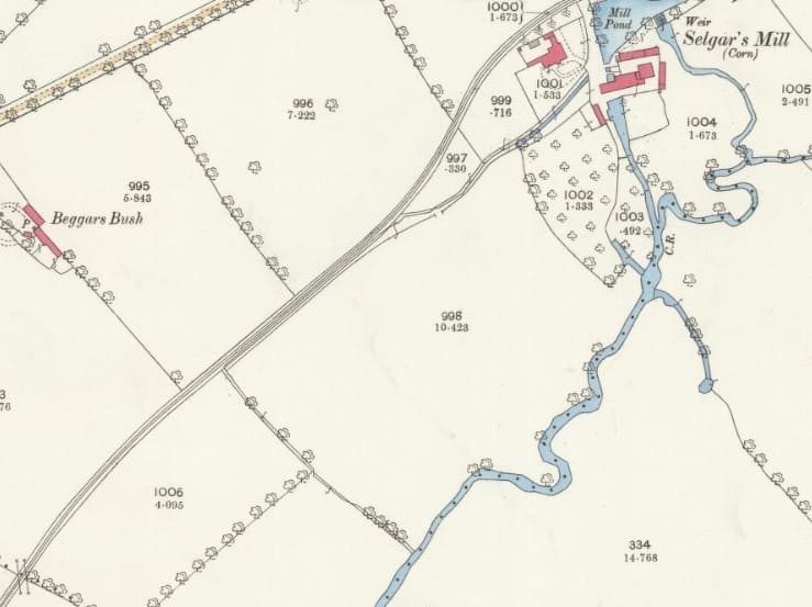
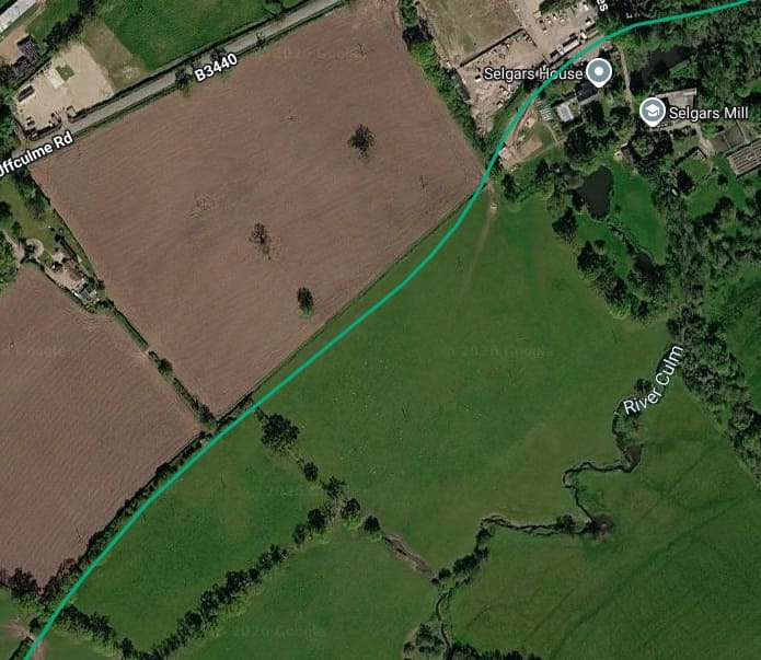
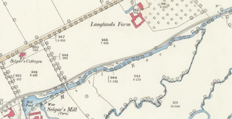
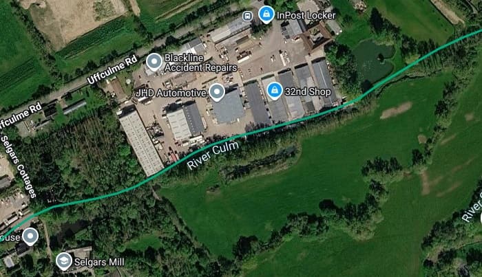
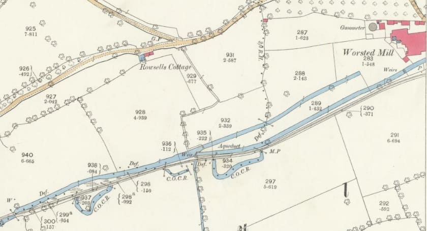
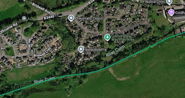
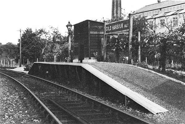
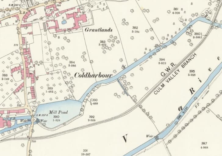
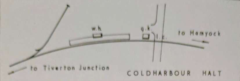
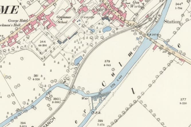
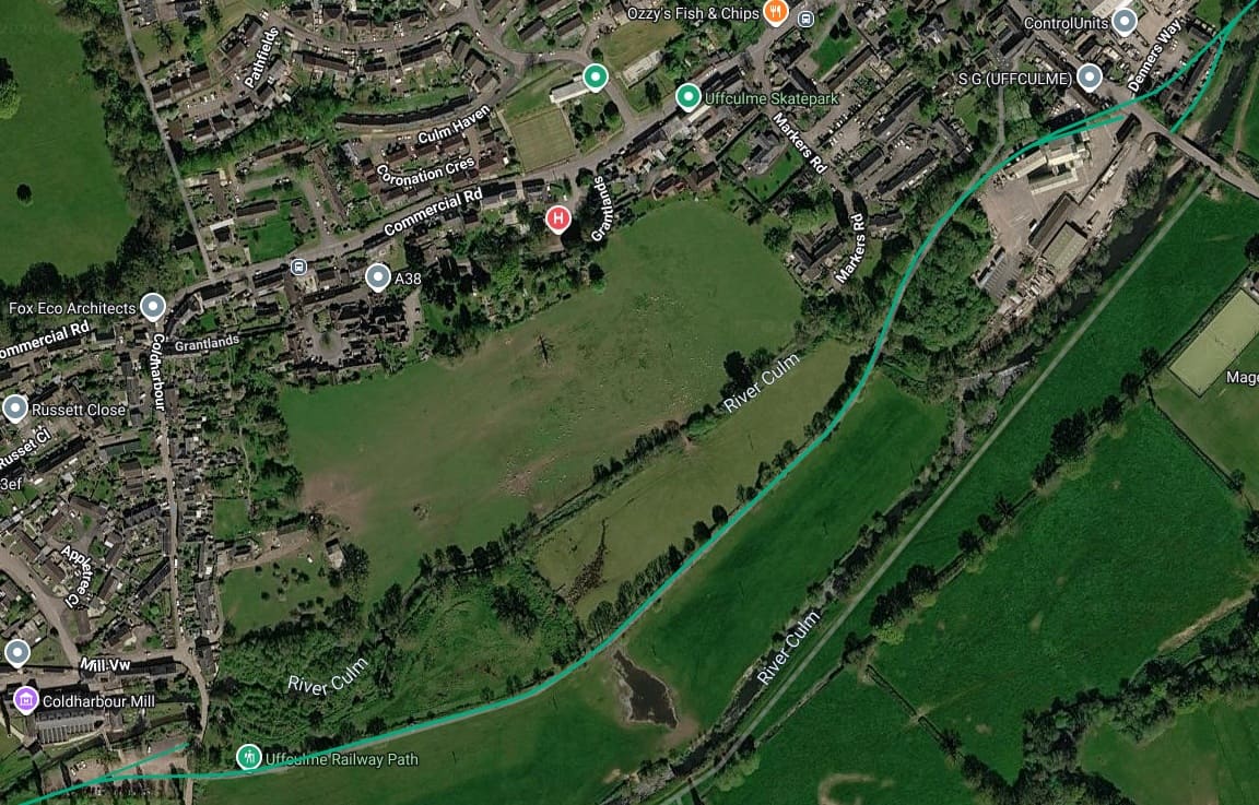
After crossing and re-crossing the river several times the line curves sharply to arrive at Coldharbour Halt (opened in 1929). There was a short siding at this location. The platform [was] backed by a post and wire fence, [and had] a small wooden shelter, and the name-board [was] delightfully entwined with wild roses! The siding behind the halt was, by 1964, no longer used having seen no traffic for some years. [1: p10]
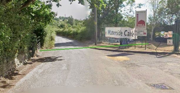
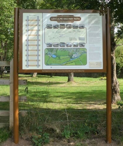
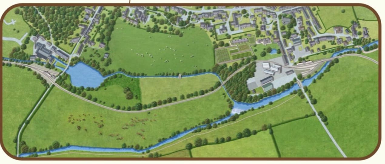
Uffculme Railway Path was provided with an information board in 2022 by Uffculme Local History Group. [22]
The board outlines some of the history of the Culm Valley Light Railway with a series of Track Facts and also tells the story of how the Uffculme section of the track bed was saved for the benefit of the community after the Culm Valley Light Railway finally closed in 1975.
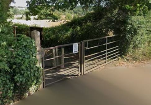
The start of the path. [Google Streetview, August 2026]
At the East end of the 21st century path walkers reach the site of Uffculme Railway Station.
Crombleholme, Stuckey & Whetmath describe this length of the line like this: “From Coldharbour the track skirts Uffculme, situated on the valley slopes, for half a mile to arrive, after a series of alarmingly abrupt right and left hand curves, at Uffculme station. On the right a private siding leads to a grain mill. Guarding the level crossing is the only stop signal on the branch east of Tiverton Junction. It is however rarely operated. Until 1932, there was a goods shed but it was removed during the general alterations of that period, and any traffic is dealt with in a small corrugated building on the platform. The station building is of red brick, as at all stations on the line, of simple and compact design with all the usual offices. Uffculme is one of the busiest points on the branch, handling up to 100 tons of freight daily, and once again there are roses around the name-board, and well-tended gardens. The little station is prettily overshadowed by the spire of the town’s 13th century church.” [1: p12]
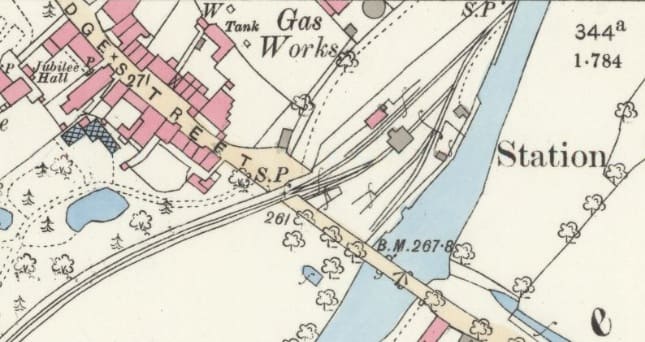
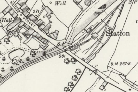
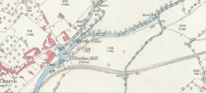
Uffculme Railway Station as shown on the 25″ Ordnance Survey of 1903, published in 1904. [24]
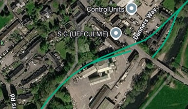
A closer view of the station site on 21st century satellite imagery. [17]
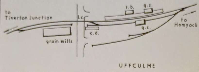
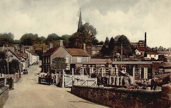
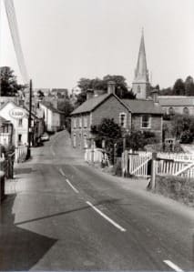
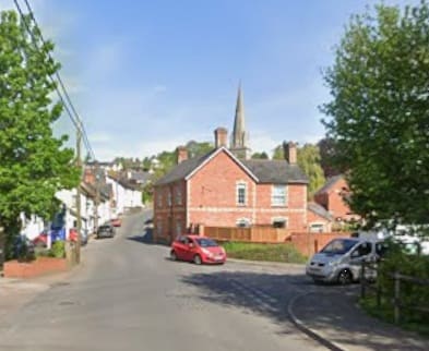
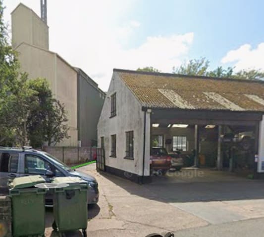
Looking Northwest through the location of the level-crossing in the 1970s and in 2021. [28][Google Streetview, June 2021]
After Uffculme Railway Station closed to passenger services in September 1963, the station remained open for goods until 8th May 1967. [27]
Some excellent photographs of the site can be found on the Disused Stations Website. [27]
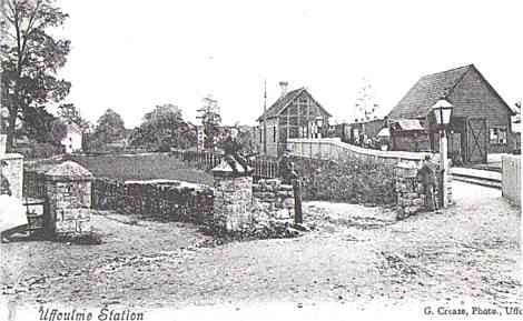
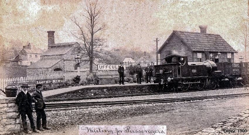
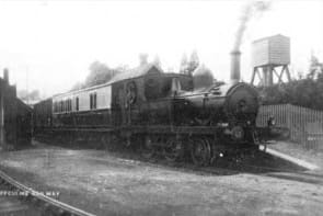
This relatively poor quality image shows a train heading for Hemyock. The photograph is undated and unattributed but appears to come from the very early years of the 20th century or earlier. The locomotive appears to be a 2-4-0T, possibly No. 1300, (c) Public Domain. [28]
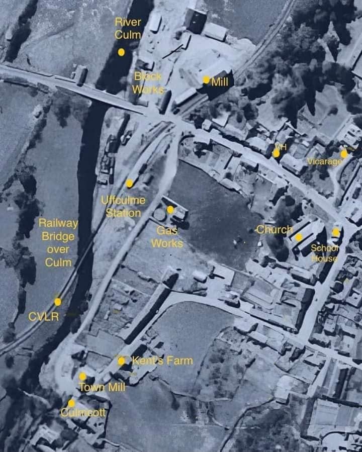
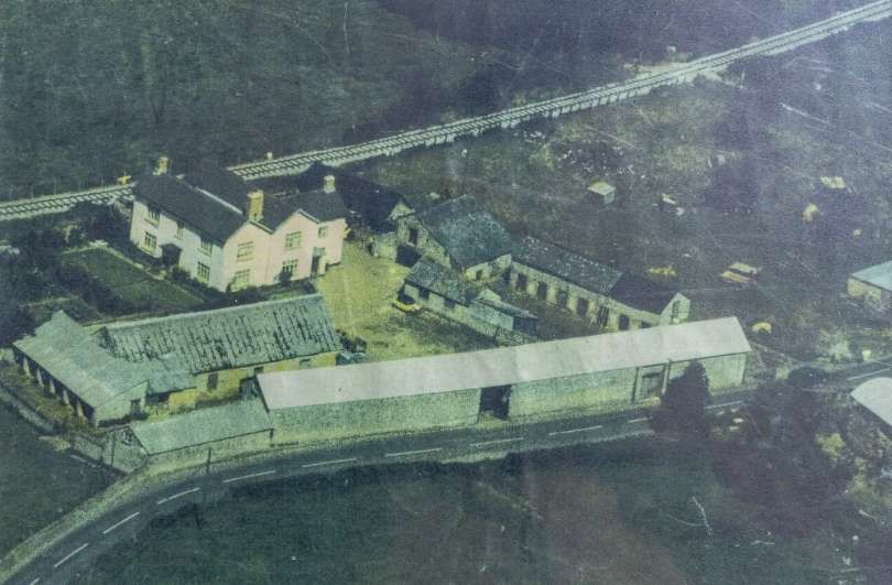
This aerial image was shared by Ben Waerdo on the Disused Stations Facebook Group on 14th January 2024. The North point is to the bottom-right. The grain mill is at the top of the image The railway runs beside the mill, across the road and into Uffculme Railway Station. The railway bridge over the river is in the bottom left quadrant of the image. [29]
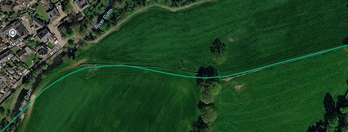
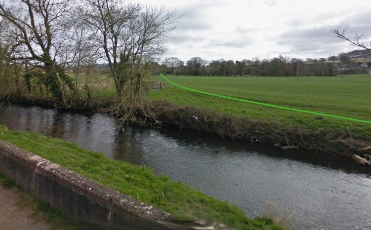
Crombleholme, Stuckey & Whetmath tell us that: “Beyond Uffculme the railway continues to follow the winding river, climbing on a ruling gradient of 1 in 68.” [1: p13]
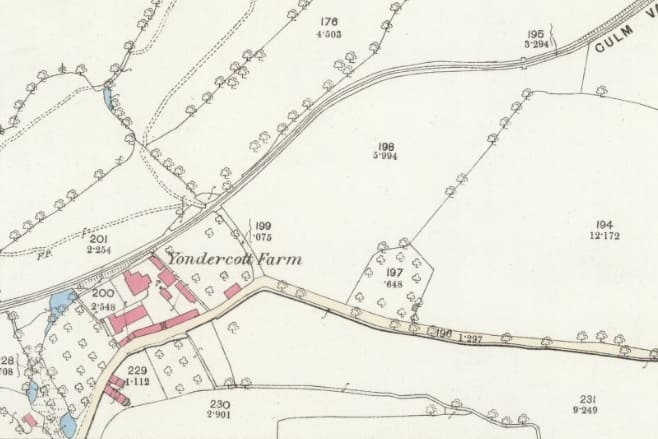
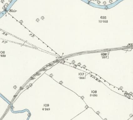
This next extract from the 25″ Ordnance Survey of 1887, published in 1889, takes the line as far as the East edge of the map sheet. [25]
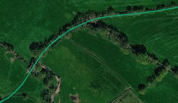
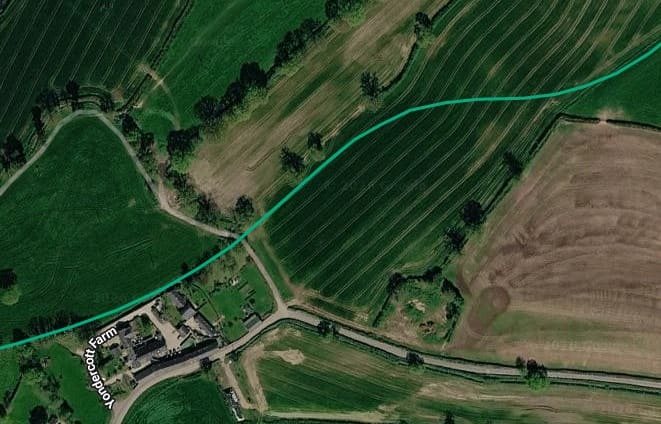
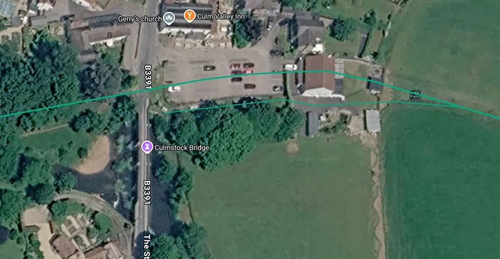
Again, this satellite image covers a very similar length of the old railway to that shown on the map extract immediately above. [17]
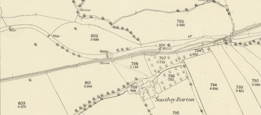
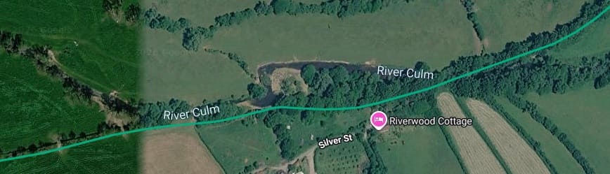
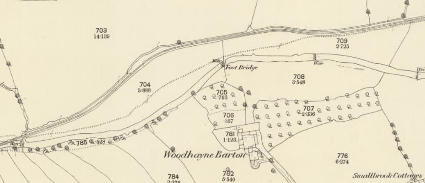
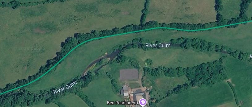
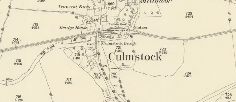
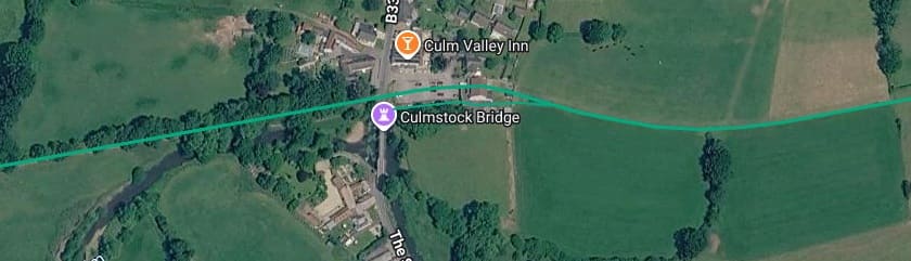
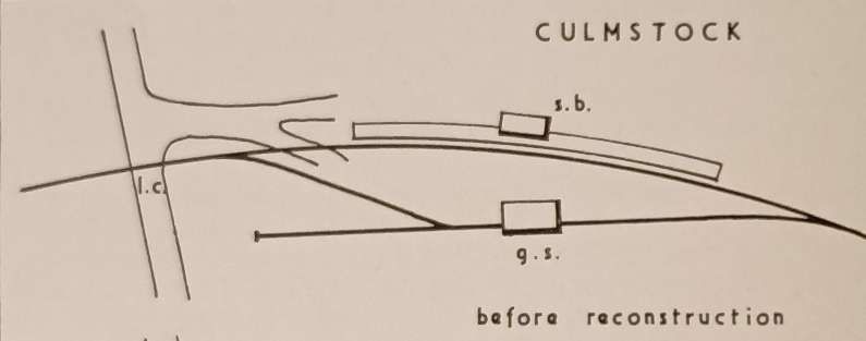
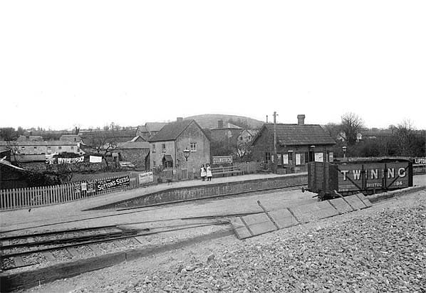
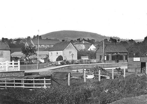
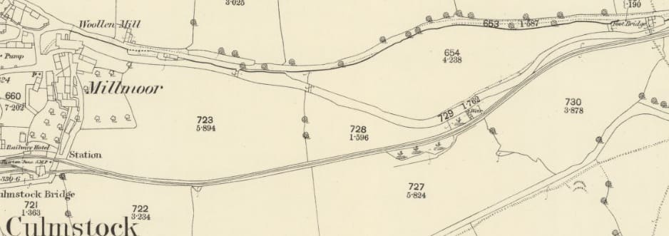
Writing in 1964, Crombleholme, Stuckey & Whetmath said that, “On arrival at Culmstock there is a further set of crossing gates for the train crew to open: Culmstock was reduced to halt status in 1960 and the staff with-drawn. Until 1932 there was a wooden goods shed but this was re-moved during the general branch layout alterations. A small corrugated iron hut on the platform, built to replace the goods shed, served as waiting room. The fifth mile-post is situated in the goods yard.” [1: p13] The map extract below records the presence of the 5-mile post.
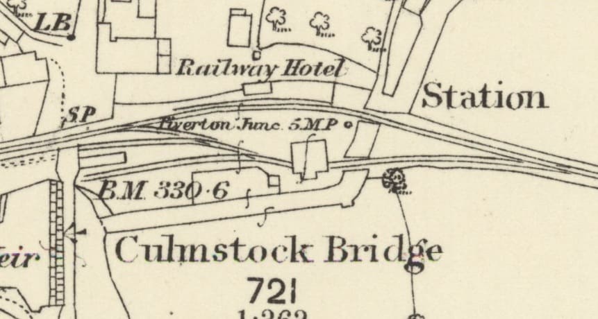
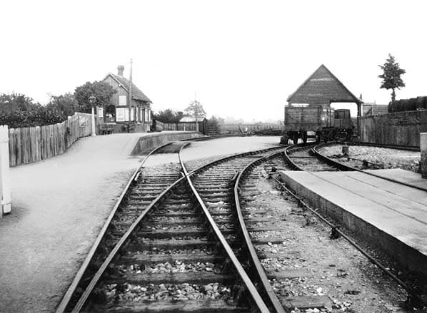
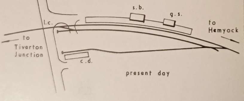
More photographs of Culmstock Station can be found on the Disused Stations website. [31]
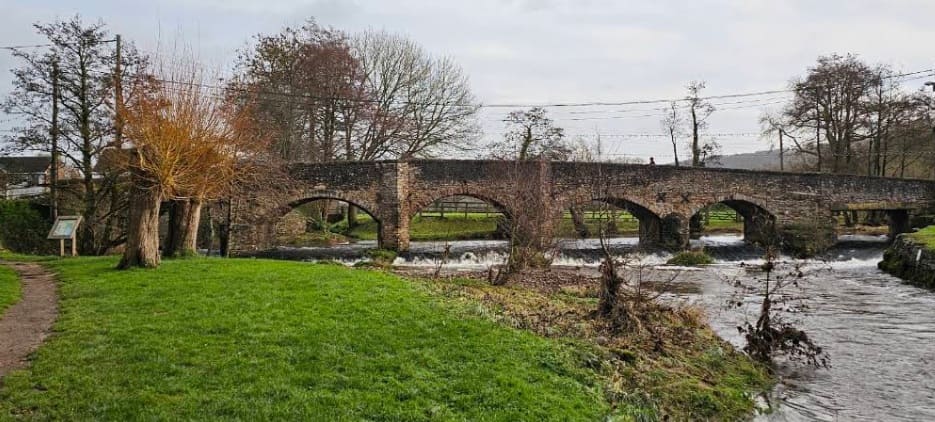
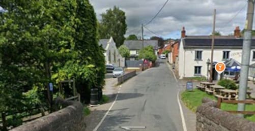
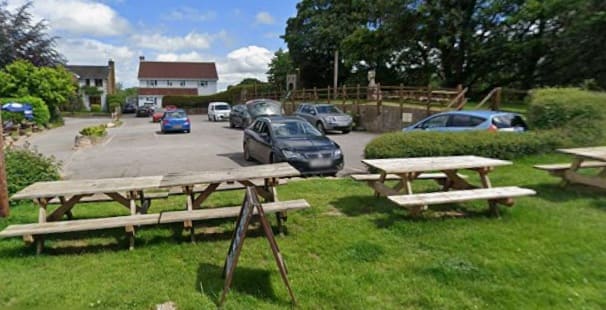
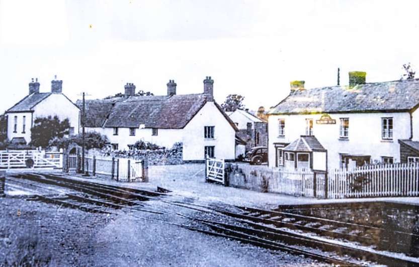
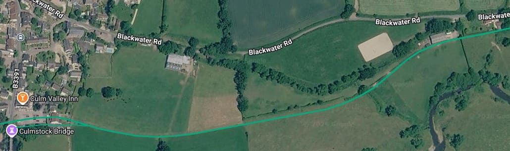
Immediately beyond Culmstock Railway Station the line became rural once again. From Culmstock it was 1½ miles to Whitehall Halt. …
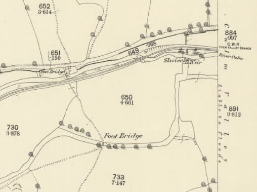
This next map extract takes us to the right side of the 25″ Ordnance Survey map sheet. [30]
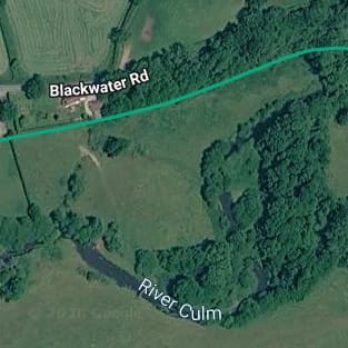
A similar length of the line on modern satellite imagery. [17]
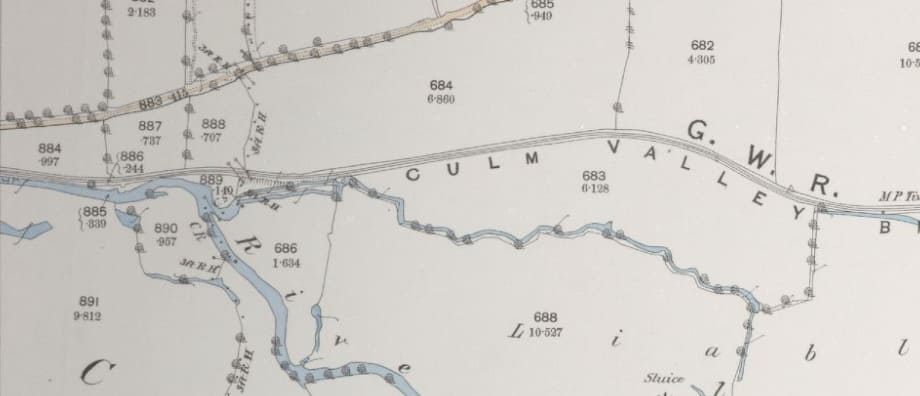
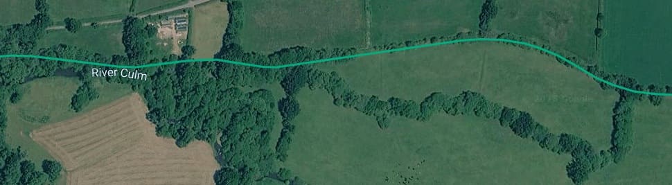
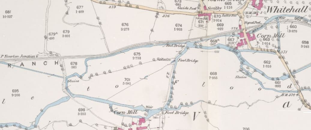
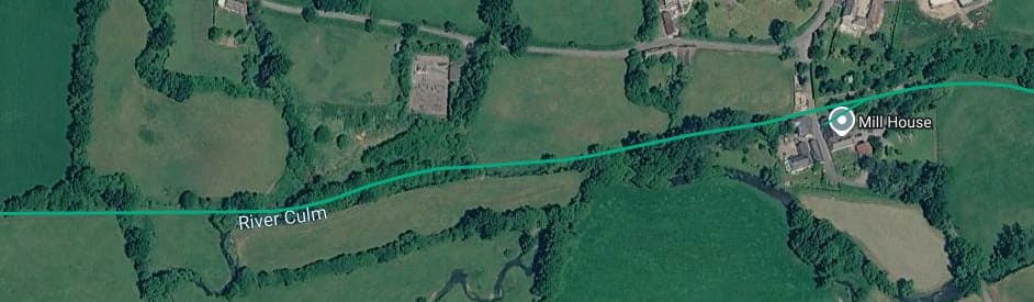
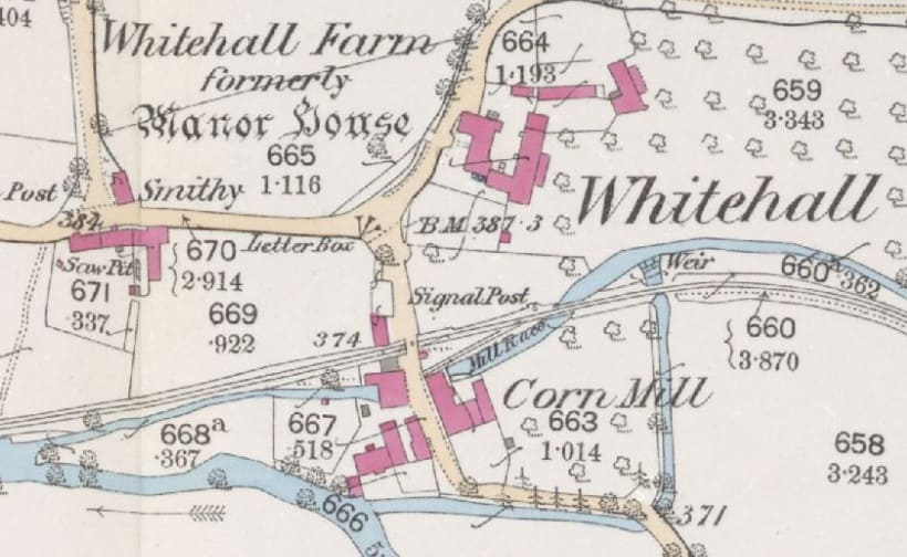
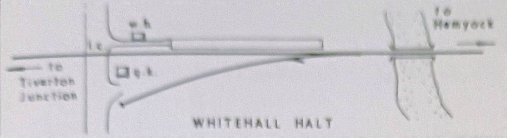
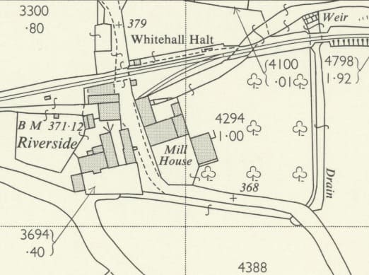
“Whitehall Halt, a product of the 1932 changes, [was] permeated with the aroma of nearby piggeries. It was an optimistic attempt to entice traffic from the neighbouring farms. A short path [led] from the level crossing past a small wooden shelter to the halt platform. [In 1964,] there [was] a disused gatekeeper’s hut on the up side. A deserted siding serve[d] a disused mill. At Whitehall and at Coldharbour the guard used to deliver the London papers, collecting the money due weekly from a tobacco tin located in the eaves of the shelter.” [1: p13]
The Halt was in use from 1933 to 1963. It opened on 27th February 1933. It had a siding, although there were no freight facilities. Great Western Railway tickets showed it as Whitehall Crossing Halt. The station closed on 9 September 1963. Some of the platform still survives. [34][35: p455][36]
Nick Catford tells us that, “A section of the platform is extant, both crossing gate posts survive and on the west side of the crossing the end of the gate also survives and now supports a new gate. The house on the site of the goods yard is called Whitehall Halt.” [36]
A visit to the Disused Stations website will be worthwhile – there are a number of pictures of the halt, one while in use, one straight after closure and a few taken in the 21st century, [36]
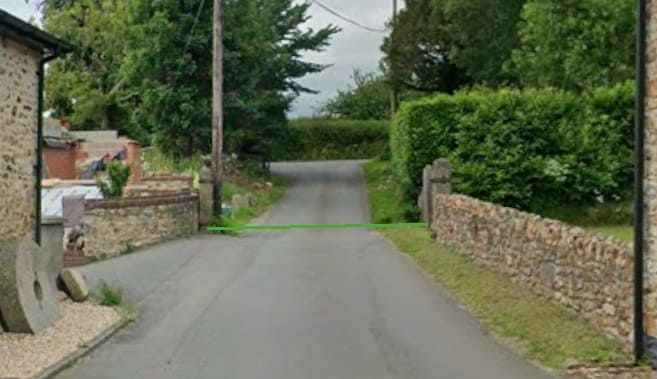
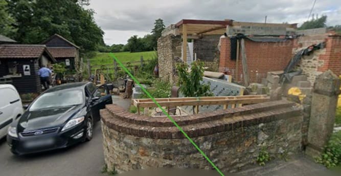
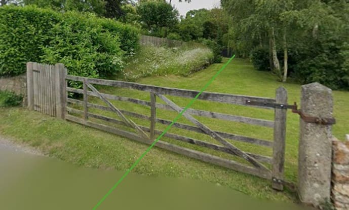
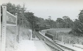
Immediately to the East of the Halt, the line crossed the Mill Race on a single-span steel girder bridge. [39]
The first bridge over the Mill Race to the East of Whitehall Halt can be seen on the left of the map extract immediately below.
The line passed through/alongside a small wood and the gradient stiffened to 1 in 76.
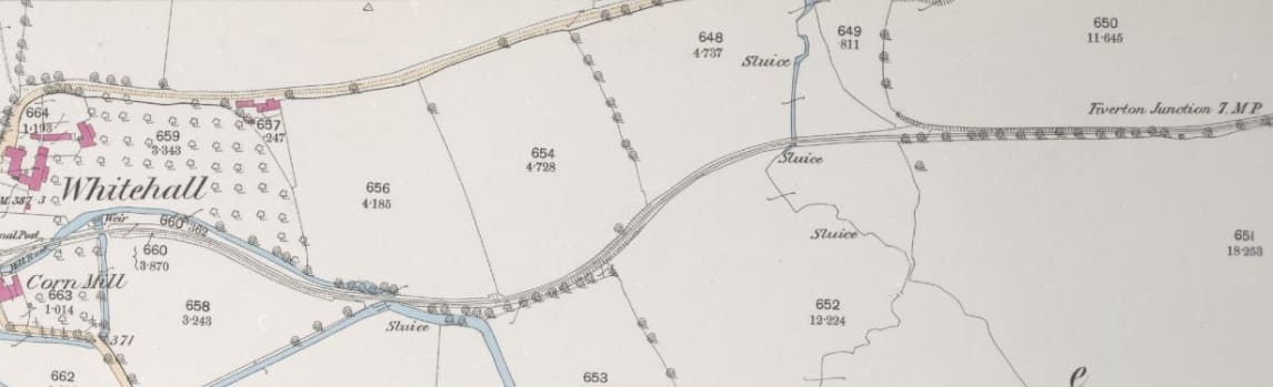
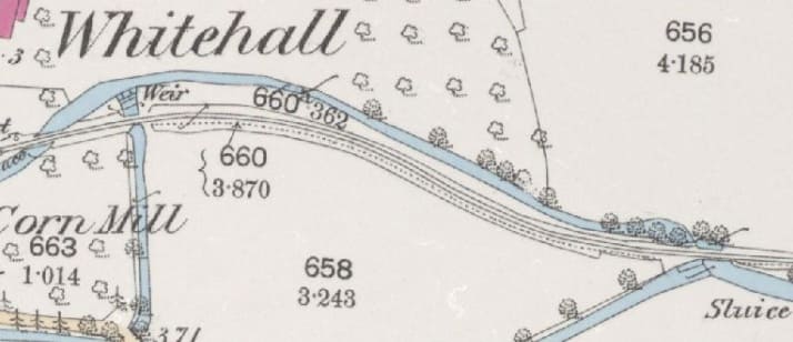
The two bridges can be seen more easily on this enlarged extract. [32]
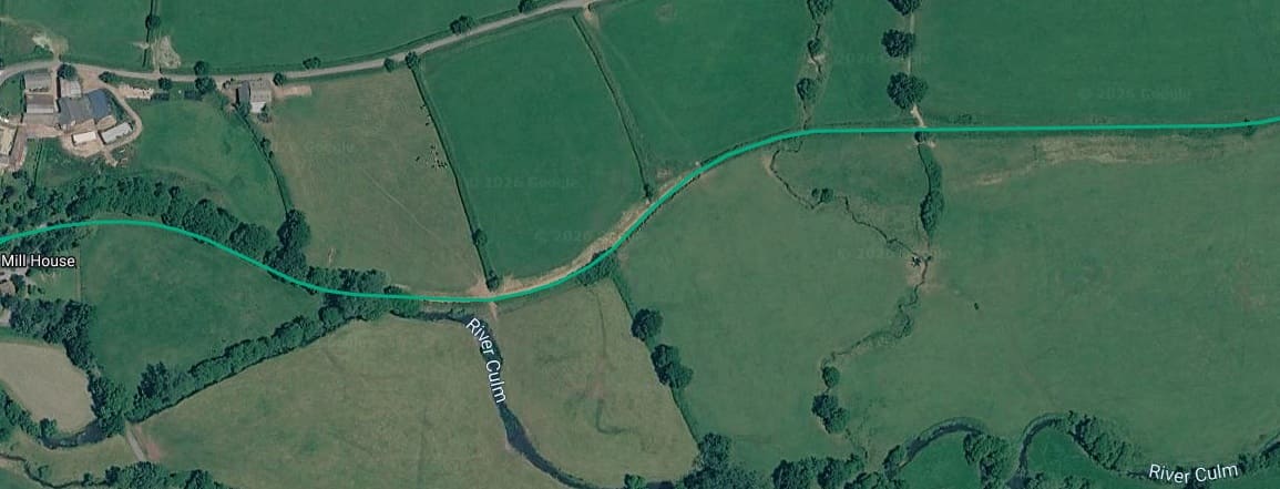
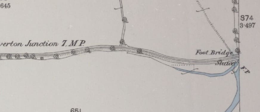
A short distance beyond the 7 mile post, the East side of the OS Map sheet picks up a location of a footbridge and sluice-gate, [32]
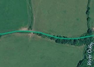
Approximately the same length of the line as in the map extract above. [17]
The compact little town or village of Hemyock could be seen on the right, about a mile South of Hemyock Railway Station itself. Which was in the village/hamlet of Millhayes.
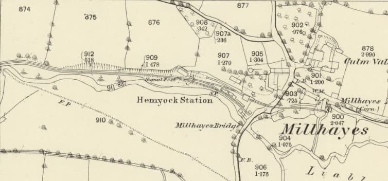
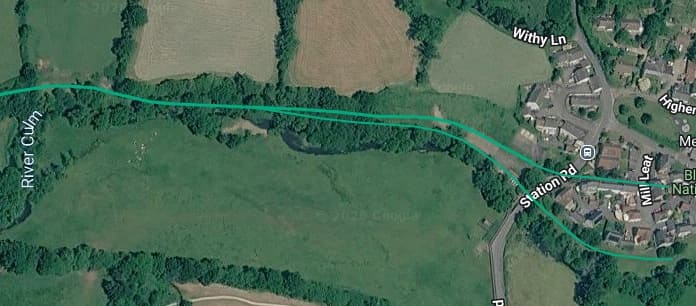
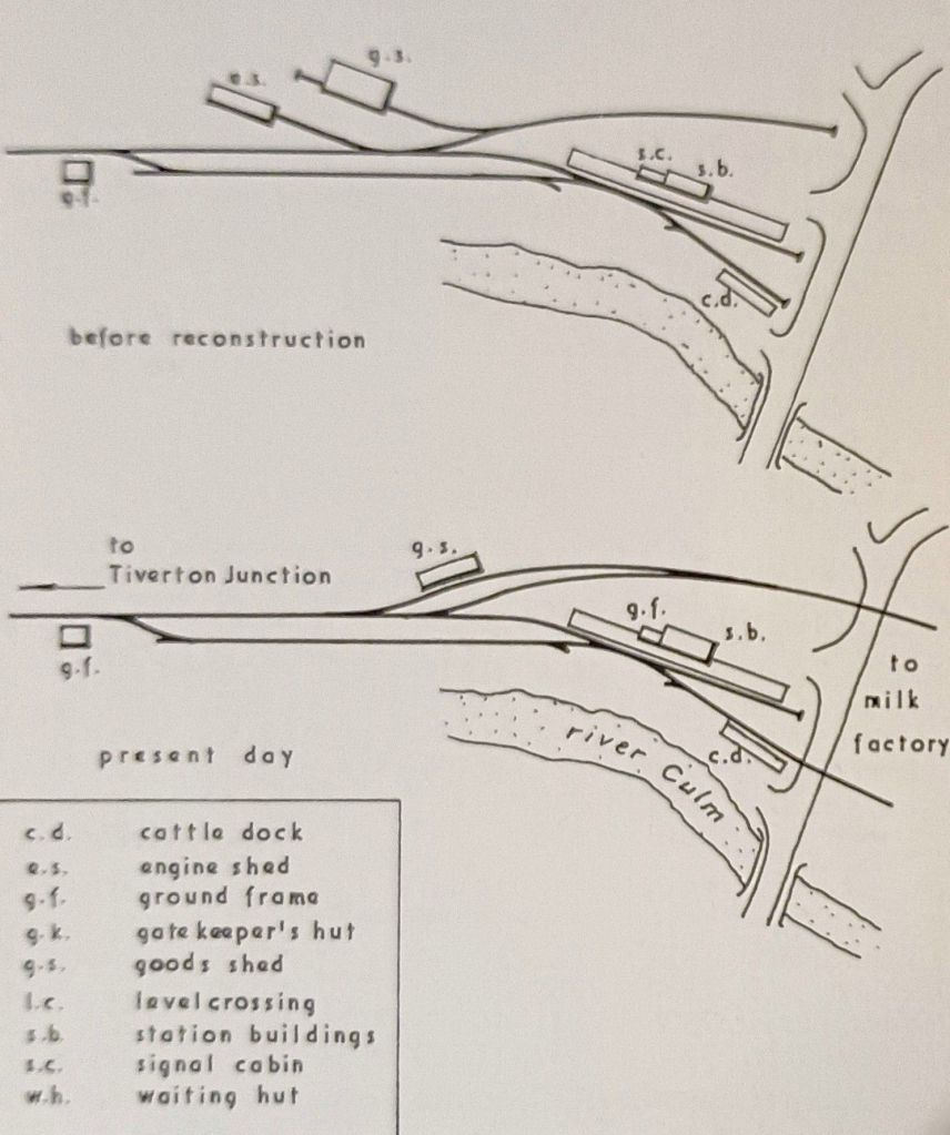
By the 1960s, Crombleholme, Stuckey & Whetmath could write that, “the line passe[d] Hemyock West ground frame, where the run-round loop commence[d], to arrive at the terminus, sited at the north of and about a mile from the town centre. Two sidings cross[ed] the road to enter the Wilts United Dairies’ milk depot: the extension of the cattle dock siding serve[d] the boiler house, but [had] not been used since oil fuel was introduced; the other track serves the milk loading platform. The single-storied, red-brick station buildings are similar to, but larger than, those at Uffculme and Culmstock. The waiting room was an afterthought, constructed from concrete blocks. The East ground frame was formerly called the Signal Box although, in fact, it never controlled any signals. In 1932, the layout at the terminus was radically changed, the engine shed was closed, and the goods shed demolished, being replaced by a corrugated iron structure. The river [was] too close to allow a run-round loop opposite the platform face and the engine had to shunt its coach back into the yard for this purpose, past the backs of the anglers who were allowed to fish from the river bank.” [1: p13-14]
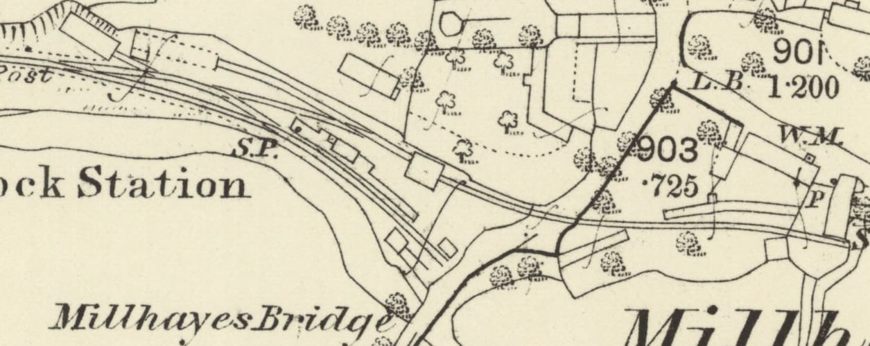
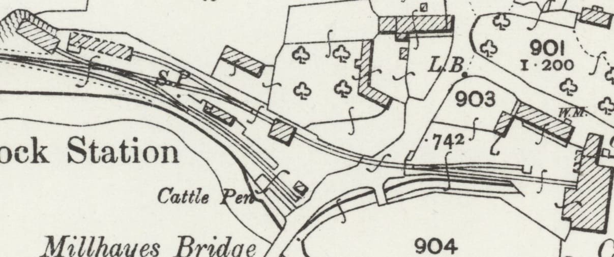
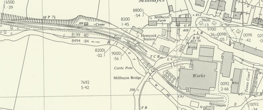
Crombleholme, Stuckey & Whetmath provide drawing of the station before and after reconstruction, ……..
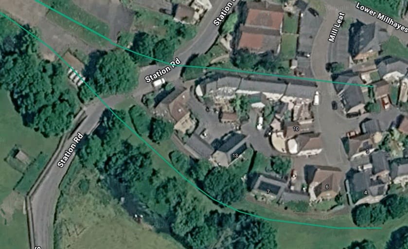
A satellite image of the site of the milk factory and Station Road which shows the alignment of the erstwhile sidings on the site. [17]
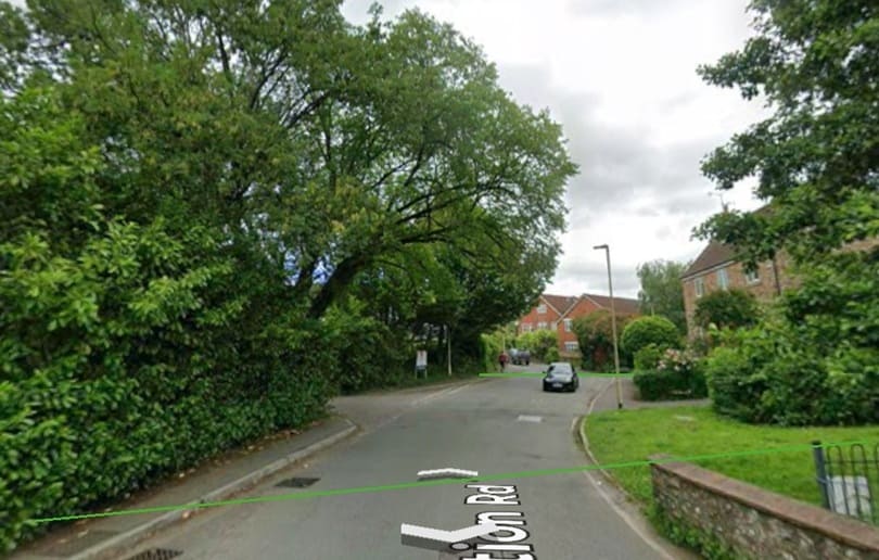
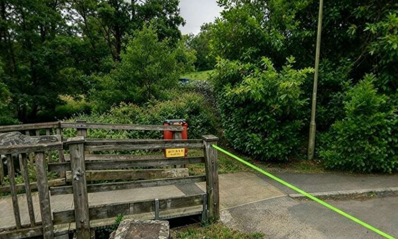
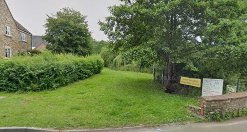
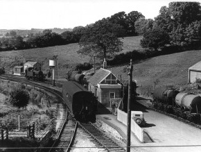
An elevated view of the station in the 1950s. The track on the extreme bottom-left crossed Station Road to deliver coal to the factory and to collect milk powder. The other track on the left only ran a few more feet into buffers. The track on the right also crossed the road and was used for milk collection. [48]
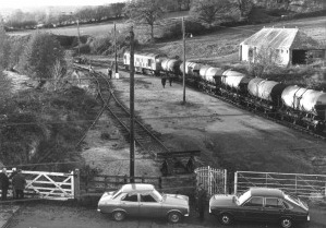
An elevated view of the remains of Hemyock Station in 1975. The Station building has been demolished. The building seen on the right was once a cafe. The kissing gate in the foreground and the tracks have now long gone. [50]
Further excellent photographs of Hemyock Railway Station can be found on the Shepton & District Model Railway Society webpage [51] and on the Disused Stations webpage for Hemyock Station. [52]
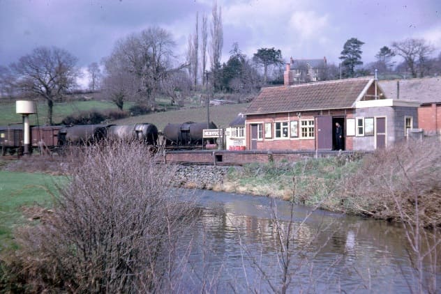
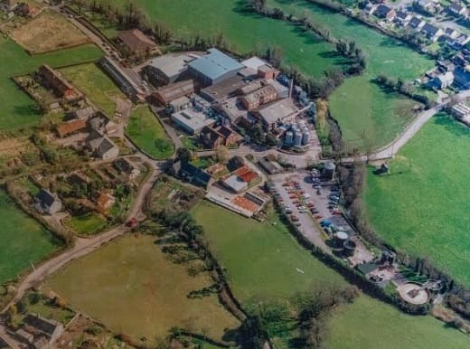
Hemyock Dairy at Millhayes was a milk-processing and dairy facility which later evolved into the St. Ivel spreads factory. Milk traffic and processing kept the branch line active long after passenger services ended, with milk trains operating until the dairy finally closed on 31st October 1975.
In 1884, the Culm Valley Dairy Company was established in Hemyock to produce butter using mechanical methods to compete with cheap foreign imports. In 1890, the factory moved to larger premises next to Hemyock Station on the Culm Valley Light Railway, which helped transport milk, cheese, and butter across England. in 1915, United Dairies (later Wilts United Dairies) acquired the facility.
Following its time as a dairy, the facility became a St. Ivel plant where well-known butter-spreads like St. Ivel Gold and Utterly Butterly were produced before production shifted to the North of England. Closure occurred in the late 1990s. The buildings were demolished in 2000. Portions of the old factory and garage buildings were later acquired by the local parish council for community use, while other parts of the industrial footprint and former station/car park areas have transitioned into housing (the Hollingarth estate) and local development. [46]
References
- R. Crumbleholme, D. Stuckey and C. F. D. Whetmath; The Culm Valley Light Railway; West Country Handbooks No. 5; Branch Line Handbooks, West Country Publications, The Narrow Gauge & Light Railway Society, 1964.
- https://en.wikipedia.org/wiki/Culm_Valley_Light_Railway, accessed on 27th October 2026.
- http://www.disused-stations.org.uk/c/culmstock/index.shtml, accessed on 28th October 2026.
- https://www.nrmfriends.org.uk/post/the-tivvy-bumper-brought-in-from-the-cold, accessed on 28th October 2026.
- https://chasewaterstuff.wordpress.com/2011/11/22/some-early-lines-culm-valley-light-railway, accessed on 28th October 2026.
- R. C. Riley; The Culm Valley Branch; in Railway World Vol. 23 No. 270; November 1962.
- https://www.cornwallrailwaysociety.org.uk/weymouth-street-tramway.html, accessed on 28th October 2026.
- https://expressdairytales.uk/ed-milk-trains, accessed on 28th October 2026.
- https://www.scalefour.org/forum/viewtopic.php?t=5760, accessed on 28th October 2026.
- https://maps.nls.uk/view/136634048, accessed on 28th October 2026.
- https://maps.nls.uk/view/106000658, accessed on 28th October 2026.
- https://maps.nls.uk/view/189240156, accessed on 28th October 2026.
- https://kentrail.uk/tiverton_junction_2.htm, accessed on 28th October 2026.
- Taunton Courier, Wednesday 30th July 1930.
- The Devon and Exeter Daily Gazette, Thursday 14th January 1932.
- The Western Times, Friday, 30th September 1932.
- https://www.railmaponline.com/uk-and-irish-railways.html, accessed on 29th October 2026.
- https://maps.nls.uk/view/106000661, accessed on 29th October 2026.
- https://maps.nls.uk/view/106000685, accessed on 29th October 2026.
- https://maps.nls.uk/view-full/106000667, accessed on 29th October 2026.
- http://www.disused-stations.org.uk/c/coldharbour_halt/index.shtml, accessed on 29th October 2026.
- https://www.devonlive.com/news/devon-news/abandoned-uffculme-railway-been-brought-7438744, accessed on 29th October 2026.
- https://www.uffculmehistory.com/railway, accessed on 29th October 2026.
- https://maps.nls.uk/view/106000670, accessed on 29th October 2026.
- https://maps.nls.uk/view/106000643, accessed on 29th October 2026.
- https://www.devonheritage.org/Places/Uffcullme/ThedisusedstationatUffculme-Link.htm, accessed on 30th October 2026.
- http://www.disused-stations.org.uk/u/uffculme/index.shtml, accessed on 30th October 2026.
- https://www.blackdownarchives.org.uk/category/villages/uffculme/page/4, accessed on 31st October 2026.
- https://www.facebook.com/photo/?fbid=10160064941403321&set=pcb.25486484834272200, accessed on 31st October 2026.
- https://maps.nls.uk/view/106000721, accessed on 31st October 2026.
- http://www.disused-stations.org.uk/c/culmstock/index.shtml, accessed on 31st October 2026.
- https://maps.nls.uk/view/136634084. accessed on 2nd November 2026.
- https://maps.nls.uk/view/188700426, accessed on 2nd November 2026.
- https://en.wikipedia.org/wiki/Whitehall_Halt_railway_station, accessed on 2nd November 2026.
- M. E. Quick; Railway passenger stations in England, Scotland and Wales – a Chronology; Railway and Canal Historical Society, Richmond, 2002.
- http://www.disused-stations.org.uk/w/whitehall_halt/index.shtml, accessed on 2nd November 2026.
- https://www.facebook.com/photo/?fbid=1417871540379891&set=pcb.1417871587046553, accessed on 2nd November 2026.
- https://www.facebook.com/photo/?fbid=1417872407046471&set=pcb.1417871587046553, accessed on 2nd November 2026.
- https://ebay.io/m/4rq6vp, accessed on 2nd November 2026.
- https://www.cornwallrailwaysociety.org.uk/the-hemyock-branch.html, accessed on 3rd November 2026.
- https://share.google/xDodwGH28L7jftLir, accessed on 3rd November 2026
- https://www.facebook.com/share/1Emo89y1Cs, accessed on 3rd November 2026.
- https://maps.nls.uk/view/106000730, accessed on 3rd November 2026.
- https://maps.nls.uk/view/106000733, accessed on 3rd November 2026.
- https://maps.nls.uk/geo/explore/#zoom=18.0&lat=50.91873&lon=-3.22705&layers=173&b=ESRIWorld&o=100, accessed on 3rd November 2026.
- https://hemyock.org/index.php/page/20090707161241161, accessed on 4th November 2026.
- https://www.facebook.com/photo/?fbid=1417871533713225&set=pcb.1417871587046553, accessed on 2nd November 2026.
- https://www.blackdownarchives.org.uk/2011/09/hemyock-station-1950, accessed on 4th November 2026.
- https://www.geograph.org.uk/photo/73680, accessed on 4th November 2026.
- https://www.blackdownarchives.org.uk/2011/09/the-remains-of-hemyock-station-1975, accessed on 4th November 2026.
- https://sheptonmrs.wordpress.com/hemyock-station-1962-63, accessed on 4th November 2026.
- http://www.disused-stations.org.uk/h/hemyock/index.shtml, accessed on 4th November 2026.
- https://www.facebook.com/photo/?fbid=1477042424462802&set=pcb.1477065697793808, accessed on 4th November 2026.

