The mention of ‘Lickey’ in the railway press usually conjures up thoughts of the Lickey Incline and the bankers needed to enable steam-powered trains to make the climb.
In an article written in 1949 (Modern Tramway’s Prize Article of 1949) and published in February 1950, B.J. Pridmore prophetically proposed a Light Rail solution to anticipated traffic issues on the transport corridor centred on the Bristol Road.
Would cities in the UK which already had some reserved tram tracks have benefitted from forward thinking that sustained the use of trams through the latter years of the 20th century on tracks and routes which would be suitable for the current wave of Light Rapid Transit/Modern Tramway provision?
Here is Pridmore’s article in full (illustrations are from a variety of referenced sources):
“Summary
There are few cities with a passenger transport route so convenient for conversion to a rapid-transit light railway as is the Birmingham route to the Lickey Hills. In this article is submitted a scheme for such a conversion, describing the route, the alterations required to the track and vehicles, the attractive services which could be operated, and the possibility, in the future, of the possession by Birmingham of a true rapid-transit installation giving a public passenger transport system freed from the delays due to street congestion.
Introduction
The Lickey route of the Birmingham tramways extends about eight miles Southwest of the city, connecting it to the suburb of Edgbaston (2 miles) and the almost separate entities of Selly Oak (4 miles), Northfields (6 miles) and Longbridge (7 miles and location of the Austin Works), bifurcation at this point giving two termini at the dormitory villages of Rednal and Rubery on the edge of the Lickey Hills.
The traffic on this route is partly of a business character, with a morning peak to the city, two small mid-day peaks, outward and inward, from the city to Selly Oak, and the evening peak of outward-bound traffic. Superimposed upon this are the industrial peaks, of a general nature to and from the city, and of a concentrated nature in the opposite directions to and from the Austin Works at Longbridge. Further traffic is of an interurban nature: between each of the shopping centres of Northfields and Selly Oak as well as from each of these to Birmingham there is appreciable miscellaneous traffic. There is also considerable holiday traffic to the Lickey Hills on non-working days.
Services are operated from the city to Rubery and Rednal, with many short workings to Selly Oak, and extra mid-day journeys from Longbridge to Northfields and Selly Oak, whilst services on the inner (and suburban) section of the route are amplified by the superposition of those to and from Pershore Road (Cotteridge). which share the Bristol Road with the Lickey routes for the first two miles or so to the junction at Pebble Mill Road.
This trunk route with large and varied traffic and high load factor has already about three-quarters of its length constructed as reserved track. Much of this has recently been relaid “solid” on a concrete foundation, instead of on the ballasted sleepers as originally.
It has only two short gradients of any magnitude, and would thus seem ideal for gradual conversion towards an interurban light railway giving ample capacity on the route and removing public transport from the road proper, hence also reducing congestion in the bigger Birmingham of tomorrow for it is along this route that Birmingham seems ripe for the next phase of expansion.
In the remainder of this article it is suggested how, ultimately, this route should be converted to a light railway as a contribution towards ideal transport in the greater Birmingham of the future.
The Track and the Route
The present Navigation Street terminus loop should be improved to give loading islands outside two parallel tracks at the terminal loading point; the track layout should include crossovers to enable Pershore Road cars to be separated from Lickey cars, and Selly Oak and other short working cars to be separated from through cars (as will be needed for peak-hour services, q.v.). The one-way streets forming the loop are amply wide enough to permit the tram tracks to be relocated at the sides and be totally reserved; public transport would thus be segregated from the rest in this most congested section of the route.
Tram No. 842 sits at the Navigation Street terminus of the route from Birmingham to Rednal and Rubery. [3]The Navigation Street terminus of the tram service to and from the Lickey Hills. Tram services No. 70 and No. 71 circulated round the loop shown on this extract from the 25″ Ordnance Survey of 1913 (published in 1918). [6]
The Bristol Road as far as Pebble Mill Road will ultimately have to be widened if traffic increases much more; but taking in part of the footways and front gardens would in general give room for the central eighteen feet of reservation which would suffice for the tramway. Alternatively, the reservation could be at the side and a three-lane road be left for the remainder of the traffic. As an interim measure local road-widening and the provision of loading islands with queue barriers, the former combined with pedestrian crossings, at the few important stops, should be undertaken.
The narrow road through Selly Oak and under the railway bridge presents the greatest obstacle; track reservation should be made when this is widened, while the provision of loading islands would seem the only present practicable measure.
The roads through Northfields and Longbridge are amply wide enough for a narrow track reservation (lacking the wide grass borders of the present reservations) and conversion of these sections to dual carriageway with central reservation for the tramway should be done as soon as the conversion scheme is commenced.
The tracks at present reserved can remain as now except that it would be wise to convert the remainder of the sleeper track to ‘solid’ track before high-speed running is commenced.
The Cars
Pending the acquisition of new cars (possibly like those at Llandudno, which show what can be done on 3ft. 6in. gauge if the spirit is willing), conversion of about 20 cars of the ‘800’ class for the base service and its reserves, and rehabilitation of another forty air-braked cars, would enable the Department to put the scheme into operation with the minimum of delay.
The cars to be converted should have their roofs and ends removed and the body sides made straight (instead of waisted). The roofs and ends should be renewed and the cars at the same time lengthened about two feet each end. The new ends and roofs should be on the lines of those of the post war Glasgow cars: platform doors should be added and the stairhead doors and bulkheads omitted. Large destination and route number blinds should be fitted below the top-deck windows. Interior decoration should be as modern and attractive as in any other vehicle of early 1950s – brown ceilings are out of place to-day.
To reduce noise the short coil springs on the bogies might be replaced by rubber pads. The long coil springs should be shortened and stiffened (to reduce noise) and have rubber pads above them, again to reduce noise. The motor gear ratio should be decreased by about 10 per cent and helical gears fitted. Automatic but optional field shunting, giving 66 per cent of normal field, should be added. This should give free-running speed of up to 35 m.p.h., yet, by reason of the large amount of free-running possible on such a route, should not unduly stress the motors thermally. The present controllers would suffice for the more arduous duty if a lineswitch contactor were added to perform circuit breaking; the cost and complexity of contactor control would not, in such a conversion, be justified. The present brake installation could be retained if rubber bushed joints were used in the rigging to reduce noise.
The cars to be rehabilitated should be given straight sides, new roofs, rubber rods in the springing, automatic optional weak field, and lineswitch circuit breakers. These alterations would render them comparable in appearance and performance with No. 843, which in good condition, is still an advertisement for 3ft. 6in. gauge possibilities.” [1: p37-38]
These should be spaced as widely as possible, on the theory of ‘greatest good for greatest number’, even if the short-distance passenger suffers during peak hours. It is more important that the many living in Selly Oak and beyond should have a fast journey home than that an Edgbaston passenger should be set down at the end of his turning. There should be three stops only between Navigation Street and Pebble Mill Road, located where they will be of most use to peak-hour passengers. These stops should have loading islands and queue barriers as described earlier. Other stops, convenient for short distance passengers, clearly labelled ‘not used in peak hours’, should be provided to attract the extra revenue, so useful to any undertaking, which accrues from the casual off peak travel which is a consequence of an attractive service being available.
Beyond Pebble Mill Road, peak-hour stops at each outskirts and the centre of Selly Oak, Northfields, and Longbridge, should be the main points for loading and unloading; there should be some additional stops between these centres at places where the need is obviously great. None of these additional stops should be separated by less than a quarter of a mile, however, but additional stops ‘not used in peak hours’ should also be provided where considered appropriate.” [1: p38-39]
The junction of Pebble Mill Road and Bristol Road, Birmingham as shown on the 25″ Ordnance Survey of 1939 which was published in 1945. [7]Looking Southwest along Bristol Road through its junction with Pebble Mill Road. The trams for The Lickey Hills stopped just beyond the junction. Pebble Mill Road central reservation was at times used to store trams and particularly after the closure of the network before there was room for them at the Depot. [Google Streetview, June 2024]
Pridmore continues:
“Services
A base frequency of 12 cars per hour from Navigation Street, half of which would run to Selly Oak only, would probably suffice. Pershore Road should be symmetrically superimposed. The equal service to
During peak hours, however, a different technique would facilitate traffic flow and give quick travel to long-distance passengers; it is suggested that 12 packets of departures per hour be arranged. The first of each packet would be a fast to Rednal or Rubery, running non-stop to Pebble Mill Road. The second would be a duplicate of the first, but routed to the alternative terminus, stopping only at the peak hour stops to Pebble Mill Road to pick up only. Thence both these cars, would continue, using peak hour stops only (as is presumed in all peak hour services), to their respective termini. The third car would be the triplicate, running as the duplicate but probably to Selly Oak, Northfields or Longbridge only, as the traffic for the extremities of route dictates. Fourth would be the Pershore Road car, stopping also to set down at intermediate points to Pebble Mill Road, and fifth would be its duplicate performing similar duties as necessary.
If a less or more frequent service should prove necessary its pattern should be similar to that indicated above, as the suggested total frequency of 60 cars per hour is well within the capacity of a single line of tramway, whilst the use of packet departures will facilitate the through-running of the long-distance cars.
Inwards peak hour working, when with the load, would be arranged so that cars from Bristol Road would stop only to set down between Pebble Mill Road and Navigation Street, and that such cars should be given priority at the Pebble Mill Road junction.”
The necessity for large destination blinds on the cars, a point mentioned earlier, is now appreciated; the indication of “limited stop” must be given, as well as the destination, and regular users will wish clearly to be aware of both whilst a car approaches their stop.” [1: p39-40]
The success of a scheme such as that described above would commend its application to the similar but not quite so heavily trafficked routes to Pype Hayes and Erdington on the east of Birmingham.
When the full conversion to reserved track had been completed in the less near future, consideration should be given to the provision of a third track to Pebble Mill Road to permit the regular operation of peak hour expresses both ways, and for the ultimate operation of two or three-car trains of single deck high-speed vehicles much as the P.C.C. cars on metre gauge lines in the U.S.A. and elsewhere.
The use of such trains would then render possible the economic construction of cross-town subways in further effort to remove passenger transport from the sorely congested central streets of Birmingham.
The transport problem of Birmingham, as of many large cities, is becoming increasingly severe. The author is of the opinion that such problems can only be solved by the provision of an urban transport installation, and not by the use of supposedly flexible vehicles on the existing network of roads; it is the attempt to solve the problem by this latter means that is responsible for the congestion in the centre of Birmingham at the present time. An embryo specialised installation exists in Birmingham to-day; it is recommended that it be developed as far as possible for its specialist purpose while there is still time and before the traffic of the future swamps the Bristol Road completely, as it will do if numberless small vehicles are expected to cope with it in competition with the many others who regard themselves as having equal claim to the surface of a public road.” [1: p40]
References
B. I. Pridmore; A Lickey Light Railway; in Modern Tramway Vol. 13 No. 146, London, p37-40.
The first three articles in this series covered the network as it was established by the beginning of the First World War. These articles can be found here, [1] here [2] and here. [3]
The fourth article looked at the period between WW1 and WW2. It can be found here. [4] This fifth article covers the period after WW2 to the eventual closure of the network.
The Network during World War 2
During the war period, new work was suspended and maintenance was reduced to a minimum; tunnels were used as air raid shelters, and the service schedules were redistributed to avoid the tunnels. Suburban lines acquired considerable importance for the transport of evacuees, especially in the morning and evening. The transport of goods also became important and some older trams were adapted to accommodate the service. Fruit and vegetables were transported to the central market and to the local markets. Building materials for urgent works were carried, as we’re a variety of other goods. Examples of these adapted vehicles can be found close to the end of this article. [36]
After WW2 and the Decline of the Network
The modernization of the tram network, covered in the fourth article in this series, was abruptly interrupted by the Second World War which saw significant damage to the network and rolling stock. After the War the Littorio depot-workshop was renamed for ‘Romeo Guglielmetti’, a tram driver and martyr of the partisan resistance. [19][20: p238-239] .
The poor condition of much of the network resulted in trams being restricted to main arteries and the introduction of trolleybuses on the rest of the network. Trolleybuses were trailed in 1938 but it was 1949 before planned introduction occurred. obsolescence and degradation of large parts of the network were the reasons that led to the choice of maintaining the tram only on the ‘main lines’, introducing tolleybuses as replacements for the tram on the secondary lines. In reality the project had already begun before the conflict (the first trolleybuses had been activated in 1938), [20: p227] but only in 1949 was the decision planned in detail. [21: p88]
Trams were removed from the central area of the city where trolleybuses were perceived, not being tied to tracks, to be more flexible and better able to negotiate heavy traffic. The lines in the hills were also converted to a trolleybus service (the rubber-wheeled vehicles, having greater grip, guaranteed quicker restarts and with less energy expenditure. [19][20: p255-256]
The result of these changes was effectively to create two different networks (East and West), linked only by a line along the coast as shown on the map below which shows the tram network as it existed in 1956. [19][21: p93]
By 1956 trams served the following routes: [21: p126]
1 Banco San Giorgio – Voltri 2 Banco San Giorgio – Pegli 3 Banco San Giorgio – Sestri 4 Banco San Giorgio – Pra’ Palmaro 5 Banco San Giorgio – Sampierdarena – Rivarolo 6 Banco San Giorgio – Sampierdarena – Bolzaneto 7 Banco San Giorgio – Sampierdarena – Pontedecimo 9 Banco San Giorgio – Galleria Certosa – Rivarolo 10 Banco San Giorgio – Galleria Certosa – Bolzaneto 11 Banco San Giorgio – Galleria Certosa – Pontedecimo 12 Banco San Giorgio – Prato 13 Banco San Giorgio – Giro del Fullo 14 Banco San Giorgio – Staglieno 15 De Ferrari – Galleria Mameli – Nervi 17 De Ferrari – Prato 18 De Ferrari – Staglieno 19 De Ferrari – Borgoratti 20 Bolzaneto – Pegli 21 De Ferrari – San Fruttuoso 22 Bolzaneto – Pra’ Palmaro 23 De Ferrari – Quezzi 24 San Fruttuoso – Sestri 26 Quezzi – Rivarolo 42 De Ferrari – Galleria Mameli – Sturla 43 De Ferrari – via Giordano Bruno 44 Banco San Giorgio – Borgoratti 45 De Ferrari – San Martino – Sturla 50 San Martino – Sampierdarena 51 De Ferrari – San Francesco d’Albaro – Nervi 52 Brignole – San Francesco d’Albaro – Nervi 53 Brignole – San Francesco d’Albaro – Priaruggia
The tram terminus on Via Gordiano Bruno. This line does not appear on the map above but is included in the list of services above as Line No. 43. The road in the foreground is Corse Italia, (c) Public Domain. [5]
In the period after WW2, there was a dramatic increase in private car ownership and as a result increased congestion in the city centre and on main arterial routes. Conflicts between trams and private vehicles became regular occurrences and there was increasing wear of the rails.
Despite efforts to adapt the network to the needs of car traffic, the 1949 plan was soon overtaken by events: the economic ‘boom’ then underway was leading to an enormous increase in private motorisation, which had not originally been envisaged on such a scale.
After a few years, even the so-called ‘power lines’, which had been planned to be maintained, revealed all their inefficiency: almost the entire network ran in a mixed manner with road traffic, leading not only to continuous conflicts between trams and private vehicles, but also to an ever-increasing wear on the rails. [20: p265]
Thus in 1956 the decision was taken, despite significant opposition, to manage the decline of the network and to introduce a replacement bus network. Buses had become preferable to both trams and trolleybuses because of their unconstrained movement, not hampered by rails or overhead lines. [19][20: p265]
Bolzaneto in the 1950s: in this postcard view, UITE No. 954 travels along via Pastorino, the main street of Bolzaneto, in service on Line No. 10 to Piazza Banco San Giorgio. Note the traffic policeman in the middle of the roadway. [7]
The removal of the tram lines began in 1964 with the closure of the Ponente and Val Polcevera lines. [21: p105] This also led to the closure of the Galleria Certosa. After a long period of disuse, Galleria Certosa was reopened in the 1990s and used by the Metro. [19]
“In 1965, the city acquired the remaining holding and the UITE’s activities were transferred to the Azienda Municipalizzata Trasporti (AMT).” [16][17]
However, “the municipalisation of the Company, … did not bring the expected results. The last UITE balance sheets showed a substantial positive balance, the subsequent AMT financial statements showed increasingly significant deficits. This was not, however, unique to Genoa, it was a phenomenon common to many public transport companies which, subordinated to the electoral needs of the parties in government in a local area, saw fare policies being dictated by political imperatives, often only partially covering operational expenses. Additionally: the speed of the general traffic, through which trams had to travel, decreased due to congestion; inflation became a significant factor; lines were established serving new residential areas; personnel costs increased significantly; and AMT were expected to acquire and run services beyond the immediate Genoa conurbation.” [17]
On 18th July 1965, lines along the coast road, which included the terminus in Piazza Caricamento, were closed and, on 10th November 1965, the last line on the East side of the city centre was closed. [21: p106]
Only two lines in the Bisagno valley remained in operation – Line 12 (Via Brigata Bisagno – Prato) and Line 13 (Via Brigata Bisagno – Giro del Fullo) which were left until last because they served as a connection to the Guglielmetti workshop, where the trams were progressively concentrated and decommissioned. Both Line 12 and Line 13 ran along the right bank of the River Bisagno. [19][21: p106]
One of the last trams in service on the Genovese tram network is at the Giro del Fullo tram terminus in December 1966. This image faces North and was shared by Renato Michelina Dore on the Foto Genova Antica Facebook Group on 9th July 2022. [6]The same location in the 21st century. [Google Streetview, August 2024]A tram heading for the Prato terminus of Line No. 12. This image was shared in monochrome on the Foto Genova Antica Facebook Group by Domenico Fornara on 24th March 2021, (c) Unknown. [9]A similar view looking Northwest on Via Struppa in the 21st century. [Google Streetview, July 2023]The tram depot at Prato – truly the end of the line in the Bisagno valley, (c) Public Domain. [8]The site of the depot is now the rear area behind Palazzetto Dello Sport Lino Maragliano This view looks East from Via Prato Verde. The terracotta building on the right is that sports centre. the building in the centre is the tram shed and the tall building beyond remains intact in the 21st century as well. [Google Streetview, April 2019]
Tram services in Genoa ceased definitively on the night between 26th and 27th December 1966, with the last runs of Line 12. [19][21: p110]
Genoa’s tram network was in operation from 1878 to 1966, during this time it was the main public transport service in the Ligurian capital.
Rolling Stock
AMT claims to record details of all the trams used on the network throughout its history. [20: p653-660] This list, however, does not appear to be exhaustive as photographs exist of trams with numbers not included in this list! These are noted below. ……
Trams No. 1-45 (AEG/SATO) were two-axle cars built by Grondona, Comi & Co. in 1899/1900. They were later rebuilt by the UITE between 1922 and 1927. [19]
Tram No. 7 after its rebuild by UITE, (c) Public Domain. [33]
Trams No. 46-55 (AEG/SATO) were two-axle cars built by Miani, Silvestri & Co. in 1900. These were rebuilt by Piaggio in 1926. [19]
Trams No. 56-75 (AEG/SATO) were two-axle cars built by Officine Meccaniche in 1901. These were rebuilt by Piaggio in 1926. [19]
Trams No. 76-100 (AEG/SATO) were two-axle cars built by Reggiane Boker in 1907.
Trams No. 79 was built by Reggiane Boker in 1907. [31]
Trams No. 100-110 (SFEF) were two-axle bidirectional cars built by Miani, Silvestri & Co. in 1895. The image immediately below shows one of these trams bearing the number 111. This suggests that the range of numbers taken by these trams was wider. [19]
Trams No. 101-110 were replacement two-axle bidirectional cars built by Bagnara in 1925. [19]
Two trams passing on Corso Torino – trams No. 25 and 197. According to AMT (as reported by Wikipedia.it), tram No. 25 was built by Grondona, Cornish & Co. in 1899 (see above) and tram No. 197 was built in 1897 (see below). [24]
Trams No. 171-200 were two-axle bidirectional cars built by Grondona, Comi & Co. in 1897. [19] Might this class be more numerous? Perhaps 111-200? Given the numbering of these trams, in the year of build quoted a little too early? [19]
Trams No. 363, 364 (SFEF) were two-axle bidirectional cars built by Savigliano in 1893. These vehicles were converted into trailer-cars in 1900. [19]
Trams No. 387 and 388 were prototypes received in 1929/1930 along with Trailer No. 389. ………
UITE 400 Series Trailers
I have not been able to find information about this series of trailer cars.
UITE 600 Series Trams and Trailers
I have not been able to find information about tram cars in this series. However, numbers 621-650 were trailers which were used with the 700 series trams below.
UITE 700 Series Trams
Given the success of the prototypes No. 387 and No. 388 and the trailer No. 389 of 1929 and 1930, UITE purchased 50 bogie-trams, 25 constructed by Ansaldo (Nos. 751-775) and 25 constructed by Piaggio (Nos. 776-800) and 30 trailers supplied by Carminati & Toselli (Nos. 621-650). [36]
Trams No. 751-800 were bidirectional bogie-cars built in 1931. These were known as ‘long Casteggini’ type trams. [19]
Trams No. 801-820 (UITE) were bidirectional bogie-cars built by Piaggio in 1932. These were known as ‘short Casteggini’ type trams. [19]
Trams No. 821-850 (UITE) were unidirectional bogie-cars built by Piaggio in 1934. These were known as ‘long Casteggini’ type trams (originally built as trailer-cars). [19]
Tram No. 821 at the tram terminus at Bratte in Bolzaneto. This image was shared on the Foto Genova Antica Facebook Group by Enrico Pinna on 14th October 2023. [22]
UITE 900 Series Trams
The 900 series electric tramcars were designed by the Unione Italiana Tramways Elettrici (UITE) and built by the UITE and other companies, also known as ‘Littorine’ or ‘Genova’ type, were a series of bidirectional, metre-gauge tramcars in service on the Genoa tram network .
The vehicles were designed in 1939 and 94 vehicles entered service on the Genovese network in 1939 and 1940. They were in service until 1966. Six (or possibly seven) other vehicles were built to the same specification and sold to Breda and used elsewhere. Five (or perhaps six) were put to use in Belgrade and one in Innsbruck.
Builders were: UITE, Piaggio, Bagnara, Ansaldo, Breda; bogies were from TIBB and CGE workshops. These vehicles were 13.56 metres long, 2.15 metres wide and 3.12 metres high. They had 25 seats and could accommodate a further 85 people standing. They weighed 18.6 tonnes empty. They had 4 No. 45hp Ansaldo LC 229 electric motors.
In exchange for the units sold to Breda in 1940, UITE received four two-bodied articulated units which went on to form the 1100 series. They were the first articulated trams used in Genova. [15]
UITE 1100 Series Trams
There were four of these articulated units (1101-1104) which were supplied to the UITE by Breda in 1942. These units operated in Genova until 1965/1966 when they were sold to Neuchâtel and continued in service there until 1988. Built by Breda with electrical parts supplied by TIBB, the units were 20.65 metres long and accommodated 33 people seated and up to 142 standing. They weighed 27 tonnes empty. [14]
These were numbered 1221-1250. They were reconstructions by UITE in 1948-1949 (in an unidirectional, articulated form) of the 221 to 250 series. They were known as ‘Lambrette’ trams. [19]
UITE 1600 Series Trams
These were numbered 1601-1678. They were reconstructions by UITE in 1949-1950 (in an unidirectional, articulated form) of 600 and 400 series cars. The old two-axle cars of the 600 series were joined to trailers of the two-axle 400 series. The transformations were decided in order to have large-capacity vehicles with significant management savings compared to a complex consisting of a tractor and trailer, which required the presence of two ticket collectors. [13][19]
These units were 16.80 metres long with a capacity of 24 seated and 104 standing passengers. They weighed 18.2 tonnes unladen and were powered by 2 No. 70hp motors. They served on routes in Ponente and the Bisagno and Polcevera valleys. They received several improvements to electrical equipment, resulting in enhanced power and speed, in 1958 and 1960. [13]
UITE 1700 Series Trams
These were numbered 1700-1715 They were reconstructions of pairs of two-axle cars in 1954 and 1955 They were bidirectional units. [19]
These units were obtained by joining two old two-axle carriages with a small suspended central body in between. The resulting configuration, quite common for the time, was nicknamed ‘two rooms and kitchen’ (‘due camere e cucina:) and allowed for large-capacity cars to be had at little expense. The transformation, designed by the engineer Remigio Casteggini of UITE, was carried out on some cars by the UITE workshops, on others by Piaggio of Sestri Ponente. The first six entered service in 1954 , followed by another nine the following year. [12]
Tram No. 1703 was one of 15 in the 1700 series. This image was shared by Giovanni Valente on the Foto Genova Antica Facebook Group on 6th April 2022, (c) Unknown. [34]
These units were 20.88 metres long and had capacity for 26 seated passengers and 127 standing. They were 26.5 tonnes unladen and were powered by 4 No. 45hp motors. [12]
The 1700 series units were employed primarily on Line No. 1 (Piazza Banco di San Georgio to Voltri. [12]
The first three articles in this series covered the network as it was established by the beginning of the First World War. These articles can be found here, [1] here [2] and here. [3]
We have already noted that there were changes to the network above which occurred before WW1, particularly the second line to Piazza Sturla in the East, the additional line to Sampierdarena in the West and the Municipal line to Quezzi in the Northeast.
In this article we look at the network from World War 1 to the beginning of World War 2.
After WW1 and into early WW2
In 1923, driving on the right was imposed on roads throughout the country (until then, individual cities had discretion over the matter). Genoa complied on 31st August 1924. The change did not cause major upheavals in the tram service as it had always been undertaken by bidirectional carriages with doors on both sides. [19][21: p56]
In the mid 20s the autonomous municipalities between Nervi and Voltri along the coast, up to Pontedecimo in Val Polcevera and up to Prato in Val Bisagno, were annexed to the capital and a ‘Greater Genoa’ was formed. The entire tram network fell within the new municipal area. [19]
During this time UITE remained as a private company but the City acquired a majority of shares. [19][20: p223] and began to direct the development of the company and the network. [19][21: p62]
In 1934, major reform of the network took place. Trams ceased to use Via Roma, Via XX Settembre, and Piazza de Ferrari. The piazza saw major change – the lifting of the ‘tramway ring’ allowed, first, the planting of a large flower bed, and later (in 1936) the construction of a large fountain designed by Giuseppe Crosa di Vergagni. The trams were diverted through Piazza Dante and Galleria Colombo which was newly opened. [20: p224] At the same time new lines crossing the city were activated, with the aim of better distributing passengers in the central areas. [19][21: p62] The following year the trams also abandoned Corso Italia, in favour of a new route further inland which also included the new Galleria Mameli. [19][21: p125]
The modernization of the network included renewal of the fleet of trams. That renewal commenced in 1927 with the introduction of ‘Casteggini’ (trolley/bogie trams – named after the UITE engineer who designed them). These were followed in 1939 by modern ‘Genoa type’ trams, [20: p657] built first as single units and then, from 1942, in an articulated version. [19][20: p660]
In 1935, the large Littorio depot near Ponte Carrega (Val Bisagno) came into operation. In 1940, workshop facilities were opened at the depot. [20: p237-238]
Italian Wikipedia tells us that after the changes made in 1934, the following list covers the tram routes on the network: [19][21: p125]
1 Banco San Giorgio – Voltri 2 Banco San Giorgio – Pegli 3 Banco San Giorgio – Sestri 4 Banco San Giorgio – Sampierdarena 5 Banco San Giorgio – Sampierdarena – Rivarolo 6 Banco San Giorgio – Sampierdarena – Bolzaneto 7 Banco San Giorgio – Sampierdarena – Pontedecimo 8 Banco San Giorgio – Sampierdarena – Campasso 9 Banco San Giorgio – Galleria Certosa – Rivarolo 10 Banco San Giorgio – Galleria Certosa – Bolzaneto 11 Banco San Giorgio – Galleria Certosa – Pontedecimo 12 Banco San Giorgio – Galleria Certosa – Certosa – Sampierdarena – Banco San Giorgio 13 The reverse of Line 12 14 Banco San Giorgio – Cornigliano 15 Banco San Giorgio – Pra 16 Brignole – Corvetto – Pegli 18 Marassi – Bolzaneto 21 Dinegro – Manin – Staglieno 22 Manin – Corvetto – Piazza Santa Sabina 23 De Ferrari – Marassi – Quezzi 24 Corso Dogali – Manin – Corvetto – Principe – Corso Dogali (circulating clockwise through the hills) 25 The reverse of Line 24 (circulating anti-clockwise through the hills) 26 Dinegro – Principe – via Napoli 27 Corso Dogali – Manin – Corvetto – Tommaseo 28 Principe – Corvetto – Via Atto Vannucci – Banco San Giorgio 30 De Ferrari – Foce 31 Banco San Giorgio – Staglieno – Prato 32 Banco San Giorgio – Molassana – Giro del Fullo
33 De Ferrari – Piazza Verdi – Staglieno 34 Piazza della Vittoria – Staglieno – San Gottardo – Doria 35 Piazza della Vittoria – Staglieno 36 Piazza della Vittoria – Ponte Carrega 37 De Ferrari – Piazza Verdi – San Fruttuoso 38 De Ferrari – Via Barabino – Boccadasse 39 De Ferrari – Sturla – Nervi 40 Banco San Giorgio – De Ferrari – Albaro – Quinto 41 Piazza Cavour – Via Barabino – Corso Italia – Priaruggia 42 De Ferrari – San Francesco d’Albaro – Sturla 43 De Ferrari – San Francesco d’Albaro – Lido 44 Banco San Giorgio – De Ferrari – Borgoratti 45 De Ferrari – San Martino – Sturla 46 De Ferrari – Tommaseo – San Martino 47 De Ferrari – San Francesco d’Albaro – Villa Raggio 48 Piazza Cavour – Piazza della Vittoria – San Fruttuoso 49 De Ferrari – Tommaseo – ‘Ospedale San Martino 50 San Martino – Brignole – Corvetto – Sampierdarena – Campasso 51 Quezzi – Brignole – Principe – Galleria Certosa – Rivarolo 52 San Giuliano – Brignole – Principe – Dinegro 53 Tommaseo – Brignole – Principe – Sampierdarena – Campasso 54 Sturla – Albaro – De Ferrari – Banco San Giorgio – Dinegro 55 Foce – Brignole – Principe – Dinegro 56 Marassi – Brignole – Principe – Dinegro
The lines marked with a red ‘X’ are those which closed in the city centre with the reorganisation of 1934, (c) Paolo Gassani. [8]
After 1934, Piazza Banco di San Georgio became the centre of the altered network (it was referred to originally as Piazza Caricamento). This was facilitated by earlier alterations to the network which included:
Piazza Railbetta, Piazza di San Georgio, Via San Lorenzo and Piazza Umberto 1
These earlier alterations included a very short line, shown on the Baedecker 1916 map of Genova, connecting Piazza Banco di San Georgio and Piazza Raibetta. In addition, a line along Via San Lorenzo and Piazza Umberto 1 made a connection from that short line to Piazza Raffaele de Ferrari which at the time was at the heart of Genova’s tram network. This three-way length of connecting tramways opened up the possibility of the significant revisions to the network which occurred in 1934. The 1916 Baedeker map is the first I have found which shows these links, early Baedeker maps available online do not show these lines. There is photographic evidence of these lines being in use by 1906.
An additional short line was provided from Piazza Galeazzo Alessi at the top of Via Corsica along Mura Sant Chiara, Mura del Prato, Viale Milazzzo and Via Alessandra Volta, as shown below.
Corso Italia was built between 1909 and 1915 [6] and the tram line to Foce was extended along Corso Italia sometime in the early 1920s. The tram line can be seen (dotted) on the map extract below.
Other links were added such as a line between Piazza Brignole and Piazza Giuseppi Verdi (outside Brignole Station). With the culverting of the Bisagno River in 1930/31, a link along Via Tolemaide from Piazza Verdi to meet the existing tramway which ran Northeast/Southwest on Via Montevideo and continued East towards San Martino, became possible.
Piazza Raffeale de Ferrari, Piazza Dante and routes East
We have already noted that Piazza Raffaele de Ferrari ceased to be the main focus of the network in 1934 and that trams were removed from Via XX Settembre and Via Roma at the time. What remained in the vicinity of Piazza de Ferrari was a single loop line were 11 lines from the East and Valbisagno terminated. The terminus was on Via Petrarca with a return loop through Via Porta Soprana and Via Antonio Meucci to Piazza Dante and then on to their destinations. The first image below shows the revised arrangements on the South corner of Piazza Raffaele de Ferrari.
Trams which originally entered Piazza Raffaele de Ferrari from the north along Via Roma were diverted from Piazza Corvetto along Via Serra toward Piazza Brignole. More about this further down this article.
A 600 series tram in Via Meucci on the return loop. The tram is approaching Via Dante where it will turn right to head East out of the centre of Genova, (c) Public Domain. [13]
Trams travelled up and down Via Dante and through Galleria Cristoforo Colombo to serve the East of the city and the coast.
When trams were diverted away from Piazza De Ferrari, those which used to travel down Via Roma were diverted along Via Serra and Piazza Brignole. A new length of tramway was built along Via Edmondo de Amicis to link Piazza Brignole with Piazza Verdi and Brignole Railway Station.
The station forecourt of Brignole Railway Station and the North side of Piazza Giuseppe Verdi became a significant hub within the new network inaugurated in 1934.
Looking East across the face of Brignole Railway Station in the 1960s with the tram station in the centre of the view. This image was shared by Gianfranco Curatolo on the C’era Una Volta Genova Facebook group on 20th August 2016. [29]Piazza Giuseppe Verdi and Brignole Railway Station in the 21st century. [Google Maps, December 2024]
East from Piazza Verdi (Via Tolemaide)
Major work was undertaken in the 1930s along the length of the River Bisagno from the railway to the sea shore. That full length of the river was converted and a broad boulevard was created.
Piazza Verdi (Brignole Railway Station), Viale Brigata Partigiane/Viale Brigata Bisagno, Via Barabino, Galleria Mameli, Via Carlo e Nello Rosselli and further East
The construction of Galleria Principe di Piemonte (later Galleria Mameli) allowed a further route East from the city centre to be exploited.
A summary of what was covered in the first two articles
In the previous articles in this short series we looked at the history of trams in Genoa (Genova) – both horse trams and electric trams. In the first article, we covered the story as far as the beginning of the First World War. That article can be found here. [1]
In that article we looked at the tunnels which the city created in order to facilitate access to different parts of the tram network.
That article also covered the Western Network (which is marked in green on the map below).
In the second article we looked at a large part of the Eastern Tram Network. That article can be found here. [2]
We still have to look at the remainder of the network and the history of the network through to its final closure in the mid-1960s.
In this article we look at the services provided on the route from Piazza Corvetto to Prato (via Piazza Manin and Staglieno) which appears in red on the map above and the blue lines which ran out of Piazza Raffeale di Ferrari along Via XX Settembre to Staglieno, Foce, Thommaseo and Nervi. Firstly, looking as those provided before the First World War.
The Years Before World War One – The Eastern Network
Before the start of World War 1, the Eastern network provided these services: [19]
I. Eastern Network:
21 De Ferrari – Manin – Staglieno 22 De Ferrari – Manin 23 De Ferrari – Manin – Castelletto 24 De Ferrari – Manin – Castelletto – San Nicholo 25 Circuit in the hilly suburbs 26 Piazza Principe – Corso Ugo Bassi 27 De Ferrari – Zecca – Principe 28 Caricamento – De Ferrari – Galliera ‘Ospital 29 De Ferrari – Carignano 30 Circular Raibetta – Brignole – Corvetto – Raibetta 31 De Ferrari – Staglieno – Molassana – Prato 32 De Ferrari – Staglieno – Molassana 33 De Ferrari – Pila – Staglieno 34 Staglieno – Iassa 35 Pila – Staglieno 36 Pila – Staglieno – Molassana 37 De Ferrari – San Fruttuoso 38 De Ferrari – Foce 39 De Ferrari – San Francesco – Sturla – Priaruggia – Quinto – Nervi 40 De Ferrari – San Francesco – Sturla – Priaruggia – Quinto 41 De Ferrari – San Francesco – Sturla – Priaruggia 42 De Ferrari – San Francesco – Sturla 43 De Ferrari – Villa Raggio – Lido 44 De Ferrari – Tommaseo – San Martino – Borgoratti 45 De Ferrari – Tommaseo – San Martino – Sturla 46 De Ferrari – Tommaseo – San Martino 47 De Ferrari – Tommaseo 48 Raibetta – Pila
II. Municipal line: De Ferrari – Quezzi
The Eastern network focussed on Piazza Raffeale de Ferrari. We looked at images from that piazza in the first article [1] about the trams of Genoa (Genova). At one time, Piazza de Ferrari was full of ‘circular tramlines’ and it was congested through much of the day.
Tram lines left Piazza Raffeale de Ferrari along Via Roma, to the Northeast and along Via XX Settembre. We covered most of those which radiated from the Northeast end of Via Roma (Piazza Corvetto) in the second article. [2]
This Article: The Rest of the Eastern Network
The line running from Piazza Corvetto to Prato will be covered in this article, along with those which ran out of Piazza Raffeale de Ferrari along Via XX Settembre.
As we have already noted in the second article in this short series, at Piazza Corvetto lines diverged to Piazza Carignano, Brignole, Manin and Acquaverde and Principe. The line to Prato ran Northeast from Piazza Corvetto through Piazza Manin.
Trams ran between Piazza Corvetto and Piazza Manin along Via Assarotti. [Google Maps, December 2024]Looking Northeast along Via Asserotti in the 1940s. Traffic is now driving on the right. Genova had vehicles driving on the left until 1923 when the national government imposed a common practice across the country, (c) Public Domain. [5]Later roadworks at the mouth of Via Asserotti on Piazza Corvetto. Behind the tram is Via Asserotti and to the right, Via S.S Giacomo e Filippo, (c) Public Domain. [3]A postcard view from the 1970s along Via Asserotti from Piazza Corvetto. This is an extract from an image shared on the C’era una volta Genova Facebook Group by Paolo Nuzzo on 12th July 2019. [4]Looking Southwest along Via Asserotti towards Piazza Corvetto, (c) Public Domain. [6]A similar view Southwest along Via Asserotti in the 21st century. [Google Streetview, August 2024]Piazza Manin, looking East towards the city walls. Via Asserotti is behind the camera to the right, (c) J. Neer, Public Domain. [8]A similar view in the 2st century. [Google Streetview, August 2024]Trams ran through the city walls under Ponte di Via alla Stazione per Casella. [Google Streetview, August 2024]Looking West toward Piazza Manin from outside the city walls. (c) Public Domain. [10]An earlier view looking West with a tram heading towards the camera, (c) Public Domain. [11]
Just East of Piazza Manin, trams passed through the old city walls & turned North following the contours of the side of the Bisagno Valley. This extract from the Baedeker 1906 map of Genova shows the route of the tramway as it heads North. The openstreetmap.org extract shows that the route is along Via Leonardo Montaldo. [13][14]
Trams ran North along Via Leonardo Montaldo. The road was built, initially through undeveloped land, to accommodate the tram service.
Trams from the centre of Genoa arrived at the junction shown above, both along Via Bobbio and Via Montaldo and then continued North and East up the valley of the Bisagno River, passing the Cemetery on the way.
The line which served the Gavette works ran up the East side of the River Bisagno, crossing the river on its approach to the works. It was primarily used for bringing coal to the works in the days when it produced town gas. The article about that railway can be found here. [44]
The terminus of the tramway is a little further East from the hospital/health buildings. These next few images take us to the end of the line in Prato.
Having arrived in Prato we have now covered all the ‘green lines’ and the ‘red lines’ on the network plan provided close to the start of this article. We still have to look at most of the ‘blue lines’. …..
Trams following the route North alongside the River Bisagno started and ended their journeys at Piazza Raffeale de Ferrari and travelled along Via XX Settembre and Via Luigi Cadorna to the location of Ponte Pila. What was once a bridge over the Bisagno River is now part of the culverted length of the river.
In the 21st century, the road North from this location is Viale Emanuele Filiberto Duca d’ Aosta (SS1). Facing North from Ponte Pila the large Piazza Giuseppe Verdi was to the left of the road. This remains as a large garden area. Further ahead on the left is Brignole Railway Station.
The next two images are difficult to location on the modern landscape as so much has change in the are around the River Bisagno. Most probably the building shown are on the line of the dual carriageway which sits over the culverted river.
The junction shown in the image above appears left as a satellite image [Google Maps, December 2024] and below as a Streetview image [Google Streetview, April 2023]
The satellite image shows the remaining length of the route (in blue) as far as Staglieno where it joins the route from Via Lombardo Montaldo (in red). Two views typical of this length in the 21st century are shown below.
Ponte Castelfidardo to Piazza Terralba
We saw a picture of a tram on Ponte Castelfidardo above, on a section of tramway not recorded on the map of pre-1902 tramways of Genova, but Line No. 37 is recorded as running to the area of San Fruttuosa which is the area to the East of the River Bisagno through which this tram ran so was inaugurated between the turn of the century and the start of WW1. We will also see further below that a municipally owned line crossed the bridge and ran out to Quezzi. This line was also put in service before WW1.
To the East of Ponte Castelfidardo trams entered Piazza Manzoni.. Piazza Manzoni led East into Piazza Giusti. The industrial railway from Terralba to Gavette crossed Piazza Giusti. Information about that line can be found here. [64] The photograph below shows a train of covered wagons, probably from the fruit and vegetable market on Corso Sardegna, heading into the goods yard at Terralba. In the picture is the tramway crossing the line of the railway.
A train of covered wagons, probably from the fruit and vegetable market on Corso Sardegna, heads into the goods yard at Terralba. In the picture is a tramway crossing the line of the railway. By the time of this photo, the tramway appears disused as cars are parked across it. [65]
After 1901 and before WW1 a significant extension was made to the route to Foce which took trams South of Piazza del Popolo to the coast and along Corso Italia. That line is illustrated (dotted) on the map extract from the Markilnfan.com Forum below.
This map extract comes form a slightly larger one on the Marklin.com Forum. That new line connected in the East with a later line which ran along Via Barabino and through Galleria Marneli. Phots of the construction work on Corso Italia show it being built immediately after WW1, so it is not strictly relevant to the period we are looking at. [111]
Piazza Thommaseo to Nervi
There were two possible routes to Nervi. That shown blue on the image below was one of these.
A second route can be seen on the map of tramlines in 1956 below. It is not clear when the alternative route began offering a service. We will look at this route later when we have followed the more northerly route as far as Piazza Sturla.
Before heading on towards Nervi along Via dei Mille we need to look back at the alternative route to Piazza Sturla. Trams using this route left Piazza Thommaseo. It is not entirely clear when trams began serving this route. An early, probably pre-WW1 image, shows a tram on Via Albaro near the church of San Francesco.
This satellite image shows Piazza Thommaseo on the left. The blue line shows the tram route as far as the Church of San Francesco. The image below shows a tram using the route between Genova (Genoa) and Nervi. [Google Maps, December 2024]A tram heading for Nervi is travelling along Via Albaro close to the church of San Francesco, (c) Public Domain. [85]The same location in the 21st century, also looking East. [Google Streetview, August 2024]Trams continued Southeast along Via Frederico Ricci and Via Paolo Boselli. [Google Maps, December 2024]Continuing, East-southeast trams ran along Via Pisa and Via Caprera to Piazza Sturla. [Google Maps, December 2024]Before the first world war, a tram heads for the city centre along Via Caprera over the old viaduct, (c) Public Domain. [84]The same view towards the city centre in the 21st century. [Google Streetview, August 2024]
Two different routes to the West of Piazza Sturla have been covered. We now go on from Piazza Sturla to Nervi, setting off along Via dei Mille.
The tram terminus in Nervi was in Piazza Antonio Pittaluga (once Piazza Vittorio Emanuele) Early in the life of the network the terminus was in the piazza, later it was in Viale Goffredo Franchini on the North side of the piazza.
Piazza Vittorio Emanuele (later Piazza Antonio Pitta luga), Nervi, (c) Public Domain. [104]The tram terminus in what is now Piazza Antonio Pittaluga, Nervi, (c) Public Domain. [106]Piazza Antonio Pittaluga, Nervi, The terminus has, by the time of this photograph, been moved into Viale Goffredo Franchini on the North side of the piazza. (c) Public Domain. [88]Piazza Antonio Pittaluga, Nerve. Although busses have replaced trams by the time of this 1960s photograph, the tram tracks remain in place. This image was shared on the Foto Genova Antica Facebook Group by Gianfranco Dell’Oro Bussetti on 14th November 2019, (c) Unknown Photographer. [103]The tram terminus at Nervi in the mid-20th century. This image was shared on the Foto Genova Antica Facebook Group by Giovanna Levaggi on 13th May 2022, (c) Unknown Photographer. [87]The same location in the 21st century. [Google Streetview, May 2022]
The Line to Quezzi
Partially in anticipation of taking control of the whole tram network before WW1, the municipality constructed its own line to Quezzi which used existing tram tracks as far as Ponte Castelfidardo. The transfer of the network to the municipality did not happen and this line, while remaining in the ownership of the city authorities was operated on their behalf by the tram company.
The first three articles about the trams of Genoa cover the network up until the First World War. Future articles will go on to look at the later history of the network and the rolling stock used.
I have not been able to identify the source of this image. It was sourced on line and is likely to no longer be within copyright. Please let me know if this is not the case.
A Summary of what was covered in the First Article
In the previous article in this short series we looked at the history of trams in Genoa (Genova) – both horse trams and electric trams. We covered the story as far as the beginning of the First World War. That article can be found here. [1]
In that article we looked at the tunnels which the city created in order to facilitate access to different parts of the tram network.
That article also covered the Western Network (which is marked in green on the map below). We still have to look at the remainder of the network and the history of the network through to its final closure in the mid-1960s.
As well as looking in detail at the Western network, we noted the services provided on the whole network before the First World War. Details of the lines which formed the Western network can be found in the earlier article – here. [1]
In this article we look at the service provided on another large portion of the remainder of the network in the period up to the First World War.
The Years Before World War One – The Eastern Network
Before the start of World War 1, the Eastern network provided these services: [19]
I. Eastern Network:
21 De Ferrari – Manin – Staglieno 22 De Ferrari – Manin 23 De Ferrari – Manin – Castelletto 24 De Ferrari – Manin – Castelletto – San Nicholo 25 Circuit in the hilly suburbs 26 Piazza Principe – Corso Ugo Bassi 27 De Ferrari – Zecca – Principe 28 Caricamento – De Ferrari – Galliera ‘Ospital 29 De Ferrari – Carignano 30 Circular Raibetta – Brignole – Corvetto – Raibetta 31 De Ferrari – Staglieno – Molassana – Prato 32 De Ferrari – Staglieno – Molassana 33 De Ferrari – Pila – Staglieno 34 Staglieno – Iassa 35 Pila – Staglieno 36 Pila – Staglieno – Molassana 37 De Ferrari – San Fruttuoso 38 De Ferrari – Foce 39 De Ferrari – San Francesco – Sturla – Priaruggia – Quinto – Nervi 40 De Ferrari – San Francesco – Sturla – Priaruggia – Quinto 41 De Ferrari – San Francesco – Sturla – Priaruggia 42 De Ferrari – San Francesco – Sturla 43 De Ferrari – Villa Raggio – Lido 44 De Ferrari – Tommaseo – San Martino – Borgoratti 45 De Ferrari – Tommaseo – San Martino – Sturla 46 De Ferrari – Tommaseo – San Martino 47 De Ferrari – Tommaseo 48 Raibetta – Pila
III. Municipal line: A. De Ferrari – Quezzi
Initially the East and West networks touched only at a location close to Principe Railway Station. Later, after a link was made between Piazza Caricamento and Piazza Raibetta (only a short length of rails) there was a coastal line which linked Piazza Caricamento to the Eastern lines through Raibetta.
The Eastern network focussed on Piazza Raffeale de Ferrari. We looked at images from that piazza in the first article about the trams of Genoa (Genova). At one time, Piazza de Ferrari was full of ‘circular tramlines’ and it was congested through much of the day.
Tram lines left Piazza Raffeale de Ferrari along Via Roma, to the Northeast and along Via XX Settembre.
The lines along Via Roma led to Piazza Corvetto where lines diverged to Carignano, Brignole, Manin and Acquaverde and Principe. A further line looped through the hills North of the city centre from Acquaverde to Manon, and a line ran North from Manin up the Val Bisagno to Staglieno and Prato. We will lookat these line in this article, those which ran out of Piazza de Raffeale Ferrari along Via XX Settembre will be for a further article.
As we have already noted, at Piazza Corvetto lines diverged to Piazza Carignano, Brignole, Manin and Acquaverde and Principe.
Line No. 29 – Piazza Corvetto to Carignano
The line to Carignano left the piazza in a South-southwest direction. The roads used are currently named Via XII Ottobre and Viale IV Novembre, Corso Andrea Podesta (which bridges Via XX Settembre), Via Corsica, Via Galeazzo Alessi.
This extract from the Baedeker Map of Genova from 1906 shows the route of Tram No. 29 – from Piazza de Ferrari to Piazza Corvetto, then South on the East side of Ospidale di Pammatone, along Corso Andrea Podesta (which bridges Via XX Settembre), then in a loop including Via Corsica, Via Nino Bixio, Piazza Carignano and Via Galeazzo Alessi, (c) Public Domain. [40]The route of Line No. 29 is shown dotted on this extract from Google’s satellite imagery. [Google Maps, December 2024]This image shows a tram heading out of Piazza Corvetto in the Carignano direction down the present Via XII Ottobre. The image was shared on the C’era una volta Genova Facebook Group by Alessandro Pellerano on 23rd March 2021, (c) Public Domain. [22]A similar view looking towards Piazza Corvetto along Via XII Ottobre in the 21st century. [Googl;e Streetview, August 2024]If this image is prior to 1923, traffic in Genova would have been on the left. This tram would then be travelling away from the camera leaving Viale IV Novembre to run along a short length on Via XII Ottobre to Piazza Corvetto. This image was shared on the Foto Genova Antica Facebook Group by Silvia Brisigotti on 31st May 2024, (c) Public Domain. [26]A similar view towards Piazza Corvetto from Via IV Novembre. [Google Streetview, August 2024]Looking South along Corso Andrea Podesta with Abbazio di Santo Stefano peeping out behind the first building on the right. This image was shared on the Foto Genova Antica Facebook Group on 15th February 2020 by Enrico Pinna, (c) Public Domain. [33]The same view in the 21st century. [Google Streetview, August 2024]Looking North along Corso Andrea Podesta. This image was shared on the Foto Genova Antica Facebook Group on 14th March 2019 by Enrico Pinna, (c) Public Domain. [31]A similar view facing North on Corso Andrea Podesta across the bridge over Via XX Settembre.on the left of the photograph is Abbazio di Santo Stefano. [Google Streetview, August 2024]Looking East along Via XX Settembre with Abbazio di Santo Stefano on the left and the bridge carrying Corso Andrea Podesta ahead. [Google Streetview, August 2024]Corso Andrea Podesta, 1906. This image was shared on the Foto Genova Antica Facebook Group on 26th July 2022 by Renata Fergola, (c) Public Domain. [30]A similar view in the 21st century. The three buildings on the right of the monochrome image above dominate this photo. [Google Streetview, August 2024]Looking North along Corso Andrea Podesta from a point a few hundred metres to the South of the bridge over Via XX Settembre. This image was shared on the Foto Genova Antica Facebook Group on 7th July 2024 by Zenzero Secondo from the Collection of Stefano Finauri, (c) Public Domain. [29]A similar view in the 21st century. [Google Streetview, August 2024]At the South end of Corso Andrea Podesta, looking North. This image was shared on the Foto Genova Antica Facebook Group on 26th July 2024 by Pietro Spanedda, (c) Public Domain. [27]This view seems to be as close as it is possible to get on Google Streetview to the colourised postcard image above. The steps which are prominent in the image above can be seen through the balustrade to the right of this image. [Google Streetview, 2019]Via Corsica, 1916. This image was shared on the C’era una volta Genova Facebook Group on 23rd November 2019 by Pietro Cassani, (c) Public Domain. [34]Via Corsica in the 21st century – the trees evident in the monochrome image above have matured significantly since the early 20th century. As a result it is difficult to determine the modern equivalent of the older view. [Google Streetview, August 2024]
A loop ran round Via Galeazzo, Piazza Carignano and Via Corsica as shown below
Piazza Carignano in the early years of the 20th century looking along Via Galeazzo Alesi. The tram in the picture appears to have travelled to Piazza Carignano along Via Galeazzo Alesi. It will turn to its left along the side of Piazza Carignano before leaving the piazza along Via Nino Bixio. The loop may also have been travelled in the reverse direction, if so, this tram is leaving Piazza Carignanao down Via Galeazzo Alesi. This image was shared on the C’era una volta Genova Facebook Group by Franco Bonadonna on 18th October 2022, (c) Public Domain. [25]Tha same view in the 21st century. [Googl;e Streetview, August 2024]This picture shows the tram tracks running along the side of Piazza Carignano from Via Galeazzo Alesi and turning down Via Nino Bixio. This image was shared on the Foto Genove Antica Facebook Group on 30th April 2024 by Pietro Spanedda, (c) Public Domain. [23]This view of Via Nino Bixio seen from Via Corsica shows a tram running away from the camera along Via Nino Bixio having turned right from Via Corsica. Prior to 1923 Genova traffic travelled on the left. This image was shared on the C’era una volta Genova Facebook Group by Roberto Cito on 9th September 2023, (c) Public Domain. [24]A similar view in the 21st century of Via Nino Bixio from Via Corsica. [Google Streetview, September 2020]
Line 30 – Piazza della Raibetta to Piazza Brignole via Piazza Corevetto
Italian Wikipedia describes this route as a ‘circular’ (Circolare) – we will need to consider how this route differs from an ‘out-and-back’ service (such as Line 29 between Piazza de Ferrari and Piazza Carignano).
Piazza della Raibetta was the terminus of a coastal tram route. Initially, it was only served by Line No. 30.
These three extracts from the Baedeker 1906 map of Genoa show the route of Line No. 30.
Again, assuming the map by Arbalete is correct, the line ran South from Piazza Raibetta along (probably) Via Filippo Turati and then through Piazza Cavour onto Sottopasso di Carcimento. The line continued around the South side of the city along Corso Maurizio Quadro and Corso Aurelio Saffi (previously Corso Principe Oddone) to the mouth of the River Bisagno where it turned inland, following the Val Bisagno as far as Via Luigi Cardorna where trams turned left following that road to the West which continued into Via XX Settembre. Then into Piazza de Ferrari, Via Roma, Piazza Corvetto, Via Serra and finally Piazza Brignole, (c) Public Domain. [40]
Line No. 30 from Piazza Raibetta along (probably) Via Filippo Turati and then through Piazza Cavour onto Sottopasso di Carcimento. The line then continued around the South side of the city along Corso Maurizio Quadro and, at the bottom of this satellite image, Corso Aurelio Saffi. [Google Maps, December 2024]Trams followed Corso Aurelio Saffi (previously Corso Principe Oddone) to the mouth of the River Bisagno where they turned inland, following the Val Bisagno as far as Via Luigi Cardorna where trams turned left following that road to the West which continued into Via XX Settembre. [Google Maps, December 2024]From Via XX Settembre trams entered Piazza de Ferrari ran along Via Roma, through Piazza Corvetto onto Via Serra and into Piazza Brignole. [Google Maps, December 2024]
There is an alternative to this route. This would have trams returning from Brignole to Ponte Pila by a more direct route and so completing a ‘circular’ as suggested by the route listings above. The 1906 Baedeker below shows a tram route which would permit this option.
These next few photographs of the coast road (Circonvallazione a Mare) focus on a dramatic Villa which overhung the road – Villa Figari (also known as Villa Mylius).
Via Settembre feeds into Piazza de Ferrari and trams passed through Ferrari onto Via Roma and then on to Piazza Corvetto. Pictures of this length of the route can be found in the part of this article (above) covering Line No. 29.
From Piazza Corvetto the trams ran along Via Serra to Plaza Brignole.
The view East from Piazza Corvetto along Via Serra towards Piazza Brignole. [Google Streetview, August 2024]A view across the railway tracks at Brignole station, looking West through Piazza Brignole and along Via Serra, (c) Public Domain. [50]Looking West from Piazza Brignole along Via Serra. This image was shared by Gino Ratto on the C’era una volta Genova Facebook Group on 14th July 2020, (c) Public Domain. [55]The view along Via Serra from Piazza Brignole in the 21st century. [Google Streetview, August 2024]Piazza Brignole to the Northwest of the Railway Station. This image was shared by Corallo Giorgio on the C’era una volta Genova Facebook Group on 9th November 2016, (c) Public Domain. [61]Piazza Brignole in the 21st century. [Google Streetview, August 2024]
Just to the West of Piazza Brignole, a tram line ran along Via Galata, South from Via Serra to Via Colombo, along Via Colombo to Via Ederra (now Via Fiume), then North on Via Ederra before turning Southeast across the front of Brignole Railway Station (across the North side of Piazza Guiseppe Verdi and then Southwest alongside the River Bisagno on Via Canevari.
Trams ran South on Via Galata. [Google Streetview, August 24]Trams ran East on Via Colombo. [Google Streetview, April 2023]Looking North on Via Fiume (once Via Edeera) which trams followed towards Brignole Station which sits beyond the trees to the right of this image. [Google Streetview, August 2020]The curve round to the front of Brignle Railway Station, (c) Public Domain. [60]A similar view in the 21st century. [Google Streetview, August 2024]Looking South down the line of the right bank of the River Bisagno (now culverted). The street is Via Canevari. Trams ran South alongside the river on Via Canevari.Looking North up Via Canevari with the River Bisagno on the right. This image was shared on the Foto Genova Antica Facebook Group by Asinus Natator on 7th February 2022, (c) Public Domain. [52]Looking North from a similar position in the 21st century. [Google Streetview, August 2024]
From the location of Ponte Pila trams followed the route alongside the River Bisagno and then along Corso Aurelio Saffi back to Piazza Raibetta.
Piazza Corvetto to Piazza del Principe
Two tunnels made it possible for trams to run between Piazza Corvetto and Piazza Principe. The route ran via, what are now Galleria Nino Bixio and Galleria Giuseppe Garibaldi, through Largo della Zecca, along Via Paolo Emilio Bensa, through Piazza della Nunziata, along Via Balbi, through Piazza Acquaverde and then along the South side of Principe Railway Station along Via Andrea Doria to Piazza del Principe.
The tram route we are looking at now runs West-northwest out of Piazza Corvetto through two tunnels and through Piazza Acquaverde before reaching Piazza del Principe. A relatively straight route except for the dog-leg close to Piazza Acquaverde. [19]
Trams on Line No. 25 turned to the Northwest at the East end of Piazza Acquaverde. A short climb led to the lower entrance to Galleria Sant’Ugo. That tunnel is covered in the earlier post in this short series, here. [1]
Galleria Sant’Ugo was a horseshoe shaped tunnel which lifted trams to pavement level in Piazza Pedro Ferriera. Leaving the tunnel trams ran Northeast along Via Sant’Ugo.
Corso Firenze continues East then Northeast. It then turns sharply to the right, heading Southwest. The next monochrome image looks North from the end of that southwesterly length of the road.
Corso Firenze gives out onto Piazza Goffredo Villa where the tram route ran Northwest-Southeast for a short distance before heading Northeast on Corso Niccolo Paganini.
Trams ran the full length of Corso Magenta and onto Corso Solferino which in turn led to Corso Carlo Armellini. Passing the Manin/Contardo Lift on their left, trams entered Piazza Manin.
Looking East into Piazza Manin from Corso Carlo Armellini. [Google Streetview, April 2023]Piazza Manin seen from the East looking off The Ponte di Via della Crocetta, (c) Public Domain. [82]Piazza Manin, (c) Public Domain. [84]A simila view in the 21st century. [Google Streetview, April 2023]Piazza Manin, (c) Public Domain. [86]Piazza Manin, looking East, (c) Public Domain. [87]A view looking East from Piazza Manin in the 21st century. [Google Streetview, August 2024]
Piazza Corvetto to Piazza Manin, Staglieno and Prato in Val Biasagno.
This article has covered the Western half of the Eastern tram network. We will cover the length of line from Piazza Corvetto to Plato (via Paizza Manin and Staglieno) along with the lines which ran East along Via XX Settembre to Val Bisagno and then diverged to serve Staglieno, Raibetta (which we have already looked at), Foce, Thommaseo and Nervi in another article.
We will also cover the history of the Genoa Network from the end of the first World War in that next article and, either in that article of a further article, the rolling stock used on the network.
The Metropolitana di Genova is, in 2024, a single-line, double-track light rapid transit system that connects the centre of Genova, Italy with the suburb of Rivarolo Ligure, to the north-west of the city centre. It runs through to Brignole Railway Station in the East of the city. In 2024, the service is managed by Azienda Mobilità e Trasporti (AMT), which provides public transport for the city of Genoa. [1]
The Metro is a 7.1 kilometres (4.4 mi) long 1,435 mm (4 ft 8 1⁄2 in) (standard gauge) double-track line and is electrified with overhead lines at 750 volts DC. It has a direct connection with Trenitalia’s mainline railway station, Principe. [1]
The origins of a subway in Genoa date back to the beginning of the twentieth century; in 1907 Carlo Pfalz, who had already designed the Zecca-Righi Funicular, [2] was the first to explore the construction of an underground railway with electric traction. Several projects, including that of the engineer Angelo Massardo and those of Renzo Picasso (1911 and 1930), were proposed without being realized. Instead, a tram system at surface level was built which ultimately was abandoned in 1966. An attempt to introduce an alternative means of transport was made on the occasion of the International Exhibition of Marine and Maritime Hygiene of 1914: it was a ‘Telfer’, an elevated monorail that connected the Port (Giano Pier area) to the exhibition area in Piazza di Francia, in front of the Brignole station. The infrastructure was then abandoned and finally demolished in 1918. [1]
An article about the Telfer can be found here. [3]
The underground ‘Metro’ was built in a series of phases. “The first section, opened on 13th June 1990 in time for the 1990 FIFA World Cup, was 2.5 kilometres (1.6 miles) [6] between the stations of Brin and Dinegro. [7] The line was extended to Principe in 1992, [6] to San Giorgio-Caricamento in 2003, [6] to De Ferrari (the underground station at Piazza De Ferrari) in 2005, [6] and to Brignole in 2012.” [8]
Since 2024, citizens of Genoa have been able to use the subway free of charge without any time restrictions.[9]
Stations
Brin Station – is currently (2024) the Northwest terminus of the line. It is situated along Via Benedetto Brin in the neighbourhood of Certosa in Rivarolo Ligure, a suburban area in the north-western outskirts of Genoa, Italy. The station, currently the terminus of the line, is located just west of the tunnel mouth on the line from Dinegro station. [10] It is built on a viaduct, which allows for the line to be extended to the north.
The station was designed by architect Renzo Piano, the station’s official opening took place on 13th June 1990. [10]
Dinegro Station is located under Via Milano, adjoining the Piazza Dinegro from which it derives its name, in the Fassolo area of Genova. It is just East of the business district of San Benigno and close to the ferry terminal.
Darsena Metro Station is located on Via Antonio Gramsci close to Piazza della Darsena. ‘Darsena’ translates to ‘dock’ in English. The station serves the old port area of the city. [15]
San Georgio Station is located under Piazza della Raibetta beside the Palazzo San Giorgio, after which it is named. It is in the Old Harbour area near the Aquarium of Genoa. It was opened together with Darsena Station on 25th July 2003 and saw its first trains on 7th August 2003. [17]
The tracks of the San Giorgio station run beneath the Piazza Caricamento underpass and its underground architecture is similar to the model adopted for the Principe and Darsena stops, that is, with the tracks on the sides of the single central platform. During 2006, some electronic display boards were installed to inform users of the arrival times of trains. [17]
Sarzano/Sant’Agostino Station is located in the historical centre of Genoa. The main entrance is in the Piazza di Sarzano near the Church of St. Augustine, now deconsecrated and turned into a museum, with a second entrance on the Mura della Marina, the old seawall. It opened on 3rd April 2006. [19]
De Ferrari Station is close to Teatro Carlo Felice, Galleria Mazzini, the Doge’s Palace, and Via XX Settembre. It opened on 4th February 2005. It was originally designed, like others, by Renzo Piano with finishing touches by Renzo Truffelli. This used to be the last station on the line until the easterly extension towards Genova Brignole Railway Station opened in 2012. [21][22]
The entrance to de Ferrari Station. [23]Platform level at de Ferrari Station. [€23]
Corvetto Station – In March 2024 3Ti Projeto announced that the design of Corvetto Station had been approved by the municipality. Work is expected to cost around 38.3 million Euros and be completed late in 2024 or early in 2025. [24][25][26]
These two images show the 3Ti Projeto design for Corvetto Station. [24]
Brignole Station – sits close to the main line Brignole Station to the West of the city centre. It opened in 2012. [27]
Wikipedia tells us that Genova is just (in 2024) bringing a fourth generation of trams into service. The three previous generations each served the city well.
First Generation Rolling Stock – consisted of 6 sets of articulated cars, built by Ansaldo, and introduced in 1990. They were derived from the Zurich Tram 2000 tram used in Switzerland, but altered for standard gauge running. Each vehicle had two sections with one central articulation. They were supported on three bogies The two outer bogies were motorised. The vehicles were bidirectional and had four sets of doors on each side. They had blue seats in a transverse arrangement. The train were numbered 01 to 06. [1][29]
Second Generation Rolling Stock – was made up of a group of 12 trains. Numbered 12 to 24. Like the first generation, each train was made up of two sections resting on three bogies, with the outer two motorised. The trains were bidirectional with six doors on each side, and the seats were arranged longitudinally. The trains were built by Ansaldo and introduced in 1992. [1][30]
Third Generation Rolling Stock – these trams/trains significantly differ to the previous two. They were delivered by Hitachi Rail Italy in 2016. There are 7 trains numbered 31 to 37. The trains are longer than previous generations at 39 metres and four articulated sections with five bogies. Of the five bogies, the central three are motorised. There are a total of four doors per side of the bidirectional sets. [1][31]
Fourth Generation Rolling Stock – In anticipation of the planned extensions (see below) and considering the now thirty-year service of the first generation trains, in 2020 the Municipality obtained a loan of 70 million Euros to purchase 14 new generation trains. [32] In 2021, Hitachi Rail signed the contract to supply the new trains on a rolling programme, monthly by month, to coincide with the inauguration of the Brin-Canepari and Brignole-Martinez routes. [33]
In June 2024, Sustainable Bus E-magazine reported that the first of these new units had arrived in Genoa. [26]
New tram/train No. 42. [26]
The new units will be numbered 41 to 54. “Each of the 14 new vehicles is made up of four half-cars, resting on five bogies, for a total length of 39 metres, will be able to accommodate up to 290 passengers, will be bidirectional, and will also run in double formation for a total length of 78 metres and a capacity of 580 passengers.” [26]
“In order to ensure greater operating flexibility, these trains will also be able to operate in double traction with the 7 third-generation vehicles, the 31-37 series delivered in 2016, currently in service.” [26]
The new units entry into service will “allow the scrapping of the 6 first-generation trains, series 01-06, … the average age of the fleet will thus be lowered from 18.5 years to 9.8 years. The 10-series trains (11-22 series) built between 1991 and 1995 will be kept in operation.” [26] The fleet will therefore consist of the 21 trains of the 30, 40 and 10 series trains.
Extensions to the Network
In 2022, the Railway Gazette reported that Genova municipality had approved plans for a 3 km western branch of the metro with four stations, linking Fiumara with the city centre. [4]
The western extension of Genoa’s Metro is shown in blue. [4]
In September 2024, the city secured 74.5 million Euros to significantly expand the Metro network as shown on the map below. [5]
The planned Metro network for Genoa (Genova) as reported in September 2024. [5]
As can be seen in the map above these significant additions to the network include a length up the Val Bisagno of elevated railway (SkyMetro).
The planned SkyMetro, running up the valley of the River Bisagno. [34]
The planned investment is over 400 million Euros at 2022 prices. Genoa will receive 418.9 million Euros to finance the SkyMetro of Val Bisagno, the extension of the metro from Brin to Via Canepari and work associated with the Rio Maltempo. The majority of the new money (398.8 million Euros) is intended for the construction of the SkyMetro.
During rush hour, the new line will be able to transport eighty percent of the valley’s users, resulting in a significant reduction in the production of exhaust fumes from private cars. It will be seven kilometers long and will have a neutral energy balance thanks to the photovoltaic system mounted on the roof, which will make the SkyMetro partially sustainable. The project will reach as far as Molassana but the city has every intention to take the scheme further, as far as Prato. [34]
Veronica Pallotta; Metropolitane: Genova, Comune e Ferrovie siglano accordo per il prolungamento verso Canepari; in Ferrovie.Info (in Italian), 30th December 2020, accessed on 24th February 2022.
Nice is a picturesque city nestled in the French Riviera. It is renowned for its stunning landscapes, vibrant culture, and rich history. In recent years, one of the most remarkable transformations in the city’s infrastructure has been the development and expansion of its modern tram network.
In November 2017, I wrote two short articles about the History of Trams in and around Nice and the development of modern trams in Nice.
After those two articles about the modern trams, further articles have explored the old first generation electric tramway network in and around Nice, extending to Cannes to the West, Menton to the East and into the hinterland North of the coast. All of these can be found on this blog under the Railways and Tramways tab, and then under ‘French Railways and Tramways’ … ‘Railways and Tramways Around Nice’. Indeed at the time of writing that series of articles continues to develop. The most recent articles have focussed on the coastal tramways between Cannes and Menton.
In November 2023, it seems to be a good time to review progress on the growing tram network in and around Nice, particularly since we would be staying in the area for 10 days.
The modern tram network in Nice has undergone significant development and expansion over the past few decades. The initial line, Line 1, was inaugurated in 2007 as part of a city-wide urban revitalization project. Since then, the network has expanded to include two more lines: Line 2, which opened in 2019, and Line 3, scheduled to be operational in the near future.
I asked ChatGPT to give me a short introduction to the modern tram network, this is what that AI software came up with:
“The introduction of a modern tram network has had a profound formal impact on the cityscape of Nice. The sleek, contemporary design of the trams, characterized by clean lines and a bold colour scheme, seamlessly integrate with the city’s existing architecture. The tram tracks, which run through the heart of Nice, have been ingeniously incorporated into the urban fabric, enhancing the overall aesthetic appeal of the city. The tram stops, with their modern structures and vibrant lighting, serve as architectural landmarks, contributing to the city’s cosmopolitan image.
The modern tram network in Nice plays a vital role in ensuring efficient and accessible transportation for both residents and tourists. Trams in Nice are known for their punctuality, frequency, and reliability, allowing passengers to reach their destinations quickly and comfortably. With dedicated lanes and priority at traffic signals, trams efficiently navigate through the city, avoiding congestion and minimizing travel times. Furthermore, the accessibility of trams is commendable, with low floors, ample space for wheelchair users, and clearly marked priority seating, ensuring that everyone can travel with ease.
The modern tram network in Nice also brings substantial environmental benefits to the city. By encouraging the use of public transportation over private vehicles, the tram system helps reduce air pollution and carbon emissions. Additionally, the trams in Nice are electrically powered, relying on clean energy sources, which further contribute to a more sustainable and eco-friendly transportation system. This commitment to environmental stewardship aligns with the city’s dedication to creating a greener future.
Beyond its formal and functional impact, the modern tram network in Nice fosters social cohesion and urban integration. The trams serve as communal spaces, bringing together people from different walks of life into a shared mode of transportation. This enhances the sense of community and interaction among residents and visitors, contributing to a vibrant and inclusive urban environment. Moreover, the tram system connects various neighborhoods, enabling better access to education, employment opportunities, and cultural amenities, further promoting social and economic development.
The modern tram network in Nice has transformed the city, both in its physical appearance and its provision of efficient and sustainable transportation. With its formal integration, efficiency, accessibility, environmental advantages, and social cohesion, the tram system has become an invaluable asset for the city and its residents. As Nice continues to evolve, the tram network will undoubtedly play a crucial role in shaping the city’s future, ensuring that it remains a model of modernity and progress.”
…….. Chat GPT
A fine, and glowing, introduction to the tramway network but which says no more than any city might want to say as an introduction to the use of trams in its urban environment. Hopefully we can add considerably more specific detail relating to Nice’s tramway network.
First a reminder of the history of trams and tramways in Nice:
“The first tramway in Nice opened in 1879, was electrified in 1900, and was followed by a departmental network in 1906. The entire network was electrified in 1910. In the 1920s, the network had 11 lines, some of which were partially used for goods transport. However, the tram was criticised and was replaced by buses on some lines beginning in 1927. The last tramway in Nice ceased service on 10 January 1953. ” [1]
The Developing Network
TheTramway de Nice is a 27.5-kilometre (17.1 mile), tramway in Nice. It is operated by the Société Nouvelle des Transports de l’Agglomération Niçoise, which is a division of Transdev. [2] The network operates under the name ‘Lignes d’Azur‘. [1]
The first line opened on 24th November 2007 and replaced bus lines 1, 2, 5 and 18. From the start, the system had 20 No. Alstom Citadis trams in service, providing a tram every seven minutes. Wikipedia states that “since its inception, the number of passengers has increased from 70,000 per day in 2008 to 90,000 per day in 2011. The frequency has gradually increased to a tram every four minutes in 2011.” [1]
The success of the trams resulted in the city authorities deciding to create additional lines. “The West-East T2 Line serves the Nice Côte d’Azur Airport to the West through the construction of a multimodal centre and the Port of Nice to the East. This line runs through a tunnel in the centre of Nice. A future extension of the West–East line, North along the Var valley, is proposed. Another extension, running further West from the airport, across the River Var, is also proposed. [3] In addition, the Nice authorities decided to extend Line 1 to the Pasteur neighbourhood.” [1]
The extension along the Var valley mentioned in the Wikipedia article is now, in 2023, operational as Ligne 3.
The Modern Tramway in Nice: Ligne 1 is shown in red; Ligne 2 in dark blue; and Ligne 3 in cyan. This is the network as it existed in November 2023 at the time of our visit. [3]
A further line, Ligne 4, is now under development with public consultation having taking place in October 2021 and archaeological investigation in St. Laurent-du-Var and Cagnes-sur-Mer undertaken between April and July 2023. [6]
The public inquiry for Ligne 4 was held in June and July 2023. [7] The proposed route is shown below. [8]
The Public Inquiry decided in favour of the creation of Ligne 4, with two reservations and one recommendation:
Reservation 1:
Boulevard Marechal Jean must be reconsidered, not as the route of the proposed line but in order to mitigate present congestion. Specifically, the authorities must: create shaded spaces; separate and reduce circulatory flows as much as possible for reasons of calm and safety; increase and promote as much space as possible reserved for pedestrians; use permeable surfacing; take advantage of the arrival of the tram to make Boulevard Marechal Juin attractive in order to revitalize businesses, professions and other activities. “The Commission, without calling into question the choice of route, requests that a new development proposal for Boulevard Maréchal Juin be submitted to public consultation at the most appropriate time.” [9]
Reservation 2:
Related to access provisions to one specific location, a clinic. The Commission required that, in addition to a ramp currently proposed, a suitable mechanised/motorised means of access from the tram stop to the clinic should be provided. [9]
Recommendation:
The current proposals only allow for one parking space for a funeral hearse for the Sainte Famille church in Cagnes-sur-Mer. The commission saw no reason why 4 such spaces could not be provided to give adequate provision for religious services without blocking the tramway. The commission also asked that the authorities give consideration to greater investment in the planned local park-and-ride provision to allow “the construction of underground parking lots, thus creating a landscaped public garden with an interesting perspective.” [9]
In the light of, often, protracted planning procedures in the UK, it is worth noting that the Inquiry finished towards the end of July and that the full report and summary report were published and available to the public by 7th September 2023, around 5 weeks after the closure of the Inquiry!
Looking further forward a fifth line is being considered. Ligne 5 will run from Drap to the eastern centre of the city of Nice.
A Focus on Ligne 1 …
On 27th May 2008, Railway Technology reported on the development of the first line which had opened in November 2007.
A map of Ligne 1. [24]
“The system’s distinguishing technical feature is the use of batteries aboard the trams to avoid the necessity of erecting overhead line equipment (OHLE) on two sections of the route. This was felt necessary to protect the character of the distinctive Italianate architecture and also because of restrictions such structures would put in the way of Nice’s carnival processions, both relevant to the area’s substantial tourism industry.” [4]
Apparently, the relatively short distances involved lent substance to the belief that battery operation was was more appropriate than the alternative Alstom OHLE-free system, APS. That alternative system has been used in Bordeaux and was due to be installed on “systems in Angers, Reims, Orléans and the Al Safooh tramway in Dubai, the more elaborate Alimentation Par le Sol/APS (ground-supply) format requires specialised equipment aboard the vehicles and also in the permanent way.” [4]
There are sections of grassed tracks throughout the system and Nice took the opportunity to undertake significant reworking of space, excluding general traffic from specific areas which then became tram/pedestrian only areas. That possibility has also been embraced in the ongoing development of the different lines which make up the system in 2023.
“The European Investment Bank made a €150m loan for the project which had a total cost of approximately €560m, of which just over 70% related to creating the tramway. Areas of expenditure indicative of the demands of the setting included storm water drainage works (€25m), rebuilding of Place Massena (€13m), public lighting (€4m) and tree planting (€1m).” [4]
At the time Railway Technology produced their article, they could write that, “The 8.7km double-track 1,435mm gauge line, with two brief sections where tracks diverge through narrow streets, forms a ‘U’ configuration, the two arms largely serving demand in residential areas and institutions. The base is near the southern end of the main thoroughfare Avenue Jean Médecin and the two open spaces near the Old Town, Place Masséna and Place Garibaldi, respectively 440m and 470m sections without OHLE. These ‘gaps’ are joined by a 320m section with OHLE between Opéra-Vieille-Ville and Cathédrale-Vieille-Ville stops where trams run conventionally.” [4]
Ligne 1, has only seen minor changes since it was first opened. Its western terminus is at Las Planas, and it is there that the line has its depot. “Built on sloping ground, the complex makes use of the restricted site by a line spiralling over the entry tracks beyond the Las Planas stop to give access to the depot proper and a short test track. Located close to the A8 autoroute, Las Planas also incorporates a park-and-ride facility.”
Its Eastern terminus was for some time at Pont Michel but an extension to Pasteur was completed in 2013.
Ligne 1 was initially supposed to transport 65,000 passengers/day. But it was quickly adopted by the people of Nice. Today, Ligne 1 can transport nearly 100,000 passengers/day and supports the ongoing development and attractiveness of the neighbourhoods it passes through. “Around 126,500 residents and more than 42,000 jobs, or 37% of Nice’s population and nearly a third of the city’s jobs, are less than 400 metres from the line. With 22 stations and a frequency of one tram every 4 minutes, Ligne 1 allows residents of the city to reduce their travel time.” [5]
At its opening, Ligne 1 was operated by a fleet of 20 No. 20 Alstom Citadis type 302 trams. “The fully air-conditioned, 100% low-floor, modular five-unit double-ended trams could be extended in response to the high take-up of the service. Roof-mounted Ni-MH (nickel-metal hydride) traction batteries with an operational life of at least five years were supplied by Saft under a €2m contract, giving trams a range of up to 1km at a maximum speed of 30km/h with air-conditioning in operation, the switching of power being either from the overhead line or the batteries is activated by the driver, with the pantograph fully lowered when running without OHLE.” [4]
“Each tram’s driver console features visual and audio indications of the need to operate the power changeover sequence. The batteries recharge from the overhead supply while in conventional operation. There is no additional external infrastructure needed to operate the trams under battery power over the OHLE-free track.” [4]
The approximate Ligne 1 end-to-end journey time is 30min. “The control centre is at the depot, linked with trams and to the extensive network of video monitoring of the system. Benefiting from road traffic exclusions and priority at crossings, in this totally urban setting, trams can attain an average 18km/h, as opposed to 11km/h for buses.” [4]
The approximate Ligne 1 end-to-end journey time is 30min. “The control centre is at the depot, linked with trams and to the extensive network of video monitoring of the system. Benefiting from road traffic exclusions and priority at crossings, in this totally urban setting, trams can attain an average 18km/h, as opposed to 11km/h for buses.” [4]
A Focus on Ligne 2 …
Ligne 2 connects the Airport with Nice’s Port Lympia, traversing central Nice. It connects with Ligne 1 at Avenue Jean Medecin and at Place Garibaldi.
A plan of Ligne 2, Nice. [25]
Following the success of tram Ligne 1, the mayor of Nice, Jacques Peyrat, decided to create a new line crossing Nice from east to west. This line would make it possible to serve the entire western district of the city which represents around 200,000 people, to transport more passengers (around 105,000) than with buses (around 70,000) as well as to reduce road traffic.
Between 2007 and 2008 a dedicated bus route to the Airport was provided, but the election of Christian Estrosi as Mayor in March 2008 put an end to that project. [18]
On 25th June 2008, “Christian Estrosi announced that Ligne 2 would be built on the Promenade des Anglais, which would have made it possible to reduce costs and build the line more quickly as there would have been little or no traffic preparatory work to be done. The trams would have to be powered from the ground in order to prevent an overhead line damaging the view.” [18]
“The controversial project along the Promenade was finally abandoned when on 9th October 2009, the mayor of Nice announced that Ligne 2 of the tramway would be built through the city, abandoning the route along Promenade des Anglais. The revised project meant that Ligne 2 would be 8.6 km long, including 3.6 km in tunnel. on the surface, the line would serve Nice-Côte d’Azur airport, the planned Saint-Augustin multimodal station (connection with the SNCF, the future TGV and the future tram Ligne 3) then would pass through Avenue René-Cassin, Avenue de la Californie and Rue de France. From the intersection with Boulevard François Grosso, the route would run underground with the stations Alsace-Lorraine, Musiciens, Place Wilson (near the future new town hall of Nice), Garibaldi, Île de Beauté (Port of Nice ) and Place Arson. The route would then return to the surface as far as a terminus at Nice-Riquier SNCF station.” [18]
The intention was for the work to be completed in 2016:
2013: construction of the tunnel in the city centre.
2016: commissioning of line 2 from Saint-Augustin to the port.
The Public Inquiry took place in December 2011 and January 2012 and some changes were made to the scheme as a result. These included:
The Eastern terminus being placed on the Cassini Quay at the Port.
A new stop being included at Sainte Helene.
Compensation being made available to traders affected by construction work.
In 2013, the line was divided into two sections. The first part between CADAM, Magnan and the Airport was given a target completion date of 2017, the remainder was scheduled for completion by 2019. [18]
As the scheme developed the programme had to be amended. In June 2018, the length of the line between Magnan and CADAM was opened; in December 20th18, the length between Grand Arenas and the Airport terminal was completed; in June 2019 the length between Magnan and Avenue Jean Medecin was commissioned; and the final length to Port Lympia opened in December 2019. [18]
The cost of the work was estimated at 770.7 million euros, including 758.7 million euros for the work defined in 2009 and 12 million euros to cover modifications made by the public inquiry. This was financed by: the State (52.8 million); the general council of Alpes-Maritimes (50 million); the regional council of Provence-Alpes-Côte d’Azur (26 million); the European Regional Development Fund (3 million); and the airport company (between 10.2 and 12.6 million); the city of Nice (50 million); the General Investment Commission (4.69 million for rolling stock purchase); a loan from the European Investment Bank (250 million); and a loan from the city’s deposit and consignment fund (250 million). [18]
A New Depot
A new depot was built for Ligne 2 alongside the Ligne 1 depot at Henri Sappia.
A schematic plan of the new depot. The storage lanes are to the left of the diagram, numbered ‘2’ in the legend. [18]
The Henri Sappia depot is too small to accommodate all the trains from Ligne 1 and Ligne 2 simultaneously, a new depot has been built next to it. It is also the operational centre for the line. It is located between the A8 motorway and the Nikaia Palace with a total area of approximately 40,000 s². It is large enough to accommodate the 44 m trams of Ligne 2 as well as Ligne 3 and the future Ligne 4, around sixty. It is made up of a maintenance workshop, a storage centre of 2,860 m², a centralized control station of 130 s² and parking for two hundred and fifty vehicles. [18]
Alstom Citadis X05 trams are in use on Ligne 2. Unlike Ligne 1, the new tramway does not feature overhead contact lines on the entire surface section of the route. This option was requested by the Nice Côte d’Azur Metropole to integrate the new tramway line into the urban landscape while preserving the city’s architecture. Instead, the line has been installed with intermittent charging in stations. [20]
Alstom supplied its latest ground-based static charging technology, SRS, which allows a tram to charge safely and automatically in under 20 seconds while stopped at a tram stop. The trams are equipped with an on-board energy storage device, Citadis Ecopack. Equipped with this technology, trams can charge up at each station as passengers get on and off, without extra stopping time and without driver intervention. [20]
Citadis X05 trams incorporate new technologies designed for lower energy consumption. The vehicles incorporate a 100% low-floor design. They have balcony-style windows, multi-purpose areas, LED lighting, CCTV cameras, emergency intercoms, electrical braking, permanent magnet motors and sensor-based air-conditioning. [21]
Heating, ventilation, and air conditioning (HVAC) systems installed in the trams contain separate controls for passengers and driver zones. Each bogie offers a 750mm-wide central aisle. The entrance height of the intermediate front doors is 326mm and 342mm. The trams’ crash absorption resistance complies with the EN15227 standards. [21]
Each motorised bogie of the vehicle is fitted with two air-cooled permanent magnet traction motors. They provide a maximum acceleration of 1.3m/s² and permit deceleration of 1.2m/s², while the compression load is 400kN. [21]
The contract with Alstom was worth €91m and covered the delivery of 19 Citadis X05 trams and all necessary land-based static charging points. The contract also includes options for up to 18 further trams and associated energy charging systems and maintenance services. [21]
A Focus on Ligne 3 …
Ligne 3 connects the Airport with Saint Isidore, stopping at Allianz, Nice’s sports stadium. It connects with Ligne 2 at the airport, Grand Arenas, Paul Montel and Digue des Francais.
A route plan of Ligne 3 which runs North-South along the valley of the River Var. [26]
Ligne 3 is 7km long in total, stretching from Terminal 2 at Nice Airport to the heart of the Saint-Isidore district, North along the valley of the River Var. It has 11 stations in total including 5 stations in common with the West-East line. Trams travel at an average speed of 22km/hr. 12,000 passengers per day is the average usage. Trams run at a Frequency of 10 minutes and 6 trams are dedicated to the line. Additional trams are operated on march days or events and on these days a frequency of 3 minutes is sustained. It is predicted that by 2026 25,000 jobs, 11,400 inhabitants and 5,400 new homes will be served by the line. [27]
In 2017, the route Ligne 3 was finalised by the authorities. The work had an estimated cost of 56.3 million euros excluding taxes, partly subsidized by the State (3.5 million), the region (8 million), the department ( 4 million) and the city (15 million). Construction work began on 19th March 2018 and the line opened in full on 13th November 2019. [28]
At the end of 2019, 6 additional tram sets were put into service to allow the operation of Ligne 3. These were identical to the trams in use on Ligne 2 and are powered in the same way as the Ligne 2 trams, operating without overhead contact lines.
The Charles Ginésy maintenance centre was established as part of the construction work. It is located at the Charles Ehrmann sports park and now is common to both Ligne 2 and Ligne 3, It has been designed to accommodate and maintain the whole fleet of trams on the two lines. [27]
New park-and-ride facilities accommodate 630 vehicles.
A Focus on Ligne 4 …
The city of Nice believes that the ongoing development of the tram network brings significant benefits which are focussed in 3 main areas: [10]
Mobility: facilitating travel thanks to the tramway and cycle paths, creating new park and ride facilities, increasing intermodality, ensuring a quality, regular service to the sectors crossed,
Quality of life : a reclassified living environment, less pollution and less noise, less car traffic, a more beautiful and peaceful city, more modern and green,
Economic development: a more attractive city that encourages activity, a mobility offer superior to current trips to shops and businesses, a saving on travel costs, job creation during the construction phase.
Ligne 4 “will connect the three most important municipalities in the Metropolis in terms of population and jobs: Nice, Saint-Laurent-du-Var and Cagnes-sur-Mer. It will serve 18 stations, including 14 new ones, over a length of 7.1 km of track created, supplemented by 4 new park-and-ride facilities comprising 1,200 spaces (Saint-Laurent-du-Var station, Val Fleuri, Hippodrome, Parc des sports of Cagnes-sur-Mer). Thus, 40,000 passengers will be transported every day, calming traffic and avoiding 4,500 tonnes of greenhouse gas emissions per year from 2028.” [7]
A bird’s eye view of the proposed Ligne 4 with the Line 2 route to the Airport on the left. [12]Before and After aerial images associated with the planned construction of Ligne 4, showing the area outside the boundary of Nice Airport. [12]
This line will be accompanied by the planting of 1,160 trees and the preservation of 365 trees along the route and 30,000 m² of green tramway.
The route will run from the CADAM (administrative center) in St. Laurent-du-Var to the Cagnes-sur-Mer Sports Park.
St. Laurent-du-Var as it will probably look from the air after completion of Ligne 4. [13]
A Focus on Ligne 5 …
“As part of the creation of this new transport axis, it is planned, in addition to the creation of 7.6 km of additional tramway on predominantly grassed trackway tram platform,, to give more space to pedestrians and bicycles. Thus, a continuous cycle route will be created between Drap and the eastern centre of Nice. More generous pedestrian spaces will be created along this axis to rebalance the city for the benefit of local residents.” [10]
Like the other lines, the entire route will be accessible to all. Developments will be made on and around the stations to guarantee all people benefit from its presence. In the light of this additional and improved pedestrian crossing points over the River Paillon will be created specifically at two locations where tram stations will sit on significantly widened bridges: Pont Jumeaux and Pont Anatole France, which are not very accessible to pedestrians today. The objective is to encourage pedestrian crossing of the Paillon by giving more dedicated space.
“Pont Anatole France station is a good example of this desire to connect the two banks. This station will be located on the bridge and will therefore be easily accessible from both banks via generous spaces for pedestrians.” [10]
The proposed route of Ligne 5. It extends from the station of the future Palais des Arts et de la Culture (now the Palais des Expositions) in Nice to Drap Town Hall. 7.6 km in all The proposed route will need to be refined and confirmed, in particular by collecting public opinion. The positioning of the tram stops may change. A series of superb visuals were produced during early development work and these can be found here. [11]
Ligne 5 could have been envisaged as an extension to Ligne 1, indeed it was seen as an extension in very early considerations for a tram network in Nice. However, Ligne 1 is acting a full capacity and would require significant alteration to accommodate the additional traffic produced by an extension to Drap.
In the light of this Ligne 5 is intended to be independent of Ligne 1 with its own terminus at the Palais des Expositions. By deviating from the route of Ligne 1, Ligne 5 includes “new neighbourhoods and both banks of the Paillon.” [10] It will, however, be “interconnected with Ligne 1 at Pont-Michel, so that Ligne 5 trams can reach the maintenance centre in Nice-Nord.” [10]
An artist’s impression of Ligne 5 at Pont St. Michel. [19]A ‘possible’ Bird’s eye view of Ligne 1 and Ligne 5 at Place de l’Armee du Rhin after completion of Ligne 5. [11]An artists impression of Ligne 5 on Boulevard Vérany and the banks of the River Paillon. [11]Two trams are shown in this artist’s impression of the Pont Jumeaux crossing of the River Paillon with its adjacent tram stop. [11]Another aerial view, this time showing a tram on the proposed route along Boulevard de l’Ariane and the banks of the River Paillon looking towards the hills. [11]La Trinité – A tram crossing the River Paillon on Pont Anatole France through the proposed tram stop. [11]Another bird’s eye view of the proposed tramway at La Trinité, the River Paillon and Pont Anatole France with a tram turning to run alongside the river. [11]Les Chênes Verts tram stop in Drap and La Trinité. [11]The approach to the Drap will bring trams across the River Paillon immediately adjacent to the terminus. [11]
Public Consultation took place between January and March 2022 and as a result some refinements were made to proposals. Currently (November 2023) the project includes for:
– 7.6 km of tramway
– 16 stations
– 25 minutes between the two terminals
– 1 tram every 8 minutes
– 50,000 inhabitants and 28,000 jobs served
– 16,000 fewer cars every day in the Paillon valley
– 2000 tonnes of CO² avoided per year.
The calendar for the development and implementation of the project is:
2024: public inquiries (environmental, water law, public utility, land, etc.)
2026: Construction of the length through Pont-Michel to Pont Garigliano
2028: Construction of the remaining length to Drap. [11]
The public consultation resulted in a near unanimous approval of the project. 98% of the opinions expressed by the public were favourable. And 100% of elected representatives supported the scheme. [16]
“This project is eagerly awaited by residents and we know how to recognize when a consultation is going well,” said the leader of the environmentalists, Juliette Chesnel-Le Roux. [16]
“The Nice Côte d’Azur Metropolis has obtained European funding of 823,924 euros to finance all the studies carried out for the tram project linking the Ariane district to the city center of Nice and La Trinité. This funding comes from the European Regional Development Fund (ERDF) which aims to strengthen economic, social and territorial cohesion within the European Union as part of the Integrated Territorial Investment of the Nice Côte d’Azur Metropolis.” [17]
And further into the Future? … Towards Monaco? …
It is possible that Ligne 2 may be extended. Some consideration is being given to an extension to Ligne 2 of the tramway, beyond the current eastern terminus of the Lympia port, towards the principality of Monaco. “It would provide a second rail line between the metropolis of Nice Côte d’Azur and Monaco, and be an alternative to the TER PACA network.” [20]
This post covers the line from the Port of Monaco and Monte-Carlo to its terminus in Menton. A short article about this length of tramway was included in the French-language ‘Tram Magazine‘ of 1980 [7], and it is covered by José Banaudo in his book ‘Nice au fil du Tram, Volume 2‘ [1]
Earlier articles in this series can be found by following these links:
A project for a steam tramway linking the principality of Monaco to Menton via the Basse Corniche dates back to 1892 but seems that it may have encountered opposition from the various communes along the route. It is possible that this opposition centred on the use of steam as the power-source chosen. [7]
However, the Monaco Tribune suggests that it was clear that the capacity of steam engines to pull adequate loads on the gradients needed to serve the principality was always in doubt. The Triune comments: “At the start of the 1890s, there was a project for a Nice-Menton tramway line which would run through Monte Carlo. Following the example of French towns that were opening up tramway networks, horse-drawn at first, then with mechanical traction and finally electric-powered, the Principality eventually accepted the necessity of a line crossing Monaco, from Le Rocher to Saint-Roman, passing through Monte-Carlo and serving the Casino. The Principality’s topography was an issue: horse-drawn and steam trams were not an option. Electric trams had to be developed.” [6]
The Monaco tramways had three lines:
Place d’Armes – Saint Roman, opened on 14 May 1898.
Gare de Monaco – Place du Gouvernement, opened on 11 March 1899.
In 1897, the TNL (Tramways de Nice et du Littoral) obtained the concession for a metre-gauge coastal line between Cagnes, Nice, Monaco and Menton.
The main difficulty encountered in establishing this route was crossing the principality of Monaco, where in 1898 a local company opened an urban tramway powered by underground electric cables. [7]
While waiting for the establishment of an agreement to allow the passage of their trams through the principality, the TNL transported part of their fleet of by rail to Menton and opened a section of tramway from Garavan to Cap-Martin on 20th December 1902. One year later, this isolated section was linked to the rest of the network with the commissioning of the complete section from Monaco to Menton on 28th December 1903. [7]
In 1910, the TNL bought out the Monaco Tramways concession but continued to operate a split operation with connections in the principality between the Nice and Menton lines. During the Great War, the TNL’s tramway experienced heavy passenger and goods traffic, with the PLM line being reserved primarily for strategic transport. [7]
After the war, the Monaco to Menton line was designated Ligne No. 43 in the TNL’s new operating plan. But very quickly, road competition and the narrowness of the Basse Corniche roadway made sharing the road with lorries, vans and cars almost impossible. [7]
On 26th January 1931, the Nice to Monaco line was closed, followed a few months later by the departmental connection Menton (Villa Caserta) – Sospel. As during its first years of operation, the Menton tramway found itself isolated from the rest of the network and continued for a few months with reduced service to Monaco Garavan and Menton Villa Caserta, with the equipment based at the small Carnolès depot. This reprieve was only short-lived, because these lines were in turn closed in January 1932. [7]
This extract from the 1914 plan of Monaco shows the tramway running along the Condamine on the West side of the port before heading up the Avenue de Monte-Carlo. For a time there was a junction at the top of the gradient with trams for Menton turning North. [2]Tram outside Monte Carlo International Sporting Club. The position of the pole shows that this tram is heading down hill to the Port. [9]A similar view in 2011 looking down Avenue d’Ostende towards the Port. [Google Streetview, March 2011]A later image showing a tram just a little further up l’Avenue de Monte-Carlo (now Avenue d’Ostende), but on the other tramline heading up hill towards the Casino. [11]Tram outside Le Restaurant de Paris, Monte-Carlo. [10]The tram tracks outside Restaurant/Cafe de Paris. Apparently these tracks were only in use for a very short time around 1902/1903. This picture was shared by Jean-Paul Bascoul on the Monaco4Ever Facebook Group on 19th July 2023. (Collection privée J-Paul Bascoul). [12]Trams heading for Menton turned Northwest on Rue des Lilas (now Avenue Princesse Alice). For a short while in the very early 20th century a short branch continued up towards the Casino. Trams for Menton turned right at the top of Rue des Lilas onto Avenue de la Costa. [2]This extract from Google Maps shows the route of the tramway as the primrose yellow line snaking from the bottom to the top of the image. A little confusing because the North point of the 1914 map extract above is not the same as Google Maps. The tram route enters at the bottom of this extract along Avenue d’Ostende. It then turns through more than 90° to run along Avenue Princesse Alice, executing a reverse curve along the way and then turning onto Avenue de la Costa. [Google Maps, November 2023]These trams sit at the junction of the line to Menton (turning away to the left) and that to the Casino. They sit directly in front of the old Office de Poste et Telegraph. This image was shared on the Monaco4Ever Facebook Group by Jean-Paul Bascoul on 7th July 2017. (Collection privée J-Paul Bascoul). [21]The same location as appears in the colourised postcard view immediately above. This is the point at which the tramway turned Northwards from Avenue de Monte-Carlo onto what was Rue des Lilas (now Avenue Princesse Alice). Access to the Casino is along the road to the right which for a time carried a branch tramway serving Monte-Carlo Casino. [Google Streetview March 2011]The trams for Menton followed Rue des Lilas (now Avenue Princesse Alice). This image looks Northwest from the Southern end of the Avenue in 2021, [Google Streetview, July 2021]At the North end of Rue des Lilas (now Avenue Princesse Alice), trams turned right onto Avenue de la Costa. [Google Streetview, July 2021]Looking Northeast along Avenue de la Costa in 2021, towards Boulevard des Moulins. [Google Streetview, July 2021]Avenue de la Costa, after a short distance, led straight onto Boulevard des Moulins. It was only a short walk from this point to access the funicular railway to La Turbie. The terminus can be seen at the top of this map extract. [2]The primrose yellow line again indicates the line of the old tramway heading Northeast along Avenue de la Costa and then Boulvard des Moulins. [Google Maps, November 2023]Looking Northeast from the bottom of Boulevard des Moulins in 2021. The Office de Tourism can be seen on the right of this image. [Google Streetview, July 2021]Boulevard des Moulins continued in northeasterly direction towards Menton. Again, please don’t be fooled by the orientation of the North point on this 1914 map. [2]A tram on Boulevard des Moulins heading Northeast. This image was included in a Monaco Tribune article about Monaco’s trams (Collection privée J-Paul Bascoul). It also appears in José Banaudo’s book where he notes the change to a single track line from a double-track length which ran from Avenue des Beaux-Arts to the edge of the St. Roman dustrict of the principality. He describes the dual length of track elsewhere as running from Credit Lyonnaise to Hotel du Littoral. Banaudo tells us that the tram in this image is TNL No. 27, a Thompson-built tram providing a Monte-Carlo to Menton service. [6][1: p57]This postcard view of a tram on Boulevard des Moulins also appears in José Banaudo’s book. He notes that this tram is providing an urban service in Monaco and travelling Northeast on Boulevard des Moulins. [1:p57]So much has changed. Much of Boulevard des Moulins would be unrecognisable to those who knew it in the early 20th century. This is a similar view looking Northeast along Boulevard des Moulins. It is possible that the tree, visible in each of the monochrome images above, is that which appears in this image. The building immediately beyond the tree, where the street curves away to the left seems to be common to all three images. [Google Streetview, July 2021]
Boulevard des Moulins led directly onto Boulevard d’Italie. Banaudo tells us that “the line became single track in the Boulevard d’Italie, where two sidings allowed the cars of the coastal line to pass those providing the urban service. The latter’s terminus was established in the St. Roman district where the three-track TM depot-workshop was also located, just before the border between the principality of Monaco and the French commune of Roquebrune.” [1: p56]
This extract from a map shared in an earlier article shows the tramway heading on from Avenue des Moulins along Boulevard d’Italie into St. Roman. The article from which this image was taken was shared on the Monaco4Ever Facebook Group by Jean-Paul Bascoul on 17th May 2015. [24]A tram on Avenue d’Italie in St. Roman. [27]
After leaving the principality, Banaudo tells us that the road and the tramway ran through picturesque even grandiose scenery as they run through “Cabbé cove, bounded to the east by the tip of Cape Martin. Since leaving the principality, five passing loops and sections of double track of varying lengths followed one another on this route where the Basse, Moyenne and Grande Corniche come together below the picturesque medieval village of Roquebrune.” [1: p56]
Boulevard des Moulins finishes just at the bottom-left of this Google Maps satellite image. Avenue d’Italie runs diagonally from the bottom-left of the image to the top-right. The road is marked by the primrose yellow line. This was the route of the TNL tramway.close to the top right of the image the Avenue d’Italie gives way to the Avenue de France at the gyratory. [Google Maps, November 2023]The primrose yellow line closest to the sea in this satellite image marks the route of the old tramway (now the D6098). Avenue de France gives way to Avenue Jean-Jaures towards the top right of the image. [Google Maps, November 2023]The route of the old tramway continues along the present D6098 (Avenue Jean-Jaures) until it joins the D6007 (Avenue de la Cote d’Azur) and then curves around the valley at Cabbe. [Google Maps, November 2023]The route of the old tramway continues along the Avenue Cote d’Azur (A6007). [Google Maps, November 2023]
Shortly after the location where the Basse, Moyenne and Grand Corniches meet, the “national road 7 describes a series of tight turns on a steep slope to cut across the base of Cap-Martin. In order to follow a more favorable route, the tramway penetrated quite far into the pine forest of the cape for approximately 1600 m on an independent platform. Here it served housing estates, vast properties and villas, some of which were not yet connected to motorable roads.” [1: p57]
A tram runs along the highway, some distance above sea-level, having passed through the district of St. Roman. [23]The tramway through Roquebrune and Cap-Martin was remote from the highway for about 1.6km. On careful inspection its route can be seen on this map. The pictures below show the length of tramway described by José Banaudo, which ran on its own formation for some distance. [17]A Thomson TNL tram passes in front of the Roquebrune post office, in the Cabbé district. The tram is heading for Monaco. I have struggled to locate this image in relation to modern maps of the area. [7]
Banaudo continues to describe the route followed by the tramway. He says that the old tramway ran out onto the Cap-Martin peninsula where it “described a long hairpin loop at the bottom of which was a 108 m tunnel, in a curve with a radius of 35 m and a slope of 70 mm/m. From the Cap-Martin stop, located at the exit of the tunnel, the single track was subsequently doubled to facilitate crossings in this hilly sector. The descent on the eastern slope of the cape then offered a vast panorama of the town of Menton and the Ligurian Riviera. Since entering [Cap-Martin], the line had lost around sixty metres in altitude when it reached the seashore at the Victoria Hotel, not far from which the Cap-Martin depot was located.” [1: p57]
Close to Roquebrune, trams left the main road to follow a dedicated formation. The highway had a series of tight curves and significant gradients which were not suitable for trams. From this point, the trams travelled out onto Cap-Martin while gradually descending almost to sea-level. [16]Approximately the same location as that shown in the photograph above, as it appears in the 21st century. [Google Streetview, October 2022]Looking Southeast, the old mainroad followed the route on the left trams ran on a separate route which has been transformed to Avenue Paul Doumer, which appears on the right side of this photograph. [Google Streetview, October 2022]
Today, Avenue Paul Doumer (D52) follows the route of the old tramway fairly faithfully as it heads out onto Cap-Martin. Avenue Paul Doumer gives way to Avenue Sylvio de Monleon which follows the old tramway to and through the location of the tramway tunnel which has been supplanted by a road tunnel on the same alignment.
Avenue Paul.Doumer (D52) shown in grey follows the route of the old tramway. [Google Maps, November 2023]The tram in this photograph is heading towards Roquebrune and then Menton. The single-track line is on its own formation, separated from the road both horizontally and vertically. [15]Looking Southeast on Avenue Paul Doumer. The main road is marked by the green railings at a higher level. This is approximately the same location as that shown in the postcard view immediately above. [Google Streetview, March 2023]The D52 continues to follow the old tramway route, although it takes the new name of Avenue Sylvio de Monleon on the right third of this extract from Google Maps. [Google Maps, November 2023]The old tramway turned through a tight hairpin bend , the first part of which was in tunnel. [Google Maps, November 2023]The road tunnel that replaced the narrower tramway tunnel. [Google Streetview, March 2023]A tram leaves the tunnel on Cap-Martin and approaches the tram stop. The pedestrian access to the tram stop appears to the left of the tram in this image. [14]From a slightly different angle, the modern tunnel portal close to the old tram stop is visible in this image. The image shows that the steps which provided access to the tram stop are mirrored by similar steps in the 21st century. [Google Streetview, March 2023]The tram stop on Cap-Martin. The tram is heading for Monaco. [16]This image shows the same location today. [Google Streetview, March 2023]A tram running downhill towards the Plage de Carnoles. [26]A similar location in the 21st century, looking down Avenue Sylvio de Monleon towards the Plage de Carnoles. [Google Streetview, April 2023]Banaudo mentioned Hotel Victoria in his description of the tram route. In the 21st century it remains at the same location as in the early 20th century. It features at the bottom of this extract from Google Maps. South of the Hotel Victoria a block of flats can be seen adjacent to the tight curve on the D52. Those flats sit on the site of an old chapel – Chapelle du Cap-Martin. [Google Maps, November 2023]The ruins of the Chapelle du Cap-Martin with dual tram tracks running close to its doors. [22]A early postcard view showing a TNL tram running past the Chapel towards Menton. [34]The same location in 2023. [Google Streetview, April 2023]This extract from the map seen earlier in this article shows the tram route entering bottom-centre, close to what would have been the Chapelle du Cap-Martin, and running for just a short distance along Promenade du Midi before turning inland to pass under the PLM mainline. [17]An early postcard view of La Plage de Carnoles, looking East from Cap-Martin. Tram tracks are clearly visible on the beach and a tram appears to be heading for Menton. [45]Looking Southwest in 1910 towards Cap-Martin from La Plage de Carnoles. Banaudo notes that at the time it was built, the tramway sat on the beach. [25]A similar view in the 21st century. [Google Streetview, April 2023]This image shows a tram running along the edge of the beach in Carnoles. Just to the right of this image trams turned away from the beach. [7]
After running past the Chapelle du Cap-Martin trams ran alongside the beach for a short distance. The route they took has since become the Promenade du Midi. They turned inland at what is now Avenue Francois de Monleon and ran under the PLM mainline before turning to the right along Avenue Julia, a road which appears to no longer exist, and following the curve of that road as far as its junction with what is now the D6007. The length before that junction was along what is now Avenue du Marechal Foch.
This old post card image shows a tram on Avenue François de Monleon. It was shared on the Menton du Passé au Present Facebook Page on 3rd December 2017. [35] Avenue François de Monleon in the 21st century at a similar location to the monochrome image above. [Google Streetview, November 2023]Trams ran Northwest along Avenue François de Monleon passing under the PLM mainline through the bridge shown here. [Google Streetview, April 2023]Running Northeast the tramway met the N7 (now the D6007) and then turned right along it towards the PLM mainline and the beach along what is now Avenue Aristide Briand. [17]The primrose yellow D6007 shows the route of the old tramway. [Google Maps, November 2023]This monochrome image shows a tram on Avenue Julia (now Avenue du Marechal Foch) adjacent to St. Joseph’s Catholic Church in Carnoles. The road on the right of the image is Route National 7 (RN7). [19]This modern image shows approximately the same location in the 21st century. Google Streetview, October 2022]Turning through about 120°, this view looks down Avenue Aristide Briand towards the railway bridge which is shown below. The tram tracks are clearly visible in the road surface. This old postcard image was shared on the Menton du Passé au Present Facebook Page on 9th August 2017. [18]Trams once ran along what is now Avenue Aristide Briand (D6007) and passed through this railway bridge before running Northeast closer to the sea. [Google Streetview, October 2022]Pont de l’Union sat at the boundary between Carnoles and Menton. This image is an early 20th century postcard view of Pont de l’Union. It looks East. The overbridge carrying the PLM line is directly ahead at the extreme left of this image. It is not possible to show a modern version of this image as the photograph is taken from a point inside one of the more modern buildings on Avenue Aristide Briand. [7]The view East-northeast east along Avenue Aristide Briand which is the route being travelled by the tram in the monochrome image above. [Google Streetview, October 2022]
The TNL had a depot at Carnolès-plage from 1902 to 1932. [20] Banaudo notes that the tramway passed twice under the PLM Nice to Ventimiglia line. After “the second underbridge, the Union bridge over the Gorbio valley demarcated the territories of the communes of Roquebrune and Menton.” [1: p57]
Banaudo keeps his comments on the remainder of the old tramway route succinct. On entering the commune if Menton, he says, “the tram followed the Avenue de la Madone (today Général De Gaulle), the Borrigo Bridge, the Avenue Carnot, the Biovès garden which covers the Careï torrent then the Avenue Felix Faure. Place St. Roch, where the Sospel line branched off, marked the entry into the old town of Menton. Here, the single track made its way through the very narrow Rue St. Michel then entered the port where it followed the Quai Bonaparte. The tramway entered Garavan beach then ended its course near the Hanbury fountain, a few hundred metres from the Italian border at that time.” [1: p57]
We will try to unpack Banaudo’s description with images that show the route through Menton. Trams entered Menton on the RN7 (now D6007). Until the mid-20th century people were expected to leave the tram at the boundary between Roquebrune Cap-Martin and Menton to declare the goods they were carrying. The Octroi, shown below, was the ‘custom point’.
Everyone crossing into Menton was expected to declare taxable goods at the ‘border’ of the commune. [7]The location of le Pont de Borrigo at the point where Avenue Cernuschi met the RN7 (D6007). [Google Maps, November 2023]Le Pont de Burrigo close to the beach on the road into Menton. The road over the bridge carried the tramway. [49]A view West back across the location of Pont de Burrigo. [Google Streetview, October 2022]The tram has stopped on Avenue Carnot next to Le Kiosque de Musique (Bandstand) in the gardens alongside the Promenade de Midi. [7]Looking East along Avenue de Carnot, approaching the centre of Menton. This was the route taken by the tram. [Google Streetview, April 2023]
Trams continued along Avenue Carnot past l’Eglise Anglais and onto Avenue Felix Faure.
Avenue Carnot runs past St. John’s Church in Menton (the Anglican Church). Tram tracks can be seen on the road surface in this image which was shared on the Comte de Nice et son Histoire Facebook Group by Pierre Richert on 8th January 2018. [37]L’Avenue Carnot and St. John’s Anglican Church in 2023. [Google Streetview, March 2023]St. John’s Church is shown on this extract from Google Maps with Avenue de Carnot on its South side. The D6007 turns right and then left to run along the Promenade. The old tramway ran straight ahead onto Avenue Felix Faure. [Google Maps, November 2013]St. John’s Church can be seen in the bottom-left of this image. Avenue Felix Faure runs Northeast from St. John’s Church. It is the grey line, one block back from the Promenade. [Google Maps, November 2023]Avenue Felix Faure, Menton, in the early 20th century, looking towards the old town. Tram tracks are visible in the road surface. [38]Avenue Felix Faure in the early 20th century. This is a view from a very similar location as the image above, this time a tram can be seen heading out of the old town towards Monaco. [40]The same location that appears in the two monochrome images above, as it appears in the 21st century. [Google Streetview, April 2023]One street corner along Avenue Felix Faure, looking Northeast. The only thing in common with the present is the Hotel des Colonies building, which you can see on the left of image. [51]Approximately the same view in the 21st century. [Google Streetview March 2023]Avenue Felix Faure, looking Southwest from a point close to Place St. Roch. [50]A similar view in the 21st century, looking Southwest. [Google Streetview April 2023]This old postcard image shows Avenue Felix Faure entering Place St. Roch. It looks Southwest from Place St. Roch. Overhead tramway cables can be seen running in two directions, ahead into Avenue Felix Faure and right into Rue Partouneaux. The tram tracks leading into Avenue Felix Faure can be seen to the left of the photograph. Note the publisher shelter close to the centre of the image. [53] A similar view to the one immediately above. A statue now sits in front of the building. [52]A similar modern view looking across Place St. Roch towards the Southwest and Avenue Felix Faure. [Google Streetview, March 2023]
Rue Partouneaux on the North side of Place St. Roch was followed by trams for Sospel which set off from or terminated at the mouth of Rue St. Michel at Place St. Roch. This route is covered elsewhere in this series about trams in and around Nice:
Three articles written at different times, in chronological order are as below:
Avenue Felix-Faure in Menton, seen from Place St. Roch, looking Northeast. On the left we can see the waiting kiosk of the TNL tram urban lines. There is a tram waiting at the stop but rather than following the main route between Monaco and Menton it will leave along Rue Partouneaux to the Careï valley. It will possibly stop at the Villa Caserta terminus, or it will continue towards Monti, Castllon, the valley of Bévéra and the Sospel terminus. This image was shared by Jean-Paul Bascul on the Monaco4Ever Facebook Group on 28th September 2023 (Collection privée J-Paul Bascoul). [5]A similar view, looking Northeast in the 21st century from Place St. Roch. [Google Streetview, April 2023]Looking East from Place St. Roch along the most easterly length of Avenue Felix Faure, we see a tram heading West, although it is not clear whether it will head for Monaco or bear round in front of the camera onto Rue Partouneaux to the Carei Valley. [7]An early 20th century postcard image of Rue St. Michel/Avenue Felix Faure, looking East, Tram tracks are visible in the road surface. [29]The same location in the 21st century. [Google Streetview, April 2008]An early postcard view of Rue St. Michel, looking West. [39]Rue St. Michel in 2008 looking West at approximately the same location as in the postcard image above. [Google Streetview, December 2008]Rue St. Michel in 2008 looking East. [Google Streetview, December 2008]A powered car and trailer stopped at Place aux Herbes in the 1920s. This image was shared on the Monaco4Ever Facebook Group on 23rd March 2022 by Jean-Paul Bascoul. (Collection privée J-Paul Bascoul). [3]The same location in the 21st century. [Google Streetview, 2021]Rue St. Michel looking West in the early 20th century. The tramway track is easily seen in the cobbled road surface, the overhead cables in the sky! [46]The same location, close to the eastern end of Rue St. Michel in the 21st century. [Google Streetview, 2008]A further extract from Google Maps. The tramway ran along Rue St. Michel which enters this image just beneath the Carrefour City blue flag to the bottom-left of the image and runs in an approximately straight line East-northeast to meet the present D6007 (Quai Bonaparte). Here trams turned North along the D6007 before heading East towards Garavan. [Google Maps, November 2023]
Trams left the East end of Rue St. Michel and crossed Place du Cap before running out onto Quai Bonaparte.
An early 20th century postcard image of Place du Cap, Menton. Overhead wires for the trams cross the image and, to the right side of the image a tram can be seen turning into Place du Cap from Quai Bonaparte. [32]This image was shared by Jean Claude Volpi on the Entraide Menton Monaco Roquebrune Cap Martin et sa région Facebook Group on 17th September 2021. It shows the tramway leaving Place du Cap. It refers to the Quai as ‘Quai de Monleon’. [48]The old postcard image refers to the Quai as ‘Quai Boneparte. The camera is situated a little further to the North than the camera in the image above. [31]A short distance to the North again, this old postcard image is annotated ‘Le Boulevard de Garavan’. Literally only a couple of hundred metres along the shore from the last postcard image. This colourised image comes from the early 20th century. [30]The modern D6007 now follows the Quai Bonaparte/Quai de Monleon. A constant feature is the large building at the centre of this image which seems to have a central gable. In the 21st century this is the Menton campus of Sciences Po Paris. [Google Streetview, April 2023]This last extract from Google Maps shows the remaining length of the old tramway. The line followed the Promenade de Garavan and is shown in primrose yellow. It was on the seaward side of the RN7 (D6007). The terminus was close to the grey flag at the right side of this image. It was adjacent to La Fontaine de la Frontiere. [Google Maps November 2020]A tram heads towards Menton old town along Boulevard de Garavan. [7]The view from a very similar location in the 21st century. [Google Streetview, March 2023]A tram stopped on La Promenade de Garavan. Menton’s old town can be seen in the distance. [26]A similar view from Porte de France in 2023. [Google Streetview, April 2023]The terminus of the line is some distance ahead in this view. The tram is heading towards the terminus of the line. [26]This image was shared on the Monaco4Ever Facebook Group on 23rd March 2022 by Jean-Paul Bascoul. Looking East, it shows a tram at the extreme Eastern end of the TNL network, about to set off for Nice. [4]As can be seen close to the centre of this view looking East, the Fontaine de la Frontiere still stands in its historical location, although the Italian border has moved further East! [Google Streetview, March 2023]
The terminus of the TNL network was on La Promenade de Garavan, immediately West of the Fontaine de la Frontiere which itself was very close to the then Italian border.
The tram terminus was just to the West of the Fontaine de la Frontiere in almost exactly the same location as the earlier horse-drawn tram in this old postcard image. [47]The Fontaine de la Frontiere in 2023. At one time the border with Italy was a little to the East of the fountain. [Google Streeview, November 2022]
Images in this article credited to Jean-Paul Bascoul can be found on his blog: Monaco 4Ever.blogspot.com.
References
José Banaudo; Nice au fil du Tram, Volume 2: Les Hommes, Les Techniques; Les Editions de Cabri, Breil-sur-Roya, France, 2005.
There were two branch lines worth noting between Nice and Monte Carlo: one from Pont-St. Jean to St. Jean-Cap Ferrat; one from Monaco-Gare to Monaco-Ville.
The tram route from Nice to Monte-Carlo is covered in an article which can be found by following this link:
This branch line was just under 2 km in length and ran between Pont-St. Jean at 27 m above sea-level to a terminus in St. Jean-Cap Ferrat at 3 m above sea-level.
Construction of the line started in June 1906 and it was open to traffic by 7th December 1907.
Along with the rest of the network it received a line number on 1st January 1923 – No. 22. It remained in service as a tramway until 9th March 1931, when it was replaced by a bus service. Rails were lifted by 20th June 1933.
A postcard photograph of Pont St. Jean with a tram approaching from the terminus on St. Jean Cap Ferrat, the photograph was shared on the Comte de Nice et son Histoire Facebook Group by Laurent Mannu on 20th April 2022. Travelling the opposite direction a tram would almost immediately stop at l’Octroi. [6]A very similar view in 2023. [Google Streetview, March 2023]
The line was single-track throughout with two intermediate passing places. It left the mainline between Nice and Monte-Carlo at Pont-St. Jean which sat at the point where the communes of Villefranche and Beaulieu shared a common border and at the point where the PLM line between Nice and Ventimille was bridged to provide access to the coastline. This was also close to the Octroi de St. Jean which, as we have noted elsewhere, was a building which housed municipal tax collectors and allowed them to control and tax goods transported by travellers.
After crossing the railway line trams headed down Avenue Denis Semaria (M25) out onto the peninsula. The ‘new’ road, M125, can be seen heading West alongside the railway line. [Google Maps, November 2023]
The peninsula was an attractive area to build a home and the Tramway found its way through villas and gardens set among pine trees.
The M25 had to be rebuilt in to the West of and in parallel to its original route which was too narrow to accommodate both trams and other traffic.
The Gardens of Ephrussi de Rothschild sat above the tramroad to the East and Villa Andreae Nice to the West was to the right. [Google Streetview, April 2023]
After a passing-loop close to the chapel of St. François in the middle of the peninsula, the line descended eastwards to reach its terminus located at the port of St. Jean-Cap-Ferrat.
The tram route, as shown on a map of the area around Nice in 1914. [10]The tramway continued along Avenue Denis Semaria close to Jardinerie du Cap-Ferrat Marcarelli. [Google Maps, November 2023] The route continued to follow Avenue Denis Semaria and began to head down towards [Google Streetview, October 2022]The tramway turned away from one arm of Avenue Denis Semaria to head down to the Port along another arm of the same named road and following the route number M25. [Google Streetview, October 2022]The tramway continued round the curve on Avenue Denis Semaria. [Google Streetview, April 2023]Avenue Denis Semaria runs first due East and then turns round to the South as it approaches the Port and the location of the tramway terminus. [Google Maps, November 2023]Now heading due East on Avenue Denis Semaria (M25) and approaching the East coast of the peninsula. [Google Streetview, April 2023]A tram en-route from Pont-St. Jean down to the Port curving down along Avenue Denis Semaria not far from the Port. This image was shared on the Monaco4Ever Facebook Group on 1st September 2014 by Jean-Paul Bascoul. (Collection privée J-Paul Bascoul). [11]A very similar view in 2023. [Google Streetview, April 2023]Turning through 180°, this is the view along Avenue Denis Semaria towards the Port. [Google Streetview, April 2023]The bus terminus at Port-St. Jean. The tram terminus was a few hundred metres South , behind the camera. [Google Streetview, April 2023]The tram terminus was established at the port of St. Jean-Cap-Ferrat, Place du Centenaire, near the statue of the Fisherman, the work of Claude Vignon-Rouvier, wife of the politician Maurice Rouvier. Around 1910. The tram in the picture is made up of a powered car and a trailer. [4]A later view without a tram present. The buildings on the left have seen some significant work undertaken. The first is now a three-storey building and both that and the adjacent property have been extended towards the street. This image was shared on the Comte de Nice et son Histoire Facebook Group on 28th February 2022 by Alain Nissim. [5]A similar view in 2023 looking through the location of the tramway terminus to the North. [Google Streetview, April 2023]The cafe at the terminus of the tramway. The image was shared on the Comte de Nice et son Histoire Facebook Group by Alain Nissim on 18th February 2022. [9]A postcard view of Saint-Jean-Cap-Ferrat – Place du Centenaire – Tram Stop – Publisher: Giletta N°830. The photograph was taken sometime around 1920 and shows a powered car running round its trailer ready for the journey back to Pont-St. Jean. [4]A similar view in 2023 looking through the location of the tramway terminus to the South. [Google Streetview, April 2023]The Namuoma Restaurant at St. Jean-Cap Ferrat, with the tramway tracks visible to the bottom right of the photograph. This image was shared on the Comte de Nice et son Histoire Facebook Group by Alain Nissim on 16th August 2023. [7]Another view of the terminus. This image was shared on the Comte de Nice et son Histoire Facebook Group by Alain Nissim on 5th July 2021. [8]A similar view in 2023 looking through the location of the tramway terminus to the South. [Google Streetview, April 2023]
Monaco-Gare – Monaco-Ville
This line was marginally over 1 km in length. It low point was at Place d’Armes, just 19 metres above sea-level, its high point was at 59metres above sea-level at Place de la Visitation. It was single track over its entire length with no passing places . It also did not have passing loops at its two termini as it only used powered cars with no trailers.
Banaudo tells us that, “Starting from the PLM station square, it went down Avenue de la Gare for 101 m to Place d’Armes. This node in the Monegasque network formed a connection point with the TNL line towards Nice and the TM line towards Monte Carlo and St. Roman. Crossing this, the single track climbed by a long ramp of 77 mm/m the Avenue de la Porte-Neuve to the end of the Rocher dominating Fort Antoine, then a sharp bend brought the line back into the Avenue des Pins. The terminus sat at the entrance to the old town of Monaco, on the Place de la Visitation where the government palace stands.” [1: p54]
A plan of the different tram and train lines in Monaco and Monte-Carlo in the early 20th century. The article from which this image was taken was shared on the Monaco4Ever Facebook Group by Jean-Paul Bascoul on 17th May 2015. The line between the station and the Place de la Visitation runs left to right at the bottom of the map. [15]This map shows This branch line tramway ran from Monaco-Gare at the Northwest corner of this map extract through Place d’Armes and then along Avenue de la Porte Neuve before swinging sharply round to the West along Avenue des Pins, to terminate in Place de la Visitation. [16]Monaco Railway Station in the early 20th century. [19]Looking Northwest along Avenue Prince Pierre towards the location of Monaco Railway Station. [Google Streetview, July 2021]Looking along Avenue Prince Pierre into Place d’Armes. [Google Streetview, July 2022]The junction of Avenue de la Gare with Place d’Armes looking towards the railway station. This image was shared by Jean-Paul Bascoul on the Monaco4Ever Facebook Group on 23rd June 2017. (Collection privée J-Paul Bascoul). [13]A tram on Place d’Armes in the 1920s. This image was shared by Jean-Paul Bascoul on the Monaco4Ever Facebook Group on 20th June 2020. (Collection privée J-Paul Bascoul). [14]La Place d’Armes looking towards Monaco Railway Station which sits at the far end of Avenue de la Gare (now Avenue Prince Pierre). [12]A colourised postcard view of the junction between Avenue de la Gare (now Avenue Prince Pierre) and Place d’Armes. [17]Place d’Armes sat below the Palace of Monaco. It was the point at which trams from the railway station crossed the Nice to Monte-Carlo line and then headed up onto the rock. [16]The tramway up onto the Rock followed Avenue de la Porte Neuve. The tramway to the casino (and on to Menton) followed the parallel Avenue du Port. [Google Streetview, 2011]The tramway to the Casino and then on to Menton ran up the West side of the port. The tramway up onto the Rock via the Avenue de la Porte Neuve. [16]The tramway turned from the Avenue de la Porte Neuve into the Avenue des Pins and heads to its terminus at Place de la Visitation. [16]The tight curve of Avenue Saint-Martin leads round towards Avenue des Pins. [Google Streetview, 2011]The tramway followed Avenue des Pins heading off to the right leading towards Place de la Visitation. [Google Streetview, 2011]Place de la Visitation at the top of Avenue des Pins was the terminus of the tramway. [Google Streetview, 2011]
Images in this article accredited to Jean-Paul Bascoul come from his blog – Monaco4ever.blogspot.com.
References
José Banaudo; Nice au fil du Tram, Volume 2: Les Hommes, Les Techniques; Les Editions de Cabri, Breil-sur-Roya, France, 2005.
Jose Banaudo writes,”As an extension of the Cannes Tramway route which linked Mandelieu, Cannes and Antibes, the TNL coastal line extended from Cap-d’Antibes to the Menton district of Garavan via Cagnes, Nice, Villefranche, Beaulieu , Monaco, Cap-Martin and Menton. These juxtaposed sections formed a continuous axis of 76 km of interurban tramway which served almost the entire coastline of the Alpes-Maritimes, from the Emite of the Var department to the Italian border.” [1: p35]
Jose Banaudo published a two volume set of books about the historic trams of Nice, “Nice au fil du Tram.” Articles based around the first of these two volumes can be found on this blog.
This is the third in a series looking at the second volume. The first two can be found on these links:
Of a total length of nearly 26.5 kilometres, the first 7.8 kilometres of this route (as far as St. Laurent-du-Var) were over the rails of Nice’s urban tram network. Cagnes was a further 4.8 kilometres along the coast and the length of the tracks between Cagnes and Cap-d’Antibes was 13.75 kilometres. The maximum gradient on the line was 49mm/metre with 2.22 kilometres on the level and 24.75 kilometres on a gradient, however shallow. The highest point on the route was on the length approaching Cap-d’Antibes.
Nice to Cagnes and Antibes services departed from Place Masséna, following Rue Masséna and Rue de France towards St. Augustin on the main East-West urban line. The double-track lines ended “beyond the stop serving the station called Le Var by the PLM then Nice-St.Augustin by SNCE Shortly after, a branch operated on race days served the Hippodrome … located on the left bank of the Var at the location occupied today by the postal sorting centre and the airport parking lot. The River Var was crossed on the bridge which carried both national road 7 and the PLM bridge, Marseille – Nice line.” [1: p35]
The TNL tracks were in the shoulder of the RN7 over the bridge across the River Var. This image was shared on the Comte de Nice et son Histoire Facebook Group by Jean-Paul Bascoul on 18th December 2020. [4]St. Laurent-du-Var Railway Station. The tracks of the TNL can be seen in the foreground. This image was shared on the Comte de Nice et son Histoire Facebook Group by Alain Nissim on 10th July 2021. [5]The same location in the 1960s. The railway station building has been replaced and the level crossing now serves a more significant road. This image was shared on the Comte de Nice et son Histoire Facebook Group by Mike LeFotographe on 17th October 2022. [6]St. Laurent-du-Var Railway Station in 2023. A footbridge has replaces the level-crossing but the station building is much the same as it was in the mid-20th century. [Google Streetview, April 2023]Another view of St. Laurent-du-Var, this time from the West. The PLM lines through the station are on the left. The tracks of the TNL lines can be seen within the road surface on the right. This image was shared by Alain Nissim on the Comte de Nice et son Histoire Facebook Group on 10th July 2021. [5]The picture above had a PLM train at St. Laurent-du-Var station, this shows a TNL tram on the RN7. [7]A similar view to that shown in the two monochrome images above. [Google Streetview, August 2022]
Trams stopped at the level crossing of the St. Laurent-du-Var station, at the point where the road leading to the centre of the town diverged from the RN7. “Beyond that, the track remained on the RN7 through the hamlet of Cros and then passed over the PLM line in the La Bégude district. The old town of Cagnes and its castle, built on a hill overlooking the modern districts, was seen while the River Cagne was crossed on an ancient donkey bridge. Beyond this structure, a station served the centre of the locality where a two-track shed served as a depot.” [1: p36]
Further west, the bridge over the River Malvan was followed by the PLM Cagnes Gare. This was the point at which lines of the TAM network to Venice and Grasse met with the TNL lines. Those two lines were opened in December 1911 but not connected to the TNL line until October 1917.
A TNL tram leaves Cagnes-sur-Mer heading for Nice. Haut de Cagnes is in the background. [8]Avenue des Freres-Roustan early in the 20th century, looking North. [8]The same view/location I think, in 2023. [Google Streetview, March 2023]Avenue-de-la-Gare in the early 20th century. So little of this scene remains. [8]Place-de-la-Gare in the early 20th century, again little of this scene remains. [8]A typical view looking South on Avenue-de-la-Gare in 2023. The motorway runs between the road and the railway station, much of the west side of the street has been redeveloped as well. [Google Streetview, April 2023]The South end of l’Avenue de la Gare. The TNL tram rails can be seen in the road surface. It is difficult to confirm this location in the 21st century. [8]
These different tram lines working in close proximity on the same site required special precautions, so as to avoid any accidental contact between the incompatible overhead lines of the two companies (550 V DC for the TNL and 6600 V single-phase AC for the TAM).
After leaving Cagnes, TNL trams ran past the location of an Alpine hunters camp. This image was shared on the Comte de Nice et son Histoire Facebook Group by Alain Nissim on 6th February 2023. [9]
Leaving Cagnes through the St. Véran district, the TNL line ran on the shoulder of the NR7. It ran past the location of an Alpine hunters camp and then crossed the River Loup on a metal bridge. Sadly, I have not been able to find old views of the bridge over the Loup.
Le pont routier de la Loup looking Northeast towards Nice. Trams ran along the shoulder of the highway over the bridge. The Pont du Loup had 3 metal spans (of 14m, 17m and 14m). [Google Streetview, April 2023]
The line ran between the Vaugrenier pine forest and the PLM line, close to the sea and adjacent to the RN7. Jose Banaudo says that there were two stops with sidings (presumably passing loops) before the tramway crossed the River Brague on a shared bridge with the RN7. The Pont de la Brague, constructed close to the start of the 20th century, had three substantial arches. The spandrels of the centre-span had arched voids which relieved weight on the arch and allowed additional capacity for times when the river was in flood.
The city of Antibes then came into view. First, trams passed Fort Carré, and then entered Antibes across a narrow road bridge over the PLM railway. The Pont d’Antibes had one metal span of 11m. Just beyond the bridge there was a short (118m) connection to ‘la gare PLM d’Antibes’ where there was a passing loop and shed.
There was a shuttle service between the Cap d’Antibes and the PLM station.
A tram sits at the terminus of the short branch on Avenue de la Gare (today Robert-Soleau) in Antibes, ready to provide a shuttle to Cap-d’Antibes. The station building is visible beyond the tram. [1: p37]
The tram in the picture above sits at the terminus of the short (0.3km) line from the railway station in Antibes which connected to the line from Nice.
After just over 0.2 km the line reached the southern end of Place Jean-Macé (then Place de la Victoire and today Général De Gaulle) where the TNL rails intersected with the tramway from Cannes (CTC) which had its terminus in Place Guynemer. Banaudo comments: “Originally, the tracks of the two companies only crossed, but a connection was established between them during the First World War to allow the circulation of direct freight trains between Nice and Cannes. Depending on the direction of traffic, the tram stopped on one side or the other of this intersection, near which a waiting room was set up on the ground floor of a building.” [1: p36]
The Antibes terminus of the tram route to/from Cannes in Place Guynemer.. [14]
From what is now Place General de Gaulle, trams ran along the Boulevard du Cap (today Albert Premier).
Trams ran in the road close to the beach at La Salis and then followed the Boulevard du Cap as it began to rise between villas and gardens which it served by a series of fixed and optional stops. Two passing loops were provided, one of which was at Chemin des Contrebandiers.
Looking Southwest along Boulevard de la Garoupe, the route of the TNL towards the terminus. Chemins des Contrabandieres is on the left. [Google Streetview, April 2023]
The Cap-d’Antibes terminus was established towards the south-west end of the peninsula, between the Grand Hôtel du Cap and the Graillon Tower.
This brings us to the westerly limit of the TNL. The CTC tramway to Cannes is a matter for another time.
To bring the trams to the Cap d’Antibes was a costly exercise. It was a steep, wooded promontory. It was also necessary to undertake costly work to widen existing roads. A generous loan on good repayment terms was agreed by the local authority.
The work included in the contract was the widening of local roads from 6.15m to 8m and the laying of the tram tracks.
Originally trams from Nice covered the full length of the line through Antibes and out onto the Cap d’Antibes. In the post-war years, the Nice and Cap-d’Antibes services were separated, the former running to Place Jean-Macé and the latter leaving from the PLM Station. [1: p38]
References
Jose Banaudo; Nice au fil du Tram, Volume No. 2: Les Hommes, Les Techniques; Les Editions de Cabri, Breil-sur-Roya, France, 2005. This is a French language text.

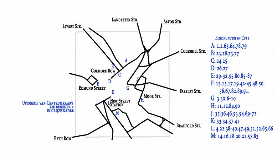

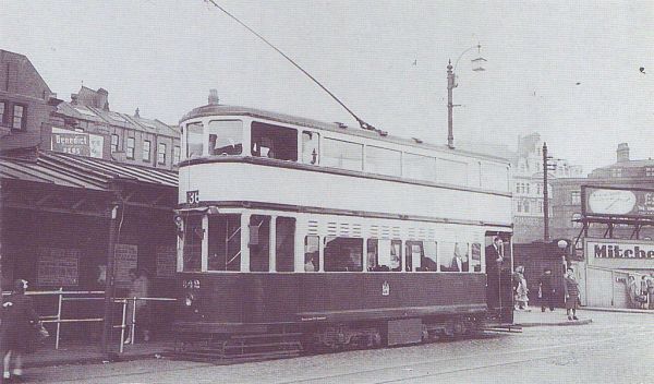
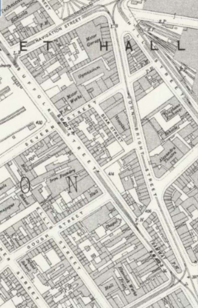
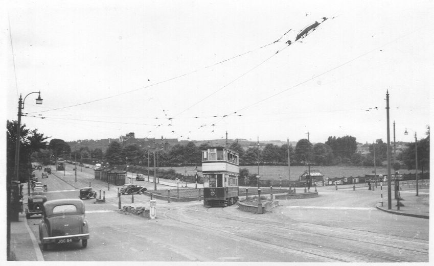
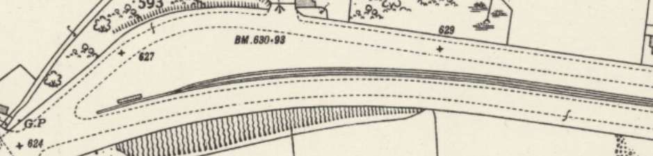
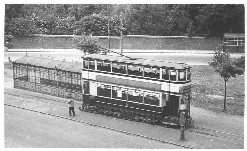
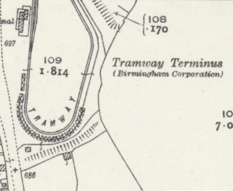
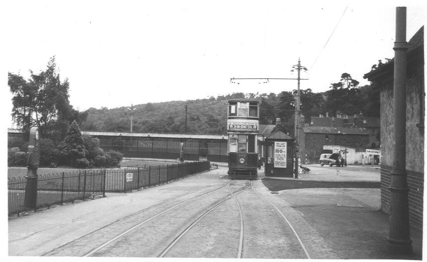
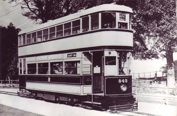
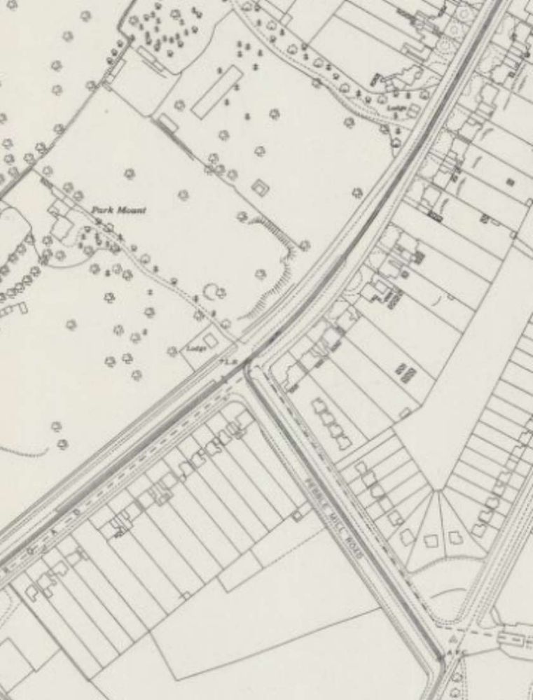
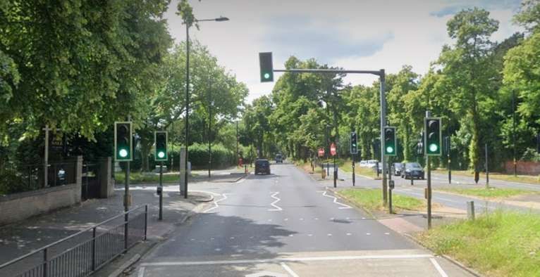
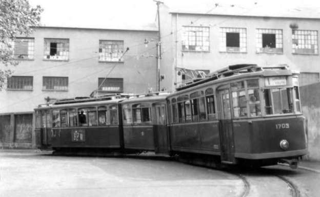
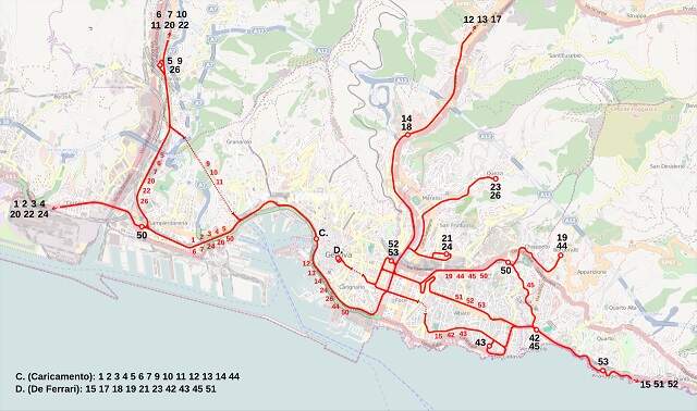
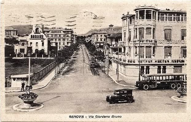
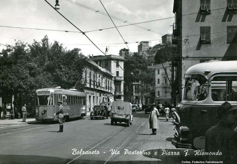
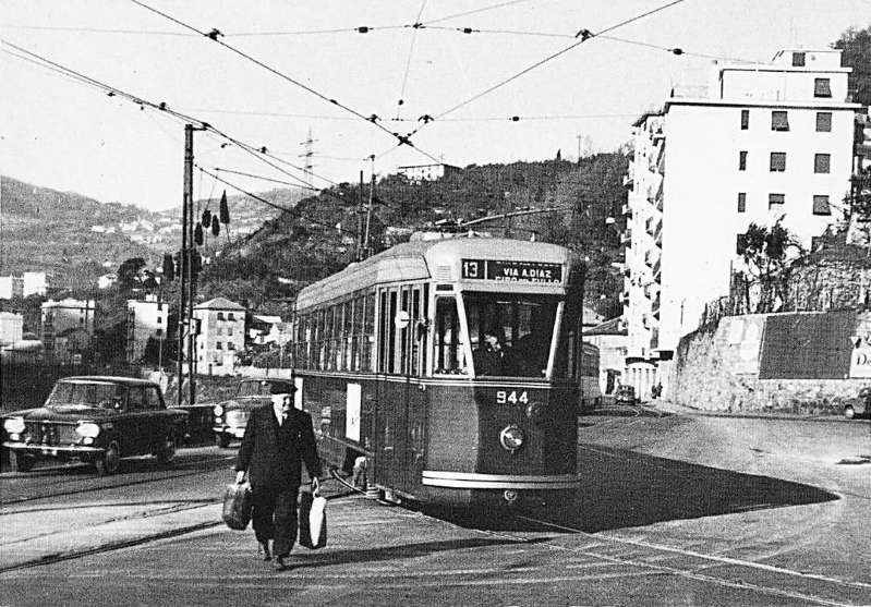
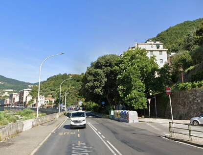
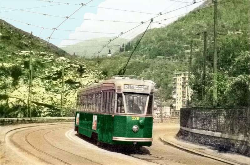

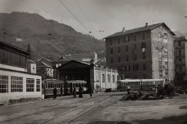
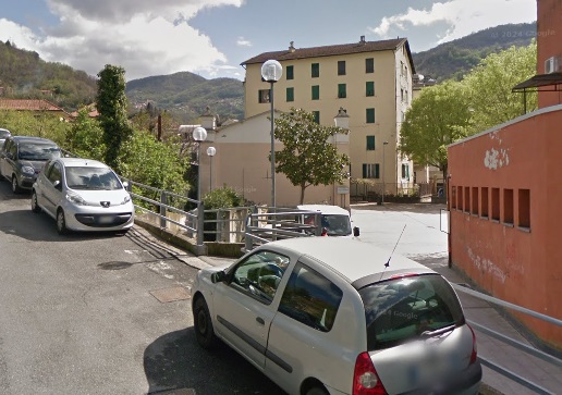
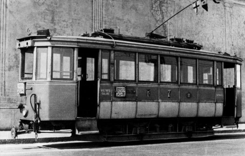
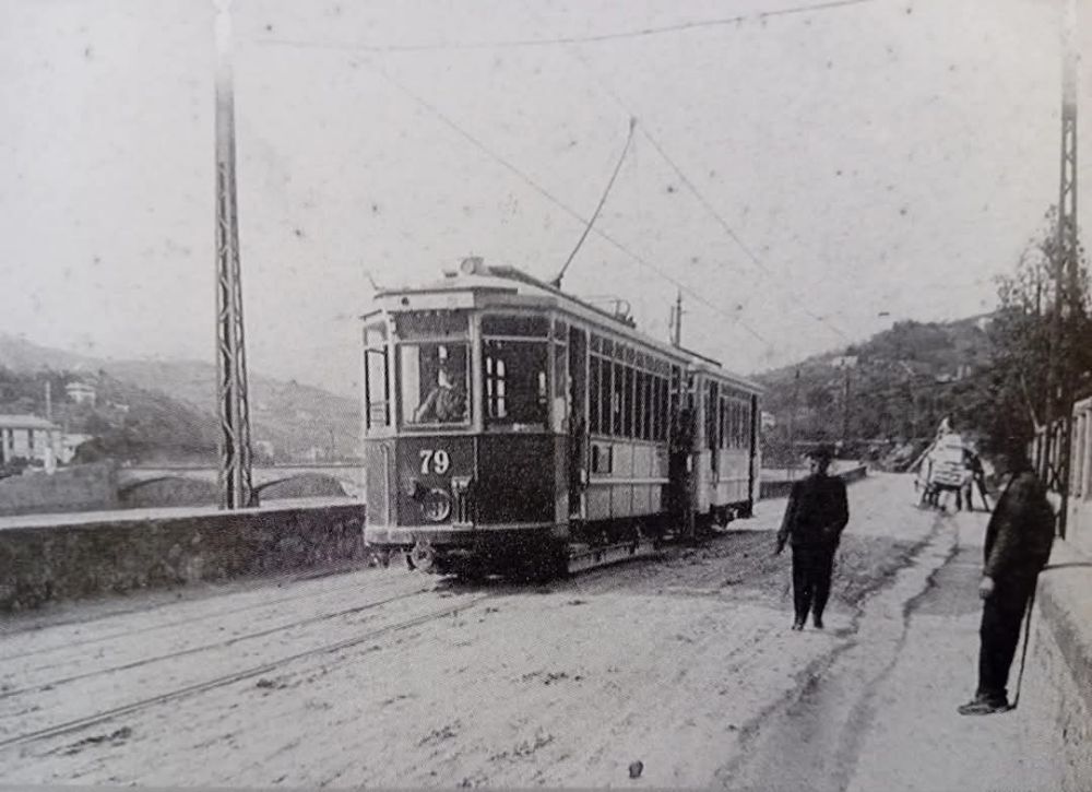
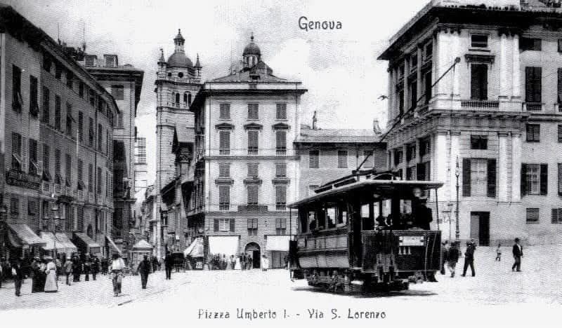
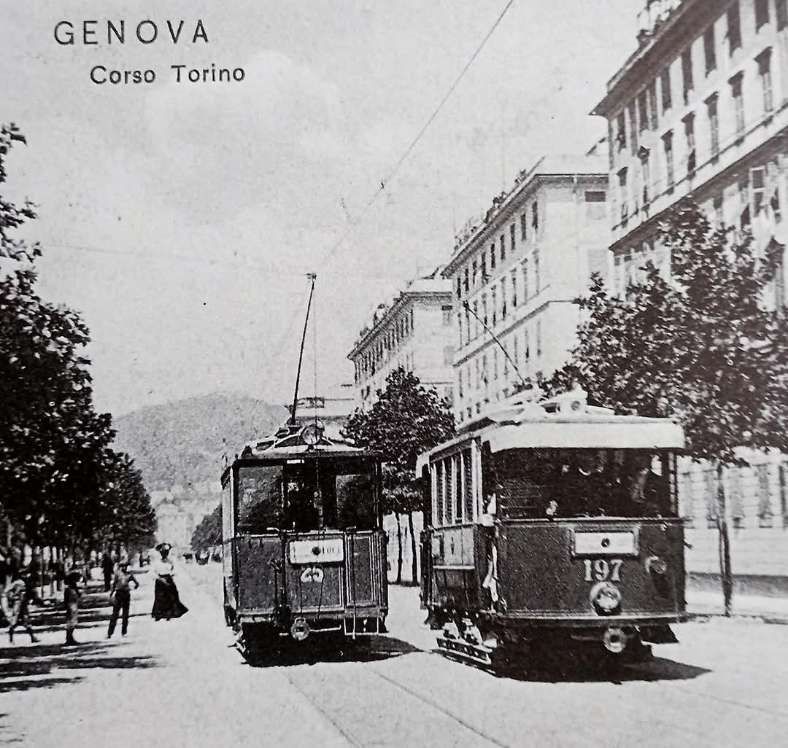
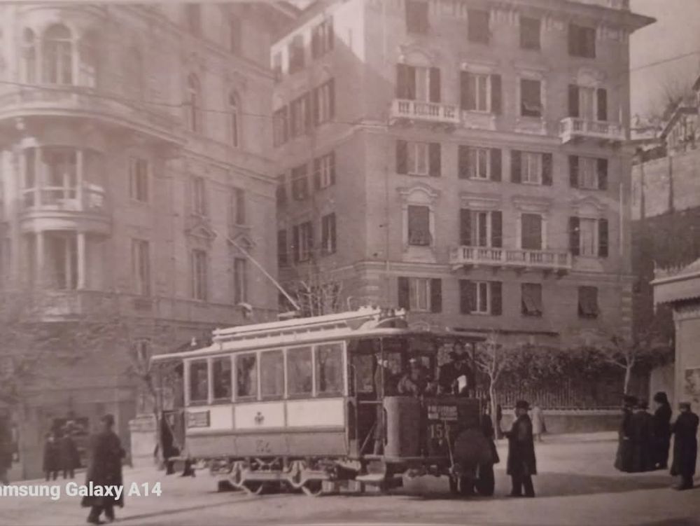

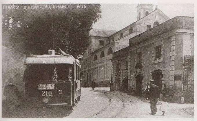
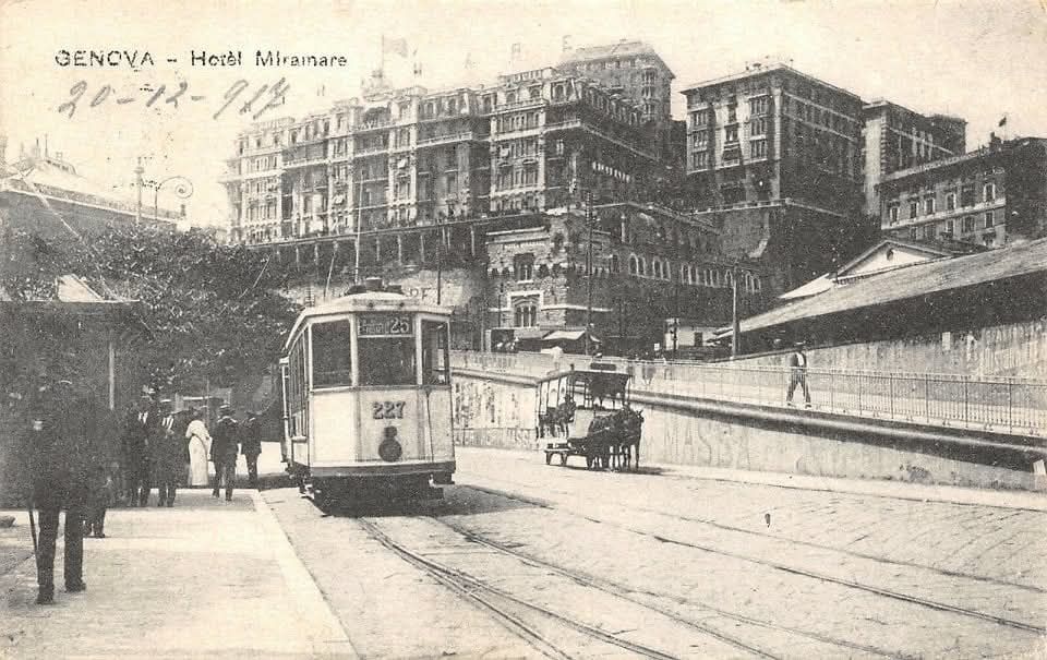
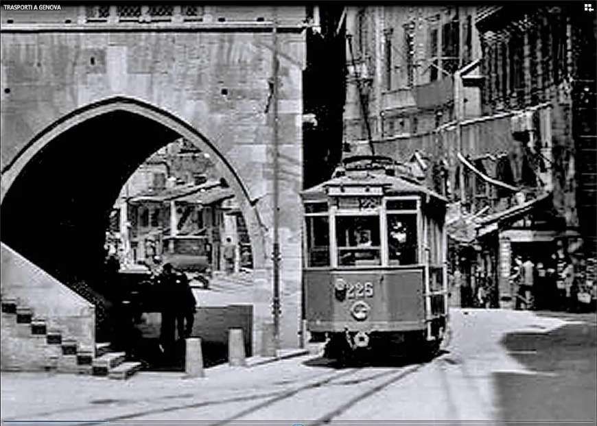
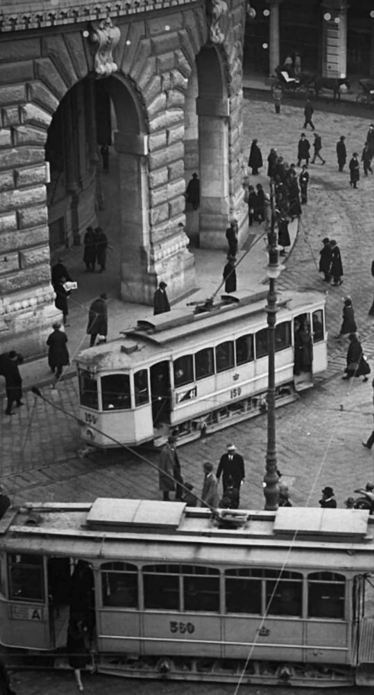
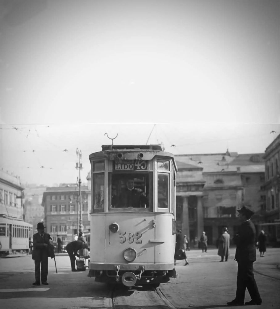
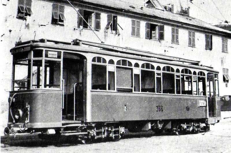
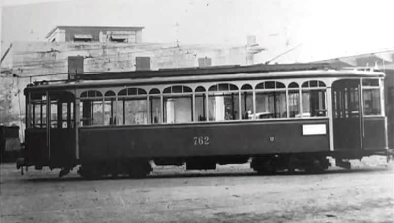
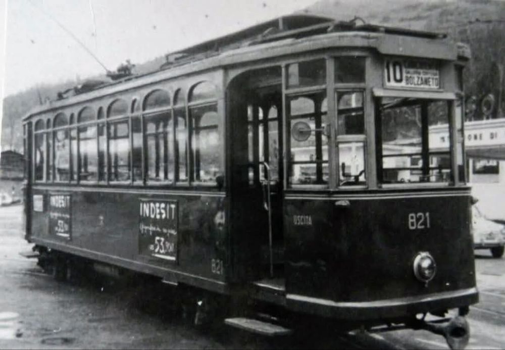
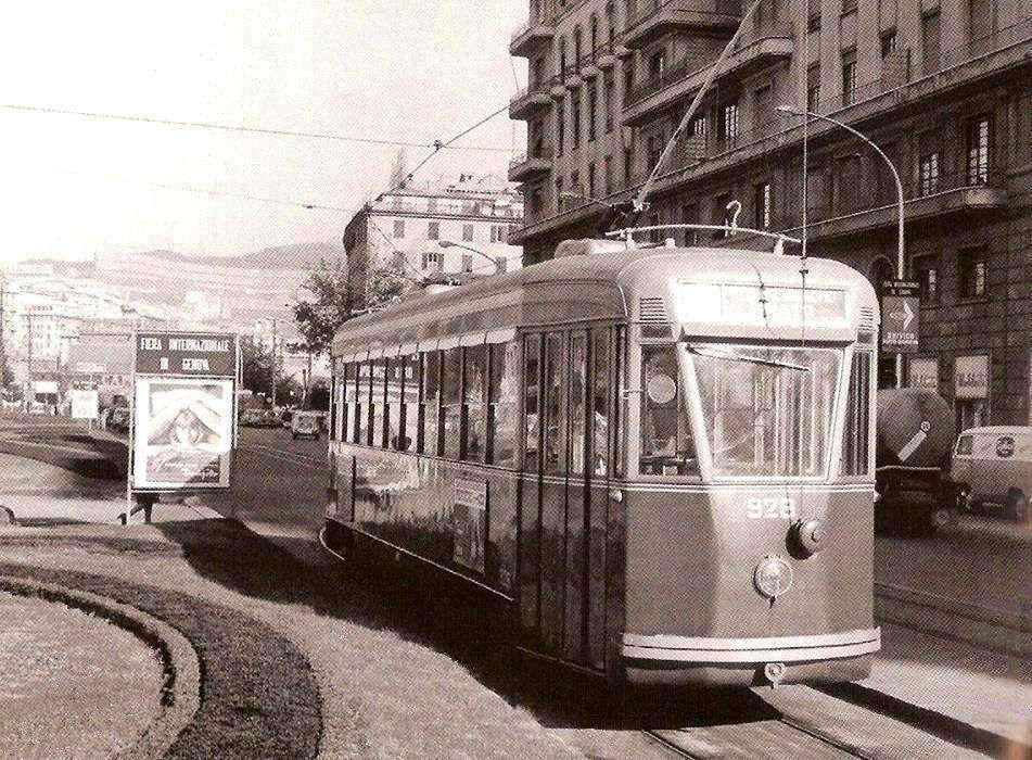
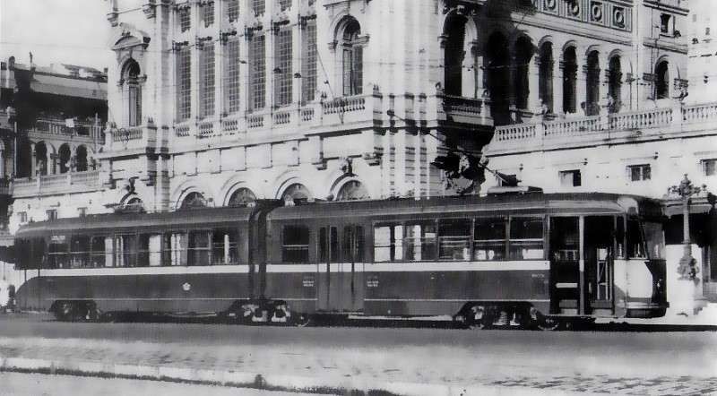
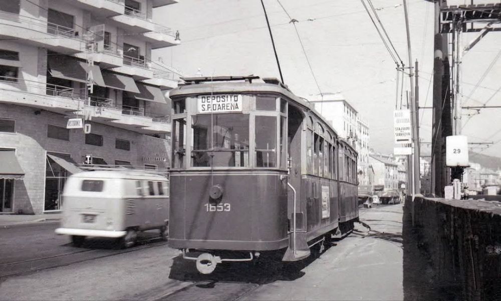
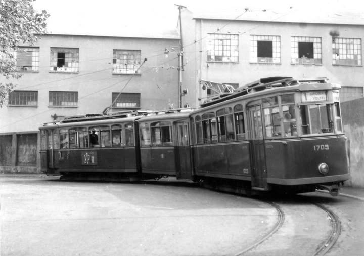
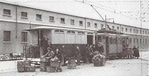
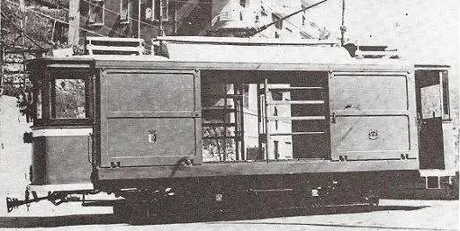
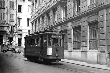

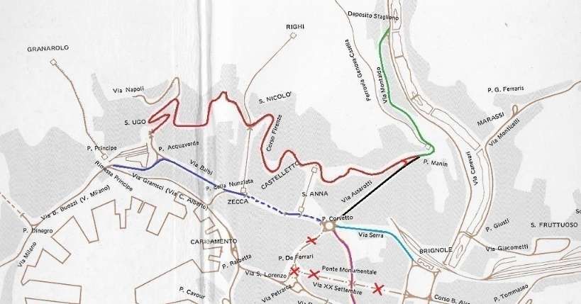
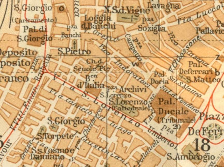
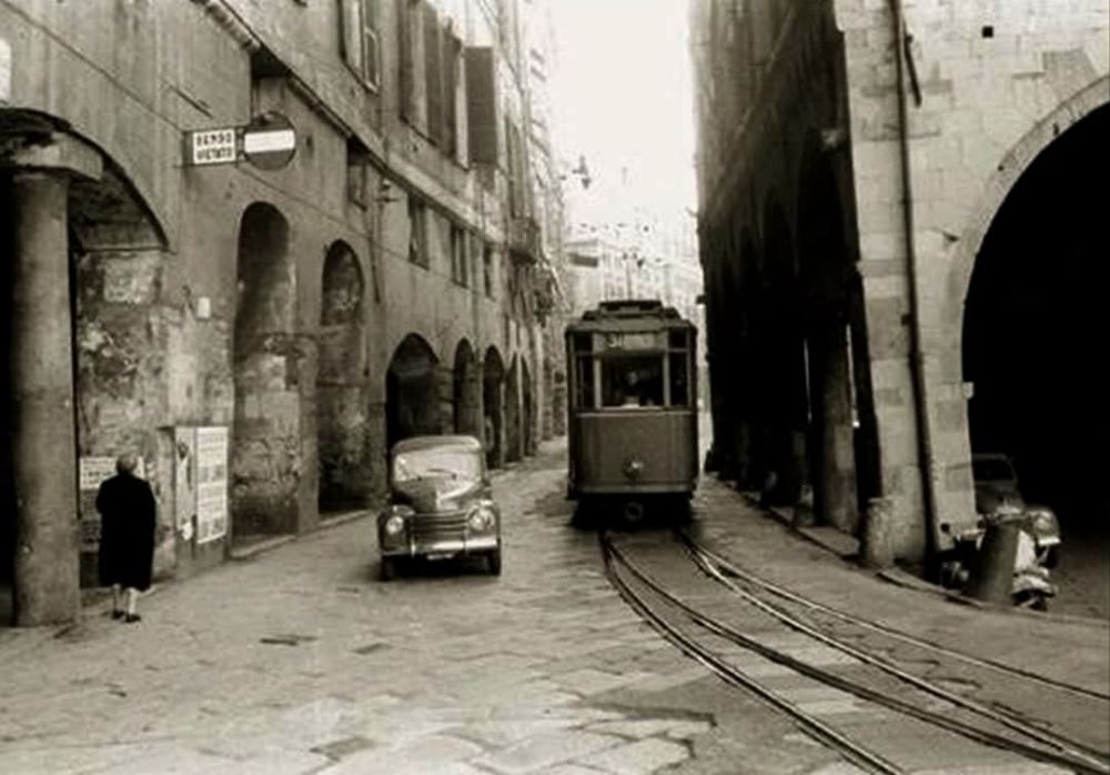
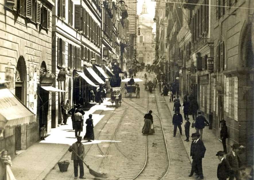
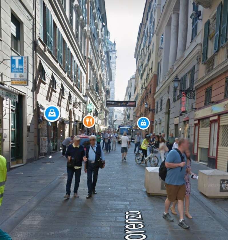
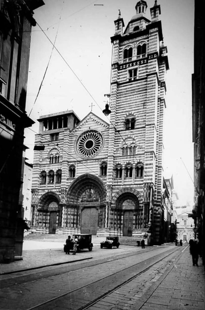
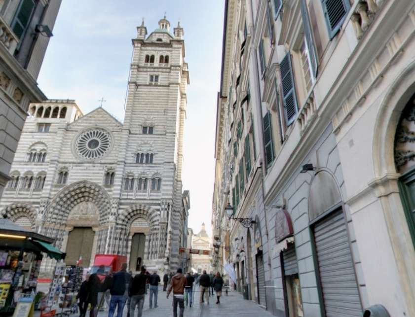
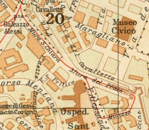
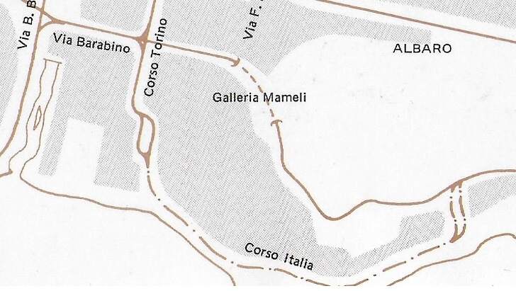
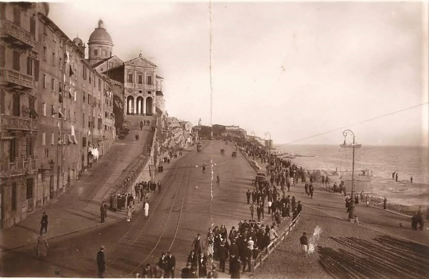
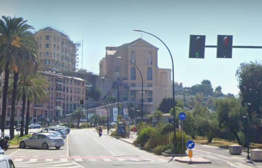
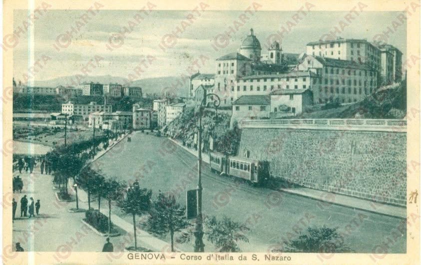
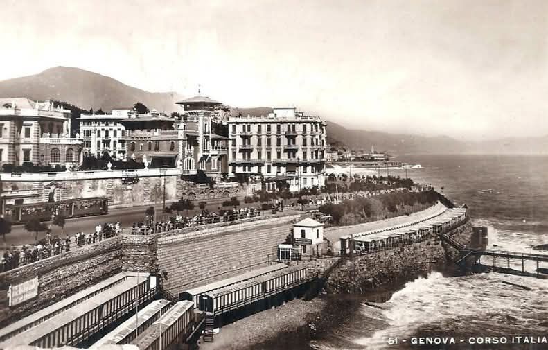
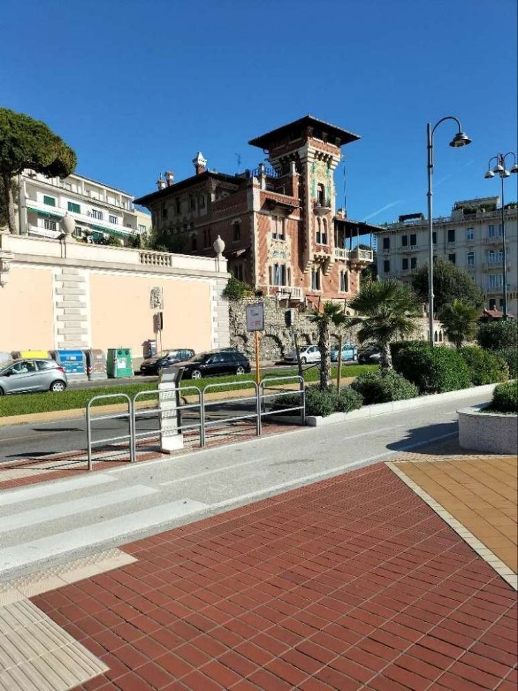
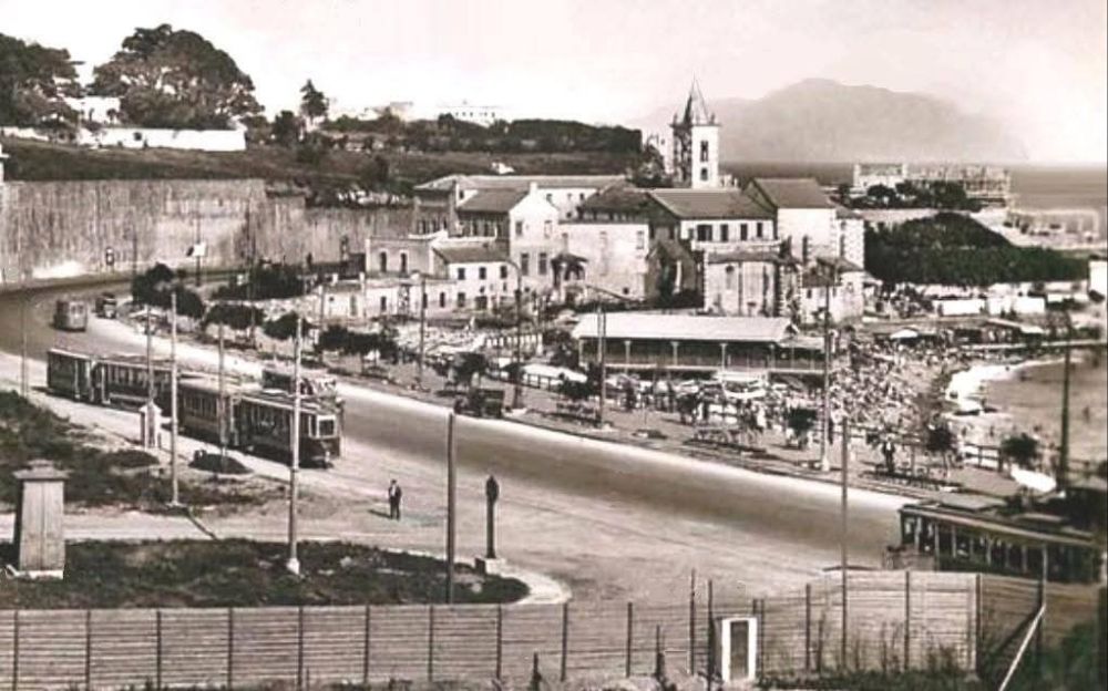

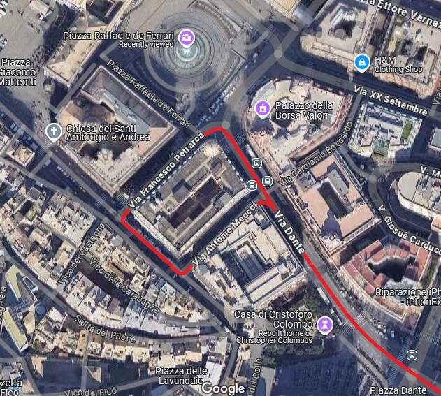
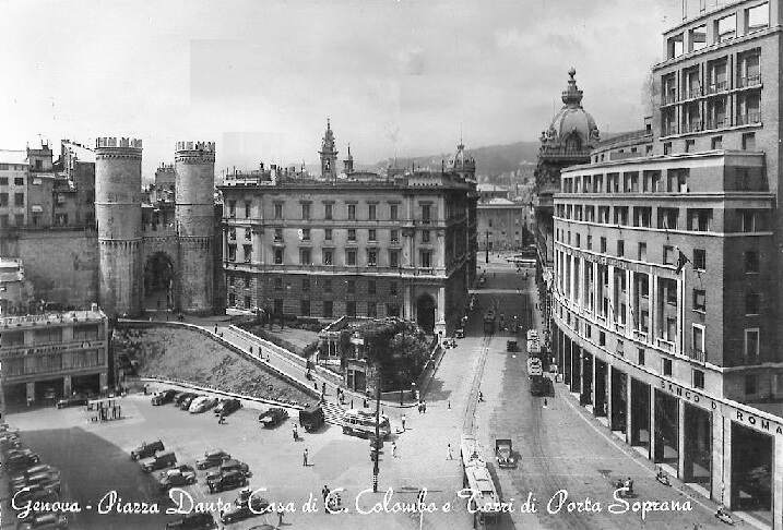
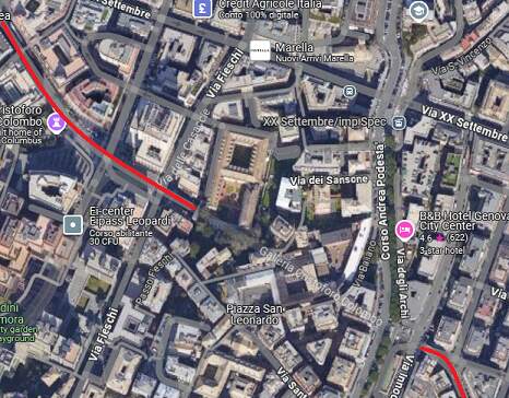
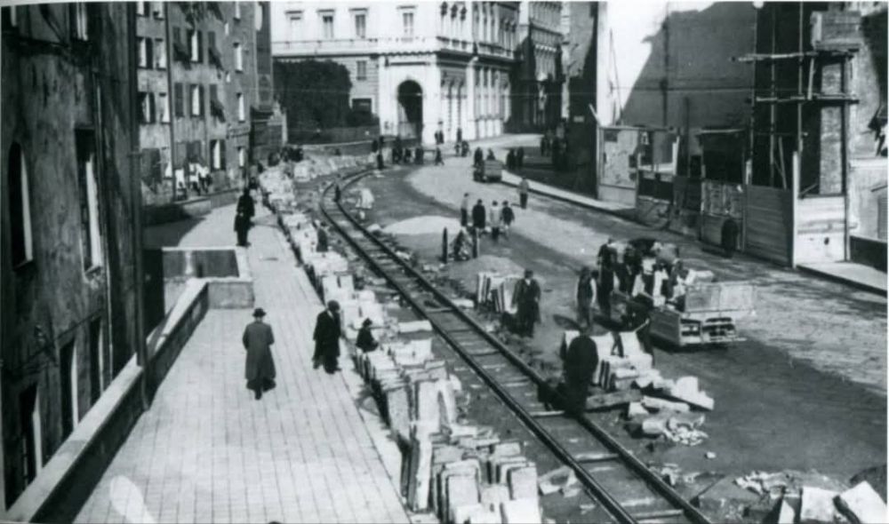
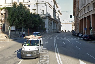
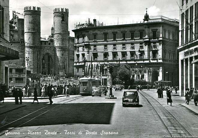
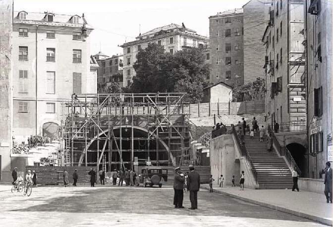
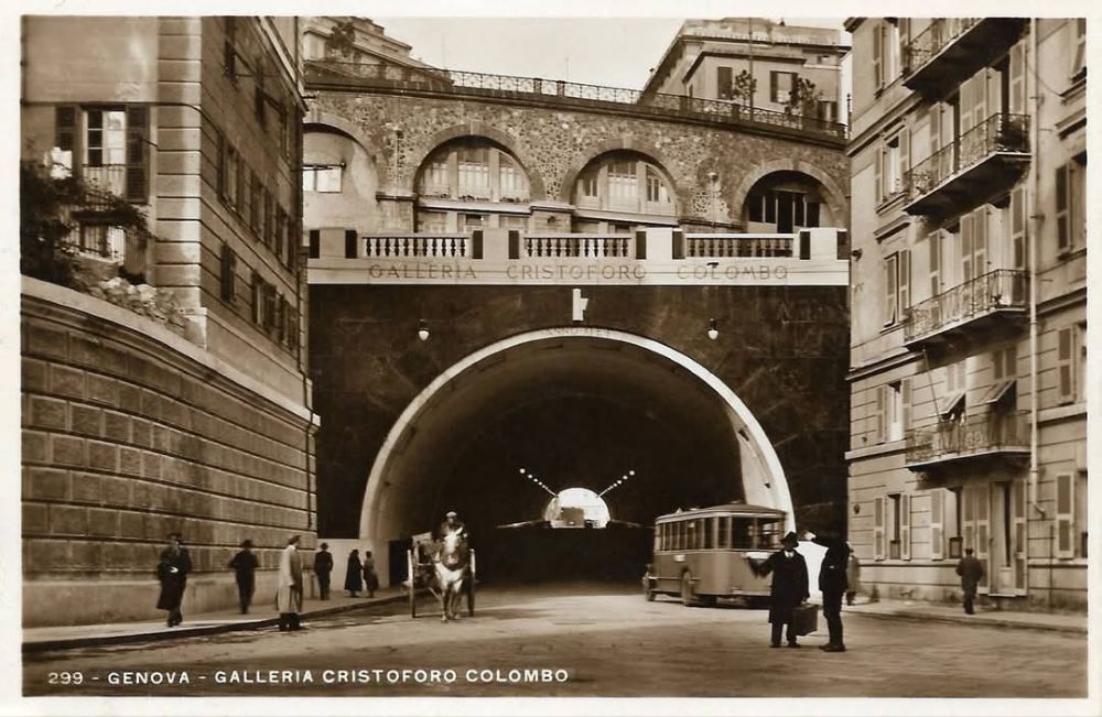
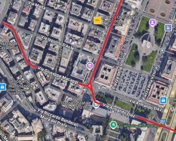
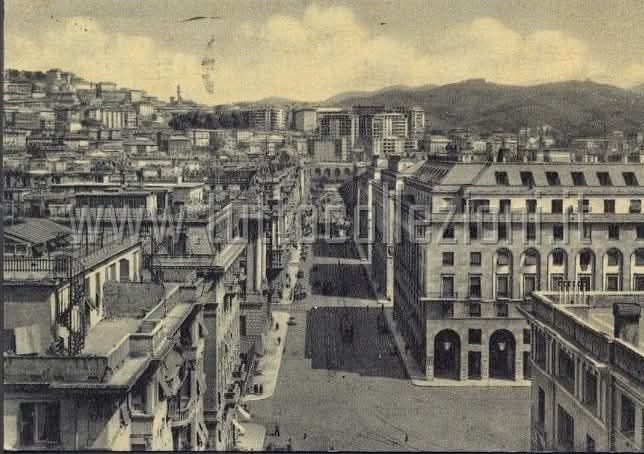
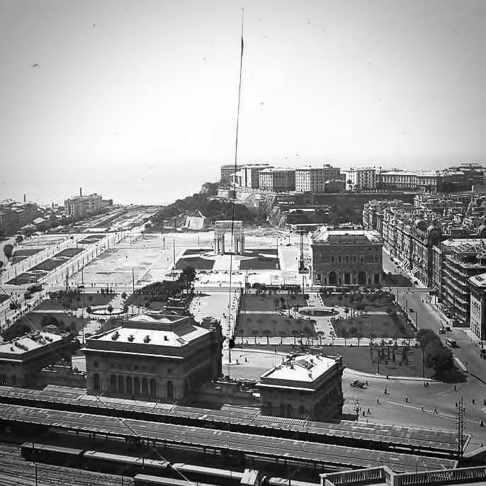
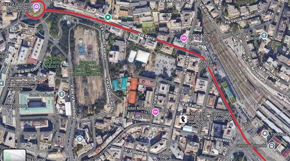
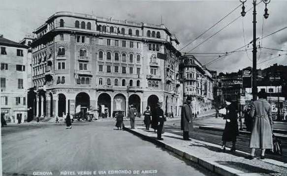
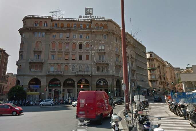
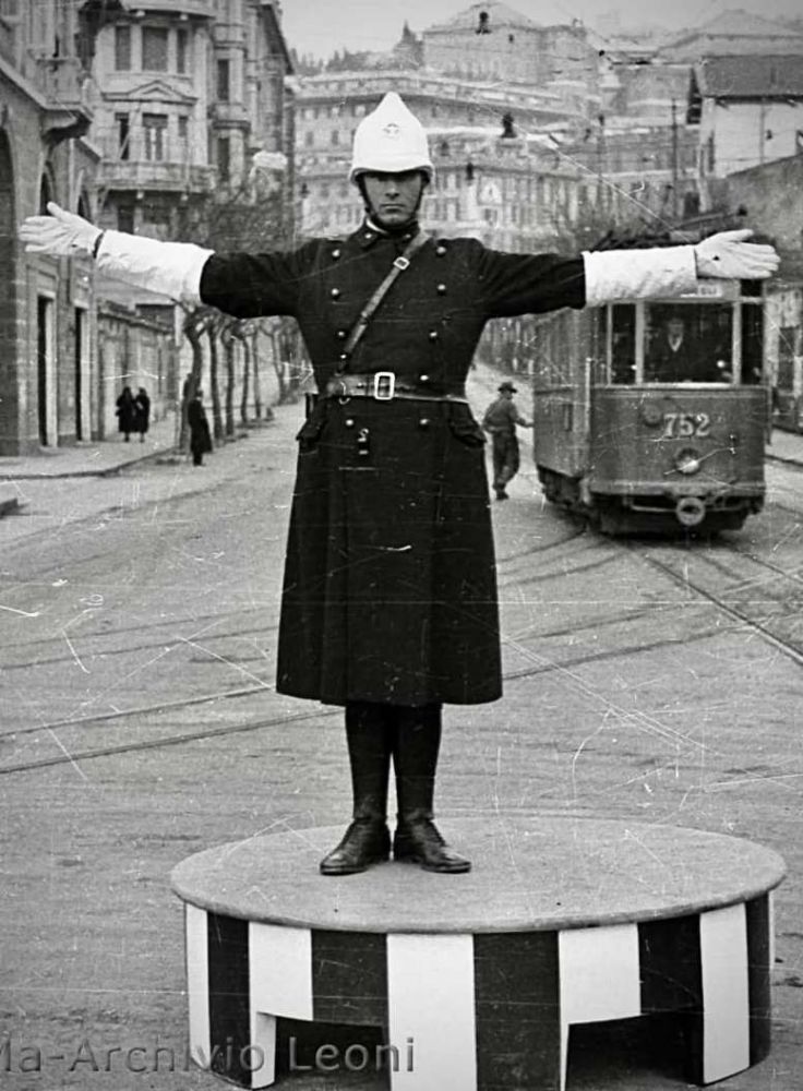
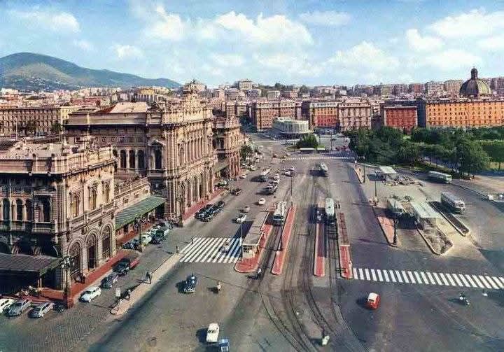
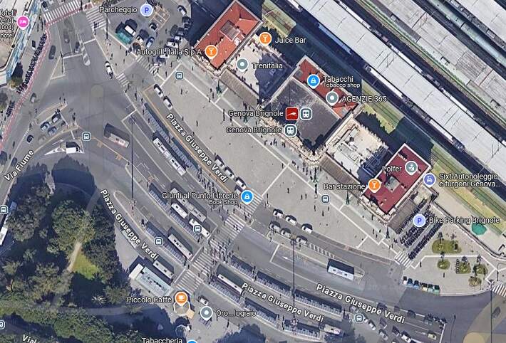
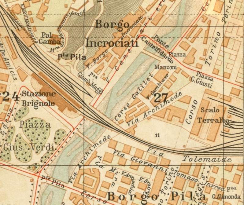
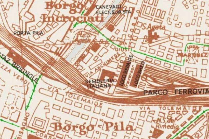
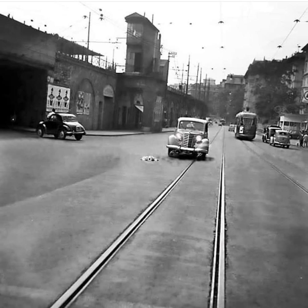
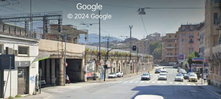
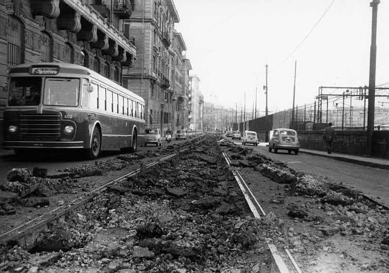
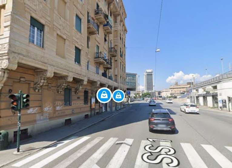
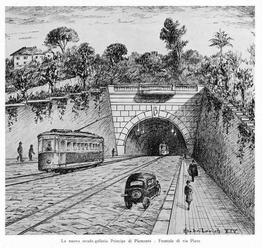
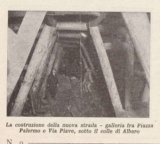
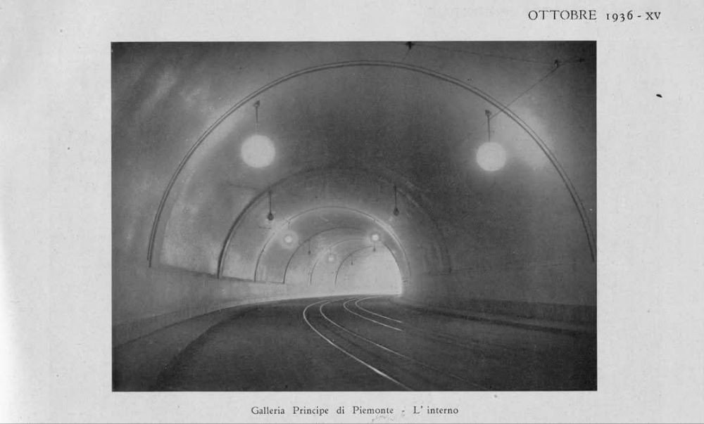
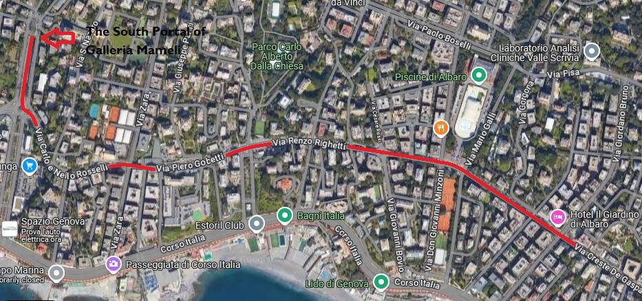
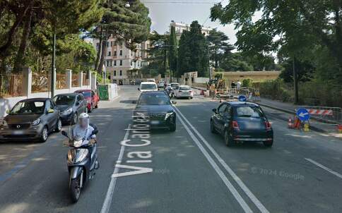
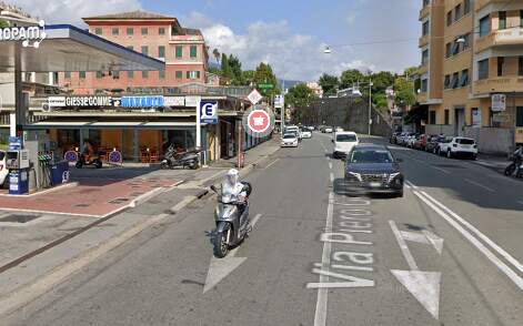
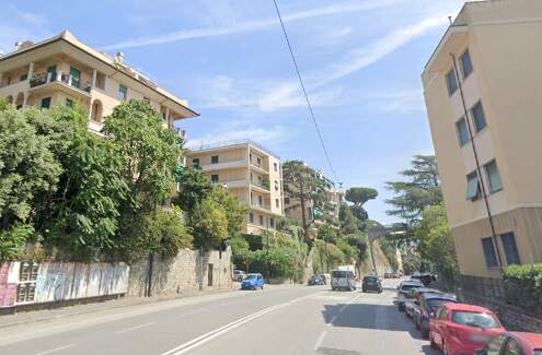

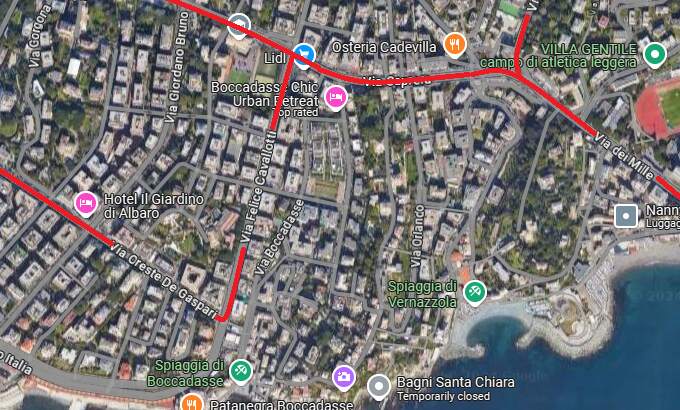
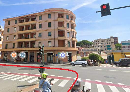
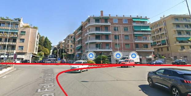
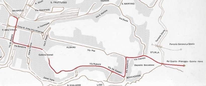


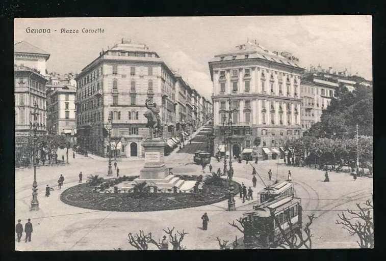
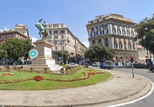
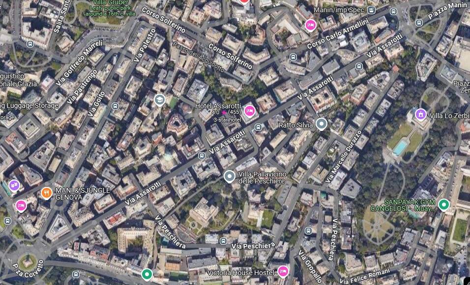
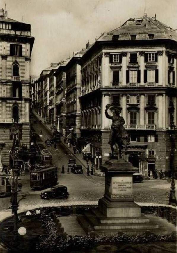
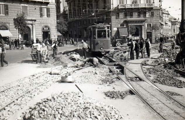
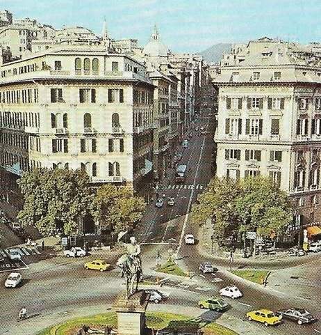
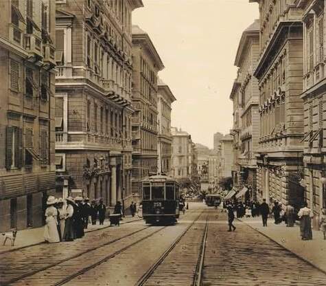
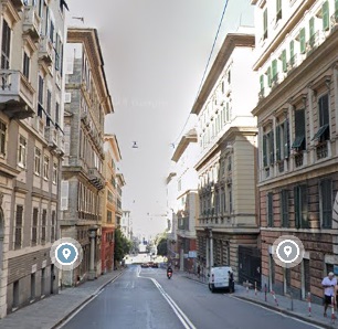
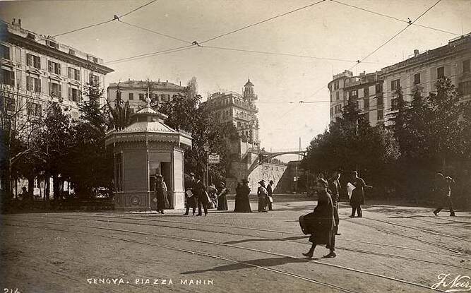
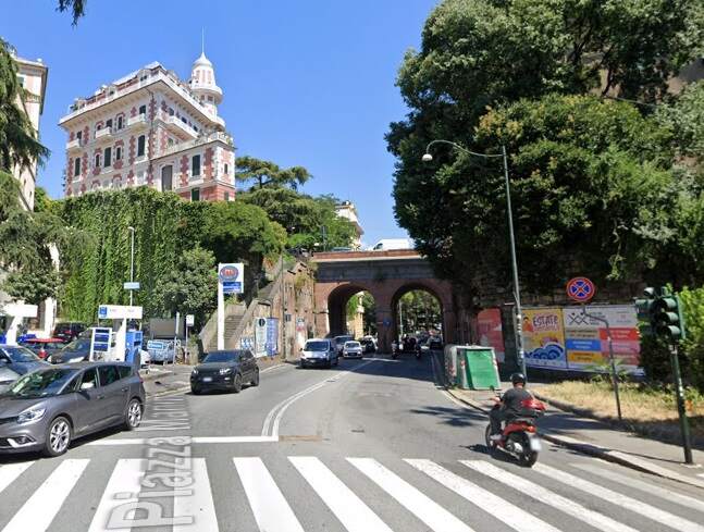
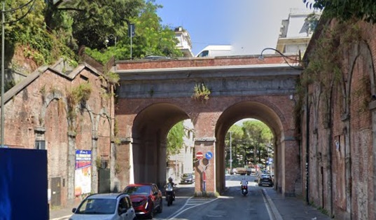
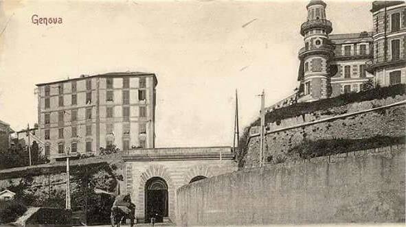
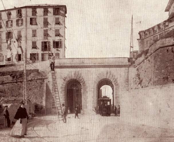
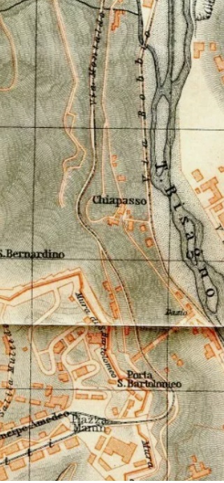
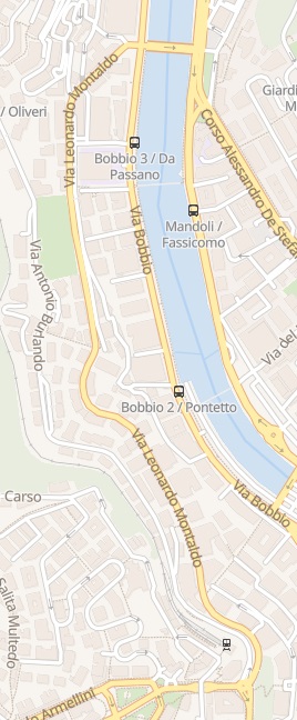
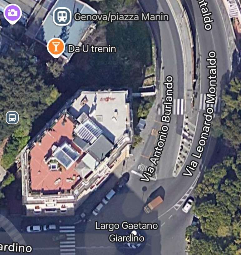
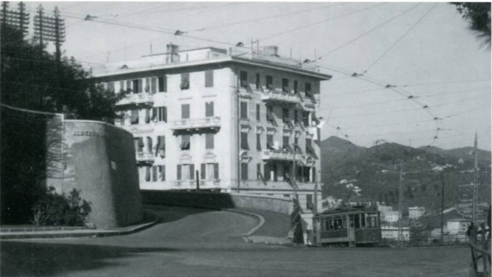
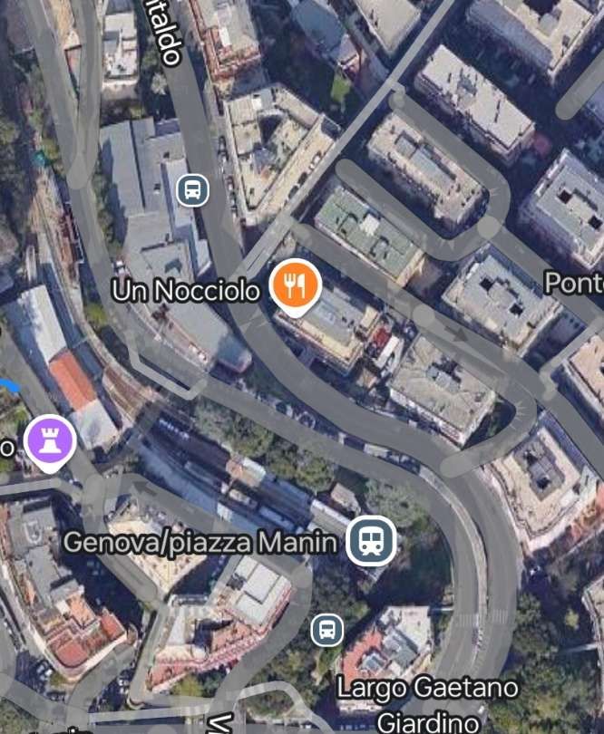
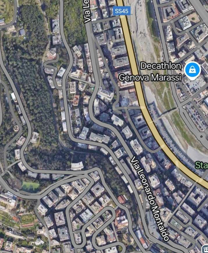
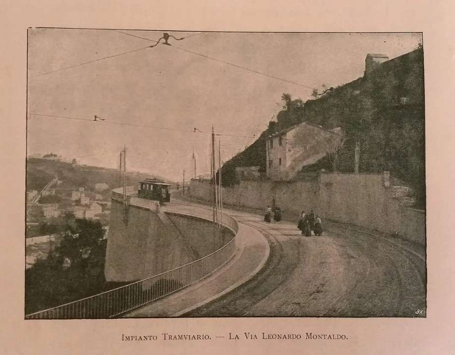
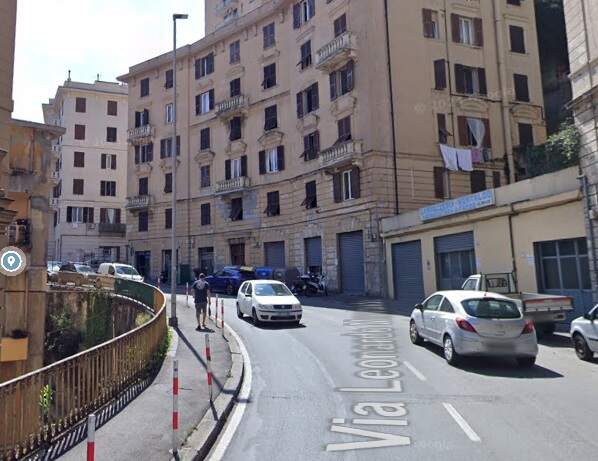
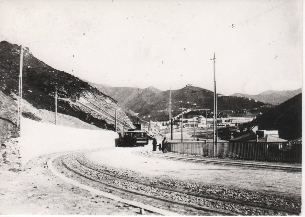

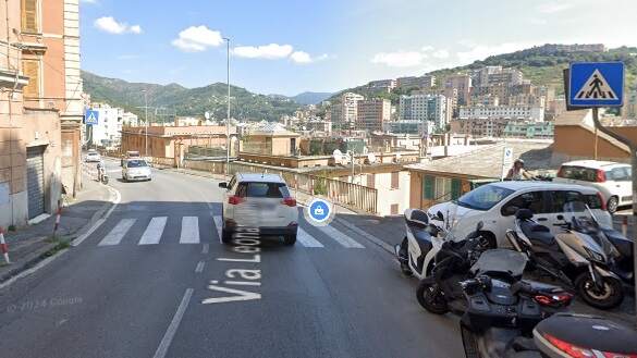
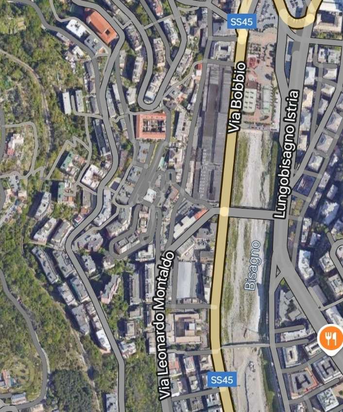
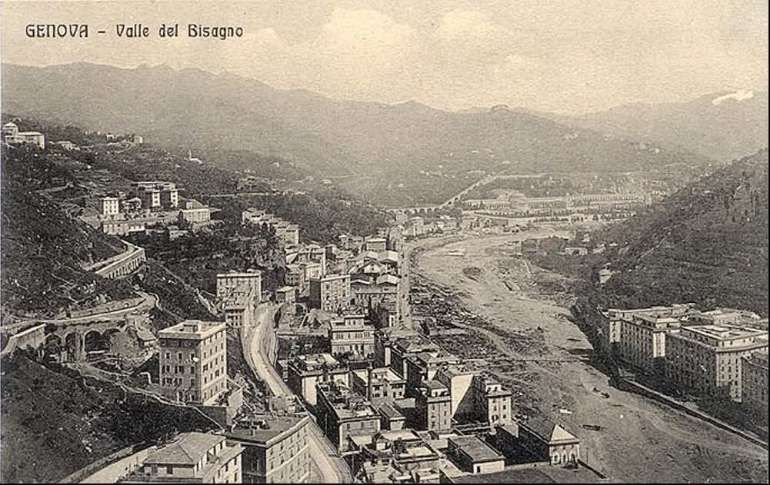
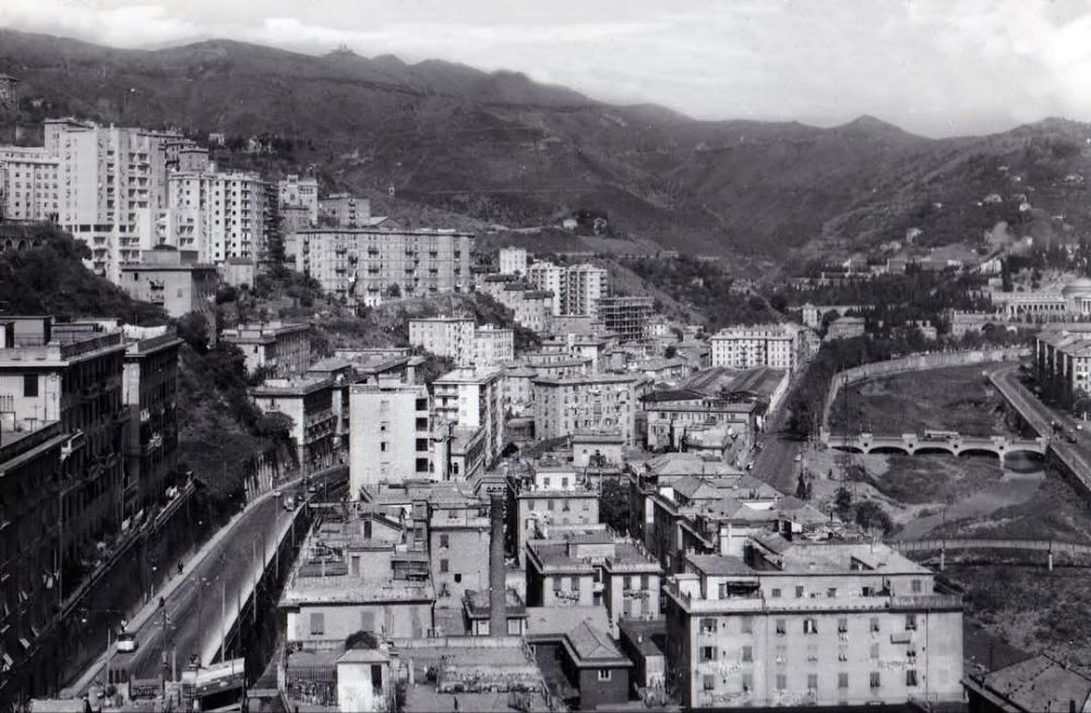
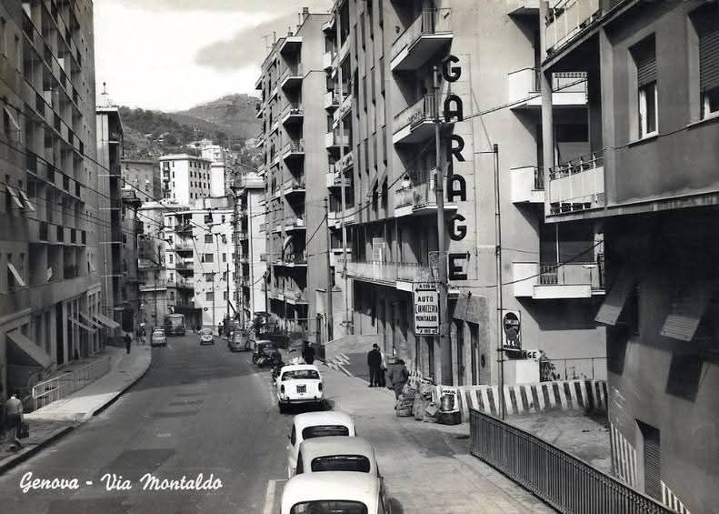
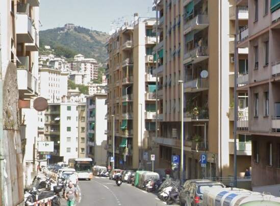
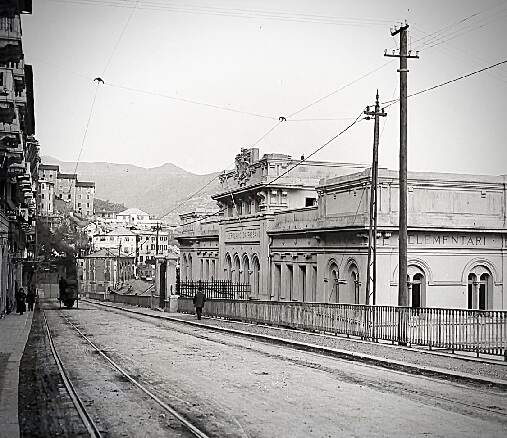
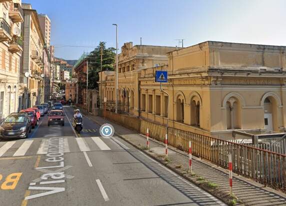
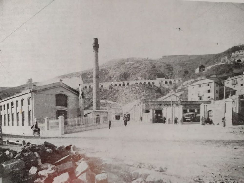
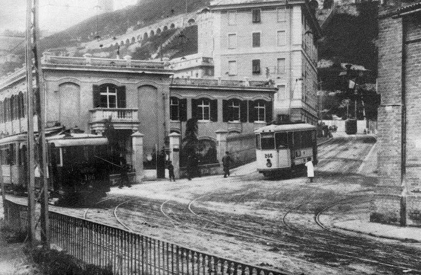
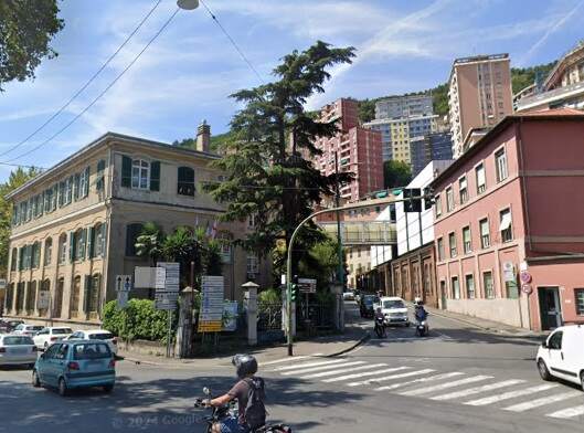
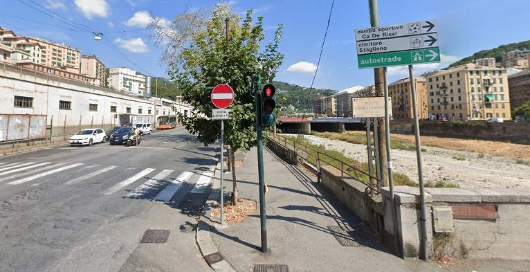
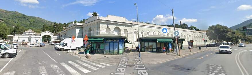
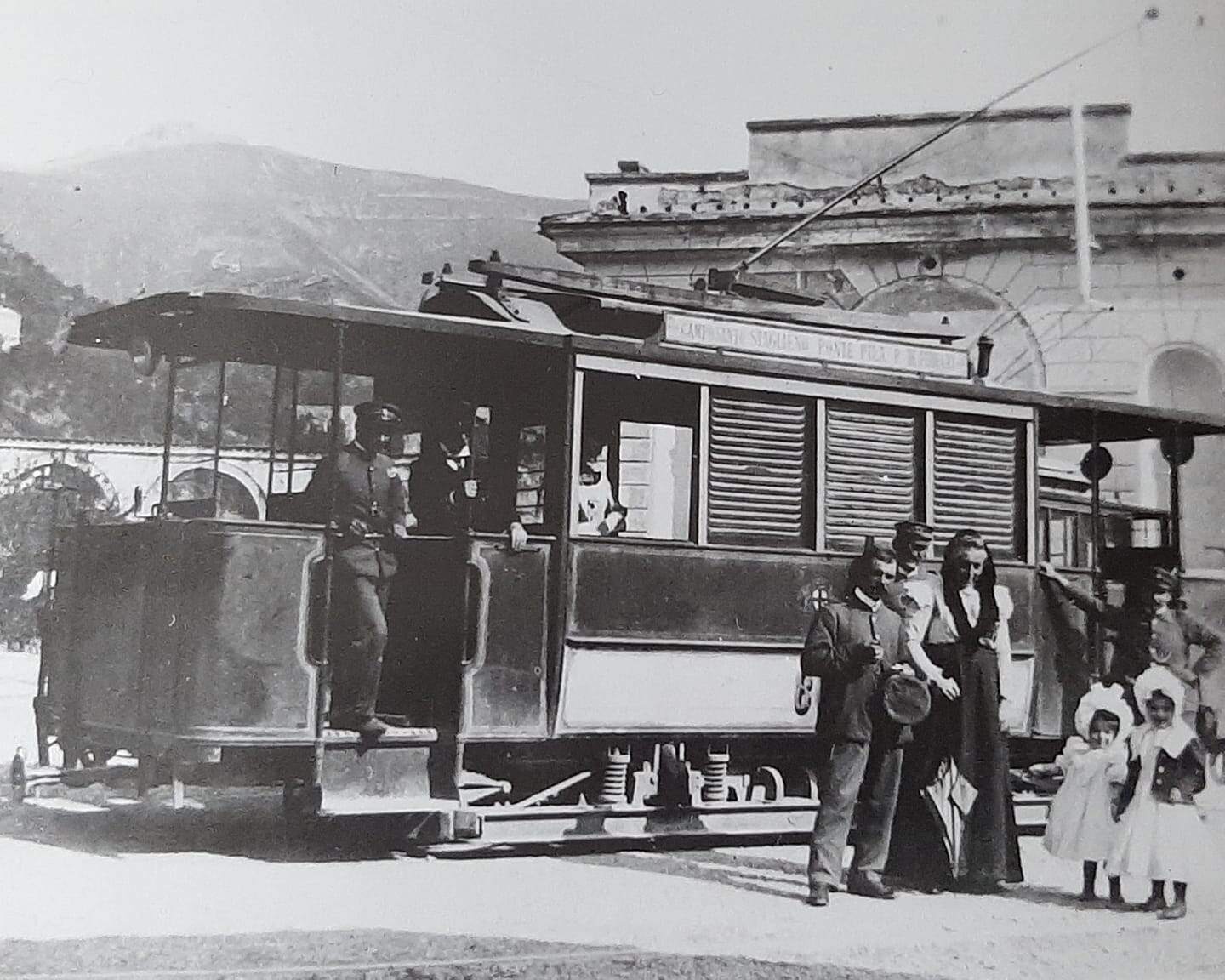
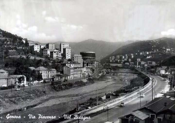
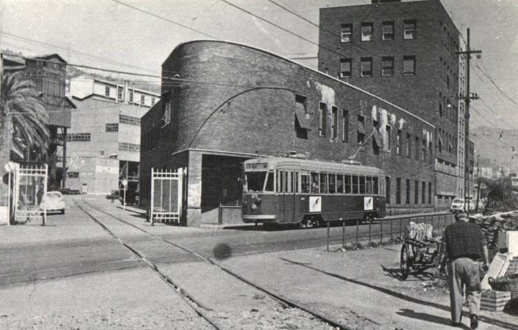
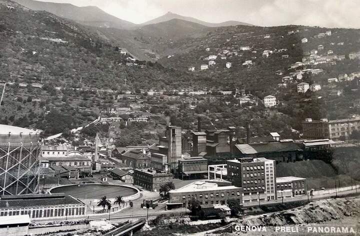
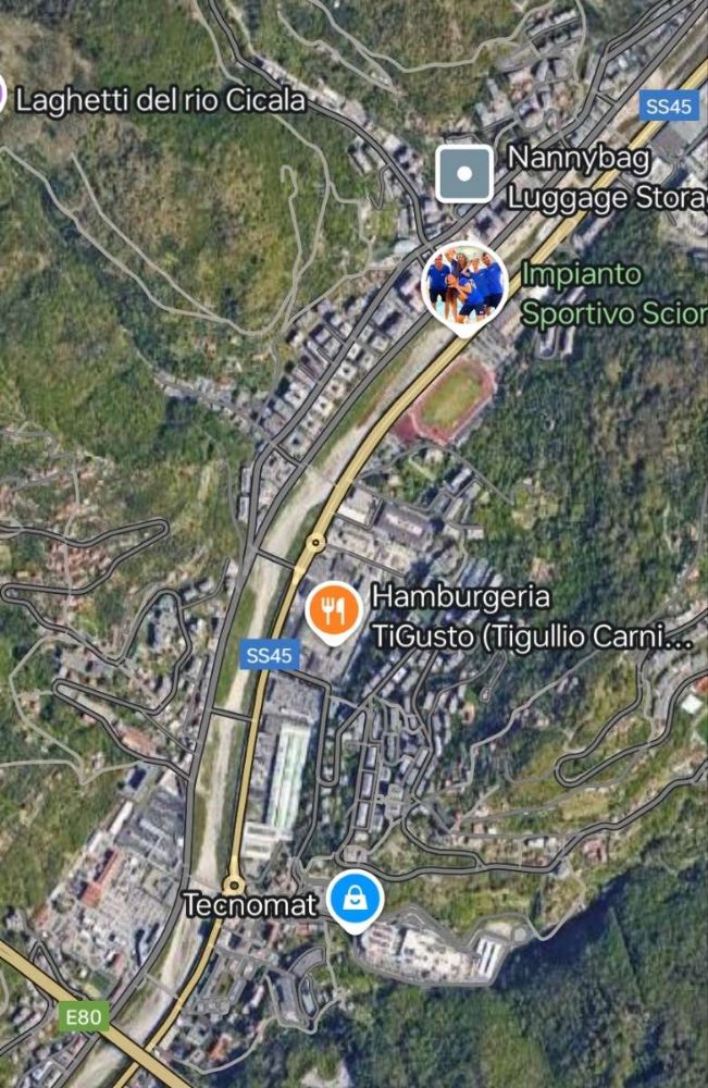
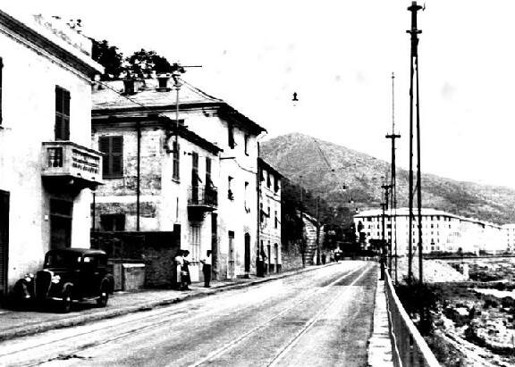
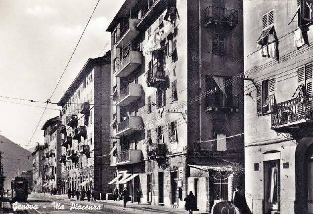
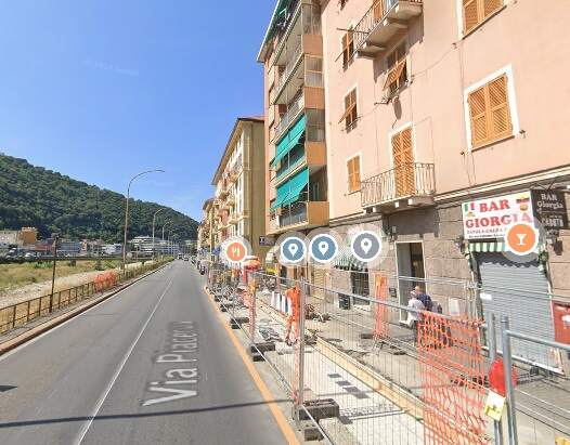
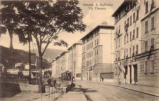
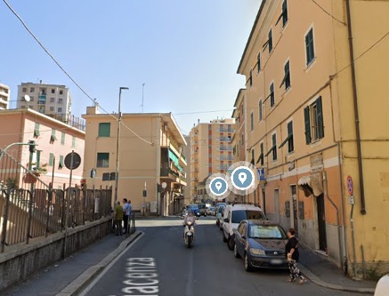
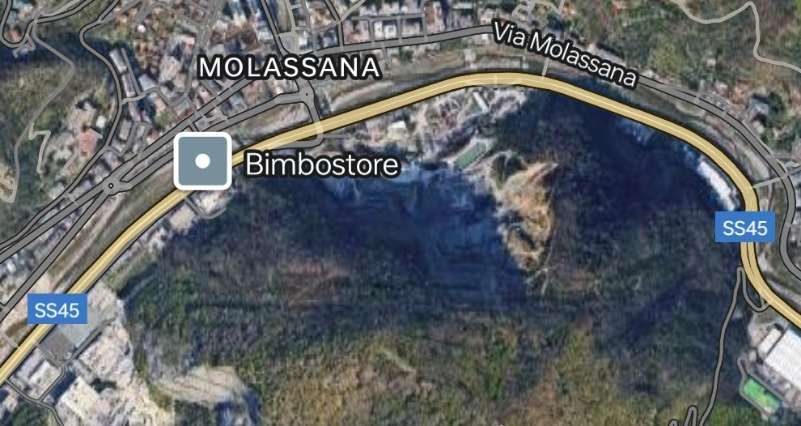
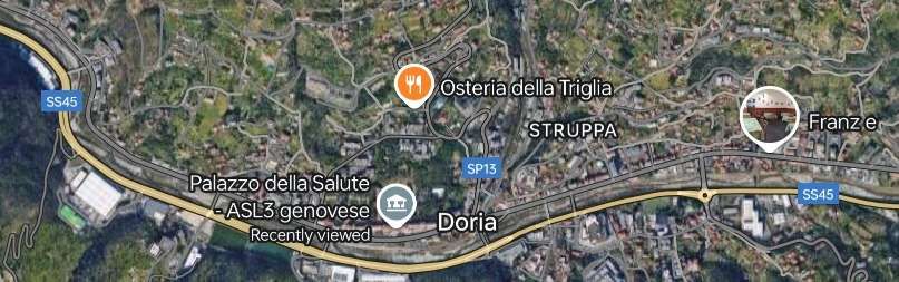
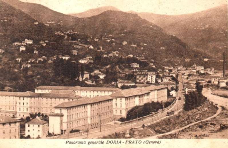
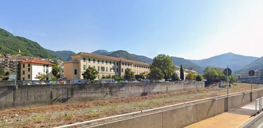
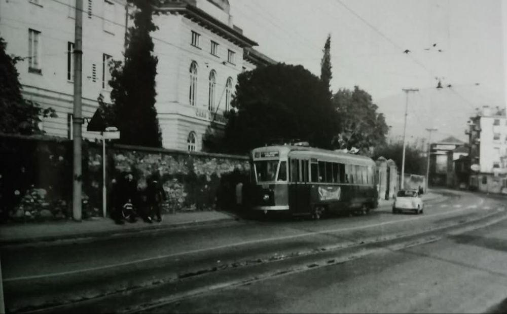
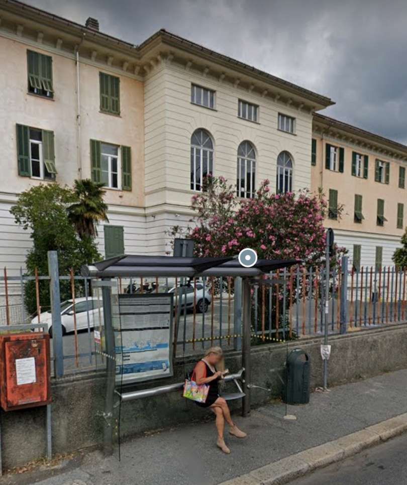
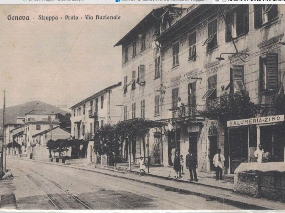
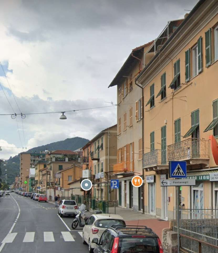
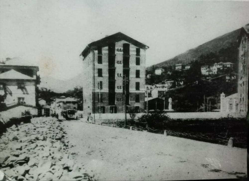
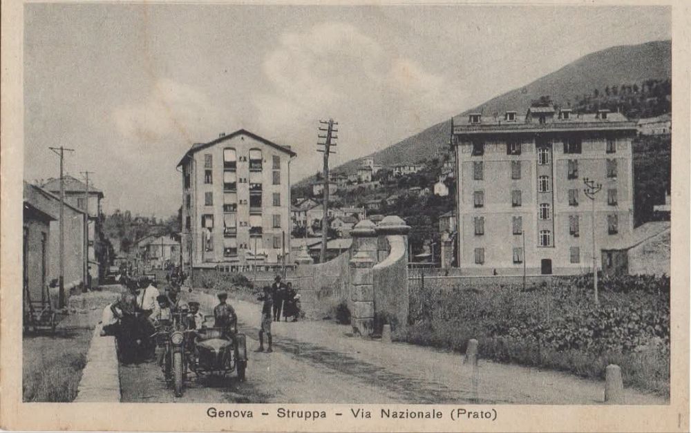
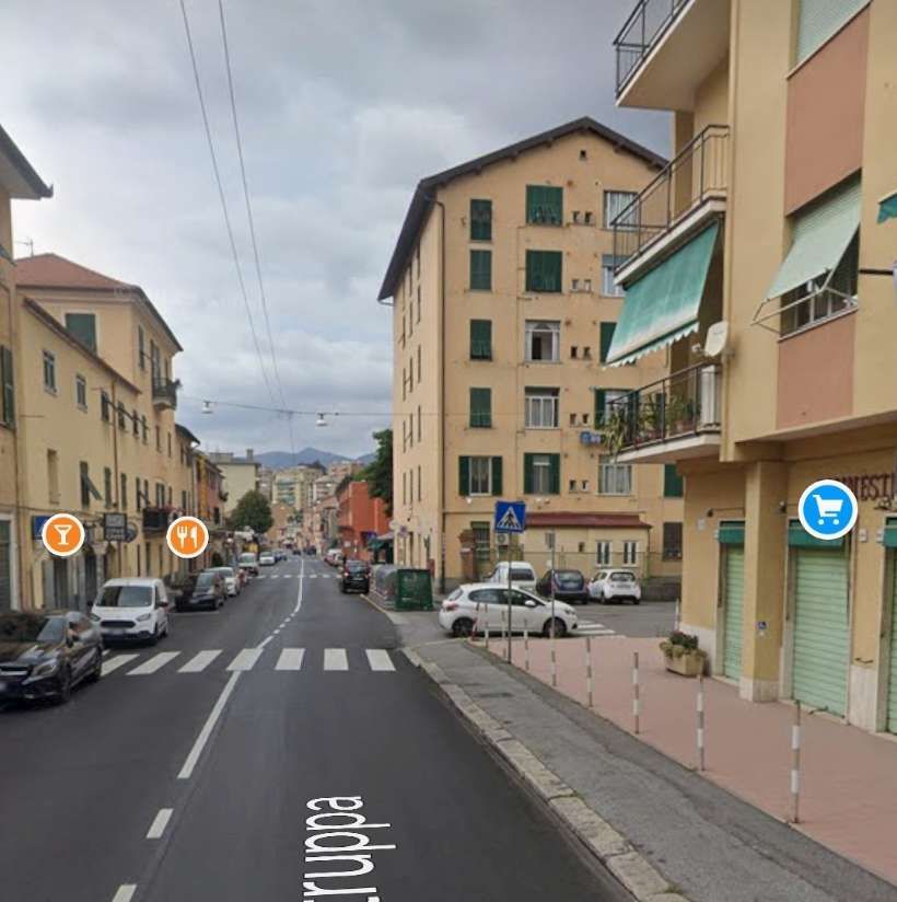
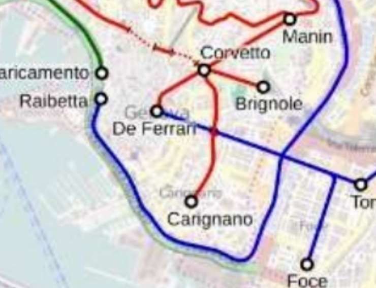
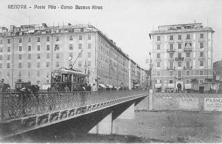
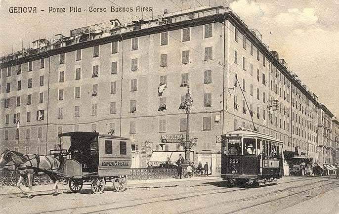
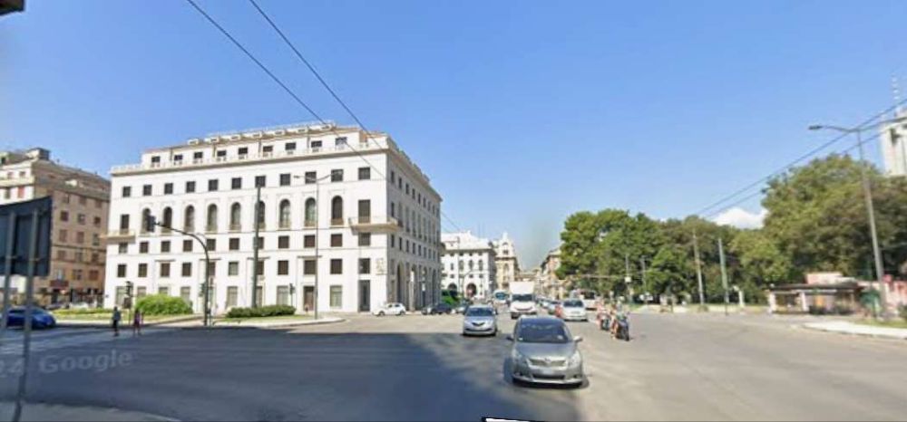
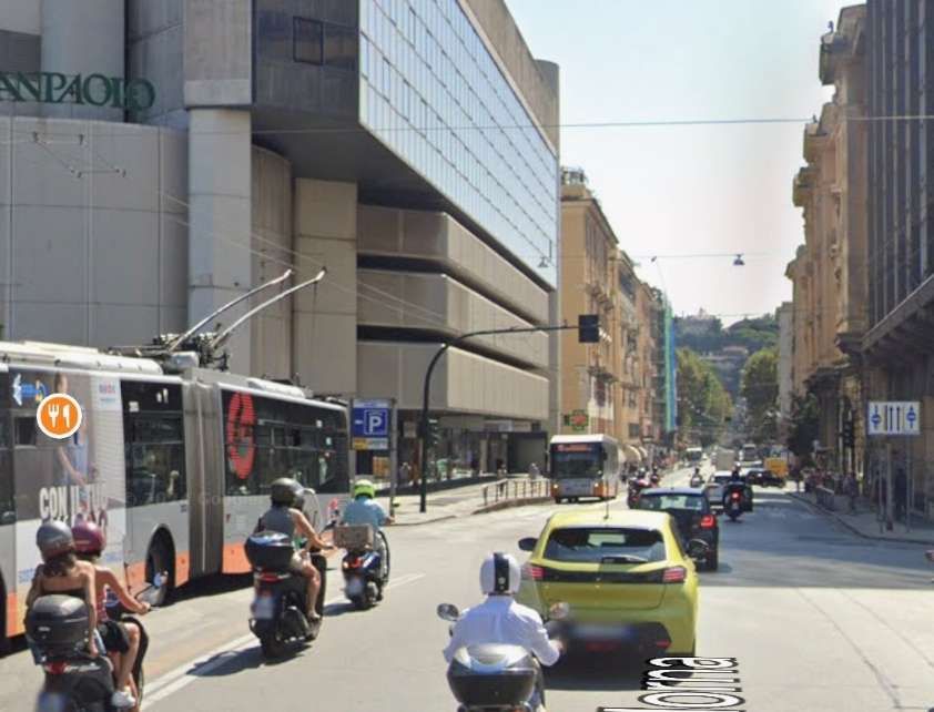
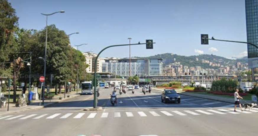
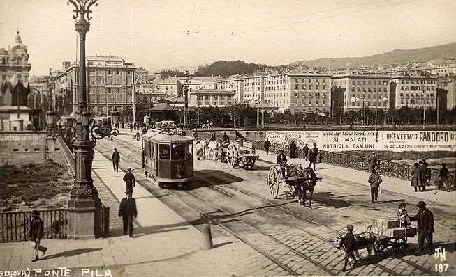

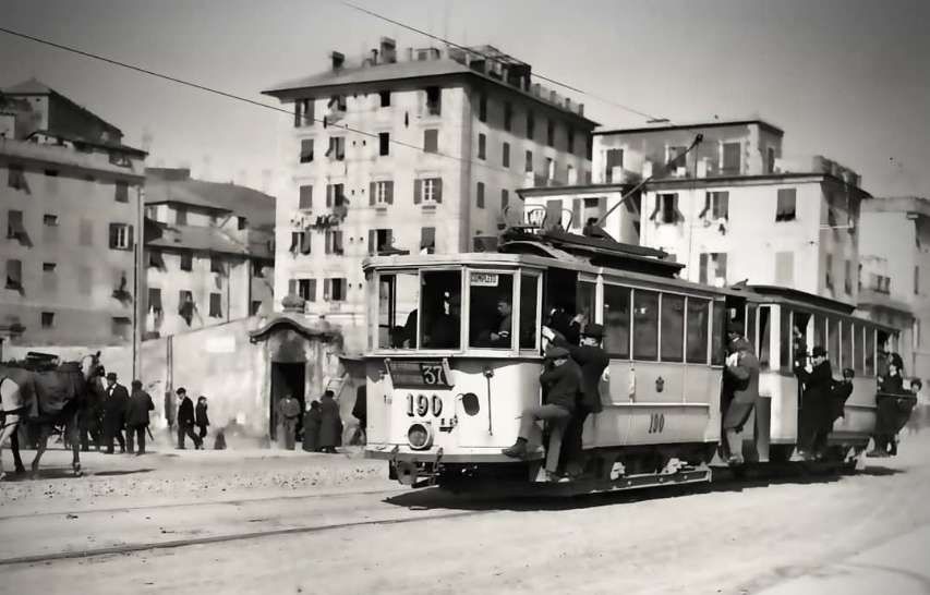
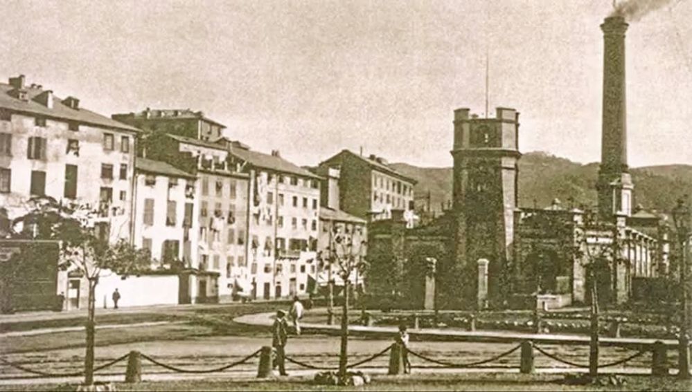
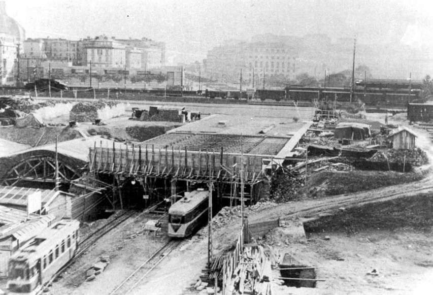
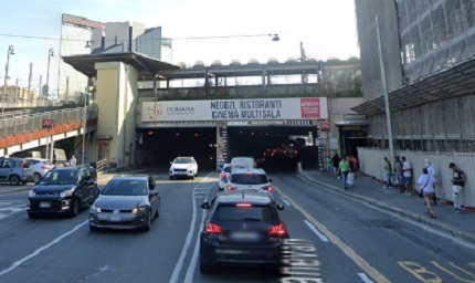
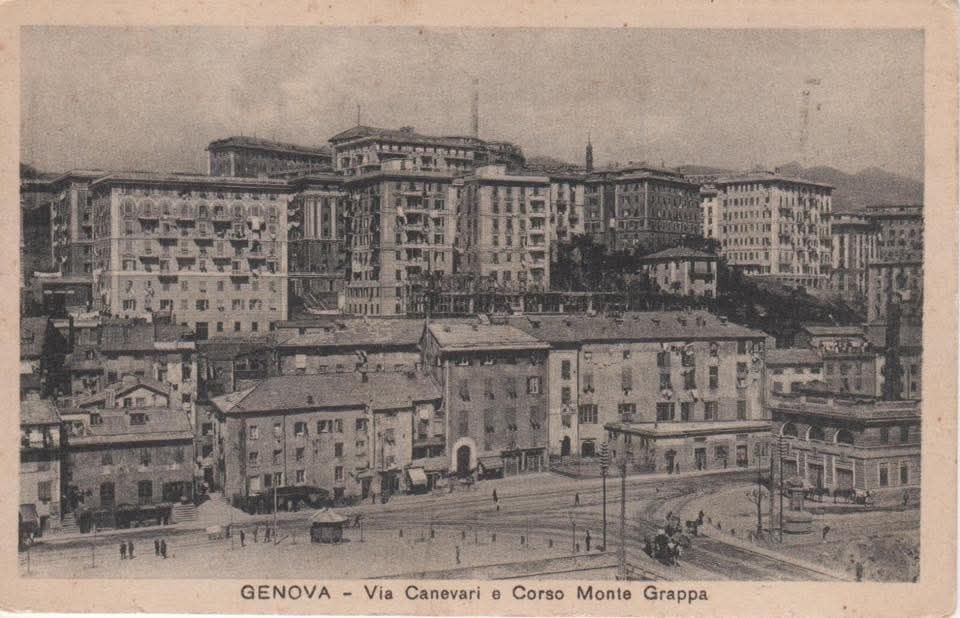
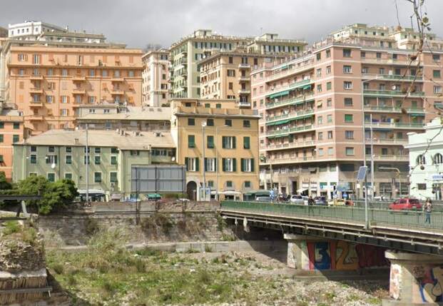
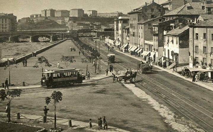
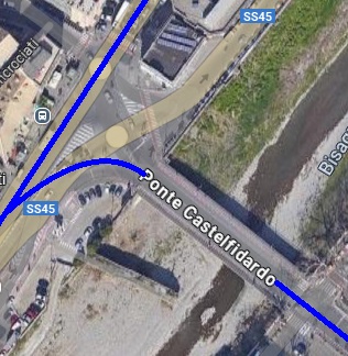
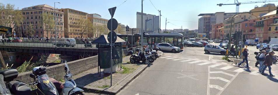
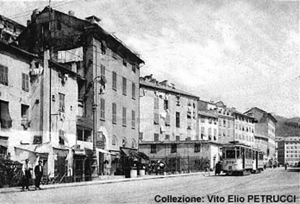

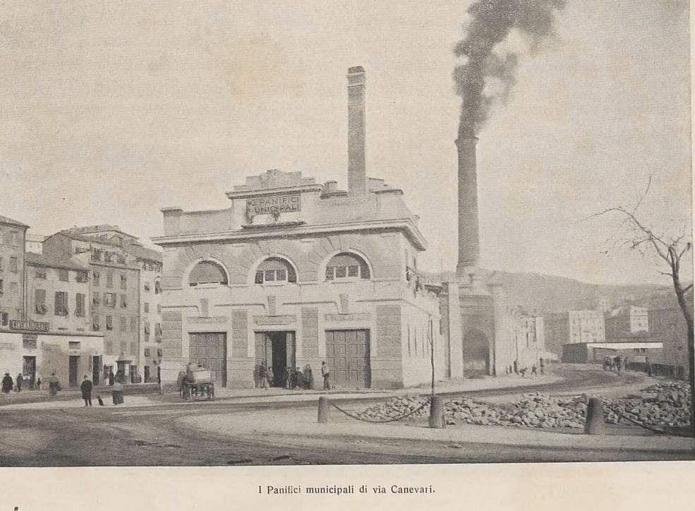
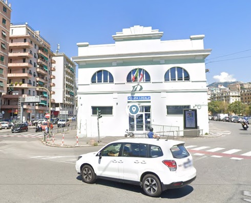
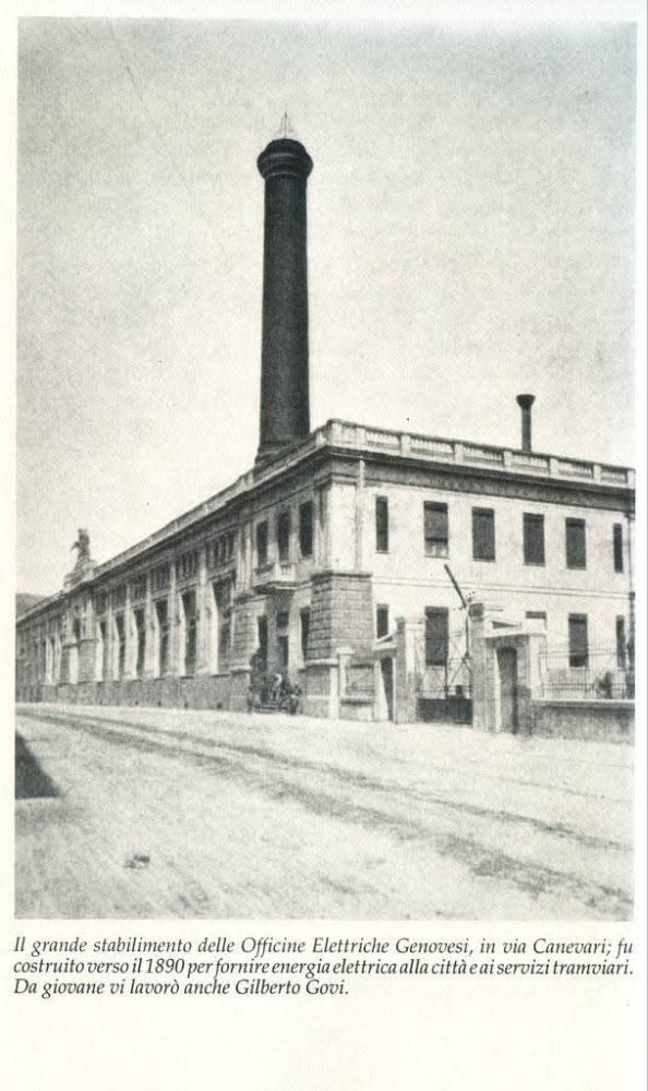
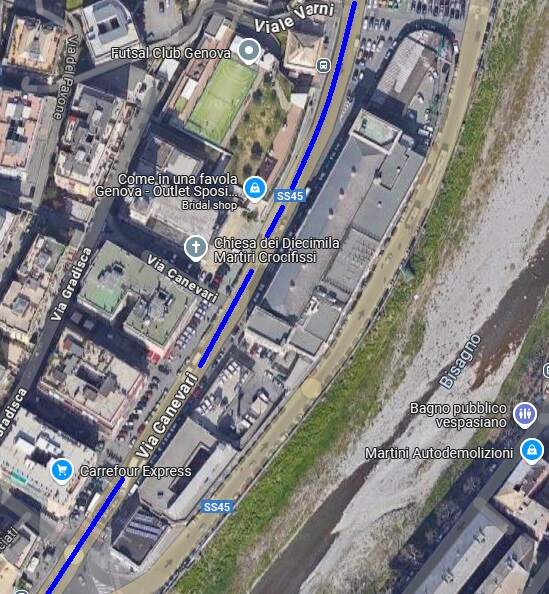
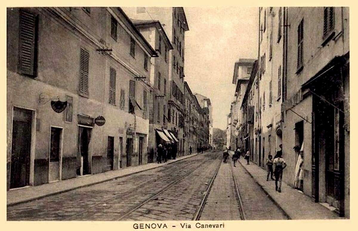
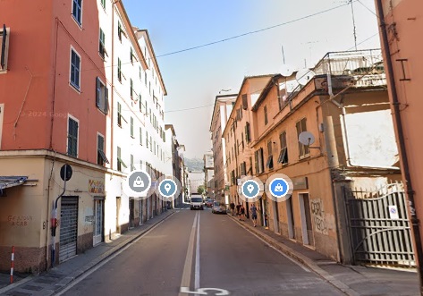
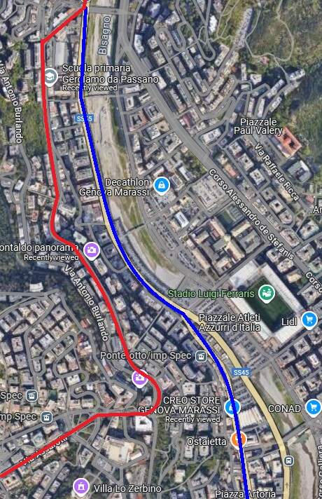
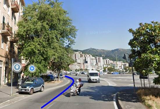
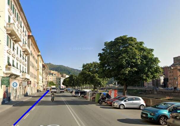
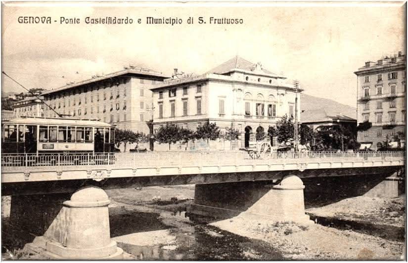
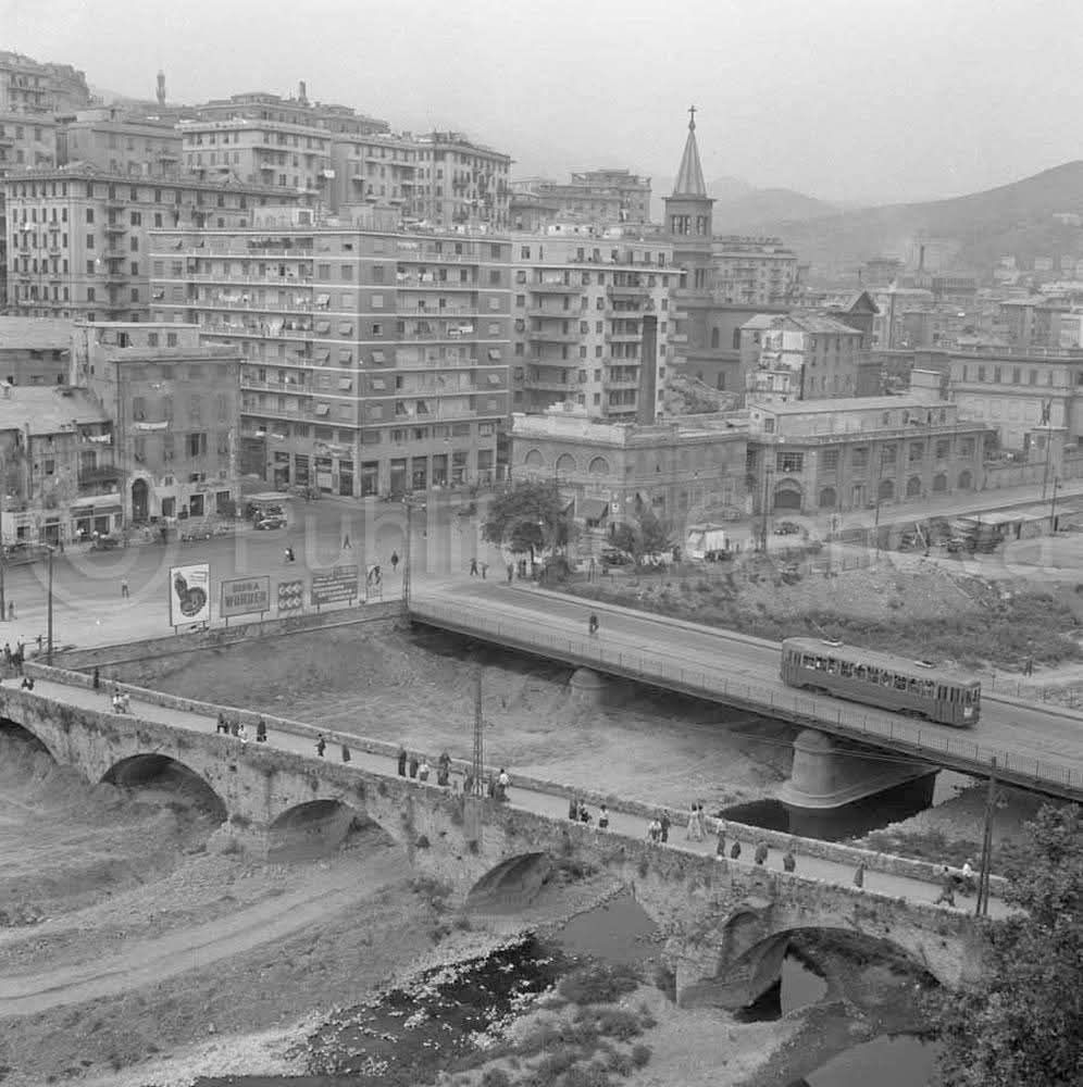
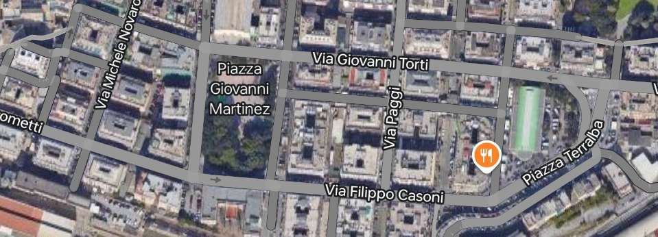
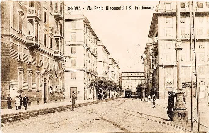
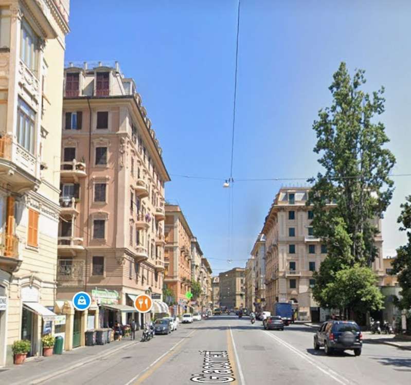
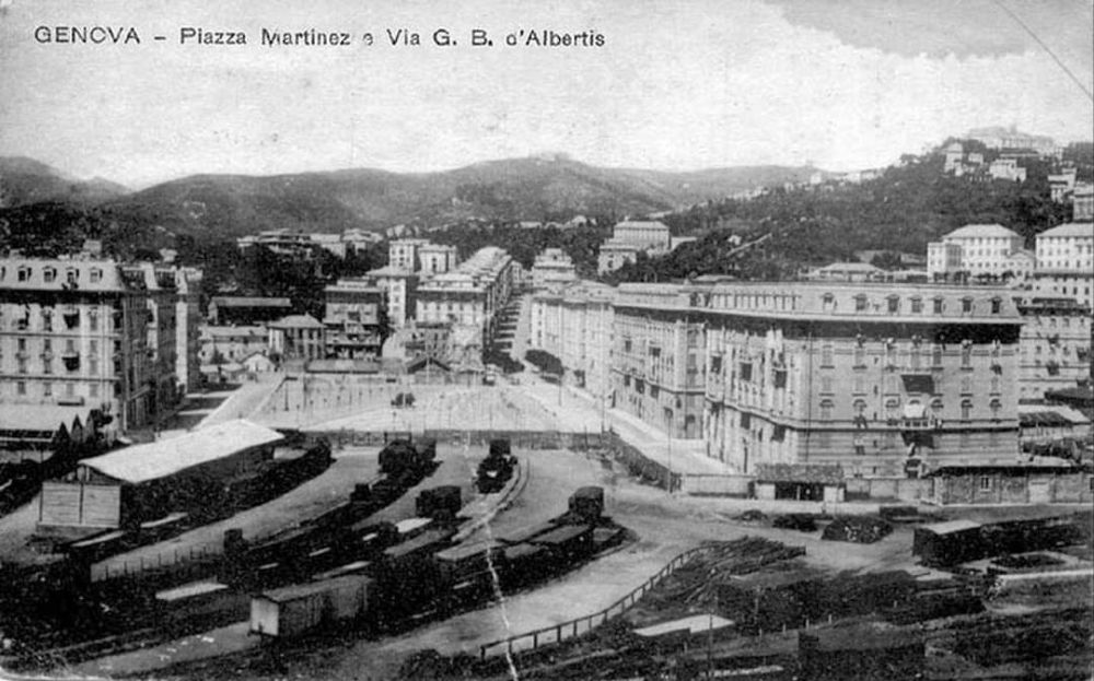
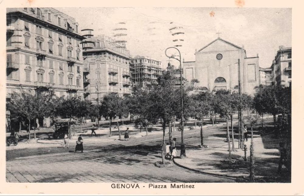
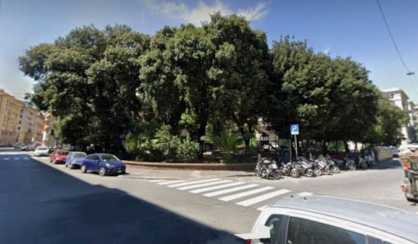
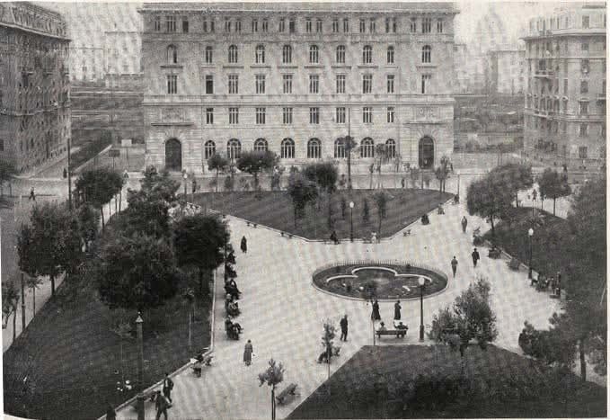
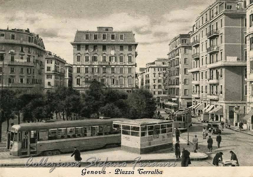
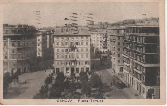
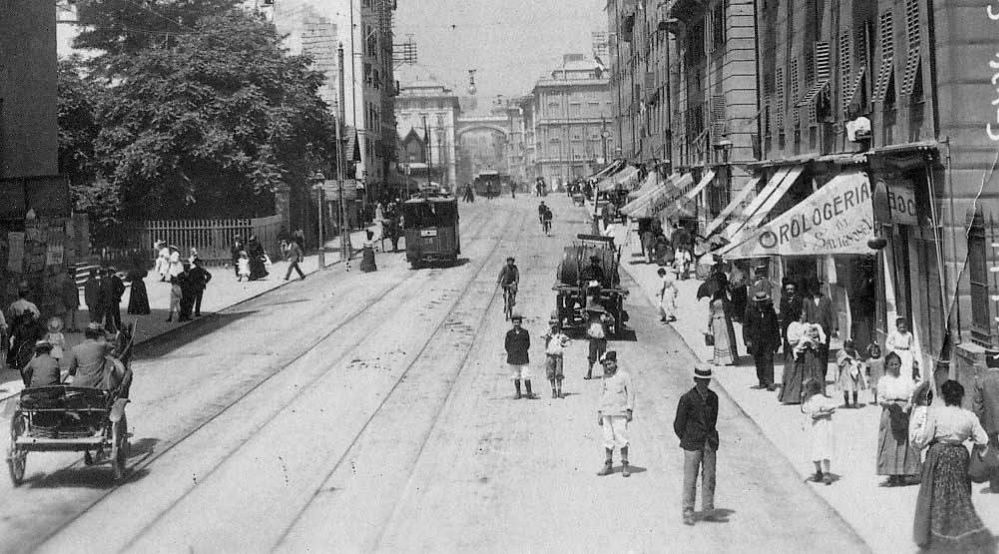
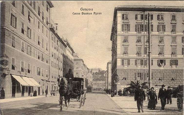
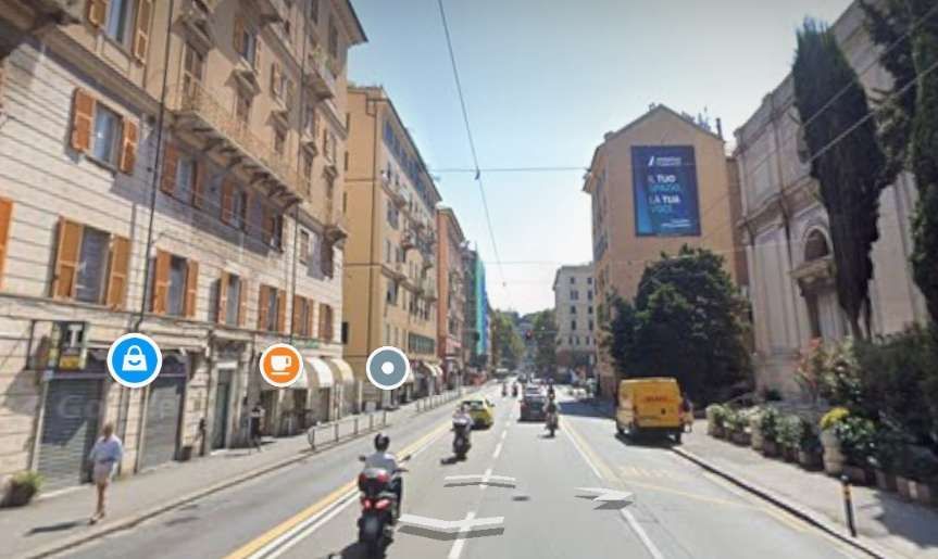
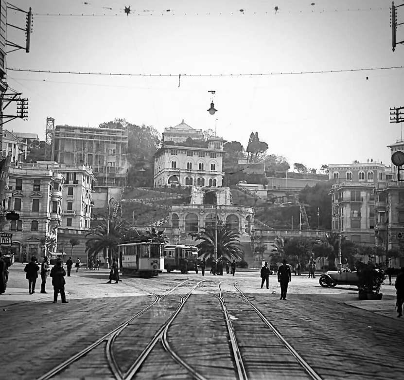
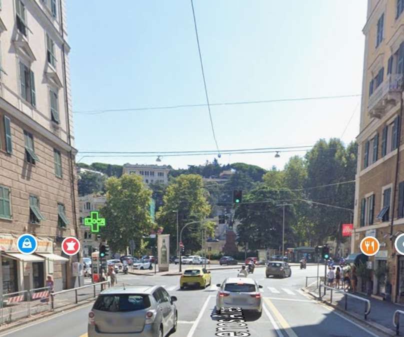
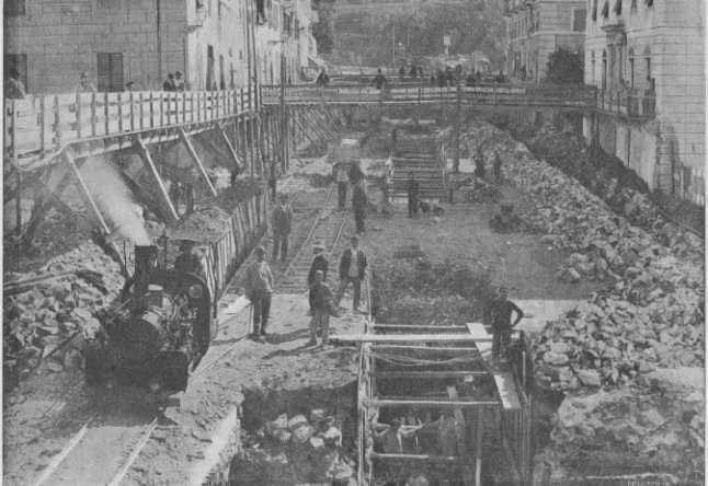
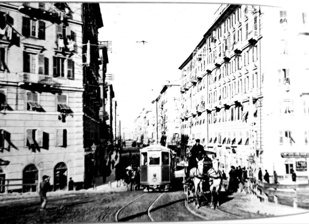
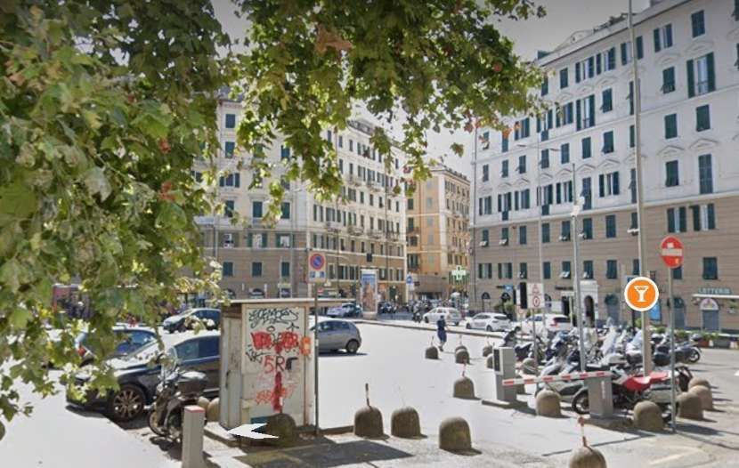
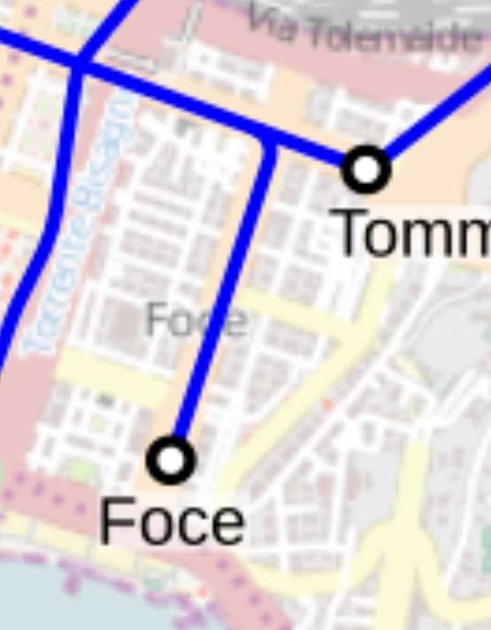
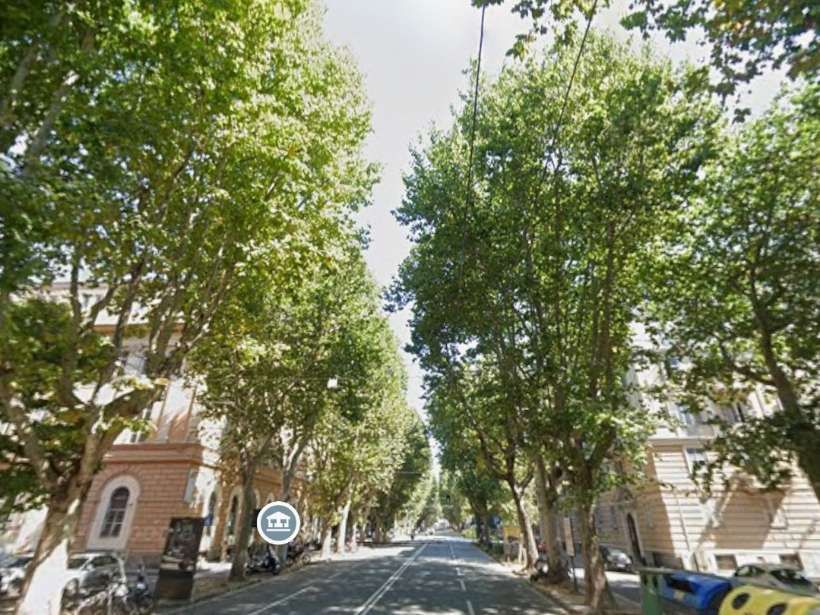
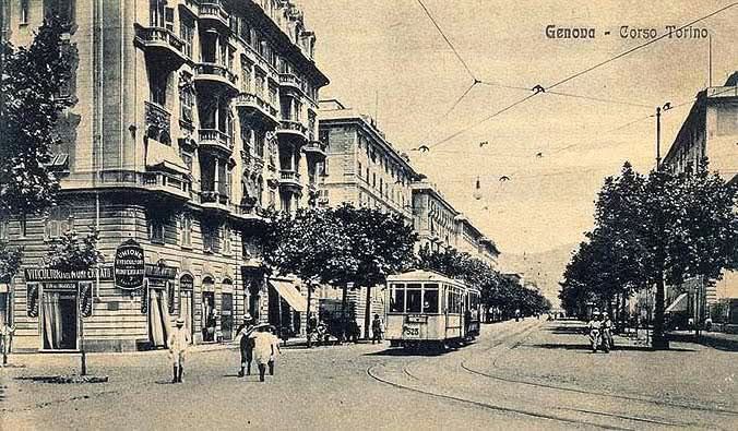
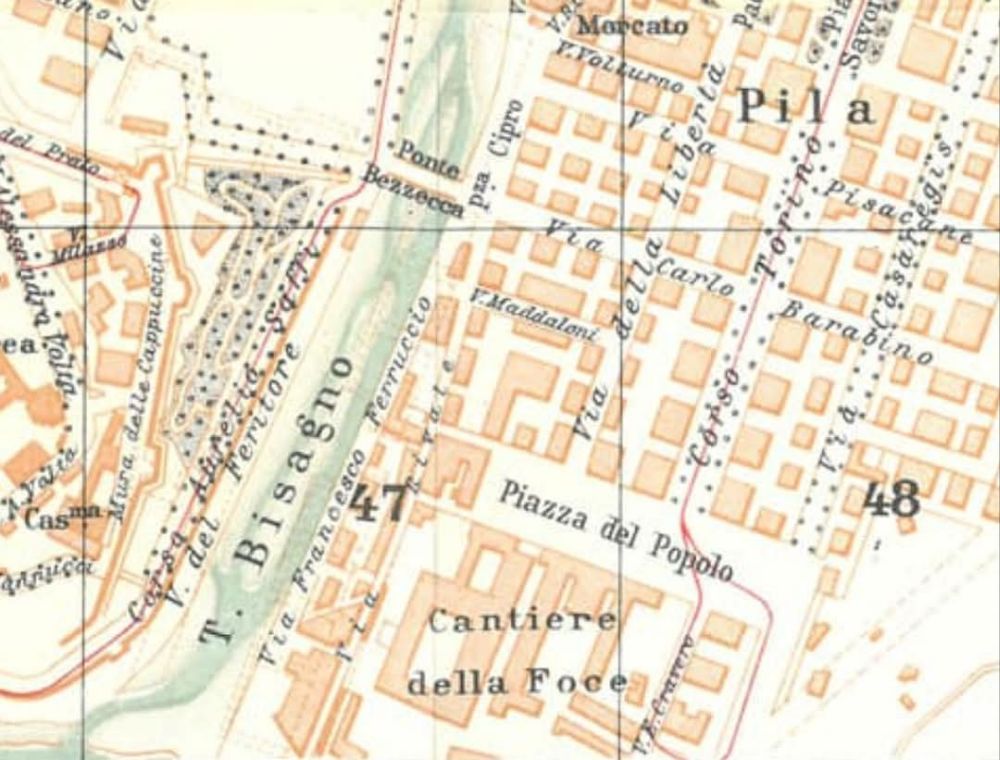
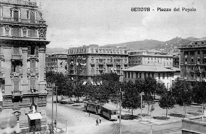
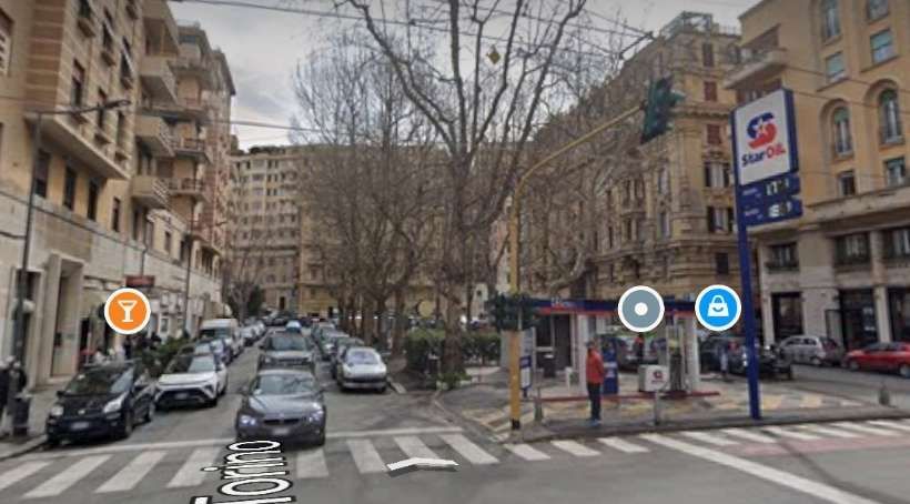
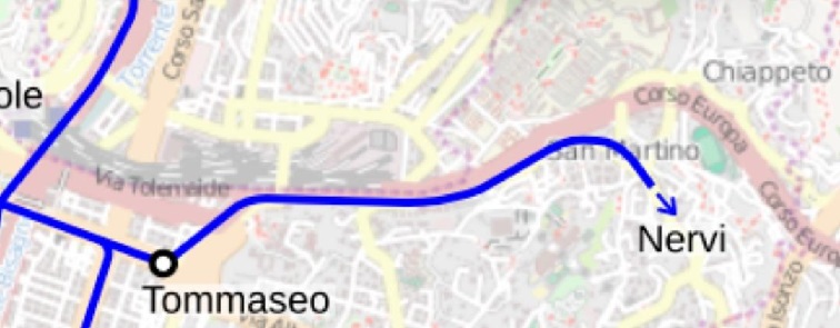
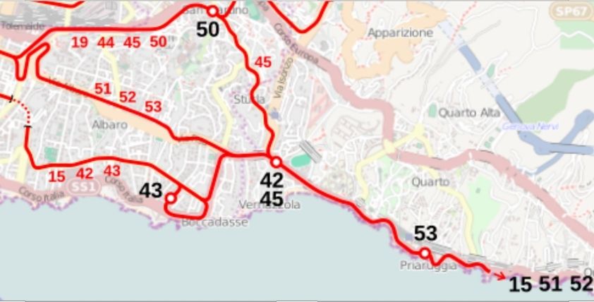
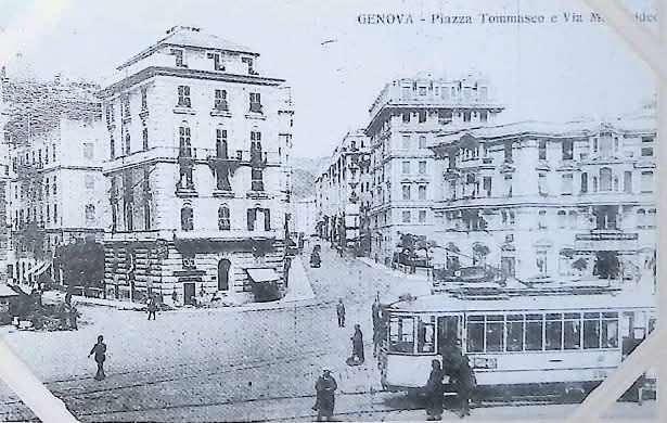
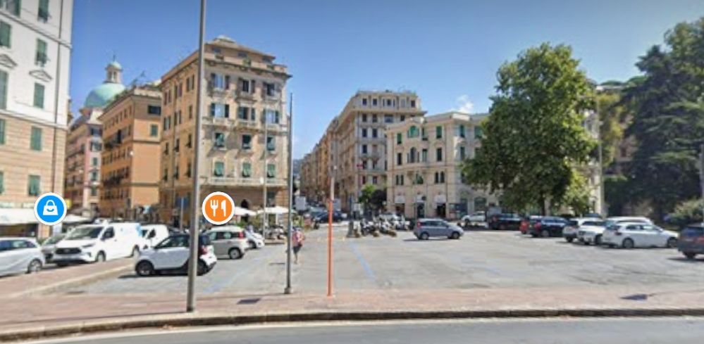
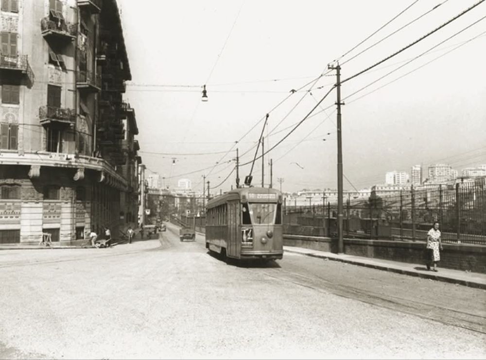
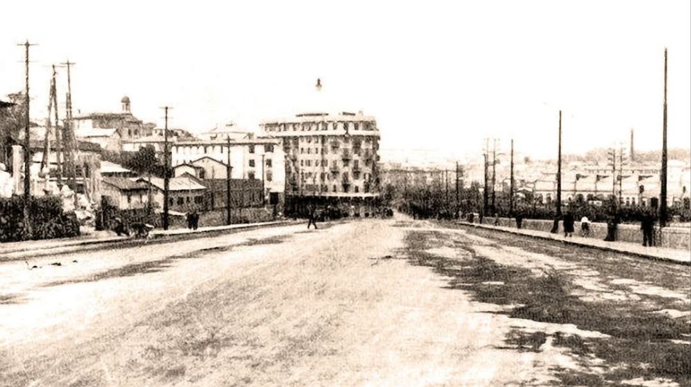
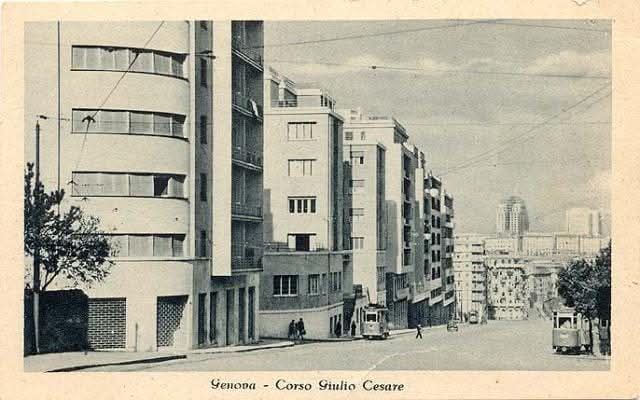
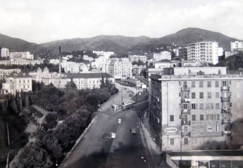
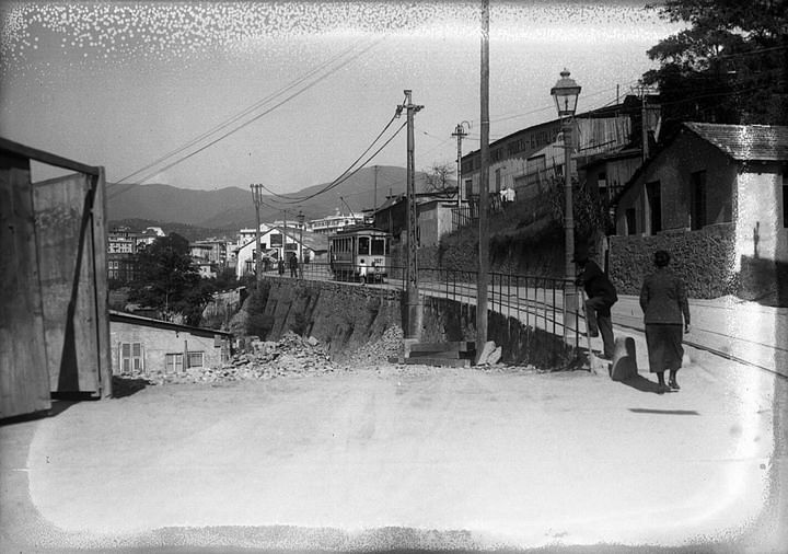
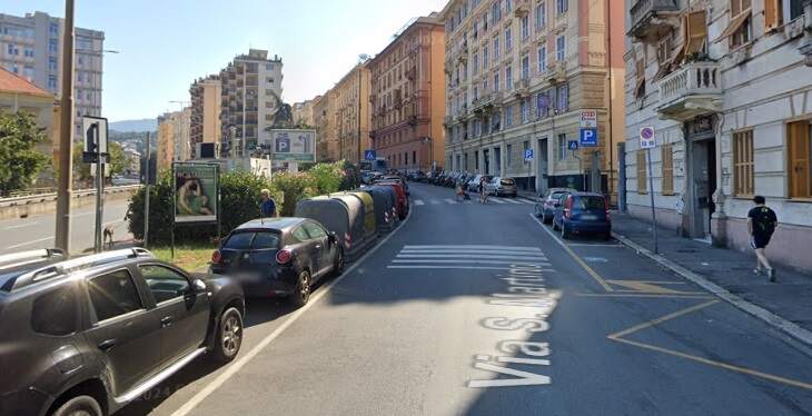
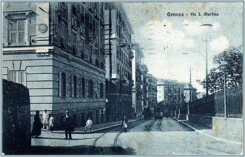
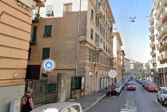
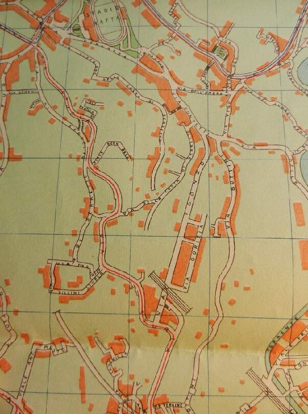
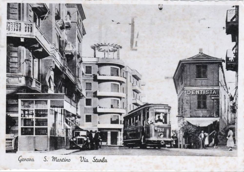
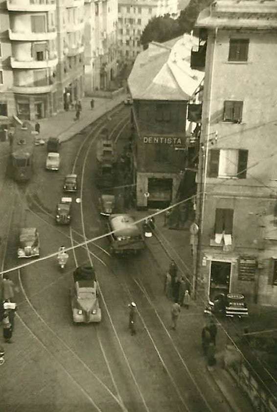
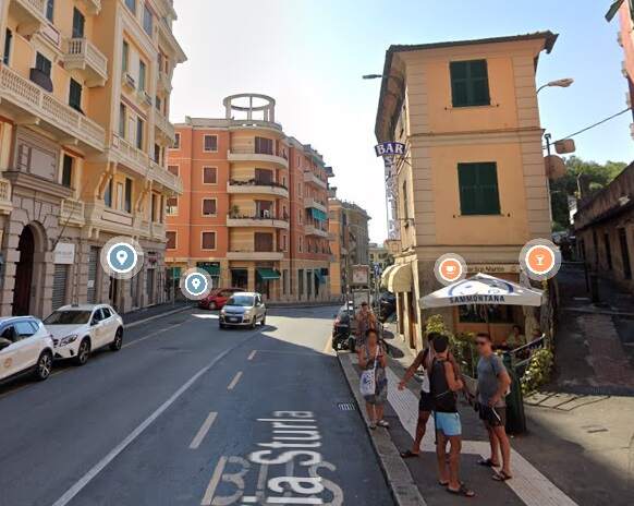
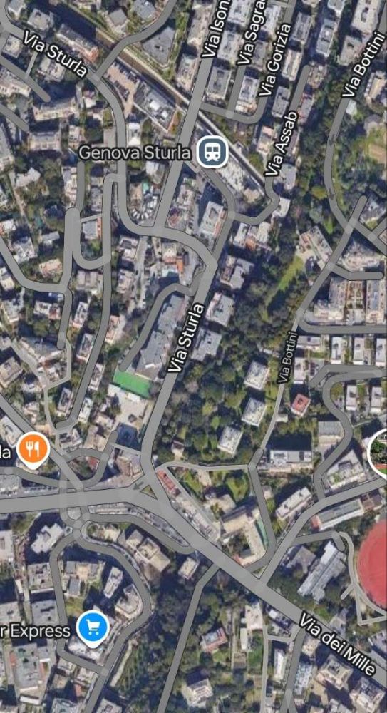
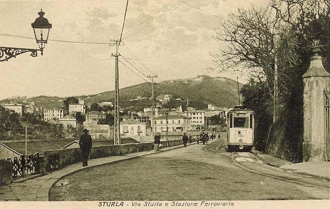
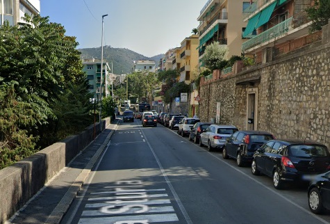
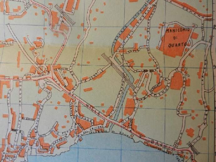
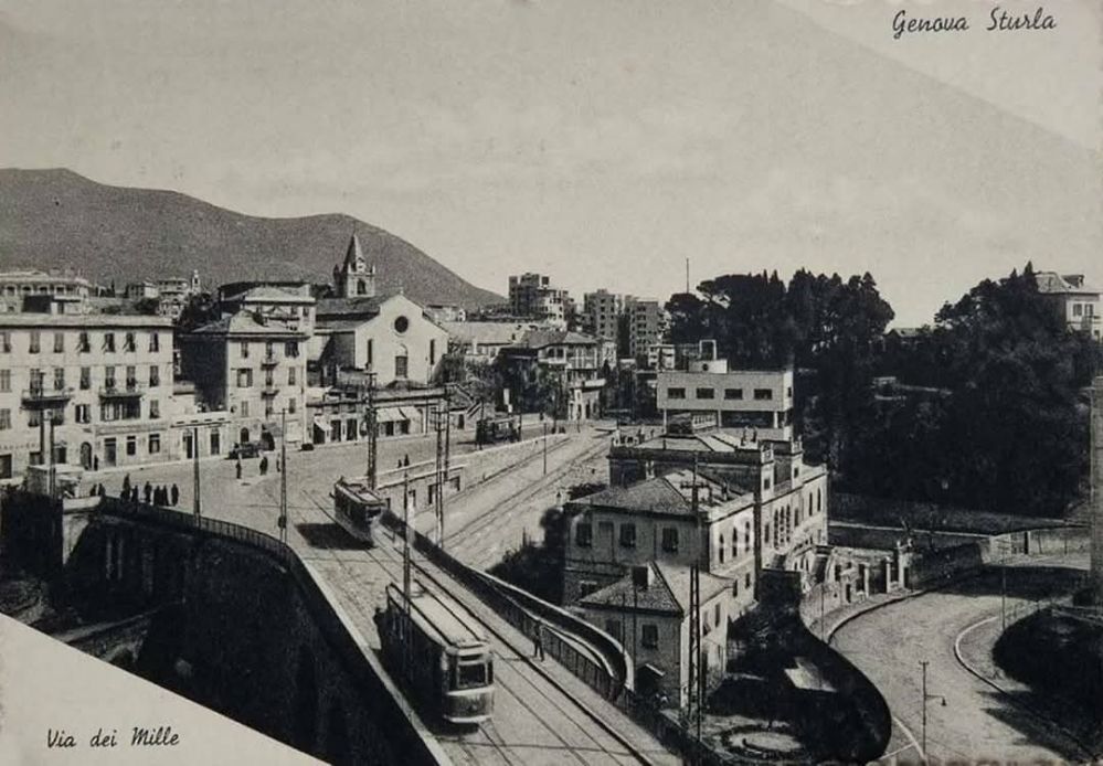
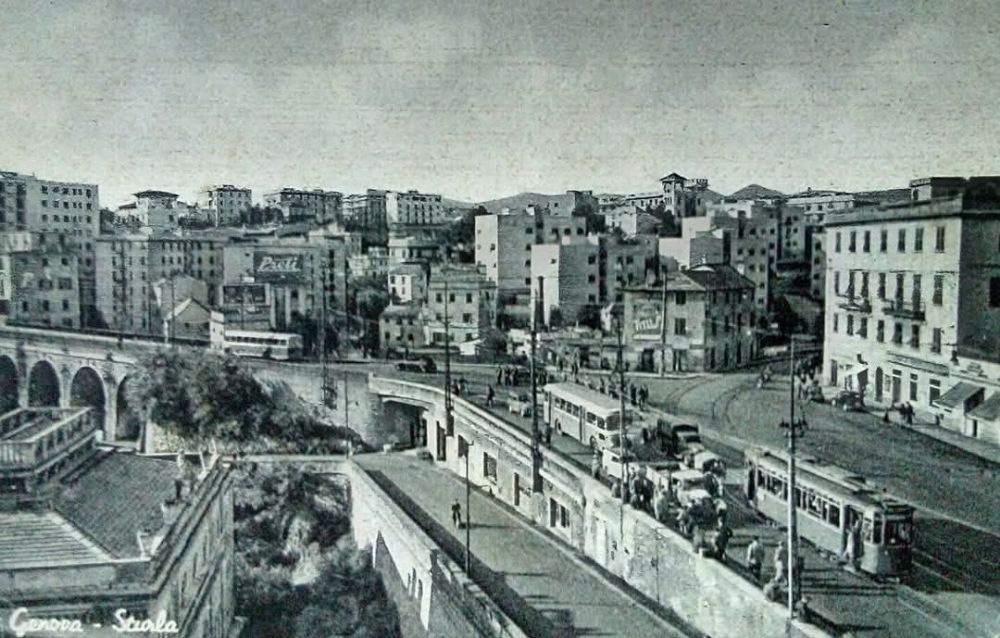
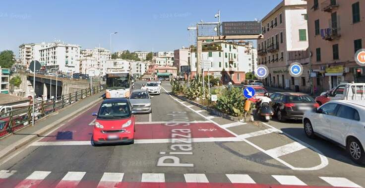
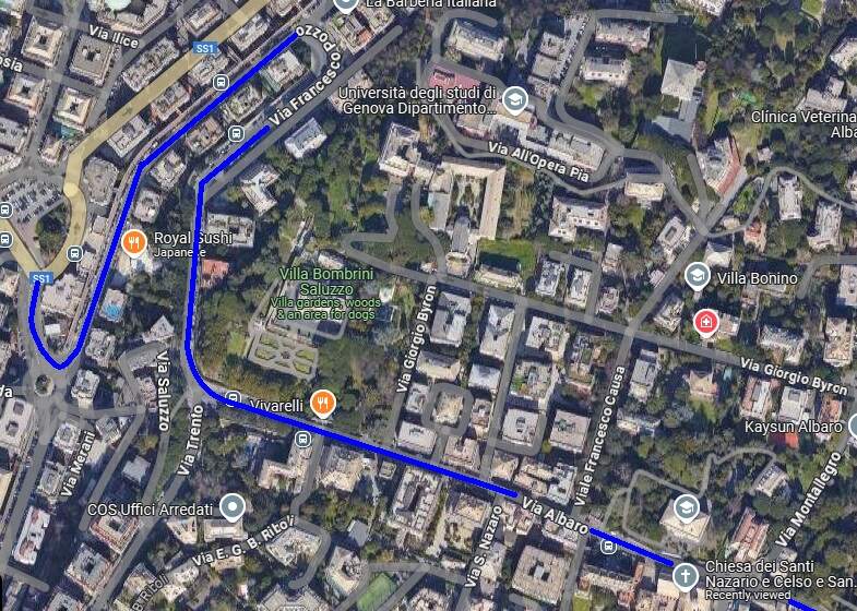
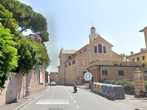
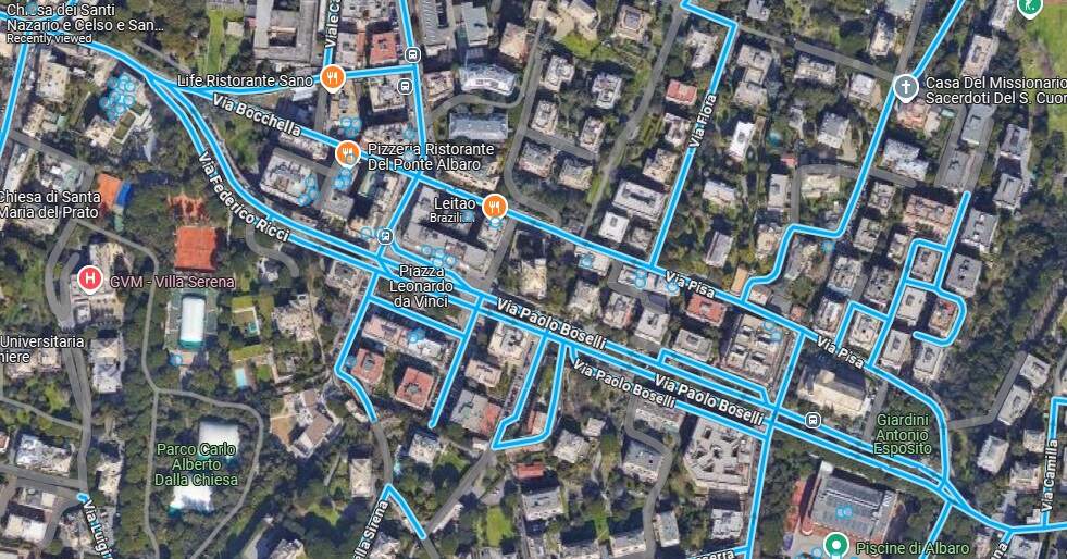
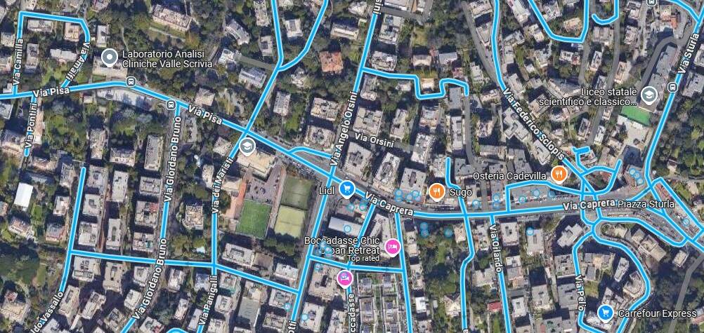
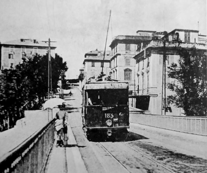
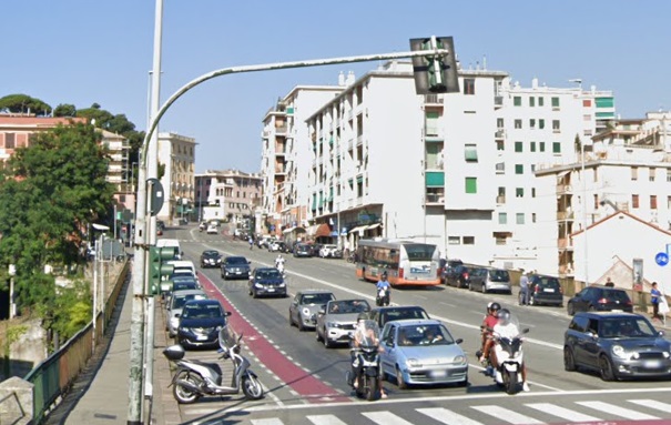
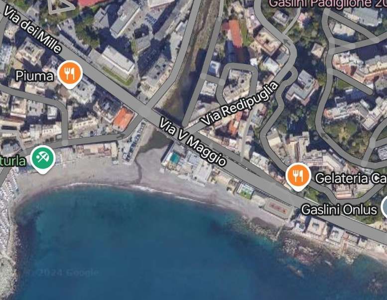
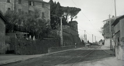
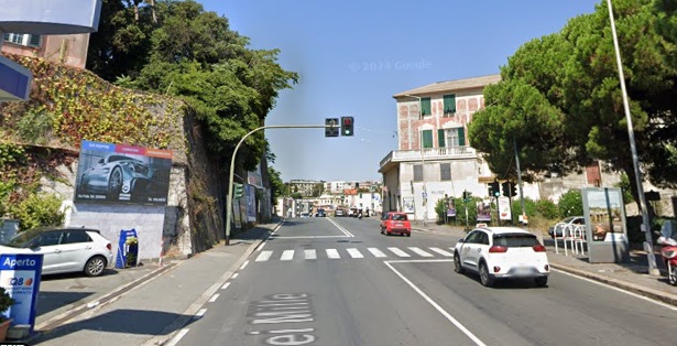
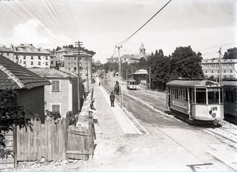
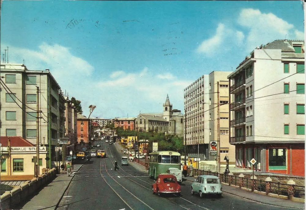
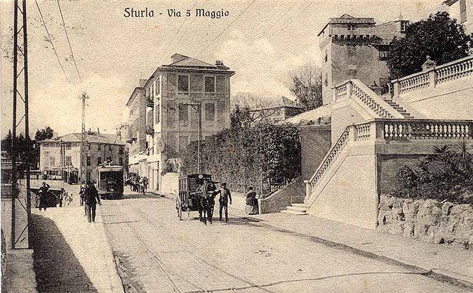
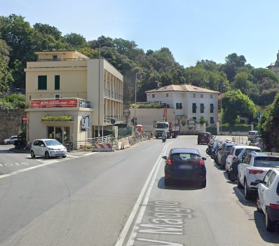
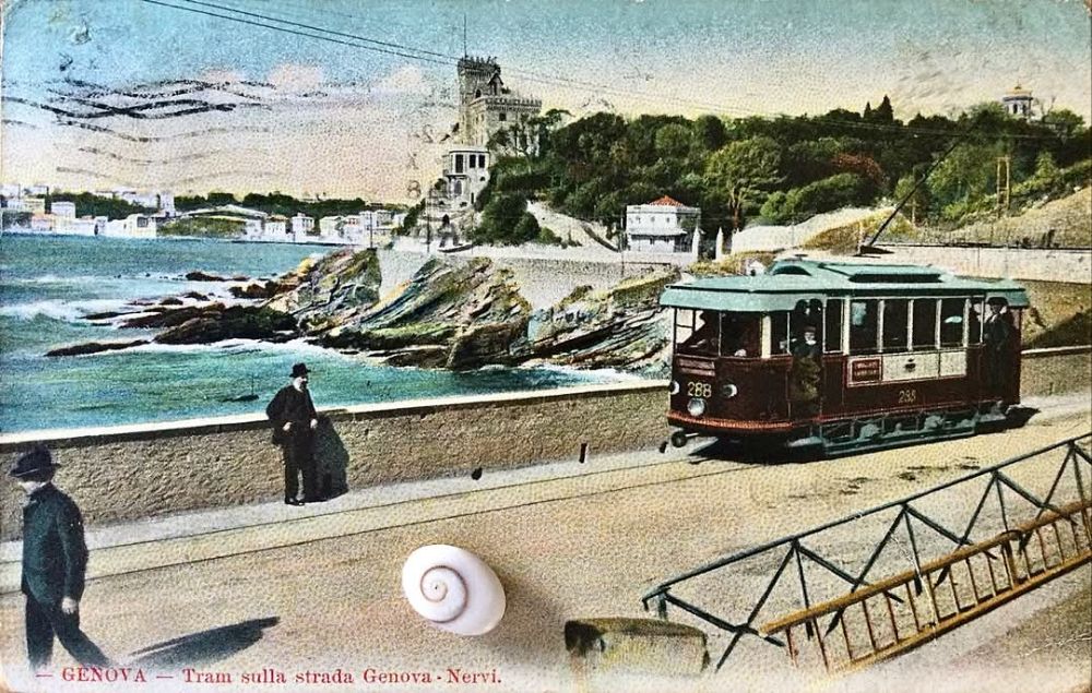
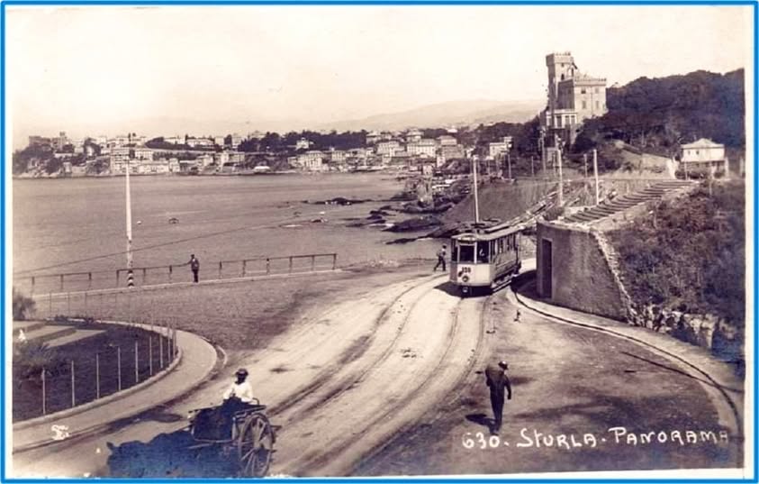
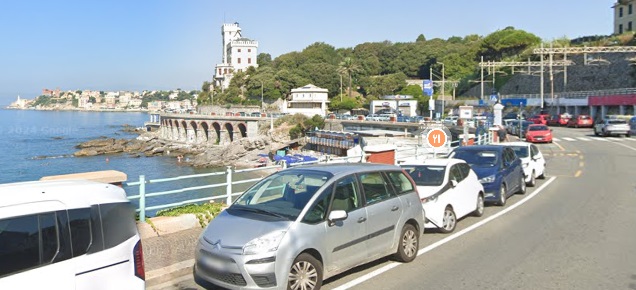
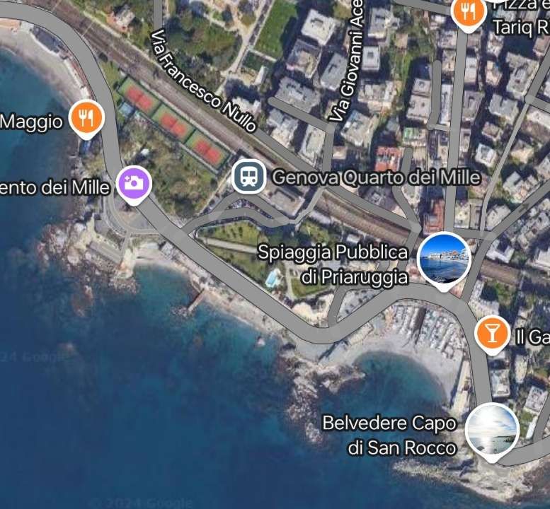
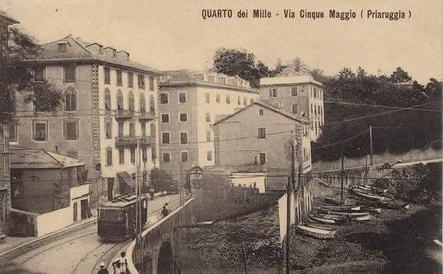
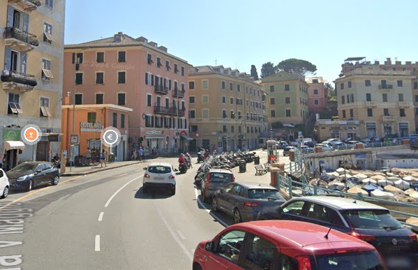
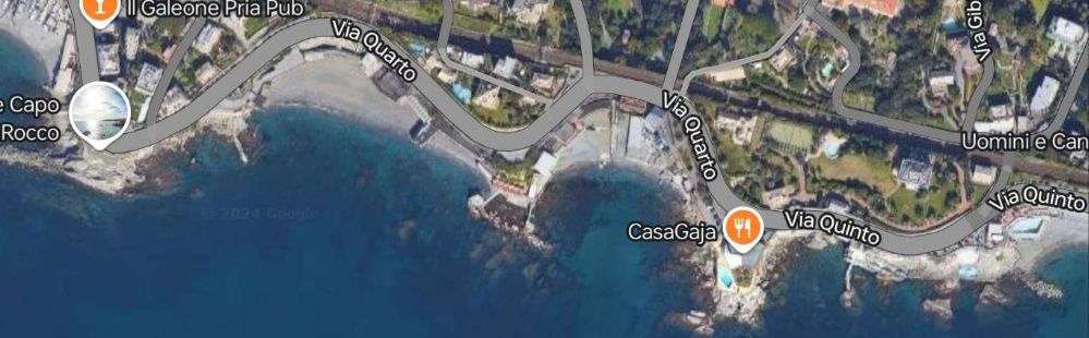
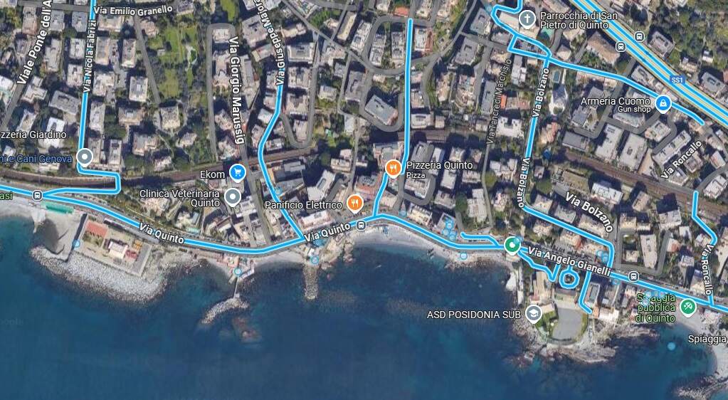
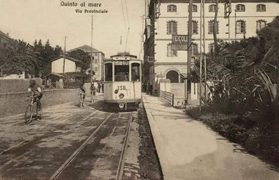
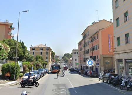
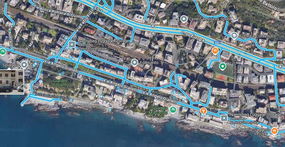
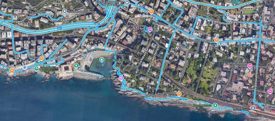
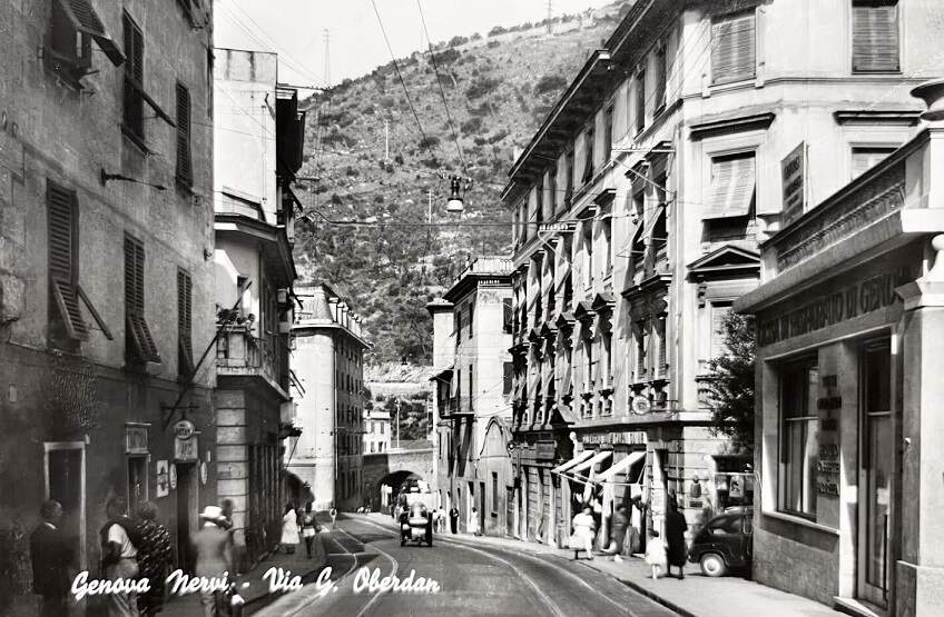
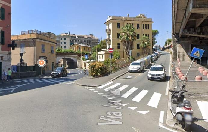
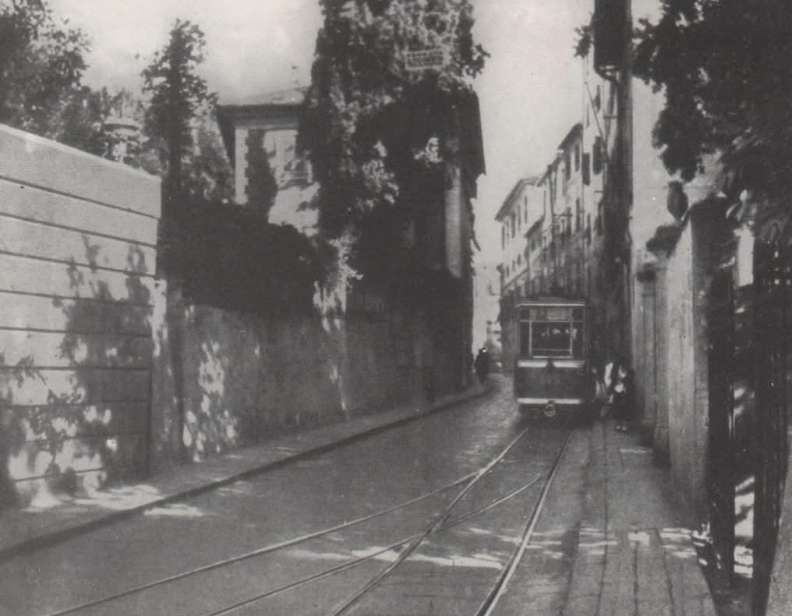

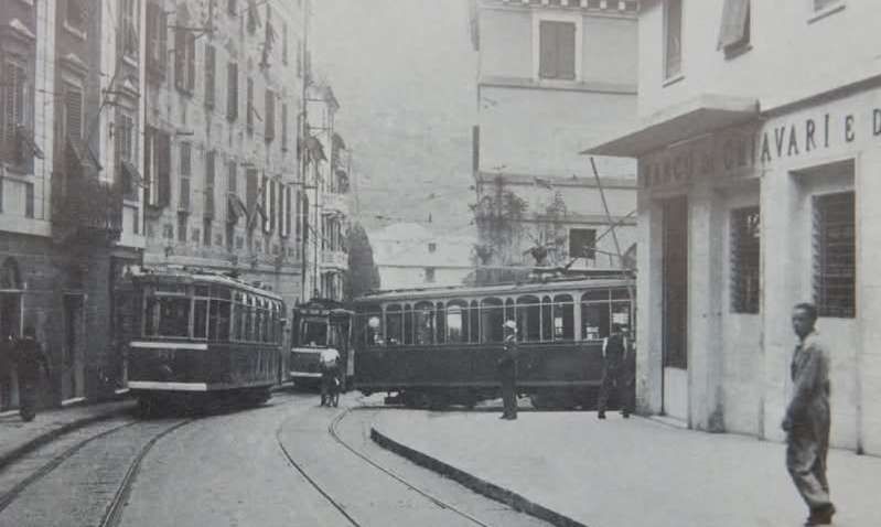
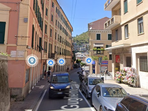
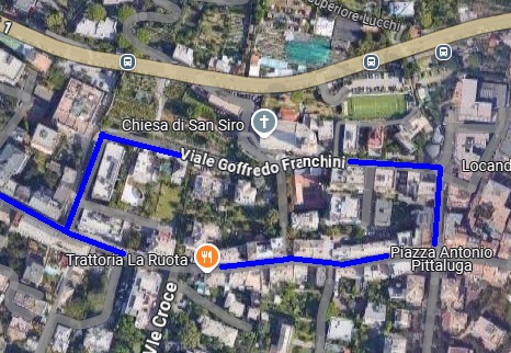
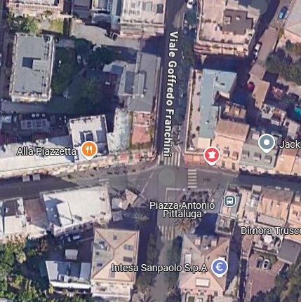
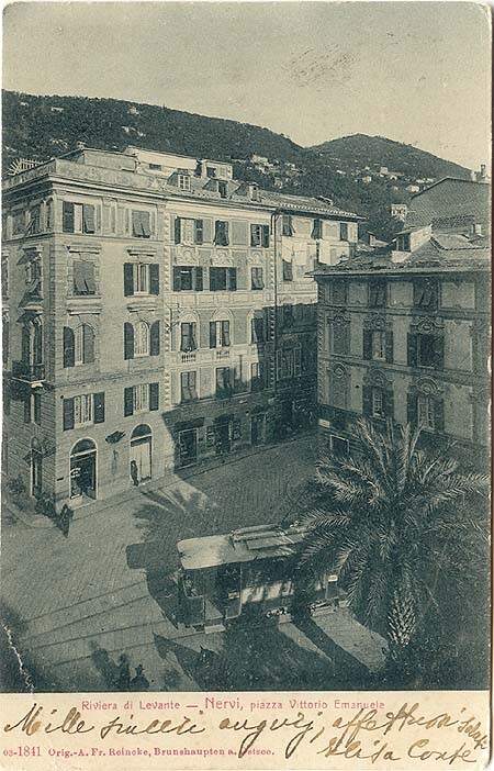
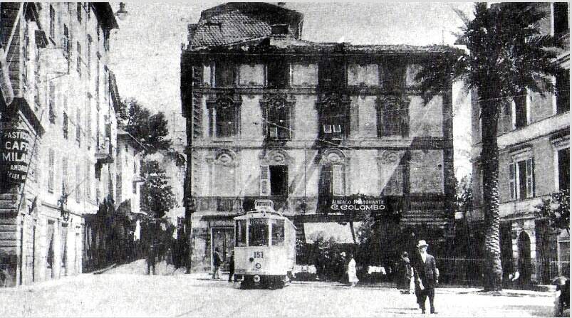
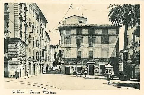
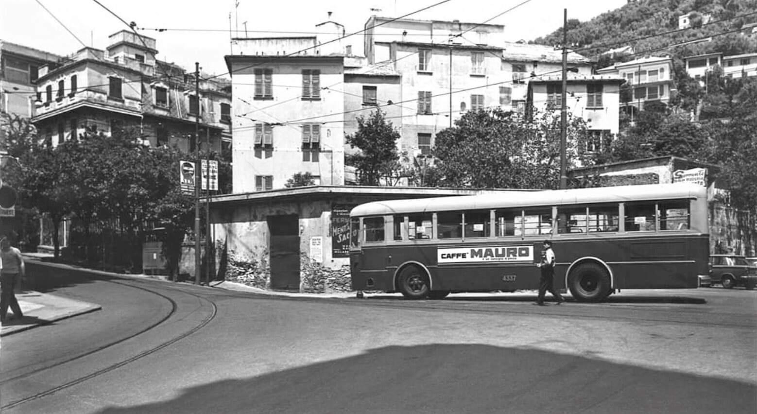
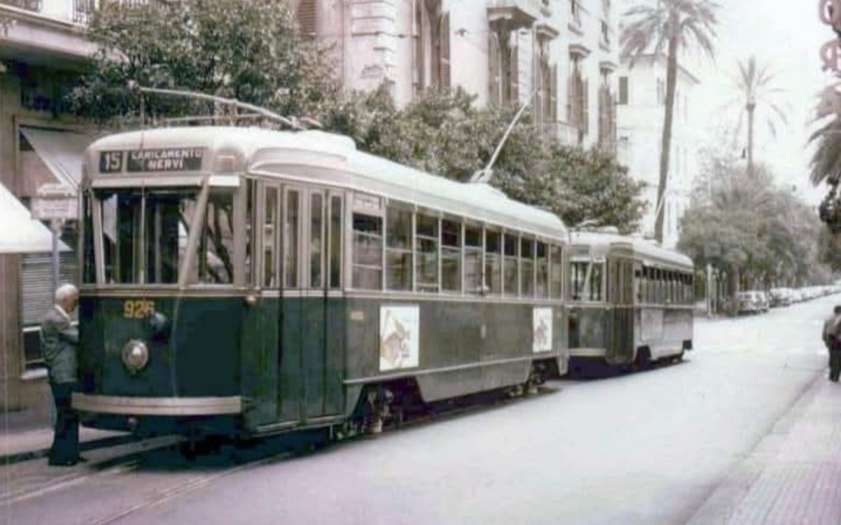
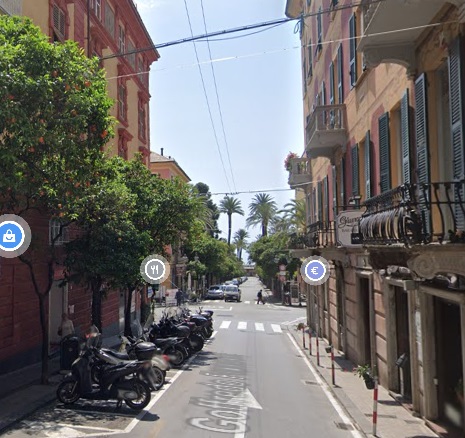
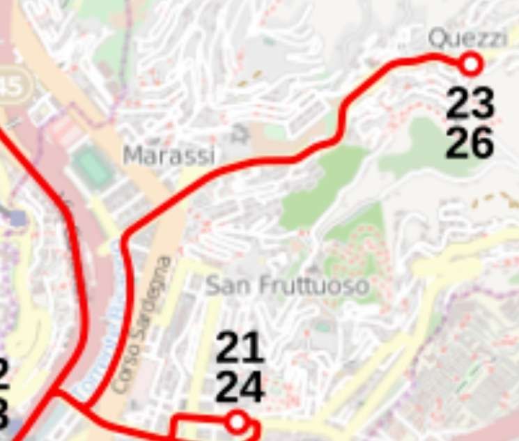
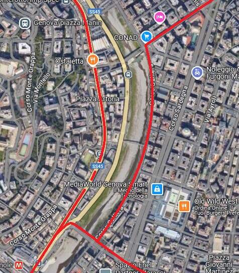
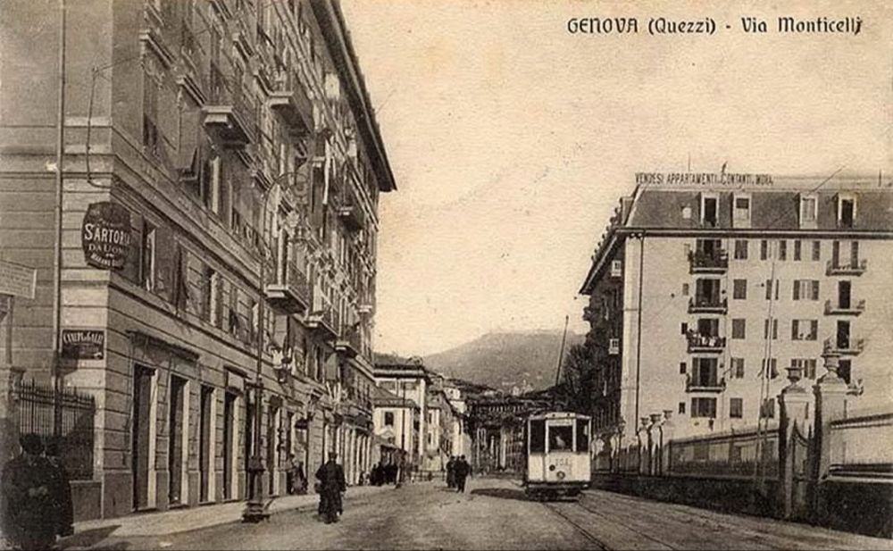
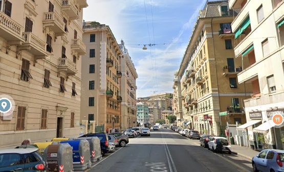
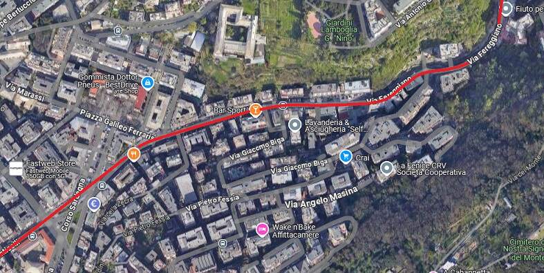
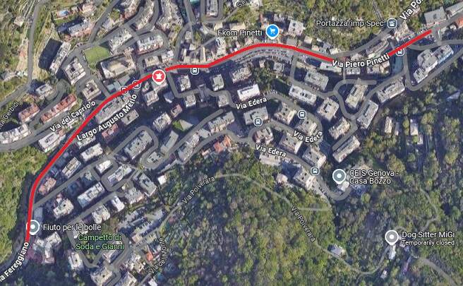
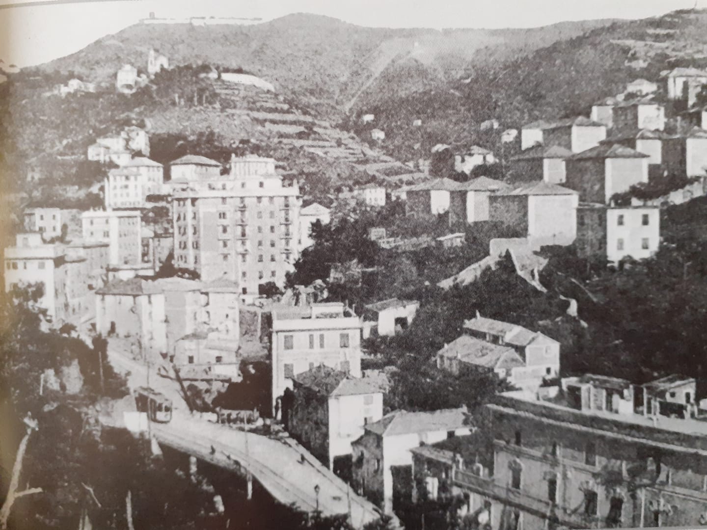
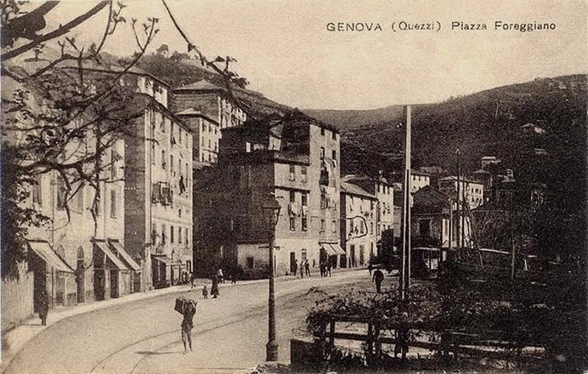
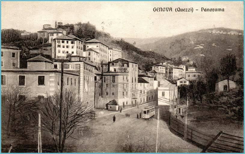
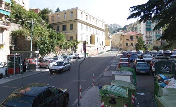
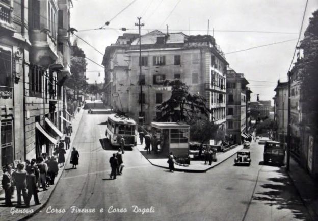
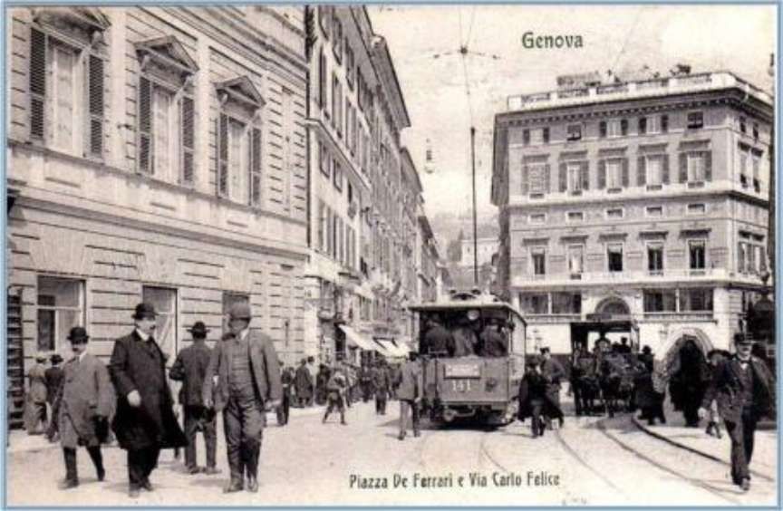

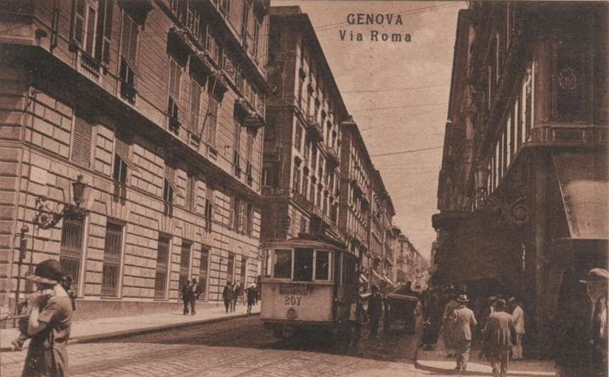
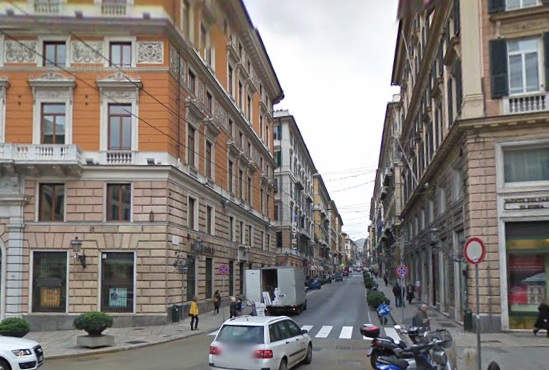
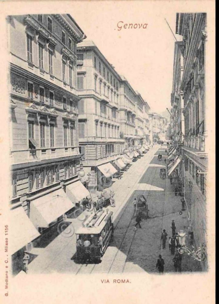
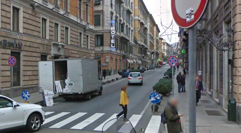
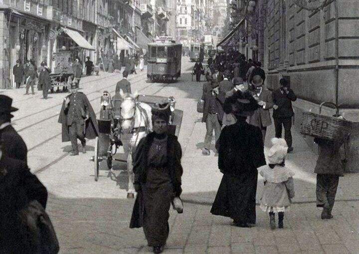
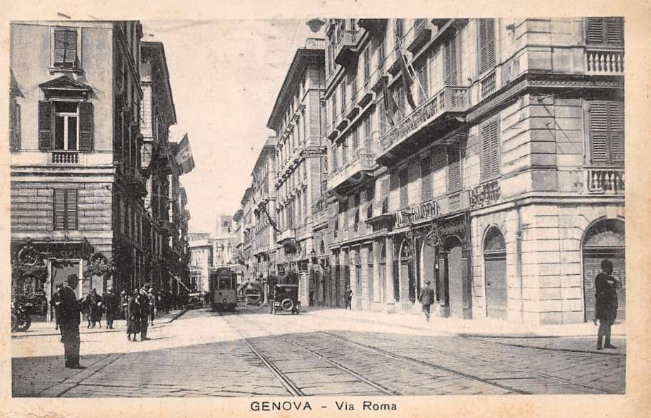
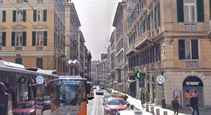
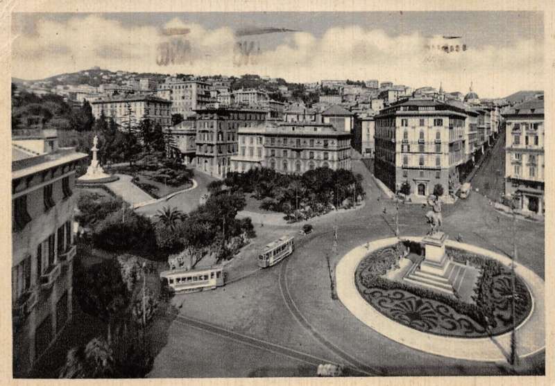
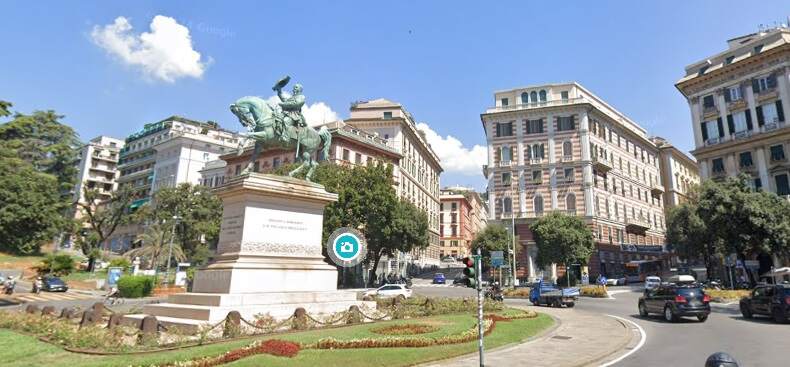
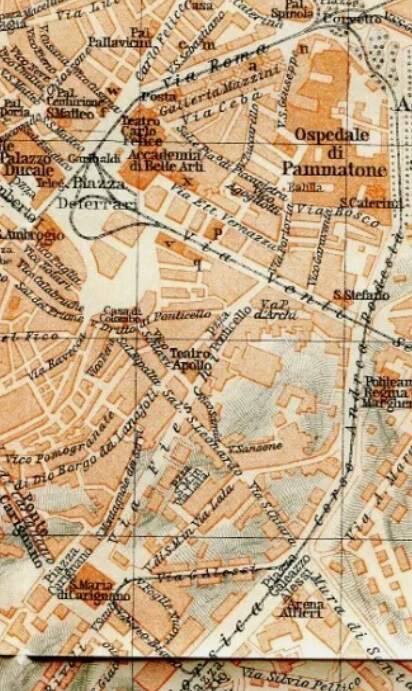
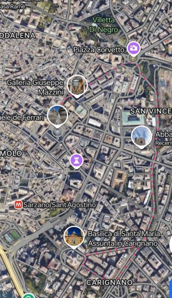
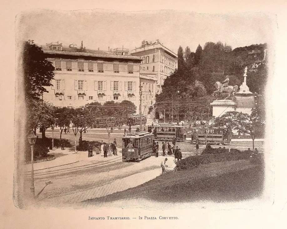
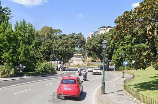
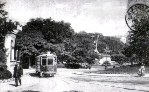
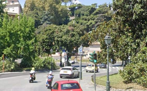
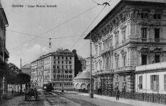

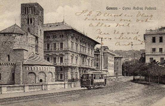
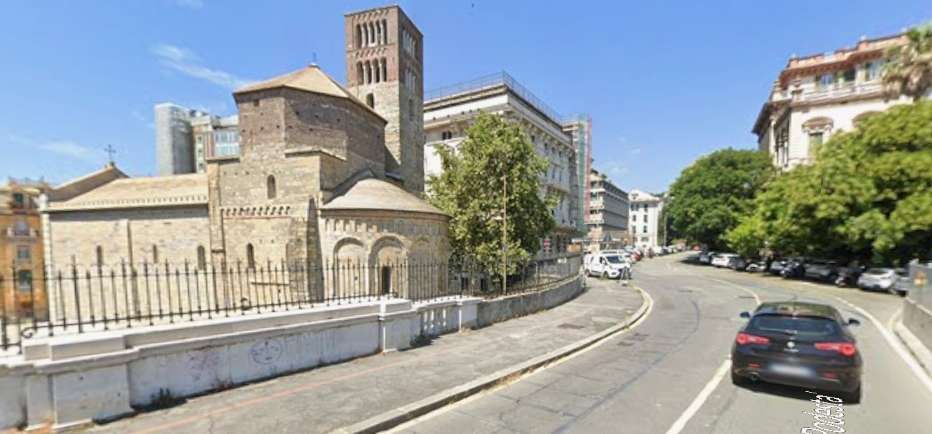
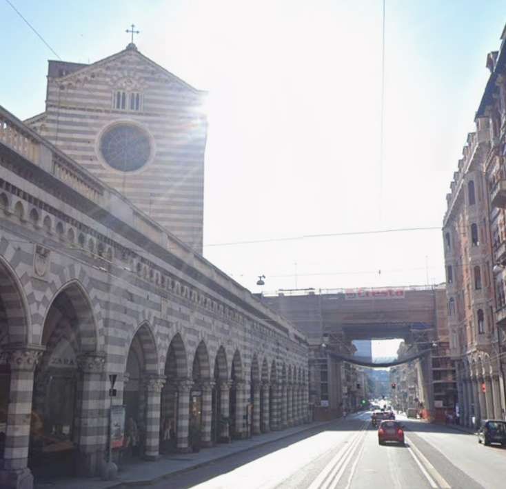
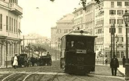
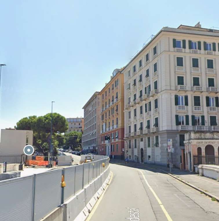
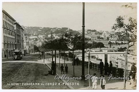
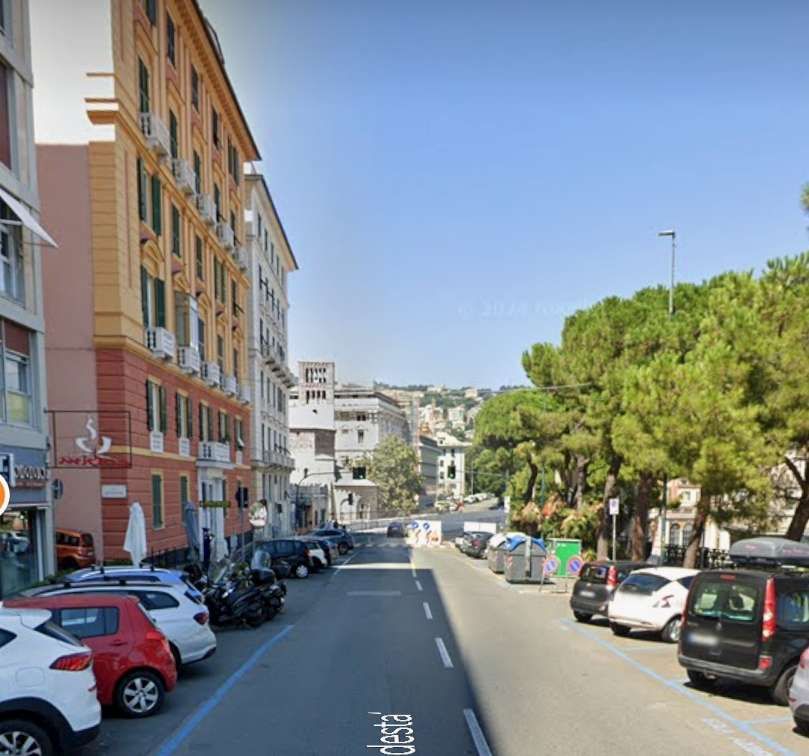
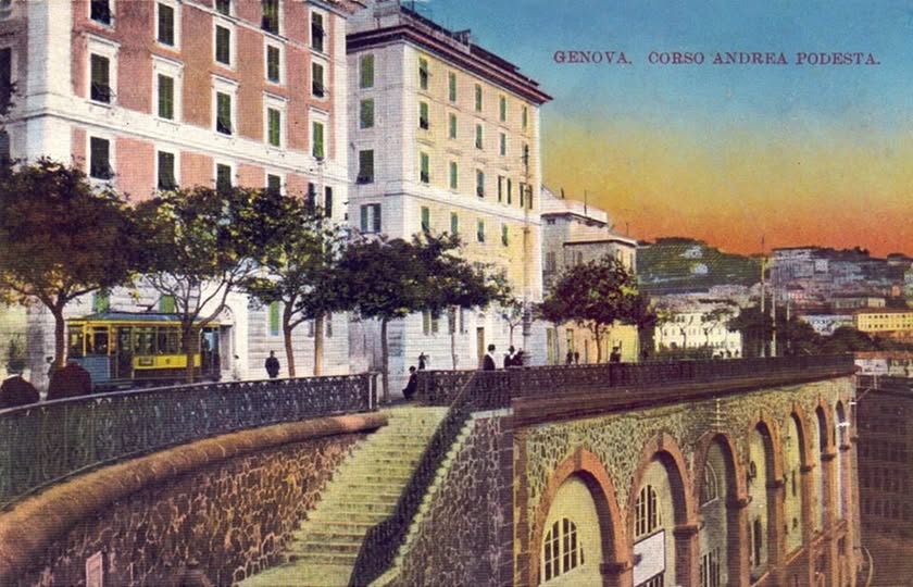
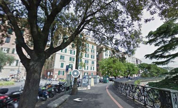
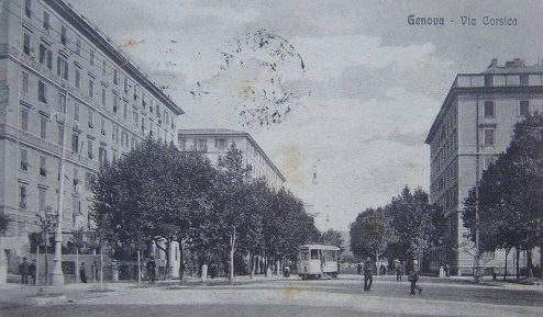
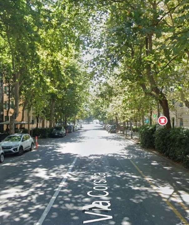
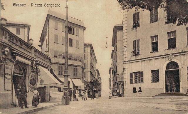
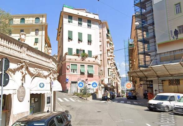
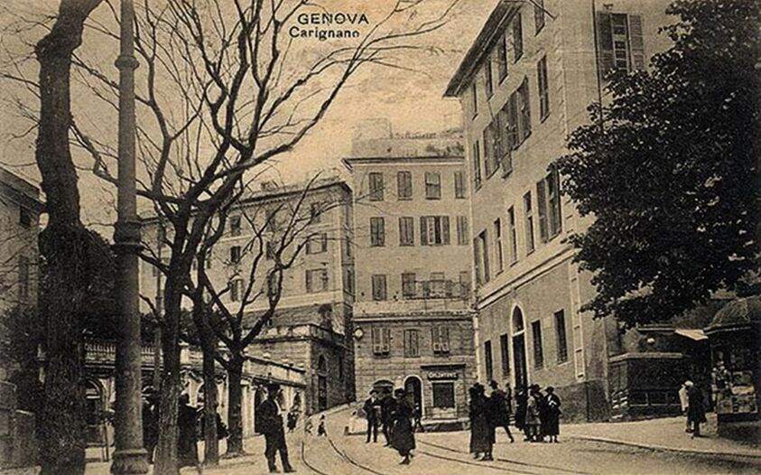
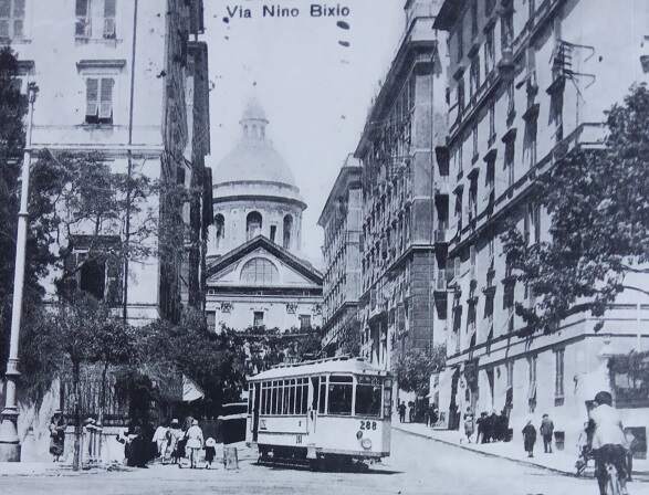
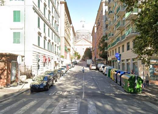
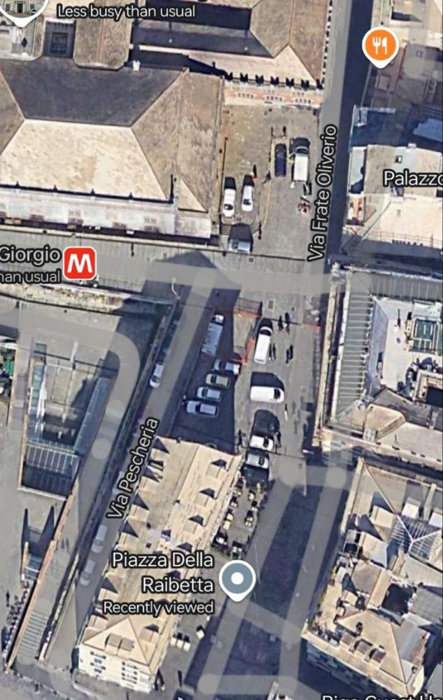
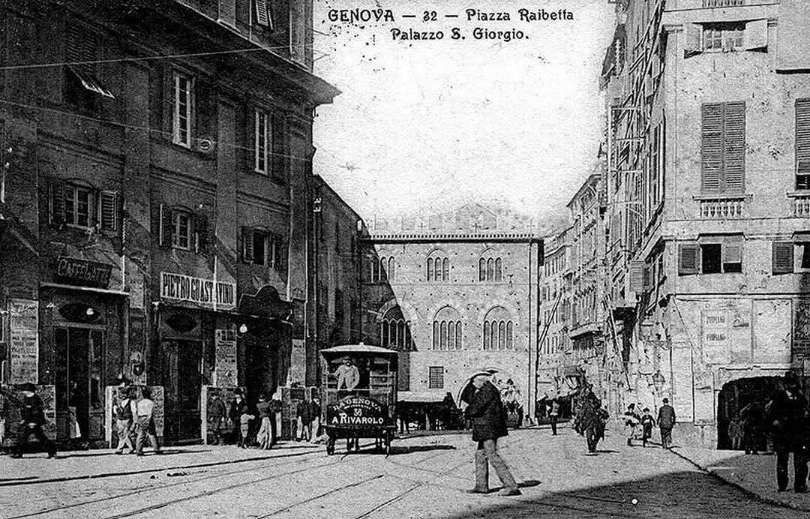
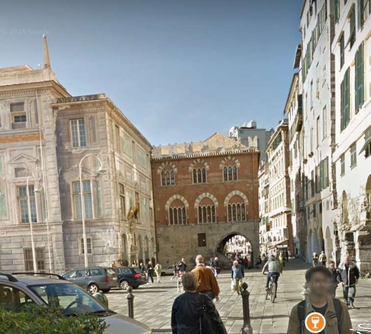
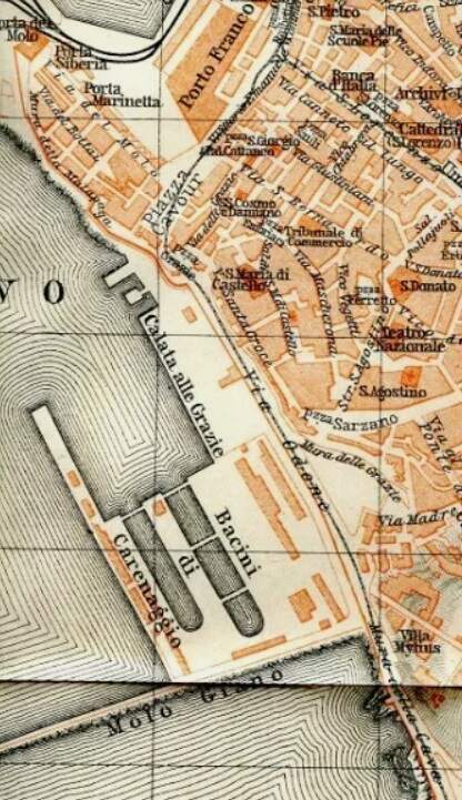
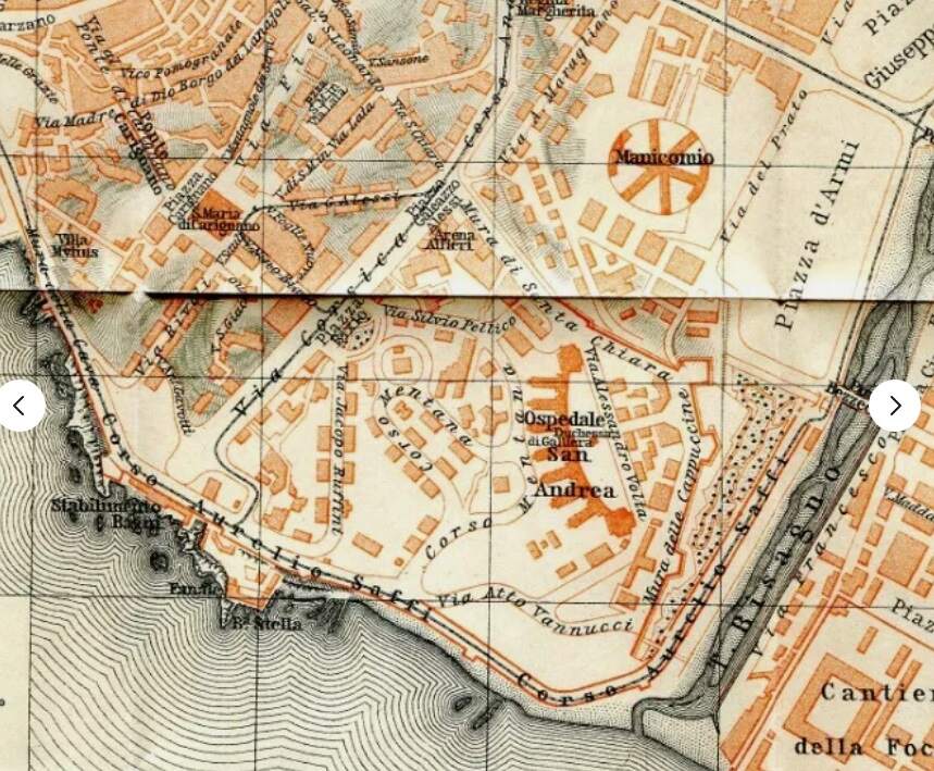
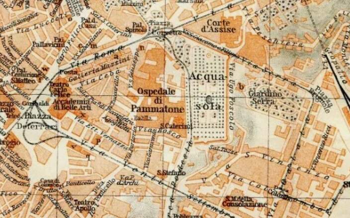
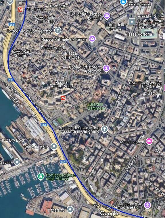
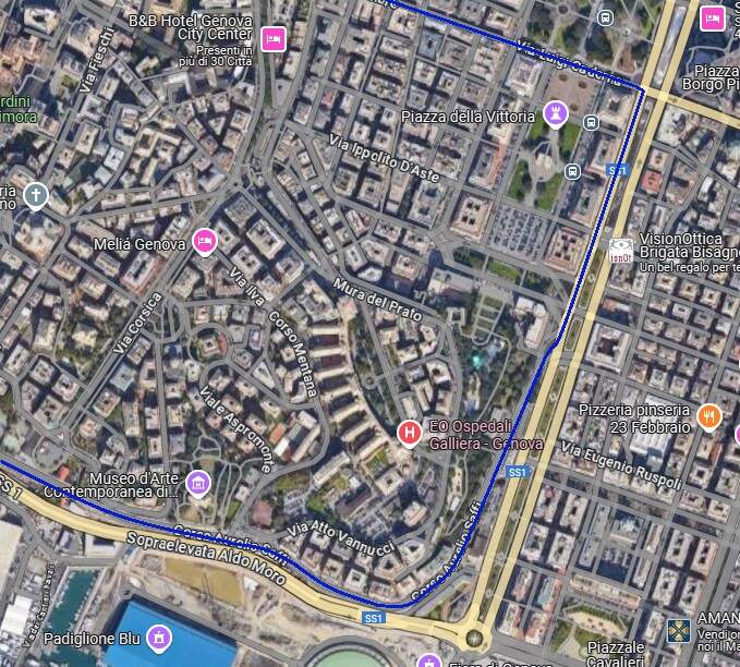
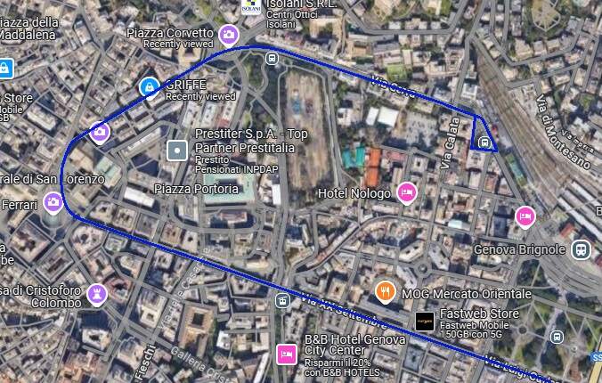
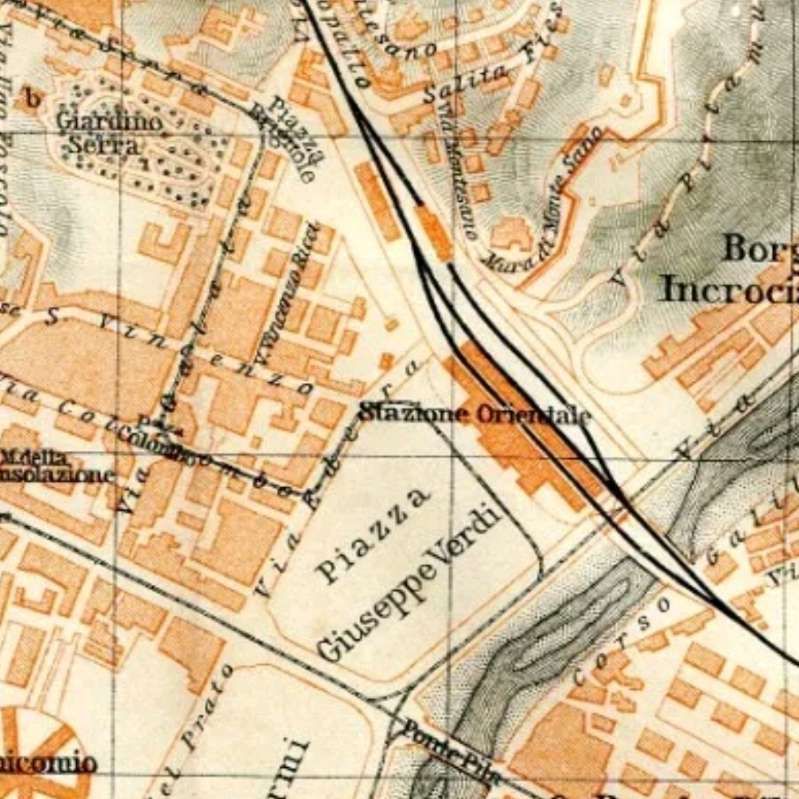
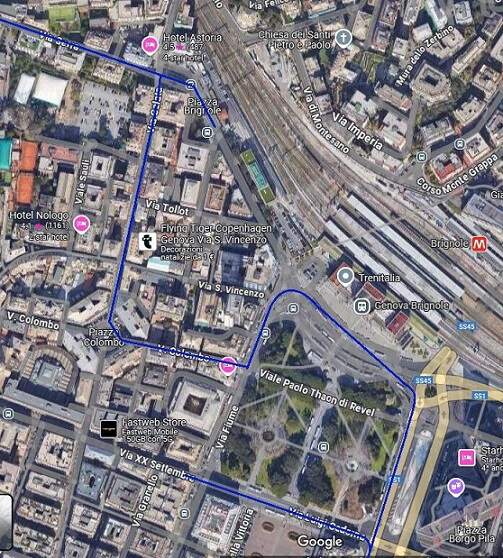
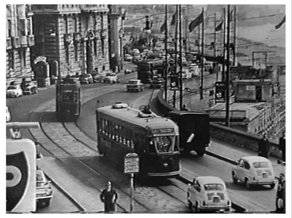
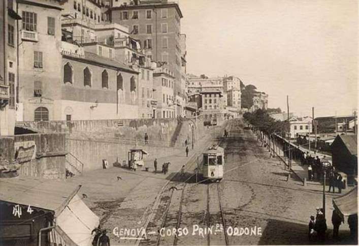
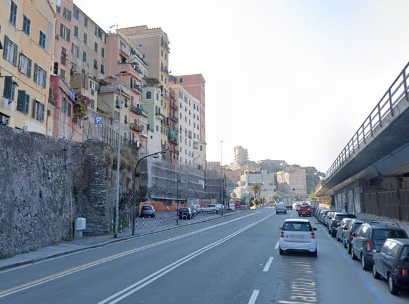
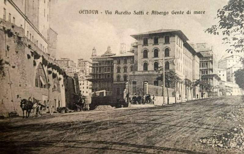
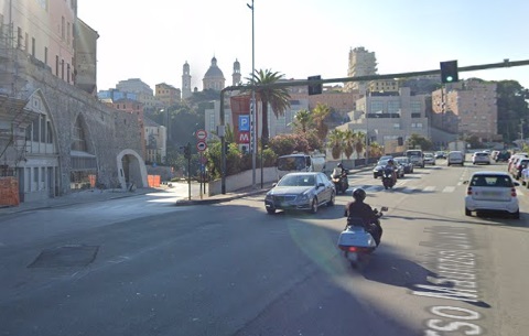
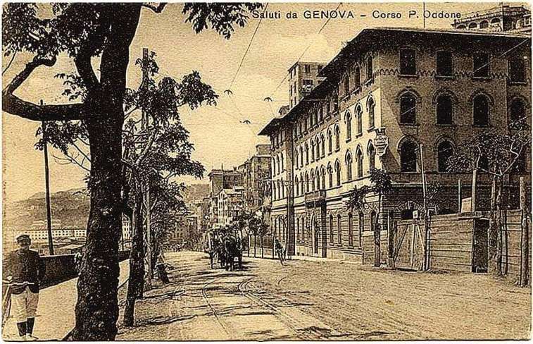
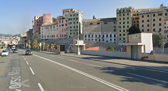
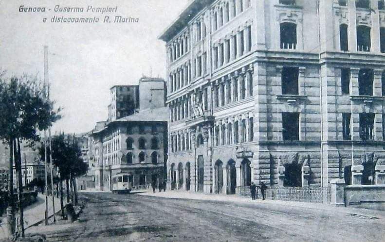
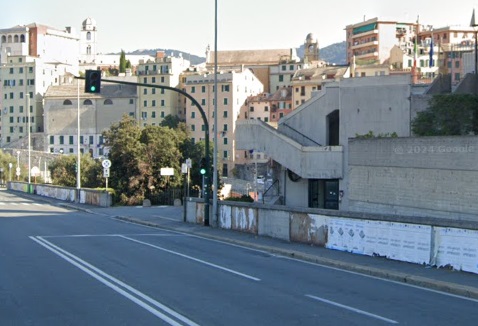
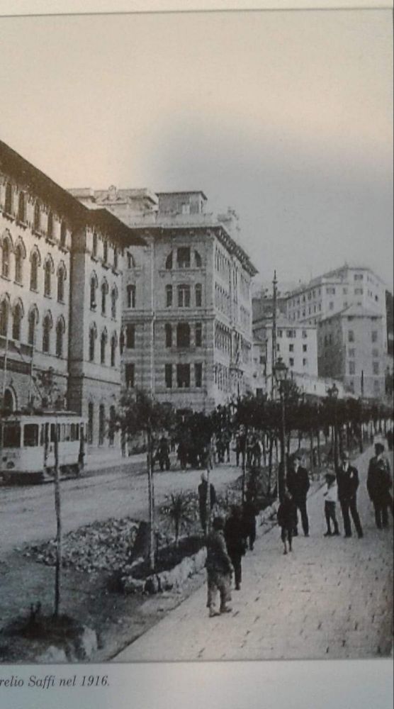
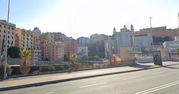
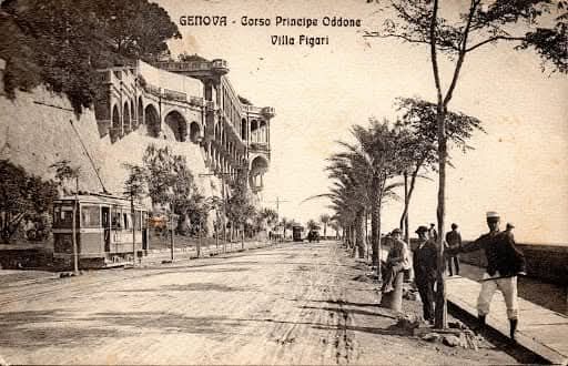

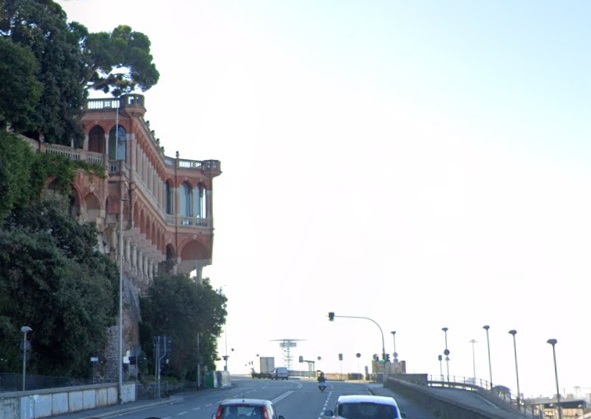
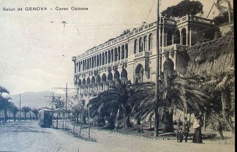
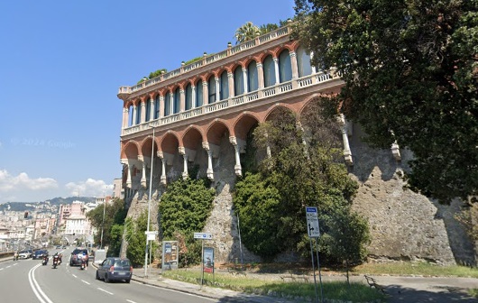
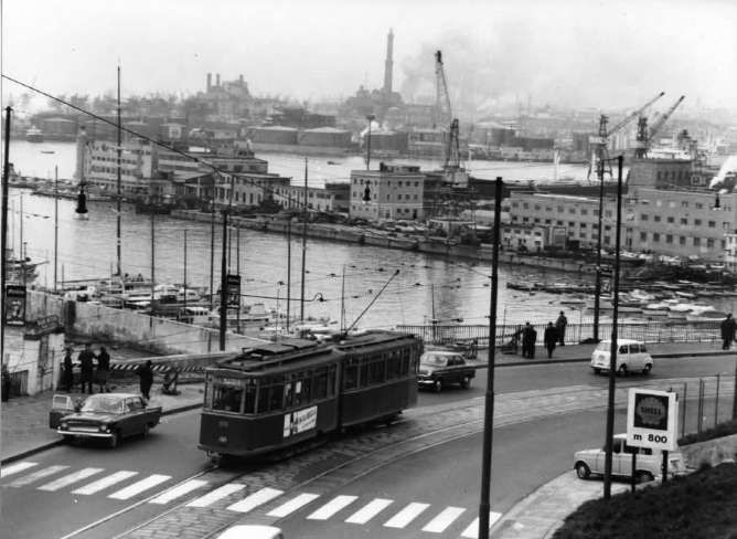
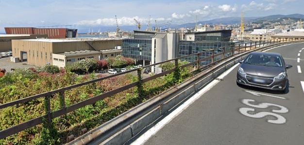
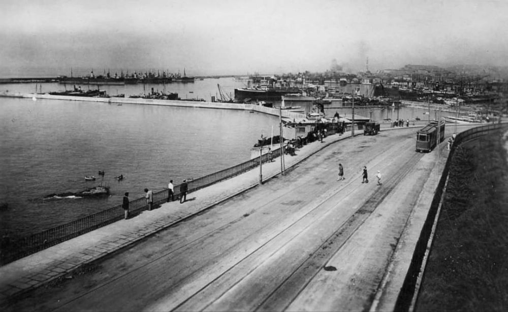
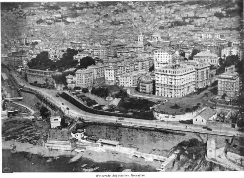
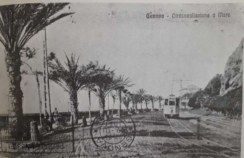
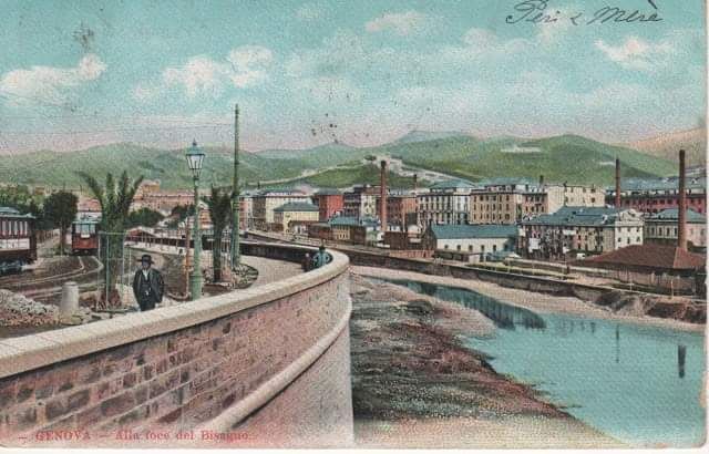
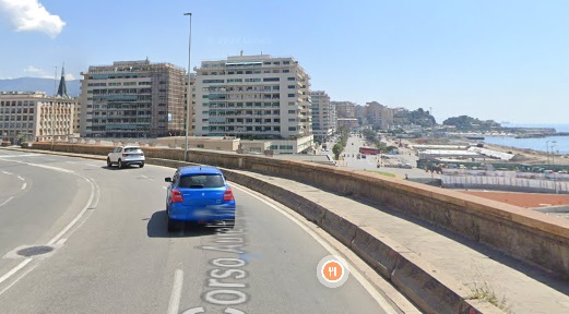
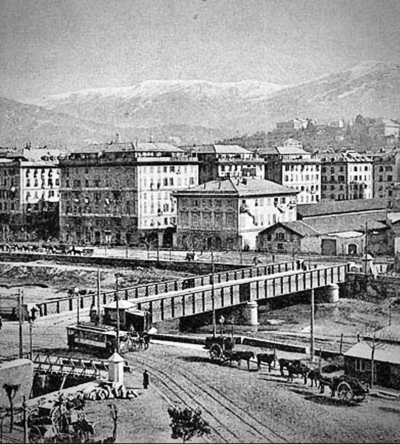
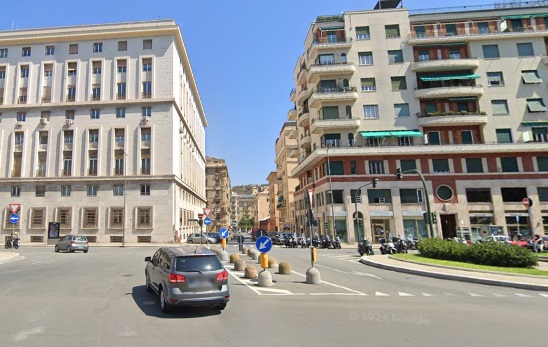
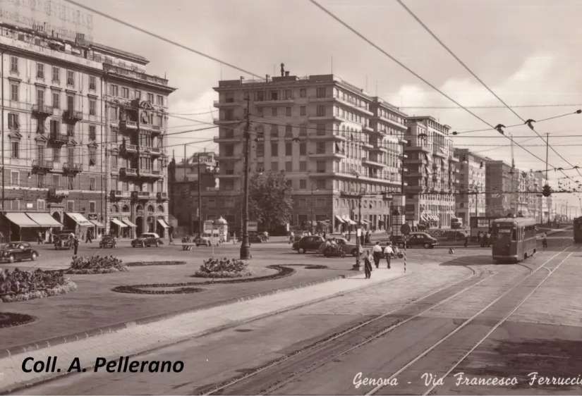
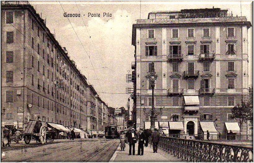
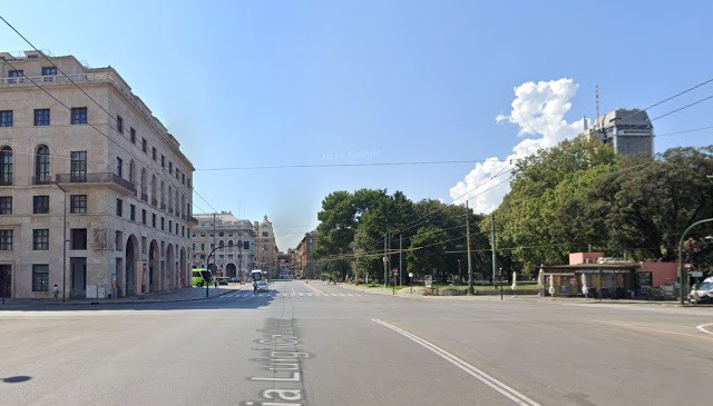
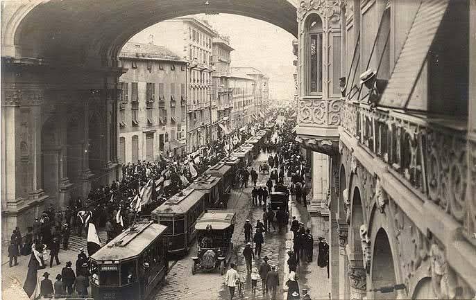
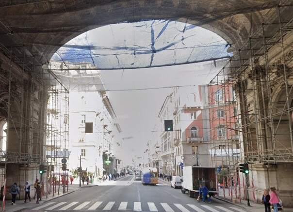
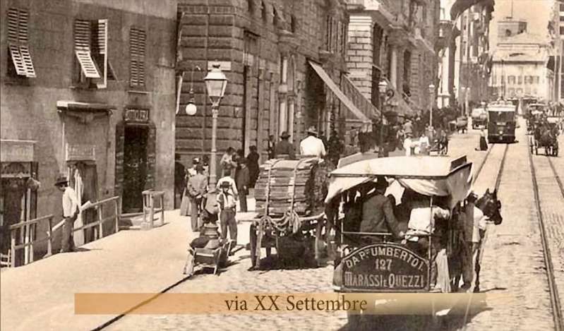
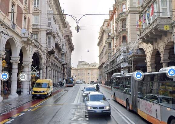
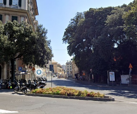
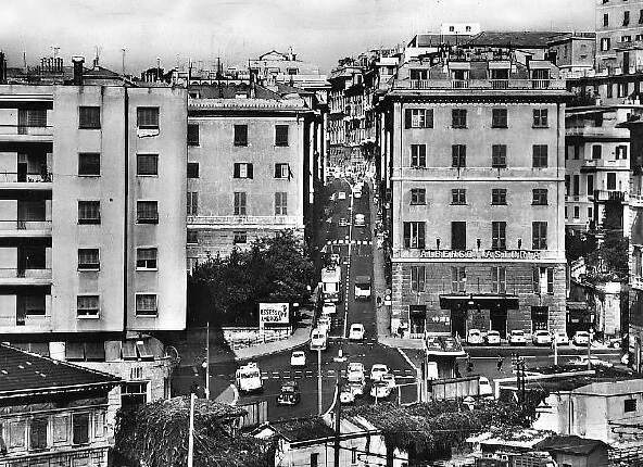

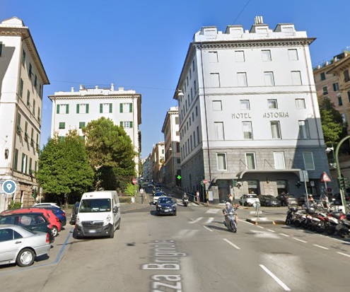
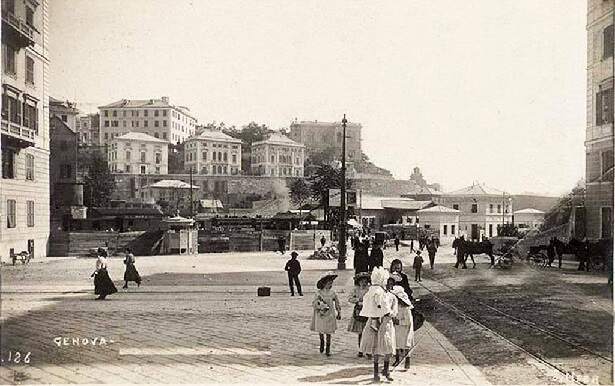
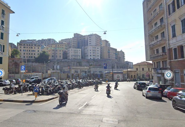
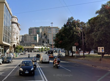
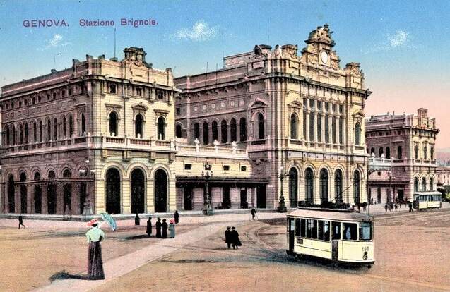
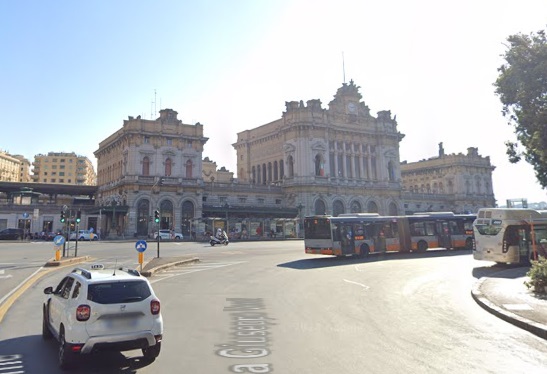
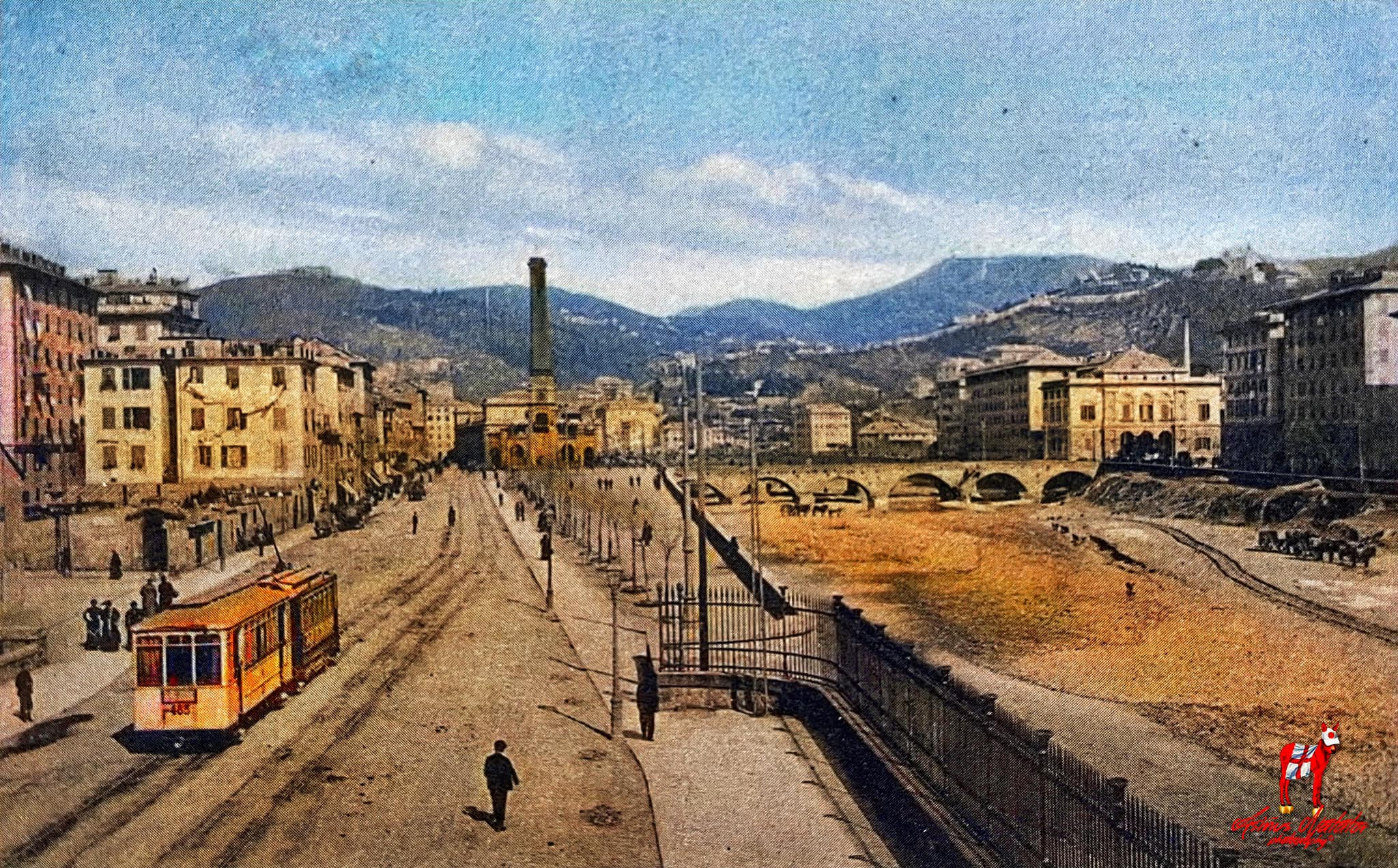
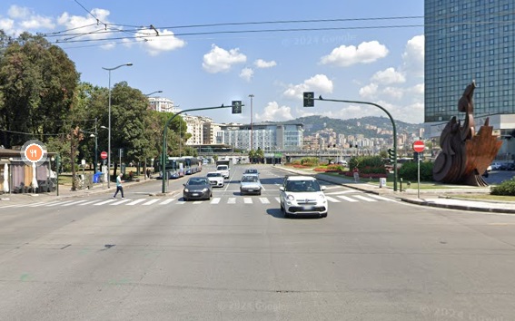
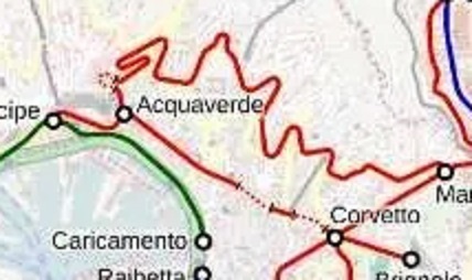
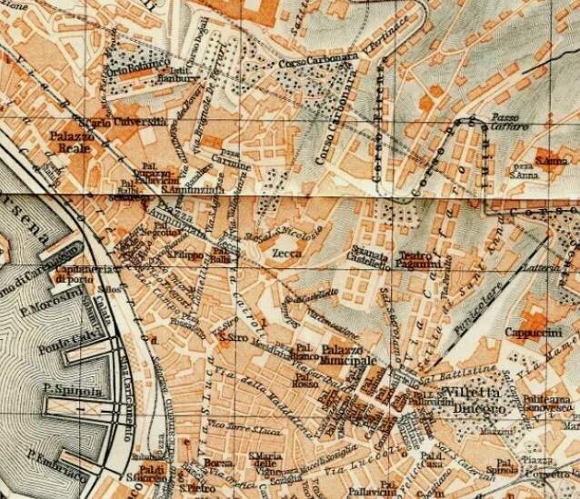
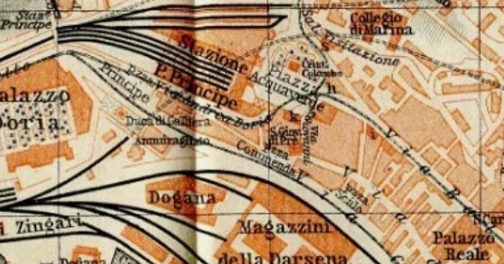
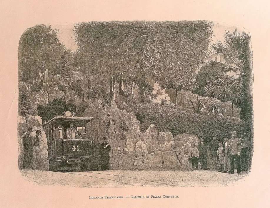
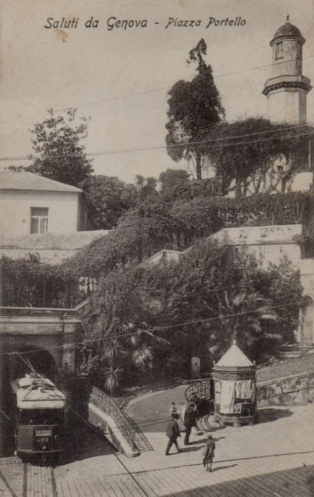
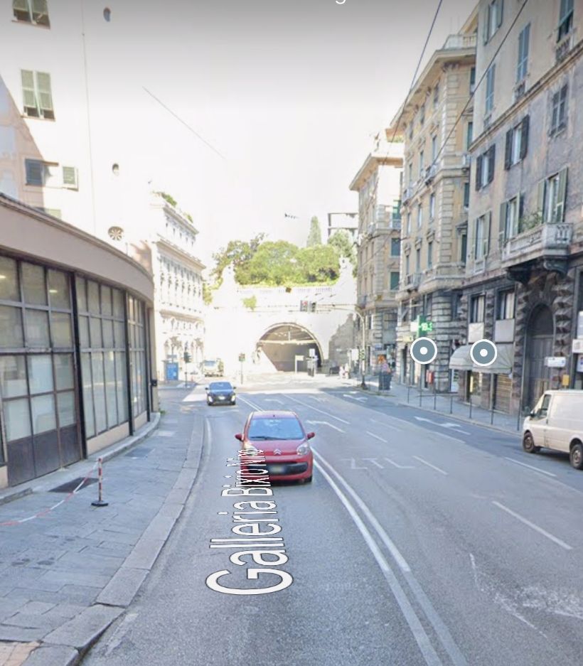
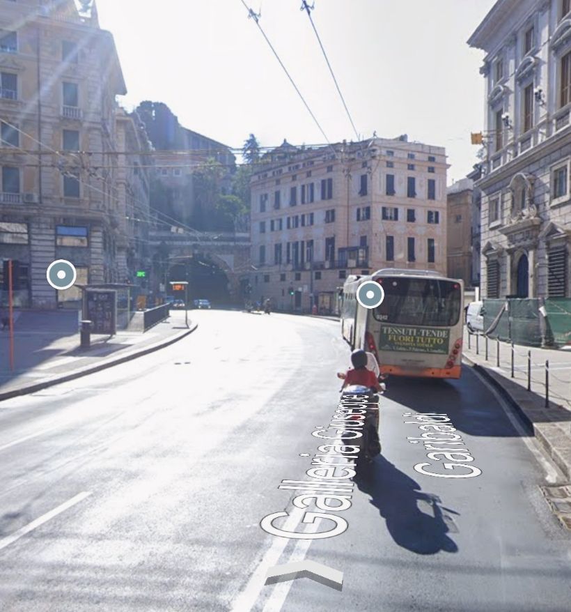
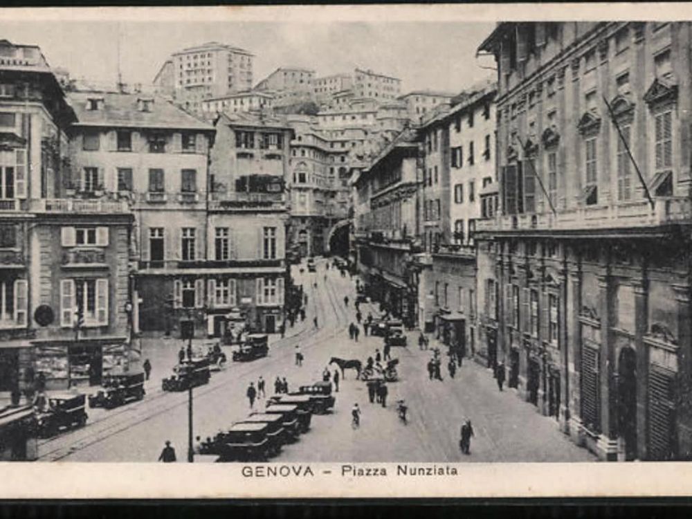
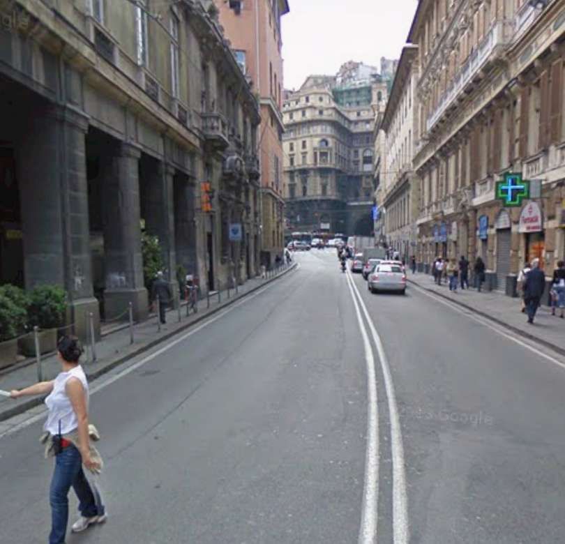
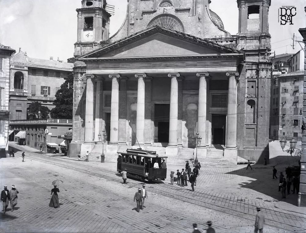
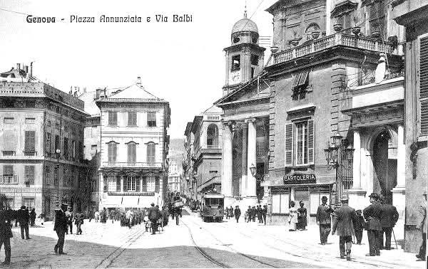
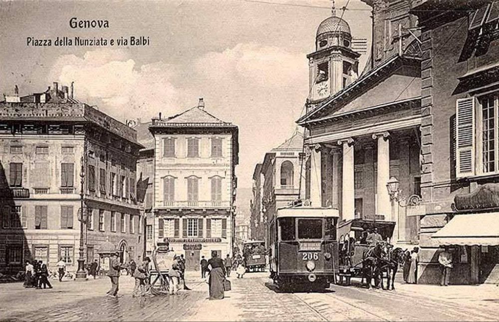
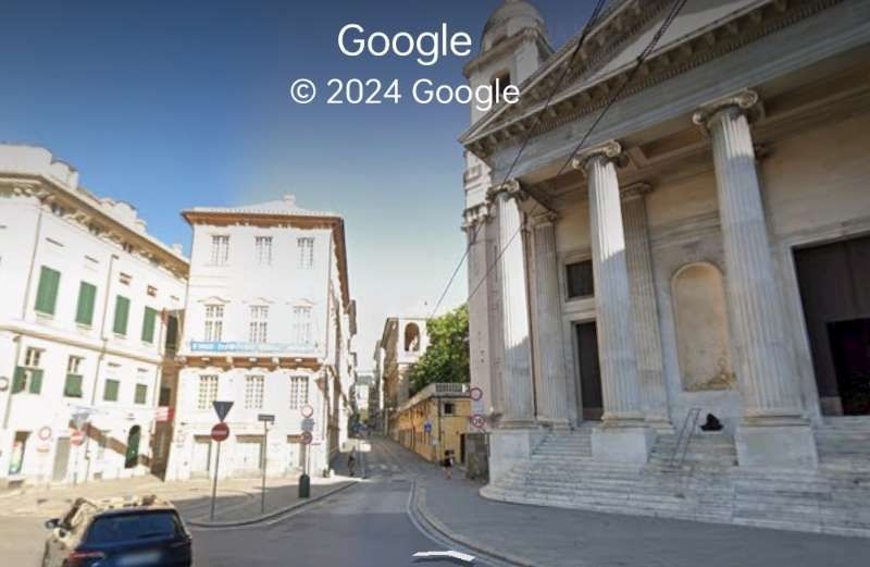
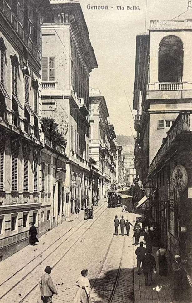
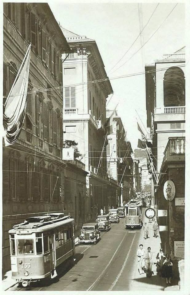
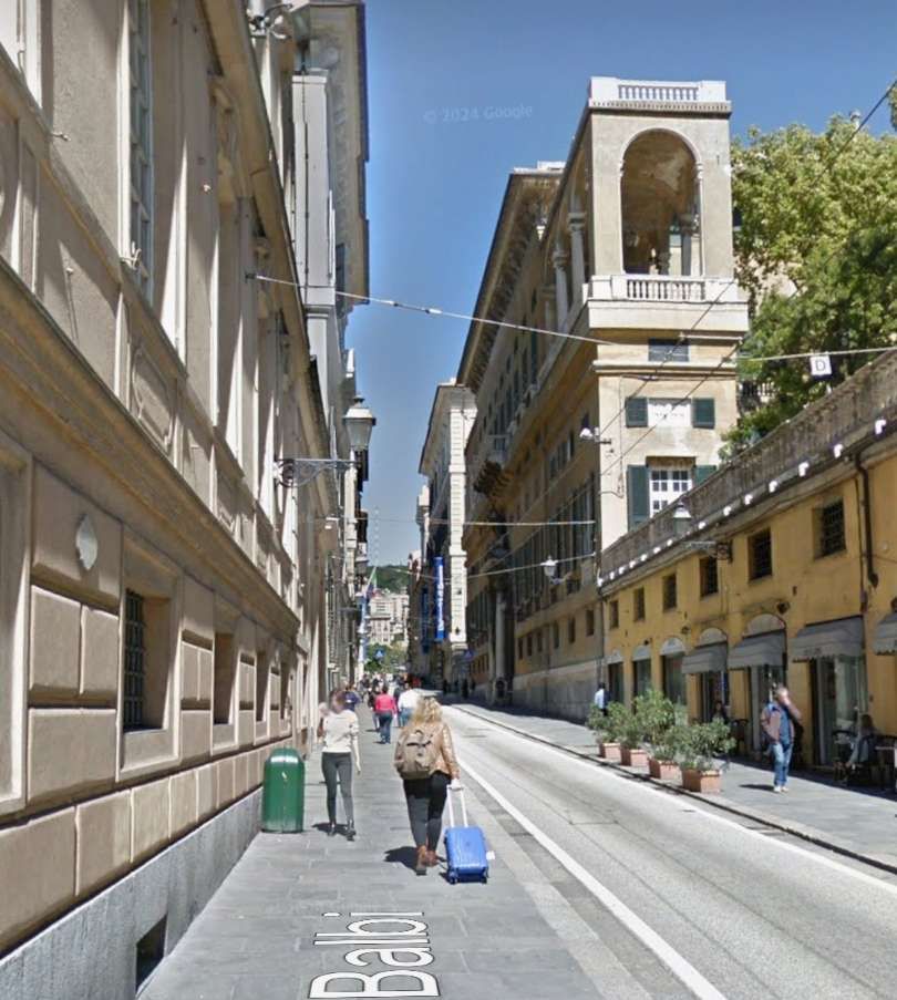
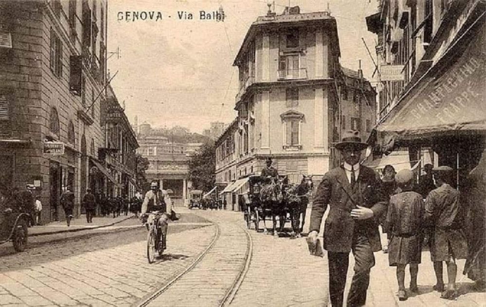
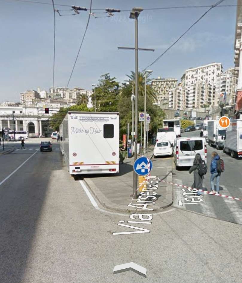
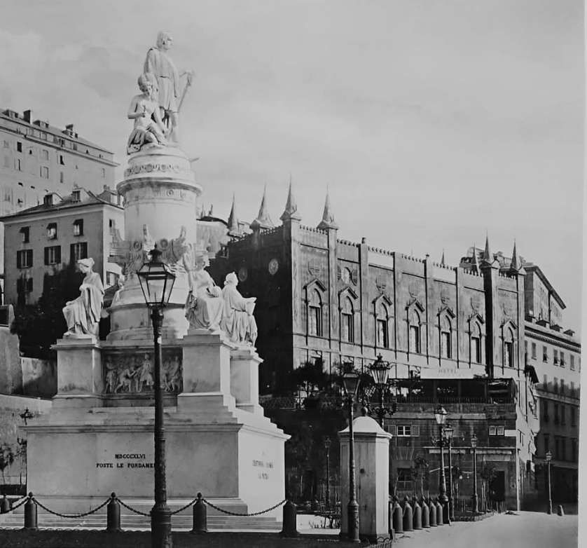
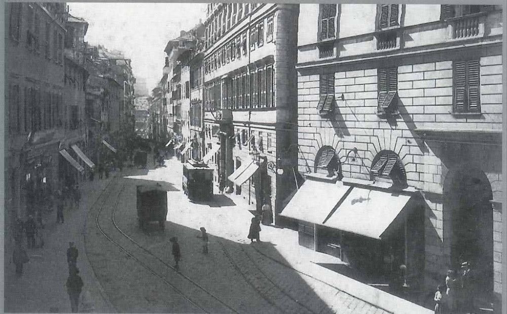

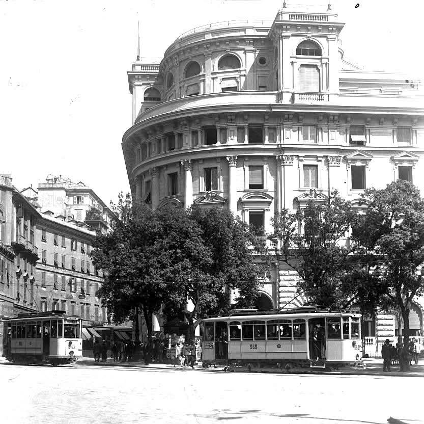
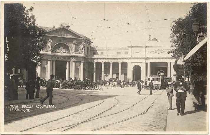
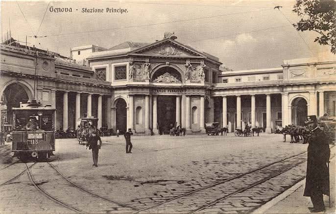
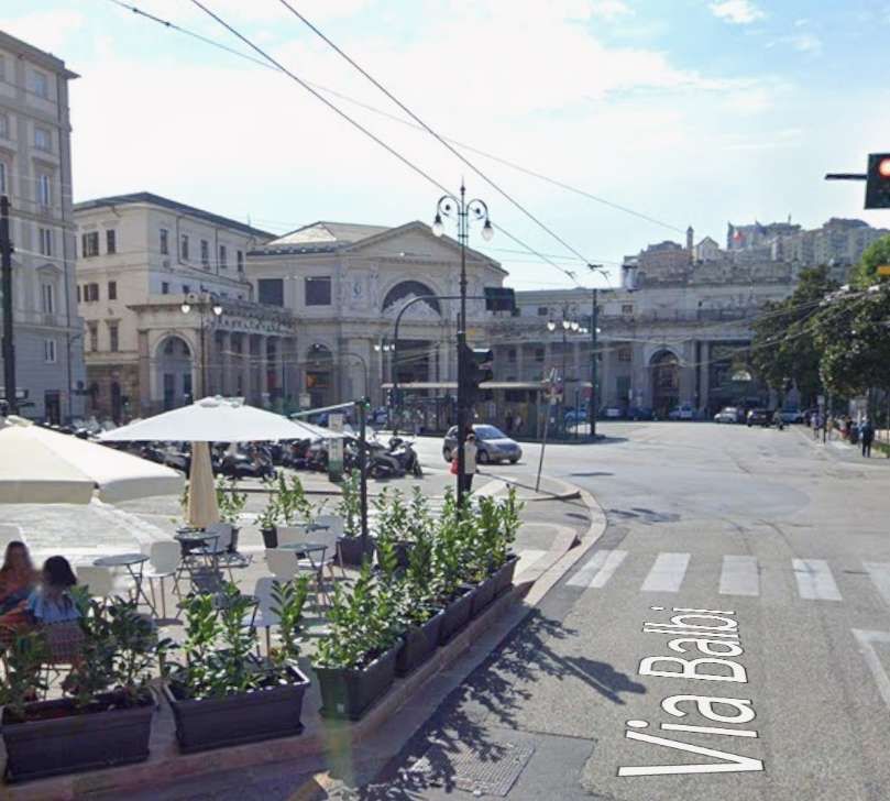
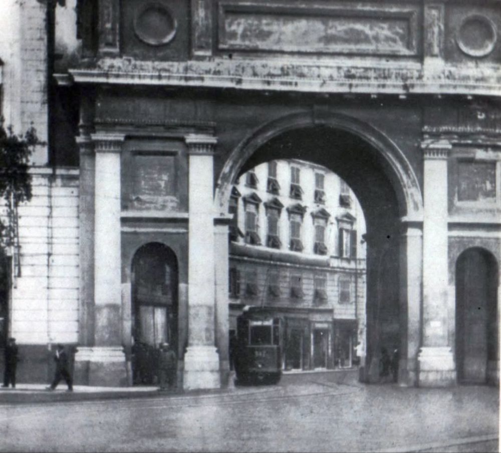
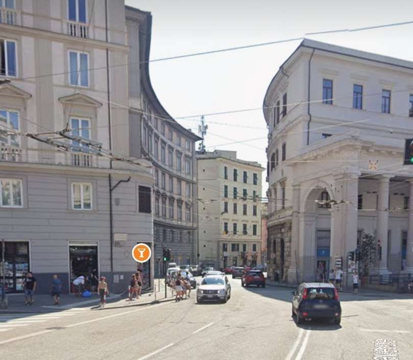
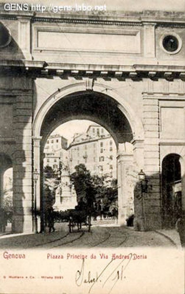
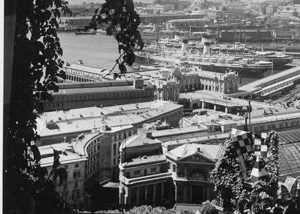
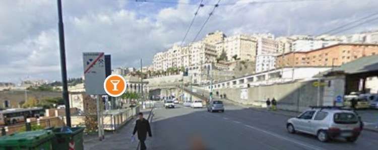
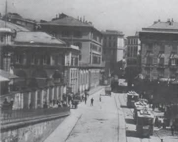
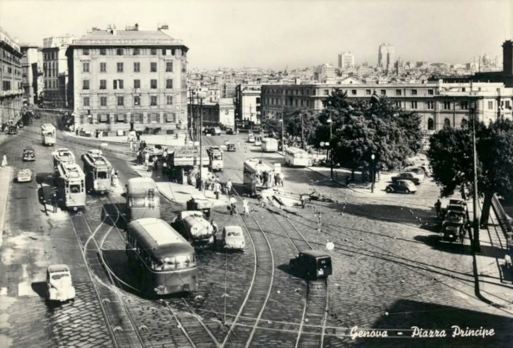
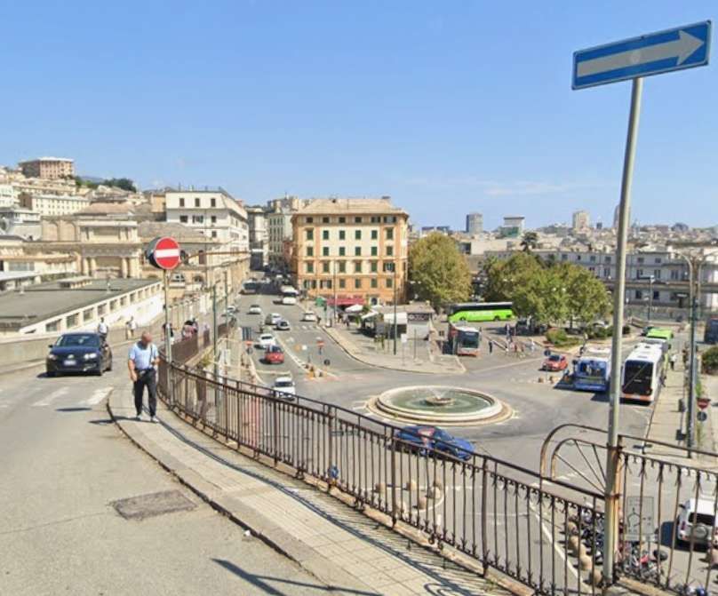
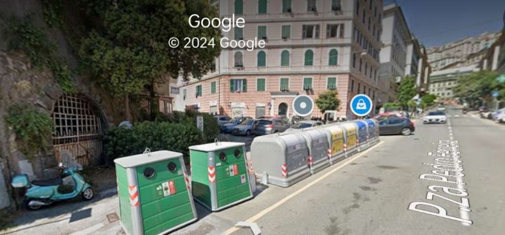
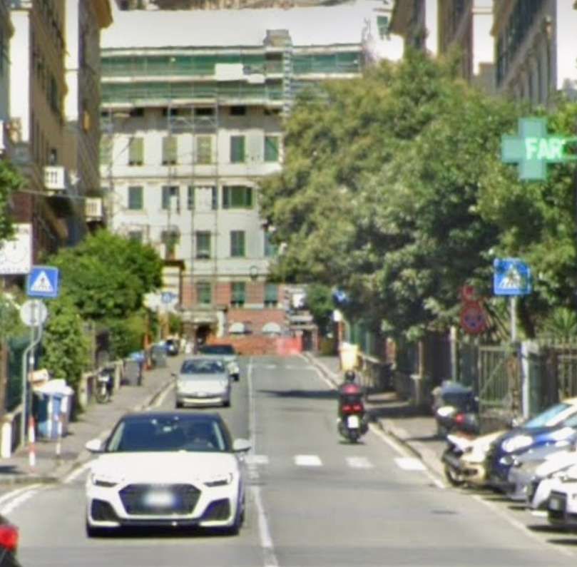
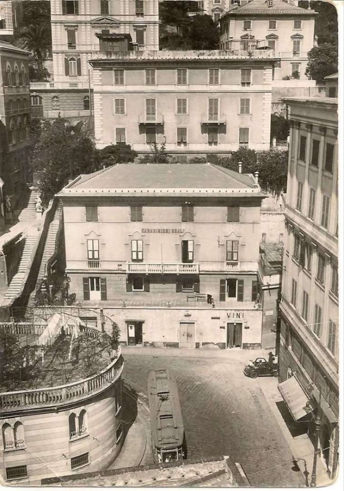
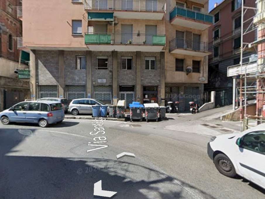
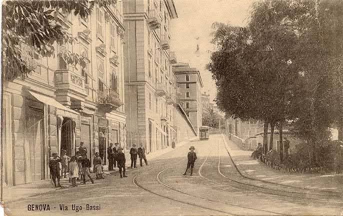
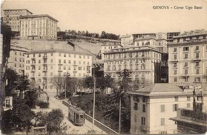
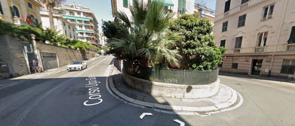
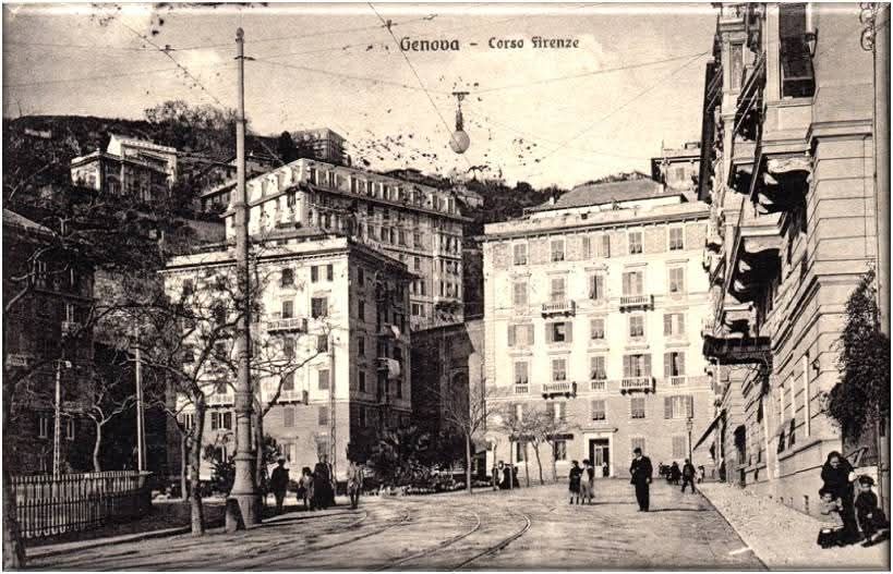
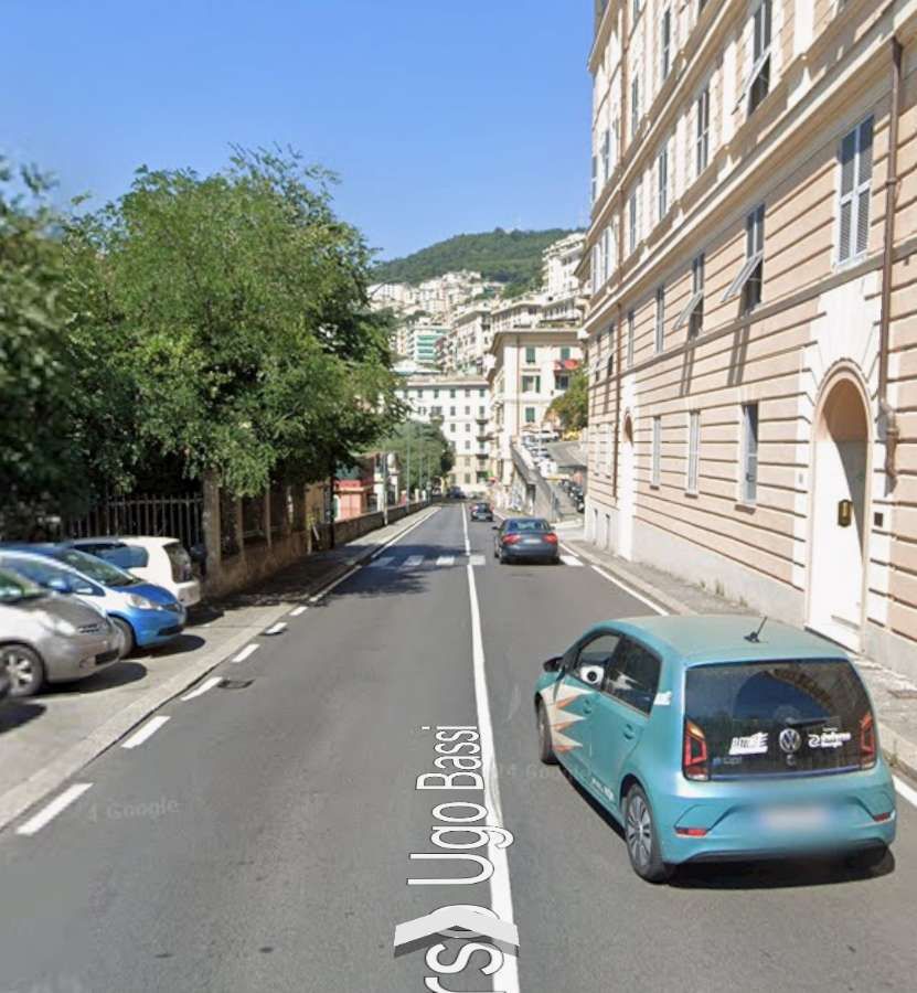

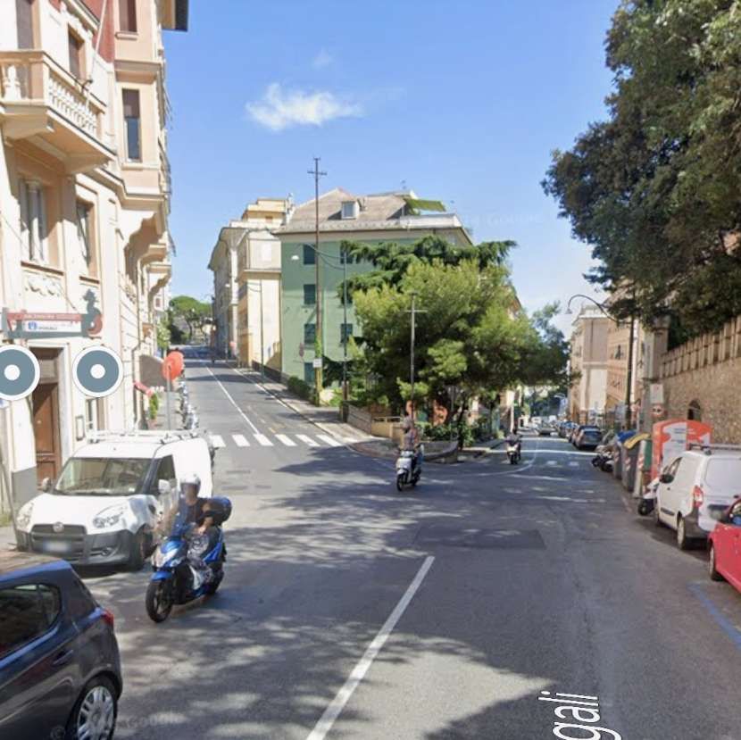

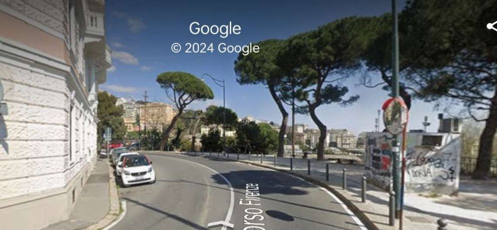
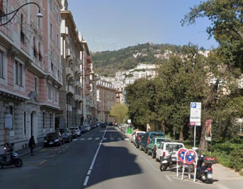
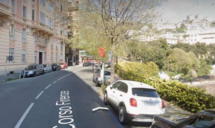
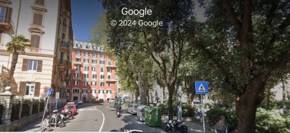
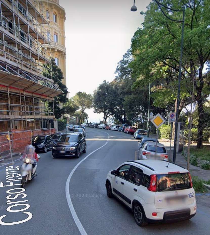
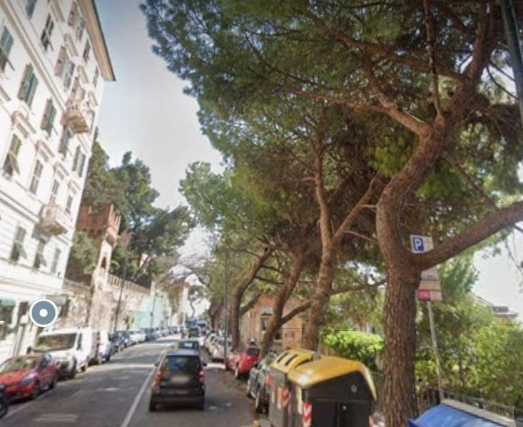
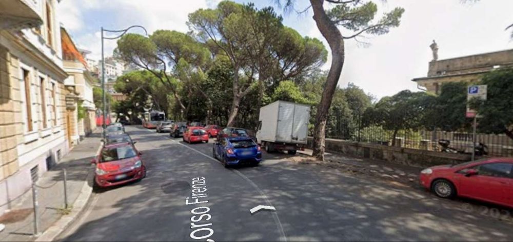
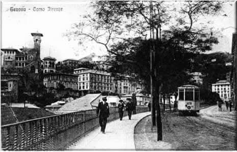
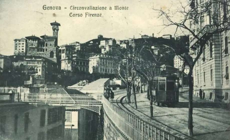
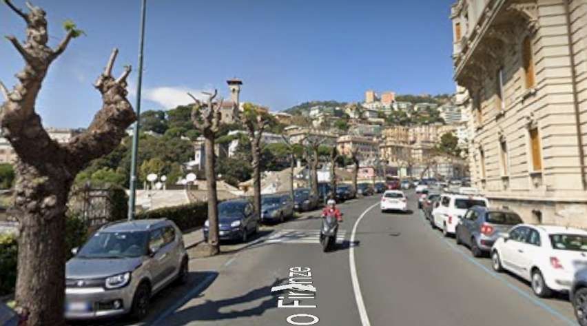
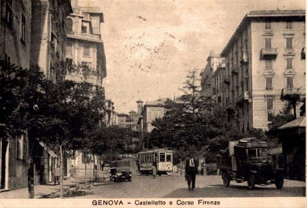
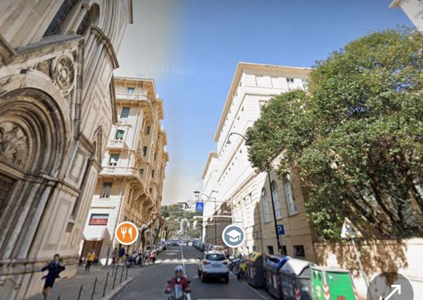
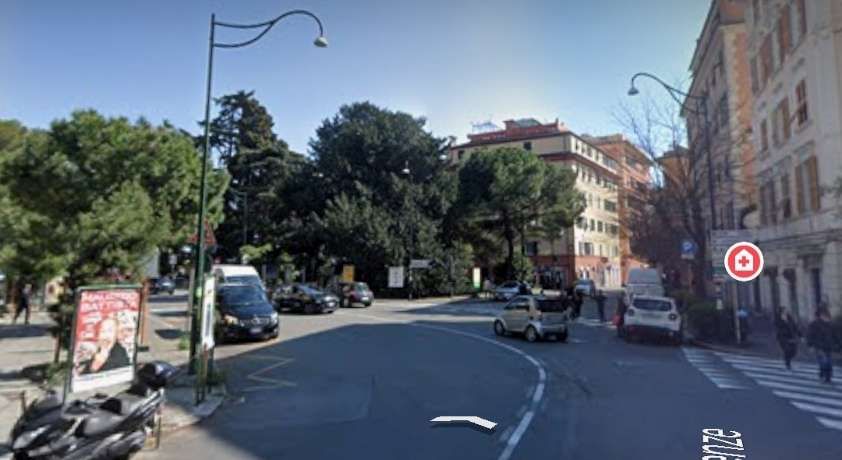
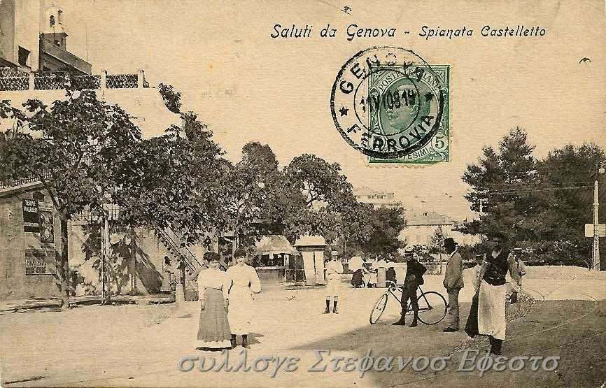
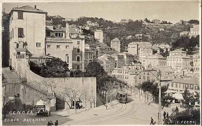
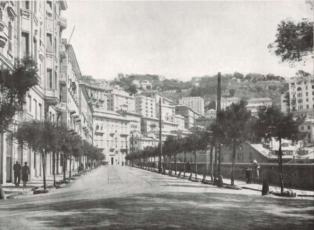
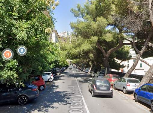
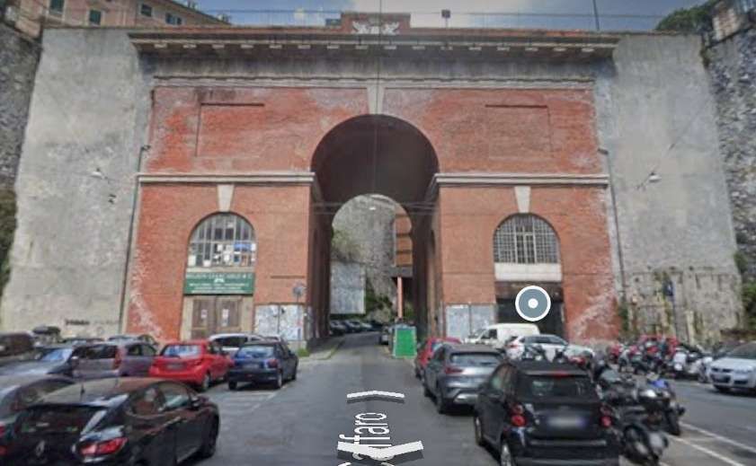
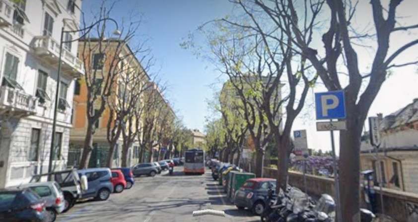
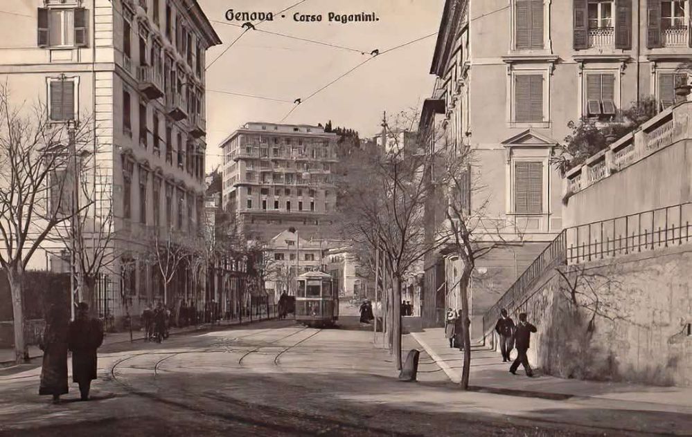
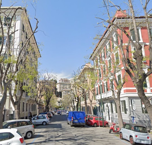

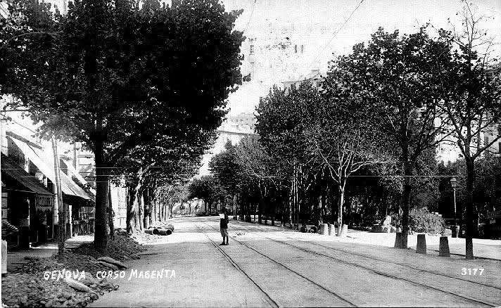
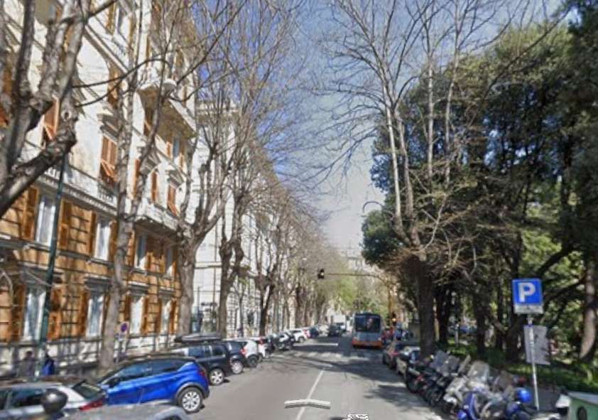
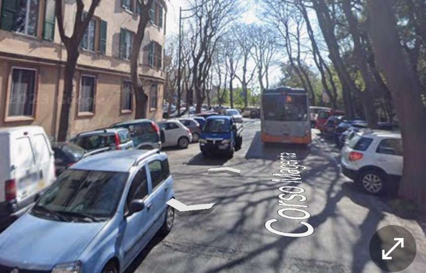
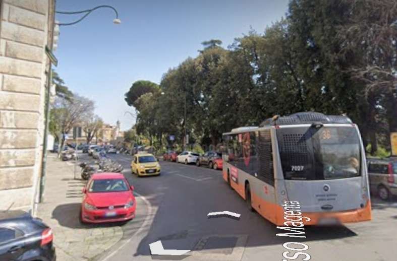
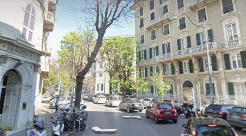
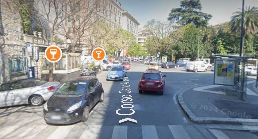
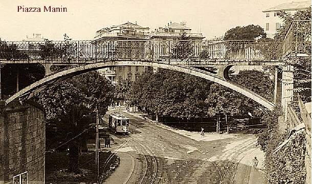
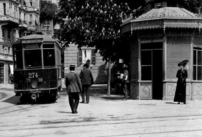
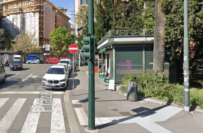
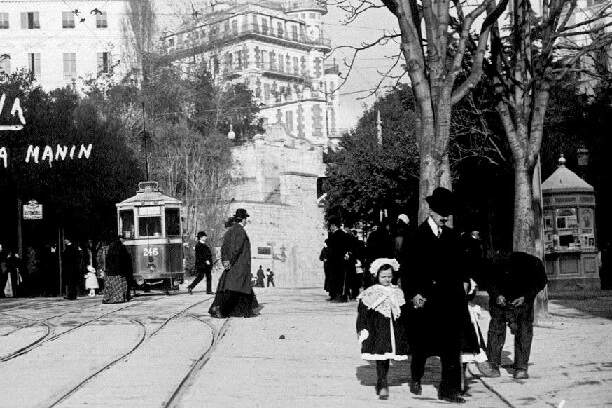
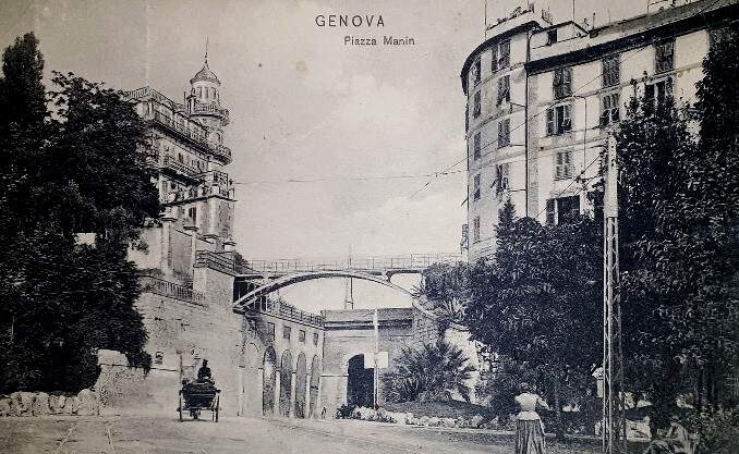

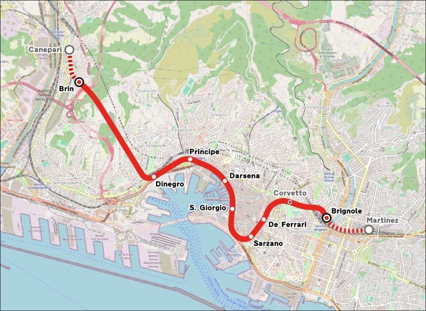
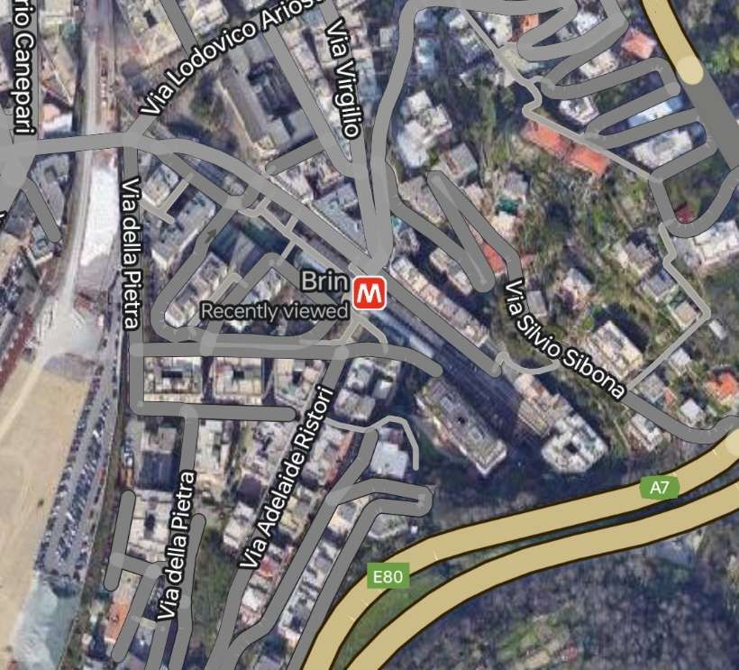
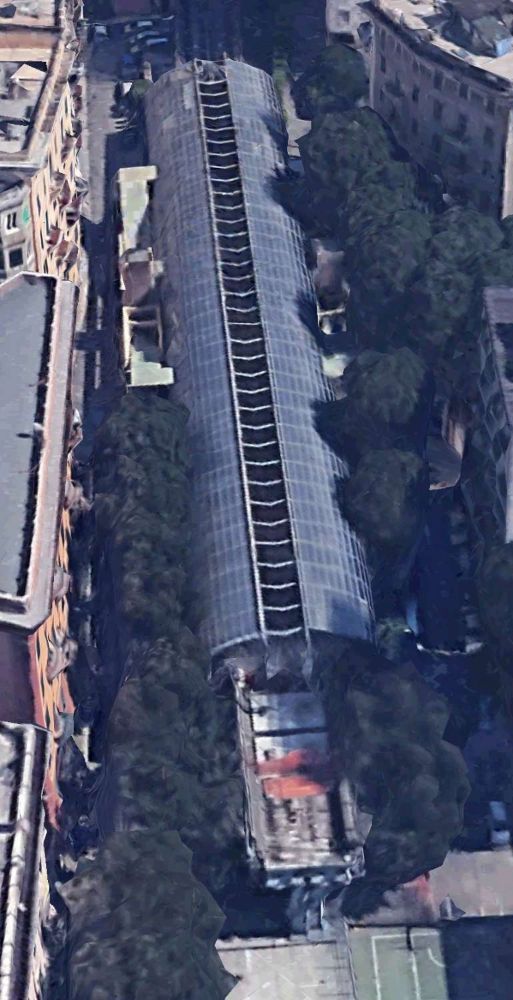
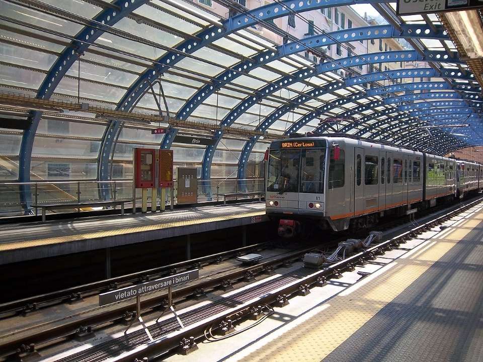
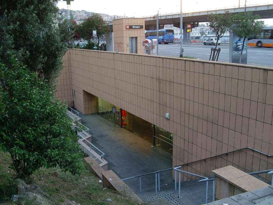

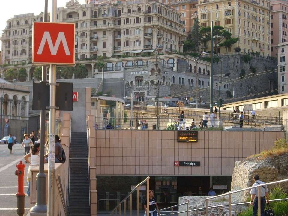
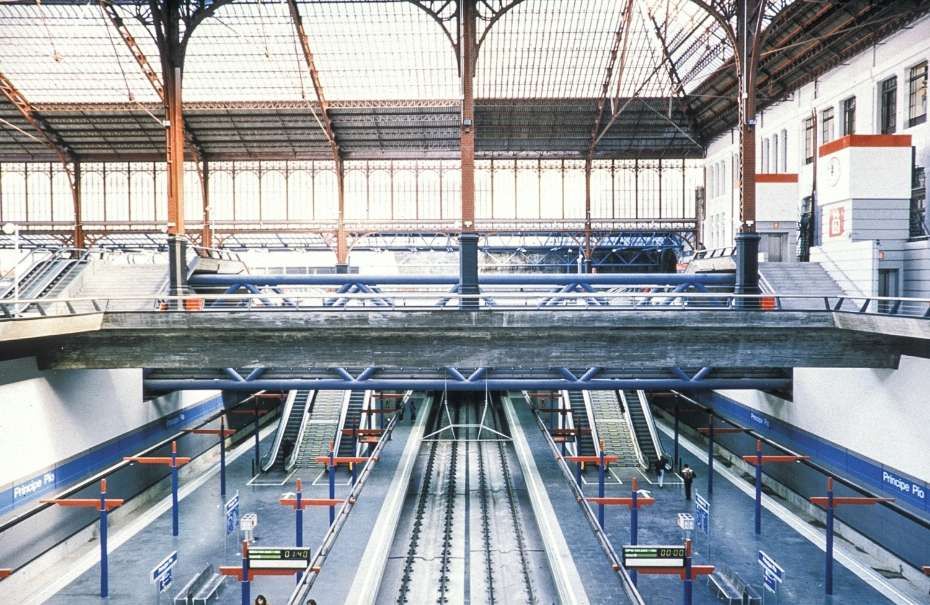
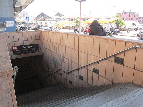
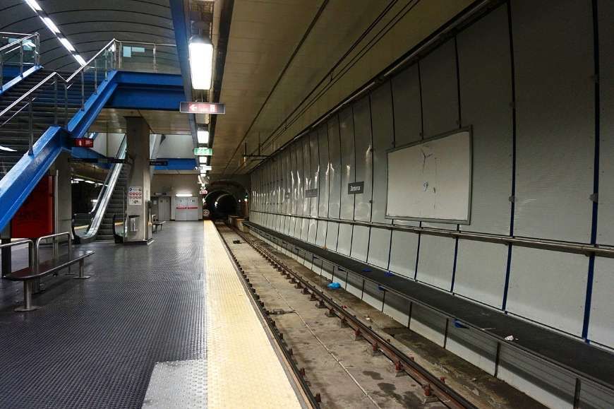
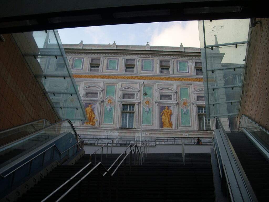
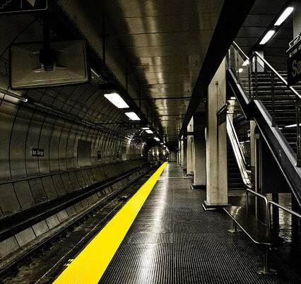
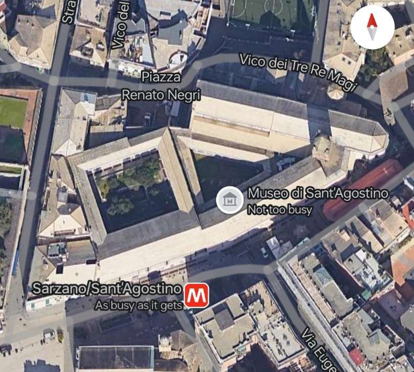
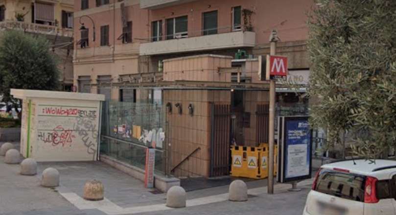

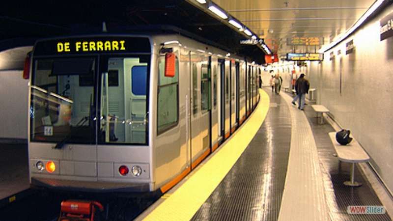
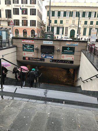
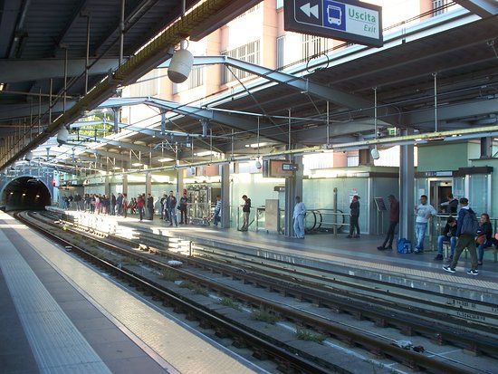
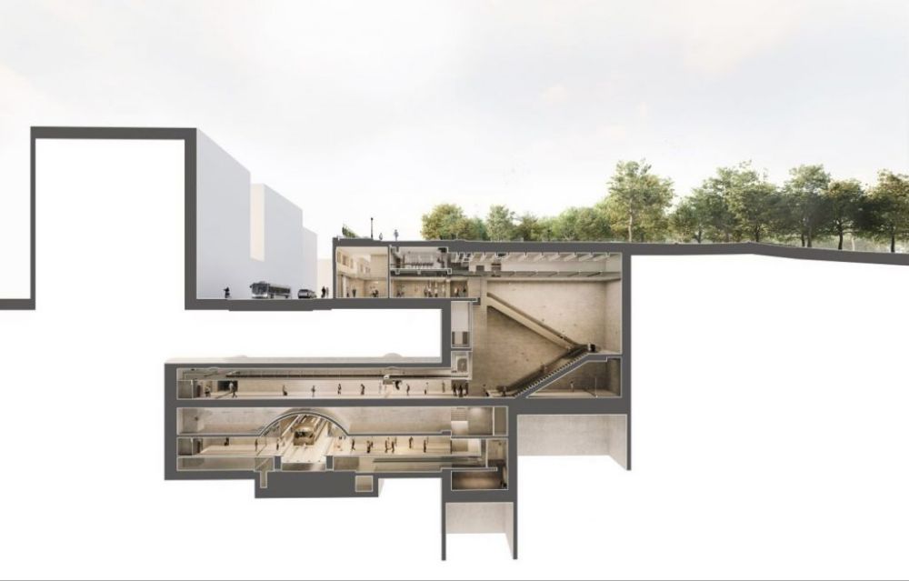
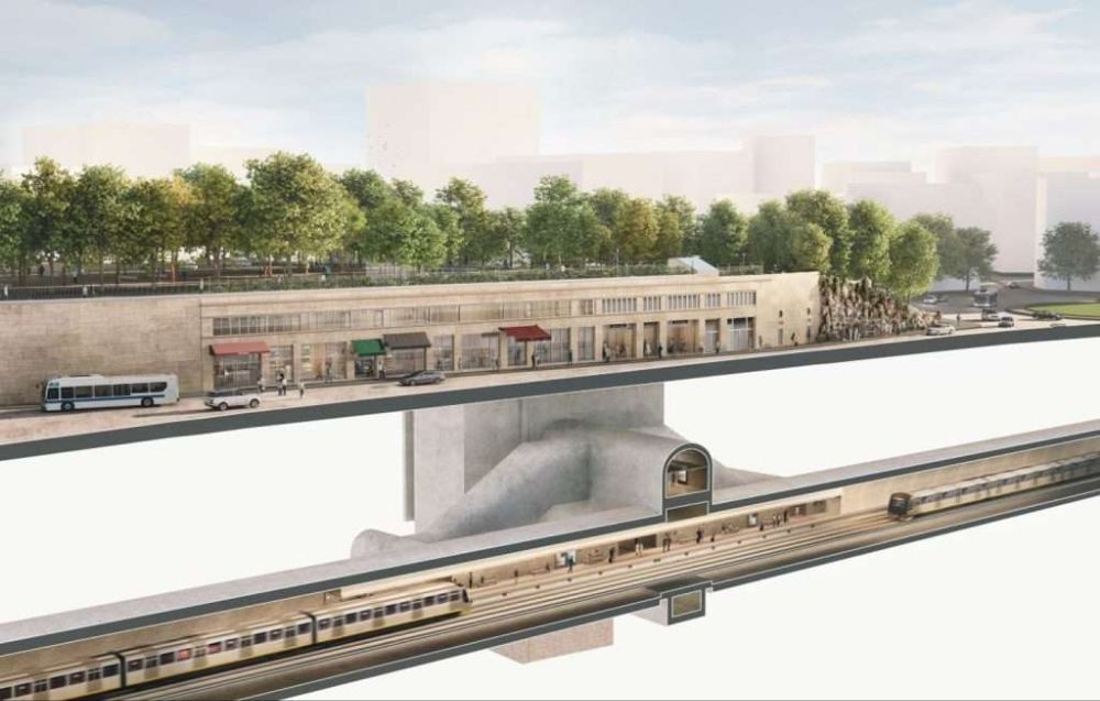
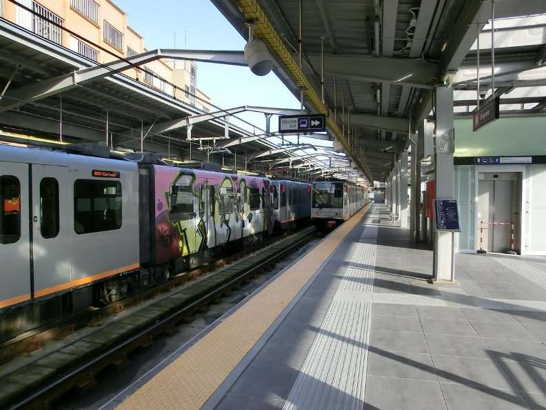
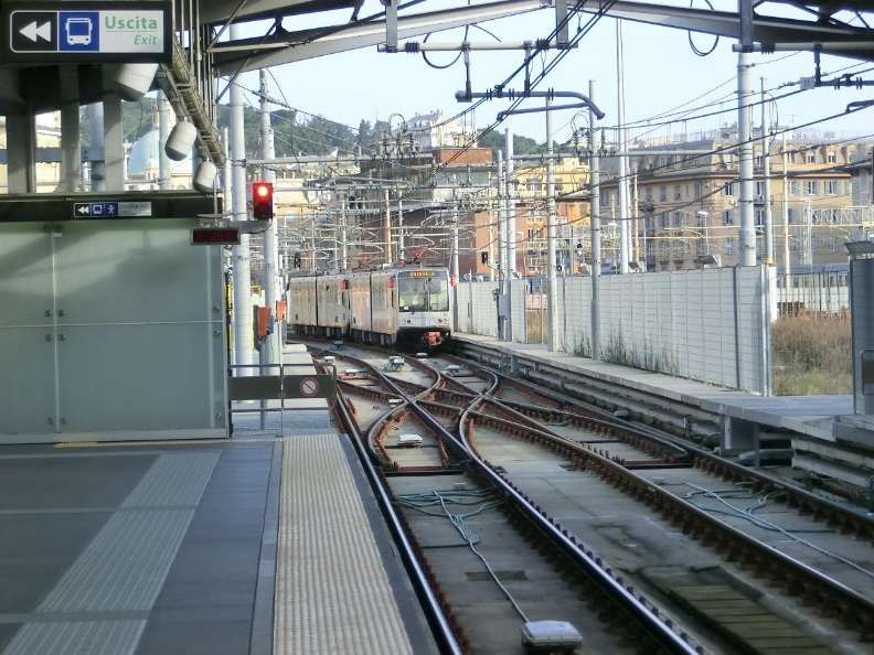
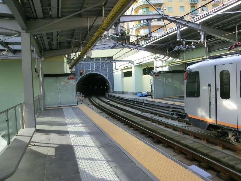
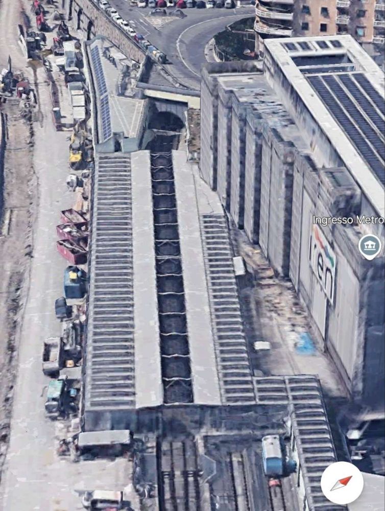
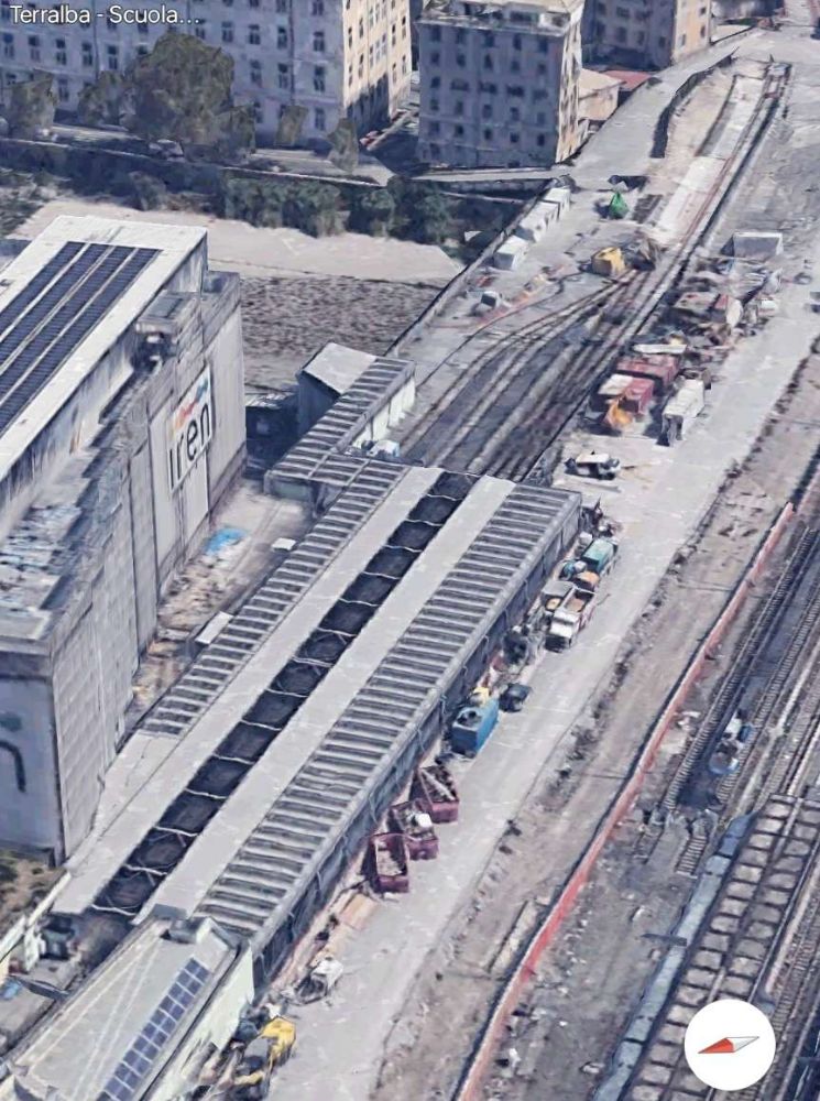
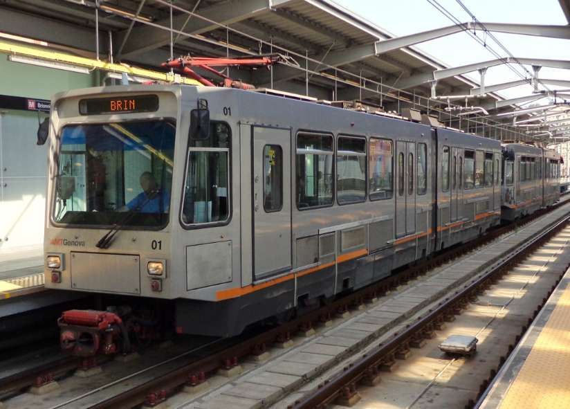
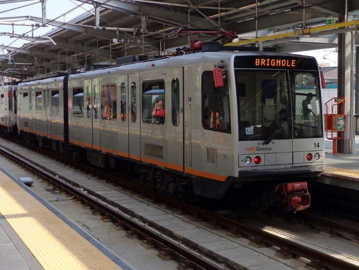
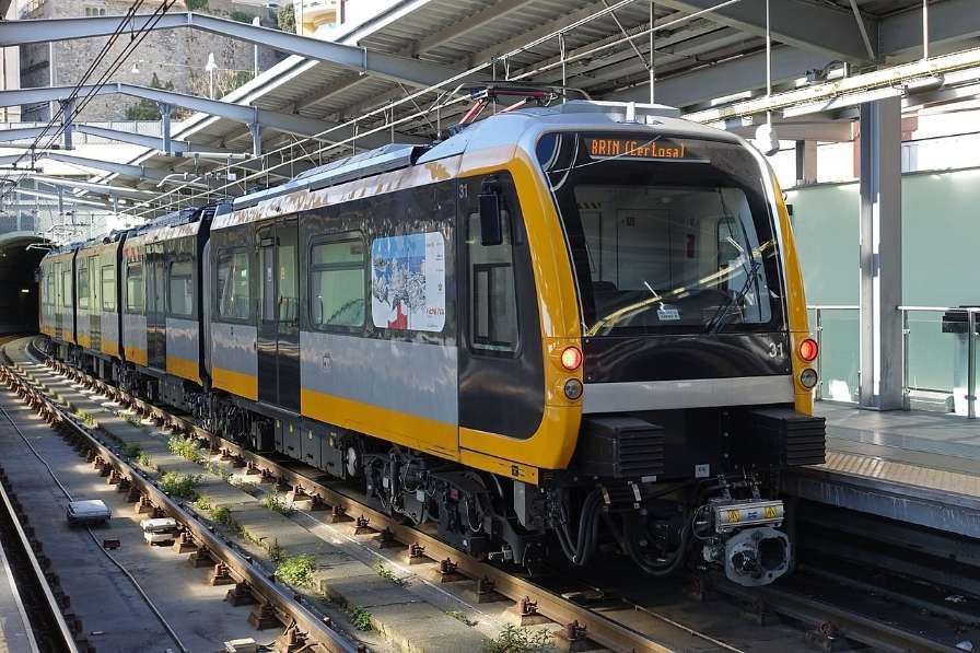
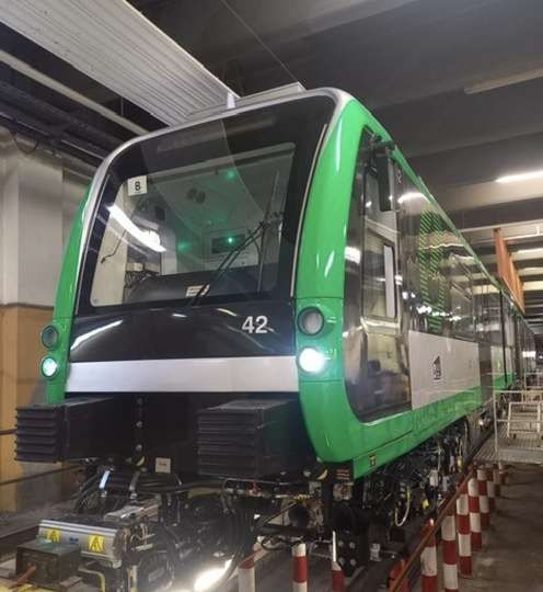
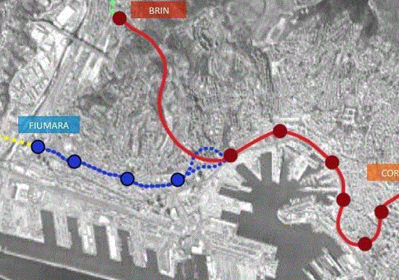
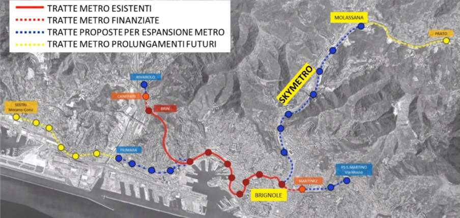
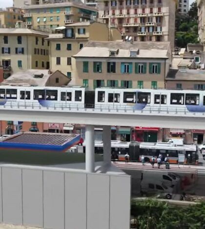
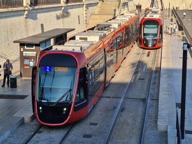
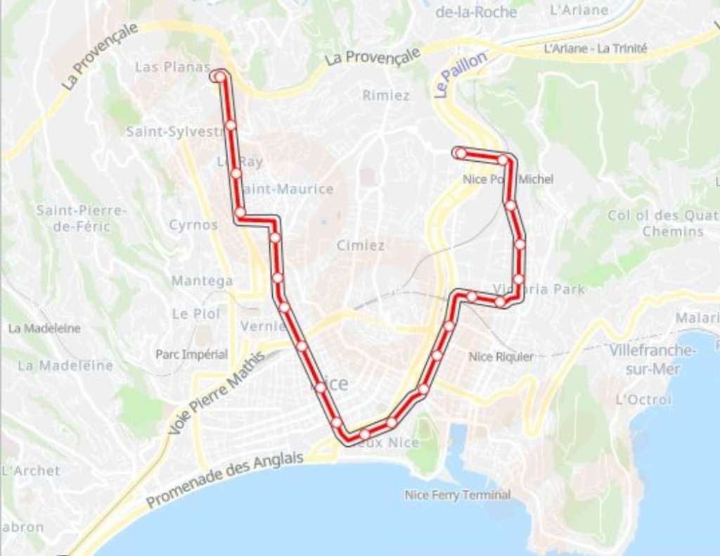
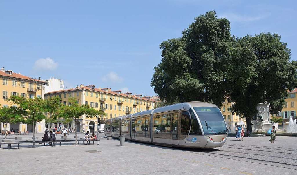
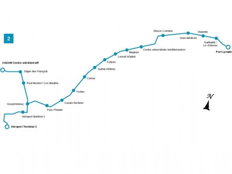
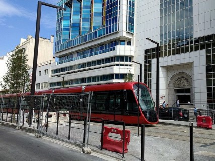
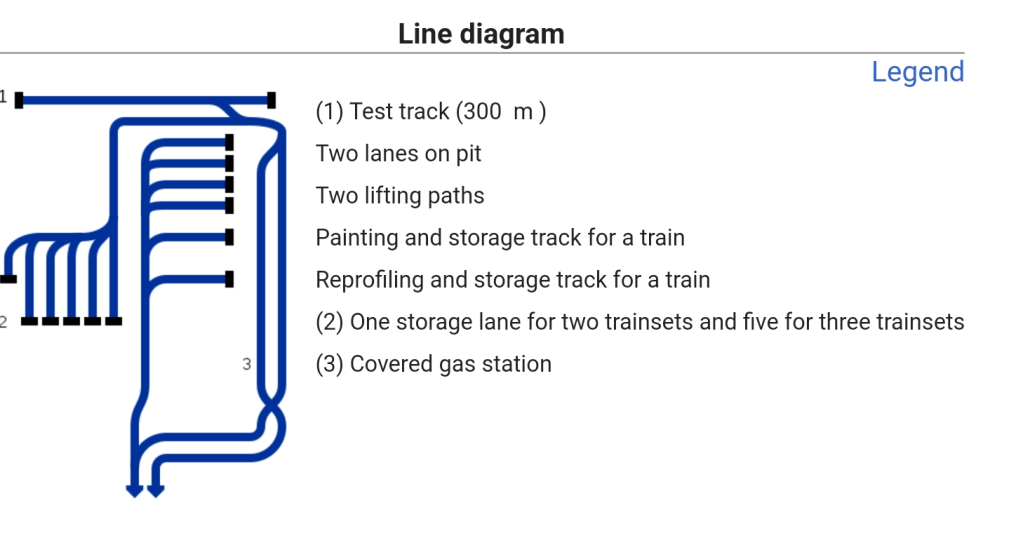
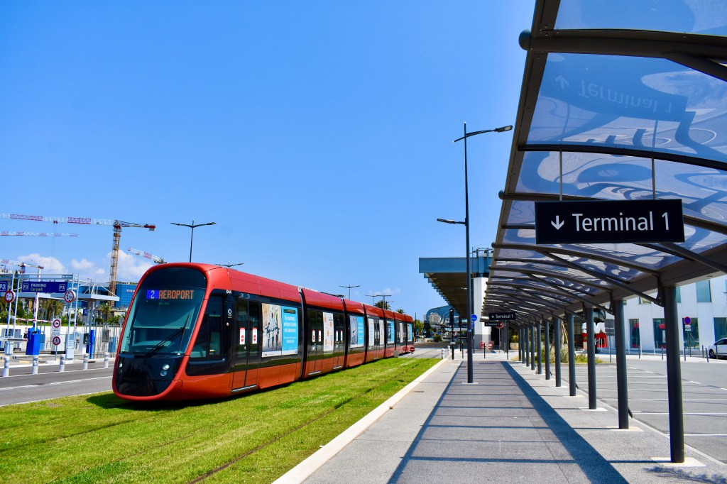
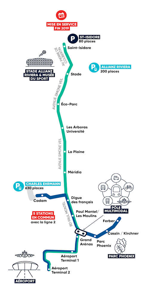
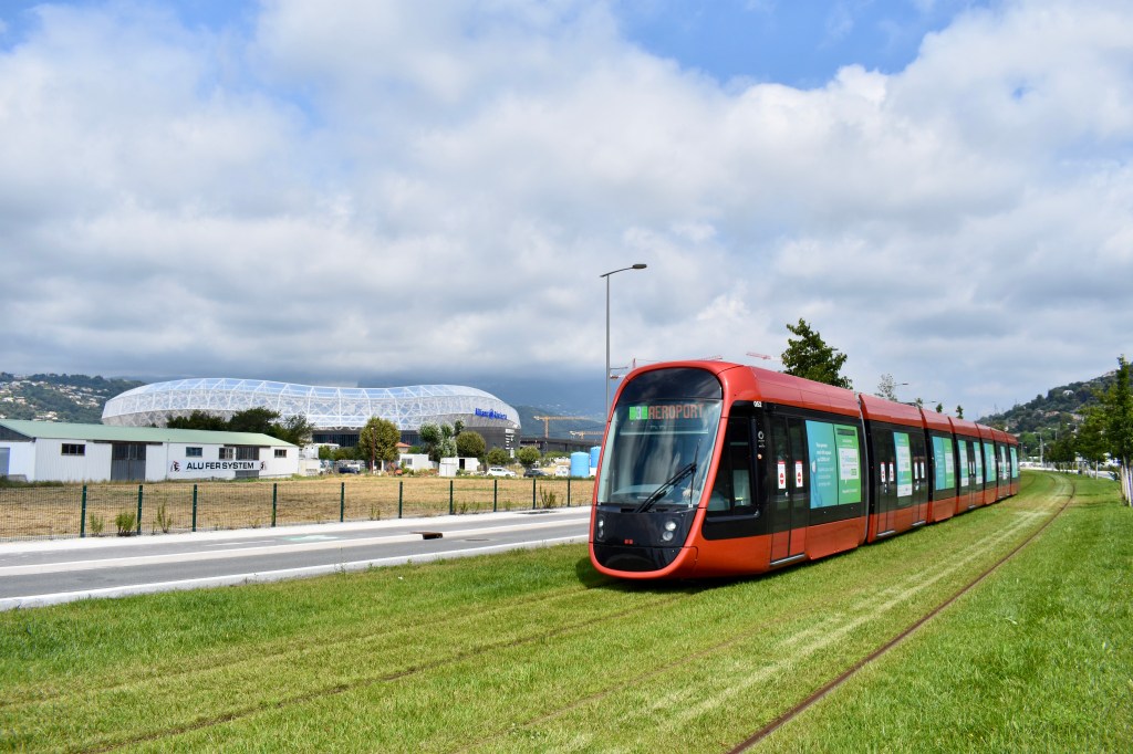
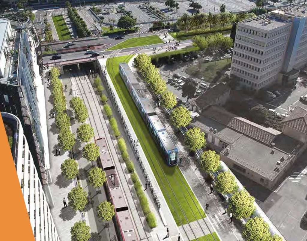
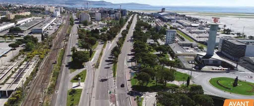
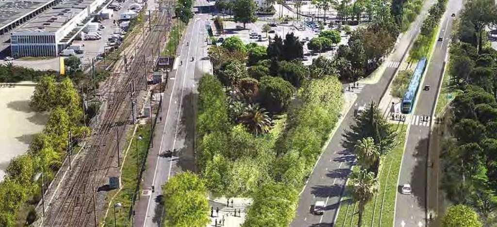

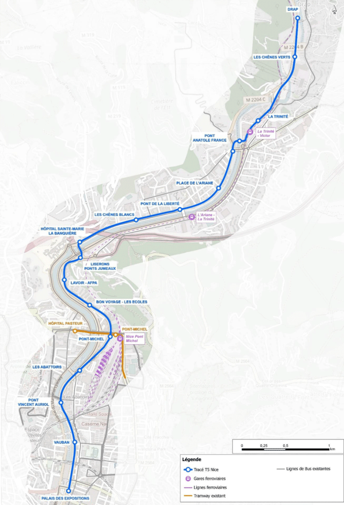

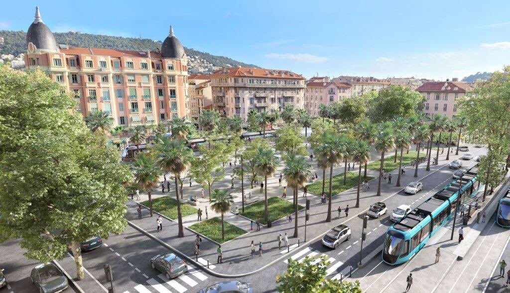
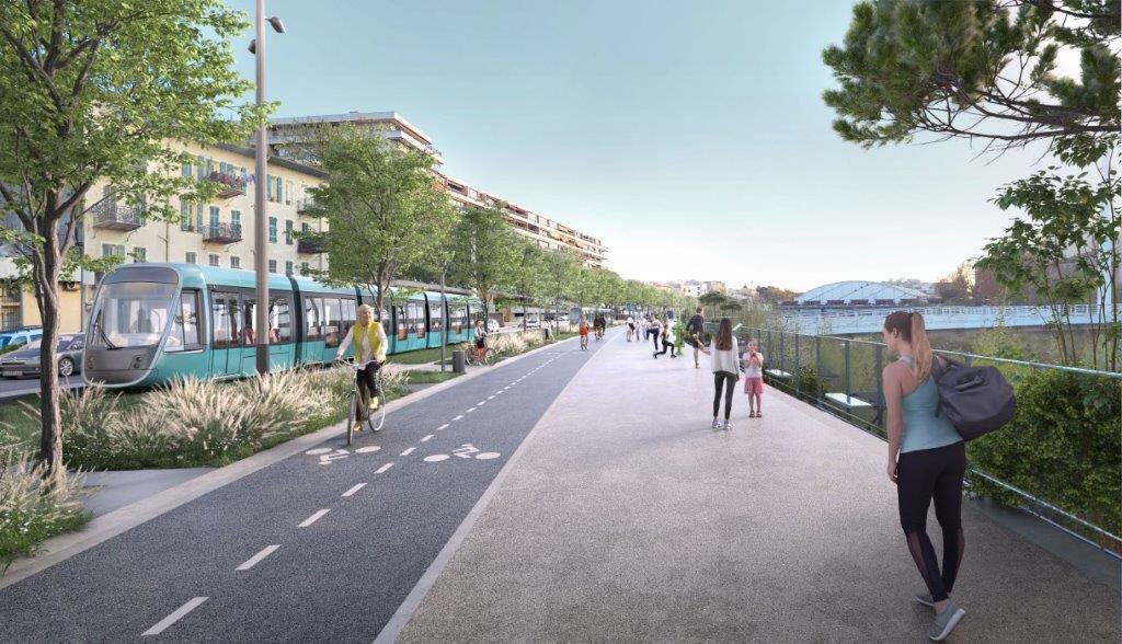
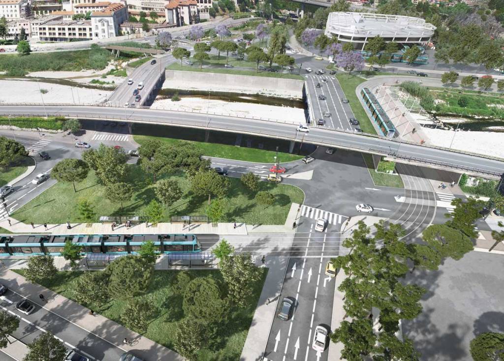
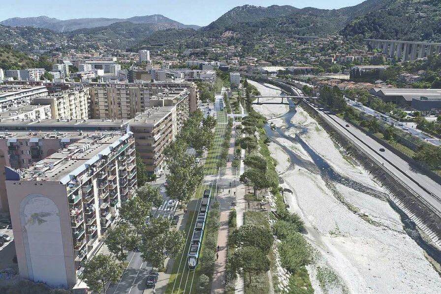
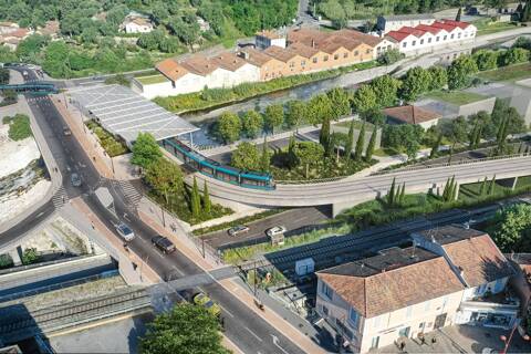
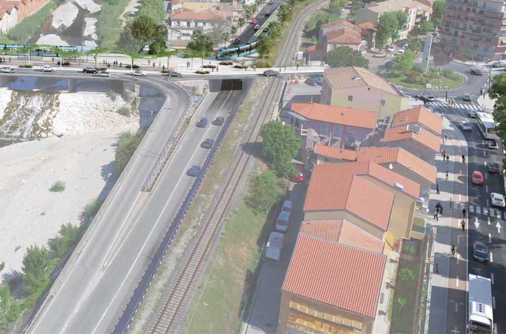
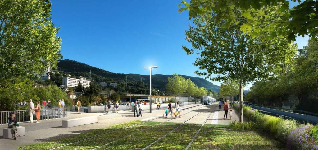
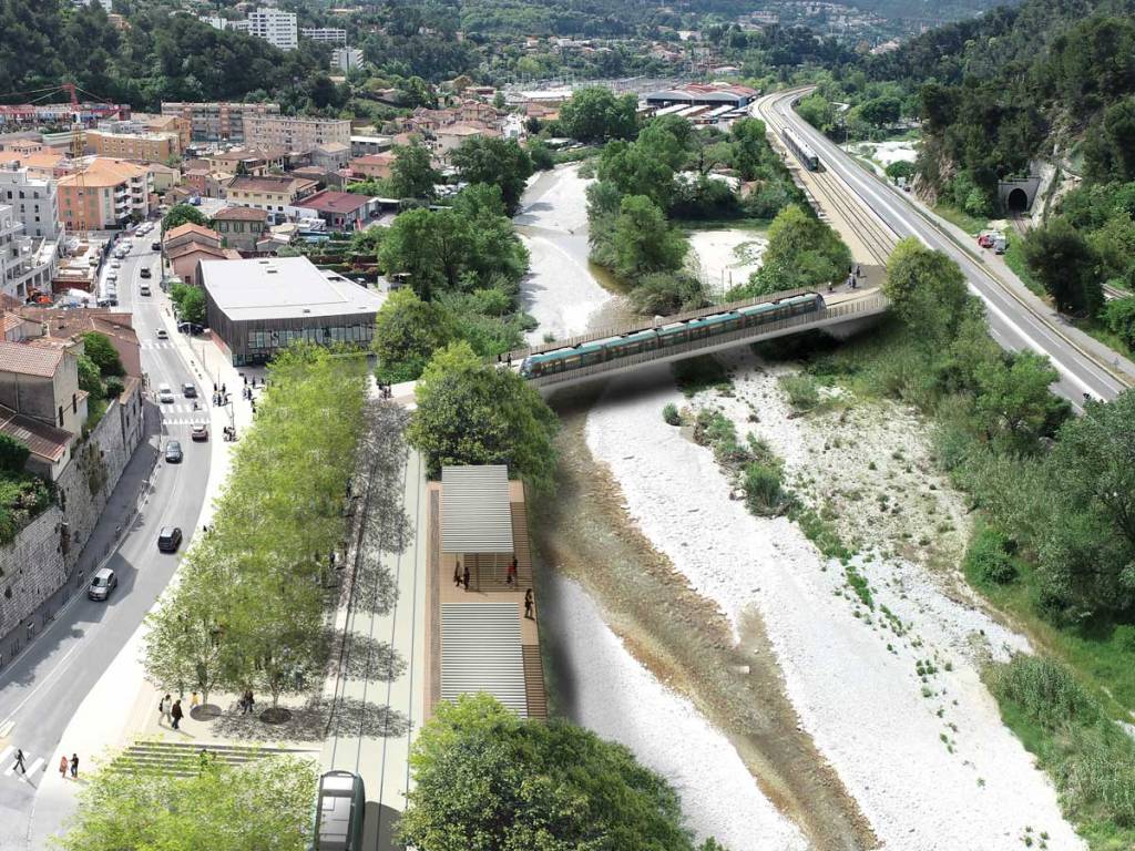
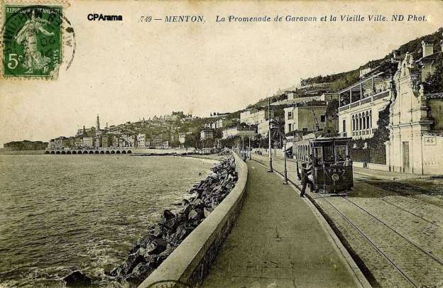
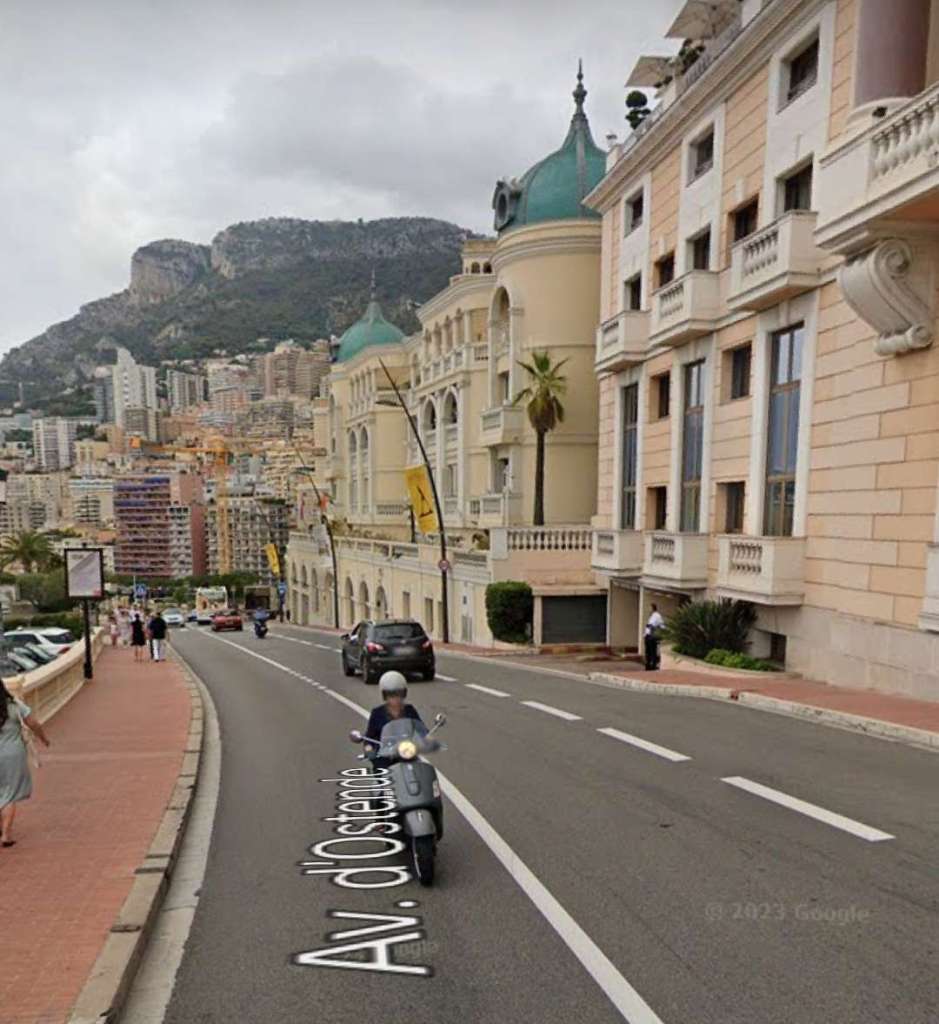
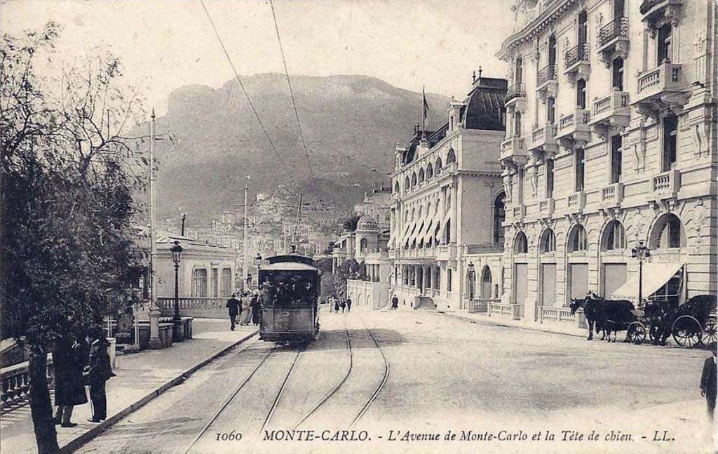
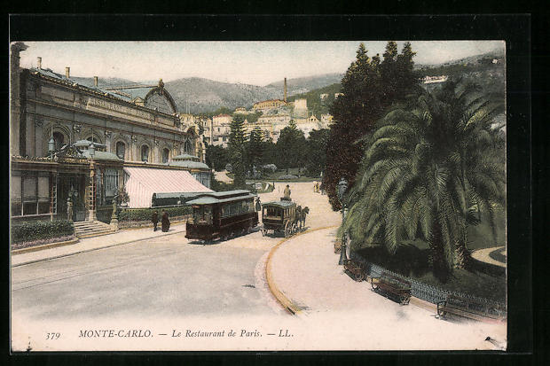

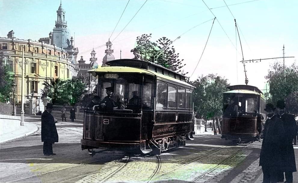
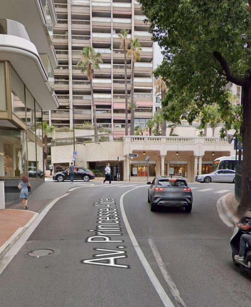
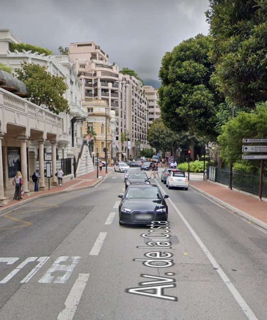
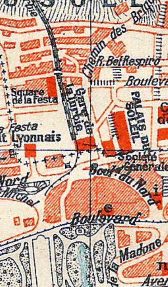
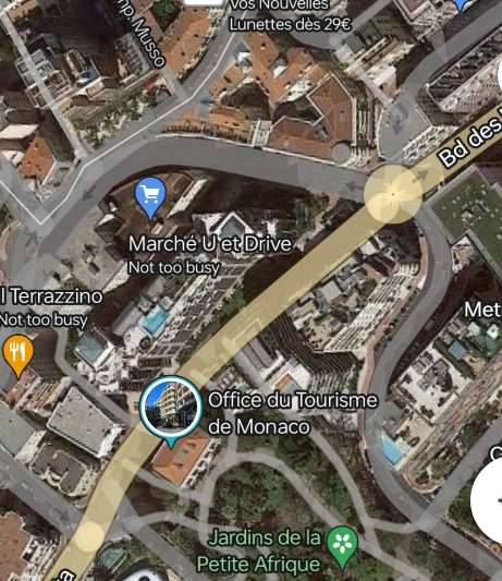
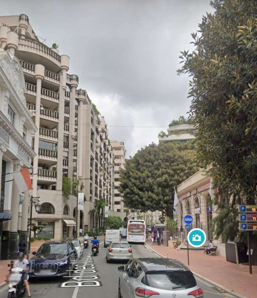
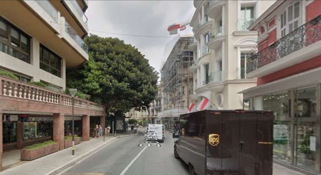

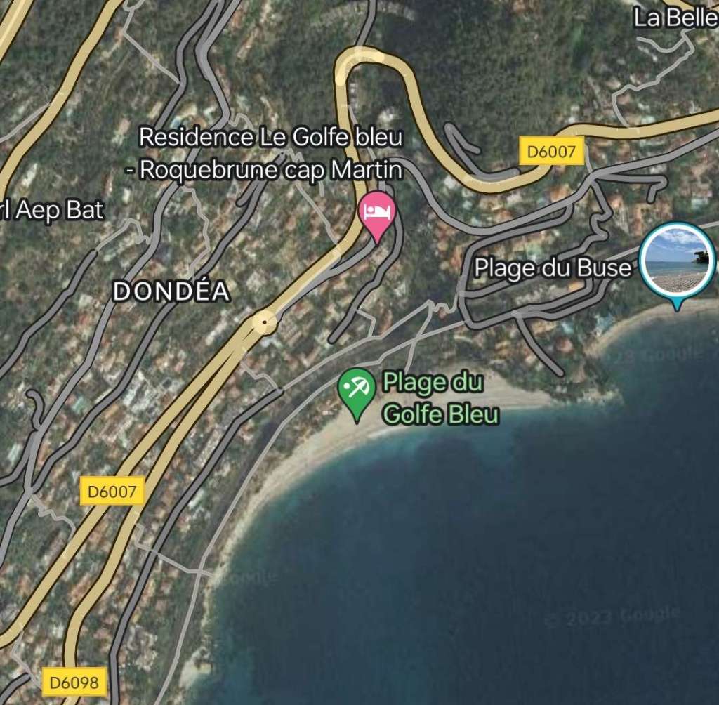
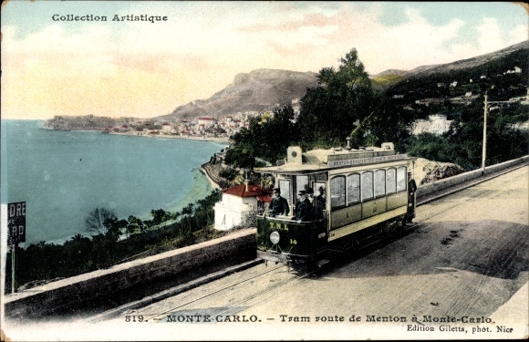
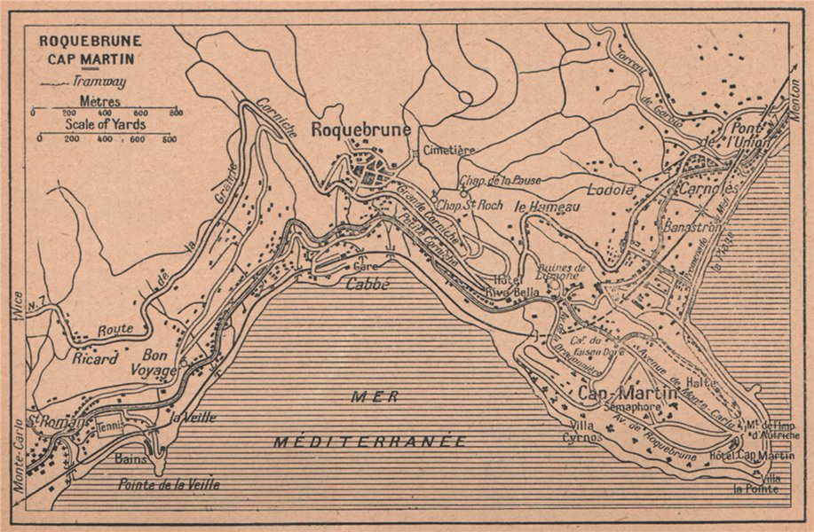
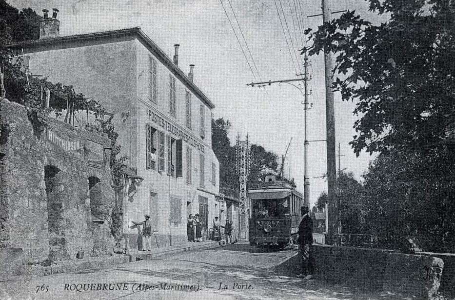
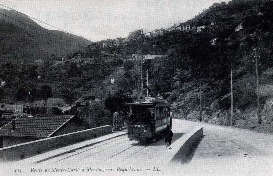
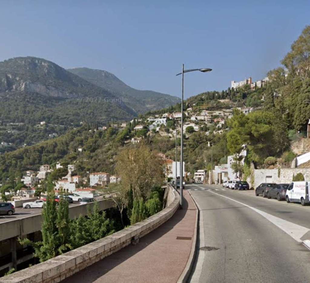
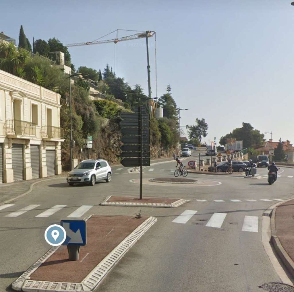
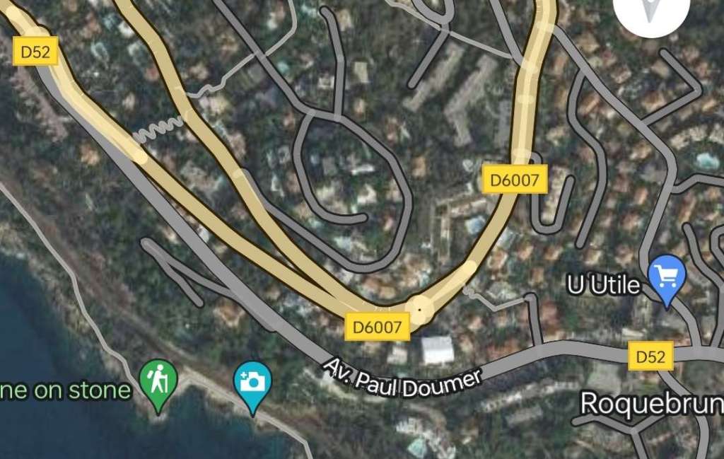
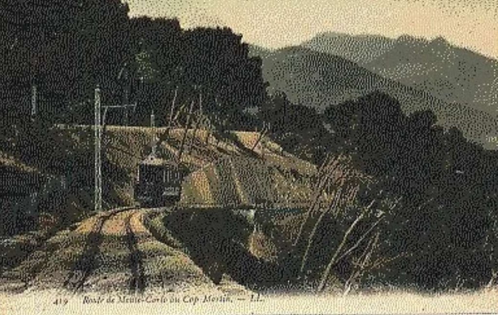
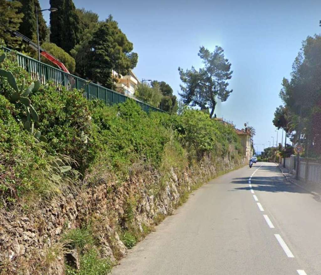
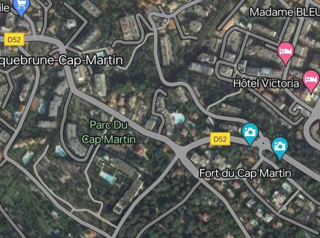
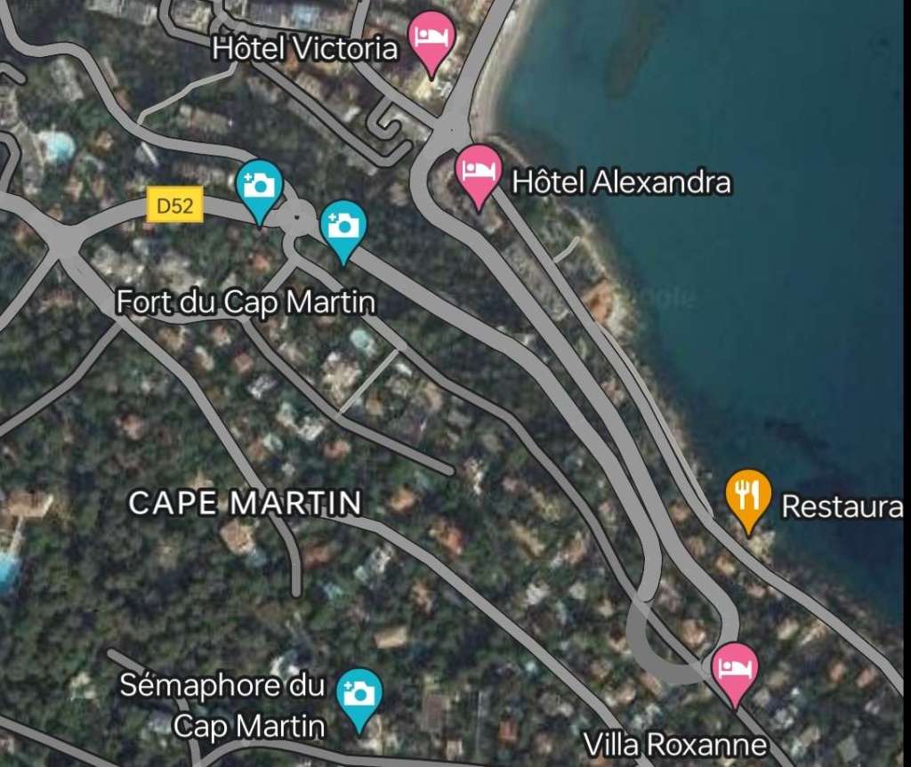
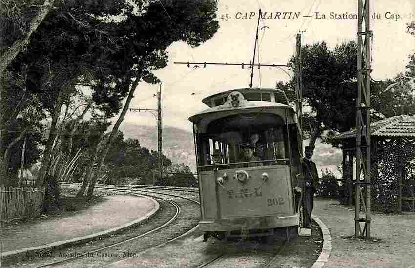
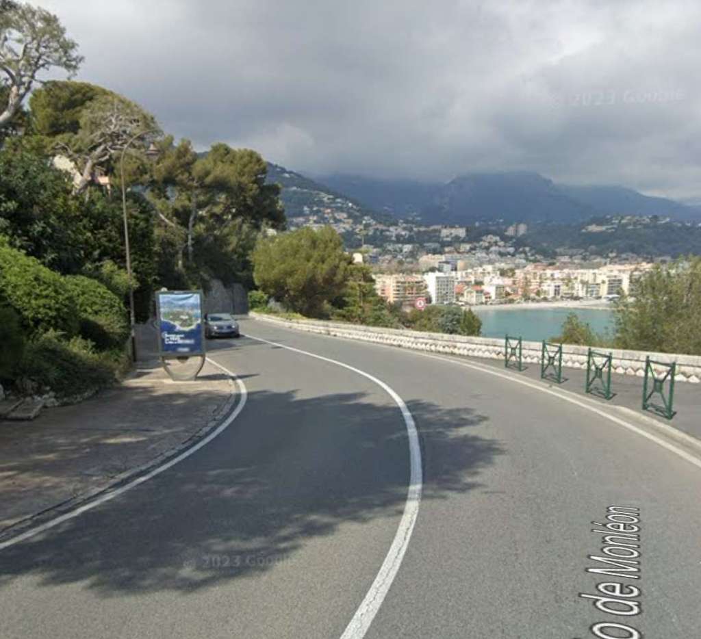
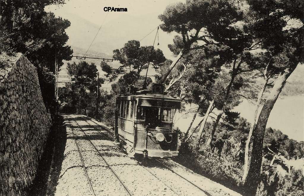
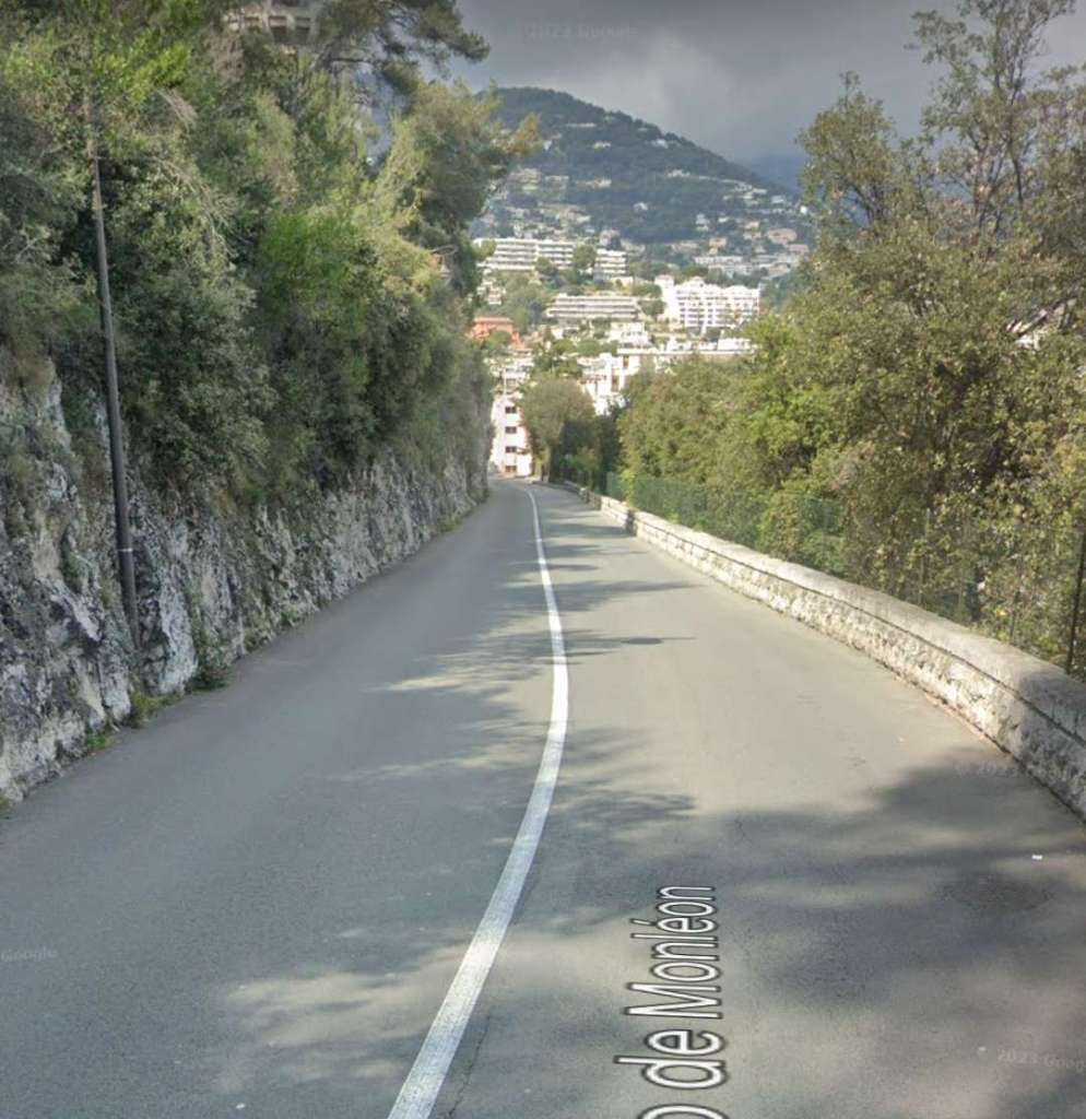
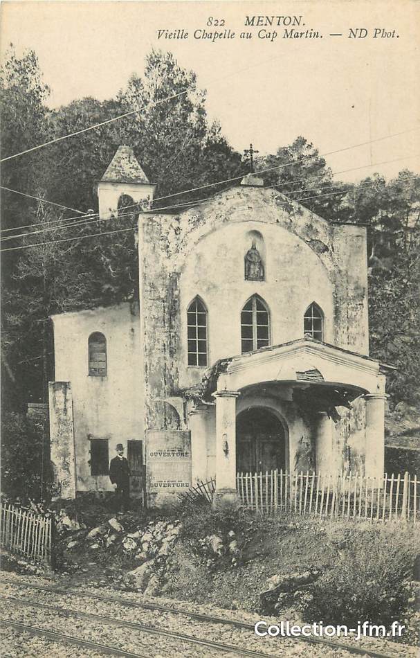
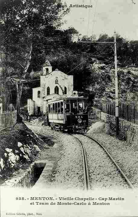
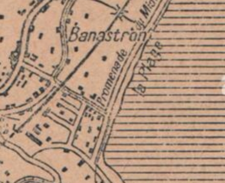
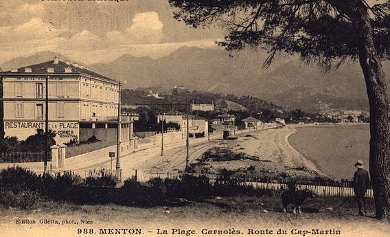
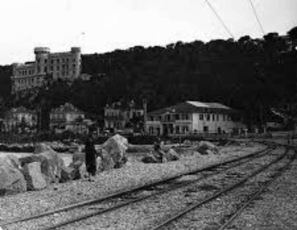
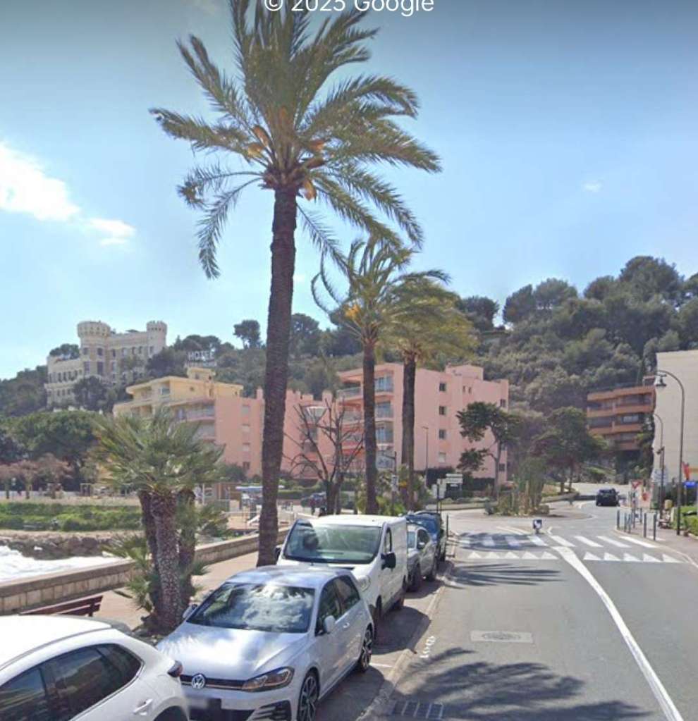
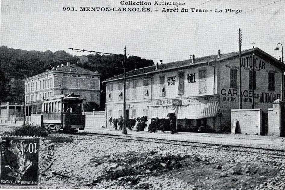
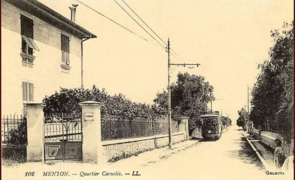
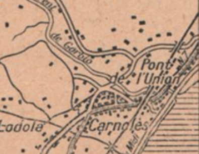
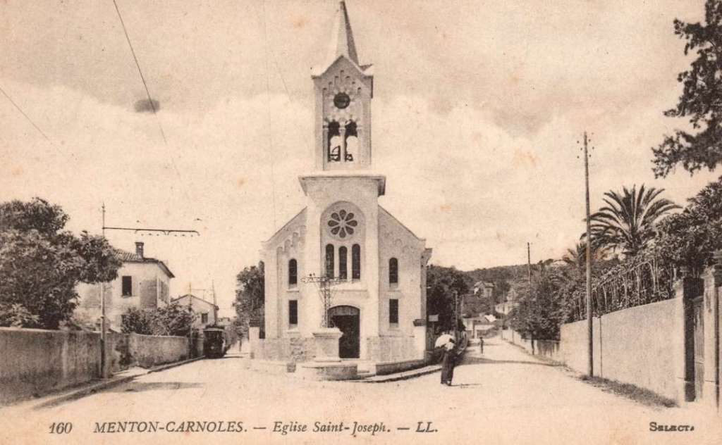
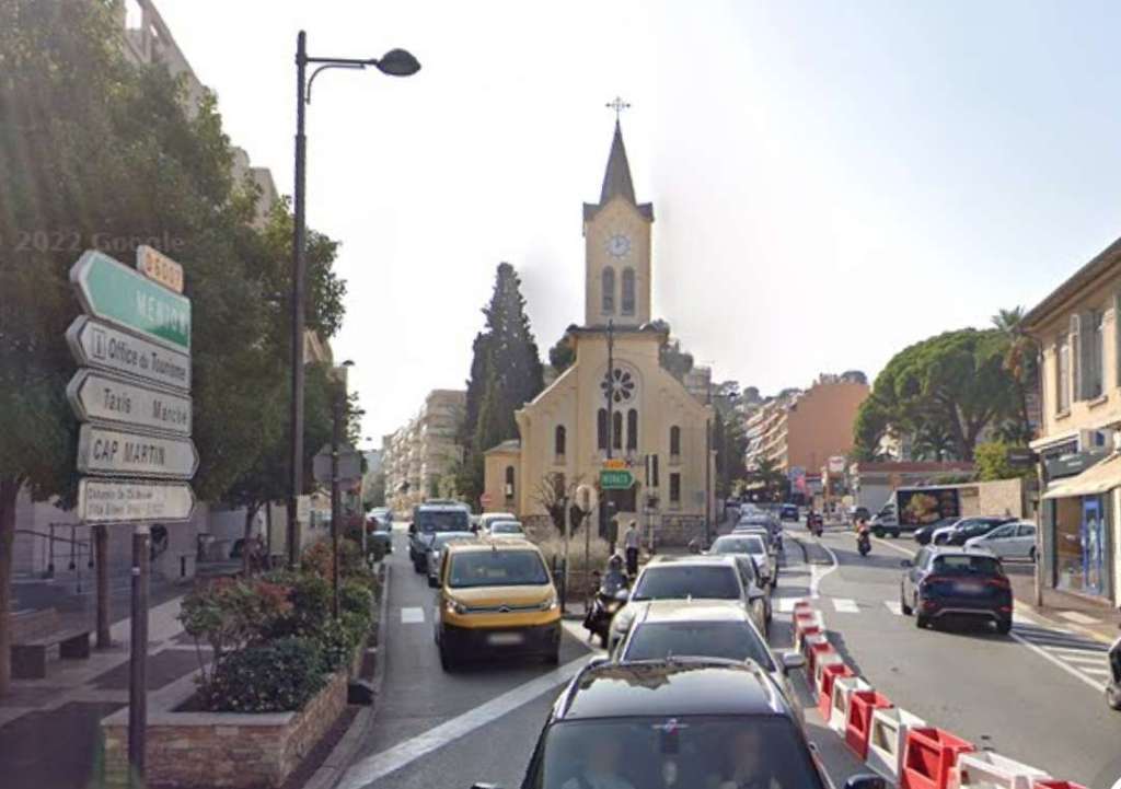
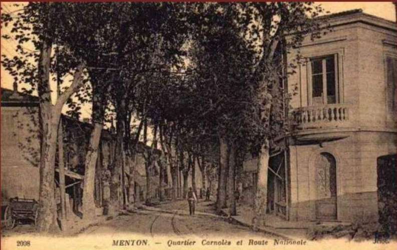
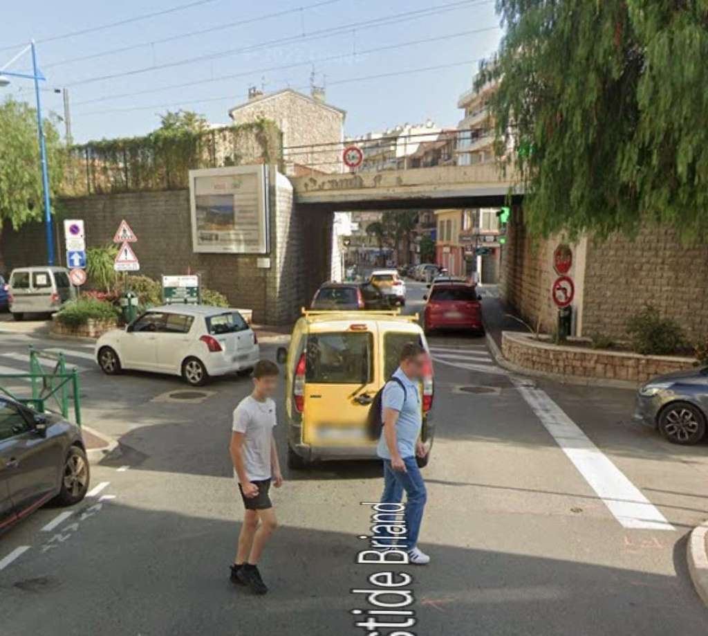
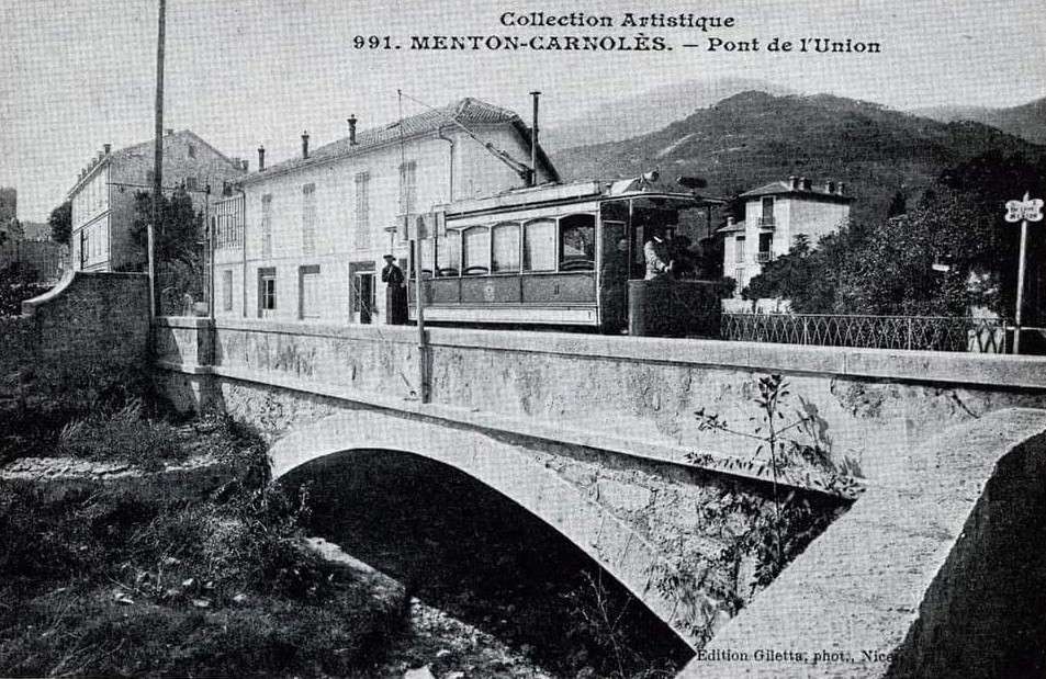
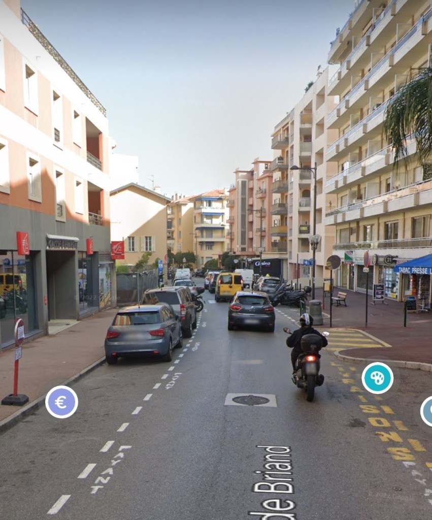
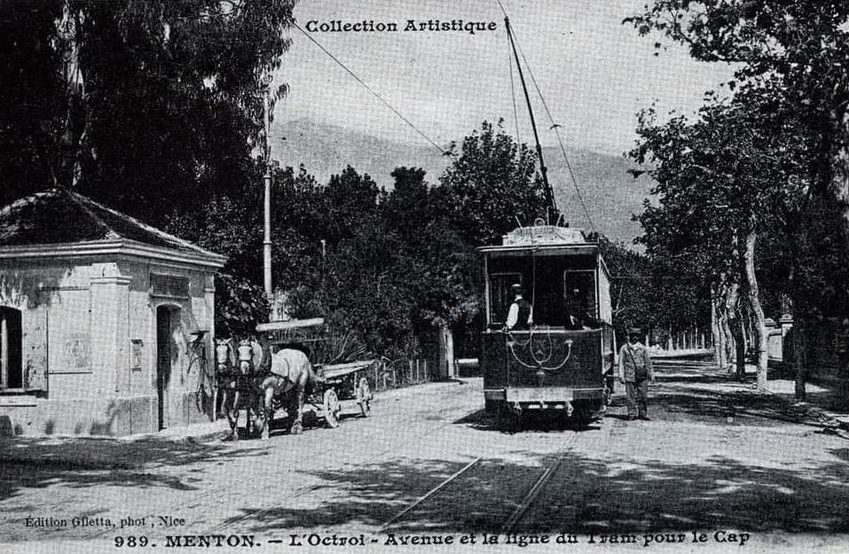
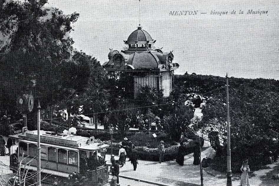
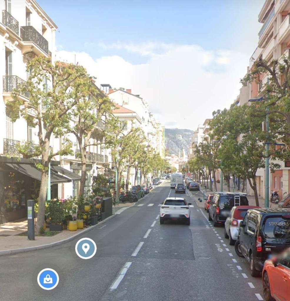
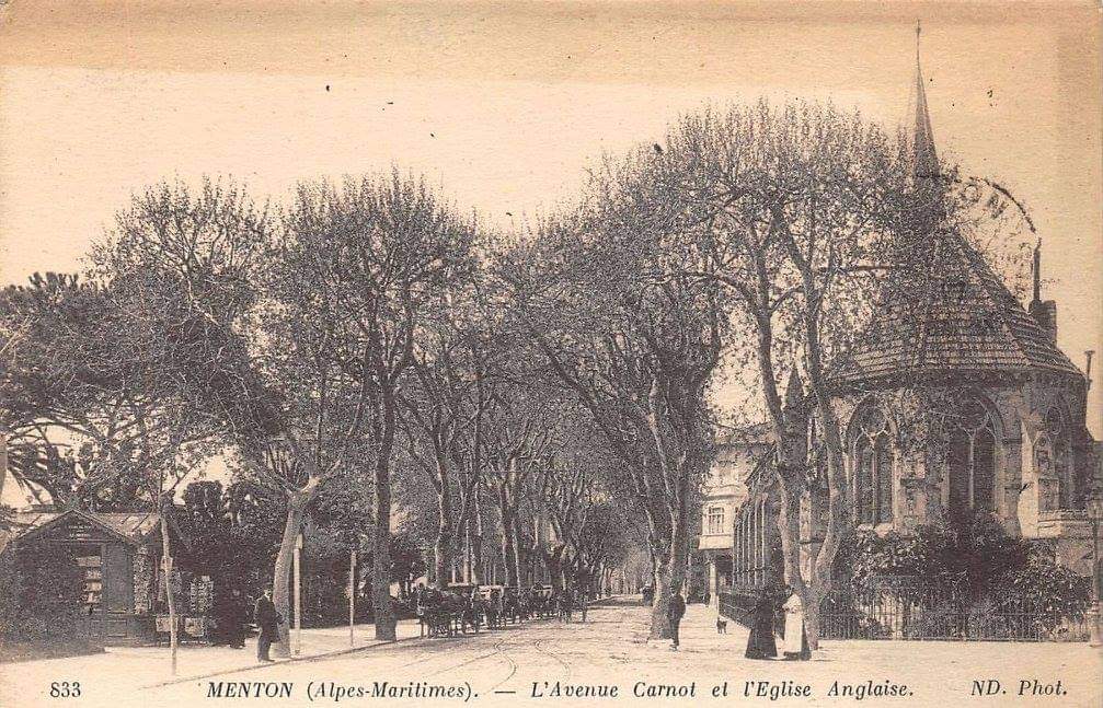
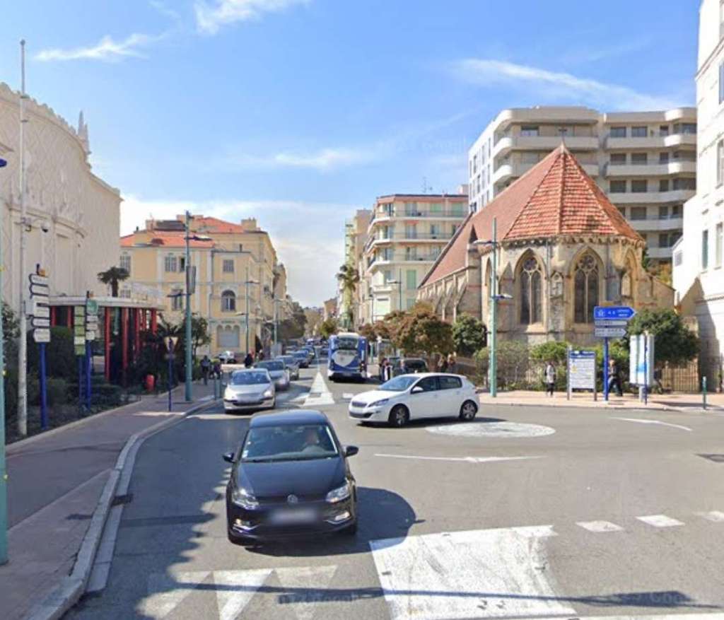
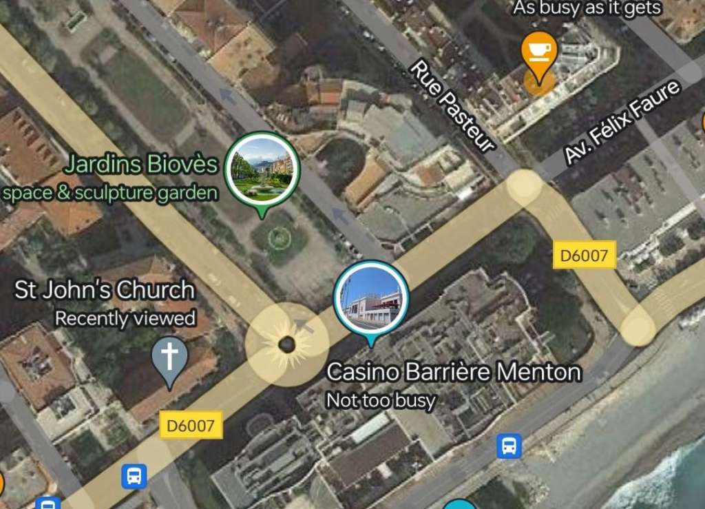
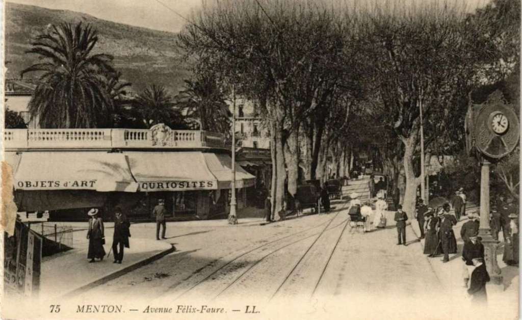
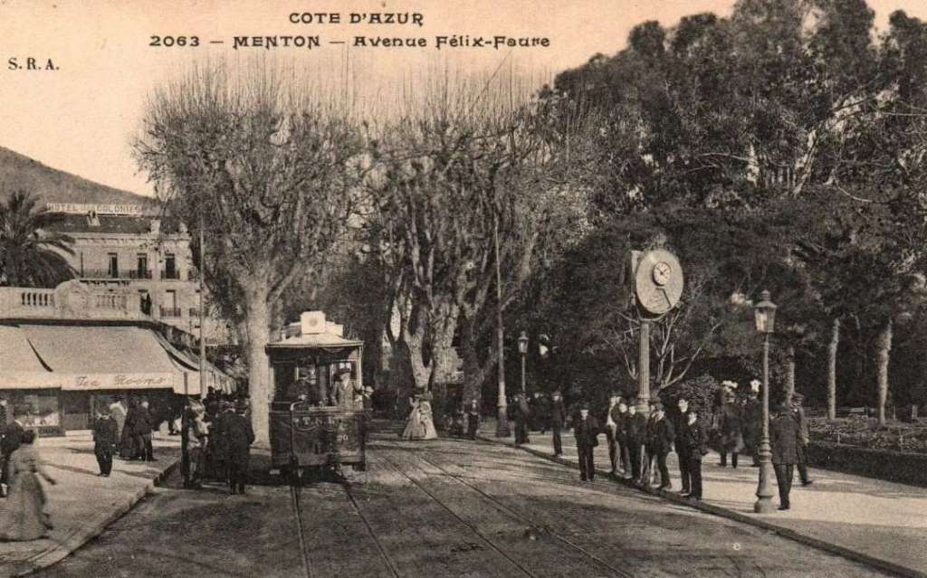
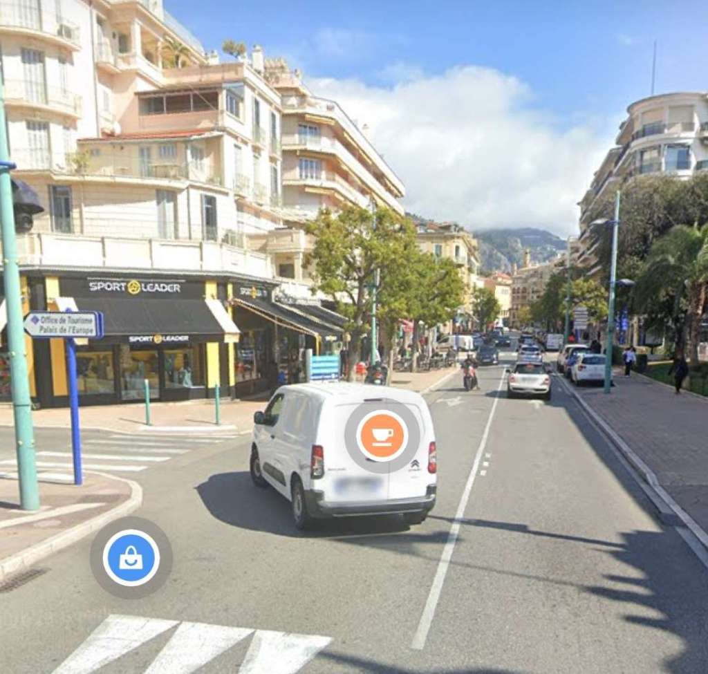
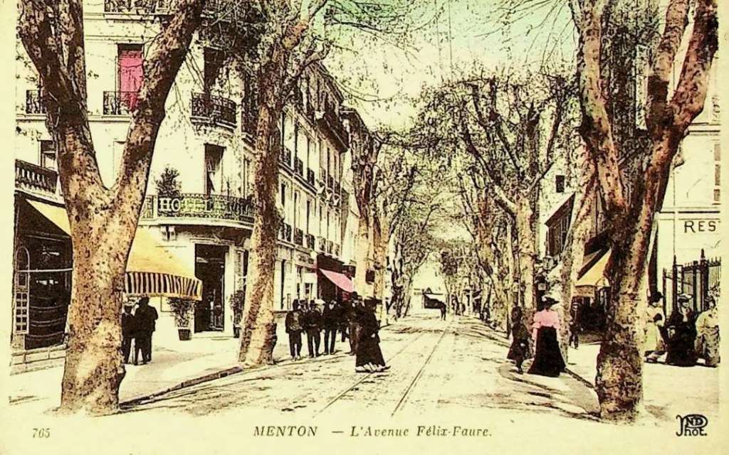
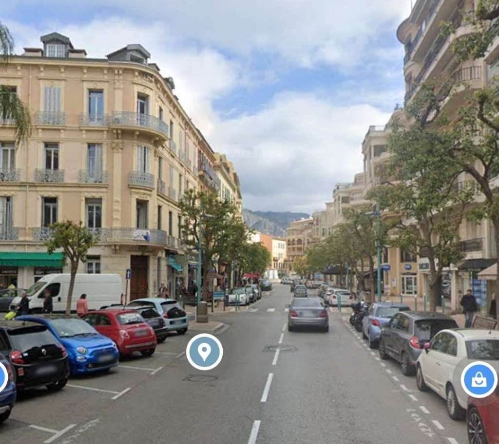
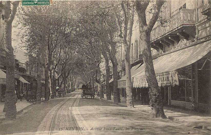
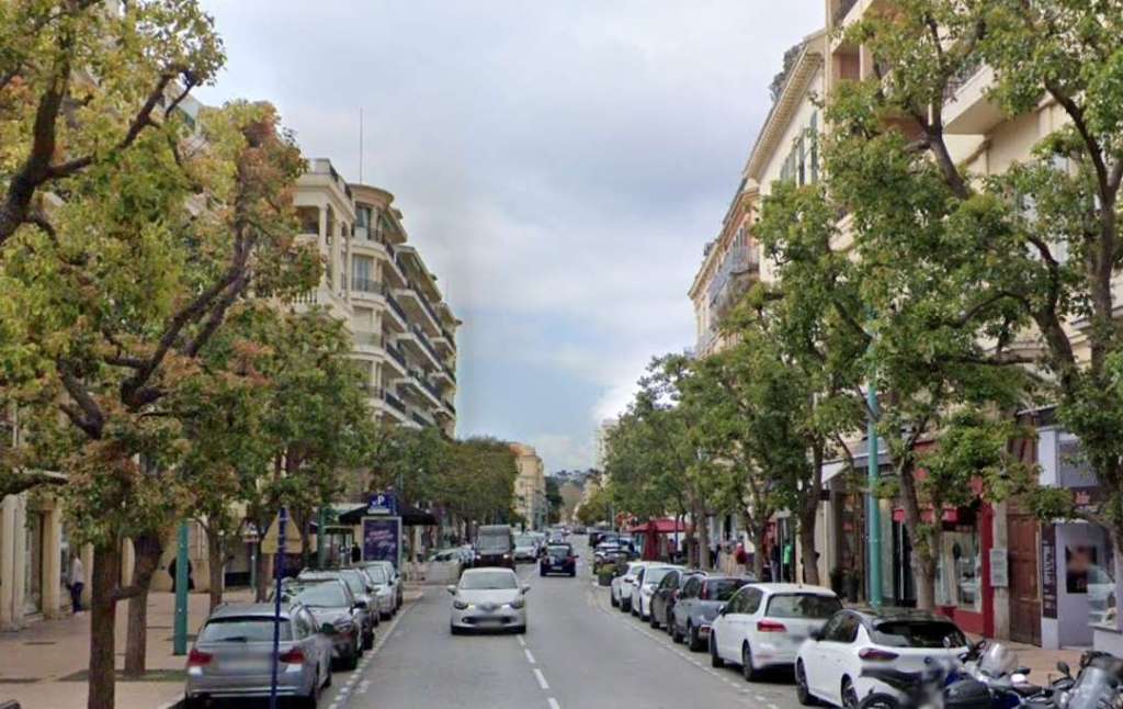
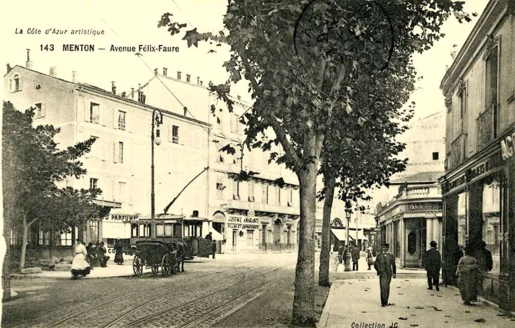
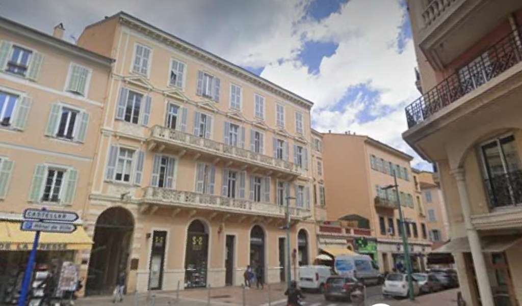
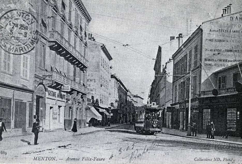
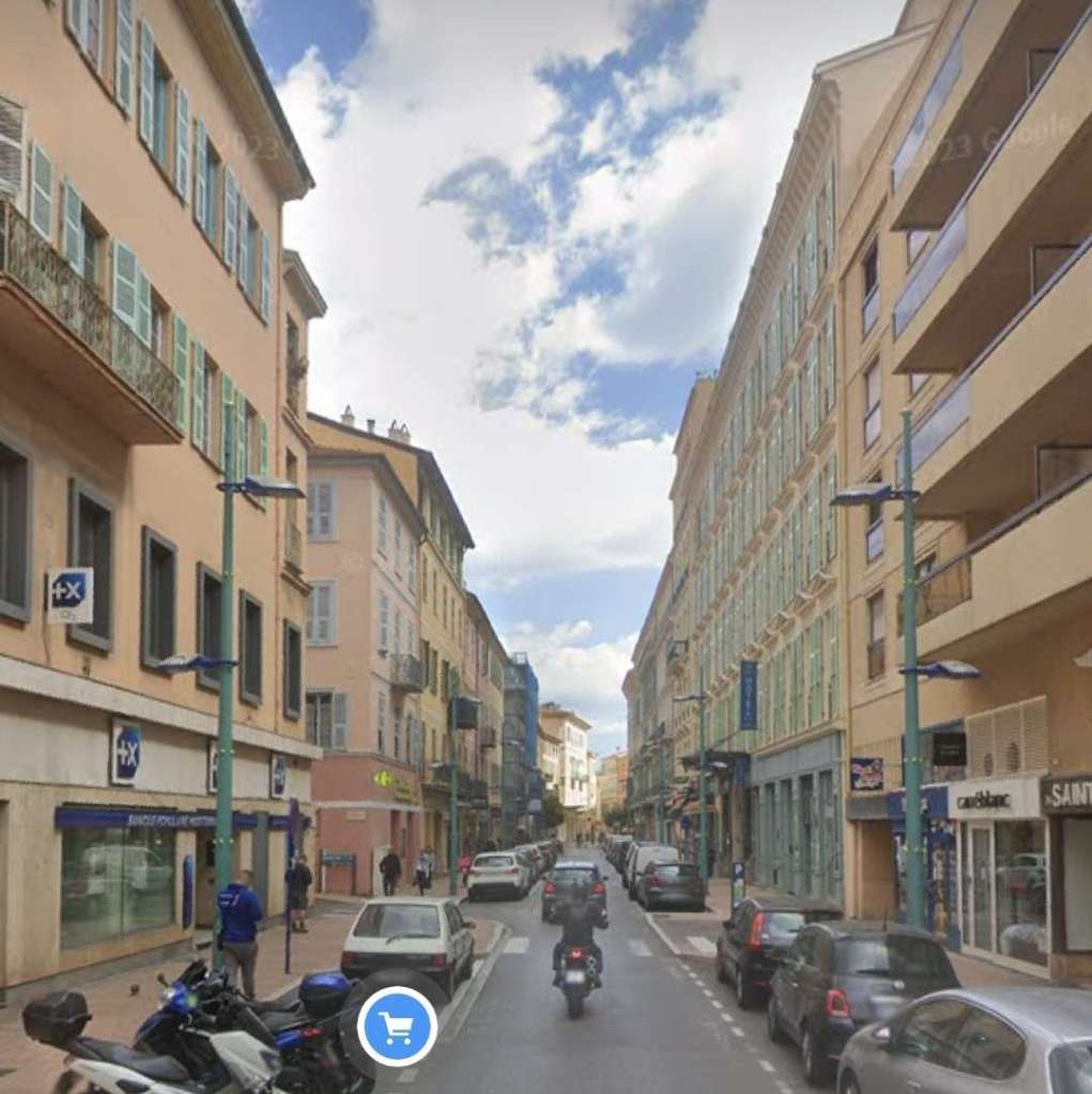
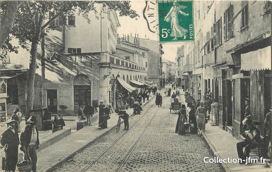
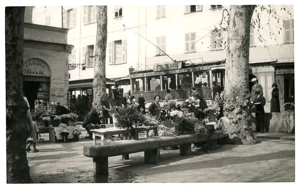
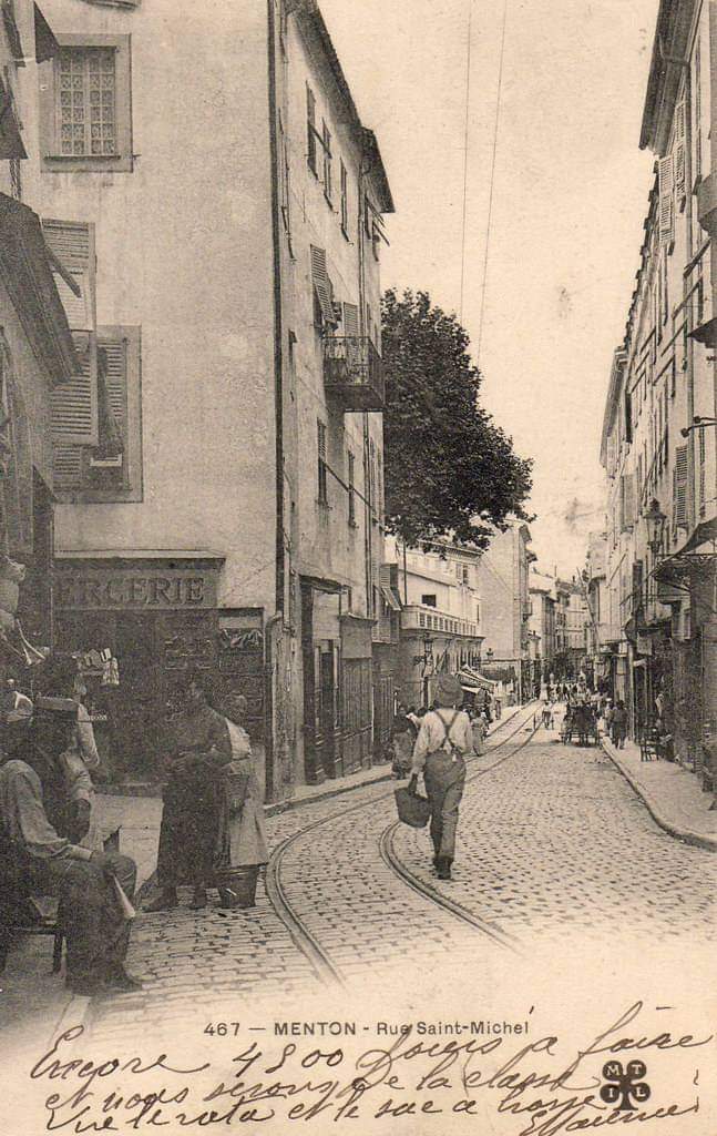
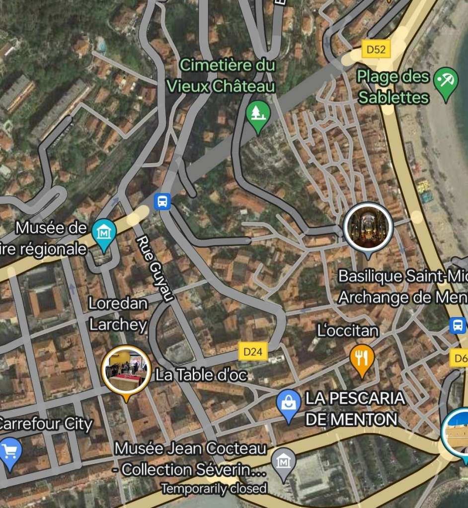
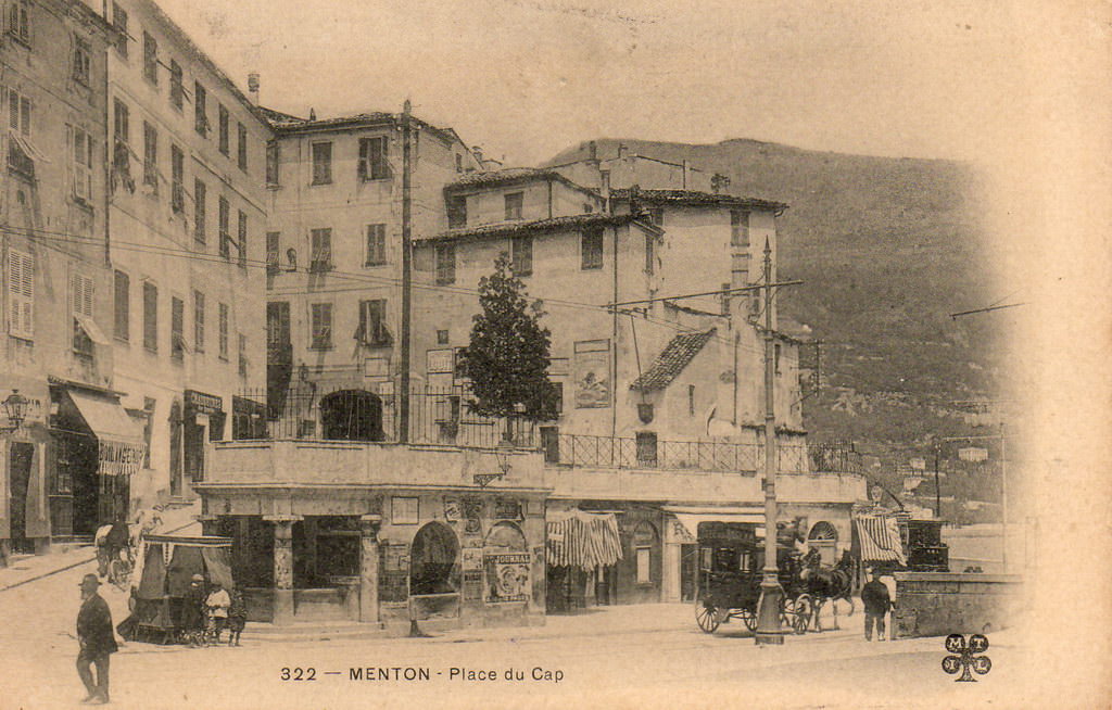
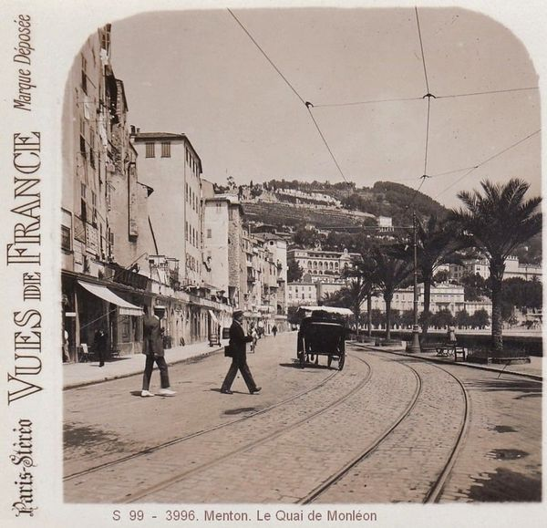
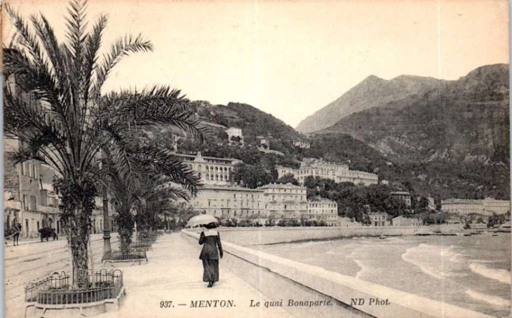
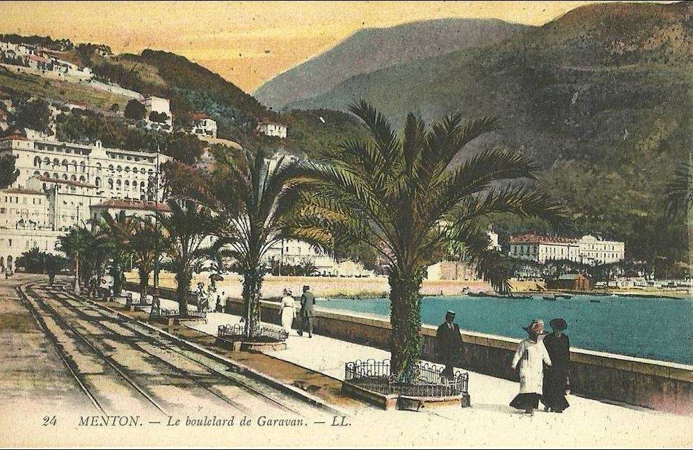

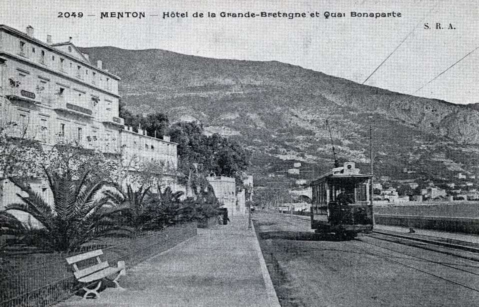
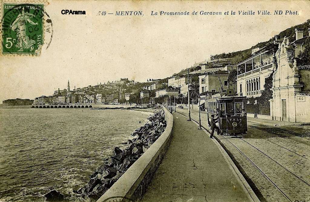
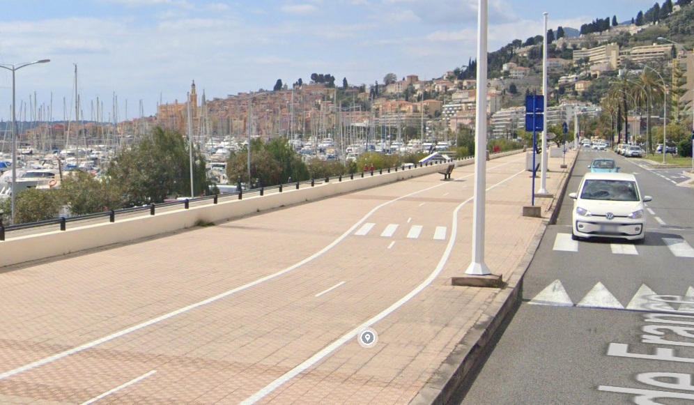
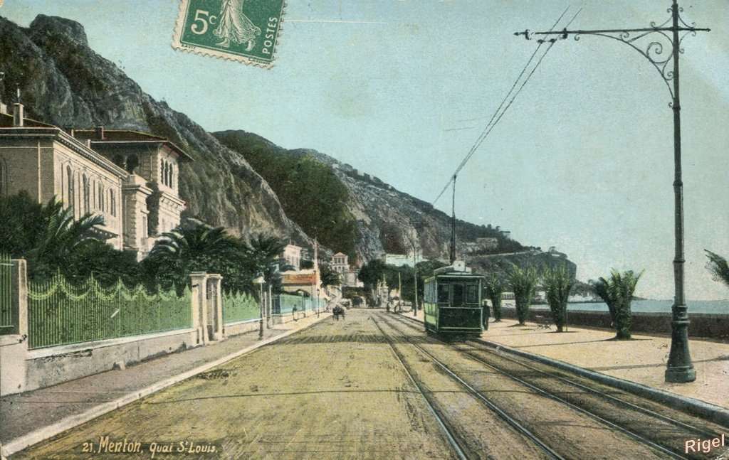
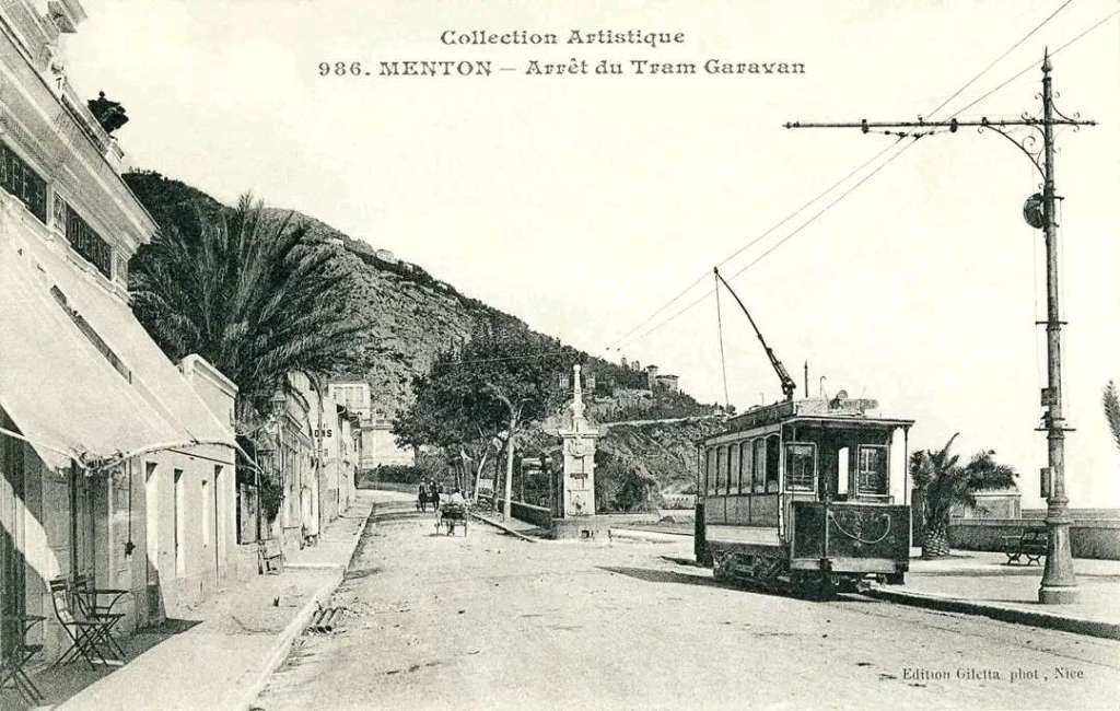
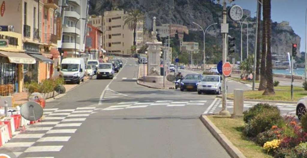
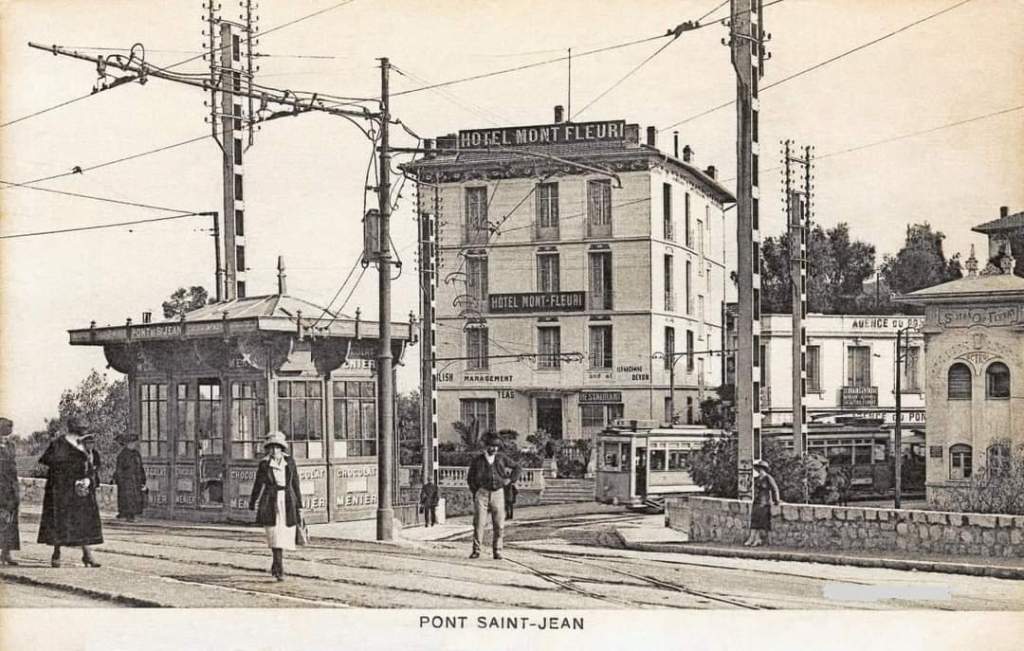
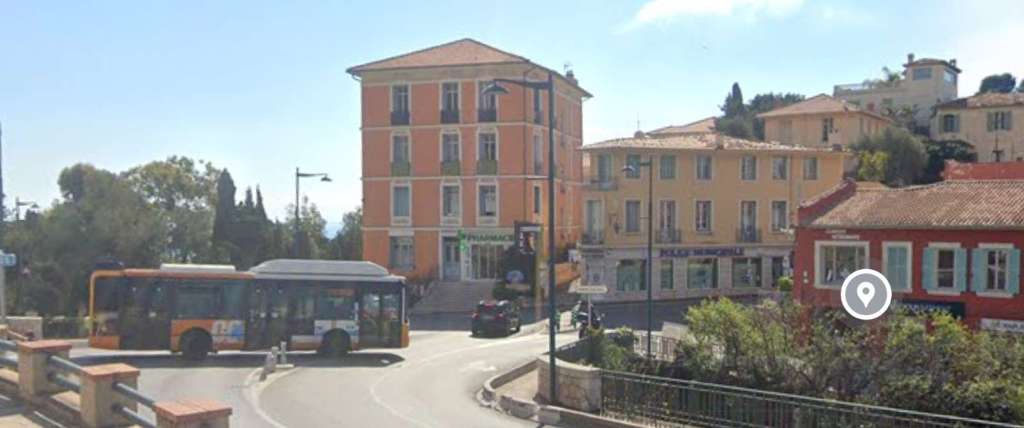
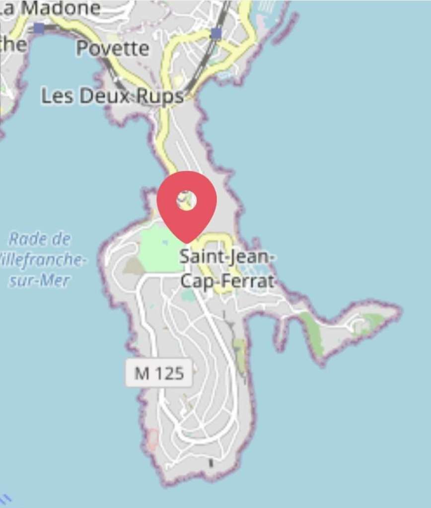
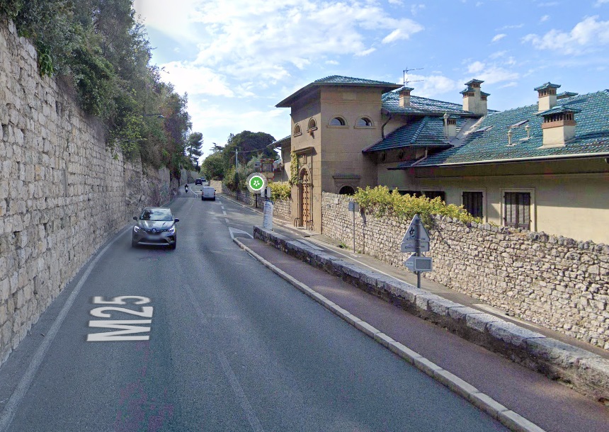
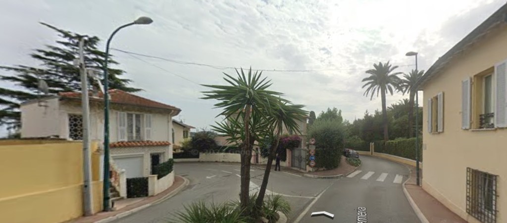
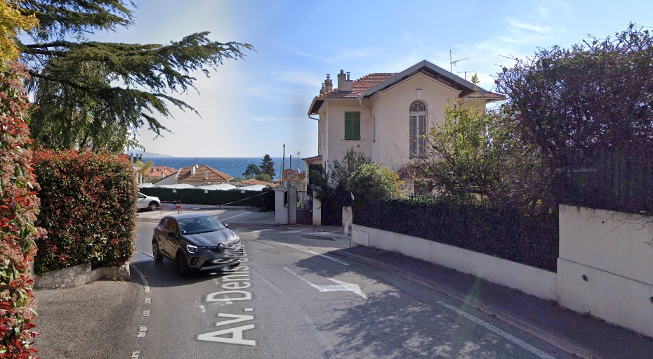
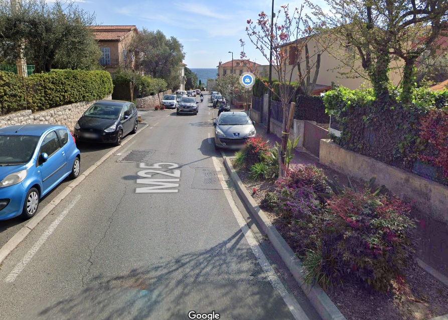

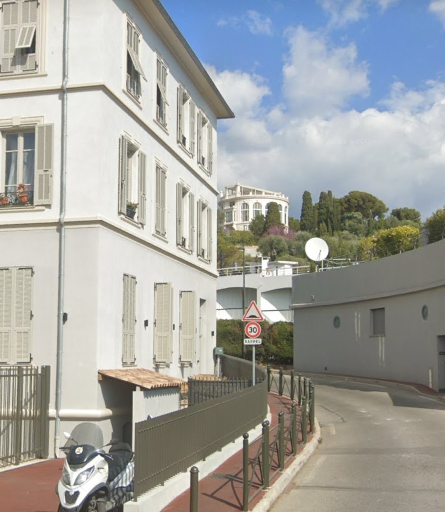

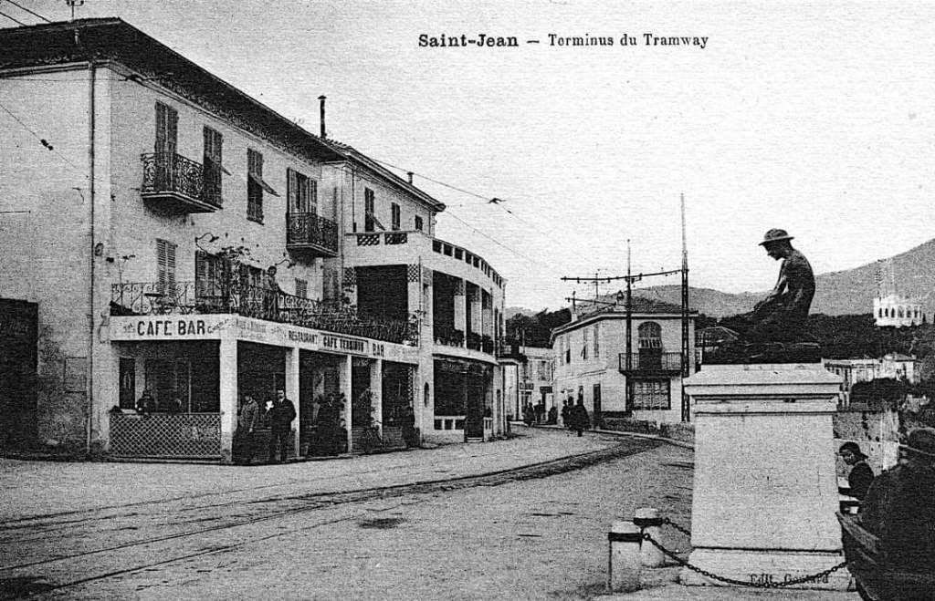

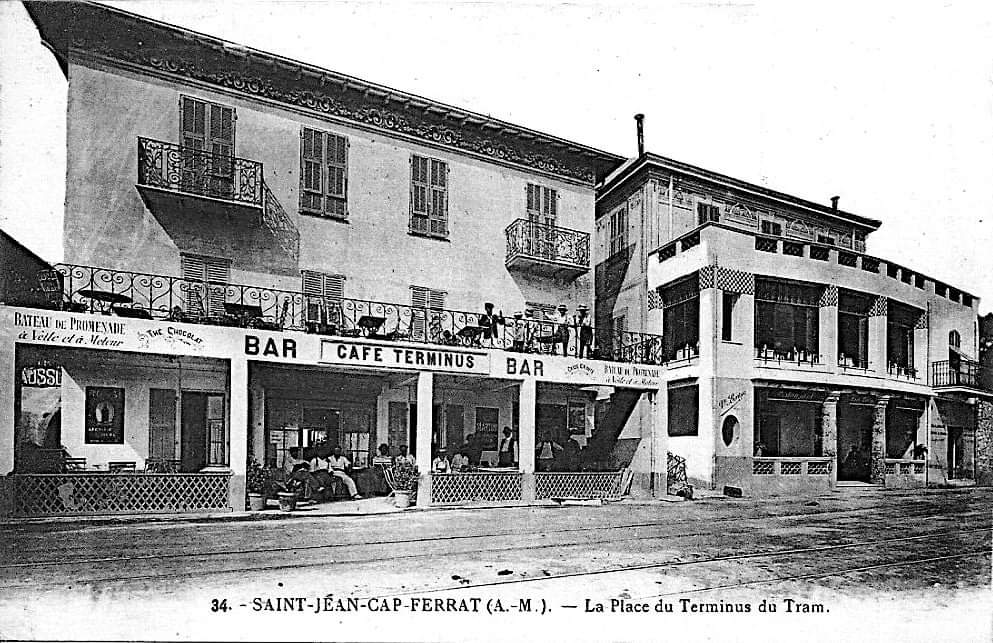
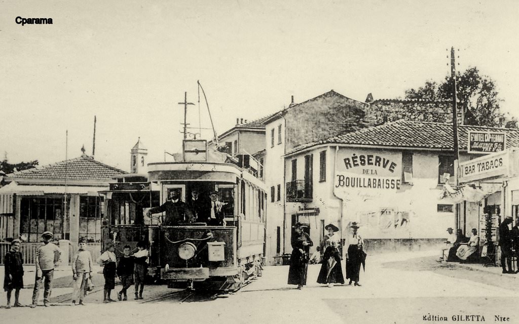
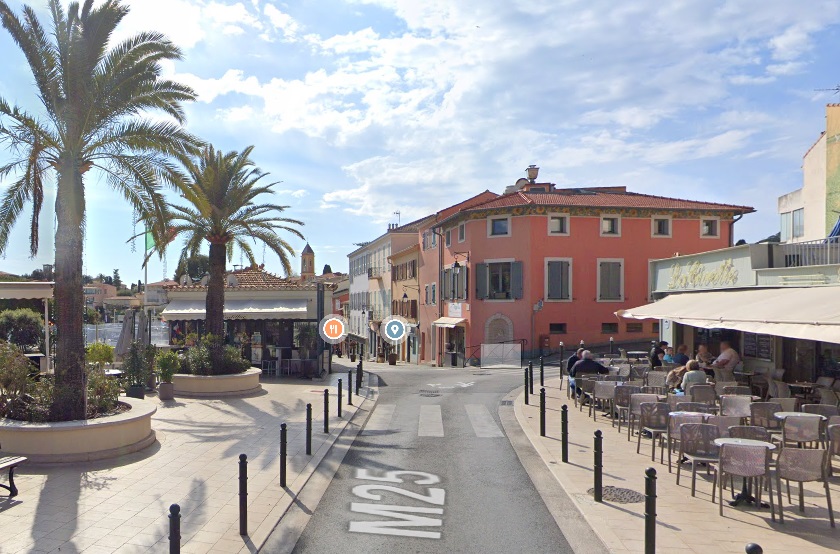
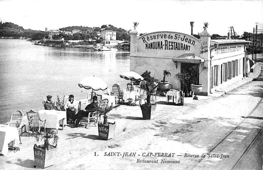
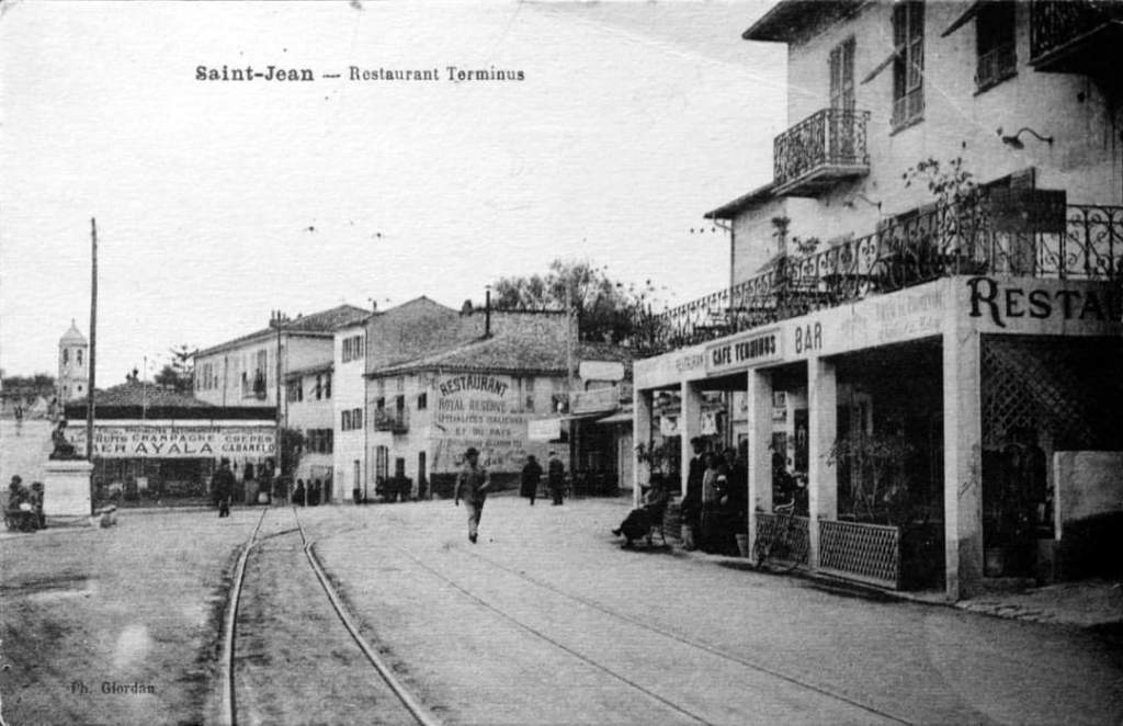
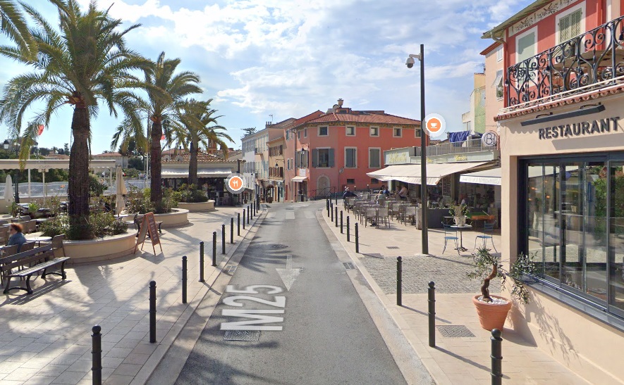
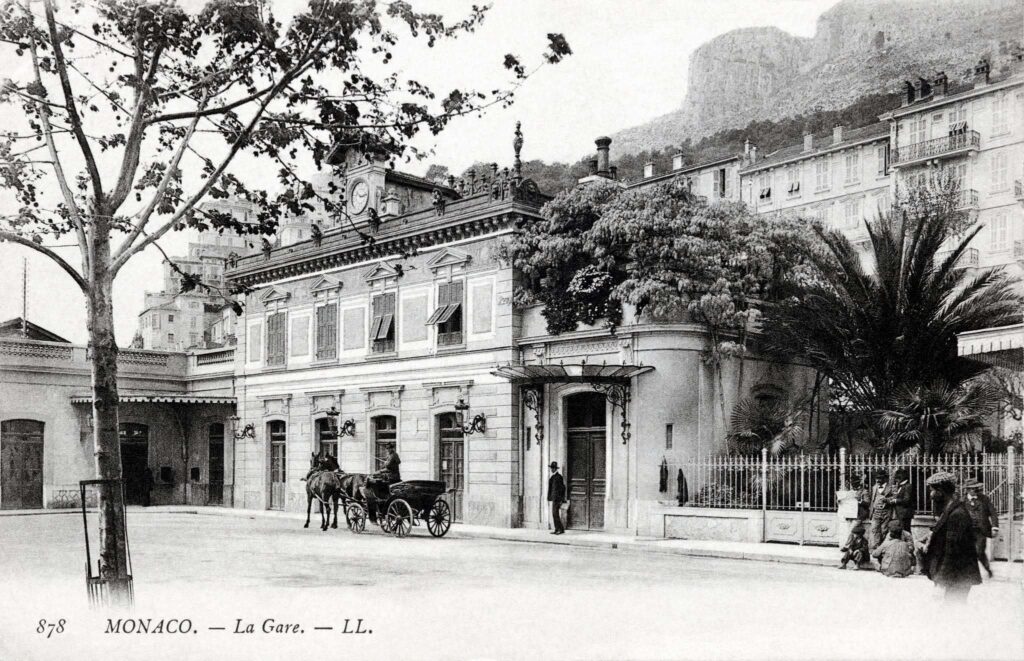

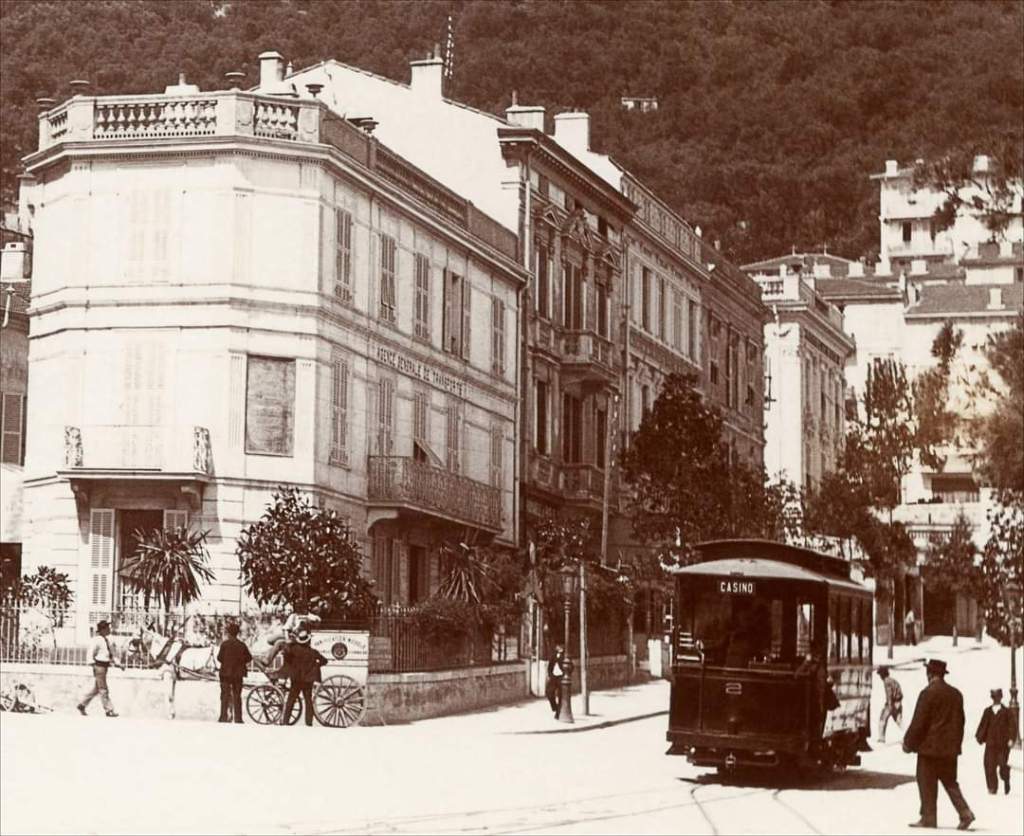
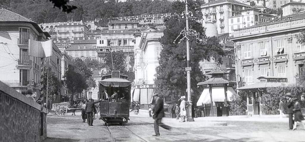
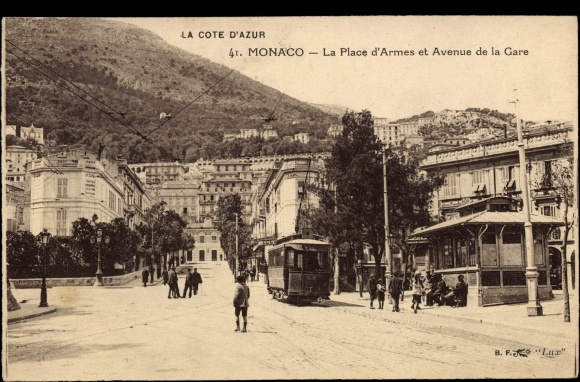
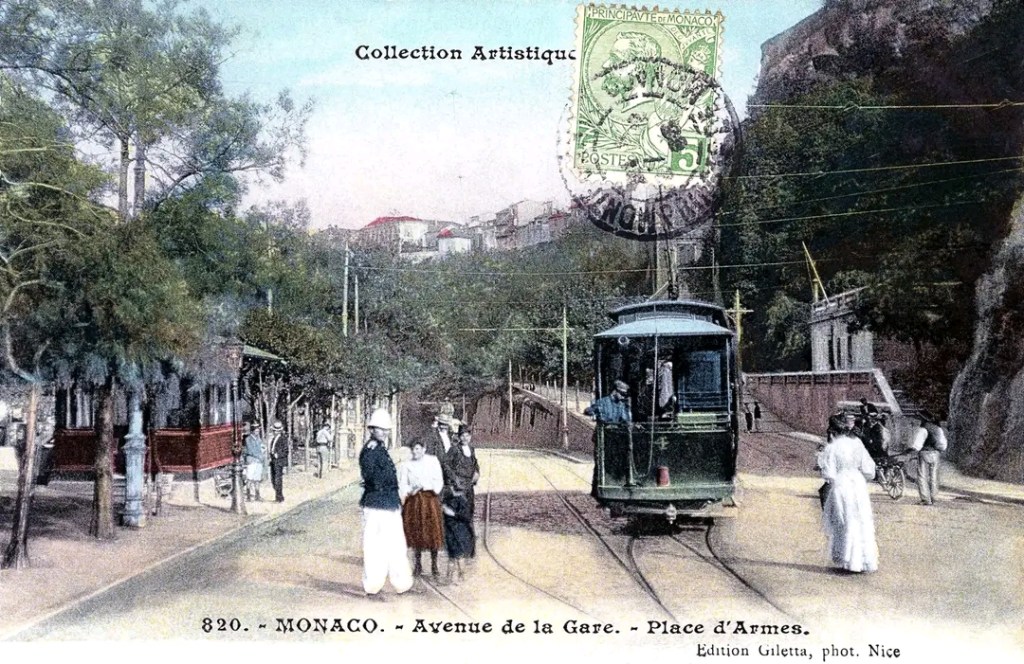
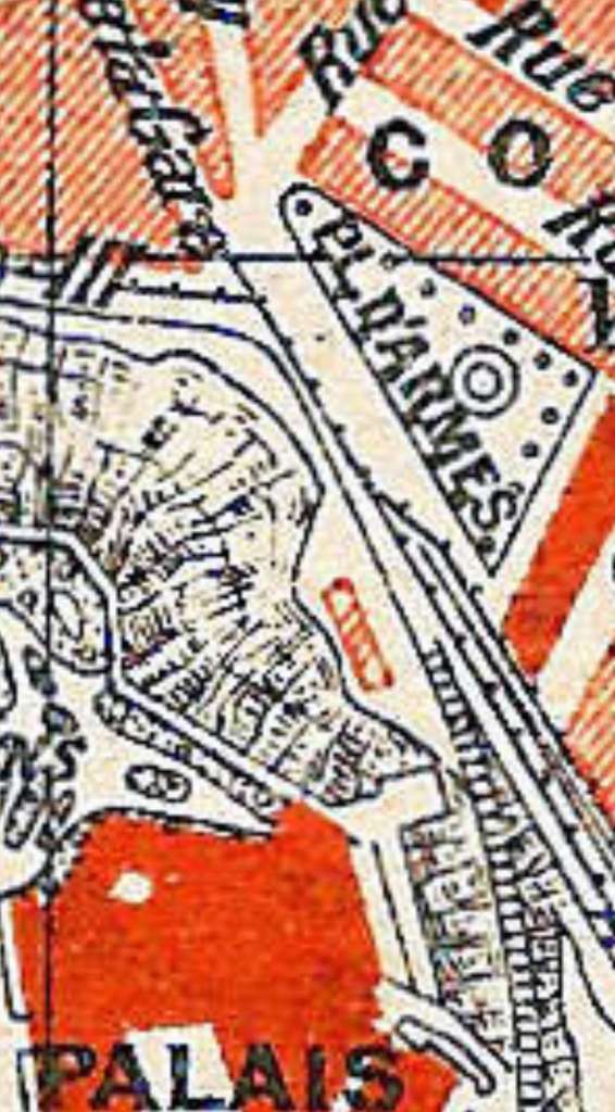
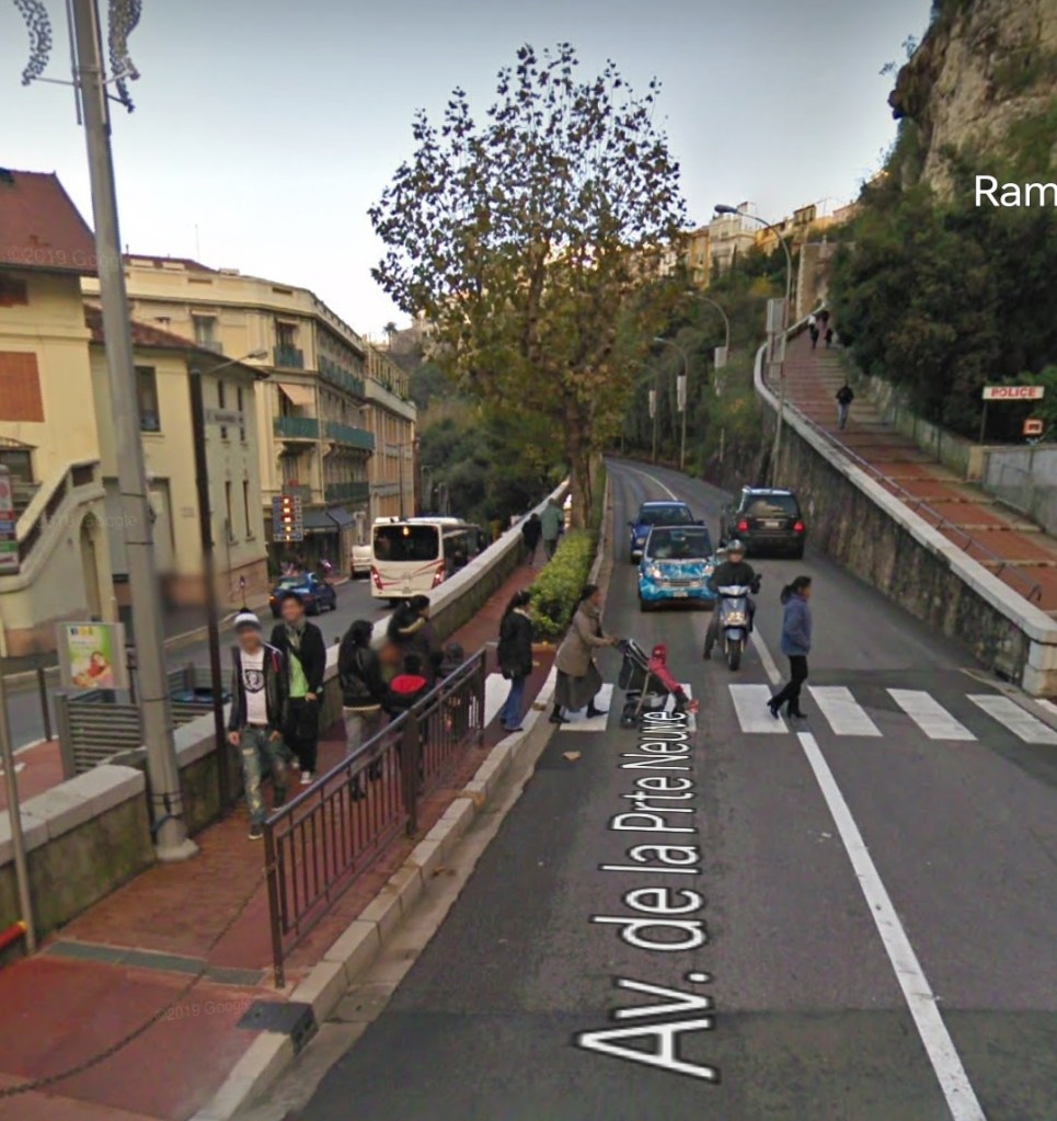
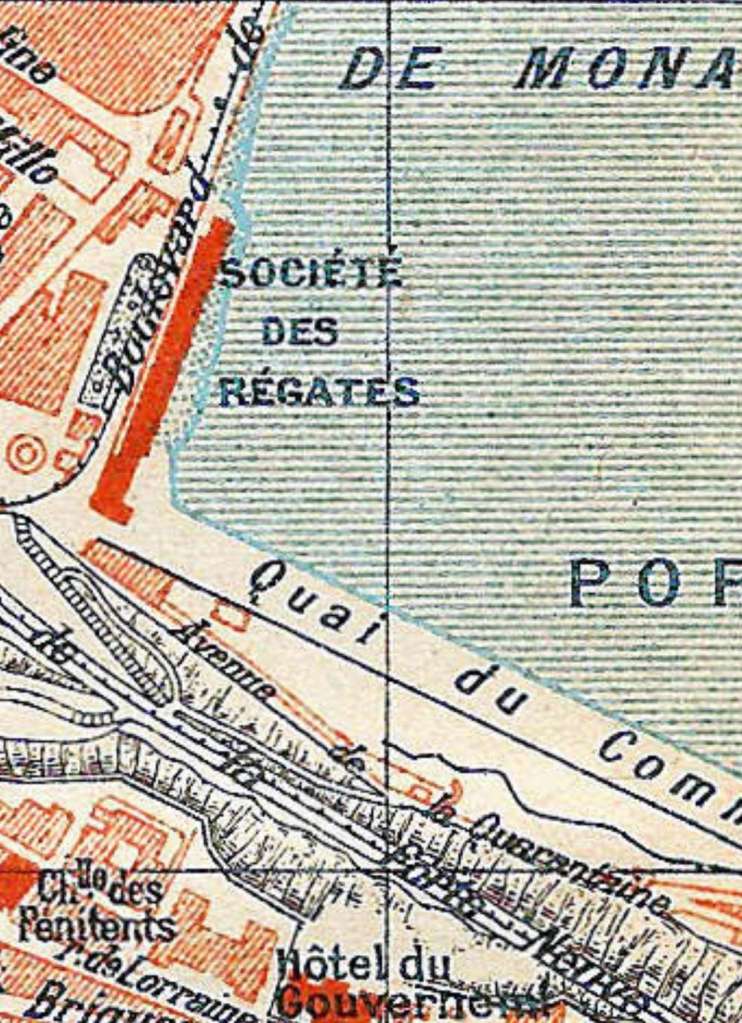
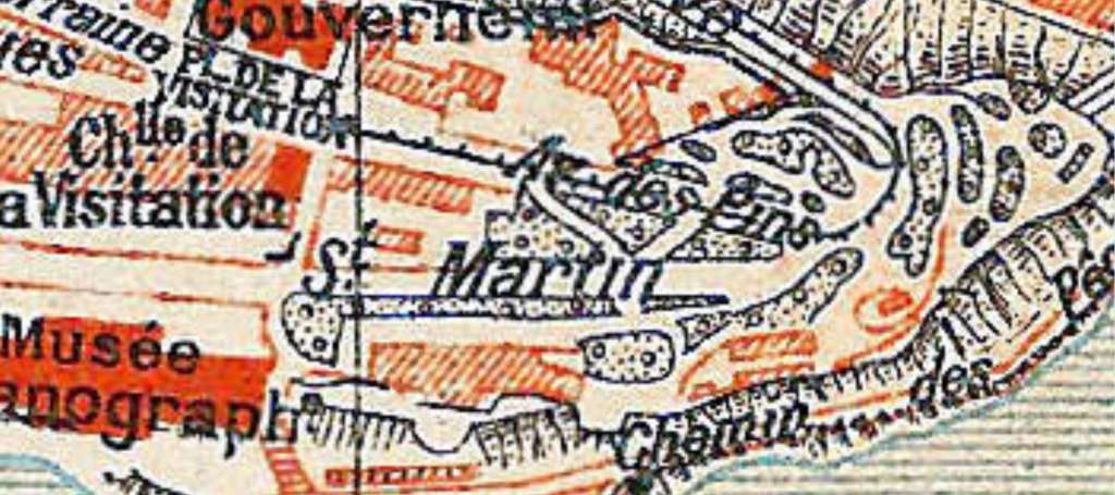
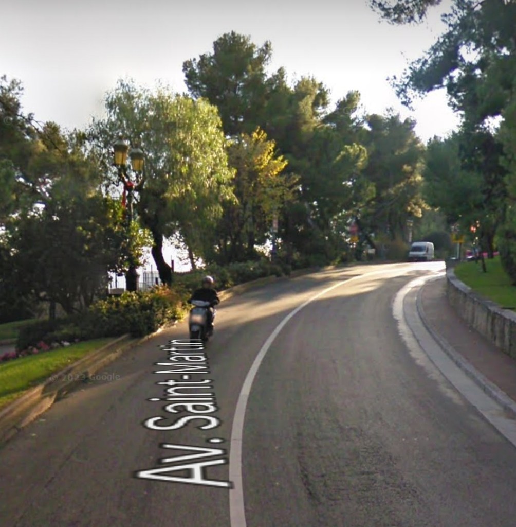
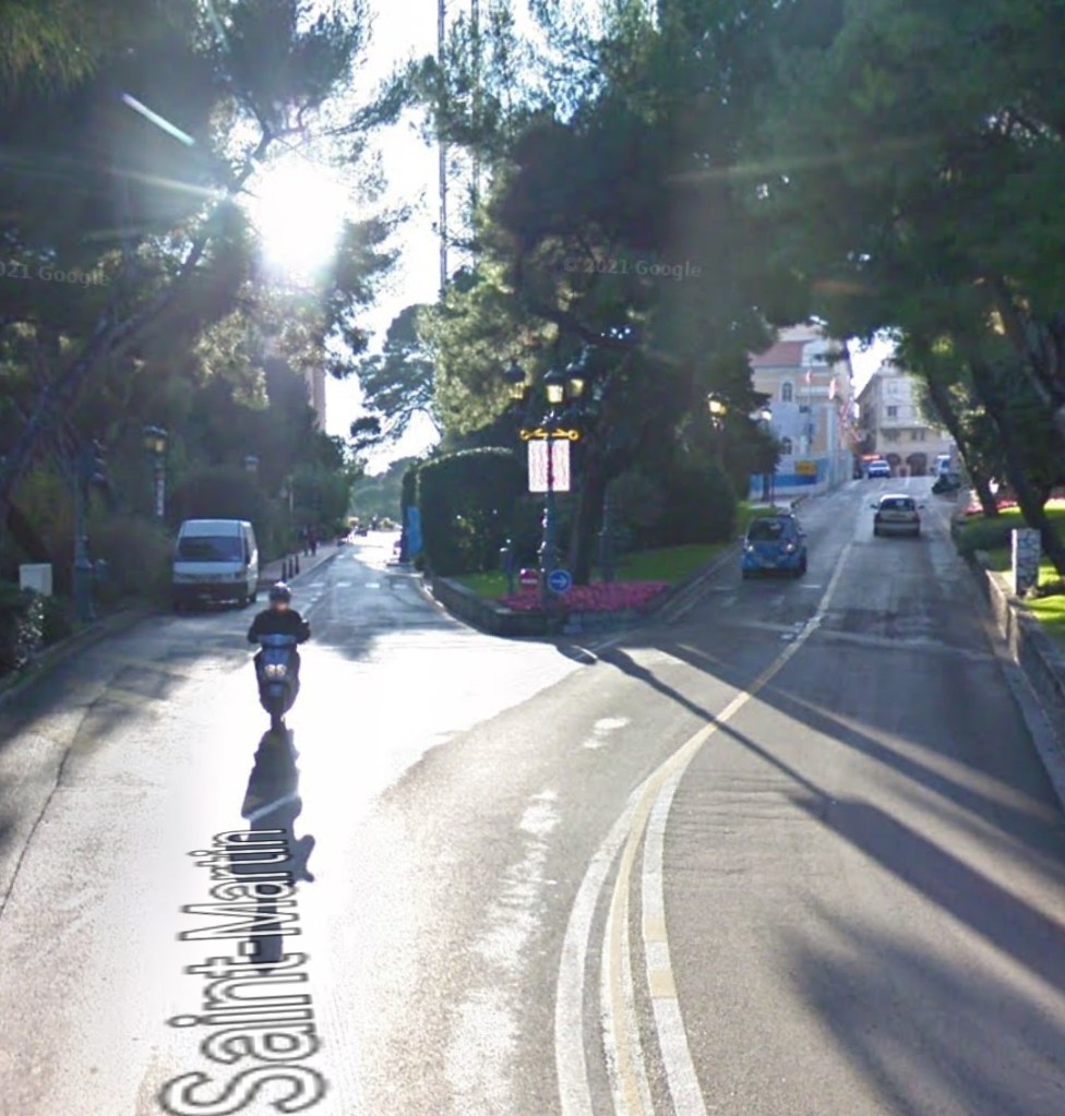
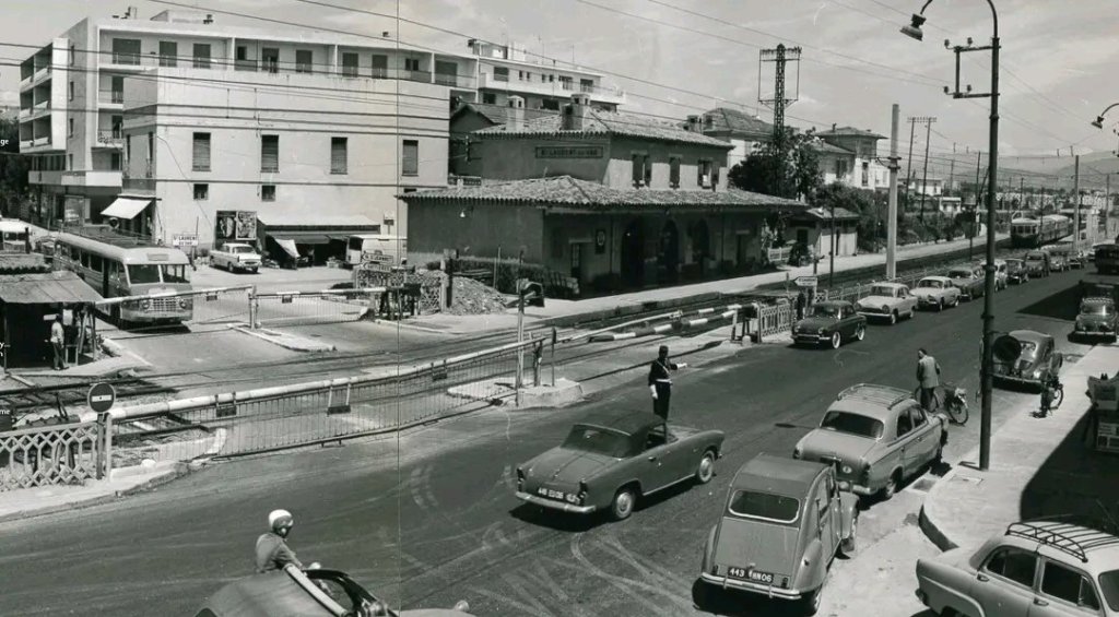
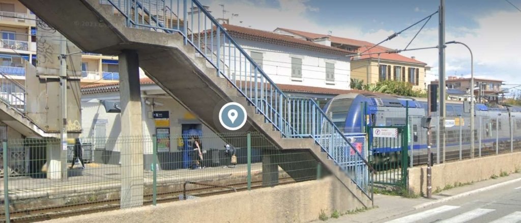
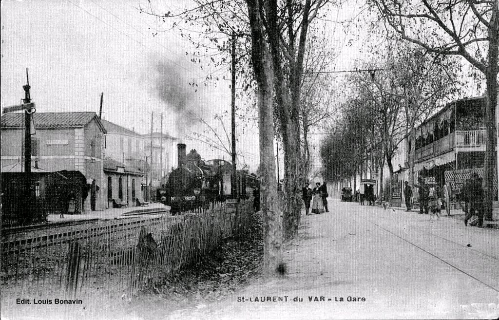
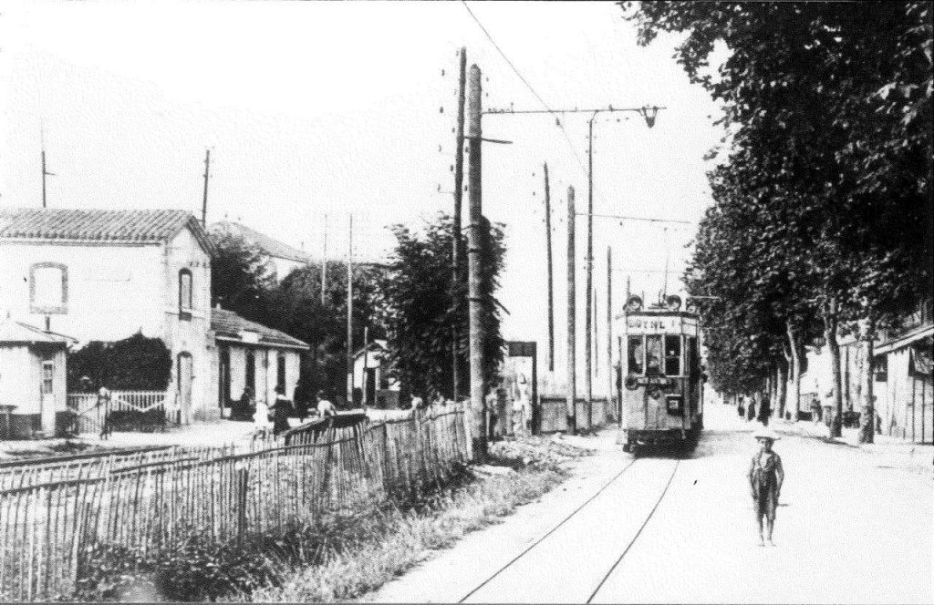
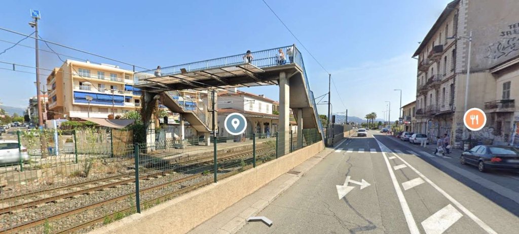
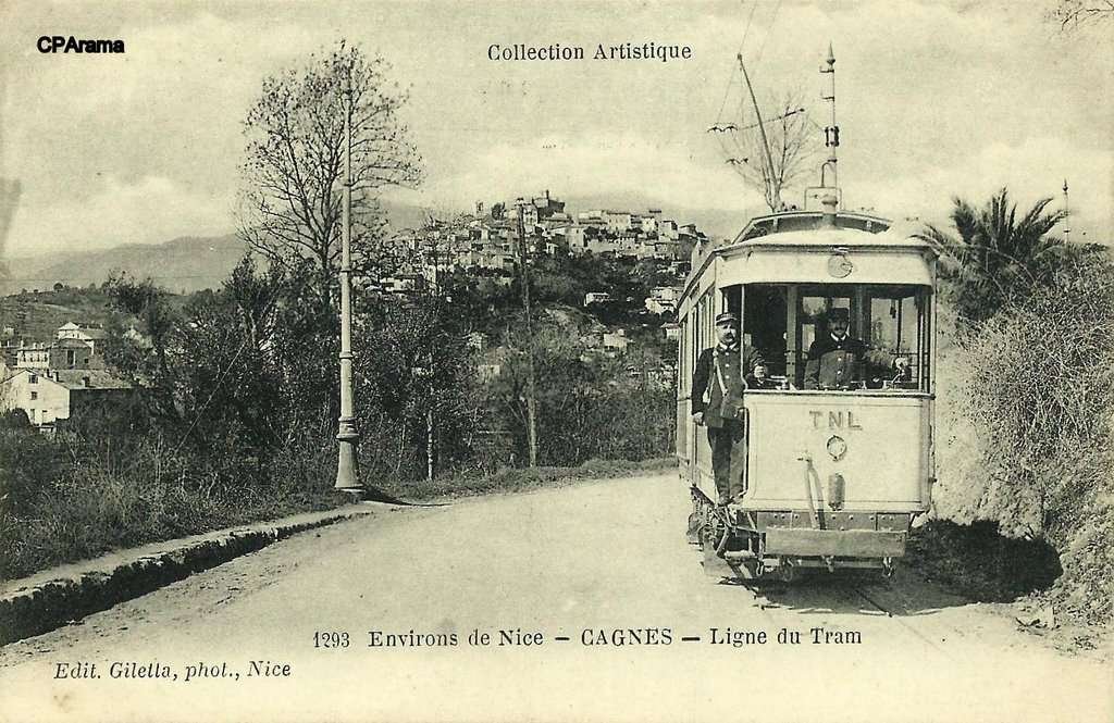
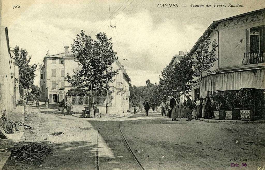
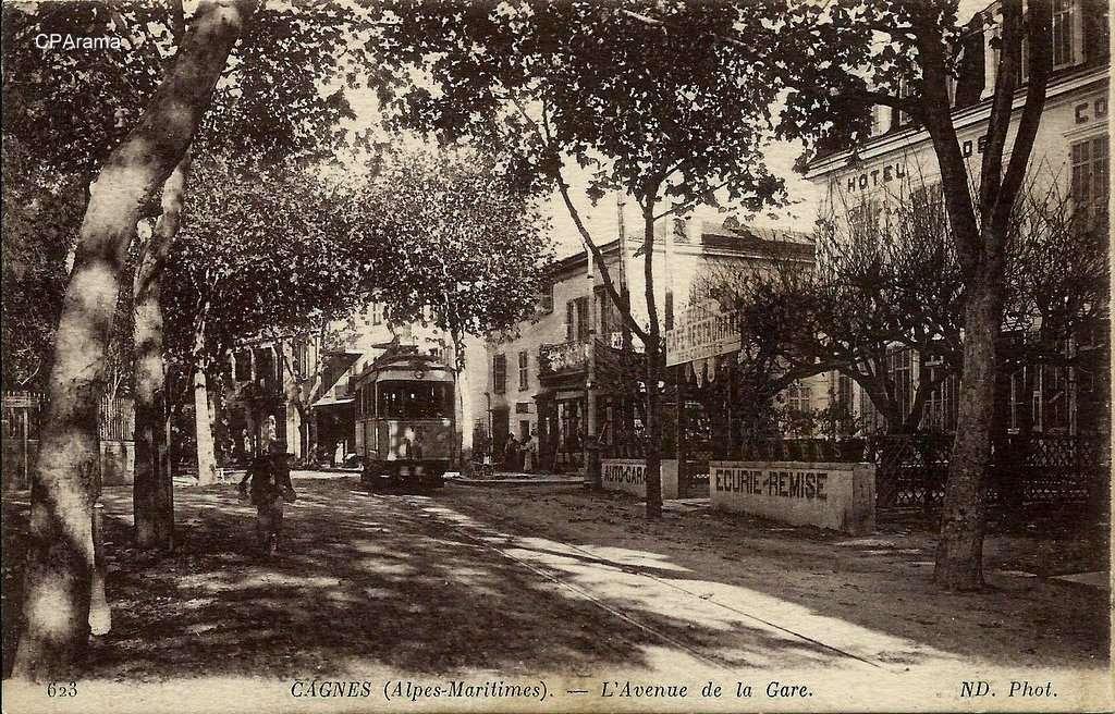
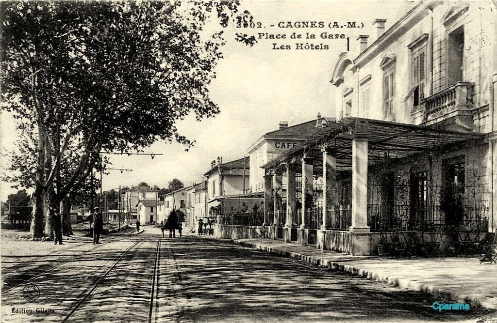
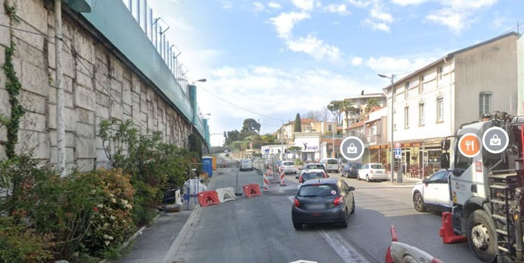
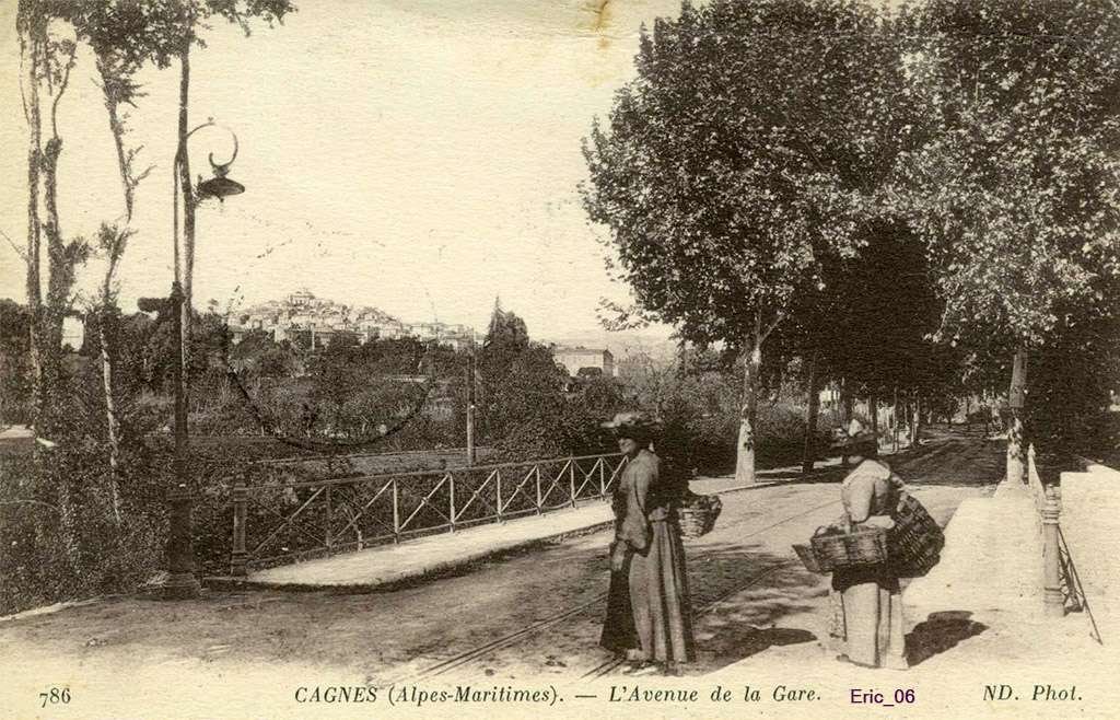
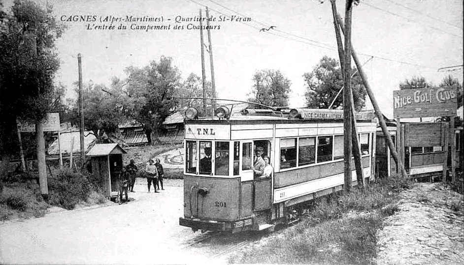
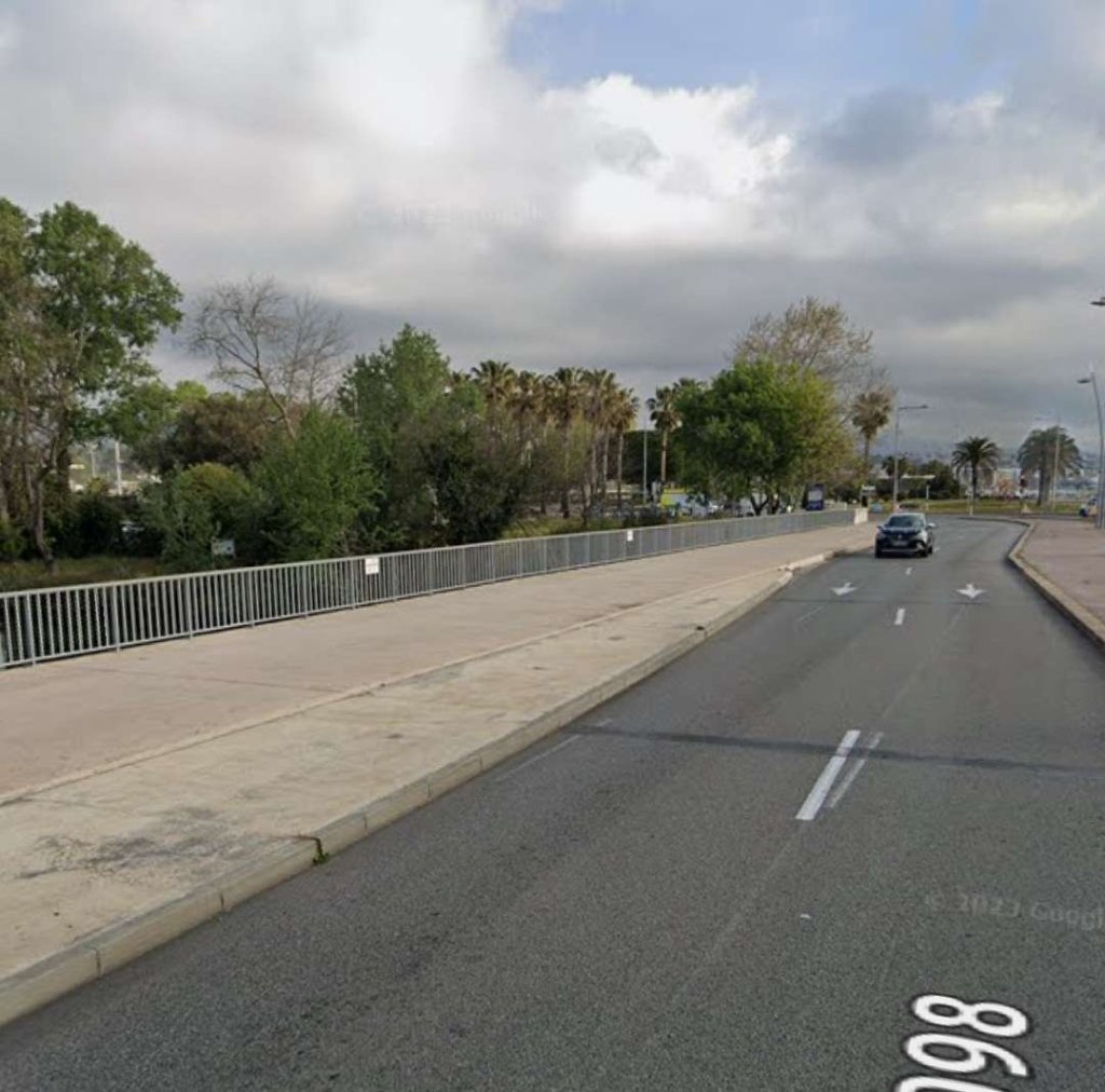
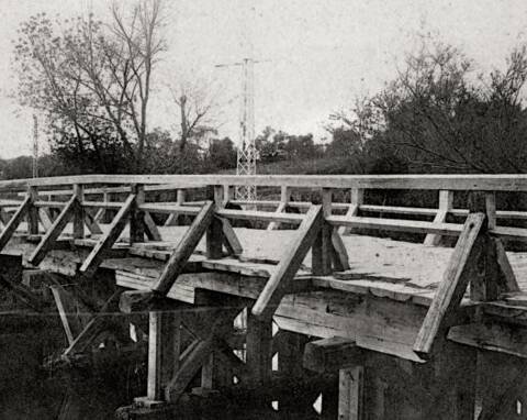
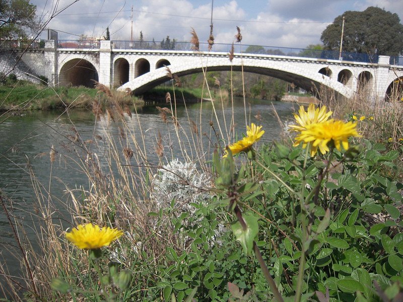
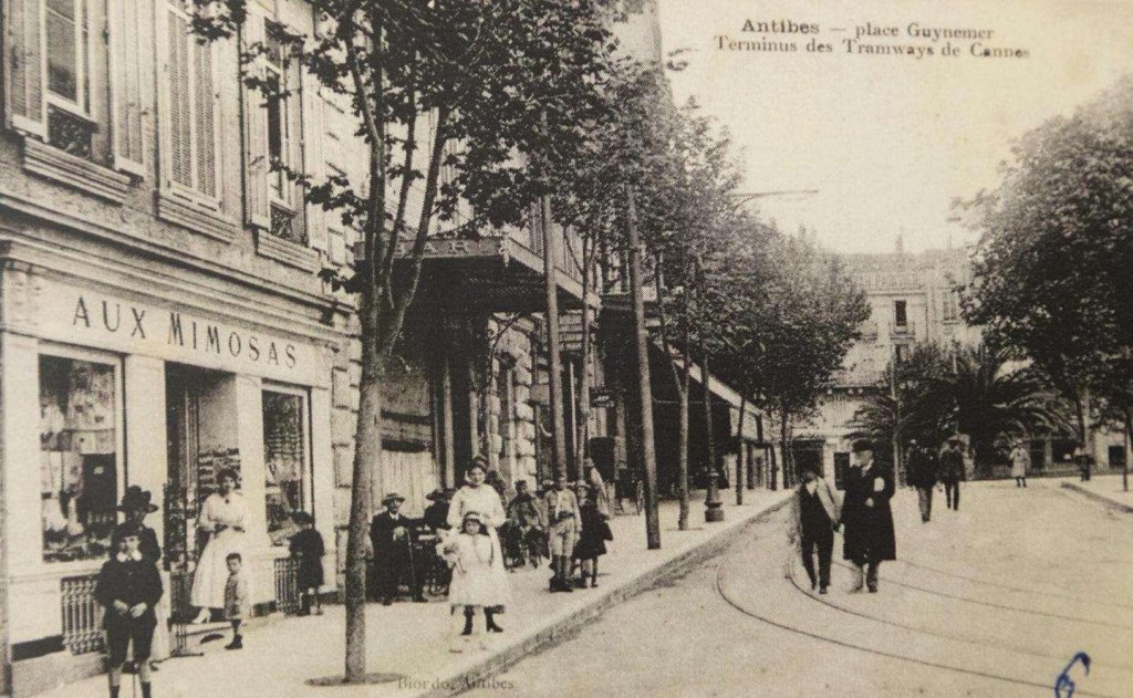
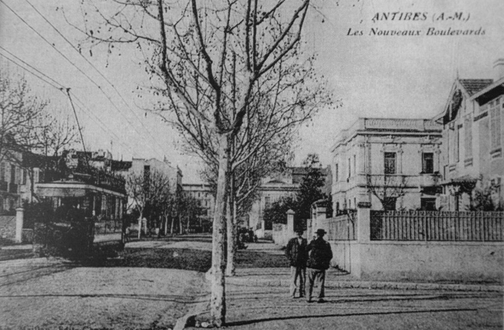
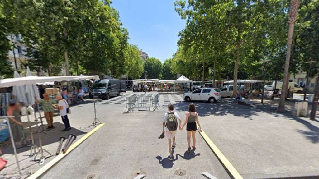

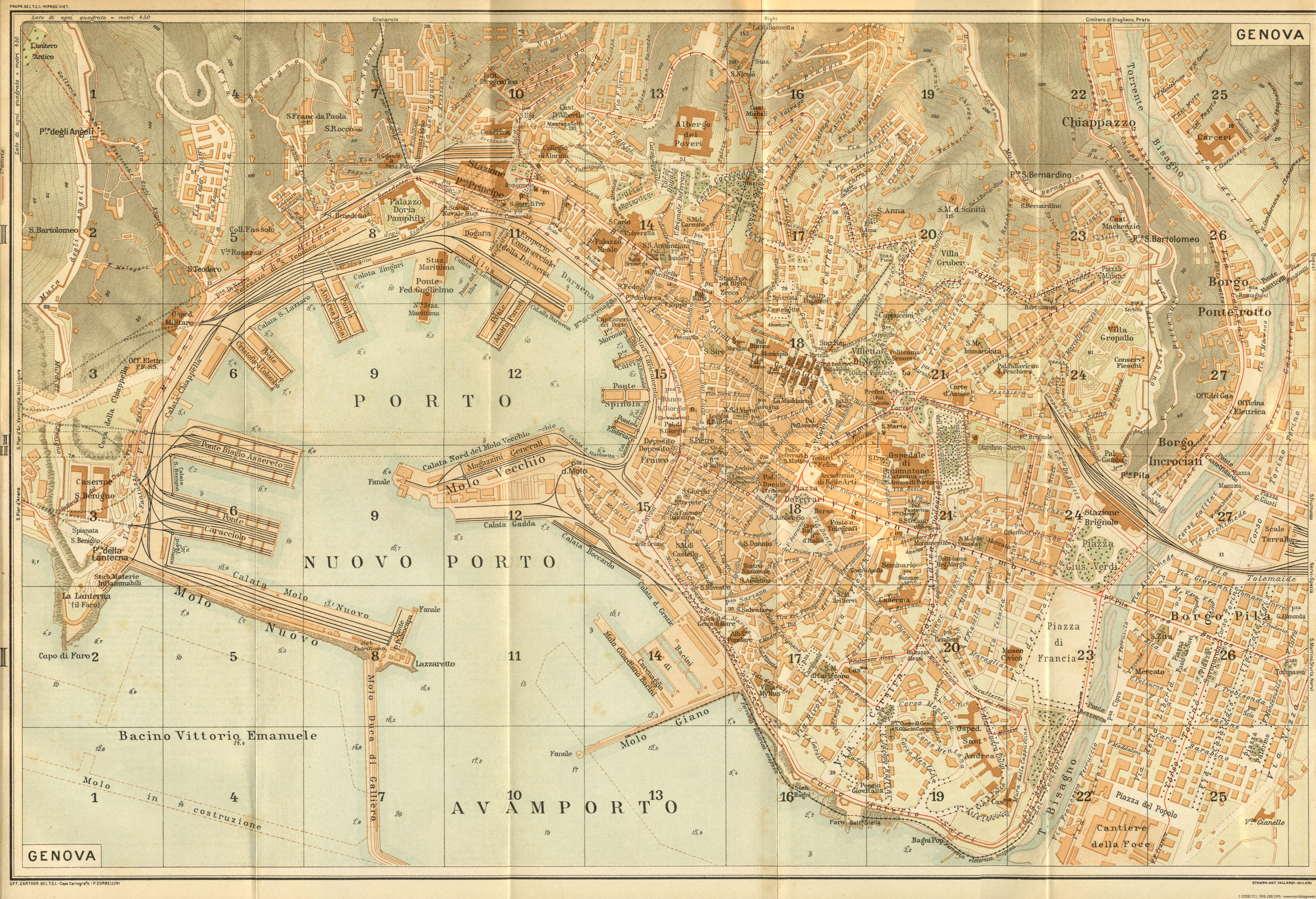
#/media/File%3AL04_163_Hp_Dinegro%2C_ET_37.jpg)