This was an industrial railway in the valley of the Bisagno River (Torrent). The Binario Industriale della Val Bisagno, also known as La Ferrovia delle Gavette, was in use from 1926 until 1965. It was a standard-gauge line and was 4.7km in length.
A translation from the Italian Wikipedia site: “The area of the lower Bisagno valley was developed at the end of the nineteenth century thanks to marble works at the monumental cemetery of Staglieno and a flourishing of agriculture; the area of Marassi experienced a strong expansion at the beginning of the 20th century with:
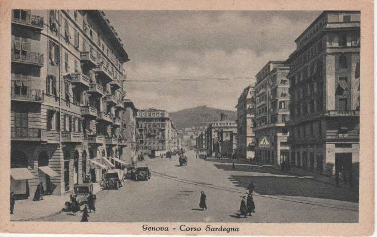
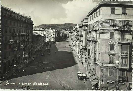
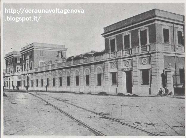
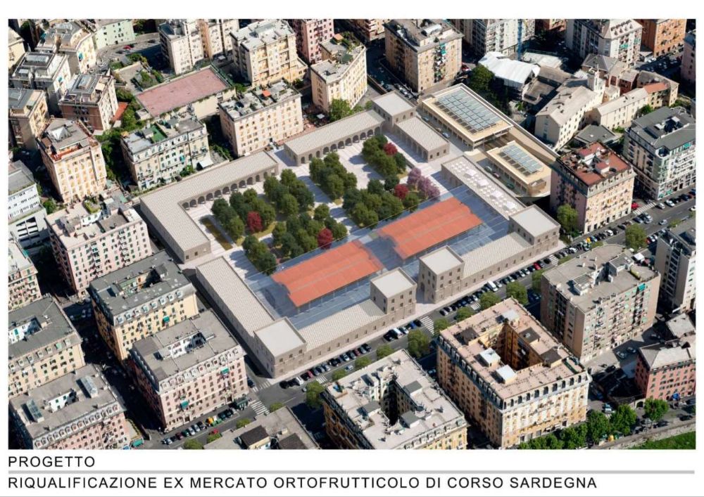
the construction of the general fruit and vegetable market in Corso Sardegna;
the municipal stadium;
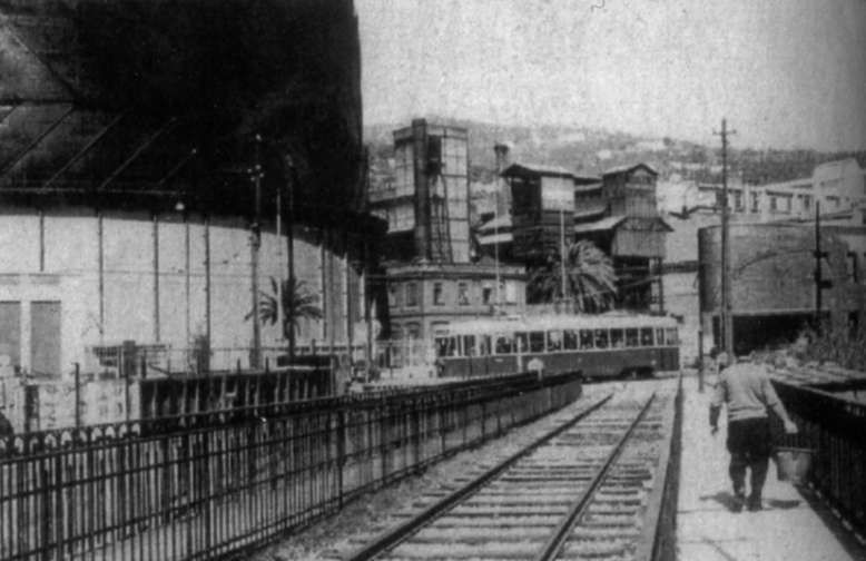
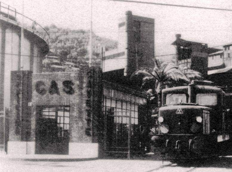
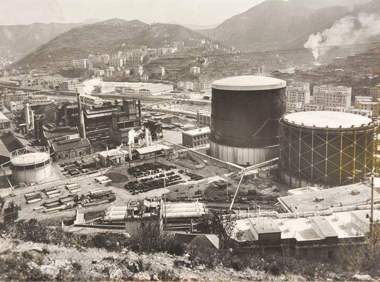
the workshops for the production of city gas with the gasometer built in the “Gavette” area of the Municipal Gas and Water Company (AMGA) located near Ponte Carrega;
the new municipal slaughterhouses in the Cà de Pitta area located in Piazzale Bligny.” [7][8]
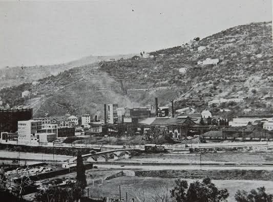
Contracted out in 1925, the railway was built at an initial cost of about 2 million lire and served the new commercial and industrial settlements that had sprung up in the valley. [7][9]
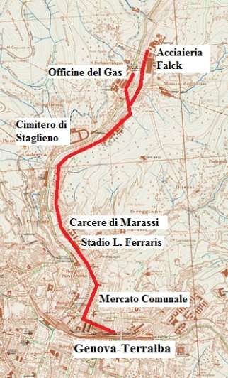
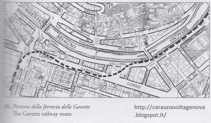
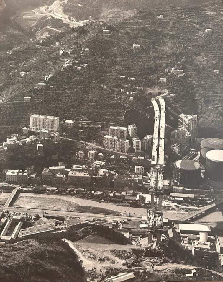
This low definition image shows the route of the railway up the Valley of the Bisagno. It comes from a public participation brochure: ‘Trasporto Pubblico Locale in Valbisagno: un percorso di partecipazione’. [10]A schematic drawing of the route of the railway which shows the main connections to the line. [7 – translated from Italian]
“The line, single-track and not electrified, was mainly equipped with normal 36 kg/metre Vignoles rails placed on ballast, with the exception of the sections shared with road traffic, notably in Piazza Giusti and Corso Sardegna, where there were counter-rails.” [7][9]
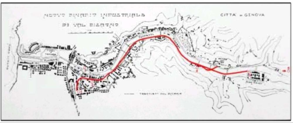
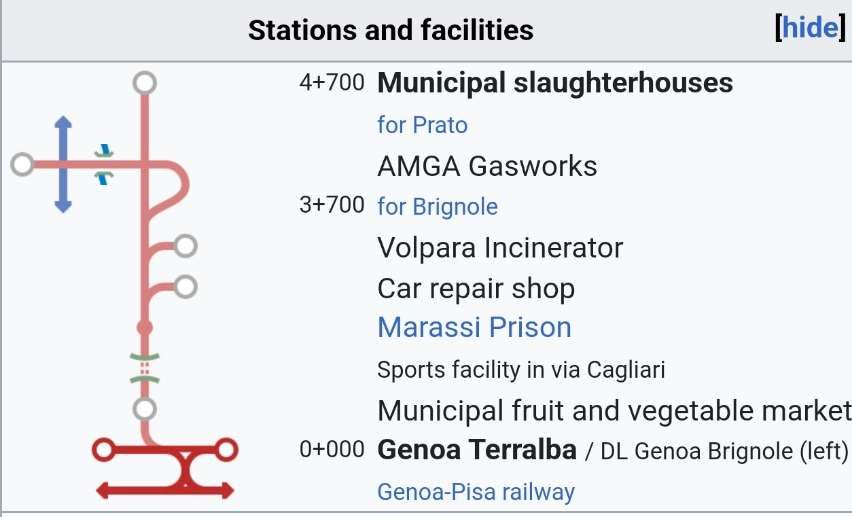
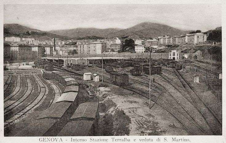
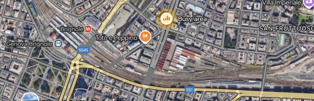
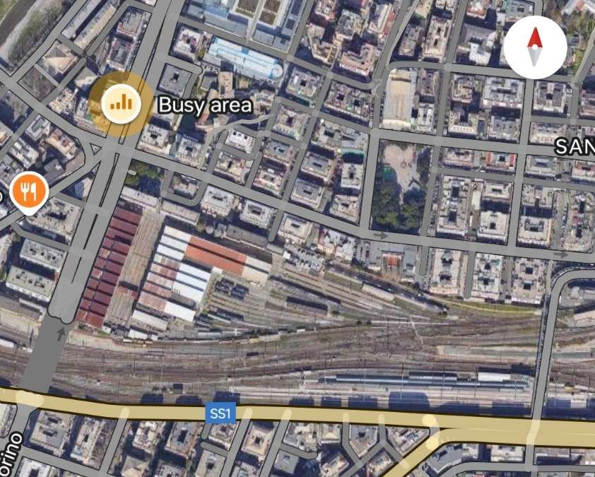
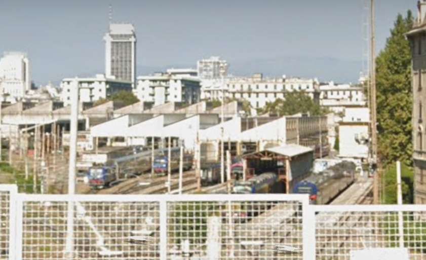
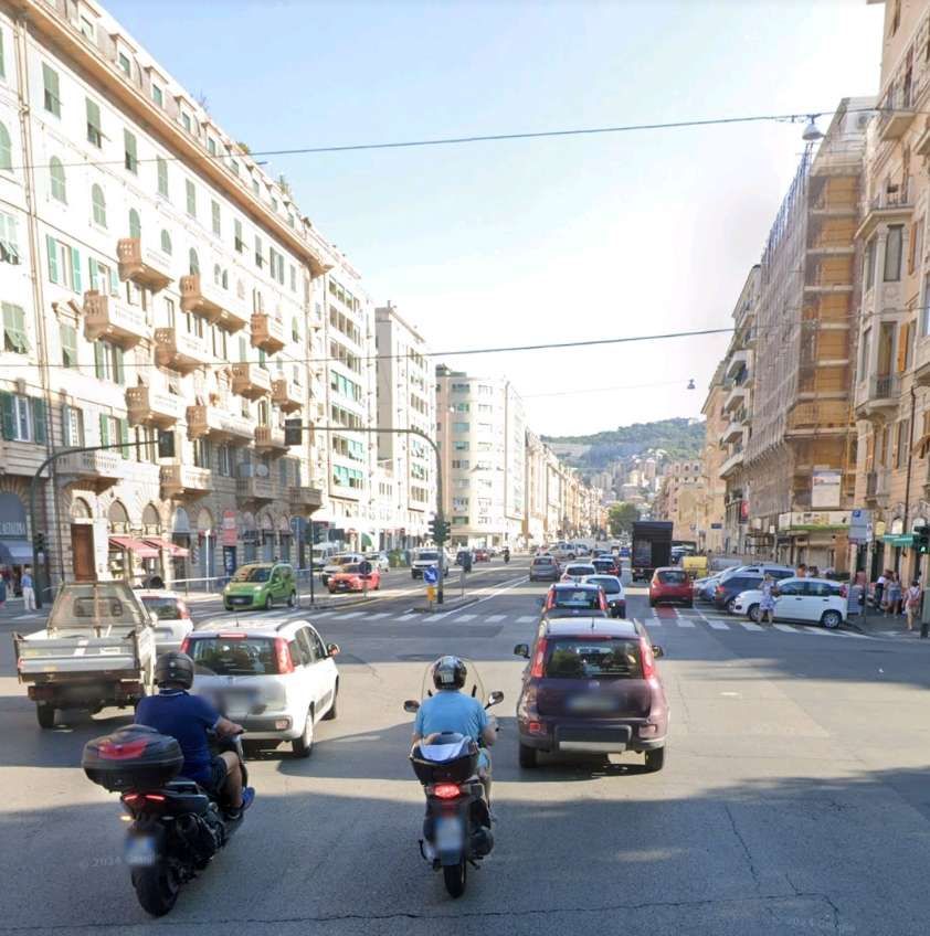
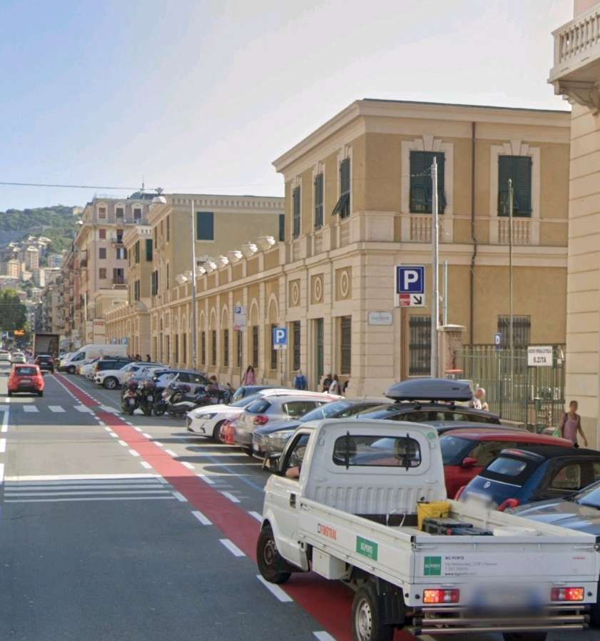
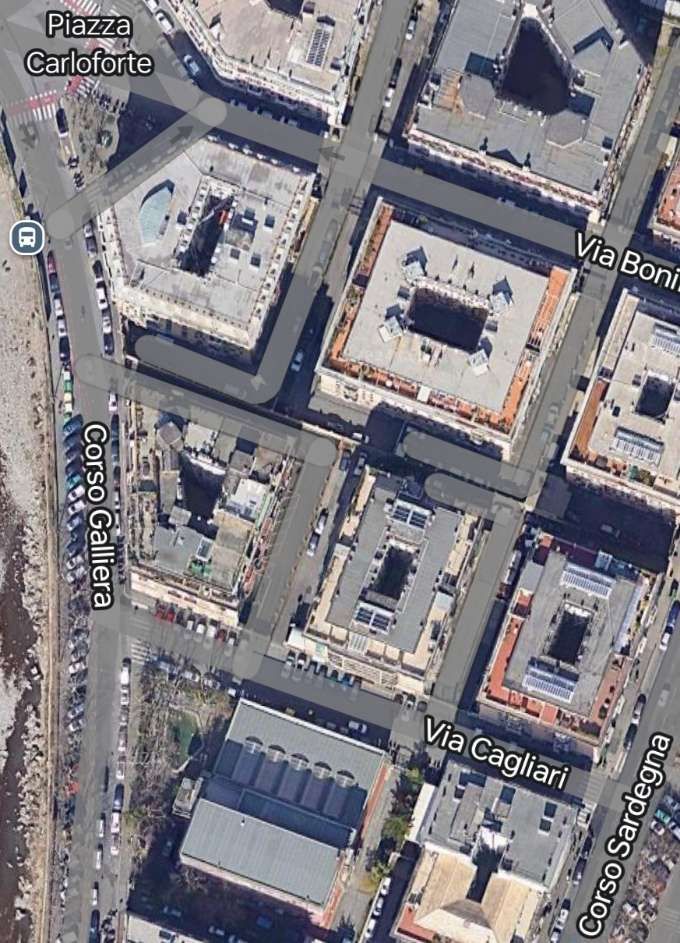
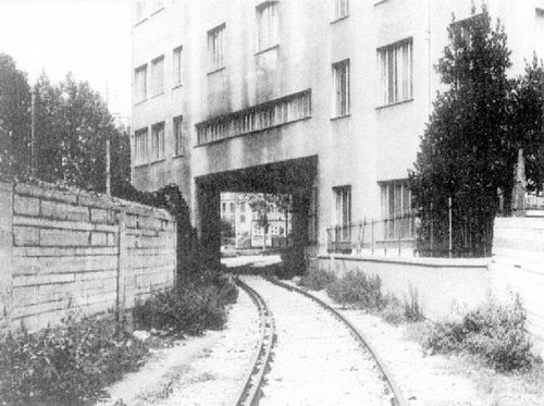
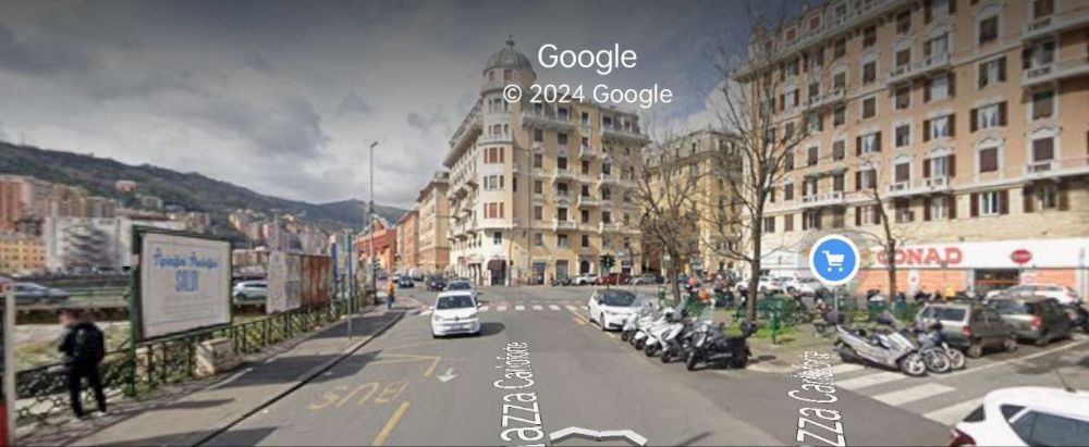
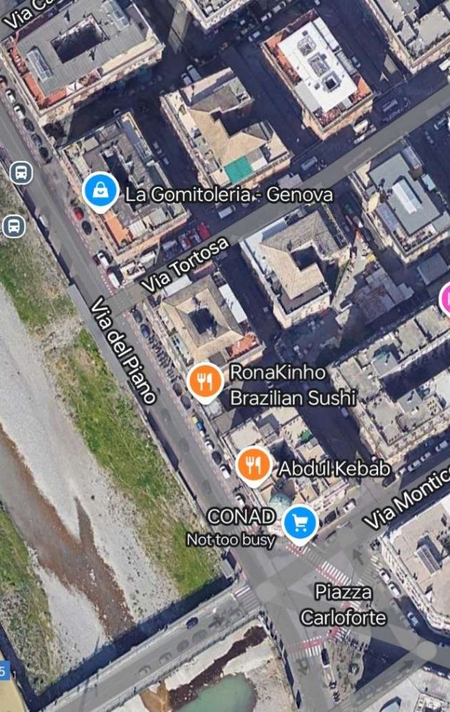
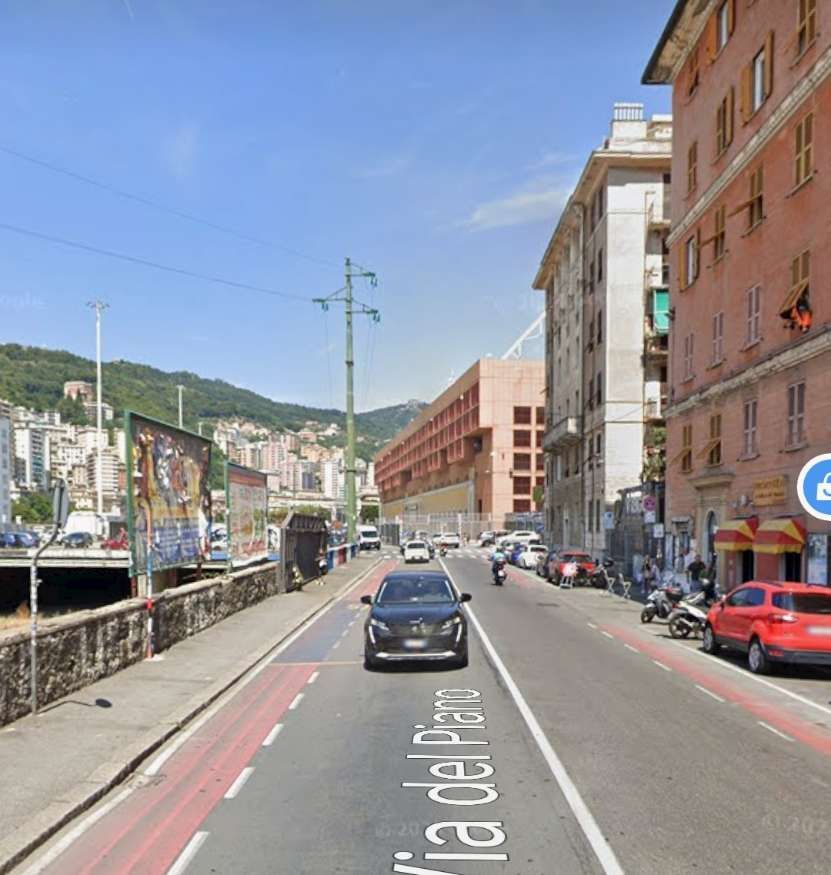
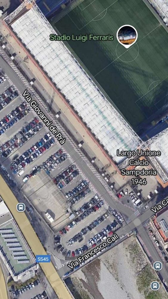
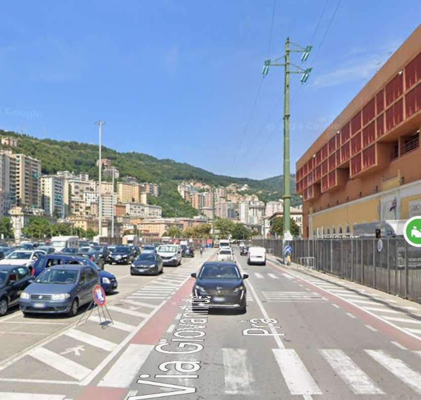
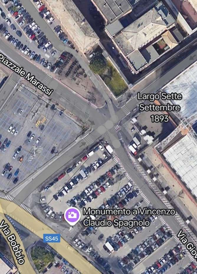
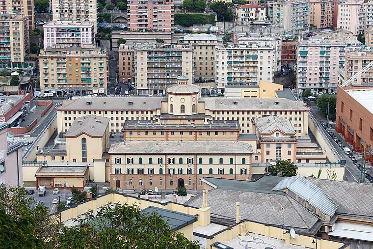
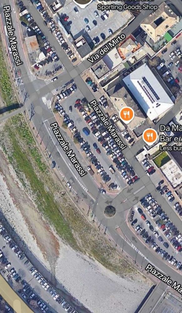
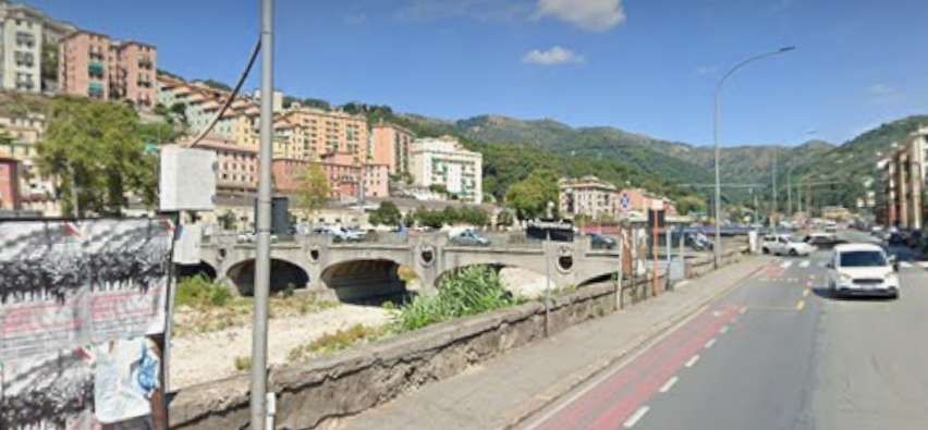
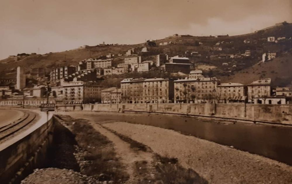
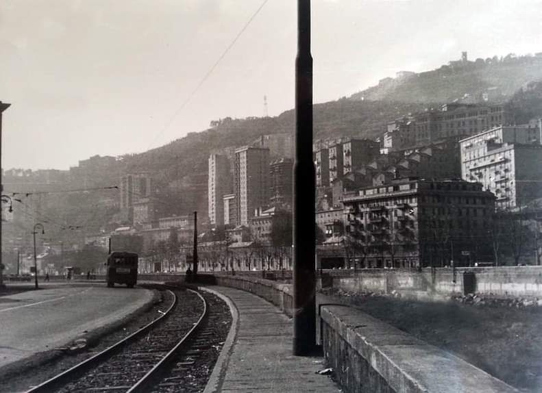
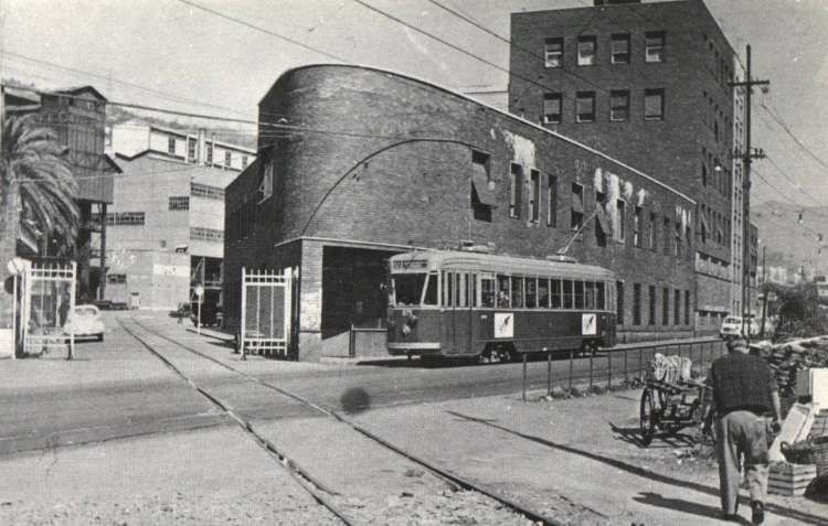
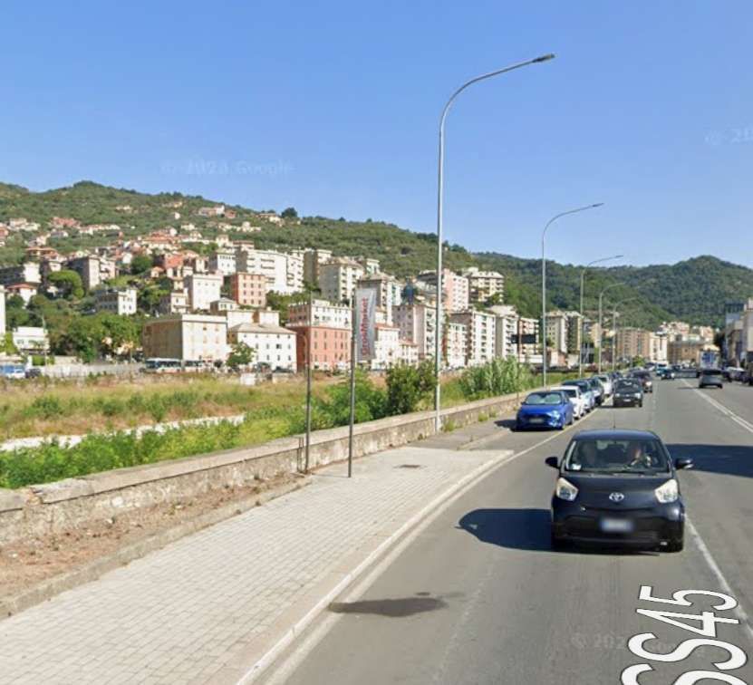
“The track branched off from the Terralba freight yard, near Piazza Giusti, entered the Corso Sardegna, along which the general fruit and vegetable markets were located, then turned left entering Via Cagliari, reached Piazza Carloforte and continued along Via del Piano, running alongside the municipal stadium and prisons.” [8 – translated from Italian]
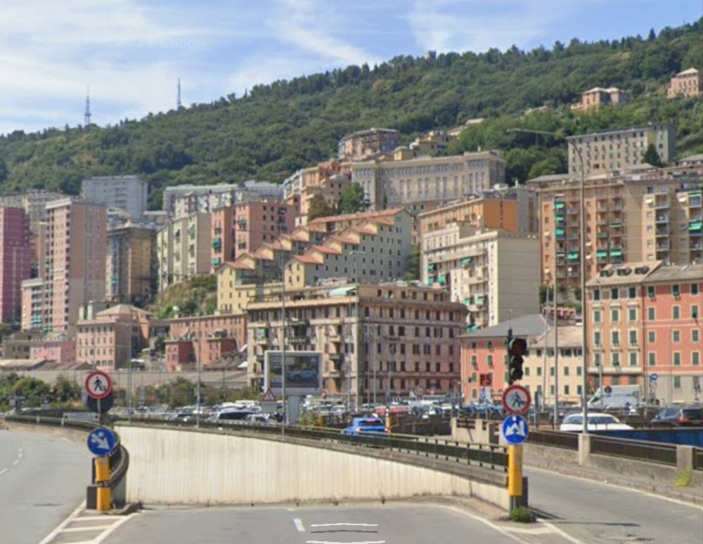
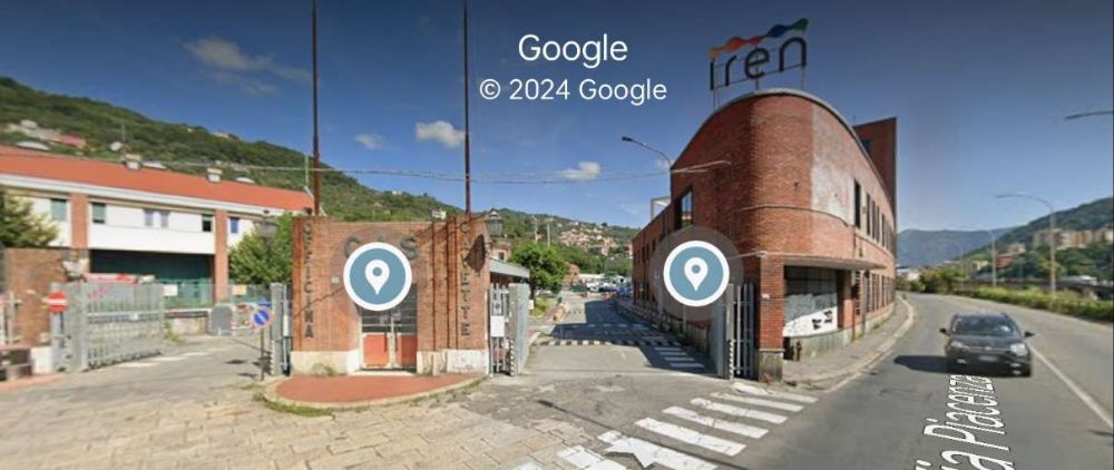
The Italian Wikipedia article adds a little to the information in the last paragraph. … On the Corsa Sardegna, the line was doubled to allow wagons to be left alongside the market area for loading and unloading. “After passing the market, the track crossed the road diagonally towards the Bisagno, … passing through a specially built archway in the building that, in the 21st century, houses the sports facility on Via Cagliari, through which it emerged at Corso Galliera. … Once in Piazza Carloforte, the track continued along Via del Piano, which was constructed at the same time as the railway, running alongside the municipal stadium and the prison , where trains carrying prison carriages sometimes stopped.” [7][9] The places mentioned in this paragraph appear in the images below.
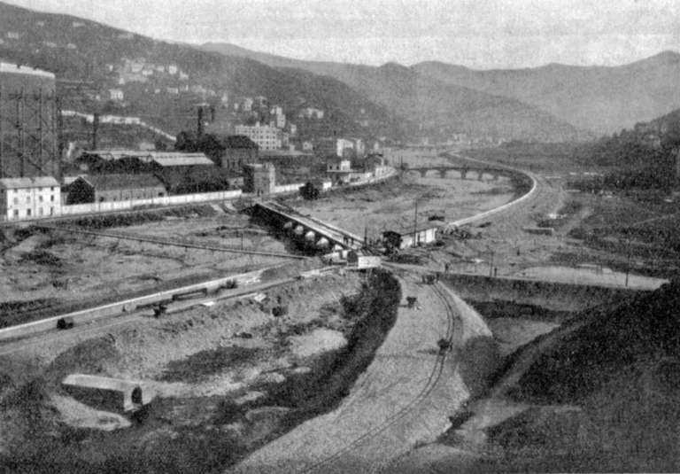
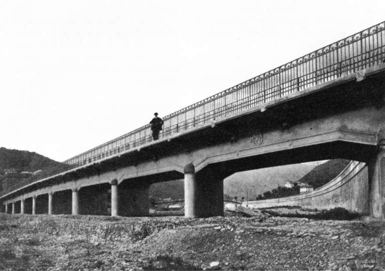
“The line continued up the left bank of the Bisagno, connecting to a number of factories. 3.7 km from its southern terminus a branch to the right which immediately curved round to cross [what became] the main line, Via del Piano and River Bisagno on a reinforced concrete bridge (Ponte G. Veronelli – which stood until destroyed during the flood of 1993); after crossing the river the line entered directly into the Gas Works, crossing, at ground level, the UITE (Unione Italiana Tramvie Elettriche) tramway Line No. 12, Genoa – Prato.” [8 – translated from Italian]
Italian Wikipedia tells us that the factories mentioned above which sat between the prison and the branch to the gasworks were: a plant for the repair of railway tanks and the NU “Volpara” plant for the incineration of urban waste. [7][9]
‘Trasporto Pubblico Locale in Valbisagno: un percorso di partecipazione’ [10] included the Volpara, Gavette and Guglielmetti Workshops and municipal waste treatment facilities, in its list of concerns which benefitted from the new railway. [10]
The next series of images cover the length of the line referred to in the paragraph above.
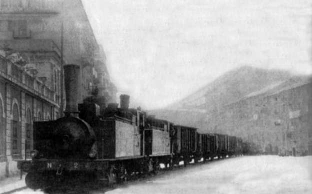
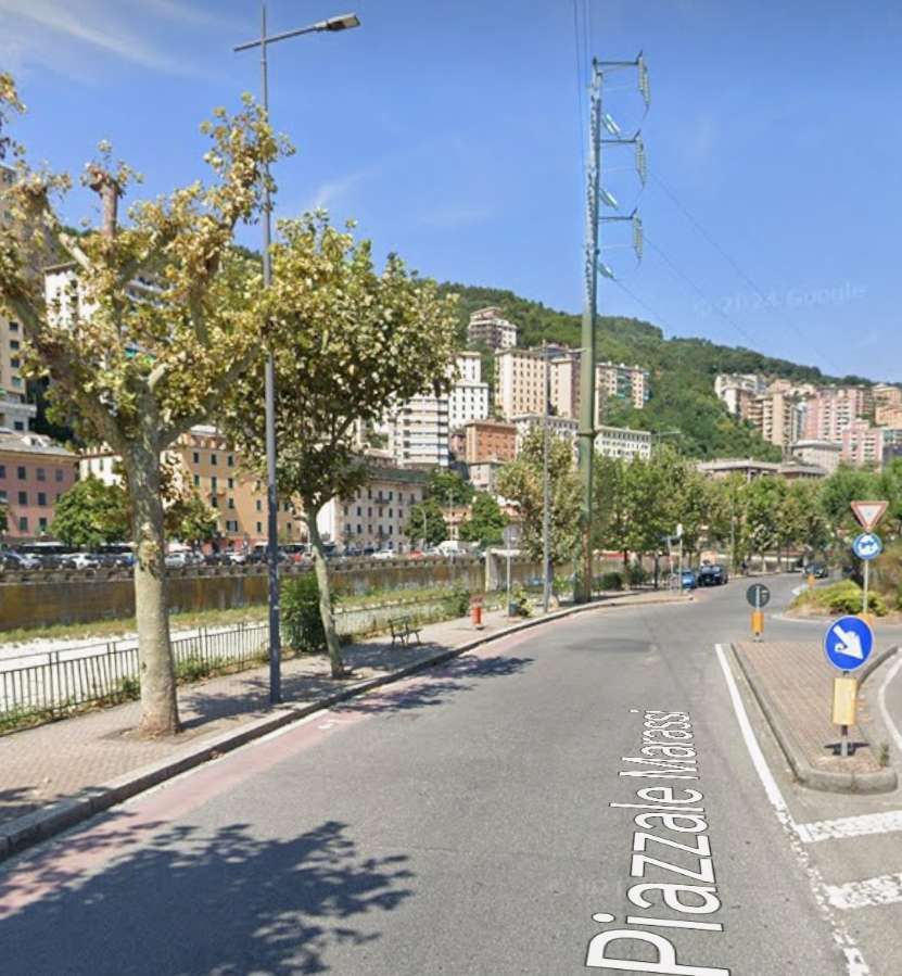
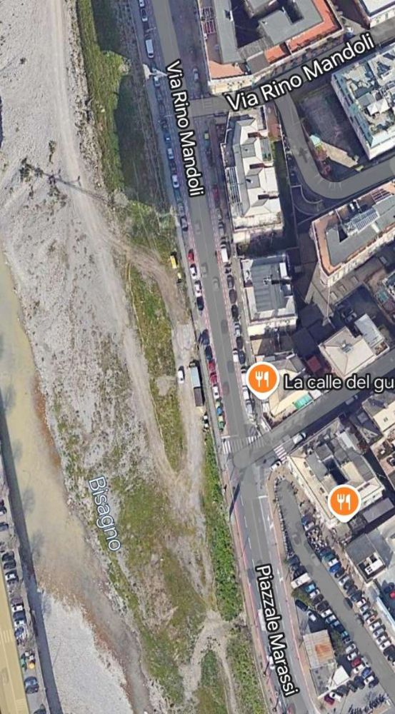
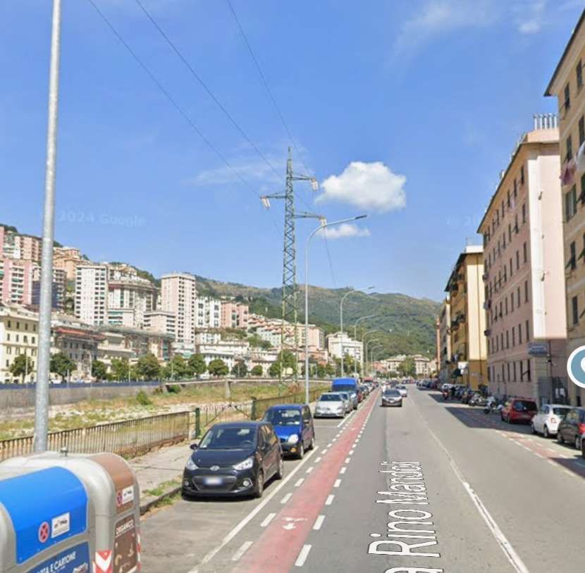
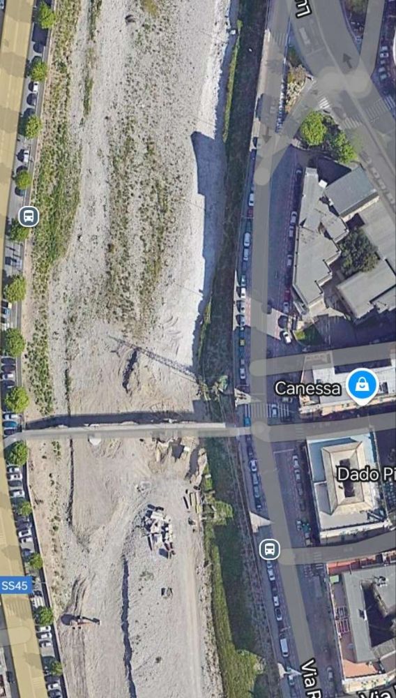
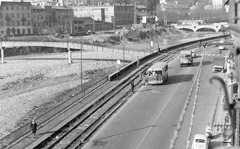
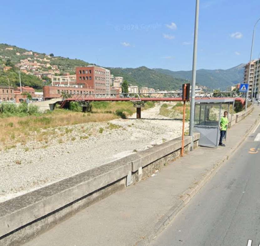
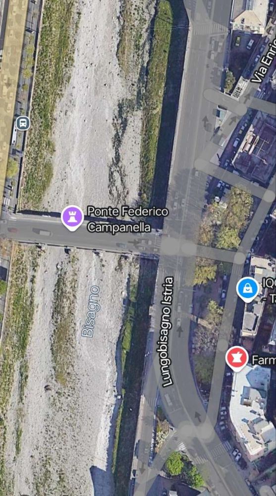
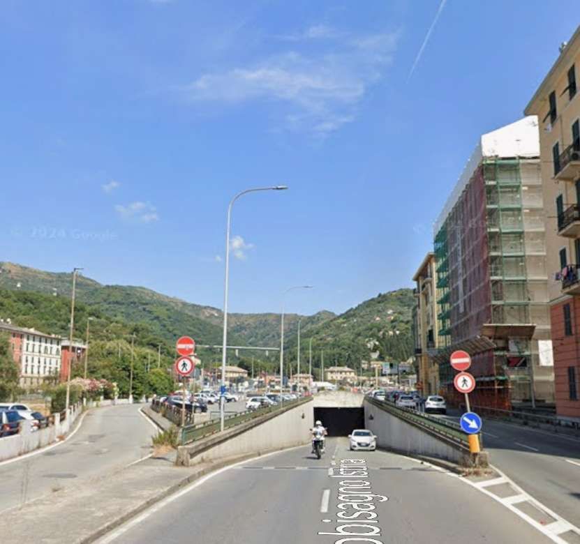
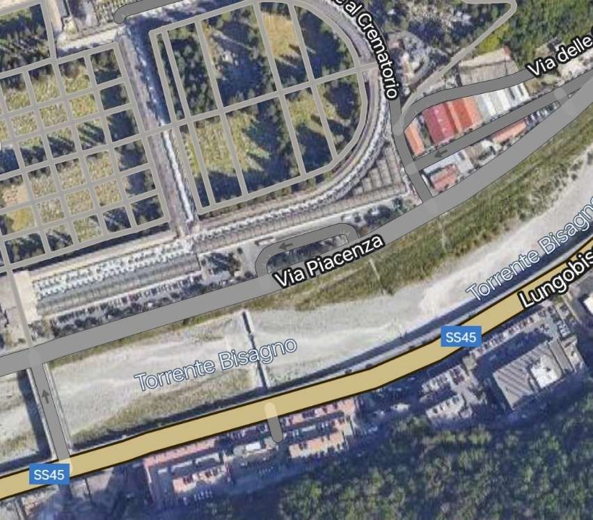
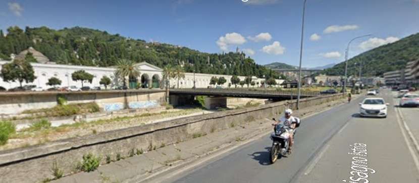
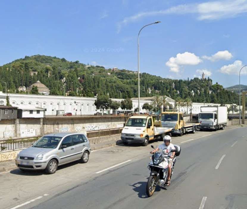
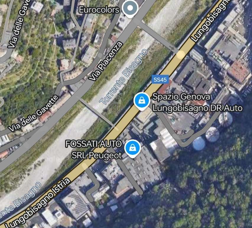
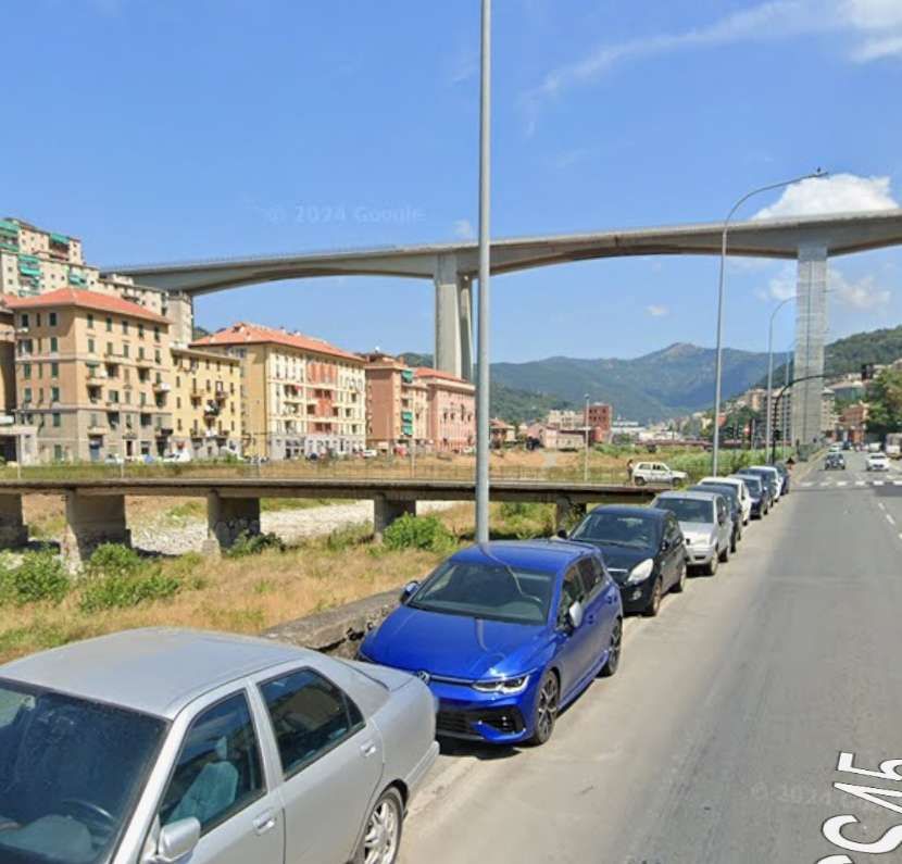
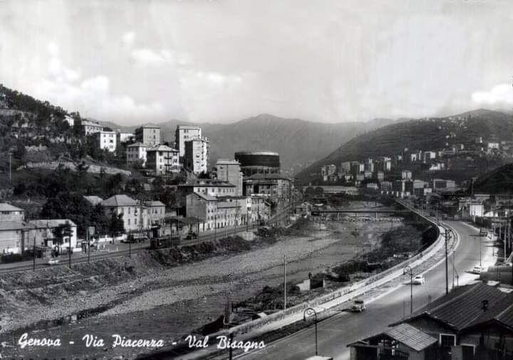
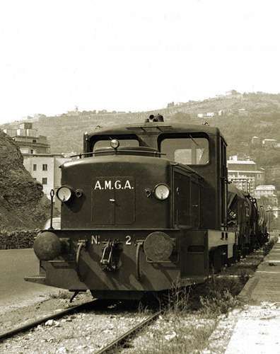
The line continued North from the prison, on the left (East) bank of the River Bisagno. On the West side of Piazzale Marassi and then Via Rino Mandoli. [Google Maps, November 2024]Looking North on Via Rino Mandoli. [Google Streetview, August 2024]The bridge over the next length of the Bisagno connecting Via Rino Mandoli to the right bank of the river is a footbridge Ponte Staglieno. [Google Maps, November 2024]Via Rino Mandoli in the 1960s, with the railway and the river to the left. This image was shared on the C’era una volta Genova Facebook Group by Luigi Carlo Piccardo on 25th April 2018. [26]The bridge in this view looking North on Via Rino Mandoli is Ponte Staglieno. [Google Streetview, August 2024]The line continued North along the left bank of the river. [Google Maps, August 2024]The bridge in this view looking North on Lungobisagno Istria is Ponte Federico Campanella. [Google Streetview, August 2024]This next length of the River Bisagno is now culverted but was not in the days when the old railway was in use. [Google Maps, November 2024]Upstream of the culvert, the river runs East-West for a short distance. Just visible at the top of this extract from Google Maps is the Southwest corner of the cemetery. [Google Maps, August 2024]The Lungobisagno Istria passes under the gyratory at this location. The railway once ran along the line of the top of the retaining wall to the left of the underpass. [Google Streetview, August 2024]The River Bisagno looking West from alongside Luongobisagno Istria in the early 1960s. Lungobisagne Istria again, also facing West in Staglieno and taken circa. late 1960s. The old railway was still in place at that time. The image below locates this view in the 21st century. [22]A similar location in the 21st century, at the Northeast end of the underpass. Some of the buildings on the far side of the river are recognisable in both images. [Google Streetview, August 2024]Turning through 180° we again see road, river and railway curving round to the East. This is the same curve in the river bank as appears in images above. The view from the mid-20th century this time extends beyond the cemetery which appears in the images below as far as the church tower on the hill on the far side of the river. Careful inspection of the two Google Streetview images below will identify the same church on the horizon in each photograph- Chiesa di San Bartolomeo Apostolo di Staglieno which sat above and to the Northeast of the cemetery. This image was shared on the C’era una volta Genova Facebook Group by Alessandro Platone on 30th May 2019. [24]The old railway continued on the left bank of the River Bisagno at the side of Lungobisagno Istria with the cemetery on the right bank. [Google Maps, November 2024]Two views of the cemetery from Lungobisagno Istria the old railway would have been in the foreground close to the parapet wall probably where the vehicles are parked. [Google Streetview, August 2024]Jung R42C 0-6-0 Diesel Locomotive No. 2 pulling a convoy from Terralba towards Gavette in 1961. The Staglieno cemetery is in the background. [14]The old railway continued on the left bank of the river. [Google Maps, November 2024]In the 21st century, the River Bisagno is bridged by the E80 Autostrada on a high concrete viaduct. It was in this area that the branch swung away from the river bank to the East(through the wooded area, bottom-right) before turning to cross the railway line on the river wall and bridge the river on the diagonal. [Google Maps, November 2024]The E80 above the River valley. [Google Streetview, August 2024]Looking upstream along the River Bisagno towards the gasworks. The line of the railway which continues North on the left bank of the river can easily be seen. The line which arced round to cross the River to the gasworks is not visible. This image was shared on the C’era una volta Genova Facebook Group by Georgia Mellini on 15th March 2021. [28]
Italian Wikipedia also gives a description of the branch line to the gasworks: which curved in a wide arc before crossing the Via del Piano. It then “crossed the Bisagno engaging the G. Veronelli bridge, with 9 spans and 8 piers, built in reinforced concrete by the Società Italiana Chini.” [7][9]
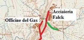
The remaining length of the line (approximately 1 km) ran along the left bank of the river to slaughterhouses near the Falck steelworks in Cà de Pitta. [7][8][9][10] There was also a shorter-lived branch which served a cement works to the East of the river.
The head of the line! The branch serving the cement works is shown in green. [31]
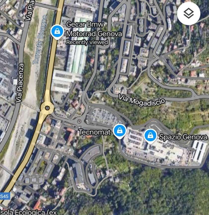
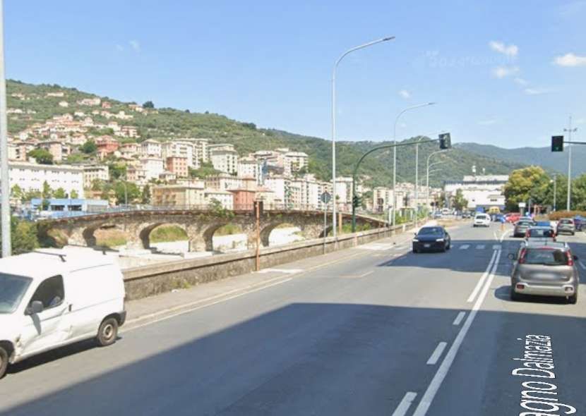
The line on the left bank of the Bisagno served the Falck Steelworks (adjacent to the SS45 in the top-left of this image), and a cement works (which was located in the industrial area North of the wooded area to the bottom-right of the image. [Google Maps, November 2024 – but note that the steelworks is under redevelopment at the end of 2024]The gasworks site is off to the left of this image which looks North along the left bank of the River Bisagno. The railway ran close to the dwarf wall which acts as the parapet to the wall at the river’s edge. [Google Streetview, August 2024]Further North, the railway ran under the location of the parked vehicles at the river’s edge. [Google Streetview, August 2024]The Falck Steelworks site in 2020, seen from the right bank of the Bisagno. [Google Streetview, September 2020]
The picture of the site of the steelworks brings us to the end of our journey along this industrial railway.
It was commented at the time of the construction of the line that through “the use of this rapid and economical means of transport, the potential of the gasworks can be significantly increased, at the same time reducing the costs for the transport of coal and by-products of the works themselves by approximately 1 million lire per year. … There will also be indirect advantages since the roads along the right bank of the Bisagno, currently congested by the transit of vehicles of all kinds, with great and evident danger to public safety, will be partially cleared and consequently the maintenance costs of said roads will also be reduced. The implementation of the industrial track will also contribute profitably to transforming a large area of land, still inaccessible a few years ago, and give it a new and fruitful industrial impulse. … Not to mention that the operating, maintenance, depreciation, etc. costs will weigh on the budget of the Municipality to a minimal extent since private companies will also contribute to the maintenance costs of the railway.” [10: p18 – quoting the Genoa Magazine of 1926 – translated from Italian]
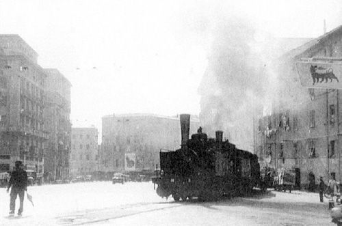
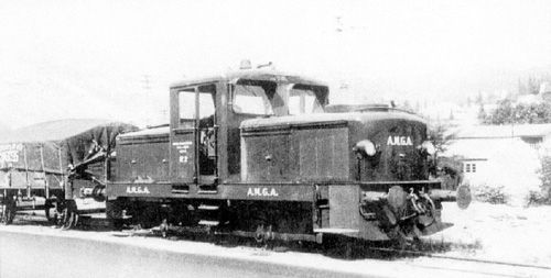
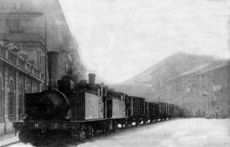
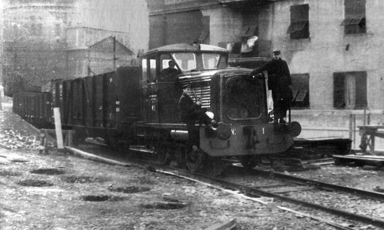
“The management of the railway line was entrusted to the Municipality through its Municipal Gas and Water Company (AMGA), which had three Breda-built steam engines and, subsequently, also a three-axle Jung R42C diesel locomotive, while the wagons were owned by the FS (Ferrovie Della Stato) which made them available to the Municipality.” [8 – translated from Italian]
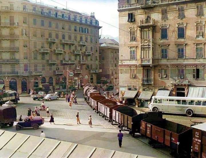
Two of the three Breda-built steam locomotives owned by AMGA which worked the line. Here they are in charge of a train of fruit and veg wagons outside the market on Corso Sardegna. [7]
AMGA certainly owned two diesel locomotives which are shown below.
“Any train travelling along the line was escorted by a shunter (an operative on the ground), equipped with a red flag, and, normally, also by a traffic policeman on a cyclist or motorcyclist who had the task of stopping the traffic. Particularly spectacular were the long trains of coal wagons destined for the Officine Gas delle Gavette for the production of town (city) gas.” [8 – translated from Italian]
Italian Wikipedia tells us that “the line was decommissioned in 1965 as a result of the use of methane gas instead of town gas, thus ceasing its need for it by AMGA, now the sole user of the plant after road transport had replaced rail transport to the slaughterhouses and the market.” [7][10]


Pingback: Genoa’s Early Tram Network – Part 3 – The Remainder of the Eastern Network before the First World War. | Roger Farnworth