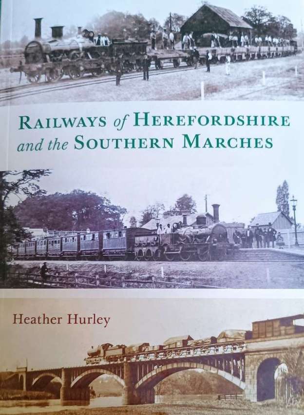
This is the second book written by Heather Hurley which focuses on railway history. The first concentrated or the early tramways/tramroads of the Wye valley. [2] A short review of that earlier book can be found here. [3]
In this latest publication, Heather Hurley provides a social history of the lines which served the area between Ludlow in the North and Chepstow in the South – the area shown in the map below.
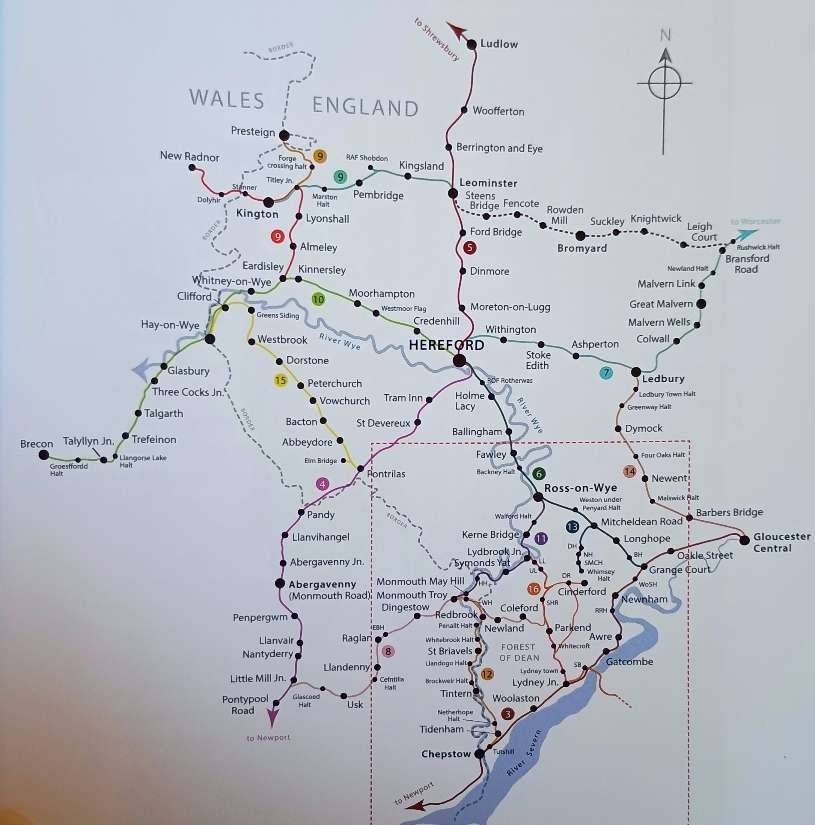
Given the essentially rural nature of the Southern Marches, it is sometimes easy to forget the industries which existed in the area and the manifest need, in the 19th century, for the railway connections which developed over time.
This book is an obvious successor to Hurley’s earlier study of the Tramways in the Wye valley. It is “written by a local historian, not a railway enthusiast, who has delved through the archives of 18 railway companies: two were abandoned from the start, four remained open, with another partly restored as a heritage line. Apart from the documentary research, a great deal of fieldwork was undertaken [by Hurley] in the counties of Herefordshire, Gloucestershire, Monmouthshire, Brecknockshire and Radnorshire, in order to provide important visual information.” [1: pix]
Hurley’s account, “follows the challenges, disappointments, financial gains and losses throughout a period of railway mania and beyond. The account has been thoroughly researched, drawing on Acts of Parliament and tables of tolls, company minutes and accounts, plans and maps, newspapers, journals and books, with contemporary and modern photographs to illustrate the railways, trains and people involved, the enormous task of construction, opening celebrations, and the history of each line until its fate was decided.” [1: pix]
The different individual railways have been well recorded in many publications, but this is the first book to give an overview of the relatively haphazard development of the railway network in the southern marches. It highlights the incredible social significance of the developing rail network during the 19th century and chronicles their impact on the industries, local economies and growing population during the nineteenth century.
Hurley does not claim to be a railway historian, but she has collated, “A richly detailed and illustrated account of the railways formed between 1845 and 1900 across Herefordshire, Gloucestershire, Monmouthshire, Brecknockshire and Radnorshire. Unpicking an often haphazard network, the book traces the lines and infrastructure, the stations, bridges and tunnels, the investors, engineers and navvies, and the charismatic steam locomotives that criss-crossed the region up until the 1960s.” [1: back cover]
Preliminary chapters look at:
- the history of the Welsh Marches, their industries and communications. The earlier tramways in the area are dealt with in Hurley’s earlier book. [2] Although reference is made in this book to both the Leominster Canal of 1791 and the earlier long-distance tramways.
- the arrival of steam powered railways, including: locomotives, wagons and coaching stock; and the work and life of the navvies that built the lines.
Succinct chapters deal with the development, acts of parliament and incorporation, construction, life, eventual demise of most of the railway companies and lines covered, and present day remains (mainly buildings, bridges and sections of the line):
- The South Wales Railway and The Monmouth & Hereford Railway.
- The Newport, Abergavenny & Hereford Railway.
- The Shrewsbury & Hereford Railway.
- The Hereford, Ross & Gloucester Railway.
- The Worcester & Hereford Railway.
- The Coleford, Monmouth, Usk & Pontypool Railway and The Coleford Railway.
- The Leominster & Kingston Railway and The Kingston & Eardisley Railway.
- The Hereford, Hay & Brecon Railway.
- The Ross & Monmouth Railway.
- The Wye Valley Railway.
- The Mitcheldean Road & Forest of Dean Junction Railway.
- The Newent Railway and the Ross & Ledbury Railway.
- The Golden Valley Railway.
- The Severn & Wye Railway.
Clearly there is insufficient space in a volume of this nature for detailed descriptions and historical investigations, nonetheless this book is an excellent introduction to the railways of the Southern Marches and a good starting point for any reader wanting to study any of these railways.
It is a well-written and well illustrated social history of the railways of the Southern Marches.
I noticed only a couple of minor points worth questioning in the whole volume:
- The Worcester Mile is mentioned [1: p53] as providing a direct route from South to North from Barrs Court Station. I believe that the Worcester Mile ran South to North from Barton Station. [4]
- Colonel Rich [1: p156] is noted as ‘the chief Great Western Railway engineer’. In fact, Colonel Frederick Henry Rich (8th March 1824 – 22nd August 1904) was a British soldier, who served with the Royal Engineers and was initially seconded to the Board of Trade as an Inspector of Railways in 1861. He continued in this role after his retirement from the Royal Engineers, serving as Chief Inspecting Officer of the Railway Inspectorate between 1885 and 1889. It was normal for the Board of Trade to inspect newly constructed railways prior to their opening for public use. [5]
References
- Heather Hurley; The Railways of Herefordshire and the Southern Marches; Logaston Press, Eardisley, 2026.
- Heather Hurley; Horse-drawn Tramways of the Wye Valley; Logaston Press, Eardisley, 2022.
- https://rogerfarnworth.com/2023/01/02/horse-drawn-tramways-of-the-wye-valley.
- https://htt.herefordshire.gov.uk/her-search/monuments-search/search/Monument?ID=30846, accessed on 27th July 2026.
- https://en.wikipedia.org/wiki/Frederick_Henry_Rich, accessed on 27th July 2026.