How often have you sat in a room with a group of friends and realised that you’ve lost track of what they’re talking about? Like you’ve dozed off for a bit and the conversation has dramatically changed direction. How did you feel? It can be a quite lonely or confusing experience.
I don’t have many Manchester United memories, except perhaps the famous cup final in 1979. Being an Arsenal supporter, I remember the excitement of Arsenal’s 3-2 win in the FA Cup that year.
However, there is one United memory that sticks in the mind. An episode which I was reminded of recently on facebook when someone posted a clip about times not to leave the room to put the kettle on. I had been watching the Manchester United/Bayern Munich UEFA Champions League Final on TV. The match took place in the Nou Camp Stadium.
I had to go out to do a Baptism visit, there was perhaps only a minute or two to go and United were losing 1-0, they were on the rack and going nowhere. The result was a foregone conclusion – Bayern Munich had obviously won the cup.
I wasn’t out that long, but I missed the key last minutes of the match. When I got back, I couldn’t believe what people were saying. United had scored twice in the last minute – they’d won. I wasn’t there – and if there hadn’t been independent accreditation of the victory, I would not have believed what people were telling me!!!
Whether we wake after having dozed off in a crowded room, or we were just not there when a key event happened – we easily feel ostracized and left out. No matter what anyone says, it still feels that way.
We’re not told why Thomas wasn’t in the upper room that first Easter evening when Jesus visited his disciples. We could spend time trying to imagine where he was – but we won’t! Suffice to say, he missed the key event, the turning point, the moment that changed defeat into victory. And how did he respond? In exactly the same way as most of us would have done. …
Thomas couldn’t believe what the others told him. I doubt any of us would have done under those same circumstances. … Seeing is believing – but so is sharing in an experience with others. Thomas not only didn’t see what happened, he was left out of the experience that everyone else shared. He was in a lonely place, wanting to believe, wanting to share in everyone else’s happiness, but unable to do so. He hadn’t been there, he hadn’t seen Jesus.
Thomas’ reactions and feelings are understandable. And as we read the story we can see that Jesus thought so too. he provided aa repeat of the same encounter – one in which Thomas could share. Jesus gently reminded Thomas of his outburst – no indignant rebuke, just words which drew Thomas back to faith. Thomas’ response is one of the clearest statements of Jesus’ divinity in the Bible. Having seen the truth of the resurrection he cannot but exclaim, “My Lord and my God!”
The next 3 verses are important, they are pivotal to John’s message:
Jesus said to him, “Have you believed because you have seen me? Blessed are those who have not seen and yet have come to believe.” …. Now Jesus did many other signs in the presence of his disciples, which are not written in this book. But these are written so that you may come to believe that Jesus is the Messiah, the Son of God, and that through believing you may have life in his name.
John has led his readers through a story – a story which allows those readers to meet Jesus and begin to understand who he is. It’s a journey of discovery, one in which we can identify with the different characters, feel their emotions, struggle with them to understand what Jesus is doing and saying. Thomas’ words are the culmination, the pinnacle of the story – the point where even the strongest of doubters expresses faith. Jesus response is not just for Thomas’ ears, not just for the disciples, but for all who read John’s Gospel in coming generations. “Don’t think,” says Jesus, “that the disciples were in some way special because they saw all these events first hand. Rather, blessed are those who read the stories and encounter Christ through the work of his Spirit in their lives and the lives of those around them.”
“Blessed,” says Jesus, “are all who read this Gospel, who struggle with doubts & come to believe that he is the Son of God.”
We’ve not missed out on the party, we can still be part of the events which changed defeat into victory. We too can own the risen Jesus as our Lord.
This is good news – particularly for those of us who struggle with doubt; for those of us who’d like to believe more strongly than we do; for those of us who see other people’s faith, or the joy they seem to experience in their Christian life, and feel that we are somehow missing out. The story of Thomas is important because it embraces doubt.
The story is also important because it embraces change. Everything is different, Jesus was dead and is now alive. This changes everything – nothing can now be the same. Thomas struggles to accept the new situation. For so many of us change is difficult to handle, yet it is happening all the time. We need to continue to engage with the communities around our churches, looking for new ways to serve, new ways to make Christ known and to bring hope where there is despair. We need to accept that the future for the Church of England is one with significantly less stipendiary clergy – perhaps one third less in numbers in ten years time – and we need to imagine new forms of ministry both lay and ordained, new ways of being church. Nothing is the same as it was, nothing will be the same as it was, and we want to shout out the loudest “No!” that we can manage.
There are two key things we need to take away from this passage.
First – it’s OK to be honest – don’t pretend that everything is OK when it isn’t,. Don’t manufacture faith if it isn’t there. We can express our fears and we can express our doubts. In fact expressing our fear and our doubt is often, like it was for Thomas, the first step to faith.
Second – this story of doubt and faith is made the crowning moment of John’s Gospel – the pinnacle – Jesus reaching out to his loyal but doubting and fearful follower, not in anger but in love. Thomas’ exclamation, “My Lord and my God!” is the point at which John choses to rest his case. Honest struggling with change, honest struggling through doubt towards faith is given the highest honour in John’s Gospel.
So, don’t be discouraged if the pace of change or the circumstances we face are a struggle. Don’t be discouraged if believing is a struggle.
For many football fans, winning or losing is a life or death issue. But here we go beyond issues of life or death, we’re concerned with eternity.
Be encouraged as you struggle to be faithful in an ever changing context, when at times everything you hold dear seems threatened. Be encouraged as you struggle to believe, for the story of Thomas makes clear that God loves the open and honest doubter.
Easter – looking into the blackness of Good Friday – then the celebrations of Easter Sunday and the resurrection. Children off school for 2 weeks. The relief when they went back to school!
Then there’s all the personal issues that we each face day by day.
The issues that we face as churches … getting ready for the AGM, inviting people to stand for key church roles, asking people to join the electoral roll. … It can be a chaotic time. There’s enough of a cocktail of different things to leave us all exhausted, or confused.
In our Gospel reading two people are struggling to get on with their lives amid the confusion of that first few days after the first Easter.
Good Friday’s sense of despair has been turned on its head by strange rumours of resurrection. Women running from the tomb to the disciples, Peter and John running to the tomb. People running backwards and forwards, rumour and counter-rumour, no one sure just what to believe.
And as they walk on the road to Emmaus, weary, sad and confused; perhaps we can feel some sympathy for them. As they trudge along they are trying between them to make some sense of what has happened. … And then we read these words. “While they were talking Jesus himself came near and went with them.”
As the story unfolds and as their journey progresses we read that their hearts begin to burn within them as they listen to him talk. At first he is a stranger to them, they don’t recognise him, but then, just before he leaves them they see him break bread and in an instant their eyes are opened and they see the risen Lord Jesus for who he is.
Some of us might recognise something of the story reflected in our own lives. We feel drawn to faith but at the same time it all seems a bit of a mystery. If so, then we are on the road with these two people. … Others of us might see the confusion and depression of the two travellers as part of our story. If so, we too are on the road with them. … … Some of us know the story of faith quite well, but the journey we’re on has become long and tedious and it is so hard to see the destination. If so, we too are on the road with those two disciples.
Others of us are struggling with what is happening around us, the pace of change, the seeming lack of real direction, trouble in our relationships, vandalism on our streets and roads, our fear which at times threatens to overwhelm us. If so, yes, we too are on that same road with those two disciples.
Whether because we are in this together or because it is true for us as an individual – all of us in some way are on this journey with the two friends going to Emmaus.
In the midst of everything – before we are even sure who it is, there is someone walking along the road with us – a seeming stranger – if we knew the end of our own story, perhaps we’d know who it is – but now we cannot recognise him. As we talk together or as we sit quietly; as we have coffee after our service; as we worship together; as we go out into the world or sit at home unable to go out; as we pray with faith or as we struggle to believe. Jesus himself comes near and goes with us.
And as we continue on our journey of life, unsure what the future holds, even if we don’t recognise him, Jesus himself walks with us.
Just as those friends on the road to Emmaus discovered him in the breaking of bread – so we have the opportunity each Sunday to encounter Jesus not only as the unknown friend on the road – but as the one who welcomes us with nail torn hands into the warm embrace of God’s love. And in the Communion in which we share, we take him, in some mysterious, unfathomable way, into our lives and he becomes one with us in soul and body.
I invite you to close your eyes, take a few moments now in silence to imagine yourself walking on a journey. It might be no more than walking to the shops with all that is on your mind, whatever is going on in your life at the moment. It might be a favourite walk, which allows you to breathe in the midst of a busy life, ……………………………….
In your mind’s eye, as you walk, see the stranger approach you and walk quietly alongside you on the road. …………………………..
Walk with him, enjoy in your imagination talking to them as you walk, and listening to them as they speak. ………………………………
And before you open your eyes and we move on with our service, say these words to that stranger. …………………
“Lord, make yourself known to me in the bread and the wine today.” Amen.
At the Kenyan end of this line it formed a junction with the Mombasa to Nairobi line at Voi. Two articles on this blog feature Voi. The first looks at the line traveling from the coast to Voi and particularly at the length of that line between Mazaras and Voi. That article can be found here. [1] The second looks at the length of that line running from Voi towards Nairobi and particularly at the length of the line between Voi and Ulu. That article can be found here. [2]
The featured image for this article shows a Class 59 Beyer-Garratt locomotive, No. 5902, Ruwenzori Mountains taking on water at Voi Station, (c) EAR&H. [2]
Voi is the largest town in Taita-Taveta County in southern Kenya, in the former Coast Province. It lies at the western edge of the Taru Desert, south and west of the Tsavo East National Park. The Sagala Hills are to the south. [3] It is also a junction station with a branch-line leaving the Nairobi-Mombasa line to head into Tanzania. Stations on that branch-line are Mwatate, Bura, Mashoti, Maktau, Murka, Ziwani and Taveta, all in Kenya. The line connected with the Tanzanian main-line at Moshi/Kahe, close to Mt. Kilimanjaro.
Photographs of the area and the Kenyan main line close to Voi can be seen in the two articles above [1][2]
Voi Metre-gauge Railway Station sits on the North side of Voi River. The Standard-gauge Railway station sits to the South. [Google Maps, April 2026]Both stations appear on this extract from MapCarta’s mapping. [5]
The line from Voi towards Tanzania was constructed during the hostilities of WW1.
This photograph shows the intense preparations for the campaign in East Africa at Voi Railway Station (c) Public Domain. [4]
The branch line to Moshi/Kahe left the Metre-gauge railway (MGR) between Mombasa and Nairobi to the West of Voi MGR Station.
Just to the Northwest of the level-crossing over the road into Voi from the Mombasa Road (A109), the branch line left the MGR main line. [Google Maps, April 2026]
The two images above look along the MGR mainline from the level-crossing. The image on the left looks back towards Voi MGR station, that on the right looks ahead towards Nairobi. The branch line to Moshi/Kahe cannot be picked out on the image on the right as it is hidden by the bushes/grass ahead. [Google Streetview, July 2024]
A very short distance beyond the junction, the branch line turns away to the Southwest. Its route crosses the Standard-gauge Railway (SGR) at 90°. The crossing point can be seen on the left of the extract from the satellite imagery.
This next extract shows the route of the branch line,. The length in red shows the line of the old railway, sections of it are either buried or have been lifted. At Mombasa Road 9A109) only a short length of track is visible. [Google Maps, April 2026]The crossing at Mombasa Road
Looking along the branch line at the crossing at Mombasa Road (A109): the image on the left looks back Northeast towards the MGR main line. The image on the right looks ahead along the line towards Moshi. [Google Streetview, July 2024]
The route of the old railway is relatively easy to pick out on this extract from Google’s satellite imagery. The line runs alongside a minor road heading Southwest to take up a position adjacent to the A23 road.
Just beyond the bottom-left of this image the line crosses a minor murram road to the North of the A23.
This murram road can be seen at the top-right of the next extract from the satellite imagery. The line can be seen crossing the road in this image from Google Streetview. [Google Streetview, July 2024]
The route of the old railway sits on the Northwest side of the A23 and can be picked out between the two roads shown grey on this satellite image.In this view looking West from the A23, the line can just about be made out as a straight line running approximately across the centre of the image. [Google Streetview, August 2022]
After some distance running close to the A23, the line begins to diverge from it and then crosses a metalled side road as shown in the images below.
The line and the A23 begin to diverge and the railway crosses a metalled side road close to the A23. The side road is named – Taita-Taveta University Avenue [Google Maps, April 2026]The level-crossing on Taita-Tavita University Avenue seen from the Northwest. The junction with the A23 can be seen beyond the vehicle in the image. [Google Streetview, August 2022]The railway and the A23 follow the same corridor as the land drops gradually away. The line is more of a slave to the contours than the road. The railway route enters top-right and leaves the sateelite image just above the bottom-left corner. [Google Maps, April 2026]The intermittent red line marks the route of the railway. Towards the left of this satellite image, the line bridges the River Voi. [Google Maps, April 2026]
On the left below is a closer look at the Voi River Bridge. [Google Maps, April 2026] On the right is a view along the C104 which appears in the bottom left of the satellite image above.
Looking West on the C104, the railway tracks can be seen either side of the road. [Google Streetview, October 2021]
Running Southwest, the line crosses the C104 in the top corner of the next extract from Google’s satellite imagery below. …
The line crosses the C104 at the top-right of this image and runs diagonally Southwest. It can be seen as a fainter line on the nNorth side of what is recorded by Google as a road. In the bottom left corner the line curves to the South and leaves the image just to the right of the bottom-left corner of the image. [Google Maps, April 2026]
The image on the left below is the next length of the line which runs South to cross the A23 at an ungated crossing. [Google Maps, April 2026] On the right at the top is the closer view of the crossing at the A23. [Google Maps, April 2026] Then below on the right the view North from the A23. [Google Streetview, August 2022] …
The last image at this location shows the railway heading South from the A23. [Google Streetview, August 2022]Just South of the A23, the line curves away from South to head Southwest once again. It can be seen entering this satellite image at the top-right and then runs diagonally across to close to the bottom-left corner of the image. [Google Maps, April 2026]Perhaps difficult to pickout at certain points on the satellite imagery, the line of the railway has been highlighted by the two red lines. It runs from the top-right of this next extract from Google’s satellite imagery to the bottom-left, running roughly parallel to the A23. [Google Maps, April 2026]Again, in this next satellite image, the line runs diagonally from top-right to bottom left. The greener lined area in the bottom half of this image will be a sisal plantation. The railway runs between this area and the A23. [Google Maps, April 2026]Close to Mwatate (which is just off this satellite image to the West (left)), the line turns southwards. [Google Maps, April 2026]On this next extract from Google’s satellite imagery, the line passes through Mwatate Railway Station on the right side of the image and then wanders sinuously across the image. The intermittent red lines show the route of the line where the image itself, at this scale, is less clear. This is a similar area on OpenStreetMap’s mapping. It shows the location of Mwatate Railway station and the town it is named after. The route of the railway is shown as a dotted line. [6] The station is located inside a private sisal farm and not available to the public. [7]Mwatate Railway Station Building, (c) Chao Tayiana Maina. [7]
The station nameboard, (c) Chao Tayiana Maina. [8]
Following on from the last satellite image this next extract shows the line continuing in a generally westerly direction. It continues to seek the easiest route as so curves around following the contours, entering top-right and leaving the image just above the bottom left corner. [Goggle Maps, April 2026]Still heading West, the line runs from the bottom-right to the top-left of this satellite image and leaves the image close to the A23. [Google Maps, April 2026]Continuing West the line follows the A23 but then turns away to the South towards the left of this image. A red line has been added to show the curve of the line, where difficult to distinguish at this scale. It follows the curving grey line to the left edge of the image. [Google Maps, April 2026]Still heading West, the line curves sinuously across this next extract. It enters adjacent to the grey road just above the bottom-right corner of this image and leaves following the red line at the left of the image. [Google Maps, April 2026]After a relatively tight radius curve at the right side of this image, the line runs due West alongside the A23. [Google Maps, April 2026]Looking Southwest from the A23, the line can be seen across a wide sandy strip before the bushland begins. [Google Streetview, August 2022]Again, intermittent red lines mark the route of the line where it is least obvious. [Google Maps, April 2026]
These ruins sit close to the line and appear to have been built to serve the line. They can just be made out towards the left edge of the satellite image immediately above. [Google Maps, April 2026]
The same building(s) as seen from the A23. [Google Streetview, August 2022]Continuing West, the route of the line is relatively easy to pick out. A couple of red line ensure that the eye follows the correct route. [Google Maps, April 2026]
At a slightly larger scale, this extract shows the line turning to the Northwest. Even at this scale the trace is faint, so intermittent red lines are provided to direct the eye. [Google Maps, April 2026]
Two extracts take the line further Northwest. (left image first, then the right). [Google Maps, April 2026]
A more West-northwest alignment is followed now, with the line once again close to the A23. [Google Maps, April 2026]The is the line seen from the A23 at the bottom-right of the satellite image above. [Google Streetview, August 2022]The railway continues to run relatively close to the A23. [Google Maps, April 2026]On this next extract the line runs bottom-right to top-left relatively close to the A23. [Google Maps, April 2026]And again here, the line runs bottom-right to top-left relatively close to the A23. [Google Maps, April 2026]And again here, the line runs bottom-right to top-left relatively close to the A23. [Google Maps, April 2026]The line reaches Maktau Railway Station at the top-left of the image. [Google Maps, April 2026]
The station sign and the main station building seen from the old railway. [13]
The blue square marks the location of Maktau Railway Station. [12]
The station buildings seen from the A23. [Google Streetview, April 2024]Railway line close to Maktau. [21]The line leave Maktau in a generally westerly directi, on, running parallel to the A6/A23 but a short distance to the South[Google Maps, April 2026]The line continues to head West, the intermittent red lines clarify its path. [Google Maps, April 2026]The line turns further away to the South. [Google Maps, April 2026]It then returns to its westerly trajectory. [Google Maps, April 2026]The railway and the road converge over this next length of the line, [Google Maps, April 2026]Now much closer together, the road and the old railway run parallel to each other. Both are running in a West-southwest direction, [Google Maps, April 2026]The line continues to run West-southwest while the road turns to the West. [Google Maps, April 2026]The line continues West-southwest. [Google Maps, April 2026]It then turns to the Northwest. [Google Maps, April 2026]And then sweeps round to the South-southwest. [Google Maps, April 2026]The general direction of travel is still westerly, but the line turns to the Northwest. [Google Maps, April 2026]The line continues Northwest. [Google Maps, April 2026]It then turns back closer to the West. [Google Maps, April 2026]Road and rail begin to converge once more. [Google Maps, April 2026]A murram road leaves the A23 and crosses the old railway, then running parallel to if for a distance. [Google Maps, April 2026]This extract from Openstreetmap,com’s mapping shows the next length of the railway which, running Northwest, crosses the A6/A23 (on the right of this map extract) and then runs away to the North of the road before turning West, [14]
This satellite image extract shows the point where the railway crosses the modern A6/A23 towards the bottom-right of the image, The line can then be seen heading North to cross a watercourse. Google Maps, April 2026]
Travelling West-northwest the line crosses the route of the Ziwani-Mtito Andei road which seems to have had a variety of alignments over time. Three crossing points are marked. The most westerly of these appears to still be in use today. Two photographs appear below. [15]The crossing point on the Ziwani-Mtito Andei road. [Google Maps, April 2026]
Two photographs taken on the Ziwani-Mtito Andrei road. That on the left looks back East, that below looks West along the line. [Google Streetview, April 2024]
Further West, this is the next length of the line. [16]And this is the next length of the line, bearing first to the Northwest, then South-southwest, then Northwest again. The line can be seen crossing the E697 road towards the left of this extract. [17]Little seems to remain of the bridge which once spanned the waterway, shown on the map above. [Google Maps, April 2026]
Two photographs taken from the E697 level-crossing; that on the left was taken facing East, that below was taken facing West. [Google Streetview, April 2024]
Further West again, the line crosses the Taveta-Laset road before running under the A6/A23. The bridge carrying the main road appears in the bottom-left corner of this map extract. [18]
On the left, a view looking back east along the old railway and below the view looking Southwest along the line. [Google Streetview, April 2024]
The bridge carrying the modern A6/A23 across the line of the old railway. [Google Maps, April 2026]Looking back, East-northeast along the line of the old railway. There appear to no obvious traces of the line, although, admittedly, photographs only look out from the bridge deck and the A23. [Google Streetview, April 2024]Looking Westsouthwest towards Taveta along the line of the old railway. Again, appear to no obvious traces of the railway. [Google Streetview, April 2024]Taveta as shown on Openstreetmap.com. The Railway Station is marked by the blue square. [11]The red line shows the route of the old railway through Taveta, [Google Maps, April 2026]The road crossing at the Northeast end of Taveta Railway Station site. [Google Maps, April 2026]Looking Northeast from the crossing of the A6 at the Northeast end of the Taveta Railway Station site. [Google Streetview, August 2022]Looking Southwest into the Taveta Railway Station site. While the water tower is visible, the station building is hidden behind the sheds on the right of this image. [Google Streetview, August 2022]Looking Southwest into the Taveta Railway Station site again, this time from just to the Southeast of the rail crossing. While the water tower is still visible, the slight change in the camera location allows the the station building to be seen on the right of this image. [Google Streetview, August 2022]Taveta Railway Station site as shown on Openstreetmap.com. [11]The same area on Google’s satellite imagery [Google Maps, April 2026]
Taveta Railway Station Nameboard, (c) Chao Taylana Maina [10]
This next extract from the mapping of Openstreetmap,com shows the line of the old railway running Southwest from Taveta Railway Station (again shown by the blue square), then to the Southeast of Taveta Sisal Airport. []
Two images which are typical of the length of line shown on in the map extract above, The first is on the left the second on the right. [Google Maps, April 2026]
This next extract from Openstreetmap shows the next length of the line. [20]
This sequence of extracts from Google’s satellite imagery shows the line running across the map extract above. The first two, on the left and below show the line in the first quarter of the map from the right. The third image is from a location at the third point from the left. The fourth, fifth and sixth images show locations on the left half of the map. [Google Maps, April 2026]
The last six images are extracts from Google’s satellite imagery which come from the length of the old railway shown on the map extract above, [Google Maps, April 2026]This next extract from Openstreetmap shows the line travelling Southwest and crossing the Kenya/Tanzania border (the pink line), [22]
The next four satellite images are relatively typical of the route of the railway across the map extract above.
The line can be seen heading from top-right to bottom-left across this satellite image, [Google Maps, April 2026]Similarly, here, the line runs top-right to bottom-left. [Google Maps, April 2026]
Bridges under the line have in many cases been washed away. The image below shows one such location – here as elsewhere, the railway tracks and metal sleepers span the gap but unsupported.
On the left, railway tracks left spanning a gap where a bridge once sat. Below, the railway crosses the international border. [Google Maps, April 2006]
In Tanzania, the route of the railway line follows the border between Moshi Rural and Mwanga provinces in Tanzania. [23]Approximately the same area as it appears on satellite imagery in the 21st century. The route of the old railway is marked by the grey line, approximately at the centre of this image, the route of the line crosses a water course. [Google Maps, April 2026]
Another example of a river crossing where the the superstructure of the bridge/culvert has been washed away, [Google Maps, April 2026]
The old railway route can be seen crossing the Whona River in the top-right of this next image, then turning to the West and crossing the T2/B1 on the South side of Ghona and then heading away West and then Southwest. [24]Approximately the same length of the line as appears on the map extract above. The line follows the grey line across the image from the top-right corner along the South side of Ghona, but where the road turns sharply to the South, the lie continues on the same westerly bearing before curving to the Southwest close to the edge of this image. [Google Maps, April 2026]
Now in Tanzania, no Google Streetview images are available.
The bridge crossing the Whona River still stands. Just to the Southwest of this bridge the railway curves round to the West and passes on the South side of Ghona. [Google Maps, April 2026]
The crossing point on the B1/T2 to the South of the centre of Ghona. Either side of the crossing little is visible of the rails and sleepers of the old railway, but immediately adjacent to the road (on its East side) a short length is visible. [Google Maps, April 2026]
The line heads Southwest from Ghona running to the Southeast of Kiterini. [24]This satellite image covers the first half of the map immediately above. The line continues in a Southwest direction from the top-right of this image to close to the bottom-left where it turns to the West. [Google Maps, April 2026]
The remainder of the length of the line covered by the Openstreetmap extract above. [Google Maps, April 2026]
The line continues Southwest through Ngasinyi. [25]A similar area shown on Google’s satellite imagery. The line runs from the top-right to close to the bottom-left of the image. [Google Maps, April 2026]The line runs Southwest down to the Usambarabahn (the Tanga Line) at Kahe. [26]Approximately the same area again, The route of the old railway enters at the top-right apex and runs diagonally on the same bearing to what was a triangular junction with the Tanga Line which runs Northwest across the bottom-left corner of the image. [Google Maps, April 2026]
The route of the Usambarabahn from Tanga to Moshi can be followed here [27]
Egyptian National Railways (Al-Sikak al-Ḥadīdiyyah al-Miṣriyyah) is the national railway network of Egypt. Founded in 1854, it is the oldest railway system in Africa and the Middle East. [1] Much of what follows comes from the Wikipedia article about Egypt’s national railway network [1] and from Hugh Hughes book, ‘Middle East Railways’, published by the Continental Railway Circle. [3] Other sources include Grace’s Guide, [6] the Egyptian Government [7] and the Institute of Developing Economies. [8]
Wikipedia tells us that, “In 1833, Muhammad Ali Pasha considered building a railway between Suez and Cairo to improve transit between Europe and India. Muhammad Ali had proceeded to buy the rail when the project was abandoned due to pressure by the French who had an interest in building a canal instead.” [1] The route of the planned railway is shown in the first image below.
The proposed railway of 1833 which was not built. [1]
“Muhammad Ali died in 1848, and in 1851 his successor Abbas I contracted Robert Stephenson to build Egypt’s first standard gauge railway. The first section, between Alexandria on the Mediterranean coast and Kafr el-Zayyat on the Rosetta branch of the Nile was opened in 1854. [3: p12] This was the first railway in the Ottoman Empire as well as Africa and the Middle East. [4] In the same year, Abbas died and was succeeded by Sa’id Pasha, in whose reign the section between Kafr el-Zayyat and Cairo was completed in 1856 followed by an extension from Cairo to Suez in 1858. [3: p12] This completed the first modern transport link between the Mediterranean and the Indian Ocean, as Ferdinand de Lesseps did not complete the Suez Canal until 1869. [1]
A state carriage by Wason Manufacturing built for Sa’id Pasha for state functions which was included with 161 less ornate railcars sent by the company in 1860. [1][2: p70]
“At Kafr el-Zayyat the line between Cairo and Alexandria originally crossed the Nile with an 80 feet (24 m) car float. [3: p17] However, on 15th May 1858 a special train conveying Sa’id’s heir presumptive Ahmad Rifaat Pasha fell off the float into the river and the prince drowned. [3: p17] Stephenson therefore replaced the car float with a swing bridge nearly 500 metres (1,600 ft) long. [3: p17] By the end of Sa’id’s reign branches had been completed from Banha to Zagazig on the Damietta branch of the Nile in 1860, to Mit Bera in 1861 and from Tanta to Talkha further down the Damietta Nile in 1863.” [1][3: p12]
“Sa’id’s successor Isma’il Pasha strove to modernise Egypt and added momentum to railway development. In 1865 a new branch reached Desouk on the Rosetta Nile and a second route between Cairo and Talkha was opened, giving a more direct link between Cairo and Zagazig. [3: p12] The following year a branch southwards from Tanta reached Shibin El Kom. [3: p12] The network started to push southwards along the west side of the Nile with the opening of the line between Imbaba near Cairo and Minya in 1867. [3: p15] A short branch to Faiyum was added in 1868. [3: p15] A line between Zagazig and Suez via Nifisha was completed in the same year. [3: p12] The following year the line to Talkha was extended to Damietta on the Mediterranean coast and a branch opened to Salhiya and Sama’ana.” [3: p12]
“Imbaba had no rail bridge across the Nile to Cairo until 1891. [3: p17] However, a long line between there and a junction west of Kafr el-Zayyat opened in 1872, linking Imbaba with the national network. [3: p12] From Minya the line southwards made slower progress, reaching Mallawi in 1870 and Assiut in 1874.[3: p15] On the west bank [as far as] Najee Hammady, [then] on east bank of the Nile till Aswan. A shorter line southwards linked Cairo with Tura in 1872 and was extended to Helwan in 1875. [3: p12] In the Nile Delta the same year, a short branch reached Kafr el-Sheikh and in 1876 a line along the Mediterranean coast linking the termini at Alexandra and Rosetta was completed.” [3: p12]
1877-1888
“By 1877, Egypt had a network of key main lines and the Nile Delta had quite a network, but with this and other development investments, Isma’il had gotten the country deeply into debt. For its first 25 years of operation Egypt’s national railway had never even produced an annual report. [3: p13] A Council of Administration with Egyptian, British and French members was appointed in 1877 to put the railway’s affairs in order. They published its first annual report in 1879, [3: p13] and in the same year, the British Government had Isma’il Pasha deposed, exiled and replaced with his son Tewfik Pasha. In 1882, the British essentially invaded and occupied Egypt.” [1]
With these developments, the Egyptian Railway Administration’s (ERA’s) rail network stagnated until 1888, but it also put its management in much better order. [3: p13] “In 1883 the ERA appointed Frederick Harvey Trevithick, nephew of Francis Trevithick, as Chief Mechanical Engineer. [3: p32][5] Trevithick found a heterogeneous fleet of up to 246 steam locomotives of many different designs from very different builders in England, Scotland, France and the USA. [3: p32] This lack of standardisation of locomotives or components complicated both locomotive maintenance and general railway operation.” [1][3: p32]
“From 1877 to 1888, the ERA struggled to keep up with even basic maintenance, [3: p13] but by 1887 Trevithick managed to start a programme to renew 85 of the very mixed fleet of locomotives with new boilers, cylinders and motion. [3: 32] He started to replace the others with four standard locomotive types introduced from 1889 onwards: one class of 0-6-0 for freight, one class of 2-4-0 for mixed traffic, one 0-6-0T tank locomotive for shunting and one class of only ten 2-2-2 locomotives for express passenger trains. [3: p32] Trevithick ensured that these four classes shared as many common components as possible, which simplified maintenance and reduced costs still further.” [1][3: p32]
1888-1914
“By 1888, the ERA was in better order and could resume expanding its network. In 1890, a second line between Cairo and Tura opened. [3: p12] On 15th May 1892, the Imbaba Bridge was built across the Nile, linking Cairo with the line south following the west bank of the river.” [3: p17] Grace’s Guide has the opening taking place in 1891. [6] “The civil engineer for the bridge was Gustave Eiffel. (It was reformed and renewed in 1924 which is still the only railway bridge across the Nile in Cairo.) Cairo’s main Misr Station was rebuilt in 1892. The line south was extended further upriver from Assiut reaching Girga in 1892, Nag Hammadi in 1896, Qena in 1897 and Luxor and Aswan in 1898. [3: p15] With the railroad’s completion, construction began the same year on the first Aswan Dam and the Assiut Barrage, main elements of a plan initiated in 1890 by the government [9] to modernize and more fully develop Egypt’s existing irrigated agriculture, export potential, and ability to repay debts to European creditors.” [10][1]
“In the north in 1891, a link line was opened between Damanhur and Desouk. [3: p12] The line to Shibin El Kom was extended south to Menouf in the same year and reached Ashmoun in 1896. [3: p12] By then a line across the Nile Delta from a junction north of Talkha on the line to Damietta had reached Biyala. [3: p12] By 1898 this reached Kafr el-Sheikh, completing a more direct route between Damietta and Alexandria.” [3: p12][1]
“An important extension along the west bank of the Suez Canal linking Nifisha with Ismaïlia, Al Qantarah West and Port Said was completed in 1904.” [3: p12][1]
“Thereafter network expansion was slower but two short link lines north of Cairo were completed in 1911 followed by a link between Zagazig and Zifta in 1914.” [1][3: p12]
“The first El Ferdan Railway Bridge over the Suez Canal was completed in April 1918 for the Palestine Military Railway. [3: p17] It was considered a hindrance to shipping so after the First World War it was removed. [3: p17] During the Second World War a steel swing bridge was built in 1942 but this was damaged by a steamship and removed in 1947. [1][3: p17]
The First World War (1914-1918) saw an increase in the importance of the railway network to the British Colonial Powers. The outbreak of the Second World War (1939-1945), saw the British increasingly relying on the Egyptian rail network for the transport of equipment, ammunition and soldiers After the war, the next significant moment was the revolution of 23rd July 1952. The new government saw the value of the network for the transport of its citizens and programmed the provision of passenger rolling stock as a priority. The building the High Dam led to a reliance on the railways to transport the necessary construction tools, materials and workers for what was a huge project. [15]
“A double swing bridge [over the Suez Canal][was completed in 1954 but the 1956 Israeli invasion of Sinai severed rail traffic across the canal for a third time. [3: p17] A replacement bridge was completed in 1963 [11] but destroyed in the Six-Day War in 1967. A new double swing bridge was completed in 2001 and is the largest swing bridge in the world. [11] However, the construction of the New Suez Canal has since disconnected the Sinai from the rest of Egypt’s rail network again. Instead of the bridge, two rail tunnels are planned under the canal, one near Ismailia and one in Port Said.” [1]
“Historically, the Palestine Railways main line linked Al Qantarah East with Palestine and Lebanon. It was built in three phases during the First and Second World Wars. Commenced in 1916, it was extended to Rafah on the border with Palestine as part of the Egyptian Expeditionary Force’s Sinai and Palestine Campaign against the Ottoman Empire. The route was extended through to Haifa in Mandate Palestine after World War I, to Tripoli, Lebanon in 1942 and became a vital part of the wartime supply route for Egypt.” [1]
“As a result of the 1947–1949 Palestine war, the Palestine Railways main line was severed at the 1949 Armistice Line. The 1956 Israeli invasion severed Sinai’s rail link with the rest of Egypt was reconnected its rail link with Israel. Israel captured a 4211 class 0-6-0 diesel shunting locomotive and five 545 class 2-6-0 steam locomotives. [12: p137] Israel also captured rolling stock including a six-wheel coach dating from 1893 and a 30-ton steam crane built in 1950, both of which Israel Railways then appropriated into its breakdown fleet. Before being forced to withdraw from Sinai in March 1957, Israel systematically destroyed infrastructure including the railway. [13: p194] By 1963 the railway in Sinai was reconnected to the rest of Egypt but remained disconnected from Israel.” [1]
“In the 1967 Six-Day War, Israel captured more Egyptian railway equipment including one EMD G8, four EMD G12 and three EMD G16 diesel locomotives [12: p136] all of which were appropriated into Israel Railways stock. After 1967, Israel again destroyed the railway across occupied Sinai and this time used the materials in the construction of the Bar Lev Line of fortifications along the Suez Canal.” [1]
“After long service on Israel Railways, the 30-ton crane, 1893 Belgian 6-wheel coach and one of the EMD G16 diesels are all [now] preserved in the Israel Railway Museum in Haifa.” [1]
Egypt’s RailwayMuseum
“Egypt’s railway museum was built in 1932 next to Misr Station (now Ramses Station) in Cairo.[3: p15] The museum opened in January 1933 to mark the city’s hosting of the International Railway Congress. [3: p15] Its stock of over 700 items includes models, historic drawings and photographs. [3: p15] Among its most prominent exhibits are three preserved steam locomotives: [1]
2-2-4 No. 30, built by Robert Stephenson and Company in 1862. Wikipedia says, “The Egyptian connections to Robert Stephenson were very considerable and a wealth of consequential artefacts are in Cairo Railway Museum. This includes what could well be the single most extravagant piece built by the Robert Stephenson Works. This is works number 1295 of 1862 whose artistic design was by Matthew Digby Wyatt. This 2-2-4T for the Egyptian Railways survives with all its fantastical marquetry in the Egyptian Railway Museum at Cairo. It is called the Khedive’s Train;” [14: p7]
0-6-0 No. 986 (originally 189, then 142), built by Robert Stephenson and Company in 1861; [14: p7]
4-4-2 No. 194 (originally 678) built by the North British Locomotive Company in 1905. [14: p7]
Frederick Harvey Trevithick, was the nephew of Francis Trevithick (1812—1877) who was the son of Richard Trevithick. Francis Trevithick was, in 1840, appointed resident engineer on Grand Junction Railway (GJR) between Birmingham and Crewe. He was then appointed, in 1841, as Locomotive Superintendent. In 1843, he was transferred to the new works at Crewe as Locomotive Superintendent of the Northern Division of the LNWR. In 1857, having lost the confidence of certain directors, Trevithick was forced to resign (although given a handsome ‘Golden Handshake’).
Ewald Bloche; Constructing Modern Egypt: Modernization and Development Discourses in the Context of British and Egyptian Water Engineering; p.6-7 (Broken link to a German text – so cannot verify the source.)
Paul Cotterell; The Railways of Palestine and Israel; Tourret Publishing, 1984.
Noam Chomsky; The Fateful Triangle; South End Press, New York, 1983.
Peter Proud & C. Smith eds.; The Standard Gauge Locomotives of the Egyptian State Railways and The Palestine Railways 1942-1945; Railway Correspondence and Travel Society, London, 1946.
NB: Given the way in which some of the images in this article have been displayed, this article is best read/viewed on a laptop or desktop computer rather than a mobile phone. If you need to read it on a mobile, it may be sensible to read it in landscape rather than portrait view.
The featured image is an early German photograph of a train on the Usambarabahn at a typical station location.Thecsoecific location was not recorded.
There is a description of the route of the Usambara Railway or the Tanga Line on-line on the United Republic of Tanzania website: “As the train departs Tanga, it slowly climbs through the rolling hills and lush forests of the Usambara Mountains, offering breathtaking views of the surrounding countryside. Along the way, the train passes through several small towns and villages, each with its own distinct character and cultural traditions. … One of the highlights of the Tanga Line journey is the crossing of the Pangani River, which is spanned by a impressive steel bridge. This engineering marvel, constructed during the German colonial era, is a testament to the ingenuity and determination of the railway’s builders. … As the train continues its journey inland, it winds through the fertile agricultural regions of the Kilimanjaro and Meru districts, passing by vast coffee and sisal plantations. The final destination, the town of Moshi, is nestled at the base of the majestic Mount Kilimanjaro, the highest freestanding mountain in the world.” [5]
“One of the must-see attractions along the Tanga Line is the Lushoto town, a charming community community nestled in the heart of the Usambara Mountains. This picturesque town is known for its traditional architecture, vibrant markets, and stunning views of the surrounding peaks. … Another highlight of the Tanga Line journey is the Amani Nature Reserve, a protected area that is home to a diverse array of plant and animal life. Visitors can explore the reserve’s hiking trails, spot a variety of bird species, and learn about the region’s unique ecosystem. … As you continue your journey, you’ll also have the chance to visit the Vugiri Falls, a stunning waterfall that cascades over the rugged landscape, and the Nduruma River, a popular spot for birdwatching and outdoor recreation.” [5]
Notable cultural and natural attractions close to the line include: the Kilindi Palace, a former royal residence that now serves as a museum showcasing the history and traditions of the Kilindi people; the Magila Monastery, a historic religious site that dates back to the 19th century; various traditional villages; the Mkomazi National Park, a protected area that is home to a diverse array of plant and animal species; the Usambara Mountains, a stunning mountain range that is home to a rich array of endemic plant and animal species; the region’s diverse habitats, from wetlands to forests, provide a rich and varied birdlife for enthusiasts to discover.
In 2018, the Government of Tanzania invested 5.7 billion Tanzanian shillings to rehabilitate the line. As of July 2019, diesel powered cargo trains were leaving Tanga Railway Station again. Passenger transport between Tanga and Arusha was planned to start in September 2019, but has not been commenced as yet. [6]
The line has its terminus in the Port of Tanga. It leaves the Port of Tanga (Hafen von Tanga) to run towards the station. On the satellite image below it can be picked out curving round from the port to the station on Ring Street.
The Port of Tanga is at the top of this extract from Google’s satellite imagery. The station is at the bottom-left of the image on Ring Street. The line can be seen curving between the two. [Google Maps, March 2026]Tanga Railway Station appears in the bottom-left of this MapCarta image, superimposed in red on the map is the line that ran down to the port. It would appear that the line of the railway has been built over at, at least, one point – buildings of the Malindi Hotel sit over the line of the railway. [14]
An early photograph of the port can be found here. [9] The linked postcard image is annotated, “Vintage illustration after a photograph, Usambara Railway, Usambarabahn, German East Africa, at Tanga, Tanzania, 1890s, 19th Century.”
The significant locations along the first stretch of the Tanga Railway (or the Usambarabahn or Usambara Railway) are highlighted on the adjacent schematic map of the line. [6]
The first location that we can easily establish on the satellite images below is the village/town of Maweni, nearly 11 kilometres from Tanga Railway Station.
Pongwe is only a few kilometres along the line. Again no obvious location can be seen on satellite images for any halt/station. Mkanyageni Halt (Reder’s Halt) is also not obvious on the satellite imagery.
Muheza, a more significant township, has a railway station!
The next sequence of images shows the line heading out into the suburbs of Tanga, alongside the A14 and running to the North of the airport before drifting away to the South of the A14.
This series of satellite images show the railway line heading Southwest out of the city of Tanga. for a distance it ran alongside the A14 [Google Maps, March 2026]
Beyond the city limits, the line continues in a south-westerly direction. For the sake of space a smaller scale is used in the satellite images that follow below. …
Maweni is the first identifiable location which appears on the schematic map of the line, even so, it is not possible from Google Maps to identify the location of any halt/station. [Google Maps, March 2026]Pongwe is the next identifiable location which appears on the schematic map of the line, it is not possible from Google Maps to identify the location of any halt/station. [Google Maps, March 2026]The line leaves Pongwe and heads Southwest away from the A14. [Google Maps, March 2026]It turns West from Southwest as it runs into Ngomeni with its Sisalana Cordage Factory, again there is no identifiable location for a railway station. [Google Maps, March 2026]This next length of the line shows it meandering through the landscape, being bridged by the A14 before returning to run close to the A14 but on its North side. {Google Maps, March 2026]Still heading generally in a south-westerly direction, the line runs alongside the A14, passes through Lusanga and heads on towards Muheza. [Google Maps, March 2026]Muheza is a more significant township and it has a clearly identifiable railway station! The location of the station is shown on the larger scale extract from Google’s satellite imagery below. It is close to the point where the A14 turns South away from the line. [Google Maps, March 2026]
Muheza Railway Station sits close to the centre of the town. [Google Maps, March 2026]
The station location was caught on camera in the late 19th century. It can be found among a series of photographs held by the Getty Foundation, here. [8] The picture is annotated, “Muheza station on Usambara Railway, Usambarabahn, German East Africa, Tanzania, 1890s, 19th Century.”
Muheza Railway Station as shown on MapCarta. [15]
The next satellite image extract picks up the railway at the western edge of Muheza close to its secondary school and sees it still running generally in a Southwesterly direction. …
The route of the railway can be picked out as a faint lighter line running top-right towards bottom-left of this extract before turning a little closer to Southsouthwest, leaving the extract at its southern edge. Tengeni is not marked on the satellite image at this scale but is the point where the line of the railway crosses a road at around the two-thirds point across the extract. There is no obvious railway halt at this location. Historically it was an important location on the Usambara Railway because it was the point where the 750 mm gauge Sigibahn met the Usambarabahn. [Google Maps, March 2026]The line continues on this next extract from Google’s satellite imagery. It can be seen entering the extract at the top-right apex, turning first towards the south-southwest before meandering towards the A14 at the third point across the image. It then runs parallel to and on the North side of the A14. Leaving the extract, just to the West of the A14. [Google Maps, March 2026]The line, again, enters this extract in the top-right corner a short distance away from the A14. I have not been able to identify the location of the Mambo Leo Halt. The line runs sinuously just to the Northwest of Mshangalikwa and heads away from the A14 to the West. [Google Maps, March 2026]
There is no obvious location along the line for Kihuhwi but there is a possibility that Zannetiberg Halt was close to what is now the Zeneti Medical Centre. which sits just beyond the western side of the extract immediately below.
The line crosses this extract in an East to West direction from the mid-point on the left of this extract to the bottom-left apex. [Google Maps, March 2026]The line enters this extract just to the Northeast of Zeneti Medical centre, crossing the road to the East of the medical centre at a level-crossing. After a short distance heading West, the line turns to runSouth-southwest towards the location of Mianga Primary School. Close to the school, the line curves to the West and leaves the extract from Google’s satellite imagery just above the bottom-left of the image. [Google Maps, March 2026]Heading West from Mianga the line sweeps left and then right and in doing so joins the line from Dar es Salaam. The line then heads East-northeast, leaving this image at the top-left. The junction is at the centre of this image. [Google Maps, March 2026]
This closer view of the junction is taken from Google Earth. The black lines approximate to the two railway routes but are several metres, at least, out of position. The junction is named on the Schematic map of the line below – Murasi Junction and is recorded as being 65 km from Tanga. [Google Earth, March 2026]
The most notable location at the top of this section of the schmatic map of the line is the railway junction between the line from Tanga and that from Dar es Salaam. – Murasi Junction. Travelling on from Murasi Junction the next location recorded is the town of Mnyusi. [6]
Mnyusi sits at the centre of the satellite image below. The line runs along the Southwest side of the town. There is a significant culvert/bridge carrying the line over the local river.
Mnyusi River Bridge {Google Maps, March 2026]
The town of Mnyusi sits on the Northeast side of the railway line. To the Northwest of the bridge/culvert shown above, there is a passing loop and possibly old station buildings. [Google Maps, March 2026]A closer view of the passing loop at Mnyusi. There is a group of three structures which might be, or might have been, railway structures. These are shown in closer detail below. [Google Maps, March 2026]
Three buildings align with the railway at Mnyusi and appear to have been station buildings. [Google Maps, March 2026]
Beyond the passing loop the line continues to head Northwest along the Northeast flank of the Pangani River valley, as can be seen on the next satellite image below.
Mnyusi Railway Station, as shown on MapCarta. [16]The line form Tanga and Dar es Salaam enters this extract from Google’s satellite imagery at the apex at the bottom-right of the image. It runs Northwest to leave the extract centre-top. [Google Maps, March 2026]Again, the line enters this image at the bottom-right apex and runs Northwest, leaving the image at the top, just to the left of centre. [Google Maps, March 2026]In this next extract from Google’s satellite imagery the line again enters bottom-right and runs Northwest to a point just below the top of the image. It then swings round to the West. It runs to the North of a small settlement which is known as Old Korogwe and continues West towards Korogwe itself. Two of the locations noted on the schematic route of the line, Magunga Siding and Luengera Halt have been passed without being noticed! [Google Maps, March 2026]
The next extract from the satellite imagery takes the line through Korogwe. The settlement was reached by the line from Tanga around the turn of the 20th century. The construction of the line to the West of Korogwe commenced in 1903. [10]
The line from Tanga approached Korogwe from the East. The railway station
Old-Korogwe Railway Station in May 2022, (c) Vincent Christian. [Google Maps, March 2026] The image below shows the station in the early 20th century. [11]
St. Michael and All Angels Cathedral, Korogwe in 2017. (c) Yohana Joseph Mzuri. [Google Maps, March 2026]
Korogwe is the seat of the Anglican Diocese of Tanga and has a cathedral church dedicated to St. Michael and All Angels. [17] Towards the end of 2025, the Anglican Church of Tanga marked 25 Years as a Diocese and 177 Years of Christianity in the Region.
Another view of St. Michael and All Angels’ Cathedral at Korogwe, (c) Public Domain. The photograph was taken by ‘Acognat’. [18]
Korogwe had a population of 62,032 in 2022. as well as its Cathedral, the town has a teacher training college and a number of secondary schools. [12]
Korogwe Railway Station and the Pangani River as shown by MapCarta. [13]
The town of Korogwe has developed to the West of the railway station. The line curves round the South side of the town.
The railway line runs to the Southeast of the Cathedral and to the South of Korogwe town, crossing the B1 at a level crossing. [Google Maps, March 2026]In this next extract from Google’s satellite imagery, the line enters on the right, just below the top corner close to Korogwe Girls High School and almost immediately bridges the Pangani River. After crossing the river the line runs West as far as Matondoro Primary Scholl before curving tightly round to the North. [Google Maps 26th March 2026]The Pangani River Bridge at Korogwe as it appears on MapCarta. [19]
After turning to the North, the line ran along the West side of the Pangani River and began to turn away to the West. [Google Maps, March 2026]
The next extract shows it heading West on the opposite side of the Pangani River to Msambiasi. [Google Maps, March 2026]
An S-curve interupts the westerly direction of the line, before the line passes through the station at Maurui and turns North to cross the Pangani River once again. Then the line takes a position alongside the B1 travelling Northwest. [Google Maps, March 2026]
Maurui Railway Station [Google Maps, March 2026] and MapCarta. [19]
MapCarta shows both Maurui Station and the bridge over the Pangani River. [19]
The Pangani River Bridge. {google Maps, April 2026]
This next extract follows the line Northwest to Makuyuni. The railway sits adjacent to the B1/T2 throughout this length. [Google Maps, March 2026]
Lutindi Railway Station (?) as it appears on modern satellite imagery {Google Maps, March 2026] Nothing is shown at this location on MapCarta, other than the services (Kilimajaro Motorway Fast Food, Korogwe). Despite the presence of a significant small settlement on the Southwest side of the line, Lutindi is some way to the Northeast of the line.
The line continues Northwest alongside the B1/T2 towards Makuyuni. Note the divergence of road and rail at the top of the extract. [Google Maps, March 2026]
As this next extract from the satellite imagery shows, the separation of road and rail is only enough to allow the railway to pass to the West of Kwasunga. It enters this extract at the bottom arrow, and leaves at the top arrow. In between, the line crosses the B1/T2, as shown below. [Google Maps, March 2026]
On this next extract the line enters at the bottom of the image to the East of Kwasunga and heads North through a couple of shallow bends to exit at the centre-top of the image still on the East side of the B1/T2. [Google Maps, March 2026]
Two arrows again assist in locating the pints at which the line enters and exits this satellite image. The town of Makuyuni is at the top of the extract. the line at road cross below the centre of this image. [Google Maps, March 2026]
This extract from Google’s satellite imagery focusses on the town of Makuyuni. The railway line can be seen entering the image centre-bottom to the West of the B1/T2. It leaves the image top-left to the West of the road. {google Maps, March 2026]
Makuyuni Railway Station is little more than a single-building halt to the Northwest of the town. [Google Maps, March 2026]
The same location on OpenStreetMap. [20]
From Makuyuni the line continues to follow the same bearing – heading North-northwest towards Moshi. … Population density is higher here and the satellite image shows significant areas of farmland. The line enters the image a little to the West of the B1/T2, it diverges from the road to pass to the West of Maduma before then crossing the road once again close to the flag for Kivilicha Primary School. It runs North from that crossing to pass to the East of the flag for Kwampunda Primary School. [Google Maps, March 2026]
On the next extract from the satellite imagery below, the line can be seen more clearly.
The line enters the image to the immediate East of Kwampunda Primary School and then traverses a well cultivated area before passing through Chekelei where, once agin, the railway crosses the B1/T2.
This next extract shows the line running roughly parallel to the B1/T2 in a North-northwest direction. [Google Maps, March 2026]
The line enters this next extract from Google’s satellite imagery immediately to the East of the flag for Mwelya Primary School. It contiues to keep company with the B1/T2, leaving the image to the West of the road. [Google Maps, March 2026]
The town of Mombo appears on this next extract from the satellite imagery. The railway remains to the West of the road but takes much closer order as it runs past the town. It remains close to the road across the remainder of the image.
Across the next extract (below), the railway remains close to the B1/T2, still on its West side. Mombo is a town of relatively significant side. Its population in 2012 was 17,093. That figure increased to 24,080 by the time of the 2022 census. Close to the top of this image road and rail move apart to allow room for Mombo Railway Station. [Google Maps, March 2026]
As this MapCarta image shows Mombo station was large enough to warrant a passing loop on the railway line. [21]Google satellite imagery also shows a turning triangle at Mombo railway station. The station building is towards the top of this extract on the East side of the line. [Google Maps, March 2026]
Continuing North from Mombo Railway Station the line crosses the B1/T2 once again and skirts the Northeast edge of the Mombo Forest Reserve. [Google Maps, March 2026]
The level-crossing to the West of Mombo. [Google Maps, March 2026]
Leaving the forest reserve behind the line closes in on the B1/T2 once again and runs on its Northeast shoulder. On this map extract the line enters at the bottom-right apex and leaves at the top-left apex. [Google Maps, March 2026]The railway is still following the road on this next extract from the satellite imagery. [Google Maps, March 2026]A couple of fields separate road and rail over this next length of the line. [Google Maps, March 2026]Closer order is resumed across this satellite image extract. [Google Maps, March 2026]Road and rail run parallel on this next satellite image. [Google Maps, March 2026]Slightly more interest in this extract from the satellite imagery. Road and rail separate for a short distance before once again resuming closer order! [Google Maps, March 2026]Road and rail remain close through Mazinde and its railway station. [Google maps, March 2026]
MapCarta shows that Mazinde Railway Station is more like a Halt, just s coupls of buildings and no passing loop or goods yard. [22]
Northwest of Mazinde, road and rail continue close together. [Google Maps, March 2026.
Road and rail remain close through Mkumbura. Mkumbura was the location where the Mkumbara to Neu Hornow Cableway/Ropeway, which operated during the German colonial period, met the Usambarabahn. The story of the Cableway can be found here. [23]
Mkumbura Rail Station as shown by MapCarta. [24]
A much closer view of the location of Mkumbura Railway Station. [Google Maps, March 2026]The line continues North-northwest alongside the B1/T2 as far as a point East of Kwemdimu Secondary School. There the BI/T2 begins to drift away from the railway to the Northwest. The railway leaves this extract from the satellite imagery at the centre-top of the image. [Google Maps, March 2026]
Over these two extracts from Google Maps, the line continues heading North-northwest. [Google Maps, March 2026]
The line gradually turns to the North over these two extracts before turning back to the Northwest. The arid landscape appears to be used for Sisal farming. [Google Maps, March 2026]
The line then continues to the Northwest across this next extract. [Google Maps, March 2026]Just a short distance further to the Northwest, the line curves round to head Southwest. [Google Maps, March 2026]The curve then reverses and the line take close order to the B1/T2 once again. [Google Maps, March 2026]And the main road soon begins to drift away again. [Google Maps, March 2026]The line runs from the bottom-right corner of this extract to the top-left corner. The road running to its Southwest is the R293 Langoni-Mkomazi Road. [Google Maps, March 2026]
The line enters the next extract adjacent to the road in the bottom-right corner of the image and follows the road North. At the top of this extract, the road turns East and crosses the railway. The line leaves the image centre-top. [Google Maps, March 2026]
The level crossing at Mkomazi, [Google Maps, March 2026] and below on OpenStreetMap. [25]
Mkomazi Railway Station sits just to the North of the level-crossing shown on the last 3 images. [Google Maps, March 2026][26]
Beyond Mkomazi Railway Station, the railway loops round through West to South. [Google Maps, March 2026]
The line runs South before beginning to curve back through West to North as shown below. [Google Maps, March 2026]
The modern B1/T2 crosses the line by means of a bridge. [Google Maps, March 2026]
The line turns through Southwest to West and then North before running Northeast. As it does so it passes through Buiko Railway Station which is shown on the MapCarta extract below. [26][Google Maps, March 2026]
Beyond Buiko, the railway is back near the Pangani River but running at the top of the eastern/northern valley side. [Google Maps, May 2026]
The line can be seen on this extract from Google’s satellite imagery running Northwest, then West and then Northwest again. [Google Maps, March 2026]The line can still be seen running along the northeastern flank of the Pangani River Valley, seeking as far as possible to keep gradients to a minimum, it follows the contours just above the valley. [Google Maps, March 2026]Taking slightly closer order with the B1/T2, the line continues generally to the Northeast. [Google Maps, March 2026]The line enters this extract from Google’s satellite imagery in the bottom-right corner of the image and leaves centre-top. [Google Maps, March 2026]
The line plots a lonely journey Northnorthwest across these two satellite image extracts. [Google maps, March 2026]
Civilisation of some sort beckons at the top of this next extract. The town is Heraru. Its station sits to the southwest of the town. It is marked by the grey flag on the small image immediately below.
Hedaru Railway Station has a passing loop but otherwise few facilities. [27]
Hedaru Railway Station Building, (c) Beppe Mambretti and shared on Google Maps, May 2021.
As can be seen on this larger extract from Google’s satellite imagery, Hedaru is a relatively significant sized town. The population of Hedaru was 22,972 according to the 2022 national census. [28][Google Maps, March 2026]
Hedaru Station is marked by the red flag on the first of these two images which begin the journey further North and West along the line. [Google Maps, March 2026]
The railway continues to the Northwest, entering this extract in the bottom-right corner and leaving close to the top-left. [Google Maps, March 2026]
The line continues Northnorthwest towards Mkanya and Same. [Google Maps, March 2026]
The landscape is quite barren – the occasional school appears on the maps but otherwise only limited evidence of habitation.
The line then passes through what appear to be Sisal plantations that surround Makanya. [Google Maps, March 2026]
Makanya had a population of 12,980 in 2022. [29] Its railway station was at the South East end of the town.
Makanya Railway Station – two loops off the mainline allowed for trains to pass each other. [30][Google Maps, March 2026]
Beyond Makanya the road and railway run together through the Sisal plantations. Google Maps, March 2026]
The railway and road run close together as they continue North. [Google Maps, March 2026]
The line is now flanked by two roads which gradually converge until all three run close together past Hembua and Masandare Primary Schools. [Google Maps, March 2026]
The line continues North close to the B1/T2 [Google Maps, March 2026]
The journey continues North towards Same. [Google Maps, March 2026]
Same’s population in 2012, was 25,794 inhabitants, in 2022, the number had risen to 34,322. [31] The town is close to the Mkomazi National Park. The railway station is just right of centre towards the top of this satellite image. the majority of the town sits to the North and east of the railway station. [Google Maps, March 2026.
Same in February 2020 (c) Thomas Kimaro. [Google Maps, March 2026]
The two photographs immediately above show Same Railway Station in February 2020.
The station building sits back from the railway tracks with Station Street in between the building and the railway. [Google Maps, March 2026.
These two maps show Same Railway Station in relation to the town of Same. The MapCarta [32] extract on the left shows three lines running through the station. The OpenStreetMap image [33] shows a little more of the town.
The line heads Northwest out of Same. There is about 100 kilometres to go to reach Moshi and [Google Maps, March 2026]
The line is now following the contours to avoid the heaviest gradients. [Google Maps, March 2026]
The B1/T2 is still following the line. [Google Maps, March 2026]
The next town is Lembeni [Google Maps, March 2026]
Careful inspection of the image above shows the line swinging East and then curving round to the West through the town.
Lembeni Bridge and Railway Station [Google Maps, March 2026] [34]
Lembeni Railway Station. [Google Maps, March 2026]
Two views of the rail bridge over the B1/T2 at Lembeni. That on the left was taken by Kassimu Miraji, that above was taken by Allan Kaitila [Google Maps, March 2026
The next extract from the satellite imagery takes the line as far as Kisangara. [Google Maps, March 2026]
Not being able to identify the location of the Railway Halt at Kisangara. One of these two ungated-crossings is as good as any other possible location. [Google Maps, March 2026]
The next location along the line is Mwanga which has no railway station. It does have a bus station! Mbuyuni Halt must have been close to the village. [Google Maps, March 2026]
Kisangiro has its own halt on the railway with a passing loop. [35][Google Maps, March 2026]
Kisangiro Halt was a distance South of the centre of the village at a location where the railway diverged from the road, running West-northwest on the South side of the greener area visible in the top-left of the larger extract above.
The line heads Northwest carful inspection of the image shows it running from South of the greener area and the bottom-right of the image diagonally across the image to the top-left corner. The road runs North. [Google Maps, March 2026]Again, careful inspection of this image shows the line running from the bottom-right corner to the top-left. In doing so it crosses the
The bridges over the Rivu River appear to be a Warren Truss Girder Bridge and a large concrete culvert which takes a lesser branch of the river. [Google Maps, March 2026]
The next significant location along the railway is the town of Kahe which sits at the top of this extract from Google’s satellite imagery. Kahe Railway Station was a junction station. Southest of Kahe Railway Station, the line to Voi in Kenya diverged from the Usambarabahn! [Google Maps, March 2026]Kahe Railway Station is centre-left on this satellite image. The line from Kenya enters at the top-right corner of the image and runs diagonally towards the bottom-left.A similar area on the mapping provided by Openstreetmap.com, which shows the line from Voi meeting the Usambarabahn. [39]
Kahe Railway Station. [36] [Google Maps, March 2026]
The line between Voi and Kahe can be followed here. [40]
We continue North-northwest from Kahe Railway Station. …
Chekereni lies to the Northwest of Kahe and is at the top-left of this next satellite image. This area of Tanzania is noticeably more fertile. [Google Maps, March 2026]Again, the line runs bottom-right to top-left. [Google Maps, March 2026]This next extract from Google’s satellite imagery takes us into the suburbs of Moshi. The line enters bottom-right once again. It leaves the top of the image close to the centre. [Google Maps, March 2026]The railway station in Moshi is a terminus. The line to Arusha heads away to the Southwest. The line from Tanga and Dar-es-Salaam enters from the South. [Google Maps, March 2026]The lines are much clearer on this extract from the OpenStreetMap mapping. [37]
This extract from MapCarta shows the track layout in the vicinity of Moshi Railway Station. [38]
We have reached the end of what was the Usambarabahn. The extension to Arusha came much later. We have also noted, as part of this article, the point where the line between Moshi/Kahe and Voi in Kenya met the Usambarabahn. We will come back to both of those lines on another occasion.
References
M.F. Hill; Permanent Way Volume II: The Story of the Tanganyika Railways; East African Railways and Habours, Nairobi, Kenya; Watson & Viney, Aylesbury & Slough, 1957.
Hans Wettich; The development of Usambara under the influence of the East African Northern Railway and its private branch lines, with special consideration of the Mkumbara-Neu-Hornow cableway; Simion, Berlin 1911. Reprint from: Proceedings of the Association for the Promotion of Industry 90 (1911), Issue 6; via https://publikationen.ub.uni-frankfurt.de/frontdoor/index/index/docId/11924, accessed on 24th February 2026.
The Railway Magazine of November 1954 reported that East African Railways & Harbours had begun to name its new ’60’ Class Beyer- Garratt locomotives. They chose to name them after past and present Governors. The ’60’ Class were then the most powerful Beyer-Garratt locomotives to be delivered to East Africa. Twenty-seven (29? [1]) had been ordered, and by the Autumn of 1954, twenty-five had been delivered, with 20 already in service.
“Sir Edward Twining, Governor of Tanganyika, named one of the class after himself at a ceremony at Dar es Salaam on 18th September; on 25th September 25, Sir Andrew Cohen, Governor of Uganda, named another locomotive at Kampala; and Sir Evelyn Baring, Governor of Kenya, named a third of the class at Nakuru on 29th September. With the subsequent naming of the other locomotives after past Governors, the ’60’ Class [would] become known as the ‘Governor’ Class.” [2: p804]
“The first 12 of them were built by sub-contractors Société Franco-Belge in Raismes (Valenciennes), France, and the rest were built by Beyer, Peacock in Gorton, Manchester, England. The class entered service in 1953-54.” [1][3: p77-78]
“They were 1,000 mm (3 ft 3 3⁄8 in) gauge 4-8-2+2-8-4 Garratt-type articulated steam locomotives built for the East African Railways as a development of the EAR’s existing ’56’ Class.” [3: p77]
Initially, all members of the class carried the name of a Governor (or equivalent) of Kenya, Tanganyika or Uganda, but later all of the Governor nameplates were removed. [3: p77-78]
The Railway Magazine also noted that, “The policy of naming locomotives [was] to continue and it [had] been suggested that the ’59’ Class Beyer-Garratt locomotives, delivery of which [was] expected to begin in 1955, should become the ‘Tribal’ Class.” [2: p804]
The table below (in 4 parts) comes directly from the Wikipedia article about the ’60’ Class locomotives. The information included in the table is taken from two important texts,, both published by David & Charles, one by Ramaer, [3: p91] the other by Durrant. [4: p190]
4 sections of a single table included in the Wikipedia article about the ’60’ Class locomotives. [1]
’59’ Class
The ’59’ Class Beyer-Garratt locomotives entered service in 1955–56, and were the largest, heaviest and most powerful steam locomotives to operate on any metre-gauge railway in the world. [3: p72-73] In the end, the 34 locos of the Class were named not after Tribes but after Mountains. [5]
“The locomotives had a 4-8-2+2-8-4 wheel arrangement, weighed 252 t (248 long tons; 278 short tons), and delivered a tractive effort of 83,350 lbf (370.76 kN). They were designed to haul 1,200-ton trains on 1.5% gradients and were the mainstay of freight services on the 330 mi (530 km) run from Mombasa to Nairobi until the late 1970s.
“During normal service, the locomotives were attended to by two regular crews on a ‘caboose’ basis, one working and one resting in a van with sleeping accommodation, changing over at eight-hour intervals.
“The engines, many with Sikh drivers, were kept very clean and well maintained. The most famous of the 59 class was 5918 Mount Gelai with a devoted crew known as the ‘Magnificent Foursome’ who worked on it for 16 years. The two drivers, Kirpal Singh and Walter Pinto, simply went on holiday when the locomotive went into Nairobi works for scheduled maintenance.
“According to railway photographer Colin Garratt (in 1975), ‘the overall condition of Mount Gelai is possibly unrivalled anywhere in the world today. Her cab interior is more akin to a Sikh temple than a locomotive footplate for its boiler face abounds in polished brasswork, embellished with mirrors, clocks, silver buckets and a linoleum floor’. [6]
“Withdrawals started in 1973, with the last locomotive (Mount Gelai) removed from service in April 1980 when it was driven by its long time driver, Kirpal Singh directly to the Nairobi Railway Museum; Mr. Singh retired from railway service the same day. Together with Mount Gelai, Mount Shengena was also saved from scrap and both are now preserved by the Nairobi Railway Museum.
In August 2001, Mount Gelai was transferred from the Nairobi Railway Museum to the Kenya Railways’ main works for an overhaul to working order. Between November 2001 and September 2005 the locomotive made three round trips to Mombasa hauling excursion trains. It was also used on at least one occasion to haul a freight train to Nairobi due to a shortage of diesel locomotives. However, it has not operated outside of Nairobi since 2005 and is unlikely to do so again due to operational restrictions and the partial regauging of Kenya’s metre-gauge.” [5]
The November 1954 edition of The Railway Magazine reported that, “An improved type of steam-heating tender for electric main-line trains has been brought into use on the Cape Western and Natal systems of South African Railways. The new tenders are fitted with automatic oil-burning generators and are stated to be both cleaner and more effective than the former coal-burning type. A total of 16 tenders is being built. It is intended that eventually nine will be used on the Cape Western system and the remaining seven in Natal. The winter season, for train-heating purposes, lasts from May to October, during which period the tenders are in daily use on passenger trains. The nine tenders allocated to the Cape Western system will work between Cape Town, Worcester, and Touwsrivier when the passenger trains are taken over by recently-acquired class “4E” electric locomotives.” [1: p804]
Steam-heating tender for use on the electrified main lines of the South African Railways. [1: p804]
Oil-fired steam-heating tenders (often referred to as steam generator units or cars) were crucial during the transition from steam to diesel/electric traction in the mid-20th century, allowing diesel or electric locomotives to pull older passenger carriages designed for steam heating. These units held fuel oil and water, utilizing an oil-fired boiler to produce steam, which was passed through pipes to heat passenger carriages.
Some new diesel and electric locomotives in the UK had Steam Heat Generators designed into them when built, others had Steam Heat Generators fitted retrospectively. This was true within locomotive classes, for example: Class 76 locomotives were not uniform in at least this respect. EM1 & EM2: An Illustrated Historical Review of the Manchester, Sheffield, Wath, Electric Locomotives – 76s & 77s of 2014, [2] written by John Hooper provides a list of the Class 76 locomotives specifically focussing on Steam Heat Generators (SHGs):
No. 26000: SHG Fitted from new and left insitu;
No. 26020: SHG Fitted February 1955, Removed February 1966, Refitted July 1977 when taken into the National Collection;
No. 26046: SHG Fitted September 1955, Removed October 1963;
No. 26047: SHG Fitted May 1955, Removed October 1963;
No. 26048: SHG Fitted April 1955, Removed November 1963;
No. 26049: SHG Fitted July 1955, Removed November 1955, Refitted March 1956; Removed again circa. September 1970;
No. 26050: SHG Fitted from new, Removed June 1977;
No. 26051: Fitted from new, Removed December 1970;
No. 26052: Fitted from new, Left insitu;
No. 26053: Fitted from new, Removed October 1970;
No. 26054: Fitted from new, Left insitu;
No. 26055: Fitted from new, Left insitu;
No. 26056: Fitted from new, Removed November 1970;
No. 26057: Fitted from new, Removed July 1972.
This information was recorded in July 1981. [2] It begs a question or two. Did the designers not appreciate the need for steam-heating of existing passenger stock? Were, perhaps, some of these locomotives intended only for freight haulage?
I presume that retrofitting was more expensive than installation at the time the locomotives were built. So how much did the design and specification teams believe was to be saved by excluding SHGs from some locomotives?
These questions must also apply to the Electric Locomotives supplied to South African Railways. Was the decision taken to provide separate SHG tenders because the length of journeys involved meant that oil for the SHGs would have required a separate tender? Could the class “4E” locomotives not have been designed to produce steam from generators which used the electrical supply?
These locomotives were designed by the General Electric Company (GEC) and built by the North British Locomotive Company (NBLC). There were 40 locos in this class. They were numbered E219-E258. [4] It would seem that these locomotives may not have had SHGs in their as-built state.
Between 1952 and 1954, the South African Railways placed forty Class 4E electric locomotives with a 1Co+Co1 wheel arrangement in temporary service on the Natal mainline and from 1954 on the mainline from Cape Town across the Hex River rail pass to Touwsriver in the Karoo. [4][5: p126-127]
“The Class 4E was specifically acquired for use on the mainline from Cape Town across the Hex River rail pass to Touwsriver, from where Class 23 and later Class 25 and Class 25NC steam locomotives would take over across the stretch of unelectrified mainline to De Aar and from there to either Kimberley or Bloemfontein.” [4][5: p126-127][6]
“Since the completion of Eskom’s high-tension power feeds in the Cape was late, the first locomotives to be delivered in 1952 were placed in service on the Natal mainline while awaiting electrification from Wellington via Worcester to Touwsriver. They were to be transferred to the Cape as soon as the wires were energised, but they eventually had to be withdrawn from Natal earlier because the severe curvature of the Natal mainline caused their frames to crack.” [6][7: p15][8]
“Class leader no. E219 was the first unit to be relocated to Cape Town in March 1953, where it initially ran on the 1.5 kV DC power which was still being used for Cape Town’s suburban trains until the upgrading of the Cape Town lines to 3 kV DC was completed in November 1954. The 3 kV DC electrification from Worcester had reached Touwsriver in April 1954. Until then, the locomotive’s load capacity and mobility were restricted. In Cape service, some teething troubles were experienced with their bogies, particularly when going faster than 45 miles per hour (72 kilometres per hour). The problem was hunting which became increasingly severe at higher speed and the units were therefore employed mainly on goods traffic until 1956, by which time their bogie faults had been ironed out.” [7][9][10]
“The Class 4E was rated at double the load of a Class 15F without banker over the Hex River rail pass, 770 tons against 360 tons for the same train length. With assistance from a banker between De Doorns and Matroosberg, a Class 15F and Class 14CRM combination could almost match the Class 4E, but between Cape Town and De Doorns an unaided Class 4E could haul half as much again as a Class 15F, 1264 tons as against 820 tons.” [9]
“Two Class 4E units briefly served on the Western Transvaal System while being relocated from Natal via Transvaal to the Cape. That system was granted permission to use no. E247 and one other for between four and six weeks, working from the Electric Running Shed at Braamfontein, before the locomotives were forwarded to Cape Town.” [8][11: p9]
“From 1954 onwards, the Class 4E took over working of the Blue Train with increasing regularity, long before the last Class 15Fs were drafted away to the Cape Midland System in September 1957.” [9]
No mention is made of the need for tenders to operate with these locomotives to supply steam for carriage heating. Perhaps this is because it was normal to provide Steam Heating Tenders for diesel and electric locomotive handled trains during the transition period? (It is worth remembering that the absence of any evidence is not the evidence of absence.)
Historically, passenger carriages in South Africa were heated using steam heating systems powered by steam locomotives. My assumption was that as steam was gradually replaced by diesel and electric locomotives steam generators would have been provided in those diesel/electric locomotives. (I have been advised that this was only true in South Africa for one Class of electric locomotives – Class 3E.) Other than the short piece in The Railway Magazine, I was unable to find any reference to the need for Steam Heating Tenders with Class 4E locomotives, or with other diesel and electric locomotives. It seems, however, that the Steam Heating Tenders were in use with the majority of early modern traction in South Africa and we’re very much as depicted in The Railway Magazine.
I have been told that when the Steam Heating Tenders “were introduced they were allocated to Cape Town and Pietermaritzburg depots and were cycled around the trains that required them (probably at that time only the Durban-Johannesburg/Harrismith, Johannesburg-Krugersdorp and Cape Town-Touwsrivier sections, everything else being steam worked). As electric and diesel working expanded, the Steam Heating Tenders must have been increased in number and allocated elsewhere, as several sections were isolated from those areas. (East London-Springfontein and SWA (from De Aar) main line from 1962, Port Elizabeth-Noupoort from 1968 etc). Eventually all main line trains used these Steam Generator cars (Steam Heating Tenders), aside from those few remaining sections still steam hauled, before the big 1986/7 service cut rendered many surplus to requirements.” [12]
“Presumably passenger trains hauled by class 1E (originally on the Natal main line from Pietermaritzburg to Glencoe from 1924 and then gradually extended) were quite cold in the winter? When the line to Touwsrivier was electrified and the 4E introduced, the steam generator cars were devised too.” [12]
References
Notes and News; in The Railway Magazine November 1954; Tothill Press, London, 1954, p800-805.
John Hooper; EM1 & EM2: An Illustrated Historical Review of the Manchester, Sheffield, Wath, Electric Locomotives-76s & 77s; Book law Publications, Parrot Books, Hemel Hempstead, Hertfordshire, 2014.
Leith Paxton & David Bourne; Locomotives of the South African Railways; Struik, Cape Town, 1985.
Soul of A Railway, System 6, Part 1: Durban Old Station (Caption 21) – the link is no longer active. Archived 24th October 2020 at the Wayback Machine, accessed on 24th March 2026.
Les Pivnic; South African Railways & Harbours Photo Journal, Vol. 6.
This very short post returns to the coastal line between St. Raphael and Toulon.
Two excellent videos scripted in French have been produced by ‘Group Speleo de Vence’. These cover the full length of the line from St. Raphael to Toulon and can be found here [1] and here [2]
These videos make use of historic photographs which have been given a treatment using AI and which has created short vignettes with moving images. Superb!
Just one thing worth noting, however: These are beautiful videos, partly created by AI but many of the profile shots of trains show vehicles that don’t correspond to the coastal line.
A, then, recent exhibition at Battersea Wharf Goods Depot of British Railways and British Road Services freight vehicles and handling equipment prompted a review in The Railway Magazine of January 1959, [1] of developments in the handling of freight. The emphasis of the exhibition was on the improvement of door-to-door services. It was part of the broader Modernisation and Re-Equipment of the British Railways plan launched in 1954, which sought to modernize and improve freight services in the late 1950s and early 1960s.
The location of Battersea Wharf Goods Depot as it appears on the 1913 25″ Ordnance Survey which was published in 1916. [17]
The Freight Transport Exhibition at Battersea Wharf Goods Depot in London was held from 28th–30th October 1958. It was a major showcase organized by the British Transport Commission.
The exhibition highlighted initiatives to streamline freight transport, including the increased use of containers, modern cranes for lifting heavy containers, and the transition from traditional to motorized handling. A major goal of the exhibition was to demonstrate to traders and manufacturers the efficiency of using both rail and road services to move goods directly from factory to destination, aiming to recapture traffic lost to road transport.
Battersea Wharf Goods Depot, near Chelsea Bridge, was an area with significant railway goods activity in the 1950s.
Displays included mobile cranes lifting heavy containers, emphasizing the faster, safer, and more reliable methods for moving freight. The exhibition also featured, among other things: bulk cement wagons with compressed air unloading; the ‘Penman‘ ramp; numerous types of pallets and containers; and automatic coupling of wagons.
Wikipedia tells us that the Modernisation Plan failed to successfully redefine “what the purpose of the railways was. British Railways remained bound by the Railway and Canal Traffic Acts that obligated it to provide carriage for virtually any type of goods, regardless of quantity (large or small) between any two stations on the network, at set and published rates. This legislation dated back to the 19th century to prevent the railways abusing their monopoly as the sole practical long-distance transport provider for much of the country, but the growth of road transport had left the railways locked into a highly disadvantageous position. Road freight operators had no legal restrictions and could turn down work that was uneconomic, which BR could not, and could easily undercut BR’s carriage rates which the railway could not alter without legal consent.” [2]
“The Railway and Canal Traffic Acts also saddled BR with the necessity to maintain thousands of goods yards and other facilities, plus rolling stock and staff to service them, even when there was ever-decreasing demand for those services and such traffic as did exist was rarely profitable. This issue had been identified during the Great Depression, and the Big Four had campaigned for repeal of the Railway and Canal Traffic Acts as a ‘Fair Deal’ during the 1930s. However, this did not happen until the Transport Act 1962 gave BR freedom of contract, and until then the Modernisation Plan had to commission locomotives, rolling stock and facilities to manage the ever-declining but legally required wagonload freight traffic.” [2]
“The timing of the Modernisation Plan was also unfortunate, as just months after its publication the train drivers’ trade union, ASLEF, called a strike that lasted for 17 days, causing major disruption to the network. Many of BR’s long-standing freight customers – especially smaller business and industrial users which provided much of the remaining wagonload and less than carload freight traffic – were forced by necessity to start using road transport and never returned to the railways, which hastened the decline in railway freight traffic and rapidly undermined the logic and business case for the Plan’s renewal and expansion of large marshalling yards.” [2]
The exhibition in 1958 was an attempt to recover some of the freight movements lost road transport.
The Railway Magazine reported that in recent years “considerable progress [had] been made in extending and improving the service offered by British Railways to the trader and industrialist for the movement of freight of all kinds. Many of the major developments concerned with freight in the modernisation plan [were] of a long-term character: though they [were] being pushed forward with vigour, their full benefits [would] not be realised for some time. In many directions, however, other lesser but nevertheless important projects which [had] been completed [were] producing results … and [were] enabling the railways to provide freight services of growing reliability and speed.” [1: p47]
“Main policy developments [lay] in the direction of speedier movement of bulk supplies over long distances on trunk routes; extending door-to-door services; more economical handling of small loads; more detailed planning to meet customers’ requirements and the introduction of new vehicles, rolling stock and other equipment to meet changing conditions.” [1: p47]
“The relationship between rail and road [was] being thought of more and more in terms of co-operative arrangements designed to combine the best features of each in the common interest of the customer and the transport undertaking.” [1: p47]
The ‘Penman’ Ramp
The Penman Ramp was an intriguing device designed to enhance the transfer of containers by which the motion of the rail or road vehicle lifts the container from one on to the other. The Penman ramp was being used experimentally by British Railways.
The Railway Magazine reported that the Penman Ramp, “consists of two raised rails with inclined sections at either end which are positioned one at each side of a siding. The containers have pull-out metal skids near each corner and, as the vehicle moves between the raised rails, the skids engage with the inclined sections at the rail ends, and the container is raised from the vehicle. When the rail or road vehicle to which it is being transferred is moved into position between the raised rails, a hinged flap under the container engages with a batten on the vehicle floor and the container is pushed along the rails and down the inclined sections, to settle gently on the lorry or wagon. With this system, there are few costs; the equipment is robust and the mechanics are simple.” [1: p47,49]
Online archive material from the Commercial Motor magazine similarly reports that:
“The Penman ramp is being experimentally used. This simple device is designed to ease the task of transferring containers between rail and road vehicles in the railway siding. It consists of two raised rails with inclined end sections which are set up on each side of the railway line. The containers are provided with pull-out skids at each corner and these engage with the guide rails as the vehicle moves between them.
“Thus, a railway conflat wagon can he driven between the guide rails, the skids are rolled up the incline and the container is left in the elevated position while the wagon is removed and replaced by the lorry. In the reverse motion, a hingedt flap under the container engages with a batten on the floor of the vehicle, the motion of which draws the container gently downwards on to the platform.
“Perhaps the greatest factor in reducing handling costs is the use of the unit load, either in a container or on a pallet. Containers are available in a large number of types and sizes, for both rail and road use. They are, howeVer, expensive consignments when travelling empty. An effective solution of this problem lies in the collapsible container, an example of which has been developed for the railways by T.I. (Group Services), Ltd.” [3]
The ‘Penman’ transhipment ramp, showing containers being lifted onto the ramp by dismounting tubes as the railway wagons are shunted in by a tractor. [1: p48]Drawing off a container onto a road trailer: a hinged flap beneath the container is engaged by a batten on the floor of the road vehicles. [1: p48]
The ‘Freightlifter’ Fork-lift Truck
The Railway Magazine reported that a heavy duty fork-lift truck had been developed which could lift over 8 tons as a fork-lift and which could act as a mobile crane capable of lifting 6.75 tons, and which, with a lifting frame could handle containers of up to 7.25 tons in weight. The report continued: “It can also be converted into a searcher crane for removing articles weighing up to a ton from the corners of covered wagons. It has alternative driving positions, and can be driven on the road.” [1: p49] By the beginning of 1959, some fifty Freightlifters were in use in British Transport facilities.
A ‘Freightlifter’ truck raising a prototype light&alloy container, with a 7.5 ton crane in the background. [1: p49]
A model produced by Oxford Diecast of a Shelvoke & Drewry Freightlifter operated by British Railways. This is an N Scale model of a 1957 Shelvoke and Drewry Dualdrive Model 100 Freightlifter Forklift from Oxford Diecast featuring a metal body, window glazing and realistic decoration. [4]
The Freightlifters purchased by British Railways were of the ‘Dualdrive’ version. They could “be driven like a normal truck between sites at 22 m.p.h. and then controlled from a separate cabin. It was developed after the magistrates, at Slough, convicted British Railways for using a vehicle on the road in which the driver’s vision was obscured by a ‘jungle of steel’. This example could lift 18,000 lbs and carried special container lifting equipment.” [5]
Shelvoke & Drewry were based in Letchworth in Hertfordshire. Shelvoke & Drewry Ltd was formed in October 1922 by Harry Shelvoke (1878 – 1962) and James Drewry (1883 – 1952) who were employed by the Lacre Company that moved to Letchworth Garden City in 1910.
Mr. Shelvoke was General Manager, and Mr. Drewry was Chief Engineer.
Initially, they produced a low loadbed, smaller vehicle called the ‘Freighter’. “Early customers included the L.M.S. Railway, Carter Paterson, Express Dairy and J. Lyons. But the municipal potential was soon realised and by the end of 1924, when the hundredth vehicle had been built, there were 35 freighters in municipal service. The first order being from Deptford in September 1923.” [5]
The company became known for a range of refuse disposal vehicles and also, after a request from the London Brick Company, for the Freightlifter range of forklift trucks (which first came off their production line in 1952). The Company fulfilled 170 orders from London Brick where some of the vehicles were in service for 21 years. The Company built forklift trucks until 1974. [5][6] The ‘Dualdrive’ version was produced from 1957.
The ‘Dualdrive’ forklift known as a ‘Freightlifter’ [7]
Freightliners
The Railway Magazine also reported on British Railways plans for Freightliner trains. Two wagons with containers were on display at the show. The Railway Magazine noted that British Railways were “shortly to run in an entirely new experimental service [which] consists of flat-top wagons permanently kept together. The rake [would] run to a regular timetable between main centres at high speeds. Freightlifters or cranes [would] remove or load containers at stopping places.” [1: p49]
The Railway Magazine noted that in January 1959 there were “over 44,000 containers in service on British Railways alone, and many more [were] being produced. They [varied] from what [was] virtually an open box, adaptable for the conveyance of a wide variety of goods, to specialised highly-insulated types for ice-cream and quick-frozen foods. Sizes [ranged] from the large B.R.S. container, 24 ft. long, to a British Railways small wheel container that can be pushed by hand. Experimental collapsible containers, and ones made of light alloy, [were]being tested.” [1: p49]
In March 1959, British Railways introduced the Condor service, a pioneering overnight container train operating between London and Glasgow. Known as a precursor to the modern ‘Freightliner’ concept, it offered door-to-door container service using roller-bearing flat wagons and was often hauled by Metro-Vic Co-Bo diesel locomotives.” [8]
In the end the ‘Feightliner’ service did not commence until November 1965. “Initially, the new Freightliner service was intended for the domestic movement of freight in containers between points in Great Britain, with 16 terminals in operation in 1968, and Southampton and Tilbury under construction. However, in 1968 a London to Paris working was started which relied upon the Dover to Dunquerke train ferry, and by 1969, the service was linked into ports with a short-sea and a deep-sea service to other countries. By the end of the 1960s, liner trains (united transport) were carrying 12,900,000 tonnes (14,200,000 tons) per year. By the end of 1978, this average was 39,300,000 tonnes (43,300,000 tons). In 1969, British Rail transferred ownership of Freightliner to the National Freight Corporation, but with BR supplying the wagons and locomotives. It was returned to BR in 1978.” [9]
“By 1981, Freightliner was operating to 43 terminals, 25 of their own and 18 privately used locations. In 1982, the Port of Felixstowe was despatching three daily freight trains with containers on. In 1983, a second terminal opened (Felixstowe North), and between the two terminals, the amount of containers transhipped to and from rail was about 80,000 per year. … When a third terminal was opened in 2013 (named Felixstowe North, with the previous one being renamed Felixstowe Central), over 40 million TEUs (twenty-foot equivalent units) with 36 daily departures carrying containers were being handled. In 1986 and 1987, several terminals were closed, including four in Scotland (Aberdeen, Clydeport [Greenock], Dundee and Edinburgh) despite the potential for long-distance services from these terminals. British Rail deemed it more efficient to load containers at Coatbridge in Glasgow, and use electric traction south on the West Coast Main Line. Before the closures, Freightliner operated 35 terminals, including ports, compared with 19 under privatisation.” [9]
More on the history of freightliner intermodal services can be found here. [9]
Pallet Vans(Palvans, Diagram 1/211)
First procured in 1952, by January 1959 “nearly 1,500 specially-built railway pallet vans [were] in service and many more [were] on order for the exclusive conveyance of palletised loads. The typical example shown at Battersea [had] extra wide doors for easy access by mechanical handling equipment. It was built to accommodate the most common sizes of pallets, but [could] be adapted for any size by removable partitions and shields which also prevent movement during the journey. There [were] also over 1,200 pallet brick wagons used for the conveyance of refractory bricks.” [1: p49-50]
Ultimately, “BR built a total of 2388 Palvans with heavy doors at diagonal corners using two distinctive brake riggings. Although all had auxiliary suspension they rode poorly causing accidents so most were withdrawn by the mid 1960s, with a few surviving with UIC suspension. Note that some, in internal use with plain bearings, may have been built with roller bearings which were swapped out before allocation as internal user.” [10]
Two typical pallet vans are shown immediately below. …
Palvan No. B778771 at Ruddington Fields Station, Great Central railway Nottingham, 2010. [11]Palvan No. WGB 4023 alsoat Ruddington Fields Station in 2010. [11]
Transformer Wagons
Also exhibited at Battersea Good Depot was a specially designed “British Railways transformer wagon. … It [had] 24 wheels, [was] 92 ft. long, and [could] carry electric transformers weighing up to 135 tons. The wagon [was] equipped with traversing mechanism which enables an exceptionally wide load to be slewed sideways to avoid obstructions. The side girders [were] removed to load the vehicle.” [1: p50]
One object of the exhibition at Battersea Goods Depot was to show that the bulk-carrying capacity of British Railways and British Road Services was being continuously expanded. In a, then, “recent year British Railways produced over 33,000 all-steel 16-ton mineral wagons, 4,500 hopper wagons of 21-tons capacity, 1,300 25½-ton iron-ore hopper wagons, and 530 of 33-ton capacity. The 16-ton mineral wagon [was] the general wagon for bulk cargoes, but a great volume of coal and other minerals [was] carried daily in 21-ton hopper wagons of which there are now 36,000. There [were] also some 10,000 21-ton flat-bottomed mineral wagons, many of which [ran] in block trains direct from the collieries to merchants in main industrial and residential centres. The largest hopper wagon in service [was] the 56-ton bogie ore vehicle. A train of nine of these vehicles [could] carry 500 tons and the unloading time, through power-operated doors, [was] less than 60 sec. for the complete train.” [1: p50]
Wagons Requiring Specialised Equipment
“Of wagons for commodities which require specialised equipment, a cement wagon was shown. This special 20-ton all-steel enclosed wagon, which [could] be pressurised with air for pneumatic discharge through a flexible pipe to a road vehicle, or to a storage silo, overcame many difficulties. It [was] also suitable for alumina, salt, fuller’s-earth, powdered lime, pulverised fuel, and slate dust.” [1: p50]
The pipe discharge of cement from a British Railways bulk-carrying wagon, into which compressed air was fed through a valve below the side frame. Loading was by gravity through roof doors. [1: p47]
Bulk Liquid Carriers
“The exhibition also included a selection of rail and road vehicles designed for carrying liquids in bulk. There were tanks which [were] fixed to a railway chassis and [could] carry 10,000 gal. at a time; others which are demountable and can be placed on a road vehicle; and some road trailers designed to be carried ‘piggy-back‘.” [1: p50]
Bulk liquid transport on British Railways featured a transition from the end of the 1950s from traditional four-wheelers to larger, high-capacity bogie tankers. Key vehicles included Class A and B tankers for oil/petrol, TTA two-axle tank wagons for various liquids, and specialized containers for milk, chemicals (like chlorine), and beer. TTA Wagons were used extensively for industrial hot tar, agricultural cold milk, and high-octane aviation fuel.
Interfrigo and Transfesa Wagons
“Among wagons shown at Battersea, which are used in international traffic to and from the Continent by the train ferry services, was the ‘Interfrigo’, fitted with electrical ventilation, and the ‘Transfesa’, a large-capacity wagon some 40 ft. long, used for transporting citrus fruit and other perishables from Spain, returning with export machinery. The axles of the latter vehicle can be changed to enable it to travel on both the wide-gauge Spanish railways and standard-gauge lines in Europe.” [1: p51]
“Intercontainer was established, originally, as a not for profit cooperative partnership between principal European rail companies, in 1967. In 1993 the business acquired and operations were pushed together with those of another not for profit cooperative partnership called Interfrigo which had been founded in 1949 and specialised in timely refrigerated rail transport of high volume goods, notably bananas carried from the port of Rotterdam to principal European markets such as Germany and Switzerland. The resulting combination now became known as Intercontainer-Interfrigo. In 2003 the company was converted into an ‘Aktiengesellschaft’ (a form of Joint-stock company) as defined under Belgian law.” [13]
“On 26th November 2010 the owners placed the business in liquidation with the stated intention of minimizing disruption to customers by transferring operation of the company’s 145 or so weekly trains to the rail companies themselves.” [13]
Interfrigo was an international organisation owned by a consortium of European railways and set up to provide specialist refrigerated wagons. This example was built to fit the British loading gauge. [15]
“Transfesa was founded in 1943, early operations were centered around the domestic transport of livestock. During 1952, it received its first freight wagons to be constructed with interchangeable axles, permitting freight movements between Spain and the rest of Europe without the need from transhipment, thus accelerating service speeds and lowering costs. Throughout the 1950s and 1960s, international traffic grew based around the carriage of fruit exports to western Europe using company’s own ventilated wagons.” [14]
“During the 1960s and 1970s, Transfesa opened numerous branches across Europe, such as in Germany and Switzerland.[2] In 1972, it expanded into the British market as well.[3] During the 1970s and 1980s, the company found new business in the automotive sector, transporting complete cars by rail to dealerships throughout the continent, as well as parts between manufacturing sites. In the 1990s, Transfesa branched out into ancillary activities such as rolling stock maintenance and terminal management services.” [14]
“An experimental automatic coupler manufactured by Dowty Hydraulic Units Limited also was demonstrated. It incorporate[d] the vacuum brake pipe, and [would] engage and lock in a wide range of track curvature and gradient conditions; uncoupling is achieved simply by operating a lever mounted on either side of each wagon. When coupling wagons not fitted with automatic couplers, the unit can be swung through 90 deg. to present a standard draw hook. It is interchangeable with conventional draft gear without modifications having to be made to the wagon.” [1: p51]
The Dowty experimental automatic goods wagon coupler. The horns are about to engage, during trials on sharply-curved track. An uncoupling lever is provided on each side of every wagon. [1: p50]
This final image shows the Dowty Coupler not in active use or, as in the image title, in swung aside position. [16]
References
Developments in Freight Transport; in The Railway Magazine January 1959; Tothill Press, London, 1959, p47-51.
Following on from a couple of articles about the Tanat Valley Light Railway written some years back, I was reading some older rather tatty magazines and found an article entitled “Rails up the Tanat Valley” in an issue of the Ian Allan publication ‘Railway World‘ – the June 1990 edition. [1]
The Tanat Valley Railway and associated lines. [1: p365]
In his article, Colin Ganley recounted the rise and decline of the minor lines running west from Oswestry, the last remnant of which by 1990 had been ‘mothballed’.
Colin Ganley wrote: “In October 1988, the last train ran between Gobowen and Biodwell Quarry in Shropshire. For some years the line had carried only stone trains, bringing out ballast to the requirements of the Area Engineer. The trains, normally Class 31-hauled, traversed the remains of five different branch lines, which in their heyday provided Oswestry and the eastern end of the Tanat Valley with a fascinating and complicated array of lines to serve local industry. With the decision to cease using ballast from Blodwell, traffic on the line came to an end, marking the final cessation of all rail services connected with the delightful one-time Tanat Valley Light Railway.” [1: p364]
He continued: “For the present, this surviving section is in suspended animation. As there is a possibility that the stone traffic may restart in the future, the railway is being left in place. Traffic will resume if BR returns to this source of ballast. If not, eventually a decision will be made to lift the track and dispose of the land: unless the Cambrian Railways Society, based at Oswestry, is in a position to take an active interest in its future.” [1: p364]
Parts of the derelict line at Nant Mawr which were once the western end of the Old Potts Railway are now owned by ‘The Tanat Valley Light Railway’ which is a modern charity that aims to preserve and restore this line.
“The original Tanat Valley Light Railway was the first cross border light railway crossing from England into Wales, meandering up the fantastic Tanat Valley from Llynclys Junction to Llangynog and providing links to Llanymynech and Llanfyllin via its other branches.” [2] It was opened in 1904, mainly as a direct result of the 1896 Light Railways Act, but, says Ganley, “before taking up its story it would be useful to look at its associated lines and also earlier schemes to provide the picturesque village of Llangynog with railway transport. At the height of railway mania in 1845, the Shrewsbury, Oswestry and Chester Junction Railway obtained powers to build a line from Shrewsbury to Chester with a branch from Gobowen to Llanymynech. All that was built of the branch was the 2.25 miles from Gobowen to Oswestry, which opened on 23rd December 1848. In 1854 this line became part of the Great Western Railway.” [1: p364]
He continues: “The second portion of line to be constructed was the Oswestry & Newtown Railway, which was incorporated in 1855. to link these two towns. The section between Oswestry and Pool Quay opened on 1st May 1860 with the remainder to Newtown opening on 14th August. … The company, which was to be the foundation of the later Cambrian Railways, opened a 1.25-mile freight-only branch from Llynclys Junction, some 3.5 miles south of Oswestry, to Porthywaen. This branch served important quarries, some of which are still operating today, and became the railhead for the industries of the Upper Tanat Valley, Shortly after the Porthywaen branch was opened, a mineral line was built from it to serve some collieries at Trefonen. These collieries however were not very successful and this line was abandoned as early as 1881.” [1: p364]
“In the meantime there had been several proposals to build a line up the Tanat Valley. One such proposal envisaged a great trunk line from Worcester to Porth Dinllaen, near Nefyn on the Caenarvonshire coast, with the object of providing an alternative route for Irish Mail traffic. In 1860, a similar proposal was put forward as the West Midlands, Shrewsbury & Coast of Wales Railway which planned a railway from Shrewsbury to Portmadoc via Llanymynech, Llangynog and Bala. This route would have included a 1.5-mile tunnel under the Berwyn Mountains between Llangynog and Bala.” [1: p364]
“However, the project had trouble raising support and money. … Proposals for a similar route were resurrected in 1862 as the Shrewsbury & North Wales Railway. Powers were obtained by 1865 to build a line from Abbey Foregate, Shrewsbury, to Llanymynech but before this section was completed the company had merged with another scheme to provide a railway from Stoke-on-Trent to Shrewsbury. The combined efforts brought forth the grand title of the Potteries, Shrewsbury & North Wales Railway (or POTTS for short) and extended the original plans to include an extension from Llanymynech to Nantmawr over which passenger trains were to run as far as Llanyblodwell (later renamed Blodwell Junction). The financial troubles of the POTTS and its rebirth as the renowned Shropshire & Montgomeryshire Light Railway [3] are outside the scope of this article, but the result was the working of the Llanymynech to Nant Mawr section by the Cambrian Railways from 1881. At this time goods traffic only was operated, the passenger service between and Llanymynech and Lianyblodwell having ceased in 1880.” [1: p364-365]
“The Light Railways Act of 1896 made possible the construction of railways to remote agricultural areas that hitherto had had difficulties in raising capital and several places along the Welsh border benefited from such schemes, one being the Tanat Valley. The Act saw the birth of two schemes to provide, at last, rail transport to the Upper Tanat Valley and the industries of Llangynog. The unsuccessful proposal was for a 2ft 6in gauge railway from the Llanfyllin terminus of the Cambrian branch from Llanymynech.” [1: p365]
“This plan, the Llanfyllin & Llangynog Light Railway, was to cross sparsely populated country between Llanfyllin and Penybontfawr and would not have benefited the lower part of the Tanat Valley. It nevertheless could have been a fascinating line had it been constructed, though the change of gauge at Llanfyllin would have proved a disadvantage.” [1: p365]
“The scheme that was selected by the Light Railway Commissioners was for a standard gauge line from the Cambrian’s Porthywaen mineral branch straight up the valley Liangynog. The plan also envisaged using a short section of the Nantmawr branch. The Tanat Valley Light Railway received its Light Railway Order in 1898 and was constructed by J. Strachan of Cardiff who employed about 125 men on the work. The total cost of the line proved to be about £92,000 which was around £20,000 more than the company had hoped for. This shortfall, not helped by a delay in construction, meant that the Tanat Valley Co was impoverished from the outset and had to approach the Treasury for more grant aid. During construction in 1903 some directors found that the contractor was giving a ‘free’ train service over the partially finished railway but as the contractor was allowed to finish the job it can be assumed that any quarrel was rectified.” [1: p365] For the earlier articles about this line, please follow these two links:
Colin Ganley continues: the Tanat Valley Light Railway “opened on 5th January 1904 to both passengers and freight and was worked by the Cambrian from the start. It became wholly part of the Cambrian in 1921, passing to the Great Western Railway and then to the Western Region of British Rail. The length of the linc from Llynclys Junction to Llangynog was some 15 miles 71 chains and included 11 stations or halts, one of which was former POTTS station of Llanyblodwell which was renamed Blodwell Junction. The stations were of typical light railway pattern with rather mean corrugated iron clad buildings and, except for Liangedwyn and Llanrhaiadr Mochnant, had only one platform. Original plans for some stations did consider refreshment rooms in effort to build up tourism but the company’s lack of capital put an end to such plans.” [1: p365-366]
“With the opening of the Tanat Valley line, passenger services were restored between Llanymynech and Blodwel Junction as this had been a condition of securing support from potential opponents during the planning stages. The opening of the Tanat Valley line also restimulated the slate quarries at Llangynog which had all but closed by 1900. Slate quarrying continued intermittently until 1939 but lead mining, which had effectively ceased in 1877, was never to resume on any commercial scale. The railway also assured the development of granite quarrying at Llangynog, the Berwyn Granite Co. providing much traffic until World War 2. The quarry survived into the mid 1950s but at the end offered virtually no traffic to the railway.” [1: p366] Berwyn Granite Quarries Ltd. remains an active company with headquarters in Wellington, Shropshire. [4]
Colin Ganley continues: “Initially the passenger service consisted of four trains each weekday with an extra trip on Wednesdays. Many trains were mixed and the journey to Oswestry took no less than 75min on some trains. Two trains a day carried a through coach to Llanymynech, detached at Blodwell Junction, but this practice ceased in 1915 and was replaced by a connecting service. The Blodwell Junction to Llanymynech service ceased completely as from 1st January 1917, having been hardly ever used and only operated to fulfil an agreement. Freight traffic over this section ceased in 1925, the Nantmawr traffic then being worked via Porthywaen, and most of it was lifted between 1936 and 1938.” [1: p366]
By 1923, “the number of passengers being carried was half the level of 1913 and continued to decline during the GWR years. By 1925 services, which normally consisted of two four-wheeled carriages, were reduced to three trains each way, though certain extras ran on Wednesdays and Saturdays. In 1929, the GWR introduced a rival bus service which was taken over by Crosville in 1933. The bus served the centres of villages far better than the train as certain stations. Llanrhajadr Mochnant in particular, were badly situated. This, coupled with the elongated journey times caused by the adherence to light railway practices, reduced traffic even further.” [1: p366-367]
“During World War 2 the passenger service was reduced to two trains each way, by now composed of a single Cambrian brake third. After the war, despite petrol rationing, few people were making the delightful trip up the Tanat Valley by rail. Goods traffic was also on the wane and on 15th January 1951 passenger services ceased because of a grave coal shortage, never to return. Official closure took place on 1st July 1952 and at the same time freight traffic was also withdrawn between Llanrhaiadr Mochnant and Llangynog. The track on this section remained in situ for several years, not being lifted until 1958. Freight traffic to Llanrhaiadr Mochnant ceased abruptly on 5th December 1960 after the river bridge near Pentrefelin was badly damaged by flooding,” [1: p367]
“Services on neighbouring lines were savaged in the mid-1960s. All passenger traffic between Welshpool and Whitchurch and also over the Llanfyllin branch were withdrawn on 18th January 1965, leaving Oswestry with the Gobowen diesel shuttle service, which ceased in November the following year. By 1967, just the single track South of Oswestry to Porthywaen and Nantmawr was left, along with the line from Gobowen. Reduction in traffic over the ensuing years left just the Blodwell Quarry service. All the sidings at Oswestry and Porthywaen disappeared. The section west of Blodwell Junction had been lifted by 1965 and though the Nantmawr branch has not seen a train for 20 years the track is still in-situ, although with sturdy trees growing between the sleepers.” [1: p367]
“No account of the Tanat Valley would be complete without a brief mention of its quaint motive power. From the outset, the Cambrian normally provided three Sharp Stewart 2-4-0Ts, Nos 57, 58 & 59 of 1866 vintage. They became GWR Nos. 1192, 1196 and 1197 respectively, and although No 1192 was withdrawn in 1929 after being sent to Devon, Nos 1196 & 1197, both in a rebuilt state, survived at Oswestry until 1948.” [1: p367]
Sharp, Stewart and Co. “was a steam locomotive manufacturer, originally based in Manchester, England. The company was established in 1843 following the dissolution of Sharp, Roberts & Co.. In 1888, it relocated to Glasgow, Scotland, where it later amalgamated with two other Glasgow-based locomotive manufacturers to form the North British Locomotive Company.” [5]
Ganley tells us that the two surviving Sharp Stewart locomotives were “assisted by No. 1308 Lady Margaret, an Andrew Barclay 2-4-0T built in 1902 for the Liskeard and Looe Railway and taken over by the GWR in 1909. This locomotive also did yeoman service in the Tanat Valley until it too was withdrawn in 1948.” [1: p367]
“Other locomotives were seen up the Tanat Valley at various times, including old Cambrian Sharp Stewart 0-6-0s dating from 1875 and the odd Dean Goods. In the latter years passenger traffic was the preserve of ‘5800’ class 0-4-2 tanks, numbers 5808 & 5812 being particular regulars. Goods traffic that remained was normally entrusted by the early 1950s to the Ivatt Class 2 2-6-0s.” [1: p367]
“Various types of diesels handled the surviving quarry services, including Classes 25, 31 and 37. A Class 31 had the privilege to be the last railway locomotive to operate a commercial train (so far) in this region of complex and fascinating railway history. It remains to be seen whether the Cambrian Railways Society will be able to continue the railway traditions of the area if they can successfully launch a private steam service from their Oswestry base.” [1: p367]
Ganley was writing in 1990, things have moved on over the past 36 years. Cambrian Heritage Railways, in the 2020s, operate a service on selected days from their Oswestry Station to Weston Wharf, featuring steam, vintage diesel and diesel multiple units. The 1.75-mile scenic route leads to Weston Wharf with its period station with a café, picnic area, and railway artifact displays. Cambrian Heritage Railways also operate the ‘Llynclys Railway Centre’ which is open on select dates – at Llynlcys South Station. [6][7]
References
Colin Ganley; Rails up the Tanat Valley; in Railway World; Ian Allan, June 1990, p364-367.


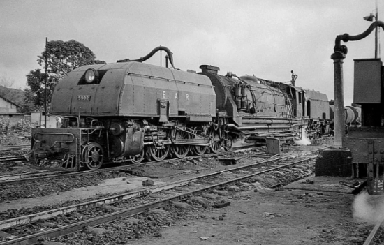
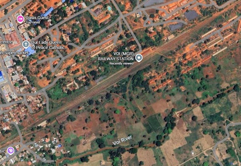
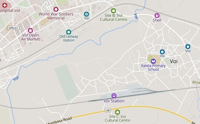
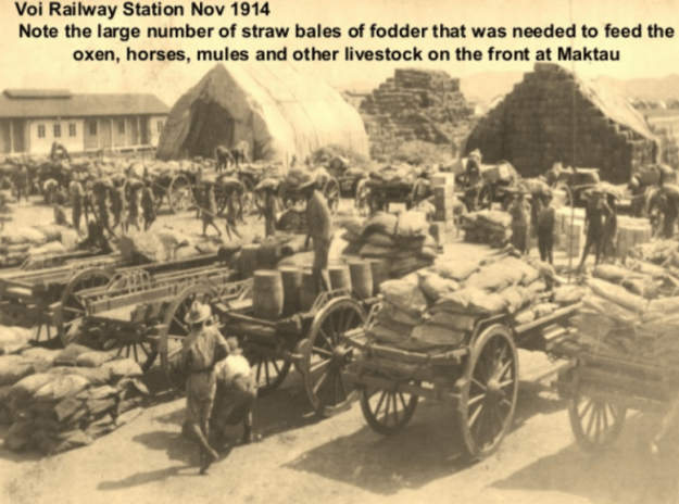
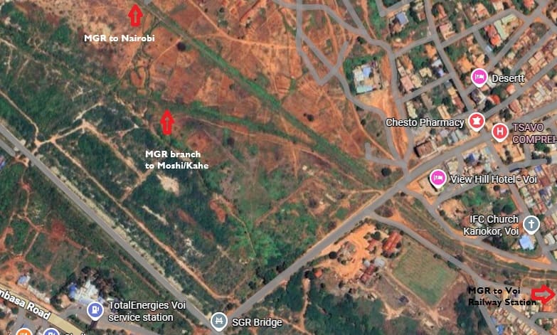
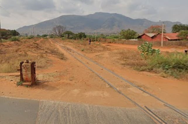
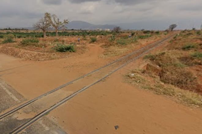
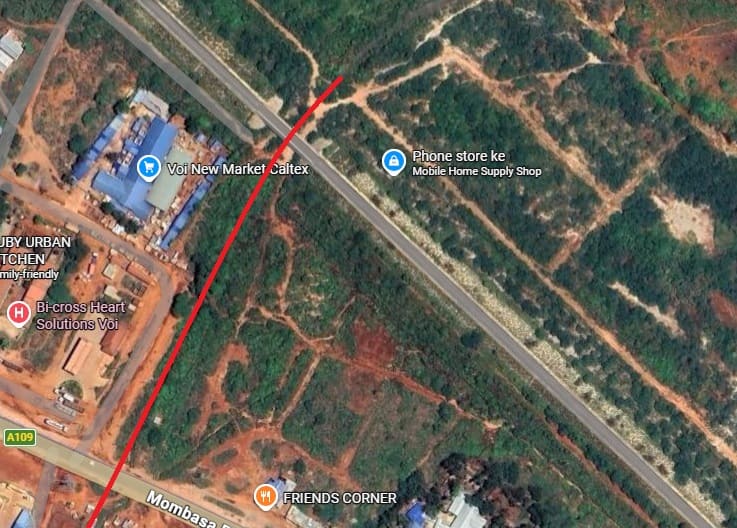
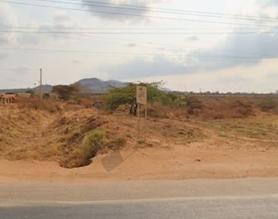
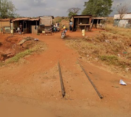
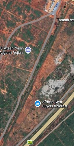
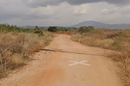
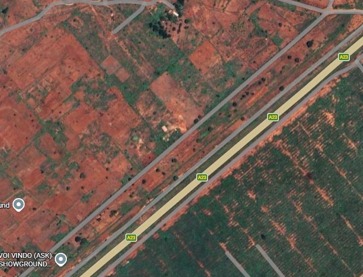
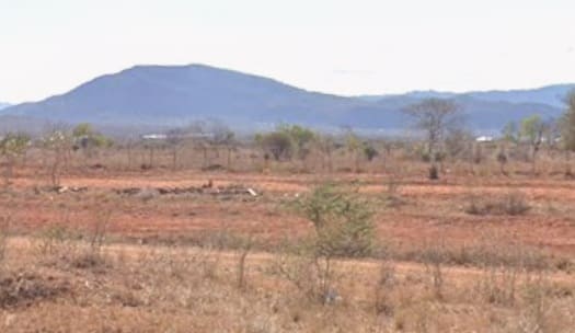
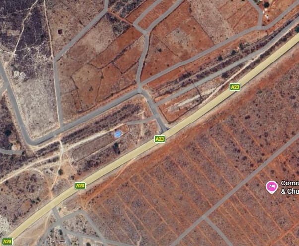
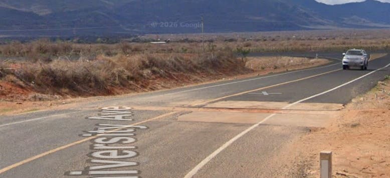
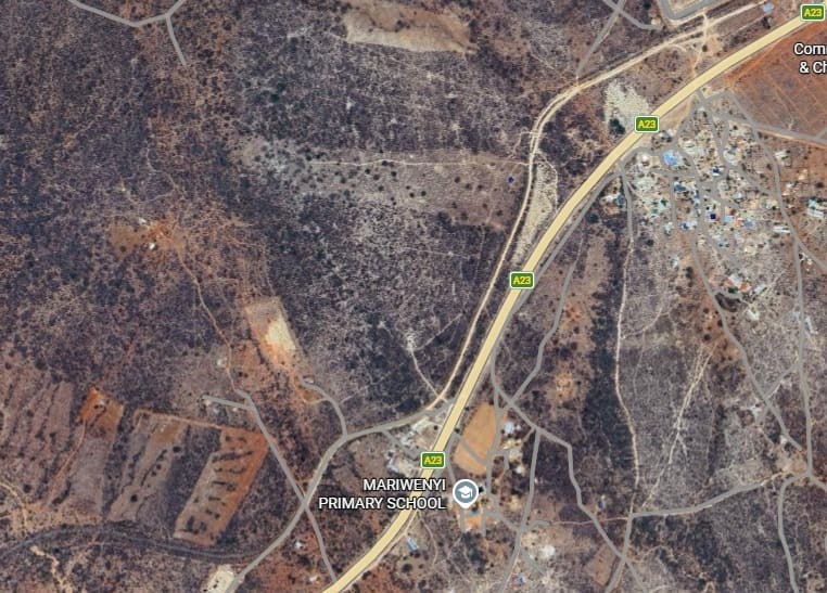
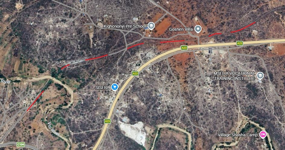
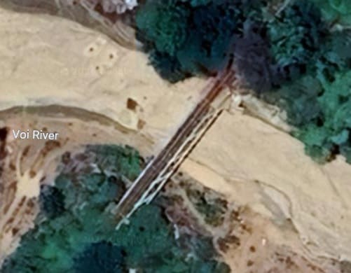
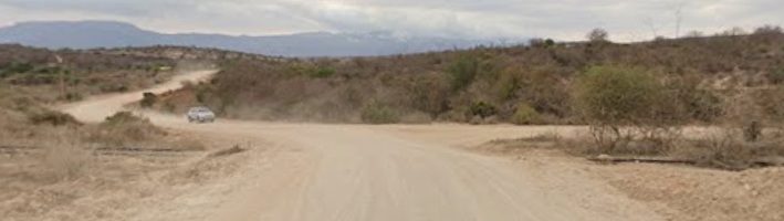
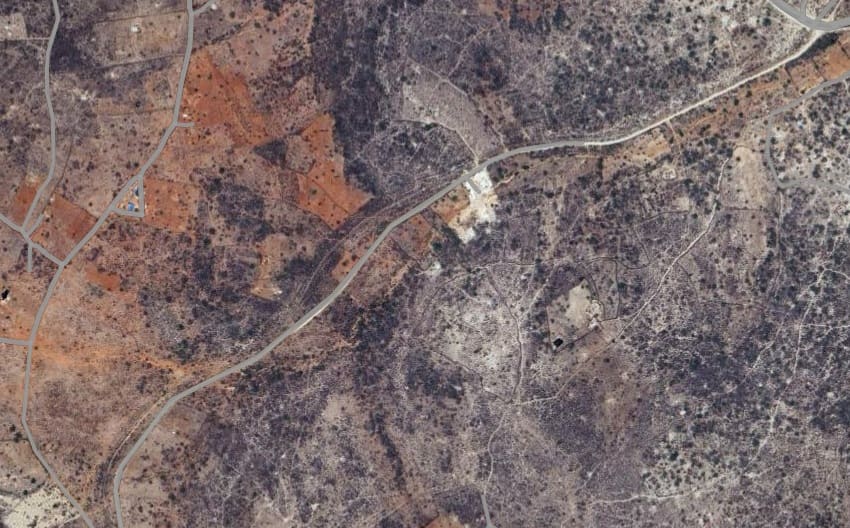
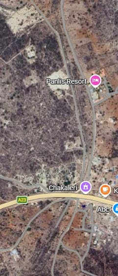
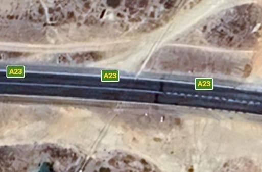
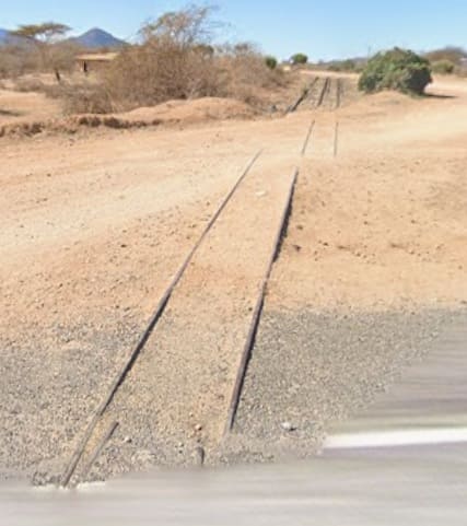
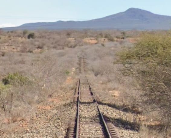
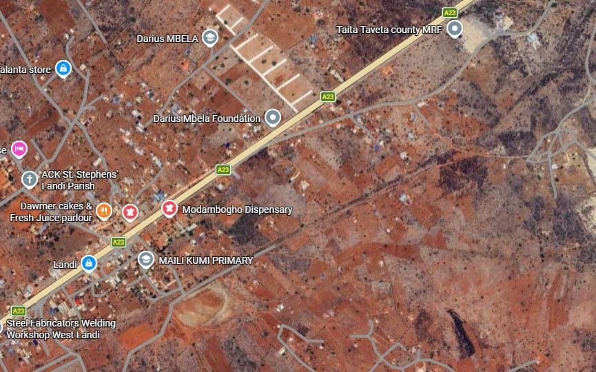
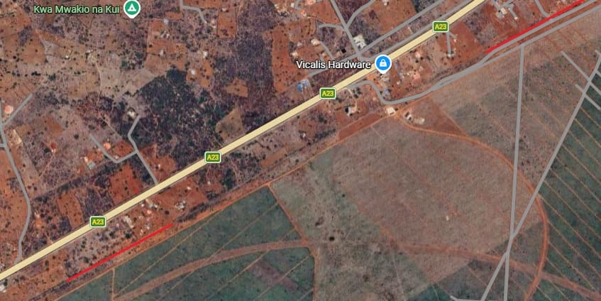
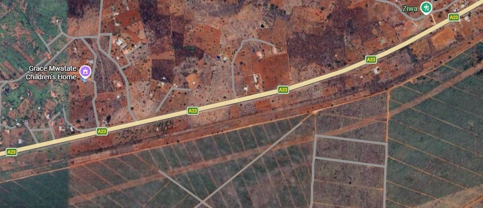
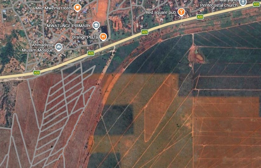
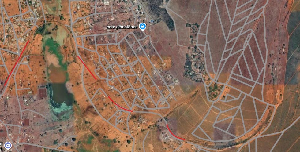
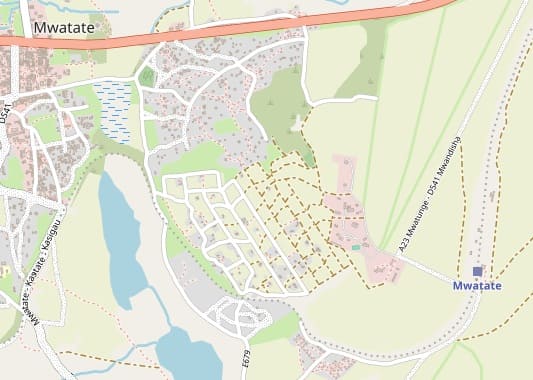
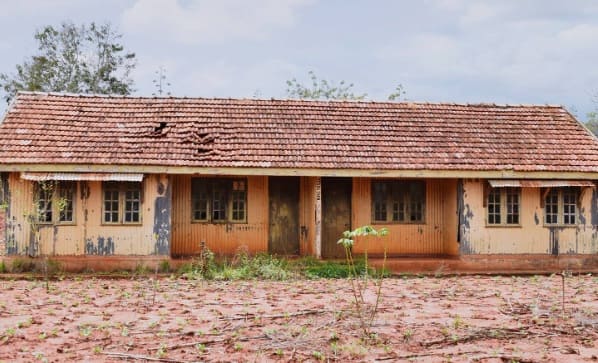
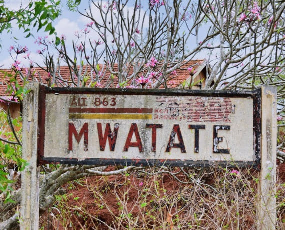
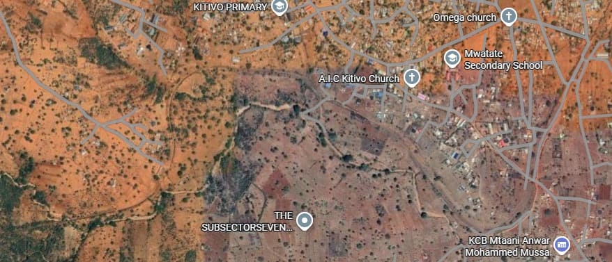
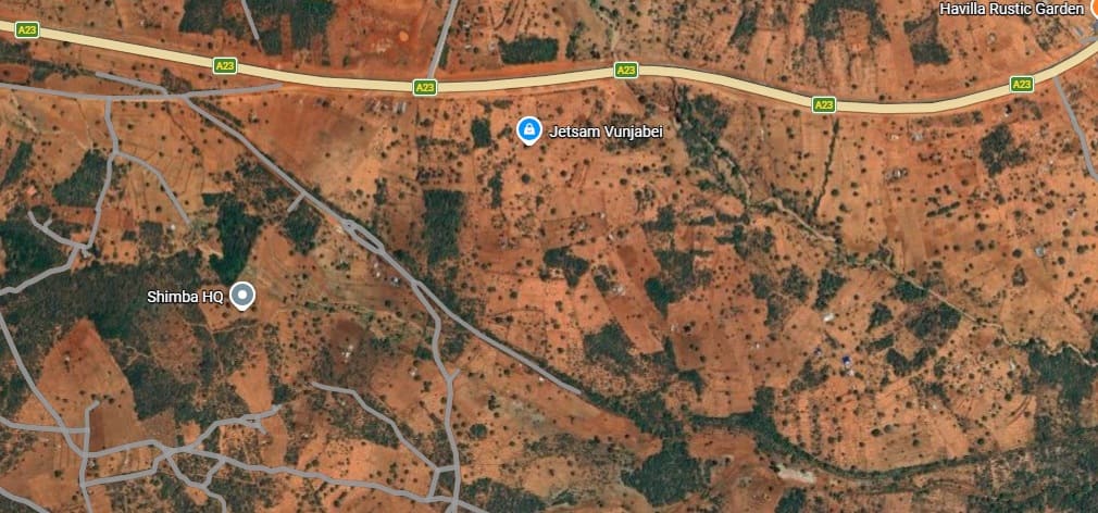
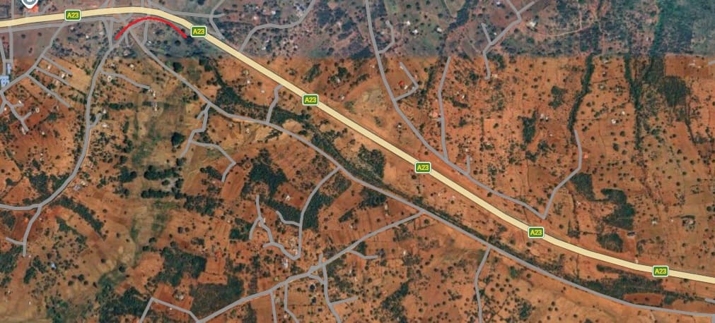
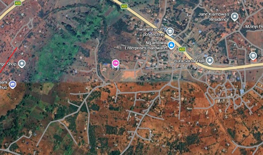
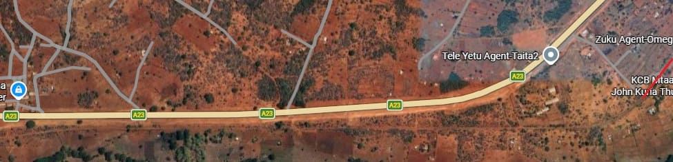
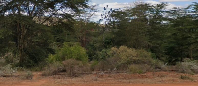
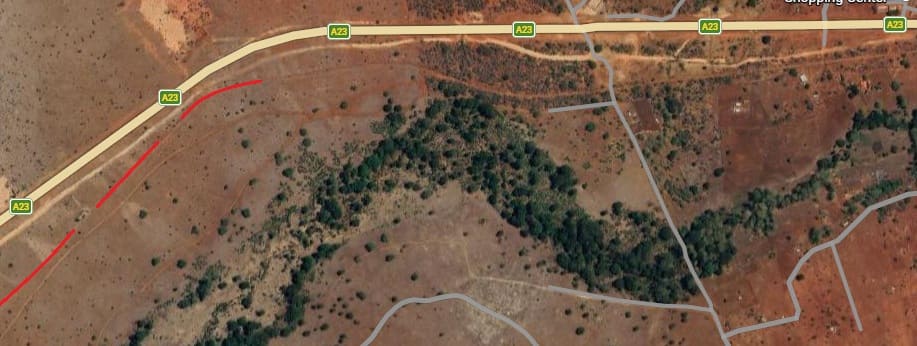
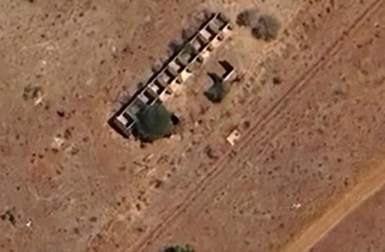
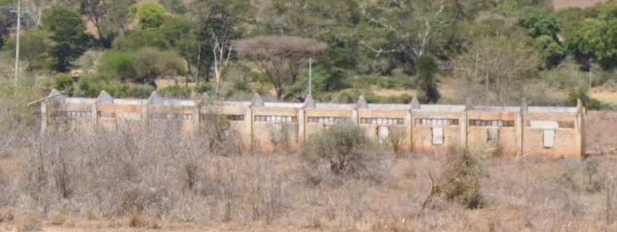
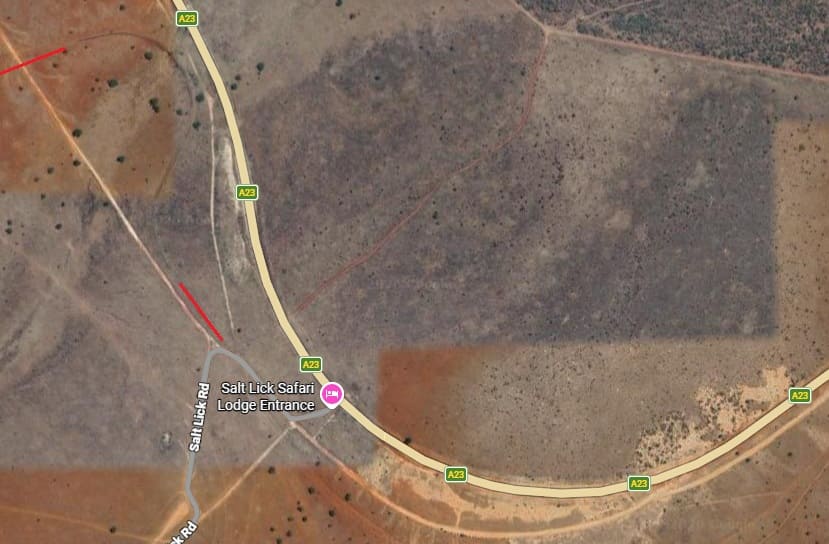
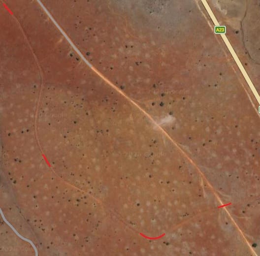
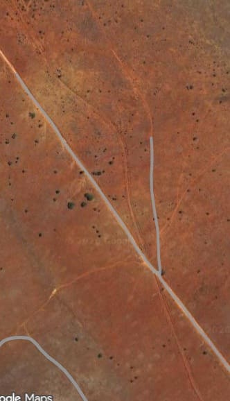
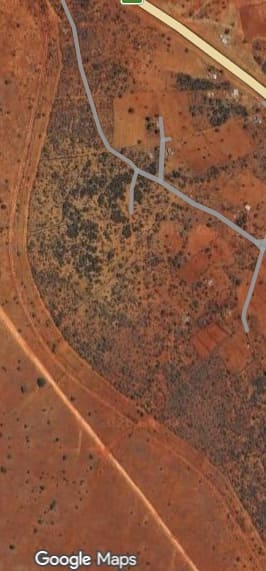
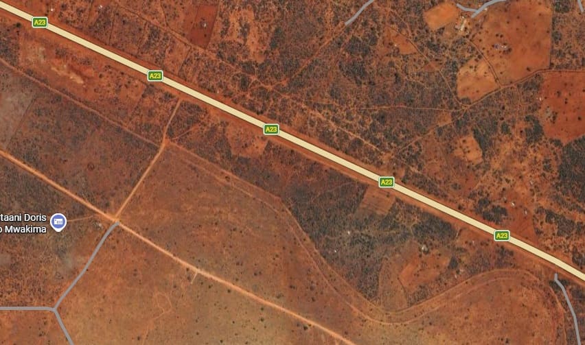
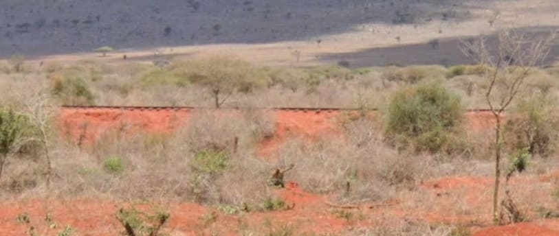
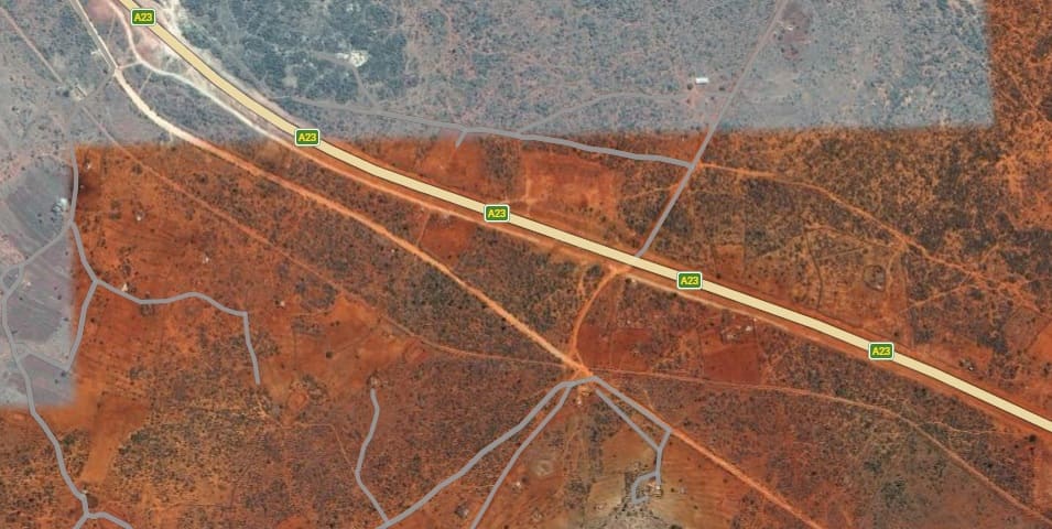
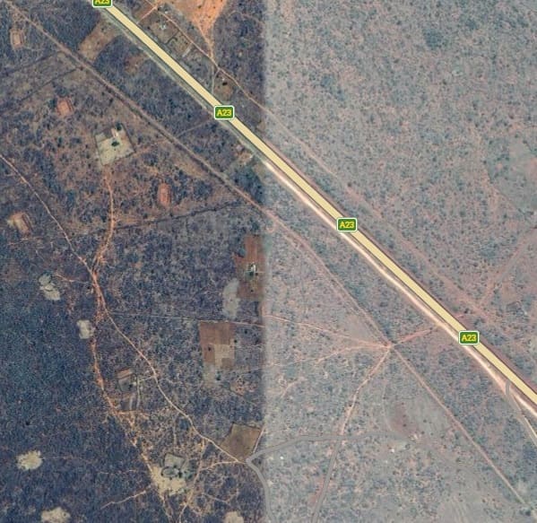
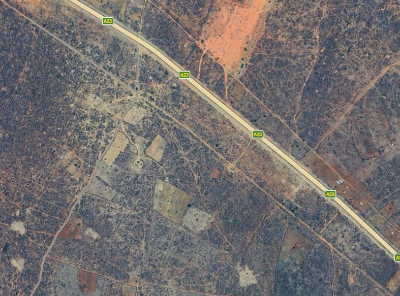
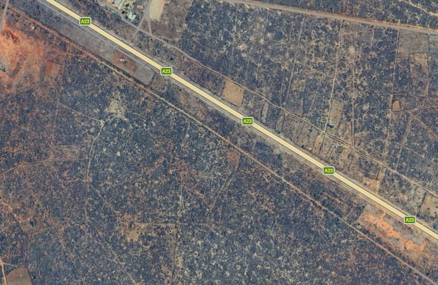
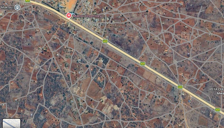
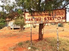
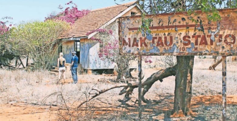
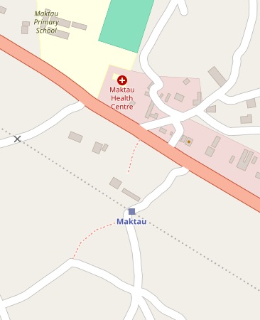
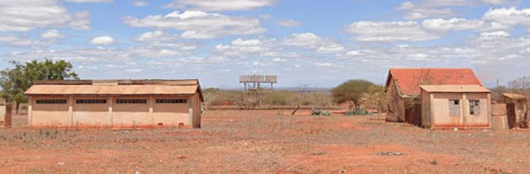
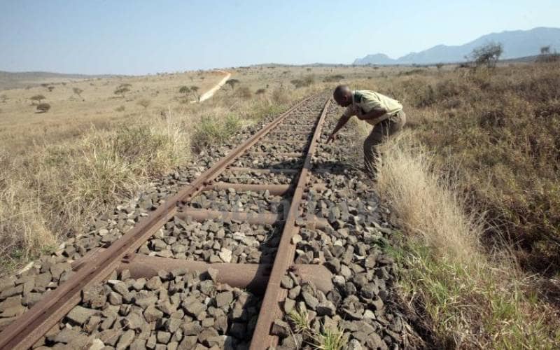
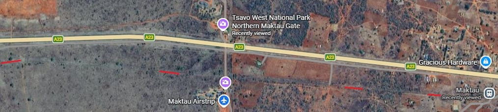
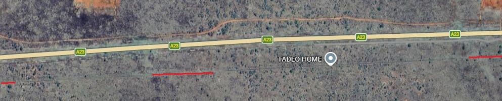
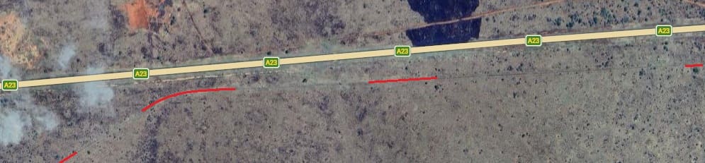
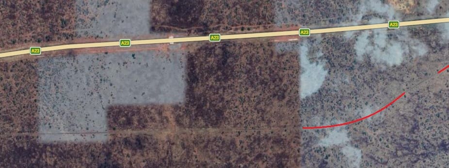
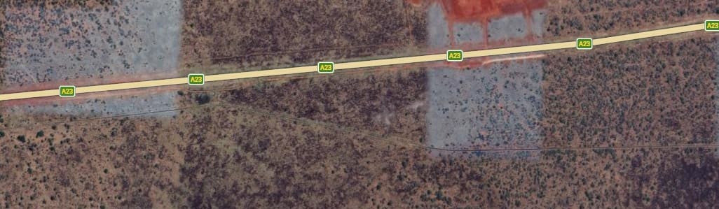
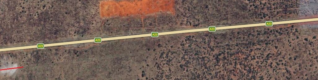
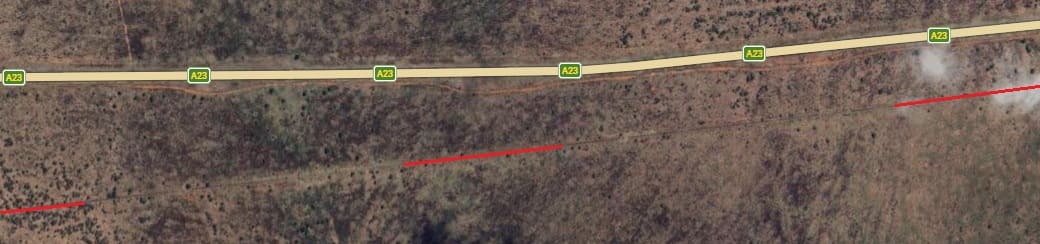
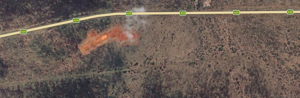
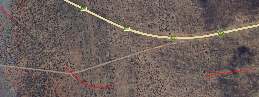
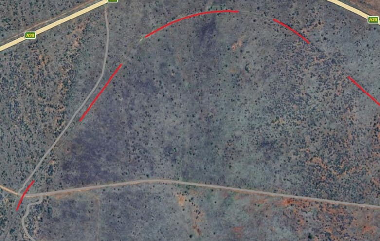
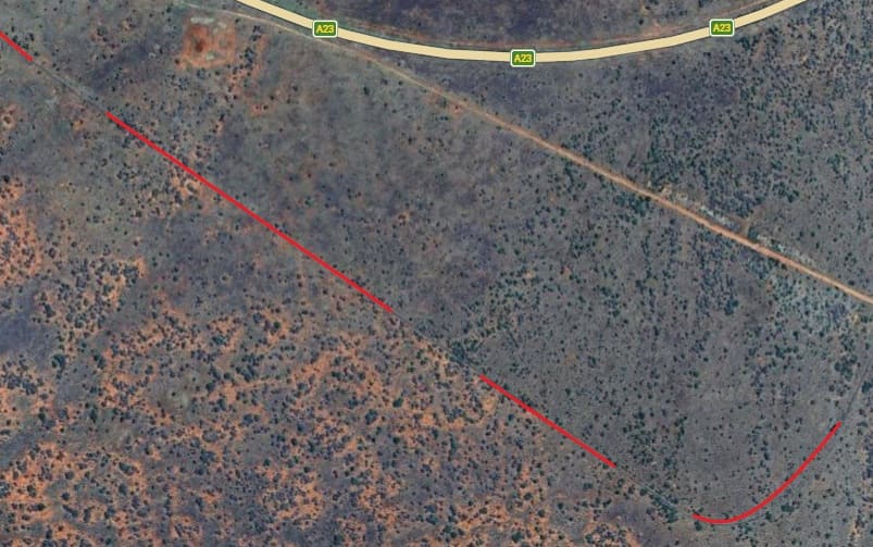
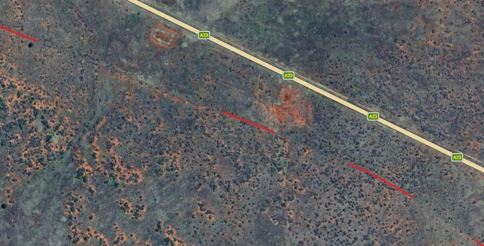
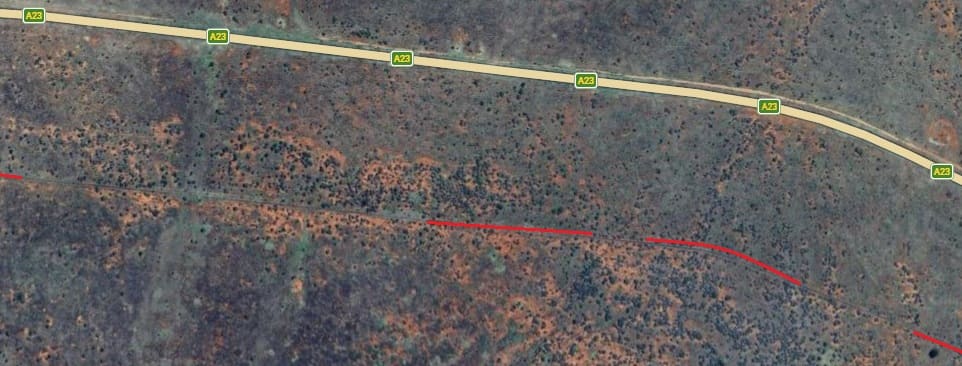
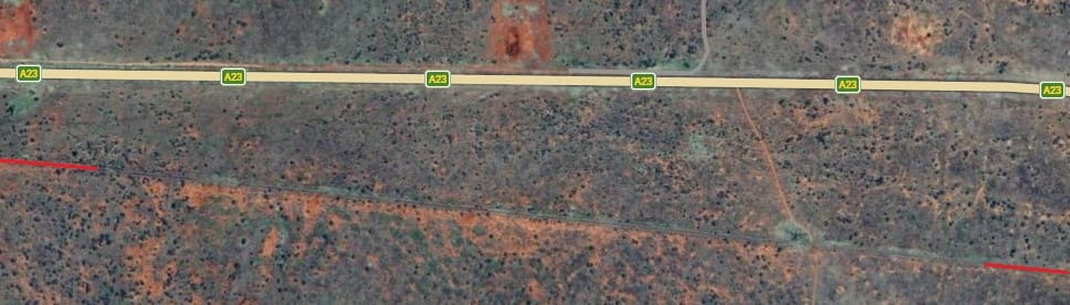
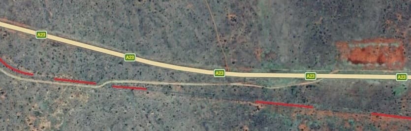
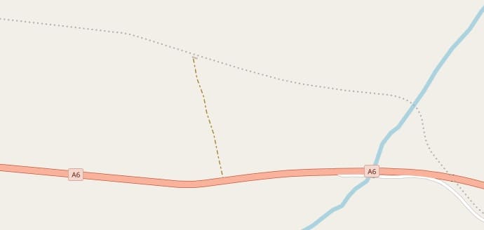
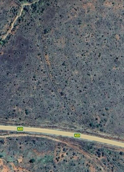
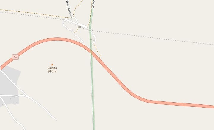
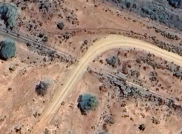
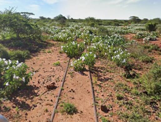
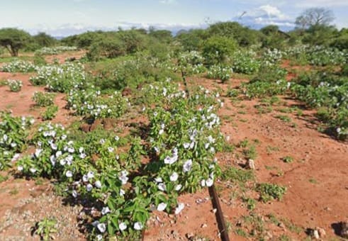
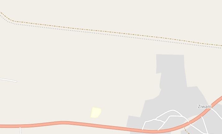
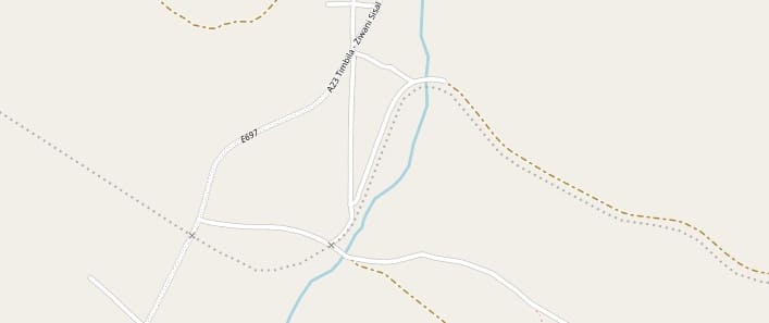

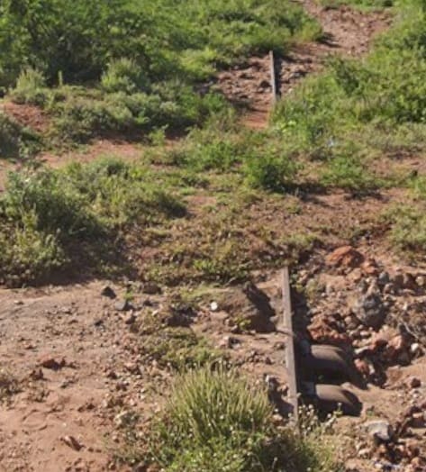
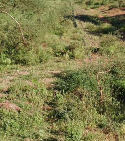
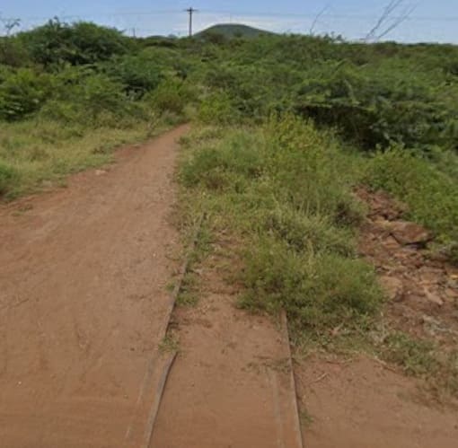
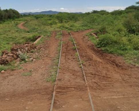
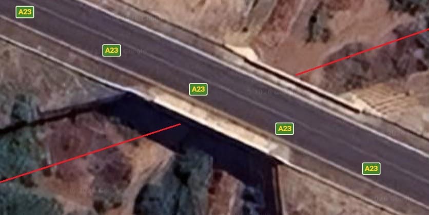
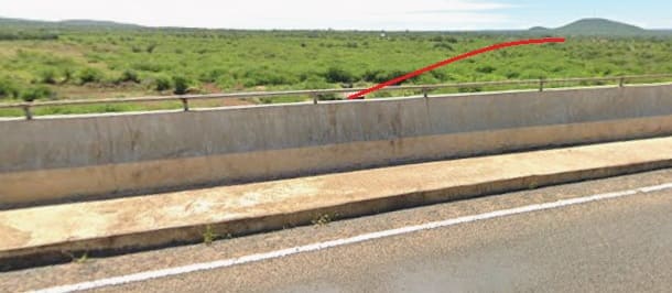
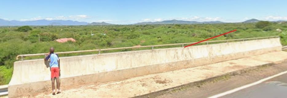
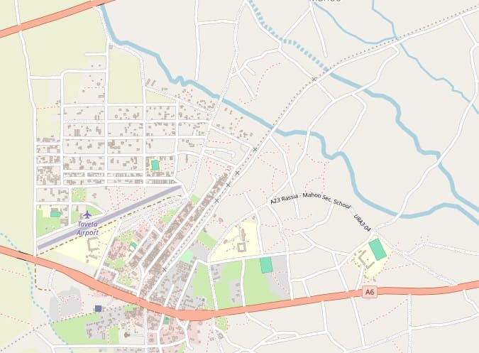
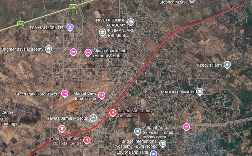
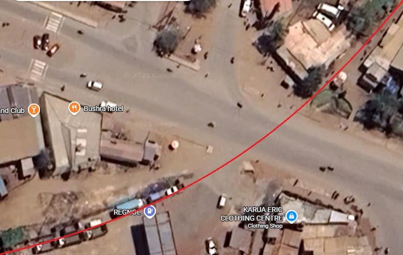
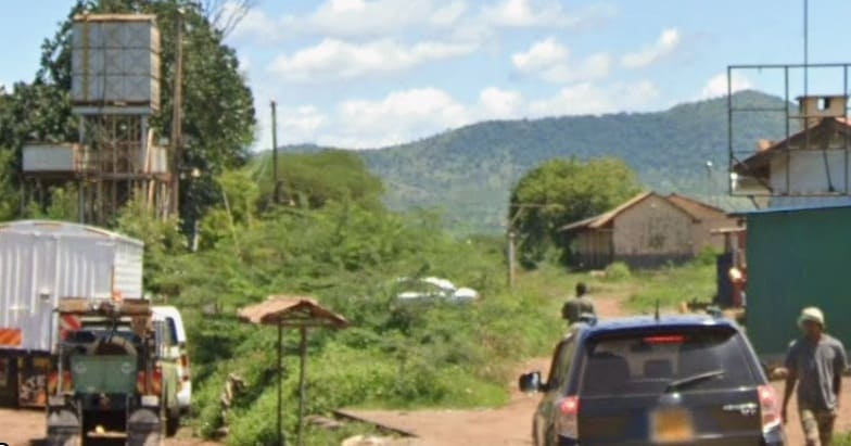
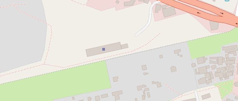
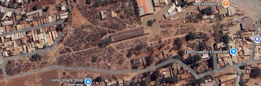
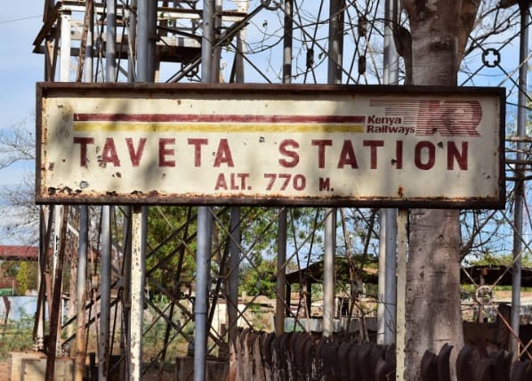
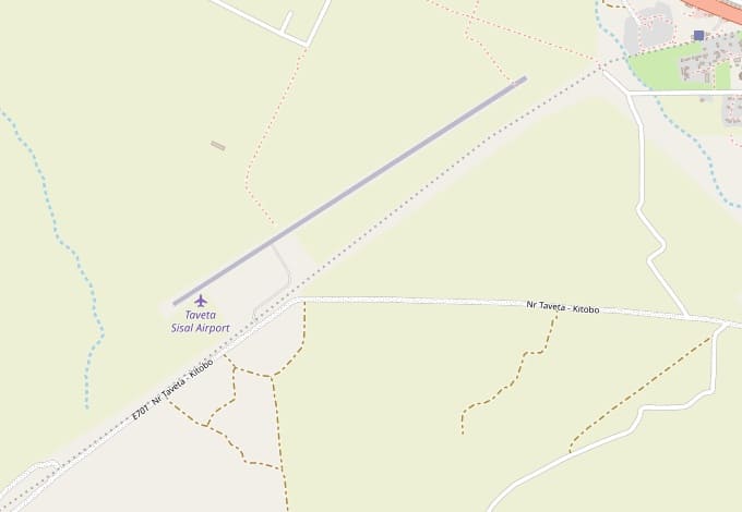

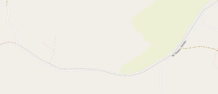
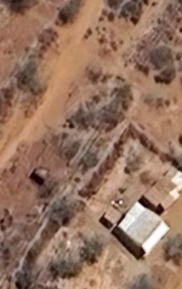
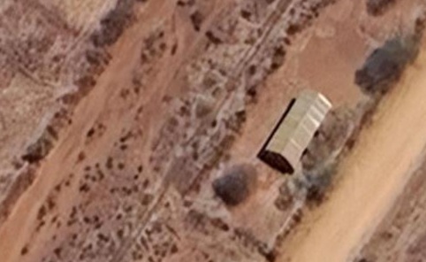
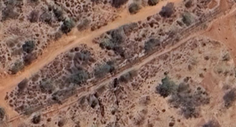
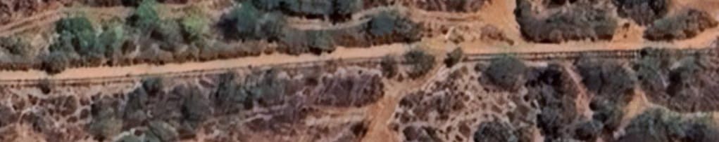
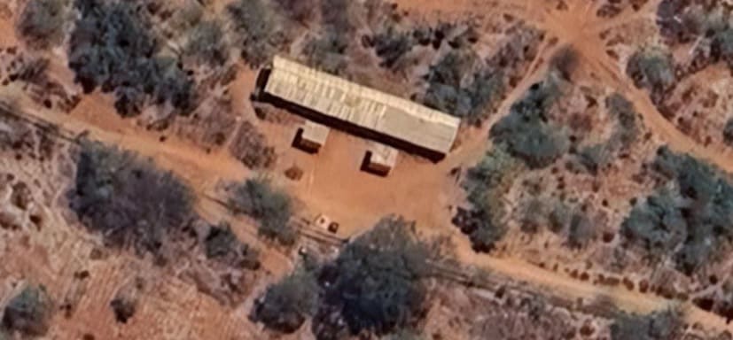
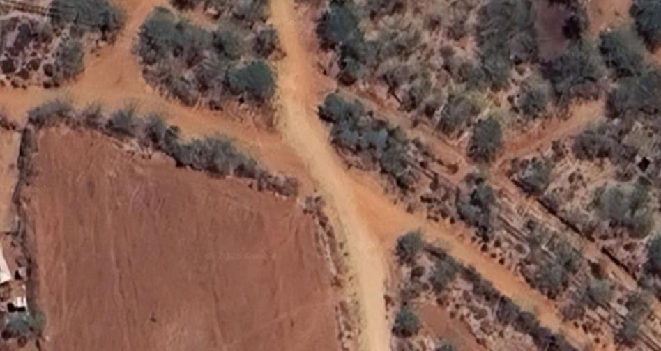
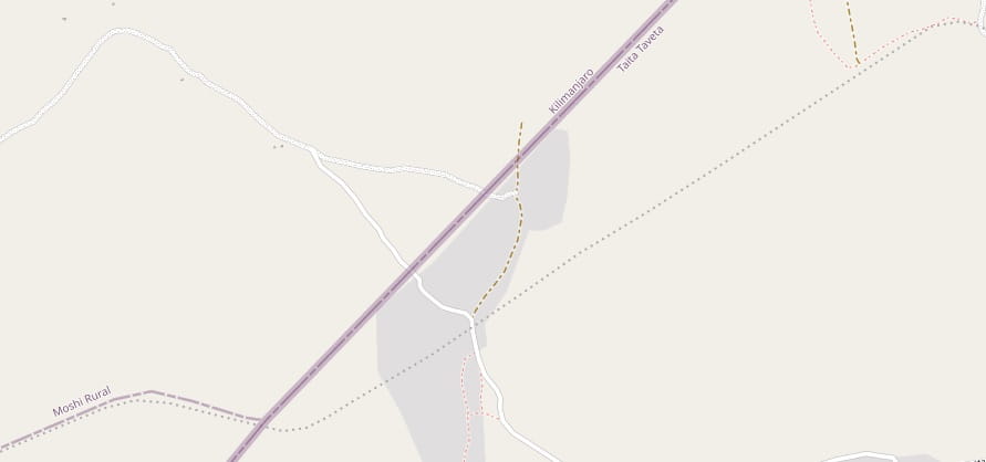
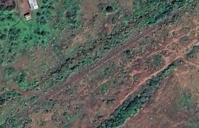
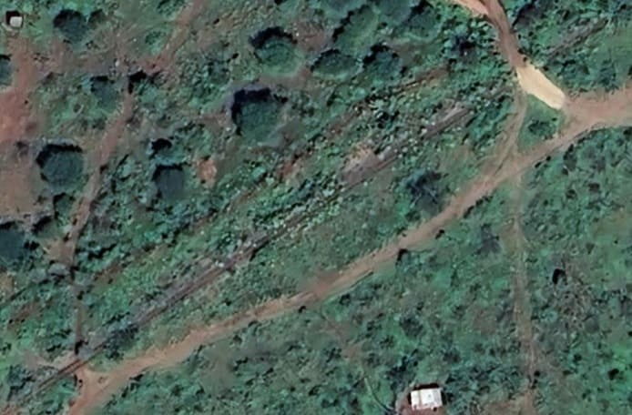
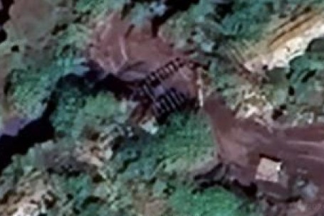
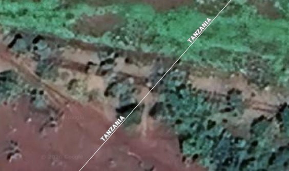
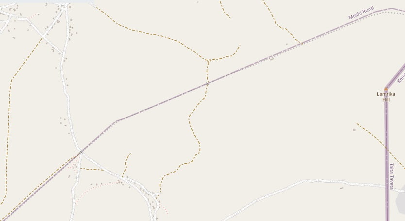
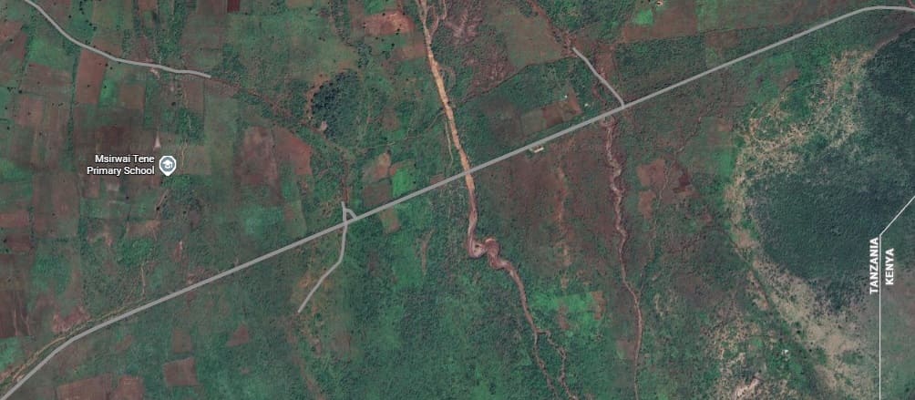
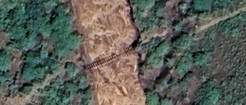
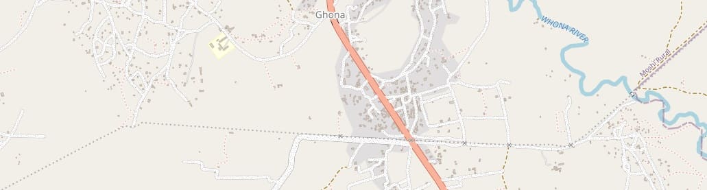
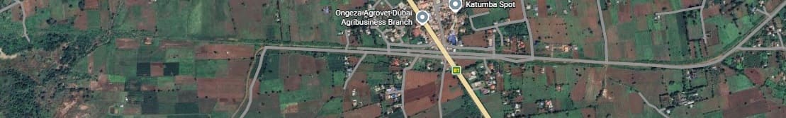
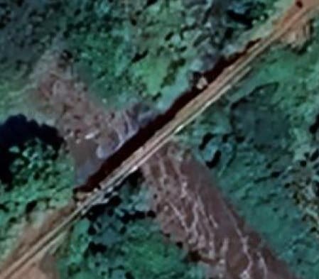
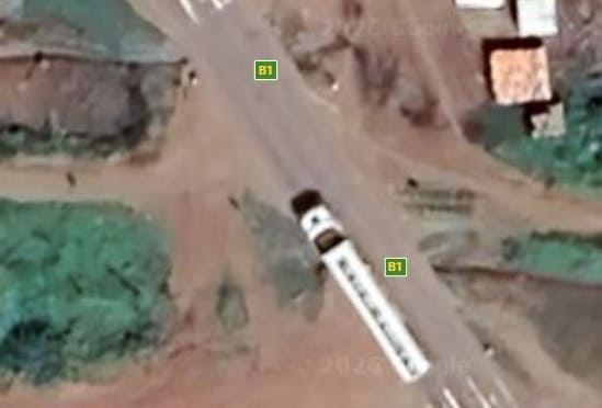
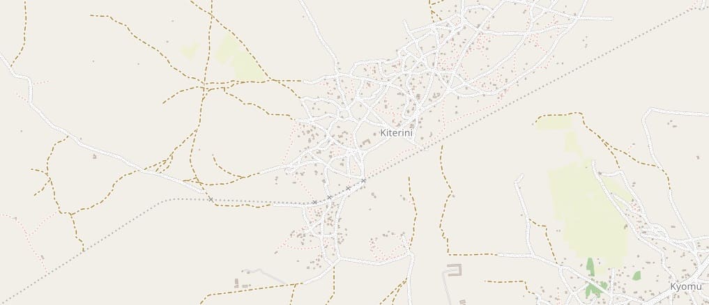
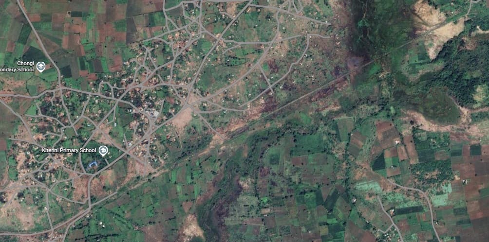
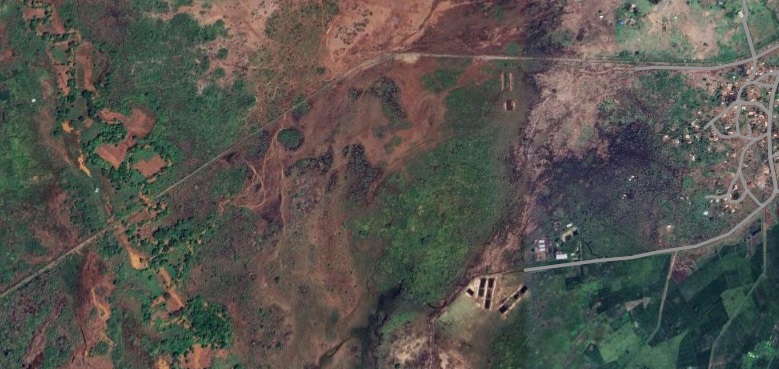
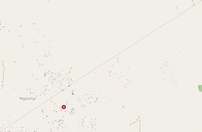
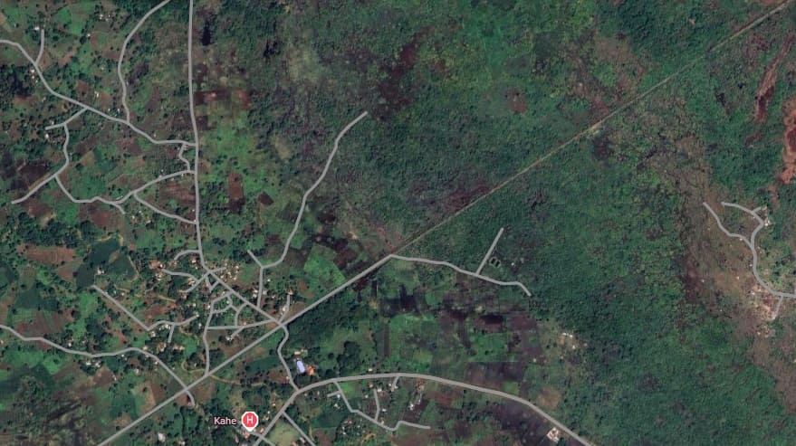
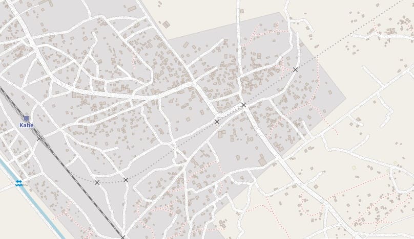
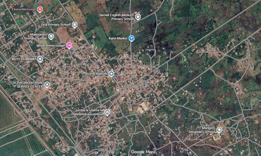
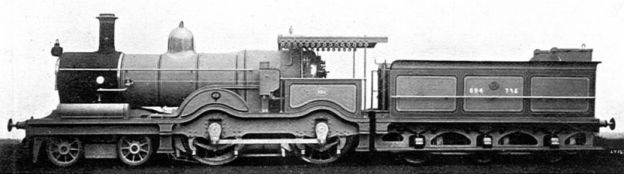
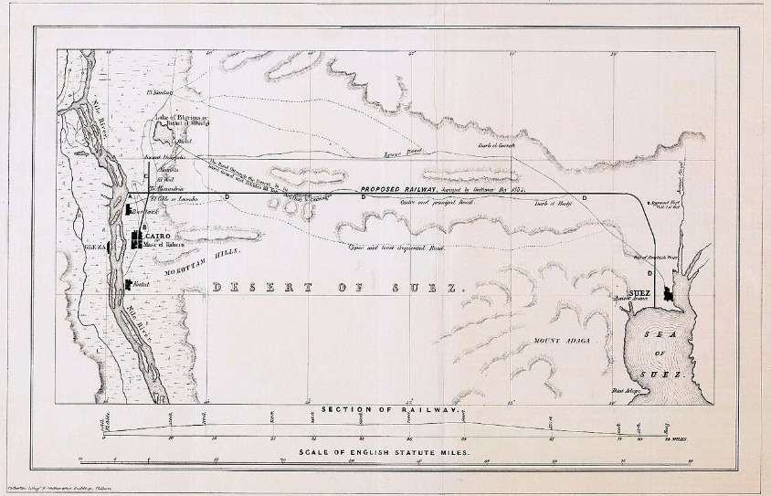
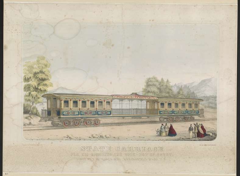
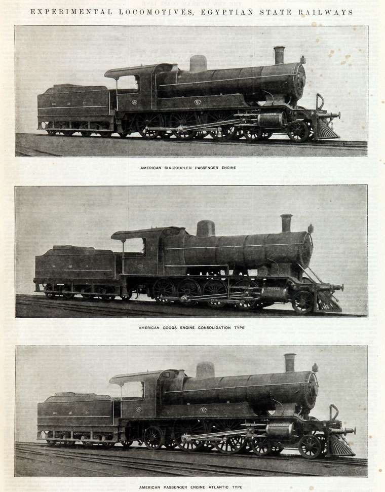
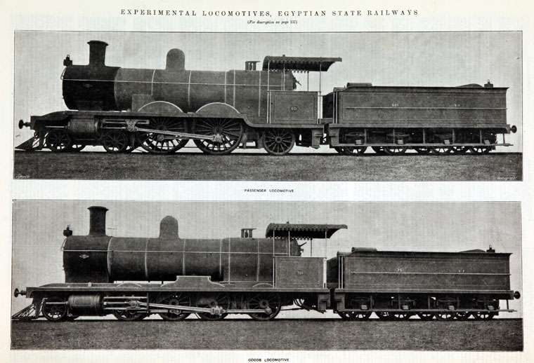

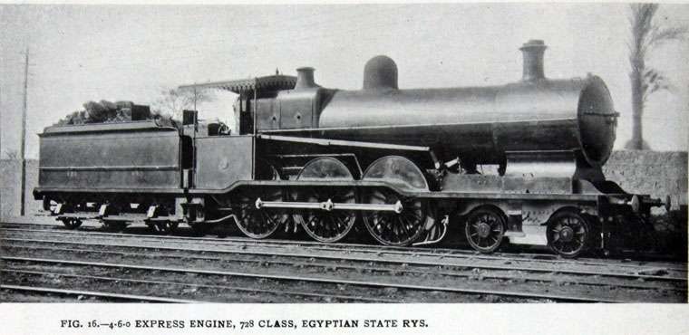
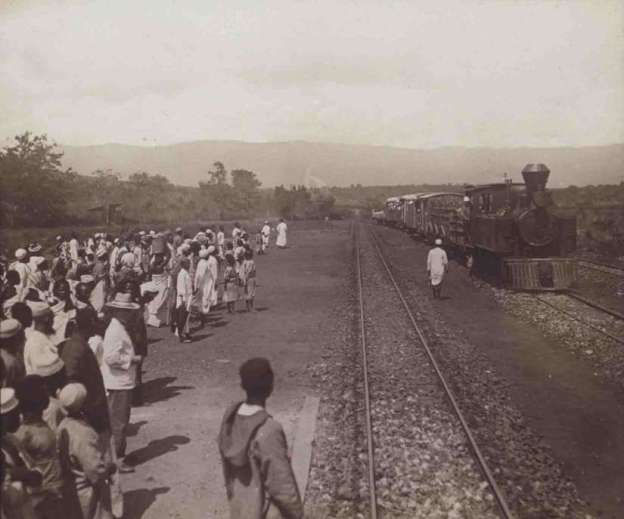
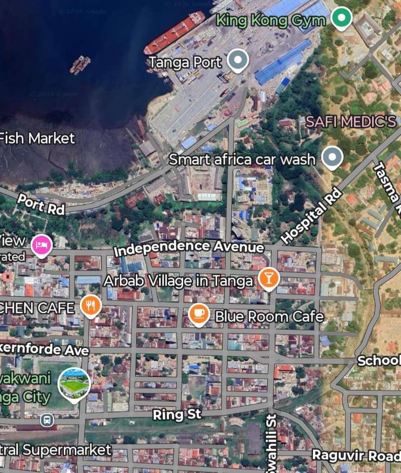
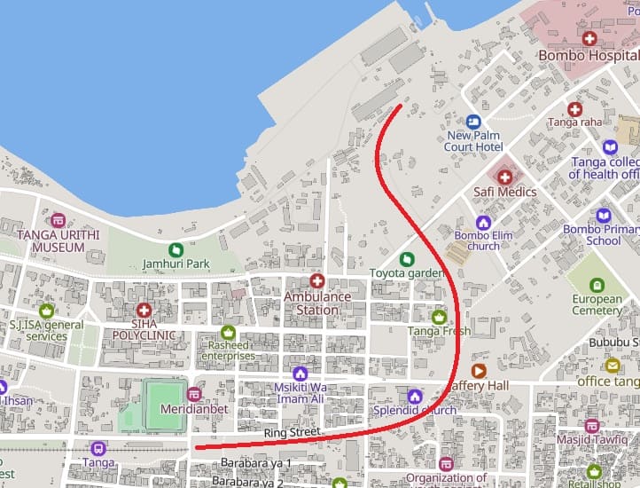
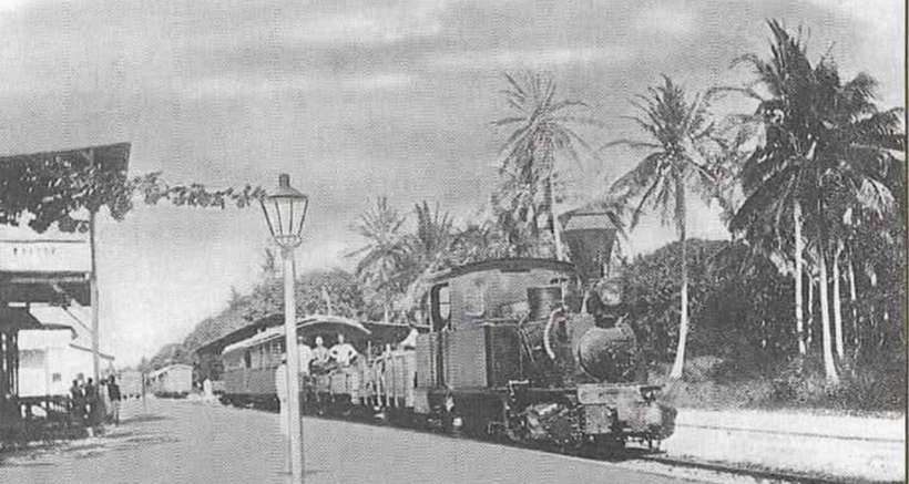
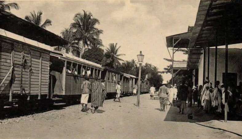
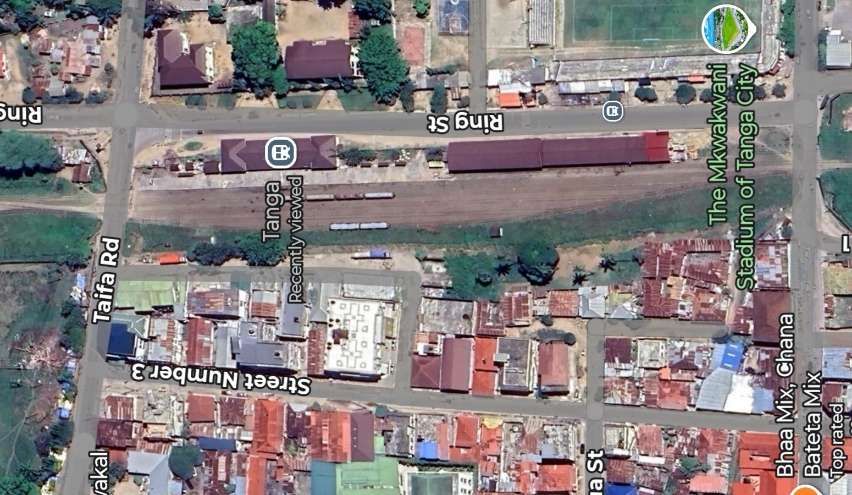
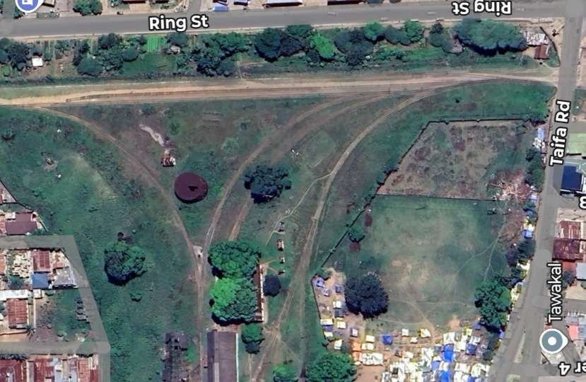
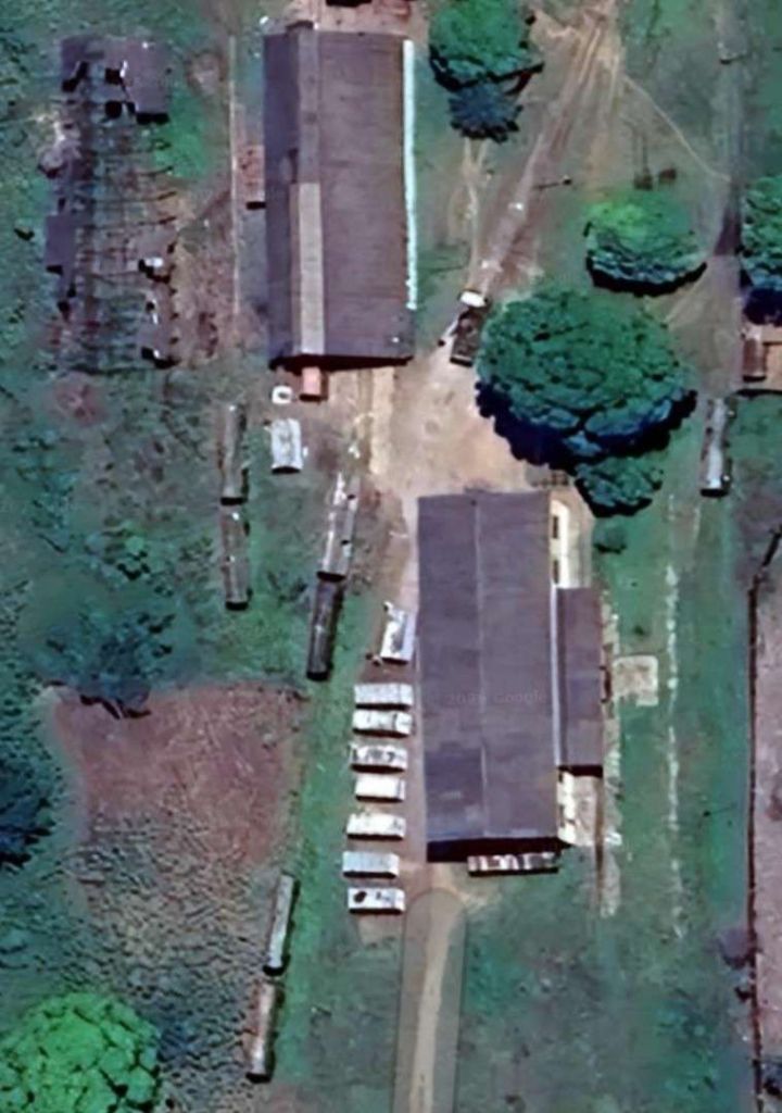
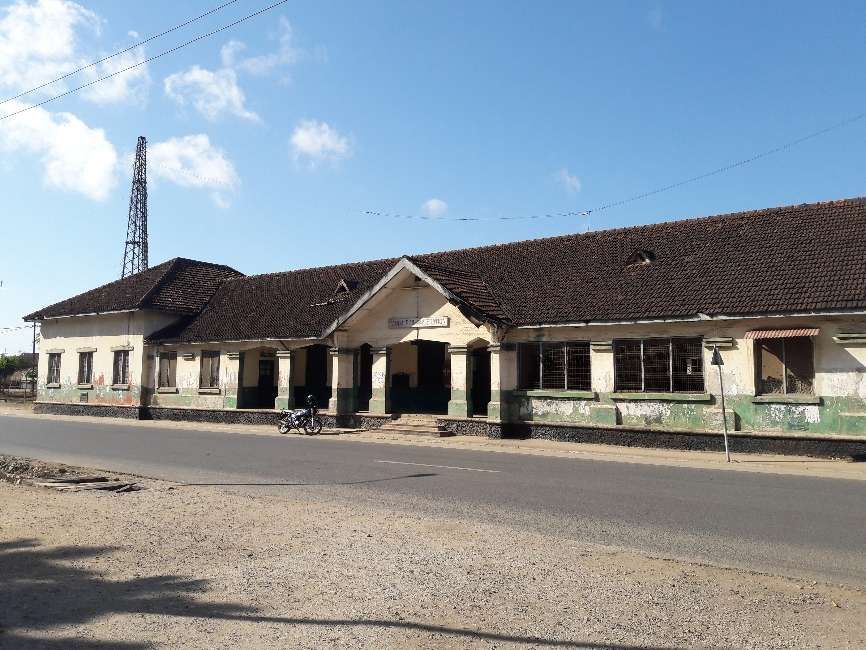
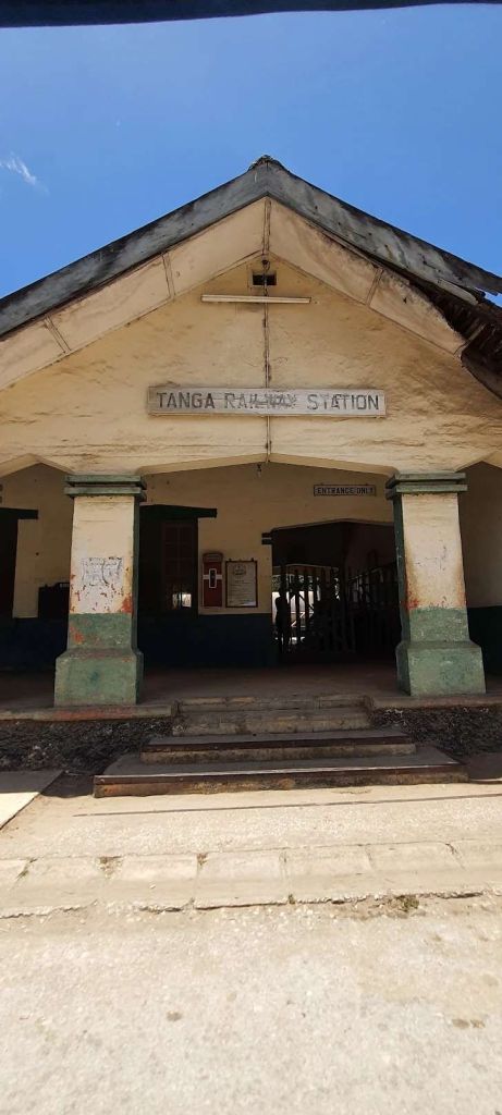
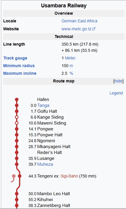
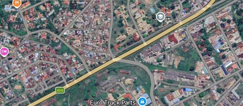
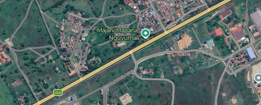
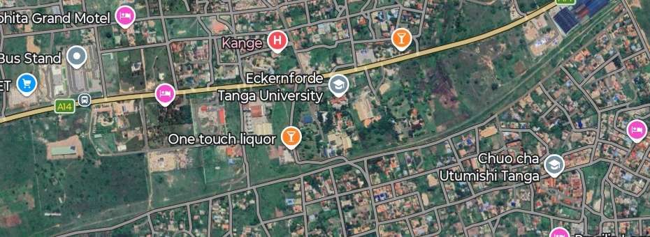
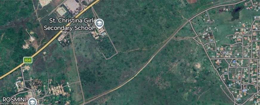
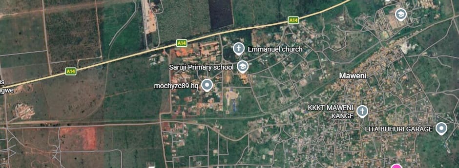
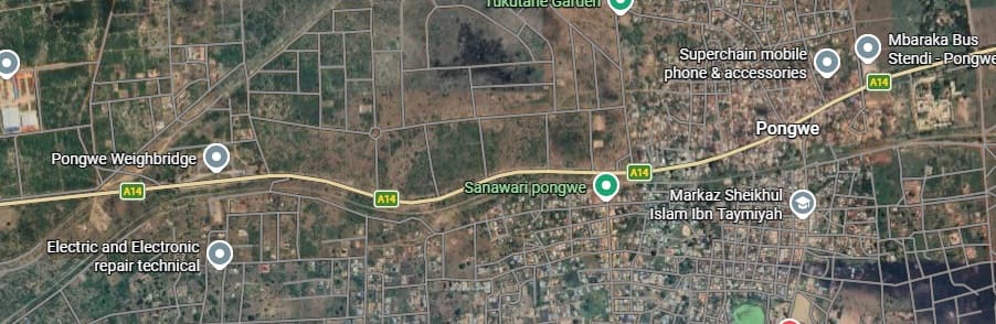
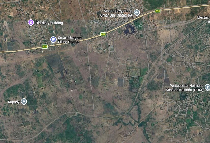
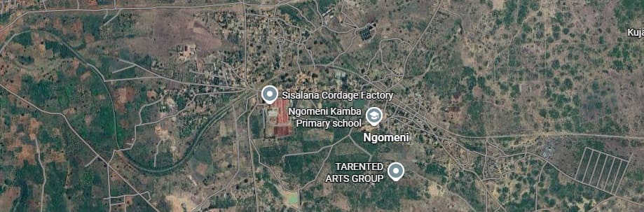
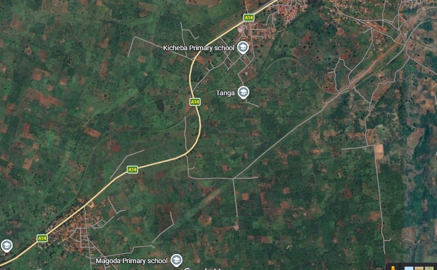
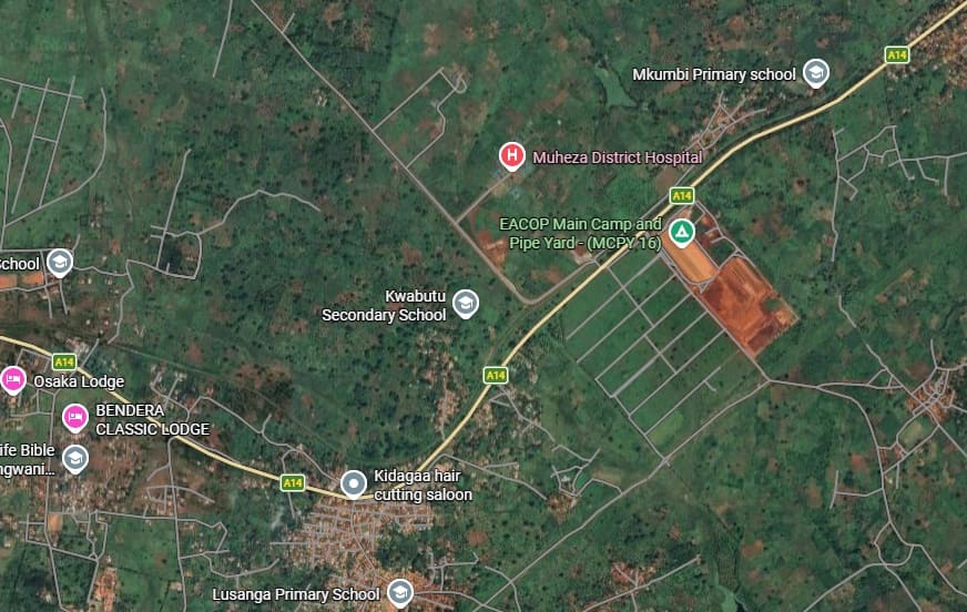
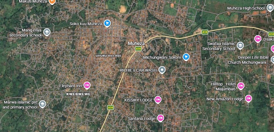
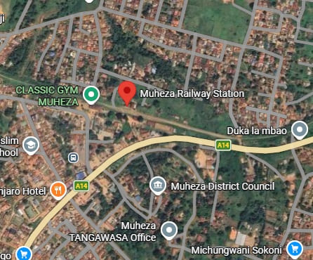
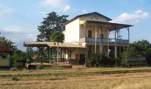
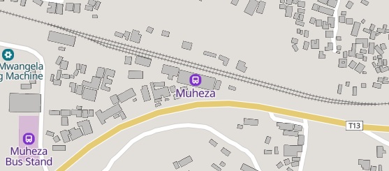
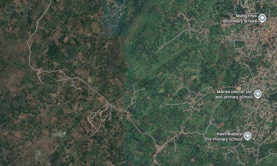
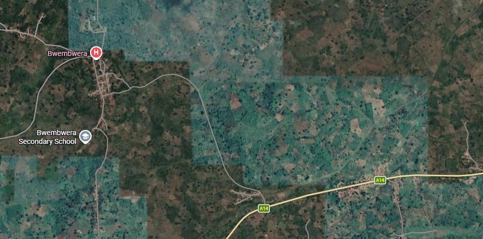
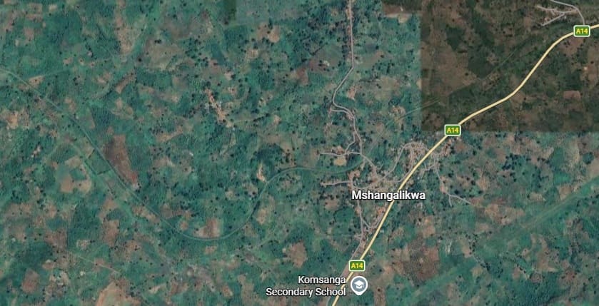
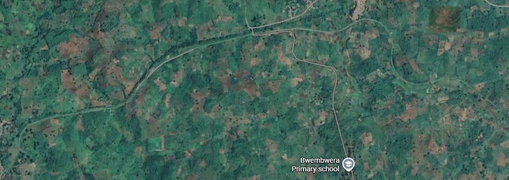
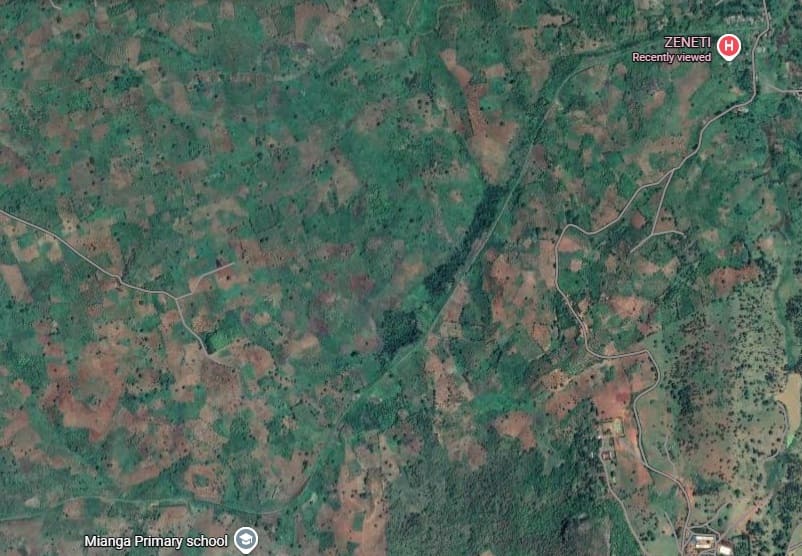
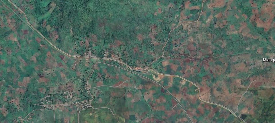
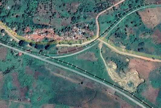
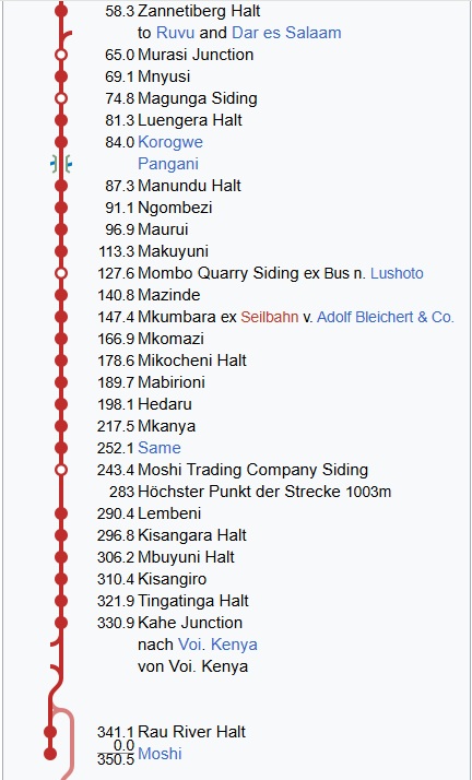
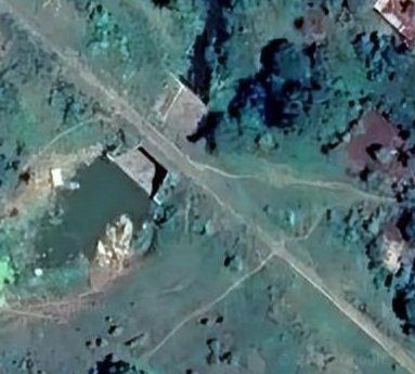
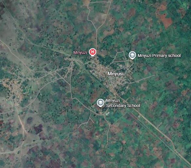
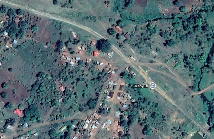
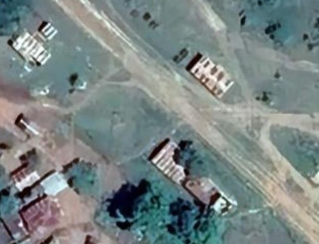
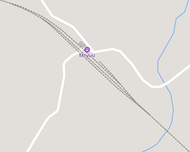
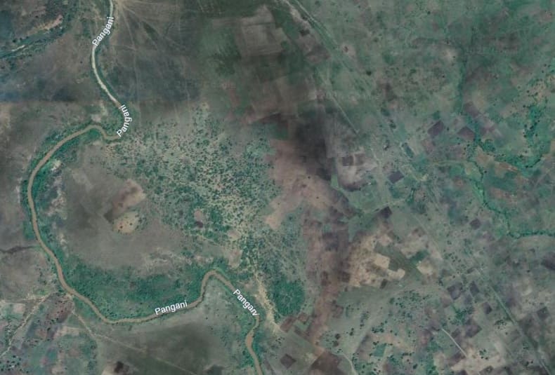
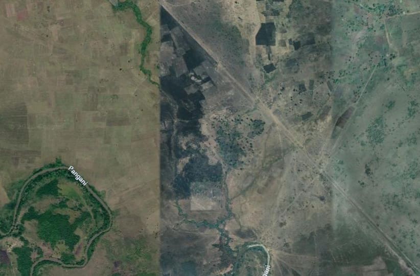
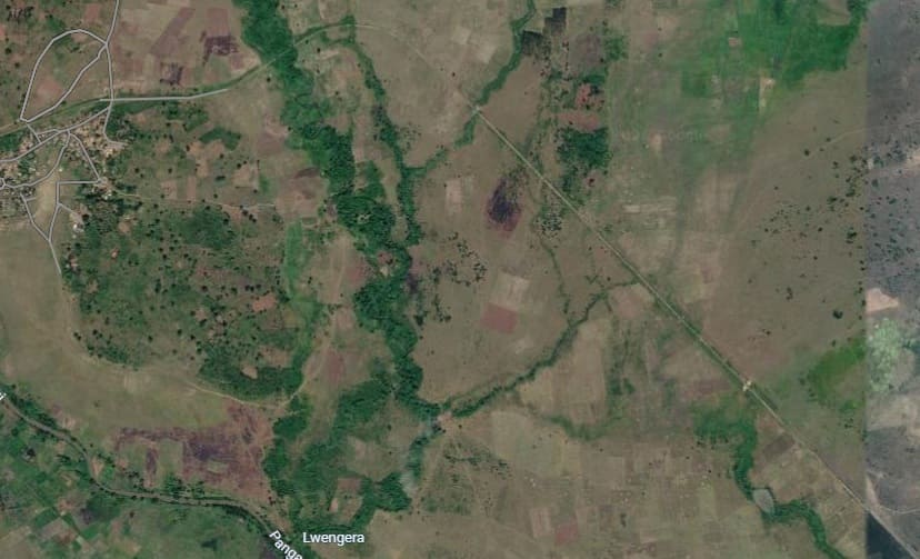
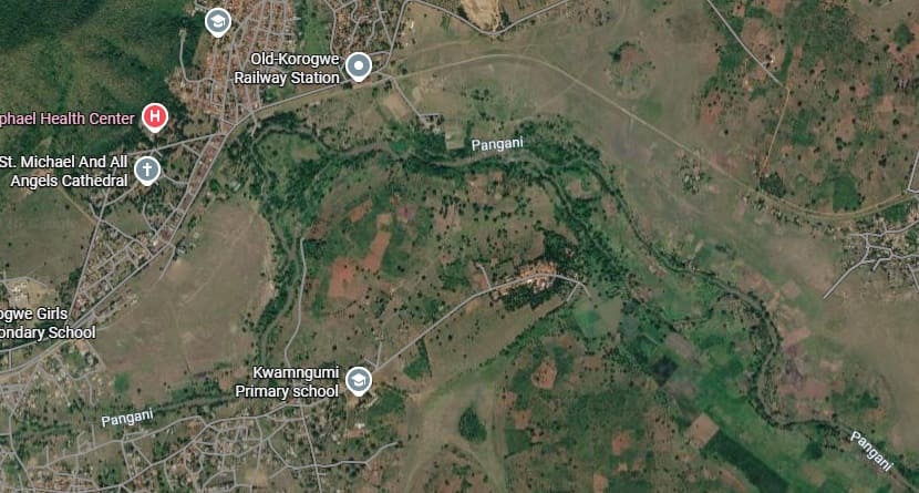
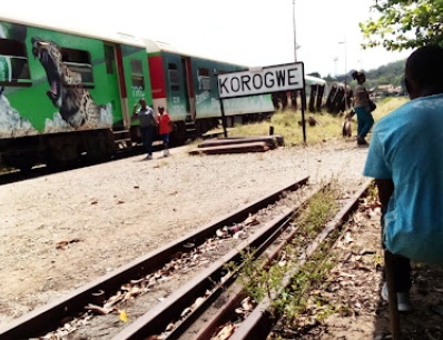
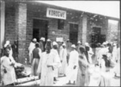
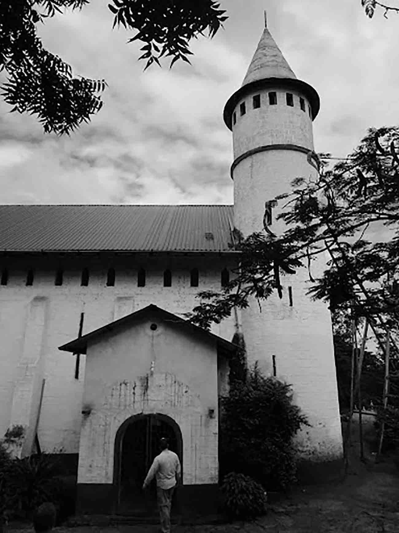
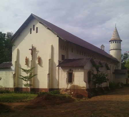
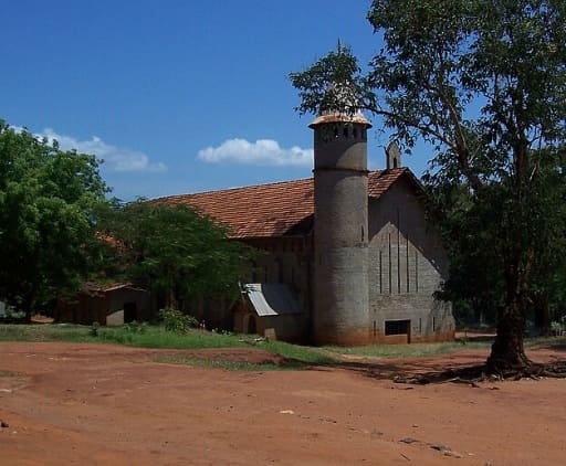
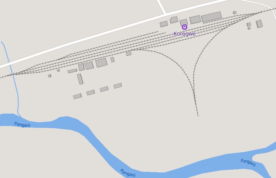
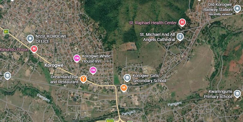
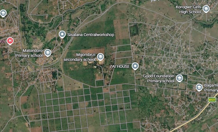
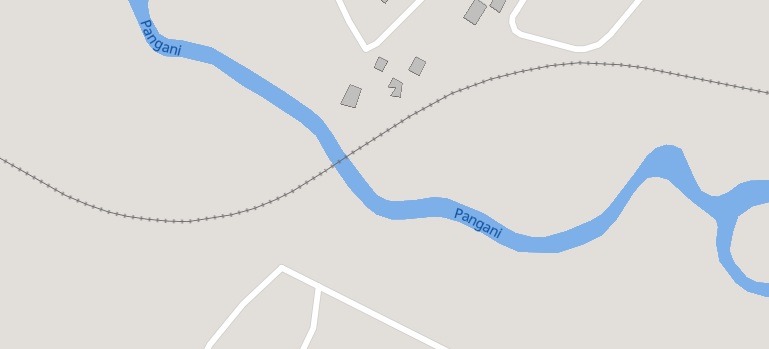
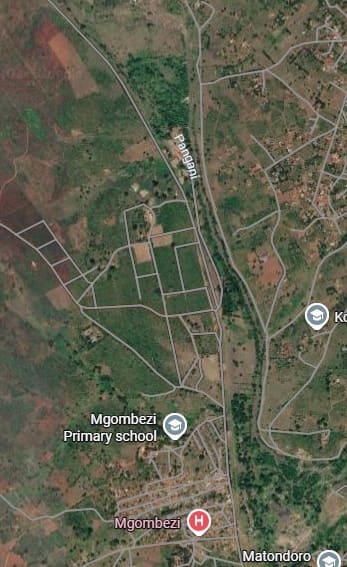
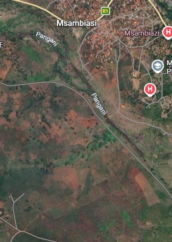
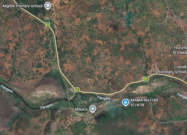
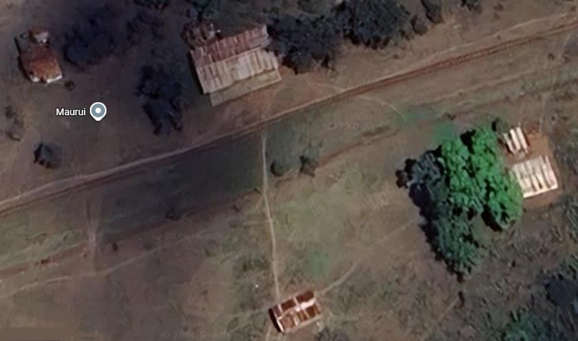
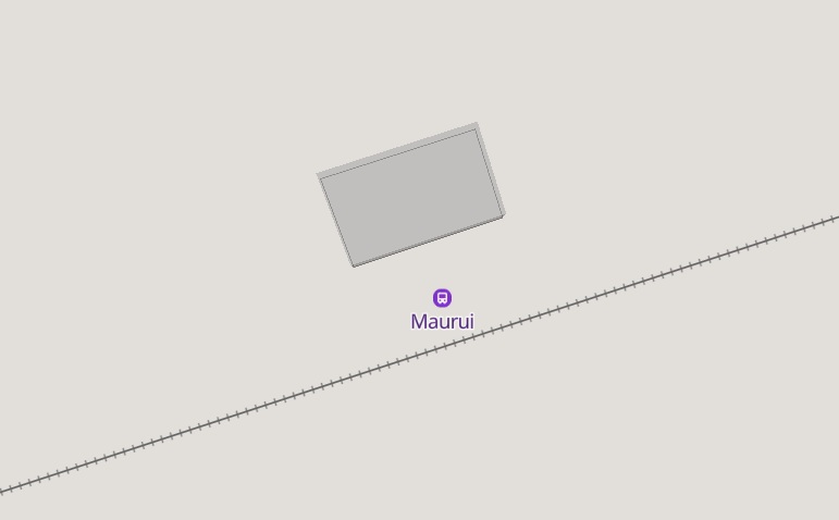
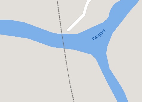
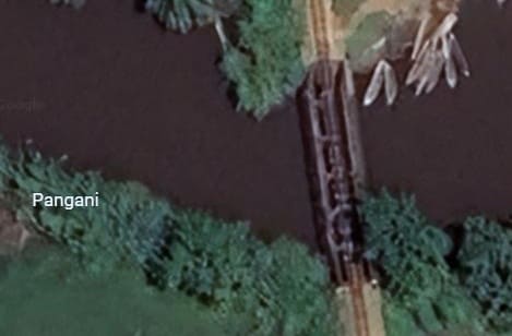
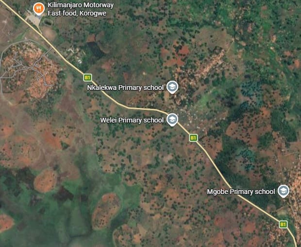
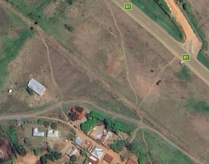
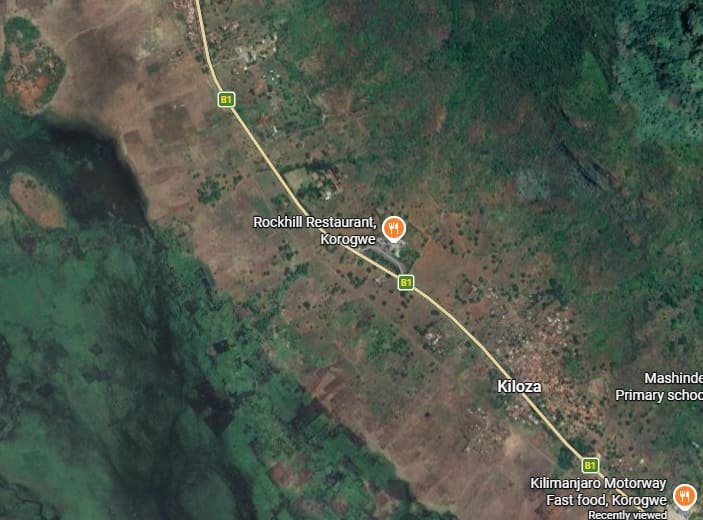
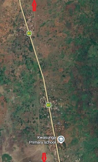
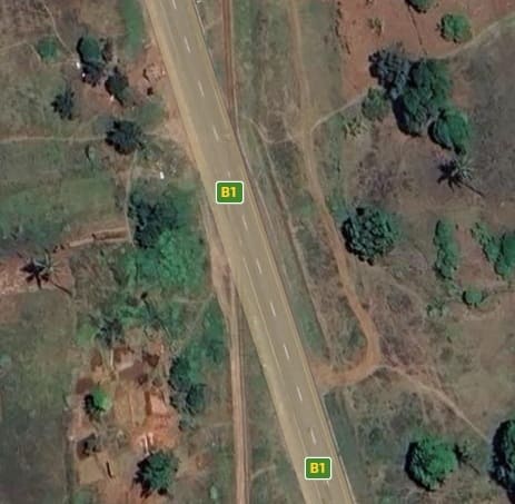
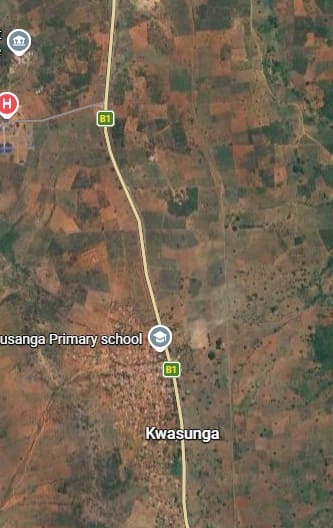
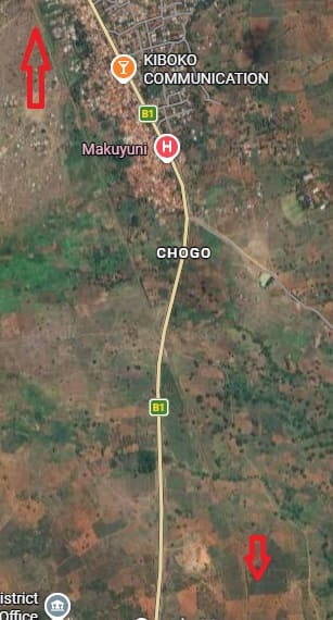
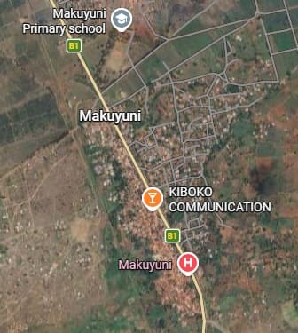
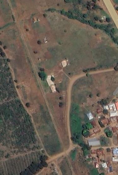
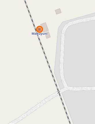
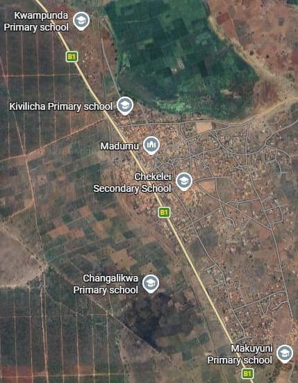
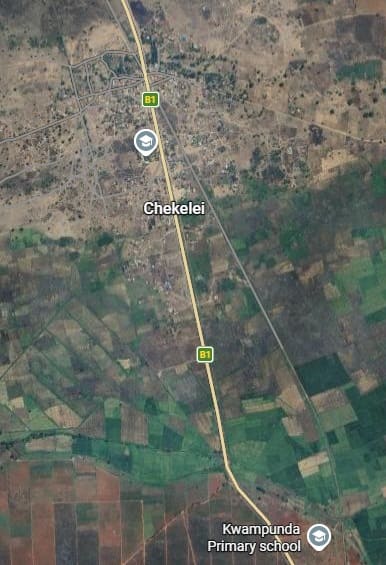
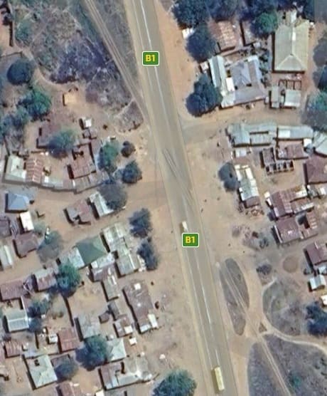
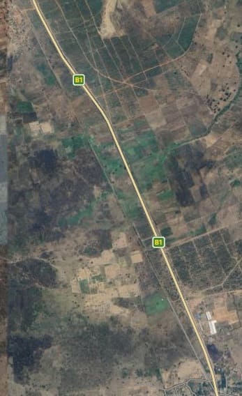
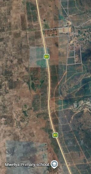
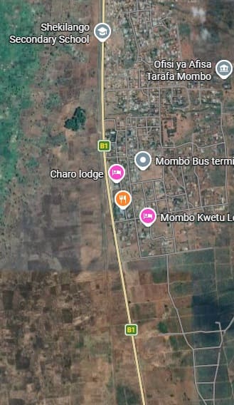
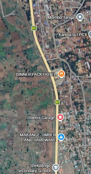
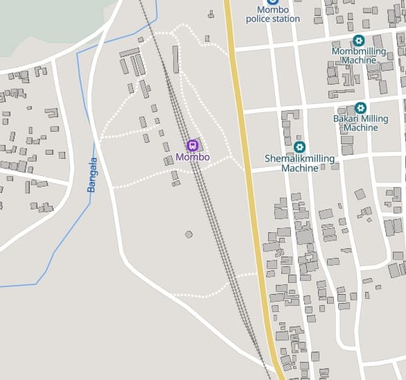
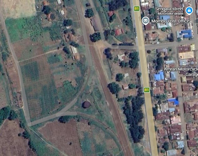
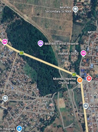
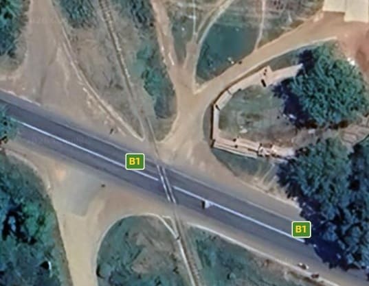
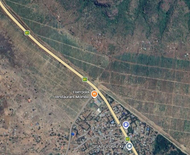
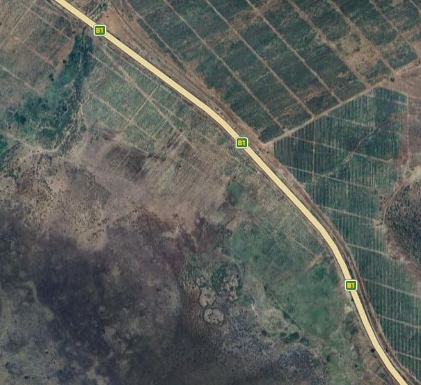
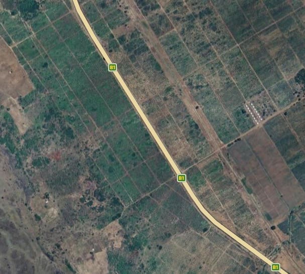
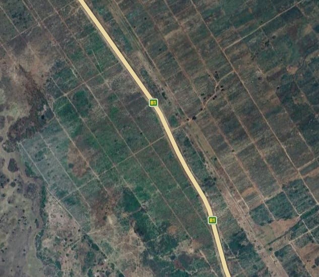
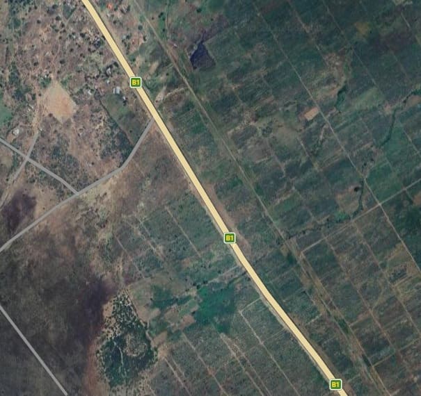
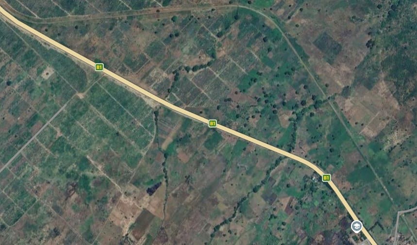
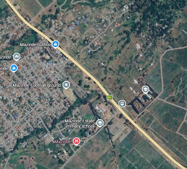
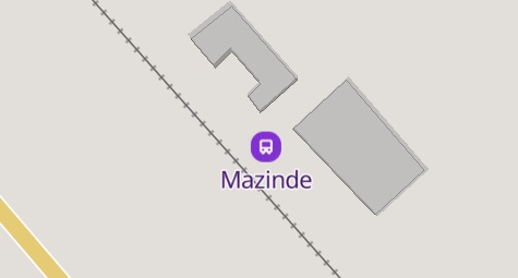
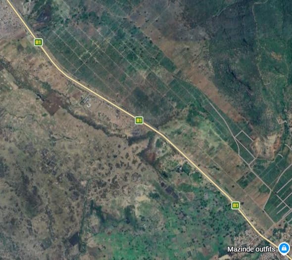
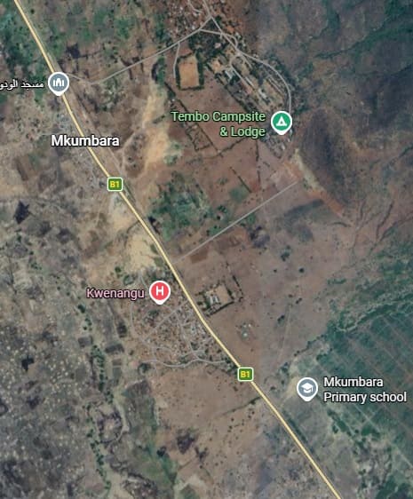
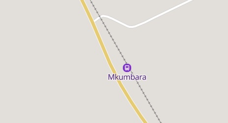
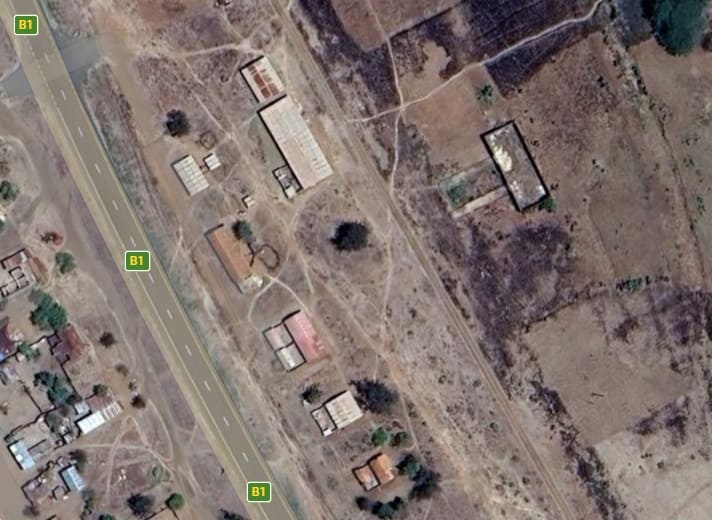
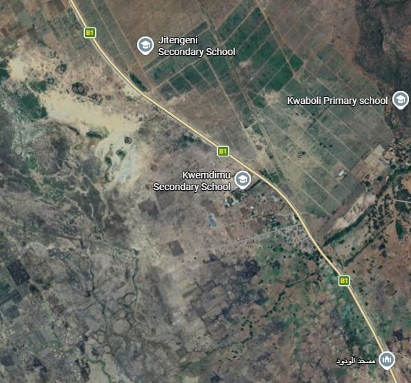
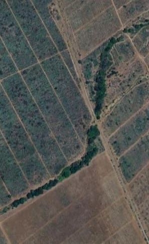
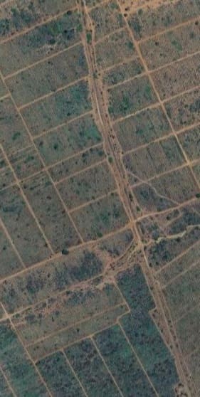
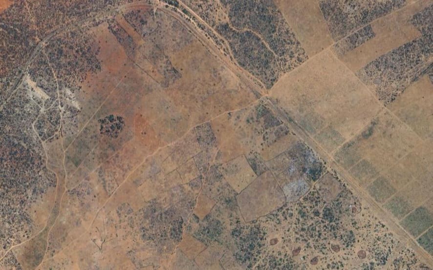
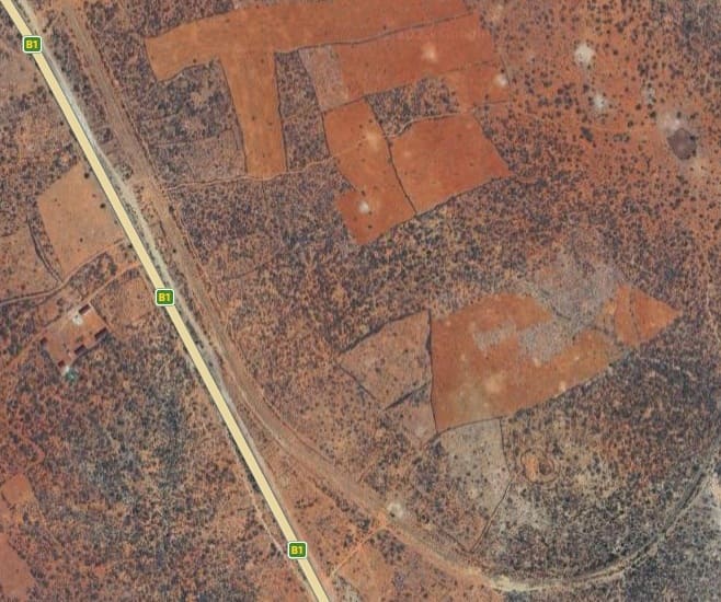
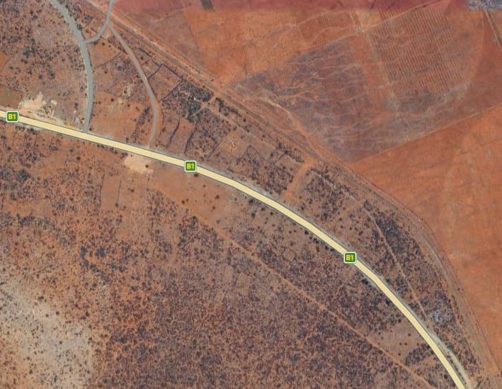
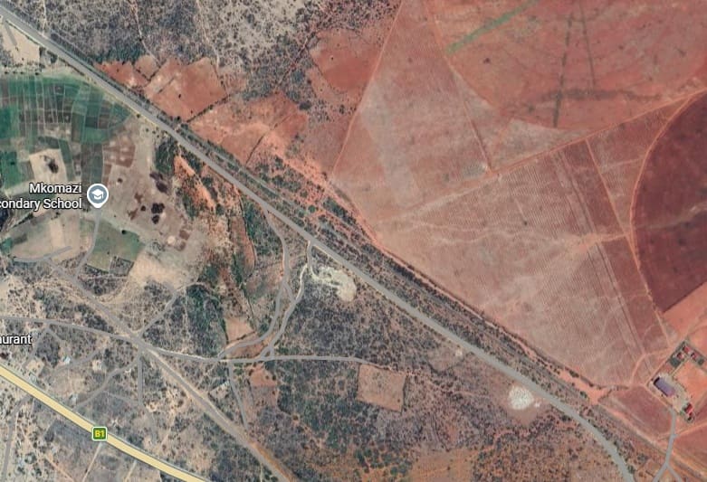
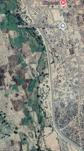
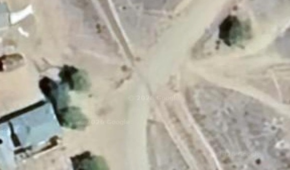
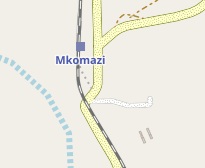
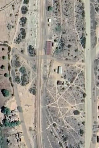
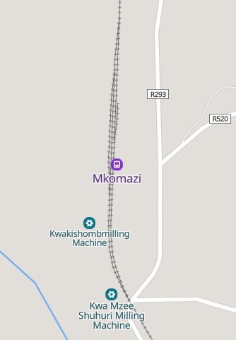
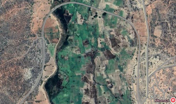
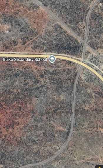
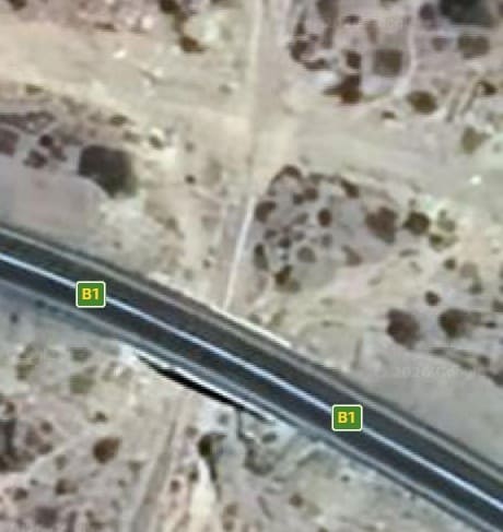
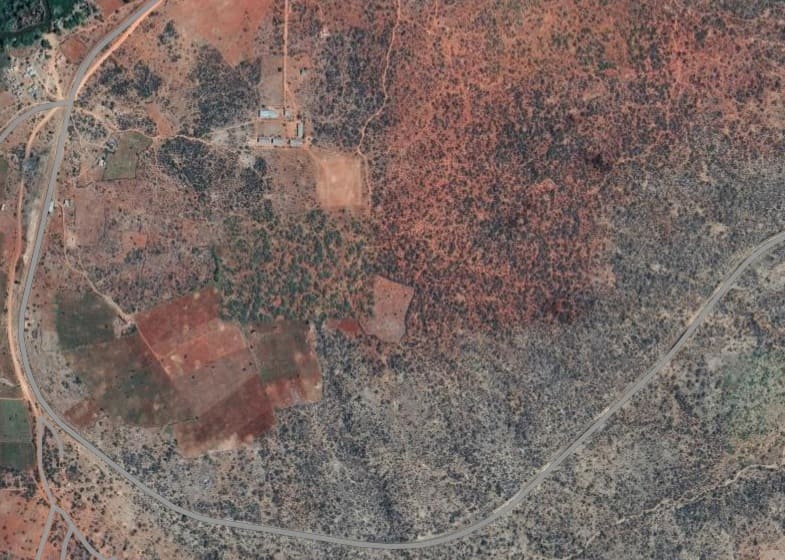
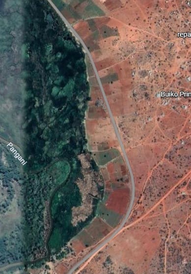
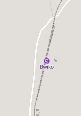
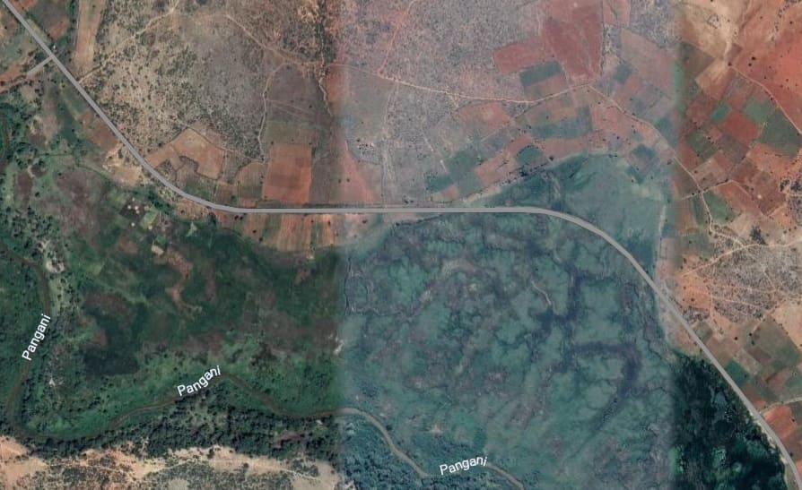
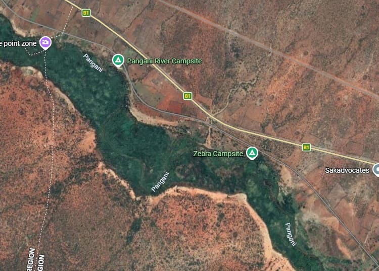
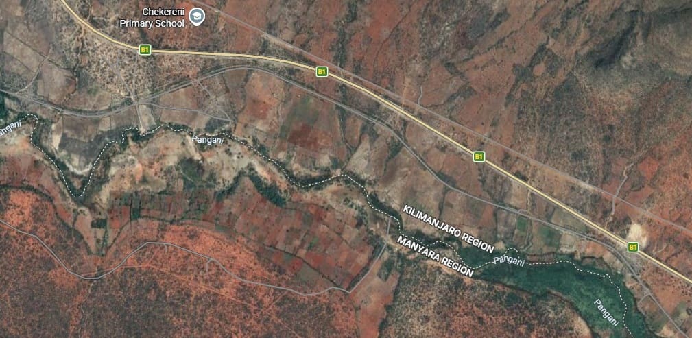
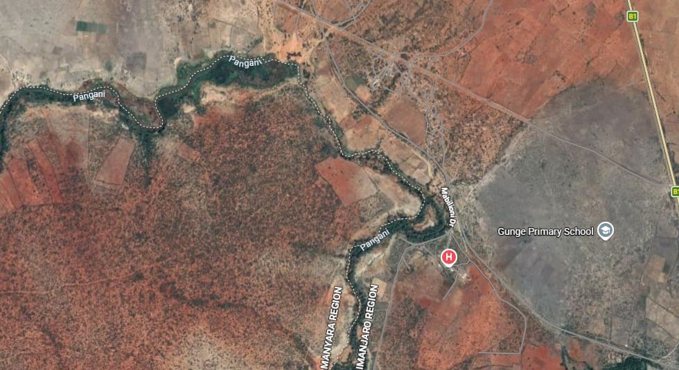
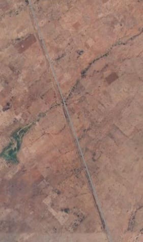
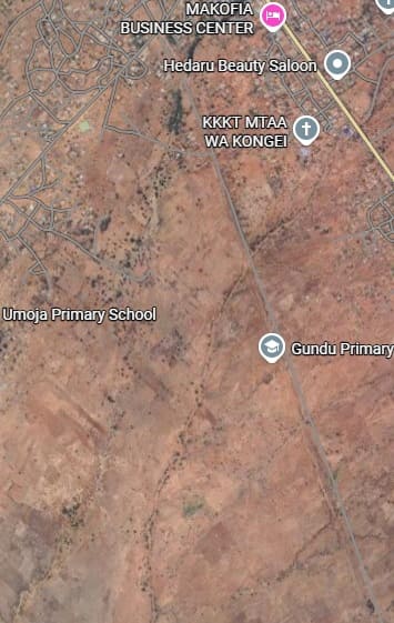
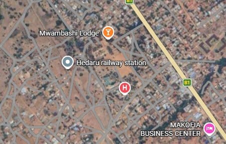
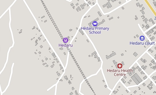
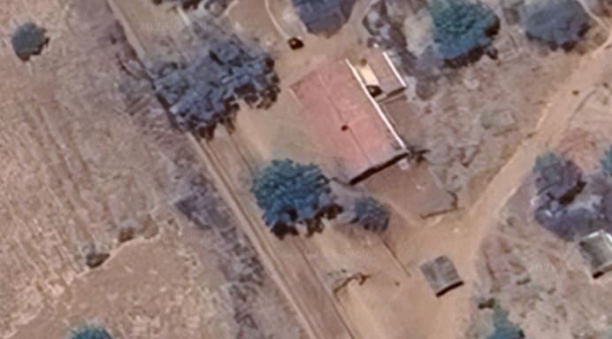
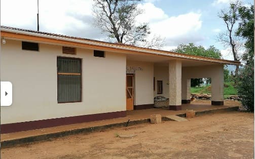
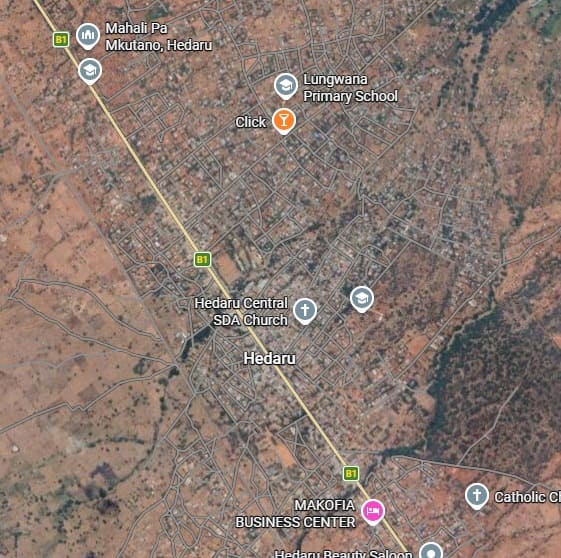
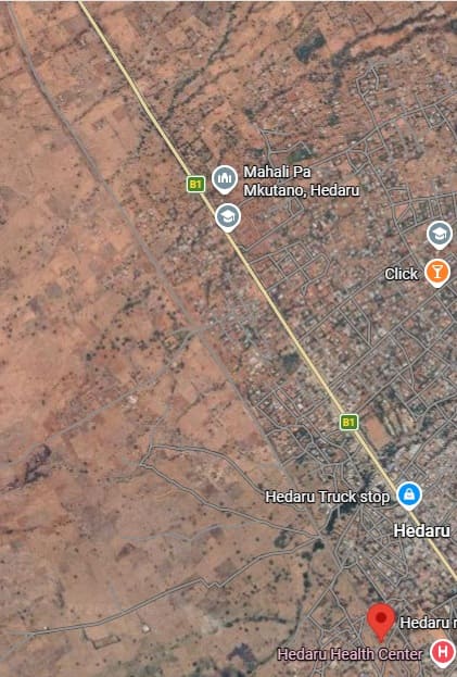
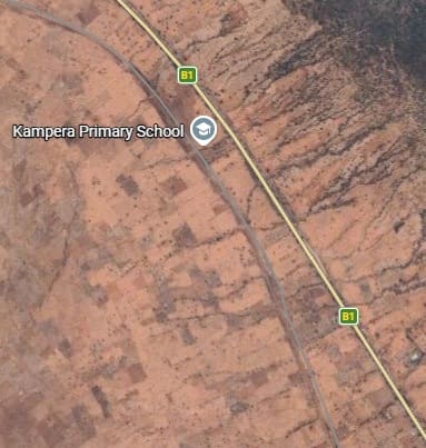
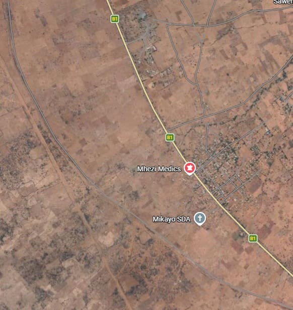
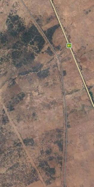
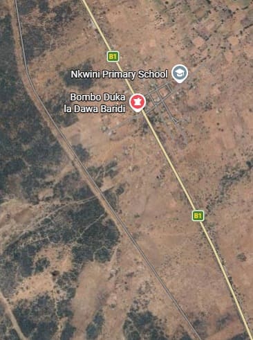
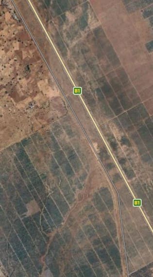
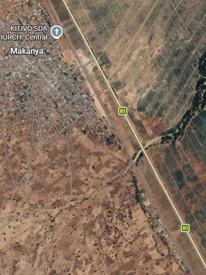
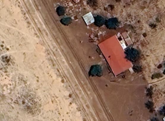
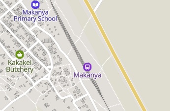
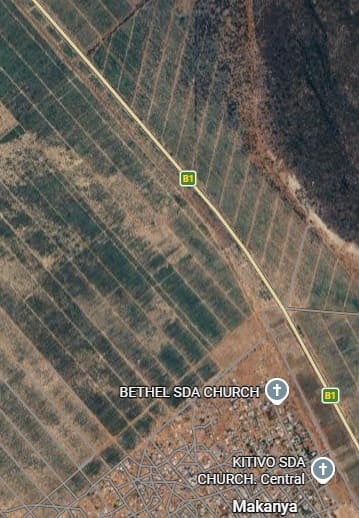
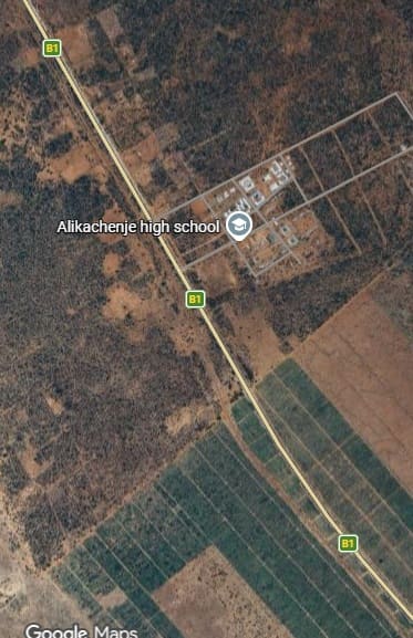
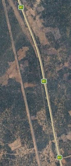
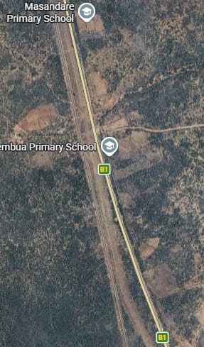
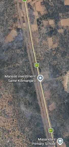
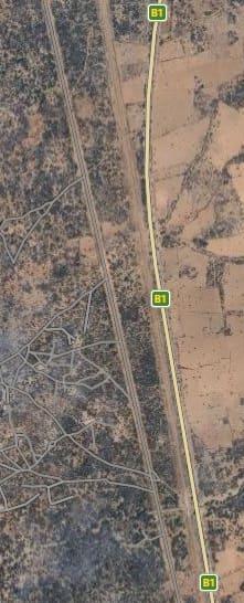
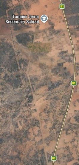
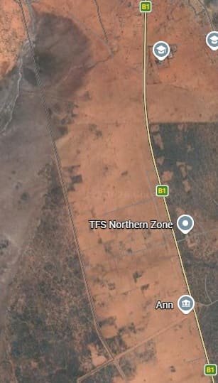
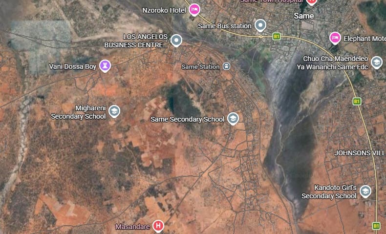
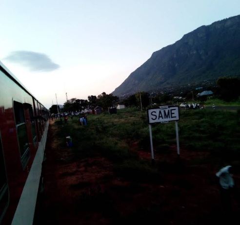
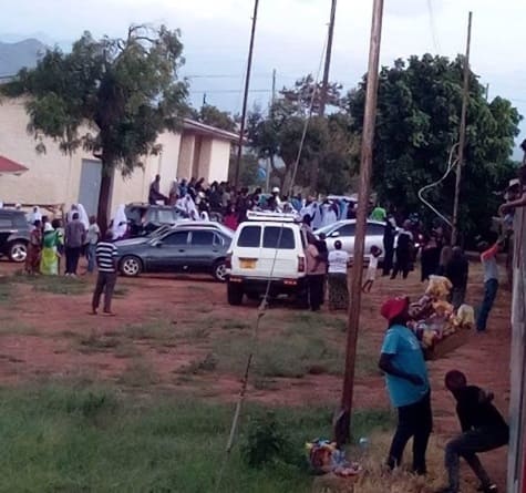
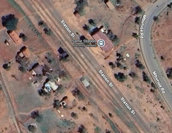
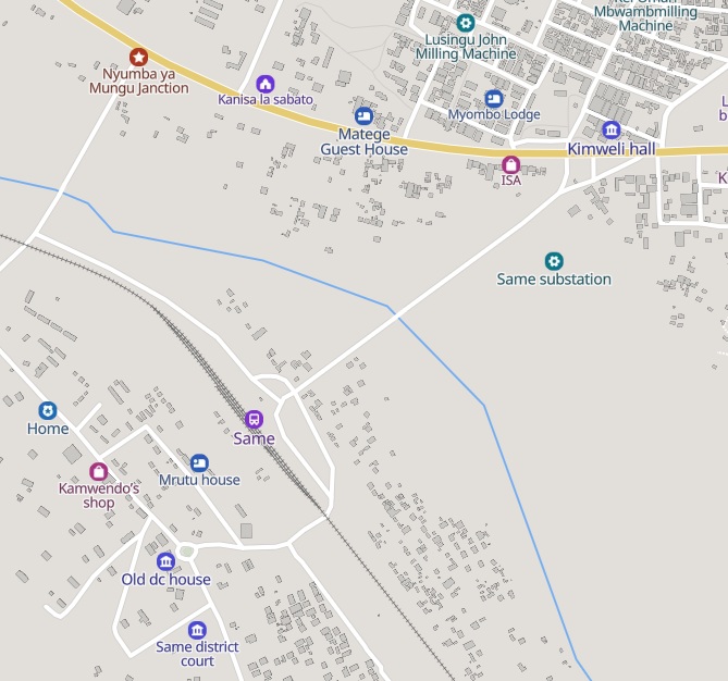
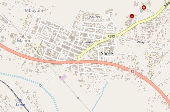
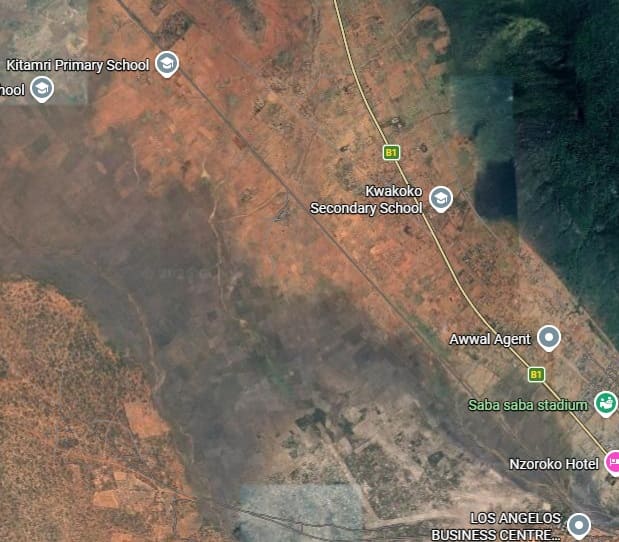
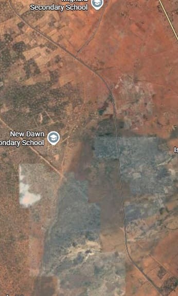
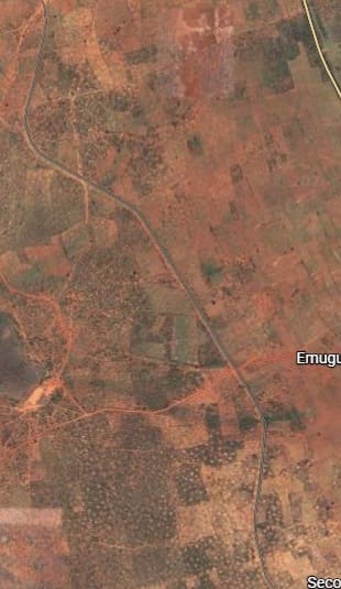
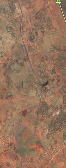
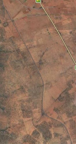
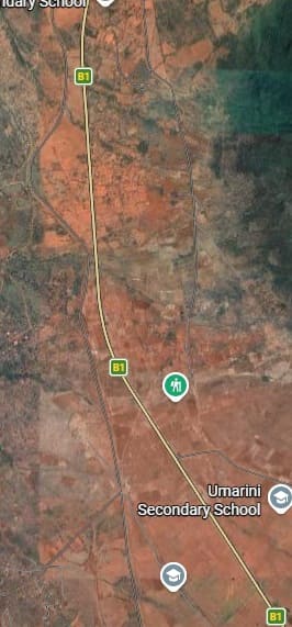
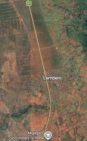
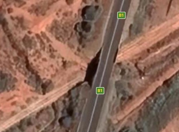
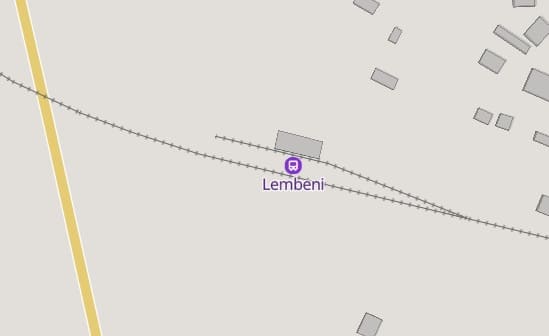
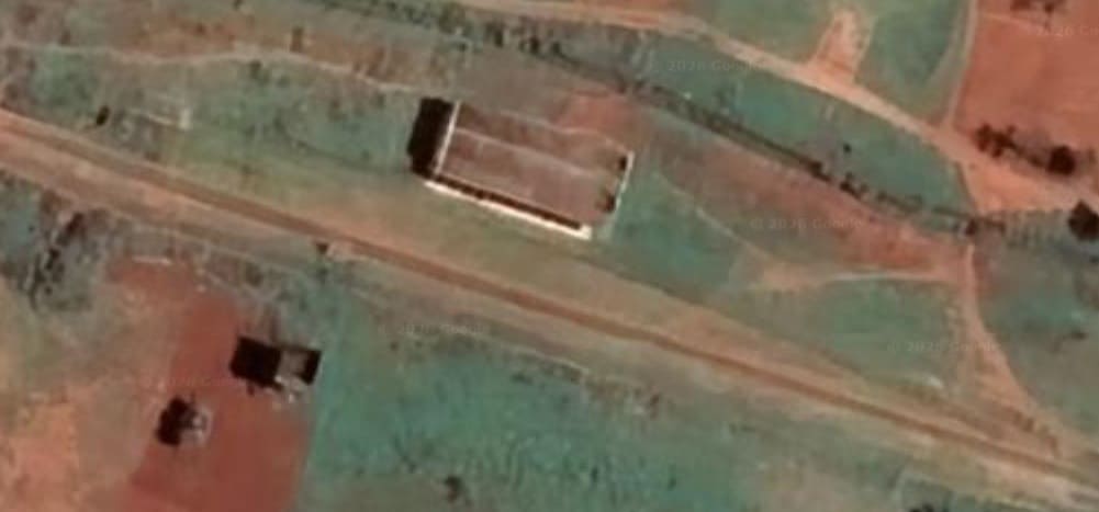
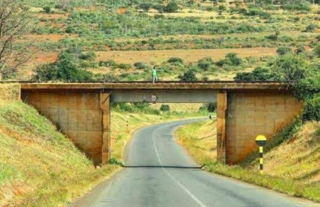
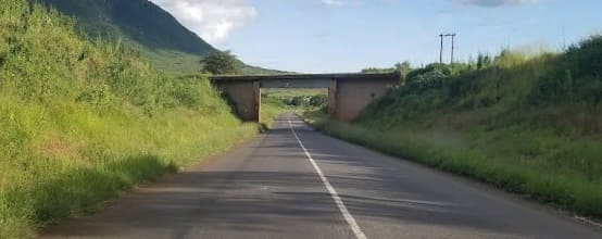
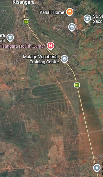
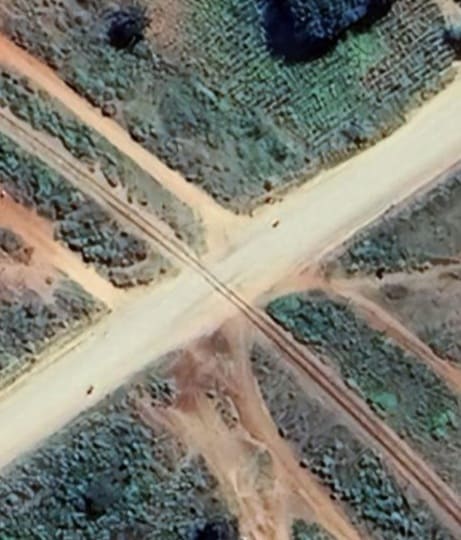
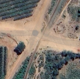
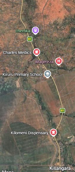
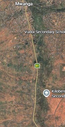
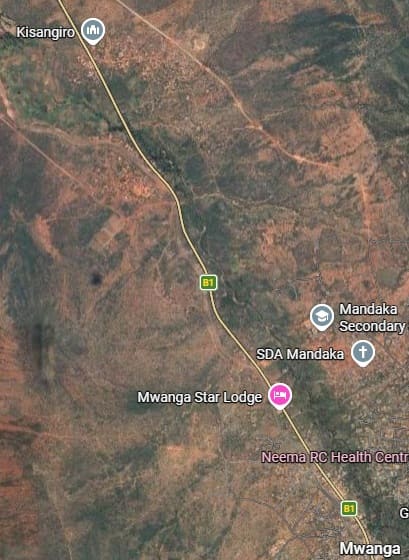
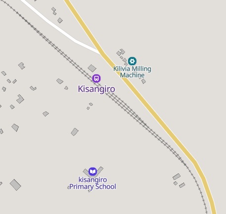
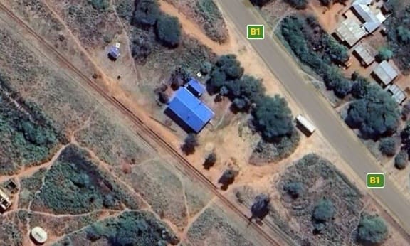
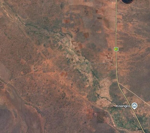
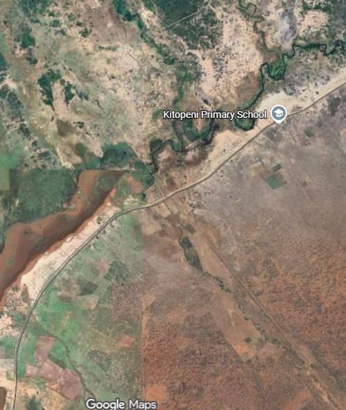
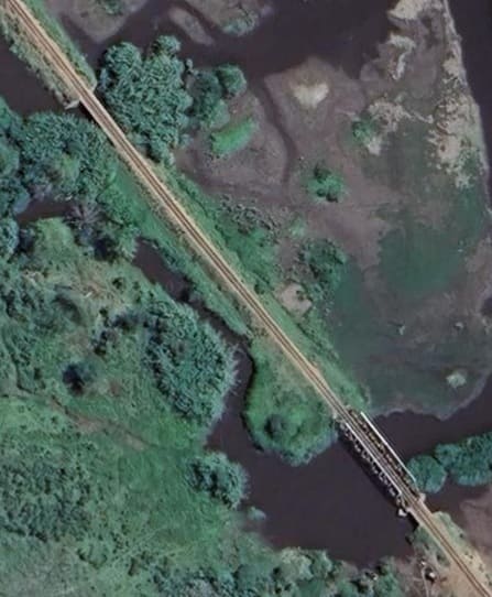
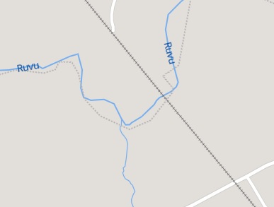
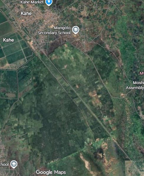

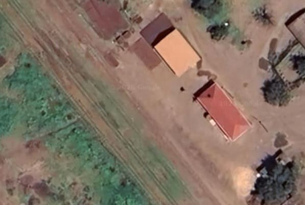
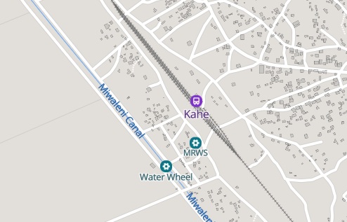
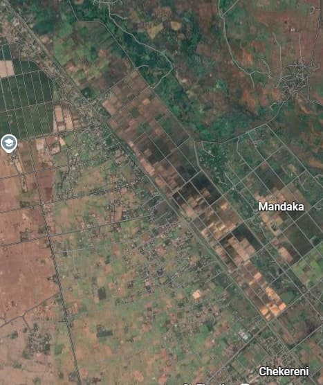
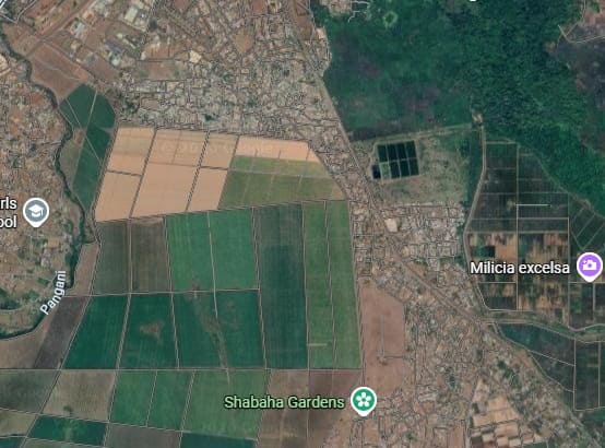
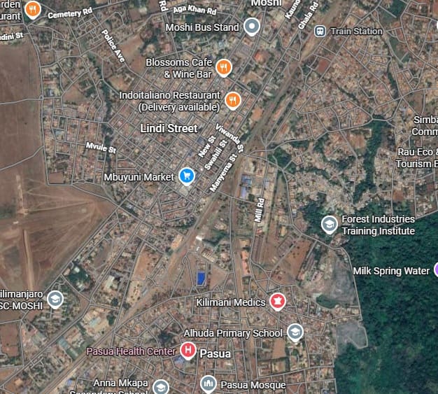
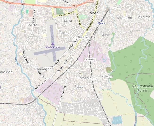
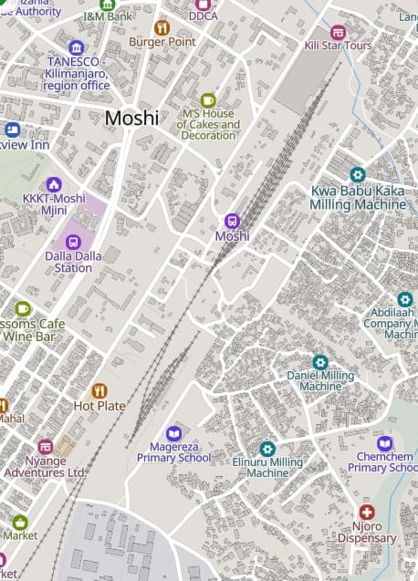
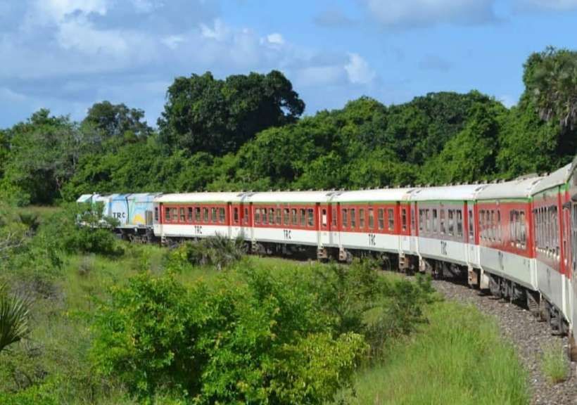
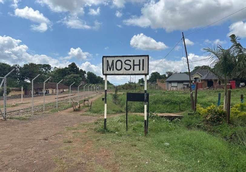
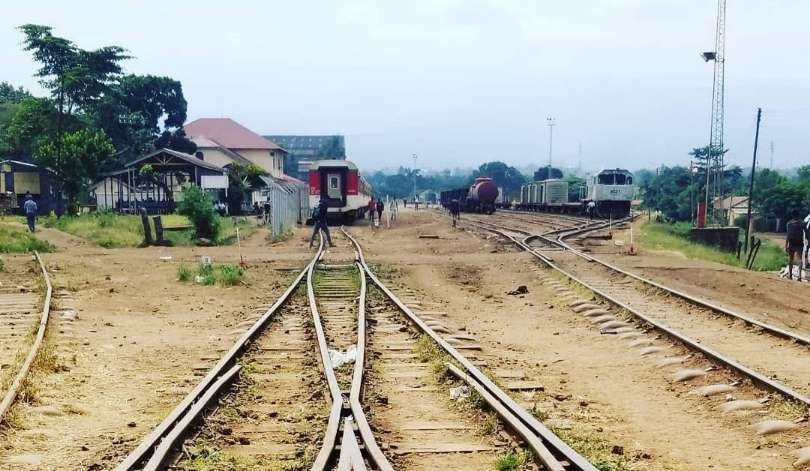
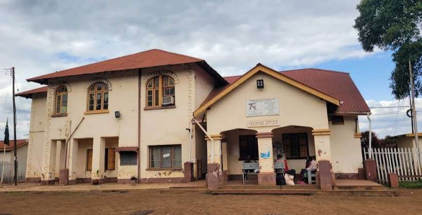
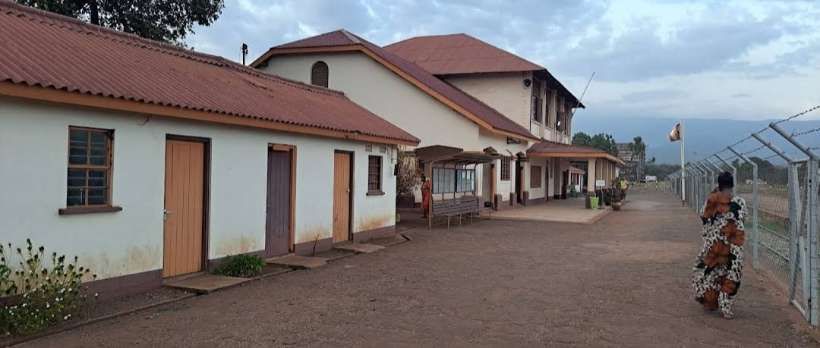
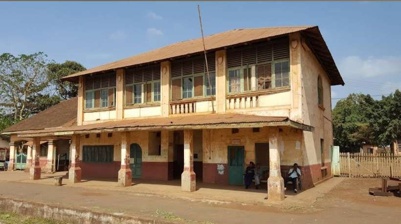
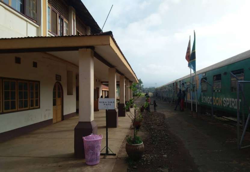
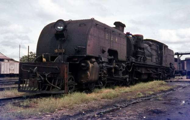
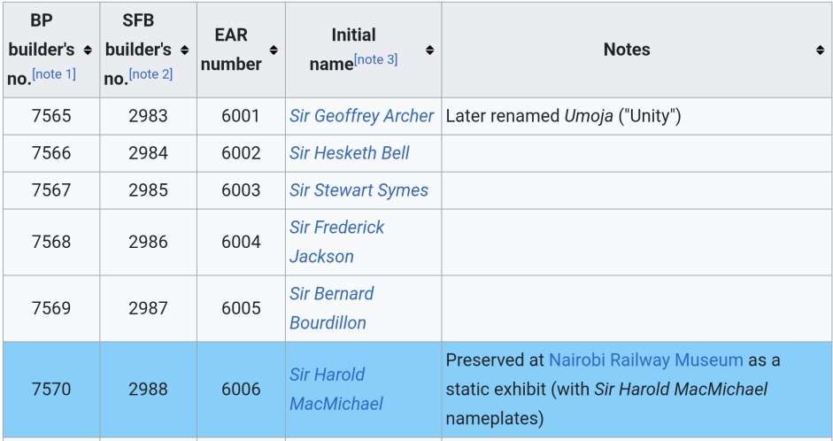
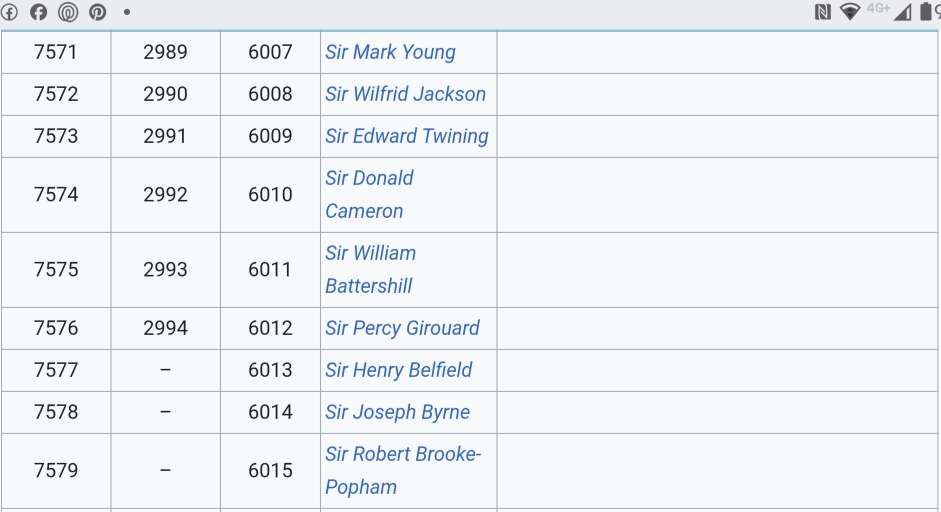
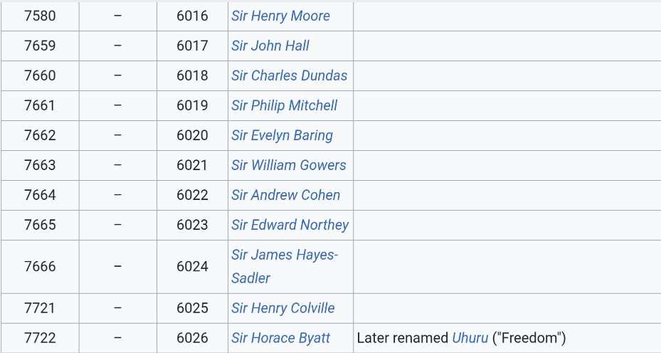
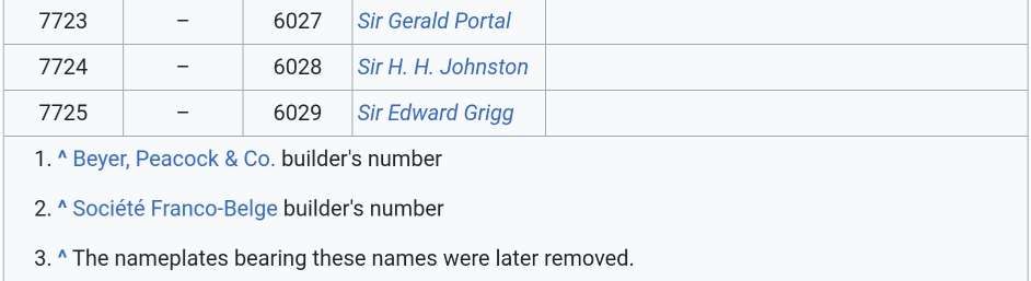
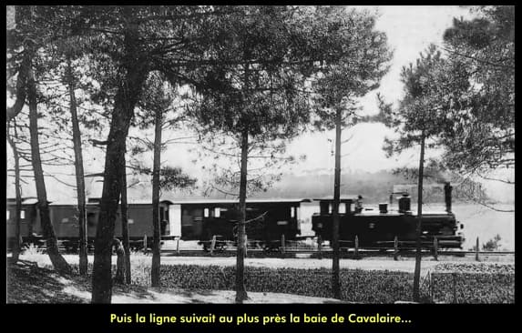
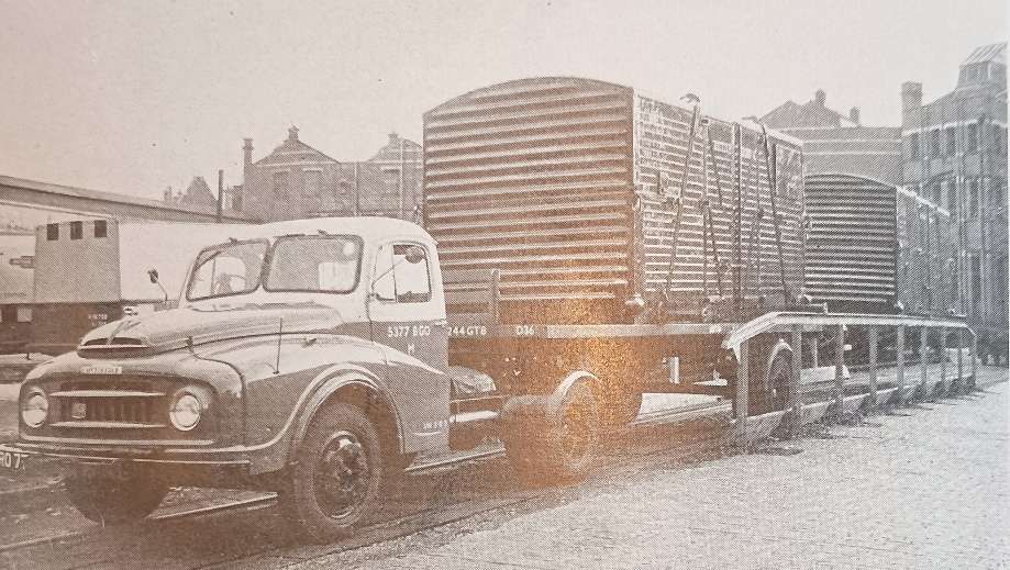
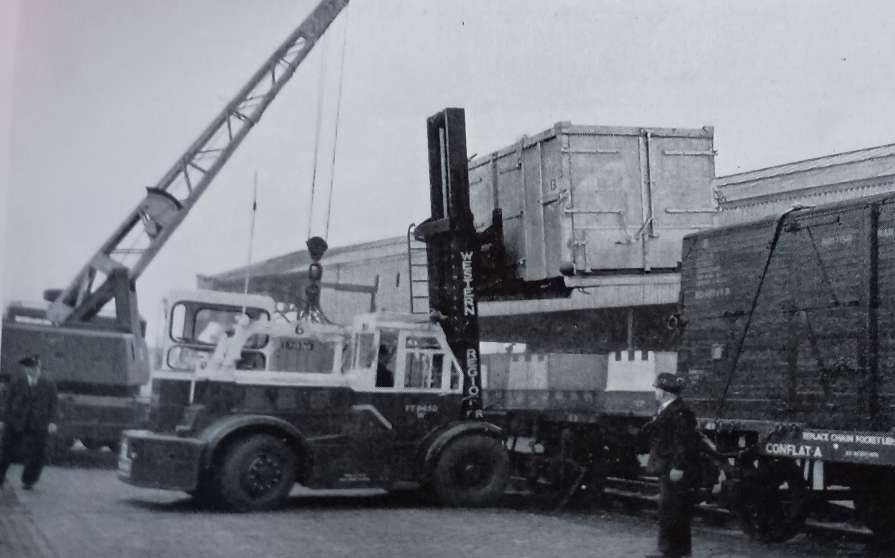
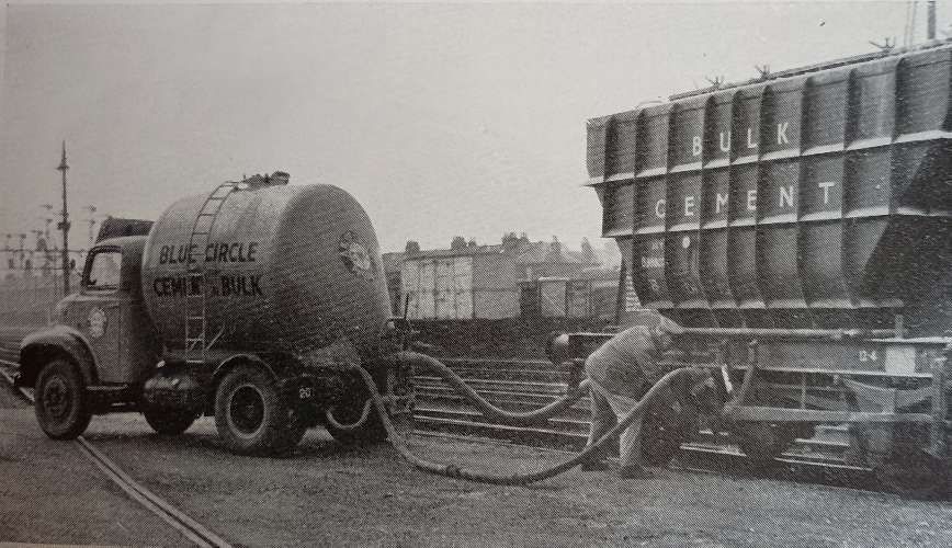
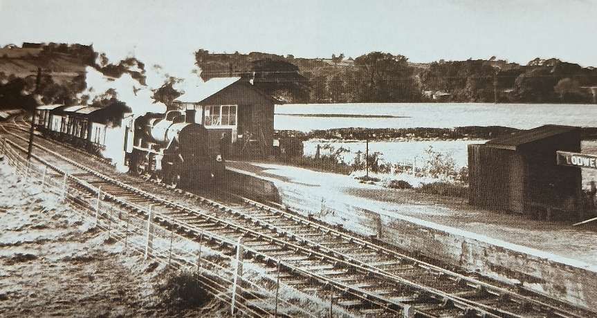
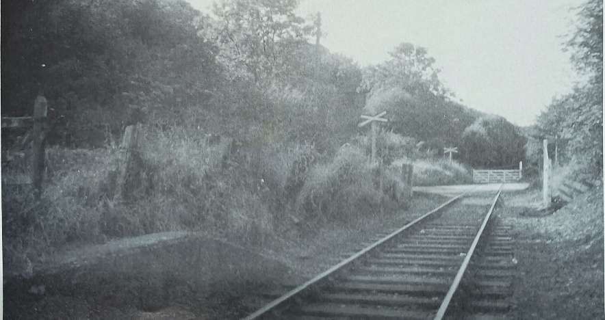
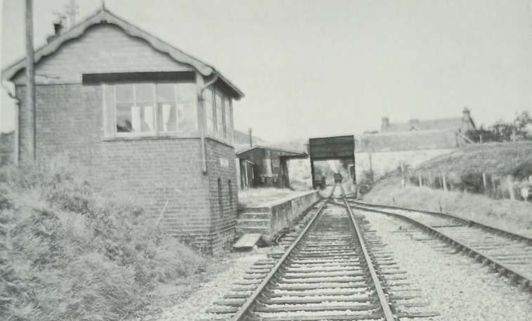
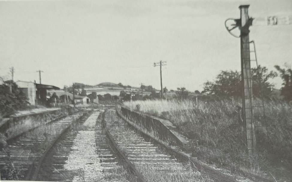
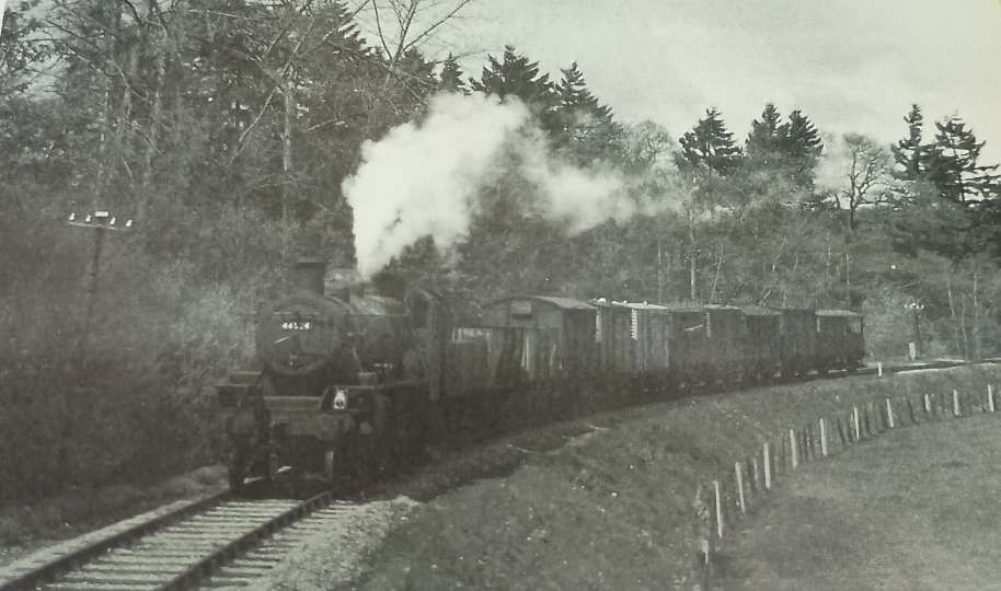
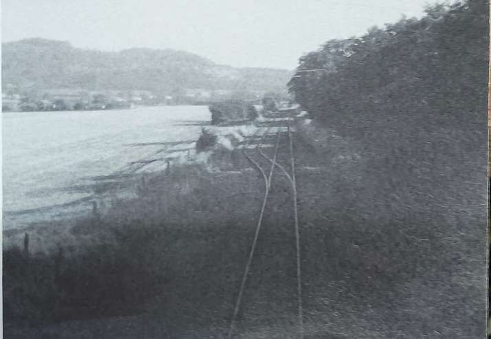
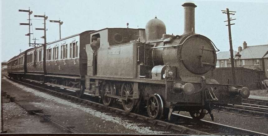
